window.__IS_SSR__=true
window.__INITIAL_STATE__={
"attachmentsReducer": {
"audio_0": {
"type": "attachments",
"id": "audio_0",
"imgSizes": {
"kqedFullSize": {
"file": "https://ww2.kqed.org/news/wp-content/themes/KQED-unified/img/audio_bgs/background0.jpg"
}
}
},
"audio_1": {
"type": "attachments",
"id": "audio_1",
"imgSizes": {
"kqedFullSize": {
"file": "https://ww2.kqed.org/news/wp-content/themes/KQED-unified/img/audio_bgs/background1.jpg"
}
}
},
"audio_2": {
"type": "attachments",
"id": "audio_2",
"imgSizes": {
"kqedFullSize": {
"file": "https://ww2.kqed.org/news/wp-content/themes/KQED-unified/img/audio_bgs/background2.jpg"
}
}
},
"audio_3": {
"type": "attachments",
"id": "audio_3",
"imgSizes": {
"kqedFullSize": {
"file": "https://ww2.kqed.org/news/wp-content/themes/KQED-unified/img/audio_bgs/background3.jpg"
}
}
},
"audio_4": {
"type": "attachments",
"id": "audio_4",
"imgSizes": {
"kqedFullSize": {
"file": "https://ww2.kqed.org/news/wp-content/themes/KQED-unified/img/audio_bgs/background4.jpg"
}
}
},
"placeholder": {
"type": "attachments",
"id": "placeholder",
"imgSizes": {
"thumbnail": {
"file": "https://cdn.kqed.org/wp-content/uploads/2024/12/KQED-Default-Image-816638274-2000x1333-1-160x107.jpg",
"width": 160,
"height": 107,
"mimeType": "image/jpeg"
},
"medium": {
"file": "https://cdn.kqed.org/wp-content/uploads/2024/12/KQED-Default-Image-816638274-2000x1333-1-800x533.jpg",
"width": 800,
"height": 533,
"mimeType": "image/jpeg"
},
"medium_large": {
"file": "https://cdn.kqed.org/wp-content/uploads/2024/12/KQED-Default-Image-816638274-2000x1333-1-768x512.jpg",
"width": 768,
"height": 512,
"mimeType": "image/jpeg"
},
"large": {
"file": "https://cdn.kqed.org/wp-content/uploads/2024/12/KQED-Default-Image-816638274-2000x1333-1-1020x680.jpg",
"width": 1020,
"height": 680,
"mimeType": "image/jpeg"
},
"1536x1536": {
"file": "https://cdn.kqed.org/wp-content/uploads/2024/12/KQED-Default-Image-816638274-2000x1333-1-1536x1024.jpg",
"width": 1536,
"height": 1024,
"mimeType": "image/jpeg"
},
"fd-lrg": {
"file": "https://cdn.kqed.org/wp-content/uploads/2024/12/KQED-Default-Image-816638274-2000x1333-1-1536x1024.jpg",
"width": 1536,
"height": 1024,
"mimeType": "image/jpeg"
},
"fd-med": {
"file": "https://cdn.kqed.org/wp-content/uploads/2024/12/KQED-Default-Image-816638274-2000x1333-1-1020x680.jpg",
"width": 1020,
"height": 680,
"mimeType": "image/jpeg"
},
"fd-sm": {
"file": "https://cdn.kqed.org/wp-content/uploads/2024/12/KQED-Default-Image-816638274-2000x1333-1-800x533.jpg",
"width": 800,
"height": 533,
"mimeType": "image/jpeg"
},
"post-thumbnail": {
"file": "https://cdn.kqed.org/wp-content/uploads/2024/12/KQED-Default-Image-816638274-2000x1333-1-672x372.jpg",
"width": 672,
"height": 372,
"mimeType": "image/jpeg"
},
"twentyfourteen-full-width": {
"file": "https://cdn.kqed.org/wp-content/uploads/2024/12/KQED-Default-Image-816638274-2000x1333-1-1038x576.jpg",
"width": 1038,
"height": 576,
"mimeType": "image/jpeg"
},
"xxsmall": {
"file": "https://cdn.kqed.org/wp-content/uploads/2024/12/KQED-Default-Image-816638274-2000x1333-1-160x107.jpg",
"width": 160,
"height": 107,
"mimeType": "image/jpeg"
},
"xsmall": {
"file": "https://cdn.kqed.org/wp-content/uploads/2024/12/KQED-Default-Image-816638274-2000x1333-1-672x372.jpg",
"width": 672,
"height": 372,
"mimeType": "image/jpeg"
},
"small": {
"file": "https://cdn.kqed.org/wp-content/uploads/2024/12/KQED-Default-Image-816638274-2000x1333-1-672x372.jpg",
"width": 672,
"height": 372,
"mimeType": "image/jpeg"
},
"xlarge": {
"file": "https://cdn.kqed.org/wp-content/uploads/2024/12/KQED-Default-Image-816638274-2000x1333-1-1020x680.jpg",
"width": 1020,
"height": 680,
"mimeType": "image/jpeg"
},
"full-width": {
"file": "https://cdn.kqed.org/wp-content/uploads/2024/12/KQED-Default-Image-816638274-2000x1333-1-1920x1280.jpg",
"width": 1920,
"height": 1280,
"mimeType": "image/jpeg"
},
"guest-author-32": {
"file": "https://cdn.kqed.org/wp-content/uploads/2025/01/KQED-Default-Image-816638274-1333x1333-1-160x160.jpg",
"width": 32,
"height": 32,
"mimeType": "image/jpeg"
},
"guest-author-50": {
"file": "https://cdn.kqed.org/wp-content/uploads/2025/01/KQED-Default-Image-816638274-1333x1333-1-160x160.jpg",
"width": 50,
"height": 50,
"mimeType": "image/jpeg"
},
"guest-author-64": {
"file": "https://cdn.kqed.org/wp-content/uploads/2025/01/KQED-Default-Image-816638274-1333x1333-1-160x160.jpg",
"width": 64,
"height": 64,
"mimeType": "image/jpeg"
},
"guest-author-96": {
"file": "https://cdn.kqed.org/wp-content/uploads/2025/01/KQED-Default-Image-816638274-1333x1333-1-160x160.jpg",
"width": 96,
"height": 96,
"mimeType": "image/jpeg"
},
"guest-author-128": {
"file": "https://cdn.kqed.org/wp-content/uploads/2025/01/KQED-Default-Image-816638274-1333x1333-1-160x160.jpg",
"width": 128,
"height": 128,
"mimeType": "image/jpeg"
},
"detail": {
"file": "https://cdn.kqed.org/wp-content/uploads/2025/01/KQED-Default-Image-816638274-1333x1333-1-160x160.jpg",
"width": 160,
"height": 160,
"mimeType": "image/jpeg"
},
"kqedFullSize": {
"file": "https://cdn.kqed.org/wp-content/uploads/2024/12/KQED-Default-Image-816638274-2000x1333-1.jpg",
"width": 2000,
"height": 1333
}
}
},
"news_11616200": {
"type": "attachments",
"id": "news_11616200",
"meta": {
"index": "attachments_1716263798",
"site": "news",
"id": "11616200",
"found": true
},
"parent": 11616199,
"imgSizes": {
"small": {
"file": "https://ww2.kqed.org/app/uploads/sites/10/2017/09/responder_091017_final-520x520.jpg",
"width": 520,
"mimeType": "image/jpeg",
"height": 520
},
"twentyfourteen-full-width": {
"file": "https://ww2.kqed.org/app/uploads/sites/10/2017/09/responder_091017_final-1038x576.jpg",
"width": 1038,
"mimeType": "image/jpeg",
"height": 576
},
"thumbnail": {
"file": "https://ww2.kqed.org/app/uploads/sites/10/2017/09/responder_091017_final-160x160.jpg",
"width": 160,
"mimeType": "image/jpeg",
"height": 160
},
"fd-sm": {
"file": "https://ww2.kqed.org/app/uploads/sites/10/2017/09/responder_091017_final-960x960.jpg",
"width": 960,
"mimeType": "image/jpeg",
"height": 960
},
"post-thumbnail": {
"file": "https://ww2.kqed.org/app/uploads/sites/10/2017/09/responder_091017_final-672x372.jpg",
"width": 672,
"mimeType": "image/jpeg",
"height": 372
},
"xsmall": {
"file": "https://ww2.kqed.org/app/uploads/sites/10/2017/09/responder_091017_final-375x375.jpg",
"width": 375,
"mimeType": "image/jpeg",
"height": 375
},
"kqedFullSize": {
"file": "https://ww2.kqed.org/app/uploads/sites/10/2017/09/responder_091017_final.jpg",
"width": 1920,
"height": 1920
},
"large": {
"file": "https://ww2.kqed.org/app/uploads/sites/10/2017/09/responder_091017_final-1020x1020.jpg",
"width": 1020,
"mimeType": "image/jpeg",
"height": 1020
},
"xlarge": {
"file": "https://ww2.kqed.org/app/uploads/sites/10/2017/09/responder_091017_final-1180x1180.jpg",
"width": 1180,
"mimeType": "image/jpeg",
"height": 1180
},
"guest-author-50": {
"file": "https://ww2.kqed.org/app/uploads/sites/10/2017/09/responder_091017_final-50x50.jpg",
"width": 50,
"mimeType": "image/jpeg",
"height": 50
},
"guest-author-96": {
"file": "https://ww2.kqed.org/app/uploads/sites/10/2017/09/responder_091017_final-96x96.jpg",
"width": 96,
"mimeType": "image/jpeg",
"height": 96
},
"medium": {
"file": "https://ww2.kqed.org/app/uploads/sites/10/2017/09/responder_091017_final-800x800.jpg",
"width": 800,
"mimeType": "image/jpeg",
"height": 800
},
"guest-author-64": {
"file": "https://ww2.kqed.org/app/uploads/sites/10/2017/09/responder_091017_final-64x64.jpg",
"width": 64,
"mimeType": "image/jpeg",
"height": 64
},
"guest-author-32": {
"file": "https://ww2.kqed.org/app/uploads/sites/10/2017/09/responder_091017_final-32x32.jpg",
"width": 32,
"mimeType": "image/jpeg",
"height": 32
},
"fd-lrg": {
"file": "https://ww2.kqed.org/app/uploads/sites/10/2017/09/responder_091017_final-1920x1920.jpg",
"width": 1920,
"mimeType": "image/jpeg",
"height": 1920
},
"fd-med": {
"file": "https://ww2.kqed.org/app/uploads/sites/10/2017/09/responder_091017_final-1180x1180.jpg",
"width": 1180,
"mimeType": "image/jpeg",
"height": 1180
},
"full-width": {
"file": "https://ww2.kqed.org/app/uploads/sites/10/2017/09/responder_091017_final-1920x1920.jpg",
"width": 1920,
"mimeType": "image/jpeg",
"height": 1920
},
"detail": {
"file": "https://ww2.kqed.org/app/uploads/sites/10/2017/09/responder_091017_final-150x150.jpg",
"width": 150,
"mimeType": "image/jpeg",
"height": 150
},
"guest-author-128": {
"file": "https://ww2.kqed.org/app/uploads/sites/10/2017/09/responder_091017_final-128x128.jpg",
"width": 128,
"mimeType": "image/jpeg",
"height": 128
},
"xxsmall": {
"file": "https://ww2.kqed.org/app/uploads/sites/10/2017/09/responder_091017_final-240x240.jpg",
"width": 240,
"mimeType": "image/jpeg",
"height": 240
}
},
"publishDate": 1505100805,
"modified": 1505100850,
"caption": null,
"description": null,
"title": "responder_091017_final",
"credit": null,
"status": "inherit",
"isLoading": false,
"fetchFailed": false
},
"news_11615844": {
"type": "attachments",
"id": "news_11615844",
"meta": {
"index": "attachments_1716263798",
"site": "news",
"id": "11615844",
"found": true
},
"parent": 11615835,
"imgSizes": {
"small": {
"file": "https://ww2.kqed.org/app/uploads/sites/10/2017/09/RS26476_Edited-Firefighters-qut-520x347.jpg",
"width": 520,
"mimeType": "image/jpeg",
"height": 347
},
"twentyfourteen-full-width": {
"file": "https://ww2.kqed.org/app/uploads/sites/10/2017/09/RS26476_Edited-Firefighters-qut-1038x576.jpg",
"width": 1038,
"mimeType": "image/jpeg",
"height": 576
},
"thumbnail": {
"file": "https://ww2.kqed.org/app/uploads/sites/10/2017/09/RS26476_Edited-Firefighters-qut-160x107.jpg",
"width": 160,
"mimeType": "image/jpeg",
"height": 107
},
"fd-sm": {
"file": "https://ww2.kqed.org/app/uploads/sites/10/2017/09/RS26476_Edited-Firefighters-qut-960x640.jpg",
"width": 960,
"mimeType": "image/jpeg",
"height": 640
},
"post-thumbnail": {
"file": "https://ww2.kqed.org/app/uploads/sites/10/2017/09/RS26476_Edited-Firefighters-qut-672x372.jpg",
"width": 672,
"mimeType": "image/jpeg",
"height": 372
},
"xsmall": {
"file": "https://ww2.kqed.org/app/uploads/sites/10/2017/09/RS26476_Edited-Firefighters-qut-375x250.jpg",
"width": 375,
"mimeType": "image/jpeg",
"height": 250
},
"kqedFullSize": {
"file": "https://ww2.kqed.org/app/uploads/sites/10/2017/09/RS26476_Edited-Firefighters-qut.jpg",
"width": 1920,
"height": 1280
},
"large": {
"file": "https://ww2.kqed.org/app/uploads/sites/10/2017/09/RS26476_Edited-Firefighters-qut-1020x680.jpg",
"width": 1020,
"mimeType": "image/jpeg",
"height": 680
},
"xlarge": {
"file": "https://ww2.kqed.org/app/uploads/sites/10/2017/09/RS26476_Edited-Firefighters-qut-1180x787.jpg",
"width": 1180,
"mimeType": "image/jpeg",
"height": 787
},
"guest-author-50": {
"file": "https://ww2.kqed.org/app/uploads/sites/10/2017/09/RS26476_Edited-Firefighters-qut-50x50.jpg",
"width": 50,
"mimeType": "image/jpeg",
"height": 50
},
"guest-author-96": {
"file": "https://ww2.kqed.org/app/uploads/sites/10/2017/09/RS26476_Edited-Firefighters-qut-96x96.jpg",
"width": 96,
"mimeType": "image/jpeg",
"height": 96
},
"medium": {
"file": "https://ww2.kqed.org/app/uploads/sites/10/2017/09/RS26476_Edited-Firefighters-qut-800x533.jpg",
"width": 800,
"mimeType": "image/jpeg",
"height": 533
},
"guest-author-64": {
"file": "https://ww2.kqed.org/app/uploads/sites/10/2017/09/RS26476_Edited-Firefighters-qut-64x64.jpg",
"width": 64,
"mimeType": "image/jpeg",
"height": 64
},
"guest-author-32": {
"file": "https://ww2.kqed.org/app/uploads/sites/10/2017/09/RS26476_Edited-Firefighters-qut-32x32.jpg",
"width": 32,
"mimeType": "image/jpeg",
"height": 32
},
"fd-lrg": {
"file": "https://ww2.kqed.org/app/uploads/sites/10/2017/09/RS26476_Edited-Firefighters-qut-1920x1280.jpg",
"width": 1920,
"mimeType": "image/jpeg",
"height": 1280
},
"fd-med": {
"file": "https://ww2.kqed.org/app/uploads/sites/10/2017/09/RS26476_Edited-Firefighters-qut-1180x787.jpg",
"width": 1180,
"mimeType": "image/jpeg",
"height": 787
},
"full-width": {
"file": "https://ww2.kqed.org/app/uploads/sites/10/2017/09/RS26476_Edited-Firefighters-qut-1920x1280.jpg",
"width": 1920,
"mimeType": "image/jpeg",
"height": 1280
},
"detail": {
"file": "https://ww2.kqed.org/app/uploads/sites/10/2017/09/RS26476_Edited-Firefighters-qut-150x150.jpg",
"width": 150,
"mimeType": "image/jpeg",
"height": 150
},
"guest-author-128": {
"file": "https://ww2.kqed.org/app/uploads/sites/10/2017/09/RS26476_Edited-Firefighters-qut-128x128.jpg",
"width": 128,
"mimeType": "image/jpeg",
"height": 128
},
"xxsmall": {
"file": "https://ww2.kqed.org/app/uploads/sites/10/2017/09/RS26476_Edited-Firefighters-qut-240x160.jpg",
"width": 240,
"mimeType": "image/jpeg",
"height": 160
}
},
"publishDate": 1504813267,
"modified": 1504813300,
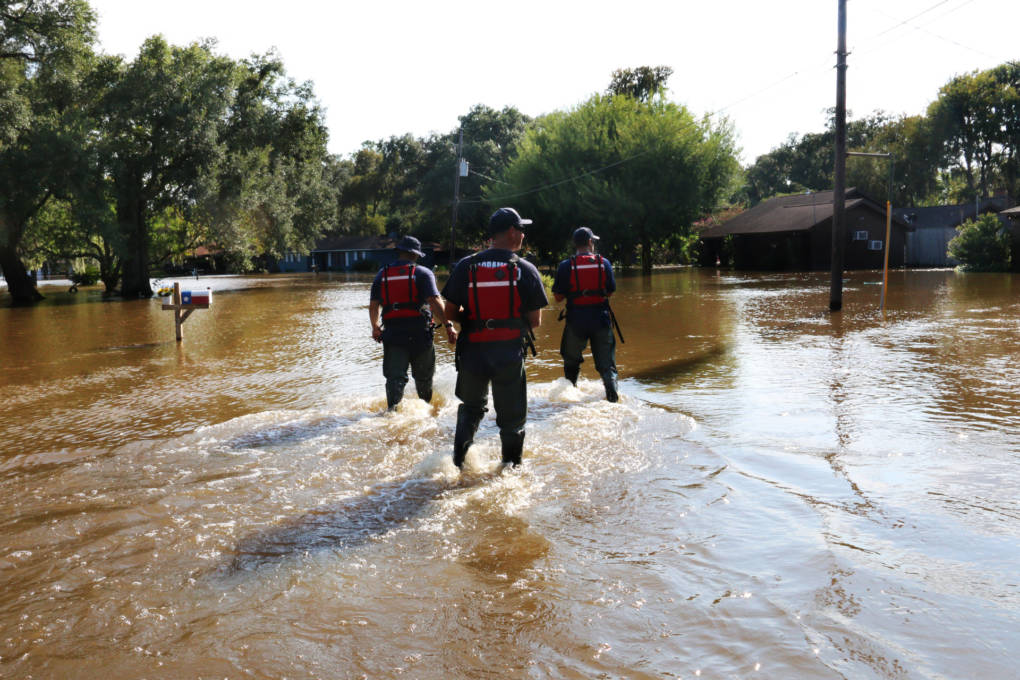
"caption": "(From Left) Scott Lewis, Mike Wolfe and Dave Lauchner, members of Urban Search and Rescue California Task Force 7 and the Sacramento Fire Department, walk through Richwood, Texas, on Sept. 3, 2017. Richwood is one of many rural communities that continue to see major flooding over a week after Hurricane Harvey hit Texas.",
"description": "(From Left) Scott Lewis, Mike Wolfe and Dave Lauchner, members of Urban Search and Rescue California Task Force 7 and the Sacramento Fire Department, walk through Richwood, Texas, on Sept. 3, 2017. Richwood is one of many rural communities that continue to see major flooding over a week after Hurricane Harvey hit Texas.",
"title": "RS26476_Edited Firefighters-qut",
"credit": "Alex Emslie/KQED",
"status": "inherit",
"isLoading": false,
"fetchFailed": false
},
"news_11616067": {
"type": "attachments",
"id": "news_11616067",
"meta": {
"index": "attachments_1716263798",
"site": "news",
"id": "11616067",
"found": true
},
"parent": 11616062,
"imgSizes": {
"small": {
"file": "https://ww2.kqed.org/app/uploads/sites/10/2017/09/hurriquake_090817_final-520x520.jpg",
"width": 520,
"mimeType": "image/jpeg",
"height": 520
},
"twentyfourteen-full-width": {
"file": "https://ww2.kqed.org/app/uploads/sites/10/2017/09/hurriquake_090817_final-1038x576.jpg",
"width": 1038,
"mimeType": "image/jpeg",
"height": 576
},
"thumbnail": {
"file": "https://ww2.kqed.org/app/uploads/sites/10/2017/09/hurriquake_090817_final-160x160.jpg",
"width": 160,
"mimeType": "image/jpeg",
"height": 160
},
"fd-sm": {
"file": "https://ww2.kqed.org/app/uploads/sites/10/2017/09/hurriquake_090817_final-960x960.jpg",
"width": 960,
"mimeType": "image/jpeg",
"height": 960
},
"post-thumbnail": {
"file": "https://ww2.kqed.org/app/uploads/sites/10/2017/09/hurriquake_090817_final-672x372.jpg",
"width": 672,
"mimeType": "image/jpeg",
"height": 372
},
"xsmall": {
"file": "https://ww2.kqed.org/app/uploads/sites/10/2017/09/hurriquake_090817_final-375x375.jpg",
"width": 375,
"mimeType": "image/jpeg",
"height": 375
},
"kqedFullSize": {
"file": "https://ww2.kqed.org/app/uploads/sites/10/2017/09/hurriquake_090817_final.jpg",
"width": 1920,
"height": 1920
},
"large": {
"file": "https://ww2.kqed.org/app/uploads/sites/10/2017/09/hurriquake_090817_final-1020x1020.jpg",
"width": 1020,
"mimeType": "image/jpeg",
"height": 1020
},
"xlarge": {
"file": "https://ww2.kqed.org/app/uploads/sites/10/2017/09/hurriquake_090817_final-1180x1180.jpg",
"width": 1180,
"mimeType": "image/jpeg",
"height": 1180
},
"guest-author-50": {
"file": "https://ww2.kqed.org/app/uploads/sites/10/2017/09/hurriquake_090817_final-50x50.jpg",
"width": 50,
"mimeType": "image/jpeg",
"height": 50
},
"guest-author-96": {
"file": "https://ww2.kqed.org/app/uploads/sites/10/2017/09/hurriquake_090817_final-96x96.jpg",
"width": 96,
"mimeType": "image/jpeg",
"height": 96
},
"medium": {
"file": "https://ww2.kqed.org/app/uploads/sites/10/2017/09/hurriquake_090817_final-800x800.jpg",
"width": 800,
"mimeType": "image/jpeg",
"height": 800
},
"guest-author-64": {
"file": "https://ww2.kqed.org/app/uploads/sites/10/2017/09/hurriquake_090817_final-64x64.jpg",
"width": 64,
"mimeType": "image/jpeg",
"height": 64
},
"guest-author-32": {
"file": "https://ww2.kqed.org/app/uploads/sites/10/2017/09/hurriquake_090817_final-32x32.jpg",
"width": 32,
"mimeType": "image/jpeg",
"height": 32
},
"fd-lrg": {
"file": "https://ww2.kqed.org/app/uploads/sites/10/2017/09/hurriquake_090817_final-1920x1920.jpg",
"width": 1920,
"mimeType": "image/jpeg",
"height": 1920
},
"fd-med": {
"file": "https://ww2.kqed.org/app/uploads/sites/10/2017/09/hurriquake_090817_final-1180x1180.jpg",
"width": 1180,
"mimeType": "image/jpeg",
"height": 1180
},
"full-width": {
"file": "https://ww2.kqed.org/app/uploads/sites/10/2017/09/hurriquake_090817_final-1920x1920.jpg",
"width": 1920,
"mimeType": "image/jpeg",
"height": 1920
},
"detail": {
"file": "https://ww2.kqed.org/app/uploads/sites/10/2017/09/hurriquake_090817_final-150x150.jpg",
"width": 150,
"mimeType": "image/jpeg",
"height": 150
},
"guest-author-128": {
"file": "https://ww2.kqed.org/app/uploads/sites/10/2017/09/hurriquake_090817_final-128x128.jpg",
"width": 128,
"mimeType": "image/jpeg",
"height": 128
},
"xxsmall": {
"file": "https://ww2.kqed.org/app/uploads/sites/10/2017/09/hurriquake_090817_final-240x240.jpg",
"width": 240,
"mimeType": "image/jpeg",
"height": 240
}
},
"publishDate": 1504901395,
"modified": 1504901424,
"caption": null,
"description": null,
"title": "hurriquake_090817_final",
"credit": null,
"status": "inherit",
"isLoading": false,
"fetchFailed": false
},
"news_11615459": {
"type": "attachments",
"id": "news_11615459",
"meta": {
"index": "attachments_1716263798",
"site": "news",
"id": "11615459",
"found": true
},
"parent": 11615437,
"imgSizes": {
"small": {
"file": "https://ww2.kqed.org/app/uploads/sites/10/2017/09/FullSizeRender-520x390.jpg",
"width": 520,
"mimeType": "image/jpeg",
"height": 390
},
"twentyfourteen-full-width": {
"file": "https://ww2.kqed.org/app/uploads/sites/10/2017/09/FullSizeRender-1038x576.jpg",
"width": 1038,
"mimeType": "image/jpeg",
"height": 576
},
"thumbnail": {
"file": "https://ww2.kqed.org/app/uploads/sites/10/2017/09/FullSizeRender-160x120.jpg",
"width": 160,
"mimeType": "image/jpeg",
"height": 120
},
"fd-sm": {
"file": "https://ww2.kqed.org/app/uploads/sites/10/2017/09/FullSizeRender-960x720.jpg",
"width": 960,
"mimeType": "image/jpeg",
"height": 720
},
"post-thumbnail": {
"file": "https://ww2.kqed.org/app/uploads/sites/10/2017/09/FullSizeRender-672x372.jpg",
"width": 672,
"mimeType": "image/jpeg",
"height": 372
},
"xsmall": {
"file": "https://ww2.kqed.org/app/uploads/sites/10/2017/09/FullSizeRender-375x281.jpg",
"width": 375,
"mimeType": "image/jpeg",
"height": 281
},
"kqedFullSize": {
"file": "https://ww2.kqed.org/app/uploads/sites/10/2017/09/FullSizeRender-e1504378779166.jpg",
"width": 1920,
"height": 1440
},
"large": {
"file": "https://ww2.kqed.org/app/uploads/sites/10/2017/09/FullSizeRender-1020x765.jpg",
"width": 1020,
"mimeType": "image/jpeg",
"height": 765
},
"xlarge": {
"file": "https://ww2.kqed.org/app/uploads/sites/10/2017/09/FullSizeRender-1180x885.jpg",
"width": 1180,
"mimeType": "image/jpeg",
"height": 885
},
"guest-author-50": {
"file": "https://ww2.kqed.org/app/uploads/sites/10/2017/09/FullSizeRender-50x50.jpg",
"width": 50,
"mimeType": "image/jpeg",
"height": 50
},
"guest-author-96": {
"file": "https://ww2.kqed.org/app/uploads/sites/10/2017/09/FullSizeRender-96x96.jpg",
"width": 96,
"mimeType": "image/jpeg",
"height": 96
},
"medium": {
"file": "https://ww2.kqed.org/app/uploads/sites/10/2017/09/FullSizeRender-800x600.jpg",
"width": 800,
"mimeType": "image/jpeg",
"height": 600
},
"guest-author-64": {
"file": "https://ww2.kqed.org/app/uploads/sites/10/2017/09/FullSizeRender-64x64.jpg",
"width": 64,
"mimeType": "image/jpeg",
"height": 64
},
"guest-author-32": {
"file": "https://ww2.kqed.org/app/uploads/sites/10/2017/09/FullSizeRender-32x32.jpg",
"width": 32,
"mimeType": "image/jpeg",
"height": 32
},
"fd-lrg": {
"file": "https://ww2.kqed.org/app/uploads/sites/10/2017/09/FullSizeRender-1920x1440.jpg",
"width": 1920,
"mimeType": "image/jpeg",
"height": 1440
},
"fd-med": {
"file": "https://ww2.kqed.org/app/uploads/sites/10/2017/09/FullSizeRender-1180x885.jpg",
"width": 1180,
"mimeType": "image/jpeg",
"height": 885
},
"full-width": {
"file": "https://ww2.kqed.org/app/uploads/sites/10/2017/09/FullSizeRender-1920x1440.jpg",
"width": 1920,
"mimeType": "image/jpeg",
"height": 1440
},
"detail": {
"file": "https://ww2.kqed.org/app/uploads/sites/10/2017/09/FullSizeRender-150x150.jpg",
"width": 150,
"mimeType": "image/jpeg",
"height": 150
},
"guest-author-128": {
"file": "https://ww2.kqed.org/app/uploads/sites/10/2017/09/FullSizeRender-128x128.jpg",
"width": 128,
"mimeType": "image/jpeg",
"height": 128
},
"xxsmall": {
"file": "https://ww2.kqed.org/app/uploads/sites/10/2017/09/FullSizeRender-240x180.jpg",
"width": 240,
"mimeType": "image/jpeg",
"height": 180
}
},
"publishDate": 1504364882,
"modified": 1504378641,
"caption": "Lucy Kasdin, deputy director of Alameda County’s Health Care for the Homeless Program, talks to Robert Dillon about how he's coping with the heat. ",
"description": null,
"title": "Heat-Homelessness",
"credit": "Julie Small/KQED",
"status": "inherit",
"isLoading": false,
"fetchFailed": false
},
"news_11079766": {
"type": "attachments",
"id": "news_11079766",
"meta": {
"index": "attachments_1716263798",
"site": "news",
"id": "11079766",
"found": true
},
"parent": 11079686,
"imgSizes": {
"twentyfourteen-full-width": {
"file": "https://ww2.kqed.org/app/uploads/sites/10/2016/09/SF_heat-1920x808-1038x576.jpg",
"width": 1038,
"mimeType": "image/jpeg",
"height": 576
},
"thumbnail": {
"file": "https://ww2.kqed.org/app/uploads/sites/10/2016/09/SF_heat-1920x808-400x168.jpg",
"width": 400,
"mimeType": "image/jpeg",
"height": 168
},
"fd-sm": {
"file": "https://ww2.kqed.org/app/uploads/sites/10/2016/09/SF_heat-1920x808-960x404.jpg",
"width": 960,
"mimeType": "image/jpeg",
"height": 404
},
"post-thumbnail": {
"file": "https://ww2.kqed.org/app/uploads/sites/10/2016/09/SF_heat-1920x808-672x372.jpg",
"width": 672,
"mimeType": "image/jpeg",
"height": 372
},
"kqedFullSize": {
"file": "https://ww2.kqed.org/app/uploads/sites/10/2016/09/SF_heat-1920x808.jpg",
"width": 1920,
"height": 808
},
"large": {
"file": "https://ww2.kqed.org/app/uploads/sites/10/2016/09/SF_heat-1920x808-1920x808.jpg",
"width": 1920,
"mimeType": "image/jpeg",
"height": 808
},
"guest-author-50": {
"file": "https://ww2.kqed.org/app/uploads/sites/10/2016/09/SF_heat-1920x808-50x50.jpg",
"width": 50,
"mimeType": "image/jpeg",
"height": 50
},
"guest-author-96": {
"file": "https://ww2.kqed.org/app/uploads/sites/10/2016/09/SF_heat-1920x808-96x96.jpg",
"width": 96,
"mimeType": "image/jpeg",
"height": 96
},
"medium": {
"file": "https://ww2.kqed.org/app/uploads/sites/10/2016/09/SF_heat-1920x808-800x337.jpg",
"width": 800,
"mimeType": "image/jpeg",
"height": 337
},
"guest-author-64": {
"file": "https://ww2.kqed.org/app/uploads/sites/10/2016/09/SF_heat-1920x808-64x64.jpg",
"width": 64,
"mimeType": "image/jpeg",
"height": 64
},
"guest-author-32": {
"file": "https://ww2.kqed.org/app/uploads/sites/10/2016/09/SF_heat-1920x808-32x32.jpg",
"width": 32,
"mimeType": "image/jpeg",
"height": 32
},
"jmtc-small-thumb": {
"file": "https://ww2.kqed.org/app/uploads/sites/10/2016/09/SF_heat-1920x808-280x150.jpg",
"width": 280,
"mimeType": "image/jpeg",
"height": 150
},
"fd-lrg": {
"file": "https://ww2.kqed.org/app/uploads/sites/10/2016/09/SF_heat-1920x808-1920x808.jpg",
"width": 1920,
"mimeType": "image/jpeg",
"height": 808
},
"fd-med": {
"file": "https://ww2.kqed.org/app/uploads/sites/10/2016/09/SF_heat-1920x808-1180x497.jpg",
"width": 1180,
"mimeType": "image/jpeg",
"height": 497
},
"detail": {
"file": "https://ww2.kqed.org/app/uploads/sites/10/2016/09/SF_heat-1920x808-150x150.jpg",
"width": 150,
"mimeType": "image/jpeg",
"height": 150
},
"guest-author-128": {
"file": "https://ww2.kqed.org/app/uploads/sites/10/2016/09/SF_heat-1920x808-128x128.jpg",
"width": 128,
"mimeType": "image/jpeg",
"height": 128
}
},
"publishDate": 1473364237,
"modified": 1504218170,
"caption": "A view of San Francisco from the Marin Headlands.",
"description": "A view of San Francisco from the Marin headlands.",
"title": "SF_heat-1920x808",
"credit": "Howard Ignatius/Flickr",
"status": "inherit",
"isLoading": false,
"fetchFailed": false
},
"news_11615235": {
"type": "attachments",
"id": "news_11615235",
"meta": {
"index": "attachments_1716263798",
"site": "news",
"id": "11615235",
"found": true
},
"parent": 11615234,
"imgSizes": {
"small": {
"file": "https://ww2.kqed.org/app/uploads/sites/10/2017/09/forecast_090117_final-520x520.jpg",
"width": 520,
"mimeType": "image/jpeg",
"height": 520
},
"twentyfourteen-full-width": {
"file": "https://ww2.kqed.org/app/uploads/sites/10/2017/09/forecast_090117_final-1038x576.jpg",
"width": 1038,
"mimeType": "image/jpeg",
"height": 576
},
"thumbnail": {
"file": "https://ww2.kqed.org/app/uploads/sites/10/2017/09/forecast_090117_final-160x160.jpg",
"width": 160,
"mimeType": "image/jpeg",
"height": 160
},
"fd-sm": {
"file": "https://ww2.kqed.org/app/uploads/sites/10/2017/09/forecast_090117_final-960x960.jpg",
"width": 960,
"mimeType": "image/jpeg",
"height": 960
},
"post-thumbnail": {
"file": "https://ww2.kqed.org/app/uploads/sites/10/2017/09/forecast_090117_final-672x372.jpg",
"width": 672,
"mimeType": "image/jpeg",
"height": 372
},
"xsmall": {
"file": "https://ww2.kqed.org/app/uploads/sites/10/2017/09/forecast_090117_final-375x375.jpg",
"width": 375,
"mimeType": "image/jpeg",
"height": 375
},
"kqedFullSize": {
"file": "https://ww2.kqed.org/app/uploads/sites/10/2017/09/forecast_090117_final.jpg",
"width": 1920,
"height": 1920
},
"large": {
"file": "https://ww2.kqed.org/app/uploads/sites/10/2017/09/forecast_090117_final-1020x1020.jpg",
"width": 1020,
"mimeType": "image/jpeg",
"height": 1020
},
"xlarge": {
"file": "https://ww2.kqed.org/app/uploads/sites/10/2017/09/forecast_090117_final-1180x1180.jpg",
"width": 1180,
"mimeType": "image/jpeg",
"height": 1180
},
"guest-author-50": {
"file": "https://ww2.kqed.org/app/uploads/sites/10/2017/09/forecast_090117_final-50x50.jpg",
"width": 50,
"mimeType": "image/jpeg",
"height": 50
},
"guest-author-96": {
"file": "https://ww2.kqed.org/app/uploads/sites/10/2017/09/forecast_090117_final-96x96.jpg",
"width": 96,
"mimeType": "image/jpeg",
"height": 96
},
"medium": {
"file": "https://ww2.kqed.org/app/uploads/sites/10/2017/09/forecast_090117_final-800x800.jpg",
"width": 800,
"mimeType": "image/jpeg",
"height": 800
},
"guest-author-64": {
"file": "https://ww2.kqed.org/app/uploads/sites/10/2017/09/forecast_090117_final-64x64.jpg",
"width": 64,
"mimeType": "image/jpeg",
"height": 64
},
"guest-author-32": {
"file": "https://ww2.kqed.org/app/uploads/sites/10/2017/09/forecast_090117_final-32x32.jpg",
"width": 32,
"mimeType": "image/jpeg",
"height": 32
},
"fd-lrg": {
"file": "https://ww2.kqed.org/app/uploads/sites/10/2017/09/forecast_090117_final-1920x1920.jpg",
"width": 1920,
"mimeType": "image/jpeg",
"height": 1920
},
"fd-med": {
"file": "https://ww2.kqed.org/app/uploads/sites/10/2017/09/forecast_090117_final-1180x1180.jpg",
"width": 1180,
"mimeType": "image/jpeg",
"height": 1180
},
"full-width": {
"file": "https://ww2.kqed.org/app/uploads/sites/10/2017/09/forecast_090117_final-1920x1920.jpg",
"width": 1920,
"mimeType": "image/jpeg",
"height": 1920
},
"detail": {
"file": "https://ww2.kqed.org/app/uploads/sites/10/2017/09/forecast_090117_final-150x150.jpg",
"width": 150,
"mimeType": "image/jpeg",
"height": 150
},
"guest-author-128": {
"file": "https://ww2.kqed.org/app/uploads/sites/10/2017/09/forecast_090117_final-128x128.jpg",
"width": 128,
"mimeType": "image/jpeg",
"height": 128
},
"xxsmall": {
"file": "https://ww2.kqed.org/app/uploads/sites/10/2017/09/forecast_090117_final-240x240.jpg",
"width": 240,
"mimeType": "image/jpeg",
"height": 240
}
},
"publishDate": 1504293991,
"modified": 1504294025,
"caption": null,
"description": null,
"title": "forecast_090117_final",
"credit": null,
"status": "inherit",
"isLoading": false,
"fetchFailed": false
},
"news_11526674": {
"type": "attachments",
"id": "news_11526674",
"meta": {
"index": "attachments_1716263798",
"site": "news",
"id": "11526674",
"found": true
},
"parent": 11526662,
"imgSizes": {
"small": {
"file": "https://ww2.kqed.org/app/uploads/sites/10/2017/06/RS25745_2017_06_20_Heat-wave-4-qut-520x347.jpg",
"width": 520,
"mimeType": "image/jpeg",
"height": 347
},
"twentyfourteen-full-width": {
"file": "https://ww2.kqed.org/app/uploads/sites/10/2017/06/RS25745_2017_06_20_Heat-wave-4-qut-1038x576.jpg",
"width": 1038,
"mimeType": "image/jpeg",
"height": 576
},
"thumbnail": {
"file": "https://ww2.kqed.org/app/uploads/sites/10/2017/06/RS25745_2017_06_20_Heat-wave-4-qut-160x107.jpg",
"width": 160,
"mimeType": "image/jpeg",
"height": 107
},
"fd-sm": {
"file": "https://ww2.kqed.org/app/uploads/sites/10/2017/06/RS25745_2017_06_20_Heat-wave-4-qut-960x640.jpg",
"width": 960,
"mimeType": "image/jpeg",
"height": 640
},
"post-thumbnail": {
"file": "https://ww2.kqed.org/app/uploads/sites/10/2017/06/RS25745_2017_06_20_Heat-wave-4-qut-672x372.jpg",
"width": 672,
"mimeType": "image/jpeg",
"height": 372
},
"xsmall": {
"file": "https://ww2.kqed.org/app/uploads/sites/10/2017/06/RS25745_2017_06_20_Heat-wave-4-qut-375x250.jpg",
"width": 375,
"mimeType": "image/jpeg",
"height": 250
},
"kqedFullSize": {
"file": "https://ww2.kqed.org/app/uploads/sites/10/2017/06/RS25745_2017_06_20_Heat-wave-4-qut.jpg",
"width": 1920,
"height": 1280
},
"large": {
"file": "https://ww2.kqed.org/app/uploads/sites/10/2017/06/RS25745_2017_06_20_Heat-wave-4-qut-1020x680.jpg",
"width": 1020,
"mimeType": "image/jpeg",
"height": 680
},
"xlarge": {
"file": "https://ww2.kqed.org/app/uploads/sites/10/2017/06/RS25745_2017_06_20_Heat-wave-4-qut-1180x787.jpg",
"width": 1180,
"mimeType": "image/jpeg",
"height": 787
},
"guest-author-50": {
"file": "https://ww2.kqed.org/app/uploads/sites/10/2017/06/RS25745_2017_06_20_Heat-wave-4-qut-50x50.jpg",
"width": 50,
"mimeType": "image/jpeg",
"height": 50
},
"guest-author-96": {
"file": "https://ww2.kqed.org/app/uploads/sites/10/2017/06/RS25745_2017_06_20_Heat-wave-4-qut-96x96.jpg",
"width": 96,
"mimeType": "image/jpeg",
"height": 96
},
"medium": {
"file": "https://ww2.kqed.org/app/uploads/sites/10/2017/06/RS25745_2017_06_20_Heat-wave-4-qut-800x533.jpg",
"width": 800,
"mimeType": "image/jpeg",
"height": 533
},
"guest-author-64": {
"file": "https://ww2.kqed.org/app/uploads/sites/10/2017/06/RS25745_2017_06_20_Heat-wave-4-qut-64x64.jpg",
"width": 64,
"mimeType": "image/jpeg",
"height": 64
},
"guest-author-32": {
"file": "https://ww2.kqed.org/app/uploads/sites/10/2017/06/RS25745_2017_06_20_Heat-wave-4-qut-32x32.jpg",
"width": 32,
"mimeType": "image/jpeg",
"height": 32
},
"fd-lrg": {
"file": "https://ww2.kqed.org/app/uploads/sites/10/2017/06/RS25745_2017_06_20_Heat-wave-4-qut-1920x1280.jpg",
"width": 1920,
"mimeType": "image/jpeg",
"height": 1280
},
"fd-med": {
"file": "https://ww2.kqed.org/app/uploads/sites/10/2017/06/RS25745_2017_06_20_Heat-wave-4-qut-1180x787.jpg",
"width": 1180,
"mimeType": "image/jpeg",
"height": 787
},
"full-width": {
"file": "https://ww2.kqed.org/app/uploads/sites/10/2017/06/RS25745_2017_06_20_Heat-wave-4-qut-1920x1280.jpg",
"width": 1920,
"mimeType": "image/jpeg",
"height": 1280
},
"detail": {
"file": "https://ww2.kqed.org/app/uploads/sites/10/2017/06/RS25745_2017_06_20_Heat-wave-4-qut-150x150.jpg",
"width": 150,
"mimeType": "image/jpeg",
"height": 150
},
"guest-author-128": {
"file": "https://ww2.kqed.org/app/uploads/sites/10/2017/06/RS25745_2017_06_20_Heat-wave-4-qut-128x128.jpg",
"width": 128,
"mimeType": "image/jpeg",
"height": 128
},
"xxsmall": {
"file": "https://ww2.kqed.org/app/uploads/sites/10/2017/06/RS25745_2017_06_20_Heat-wave-4-qut-240x160.jpg",
"width": 240,
"mimeType": "image/jpeg",
"height": 160
}
},
"publishDate": 1498170505,
"modified": 1504283733,
"caption": "A worker takes a break in a tiny strip of shade next to the Ferry Building in San Francisco.\n",
"description": null,
"title": "San Francisco-Heat",
"credit": "Serginho Roosblad/KQED",
"status": "inherit",
"isLoading": false,
"fetchFailed": false
},
"news_11614598": {
"type": "attachments",
"id": "news_11614598",
"meta": {
"index": "attachments_1716263798",
"site": "news",
"id": "11614598",
"found": true
},
"parent": 11614586,
"imgSizes": {
"small": {
"file": "https://ww2.kqed.org/app/uploads/sites/10/2017/08/RS3237_heatwavepower220120813-520x355.jpg",
"width": 520,
"mimeType": "image/jpeg",
"height": 355
},
"twentyfourteen-full-width": {
"file": "https://ww2.kqed.org/app/uploads/sites/10/2017/08/RS3237_heatwavepower220120813-1038x576.jpg",
"width": 1038,
"mimeType": "image/jpeg",
"height": 576
},
"thumbnail": {
"file": "https://ww2.kqed.org/app/uploads/sites/10/2017/08/RS3237_heatwavepower220120813-160x109.jpg",
"width": 160,
"mimeType": "image/jpeg",
"height": 109
},
"fd-sm": {
"file": "https://ww2.kqed.org/app/uploads/sites/10/2017/08/RS3237_heatwavepower220120813-960x655.jpg",
"width": 960,
"mimeType": "image/jpeg",
"height": 655
},
"post-thumbnail": {
"file": "https://ww2.kqed.org/app/uploads/sites/10/2017/08/RS3237_heatwavepower220120813-672x372.jpg",
"width": 672,
"mimeType": "image/jpeg",
"height": 372
},
"xsmall": {
"file": "https://ww2.kqed.org/app/uploads/sites/10/2017/08/RS3237_heatwavepower220120813-375x256.jpg",
"width": 375,
"mimeType": "image/jpeg",
"height": 256
},
"kqedFullSize": {
"file": "https://ww2.kqed.org/app/uploads/sites/10/2017/08/RS3237_heatwavepower220120813.jpg",
"width": 3000,
"height": 2046
},
"large": {
"file": "https://ww2.kqed.org/app/uploads/sites/10/2017/08/RS3237_heatwavepower220120813-1020x696.jpg",
"width": 1020,
"mimeType": "image/jpeg",
"height": 696
},
"xlarge": {
"file": "https://ww2.kqed.org/app/uploads/sites/10/2017/08/RS3237_heatwavepower220120813-1180x805.jpg",
"width": 1180,
"mimeType": "image/jpeg",
"height": 805
},
"guest-author-50": {
"file": "https://ww2.kqed.org/app/uploads/sites/10/2017/08/RS3237_heatwavepower220120813-50x50.jpg",
"width": 50,
"mimeType": "image/jpeg",
"height": 50
},
"guest-author-96": {
"file": "https://ww2.kqed.org/app/uploads/sites/10/2017/08/RS3237_heatwavepower220120813-96x96.jpg",
"width": 96,
"mimeType": "image/jpeg",
"height": 96
},
"medium": {
"file": "https://ww2.kqed.org/app/uploads/sites/10/2017/08/RS3237_heatwavepower220120813-800x546.jpg",
"width": 800,
"mimeType": "image/jpeg",
"height": 546
},
"guest-author-64": {
"file": "https://ww2.kqed.org/app/uploads/sites/10/2017/08/RS3237_heatwavepower220120813-64x64.jpg",
"width": 64,
"mimeType": "image/jpeg",
"height": 64
},
"guest-author-32": {
"file": "https://ww2.kqed.org/app/uploads/sites/10/2017/08/RS3237_heatwavepower220120813-32x32.jpg",
"width": 32,
"mimeType": "image/jpeg",
"height": 32
},
"fd-lrg": {
"file": "https://ww2.kqed.org/app/uploads/sites/10/2017/08/RS3237_heatwavepower220120813-1920x1309.jpg",
"width": 1920,
"mimeType": "image/jpeg",
"height": 1309
},
"fd-med": {
"file": "https://ww2.kqed.org/app/uploads/sites/10/2017/08/RS3237_heatwavepower220120813-1180x805.jpg",
"width": 1180,
"mimeType": "image/jpeg",
"height": 805
},
"full-width": {
"file": "https://ww2.kqed.org/app/uploads/sites/10/2017/08/RS3237_heatwavepower220120813-1920x1309.jpg",
"width": 1920,
"mimeType": "image/jpeg",
"height": 1309
},
"detail": {
"file": "https://ww2.kqed.org/app/uploads/sites/10/2017/08/RS3237_heatwavepower220120813-150x150.jpg",
"width": 150,
"mimeType": "image/jpeg",
"height": 150
},
"guest-author-128": {
"file": "https://ww2.kqed.org/app/uploads/sites/10/2017/08/RS3237_heatwavepower220120813-128x128.jpg",
"width": 128,
"mimeType": "image/jpeg",
"height": 128
},
"xxsmall": {
"file": "https://ww2.kqed.org/app/uploads/sites/10/2017/08/RS3237_heatwavepower220120813-240x164.jpg",
"width": 240,
"mimeType": "image/jpeg",
"height": 164
}
},
"publishDate": 1504042061,
"modified": 1504042127,
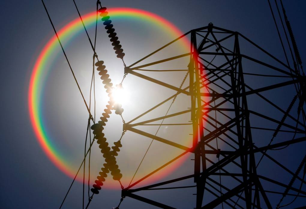
"caption": "With temperatures over 100 degrees in many parts of the state, the California Independent System Operator is calling for voluntary conservation efforts.",
"description": null,
"title": "California Power Grid Strained By Heat Wave",
"credit": "Justin Sullivan/Getty Images",
"status": "inherit",
"isLoading": false,
"fetchFailed": false
},
"news_11526673": {
"type": "attachments",
"id": "news_11526673",
"meta": {
"index": "attachments_1716263798",
"site": "news",
"id": "11526673",
"found": true
},
"parent": 0,
"imgSizes": {
"small": {
"file": "https://ww2.kqed.org/app/uploads/sites/10/2017/06/RS25744_2017_06_20_Heat-wave-3-qut-520x347.jpg",
"width": 520,
"mimeType": "image/jpeg",
"height": 347
},
"twentyfourteen-full-width": {
"file": "https://ww2.kqed.org/app/uploads/sites/10/2017/06/RS25744_2017_06_20_Heat-wave-3-qut-1038x576.jpg",
"width": 1038,
"mimeType": "image/jpeg",
"height": 576
},
"thumbnail": {
"file": "https://ww2.kqed.org/app/uploads/sites/10/2017/06/RS25744_2017_06_20_Heat-wave-3-qut-160x107.jpg",
"width": 160,
"mimeType": "image/jpeg",
"height": 107
},
"fd-sm": {
"file": "https://ww2.kqed.org/app/uploads/sites/10/2017/06/RS25744_2017_06_20_Heat-wave-3-qut-960x640.jpg",
"width": 960,
"mimeType": "image/jpeg",
"height": 640
},
"post-thumbnail": {
"file": "https://ww2.kqed.org/app/uploads/sites/10/2017/06/RS25744_2017_06_20_Heat-wave-3-qut-672x372.jpg",
"width": 672,
"mimeType": "image/jpeg",
"height": 372
},
"xsmall": {
"file": "https://ww2.kqed.org/app/uploads/sites/10/2017/06/RS25744_2017_06_20_Heat-wave-3-qut-375x250.jpg",
"width": 375,
"mimeType": "image/jpeg",
"height": 250
},
"kqedFullSize": {
"file": "https://ww2.kqed.org/app/uploads/sites/10/2017/06/RS25744_2017_06_20_Heat-wave-3-qut.jpg",
"width": 1920,
"height": 1280
},
"large": {
"file": "https://ww2.kqed.org/app/uploads/sites/10/2017/06/RS25744_2017_06_20_Heat-wave-3-qut-1020x680.jpg",
"width": 1020,
"mimeType": "image/jpeg",
"height": 680
},
"xlarge": {
"file": "https://ww2.kqed.org/app/uploads/sites/10/2017/06/RS25744_2017_06_20_Heat-wave-3-qut-1180x787.jpg",
"width": 1180,
"mimeType": "image/jpeg",
"height": 787
},
"guest-author-50": {
"file": "https://ww2.kqed.org/app/uploads/sites/10/2017/06/RS25744_2017_06_20_Heat-wave-3-qut-50x50.jpg",
"width": 50,
"mimeType": "image/jpeg",
"height": 50
},
"guest-author-96": {
"file": "https://ww2.kqed.org/app/uploads/sites/10/2017/06/RS25744_2017_06_20_Heat-wave-3-qut-96x96.jpg",
"width": 96,
"mimeType": "image/jpeg",
"height": 96
},
"medium": {
"file": "https://ww2.kqed.org/app/uploads/sites/10/2017/06/RS25744_2017_06_20_Heat-wave-3-qut-800x533.jpg",
"width": 800,
"mimeType": "image/jpeg",
"height": 533
},
"guest-author-64": {
"file": "https://ww2.kqed.org/app/uploads/sites/10/2017/06/RS25744_2017_06_20_Heat-wave-3-qut-64x64.jpg",
"width": 64,
"mimeType": "image/jpeg",
"height": 64
},
"guest-author-32": {
"file": "https://ww2.kqed.org/app/uploads/sites/10/2017/06/RS25744_2017_06_20_Heat-wave-3-qut-32x32.jpg",
"width": 32,
"mimeType": "image/jpeg",
"height": 32
},
"fd-lrg": {
"file": "https://ww2.kqed.org/app/uploads/sites/10/2017/06/RS25744_2017_06_20_Heat-wave-3-qut-1920x1280.jpg",
"width": 1920,
"mimeType": "image/jpeg",
"height": 1280
},
"fd-med": {
"file": "https://ww2.kqed.org/app/uploads/sites/10/2017/06/RS25744_2017_06_20_Heat-wave-3-qut-1180x787.jpg",
"width": 1180,
"mimeType": "image/jpeg",
"height": 787
},
"full-width": {
"file": "https://ww2.kqed.org/app/uploads/sites/10/2017/06/RS25744_2017_06_20_Heat-wave-3-qut-1920x1280.jpg",
"width": 1920,
"mimeType": "image/jpeg",
"height": 1280
},
"detail": {
"file": "https://ww2.kqed.org/app/uploads/sites/10/2017/06/RS25744_2017_06_20_Heat-wave-3-qut-150x150.jpg",
"width": 150,
"mimeType": "image/jpeg",
"height": 150
},
"guest-author-128": {
"file": "https://ww2.kqed.org/app/uploads/sites/10/2017/06/RS25744_2017_06_20_Heat-wave-3-qut-128x128.jpg",
"width": 128,
"mimeType": "image/jpeg",
"height": 128
},
"xxsmall": {
"file": "https://ww2.kqed.org/app/uploads/sites/10/2017/06/RS25744_2017_06_20_Heat-wave-3-qut-240x160.jpg",
"width": 240,
"mimeType": "image/jpeg",
"height": 160
}
},
"publishDate": 1498170489,
"modified": 1498170685,
"caption": "A couple overlooking the San Francisco Bay from Pier 7 on the Embarcadero in San Francisco.\n",
"description": null,
"title": "RS25744_2017_06_20_Heat wave 3-qut",
"credit": "Seginho Roosblad/KQED",
"status": "inherit",
"isLoading": false,
"fetchFailed": false
},
"news_11523007": {
"type": "attachments",
"id": "news_11523007",
"meta": {
"index": "attachments_1716263798",
"site": "news",
"id": "11523007",
"found": true
},
"parent": 11522111,
"imgSizes": {
"small": {
"file": "https://ww2.kqed.org/app/uploads/sites/10/2017/06/RS25742_2017_06_20_Heat-wave-1-qut-520x347.jpg",
"width": 520,
"mimeType": "image/jpeg",
"height": 347
},
"twentyfourteen-full-width": {
"file": "https://ww2.kqed.org/app/uploads/sites/10/2017/06/RS25742_2017_06_20_Heat-wave-1-qut-1038x576.jpg",
"width": 1038,
"mimeType": "image/jpeg",
"height": 576
},
"thumbnail": {
"file": "https://ww2.kqed.org/app/uploads/sites/10/2017/06/RS25742_2017_06_20_Heat-wave-1-qut-160x107.jpg",
"width": 160,
"mimeType": "image/jpeg",
"height": 107
},
"fd-sm": {
"file": "https://ww2.kqed.org/app/uploads/sites/10/2017/06/RS25742_2017_06_20_Heat-wave-1-qut-960x640.jpg",
"width": 960,
"mimeType": "image/jpeg",
"height": 640
},
"post-thumbnail": {
"file": "https://ww2.kqed.org/app/uploads/sites/10/2017/06/RS25742_2017_06_20_Heat-wave-1-qut-672x372.jpg",
"width": 672,
"mimeType": "image/jpeg",
"height": 372
},
"xsmall": {
"file": "https://ww2.kqed.org/app/uploads/sites/10/2017/06/RS25742_2017_06_20_Heat-wave-1-qut-375x250.jpg",
"width": 375,
"mimeType": "image/jpeg",
"height": 250
},
"kqedFullSize": {
"file": "https://ww2.kqed.org/app/uploads/sites/10/2017/06/RS25742_2017_06_20_Heat-wave-1-qut.jpg",
"width": 1920,
"height": 1280
},
"large": {
"file": "https://ww2.kqed.org/app/uploads/sites/10/2017/06/RS25742_2017_06_20_Heat-wave-1-qut-1020x680.jpg",
"width": 1020,
"mimeType": "image/jpeg",
"height": 680
},
"xlarge": {
"file": "https://ww2.kqed.org/app/uploads/sites/10/2017/06/RS25742_2017_06_20_Heat-wave-1-qut-1180x787.jpg",
"width": 1180,
"mimeType": "image/jpeg",
"height": 787
},
"guest-author-50": {
"file": "https://ww2.kqed.org/app/uploads/sites/10/2017/06/RS25742_2017_06_20_Heat-wave-1-qut-50x50.jpg",
"width": 50,
"mimeType": "image/jpeg",
"height": 50
},
"guest-author-96": {
"file": "https://ww2.kqed.org/app/uploads/sites/10/2017/06/RS25742_2017_06_20_Heat-wave-1-qut-96x96.jpg",
"width": 96,
"mimeType": "image/jpeg",
"height": 96
},
"medium": {
"file": "https://ww2.kqed.org/app/uploads/sites/10/2017/06/RS25742_2017_06_20_Heat-wave-1-qut-800x533.jpg",
"width": 800,
"mimeType": "image/jpeg",
"height": 533
},
"guest-author-64": {
"file": "https://ww2.kqed.org/app/uploads/sites/10/2017/06/RS25742_2017_06_20_Heat-wave-1-qut-64x64.jpg",
"width": 64,
"mimeType": "image/jpeg",
"height": 64
},
"guest-author-32": {
"file": "https://ww2.kqed.org/app/uploads/sites/10/2017/06/RS25742_2017_06_20_Heat-wave-1-qut-32x32.jpg",
"width": 32,
"mimeType": "image/jpeg",
"height": 32
},
"fd-lrg": {
"file": "https://ww2.kqed.org/app/uploads/sites/10/2017/06/RS25742_2017_06_20_Heat-wave-1-qut-1920x1280.jpg",
"width": 1920,
"mimeType": "image/jpeg",
"height": 1280
},
"fd-med": {
"file": "https://ww2.kqed.org/app/uploads/sites/10/2017/06/RS25742_2017_06_20_Heat-wave-1-qut-1180x787.jpg",
"width": 1180,
"mimeType": "image/jpeg",
"height": 787
},
"full-width": {
"file": "https://ww2.kqed.org/app/uploads/sites/10/2017/06/RS25742_2017_06_20_Heat-wave-1-qut-1920x1280.jpg",
"width": 1920,
"mimeType": "image/jpeg",
"height": 1280
},
"detail": {
"file": "https://ww2.kqed.org/app/uploads/sites/10/2017/06/RS25742_2017_06_20_Heat-wave-1-qut-150x150.jpg",
"width": 150,
"mimeType": "image/jpeg",
"height": 150
},
"guest-author-128": {
"file": "https://ww2.kqed.org/app/uploads/sites/10/2017/06/RS25742_2017_06_20_Heat-wave-1-qut-128x128.jpg",
"width": 128,
"mimeType": "image/jpeg",
"height": 128
},
"xxsmall": {
"file": "https://ww2.kqed.org/app/uploads/sites/10/2017/06/RS25742_2017_06_20_Heat-wave-1-qut-240x160.jpg",
"width": 240,
"mimeType": "image/jpeg",
"height": 160
}
},
"publishDate": 1498006663,
"modified": 1498170322,
"caption": "A man basking in the sun on the Justin Herman Plaza in San Francisco.",
"description": "A man basking in the sun on the Justin Herman Plaza in San Francisco.",
"title": "RS25742_2017_06_20_Heat wave 1-qut",
"credit": "Serginho Roosblad/KQED",
"status": "inherit",
"isLoading": false,
"fetchFailed": false
},
"news_11520860": {
"type": "attachments",
"id": "news_11520860",
"meta": {
"index": "attachments_1716263798",
"site": "news",
"id": "11520860",
"found": true
},
"parent": 11520188,
"imgSizes": {
"small": {
"file": "https://ww2.kqed.org/app/uploads/sites/10/2017/06/33374313131_5a200bed3a_o-520x390.jpg",
"width": 520,
"mimeType": "image/jpeg",
"height": 390
},
"twentyfourteen-full-width": {
"file": "https://ww2.kqed.org/app/uploads/sites/10/2017/06/33374313131_5a200bed3a_o-1038x576.jpg",
"width": 1038,
"mimeType": "image/jpeg",
"height": 576
},
"thumbnail": {
"file": "https://ww2.kqed.org/app/uploads/sites/10/2017/06/33374313131_5a200bed3a_o-160x120.jpg",
"width": 160,
"mimeType": "image/jpeg",
"height": 120
},
"fd-sm": {
"file": "https://ww2.kqed.org/app/uploads/sites/10/2017/06/33374313131_5a200bed3a_o-960x720.jpg",
"width": 960,
"mimeType": "image/jpeg",
"height": 720
},
"post-thumbnail": {
"file": "https://ww2.kqed.org/app/uploads/sites/10/2017/06/33374313131_5a200bed3a_o-672x372.jpg",
"width": 672,
"mimeType": "image/jpeg",
"height": 372
},
"xsmall": {
"file": "https://ww2.kqed.org/app/uploads/sites/10/2017/06/33374313131_5a200bed3a_o-375x281.jpg",
"width": 375,
"mimeType": "image/jpeg",
"height": 281
},
"kqedFullSize": {
"file": "https://ww2.kqed.org/app/uploads/sites/10/2017/06/33374313131_5a200bed3a_o-e1497914697556.jpg",
"width": 1920,
"height": 1440
},
"large": {
"file": "https://ww2.kqed.org/app/uploads/sites/10/2017/06/33374313131_5a200bed3a_o-1020x765.jpg",
"width": 1020,
"mimeType": "image/jpeg",
"height": 765
},
"xlarge": {
"file": "https://ww2.kqed.org/app/uploads/sites/10/2017/06/33374313131_5a200bed3a_o-1180x885.jpg",
"width": 1180,
"mimeType": "image/jpeg",
"height": 885
},
"guest-author-50": {
"file": "https://ww2.kqed.org/app/uploads/sites/10/2017/06/33374313131_5a200bed3a_o-50x50.jpg",
"width": 50,
"mimeType": "image/jpeg",
"height": 50
},
"guest-author-96": {
"file": "https://ww2.kqed.org/app/uploads/sites/10/2017/06/33374313131_5a200bed3a_o-96x96.jpg",
"width": 96,
"mimeType": "image/jpeg",
"height": 96
},
"medium": {
"file": "https://ww2.kqed.org/app/uploads/sites/10/2017/06/33374313131_5a200bed3a_o-800x600.jpg",
"width": 800,
"mimeType": "image/jpeg",
"height": 600
},
"guest-author-64": {
"file": "https://ww2.kqed.org/app/uploads/sites/10/2017/06/33374313131_5a200bed3a_o-64x64.jpg",
"width": 64,
"mimeType": "image/jpeg",
"height": 64
},
"guest-author-32": {
"file": "https://ww2.kqed.org/app/uploads/sites/10/2017/06/33374313131_5a200bed3a_o-32x32.jpg",
"width": 32,
"mimeType": "image/jpeg",
"height": 32
},
"fd-lrg": {
"file": "https://ww2.kqed.org/app/uploads/sites/10/2017/06/33374313131_5a200bed3a_o-1920x1440.jpg",
"width": 1920,
"mimeType": "image/jpeg",
"height": 1440
},
"fd-med": {
"file": "https://ww2.kqed.org/app/uploads/sites/10/2017/06/33374313131_5a200bed3a_o-1180x885.jpg",
"width": 1180,
"mimeType": "image/jpeg",
"height": 885
},
"full-width": {
"file": "https://ww2.kqed.org/app/uploads/sites/10/2017/06/33374313131_5a200bed3a_o-1920x1440.jpg",
"width": 1920,
"mimeType": "image/jpeg",
"height": 1440
},
"detail": {
"file": "https://ww2.kqed.org/app/uploads/sites/10/2017/06/33374313131_5a200bed3a_o-150x150.jpg",
"width": 150,
"mimeType": "image/jpeg",
"height": 150
},
"guest-author-128": {
"file": "https://ww2.kqed.org/app/uploads/sites/10/2017/06/33374313131_5a200bed3a_o-128x128.jpg",
"width": 128,
"mimeType": "image/jpeg",
"height": 128
},
"xxsmall": {
"file": "https://ww2.kqed.org/app/uploads/sites/10/2017/06/33374313131_5a200bed3a_o-240x180.jpg",
"width": 240,
"mimeType": "image/jpeg",
"height": 180
}
},
"publishDate": 1497914666,
"modified": 1497914940,
"caption": "Early-morning glare on San Francisco's Bryant Street.",
"description": null,
"title": "Bryant Street Glare",
"credit": "Dan Brekke/KQED",
"status": "inherit",
"isLoading": false,
"fetchFailed": false
},
"news_11498315": {
"type": "attachments",
"id": "news_11498315",
"meta": {
"index": "attachments_1716263798",
"site": "news",
"id": "11498315",
"found": true
},
"parent": 11498314,
"imgSizes": {
"small": {
"file": "https://ww2.kqed.org/app/uploads/sites/10/2017/06/storm170607-e1496852528779-520x393.jpg",
"width": 520,
"mimeType": "image/jpeg",
"height": 393
},
"twentyfourteen-full-width": {
"file": "https://ww2.kqed.org/app/uploads/sites/10/2017/06/storm170607-e1496852528779-1038x576.jpg",
"width": 1038,
"mimeType": "image/jpeg",
"height": 576
},
"thumbnail": {
"file": "https://ww2.kqed.org/app/uploads/sites/10/2017/06/storm170607-e1496852528779-160x121.jpg",
"width": 160,
"mimeType": "image/jpeg",
"height": 121
},
"fd-sm": {
"file": "https://ww2.kqed.org/app/uploads/sites/10/2017/06/storm170607-e1496852528779-960x725.jpg",
"width": 960,
"mimeType": "image/jpeg",
"height": 725
},
"post-thumbnail": {
"file": "https://ww2.kqed.org/app/uploads/sites/10/2017/06/storm170607-e1496852528779-672x372.jpg",
"width": 672,
"mimeType": "image/jpeg",
"height": 372
},
"xsmall": {
"file": "https://ww2.kqed.org/app/uploads/sites/10/2017/06/storm170607-e1496852528779-375x283.jpg",
"width": 375,
"mimeType": "image/jpeg",
"height": 283
},
"kqedFullSize": {
"file": "https://ww2.kqed.org/app/uploads/sites/10/2017/06/storm170607-e1496852528779.jpg",
"width": 1065,
"height": 804
},
"large": {
"file": "https://ww2.kqed.org/app/uploads/sites/10/2017/06/storm170607-e1496852528779-1020x770.jpg",
"width": 1020,
"mimeType": "image/jpeg",
"height": 770
},
"xlarge": {
"file": "https://ww2.kqed.org/app/uploads/sites/10/2017/06/storm170607-1180x885.jpg",
"width": 1180,
"mimeType": "image/jpeg",
"height": 885
},
"guest-author-50": {
"file": "https://ww2.kqed.org/app/uploads/sites/10/2017/06/storm170607-e1496852528779-50x50.jpg",
"width": 50,
"mimeType": "image/jpeg",
"height": 50
},
"guest-author-96": {
"file": "https://ww2.kqed.org/app/uploads/sites/10/2017/06/storm170607-e1496852528779-96x96.jpg",
"width": 96,
"mimeType": "image/jpeg",
"height": 96
},
"medium": {
"file": "https://ww2.kqed.org/app/uploads/sites/10/2017/06/storm170607-e1496852528779-800x604.jpg",
"width": 800,
"mimeType": "image/jpeg",
"height": 604
},
"guest-author-64": {
"file": "https://ww2.kqed.org/app/uploads/sites/10/2017/06/storm170607-e1496852528779-64x64.jpg",
"width": 64,
"mimeType": "image/jpeg",
"height": 64
},
"guest-author-32": {
"file": "https://ww2.kqed.org/app/uploads/sites/10/2017/06/storm170607-e1496852528779-32x32.jpg",
"width": 32,
"mimeType": "image/jpeg",
"height": 32
},
"fd-med": {
"file": "https://ww2.kqed.org/app/uploads/sites/10/2017/06/storm170607-1180x885.jpg",
"width": 1180,
"mimeType": "image/jpeg",
"height": 885
},
"detail": {
"file": "https://ww2.kqed.org/app/uploads/sites/10/2017/06/storm170607-e1496852528779-150x150.jpg",
"width": 150,
"mimeType": "image/jpeg",
"height": 150
},
"guest-author-128": {
"file": "https://ww2.kqed.org/app/uploads/sites/10/2017/06/storm170607-e1496852528779-128x128.jpg",
"width": 128,
"mimeType": "image/jpeg",
"height": 128
},
"xxsmall": {
"file": "https://ww2.kqed.org/app/uploads/sites/10/2017/06/storm170607-e1496852528779-240x181.jpg",
"width": 240,
"mimeType": "image/jpeg",
"height": 181
}
},
"publishDate": 1496852275,
"modified": 1496858969,
"caption": "A color-enhanced infrared image of a storm moving into the Pacific Northwest early Wednesday. The system is expected to bring rain to most of the Bay Area on Thursday.",
"description": null,
"title": "Storm-June 7, 2017",
"credit": "NASA Earth Science Office",
"status": "inherit",
"isLoading": false,
"fetchFailed": false
}
},
"audioPlayerReducer": {
"postId": "stream_live",
"isPaused": true,
"isPlaying": false,
"pfsActive": false,
"pledgeModalIsOpen": true,
"playerDrawerIsOpen": false,
"liveAudioPlayStartedAt": 0,
"liveAudioPlayContext": ""
},
"authorsReducer": {
"byline_news_11614586": {
"type": "authors",
"id": "byline_news_11614586",
"meta": {
"override": true
},
"slug": "byline_news_11614586",
"name": "Associated Press",
"isLoading": false
},
"byline_news_11526662": {
"type": "authors",
"id": "byline_news_11526662",
"meta": {
"override": true
},
"slug": "byline_news_11526662",
"name": "\u003cstrong>\u003ca href=\"https://twitter.com/malekzadeharash\" target=\"_blank\">Arash Malakzadeh\u003c/a>\u003c/strong> and \u003cstrong>\u003ca href=\"https://twitter.com/sroosblad\" target=\"_blank\">Serginho Roosblad\u003c/a>\u003c/strong>",
"isLoading": false
},
"danbrekke": {
"type": "authors",
"id": "222",
"meta": {
"index": "authors_1716337520",
"id": "222",
"found": true
},
"name": "Dan Brekke",
"firstName": "Dan",
"lastName": "Brekke",
"slug": "danbrekke",
"email": "dbrekke@kqed.org",
"display_author_email": true,
"staff_mastheads": [
"news",
"science"
],
"title": "KQED Editor and Reporter",
"bio": "Dan Brekke is a reporter and editor for KQED News, responsible for coverage of topics ranging from California water issues to the Bay Area's transportation challenges. In a newsroom career that began in Chicago in 1972, Dan has worked for \u003cem>The San Francisco Examiner,\u003c/em> Wired and TechTV and has been published in The New York Times, The New York Times Magazine, Business 2.0, Salon and elsewhere.\r\n\r\nSince joining KQED in 2007, Dan has reported, edited and produced both radio and online features and breaking news pieces. He has shared as both editor and reporter in four Society of Professional Journalists Norcal Excellence in Journalism awards and one Edward R. Murrow regional award. He was chosen for a spring 2017 residency at the Mesa Refuge to advance his research on California salmon.\r\n\r\nEmail Dan at: \u003ca href=\"mailto:dbrekke@kqed.org\">dbrekke@kqed.org\u003c/a>\r\n\r\n\u003cstrong>Twitter:\u003c/strong> \u003ca href=\"https://twitter.com/danbrekke\" rel=\"noopener noreferrer\">twitter.com/danbrekke\u003c/a>\r\n\u003cstrong>Facebook:\u003c/strong> \u003ca href=\"https://www.facebook.com/danbrekke\" rel=\"noopener noreferrer\">www.facebook.com/danbrekke\u003c/a>\r\n\u003cstrong>LinkedIn:\u003c/strong> \u003ca href=\"https://www.linkedin.com/in/danbrekke\" rel=\"noopener noreferrer\">www.linkedin.com/in/danbrekke\u003c/a>",
"avatar": "https://secure.gravatar.com/avatar/c8126230345efca3f7aa89b1a402be45?s=600&d=mm&r=g",
"twitter": "danbrekke",
"facebook": null,
"instagram": "https://www.instagram.com/dan.brekke/",
"linkedin": "https://www.linkedin.com/in/danbrekke/",
"sites": [
{
"site": "news",
"roles": [
"administrator",
"create_posts"
]
},
{
"site": "stateofhealth",
"roles": [
"editor"
]
},
{
"site": "science",
"roles": [
"editor"
]
},
{
"site": "quest",
"roles": [
"contributor"
]
},
{
"site": "food",
"roles": [
"contributor"
]
},
{
"site": "forum",
"roles": [
"contributor"
]
},
{
"site": "liveblog",
"roles": [
"editor"
]
}
],
"headData": {
"title": "Dan Brekke | KQED",
"description": "KQED Editor and Reporter",
"ogImgSrc": "https://secure.gravatar.com/avatar/c8126230345efca3f7aa89b1a402be45?s=600&d=mm&r=g",
"twImgSrc": "https://secure.gravatar.com/avatar/c8126230345efca3f7aa89b1a402be45?s=600&d=mm&r=g"
},
"isLoading": false,
"link": "/author/danbrekke"
},
"aemslie": {
"type": "authors",
"id": "3206",
"meta": {
"index": "authors_1716337520",
"id": "3206",
"found": true
},
"name": "Alex Emslie",
"firstName": "Alex",
"lastName": "Emslie",
"slug": "aemslie",
"email": "aemslie@kqed.org",
"display_author_email": true,
"staff_mastheads": [
"news"
],
"title": "KQED Senior Editor",
"bio": "Alex Emslie is senior editor of talent and development at KQED, where he manages dozens of early career journalists and oversees news department internships.\r\n\r\nHe is a former carpenter and proud graduate of City College of San Francisco and San Francisco State University, where he studied journalism and criminal justice before joining KQED in 2013.\r\n\r\nAlex produced investigative journalism focused on \u003ca href=\"https://www.kqed.org/news/11667594/the-trials-of-marvin-mutch-video\">criminal justice\u003c/a> and policing for most of a decade. He has broken major stories about \u003ca href=\"https://www.kqed.org/news/135682/amid-a-series-of-vallejo-police-shootings-one-officers-name-stands-out\">police use of deadly force\u003c/a>, \u003ca href=\"https://www.kqed.org/news/10454955/racist-texts-prompt-sfpd-internal-investigation\">officer misconduct\u003c/a> and \u003ca href=\"https://www.kqed.org/news/11712239/terrorist-or-troll-judge-to-weigh-whether-oakland-man-really-intended-to-attack-bay-area\">other\u003c/a> \u003ca href=\"https://www.kqed.org/news/11221414/hayward-paid-159000-to-husband-of-retired-police-chief-documents-show\">high\u003c/a>-\u003ca href=\"https://www.kqed.org/news/10622762/the-forgotten-tracking-two-homicides-in-san-francisco-public-housing\">profile\u003c/a> \u003ca href=\"https://www.kqed.org/news/11624516/federal-agency-promoted-ranger-just-months-after-his-gun-was-stolen-and-used-in-steinle-killing\">cases\u003c/a>. He co-founded the \u003ca href=\"https://projects.scpr.org/california-reporting-project/\">California Reporting Project\u003c/a> in 2019 to obtain and report on previously confidential police internal investigations. The effort produced well over 100 original stories and changed the course of multiple criminal cases.\r\n\r\nHis work has been recognized with numerous journalism awards, including a national Edward R. Murrow award for several years of \u003ca href=\"https://www.kqed.org/news/11688481/sfpd-officers-in-mario-woods-case-recount-shooting-in-newly-filed-depositions\">reporting\u003c/a> on the San Francisco Police shooting of Mario Woods. His \u003ca href=\"https://www.kqed.org/news/147854/half-of-those-killed-by-san-francisco-police-are-mentally-ill\">reporting\u003c/a> on police killings of people in psychiatric crisis was cited in amicus briefs before the U.S. Supreme Court.\r\n\r\nAlex now enjoys mentoring the next generation of journalists at KQED.",
"avatar": "https://secure.gravatar.com/avatar/e691e65209f20e9da202bd730ead5663?s=600&d=blank&r=g",
"twitter": "SFNewsReporter",
"facebook": null,
"instagram": null,
"linkedin": null,
"sites": [
{
"site": "arts",
"roles": [
"editor"
]
},
{
"site": "news",
"roles": [
"editor"
]
},
{
"site": "mindshift",
"roles": [
"editor"
]
},
{
"site": "stateofhealth",
"roles": [
"editor"
]
},
{
"site": "science",
"roles": [
"administrator"
]
}
],
"headData": {
"title": "Alex Emslie | KQED",
"description": "KQED Senior Editor",
"ogImgSrc": "https://secure.gravatar.com/avatar/e691e65209f20e9da202bd730ead5663?s=600&d=blank&r=g",
"twImgSrc": "https://secure.gravatar.com/avatar/e691e65209f20e9da202bd730ead5663?s=600&d=blank&r=g"
},
"isLoading": false,
"link": "/author/aemslie"
},
"markfiore": {
"type": "authors",
"id": "3236",
"meta": {
"index": "authors_1716337520",
"id": "3236",
"found": true
},
"name": "Mark Fiore",
"firstName": "Mark",
"lastName": "Fiore",
"slug": "markfiore",
"email": "mark@markfiore.com",
"display_author_email": false,
"staff_mastheads": [
"news"
],
"title": "KQED News Cartoonist",
"bio": "\u003ca href=\"http://www.MarkFiore.com\">MarkFiore.com\u003c/a> | \u003ca href=\"https://twitter.com/markfiore\">Follow on Twitter\u003c/a> | \u003ca href=\"https://www.facebook.com/pages/Mark-Fiore-Animated-Political-Cartoons/94451707396?ref=bookmarks\">Facebook\u003c/a> | \u003ca href=\"mailto:mark@markfiore.com\">email\u003c/a>\r\n\r\nPulitzer Prize-winner, Mark Fiore, who the Wall Street Journal has called “the undisputed guru of the form,” creates animated political cartoons in San Francisco, where his work has been featured regularly on the San Francisco Chronicle’s web site, SFGate.com. His work has appeared on Newsweek.com, Slate.com, CBSNews.com, MotherJones.com, DailyKos.com and NPR’s web site. Fiore’s political animation has appeared on CNN, Frontline, Bill Moyers Journal, Salon.com and cable and broadcast outlets across the globe.\r\n\r\nBeginning his professional life by drawing traditional political cartoons for newspapers, Fiore’s work appeared in publications ranging from the Washington Post to the Los Angeles Times. In the late 1990s, he began to experiment with animating political cartoons and, after a short stint at the San Jose Mercury News as their staff cartoonist, Fiore devoted all his energies to animation.\r\nGrowing up in California, Fiore also spent a good portion of his life in the backwoods of Idaho. It was this combination that shaped him politically. Mark majored in political science at Colorado College, where, in a perfect send-off for a cartoonist, he received his diploma in 1991 as commencement speaker Dick Cheney smiled approvingly.\r\nMark Fiore was awarded the Pulitzer Prize for political cartooning in 2010, a Robert F. Kennedy Journalism Award in 2004 and has twice received an Online Journalism Award for commentary from the Online News Association (2002, 2008). Fiore has received two awards for his work in new media from the National Cartoonists Society (2001, 2002), and in 2006 received The James Madison Freedom of Information Award from The Society of Professional Journalists.",
"avatar": "https://secure.gravatar.com/avatar/fc4e2a612b15b67bad0c6f0e1db4ca9b?s=600&d=blank&r=g",
"twitter": "MarkFiore",
"facebook": null,
"instagram": "https://www.instagram.com/markfiore/?hl=en",
"linkedin": null,
"sites": [
{
"site": "arts",
"roles": [
"contributor"
]
},
{
"site": "news",
"roles": [
"editor"
]
},
{
"site": "futureofyou",
"roles": [
"editor"
]
},
{
"site": "science",
"roles": [
"editor"
]
}
],
"headData": {
"title": "Mark Fiore | KQED",
"description": "KQED News Cartoonist",
"ogImgSrc": "https://secure.gravatar.com/avatar/fc4e2a612b15b67bad0c6f0e1db4ca9b?s=600&d=blank&r=g",
"twImgSrc": "https://secure.gravatar.com/avatar/fc4e2a612b15b67bad0c6f0e1db4ca9b?s=600&d=blank&r=g"
},
"isLoading": false,
"link": "/author/markfiore"
},
"jsmall": {
"type": "authors",
"id": "6625",
"meta": {
"index": "authors_1716337520",
"id": "6625",
"found": true
},
"name": "Julie Small",
"firstName": "Julie",
"lastName": "Small",
"slug": "jsmall",
"email": "jsmall@kqed.org",
"display_author_email": true,
"staff_mastheads": [
"news"
],
"title": "KQED Contributor",
"bio": "Julie Small reports on criminal justice and immigration.\r\n\r\nShe was part of a team at KQED awarded a regional 2019 Edward R. Murrow award for continuing coverage of the Trump Administration's family separation policy.\r\n\r\nThe Society for Professional Journalists recognized Julie's 2018 \u003ca href=\"https://www.kqed.org/news/11636262/the-officer-tased-him-31-times-the-sheriff-called-his-death-an-accident\">reporting\u003c/a> on the San Joaquin County Sheriff's \u003ca href=\"https://www.kqed.org/news/11634689/autopsy-doctors-sheriff-overrode-death-findings-to-protect-law-enforcement\">interference\u003c/a> in death investigations with an Excellence in Journalism Award for Ongoing Coverage.\r\n\r\nJulie's\u003ca href=\"https://www.kqed.org/news/11039666/two-mentally-ill-inmates-died-one-month-in-santa-clara\"> reporting\u003c/a> with Lisa Pickoff-White on the treatment of mentally ill offenders in California jails earned a 2017 regional Edward R. Murrow Award for news reporting and an investigative reporting award from the SPJ of Northern California.\r\n\r\nBefore joining KQED, Julie covered government and politics in Sacramento for Southern California Public Radio (SCPR). Her 2010 \u003ca href=\"https://www.scpr.org/specials/prisonmedical/\">series\u003c/a> on lapses in California’s prison medical care also won a regional Edward R. Murrow Award for investigative reporting and a Golden Mic Award from the RTNDA of Southern California.\r\n\r\nJulie began her career in journalism in 2000 as the deputy foreign editor for public radio's \u003cem>Marketplace, \u003c/em>while earning her master's degree in journalism from USC’s Annenberg School of Communication.",
"avatar": "https://secure.gravatar.com/avatar/4baedf201468df97be97c2a9dd7585d0?s=600&d=blank&r=g",
"twitter": "@SmallRadio2",
"facebook": null,
"instagram": null,
"linkedin": null,
"sites": [
{
"site": "news",
"roles": [
"editor"
]
},
{
"site": "stateofhealth",
"roles": [
"author"
]
},
{
"site": "science",
"roles": [
"author"
]
}
],
"headData": {
"title": "Julie Small | KQED",
"description": "KQED Contributor",
"ogImgSrc": "https://secure.gravatar.com/avatar/4baedf201468df97be97c2a9dd7585d0?s=600&d=blank&r=g",
"twImgSrc": "https://secure.gravatar.com/avatar/4baedf201468df97be97c2a9dd7585d0?s=600&d=blank&r=g"
},
"isLoading": false,
"link": "/author/jsmall"
}
},
"pagesReducer": {
"news_tag_weather": {
"type": "terms",
"id": "news_3",
"meta": {
"index": "terms_1716263798",
"site": "news",
"id": "3",
"score": 9.10407
},
"featImg": null,
"name": "weather",
"description": null,
"taxonomy": "tag",
"headData": {
"twImgId": null,
"twTitle": null,
"ogTitle": null,
"ogImgId": null,
"twDescription": null,
"description": null,
"title": "weather Archives | KQED News",
"ogDescription": null
},
"ttid": 3,
"slug": "weather",
"isLoading": false,
"title": "weather",
"pageMeta": {
"site": "news",
"WpPageTemplate": "page-topic-editorial",
"currentPage": 17
},
"blocks": [
{
"blockName": "kqed/post-list",
"attrs": {
"layout": "cardArticle2",
"query": "posts/news?tag=weather",
"seeMore": false,
"paginated": true,
"page": 17
}
},
{
"blockName": "kqed/ad"
}
]
}
},
"pfsSessionReducer": {},
"postsReducer": {
"stream_live": {
"type": "live",
"id": "stream_live",
"audioUrl": "https://streams.kqed.org/kqedradio",
"title": "Live Stream",
"excerpt": "Live Stream information currently unavailable.",
"link": "/radio",
"featImg": "",
"label": {
"name": "KQED Live",
"link": "/"
}
},
"stream_kqedNewscast": {
"type": "posts",
"id": "stream_kqedNewscast",
"audioUrl": "https://www.kqed.org/.stream/anon/radio/RDnews/newscast.mp3?_=1",
"title": "KQED Newscast",
"featImg": "",
"label": {
"name": "88.5 FM",
"link": "/"
}
},
"news_11616199": {
"type": "posts",
"id": "news_11616199",
"meta": {
"index": "posts_1716263798",
"site": "news",
"id": "11616199",
"score": null,
"sort": [
1505155455000
]
},
"guestAuthors": [],
"slug": "first-responders-second-hurricane",
"title": "First Responders, Second Hurricane",
"publishDate": 1505155455,
"format": "standard",
"headTitle": "First Responders, Second Hurricane | KQED",
"labelTerm": {
"term": 18515,
"site": "news"
},
"content": "\u003cp>From Texas to Florida, California first responders are \u003ca href=\"https://ww2.kqed.org/news/2017/09/08/into-the-flood-chasing-california-rescue-crews-to-texas-after-hurricane-harvey/\">helping victims of hurricanes Harvey and Irma\u003c/a>. After responding to disasters on the other side of the country, firefighters will return to wildfires burning across California.\u003c/p>\n\u003cp>[ad fullwidth]\u003c/p>\u003cp>\u003c/p>\n",
"blocks": [],
"excerpt": "From Texas to Florida, California first responders are helping victims of hurricanes Harvey and Irma.",
"status": "publish",
"parent": 0,
"modified": 1721111919,
"stats": {
"hasAudio": false,
"hasVideo": false,
"hasChartOrMap": false,
"iframeSrcs": [],
"hasGoogleForm": false,
"hasGallery": false,
"hasHearkenModule": false,
"hasPolis": false,
"paragraphCount": 3,
"wordCount": 36
},
"headData": {
"title": "First Responders, Second Hurricane | KQED",
"description": "From Texas to Florida, California first responders are helping victims of hurricanes Harvey and Irma.",
"ogTitle": "",
"ogDescription": "",
"ogImgId": "",
"twTitle": "",
"twDescription": "",
"twImgId": "",
"schema": {
"@context": "https://schema.org",
"@type": "NewsArticle",
"headline": "First Responders, Second Hurricane",
"datePublished": "2017-09-11T11:44:15-07:00",
"dateModified": "2024-07-15T23:38:39-07:00",
"image": "https://cdn.kqed.org/wp-content/uploads/2020/02/KQED-OG-Image@1x.png",
"isAccessibleForFree": "True",
"publisher": {
"@type": "NewsMediaOrganization",
"@id": "https://www.kqed.org/#organization",
"name": "KQED",
"logo": "https://cdn.kqed.org/wp-content/uploads/2020/02/KQED-OG-Image@1x.png",
"url": "https://www.kqed.org",
"sameAs": [
"https://www.facebook.com/KQED",
"https://twitter.com/KQED",
"https://www.instagram.com/kqed/",
"https://www.tiktok.com/@kqedofficial",
"https://www.linkedin.com/company/kqed",
"https://www.youtube.com/channel/UCeC0IOo7i1P_61zVUWbJ4nw"
]
}
}
},
"sticky": false,
"path": "/news/11616199/first-responders-second-hurricane",
"audioTrackLength": null,
"parsedContent": [
{
"type": "contentString",
"content": "\u003cdiv class=\"post-body\">\u003cp>\u003cp>From Texas to Florida, California first responders are \u003ca href=\"https://ww2.kqed.org/news/2017/09/08/into-the-flood-chasing-california-rescue-crews-to-texas-after-hurricane-harvey/\">helping victims of hurricanes Harvey and Irma\u003c/a>. After responding to disasters on the other side of the country, firefighters will return to wildfires burning across California.\u003c/p>\n\u003cp>\u003c/p>\u003c/div>",
"attributes": {
"named": {},
"numeric": []
}
},
{
"type": "component",
"content": "",
"name": "ad",
"attributes": {
"named": {
"label": "fullwidth"
},
"numeric": [
"fullwidth"
]
}
},
{
"type": "contentString",
"content": "\u003cdiv class=\"post-body\">\u003cp>\u003c/p>\u003cp>\u003c/p>\n\u003c/div>\u003c/p>",
"attributes": {
"named": {},
"numeric": []
}
}
],
"link": "/news/11616199/first-responders-second-hurricane",
"authors": [
"3236"
],
"series": [
"news_18515"
],
"categories": [
"news_19906",
"news_8",
"news_356"
],
"tags": [
"news_20150",
"news_20949",
"news_3",
"news_4569"
],
"featImg": "news_11616200",
"label": "news_18515"
},
"news_11615835": {
"type": "posts",
"id": "news_11615835",
"meta": {
"index": "posts_1716263798",
"site": "news",
"id": "11615835",
"score": null,
"sort": [
1504902824000
]
},
"guestAuthors": [],
"slug": "into-the-flood-chasing-california-rescue-crews-to-texas-after-hurricane-harvey",
"title": "Into the Flood: Chasing California Rescue Crews to Texas After Hurricane Harvey",
"publishDate": 1504902824,
"format": "image",
"headTitle": "Into the Flood: Chasing California Rescue Crews to Texas After Hurricane Harvey | KQED",
"labelTerm": {
"term": 72,
"site": "news"
},
"content": "\u003cp>[dropcap]W[/dropcap]ater was still rising in parts of Brazoria County on Sept. 3, nine days after Hurricane Harvey swamped a vast area of southern and southeastern Texas. \u003c/p>\n\u003cp>The Tamarind Woods neighborhood, a subdivision of single-story ranch homes in Richwood, an hour south of Houston, had stayed mostly high and dry through Harvey’s initial onslaught. But as reservoirs to the north filled, the winding Brazos River overflowed, eventually sending a slow, steady flow of bluish-brown floodwater into the neighborhood’s streets.\u003c/p>\n\u003cp>“They just can’t hold any more water,” said Dave Lauchner, a Sacramento fire captain and urban search and rescue specialist working in Texas under FEMA. “So the water is escaping out, coming down and unfortunately is causing the damage that we’re seeing right here.”\u003c/p>\n\u003cp>[audio src=\"http://www.kqed.org/.stream/anon/radio/RDnews/2017/09/EmslieTXFirstResponders.mp3\" title=\"Into the Flood\" program=\"KQED News\" image=\"https://ww2.kqed.org/news/wp-content/uploads/sites/10/2017/09/RS26477_20170903_1640270-qut.jpg\"]\u003c/p>\n\u003cp>Residents could have returned home and then been trapped, Lauchner said, so the 14-member California Urban Search and Rescue Task Force 7 (“USAR CA TF 7” or just “Cal 7” for short) conducted a “secondary search” of the area. The team made up of specially trained firefighters from Sacramento city and metro fire departments went door to door in the flooded neighborhood, checking houses from the outside and offering help to anybody they encountered.\u003c/p>\n\u003cp>[ad fullwidth]\u003c/p>\n\u003cp>I followed Lauchner and two other Sacramento city fire captains — Squad Officer Scott Lewis and rescue specialist Mike Wolfe on a Sept. 3 check of the Tamarind Woods neighborhood. We wore hip waders as we sloshed through the murky water that ranged from ankle- to thigh-deep on the road. Almost all of the houses sat below street level in 2 to 5 feet of water.\u003c/p>\n\u003cfigure id=\"attachment_11615885\" class=\"wp-caption aligncenter\" style=\"max-width: 800px\">\u003cimg loading=\"lazy\" decoding=\"async\" class=\"size-medium wp-image-11615885\" src=\"https://ww2.kqed.%E2%80%A0org/news/wp-content/uploads/sites/10/2017/09/RS26478_RS26478_alt_620-qut-800x600.jpg\" alt=\"Floodwater fills a neighborhood about an hour south of Houston, Texas on Sept. 3, 2017, over a week after Hurricane Harvey struck Southeast Texas.\" width=\"800\" height=\"600\" srcset=\"https://cdn.kqed.org/wp-content/uploads/sites/10/2017/09/RS26478_RS26478_alt_620-qut-800x600.jpg 800w, https://cdn.kqed.org/wp-content/uploads/sites/10/2017/09/RS26478_RS26478_alt_620-qut-160x120.jpg 160w, https://cdn.kqed.org/wp-content/uploads/sites/10/2017/09/RS26478_RS26478_alt_620-qut-1020x765.jpg 1020w, https://cdn.kqed.org/wp-content/uploads/sites/10/2017/09/RS26478_RS26478_alt_620-qut.jpg 1920w, https://cdn.kqed.org/wp-content/uploads/sites/10/2017/09/RS26478_RS26478_alt_620-qut-1180x885.jpg 1180w, https://cdn.kqed.org/wp-content/uploads/sites/10/2017/09/RS26478_RS26478_alt_620-qut-960x720.jpg 960w, https://cdn.kqed.org/wp-content/uploads/sites/10/2017/09/RS26478_RS26478_alt_620-qut-240x180.jpg 240w, https://cdn.kqed.org/wp-content/uploads/sites/10/2017/09/RS26478_RS26478_alt_620-qut-375x281.jpg 375w, https://cdn.kqed.org/wp-content/uploads/sites/10/2017/09/RS26478_RS26478_alt_620-qut-520x390.jpg 520w\" sizes=\"(max-width: 800px) 100vw, 800px\">\u003cfigcaption class=\"wp-caption-text\">Floodwater fills a neighborhood about an hour south of Houston, Texas on Sept. 3, 2017, over a week after Hurricane Harvey struck Southeast Texas. \u003ccite>(Alex Emslie/KQED)\u003c/cite>\u003c/figcaption>\u003c/figure>\n\u003cp>A scattered handful of residents wandered in and out of their flooded homes, one woman with garbage bags cinched around her legs. The rest wore shorts or rolled-up jeans in the muggy Texas heat.\u003c/p>\n\u003cp>[dropcap]T[/dropcap]he residents of Tamarind Woods who aren’t sheltering in place (Scott Lewis told me eight people in the neighborhood elected to stay) are among the estimated 50,000 people displaced by Hurricane Harvey. The storm had killed a confirmed 70 people as of Wednesday night, a death toll that’s expected to keep rising. Some 185,000 homes were damaged, according to FEMA estimates from last week.\u003c/p>\n\u003cp>More than 700 state and federal personnel were stationed in counties south and east of Houston this week, according to Frank Salomon, a FEMA information officer stationed at a command post in College Station.\u003c/p>\n\u003cfigure id=\"attachment_11615978\" class=\"wp-caption alignright\" style=\"max-width: 800px\">\u003cimg loading=\"lazy\" decoding=\"async\" class=\"size-medium wp-image-11615978\" src=\"https://ww2.kqed.org/news/wp-content/uploads/sites/10/2017/09/RS26502_alt_630-800x572.jpg\" alt=\"A map at the FEMA command post in College Station, Texas, shows the operational area affected by Hurricane Harvey.\" width=\"800\" height=\"572\" srcset=\"https://cdn.kqed.org/wp-content/uploads/sites/10/2017/09/RS26502_alt_630-800x572.jpg 800w, https://cdn.kqed.org/wp-content/uploads/sites/10/2017/09/RS26502_alt_630-160x114.jpg 160w, https://cdn.kqed.org/wp-content/uploads/sites/10/2017/09/RS26502_alt_630-1020x729.jpg 1020w, https://cdn.kqed.org/wp-content/uploads/sites/10/2017/09/RS26502_alt_630.jpg 1920w, https://cdn.kqed.org/wp-content/uploads/sites/10/2017/09/RS26502_alt_630-1180x843.jpg 1180w, https://cdn.kqed.org/wp-content/uploads/sites/10/2017/09/RS26502_alt_630-960x686.jpg 960w, https://cdn.kqed.org/wp-content/uploads/sites/10/2017/09/RS26502_alt_630-240x172.jpg 240w, https://cdn.kqed.org/wp-content/uploads/sites/10/2017/09/RS26502_alt_630-375x268.jpg 375w, https://cdn.kqed.org/wp-content/uploads/sites/10/2017/09/RS26502_alt_630-520x372.jpg 520w\" sizes=\"(max-width: 800px) 100vw, 800px\">\u003cfigcaption class=\"wp-caption-text\">A map at the FEMA command post in College Station, Texas, shows the operational area affected by Hurricane Harvey. \u003ccite>(Alex Emslie/KQED News)\u003c/cite>\u003c/figcaption>\u003c/figure>\n\u003cp>“It’s a huge footprint,” he said, motioning toward a multicolored map that divvied up flood relief operational areas across hundreds of miles surrounding Houston.\u003c/p>\n\u003cp>“It’s unique in just the collaboration between the state, federal, local, tribal and then volunteers — all those neighbors helping neighbors,” Salomon said. “Which I think is really something to look at and study — how Texans have been able to rally and help each other out.”\u003c/p>\n\u003cp>[dropcap]T[/dropcap]hat’s what Needville resident James Lester had been doing since flooding started. His town southwest of Houston had escaped the flood, so he took a rowboat out with a few of his friends and picked up stranded people in surrounding areas.\u003c/p>\n\u003cp>“They just need help,” he said. “If I was in that shape, I’d want someone to come help me, so I’m doing what I want people to do for me.”\u003c/p>\n\u003cp>On Sunday, Lester was helping Pat Frazier check on his house in Tamarind Woods, which had been sitting in about 2 feet of water for the past four days, the men said. Frazier said he’d tried to stay in his home and made it two days, but the brutal, muggy heat forced him out.\u003c/p>\n\u003cp>Frazier has seen flood damage before, but never to his own property or while the inundation was still going on.\u003c/p>\n\u003cfigure id=\"attachment_11615877\" class=\"wp-caption aligncenter\" style=\"max-width: 800px\">\u003cimg loading=\"lazy\" decoding=\"async\" class=\"size-medium wp-image-11615877\" src=\"https://ww2.kqed.org/news/wp-content/uploads/sites/10/2017/09/RS26483_alt_627-2-800x568.jpg\" alt=\"The view from Texas Highway 36 west of Freeport, where the Brazos River was flooding more than a week after Hurricane Harvey struck the Texas coast.\" width=\"800\" height=\"568\" srcset=\"https://cdn.kqed.org/wp-content/uploads/sites/10/2017/09/RS26483_alt_627-2-800x568.jpg 800w, https://cdn.kqed.org/wp-content/uploads/sites/10/2017/09/RS26483_alt_627-2-160x114.jpg 160w, https://cdn.kqed.org/wp-content/uploads/sites/10/2017/09/RS26483_alt_627-2-1020x724.jpg 1020w, https://cdn.kqed.org/wp-content/uploads/sites/10/2017/09/RS26483_alt_627-2.jpg 1920w, https://cdn.kqed.org/wp-content/uploads/sites/10/2017/09/RS26483_alt_627-2-1180x837.jpg 1180w, https://cdn.kqed.org/wp-content/uploads/sites/10/2017/09/RS26483_alt_627-2-960x681.jpg 960w, https://cdn.kqed.org/wp-content/uploads/sites/10/2017/09/RS26483_alt_627-2-240x170.jpg 240w, https://cdn.kqed.org/wp-content/uploads/sites/10/2017/09/RS26483_alt_627-2-375x266.jpg 375w, https://cdn.kqed.org/wp-content/uploads/sites/10/2017/09/RS26483_alt_627-2-520x369.jpg 520w\" sizes=\"(max-width: 800px) 100vw, 800px\">\u003cfigcaption class=\"wp-caption-text\">The view from Texas Highway 36 west of Freeport, where the Brazos River was flooding more than a week after Hurricane Harvey struck Southeast Texas. \u003ccite>(Alex Emslie/KQED)\u003c/cite>\u003c/figcaption>\u003c/figure>\n\u003cp>“I’m a retired insurance adjuster — worked a thousand flood claims \u003cem>after\u003c/em> the water’s gone,” he said. “To be a victim of one and to be inside that house when your clothes are floating in front of you and everything else is going on, it’s just incredible. Can’t even explain it.”\u003c/p>\n\u003cp>He got excited when he realized the rescue team wading down the street in front of his house was from Sacramento.\u003c/p>\n\u003cp>“I can’t even say enough, how good it makes me feel,” he said, his voice cracking. He said there’s too much focus on division in the United States. “The truth of the matter is, you guys are here, we’re y’all, ya’ll are us. We’re Americans. … Don’t get me crying now.”\u003c/p>\n\u003cp>[dropcap]C[/dropcap]alifornia sent more than 500 first responders to southeast Texas in the wake of Hurricane Harvey, including eight FEMA urban search and rescue task forces, two additional swift-water rescue teams, a 90-person contingent from the Air National Guard and emergency medical teams. They joined thousands from other states, the federal government and the military.\u003c/p>\n\u003cp>Urban search and rescue task forces vary in composition, from a full compliment of 80 people including doctors and structural engineers to the smaller squad of 14 focused on floodwater search and rescue, like Cal 7.\u003c/p>\n\u003cp>By the time some of those teams arrived early this week, the area was swarming with rescue personnel. Dozens of squads waited for days at the command post in College Station, the Brazoria division post in Angleton and other staging areas. The teams filled fairgrounds and high schools, with hundreds of firefighters awaiting a chance to search flooded neighborhoods.\u003c/p>\n\u003cp>They spent their time checking and rechecking their gear and listening to several briefings each day on the status of the relief efforts and the dangers they might face.\u003c/p>\n\u003cp>“I hate electricity,” Ventura County Fire Department Battalion Chief Charlie Sullenbarger told his team during a briefing in College Station. “I always think I’m going to get zapped one of these days and I think that’s how I’m going to end up leaving this world.”\u003c/p>\n\u003cp>The crews carried “hot sticks,” a tool that measures for electrical current, to test the waters around them.\u003c/p>\n\u003cp>“Snakes, alligators, fire ants, fecal matter,” Sullenbarger said. “It’s a reality: Sewage in the water.”\u003c/p>\n\u003cfigure id=\"attachment_11615866\" class=\"wp-caption aligncenter\" style=\"max-width: 800px\">\u003cimg loading=\"lazy\" decoding=\"async\" class=\"size-medium wp-image-11615866\" src=\"https://ww2.kqed.org/news/wp-content/uploads/sites/10/2017/09/RS26484_Ventura-Huddle-RS26484_20170902_083317-qut-1-800x600.jpg\" alt=\"Members of the California Office of Emergency Services Swiftwater Flood Rescue Team 10 -- made up of firefighters from Ventura County -- listen to a briefing on Hurricane Harvey rescue operations in College Station, Texas on Sept. 2, 2017.\" width=\"800\" height=\"600\" srcset=\"https://cdn.kqed.org/wp-content/uploads/sites/10/2017/09/RS26484_Ventura-Huddle-RS26484_20170902_083317-qut-1-800x600.jpg 800w, https://cdn.kqed.org/wp-content/uploads/sites/10/2017/09/RS26484_Ventura-Huddle-RS26484_20170902_083317-qut-1-160x120.jpg 160w, https://cdn.kqed.org/wp-content/uploads/sites/10/2017/09/RS26484_Ventura-Huddle-RS26484_20170902_083317-qut-1-1020x765.jpg 1020w, https://cdn.kqed.org/wp-content/uploads/sites/10/2017/09/RS26484_Ventura-Huddle-RS26484_20170902_083317-qut-1.jpg 1920w, https://cdn.kqed.org/wp-content/uploads/sites/10/2017/09/RS26484_Ventura-Huddle-RS26484_20170902_083317-qut-1-1180x885.jpg 1180w, https://cdn.kqed.org/wp-content/uploads/sites/10/2017/09/RS26484_Ventura-Huddle-RS26484_20170902_083317-qut-1-960x720.jpg 960w, https://cdn.kqed.org/wp-content/uploads/sites/10/2017/09/RS26484_Ventura-Huddle-RS26484_20170902_083317-qut-1-240x180.jpg 240w, https://cdn.kqed.org/wp-content/uploads/sites/10/2017/09/RS26484_Ventura-Huddle-RS26484_20170902_083317-qut-1-375x281.jpg 375w, https://cdn.kqed.org/wp-content/uploads/sites/10/2017/09/RS26484_Ventura-Huddle-RS26484_20170902_083317-qut-1-520x390.jpg 520w\" sizes=\"(max-width: 800px) 100vw, 800px\">\u003cfigcaption class=\"wp-caption-text\">Members of the California Office of Emergency Services Swiftwater Flood Rescue Team 10 — made up of firefighters from Ventura County — listen to a briefing on Hurricane Harvey rescue operations in College Station, Texas, on Sept. 2, 2017. \u003ccite>(Alex Emslie/KQED)\u003c/cite>\u003c/figcaption>\u003c/figure>\n\u003cp>[dropcap]B[/dropcap]ack in Tamarind Woods, Dave Lauchner said he’d come across a “floating island” of fire ants while searching the neighborhood.\u003c/p>\n\u003cp>“Those are a danger because once they get close to us they like to latch onto us,” he said. “We don’t want to irritate those guys.”\u003c/p>\n\u003cp>While they were waiting to be deployed, the Cal 7 team found other ways to help out. They loaded military planes with cases of water and food for residents of Beaumont and Port Arthur, to the east. They helped move 68 patients from a flooded convalescent home into a temporary shelter.\u003c/p>\n\u003cp>And they helped residents of Tamarind Woods take whatever they could carry out of their houses.\u003c/p>\n\u003cp>“The poor guy’s loading up the last little things he can out of his house while he’s watching it sit, you know in 2 or 3 feet of water,” Sacramento Fire Capt. Mike Wolfe said. “So we do everything we can. If he needs help loading his pickup truck with the last items he can get out of there, that’s what we do.”\u003c/p>\n\u003cp>Squad Officer Scott Lewis said that was one of the hardest parts of their response.\u003c/p>\n\u003cp>“Watching the family’s faces and putting yourself in their position,” he said. “How would you feel if this was your house, this was your stuff? And I’m holding the garbage bag as the gal’s just trying to put her clothes, her favorite shirt, her favorite stuff in a bag that didn’t get damaged.”\u003c/p>\n\u003cp>And there’s the potential for the greater loss, evidenced by the scores found dead after the storm.\u003c/p>\n\u003cp>“We deal with life and death and birth and cancer — almost dead, are you dying — we deal with that all the time,” Lewis said. “You almost have to become numb to it to do your job. When someone calls 911, they don’t want a hug, necessarily, they want your action. So you got to put all the broken body parts, or the illness, or the actual dead body that you’re trying to work on, the actual what you’re looking at away and do your job.”\u003c/p>\n\u003cp>At least two California urban search and rescue teams have been deployed to Florida in anticipation of Hurricane Irma, which is expected to make landfall near Miami this weekend. Cal 7 was on the road back to Sacramento as of Thursday evening, returning home to wildfires burning across the state.\u003c/p>\n\u003cp>That’s the nature of the job, whether it’s as a firefighter or member of a FEMA search and rescue team, Lewis said.\u003c/p>\n\u003cp>[ad floatright]\u003c/p>\n\u003cp>“At the end of the day, our passion is to help people, and help people in need,” he said.\u003c/p>\n\n",
"blocks": [],
"excerpt": "'At the end of the day, our passion is to help people, and help people in need,' Sacramento Fire Capt. Scott Lewis said about his team's mission to respond to epic floods in southeast Texas.",
"status": "publish",
"parent": 0,
"modified": 1721104116,
"stats": {
"hasAudio": true,
"hasVideo": false,
"hasChartOrMap": false,
"iframeSrcs": [],
"hasGoogleForm": false,
"hasGallery": false,
"hasHearkenModule": false,
"hasPolis": false,
"paragraphCount": 38,
"wordCount": 1755
},
"headData": {
"title": "Into the Flood: Chasing California Rescue Crews to Texas After Hurricane Harvey | KQED",
"description": "'At the end of the day, our passion is to help people, and help people in need,' Sacramento Fire Capt. Scott Lewis said about his team's mission to respond to epic floods in southeast Texas.",
"ogTitle": "",
"ogDescription": "",
"ogImgId": "",
"twTitle": "",
"twDescription": "",
"twImgId": "",
"schema": {
"@context": "https://schema.org",
"@type": "NewsArticle",
"headline": "Into the Flood: Chasing California Rescue Crews to Texas After Hurricane Harvey",
"datePublished": "2017-09-08T13:33:44-07:00",
"dateModified": "2024-07-15T21:28:36-07:00",
"image": "https://cdn.kqed.org/wp-content/uploads/2020/02/KQED-OG-Image@1x.png",
"isAccessibleForFree": "True",
"publisher": {
"@type": "NewsMediaOrganization",
"@id": "https://www.kqed.org/#organization",
"name": "KQED",
"logo": "https://cdn.kqed.org/wp-content/uploads/2020/02/KQED-OG-Image@1x.png",
"url": "https://www.kqed.org",
"sameAs": [
"https://www.facebook.com/KQED",
"https://twitter.com/KQED",
"https://www.instagram.com/kqed/",
"https://www.tiktok.com/@kqedofficial",
"https://www.linkedin.com/company/kqed",
"https://www.youtube.com/channel/UCeC0IOo7i1P_61zVUWbJ4nw"
]
}
}
},
"sticky": false,
"path": "/news/11615835/into-the-flood-chasing-california-rescue-crews-to-texas-after-hurricane-harvey",
"audioUrl": "http://www.kqed.org/.stream/anon/radio/RDnews/2017/09/EmslieTXFirstResponders.mp3",
"audioDuration": null,
"audioTrackLength": null,
"parsedContent": [
{
"type": "contentString",
"content": "\u003cdiv class=\"post-body\">\u003cp>\u003cp>\u003c/p>\u003cp>\u003cspan class=\"utils-parseShortcode-shortcodes-__dropcapShortcode__dropcap\">W\u003c/span>\u003c/p>\u003cp>ater was still rising in parts of Brazoria County on Sept. 3, nine days after Hurricane Harvey swamped a vast area of southern and southeastern Texas. \u003c/p>\n\u003cp>The Tamarind Woods neighborhood, a subdivision of single-story ranch homes in Richwood, an hour south of Houston, had stayed mostly high and dry through Harvey’s initial onslaught. But as reservoirs to the north filled, the winding Brazos River overflowed, eventually sending a slow, steady flow of bluish-brown floodwater into the neighborhood’s streets.\u003c/p>\n\u003cp>“They just can’t hold any more water,” said Dave Lauchner, a Sacramento fire captain and urban search and rescue specialist working in Texas under FEMA. “So the water is escaping out, coming down and unfortunately is causing the damage that we’re seeing right here.”\u003c/p>\n\u003cp>\u003c/p>\u003c/div>",
"attributes": {
"named": {},
"numeric": []
}
},
{
"type": "component",
"content": "",
"name": "audio",
"attributes": {
"named": {
"src": "http://www.kqed.org/.stream/anon/radio/RDnews/2017/09/EmslieTXFirstResponders.mp3",
"title": "Into the Flood",
"program": "KQED News",
"image": "https://ww2.kqed.org/news/wp-content/uploads/sites/10/2017/09/RS26477_20170903_1640270-qut.jpg",
"label": ""
},
"numeric": []
}
},
{
"type": "contentString",
"content": "\u003cdiv class=\"post-body\">\u003cp>\u003c/p>\n\u003cp>Residents could have returned home and then been trapped, Lauchner said, so the 14-member California Urban Search and Rescue Task Force 7 (“USAR CA TF 7” or just “Cal 7” for short) conducted a “secondary search” of the area. The team made up of specially trained firefighters from Sacramento city and metro fire departments went door to door in the flooded neighborhood, checking houses from the outside and offering help to anybody they encountered.\u003c/p>\n\u003cp>\u003c/p>\u003c/div>",
"attributes": {
"named": {},
"numeric": []
}
},
{
"type": "component",
"content": "",
"name": "ad",
"attributes": {
"named": {
"label": "fullwidth"
},
"numeric": [
"fullwidth"
]
}
},
{
"type": "contentString",
"content": "\u003cdiv class=\"post-body\">\u003cp>\u003c/p>\n\u003cp>I followed Lauchner and two other Sacramento city fire captains — Squad Officer Scott Lewis and rescue specialist Mike Wolfe on a Sept. 3 check of the Tamarind Woods neighborhood. We wore hip waders as we sloshed through the murky water that ranged from ankle- to thigh-deep on the road. Almost all of the houses sat below street level in 2 to 5 feet of water.\u003c/p>\n\u003cfigure id=\"attachment_11615885\" class=\"wp-caption aligncenter\" style=\"max-width: 800px\">\u003cimg loading=\"lazy\" decoding=\"async\" class=\"size-medium wp-image-11615885\" src=\"https://ww2.kqed.%E2%80%A0org/news/wp-content/uploads/sites/10/2017/09/RS26478_RS26478_alt_620-qut-800x600.jpg\" alt=\"Floodwater fills a neighborhood about an hour south of Houston, Texas on Sept. 3, 2017, over a week after Hurricane Harvey struck Southeast Texas.\" width=\"800\" height=\"600\" srcset=\"https://cdn.kqed.org/wp-content/uploads/sites/10/2017/09/RS26478_RS26478_alt_620-qut-800x600.jpg 800w, https://cdn.kqed.org/wp-content/uploads/sites/10/2017/09/RS26478_RS26478_alt_620-qut-160x120.jpg 160w, https://cdn.kqed.org/wp-content/uploads/sites/10/2017/09/RS26478_RS26478_alt_620-qut-1020x765.jpg 1020w, https://cdn.kqed.org/wp-content/uploads/sites/10/2017/09/RS26478_RS26478_alt_620-qut.jpg 1920w, https://cdn.kqed.org/wp-content/uploads/sites/10/2017/09/RS26478_RS26478_alt_620-qut-1180x885.jpg 1180w, https://cdn.kqed.org/wp-content/uploads/sites/10/2017/09/RS26478_RS26478_alt_620-qut-960x720.jpg 960w, https://cdn.kqed.org/wp-content/uploads/sites/10/2017/09/RS26478_RS26478_alt_620-qut-240x180.jpg 240w, https://cdn.kqed.org/wp-content/uploads/sites/10/2017/09/RS26478_RS26478_alt_620-qut-375x281.jpg 375w, https://cdn.kqed.org/wp-content/uploads/sites/10/2017/09/RS26478_RS26478_alt_620-qut-520x390.jpg 520w\" sizes=\"(max-width: 800px) 100vw, 800px\">\u003cfigcaption class=\"wp-caption-text\">Floodwater fills a neighborhood about an hour south of Houston, Texas on Sept. 3, 2017, over a week after Hurricane Harvey struck Southeast Texas. \u003ccite>(Alex Emslie/KQED)\u003c/cite>\u003c/figcaption>\u003c/figure>\n\u003cp>A scattered handful of residents wandered in and out of their flooded homes, one woman with garbage bags cinched around her legs. The rest wore shorts or rolled-up jeans in the muggy Texas heat.\u003c/p>\n\u003cp>\u003c/p>\u003cp>\u003cspan class=\"utils-parseShortcode-shortcodes-__dropcapShortcode__dropcap\">T\u003c/span>\u003c/p>\u003cp>he residents of Tamarind Woods who aren’t sheltering in place (Scott Lewis told me eight people in the neighborhood elected to stay) are among the estimated 50,000 people displaced by Hurricane Harvey. The storm had killed a confirmed 70 people as of Wednesday night, a death toll that’s expected to keep rising. Some 185,000 homes were damaged, according to FEMA estimates from last week.\u003c/p>\n\u003cp>More than 700 state and federal personnel were stationed in counties south and east of Houston this week, according to Frank Salomon, a FEMA information officer stationed at a command post in College Station.\u003c/p>\n\u003cfigure id=\"attachment_11615978\" class=\"wp-caption alignright\" style=\"max-width: 800px\">\u003cimg loading=\"lazy\" decoding=\"async\" class=\"size-medium wp-image-11615978\" src=\"https://ww2.kqed.org/news/wp-content/uploads/sites/10/2017/09/RS26502_alt_630-800x572.jpg\" alt=\"A map at the FEMA command post in College Station, Texas, shows the operational area affected by Hurricane Harvey.\" width=\"800\" height=\"572\" srcset=\"https://cdn.kqed.org/wp-content/uploads/sites/10/2017/09/RS26502_alt_630-800x572.jpg 800w, https://cdn.kqed.org/wp-content/uploads/sites/10/2017/09/RS26502_alt_630-160x114.jpg 160w, https://cdn.kqed.org/wp-content/uploads/sites/10/2017/09/RS26502_alt_630-1020x729.jpg 1020w, https://cdn.kqed.org/wp-content/uploads/sites/10/2017/09/RS26502_alt_630.jpg 1920w, https://cdn.kqed.org/wp-content/uploads/sites/10/2017/09/RS26502_alt_630-1180x843.jpg 1180w, https://cdn.kqed.org/wp-content/uploads/sites/10/2017/09/RS26502_alt_630-960x686.jpg 960w, https://cdn.kqed.org/wp-content/uploads/sites/10/2017/09/RS26502_alt_630-240x172.jpg 240w, https://cdn.kqed.org/wp-content/uploads/sites/10/2017/09/RS26502_alt_630-375x268.jpg 375w, https://cdn.kqed.org/wp-content/uploads/sites/10/2017/09/RS26502_alt_630-520x372.jpg 520w\" sizes=\"(max-width: 800px) 100vw, 800px\">\u003cfigcaption class=\"wp-caption-text\">A map at the FEMA command post in College Station, Texas, shows the operational area affected by Hurricane Harvey. \u003ccite>(Alex Emslie/KQED News)\u003c/cite>\u003c/figcaption>\u003c/figure>\n\u003cp>“It’s a huge footprint,” he said, motioning toward a multicolored map that divvied up flood relief operational areas across hundreds of miles surrounding Houston.\u003c/p>\n\u003cp>“It’s unique in just the collaboration between the state, federal, local, tribal and then volunteers — all those neighbors helping neighbors,” Salomon said. “Which I think is really something to look at and study — how Texans have been able to rally and help each other out.”\u003c/p>\n\u003cp>\u003c/p>\u003cp>\u003cspan class=\"utils-parseShortcode-shortcodes-__dropcapShortcode__dropcap\">T\u003c/span>\u003c/p>\u003cp>hat’s what Needville resident James Lester had been doing since flooding started. His town southwest of Houston had escaped the flood, so he took a rowboat out with a few of his friends and picked up stranded people in surrounding areas.\u003c/p>\n\u003cp>“They just need help,” he said. “If I was in that shape, I’d want someone to come help me, so I’m doing what I want people to do for me.”\u003c/p>\n\u003cp>On Sunday, Lester was helping Pat Frazier check on his house in Tamarind Woods, which had been sitting in about 2 feet of water for the past four days, the men said. Frazier said he’d tried to stay in his home and made it two days, but the brutal, muggy heat forced him out.\u003c/p>\n\u003cp>Frazier has seen flood damage before, but never to his own property or while the inundation was still going on.\u003c/p>\n\u003cfigure id=\"attachment_11615877\" class=\"wp-caption aligncenter\" style=\"max-width: 800px\">\u003cimg loading=\"lazy\" decoding=\"async\" class=\"size-medium wp-image-11615877\" src=\"https://ww2.kqed.org/news/wp-content/uploads/sites/10/2017/09/RS26483_alt_627-2-800x568.jpg\" alt=\"The view from Texas Highway 36 west of Freeport, where the Brazos River was flooding more than a week after Hurricane Harvey struck the Texas coast.\" width=\"800\" height=\"568\" srcset=\"https://cdn.kqed.org/wp-content/uploads/sites/10/2017/09/RS26483_alt_627-2-800x568.jpg 800w, https://cdn.kqed.org/wp-content/uploads/sites/10/2017/09/RS26483_alt_627-2-160x114.jpg 160w, https://cdn.kqed.org/wp-content/uploads/sites/10/2017/09/RS26483_alt_627-2-1020x724.jpg 1020w, https://cdn.kqed.org/wp-content/uploads/sites/10/2017/09/RS26483_alt_627-2.jpg 1920w, https://cdn.kqed.org/wp-content/uploads/sites/10/2017/09/RS26483_alt_627-2-1180x837.jpg 1180w, https://cdn.kqed.org/wp-content/uploads/sites/10/2017/09/RS26483_alt_627-2-960x681.jpg 960w, https://cdn.kqed.org/wp-content/uploads/sites/10/2017/09/RS26483_alt_627-2-240x170.jpg 240w, https://cdn.kqed.org/wp-content/uploads/sites/10/2017/09/RS26483_alt_627-2-375x266.jpg 375w, https://cdn.kqed.org/wp-content/uploads/sites/10/2017/09/RS26483_alt_627-2-520x369.jpg 520w\" sizes=\"(max-width: 800px) 100vw, 800px\">\u003cfigcaption class=\"wp-caption-text\">The view from Texas Highway 36 west of Freeport, where the Brazos River was flooding more than a week after Hurricane Harvey struck Southeast Texas. \u003ccite>(Alex Emslie/KQED)\u003c/cite>\u003c/figcaption>\u003c/figure>\n\u003cp>“I’m a retired insurance adjuster — worked a thousand flood claims \u003cem>after\u003c/em> the water’s gone,” he said. “To be a victim of one and to be inside that house when your clothes are floating in front of you and everything else is going on, it’s just incredible. Can’t even explain it.”\u003c/p>\n\u003cp>He got excited when he realized the rescue team wading down the street in front of his house was from Sacramento.\u003c/p>\n\u003cp>“I can’t even say enough, how good it makes me feel,” he said, his voice cracking. He said there’s too much focus on division in the United States. “The truth of the matter is, you guys are here, we’re y’all, ya’ll are us. We’re Americans. … Don’t get me crying now.”\u003c/p>\n\u003cp>\u003c/p>\u003cp>\u003cspan class=\"utils-parseShortcode-shortcodes-__dropcapShortcode__dropcap\">C\u003c/span>\u003c/p>\u003cp>alifornia sent more than 500 first responders to southeast Texas in the wake of Hurricane Harvey, including eight FEMA urban search and rescue task forces, two additional swift-water rescue teams, a 90-person contingent from the Air National Guard and emergency medical teams. They joined thousands from other states, the federal government and the military.\u003c/p>\n\u003cp>Urban search and rescue task forces vary in composition, from a full compliment of 80 people including doctors and structural engineers to the smaller squad of 14 focused on floodwater search and rescue, like Cal 7.\u003c/p>\n\u003cp>By the time some of those teams arrived early this week, the area was swarming with rescue personnel. Dozens of squads waited for days at the command post in College Station, the Brazoria division post in Angleton and other staging areas. The teams filled fairgrounds and high schools, with hundreds of firefighters awaiting a chance to search flooded neighborhoods.\u003c/p>\n\u003cp>They spent their time checking and rechecking their gear and listening to several briefings each day on the status of the relief efforts and the dangers they might face.\u003c/p>\n\u003cp>“I hate electricity,” Ventura County Fire Department Battalion Chief Charlie Sullenbarger told his team during a briefing in College Station. “I always think I’m going to get zapped one of these days and I think that’s how I’m going to end up leaving this world.”\u003c/p>\n\u003cp>The crews carried “hot sticks,” a tool that measures for electrical current, to test the waters around them.\u003c/p>\n\u003cp>“Snakes, alligators, fire ants, fecal matter,” Sullenbarger said. “It’s a reality: Sewage in the water.”\u003c/p>\n\u003cfigure id=\"attachment_11615866\" class=\"wp-caption aligncenter\" style=\"max-width: 800px\">\u003cimg loading=\"lazy\" decoding=\"async\" class=\"size-medium wp-image-11615866\" src=\"https://ww2.kqed.org/news/wp-content/uploads/sites/10/2017/09/RS26484_Ventura-Huddle-RS26484_20170902_083317-qut-1-800x600.jpg\" alt=\"Members of the California Office of Emergency Services Swiftwater Flood Rescue Team 10 -- made up of firefighters from Ventura County -- listen to a briefing on Hurricane Harvey rescue operations in College Station, Texas on Sept. 2, 2017.\" width=\"800\" height=\"600\" srcset=\"https://cdn.kqed.org/wp-content/uploads/sites/10/2017/09/RS26484_Ventura-Huddle-RS26484_20170902_083317-qut-1-800x600.jpg 800w, https://cdn.kqed.org/wp-content/uploads/sites/10/2017/09/RS26484_Ventura-Huddle-RS26484_20170902_083317-qut-1-160x120.jpg 160w, https://cdn.kqed.org/wp-content/uploads/sites/10/2017/09/RS26484_Ventura-Huddle-RS26484_20170902_083317-qut-1-1020x765.jpg 1020w, https://cdn.kqed.org/wp-content/uploads/sites/10/2017/09/RS26484_Ventura-Huddle-RS26484_20170902_083317-qut-1.jpg 1920w, https://cdn.kqed.org/wp-content/uploads/sites/10/2017/09/RS26484_Ventura-Huddle-RS26484_20170902_083317-qut-1-1180x885.jpg 1180w, https://cdn.kqed.org/wp-content/uploads/sites/10/2017/09/RS26484_Ventura-Huddle-RS26484_20170902_083317-qut-1-960x720.jpg 960w, https://cdn.kqed.org/wp-content/uploads/sites/10/2017/09/RS26484_Ventura-Huddle-RS26484_20170902_083317-qut-1-240x180.jpg 240w, https://cdn.kqed.org/wp-content/uploads/sites/10/2017/09/RS26484_Ventura-Huddle-RS26484_20170902_083317-qut-1-375x281.jpg 375w, https://cdn.kqed.org/wp-content/uploads/sites/10/2017/09/RS26484_Ventura-Huddle-RS26484_20170902_083317-qut-1-520x390.jpg 520w\" sizes=\"(max-width: 800px) 100vw, 800px\">\u003cfigcaption class=\"wp-caption-text\">Members of the California Office of Emergency Services Swiftwater Flood Rescue Team 10 — made up of firefighters from Ventura County — listen to a briefing on Hurricane Harvey rescue operations in College Station, Texas, on Sept. 2, 2017. \u003ccite>(Alex Emslie/KQED)\u003c/cite>\u003c/figcaption>\u003c/figure>\n\u003cp>\u003c/p>\u003cp>\u003cspan class=\"utils-parseShortcode-shortcodes-__dropcapShortcode__dropcap\">B\u003c/span>\u003c/p>\u003cp>ack in Tamarind Woods, Dave Lauchner said he’d come across a “floating island” of fire ants while searching the neighborhood.\u003c/p>\n\u003cp>“Those are a danger because once they get close to us they like to latch onto us,” he said. “We don’t want to irritate those guys.”\u003c/p>\n\u003cp>While they were waiting to be deployed, the Cal 7 team found other ways to help out. They loaded military planes with cases of water and food for residents of Beaumont and Port Arthur, to the east. They helped move 68 patients from a flooded convalescent home into a temporary shelter.\u003c/p>\n\u003cp>And they helped residents of Tamarind Woods take whatever they could carry out of their houses.\u003c/p>\n\u003cp>“The poor guy’s loading up the last little things he can out of his house while he’s watching it sit, you know in 2 or 3 feet of water,” Sacramento Fire Capt. Mike Wolfe said. “So we do everything we can. If he needs help loading his pickup truck with the last items he can get out of there, that’s what we do.”\u003c/p>\n\u003cp>Squad Officer Scott Lewis said that was one of the hardest parts of their response.\u003c/p>\n\u003cp>“Watching the family’s faces and putting yourself in their position,” he said. “How would you feel if this was your house, this was your stuff? And I’m holding the garbage bag as the gal’s just trying to put her clothes, her favorite shirt, her favorite stuff in a bag that didn’t get damaged.”\u003c/p>\n\u003cp>And there’s the potential for the greater loss, evidenced by the scores found dead after the storm.\u003c/p>\n\u003cp>“We deal with life and death and birth and cancer — almost dead, are you dying — we deal with that all the time,” Lewis said. “You almost have to become numb to it to do your job. When someone calls 911, they don’t want a hug, necessarily, they want your action. So you got to put all the broken body parts, or the illness, or the actual dead body that you’re trying to work on, the actual what you’re looking at away and do your job.”\u003c/p>\n\u003cp>At least two California urban search and rescue teams have been deployed to Florida in anticipation of Hurricane Irma, which is expected to make landfall near Miami this weekend. Cal 7 was on the road back to Sacramento as of Thursday evening, returning home to wildfires burning across the state.\u003c/p>\n\u003cp>That’s the nature of the job, whether it’s as a firefighter or member of a FEMA search and rescue team, Lewis said.\u003c/p>\n\u003cp>\u003c/p>\u003c/div>",
"attributes": {
"named": {},
"numeric": []
}
},
{
"type": "component",
"content": "",
"name": "ad",
"attributes": {
"named": {
"label": "floatright"
},
"numeric": [
"floatright"
]
}
},
{
"type": "contentString",
"content": "\u003cdiv class=\"post-body\">\u003cp>\u003c/p>\n\u003cp>“At the end of the day, our passion is to help people, and help people in need,” he said.\u003c/p>\n\n\u003c/div>\u003c/p>",
"attributes": {
"named": {},
"numeric": []
}
}
],
"link": "/news/11615835/into-the-flood-chasing-california-rescue-crews-to-texas-after-hurricane-harvey",
"authors": [
"3206"
],
"programs": [
"news_6944",
"news_72"
],
"categories": [
"news_19906",
"news_8",
"news_356"
],
"tags": [
"news_19542",
"news_18512",
"news_17286",
"news_17041",
"news_3"
],
"featImg": "news_11615844",
"label": "news_72"
},
"news_11616062": {
"type": "posts",
"id": "news_11616062",
"meta": {
"index": "posts_1716263798",
"site": "news",
"id": "11616062",
"score": null,
"sort": [
1504901845000
]
},
"guestAuthors": [],
"slug": "mexico-gets-hit-from-east-and-west",
"title": "Mexico Gets Hit from East and West",
"publishDate": 1504901845,
"format": "standard",
"headTitle": "Mexico Gets Hit from East and West | KQED",
"labelTerm": {
"term": 18515,
"site": "news"
},
"content": "\u003cp>The death toll is rising from a \u003ca href=\"https://ww2.kqed.org/news/2017/09/08/massive-earthquake-strikes-off-coast-of-mexico-triggers-tsunami-warnings/\">massive earthquake\u003c/a> off the coast of Mexico as Hurricane Katia bears down on the country’s Gulf coast. Katia is one of \u003ca href=\"http://www.nhc.noaa.gov/#irma\">three hurricanes\u003c/a> set to make landfall.\u003c/p>\n\u003cp>Mexico’s earthquake comes as the nation is bracing for Katia’s life-threatening floods.\u003c/p>\n\u003cp>[ad fullwidth]\u003c/p>\u003cp>\u003c/p>\n",
"blocks": [],
"excerpt": "The death toll is rising from a massive earthquake off the coast of Mexico as Hurricane Katia bears down on the country's Gulf coast. ",
"status": "publish",
"parent": 0,
"modified": 1721111861,
"stats": {
"hasAudio": false,
"hasVideo": false,
"hasChartOrMap": false,
"iframeSrcs": [],
"hasGoogleForm": false,
"hasGallery": false,
"hasHearkenModule": false,
"hasPolis": false,
"paragraphCount": 4,
"wordCount": 57
},
"headData": {
"title": "Mexico Gets Hit from East and West | KQED",
"description": "The death toll is rising from a massive earthquake off the coast of Mexico as Hurricane Katia bears down on the country's Gulf coast. ",
"ogTitle": "",
"ogDescription": "",
"ogImgId": "",
"twTitle": "",
"twDescription": "",
"twImgId": "",
"schema": {
"@context": "https://schema.org",
"@type": "NewsArticle",
"headline": "Mexico Gets Hit from East and West",
"datePublished": "2017-09-08T13:17:25-07:00",
"dateModified": "2024-07-15T23:37:41-07:00",
"image": "https://cdn.kqed.org/wp-content/uploads/2020/02/KQED-OG-Image@1x.png",
"isAccessibleForFree": "True",
"publisher": {
"@type": "NewsMediaOrganization",
"@id": "https://www.kqed.org/#organization",
"name": "KQED",
"logo": "https://cdn.kqed.org/wp-content/uploads/2020/02/KQED-OG-Image@1x.png",
"url": "https://www.kqed.org",
"sameAs": [
"https://www.facebook.com/KQED",
"https://twitter.com/KQED",
"https://www.instagram.com/kqed/",
"https://www.tiktok.com/@kqedofficial",
"https://www.linkedin.com/company/kqed",
"https://www.youtube.com/channel/UCeC0IOo7i1P_61zVUWbJ4nw"
]
}
}
},
"sticky": false,
"path": "/news/11616062/mexico-gets-hit-from-east-and-west",
"audioTrackLength": null,
"parsedContent": [
{
"type": "contentString",
"content": "\u003cdiv class=\"post-body\">\u003cp>\u003cp>The death toll is rising from a \u003ca href=\"https://ww2.kqed.org/news/2017/09/08/massive-earthquake-strikes-off-coast-of-mexico-triggers-tsunami-warnings/\">massive earthquake\u003c/a> off the coast of Mexico as Hurricane Katia bears down on the country’s Gulf coast. Katia is one of \u003ca href=\"http://www.nhc.noaa.gov/#irma\">three hurricanes\u003c/a> set to make landfall.\u003c/p>\n\u003cp>Mexico’s earthquake comes as the nation is bracing for Katia’s life-threatening floods.\u003c/p>\n\u003cp>\u003c/p>\u003c/div>",
"attributes": {
"named": {},
"numeric": []
}
},
{
"type": "component",
"content": "",
"name": "ad",
"attributes": {
"named": {
"label": "fullwidth"
},
"numeric": [
"fullwidth"
]
}
},
{
"type": "contentString",
"content": "\u003cdiv class=\"post-body\">\u003cp>\u003c/p>\u003cp>\u003c/p>\n\u003c/div>\u003c/p>",
"attributes": {
"named": {},
"numeric": []
}
}
],
"link": "/news/11616062/mexico-gets-hit-from-east-and-west",
"authors": [
"3236"
],
"series": [
"news_18515"
],
"categories": [
"news_19906",
"news_8",
"news_356"
],
"tags": [
"news_1012",
"news_20150",
"news_20949",
"news_3"
],
"featImg": "news_11616067",
"label": "news_18515"
},
"news_11615437": {
"type": "posts",
"id": "news_11615437",
"meta": {
"index": "posts_1716263798",
"site": "news",
"id": "11615437",
"score": null,
"sort": [
1504379069000
]
},
"parent": 0,
"labelTerm": {
"site": "news",
"term": 6944
},
"blocks": [],
"publishDate": 1504379069,
"format": "standard",
"disqusTitle": "Heat Risks High for Bay Area Homeless",
"title": "Heat Risks High for Bay Area Homeless",
"headTitle": "News Fix | KQED News",
"content": "\u003cp>With record heat beating down on the Bay Area this holiday weekend, advocates who work with homeless people are redoubling efforts to spread word about places that offer some escape from the heat.\u003c/p>\n\u003cp>“Have water, stay cool, go places like the library that are going to be open on the weekend,” advised Lucy Kasdin, deputy director of Alameda County’s Health Care for the Homeless Program.\u003c/p>\n\u003cp>The agency provides treatment in an 40-foot, air-conditioned van parked outside St. Vincent de Paul Community Center in Oakland every Friday, and in Berkeley, Hayward and San Leandro on other days.\u003c/p>\n\u003cp>Kasdin told anyone who visited Friday about local cooling centers and gave them a bottle of water.\u003c/p>\n\u003cp>Robert Dillon, who came to the clinic to get some dental work done, said he lives in his parked trailer on a street in Oakland and because its solar-powered, he cannot park in the shade.\u003c/p>\n\u003cp>[ad fullwidth]\u003c/p>\n\u003cp>“It’s like living in a tin can, so it’s like a microwave oven in there,” Dillon said. “If it’s 100 degrees out here, it’s 120 degrees inside the trailer.”\u003c/p>\n\u003cp>After his dental appointment Dillon planned to build a makeshift air conditioner for the trailer out of an ice chest, PVC piping and a fan.\u003c/p>\n\u003cfigure id=\"attachment_11615458\" class=\"wp-caption aligncenter\" style=\"max-width: 800px\">\u003ca href=\"https://ww2.kqed.org/news/wp-content/uploads/sites/10/2017/09/IMG_5696.jpg\">\u003cimg src=\"https://ww2.kqed.org/news/wp-content/uploads/sites/10/2017/09/IMG_5696-800x600.jpg\" alt=\"\" width=\"800\" height=\"600\" class=\"size-medium wp-image-11615458\" srcset=\"https://ww2.kqed.org/app/uploads/sites/10/2017/09/IMG_5696-800x600.jpg 800w, https://ww2.kqed.org/app/uploads/sites/10/2017/09/IMG_5696-160x120.jpg 160w, https://ww2.kqed.org/app/uploads/sites/10/2017/09/IMG_5696-1020x765.jpg 1020w, https://ww2.kqed.org/app/uploads/sites/10/2017/09/IMG_5696-1920x1440.jpg 1920w, https://ww2.kqed.org/app/uploads/sites/10/2017/09/IMG_5696-1180x885.jpg 1180w, https://ww2.kqed.org/app/uploads/sites/10/2017/09/IMG_5696-960x720.jpg 960w, https://ww2.kqed.org/app/uploads/sites/10/2017/09/IMG_5696-240x180.jpg 240w, https://ww2.kqed.org/app/uploads/sites/10/2017/09/IMG_5696-375x281.jpg 375w, https://ww2.kqed.org/app/uploads/sites/10/2017/09/IMG_5696-520x390.jpg 520w\" sizes=\"(max-width: 800px) 100vw, 800px\">\u003c/a>\u003cfigcaption class=\"wp-caption-text\">Robert Dillon's scheme for rigging up an air-conditioning unit for his trailer. \u003ccite>(Julie Small/KQED)\u003c/cite>\u003c/figcaption>\u003c/figure>\n\u003cp>He says the design, scrawled on a piece of paper, is simple, inexpensive -- and actually works.\u003c/p>\n\u003cp>“It sucks in the cold air and blows the hot air right out,” Dillon said.\u003c/p>\n\u003cp>Cities across the Bay Area opened more cooling centers this weekend for people to get out of the heat.\u003c/p>\n\u003cp>Kasdin is helping to keep track of the effort for Alameda County and hopes in the future the response will be even greater.\u003c/p>\n\u003cp>Many of the cooling centers open this weekend plan to close for Labor Day.\u003c/p>\n\u003cp>\u003c/p>\n\u003cp>“There need to be more resources and more of a plan especially on weekends when many providers don’t work and when fewer places are open,” Kasdin said. “What are we doing to help make sure that this vulnerable population stays safe in the heat?”\u003c/p>\n\n",
"disqusIdentifier": "11615437 https://ww2.kqed.org/news/?p=11615437",
"disqusUrl": "https://ww2.kqed.org/news/2017/09/02/heat-risks-high-for-bay-area-homeless/",
"stats": {
"hasVideo": false,
"hasChartOrMap": false,
"hasAudio": false,
"hasPolis": false,
"wordCount": 384,
"hasGoogleForm": false,
"hasGallery": false,
"hasHearkenModule": false,
"iframeSrcs": [],
"paragraphCount": 15
},
"modified": 1504379069,
"excerpt": "Bay Area counties set up temporary cooling centers for those living on the streets. They have few other options for escaping region's historic heat wave.",
"headData": {
"twImgId": "",
"twTitle": "",
"ogTitle": "",
"ogImgId": "",
"twDescription": "",
"description": "Bay Area counties set up temporary cooling centers for those living on the streets. They have few other options for escaping region's historic heat wave.",
"title": "Heat Risks High for Bay Area Homeless | KQED",
"ogDescription": "",
"schema": {
"@context": "https://schema.org",
"@type": "NewsArticle",
"headline": "Heat Risks High for Bay Area Homeless",
"datePublished": "2017-09-02T12:04:29-07:00",
"dateModified": "2017-09-02T12:04:29-07:00",
"image": "https://cdn.kqed.org/wp-content/uploads/2020/02/KQED-OG-Image@1x.png",
"isAccessibleForFree": "True",
"publisher": {
"@type": "NewsMediaOrganization",
"@id": "https://www.kqed.org/#organization",
"name": "KQED",
"logo": "https://cdn.kqed.org/wp-content/uploads/2020/02/KQED-OG-Image@1x.png",
"url": "https://www.kqed.org",
"sameAs": [
"https://www.facebook.com/KQED",
"https://twitter.com/KQED",
"https://www.instagram.com/kqed/",
"https://www.tiktok.com/@kqedofficial",
"https://www.linkedin.com/company/kqed",
"https://www.youtube.com/channel/UCeC0IOo7i1P_61zVUWbJ4nw"
]
}
}
},
"guestAuthors": [],
"slug": "heat-risks-high-for-bay-area-homeless",
"status": "publish",
"path": "/news/11615437/heat-risks-high-for-bay-area-homeless",
"audioTrackLength": null,
"parsedContent": [
{
"type": "contentString",
"content": "\u003cdiv class=\"post-body\">\u003cp>\u003cp>With record heat beating down on the Bay Area this holiday weekend, advocates who work with homeless people are redoubling efforts to spread word about places that offer some escape from the heat.\u003c/p>\n\u003cp>“Have water, stay cool, go places like the library that are going to be open on the weekend,” advised Lucy Kasdin, deputy director of Alameda County’s Health Care for the Homeless Program.\u003c/p>\n\u003cp>The agency provides treatment in an 40-foot, air-conditioned van parked outside St. Vincent de Paul Community Center in Oakland every Friday, and in Berkeley, Hayward and San Leandro on other days.\u003c/p>\n\u003cp>Kasdin told anyone who visited Friday about local cooling centers and gave them a bottle of water.\u003c/p>\n\u003cp>Robert Dillon, who came to the clinic to get some dental work done, said he lives in his parked trailer on a street in Oakland and because its solar-powered, he cannot park in the shade.\u003c/p>\n\u003cp>\u003c/p>\u003c/div>",
"attributes": {
"named": {},
"numeric": []
}
},
{
"type": "component",
"content": "",
"name": "ad",
"attributes": {
"named": {
"label": "fullwidth"
},
"numeric": [
"fullwidth"
]
}
},
{
"type": "contentString",
"content": "\u003cdiv class=\"post-body\">\u003cp>\u003c/p>\n\u003cp>“It’s like living in a tin can, so it’s like a microwave oven in there,” Dillon said. “If it’s 100 degrees out here, it’s 120 degrees inside the trailer.”\u003c/p>\n\u003cp>After his dental appointment Dillon planned to build a makeshift air conditioner for the trailer out of an ice chest, PVC piping and a fan.\u003c/p>\n\u003cfigure id=\"attachment_11615458\" class=\"wp-caption aligncenter\" style=\"max-width: 800px\">\u003ca href=\"https://ww2.kqed.org/news/wp-content/uploads/sites/10/2017/09/IMG_5696.jpg\">\u003cimg src=\"https://ww2.kqed.org/news/wp-content/uploads/sites/10/2017/09/IMG_5696-800x600.jpg\" alt=\"\" width=\"800\" height=\"600\" class=\"size-medium wp-image-11615458\" srcset=\"https://ww2.kqed.org/app/uploads/sites/10/2017/09/IMG_5696-800x600.jpg 800w, https://ww2.kqed.org/app/uploads/sites/10/2017/09/IMG_5696-160x120.jpg 160w, https://ww2.kqed.org/app/uploads/sites/10/2017/09/IMG_5696-1020x765.jpg 1020w, https://ww2.kqed.org/app/uploads/sites/10/2017/09/IMG_5696-1920x1440.jpg 1920w, https://ww2.kqed.org/app/uploads/sites/10/2017/09/IMG_5696-1180x885.jpg 1180w, https://ww2.kqed.org/app/uploads/sites/10/2017/09/IMG_5696-960x720.jpg 960w, https://ww2.kqed.org/app/uploads/sites/10/2017/09/IMG_5696-240x180.jpg 240w, https://ww2.kqed.org/app/uploads/sites/10/2017/09/IMG_5696-375x281.jpg 375w, https://ww2.kqed.org/app/uploads/sites/10/2017/09/IMG_5696-520x390.jpg 520w\" sizes=\"(max-width: 800px) 100vw, 800px\">\u003c/a>\u003cfigcaption class=\"wp-caption-text\">Robert Dillon's scheme for rigging up an air-conditioning unit for his trailer. \u003ccite>(Julie Small/KQED)\u003c/cite>\u003c/figcaption>\u003c/figure>\n\u003cp>He says the design, scrawled on a piece of paper, is simple, inexpensive -- and actually works.\u003c/p>\n\u003cp>“It sucks in the cold air and blows the hot air right out,” Dillon said.\u003c/p>\n\u003cp>Cities across the Bay Area opened more cooling centers this weekend for people to get out of the heat.\u003c/p>\n\u003cp>Kasdin is helping to keep track of the effort for Alameda County and hopes in the future the response will be even greater.\u003c/p>\n\u003cp>Many of the cooling centers open this weekend plan to close for Labor Day.\u003c/p>\n\u003cp>\u003c/p>\n\u003cp>“There need to be more resources and more of a plan especially on weekends when many providers don’t work and when fewer places are open,” Kasdin said. “What are we doing to help make sure that this vulnerable population stays safe in the heat?”\u003c/p>\n\n\u003c/div>\u003c/p>",
"attributes": {
"named": {},
"numeric": []
}
}
],
"link": "/news/11615437/heat-risks-high-for-bay-area-homeless",
"authors": [
"6625"
],
"programs": [
"news_6944"
],
"categories": [
"news_457",
"news_6266",
"news_8"
],
"tags": [
"news_2929",
"news_4020",
"news_3"
],
"featImg": "news_11615459",
"label": "news_6944"
},
"news_11614957": {
"type": "posts",
"id": "news_11614957",
"meta": {
"index": "posts_1716263798",
"site": "news",
"id": "11614957",
"score": null,
"sort": [
1504311619000
]
},
"parent": 0,
"labelTerm": {
"site": "news",
"term": 6944
},
"blocks": [],
"publishDate": 1504311619,
"format": "standard",
"disqusTitle": "What You Need to Know About the Bay Area's Record-Setting Heat Wave",
"title": "What You Need to Know About the Bay Area's Record-Setting Heat Wave",
"headTitle": "News Fix | KQED News",
"content": "\u003cp>\u003cem>This story includes a \u003ca href=\"#correction\">correction\u003c/a>.\u003c/em>\u003c/p>\n\u003cp>\u003cem>Updated 5:20 p.m. Friday\u003c/em>\u003c/p>\n\u003cp>[dropcap]D[/dropcap]ay One of the Great Labor Day Heat Wave of 2017 is almost in the books. We're seeing several locations that did set or may have set all-time highs (and there are likely many others that have established new daily or monthly records):\u003c/p>\n\u003cul>\n\u003cli>San Francisco's official downtown recording station hit 106 degrees, according to \u003ca href=\"http://www.wrh.noaa.gov/total_forecast/getprod.php?new&wfo=mtr&sid=MTR&pil=RER\" target=\"_blank\">a record report\u003c/a> from the National Weather Service. That breaks the city's previous record of 103 -- going back to the creation of the federal weather service in the 1870s -- set July 17, 1988, and equaled on June 14, 2000. San Francisco International Airport also reported its highest reading on record, 104, which surpasses the 103 recorded on Sept. 14, 1971.\n\u003c/li>\u003cli>A Berkeley weather station close to Berkeley's official recording site, on the Cal campus near Hearst and Euclid avenues, reported (via Weather Underground) a temperature of 108.5. That would eclipse the record of 107 set June 15, 2000, and the September record of 106, set Sept. 16, 1913.\u003c/li>\n\u003cli>The Charles M. Schulz Sonoma County Airport in Santa Rosa reported a high of 109, apparently equaling its all-time high, set in 1944.\u003c/li>\n\u003cli>Mountain View's Moffett Field recorded 106 degrees, equaling the set June 14, 2000.\u003c/li>\n\u003c/ul>\n\u003cp>None of those readings are the hottest in the region. Unofficial highs we're seeing on various weather sites include 115 at Lake Sonoma, west of Healdsburg; 114 at the Livermore Fire Department, 111 in Walnut Creek and at Upper San Leandro Reservoir in the East Bay Hills; 110 at Concord's Buchanan Field and at Barnaby, a hillside spot between Mount Tamalpais and Point Reyes in Marin County.\u003c/p>\n\u003cp>Today's high at KQED News' work-at-home Berkeley bureau, 102.7, seems tame by comparison, though it was a challenge for the backyard chickens.\u003c/p>\n\u003cp>[ad fullwidth]\u003c/p>\n\u003cp>The NWS says more of the same is in store for tomorrow, with a twist. Winds off the ocean -- onshore flow, in meteorological parlance -- moderated temperatures along the coast on Friday. Forecasters say that won't be the case tomorrow, and the excessive heat warning that's been in place for most of the region has been extended to the coast for Saturday.\u003c/p>\n\u003cp>Here's a rundown of what you might expect this weekend and how to deal with it:\u003c/p>\n\u003cp>\u003cstrong>How Hot, for How Long:\u003c/strong> The National Weather Service's \u003ca href=\"http://www.weather.gov/mtr/\" target=\"_blank\" rel=\"noopener noreferrer\">San Francisco Bay Area forecast office\u003c/a> in Monterey has issued an \u003ca href=\"http://forecast.weather.gov/wwamap/wwatxtget.php?cwa=mtr&wwa=excessive%20heat%20warning\" target=\"_blank\" rel=\"noopener noreferrer\">excessive heat warning\u003c/a> that covers the entire region, except for areas adjacent to the Pacific Ocean. The warning -- which means \"a prolonged period of dangerously hot temperatures will occur\" -- will be in effect from 11 a.m. Friday through 9 p.m. Monday.\u003c/p>\n\u003cp>\u003cstrong>Bad Air:\u003c/strong> Most of us have noticed the hazy, crummy air quality the last couple of days -- or, if you're of a more lyrical bent, the coppery tinge to the evening and early morning light. The \u003ca href=\"http://www.baaqmd.gov/~/media/files/communications-and-outreach/publications/news-releases/2017/smoke_170831-pdf.pdf?la=en\" target=\"_blank\" rel=\"noopener noreferrer\">Bay Area Air Quality Management District says\u003c/a> that's largely the result of wildfire smoke filtering into the region from blazes as far away as Oregon. The air district has issued \u003ca href=\"http://www.sparetheair.org/\" target=\"_blank\" rel=\"noopener noreferrer\">a Spare the Air alert\u003c/a> urging people to curtail driving and other activities that add to pollution.\u003c/p>\n\u003cp>The district's \u003ca href=\"http://www.sparetheair.org/stay-informed/todays-air-quality/five-day-forecast\" target=\"_blank\" rel=\"noopener noreferrer\">air-quality forecast\u003c/a> shows unhealthy air for all groups in the Santa Clara and East Bay valleys and unhealthy for sensitive groups (those with respiratory illnesses, for instance) in the rest of the region.\u003c/p>\n\u003cp>\u003cstrong>Where It Will Be Hottest:\u003c/strong> The forecast for interior areas of most counties on Friday and Saturday includes highs reaching 116 in Walnut Creek, 115 in Pleasanton, 114 in Novato and 113 in Livermore. If that forecast pans out, some locations may exceed their highest recorded temperatures ever. Walnut Creek's all-time high, for instance, is 115 -- set on July 14, 1972. San Francisco's weekend high is forecast to be 90 on Saturday; Oakland is expected to hit 95 and San Jose 101 the same day.\u003c/p>\n\u003cp>The forecast prompted officials in Novato to declare a \"minimum day\" for students in the city's schools on Friday. Pupils in elementary schools will be sent home at noon, and high schools will let out at 12:45 p.m.\u003c/p>\n\u003cp>\u003c!-- iframe plugin v.4.3 wordpress.org/plugins/iframe/ -->\u003cbr>\n\u003ciframe width=\"100%\" height=\"600\" frameborder=\"0\" src=\"https://danbrekke.carto.com/builder/55ad052e-8f24-11e7-9e06-0e9ed59b32fa/embed\" scrolling=\"yes\" class=\"iframe-class\">\u003c/iframe>\u003c/p>\n\u003cp>\u003cstrong>Where It Will Be Coolest:\u003c/strong> Most coastal areas will be warm -- with Pacifica and Half Moon Bay forecast to hit the mid-80s on Saturday -- but much, much cooler than inland regions. Most points along the coast in Sonoma and Marin counties are expected to remain in the 70s throughout the heat siege.\u003c/p>\n\u003cp>\u003cstrong>Staying Cool:\u003c/strong> The National Weather Service is emphasizing that the extreme heat on tap for most of the region poses a risk to everyone -- not just young children, older residents and other typically vulnerable groups. The National Weather Service's advice for coping with the torrid days to come:\u003c/p>\n\u003cul>\n\u003cli>Limit strenuous outdoor activities, especially during the hottest time of day.\u003c/li>\n\u003cli>Do not leave kids in vehicles.\u003c/li>\n\u003cli>Stay in air-conditioned areas if possible.\u003c/li>\n\u003cli>Drink plenty of fluids.\u003c/li>\n\u003cli>Check on relatives and neighbors.\u003c/li>\n\u003c/ul>\n\u003cp>Contra Costa County, where heat is forecast to be particularly intense, offers \u003ca href=\"http://cchealth.org/heat/tips-to-cope.php\" target=\"_blank\" rel=\"noopener noreferrer\">an expanded list\u003c/a> of steps to cope with high temperatures.\u003c/p>\n\u003cp>\u003cstrong>Cooling Centers:\u003c/strong> Here are lists of cooling centers publicized by county health authorities across the region:\u003c/p>\n\u003cul>\n\u003cli style=\"list-style-type: none\">\n\u003cul>\n\u003cli>\u003ca href=\"http://www.achch.org/uploads/7/2/5/4/72547769/cooling_centers_locations_6-19-2017.pdf\" target=\"_blank\" rel=\"noopener noreferrer\">Alameda County\u003c/a>\u003c/li>\n\u003cli>\u003ca href=\"http://cchealth.org/heat/pdf/cool_off_locations_aaa.pdf\" target=\"_blank\" rel=\"noopener noreferrer\">Contra Costa County\u003c/a>\u003c/li>\n\u003cli>\u003ca href=\"http://test.cityofsanrafael.org/Fire/Fire_Administration/Press_Releases/Cooling_Centers_July_1_2013.pdf\" target=\"_blank\" rel=\"noopener noreferrer\">Marin County\u003c/a>\u003c/li>\n\u003cli>\u003ca href=\"https://www.arcgis.com/home/webmap/viewer.html?webmap=10689f726ea046b081b7b53dee8eabc7\" target=\"_blank\" rel=\"noopener noreferrer\">San Francisco (map)\u003c/a>\u003c/li>\n\u003cli>\u003ca href=\"http://www.sccfd.org/images/documents/community_education/safety_education/CoolingCenters6-22-2017.pdf\" target=\"_blank\" rel=\"noopener noreferrer\">Santa Clara County\u003c/a>\u003c/li>\n\u003cli>\u003ca href=\"https://www.solanocounty.com/depts/oes/cooling_centers.asp\" target=\"_blank\" rel=\"noopener noreferrer\">Solano County\u003c/a>\u003c/li>\n\u003c/ul>\n\u003c/li>\n\u003c/ul>\n\u003cp>\u003cstrong>Staying Safe at the Beach:\u003c/strong> The hot weather is likely to prompt many people to visit Bay Area beaches. The National Weather Service says it's particularly important to know that ocean waters are very cold -- between 54 and 56 degrees -- and that rip currents make many beaches extremely dangerous. Visitors should also be aware that many inviting areas, such as San Francisco's Ocean Beach, have no lifeguards.\u003c/p>\n\u003cp>\u003cem>Read more:\u003c/em> the NWS \u003ca href=\"http://forecast.weather.gov/product.php?site=MTR&issuedby=MTR&product=SRF&format=CI&version=1&glossary=1&highlight=on\" target=\"_blank\" rel=\"noopener noreferrer\">surf zone forecast\u003c/a> and \u003ca href=\"http://www.srh.noaa.gov/jetstream/ocean/rip_safety.html\" target=\"_blank\" rel=\"noopener noreferrer\">tips for avoiding rip currents\u003c/a>.\u003c/p>\n\u003cp>\u003cstrong>Hot Pets:\u003c/strong> Pet lovers are reminded to make sure their dogs and cats (or what have you) are protected from heat. Some basic advice during dangerously hot, sunny weather:\u003c/p>\n\u003cul>\n\u003cli>Make sure pets have plenty of water.\u003c/li>\n\u003cli>Never leave pets in cars.\u003c/li>\n\u003cli>Be mindful of hot pavement, which can burn dogs' paws and cause a rapid increase in their body temperature.\u003c/li>\n\u003cli>Know the signs of heat stroke in pets, which can include excessive panting, increased heart and respiratory rate, drooling, stupor or collapse.\u003c/li>\n\u003c/ul>\n\u003cp>\u003cem>Read more:\u003c/em> \u003ca href=\"https://www.aspca.org/pet-care/general-pet-care/hot-weather-safety-tips\" target=\"_blank\" rel=\"noopener noreferrer\">ASPCA's Hot Weather Safety Tips\u003c/a>\u003c/p>\n\u003cp>\u003cstrong>Power:\u003c/strong> The California Independent System Operator is forecasting record \u003ca href=\"http://www.caiso.com/Pages/TodaysOutlook.aspx#AWE\" target=\"_blank\" rel=\"noopener noreferrer\">statewide power demand\u003c/a> on Friday. On Thursday, the grid operator issued \u003ca href=\"http://www.caiso.com/Documents/FlexAlert-aCallForEnergyConservation-InEffectToday.pdf\" target=\"_blank\" rel=\"noopener noreferrer\">a flex alert\u003c/a> -- a call for voluntary conservation -- through Friday night.\u003c/p>\n\u003cp>\u003cstrong>Transit Impacts:\u003c/strong> Both BART and Caltrain are slowing down because of the heat, a move that will cause delays on both systems. \u003ca href=\"http://www.bart.gov/news/articles/2017/news20170901\">BART says\u003c/a> it's reducing train speeds from the usual maximum of 80 mph in outdoor areas systemwide because of the possibility rails could shift in the extreme heat. The slowdown could increase travel times 10 to 20 minutes, BART says.\u003c/p>\n\u003cp>Caltrain informed passengers at midday Friday it was limiting trains to 60 mph.\u003c/p>\n\u003cp>\u003ca id=\"correction\">\u003c/a>\u003c/p>\n\u003cp>[ad floatright]\u003c/p>\n\u003cp>\u003cem>\u003cstrong>Correction:\u003c/strong> The high temperature reported for Berkeley on Friday, Sept. 1, as well as its source and the city's all-time temperature record, were mis-stated in our original report and have been corrected. We regret the error.\u003c/em>\u003c/p>\n\n",
"disqusIdentifier": "11614957 https://ww2.kqed.org/news/?p=11614957",
"disqusUrl": "https://ww2.kqed.org/news/2017/09/01/what-you-need-to-know-about-bay-areas-heat-wave/",
"stats": {
"hasVideo": false,
"hasChartOrMap": false,
"hasAudio": false,
"hasPolis": false,
"wordCount": 1220,
"hasGoogleForm": false,
"hasGallery": false,
"hasHearkenModule": false,
"iframeSrcs": [],
"paragraphCount": 28
},
"modified": 1504542201,
"excerpt": "A weekend of extreme heat could break all-time high-temperature records in some inland locales. ",
"headData": {
"twImgId": "",
"twTitle": "",
"ogTitle": "",
"ogImgId": "",
"twDescription": "",
"description": "A weekend of extreme heat could break all-time high-temperature records in some inland locales. ",
"title": "What You Need to Know About the Bay Area's Record-Setting Heat Wave | KQED",
"ogDescription": "",
"schema": {
"@context": "https://schema.org",
"@type": "NewsArticle",
"headline": "What You Need to Know About the Bay Area's Record-Setting Heat Wave",
"datePublished": "2017-09-01T17:20:19-07:00",
"dateModified": "2017-09-04T09:23:21-07:00",
"image": "https://cdn.kqed.org/wp-content/uploads/2020/02/KQED-OG-Image@1x.png",
"isAccessibleForFree": "True",
"publisher": {
"@type": "NewsMediaOrganization",
"@id": "https://www.kqed.org/#organization",
"name": "KQED",
"logo": "https://cdn.kqed.org/wp-content/uploads/2020/02/KQED-OG-Image@1x.png",
"url": "https://www.kqed.org",
"sameAs": [
"https://www.facebook.com/KQED",
"https://twitter.com/KQED",
"https://www.instagram.com/kqed/",
"https://www.tiktok.com/@kqedofficial",
"https://www.linkedin.com/company/kqed",
"https://www.youtube.com/channel/UCeC0IOo7i1P_61zVUWbJ4nw"
]
}
}
},
"guestAuthors": [],
"slug": "what-you-need-to-know-about-bay-areas-heat-wave",
"status": "publish",
"path": "/news/11614957/what-you-need-to-know-about-bay-areas-heat-wave",
"audioTrackLength": null,
"parsedContent": [
{
"type": "contentString",
"content": "\u003cdiv class=\"post-body\">\u003cp>\u003cp>\u003cem>This story includes a \u003ca href=\"#correction\">correction\u003c/a>.\u003c/em>\u003c/p>\n\u003cp>\u003cem>Updated 5:20 p.m. Friday\u003c/em>\u003c/p>\n\u003cp>\u003c/p>\u003cp>\u003cspan class=\"utils-parseShortcode-shortcodes-__dropcapShortcode__dropcap\">D\u003c/span>\u003c/p>\u003cp>ay One of the Great Labor Day Heat Wave of 2017 is almost in the books. We're seeing several locations that did set or may have set all-time highs (and there are likely many others that have established new daily or monthly records):\u003c/p>\n\u003cul>\n\u003cli>San Francisco's official downtown recording station hit 106 degrees, according to \u003ca href=\"http://www.wrh.noaa.gov/total_forecast/getprod.php?new&wfo=mtr&sid=MTR&pil=RER\" target=\"_blank\">a record report\u003c/a> from the National Weather Service. That breaks the city's previous record of 103 -- going back to the creation of the federal weather service in the 1870s -- set July 17, 1988, and equaled on June 14, 2000. San Francisco International Airport also reported its highest reading on record, 104, which surpasses the 103 recorded on Sept. 14, 1971.\n\u003c/li>\u003cli>A Berkeley weather station close to Berkeley's official recording site, on the Cal campus near Hearst and Euclid avenues, reported (via Weather Underground) a temperature of 108.5. That would eclipse the record of 107 set June 15, 2000, and the September record of 106, set Sept. 16, 1913.\u003c/li>\n\u003cli>The Charles M. Schulz Sonoma County Airport in Santa Rosa reported a high of 109, apparently equaling its all-time high, set in 1944.\u003c/li>\n\u003cli>Mountain View's Moffett Field recorded 106 degrees, equaling the set June 14, 2000.\u003c/li>\n\u003c/ul>\n\u003cp>None of those readings are the hottest in the region. Unofficial highs we're seeing on various weather sites include 115 at Lake Sonoma, west of Healdsburg; 114 at the Livermore Fire Department, 111 in Walnut Creek and at Upper San Leandro Reservoir in the East Bay Hills; 110 at Concord's Buchanan Field and at Barnaby, a hillside spot between Mount Tamalpais and Point Reyes in Marin County.\u003c/p>\n\u003cp>Today's high at KQED News' work-at-home Berkeley bureau, 102.7, seems tame by comparison, though it was a challenge for the backyard chickens.\u003c/p>\n\u003cp>\u003c/p>\u003c/div>",
"attributes": {
"named": {},
"numeric": []
}
},
{
"type": "component",
"content": "",
"name": "ad",
"attributes": {
"named": {
"label": "fullwidth"
},
"numeric": [
"fullwidth"
]
}
},
{
"type": "contentString",
"content": "\u003cdiv class=\"post-body\">\u003cp>\u003c/p>\n\u003cp>The NWS says more of the same is in store for tomorrow, with a twist. Winds off the ocean -- onshore flow, in meteorological parlance -- moderated temperatures along the coast on Friday. Forecasters say that won't be the case tomorrow, and the excessive heat warning that's been in place for most of the region has been extended to the coast for Saturday.\u003c/p>\n\u003cp>Here's a rundown of what you might expect this weekend and how to deal with it:\u003c/p>\n\u003cp>\u003cstrong>How Hot, for How Long:\u003c/strong> The National Weather Service's \u003ca href=\"http://www.weather.gov/mtr/\" target=\"_blank\" rel=\"noopener noreferrer\">San Francisco Bay Area forecast office\u003c/a> in Monterey has issued an \u003ca href=\"http://forecast.weather.gov/wwamap/wwatxtget.php?cwa=mtr&wwa=excessive%20heat%20warning\" target=\"_blank\" rel=\"noopener noreferrer\">excessive heat warning\u003c/a> that covers the entire region, except for areas adjacent to the Pacific Ocean. The warning -- which means \"a prolonged period of dangerously hot temperatures will occur\" -- will be in effect from 11 a.m. Friday through 9 p.m. Monday.\u003c/p>\n\u003cp>\u003cstrong>Bad Air:\u003c/strong> Most of us have noticed the hazy, crummy air quality the last couple of days -- or, if you're of a more lyrical bent, the coppery tinge to the evening and early morning light. The \u003ca href=\"http://www.baaqmd.gov/~/media/files/communications-and-outreach/publications/news-releases/2017/smoke_170831-pdf.pdf?la=en\" target=\"_blank\" rel=\"noopener noreferrer\">Bay Area Air Quality Management District says\u003c/a> that's largely the result of wildfire smoke filtering into the region from blazes as far away as Oregon. The air district has issued \u003ca href=\"http://www.sparetheair.org/\" target=\"_blank\" rel=\"noopener noreferrer\">a Spare the Air alert\u003c/a> urging people to curtail driving and other activities that add to pollution.\u003c/p>\n\u003cp>The district's \u003ca href=\"http://www.sparetheair.org/stay-informed/todays-air-quality/five-day-forecast\" target=\"_blank\" rel=\"noopener noreferrer\">air-quality forecast\u003c/a> shows unhealthy air for all groups in the Santa Clara and East Bay valleys and unhealthy for sensitive groups (those with respiratory illnesses, for instance) in the rest of the region.\u003c/p>\n\u003cp>\u003cstrong>Where It Will Be Hottest:\u003c/strong> The forecast for interior areas of most counties on Friday and Saturday includes highs reaching 116 in Walnut Creek, 115 in Pleasanton, 114 in Novato and 113 in Livermore. If that forecast pans out, some locations may exceed their highest recorded temperatures ever. Walnut Creek's all-time high, for instance, is 115 -- set on July 14, 1972. San Francisco's weekend high is forecast to be 90 on Saturday; Oakland is expected to hit 95 and San Jose 101 the same day.\u003c/p>\n\u003cp>The forecast prompted officials in Novato to declare a \"minimum day\" for students in the city's schools on Friday. Pupils in elementary schools will be sent home at noon, and high schools will let out at 12:45 p.m.\u003c/p>\n\u003cp>\u003c!-- iframe plugin v.4.3 wordpress.org/plugins/iframe/ -->\u003cbr>\n\u003ciframe width=\"100%\" height=\"600\" frameborder=\"0\" src=\"https://danbrekke.carto.com/builder/55ad052e-8f24-11e7-9e06-0e9ed59b32fa/embed\" scrolling=\"yes\" class=\"iframe-class\">\u003c/iframe>\u003c/p>\n\u003cp>\u003cstrong>Where It Will Be Coolest:\u003c/strong> Most coastal areas will be warm -- with Pacifica and Half Moon Bay forecast to hit the mid-80s on Saturday -- but much, much cooler than inland regions. Most points along the coast in Sonoma and Marin counties are expected to remain in the 70s throughout the heat siege.\u003c/p>\n\u003cp>\u003cstrong>Staying Cool:\u003c/strong> The National Weather Service is emphasizing that the extreme heat on tap for most of the region poses a risk to everyone -- not just young children, older residents and other typically vulnerable groups. The National Weather Service's advice for coping with the torrid days to come:\u003c/p>\n\u003cul>\n\u003cli>Limit strenuous outdoor activities, especially during the hottest time of day.\u003c/li>\n\u003cli>Do not leave kids in vehicles.\u003c/li>\n\u003cli>Stay in air-conditioned areas if possible.\u003c/li>\n\u003cli>Drink plenty of fluids.\u003c/li>\n\u003cli>Check on relatives and neighbors.\u003c/li>\n\u003c/ul>\n\u003cp>Contra Costa County, where heat is forecast to be particularly intense, offers \u003ca href=\"http://cchealth.org/heat/tips-to-cope.php\" target=\"_blank\" rel=\"noopener noreferrer\">an expanded list\u003c/a> of steps to cope with high temperatures.\u003c/p>\n\u003cp>\u003cstrong>Cooling Centers:\u003c/strong> Here are lists of cooling centers publicized by county health authorities across the region:\u003c/p>\n\u003cul>\n\u003cli style=\"list-style-type: none\">\n\u003cul>\n\u003cli>\u003ca href=\"http://www.achch.org/uploads/7/2/5/4/72547769/cooling_centers_locations_6-19-2017.pdf\" target=\"_blank\" rel=\"noopener noreferrer\">Alameda County\u003c/a>\u003c/li>\n\u003cli>\u003ca href=\"http://cchealth.org/heat/pdf/cool_off_locations_aaa.pdf\" target=\"_blank\" rel=\"noopener noreferrer\">Contra Costa County\u003c/a>\u003c/li>\n\u003cli>\u003ca href=\"http://test.cityofsanrafael.org/Fire/Fire_Administration/Press_Releases/Cooling_Centers_July_1_2013.pdf\" target=\"_blank\" rel=\"noopener noreferrer\">Marin County\u003c/a>\u003c/li>\n\u003cli>\u003ca href=\"https://www.arcgis.com/home/webmap/viewer.html?webmap=10689f726ea046b081b7b53dee8eabc7\" target=\"_blank\" rel=\"noopener noreferrer\">San Francisco (map)\u003c/a>\u003c/li>\n\u003cli>\u003ca href=\"http://www.sccfd.org/images/documents/community_education/safety_education/CoolingCenters6-22-2017.pdf\" target=\"_blank\" rel=\"noopener noreferrer\">Santa Clara County\u003c/a>\u003c/li>\n\u003cli>\u003ca href=\"https://www.solanocounty.com/depts/oes/cooling_centers.asp\" target=\"_blank\" rel=\"noopener noreferrer\">Solano County\u003c/a>\u003c/li>\n\u003c/ul>\n\u003c/li>\n\u003c/ul>\n\u003cp>\u003cstrong>Staying Safe at the Beach:\u003c/strong> The hot weather is likely to prompt many people to visit Bay Area beaches. The National Weather Service says it's particularly important to know that ocean waters are very cold -- between 54 and 56 degrees -- and that rip currents make many beaches extremely dangerous. Visitors should also be aware that many inviting areas, such as San Francisco's Ocean Beach, have no lifeguards.\u003c/p>\n\u003cp>\u003cem>Read more:\u003c/em> the NWS \u003ca href=\"http://forecast.weather.gov/product.php?site=MTR&issuedby=MTR&product=SRF&format=CI&version=1&glossary=1&highlight=on\" target=\"_blank\" rel=\"noopener noreferrer\">surf zone forecast\u003c/a> and \u003ca href=\"http://www.srh.noaa.gov/jetstream/ocean/rip_safety.html\" target=\"_blank\" rel=\"noopener noreferrer\">tips for avoiding rip currents\u003c/a>.\u003c/p>\n\u003cp>\u003cstrong>Hot Pets:\u003c/strong> Pet lovers are reminded to make sure their dogs and cats (or what have you) are protected from heat. Some basic advice during dangerously hot, sunny weather:\u003c/p>\n\u003cul>\n\u003cli>Make sure pets have plenty of water.\u003c/li>\n\u003cli>Never leave pets in cars.\u003c/li>\n\u003cli>Be mindful of hot pavement, which can burn dogs' paws and cause a rapid increase in their body temperature.\u003c/li>\n\u003cli>Know the signs of heat stroke in pets, which can include excessive panting, increased heart and respiratory rate, drooling, stupor or collapse.\u003c/li>\n\u003c/ul>\n\u003cp>\u003cem>Read more:\u003c/em> \u003ca href=\"https://www.aspca.org/pet-care/general-pet-care/hot-weather-safety-tips\" target=\"_blank\" rel=\"noopener noreferrer\">ASPCA's Hot Weather Safety Tips\u003c/a>\u003c/p>\n\u003cp>\u003cstrong>Power:\u003c/strong> The California Independent System Operator is forecasting record \u003ca href=\"http://www.caiso.com/Pages/TodaysOutlook.aspx#AWE\" target=\"_blank\" rel=\"noopener noreferrer\">statewide power demand\u003c/a> on Friday. On Thursday, the grid operator issued \u003ca href=\"http://www.caiso.com/Documents/FlexAlert-aCallForEnergyConservation-InEffectToday.pdf\" target=\"_blank\" rel=\"noopener noreferrer\">a flex alert\u003c/a> -- a call for voluntary conservation -- through Friday night.\u003c/p>\n\u003cp>\u003cstrong>Transit Impacts:\u003c/strong> Both BART and Caltrain are slowing down because of the heat, a move that will cause delays on both systems. \u003ca href=\"http://www.bart.gov/news/articles/2017/news20170901\">BART says\u003c/a> it's reducing train speeds from the usual maximum of 80 mph in outdoor areas systemwide because of the possibility rails could shift in the extreme heat. The slowdown could increase travel times 10 to 20 minutes, BART says.\u003c/p>\n\u003cp>Caltrain informed passengers at midday Friday it was limiting trains to 60 mph.\u003c/p>\n\u003cp>\u003ca id=\"correction\">\u003c/a>\u003c/p>\n\u003cp>\u003c/p>\u003c/div>",
"attributes": {
"named": {},
"numeric": []
}
},
{
"type": "component",
"content": "",
"name": "ad",
"attributes": {
"named": {
"label": "floatright"
},
"numeric": [
"floatright"
]
}
},
{
"type": "contentString",
"content": "\u003cdiv class=\"post-body\">\u003cp>\u003c/p>\n\u003cp>\u003cem>\u003cstrong>Correction:\u003c/strong> The high temperature reported for Berkeley on Friday, Sept. 1, as well as its source and the city's all-time temperature record, were mis-stated in our original report and have been corrected. We regret the error.\u003c/em>\u003c/p>\n\n\u003c/div>\u003c/p>",
"attributes": {
"named": {},
"numeric": []
}
}
],
"link": "/news/11614957/what-you-need-to-know-about-bay-areas-heat-wave",
"authors": [
"222"
],
"programs": [
"news_6944"
],
"categories": [
"news_19906",
"news_8",
"news_356"
],
"tags": [
"news_2929",
"news_461",
"news_3"
],
"featImg": "news_11079766",
"label": "news_6944"
},
"news_11615234": {
"type": "posts",
"id": "news_11615234",
"meta": {
"index": "posts_1716263798",
"site": "news",
"id": "11615234",
"score": null,
"sort": [
1504294413000
]
},
"parent": 0,
"labelTerm": {
"site": "news",
"term": 18515
},
"blocks": [],
"publishDate": 1504294413,
"format": "standard",
"disqusTitle": "The Scorcher by the Bay",
"title": "The Scorcher by the Bay",
"headTitle": "Mark Fiore: Drawn to the Bay | KQED News",
"content": "\u003cp>It's a scorcher here in the Bay Area and most of California. \u003ca href=\"https://ww2.kqed.org/news/2017/09/01/what-you-need-to-know-about-bay-areas-heat-wave/\">Here's what you need to know\u003c/a> about this weekend's heat wave. There is a very good chance some locations will experience their \u003ca href=\"https://ww2.kqed.org/news/2017/09/01/hottest-bay-area-days-ever-well-see/\">hottest days on record\u003c/a>.\u003c/p>\n\u003cp>Stay cool, stay hydrated!\u003c/p>\n\u003cp>[ad fullwidth]\u003c/p>\u003cp>\u003c/p>\n",
"disqusIdentifier": "11615234 https://ww2.kqed.org/news/?p=11615234",
"disqusUrl": "https://ww2.kqed.org/news/2017/09/01/the-scorcher-by-the-bay/",
"stats": {
"hasVideo": false,
"hasChartOrMap": false,
"hasAudio": false,
"hasPolis": false,
"wordCount": 47,
"hasGoogleForm": false,
"hasGallery": false,
"hasHearkenModule": false,
"iframeSrcs": [],
"paragraphCount": 4
},
"modified": 1504294413,
"excerpt": "It's a scorcher here in the Bay Area and most of California. Here's what you need to know about this weekend's heat wave. ",
"headData": {
"twImgId": "",
"twTitle": "",
"ogTitle": "",
"ogImgId": "",
"twDescription": "",
"description": "It's a scorcher here in the Bay Area and most of California. Here's what you need to know about this weekend's heat wave. ",
"title": "The Scorcher by the Bay | KQED",
"ogDescription": "",
"schema": {
"@context": "https://schema.org",
"@type": "NewsArticle",
"headline": "The Scorcher by the Bay",
"datePublished": "2017-09-01T12:33:33-07:00",
"dateModified": "2017-09-01T12:33:33-07:00",
"image": "https://cdn.kqed.org/wp-content/uploads/2020/02/KQED-OG-Image@1x.png",
"isAccessibleForFree": "True",
"publisher": {
"@type": "NewsMediaOrganization",
"@id": "https://www.kqed.org/#organization",
"name": "KQED",
"logo": "https://cdn.kqed.org/wp-content/uploads/2020/02/KQED-OG-Image@1x.png",
"url": "https://www.kqed.org",
"sameAs": [
"https://www.facebook.com/KQED",
"https://twitter.com/KQED",
"https://www.instagram.com/kqed/",
"https://www.tiktok.com/@kqedofficial",
"https://www.linkedin.com/company/kqed",
"https://www.youtube.com/channel/UCeC0IOo7i1P_61zVUWbJ4nw"
]
}
}
},
"guestAuthors": [],
"slug": "the-scorcher-by-the-bay",
"status": "publish",
"path": "/news/11615234/the-scorcher-by-the-bay",
"audioTrackLength": null,
"parsedContent": [
{
"type": "contentString",
"content": "\u003cdiv class=\"post-body\">\u003cp>\u003cp>It's a scorcher here in the Bay Area and most of California. \u003ca href=\"https://ww2.kqed.org/news/2017/09/01/what-you-need-to-know-about-bay-areas-heat-wave/\">Here's what you need to know\u003c/a> about this weekend's heat wave. There is a very good chance some locations will experience their \u003ca href=\"https://ww2.kqed.org/news/2017/09/01/hottest-bay-area-days-ever-well-see/\">hottest days on record\u003c/a>.\u003c/p>\n\u003cp>Stay cool, stay hydrated!\u003c/p>\n\u003cp>\u003c/p>\u003c/div>",
"attributes": {
"named": {},
"numeric": []
}
},
{
"type": "component",
"content": "",
"name": "ad",
"attributes": {
"named": {
"label": "fullwidth"
},
"numeric": [
"fullwidth"
]
}
},
{
"type": "contentString",
"content": "\u003cdiv class=\"post-body\">\u003cp>\u003c/p>\u003cp>\u003c/p>\n\u003c/div>\u003c/p>",
"attributes": {
"named": {},
"numeric": []
}
}
],
"link": "/news/11615234/the-scorcher-by-the-bay",
"authors": [
"3236"
],
"series": [
"news_18515"
],
"categories": [
"news_19906",
"news_8",
"news_356"
],
"tags": [
"news_20120",
"news_255",
"news_20150",
"news_21164",
"news_20949",
"news_3"
],
"featImg": "news_11615235",
"label": "news_18515"
},
"news_11615164": {
"type": "posts",
"id": "news_11615164",
"meta": {
"index": "posts_1716263798",
"site": "news",
"id": "11615164",
"score": null,
"sort": [
1504284250000
]
},
"parent": 0,
"labelTerm": {
"site": "news",
"term": 6944
},
"blocks": [],
"publishDate": 1504284250,
"format": "aside",
"disqusTitle": "Hottest Bay Area Days Ever? We'll See",
"title": "Hottest Bay Area Days Ever? We'll See",
"headTitle": "News Fix | KQED News",
"content": "\u003cp>\u003c!-- iframe plugin v.4.3 wordpress.org/plugins/iframe/ -->\u003cbr>\n\u003ciframe width=\"100%\" height=\"600\" frameborder=\"0\" src=\"https://danbrekke.carto.com/builder/55ad052e-8f24-11e7-9e06-0e9ed59b32fa/embed\" scrolling=\"yes\" class=\"iframe-class\">\u003c/iframe>\u003c/p>\n\u003cp>The Bay Area's siege of hot weather -- the National Weather Service has issued an extreme heat warning for the region through Monday evening -- raises the possibility that some locations are about to experience their hottest day, or days, on record.\u003c/p>\n\u003cp>If you live somewhere close to the ocean or the bay, a temperature of 110 might as well be infinity -- so hot it's just hard to imagine. In the region's interior valleys, triple-digit readings are not at all uncommon. But even for those air-conditioned climes, the heat forecast for Friday and Saturday is a little scary.\u003c/p>\n\u003cp>The forecast highs for Livermore -- at the town's airport on the west side of town -- are 116 Friday and 117 on Saturday. The outlook for Walnut Creek is the same. The all-time record for both cities is 115 -- a mark Livermore hit on Sept. 3, 1950, and Walnut Creek reached on July 14, 1972.\u003c/p>\n\u003cp>The highest temperature ever recorded in the Bay Area? Well, there are enough different sources of data to consult that one treads this territory carefully, but the apparent answer is: 117, in Antioch, on June 17, 1961. If you're particular, that was the reading at Antioch Pump Plant 3 -- which is technically just across the city limit in the town of Oakley.\u003c/p>\n\u003cp>[ad fullwidth]\u003c/p>\n\u003cp>In the map above and table below, I summarize the forecast for some of the hottest Bay Area locales as well as the region's biggest cities. The weekend data come from \u003ca href=\"http://www.wrh.noaa.gov/forecast/wxtables/index.php?wfo=mtr\" target=\"_blank\" rel=\"noopener noreferrer\">a nice forecast lookup feature\u003c/a> on the National Weather Service's San Francisco Bay Area forecast office page. The historical data come from a variety of sources, including the \u003ca href=\"https://wrcc.dri.edu/summary/Climsmcca.html\" target=\"_blank\" rel=\"noopener noreferrer\">Western Regional Climate Center\u003c/a>, \u003ca href=\"http://www.intellicast.com/\" target=\"_blank\" rel=\"noopener noreferrer\">Intellicast.com\u003c/a> and Jan Null's Golden Gate Weather Services \u003ca href=\"http://www.ggweather.com/climate/index2.htm\" target=\"_blank\" rel=\"noopener noreferrer\">California Climate Information\u003c/a> pages. Any errors are mine.\u003c/p>\n\u003cp>\u003c/p>\n\u003cp>\u003c!-- iframe plugin v.4.3 wordpress.org/plugins/iframe/ -->\u003cbr>\n\u003ciframe id=\"datawrapper-chart-hv0r1\" src=\"//datawrapper.dwcdn.net/hv0r1/4/\" scrolling=\"no\" frameborder=\"0\" allowtransparency=\"true\" allowfullscreen=\"allowfullscreen\" webkitallowfullscreen=\"webkitallowfullscreen\" mozallowfullscreen=\"mozallowfullscreen\" oallowfullscreen=\"oallowfullscreen\" msallowfullscreen=\"msallowfullscreen\" width=\"100%\" height=\"600\" class=\"iframe-class\">\u003c/iframe>\u003c/p>\n\n",
"disqusIdentifier": "11615164 https://ww2.kqed.org/news/?p=11615164",
"disqusUrl": "https://ww2.kqed.org/news/2017/09/01/hottest-bay-area-days-ever-well-see/",
"stats": {
"hasVideo": false,
"hasChartOrMap": false,
"hasAudio": false,
"hasPolis": false,
"wordCount": 305,
"hasGoogleForm": false,
"hasGallery": false,
"hasHearkenModule": false,
"iframeSrcs": [],
"paragraphCount": 9
},
"modified": 1504311294,
"excerpt": "A weekend of extreme heat will challenge some of the Bay Area's all-time temperature records.",
"headData": {
"twImgId": "",
"twTitle": "",
"ogTitle": "",
"ogImgId": "",
"twDescription": "",
"description": "A weekend of extreme heat will challenge some of the Bay Area's all-time temperature records.",
"title": "Hottest Bay Area Days Ever? We'll See | KQED",
"ogDescription": "",
"schema": {
"@context": "https://schema.org",
"@type": "NewsArticle",
"headline": "Hottest Bay Area Days Ever? We'll See",
"datePublished": "2017-09-01T09:44:10-07:00",
"dateModified": "2017-09-01T17:14:54-07:00",
"image": "https://cdn.kqed.org/wp-content/uploads/2020/02/KQED-OG-Image@1x.png",
"isAccessibleForFree": "True",
"publisher": {
"@type": "NewsMediaOrganization",
"@id": "https://www.kqed.org/#organization",
"name": "KQED",
"logo": "https://cdn.kqed.org/wp-content/uploads/2020/02/KQED-OG-Image@1x.png",
"url": "https://www.kqed.org",
"sameAs": [
"https://www.facebook.com/KQED",
"https://twitter.com/KQED",
"https://www.instagram.com/kqed/",
"https://www.tiktok.com/@kqedofficial",
"https://www.linkedin.com/company/kqed",
"https://www.youtube.com/channel/UCeC0IOo7i1P_61zVUWbJ4nw"
]
}
}
},
"guestAuthors": [],
"slug": "hottest-bay-area-days-ever-well-see",
"status": "publish",
"path": "/news/11615164/hottest-bay-area-days-ever-well-see",
"audioTrackLength": null,
"parsedContent": [
{
"type": "contentString",
"content": "\u003cdiv class=\"post-body\">\u003cp>\u003cp>\u003c!-- iframe plugin v.4.3 wordpress.org/plugins/iframe/ -->\u003cbr>\n\u003ciframe width=\"100%\" height=\"600\" frameborder=\"0\" src=\"https://danbrekke.carto.com/builder/55ad052e-8f24-11e7-9e06-0e9ed59b32fa/embed\" scrolling=\"yes\" class=\"iframe-class\">\u003c/iframe>\u003c/p>\n\u003cp>The Bay Area's siege of hot weather -- the National Weather Service has issued an extreme heat warning for the region through Monday evening -- raises the possibility that some locations are about to experience their hottest day, or days, on record.\u003c/p>\n\u003cp>If you live somewhere close to the ocean or the bay, a temperature of 110 might as well be infinity -- so hot it's just hard to imagine. In the region's interior valleys, triple-digit readings are not at all uncommon. But even for those air-conditioned climes, the heat forecast for Friday and Saturday is a little scary.\u003c/p>\n\u003cp>The forecast highs for Livermore -- at the town's airport on the west side of town -- are 116 Friday and 117 on Saturday. The outlook for Walnut Creek is the same. The all-time record for both cities is 115 -- a mark Livermore hit on Sept. 3, 1950, and Walnut Creek reached on July 14, 1972.\u003c/p>\n\u003cp>The highest temperature ever recorded in the Bay Area? Well, there are enough different sources of data to consult that one treads this territory carefully, but the apparent answer is: 117, in Antioch, on June 17, 1961. If you're particular, that was the reading at Antioch Pump Plant 3 -- which is technically just across the city limit in the town of Oakley.\u003c/p>\n\u003cp>\u003c/p>\u003c/div>",
"attributes": {
"named": {},
"numeric": []
}
},
{
"type": "component",
"content": "",
"name": "ad",
"attributes": {
"named": {
"label": "fullwidth"
},
"numeric": [
"fullwidth"
]
}
},
{
"type": "contentString",
"content": "\u003cdiv class=\"post-body\">\u003cp>\u003c/p>\n\u003cp>In the map above and table below, I summarize the forecast for some of the hottest Bay Area locales as well as the region's biggest cities. The weekend data come from \u003ca href=\"http://www.wrh.noaa.gov/forecast/wxtables/index.php?wfo=mtr\" target=\"_blank\" rel=\"noopener noreferrer\">a nice forecast lookup feature\u003c/a> on the National Weather Service's San Francisco Bay Area forecast office page. The historical data come from a variety of sources, including the \u003ca href=\"https://wrcc.dri.edu/summary/Climsmcca.html\" target=\"_blank\" rel=\"noopener noreferrer\">Western Regional Climate Center\u003c/a>, \u003ca href=\"http://www.intellicast.com/\" target=\"_blank\" rel=\"noopener noreferrer\">Intellicast.com\u003c/a> and Jan Null's Golden Gate Weather Services \u003ca href=\"http://www.ggweather.com/climate/index2.htm\" target=\"_blank\" rel=\"noopener noreferrer\">California Climate Information\u003c/a> pages. Any errors are mine.\u003c/p>\n\u003cp>\u003c/p>\n\u003cp>\u003c!-- iframe plugin v.4.3 wordpress.org/plugins/iframe/ -->\u003cbr>\n\u003ciframe id=\"datawrapper-chart-hv0r1\" src=\"//datawrapper.dwcdn.net/hv0r1/4/\" scrolling=\"no\" frameborder=\"0\" allowtransparency=\"true\" allowfullscreen=\"allowfullscreen\" webkitallowfullscreen=\"webkitallowfullscreen\" mozallowfullscreen=\"mozallowfullscreen\" oallowfullscreen=\"oallowfullscreen\" msallowfullscreen=\"msallowfullscreen\" width=\"100%\" height=\"600\" class=\"iframe-class\">\u003c/iframe>\u003c/p>\n\n\u003c/div>\u003c/p>",
"attributes": {
"named": {},
"numeric": []
}
}
],
"link": "/news/11615164/hottest-bay-area-days-ever-well-see",
"authors": [
"222"
],
"programs": [
"news_6944"
],
"categories": [
"news_8",
"news_356"
],
"tags": [
"news_19542",
"news_2929",
"news_461",
"news_3"
],
"featImg": "news_11526674",
"label": "news_6944"
},
"news_11614586": {
"type": "posts",
"id": "news_11614586",
"meta": {
"index": "posts_1716263798",
"site": "news",
"id": "11614586",
"score": null,
"sort": [
1504042240000
]
},
"parent": 0,
"labelTerm": {
"site": "news",
"term": 72
},
"blocks": [],
"publishDate": 1504042240,
"format": "standard",
"disqusTitle": "State Authorities Urge Power Conservation as California Broils",
"title": "State Authorities Urge Power Conservation as California Broils",
"headTitle": "The California Report | KQED News",
"content": "\u003cp>California energy authorities are urging voluntary conservation of electricity as a wave of triple-digit heat strains the state's power grid.\u003c/p>\n\u003cp>The \u003ca href=\"http://www.caiso.com/Documents/FlexAlert-CaliforniaISOIssuesStatewideFlexAlertDuetoHeatWave082917.pdf\" target=\"_blank\" rel=\"noopener noreferrer\">California Independent System Operator issued a so-called flex alert \u003c/a>on Tuesday for 2 to 9 p.m., the period when air conditioners are typically at peak use and consumers should avoid running major appliances. Energy demand for the day was forecast to exceed 48,000 megawatts, which would be the highest demand on the grid so far this year.\u003c/p>\n\u003cp>The Los Angeles Department of Water and Power forecast a peak demand of 5,811 megawatts for the city, which would also be a record for the year.\u003c/p>\n\u003cp>The withering blast of broiling temperatures is being spawned by an area of upper-level high pressure over Nevada. \"Just really, really hot this week, especially more than 5-10 miles inland from the beach,\" the National Weather Service office for the Los Angeles region wrote.\u003c/p>\n\u003cp>Excessive-heat warnings and heat watches blanketed inland regions from the Mexico border to the Oregon state line, up and down the Sacramento and San Joaquin valleys and west toward the Pacific—but stopped short of the coastline in most areas, especially the Bay Area, where sea breezes have brought what is expected to be a temporary cooling trend.\u003c/p>\n\u003cp>[ad fullwidth]\u003c/p>\n\u003cp>Red-flag warnings for fire danger are posted along the eastern flank of the Sierra Nevada because of the threat of dry lightning, and an air quality alert was issued for San Joaquin Valley counties because of smoke from a wildfire.\u003c/p>\n\u003cp>Long-range forecasts did not offer much prospect of relief.\u003c/p>\n\u003cp>\"Out of the fire and into the frying pan for the weekend,\" the L.A. weather office said, predicting that the high pressure over Nevada will be replaced by a hot upper-level high moving into Northern California from the Pacific. \"There is a chance that some areas will be hotter than they are now.\"\u003c/p>\n\u003cfigure id=\"attachment_11614596\" class=\"wp-caption aligncenter\" style=\"max-width: 960px\">\u003ca href=\"https://ww2.kqed.org/news/wp-content/uploads/sites/10/2017/08/WeatherStory1.png\">\u003cimg class=\"size-full wp-image-11614596\" src=\"https://ww2.kqed.org/news/wp-content/uploads/sites/10/2017/08/WeatherStory1.png\" alt=\"\" width=\"960\" height=\"720\" srcset=\"https://ww2.kqed.org/app/uploads/sites/10/2017/08/WeatherStory1.png 960w, https://ww2.kqed.org/app/uploads/sites/10/2017/08/WeatherStory1-160x120.png 160w, https://ww2.kqed.org/app/uploads/sites/10/2017/08/WeatherStory1-800x600.png 800w, https://ww2.kqed.org/app/uploads/sites/10/2017/08/WeatherStory1-240x180.png 240w, https://ww2.kqed.org/app/uploads/sites/10/2017/08/WeatherStory1-375x281.png 375w, https://ww2.kqed.org/app/uploads/sites/10/2017/08/WeatherStory1-520x390.png 520w\" sizes=\"(max-width: 960px) 100vw, 960px\">\u003c/a>\u003cfigcaption class=\"wp-caption-text\">The National Weather Service's Bay Area office released this map of temperatures for the area on Tuesday. \u003ccite>(National Weather Service - San Francisco Bay Area)\u003c/cite>\u003c/figcaption>\u003c/figure>\n\u003cp>\u003ca href=\"http://www.weather.gov/mtr/\" target=\"_blank\" rel=\"noopener noreferrer\">The San Francisco weather office\u003c/a> said that despite that region's cooldown on Tuesday and Wednesday, there was increasing confidence that a new ridge of high pressure and high temperatures would be building late in the week and into the Labor Day weekend.\u003c/p>\n\u003cp>\u003c/p>\n\u003cp>\"Folks with any outdoor plans this upcoming weekend are urged to stay up to date with the latest forecast information in the coming days,\" said the weather service.\u003c/p>\n\n",
"disqusIdentifier": "11614586 https://ww2.kqed.org/news/?p=11614586",
"disqusUrl": "https://ww2.kqed.org/news/2017/08/29/state-authorities-urge-power-conservation-as-california-broils/",
"stats": {
"hasVideo": false,
"hasChartOrMap": false,
"hasAudio": false,
"hasPolis": false,
"wordCount": 428,
"hasGoogleForm": false,
"hasGallery": false,
"hasHearkenModule": false,
"iframeSrcs": [],
"paragraphCount": 12
},
"modified": 1504043202,
"excerpt": "A heat wave through the holiday weekend is expected to put pressure on the energy grid.",
"headData": {
"twImgId": "",
"twTitle": "",
"ogTitle": "",
"ogImgId": "",
"twDescription": "",
"description": "A heat wave through the holiday weekend is expected to put pressure on the energy grid.",
"title": "State Authorities Urge Power Conservation as California Broils | KQED",
"ogDescription": "",
"schema": {
"@context": "https://schema.org",
"@type": "NewsArticle",
"headline": "State Authorities Urge Power Conservation as California Broils",
"datePublished": "2017-08-29T14:30:40-07:00",
"dateModified": "2017-08-29T14:46:42-07:00",
"image": "https://cdn.kqed.org/wp-content/uploads/2020/02/KQED-OG-Image@1x.png",
"isAccessibleForFree": "True",
"publisher": {
"@type": "NewsMediaOrganization",
"@id": "https://www.kqed.org/#organization",
"name": "KQED",
"logo": "https://cdn.kqed.org/wp-content/uploads/2020/02/KQED-OG-Image@1x.png",
"url": "https://www.kqed.org",
"sameAs": [
"https://www.facebook.com/KQED",
"https://twitter.com/KQED",
"https://www.instagram.com/kqed/",
"https://www.tiktok.com/@kqedofficial",
"https://www.linkedin.com/company/kqed",
"https://www.youtube.com/channel/UCeC0IOo7i1P_61zVUWbJ4nw"
]
}
}
},
"guestAuthors": [],
"slug": "state-authorities-urge-power-conservation-as-california-broils",
"status": "publish",
"nprByline": "Associated Press",
"path": "/news/11614586/state-authorities-urge-power-conservation-as-california-broils",
"audioTrackLength": null,
"parsedContent": [
{
"type": "contentString",
"content": "\u003cdiv class=\"post-body\">\u003cp>\u003cp>California energy authorities are urging voluntary conservation of electricity as a wave of triple-digit heat strains the state's power grid.\u003c/p>\n\u003cp>The \u003ca href=\"http://www.caiso.com/Documents/FlexAlert-CaliforniaISOIssuesStatewideFlexAlertDuetoHeatWave082917.pdf\" target=\"_blank\" rel=\"noopener noreferrer\">California Independent System Operator issued a so-called flex alert \u003c/a>on Tuesday for 2 to 9 p.m., the period when air conditioners are typically at peak use and consumers should avoid running major appliances. Energy demand for the day was forecast to exceed 48,000 megawatts, which would be the highest demand on the grid so far this year.\u003c/p>\n\u003cp>The Los Angeles Department of Water and Power forecast a peak demand of 5,811 megawatts for the city, which would also be a record for the year.\u003c/p>\n\u003cp>The withering blast of broiling temperatures is being spawned by an area of upper-level high pressure over Nevada. \"Just really, really hot this week, especially more than 5-10 miles inland from the beach,\" the National Weather Service office for the Los Angeles region wrote.\u003c/p>\n\u003cp>Excessive-heat warnings and heat watches blanketed inland regions from the Mexico border to the Oregon state line, up and down the Sacramento and San Joaquin valleys and west toward the Pacific—but stopped short of the coastline in most areas, especially the Bay Area, where sea breezes have brought what is expected to be a temporary cooling trend.\u003c/p>\n\u003cp>\u003c/p>\u003c/div>",
"attributes": {
"named": {},
"numeric": []
}
},
{
"type": "component",
"content": "",
"name": "ad",
"attributes": {
"named": {
"label": "fullwidth"
},
"numeric": [
"fullwidth"
]
}
},
{
"type": "contentString",
"content": "\u003cdiv class=\"post-body\">\u003cp>\u003c/p>\n\u003cp>Red-flag warnings for fire danger are posted along the eastern flank of the Sierra Nevada because of the threat of dry lightning, and an air quality alert was issued for San Joaquin Valley counties because of smoke from a wildfire.\u003c/p>\n\u003cp>Long-range forecasts did not offer much prospect of relief.\u003c/p>\n\u003cp>\"Out of the fire and into the frying pan for the weekend,\" the L.A. weather office said, predicting that the high pressure over Nevada will be replaced by a hot upper-level high moving into Northern California from the Pacific. \"There is a chance that some areas will be hotter than they are now.\"\u003c/p>\n\u003cfigure id=\"attachment_11614596\" class=\"wp-caption aligncenter\" style=\"max-width: 960px\">\u003ca href=\"https://ww2.kqed.org/news/wp-content/uploads/sites/10/2017/08/WeatherStory1.png\">\u003cimg class=\"size-full wp-image-11614596\" src=\"https://ww2.kqed.org/news/wp-content/uploads/sites/10/2017/08/WeatherStory1.png\" alt=\"\" width=\"960\" height=\"720\" srcset=\"https://ww2.kqed.org/app/uploads/sites/10/2017/08/WeatherStory1.png 960w, https://ww2.kqed.org/app/uploads/sites/10/2017/08/WeatherStory1-160x120.png 160w, https://ww2.kqed.org/app/uploads/sites/10/2017/08/WeatherStory1-800x600.png 800w, https://ww2.kqed.org/app/uploads/sites/10/2017/08/WeatherStory1-240x180.png 240w, https://ww2.kqed.org/app/uploads/sites/10/2017/08/WeatherStory1-375x281.png 375w, https://ww2.kqed.org/app/uploads/sites/10/2017/08/WeatherStory1-520x390.png 520w\" sizes=\"(max-width: 960px) 100vw, 960px\">\u003c/a>\u003cfigcaption class=\"wp-caption-text\">The National Weather Service's Bay Area office released this map of temperatures for the area on Tuesday. \u003ccite>(National Weather Service - San Francisco Bay Area)\u003c/cite>\u003c/figcaption>\u003c/figure>\n\u003cp>\u003ca href=\"http://www.weather.gov/mtr/\" target=\"_blank\" rel=\"noopener noreferrer\">The San Francisco weather office\u003c/a> said that despite that region's cooldown on Tuesday and Wednesday, there was increasing confidence that a new ridge of high pressure and high temperatures would be building late in the week and into the Labor Day weekend.\u003c/p>\n\u003cp>\u003c/p>\n\u003cp>\"Folks with any outdoor plans this upcoming weekend are urged to stay up to date with the latest forecast information in the coming days,\" said the weather service.\u003c/p>\n\n\u003c/div>\u003c/p>",
"attributes": {
"named": {},
"numeric": []
}
}
],
"link": "/news/11614586/state-authorities-urge-power-conservation-as-california-broils",
"authors": [
"byline_news_11614586"
],
"programs": [
"news_72"
],
"categories": [
"news_19906"
],
"tags": [
"news_2929",
"news_461",
"news_17286",
"news_3"
],
"featImg": "news_11614598",
"label": "news_72"
},
"news_11526662": {
"type": "posts",
"id": "news_11526662",
"meta": {
"index": "posts_1716263798",
"site": "news",
"id": "11526662",
"score": null,
"sort": [
1498173786000
]
},
"parent": 0,
"labelTerm": {
"site": "news",
"term": 6944
},
"blocks": [],
"publishDate": 1498173786,
"format": "image",
"disqusTitle": "Photos: Bay Area Tries to Stay Cool as Temperatures Rise",
"title": "Photos: Bay Area Tries to Stay Cool as Temperatures Rise",
"headTitle": "News Fix | KQED News",
"content": "\u003cp>The Bay Area is cooking this week as we experience the first heat wave of the summer. With triple digit temperatures appearing in the eastern region and high-90s across the inland areas, the coast has become a haven for those escaping the scorching conditions. The National Weather Service anticipates \u003ca href=\"https://ww2.kqed.org/news/2017/06/20/what-to-know-about-californias-long-heat-wave/\" target=\"_blank\" rel=\"noopener noreferrer\">Thursday will be the hottest day of the week\u003c/a>, with cooling temperatures through the weekend.\u003c/p>\n\u003cp>Along San Francisco's waterfront, people are soaking up the vitamin D, as others seek shade under umbrellas or anywhere they can find it. At the coast, Ocean Beach is welcoming crowds of visitors as people look for lower temperatures and cool water.\u003c/p>\n\u003cfigure id=\"attachment_11526670\" class=\"wp-caption aligncenter\" style=\"max-width: 800px\">\u003cimg class=\"wp-image-11526670 size-medium\" src=\"https://ww2.kqed.org/news/wp-content/uploads/sites/10/2017/06/RS25740_0M6A2596-qut-1-800x533.jpg\" alt=\"\" width=\"800\" height=\"533\" srcset=\"https://ww2.kqed.org/app/uploads/sites/10/2017/06/RS25740_0M6A2596-qut-1-800x533.jpg 800w, https://ww2.kqed.org/app/uploads/sites/10/2017/06/RS25740_0M6A2596-qut-1-160x107.jpg 160w, https://ww2.kqed.org/app/uploads/sites/10/2017/06/RS25740_0M6A2596-qut-1-1020x680.jpg 1020w, https://ww2.kqed.org/app/uploads/sites/10/2017/06/RS25740_0M6A2596-qut-1.jpg 1920w, https://ww2.kqed.org/app/uploads/sites/10/2017/06/RS25740_0M6A2596-qut-1-1180x787.jpg 1180w, https://ww2.kqed.org/app/uploads/sites/10/2017/06/RS25740_0M6A2596-qut-1-960x640.jpg 960w, https://ww2.kqed.org/app/uploads/sites/10/2017/06/RS25740_0M6A2596-qut-1-240x160.jpg 240w, https://ww2.kqed.org/app/uploads/sites/10/2017/06/RS25740_0M6A2596-qut-1-375x250.jpg 375w, https://ww2.kqed.org/app/uploads/sites/10/2017/06/RS25740_0M6A2596-qut-1-520x347.jpg 520w\" sizes=\"(max-width: 800px) 100vw, 800px\">\u003cfigcaption class=\"wp-caption-text\">A fisherman waits under the shade of his umbrella in front of the Bay Bridge. \u003ccite>(Arash Malakzadeh/KQED)\u003c/cite>\u003c/figcaption>\u003c/figure>\n\u003cfigure id=\"attachment_11526674\" class=\"wp-caption aligncenter\" style=\"max-width: 800px\">\u003cimg class=\"wp-image-11526674 size-medium\" src=\"https://ww2.kqed.org/news/wp-content/uploads/sites/10/2017/06/RS25745_2017_06_20_Heat-wave-4-qut-800x533.jpg\" alt=\"\" width=\"800\" height=\"533\" srcset=\"https://ww2.kqed.org/app/uploads/sites/10/2017/06/RS25745_2017_06_20_Heat-wave-4-qut-800x533.jpg 800w, https://ww2.kqed.org/app/uploads/sites/10/2017/06/RS25745_2017_06_20_Heat-wave-4-qut-160x107.jpg 160w, https://ww2.kqed.org/app/uploads/sites/10/2017/06/RS25745_2017_06_20_Heat-wave-4-qut-1020x680.jpg 1020w, https://ww2.kqed.org/app/uploads/sites/10/2017/06/RS25745_2017_06_20_Heat-wave-4-qut.jpg 1920w, https://ww2.kqed.org/app/uploads/sites/10/2017/06/RS25745_2017_06_20_Heat-wave-4-qut-1180x787.jpg 1180w, https://ww2.kqed.org/app/uploads/sites/10/2017/06/RS25745_2017_06_20_Heat-wave-4-qut-960x640.jpg 960w, https://ww2.kqed.org/app/uploads/sites/10/2017/06/RS25745_2017_06_20_Heat-wave-4-qut-240x160.jpg 240w, https://ww2.kqed.org/app/uploads/sites/10/2017/06/RS25745_2017_06_20_Heat-wave-4-qut-375x250.jpg 375w, https://ww2.kqed.org/app/uploads/sites/10/2017/06/RS25745_2017_06_20_Heat-wave-4-qut-520x347.jpg 520w\" sizes=\"(max-width: 800px) 100vw, 800px\">\u003cfigcaption class=\"wp-caption-text\">A worker takes a break in a tiny strip of shade next to the Ferry Building in San Francisco. \u003ccite>(Serginho Roosblad/KQED)\u003c/cite>\u003c/figcaption>\u003c/figure>\n\u003cfigure id=\"attachment_11526691\" class=\"wp-caption aligncenter\" style=\"max-width: 1920px\">\u003ca href=\"https://ww2.kqed.org/news/wp-content/uploads/sites/10/2017/06/RS25774_IMG_8498-qut.jpg\">\u003cimg class=\"size-full wp-image-11526691\" src=\"https://ww2.kqed.org/news/wp-content/uploads/sites/10/2017/06/RS25774_IMG_8498-qut.jpg\" alt=\"\" width=\"1920\" height=\"1280\" srcset=\"https://ww2.kqed.org/app/uploads/sites/10/2017/06/RS25774_IMG_8498-qut.jpg 1920w, https://ww2.kqed.org/app/uploads/sites/10/2017/06/RS25774_IMG_8498-qut-160x107.jpg 160w, https://ww2.kqed.org/app/uploads/sites/10/2017/06/RS25774_IMG_8498-qut-800x533.jpg 800w, https://ww2.kqed.org/app/uploads/sites/10/2017/06/RS25774_IMG_8498-qut-1020x680.jpg 1020w, https://ww2.kqed.org/app/uploads/sites/10/2017/06/RS25774_IMG_8498-qut-1180x787.jpg 1180w, https://ww2.kqed.org/app/uploads/sites/10/2017/06/RS25774_IMG_8498-qut-960x640.jpg 960w, https://ww2.kqed.org/app/uploads/sites/10/2017/06/RS25774_IMG_8498-qut-240x160.jpg 240w, https://ww2.kqed.org/app/uploads/sites/10/2017/06/RS25774_IMG_8498-qut-375x250.jpg 375w, https://ww2.kqed.org/app/uploads/sites/10/2017/06/RS25774_IMG_8498-qut-520x347.jpg 520w\" sizes=\"(max-width: 1920px) 100vw, 1920px\">\u003c/a>\u003cfigcaption class=\"wp-caption-text\">Two young girls run from the water as the tide approaches from behind them. \u003ccite>(Arash Malakzadeh/KQED)\u003c/cite>\u003c/figcaption>\u003c/figure>\n\u003cfigure id=\"attachment_11526675\" class=\"wp-caption aligncenter\" style=\"max-width: 800px\">\u003cimg class=\"wp-image-11526675 size-medium\" src=\"https://ww2.kqed.org/news/wp-content/uploads/sites/10/2017/06/RS25746_2017_06_20_Heat-wave-5-qut-800x533.jpg\" alt=\"\" width=\"800\" height=\"533\" srcset=\"https://ww2.kqed.org/app/uploads/sites/10/2017/06/RS25746_2017_06_20_Heat-wave-5-qut-800x533.jpg 800w, https://ww2.kqed.org/app/uploads/sites/10/2017/06/RS25746_2017_06_20_Heat-wave-5-qut-160x107.jpg 160w, https://ww2.kqed.org/app/uploads/sites/10/2017/06/RS25746_2017_06_20_Heat-wave-5-qut-1020x680.jpg 1020w, https://ww2.kqed.org/app/uploads/sites/10/2017/06/RS25746_2017_06_20_Heat-wave-5-qut.jpg 1920w, https://ww2.kqed.org/app/uploads/sites/10/2017/06/RS25746_2017_06_20_Heat-wave-5-qut-1180x787.jpg 1180w, https://ww2.kqed.org/app/uploads/sites/10/2017/06/RS25746_2017_06_20_Heat-wave-5-qut-960x640.jpg 960w, https://ww2.kqed.org/app/uploads/sites/10/2017/06/RS25746_2017_06_20_Heat-wave-5-qut-240x160.jpg 240w, https://ww2.kqed.org/app/uploads/sites/10/2017/06/RS25746_2017_06_20_Heat-wave-5-qut-375x250.jpg 375w, https://ww2.kqed.org/app/uploads/sites/10/2017/06/RS25746_2017_06_20_Heat-wave-5-qut-520x347.jpg 520w\" sizes=\"(max-width: 800px) 100vw, 800px\">\u003cfigcaption class=\"wp-caption-text\">Umbrellas provide shelter from the sun for two Jehovah's Witnesses on Market Street in San Francisco. \u003ccite>(Serginho Roosblad/KQED)\u003c/cite>\u003c/figcaption>\u003c/figure>\n\u003cfigure id=\"attachment_11526689\" class=\"wp-caption aligncenter\" style=\"max-width: 800px\">\u003cimg class=\"wp-image-11526689 size-medium\" src=\"https://ww2.kqed.org/news/wp-content/uploads/sites/10/2017/06/RS25776_IMG_8796-qut-800x533.jpg\" alt=\"\" width=\"800\" height=\"533\" srcset=\"https://ww2.kqed.org/app/uploads/sites/10/2017/06/RS25776_IMG_8796-qut-800x533.jpg 800w, https://ww2.kqed.org/app/uploads/sites/10/2017/06/RS25776_IMG_8796-qut-160x107.jpg 160w, https://ww2.kqed.org/app/uploads/sites/10/2017/06/RS25776_IMG_8796-qut-1020x680.jpg 1020w, https://ww2.kqed.org/app/uploads/sites/10/2017/06/RS25776_IMG_8796-qut.jpg 1920w, https://ww2.kqed.org/app/uploads/sites/10/2017/06/RS25776_IMG_8796-qut-1180x787.jpg 1180w, https://ww2.kqed.org/app/uploads/sites/10/2017/06/RS25776_IMG_8796-qut-960x640.jpg 960w, https://ww2.kqed.org/app/uploads/sites/10/2017/06/RS25776_IMG_8796-qut-240x160.jpg 240w, https://ww2.kqed.org/app/uploads/sites/10/2017/06/RS25776_IMG_8796-qut-375x250.jpg 375w, https://ww2.kqed.org/app/uploads/sites/10/2017/06/RS25776_IMG_8796-qut-520x347.jpg 520w\" sizes=\"(max-width: 800px) 100vw, 800px\">\u003cfigcaption class=\"wp-caption-text\">Jack Antonsen exercises on the beach to take advantage of the warm Bay Area summer. \u003ccite>(Arash Malakzadeh/KQED)\u003c/cite>\u003c/figcaption>\u003c/figure>\n\u003cp>At least one person wasn't avoiding the heat, but taking advantage of it. San Francisco resident Jack Antonsen cancelled his gym membership for the summer, in part because of the recent high temperatures. \"I'm out here kind of making the world my gym right now because it's beautiful out,\" he said while taking a break from a workout on Ocean Beach.\u003c/p>\n\u003cfigure id=\"attachment_11526672\" class=\"wp-caption aligncenter\" style=\"max-width: 800px\">\u003cimg class=\"wp-image-11526672 size-medium\" src=\"https://ww2.kqed.org/news/wp-content/uploads/sites/10/2017/06/RS25742_2017_06_20_Heat-wave-1-qut-1-800x533.jpg\" alt=\"\" width=\"800\" height=\"533\" srcset=\"https://ww2.kqed.org/app/uploads/sites/10/2017/06/RS25742_2017_06_20_Heat-wave-1-qut-1-800x533.jpg 800w, https://ww2.kqed.org/app/uploads/sites/10/2017/06/RS25742_2017_06_20_Heat-wave-1-qut-1-160x107.jpg 160w, https://ww2.kqed.org/app/uploads/sites/10/2017/06/RS25742_2017_06_20_Heat-wave-1-qut-1-1020x680.jpg 1020w, https://ww2.kqed.org/app/uploads/sites/10/2017/06/RS25742_2017_06_20_Heat-wave-1-qut-1.jpg 1920w, https://ww2.kqed.org/app/uploads/sites/10/2017/06/RS25742_2017_06_20_Heat-wave-1-qut-1-1180x787.jpg 1180w, https://ww2.kqed.org/app/uploads/sites/10/2017/06/RS25742_2017_06_20_Heat-wave-1-qut-1-960x640.jpg 960w, https://ww2.kqed.org/app/uploads/sites/10/2017/06/RS25742_2017_06_20_Heat-wave-1-qut-1-240x160.jpg 240w, https://ww2.kqed.org/app/uploads/sites/10/2017/06/RS25742_2017_06_20_Heat-wave-1-qut-1-375x250.jpg 375w, https://ww2.kqed.org/app/uploads/sites/10/2017/06/RS25742_2017_06_20_Heat-wave-1-qut-1-520x347.jpg 520w\" sizes=\"(max-width: 800px) 100vw, 800px\">\u003cfigcaption class=\"wp-caption-text\">A man basking in the sun on the Justin Herman Plaza in San Francisco. \u003ccite>(Serginho Roosblad/KQED)\u003c/cite>\u003c/figcaption>\u003c/figure>\n\u003cfigure id=\"attachment_11526671\" class=\"wp-caption aligncenter\" style=\"max-width: 800px\">\u003cimg class=\"wp-image-11526671 size-medium\" src=\"https://ww2.kqed.org/news/wp-content/uploads/sites/10/2017/06/RS25741_0M6A2673-qut-800x533.jpg\" alt=\"\" width=\"800\" height=\"533\" srcset=\"https://ww2.kqed.org/app/uploads/sites/10/2017/06/RS25741_0M6A2673-qut-800x533.jpg 800w, https://ww2.kqed.org/app/uploads/sites/10/2017/06/RS25741_0M6A2673-qut-160x107.jpg 160w, https://ww2.kqed.org/app/uploads/sites/10/2017/06/RS25741_0M6A2673-qut-1020x680.jpg 1020w, https://ww2.kqed.org/app/uploads/sites/10/2017/06/RS25741_0M6A2673-qut.jpg 1920w, https://ww2.kqed.org/app/uploads/sites/10/2017/06/RS25741_0M6A2673-qut-1180x787.jpg 1180w, https://ww2.kqed.org/app/uploads/sites/10/2017/06/RS25741_0M6A2673-qut-960x640.jpg 960w, https://ww2.kqed.org/app/uploads/sites/10/2017/06/RS25741_0M6A2673-qut-240x160.jpg 240w, https://ww2.kqed.org/app/uploads/sites/10/2017/06/RS25741_0M6A2673-qut-375x250.jpg 375w, https://ww2.kqed.org/app/uploads/sites/10/2017/06/RS25741_0M6A2673-qut-520x347.jpg 520w\" sizes=\"(max-width: 800px) 100vw, 800px\">\u003cfigcaption class=\"wp-caption-text\">A woman sunbathes in the grass along the Embarcadero. \u003ccite>(Arash Malakzadeh/KQED)\u003c/cite>\u003c/figcaption>\u003c/figure>\n\u003cfigure id=\"attachment_11526668\" class=\"wp-caption aligncenter\" style=\"max-width: 800px\">\u003cimg class=\"wp-image-11526668 size-medium\" src=\"https://ww2.kqed.org/news/wp-content/uploads/sites/10/2017/06/RS25739_0M6A2750-qut-800x533.jpg\" alt=\"\" width=\"800\" height=\"533\" srcset=\"https://ww2.kqed.org/app/uploads/sites/10/2017/06/RS25739_0M6A2750-qut-800x533.jpg 800w, https://ww2.kqed.org/app/uploads/sites/10/2017/06/RS25739_0M6A2750-qut-160x107.jpg 160w, https://ww2.kqed.org/app/uploads/sites/10/2017/06/RS25739_0M6A2750-qut-1020x680.jpg 1020w, https://ww2.kqed.org/app/uploads/sites/10/2017/06/RS25739_0M6A2750-qut.jpg 1920w, https://ww2.kqed.org/app/uploads/sites/10/2017/06/RS25739_0M6A2750-qut-1180x787.jpg 1180w, https://ww2.kqed.org/app/uploads/sites/10/2017/06/RS25739_0M6A2750-qut-960x640.jpg 960w, https://ww2.kqed.org/app/uploads/sites/10/2017/06/RS25739_0M6A2750-qut-240x160.jpg 240w, https://ww2.kqed.org/app/uploads/sites/10/2017/06/RS25739_0M6A2750-qut-375x250.jpg 375w, https://ww2.kqed.org/app/uploads/sites/10/2017/06/RS25739_0M6A2750-qut-520x347.jpg 520w\" sizes=\"(max-width: 800px) 100vw, 800px\">\u003cfigcaption class=\"wp-caption-text\">A woman sips her drink as she enjoys the sun in a park near Embarcadero. \u003ccite>(Arash Malakzadeh/KQED)\u003c/cite>\u003c/figcaption>\u003c/figure>\n\u003cfigure id=\"attachment_11526690\" class=\"wp-caption aligncenter\" style=\"max-width: 800px\">\u003cimg class=\"wp-image-11526690 size-medium\" src=\"https://ww2.kqed.org/news/wp-content/uploads/sites/10/2017/06/RS25775_IMG_8671-qut-800x533.jpg\" alt=\"\" width=\"800\" height=\"533\" srcset=\"https://ww2.kqed.org/app/uploads/sites/10/2017/06/RS25775_IMG_8671-qut-800x533.jpg 800w, https://ww2.kqed.org/app/uploads/sites/10/2017/06/RS25775_IMG_8671-qut-160x107.jpg 160w, https://ww2.kqed.org/app/uploads/sites/10/2017/06/RS25775_IMG_8671-qut-1020x680.jpg 1020w, https://ww2.kqed.org/app/uploads/sites/10/2017/06/RS25775_IMG_8671-qut.jpg 1920w, https://ww2.kqed.org/app/uploads/sites/10/2017/06/RS25775_IMG_8671-qut-1180x787.jpg 1180w, https://ww2.kqed.org/app/uploads/sites/10/2017/06/RS25775_IMG_8671-qut-960x640.jpg 960w, https://ww2.kqed.org/app/uploads/sites/10/2017/06/RS25775_IMG_8671-qut-240x160.jpg 240w, https://ww2.kqed.org/app/uploads/sites/10/2017/06/RS25775_IMG_8671-qut-375x250.jpg 375w, https://ww2.kqed.org/app/uploads/sites/10/2017/06/RS25775_IMG_8671-qut-520x347.jpg 520w\" sizes=\"(max-width: 800px) 100vw, 800px\">\u003cfigcaption class=\"wp-caption-text\">A woman strolls along the shore at Ocean Beach to escape the heat. \u003ccite>(Arash Malakzadeh/KQED)\u003c/cite>\u003c/figcaption>\u003c/figure>\n\u003cp>[ad fullwidth]\u003c/p>\u003cp>\u003c/p>\n",
"disqusIdentifier": "11526662 https://ww2.kqed.org/news/?p=11526662",
"disqusUrl": "https://ww2.kqed.org/news/2017/06/22/photos-bay-area-tries-to-stay-cool-as-temperatures-rise/",
"stats": {
"hasVideo": false,
"hasChartOrMap": false,
"hasAudio": false,
"hasPolis": false,
"wordCount": 337,
"hasGoogleForm": false,
"hasGallery": false,
"hasHearkenModule": false,
"iframeSrcs": [],
"paragraphCount": 5
},
"modified": 1498178983,
"excerpt": "Triple digit heat hit areas of the Bay Area, but along the water in San Francisco, people found a (relatively) cool refuge.",
"headData": {
"twImgId": "",
"twTitle": "",
"ogTitle": "",
"ogImgId": "",
"twDescription": "",
"description": "Triple digit heat hit areas of the Bay Area, but along the water in San Francisco, people found a (relatively) cool refuge.",
"title": "Photos: Bay Area Tries to Stay Cool as Temperatures Rise | KQED",
"ogDescription": "",
"schema": {
"@context": "https://schema.org",
"@type": "NewsArticle",
"headline": "Photos: Bay Area Tries to Stay Cool as Temperatures Rise",
"datePublished": "2017-06-22T16:23:06-07:00",
"dateModified": "2017-06-22T17:49:43-07:00",
"image": "https://cdn.kqed.org/wp-content/uploads/2020/02/KQED-OG-Image@1x.png",
"isAccessibleForFree": "True",
"publisher": {
"@type": "NewsMediaOrganization",
"@id": "https://www.kqed.org/#organization",
"name": "KQED",
"logo": "https://cdn.kqed.org/wp-content/uploads/2020/02/KQED-OG-Image@1x.png",
"url": "https://www.kqed.org",
"sameAs": [
"https://www.facebook.com/KQED",
"https://twitter.com/KQED",
"https://www.instagram.com/kqed/",
"https://www.tiktok.com/@kqedofficial",
"https://www.linkedin.com/company/kqed",
"https://www.youtube.com/channel/UCeC0IOo7i1P_61zVUWbJ4nw"
]
}
}
},
"guestAuthors": [],
"slug": "photos-bay-area-tries-to-stay-cool-as-temperatures-rise",
"status": "publish",
"nprByline": "\u003cstrong>\u003ca href=\"https://twitter.com/malekzadeharash\" target=\"_blank\">Arash Malakzadeh\u003c/a>\u003c/strong> and \u003cstrong>\u003ca href=\"https://twitter.com/sroosblad\" target=\"_blank\">Serginho Roosblad\u003c/a>\u003c/strong>",
"path": "/news/11526662/photos-bay-area-tries-to-stay-cool-as-temperatures-rise",
"audioTrackLength": null,
"parsedContent": [
{
"type": "contentString",
"content": "\u003cdiv class=\"post-body\">\u003cp>\u003cp>The Bay Area is cooking this week as we experience the first heat wave of the summer. With triple digit temperatures appearing in the eastern region and high-90s across the inland areas, the coast has become a haven for those escaping the scorching conditions. The National Weather Service anticipates \u003ca href=\"https://ww2.kqed.org/news/2017/06/20/what-to-know-about-californias-long-heat-wave/\" target=\"_blank\" rel=\"noopener noreferrer\">Thursday will be the hottest day of the week\u003c/a>, with cooling temperatures through the weekend.\u003c/p>\n\u003cp>Along San Francisco's waterfront, people are soaking up the vitamin D, as others seek shade under umbrellas or anywhere they can find it. At the coast, Ocean Beach is welcoming crowds of visitors as people look for lower temperatures and cool water.\u003c/p>\n\u003cfigure id=\"attachment_11526670\" class=\"wp-caption aligncenter\" style=\"max-width: 800px\">\u003cimg class=\"wp-image-11526670 size-medium\" src=\"https://ww2.kqed.org/news/wp-content/uploads/sites/10/2017/06/RS25740_0M6A2596-qut-1-800x533.jpg\" alt=\"\" width=\"800\" height=\"533\" srcset=\"https://ww2.kqed.org/app/uploads/sites/10/2017/06/RS25740_0M6A2596-qut-1-800x533.jpg 800w, https://ww2.kqed.org/app/uploads/sites/10/2017/06/RS25740_0M6A2596-qut-1-160x107.jpg 160w, https://ww2.kqed.org/app/uploads/sites/10/2017/06/RS25740_0M6A2596-qut-1-1020x680.jpg 1020w, https://ww2.kqed.org/app/uploads/sites/10/2017/06/RS25740_0M6A2596-qut-1.jpg 1920w, https://ww2.kqed.org/app/uploads/sites/10/2017/06/RS25740_0M6A2596-qut-1-1180x787.jpg 1180w, https://ww2.kqed.org/app/uploads/sites/10/2017/06/RS25740_0M6A2596-qut-1-960x640.jpg 960w, https://ww2.kqed.org/app/uploads/sites/10/2017/06/RS25740_0M6A2596-qut-1-240x160.jpg 240w, https://ww2.kqed.org/app/uploads/sites/10/2017/06/RS25740_0M6A2596-qut-1-375x250.jpg 375w, https://ww2.kqed.org/app/uploads/sites/10/2017/06/RS25740_0M6A2596-qut-1-520x347.jpg 520w\" sizes=\"(max-width: 800px) 100vw, 800px\">\u003cfigcaption class=\"wp-caption-text\">A fisherman waits under the shade of his umbrella in front of the Bay Bridge. \u003ccite>(Arash Malakzadeh/KQED)\u003c/cite>\u003c/figcaption>\u003c/figure>\n\u003cfigure id=\"attachment_11526674\" class=\"wp-caption aligncenter\" style=\"max-width: 800px\">\u003cimg class=\"wp-image-11526674 size-medium\" src=\"https://ww2.kqed.org/news/wp-content/uploads/sites/10/2017/06/RS25745_2017_06_20_Heat-wave-4-qut-800x533.jpg\" alt=\"\" width=\"800\" height=\"533\" srcset=\"https://ww2.kqed.org/app/uploads/sites/10/2017/06/RS25745_2017_06_20_Heat-wave-4-qut-800x533.jpg 800w, https://ww2.kqed.org/app/uploads/sites/10/2017/06/RS25745_2017_06_20_Heat-wave-4-qut-160x107.jpg 160w, https://ww2.kqed.org/app/uploads/sites/10/2017/06/RS25745_2017_06_20_Heat-wave-4-qut-1020x680.jpg 1020w, https://ww2.kqed.org/app/uploads/sites/10/2017/06/RS25745_2017_06_20_Heat-wave-4-qut.jpg 1920w, https://ww2.kqed.org/app/uploads/sites/10/2017/06/RS25745_2017_06_20_Heat-wave-4-qut-1180x787.jpg 1180w, https://ww2.kqed.org/app/uploads/sites/10/2017/06/RS25745_2017_06_20_Heat-wave-4-qut-960x640.jpg 960w, https://ww2.kqed.org/app/uploads/sites/10/2017/06/RS25745_2017_06_20_Heat-wave-4-qut-240x160.jpg 240w, https://ww2.kqed.org/app/uploads/sites/10/2017/06/RS25745_2017_06_20_Heat-wave-4-qut-375x250.jpg 375w, https://ww2.kqed.org/app/uploads/sites/10/2017/06/RS25745_2017_06_20_Heat-wave-4-qut-520x347.jpg 520w\" sizes=\"(max-width: 800px) 100vw, 800px\">\u003cfigcaption class=\"wp-caption-text\">A worker takes a break in a tiny strip of shade next to the Ferry Building in San Francisco. \u003ccite>(Serginho Roosblad/KQED)\u003c/cite>\u003c/figcaption>\u003c/figure>\n\u003cfigure id=\"attachment_11526691\" class=\"wp-caption aligncenter\" style=\"max-width: 1920px\">\u003ca href=\"https://ww2.kqed.org/news/wp-content/uploads/sites/10/2017/06/RS25774_IMG_8498-qut.jpg\">\u003cimg class=\"size-full wp-image-11526691\" src=\"https://ww2.kqed.org/news/wp-content/uploads/sites/10/2017/06/RS25774_IMG_8498-qut.jpg\" alt=\"\" width=\"1920\" height=\"1280\" srcset=\"https://ww2.kqed.org/app/uploads/sites/10/2017/06/RS25774_IMG_8498-qut.jpg 1920w, https://ww2.kqed.org/app/uploads/sites/10/2017/06/RS25774_IMG_8498-qut-160x107.jpg 160w, https://ww2.kqed.org/app/uploads/sites/10/2017/06/RS25774_IMG_8498-qut-800x533.jpg 800w, https://ww2.kqed.org/app/uploads/sites/10/2017/06/RS25774_IMG_8498-qut-1020x680.jpg 1020w, https://ww2.kqed.org/app/uploads/sites/10/2017/06/RS25774_IMG_8498-qut-1180x787.jpg 1180w, https://ww2.kqed.org/app/uploads/sites/10/2017/06/RS25774_IMG_8498-qut-960x640.jpg 960w, https://ww2.kqed.org/app/uploads/sites/10/2017/06/RS25774_IMG_8498-qut-240x160.jpg 240w, https://ww2.kqed.org/app/uploads/sites/10/2017/06/RS25774_IMG_8498-qut-375x250.jpg 375w, https://ww2.kqed.org/app/uploads/sites/10/2017/06/RS25774_IMG_8498-qut-520x347.jpg 520w\" sizes=\"(max-width: 1920px) 100vw, 1920px\">\u003c/a>\u003cfigcaption class=\"wp-caption-text\">Two young girls run from the water as the tide approaches from behind them. \u003ccite>(Arash Malakzadeh/KQED)\u003c/cite>\u003c/figcaption>\u003c/figure>\n\u003cfigure id=\"attachment_11526675\" class=\"wp-caption aligncenter\" style=\"max-width: 800px\">\u003cimg class=\"wp-image-11526675 size-medium\" src=\"https://ww2.kqed.org/news/wp-content/uploads/sites/10/2017/06/RS25746_2017_06_20_Heat-wave-5-qut-800x533.jpg\" alt=\"\" width=\"800\" height=\"533\" srcset=\"https://ww2.kqed.org/app/uploads/sites/10/2017/06/RS25746_2017_06_20_Heat-wave-5-qut-800x533.jpg 800w, https://ww2.kqed.org/app/uploads/sites/10/2017/06/RS25746_2017_06_20_Heat-wave-5-qut-160x107.jpg 160w, https://ww2.kqed.org/app/uploads/sites/10/2017/06/RS25746_2017_06_20_Heat-wave-5-qut-1020x680.jpg 1020w, https://ww2.kqed.org/app/uploads/sites/10/2017/06/RS25746_2017_06_20_Heat-wave-5-qut.jpg 1920w, https://ww2.kqed.org/app/uploads/sites/10/2017/06/RS25746_2017_06_20_Heat-wave-5-qut-1180x787.jpg 1180w, https://ww2.kqed.org/app/uploads/sites/10/2017/06/RS25746_2017_06_20_Heat-wave-5-qut-960x640.jpg 960w, https://ww2.kqed.org/app/uploads/sites/10/2017/06/RS25746_2017_06_20_Heat-wave-5-qut-240x160.jpg 240w, https://ww2.kqed.org/app/uploads/sites/10/2017/06/RS25746_2017_06_20_Heat-wave-5-qut-375x250.jpg 375w, https://ww2.kqed.org/app/uploads/sites/10/2017/06/RS25746_2017_06_20_Heat-wave-5-qut-520x347.jpg 520w\" sizes=\"(max-width: 800px) 100vw, 800px\">\u003cfigcaption class=\"wp-caption-text\">Umbrellas provide shelter from the sun for two Jehovah's Witnesses on Market Street in San Francisco. \u003ccite>(Serginho Roosblad/KQED)\u003c/cite>\u003c/figcaption>\u003c/figure>\n\u003cfigure id=\"attachment_11526689\" class=\"wp-caption aligncenter\" style=\"max-width: 800px\">\u003cimg class=\"wp-image-11526689 size-medium\" src=\"https://ww2.kqed.org/news/wp-content/uploads/sites/10/2017/06/RS25776_IMG_8796-qut-800x533.jpg\" alt=\"\" width=\"800\" height=\"533\" srcset=\"https://ww2.kqed.org/app/uploads/sites/10/2017/06/RS25776_IMG_8796-qut-800x533.jpg 800w, https://ww2.kqed.org/app/uploads/sites/10/2017/06/RS25776_IMG_8796-qut-160x107.jpg 160w, https://ww2.kqed.org/app/uploads/sites/10/2017/06/RS25776_IMG_8796-qut-1020x680.jpg 1020w, https://ww2.kqed.org/app/uploads/sites/10/2017/06/RS25776_IMG_8796-qut.jpg 1920w, https://ww2.kqed.org/app/uploads/sites/10/2017/06/RS25776_IMG_8796-qut-1180x787.jpg 1180w, https://ww2.kqed.org/app/uploads/sites/10/2017/06/RS25776_IMG_8796-qut-960x640.jpg 960w, https://ww2.kqed.org/app/uploads/sites/10/2017/06/RS25776_IMG_8796-qut-240x160.jpg 240w, https://ww2.kqed.org/app/uploads/sites/10/2017/06/RS25776_IMG_8796-qut-375x250.jpg 375w, https://ww2.kqed.org/app/uploads/sites/10/2017/06/RS25776_IMG_8796-qut-520x347.jpg 520w\" sizes=\"(max-width: 800px) 100vw, 800px\">\u003cfigcaption class=\"wp-caption-text\">Jack Antonsen exercises on the beach to take advantage of the warm Bay Area summer. \u003ccite>(Arash Malakzadeh/KQED)\u003c/cite>\u003c/figcaption>\u003c/figure>\n\u003cp>At least one person wasn't avoiding the heat, but taking advantage of it. San Francisco resident Jack Antonsen cancelled his gym membership for the summer, in part because of the recent high temperatures. \"I'm out here kind of making the world my gym right now because it's beautiful out,\" he said while taking a break from a workout on Ocean Beach.\u003c/p>\n\u003cfigure id=\"attachment_11526672\" class=\"wp-caption aligncenter\" style=\"max-width: 800px\">\u003cimg class=\"wp-image-11526672 size-medium\" src=\"https://ww2.kqed.org/news/wp-content/uploads/sites/10/2017/06/RS25742_2017_06_20_Heat-wave-1-qut-1-800x533.jpg\" alt=\"\" width=\"800\" height=\"533\" srcset=\"https://ww2.kqed.org/app/uploads/sites/10/2017/06/RS25742_2017_06_20_Heat-wave-1-qut-1-800x533.jpg 800w, https://ww2.kqed.org/app/uploads/sites/10/2017/06/RS25742_2017_06_20_Heat-wave-1-qut-1-160x107.jpg 160w, https://ww2.kqed.org/app/uploads/sites/10/2017/06/RS25742_2017_06_20_Heat-wave-1-qut-1-1020x680.jpg 1020w, https://ww2.kqed.org/app/uploads/sites/10/2017/06/RS25742_2017_06_20_Heat-wave-1-qut-1.jpg 1920w, https://ww2.kqed.org/app/uploads/sites/10/2017/06/RS25742_2017_06_20_Heat-wave-1-qut-1-1180x787.jpg 1180w, https://ww2.kqed.org/app/uploads/sites/10/2017/06/RS25742_2017_06_20_Heat-wave-1-qut-1-960x640.jpg 960w, https://ww2.kqed.org/app/uploads/sites/10/2017/06/RS25742_2017_06_20_Heat-wave-1-qut-1-240x160.jpg 240w, https://ww2.kqed.org/app/uploads/sites/10/2017/06/RS25742_2017_06_20_Heat-wave-1-qut-1-375x250.jpg 375w, https://ww2.kqed.org/app/uploads/sites/10/2017/06/RS25742_2017_06_20_Heat-wave-1-qut-1-520x347.jpg 520w\" sizes=\"(max-width: 800px) 100vw, 800px\">\u003cfigcaption class=\"wp-caption-text\">A man basking in the sun on the Justin Herman Plaza in San Francisco. \u003ccite>(Serginho Roosblad/KQED)\u003c/cite>\u003c/figcaption>\u003c/figure>\n\u003cfigure id=\"attachment_11526671\" class=\"wp-caption aligncenter\" style=\"max-width: 800px\">\u003cimg class=\"wp-image-11526671 size-medium\" src=\"https://ww2.kqed.org/news/wp-content/uploads/sites/10/2017/06/RS25741_0M6A2673-qut-800x533.jpg\" alt=\"\" width=\"800\" height=\"533\" srcset=\"https://ww2.kqed.org/app/uploads/sites/10/2017/06/RS25741_0M6A2673-qut-800x533.jpg 800w, https://ww2.kqed.org/app/uploads/sites/10/2017/06/RS25741_0M6A2673-qut-160x107.jpg 160w, https://ww2.kqed.org/app/uploads/sites/10/2017/06/RS25741_0M6A2673-qut-1020x680.jpg 1020w, https://ww2.kqed.org/app/uploads/sites/10/2017/06/RS25741_0M6A2673-qut.jpg 1920w, https://ww2.kqed.org/app/uploads/sites/10/2017/06/RS25741_0M6A2673-qut-1180x787.jpg 1180w, https://ww2.kqed.org/app/uploads/sites/10/2017/06/RS25741_0M6A2673-qut-960x640.jpg 960w, https://ww2.kqed.org/app/uploads/sites/10/2017/06/RS25741_0M6A2673-qut-240x160.jpg 240w, https://ww2.kqed.org/app/uploads/sites/10/2017/06/RS25741_0M6A2673-qut-375x250.jpg 375w, https://ww2.kqed.org/app/uploads/sites/10/2017/06/RS25741_0M6A2673-qut-520x347.jpg 520w\" sizes=\"(max-width: 800px) 100vw, 800px\">\u003cfigcaption class=\"wp-caption-text\">A woman sunbathes in the grass along the Embarcadero. \u003ccite>(Arash Malakzadeh/KQED)\u003c/cite>\u003c/figcaption>\u003c/figure>\n\u003cfigure id=\"attachment_11526668\" class=\"wp-caption aligncenter\" style=\"max-width: 800px\">\u003cimg class=\"wp-image-11526668 size-medium\" src=\"https://ww2.kqed.org/news/wp-content/uploads/sites/10/2017/06/RS25739_0M6A2750-qut-800x533.jpg\" alt=\"\" width=\"800\" height=\"533\" srcset=\"https://ww2.kqed.org/app/uploads/sites/10/2017/06/RS25739_0M6A2750-qut-800x533.jpg 800w, https://ww2.kqed.org/app/uploads/sites/10/2017/06/RS25739_0M6A2750-qut-160x107.jpg 160w, https://ww2.kqed.org/app/uploads/sites/10/2017/06/RS25739_0M6A2750-qut-1020x680.jpg 1020w, https://ww2.kqed.org/app/uploads/sites/10/2017/06/RS25739_0M6A2750-qut.jpg 1920w, https://ww2.kqed.org/app/uploads/sites/10/2017/06/RS25739_0M6A2750-qut-1180x787.jpg 1180w, https://ww2.kqed.org/app/uploads/sites/10/2017/06/RS25739_0M6A2750-qut-960x640.jpg 960w, https://ww2.kqed.org/app/uploads/sites/10/2017/06/RS25739_0M6A2750-qut-240x160.jpg 240w, https://ww2.kqed.org/app/uploads/sites/10/2017/06/RS25739_0M6A2750-qut-375x250.jpg 375w, https://ww2.kqed.org/app/uploads/sites/10/2017/06/RS25739_0M6A2750-qut-520x347.jpg 520w\" sizes=\"(max-width: 800px) 100vw, 800px\">\u003cfigcaption class=\"wp-caption-text\">A woman sips her drink as she enjoys the sun in a park near Embarcadero. \u003ccite>(Arash Malakzadeh/KQED)\u003c/cite>\u003c/figcaption>\u003c/figure>\n\u003cfigure id=\"attachment_11526690\" class=\"wp-caption aligncenter\" style=\"max-width: 800px\">\u003cimg class=\"wp-image-11526690 size-medium\" src=\"https://ww2.kqed.org/news/wp-content/uploads/sites/10/2017/06/RS25775_IMG_8671-qut-800x533.jpg\" alt=\"\" width=\"800\" height=\"533\" srcset=\"https://ww2.kqed.org/app/uploads/sites/10/2017/06/RS25775_IMG_8671-qut-800x533.jpg 800w, https://ww2.kqed.org/app/uploads/sites/10/2017/06/RS25775_IMG_8671-qut-160x107.jpg 160w, https://ww2.kqed.org/app/uploads/sites/10/2017/06/RS25775_IMG_8671-qut-1020x680.jpg 1020w, https://ww2.kqed.org/app/uploads/sites/10/2017/06/RS25775_IMG_8671-qut.jpg 1920w, https://ww2.kqed.org/app/uploads/sites/10/2017/06/RS25775_IMG_8671-qut-1180x787.jpg 1180w, https://ww2.kqed.org/app/uploads/sites/10/2017/06/RS25775_IMG_8671-qut-960x640.jpg 960w, https://ww2.kqed.org/app/uploads/sites/10/2017/06/RS25775_IMG_8671-qut-240x160.jpg 240w, https://ww2.kqed.org/app/uploads/sites/10/2017/06/RS25775_IMG_8671-qut-375x250.jpg 375w, https://ww2.kqed.org/app/uploads/sites/10/2017/06/RS25775_IMG_8671-qut-520x347.jpg 520w\" sizes=\"(max-width: 800px) 100vw, 800px\">\u003cfigcaption class=\"wp-caption-text\">A woman strolls along the shore at Ocean Beach to escape the heat. \u003ccite>(Arash Malakzadeh/KQED)\u003c/cite>\u003c/figcaption>\u003c/figure>\n\u003cp>\u003c/p>\u003c/div>",
"attributes": {
"named": {},
"numeric": []
}
},
{
"type": "component",
"content": "",
"name": "ad",
"attributes": {
"named": {
"label": "fullwidth"
},
"numeric": [
"fullwidth"
]
}
},
{
"type": "contentString",
"content": "\u003cdiv class=\"post-body\">\u003cp>\u003c/p>\u003cp>\u003c/p>\n\u003c/div>\u003c/p>",
"attributes": {
"named": {},
"numeric": []
}
}
],
"link": "/news/11526662/photos-bay-area-tries-to-stay-cool-as-temperatures-rise",
"authors": [
"byline_news_11526662"
],
"programs": [
"news_6944"
],
"categories": [
"news_19906",
"news_8"
],
"tags": [
"news_2929",
"news_18578",
"news_130",
"news_3"
],
"featImg": "news_11526673",
"label": "news_6944"
},
"news_11522111": {
"type": "posts",
"id": "news_11522111",
"meta": {
"index": "posts_1716263798",
"site": "news",
"id": "11522111",
"score": null,
"sort": [
1498166733000
]
},
"parent": 0,
"labelTerm": {
"site": "news",
"term": 72
},
"blocks": [],
"publishDate": 1498166733,
"format": "standard",
"disqusTitle": "10 Things to Know About California's Long Heat Wave",
"title": "10 Things to Know About California's Long Heat Wave",
"headTitle": "The California Report | KQED News",
"content": "\u003cp>\u003cem>Updated Thursday, 1:30 p.m.\u003c/em>\u003c/p>\n\u003cp>\u003cstrong>Where it's hottest:\u003c/strong> Triple digits have appeared just where experience and forecasts told us they would: the East Bay valleys, eastern Contra Costa County, the Napa Valley, and parts of the South Bay. Inland areas around the region are not far behind, with temperatures in the mid- to upper 90s reported from dozens of locations.\u003c/p>\n\u003cp>\u003cstrong>But where it's \u003cem>really\u003c/em> hot is:\u003c/strong> Nearly the entire Central Valley, from red-faced Redding to broiling Bakersfield, is reporting temperatures well above 100. Of note: 109 in Bakersfield (forecast high: \u003ca href=\"http://www.wrh.noaa.gov/forecast/wxtables/index.php?lat=35.373288&lon=-119.018708\" target=\"_blank\" rel=\"noopener noreferrer\">109\u003c/a>), 107 in Delano (Kern County; \u003ca href=\"http://www.wrh.noaa.gov/forecast/wxtables/index.php?lat=35.768839&lon=-119.247049\" target=\"_blank\" rel=\"noopener noreferrer\">forecast high 109\u003c/a>), 106 in Red Bluff (\u003ca href=\"http://www.wrh.noaa.gov/forecast/wxtables/index.php?lat=40.178488&lon=-122.235828\" target=\"_blank\" rel=\"noopener noreferrer\">forecast: 113\u003c/a>).\u003c/p>\n\u003cp>\u003cstrong>And then ... there's Death Valley:\u003c/strong> The 1 p.m. high at the Furnace Creek visitors center in Death Valley National Park was 117. The forecast there: 121, with an only slightly more unreasonable 124 expected in the park's Badwater area.\u003c/p>\n\u003cp>\u003cstrong>Where it's coolest:\u003c/strong> If you're looking for a break from the torrid conditions described above, the region's coolest weather continue to linger along the coast, with actually tolerable conditions in many locations along the bay shore.\u003c/p>\n\u003cp>[ad fullwidth]\u003c/p>\n\u003cp>\u003cstrong>When will it end?\u003c/strong> The National Weather Service still says it expects Thursday to be the hottest day in the Bay Area, with gradual cooling to begin Friday. The Central Valley could be in for an extra day or two of suffering, with forecasters extending an excessive heat warning through late Saturday.\u003c/p>\n\u003cfigure id=\"attachment_11522997\" class=\"wp-caption alignright\" style=\"max-width: 640px\">\u003cimg class=\"wp-image-11522997 size-large\" src=\"https://ww2.kqed.org/news/wp-content/uploads/sites/10/2017/06/RS25740_0M6A2596-qut-1020x680.jpg\" alt=\"\" width=\"640\" height=\"427\" srcset=\"https://ww2.kqed.org/app/uploads/sites/10/2017/06/RS25740_0M6A2596-qut-1020x680.jpg 1020w, https://ww2.kqed.org/app/uploads/sites/10/2017/06/RS25740_0M6A2596-qut-160x107.jpg 160w, https://ww2.kqed.org/app/uploads/sites/10/2017/06/RS25740_0M6A2596-qut-800x533.jpg 800w, https://ww2.kqed.org/app/uploads/sites/10/2017/06/RS25740_0M6A2596-qut.jpg 1920w, https://ww2.kqed.org/app/uploads/sites/10/2017/06/RS25740_0M6A2596-qut-1180x787.jpg 1180w, https://ww2.kqed.org/app/uploads/sites/10/2017/06/RS25740_0M6A2596-qut-960x640.jpg 960w, https://ww2.kqed.org/app/uploads/sites/10/2017/06/RS25740_0M6A2596-qut-240x160.jpg 240w, https://ww2.kqed.org/app/uploads/sites/10/2017/06/RS25740_0M6A2596-qut-375x250.jpg 375w, https://ww2.kqed.org/app/uploads/sites/10/2017/06/RS25740_0M6A2596-qut-520x347.jpg 520w\" sizes=\"(max-width: 640px) 100vw, 640px\">\u003cfigcaption class=\"wp-caption-text\">A fisherman waits under the shade of his umbrella in front of the Bay Bridge. \u003ccite>(Arash Malekzadeh/KQED)\u003c/cite>\u003c/figcaption>\u003c/figure>\n\u003cp>\u003cstrong>Heat deaths reported:\u003c/strong> Santa Clara County officials \u003ca href=\"http://www.mercurynews.com/2017/06/21/two-san-jose-residents-died-from-heat-stroke/\" target=\"_blank\" rel=\"noopener noreferrer\">reported\u003c/a> two deaths related to the prolonged series of unusually hot days. The medical examiner's office identified those who succumbed as Dennis Young, 72, reported to be a homeless man found dead in a car, and 87-year-old Setsu Jordan, reported to have died outdoors.\u003c/p>\n\u003cp>Medical Examiner Michelle Jorden said in a statement: \"It is tragic when someone dies of hyperthermia since in most every case it could have been prevented. Hyperthermia and heat stress happen when a body’s heat-regulation system cannot handle the heat. It can happen to anyone, which it is why it is so important to be in a cool location, drink plenty of water and take a cool bath or shower if you are getting too hot.”\u003c/p>\n\u003cp>The county's Public Health Department reiterated \u003ca href=\"https://www.sccgov.org/sites/sccphd/en-us/Newsandevents/Pages/heat-warning.aspx\" target=\"_blank\" rel=\"noopener noreferrer\">safety advice\u003c/a> that's been widely publicized by the National Weather Service and other agencies -- emphasizing the vulnerability of infants, children and people over 65.\u003c/p>\n\u003cp>\u003cstrong>Safety measures:\u003c/strong> The National Weather Service heat warning and advisories include advice on how to respond to exposure to hot weather. Below: the \u003ca href=\"http://www.weather.gov/images/mtr/WxStory/WeatherStory4.png\" target=\"_blank\" rel=\"noopener noreferrer\">NWS Bay Area's description\u003c/a> of the range of heat risks.\u003c/p>\n\u003cp>\u003ca href=\"https://ww2.kqed.org/news/wp-content/uploads/sites/10/2017/06/WeatherStory4.png\">\u003cimg class=\"aligncenter size-medium wp-image-11522277\" src=\"https://ww2.kqed.org/news/wp-content/uploads/sites/10/2017/06/WeatherStory4-800x600.png\" alt=\"\" width=\"800\" height=\"600\" srcset=\"https://ww2.kqed.org/app/uploads/sites/10/2017/06/WeatherStory4-800x600.png 800w, https://ww2.kqed.org/app/uploads/sites/10/2017/06/WeatherStory4-160x120.png 160w, https://ww2.kqed.org/app/uploads/sites/10/2017/06/WeatherStory4.png 960w, https://ww2.kqed.org/app/uploads/sites/10/2017/06/WeatherStory4-240x180.png 240w, https://ww2.kqed.org/app/uploads/sites/10/2017/06/WeatherStory4-375x281.png 375w, https://ww2.kqed.org/app/uploads/sites/10/2017/06/WeatherStory4-520x390.png 520w\" sizes=\"(max-width: 800px) 100vw, 800px\">\u003c/a>\u003c/p>\n\u003cp>\u003cstrong>Power outages:\u003c/strong> PG&E reported Thursday afternoon that about 1,300 customers were without power across its service area, which covers the northern two-thirds of California. The largest single outage was reported in San Francisco where 367 customers were reported without power in Pacific Heights.\u003c/p>\n\u003cp>\u003cstrong>Your rapidly melting snowpack:\u003c/strong> The San Francisco Chronicle has \u003ca href=\"http://www.sfgate.com/news/article/Sierra-snowpack-record-melting-fast-California-11236451.php\" target=\"_blank\" rel=\"noopener noreferrer\">a good piece\u003c/a> today on the high runoff levels resulting from the heat's effect on the bounteous Sierra Nevada snowpack. Some major rivers are running at double or triple their normal levels for this time of year.\u003c/p>\n\u003cp>\u003cstrong>\"Heat storm\":\u003c/strong> A PG&E spokesperson said earlier the utility prepares for extremely hot weather the same way it gets ready for a big, disruptive winter storm. She added that the current siege of very hot weather is \"the most impactful event we've seen since the 2006 heat storm.\"\u003c/p>\n\u003cp>If we had heard the term \"heat storm\" before, we had forgotten it. What PG&E and others in the power industry are referring to is \u003ca href=\"http://www.nwcouncil.org:81/energy/resource/meetings/2006/08/2006%20Heat%20CAISO.pdf\" target=\"_blank\" rel=\"noopener noreferrer\">a 12-day siege of hot weather\u003c/a> -- including 10 straight days of 100-degree heat in the Central Valley -- that fried transformers and, at some point or other, knocked out power to about 2.4 million of the state's 11 million electricity customers.\u003c/p>\n\u003cp>\u003c/p>\n\u003cp>Both PG&E and the state as a whole hit their all-time electricity demand during the event. Statewide, the heat reportedly \u003ca href=\"http://www.washingtonpost.com/wp-dyn/content/article/2006/07/28/AR2006072801648.html\" target=\"_blank\" rel=\"noopener noreferrer\">killed at least 130 people\u003c/a>, including 29 in Stanislaus County and 27 in Fresno County.\u003c/p>\n\n",
"disqusIdentifier": "11522111 https://ww2.kqed.org/news/?p=11522111",
"disqusUrl": "https://ww2.kqed.org/news/2017/06/22/7-things-to-know-about-californias-long-heat-wave/",
"stats": {
"hasVideo": false,
"hasChartOrMap": false,
"hasAudio": false,
"hasPolis": false,
"wordCount": 716,
"hasGoogleForm": false,
"hasGallery": false,
"hasHearkenModule": false,
"iframeSrcs": [],
"paragraphCount": 18
},
"modified": 1498170411,
"excerpt": "The National Weather Service still says it expects Thursday to be the hottest day in the Bay Area, with gradual cooling to begin Friday.",
"headData": {
"twImgId": "",
"twTitle": "",
"ogTitle": "",
"ogImgId": "",
"twDescription": "",
"description": "The National Weather Service still says it expects Thursday to be the hottest day in the Bay Area, with gradual cooling to begin Friday.",
"title": "10 Things to Know About California's Long Heat Wave | KQED",
"ogDescription": "",
"schema": {
"@context": "https://schema.org",
"@type": "NewsArticle",
"headline": "10 Things to Know About California's Long Heat Wave",
"datePublished": "2017-06-22T14:25:33-07:00",
"dateModified": "2017-06-22T15:26:51-07:00",
"image": "https://cdn.kqed.org/wp-content/uploads/2020/02/KQED-OG-Image@1x.png",
"isAccessibleForFree": "True",
"publisher": {
"@type": "NewsMediaOrganization",
"@id": "https://www.kqed.org/#organization",
"name": "KQED",
"logo": "https://cdn.kqed.org/wp-content/uploads/2020/02/KQED-OG-Image@1x.png",
"url": "https://www.kqed.org",
"sameAs": [
"https://www.facebook.com/KQED",
"https://twitter.com/KQED",
"https://www.instagram.com/kqed/",
"https://www.tiktok.com/@kqedofficial",
"https://www.linkedin.com/company/kqed",
"https://www.youtube.com/channel/UCeC0IOo7i1P_61zVUWbJ4nw"
]
}
}
},
"guestAuthors": [],
"slug": "7-things-to-know-about-californias-long-heat-wave",
"status": "publish",
"customPermalink": "2017/06/20/what-to-know-about-californias-long-heat-wave/",
"path": "/news/11522111/7-things-to-know-about-californias-long-heat-wave",
"audioTrackLength": null,
"parsedContent": [
{
"type": "contentString",
"content": "\u003cdiv class=\"post-body\">\u003cp>\u003cp>\u003cem>Updated Thursday, 1:30 p.m.\u003c/em>\u003c/p>\n\u003cp>\u003cstrong>Where it's hottest:\u003c/strong> Triple digits have appeared just where experience and forecasts told us they would: the East Bay valleys, eastern Contra Costa County, the Napa Valley, and parts of the South Bay. Inland areas around the region are not far behind, with temperatures in the mid- to upper 90s reported from dozens of locations.\u003c/p>\n\u003cp>\u003cstrong>But where it's \u003cem>really\u003c/em> hot is:\u003c/strong> Nearly the entire Central Valley, from red-faced Redding to broiling Bakersfield, is reporting temperatures well above 100. Of note: 109 in Bakersfield (forecast high: \u003ca href=\"http://www.wrh.noaa.gov/forecast/wxtables/index.php?lat=35.373288&lon=-119.018708\" target=\"_blank\" rel=\"noopener noreferrer\">109\u003c/a>), 107 in Delano (Kern County; \u003ca href=\"http://www.wrh.noaa.gov/forecast/wxtables/index.php?lat=35.768839&lon=-119.247049\" target=\"_blank\" rel=\"noopener noreferrer\">forecast high 109\u003c/a>), 106 in Red Bluff (\u003ca href=\"http://www.wrh.noaa.gov/forecast/wxtables/index.php?lat=40.178488&lon=-122.235828\" target=\"_blank\" rel=\"noopener noreferrer\">forecast: 113\u003c/a>).\u003c/p>\n\u003cp>\u003cstrong>And then ... there's Death Valley:\u003c/strong> The 1 p.m. high at the Furnace Creek visitors center in Death Valley National Park was 117. The forecast there: 121, with an only slightly more unreasonable 124 expected in the park's Badwater area.\u003c/p>\n\u003cp>\u003cstrong>Where it's coolest:\u003c/strong> If you're looking for a break from the torrid conditions described above, the region's coolest weather continue to linger along the coast, with actually tolerable conditions in many locations along the bay shore.\u003c/p>\n\u003cp>\u003c/p>\u003c/div>",
"attributes": {
"named": {},
"numeric": []
}
},
{
"type": "component",
"content": "",
"name": "ad",
"attributes": {
"named": {
"label": "fullwidth"
},
"numeric": [
"fullwidth"
]
}
},
{
"type": "contentString",
"content": "\u003cdiv class=\"post-body\">\u003cp>\u003c/p>\n\u003cp>\u003cstrong>When will it end?\u003c/strong> The National Weather Service still says it expects Thursday to be the hottest day in the Bay Area, with gradual cooling to begin Friday. The Central Valley could be in for an extra day or two of suffering, with forecasters extending an excessive heat warning through late Saturday.\u003c/p>\n\u003cfigure id=\"attachment_11522997\" class=\"wp-caption alignright\" style=\"max-width: 640px\">\u003cimg class=\"wp-image-11522997 size-large\" src=\"https://ww2.kqed.org/news/wp-content/uploads/sites/10/2017/06/RS25740_0M6A2596-qut-1020x680.jpg\" alt=\"\" width=\"640\" height=\"427\" srcset=\"https://ww2.kqed.org/app/uploads/sites/10/2017/06/RS25740_0M6A2596-qut-1020x680.jpg 1020w, https://ww2.kqed.org/app/uploads/sites/10/2017/06/RS25740_0M6A2596-qut-160x107.jpg 160w, https://ww2.kqed.org/app/uploads/sites/10/2017/06/RS25740_0M6A2596-qut-800x533.jpg 800w, https://ww2.kqed.org/app/uploads/sites/10/2017/06/RS25740_0M6A2596-qut.jpg 1920w, https://ww2.kqed.org/app/uploads/sites/10/2017/06/RS25740_0M6A2596-qut-1180x787.jpg 1180w, https://ww2.kqed.org/app/uploads/sites/10/2017/06/RS25740_0M6A2596-qut-960x640.jpg 960w, https://ww2.kqed.org/app/uploads/sites/10/2017/06/RS25740_0M6A2596-qut-240x160.jpg 240w, https://ww2.kqed.org/app/uploads/sites/10/2017/06/RS25740_0M6A2596-qut-375x250.jpg 375w, https://ww2.kqed.org/app/uploads/sites/10/2017/06/RS25740_0M6A2596-qut-520x347.jpg 520w\" sizes=\"(max-width: 640px) 100vw, 640px\">\u003cfigcaption class=\"wp-caption-text\">A fisherman waits under the shade of his umbrella in front of the Bay Bridge. \u003ccite>(Arash Malekzadeh/KQED)\u003c/cite>\u003c/figcaption>\u003c/figure>\n\u003cp>\u003cstrong>Heat deaths reported:\u003c/strong> Santa Clara County officials \u003ca href=\"http://www.mercurynews.com/2017/06/21/two-san-jose-residents-died-from-heat-stroke/\" target=\"_blank\" rel=\"noopener noreferrer\">reported\u003c/a> two deaths related to the prolonged series of unusually hot days. The medical examiner's office identified those who succumbed as Dennis Young, 72, reported to be a homeless man found dead in a car, and 87-year-old Setsu Jordan, reported to have died outdoors.\u003c/p>\n\u003cp>Medical Examiner Michelle Jorden said in a statement: \"It is tragic when someone dies of hyperthermia since in most every case it could have been prevented. Hyperthermia and heat stress happen when a body’s heat-regulation system cannot handle the heat. It can happen to anyone, which it is why it is so important to be in a cool location, drink plenty of water and take a cool bath or shower if you are getting too hot.”\u003c/p>\n\u003cp>The county's Public Health Department reiterated \u003ca href=\"https://www.sccgov.org/sites/sccphd/en-us/Newsandevents/Pages/heat-warning.aspx\" target=\"_blank\" rel=\"noopener noreferrer\">safety advice\u003c/a> that's been widely publicized by the National Weather Service and other agencies -- emphasizing the vulnerability of infants, children and people over 65.\u003c/p>\n\u003cp>\u003cstrong>Safety measures:\u003c/strong> The National Weather Service heat warning and advisories include advice on how to respond to exposure to hot weather. Below: the \u003ca href=\"http://www.weather.gov/images/mtr/WxStory/WeatherStory4.png\" target=\"_blank\" rel=\"noopener noreferrer\">NWS Bay Area's description\u003c/a> of the range of heat risks.\u003c/p>\n\u003cp>\u003ca href=\"https://ww2.kqed.org/news/wp-content/uploads/sites/10/2017/06/WeatherStory4.png\">\u003cimg class=\"aligncenter size-medium wp-image-11522277\" src=\"https://ww2.kqed.org/news/wp-content/uploads/sites/10/2017/06/WeatherStory4-800x600.png\" alt=\"\" width=\"800\" height=\"600\" srcset=\"https://ww2.kqed.org/app/uploads/sites/10/2017/06/WeatherStory4-800x600.png 800w, https://ww2.kqed.org/app/uploads/sites/10/2017/06/WeatherStory4-160x120.png 160w, https://ww2.kqed.org/app/uploads/sites/10/2017/06/WeatherStory4.png 960w, https://ww2.kqed.org/app/uploads/sites/10/2017/06/WeatherStory4-240x180.png 240w, https://ww2.kqed.org/app/uploads/sites/10/2017/06/WeatherStory4-375x281.png 375w, https://ww2.kqed.org/app/uploads/sites/10/2017/06/WeatherStory4-520x390.png 520w\" sizes=\"(max-width: 800px) 100vw, 800px\">\u003c/a>\u003c/p>\n\u003cp>\u003cstrong>Power outages:\u003c/strong> PG&E reported Thursday afternoon that about 1,300 customers were without power across its service area, which covers the northern two-thirds of California. The largest single outage was reported in San Francisco where 367 customers were reported without power in Pacific Heights.\u003c/p>\n\u003cp>\u003cstrong>Your rapidly melting snowpack:\u003c/strong> The San Francisco Chronicle has \u003ca href=\"http://www.sfgate.com/news/article/Sierra-snowpack-record-melting-fast-California-11236451.php\" target=\"_blank\" rel=\"noopener noreferrer\">a good piece\u003c/a> today on the high runoff levels resulting from the heat's effect on the bounteous Sierra Nevada snowpack. Some major rivers are running at double or triple their normal levels for this time of year.\u003c/p>\n\u003cp>\u003cstrong>\"Heat storm\":\u003c/strong> A PG&E spokesperson said earlier the utility prepares for extremely hot weather the same way it gets ready for a big, disruptive winter storm. She added that the current siege of very hot weather is \"the most impactful event we've seen since the 2006 heat storm.\"\u003c/p>\n\u003cp>If we had heard the term \"heat storm\" before, we had forgotten it. What PG&E and others in the power industry are referring to is \u003ca href=\"http://www.nwcouncil.org:81/energy/resource/meetings/2006/08/2006%20Heat%20CAISO.pdf\" target=\"_blank\" rel=\"noopener noreferrer\">a 12-day siege of hot weather\u003c/a> -- including 10 straight days of 100-degree heat in the Central Valley -- that fried transformers and, at some point or other, knocked out power to about 2.4 million of the state's 11 million electricity customers.\u003c/p>\n\u003cp>\u003c/p>\n\u003cp>Both PG&E and the state as a whole hit their all-time electricity demand during the event. Statewide, the heat reportedly \u003ca href=\"http://www.washingtonpost.com/wp-dyn/content/article/2006/07/28/AR2006072801648.html\" target=\"_blank\" rel=\"noopener noreferrer\">killed at least 130 people\u003c/a>, including 29 in Stanislaus County and 27 in Fresno County.\u003c/p>\n\n\u003c/div>\u003c/p>",
"attributes": {
"named": {},
"numeric": []
}
}
],
"link": "/news/11522111/7-things-to-know-about-californias-long-heat-wave",
"authors": [
"222"
],
"programs": [
"news_6944",
"news_72"
],
"categories": [
"news_8"
],
"tags": [
"news_19542",
"news_2929",
"news_140",
"news_17286",
"news_17041",
"news_3"
],
"featImg": "news_11523007",
"label": "news_72"
},
"news_11520188": {
"type": "posts",
"id": "news_11520188",
"meta": {
"index": "posts_1716263798",
"site": "news",
"id": "11520188",
"score": null,
"sort": [
1497916127000
]
},
"parent": 0,
"labelTerm": {
"site": "news",
"term": 72
},
"blocks": [],
"publishDate": 1497916127,
"format": "standard",
"disqusTitle": "The Scorching Continues: Record High Temperatures Across Bay Area",
"title": "The Scorching Continues: Record High Temperatures Across Bay Area",
"headTitle": "The California Report | KQED News",
"content": "\u003cp>\u003cstrong>First:\u003c/strong> If you want to see some real heat this week, head for Death Valley. The \u003ca href=\"http://forecast.weather.gov/MapClick.php?lon=-116.85653322753909&lat=36.26361095556311\" target=\"_blank\">National Weather Service forecast\u003c/a> for the really hot parts of \u003ca href=\"http://www.discovery.com/tv-shows/north-america/top-10/top-10-most-extreme-places-in-north-america-hottest-place/\" target=\"_blank\">the hottest place in North America\u003c/a> is for a high of 127 this week, with lows in the low to middle 90s. That's before temperatures moderate later in the week (Sunday's forecast high: 121). \u003c/p>\n\u003cp>\u003cstrong>Second:\u003c/strong> If you live on the coast or on select spots near the bay -- San Francisco or Berkeley -- don't whine so much about how hot it is. Yes -- the weather has broken some records and can be dangerous if you're not careful. But it's your inland neighbors and those not favored by a nice sea breeze who are really suffering through the blast-furnace intensity of our current prolonged heat wave. \u003c/p>\n\u003cp>Here's a quick look at the 10 Bay Area locations where high-temperature records were set or tied Sunday: \u003c/p>\n\u003cp>\u003c!-- iframe plugin v.4.3 wordpress.org/plugins/iframe/ -->\u003cbr>\n\u003ciframe id=\"datawrapper-chart-9isK2\" src=\"//datawrapper.dwcdn.net/9isK2/1/\" scrolling=\"no\" frameborder=\"0\" allowtransparency=\"true\" allowfullscreen=\"allowfullscreen\" webkitallowfullscreen=\"webkitallowfullscreen\" mozallowfullscreen=\"mozallowfullscreen\" oallowfullscreen=\"oallowfullscreen\" msallowfullscreen=\"msallowfullscreen\" width=\"100%\" height=\"472\" class=\"iframe-class\">\u003c/iframe>\u003c/p>\n\u003cp>So far Monday, temperatures are much cooler in areas near the coast and near the central and northern parts of the bay than they were yesterday. For instance, San Rafael, which hit 105 on Sunday -- was in the low 90s. Berkeley, which hit unofficially broke a 122-year-old record when it hit 91 on Sunday -- was enjoying temperatures in the low 70s. For low, low temperatures, temperatures have remained in the high 50s. \u003c/p>\n\u003cp>[ad fullwidth]\u003c/p>\n\u003cp>But across the East Bay hills and in much of the South Bay and North Bay, conditions remain scorching. Livermore, which hit a record 106 degrees on Sunday, was unofficially 105 at 2:30 p.m. (the record for June 19: 109, set in 1981). Many other recording sites in Marin, Sonoma, Solano, Contra Costa, Alameda and Santa Clara counties reported temperatures ranging from the mid-90s to low 100s. \u003c/p>\n\u003cp>And of course, the most extreme conditions are further afield. Much of the Central Valley, from Redding in the north to Bakersfield in the south, are suffering through temperatures of 105 and up, with no prospect of more moderate weather until the weekend. \u003c/p>\n\u003cp>Redding, at the top of the Sacramento Valley, hit 110 on Sunday, smashing the June 18 record of 102, set in 1988. Nearby, Red Bluff hit 111, another record. All-time highs were also set in Sacramento, Stockton and Fresno.\u003c/p>\n\u003cp>Redding and Stockton set records again Monday. Temperatures reached 111 degrees at Redding's airport, eclipsing the record of 104, set in 1981. The reported high at Stockton's airport was 109. The previous record, 108, was also set in 1981.\u003c/p>\n\u003cp>\u003c/p>\n\u003cp>The extreme conditions have prompted the National Weather Service to issue an \u003ca href=\"http://forecast.weather.gov/wwamap/wwatxtget.php?cwa=sto&wwa=excessive%20heat%20warning\" target=\"_blank\">excessive heat warning\u003c/a> for the entire 500-mile length of the Central Valley through Thursday night. In the Bay Area, a \u003ca href=\"http://forecast.weather.gov/wwamap/wwatxtget.php?cwa=mtr&wwa=heat%20advisory\" target=\"_blank\">heat advisory\u003c/a> is in effect during the same period. \u003c/p>\n\n",
"disqusIdentifier": "11520188 https://ww2.kqed.org/news/?p=11520188",
"disqusUrl": "https://ww2.kqed.org/news/2017/06/19/the-scorching-continues-record-high-temperatures-across-bay-area/",
"stats": {
"hasVideo": false,
"hasChartOrMap": false,
"hasAudio": false,
"hasPolis": false,
"wordCount": 468,
"hasGoogleForm": false,
"hasGallery": false,
"hasHearkenModule": false,
"iframeSrcs": [],
"paragraphCount": 12
},
"modified": 1497916974,
"excerpt": "Another day of triple-digit heat bakes inland areas. But count your blessings. You're not in Death Valley. ",
"headData": {
"twImgId": "",
"twTitle": "",
"ogTitle": "",
"ogImgId": "",
"twDescription": "",
"description": "Another day of triple-digit heat bakes inland areas. But count your blessings. You're not in Death Valley. ",
"title": "The Scorching Continues: Record High Temperatures Across Bay Area | KQED",
"ogDescription": "",
"schema": {
"@context": "https://schema.org",
"@type": "NewsArticle",
"headline": "The Scorching Continues: Record High Temperatures Across Bay Area",
"datePublished": "2017-06-19T16:48:47-07:00",
"dateModified": "2017-06-19T17:02:54-07:00",
"image": "https://cdn.kqed.org/wp-content/uploads/2020/02/KQED-OG-Image@1x.png",
"isAccessibleForFree": "True",
"publisher": {
"@type": "NewsMediaOrganization",
"@id": "https://www.kqed.org/#organization",
"name": "KQED",
"logo": "https://cdn.kqed.org/wp-content/uploads/2020/02/KQED-OG-Image@1x.png",
"url": "https://www.kqed.org",
"sameAs": [
"https://www.facebook.com/KQED",
"https://twitter.com/KQED",
"https://www.instagram.com/kqed/",
"https://www.tiktok.com/@kqedofficial",
"https://www.linkedin.com/company/kqed",
"https://www.youtube.com/channel/UCeC0IOo7i1P_61zVUWbJ4nw"
]
}
}
},
"guestAuthors": [],
"slug": "the-scorching-continues-record-high-temperatures-across-bay-area",
"status": "publish",
"customPermalink": "2017/06/19/bay-area-northern-california-june-heat-wave/",
"path": "/news/11520188/the-scorching-continues-record-high-temperatures-across-bay-area",
"audioTrackLength": null,
"parsedContent": [
{
"type": "contentString",
"content": "\u003cdiv class=\"post-body\">\u003cp>\u003cp>\u003cstrong>First:\u003c/strong> If you want to see some real heat this week, head for Death Valley. The \u003ca href=\"http://forecast.weather.gov/MapClick.php?lon=-116.85653322753909&lat=36.26361095556311\" target=\"_blank\">National Weather Service forecast\u003c/a> for the really hot parts of \u003ca href=\"http://www.discovery.com/tv-shows/north-america/top-10/top-10-most-extreme-places-in-north-america-hottest-place/\" target=\"_blank\">the hottest place in North America\u003c/a> is for a high of 127 this week, with lows in the low to middle 90s. That's before temperatures moderate later in the week (Sunday's forecast high: 121). \u003c/p>\n\u003cp>\u003cstrong>Second:\u003c/strong> If you live on the coast or on select spots near the bay -- San Francisco or Berkeley -- don't whine so much about how hot it is. Yes -- the weather has broken some records and can be dangerous if you're not careful. But it's your inland neighbors and those not favored by a nice sea breeze who are really suffering through the blast-furnace intensity of our current prolonged heat wave. \u003c/p>\n\u003cp>Here's a quick look at the 10 Bay Area locations where high-temperature records were set or tied Sunday: \u003c/p>\n\u003cp>\u003c!-- iframe plugin v.4.3 wordpress.org/plugins/iframe/ -->\u003cbr>\n\u003ciframe id=\"datawrapper-chart-9isK2\" src=\"//datawrapper.dwcdn.net/9isK2/1/\" scrolling=\"no\" frameborder=\"0\" allowtransparency=\"true\" allowfullscreen=\"allowfullscreen\" webkitallowfullscreen=\"webkitallowfullscreen\" mozallowfullscreen=\"mozallowfullscreen\" oallowfullscreen=\"oallowfullscreen\" msallowfullscreen=\"msallowfullscreen\" width=\"100%\" height=\"472\" class=\"iframe-class\">\u003c/iframe>\u003c/p>\n\u003cp>So far Monday, temperatures are much cooler in areas near the coast and near the central and northern parts of the bay than they were yesterday. For instance, San Rafael, which hit 105 on Sunday -- was in the low 90s. Berkeley, which hit unofficially broke a 122-year-old record when it hit 91 on Sunday -- was enjoying temperatures in the low 70s. For low, low temperatures, temperatures have remained in the high 50s. \u003c/p>\n\u003cp>\u003c/p>\u003c/div>",
"attributes": {
"named": {},
"numeric": []
}
},
{
"type": "component",
"content": "",
"name": "ad",
"attributes": {
"named": {
"label": "fullwidth"
},
"numeric": [
"fullwidth"
]
}
},
{
"type": "contentString",
"content": "\u003cdiv class=\"post-body\">\u003cp>\u003c/p>\n\u003cp>But across the East Bay hills and in much of the South Bay and North Bay, conditions remain scorching. Livermore, which hit a record 106 degrees on Sunday, was unofficially 105 at 2:30 p.m. (the record for June 19: 109, set in 1981). Many other recording sites in Marin, Sonoma, Solano, Contra Costa, Alameda and Santa Clara counties reported temperatures ranging from the mid-90s to low 100s. \u003c/p>\n\u003cp>And of course, the most extreme conditions are further afield. Much of the Central Valley, from Redding in the north to Bakersfield in the south, are suffering through temperatures of 105 and up, with no prospect of more moderate weather until the weekend. \u003c/p>\n\u003cp>Redding, at the top of the Sacramento Valley, hit 110 on Sunday, smashing the June 18 record of 102, set in 1988. Nearby, Red Bluff hit 111, another record. All-time highs were also set in Sacramento, Stockton and Fresno.\u003c/p>\n\u003cp>Redding and Stockton set records again Monday. Temperatures reached 111 degrees at Redding's airport, eclipsing the record of 104, set in 1981. The reported high at Stockton's airport was 109. The previous record, 108, was also set in 1981.\u003c/p>\n\u003cp>\u003c/p>\n\u003cp>The extreme conditions have prompted the National Weather Service to issue an \u003ca href=\"http://forecast.weather.gov/wwamap/wwatxtget.php?cwa=sto&wwa=excessive%20heat%20warning\" target=\"_blank\">excessive heat warning\u003c/a> for the entire 500-mile length of the Central Valley through Thursday night. In the Bay Area, a \u003ca href=\"http://forecast.weather.gov/wwamap/wwatxtget.php?cwa=mtr&wwa=heat%20advisory\" target=\"_blank\">heat advisory\u003c/a> is in effect during the same period. \u003c/p>\n\n\u003c/div>\u003c/p>",
"attributes": {
"named": {},
"numeric": []
}
}
],
"link": "/news/11520188/the-scorching-continues-record-high-temperatures-across-bay-area",
"authors": [
"222"
],
"programs": [
"news_6944",
"news_72"
],
"categories": [
"news_19906",
"news_356"
],
"tags": [
"news_2929",
"news_17286",
"news_3"
],
"featImg": "news_11520860",
"label": "news_72"
},
"news_11498314": {
"type": "posts",
"id": "news_11498314",
"meta": {
"index": "posts_1716263798",
"site": "news",
"id": "11498314",
"score": null,
"sort": [
1496943315000
]
},
"parent": 0,
"labelTerm": {
"site": "news",
"term": 72
},
"blocks": [],
"publishDate": 1496943315,
"format": "standard",
"disqusTitle": "Semi-Unusual June Rain: Bay Area Precipitation Totals",
"title": "Semi-Unusual June Rain: Bay Area Precipitation Totals",
"headTitle": "The California Report | KQED News",
"content": "\u003cp>\u003cstrong>Update, 10:35 a.m.\u003c/strong> As advertised by human forecasters and their numerical weather models, this morning's rain has been heaviest north of the Golden Gate, with mostly light -- very light -- totals to the south and east. \u003c/p>\n\u003cp>Here are 28 locations in the greater Bay Area (and slightly beyond) and their rainfall totals through 10 a.m.:\u003c/p>\n\u003ctable>\n\u003ctr>\n\u003cth>Location\u003c/th>\n\u003cth>Rain amount\u003c/th>\n\u003c/tr>\n\u003ctr>\n\u003ctd>Mount Tamalpais Middle Peak\u003c/td>\n\u003ctd>0.58\u003c/td>\n\u003c/tr>\n\u003ctr>\n\u003ctd>Dillon Beach (Marin County)\u003c/td>\n\u003ctd>0.40\u003c/td>\n\u003c/tr>\n\u003ctr>\n\u003ctd>Venado (Sonoma County)\u003c/td>\n\u003ctd>0.40\u003c/td>\n\u003c/tr>\n\u003ctr>\n\u003ctd>Olema Valley\u003c/td>\n\u003ctd>0.39\u003c/td>\n\u003c/tr>\n\u003ctr>\n\u003ctd>Point Reyes\u003c/td>\n\u003ctd>0.25\u003c/td>\n\u003c/tr>\n\u003ctr>\n\u003ctd>St. Helena\u003c/td>\n\u003ctd>0.24\u003c/td>\n\u003c/tr>\n\u003ctr>\n\u003ctd>Santa Rosa-Charles Schulz Airport\u003c/td>\n\u003ctd>0.22\u003c/td>\n\u003c/tr>\n\u003ctr>\n\u003ctd>Sacramento International Airport\u003c/td>\n\u003ctd>0.22\u003c/td>\n\u003c/tr>\n\u003ctr>\n\u003ctd>Angwin (Napa County)\u003c/td>\n\u003ctd>0.20\u003c/td>\n\u003c/tr>\n\u003ctr>\n\u003ctd>Napa Airport\u003c/td>\n\u003ctd>0.20\u003c/td>\n\u003c/tr>\n\u003ctr>\n\u003ctd>Mill Valley\u003c/td>\n\u003ctd>0.19\u003c/td>\n\u003c/tr>\n\u003ctr>\n\u003ctd>Mount Veeder\u003c/td>\n\u003ctd>0.19\u003c/td>\n\u003c/tr>\n\u003ctr>\n\u003ctd>Point Reyes Station\u003c/td>\n\u003ctd>0.19\u003c/td>\n\u003c/tr>\n\u003ctr>\n\u003ctd>Barnaby (West Marin)\u003c/td>\n\u003ctd>0.17\u003c/td>\n\u003c/tr>\n\u003ctr>\n\u003ctd>Kentfield\u003c/td>\n\u003ctd>0.11\u003c/td>\n\u003c/tr>\n\u003ctr>\n\u003ctd>Novato Library\u003c/td>\n\u003ctd>0.08\u003c/td>\n\u003c/tr>\n\u003ctr>\n\u003ctd>San Francisco\u003c/td>\n\u003ctd>0.05\u003c/td>\n\u003c/tr>\n\u003ctr>\n\u003ctd>Vacaville\u003c/td>\n\u003ctd>0.05\u003c/td>\n\u003c/tr>\n\u003ctr>\n\u003ctd>Vollmer Peak (Berkeley Hills)\u003c/td>\n\u003ctd>0.05\u003c/td>\n\u003c/tr>\n\u003ctr>\n\u003ctd>Half Moon Bay\u003c/td>\n\u003ctd>0.03\u003c/td>\n\u003c/tr>\n\u003ctr>\n\u003ctd>Lake Berryessa\u003c/td>\n\u003ctd>0.03\u003c/td>\n\u003c/tr>\n\u003ctr>\n\u003ctd>Oakland Int'l Airport\u003c/td>\n\u003ctd>0.02\u003c/td>\n\u003c/tr>\n\u003ctr>\n\u003ctd>San Rafael\u003c/td>\n\u003ctd>0.02\u003c/td>\n\u003c/tr>\n\u003ctr>\n\u003ctd>Briones\u003c/td>\n\u003ctd>0.01\u003c/td>\n\u003c/tr>\n\u003ctr>\n\u003ctd>Orinda Fire Station\u003c/td>\n\u003ctd>0.01\u003c/td>\n\u003c/tr>\n\u003ctr>\n\u003ctd>Rodeo\u003c/td>\n\u003ctd>0.01\u003c/td>\n\u003c/tr>\n\u003ctr>\n\u003ctd>SFO Int'l Airport\u003c/td>\n\u003ctd>0.01\u003c/td>\n\u003c/tr>\n\u003ctr>\n\u003ctd>Concord\u003c/td>\n\u003ctd>0.01\u003c/td>\n\u003c/tr>\n\u003c/table>\n\u003cp>\u003cstrong>Original post:\u003c/strong> The Bay Area is in for a semi-unusual weather event beginning early Thursday: June rain.\u003c/p>\n\u003cp>We say semi-unusual, or perhaps quasi-atypical, because while rain in June is a relatively infrequent occurrence in most of California -- with no precipitation recorded in 53 of the 167 Junes in \u003ca href=\"http://ggweather.com/sf/monthly.html\" target=\"_blank\" rel=\"noopener noreferrer\">the San Francisco weather record\u003c/a> -- it is not at all unheard of.\u003c/p>\n\u003cp>It last rained in June all the way back in 2015, when San Francisco got .01 of an inch on the 1st of the month and .11 on the 10th. The last June you might call rainy was in 2011, when the city recorded 2.02 inches, including .99 on June 4 and .81 on June 28.\u003c/p>\n\u003cfigure id=\"attachment_11498436\" class=\"wp-caption alignright\" style=\"max-width: 800px\">\u003ca href=\"https://ww2.kqed.org/news/wp-content/uploads/sites/10/2017/06/dailyaltarain.jpg\">\u003cimg class=\"size-medium wp-image-11498436\" src=\"https://ww2.kqed.org/news/wp-content/uploads/sites/10/2017/06/dailyaltarain-800x1371.jpg\" alt=\"\" width=\"800\" height=\"1371\" srcset=\"https://ww2.kqed.org/app/uploads/sites/10/2017/06/dailyaltarain-800x1371.jpg 800w, https://ww2.kqed.org/app/uploads/sites/10/2017/06/dailyaltarain-160x274.jpg 160w, https://ww2.kqed.org/app/uploads/sites/10/2017/06/dailyaltarain-240x411.jpg 240w, https://ww2.kqed.org/app/uploads/sites/10/2017/06/dailyaltarain-375x643.jpg 375w, https://ww2.kqed.org/app/uploads/sites/10/2017/06/dailyaltarain-520x891.jpg 520w, https://ww2.kqed.org/app/uploads/sites/10/2017/06/dailyaltarain.jpg 927w\" sizes=\"(max-width: 800px) 100vw, 800px\">\u003c/a>\u003cfigcaption class=\"wp-caption-text\">Part of the Daily Alta California's June 14, 1884, account of heavy rain and crop damage throughout California. \u003ccite>(California Digital Newspaper Collection)\u003c/cite>\u003c/figcaption>\u003c/figure>\n\u003cp>We'll get back to the historical record after taking a look into the immediate future.\u003c/p>\n\u003cp>[ad fullwidth]\u003c/p>\n\u003cp>The National Weather Service Bay Area forecast office says rain should sweep from north to south through the region starting before dawn in central Sonoma County. Precipitation is expected in the central Bay Area by the morning rush hour and wrapping up later in the morning in the South Bay.\u003c/p>\n\u003cp>How much will fall? About half an inch in the wettest North Bay locations and a quarter-inch or less for the rest of the region. The forecast calls for showers to end by Thursday evening and for Friday to be partly cloudy and unusually humid.\u003c/p>\n\u003cp>Revisiting June rainfall history: The wettest June on San Francisco's long rain record occurred in 1884. The city's downtown gauge measured 2.57 inches that month.\u003c/p>\n\u003cp>Then as now, the local media had an outsize interest in what seems like relatively mild atmospheric events. But whereas today the main focus of weather reporting is on travel impacts, the rain's effect on the state's crops got most of the attention in 1884.\u003c/p>\n\u003cp>Wheat was California's biggest crop in the 1880s. Lots of acreage was planted in barley and hay, too. The grain crops were vulnerable to being \"lodged,\" or beaten down, in the downpours that swept the state. New-mown hay was liable to rot in the fields.\u003c/p>\n\u003cp>San Francisco's Daily Alta California reported bad news from farm districts throughout the state. A correspondent in Merced, in the San Joaquin Valley, wrote \"the wheat fields are indeed a woful [sic] looking scene to look upon.\"\u003c/p>\n\u003cp>From Oroville came news \"that hundreds of tons of hay is rotting in the fields, and thousands of acres of the harvest grain lies flat and cannot be harvested. The present outlook is very gloomy for the farmers.\" The Napa Valley's hay crop was said to be close to a total loss.\u003c/p>\n\u003cp>The Sacramento Union reported the late rain had ruined the season's cherry harvest.\u003c/p>\n\u003cp>But the Union said Sacramento County was a bright spot amid the state's dismal farmlands, with corn and alfalfa and other crops doing well after the rains. And the county had good news for breweries, too.\u003c/p>\n\u003cp>\u003c/p>\n\u003cp>\"The hop men are highly elated over the prospect of an abundant crop and the assured fact of excellent prices,\" the Union said, estimating the counties' crop of hops would total 3.6 million pounds and bring growers nearly three-quarters of a million dollars.\u003c/p>\n\n",
"disqusIdentifier": "11498314 https://ww2.kqed.org/news/?p=11498314",
"disqusUrl": "https://ww2.kqed.org/news/2017/06/08/semi-unusual-june-rain-edges-closer-to-bay-area/",
"stats": {
"hasVideo": false,
"hasChartOrMap": false,
"hasAudio": false,
"hasPolis": false,
"wordCount": 726,
"hasGoogleForm": false,
"hasGallery": false,
"hasHearkenModule": false,
"iframeSrcs": [],
"paragraphCount": 18
},
"modified": 1496943483,
"excerpt": "Forecast calls for a half-inch of precipitation in wettest areas and prompts a quick look at our June rainfall history.",
"headData": {
"twImgId": "",
"twTitle": "",
"ogTitle": "",
"ogImgId": "",
"twDescription": "",
"description": "Forecast calls for a half-inch of precipitation in wettest areas and prompts a quick look at our June rainfall history.",
"title": "Semi-Unusual June Rain: Bay Area Precipitation Totals | KQED",
"ogDescription": "",
"schema": {
"@context": "https://schema.org",
"@type": "NewsArticle",
"headline": "Semi-Unusual June Rain: Bay Area Precipitation Totals",
"datePublished": "2017-06-08T10:35:15-07:00",
"dateModified": "2017-06-08T10:38:03-07:00",
"image": "https://cdn.kqed.org/wp-content/uploads/2020/02/KQED-OG-Image@1x.png",
"isAccessibleForFree": "True",
"publisher": {
"@type": "NewsMediaOrganization",
"@id": "https://www.kqed.org/#organization",
"name": "KQED",
"logo": "https://cdn.kqed.org/wp-content/uploads/2020/02/KQED-OG-Image@1x.png",
"url": "https://www.kqed.org",
"sameAs": [
"https://www.facebook.com/KQED",
"https://twitter.com/KQED",
"https://www.instagram.com/kqed/",
"https://www.tiktok.com/@kqedofficial",
"https://www.linkedin.com/company/kqed",
"https://www.youtube.com/channel/UCeC0IOo7i1P_61zVUWbJ4nw"
]
}
}
},
"guestAuthors": [],
"slug": "semi-unusual-june-rain-edges-closer-to-bay-area",
"status": "publish",
"customPermalink": "2017/06/07/june-rain-forecast-throughout-bay-area/",
"path": "/news/11498314/semi-unusual-june-rain-edges-closer-to-bay-area",
"audioTrackLength": null,
"parsedContent": [
{
"type": "contentString",
"content": "\u003cdiv class=\"post-body\">\u003cp>\u003cp>\u003cstrong>Update, 10:35 a.m.\u003c/strong> As advertised by human forecasters and their numerical weather models, this morning's rain has been heaviest north of the Golden Gate, with mostly light -- very light -- totals to the south and east. \u003c/p>\n\u003cp>Here are 28 locations in the greater Bay Area (and slightly beyond) and their rainfall totals through 10 a.m.:\u003c/p>\n\u003ctable>\n\u003ctr>\n\u003cth>Location\u003c/th>\n\u003cth>Rain amount\u003c/th>\n\u003c/tr>\n\u003ctr>\n\u003ctd>Mount Tamalpais Middle Peak\u003c/td>\n\u003ctd>0.58\u003c/td>\n\u003c/tr>\n\u003ctr>\n\u003ctd>Dillon Beach (Marin County)\u003c/td>\n\u003ctd>0.40\u003c/td>\n\u003c/tr>\n\u003ctr>\n\u003ctd>Venado (Sonoma County)\u003c/td>\n\u003ctd>0.40\u003c/td>\n\u003c/tr>\n\u003ctr>\n\u003ctd>Olema Valley\u003c/td>\n\u003ctd>0.39\u003c/td>\n\u003c/tr>\n\u003ctr>\n\u003ctd>Point Reyes\u003c/td>\n\u003ctd>0.25\u003c/td>\n\u003c/tr>\n\u003ctr>\n\u003ctd>St. Helena\u003c/td>\n\u003ctd>0.24\u003c/td>\n\u003c/tr>\n\u003ctr>\n\u003ctd>Santa Rosa-Charles Schulz Airport\u003c/td>\n\u003ctd>0.22\u003c/td>\n\u003c/tr>\n\u003ctr>\n\u003ctd>Sacramento International Airport\u003c/td>\n\u003ctd>0.22\u003c/td>\n\u003c/tr>\n\u003ctr>\n\u003ctd>Angwin (Napa County)\u003c/td>\n\u003ctd>0.20\u003c/td>\n\u003c/tr>\n\u003ctr>\n\u003ctd>Napa Airport\u003c/td>\n\u003ctd>0.20\u003c/td>\n\u003c/tr>\n\u003ctr>\n\u003ctd>Mill Valley\u003c/td>\n\u003ctd>0.19\u003c/td>\n\u003c/tr>\n\u003ctr>\n\u003ctd>Mount Veeder\u003c/td>\n\u003ctd>0.19\u003c/td>\n\u003c/tr>\n\u003ctr>\n\u003ctd>Point Reyes Station\u003c/td>\n\u003ctd>0.19\u003c/td>\n\u003c/tr>\n\u003ctr>\n\u003ctd>Barnaby (West Marin)\u003c/td>\n\u003ctd>0.17\u003c/td>\n\u003c/tr>\n\u003ctr>\n\u003ctd>Kentfield\u003c/td>\n\u003ctd>0.11\u003c/td>\n\u003c/tr>\n\u003ctr>\n\u003ctd>Novato Library\u003c/td>\n\u003ctd>0.08\u003c/td>\n\u003c/tr>\n\u003ctr>\n\u003ctd>San Francisco\u003c/td>\n\u003ctd>0.05\u003c/td>\n\u003c/tr>\n\u003ctr>\n\u003ctd>Vacaville\u003c/td>\n\u003ctd>0.05\u003c/td>\n\u003c/tr>\n\u003ctr>\n\u003ctd>Vollmer Peak (Berkeley Hills)\u003c/td>\n\u003ctd>0.05\u003c/td>\n\u003c/tr>\n\u003ctr>\n\u003ctd>Half Moon Bay\u003c/td>\n\u003ctd>0.03\u003c/td>\n\u003c/tr>\n\u003ctr>\n\u003ctd>Lake Berryessa\u003c/td>\n\u003ctd>0.03\u003c/td>\n\u003c/tr>\n\u003ctr>\n\u003ctd>Oakland Int'l Airport\u003c/td>\n\u003ctd>0.02\u003c/td>\n\u003c/tr>\n\u003ctr>\n\u003ctd>San Rafael\u003c/td>\n\u003ctd>0.02\u003c/td>\n\u003c/tr>\n\u003ctr>\n\u003ctd>Briones\u003c/td>\n\u003ctd>0.01\u003c/td>\n\u003c/tr>\n\u003ctr>\n\u003ctd>Orinda Fire Station\u003c/td>\n\u003ctd>0.01\u003c/td>\n\u003c/tr>\n\u003ctr>\n\u003ctd>Rodeo\u003c/td>\n\u003ctd>0.01\u003c/td>\n\u003c/tr>\n\u003ctr>\n\u003ctd>SFO Int'l Airport\u003c/td>\n\u003ctd>0.01\u003c/td>\n\u003c/tr>\n\u003ctr>\n\u003ctd>Concord\u003c/td>\n\u003ctd>0.01\u003c/td>\n\u003c/tr>\n\u003c/table>\n\u003cp>\u003cstrong>Original post:\u003c/strong> The Bay Area is in for a semi-unusual weather event beginning early Thursday: June rain.\u003c/p>\n\u003cp>We say semi-unusual, or perhaps quasi-atypical, because while rain in June is a relatively infrequent occurrence in most of California -- with no precipitation recorded in 53 of the 167 Junes in \u003ca href=\"http://ggweather.com/sf/monthly.html\" target=\"_blank\" rel=\"noopener noreferrer\">the San Francisco weather record\u003c/a> -- it is not at all unheard of.\u003c/p>\n\u003cp>It last rained in June all the way back in 2015, when San Francisco got .01 of an inch on the 1st of the month and .11 on the 10th. The last June you might call rainy was in 2011, when the city recorded 2.02 inches, including .99 on June 4 and .81 on June 28.\u003c/p>\n\u003cfigure id=\"attachment_11498436\" class=\"wp-caption alignright\" style=\"max-width: 800px\">\u003ca href=\"https://ww2.kqed.org/news/wp-content/uploads/sites/10/2017/06/dailyaltarain.jpg\">\u003cimg class=\"size-medium wp-image-11498436\" src=\"https://ww2.kqed.org/news/wp-content/uploads/sites/10/2017/06/dailyaltarain-800x1371.jpg\" alt=\"\" width=\"800\" height=\"1371\" srcset=\"https://ww2.kqed.org/app/uploads/sites/10/2017/06/dailyaltarain-800x1371.jpg 800w, https://ww2.kqed.org/app/uploads/sites/10/2017/06/dailyaltarain-160x274.jpg 160w, https://ww2.kqed.org/app/uploads/sites/10/2017/06/dailyaltarain-240x411.jpg 240w, https://ww2.kqed.org/app/uploads/sites/10/2017/06/dailyaltarain-375x643.jpg 375w, https://ww2.kqed.org/app/uploads/sites/10/2017/06/dailyaltarain-520x891.jpg 520w, https://ww2.kqed.org/app/uploads/sites/10/2017/06/dailyaltarain.jpg 927w\" sizes=\"(max-width: 800px) 100vw, 800px\">\u003c/a>\u003cfigcaption class=\"wp-caption-text\">Part of the Daily Alta California's June 14, 1884, account of heavy rain and crop damage throughout California. \u003ccite>(California Digital Newspaper Collection)\u003c/cite>\u003c/figcaption>\u003c/figure>\n\u003cp>We'll get back to the historical record after taking a look into the immediate future.\u003c/p>\n\u003cp>\u003c/p>\u003c/div>",
"attributes": {
"named": {},
"numeric": []
}
},
{
"type": "component",
"content": "",
"name": "ad",
"attributes": {
"named": {
"label": "fullwidth"
},
"numeric": [
"fullwidth"
]
}
},
{
"type": "contentString",
"content": "\u003cdiv class=\"post-body\">\u003cp>\u003c/p>\n\u003cp>The National Weather Service Bay Area forecast office says rain should sweep from north to south through the region starting before dawn in central Sonoma County. Precipitation is expected in the central Bay Area by the morning rush hour and wrapping up later in the morning in the South Bay.\u003c/p>\n\u003cp>How much will fall? About half an inch in the wettest North Bay locations and a quarter-inch or less for the rest of the region. The forecast calls for showers to end by Thursday evening and for Friday to be partly cloudy and unusually humid.\u003c/p>\n\u003cp>Revisiting June rainfall history: The wettest June on San Francisco's long rain record occurred in 1884. The city's downtown gauge measured 2.57 inches that month.\u003c/p>\n\u003cp>Then as now, the local media had an outsize interest in what seems like relatively mild atmospheric events. But whereas today the main focus of weather reporting is on travel impacts, the rain's effect on the state's crops got most of the attention in 1884.\u003c/p>\n\u003cp>Wheat was California's biggest crop in the 1880s. Lots of acreage was planted in barley and hay, too. The grain crops were vulnerable to being \"lodged,\" or beaten down, in the downpours that swept the state. New-mown hay was liable to rot in the fields.\u003c/p>\n\u003cp>San Francisco's Daily Alta California reported bad news from farm districts throughout the state. A correspondent in Merced, in the San Joaquin Valley, wrote \"the wheat fields are indeed a woful [sic] looking scene to look upon.\"\u003c/p>\n\u003cp>From Oroville came news \"that hundreds of tons of hay is rotting in the fields, and thousands of acres of the harvest grain lies flat and cannot be harvested. The present outlook is very gloomy for the farmers.\" The Napa Valley's hay crop was said to be close to a total loss.\u003c/p>\n\u003cp>The Sacramento Union reported the late rain had ruined the season's cherry harvest.\u003c/p>\n\u003cp>But the Union said Sacramento County was a bright spot amid the state's dismal farmlands, with corn and alfalfa and other crops doing well after the rains. And the county had good news for breweries, too.\u003c/p>\n\u003cp>\u003c/p>\n\u003cp>\"The hop men are highly elated over the prospect of an abundant crop and the assured fact of excellent prices,\" the Union said, estimating the counties' crop of hops would total 3.6 million pounds and bring growers nearly three-quarters of a million dollars.\u003c/p>\n\n\u003c/div>\u003c/p>",
"attributes": {
"named": {},
"numeric": []
}
}
],
"link": "/news/11498314/semi-unusual-june-rain-edges-closer-to-bay-area",
"authors": [
"222"
],
"programs": [
"news_6944",
"news_72"
],
"categories": [
"news_8",
"news_356"
],
"tags": [
"news_20397",
"news_465",
"news_3"
],
"featImg": "news_11498315",
"label": "news_72"
}
},
"podcastsReducer": {
"isFetching": false,
"fetchFailed": false,
"hasFetched": false,
"podcasts": {}
},
"radioProgramsReducer": {
"isFetching": false,
"fetchFailed": false,
"hasFetched": false,
"radioPrograms": {}
},
"radioSearchSegmentsReducer": {},
"programsReducer": {
"all-things-considered": {
"id": "all-things-considered",
"title": "All Things Considered",
"info": "Every weekday, \u003cem>All Things Considered\u003c/em> hosts Robert Siegel, Audie Cornish, Ari Shapiro, and Kelly McEvers present the program's trademark mix of news, interviews, commentaries, reviews, and offbeat features. Michel Martin hosts on the weekends.",
"airtime": "MON-FRI 1pm-2pm, 4:30pm-6:30pm\u003cbr />SAT-SUN 5pm-6pm",
"imageSrc": "https://cdn.kqed.org/wp-content/uploads/2024/04/All-Things-Considered-Podcast-Tile-360x360-1.jpg",
"officialWebsiteLink": "https://www.npr.org/programs/all-things-considered/",
"meta": {
"site": "news",
"source": "npr"
},
"link": "/radio/program/all-things-considered"
},
"american-suburb-podcast": {
"id": "american-suburb-podcast",
"title": "American Suburb: The Podcast",
"tagline": "The flip side of gentrification, told through one town",
"info": "Gentrification is changing cities across America, forcing people from neighborhoods they have long called home. Call them the displaced. Now those priced out of the Bay Area are looking for a better life in an unlikely place. American Suburb follows this migration to one California town along the Delta, 45 miles from San Francisco. But is this once sleepy suburb ready for them?",
"imageSrc": "https://cdn.kqed.org/wp-content/uploads/2024/04/American-Suburb-Podcast-Tile-703x703-1.jpg",
"officialWebsiteLink": "/news/series/american-suburb-podcast",
"meta": {
"site": "news",
"source": "kqed",
"order": 19
},
"link": "/news/series/american-suburb-podcast/",
"subscribe": {
"npr": "https://rpb3r.app.goo.gl/RBrW",
"apple": "https://itunes.apple.com/WebObjects/MZStore.woa/wa/viewPodcast?mt=2&id=1287748328",
"tuneIn": "https://tunein.com/radio/American-Suburb-p1086805/",
"rss": "https://ww2.kqed.org/news/series/american-suburb-podcast/feed/podcast",
"google": "https://podcasts.google.com/feed/aHR0cHM6Ly9mZWVkcy5tZWdhcGhvbmUuZm0vS1FJTkMzMDExODgxNjA5"
}
},
"baycurious": {
"id": "baycurious",
"title": "Bay Curious",
"tagline": "Exploring the Bay Area, one question at a time",
"info": "KQED’s new podcast, Bay Curious, gets to the bottom of the mysteries — both profound and peculiar — that give the Bay Area its unique identity. And we’ll do it with your help! You ask the questions. You decide what Bay Curious investigates. And you join us on the journey to find the answers.",
"imageSrc": "https://cdn.kqed.org/wp-content/uploads/2024/04/Bay-Curious-Podcast-Tile-703x703-1.jpg",
"imageAlt": "KQED Bay Curious",
"officialWebsiteLink": "/news/series/baycurious",
"meta": {
"site": "news",
"source": "kqed",
"order": 3
},
"link": "/podcasts/baycurious",
"subscribe": {
"apple": "https://podcasts.apple.com/us/podcast/bay-curious/id1172473406",
"npr": "https://www.npr.org/podcasts/500557090/bay-curious",
"rss": "https://ww2.kqed.org/news/category/bay-curious-podcast/feed/podcast",
"amazon": "https://music.amazon.com/podcasts/9a90d476-aa04-455d-9a4c-0871ed6216d4/bay-curious",
"stitcher": "https://www.stitcher.com/podcast/kqed/bay-curious",
"spotify": "https://open.spotify.com/show/6O76IdmhixfijmhTZLIJ8k"
}
},
"bbc-world-service": {
"id": "bbc-world-service",
"title": "BBC World Service",
"info": "The day's top stories from BBC News compiled twice daily in the week, once at weekends.",
"airtime": "MON-FRI 9pm-10pm, TUE-FRI 1am-2am",
"imageSrc": "https://cdn.kqed.org/wp-content/uploads/2024/04/BBC-World-Service-Podcast-Tile-360x360-1.jpg",
"officialWebsiteLink": "https://www.bbc.co.uk/sounds/play/live:bbc_world_service",
"meta": {
"site": "news",
"source": "BBC World Service"
},
"link": "/radio/program/bbc-world-service",
"subscribe": {
"apple": "https://itunes.apple.com/us/podcast/global-news-podcast/id135067274?mt=2",
"tuneIn": "https://tunein.com/radio/BBC-World-Service-p455581/",
"rss": "https://podcasts.files.bbci.co.uk/p02nq0gn.rss"
}
},
"californiareport": {
"id": "californiareport",
"title": "The California Report",
"tagline": "California, day by day",
"info": "KQED’s statewide radio news program providing daily coverage of issues, trends and public policy decisions.",
"imageSrc": "https://cdn.kqed.org/wp-content/uploads/2024/04/The-California-Report-Podcast-Tile-703x703-1.jpg",
"imageAlt": "KQED The California Report",
"officialWebsiteLink": "/californiareport",
"meta": {
"site": "news",
"source": "kqed",
"order": 8
},
"link": "/californiareport",
"subscribe": {
"apple": "https://podcasts.apple.com/us/podcast/kqeds-the-california-report/id79681292",
"amazon": "https://music.amazon.com/podcasts/26099305-72af-4542-9dde-ac1807fe36d5/kqed-s-the-california-report",
"npr": "https://www.npr.org/podcasts/432285393/the-california-report",
"stitcher": "https://www.stitcher.com/podcast/kqedfm-kqeds-the-california-report-podcast-8838",
"rss": "https://ww2.kqed.org/news/tag/tcram/feed/podcast"
}
},
"californiareportmagazine": {
"id": "californiareportmagazine",
"title": "The California Report Magazine",
"tagline": "Your state, your stories",
"info": "Every week, The California Report Magazine takes you on a road trip for the ears: to visit the places and meet the people who make California unique. The in-depth storytelling podcast from the California Report.",
"airtime": "FRI 4:30pm-5pm, 6:30pm-7pm, 11pm-11:30pm",
"imageSrc": "https://cdn.kqed.org/wp-content/uploads/2024/04/The-California-Report-Magazine-Podcast-Tile-703x703-1.jpg",
"imageAlt": "KQED The California Report Magazine",
"officialWebsiteLink": "/californiareportmagazine",
"meta": {
"site": "news",
"source": "kqed",
"order": 10
},
"link": "/californiareportmagazine",
"subscribe": {
"apple": "https://podcasts.apple.com/us/podcast/the-california-report-magazine/id1314750545",
"google": "https://podcasts.google.com/feed/aHR0cHM6Ly9mZWVkcy5tZWdhcGhvbmUuZm0vS1FJTkM3NjkwNjk1OTAz",
"npr": "https://www.npr.org/podcasts/564733126/the-california-report-magazine",
"stitcher": "https://www.stitcher.com/podcast/kqed/the-california-report-magazine",
"rss": "https://ww2.kqed.org/news/tag/tcrmag/feed/podcast"
}
},
"city-arts": {
"id": "city-arts",
"title": "City Arts & Lectures",
"info": "A one-hour radio program to hear celebrated writers, artists and thinkers address contemporary ideas and values, often discussing the creative process. Please note: tapes or transcripts are not available",
"imageSrc": "https://ww2.kqed.org/radio/wp-content/uploads/sites/50/2018/05/cityartsandlecture-300x300.jpg",
"officialWebsiteLink": "https://www.cityarts.net/",
"airtime": "SUN 1pm-2pm, TUE 10pm, WED 1am",
"meta": {
"site": "news",
"source": "City Arts & Lectures"
},
"link": "https://www.cityarts.net",
"subscribe": {
"tuneIn": "https://tunein.com/radio/City-Arts-and-Lectures-p692/",
"rss": "https://www.cityarts.net/feed/"
}
},
"closealltabs": {
"id": "closealltabs",
"title": "Close All Tabs",
"tagline": "Your irreverent guide to the trends redefining our world",
"info": "Close All Tabs breaks down how digital culture shapes our world through thoughtful insights and irreverent humor.",
"imageSrc": "https://cdn.kqed.org/wp-content/uploads/2025/02/CAT_2_Tile-scaled.jpg",
"imageAlt": "KQED Close All Tabs",
"officialWebsiteLink": "/podcasts/closealltabs",
"meta": {
"site": "news",
"source": "kqed",
"order": 1
},
"link": "/podcasts/closealltabs",
"subscribe": {
"apple": "https://podcasts.apple.com/us/podcast/close-all-tabs/id214663465",
"rss": "https://feeds.megaphone.fm/KQINC6993880386",
"amazon": "https://music.amazon.com/podcasts/92d9d4ac-67a3-4eed-b10a-fb45d45b1ef2/close-all-tabs",
"spotify": "https://open.spotify.com/show/6LAJFHnGK1pYXYzv6SIol6?si=deb0cae19813417c"
}
},
"code-switch-life-kit": {
"id": "code-switch-life-kit",
"title": "Code Switch / Life Kit",
"info": "\u003cem>Code Switch\u003c/em>, which listeners will hear in the first part of the hour, has fearless and much-needed conversations about race. Hosted by journalists of color, the show tackles the subject of race head-on, exploring how it impacts every part of society — from politics and pop culture to history, sports and more.\u003cbr />\u003cbr />\u003cem>Life Kit\u003c/em>, which will be in the second part of the hour, guides you through spaces and feelings no one prepares you for — from finances to mental health, from workplace microaggressions to imposter syndrome, from relationships to parenting. The show features experts with real world experience and shares their knowledge. Because everyone needs a little help being human.\u003cbr />\u003cbr />\u003ca href=\"https://www.npr.org/podcasts/510312/codeswitch\">\u003cem>Code Switch\u003c/em> offical site and podcast\u003c/a>\u003cbr />\u003ca href=\"https://www.npr.org/lifekit\">\u003cem>Life Kit\u003c/em> offical site and podcast\u003c/a>\u003cbr />",
"airtime": "SUN 9pm-10pm",
"imageSrc": "https://cdn.kqed.org/wp-content/uploads/2024/04/Code-Switch-Life-Kit-Podcast-Tile-360x360-1.jpg",
"meta": {
"site": "radio",
"source": "npr"
},
"link": "/radio/program/code-switch-life-kit",
"subscribe": {
"apple": "https://podcasts.apple.com/podcast/1112190608?mt=2&at=11l79Y&ct=nprdirectory",
"google": "https://podcasts.google.com/feed/aHR0cHM6Ly93d3cubnByLm9yZy9yc3MvcG9kY2FzdC5waHA_aWQ9NTEwMzEy",
"spotify": "https://open.spotify.com/show/3bExJ9JQpkwNhoHvaIIuyV",
"rss": "https://feeds.npr.org/510312/podcast.xml"
}
},
"commonwealth-club": {
"id": "commonwealth-club",
"title": "Commonwealth Club of California Podcast",
"info": "The Commonwealth Club of California is the nation's oldest and largest public affairs forum. As a non-partisan forum, The Club brings to the public airwaves diverse viewpoints on important topics. The Club's weekly radio broadcast - the oldest in the U.S., dating back to 1924 - is carried across the nation on public radio stations and is now podcasting. Our website archive features audio of our recent programs, as well as selected speeches from our long and distinguished history. This podcast feed is usually updated twice a week and is always un-edited.",
"airtime": "THU 10pm, FRI 1am",
"imageSrc": "https://cdn.kqed.org/wp-content/uploads/2024/04/Commonwealth-Club-Podcast-Tile-360x360-1.jpg",
"officialWebsiteLink": "https://www.commonwealthclub.org/podcasts",
"meta": {
"site": "news",
"source": "Commonwealth Club of California"
},
"link": "/radio/program/commonwealth-club",
"subscribe": {
"apple": "https://itunes.apple.com/us/podcast/commonwealth-club-of-california-podcast/id976334034?mt=2",
"google": "https://podcasts.google.com/feed/aHR0cDovL3d3dy5jb21tb253ZWFsdGhjbHViLm9yZy9hdWRpby9wb2RjYXN0L3dlZWtseS54bWw",
"tuneIn": "https://tunein.com/radio/Commonwealth-Club-of-California-p1060/"
}
},
"forum": {
"id": "forum",
"title": "Forum",
"tagline": "The conversation starts here",
"info": "KQED’s live call-in program discussing local, state, national and international issues, as well as in-depth interviews.",
"airtime": "MON-FRI 9am-11am, 10pm-11pm",
"imageSrc": "https://cdn.kqed.org/wp-content/uploads/2024/04/Forum-Podcast-Tile-703x703-1.jpg",
"imageAlt": "KQED Forum with Mina Kim and Alexis Madrigal",
"officialWebsiteLink": "/forum",
"meta": {
"site": "news",
"source": "kqed",
"order": 9
},
"link": "/forum",
"subscribe": {
"apple": "https://podcasts.apple.com/us/podcast/kqeds-forum/id73329719",
"google": "https://podcasts.google.com/feed/aHR0cHM6Ly9mZWVkcy5tZWdhcGhvbmUuZm0vS1FJTkM5NTU3MzgxNjMz",
"npr": "https://www.npr.org/podcasts/432307980/forum",
"stitcher": "https://www.stitcher.com/podcast/kqedfm-kqeds-forum-podcast",
"rss": "https://feeds.megaphone.fm/KQINC9557381633"
}
},
"freakonomics-radio": {
"id": "freakonomics-radio",
"title": "Freakonomics Radio",
"info": "Freakonomics Radio is a one-hour award-winning podcast and public-radio project hosted by Stephen Dubner, with co-author Steve Levitt as a regular guest. It is produced in partnership with WNYC.",
"imageSrc": "https://ww2.kqed.org/news/wp-content/uploads/sites/10/2018/05/freakonomicsRadio.png",
"officialWebsiteLink": "http://freakonomics.com/",
"airtime": "SUN 1am-2am, SAT 3pm-4pm",
"meta": {
"site": "radio",
"source": "WNYC"
},
"link": "/radio/program/freakonomics-radio",
"subscribe": {
"npr": "https://rpb3r.app.goo.gl/4s8b",
"apple": "https://itunes.apple.com/us/podcast/freakonomics-radio/id354668519",
"tuneIn": "https://tunein.com/podcasts/WNYC-Podcasts/Freakonomics-Radio-p272293/",
"rss": "https://feeds.feedburner.com/freakonomicsradio"
}
},
"fresh-air": {
"id": "fresh-air",
"title": "Fresh Air",
"info": "Hosted by Terry Gross, \u003cem>Fresh Air from WHYY\u003c/em> is the Peabody Award-winning weekday magazine of contemporary arts and issues. One of public radio's most popular programs, Fresh Air features intimate conversations with today's biggest luminaries.",
"airtime": "MON-FRI 7pm-8pm",
"imageSrc": "https://cdn.kqed.org/wp-content/uploads/2024/04/Fresh-Air-Podcast-Tile-360x360-1.jpg",
"officialWebsiteLink": "https://www.npr.org/programs/fresh-air/",
"meta": {
"site": "radio",
"source": "npr"
},
"link": "/radio/program/fresh-air",
"subscribe": {
"npr": "https://rpb3r.app.goo.gl/4s8b",
"apple": "https://itunes.apple.com/WebObjects/MZStore.woa/wa/viewPodcast?s=143441&mt=2&id=214089682&at=11l79Y&ct=nprdirectory",
"tuneIn": "https://tunein.com/radio/Fresh-Air-p17/",
"rss": "https://feeds.npr.org/381444908/podcast.xml"
}
},
"here-and-now": {
"id": "here-and-now",
"title": "Here & Now",
"info": "A live production of NPR and WBUR Boston, in collaboration with stations across the country, Here & Now reflects the fluid world of news as it's happening in the middle of the day, with timely, in-depth news, interviews and conversation. Hosted by Robin Young, Jeremy Hobson and Tonya Mosley.",
"airtime": "MON-THU 11am-12pm",
"imageSrc": "https://cdn.kqed.org/wp-content/uploads/2024/04/Here-And-Now-Podcast-Tile-360x360-1.jpg",
"officialWebsiteLink": "http://www.wbur.org/hereandnow",
"meta": {
"site": "news",
"source": "npr"
},
"link": "/radio/program/here-and-now",
"subsdcribe": {
"apple": "https://itunes.apple.com/WebObjects/MZStore.woa/wa/viewPodcast?mt=2&id=426698661",
"tuneIn": "https://tunein.com/radio/Here--Now-p211/",
"rss": "https://feeds.npr.org/510051/podcast.xml"
}
},
"hidden-brain": {
"id": "hidden-brain",
"title": "Hidden Brain",
"info": "Shankar Vedantam uses science and storytelling to reveal the unconscious patterns that drive human behavior, shape our choices and direct our relationships.",
"imageSrc": "https://ww2.kqed.org/radio/wp-content/uploads/sites/50/2018/05/hiddenbrain.jpg",
"officialWebsiteLink": "https://www.npr.org/series/423302056/hidden-brain",
"airtime": "SUN 7pm-8pm",
"meta": {
"site": "news",
"source": "NPR"
},
"link": "/radio/program/hidden-brain",
"subscribe": {
"apple": "https://itunes.apple.com/us/podcast/hidden-brain/id1028908750?mt=2",
"tuneIn": "https://tunein.com/podcasts/Science-Podcasts/Hidden-Brain-p787503/",
"rss": "https://feeds.npr.org/510308/podcast.xml"
}
},
"how-i-built-this": {
"id": "how-i-built-this",
"title": "How I Built This with Guy Raz",
"info": "Guy Raz dives into the stories behind some of the world's best known companies. How I Built This weaves a narrative journey about innovators, entrepreneurs and idealists—and the movements they built.",
"imageSrc": "https://ww2.kqed.org/news/wp-content/uploads/sites/10/2018/05/howIBuiltThis.png",
"officialWebsiteLink": "https://www.npr.org/podcasts/510313/how-i-built-this",
"airtime": "SUN 7:30pm-8pm",
"meta": {
"site": "news",
"source": "npr"
},
"link": "/radio/program/how-i-built-this",
"subscribe": {
"npr": "https://rpb3r.app.goo.gl/3zxy",
"apple": "https://itunes.apple.com/us/podcast/how-i-built-this-with-guy-raz/id1150510297?mt=2",
"tuneIn": "https://tunein.com/podcasts/Arts--Culture-Podcasts/How-I-Built-This-p910896/",
"rss": "https://feeds.npr.org/510313/podcast.xml"
}
},
"hyphenacion": {
"id": "hyphenacion",
"title": "Hyphenación",
"tagline": "Where conversation and cultura meet",
"info": "What kind of no sabo word is Hyphenación? For us, it’s about living within a hyphenation. Like being a third-gen Mexican-American from the Texas border now living that Bay Area Chicano life. Like Xorje! Each week we bring together a couple of hyphenated Latinos to talk all about personal life choices: family, careers, relationships, belonging … everything is on the table. ",
"imageSrc": "https://cdn.kqed.org/wp-content/uploads/2025/03/Hyphenacion_FinalAssets_PodcastTile.png",
"imageAlt": "KQED Hyphenación",
"officialWebsiteLink": "/podcasts/hyphenacion",
"meta": {
"site": "news",
"source": "kqed",
"order": 15
},
"link": "/podcasts/hyphenacion",
"subscribe": {
"apple": "https://podcasts.apple.com/us/podcast/hyphenaci%C3%B3n/id1191591838",
"spotify": "https://open.spotify.com/show/2p3Fifq96nw9BPcmFdIq0o?si=39209f7b25774f38",
"youtube": "https://www.youtube.com/c/kqedarts",
"amazon": "https://music.amazon.com/podcasts/6c3dd23c-93fb-4aab-97ba-1725fa6315f1/hyphenaci%C3%B3n",
"rss": "https://feeds.megaphone.fm/KQINC2275451163"
}
},
"jerrybrown": {
"id": "jerrybrown",
"title": "The Political Mind of Jerry Brown",
"tagline": "Lessons from a lifetime in politics",
"info": "The Political Mind of Jerry Brown brings listeners the wisdom of the former Governor, Mayor, and presidential candidate. Scott Shafer interviewed Brown for more than 40 hours, covering the former governor's life and half-century in the political game – and Brown has some lessons he'd like to share. ",
"imageSrc": "https://cdn.kqed.org/wp-content/uploads/2024/04/The-Political-Mind-of-Jerry-Brown-Podcast-Tile-703x703-1.jpg",
"imageAlt": "KQED The Political Mind of Jerry Brown",
"officialWebsiteLink": "/podcasts/jerrybrown",
"meta": {
"site": "news",
"source": "kqed",
"order": 18
},
"link": "/podcasts/jerrybrown",
"subscribe": {
"npr": "https://www.npr.org/podcasts/790253322/the-political-mind-of-jerry-brown",
"apple": "https://itunes.apple.com/us/podcast/id1492194549",
"rss": "https://ww2.kqed.org/news/series/jerrybrown/feed/podcast/",
"tuneIn": "http://tun.in/pjGcK",
"stitcher": "https://www.stitcher.com/podcast/kqed/the-political-mind-of-jerry-brown",
"spotify": "https://open.spotify.com/show/54C1dmuyFyKMFttY6X2j6r?si=K8SgRCoISNK6ZbjpXrX5-w",
"amazon": "https://music.amazon.com/podcasts/44420f75-3b0e-4301-ab3b-16da6b09e543/the-political-mind-of-jerry-brown"
}
},
"latino-usa": {
"id": "latino-usa",
"title": "Latino USA",
"airtime": "MON 1am-2am, SUN 6pm-7pm",
"info": "Latino USA, the radio journal of news and culture, is the only national, English-language radio program produced from a Latino perspective.",
"imageSrc": "https://ww2.kqed.org/radio/wp-content/uploads/sites/50/2018/04/latinoUsa.jpg",
"officialWebsiteLink": "http://latinousa.org/",
"meta": {
"site": "news",
"source": "npr"
},
"link": "/radio/program/latino-usa",
"subscribe": {
"npr": "https://rpb3r.app.goo.gl/xtTd",
"apple": "https://itunes.apple.com/WebObjects/MZStore.woa/wa/viewPodcast?s=143441&mt=2&id=79681317&at=11l79Y&ct=nprdirectory",
"tuneIn": "https://tunein.com/radio/Latino-USA-p621/",
"rss": "https://feeds.npr.org/510016/podcast.xml"
}
},
"marketplace": {
"id": "marketplace",
"title": "Marketplace",
"info": "Our flagship program, helmed by Kai Ryssdal, examines what the day in money delivered, through stories, conversations, newsworthy numbers and more. Updated Monday through Friday at about 3:30 p.m. PT.",
"airtime": "MON-FRI 4pm-4:30pm, MON-WED 6:30pm-7pm",
"imageSrc": "https://cdn.kqed.org/wp-content/uploads/2024/04/Marketplace-Podcast-Tile-360x360-1.jpg",
"officialWebsiteLink": "https://www.marketplace.org/",
"meta": {
"site": "news",
"source": "American Public Media"
},
"link": "/radio/program/marketplace",
"subscribe": {
"apple": "https://itunes.apple.com/WebObjects/MZStore.woa/wa/viewPodcast?s=143441&mt=2&id=201853034&at=11l79Y&ct=nprdirectory",
"tuneIn": "https://tunein.com/radio/APM-Marketplace-p88/",
"rss": "https://feeds.publicradio.org/public_feeds/marketplace-pm/rss/rss"
}
},
"masters-of-scale": {
"id": "masters-of-scale",
"title": "Masters of Scale",
"info": "Masters of Scale is an original podcast in which LinkedIn co-founder and Greylock Partner Reid Hoffman sets out to describe and prove theories that explain how great entrepreneurs take their companies from zero to a gazillion in ingenious fashion.",
"airtime": "Every other Wednesday June 12 through October 16 at 8pm (repeats Thursdays at 2am)",
"imageSrc": "https://cdn.kqed.org/wp-content/uploads/2024/04/Masters-of-Scale-Podcast-Tile-360x360-1.jpg",
"officialWebsiteLink": "https://mastersofscale.com/",
"meta": {
"site": "radio",
"source": "WaitWhat"
},
"link": "/radio/program/masters-of-scale",
"subscribe": {
"apple": "http://mastersofscale.app.link/",
"rss": "https://rss.art19.com/masters-of-scale"
}
},
"mindshift": {
"id": "mindshift",
"title": "MindShift",
"tagline": "A podcast about the future of learning and how we raise our kids",
"info": "The MindShift podcast explores the innovations in education that are shaping how kids learn. Hosts Ki Sung and Katrina Schwartz introduce listeners to educators, researchers, parents and students who are developing effective ways to improve how kids learn. We cover topics like how fed-up administrators are developing surprising tactics to deal with classroom disruptions; how listening to podcasts are helping kids develop reading skills; the consequences of overparenting; and why interdisciplinary learning can engage students on all ends of the traditional achievement spectrum. This podcast is part of the MindShift education site, a division of KQED News. KQED is an NPR/PBS member station based in San Francisco. You can also visit the MindShift website for episodes and supplemental blog posts or tweet us \u003ca href=\"https://twitter.com/MindShiftKQED\">@MindShiftKQED\u003c/a> or visit us at \u003ca href=\"/mindshift\">MindShift.KQED.org\u003c/a>",
"imageSrc": "https://cdn.kqed.org/wp-content/uploads/2024/04/Mindshift-Podcast-Tile-703x703-1.jpg",
"imageAlt": "KQED MindShift: How We Will Learn",
"officialWebsiteLink": "/mindshift/",
"meta": {
"site": "news",
"source": "kqed",
"order": 12
},
"link": "/podcasts/mindshift",
"subscribe": {
"apple": "https://podcasts.apple.com/us/podcast/mindshift-podcast/id1078765985",
"google": "https://podcasts.google.com/feed/aHR0cHM6Ly9mZWVkcy5tZWdhcGhvbmUuZm0vS1FJTkM1NzY0NjAwNDI5",
"npr": "https://www.npr.org/podcasts/464615685/mind-shift-podcast",
"stitcher": "https://www.stitcher.com/podcast/kqed/stories-teachers-share",
"spotify": "https://open.spotify.com/show/0MxSpNYZKNprFLCl7eEtyx"
}
},
"morning-edition": {
"id": "morning-edition",
"title": "Morning Edition",
"info": "\u003cem>Morning Edition\u003c/em> takes listeners around the country and the world with multi-faceted stories and commentaries every weekday. Hosts Steve Inskeep, David Greene and Rachel Martin bring you the latest breaking news and features to prepare you for the day.",
"airtime": "MON-FRI 3am-9am",
"imageSrc": "https://cdn.kqed.org/wp-content/uploads/2024/04/Morning-Edition-Podcast-Tile-360x360-1.jpg",
"officialWebsiteLink": "https://www.npr.org/programs/morning-edition/",
"meta": {
"site": "news",
"source": "npr"
},
"link": "/radio/program/morning-edition"
},
"onourwatch": {
"id": "onourwatch",
"title": "On Our Watch",
"tagline": "Deeply-reported investigative journalism",
"info": "For decades, the process for how police police themselves has been inconsistent – if not opaque. In some states, like California, these proceedings were completely hidden. After a new police transparency law unsealed scores of internal affairs files, our reporters set out to examine these cases and the shadow world of police discipline. On Our Watch brings listeners into the rooms where officers are questioned and witnesses are interrogated to find out who this system is really protecting. Is it the officers, or the public they've sworn to serve?",
"imageSrc": "https://cdn.kqed.org/wp-content/uploads/2024/04/On-Our-Watch-Podcast-Tile-703x703-1.jpg",
"imageAlt": "On Our Watch from NPR and KQED",
"officialWebsiteLink": "/podcasts/onourwatch",
"meta": {
"site": "news",
"source": "kqed",
"order": 11
},
"link": "/podcasts/onourwatch",
"subscribe": {
"apple": "https://podcasts.apple.com/podcast/id1567098962",
"google": "https://podcasts.google.com/feed/aHR0cHM6Ly9mZWVkcy5ucHIub3JnLzUxMDM2MC9wb2RjYXN0LnhtbD9zYz1nb29nbGVwb2RjYXN0cw",
"npr": "https://rpb3r.app.goo.gl/onourwatch",
"spotify": "https://open.spotify.com/show/0OLWoyizopu6tY1XiuX70x",
"tuneIn": "https://tunein.com/radio/On-Our-Watch-p1436229/",
"stitcher": "https://www.stitcher.com/show/on-our-watch",
"rss": "https://feeds.npr.org/510360/podcast.xml"
}
},
"on-the-media": {
"id": "on-the-media",
"title": "On The Media",
"info": "Our weekly podcast explores how the media 'sausage' is made, casts an incisive eye on fluctuations in the marketplace of ideas, and examines threats to the freedom of information and expression in America and abroad. For one hour a week, the show tries to lift the veil from the process of \"making media,\" especially news media, because it's through that lens that we see the world and the world sees us",
"airtime": "SUN 2pm-3pm, MON 12am-1am",
"imageSrc": "https://ww2.kqed.org/radio/wp-content/uploads/sites/50/2018/04/onTheMedia.png",
"officialWebsiteLink": "https://www.wnycstudios.org/shows/otm",
"meta": {
"site": "news",
"source": "wnyc"
},
"link": "/radio/program/on-the-media",
"subscribe": {
"apple": "https://itunes.apple.com/us/podcast/on-the-media/id73330715?mt=2",
"tuneIn": "https://tunein.com/radio/On-the-Media-p69/",
"rss": "http://feeds.wnyc.org/onthemedia"
}
},
"pbs-newshour": {
"id": "pbs-newshour",
"title": "PBS NewsHour",
"info": "Analysis, background reports and updates from the PBS NewsHour putting today's news in context.",
"airtime": "MON-FRI 3pm-4pm",
"imageSrc": "https://cdn.kqed.org/wp-content/uploads/2024/04/PBS-News-Hour-Podcast-Tile-360x360-1.jpg",
"officialWebsiteLink": "https://www.pbs.org/newshour/",
"meta": {
"site": "news",
"source": "pbs"
},
"link": "/radio/program/pbs-newshour",
"subscribe": {
"apple": "https://itunes.apple.com/us/podcast/pbs-newshour-full-show/id394432287?mt=2",
"tuneIn": "https://tunein.com/radio/PBS-NewsHour---Full-Show-p425698/",
"rss": "https://www.pbs.org/newshour/feeds/rss/podcasts/show"
}
},
"perspectives": {
"id": "perspectives",
"title": "Perspectives",
"tagline": "KQED's series of daily listener commentaries since 1991",
"info": "KQED's series of daily listener commentaries since 1991.",
"imageSrc": "https://cdn.kqed.org/wp-content/uploads/2025/01/Perspectives_Tile_Final.jpg",
"imageAlt": "KQED Perspectives",
"officialWebsiteLink": "/perspectives/",
"meta": {
"site": "radio",
"source": "kqed",
"order": 14
},
"link": "/perspectives",
"subscribe": {
"apple": "https://podcasts.apple.com/us/podcast/id73801135",
"npr": "https://www.npr.org/podcasts/432309616/perspectives",
"rss": "https://ww2.kqed.org/perspectives/category/perspectives/feed/",
"google": "https://podcasts.google.com/feed/aHR0cHM6Ly93dzIua3FlZC5vcmcvcGVyc3BlY3RpdmVzL2NhdGVnb3J5L3BlcnNwZWN0aXZlcy9mZWVkLw"
}
},
"planet-money": {
"id": "planet-money",
"title": "Planet Money",
"info": "The economy explained. Imagine you could call up a friend and say, Meet me at the bar and tell me what's going on with the economy. Now imagine that's actually a fun evening.",
"airtime": "SUN 3pm-4pm",
"imageSrc": "https://ww2.kqed.org/radio/wp-content/uploads/sites/50/2018/04/planetmoney.jpg",
"officialWebsiteLink": "https://www.npr.org/sections/money/",
"meta": {
"site": "news",
"source": "npr"
},
"link": "/radio/program/planet-money",
"subscribe": {
"npr": "https://rpb3r.app.goo.gl/M4f5",
"apple": "https://itunes.apple.com/us/podcast/planet-money/id290783428?mt=2",
"tuneIn": "https://tunein.com/podcasts/Business--Economics-Podcasts/Planet-Money-p164680/",
"rss": "https://feeds.npr.org/510289/podcast.xml"
}
},
"politicalbreakdown": {
"id": "politicalbreakdown",
"title": "Political Breakdown",
"tagline": "Politics from a personal perspective",
"info": "Political Breakdown is a new series that explores the political intersection of California and the nation. Each week hosts Scott Shafer and Marisa Lagos are joined with a new special guest to unpack politics -- with personality — and offer an insider’s glimpse at how politics happens.",
"airtime": "THU 6:30pm-7pm",
"imageSrc": "https://cdn.kqed.org/wp-content/uploads/2024/04/Political-Breakdown-2024-Podcast-Tile-703x703-1.jpg",
"imageAlt": "KQED Political Breakdown",
"officialWebsiteLink": "/podcasts/politicalbreakdown",
"meta": {
"site": "radio",
"source": "kqed",
"order": 5
},
"link": "/podcasts/politicalbreakdown",
"subscribe": {
"apple": "https://podcasts.apple.com/us/podcast/political-breakdown/id1327641087",
"amazon": "https://music.amazon.com/podcasts/e0c2d153-ad36-4c8d-901d-f1da6a724824/political-breakdown",
"npr": "https://www.npr.org/podcasts/572155894/political-breakdown",
"stitcher": "https://www.stitcher.com/podcast/kqed/political-breakdown",
"spotify": "https://open.spotify.com/show/07RVyIjIdk2WDuVehvBMoN",
"rss": "https://ww2.kqed.org/news/tag/political-breakdown/feed/podcast"
}
},
"possible": {
"id": "possible",
"title": "Possible",
"info": "Possible is hosted by entrepreneur Reid Hoffman and writer Aria Finger. Together in Possible, Hoffman and Finger lead enlightening discussions about building a brighter collective future. The show features interviews with visionary guests like Trevor Noah, Sam Altman and Janette Sadik-Khan. Possible paints an optimistic portrait of the world we can create through science, policy, business, art and our shared humanity. It asks: What if everything goes right for once? How can we get there? Each episode also includes a short fiction story generated by advanced AI GPT-4, serving as a thought-provoking springboard to speculate how humanity could leverage technology for good.",
"airtime": "SUN 2pm",
"imageSrc": "https://cdn.kqed.org/wp-content/uploads/2024/04/Possible-Podcast-Tile-360x360-1.jpg",
"officialWebsiteLink": "https://www.possible.fm/",
"meta": {
"site": "news",
"source": "Possible"
},
"link": "/radio/program/possible",
"subscribe": {
"apple": "https://podcasts.apple.com/us/podcast/possible/id1677184070",
"spotify": "https://open.spotify.com/show/730YpdUSNlMyPQwNnyjp4k"
}
},
"pri-the-world": {
"id": "pri-the-world",
"title": "PRI's The World: Latest Edition",
"info": "Each weekday, host Marco Werman and his team of producers bring you the world's most interesting stories in an hour of radio that reminds us just how small our planet really is.",
"airtime": "MON-FRI 2pm-3pm",
"imageSrc": "https://cdn.kqed.org/wp-content/uploads/2024/04/The-World-Podcast-Tile-360x360-1.jpg",
"officialWebsiteLink": "https://www.pri.org/programs/the-world",
"meta": {
"site": "news",
"source": "PRI"
},
"link": "/radio/program/pri-the-world",
"subscribe": {
"apple": "https://itunes.apple.com/us/podcast/pris-the-world-latest-edition/id278196007?mt=2",
"tuneIn": "https://tunein.com/podcasts/News--Politics-Podcasts/PRIs-The-World-p24/",
"rss": "http://feeds.feedburner.com/pri/theworld"
}
},
"radiolab": {
"id": "radiolab",
"title": "Radiolab",
"info": "A two-time Peabody Award-winner, Radiolab is an investigation told through sounds and stories, and centered around one big idea. In the Radiolab world, information sounds like music and science and culture collide. Hosted by Jad Abumrad and Robert Krulwich, the show is designed for listeners who demand skepticism, but appreciate wonder. WNYC Studios is the producer of other leading podcasts including Freakonomics Radio, Death, Sex & Money, On the Media and many more.",
"airtime": "SUN 12am-1am, SAT 2pm-3pm",
"imageSrc": "https://ww2.kqed.org/radio/wp-content/uploads/sites/50/2018/04/radiolab1400.png",
"officialWebsiteLink": "https://www.wnycstudios.org/shows/radiolab/",
"meta": {
"site": "science",
"source": "WNYC"
},
"link": "/radio/program/radiolab",
"subscribe": {
"apple": "https://itunes.apple.com/us/podcast/radiolab/id152249110?mt=2",
"tuneIn": "https://tunein.com/radio/RadioLab-p68032/",
"rss": "https://feeds.wnyc.org/radiolab"
}
},
"reveal": {
"id": "reveal",
"title": "Reveal",
"info": "Created by The Center for Investigative Reporting and PRX, Reveal is public radios first one-hour weekly radio show and podcast dedicated to investigative reporting. Credible, fact based and without a partisan agenda, Reveal combines the power and artistry of driveway moment storytelling with data-rich reporting on critically important issues. The result is stories that inform and inspire, arming our listeners with information to right injustices, hold the powerful accountable and improve lives.Reveal is hosted by Al Letson and showcases the award-winning work of CIR and newsrooms large and small across the nation. In a radio and podcast market crowded with choices, Reveal focuses on important and often surprising stories that illuminate the world for our listeners.",
"airtime": "SAT 4pm-5pm",
"imageSrc": "https://ww2.kqed.org/radio/wp-content/uploads/sites/50/2018/04/reveal300px.png",
"officialWebsiteLink": "https://www.revealnews.org/episodes/",
"meta": {
"site": "news",
"source": "npr"
},
"link": "/radio/program/reveal",
"subscribe": {
"apple": "https://itunes.apple.com/us/podcast/reveal/id886009669",
"tuneIn": "https://tunein.com/radio/Reveal-p679597/",
"rss": "http://feeds.revealradio.org/revealpodcast"
}
},
"rightnowish": {
"id": "rightnowish",
"title": "Rightnowish",
"tagline": "Art is where you find it",
"info": "Rightnowish digs into life in the Bay Area right now… ish. Journalist Pendarvis Harshaw takes us to galleries painted on the sides of liquor stores in West Oakland. We'll dance in warehouses in the Bayview, make smoothies with kids in South Berkeley, and listen to classical music in a 1984 Cutlass Supreme in Richmond. Every week, Pen talks to movers and shakers about how the Bay Area shapes what they create, and how they shape the place we call home.",
"imageSrc": "https://cdn.kqed.org/wp-content/uploads/2024/04/Rightnowish-Podcast-Tile-500x500-1.jpg",
"imageAlt": "KQED Rightnowish with Pendarvis Harshaw",
"officialWebsiteLink": "/podcasts/rightnowish",
"meta": {
"site": "arts",
"source": "kqed",
"order": 16
},
"link": "/podcasts/rightnowish",
"subscribe": {
"npr": "https://www.npr.org/podcasts/721590300/rightnowish",
"rss": "https://ww2.kqed.org/arts/programs/rightnowish/feed/podcast",
"apple": "https://podcasts.apple.com/us/podcast/rightnowish/id1482187648",
"stitcher": "https://www.stitcher.com/podcast/kqed/rightnowish",
"google": "https://podcasts.google.com/feed/aHR0cHM6Ly9mZWVkcy5tZWdhcGhvbmUuZm0vS1FJTkMxMjU5MTY3NDc4",
"spotify": "https://open.spotify.com/show/7kEJuafTzTVan7B78ttz1I"
}
},
"science-friday": {
"id": "science-friday",
"title": "Science Friday",
"info": "Science Friday is a weekly science talk show, broadcast live over public radio stations nationwide. Each week, the show focuses on science topics that are in the news and tries to bring an educated, balanced discussion to bear on the scientific issues at hand. Panels of expert guests join host Ira Flatow, a veteran science journalist, to discuss science and to take questions from listeners during the call-in portion of the program.",
"airtime": "FRI 11am-1pm",
"imageSrc": "https://cdn.kqed.org/wp-content/uploads/2024/04/Science-Friday-Podcast-Tile-360x360-1.jpg",
"officialWebsiteLink": "https://www.wnycstudios.org/shows/science-friday",
"meta": {
"site": "news",
"source": "npr"
},
"link": "/radio/program/science-friday",
"subscribe": {
"apple": "https://itunes.apple.com/WebObjects/MZStore.woa/wa/viewPodcast?s=143441&mt=2&id=73329284&at=11l79Y&ct=nprdirectory",
"tuneIn": "https://tunein.com/radio/Science-Friday-p394/",
"rss": "http://feeds.wnyc.org/science-friday"
}
},
"snap-judgment": {
"id": "snap-judgment",
"title": "Snap Judgment",
"tagline": "Real stories with killer beats",
"info": "The Snap Judgment radio show and podcast mixes real stories with killer beats to produce cinematic, dramatic radio. Snap's musical brand of storytelling dares listeners to see the world through the eyes of another. This is storytelling... with a BEAT!! Snap first aired on public radio stations nationwide in July 2010. Today, Snap Judgment airs on over 450 public radio stations and is brought to the airwaves by KQED & PRX.",
"airtime": "SAT 1pm-2pm, 9pm-10pm",
"imageSrc": "https://cdn.kqed.org/wp-content/uploads/2024/05/Snap-Judgment-Podcast-Tile-703x703-1.jpg",
"imageAlt": "KQED Snap Judgment",
"officialWebsiteLink": "https://snapjudgment.org",
"meta": {
"site": "arts",
"source": "kqed",
"order": 4
},
"link": "https://snapjudgment.org",
"subscribe": {
"apple": "https://podcasts.apple.com/us/podcast/snap-judgment/id283657561",
"npr": "https://www.npr.org/podcasts/449018144/snap-judgment",
"stitcher": "https://www.pandora.com/podcast/snap-judgment/PC:241?source=stitcher-sunset",
"spotify": "https://open.spotify.com/show/3Cct7ZWmxHNAtLgBTqjC5v",
"rss": "https://snap.feed.snapjudgment.org/"
}
},
"soldout": {
"id": "soldout",
"title": "SOLD OUT: Rethinking Housing in America",
"tagline": "A new future for housing",
"info": "Sold Out: Rethinking Housing in America",
"imageSrc": "https://cdn.kqed.org/wp-content/uploads/2024/04/Sold-Out-Podcast-Tile-703x703-1.jpg",
"imageAlt": "KQED Sold Out: Rethinking Housing in America",
"officialWebsiteLink": "/podcasts/soldout",
"meta": {
"site": "news",
"source": "kqed",
"order": 13
},
"link": "/podcasts/soldout",
"subscribe": {
"npr": "https://www.npr.org/podcasts/911586047/s-o-l-d-o-u-t-a-new-future-for-housing",
"apple": "https://podcasts.apple.com/us/podcast/introducing-sold-out-rethinking-housing-in-america/id1531354937",
"rss": "https://feeds.megaphone.fm/soldout",
"spotify": "https://open.spotify.com/show/38dTBSk2ISFoPiyYNoKn1X",
"stitcher": "https://www.stitcher.com/podcast/kqed/sold-out-rethinking-housing-in-america",
"tunein": "https://tunein.com/radio/SOLD-OUT-Rethinking-Housing-in-America-p1365871/"
}
},
"spooked": {
"id": "spooked",
"title": "Spooked",
"tagline": "True-life supernatural stories",
"info": "",
"imageSrc": "https://cdn.kqed.org/wp-content/uploads/2024/10/Spooked-Podcast-Tile-703x703-1.jpg",
"imageAlt": "KQED Spooked",
"officialWebsiteLink": "https://spookedpodcast.org/",
"meta": {
"site": "news",
"source": "kqed",
"order": 7
},
"link": "https://spookedpodcast.org/",
"subscribe": {
"apple": "https://podcasts.apple.com/us/podcast/spooked/id1279361017",
"npr": "https://www.npr.org/podcasts/549547848/snap-judgment-presents-spooked",
"spotify": "https://open.spotify.com/show/76571Rfl3m7PLJQZKQIGCT",
"rss": "https://feeds.simplecast.com/TBotaapn"
}
},
"tech-nation": {
"id": "tech-nation",
"title": "Tech Nation Radio Podcast",
"info": "Tech Nation is a weekly public radio program, hosted by Dr. Moira Gunn. Founded in 1993, it has grown from a simple interview show to a multi-faceted production, featuring conversations with noted technology and science leaders, and a weekly science and technology-related commentary.",
"airtime": "FRI 10pm",
"imageSrc": "https://cdn.kqed.org/wp-content/uploads/2024/04/Tech-Nation-Radio-Podcast-Tile-360x360-1.jpg",
"officialWebsiteLink": "http://technation.podomatic.com/",
"meta": {
"site": "science",
"source": "Tech Nation Media"
},
"link": "/radio/program/tech-nation",
"subscribe": {
"rss": "https://technation.podomatic.com/rss2.xml"
}
},
"ted-radio-hour": {
"id": "ted-radio-hour",
"title": "TED Radio Hour",
"info": "The TED Radio Hour is a journey through fascinating ideas, astonishing inventions, fresh approaches to old problems, and new ways to think and create.",
"airtime": "SUN 3pm-4pm, SAT 10pm-11pm",
"imageSrc": "https://ww2.kqed.org/radio/wp-content/uploads/sites/50/2018/04/tedRadioHour.jpg",
"officialWebsiteLink": "https://www.npr.org/programs/ted-radio-hour/?showDate=2018-06-22",
"meta": {
"site": "news",
"source": "npr"
},
"link": "/radio/program/ted-radio-hour",
"subscribe": {
"npr": "https://rpb3r.app.goo.gl/8vsS",
"apple": "https://itunes.apple.com/WebObjects/MZStore.woa/wa/viewPodcast?s=143441&mt=2&id=523121474&at=11l79Y&ct=nprdirectory",
"tuneIn": "https://tunein.com/radio/TED-Radio-Hour-p418021/",
"rss": "https://feeds.npr.org/510298/podcast.xml"
}
},
"thebay": {
"id": "thebay",
"title": "The Bay",
"tagline": "Local news to keep you rooted",
"info": "Host Devin Katayama walks you through the biggest story of the day with reporters and newsmakers.",
"imageSrc": "https://cdn.kqed.org/wp-content/uploads/2024/04/The-Bay-Podcast-Tile-703x703-1.jpg",
"imageAlt": "KQED The Bay",
"officialWebsiteLink": "/podcasts/thebay",
"meta": {
"site": "radio",
"source": "kqed",
"order": 2
},
"link": "/podcasts/thebay",
"subscribe": {
"apple": "https://podcasts.apple.com/us/podcast/the-bay/id1350043452",
"amazon": "https://music.amazon.com/podcasts/d800ea4c-7a2c-42f2-b861-edaf78a5db0b/the-bay",
"npr": "https://www.npr.org/podcasts/586725995/the-bay",
"stitcher": "https://www.stitcher.com/podcast/kqed/the-bay",
"spotify": "https://open.spotify.com/show/4BIKBKIujizLHlIlBNaAqQ",
"rss": "https://feeds.megaphone.fm/KQINC8259786327"
}
},
"thelatest": {
"id": "thelatest",
"title": "The Latest",
"tagline": "Trusted local news in real time",
"info": "",
"imageSrc": "https://cdn.kqed.org/wp-content/uploads/2025/05/The-Latest-2025-Podcast-Tile-703x703-1.jpg",
"imageAlt": "KQED The Latest",
"officialWebsiteLink": "/thelatest",
"meta": {
"site": "news",
"source": "kqed",
"order": 6
},
"link": "/thelatest",
"subscribe": {
"apple": "https://podcasts.apple.com/us/podcast/the-latest-from-kqed/id1197721799",
"npr": "https://www.npr.org/podcasts/1257949365/the-latest-from-k-q-e-d",
"spotify": "https://open.spotify.com/show/5KIIXMgM9GTi5AepwOYvIZ?si=bd3053fec7244dba",
"rss": "https://feeds.megaphone.fm/KQINC9137121918"
}
},
"theleap": {
"id": "theleap",
"title": "The Leap",
"tagline": "What if you closed your eyes, and jumped?",
"info": "Stories about people making dramatic, risky changes, told by award-winning public radio reporter Judy Campbell.",
"imageSrc": "https://cdn.kqed.org/wp-content/uploads/2024/04/The-Leap-Podcast-Tile-703x703-1.jpg",
"imageAlt": "KQED The Leap",
"officialWebsiteLink": "/podcasts/theleap",
"meta": {
"site": "news",
"source": "kqed",
"order": 17
},
"link": "/podcasts/theleap",
"subscribe": {
"apple": "https://podcasts.apple.com/us/podcast/the-leap/id1046668171",
"npr": "https://www.npr.org/podcasts/447248267/the-leap",
"stitcher": "https://www.stitcher.com/podcast/kqed/the-leap",
"spotify": "https://open.spotify.com/show/3sSlVHHzU0ytLwuGs1SD1U",
"rss": "https://ww2.kqed.org/news/programs/the-leap/feed/podcast"
}
},
"the-moth-radio-hour": {
"id": "the-moth-radio-hour",
"title": "The Moth Radio Hour",
"info": "Since its launch in 1997, The Moth has presented thousands of true stories, told live and without notes, to standing-room-only crowds worldwide. Moth storytellers stand alone, under a spotlight, with only a microphone and a roomful of strangers. The storyteller and the audience embark on a high-wire act of shared experience which is both terrifying and exhilarating. Since 2008, The Moth podcast has featured many of our favorite stories told live on Moth stages around the country. For information on all of our programs and live events, visit themoth.org.",
"airtime": "SAT 8pm-9pm and SUN 11am-12pm",
"imageSrc": "https://ww2.kqed.org/radio/wp-content/uploads/sites/50/2018/04/theMoth.jpg",
"officialWebsiteLink": "https://themoth.org/",
"meta": {
"site": "arts",
"source": "prx"
},
"link": "/radio/program/the-moth-radio-hour",
"subscribe": {
"apple": "https://itunes.apple.com/us/podcast/the-moth-podcast/id275699983?mt=2",
"tuneIn": "https://tunein.com/radio/The-Moth-p273888/",
"rss": "http://feeds.themoth.org/themothpodcast"
}
},
"the-new-yorker-radio-hour": {
"id": "the-new-yorker-radio-hour",
"title": "The New Yorker Radio Hour",
"info": "The New Yorker Radio Hour is a weekly program presented by the magazine's editor, David Remnick, and produced by WNYC Studios and The New Yorker. Each episode features a diverse mix of interviews, profiles, storytelling, and an occasional burst of humor inspired by the magazine, and shaped by its writers, artists, and editors. This isn't a radio version of a magazine, but something all its own, reflecting the rich possibilities of audio storytelling and conversation. Theme music for the show was composed and performed by Merrill Garbus of tUnE-YArDs.",
"airtime": "SAT 10am-11am",
"imageSrc": "https://cdn.kqed.org/wp-content/uploads/2024/04/The-New-Yorker-Podcast-Tile-360x360-1.jpg",
"officialWebsiteLink": "https://www.wnycstudios.org/shows/tnyradiohour",
"meta": {
"site": "arts",
"source": "WNYC"
},
"link": "/radio/program/the-new-yorker-radio-hour",
"subscribe": {
"apple": "https://itunes.apple.com/us/podcast/id1050430296",
"tuneIn": "https://tunein.com/podcasts/WNYC-Podcasts/New-Yorker-Radio-Hour-p803804/",
"rss": "https://feeds.feedburner.com/newyorkerradiohour"
}
},
"the-sam-sanders-show": {
"id": "the-sam-sanders-show",
"title": "The Sam Sanders Show",
"info": "One of public radio's most dynamic voices, Sam Sanders helped launch The NPR Politics Podcast and hosted NPR's hit show It's Been A Minute. Now, the award-winning host returns with something brand new, The Sam Sanders Show. Every week, Sam Sanders and friends dig into the culture that shapes our lives: what's driving the biggest trends, how artists really think, and even the memes you can't stop scrolling past. Sam is beloved for his way of unpacking the world and bringing you up close to fresh currents and engaging conversations. The Sam Sanders Show is smart, funny and always a good time.",
"airtime": "FRI 12-1pm AND SAT 11am-12pm",
"imageSrc": "https://cdn.kqed.org/wp-content/uploads/2025/11/The-Sam-Sanders-Show-Podcast-Tile-400x400-1.jpg",
"officialWebsiteLink": "https://www.kcrw.com/shows/the-sam-sanders-show/latest",
"meta": {
"site": "arts",
"source": "KCRW"
},
"link": "https://www.kcrw.com/shows/the-sam-sanders-show/latest",
"subscribe": {
"rss": "https://feed.cdnstream1.com/zjb/feed/download/ac/28/59/ac28594c-e1d0-4231-8728-61865cdc80e8.xml"
}
},
"the-splendid-table": {
"id": "the-splendid-table",
"title": "The Splendid Table",
"info": "\u003cem>The Splendid Table\u003c/em> hosts our nation's conversations about cooking, sustainability and food culture.",
"imageSrc": "https://cdn.kqed.org/wp-content/uploads/2024/04/The-Splendid-Table-Podcast-Tile-360x360-1.jpg",
"officialWebsiteLink": "https://www.splendidtable.org/",
"airtime": "SUN 10-11 pm",
"meta": {
"site": "radio",
"source": "npr"
},
"link": "/radio/program/the-splendid-table"
},
"this-american-life": {
"id": "this-american-life",
"title": "This American Life",
"info": "This American Life is a weekly public radio show, heard by 2.2 million people on more than 500 stations. Another 2.5 million people download the weekly podcast. It is hosted by Ira Glass, produced in collaboration with Chicago Public Media, delivered to stations by PRX The Public Radio Exchange, and has won all of the major broadcasting awards.",
"airtime": "SAT 12pm-1pm, 7pm-8pm",
"imageSrc": "https://ww2.kqed.org/radio/wp-content/uploads/sites/50/2018/04/thisAmericanLife.png",
"officialWebsiteLink": "https://www.thisamericanlife.org/",
"meta": {
"site": "news",
"source": "wbez"
},
"link": "/radio/program/this-american-life",
"subscribe": {
"apple": "https://itunes.apple.com/WebObjects/MZStore.woa/wa/viewPodcast?s=143441&mt=2&id=201671138&at=11l79Y&ct=nprdirectory",
"rss": "https://www.thisamericanlife.org/podcast/rss.xml"
}
},
"tinydeskradio": {
"id": "tinydeskradio",
"title": "Tiny Desk Radio",
"info": "We're bringing the best of Tiny Desk to the airwaves, only on public radio.",
"airtime": "SUN 8pm and SAT 9pm",
"imageSrc": "https://cdn.kqed.org/wp-content/uploads/2025/04/300x300-For-Member-Station-Logo-Tiny-Desk-Radio-@2x.png",
"officialWebsiteLink": "https://www.npr.org/series/g-s1-52030/tiny-desk-radio",
"meta": {
"site": "news",
"source": "npr"
},
"link": "/radio/program/tinydeskradio",
"subscribe": {
"rss": "https://feeds.npr.org/g-s1-52030/rss.xml"
}
},
"wait-wait-dont-tell-me": {
"id": "wait-wait-dont-tell-me",
"title": "Wait Wait... Don't Tell Me!",
"info": "Peter Sagal and Bill Kurtis host the weekly NPR News quiz show alongside some of the best and brightest news and entertainment personalities.",
"airtime": "SUN 10am-11am, SAT 11am-12pm, SAT 6pm-7pm",
"imageSrc": "https://cdn.kqed.org/wp-content/uploads/2024/04/Wait-Wait-Podcast-Tile-300x300-1.jpg",
"officialWebsiteLink": "https://www.npr.org/programs/wait-wait-dont-tell-me/",
"meta": {
"site": "news",
"source": "npr"
},
"link": "/radio/program/wait-wait-dont-tell-me",
"subscribe": {
"npr": "https://rpb3r.app.goo.gl/Xogv",
"apple": "https://itunes.apple.com/WebObjects/MZStore.woa/wa/viewPodcast?s=143441&mt=2&id=121493804&at=11l79Y&ct=nprdirectory",
"tuneIn": "https://tunein.com/radio/Wait-Wait-Dont-Tell-Me-p46/",
"rss": "https://feeds.npr.org/344098539/podcast.xml"
}
},
"weekend-edition-saturday": {
"id": "weekend-edition-saturday",
"title": "Weekend Edition Saturday",
"info": "Weekend Edition Saturday wraps up the week's news and offers a mix of analysis and features on a wide range of topics, including arts, sports, entertainment, and human interest stories. The two-hour program is hosted by NPR's Peabody Award-winning Scott Simon.",
"airtime": "SAT 5am-10am",
"imageSrc": "https://cdn.kqed.org/wp-content/uploads/2024/04/Weekend-Edition-Podcast-Tile-360x360-1.jpg",
"officialWebsiteLink": "https://www.npr.org/programs/weekend-edition-saturday/",
"meta": {
"site": "news",
"source": "npr"
},
"link": "/radio/program/weekend-edition-saturday"
},
"weekend-edition-sunday": {
"id": "weekend-edition-sunday",
"title": "Weekend Edition Sunday",
"info": "Weekend Edition Sunday features interviews with newsmakers, artists, scientists, politicians, musicians, writers, theologians and historians. The program has covered news events from Nelson Mandela's 1990 release from a South African prison to the capture of Saddam Hussein.",
"airtime": "SUN 5am-10am",
"imageSrc": "https://cdn.kqed.org/wp-content/uploads/2024/04/Weekend-Edition-Podcast-Tile-360x360-1.jpg",
"officialWebsiteLink": "https://www.npr.org/programs/weekend-edition-sunday/",
"meta": {
"site": "news",
"source": "npr"
},
"link": "/radio/program/weekend-edition-sunday"
}
},
"racesReducer": {},
"racesGenElectionReducer": {},
"racesGenElection2026Reducer": {},
"radioSchedulesReducer": {},
"listsReducer": {
"posts/news?tag=weather": {
"isFetching": false,
"latestQuery": {
"from": 192,
"size": 12
},
"vitalsOnly": false,
"totalRequested": 12,
"isLoading": false,
"isLoadingMore": true,
"total": {
"value": 268,
"relation": "eq"
},
"items": [
"news_11616199",
"news_11615835",
"news_11616062",
"news_11615437",
"news_11614957",
"news_11615234",
"news_11615164",
"news_11614586",
"news_11526662",
"news_11522111",
"news_11520188",
"news_11498314"
],
"complete": true
}
},
"recallGuideReducer": {
"intros": {},
"policy": {},
"candidates": {}
},
"savedArticleReducer": {
"articles": [],
"status": {}
},
"newslettersReducer": {
"isFetching": false,
"fetchFailed": false,
"hasFetched": false,
"newsletters": {},
"isSubscribing": false,
"isUnsubscribing": false,
"subscribedNewsletters": {}
},
"termsReducer": {
"about": {
"name": "About",
"type": "terms",
"id": "about",
"slug": "about",
"link": "/about",
"taxonomy": "site"
},
"arts": {
"name": "Arts & Culture",
"grouping": [
"arts",
"pop",
"trulyca"
],
"description": "KQED Arts provides daily in-depth coverage of the Bay Area's music, art, film, performing arts, literature and arts news, as well as cultural commentary and criticism.",
"type": "terms",
"id": "arts",
"slug": "arts",
"link": "/arts",
"taxonomy": "site"
},
"artschool": {
"name": "Art School",
"parent": "arts",
"type": "terms",
"id": "artschool",
"slug": "artschool",
"link": "/artschool",
"taxonomy": "site"
},
"bayareabites": {
"name": "KQED food",
"grouping": [
"food",
"bayareabites",
"checkplease"
],
"parent": "food",
"type": "terms",
"id": "bayareabites",
"slug": "bayareabites",
"link": "/food",
"taxonomy": "site"
},
"bayareahiphop": {
"name": "Bay Area Hiphop",
"type": "terms",
"id": "bayareahiphop",
"slug": "bayareahiphop",
"link": "/bayareahiphop",
"taxonomy": "site"
},
"campaign21": {
"name": "Campaign 21",
"type": "terms",
"id": "campaign21",
"slug": "campaign21",
"link": "/campaign21",
"taxonomy": "site"
},
"careers": {
"name": "Careers",
"type": "terms",
"id": "careers",
"slug": "careers",
"link": "/careers",
"taxonomy": "site"
},
"checkplease": {
"name": "KQED food",
"grouping": [
"food",
"bayareabites",
"checkplease"
],
"parent": "food",
"type": "terms",
"id": "checkplease",
"slug": "checkplease",
"link": "/food",
"taxonomy": "site"
},
"education": {
"name": "Education",
"grouping": [
"education"
],
"type": "terms",
"id": "education",
"slug": "education",
"link": "/education",
"taxonomy": "site"
},
"elections": {
"name": "Elections",
"type": "terms",
"id": "elections",
"slug": "elections",
"link": "/elections",
"taxonomy": "site"
},
"events": {
"name": "Events",
"type": "terms",
"id": "events",
"slug": "events",
"link": "/events",
"taxonomy": "site"
},
"event": {
"name": "Event",
"alias": "events",
"type": "terms",
"id": "event",
"slug": "event",
"link": "/event",
"taxonomy": "site"
},
"filmschoolshorts": {
"name": "Film School Shorts",
"type": "terms",
"id": "filmschoolshorts",
"slug": "filmschoolshorts",
"link": "/filmschoolshorts",
"taxonomy": "site"
},
"food": {
"name": "KQED food",
"grouping": [
"food",
"bayareabites",
"checkplease"
],
"type": "terms",
"id": "food",
"slug": "food",
"link": "/food",
"taxonomy": "site"
},
"forum": {
"name": "Forum",
"relatedContentQuery": "posts/forum?",
"parent": "news",
"type": "terms",
"id": "forum",
"slug": "forum",
"link": "/forum",
"taxonomy": "site"
},
"futureofyou": {
"name": "Future of You",
"grouping": [
"science",
"futureofyou"
],
"parent": "science",
"type": "terms",
"id": "futureofyou",
"slug": "futureofyou",
"link": "/futureofyou",
"taxonomy": "site"
},
"jpepinheart": {
"name": "KQED food",
"relatedContentQuery": "posts/food,bayareabites,checkplease",
"parent": "food",
"type": "terms",
"id": "jpepinheart",
"slug": "jpepinheart",
"link": "/food",
"taxonomy": "site"
},
"liveblog": {
"name": "Live Blog",
"type": "terms",
"id": "liveblog",
"slug": "liveblog",
"link": "/liveblog",
"taxonomy": "site"
},
"livetv": {
"name": "Live TV",
"parent": "tv",
"type": "terms",
"id": "livetv",
"slug": "livetv",
"link": "/livetv",
"taxonomy": "site"
},
"lowdown": {
"name": "The Lowdown",
"relatedContentQuery": "posts/lowdown?",
"parent": "news",
"type": "terms",
"id": "lowdown",
"slug": "lowdown",
"link": "/lowdown",
"taxonomy": "site"
},
"mindshift": {
"name": "Mindshift",
"parent": "news",
"description": "MindShift explores the future of education by highlighting the innovative – and sometimes counterintuitive – ways educators and parents are helping all children succeed.",
"type": "terms",
"id": "mindshift",
"slug": "mindshift",
"link": "/mindshift",
"taxonomy": "site"
},
"news": {
"name": "News",
"grouping": [
"news",
"forum"
],
"type": "terms",
"id": "news",
"slug": "news",
"link": "/news",
"taxonomy": "site"
},
"newsletters": {
"name": "newsletters",
"type": "terms",
"id": "newsletters",
"slug": "newsletters",
"link": "/newsletters",
"taxonomy": "site"
},
"perspectives": {
"name": "Perspectives",
"parent": "radio",
"type": "terms",
"id": "perspectives",
"slug": "perspectives",
"link": "/perspectives",
"taxonomy": "site"
},
"podcasts": {
"name": "Podcasts",
"type": "terms",
"id": "podcasts",
"slug": "podcasts",
"link": "/podcasts",
"taxonomy": "site"
},
"pop": {
"name": "Pop",
"parent": "arts",
"type": "terms",
"id": "pop",
"slug": "pop",
"link": "/pop",
"taxonomy": "site"
},
"pressroom": {
"name": "Pressroom",
"type": "terms",
"id": "pressroom",
"slug": "pressroom",
"link": "/pressroom",
"taxonomy": "site"
},
"quest": {
"name": "Quest",
"parent": "science",
"type": "terms",
"id": "quest",
"slug": "quest",
"link": "/quest",
"taxonomy": "site"
},
"radio": {
"name": "Radio",
"grouping": [
"forum",
"perspectives"
],
"description": "Listen to KQED Public Radio – home of Forum and The California Report – on 88.5 FM in San Francisco, 89.3 FM in Sacramento, 88.3 FM in Santa Rosa and 88.1 FM in Martinez.",
"type": "terms",
"id": "radio",
"slug": "radio",
"link": "/radio",
"taxonomy": "site"
},
"root": {
"name": "KQED",
"image": "https://ww2.kqed.org/app/uploads/2020/02/KQED-OG-Image@1x.png",
"imageWidth": 1200,
"imageHeight": 630,
"headData": {
"title": "KQED | News, Radio, Podcasts, TV | Public Media for Northern California",
"description": "KQED provides public radio, television, and independent reporting on issues that matter to the Bay Area. We’re the NPR and PBS member station for Northern California."
},
"type": "terms",
"id": "root",
"slug": "root",
"link": "/root",
"taxonomy": "site"
},
"science": {
"name": "Science",
"grouping": [
"science",
"futureofyou"
],
"description": "KQED Science brings you award-winning science and environment coverage from the Bay Area and beyond.",
"type": "terms",
"id": "science",
"slug": "science",
"link": "/science",
"taxonomy": "site"
},
"stateofhealth": {
"name": "State of Health",
"parent": "science",
"type": "terms",
"id": "stateofhealth",
"slug": "stateofhealth",
"link": "/stateofhealth",
"taxonomy": "site"
},
"support": {
"name": "Support",
"type": "terms",
"id": "support",
"slug": "support",
"link": "/support",
"taxonomy": "site"
},
"thedolist": {
"name": "The Do List",
"parent": "arts",
"type": "terms",
"id": "thedolist",
"slug": "thedolist",
"link": "/thedolist",
"taxonomy": "site"
},
"trulyca": {
"name": "Truly CA",
"grouping": [
"arts",
"pop",
"trulyca"
],
"parent": "arts",
"type": "terms",
"id": "trulyca",
"slug": "trulyca",
"link": "/trulyca",
"taxonomy": "site"
},
"tv": {
"name": "TV",
"type": "terms",
"id": "tv",
"slug": "tv",
"link": "/tv",
"taxonomy": "site"
},
"voterguide": {
"name": "Voter Guide",
"parent": "elections",
"alias": "elections",
"type": "terms",
"id": "voterguide",
"slug": "voterguide",
"link": "/voterguide",
"taxonomy": "site"
},
"guiaelectoral": {
"name": "Guia Electoral",
"parent": "elections",
"alias": "elections",
"type": "terms",
"id": "guiaelectoral",
"slug": "guiaelectoral",
"link": "/guiaelectoral",
"taxonomy": "site"
},
"news_tag_weather": {
"isLoading": true
},
"news_3": {
"type": "terms",
"id": "news_3",
"meta": {
"index": "terms_1716263798",
"site": "news",
"id": "3",
"found": true
},
"relationships": {},
"featImg": null,
"name": "weather",
"description": null,
"taxonomy": "tag",
"headData": {
"twImgId": null,
"twTitle": null,
"ogTitle": null,
"ogImgId": null,
"twDescription": null,
"description": null,
"title": "weather Archives | KQED News",
"ogDescription": null
},
"ttid": 3,
"slug": "weather",
"isLoading": false,
"link": "/news/tag/weather"
},
"news_18515": {
"type": "terms",
"id": "news_18515",
"meta": {
"index": "terms_1716263798",
"site": "news",
"id": "18515",
"found": true
},
"relationships": {},
"featImg": "https://ww2.kqed.org/app/uploads/sites/10/2015/09/DrawnBayHeader.jpg",
"name": "Mark Fiore: Drawn to the Bay",
"description": "\"Mark Fiore: Drawn to the Bay\" is a look at the Bay Area through the eyes of a longtime local cartoonist. Sometimes current, sometimes quirky, always interesting and engaging, you can find Drawn to the Bay here and on KQED’s Facebook, Twitter and Instagram feeds Monday through Friday. Mark Fiore is a Pulitzer Prize-winning political animator and cartoonist who hatched in California before the Intertubes were even invented.\r\n",
"taxonomy": "series",
"headData": {
"twImgId": null,
"twTitle": null,
"ogTitle": null,
"ogImgId": null,
"twDescription": null,
"description": "\"Mark Fiore: Drawn to the Bay\" is a look at the Bay Area through the eyes of a longtime local cartoonist. Sometimes current, sometimes quirky, always interesting and engaging, you can find Drawn to the Bay here and on KQED’s Facebook, Twitter and Instagram feeds Monday through Friday. Mark Fiore is a Pulitzer Prize-winning political animator and cartoonist who hatched in California before the Intertubes were even invented.",
"title": "Mark Fiore: Drawn to the Bay Archives | KQED News",
"ogDescription": null
},
"ttid": 18549,
"slug": "mark-fiore-drawn-to-the-bay",
"isLoading": false,
"link": "/news/series/mark-fiore-drawn-to-the-bay"
},
"news_19906": {
"type": "terms",
"id": "news_19906",
"meta": {
"index": "terms_1716263798",
"site": "news",
"id": "19906",
"found": true
},
"relationships": {},
"featImg": null,
"name": "Environment",
"description": null,
"taxonomy": "category",
"headData": {
"twImgId": null,
"twTitle": null,
"ogTitle": null,
"ogImgId": null,
"twDescription": null,
"description": null,
"title": "Environment Archives | KQED News",
"ogDescription": null
},
"ttid": 19923,
"slug": "environment",
"isLoading": false,
"link": "/news/category/environment"
},
"news_8": {
"type": "terms",
"id": "news_8",
"meta": {
"index": "terms_1716263798",
"site": "news",
"id": "8",
"found": true
},
"relationships": {},
"featImg": null,
"name": "News",
"description": null,
"taxonomy": "category",
"headData": {
"twImgId": null,
"twTitle": null,
"ogTitle": null,
"ogImgId": null,
"twDescription": null,
"description": null,
"title": "News Archives | KQED News",
"ogDescription": null
},
"ttid": 8,
"slug": "news",
"isLoading": false,
"link": "/news/category/news"
},
"news_356": {
"type": "terms",
"id": "news_356",
"meta": {
"index": "terms_1716263798",
"site": "news",
"id": "356",
"found": true
},
"relationships": {},
"featImg": null,
"name": "Science",
"description": null,
"taxonomy": "category",
"headData": {
"twImgId": null,
"twTitle": null,
"ogTitle": null,
"ogImgId": null,
"twDescription": null,
"description": null,
"title": "Science Archives | KQED News",
"ogDescription": null
},
"ttid": 364,
"slug": "science",
"isLoading": false,
"link": "/news/category/science"
},
"news_20150": {
"type": "terms",
"id": "news_20150",
"meta": {
"index": "terms_1716263798",
"site": "news",
"id": "20150",
"found": true
},
"relationships": {},
"featImg": null,
"name": "exclude",
"description": null,
"taxonomy": "tag",
"headData": {
"twImgId": null,
"twTitle": null,
"ogTitle": null,
"ogImgId": null,
"twDescription": null,
"description": null,
"title": "exclude Archives | KQED News",
"ogDescription": null
},
"ttid": 20167,
"slug": "exclude",
"isLoading": false,
"link": "/news/tag/exclude"
},
"news_20949": {
"type": "terms",
"id": "news_20949",
"meta": {
"index": "terms_1716263798",
"site": "news",
"id": "20949",
"found": true
},
"relationships": {},
"featImg": null,
"name": "mark-fiore-drawn-to-the-bay-featured",
"description": null,
"taxonomy": "tag",
"headData": {
"twImgId": null,
"twTitle": null,
"ogTitle": null,
"ogImgId": null,
"twDescription": null,
"description": null,
"title": "mark-fiore-drawn-to-the-bay-featured Archives | KQED News",
"ogDescription": null
},
"ttid": 20966,
"slug": "mark-fiore-drawn-to-the-bay-featured",
"isLoading": false,
"link": "/news/tag/mark-fiore-drawn-to-the-bay-featured"
},
"news_4569": {
"type": "terms",
"id": "news_4569",
"meta": {
"index": "terms_1716263798",
"site": "news",
"id": "4569",
"found": true
},
"relationships": {},
"featImg": null,
"name": "Workers",
"description": null,
"taxonomy": "tag",
"headData": {
"twImgId": null,
"twTitle": null,
"ogTitle": null,
"ogImgId": null,
"twDescription": null,
"description": null,
"title": "Workers Archives | KQED News",
"ogDescription": null
},
"ttid": 4588,
"slug": "workers",
"isLoading": false,
"link": "/news/tag/workers"
},
"news_6944": {
"type": "terms",
"id": "news_6944",
"meta": {
"index": "terms_1716263798",
"site": "news",
"id": "6944",
"found": true
},
"relationships": {},
"featImg": "https://ww2.kqed.org/app/uploads/sites/10/2014/10/News-Fix-Logo-Web-Banners-04.png",
"name": "News Fix",
"description": null,
"taxonomy": "program",
"headData": {
"twImgId": null,
"twTitle": null,
"ogTitle": null,
"ogImgId": null,
"twDescription": null,
"description": "The News Fix is a daily news podcast from KQED that breaks down the latest headlines and provides in-depth analysis of the stories that matter to the Bay Area.",
"title": "News Fix - Daily Dose of Bay Area News | KQED",
"ogDescription": null
},
"ttid": 6968,
"slug": "news-fix",
"isLoading": false,
"link": "/news/program/news-fix"
},
"news_72": {
"type": "terms",
"id": "news_72",
"meta": {
"index": "terms_1716263798",
"site": "news",
"id": "72",
"found": true
},
"relationships": {},
"featImg": "https://ww2.kqed.org/app/uploads/sites/10/2014/10/TCR-2-Logo-Web-Banners-03.png",
"name": "The California Report",
"description": null,
"taxonomy": "program",
"headData": {
"twImgId": null,
"twTitle": null,
"ogTitle": null,
"ogImgId": null,
"twDescription": null,
"description": null,
"title": "The California Report Archives | KQED News",
"ogDescription": null
},
"ttid": 6969,
"slug": "the-california-report",
"isLoading": false,
"link": "/news/program/the-california-report"
},
"news_19542": {
"type": "terms",
"id": "news_19542",
"meta": {
"index": "terms_1716263798",
"site": "news",
"id": "19542",
"found": true
},
"relationships": {},
"featImg": null,
"name": "featured",
"description": null,
"taxonomy": "tag",
"headData": {
"twImgId": null,
"twTitle": null,
"ogTitle": null,
"ogImgId": null,
"twDescription": null,
"description": null,
"title": "featured Archives | KQED News",
"ogDescription": null
},
"ttid": 19559,
"slug": "featured",
"isLoading": false,
"link": "/news/tag/featured"
},
"news_18512": {
"type": "terms",
"id": "news_18512",
"meta": {
"index": "terms_1716263798",
"site": "news",
"id": "18512",
"found": true
},
"relationships": {},
"featImg": null,
"name": "firefighters",
"description": null,
"taxonomy": "tag",
"headData": {
"twImgId": null,
"twTitle": null,
"ogTitle": null,
"ogImgId": null,
"twDescription": null,
"description": null,
"title": "firefighters Archives | KQED News",
"ogDescription": null
},
"ttid": 18546,
"slug": "firefighters",
"isLoading": false,
"link": "/news/tag/firefighters"
},
"news_17286": {
"type": "terms",
"id": "news_17286",
"meta": {
"index": "terms_1716263798",
"site": "news",
"id": "17286",
"found": true
},
"relationships": {},
"featImg": null,
"name": "tcr",
"description": null,
"taxonomy": "tag",
"headData": {
"twImgId": null,
"twTitle": null,
"ogTitle": null,
"ogImgId": null,
"twDescription": null,
"description": null,
"title": "tcr Archives | KQED News",
"ogDescription": null
},
"ttid": 17318,
"slug": "tcr",
"isLoading": false,
"link": "/news/tag/tcr"
},
"news_17041": {
"type": "terms",
"id": "news_17041",
"meta": {
"index": "terms_1716263798",
"site": "news",
"id": "17041",
"found": true
},
"relationships": {},
"featImg": null,
"name": "the-california-report-featured",
"description": null,
"taxonomy": "tag",
"headData": {
"twImgId": null,
"twTitle": null,
"ogTitle": null,
"ogImgId": null,
"twDescription": null,
"description": null,
"title": "the-california-report-featured Archives | KQED News",
"ogDescription": null
},
"ttid": 17067,
"slug": "the-california-report-featured",
"isLoading": false,
"link": "/news/tag/the-california-report-featured"
},
"news_1012": {
"type": "terms",
"id": "news_1012",
"meta": {
"index": "terms_1716263798",
"site": "news",
"id": "1012",
"found": true
},
"relationships": {},
"featImg": null,
"name": "earthquake",
"description": null,
"taxonomy": "tag",
"headData": {
"twImgId": null,
"twTitle": null,
"ogTitle": null,
"ogImgId": null,
"twDescription": null,
"description": null,
"title": "earthquake Archives | KQED News",
"ogDescription": null
},
"ttid": 1022,
"slug": "earthquake",
"isLoading": false,
"link": "/news/tag/earthquake"
},
"news_457": {
"type": "terms",
"id": "news_457",
"meta": {
"index": "terms_1716263798",
"site": "news",
"id": "457",
"found": true
},
"relationships": {},
"featImg": null,
"name": "Health",
"description": null,
"taxonomy": "category",
"headData": {
"twImgId": null,
"twTitle": null,
"ogTitle": null,
"ogImgId": null,
"twDescription": null,
"description": null,
"title": "Health Archives | KQED News",
"ogDescription": null
},
"ttid": 16998,
"slug": "health",
"isLoading": false,
"link": "/news/category/health"
},
"news_6266": {
"type": "terms",
"id": "news_6266",
"meta": {
"index": "terms_1716263798",
"site": "news",
"id": "6266",
"found": true
},
"relationships": {},
"featImg": null,
"name": "Housing",
"description": null,
"taxonomy": "category",
"headData": {
"twImgId": null,
"twTitle": null,
"ogTitle": null,
"ogImgId": null,
"twDescription": null,
"description": null,
"title": "Housing Archives | KQED News",
"ogDescription": null
},
"ttid": 6290,
"slug": "housing",
"isLoading": false,
"link": "/news/category/housing"
},
"news_2929": {
"type": "terms",
"id": "news_2929",
"meta": {
"index": "terms_1716263798",
"site": "news",
"id": "2929",
"found": true
},
"relationships": {},
"featImg": null,
"name": "heat",
"description": null,
"taxonomy": "tag",
"headData": {
"twImgId": null,
"twTitle": null,
"ogTitle": null,
"ogImgId": null,
"twDescription": null,
"description": null,
"title": "heat Archives | KQED News",
"ogDescription": null
},
"ttid": 2947,
"slug": "heat",
"isLoading": false,
"link": "/news/tag/heat"
},
"news_4020": {
"type": "terms",
"id": "news_4020",
"meta": {
"index": "terms_1716263798",
"site": "news",
"id": "4020",
"found": true
},
"relationships": {},
"name": "Homelessness",
"slug": "homelessness",
"taxonomy": "tag",
"description": null,
"featImg": null,
"headData": {
"title": "Homelessness | KQED News",
"description": null,
"ogTitle": null,
"ogDescription": null,
"ogImgId": null,
"twTitle": null,
"twDescription": null,
"twImgId": null,
"metaRobotsNoIndex": "index"
},
"ttid": 4039,
"isLoading": false,
"link": "/news/tag/homelessness"
},
"news_461": {
"type": "terms",
"id": "news_461",
"meta": {
"index": "terms_1716263798",
"site": "news",
"id": "461",
"found": true
},
"relationships": {},
"featImg": null,
"name": "National Weather Service",
"description": null,
"taxonomy": "tag",
"headData": {
"twImgId": null,
"twTitle": null,
"ogTitle": null,
"ogImgId": null,
"twDescription": null,
"description": null,
"title": "National Weather Service Archives | KQED News",
"ogDescription": null
},
"ttid": 470,
"slug": "national-weather-service",
"isLoading": false,
"link": "/news/tag/national-weather-service"
},
"news_255": {
"type": "terms",
"id": "news_255",
"meta": {
"index": "terms_1716263798",
"site": "news",
"id": "255",
"found": true
},
"relationships": {},
"featImg": null,
"name": "climate change",
"description": null,
"taxonomy": "tag",
"headData": {
"twImgId": null,
"twTitle": null,
"ogTitle": null,
"ogImgId": null,
"twDescription": null,
"description": null,
"title": "climate change Archives | KQED News",
"ogDescription": null
},
"ttid": 263,
"slug": "climate-change",
"isLoading": false,
"link": "/news/tag/climate-change"
},
"news_21164": {
"type": "terms",
"id": "news_21164",
"meta": {
"index": "terms_1716263798",
"site": "news",
"id": "21164",
"found": true
},
"relationships": {},
"featImg": null,
"name": "heatwave",
"description": null,
"taxonomy": "tag",
"headData": {
"twImgId": null,
"twTitle": null,
"ogTitle": null,
"ogImgId": null,
"twDescription": null,
"description": null,
"title": "heatwave Archives | KQED News",
"ogDescription": null
},
"ttid": 21181,
"slug": "heatwave",
"isLoading": false,
"link": "/news/tag/heatwave"
},
"news_18578": {
"type": "terms",
"id": "news_18578",
"meta": {
"index": "terms_1716263798",
"site": "news",
"id": "18578",
"found": true
},
"relationships": {},
"featImg": null,
"name": "heat wave",
"description": null,
"taxonomy": "tag",
"headData": {
"twImgId": null,
"twTitle": null,
"ogTitle": null,
"ogImgId": null,
"twDescription": null,
"description": null,
"title": "heat wave Archives | KQED News",
"ogDescription": null
},
"ttid": 18595,
"slug": "heat-wave",
"isLoading": false,
"link": "/news/tag/heat-wave"
},
"news_140": {
"type": "terms",
"id": "news_140",
"meta": {
"index": "terms_1716263798",
"site": "news",
"id": "140",
"found": true
},
"relationships": {},
"featImg": null,
"name": "PG&E",
"description": null,
"taxonomy": "tag",
"headData": {
"twImgId": null,
"twTitle": null,
"ogTitle": null,
"ogImgId": null,
"twDescription": null,
"description": null,
"title": "PG&E Archives | KQED News",
"ogDescription": null
},
"ttid": 144,
"slug": "pge",
"isLoading": false,
"link": "/news/tag/pge"
},
"news_20397": {
"type": "terms",
"id": "news_20397",
"meta": {
"index": "terms_1716263798",
"site": "news",
"id": "20397",
"found": true
},
"relationships": {},
"featImg": null,
"name": "California history",
"description": null,
"taxonomy": "tag",
"headData": {
"twImgId": null,
"twTitle": null,
"ogTitle": null,
"ogImgId": null,
"twDescription": null,
"description": null,
"title": "California history Archives | KQED News",
"ogDescription": null
},
"ttid": 20414,
"slug": "california-history",
"isLoading": false,
"link": "/news/tag/california-history"
},
"news_465": {
"type": "terms",
"id": "news_465",
"meta": {
"index": "terms_1716263798",
"site": "news",
"id": "465",
"found": true
},
"relationships": {},
"featImg": null,
"name": "rain",
"description": null,
"taxonomy": "tag",
"headData": {
"twImgId": null,
"twTitle": null,
"ogTitle": null,
"ogImgId": null,
"twDescription": null,
"description": null,
"title": "rain Archives | KQED News",
"ogDescription": null
},
"ttid": 474,
"slug": "rain",
"isLoading": false,
"link": "/news/tag/rain"
}
},
"userPermissionsReducer": {
"wpLoggedIn": false
},
"eventsReducer": {},
"fssReducer": {},
"tvDailyScheduleReducer": {},
"tvWeeklyScheduleReducer": {},
"tvPrimetimeScheduleReducer": {},
"tvMonthlyScheduleReducer": {},
"userAccountReducer": {
"user": {
"email": null,
"emailStatus": "EMAIL_UNVALIDATED",
"loggedStatus": "LOGGED_OUT",
"loggingChecked": false,
"articles": [],
"firstName": null,
"lastName": null,
"phoneNumber": null,
"fetchingMembership": false,
"membershipError": false,
"memberships": [
{
"id": null,
"startDate": null,
"firstName": null,
"lastName": null,
"familyNumber": null,
"memberNumber": null,
"memberSince": null,
"expirationDate": null,
"pfsEligible": false,
"isSustaining": false,
"membershipLevel": "Prospect",
"membershipStatus": "Non Member",
"lastGiftDate": null,
"renewalDate": null,
"lastDonationAmount": null
}
]
},
"authModal": {
"isOpen": false,
"view": "LANDING_VIEW"
},
"error": null
},
"youthMediaReducer": {},
"checkPleaseReducer": {
"filterData": {
"region": {
"key": "Restaurant Region",
"filters": [
"Any Region"
]
},
"cuisine": {
"key": "Restaurant Cuisine",
"filters": [
"Any Cuisine"
]
}
},
"restaurantDataById": {},
"restaurantIdsSorted": [],
"error": null
},
"userAgentReducer": {
"userAgent": "Mozilla/5.0 AppleWebKit/537.36 (KHTML, like Gecko; compatible; ClaudeBot/1.0; +claudebot@anthropic.com)",
"isBot": true
},
"requestOutcomesReducer": {
"notFound": []
}
}