The National Oceanic and Atmospheric Administration has released a list of the agency’s most epic satellite images from 2019. From NOAA’s site:
It was a year of record-breaking tropical cyclones—in both the Atlantic and Pacific. Many parts of the globe were ravaged by wildfires in 2019 while the wonders of our solar system were on full display. … With their lofty view from space, NOAA satellites can see both the awe-inspiring beauty and the sobering destruction that Mother Nature creates across our dynamic blue planet.
Here are some of the captivating images …
Total Solar Eclipse Spreads Darkness Across the Southern Hemisphere
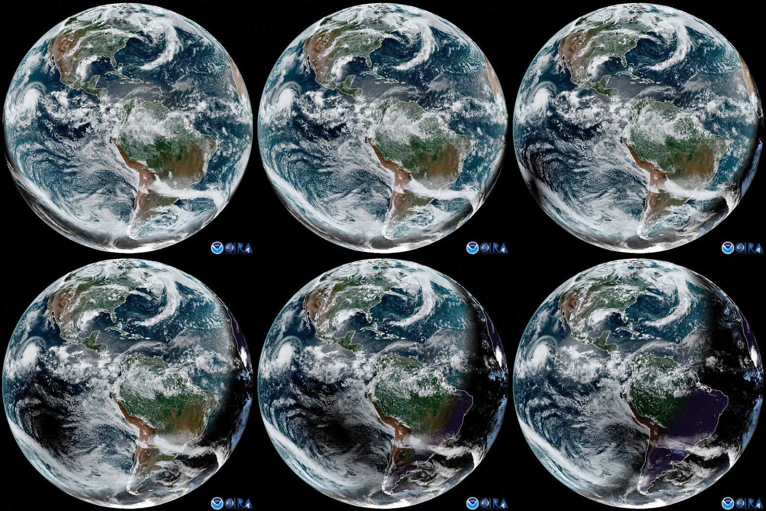
On July 2, people in parts of Chile and Argentina witnessed the moon entirely obscure the sun. At the same time, NOAA’s GOES-16 satellite tracked the moon’s shadow spreading over South America and the Pacific Ocean.
The Kincade Fire’s Long Plume

Gusting winds blew the Kincade Fire’s massive smoke plume hundreds of miles away from the blaze in Sonoma County. On Oct. 27, NOAA’s GOES-17 satellite caught the fire’s smoke streaming over the Pacific Ocean. Look closely and you can see smoke wafting from a separate fire in Vallejo that briefly closed the Carquinez Bridge.
The Eye of the Hurricane
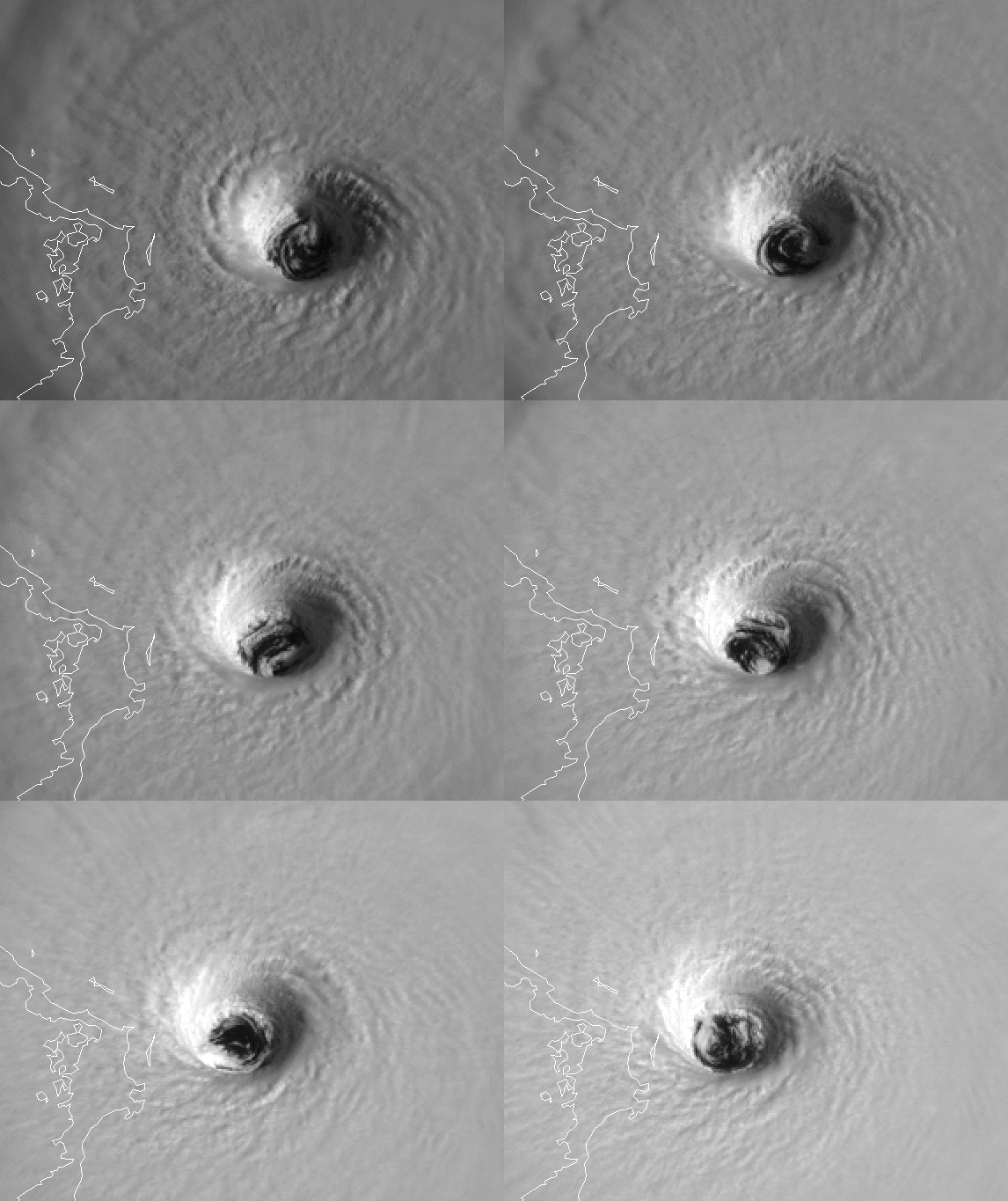
NOAA’s GOES-16 satellite had a view straight into the eye of Hurricane Dorian as it swirled around Abaco Island, Bahamas, on Sept. 1, 2019.
You Can Look At the Sun With a Solar Ultraviolet Imager
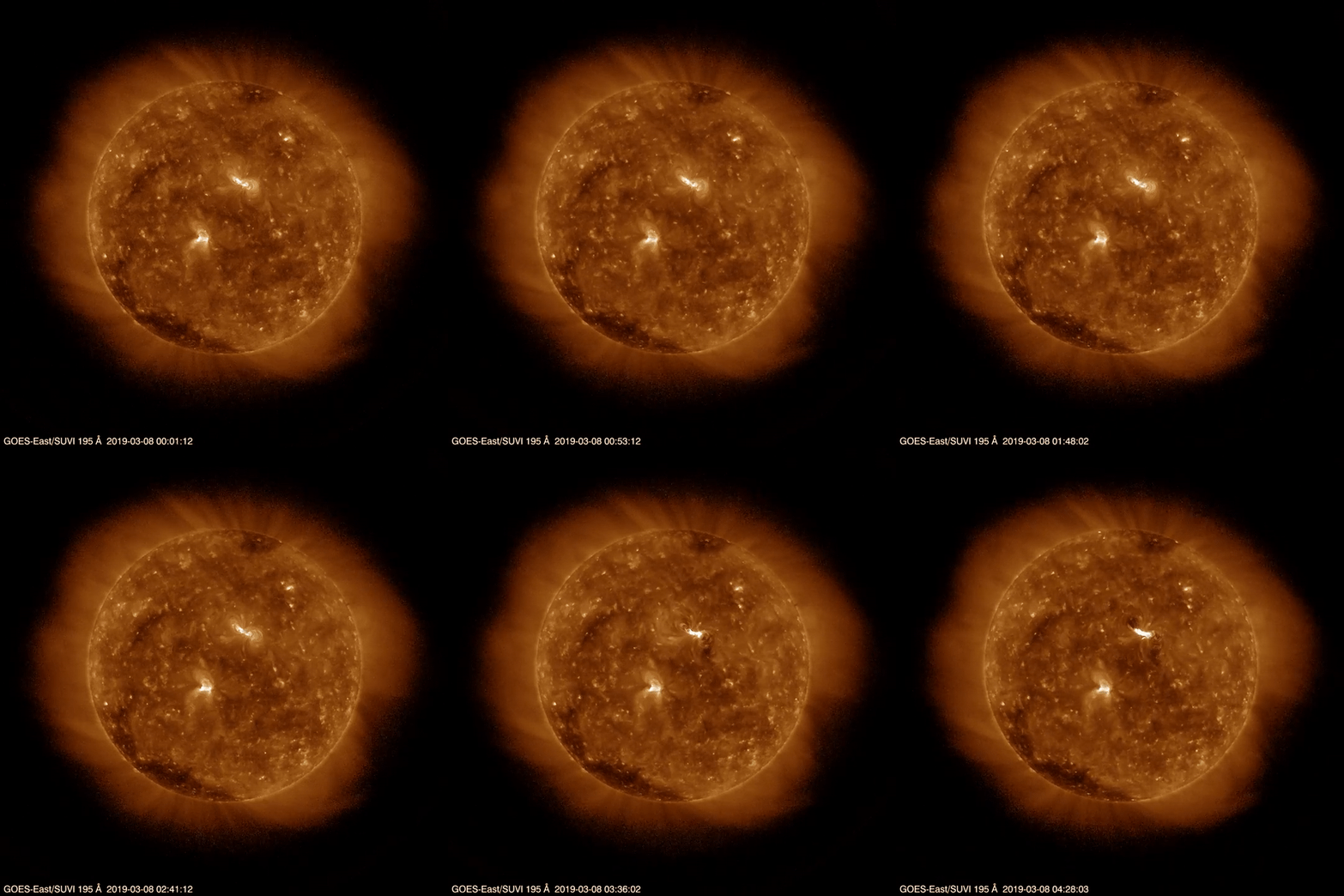
Using a special telescope, NOAA’s GOES-16 satellite can capture images of the sun by recording its ultraviolet radiation. On March 8, 2019, the satellite saw the eruption of a solar flare on the sun’s surface.
Cloud Formations Around Hawaii

Back on Earth, NOAA’s GOES-17 satellite flew over Hawaii on Jan. 15, 2019, as clouds formed around the Big Island.
Dust Plumes off Western Africa
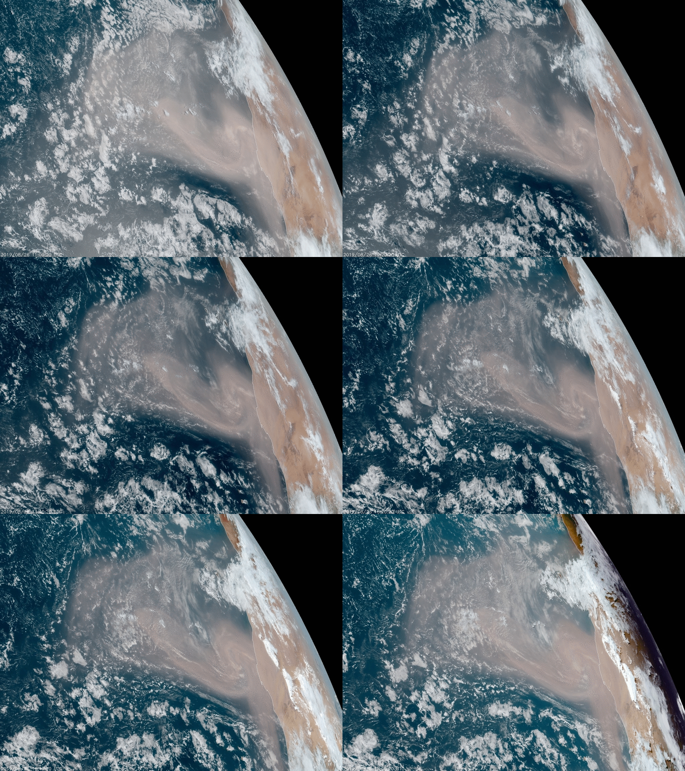
NOAA’s GOES-16 satellite scoped one of the largest dust plumes of the year billowing across the Atlantic Ocean from the Sahara Desert on Aug. 26, 2019.
