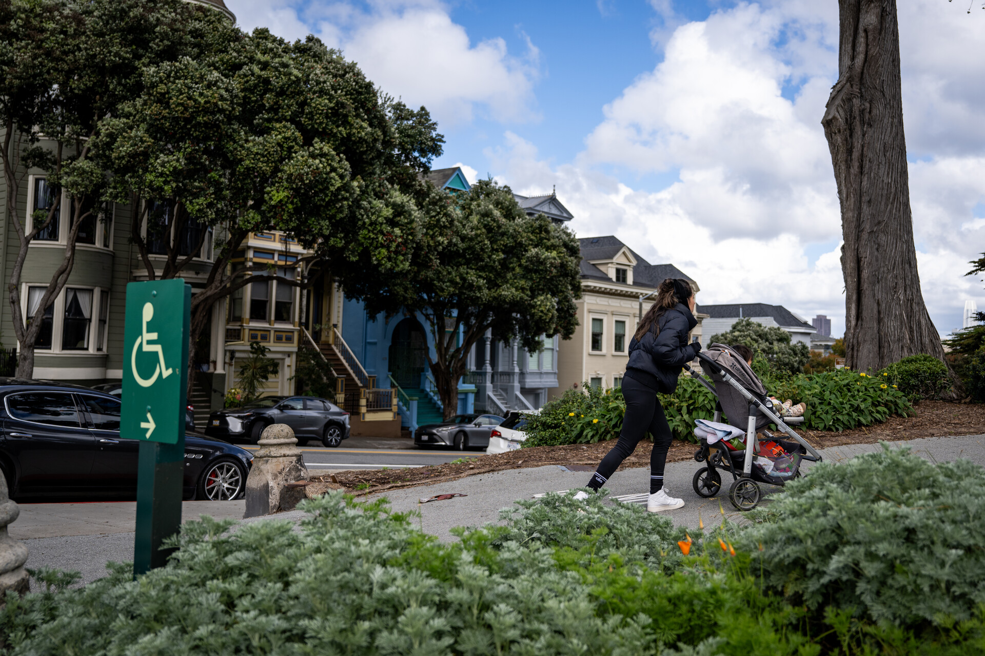
A woman pushes a stroller through Alamo Square Park in San Francisco on April 4, 2024. (Beth LaBerge/KQED)
With the holiday season almost at its end and the weather forecast clearing in the Bay Area, you may be looking for ways to entertain out-of-town guests, especially those with kids cooped up all week long.
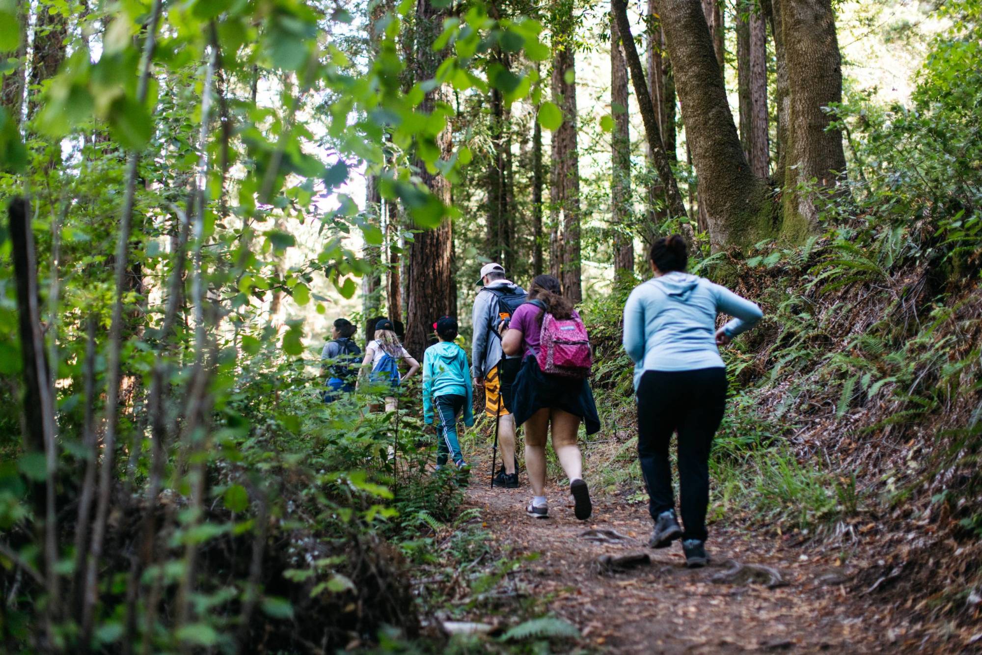
We get it — and we’ve got you covered. Luckily, the Bay Area is full of stroller- and wheelchair-friendly hikes, so family and friends of all ages and abilities can get outside and start the new year on the right foot.
The key to an accessible hike, said Pamela Fox, founder of Marin Mommies, which publishes guides for parents and families in Marin County, is that trails are wide, relatively flat, easy to navigate with a bulky stroller, set in a “spectacular setting,” and feature something for kids to do along the way.
If you need gear to get started, check out your local library, as many lend hiking gear, state and local parks passes, binoculars and nature guides made especially for kids.
The San Mateo County Library system loans out backpacks and other hiking gear for free to anyone with a library card. (Courtesy San Mateo County Libraries)
That includes San Mateo County Libraries’ Library of Things, said Francis Hebert, access services manager.
In addition to the Junior Explorer Backpacks — which include “anything from equipment to binoculars, a magnifying glass, even some waterproof notepads, and also guides and books,” Hebert said — the library also offers data hotspots if you’re worried about being offline.
Everything is available on a first-come-first-served basis. Items can be borrowed for one to three weeks at a time. The San Mateo City Library also lends child carrier backpacks, telescopes and small first aid kits for three weeks at a time.
The libraries are open to suggestions from the public, so if there’s anything you think would make hiking with little ones easier give them a shout, Hebert said.
“We’re here to offer all these services, make things as accessible as possible,” he said.
Read on for more suggestions for kid friendly hikes, broken down by region:
East Bay
Lafayette Reservoir Trail, Lafayette: This 3-mile paved loop circles Lafayette Reservoir and has specific hours for people on roller skates, rollerblades and scooters. The trail is smooth, about 8 feet wide and lined with benches and picnic tables.
Parking: $7 per vehicle all day or $2 per hour for 2 hours maximum. The lot off Mt. Diablo Boulevard has 15 accessible spaces.
Arroyo Del Valle Regional Trail, Livermore: Located in Sycamore Grove Park, this 5-mile round-trip paved trail winds through sycamore and oak trees. You can take detours to a botanical garden, picnic area and an unpaved nature loop for wildlife viewing. Along the way you’ll reach several viewpoints of the creek and even an almond orchard, olive grove and, during the holidays, a decorated Christmas tree. Be aware: Mountain lions have been spotted in the area.
Parking: Park at either the Arroyo Road or Wetmore entrances. Parking is $5, or free at nearby Independence Park.
Bay Trail, East Bay: While the San Francisco Bay Trail spans more than 350 miles to circle the Bay, sections in Pinole and Emeryville are especially welcoming for kids and wheelchair users. Both offer paved trails and stunning bay and skyline views.
Parking: For the Pinole section, park at the Dotson Family Marsh staging area and head north to Point Pinole. Parking is $5 from April through October when the kiosk is attended — and free otherwise. At the Emeryville Marina, parking is free for four hours.
Hikers take a rest on a bench by Lafayette Reservoir in the East Bay. The 2.7-mile loop around the reservoir is wheelchair and stroller accessible. (Courtesy East Bay Municipal Utilities District. )
Old Rail Trail, Tiburon: This 5.2-mile roundtrip follows Tiburon’s shoreline all the way downtown. Start at Blackie’s Pasture, and if you don’t want to head all the way (or are looking for stunning views), veer right onto San Rafael Avenue instead. Along the way, there’s even a playground and ample benches for rest.
Parking: The lots at Blackie’s Pasture are free, but fill up on popular weekends. Overflow parking is available on Greenwood Beach Road.
McInnis Park Wetland Preserve, San Rafael: Ideal for dog walking and birdwatching, this wide dirt path goes for 2.4 miles past a golf course into wetlands with expansive Marin views. There’s no shade, so be sure to cover up during the sunny months. Bring your bird identification guide, as you’re sure to see your fill of waterfowl.
Verna Dunshee Loop Trail, Mill Valley: Looking for views of the North Bay from above? Drive nearly all the way up Mt. Tam to this short 0.7-mile loop with the best vantage points. Be warned: some small sections are moderately steep, but even the drive up to the trail feels like an adventure. And at East Peak, there’s a visitor center with information and snacks.
Parking: Park at East Peak, which is $8 per vehicle.
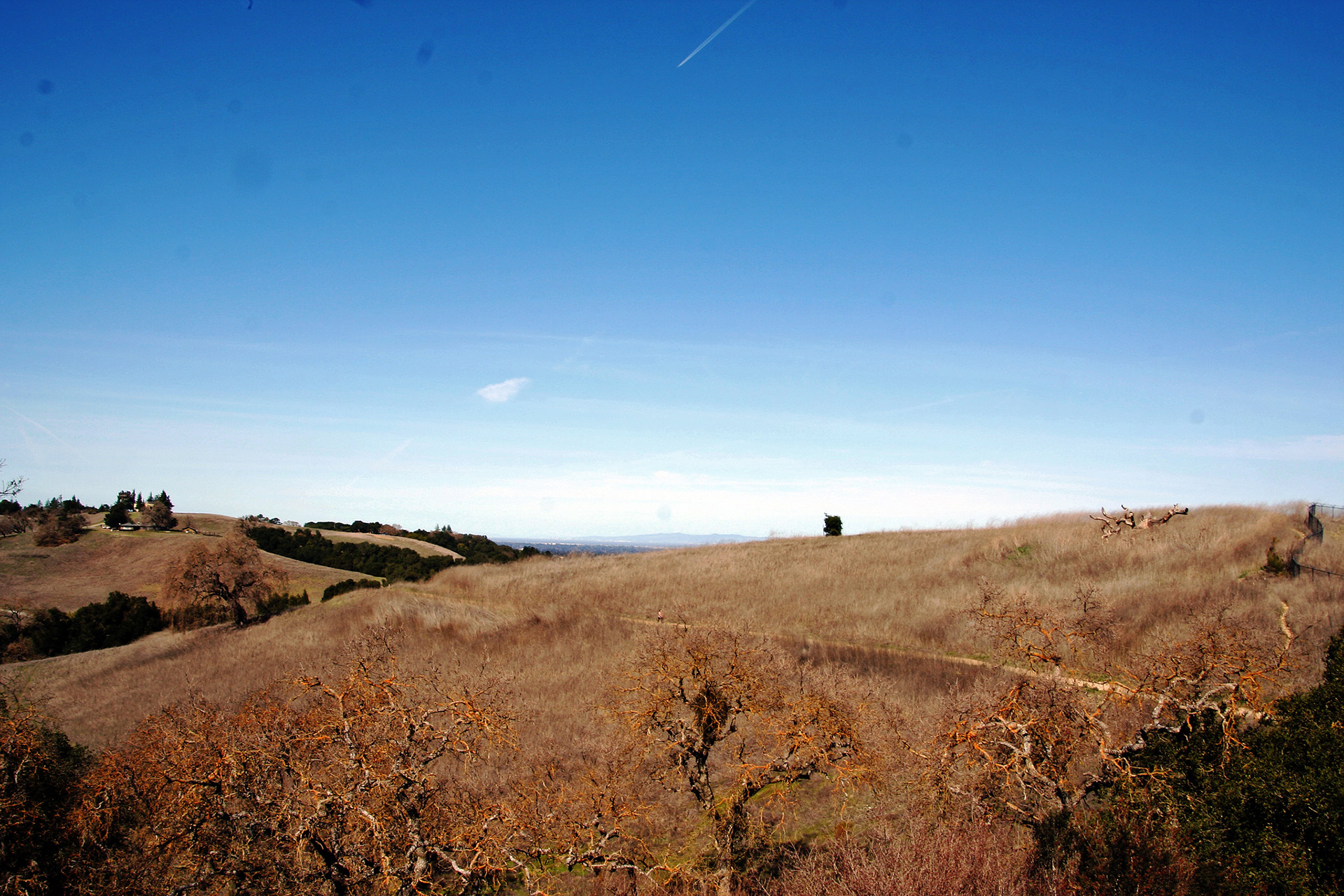
Rancho San Antonio Lower Meadow Trail, Cupertino: Make it an out-and-back or a lollipop — and keep your eyes peeled for deer and wild turkeys on this mostly paved and somewhat shaded trail running alongside Deer Hollow Farm, a 160-year-old apple farm turned educational nonprofit. Be aware: This trail can get quite busy, and if you choose the lollipop route there is one substantial hill.
Golden spaces in Rancho San Antonio County Park and Open Space Preserve (Samuel Jacob/Flickr)
Baylands Nature Preserve, Palo Alto: A birdwatcher’s delight, this network of marshland is mostly undisturbed and contains 15 miles of mostly flat gravel trails. Families can also pop into the Lucy Evans Baylands Nature Interpretive Center to learn more about all the wildlife encountered on the walk.
Parking: There are several free lots, but parking can fill up quickly.
Los Gatos Creek Trail, Santa Clara County: There are multiple access points for the over 10-mile trail with benches, restrooms and routes through downtown Los Gatos and Campbell for a coffee stop. Just be aware that this is a highly trafficked trail by runners and bikers, so slower travelers should stay to the right.
Parking: Park anywhere along the trail or head to Oak Meadow Park for restrooms and a playground. Parking at the park is $6 per vehicle.
Sawyer Camp Trail, San Mateo County: Running along the shoreline of the pristine Lower Crystal Springs Reservoir, you’d never know this 11-mile trail is just minutes from bustling Highway 280. It’s paved with minimal elevation gain as it winds along a nature preserve and water reservoir. There are picnic tables but no drinking fountains, so make sure to bring your own water and even lunch.
Parking: Free parking at the trailhead runs out quickly, but there are ample free spots along the adjacent roadway.
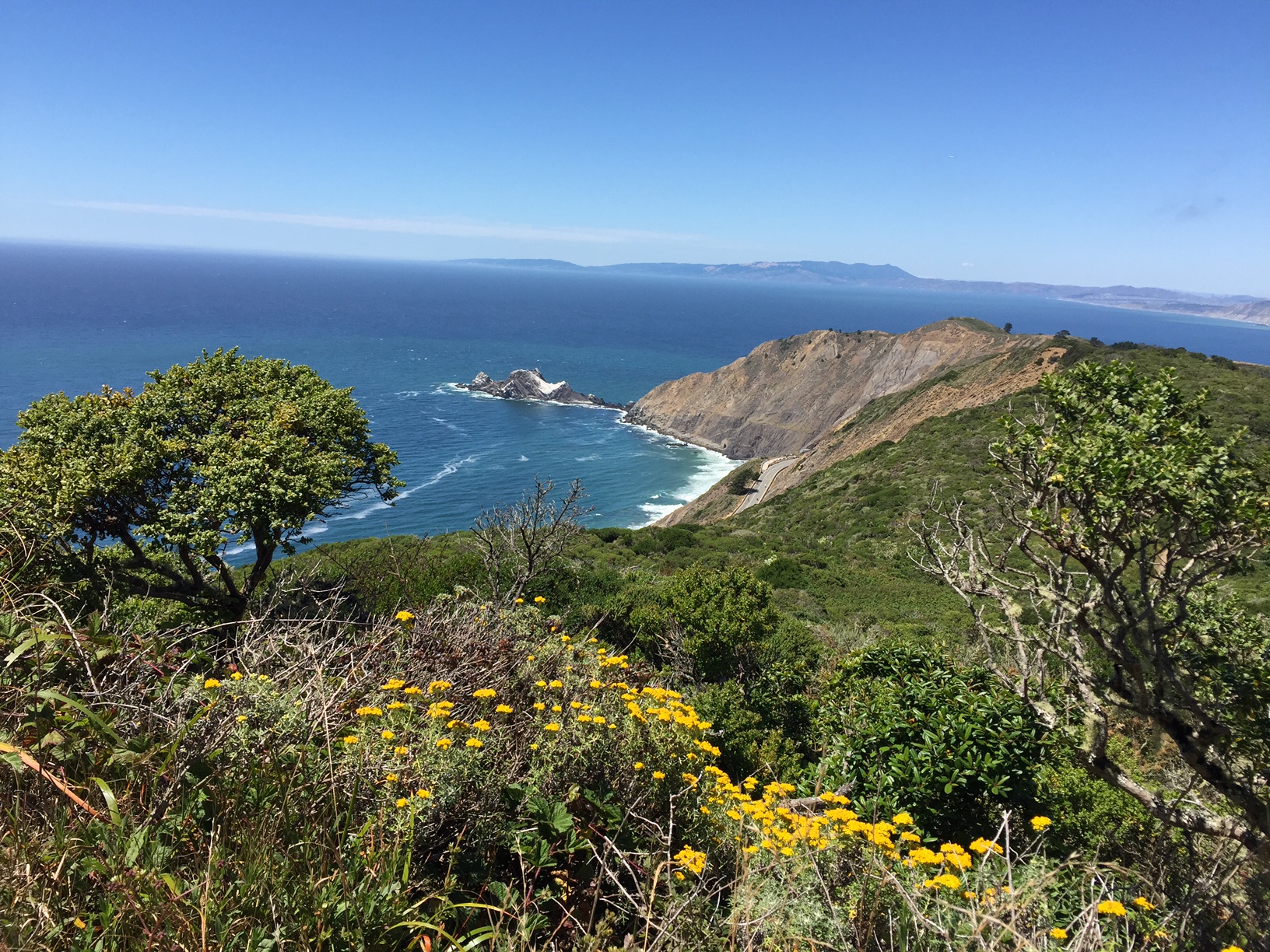
The Devil’s Slide is a paved 1.3-mile trail with benches and observation scopes over the edge of the Pacific Ocean on the former Highway 1 route. (Miranda Leitsinger/KQED)
Half Moon Bay Coastal Trail, Half Moon Bay: Stretching from Half Moon Bay to Moss Beach, this 11-mile segment offers spectacular cliffside coastal views and winds through Half Moon Bay’s harbor where you can grab a snack and trek out to the tidepools at Pillar Point.
Parking: Closer to downtown Half Moon Bay, park at the Poplar Beach lot for $10 per day or $2 per hour. Free parking is available at Princeton Harbor.
Devil’s Slide Trail, Pacifica: This 1.3-mile trail gets all the bang for your buck possible — it’s paved, features benches and observation scopes and teeters over the edge of the Pacific Ocean on the former Highway 1 route. Be aware: This is not an entirely flat trail, so make sure you’re willing to push up a small grade.
Parking: There are parking lots on either side of the tunnel that are both free, but fill up quickly.
Sunset Dunes, San Francisco: San Francisco’s newest car-free promenade stretches 2 miles along the former Great Highway at Ocean Beach. Fully paved and directionally separated, you can go with the flow of traffic without worry. The park is evolving, with murals and kid-friendly equipment and amenities appearing along the route.
Parking: Free street parking is available along the Lower Great Highway or in the lot near Lincoln Way.
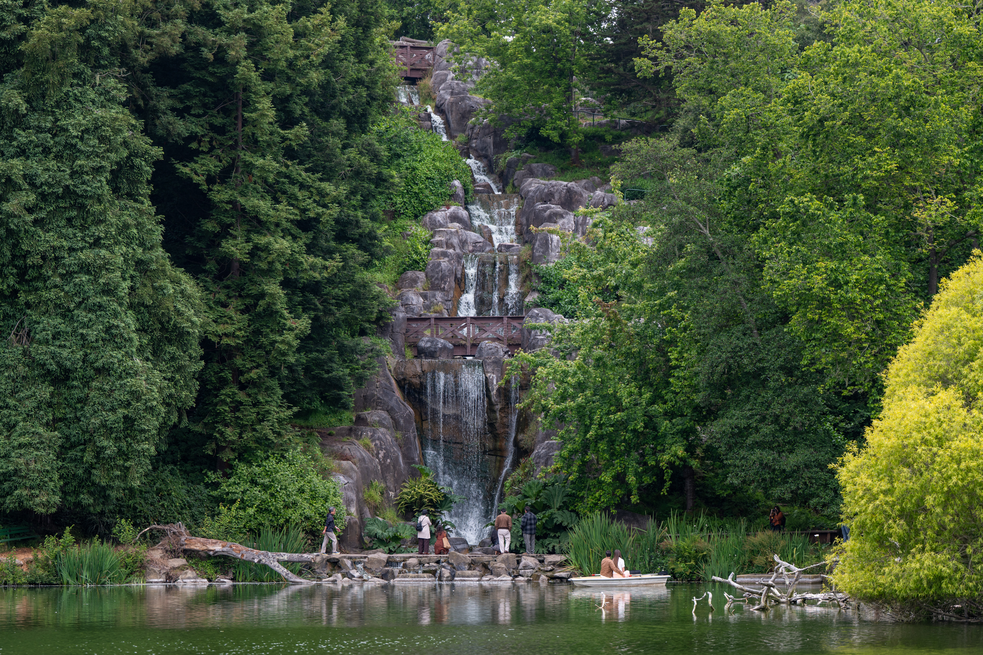
A waterfall at Blue Heron Lake in Golden Gate Park in San Francisco on June 24, 2025. (Beth LaBerge/KQED)
Blue Heron Lake, San Francisco: A world away from the bustling city, this interior lake — formerly Stow Lake — is a mini oasis in the middle of Golden Gate Park where you’ll see wildlife and tourists in pedal boats. It features a wheelchair- and stroller- accessible loop, and if you’re game for some off-roading, you can tackle Strawberry Hill.
Parking: Be aware that driving through the park requires avoiding JFK Promenade, now closed to cars. Parking is free along Blue Heron Lake Drive, accessible via MLK Drive.
Presidio Promenade Trail, San Francisco: It doesn’t get any more San Francisco than sweeping views of the Golden Gate Bridge from the Presidio Promenade. The trail connects Tunnel Tops park and playground to Fort Point and the bridge itself. The entire trail is paved and easy for hikers of any age.
Parking: From the east, you can park at the Letterman Digital Arts Center’s underground lot; from the west, use any of the many free parking areas near the bridge. Just remember: Don’t leave any valuables in your car!
window.__IS_SSR__=true
window.__INITIAL_STATE__={
"attachmentsReducer": {
"audio_0": {
"type": "attachments",
"id": "audio_0",
"imgSizes": {
"kqedFullSize": {
"file": "https://ww2.kqed.org/news/wp-content/themes/KQED-unified/img/audio_bgs/background0.jpg"
}
}
},
"audio_1": {
"type": "attachments",
"id": "audio_1",
"imgSizes": {
"kqedFullSize": {
"file": "https://ww2.kqed.org/news/wp-content/themes/KQED-unified/img/audio_bgs/background1.jpg"
}
}
},
"audio_2": {
"type": "attachments",
"id": "audio_2",
"imgSizes": {
"kqedFullSize": {
"file": "https://ww2.kqed.org/news/wp-content/themes/KQED-unified/img/audio_bgs/background2.jpg"
}
}
},
"audio_3": {
"type": "attachments",
"id": "audio_3",
"imgSizes": {
"kqedFullSize": {
"file": "https://ww2.kqed.org/news/wp-content/themes/KQED-unified/img/audio_bgs/background3.jpg"
}
}
},
"audio_4": {
"type": "attachments",
"id": "audio_4",
"imgSizes": {
"kqedFullSize": {
"file": "https://ww2.kqed.org/news/wp-content/themes/KQED-unified/img/audio_bgs/background4.jpg"
}
}
},
"placeholder": {
"type": "attachments",
"id": "placeholder",
"imgSizes": {
"thumbnail": {
"file": "https://cdn.kqed.org/wp-content/uploads/2024/12/KQED-Default-Image-816638274-2000x1333-1-160x107.jpg",
"width": 160,
"height": 107,
"mimeType": "image/jpeg"
},
"medium": {
"file": "https://cdn.kqed.org/wp-content/uploads/2024/12/KQED-Default-Image-816638274-2000x1333-1-800x533.jpg",
"width": 800,
"height": 533,
"mimeType": "image/jpeg"
},
"medium_large": {
"file": "https://cdn.kqed.org/wp-content/uploads/2024/12/KQED-Default-Image-816638274-2000x1333-1-768x512.jpg",
"width": 768,
"height": 512,
"mimeType": "image/jpeg"
},
"large": {
"file": "https://cdn.kqed.org/wp-content/uploads/2024/12/KQED-Default-Image-816638274-2000x1333-1-1020x680.jpg",
"width": 1020,
"height": 680,
"mimeType": "image/jpeg"
},
"1536x1536": {
"file": "https://cdn.kqed.org/wp-content/uploads/2024/12/KQED-Default-Image-816638274-2000x1333-1-1536x1024.jpg",
"width": 1536,
"height": 1024,
"mimeType": "image/jpeg"
},
"fd-lrg": {
"file": "https://cdn.kqed.org/wp-content/uploads/2024/12/KQED-Default-Image-816638274-2000x1333-1-1536x1024.jpg",
"width": 1536,
"height": 1024,
"mimeType": "image/jpeg"
},
"fd-med": {
"file": "https://cdn.kqed.org/wp-content/uploads/2024/12/KQED-Default-Image-816638274-2000x1333-1-1020x680.jpg",
"width": 1020,
"height": 680,
"mimeType": "image/jpeg"
},
"fd-sm": {
"file": "https://cdn.kqed.org/wp-content/uploads/2024/12/KQED-Default-Image-816638274-2000x1333-1-800x533.jpg",
"width": 800,
"height": 533,
"mimeType": "image/jpeg"
},
"post-thumbnail": {
"file": "https://cdn.kqed.org/wp-content/uploads/2024/12/KQED-Default-Image-816638274-2000x1333-1-672x372.jpg",
"width": 672,
"height": 372,
"mimeType": "image/jpeg"
},
"twentyfourteen-full-width": {
"file": "https://cdn.kqed.org/wp-content/uploads/2024/12/KQED-Default-Image-816638274-2000x1333-1-1038x576.jpg",
"width": 1038,
"height": 576,
"mimeType": "image/jpeg"
},
"xxsmall": {
"file": "https://cdn.kqed.org/wp-content/uploads/2024/12/KQED-Default-Image-816638274-2000x1333-1-160x107.jpg",
"width": 160,
"height": 107,
"mimeType": "image/jpeg"
},
"xsmall": {
"file": "https://cdn.kqed.org/wp-content/uploads/2024/12/KQED-Default-Image-816638274-2000x1333-1-672x372.jpg",
"width": 672,
"height": 372,
"mimeType": "image/jpeg"
},
"small": {
"file": "https://cdn.kqed.org/wp-content/uploads/2024/12/KQED-Default-Image-816638274-2000x1333-1-672x372.jpg",
"width": 672,
"height": 372,
"mimeType": "image/jpeg"
},
"xlarge": {
"file": "https://cdn.kqed.org/wp-content/uploads/2024/12/KQED-Default-Image-816638274-2000x1333-1-1020x680.jpg",
"width": 1020,
"height": 680,
"mimeType": "image/jpeg"
},
"full-width": {
"file": "https://cdn.kqed.org/wp-content/uploads/2024/12/KQED-Default-Image-816638274-2000x1333-1-1920x1280.jpg",
"width": 1920,
"height": 1280,
"mimeType": "image/jpeg"
},
"guest-author-32": {
"file": "https://cdn.kqed.org/wp-content/uploads/2025/01/KQED-Default-Image-816638274-1333x1333-1-160x160.jpg",
"width": 32,
"height": 32,
"mimeType": "image/jpeg"
},
"guest-author-50": {
"file": "https://cdn.kqed.org/wp-content/uploads/2025/01/KQED-Default-Image-816638274-1333x1333-1-160x160.jpg",
"width": 50,
"height": 50,
"mimeType": "image/jpeg"
},
"guest-author-64": {
"file": "https://cdn.kqed.org/wp-content/uploads/2025/01/KQED-Default-Image-816638274-1333x1333-1-160x160.jpg",
"width": 64,
"height": 64,
"mimeType": "image/jpeg"
},
"guest-author-96": {
"file": "https://cdn.kqed.org/wp-content/uploads/2025/01/KQED-Default-Image-816638274-1333x1333-1-160x160.jpg",
"width": 96,
"height": 96,
"mimeType": "image/jpeg"
},
"guest-author-128": {
"file": "https://cdn.kqed.org/wp-content/uploads/2025/01/KQED-Default-Image-816638274-1333x1333-1-160x160.jpg",
"width": 128,
"height": 128,
"mimeType": "image/jpeg"
},
"detail": {
"file": "https://cdn.kqed.org/wp-content/uploads/2025/01/KQED-Default-Image-816638274-1333x1333-1-160x160.jpg",
"width": 160,
"height": 160,
"mimeType": "image/jpeg"
},
"kqedFullSize": {
"file": "https://cdn.kqed.org/wp-content/uploads/2024/12/KQED-Default-Image-816638274-2000x1333-1.jpg",
"width": 2000,
"height": 1333
}
}
},
"news_11987469": {
"type": "attachments",
"id": "news_11987469",
"meta": {
"index": "attachments_1716263798",
"site": "news",
"id": "11987469",
"found": true
},
"title": "240404-District5BOSRedistricting-010-BL_qut",
"publishDate": 1716424806,
"status": "inherit",
"parent": 11987465,
"modified": 1716424849,
"caption": "A woman pushes a stroller through Alamo Square Park in San Francisco on April 4, 2024.",
"credit": "Beth LaBerge/KQED",
"altTag": null,
"description": null,
"imgSizes": {
"medium": {
"file": "https://cdn.kqed.org/wp-content/uploads/sites/10/2024/05/240404-District5BOSRedistricting-010-BL_qut-800x533.jpg",
"width": 800,
"height": 533,
"mimeType": "image/jpeg"
},
"large": {
"file": "https://cdn.kqed.org/wp-content/uploads/sites/10/2024/05/240404-District5BOSRedistricting-010-BL_qut-1020x680.jpg",
"width": 1020,
"height": 680,
"mimeType": "image/jpeg"
},
"thumbnail": {
"file": "https://cdn.kqed.org/wp-content/uploads/sites/10/2024/05/240404-District5BOSRedistricting-010-BL_qut-160x107.jpg",
"width": 160,
"height": 107,
"mimeType": "image/jpeg"
},
"1536x1536": {
"file": "https://cdn.kqed.org/wp-content/uploads/sites/10/2024/05/240404-District5BOSRedistricting-010-BL_qut-1536x1024.jpg",
"width": 1536,
"height": 1024,
"mimeType": "image/jpeg"
},
"post-thumbnail": {
"file": "https://cdn.kqed.org/wp-content/uploads/sites/10/2024/05/240404-District5BOSRedistricting-010-BL_qut-672x372.jpg",
"width": 672,
"height": 372,
"mimeType": "image/jpeg"
},
"twentyfourteen-full-width": {
"file": "https://cdn.kqed.org/wp-content/uploads/sites/10/2024/05/240404-District5BOSRedistricting-010-BL_qut-1038x576.jpg",
"width": 1038,
"height": 576,
"mimeType": "image/jpeg"
},
"kqedFullSize": {
"file": "https://cdn.kqed.org/wp-content/uploads/sites/10/2024/05/240404-District5BOSRedistricting-010-BL_qut.jpg",
"width": 1920,
"height": 1280
}
},
"isLoading": false,
"fetchFailed": false
}
},
"audioPlayerReducer": {
"postId": "stream_live",
"isPaused": true,
"isPlaying": false,
"pfsActive": false,
"pledgeModalIsOpen": true,
"playerDrawerIsOpen": false,
"liveAudioPlayStartedAt": 0,
"liveAudioPlayContext": ""
},
"authorsReducer": {
"sarahwright": {
"type": "authors",
"id": "11956",
"meta": {
"index": "authors_1716337520",
"id": "11956",
"found": true
},
"name": "Sarah Wright",
"firstName": "Sarah",
"lastName": "Wright",
"slug": "sarahwright",
"email": "swright@kqed.org",
"display_author_email": true,
"staff_mastheads": [],
"title": "Outdoors Engagement Reporter",
"bio": "Sarah Wright is KQED's Outdoors Engagement Reporter. Originally from Lake Tahoe, she completed a thru-hike of the Pacific Crest Trail in 2019 and was a U.S. Fulbright Program grantee to Argentina in 2023. Her journalism has appeared in The Guardian, The San Francisco Standard, The Palo Alto Weekly and the Half Moon Bay Review.",
"avatar": "https://secure.gravatar.com/avatar/c161a3d6441865cba25e6db4fa561099ad665799e9432e34da2b84d7e371524c?s=600&d=blank&r=g",
"twitter": null,
"bluesky": null,
"facebook": null,
"instagram": null,
"linkedin": null,
"sites": [
{
"site": "arts",
"roles": [
"editor"
]
},
{
"site": "news",
"roles": [
"editor"
]
},
{
"site": "science",
"roles": [
"contributor",
"author"
]
},
{
"site": "forum",
"roles": [
"editor"
]
}
],
"headData": {
"title": "Sarah Wright | KQED",
"description": "Outdoors Engagement Reporter",
"ogImgSrc": "https://secure.gravatar.com/avatar/c161a3d6441865cba25e6db4fa561099ad665799e9432e34da2b84d7e371524c?s=600&d=blank&r=g",
"twImgSrc": "https://secure.gravatar.com/avatar/c161a3d6441865cba25e6db4fa561099ad665799e9432e34da2b84d7e371524c?s=600&d=blank&r=g"
},
"isLoading": false,
"link": "/author/sarahwright"
}
},
"pagesReducer": {},
"pfsSessionReducer": {},
"postsReducer": {
"stream_live": {
"type": "live",
"id": "stream_live",
"audioUrl": "https://streams.kqed.org/kqedradio",
"title": "Live Stream",
"excerpt": "Live Stream information currently unavailable.",
"link": "/radio",
"featImg": "",
"label": {
"name": "KQED Live",
"link": "/"
}
},
"stream_kqedNewscast": {
"type": "posts",
"id": "stream_kqedNewscast",
"audioUrl": "https://www.kqed.org/.stream/anon/radio/RDnews/newscast.mp3?_=1",
"title": "KQED Newscast",
"featImg": "",
"label": {
"name": "88.5 FM",
"link": "/"
}
},
"news_12068396": {
"type": "posts",
"id": "news_12068396",
"meta": {
"index": "posts_1716263798",
"site": "news",
"id": "12068396",
"found": true
},
"articlePosition": 0,
"guestAuthors": [],
"slug": "best-bay-area-stroller-hikes-to-bring-family-this-new-years",
"title": "Best Bay Area Stroller Hikes to Bring Family This New Years",
"publishDate": 1767193227,
"format": "standard",
"headTitle": "Best Bay Area Stroller Hikes to Bring Family This New Years | KQED",
"labelTerm": {
"site": "news"
},
"content": "\u003cp>With the holiday season almost at its end and the weather forecast clearing in the Bay Area, you may be looking for ways to entertain out-of-town guests, especially those with kids cooped up all week long.\u003c/p>\n\u003cp>We get it — and we’ve got you covered. Luckily, the Bay Area is full of stroller- and wheelchair-friendly hikes, so family and friends of all ages and abilities can get outside and start the new year on the right foot.\u003c/p>\n\u003cp>The key to an accessible hike, said Pamela Fox, founder of \u003ca href=\"https://www.marinmommies.com/\">Marin Mommies\u003c/a>, which publishes guides for parents and families in Marin County, is that trails are wide, relatively flat, easy to navigate with a bulky stroller, set in a “spectacular setting,” and feature something for kids to do along the way.\u003c/p>\n\u003cp>[ad fullwidth]\u003c/p>\n\u003cp>Fox highlighted North Bay hikes that fit the bill, from the \u003ca href=\"https://www.nps.gov/thingstodo/walk-the-cross-marin-trail.htm\">Cross Marin Trail\u003c/a> in \u003ca href=\"https://www.parks.ca.gov/?page_id=469\">Samuel P. Taylor State Park\u003c/a> to the old-growth redwoods of \u003ca href=\"https://www.nps.gov/muwo/index.htm\">Muir Woods National Monument\u003c/a> and the sweeping ocean views of Mill Valley’s \u003ca href=\"https://www.nps.gov/goga/planyourvisit/tennessee_valley.htm\">Tennessee Valley.\u003c/a> The visitor center at \u003ca href=\"https://www.nps.gov/pore/index.htm\">Point Reyes National Seashore\u003c/a> got a special shoutout, as did the \u003ca href=\"https://presidio.gov/explore/attractions/outpost-playground\">Tunnel Tops playground\u003c/a> at \u003ca href=\"https://www.parksconservancy.org/parks/crissy-field\">Crissy Field\u003c/a> in San Francisco. Fox also mentioned the \u003ca href=\"https://www.marinmommies.com/walk-or-bike-bay-trail-hamilton-novato\">Novato section of the Bay Trail\u003c/a>, which also has a playground and viewing binoculars for wildlife watching.\u003c/p>\n\u003cp>If you need gear to get started, check out your local library, as many lend hiking gear, \u003ca href=\"https://www.kqed.org/news/11910495/how-to-get-free-entry-to-california-state-parks-with-your-library-card\">state and local parks passes\u003c/a>, binoculars and nature guides made especially for kids.\u003c/p>\n\u003cfigure id=\"attachment_12068408\" class=\"wp-caption aligncenter\" style=\"max-width: 2000px\">\u003ca href=\"https://cdn.kqed.org/wp-content/uploads/sites/10/2025/12/ParksCA-SanMateo-21-scaled-e1766881784540.jpg\">\u003cimg loading=\"lazy\" decoding=\"async\" class=\"size-full wp-image-12068408\" title=\"\" src=\"https://cdn.kqed.org/wp-content/uploads/sites/10/2025/12/ParksCA-SanMateo-21-scaled-e1766881784540.jpg\" alt=\"\" width=\"2000\" height=\"1334\">\u003c/a>\u003cfigcaption class=\"wp-caption-text\">The San Mateo County Library system loans out backpacks and other hiking gear for free to anyone with a library card. \u003ccite>(Courtesy San Mateo County Libraries)\u003c/cite>\u003c/figcaption>\u003c/figure>\n\u003cp>That includes San Mateo County Libraries’ \u003ca href=\"https://smcl.org/blogs/post/library-of-things-for-the-nature-lovers/\">Library of Things\u003c/a>, said Francis Hebert, access services manager.\u003c/p>\n\u003cp>In addition to the \u003ca href=\"https://smcl.org/blogs/post/library-of-things-for-the-nature-lovers/\">Junior Explorer Backpacks\u003c/a> — which include “anything from equipment to binoculars, a magnifying glass, even some waterproof notepads, and also guides and books,” Hebert said — the library also offers data hotspots if you’re worried about being offline.\u003c/p>\n\u003cp>Everything is available on a first-come-first-served basis. Items can be borrowed for one to three weeks at a time. The \u003ca href=\"https://smplibrary.bibliocommons.com/v2/record/S76C3570319\">San Mateo City Library\u003c/a> also lends child carrier backpacks, telescopes and small first aid kits for three weeks at a time.\u003c/p>\n\u003cp>The libraries are open to suggestions from the public, so if there’s anything you think would make hiking with little ones easier give them a shout, Hebert said.\u003c/p>\n\u003cp>“We’re here to offer all these services, make things as accessible as possible,” he said.\u003c/p>\n\u003cp>Read on for more suggestions for kid friendly hikes, broken down by region:\u003c/p>\n\u003ch2>East Bay\u003c/h2>\n\u003cp>\u003ca href=\"https://www.alltrails.com/trail/us/california/lafayette-reservoir-loop\">\u003cstrong>Lafayette Reservoir Trail\u003c/strong>\u003c/a>\u003cstrong>, Lafayette\u003c/strong>: This 3-mile paved loop circles Lafayette Reservoir and has specific hours for people on roller skates, rollerblades and scooters. The trail is smooth, about 8 feet wide and lined with benches and picnic tables.[aside postID=news_11937204 hero='https://cdn.kqed.org/wp-content/uploads/sites/10/2023/01/RS61931_GettyImages-1244621387-qut-1536x1024.jpg']The nearby \u003ca href=\"https://www.ebparks.org/trails/interpark/lafayette-moraga\">Lafayette-Moraga Trail\u003c/a> is another accessible option, stretching 7.5 miles.\u003c/p>\n\u003cp>\u003cem>Parking: \u003c/em>$7 per vehicle all day or $2 per hour for 2 hours maximum. The lot off Mt. Diablo Boulevard has 15 accessible spaces.\u003c/p>\n\u003cp>\u003ca href=\"https://www.alltrails.com/trail/us/california/arroyo-del-valle-regional-trail\">\u003cstrong>Arroyo Del Valle Regional Trail\u003c/strong>\u003c/a>\u003cstrong>, Livermore\u003c/strong>: Located in \u003ca href=\"https://www.larpd.org/sycamore-grove-park\">Sycamore Grove Park\u003c/a>, this 5-mile round-trip paved trail winds through sycamore and oak trees. You can take detours to a botanical garden, picnic area and an unpaved nature loop for wildlife viewing. Along the way you’ll reach several viewpoints of the creek and even an almond orchard, olive grove and, during the holidays, a decorated Christmas tree. Be aware: \u003ca href=\"https://www.kqed.org/news/12052044/what-to-do-if-you-see-a-mountain-lion-while-hiking-in-the-bay-area\">Mountain lions\u003c/a> have been spotted in the area.\u003c/p>\n\u003cp>\u003cem>Parking: \u003c/em>Park at either the Arroyo Road or Wetmore entrances. Parking is $5, or free at nearby Independence Park.\u003c/p>\n\u003cp>\u003ca href=\"https://www.ebparks.org/trails/interpark/sf-bay-trail\">\u003cstrong>Bay Trail\u003c/strong>\u003c/a>\u003cstrong>, East Bay: \u003c/strong>While the \u003ca href=\"https://mtc.ca.gov/operations/regional-trails-parks/san-francisco-bay-trail\">San Francisco Bay Trail\u003c/a> spans more than 350 miles to circle the Bay, sections in \u003ca href=\"https://www.alltrails.com/trail/us/california/bay-trail-point-pinole-and-bayview-loop\">Pinole \u003c/a>and \u003ca href=\"https://www.alltrails.com/trail/us/california/san-francisco-bay-trail-emeryville-to-richmond-inner-harbor\">Emeryville\u003c/a> are especially welcoming for kids and wheelchair users. Both offer paved trails and stunning bay and skyline views.\u003c/p>\n\u003cp>\u003cem>Parking\u003c/em>: For the Pinole section, park at the\u003ca href=\"https://share.google/f40H8YfldUQWwzQHh\"> Dotson Family Marsh staging area\u003c/a> and head north to Point Pinole. Parking is $5 from April through October when the kiosk is attended — and free otherwise. At the \u003ca href=\"https://sfbaywatertrail.org/trailhead/emeryville-marina/\">Emeryville Marina\u003c/a>, parking is free for four hours.\u003c/p>\n\u003cfigure id=\"attachment_12068412\" class=\"wp-caption aligncenter\" style=\"max-width: 2000px\">\u003ca href=\"https://cdn.kqed.org/wp-content/uploads/sites/10/2025/12/Lafayette-Reservoir-EMBUD-scaled-e1766882756535.jpg\">\u003cimg loading=\"lazy\" decoding=\"async\" class=\"size-full wp-image-12068412\" title=\"\" src=\"https://cdn.kqed.org/wp-content/uploads/sites/10/2025/12/Lafayette-Reservoir-EMBUD-scaled-e1766882756535.jpg\" alt=\"\" width=\"2000\" height=\"1500\">\u003c/a>\u003cfigcaption class=\"wp-caption-text\">Hikers take a rest on a bench by Lafayette Reservoir in the East Bay. The 2.7-mile loop around the reservoir is wheelchair and stroller accessible. \u003ccite>(Courtesy East Bay Municipal Utilities District. )\u003c/cite>\u003c/figcaption>\u003c/figure>\n\u003cp>If you still need more East Bay ideas, try:\u003c/p>\n\u003cul>\n\u003cli>\u003ca href=\"https://www.ebparks.org/parks/coyote-hills\">Coyote Hills,\u003c/a> Fremont\u003c/li>\n\u003cli>\u003ca href=\"https://www.ebparks.org/trails/interpark/alameda-creek\">Alameda Creek Trail,\u003c/a> Fremont\u003c/li>\n\u003cli>\u003ca href=\"https://www.ebparks.org/trails/interpark/iron-horse\">Iron Horse Trail\u003c/a>, Concord to Pleasanton\u003c/li>\n\u003cli>\u003ca href=\"https://www.ebparks.org/trails/interpark/contra-costa-canal\">Contra Costa Canal Trail\u003c/a>, Contra Costa County\u003c/li>\n\u003c/ul>\n\u003ch2>North Bay\u003c/h2>\n\u003cp>\u003ca href=\"https://www.thingstodomarin.com/main/2019/8/13/best-flat-hikes-in-marin-old-rail-trail-in-tiburon\">\u003cstrong>Old Rail Trail\u003c/strong>\u003c/a>\u003cstrong>, Tiburon\u003c/strong>: This 5.2-mile roundtrip follows Tiburon’s shoreline all the way downtown. Start at Blackie’s Pasture, and if you don’t want to head all the way (or are looking for stunning views), veer right onto San Rafael Avenue instead. Along the way, there’s even a playground and ample benches for rest.\u003c/p>\n\u003cp>\u003cem>Parking: \u003c/em>The lots at Blackie’s Pasture are free, but fill up on popular weekends. Overflow parking is available on Greenwood Beach Road.\u003c/p>\n\u003cp>\u003ca href=\"https://www.marinmommies.com/scenic-wetland-walk-mcinnis-park\">\u003cstrong>McInnis Park Wetland Preserve\u003c/strong>\u003c/a>\u003cstrong>, San Rafael: \u003c/strong>Ideal for dog walking and birdwatching, this \u003ca href=\"https://www.alltrails.com/trail/us/california/mcinnis-pond-loop\">wide dirt path\u003c/a> goes for 2.4 miles past a golf course into wetlands with expansive Marin views. There’s no shade, so be sure to cover up during the sunny months. Bring your bird identification guide, as you’re sure to see your fill of waterfowl.\u003c/p>\n\u003cp>\u003cem>Parking: \u003c/em>Parking is free near the \u003ca href=\"https://maps.app.goo.gl/BhiUdke8ZDAifVvP9\">McInnis Park Golf Center\u003c/a>.\u003c/p>\n\u003cp>\u003ca href=\"https://www.alltrails.com/trail/us/california/verna-dunshee-loop\">\u003cstrong>Verna Dunshee Loop Trail\u003c/strong>\u003c/a>\u003cstrong>, Mill Valley: \u003c/strong>Looking for views of the North Bay from above? Drive nearly all the way up Mt. Tam to this short 0.7-mile loop with the best vantage points. Be warned: some small sections are moderately steep, but even the drive up to the trail feels like an adventure. And at East Peak, there’s a visitor center with information and snacks.\u003c/p>\n\u003cp>\u003cem>Parking: \u003c/em>Park at East Peak, which is $8 per vehicle.\u003c/p>\n\u003cp>If you still need more North Bay ideas, try:\u003c/p>\n\u003cul>\n\u003cli>\u003ca href=\"https://www.parks.ca.gov/?page_id=450\">Armstrong Redwoods\u003c/a>, Guerneville\u003c/li>\n\u003cli>\u003ca href=\"https://www.vinetrail.org/\">Napa Valley Vine Trail\u003c/a>, Napa\u003c/li>\n\u003cli>\u003ca href=\"https://www.alltrails.com/trail/us/california/tennessee-valley-trail\">Tennessee Valley Trail\u003c/a>, Mill Valley\u003c/li>\n\u003c/ul>\n\u003ch2>South Bay\u003c/h2>\n\u003cp>\u003ca href=\"https://www.alltrails.com/trail/us/california/lower-meadow-trail-to-farm-bypass-loop\">\u003cstrong>Rancho San Antonio Lower Meadow Trail\u003c/strong>\u003c/a>\u003cstrong>, Cupertino: \u003c/strong>Make it an out-and-back or a lollipop — and keep your eyes peeled for deer and wild turkeys on this mostly paved and somewhat shaded trail running alongside \u003ca href=\"https://www.deerhollowfarm.org/\">Deer Hollow Farm\u003c/a>, a 160-year-old apple farm turned educational nonprofit. Be aware: This trail can get quite busy, and if you choose the lollipop route there is one substantial hill.\u003c/p>\n\u003cp>\u003cem>Parking\u003c/em>: Free, but the \u003ca href=\"https://www.openspace.org/preserves/rancho-san-antonio#parking\">parking lots fill early at this preserve.\u003c/a> You can even check \u003ca href=\"https://www.openspace.org/rsa-parking\">availability at home\u003c/a> before you leave.\u003c/p>\n\u003cfigure id=\"attachment_11842373\" class=\"wp-caption aligncenter\" style=\"max-width: 1920px\">\u003ca href=\"https://cdn.kqed.org/wp-content/uploads/sites/10/2020/10/6937439237_b998d49f26_k.png\">\u003cimg loading=\"lazy\" decoding=\"async\" class=\"size-full wp-image-11842373\" title=\"\" src=\"https://cdn.kqed.org/wp-content/uploads/sites/10/2020/10/6937439237_b998d49f26_k.png\" alt=\"Brown, grassy hillsides under blue skies.\" width=\"1920\" height=\"1280\" srcset=\"https://cdn.kqed.org/wp-content/uploads/sites/10/2020/10/6937439237_b998d49f26_k.png 1920w, https://cdn.kqed.org/wp-content/uploads/sites/10/2020/10/6937439237_b998d49f26_k-800x533.png 800w, https://cdn.kqed.org/wp-content/uploads/sites/10/2020/10/6937439237_b998d49f26_k-1020x680.png 1020w, https://cdn.kqed.org/wp-content/uploads/sites/10/2020/10/6937439237_b998d49f26_k-160x107.png 160w, https://cdn.kqed.org/wp-content/uploads/sites/10/2020/10/6937439237_b998d49f26_k-1536x1024.png 1536w\" sizes=\"auto, (max-width: 1920px) 100vw, 1920px\">\u003c/a>\u003cfigcaption class=\"wp-caption-text\">Golden spaces in Rancho San Antonio County Park and Open Space Preserve \u003ccite>(Samuel Jacob/Flickr)\u003c/cite>\u003c/figcaption>\u003c/figure>\n\u003cp>\u003ca href=\"https://www.paloalto.gov/Departments/Community-Services/Parks-Open-Space-Golf-Division/Neighborhood-Parks/Baylands-Nature-Preserve\">\u003cstrong>Baylands Nature Preserve\u003c/strong>\u003c/a>\u003cstrong>, Palo Alto: \u003c/strong>A birdwatcher’s delight, this network of marshland is mostly undisturbed and contains 15 miles of mostly flat gravel trails. Families can also pop into the \u003ca href=\"https://www.paloalto.gov/Departments/Community-Services/Facility-Rentals/Nature-Interpretive-Centers/Baylands-Nature-Interpretive-Center\">Lucy Evans Baylands Nature Interpretive Center\u003c/a> to learn more about all the wildlife encountered on the walk.\u003c/p>\n\u003cp>\u003cem>Parking: \u003c/em>There are several free lots, but parking can fill up quickly.\u003c/p>\n\u003cp>\u003ca href=\"https://www.losgatosca.gov/907/Los-Gatos-Creek-Trail\">\u003cstrong>Los Gatos Creek Trail\u003c/strong>\u003c/a>\u003cstrong>, Santa Clara County\u003c/strong>: There are multiple access points for the over 10-mile trail with benches, restrooms and routes through downtown Los Gatos and Campbell for a coffee stop. Just be aware that this is a highly trafficked trail by runners and bikers, so slower travelers should stay to the right.\u003c/p>\n\u003cp>\u003cem>Parking: \u003c/em>Park anywhere along the trail or head to Oak Meadow Park for restrooms and a playground. Parking at the park is $6 per vehicle.\u003c/p>\n\u003cp>If you still need more South Bay ideas, try:\u003c/p>\n\u003cul>\n\u003cli>\u003ca href=\"https://www.sanjose.org/listings/coyote-creek-trail\">Coyote Creek Trail\u003c/a>, San Jose\u003c/li>\n\u003cli>\u003ca href=\"https://www.alltrails.com/trail/us/california/stanford-dish-loop-trail\">Stanford Dish Trail\u003c/a>, Stanford\u003c/li>\n\u003cli>\u003ca href=\"https://www.paloalto.gov/Departments/Community-Services/Parks-Open-Space-Golf-Division/Neighborhood-Parks/Pearson-Arastradero-Preserve\">Pearson-Arastradero Preserve\u003c/a>, Palo Alto\u003c/li>\n\u003c/ul>\n\u003ch2>Peninsula\u003c/h2>\n\u003cp>\u003ca href=\"https://www.alltrails.com/trail/us/california/sawyer-camp-trail\">\u003cstrong>Sawyer Camp Trail\u003c/strong>\u003c/a>\u003cstrong>, San Mateo County: \u003c/strong>Running along the shoreline of the pristine Lower Crystal Springs Reservoir, you’d never know this 11-mile trail is just minutes from bustling Highway 280. It’s paved with minimal elevation gain as it winds along a nature preserve and water reservoir. There are picnic tables but no drinking fountains, so make sure to bring your own water and even lunch.\u003c/p>\n\u003cp>\u003cem>Parking: \u003c/em>Free parking at the trailhead runs out quickly, but there are ample free spots along the adjacent roadway.\u003c/p>\n\u003cfigure id=\"attachment_11186497\" class=\"wp-caption aligncenter\" style=\"max-width: 1632px\">\u003ca href=\"https://cdn.kqed.org/wp-content/uploads/sites/10/2016/11/IMG_7101.jpg\">\u003cimg loading=\"lazy\" decoding=\"async\" class=\"size-full wp-image-11186497\" title=\"\" src=\"https://cdn.kqed.org/wp-content/uploads/sites/10/2016/11/IMG_7101.jpg\" alt=\"\" width=\"1632\" height=\"1224\" srcset=\"https://cdn.kqed.org/wp-content/uploads/sites/10/2016/11/IMG_7101.jpg 1632w, https://cdn.kqed.org/wp-content/uploads/sites/10/2016/11/IMG_7101-160x120.jpg 160w, https://cdn.kqed.org/wp-content/uploads/sites/10/2016/11/IMG_7101-800x600.jpg 800w, https://cdn.kqed.org/wp-content/uploads/sites/10/2016/11/IMG_7101-1020x765.jpg 1020w, https://cdn.kqed.org/wp-content/uploads/sites/10/2016/11/IMG_7101-1180x885.jpg 1180w, https://cdn.kqed.org/wp-content/uploads/sites/10/2016/11/IMG_7101-960x720.jpg 960w, https://cdn.kqed.org/wp-content/uploads/sites/10/2016/11/IMG_7101-240x180.jpg 240w, https://cdn.kqed.org/wp-content/uploads/sites/10/2016/11/IMG_7101-375x281.jpg 375w, https://cdn.kqed.org/wp-content/uploads/sites/10/2016/11/IMG_7101-520x390.jpg 520w\" sizes=\"auto, (max-width: 1632px) 100vw, 1632px\">\u003c/a>\u003cfigcaption class=\"wp-caption-text\">The Devil’s Slide is a paved 1.3-mile trail with benches and observation scopes over the edge of the Pacific Ocean on the former Highway 1 route. \u003ccite>(Miranda Leitsinger/KQED)\u003c/cite>\u003c/figcaption>\u003c/figure>\n\u003cp>\u003ca href=\"https://www.visithalfmoonbay.org/articles/half-moon-bay-trail-guide-hiking-and-biking-coastside/\">\u003cstrong>Half Moon Bay Coastal Trail\u003c/strong>\u003c/a>\u003cstrong>, Half Moon Bay: \u003c/strong>Stretching from Half Moon Bay to Moss Beach, this 11-mile segment offers spectacular cliffside coastal views and winds through Half Moon Bay’s harbor where you can grab a snack and trek out to the tidepools at \u003ca href=\"https://www.smcgov.org/parks/pillar-point-bluff\">Pillar Point\u003c/a>.\u003c/p>\n\u003cp>\u003cem>Parking: \u003c/em>Closer to downtown Half Moon Bay, park at the Poplar Beach lot for $10 per day or $2 per hour. Free parking is available at Princeton Harbor.\u003c/p>\n\u003cp>\u003ca href=\"https://www.smcgov.org/parks/devils-slide-trail\">\u003cstrong>Devil’s Slide Trail\u003c/strong>\u003c/a>\u003cstrong>, Pacifica: \u003c/strong>This 1.3-mile trail gets all the bang for your buck possible — it’s paved, features benches and observation scopes and teeters over the edge of the Pacific Ocean on the former Highway 1 route. Be aware: This is not an entirely flat trail, so make sure you’re willing to push up a small grade.\u003c/p>\n\u003cp>\u003cem>Parking: \u003c/em>There are parking lots on either side of the tunnel that are both free, but fill up quickly.\u003c/p>\n\u003cp>If you still need more Peninsula ideas, try:\u003c/p>\n\u003cul>\n\u003cli>\u003ca href=\"https://www.nps.gov/goga/planyourvisit/moripoint.htm\">Mori Point\u003c/a>, Pacifica\u003c/li>\n\u003cli>\u003ca href=\"https://www.alltrails.com/trail/us/california/redwood-shores-loop-trail\">Bay Trail\u003c/a>, Redwood Shores\u003c/li>\n\u003cli>\u003ca href=\"https://www.openspace.org/preserves/purisima-creek-redwoods\">Purisima Creek\u003c/a>, Half Moon Bay\u003c/li>\n\u003c/ul>\n\u003ch2>San Francisco\u003c/h2>\n\u003cp>\u003ca href=\"https://sfrecpark.org/1555/Sunset-Dunes\">\u003cstrong>Sunset Dunes\u003c/strong>\u003c/a>\u003cstrong>, San Francisco: \u003c/strong>San Francisco’s newest car-free promenade stretches 2 miles along the former Great Highway at Ocean Beach. Fully paved and directionally separated, you can go with the flow of traffic without worry. The park is evolving, with murals and kid-friendly equipment and amenities appearing along the route.\u003c/p>\n\u003cp>\u003cem>Parking: \u003c/em>Free street parking is available along the Lower Great Highway or in the lot near Lincoln Way.\u003c/p>\n\u003cfigure id=\"attachment_12046162\" class=\"wp-caption aligncenter\" style=\"max-width: 2000px\">\u003ca href=\"https://cdn.kqed.org/wp-content/uploads/sites/10/2025/06/250624-PARKFILE-28-BL-KQED.jpg\">\u003cimg loading=\"lazy\" decoding=\"async\" class=\"size-full wp-image-12046162\" title=\"\" src=\"https://cdn.kqed.org/wp-content/uploads/sites/10/2025/06/250624-PARKFILE-28-BL-KQED.jpg\" alt=\"\" width=\"2000\" height=\"1333\" srcset=\"https://cdn.kqed.org/wp-content/uploads/sites/10/2025/06/250624-PARKFILE-28-BL-KQED.jpg 2000w, https://cdn.kqed.org/wp-content/uploads/sites/10/2025/06/250624-PARKFILE-28-BL-KQED-160x107.jpg 160w, https://cdn.kqed.org/wp-content/uploads/sites/10/2025/06/250624-PARKFILE-28-BL-KQED-1536x1024.jpg 1536w\" sizes=\"auto, (max-width: 2000px) 100vw, 2000px\">\u003c/a>\u003cfigcaption class=\"wp-caption-text\">A waterfall at Blue Heron Lake in Golden Gate Park in San Francisco on June 24, 2025. \u003ccite>(Beth LaBerge/KQED)\u003c/cite>\u003c/figcaption>\u003c/figure>\n\u003cp>\u003ca href=\"https://www.alltrails.com/trail/us/california/stow-lake-and-strawberry-hill-loop\">\u003cstrong>Blue Heron Lake\u003c/strong>\u003c/a>\u003cstrong>, San Francisco: \u003c/strong>A world away from the bustling city, this interior lake — formerly Stow Lake — is a mini oasis in the middle of Golden Gate Park where you’ll see wildlife and tourists in pedal boats. It features a wheelchair- and stroller- accessible loop, and if you’re game for some off-roading, you can tackle Strawberry Hill.\u003c/p>\n\u003cp>\u003cem>Parking: \u003c/em>Be aware that driving through the park requires avoiding JFK Promenade, now closed to cars. Parking is free along Blue Heron Lake Drive, accessible via MLK Drive.\u003c/p>\n\u003cp>\u003ca href=\"https://presidio.gov/explore/attractions/presidio-promenade-trail\">\u003cstrong>Presidio Promenade Trail\u003c/strong>\u003c/a>\u003cstrong>, San Francisco: \u003c/strong>It doesn’t get any more San Francisco than sweeping views of the Golden Gate Bridge from the Presidio Promenade. The trail connects Tunnel Tops park and playground to Fort Point and the bridge itself. The entire trail is paved and easy for hikers of any age.\u003c/p>\n\u003cp>\u003cem>Parking: \u003c/em>From the east, you can park at the Letterman Digital Arts Center’s underground lot; from the west, use any of the many free parking areas near the bridge. Just remember: Don’t leave any valuables in your car!\u003c/p>\n\u003cp>If you still need more San Francisco ideas, try:\u003c/p>\n\u003cul>\n\u003cli>\u003ca href=\"https://sfrecpark.org/1538/JFK-Promenade\">JFK Promenade\u003c/a>, San Francisco\u003c/li>\n\u003cli>\u003ca href=\"https://gggp.org/san-francisco-botanical-garden/\">Botanical Gardens\u003c/a>, San Francisco\u003c/li>\n\u003cli>\u003ca href=\"https://www.alltrails.com/trail/us/california/lands-end-trail\">Lands End Trail\u003c/a>, San Francisco.\u003c/li>\n\u003c/ul>\n\u003cp>\u003cimg id=\"hzDownscaled\" style=\"position: absolute;top: -10000px\">\u003c/p>\n\u003cp>\u003cimg id=\"hzDownscaled\" style=\"position: absolute;top: -10000px\">\u003c/p>\n\u003cp>[ad floatright]\u003c/p>\n",
"blocks": [],
"excerpt": "These trails can accommodate even the youngest kids — and are wheelchair accessible, too.",
"status": "publish",
"parent": 0,
"modified": 1767206016,
"stats": {
"hasAudio": false,
"hasVideo": false,
"hasChartOrMap": false,
"iframeSrcs": [],
"hasGoogleForm": false,
"hasGallery": false,
"hasHearkenModule": false,
"hasPolis": false,
"paragraphCount": 50,
"wordCount": 1939
},
"headData": {
"title": "Best Bay Area Stroller Hikes to Bring Family This New Years | KQED",
"description": "These trails can accommodate even the youngest kids — and are wheelchair accessible, too.",
"ogTitle": "",
"ogDescription": "",
"ogImgId": "",
"twTitle": "",
"twDescription": "",
"twImgId": "",
"schema": {
"@context": "https://schema.org",
"@type": "NewsArticle",
"headline": "Best Bay Area Stroller Hikes to Bring Family This New Years",
"datePublished": "2025-12-31T07:00:27-08:00",
"dateModified": "2025-12-31T10:33:36-08:00",
"image": "https://cdn.kqed.org/wp-content/uploads/sites/10/2024/05/240404-District5BOSRedistricting-010-BL_qut-1020x680.jpg",
"isAccessibleForFree": "True",
"publisher": {
"@type": "NewsMediaOrganization",
"@id": "https://www.kqed.org/#organization",
"name": "KQED",
"logo": "https://cdn.kqed.org/wp-content/uploads/2020/02/KQED-OG-Image@1x.png",
"url": "https://www.kqed.org",
"sameAs": [
"https://www.facebook.com/KQED",
"https://twitter.com/KQED",
"https://www.instagram.com/kqed/",
"https://www.tiktok.com/@kqedofficial",
"https://www.linkedin.com/company/kqed",
"https://www.youtube.com/channel/UCeC0IOo7i1P_61zVUWbJ4nw"
]
},
"author": {
"@type": "Person",
"name": "Sarah Wright",
"jobTitle": "Outdoors Engagement Reporter",
"url": "https://www.kqed.org/author/sarahwright"
}
},
"authorsData": [],
"tagData": []
},
"primaryCategory": {
"termId": 19906,
"slug": "environment",
"name": "Environment"
},
"sticky": false,
"nprStoryId": "kqed-12068396",
"templateType": "standard",
"featuredImageType": "standard",
"excludeFromSiteSearch": "Include",
"articleAge": "0",
"path": "/news/12068396/best-bay-area-stroller-hikes-to-bring-family-this-new-years",
"audioTrackLength": null,
"parsedContent": [
{
"type": "contentString",
"content": "\u003cdiv class=\"post-body\">\u003cp>\u003cp>With the holiday season almost at its end and the weather forecast clearing in the Bay Area, you may be looking for ways to entertain out-of-town guests, especially those with kids cooped up all week long.\u003c/p>\n\u003cp>We get it — and we’ve got you covered. Luckily, the Bay Area is full of stroller- and wheelchair-friendly hikes, so family and friends of all ages and abilities can get outside and start the new year on the right foot.\u003c/p>\n\u003cp>The key to an accessible hike, said Pamela Fox, founder of \u003ca href=\"https://www.marinmommies.com/\">Marin Mommies\u003c/a>, which publishes guides for parents and families in Marin County, is that trails are wide, relatively flat, easy to navigate with a bulky stroller, set in a “spectacular setting,” and feature something for kids to do along the way.\u003c/p>\n\u003cp>\u003c/p>\u003c/div>",
"attributes": {
"named": {},
"numeric": []
}
},
{
"type": "component",
"content": "",
"name": "ad",
"attributes": {
"named": {
"label": "fullwidth"
},
"numeric": [
"fullwidth"
]
}
},
{
"type": "contentString",
"content": "\u003cdiv class=\"post-body\">\u003cp>\u003c/p>\n\u003cp>Fox highlighted North Bay hikes that fit the bill, from the \u003ca href=\"https://www.nps.gov/thingstodo/walk-the-cross-marin-trail.htm\">Cross Marin Trail\u003c/a> in \u003ca href=\"https://www.parks.ca.gov/?page_id=469\">Samuel P. Taylor State Park\u003c/a> to the old-growth redwoods of \u003ca href=\"https://www.nps.gov/muwo/index.htm\">Muir Woods National Monument\u003c/a> and the sweeping ocean views of Mill Valley’s \u003ca href=\"https://www.nps.gov/goga/planyourvisit/tennessee_valley.htm\">Tennessee Valley.\u003c/a> The visitor center at \u003ca href=\"https://www.nps.gov/pore/index.htm\">Point Reyes National Seashore\u003c/a> got a special shoutout, as did the \u003ca href=\"https://presidio.gov/explore/attractions/outpost-playground\">Tunnel Tops playground\u003c/a> at \u003ca href=\"https://www.parksconservancy.org/parks/crissy-field\">Crissy Field\u003c/a> in San Francisco. Fox also mentioned the \u003ca href=\"https://www.marinmommies.com/walk-or-bike-bay-trail-hamilton-novato\">Novato section of the Bay Trail\u003c/a>, which also has a playground and viewing binoculars for wildlife watching.\u003c/p>\n\u003cp>If you need gear to get started, check out your local library, as many lend hiking gear, \u003ca href=\"https://www.kqed.org/news/11910495/how-to-get-free-entry-to-california-state-parks-with-your-library-card\">state and local parks passes\u003c/a>, binoculars and nature guides made especially for kids.\u003c/p>\n\u003cfigure id=\"attachment_12068408\" class=\"wp-caption aligncenter\" style=\"max-width: 2000px\">\u003ca href=\"https://cdn.kqed.org/wp-content/uploads/sites/10/2025/12/ParksCA-SanMateo-21-scaled-e1766881784540.jpg\">\u003cimg loading=\"lazy\" decoding=\"async\" class=\"size-full wp-image-12068408\" title=\"\" src=\"https://cdn.kqed.org/wp-content/uploads/sites/10/2025/12/ParksCA-SanMateo-21-scaled-e1766881784540.jpg\" alt=\"\" width=\"2000\" height=\"1334\">\u003c/a>\u003cfigcaption class=\"wp-caption-text\">The San Mateo County Library system loans out backpacks and other hiking gear for free to anyone with a library card. \u003ccite>(Courtesy San Mateo County Libraries)\u003c/cite>\u003c/figcaption>\u003c/figure>\n\u003cp>That includes San Mateo County Libraries’ \u003ca href=\"https://smcl.org/blogs/post/library-of-things-for-the-nature-lovers/\">Library of Things\u003c/a>, said Francis Hebert, access services manager.\u003c/p>\n\u003cp>In addition to the \u003ca href=\"https://smcl.org/blogs/post/library-of-things-for-the-nature-lovers/\">Junior Explorer Backpacks\u003c/a> — which include “anything from equipment to binoculars, a magnifying glass, even some waterproof notepads, and also guides and books,” Hebert said — the library also offers data hotspots if you’re worried about being offline.\u003c/p>\n\u003cp>Everything is available on a first-come-first-served basis. Items can be borrowed for one to three weeks at a time. The \u003ca href=\"https://smplibrary.bibliocommons.com/v2/record/S76C3570319\">San Mateo City Library\u003c/a> also lends child carrier backpacks, telescopes and small first aid kits for three weeks at a time.\u003c/p>\n\u003cp>The libraries are open to suggestions from the public, so if there’s anything you think would make hiking with little ones easier give them a shout, Hebert said.\u003c/p>\n\u003cp>“We’re here to offer all these services, make things as accessible as possible,” he said.\u003c/p>\n\u003cp>Read on for more suggestions for kid friendly hikes, broken down by region:\u003c/p>\n\u003ch2>East Bay\u003c/h2>\n\u003cp>\u003ca href=\"https://www.alltrails.com/trail/us/california/lafayette-reservoir-loop\">\u003cstrong>Lafayette Reservoir Trail\u003c/strong>\u003c/a>\u003cstrong>, Lafayette\u003c/strong>: This 3-mile paved loop circles Lafayette Reservoir and has specific hours for people on roller skates, rollerblades and scooters. The trail is smooth, about 8 feet wide and lined with benches and picnic tables.\u003c/p>\u003c/div>",
"attributes": {
"named": {},
"numeric": []
}
},
{
"type": "component",
"content": "",
"name": "aside",
"attributes": {
"named": {
"postid": "news_11937204",
"hero": "https://cdn.kqed.org/wp-content/uploads/sites/10/2023/01/RS61931_GettyImages-1244621387-qut-1536x1024.jpg",
"label": ""
},
"numeric": []
}
},
{
"type": "contentString",
"content": "\u003cdiv class=\"post-body\">\u003cp>The nearby \u003ca href=\"https://www.ebparks.org/trails/interpark/lafayette-moraga\">Lafayette-Moraga Trail\u003c/a> is another accessible option, stretching 7.5 miles.\u003c/p>\n\u003cp>\u003cem>Parking: \u003c/em>$7 per vehicle all day or $2 per hour for 2 hours maximum. The lot off Mt. Diablo Boulevard has 15 accessible spaces.\u003c/p>\n\u003cp>\u003ca href=\"https://www.alltrails.com/trail/us/california/arroyo-del-valle-regional-trail\">\u003cstrong>Arroyo Del Valle Regional Trail\u003c/strong>\u003c/a>\u003cstrong>, Livermore\u003c/strong>: Located in \u003ca href=\"https://www.larpd.org/sycamore-grove-park\">Sycamore Grove Park\u003c/a>, this 5-mile round-trip paved trail winds through sycamore and oak trees. You can take detours to a botanical garden, picnic area and an unpaved nature loop for wildlife viewing. Along the way you’ll reach several viewpoints of the creek and even an almond orchard, olive grove and, during the holidays, a decorated Christmas tree. Be aware: \u003ca href=\"https://www.kqed.org/news/12052044/what-to-do-if-you-see-a-mountain-lion-while-hiking-in-the-bay-area\">Mountain lions\u003c/a> have been spotted in the area.\u003c/p>\n\u003cp>\u003cem>Parking: \u003c/em>Park at either the Arroyo Road or Wetmore entrances. Parking is $5, or free at nearby Independence Park.\u003c/p>\n\u003cp>\u003ca href=\"https://www.ebparks.org/trails/interpark/sf-bay-trail\">\u003cstrong>Bay Trail\u003c/strong>\u003c/a>\u003cstrong>, East Bay: \u003c/strong>While the \u003ca href=\"https://mtc.ca.gov/operations/regional-trails-parks/san-francisco-bay-trail\">San Francisco Bay Trail\u003c/a> spans more than 350 miles to circle the Bay, sections in \u003ca href=\"https://www.alltrails.com/trail/us/california/bay-trail-point-pinole-and-bayview-loop\">Pinole \u003c/a>and \u003ca href=\"https://www.alltrails.com/trail/us/california/san-francisco-bay-trail-emeryville-to-richmond-inner-harbor\">Emeryville\u003c/a> are especially welcoming for kids and wheelchair users. Both offer paved trails and stunning bay and skyline views.\u003c/p>\n\u003cp>\u003cem>Parking\u003c/em>: For the Pinole section, park at the\u003ca href=\"https://share.google/f40H8YfldUQWwzQHh\"> Dotson Family Marsh staging area\u003c/a> and head north to Point Pinole. Parking is $5 from April through October when the kiosk is attended — and free otherwise. At the \u003ca href=\"https://sfbaywatertrail.org/trailhead/emeryville-marina/\">Emeryville Marina\u003c/a>, parking is free for four hours.\u003c/p>\n\u003cfigure id=\"attachment_12068412\" class=\"wp-caption aligncenter\" style=\"max-width: 2000px\">\u003ca href=\"https://cdn.kqed.org/wp-content/uploads/sites/10/2025/12/Lafayette-Reservoir-EMBUD-scaled-e1766882756535.jpg\">\u003cimg loading=\"lazy\" decoding=\"async\" class=\"size-full wp-image-12068412\" title=\"\" src=\"https://cdn.kqed.org/wp-content/uploads/sites/10/2025/12/Lafayette-Reservoir-EMBUD-scaled-e1766882756535.jpg\" alt=\"\" width=\"2000\" height=\"1500\">\u003c/a>\u003cfigcaption class=\"wp-caption-text\">Hikers take a rest on a bench by Lafayette Reservoir in the East Bay. The 2.7-mile loop around the reservoir is wheelchair and stroller accessible. \u003ccite>(Courtesy East Bay Municipal Utilities District. )\u003c/cite>\u003c/figcaption>\u003c/figure>\n\u003cp>If you still need more East Bay ideas, try:\u003c/p>\n\u003cul>\n\u003cli>\u003ca href=\"https://www.ebparks.org/parks/coyote-hills\">Coyote Hills,\u003c/a> Fremont\u003c/li>\n\u003cli>\u003ca href=\"https://www.ebparks.org/trails/interpark/alameda-creek\">Alameda Creek Trail,\u003c/a> Fremont\u003c/li>\n\u003cli>\u003ca href=\"https://www.ebparks.org/trails/interpark/iron-horse\">Iron Horse Trail\u003c/a>, Concord to Pleasanton\u003c/li>\n\u003cli>\u003ca href=\"https://www.ebparks.org/trails/interpark/contra-costa-canal\">Contra Costa Canal Trail\u003c/a>, Contra Costa County\u003c/li>\n\u003c/ul>\n\u003ch2>North Bay\u003c/h2>\n\u003cp>\u003ca href=\"https://www.thingstodomarin.com/main/2019/8/13/best-flat-hikes-in-marin-old-rail-trail-in-tiburon\">\u003cstrong>Old Rail Trail\u003c/strong>\u003c/a>\u003cstrong>, Tiburon\u003c/strong>: This 5.2-mile roundtrip follows Tiburon’s shoreline all the way downtown. Start at Blackie’s Pasture, and if you don’t want to head all the way (or are looking for stunning views), veer right onto San Rafael Avenue instead. Along the way, there’s even a playground and ample benches for rest.\u003c/p>\n\u003cp>\u003cem>Parking: \u003c/em>The lots at Blackie’s Pasture are free, but fill up on popular weekends. Overflow parking is available on Greenwood Beach Road.\u003c/p>\n\u003cp>\u003ca href=\"https://www.marinmommies.com/scenic-wetland-walk-mcinnis-park\">\u003cstrong>McInnis Park Wetland Preserve\u003c/strong>\u003c/a>\u003cstrong>, San Rafael: \u003c/strong>Ideal for dog walking and birdwatching, this \u003ca href=\"https://www.alltrails.com/trail/us/california/mcinnis-pond-loop\">wide dirt path\u003c/a> goes for 2.4 miles past a golf course into wetlands with expansive Marin views. There’s no shade, so be sure to cover up during the sunny months. Bring your bird identification guide, as you’re sure to see your fill of waterfowl.\u003c/p>\n\u003cp>\u003cem>Parking: \u003c/em>Parking is free near the \u003ca href=\"https://maps.app.goo.gl/BhiUdke8ZDAifVvP9\">McInnis Park Golf Center\u003c/a>.\u003c/p>\n\u003cp>\u003ca href=\"https://www.alltrails.com/trail/us/california/verna-dunshee-loop\">\u003cstrong>Verna Dunshee Loop Trail\u003c/strong>\u003c/a>\u003cstrong>, Mill Valley: \u003c/strong>Looking for views of the North Bay from above? Drive nearly all the way up Mt. Tam to this short 0.7-mile loop with the best vantage points. Be warned: some small sections are moderately steep, but even the drive up to the trail feels like an adventure. And at East Peak, there’s a visitor center with information and snacks.\u003c/p>\n\u003cp>\u003cem>Parking: \u003c/em>Park at East Peak, which is $8 per vehicle.\u003c/p>\n\u003cp>If you still need more North Bay ideas, try:\u003c/p>\n\u003cul>\n\u003cli>\u003ca href=\"https://www.parks.ca.gov/?page_id=450\">Armstrong Redwoods\u003c/a>, Guerneville\u003c/li>\n\u003cli>\u003ca href=\"https://www.vinetrail.org/\">Napa Valley Vine Trail\u003c/a>, Napa\u003c/li>\n\u003cli>\u003ca href=\"https://www.alltrails.com/trail/us/california/tennessee-valley-trail\">Tennessee Valley Trail\u003c/a>, Mill Valley\u003c/li>\n\u003c/ul>\n\u003ch2>South Bay\u003c/h2>\n\u003cp>\u003ca href=\"https://www.alltrails.com/trail/us/california/lower-meadow-trail-to-farm-bypass-loop\">\u003cstrong>Rancho San Antonio Lower Meadow Trail\u003c/strong>\u003c/a>\u003cstrong>, Cupertino: \u003c/strong>Make it an out-and-back or a lollipop — and keep your eyes peeled for deer and wild turkeys on this mostly paved and somewhat shaded trail running alongside \u003ca href=\"https://www.deerhollowfarm.org/\">Deer Hollow Farm\u003c/a>, a 160-year-old apple farm turned educational nonprofit. Be aware: This trail can get quite busy, and if you choose the lollipop route there is one substantial hill.\u003c/p>\n\u003cp>\u003cem>Parking\u003c/em>: Free, but the \u003ca href=\"https://www.openspace.org/preserves/rancho-san-antonio#parking\">parking lots fill early at this preserve.\u003c/a> You can even check \u003ca href=\"https://www.openspace.org/rsa-parking\">availability at home\u003c/a> before you leave.\u003c/p>\n\u003cfigure id=\"attachment_11842373\" class=\"wp-caption aligncenter\" style=\"max-width: 1920px\">\u003ca href=\"https://cdn.kqed.org/wp-content/uploads/sites/10/2020/10/6937439237_b998d49f26_k.png\">\u003cimg loading=\"lazy\" decoding=\"async\" class=\"size-full wp-image-11842373\" title=\"\" src=\"https://cdn.kqed.org/wp-content/uploads/sites/10/2020/10/6937439237_b998d49f26_k.png\" alt=\"Brown, grassy hillsides under blue skies.\" width=\"1920\" height=\"1280\" srcset=\"https://cdn.kqed.org/wp-content/uploads/sites/10/2020/10/6937439237_b998d49f26_k.png 1920w, https://cdn.kqed.org/wp-content/uploads/sites/10/2020/10/6937439237_b998d49f26_k-800x533.png 800w, https://cdn.kqed.org/wp-content/uploads/sites/10/2020/10/6937439237_b998d49f26_k-1020x680.png 1020w, https://cdn.kqed.org/wp-content/uploads/sites/10/2020/10/6937439237_b998d49f26_k-160x107.png 160w, https://cdn.kqed.org/wp-content/uploads/sites/10/2020/10/6937439237_b998d49f26_k-1536x1024.png 1536w\" sizes=\"auto, (max-width: 1920px) 100vw, 1920px\">\u003c/a>\u003cfigcaption class=\"wp-caption-text\">Golden spaces in Rancho San Antonio County Park and Open Space Preserve \u003ccite>(Samuel Jacob/Flickr)\u003c/cite>\u003c/figcaption>\u003c/figure>\n\u003cp>\u003ca href=\"https://www.paloalto.gov/Departments/Community-Services/Parks-Open-Space-Golf-Division/Neighborhood-Parks/Baylands-Nature-Preserve\">\u003cstrong>Baylands Nature Preserve\u003c/strong>\u003c/a>\u003cstrong>, Palo Alto: \u003c/strong>A birdwatcher’s delight, this network of marshland is mostly undisturbed and contains 15 miles of mostly flat gravel trails. Families can also pop into the \u003ca href=\"https://www.paloalto.gov/Departments/Community-Services/Facility-Rentals/Nature-Interpretive-Centers/Baylands-Nature-Interpretive-Center\">Lucy Evans Baylands Nature Interpretive Center\u003c/a> to learn more about all the wildlife encountered on the walk.\u003c/p>\n\u003cp>\u003cem>Parking: \u003c/em>There are several free lots, but parking can fill up quickly.\u003c/p>\n\u003cp>\u003ca href=\"https://www.losgatosca.gov/907/Los-Gatos-Creek-Trail\">\u003cstrong>Los Gatos Creek Trail\u003c/strong>\u003c/a>\u003cstrong>, Santa Clara County\u003c/strong>: There are multiple access points for the over 10-mile trail with benches, restrooms and routes through downtown Los Gatos and Campbell for a coffee stop. Just be aware that this is a highly trafficked trail by runners and bikers, so slower travelers should stay to the right.\u003c/p>\n\u003cp>\u003cem>Parking: \u003c/em>Park anywhere along the trail or head to Oak Meadow Park for restrooms and a playground. Parking at the park is $6 per vehicle.\u003c/p>\n\u003cp>If you still need more South Bay ideas, try:\u003c/p>\n\u003cul>\n\u003cli>\u003ca href=\"https://www.sanjose.org/listings/coyote-creek-trail\">Coyote Creek Trail\u003c/a>, San Jose\u003c/li>\n\u003cli>\u003ca href=\"https://www.alltrails.com/trail/us/california/stanford-dish-loop-trail\">Stanford Dish Trail\u003c/a>, Stanford\u003c/li>\n\u003cli>\u003ca href=\"https://www.paloalto.gov/Departments/Community-Services/Parks-Open-Space-Golf-Division/Neighborhood-Parks/Pearson-Arastradero-Preserve\">Pearson-Arastradero Preserve\u003c/a>, Palo Alto\u003c/li>\n\u003c/ul>\n\u003ch2>Peninsula\u003c/h2>\n\u003cp>\u003ca href=\"https://www.alltrails.com/trail/us/california/sawyer-camp-trail\">\u003cstrong>Sawyer Camp Trail\u003c/strong>\u003c/a>\u003cstrong>, San Mateo County: \u003c/strong>Running along the shoreline of the pristine Lower Crystal Springs Reservoir, you’d never know this 11-mile trail is just minutes from bustling Highway 280. It’s paved with minimal elevation gain as it winds along a nature preserve and water reservoir. There are picnic tables but no drinking fountains, so make sure to bring your own water and even lunch.\u003c/p>\n\u003cp>\u003cem>Parking: \u003c/em>Free parking at the trailhead runs out quickly, but there are ample free spots along the adjacent roadway.\u003c/p>\n\u003cfigure id=\"attachment_11186497\" class=\"wp-caption aligncenter\" style=\"max-width: 1632px\">\u003ca href=\"https://cdn.kqed.org/wp-content/uploads/sites/10/2016/11/IMG_7101.jpg\">\u003cimg loading=\"lazy\" decoding=\"async\" class=\"size-full wp-image-11186497\" title=\"\" src=\"https://cdn.kqed.org/wp-content/uploads/sites/10/2016/11/IMG_7101.jpg\" alt=\"\" width=\"1632\" height=\"1224\" srcset=\"https://cdn.kqed.org/wp-content/uploads/sites/10/2016/11/IMG_7101.jpg 1632w, https://cdn.kqed.org/wp-content/uploads/sites/10/2016/11/IMG_7101-160x120.jpg 160w, https://cdn.kqed.org/wp-content/uploads/sites/10/2016/11/IMG_7101-800x600.jpg 800w, https://cdn.kqed.org/wp-content/uploads/sites/10/2016/11/IMG_7101-1020x765.jpg 1020w, https://cdn.kqed.org/wp-content/uploads/sites/10/2016/11/IMG_7101-1180x885.jpg 1180w, https://cdn.kqed.org/wp-content/uploads/sites/10/2016/11/IMG_7101-960x720.jpg 960w, https://cdn.kqed.org/wp-content/uploads/sites/10/2016/11/IMG_7101-240x180.jpg 240w, https://cdn.kqed.org/wp-content/uploads/sites/10/2016/11/IMG_7101-375x281.jpg 375w, https://cdn.kqed.org/wp-content/uploads/sites/10/2016/11/IMG_7101-520x390.jpg 520w\" sizes=\"auto, (max-width: 1632px) 100vw, 1632px\">\u003c/a>\u003cfigcaption class=\"wp-caption-text\">The Devil’s Slide is a paved 1.3-mile trail with benches and observation scopes over the edge of the Pacific Ocean on the former Highway 1 route. \u003ccite>(Miranda Leitsinger/KQED)\u003c/cite>\u003c/figcaption>\u003c/figure>\n\u003cp>\u003ca href=\"https://www.visithalfmoonbay.org/articles/half-moon-bay-trail-guide-hiking-and-biking-coastside/\">\u003cstrong>Half Moon Bay Coastal Trail\u003c/strong>\u003c/a>\u003cstrong>, Half Moon Bay: \u003c/strong>Stretching from Half Moon Bay to Moss Beach, this 11-mile segment offers spectacular cliffside coastal views and winds through Half Moon Bay’s harbor where you can grab a snack and trek out to the tidepools at \u003ca href=\"https://www.smcgov.org/parks/pillar-point-bluff\">Pillar Point\u003c/a>.\u003c/p>\n\u003cp>\u003cem>Parking: \u003c/em>Closer to downtown Half Moon Bay, park at the Poplar Beach lot for $10 per day or $2 per hour. Free parking is available at Princeton Harbor.\u003c/p>\n\u003cp>\u003ca href=\"https://www.smcgov.org/parks/devils-slide-trail\">\u003cstrong>Devil’s Slide Trail\u003c/strong>\u003c/a>\u003cstrong>, Pacifica: \u003c/strong>This 1.3-mile trail gets all the bang for your buck possible — it’s paved, features benches and observation scopes and teeters over the edge of the Pacific Ocean on the former Highway 1 route. Be aware: This is not an entirely flat trail, so make sure you’re willing to push up a small grade.\u003c/p>\n\u003cp>\u003cem>Parking: \u003c/em>There are parking lots on either side of the tunnel that are both free, but fill up quickly.\u003c/p>\n\u003cp>If you still need more Peninsula ideas, try:\u003c/p>\n\u003cul>\n\u003cli>\u003ca href=\"https://www.nps.gov/goga/planyourvisit/moripoint.htm\">Mori Point\u003c/a>, Pacifica\u003c/li>\n\u003cli>\u003ca href=\"https://www.alltrails.com/trail/us/california/redwood-shores-loop-trail\">Bay Trail\u003c/a>, Redwood Shores\u003c/li>\n\u003cli>\u003ca href=\"https://www.openspace.org/preserves/purisima-creek-redwoods\">Purisima Creek\u003c/a>, Half Moon Bay\u003c/li>\n\u003c/ul>\n\u003ch2>San Francisco\u003c/h2>\n\u003cp>\u003ca href=\"https://sfrecpark.org/1555/Sunset-Dunes\">\u003cstrong>Sunset Dunes\u003c/strong>\u003c/a>\u003cstrong>, San Francisco: \u003c/strong>San Francisco’s newest car-free promenade stretches 2 miles along the former Great Highway at Ocean Beach. Fully paved and directionally separated, you can go with the flow of traffic without worry. The park is evolving, with murals and kid-friendly equipment and amenities appearing along the route.\u003c/p>\n\u003cp>\u003cem>Parking: \u003c/em>Free street parking is available along the Lower Great Highway or in the lot near Lincoln Way.\u003c/p>\n\u003cfigure id=\"attachment_12046162\" class=\"wp-caption aligncenter\" style=\"max-width: 2000px\">\u003ca href=\"https://cdn.kqed.org/wp-content/uploads/sites/10/2025/06/250624-PARKFILE-28-BL-KQED.jpg\">\u003cimg loading=\"lazy\" decoding=\"async\" class=\"size-full wp-image-12046162\" title=\"\" src=\"https://cdn.kqed.org/wp-content/uploads/sites/10/2025/06/250624-PARKFILE-28-BL-KQED.jpg\" alt=\"\" width=\"2000\" height=\"1333\" srcset=\"https://cdn.kqed.org/wp-content/uploads/sites/10/2025/06/250624-PARKFILE-28-BL-KQED.jpg 2000w, https://cdn.kqed.org/wp-content/uploads/sites/10/2025/06/250624-PARKFILE-28-BL-KQED-160x107.jpg 160w, https://cdn.kqed.org/wp-content/uploads/sites/10/2025/06/250624-PARKFILE-28-BL-KQED-1536x1024.jpg 1536w\" sizes=\"auto, (max-width: 2000px) 100vw, 2000px\">\u003c/a>\u003cfigcaption class=\"wp-caption-text\">A waterfall at Blue Heron Lake in Golden Gate Park in San Francisco on June 24, 2025. \u003ccite>(Beth LaBerge/KQED)\u003c/cite>\u003c/figcaption>\u003c/figure>\n\u003cp>\u003ca href=\"https://www.alltrails.com/trail/us/california/stow-lake-and-strawberry-hill-loop\">\u003cstrong>Blue Heron Lake\u003c/strong>\u003c/a>\u003cstrong>, San Francisco: \u003c/strong>A world away from the bustling city, this interior lake — formerly Stow Lake — is a mini oasis in the middle of Golden Gate Park where you’ll see wildlife and tourists in pedal boats. It features a wheelchair- and stroller- accessible loop, and if you’re game for some off-roading, you can tackle Strawberry Hill.\u003c/p>\n\u003cp>\u003cem>Parking: \u003c/em>Be aware that driving through the park requires avoiding JFK Promenade, now closed to cars. Parking is free along Blue Heron Lake Drive, accessible via MLK Drive.\u003c/p>\n\u003cp>\u003ca href=\"https://presidio.gov/explore/attractions/presidio-promenade-trail\">\u003cstrong>Presidio Promenade Trail\u003c/strong>\u003c/a>\u003cstrong>, San Francisco: \u003c/strong>It doesn’t get any more San Francisco than sweeping views of the Golden Gate Bridge from the Presidio Promenade. The trail connects Tunnel Tops park and playground to Fort Point and the bridge itself. The entire trail is paved and easy for hikers of any age.\u003c/p>\n\u003cp>\u003cem>Parking: \u003c/em>From the east, you can park at the Letterman Digital Arts Center’s underground lot; from the west, use any of the many free parking areas near the bridge. Just remember: Don’t leave any valuables in your car!\u003c/p>\n\u003cp>If you still need more San Francisco ideas, try:\u003c/p>\n\u003cul>\n\u003cli>\u003ca href=\"https://sfrecpark.org/1538/JFK-Promenade\">JFK Promenade\u003c/a>, San Francisco\u003c/li>\n\u003cli>\u003ca href=\"https://gggp.org/san-francisco-botanical-garden/\">Botanical Gardens\u003c/a>, San Francisco\u003c/li>\n\u003cli>\u003ca href=\"https://www.alltrails.com/trail/us/california/lands-end-trail\">Lands End Trail\u003c/a>, San Francisco.\u003c/li>\n\u003c/ul>\n\u003cp>\u003cimg id=\"hzDownscaled\" style=\"position: absolute;top: -10000px\">\u003c/p>\n\u003cp>\u003cimg id=\"hzDownscaled\" style=\"position: absolute;top: -10000px\">\u003c/p>\n\u003cp>\u003c/p>\u003c/div>",
"attributes": {
"named": {},
"numeric": []
}
},
{
"type": "component",
"content": "",
"name": "ad",
"attributes": {
"named": {
"label": "floatright"
},
"numeric": [
"floatright"
]
}
},
{
"type": "contentString",
"content": "\u003cdiv class=\"post-body\">\u003cp>\u003c/p>\n\u003c/div>\u003c/p>",
"attributes": {
"named": {},
"numeric": []
}
}
],
"link": "/news/12068396/best-bay-area-stroller-hikes-to-bring-family-this-new-years",
"authors": [
"11956"
],
"categories": [
"news_34165",
"news_19906",
"news_34168",
"news_28250",
"news_8"
],
"tags": [
"news_32707",
"news_1386",
"news_35888",
"news_27626",
"news_20138",
"news_527",
"news_34054",
"news_38",
"news_18541",
"news_19192",
"news_21285"
],
"featImg": "news_11987469",
"label": "news",
"isLoading": false,
"hasAllInfo": true
}
},
"podcastsReducer": {
"isFetching": false,
"fetchFailed": false,
"hasFetched": false,
"podcasts": {}
},
"radioProgramsReducer": {
"isFetching": false,
"fetchFailed": false,
"hasFetched": false,
"radioPrograms": {}
},
"programsReducer": {
"all-things-considered": {
"id": "all-things-considered",
"title": "All Things Considered",
"info": "Every weekday, \u003cem>All Things Considered\u003c/em> hosts Robert Siegel, Audie Cornish, Ari Shapiro, and Kelly McEvers present the program's trademark mix of news, interviews, commentaries, reviews, and offbeat features. Michel Martin hosts on the weekends.",
"airtime": "MON-FRI 1pm-2pm, 4:30pm-6:30pm\u003cbr />SAT-SUN 5pm-6pm",
"imageSrc": "https://cdn.kqed.org/wp-content/uploads/2024/04/All-Things-Considered-Podcast-Tile-360x360-1.jpg",
"officialWebsiteLink": "https://www.npr.org/programs/all-things-considered/",
"meta": {
"site": "news",
"source": "npr"
},
"link": "/radio/program/all-things-considered"
},
"american-suburb-podcast": {
"id": "american-suburb-podcast",
"title": "American Suburb: The Podcast",
"tagline": "The flip side of gentrification, told through one town",
"info": "Gentrification is changing cities across America, forcing people from neighborhoods they have long called home. Call them the displaced. Now those priced out of the Bay Area are looking for a better life in an unlikely place. American Suburb follows this migration to one California town along the Delta, 45 miles from San Francisco. But is this once sleepy suburb ready for them?",
"imageSrc": "https://cdn.kqed.org/wp-content/uploads/2024/04/American-Suburb-Podcast-Tile-703x703-1.jpg",
"officialWebsiteLink": "/news/series/american-suburb-podcast",
"meta": {
"site": "news",
"source": "kqed",
"order": 19
},
"link": "/news/series/american-suburb-podcast/",
"subscribe": {
"npr": "https://rpb3r.app.goo.gl/RBrW",
"apple": "https://itunes.apple.com/WebObjects/MZStore.woa/wa/viewPodcast?mt=2&id=1287748328",
"tuneIn": "https://tunein.com/radio/American-Suburb-p1086805/",
"rss": "https://ww2.kqed.org/news/series/american-suburb-podcast/feed/podcast",
"google": "https://podcasts.google.com/feed/aHR0cHM6Ly9mZWVkcy5tZWdhcGhvbmUuZm0vS1FJTkMzMDExODgxNjA5"
}
},
"baycurious": {
"id": "baycurious",
"title": "Bay Curious",
"tagline": "Exploring the Bay Area, one question at a time",
"info": "KQED’s new podcast, Bay Curious, gets to the bottom of the mysteries — both profound and peculiar — that give the Bay Area its unique identity. And we’ll do it with your help! You ask the questions. You decide what Bay Curious investigates. And you join us on the journey to find the answers.",
"imageSrc": "https://cdn.kqed.org/wp-content/uploads/2024/04/Bay-Curious-Podcast-Tile-703x703-1.jpg",
"imageAlt": "KQED Bay Curious",
"officialWebsiteLink": "/news/series/baycurious",
"meta": {
"site": "news",
"source": "kqed",
"order": 3
},
"link": "/podcasts/baycurious",
"subscribe": {
"apple": "https://podcasts.apple.com/us/podcast/bay-curious/id1172473406",
"npr": "https://www.npr.org/podcasts/500557090/bay-curious",
"rss": "https://ww2.kqed.org/news/category/bay-curious-podcast/feed/podcast",
"amazon": "https://music.amazon.com/podcasts/9a90d476-aa04-455d-9a4c-0871ed6216d4/bay-curious",
"stitcher": "https://www.stitcher.com/podcast/kqed/bay-curious",
"spotify": "https://open.spotify.com/show/6O76IdmhixfijmhTZLIJ8k"
}
},
"bbc-world-service": {
"id": "bbc-world-service",
"title": "BBC World Service",
"info": "The day's top stories from BBC News compiled twice daily in the week, once at weekends.",
"airtime": "MON-FRI 9pm-10pm, TUE-FRI 1am-2am",
"imageSrc": "https://cdn.kqed.org/wp-content/uploads/2024/04/BBC-World-Service-Podcast-Tile-360x360-1.jpg",
"officialWebsiteLink": "https://www.bbc.co.uk/sounds/play/live:bbc_world_service",
"meta": {
"site": "news",
"source": "BBC World Service"
},
"link": "/radio/program/bbc-world-service",
"subscribe": {
"apple": "https://itunes.apple.com/us/podcast/global-news-podcast/id135067274?mt=2",
"tuneIn": "https://tunein.com/radio/BBC-World-Service-p455581/",
"rss": "https://podcasts.files.bbci.co.uk/p02nq0gn.rss"
}
},
"californiareport": {
"id": "californiareport",
"title": "The California Report",
"tagline": "California, day by day",
"info": "KQED’s statewide radio news program providing daily coverage of issues, trends and public policy decisions.",
"imageSrc": "https://cdn.kqed.org/wp-content/uploads/2024/04/The-California-Report-Podcast-Tile-703x703-1.jpg",
"imageAlt": "KQED The California Report",
"officialWebsiteLink": "/californiareport",
"meta": {
"site": "news",
"source": "kqed",
"order": 8
},
"link": "/californiareport",
"subscribe": {
"apple": "https://podcasts.apple.com/us/podcast/kqeds-the-california-report/id79681292",
"amazon": "https://music.amazon.com/podcasts/26099305-72af-4542-9dde-ac1807fe36d5/kqed-s-the-california-report",
"npr": "https://www.npr.org/podcasts/432285393/the-california-report",
"stitcher": "https://www.stitcher.com/podcast/kqedfm-kqeds-the-california-report-podcast-8838",
"rss": "https://ww2.kqed.org/news/tag/tcram/feed/podcast"
}
},
"californiareportmagazine": {
"id": "californiareportmagazine",
"title": "The California Report Magazine",
"tagline": "Your state, your stories",
"info": "Every week, The California Report Magazine takes you on a road trip for the ears: to visit the places and meet the people who make California unique. The in-depth storytelling podcast from the California Report.",
"airtime": "FRI 4:30pm-5pm, 6:30pm-7pm, 11pm-11:30pm",
"imageSrc": "https://cdn.kqed.org/wp-content/uploads/2024/04/The-California-Report-Magazine-Podcast-Tile-703x703-1.jpg",
"imageAlt": "KQED The California Report Magazine",
"officialWebsiteLink": "/californiareportmagazine",
"meta": {
"site": "news",
"source": "kqed",
"order": 10
},
"link": "/californiareportmagazine",
"subscribe": {
"apple": "https://podcasts.apple.com/us/podcast/the-california-report-magazine/id1314750545",
"google": "https://podcasts.google.com/feed/aHR0cHM6Ly9mZWVkcy5tZWdhcGhvbmUuZm0vS1FJTkM3NjkwNjk1OTAz",
"npr": "https://www.npr.org/podcasts/564733126/the-california-report-magazine",
"stitcher": "https://www.stitcher.com/podcast/kqed/the-california-report-magazine",
"rss": "https://ww2.kqed.org/news/tag/tcrmag/feed/podcast"
}
},
"city-arts": {
"id": "city-arts",
"title": "City Arts & Lectures",
"info": "A one-hour radio program to hear celebrated writers, artists and thinkers address contemporary ideas and values, often discussing the creative process. Please note: tapes or transcripts are not available",
"imageSrc": "https://ww2.kqed.org/radio/wp-content/uploads/sites/50/2018/05/cityartsandlecture-300x300.jpg",
"officialWebsiteLink": "https://www.cityarts.net/",
"airtime": "SUN 1pm-2pm, TUE 10pm, WED 1am",
"meta": {
"site": "news",
"source": "City Arts & Lectures"
},
"link": "https://www.cityarts.net",
"subscribe": {
"tuneIn": "https://tunein.com/radio/City-Arts-and-Lectures-p692/",
"rss": "https://www.cityarts.net/feed/"
}
},
"closealltabs": {
"id": "closealltabs",
"title": "Close All Tabs",
"tagline": "Your irreverent guide to the trends redefining our world",
"info": "Close All Tabs breaks down how digital culture shapes our world through thoughtful insights and irreverent humor.",
"imageSrc": "https://cdn.kqed.org/wp-content/uploads/2025/02/CAT_2_Tile-scaled.jpg",
"imageAlt": "KQED Close All Tabs",
"officialWebsiteLink": "/podcasts/closealltabs",
"meta": {
"site": "news",
"source": "kqed",
"order": 1
},
"link": "/podcasts/closealltabs",
"subscribe": {
"apple": "https://podcasts.apple.com/us/podcast/close-all-tabs/id214663465",
"rss": "https://feeds.megaphone.fm/KQINC6993880386",
"amazon": "https://music.amazon.com/podcasts/92d9d4ac-67a3-4eed-b10a-fb45d45b1ef2/close-all-tabs",
"spotify": "https://open.spotify.com/show/6LAJFHnGK1pYXYzv6SIol6?si=deb0cae19813417c"
}
},
"code-switch-life-kit": {
"id": "code-switch-life-kit",
"title": "Code Switch / Life Kit",
"info": "\u003cem>Code Switch\u003c/em>, which listeners will hear in the first part of the hour, has fearless and much-needed conversations about race. Hosted by journalists of color, the show tackles the subject of race head-on, exploring how it impacts every part of society — from politics and pop culture to history, sports and more.\u003cbr />\u003cbr />\u003cem>Life Kit\u003c/em>, which will be in the second part of the hour, guides you through spaces and feelings no one prepares you for — from finances to mental health, from workplace microaggressions to imposter syndrome, from relationships to parenting. The show features experts with real world experience and shares their knowledge. Because everyone needs a little help being human.\u003cbr />\u003cbr />\u003ca href=\"https://www.npr.org/podcasts/510312/codeswitch\">\u003cem>Code Switch\u003c/em> offical site and podcast\u003c/a>\u003cbr />\u003ca href=\"https://www.npr.org/lifekit\">\u003cem>Life Kit\u003c/em> offical site and podcast\u003c/a>\u003cbr />",
"airtime": "SUN 9pm-10pm",
"imageSrc": "https://cdn.kqed.org/wp-content/uploads/2024/04/Code-Switch-Life-Kit-Podcast-Tile-360x360-1.jpg",
"meta": {
"site": "radio",
"source": "npr"
},
"link": "/radio/program/code-switch-life-kit",
"subscribe": {
"apple": "https://podcasts.apple.com/podcast/1112190608?mt=2&at=11l79Y&ct=nprdirectory",
"google": "https://podcasts.google.com/feed/aHR0cHM6Ly93d3cubnByLm9yZy9yc3MvcG9kY2FzdC5waHA_aWQ9NTEwMzEy",
"spotify": "https://open.spotify.com/show/3bExJ9JQpkwNhoHvaIIuyV",
"rss": "https://feeds.npr.org/510312/podcast.xml"
}
},
"commonwealth-club": {
"id": "commonwealth-club",
"title": "Commonwealth Club of California Podcast",
"info": "The Commonwealth Club of California is the nation's oldest and largest public affairs forum. As a non-partisan forum, The Club brings to the public airwaves diverse viewpoints on important topics. The Club's weekly radio broadcast - the oldest in the U.S., dating back to 1924 - is carried across the nation on public radio stations and is now podcasting. Our website archive features audio of our recent programs, as well as selected speeches from our long and distinguished history. This podcast feed is usually updated twice a week and is always un-edited.",
"airtime": "THU 10pm, FRI 1am",
"imageSrc": "https://cdn.kqed.org/wp-content/uploads/2024/04/Commonwealth-Club-Podcast-Tile-360x360-1.jpg",
"officialWebsiteLink": "https://www.commonwealthclub.org/podcasts",
"meta": {
"site": "news",
"source": "Commonwealth Club of California"
},
"link": "/radio/program/commonwealth-club",
"subscribe": {
"apple": "https://itunes.apple.com/us/podcast/commonwealth-club-of-california-podcast/id976334034?mt=2",
"google": "https://podcasts.google.com/feed/aHR0cDovL3d3dy5jb21tb253ZWFsdGhjbHViLm9yZy9hdWRpby9wb2RjYXN0L3dlZWtseS54bWw",
"tuneIn": "https://tunein.com/radio/Commonwealth-Club-of-California-p1060/"
}
},
"forum": {
"id": "forum",
"title": "Forum",
"tagline": "The conversation starts here",
"info": "KQED’s live call-in program discussing local, state, national and international issues, as well as in-depth interviews.",
"airtime": "MON-FRI 9am-11am, 10pm-11pm",
"imageSrc": "https://cdn.kqed.org/wp-content/uploads/2024/04/Forum-Podcast-Tile-703x703-1.jpg",
"imageAlt": "KQED Forum with Mina Kim and Alexis Madrigal",
"officialWebsiteLink": "/forum",
"meta": {
"site": "news",
"source": "kqed",
"order": 9
},
"link": "/forum",
"subscribe": {
"apple": "https://podcasts.apple.com/us/podcast/kqeds-forum/id73329719",
"google": "https://podcasts.google.com/feed/aHR0cHM6Ly9mZWVkcy5tZWdhcGhvbmUuZm0vS1FJTkM5NTU3MzgxNjMz",
"npr": "https://www.npr.org/podcasts/432307980/forum",
"stitcher": "https://www.stitcher.com/podcast/kqedfm-kqeds-forum-podcast",
"rss": "https://feeds.megaphone.fm/KQINC9557381633"
}
},
"freakonomics-radio": {
"id": "freakonomics-radio",
"title": "Freakonomics Radio",
"info": "Freakonomics Radio is a one-hour award-winning podcast and public-radio project hosted by Stephen Dubner, with co-author Steve Levitt as a regular guest. It is produced in partnership with WNYC.",
"imageSrc": "https://ww2.kqed.org/news/wp-content/uploads/sites/10/2018/05/freakonomicsRadio.png",
"officialWebsiteLink": "http://freakonomics.com/",
"airtime": "SUN 1am-2am, SAT 3pm-4pm",
"meta": {
"site": "radio",
"source": "WNYC"
},
"link": "/radio/program/freakonomics-radio",
"subscribe": {
"npr": "https://rpb3r.app.goo.gl/4s8b",
"apple": "https://itunes.apple.com/us/podcast/freakonomics-radio/id354668519",
"tuneIn": "https://tunein.com/podcasts/WNYC-Podcasts/Freakonomics-Radio-p272293/",
"rss": "https://feeds.feedburner.com/freakonomicsradio"
}
},
"fresh-air": {
"id": "fresh-air",
"title": "Fresh Air",
"info": "Hosted by Terry Gross, \u003cem>Fresh Air from WHYY\u003c/em> is the Peabody Award-winning weekday magazine of contemporary arts and issues. One of public radio's most popular programs, Fresh Air features intimate conversations with today's biggest luminaries.",
"airtime": "MON-FRI 7pm-8pm",
"imageSrc": "https://cdn.kqed.org/wp-content/uploads/2024/04/Fresh-Air-Podcast-Tile-360x360-1.jpg",
"officialWebsiteLink": "https://www.npr.org/programs/fresh-air/",
"meta": {
"site": "radio",
"source": "npr"
},
"link": "/radio/program/fresh-air",
"subscribe": {
"npr": "https://rpb3r.app.goo.gl/4s8b",
"apple": "https://itunes.apple.com/WebObjects/MZStore.woa/wa/viewPodcast?s=143441&mt=2&id=214089682&at=11l79Y&ct=nprdirectory",
"tuneIn": "https://tunein.com/radio/Fresh-Air-p17/",
"rss": "https://feeds.npr.org/381444908/podcast.xml"
}
},
"here-and-now": {
"id": "here-and-now",
"title": "Here & Now",
"info": "A live production of NPR and WBUR Boston, in collaboration with stations across the country, Here & Now reflects the fluid world of news as it's happening in the middle of the day, with timely, in-depth news, interviews and conversation. Hosted by Robin Young, Jeremy Hobson and Tonya Mosley.",
"airtime": "MON-THU 11am-12pm",
"imageSrc": "https://cdn.kqed.org/wp-content/uploads/2024/04/Here-And-Now-Podcast-Tile-360x360-1.jpg",
"officialWebsiteLink": "http://www.wbur.org/hereandnow",
"meta": {
"site": "news",
"source": "npr"
},
"link": "/radio/program/here-and-now",
"subsdcribe": {
"apple": "https://itunes.apple.com/WebObjects/MZStore.woa/wa/viewPodcast?mt=2&id=426698661",
"tuneIn": "https://tunein.com/radio/Here--Now-p211/",
"rss": "https://feeds.npr.org/510051/podcast.xml"
}
},
"hidden-brain": {
"id": "hidden-brain",
"title": "Hidden Brain",
"info": "Shankar Vedantam uses science and storytelling to reveal the unconscious patterns that drive human behavior, shape our choices and direct our relationships.",
"imageSrc": "https://ww2.kqed.org/radio/wp-content/uploads/sites/50/2018/05/hiddenbrain.jpg",
"officialWebsiteLink": "https://www.npr.org/series/423302056/hidden-brain",
"airtime": "SUN 7pm-8pm",
"meta": {
"site": "news",
"source": "NPR"
},
"link": "/radio/program/hidden-brain",
"subscribe": {
"apple": "https://itunes.apple.com/us/podcast/hidden-brain/id1028908750?mt=2",
"tuneIn": "https://tunein.com/podcasts/Science-Podcasts/Hidden-Brain-p787503/",
"rss": "https://feeds.npr.org/510308/podcast.xml"
}
},
"how-i-built-this": {
"id": "how-i-built-this",
"title": "How I Built This with Guy Raz",
"info": "Guy Raz dives into the stories behind some of the world's best known companies. How I Built This weaves a narrative journey about innovators, entrepreneurs and idealists—and the movements they built.",
"imageSrc": "https://ww2.kqed.org/news/wp-content/uploads/sites/10/2018/05/howIBuiltThis.png",
"officialWebsiteLink": "https://www.npr.org/podcasts/510313/how-i-built-this",
"airtime": "SUN 7:30pm-8pm",
"meta": {
"site": "news",
"source": "npr"
},
"link": "/radio/program/how-i-built-this",
"subscribe": {
"npr": "https://rpb3r.app.goo.gl/3zxy",
"apple": "https://itunes.apple.com/us/podcast/how-i-built-this-with-guy-raz/id1150510297?mt=2",
"tuneIn": "https://tunein.com/podcasts/Arts--Culture-Podcasts/How-I-Built-This-p910896/",
"rss": "https://feeds.npr.org/510313/podcast.xml"
}
},
"hyphenacion": {
"id": "hyphenacion",
"title": "Hyphenación",
"tagline": "Where conversation and cultura meet",
"info": "What kind of no sabo word is Hyphenación? For us, it’s about living within a hyphenation. Like being a third-gen Mexican-American from the Texas border now living that Bay Area Chicano life. Like Xorje! Each week we bring together a couple of hyphenated Latinos to talk all about personal life choices: family, careers, relationships, belonging … everything is on the table. ",
"imageSrc": "https://cdn.kqed.org/wp-content/uploads/2025/03/Hyphenacion_FinalAssets_PodcastTile.png",
"imageAlt": "KQED Hyphenación",
"officialWebsiteLink": "/podcasts/hyphenacion",
"meta": {
"site": "news",
"source": "kqed",
"order": 15
},
"link": "/podcasts/hyphenacion",
"subscribe": {
"apple": "https://podcasts.apple.com/us/podcast/hyphenaci%C3%B3n/id1191591838",
"spotify": "https://open.spotify.com/show/2p3Fifq96nw9BPcmFdIq0o?si=39209f7b25774f38",
"youtube": "https://www.youtube.com/c/kqedarts",
"amazon": "https://music.amazon.com/podcasts/6c3dd23c-93fb-4aab-97ba-1725fa6315f1/hyphenaci%C3%B3n",
"rss": "https://feeds.megaphone.fm/KQINC2275451163"
}
},
"jerrybrown": {
"id": "jerrybrown",
"title": "The Political Mind of Jerry Brown",
"tagline": "Lessons from a lifetime in politics",
"info": "The Political Mind of Jerry Brown brings listeners the wisdom of the former Governor, Mayor, and presidential candidate. Scott Shafer interviewed Brown for more than 40 hours, covering the former governor's life and half-century in the political game – and Brown has some lessons he'd like to share. ",
"imageSrc": "https://cdn.kqed.org/wp-content/uploads/2024/04/The-Political-Mind-of-Jerry-Brown-Podcast-Tile-703x703-1.jpg",
"imageAlt": "KQED The Political Mind of Jerry Brown",
"officialWebsiteLink": "/podcasts/jerrybrown",
"meta": {
"site": "news",
"source": "kqed",
"order": 18
},
"link": "/podcasts/jerrybrown",
"subscribe": {
"npr": "https://www.npr.org/podcasts/790253322/the-political-mind-of-jerry-brown",
"apple": "https://itunes.apple.com/us/podcast/id1492194549",
"rss": "https://ww2.kqed.org/news/series/jerrybrown/feed/podcast/",
"tuneIn": "http://tun.in/pjGcK",
"stitcher": "https://www.stitcher.com/podcast/kqed/the-political-mind-of-jerry-brown",
"spotify": "https://open.spotify.com/show/54C1dmuyFyKMFttY6X2j6r?si=K8SgRCoISNK6ZbjpXrX5-w",
"amazon": "https://music.amazon.com/podcasts/44420f75-3b0e-4301-ab3b-16da6b09e543/the-political-mind-of-jerry-brown"
}
},
"latino-usa": {
"id": "latino-usa",
"title": "Latino USA",
"airtime": "MON 1am-2am, SUN 6pm-7pm",
"info": "Latino USA, the radio journal of news and culture, is the only national, English-language radio program produced from a Latino perspective.",
"imageSrc": "https://ww2.kqed.org/radio/wp-content/uploads/sites/50/2018/04/latinoUsa.jpg",
"officialWebsiteLink": "http://latinousa.org/",
"meta": {
"site": "news",
"source": "npr"
},
"link": "/radio/program/latino-usa",
"subscribe": {
"npr": "https://rpb3r.app.goo.gl/xtTd",
"apple": "https://itunes.apple.com/WebObjects/MZStore.woa/wa/viewPodcast?s=143441&mt=2&id=79681317&at=11l79Y&ct=nprdirectory",
"tuneIn": "https://tunein.com/radio/Latino-USA-p621/",
"rss": "https://feeds.npr.org/510016/podcast.xml"
}
},
"marketplace": {
"id": "marketplace",
"title": "Marketplace",
"info": "Our flagship program, helmed by Kai Ryssdal, examines what the day in money delivered, through stories, conversations, newsworthy numbers and more. Updated Monday through Friday at about 3:30 p.m. PT.",
"airtime": "MON-FRI 4pm-4:30pm, MON-WED 6:30pm-7pm",
"imageSrc": "https://cdn.kqed.org/wp-content/uploads/2024/04/Marketplace-Podcast-Tile-360x360-1.jpg",
"officialWebsiteLink": "https://www.marketplace.org/",
"meta": {
"site": "news",
"source": "American Public Media"
},
"link": "/radio/program/marketplace",
"subscribe": {
"apple": "https://itunes.apple.com/WebObjects/MZStore.woa/wa/viewPodcast?s=143441&mt=2&id=201853034&at=11l79Y&ct=nprdirectory",
"tuneIn": "https://tunein.com/radio/APM-Marketplace-p88/",
"rss": "https://feeds.publicradio.org/public_feeds/marketplace-pm/rss/rss"
}
},
"masters-of-scale": {
"id": "masters-of-scale",
"title": "Masters of Scale",
"info": "Masters of Scale is an original podcast in which LinkedIn co-founder and Greylock Partner Reid Hoffman sets out to describe and prove theories that explain how great entrepreneurs take their companies from zero to a gazillion in ingenious fashion.",
"airtime": "Every other Wednesday June 12 through October 16 at 8pm (repeats Thursdays at 2am)",
"imageSrc": "https://cdn.kqed.org/wp-content/uploads/2024/04/Masters-of-Scale-Podcast-Tile-360x360-1.jpg",
"officialWebsiteLink": "https://mastersofscale.com/",
"meta": {
"site": "radio",
"source": "WaitWhat"
},
"link": "/radio/program/masters-of-scale",
"subscribe": {
"apple": "http://mastersofscale.app.link/",
"rss": "https://rss.art19.com/masters-of-scale"
}
},
"mindshift": {
"id": "mindshift",
"title": "MindShift",
"tagline": "A podcast about the future of learning and how we raise our kids",
"info": "The MindShift podcast explores the innovations in education that are shaping how kids learn. Hosts Ki Sung and Katrina Schwartz introduce listeners to educators, researchers, parents and students who are developing effective ways to improve how kids learn. We cover topics like how fed-up administrators are developing surprising tactics to deal with classroom disruptions; how listening to podcasts are helping kids develop reading skills; the consequences of overparenting; and why interdisciplinary learning can engage students on all ends of the traditional achievement spectrum. This podcast is part of the MindShift education site, a division of KQED News. KQED is an NPR/PBS member station based in San Francisco. You can also visit the MindShift website for episodes and supplemental blog posts or tweet us \u003ca href=\"https://twitter.com/MindShiftKQED\">@MindShiftKQED\u003c/a> or visit us at \u003ca href=\"/mindshift\">MindShift.KQED.org\u003c/a>",
"imageSrc": "https://cdn.kqed.org/wp-content/uploads/2024/04/Mindshift-Podcast-Tile-703x703-1.jpg",
"imageAlt": "KQED MindShift: How We Will Learn",
"officialWebsiteLink": "/mindshift/",
"meta": {
"site": "news",
"source": "kqed",
"order": 12
},
"link": "/podcasts/mindshift",
"subscribe": {
"apple": "https://podcasts.apple.com/us/podcast/mindshift-podcast/id1078765985",
"google": "https://podcasts.google.com/feed/aHR0cHM6Ly9mZWVkcy5tZWdhcGhvbmUuZm0vS1FJTkM1NzY0NjAwNDI5",
"npr": "https://www.npr.org/podcasts/464615685/mind-shift-podcast",
"stitcher": "https://www.stitcher.com/podcast/kqed/stories-teachers-share",
"spotify": "https://open.spotify.com/show/0MxSpNYZKNprFLCl7eEtyx"
}
},
"morning-edition": {
"id": "morning-edition",
"title": "Morning Edition",
"info": "\u003cem>Morning Edition\u003c/em> takes listeners around the country and the world with multi-faceted stories and commentaries every weekday. Hosts Steve Inskeep, David Greene and Rachel Martin bring you the latest breaking news and features to prepare you for the day.",
"airtime": "MON-FRI 3am-9am",
"imageSrc": "https://cdn.kqed.org/wp-content/uploads/2024/04/Morning-Edition-Podcast-Tile-360x360-1.jpg",
"officialWebsiteLink": "https://www.npr.org/programs/morning-edition/",
"meta": {
"site": "news",
"source": "npr"
},
"link": "/radio/program/morning-edition"
},
"onourwatch": {
"id": "onourwatch",
"title": "On Our Watch",
"tagline": "Deeply-reported investigative journalism",
"info": "For decades, the process for how police police themselves has been inconsistent – if not opaque. In some states, like California, these proceedings were completely hidden. After a new police transparency law unsealed scores of internal affairs files, our reporters set out to examine these cases and the shadow world of police discipline. On Our Watch brings listeners into the rooms where officers are questioned and witnesses are interrogated to find out who this system is really protecting. Is it the officers, or the public they've sworn to serve?",
"imageSrc": "https://cdn.kqed.org/wp-content/uploads/2024/04/On-Our-Watch-Podcast-Tile-703x703-1.jpg",
"imageAlt": "On Our Watch from NPR and KQED",
"officialWebsiteLink": "/podcasts/onourwatch",
"meta": {
"site": "news",
"source": "kqed",
"order": 11
},
"link": "/podcasts/onourwatch",
"subscribe": {
"apple": "https://podcasts.apple.com/podcast/id1567098962",
"google": "https://podcasts.google.com/feed/aHR0cHM6Ly9mZWVkcy5ucHIub3JnLzUxMDM2MC9wb2RjYXN0LnhtbD9zYz1nb29nbGVwb2RjYXN0cw",
"npr": "https://rpb3r.app.goo.gl/onourwatch",
"spotify": "https://open.spotify.com/show/0OLWoyizopu6tY1XiuX70x",
"tuneIn": "https://tunein.com/radio/On-Our-Watch-p1436229/",
"stitcher": "https://www.stitcher.com/show/on-our-watch",
"rss": "https://feeds.npr.org/510360/podcast.xml"
}
},
"on-the-media": {
"id": "on-the-media",
"title": "On The Media",
"info": "Our weekly podcast explores how the media 'sausage' is made, casts an incisive eye on fluctuations in the marketplace of ideas, and examines threats to the freedom of information and expression in America and abroad. For one hour a week, the show tries to lift the veil from the process of \"making media,\" especially news media, because it's through that lens that we see the world and the world sees us",
"airtime": "SUN 2pm-3pm, MON 12am-1am",
"imageSrc": "https://ww2.kqed.org/radio/wp-content/uploads/sites/50/2018/04/onTheMedia.png",
"officialWebsiteLink": "https://www.wnycstudios.org/shows/otm",
"meta": {
"site": "news",
"source": "wnyc"
},
"link": "/radio/program/on-the-media",
"subscribe": {
"apple": "https://itunes.apple.com/us/podcast/on-the-media/id73330715?mt=2",
"tuneIn": "https://tunein.com/radio/On-the-Media-p69/",
"rss": "http://feeds.wnyc.org/onthemedia"
}
},
"pbs-newshour": {
"id": "pbs-newshour",
"title": "PBS NewsHour",
"info": "Analysis, background reports and updates from the PBS NewsHour putting today's news in context.",
"airtime": "MON-FRI 3pm-4pm",
"imageSrc": "https://cdn.kqed.org/wp-content/uploads/2024/04/PBS-News-Hour-Podcast-Tile-360x360-1.jpg",
"officialWebsiteLink": "https://www.pbs.org/newshour/",
"meta": {
"site": "news",
"source": "pbs"
},
"link": "/radio/program/pbs-newshour",
"subscribe": {
"apple": "https://itunes.apple.com/us/podcast/pbs-newshour-full-show/id394432287?mt=2",
"tuneIn": "https://tunein.com/radio/PBS-NewsHour---Full-Show-p425698/",
"rss": "https://www.pbs.org/newshour/feeds/rss/podcasts/show"
}
},
"perspectives": {
"id": "perspectives",
"title": "Perspectives",
"tagline": "KQED's series of daily listener commentaries since 1991",
"info": "KQED's series of daily listener commentaries since 1991.",
"imageSrc": "https://cdn.kqed.org/wp-content/uploads/2025/01/Perspectives_Tile_Final.jpg",
"imageAlt": "KQED Perspectives",
"officialWebsiteLink": "/perspectives/",
"meta": {
"site": "radio",
"source": "kqed",
"order": 14
},
"link": "/perspectives",
"subscribe": {
"apple": "https://podcasts.apple.com/us/podcast/id73801135",
"npr": "https://www.npr.org/podcasts/432309616/perspectives",
"rss": "https://ww2.kqed.org/perspectives/category/perspectives/feed/",
"google": "https://podcasts.google.com/feed/aHR0cHM6Ly93dzIua3FlZC5vcmcvcGVyc3BlY3RpdmVzL2NhdGVnb3J5L3BlcnNwZWN0aXZlcy9mZWVkLw"
}
},
"planet-money": {
"id": "planet-money",
"title": "Planet Money",
"info": "The economy explained. Imagine you could call up a friend and say, Meet me at the bar and tell me what's going on with the economy. Now imagine that's actually a fun evening.",
"airtime": "SUN 3pm-4pm",
"imageSrc": "https://ww2.kqed.org/radio/wp-content/uploads/sites/50/2018/04/planetmoney.jpg",
"officialWebsiteLink": "https://www.npr.org/sections/money/",
"meta": {
"site": "news",
"source": "npr"
},
"link": "/radio/program/planet-money",
"subscribe": {
"npr": "https://rpb3r.app.goo.gl/M4f5",
"apple": "https://itunes.apple.com/us/podcast/planet-money/id290783428?mt=2",
"tuneIn": "https://tunein.com/podcasts/Business--Economics-Podcasts/Planet-Money-p164680/",
"rss": "https://feeds.npr.org/510289/podcast.xml"
}
},
"politicalbreakdown": {
"id": "politicalbreakdown",
"title": "Political Breakdown",
"tagline": "Politics from a personal perspective",
"info": "Political Breakdown is a new series that explores the political intersection of California and the nation. Each week hosts Scott Shafer and Marisa Lagos are joined with a new special guest to unpack politics -- with personality — and offer an insider’s glimpse at how politics happens.",
"airtime": "THU 6:30pm-7pm",
"imageSrc": "https://cdn.kqed.org/wp-content/uploads/2024/04/Political-Breakdown-2024-Podcast-Tile-703x703-1.jpg",
"imageAlt": "KQED Political Breakdown",
"officialWebsiteLink": "/podcasts/politicalbreakdown",
"meta": {
"site": "radio",
"source": "kqed",
"order": 5
},
"link": "/podcasts/politicalbreakdown",
"subscribe": {
"apple": "https://podcasts.apple.com/us/podcast/political-breakdown/id1327641087",
"amazon": "https://music.amazon.com/podcasts/e0c2d153-ad36-4c8d-901d-f1da6a724824/political-breakdown",
"npr": "https://www.npr.org/podcasts/572155894/political-breakdown",
"stitcher": "https://www.stitcher.com/podcast/kqed/political-breakdown",
"spotify": "https://open.spotify.com/show/07RVyIjIdk2WDuVehvBMoN",
"rss": "https://ww2.kqed.org/news/tag/political-breakdown/feed/podcast"
}
},
"possible": {
"id": "possible",
"title": "Possible",
"info": "Possible is hosted by entrepreneur Reid Hoffman and writer Aria Finger. Together in Possible, Hoffman and Finger lead enlightening discussions about building a brighter collective future. The show features interviews with visionary guests like Trevor Noah, Sam Altman and Janette Sadik-Khan. Possible paints an optimistic portrait of the world we can create through science, policy, business, art and our shared humanity. It asks: What if everything goes right for once? How can we get there? Each episode also includes a short fiction story generated by advanced AI GPT-4, serving as a thought-provoking springboard to speculate how humanity could leverage technology for good.",
"airtime": "SUN 2pm",
"imageSrc": "https://cdn.kqed.org/wp-content/uploads/2024/04/Possible-Podcast-Tile-360x360-1.jpg",
"officialWebsiteLink": "https://www.possible.fm/",
"meta": {
"site": "news",
"source": "Possible"
},
"link": "/radio/program/possible",
"subscribe": {
"apple": "https://podcasts.apple.com/us/podcast/possible/id1677184070",
"spotify": "https://open.spotify.com/show/730YpdUSNlMyPQwNnyjp4k"
}
},
"pri-the-world": {
"id": "pri-the-world",
"title": "PRI's The World: Latest Edition",
"info": "Each weekday, host Marco Werman and his team of producers bring you the world's most interesting stories in an hour of radio that reminds us just how small our planet really is.",
"airtime": "MON-FRI 2pm-3pm",
"imageSrc": "https://cdn.kqed.org/wp-content/uploads/2024/04/The-World-Podcast-Tile-360x360-1.jpg",
"officialWebsiteLink": "https://www.pri.org/programs/the-world",
"meta": {
"site": "news",
"source": "PRI"
},
"link": "/radio/program/pri-the-world",
"subscribe": {
"apple": "https://itunes.apple.com/us/podcast/pris-the-world-latest-edition/id278196007?mt=2",
"tuneIn": "https://tunein.com/podcasts/News--Politics-Podcasts/PRIs-The-World-p24/",
"rss": "http://feeds.feedburner.com/pri/theworld"
}
},
"radiolab": {
"id": "radiolab",
"title": "Radiolab",
"info": "A two-time Peabody Award-winner, Radiolab is an investigation told through sounds and stories, and centered around one big idea. In the Radiolab world, information sounds like music and science and culture collide. Hosted by Jad Abumrad and Robert Krulwich, the show is designed for listeners who demand skepticism, but appreciate wonder. WNYC Studios is the producer of other leading podcasts including Freakonomics Radio, Death, Sex & Money, On the Media and many more.",
"airtime": "SUN 12am-1am, SAT 2pm-3pm",
"imageSrc": "https://ww2.kqed.org/radio/wp-content/uploads/sites/50/2018/04/radiolab1400.png",
"officialWebsiteLink": "https://www.wnycstudios.org/shows/radiolab/",
"meta": {
"site": "science",
"source": "WNYC"
},
"link": "/radio/program/radiolab",
"subscribe": {
"apple": "https://itunes.apple.com/us/podcast/radiolab/id152249110?mt=2",
"tuneIn": "https://tunein.com/radio/RadioLab-p68032/",
"rss": "https://feeds.wnyc.org/radiolab"
}
},
"reveal": {
"id": "reveal",
"title": "Reveal",
"info": "Created by The Center for Investigative Reporting and PRX, Reveal is public radios first one-hour weekly radio show and podcast dedicated to investigative reporting. Credible, fact based and without a partisan agenda, Reveal combines the power and artistry of driveway moment storytelling with data-rich reporting on critically important issues. The result is stories that inform and inspire, arming our listeners with information to right injustices, hold the powerful accountable and improve lives.Reveal is hosted by Al Letson and showcases the award-winning work of CIR and newsrooms large and small across the nation. In a radio and podcast market crowded with choices, Reveal focuses on important and often surprising stories that illuminate the world for our listeners.",
"airtime": "SAT 4pm-5pm",
"imageSrc": "https://ww2.kqed.org/radio/wp-content/uploads/sites/50/2018/04/reveal300px.png",
"officialWebsiteLink": "https://www.revealnews.org/episodes/",
"meta": {
"site": "news",
"source": "npr"
},
"link": "/radio/program/reveal",
"subscribe": {
"apple": "https://itunes.apple.com/us/podcast/reveal/id886009669",
"tuneIn": "https://tunein.com/radio/Reveal-p679597/",
"rss": "http://feeds.revealradio.org/revealpodcast"
}
},
"rightnowish": {
"id": "rightnowish",
"title": "Rightnowish",
"tagline": "Art is where you find it",
"info": "Rightnowish digs into life in the Bay Area right now… ish. Journalist Pendarvis Harshaw takes us to galleries painted on the sides of liquor stores in West Oakland. We'll dance in warehouses in the Bayview, make smoothies with kids in South Berkeley, and listen to classical music in a 1984 Cutlass Supreme in Richmond. Every week, Pen talks to movers and shakers about how the Bay Area shapes what they create, and how they shape the place we call home.",
"imageSrc": "https://cdn.kqed.org/wp-content/uploads/2024/04/Rightnowish-Podcast-Tile-500x500-1.jpg",
"imageAlt": "KQED Rightnowish with Pendarvis Harshaw",
"officialWebsiteLink": "/podcasts/rightnowish",
"meta": {
"site": "arts",
"source": "kqed",
"order": 16
},
"link": "/podcasts/rightnowish",
"subscribe": {
"npr": "https://www.npr.org/podcasts/721590300/rightnowish",
"rss": "https://ww2.kqed.org/arts/programs/rightnowish/feed/podcast",
"apple": "https://podcasts.apple.com/us/podcast/rightnowish/id1482187648",
"stitcher": "https://www.stitcher.com/podcast/kqed/rightnowish",
"google": "https://podcasts.google.com/feed/aHR0cHM6Ly9mZWVkcy5tZWdhcGhvbmUuZm0vS1FJTkMxMjU5MTY3NDc4",
"spotify": "https://open.spotify.com/show/7kEJuafTzTVan7B78ttz1I"
}
},
"science-friday": {
"id": "science-friday",
"title": "Science Friday",
"info": "Science Friday is a weekly science talk show, broadcast live over public radio stations nationwide. Each week, the show focuses on science topics that are in the news and tries to bring an educated, balanced discussion to bear on the scientific issues at hand. Panels of expert guests join host Ira Flatow, a veteran science journalist, to discuss science and to take questions from listeners during the call-in portion of the program.",
"airtime": "FRI 11am-1pm",
"imageSrc": "https://cdn.kqed.org/wp-content/uploads/2024/04/Science-Friday-Podcast-Tile-360x360-1.jpg",
"officialWebsiteLink": "https://www.wnycstudios.org/shows/science-friday",
"meta": {
"site": "news",
"source": "npr"
},
"link": "/radio/program/science-friday",
"subscribe": {
"apple": "https://itunes.apple.com/WebObjects/MZStore.woa/wa/viewPodcast?s=143441&mt=2&id=73329284&at=11l79Y&ct=nprdirectory",
"tuneIn": "https://tunein.com/radio/Science-Friday-p394/",
"rss": "http://feeds.wnyc.org/science-friday"
}
},
"snap-judgment": {
"id": "snap-judgment",
"title": "Snap Judgment",
"tagline": "Real stories with killer beats",
"info": "The Snap Judgment radio show and podcast mixes real stories with killer beats to produce cinematic, dramatic radio. Snap's musical brand of storytelling dares listeners to see the world through the eyes of another. This is storytelling... with a BEAT!! Snap first aired on public radio stations nationwide in July 2010. Today, Snap Judgment airs on over 450 public radio stations and is brought to the airwaves by KQED & PRX.",
"airtime": "SAT 1pm-2pm, 9pm-10pm",
"imageSrc": "https://cdn.kqed.org/wp-content/uploads/2024/05/Snap-Judgment-Podcast-Tile-703x703-1.jpg",
"imageAlt": "KQED Snap Judgment",
"officialWebsiteLink": "https://snapjudgment.org",
"meta": {
"site": "arts",
"source": "kqed",
"order": 4
},
"link": "https://snapjudgment.org",
"subscribe": {
"apple": "https://podcasts.apple.com/us/podcast/snap-judgment/id283657561",
"npr": "https://www.npr.org/podcasts/449018144/snap-judgment",
"stitcher": "https://www.pandora.com/podcast/snap-judgment/PC:241?source=stitcher-sunset",
"spotify": "https://open.spotify.com/show/3Cct7ZWmxHNAtLgBTqjC5v",
"rss": "https://snap.feed.snapjudgment.org/"
}
},
"soldout": {
"id": "soldout",
"title": "SOLD OUT: Rethinking Housing in America",
"tagline": "A new future for housing",
"info": "Sold Out: Rethinking Housing in America",
"imageSrc": "https://cdn.kqed.org/wp-content/uploads/2024/04/Sold-Out-Podcast-Tile-703x703-1.jpg",
"imageAlt": "KQED Sold Out: Rethinking Housing in America",
"officialWebsiteLink": "/podcasts/soldout",
"meta": {
"site": "news",
"source": "kqed",
"order": 13
},
"link": "/podcasts/soldout",
"subscribe": {
"npr": "https://www.npr.org/podcasts/911586047/s-o-l-d-o-u-t-a-new-future-for-housing",
"apple": "https://podcasts.apple.com/us/podcast/introducing-sold-out-rethinking-housing-in-america/id1531354937",
"rss": "https://feeds.megaphone.fm/soldout",
"spotify": "https://open.spotify.com/show/38dTBSk2ISFoPiyYNoKn1X",
"stitcher": "https://www.stitcher.com/podcast/kqed/sold-out-rethinking-housing-in-america",
"tunein": "https://tunein.com/radio/SOLD-OUT-Rethinking-Housing-in-America-p1365871/"
}
},
"spooked": {
"id": "spooked",
"title": "Spooked",
"tagline": "True-life supernatural stories",
"info": "",
"imageSrc": "https://cdn.kqed.org/wp-content/uploads/2024/10/Spooked-Podcast-Tile-703x703-1.jpg",
"imageAlt": "KQED Spooked",
"officialWebsiteLink": "https://spookedpodcast.org/",
"meta": {
"site": "news",
"source": "kqed",
"order": 7
},
"link": "https://spookedpodcast.org/",
"subscribe": {
"apple": "https://podcasts.apple.com/us/podcast/spooked/id1279361017",
"npr": "https://www.npr.org/podcasts/549547848/snap-judgment-presents-spooked",
"spotify": "https://open.spotify.com/show/76571Rfl3m7PLJQZKQIGCT",
"rss": "https://feeds.simplecast.com/TBotaapn"
}
},
"tech-nation": {
"id": "tech-nation",
"title": "Tech Nation Radio Podcast",
"info": "Tech Nation is a weekly public radio program, hosted by Dr. Moira Gunn. Founded in 1993, it has grown from a simple interview show to a multi-faceted production, featuring conversations with noted technology and science leaders, and a weekly science and technology-related commentary.",
"airtime": "FRI 10pm",
"imageSrc": "https://cdn.kqed.org/wp-content/uploads/2024/04/Tech-Nation-Radio-Podcast-Tile-360x360-1.jpg",
"officialWebsiteLink": "http://technation.podomatic.com/",
"meta": {
"site": "science",
"source": "Tech Nation Media"
},
"link": "/radio/program/tech-nation",
"subscribe": {
"rss": "https://technation.podomatic.com/rss2.xml"
}
},
"ted-radio-hour": {
"id": "ted-radio-hour",
"title": "TED Radio Hour",
"info": "The TED Radio Hour is a journey through fascinating ideas, astonishing inventions, fresh approaches to old problems, and new ways to think and create.",
"airtime": "SUN 3pm-4pm, SAT 10pm-11pm",
"imageSrc": "https://ww2.kqed.org/radio/wp-content/uploads/sites/50/2018/04/tedRadioHour.jpg",
"officialWebsiteLink": "https://www.npr.org/programs/ted-radio-hour/?showDate=2018-06-22",
"meta": {
"site": "news",
"source": "npr"
},
"link": "/radio/program/ted-radio-hour",
"subscribe": {
"npr": "https://rpb3r.app.goo.gl/8vsS",
"apple": "https://itunes.apple.com/WebObjects/MZStore.woa/wa/viewPodcast?s=143441&mt=2&id=523121474&at=11l79Y&ct=nprdirectory",
"tuneIn": "https://tunein.com/radio/TED-Radio-Hour-p418021/",
"rss": "https://feeds.npr.org/510298/podcast.xml"
}
},
"thebay": {
"id": "thebay",
"title": "The Bay",
"tagline": "Local news to keep you rooted",
"info": "Host Devin Katayama walks you through the biggest story of the day with reporters and newsmakers.",
"imageSrc": "https://cdn.kqed.org/wp-content/uploads/2024/04/The-Bay-Podcast-Tile-703x703-1.jpg",
"imageAlt": "KQED The Bay",
"officialWebsiteLink": "/podcasts/thebay",
"meta": {
"site": "radio",
"source": "kqed",
"order": 2
},
"link": "/podcasts/thebay",
"subscribe": {
"apple": "https://podcasts.apple.com/us/podcast/the-bay/id1350043452",
"amazon": "https://music.amazon.com/podcasts/d800ea4c-7a2c-42f2-b861-edaf78a5db0b/the-bay",
"npr": "https://www.npr.org/podcasts/586725995/the-bay",
"stitcher": "https://www.stitcher.com/podcast/kqed/the-bay",
"spotify": "https://open.spotify.com/show/4BIKBKIujizLHlIlBNaAqQ",
"rss": "https://feeds.megaphone.fm/KQINC8259786327"
}
},
"thelatest": {
"id": "thelatest",
"title": "The Latest",
"tagline": "Trusted local news in real time",
"info": "",
"imageSrc": "https://cdn.kqed.org/wp-content/uploads/2025/05/The-Latest-2025-Podcast-Tile-703x703-1.jpg",
"imageAlt": "KQED The Latest",
"officialWebsiteLink": "/thelatest",
"meta": {
"site": "news",
"source": "kqed",
"order": 6
},
"link": "/thelatest",
"subscribe": {
"apple": "https://podcasts.apple.com/us/podcast/the-latest-from-kqed/id1197721799",
"npr": "https://www.npr.org/podcasts/1257949365/the-latest-from-k-q-e-d",
"spotify": "https://open.spotify.com/show/5KIIXMgM9GTi5AepwOYvIZ?si=bd3053fec7244dba",
"rss": "https://feeds.megaphone.fm/KQINC9137121918"
}
},
"theleap": {
"id": "theleap",
"title": "The Leap",
"tagline": "What if you closed your eyes, and jumped?",
"info": "Stories about people making dramatic, risky changes, told by award-winning public radio reporter Judy Campbell.",
"imageSrc": "https://cdn.kqed.org/wp-content/uploads/2024/04/The-Leap-Podcast-Tile-703x703-1.jpg",
"imageAlt": "KQED The Leap",
"officialWebsiteLink": "/podcasts/theleap",
"meta": {
"site": "news",
"source": "kqed",
"order": 17
},
"link": "/podcasts/theleap",
"subscribe": {
"apple": "https://podcasts.apple.com/us/podcast/the-leap/id1046668171",
"npr": "https://www.npr.org/podcasts/447248267/the-leap",
"stitcher": "https://www.stitcher.com/podcast/kqed/the-leap",
"spotify": "https://open.spotify.com/show/3sSlVHHzU0ytLwuGs1SD1U",
"rss": "https://ww2.kqed.org/news/programs/the-leap/feed/podcast"
}
},
"the-moth-radio-hour": {
"id": "the-moth-radio-hour",
"title": "The Moth Radio Hour",
"info": "Since its launch in 1997, The Moth has presented thousands of true stories, told live and without notes, to standing-room-only crowds worldwide. Moth storytellers stand alone, under a spotlight, with only a microphone and a roomful of strangers. The storyteller and the audience embark on a high-wire act of shared experience which is both terrifying and exhilarating. Since 2008, The Moth podcast has featured many of our favorite stories told live on Moth stages around the country. For information on all of our programs and live events, visit themoth.org.",
"airtime": "SAT 8pm-9pm and SUN 11am-12pm",
"imageSrc": "https://ww2.kqed.org/radio/wp-content/uploads/sites/50/2018/04/theMoth.jpg",
"officialWebsiteLink": "https://themoth.org/",
"meta": {
"site": "arts",
"source": "prx"
},
"link": "/radio/program/the-moth-radio-hour",
"subscribe": {
"apple": "https://itunes.apple.com/us/podcast/the-moth-podcast/id275699983?mt=2",
"tuneIn": "https://tunein.com/radio/The-Moth-p273888/",
"rss": "http://feeds.themoth.org/themothpodcast"
}
},
"the-new-yorker-radio-hour": {
"id": "the-new-yorker-radio-hour",
"title": "The New Yorker Radio Hour",
"info": "The New Yorker Radio Hour is a weekly program presented by the magazine's editor, David Remnick, and produced by WNYC Studios and The New Yorker. Each episode features a diverse mix of interviews, profiles, storytelling, and an occasional burst of humor inspired by the magazine, and shaped by its writers, artists, and editors. This isn't a radio version of a magazine, but something all its own, reflecting the rich possibilities of audio storytelling and conversation. Theme music for the show was composed and performed by Merrill Garbus of tUnE-YArDs.",
"airtime": "SAT 10am-11am",
"imageSrc": "https://cdn.kqed.org/wp-content/uploads/2024/04/The-New-Yorker-Podcast-Tile-360x360-1.jpg",
"officialWebsiteLink": "https://www.wnycstudios.org/shows/tnyradiohour",
"meta": {
"site": "arts",
"source": "WNYC"
},
"link": "/radio/program/the-new-yorker-radio-hour",
"subscribe": {
"apple": "https://itunes.apple.com/us/podcast/id1050430296",
"tuneIn": "https://tunein.com/podcasts/WNYC-Podcasts/New-Yorker-Radio-Hour-p803804/",
"rss": "https://feeds.feedburner.com/newyorkerradiohour"
}
},
"the-sam-sanders-show": {
"id": "the-sam-sanders-show",
"title": "The Sam Sanders Show",
"info": "One of public radio's most dynamic voices, Sam Sanders helped launch The NPR Politics Podcast and hosted NPR's hit show It's Been A Minute. Now, the award-winning host returns with something brand new, The Sam Sanders Show. Every week, Sam Sanders and friends dig into the culture that shapes our lives: what's driving the biggest trends, how artists really think, and even the memes you can't stop scrolling past. Sam is beloved for his way of unpacking the world and bringing you up close to fresh currents and engaging conversations. The Sam Sanders Show is smart, funny and always a good time.",
"airtime": "FRI 12-1pm AND SAT 11am-12pm",
"imageSrc": "https://cdn.kqed.org/wp-content/uploads/2025/11/The-Sam-Sanders-Show-Podcast-Tile-400x400-1.jpg",
"officialWebsiteLink": "https://www.kcrw.com/shows/the-sam-sanders-show/latest",
"meta": {
"site": "arts",
"source": "KCRW"
},
"link": "https://www.kcrw.com/shows/the-sam-sanders-show/latest",
"subscribe": {
"rss": "https://feed.cdnstream1.com/zjb/feed/download/ac/28/59/ac28594c-e1d0-4231-8728-61865cdc80e8.xml"
}
},
"the-splendid-table": {
"id": "the-splendid-table",
"title": "The Splendid Table",
"info": "\u003cem>The Splendid Table\u003c/em> hosts our nation's conversations about cooking, sustainability and food culture.",
"imageSrc": "https://cdn.kqed.org/wp-content/uploads/2024/04/The-Splendid-Table-Podcast-Tile-360x360-1.jpg",
"officialWebsiteLink": "https://www.splendidtable.org/",
"airtime": "SUN 10-11 pm",
"meta": {
"site": "radio",
"source": "npr"
},
"link": "/radio/program/the-splendid-table"
},
"this-american-life": {
"id": "this-american-life",
"title": "This American Life",
"info": "This American Life is a weekly public radio show, heard by 2.2 million people on more than 500 stations. Another 2.5 million people download the weekly podcast. It is hosted by Ira Glass, produced in collaboration with Chicago Public Media, delivered to stations by PRX The Public Radio Exchange, and has won all of the major broadcasting awards.",
"airtime": "SAT 12pm-1pm, 7pm-8pm",
"imageSrc": "https://ww2.kqed.org/radio/wp-content/uploads/sites/50/2018/04/thisAmericanLife.png",
"officialWebsiteLink": "https://www.thisamericanlife.org/",
"meta": {
"site": "news",
"source": "wbez"
},
"link": "/radio/program/this-american-life",
"subscribe": {
"apple": "https://itunes.apple.com/WebObjects/MZStore.woa/wa/viewPodcast?s=143441&mt=2&id=201671138&at=11l79Y&ct=nprdirectory",
"rss": "https://www.thisamericanlife.org/podcast/rss.xml"
}
},
"tinydeskradio": {
"id": "tinydeskradio",
"title": "Tiny Desk Radio",
"info": "We're bringing the best of Tiny Desk to the airwaves, only on public radio.",
"airtime": "SUN 8pm and SAT 9pm",
"imageSrc": "https://cdn.kqed.org/wp-content/uploads/2025/04/300x300-For-Member-Station-Logo-Tiny-Desk-Radio-@2x.png",
"officialWebsiteLink": "https://www.npr.org/series/g-s1-52030/tiny-desk-radio",
"meta": {
"site": "news",
"source": "npr"
},
"link": "/radio/program/tinydeskradio",
"subscribe": {
"rss": "https://feeds.npr.org/g-s1-52030/rss.xml"
}
},
"wait-wait-dont-tell-me": {
"id": "wait-wait-dont-tell-me",
"title": "Wait Wait... Don't Tell Me!",
"info": "Peter Sagal and Bill Kurtis host the weekly NPR News quiz show alongside some of the best and brightest news and entertainment personalities.",
"airtime": "SUN 10am-11am, SAT 11am-12pm, SAT 6pm-7pm",
"imageSrc": "https://cdn.kqed.org/wp-content/uploads/2024/04/Wait-Wait-Podcast-Tile-300x300-1.jpg",
"officialWebsiteLink": "https://www.npr.org/programs/wait-wait-dont-tell-me/",
"meta": {
"site": "news",
"source": "npr"
},
"link": "/radio/program/wait-wait-dont-tell-me",
"subscribe": {
"npr": "https://rpb3r.app.goo.gl/Xogv",
"apple": "https://itunes.apple.com/WebObjects/MZStore.woa/wa/viewPodcast?s=143441&mt=2&id=121493804&at=11l79Y&ct=nprdirectory",
"tuneIn": "https://tunein.com/radio/Wait-Wait-Dont-Tell-Me-p46/",
"rss": "https://feeds.npr.org/344098539/podcast.xml"
}
},
"weekend-edition-saturday": {
"id": "weekend-edition-saturday",
"title": "Weekend Edition Saturday",
"info": "Weekend Edition Saturday wraps up the week's news and offers a mix of analysis and features on a wide range of topics, including arts, sports, entertainment, and human interest stories. The two-hour program is hosted by NPR's Peabody Award-winning Scott Simon.",
"airtime": "SAT 5am-10am",
"imageSrc": "https://cdn.kqed.org/wp-content/uploads/2024/04/Weekend-Edition-Podcast-Tile-360x360-1.jpg",
"officialWebsiteLink": "https://www.npr.org/programs/weekend-edition-saturday/",
"meta": {
"site": "news",
"source": "npr"
},
"link": "/radio/program/weekend-edition-saturday"
},
"weekend-edition-sunday": {
"id": "weekend-edition-sunday",
"title": "Weekend Edition Sunday",
"info": "Weekend Edition Sunday features interviews with newsmakers, artists, scientists, politicians, musicians, writers, theologians and historians. The program has covered news events from Nelson Mandela's 1990 release from a South African prison to the capture of Saddam Hussein.",
"airtime": "SUN 5am-10am",
"imageSrc": "https://cdn.kqed.org/wp-content/uploads/2024/04/Weekend-Edition-Podcast-Tile-360x360-1.jpg",
"officialWebsiteLink": "https://www.npr.org/programs/weekend-edition-sunday/",
"meta": {
"site": "news",
"source": "npr"
},
"link": "/radio/program/weekend-edition-sunday"
}
},
"racesReducer": {},
"racesGenElectionReducer": {},
"racesGenElection2026Reducer": {},
"radioSchedulesReducer": {},
"listsReducer": {},
"recallGuideReducer": {
"intros": {},
"policy": {},
"candidates": {}
},
"savedArticleReducer": {
"articles": [],
"status": {}
},
"newslettersReducer": {
"isFetching": false,
"fetchFailed": false,
"hasFetched": false,
"newsletters": {},
"isSubscribing": false,
"isUnsubscribing": false,
"subscribedNewsletters": {}
},
"termsReducer": {
"about": {
"name": "About",
"type": "terms",
"id": "about",
"slug": "about",
"link": "/about",
"taxonomy": "site"
},
"arts": {
"name": "Arts & Culture",
"grouping": [
"arts",
"pop",
"trulyca"
],
"description": "KQED Arts provides daily in-depth coverage of the Bay Area's music, art, film, performing arts, literature and arts news, as well as cultural commentary and criticism.",
"type": "terms",
"id": "arts",
"slug": "arts",
"link": "/arts",
"taxonomy": "site"
},
"artschool": {
"name": "Art School",
"parent": "arts",
"type": "terms",
"id": "artschool",
"slug": "artschool",
"link": "/artschool",
"taxonomy": "site"
},
"bayareabites": {
"name": "KQED food",
"grouping": [
"food",
"bayareabites",
"checkplease"
],
"parent": "food",
"type": "terms",
"id": "bayareabites",
"slug": "bayareabites",
"link": "/food",
"taxonomy": "site"
},
"bayareahiphop": {
"name": "Bay Area Hiphop",
"type": "terms",
"id": "bayareahiphop",
"slug": "bayareahiphop",
"link": "/bayareahiphop",
"taxonomy": "site"
},
"campaign21": {
"name": "Campaign 21",
"type": "terms",
"id": "campaign21",
"slug": "campaign21",
"link": "/campaign21",
"taxonomy": "site"
},
"careers": {
"name": "Careers",
"type": "terms",
"id": "careers",
"slug": "careers",
"link": "/careers",
"taxonomy": "site"
},
"checkplease": {
"name": "KQED food",
"grouping": [
"food",
"bayareabites",
"checkplease"
],
"parent": "food",
"type": "terms",
"id": "checkplease",
"slug": "checkplease",
"link": "/food",
"taxonomy": "site"
},
"education": {
"name": "Education",
"grouping": [
"education"
],
"type": "terms",
"id": "education",
"slug": "education",
"link": "/education",
"taxonomy": "site"
},
"elections": {
"name": "Elections",
"type": "terms",
"id": "elections",
"slug": "elections",
"link": "/elections",
"taxonomy": "site"
},
"events": {
"name": "Events",
"type": "terms",
"id": "events",
"slug": "events",
"link": "/events",
"taxonomy": "site"
},
"event": {
"name": "Event",
"alias": "events",
"type": "terms",
"id": "event",
"slug": "event",
"link": "/event",
"taxonomy": "site"
},
"filmschoolshorts": {
"name": "Film School Shorts",
"type": "terms",
"id": "filmschoolshorts",
"slug": "filmschoolshorts",
"link": "/filmschoolshorts",
"taxonomy": "site"
},
"food": {
"name": "KQED food",
"grouping": [
"food",
"bayareabites",
"checkplease"
],
"type": "terms",
"id": "food",
"slug": "food",
"link": "/food",
"taxonomy": "site"
},
"forum": {
"name": "Forum",
"relatedContentQuery": "posts/forum?",
"parent": "news",
"type": "terms",
"id": "forum",
"slug": "forum",
"link": "/forum",
"taxonomy": "site"
},
"futureofyou": {
"name": "Future of You",
"grouping": [
"science",
"futureofyou"
],
"parent": "science",
"type": "terms",
"id": "futureofyou",
"slug": "futureofyou",
"link": "/futureofyou",
"taxonomy": "site"
},
"jpepinheart": {
"name": "KQED food",
"relatedContentQuery": "posts/food,bayareabites,checkplease",
"parent": "food",
"type": "terms",
"id": "jpepinheart",
"slug": "jpepinheart",
"link": "/food",
"taxonomy": "site"
},
"liveblog": {
"name": "Live Blog",
"type": "terms",
"id": "liveblog",
"slug": "liveblog",
"link": "/liveblog",
"taxonomy": "site"
},
"livetv": {
"name": "Live TV",
"parent": "tv",
"type": "terms",
"id": "livetv",
"slug": "livetv",
"link": "/livetv",
"taxonomy": "site"
},
"lowdown": {
"name": "The Lowdown",
"relatedContentQuery": "posts/lowdown?",
"parent": "news",
"type": "terms",
"id": "lowdown",
"slug": "lowdown",
"link": "/lowdown",
"taxonomy": "site"
},
"mindshift": {
"name": "Mindshift",
"parent": "news",
"description": "MindShift explores the future of education by highlighting the innovative – and sometimes counterintuitive – ways educators and parents are helping all children succeed.",
"type": "terms",
"id": "mindshift",
"slug": "mindshift",
"link": "/mindshift",
"taxonomy": "site"
},
"news": {
"name": "News",
"grouping": [
"news",
"forum"
],
"type": "terms",
"id": "news",
"slug": "news",
"link": "/news",
"taxonomy": "site"
},
"newsletters": {
"name": "newsletters",
"type": "terms",
"id": "newsletters",
"slug": "newsletters",
"link": "/newsletters",
"taxonomy": "site"
},
"perspectives": {
"name": "Perspectives",
"parent": "radio",
"type": "terms",
"id": "perspectives",
"slug": "perspectives",
"link": "/perspectives",
"taxonomy": "site"
},
"podcasts": {
"name": "Podcasts",
"type": "terms",
"id": "podcasts",
"slug": "podcasts",
"link": "/podcasts",
"taxonomy": "site"
},
"pop": {
"name": "Pop",
"parent": "arts",
"type": "terms",
"id": "pop",
"slug": "pop",
"link": "/pop",
"taxonomy": "site"
},
"pressroom": {
"name": "Pressroom",
"type": "terms",
"id": "pressroom",
"slug": "pressroom",
"link": "/pressroom",
"taxonomy": "site"
},
"quest": {
"name": "Quest",
"parent": "science",
"type": "terms",
"id": "quest",
"slug": "quest",
"link": "/quest",
"taxonomy": "site"
},
"radio": {
"name": "Radio",
"grouping": [
"forum",
"perspectives"
],
"description": "Listen to KQED Public Radio – home of Forum and The California Report – on 88.5 FM in San Francisco, 89.3 FM in Sacramento, 88.3 FM in Santa Rosa and 88.1 FM in Martinez.",
"type": "terms",
"id": "radio",
"slug": "radio",
"link": "/radio",
"taxonomy": "site"
},
"root": {
"name": "KQED",
"image": "https://ww2.kqed.org/app/uploads/2020/02/KQED-OG-Image@1x.png",
"imageWidth": 1200,
"imageHeight": 630,
"headData": {
"title": "KQED | News, Radio, Podcasts, TV | Public Media for Northern California",
"description": "KQED provides public radio, television, and independent reporting on issues that matter to the Bay Area. We’re the NPR and PBS member station for Northern California."
},
"type": "terms",
"id": "root",
"slug": "root",
"link": "/root",
"taxonomy": "site"
},
"science": {
"name": "Science",
"grouping": [
"science",
"futureofyou"
],
"description": "KQED Science brings you award-winning science and environment coverage from the Bay Area and beyond.",
"type": "terms",
"id": "science",
"slug": "science",
"link": "/science",
"taxonomy": "site"
},
"stateofhealth": {
"name": "State of Health",
"parent": "science",
"type": "terms",
"id": "stateofhealth",
"slug": "stateofhealth",
"link": "/stateofhealth",
"taxonomy": "site"
},
"support": {
"name": "Support",
"type": "terms",
"id": "support",
"slug": "support",
"link": "/support",
"taxonomy": "site"
},
"thedolist": {
"name": "The Do List",
"parent": "arts",
"type": "terms",
"id": "thedolist",
"slug": "thedolist",
"link": "/thedolist",
"taxonomy": "site"
},
"trulyca": {
"name": "Truly CA",
"grouping": [
"arts",
"pop",
"trulyca"
],
"parent": "arts",
"type": "terms",
"id": "trulyca",
"slug": "trulyca",
"link": "/trulyca",
"taxonomy": "site"
},
"tv": {
"name": "TV",
"type": "terms",
"id": "tv",
"slug": "tv",
"link": "/tv",
"taxonomy": "site"
},
"voterguide": {
"name": "Voter Guide",
"parent": "elections",
"alias": "elections",
"type": "terms",
"id": "voterguide",
"slug": "voterguide",
"link": "/voterguide",
"taxonomy": "site"
},
"guiaelectoral": {
"name": "Guia Electoral",
"parent": "elections",
"alias": "elections",
"type": "terms",
"id": "guiaelectoral",
"slug": "guiaelectoral",
"link": "/guiaelectoral",
"taxonomy": "site"
},
"news_34165": {
"type": "terms",
"id": "news_34165",
"meta": {
"index": "terms_1716263798",
"site": "news",
"id": "34165",
"found": true
},
"relationships": {},
"name": "Climate",
"slug": "climate",
"taxonomy": "category",
"description": null,
"featImg": null,
"headData": {
"title": "Climate Archives | KQED News",
"description": null,
"ogTitle": null,
"ogDescription": null,
"ogImgId": null,
"twTitle": null,
"twDescription": null,
"twImgId": null
},
"ttid": 34182,
"isLoading": false,
"link": "/news/category/climate"
},
"news_19906": {
"type": "terms",
"id": "news_19906",
"meta": {
"index": "terms_1716263798",
"site": "news",
"id": "19906",
"found": true
},
"relationships": {},
"featImg": null,
"name": "Environment",
"description": null,
"taxonomy": "category",
"headData": {
"twImgId": null,
"twTitle": null,
"ogTitle": null,
"ogImgId": null,
"twDescription": null,
"description": null,
"title": "Environment Archives | KQED News",
"ogDescription": null
},
"ttid": 19923,
"slug": "environment",
"isLoading": false,
"link": "/news/category/environment"
},
"news_34168": {
"type": "terms",
"id": "news_34168",
"meta": {
"index": "terms_1716263798",
"site": "news",
"id": "34168",
"found": true
},
"relationships": {},
"name": "Guides and Explainers",
"slug": "guides-and-explainers",
"taxonomy": "category",
"description": null,
"featImg": null,
"headData": {
"title": "Guides and Explainers Archives | KQED News",
"description": null,
"ogTitle": null,
"ogDescription": null,
"ogImgId": null,
"twTitle": null,
"twDescription": null,
"twImgId": null
},
"ttid": 34185,
"isLoading": false,
"link": "/news/category/guides-and-explainers"
},
"news_28250": {
"type": "terms",
"id": "news_28250",
"meta": {
"index": "terms_1716263798",
"site": "news",
"id": "28250",
"found": true
},
"relationships": {},
"featImg": null,
"name": "Local",
"description": null,
"taxonomy": "category",
"headData": {
"twImgId": null,
"twTitle": null,
"ogTitle": null,
"ogImgId": null,
"twDescription": null,
"description": null,
"title": "Local Archives | KQED News",
"ogDescription": null
},
"ttid": 28267,
"slug": "local",
"isLoading": false,
"link": "/news/category/local"
},
"news_8": {
"type": "terms",
"id": "news_8",
"meta": {
"index": "terms_1716263798",
"site": "news",
"id": "8",
"found": true
},
"relationships": {},
"featImg": null,
"name": "News",
"description": null,
"taxonomy": "category",
"headData": {
"twImgId": null,
"twTitle": null,
"ogTitle": null,
"ogImgId": null,
"twDescription": null,
"description": null,
"title": "News Archives | KQED News",
"ogDescription": null
},
"ttid": 8,
"slug": "news",
"isLoading": false,
"link": "/news/category/news"
},
"news_32707": {
"type": "terms",
"id": "news_32707",
"meta": {
"index": "terms_1716263798",
"site": "news",
"id": "32707",
"found": true
},
"relationships": {},
"featImg": null,
"name": "audience-news",
"description": null,
"taxonomy": "tag",
"headData": {
"twImgId": null,
"twTitle": null,
"ogTitle": null,
"ogImgId": null,
"twDescription": null,
"description": null,
"title": "audience-news Archives | KQED News",
"ogDescription": null
},
"ttid": 32724,
"slug": "audience-news",
"isLoading": false,
"link": "/news/tag/audience-news"
},
"news_1386": {
"type": "terms",
"id": "news_1386",
"meta": {
"index": "terms_1716263798",
"site": "news",
"id": "1386",
"found": true
},
"relationships": {},
"featImg": null,
"name": "Bay Area",
"description": null,
"taxonomy": "tag",
"headData": {
"twImgId": null,
"twTitle": null,
"ogTitle": null,
"ogImgId": null,
"twDescription": null,
"description": null,
"title": "Bay Area Archives | KQED News",
"ogDescription": null
},
"ttid": 1398,
"slug": "bay-area",
"isLoading": false,
"link": "/news/tag/bay-area"
},
"news_35888": {
"type": "terms",
"id": "news_35888",
"meta": {
"index": "terms_1716263798",
"site": "news",
"id": "35888",
"found": true
},
"relationships": {},
"name": "featured-audience-news",
"slug": "featured-audience-news",
"taxonomy": "tag",
"description": null,
"featImg": null,
"headData": {
"title": "featured-audience-news | KQED News",
"description": null,
"ogTitle": null,
"ogDescription": null,
"ogImgId": null,
"twTitle": null,
"twDescription": null,
"twImgId": null
},
"ttid": 35905,
"isLoading": false,
"link": "/news/tag/featured-audience-news"
},
"news_27626": {
"type": "terms",
"id": "news_27626",
"meta": {
"index": "terms_1716263798",
"site": "news",
"id": "27626",
"found": true
},
"relationships": {},
"featImg": null,
"name": "featured-news",
"description": null,
"taxonomy": "tag",
"headData": {
"twImgId": null,
"twTitle": null,
"ogTitle": null,
"ogImgId": null,
"twDescription": null,
"description": null,
"title": "featured-news Archives | KQED News",
"ogDescription": null
},
"ttid": 27643,
"slug": "featured-news",
"isLoading": false,
"link": "/news/tag/featured-news"
},
"news_20138": {
"type": "terms",
"id": "news_20138",
"meta": {
"index": "terms_1716263798",
"site": "news",
"id": "20138",
"found": true
},
"relationships": {},
"featImg": null,
"name": "holidays",
"description": null,
"taxonomy": "tag",
"headData": {
"twImgId": null,
"twTitle": null,
"ogTitle": null,
"ogImgId": null,
"twDescription": null,
"description": null,
"title": "holidays Archives | KQED News",
"ogDescription": null
},
"ttid": 20155,
"slug": "holidays",
"isLoading": false,
"link": "/news/tag/holidays"
},
"news_527": {
"type": "terms",
"id": "news_527",
"meta": {
"index": "terms_1716263798",
"site": "news",
"id": "527",
"found": true
},
"relationships": {},
"featImg": null,
"name": "New Year's Eve",
"description": null,
"taxonomy": "tag",
"headData": {
"twImgId": null,
"twTitle": null,
"ogTitle": null,
"ogImgId": null,
"twDescription": null,
"description": null,
"title": "New Year's Eve Archives | KQED News",
"ogDescription": null
},
"ttid": 536,
"slug": "new-years-eve",
"isLoading": false,
"link": "/news/tag/new-years-eve"
},
"news_34054": {
"type": "terms",
"id": "news_34054",
"meta": {
"index": "terms_1716263798",
"site": "news",
"id": "34054",
"found": true
},
"relationships": {},
"featImg": null,
"name": "oakland",
"description": null,
"taxonomy": "tag",
"headData": {
"twImgId": null,
"twTitle": null,
"ogTitle": null,
"ogImgId": null,
"twDescription": null,
"description": null,
"title": "oakland Archives | KQED News",
"ogDescription": null
},
"ttid": 34071,
"slug": "oakland",
"isLoading": false,
"link": "/news/tag/oakland"
},
"news_38": {
"type": "terms",
"id": "news_38",
"meta": {
"index": "terms_1716263798",
"site": "news",
"id": "38",
"found": true
},
"relationships": {},
"featImg": null,
"name": "San Francisco",
"description": null,
"taxonomy": "tag",
"headData": {
"twImgId": null,
"twTitle": null,
"ogTitle": null,
"ogImgId": null,
"twDescription": null,
"description": null,
"title": "San Francisco Archives | KQED News",
"ogDescription": null
},
"ttid": 58,
"slug": "san-francisco",
"isLoading": false,
"link": "/news/tag/san-francisco"
},
"news_18541": {
"type": "terms",
"id": "news_18541",
"meta": {
"index": "terms_1716263798",
"site": "news",
"id": "18541",
"found": true
},
"relationships": {},
"featImg": null,
"name": "San Jose",
"description": null,
"taxonomy": "tag",
"headData": {
"twImgId": null,
"twTitle": null,
"ogTitle": null,
"ogImgId": null,
"twDescription": null,
"description": null,
"title": "San Jose Archives | KQED News",
"ogDescription": null
},
"ttid": 91,
"slug": "san-jose",
"isLoading": false,
"link": "/news/tag/san-jose"
},
"news_19192": {
"type": "terms",
"id": "news_19192",
"meta": {
"index": "terms_1716263798",
"site": "news",
"id": "19192",
"found": true
},
"relationships": {},
"featImg": null,
"name": "San Mateo",
"description": null,
"taxonomy": "tag",
"headData": {
"twImgId": null,
"twTitle": null,
"ogTitle": null,
"ogImgId": null,
"twDescription": null,
"description": null,
"title": "San Mateo Archives | KQED News",
"ogDescription": null
},
"ttid": 19209,
"slug": "san-mateo",
"isLoading": false,
"link": "/news/tag/san-mateo"
},
"news_21285": {
"type": "terms",
"id": "news_21285",
"meta": {
"index": "terms_1716263798",
"site": "news",
"id": "21285",
"found": true
},
"relationships": {},
"featImg": null,
"name": "South Bay",
"description": null,
"taxonomy": "tag",
"headData": {
"twImgId": null,
"twTitle": null,
"ogTitle": null,
"ogImgId": null,
"twDescription": null,
"description": null,
"title": "South Bay Archives | KQED News",
"ogDescription": null
},
"ttid": 21302,
"slug": "south-bay",
"isLoading": false,
"link": "/news/tag/south-bay"
},
"news_33735": {
"type": "terms",
"id": "news_33735",
"meta": {
"index": "terms_1716263798",
"site": "news",
"id": "33735",
"found": true
},
"relationships": {},
"featImg": null,
"name": "Food and Drink",
"description": null,
"taxonomy": "interest",
"headData": {
"twImgId": null,
"twTitle": null,
"ogTitle": null,
"ogImgId": null,
"twDescription": null,
"description": null,
"title": "Food and Drink Archives | KQED News",
"ogDescription": null
},
"ttid": 33752,
"slug": "food-and-drink",
"isLoading": false,
"link": "/news/interest/food-and-drink"
},
"news_33733": {
"type": "terms",
"id": "news_33733",
"meta": {
"index": "terms_1716263798",
"site": "news",
"id": "33733",
"found": true
},
"relationships": {},
"featImg": null,
"name": "News",
"description": null,
"taxonomy": "interest",
"headData": {
"twImgId": null,
"twTitle": null,
"ogTitle": null,
"ogImgId": null,
"twDescription": null,
"description": null,
"title": "News Archives | KQED News",
"ogDescription": null
},
"ttid": 33750,
"slug": "news",
"isLoading": false,
"link": "/news/interest/news"
},
"news_33729": {
"type": "terms",
"id": "news_33729",
"meta": {
"index": "terms_1716263798",
"site": "news",
"id": "33729",
"found": true
},
"relationships": {},
"featImg": null,
"name": "San Francisco",
"description": null,
"taxonomy": "interest",
"headData": {
"twImgId": null,
"twTitle": null,
"ogTitle": null,
"ogImgId": null,
"twDescription": null,
"description": null,
"title": "San Francisco Archives | KQED News",
"ogDescription": null
},
"ttid": 33746,
"slug": "san-francisco",
"isLoading": false,
"link": "/news/interest/san-francisco"
}
},
"userPermissionsReducer": {
"wpLoggedIn": false
},
"eventsReducer": {},
"fssReducer": {},
"tvDailyScheduleReducer": {},
"tvWeeklyScheduleReducer": {},
"tvPrimetimeScheduleReducer": {},
"tvMonthlyScheduleReducer": {},
"userAccountReducer": {
"user": {
"email": null,
"emailStatus": "EMAIL_UNVALIDATED",
"loggedStatus": "LOGGED_OUT",
"loggingChecked": false,
"articles": [],
"firstName": null,
"lastName": null,
"phoneNumber": null,
"fetchingMembership": false,
"membershipError": false,
"memberships": [
{
"id": null,
"startDate": null,
"firstName": null,
"lastName": null,
"familyNumber": null,
"memberNumber": null,
"memberSince": null,
"expirationDate": null,
"pfsEligible": false,
"isSustaining": false,
"membershipLevel": "Prospect",
"membershipStatus": "Non Member",
"lastGiftDate": null,
"renewalDate": null,
"lastDonationAmount": null
}
]
},
"authModal": {
"isOpen": false,
"view": "LANDING_VIEW"
},
"error": null
},
"youthMediaReducer": {},
"checkPleaseReducer": {
"filterData": {
"region": {
"key": "Restaurant Region",
"filters": [
"Any Region"
]
},
"cuisine": {
"key": "Restaurant Cuisine",
"filters": [
"Any Cuisine"
]
}
},
"restaurantDataById": {},
"restaurantIdsSorted": [],
"error": null
},
"userAgentReducer": {
"userAgent": "Mozilla/5.0 AppleWebKit/537.36 (KHTML, like Gecko; compatible; ClaudeBot/1.0; +claudebot@anthropic.com)",
"isBot": true
}
}