Sponsor MessageBecome a KQED sponsor
upper waypoint

Weather in San Francisco and the Bay Area Takes a Dramatic Turn After Record Heat

Save ArticleSave Article
Failed to save article

Please try again

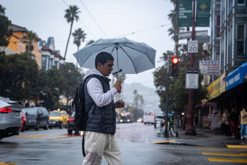
A person walks in the rain on Mission Street in San Francisco on Dec. 18, 2023. After one of the hottest days of the year, temperatures plummeted almost 20 degrees overnight and scattered showers are coming to some areas. (Beth LaBerge/KQED)

Yes, that is rain misting the Bay Area on Wednesday morning — and no, you didn’t imagine Tuesday’s record heat.

The region’s weather took a dramatic turn after one of the hottest days so far this year, with temperatures plummeting almost 20 degrees overnight and scattered showers in some areas.

The rapid change is due to an upper-level storm system moving north from the Central Coast after dropping up to an inch of rain on parts of Monterey and San Benito counties overnight, said Lamont Bain, a meteorologist in the National Weather Service’s Bay Area office.
Sponsored

Thanks to drier air, the Bay Area is expected to collect much lower rainfall totals, ranging from mere sprinkles to a few tenths of an inch, Bain said. The southern Peninsula and South Bay are likely to get the most rainfall.

Initially, meteorologists warned that low humidity across Northern California created significant chances for dry lightning that could spark wildfires, but Bain said that risk is now low.

“As you progress north from the Central Coast, [we] cannot rule out maybe an isolated rumble of thunder or two, but that threat is really under 10%,” he said. “Right now it does look like we’ll see sufficient amounts of precipitation that would sort of curtail that threat.”

As well as lessening the threat of dry lightning, Bain said the light rain is helping lower the risk for wildfires as California gets into its usual peak season.

“We’ll still need a little bit more [rain] to shut things down completely, and it’s not looking like that’s going to do that just yet, but this we kind of consider more of a wildfire season-slowing type of thing,” he told KQED.

The Bay Area could get a few more days of showers early next week before it looks to enter a period of warmer-than-average temperatures at the start of October.

Bain said San Francisco’s notorious “second summer” is still on the way, despite the early-season rain and an especially chilly start.

“We are seeing the potential for above normal warmth at least over the next two weeks, and actually the signal is pretty strong,” Bain said, though he cautioned the weather could vary greatly day to day.

When thick fog blankets the Pacific Ocean, temperatures can drop quickly, like they did on Wednesday. But when the marine layer clears this time of year, he said, “that can allow those temperatures to really skyrocket.”

lower waypoint
next waypoint