upper waypoint

Northern California Snowpack Off to a Much Stronger Start Than Last Year

Save ArticleSave Article
Failed to save article

Please try again

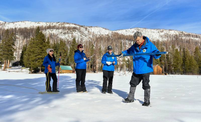
California Department of Water Resources staff members (from right) Andy Reising, Snow Surveys and Water Supply Forecasting Unit Manager, Jordan Thoennes, Water Resources Engineer, Manon von Kaenel, Water Resources Engineer, and Angelique Fabbiani-Leon, State Hydrometeorologist, conduct the first media snow survey of the 2025 season at Phillips Station in the Sierra Nevada in El Dorado County, Jan. 2, 2025. (Courtesy Nick Shockey/California Department of Water Resources)

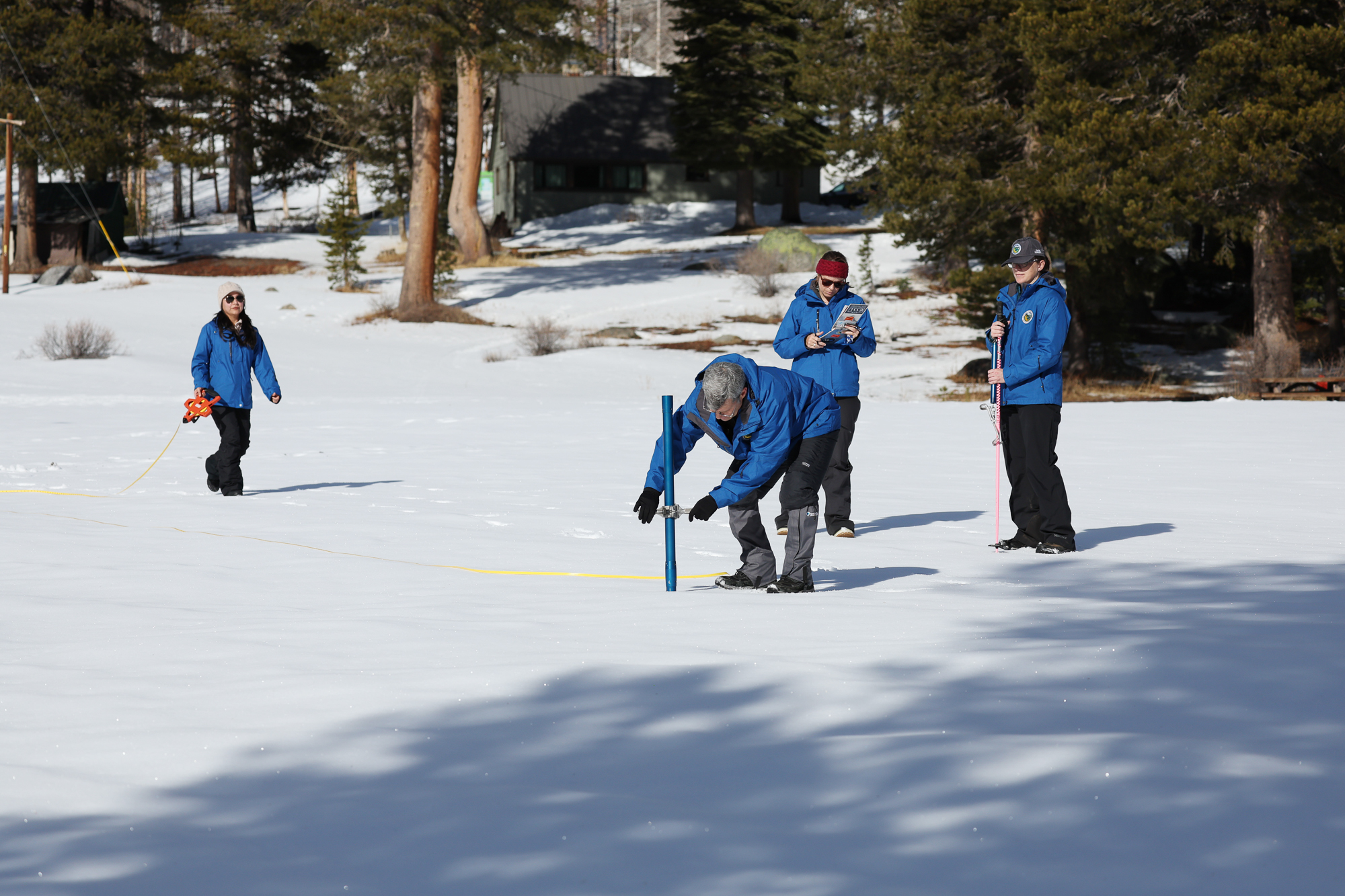
The snowpack near Lake Tahoe is far larger than it was at the start of 2024 but still short of the average for this time of year, California water officials said Thursday in the first manual snow survey of the season.

The survey, conducted at Phillips Station in the northern Sierra Nevada, recorded snow more than three times deeper than what the California Department of Water Resources recorded at the same station this time last year. That figure also represents 91% of the average for previous surveys done at this point in the year.

Statewide, California’s snowpack is just above the average for this time of year and at 39% of the average for April 1, which is when officials expect to see peak levels for the year before spring snowmelt and runoff begins.
Sponsored

“So off to a better start this water year than we were last year. But much remains to be seen in terms of how this water year actually ends up,” said David Rizzardo, a manager with the Department of Water Resources’ Hydrology Section.

This year’s snowpack was aided by a strong atmospheric river aided this year’s snowpack in November and some storms in December that brought heavy rain and mountain snow, Rizzardo said, but the state has a ways to go before it can hope to match yearly peak levels. A strong start to the water year doesn’t necessarily mean a strong finish.

California Department of Water Resources staff (from left) Angelique Fabbiani-Leon, State Hydrometeorologist, Manon von Kaenel, Water Resources Engineer, Andy Reising, Snow Surveys and Water Supply Forecasting Unit Manager, and Jordan Thoennes, Water Resources Engineer, conduct the first media snow survey of the 2025 season at Phillips Station in the Sierra Nevada in El Dorado County, Jan. 2, 2025. (Courtesy Sara Nevis/California Department of Water Resources)

In January 2022, for example, the statewide snowpack was looking even deeper than this year and well ahead of the average for early January, seemingly indicating the state was on track for a very wet year.

“The statewide number was 147% of average, 15.5 inches of water content … which decreased all the way down to 10.3 inches by April 1,” Rizzardo said.

Although the year started strong, the snowpack peaked on Feb. 1, months earlier than usual.

After January, “we only really gained less than an inch, at our peak, in water content, and then there was a steady decline all the way down to April 1,” Rizzardo said. “Really not the pattern we hope to see in any given year.”

State officials can’t be sure whether this year will result in an early disappointing peak or a strong finish with lots of snowmelt to fill state reservoirs. But there are some signs.

Michael Anderson, a state climatologist, said over the next few weeks, a high-pressure weather system will form and strengthen just off the coast of California.

That pressure system will push storms north, meaning most of the state, except perhaps Northern California, won’t get much rain for a couple of weeks in what should be the wettest period of the year.

“Taking two weeks off does limit the opportunities for catching up,” Anderson said. “The stock records say it’s not unheard of, but it’s not likely.”

lower waypoint
next waypoint