upper waypoint
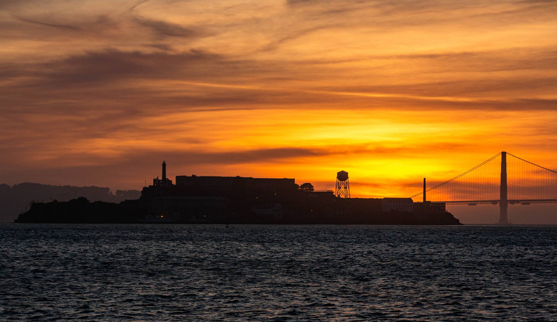
<strong>Red sky at night, rain lovers take fright</strong>: The Bay Area has seen plenty of memorable sunsets — this one silhouetting Alcatraz earlier this month — but little rain so far this winter. The outlook for the next several weeks is for continued dry weather.  Dan Brekke/KQED
Red sky at night, rain lovers take fright: The Bay Area has seen plenty of memorable sunsets — this one silhouetting Alcatraz earlier this month — but little rain so far this winter. The outlook for the next several weeks is for continued dry weather.  (Dan Brekke/KQED)

Are You Starting to Wonder When It Will Rain Again? We Are, Too

Are You Starting to Wonder When It Will Rain Again? We Are, Too

03:55
Save ArticleSave Article
Failed to save article

Please try again

S

o, we're almost at the point at which our current "wet" season — marked as it has been by prolonged periods of rainless, snowless weather punctuated by cold but rather feeble storms — is starting to look like a bust. By "bust" we mean: Precipitation just about anywhere you go in the northern two-thirds of California is well below normal, with little sign that storms are going to find their way to our coast, valleys and mountains any time soon.

Here's a recap of the season so far and a look at what lies ahead.

Rain

We started out with a prolonged dry spell at the beginning of the season, with only the lightest of rains recorded through Thanksgiving week. Then came the season's first real storm, driven by a powerful, rapidly deepening low pressure center — a phenomenon known as extreme cyclogenesis or bombogenesis and frequently called a "bomb storm." That dramatic onset of winter weather was followed by an atmospheric river-fed storm that dropped 20 inches of rain in the mountains of Big Sur, nearly a foot in northern Sonoma County and 8 inches-plus in parts of Marin. So it looked like we were off and running.

A Not-So-Rainy California Winter

It kept raining through much of December — in San Francisco, measurable precipitation was recorded on 19 days during the month. But on seven of those days, it rained .07 inches or less. And despite the frequency of weather systems moving over the coast, not one dropped as much of an inch of rain on the city. San Francisco's 4.91 inches of rain in December was just ahead of the normal for the month.

However, the city and most of Northern California still lagged behind normal for the season going back to last Oct. 1. Then with January coming in below normal and no rain so far in February, San Francisco stands at just 60% of normal for the season.

A daily National Weather Service summary of seasonal rainfall throughout the state shows similarly dry numbers nearly everywhere in the state north of Monterey Bay. To the south, sites on the Central Coast and across most of Southern California were deluged early in the season with much higher totals than normal. So while it has been dry down south since the first of the year, seasonal totals are still close to or ahead of normal in places like San Diego (129% of normal), Long Beach (113%) and Paso Robles (90%).


Snow

Late November and December saw heavy snow fall up and down the Sierra, the Coast Ranges, the Tehachapis and even into lower elevations as a series of very cold storms swept through the mountains. By New Year's Eve, the water equivalent of the California's "frozen reservoir" had reached about 95% of normal for the date.

Continuing cold temperatures have preserved much of that snowpack. But an atmospheric pattern that has persisted for weeks, shunting most storms into northern Oregon and Washington with only weak remnants sliding through the interior of California, has meant the snowpack has fallen far behind the seasonal norms. By Monday, the snowpack's water equivalent has fallen to 59%.

For more, see a regional breakdown of the snowpack's water content at the state Department of Water Resources California Data Exchange Center.

Northern Sierra Precipitation

The mountain snowpack figure is nearly identical to another closely watched bit of data: the Northern Sierra Eight-Station Index. The index tracks precipitation at a series of typically very wet sites in three crucial watersheds — those of the Sacramento, the Feather and the American rivers. The index, which veteran Bay Area meteorologist Jan Null calls "the most important number in the state" when it comes to assessing rainfall and hydrologic conditions, stands at just 58% of normal for this part of February.

For more, see a regional breakdown of the snowpack's water content at the state Department of Water Resources California Data Exchange Center.

Reservoirs

Here's the bright spot in the state's dry winter. Because two of the last three winters were very wet, the state's network of reservoirs are holding more water than usual for this time of year, and many still have plenty of room for runoff if the season turns rainy and snowy again. Shasta Lake, the state's largest reservoir, is at 112% of average for mid-February. Lake Oroville, the second-biggest reservoir, is at 95% of average. San Luis Reservoir, a key facility for water shipments to the San Joaquin Valley and Southern California, is at 93% of average for this point in the season. The rest of the state's largest reservoirs are at or above 100% of average.

For more, see the CDEC's interactive eight-station index page.

The Outlook

What do the next days, weeks and month hold? Is there hope that the rain and snow will return? Maybe with a "miracle March?"

Well, there's always hope. There's the fabled miracle March of 1991, during which a series of storms started to break the grip of a six-year drought. The eight stations in the northern Sierra index averaged about 18 inches of rain during the month.
Sponsored

The rainy season of 2017-18 was somewhat like the one we're in the middle of now. We arrived at the end of February 2018 with below-normal precipitation totals, but March storms made up much of the deficit even if they didn't bring the state back to normal for the season. (San Francisco rainfall finished at 74% of normal, and the eight-station Northern Sierra Index topped out at 76%. Southern California was bone dry, though, with most location getting just one-third of normal rainfall.)

Hope aside, what do the forecast models show?

Right now, they're pretty much in agreement that nowhere in California except the far northwest corner of the state will see anything more than a couple of episodes of light rain through the end of the month. It's really too soon to tell about March, but so far, longer-term forecasts aren't showing much evidence things will change.

Forecaster Jan Null last week tweeted the following summary of where we are in this rainy season and what history says about winding up with normal or close to normal rainfall:

To translate: We're very likely on a trajectory to a below-normal rain year. The question at this point is how far below normal. And as UCLA climate scientist Daniel Swain and others have started to point out, the shape of the rest of the wet season is likely to have a strong influence on the coming fire season:

Sponsored

lower waypoint
next waypoint
California Law Letting Property Owners Split Lots to Build New Homes Is 'Unconstitutional,' Judge RulesAlameda: The Island That Almost Wasn’tJust Days Left to Apply for California Program That Helps Pay for Your First HouseIn Fresno’s Chinatown, High-Speed Rail Sparks Hope and Debate Within ResidentsFresno's Chinatown Neighborhood To See Big Changes From High Speed RailRainn Wilson from ‘The Office’ on Why We Need a Spiritual RevolutionWill Less Homework Stress Make California Students Happier?Is California Headed For Another Tax Revolt?State Prisons Offset New Inmate Wage Hikes by Cutting Hours for Some WorkersWorried About Data Brokers in California? Here’s How to Protect Yourself Online