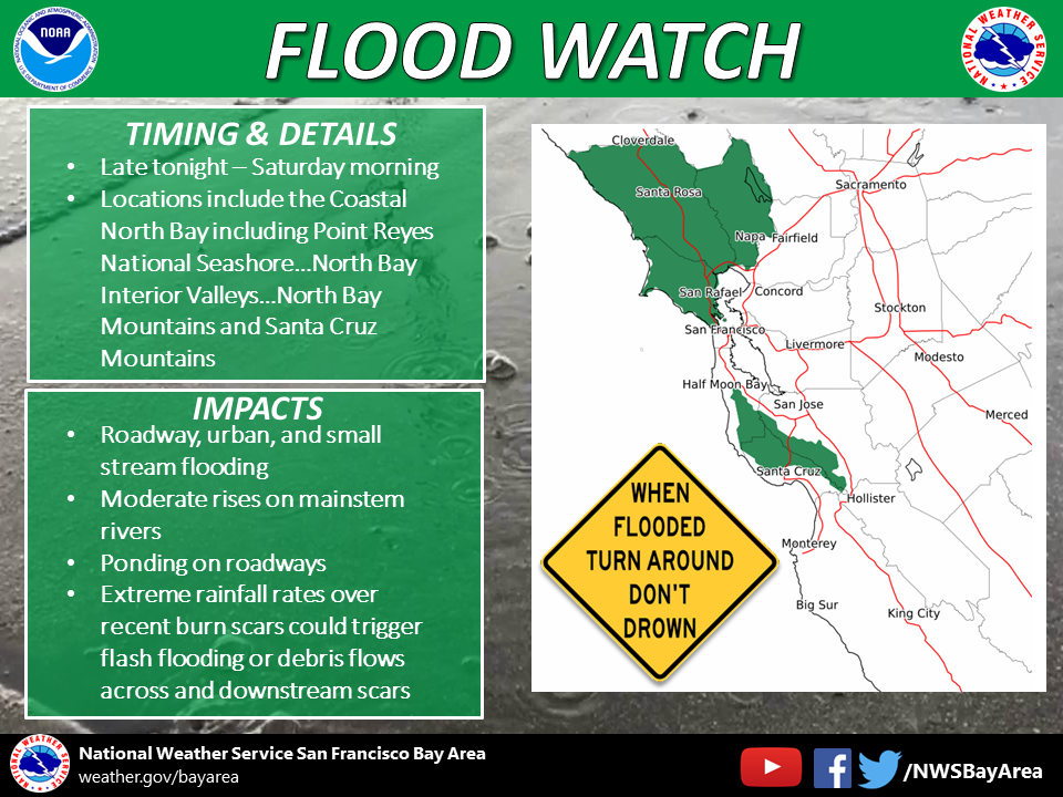
The NWS issued flood watches from late tonight through Saturday morning for parts of Northern California, including the following locations: the coastal North Bay, including Point Reyes National Seashore, North Bay interior valleys, North Bay mountains and Santa Cruz Mountains.
From the NWS Facebook page:
A Flood Watch means there is potential for flooding based on current forecasts.
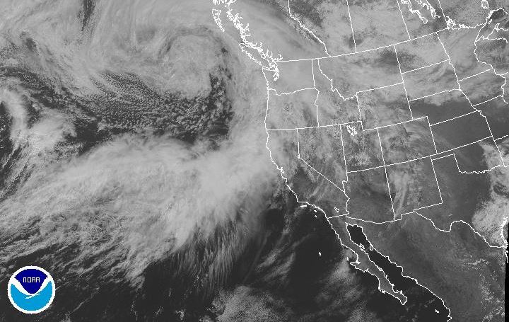
Periods of rain, heavy at times, are forecast to fall over the North Bay region and Santa Cruz Mountains including the coastal ranges of San Mateo and Santa Cruz counties.
Impacts expected include roadway and small stream flooding as well as urban flooding in poorly drained areas. Moderate rises will likely occur on mainstem rivers. During periods of heavy rain, ponding of water on roadways is likely.
Extreme rainfall rates over recent burn scars could potentially trigger flash flooding or mudslide/debris flows across and downstream from the burn scar locations.
Pacific Gas and Electric Co. says it has extra crews ready for what is expected to be a significant amount of wet weather.
PG&E spokeswoman Tamar Sarkissian said staff will be watching the region closely and may open up an emergency center to respond to potential outages around the clock.
“We do have a plan. We’re prepared for the storm. We want our customers to be prepared as well,” Sarkissian said.
Sarkissian recommends people have flashlights with fresh batteries and sign up for PG&E’s outage alerts. She also warns residents to call 911 if they spot a downed power line.
And farther north, the storm could be the first test of the newly constructed spillway at Oroville Dam.
The storm could force operators at the Oroville Dam to open the gates and let water out of the reservoir to make room for storm runoff.
That would be the first release from Oroville since crews began rebuilding the spillways that collapsed in February of last year, an event that triggered evacuation orders for hundreds of thousands of people along the Feather River.
Yosemite National Park officials are canceling camping reservations this weekend. The NWS has issued a flood watch for the Yosemite area from 11 p.m. Friday through 11 a.m. Sunday.
For Residents in Sonoma County’s October Wildfire Burn Areas
Sonoma County officials are advising residents living in the October wildfire burn areas to be “rain ready” in light of the National Weather Service forecast for periods of heavy rain tonight through Saturday morning.
The Santa Rosa Fire Department is encouraging residents to keep their cellphones on at all times to receive emergency warnings from the National Weather Service and SoCo Alerts. Residents may sign up for the alerts at SoCoAlert.com.
“We urge our residents to use caution outdoors and avoid our creeks during higher intensity rainfall,” said Santa Rosa Assistant Fire Marshal Paul Lowenthal.
Residents that live in and around the burn scars from the Tubbs and Nuns fires can receive information about possible flooding and mud or debris flows at www.sonomacountyrecovers.org/rain-ready.
Jim Colangelo, interim director of Sonoma County Fire and Emergency Services, said last fall’s wildfires left behind a lot of scorched ground that’s vulnerable to landslides.
“Our biggest concern right now is obviously we have a huge burn scar area, and so even a relatively minor rainfall event, if it’s severe enough over a short period of time, could cause problems we wouldn’t normally expect,” Colangelo said.
Sandbags for Santa Rosa residents are available at the Municipal Services Center, located at 55 Stony Point Road. The yard is open 24 hours a day, seven days a week.
Sonoma County Water Agency officials said a system of 10 stream/rain gauges and 12 rain-only gauges were installed throughout the Nuns and Tubbs burn areas and along streams within and downstream of the burn areas.
The gauges provide real-time data to weather forecasters who are responsible for sending flash flood and mud or debris flow alerts.
“This system of gauges allows us to monitor streams and rainfall in real time and gives us a more accurate picture of conditions in the burn areas that are vulnerable. We can also start to gather historical flow data along more streams, which is critical for our stream maintenance and flood control operations,” chief engineer Jay Jasperse said.
The real-time rainfall and stream flow data are available to the public at https://sonoma.onerain.com/.