Honea’s mantra at virtually every media briefing and public appearance over the last month and a half has been a request for residents to sign up for the county’s emergency notification system. And despite lifting the evacuation advisory, county officials are working on developing new evacuation plans in case of a future emergency.
The county has designated 11 new flood evacuation zones, complete with assembly points and emergency departure routes, along the Feather River from Oroville to the town of Gridley. Officials are holding informational meetings in each zone.
The potential for future trouble with the Oroville Dam was highlighted in a report from a board of experts appointed to review the situation at the facility and oversee the process of repairing or rebuilding the spillway.
The report, obtained earlier this week by The Associated Press and Sacramento Bee, says dam managers are facing a “very significant risk” if the main spillway is not operational in time for this fall’s rainy season. The panel also said it’s “absolutely critical” to avoid further flows over the emergency weir and down the hillside below.
The Department of Water Resources has placed thousands of tons of rock in eroded sections of the eroded hillside, “armored” sections of the slope with concrete, and built a series of walls and check dams to slow any flow of water down to the river channel below.
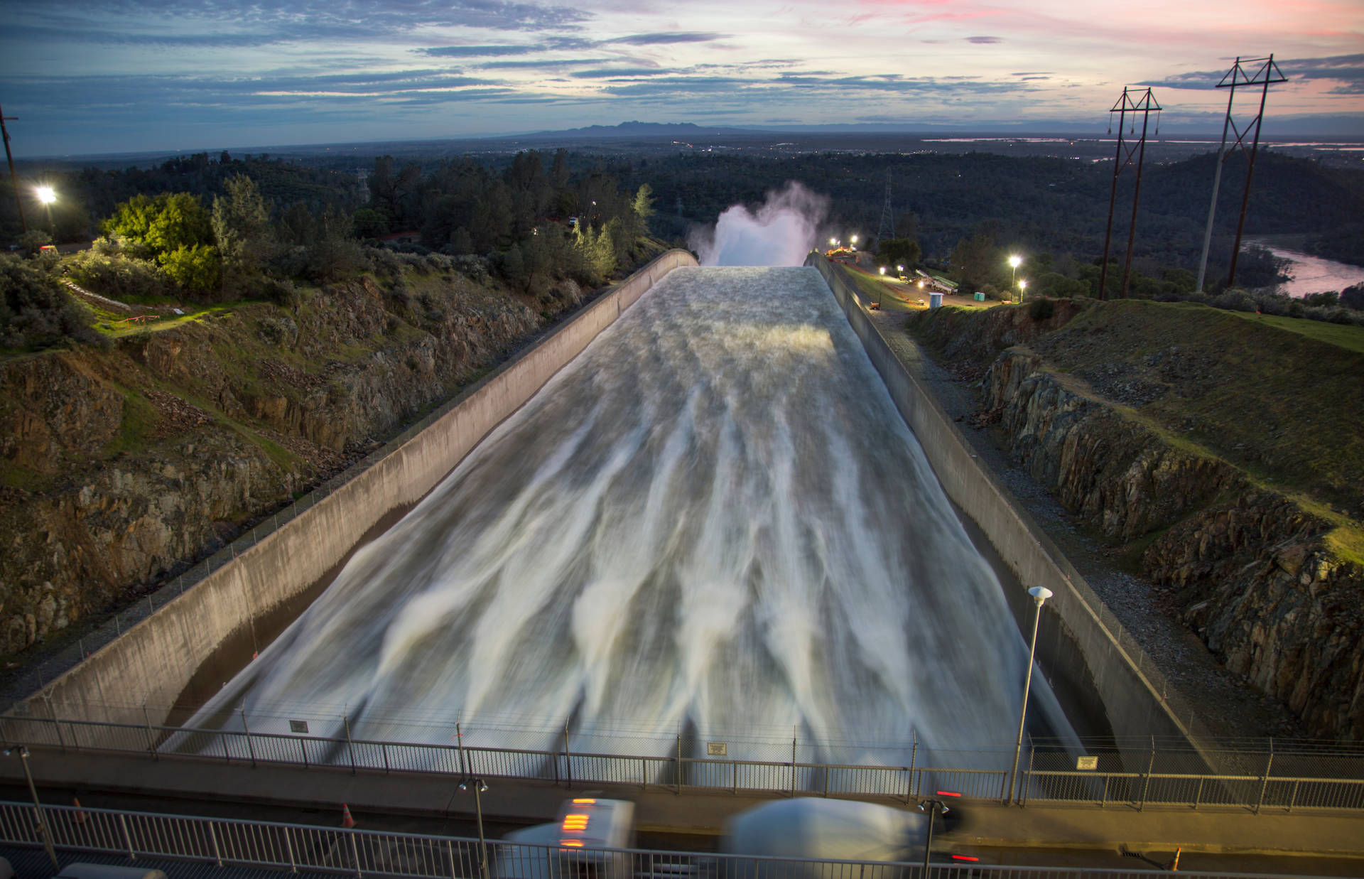
The current operational status of the spillway and reservoir: Releases down the damaged concrete structure continue at about 40,000 cubic feet per second. Water is also being released through two of the five operational units in the dam’s hydroelectric plants, for a total flow of about 45,000 cfs.
DWR officials said when flows were resumed down the main spillway last Friday that they intend to lower the lake’s surface elevation to between 835 and 838 feet above sea level. That would represent a drop of 26 to 29 feet from last week and would put the lake level 63 to 66 feet below the now-dreaded emergency weir. The agency said it plans to shut down spillway releases at that point to allow resumption of preliminary work to repair or replace the structure.
One aspect of that work started this week, with crews drilling for rock and soil samples near the spillway to assess underlying conditions.
Flood-control releases down the main spillway are just one part of the equation determining how fast the lake level drops, of course. The other principal factor is the amount of water flowing into the lake from the Feather River watershed, or “inflow.”
Inflow peaked during the February spillway crisis at about 190,000 cfs. After a long run of mostly dry, clear and cool weather in the first half of March, it fell and leveled off between 15,000 cfs and 20,000 cfs. Now, with a series of storms marching through Northern California, inflow has periodically risen into the 45,000 to 50,000 cfs range — meaning the lake’s level has fallen very slowly, and some hours not at all, during the last several days.
One more big storm is expected in the week ahead — a cold system that DWR forecasters say could drop 2 to 3 inches of rain or its snow equivalent on the Feather River basin over the weekend.