upper waypoint
Lake McClure, the state's ninth-largest reservoir, in March 2015. Dan Brekke/KQED
Lake McClure, the state's ninth-largest reservoir, in March 2015. (Dan Brekke/KQED)

California at Low Water -- a Photo Gallery

California at Low Water -- a Photo Gallery

Save ArticleSave Article
Failed to save article

Please try again

California depends on an immense system of dams, reservoirs and aqueducts to impound and store water, and to move it from where it starts out -- mostly in Northern California and the Sierra Nevada -- to farms and cities everywhere else in the state.

OK -- that much is California 101, and we've all heard it, whether we were listening or not. But it's one thing to hear about this system, built almost entirely in the last century, and another thing to encounter it face to face.

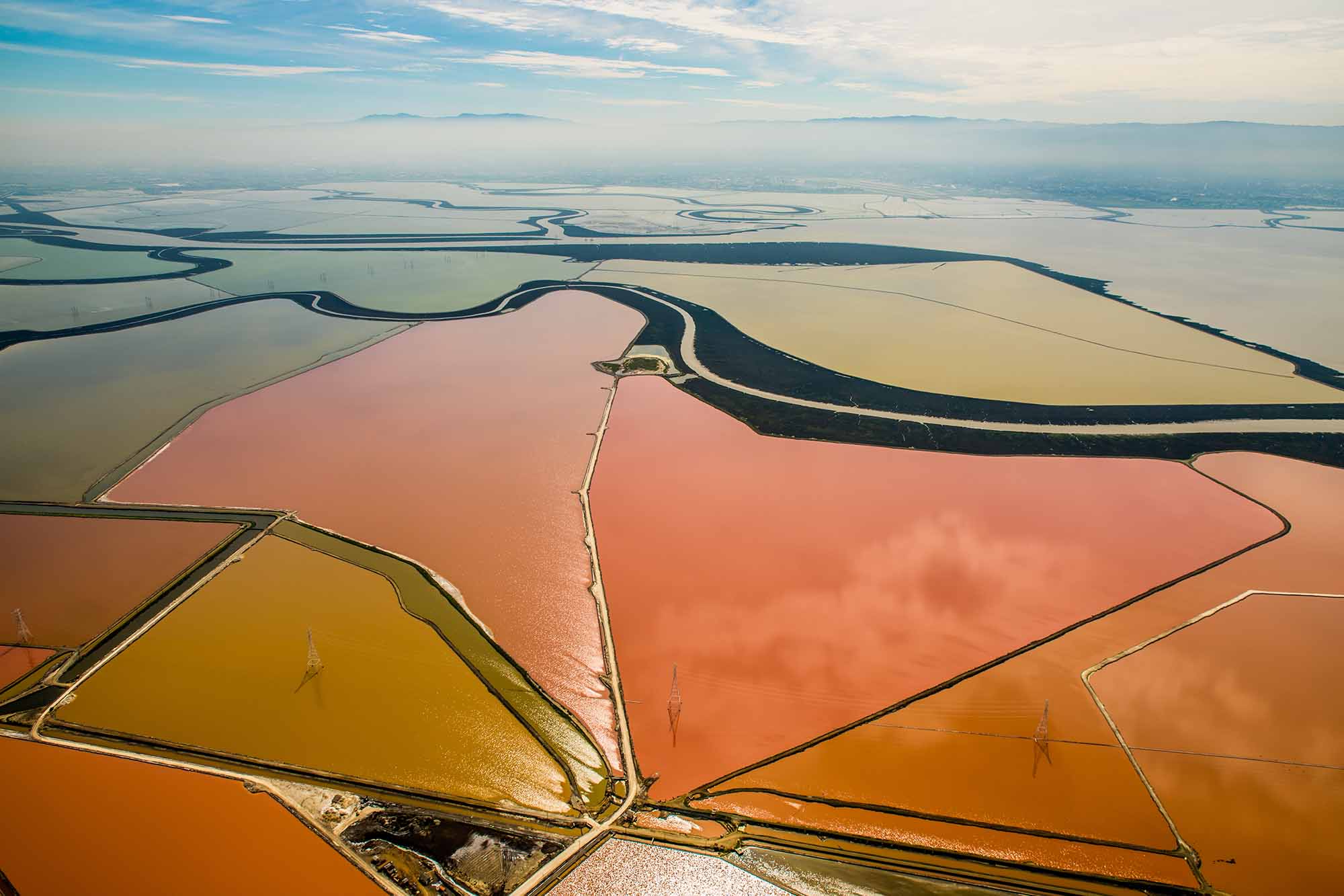
The dozen largest dams and reservoirs, pictured in the gallery below, are key to the California we know today. Long ago, the flow of rivers in a wet winter would turn the Central Valley into a teeming inland sea. Now dammed, diked and tamed, the wild valley and its rivers have been transformed again, into the main engine of an economic powerhouse. Water that used to flow unchecked is now diverted to support one of the Earth's richest farm regions and 38 million people working in the world's eighth-largest economy.

Lake Oroville, roughly 90 percent full in March 2013.
Lake Oroville, roughly 90 percent full in March 2013. (Dan Brekke/KQED)

The dams and reservoirs that have made this transformation possible are monumental. Six of the nation's 14 tallest dams impound California rivers. Oroville Dam, which forms Lake Oroville, the State Water Project's principal water source, is the tallest in the United States at 770 feet.

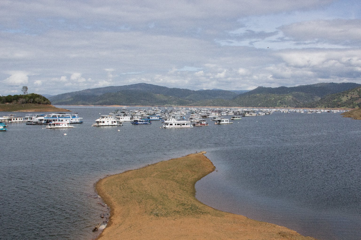
In wet years, if you can remember one of those, these giant artificial lakes are nearly brimful and look just the way a tourist bureau would like them to always look: fresh, blue, ringed with inviting forests and campgrounds, plied by houseboaters and fishing enthusiasts.

Sponsored

But after a string of dry years, these big reservoirs -- ranging from Shasta Lake's 4.5 million acre-feet and Oroville's 3.5 million acre-feet to New Bullard Bar Reservoir's 969,000 acre-feet -- have been transformed from aquatic wonderlands to vast craters that in some cases have fallen hundreds of feet below their full level.

The hallmarks of these drought-drained lakes: miles of exposed red dirt and stark rocky slopes, mud on dried lake bottoms, families fishing on shorelines that in an average year would be far underwater, boat ramps left high and dry, and the few remaining houseboats still on the water crowded closer and closer together as reservoirs subside.

The lake levels now? They're falling and, depending on the timing of fall rains (if they arrive), many will be near their lowest levels ever by October.

Click on gallery images to open slideshow.

Photo credits: Dan Brekke; Craig Miller (pictures of Lake Almanor and New Bullard's Bar Dam and Reservoir); Lisa Pickoff-White (picture of Lake Oroville boaters).

lower waypoint
next waypoint
9 California Counties Far From Universities Struggle to Recruit Teachers, Says ReportAlameda County District Attorney Challenges Recall Signature CountSFSU Pro-Palestinian Encampment Established as Students Rally for DivestmentThe Politics and Policy Around Newsom’s Vatican Climate Summit TripCity Lights Chief Book Buyer Paul Yamazaki on a Half Century Spent “Reading the Room”As Border Debate Shifts Right, Sen. Alex Padilla Emerges as Persistent Counterforce for ImmigrantsMillions of Californians Face Internet Dilemma as Affordable Subsidy EndsInside Mexico's Clandestine Drug Treatment CentersCalifornia Partners with New Jersey Firm to Buy Generic Opioid Overdose Reversal DrugCalifornia’s 2023 Snow Deluge Was a Freak Event, Study Says