This partial transcript was computer-generated. While our team has reviewed it, there may be errors.
Lesley McClurg: Welcome to Forum. I’m Lesley McClurg, in today for Mina Kim.
I honestly think GPS might have saved my life 2 weeks ago. I mean, maybe it wasn’t a totally life-threatening situation, but I was in Yellowstone National Park with my 7-year-old daughter. It was just the 2 of us backpacking. We had received some pretty bad information from a brand-new ranger, and we ended up on the wrong trail about 7 miles in.
When I realized that our closest camping spot was potentially another 20 miles down that trail, I knew that was not a good idea with a 7-year-old. So we decided to go off-trail, cross-country for a few miles, because it was the closest route I could see to get to a river—we needed water for dinner that night.
I pulled out my handy phone, where I had downloaded maps before we went completely offline. Luckily, I was able to figure out where we were and where we needed to go because I had downloaded maps onto Gaia. I am now a devotee of GPS because I think it saved my life.
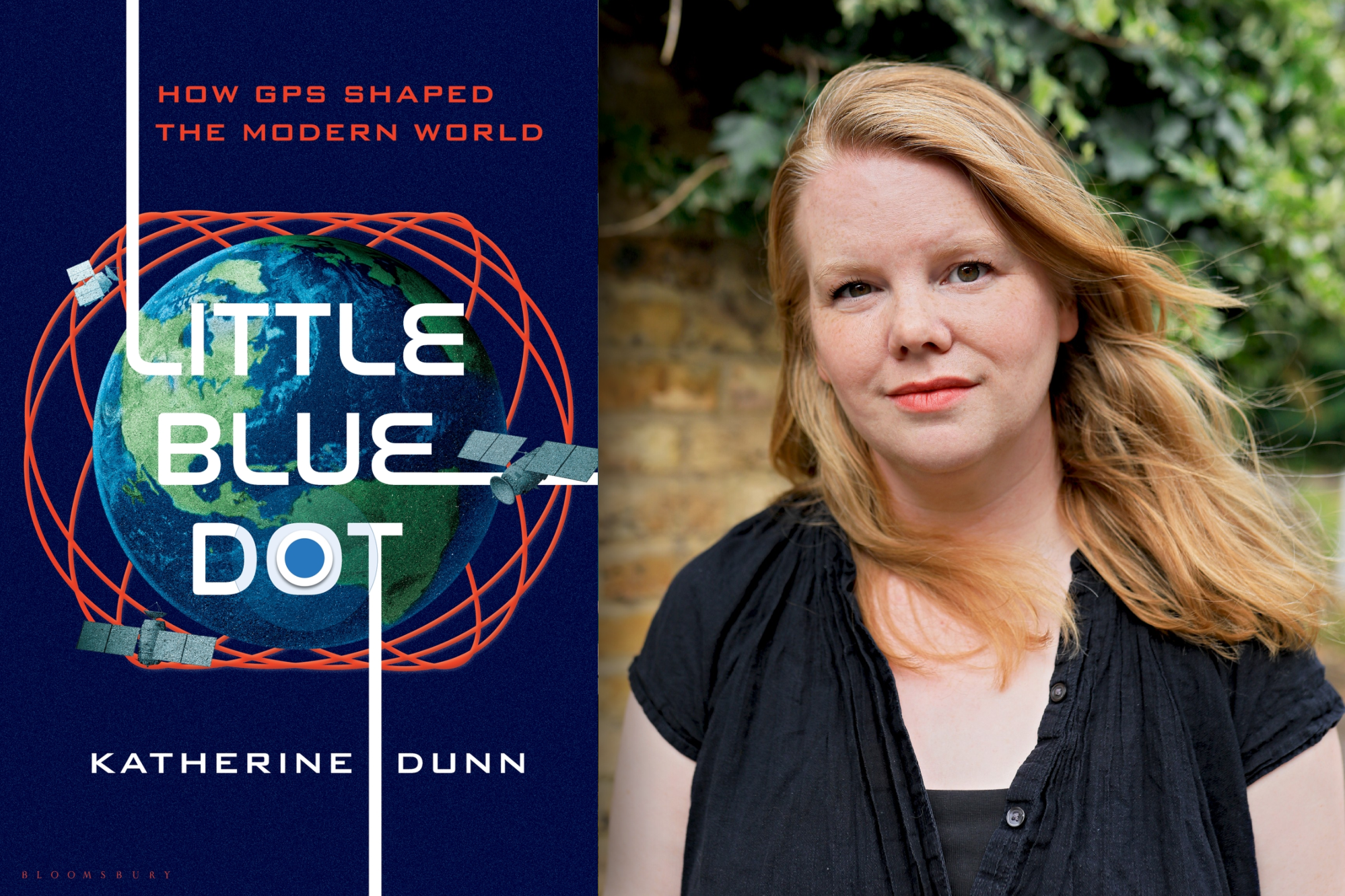
Let’s talk about GPS with Katherine Dunn. Her new book is Little Blue Dot: How GPS Shaped the Modern World. Welcome, Katherine.
Katherine Dunn: Thanks for having me, Lesley.
Lesley McClurg: Would you call yourself dependent on GPS?
Katherine Dunn: Yes. I’m completely dependent on GPS. I’ll give you an example. Today, I had 3 things going on. I’ve lived in London for 12 years. I was going to places I know very, very well. I used Transit Planner and Google Maps for all 3 of those journeys, and I’ll probably use it to get home, even though I live about a 20-minute drive from here. So that’s a complete dependence, I would say.
Lesley McClurg: In a nutshell, how does it work? How did it get me to that beautiful river that night and actually to a campfire and a good evening rather than a disastrous day with my 7-year-old?
Katherine Dunn: Yeah, exactly. So what this is, it’s a kind of web of satellites all around you. There’s a minimum of 24, and you or I, wherever we are, are in sight of 4 at any one time.
The important thing is there are 4 things that the satellites are calculating for. They’re sending radio waves down, and the chip in your phone is doing these calculations. It’s longitude and latitude—we all know those. It’s altitude, so if you were high up or down in a canyon, it’d be calculating for that. And the fourth one, which is kind of the secret sauce of GPS and gets forgotten about a lot, is time.
In particular, it makes a bad clock a good clock, in very simple terms. It gives us this ultra, ultra, ultra-accurate time. It’s these 4 things, and it’s just radio signals. But contained in those radio signals, it’s a computer talking to a computer talking to a computer. It’s really those 4 dimensions that make it so useful.
Lesley McClurg: Did we have any sense in the 1970s, when it was first invented, that it would be so ubiquitous and that we would be so dependent on it?
Katherine Dunn: You know, it’s funny. If you talk to the people who are considered the fathers of GPS, many of whom are in California, they’ll say they always knew it was going to be transformative.
I think one of the things that became clear quite quickly is that it was a lot more accurate than they thought it was. There’s this iconic story about dropping 5 or 6 bombs, and only 4 bomb craters showed up. All of a sudden, they realized it was much more accurate than expected.
They definitely thought it was going to be transformative for things we think about now, like maps, but even they didn’t anticipate exactly how transformative it would be. It quickly started to take on a life of its own and be adapted for all kinds of things they never expected. That happened almost from the beginning. From the early 1980s, it started taking on a life of its own.
Lesley McClurg: And how long did it take until we wholeheartedly trusted it?
Katherine Dunn: Well, it’s funny because there are cases where maybe we shouldn’t have trusted it yet, and people already started trusting it blindly.
But I think a moment a lot of listeners will remember is when, in the 2000s, the U.S. government took the brakes off. They had made it artificially less accurate for civilians. Once they removed those restrictions, you could really have it in cars. If you had a little suction-cup-mounted TomTom or something like that, that was the moment most people started experiencing GPS for the first time.
Then the moment it became what we think of today was probably the late 2000s. The second iPhone was the first to have Google Maps and working GPS. I was a teenager at the time, but that was really the moment it changed my world and a lot of other people’s, too. It was that consumer-tech smartphone explosion.
Lesley McClurg: You kind of hinted at it there. There was a different version for the military than there was for civilians. Talk about how that worked and why that was.
Katherine Dunn: Yeah. It was this thing called selective availability—not a very sexy phrase, of course.
What it really meant was that when they realized GPS was so elegant, worked so well, and was much more accurate than expected, they started putting the brakes on it. They artificially made it less accurate. They brought it down, I think, from about 20 meters of accuracy to 100 meters.
Lesley McClurg: Why did they want the civilian version to be worse?
Katherine Dunn: It’s a good question. But if you think about it, it’s because anybody could use it. I’m sitting here in the UK, but I could be sitting in Beijing or Moscow and still be using GPS.
It was so accurate that they realized U.S. enemies could use it just as well as the U.S. military. The idea was that it would still be useful—you could still find your way on the side of a mountain—but it wouldn’t be as precise.
This was designed as a tool for precision bombing. The fact that your enemies would also have access to something ultra-accurate seemed a little problematic once they belatedly realized what they had on their hands.
Lesley McClurg: This binary played out in a not-so-pretty way. During Desert Storm, we really saw why it might not be a great idea for civilians to have a worse version of GPS. You point to examples like freeway repairs and earthquake detection. What was going on during Desert Storm that made people realize a reduced civilian version wasn’t such a great idea?
Katherine Dunn: Yeah. I think they’d already realized how this civilian dependence had sprouted.
From very early on, GPS had never been classified. It had always been open to civilians, but you really had to know what you were looking for. It was adopted early by mapmakers, surveyors, and academics. Then it started being adapted for all kinds of surveying.
That’s why, in the early 1990s, you have freeways in Los Angeles being mapped and maintained using GPS. The Jet Propulsion Laboratory was using it to track earthquakes. It had taken on a life of its own, and officials realized there was a huge commercial dependence on it.
By the time you get to the Iraq War, a government official said something along the lines of, “We won’t degrade the global transit system just to spite Saddam Hussein.”
By that point, global transit systems around the world depended on GPS. The airport in Fiji was one of the first places to volunteer to use GPS. They told the FAA, “Let us try this. It would be really useful.” So if you’re degrading GPS at scale, you’re also affecting people in Fiji.
Lesley McClurg: Or repairing freeways the wrong way.
Katherine Dunn: Exactly. It took a little while for GPS to reach the level of integration we see now, but it was pretty early on that people were finding these uses for it. The cat was out of the bag.
Lesley McClurg: How did it used to work? Before GPS, what kinds of technologies did institutions rely on? How did the world function without GPS?
Katherine Dunn: Cast your mind back: paper maps.
Actually, there was a system before GPS called Transit. Regular people didn’t use it, but it was a satellite-navigation predecessor used in aviation. There were also radio beacons that created navigation paths across the continental United States. We were already using radio in a lot of ways to help with navigation.
For timing, there are these incredible stories about the lengths people went to in order to keep global time synchronized. To keep Paris in time with Washington, they would literally take a clock and fly it from Washington to Paris to keep all these clocks more or less in sync.
And of course, we used paper maps. Things weren’t always exactly where we thought they were. There are funny stories about GPS mapping projects discovering that landmarks like the Statue of Liberty were several yards away from where we thought they were.
The idea of where we think things are versus where they “actually” are didn’t always match up. We probably didn’t expect perfect precision back then. Today, we assume that if GPS says something is somewhere, it must be there.
That’s why it’s such a disorienting experience if you’ve ever used Google Maps around tall buildings in Manhattan and suddenly can’t figure out where you are. You end up frustrated and late for all your meetings.
I’m sure some listeners would say they still use Ordnance Survey maps. And yes, that’s how it used to be.
Lesley McClurg: And some sailors probably learn celestial navigation just in case. What is the difference between the civilian and military versions of GPS today? Or are they the same?
Katherine Dunn: The military version is encrypted. It’s harder to disrupt—not impossible, but harder.
The accuracy is still roughly the same. For civilians, the effective accuracy is often even better than the official specifications because there are supplementary systems on land—what are called differential systems—that make GPS even more accurate.
So there isn’t a huge difference. In conflict zones, you might see the military signal being used, or you might see disruptions targeted at the military signal. But we now have such a vast web of civilian infrastructure dependent on GPS that the distinction between military and civilian GPS is much more blurred than it was in the past.
Lesley McClurg: We’re talking about GPS—how it works, why it’s important, and why those military roots are key to understanding the future of the technology and the importance of keeping GPS online and secure for all of us.
We’re joined by Katherine Dunn. She’s a journalist and author of Little Blue Dot: How GPS Shaped the Modern World.
We’ll be right back after this break. I’m Lesley McClurg.