Thursday morning a rocket was scheduled to lift off from Vandenberg Air Force Base on California’s Central Coast, tricked out with instruments that could provide better weather forecasts and more clues to where the drought is headed. (Update: NASA rescheduled Thursday’s launch for Saturday due to high winds and technical problems).
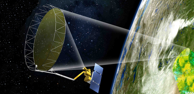
It’s not one of NASA’s catchier names, but the satellite known as SMAP, for “Soil Moisture Active Passive” is designed to provide — for the first time — highly precise maps of water stored in topsoil around the world. Scientists say that’s an important cog in the planet’s water cycle.
“Much like when you perspire, your sweat evaporates and cools your body,” offers Kent Kellogg, the mission’s project director at the Jet Propulsion Lab in Pasadena.
“As it evaporates it seeds the atmosphere with moisture, so that clouds can form, and then precipitation can occur.”
From more than 400 miles up, SMAP will measure differences in natural microwave radiation coming off the Earth. Kellogg likens it to a big pair of night vision goggles in the sky, but measuring radiation on a much lower frequency (so, no, it doesn’t mean NASA can watch you skulking around at night). Wetter soil is cooler and drier soil warmer. From that, scientists can derive water content accurate down to about 6 square miles. Kellogg says that could improve local flood forecasting and drought management.
