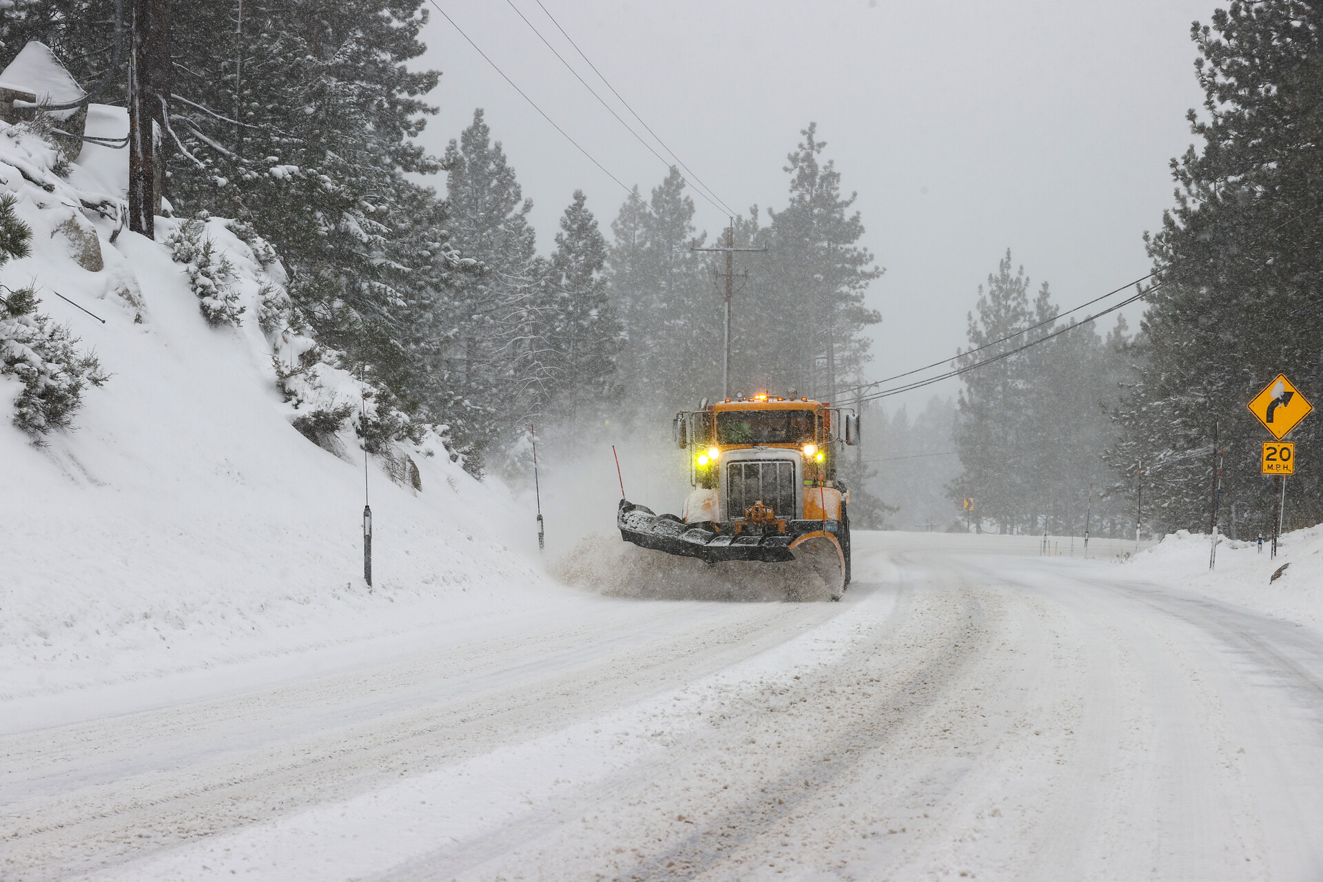
Climate scientists and weather forecasters suspect this winter could be as wet or wetter than last year’s torrential downpours. But just how wet will this winter become?
The answer isn’t quite as simple as forecasters pumping various inputs into computer models that then spit out what we can definitively expect. The Bay Area’s weather patterns are created by global patterns in the atmosphere, everything from interactions with the ocean, landscape and sun.
One of those natural factors is the climate pattern known as El Niño, which has returned after a four-year hiatus, ushering in the possibility of yet another stormy winter. This weather system has a 75%–85% chance of becoming a strong system from November to January, according to the National Oceanic and Atmospheric Administration.
What is El Niño?
El Niño — the opposite of La Niña, which recently ended a cycle — generally occurs every three to five years when ocean waters along the equator in the eastern Pacific warm by at least a half-degree Fahrenheit. That, in turn, can reposition the jet stream and funnel storms toward the West Coast of the U.S., often resulting in increased rainfall across thousands of miles.
Climate forecasters predict a range of strengths for the current El Niño — everything from a moderate to a super El Niño — which can often be characterized by intense warmer downpours.
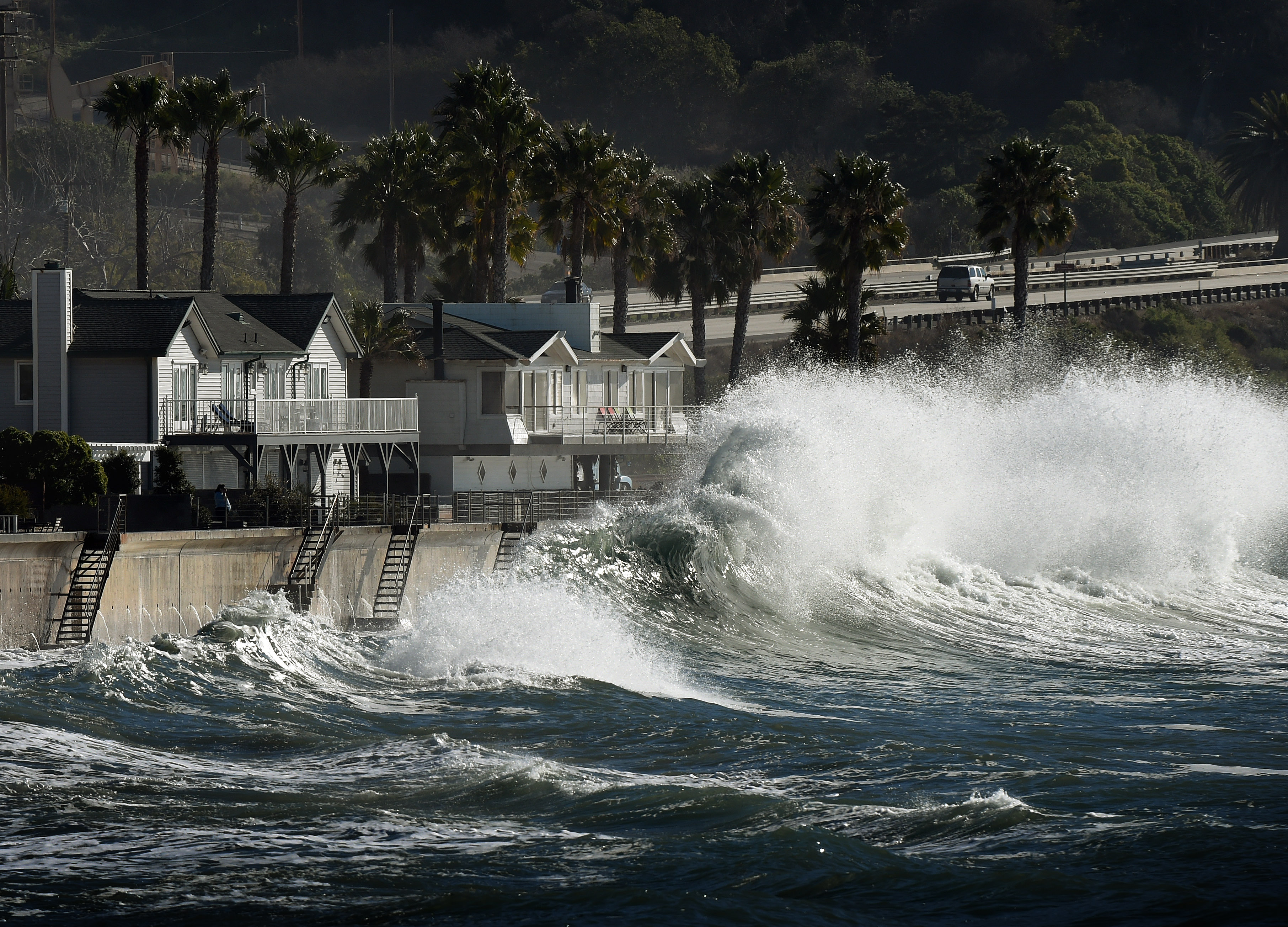
“There is potential for a lot of strong storms with coastal issues, and we just do not have extensive flood systems on the coast of California,” said Gary Lippner, deputy director for flood management and dam safety with the California Department of Water Resources.
With winter just a few months away, climate and weather experts suggest preparing our homes and lives for the worst — major flooding. Keep reading for what to know about 2023’s El Niño, from its impact on California’s snow forecast to the timing of weather predictions.
Jump straight to:
Is it possible to predict what winter 2023 will be like in California?
Kind of. It’s not possible to predict the day-to-day weather this far in advance. However, meteorologists are able to forecast possible climate changes that might happen.
“Right now, it is still too far out and our seasonal forecasting capabilities are very limited,” said Michael Anderson, California’s state climatologist.
There’s a 30% chance of a “historically strong” El Niño event, which could rival the ferocity of the 1997–98 years, according to NOAA’s latest El Niño Advisory, which saw flooding rains across the state. The scientists note that while a stronger El Niño can increase the likelihood of weather anomalies, it does “not necessarily equate to strong impacts locally.”
That’s because it’s usually only in the worst El Niño years that the entire state gets soaked — Southern California, on the other hand, has a slight tendency toward wetter conditions even in moderate El Niño years. (More on this below.)