upper waypoint

Download California's New Earthquake Early Warning App

Save ArticleSave Article
Failed to save article

Please try again

A wrecked building in San Francisco's Marina district after the Loma Prieta quake of Oct. 17, 1989. (Getty Images)

Earthquake early warning alerts became publicly available throughout California Thursday for the first time, potentially giving people time to protect themselves from harm.

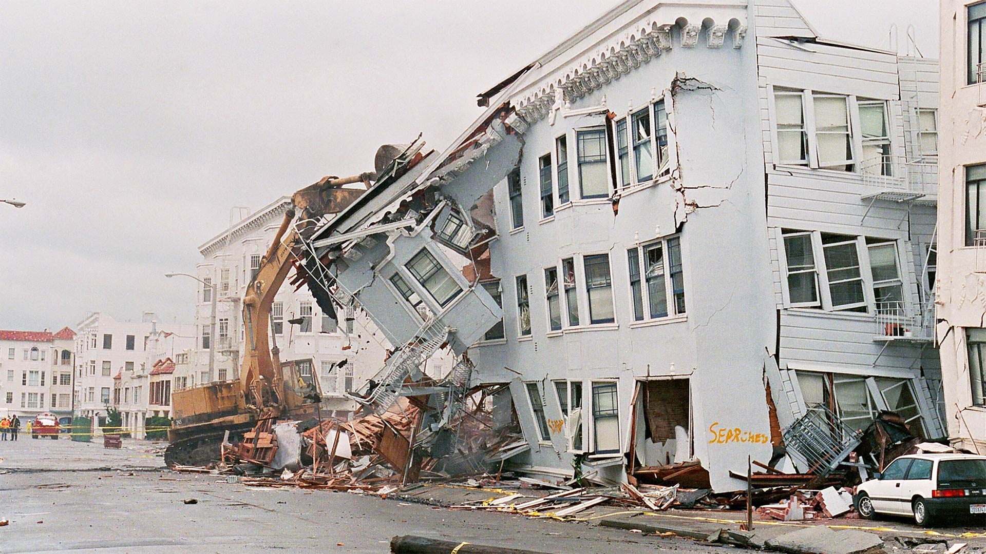
The nation’s first statewide quake warning system coincides with the 30th anniversary of the Loma Prieta earthquake that ravaged the San Francisco Bay area on Oct. 17, 1989, as well as the annual Great Shakeout safety drill.

Warnings produced by the ShakeAlert system will be pushed through two delivery systems: a cellphone app called MyShake and the same wireless notification system that issues Amber Alerts, meaning people may receive both notifications.

Gov. Gavin Newsom, flanked by some of the state’s preeminent seismologists, announced the systems at a press conference, Thursday, noting the U.S. Geological Survey’s calculation that California has a 99.7% chance of being struck by at least a 6.7 magnitude earthquake within the next 30 years.

“It’s a rather jaw-dropping prediction,” Newsom said. “Particularly from experts that are cautious in making those types of predictions. That’s the reality we live in. … The price of admission to live here is preparation.”

At the same time he celebrated the launch of the technology, he took pains to qualify expectations for the app.

“We are confident that this app will do justice to what we are promoting; perfect, however, is not on the agenda,” he said. “We recognize this is a work in progress and we will have to iterate over the next few years.”

Available for Download

Despite that warning, Brian Ferguson, deputy director for crisis communication at the Office of Emergency Services, said the app “is at a place now where we’re satisfied with the performance and the testing, which has been very well done, (so) that we think we’re at a place where it’s not perfect but we can keep people safe, and that’s our ultimate threshold.”

Developed at the University of California, Berkeley, MyShake is available for download to IOS users through iTunes and through GooglePlay stores for Android phones.

“The alerts will only go to people that are going to feel shaking,” said Richard Allen, director of the UC Berkeley Seismological Laboratory.

The thresholds for an alert are an earthquake of magnitude 4.5 and shaking intensity level 3.

“Intensity 1 is you don’t feel it; intensity 2 is some people may feel it; intensity 3 is many people do feel it,” Allen said.

The ShakeAlert system is being developed by the U.S. Geological Survey and partners for the West Coast states. It is most complete in California.

Sponsored

The system does not predict earthquakes. Rather, it uses numerous seismic stations to detect the start of an earthquake and light-speed communications to send the data to computers that instantly calculate location, magnitude, intensity of shaking, creating alerts to be distributed to areas that will be affected.

Depending on distance from the epicenter, the alerts may give warnings of several seconds to a minute before shaking arrives at a given location — enough time to duck under desks, pull a knife away from a surgical patient or shut down elevators, trains and industrial processes.

After lengthy testing, alerts were made broadly available to businesses, utilities, schools and other entities last year. The only large-scale public notification is in Los Angeles County, where an alerting app developed for the city of Los Angeles hasn’t been triggered yet.

The MyShake system maintains a database of which cellphones are in 10-kilometer-by-10-kilometer (6.2-mile-by-6.2-mile) cell grids and pushes the alerts to phones in zones where at least level 3 shaking will occur, so receiving an alert is not based on which tower the phone is communicating with, Allen said.

The Wireless Emergency Alerts system, known as WEA, operates slightly differently.
WEA creates polygons that include cellphone towers, said Ryan Arba chief of the seismic hazards branch of the Office of Emergency Services.

“If your phone is currently communicating with that cell tower, the message will be broadcast to your phone,” he said.

A person will get an alert if they are outside a polygon but their phone is communicating with a tower inside the polygon, he said.

KQED’s Kevin Stark contributed to this post.

lower waypoint
next waypoint
California’s New 1600-Acre State Park Set to Open This SummerSame-Sex Couples Face Higher Climate Change Risks, New UCLA Study ShowsBay Area Cities Push to Legally Validate Polyamorous FamiliesHomeowners Insurance Market Stretched Even Thinner as 2 More Companies Leave CaliforniaHoping for a 2024 'Super Bloom'? Where to See Wildflowers in the Bay AreaWhat Is the 'Green Flash' at Sunset — and How Can You See It?These Face Mites Really Grow on YouSchizophrenia: What It's Like to Hear VoicesEver Wake Up Frozen in the Middle of the Night, With a Shadowy Figure in the Room?Everything You Never Wanted to Know About Snail Sex