“Transportation infrastructure, and sharing information about transportation options, is one part of the complex requirements of disaster and evacuation preparation,” Friedman said. “We hope this data can be a useful support to those working in this challenging field.”
In order to identify evacuation-challenged communities, StreetLight analyzed location data points from smartphones and GPS navigation devices in cars and trucks to identify trends in what routes people tend to use to exit their communities. They calculated which communities face the greatest challenges by determining what percentage of a population’s daily trips take only one main exit, while also taking into account the number of alternative exits and the total population of an area, according to U.S. Census data.
What’s not included in the analysis is the potential for natural disasters in a given area, according to StreetLight CEO Laura Schewel.
“This is purely the transportation data, because that’s where we’re really the experts, and we want to stay in our lane,” she said. “What we hope is that this data can be mixed with people who have expertise about other risk factors … and be part of the full picture of data-driven evacuation preparedness.”
In essence, Schewel said, an emergency manager in a small town that’s on the list could use the data from the analysis as a launching point for drawing up wildfire evacuation routes.
The following is a list of the California communities among the 100 most evacuation-limited in the country, according to StreetLight, in order:
California’s two most evacuation-constrained communities — Coto de Caza in Orange County and Bell Canyon in Ventura County — are both in the southern portion of the state and are both at-risk for wildfire: Coto de Caza is surrounded by burnable open space; Bell Canyon was hit hard by the Woolsey Fire in 2018.
The Bay Area is, for the most part, absent from the list, though that’s likely due in part to the study’s methodology.
StreetLight identified some small communities in the region with limited evacuation routes, including Ladera, a development adjacent to Portola Valley, near the Alpine Road exit off Interstate 280 on the edge of Silicon Valley, and Fetters Hot Springs, on Highway 12 just north of the town of Sonoma.
But because the analysis was limited to communities with populations under 40,000, larger towns and cities that may have areas with limited escape routes are missing from the list.
Oakland, for example, has some areas with the potential for both limited exit routes and high risk for fire.
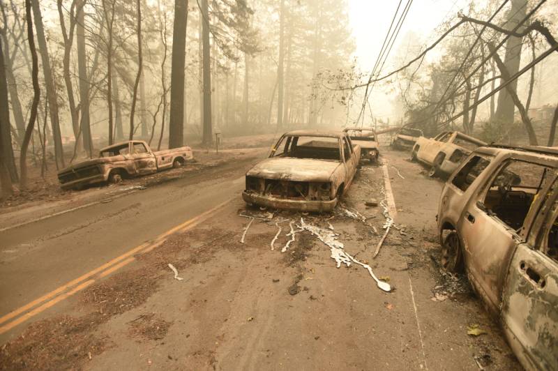
During the East Bay Hills fire in October 1991, which killed 25 people, congestion was a major problem. A report on the blaze conducted by the U.S. Fire Administration found that as some roads were blocked down due to the spread of the fire, others “became clogged with cars and pedestrians.” As in Paradise, some victims died after being trapped on narrow, blocked roads.
StreetLight’s Schewel said the company chose to analyze only small towns because it feels those communities will benefit most from the research.
“We figured if we’re going to put a bunch of information on the internet for free, the small towns who don’t have the resources to do their own studies might get the most benefit out of that type of exercise,” she said.
Schewel said this type of analysis could be conducted for a larger population center like Oakland, but in that case, it might be more helpful to analyze the area in smaller sections.
It’s also important to note, Schewel said, that there’s no silver bullet for evacuation planning.
“Data-driven planning is important, but we want to be very clear that this is not a magical robot that tells evacuation professionals what to do,” she said. “It’s — we hope — a helpful extra tool in the toolkit.”

