We have come a long way in our understanding of the planet Mars in the last few decades, and even the past several years.
Once visible only as a reddish spark in the night sky, when all that humans had to behold it with were bare eyes, Mars became more intriguing after the invention of the telescope 400 years ago. Mysterious surface markings and seasonal changes in color on Mars’ surface tantalized human scientific curiosity, and we had to know more.
Since we began sending robotic orbiters and, later, landers our understanding of our neighbor planet has skyrocketed to new heights.
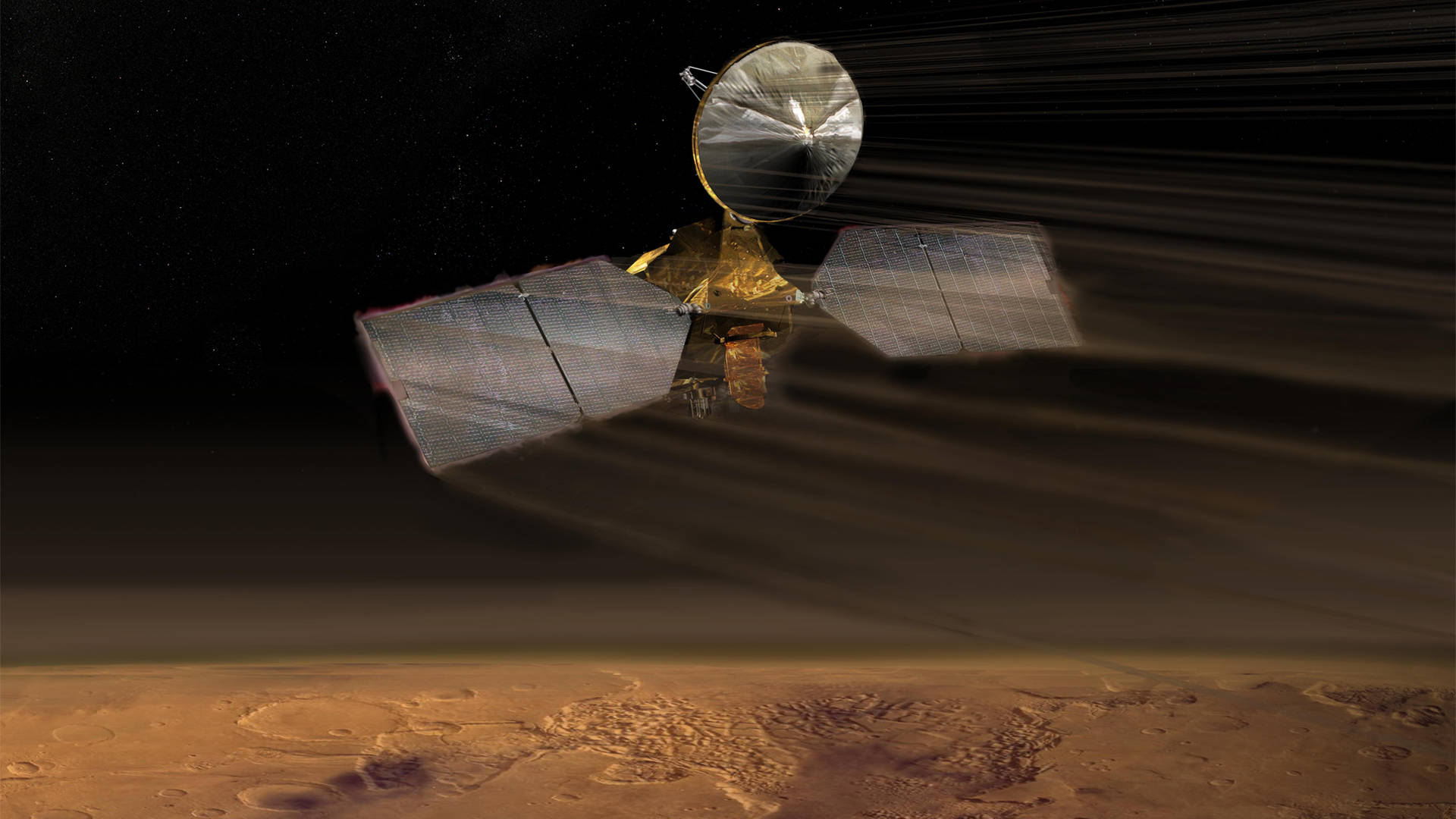
But no single mission has revealed so much of Mars’ surface in such astounding fine detail, revealed its dynamic geologic and meteorological processes with such exquisite finesse, and laid groundwork for so many other missions, as NASA’s Mars Reconnaissance Orbiter.
MRO
This month NASA marks MRO’s tremendous achievements by celebrating its 60,000th orbit since arriving at Mars in 2006. In that time, the high-tech orbiter has brought us many discoveries and — if the past is a guide to the future — will bring many more.
To date, MRO has captured over 378,000 high-resolution images of the Martian surface, returned over 360 terabits of scientific data to Earth, scouted out or mapped landing sites for seven missions, tracked the descent of three of them, and relayed one terabit of data from multiple surface missions.
No two ways about it, MRO is a high-flying achiever.
Biggest Camera in Deep Space
Loaded with a suite of scientific instruments, one of MRO’s most crowd-pleasing achievements is the fantastic set of hundreds of thousands of images of Mars’ surface captured with its HiRISE (High-Resolution Imaging Science Experiment) camera. With a half-meter wide aperture, HiRISE is the largest camera ever sent into deep space, beyond the Earth-Moon system.
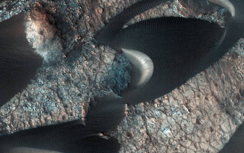
Capable of spotting objects not much larger than a beach ball from 190 miles up, and retargeting any location as often as every two weeks, HiRISE has revealed details of Mars that can only be surpassed by a lander or rover’s on-the-ground point of view.
However, MRO has a high-ground advantage over its surface-based cousins: from its polar orbit that winds around the globe, MRO has a sweeping view of the entire planet.
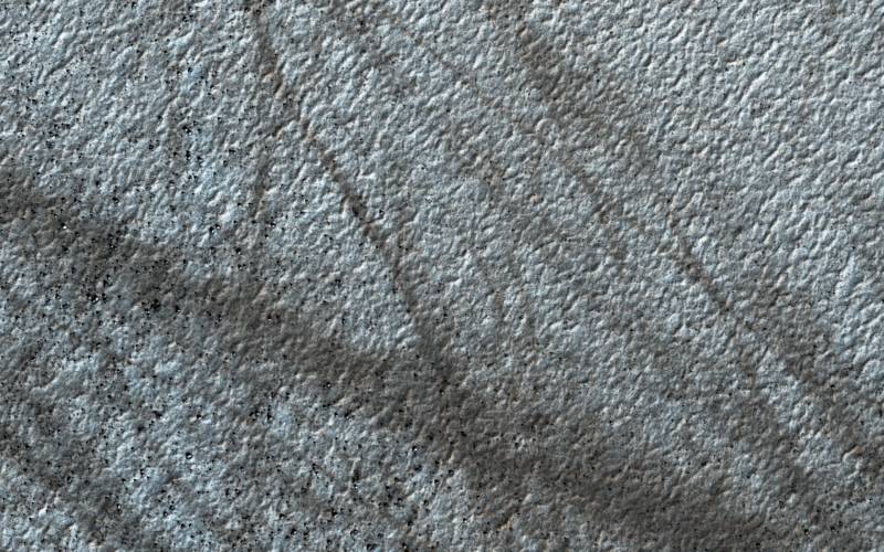
Because MRO can capture images of the same regions repeatedly, it offers a sort of time-lapse perspective that reveals changes in Mars’ surface and atmosphere. This ability, more than for any other mission, has shown us that Mars is a highly dynamic planet, with seasonal cycles of carbon dioxide and water ice formation and decline, landslides, windstorms and dust devil activity, meteorite impacts, cloud formation and atmospheric circulation, and much more.
Red-Planet Relay
MRO is the best communications point, to date, on the Red Planet — one that can serve both space robots and any human explorers alike. You may recall how important orbital satellites were to ground operations on the film, “The Martian.” It was through repeated orbital surveillance, that mission control knew astronaut Mark Watney was still alive after his crew mates left him for dead. Then, when he managed to hot-wire the derelict Pathfinder lander, his attempts at communication with Earth were facilitated by orbital relaying.
Okay, so there hasn’t been any human drama like that in reality — yet — but MRO has already had a fine career as an orbital surveillance and communications relay station.
Rovers like Curiosity can communicate directly with Earth, via the giant radio receivers of NASA’s Deep Space Network, but when it comes to porting large amounts of scientific images and other data, using orbiters like MRO as go-betweens has some powerful advantages.
At close range — from surface to orbit — radio signals are stronger and the data bandwidth greater. Curiosity can upload to MRO a large amount of data relatively quickly. Then, MRO can send the batch to Earth through its large, high-gain antenna. And since MRO has a direct line of sight with Earth most of the time, there is far less interruption in communication than for surface robots, which spend half of each day blocked from Earth by Mars.
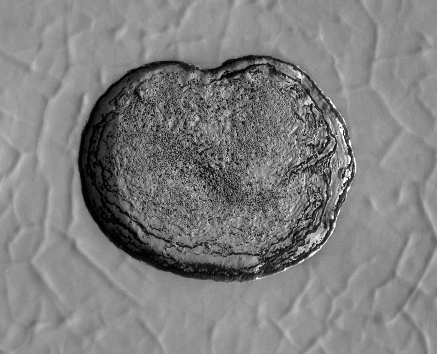
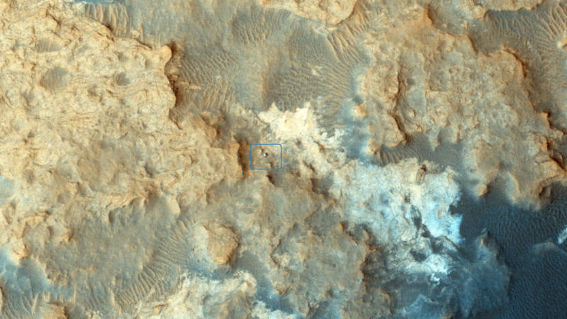
Robot Spotting
Because MRO’s HiRISE surveillance covers the entire surface of Mars, and can spot objects as small as a card table, it has been a wonderful tool not only for tracking spacecraft as they make their descent toward landing, but for locating them and providing context imagery and data of the areas around their landing sites.
Over time, MRO has spotted Vikings 1 and 2, Pathfinder, the rovers Spirit, Opportunity, and Curiosity, the Phoenix lander near Mars’ north pole, the new Insight lander, and even the ill-fated European Beagle 2, with which contact was lost during landing.
Of greater importance to landing missions is the job that puts the R into MRO: Reconnaissance. Landing a robot on Mars is tricky, especially for larger and more complicated vehicles like Curiosity, and the upcoming Mars 2020 rover.
So, getting detailed pictures and other measurements of the terrain and surface conditions of prospective landing sites gives mission planners the vital information they need to choose where to land, and then to plan the final landing maneuvers with as much safety as possible.
MRO has scouted and mapped the sites for seven landing missions, including pre-landing reconnaissance and post-landing surveillance.
Job Security For a Robot
With plenty of geologic and meteorological action continually taking place on Mars, and future missions to scout out possible landing sites for, Mars Reconnaissance Orbiter should remain on the NASA payroll for years to come.