3. Which of these places is on the North American plate: Aptos, Bolinas, Colma, Davenport?
4. Which of these places is on the Pacific plate: San Francisco, San Jose, Santa Clara, Santa Cruz?
5. What is the highest magnitude earthquake that the Hayward fault is capable of: 6.7, 7.0, 7.5, 8.0?
6. Mount Tamalpais is primarily what rock type: blueschist, chert, marble, melange?
7. What mineral resource has NOT been produced in the Bay Area: coal, mercury, petroleum, uranium?
8. What fossils are NOT found in the Bay Area: ammonites, dinosaurs, hypsodonts, mammoths?
9. What fault continues north where the Hayward fault ends: Calaveras, Rodgers Creek, San Andreas, Zayante?
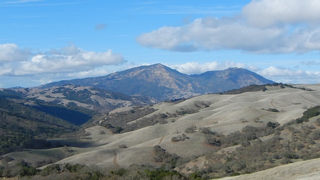
10. Mount Hamilton is primarily what rock type: gneiss, granite, graywacke, greenstone?
11. What fault continues north where the Concord fault ends: Flint Hills, Green Valley, Greenville, Maacama?
12. Which Spanish word tells you there was once a lime kiln here: calabaza, calavera, calera, calesitas?
13. The San Gregorio fault occurs onshore in what county?
14. Franciscan rocks are mapped in 14 different entities called what: belts, formations, melanges, terranes?
15. What rock type is at the top of Mount Diablo: basalt, harzburgite, rhyolite, schist?
16. Which entity allows personal fossil collecting: BLM, Caltrans, Coastal Commission, state parks?
17. Which North Bay mountain is an actual (former) volcano: Burdell, Konocti, St. Helena, Tamalpais?
18. Mount St. Helena is primarily what rock type: diatomite, serpentinite, slate, tuff?
19. What kind of ore was mined south of Livermore during World War II: iron, magnesium, uranium, vanadium?
20. Where is the Bay Area's only geyser: Calistoga, The Geysers, Great America Park, Mount Diablo?
And here are the answers:
1. California's state rock is serpentine, better known as serpentinite.
2. The 1906 San Francisco earthquake was magnitude 7.8.
3. Colma is east of the San Andreas fault and therefore on the North American plate.
4. Santa Cruz, conversely, is on the Pacific plate.
5. The Hayward fault is considered capable of a magnitude 7.5 earthquake.
6. Mount Tamalpais is primarily melange, an intimate mixture of metamorphic rocks.
7. To my knowledge, uranium has never been produced in the Bay Area.
8. No dinosaur fossils are known from the Bay Area.
9. The Rodgers Creek fault continues north where the Hayward fault ends.
10. Mount Hamilton is primarily graywacke, a variety of sandstone.
11. The Green Valley fault continues north where the Concord fault ends.
12. "Calera" is the Spanish term for a limekiln, where limestone is roasted into lime. You may now look up the other three words.
13. The San Gregorio fault occurs onshore only in San Mateo County, just missing San Francisco and Santa Cruz counties.
14. Franciscan rocks are mapped in 14 different entities called terranes.
15. The top of Mount Diablo consists mostly of basalt.
16. The Bureau of Land Management allows personal fossil collecting on the public lands it administers.
17. Mount Konocti, overlooking Clear Lake, is a former volcano, although the others contain volcanic rocks.
18. Mount St. Helena is primarily tuff, or volcanic sediments.
19. Magnesium ore, the mineral magnesite, was mined in the ultramafic rocks south of Livermore during World War II.
20. The Bay Area's only geyser is in Calistoga, but it's an artificial one that erupts in a drilled hole.