upper waypoint

Stunning 'Fire Cloud' Photos From California-Oregon Border

Save ArticleSave Article
Failed to save article

Please try again

A week ago we put up a post highlighting images of several major Northern California fires as seen by two NASA satellites.

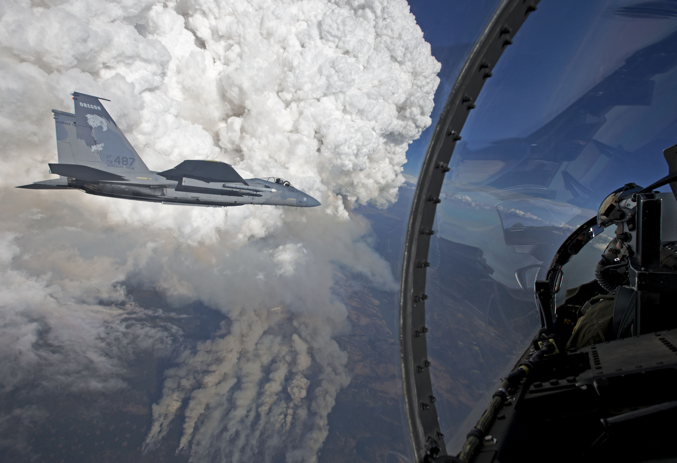
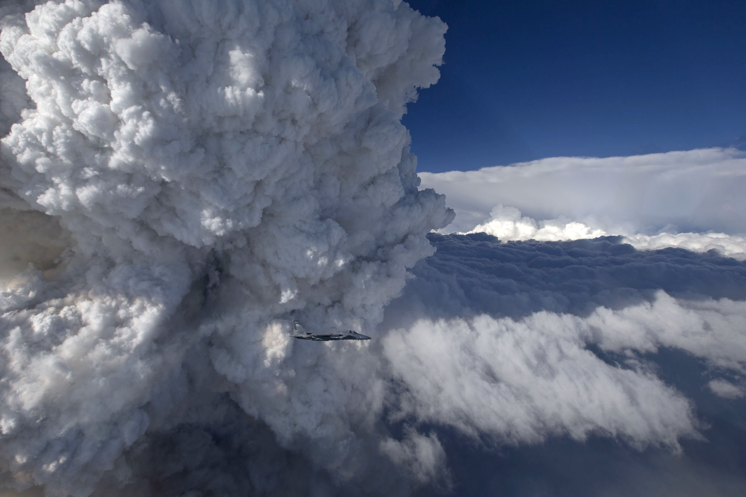
Now here are two stunning images, courtesy of NASA, of the Beaver Complex Fire, made up of two Oregon fires that have spread and now straddle the Oregon-California border, affecting Siskiyou County on the California side. The photos were captured by an Oregon Air National Guard F-15C fighter jet. The images show a developing pyrocumulus cloud on July 31, 8:20 p.m., on the Oregon side of the fire.

Click on the images to see larger versions.

FighterJet1


Sponsored

fighterjet2

NASA says pyrocumulus clouds are sometimes called “fire clouds."

(Pyrocumulus clouds) are tall, cauliflower-shaped, and appear as opaque white patches hovering over darker smoke in satellite imagery. Pyrocumulus clouds are similar to cumulus clouds, but the heat that forces the air to rise (which leads to cooling and condensation of water vapor) comes from fire instead of sun-warmed ground. Under certain circumstances, pyrocumulus clouds can produce full-fledged thunderstorms, making them pyrocumulonimbus clouds.

The Beaver Complex Fire is currently 50 percent contained and has burned over 35,000 acres. It was started by lightning on July 30. Firefighting personnel from Oregon and California -- 1,643 of them -- have been deployed against the blaze.

lower waypoint
next waypoint