upper waypoint

6.8 Quake Shakes Northern California Coast; No Tsunami Threat

Save ArticleSave Article
Failed to save article

Please try again

NOAA depiction of the epicenter of Sunday night's earthquake off the Humboldt County coast.

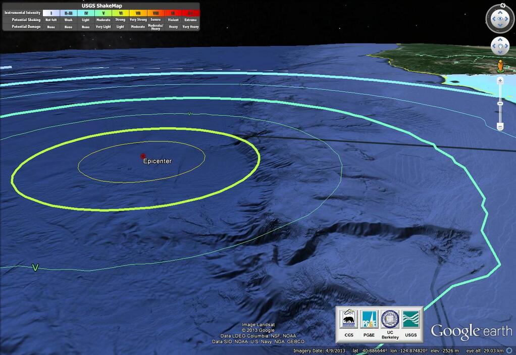
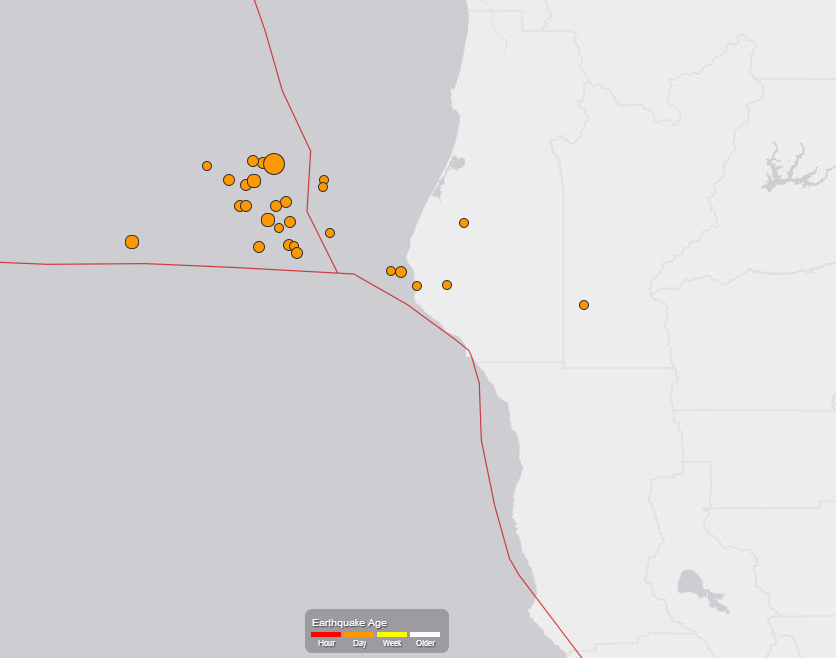
11:45 a.m. Monday Update: The U.S. Geological Survey has revised its assessment of last night's quake off the Humboldt County coast, now rating it as a magnitude-6.8 event. About 26 aftershocks have been recorded since the quake, which hit at 10:18 p.m. last night.

U.S. Geological Survey map showing location of Sunday night earthquake and aftershocks.

Original post, 12:10 a.m. Monday: The U.S. Geological Survey says a magnitude-6.9 earthquake struck at 10:18 p.m. Sunday night off the Humboldt County coast, about 250 miles northwest of San Francisco.

The Associated Press and Los Angeles Times both quote local officials as saying there were no early reports of damage or injuries. The California Office of Emergency Services reported, via Twitter, that as of 11:30 p.m. it had no reports of trouble from the coast.

The West Coast and Alaska Tsunami Warning Center said there is no danger of a tsunami from the quake.

The quake was centered about 40 miles west of Eureka, the largest town in Humboldt County, and was about 7.5 miles under the seafloor. The initial quake was followed by 10 aftershocks by midnight Sunday, the largest a magnitude-4.6 shake recorded at 10:51 p.m. The USGS "Did You Feel It?" public report page included a smattering of reports from as far away as the Bay Area, the northern Sierra Nevada and the Willamette Valley in Oregon. More than 2,000 reports came from communities around Humboldt Bay.

Sponsored

The offshore region is the site of the Mendocino Triple Junction, where the Gorda, Pacific and North American tectonic plates meet just north of the terminus of the San Andreas Fault.

In April 1992, a 7.2-magnitude quake, followed by 6.5 and 6.7 shocks, violently shook the coast 30 miles southwest of Eureka, causing more than 100 injuries and severe damage in several towns, including Ferndale and Petrolia.

In November 1980, a 7.2-magnitude quake centered just off the coast caused widespread damage around Eureka, including the partial collapse of a freeway overpass south of Eureka.

lower waypoint
next waypoint
California Homeowners Say Oakland Lender Scammed Them Out of $3M in Home ImprovementsFAFSA 2024: The May 2 Deadline for California Students is Almost HereBillionaire-Backed Bid for New Solano County City Is Closer to November BallotThousands of San Francisco Residents Saved From Eviction by 2018 Legal Aid MeasureBay Area High School Students Scramble to Find Seats to Take the SAT and ACTHow to Spend this Summer Camping CaliforniaCollege Protests From the Eyes Of Student JournalistsE. Coli Outbreak Linked to Organic Bulk Walnuts Sold in Some Bay Area StoresNursing Home Staff Shortages Leave Patients Waiting in HospitalsAlameda County District Attorney Challenges Recall Signature Count