Sponsor MessageBecome a KQED sponsor
upper waypoint

San Francisco’s Summer Fog Is Sticking Around — and Creeping Farther Inland

Save ArticleSave Article
Failed to save article

Please try again

FogCam - which is admittedly trained on a less spectacular vista than this view of the Golden Gate Bridge's north tower - is nonetheless a piece of internet history.
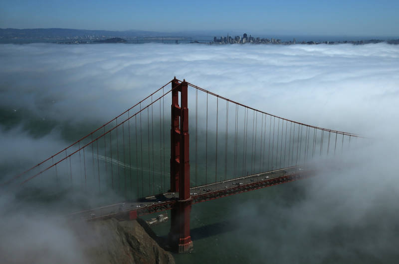
June gloom is spreading cool temperatures and breezy winds another day, and the conditions are expected to persist through the weekend.  (Justin Sullivan/Getty Images)

June gloom is sticking around in San Francisco.

May’s sunny skies and balmy temperatures have quickly become a distant memory as chilly, sea-spray-rich fog settles over the city for another day, spreading cool temperatures and breezy winds from the coast inland on Wednesday.

“Hopefully you’re a fan of that weather because it’s going to continue [through] basically this weekend,” said Rachel Kennedy, a meteorologist at the National Weather Service’s Bay Area office.

Sponsored

Those wishing instead for the return of park-lounging and beach-going temperatures should hope for what meteorologists call ridging — or the development of high atmospheric pressure — over the Pacific Ocean, Kennedy said, which would keep Karl the Fog at bay, literally.

In recent days, even the San Francisco neighborhoods known for getting more sun have been covered in coastal fog, thanks to low atmospheric pressure pushing the marine layer farther inland.

According to the weather service’s models, that trend could continue through the weekend unless ridging develops, which would allow the fog in inland areas of the city to burn off earlier in the morning, increasing temperatures throughout the day.

The rest of the Bay Area is expected to continue to see highs in the low to mid-70s closer to the coast, and push into the 80s farther inland. The southernmost parts of Monterey and San Benito counties could hit 90 degrees over the weekend, Kennedy said.

Starting next week, the whole region is expected to warm up a few degrees.

“While we’re still expecting those more gloomy mornings to continue, we are expecting clearing to occur mid- to late morning instead of late morning or in some cases early afternoon,” she said. “[That] should give you a bit more sunlight.”

What the weather will look like next week is pretty up in the air, Kennedy said. Right now, weather models aren’t predicting either very high or low pressure trends, leaving the forecast in limbo.

But Kennedy said those hoping to be rid of foggy conditions for good should probably dampen their expectations: “Unfortunately, it’s the time of year for June gloom,” she said.
lower waypoint
next waypoint