upper waypoint

Map Shows Spread of Rim Fire Day by Day

Save ArticleSave Article
Failed to save article

Please try again

Here's a very good map from InciWeb showing the spread of the Rim Fire day by day, from Aug 17 to yesterday, Aug 26. As you can see, the rate of growth has slowed considerably. AP reports this morning that the fire is 20 percent contained, up from 15 percent on Monday. Officials said the fire has grown to about 280 square miles, up from about 252 square miles the previous day, but back burning by crews was responsible for at least part of that increase. The fire is currently the seventh largest in state history, having consumed more than 179,000 acres.

Click on the map for a larger image. More updates on the fire from InciWeb here.
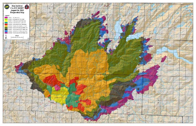
inciwebfiremap

Sponsored

lower waypoint
next waypoint
Bay Area High School Students Scramble to Find Seats to Take the SAT and ACTCalifornia Housing Is Even Less Affordable Than You Think, UC Berkeley Study SaysEvan Low Advances in Silicon Valley Congressional Race, After Recount Breaks Historic TiePhotos: Campus Protests Grow Across Bay AreaE. Coli Outbreak Linked to Organic Bulk Walnuts Sold in Some Bay Area StoresMay Day Rallies Focus on Palestinian Solidarity in San Francisco, OaklandTunnels Under San Francisco? Inside the Dark, Dangerous World of the SewersAlice Wong Redefines ‘Disability Intimacy’ in New AnthologyUC’s President had a Plan to De-Escalate Protests. How did a Night of Violence Happen at UCLA?Nursing Home Staff Shortages Leave Patients Waiting in Hospitals