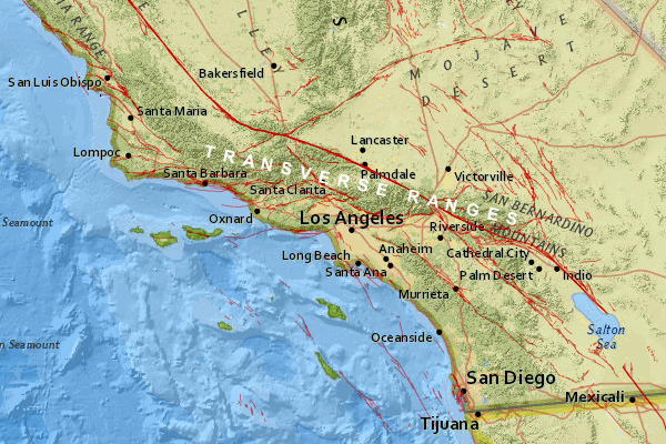
A new study argues that at least two large earthquake faults off the coast of Southern California can spawn damaging tsunamis that would wash over San Diego, Long Beach, Santa Barbara and other coastal cities. The study’s findings could force changes in the disaster plans for these places.
In the study, published by the Journal of Geophysical Research, a team led by Mark Legg scrounged years of data from different undersea surveys to analyze the offshore lands of Southern California in unprecedented detail. Looking both on and underneath the deep sea floor, Legg’s team found some of the earthquake faults off California are longer and more threatening than previously thought – capable not only of generating large earthquakes, but of launching dangerous tsunamis toward the nearby coast.
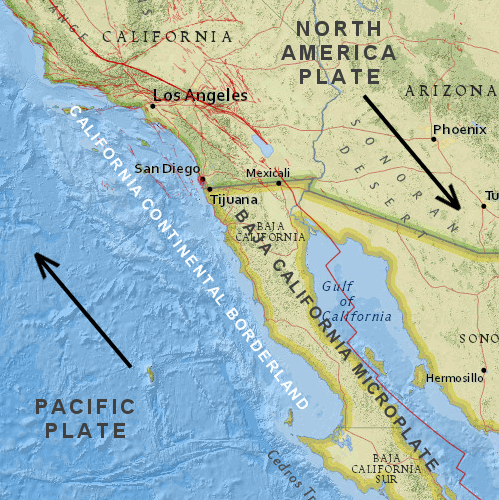
Legg’s study makes two main contributions. First, it builds a more accurate picture of fault activity where the Pacific and North America plates intersect, in the enigmatic region known as the California Continental Borderland. Second, it considers an underappreciated aspect of California’s faults that geologists call transpression.
A Fractured Borderland
The California Continental Borderland extends from Santa Barbara down to Baja California, all submerged except for the Channel Islands. It’s a peculiar piece of Earth’s crust. It started out as part of the North America tectonic plate: a thick pile of rocks and mud on the continent’s edge. Things changed about 28 million years ago as the Pacific plate took over offshore and the San Andreas fault was born. The Borderland splintered off the continent, and it’s been moving northwestward on the Pacific plate ever since.
That process is tearing the Borderland apart. Plate tectonic animations resemble the kind of mess you might see as tree trunks float down a river into an obstruction – a tectonic logjam. Today the Borderland is a badly cracked region.
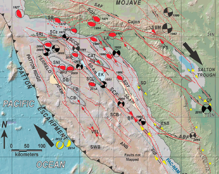
Legg’s paper is a detailed description of two large faults in the seafloor of the Borderland: the 110-mile Santa Cruz-Catalina Ridge fault (“SCCR” on the map), and the 220-mile Ferrelo fault zone, extending from Santa Rosa Island to the deep Velero Basin, in Mexican waters.