Sponsored
upper waypoint

How to Hike 'Above the Clouds' in the Bay Area (Plus, the Science of a Marine Inversion)

Save ArticleSave Article
Failed to save article

Please try again

A low fog rolls over Mount Tamalpais at sunset on Aug. 8, 2020. Here's the science behind the marine layer inversion and where you can catch the most stunning views from above the clouds right here in the Bay Area.  (Zeyu Wang/Getty Images)

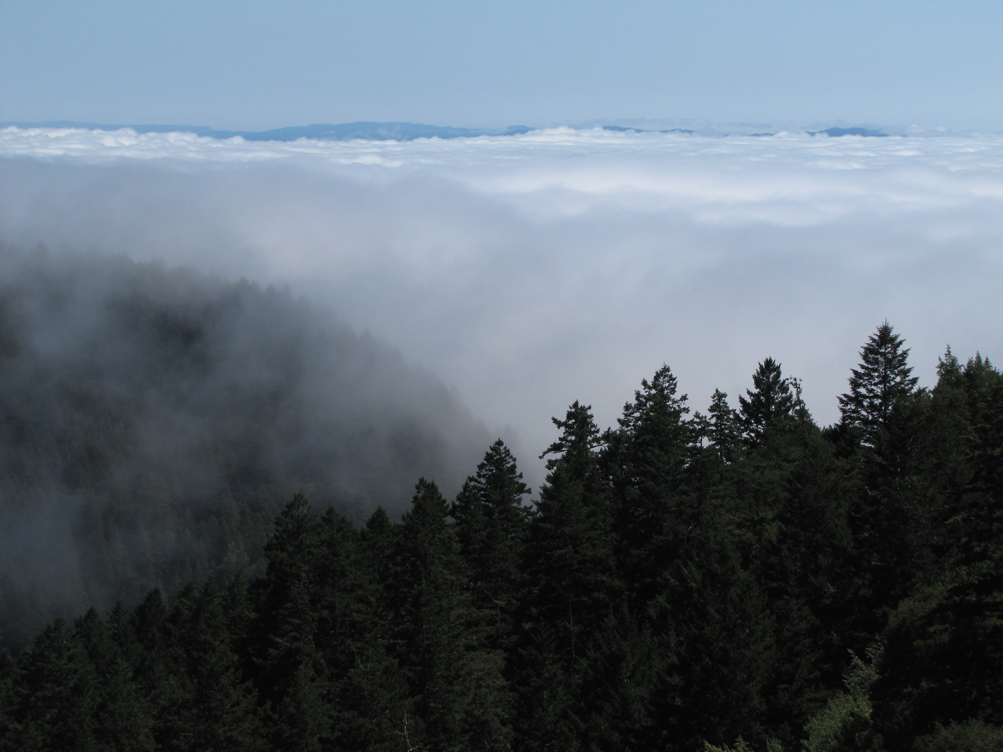
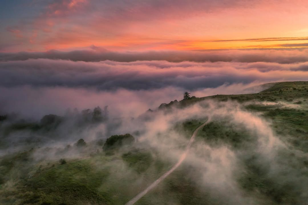
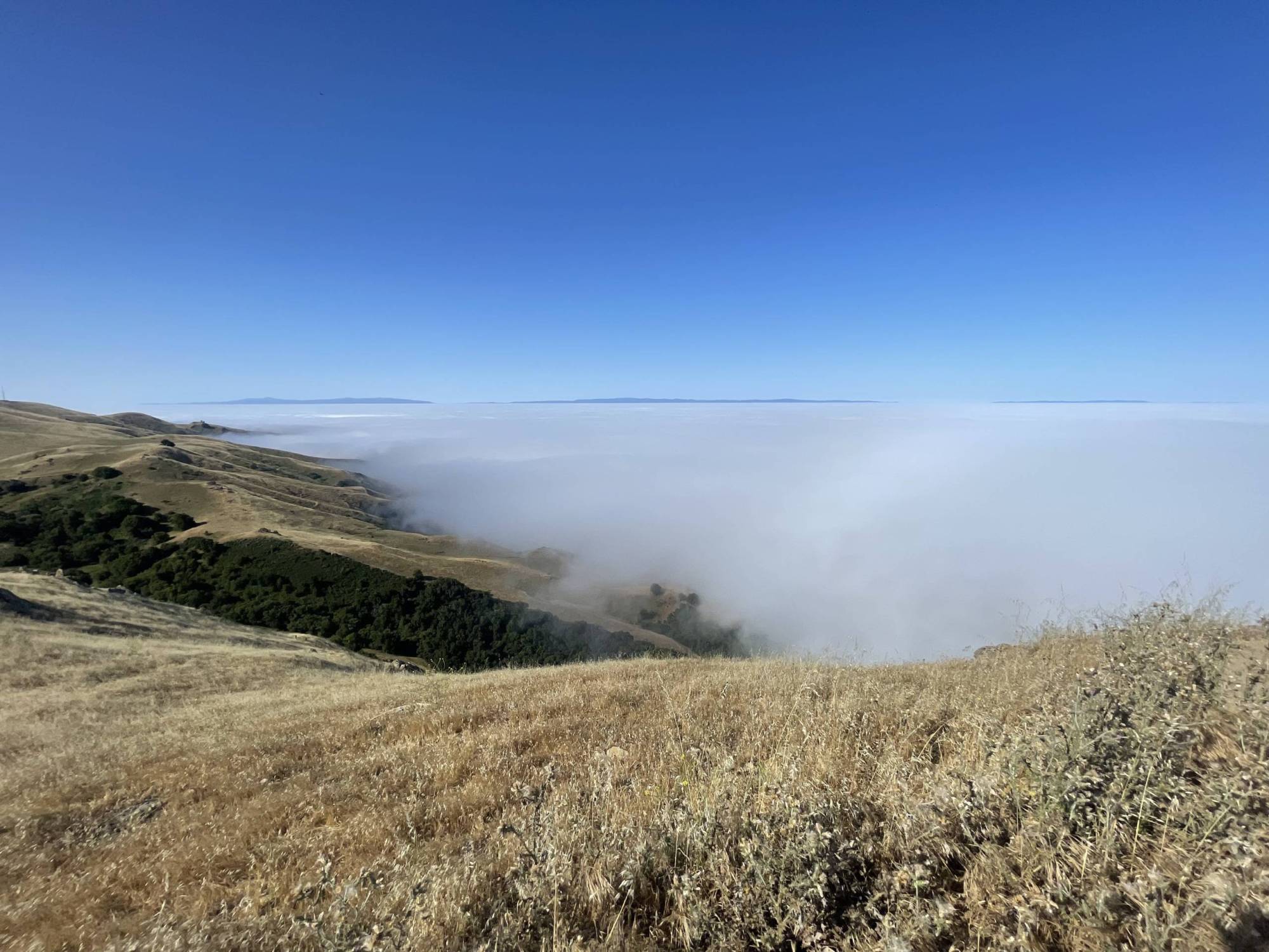
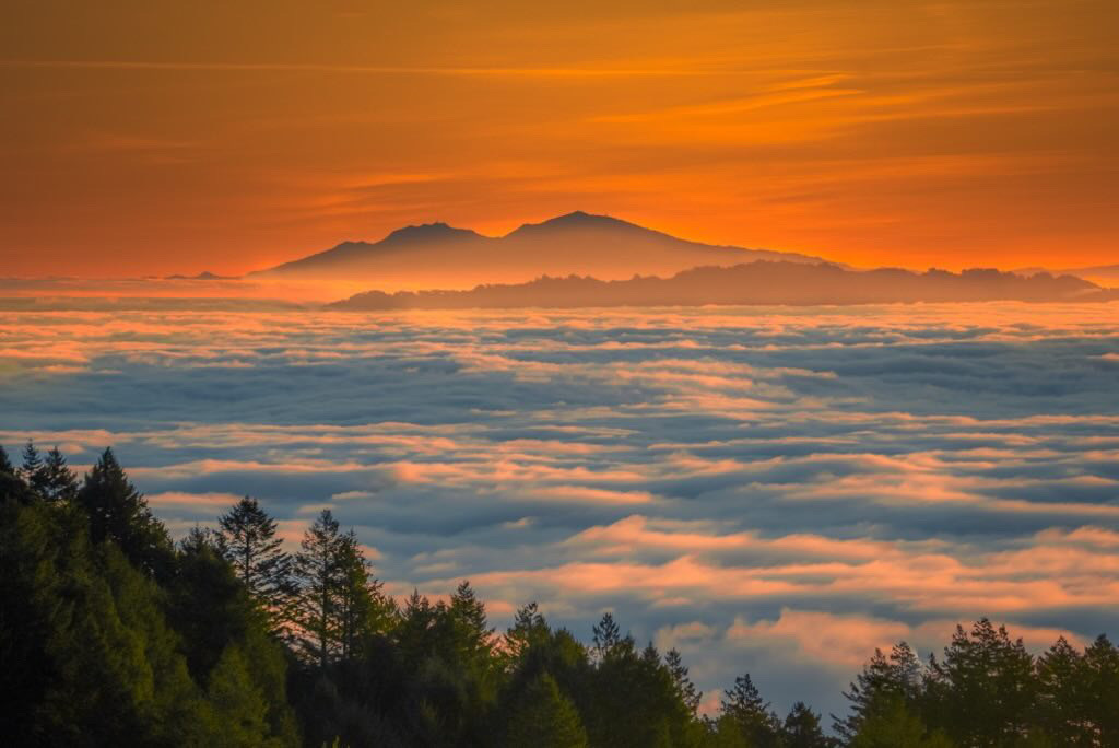
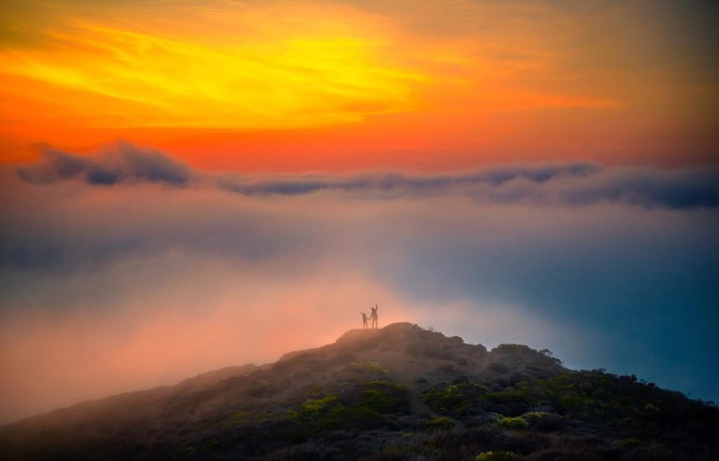
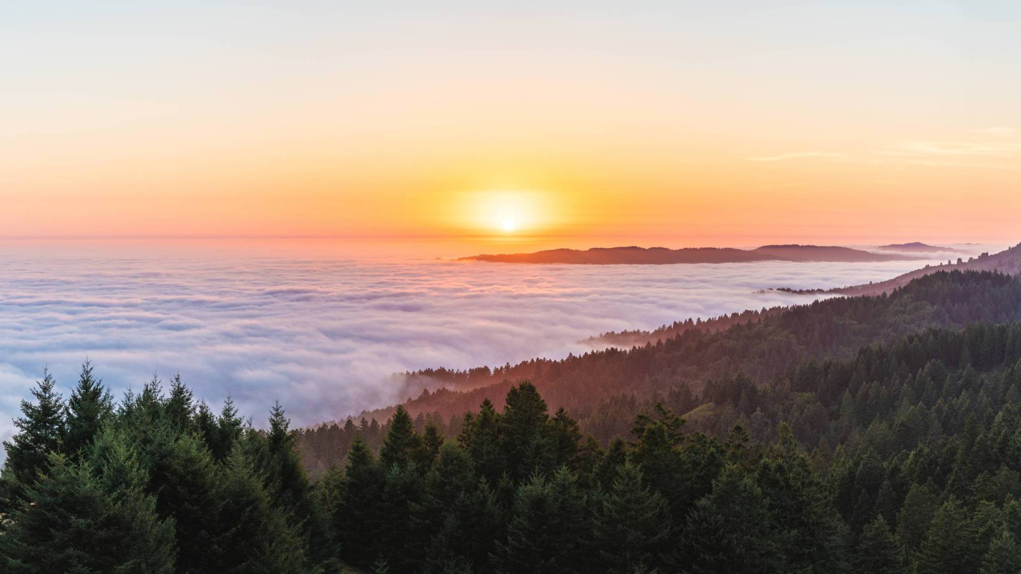
There’s something undeniably magical about standing atop a mountain and gazing out over a thick blanket of clouds. And in the Bay Area, it’s a sight we’re lucky enough to experience frequently, at spots like Marin’s Mount Tamalpais or Mission Peak in the East Bay.

But this phenomenon — commonly called a “marine inversion” or “fog blanket” — isn’t just a feast for the eyes. It’s also rooted in some fascinating atmospheric science.

Keep reading to learn how this “sea of clouds” actually forms, and where (and when) to go hiking in the Bay Area for the chance to see it for yourself.

Jump straight to:

Mount Tamalpais State Park under a blanket of fog in Mill Valley, California, United States on July 2, 2023. Catching a “cloud inversion” from above is part planning, part luck — but a little meteorological know-how can greatly increase your chances. (Photo by Tayfun Coskun/Anadolu Agency via Getty Images)

The science behind the sea of clouds

Under typical conditions, as you move higher in altitude, the air temperature decreases and gets cooler — a pattern known as the “lapse rate,” which describes the change in temperature with elevation.

But occasionally, this rule flips.

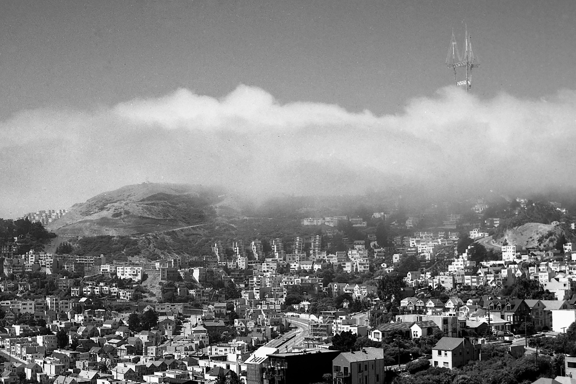
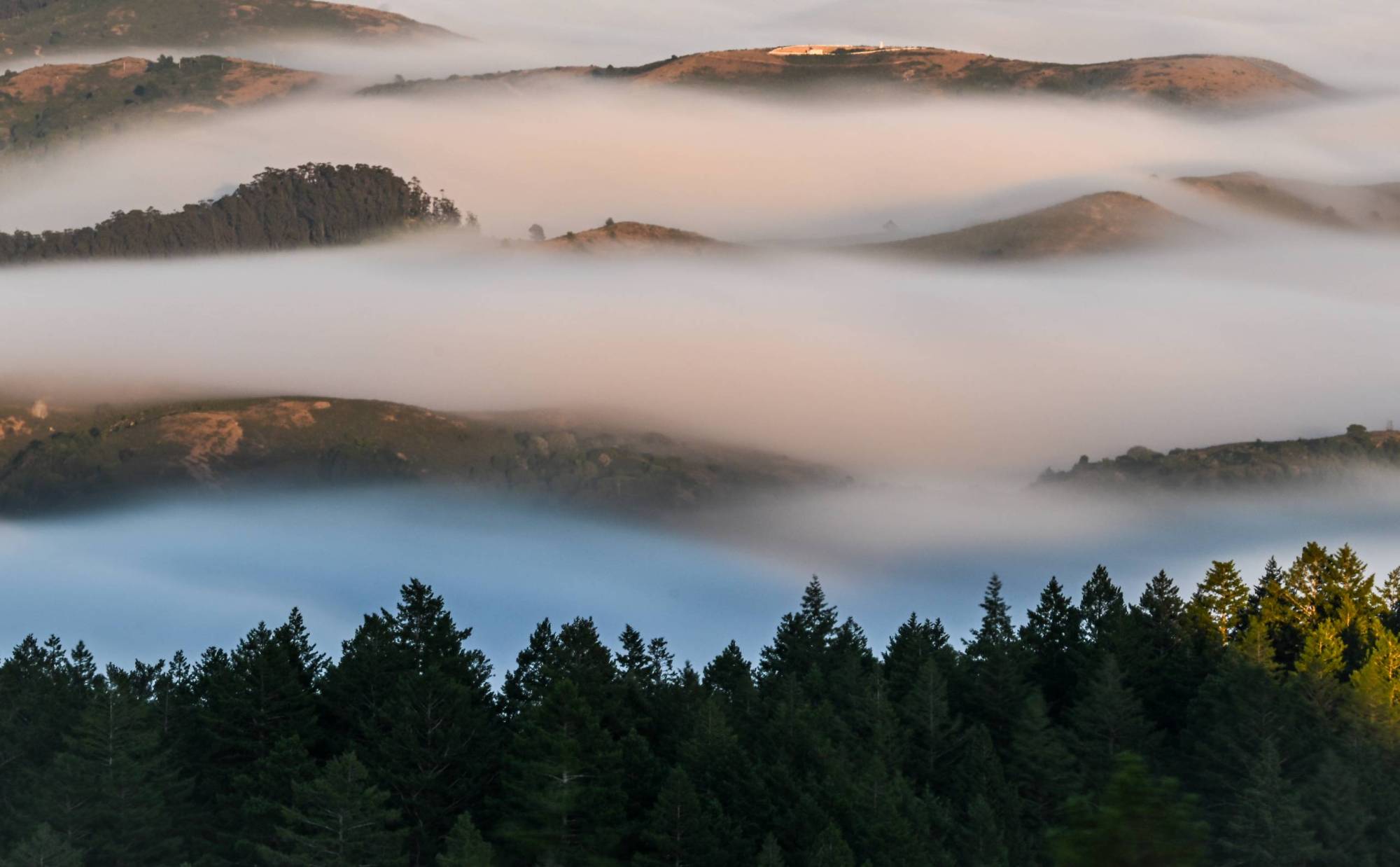
When colder air gets trapped near the ground beneath a layer of warmer air, it forms a marine layer inversion. And in the Bay Area, this inversion is often tied to the Pacific Ocean’s influence, explained meteorologist Jan Null,  especially during the summer.

“You have all this air along the coast sitting over this 55-degree water,” said Null, who founded Golden Gate Weather Service. “That water is cooling the air right above it. So you have cool air at the surface of the water, and then you have warmer air above that, and then it gradually cools off.”

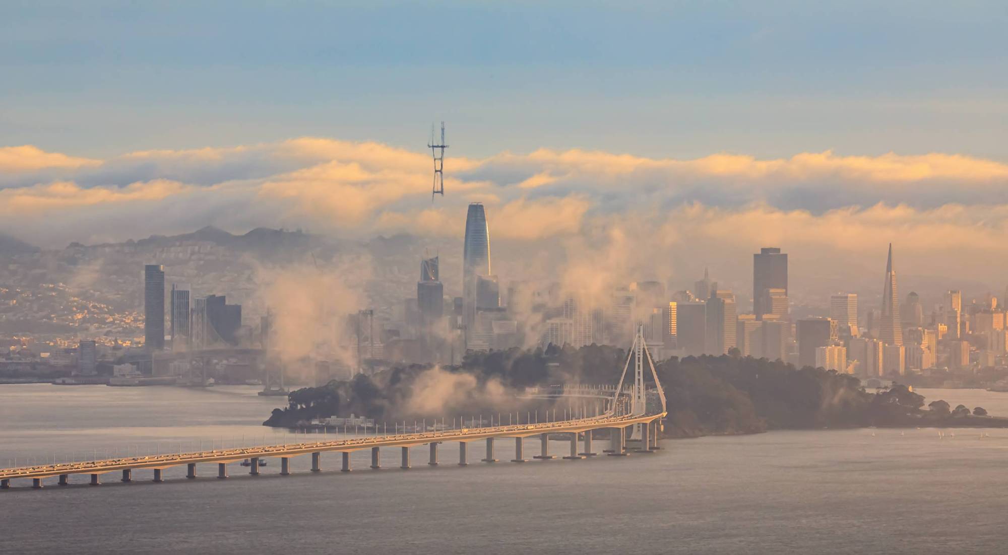
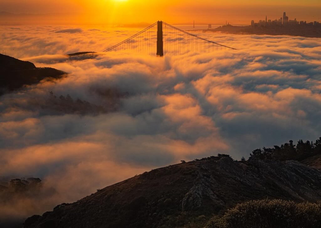
That warm air acts like a lid, trapping the cooler air and moisture below and forming a shallow but dense marine layer, especially along the California coast.

During the summer, these inversions commonly occur around sunrise and dissipate during the day as the sun heats the surface, “breaking” the inversion layer — although Null said they can occur during sunset, too.

When an inversion happens, the marine layer is typically 1,000 to 2,000 feet thick, but its exact height can vary depending on offshore pressure systems. “Just like how water will always flow from a higher elevation to a lower elevation, air flows from high pressure to low pressure, trying to reach equilibrium,” Null said.

When that high pressure dominates, it suppresses the marine layer, keeping it low and closer to the ground. When a trough of low pressure moves in, that’s when the layer can deepen and rise to higher altitudes — and what allows hikers on summits to feel like they’re climbing above the clouds.

Inland areas, like the Central Valley, heat up more rapidly than the coast, creating a pressure difference that pulls this cool, moist air inland.

“The marine layer is primarily a summertime phenomenon as far as it coming inland because then you get the heating in the inland areas that generate that sea breeze pattern,” Null said.

Sponsored

Where to hike ‘above the clouds’ in the Bay Area

Catching a “cloud inversion” from above is part planning, part luck — but a little meteorological know-how can greatly increase your chances.

“We have lots of yardsticks for the backyard weather observers to keep track of how high the marine layer is today,” Null said, adding that knowing the elevation of the spot you want to head to — plus the thickness of the marine layer itself — can help when planning.

For a more accurate forecast, Null advises observing the weather a day in advance of setting out to catch an inversion. One of the tips Null shared: “If it’s going to be getting warmer, then that probably indicates that the marine layers are going to be more shallow,” making it a great chance to see the clouds beneath you at certain altitudes.

In contrast, if it’s going to be cooler, the marine layer will be deeper and higher up on those mountains — meaning it’ll be above most parts of the entire Bay Area, Null added. In other words, your chances of hiking above the clouds are greatly reduced.

Here are some tips shared by Null and others in the Bay Area who know how to successfully chase the marine layer inversion:

Observe marine layer inversions using weather apps like National Weather Service, Accuweather, Windy or others 

Start by checking the “cloud tops” or cloud ceiling — the height at which clouds form. If they’re around 1,000 to 2,000 feet, and your summit hike is above that elevation, good news: you’re likely to be above the cloud layer.

Use tools like the National Weather Service’s Aviation Forecasts or AccuWeather, which list ceiling heights at different locations. Mount Tam, for example, stands at about 2,200 feet, while Twin Peaks is just under 1,000 feet.

Null also recommends websites like Everything Weather, built by a former National Weather Service forecaster, that offer localized human-curated forecasts that are more reliable than many generic weather apps, he said.

Fog encroaching on the Bay Area, as seen from Mt. Tamalpais in Marin County.
Fog encroaching on the Bay Area, as seen from Mount Tamalpais in Marin County. (Craig Miller/KQED)

Check live webcams or satellite images

Mount Tamalpais, Sutro Tower, the Golden Gate Bridge and other notable spots may have live webcams available that you can check for fog and cloud activity early in the morning.

Null suggests watching satellite imagery, wind direction and local weather discussions to keep an eye on local landmarks, which can act as visual indicators of the marine layer’s height. “You can kind of gauge ‘is it above or below the towers of the Golden Gate Bridge?’ ‘Is it over Twin Peaks?’ ‘Is it up to Sutro Tower?’”

Google Earth can also be a great tool to observe visible fog or low-lying clouds.

Arrive early

Plan to be at your chosen spot around sunrise (5:30 a.m.–7 a.m. in the summer) for the most dramatic views before the clouds start to burn off.

Do you always need to go high?

Not always. If the cloud layer is shallow — say, 400–800 feet — even the modest hills within San Francisco can offer views above the mist. Spots like Twin Peaks, Tank Hill and Bernal Heights sometimes poke just above the marine layer, offering in-city access to the phenomenon without needing to climb a mountain.

Great Bay Area hikes for walking above the clouds

Before you head out, remember that clouds can shift quickly — so stay flexible (and realistic that today might not be the day.)

Dress in layers, as temperatures can swing dramatically between the coast and the hilltops. Bring water, check trail conditions and always leave no trace.

Here are some Bay Area spots that offer stunning views above the marine layer — if time, the elements and luck are on your side.

Mount Tamalpais, Marin

Elevation: ~2,500 feet

Mount Tam is the classic spot for fog lovers. Head to the East Peak early in the morning during summer, and you might find yourself above a sea of clouds spilling in from the Pacific. Trojan Point, situated at an elevation of 1,874 feet, is another popular spot on Mount Tamalpais to experience a marine layer inversion.

@modicumofjoy run, do not walk.. This hike will take you above the clouds, and if you time it right- you might see the Golden Gate Bridge peeking through 🌁 𝙎𝙘𝙧𝙤𝙡𝙡 𝙩𝙤 𝙨𝙚𝙚 𝙝𝙤𝙬 𝙩𝙤 𝙬𝙞𝙩𝙣𝙚𝙨𝙨 𝙩𝙝𝙞𝙨, 𝙬𝙝𝙚𝙧𝙚 𝙖𝙣𝙙 𝙬𝙝𝙚𝙣, 𝙬𝙞𝙩𝙝 𝙥𝙖𝙧𝙠𝙞𝙣𝙜 𝙞𝙣𝙛𝙤! there is one place where you will ALWAYS see this (only during the summer months) and that is.. 📍Mount Tamalpais, California It’s only 30 mins from north San Francisco and you can witness this phenomenon from these points.. 𝙑𝙄𝙀𝙒𝙋𝙊𝙄𝙉𝙏𝙎 ➡️ Trojan Point- Google Maps will get you there, park and walk up (first clip) for about 5-7 mins ➡️ Once you park at Trojan Point Parking Lot, there are two trails on the right of the lot, those will take you to the views in the second and third clips! 𝙃𝙊𝙒 𝙏𝙊 𝙈𝘼𝙆𝙀 𝙎𝙐𝙍𝙀 𝙄 𝙎𝙀𝙀 𝙏𝙃𝙄𝙎? This is not so simple, but let me explain my process: ⏰ this only happens during June, July and August ☁️ you need to make sure the clouds are lower that Mt Tam’s (Mt Tam is 2500m tall) ➡️ to do this, people suggest the Windy app, but you need to pay to get the cloud height details so I suggest AccuWeather ➡️ Find the Cloud Ceiling height and make sure that during sunset (around 8pm) that the clouds are lower than the height of Mt. Tam.. and that’s it 💜💜 𝙃𝙊𝙒 𝘼𝙍𝙀 𝙏𝙃𝙀 𝘾𝙇𝙊𝙐𝘿𝙎 𝙎𝙊 𝙇𝙊𝙒? this phenomenon is called a cloud inversion, and it usually happens where the temperature increases with altitude, rather than the usual decrease! This causes a layer of warmer air to sit above cooler air, trapping clouds and fog below the inversion layer 🤯 Would you visit here? ☁️🌁 Follow @modicumofjoy for more travel inspiration across the California and beyond💜 #california #sanfrancisco #californiaadventure ♬ original sound – modicumofjoy

Russian Ridge Open Preserve, Redwood City

Elevation ~2,500 feet

Borel Hill is the highest point in this Peninsula preserve. From this peak, you can see the Pacific Ocean to the west, the East Bay hills and Mount Diablo to the east.

Low clouds at Russian Ridge Preserve. (Shreenivasan Manievannan)

Mission Peak, Fremont

Elevation 2,500 feet

Mission Peak offers sweeping views of the Bay and beyond. After a steady climb, hikers can sometimes catch fog curling over the East Bay hills from the west,  especially on windless mornings.

Marine layer inversion captured in June 2025 from Mission Peak. (Sarah Mohamad/KQED)

Mount Diablo, Contra Costa

Elevation ~3,900 feet

Mount Diablo almost always stands above the clouds when the marine layer is present. The panoramic views from the summit stretch all the way to the Sierra Nevada on a clear day, with the fog blanketing the valleys below.

A view of Mount Diablo during sunrise as seen from Mount Tamalpais. (Shreenivasan Manievannan)

Milagra Ridge, Pacifica

Elevation 1,200 feet

This ridge is known for its coastal views and diverse wildlife. It’s also home to a number of threatened and endangered species, including Mission blue and San Bruno elfin butterflies and the California red-legged frog.

Low clouds captured at Milagra Ridge in Pacifica. (Photo courtesy of Shreenivasan Manievannan)

Grizzly Peak, Berkeley

Elevation ~1,500 feet

This accessible East Bay ridgeline offers excellent views of fog entering through the Golden Gate and spreading eastward. This spot is best accessed by car via Grizzly Peak Boulevard or Centennial Drive, especially in the early morning between 6 a.m. and 9 a.m.

View from Grizzly Peak in the Berkeley Hills onto Bay Bridge and San Francisco with Karl the Fog enveloping the city at sunset. (SvetlanaSF/Getty Images)

Golden Gate Bridge

Elevation: ~1,000 feet
Drive up Conzelman Road in Marin Headlands for views from Battery Spencer or Hawk Hill, especially during sunrise.

Golden Gate Bridge amidst the marine layer. (Photo courtesy of Shreenivasan Manievannan)

Twin Peaks, San Francisco

Elevation ~900 feet
Twin Peaks offers panoramic views of the city, Sutro Tower and the Pacific Ocean. On mornings with a shallow marine layer (i.e., under 1,000 feet), you can look down at fog rolling over the Sunset and Richmond districts.

Fog morning in the city around June 28, 1973, looking from Twin Peaks, San Francisco. (Barney Peterson for The San Francisco Chronicle via Getty Images)

Sponsored

lower waypoint
next waypoint