upper waypoint
Satellite view of Yosemite Valley. The 'before' image was taken Feb. 6, 2019; the 'after' image on Feb. 1, 2020. Planet
Satellite view of Yosemite Valley. The 'before' image was taken Feb. 6, 2019; the 'after' image on Feb. 1, 2020. (Planet)

A Dry Winter: These Satellite Photos Show How Sierra Snowpack Compares to Last Year

A Dry Winter: These Satellite Photos Show How Sierra Snowpack Compares to Last Year

Save ArticleSave Article
Failed to save article

Please try again

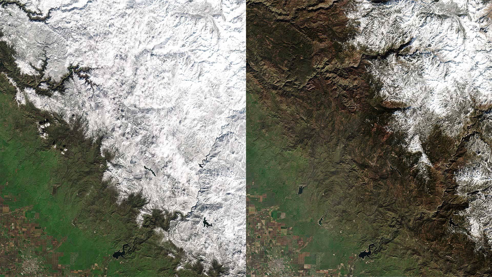
After a snow-packed winter of 2019, there are signs that this year’s Sierra Nevada snow season could wind up below average. At the start of 2020, the statewide snowpack was 90% of normal for the time of year. That level dropped to 72% at the end of January and is now at 64% . State water officials say our reservoirs have plenty of water now — but we’ll need more winter storms to replenish the snowpack in time for the spring runoff. The forecast for the Lake Tahoe area, at least for the next 10 days, calls for mostly sunny skies.

Here’s a look at how this snow season is stacking up. Move the sliders below to compare the terrain between February 2019 and February 2020.

Southern Sierra
Before: Feb. 6, 2019
After: Feb. 1, 2020


Mono Lake
Before: Jan. 27, 2019
After: Feb. 1, 2020


Sierra Nevada
Before: Jan. 24, 2019
After: Feb. 4, 2020


Sponsored

lower waypoint
next waypoint
California’s New 1600-Acre State Park Set to Open This SummerBay Area Cities Push to Legally Validate Polyamorous FamiliesSame-Sex Couples Face Higher Climate Change Risks, New UCLA Study ShowsWhat Is the 'Green Flash' at Sunset — and How Can You See It?Homeowners Insurance Market Stretched Even Thinner as 2 More Companies Leave CaliforniaCalifornia’s Plans for Slowing Climate Change Through Nature-Based SolutionsHoping for a 2024 'Super Bloom'? Where to See Wildflowers in the Bay AreaThese Face Mites Really Grow on YouEverything You Never Wanted to Know About Snail SexEver Wake Up Frozen in the Middle of the Night, With a Shadowy Figure in the Room?