upper waypoint

Brief Dry Spell Thursday Before Next Storm Delivers More Wind, Rain to Bay Area

Save ArticleSave Article
Failed to save article

Please try again

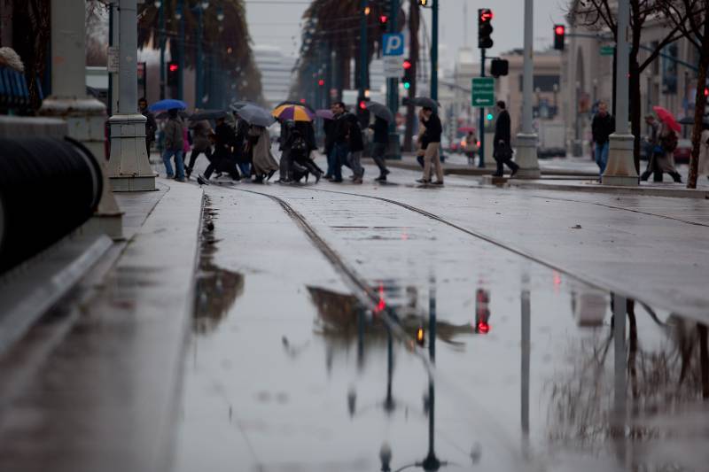
If you want to spend a little time outside this week without getting soaked, tomorrow offers a narrow window.

The low-pressure system that brought on the gloomy drizzle Tuesday had largely drifted inland by Wednesday afternoon, with an overcast but mostly dry stretch expected through most of Thursday.

“Thursday is kind of the best chance of dry weather,” said National Weather Service meteorologist Ryan Walbrun.

But don’t go stashing your umbrellas too deep in the closet just yet.

Southerly winds will increase late Thursday ahead of the next approaching storm system, this one dropping down from the Gulf of Alaska, said Walbrun. Widespread rainfall is expected to start midmorning in the North Bay and hit the rest of the region by the afternoon, he said. The rain is likely to turn to showers and possible thunderstorms by Friday night, lasting through Saturday night, with moderate to heavy rainfall and even small hail possible in some parts of the Bay Area.
Sponsored

The Bay Area should dry out by Sunday, Walbrun said.

NWS Bay Area on Twitter

Radar Update 5:30 AM – Going to be a wet ️start to the day. Rain continues to move across the Bay Area early this morning. Drive low and allow extra time on your commute. May need a and a☂️. Rain chances gradually diminish this afternoon. #cawx https://t.co/VbKYblvrm5

Rainfall totals from Friday into early Sunday are predicted to range from .5 to 1.25 inches in most sea-level urban areas across the region and up to 2.5 inches in the North Bay valleys, according to the latest NWS update. The North Bay mountains could receive as much as 4 inches of rain, with up to 1.5 inches in the East Bay Hills and 3 inches in the Santa Cruz Mountains.

“Saturday is not gonna be a great day if you want to be doing stuff outside. Pretty much across the entire Bay Area, Saturday just looks like a cool showery day,” Walbrun said, adding that although the storm is considered a “cold front,” temperatures are actually not expected to change much, with nighttime lows in the mid-40s and daytime highs reaching into the low 60s in some places.

“It’s not going to get too cold, basically because rain and clouds are around,” he said, adding that the storm won’t be as strong or wet as the ones before and after Thanksgiving. “Quite frankly, there were a lot of colder nights in November than we should have this weekend.”

Walbrun, though, strongly advised against driving up to the Sierra Nevada this weekend, where snow is expected to start falling Friday night above 6,000 feet and drop as low as 4,000 feet by Saturday night.

“If anyone is trying to go to Tahoe, you’re going to want to do that early Friday, as opposed to Friday night,” he said. “It’ll probably be really long and treacherous with the high probability of chain controls and possibly closed highways.”

lower waypoint
next waypoint
California’s New 1600-Acre State Park Set to Open This SummerBay Area Cities Push to Legally Validate Polyamorous FamiliesSame-Sex Couples Face Higher Climate Change Risks, New UCLA Study ShowsWhat Is the 'Green Flash' at Sunset — and How Can You See It?Homeowners Insurance Market Stretched Even Thinner as 2 More Companies Leave CaliforniaHoping for a 2024 'Super Bloom'? Where to See Wildflowers in the Bay AreaSchizophrenia: What It's Like to Hear VoicesThese Face Mites Really Grow on YouEver Wake Up Frozen in the Middle of the Night, With a Shadowy Figure in the Room?Everything You Never Wanted to Know About Snail Sex