
The hardest thing to predict when looking at fire behavior is where a fire might “spot” next. Fires spot when winds hurl burning branches, sparks or embers, called “firebrands,” out beyond the leading edge of the fire, igniting new fires.
Yet it was one of the most important questions facing Sonoma County officials over the weekend, given the extraordinary winds meteorologists predicted would bear down on the Kincade Fire.
“This is extreme wind,” said Craig Clements, director of San José State University’s Fire Weather Research Laboratory. “Very strong, and the fire behavior was very extreme.”
Clements and his team were up near Healdsburg Sunday morning, after a night when winds hit the fire at speeds above 75 miles per hour.
“We were observing flame heights of hundreds and hundreds of feet,” he said. “Whole conifer trees torching. Rapid rates of spread. Spotting. It was just phenomenal.”
That’s one reason county officials said they issued evacuation warnings and orders well ahead of the advancing fire; Cal Fire’s models of the fire behavior predicted the Kincade Fire could spot more than a mile from the existing front.
And any new spot fire would have the same rapid rate of spreading as the main fire does, said Steve Volmer, Cal Fire’s chief fire behavior analyst, and the same potential for spotting a mile or more further on.
“If anything does start on the other side of 101, the west side,” he said Sunday morning, “that area hasn’t seen any fire history since the 1940s. So the fuels in that area are extremely dense. They’re extremely old and decadent. They’re extremely dry.”
The ‘Black Box’ of Fire Behavior
Over such long distances, it’s well nigh impossible to predict with any precision where a firebrand might land, and even less possible to predict the behavior of every item spinning in a plume of smoke that can cause a spot fire — from a branch to a pine needle to a tiny spark.
“Fire prediction models don’t have anything for spotting,” Clements said. “That’s why a lot of them get these big, wind-driven fires wrong, because they can’t handle the spotting.”

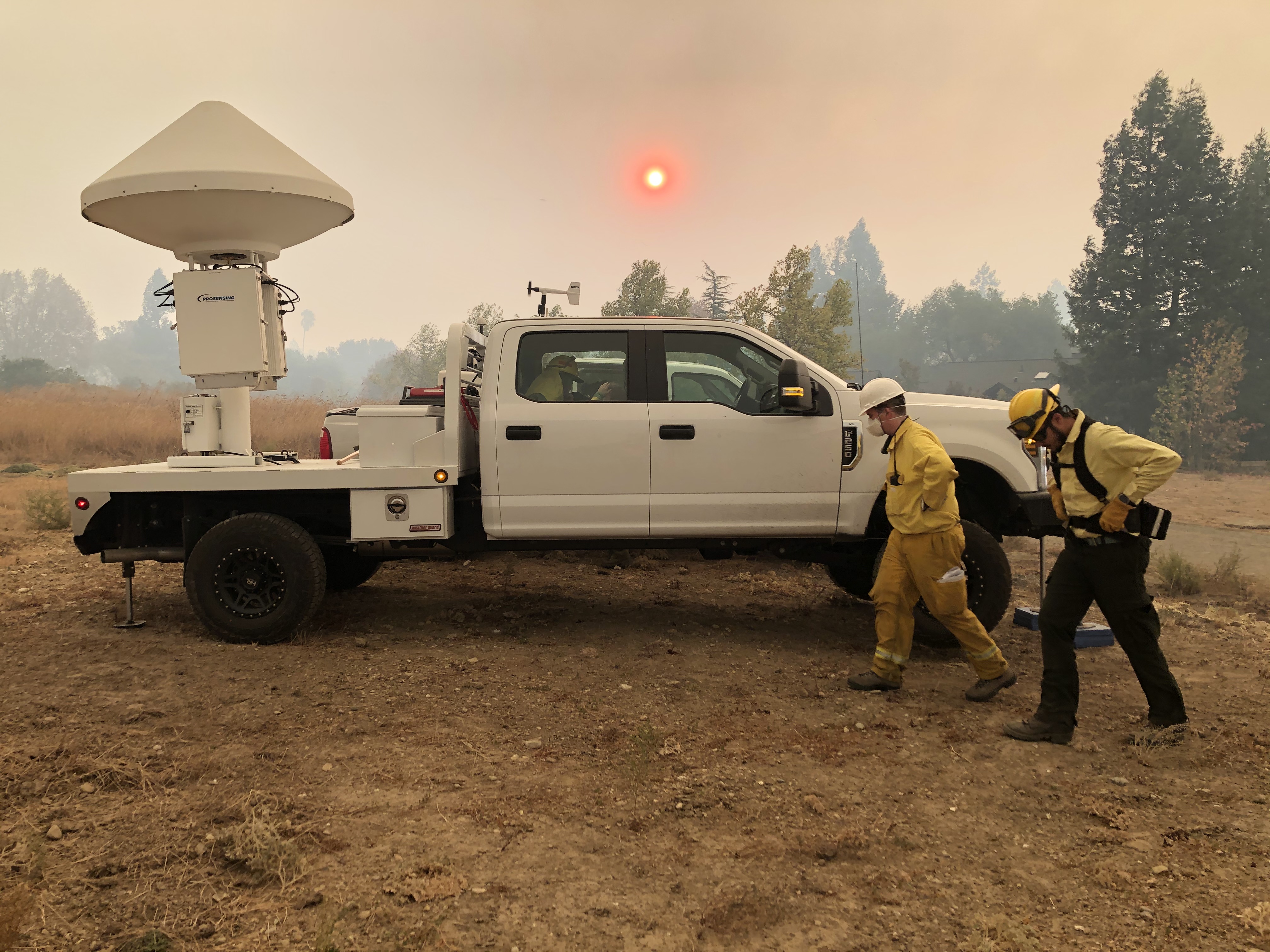
Clements and his research team now have a brand new tool they’re using to examine this problem, a tool that allows them to gather information fire meteorologists didn’t have before.
“This is the only mobile radar in the Western U.S.,” he said.
That is, the only mobile radar with the precision to do research. It’s a huge white dome mounted on the back of a pickup truck, and Clements is using it peer inside fire plumes. He shoots radio waves into the plume, and the information that bounces back can tell him the size and speed of what’s blowing around.
“We don’t know what’s inside them,” Clements said. “We don’t know how big the particles [are]. We know on the ground what these firebrands look like; they look like needles, leaves — but there’s also ash. It looks like big snowflakes of ash falling.”
Fire meteorologists call this kinematics — all the winds inside the smoke plume, and the size and speed and direction of the particles blowing about. Clements hopes this kind of information will eventually help him and other fire analysts learn more about where fires might spot.
Meteorologists expect a lull in the winds from midday Monday until late Tuesday. After that they predict another strong surge in offshore winds.