upper waypoint

California Wildfires: The View From Space

Save ArticleSave Article
Failed to save article

Please try again

A satellite image of smoke from the Ranch Fire, August 11, 2018. The image shows a span of 60 miles east to west and 35 miles north to south. (Planet Labs)

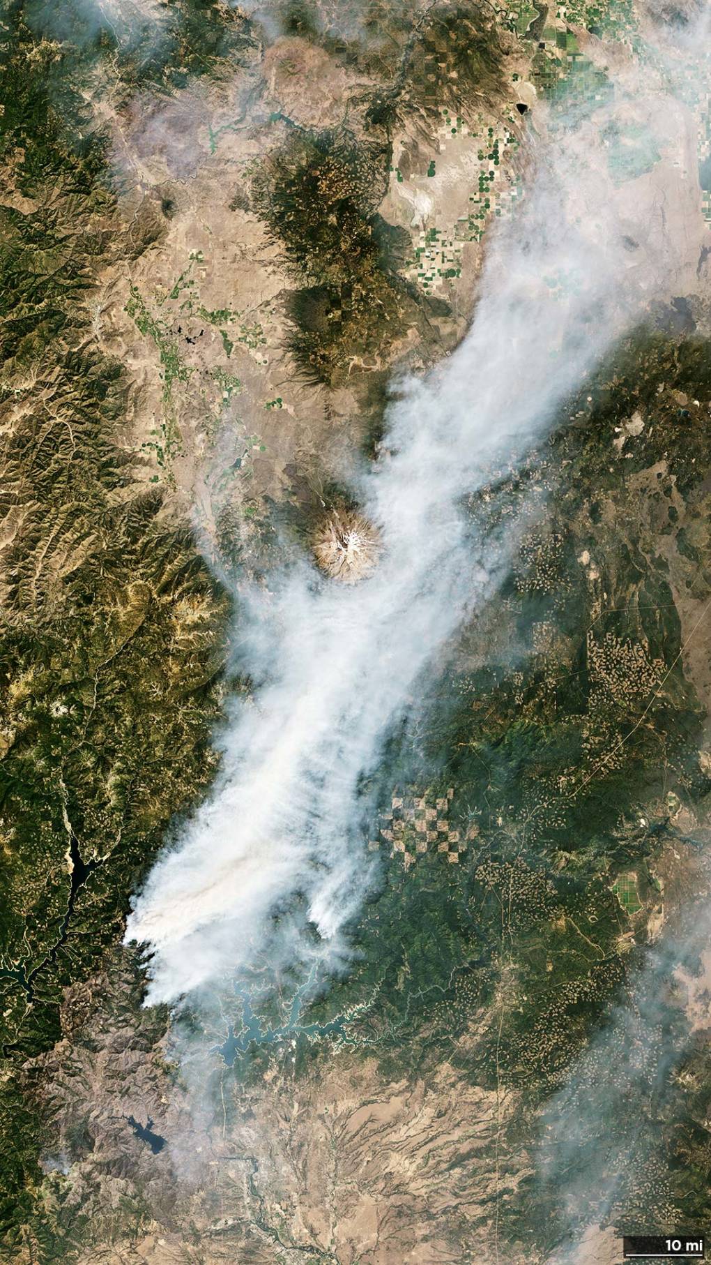
As California firefighters continue to battle more than a dozen blazes throughout the state, wide swaths of smoke sweep across the country, billowing thousands of miles away to move past New York City and out over the Atlantic Ocean.

Satellites from Planet captured the vast trails of smoke, including smoke from the largest fire in the state’s history, the Mendocino Complex fire.

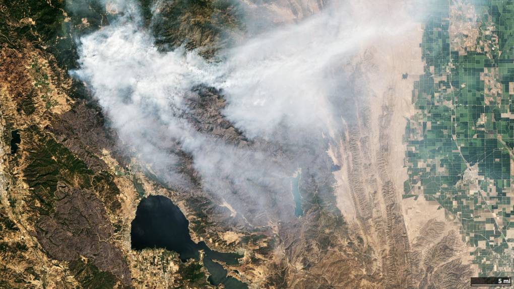
The three-week old Carr fire in Shasta County became the state’s eighth largest wildfire on Sunday, the same day the image below was captured.

A satellite image of smoke from the Carr Fire in Shasta County, August 11, 2018. The image spans 560 miles north to south, and 70 miles east to west. You can see the smoke hovering around the edges of Mount Shasta, in the center of the photo. SOURCE: Planet (Planet Labs)

The Carr Fire has scorched 207,162 acres, destroying nearly 1,100 homes and a total of 1,599 structures, making it one of the top 10 most destructive fires in state history.

As of Tuesday morning, the fire was 65 percent contained. An estimated date for full containment is not yet known.

Sponsored

Meanwhile, the National Weather Service released its own satellite images today showing a layer of smoke from the California wildfires covering several states including Idaho, Montana, Oregon, and Washington.

And another image showing the path of the smoke extending out over the Atlantic.

The largest fire in California history is made up of two blazes burning through three counties, called the Mendocino Complex Fire. The gargantuan fire has scorched more than 354,000 acres.

The Ranch fire claimed its first victim on Monday evening, Utah firefighter Matthew Burchett.

Cal Fire crews are constructing fire lines north of the fire to prevent it from reaching some 200 residences in Lake Pillsbury, which is under a mandatory evacuation order.

A satellite image of smoke from the Ranch Fire, August 11, 2018. The image represents 35 miles north-south, 60 miles east-west, with Clear Lake in the center-bottom. SOURCE: Planet (Planet Labs)

The Ranch Fire, the larger of the twin blazes, has burned through 295,970 acres. The blaze was 68 percent contained as of Tuesday morning, with an estimated date of full containment on September 1. The River fire has been fully contained.

lower waypoint
next waypoint
Bay Area Cities Push to Legally Validate Polyamorous FamiliesWhat Is the 'Green Flash' at Sunset — and How Can You See It?Atmospheric Rivers in California’s Ancient Past Exceeded Modern StormsCalifornia's Plans for Slowing Climate Change Through Nature-Based SolutionsCalifornia’s New 1600-Acre State Park Set to Open This SummerWorld's Largest Digital Camera Built in the Bay Area to Illuminate Mysteries of the UniverseBlue Jellyfish-Like Creatures Ride California Waves: A Climate Change Indicator?What Are Those Weird, Pink Ponds in San Francisco Bay?Ever Wake Up Frozen in the Middle of the Night, With a Shadowy Figure in the Room?Everything You Never Wanted to Know About Snail Sex