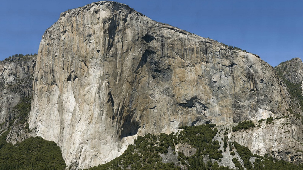
The millions of people who visit Yosemite Valley each year see the place in many different ways. When they gaze at the 3,000-foot face of El Capitan, many visitors open their mouths in awe. Elite climbers think, “I want to conquer that wall.” Geologists think, “I want to study that outcrop.”
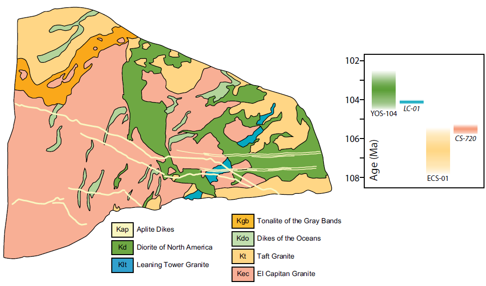
Now geologists have mapped the rocks of El Capitan’s vertical face using a combination of high-tech and high climbing. The research, published this month in the journal Geosphere, was not just a great stunt, but also an attempt to help solve the deep scientific problem of how granite is made.
Yosemite Valley cuts deeply into the great bodies of granite, called plutons, that make up the core of the Sierra Nevada. El Capitan offers a particularly thick and clean slice into these plutons, offering much more detail than drill holes can provide.
Over the years, the valley has been a laboratory for cutting-edge techniques in geology. It helps that Greg Stock, the park’s chief geologist, is a rock-climber himself.

One of Stock’s first ideas was the Yosemite Panoramic Imaging Project. On May 31, 2008, twenty teams of photographers snapped the high rock walls of the valley with high-resolution cameras. The images were then rendered into a gigantic 3D computer model that can be explored online, much like a Gigapan image.