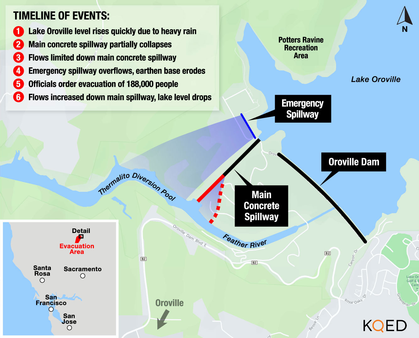
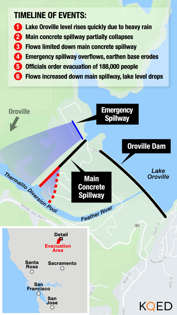
Sheriff Honea issued an evacuation order for 188,000 people on Sunday, when erosion under the emergency spillway threatened to cause it to collapse. Helicopter and truck crews continue to pour 1,200 tons of rock and other material every hour into that eroded area of the emergency spillway. Croyle said the material is shoring up the area so that it’s less likely to erode in the future, even if the lake does fill and water cascades down from the emergency spillway.
”As we continue to armor and pretty much glue it together, so to speak,” he said, “that will help us if we had to use that facility again, that we could use it and minimize that threat.”
By 5 p.m. Wednesday, the water level at Lake Oroville had fallen to 875.26 feet above sea level – 26 feet below the emergency spillway’s top. Dam operators continued to release 100,000 cubic feet per second down the damaged main concrete spillway in a tense race to create as much space as possible in the massive, 10-mile-long reservoir before the next storm arrives tomorrow.
The math was working in their favor. Only 20,268 cubic feet per second was flowing into the lake, roughly one-fifth of the amount flowing out. By late Wednesday the lake was dropping about 1 foot every two hours.
Croyle said his agency’s goal is still to drop the lake’s level by 50 feet as a way to take pressure off the emergency spillway, which is heavily eroded, and to reduce the chances that water will flow over it again. He said even with the incoming storms, he expects inflow to be roughly 45,000 cubic feet per second, still well below the flow out of the main concrete spillway.
Simply put, the job was half finished Wednesday afternoon, with 25 feet left to go. But water officials said they don’t expect the three storm systems forecast to continue over the weekend and into next week would send lake levels rising again.
In fact, Croyle said, don’t be surprised if officials decide to ease up on how much water they’re letting out the concrete spillway. While that main spillway has been stable for a number of days now, it does have a massive hole in the concrete base. Said Croyle, they want “to ensure the structure doesn’t get torn up any more” than it is already.