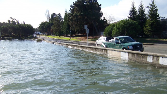
Strolling along the Bay Trail at Crown Memorial State Beach in Alameda a few weekends ago with a group of naturalists and college students at a professional workshop, we looked for areas that were inundated by the King Tides last winter. We stood on trails and turf that had been underwater during those extreme high tides and discussed scientists’ predictions that high tide events, like King Tides, are likely to become the normal high tides in coming years. As seawater warms, it will expand as well as increase due to polar ice cap melting.
"In California, we are very likely to experience a sea level rise of 16 inches by 2050 and 55 inches (1.4 meters) by 2100, and much more after that." Sea Level Rise and the Future of the Bay Area, SPUR
The edges of our shoreline “bathtub” won’t be able to contain the overflow as the moon and sun interact and tides edge up and over into shoreline parks, roadways, homes and businesses. You can explore the National Oceanic and Atmospheric Administration interactive model of how the rising tides may impact our coastlines. Much of my hometown, with an elevation of 30 feet above sea level, may be underwater at the predicted high water level of 55 inches above current high-high tide. My house would be above water, but I wouldn't be able to get to work due to flooded roadways. Sea level rise predictions are evolving as more information is gathered and assessed. The models continue to be refined.
The good news about sea level rise is that these are long-term predictions, allowing us time to prepare. As CAKE (Climate Adaptation Knowledge Exchange website) states, “Don’t Panic.” It’s a great site to learn more about climate change basics and sea level rise science, as well as access tools available to municipalities to plan for climate change mitigation measures.