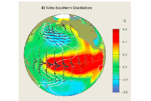
 El Nino temperature anomalies in the eastern Pacific Ocean.
Jennifer Skene's post earlier this week here on the QUEST Community Science Blog about the potential effects of this winter's La Niña is a great lead-in for discussing this climatic phenomenon in a bit more detail. As Jennifer noted, the La Niña weather pattern is the flip side of El Niño, which is when unusually warm waters of the eastern Pacific Ocean affect weather patterns for large swaths of North and South America. For California, El Niños typically result in increased precipitation in the winter months and La Niñas are characterized by drier conditions.
El Niño is the nickname of the climate pattern called the El Niño-Southern Oscillation, or ENSO. Although we don't hear much about the Southern Oscillation part, it is the atmospheric component of this linked ocean-atmosphere phenomenon. Although the physics of ENSO is still not fully understood and the subject of current research, the regularity of the pattern is well documented. The image below is a time series plot of ENSO events for the past 60 years. The positive values filled in with red are the warm ENSO phase (El Niño) and the negative values in blue are the cool ENSO phase (La Niña). The regularity isn't perfectly on beat -- it varies from 3-7 years between measurable events. But this is enough regularity to make ENSO one of the more predictable patterns climate scientists have studied.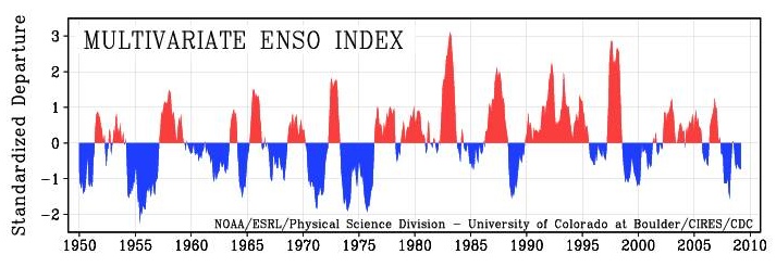
While the timing of ENSO cycles might have some predictability, the magnitude of ENSO (the height/depth of the peaks) can vary significantly. Some are weak while others are quite strong. The 1997-1998 El Niño is considered to be one of the strongest of the past 100 years and is still in the memory of many Californians because of the intense precipitation and subsequent flooding it unleashed.