It’s been a year since I started living car-free in San Francisco. Left behind are the expenses of gasoline and maintenance, hours spent circling for a parking spot and the inevitable tickets that came when I would forget street-cleaning day.
I’ve felt liberated by having one less possession to track, but on the weekends a claustrophobia sets in. I'm always itching to get out of the 2-mile radius where my home, work and social life are centered. I need to stretch my legs on some scenic trails, reconnect with the natural world and fully enjoy the perks of living in this beautiful region we call home.
Luckily, there’s lots within reach if you’re living in San Francisco without a car. Here are some favorites from KQED staffers:
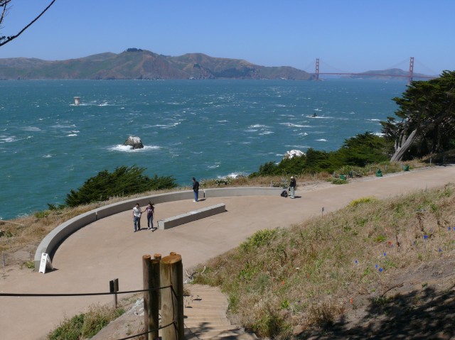
Find great views of the Golden Gate Bridge, Pacific Ocean and Marin from the Lands End trail. (Ingrid Taylar/Flickr)
Spend an afternoon hiking the trails at Lands End and you will completely forget you are in one of America’s most densely populated cities. Without a doubt, this is one of the finest urban hikes in the world. Take in the views of the unspoiled hills of Marin, the grand Pacific and, of course, the Golden Gate Bridge. If you want a longer hike, wind through the Sea Cliff neighborhood, through Baker Beach, and along the Batteries to Bluffs trail. Eventually you'll find yourself at the Golden Gate Bridge.
Distance: Out and back the Lands End Trail is about 3.5 miles. Getting There: Take Muni's 38-Geary and get off at 48th Avenue and Geary.
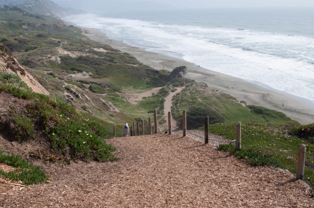
A favorite among dog owners, Fort Funston is a quick hike that offers great views of the Pacific from atop 200-foot sandy bluffs. If the conditions are right, you’ll find hang gliders launching themselves over the beach. If you stay in the park, you’ll find only about 2 miles of trail, but make the trek longer by wandering down to Ocean Beach or around Lake Merced to Stern Grove.
Distance: About 2 miles Getting There: Take Muni's 5-Fulton west to La Playa, then transfer to go south on the 18-Sloat and get off at John Muir Drive.
Getting to Angel Island requires some advance planning. But once you're there, you'll find miles of trails to explore. (Bill Couch/Flickr)
Take a scenic ferry ride to the Bay’s largest island, which sits between San Francisco and Marin. The park offers 12 miles of trails, and most are quite flat and easy. A 5-mile fire road circles the island, offering vantage points of the Golden Gate Bridge, San Francisco skyline and Marin Headlands, even on a foggy day. Be sure to take time for the Northridge Trail, which will lead you to Mount Livermore, the island's peak. Dogs aren't allowed on Angel Island, so leave Rover at home.
Distance: 12 miles total, broken up over a number of trails. View the trail map. Getting There: Take a Blue & Gold Fleet ferry from the Ferry Building or Pier 41. $17 covers the ferry ride and access to the park.
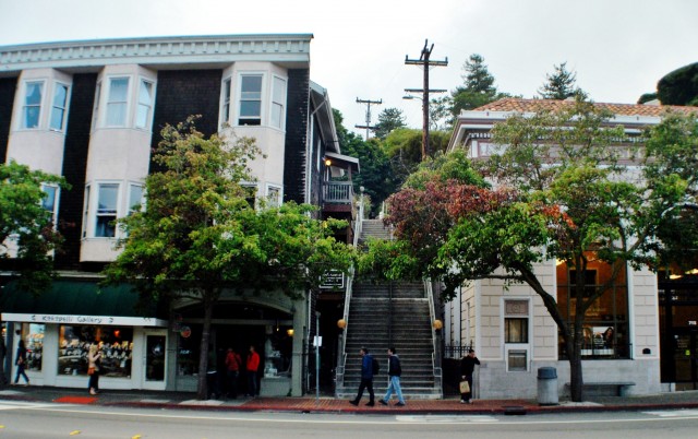
The start of the Excelsior stairs is a close walk from the ferry terminal. (ravissant74/Flickr)
If you’re ready for a workout, take the ferry over to Sausalito for a stairway hike that will get your quads burning. Along the way, you’ll find some enviable homes and gardens, not to mention gorgeous Bay views. There are two ways up, including the Excelsior route and the North Street route. (See a map of both.) For the Excelsior route, start your journey by heading up Excelsior Lane, which is just a few steps away from the Sausalito Ferry Terminal. Take a left on San Carlos Avenue, and look for Cooper Lane on your right, where you’ll find the next staircase. You can stop at the top and head back down to explore Sausalito’s other hidden staircases (El Monte Steps, Reade Lane, North Street Steps) or if you’re looking for more, it’s a 20-minute walk to the Marin Headlands where you can pick up the SCA Trail or Rodeo Valley Trail.
Distance: Steps only is about a 3.5-mile loop. Getting There: Take a Golden Gate or Blue & Gold ferry from San Francisco to Sausalito. Once you get off the boat, take a left on Bridgeway and look for a park and the staircase on your right.
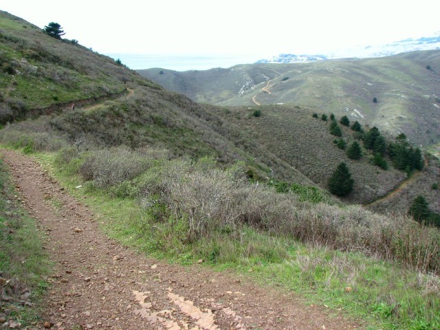
The Coastal Trail is among the most popular trails in the park. (David Berry/Flickr)
On Saturdays, Sundays and holidays, Muni runs the 76X, which connects downtown San Francisco to the Marin Headlands. For normal bus fare, you can avoid the Golden Gate Bridge toll and the often-treacherous parking situation. (Heck, even if you have a car this might be a better option!) Explore the web of trails that make up this beloved park, and map a route to suit your fitness level. Whether you spend 20 minutes on the trail, or pack food for a daylong adventure, you’ll find what you’re looking for here. Dogs are permitted on some trails.
Distance: Varies. View the trail map. Getting There: Hop on the 76X from downtown San Francisco. Get off anywhere you want to pick up a trail, though many hikers start from the Visitor Center or the Fort Cronkhite Parking Lot.
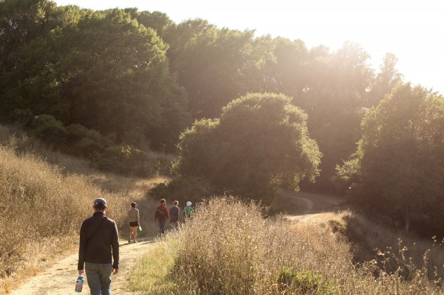
Hop from one trail to another, and you can easily fill a day. (Miguel Vieira/Flickr)
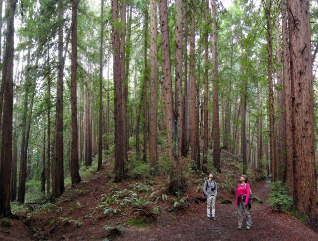
Redwood Park is just a few miles from downtown Oakland, and a walk or bike ride can take you back in time to before the Gold Rush. The park was once the site of an extensive logging operation that supplied building materials for the Bay Area. Now there are dense groves of thriving second-growth redwoods tucked along the creeks, mixed with oak and bay trees. Sticky monkey flower alternates with sagebrush on open slopes. The 7.9-mile French Trail loop is a single-track favorite among hikers, though there are many easy ways to shorten the hike. If you’re looking for longer, you could easily plan a route that would take you 20+ miles. Don’t miss the shady fish ladder near the Redwood Park entrance, where rainbow trout were first identified.
Distance: Up to 25 miles. View the trail map. Getting There: From the Fruitvale BART Station take AC Transit #39 or #339. Get off at the Richard C. Trudeau Conference Center. Head up the Dunn Trail into the park.
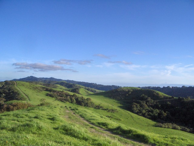
Like many of the hikes on our list, Tilden Park also offers some stellar views. (Jenn Clark/Flickr)
If you're looking for an outdoor adventure beyond hiking, Tilden Park offers plenty of other recreational options. Inside the park you'll find a botanical garden, golf course, merry-go-round, carousel, swimming lake and steam train. Trails near these attractions tend be more crowded, and dogs are permitted. If you're looking for something more remote, find the trails in Tilden's Nature Area. Wildcat Creek Trail will carry you into Wildcat Canyon Regional Park, another East Bay park worth exploring.
Distance: Varies. View the trail map. Getting There: On weekends and holidays, take AC Transit's 67-Spruce from the Berkeley BART Station into the park at Canon Drive, along Central Park Drive and Wildcat Canyon Road, and exit the park at Shasta Road. On weekdays the 67 operates only to the Canon Drive and Shasta Road entrances.
lower waypointnext waypoint
Player sponsored by
window.__IS_SSR__=true
window.__INITIAL_STATE__={
"attachmentsReducer": {
"audio_0": {
"type": "attachments",
"id": "audio_0",
"imgSizes": {
"kqedFullSize": {
"file": "https://ww2.kqed.org/news/wp-content/themes/KQED-unified/img/audio_bgs/background0.jpg"
}
}
},
"audio_1": {
"type": "attachments",
"id": "audio_1",
"imgSizes": {
"kqedFullSize": {
"file": "https://ww2.kqed.org/news/wp-content/themes/KQED-unified/img/audio_bgs/background1.jpg"
}
}
},
"audio_2": {
"type": "attachments",
"id": "audio_2",
"imgSizes": {
"kqedFullSize": {
"file": "https://ww2.kqed.org/news/wp-content/themes/KQED-unified/img/audio_bgs/background2.jpg"
}
}
},
"audio_3": {
"type": "attachments",
"id": "audio_3",
"imgSizes": {
"kqedFullSize": {
"file": "https://ww2.kqed.org/news/wp-content/themes/KQED-unified/img/audio_bgs/background3.jpg"
}
}
},
"audio_4": {
"type": "attachments",
"id": "audio_4",
"imgSizes": {
"kqedFullSize": {
"file": "https://ww2.kqed.org/news/wp-content/themes/KQED-unified/img/audio_bgs/background4.jpg"
}
}
},
"placeholder": {
"type": "attachments",
"id": "placeholder",
"imgSizes": {
"thumbnail": {
"file": "https://cdn.kqed.org/wp-content/uploads/2024/12/KQED-Default-Image-816638274-2000x1333-1-160x107.jpg",
"width": 160,
"height": 107,
"mimeType": "image/jpeg"
},
"medium": {
"file": "https://cdn.kqed.org/wp-content/uploads/2024/12/KQED-Default-Image-816638274-2000x1333-1-800x533.jpg",
"width": 800,
"height": 533,
"mimeType": "image/jpeg"
},
"medium_large": {
"file": "https://cdn.kqed.org/wp-content/uploads/2024/12/KQED-Default-Image-816638274-2000x1333-1-768x512.jpg",
"width": 768,
"height": 512,
"mimeType": "image/jpeg"
},
"large": {
"file": "https://cdn.kqed.org/wp-content/uploads/2024/12/KQED-Default-Image-816638274-2000x1333-1-1020x680.jpg",
"width": 1020,
"height": 680,
"mimeType": "image/jpeg"
},
"1536x1536": {
"file": "https://cdn.kqed.org/wp-content/uploads/2024/12/KQED-Default-Image-816638274-2000x1333-1-1536x1024.jpg",
"width": 1536,
"height": 1024,
"mimeType": "image/jpeg"
},
"fd-lrg": {
"file": "https://cdn.kqed.org/wp-content/uploads/2024/12/KQED-Default-Image-816638274-2000x1333-1-1536x1024.jpg",
"width": 1536,
"height": 1024,
"mimeType": "image/jpeg"
},
"fd-med": {
"file": "https://cdn.kqed.org/wp-content/uploads/2024/12/KQED-Default-Image-816638274-2000x1333-1-1020x680.jpg",
"width": 1020,
"height": 680,
"mimeType": "image/jpeg"
},
"fd-sm": {
"file": "https://cdn.kqed.org/wp-content/uploads/2024/12/KQED-Default-Image-816638274-2000x1333-1-800x533.jpg",
"width": 800,
"height": 533,
"mimeType": "image/jpeg"
},
"post-thumbnail": {
"file": "https://cdn.kqed.org/wp-content/uploads/2024/12/KQED-Default-Image-816638274-2000x1333-1-672x372.jpg",
"width": 672,
"height": 372,
"mimeType": "image/jpeg"
},
"twentyfourteen-full-width": {
"file": "https://cdn.kqed.org/wp-content/uploads/2024/12/KQED-Default-Image-816638274-2000x1333-1-1038x576.jpg",
"width": 1038,
"height": 576,
"mimeType": "image/jpeg"
},
"xxsmall": {
"file": "https://cdn.kqed.org/wp-content/uploads/2024/12/KQED-Default-Image-816638274-2000x1333-1-160x107.jpg",
"width": 160,
"height": 107,
"mimeType": "image/jpeg"
},
"xsmall": {
"file": "https://cdn.kqed.org/wp-content/uploads/2024/12/KQED-Default-Image-816638274-2000x1333-1-672x372.jpg",
"width": 672,
"height": 372,
"mimeType": "image/jpeg"
},
"small": {
"file": "https://cdn.kqed.org/wp-content/uploads/2024/12/KQED-Default-Image-816638274-2000x1333-1-672x372.jpg",
"width": 672,
"height": 372,
"mimeType": "image/jpeg"
},
"xlarge": {
"file": "https://cdn.kqed.org/wp-content/uploads/2024/12/KQED-Default-Image-816638274-2000x1333-1-1020x680.jpg",
"width": 1020,
"height": 680,
"mimeType": "image/jpeg"
},
"full-width": {
"file": "https://cdn.kqed.org/wp-content/uploads/2024/12/KQED-Default-Image-816638274-2000x1333-1-1920x1280.jpg",
"width": 1920,
"height": 1280,
"mimeType": "image/jpeg"
},
"guest-author-32": {
"file": "https://cdn.kqed.org/wp-content/uploads/2025/01/KQED-Default-Image-816638274-1333x1333-1-160x160.jpg",
"width": 32,
"height": 32,
"mimeType": "image/jpeg"
},
"guest-author-50": {
"file": "https://cdn.kqed.org/wp-content/uploads/2025/01/KQED-Default-Image-816638274-1333x1333-1-160x160.jpg",
"width": 50,
"height": 50,
"mimeType": "image/jpeg"
},
"guest-author-64": {
"file": "https://cdn.kqed.org/wp-content/uploads/2025/01/KQED-Default-Image-816638274-1333x1333-1-160x160.jpg",
"width": 64,
"height": 64,
"mimeType": "image/jpeg"
},
"guest-author-96": {
"file": "https://cdn.kqed.org/wp-content/uploads/2025/01/KQED-Default-Image-816638274-1333x1333-1-160x160.jpg",
"width": 96,
"height": 96,
"mimeType": "image/jpeg"
},
"guest-author-128": {
"file": "https://cdn.kqed.org/wp-content/uploads/2025/01/KQED-Default-Image-816638274-1333x1333-1-160x160.jpg",
"width": 128,
"height": 128,
"mimeType": "image/jpeg"
},
"detail": {
"file": "https://cdn.kqed.org/wp-content/uploads/2025/01/KQED-Default-Image-816638274-1333x1333-1-160x160.jpg",
"width": 160,
"height": 160,
"mimeType": "image/jpeg"
},
"kqedFullSize": {
"file": "https://cdn.kqed.org/wp-content/uploads/2024/12/KQED-Default-Image-816638274-2000x1333-1.jpg",
"width": 2000,
"height": 1333
}
}
},
"news_140951": {
"type": "attachments",
"id": "news_140951",
"meta": {
"index": "attachments_1716263798",
"site": "news",
"id": "140951",
"found": true
},
"parent": 140842,
"imgSizes": {
"kqedFullSize": {
"file": "https://ww2.kqed.org/app/uploads/sites/10/2014/07/10995312245_80234b2d37_o.jpg",
"width": 4272,
"height": 2848
}
},
"publishDate": 1404345007,
"modified": 1404345007,
"caption": null,
"description": null,
"title": "10995312245_80234b2d37_o",
"credit": null,
"status": "inherit",
"isLoading": false,
"fetchFailed": false
}
},
"audioPlayerReducer": {
"postId": "stream_live",
"isPaused": true,
"isPlaying": false,
"pfsActive": false,
"pledgeModalIsOpen": true,
"playerDrawerIsOpen": false,
"liveAudioPlayStartedAt": 0,
"liveAudioPlayContext": ""
},
"authorsReducer": {
"ohubertallen": {
"type": "authors",
"id": "102",
"meta": {
"index": "authors_1716337520",
"id": "102",
"found": true
},
"name": "Olivia Allen-Price",
"firstName": "Olivia",
"lastName": "Allen-Price",
"slug": "ohubertallen",
"email": "oallenprice@kqed.org",
"display_author_email": false,
"staff_mastheads": [
"news"
],
"title": "Senior Editor",
"bio": "Olivia Allen-Price is senior editor and host of the award-winning Bay Curious podcast. Prior to joining KQED in 2013, Olivia worked at The Baltimore Sun and The Virginian-Pilot in Norfolk, Va. She holds degrees in journalism and political science from Elon University. Her work has earned awards from the Society of Professional Journalists, the Hearst Foundation and Hearken. She loves to talk about running and curly hair.\r\n\r\nFollow: \u003ca href=\"https://twitter.com/oallenprice\">@oallenprice\u003c/a>\r\nEmail: \u003ca href=\"mailto:oallenprice@kqed.org\">oallenprice@kqed.org\u003c/a>",
"avatar": "https://secure.gravatar.com/avatar/07f7803c1f6be56f3be58ef276dfa64dce898502e0554408ef4858451a8294f7?s=600&d=blank&r=g",
"twitter": "oallenprice",
"bluesky": null,
"facebook": null,
"instagram": null,
"linkedin": null,
"sites": [
{
"site": "",
"roles": [
"editor"
]
},
{
"site": "arts",
"roles": [
"subscriber"
]
},
{
"site": "news",
"roles": [
"administrator"
]
},
{
"site": "pop",
"roles": [
"administrator"
]
},
{
"site": "bayareabites",
"roles": [
"contributor"
]
},
{
"site": "stateofhealth",
"roles": [
"administrator"
]
},
{
"site": "science",
"roles": [
"editor"
]
}
],
"headData": {
"title": "Olivia Allen-Price | KQED",
"description": "Senior Editor",
"ogImgSrc": "https://secure.gravatar.com/avatar/07f7803c1f6be56f3be58ef276dfa64dce898502e0554408ef4858451a8294f7?s=600&d=blank&r=g",
"twImgSrc": "https://secure.gravatar.com/avatar/07f7803c1f6be56f3be58ef276dfa64dce898502e0554408ef4858451a8294f7?s=600&d=blank&r=g"
},
"isLoading": false,
"link": "/author/ohubertallen"
}
},
"pagesReducer": {},
"pfsSessionReducer": {},
"postsReducer": {
"stream_live": {
"type": "live",
"id": "stream_live",
"audioUrl": "https://streams.kqed.org/kqedradio",
"title": "Live Stream",
"excerpt": "Live Stream information currently unavailable.",
"link": "/radio",
"featImg": "",
"label": {
"name": "KQED Live",
"link": "/"
}
},
"stream_kqedNewscast": {
"type": "posts",
"id": "stream_kqedNewscast",
"audioUrl": "https://www.kqed.org/.stream/anon/radio/RDnews/newscast.mp3?_=1",
"title": "KQED Newscast",
"featImg": "",
"label": {
"name": "88.5 FM",
"link": "/"
}
},
"news_140842": {
"type": "posts",
"id": "news_140842",
"meta": {
"index": "posts_1716263798",
"site": "news",
"id": "140842",
"found": true
},
"articlePosition": 0,
"parent": 0,
"labelTerm": {
"site": "news",
"term": 6944
},
"blocks": [],
"publishDate": 1404392459,
"format": "aside",
"disqusTitle": "A Transit Rider's Guide to Bay Area Hikes",
"title": "A Transit Rider's Guide to Bay Area Hikes",
"headTitle": "News Fix | KQED News",
"content": "\u003cp>It’s been a year since I started living car-free in San Francisco. Left behind are the expenses of gasoline and maintenance, hours spent circling for a parking spot and the inevitable tickets that came when I would forget street-cleaning day.\u003c/p>\n\u003cp>I’ve felt liberated by having one less possession to track, but on the weekends a claustrophobia sets in. I'm always itching to get out of the 2-mile radius where my home, work and social life are centered. I need to stretch my legs on some scenic trails, reconnect with the natural world and fully enjoy the perks of living in this beautiful region we call home.\u003c/p>\n\u003cp>Luckily, there’s lots within reach if you’re living in San Francisco without a car. Here are some favorites from KQED staffers:\u003c/p>\n\u003cfigure id=\"attachment_140886\" class=\"wp-caption aligncenter\" style=\"max-width: 640px\">\u003cimg class=\"size-medium wp-image-140886\" src=\"http://ww2.kqed.org/news/wp-content/uploads/sites/10/2014/07/2559870691_909cce7264_o-640x479.jpg\" alt=\"Find great views of the Golden Gate Bridge, Bay and Marin from the Lands End trail. (Ingrid Taylar/Flickr)\" width=\"640\" height=\"479\">\u003cfigcaption class=\"wp-caption-text\">Find great views of the Golden Gate Bridge, Pacific Ocean and Marin from the Lands End trail. (\u003ca href=\"https://www.flickr.com/photos/taylar/2559870691/in/photolist-AU64-7knxY7-7kiGke-4Fb5Lz-7YSC3r-idpkaH-bzLhKB-7hRtB-cdFJjh-4D9QVo-4Ud1nz-4D5zMx-4D5AuK-4D5ADv-8s4S78-8s4S32-8s7V9L-652wmy-64XeAZ-gNGnbf-gNGnzw-gNHrBM-4D5A46-gNGnGA-4D9Qmj-4D9Rns-gNGkuQ-gNGrN3-4D5AdZ-4D9QBY-4D5zva-gNHqYx-gNHqtz-gNGnko-btTBVV-8s4S6c-buwqrL-9sndJj-9sndG7-9sjexi-9sjevV-9sjevk-9sjewF-9sndFq-5Tdq1a-64Xe9F-652x8U-7cqwn2-i447hn-9kFaR8\" target=\"blank\">Ingrid Taylar/Flickr\u003c/a>)\u003c/figcaption>\u003c/figure>\n\u003ch2>\u003ca href=\"http://www.nps.gov/goga/planyourvisit/landsend.htm\" target=\"_blank\">Lands End\u003c/a>\u003c/h2>\n\u003cp>Spend an afternoon hiking the trails at Lands End and you will completely forget you are in one of America’s most densely populated cities. Without a doubt, this is one of the finest urban hikes in the world. Take in the views of the unspoiled hills of Marin, the grand Pacific and, of course, the Golden Gate Bridge. If you want a longer hike, wind through the Sea Cliff neighborhood, through Baker Beach, and along the Batteries to Bluffs trail. Eventually you'll find yourself at the Golden Gate Bridge.\u003c/p>\n\u003cp>\u003cstrong>Distance:\u003c/strong> Out and back the Lands End Trail is about 3.5 miles.\u003cbr>\n\u003cstrong>Getting There:\u003c/strong> Take Muni's 38-Geary and get off at 48th Avenue and Geary.\u003c/p>\n\u003cfigure id=\"attachment_140890\" class=\"wp-caption aligncenter\" style=\"max-width: 640px\">\u003cimg class=\"size-medium wp-image-140890\" src=\"http://ww2.kqed.org/news/wp-content/uploads/sites/10/2014/07/9273156427_fbb4a6787f_o-640x425.jpg\" alt=\"The trails at Fort Funston are a favorite among dog owners. (Miroslav Zdrale/Flickr)\" width=\"640\" height=\"425\">\u003cfigcaption class=\"wp-caption-text\">The trails at Fort Funston are a favorite among dog owners. (\u003ca href=\"https://www.flickr.com/photos/mzdrale/9273156427/in/photolist-9BoCkr-9BoC1k-dRePu7-f8rmkn-fCNm4G-74T7n4-94DqGT-JX44u-fgNEh-72XTep-dXKDmw-iVuWJy-as6uwi-a11fWi-GAycG-4JNv4K-5GTmt-5RMAyM-fHPqub-fhYW67-7N6Dac-cQH2ef-a147sN-a11mdT-a11hAp-a11gkX-a14a9Y-a14crm-a1473y-a11fDT-a14c8E-fnzf8u-7CQZS4-dL2S5L-dw3z3L-4jhqxm-fhKGrX-6jwoV-5fAi6G-2f2d6d-abMk1-nqpd5-4YPTwK-F2GKT-7CPQKW-9jqWTS-4t9U4f-5RN5KR-aDAq1e-b3Nq24\" target=\"blank\">Miroslav Zdrale/Flickr\u003c/a>)\u003c/figcaption>\u003c/figure>\n\u003ch2>\u003ca href=\"https://www.google.com/maps/place/Fort+Funston+National+Park/@37.715518,-122.502217,17z/data=!3m1!4b1!4m2!3m1!1s0x808f7d04948d3c6b:0x2c5b494bcda94ecc\" target=\"_blank\">Fort Funston\u003c/a>\u003c/h2>\n\u003cp>A favorite among dog owners, Fort Funston is a quick hike that offers great views of the Pacific from atop 200-foot sandy bluffs. If the conditions are right, you’ll find hang gliders launching themselves over the beach. If you stay in the park, you’ll find only about 2 miles of trail, but make the trek longer by wandering down to Ocean Beach or around Lake Merced to Stern Grove.\u003c/p>\n\u003cp>[ad fullwidth]\u003c/p>\n\u003cp>\u003cstrong>Distance:\u003c/strong> About 2 miles\u003cbr>\n\u003cstrong>Getting There:\u003c/strong> Take Muni's 5-Fulton west to La Playa, then transfer to go south on the 18-Sloat and get off at John Muir Drive.\u003c/p>\n\u003cfigure id=\"attachment_140895\" class=\"wp-caption aligncenter\" style=\"max-width: 640px\">\u003cimg class=\"size-medium wp-image-140895\" src=\"http://ww2.kqed.org/news/wp-content/uploads/sites/10/2014/07/7713420896_219e7d3f53_o-640x426.jpg\" alt=\"Getting to Angel Island requires some advanced planning. But once you're there, you'll find miles of trails to explore. (Bill Couch/Flickr)\" width=\"640\" height=\"426\">\u003cfigcaption class=\"wp-caption-text\">Getting to Angel Island requires some advance planning. But once you're there, you'll find miles of trails to explore. (Bill Couch/Flickr)\u003c/figcaption>\u003c/figure>\n\u003ch2>\u003ca href=\"http://www.parks.ca.gov/?page_id=468\" target=\"_blank\">Angel Island\u003c/a>\u003c/h2>\n\u003cp>Take a scenic ferry ride to the Bay’s largest island, which sits between San Francisco and Marin. The park offers 12 miles of trails, and most are quite flat and easy. A 5-mile fire road circles the island, offering vantage points of the Golden Gate Bridge, San Francisco skyline and Marin Headlands, even on a foggy day. Be sure to take time for the Northridge Trail, which will lead you to Mount Livermore, the island's peak. Dogs aren't allowed on Angel Island, so leave Rover at home.\u003c/p>\n\u003cp>\u003cstrong>Distance:\u003c/strong> 12 miles total, broken up over a number of trails. \u003ca href=\"http://www.parks.ca.gov/pages/468/files/AngelIsland2.pdf\" target=\"_blank\">View the trail map.\u003c/a>\u003cbr>\n\u003cstrong>Getting There:\u003c/strong> Take a Blue & Gold Fleet ferry from the Ferry Building or Pier 41. $17 covers the ferry ride and access to the park.\u003c/p>\n\u003cfigure id=\"attachment_140904\" class=\"wp-caption aligncenter\" style=\"max-width: 640px\">\u003cimg class=\"size-medium wp-image-140904\" src=\"http://ww2.kqed.org/news/wp-content/uploads/sites/10/2014/07/7891362334_1e6dac5c91_o-640x402.jpg\" alt=\"The start of the Excelsior stairs are a close walk from the Ferry terminal. (ravissant74/Flickr)\" width=\"640\" height=\"402\">\u003cfigcaption class=\"wp-caption-text\">The start of the Excelsior stairs is a close walk from the ferry terminal. (\u003ca href=\"https://www.flickr.com/photos/ravissant74/7891362334/in/photolist-d2ki6h-fw3dD-8PkgDW-8PhaQz-fMBuDW-dchPPV-3rGQW-4WbwRu-5hS8cS-4QL3Wr-8PhbAR-8Phbwe-8Pkg8h-89VeWH-9jMcGS-c4zkLd-c4zm5u-877tGz-97hWti-8Kz4kp-4y8KdE-af8VMc\" target=\"blank\">ravissant74/Flickr\u003c/a>)\u003c/figcaption>\u003c/figure>\n\u003ch2>\u003ca href=\"http://www.sausalito.com/story/Hiking-Options-in-Sausalito/583442\" target=\"_blank\">Sausalito's Hidden Stairways to Marin\u003c/a>\u003c/h2>\n\u003cp>If you’re ready for a workout, take the ferry over to Sausalito for a stairway hike that will get your quads burning. Along the way, you’ll find some enviable homes and gardens, not to mention gorgeous Bay views. There are two ways up, including the \u003ca href=\"http://www.weekendsherpa.com/stories/sausalito-stairway-walk-to-marin-headlands/\" target=\"_blank\">Excelsior route\u003c/a> and the \u003ca href=\"http://www.sausalito.com/story/Hiking-Options-in-Sausalito/583442\" target=\"_blank\">North Street route\u003c/a>. (\u003ca href=\"https://maps.google.com/maps/ms?ie=UTF8&hl=en&t=h&msa=0&msid=103582010303953860869.0004723b07be84f95079d&ll=37.853001,-122.486315&spn=0.01186,0.018239&z=15&source=embed&dg=feature\" target=\"_blank\">See a map of both\u003c/a>.) For the Excelsior route, start your journey by heading up Excelsior Lane, which is just a few steps away from the Sausalito Ferry Terminal. Take a left on San Carlos Avenue, and look for Cooper Lane on your right, where you’ll find the next staircase. You can stop at the top and head back down to explore Sausalito’s other hidden staircases (El Monte Steps, Reade Lane, North Street Steps) or if you’re looking for more, it’s a 20-minute walk to the Marin Headlands where you can pick up the SCA Trail or Rodeo Valley Trail.\u003c/p>\n\u003cp>\u003cstrong>Distance:\u003c/strong> Steps only is about a 3.5-mile loop.\u003cbr>\n\u003cstrong>Getting There:\u003c/strong> Take a Golden Gate or Blue & Gold ferry from San Francisco to Sausalito. Once you get off the boat, take a left on Bridgeway and look for a park and the staircase on your right.\u003c/p>\n\u003cfigure id=\"attachment_140918\" class=\"wp-caption aligncenter\" style=\"max-width: 640px\">\u003cimg class=\"size-medium wp-image-140918\" src=\"http://ww2.kqed.org/news/wp-content/uploads/sites/10/2014/07/3231002456_21932d6b6a_o-640x480.jpg\" alt=\"The Coastal Trail is among the most popular trails in the park. (David Berry/Flickr)\" width=\"640\" height=\"480\">\u003cfigcaption class=\"wp-caption-text\">The Coastal Trail is among the most popular trails in the park. (\u003ca href=\"https://www.flickr.com/photos/dberry/3231002456/in/photolist-5VvJsU-6ufTGn-kpc8Vc-kpdHDS-5VugcN-5VpUqH-5VvJm3-5akStb-5agB1k-5Vro5x-5VvJpJ-5VvMgA-kpch3x-kpbCQ8-kpdX9C-5Vrtfa-kpcyxD-6ujhBW-6ujhjf-6ujhAj-731Pqr-5VrsSn-735M89-735MSd-kpedBS-kpeRwU-kpcTRM-kpbTuZ-kpcvHv-kpd9kB-kpePgb-735SaS-735RSG-735S5W-731PbZ-735Tb3-735TFu-731UuZ-735T3W-5Vrrg4-5VrsLF-5VvM7Y-5VvMAd-5VvJAb-5VvMkU-6uf7Lk-73b7XL-5Vrrbv-5VvRiy-5VrtcF\" target=\"blank\">David Berry/Flickr\u003c/a>)\u003c/figcaption>\u003c/figure>\n\u003ch2>\u003ca href=\"http://www.nps.gov/goga/marin-headlands.htm\" target=\"_blank\">Fort Cronkhite/Marin Headlands \u003c/a>\u003c/h2>\n\u003cp>On Saturdays, Sundays and holidays, Muni runs the 76X, which connects downtown San Francisco to the Marin Headlands. For normal bus fare, you can avoid the Golden Gate Bridge toll and the often-treacherous parking situation. (Heck, even if you have a car this might be a better option!) Explore the web of trails that make up this beloved park, and map a route to suit your fitness level. Whether you spend 20 minutes on the trail, or pack food for a daylong adventure, you’ll find what you’re looking for here. Dogs are permitted on some trails.\u003c/p>\n\u003cp>\u003cstrong>Distance:\u003c/strong> Varies. \u003ca href=\"http://www.parksconservancy.org/assets/park-improvements/pdfs/marin-headlands-map.pdf\" target=\"_blank\">View the trail map.\u003c/a>\u003cbr>\n\u003cstrong>Getting There:\u003c/strong> Hop on the 76X from downtown San Francisco. Get off anywhere you want to pick up a trail, though many hikers start from the Visitor Center or the Fort Cronkhite Parking Lot.\u003c/p>\n\u003cfigure id=\"attachment_140929\" class=\"wp-caption aligncenter\" style=\"max-width: 640px\">\u003cimg class=\"size-medium wp-image-140929\" src=\"http://ww2.kqed.org/news/wp-content/uploads/sites/10/2014/07/6873901398_b867f237c1_o-640x486.jpg\" alt=\"Hop from one trail to another, and you can easily fill a day. (Miguel Vieira/Flickr)\" width=\"640\" height=\"486\">\u003cfigcaption class=\"wp-caption-text\">Hop from one trail to another, and you can easily fill a day. (\u003ca href=\"https://www.flickr.com/photos/miguelvieira/6873901398/in/photolist-btqxpm-4UL3NK-btqxm9-4t1f4r-4t1ek6-4t1dL2-4UQgN9-4t1f2K-4t1eWZ-4t5hvu-4t5iY3-4t5i75-4t1eLv-4t1etP-4t5ia7-7yvm4C-dyQime-dRQKYA-d8YKAj-kTccEM-5TAvVo-5Tw4AM-5TzUYm-5TwcXi-5TzPUm-5TAGhL-5TAF2C-5TvrqK-5TzJNW-5TA8mN-5TzZjL-5Twidr-7UuxJt-Vwvtp-ma6iBd-eTsFvm-eTgidF-eTgiyv-eTsFNq-6gwUuj-6gwUah-9NgNmC-9Ne392-9NgNs1-6gsHqa-8dFmRw-6YsUU7-4t5jhJ-dJpXgZ-dJq8Va\" target=\"blank\">Miguel Vieira/Flickr\u003c/a>)\u003c/figcaption>\u003c/figure>\n\u003ch2>\u003ca href=\"http://www.ebparks.org/parks/redwood\" target=\"_blank\">Redwood Regional Park\u003c/a>\u003c/h2>\n\u003cp>Redwood Park is just a few miles from downtown Oakland, and a walk or bike ride can take you back in time to before the Gold Rush. The park was once the site of an extensive logging operation that supplied building materials for the Bay Area. Now there are dense groves of thriving second-growth redwoods tucked along the creeks, mixed with oak and bay trees. Sticky monkey flower alternates with sagebrush on open slopes. The 7.9-mile French Trail loop is a single-track favorite among hikers, though there are many easy ways to shorten the hike. If you’re looking for longer, you could easily plan a route that would take you 20+ miles. Don’t miss the shady fish ladder near the Redwood Park entrance, where rainbow trout were first identified.\u003c/p>\n\u003cp>\u003cstrong>Distance:\u003c/strong> Up to 25 miles. \u003ca href=\"http://www.ebparks.org/parks/redwood#trailmap\" target=\"_blank\">View the trail map.\u003c/a>\u003cbr>\n\u003cstrong>Getting There:\u003c/strong> From the Fruitvale BART Station take AC Transit #39 or #339. Get off at the Richard C. Trudeau Conference Center. Head up the Dunn Trail into the park.\u003c/p>\n\u003cfigure id=\"attachment_140943\" class=\"wp-caption aligncenter\" style=\"max-width: 640px\">\u003cimg class=\"size-medium wp-image-140943\" src=\"http://ww2.kqed.org/news/wp-content/uploads/sites/10/2014/07/4457425075_34c57787c1_o-640x480.jpg\" alt=\"Like many of the hikes on our list, Tilden Park also offers some stellar views. (Jenn Clark/Flickr)\" width=\"640\" height=\"480\">\u003cfigcaption class=\"wp-caption-text\">Like many of the hikes on our list, Tilden Park also offers some stellar views. (\u003ca href=\"https://www.flickr.com/photos/jennconspiracy/4457425075/in/photolist-7MTtbt-7MXsnQ-7MTt12-7MXsFY-7MXtnm-7MXsXJ-4eijkd-7MTsTX-7MXs49-49sL6d-7MXu71-7MXrCs-7MTsck-7MXrHh-7MTutz-7MXrws-7MXtPS-7MTupx-7MTuhR-7MTsEt-7MXtWC-7MTukH-7MTuVR-68zh3N-6KMiJU-8ht5Td-fd6buh-fcQRzz-fcQRvR-fd6bm5-fd6b3d-fd52Bo-fcPwMz-opYen-fd4Kzo-fd4KHq-fd6dE1-fd6aHd-fcR2WX-fcPrcp-egjfE3-5YyGkD-fd4Nyu-6gK18f-fcQRWR-fcQSA8-fcQSk6-fd6bEN-fd6cDL-fcQSNT\" target=\"blank\">Jenn Clark/Flickr\u003c/a>)\u003c/figcaption>\u003c/figure>\n\u003ch2>\u003ca href=\"http://www.ebparks.org/parks/tilden.htm\" target=\"_blank\">Tilden Park\u003c/a>\u003c/h2>\n\u003cp>If you're looking for an outdoor adventure beyond hiking, Tilden Park offers plenty of other recreational options. Inside the park you'll find a botanical garden, golf course, merry-go-round, carousel, swimming lake and steam train. Trails near these attractions tend be more crowded, and dogs are permitted. If you're looking for something more remote, find the trails in Tilden's Nature Area. Wildcat Creek Trail will carry you into Wildcat Canyon Regional Park, another East Bay park worth exploring.\u003c/p>\n\u003cp>[ad floatright]\u003c/p>\n\u003cp>\u003cstrong>Distance:\u003c/strong> Varies. \u003ca href=\"http://www.ebparks.org/parks/tilden.htm#trailmap\" target=\"_blank\">View the trail map.\u003c/a>\u003cbr>\n\u003cstrong>Getting There:\u003c/strong> On weekends and holidays, take AC Transit's 67-Spruce from the Berkeley BART Station into the park at Canon Drive, along Central Park Drive and Wildcat Canyon Road, and exit the park at Shasta Road. On weekdays the 67 operates only to the Canon Drive and Shasta Road entrances.\u003c/p>\n\n",
"disqusIdentifier": "140842 http://ww2.kqed.org/news/?p=140842",
"disqusUrl": "https://ww2.kqed.org/news/2014/07/03/a-transit-riders-guide-to-bay-area-hikes/",
"stats": {
"hasVideo": false,
"hasChartOrMap": false,
"hasAudio": false,
"hasPolis": false,
"wordCount": 1316,
"hasGoogleForm": false,
"hasGallery": false,
"hasHearkenModule": false,
"iframeSrcs": [],
"paragraphCount": 19
},
"modified": 1404349201,
"excerpt": "Looking to hike in the Bay Area, but don't have a car? We've rounded up some of the best nearby hikes. ",
"headData": {
"twImgId": "",
"twTitle": "",
"ogTitle": "",
"ogImgId": "",
"twDescription": "",
"description": "Looking to hike in the Bay Area, but don't have a car? We've rounded up some of the best nearby hikes. ",
"title": "A Transit Rider's Guide to Bay Area Hikes | KQED",
"ogDescription": "",
"schema": {
"@context": "https://schema.org",
"@type": "NewsArticle",
"headline": "A Transit Rider's Guide to Bay Area Hikes",
"datePublished": "2014-07-03T06:00:59-07:00",
"dateModified": "2014-07-02T18:00:01-07:00",
"image": "https://cdn.kqed.org/wp-content/uploads/2020/02/KQED-OG-Image@1x.png",
"isAccessibleForFree": "True",
"publisher": {
"@type": "NewsMediaOrganization",
"@id": "https://www.kqed.org/#organization",
"name": "KQED",
"logo": "https://cdn.kqed.org/wp-content/uploads/2020/02/KQED-OG-Image@1x.png",
"url": "https://www.kqed.org",
"sameAs": [
"https://www.facebook.com/KQED",
"https://twitter.com/KQED",
"https://www.instagram.com/kqed/",
"https://www.tiktok.com/@kqedofficial",
"https://www.linkedin.com/company/kqed",
"https://www.youtube.com/channel/UCeC0IOo7i1P_61zVUWbJ4nw"
]
},
"author": {
"@type": "Person",
"name": "Olivia Allen-Price",
"jobTitle": "Senior Editor",
"url": "https://www.kqed.org/author/ohubertallen"
}
},
"authorsData": [],
"tagData": []
},
"guestAuthors": [],
"slug": "a-transit-riders-guide-to-bay-area-hikes",
"status": "publish",
"customPermalink": "2014/07/03/best-bay-area-hikes-you-can-get-to-on-public-transportation/",
"path": "/news/140842/a-transit-riders-guide-to-bay-area-hikes",
"audioTrackLength": null,
"parsedContent": [
{
"type": "contentString",
"content": "\u003cdiv class=\"post-body\">\u003cp>\u003cp>It’s been a year since I started living car-free in San Francisco. Left behind are the expenses of gasoline and maintenance, hours spent circling for a parking spot and the inevitable tickets that came when I would forget street-cleaning day.\u003c/p>\n\u003cp>I’ve felt liberated by having one less possession to track, but on the weekends a claustrophobia sets in. I'm always itching to get out of the 2-mile radius where my home, work and social life are centered. I need to stretch my legs on some scenic trails, reconnect with the natural world and fully enjoy the perks of living in this beautiful region we call home.\u003c/p>\n\u003cp>Luckily, there’s lots within reach if you’re living in San Francisco without a car. Here are some favorites from KQED staffers:\u003c/p>\n\u003cfigure id=\"attachment_140886\" class=\"wp-caption aligncenter\" style=\"max-width: 640px\">\u003cimg class=\"size-medium wp-image-140886\" src=\"http://ww2.kqed.org/news/wp-content/uploads/sites/10/2014/07/2559870691_909cce7264_o-640x479.jpg\" alt=\"Find great views of the Golden Gate Bridge, Bay and Marin from the Lands End trail. (Ingrid Taylar/Flickr)\" width=\"640\" height=\"479\">\u003cfigcaption class=\"wp-caption-text\">Find great views of the Golden Gate Bridge, Pacific Ocean and Marin from the Lands End trail. (\u003ca href=\"https://www.flickr.com/photos/taylar/2559870691/in/photolist-AU64-7knxY7-7kiGke-4Fb5Lz-7YSC3r-idpkaH-bzLhKB-7hRtB-cdFJjh-4D9QVo-4Ud1nz-4D5zMx-4D5AuK-4D5ADv-8s4S78-8s4S32-8s7V9L-652wmy-64XeAZ-gNGnbf-gNGnzw-gNHrBM-4D5A46-gNGnGA-4D9Qmj-4D9Rns-gNGkuQ-gNGrN3-4D5AdZ-4D9QBY-4D5zva-gNHqYx-gNHqtz-gNGnko-btTBVV-8s4S6c-buwqrL-9sndJj-9sndG7-9sjexi-9sjevV-9sjevk-9sjewF-9sndFq-5Tdq1a-64Xe9F-652x8U-7cqwn2-i447hn-9kFaR8\" target=\"blank\">Ingrid Taylar/Flickr\u003c/a>)\u003c/figcaption>\u003c/figure>\n\u003ch2>\u003ca href=\"http://www.nps.gov/goga/planyourvisit/landsend.htm\" target=\"_blank\">Lands End\u003c/a>\u003c/h2>\n\u003cp>Spend an afternoon hiking the trails at Lands End and you will completely forget you are in one of America’s most densely populated cities. Without a doubt, this is one of the finest urban hikes in the world. Take in the views of the unspoiled hills of Marin, the grand Pacific and, of course, the Golden Gate Bridge. If you want a longer hike, wind through the Sea Cliff neighborhood, through Baker Beach, and along the Batteries to Bluffs trail. Eventually you'll find yourself at the Golden Gate Bridge.\u003c/p>\n\u003cp>\u003cstrong>Distance:\u003c/strong> Out and back the Lands End Trail is about 3.5 miles.\u003cbr>\n\u003cstrong>Getting There:\u003c/strong> Take Muni's 38-Geary and get off at 48th Avenue and Geary.\u003c/p>\n\u003cfigure id=\"attachment_140890\" class=\"wp-caption aligncenter\" style=\"max-width: 640px\">\u003cimg class=\"size-medium wp-image-140890\" src=\"http://ww2.kqed.org/news/wp-content/uploads/sites/10/2014/07/9273156427_fbb4a6787f_o-640x425.jpg\" alt=\"The trails at Fort Funston are a favorite among dog owners. (Miroslav Zdrale/Flickr)\" width=\"640\" height=\"425\">\u003cfigcaption class=\"wp-caption-text\">The trails at Fort Funston are a favorite among dog owners. (\u003ca href=\"https://www.flickr.com/photos/mzdrale/9273156427/in/photolist-9BoCkr-9BoC1k-dRePu7-f8rmkn-fCNm4G-74T7n4-94DqGT-JX44u-fgNEh-72XTep-dXKDmw-iVuWJy-as6uwi-a11fWi-GAycG-4JNv4K-5GTmt-5RMAyM-fHPqub-fhYW67-7N6Dac-cQH2ef-a147sN-a11mdT-a11hAp-a11gkX-a14a9Y-a14crm-a1473y-a11fDT-a14c8E-fnzf8u-7CQZS4-dL2S5L-dw3z3L-4jhqxm-fhKGrX-6jwoV-5fAi6G-2f2d6d-abMk1-nqpd5-4YPTwK-F2GKT-7CPQKW-9jqWTS-4t9U4f-5RN5KR-aDAq1e-b3Nq24\" target=\"blank\">Miroslav Zdrale/Flickr\u003c/a>)\u003c/figcaption>\u003c/figure>\n\u003ch2>\u003ca href=\"https://www.google.com/maps/place/Fort+Funston+National+Park/@37.715518,-122.502217,17z/data=!3m1!4b1!4m2!3m1!1s0x808f7d04948d3c6b:0x2c5b494bcda94ecc\" target=\"_blank\">Fort Funston\u003c/a>\u003c/h2>\n\u003cp>A favorite among dog owners, Fort Funston is a quick hike that offers great views of the Pacific from atop 200-foot sandy bluffs. If the conditions are right, you’ll find hang gliders launching themselves over the beach. If you stay in the park, you’ll find only about 2 miles of trail, but make the trek longer by wandering down to Ocean Beach or around Lake Merced to Stern Grove.\u003c/p>\n\u003cp>\u003c/p>\u003c/div>",
"attributes": {
"named": {},
"numeric": []
}
},
{
"type": "component",
"content": "",
"name": "ad",
"attributes": {
"named": {
"label": "fullwidth"
},
"numeric": [
"fullwidth"
]
}
},
{
"type": "contentString",
"content": "\u003cdiv class=\"post-body\">\u003cp>\u003c/p>\n\u003cp>\u003cstrong>Distance:\u003c/strong> About 2 miles\u003cbr>\n\u003cstrong>Getting There:\u003c/strong> Take Muni's 5-Fulton west to La Playa, then transfer to go south on the 18-Sloat and get off at John Muir Drive.\u003c/p>\n\u003cfigure id=\"attachment_140895\" class=\"wp-caption aligncenter\" style=\"max-width: 640px\">\u003cimg class=\"size-medium wp-image-140895\" src=\"http://ww2.kqed.org/news/wp-content/uploads/sites/10/2014/07/7713420896_219e7d3f53_o-640x426.jpg\" alt=\"Getting to Angel Island requires some advanced planning. But once you're there, you'll find miles of trails to explore. (Bill Couch/Flickr)\" width=\"640\" height=\"426\">\u003cfigcaption class=\"wp-caption-text\">Getting to Angel Island requires some advance planning. But once you're there, you'll find miles of trails to explore. (Bill Couch/Flickr)\u003c/figcaption>\u003c/figure>\n\u003ch2>\u003ca href=\"http://www.parks.ca.gov/?page_id=468\" target=\"_blank\">Angel Island\u003c/a>\u003c/h2>\n\u003cp>Take a scenic ferry ride to the Bay’s largest island, which sits between San Francisco and Marin. The park offers 12 miles of trails, and most are quite flat and easy. A 5-mile fire road circles the island, offering vantage points of the Golden Gate Bridge, San Francisco skyline and Marin Headlands, even on a foggy day. Be sure to take time for the Northridge Trail, which will lead you to Mount Livermore, the island's peak. Dogs aren't allowed on Angel Island, so leave Rover at home.\u003c/p>\n\u003cp>\u003cstrong>Distance:\u003c/strong> 12 miles total, broken up over a number of trails. \u003ca href=\"http://www.parks.ca.gov/pages/468/files/AngelIsland2.pdf\" target=\"_blank\">View the trail map.\u003c/a>\u003cbr>\n\u003cstrong>Getting There:\u003c/strong> Take a Blue & Gold Fleet ferry from the Ferry Building or Pier 41. $17 covers the ferry ride and access to the park.\u003c/p>\n\u003cfigure id=\"attachment_140904\" class=\"wp-caption aligncenter\" style=\"max-width: 640px\">\u003cimg class=\"size-medium wp-image-140904\" src=\"http://ww2.kqed.org/news/wp-content/uploads/sites/10/2014/07/7891362334_1e6dac5c91_o-640x402.jpg\" alt=\"The start of the Excelsior stairs are a close walk from the Ferry terminal. (ravissant74/Flickr)\" width=\"640\" height=\"402\">\u003cfigcaption class=\"wp-caption-text\">The start of the Excelsior stairs is a close walk from the ferry terminal. (\u003ca href=\"https://www.flickr.com/photos/ravissant74/7891362334/in/photolist-d2ki6h-fw3dD-8PkgDW-8PhaQz-fMBuDW-dchPPV-3rGQW-4WbwRu-5hS8cS-4QL3Wr-8PhbAR-8Phbwe-8Pkg8h-89VeWH-9jMcGS-c4zkLd-c4zm5u-877tGz-97hWti-8Kz4kp-4y8KdE-af8VMc\" target=\"blank\">ravissant74/Flickr\u003c/a>)\u003c/figcaption>\u003c/figure>\n\u003ch2>\u003ca href=\"http://www.sausalito.com/story/Hiking-Options-in-Sausalito/583442\" target=\"_blank\">Sausalito's Hidden Stairways to Marin\u003c/a>\u003c/h2>\n\u003cp>If you’re ready for a workout, take the ferry over to Sausalito for a stairway hike that will get your quads burning. Along the way, you’ll find some enviable homes and gardens, not to mention gorgeous Bay views. There are two ways up, including the \u003ca href=\"http://www.weekendsherpa.com/stories/sausalito-stairway-walk-to-marin-headlands/\" target=\"_blank\">Excelsior route\u003c/a> and the \u003ca href=\"http://www.sausalito.com/story/Hiking-Options-in-Sausalito/583442\" target=\"_blank\">North Street route\u003c/a>. (\u003ca href=\"https://maps.google.com/maps/ms?ie=UTF8&hl=en&t=h&msa=0&msid=103582010303953860869.0004723b07be84f95079d&ll=37.853001,-122.486315&spn=0.01186,0.018239&z=15&source=embed&dg=feature\" target=\"_blank\">See a map of both\u003c/a>.) For the Excelsior route, start your journey by heading up Excelsior Lane, which is just a few steps away from the Sausalito Ferry Terminal. Take a left on San Carlos Avenue, and look for Cooper Lane on your right, where you’ll find the next staircase. You can stop at the top and head back down to explore Sausalito’s other hidden staircases (El Monte Steps, Reade Lane, North Street Steps) or if you’re looking for more, it’s a 20-minute walk to the Marin Headlands where you can pick up the SCA Trail or Rodeo Valley Trail.\u003c/p>\n\u003cp>\u003cstrong>Distance:\u003c/strong> Steps only is about a 3.5-mile loop.\u003cbr>\n\u003cstrong>Getting There:\u003c/strong> Take a Golden Gate or Blue & Gold ferry from San Francisco to Sausalito. Once you get off the boat, take a left on Bridgeway and look for a park and the staircase on your right.\u003c/p>\n\u003cfigure id=\"attachment_140918\" class=\"wp-caption aligncenter\" style=\"max-width: 640px\">\u003cimg class=\"size-medium wp-image-140918\" src=\"http://ww2.kqed.org/news/wp-content/uploads/sites/10/2014/07/3231002456_21932d6b6a_o-640x480.jpg\" alt=\"The Coastal Trail is among the most popular trails in the park. (David Berry/Flickr)\" width=\"640\" height=\"480\">\u003cfigcaption class=\"wp-caption-text\">The Coastal Trail is among the most popular trails in the park. (\u003ca href=\"https://www.flickr.com/photos/dberry/3231002456/in/photolist-5VvJsU-6ufTGn-kpc8Vc-kpdHDS-5VugcN-5VpUqH-5VvJm3-5akStb-5agB1k-5Vro5x-5VvJpJ-5VvMgA-kpch3x-kpbCQ8-kpdX9C-5Vrtfa-kpcyxD-6ujhBW-6ujhjf-6ujhAj-731Pqr-5VrsSn-735M89-735MSd-kpedBS-kpeRwU-kpcTRM-kpbTuZ-kpcvHv-kpd9kB-kpePgb-735SaS-735RSG-735S5W-731PbZ-735Tb3-735TFu-731UuZ-735T3W-5Vrrg4-5VrsLF-5VvM7Y-5VvMAd-5VvJAb-5VvMkU-6uf7Lk-73b7XL-5Vrrbv-5VvRiy-5VrtcF\" target=\"blank\">David Berry/Flickr\u003c/a>)\u003c/figcaption>\u003c/figure>\n\u003ch2>\u003ca href=\"http://www.nps.gov/goga/marin-headlands.htm\" target=\"_blank\">Fort Cronkhite/Marin Headlands \u003c/a>\u003c/h2>\n\u003cp>On Saturdays, Sundays and holidays, Muni runs the 76X, which connects downtown San Francisco to the Marin Headlands. For normal bus fare, you can avoid the Golden Gate Bridge toll and the often-treacherous parking situation. (Heck, even if you have a car this might be a better option!) Explore the web of trails that make up this beloved park, and map a route to suit your fitness level. Whether you spend 20 minutes on the trail, or pack food for a daylong adventure, you’ll find what you’re looking for here. Dogs are permitted on some trails.\u003c/p>\n\u003cp>\u003cstrong>Distance:\u003c/strong> Varies. \u003ca href=\"http://www.parksconservancy.org/assets/park-improvements/pdfs/marin-headlands-map.pdf\" target=\"_blank\">View the trail map.\u003c/a>\u003cbr>\n\u003cstrong>Getting There:\u003c/strong> Hop on the 76X from downtown San Francisco. Get off anywhere you want to pick up a trail, though many hikers start from the Visitor Center or the Fort Cronkhite Parking Lot.\u003c/p>\n\u003cfigure id=\"attachment_140929\" class=\"wp-caption aligncenter\" style=\"max-width: 640px\">\u003cimg class=\"size-medium wp-image-140929\" src=\"http://ww2.kqed.org/news/wp-content/uploads/sites/10/2014/07/6873901398_b867f237c1_o-640x486.jpg\" alt=\"Hop from one trail to another, and you can easily fill a day. (Miguel Vieira/Flickr)\" width=\"640\" height=\"486\">\u003cfigcaption class=\"wp-caption-text\">Hop from one trail to another, and you can easily fill a day. (\u003ca href=\"https://www.flickr.com/photos/miguelvieira/6873901398/in/photolist-btqxpm-4UL3NK-btqxm9-4t1f4r-4t1ek6-4t1dL2-4UQgN9-4t1f2K-4t1eWZ-4t5hvu-4t5iY3-4t5i75-4t1eLv-4t1etP-4t5ia7-7yvm4C-dyQime-dRQKYA-d8YKAj-kTccEM-5TAvVo-5Tw4AM-5TzUYm-5TwcXi-5TzPUm-5TAGhL-5TAF2C-5TvrqK-5TzJNW-5TA8mN-5TzZjL-5Twidr-7UuxJt-Vwvtp-ma6iBd-eTsFvm-eTgidF-eTgiyv-eTsFNq-6gwUuj-6gwUah-9NgNmC-9Ne392-9NgNs1-6gsHqa-8dFmRw-6YsUU7-4t5jhJ-dJpXgZ-dJq8Va\" target=\"blank\">Miguel Vieira/Flickr\u003c/a>)\u003c/figcaption>\u003c/figure>\n\u003ch2>\u003ca href=\"http://www.ebparks.org/parks/redwood\" target=\"_blank\">Redwood Regional Park\u003c/a>\u003c/h2>\n\u003cp>Redwood Park is just a few miles from downtown Oakland, and a walk or bike ride can take you back in time to before the Gold Rush. The park was once the site of an extensive logging operation that supplied building materials for the Bay Area. Now there are dense groves of thriving second-growth redwoods tucked along the creeks, mixed with oak and bay trees. Sticky monkey flower alternates with sagebrush on open slopes. The 7.9-mile French Trail loop is a single-track favorite among hikers, though there are many easy ways to shorten the hike. If you’re looking for longer, you could easily plan a route that would take you 20+ miles. Don’t miss the shady fish ladder near the Redwood Park entrance, where rainbow trout were first identified.\u003c/p>\n\u003cp>\u003cstrong>Distance:\u003c/strong> Up to 25 miles. \u003ca href=\"http://www.ebparks.org/parks/redwood#trailmap\" target=\"_blank\">View the trail map.\u003c/a>\u003cbr>\n\u003cstrong>Getting There:\u003c/strong> From the Fruitvale BART Station take AC Transit #39 or #339. Get off at the Richard C. Trudeau Conference Center. Head up the Dunn Trail into the park.\u003c/p>\n\u003cfigure id=\"attachment_140943\" class=\"wp-caption aligncenter\" style=\"max-width: 640px\">\u003cimg class=\"size-medium wp-image-140943\" src=\"http://ww2.kqed.org/news/wp-content/uploads/sites/10/2014/07/4457425075_34c57787c1_o-640x480.jpg\" alt=\"Like many of the hikes on our list, Tilden Park also offers some stellar views. (Jenn Clark/Flickr)\" width=\"640\" height=\"480\">\u003cfigcaption class=\"wp-caption-text\">Like many of the hikes on our list, Tilden Park also offers some stellar views. (\u003ca href=\"https://www.flickr.com/photos/jennconspiracy/4457425075/in/photolist-7MTtbt-7MXsnQ-7MTt12-7MXsFY-7MXtnm-7MXsXJ-4eijkd-7MTsTX-7MXs49-49sL6d-7MXu71-7MXrCs-7MTsck-7MXrHh-7MTutz-7MXrws-7MXtPS-7MTupx-7MTuhR-7MTsEt-7MXtWC-7MTukH-7MTuVR-68zh3N-6KMiJU-8ht5Td-fd6buh-fcQRzz-fcQRvR-fd6bm5-fd6b3d-fd52Bo-fcPwMz-opYen-fd4Kzo-fd4KHq-fd6dE1-fd6aHd-fcR2WX-fcPrcp-egjfE3-5YyGkD-fd4Nyu-6gK18f-fcQRWR-fcQSA8-fcQSk6-fd6bEN-fd6cDL-fcQSNT\" target=\"blank\">Jenn Clark/Flickr\u003c/a>)\u003c/figcaption>\u003c/figure>\n\u003ch2>\u003ca href=\"http://www.ebparks.org/parks/tilden.htm\" target=\"_blank\">Tilden Park\u003c/a>\u003c/h2>\n\u003cp>If you're looking for an outdoor adventure beyond hiking, Tilden Park offers plenty of other recreational options. Inside the park you'll find a botanical garden, golf course, merry-go-round, carousel, swimming lake and steam train. Trails near these attractions tend be more crowded, and dogs are permitted. If you're looking for something more remote, find the trails in Tilden's Nature Area. Wildcat Creek Trail will carry you into Wildcat Canyon Regional Park, another East Bay park worth exploring.\u003c/p>\n\u003cp>\u003c/p>\u003c/div>",
"attributes": {
"named": {},
"numeric": []
}
},
{
"type": "component",
"content": "",
"name": "ad",
"attributes": {
"named": {
"label": "floatright"
},
"numeric": [
"floatright"
]
}
},
{
"type": "contentString",
"content": "\u003cdiv class=\"post-body\">\u003cp>\u003c/p>\n\u003cp>\u003cstrong>Distance:\u003c/strong> Varies. \u003ca href=\"http://www.ebparks.org/parks/tilden.htm#trailmap\" target=\"_blank\">View the trail map.\u003c/a>\u003cbr>\n\u003cstrong>Getting There:\u003c/strong> On weekends and holidays, take AC Transit's 67-Spruce from the Berkeley BART Station into the park at Canon Drive, along Central Park Drive and Wildcat Canyon Road, and exit the park at Shasta Road. On weekdays the 67 operates only to the Canon Drive and Shasta Road entrances.\u003c/p>\n\n\u003c/div>\u003c/p>",
"attributes": {
"named": {},
"numeric": []
}
}
],
"link": "/news/140842/a-transit-riders-guide-to-bay-area-hikes",
"authors": [
"102"
],
"programs": [
"news_6944"
],
"categories": [
"news_8",
"news_1397"
],
"featImg": "news_140951",
"label": "news_6944",
"isLoading": false,
"hasAllInfo": true
}
},
"podcastsReducer": {
"isFetching": false,
"fetchFailed": false,
"hasFetched": false,
"podcasts": {}
},
"radioProgramsReducer": {
"isFetching": false,
"fetchFailed": false,
"hasFetched": false,
"radioPrograms": {}
},
"programsReducer": {
"all-things-considered": {
"id": "all-things-considered",
"title": "All Things Considered",
"info": "Every weekday, \u003cem>All Things Considered\u003c/em> hosts Robert Siegel, Audie Cornish, Ari Shapiro, and Kelly McEvers present the program's trademark mix of news, interviews, commentaries, reviews, and offbeat features. Michel Martin hosts on the weekends.",
"airtime": "MON-FRI 1pm-2pm, 4:30pm-6:30pm\u003cbr />SAT-SUN 5pm-6pm",
"imageSrc": "https://cdn.kqed.org/wp-content/uploads/2024/04/All-Things-Considered-Podcast-Tile-360x360-1.jpg",
"officialWebsiteLink": "https://www.npr.org/programs/all-things-considered/",
"meta": {
"site": "news",
"source": "npr"
},
"link": "/radio/program/all-things-considered"
},
"american-suburb-podcast": {
"id": "american-suburb-podcast",
"title": "American Suburb: The Podcast",
"tagline": "The flip side of gentrification, told through one town",
"info": "Gentrification is changing cities across America, forcing people from neighborhoods they have long called home. Call them the displaced. Now those priced out of the Bay Area are looking for a better life in an unlikely place. American Suburb follows this migration to one California town along the Delta, 45 miles from San Francisco. But is this once sleepy suburb ready for them?",
"imageSrc": "https://cdn.kqed.org/wp-content/uploads/2024/04/American-Suburb-Podcast-Tile-703x703-1.jpg",
"officialWebsiteLink": "/news/series/american-suburb-podcast",
"meta": {
"site": "news",
"source": "kqed",
"order": 19
},
"link": "/news/series/american-suburb-podcast/",
"subscribe": {
"npr": "https://rpb3r.app.goo.gl/RBrW",
"apple": "https://itunes.apple.com/WebObjects/MZStore.woa/wa/viewPodcast?mt=2&id=1287748328",
"tuneIn": "https://tunein.com/radio/American-Suburb-p1086805/",
"rss": "https://ww2.kqed.org/news/series/american-suburb-podcast/feed/podcast",
"google": "https://podcasts.google.com/feed/aHR0cHM6Ly9mZWVkcy5tZWdhcGhvbmUuZm0vS1FJTkMzMDExODgxNjA5"
}
},
"baycurious": {
"id": "baycurious",
"title": "Bay Curious",
"tagline": "Exploring the Bay Area, one question at a time",
"info": "KQED’s new podcast, Bay Curious, gets to the bottom of the mysteries — both profound and peculiar — that give the Bay Area its unique identity. And we’ll do it with your help! You ask the questions. You decide what Bay Curious investigates. And you join us on the journey to find the answers.",
"imageSrc": "https://cdn.kqed.org/wp-content/uploads/2024/04/Bay-Curious-Podcast-Tile-703x703-1.jpg",
"imageAlt": "KQED Bay Curious",
"officialWebsiteLink": "/news/series/baycurious",
"meta": {
"site": "news",
"source": "kqed",
"order": 3
},
"link": "/podcasts/baycurious",
"subscribe": {
"apple": "https://podcasts.apple.com/us/podcast/bay-curious/id1172473406",
"npr": "https://www.npr.org/podcasts/500557090/bay-curious",
"rss": "https://ww2.kqed.org/news/category/bay-curious-podcast/feed/podcast",
"amazon": "https://music.amazon.com/podcasts/9a90d476-aa04-455d-9a4c-0871ed6216d4/bay-curious",
"stitcher": "https://www.stitcher.com/podcast/kqed/bay-curious",
"spotify": "https://open.spotify.com/show/6O76IdmhixfijmhTZLIJ8k"
}
},
"bbc-world-service": {
"id": "bbc-world-service",
"title": "BBC World Service",
"info": "The day's top stories from BBC News compiled twice daily in the week, once at weekends.",
"airtime": "MON-FRI 9pm-10pm, TUE-FRI 1am-2am",
"imageSrc": "https://cdn.kqed.org/wp-content/uploads/2024/04/BBC-World-Service-Podcast-Tile-360x360-1.jpg",
"officialWebsiteLink": "https://www.bbc.co.uk/sounds/play/live:bbc_world_service",
"meta": {
"site": "news",
"source": "BBC World Service"
},
"link": "/radio/program/bbc-world-service",
"subscribe": {
"apple": "https://itunes.apple.com/us/podcast/global-news-podcast/id135067274?mt=2",
"tuneIn": "https://tunein.com/radio/BBC-World-Service-p455581/",
"rss": "https://podcasts.files.bbci.co.uk/p02nq0gn.rss"
}
},
"californiareport": {
"id": "californiareport",
"title": "The California Report",
"tagline": "California, day by day",
"info": "KQED’s statewide radio news program providing daily coverage of issues, trends and public policy decisions.",
"imageSrc": "https://cdn.kqed.org/wp-content/uploads/2024/04/The-California-Report-Podcast-Tile-703x703-1.jpg",
"imageAlt": "KQED The California Report",
"officialWebsiteLink": "/californiareport",
"meta": {
"site": "news",
"source": "kqed",
"order": 8
},
"link": "/californiareport",
"subscribe": {
"apple": "https://podcasts.apple.com/us/podcast/kqeds-the-california-report/id79681292",
"amazon": "https://music.amazon.com/podcasts/26099305-72af-4542-9dde-ac1807fe36d5/kqed-s-the-california-report",
"npr": "https://www.npr.org/podcasts/432285393/the-california-report",
"stitcher": "https://www.stitcher.com/podcast/kqedfm-kqeds-the-california-report-podcast-8838",
"rss": "https://ww2.kqed.org/news/tag/tcram/feed/podcast"
}
},
"californiareportmagazine": {
"id": "californiareportmagazine",
"title": "The California Report Magazine",
"tagline": "Your state, your stories",
"info": "Every week, The California Report Magazine takes you on a road trip for the ears: to visit the places and meet the people who make California unique. The in-depth storytelling podcast from the California Report.",
"airtime": "FRI 4:30pm-5pm, 6:30pm-7pm, 11pm-11:30pm",
"imageSrc": "https://cdn.kqed.org/wp-content/uploads/2024/04/The-California-Report-Magazine-Podcast-Tile-703x703-1.jpg",
"imageAlt": "KQED The California Report Magazine",
"officialWebsiteLink": "/californiareportmagazine",
"meta": {
"site": "news",
"source": "kqed",
"order": 10
},
"link": "/californiareportmagazine",
"subscribe": {
"apple": "https://podcasts.apple.com/us/podcast/the-california-report-magazine/id1314750545",
"google": "https://podcasts.google.com/feed/aHR0cHM6Ly9mZWVkcy5tZWdhcGhvbmUuZm0vS1FJTkM3NjkwNjk1OTAz",
"npr": "https://www.npr.org/podcasts/564733126/the-california-report-magazine",
"stitcher": "https://www.stitcher.com/podcast/kqed/the-california-report-magazine",
"rss": "https://ww2.kqed.org/news/tag/tcrmag/feed/podcast"
}
},
"city-arts": {
"id": "city-arts",
"title": "City Arts & Lectures",
"info": "A one-hour radio program to hear celebrated writers, artists and thinkers address contemporary ideas and values, often discussing the creative process. Please note: tapes or transcripts are not available",
"imageSrc": "https://ww2.kqed.org/radio/wp-content/uploads/sites/50/2018/05/cityartsandlecture-300x300.jpg",
"officialWebsiteLink": "https://www.cityarts.net/",
"airtime": "SUN 1pm-2pm, TUE 10pm, WED 1am",
"meta": {
"site": "news",
"source": "City Arts & Lectures"
},
"link": "https://www.cityarts.net",
"subscribe": {
"tuneIn": "https://tunein.com/radio/City-Arts-and-Lectures-p692/",
"rss": "https://www.cityarts.net/feed/"
}
},
"closealltabs": {
"id": "closealltabs",
"title": "Close All Tabs",
"tagline": "Your irreverent guide to the trends redefining our world",
"info": "Close All Tabs breaks down how digital culture shapes our world through thoughtful insights and irreverent humor.",
"imageSrc": "https://cdn.kqed.org/wp-content/uploads/2025/02/CAT_2_Tile-scaled.jpg",
"imageAlt": "KQED Close All Tabs",
"officialWebsiteLink": "/podcasts/closealltabs",
"meta": {
"site": "news",
"source": "kqed",
"order": 1
},
"link": "/podcasts/closealltabs",
"subscribe": {
"apple": "https://podcasts.apple.com/us/podcast/close-all-tabs/id214663465",
"rss": "https://feeds.megaphone.fm/KQINC6993880386",
"amazon": "https://music.amazon.com/podcasts/92d9d4ac-67a3-4eed-b10a-fb45d45b1ef2/close-all-tabs",
"spotify": "https://open.spotify.com/show/6LAJFHnGK1pYXYzv6SIol6?si=deb0cae19813417c"
}
},
"code-switch-life-kit": {
"id": "code-switch-life-kit",
"title": "Code Switch / Life Kit",
"info": "\u003cem>Code Switch\u003c/em>, which listeners will hear in the first part of the hour, has fearless and much-needed conversations about race. Hosted by journalists of color, the show tackles the subject of race head-on, exploring how it impacts every part of society — from politics and pop culture to history, sports and more.\u003cbr />\u003cbr />\u003cem>Life Kit\u003c/em>, which will be in the second part of the hour, guides you through spaces and feelings no one prepares you for — from finances to mental health, from workplace microaggressions to imposter syndrome, from relationships to parenting. The show features experts with real world experience and shares their knowledge. Because everyone needs a little help being human.\u003cbr />\u003cbr />\u003ca href=\"https://www.npr.org/podcasts/510312/codeswitch\">\u003cem>Code Switch\u003c/em> offical site and podcast\u003c/a>\u003cbr />\u003ca href=\"https://www.npr.org/lifekit\">\u003cem>Life Kit\u003c/em> offical site and podcast\u003c/a>\u003cbr />",
"airtime": "SUN 9pm-10pm",
"imageSrc": "https://cdn.kqed.org/wp-content/uploads/2024/04/Code-Switch-Life-Kit-Podcast-Tile-360x360-1.jpg",
"meta": {
"site": "radio",
"source": "npr"
},
"link": "/radio/program/code-switch-life-kit",
"subscribe": {
"apple": "https://podcasts.apple.com/podcast/1112190608?mt=2&at=11l79Y&ct=nprdirectory",
"google": "https://podcasts.google.com/feed/aHR0cHM6Ly93d3cubnByLm9yZy9yc3MvcG9kY2FzdC5waHA_aWQ9NTEwMzEy",
"spotify": "https://open.spotify.com/show/3bExJ9JQpkwNhoHvaIIuyV",
"rss": "https://feeds.npr.org/510312/podcast.xml"
}
},
"commonwealth-club": {
"id": "commonwealth-club",
"title": "Commonwealth Club of California Podcast",
"info": "The Commonwealth Club of California is the nation's oldest and largest public affairs forum. As a non-partisan forum, The Club brings to the public airwaves diverse viewpoints on important topics. The Club's weekly radio broadcast - the oldest in the U.S., dating back to 1924 - is carried across the nation on public radio stations and is now podcasting. Our website archive features audio of our recent programs, as well as selected speeches from our long and distinguished history. This podcast feed is usually updated twice a week and is always un-edited.",
"airtime": "THU 10pm, FRI 1am",
"imageSrc": "https://cdn.kqed.org/wp-content/uploads/2024/04/Commonwealth-Club-Podcast-Tile-360x360-1.jpg",
"officialWebsiteLink": "https://www.commonwealthclub.org/podcasts",
"meta": {
"site": "news",
"source": "Commonwealth Club of California"
},
"link": "/radio/program/commonwealth-club",
"subscribe": {
"apple": "https://itunes.apple.com/us/podcast/commonwealth-club-of-california-podcast/id976334034?mt=2",
"google": "https://podcasts.google.com/feed/aHR0cDovL3d3dy5jb21tb253ZWFsdGhjbHViLm9yZy9hdWRpby9wb2RjYXN0L3dlZWtseS54bWw",
"tuneIn": "https://tunein.com/radio/Commonwealth-Club-of-California-p1060/"
}
},
"forum": {
"id": "forum",
"title": "Forum",
"tagline": "The conversation starts here",
"info": "KQED’s live call-in program discussing local, state, national and international issues, as well as in-depth interviews.",
"airtime": "MON-FRI 9am-11am, 10pm-11pm",
"imageSrc": "https://cdn.kqed.org/wp-content/uploads/2024/04/Forum-Podcast-Tile-703x703-1.jpg",
"imageAlt": "KQED Forum with Mina Kim and Alexis Madrigal",
"officialWebsiteLink": "/forum",
"meta": {
"site": "news",
"source": "kqed",
"order": 9
},
"link": "/forum",
"subscribe": {
"apple": "https://podcasts.apple.com/us/podcast/kqeds-forum/id73329719",
"google": "https://podcasts.google.com/feed/aHR0cHM6Ly9mZWVkcy5tZWdhcGhvbmUuZm0vS1FJTkM5NTU3MzgxNjMz",
"npr": "https://www.npr.org/podcasts/432307980/forum",
"stitcher": "https://www.stitcher.com/podcast/kqedfm-kqeds-forum-podcast",
"rss": "https://feeds.megaphone.fm/KQINC9557381633"
}
},
"freakonomics-radio": {
"id": "freakonomics-radio",
"title": "Freakonomics Radio",
"info": "Freakonomics Radio is a one-hour award-winning podcast and public-radio project hosted by Stephen Dubner, with co-author Steve Levitt as a regular guest. It is produced in partnership with WNYC.",
"imageSrc": "https://ww2.kqed.org/news/wp-content/uploads/sites/10/2018/05/freakonomicsRadio.png",
"officialWebsiteLink": "http://freakonomics.com/",
"airtime": "SUN 1am-2am, SAT 3pm-4pm",
"meta": {
"site": "radio",
"source": "WNYC"
},
"link": "/radio/program/freakonomics-radio",
"subscribe": {
"npr": "https://rpb3r.app.goo.gl/4s8b",
"apple": "https://itunes.apple.com/us/podcast/freakonomics-radio/id354668519",
"tuneIn": "https://tunein.com/podcasts/WNYC-Podcasts/Freakonomics-Radio-p272293/",
"rss": "https://feeds.feedburner.com/freakonomicsradio"
}
},
"fresh-air": {
"id": "fresh-air",
"title": "Fresh Air",
"info": "Hosted by Terry Gross, \u003cem>Fresh Air from WHYY\u003c/em> is the Peabody Award-winning weekday magazine of contemporary arts and issues. One of public radio's most popular programs, Fresh Air features intimate conversations with today's biggest luminaries.",
"airtime": "MON-FRI 7pm-8pm",
"imageSrc": "https://cdn.kqed.org/wp-content/uploads/2024/04/Fresh-Air-Podcast-Tile-360x360-1.jpg",
"officialWebsiteLink": "https://www.npr.org/programs/fresh-air/",
"meta": {
"site": "radio",
"source": "npr"
},
"link": "/radio/program/fresh-air",
"subscribe": {
"npr": "https://rpb3r.app.goo.gl/4s8b",
"apple": "https://itunes.apple.com/WebObjects/MZStore.woa/wa/viewPodcast?s=143441&mt=2&id=214089682&at=11l79Y&ct=nprdirectory",
"tuneIn": "https://tunein.com/radio/Fresh-Air-p17/",
"rss": "https://feeds.npr.org/381444908/podcast.xml"
}
},
"here-and-now": {
"id": "here-and-now",
"title": "Here & Now",
"info": "A live production of NPR and WBUR Boston, in collaboration with stations across the country, Here & Now reflects the fluid world of news as it's happening in the middle of the day, with timely, in-depth news, interviews and conversation. Hosted by Robin Young, Jeremy Hobson and Tonya Mosley.",
"airtime": "MON-THU 11am-12pm",
"imageSrc": "https://cdn.kqed.org/wp-content/uploads/2024/04/Here-And-Now-Podcast-Tile-360x360-1.jpg",
"officialWebsiteLink": "http://www.wbur.org/hereandnow",
"meta": {
"site": "news",
"source": "npr"
},
"link": "/radio/program/here-and-now",
"subsdcribe": {
"apple": "https://itunes.apple.com/WebObjects/MZStore.woa/wa/viewPodcast?mt=2&id=426698661",
"tuneIn": "https://tunein.com/radio/Here--Now-p211/",
"rss": "https://feeds.npr.org/510051/podcast.xml"
}
},
"hidden-brain": {
"id": "hidden-brain",
"title": "Hidden Brain",
"info": "Shankar Vedantam uses science and storytelling to reveal the unconscious patterns that drive human behavior, shape our choices and direct our relationships.",
"imageSrc": "https://ww2.kqed.org/radio/wp-content/uploads/sites/50/2018/05/hiddenbrain.jpg",
"officialWebsiteLink": "https://www.npr.org/series/423302056/hidden-brain",
"airtime": "SUN 7pm-8pm",
"meta": {
"site": "news",
"source": "NPR"
},
"link": "/radio/program/hidden-brain",
"subscribe": {
"apple": "https://itunes.apple.com/us/podcast/hidden-brain/id1028908750?mt=2",
"tuneIn": "https://tunein.com/podcasts/Science-Podcasts/Hidden-Brain-p787503/",
"rss": "https://feeds.npr.org/510308/podcast.xml"
}
},
"how-i-built-this": {
"id": "how-i-built-this",
"title": "How I Built This with Guy Raz",
"info": "Guy Raz dives into the stories behind some of the world's best known companies. How I Built This weaves a narrative journey about innovators, entrepreneurs and idealists—and the movements they built.",
"imageSrc": "https://ww2.kqed.org/news/wp-content/uploads/sites/10/2018/05/howIBuiltThis.png",
"officialWebsiteLink": "https://www.npr.org/podcasts/510313/how-i-built-this",
"airtime": "SUN 7:30pm-8pm",
"meta": {
"site": "news",
"source": "npr"
},
"link": "/radio/program/how-i-built-this",
"subscribe": {
"npr": "https://rpb3r.app.goo.gl/3zxy",
"apple": "https://itunes.apple.com/us/podcast/how-i-built-this-with-guy-raz/id1150510297?mt=2",
"tuneIn": "https://tunein.com/podcasts/Arts--Culture-Podcasts/How-I-Built-This-p910896/",
"rss": "https://feeds.npr.org/510313/podcast.xml"
}
},
"hyphenacion": {
"id": "hyphenacion",
"title": "Hyphenación",
"tagline": "Where conversation and cultura meet",
"info": "What kind of no sabo word is Hyphenación? For us, it’s about living within a hyphenation. Like being a third-gen Mexican-American from the Texas border now living that Bay Area Chicano life. Like Xorje! Each week we bring together a couple of hyphenated Latinos to talk all about personal life choices: family, careers, relationships, belonging … everything is on the table. ",
"imageSrc": "https://cdn.kqed.org/wp-content/uploads/2025/03/Hyphenacion_FinalAssets_PodcastTile.png",
"imageAlt": "KQED Hyphenación",
"officialWebsiteLink": "/podcasts/hyphenacion",
"meta": {
"site": "news",
"source": "kqed",
"order": 15
},
"link": "/podcasts/hyphenacion",
"subscribe": {
"apple": "https://podcasts.apple.com/us/podcast/hyphenaci%C3%B3n/id1191591838",
"spotify": "https://open.spotify.com/show/2p3Fifq96nw9BPcmFdIq0o?si=39209f7b25774f38",
"youtube": "https://www.youtube.com/c/kqedarts",
"amazon": "https://music.amazon.com/podcasts/6c3dd23c-93fb-4aab-97ba-1725fa6315f1/hyphenaci%C3%B3n",
"rss": "https://feeds.megaphone.fm/KQINC2275451163"
}
},
"jerrybrown": {
"id": "jerrybrown",
"title": "The Political Mind of Jerry Brown",
"tagline": "Lessons from a lifetime in politics",
"info": "The Political Mind of Jerry Brown brings listeners the wisdom of the former Governor, Mayor, and presidential candidate. Scott Shafer interviewed Brown for more than 40 hours, covering the former governor's life and half-century in the political game – and Brown has some lessons he'd like to share. ",
"imageSrc": "https://cdn.kqed.org/wp-content/uploads/2024/04/The-Political-Mind-of-Jerry-Brown-Podcast-Tile-703x703-1.jpg",
"imageAlt": "KQED The Political Mind of Jerry Brown",
"officialWebsiteLink": "/podcasts/jerrybrown",
"meta": {
"site": "news",
"source": "kqed",
"order": 18
},
"link": "/podcasts/jerrybrown",
"subscribe": {
"npr": "https://www.npr.org/podcasts/790253322/the-political-mind-of-jerry-brown",
"apple": "https://itunes.apple.com/us/podcast/id1492194549",
"rss": "https://ww2.kqed.org/news/series/jerrybrown/feed/podcast/",
"tuneIn": "http://tun.in/pjGcK",
"stitcher": "https://www.stitcher.com/podcast/kqed/the-political-mind-of-jerry-brown",
"spotify": "https://open.spotify.com/show/54C1dmuyFyKMFttY6X2j6r?si=K8SgRCoISNK6ZbjpXrX5-w",
"amazon": "https://music.amazon.com/podcasts/44420f75-3b0e-4301-ab3b-16da6b09e543/the-political-mind-of-jerry-brown"
}
},
"latino-usa": {
"id": "latino-usa",
"title": "Latino USA",
"airtime": "MON 1am-2am, SUN 6pm-7pm",
"info": "Latino USA, the radio journal of news and culture, is the only national, English-language radio program produced from a Latino perspective.",
"imageSrc": "https://ww2.kqed.org/radio/wp-content/uploads/sites/50/2018/04/latinoUsa.jpg",
"officialWebsiteLink": "http://latinousa.org/",
"meta": {
"site": "news",
"source": "npr"
},
"link": "/radio/program/latino-usa",
"subscribe": {
"npr": "https://rpb3r.app.goo.gl/xtTd",
"apple": "https://itunes.apple.com/WebObjects/MZStore.woa/wa/viewPodcast?s=143441&mt=2&id=79681317&at=11l79Y&ct=nprdirectory",
"tuneIn": "https://tunein.com/radio/Latino-USA-p621/",
"rss": "https://feeds.npr.org/510016/podcast.xml"
}
},
"marketplace": {
"id": "marketplace",
"title": "Marketplace",
"info": "Our flagship program, helmed by Kai Ryssdal, examines what the day in money delivered, through stories, conversations, newsworthy numbers and more. Updated Monday through Friday at about 3:30 p.m. PT.",
"airtime": "MON-FRI 4pm-4:30pm, MON-WED 6:30pm-7pm",
"imageSrc": "https://cdn.kqed.org/wp-content/uploads/2024/04/Marketplace-Podcast-Tile-360x360-1.jpg",
"officialWebsiteLink": "https://www.marketplace.org/",
"meta": {
"site": "news",
"source": "American Public Media"
},
"link": "/radio/program/marketplace",
"subscribe": {
"apple": "https://itunes.apple.com/WebObjects/MZStore.woa/wa/viewPodcast?s=143441&mt=2&id=201853034&at=11l79Y&ct=nprdirectory",
"tuneIn": "https://tunein.com/radio/APM-Marketplace-p88/",
"rss": "https://feeds.publicradio.org/public_feeds/marketplace-pm/rss/rss"
}
},
"masters-of-scale": {
"id": "masters-of-scale",
"title": "Masters of Scale",
"info": "Masters of Scale is an original podcast in which LinkedIn co-founder and Greylock Partner Reid Hoffman sets out to describe and prove theories that explain how great entrepreneurs take their companies from zero to a gazillion in ingenious fashion.",
"airtime": "Every other Wednesday June 12 through October 16 at 8pm (repeats Thursdays at 2am)",
"imageSrc": "https://cdn.kqed.org/wp-content/uploads/2024/04/Masters-of-Scale-Podcast-Tile-360x360-1.jpg",
"officialWebsiteLink": "https://mastersofscale.com/",
"meta": {
"site": "radio",
"source": "WaitWhat"
},
"link": "/radio/program/masters-of-scale",
"subscribe": {
"apple": "http://mastersofscale.app.link/",
"rss": "https://rss.art19.com/masters-of-scale"
}
},
"mindshift": {
"id": "mindshift",
"title": "MindShift",
"tagline": "A podcast about the future of learning and how we raise our kids",
"info": "The MindShift podcast explores the innovations in education that are shaping how kids learn. Hosts Ki Sung and Katrina Schwartz introduce listeners to educators, researchers, parents and students who are developing effective ways to improve how kids learn. We cover topics like how fed-up administrators are developing surprising tactics to deal with classroom disruptions; how listening to podcasts are helping kids develop reading skills; the consequences of overparenting; and why interdisciplinary learning can engage students on all ends of the traditional achievement spectrum. This podcast is part of the MindShift education site, a division of KQED News. KQED is an NPR/PBS member station based in San Francisco. You can also visit the MindShift website for episodes and supplemental blog posts or tweet us \u003ca href=\"https://twitter.com/MindShiftKQED\">@MindShiftKQED\u003c/a> or visit us at \u003ca href=\"/mindshift\">MindShift.KQED.org\u003c/a>",
"imageSrc": "https://cdn.kqed.org/wp-content/uploads/2024/04/Mindshift-Podcast-Tile-703x703-1.jpg",
"imageAlt": "KQED MindShift: How We Will Learn",
"officialWebsiteLink": "/mindshift/",
"meta": {
"site": "news",
"source": "kqed",
"order": 12
},
"link": "/podcasts/mindshift",
"subscribe": {
"apple": "https://podcasts.apple.com/us/podcast/mindshift-podcast/id1078765985",
"google": "https://podcasts.google.com/feed/aHR0cHM6Ly9mZWVkcy5tZWdhcGhvbmUuZm0vS1FJTkM1NzY0NjAwNDI5",
"npr": "https://www.npr.org/podcasts/464615685/mind-shift-podcast",
"stitcher": "https://www.stitcher.com/podcast/kqed/stories-teachers-share",
"spotify": "https://open.spotify.com/show/0MxSpNYZKNprFLCl7eEtyx"
}
},
"morning-edition": {
"id": "morning-edition",
"title": "Morning Edition",
"info": "\u003cem>Morning Edition\u003c/em> takes listeners around the country and the world with multi-faceted stories and commentaries every weekday. Hosts Steve Inskeep, David Greene and Rachel Martin bring you the latest breaking news and features to prepare you for the day.",
"airtime": "MON-FRI 3am-9am",
"imageSrc": "https://cdn.kqed.org/wp-content/uploads/2024/04/Morning-Edition-Podcast-Tile-360x360-1.jpg",
"officialWebsiteLink": "https://www.npr.org/programs/morning-edition/",
"meta": {
"site": "news",
"source": "npr"
},
"link": "/radio/program/morning-edition"
},
"onourwatch": {
"id": "onourwatch",
"title": "On Our Watch",
"tagline": "Deeply-reported investigative journalism",
"info": "For decades, the process for how police police themselves has been inconsistent – if not opaque. In some states, like California, these proceedings were completely hidden. After a new police transparency law unsealed scores of internal affairs files, our reporters set out to examine these cases and the shadow world of police discipline. On Our Watch brings listeners into the rooms where officers are questioned and witnesses are interrogated to find out who this system is really protecting. Is it the officers, or the public they've sworn to serve?",
"imageSrc": "https://cdn.kqed.org/wp-content/uploads/2024/04/On-Our-Watch-Podcast-Tile-703x703-1.jpg",
"imageAlt": "On Our Watch from NPR and KQED",
"officialWebsiteLink": "/podcasts/onourwatch",
"meta": {
"site": "news",
"source": "kqed",
"order": 11
},
"link": "/podcasts/onourwatch",
"subscribe": {
"apple": "https://podcasts.apple.com/podcast/id1567098962",
"google": "https://podcasts.google.com/feed/aHR0cHM6Ly9mZWVkcy5ucHIub3JnLzUxMDM2MC9wb2RjYXN0LnhtbD9zYz1nb29nbGVwb2RjYXN0cw",
"npr": "https://rpb3r.app.goo.gl/onourwatch",
"spotify": "https://open.spotify.com/show/0OLWoyizopu6tY1XiuX70x",
"tuneIn": "https://tunein.com/radio/On-Our-Watch-p1436229/",
"stitcher": "https://www.stitcher.com/show/on-our-watch",
"rss": "https://feeds.npr.org/510360/podcast.xml"
}
},
"on-the-media": {
"id": "on-the-media",
"title": "On The Media",
"info": "Our weekly podcast explores how the media 'sausage' is made, casts an incisive eye on fluctuations in the marketplace of ideas, and examines threats to the freedom of information and expression in America and abroad. For one hour a week, the show tries to lift the veil from the process of \"making media,\" especially news media, because it's through that lens that we see the world and the world sees us",
"airtime": "SUN 2pm-3pm, MON 12am-1am",
"imageSrc": "https://ww2.kqed.org/radio/wp-content/uploads/sites/50/2018/04/onTheMedia.png",
"officialWebsiteLink": "https://www.wnycstudios.org/shows/otm",
"meta": {
"site": "news",
"source": "wnyc"
},
"link": "/radio/program/on-the-media",
"subscribe": {
"apple": "https://itunes.apple.com/us/podcast/on-the-media/id73330715?mt=2",
"tuneIn": "https://tunein.com/radio/On-the-Media-p69/",
"rss": "http://feeds.wnyc.org/onthemedia"
}
},
"pbs-newshour": {
"id": "pbs-newshour",
"title": "PBS NewsHour",
"info": "Analysis, background reports and updates from the PBS NewsHour putting today's news in context.",
"airtime": "MON-FRI 3pm-4pm",
"imageSrc": "https://cdn.kqed.org/wp-content/uploads/2024/04/PBS-News-Hour-Podcast-Tile-360x360-1.jpg",
"officialWebsiteLink": "https://www.pbs.org/newshour/",
"meta": {
"site": "news",
"source": "pbs"
},
"link": "/radio/program/pbs-newshour",
"subscribe": {
"apple": "https://itunes.apple.com/us/podcast/pbs-newshour-full-show/id394432287?mt=2",
"tuneIn": "https://tunein.com/radio/PBS-NewsHour---Full-Show-p425698/",
"rss": "https://www.pbs.org/newshour/feeds/rss/podcasts/show"
}
},
"perspectives": {
"id": "perspectives",
"title": "Perspectives",
"tagline": "KQED's series of daily listener commentaries since 1991",
"info": "KQED's series of daily listener commentaries since 1991.",
"imageSrc": "https://cdn.kqed.org/wp-content/uploads/2025/01/Perspectives_Tile_Final.jpg",
"imageAlt": "KQED Perspectives",
"officialWebsiteLink": "/perspectives/",
"meta": {
"site": "radio",
"source": "kqed",
"order": 14
},
"link": "/perspectives",
"subscribe": {
"apple": "https://podcasts.apple.com/us/podcast/id73801135",
"npr": "https://www.npr.org/podcasts/432309616/perspectives",
"rss": "https://ww2.kqed.org/perspectives/category/perspectives/feed/",
"google": "https://podcasts.google.com/feed/aHR0cHM6Ly93dzIua3FlZC5vcmcvcGVyc3BlY3RpdmVzL2NhdGVnb3J5L3BlcnNwZWN0aXZlcy9mZWVkLw"
}
},
"planet-money": {
"id": "planet-money",
"title": "Planet Money",
"info": "The economy explained. Imagine you could call up a friend and say, Meet me at the bar and tell me what's going on with the economy. Now imagine that's actually a fun evening.",
"airtime": "SUN 3pm-4pm",
"imageSrc": "https://ww2.kqed.org/radio/wp-content/uploads/sites/50/2018/04/planetmoney.jpg",
"officialWebsiteLink": "https://www.npr.org/sections/money/",
"meta": {
"site": "news",
"source": "npr"
},
"link": "/radio/program/planet-money",
"subscribe": {
"npr": "https://rpb3r.app.goo.gl/M4f5",
"apple": "https://itunes.apple.com/us/podcast/planet-money/id290783428?mt=2",
"tuneIn": "https://tunein.com/podcasts/Business--Economics-Podcasts/Planet-Money-p164680/",
"rss": "https://feeds.npr.org/510289/podcast.xml"
}
},
"politicalbreakdown": {
"id": "politicalbreakdown",
"title": "Political Breakdown",
"tagline": "Politics from a personal perspective",
"info": "Political Breakdown is a new series that explores the political intersection of California and the nation. Each week hosts Scott Shafer and Marisa Lagos are joined with a new special guest to unpack politics -- with personality — and offer an insider’s glimpse at how politics happens.",
"airtime": "THU 6:30pm-7pm",
"imageSrc": "https://cdn.kqed.org/wp-content/uploads/2024/04/Political-Breakdown-2024-Podcast-Tile-703x703-1.jpg",
"imageAlt": "KQED Political Breakdown",
"officialWebsiteLink": "/podcasts/politicalbreakdown",
"meta": {
"site": "radio",
"source": "kqed",
"order": 5
},
"link": "/podcasts/politicalbreakdown",
"subscribe": {
"apple": "https://podcasts.apple.com/us/podcast/political-breakdown/id1327641087",
"amazon": "https://music.amazon.com/podcasts/e0c2d153-ad36-4c8d-901d-f1da6a724824/political-breakdown",
"npr": "https://www.npr.org/podcasts/572155894/political-breakdown",
"stitcher": "https://www.stitcher.com/podcast/kqed/political-breakdown",
"spotify": "https://open.spotify.com/show/07RVyIjIdk2WDuVehvBMoN",
"rss": "https://ww2.kqed.org/news/tag/political-breakdown/feed/podcast"
}
},
"possible": {
"id": "possible",
"title": "Possible",
"info": "Possible is hosted by entrepreneur Reid Hoffman and writer Aria Finger. Together in Possible, Hoffman and Finger lead enlightening discussions about building a brighter collective future. The show features interviews with visionary guests like Trevor Noah, Sam Altman and Janette Sadik-Khan. Possible paints an optimistic portrait of the world we can create through science, policy, business, art and our shared humanity. It asks: What if everything goes right for once? How can we get there? Each episode also includes a short fiction story generated by advanced AI GPT-4, serving as a thought-provoking springboard to speculate how humanity could leverage technology for good.",
"airtime": "SUN 2pm",
"imageSrc": "https://cdn.kqed.org/wp-content/uploads/2024/04/Possible-Podcast-Tile-360x360-1.jpg",
"officialWebsiteLink": "https://www.possible.fm/",
"meta": {
"site": "news",
"source": "Possible"
},
"link": "/radio/program/possible",
"subscribe": {
"apple": "https://podcasts.apple.com/us/podcast/possible/id1677184070",
"spotify": "https://open.spotify.com/show/730YpdUSNlMyPQwNnyjp4k"
}
},
"pri-the-world": {
"id": "pri-the-world",
"title": "PRI's The World: Latest Edition",
"info": "Each weekday, host Marco Werman and his team of producers bring you the world's most interesting stories in an hour of radio that reminds us just how small our planet really is.",
"airtime": "MON-FRI 2pm-3pm",
"imageSrc": "https://cdn.kqed.org/wp-content/uploads/2024/04/The-World-Podcast-Tile-360x360-1.jpg",
"officialWebsiteLink": "https://www.pri.org/programs/the-world",
"meta": {
"site": "news",
"source": "PRI"
},
"link": "/radio/program/pri-the-world",
"subscribe": {
"apple": "https://itunes.apple.com/us/podcast/pris-the-world-latest-edition/id278196007?mt=2",
"tuneIn": "https://tunein.com/podcasts/News--Politics-Podcasts/PRIs-The-World-p24/",
"rss": "http://feeds.feedburner.com/pri/theworld"
}
},
"radiolab": {
"id": "radiolab",
"title": "Radiolab",
"info": "A two-time Peabody Award-winner, Radiolab is an investigation told through sounds and stories, and centered around one big idea. In the Radiolab world, information sounds like music and science and culture collide. Hosted by Jad Abumrad and Robert Krulwich, the show is designed for listeners who demand skepticism, but appreciate wonder. WNYC Studios is the producer of other leading podcasts including Freakonomics Radio, Death, Sex & Money, On the Media and many more.",
"airtime": "SUN 12am-1am, SAT 2pm-3pm",
"imageSrc": "https://ww2.kqed.org/radio/wp-content/uploads/sites/50/2018/04/radiolab1400.png",
"officialWebsiteLink": "https://www.wnycstudios.org/shows/radiolab/",
"meta": {
"site": "science",
"source": "WNYC"
},
"link": "/radio/program/radiolab",
"subscribe": {
"apple": "https://itunes.apple.com/us/podcast/radiolab/id152249110?mt=2",
"tuneIn": "https://tunein.com/radio/RadioLab-p68032/",
"rss": "https://feeds.wnyc.org/radiolab"
}
},
"reveal": {
"id": "reveal",
"title": "Reveal",
"info": "Created by The Center for Investigative Reporting and PRX, Reveal is public radios first one-hour weekly radio show and podcast dedicated to investigative reporting. Credible, fact based and without a partisan agenda, Reveal combines the power and artistry of driveway moment storytelling with data-rich reporting on critically important issues. The result is stories that inform and inspire, arming our listeners with information to right injustices, hold the powerful accountable and improve lives.Reveal is hosted by Al Letson and showcases the award-winning work of CIR and newsrooms large and small across the nation. In a radio and podcast market crowded with choices, Reveal focuses on important and often surprising stories that illuminate the world for our listeners.",
"airtime": "SAT 4pm-5pm",
"imageSrc": "https://ww2.kqed.org/radio/wp-content/uploads/sites/50/2018/04/reveal300px.png",
"officialWebsiteLink": "https://www.revealnews.org/episodes/",
"meta": {
"site": "news",
"source": "npr"
},
"link": "/radio/program/reveal",
"subscribe": {
"apple": "https://itunes.apple.com/us/podcast/reveal/id886009669",
"tuneIn": "https://tunein.com/radio/Reveal-p679597/",
"rss": "http://feeds.revealradio.org/revealpodcast"
}
},
"rightnowish": {
"id": "rightnowish",
"title": "Rightnowish",
"tagline": "Art is where you find it",
"info": "Rightnowish digs into life in the Bay Area right now… ish. Journalist Pendarvis Harshaw takes us to galleries painted on the sides of liquor stores in West Oakland. We'll dance in warehouses in the Bayview, make smoothies with kids in South Berkeley, and listen to classical music in a 1984 Cutlass Supreme in Richmond. Every week, Pen talks to movers and shakers about how the Bay Area shapes what they create, and how they shape the place we call home.",
"imageSrc": "https://cdn.kqed.org/wp-content/uploads/2024/04/Rightnowish-Podcast-Tile-500x500-1.jpg",
"imageAlt": "KQED Rightnowish with Pendarvis Harshaw",
"officialWebsiteLink": "/podcasts/rightnowish",
"meta": {
"site": "arts",
"source": "kqed",
"order": 16
},
"link": "/podcasts/rightnowish",
"subscribe": {
"npr": "https://www.npr.org/podcasts/721590300/rightnowish",
"rss": "https://ww2.kqed.org/arts/programs/rightnowish/feed/podcast",
"apple": "https://podcasts.apple.com/us/podcast/rightnowish/id1482187648",
"stitcher": "https://www.stitcher.com/podcast/kqed/rightnowish",
"google": "https://podcasts.google.com/feed/aHR0cHM6Ly9mZWVkcy5tZWdhcGhvbmUuZm0vS1FJTkMxMjU5MTY3NDc4",
"spotify": "https://open.spotify.com/show/7kEJuafTzTVan7B78ttz1I"
}
},
"science-friday": {
"id": "science-friday",
"title": "Science Friday",
"info": "Science Friday is a weekly science talk show, broadcast live over public radio stations nationwide. Each week, the show focuses on science topics that are in the news and tries to bring an educated, balanced discussion to bear on the scientific issues at hand. Panels of expert guests join host Ira Flatow, a veteran science journalist, to discuss science and to take questions from listeners during the call-in portion of the program.",
"airtime": "FRI 11am-1pm",
"imageSrc": "https://cdn.kqed.org/wp-content/uploads/2024/04/Science-Friday-Podcast-Tile-360x360-1.jpg",
"officialWebsiteLink": "https://www.wnycstudios.org/shows/science-friday",
"meta": {
"site": "news",
"source": "npr"
},
"link": "/radio/program/science-friday",
"subscribe": {
"apple": "https://itunes.apple.com/WebObjects/MZStore.woa/wa/viewPodcast?s=143441&mt=2&id=73329284&at=11l79Y&ct=nprdirectory",
"tuneIn": "https://tunein.com/radio/Science-Friday-p394/",
"rss": "http://feeds.wnyc.org/science-friday"
}
},
"snap-judgment": {
"id": "snap-judgment",
"title": "Snap Judgment",
"tagline": "Real stories with killer beats",
"info": "The Snap Judgment radio show and podcast mixes real stories with killer beats to produce cinematic, dramatic radio. Snap's musical brand of storytelling dares listeners to see the world through the eyes of another. This is storytelling... with a BEAT!! Snap first aired on public radio stations nationwide in July 2010. Today, Snap Judgment airs on over 450 public radio stations and is brought to the airwaves by KQED & PRX.",
"airtime": "SAT 1pm-2pm, 9pm-10pm",
"imageSrc": "https://cdn.kqed.org/wp-content/uploads/2024/05/Snap-Judgment-Podcast-Tile-703x703-1.jpg",
"imageAlt": "KQED Snap Judgment",
"officialWebsiteLink": "https://snapjudgment.org",
"meta": {
"site": "arts",
"source": "kqed",
"order": 4
},
"link": "https://snapjudgment.org",
"subscribe": {
"apple": "https://podcasts.apple.com/us/podcast/snap-judgment/id283657561",
"npr": "https://www.npr.org/podcasts/449018144/snap-judgment",
"stitcher": "https://www.pandora.com/podcast/snap-judgment/PC:241?source=stitcher-sunset",
"spotify": "https://open.spotify.com/show/3Cct7ZWmxHNAtLgBTqjC5v",
"rss": "https://snap.feed.snapjudgment.org/"
}
},
"soldout": {
"id": "soldout",
"title": "SOLD OUT: Rethinking Housing in America",
"tagline": "A new future for housing",
"info": "Sold Out: Rethinking Housing in America",
"imageSrc": "https://cdn.kqed.org/wp-content/uploads/2024/04/Sold-Out-Podcast-Tile-703x703-1.jpg",
"imageAlt": "KQED Sold Out: Rethinking Housing in America",
"officialWebsiteLink": "/podcasts/soldout",
"meta": {
"site": "news",
"source": "kqed",
"order": 13
},
"link": "/podcasts/soldout",
"subscribe": {
"npr": "https://www.npr.org/podcasts/911586047/s-o-l-d-o-u-t-a-new-future-for-housing",
"apple": "https://podcasts.apple.com/us/podcast/introducing-sold-out-rethinking-housing-in-america/id1531354937",
"rss": "https://feeds.megaphone.fm/soldout",
"spotify": "https://open.spotify.com/show/38dTBSk2ISFoPiyYNoKn1X",
"stitcher": "https://www.stitcher.com/podcast/kqed/sold-out-rethinking-housing-in-america",
"tunein": "https://tunein.com/radio/SOLD-OUT-Rethinking-Housing-in-America-p1365871/"
}
},
"spooked": {
"id": "spooked",
"title": "Spooked",
"tagline": "True-life supernatural stories",
"info": "",
"imageSrc": "https://cdn.kqed.org/wp-content/uploads/2024/10/Spooked-Podcast-Tile-703x703-1.jpg",
"imageAlt": "KQED Spooked",
"officialWebsiteLink": "https://spookedpodcast.org/",
"meta": {
"site": "news",
"source": "kqed",
"order": 7
},
"link": "https://spookedpodcast.org/",
"subscribe": {
"apple": "https://podcasts.apple.com/us/podcast/spooked/id1279361017",
"npr": "https://www.npr.org/podcasts/549547848/snap-judgment-presents-spooked",
"spotify": "https://open.spotify.com/show/76571Rfl3m7PLJQZKQIGCT",
"rss": "https://feeds.simplecast.com/TBotaapn"
}
},
"tech-nation": {
"id": "tech-nation",
"title": "Tech Nation Radio Podcast",
"info": "Tech Nation is a weekly public radio program, hosted by Dr. Moira Gunn. Founded in 1993, it has grown from a simple interview show to a multi-faceted production, featuring conversations with noted technology and science leaders, and a weekly science and technology-related commentary.",
"airtime": "FRI 10pm",
"imageSrc": "https://cdn.kqed.org/wp-content/uploads/2024/04/Tech-Nation-Radio-Podcast-Tile-360x360-1.jpg",
"officialWebsiteLink": "http://technation.podomatic.com/",
"meta": {
"site": "science",
"source": "Tech Nation Media"
},
"link": "/radio/program/tech-nation",
"subscribe": {
"rss": "https://technation.podomatic.com/rss2.xml"
}
},
"ted-radio-hour": {
"id": "ted-radio-hour",
"title": "TED Radio Hour",
"info": "The TED Radio Hour is a journey through fascinating ideas, astonishing inventions, fresh approaches to old problems, and new ways to think and create.",
"airtime": "SUN 3pm-4pm, SAT 10pm-11pm",
"imageSrc": "https://ww2.kqed.org/radio/wp-content/uploads/sites/50/2018/04/tedRadioHour.jpg",
"officialWebsiteLink": "https://www.npr.org/programs/ted-radio-hour/?showDate=2018-06-22",
"meta": {
"site": "news",
"source": "npr"
},
"link": "/radio/program/ted-radio-hour",
"subscribe": {
"npr": "https://rpb3r.app.goo.gl/8vsS",
"apple": "https://itunes.apple.com/WebObjects/MZStore.woa/wa/viewPodcast?s=143441&mt=2&id=523121474&at=11l79Y&ct=nprdirectory",
"tuneIn": "https://tunein.com/radio/TED-Radio-Hour-p418021/",
"rss": "https://feeds.npr.org/510298/podcast.xml"
}
},
"thebay": {
"id": "thebay",
"title": "The Bay",
"tagline": "Local news to keep you rooted",
"info": "Host Devin Katayama walks you through the biggest story of the day with reporters and newsmakers.",
"imageSrc": "https://cdn.kqed.org/wp-content/uploads/2024/04/The-Bay-Podcast-Tile-703x703-1.jpg",
"imageAlt": "KQED The Bay",
"officialWebsiteLink": "/podcasts/thebay",
"meta": {
"site": "radio",
"source": "kqed",
"order": 2
},
"link": "/podcasts/thebay",
"subscribe": {
"apple": "https://podcasts.apple.com/us/podcast/the-bay/id1350043452",
"amazon": "https://music.amazon.com/podcasts/d800ea4c-7a2c-42f2-b861-edaf78a5db0b/the-bay",
"npr": "https://www.npr.org/podcasts/586725995/the-bay",
"stitcher": "https://www.stitcher.com/podcast/kqed/the-bay",
"spotify": "https://open.spotify.com/show/4BIKBKIujizLHlIlBNaAqQ",
"rss": "https://feeds.megaphone.fm/KQINC8259786327"
}
},
"thelatest": {
"id": "thelatest",
"title": "The Latest",
"tagline": "Trusted local news in real time",
"info": "",
"imageSrc": "https://cdn.kqed.org/wp-content/uploads/2025/05/The-Latest-2025-Podcast-Tile-703x703-1.jpg",
"imageAlt": "KQED The Latest",
"officialWebsiteLink": "/thelatest",
"meta": {
"site": "news",
"source": "kqed",
"order": 6
},
"link": "/thelatest",
"subscribe": {
"apple": "https://podcasts.apple.com/us/podcast/the-latest-from-kqed/id1197721799",
"npr": "https://www.npr.org/podcasts/1257949365/the-latest-from-k-q-e-d",
"spotify": "https://open.spotify.com/show/5KIIXMgM9GTi5AepwOYvIZ?si=bd3053fec7244dba",
"rss": "https://feeds.megaphone.fm/KQINC9137121918"
}
},
"theleap": {
"id": "theleap",
"title": "The Leap",
"tagline": "What if you closed your eyes, and jumped?",
"info": "Stories about people making dramatic, risky changes, told by award-winning public radio reporter Judy Campbell.",
"imageSrc": "https://cdn.kqed.org/wp-content/uploads/2024/04/The-Leap-Podcast-Tile-703x703-1.jpg",
"imageAlt": "KQED The Leap",
"officialWebsiteLink": "/podcasts/theleap",
"meta": {
"site": "news",
"source": "kqed",
"order": 17
},
"link": "/podcasts/theleap",
"subscribe": {
"apple": "https://podcasts.apple.com/us/podcast/the-leap/id1046668171",
"npr": "https://www.npr.org/podcasts/447248267/the-leap",
"stitcher": "https://www.stitcher.com/podcast/kqed/the-leap",
"spotify": "https://open.spotify.com/show/3sSlVHHzU0ytLwuGs1SD1U",
"rss": "https://ww2.kqed.org/news/programs/the-leap/feed/podcast"
}
},
"the-moth-radio-hour": {
"id": "the-moth-radio-hour",
"title": "The Moth Radio Hour",
"info": "Since its launch in 1997, The Moth has presented thousands of true stories, told live and without notes, to standing-room-only crowds worldwide. Moth storytellers stand alone, under a spotlight, with only a microphone and a roomful of strangers. The storyteller and the audience embark on a high-wire act of shared experience which is both terrifying and exhilarating. Since 2008, The Moth podcast has featured many of our favorite stories told live on Moth stages around the country. For information on all of our programs and live events, visit themoth.org.",
"airtime": "SAT 8pm-9pm and SUN 11am-12pm",
"imageSrc": "https://ww2.kqed.org/radio/wp-content/uploads/sites/50/2018/04/theMoth.jpg",
"officialWebsiteLink": "https://themoth.org/",
"meta": {
"site": "arts",
"source": "prx"
},
"link": "/radio/program/the-moth-radio-hour",
"subscribe": {
"apple": "https://itunes.apple.com/us/podcast/the-moth-podcast/id275699983?mt=2",
"tuneIn": "https://tunein.com/radio/The-Moth-p273888/",
"rss": "http://feeds.themoth.org/themothpodcast"
}
},
"the-new-yorker-radio-hour": {
"id": "the-new-yorker-radio-hour",
"title": "The New Yorker Radio Hour",
"info": "The New Yorker Radio Hour is a weekly program presented by the magazine's editor, David Remnick, and produced by WNYC Studios and The New Yorker. Each episode features a diverse mix of interviews, profiles, storytelling, and an occasional burst of humor inspired by the magazine, and shaped by its writers, artists, and editors. This isn't a radio version of a magazine, but something all its own, reflecting the rich possibilities of audio storytelling and conversation. Theme music for the show was composed and performed by Merrill Garbus of tUnE-YArDs.",
"airtime": "SAT 10am-11am",
"imageSrc": "https://cdn.kqed.org/wp-content/uploads/2024/04/The-New-Yorker-Podcast-Tile-360x360-1.jpg",
"officialWebsiteLink": "https://www.wnycstudios.org/shows/tnyradiohour",
"meta": {
"site": "arts",
"source": "WNYC"
},
"link": "/radio/program/the-new-yorker-radio-hour",
"subscribe": {
"apple": "https://itunes.apple.com/us/podcast/id1050430296",
"tuneIn": "https://tunein.com/podcasts/WNYC-Podcasts/New-Yorker-Radio-Hour-p803804/",
"rss": "https://feeds.feedburner.com/newyorkerradiohour"
}
},
"the-sam-sanders-show": {
"id": "the-sam-sanders-show",
"title": "The Sam Sanders Show",
"info": "One of public radio's most dynamic voices, Sam Sanders helped launch The NPR Politics Podcast and hosted NPR's hit show It's Been A Minute. Now, the award-winning host returns with something brand new, The Sam Sanders Show. Every week, Sam Sanders and friends dig into the culture that shapes our lives: what's driving the biggest trends, how artists really think, and even the memes you can't stop scrolling past. Sam is beloved for his way of unpacking the world and bringing you up close to fresh currents and engaging conversations. The Sam Sanders Show is smart, funny and always a good time.",
"airtime": "FRI 12-1pm AND SAT 11am-12pm",
"imageSrc": "https://cdn.kqed.org/wp-content/uploads/2025/11/The-Sam-Sanders-Show-Podcast-Tile-400x400-1.jpg",
"officialWebsiteLink": "https://www.kcrw.com/shows/the-sam-sanders-show/latest",
"meta": {
"site": "arts",
"source": "KCRW"
},
"link": "https://www.kcrw.com/shows/the-sam-sanders-show/latest",
"subscribe": {
"rss": "https://feed.cdnstream1.com/zjb/feed/download/ac/28/59/ac28594c-e1d0-4231-8728-61865cdc80e8.xml"
}
},
"the-splendid-table": {
"id": "the-splendid-table",
"title": "The Splendid Table",
"info": "\u003cem>The Splendid Table\u003c/em> hosts our nation's conversations about cooking, sustainability and food culture.",
"imageSrc": "https://cdn.kqed.org/wp-content/uploads/2024/04/The-Splendid-Table-Podcast-Tile-360x360-1.jpg",
"officialWebsiteLink": "https://www.splendidtable.org/",
"airtime": "SUN 10-11 pm",
"meta": {
"site": "radio",
"source": "npr"
},
"link": "/radio/program/the-splendid-table"
},
"this-american-life": {
"id": "this-american-life",
"title": "This American Life",
"info": "This American Life is a weekly public radio show, heard by 2.2 million people on more than 500 stations. Another 2.5 million people download the weekly podcast. It is hosted by Ira Glass, produced in collaboration with Chicago Public Media, delivered to stations by PRX The Public Radio Exchange, and has won all of the major broadcasting awards.",
"airtime": "SAT 12pm-1pm, 7pm-8pm",
"imageSrc": "https://ww2.kqed.org/radio/wp-content/uploads/sites/50/2018/04/thisAmericanLife.png",
"officialWebsiteLink": "https://www.thisamericanlife.org/",
"meta": {
"site": "news",
"source": "wbez"
},
"link": "/radio/program/this-american-life",
"subscribe": {
"apple": "https://itunes.apple.com/WebObjects/MZStore.woa/wa/viewPodcast?s=143441&mt=2&id=201671138&at=11l79Y&ct=nprdirectory",
"rss": "https://www.thisamericanlife.org/podcast/rss.xml"
}
},
"tinydeskradio": {
"id": "tinydeskradio",
"title": "Tiny Desk Radio",
"info": "We're bringing the best of Tiny Desk to the airwaves, only on public radio.",
"airtime": "SUN 8pm and SAT 9pm",
"imageSrc": "https://cdn.kqed.org/wp-content/uploads/2025/04/300x300-For-Member-Station-Logo-Tiny-Desk-Radio-@2x.png",
"officialWebsiteLink": "https://www.npr.org/series/g-s1-52030/tiny-desk-radio",
"meta": {
"site": "news",
"source": "npr"
},
"link": "/radio/program/tinydeskradio",
"subscribe": {
"rss": "https://feeds.npr.org/g-s1-52030/rss.xml"
}
},
"wait-wait-dont-tell-me": {
"id": "wait-wait-dont-tell-me",
"title": "Wait Wait... Don't Tell Me!",
"info": "Peter Sagal and Bill Kurtis host the weekly NPR News quiz show alongside some of the best and brightest news and entertainment personalities.",
"airtime": "SUN 10am-11am, SAT 11am-12pm, SAT 6pm-7pm",
"imageSrc": "https://cdn.kqed.org/wp-content/uploads/2024/04/Wait-Wait-Podcast-Tile-300x300-1.jpg",
"officialWebsiteLink": "https://www.npr.org/programs/wait-wait-dont-tell-me/",
"meta": {
"site": "news",
"source": "npr"
},
"link": "/radio/program/wait-wait-dont-tell-me",
"subscribe": {
"npr": "https://rpb3r.app.goo.gl/Xogv",
"apple": "https://itunes.apple.com/WebObjects/MZStore.woa/wa/viewPodcast?s=143441&mt=2&id=121493804&at=11l79Y&ct=nprdirectory",
"tuneIn": "https://tunein.com/radio/Wait-Wait-Dont-Tell-Me-p46/",
"rss": "https://feeds.npr.org/344098539/podcast.xml"
}
},
"weekend-edition-saturday": {
"id": "weekend-edition-saturday",
"title": "Weekend Edition Saturday",
"info": "Weekend Edition Saturday wraps up the week's news and offers a mix of analysis and features on a wide range of topics, including arts, sports, entertainment, and human interest stories. The two-hour program is hosted by NPR's Peabody Award-winning Scott Simon.",
"airtime": "SAT 5am-10am",
"imageSrc": "https://cdn.kqed.org/wp-content/uploads/2024/04/Weekend-Edition-Podcast-Tile-360x360-1.jpg",
"officialWebsiteLink": "https://www.npr.org/programs/weekend-edition-saturday/",
"meta": {
"site": "news",
"source": "npr"
},
"link": "/radio/program/weekend-edition-saturday"
},
"weekend-edition-sunday": {
"id": "weekend-edition-sunday",
"title": "Weekend Edition Sunday",
"info": "Weekend Edition Sunday features interviews with newsmakers, artists, scientists, politicians, musicians, writers, theologians and historians. The program has covered news events from Nelson Mandela's 1990 release from a South African prison to the capture of Saddam Hussein.",
"airtime": "SUN 5am-10am",
"imageSrc": "https://cdn.kqed.org/wp-content/uploads/2024/04/Weekend-Edition-Podcast-Tile-360x360-1.jpg",
"officialWebsiteLink": "https://www.npr.org/programs/weekend-edition-sunday/",
"meta": {
"site": "news",
"source": "npr"
},
"link": "/radio/program/weekend-edition-sunday"
}
},
"racesReducer": {},
"racesGenElectionReducer": {},
"racesGenElection2026Reducer": {},
"radioSchedulesReducer": {},
"listsReducer": {},
"recallGuideReducer": {
"intros": {},
"policy": {},
"candidates": {}
},
"savedArticleReducer": {
"articles": [],
"status": {}
},
"newslettersReducer": {
"isFetching": false,
"fetchFailed": false,
"hasFetched": false,
"newsletters": {},
"isSubscribing": false,
"isUnsubscribing": false,
"subscribedNewsletters": {}
},
"termsReducer": {
"about": {
"name": "About",
"type": "terms",
"id": "about",
"slug": "about",
"link": "/about",
"taxonomy": "site"
},
"arts": {
"name": "Arts & Culture",
"grouping": [
"arts",
"pop",
"trulyca"
],
"description": "KQED Arts provides daily in-depth coverage of the Bay Area's music, art, film, performing arts, literature and arts news, as well as cultural commentary and criticism.",
"type": "terms",
"id": "arts",
"slug": "arts",
"link": "/arts",
"taxonomy": "site"
},
"artschool": {
"name": "Art School",
"parent": "arts",
"type": "terms",
"id": "artschool",
"slug": "artschool",
"link": "/artschool",
"taxonomy": "site"
},
"bayareabites": {
"name": "KQED food",
"grouping": [
"food",
"bayareabites",
"checkplease"
],
"parent": "food",
"type": "terms",
"id": "bayareabites",
"slug": "bayareabites",
"link": "/food",
"taxonomy": "site"
},
"bayareahiphop": {
"name": "Bay Area Hiphop",
"type": "terms",
"id": "bayareahiphop",
"slug": "bayareahiphop",
"link": "/bayareahiphop",
"taxonomy": "site"
},
"campaign21": {
"name": "Campaign 21",
"type": "terms",
"id": "campaign21",
"slug": "campaign21",
"link": "/campaign21",
"taxonomy": "site"
},
"careers": {
"name": "Careers",
"type": "terms",
"id": "careers",
"slug": "careers",
"link": "/careers",
"taxonomy": "site"
},
"checkplease": {
"name": "KQED food",
"grouping": [
"food",
"bayareabites",
"checkplease"
],
"parent": "food",
"type": "terms",
"id": "checkplease",
"slug": "checkplease",
"link": "/food",
"taxonomy": "site"
},
"education": {
"name": "Education",
"grouping": [
"education"
],
"type": "terms",
"id": "education",
"slug": "education",
"link": "/education",
"taxonomy": "site"
},
"elections": {
"name": "Elections",
"type": "terms",
"id": "elections",
"slug": "elections",
"link": "/elections",
"taxonomy": "site"
},
"events": {
"name": "Events",
"type": "terms",
"id": "events",
"slug": "events",
"link": "/events",
"taxonomy": "site"
},
"event": {
"name": "Event",
"alias": "events",
"type": "terms",
"id": "event",
"slug": "event",
"link": "/event",
"taxonomy": "site"
},
"filmschoolshorts": {
"name": "Film School Shorts",
"type": "terms",
"id": "filmschoolshorts",
"slug": "filmschoolshorts",
"link": "/filmschoolshorts",
"taxonomy": "site"
},
"food": {
"name": "KQED food",
"grouping": [
"food",
"bayareabites",
"checkplease"
],
"type": "terms",
"id": "food",
"slug": "food",
"link": "/food",
"taxonomy": "site"
},
"forum": {
"name": "Forum",
"relatedContentQuery": "posts/forum?",
"parent": "news",
"type": "terms",
"id": "forum",
"slug": "forum",
"link": "/forum",
"taxonomy": "site"
},
"futureofyou": {
"name": "Future of You",
"grouping": [
"science",
"futureofyou"
],
"parent": "science",
"type": "terms",
"id": "futureofyou",
"slug": "futureofyou",
"link": "/futureofyou",
"taxonomy": "site"
},
"jpepinheart": {
"name": "KQED food",
"relatedContentQuery": "posts/food,bayareabites,checkplease",
"parent": "food",
"type": "terms",
"id": "jpepinheart",
"slug": "jpepinheart",
"link": "/food",
"taxonomy": "site"
},
"liveblog": {
"name": "Live Blog",
"type": "terms",
"id": "liveblog",
"slug": "liveblog",
"link": "/liveblog",
"taxonomy": "site"
},
"livetv": {
"name": "Live TV",
"parent": "tv",
"type": "terms",
"id": "livetv",
"slug": "livetv",
"link": "/livetv",
"taxonomy": "site"
},
"lowdown": {
"name": "The Lowdown",
"relatedContentQuery": "posts/lowdown?",
"parent": "news",
"type": "terms",
"id": "lowdown",
"slug": "lowdown",
"link": "/lowdown",
"taxonomy": "site"
},
"mindshift": {
"name": "Mindshift",
"parent": "news",
"description": "MindShift explores the future of education by highlighting the innovative – and sometimes counterintuitive – ways educators and parents are helping all children succeed.",
"type": "terms",
"id": "mindshift",
"slug": "mindshift",
"link": "/mindshift",
"taxonomy": "site"
},
"news": {
"name": "News",
"grouping": [
"news",
"forum"
],
"type": "terms",
"id": "news",
"slug": "news",
"link": "/news",
"taxonomy": "site"
},
"newsletters": {
"name": "newsletters",
"type": "terms",
"id": "newsletters",
"slug": "newsletters",
"link": "/newsletters",
"taxonomy": "site"
},
"perspectives": {
"name": "Perspectives",
"parent": "radio",
"type": "terms",
"id": "perspectives",
"slug": "perspectives",
"link": "/perspectives",
"taxonomy": "site"
},
"podcasts": {
"name": "Podcasts",
"type": "terms",
"id": "podcasts",
"slug": "podcasts",
"link": "/podcasts",
"taxonomy": "site"
},
"pop": {
"name": "Pop",
"parent": "arts",
"type": "terms",
"id": "pop",
"slug": "pop",
"link": "/pop",
"taxonomy": "site"
},
"pressroom": {
"name": "Pressroom",
"type": "terms",
"id": "pressroom",
"slug": "pressroom",
"link": "/pressroom",
"taxonomy": "site"
},
"quest": {
"name": "Quest",
"parent": "science",
"type": "terms",
"id": "quest",
"slug": "quest",
"link": "/quest",
"taxonomy": "site"
},
"radio": {
"name": "Radio",
"grouping": [
"forum",
"perspectives"
],
"description": "Listen to KQED Public Radio – home of Forum and The California Report – on 88.5 FM in San Francisco, 89.3 FM in Sacramento, 88.3 FM in Santa Rosa and 88.1 FM in Martinez.",
"type": "terms",
"id": "radio",
"slug": "radio",
"link": "/radio",
"taxonomy": "site"
},
"root": {
"name": "KQED",
"image": "https://ww2.kqed.org/app/uploads/2020/02/KQED-OG-Image@1x.png",
"imageWidth": 1200,
"imageHeight": 630,
"headData": {
"title": "KQED | News, Radio, Podcasts, TV | Public Media for Northern California",
"description": "KQED provides public radio, television, and independent reporting on issues that matter to the Bay Area. We’re the NPR and PBS member station for Northern California."
},
"type": "terms",
"id": "root",
"slug": "root",
"link": "/root",
"taxonomy": "site"
},
"science": {
"name": "Science",
"grouping": [
"science",
"futureofyou"
],
"description": "KQED Science brings you award-winning science and environment coverage from the Bay Area and beyond.",
"type": "terms",
"id": "science",
"slug": "science",
"link": "/science",
"taxonomy": "site"
},
"stateofhealth": {
"name": "State of Health",
"parent": "science",
"type": "terms",
"id": "stateofhealth",
"slug": "stateofhealth",
"link": "/stateofhealth",
"taxonomy": "site"
},
"support": {
"name": "Support",
"type": "terms",
"id": "support",
"slug": "support",
"link": "/support",
"taxonomy": "site"
},
"thedolist": {
"name": "The Do List",
"parent": "arts",
"type": "terms",
"id": "thedolist",
"slug": "thedolist",
"link": "/thedolist",
"taxonomy": "site"
},
"trulyca": {
"name": "Truly CA",
"grouping": [
"arts",
"pop",
"trulyca"
],
"parent": "arts",
"type": "terms",
"id": "trulyca",
"slug": "trulyca",
"link": "/trulyca",
"taxonomy": "site"
},
"tv": {
"name": "TV",
"type": "terms",
"id": "tv",
"slug": "tv",
"link": "/tv",
"taxonomy": "site"
},
"voterguide": {
"name": "Voter Guide",
"parent": "elections",
"alias": "elections",
"type": "terms",
"id": "voterguide",
"slug": "voterguide",
"link": "/voterguide",
"taxonomy": "site"
},
"guiaelectoral": {
"name": "Guia Electoral",
"parent": "elections",
"alias": "elections",
"type": "terms",
"id": "guiaelectoral",
"slug": "guiaelectoral",
"link": "/guiaelectoral",
"taxonomy": "site"
},
"news_6944": {
"type": "terms",
"id": "news_6944",
"meta": {
"index": "terms_1716263798",
"site": "news",
"id": "6944",
"found": true
},
"relationships": {},
"featImg": "https://ww2.kqed.org/app/uploads/sites/10/2014/10/News-Fix-Logo-Web-Banners-04.png",
"name": "News Fix",
"description": null,
"taxonomy": "program",
"headData": {
"twImgId": null,
"twTitle": null,
"ogTitle": null,
"ogImgId": null,
"twDescription": null,
"description": "The News Fix is a daily news podcast from KQED that breaks down the latest headlines and provides in-depth analysis of the stories that matter to the Bay Area.",
"title": "News Fix - Daily Dose of Bay Area News | KQED",
"ogDescription": null
},
"ttid": 6968,
"slug": "news-fix",
"isLoading": false,
"link": "/news/program/news-fix"
},
"news_8": {
"type": "terms",
"id": "news_8",
"meta": {
"index": "terms_1716263798",
"site": "news",
"id": "8",
"found": true
},
"relationships": {},
"featImg": null,
"name": "News",
"description": null,
"taxonomy": "category",
"headData": {
"twImgId": null,
"twTitle": null,
"ogTitle": null,
"ogImgId": null,
"twDescription": null,
"description": null,
"title": "News Archives | KQED News",
"ogDescription": null
},
"ttid": 8,
"slug": "news",
"isLoading": false,
"link": "/news/category/news"
},
"news_1397": {
"type": "terms",
"id": "news_1397",
"meta": {
"index": "terms_1716263798",
"site": "news",
"id": "1397",
"found": true
},
"relationships": {},
"featImg": null,
"name": "Transportation",
"description": null,
"taxonomy": "category",
"headData": {
"twImgId": null,
"twTitle": null,
"ogTitle": null,
"ogImgId": null,
"twDescription": null,
"description": null,
"title": "Transportation Archives | KQED News",
"ogDescription": null
},
"ttid": 1409,
"slug": "transportation",
"isLoading": false,
"link": "/news/category/transportation"
}
},
"userPermissionsReducer": {
"wpLoggedIn": false
},
"eventsReducer": {},
"fssReducer": {},
"tvDailyScheduleReducer": {},
"tvWeeklyScheduleReducer": {},
"tvPrimetimeScheduleReducer": {},
"tvMonthlyScheduleReducer": {},
"userAccountReducer": {
"user": {
"email": null,
"emailStatus": "EMAIL_UNVALIDATED",
"loggedStatus": "LOGGED_OUT",
"loggingChecked": false,
"articles": [],
"firstName": null,
"lastName": null,
"phoneNumber": null,
"fetchingMembership": false,
"membershipError": false,
"memberships": [
{
"id": null,
"startDate": null,
"firstName": null,
"lastName": null,
"familyNumber": null,
"memberNumber": null,
"memberSince": null,
"expirationDate": null,
"pfsEligible": false,
"isSustaining": false,
"membershipLevel": "Prospect",
"membershipStatus": "Non Member",
"lastGiftDate": null,
"renewalDate": null,
"lastDonationAmount": null
}
]
},
"authModal": {
"isOpen": false,
"view": "LANDING_VIEW"
},
"error": null
},
"youthMediaReducer": {},
"checkPleaseReducer": {
"filterData": {
"region": {
"key": "Restaurant Region",
"filters": [
"Any Region"
]
},
"cuisine": {
"key": "Restaurant Cuisine",
"filters": [
"Any Cuisine"
]
}
},
"restaurantDataById": {},
"restaurantIdsSorted": [],
"error": null
},
"userAgentReducer": {
"userAgent": "Mozilla/5.0 AppleWebKit/537.36 (KHTML, like Gecko; compatible; ClaudeBot/1.0; +claudebot@anthropic.com)",
"isBot": true
}
}