upper waypoint

Cold Bay Area Storm Could Dust Mount Diablo With Snow, Drop Hail in Some Parts

Save ArticleSave Article
Failed to save article

Please try again

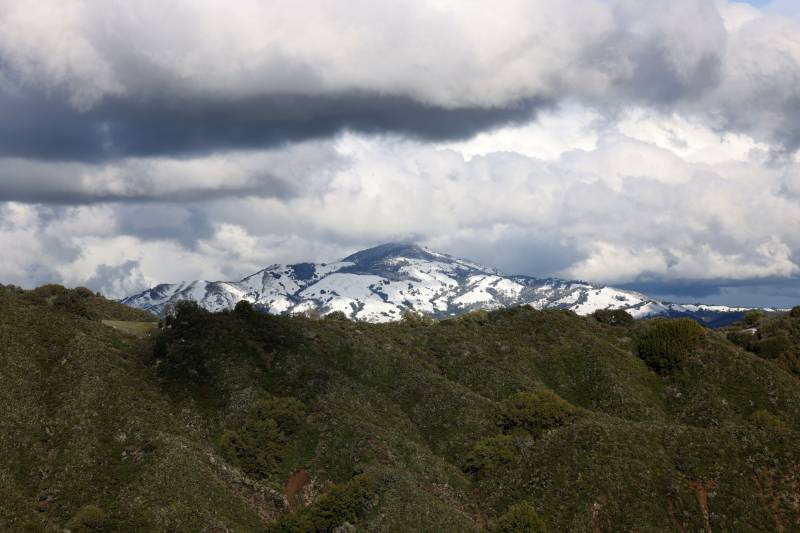
Snow covers the higher elevation of Mount Diablo at sunset, seen from Las Trampas Regional Wilderness Park in San Ramon, California, on Feb. 24, 2023.  (Ray Chavez/MediaNews Group/The Mercury News via Getty Images)

Bay Area mountain tops could see snow on Thursday morning after a cold front arrived in the region overnight. While the powder dusting won’t reach San Francisco or San José, the wider Bay Area could be hit with hail and thunderstorms before a break in the rain late in the day.

The bulk of the rainfall from the storm that rolled through Wednesday has passed, according to the National Weather Service, but lingering moisture-rich clouds and low temperatures could create the perfect conditions for short, heavy downpours and thunderstorms throughout the morning.

Brayden Murdock, a meteorologist at the weather service’s Bay Area office, said hail is likely to accompany any thunder, but the chance is slim — just about 15% across the region. The South and East Bay have the highest chances for pea-sized pellets of ice.
Sponsored

Temperatures across the region will be 8 to 15 degrees below seasonal averages throughout the day, with San Francisco and San José’s highs at 55 and 56 degrees.

The chilly air blown in by Wednesday’s winds is more likely to drop snow on the North and South Bay’s mountains. Snow levels will descend to about 3,000 feet, according to the weather service, which includes Mount Diablo, Mount Hamilton, and some of the Santa Lucias’ highest peaks.

“It’s probably going to be what we call wetter snow, so not exactly like individual flakes, but dusting will be possible,” Murdock said.

The chances will be short-lived, though, as rain peters out this evening before the next in a series of storms this week moves in. Murdock said that that system, arriving overnight, will bring warmer air with it.

“This next system is not going to be as cold, so we’re probably not looking at another chance for snow again in this part of the forecast,” he told KQED.

The heaviest rain on Friday will hit in the morning, and showers are expected throughout the day. Saturday looks fairly dry before a third storm is expected Sunday morning.

That storm is shaping up to hit the North Bay hardest, but the rest of the Bay Area shouldn’t see rainfall totals greater than an inch.

The forecast into next week is still uncertain, but the first day of spring could be a wet one since the weather service said it’s picking up another potential storm late in the week.

lower waypoint
next waypoint