upper waypoint

New Study Finds Rising Groundwater Is a Major Bay Area Flooding Risk

Save ArticleSave Article
Failed to save article

Please try again

Cyclists ride bikes down a stretch of road covered in water
A king tide floods China Camp in San Rafael, on New Year's Day, 2018. (Cindy Pavlinac/Flickr)

As recent storms have shown just how vulnerable the Bay Area is to flooding, a new study finds that rising groundwater is a crucial contributor to the region’s flooding challenges.

The study's goal in four counties — Alameda, Marin, San Francisco and San Mateo — is huge.

“It’s to make the Bay Area the most climate-resilient coastal region in the world,” said Adrian Covert, senior vice president of the Bay Area Council, a business association that helped fund the research.

In partnership with local climate scientists at Pathways Climate Institute, the San Francisco Estuary Institute, UC Berkeley, regional agencies and the counties, the study took existing groundwater levels and imagined how they would push up around the lip of the bay as seas rise. The authors also created maps to provide a high-level overview of this challenge.

12-inch sea level rise scenario

A map showing light flooding along the shores of San Francisco Bay.
The mapping covers both current conditions and projected future conditions with sea level rise. The darker the color, the more imminent the risk of groundwater rising. (Pathways Climate Institute)

“Now the public can go and look at these tools and see how different levels of sea level rise could affect everything from flooding in their basements to reducing the capacity of sewer systems to potential infrastructure damage to bridges and tall buildings,” Covert said.

Sponsored

Unless the world curbs greenhouse gases exponentially globally, the authors find, the region could be in store for a wetter future. According to the study, rising groundwater will occur many years before it ever reaches the surface, based on today's groundwater levels and global climate projections.

Related Stories

The scientists reached this conclusion by analyzing current groundwater measurements from contamination-monitoring wells, data from boreholes drilled prior to construction projects, and tidal and creek water surface elevations. From these sources, they created a searchable map of the counties to show what’s at risk in different sea level rise scenarios.

Flooding happens regularly in places like the city of Alameda and will happen exponentially more in the future, said Christine May, founder of Pathways Climate Institute.

“If we have another couple inches of rise than what we're seeing today, it could triple in aerial extent across the bay,” she said. “It has really big implications. It's going to change everything related to how we design buildings, freeways and sewer infrastructure.”

36-inch sea level rise scenario

A map shows moderate flooding in a few areas, mostly Novato and some southern parts of the Bay Area.

May said the project is the first of its kind for the region, but the data is limited, and “our mapping could already be a significant underestimate of the problem.”

The authors said decision-makers should treat the research as a warning sign of what’s to come in a warming world. May said there are hundreds, if not thousands, of contaminated sites around the Bay — remnants of the region’s industrial past — and if groundwater rises, it could all come in contact with this pollution buried throughout the shoreline.

“Anytime you're leaving contamination in the ground, if those conditions change, such as the water table is rising, that provides the potential to remobilize contaminants and create a new exposure pathway that could impact the environment or public health,” she said.

Risks of contaminants resurfacing disproportionately affect lower-income communities and communities of color because historical injustices mean that they are more likely to live near contaminated sites, said Kristina Hill, professor at UC Berkeley and a co-author of the report.

“Even a few inches of groundwater rise may mobilize contaminants or change flow directions, causing contaminants in the soil to spread,” she said. “Existing remediation plans don’t account for this.”

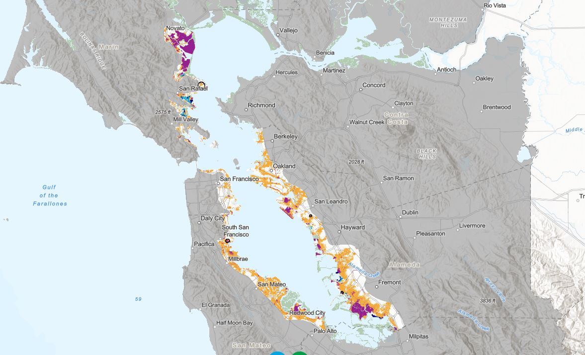
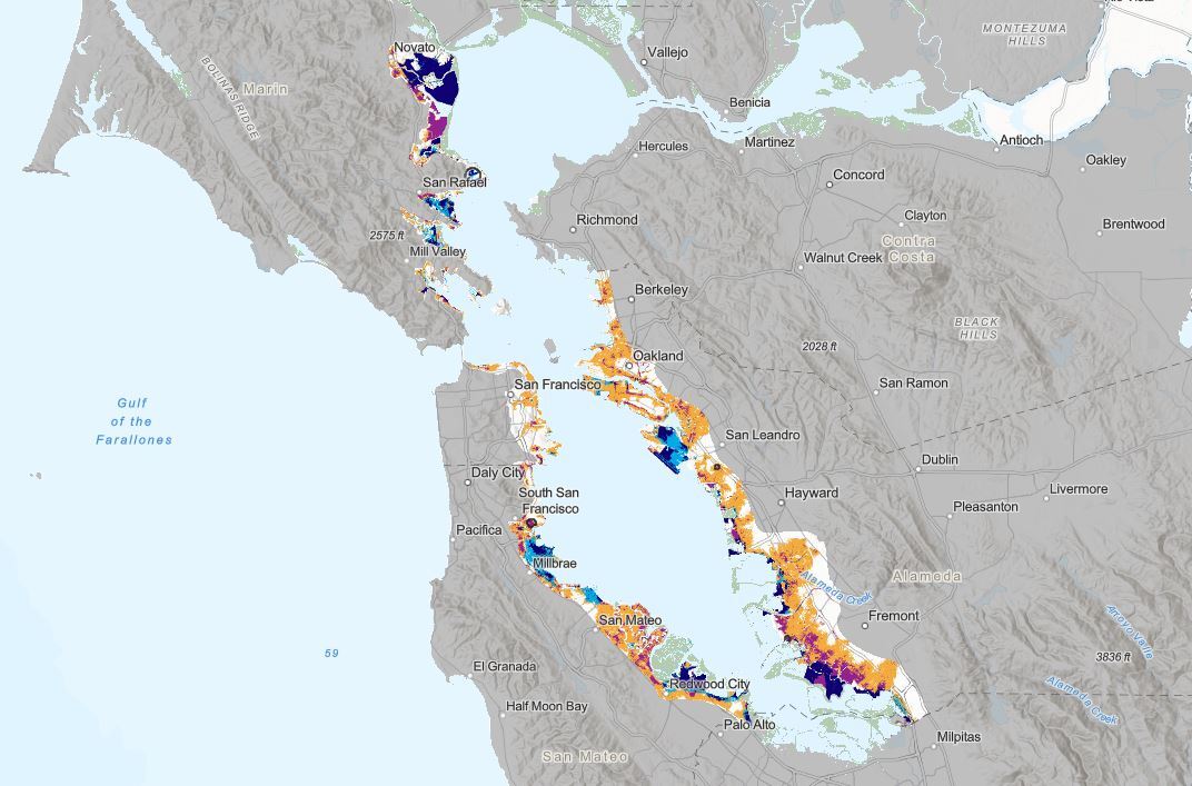
66-inch sea level rise scenario

A map showing more intense flooding along the southern Bay Area such as Palo Alto, Redwood City and Fremont.

These initial findings could give water agencies more power to enforce cleanup, said Lisa Horowitz McCann, assistant director of the San Francisco Bay Regional Water Quality Control Board.

“It gives us strong evidence to start making requirements where we have another layer of science that supports that there’s a risk,” she said.

The board recently made a pivotal move in revising regulations by requiring bayfront landfills to pinpoint methods for protecting landfills from rising groundwater in their long-term flood protection plans.

While previous studies have looked at groundwater rise in the Bay Area, this new vetted data set provides the information decision-makers need to understand how to adapt planning decisions for groundwater rise.

Sandra Hamlat, principal resilience analyst in San Francisco's Office of Resilience and Capital Planning, said the city has “photographic evidence of where there's already emerging groundwater.”

“I think it'll make us build smarter,” she said. “We want to make sure that we're protecting our assets, and I am sure property owners do, too.”

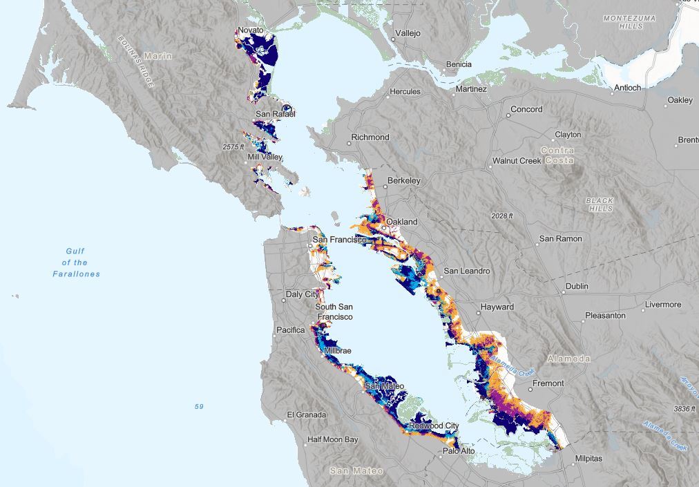
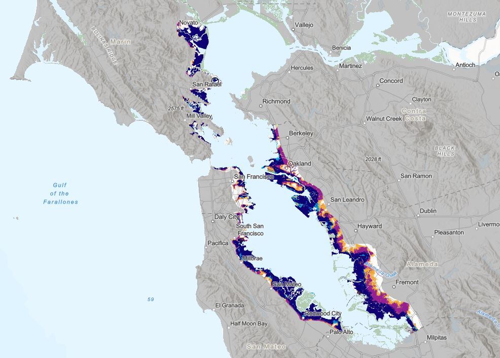
108-inch sea level rise scenario

A map showing intense flooding all along the shores of the Bay Area.

San Francisco is already using the study’s findings for capital improvement projects. Hamlat said the new data would likely inform which projects are approved and how to modify stormwater and sewage systems to accommodate an immense amount of water.

The findings also suggest that sea level rise projects, like seawalls or levees, may not be enough to keep water out of shoreline communities. That’s a big deal for San Mateo County, where many of these projects are located, said Len Materman, CEO of OneShoreline.

“Wherever those levees are sitting, at the end of the day, they're going to be along the shoreline area and impacted by groundwater,” he said.

Many San Mateo County cities already see flooding in storms and during king tides, so, he said, emerging groundwater would only add to the issue.

“This is like Miami stuff that we're seeing in some of our communities,” he said.

lower waypoint
next waypoint
California Law Letting Property Owners Split Lots to Build New Homes Is 'Unconstitutional,' Judge RulesAlameda: The Island That Almost Wasn’tJust Days Left to Apply for California Program That Helps Pay for Your First HouseIn Fresno’s Chinatown, High-Speed Rail Sparks Hope and Debate Within ResidentsFresno's Chinatown Neighborhood To See Big Changes From High Speed RailRainn Wilson from ‘The Office’ on Why We Need a Spiritual RevolutionIs California Headed For Another Tax Revolt?Will Less Homework Stress Make California Students Happier?NPR's Sarah McCammon on Leaving the Evangelical ChurchState Prisons Offset New Inmate Wage Hikes by Cutting Hours for Some Workers