upper waypoint

Tsunami Advisory Canceled in Bay Area, Some Coastal Regions Still Affected

Save ArticleSave Article
Failed to save article

Please try again

An emergency vehicle, red, sits on the right side of the frame facing Ocean Beach which features stormy waves.
Emergency crews are patrolling Bay Area beaches, like Ocean Beach in San Francisco, after a tsunami advisory went out Saturday.  (Ted Goldberg/KQED)

Update, 8:18 p.m. Saturday: The tsunami advisory was canceled across the Northern California coast, including the San Francisco Bay Area Saturday night, according to the National Weather Service.

Some areas along the coastline are still under advisory and people should avoid going to the waterfront, for their own safety, from Santa Cruz to Rincon Point in Santa Barbara County.

Original post, Saturday morning.

An undersea volcano erupted Saturday near the Pacific nation of Tonga, sending tsunami waves crashing across the shore and people rushing to higher ground. Tsunami advisories were issued for Hawaii, Alaska and the U.S. Pacific coast.

Beaches in San Francisco and Marin County, the Berkeley Marina and waterfronts across the Bay Area were closed for public access Saturday in anticipation of higher tides. Damage caused by flooding was visible in the region across social media, from damaged docks in Marin County to submerged vehicles in Santa Cruz Harbor.

Sponsored

CalFire reported that two fishermen were hospitalized after being swept in by the high tides at San Gregorio State Beach in San Mateo County. One was transported by helicopter.

Brian Garcia at the National Weather Service Bay Area said in a 12:30 p.m. update that the ongoing tsunami advisory was needed as surges continue to hit the Bay Area, but that relief was on the way.

"The overall water height is coming down as we head towards low tide," he said, but in that low tide "we continue to have the tsunami roll through."

While the water height may not be as high as the Bay Area experienced earlier in the day, the ripples of tsunami height may cause unexpected wave amplitude.

"Even as the tide lowers, it can still run up the beach, grab you, your pets, your family, your loved ones, and take you out to sea as it recedes," Garcia said. "So, it's still a dangerous situation out there. Best course of action: Continue to remain away from the water, continue to remain up high. Don't even go to the coast. Today's just not the day."

In San Francisco, Mary Ellen Carroll, executive director of the Department of Emergency Management, said she didn't fear residential flooding but "we really want to keep people away from the water."

That's especially crucial as the city's public safety systems are "very, very strained at the moment" by the pandemic, she said, "so we are asking everyone to please keep themselves safe. Of course, we will respond as needed, but everyone is really stretched thin right now."

The explosion of the Hunga Tonga-Hunga Ha’apai volcano was the latest in a series of dramatic eruptions.

Earth-imaging company Planet Labs PBC had watched the island in recent days after a new volcanic vent there began erupting in late December.

Satellite images captured by the company show how drastically the volcano had shaped the area, creating a growing island off Tonga.

“The surface area of the island appears to have expanded by nearly 45% due to ashfall,” Planet Labs said days before the latest activity.

Following Saturday’s eruption, residents in Hawaii, in Alaska and along the U.S. Pacific coast were advised to move away from the coastline to higher ground and to pay attention to specific instructions from their local emergency management officials, said Dave Snider, tsunami warning coordinator for the National Tsunami Warning Center in Palmer, Alaska.

“We don’t issue an advisory for this length of coastline as we’ve done — I’m not sure when the last time was — but it really isn’t an everyday experience,” Snider said.

He said the waves slamming ashore in Hawaii were just under the criteria for a more serious tsunami warning.

Beaches and piers were closed across Southern California as a precaution. The National Weather Service tweeted there were “no significant concerns about inundation.” Strong rip currents were possible, however, and officials warned people to stay out of the water.

On California’s central coast, the National Weather Service reported tsunami waves of up to 2.5 feet and flooding in beach parking lots at Port San Luis. About 200 miles down the coast, the waves were much smaller at Southern California’s Seal Beach, according to Michael Pless, the owner of M&M Surfing School.

“The waves are looking pretty flat,” Pless said. “We’re hoping they reopen the beach in a couple hours.”

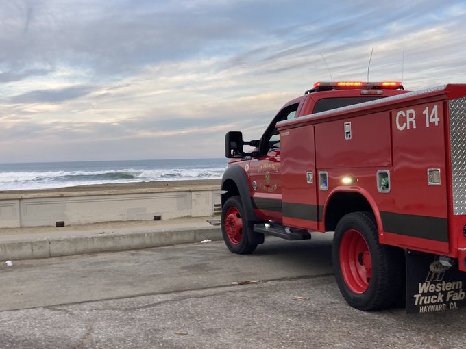
Crowds gathered at the Santa Cruz Harbor to watch the rising and falling water strain boat ties on docks. Law enforcement tried to clear people away when big surges started at around 7:30 a.m.

About an hour later, a surge went over the back lip of the harbor, filling a parking lot and low-lying streets and setting some cars afloat.

Jason Hoppin, communications manager of Santa Cruz County, said officials have been inspecting for damage. Hoppin said that in previous years with tsunami advisories, millions of dollars in damage hit Santa Cruz's harbor. In 2011, waves from Japan's Sendai earthquake caused more than $20 million in damage.

"We're asking people to stay out of the water, even surfing, which is a little bit difficult for some of our residents. But it's the best and safest thing to do right now," Hoppin said.

In Berkeley, residents aboard houseboats at the Berkeley Marina were ordered to evacuate on Saturday morning. Residents told KQED they were given more warning this weekend than during the last tsunami advisory in 2011.

"It looks like everybody has stepped up their tsunami preparedness," Berkeley Marina resident Brian Cline said. "The police were down here making it very clear that everybody needs to get off their boats and head to shore."

Cline grabbed hard drives, a camera, extra clothes and cash, and he booked it. Another Berkeley Marina resident, Kat Schaaf, said she got the evacuation order at about 7 a.m., which was starkly different from when the 2011 tsunami waves caused by the Sendai earthquake in Japan rocked the Bay Area.

"When Sendai happened, nobody warned us," she said.

On Tonga, home to about 105,000 people, video posted to social media showed large waves washing ashore in coastal areas, swirling around homes, a church and other buildings. Satellite images showed a huge eruption, with a plume of ash, steam and gas rising like a mushroom above the blue Pacific waters.

New Zealand’s military said it was monitoring the situation and remained on standby, ready to assist if asked.

There were no immediate reports of injuries or on the extent of the damage because all internet connectivity with Tonga was lost at about 6:40 p.m. local time, said Doug Madory, director of internet analysis for the network intelligence firm Kentik.

Tonga gets its internet via an undersea cable from Suva, Fiji, which presumably was damaged. Southern Cross Cable Network, the company that manages the connection, does not know yet “if the cable is cut or just suffering power loss,” Chief Technical Officer Dean Veverka said. He said he assumed the eruption was responsible.

Tonga’s Islands Business news site reported that a convoy of police and military troops evacuated King Tupou VI from his palace near the shore. He was among the many residents who headed for higher ground.

The Tonga Meteorological Service said a tsunami warning was declared for all of the archipelagoes, and data from the Pacific tsunami center said waves of 2.7 feet were detected.

A Twitter user identified as Dr. Faka’iloatonga Taumoefolau posted video showing waves crashing ashore.

“Can literally hear the volcano eruption, sounds pretty violent,” he wrote, adding in a later post: “Raining ash and tiny pebbles, darkness blanketing the sky.”

“It looks like everything will stay below the warning level, but it’s difficult to predict because this is a volcanic eruption, and we’re set up to measure earthquake or seismic-driven sea waves,” said Snider, the tsunami warning coordinator in Palmer, Alaska.

The first waves to hit the continental United States measured about 1 foot in Nikolski and Adak, Alaska. A wave just shy of a foot tall was observed in Monterey, California, the U.S. National Tsunami Warning Center said in a tweet.

Residents of American Samoa were alerted of a tsunami warning by local broadcasters as well as church bells that rang territory-wide Saturday. An outdoor siren warning system was out of service. Those living along the shoreline quickly moved to higher ground.

As night fell, there were no reports of any damage, and the Hawaii-based tsunami center canceled the alert.

Authorities in the nearby island nations of Fiji and Samoa also issued warnings, telling people to avoid the shoreline due to strong currents and dangerous waves. In New Zealand, officials warned of possible storm surges from the eruption.

New Zealand’s private forecaster, WeatherWatch, tweeted that people as far away as Southland, the country’s southernmost region, reported hearing sonic booms from the eruption. Others reported that many boats were damaged by a tsunami that hit a marina in Whangarei, in the Northland region.

Earlier, the Matangi Tonga news site reported that scientists observed massive explosions, thunder and lightning near the volcano after it started erupting early Friday. Satellite images showed a 3-mile-wide plume rising into the air to about 12 miles.

The Hunga Tonga-Hunga Ha’apai volcano is located about 40 miles north of the capital, Nuku’alofa. In late 2014 and early 2015, a series of eruptions in the area created a small new island and disrupted international air travel to the Pacific archipelago for several days.

There is not a significant difference between volcanoes underwater and on land, and underwater volcanoes become bigger as they erupt, at some point usually breaching the surface, said Hans Schwaiger, a research geophysicist with the Alaska Volcano Observatory.

With underwater volcanoes, however, the water can add to the explosiveness of the eruption as it hits the lava, Schwaiger added.

Before an explosion, there is generally an increase in small local earthquakes at the volcano, but depending on how far it is from land, that may not be felt by residents along the shoreline, Schwaiger said.

In 2019, Tonga lost internet access for nearly two weeks when a fiber-optic cable was severed. The director of the local cable company said at the time that a large ship may have cut the cable by dragging an anchor. Until limited satellite access was restored, people couldn’t even make international calls.

Southern Cross Cable Network’s Veverka said limited satellite connections exist between Tonga and other parts of the world but he did not know whether they might be affected by power outages.

KQED's Joe Fitzgerald Rodriguez, Raquel Maria Dillon, Sara Hossaini and Azul Dahlstrom-Eckman contributed to this report.

Sponsored

Associated Press writers Nick Perry, Jennifer McDermott in Providence, Rhode Island, Martha Mendoza in Santa Cruz, California, Frank Bajak in Boston, Mari Yamaguchi in Tokyo, Fili Sagapolutele in Pago Pago, American Samoa, Jon Gambrell in Dubai, United Arab Emirates, and Christopher Weber in Los Angeles contributed to this report.

lower waypoint
next waypoint
California Law Letting Property Owners Split Lots to Build New Homes Is 'Unconstitutional,' Judge RulesAlameda: The Island That Almost Wasn’tJust Days Left to Apply for California Program That Helps Pay for Your First HouseIn Fresno’s Chinatown, High-Speed Rail Sparks Hope and Debate Within ResidentsFresno's Chinatown Neighborhood To See Big Changes From High Speed RailRainn Wilson from ‘The Office’ on Why We Need a Spiritual RevolutionIs California Headed For Another Tax Revolt?Will Less Homework Stress Make California Students Happier?NPR's Sarah McCammon on Leaving the Evangelical ChurchState Prisons Offset New Inmate Wage Hikes by Cutting Hours for Some Workers