The shaking only lasted 15 seconds, but it changed the region forever.
Thirty years ago today — on Oct. 17, 1989 — a 6.9 magnitude earthquake on the San Andreas fault in the Santa Cruz mountains ripped through the Bay Area and neighboring counties. It struck just after 5 p.m., right before the start of the third game of the A's-Giants World Series (set to take place at Candlestick Park, but subsequently postponed).
The Loma Prieta earthquake, named after the mountain peak near its epicenter, wreaked havoc on the region, killing 63 people, injuring nearly 3,800 more and causing an estimated $6 billion in property damage. The quake broke the San Francisco-Oakland Bay Bridge, brought down a massive section of freeway in West Oakland and leveled hundreds of homes, from San Francisco's Marina District to the farming town of Watsonville, 90 miles south of the city.
The disaster was transformational, spurring dramatic changes to the physical infrastructure of the Bay Area and Santa Cruz County, and serving as an ominous, enduring reminder of the shaky, mercurial ground we live on.
The series of photos below, found mostly in public archives, show the extent of the earthquake's destruction in three areas — San Francisco's Marina District, West Oakland and parts of Santa Cruz County. The photos also highlight the drive of residents and leaders to quickly restore normalcy and build stronger, more durable structures.
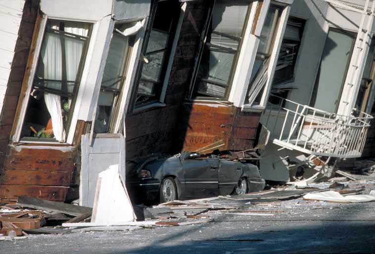
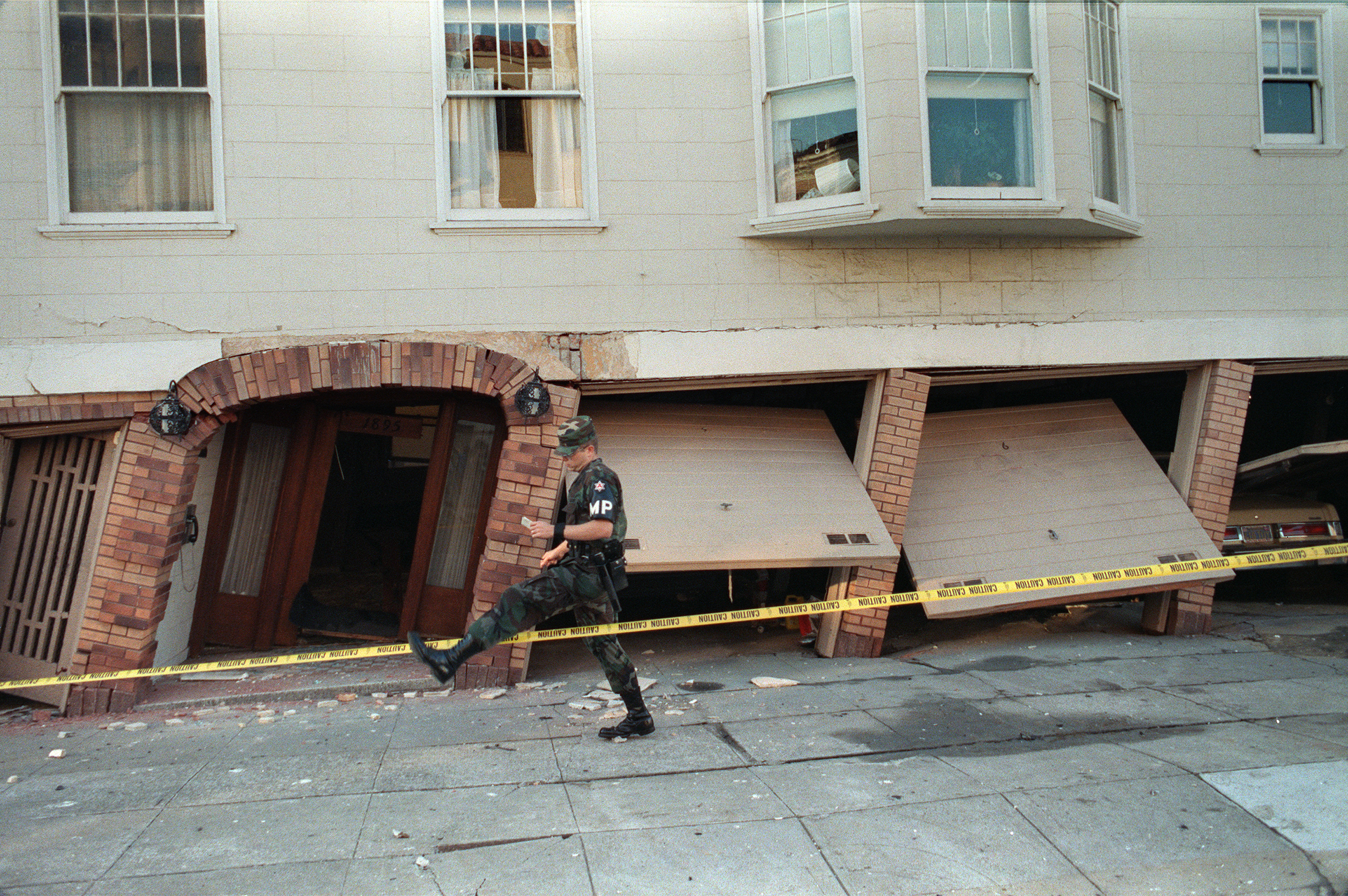
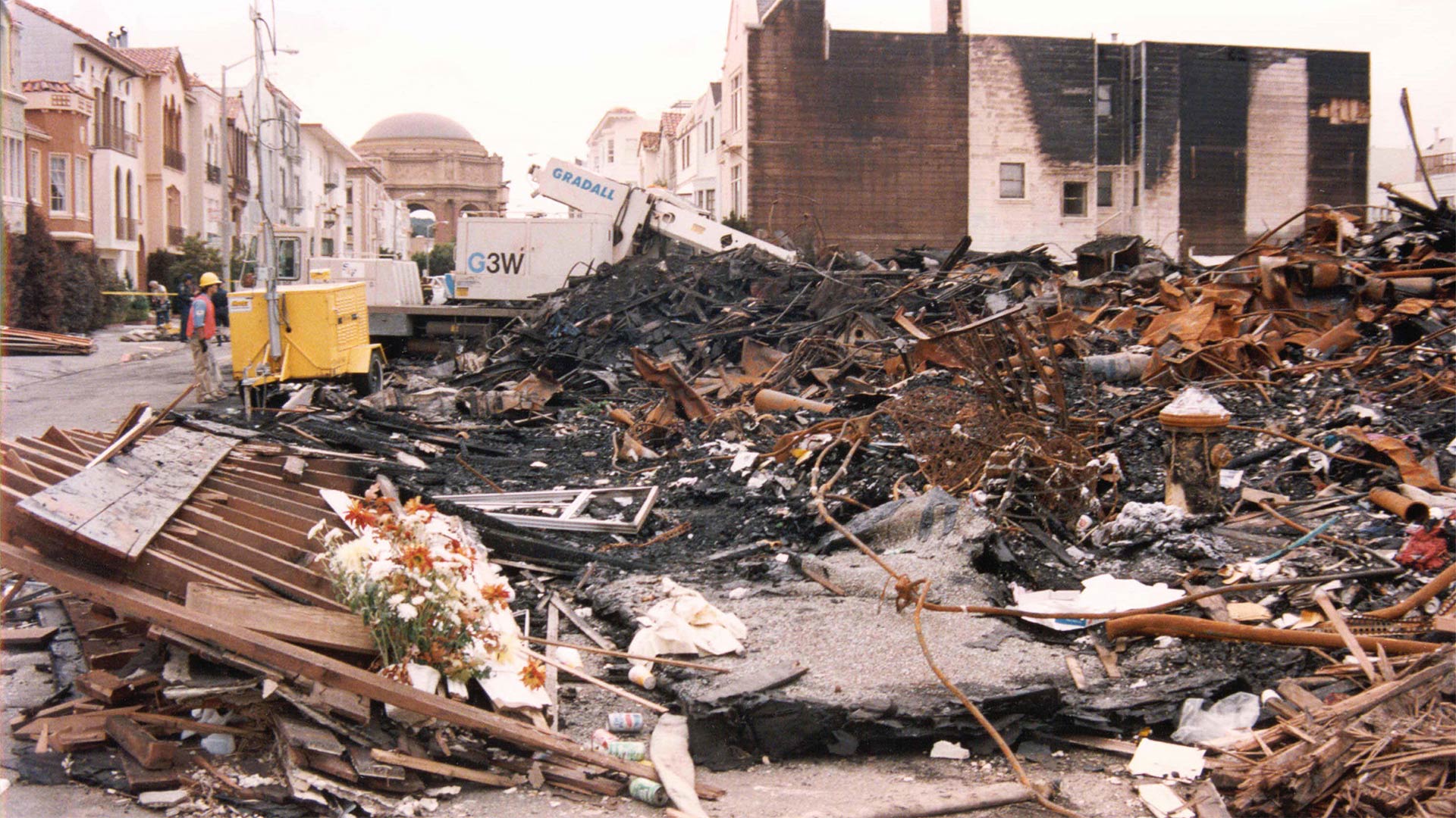
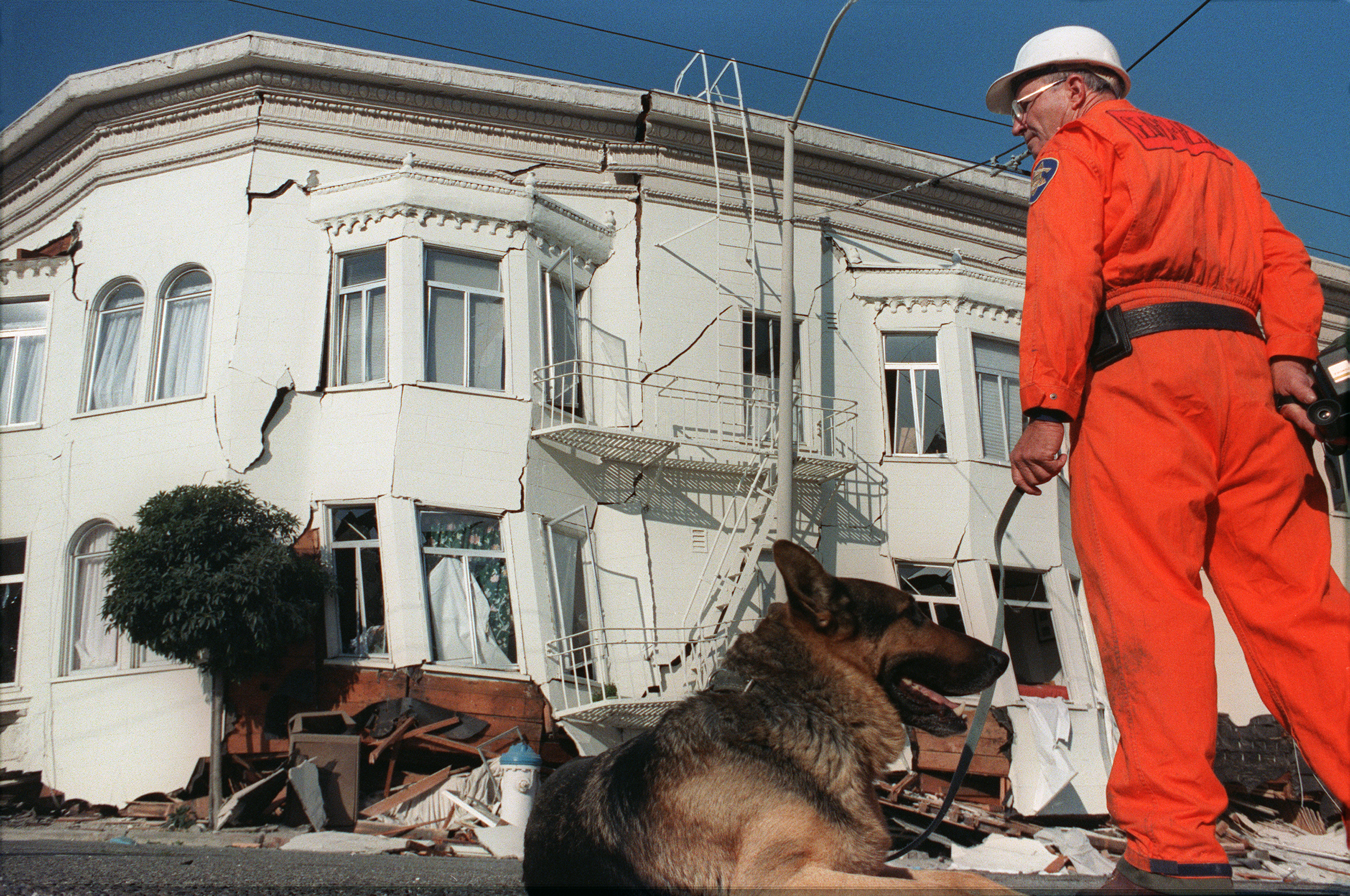
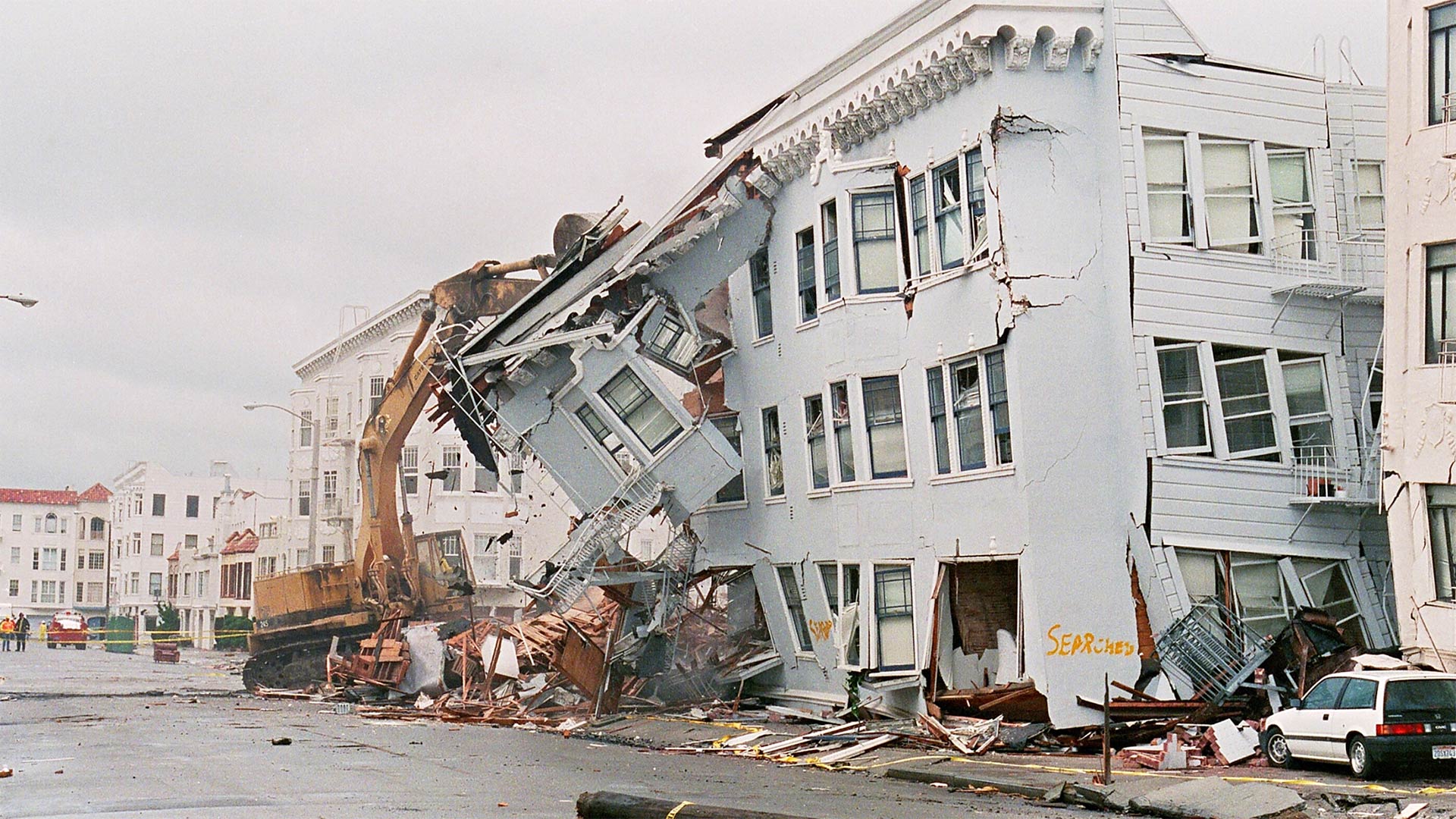
San Francisco's Marina District
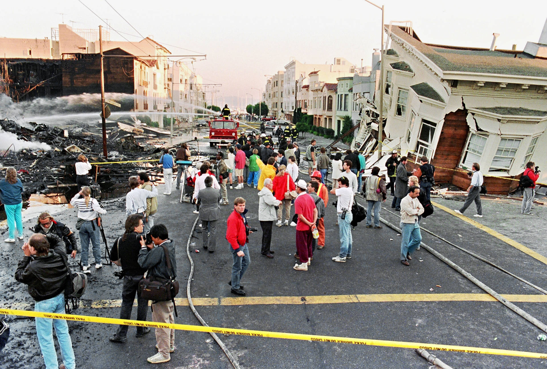
Even though its epicenter was nearly 100 miles away, the earthquake hit San Francisco’s Marina District particularly hard because the neighborhood was built on loose, sandy landfill that easily liquefied. The quake destroyed scores of buildings, sparking huge fires and killing four people.
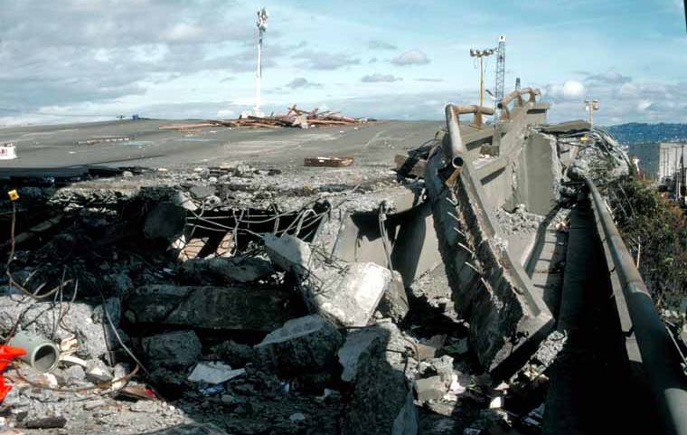
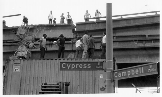
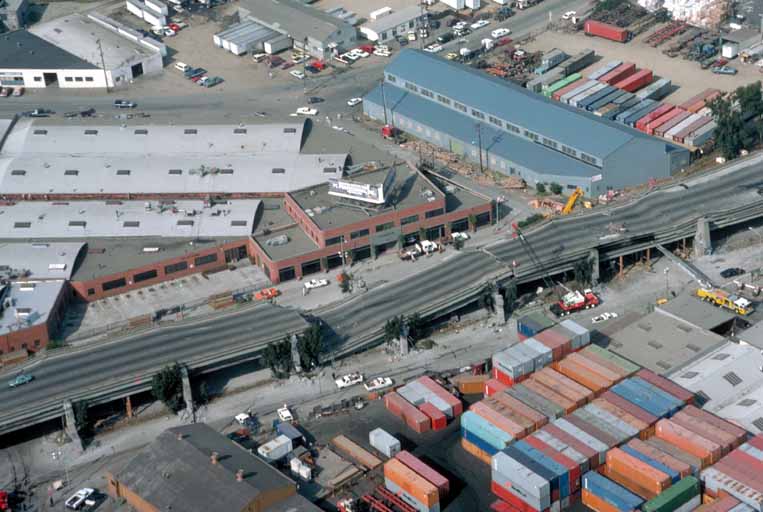
West Oakland
Although the dramatic rupture in the Bay Bridge is often considered the most iconic image of the earthquake's wrath, the collapse of a freeway in West Oakland was far more devastating and deadly. Amazingly, only one driver died on the Bay Bridge that evening, whereas 42 people were killed when a large portion of the Cypress Street Viaduct, a raised two-deck, multi-lane freeway in West Oakland, collapsed.
What followed was a heroic effort by residents and emergency workers who rushed to the scene, climbing and crawling into the twisted metal ruins of the hulking structure in a frantic effort to rescue those trapped inside, by whatever means necessary (which in some cases entailed having to amputate limbs).
The viaduct had for decades walled off much of West Oakland from the rest of the city, and its destruction helped slowly transform the neighborhood — much like the demolition of the Embarcadero Freeway did for San Francisco's downtown waterfront area. In its place, Oakland built Mandela Parkway, a north-south running boulevard flanking a large median park.


Santa Cruz and Watsonville
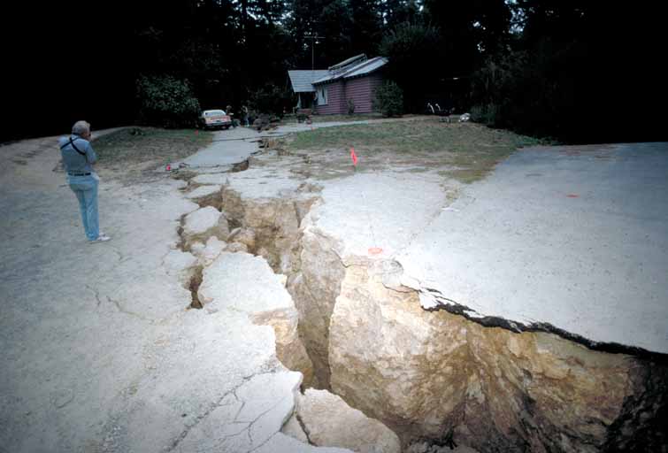
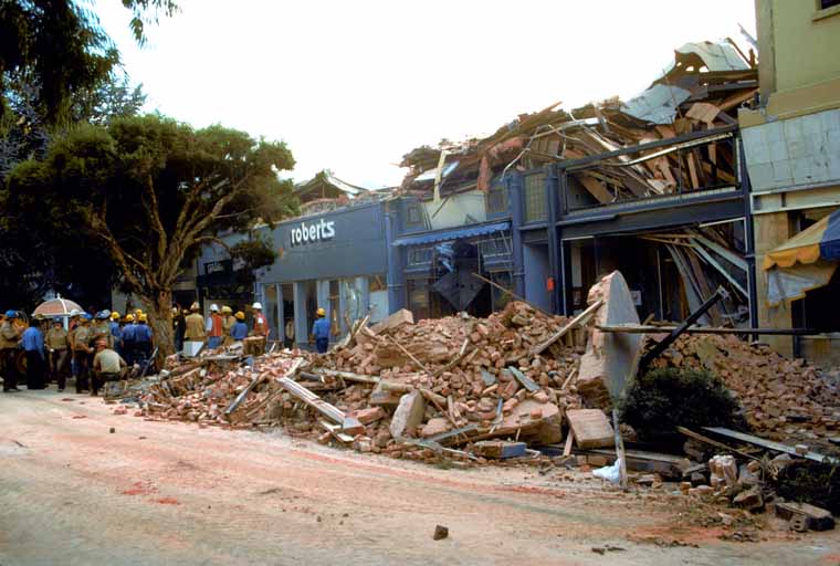
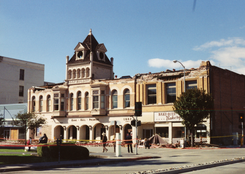
Although often overlooked in remembrances of the earthquake, Santa Cruz and Watsonville were close to Loma Prieta's epicenter, and both cities were hit especially hard. A large section of downtown Santa Cruz — comprised of unreinforced masonry buildings — was destroyed, as were scores of homes and buildings in nearby Watsonville. Seven people in Santa Cruz County were killed by the quake and more than 800 were injured. The disaster displaced upward of 4,500 people, creating a homelessness crisis, particularly among migrant agricultural workers.
"We were in the dark, in the cold," remembers Lou Arbanas, a volunteer archivist at the Pajaro Valley Historical Association in Watsonville. "We literally lost everything for communication. There was no radio, no broadcast service. No 911 service. The auxiliary power supply failed. Even police cars and firemen were unable to communicate."
Both Santa Cruz and Watsonville found themselves partially isolated for days after the quake, due to major damage on sections of State Route 1 and Highway 17.
Unlike Santa Cruz, though, which rebuilt its downtown to great success, less affluent Watsonville was slower to recover. Today, Arbanas said, there are still empty lots in the city's downtown where buildings destroyed during the quake were never rebuilt.