upper waypoint

Envisioning the Size of the Rim Fire on a Map of the South Bay

Save ArticleSave Article
Failed to save article

Please try again

This image tweeted by the National Weather Service illustrates the size of the Rim Fire burning in and around Yosemite as overlaid on a map of the South Bay, with San Jose roughly at the center of the image.

Fire burned within a dozen or so feet of Highway 120 between Cherry Lake Road and the Yosemite National Park entrance on Aug. 26. Firefighters believe these flames “spotted,” or jumped, to this location as embers were carried by the wind. (Grace Rubenstein/KQED)

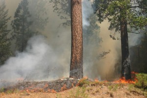
Yesterday, Todd McNeal, fire chief in the town of Twain Harte, told community members that a pot-growing operation may have sparked the fire, which started Aug. 17 in the Stanislaus National Forest.

But today, investigators ruled out the illicit activity as a potential cause.

Jerry Snyder of the U.S. Forest Service said that the steep and inaccessible canyon where the Rim Fire started Aug. 17 in the Stanislaus National Forest doesn't have a water source that growers look for when they set up remote gardens.

"The lead investigator says there's no evidence of any type of grow in the area where the fire started," Snyder said.

Sponsored

Snyder also said lightning isn't to blame. It could take months for investigators to determine what ignited the blaze that has consumed more than 370 square miles of Sierra Nevada forests.

The fire is now 80 percent contained.

According to the latest report from the Forest Service:

"The Rim Fire’s southeast flank in Yosemite National Park is expected to remain active where unburned fuels remain between containment lines and the fire. Crews are constructing new line off the Tioga Road in an effort to reduce the amount of fire operations needed to contain the fire.

"As conditions are favorable crews will continue using firing operations to remove unburned fuels that could threaten containment lines on the fire’s south and northeast flanks. The fire’s west and north flanks are considered contained while firefighters continue to monitor for spot fires and heat found near containment lines."

lower waypoint
next waypoint
At Least 16 People Died in California After Medics Injected Sedatives During Police EncountersPro-Palestinian Protests Sweep Bay Area College Campuses Amid Surging National MovementCalifornia Regulators Just Approved New Rule to Cap Health Care Costs. Here's How It Works9 California Counties Far From Universities Struggle to Recruit Teachers, Says ReportWomen at Troubled East Bay Prison Forced to Relocate Across the CountryLess Than 1% of Santa Clara County Contracts Go to Black and Latino Businesses, Study ShowsUS Department of Labor Hails Expanded Protections for H-2A Farmworkers in Santa RosaAs Border Debate Shifts Right, Sen. Alex Padilla Emerges as Persistent Counterforce for ImmigrantsCalifornia Law Letting Property Owners Split Lots to Build New Homes Is 'Unconstitutional,' Judge RulesInheriting a Home in California? Here's What You Need to Know