window.__IS_SSR__=true
window.__INITIAL_STATE__={
"attachmentsReducer": {
"audio_0": {
"type": "attachments",
"id": "audio_0",
"imgSizes": {
"kqedFullSize": {
"file": "https://ww2.kqed.org/news/wp-content/themes/KQED-unified/img/audio_bgs/background0.jpg"
}
}
},
"audio_1": {
"type": "attachments",
"id": "audio_1",
"imgSizes": {
"kqedFullSize": {
"file": "https://ww2.kqed.org/news/wp-content/themes/KQED-unified/img/audio_bgs/background1.jpg"
}
}
},
"audio_2": {
"type": "attachments",
"id": "audio_2",
"imgSizes": {
"kqedFullSize": {
"file": "https://ww2.kqed.org/news/wp-content/themes/KQED-unified/img/audio_bgs/background2.jpg"
}
}
},
"audio_3": {
"type": "attachments",
"id": "audio_3",
"imgSizes": {
"kqedFullSize": {
"file": "https://ww2.kqed.org/news/wp-content/themes/KQED-unified/img/audio_bgs/background3.jpg"
}
}
},
"audio_4": {
"type": "attachments",
"id": "audio_4",
"imgSizes": {
"kqedFullSize": {
"file": "https://ww2.kqed.org/news/wp-content/themes/KQED-unified/img/audio_bgs/background4.jpg"
}
}
},
"placeholder": {
"type": "attachments",
"id": "placeholder",
"imgSizes": {
"thumbnail": {
"file": "https://cdn.kqed.org/wp-content/uploads/2024/12/KQED-Default-Image-816638274-2000x1333-1-160x107.jpg",
"width": 160,
"height": 107,
"mimeType": "image/jpeg"
},
"medium": {
"file": "https://cdn.kqed.org/wp-content/uploads/2024/12/KQED-Default-Image-816638274-2000x1333-1-800x533.jpg",
"width": 800,
"height": 533,
"mimeType": "image/jpeg"
},
"medium_large": {
"file": "https://cdn.kqed.org/wp-content/uploads/2024/12/KQED-Default-Image-816638274-2000x1333-1-768x512.jpg",
"width": 768,
"height": 512,
"mimeType": "image/jpeg"
},
"large": {
"file": "https://cdn.kqed.org/wp-content/uploads/2024/12/KQED-Default-Image-816638274-2000x1333-1-1020x680.jpg",
"width": 1020,
"height": 680,
"mimeType": "image/jpeg"
},
"1536x1536": {
"file": "https://cdn.kqed.org/wp-content/uploads/2024/12/KQED-Default-Image-816638274-2000x1333-1-1536x1024.jpg",
"width": 1536,
"height": 1024,
"mimeType": "image/jpeg"
},
"fd-lrg": {
"file": "https://cdn.kqed.org/wp-content/uploads/2024/12/KQED-Default-Image-816638274-2000x1333-1-1536x1024.jpg",
"width": 1536,
"height": 1024,
"mimeType": "image/jpeg"
},
"fd-med": {
"file": "https://cdn.kqed.org/wp-content/uploads/2024/12/KQED-Default-Image-816638274-2000x1333-1-1020x680.jpg",
"width": 1020,
"height": 680,
"mimeType": "image/jpeg"
},
"fd-sm": {
"file": "https://cdn.kqed.org/wp-content/uploads/2024/12/KQED-Default-Image-816638274-2000x1333-1-800x533.jpg",
"width": 800,
"height": 533,
"mimeType": "image/jpeg"
},
"post-thumbnail": {
"file": "https://cdn.kqed.org/wp-content/uploads/2024/12/KQED-Default-Image-816638274-2000x1333-1-672x372.jpg",
"width": 672,
"height": 372,
"mimeType": "image/jpeg"
},
"twentyfourteen-full-width": {
"file": "https://cdn.kqed.org/wp-content/uploads/2024/12/KQED-Default-Image-816638274-2000x1333-1-1038x576.jpg",
"width": 1038,
"height": 576,
"mimeType": "image/jpeg"
},
"xxsmall": {
"file": "https://cdn.kqed.org/wp-content/uploads/2024/12/KQED-Default-Image-816638274-2000x1333-1-160x107.jpg",
"width": 160,
"height": 107,
"mimeType": "image/jpeg"
},
"xsmall": {
"file": "https://cdn.kqed.org/wp-content/uploads/2024/12/KQED-Default-Image-816638274-2000x1333-1-672x372.jpg",
"width": 672,
"height": 372,
"mimeType": "image/jpeg"
},
"small": {
"file": "https://cdn.kqed.org/wp-content/uploads/2024/12/KQED-Default-Image-816638274-2000x1333-1-672x372.jpg",
"width": 672,
"height": 372,
"mimeType": "image/jpeg"
},
"xlarge": {
"file": "https://cdn.kqed.org/wp-content/uploads/2024/12/KQED-Default-Image-816638274-2000x1333-1-1020x680.jpg",
"width": 1020,
"height": 680,
"mimeType": "image/jpeg"
},
"full-width": {
"file": "https://cdn.kqed.org/wp-content/uploads/2024/12/KQED-Default-Image-816638274-2000x1333-1-1920x1280.jpg",
"width": 1920,
"height": 1280,
"mimeType": "image/jpeg"
},
"guest-author-32": {
"file": "https://cdn.kqed.org/wp-content/uploads/2025/01/KQED-Default-Image-816638274-1333x1333-1-160x160.jpg",
"width": 32,
"height": 32,
"mimeType": "image/jpeg"
},
"guest-author-50": {
"file": "https://cdn.kqed.org/wp-content/uploads/2025/01/KQED-Default-Image-816638274-1333x1333-1-160x160.jpg",
"width": 50,
"height": 50,
"mimeType": "image/jpeg"
},
"guest-author-64": {
"file": "https://cdn.kqed.org/wp-content/uploads/2025/01/KQED-Default-Image-816638274-1333x1333-1-160x160.jpg",
"width": 64,
"height": 64,
"mimeType": "image/jpeg"
},
"guest-author-96": {
"file": "https://cdn.kqed.org/wp-content/uploads/2025/01/KQED-Default-Image-816638274-1333x1333-1-160x160.jpg",
"width": 96,
"height": 96,
"mimeType": "image/jpeg"
},
"guest-author-128": {
"file": "https://cdn.kqed.org/wp-content/uploads/2025/01/KQED-Default-Image-816638274-1333x1333-1-160x160.jpg",
"width": 128,
"height": 128,
"mimeType": "image/jpeg"
},
"detail": {
"file": "https://cdn.kqed.org/wp-content/uploads/2025/01/KQED-Default-Image-816638274-1333x1333-1-160x160.jpg",
"width": 160,
"height": 160,
"mimeType": "image/jpeg"
},
"kqedFullSize": {
"file": "https://cdn.kqed.org/wp-content/uploads/2024/12/KQED-Default-Image-816638274-2000x1333-1.jpg",
"width": 2000,
"height": 1333
}
}
},
"news_12088710": {
"type": "attachments",
"id": "news_12088710",
"meta": {
"index": "attachments_1716263798",
"site": "news",
"id": "12088710",
"found": true
},
"title": "260624_Earthquake-KQED",
"publishDate": 1782322583,
"status": "inherit",
"parent": 0,
"modified": 1782324888,
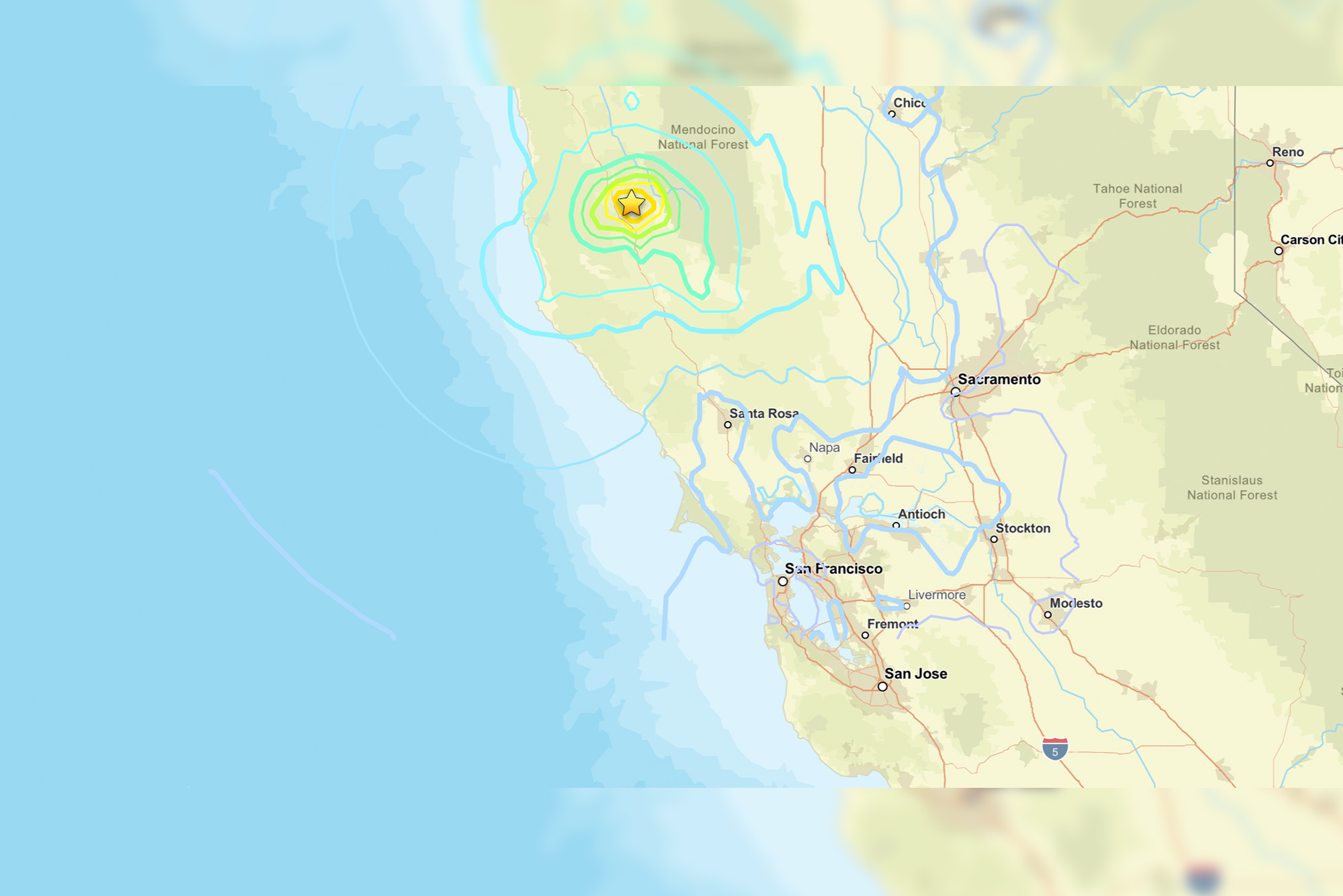
"caption": "A map showing a magnitude 5.6 earthquake that occurred in northern California on Wednesday, near Redwood Valley. Most people in the Bay Area felt little to nothing during quake. \r\n\r\n",
"credit": "Gina Castro/KQED via USGS",
"altTag": null,
"description": null,
"imgSizes": {
"thumbnail": {
"file": "https://cdn.kqed.org/wp-content/uploads/sites/10/2026/06/260624_Earthquake-KQED-160x107.jpg",
"width": 160,
"height": 107,
"mimeType": "image/jpeg"
},
"1536x1536": {
"file": "https://cdn.kqed.org/wp-content/uploads/sites/10/2026/06/260624_Earthquake-KQED-1536x1025.jpg",
"width": 1536,
"height": 1025,
"mimeType": "image/jpeg"
},
"post-thumbnail": {
"file": "https://cdn.kqed.org/wp-content/uploads/sites/10/2026/06/260624_Earthquake-KQED-672x372.jpg",
"width": 672,
"height": 372,
"mimeType": "image/jpeg"
},
"twentyfourteen-full-width": {
"file": "https://cdn.kqed.org/wp-content/uploads/sites/10/2026/06/260624_Earthquake-KQED-1038x576.jpg",
"width": 1038,
"height": 576,
"mimeType": "image/jpeg"
},
"npr-cds-wide": {
"file": "https://cdn.kqed.org/wp-content/uploads/sites/10/2026/06/260624_Earthquake-KQED-1200x675.jpg",
"width": 1200,
"height": 675,
"mimeType": "image/jpeg"
},
"npr-cds-square": {
"file": "https://cdn.kqed.org/wp-content/uploads/sites/10/2026/06/260624_Earthquake-KQED-600x600.jpg",
"width": 600,
"height": 600,
"mimeType": "image/jpeg"
},
"kqedFullSize": {
"file": "https://cdn.kqed.org/wp-content/uploads/sites/10/2026/06/260624_Earthquake-KQED.jpg",
"width": 2000,
"height": 1334
}
},
"isLoading": false,
"fetchFailed": false
},
"news_12088700": {
"type": "attachments",
"id": "news_12088700",
"meta": {
"index": "attachments_1716263798",
"site": "news",
"id": "12088700",
"found": true
},
"title": "Local Weather U.S.",
"publishDate": 1782321300,
"status": "inherit",
"parent": 12088673,
"modified": 1782322647,
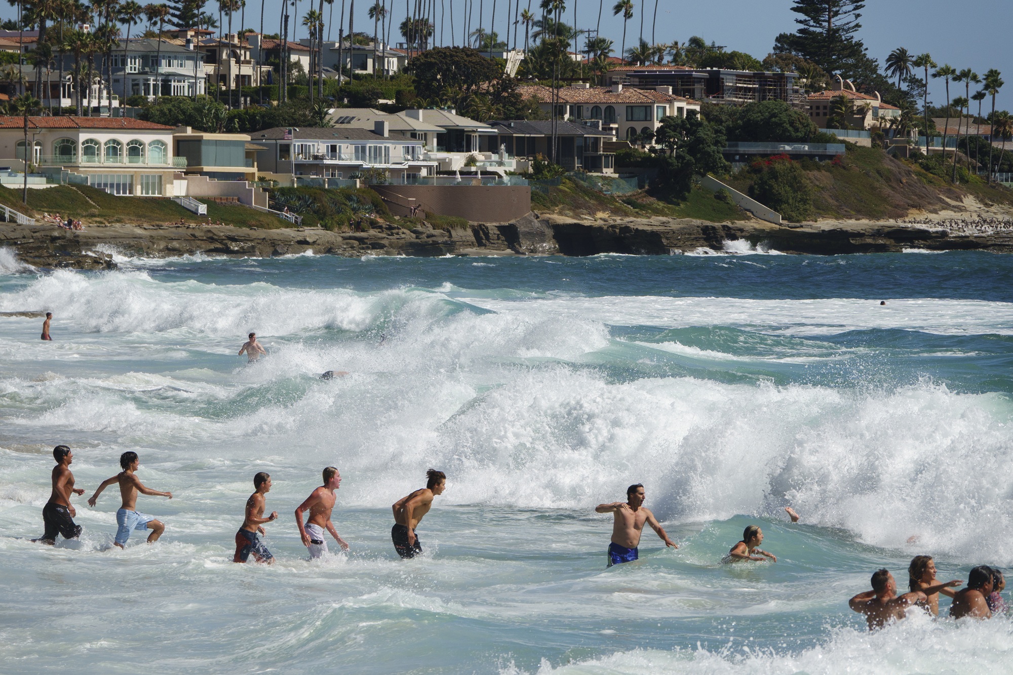
"caption": "Visitors navigate breaking waves along the coastline of Windansea Beach in La Jolla on June 20, 2026, in San Diego, California. The National Weather Service issued a beach hazard statement for elevated surf and high risk for rip currents. ",
"credit": "Kevin Carter/Getty Images",
"altTag": null,
"description": null,
"imgSizes": {
"thumbnail": {
"file": "https://cdn.kqed.org/wp-content/uploads/sites/10/2026/06/CaliforniaRipCurrentsGetty-160x107.jpg",
"width": 160,
"height": 107,
"mimeType": "image/jpeg"
},
"1536x1536": {
"file": "https://cdn.kqed.org/wp-content/uploads/sites/10/2026/06/CaliforniaRipCurrentsGetty-1536x1024.jpg",
"width": 1536,
"height": 1024,
"mimeType": "image/jpeg"
},
"post-thumbnail": {
"file": "https://cdn.kqed.org/wp-content/uploads/sites/10/2026/06/CaliforniaRipCurrentsGetty-672x372.jpg",
"width": 672,
"height": 372,
"mimeType": "image/jpeg"
},
"twentyfourteen-full-width": {
"file": "https://cdn.kqed.org/wp-content/uploads/sites/10/2026/06/CaliforniaRipCurrentsGetty-1038x576.jpg",
"width": 1038,
"height": 576,
"mimeType": "image/jpeg"
},
"npr-cds-wide": {
"file": "https://cdn.kqed.org/wp-content/uploads/sites/10/2026/06/CaliforniaRipCurrentsGetty-1200x675.jpg",
"width": 1200,
"height": 675,
"mimeType": "image/jpeg"
},
"npr-cds-square": {
"file": "https://cdn.kqed.org/wp-content/uploads/sites/10/2026/06/CaliforniaRipCurrentsGetty-600x600.jpg",
"width": 600,
"height": 600,
"mimeType": "image/jpeg"
},
"kqedFullSize": {
"file": "https://cdn.kqed.org/wp-content/uploads/sites/10/2026/06/CaliforniaRipCurrentsGetty.jpg",
"width": 2000,
"height": 1333
}
},
"isLoading": false,
"fetchFailed": false
},
"news_12087652": {
"type": "attachments",
"id": "news_12087652",
"meta": {
"index": "attachments_1716263798",
"site": "news",
"id": "12087652",
"found": true
},
"title": "260615-PacificaPier-17-BL-KQED",
"publishDate": 1781558130,
"status": "inherit",
"parent": 12087577,
"modified": 1781565986,
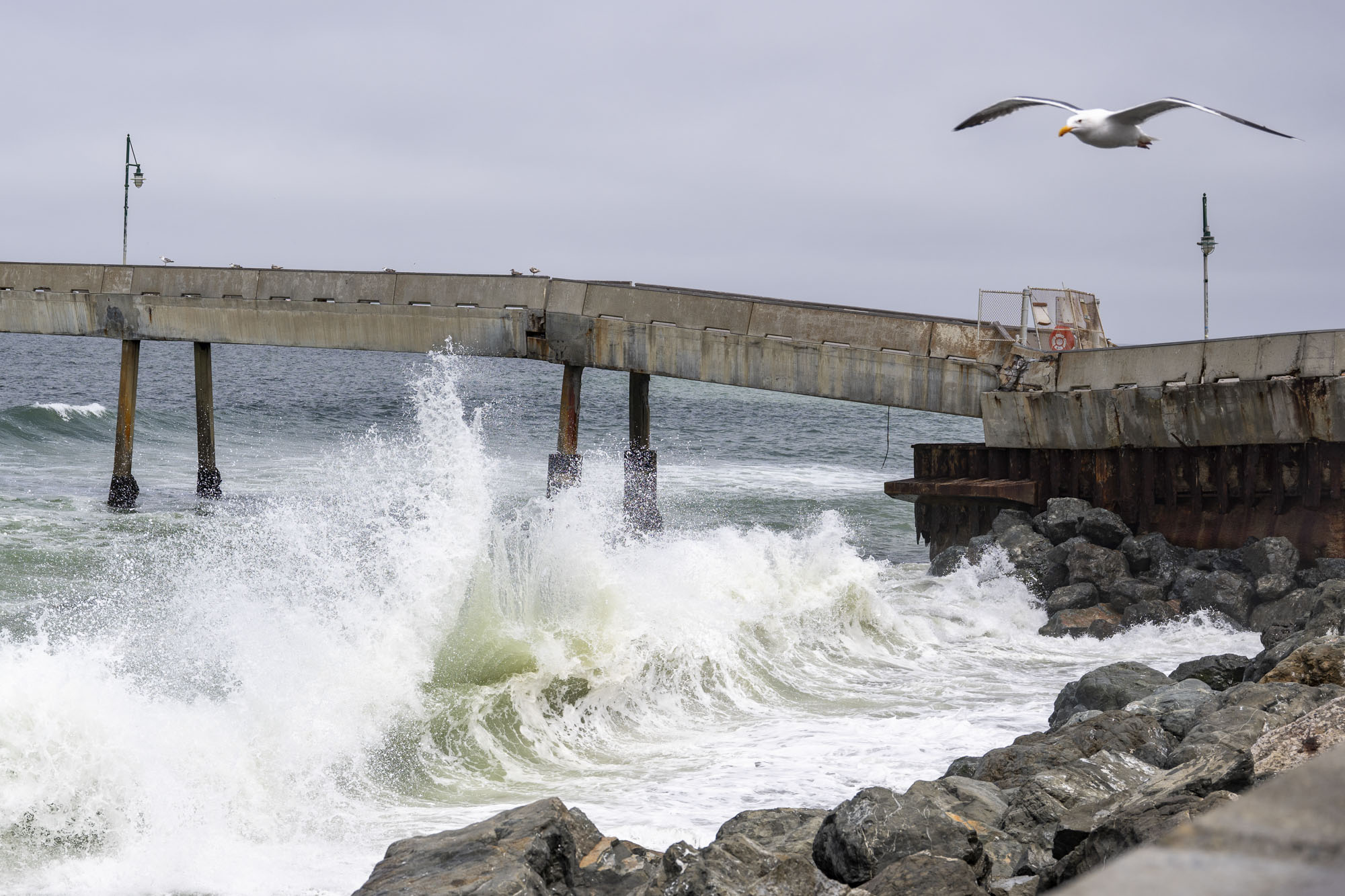
"caption": "The Pacifica Municipal Pier in Pacifica on June 15, 2026, after structural damage forced its closure and the demolition of the Chit Chat Cafe.",
"credit": "Beth LaBerge/KQED",
"altTag": null,
"description": null,
"imgSizes": {
"thumbnail": {
"file": "https://cdn.kqed.org/wp-content/uploads/sites/10/2026/06/260615-PacificaPier-17-BL-KQED-160x107.jpg",
"width": 160,
"height": 107,
"mimeType": "image/jpeg"
},
"1536x1536": {
"file": "https://cdn.kqed.org/wp-content/uploads/sites/10/2026/06/260615-PacificaPier-17-BL-KQED-1536x1024.jpg",
"width": 1536,
"height": 1024,
"mimeType": "image/jpeg"
},
"post-thumbnail": {
"file": "https://cdn.kqed.org/wp-content/uploads/sites/10/2026/06/260615-PacificaPier-17-BL-KQED-672x372.jpg",
"width": 672,
"height": 372,
"mimeType": "image/jpeg"
},
"twentyfourteen-full-width": {
"file": "https://cdn.kqed.org/wp-content/uploads/sites/10/2026/06/260615-PacificaPier-17-BL-KQED-1038x576.jpg",
"width": 1038,
"height": 576,
"mimeType": "image/jpeg"
},
"npr-cds-wide": {
"file": "https://cdn.kqed.org/wp-content/uploads/sites/10/2026/06/260615-PacificaPier-17-BL-KQED-1200x675.jpg",
"width": 1200,
"height": 675,
"mimeType": "image/jpeg"
},
"npr-cds-square": {
"file": "https://cdn.kqed.org/wp-content/uploads/sites/10/2026/06/260615-PacificaPier-17-BL-KQED-600x600.jpg",
"width": 600,
"height": 600,
"mimeType": "image/jpeg"
},
"kqedFullSize": {
"file": "https://cdn.kqed.org/wp-content/uploads/sites/10/2026/06/260615-PacificaPier-17-BL-KQED.jpg",
"width": 2000,
"height": 1333
}
},
"isLoading": false,
"fetchFailed": false
},
"news_12087650": {
"type": "attachments",
"id": "news_12087650",
"meta": {
"index": "attachments_1716263798",
"site": "news",
"id": "12087650",
"found": true
},
"title": "260615-PacificaPier-04-BL-KQED",
"publishDate": 1781558120,
"status": "inherit",
"parent": 0,
"modified": 1781558179,
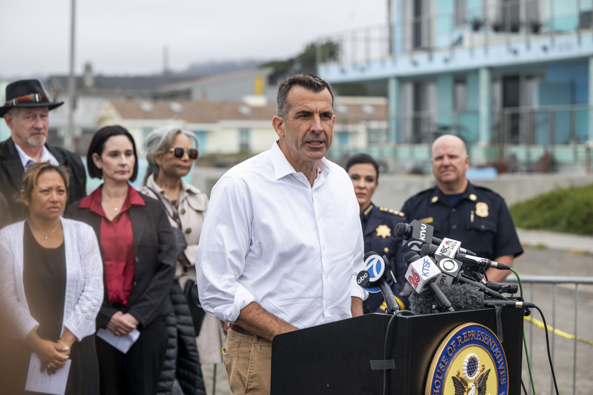
"caption": "Rep. Sam Liccardo speaks during a news conference calling for federal aid for the Pacifica Municipal Pier in Pacifica on June 15, 2026, after structural damage led to the pier's closure and the demolition of the Chit Chat Cafe.",
"credit": "Beth LaBerge/KQED",
"altTag": null,
"description": null,
"imgSizes": {
"thumbnail": {
"file": "https://cdn.kqed.org/wp-content/uploads/sites/10/2026/06/260615-PacificaPier-04-BL-KQED-160x107.jpg",
"width": 160,
"height": 107,
"mimeType": "image/jpeg"
},
"1536x1536": {
"file": "https://cdn.kqed.org/wp-content/uploads/sites/10/2026/06/260615-PacificaPier-04-BL-KQED-1536x1024.jpg",
"width": 1536,
"height": 1024,
"mimeType": "image/jpeg"
},
"post-thumbnail": {
"file": "https://cdn.kqed.org/wp-content/uploads/sites/10/2026/06/260615-PacificaPier-04-BL-KQED-672x372.jpg",
"width": 672,
"height": 372,
"mimeType": "image/jpeg"
},
"twentyfourteen-full-width": {
"file": "https://cdn.kqed.org/wp-content/uploads/sites/10/2026/06/260615-PacificaPier-04-BL-KQED-1038x576.jpg",
"width": 1038,
"height": 576,
"mimeType": "image/jpeg"
},
"npr-cds-wide": {
"file": "https://cdn.kqed.org/wp-content/uploads/sites/10/2026/06/260615-PacificaPier-04-BL-KQED-1200x675.jpg",
"width": 1200,
"height": 675,
"mimeType": "image/jpeg"
},
"npr-cds-square": {
"file": "https://cdn.kqed.org/wp-content/uploads/sites/10/2026/06/260615-PacificaPier-04-BL-KQED-600x600.jpg",
"width": 600,
"height": 600,
"mimeType": "image/jpeg"
},
"kqedFullSize": {
"file": "https://cdn.kqed.org/wp-content/uploads/sites/10/2026/06/260615-PacificaPier-04-BL-KQED.jpg",
"width": 2000,
"height": 1333
}
},
"isLoading": false,
"fetchFailed": false
},
"news_12087662": {
"type": "attachments",
"id": "news_12087662",
"meta": {
"index": "attachments_1716263798",
"site": "news",
"id": "12087662",
"found": true
},
"title": "061526Flooding_GH_001-KQED",
"publishDate": 1781558849,
"status": "inherit",
"parent": 0,
"modified": 1781559066,
"caption": "A puddle left behind by receding king tides reflects homes along Golden Hind Passage in Corte Madera on June 15, 2026.",
"credit": "Gustavo Hernandez/KQED",
"altTag": null,
"description": null,
"imgSizes": {
"thumbnail": {
"file": "https://cdn.kqed.org/wp-content/uploads/sites/10/2026/06/061526Flooding_GH_001-KQED-160x107.jpg",
"width": 160,
"height": 107,
"mimeType": "image/jpeg"
},
"1536x1536": {
"file": "https://cdn.kqed.org/wp-content/uploads/sites/10/2026/06/061526Flooding_GH_001-KQED-1536x1024.jpg",
"width": 1536,
"height": 1024,
"mimeType": "image/jpeg"
},
"post-thumbnail": {
"file": "https://cdn.kqed.org/wp-content/uploads/sites/10/2026/06/061526Flooding_GH_001-KQED-672x372.jpg",
"width": 672,
"height": 372,
"mimeType": "image/jpeg"
},
"twentyfourteen-full-width": {
"file": "https://cdn.kqed.org/wp-content/uploads/sites/10/2026/06/061526Flooding_GH_001-KQED-1038x576.jpg",
"width": 1038,
"height": 576,
"mimeType": "image/jpeg"
},
"npr-cds-wide": {
"file": "https://cdn.kqed.org/wp-content/uploads/sites/10/2026/06/061526Flooding_GH_001-KQED-1200x675.jpg",
"width": 1200,
"height": 675,
"mimeType": "image/jpeg"
},
"npr-cds-square": {
"file": "https://cdn.kqed.org/wp-content/uploads/sites/10/2026/06/061526Flooding_GH_001-KQED-600x600.jpg",
"width": 600,
"height": 600,
"mimeType": "image/jpeg"
},
"kqedFullSize": {
"file": "https://cdn.kqed.org/wp-content/uploads/sites/10/2026/06/061526Flooding_GH_001-KQED.jpg",
"width": 2000,
"height": 1333
}
},
"isLoading": false,
"fetchFailed": false
},
"news_12057996": {
"type": "attachments",
"id": "news_12057996",
"meta": {
"index": "attachments_1716263798",
"site": "news",
"id": "12057996",
"found": true
},
"title": "Atmospheric river storm in Northern California",
"publishDate": 1759168970,
"status": "inherit",
"parent": 12057992,
"modified": 1781200630,
"caption": "A woman with an umbrella walks on a road during heavy rain in Guerneville, California, on Feb. 6, 2025, as an atmospheric river hits Northern California. ",
"credit": "Tayfun Coskun/Anadolu via Getty Images",
"altTag": null,
"description": null,
"imgSizes": {
"medium": {
"file": "https://cdn.kqed.org/wp-content/uploads/sites/10/2025/09/GettyImages-2197490970-2000x1333.jpg",
"width": 2000,
"height": 1333,
"mimeType": "image/jpeg"
},
"large": {
"file": "https://cdn.kqed.org/wp-content/uploads/sites/10/2025/09/GettyImages-2197490970-2000x1333.jpg",
"width": 2000,
"height": 1333,
"mimeType": "image/jpeg"
},
"thumbnail": {
"file": "https://cdn.kqed.org/wp-content/uploads/sites/10/2025/09/GettyImages-2197490970-160x107.jpg",
"width": 160,
"height": 107,
"mimeType": "image/jpeg"
},
"1536x1536": {
"file": "https://cdn.kqed.org/wp-content/uploads/sites/10/2025/09/GettyImages-2197490970-1536x1024.jpg",
"width": 1536,
"height": 1024,
"mimeType": "image/jpeg"
},
"2048x2048": {
"file": "https://cdn.kqed.org/wp-content/uploads/sites/10/2025/09/GettyImages-2197490970-2048x1365.jpg",
"width": 2048,
"height": 1365,
"mimeType": "image/jpeg"
},
"post-thumbnail": {
"file": "https://cdn.kqed.org/wp-content/uploads/sites/10/2025/09/GettyImages-2197490970-672x372.jpg",
"width": 672,
"height": 372,
"mimeType": "image/jpeg"
},
"twentyfourteen-full-width": {
"file": "https://cdn.kqed.org/wp-content/uploads/sites/10/2025/09/GettyImages-2197490970-1038x576.jpg",
"width": 1038,
"height": 576,
"mimeType": "image/jpeg"
},
"full-width": {
"file": "https://cdn.kqed.org/wp-content/uploads/sites/10/2025/09/GettyImages-2197490970-2000x1333.jpg",
"width": 2000,
"height": 1333,
"mimeType": "image/jpeg"
},
"kqedFullSize": {
"file": "https://cdn.kqed.org/wp-content/uploads/sites/10/2025/09/GettyImages-2197490970-scaled-e1759169024848.jpg",
"width": 2000,
"height": 1334
}
},
"isLoading": false,
"fetchFailed": false
},
"news_12087082": {
"type": "attachments",
"id": "news_12087082",
"meta": {
"index": "attachments_1716263798",
"site": "news",
"id": "12087082",
"found": true
},
"title": "People enjoy the water at Ocean Beach in San Francisco on June 10, 2026.",
"publishDate": 1781134708,
"status": "inherit",
"parent": 0,
"modified": 1781134787,
"caption": "People enjoy the water at Ocean Beach in San Francisco on June 10, 2026.",
"credit": "Tâm Vũ/KQED",
"altTag": null,
"description": null,
"imgSizes": {
"medium": {
"file": "https://cdn.kqed.org/wp-content/uploads/sites/10/2026/06/260610-RISKYWX00337_TV-KQED-2000x1333.jpg",
"width": 2000,
"height": 1333,
"mimeType": "image/jpeg"
},
"large": {
"file": "https://cdn.kqed.org/wp-content/uploads/sites/10/2026/06/260610-RISKYWX00337_TV-KQED-2000x1333.jpg",
"width": 2000,
"height": 1333,
"mimeType": "image/jpeg"
},
"thumbnail": {
"file": "https://cdn.kqed.org/wp-content/uploads/sites/10/2026/06/260610-RISKYWX00337_TV-KQED-160x107.jpg",
"width": 160,
"height": 107,
"mimeType": "image/jpeg"
},
"1536x1536": {
"file": "https://cdn.kqed.org/wp-content/uploads/sites/10/2026/06/260610-RISKYWX00337_TV-KQED-1536x1024.jpg",
"width": 1536,
"height": 1024,
"mimeType": "image/jpeg"
},
"2048x2048": {
"file": "https://cdn.kqed.org/wp-content/uploads/sites/10/2026/06/260610-RISKYWX00337_TV-KQED-2048x1365.jpg",
"width": 2048,
"height": 1365,
"mimeType": "image/jpeg"
},
"post-thumbnail": {
"file": "https://cdn.kqed.org/wp-content/uploads/sites/10/2026/06/260610-RISKYWX00337_TV-KQED-672x372.jpg",
"width": 672,
"height": 372,
"mimeType": "image/jpeg"
},
"twentyfourteen-full-width": {
"file": "https://cdn.kqed.org/wp-content/uploads/sites/10/2026/06/260610-RISKYWX00337_TV-KQED-1038x576.jpg",
"width": 1038,
"height": 576,
"mimeType": "image/jpeg"
},
"full-width": {
"file": "https://cdn.kqed.org/wp-content/uploads/sites/10/2026/06/260610-RISKYWX00337_TV-KQED-2000x1333.jpg",
"width": 2000,
"height": 1333,
"mimeType": "image/jpeg"
},
"npr-cds-wide": {
"file": "https://cdn.kqed.org/wp-content/uploads/sites/10/2026/06/260610-RISKYWX00337_TV-KQED-1200x675.jpg",
"width": 1200,
"height": 675,
"mimeType": "image/jpeg"
},
"npr-cds-square": {
"file": "https://cdn.kqed.org/wp-content/uploads/sites/10/2026/06/260610-RISKYWX00337_TV-KQED-600x600.jpg",
"width": 600,
"height": 600,
"mimeType": "image/jpeg"
},
"kqedFullSize": {
"file": "https://cdn.kqed.org/wp-content/uploads/sites/10/2026/06/260610-RISKYWX00337_TV-KQED.jpg",
"width": 2500,
"height": 1666
}
},
"isLoading": false,
"fetchFailed": false
},
"news_12076408": {
"type": "attachments",
"id": "news_12076408",
"meta": {
"index": "attachments_1716263798",
"site": "news",
"id": "12076408",
"found": true
},
"title": "SFChronicleClimateChange",
"publishDate": 1773419954,
"status": "inherit",
"parent": 12076391,
"modified": 1773869901,
"caption": "Crowds gather to enjoy the warm weather and ocean waves at Stinson Beach in Stinson Beach, California, on Oct. 16, 2020. Temperatures across the Bay Area reached record highs this week, drawing inland residents to the coasts to beat the heat. ",
"credit": "Jessica Christian/The San Francisco Chronicle via Getty Images",
"altTag": null,
"description": null,
"imgSizes": {
"thumbnail": {
"file": "https://cdn.kqed.org/wp-content/uploads/sites/10/2026/03/SFBeachesGetty-160x107.jpg",
"width": 160,
"height": 107,
"mimeType": "image/jpeg"
},
"1536x1536": {
"file": "https://cdn.kqed.org/wp-content/uploads/sites/10/2026/03/SFBeachesGetty-1536x1024.jpg",
"width": 1536,
"height": 1024,
"mimeType": "image/jpeg"
},
"post-thumbnail": {
"file": "https://cdn.kqed.org/wp-content/uploads/sites/10/2026/03/SFBeachesGetty-672x372.jpg",
"width": 672,
"height": 372,
"mimeType": "image/jpeg"
},
"twentyfourteen-full-width": {
"file": "https://cdn.kqed.org/wp-content/uploads/sites/10/2026/03/SFBeachesGetty-1038x576.jpg",
"width": 1038,
"height": 576,
"mimeType": "image/jpeg"
},
"npr-cds-wide": {
"file": "https://cdn.kqed.org/wp-content/uploads/sites/10/2026/03/SFBeachesGetty-1200x675.jpg",
"width": 1200,
"height": 675,
"mimeType": "image/jpeg"
},
"kqedFullSize": {
"file": "https://cdn.kqed.org/wp-content/uploads/sites/10/2026/03/SFBeachesGetty.jpg",
"width": 2000,
"height": 1333
}
},
"isLoading": false,
"fetchFailed": false
},
"news_12085638": {
"type": "attachments",
"id": "news_12085638",
"meta": {
"index": "attachments_1716263798",
"site": "news",
"id": "12085638",
"found": true
},
"title": "Camanche Reservoir",
"publishDate": 1780267034,
"status": "inherit",
"parent": 12085634,
"modified": 1780267115,
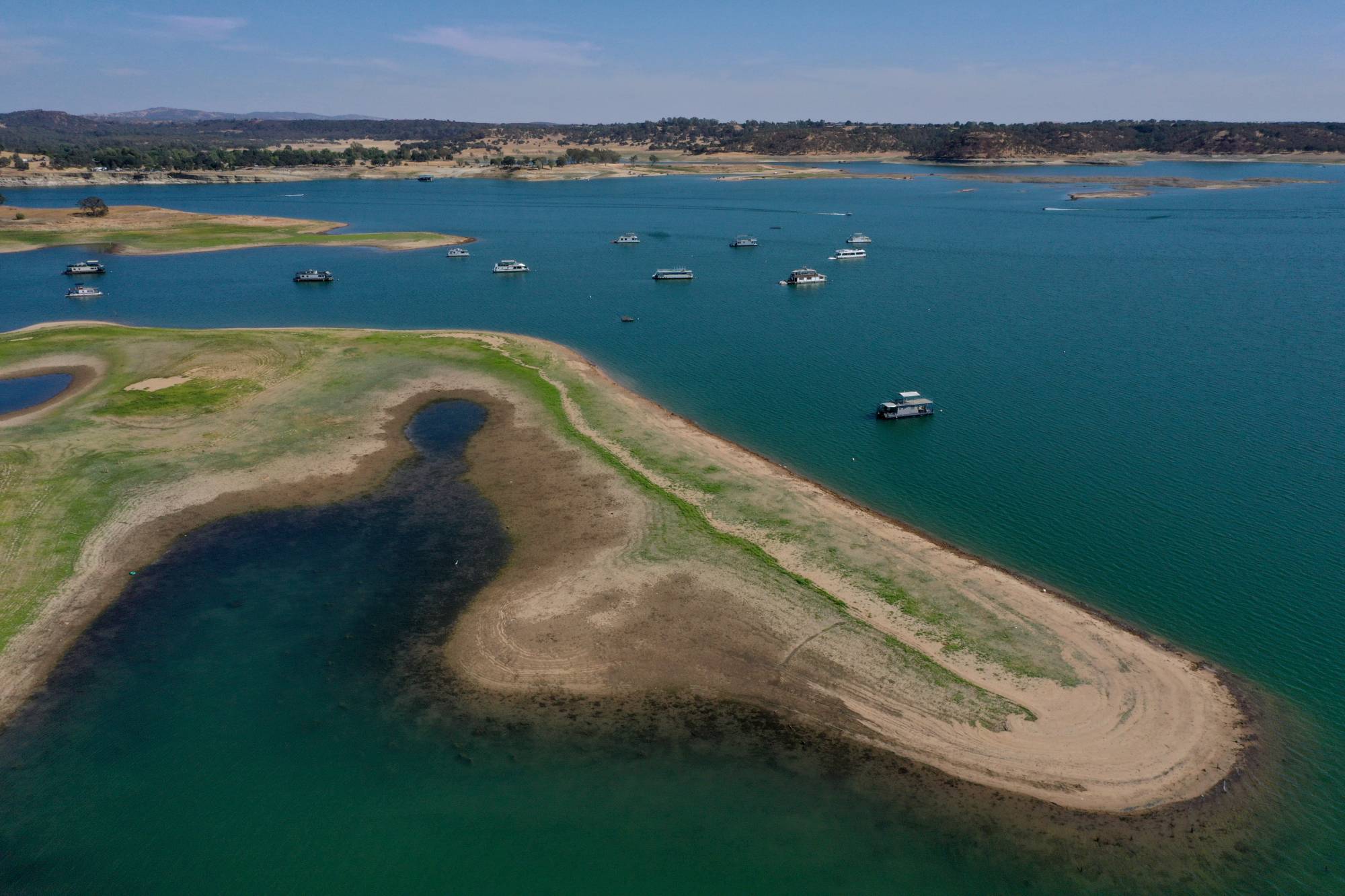
"caption": "The Camanche Reservoir at 44% capacity is seen from this drone view in Ione, California, on July 22, 2021. ",
"credit": "Jane Tyska/Digital First Media/East Bay Times via Getty Images",
"altTag": null,
"description": null,
"imgSizes": {
"medium": {
"file": "https://cdn.kqed.org/wp-content/uploads/sites/10/2026/05/GettyImages-1331194473-2000x1333.jpg",
"width": 2000,
"height": 1333,
"mimeType": "image/jpeg"
},
"large": {
"file": "https://cdn.kqed.org/wp-content/uploads/sites/10/2026/05/GettyImages-1331194473-2000x1333.jpg",
"width": 2000,
"height": 1333,
"mimeType": "image/jpeg"
},
"thumbnail": {
"file": "https://cdn.kqed.org/wp-content/uploads/sites/10/2026/05/GettyImages-1331194473-160x107.jpg",
"width": 160,
"height": 107,
"mimeType": "image/jpeg"
},
"1536x1536": {
"file": "https://cdn.kqed.org/wp-content/uploads/sites/10/2026/05/GettyImages-1331194473-1536x1024.jpg",
"width": 1536,
"height": 1024,
"mimeType": "image/jpeg"
},
"2048x2048": {
"file": "https://cdn.kqed.org/wp-content/uploads/sites/10/2026/05/GettyImages-1331194473-2048x1365.jpg",
"width": 2048,
"height": 1365,
"mimeType": "image/jpeg"
},
"post-thumbnail": {
"file": "https://cdn.kqed.org/wp-content/uploads/sites/10/2026/05/GettyImages-1331194473-672x372.jpg",
"width": 672,
"height": 372,
"mimeType": "image/jpeg"
},
"twentyfourteen-full-width": {
"file": "https://cdn.kqed.org/wp-content/uploads/sites/10/2026/05/GettyImages-1331194473-1038x576.jpg",
"width": 1038,
"height": 576,
"mimeType": "image/jpeg"
},
"full-width": {
"file": "https://cdn.kqed.org/wp-content/uploads/sites/10/2026/05/GettyImages-1331194473-2000x1333.jpg",
"width": 2000,
"height": 1333,
"mimeType": "image/jpeg"
},
"npr-cds-wide": {
"file": "https://cdn.kqed.org/wp-content/uploads/sites/10/2026/05/GettyImages-1331194473-1200x675.jpg",
"width": 1200,
"height": 675,
"mimeType": "image/jpeg"
},
"npr-cds-square": {
"file": "https://cdn.kqed.org/wp-content/uploads/sites/10/2026/05/GettyImages-1331194473-600x600.jpg",
"width": 600,
"height": 600,
"mimeType": "image/jpeg"
},
"kqedFullSize": {
"file": "https://cdn.kqed.org/wp-content/uploads/sites/10/2026/05/GettyImages-1331194473-scaled.jpg",
"width": 2560,
"height": 1707
}
},
"isLoading": false,
"fetchFailed": false
},
"news_12039779": {
"type": "attachments",
"id": "news_12039779",
"meta": {
"index": "attachments_1716263798",
"site": "news",
"id": "12039779",
"found": true
},
"title": "A mural depicts downtown Benicia in the city on May 8, 2025.",
"publishDate": 1747078191,
"status": "inherit",
"parent": 12039505,
"modified": 1747078201,
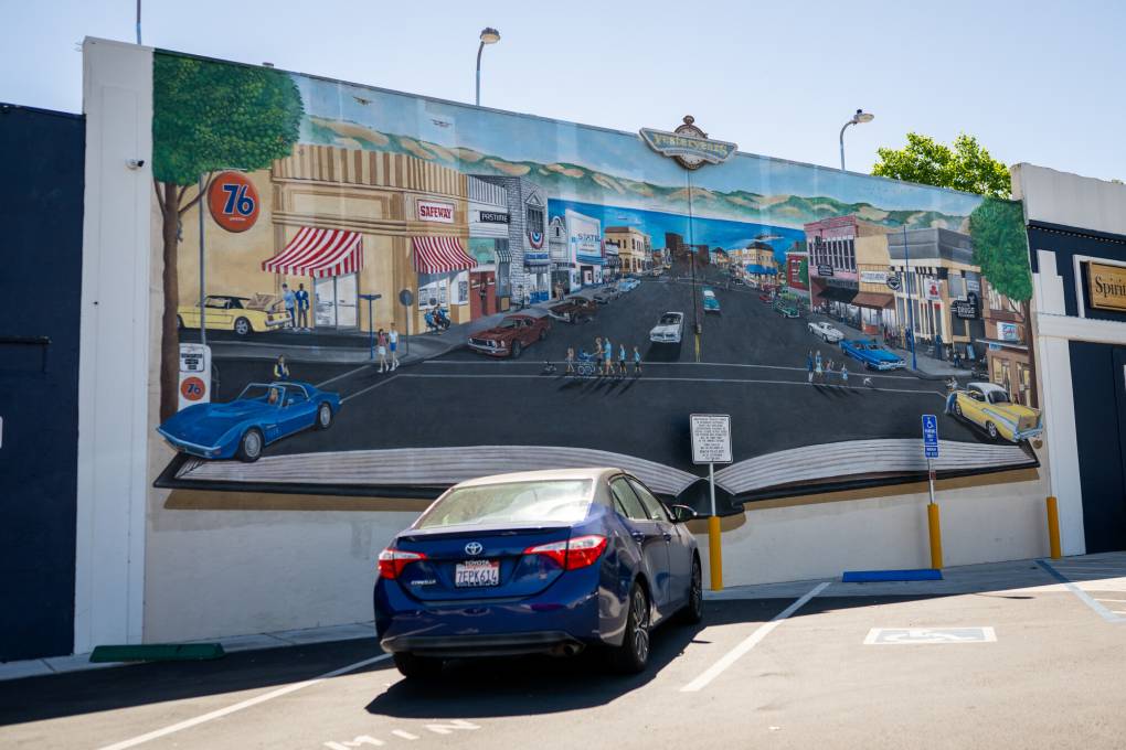
"caption": "A mural depicts downtown Benicia in the city on May 8, 2025.",
"credit": "Beth LaBerge/KQED",
"altTag": null,
"description": null,
"imgSizes": {
"medium": {
"file": "https://cdn.kqed.org/wp-content/uploads/sites/10/2025/05/250509-BeniciaRefinery-60-BL_qed-800x533.jpg",
"width": 800,
"height": 533,
"mimeType": "image/jpeg"
},
"large": {
"file": "https://cdn.kqed.org/wp-content/uploads/sites/10/2025/05/250509-BeniciaRefinery-60-BL_qed-1020x680.jpg",
"width": 1020,
"height": 680,
"mimeType": "image/jpeg"
},
"thumbnail": {
"file": "https://cdn.kqed.org/wp-content/uploads/sites/10/2025/05/250509-BeniciaRefinery-60-BL_qed-160x107.jpg",
"width": 160,
"height": 107,
"mimeType": "image/jpeg"
},
"1536x1536": {
"file": "https://cdn.kqed.org/wp-content/uploads/sites/10/2025/05/250509-BeniciaRefinery-60-BL_qed-1536x1024.jpg",
"width": 1536,
"height": 1024,
"mimeType": "image/jpeg"
},
"post-thumbnail": {
"file": "https://cdn.kqed.org/wp-content/uploads/sites/10/2025/05/250509-BeniciaRefinery-60-BL_qed-672x372.jpg",
"width": 672,
"height": 372,
"mimeType": "image/jpeg"
},
"twentyfourteen-full-width": {
"file": "https://cdn.kqed.org/wp-content/uploads/sites/10/2025/05/250509-BeniciaRefinery-60-BL_qed-1038x576.jpg",
"width": 1038,
"height": 576,
"mimeType": "image/jpeg"
},
"full-width": {
"file": "https://cdn.kqed.org/wp-content/uploads/sites/10/2025/05/250509-BeniciaRefinery-60-BL_qed-1920x1280.jpg",
"width": 1920,
"height": 1280,
"mimeType": "image/jpeg"
},
"kqedFullSize": {
"file": "https://cdn.kqed.org/wp-content/uploads/sites/10/2025/05/250509-BeniciaRefinery-60-BL_qed.jpg",
"width": 2000,
"height": 1333
}
},
"isLoading": false,
"fetchFailed": false
},
"news_11974719": {
"type": "attachments",
"id": "news_11974719",
"meta": {
"index": "attachments_1716263798",
"site": "news",
"id": "11974719",
"found": true
},
"title": "California Storms",
"publishDate": 1707161263,
"status": "inherit",
"parent": 11974714,
"modified": 1778800665,
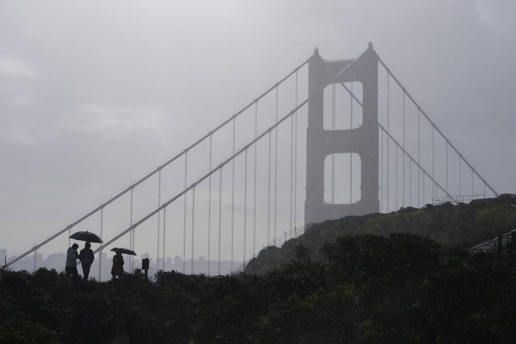
"caption": "People walk in the rain as a storm moves through with the Golden Gate Bridge in the background near Sausalito, California, Monday, Feb. 5, 2024.",
"credit": "Eric Risberg/AP Photo",
"altTag": "People walk in the rain as a storm moves through, with the Golden Gate Bridge in the background.",
"description": null,
"imgSizes": {
"medium": {
"file": "https://cdn.kqed.org/wp-content/uploads/sites/10/2024/02/AP24036658778995-800x533.jpg",
"width": 800,
"height": 533,
"mimeType": "image/jpeg"
},
"large": {
"file": "https://cdn.kqed.org/wp-content/uploads/sites/10/2024/02/AP24036658778995-1020x680.jpg",
"width": 1020,
"height": 680,
"mimeType": "image/jpeg"
},
"thumbnail": {
"file": "https://cdn.kqed.org/wp-content/uploads/sites/10/2024/02/AP24036658778995-160x107.jpg",
"width": 160,
"height": 107,
"mimeType": "image/jpeg"
},
"1536x1536": {
"file": "https://cdn.kqed.org/wp-content/uploads/sites/10/2024/02/AP24036658778995-1536x1024.jpg",
"width": 1536,
"height": 1024,
"mimeType": "image/jpeg"
},
"2048x2048": {
"file": "https://cdn.kqed.org/wp-content/uploads/sites/10/2024/02/AP24036658778995-2048x1365.jpg",
"width": 2048,
"height": 1365,
"mimeType": "image/jpeg"
},
"post-thumbnail": {
"file": "https://cdn.kqed.org/wp-content/uploads/sites/10/2024/02/AP24036658778995-672x372.jpg",
"width": 672,
"height": 372,
"mimeType": "image/jpeg"
},
"twentyfourteen-full-width": {
"file": "https://cdn.kqed.org/wp-content/uploads/sites/10/2024/02/AP24036658778995-1038x576.jpg",
"width": 1038,
"height": 576,
"mimeType": "image/jpeg"
},
"full-width": {
"file": "https://cdn.kqed.org/wp-content/uploads/sites/10/2024/02/AP24036658778995-1920x1280.jpg",
"width": 1920,
"height": 1280,
"mimeType": "image/jpeg"
},
"kqedFullSize": {
"file": "https://cdn.kqed.org/wp-content/uploads/sites/10/2024/02/AP24036658778995-scaled.jpg",
"width": 2560,
"height": 1707
}
},
"isLoading": false,
"fetchFailed": false
},
"news_12080166": {
"type": "attachments",
"id": "news_12080166",
"meta": {
"index": "attachments_1716263798",
"site": "news",
"id": "12080166",
"found": true
},
"title": "A view of the San Francisco skyline from Dolores Park on April 15, 2026.",
"publishDate": 1776296693,
"status": "inherit",
"parent": 0,
"modified": 1776296708,
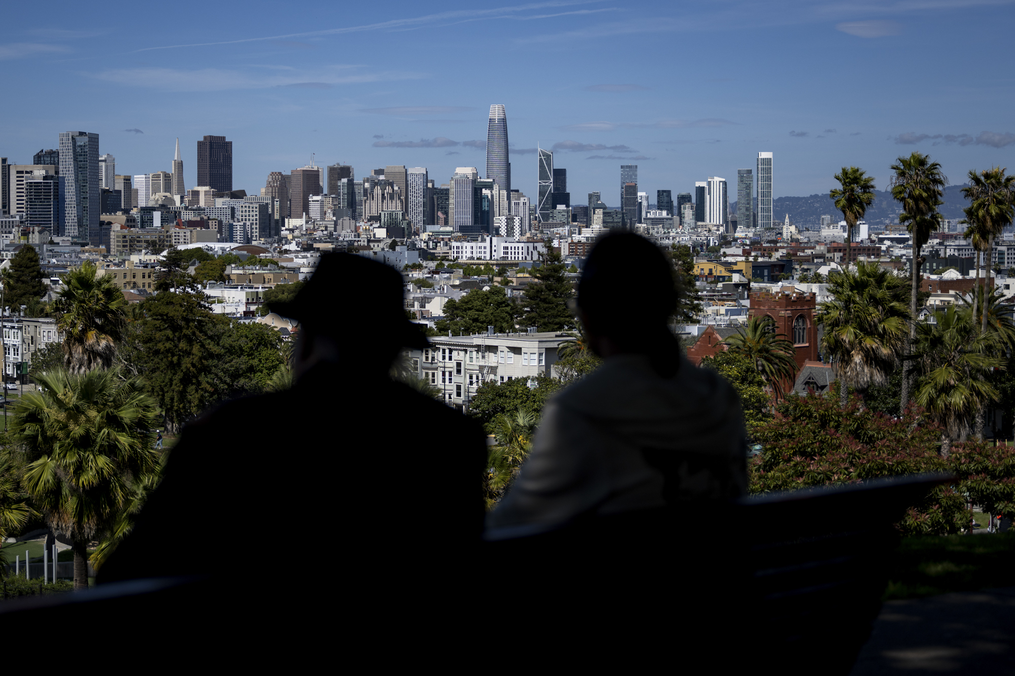
"caption": "A view of the San Francisco skyline from Dolores Park on April 15, 2026.",
"credit": "Beth LaBerge/KQED",
"altTag": null,
"description": null,
"imgSizes": {
"thumbnail": {
"file": "https://cdn.kqed.org/wp-content/uploads/sites/10/2026/04/260415-SPUREARTHQUAKE-06-BL-KQED-160x107.jpg",
"width": 160,
"height": 107,
"mimeType": "image/jpeg"
},
"1536x1536": {
"file": "https://cdn.kqed.org/wp-content/uploads/sites/10/2026/04/260415-SPUREARTHQUAKE-06-BL-KQED-1536x1024.jpg",
"width": 1536,
"height": 1024,
"mimeType": "image/jpeg"
},
"post-thumbnail": {
"file": "https://cdn.kqed.org/wp-content/uploads/sites/10/2026/04/260415-SPUREARTHQUAKE-06-BL-KQED-672x372.jpg",
"width": 672,
"height": 372,
"mimeType": "image/jpeg"
},
"twentyfourteen-full-width": {
"file": "https://cdn.kqed.org/wp-content/uploads/sites/10/2026/04/260415-SPUREARTHQUAKE-06-BL-KQED-1038x576.jpg",
"width": 1038,
"height": 576,
"mimeType": "image/jpeg"
},
"npr-cds-wide": {
"file": "https://cdn.kqed.org/wp-content/uploads/sites/10/2026/04/260415-SPUREARTHQUAKE-06-BL-KQED-1200x675.jpg",
"width": 1200,
"height": 675,
"mimeType": "image/jpeg"
},
"npr-cds-square": {
"file": "https://cdn.kqed.org/wp-content/uploads/sites/10/2026/04/260415-SPUREARTHQUAKE-06-BL-KQED-600x600.jpg",
"width": 600,
"height": 600,
"mimeType": "image/jpeg"
},
"kqedFullSize": {
"file": "https://cdn.kqed.org/wp-content/uploads/sites/10/2026/04/260415-SPUREARTHQUAKE-06-BL-KQED.jpg",
"width": 2000,
"height": 1333
}
},
"isLoading": false,
"fetchFailed": false
}
},
"audioPlayerReducer": {
"postId": "stream_live",
"isPaused": true,
"isPlaying": false,
"pfsActive": false,
"pledgeModalIsOpen": true,
"playerDrawerIsOpen": false,
"liveAudioPlayStartedAt": 0,
"liveAudioPlayContext": ""
},
"authorsReducer": {
"jsmall": {
"type": "authors",
"id": "6625",
"meta": {
"index": "authors_1716337520",
"id": "6625",
"found": true
},
"name": "Julie Small",
"firstName": "Julie",
"lastName": "Small",
"slug": "jsmall",
"email": "jsmall@kqed.org",
"display_author_email": true,
"staff_mastheads": [
"news"
],
"title": "KQED Contributor",
"bio": "Julie Small reports on criminal justice and immigration.\r\n\r\nShe was part of a team at KQED awarded a regional 2019 Edward R. Murrow award for continuing coverage of the Trump Administration's family separation policy.\r\n\r\nThe Society for Professional Journalists recognized Julie's 2018 \u003ca href=\"https://www.kqed.org/news/11636262/the-officer-tased-him-31-times-the-sheriff-called-his-death-an-accident\">reporting\u003c/a> on the San Joaquin County Sheriff's \u003ca href=\"https://www.kqed.org/news/11634689/autopsy-doctors-sheriff-overrode-death-findings-to-protect-law-enforcement\">interference\u003c/a> in death investigations with an Excellence in Journalism Award for Ongoing Coverage.\r\n\r\nJulie's\u003ca href=\"https://www.kqed.org/news/11039666/two-mentally-ill-inmates-died-one-month-in-santa-clara\"> reporting\u003c/a> with Lisa Pickoff-White on the treatment of mentally ill offenders in California jails earned a 2017 regional Edward R. Murrow Award for news reporting and an investigative reporting award from the SPJ of Northern California.\r\n\r\nBefore joining KQED, Julie covered government and politics in Sacramento for Southern California Public Radio (SCPR). Her 2010 \u003ca href=\"https://www.scpr.org/specials/prisonmedical/\">series\u003c/a> on lapses in California’s prison medical care also won a regional Edward R. Murrow Award for investigative reporting and a Golden Mic Award from the RTNDA of Southern California.\r\n\r\nJulie began her career in journalism in 2000 as the deputy foreign editor for public radio's \u003cem>Marketplace, \u003c/em>while earning her master's degree in journalism from USC’s Annenberg School of Communication.",
"avatar": "https://secure.gravatar.com/avatar/4baedf201468df97be97c2a9dd7585d0?s=600&d=blank&r=g",
"twitter": "@SmallRadio2",
"facebook": null,
"instagram": null,
"linkedin": null,
"sites": [
{
"site": "news",
"roles": [
"editor"
]
},
{
"site": "stateofhealth",
"roles": [
"author"
]
},
{
"site": "science",
"roles": [
"author"
]
}
],
"headData": {
"title": "Julie Small | KQED",
"description": "KQED Contributor",
"ogImgSrc": "https://secure.gravatar.com/avatar/4baedf201468df97be97c2a9dd7585d0?s=600&d=blank&r=g",
"twImgSrc": "https://secure.gravatar.com/avatar/4baedf201468df97be97c2a9dd7585d0?s=600&d=blank&r=g"
},
"isLoading": false,
"link": "/author/jsmall"
},
"ecruzguevarra": {
"type": "authors",
"id": "8654",
"meta": {
"index": "authors_1716337520",
"id": "8654",
"found": true
},
"name": "Ericka Cruz Guevarra",
"firstName": "Ericka",
"lastName": "Cruz Guevarra",
"slug": "ecruzguevarra",
"email": "ecruzguevarra@kqed.org",
"display_author_email": true,
"staff_mastheads": [
"news"
],
"title": "Producer, The Bay Podcast",
"bio": "Ericka Cruz Guevarra is host of \u003ca href=\"https://www.kqed.org/podcasts/thebay\">\u003cem>The Bay\u003c/em>\u003c/a> podcast at KQED. Before host, she was the show’s producer. Her work in that capacity includes a three-part reported series on policing in Vallejo, which won a 2020 excellence in journalism award from the Society of Professional Journalists. Ericka has worked as a breaking news reporter at Oregon Public Broadcasting, helped produce the Code Switch podcast, and was KQED’s inaugural Raul Ramirez Diversity Fund intern. She’s also an alumna of NPR’s Next Generation Radio program. Send her an email if you have strong feelings about whether Fairfield and Suisun City are the Bay. Ericka is represented by SAG-AFTRA.",
"avatar": "https://secure.gravatar.com/avatar/accefc1de4bafc7e234b69bcb9b6f6536c130fd84709bc3069ef11a78787e1bb?s=600&d=blank&r=g",
"twitter": "NotoriousECG",
"bluesky": null,
"facebook": null,
"instagram": null,
"linkedin": null,
"sites": [
{
"site": "arts",
"roles": [
"subscriber"
]
},
{
"site": "news",
"roles": [
"editor",
"manage_categories"
]
},
{
"site": "futureofyou",
"roles": [
"subscriber"
]
},
{
"site": "stateofhealth",
"roles": [
"subscriber"
]
},
{
"site": "science",
"roles": [
"editor"
]
},
{
"site": "forum",
"roles": [
"subscriber"
]
}
],
"headData": {
"title": "Ericka Cruz Guevarra | KQED",
"description": "Producer, The Bay Podcast",
"ogImgSrc": "https://secure.gravatar.com/avatar/accefc1de4bafc7e234b69bcb9b6f6536c130fd84709bc3069ef11a78787e1bb?s=600&d=blank&r=g",
"twImgSrc": "https://secure.gravatar.com/avatar/accefc1de4bafc7e234b69bcb9b6f6536c130fd84709bc3069ef11a78787e1bb?s=600&d=blank&r=g"
},
"isLoading": false,
"link": "/author/ecruzguevarra"
},
"amontecillo": {
"type": "authors",
"id": "11649",
"meta": {
"index": "authors_1716337520",
"id": "11649",
"found": true
},
"name": "Alan Montecillo",
"firstName": "Alan",
"lastName": "Montecillo",
"slug": "amontecillo",
"email": "amontecillo@kqed.org",
"display_author_email": false,
"staff_mastheads": [
"news"
],
"title": "KQED Contributor",
"bio": "Alan Montecillo is the senior editor of \u003cem>\u003ca href=\"http://kqed.org/thebay\">The Bay\u003c/a>, \u003c/em> KQED's local news podcast. Before moving to the Bay Area, he worked as a senior talk show producer for WILL in Champaign-Urbana, Illinois and at Oregon Public Broadcasting in Portland, Oregon. He has won journalism awards from the Society of Professional Journalists Northern California, the Public Media Journalists Association, The Signal Awards, and has also received a regional Edward R. Murrow award. Alan is a Filipino American from Hong Kong and a graduate of Reed College.",
"avatar": "https://secure.gravatar.com/avatar/268f53a2066899ea9efdd8a5900218b17c822d9862cbc9326cccec53ef41d349?s=600&d=blank&r=g",
"twitter": "alanmontecillo",
"bluesky": null,
"facebook": null,
"instagram": null,
"linkedin": null,
"sites": [
{
"site": "",
"roles": [
"editor"
]
},
{
"site": "news",
"roles": [
"editor",
"manage_categories"
]
}
],
"headData": {
"title": "Alan Montecillo | KQED",
"description": "KQED Contributor",
"ogImgSrc": "https://secure.gravatar.com/avatar/268f53a2066899ea9efdd8a5900218b17c822d9862cbc9326cccec53ef41d349?s=600&d=blank&r=g",
"twImgSrc": "https://secure.gravatar.com/avatar/268f53a2066899ea9efdd8a5900218b17c822d9862cbc9326cccec53ef41d349?s=600&d=blank&r=g"
},
"isLoading": false,
"link": "/author/amontecillo"
},
"eromero": {
"type": "authors",
"id": "11746",
"meta": {
"index": "authors_1716337520",
"id": "11746",
"found": true
},
"name": "Ezra David Romero",
"firstName": "Ezra David",
"lastName": "Romero",
"slug": "eromero",
"email": "eromero@kqed.org",
"display_author_email": true,
"staff_mastheads": [
"news",
"science"
],
"title": "Climate Reporter",
"bio": "Ezra David Romero is a climate reporter for KQED News. He covers the absence and excess of water in the Bay Area — think sea level rise, flooding and drought. For nearly a decade he’s covered how warming temperatures are altering the lives of Californians. He’s reported on farmers worried their pistachio trees aren’t getting enough sleep, families desperate for water, scientists studying dying giant sequoias, and alongside firefighters containing wildfires. His work has appeared on local stations across California and nationally on public radio shows like Morning Edition, Here and Now, All Things Considered and Science Friday. ",
"avatar": "https://secure.gravatar.com/avatar/c76404d287c10ed40224227551ac36e24352c7306f106632caf6fead76f8801f?s=600&d=blank&r=g",
"twitter": "ezraromero",
"bluesky": null,
"facebook": null,
"instagram": null,
"linkedin": null,
"sites": [
{
"site": "arts",
"roles": [
"editor"
]
},
{
"site": "news",
"roles": [
"editor"
]
},
{
"site": "science",
"roles": [
"editor"
]
},
{
"site": "liveblog",
"roles": [
"author"
]
}
],
"headData": {
"title": "Ezra David Romero | KQED",
"description": "Climate Reporter",
"ogImgSrc": "https://secure.gravatar.com/avatar/c76404d287c10ed40224227551ac36e24352c7306f106632caf6fead76f8801f?s=600&d=blank&r=g",
"twImgSrc": "https://secure.gravatar.com/avatar/c76404d287c10ed40224227551ac36e24352c7306f106632caf6fead76f8801f?s=600&d=blank&r=g"
},
"isLoading": false,
"link": "/author/eromero"
},
"adahlstromeckman": {
"type": "authors",
"id": "11785",
"meta": {
"index": "authors_1716337520",
"id": "11785",
"found": true
},
"name": "Azul Dahlstrom-Eckman",
"firstName": "Azul",
"lastName": "Dahlstrom-Eckman",
"slug": "adahlstromeckman",
"email": "adahlstrom-eckman@kqed.org",
"display_author_email": true,
"staff_mastheads": [],
"title": "Reporter",
"bio": "Azul is a reporter for KQED focusing on transportation and features. He joined KQED in 2021 as an alumna of KALW's Audio Academy radio journalism training program.",
"avatar": "https://secure.gravatar.com/avatar/9cb750298435add7815a777f55bf1f46845c1386bb8452555c60a7b820b5aba3?s=600&d=blank&r=g",
"twitter": "@zuliemann",
"bluesky": "@azul415.bsky.social",
"facebook": null,
"instagram": null,
"linkedin": null,
"sites": [
{
"site": "arts",
"roles": [
"editor"
]
},
{
"site": "news",
"roles": [
"editor"
]
},
{
"site": "science",
"roles": [
"editor"
]
},
{
"site": "liveblog",
"roles": [
"author"
]
}
],
"headData": {
"title": "Azul Dahlstrom-Eckman | KQED",
"description": "Reporter",
"ogImgSrc": "https://secure.gravatar.com/avatar/9cb750298435add7815a777f55bf1f46845c1386bb8452555c60a7b820b5aba3?s=600&d=blank&r=g",
"twImgSrc": "https://secure.gravatar.com/avatar/9cb750298435add7815a777f55bf1f46845c1386bb8452555c60a7b820b5aba3?s=600&d=blank&r=g"
},
"isLoading": false,
"link": "/author/adahlstromeckman"
},
"jessicakariisa": {
"type": "authors",
"id": "11831",
"meta": {
"index": "authors_1716337520",
"id": "11831",
"found": true
},
"name": "Jessica Kariisa",
"firstName": "Jessica",
"lastName": "Kariisa",
"slug": "jessicakariisa",
"email": "jkariisa@kqed.org",
"display_author_email": false,
"staff_mastheads": [],
"title": "Producer, The Bay",
"bio": "Jessica Kariisa is the producer of The Bay. She first joined KQED as an intern for The California Report Magazine, after which she became an on-call producer. She reported a Bay Curious episode on the use of rap lyrics in criminal trials which won a Society of Professional Journalists award in 2023 for Excellence in Features Journalism and the 2023 Signal Award for Best Conversation Starter. She’s worked on podcasts for Snap Judgment and American Public Media. Before embarking on her audio career, she was a music journalist.\r\n\r\nJessica Kariisa is represented by SAG-AFTRA.",
"avatar": "https://secure.gravatar.com/avatar/522e97b28ac0b3d411621c0fde8f3419c7b71ea2c5c262c57c4bb600963f328c?s=600&d=blank&r=g",
"twitter": null,
"bluesky": null,
"facebook": null,
"instagram": null,
"linkedin": null,
"sites": [
{
"site": "arts",
"roles": [
"author"
]
},
{
"site": "news",
"roles": [
"editor",
"manage_categories"
]
}
],
"headData": {
"title": "Jessica Kariisa | KQED",
"description": "Producer, The Bay",
"ogImgSrc": "https://secure.gravatar.com/avatar/522e97b28ac0b3d411621c0fde8f3419c7b71ea2c5c262c57c4bb600963f328c?s=600&d=blank&r=g",
"twImgSrc": "https://secure.gravatar.com/avatar/522e97b28ac0b3d411621c0fde8f3419c7b71ea2c5c262c57c4bb600963f328c?s=600&d=blank&r=g"
},
"isLoading": false,
"link": "/author/jessicakariisa"
},
"kdebenedetti": {
"type": "authors",
"id": "11913",
"meta": {
"index": "authors_1716337520",
"id": "11913",
"found": true
},
"name": "Katie DeBenedetti",
"firstName": "Katie",
"lastName": "DeBenedetti",
"slug": "kdebenedetti",
"email": "kdebenedetti@kqed.org",
"display_author_email": false,
"staff_mastheads": [
"news",
"science"
],
"title": "KQED Contributor",
"bio": "Katie DeBenedetti is a digital reporter covering daily news for the Express Desk. Prior to joining KQED as a culture reporting intern in January 2024, she covered education and city government for the Napa Valley Register.",
"avatar": "https://secure.gravatar.com/avatar/6e31073cb8f7e4214ab03f42771d0f45?s=600&d=blank&r=g",
"twitter": null,
"facebook": null,
"instagram": null,
"linkedin": null,
"sites": [
{
"site": "news",
"roles": [
"author"
]
},
{
"site": "science",
"roles": [
"author"
]
},
{
"site": "liveblog",
"roles": [
"author"
]
}
],
"headData": {
"title": "Katie DeBenedetti | KQED",
"description": "KQED Contributor",
"ogImgSrc": "https://secure.gravatar.com/avatar/6e31073cb8f7e4214ab03f42771d0f45?s=600&d=blank&r=g",
"twImgSrc": "https://secure.gravatar.com/avatar/6e31073cb8f7e4214ab03f42771d0f45?s=600&d=blank&r=g"
},
"isLoading": false,
"link": "/author/kdebenedetti"
},
"skennedy": {
"type": "authors",
"id": "11935",
"meta": {
"index": "authors_1716337520",
"id": "11935",
"found": true
},
"name": "Samantha Kennedy",
"firstName": "Samantha",
"lastName": "Kennedy",
"slug": "skennedy",
"email": "SKennedy@kqed.org",
"display_author_email": false,
"staff_mastheads": [],
"title": "KQED Contributor",
"bio": null,
"avatar": "https://secure.gravatar.com/avatar/adc7b14bf1e801793202a156ecc864d4ad505b0fd63162a2f3da0e5ba57222d0?s=600&d=blank&r=g",
"twitter": null,
"bluesky": null,
"facebook": null,
"instagram": null,
"linkedin": null,
"sites": [
{
"site": "arts",
"roles": [
"author"
]
},
{
"site": "news",
"roles": [
"editor"
]
},
{
"site": "science",
"roles": [
"editor"
]
}
],
"headData": {
"title": "Samantha Kennedy | KQED",
"description": "KQED Contributor",
"ogImgSrc": "https://secure.gravatar.com/avatar/adc7b14bf1e801793202a156ecc864d4ad505b0fd63162a2f3da0e5ba57222d0?s=600&d=blank&r=g",
"twImgSrc": "https://secure.gravatar.com/avatar/adc7b14bf1e801793202a156ecc864d4ad505b0fd63162a2f3da0e5ba57222d0?s=600&d=blank&r=g"
},
"isLoading": false,
"link": "/author/skennedy"
},
"sarahwright": {
"type": "authors",
"id": "11956",
"meta": {
"index": "authors_1716337520",
"id": "11956",
"found": true
},
"name": "Sarah Wright",
"firstName": "Sarah",
"lastName": "Wright",
"slug": "sarahwright",
"email": "swright@kqed.org",
"display_author_email": true,
"staff_mastheads": [],
"title": "Outdoors Engagement Reporter",
"bio": "Sarah Wright is KQED's Outdoors Engagement Reporter. Originally from Lake Tahoe, she completed a thru-hike of the Pacific Crest Trail in 2019 and was a U.S. Fulbright Program grantee to Argentina in 2023. Her journalism has appeared in The Guardian, The San Francisco Standard, The Palo Alto Weekly and the Half Moon Bay Review.",
"avatar": "https://secure.gravatar.com/avatar/c161a3d6441865cba25e6db4fa561099ad665799e9432e34da2b84d7e371524c?s=600&d=blank&r=g",
"twitter": null,
"bluesky": null,
"facebook": null,
"instagram": null,
"linkedin": null,
"sites": [
{
"site": "arts",
"roles": [
"editor"
]
},
{
"site": "news",
"roles": [
"editor"
]
},
{
"site": "science",
"roles": [
"contributor",
"author"
]
},
{
"site": "forum",
"roles": [
"editor"
]
}
],
"headData": {
"title": "Sarah Wright | KQED",
"description": "Outdoors Engagement Reporter",
"ogImgSrc": "https://secure.gravatar.com/avatar/c161a3d6441865cba25e6db4fa561099ad665799e9432e34da2b84d7e371524c?s=600&d=blank&r=g",
"twImgSrc": "https://secure.gravatar.com/avatar/c161a3d6441865cba25e6db4fa561099ad665799e9432e34da2b84d7e371524c?s=600&d=blank&r=g"
},
"isLoading": false,
"link": "/author/sarahwright"
},
"aaliahmad": {
"type": "authors",
"id": "11986",
"meta": {
"index": "authors_1716337520",
"id": "11986",
"found": true
},
"name": "Ayah Ali-Ahmad",
"firstName": "Ayah",
"lastName": "Ali-Ahmad",
"slug": "aaliahmad",
"email": "aaliahmad@KQED.org",
"display_author_email": false,
"staff_mastheads": [],
"title": "KQED Contributor",
"bio": null,
"avatar": "https://secure.gravatar.com/avatar/1cf54f187a5e1064b2cfef3f3d2f1e4f93e453395d56912aca6382a6071ec3ed?s=600&d=blank&r=g",
"twitter": "ayahaliahmad",
"bluesky": null,
"facebook": null,
"instagram": null,
"linkedin": null,
"sites": [
{
"site": "news",
"roles": [
"subscriber"
]
}
],
"headData": {
"title": "Ayah Ali-Ahmad | KQED",
"description": "KQED Contributor",
"ogImgSrc": "https://secure.gravatar.com/avatar/1cf54f187a5e1064b2cfef3f3d2f1e4f93e453395d56912aca6382a6071ec3ed?s=600&d=blank&r=g",
"twImgSrc": "https://secure.gravatar.com/avatar/1cf54f187a5e1064b2cfef3f3d2f1e4f93e453395d56912aca6382a6071ec3ed?s=600&d=blank&r=g"
},
"isLoading": false,
"link": "/author/aaliahmad"
},
"ejackson": {
"type": "authors",
"id": "12003",
"meta": {
"index": "authors_1716337520",
"id": "12003",
"found": true
},
"name": "Ella Jackson",
"firstName": "Ella",
"lastName": "Jackson",
"slug": "ejackson",
"email": "ejackson@kqed.org",
"display_author_email": false,
"staff_mastheads": [],
"title": "KQED Contributor",
"bio": null,
"avatar": "https://secure.gravatar.com/avatar/3c688edc62aec1dcae096e1475956d245f72bde99cff316455871c9b22a7205b?s=600&d=blank&r=g",
"twitter": null,
"bluesky": null,
"facebook": null,
"instagram": null,
"linkedin": null,
"sites": [
{
"site": "news",
"roles": [
"author"
]
},
{
"site": "science",
"roles": [
"author"
]
}
],
"headData": {
"title": "Ella Jackson | KQED",
"description": "KQED Contributor",
"ogImgSrc": "https://secure.gravatar.com/avatar/3c688edc62aec1dcae096e1475956d245f72bde99cff316455871c9b22a7205b?s=600&d=blank&r=g",
"twImgSrc": "https://secure.gravatar.com/avatar/3c688edc62aec1dcae096e1475956d245f72bde99cff316455871c9b22a7205b?s=600&d=blank&r=g"
},
"isLoading": false,
"link": "/author/ejackson"
}
},
"pagesReducer": {
"news_tag_climate": {
"type": "terms",
"id": "news_19204",
"meta": {
"index": "terms_1716263798",
"site": "news",
"id": "19204",
"score": 7.059354
},
"featImg": null,
"name": "climate",
"description": null,
"taxonomy": "tag",
"headData": {
"twImgId": null,
"twTitle": null,
"ogTitle": null,
"ogImgId": null,
"twDescription": null,
"description": null,
"title": "climate Archives | KQED News",
"ogDescription": null
},
"ttid": 19221,
"slug": "climate",
"isLoading": false,
"title": "climate",
"pageMeta": {
"site": "news",
"WpPageTemplate": "page-topic-editorial",
"currentPage": 5
},
"blocks": [
{
"blockName": "kqed/post-list",
"attrs": {
"layout": "cardArticle2",
"query": "posts/news?tag=climate",
"seeMore": false,
"paginated": true,
"page": 5
}
},
{
"blockName": "kqed/ad"
}
]
}
},
"pfsSessionReducer": {},
"postsReducer": {
"stream_live": {
"type": "live",
"id": "stream_live",
"audioUrl": "https://streams.kqed.org/kqedradio",
"title": "Live Stream",
"excerpt": "Live Stream information currently unavailable.",
"link": "/radio",
"featImg": "",
"label": {
"name": "KQED Live",
"link": "/"
}
},
"stream_kqedNewscast": {
"type": "posts",
"id": "stream_kqedNewscast",
"audioUrl": "https://www.kqed.org/.stream/anon/radio/RDnews/newscast.mp3?_=1",
"title": "KQED Newscast",
"featImg": "",
"label": {
"name": "88.5 FM",
"link": "/"
}
},
"news_12088658": {
"type": "posts",
"id": "news_12088658",
"meta": {
"index": "posts_1716263798",
"site": "news",
"id": "12088658",
"score": null,
"sort": [
1782323627000
]
},
"guestAuthors": [],
"slug": "magnitude-5-6-earthquake-in-mendocino-county-alerts-bay-area",
"title": "Magnitude 5.6 Earthquake in Mendocino County Alerts Bay Area",
"publishDate": 1782323627,
"format": "standard",
"headTitle": "Magnitude 5.6 Earthquake in Mendocino County Alerts Bay Area | KQED",
"labelTerm": {
"site": "news"
},
"content": "\u003cp>A magnitude 5.6 earthquake struck rural \u003ca href=\"https://www.kqed.org/news/tag/northern-california\">Northern California\u003c/a> on Wednesday morning, and people more than 150 miles away felt the ground move.\u003c/p>\n\u003cp>The quake hit Mendocino County at 8:10 a.m. about halfway between Willits and Ukiah, according to the U.S. Geological Survey. Elizabeth Cochran, a USGS seismologist, said a quake that size produces strong shaking near its source, but its seismic waves travel far.\u003c/p>\n\u003cp>Reports of shaking came in from near Eureka in the north to the northern Bay Area and east to the California-Nevada border — and, according to the USGS, as far south as San José and Sacramento.\u003c/p>\n\u003cp>[ad fullwidth]\u003c/p>\n\u003cp>What that felt like depended heavily on distance. Close to the epicenter, Cochran said, people experienced “very strong to severe shaking,” and the kind that is “quite frightening” and impossible to ignore.\u003c/p>\n\u003cp>Farther south, in the northern Bay Area, most people likely felt nothing, and those who did felt only a faint tremor.\u003c/p>\n\u003cp>“You might wonder, oh, did a truck just drive by or was that an earthquake,” she said.[aside postID=news_12080455 hero='https://cdn.kqed.org/wp-content/uploads/sites/10/2026/04/260415-SPUREARTHQUAKE-06-BL-KQED.jpg']The quake struck along the Maacama Fault, a long vertical fracture running between Santa Rosa and Laytonville. Cochran said it is a well-studied fault capable of producing far larger earthquakes, “probably up to north of a magnitude 7.”\u003c/p>\n\u003cp>By late morning, the 5.6 had been followed by three aftershocks of magnitude 2.5 or greater, all within the first hour, Cochran said. More are expected.\u003c/p>\n\u003cp>She put the odds of another magnitude 4 or larger quake in the coming days at about 40%, and the chance of one magnitude 5 or above — similar to Wednesday’s — at roughly 7%. There is also a small chance, about 1 in 100, of a magnitude 6 or larger event within the next week.\u003c/p>\n\u003cp>For people who got an alert on their phones, the warning came fast. Cochran said the ShakeAlert system detected the quake within five and a half seconds, with an initial magnitude estimate of 5.7 nearly exact and a location that was “essentially spot on.” Alerts went out across a wide region.\u003c/p>\n\u003cp>Cochran said the morning was a reminder to prepare.\u003c/p>\n\u003cp>“We all in California live in earthquake country,” she said, urging people to store food and water and secure shelves and bookcases so nothing falls during strong shaking.\u003c/p>\n\u003cp>Through MyShake and ShakeAlert, she added, residents can get seconds of warning before the next one arrives.\u003c/p>\n\u003cp>\u003c/p>\n",
"blocks": [],
"excerpt": "The U.S. Geological Survey said the quake on Wednesday morning is a reminder that California is “earthquake country,” and that residents should remain prepared. ",
"status": "publish",
"parent": 0,
"modified": 1782326580,
"stats": {
"hasAudio": false,
"hasVideo": false,
"hasChartOrMap": false,
"iframeSrcs": [],
"hasGoogleForm": false,
"hasGallery": false,
"hasHearkenModule": false,
"hasPolis": false,
"paragraphCount": 14,
"wordCount": 442
},
"headData": {
"title": "Magnitude 5.6 Earthquake in Mendocino County Alerts Bay Area | KQED",
"description": "The U.S. Geological Survey said the quake on Wednesday morning is a reminder that California is “earthquake country,” and that residents should remain prepared. ",
"ogTitle": "",
"ogDescription": "",
"ogImgId": "",
"twTitle": "",
"twDescription": "",
"twImgId": "",
"schema": {
"@context": "https://schema.org",
"@type": "NewsArticle",
"headline": "Magnitude 5.6 Earthquake in Mendocino County Alerts Bay Area",
"datePublished": "2026-06-24T10:53:47-07:00",
"dateModified": "2026-06-24T11:43:00-07:00",
"image": "https://cdn.kqed.org/wp-content/uploads/2020/02/KQED-OG-Image@1x.png",
"isAccessibleForFree": "True",
"publisher": {
"@type": "NewsMediaOrganization",
"@id": "https://www.kqed.org/#organization",
"name": "KQED",
"logo": "https://cdn.kqed.org/wp-content/uploads/2020/02/KQED-OG-Image@1x.png",
"url": "https://www.kqed.org",
"sameAs": [
"https://www.facebook.com/KQED",
"https://twitter.com/KQED",
"https://www.instagram.com/kqed/",
"https://www.tiktok.com/@kqedofficial",
"https://www.linkedin.com/company/kqed",
"https://www.youtube.com/channel/UCeC0IOo7i1P_61zVUWbJ4nw"
]
}
}
},
"primaryCategory": {
"termId": 31795,
"slug": "california",
"name": "California"
},
"sticky": false,
"nprStoryId": "kqed-12088658",
"templateType": "standard",
"featuredImageType": "standard",
"excludeFromSiteSearch": "Include",
"articleAge": "0",
"path": "/news/12088658/magnitude-5-6-earthquake-in-mendocino-county-alerts-bay-area",
"audioTrackLength": null,
"parsedContent": [
{
"type": "contentString",
"content": "\u003cdiv class=\"post-body\">\u003cp>\u003cp>A magnitude 5.6 earthquake struck rural \u003ca href=\"https://www.kqed.org/news/tag/northern-california\">Northern California\u003c/a> on Wednesday morning, and people more than 150 miles away felt the ground move.\u003c/p>\n\u003cp>The quake hit Mendocino County at 8:10 a.m. about halfway between Willits and Ukiah, according to the U.S. Geological Survey. Elizabeth Cochran, a USGS seismologist, said a quake that size produces strong shaking near its source, but its seismic waves travel far.\u003c/p>\n\u003cp>Reports of shaking came in from near Eureka in the north to the northern Bay Area and east to the California-Nevada border — and, according to the USGS, as far south as San José and Sacramento.\u003c/p>\n\u003cp>\u003c/p>\u003c/div>",
"attributes": {
"named": {},
"numeric": []
}
},
{
"type": "component",
"content": "",
"name": "ad",
"attributes": {
"named": {
"label": "fullwidth"
},
"numeric": [
"fullwidth"
]
}
},
{
"type": "contentString",
"content": "\u003cdiv class=\"post-body\">\u003cp>\u003c/p>\n\u003cp>What that felt like depended heavily on distance. Close to the epicenter, Cochran said, people experienced “very strong to severe shaking,” and the kind that is “quite frightening” and impossible to ignore.\u003c/p>\n\u003cp>Farther south, in the northern Bay Area, most people likely felt nothing, and those who did felt only a faint tremor.\u003c/p>\n\u003cp>“You might wonder, oh, did a truck just drive by or was that an earthquake,” she said.\u003c/p>\u003c/div>",
"attributes": {
"named": {},
"numeric": []
}
},
{
"type": "component",
"content": "",
"name": "aside",
"attributes": {
"named": {
"postid": "news_12080455",
"hero": "https://cdn.kqed.org/wp-content/uploads/sites/10/2026/04/260415-SPUREARTHQUAKE-06-BL-KQED.jpg",
"label": ""
},
"numeric": []
}
},
{
"type": "contentString",
"content": "\u003cdiv class=\"post-body\">\u003cp>The quake struck along the Maacama Fault, a long vertical fracture running between Santa Rosa and Laytonville. Cochran said it is a well-studied fault capable of producing far larger earthquakes, “probably up to north of a magnitude 7.”\u003c/p>\n\u003cp>By late morning, the 5.6 had been followed by three aftershocks of magnitude 2.5 or greater, all within the first hour, Cochran said. More are expected.\u003c/p>\n\u003cp>She put the odds of another magnitude 4 or larger quake in the coming days at about 40%, and the chance of one magnitude 5 or above — similar to Wednesday’s — at roughly 7%. There is also a small chance, about 1 in 100, of a magnitude 6 or larger event within the next week.\u003c/p>\n\u003cp>For people who got an alert on their phones, the warning came fast. Cochran said the ShakeAlert system detected the quake within five and a half seconds, with an initial magnitude estimate of 5.7 nearly exact and a location that was “essentially spot on.” Alerts went out across a wide region.\u003c/p>\n\u003cp>Cochran said the morning was a reminder to prepare.\u003c/p>\n\u003cp>“We all in California live in earthquake country,” she said, urging people to store food and water and secure shelves and bookcases so nothing falls during strong shaking.\u003c/p>\n\u003cp>Through MyShake and ShakeAlert, she added, residents can get seconds of warning before the next one arrives.\u003c/p>\n\u003cp>\u003c/p>\n\u003c/div>\u003c/p>",
"attributes": {
"named": {},
"numeric": []
}
}
],
"link": "/news/12088658/magnitude-5-6-earthquake-in-mendocino-county-alerts-bay-area",
"authors": [
"11986"
],
"categories": [
"news_31795",
"news_28250",
"news_8"
],
"tags": [
"news_1386",
"news_19204",
"news_255",
"news_17826",
"news_20023",
"news_28199",
"news_5930",
"news_3187"
],
"featImg": "news_12088710",
"label": "news"
},
"news_12088673": {
"type": "posts",
"id": "news_12088673",
"meta": {
"index": "posts_1716263798",
"site": "news",
"id": "12088673",
"score": null,
"sort": [
1782321960000
]
},
"guestAuthors": [],
"slug": "what-is-a-sneaker-wave-how-to-avoid-bay-area-beaches-hidden-deadly-hazards",
"title": "What Is a Sneaker Wave? How to Avoid Bay Area Beaches’ Hidden, Deadly Hazards",
"publishDate": 1782321960,
"format": "standard",
"headTitle": "What Is a Sneaker Wave? How to Avoid Bay Area Beaches’ Hidden, Deadly Hazards | KQED",
"labelTerm": {
"site": "news"
},
"content": "\u003cp>One of the longest-running \u003ca href=\"https://forecast.weather.gov/showsigwx.php?warnzone=CAZ006&warncounty=CAC075&firewxzone=CAZ006&local_place1=San%20Francisco%20CA&product1=Beach+Hazards+Statement&lat=37.7771&lon=-122.4197\">danger advisories\u003c/a> for Northern California’s beaches is still in effect this week, warning of life-threatening conditions on Bay Area beaches.\u003c/p>\n\u003cp>This month, a sneaker wave — a sudden, far-reaching kind of wave that’s notorious for catching beachgoers unawares — could have contributed to the deaths of \u003ca href=\"https://abc7news.com/post/2-bay-area-college-students-fremont-attended-uc-berkeley-sjsu-die-being-swept-santa-cruz-surf/19306719/\">two women who were swept into the water in Santa Cruz\u003c/a>, according to officials.\u003c/p>\n\u003cp>Dylan Flynn, meteorologist at the National Weather Service’s Bay Area office, said the increased risk of sneaker waves and strong rip currents along the coast from Sonoma County all the way down to Big Sur has been ongoing for the past month.\u003c/p>\n\u003cp>[ad fullwidth]\u003c/p>\n\u003cp>And while “the worst of it looks like it’s behind us,” Flynn said he “wouldn’t be surprised at all if we end up extending this at least to the end of this week.”\u003c/p>\n\u003cp>“Typically, a beach hazard statement goes out for like two, three days,” he said. “So this is out of the ordinary.”\u003c/p>\n\u003cp>https://youtu.be/cHul5XbkjxY?si=pvtVWt-Nv_48evk7\u003c/p>\n\u003cp>Flynn said sneaker waves are especially common at Bay Area beaches, so read on for his top tips on staying safe by the water this week and through the summer.\u003c/p>\n\u003cp>Or jump straight to:\u003c/p>\n\u003cul>\n\u003cli>\u003cstrong>\u003ca href=\"#BeachesintheBayAreawithsneakerwaverisks\">Beaches in the Bay Area with sneaker wave risks\u003c/a>\u003c/strong>\u003c/li>\n\u003cli>\u003cstrong>\u003ca href=\"#Howtostaysafefromsneakerwaves\">How to stay safe from sneaker waves\u003c/a>\u003c/strong>\u003c/li>\n\u003cli>\u003cstrong>\u003ca href=\"#Whattodoifyouorsomeoneyouseegetssweptout\">What to do if you or someone you see gets swept out\u003c/a>\u003c/strong>\u003c/li>\n\u003c/ul>\n\u003ch2>What causes sneaker waves, and how can they be predicted?\u003c/h2>\n\u003cp>Flynn explained that sneaker waves come from ocean swells that are spaced far apart from one another, called “long period swells.” Over time and distance as they head from the middle of the ocean toward a beach, these swells build up speed and power, which creates bigger waves and stronger currents, and increases the risk of sneaker waves.\u003c/p>\n\u003cp>In this case, the long-period swells are being caused by strong trade winds in the tropics, near the equator, Flynn said. “So these waves were generated days ago, and it’s just been really persistent,” he said.\u003c/p>\n\u003cp>The National Weather Service monitors these conditions with buoys in the ocean and satellites that measure wind speed and wave height. They also look at weather models to predict average wave heights.\u003c/p>\n\u003cp>https://youtu.be/rNY7EJJafPA?si=FaogHdxRQYhH3j2i\u003c/p>\n\u003cp>But despite this technology, individual sneaker waves can’t be forecasted and might “look like every other wave” to someone on the beach, Flynn explained. So their power and distance — sometimes traveling twice as far upshore as the rest of the waves — often take people by surprise.\u003c/p>\n\u003cp>“If you’re in a boat, you might not even notice them, but when they hit the beach, they have a long time to build up and then they take a long time to go back out,” he said — “and that can create hazardous conditions on the beach.”\u003c/p>\n\u003cp>Eventually, Flynn said, the winds should stop or change direction, but the risk of sneaker waves won’t immediately be reduced because of the delay in the time between when the waves are generated and when they hit the coast.\u003c/p>\n\u003cp>“We just have to wait for the ones that are still out there in the ocean to hit the coast, and we’ll go back to normal conditions,” he said.\u003c/p>\n\u003ch2>\u003ca id=\"BeachesintheBayAreawithsneakerwaverisks\">\u003c/a>What types of beaches have sneaker waves?\u003c/h2>\n\u003cp>This depends on the direction the swell is coming from, Flynn said. Right now, as is common during the summer months, the swell is coming from the south and southwest from strong trade winds in the tropics, so it’s likely to affect south- or southwest-facing beaches the most. Around the Bay Area, that would include beaches like:\u003c/p>\n\u003cul>\n\u003cli>Limantour Beach in Point Reyes\u003c/li>\n\u003cli>Surfers Beach in Half Moon Bay\u003c/li>\n\u003cli>Several beaches in the Santa Cruz area.\u003c/li>\n\u003c/ul>\n\u003cp>Conversely, in winter, north-facing beaches are a bigger risk, Flynn said. But this can change, and the unpredictability of these waves means that they “can come from any direction — and then that would change where the highest threat level is,” he said.\u003c/p>\n\u003cp>The slope of the beach itself matters, too, Flynn said: A flatter beach gives the swell a runway to travel extra high up the beach, but may be less of a risk of dangerous breaking waves. A steeper beach, on the other hand, can cause breaking waves to build higher and higher — “so the hazards shift,” he said.\u003c/p>\n\u003ch2>\u003ca id=\"Howtostaysafefromsneakerwaves\">\u003c/a>What should you do to avoid sneaker waves?\u003c/h2>\n\u003cp>First, don’t ever turn your back to the ocean, Flynn said.\u003c/p>\n\u003cp>“If you’re going to be close to the water line, make sure you at least have one eye on the water to see if one of these things is coming,” he said.\u003c/p>\n\u003cp>You can also be prepared by keeping an eye on \u003ca href=\"https://tidesandcurrents.noaa.gov/noaatidepredictions.html?id=9414290&legacy=1\">the tide tables\u003c/a>, he recommended — and know that low tide is more dangerous than high tide because it catches people off guard.\u003c/p>\n\u003cfigure id=\"attachment_12088701\" class=\"wp-caption aligncenter\" style=\"max-width: 2000px\">\u003cimg loading=\"lazy\" decoding=\"async\" class=\"size-full wp-image-12088701\" src=\"https://cdn.kqed.org/wp-content/uploads/sites/10/2026/06/CaliforniaRipCurrentsGetty2.jpg\" alt=\"\" width=\"2000\" height=\"1420\" srcset=\"https://cdn.kqed.org/wp-content/uploads/sites/10/2026/06/CaliforniaRipCurrentsGetty2.jpg 2000w, https://cdn.kqed.org/wp-content/uploads/sites/10/2026/06/CaliforniaRipCurrentsGetty2-160x114.jpg 160w, https://cdn.kqed.org/wp-content/uploads/sites/10/2026/06/CaliforniaRipCurrentsGetty2-1536x1091.jpg 1536w\" sizes=\"auto, (max-width: 2000px) 100vw, 2000px\">\u003cfigcaption class=\"wp-caption-text\">Waves crash on the rocks at Christmas Cove Beach in Laguna on Wednesday, June 10, 2026, as lifeguards were kept busy warning people that they could not go into the dangerous surf. \u003ccite>(Mindy Schauer/MediaNewsGroup/Orange County Register via Getty Images)\u003c/cite>\u003c/figcaption>\u003c/figure>\n\u003cp>“High tide is more hazardous in terms of total water; the water will push further up, but it’s usually not as much of a surprise at high tide as it is at low tide,” he said.\u003c/p>\n\u003cp>So, at low tide, “be extra cautious if you’re going to set up your blanket or your chairs,” he said. “Even if you seem well set back currently, the tide could rise six or seven feet over a couple of hours.”\u003c/p>\n\u003cp>When you first get to the beach, Flynn advises standing and watching the water for around five minutes before picking a spot to post up. But remember: “Even if you do that, just know you can always get a sneaker wave that goes twice as high up the beach as everything else was,” he said. “So always keep that threat in mind.”\u003c/p>\n\u003ch2>\u003ca id=\"Whattodoifyouorsomeoneyouseegetssweptout\">\u003c/a>What happens if you get caught in a sneaker wave or if someone near you does?\u003c/h2>\n\u003cp>Most of the time, Flynn said, a sneaker wave will wash ashore higher than expected, flow up and over your knees and soak your things — maybe even knocking you over.\u003c/p>\n\u003cp>But there is the occasional wave that will pull people fully into the water.[aside postID=news_12086933 hero='https://cdn.kqed.org/wp-content/uploads/sites/10/2026/06/260610-RISKYWX00337_TV-KQED.jpg']It’s easier said than done, Flynn said, but the most important thing to do if this happens is to “remain calm.”\u003c/p>\n\u003cp>That’s because the real danger lies in the rip current that keeps people out in the water and away from shore, “that drags you deeper and deeper, and that rip current is stronger than you can swim,” he said.\u003c/p>\n\u003cp>“The only way to safely navigate it is not to fight it,” he said.\u003c/p>\n\u003cp>So here’s what you should do if a sneaker wave pulls you into the ocean:\u003c/p>\n\u003col>\n\u003cli>Relax your body\u003c/li>\n\u003cli>Just try to float\u003c/li>\n\u003cli>When you’re calm, don’t swim against the current and instead\u003ca href=\"https://www.nesdis.noaa.gov/about/k-12-education/oceans-coasts/how-do-i-escape-rip-currents\"> try swimming parallel to the shore\u003c/a> to get out of the current\u003c/li>\n\u003cli>Once you stop feeling the pull of the water, make your way back to the beach.\u003c/li>\n\u003c/ol>\n\u003cp>If you are on the shore and see someone else get pulled out into the water, “stay on the shore,” Flynn said. Too often, people will try to swim out to save a dog or person and get caught in the current, too, creating an even more risky situation.\u003c/p>\n\u003cp>What you \u003cem>can \u003c/em>do to help is shout out to the person the instructions above, get the help of a lifeguard or call 911.\u003c/p>\n\u003cp>\u003cem>This story has been updated to clarify the direction you should swim if you’re caught by a sneaker wave or in a rip current. You should always swim parallel to the shore.\u003c/em>\u003c/p>\n\u003cp>[ad floatright]\u003c/p>\n",
"blocks": [],
"excerpt": "Don’t turn your back to the ocean — and don’t ever go in after someone who has gotten swept out.",
"status": "publish",
"parent": 0,
"modified": 1782404790,
"stats": {
"hasAudio": false,
"hasVideo": false,
"hasChartOrMap": false,
"iframeSrcs": [],
"hasGoogleForm": false,
"hasGallery": false,
"hasHearkenModule": false,
"hasPolis": false,
"paragraphCount": 33,
"wordCount": 1399
},
"headData": {
"title": "What Is a Sneaker Wave? How to Avoid Bay Area Beaches’ Hidden, Deadly Hazards | KQED",
"description": "Don’t turn your back to the ocean — and don’t ever go in after someone who has gotten swept out.",
"ogTitle": "",
"ogDescription": "",
"ogImgId": "",
"twTitle": "",
"twDescription": "",
"twImgId": "",
"schema": {
"@context": "https://schema.org",
"@type": "NewsArticle",
"headline": "What Is a Sneaker Wave? How to Avoid Bay Area Beaches’ Hidden, Deadly Hazards",
"datePublished": "2026-06-24T10:26:00-07:00",
"dateModified": "2026-06-25T09:26:30-07:00",
"image": "https://cdn.kqed.org/wp-content/uploads/2020/02/KQED-OG-Image@1x.png",
"isAccessibleForFree": "True",
"publisher": {
"@type": "NewsMediaOrganization",
"@id": "https://www.kqed.org/#organization",
"name": "KQED",
"logo": "https://cdn.kqed.org/wp-content/uploads/2020/02/KQED-OG-Image@1x.png",
"url": "https://www.kqed.org",
"sameAs": [
"https://www.facebook.com/KQED",
"https://twitter.com/KQED",
"https://www.instagram.com/kqed/",
"https://www.tiktok.com/@kqedofficial",
"https://www.linkedin.com/company/kqed",
"https://www.youtube.com/channel/UCeC0IOo7i1P_61zVUWbJ4nw"
]
}
}
},
"primaryCategory": {
"termId": 34168,
"slug": "guides-and-explainers",
"name": "Guides and Explainers"
},
"sticky": false,
"nprStoryId": "kqed-12088673",
"templateType": "standard",
"featuredImageType": "standard",
"excludeFromSiteSearch": "Include",
"articleAge": "0",
"path": "/news/12088673/what-is-a-sneaker-wave-how-to-avoid-bay-area-beaches-hidden-deadly-hazards",
"audioTrackLength": null,
"parsedContent": [
{
"type": "contentString",
"content": "\u003cdiv class=\"post-body\">\u003cp>\u003cp>One of the longest-running \u003ca href=\"https://forecast.weather.gov/showsigwx.php?warnzone=CAZ006&warncounty=CAC075&firewxzone=CAZ006&local_place1=San%20Francisco%20CA&product1=Beach+Hazards+Statement&lat=37.7771&lon=-122.4197\">danger advisories\u003c/a> for Northern California’s beaches is still in effect this week, warning of life-threatening conditions on Bay Area beaches.\u003c/p>\n\u003cp>This month, a sneaker wave — a sudden, far-reaching kind of wave that’s notorious for catching beachgoers unawares — could have contributed to the deaths of \u003ca href=\"https://abc7news.com/post/2-bay-area-college-students-fremont-attended-uc-berkeley-sjsu-die-being-swept-santa-cruz-surf/19306719/\">two women who were swept into the water in Santa Cruz\u003c/a>, according to officials.\u003c/p>\n\u003cp>Dylan Flynn, meteorologist at the National Weather Service’s Bay Area office, said the increased risk of sneaker waves and strong rip currents along the coast from Sonoma County all the way down to Big Sur has been ongoing for the past month.\u003c/p>\n\u003cp>\u003c/p>\u003c/div>",
"attributes": {
"named": {},
"numeric": []
}
},
{
"type": "component",
"content": "",
"name": "ad",
"attributes": {
"named": {
"label": "fullwidth"
},
"numeric": [
"fullwidth"
]
}
},
{
"type": "contentString",
"content": "\u003cdiv class=\"post-body\">\u003cp>\u003c/p>\n\u003cp>And while “the worst of it looks like it’s behind us,” Flynn said he “wouldn’t be surprised at all if we end up extending this at least to the end of this week.”\u003c/p>\n\u003cp>“Typically, a beach hazard statement goes out for like two, three days,” he said. “So this is out of the ordinary.”\u003c/p>\u003c/p>\u003cp>\u003cspan class='utils-parseShortcode-shortcodes-__youtubeShortcode__embedYoutube'>\n \u003cspan class='utils-parseShortcode-shortcodes-__youtubeShortcode__embedYoutubeInside'>\n \u003ciframe\n loading='lazy'\n class='utils-parseShortcode-shortcodes-__youtubeShortcode__youtubePlayer'\n type='text/html'\n src='//www.youtube.com/embed/cHul5XbkjxY'\n title='//www.youtube.com/embed/cHul5XbkjxY'\n allowfullscreen='true'\n style='border:0;'>\u003c/iframe>\n \u003c/span>\n \u003c/span>\u003c/p>\u003cp>\u003cp>Flynn said sneaker waves are especially common at Bay Area beaches, so read on for his top tips on staying safe by the water this week and through the summer.\u003c/p>\n\u003cp>Or jump straight to:\u003c/p>\n\u003cul>\n\u003cli>\u003cstrong>\u003ca href=\"#BeachesintheBayAreawithsneakerwaverisks\">Beaches in the Bay Area with sneaker wave risks\u003c/a>\u003c/strong>\u003c/li>\n\u003cli>\u003cstrong>\u003ca href=\"#Howtostaysafefromsneakerwaves\">How to stay safe from sneaker waves\u003c/a>\u003c/strong>\u003c/li>\n\u003cli>\u003cstrong>\u003ca href=\"#Whattodoifyouorsomeoneyouseegetssweptout\">What to do if you or someone you see gets swept out\u003c/a>\u003c/strong>\u003c/li>\n\u003c/ul>\n\u003ch2>What causes sneaker waves, and how can they be predicted?\u003c/h2>\n\u003cp>Flynn explained that sneaker waves come from ocean swells that are spaced far apart from one another, called “long period swells.” Over time and distance as they head from the middle of the ocean toward a beach, these swells build up speed and power, which creates bigger waves and stronger currents, and increases the risk of sneaker waves.\u003c/p>\n\u003cp>In this case, the long-period swells are being caused by strong trade winds in the tropics, near the equator, Flynn said. “So these waves were generated days ago, and it’s just been really persistent,” he said.\u003c/p>\n\u003cp>The National Weather Service monitors these conditions with buoys in the ocean and satellites that measure wind speed and wave height. They also look at weather models to predict average wave heights.\u003c/p>\u003c/p>\u003cp>\u003cspan class='utils-parseShortcode-shortcodes-__youtubeShortcode__embedYoutube'>\n \u003cspan class='utils-parseShortcode-shortcodes-__youtubeShortcode__embedYoutubeInside'>\n \u003ciframe\n loading='lazy'\n class='utils-parseShortcode-shortcodes-__youtubeShortcode__youtubePlayer'\n type='text/html'\n src='//www.youtube.com/embed/rNY7EJJafPA'\n title='//www.youtube.com/embed/rNY7EJJafPA'\n allowfullscreen='true'\n style='border:0;'>\u003c/iframe>\n \u003c/span>\n \u003c/span>\u003c/p>\u003cp>\u003cp>But despite this technology, individual sneaker waves can’t be forecasted and might “look like every other wave” to someone on the beach, Flynn explained. So their power and distance — sometimes traveling twice as far upshore as the rest of the waves — often take people by surprise.\u003c/p>\n\u003cp>“If you’re in a boat, you might not even notice them, but when they hit the beach, they have a long time to build up and then they take a long time to go back out,” he said — “and that can create hazardous conditions on the beach.”\u003c/p>\n\u003cp>Eventually, Flynn said, the winds should stop or change direction, but the risk of sneaker waves won’t immediately be reduced because of the delay in the time between when the waves are generated and when they hit the coast.\u003c/p>\n\u003cp>“We just have to wait for the ones that are still out there in the ocean to hit the coast, and we’ll go back to normal conditions,” he said.\u003c/p>\n\u003ch2>\u003ca id=\"BeachesintheBayAreawithsneakerwaverisks\">\u003c/a>What types of beaches have sneaker waves?\u003c/h2>\n\u003cp>This depends on the direction the swell is coming from, Flynn said. Right now, as is common during the summer months, the swell is coming from the south and southwest from strong trade winds in the tropics, so it’s likely to affect south- or southwest-facing beaches the most. Around the Bay Area, that would include beaches like:\u003c/p>\n\u003cul>\n\u003cli>Limantour Beach in Point Reyes\u003c/li>\n\u003cli>Surfers Beach in Half Moon Bay\u003c/li>\n\u003cli>Several beaches in the Santa Cruz area.\u003c/li>\n\u003c/ul>\n\u003cp>Conversely, in winter, north-facing beaches are a bigger risk, Flynn said. But this can change, and the unpredictability of these waves means that they “can come from any direction — and then that would change where the highest threat level is,” he said.\u003c/p>\n\u003cp>The slope of the beach itself matters, too, Flynn said: A flatter beach gives the swell a runway to travel extra high up the beach, but may be less of a risk of dangerous breaking waves. A steeper beach, on the other hand, can cause breaking waves to build higher and higher — “so the hazards shift,” he said.\u003c/p>\n\u003ch2>\u003ca id=\"Howtostaysafefromsneakerwaves\">\u003c/a>What should you do to avoid sneaker waves?\u003c/h2>\n\u003cp>First, don’t ever turn your back to the ocean, Flynn said.\u003c/p>\n\u003cp>“If you’re going to be close to the water line, make sure you at least have one eye on the water to see if one of these things is coming,” he said.\u003c/p>\n\u003cp>You can also be prepared by keeping an eye on \u003ca href=\"https://tidesandcurrents.noaa.gov/noaatidepredictions.html?id=9414290&legacy=1\">the tide tables\u003c/a>, he recommended — and know that low tide is more dangerous than high tide because it catches people off guard.\u003c/p>\n\u003cfigure id=\"attachment_12088701\" class=\"wp-caption aligncenter\" style=\"max-width: 2000px\">\u003cimg loading=\"lazy\" decoding=\"async\" class=\"size-full wp-image-12088701\" src=\"https://cdn.kqed.org/wp-content/uploads/sites/10/2026/06/CaliforniaRipCurrentsGetty2.jpg\" alt=\"\" width=\"2000\" height=\"1420\" srcset=\"https://cdn.kqed.org/wp-content/uploads/sites/10/2026/06/CaliforniaRipCurrentsGetty2.jpg 2000w, https://cdn.kqed.org/wp-content/uploads/sites/10/2026/06/CaliforniaRipCurrentsGetty2-160x114.jpg 160w, https://cdn.kqed.org/wp-content/uploads/sites/10/2026/06/CaliforniaRipCurrentsGetty2-1536x1091.jpg 1536w\" sizes=\"auto, (max-width: 2000px) 100vw, 2000px\">\u003cfigcaption class=\"wp-caption-text\">Waves crash on the rocks at Christmas Cove Beach in Laguna on Wednesday, June 10, 2026, as lifeguards were kept busy warning people that they could not go into the dangerous surf. \u003ccite>(Mindy Schauer/MediaNewsGroup/Orange County Register via Getty Images)\u003c/cite>\u003c/figcaption>\u003c/figure>\n\u003cp>“High tide is more hazardous in terms of total water; the water will push further up, but it’s usually not as much of a surprise at high tide as it is at low tide,” he said.\u003c/p>\n\u003cp>So, at low tide, “be extra cautious if you’re going to set up your blanket or your chairs,” he said. “Even if you seem well set back currently, the tide could rise six or seven feet over a couple of hours.”\u003c/p>\n\u003cp>When you first get to the beach, Flynn advises standing and watching the water for around five minutes before picking a spot to post up. But remember: “Even if you do that, just know you can always get a sneaker wave that goes twice as high up the beach as everything else was,” he said. “So always keep that threat in mind.”\u003c/p>\n\u003ch2>\u003ca id=\"Whattodoifyouorsomeoneyouseegetssweptout\">\u003c/a>What happens if you get caught in a sneaker wave or if someone near you does?\u003c/h2>\n\u003cp>Most of the time, Flynn said, a sneaker wave will wash ashore higher than expected, flow up and over your knees and soak your things — maybe even knocking you over.\u003c/p>\n\u003cp>But there is the occasional wave that will pull people fully into the water.\u003c/p>\u003c/div>",
"attributes": {
"named": {},
"numeric": []
}
},
{
"type": "component",
"content": "",
"name": "aside",
"attributes": {
"named": {
"postid": "news_12086933",
"hero": "https://cdn.kqed.org/wp-content/uploads/sites/10/2026/06/260610-RISKYWX00337_TV-KQED.jpg",
"label": ""
},
"numeric": []
}
},
{
"type": "contentString",
"content": "\u003cdiv class=\"post-body\">\u003cp>It’s easier said than done, Flynn said, but the most important thing to do if this happens is to “remain calm.”\u003c/p>\n\u003cp>That’s because the real danger lies in the rip current that keeps people out in the water and away from shore, “that drags you deeper and deeper, and that rip current is stronger than you can swim,” he said.\u003c/p>\n\u003cp>“The only way to safely navigate it is not to fight it,” he said.\u003c/p>\n\u003cp>So here’s what you should do if a sneaker wave pulls you into the ocean:\u003c/p>\n\u003col>\n\u003cli>Relax your body\u003c/li>\n\u003cli>Just try to float\u003c/li>\n\u003cli>When you’re calm, don’t swim against the current and instead\u003ca href=\"https://www.nesdis.noaa.gov/about/k-12-education/oceans-coasts/how-do-i-escape-rip-currents\"> try swimming parallel to the shore\u003c/a> to get out of the current\u003c/li>\n\u003cli>Once you stop feeling the pull of the water, make your way back to the beach.\u003c/li>\n\u003c/ol>\n\u003cp>If you are on the shore and see someone else get pulled out into the water, “stay on the shore,” Flynn said. Too often, people will try to swim out to save a dog or person and get caught in the current, too, creating an even more risky situation.\u003c/p>\n\u003cp>What you \u003cem>can \u003c/em>do to help is shout out to the person the instructions above, get the help of a lifeguard or call 911.\u003c/p>\n\u003cp>\u003cem>This story has been updated to clarify the direction you should swim if you’re caught by a sneaker wave or in a rip current. You should always swim parallel to the shore.\u003c/em>\u003c/p>\n\u003cp>\u003c/p>\u003c/div>",
"attributes": {
"named": {},
"numeric": []
}
},
{
"type": "component",
"content": "",
"name": "ad",
"attributes": {
"named": {
"label": "floatright"
},
"numeric": [
"floatright"
]
}
},
{
"type": "contentString",
"content": "\u003cdiv class=\"post-body\">\u003cp>\u003c/p>\n\u003c/div>\u003c/p>",
"attributes": {
"named": {},
"numeric": []
}
}
],
"link": "/news/12088673/what-is-a-sneaker-wave-how-to-avoid-bay-area-beaches-hidden-deadly-hazards",
"authors": [
"11956"
],
"categories": [
"news_31795",
"news_34165",
"news_34168",
"news_28250",
"news_8"
],
"tags": [
"news_32707",
"news_1386",
"news_3242",
"news_18538",
"news_34076",
"news_19204",
"news_22434",
"news_35888",
"news_28199",
"news_22531",
"news_36379",
"news_22456",
"news_3187",
"news_566",
"news_35698"
],
"featImg": "news_12088700",
"label": "news"
},
"news_12087823": {
"type": "posts",
"id": "news_12087823",
"meta": {
"index": "posts_1716263798",
"site": "news",
"id": "12087823",
"score": null,
"sort": [
1781644377000
]
},
"guestAuthors": [],
"slug": "el-nino-could-bring-disruptive-coastal-flooding-to-bay-area-this-winter",
"title": "El Niño Could Bring ‘Disruptive Coastal Flooding’ to Bay Area This Winter",
"publishDate": 1781644377,
"format": "standard",
"headTitle": "El Niño Could Bring ‘Disruptive Coastal Flooding’ to Bay Area This Winter | KQED",
"labelTerm": {
"site": "news"
},
"content": "\u003cp>Pacifica’s pier \u003ca href=\"https://www.kqed.org/science/2001267/you-cant-beat-mother-nature-destroyed-cafe-gives-pacifica-look-at-climate-changed-future\">cracked\u003c/a>. Parts of Marin County are underwater this week, thanks to the Bay Area’s \u003ca href=\"https://www.kqed.org/news/12087558/san-francisco-and-marin-face-flooding-amid-highest-summer-tide-on-record\">highest-ever summer tides\u003c/a>. And climate scientists expect coastal flooding to get worse this fall and winter, because of the potentially ‘Super’ \u003ca href=\"https://www.kqed.org/news/12087122/el-nino-is-here-heres-what-it-could-mean-for-the-bay-area-this-winter\">El Niño\u003c/a> brewing thousands of miles away.\u003c/p>\n\u003cp>Federal scientists are now sure El Niño will affect global weather patterns this year. And Daniel Swain, a climate scientist with UC Agriculture and Natural Resources, said on \u003ca href=\"https://www.youtube.com/live/blLHZdhqZ1o\">Tuesday\u003c/a> there’s a 90% confidence level that a record-breaking El Niño event will occur, which could intensify storms, heat up \u003ca href=\"https://www.kqed.org/science/2001047/scientists-worry-el-nino-could-supercharge-marine-heat-wave-roiling-coastal-california\">ocean water\u003c/a> off the California coast and temporarily raise sea levels. Swain said a wetter-than-normal winter is not guaranteed, but San Francisco Bay levels are “almost guaranteed” to be higher.\u003c/p>\n\u003cp>“That’s going to be a big concern this year, and it’s only going to grow as this El Niño event intensifies,” Swain said.\u003c/p>\n\u003cp>[ad fullwidth]\u003c/p>\n\u003cp>El Niño forms when tropical trade winds weaken or reverse, allowing warm ocean water near Asia to move toward the Pacific Coast. This process heats the eastern Pacific Ocean and can alter the jet stream. As a result, it can lead to a stormier winter in California. It can also disrupt the ocean’s upwelling — a natural process that drives cool, nutrient-rich water to the surface — raising local ocean temperatures and affecting marine life.\u003c/p>\n\u003cp>The Pacific Ocean has risen by about 8 inches since the 1880s. State scientists project an additional rise of over a foot by 2050, and in worst-case scenarios, 6 feet or more by the end of the century.\u003c/p>\n\u003cp>“El Niño is going to temporarily elevate that baseline even further,” Swain said. “There’s significant potential that the combination of accumulated global warming plus a very strong to maybe even historic El Niño event in its own right could cause big problems.”\u003c/p>\n\u003cfigure id=\"attachment_12087664\" class=\"wp-caption aligncenter\" style=\"max-width: 2000px\">\u003cimg loading=\"lazy\" decoding=\"async\" class=\"size-full wp-image-12087664\" src=\"https://cdn.kqed.org/wp-content/uploads/sites/10/2026/06/061526Flooding_GH_003-KQED.jpg\" alt=\"\" width=\"2000\" height=\"1333\" srcset=\"https://cdn.kqed.org/wp-content/uploads/sites/10/2026/06/061526Flooding_GH_003-KQED.jpg 2000w, https://cdn.kqed.org/wp-content/uploads/sites/10/2026/06/061526Flooding_GH_003-KQED-160x107.jpg 160w, https://cdn.kqed.org/wp-content/uploads/sites/10/2026/06/061526Flooding_GH_003-KQED-1536x1024.jpg 1536w\" sizes=\"auto, (max-width: 2000px) 100vw, 2000px\">\u003cfigcaption class=\"wp-caption-text\">A home along Golden Hind Passage is raised above its foundation in Corte Madera on June 15, 2026. Some homeowners are elevating structures as part of long-term efforts to adapt to recurring tidal flooding. \u003ccite>(Gustavo Hernandez/KQED)\u003c/cite>\u003c/figcaption>\u003c/figure>\n\u003cp>Swain said El Niño could temporarily raise sea levels on average by “6 inches to 2 feet in elevation for the rest of the year.” Storms and onshore winds can also raise sea levels by a foot or two.\u003c/p>\n\u003cp>Though that increase may not seem like a lot, combined, Swain said they could add up to a “net increase in sea level during the largest coastal flood events that’s comparable to mid-chest height on the average person.”\u003c/p>\n\u003cp>This level of \u003ca href=\"https://www.kqed.org/news/12069118/for-marin-county-last-weekends-floods-were-a-wake-up-call\">inundation\u003c/a> could pose a major risk when natural high tides and storms occur in tandem. Swain said \u003ca href=\"https://www.kqed.org/science/2000377/for-this-bay-area-island-city-water-is-coming-from-all-sides\">elevated sea levels\u003c/a> will be a big deal for places that routinely flood across Northern California, including coastal cities like \u003ca href=\"https://www.kqed.org/news/12087577/after-pacifica-pier-damage-bay-area-leaders-urge-trump-to-restore-aid\">Pacifica\u003c/a>, San Francisco, Santa Cruz and parts of \u003ca href=\"https://www.kqed.org/science/1999871/after-king-tides-swamp-marin-san-rafael-weighs-billion-dollar-defenses-against-the-bay\">Marin County\u003c/a> along the bayshore.[aside postID=news_12087122 hero='https://cdn.kqed.org/wp-content/uploads/sites/10/2025/09/GettyImages-2197490970-scaled-e1759169024848.jpg']“All of a sudden, we kind of get to the point where 2 to 3 plus feet of temporary sea elevation is possible near California later this year during a major storm event and at least a foot or two the rest of the time,” Swain said. “We may see all-time record high water levels during storm events or king tides this year.”\u003c/p>\n\u003cp>He adds that this advance notice should prompt local governments to prepare for the coming waves and high tides, especially agencies that run low-lying highways and communities that flood during extreme high tides and storm events.\u003c/p>\n\u003cp>“We’re going to have problems,” Swain said. “There is some time to do some mitigation. You have several months at least before the most disruptive coastal flooding is likely to arrive.”\u003c/p>\n\u003cp>\u003c/p>\n",
"blocks": [],
"excerpt": "Scientists warn the potential super El Niño could push Bay Area tides to record highs from Santa Cruz to Marin.",
"status": "publish",
"parent": 0,
"modified": 1781645892,
"stats": {
"hasAudio": false,
"hasVideo": false,
"hasChartOrMap": false,
"iframeSrcs": [],
"hasGoogleForm": false,
"hasGallery": false,
"hasHearkenModule": false,
"hasPolis": false,
"paragraphCount": 13,
"wordCount": 685
},
"headData": {
"title": "El Niño Could Bring ‘Disruptive Coastal Flooding’ to Bay Area This Winter | KQED",
"description": "Scientists warn the potential super El Niño could push Bay Area tides to record highs from Santa Cruz to Marin.",
"ogTitle": "",
"ogDescription": "",
"ogImgId": "",
"twTitle": "",
"twDescription": "",
"twImgId": "",
"schema": {
"@context": "https://schema.org",
"@type": "NewsArticle",
"headline": "El Niño Could Bring ‘Disruptive Coastal Flooding’ to Bay Area This Winter",
"datePublished": "2026-06-16T14:12:57-07:00",
"dateModified": "2026-06-16T14:38:12-07:00",
"image": "https://cdn.kqed.org/wp-content/uploads/2020/02/KQED-OG-Image@1x.png",
"isAccessibleForFree": "True",
"publisher": {
"@type": "NewsMediaOrganization",
"@id": "https://www.kqed.org/#organization",
"name": "KQED",
"logo": "https://cdn.kqed.org/wp-content/uploads/2020/02/KQED-OG-Image@1x.png",
"url": "https://www.kqed.org",
"sameAs": [
"https://www.facebook.com/KQED",
"https://twitter.com/KQED",
"https://www.instagram.com/kqed/",
"https://www.tiktok.com/@kqedofficial",
"https://www.linkedin.com/company/kqed",
"https://www.youtube.com/channel/UCeC0IOo7i1P_61zVUWbJ4nw"
]
}
}
},
"primaryCategory": {
"termId": 34165,
"slug": "climate",
"name": "Climate"
},
"sticky": false,
"nprStoryId": "kqed-12087823",
"templateType": "standard",
"featuredImageType": "standard",
"excludeFromSiteSearch": "Include",
"articleAge": "0",
"path": "/news/12087823/el-nino-could-bring-disruptive-coastal-flooding-to-bay-area-this-winter",
"audioTrackLength": null,
"parsedContent": [
{
"type": "contentString",
"content": "\u003cdiv class=\"post-body\">\u003cp>\u003cp>Pacifica’s pier \u003ca href=\"https://www.kqed.org/science/2001267/you-cant-beat-mother-nature-destroyed-cafe-gives-pacifica-look-at-climate-changed-future\">cracked\u003c/a>. Parts of Marin County are underwater this week, thanks to the Bay Area’s \u003ca href=\"https://www.kqed.org/news/12087558/san-francisco-and-marin-face-flooding-amid-highest-summer-tide-on-record\">highest-ever summer tides\u003c/a>. And climate scientists expect coastal flooding to get worse this fall and winter, because of the potentially ‘Super’ \u003ca href=\"https://www.kqed.org/news/12087122/el-nino-is-here-heres-what-it-could-mean-for-the-bay-area-this-winter\">El Niño\u003c/a> brewing thousands of miles away.\u003c/p>\n\u003cp>Federal scientists are now sure El Niño will affect global weather patterns this year. And Daniel Swain, a climate scientist with UC Agriculture and Natural Resources, said on \u003ca href=\"https://www.youtube.com/live/blLHZdhqZ1o\">Tuesday\u003c/a> there’s a 90% confidence level that a record-breaking El Niño event will occur, which could intensify storms, heat up \u003ca href=\"https://www.kqed.org/science/2001047/scientists-worry-el-nino-could-supercharge-marine-heat-wave-roiling-coastal-california\">ocean water\u003c/a> off the California coast and temporarily raise sea levels. Swain said a wetter-than-normal winter is not guaranteed, but San Francisco Bay levels are “almost guaranteed” to be higher.\u003c/p>\n\u003cp>“That’s going to be a big concern this year, and it’s only going to grow as this El Niño event intensifies,” Swain said.\u003c/p>\n\u003cp>\u003c/p>\u003c/div>",
"attributes": {
"named": {},
"numeric": []
}
},
{
"type": "component",
"content": "",
"name": "ad",
"attributes": {
"named": {
"label": "fullwidth"
},
"numeric": [
"fullwidth"
]
}
},
{
"type": "contentString",
"content": "\u003cdiv class=\"post-body\">\u003cp>\u003c/p>\n\u003cp>El Niño forms when tropical trade winds weaken or reverse, allowing warm ocean water near Asia to move toward the Pacific Coast. This process heats the eastern Pacific Ocean and can alter the jet stream. As a result, it can lead to a stormier winter in California. It can also disrupt the ocean’s upwelling — a natural process that drives cool, nutrient-rich water to the surface — raising local ocean temperatures and affecting marine life.\u003c/p>\n\u003cp>The Pacific Ocean has risen by about 8 inches since the 1880s. State scientists project an additional rise of over a foot by 2050, and in worst-case scenarios, 6 feet or more by the end of the century.\u003c/p>\n\u003cp>“El Niño is going to temporarily elevate that baseline even further,” Swain said. “There’s significant potential that the combination of accumulated global warming plus a very strong to maybe even historic El Niño event in its own right could cause big problems.”\u003c/p>\n\u003cfigure id=\"attachment_12087664\" class=\"wp-caption aligncenter\" style=\"max-width: 2000px\">\u003cimg loading=\"lazy\" decoding=\"async\" class=\"size-full wp-image-12087664\" src=\"https://cdn.kqed.org/wp-content/uploads/sites/10/2026/06/061526Flooding_GH_003-KQED.jpg\" alt=\"\" width=\"2000\" height=\"1333\" srcset=\"https://cdn.kqed.org/wp-content/uploads/sites/10/2026/06/061526Flooding_GH_003-KQED.jpg 2000w, https://cdn.kqed.org/wp-content/uploads/sites/10/2026/06/061526Flooding_GH_003-KQED-160x107.jpg 160w, https://cdn.kqed.org/wp-content/uploads/sites/10/2026/06/061526Flooding_GH_003-KQED-1536x1024.jpg 1536w\" sizes=\"auto, (max-width: 2000px) 100vw, 2000px\">\u003cfigcaption class=\"wp-caption-text\">A home along Golden Hind Passage is raised above its foundation in Corte Madera on June 15, 2026. Some homeowners are elevating structures as part of long-term efforts to adapt to recurring tidal flooding. \u003ccite>(Gustavo Hernandez/KQED)\u003c/cite>\u003c/figcaption>\u003c/figure>\n\u003cp>Swain said El Niño could temporarily raise sea levels on average by “6 inches to 2 feet in elevation for the rest of the year.” Storms and onshore winds can also raise sea levels by a foot or two.\u003c/p>\n\u003cp>Though that increase may not seem like a lot, combined, Swain said they could add up to a “net increase in sea level during the largest coastal flood events that’s comparable to mid-chest height on the average person.”\u003c/p>\n\u003cp>This level of \u003ca href=\"https://www.kqed.org/news/12069118/for-marin-county-last-weekends-floods-were-a-wake-up-call\">inundation\u003c/a> could pose a major risk when natural high tides and storms occur in tandem. Swain said \u003ca href=\"https://www.kqed.org/science/2000377/for-this-bay-area-island-city-water-is-coming-from-all-sides\">elevated sea levels\u003c/a> will be a big deal for places that routinely flood across Northern California, including coastal cities like \u003ca href=\"https://www.kqed.org/news/12087577/after-pacifica-pier-damage-bay-area-leaders-urge-trump-to-restore-aid\">Pacifica\u003c/a>, San Francisco, Santa Cruz and parts of \u003ca href=\"https://www.kqed.org/science/1999871/after-king-tides-swamp-marin-san-rafael-weighs-billion-dollar-defenses-against-the-bay\">Marin County\u003c/a> along the bayshore.\u003c/p>\u003c/div>",
"attributes": {
"named": {},
"numeric": []
}
},
{
"type": "component",
"content": "",
"name": "aside",
"attributes": {
"named": {
"postid": "news_12087122",
"hero": "https://cdn.kqed.org/wp-content/uploads/sites/10/2025/09/GettyImages-2197490970-scaled-e1759169024848.jpg",
"label": ""
},
"numeric": []
}
},
{
"type": "contentString",
"content": "\u003cdiv class=\"post-body\">\u003cp>“All of a sudden, we kind of get to the point where 2 to 3 plus feet of temporary sea elevation is possible near California later this year during a major storm event and at least a foot or two the rest of the time,” Swain said. “We may see all-time record high water levels during storm events or king tides this year.”\u003c/p>\n\u003cp>He adds that this advance notice should prompt local governments to prepare for the coming waves and high tides, especially agencies that run low-lying highways and communities that flood during extreme high tides and storm events.\u003c/p>\n\u003cp>“We’re going to have problems,” Swain said. “There is some time to do some mitigation. You have several months at least before the most disruptive coastal flooding is likely to arrive.”\u003c/p>\n\u003cp>\u003c/p>\n\u003c/div>\u003c/p>",
"attributes": {
"named": {},
"numeric": []
}
}
],
"link": "/news/12087823/el-nino-could-bring-disruptive-coastal-flooding-to-bay-area-this-winter",
"authors": [
"11746"
],
"categories": [
"news_34165",
"news_19906",
"news_8",
"news_356"
],
"tags": [
"news_34945",
"news_19204",
"news_255",
"news_6217",
"news_27626",
"news_28199",
"news_3729",
"news_5521",
"news_38",
"news_1861",
"news_3187",
"news_3430",
"news_35370"
],
"featImg": "news_12087652",
"label": "news"
},
"news_12087577": {
"type": "posts",
"id": "news_12087577",
"meta": {
"index": "posts_1716263798",
"site": "news",
"id": "12087577",
"score": null,
"sort": [
1781607658000
]
},
"guestAuthors": [],
"slug": "after-pacifica-pier-damage-bay-area-leaders-urge-trump-to-restore-aid",
"title": "After Pacifica Pier Damage, Bay Area Leaders Urge Trump to Restore Aid",
"publishDate": 1781607658,
"format": "standard",
"headTitle": "After Pacifica Pier Damage, Bay Area Leaders Urge Trump to Restore Aid | KQED",
"labelTerm": {
"site": "news"
},
"content": "\u003cp>Bay Area officials are calling on the Trump administration to provide immediate aid for \u003ca href=\"https://www.kqed.org/science/2001267/you-cant-beat-mother-nature-destroyed-cafe-gives-pacifica-look-at-climate-changed-future\">Pacifica’s\u003c/a> seawall after its pier and a beloved cafe \u003ca href=\"https://www.kqed.org/news/12087431/what-will-pacifica-do-about-its-iconic-but-crumbling-pier\">cracked\u003c/a> this month.\u003c/p>\n\u003cp>The city last week decided to tear down the Chit Chat Cafe, situated at the end of the Pacific Municipal Pier, so that it wouldn’t crumble into the sea. The pier remains indefinitely closed.\u003c/p>\n\u003cp>Congressman \u003ca href=\"https://www.kqed.org/news/tag/sam-liccardo\">Sam Liccardo\u003c/a>, whose district includes Pacifica, demanded that the Trump administration reinstate the $50 million it revoked last year, so the city can rebuild the seawall. He is also asking for immediate financial aid to repair parts of the pier and to develop solutions for nearby areas facing significant coastal erosion.\u003c/p>\n\u003cp>[ad fullwidth]\u003c/p>\n\u003cp>“We need to save this pier,” Liccardo said in front of the dilapidated structure. “We need to do all that we can to protect Pacifica and our coast side.”\u003c/p>\n\u003cp>“It turns out the climate doesn’t care whether or not we believe in climate change,” he continued. “If we do not act, the ocean will always win the battle over coastal erosion.”\u003c/p>\n\u003cp>For Gordon Prescott, who attended the Chit Chat Cafe’s opening ceremony in 1973, its closure is devastating.\u003c/p>\n\u003cfigure id=\"attachment_12087705\" class=\"wp-caption aligncenter\" style=\"max-width: 2000px\">\u003cimg loading=\"lazy\" decoding=\"async\" class=\"size-full wp-image-12087705\" src=\"https://cdn.kqed.org/wp-content/uploads/sites/10/2026/06/260615-PacificaPier-01-BL_qed.jpg\" alt=\"\" width=\"2000\" height=\"1333\" srcset=\"https://cdn.kqed.org/wp-content/uploads/sites/10/2026/06/260615-PacificaPier-01-BL_qed.jpg 2000w, https://cdn.kqed.org/wp-content/uploads/sites/10/2026/06/260615-PacificaPier-01-BL_qed-160x107.jpg 160w, https://cdn.kqed.org/wp-content/uploads/sites/10/2026/06/260615-PacificaPier-01-BL_qed-1536x1024.jpg 1536w\" sizes=\"auto, (max-width: 2000px) 100vw, 2000px\">\u003cfigcaption class=\"wp-caption-text\">Gordon and Renee Prescott stand near the Pacifica Municipal Pier in Pacifica on June 15, 2026, after structural damage led to the pier’s closure and the demolition of the Chit Chat Cafe. \u003ccite>(Beth LaBerge/KQED)\u003c/cite>\u003c/figcaption>\u003c/figure>\n\u003cp>“We were two of the kids waiting in line when they cut the ribbon,” Prescott said. “It’s kind of like losing an old friend.”\u003c/p>\n\u003cp>In a June 12 \u003ca href=\"https://liccardo.house.gov/sites/evo-subsites/liccardo.house.gov/files/evo-media-document/6.12.26-liccardo-letter-to-fema-re-pacifica.pdf\">letter\u003c/a> to the Federal Emergency Management Agency, Liccardo said that, although the agency has short-listed the project under the Building Resilient Infrastructure and Communities program, the city has not been awarded funding because FEMA halted the program. But after a federal judge ordered the agency to make the funding available, FEMA \u003ca href=\"https://apnews.com/article/bric-fema-grant-disasters-resilience-mullin-ff0df0da60e3001e19f97bcb7778f41c\">reopened applications\u003c/a> for the resilience grant program in March.\u003c/p>\n\u003cp>Liccardo wrote that the project is undergoing environmental and historical preservation reviews, and that FEMA could then process the application for the award. He also asked the administration for an extension on a project to strengthen a nearby eroding bluff, where waves and erosion had forced the city to tear down three apartment buildings.[aside postID=news_12087431 hero='https://cdn.kqed.org/wp-content/uploads/sites/10/2026/06/260609-PacificaPierUpdate-22-BL_qed.jpg']“It’s unfortunate that Pacifica has lost valuable time on a project that would prevent exactly the damage that occurred at the pier last week,” Liccardo wrote.\u003c/p>\n\u003cp>He also announced new bipartisan legislation, the “Ounce of Prevention” Act, a bill that Liccardo said would allow state and local governments to use Community Development Block Grants for disaster preparedness — not just after a catastrophe.\u003c/p>\n\u003cp>The Pacifica City Council last week unanimously voted to declare a local state of emergency around the pier. It is also seeking a state of emergency from the governor and help from the state.\u003c/p>\n\u003cp>Currently, the city is working to stabilize the pier by adding 150 boulders at the pier’s seawall connection. After that work is finished, City Manager Sean Charpentier said Pacifica will consider two options: bracing the pier from below with a pylon or removing it from the seawall to stabilize the first section of the structure.\u003c/p>\n\u003cp>“Construction in the coastal zone is very complicated, and we don’t have a time frame for when that would begin right now,” Charpentier said.\u003c/p>\n\u003cp>Charpentier said that even before the most recent damages, the pier alone would cost around $21 million to fix. The sea wall regularly fails throughout the year, allowing waves to crash over the structure and flood Beach Boulevard. The city’s sea wall project, the Beach Boulevard Infrastructure Resiliency Project, would cost more than $80 million.\u003c/p>\n\u003cfigure id=\"attachment_12087651\" class=\"wp-caption aligncenter\" style=\"max-width: 2000px\">\u003cimg loading=\"lazy\" decoding=\"async\" class=\"size-full wp-image-12087651\" src=\"https://cdn.kqed.org/wp-content/uploads/sites/10/2026/06/260615-PacificaPier-11-BL-KQED.jpg\" alt=\"\" width=\"2000\" height=\"1333\" srcset=\"https://cdn.kqed.org/wp-content/uploads/sites/10/2026/06/260615-PacificaPier-11-BL-KQED.jpg 2000w, https://cdn.kqed.org/wp-content/uploads/sites/10/2026/06/260615-PacificaPier-11-BL-KQED-160x107.jpg 160w, https://cdn.kqed.org/wp-content/uploads/sites/10/2026/06/260615-PacificaPier-11-BL-KQED-1536x1024.jpg 1536w\" sizes=\"auto, (max-width: 2000px) 100vw, 2000px\">\u003cfigcaption class=\"wp-caption-text\">Pacifica Mayor Christine Boles speaks during a news conference calling for federal aid for the Pacifica Municipal Pier on June 15, 2026, after structural damage led to the pier’s closure and the demolition of the Chit Chat Cafe. \u003ccite>(Beth LaBerge/KQED)\u003c/cite>\u003c/figcaption>\u003c/figure>\n\u003cp>Pacifica Mayor Christine Boles said she hopes the administration reinstates funding so the city can move forward with a plan to rebuild the seawall. She fears that as seas continue to rise, Pacifica’s coastal issues will only worsen.\u003c/p>\n\u003cp>“We in Pacifica are the canary in the coal mine for the increasing effects of a warming ocean,” Boles said. “Sea level rise, coastal erosion, and flooding are already here.”\u003c/p>\n\u003cp>Boles said the city is beginning to define a community vision for the changing coastline and potential solutions. It will likely hold community listening sessions this fall. But still, she noted, the city needs outside help.\u003c/p>\n\u003cp>“Individual cities cannot address these massive global climate threats on our own,” Boles said. “The state and federal government need to bring significantly higher amounts of financial support.”\u003c/p>\n\u003cfigure id=\"attachment_12087653\" class=\"wp-caption aligncenter\" style=\"max-width: 2000px\">\u003cimg loading=\"lazy\" decoding=\"async\" class=\"size-full wp-image-12087653\" src=\"https://cdn.kqed.org/wp-content/uploads/sites/10/2026/06/260615-PacificaPier-19-BL-KQED.jpg\" alt=\"\" width=\"2000\" height=\"1333\" srcset=\"https://cdn.kqed.org/wp-content/uploads/sites/10/2026/06/260615-PacificaPier-19-BL-KQED.jpg 2000w, https://cdn.kqed.org/wp-content/uploads/sites/10/2026/06/260615-PacificaPier-19-BL-KQED-160x107.jpg 160w, https://cdn.kqed.org/wp-content/uploads/sites/10/2026/06/260615-PacificaPier-19-BL-KQED-1536x1024.jpg 1536w\" sizes=\"auto, (max-width: 2000px) 100vw, 2000px\">\u003cfigcaption class=\"wp-caption-text\">Rep. Sam Liccardo speaks with Chit Chat Cafe owner Ginger Davis after a news conference calling for federal aid for the Pacifica Municipal Pier in Pacifica on June 15, 2026, after structural damage led to the pier’s closure and the demolition of the Chit Chat Cafe. \u003ccite>(Beth LaBerge/KQED)\u003c/cite>\u003c/figcaption>\u003c/figure>\n\u003cp>Meanwhile, locals are still reeling from the Chit Chat Cafe’s teardown.\u003c/p>\n\u003cp>“My husband Brandon and I are still in shock,” said Ginger Davis, one of the cafe’s owners. “We all knew that the pier had seen better days, but none of us expected it to end like this.”\u003c/p>\n\u003cp>The community has raised more than $30,000 for the couple through a \u003ca href=\"https://www.gofundme.com/f/support-chit-chat-cafe-owners-after-pier-closure\">GoFundMe\u003c/a> page.\u003c/p>\n\u003cp>Pacifica resident Lilia Bae Cadotte spent many early mornings fishing off the pier. She said she would like the city to reopen it as soon as possible.\u003c/p>\n\u003cp>“The Pacifica Pier is not just a pier,” Cadotte said. “She’s a home. She’s the gate that unlocks many doors for many people … and it is a source that provides us food.”\u003c/p>\n\u003cp>\u003c/p>\n",
"blocks": [],
"excerpt": "As the city reels from pier damage and the loss of a beloved cafe, officials are pushing for aid — which they believe is long overdue.",
"status": "publish",
"parent": 0,
"modified": 1781567989,
"stats": {
"hasAudio": false,
"hasVideo": false,
"hasChartOrMap": false,
"iframeSrcs": [],
"hasGoogleForm": false,
"hasGallery": false,
"hasHearkenModule": false,
"hasPolis": false,
"paragraphCount": 25,
"wordCount": 1034
},
"headData": {
"title": "After Pacifica Pier Damage, Bay Area Leaders Urge Trump to Restore Aid | KQED",
"description": "As the city reels from pier damage and the loss of a beloved cafe, officials are pushing for aid — which they believe is long overdue.",
"ogTitle": "",
"ogDescription": "",
"ogImgId": "",
"twTitle": "",
"twDescription": "",
"twImgId": "",
"schema": {
"@context": "https://schema.org",
"@type": "NewsArticle",
"headline": "After Pacifica Pier Damage, Bay Area Leaders Urge Trump to Restore Aid",
"datePublished": "2026-06-16T04:00:58-07:00",
"dateModified": "2026-06-15T16:59:49-07:00",
"image": "https://cdn.kqed.org/wp-content/uploads/2020/02/KQED-OG-Image@1x.png",
"isAccessibleForFree": "True",
"publisher": {
"@type": "NewsMediaOrganization",
"@id": "https://www.kqed.org/#organization",
"name": "KQED",
"logo": "https://cdn.kqed.org/wp-content/uploads/2020/02/KQED-OG-Image@1x.png",
"url": "https://www.kqed.org",
"sameAs": [
"https://www.facebook.com/KQED",
"https://twitter.com/KQED",
"https://www.instagram.com/kqed/",
"https://www.tiktok.com/@kqedofficial",
"https://www.linkedin.com/company/kqed",
"https://www.youtube.com/channel/UCeC0IOo7i1P_61zVUWbJ4nw"
]
}
}
},
"primaryCategory": {
"termId": 34165,
"slug": "climate",
"name": "Climate"
},
"sticky": false,
"templateType": "standard",
"featuredImageType": "standard",
"excludeFromSiteSearch": "Include",
"articleAge": "0",
"path": "/news/12087577/after-pacifica-pier-damage-bay-area-leaders-urge-trump-to-restore-aid",
"audioTrackLength": null,
"parsedContent": [
{
"type": "contentString",
"content": "\u003cdiv class=\"post-body\">\u003cp>\u003cp>Bay Area officials are calling on the Trump administration to provide immediate aid for \u003ca href=\"https://www.kqed.org/science/2001267/you-cant-beat-mother-nature-destroyed-cafe-gives-pacifica-look-at-climate-changed-future\">Pacifica’s\u003c/a> seawall after its pier and a beloved cafe \u003ca href=\"https://www.kqed.org/news/12087431/what-will-pacifica-do-about-its-iconic-but-crumbling-pier\">cracked\u003c/a> this month.\u003c/p>\n\u003cp>The city last week decided to tear down the Chit Chat Cafe, situated at the end of the Pacific Municipal Pier, so that it wouldn’t crumble into the sea. The pier remains indefinitely closed.\u003c/p>\n\u003cp>Congressman \u003ca href=\"https://www.kqed.org/news/tag/sam-liccardo\">Sam Liccardo\u003c/a>, whose district includes Pacifica, demanded that the Trump administration reinstate the $50 million it revoked last year, so the city can rebuild the seawall. He is also asking for immediate financial aid to repair parts of the pier and to develop solutions for nearby areas facing significant coastal erosion.\u003c/p>\n\u003cp>\u003c/p>\u003c/div>",
"attributes": {
"named": {},
"numeric": []
}
},
{
"type": "component",
"content": "",
"name": "ad",
"attributes": {
"named": {
"label": "fullwidth"
},
"numeric": [
"fullwidth"
]
}
},
{
"type": "contentString",
"content": "\u003cdiv class=\"post-body\">\u003cp>\u003c/p>\n\u003cp>“We need to save this pier,” Liccardo said in front of the dilapidated structure. “We need to do all that we can to protect Pacifica and our coast side.”\u003c/p>\n\u003cp>“It turns out the climate doesn’t care whether or not we believe in climate change,” he continued. “If we do not act, the ocean will always win the battle over coastal erosion.”\u003c/p>\n\u003cp>For Gordon Prescott, who attended the Chit Chat Cafe’s opening ceremony in 1973, its closure is devastating.\u003c/p>\n\u003cfigure id=\"attachment_12087705\" class=\"wp-caption aligncenter\" style=\"max-width: 2000px\">\u003cimg loading=\"lazy\" decoding=\"async\" class=\"size-full wp-image-12087705\" src=\"https://cdn.kqed.org/wp-content/uploads/sites/10/2026/06/260615-PacificaPier-01-BL_qed.jpg\" alt=\"\" width=\"2000\" height=\"1333\" srcset=\"https://cdn.kqed.org/wp-content/uploads/sites/10/2026/06/260615-PacificaPier-01-BL_qed.jpg 2000w, https://cdn.kqed.org/wp-content/uploads/sites/10/2026/06/260615-PacificaPier-01-BL_qed-160x107.jpg 160w, https://cdn.kqed.org/wp-content/uploads/sites/10/2026/06/260615-PacificaPier-01-BL_qed-1536x1024.jpg 1536w\" sizes=\"auto, (max-width: 2000px) 100vw, 2000px\">\u003cfigcaption class=\"wp-caption-text\">Gordon and Renee Prescott stand near the Pacifica Municipal Pier in Pacifica on June 15, 2026, after structural damage led to the pier’s closure and the demolition of the Chit Chat Cafe. \u003ccite>(Beth LaBerge/KQED)\u003c/cite>\u003c/figcaption>\u003c/figure>\n\u003cp>“We were two of the kids waiting in line when they cut the ribbon,” Prescott said. “It’s kind of like losing an old friend.”\u003c/p>\n\u003cp>In a June 12 \u003ca href=\"https://liccardo.house.gov/sites/evo-subsites/liccardo.house.gov/files/evo-media-document/6.12.26-liccardo-letter-to-fema-re-pacifica.pdf\">letter\u003c/a> to the Federal Emergency Management Agency, Liccardo said that, although the agency has short-listed the project under the Building Resilient Infrastructure and Communities program, the city has not been awarded funding because FEMA halted the program. But after a federal judge ordered the agency to make the funding available, FEMA \u003ca href=\"https://apnews.com/article/bric-fema-grant-disasters-resilience-mullin-ff0df0da60e3001e19f97bcb7778f41c\">reopened applications\u003c/a> for the resilience grant program in March.\u003c/p>\n\u003cp>Liccardo wrote that the project is undergoing environmental and historical preservation reviews, and that FEMA could then process the application for the award. He also asked the administration for an extension on a project to strengthen a nearby eroding bluff, where waves and erosion had forced the city to tear down three apartment buildings.\u003c/p>\u003c/div>",
"attributes": {
"named": {},
"numeric": []
}
},
{
"type": "component",
"content": "",
"name": "aside",
"attributes": {
"named": {
"postid": "news_12087431",
"hero": "https://cdn.kqed.org/wp-content/uploads/sites/10/2026/06/260609-PacificaPierUpdate-22-BL_qed.jpg",
"label": ""
},
"numeric": []
}
},
{
"type": "contentString",
"content": "\u003cdiv class=\"post-body\">\u003cp>“It’s unfortunate that Pacifica has lost valuable time on a project that would prevent exactly the damage that occurred at the pier last week,” Liccardo wrote.\u003c/p>\n\u003cp>He also announced new bipartisan legislation, the “Ounce of Prevention” Act, a bill that Liccardo said would allow state and local governments to use Community Development Block Grants for disaster preparedness — not just after a catastrophe.\u003c/p>\n\u003cp>The Pacifica City Council last week unanimously voted to declare a local state of emergency around the pier. It is also seeking a state of emergency from the governor and help from the state.\u003c/p>\n\u003cp>Currently, the city is working to stabilize the pier by adding 150 boulders at the pier’s seawall connection. After that work is finished, City Manager Sean Charpentier said Pacifica will consider two options: bracing the pier from below with a pylon or removing it from the seawall to stabilize the first section of the structure.\u003c/p>\n\u003cp>“Construction in the coastal zone is very complicated, and we don’t have a time frame for when that would begin right now,” Charpentier said.\u003c/p>\n\u003cp>Charpentier said that even before the most recent damages, the pier alone would cost around $21 million to fix. The sea wall regularly fails throughout the year, allowing waves to crash over the structure and flood Beach Boulevard. The city’s sea wall project, the Beach Boulevard Infrastructure Resiliency Project, would cost more than $80 million.\u003c/p>\n\u003cfigure id=\"attachment_12087651\" class=\"wp-caption aligncenter\" style=\"max-width: 2000px\">\u003cimg loading=\"lazy\" decoding=\"async\" class=\"size-full wp-image-12087651\" src=\"https://cdn.kqed.org/wp-content/uploads/sites/10/2026/06/260615-PacificaPier-11-BL-KQED.jpg\" alt=\"\" width=\"2000\" height=\"1333\" srcset=\"https://cdn.kqed.org/wp-content/uploads/sites/10/2026/06/260615-PacificaPier-11-BL-KQED.jpg 2000w, https://cdn.kqed.org/wp-content/uploads/sites/10/2026/06/260615-PacificaPier-11-BL-KQED-160x107.jpg 160w, https://cdn.kqed.org/wp-content/uploads/sites/10/2026/06/260615-PacificaPier-11-BL-KQED-1536x1024.jpg 1536w\" sizes=\"auto, (max-width: 2000px) 100vw, 2000px\">\u003cfigcaption class=\"wp-caption-text\">Pacifica Mayor Christine Boles speaks during a news conference calling for federal aid for the Pacifica Municipal Pier on June 15, 2026, after structural damage led to the pier’s closure and the demolition of the Chit Chat Cafe. \u003ccite>(Beth LaBerge/KQED)\u003c/cite>\u003c/figcaption>\u003c/figure>\n\u003cp>Pacifica Mayor Christine Boles said she hopes the administration reinstates funding so the city can move forward with a plan to rebuild the seawall. She fears that as seas continue to rise, Pacifica’s coastal issues will only worsen.\u003c/p>\n\u003cp>“We in Pacifica are the canary in the coal mine for the increasing effects of a warming ocean,” Boles said. “Sea level rise, coastal erosion, and flooding are already here.”\u003c/p>\n\u003cp>Boles said the city is beginning to define a community vision for the changing coastline and potential solutions. It will likely hold community listening sessions this fall. But still, she noted, the city needs outside help.\u003c/p>\n\u003cp>“Individual cities cannot address these massive global climate threats on our own,” Boles said. “The state and federal government need to bring significantly higher amounts of financial support.”\u003c/p>\n\u003cfigure id=\"attachment_12087653\" class=\"wp-caption aligncenter\" style=\"max-width: 2000px\">\u003cimg loading=\"lazy\" decoding=\"async\" class=\"size-full wp-image-12087653\" src=\"https://cdn.kqed.org/wp-content/uploads/sites/10/2026/06/260615-PacificaPier-19-BL-KQED.jpg\" alt=\"\" width=\"2000\" height=\"1333\" srcset=\"https://cdn.kqed.org/wp-content/uploads/sites/10/2026/06/260615-PacificaPier-19-BL-KQED.jpg 2000w, https://cdn.kqed.org/wp-content/uploads/sites/10/2026/06/260615-PacificaPier-19-BL-KQED-160x107.jpg 160w, https://cdn.kqed.org/wp-content/uploads/sites/10/2026/06/260615-PacificaPier-19-BL-KQED-1536x1024.jpg 1536w\" sizes=\"auto, (max-width: 2000px) 100vw, 2000px\">\u003cfigcaption class=\"wp-caption-text\">Rep. Sam Liccardo speaks with Chit Chat Cafe owner Ginger Davis after a news conference calling for federal aid for the Pacifica Municipal Pier in Pacifica on June 15, 2026, after structural damage led to the pier’s closure and the demolition of the Chit Chat Cafe. \u003ccite>(Beth LaBerge/KQED)\u003c/cite>\u003c/figcaption>\u003c/figure>\n\u003cp>Meanwhile, locals are still reeling from the Chit Chat Cafe’s teardown.\u003c/p>\n\u003cp>“My husband Brandon and I are still in shock,” said Ginger Davis, one of the cafe’s owners. “We all knew that the pier had seen better days, but none of us expected it to end like this.”\u003c/p>\n\u003cp>The community has raised more than $30,000 for the couple through a \u003ca href=\"https://www.gofundme.com/f/support-chit-chat-cafe-owners-after-pier-closure\">GoFundMe\u003c/a> page.\u003c/p>\n\u003cp>Pacifica resident Lilia Bae Cadotte spent many early mornings fishing off the pier. She said she would like the city to reopen it as soon as possible.\u003c/p>\n\u003cp>“The Pacifica Pier is not just a pier,” Cadotte said. “She’s a home. She’s the gate that unlocks many doors for many people … and it is a source that provides us food.”\u003c/p>\n\u003cp>\u003c/p>\n\u003c/div>\u003c/p>",
"attributes": {
"named": {},
"numeric": []
}
}
],
"link": "/news/12087577/after-pacifica-pier-damage-bay-area-leaders-urge-trump-to-restore-aid",
"authors": [
"11746"
],
"categories": [
"news_31795",
"news_34165",
"news_19906",
"news_8",
"news_356"
],
"tags": [
"news_1386",
"news_18538",
"news_34076",
"news_19204",
"news_255",
"news_27626",
"news_28199",
"news_5521",
"news_6413",
"news_3187",
"news_20920"
],
"featImg": "news_12087650",
"label": "news"
},
"news_12087558": {
"type": "posts",
"id": "news_12087558",
"meta": {
"index": "posts_1716263798",
"site": "news",
"id": "12087558",
"score": null,
"sort": [
1781564820000
]
},
"guestAuthors": [],
"slug": "san-francisco-and-marin-face-flooding-amid-highest-summer-tide-on-record",
"title": "San Francisco and Marin Face Flooding Amid Highest Summer Tide on Record",
"publishDate": 1781564820,
"format": "standard",
"headTitle": "San Francisco and Marin Face Flooding Amid Highest Summer Tide on Record | KQED",
"labelTerm": {
"site": "news"
},
"content": "\u003cp>The \u003ca href=\"https://www.kqed.org/news/tag/bay-area\">Bay Area\u003c/a> saw its highest summer tides on record over the weekend, and more flooding and king tides are expected in low-lying coastal and bayshore areas through Thursday, according to the National Weather Service.\u003c/p>\n\u003cp>Water levels peaked at 1.97 feet above normal Sunday — breaking the Bay Area’s summer record, set the previous day. Tides are predicted to peak again overnight Monday at 2 feet above normal in Monterey County and 1.8 feet in San Francisco, according to the weather service.\u003c/p>\n\u003cp>The region should see slightly lower peaks just after midnight Wednesday and Thursday, as the astronomical tide recedes late this week. The weather service also warned of hazardous beach conditions, including sneaker waves and strong rip currents.\u003c/p>\n\u003cp>[ad fullwidth]\u003c/p>\n\u003cp>The weekend’s record-breaking tides caused some coastal flooding in Larkspur along Lucky Drive and Redwood Highway, as well as throughout Corte Madera’s Golden Hind Passage neighborhood.\u003c/p>\n\u003cp>Water also flooded the sidewalk and spilled into the street in San Francisco near Pier 14 on the Embarcadero, disrupting pedestrian and cyclist traffic.\u003c/p>\n\u003cp>Meteorologist Rachel Kennedy said the weather service is predicting some isolated road and parking lot closures, especially along the Marin County shoreline and coastal Sonoma County.\u003c/p>\n\u003cfigure id=\"attachment_12087663\" class=\"wp-caption aligncenter\" style=\"max-width: 2000px\">\u003cimg loading=\"lazy\" decoding=\"async\" class=\"size-full wp-image-12087663\" src=\"https://cdn.kqed.org/wp-content/uploads/sites/10/2026/06/061526Flooding_GH_002-KQED.jpg\" alt=\"\" width=\"2000\" height=\"1333\" srcset=\"https://cdn.kqed.org/wp-content/uploads/sites/10/2026/06/061526Flooding_GH_002-KQED.jpg 2000w, https://cdn.kqed.org/wp-content/uploads/sites/10/2026/06/061526Flooding_GH_002-KQED-160x107.jpg 160w, https://cdn.kqed.org/wp-content/uploads/sites/10/2026/06/061526Flooding_GH_002-KQED-1536x1024.jpg 1536w\" sizes=\"auto, (max-width: 2000px) 100vw, 2000px\">\u003cfigcaption class=\"wp-caption-text\">Jamie and her son, Rowan, stand outside their home beside road closure signs staged for potential flooding along Golden Hind Passage in Corte Madera on June 15, 2026. Residents in low-lying neighborhoods were advised to prepare for king tide flooding through June 16. \u003ccite>(Gustavo Hernandez/KQED)\u003c/cite>\u003c/figcaption>\u003c/figure>\n\u003cp>“If you’re driving in those areas, [make] sure that you have an alternate route ready to go in the event that your normal path is encountering some coastal flooding, or you’re going to park in a parking lot that’s now got some flooding going on in it,” she said.\u003c/p>\n\u003cp>Jaime Kelly, 48, who’s lived in the Golden Hind Passage neighborhood in Marin County for more than 20 years, said this weekend was the first time her home has flooded in the summer, without significant rainfall.\u003c/p>\n\u003cp>“It’s definitely gotten worse since we first moved in 2002,” she told KQED. “It would happen maybe once every few years, and it might come up over the sidewalk or something, but the last couple years, it’s come up higher and higher.”[aside postID=news_12069118 hero='https://cdn.kqed.org/wp-content/uploads/sites/10/2026/01/MarinCountyFloodingAP3.jpg']During January’s record-setting \u003ca href=\"https://www.kqed.org/news/12068644/marin-county-looked-like-a-lagoon-after-king-tides-heavy-rain\">king tides\u003c/a>, which peaked at 2.5 feet above normal after multiple particularly wet weeks, she said water seeped into her and her husband’s garage for the first time.\u003c/p>\n\u003cp>Residents are increasingly taking protective measures into their own hands. On Monday, nearby construction crews were busy raising the foundation of one of Kelly’s neighbor’s homes, and Kelly said she and her husband recently opted to install a new fence around their garden as a way to protect it from flooding.\u003c/p>\n\u003cp>The tides are driven by the phases of the moon, according to Kennedy, usually peaking around the new moon, which happened Sunday. Water levels have historically risen the highest in the winter months, but meteorologists said at the time that extreme tides could become more common as the climate changes.\u003c/p>\n\u003cp>The Bay Area’s water levels have risen nearly 2 millimeters per year on average over the past three decades, and the ocean and the bay could rise by about a foot by 2050 — and more than 6 feet by the end of the century.\u003c/p>\n\u003cp>Neighbors who live at slightly lower elevations, Kelly said, can sometimes be up to their knees in seawater in their garages.\u003c/p>\n\u003cp>John Breidenbaugh, who was visiting his daughter’s home in Golden Hind, said that her garage had upwards of seven inches of water in it during Sunday night’s peak tide. The house effectively became an island.\u003c/p>\n\u003cfigure id=\"attachment_12087668\" class=\"wp-caption aligncenter\" style=\"max-width: 2000px\">\u003cimg loading=\"lazy\" decoding=\"async\" class=\"size-full wp-image-12087668\" src=\"https://cdn.kqed.org/wp-content/uploads/sites/10/2026/06/061526Flooding_GH_011-KQED.jpg\" alt=\"\" width=\"2000\" height=\"1333\" srcset=\"https://cdn.kqed.org/wp-content/uploads/sites/10/2026/06/061526Flooding_GH_011-KQED.jpg 2000w, https://cdn.kqed.org/wp-content/uploads/sites/10/2026/06/061526Flooding_GH_011-KQED-160x107.jpg 160w, https://cdn.kqed.org/wp-content/uploads/sites/10/2026/06/061526Flooding_GH_011-KQED-1536x1024.jpg 1536w\" sizes=\"auto, (max-width: 2000px) 100vw, 2000px\">\u003cfigcaption class=\"wp-caption-text\">Plastic sheeting and sandbags are placed outside a home along Golden Hind Passage, as residents prepare for potential king tide flooding, in Corte Madera, on June 15, 2026. \u003ccite>(Gustavo Hernandez/KQED)\u003c/cite>\u003c/figcaption>\u003c/figure>\n\u003cp>“This lot is a bit below high sea level, unfortunately,” he told KQED. “They’ve lost some stuff because they weren’t as diligent as they should be, but they’re learning fast.”\u003c/p>\n\u003cp>Breidenbaugh was drying out the garage with a fan Monday and said the family was going to line it with some polyethylene plastic sheeting before the tides are expected to rise again overnight.\u003c/p>\n\u003cp>The family has learned to keep everything in the garage, from a baby stroller to the washer and dryer, off the floor. Seawater remained pooled along the curb of his daughter’s house late into the morning.\u003c/p>\n\u003cp>“It’ll flood again tonight, so we’ll be doing this again tomorrow,” he said.\u003c/p>\n\u003cfigure id=\"attachment_12087664\" class=\"wp-caption aligncenter\" style=\"max-width: 2000px\">\u003cimg loading=\"lazy\" decoding=\"async\" class=\"size-full wp-image-12087664\" src=\"https://cdn.kqed.org/wp-content/uploads/sites/10/2026/06/061526Flooding_GH_003-KQED.jpg\" alt=\"\" width=\"2000\" height=\"1333\" srcset=\"https://cdn.kqed.org/wp-content/uploads/sites/10/2026/06/061526Flooding_GH_003-KQED.jpg 2000w, https://cdn.kqed.org/wp-content/uploads/sites/10/2026/06/061526Flooding_GH_003-KQED-160x107.jpg 160w, https://cdn.kqed.org/wp-content/uploads/sites/10/2026/06/061526Flooding_GH_003-KQED-1536x1024.jpg 1536w\" sizes=\"auto, (max-width: 2000px) 100vw, 2000px\">\u003cfigcaption class=\"wp-caption-text\">A home along Golden Hind Passage is raised above its foundation in Corte Madera on June 15, 2026. Some homeowners are elevating structures as part of long-term efforts to adapt to recurring tidal flooding. \u003ccite>(Gustavo Hernandez/KQED)\u003c/cite>\u003c/figcaption>\u003c/figure>\n\u003cp>Longer term, he said the family was planning to install a sump — a basin dug in a basement that drains water — in the garage, and considering building up perimeter walls around the property.\u003c/p>\n\u003cp>“We’re helping them figure this property out and get it armored against the water,” he said. “We’ll figure it out. It might take a few years.”\u003c/p>\n\u003cp>Corte Madera Mayor Rosa Thomas said her office is also looking at solutions to protect the entire town. In January, sea water reached freeways, and spilled over levees, bike trails and into homes and businesses.\u003c/p>\n\u003cp>Thomas said they’re hoping to build berms, or raised mounts of earth and soil material that slope, to keep water out.\u003c/p>\n\u003cfigure id=\"attachment_12087666\" class=\"wp-caption aligncenter\" style=\"max-width: 2000px\">\u003cimg loading=\"lazy\" decoding=\"async\" class=\"size-full wp-image-12087666\" src=\"https://cdn.kqed.org/wp-content/uploads/sites/10/2026/06/061526Flooding_GH_008-KQED.jpg\" alt=\"\" width=\"2000\" height=\"1333\" srcset=\"https://cdn.kqed.org/wp-content/uploads/sites/10/2026/06/061526Flooding_GH_008-KQED.jpg 2000w, https://cdn.kqed.org/wp-content/uploads/sites/10/2026/06/061526Flooding_GH_008-KQED-160x107.jpg 160w, https://cdn.kqed.org/wp-content/uploads/sites/10/2026/06/061526Flooding_GH_008-KQED-1536x1024.jpg 1536w\" sizes=\"auto, (max-width: 2000px) 100vw, 2000px\">\u003cfigcaption class=\"wp-caption-text\">Rosa Thomas, mayor of Corte Madera, poses for a portrait in Corte Madera on June 15, 2026. \u003ccite>(Gustavo Hernandez/KQED)\u003c/cite>\u003c/figcaption>\u003c/figure>\n\u003cp>Corte Madera has a system of flood gates and pumps, Thomas said, but “when the tides are as high as they were back in January, there’s nowhere for the water to go.”\u003c/p>\n\u003cp>Corte Madera does have a FEMA-funded berm project in the pipeline, but Thomas said it’s been stalled under the Trump administration.\u003c/p>\n\u003cp>In the meantime, she said, they’re looking at building temporary, inflatable berms ahead of next winter, when California is expecting stormier, wetter weather thanks to what could be a strong El Niño season. The arrival of the weather pattern likely means more intense atmospheric rivers, major snow events in the Sierra Nevada, and larger waves, coastal flooding, and higher sea levels.\u003c/p>\n\u003cp>“The next big tidal flooding that we’re expecting is going to probably be around January [or] December of this year, so we were looking at how we can best be ready for that,” she said.\u003c/p>\n\u003cp>[ad floatright]\u003c/p>\n",
"blocks": [],
"excerpt": "Minor coastal flooding is expected along Bay Area shorelines and along the Pacific Coast, as water levels peak around 2 feet above normal. For some Marin County residents, it’s a forecast of a wetter future. ",
"status": "publish",
"parent": 0,
"modified": 1781632332,
"stats": {
"hasAudio": false,
"hasVideo": false,
"hasChartOrMap": false,
"iframeSrcs": [],
"hasGoogleForm": false,
"hasGallery": false,
"hasHearkenModule": false,
"hasPolis": false,
"paragraphCount": 28,
"wordCount": 1178
},
"headData": {
"title": "San Francisco and Marin Face Flooding Amid Highest Summer Tide on Record | KQED",
"description": "Minor coastal flooding is expected along Bay Area shorelines and along the Pacific Coast, as water levels peak around 2 feet above normal. For some Marin County residents, it’s a forecast of a wetter future. ",
"ogTitle": "",
"ogDescription": "",
"ogImgId": "",
"twTitle": "",
"twDescription": "",
"twImgId": "",
"schema": {
"@context": "https://schema.org",
"@type": "NewsArticle",
"headline": "San Francisco and Marin Face Flooding Amid Highest Summer Tide on Record",
"datePublished": "2026-06-15T16:07:00-07:00",
"dateModified": "2026-06-16T10:52:12-07:00",
"image": "https://cdn.kqed.org/wp-content/uploads/2020/02/KQED-OG-Image@1x.png",
"isAccessibleForFree": "True",
"publisher": {
"@type": "NewsMediaOrganization",
"@id": "https://www.kqed.org/#organization",
"name": "KQED",
"logo": "https://cdn.kqed.org/wp-content/uploads/2020/02/KQED-OG-Image@1x.png",
"url": "https://www.kqed.org",
"sameAs": [
"https://www.facebook.com/KQED",
"https://twitter.com/KQED",
"https://www.instagram.com/kqed/",
"https://www.tiktok.com/@kqedofficial",
"https://www.linkedin.com/company/kqed",
"https://www.youtube.com/channel/UCeC0IOo7i1P_61zVUWbJ4nw"
]
}
}
},
"primaryCategory": {
"termId": 34165,
"slug": "climate",
"name": "Climate"
},
"audioUrl": "https://traffic.omny.fm/d/clips/0af137ef-751e-4b19-a055-aaef00d2d578/ffca7e9f-6831-41c5-bcaf-aaef00f5a073/1cf37955-443e-4780-a3b2-b46b0123c602/audio.mp3",
"sticky": false,
"nprStoryId": "kqed-12087558",
"templateType": "standard",
"featuredImageType": "standard",
"excludeFromSiteSearch": "Include",
"articleAge": "0",
"path": "/news/12087558/san-francisco-and-marin-face-flooding-amid-highest-summer-tide-on-record",
"audioTrackLength": null,
"parsedContent": [
{
"type": "contentString",
"content": "\u003cdiv class=\"post-body\">\u003cp>\u003cp>The \u003ca href=\"https://www.kqed.org/news/tag/bay-area\">Bay Area\u003c/a> saw its highest summer tides on record over the weekend, and more flooding and king tides are expected in low-lying coastal and bayshore areas through Thursday, according to the National Weather Service.\u003c/p>\n\u003cp>Water levels peaked at 1.97 feet above normal Sunday — breaking the Bay Area’s summer record, set the previous day. Tides are predicted to peak again overnight Monday at 2 feet above normal in Monterey County and 1.8 feet in San Francisco, according to the weather service.\u003c/p>\n\u003cp>The region should see slightly lower peaks just after midnight Wednesday and Thursday, as the astronomical tide recedes late this week. The weather service also warned of hazardous beach conditions, including sneaker waves and strong rip currents.\u003c/p>\n\u003cp>\u003c/p>\u003c/div>",
"attributes": {
"named": {},
"numeric": []
}
},
{
"type": "component",
"content": "",
"name": "ad",
"attributes": {
"named": {
"label": "fullwidth"
},
"numeric": [
"fullwidth"
]
}
},
{
"type": "contentString",
"content": "\u003cdiv class=\"post-body\">\u003cp>\u003c/p>\n\u003cp>The weekend’s record-breaking tides caused some coastal flooding in Larkspur along Lucky Drive and Redwood Highway, as well as throughout Corte Madera’s Golden Hind Passage neighborhood.\u003c/p>\n\u003cp>Water also flooded the sidewalk and spilled into the street in San Francisco near Pier 14 on the Embarcadero, disrupting pedestrian and cyclist traffic.\u003c/p>\n\u003cp>Meteorologist Rachel Kennedy said the weather service is predicting some isolated road and parking lot closures, especially along the Marin County shoreline and coastal Sonoma County.\u003c/p>\n\u003cfigure id=\"attachment_12087663\" class=\"wp-caption aligncenter\" style=\"max-width: 2000px\">\u003cimg loading=\"lazy\" decoding=\"async\" class=\"size-full wp-image-12087663\" src=\"https://cdn.kqed.org/wp-content/uploads/sites/10/2026/06/061526Flooding_GH_002-KQED.jpg\" alt=\"\" width=\"2000\" height=\"1333\" srcset=\"https://cdn.kqed.org/wp-content/uploads/sites/10/2026/06/061526Flooding_GH_002-KQED.jpg 2000w, https://cdn.kqed.org/wp-content/uploads/sites/10/2026/06/061526Flooding_GH_002-KQED-160x107.jpg 160w, https://cdn.kqed.org/wp-content/uploads/sites/10/2026/06/061526Flooding_GH_002-KQED-1536x1024.jpg 1536w\" sizes=\"auto, (max-width: 2000px) 100vw, 2000px\">\u003cfigcaption class=\"wp-caption-text\">Jamie and her son, Rowan, stand outside their home beside road closure signs staged for potential flooding along Golden Hind Passage in Corte Madera on June 15, 2026. Residents in low-lying neighborhoods were advised to prepare for king tide flooding through June 16. \u003ccite>(Gustavo Hernandez/KQED)\u003c/cite>\u003c/figcaption>\u003c/figure>\n\u003cp>“If you’re driving in those areas, [make] sure that you have an alternate route ready to go in the event that your normal path is encountering some coastal flooding, or you’re going to park in a parking lot that’s now got some flooding going on in it,” she said.\u003c/p>\n\u003cp>Jaime Kelly, 48, who’s lived in the Golden Hind Passage neighborhood in Marin County for more than 20 years, said this weekend was the first time her home has flooded in the summer, without significant rainfall.\u003c/p>\n\u003cp>“It’s definitely gotten worse since we first moved in 2002,” she told KQED. “It would happen maybe once every few years, and it might come up over the sidewalk or something, but the last couple years, it’s come up higher and higher.”\u003c/p>\u003c/div>",
"attributes": {
"named": {},
"numeric": []
}
},
{
"type": "component",
"content": "",
"name": "aside",
"attributes": {
"named": {
"postid": "news_12069118",
"hero": "https://cdn.kqed.org/wp-content/uploads/sites/10/2026/01/MarinCountyFloodingAP3.jpg",
"label": ""
},
"numeric": []
}
},
{
"type": "contentString",
"content": "\u003cdiv class=\"post-body\">\u003cp>During January’s record-setting \u003ca href=\"https://www.kqed.org/news/12068644/marin-county-looked-like-a-lagoon-after-king-tides-heavy-rain\">king tides\u003c/a>, which peaked at 2.5 feet above normal after multiple particularly wet weeks, she said water seeped into her and her husband’s garage for the first time.\u003c/p>\n\u003cp>Residents are increasingly taking protective measures into their own hands. On Monday, nearby construction crews were busy raising the foundation of one of Kelly’s neighbor’s homes, and Kelly said she and her husband recently opted to install a new fence around their garden as a way to protect it from flooding.\u003c/p>\n\u003cp>The tides are driven by the phases of the moon, according to Kennedy, usually peaking around the new moon, which happened Sunday. Water levels have historically risen the highest in the winter months, but meteorologists said at the time that extreme tides could become more common as the climate changes.\u003c/p>\n\u003cp>The Bay Area’s water levels have risen nearly 2 millimeters per year on average over the past three decades, and the ocean and the bay could rise by about a foot by 2050 — and more than 6 feet by the end of the century.\u003c/p>\n\u003cp>Neighbors who live at slightly lower elevations, Kelly said, can sometimes be up to their knees in seawater in their garages.\u003c/p>\n\u003cp>John Breidenbaugh, who was visiting his daughter’s home in Golden Hind, said that her garage had upwards of seven inches of water in it during Sunday night’s peak tide. The house effectively became an island.\u003c/p>\n\u003cfigure id=\"attachment_12087668\" class=\"wp-caption aligncenter\" style=\"max-width: 2000px\">\u003cimg loading=\"lazy\" decoding=\"async\" class=\"size-full wp-image-12087668\" src=\"https://cdn.kqed.org/wp-content/uploads/sites/10/2026/06/061526Flooding_GH_011-KQED.jpg\" alt=\"\" width=\"2000\" height=\"1333\" srcset=\"https://cdn.kqed.org/wp-content/uploads/sites/10/2026/06/061526Flooding_GH_011-KQED.jpg 2000w, https://cdn.kqed.org/wp-content/uploads/sites/10/2026/06/061526Flooding_GH_011-KQED-160x107.jpg 160w, https://cdn.kqed.org/wp-content/uploads/sites/10/2026/06/061526Flooding_GH_011-KQED-1536x1024.jpg 1536w\" sizes=\"auto, (max-width: 2000px) 100vw, 2000px\">\u003cfigcaption class=\"wp-caption-text\">Plastic sheeting and sandbags are placed outside a home along Golden Hind Passage, as residents prepare for potential king tide flooding, in Corte Madera, on June 15, 2026. \u003ccite>(Gustavo Hernandez/KQED)\u003c/cite>\u003c/figcaption>\u003c/figure>\n\u003cp>“This lot is a bit below high sea level, unfortunately,” he told KQED. “They’ve lost some stuff because they weren’t as diligent as they should be, but they’re learning fast.”\u003c/p>\n\u003cp>Breidenbaugh was drying out the garage with a fan Monday and said the family was going to line it with some polyethylene plastic sheeting before the tides are expected to rise again overnight.\u003c/p>\n\u003cp>The family has learned to keep everything in the garage, from a baby stroller to the washer and dryer, off the floor. Seawater remained pooled along the curb of his daughter’s house late into the morning.\u003c/p>\n\u003cp>“It’ll flood again tonight, so we’ll be doing this again tomorrow,” he said.\u003c/p>\n\u003cfigure id=\"attachment_12087664\" class=\"wp-caption aligncenter\" style=\"max-width: 2000px\">\u003cimg loading=\"lazy\" decoding=\"async\" class=\"size-full wp-image-12087664\" src=\"https://cdn.kqed.org/wp-content/uploads/sites/10/2026/06/061526Flooding_GH_003-KQED.jpg\" alt=\"\" width=\"2000\" height=\"1333\" srcset=\"https://cdn.kqed.org/wp-content/uploads/sites/10/2026/06/061526Flooding_GH_003-KQED.jpg 2000w, https://cdn.kqed.org/wp-content/uploads/sites/10/2026/06/061526Flooding_GH_003-KQED-160x107.jpg 160w, https://cdn.kqed.org/wp-content/uploads/sites/10/2026/06/061526Flooding_GH_003-KQED-1536x1024.jpg 1536w\" sizes=\"auto, (max-width: 2000px) 100vw, 2000px\">\u003cfigcaption class=\"wp-caption-text\">A home along Golden Hind Passage is raised above its foundation in Corte Madera on June 15, 2026. Some homeowners are elevating structures as part of long-term efforts to adapt to recurring tidal flooding. \u003ccite>(Gustavo Hernandez/KQED)\u003c/cite>\u003c/figcaption>\u003c/figure>\n\u003cp>Longer term, he said the family was planning to install a sump — a basin dug in a basement that drains water — in the garage, and considering building up perimeter walls around the property.\u003c/p>\n\u003cp>“We’re helping them figure this property out and get it armored against the water,” he said. “We’ll figure it out. It might take a few years.”\u003c/p>\n\u003cp>Corte Madera Mayor Rosa Thomas said her office is also looking at solutions to protect the entire town. In January, sea water reached freeways, and spilled over levees, bike trails and into homes and businesses.\u003c/p>\n\u003cp>Thomas said they’re hoping to build berms, or raised mounts of earth and soil material that slope, to keep water out.\u003c/p>\n\u003cfigure id=\"attachment_12087666\" class=\"wp-caption aligncenter\" style=\"max-width: 2000px\">\u003cimg loading=\"lazy\" decoding=\"async\" class=\"size-full wp-image-12087666\" src=\"https://cdn.kqed.org/wp-content/uploads/sites/10/2026/06/061526Flooding_GH_008-KQED.jpg\" alt=\"\" width=\"2000\" height=\"1333\" srcset=\"https://cdn.kqed.org/wp-content/uploads/sites/10/2026/06/061526Flooding_GH_008-KQED.jpg 2000w, https://cdn.kqed.org/wp-content/uploads/sites/10/2026/06/061526Flooding_GH_008-KQED-160x107.jpg 160w, https://cdn.kqed.org/wp-content/uploads/sites/10/2026/06/061526Flooding_GH_008-KQED-1536x1024.jpg 1536w\" sizes=\"auto, (max-width: 2000px) 100vw, 2000px\">\u003cfigcaption class=\"wp-caption-text\">Rosa Thomas, mayor of Corte Madera, poses for a portrait in Corte Madera on June 15, 2026. \u003ccite>(Gustavo Hernandez/KQED)\u003c/cite>\u003c/figcaption>\u003c/figure>\n\u003cp>Corte Madera has a system of flood gates and pumps, Thomas said, but “when the tides are as high as they were back in January, there’s nowhere for the water to go.”\u003c/p>\n\u003cp>Corte Madera does have a FEMA-funded berm project in the pipeline, but Thomas said it’s been stalled under the Trump administration.\u003c/p>\n\u003cp>In the meantime, she said, they’re looking at building temporary, inflatable berms ahead of next winter, when California is expecting stormier, wetter weather thanks to what could be a strong El Niño season. The arrival of the weather pattern likely means more intense atmospheric rivers, major snow events in the Sierra Nevada, and larger waves, coastal flooding, and higher sea levels.\u003c/p>\n\u003cp>“The next big tidal flooding that we’re expecting is going to probably be around January [or] December of this year, so we were looking at how we can best be ready for that,” she said.\u003c/p>\n\u003cp>\u003c/p>\u003c/div>",
"attributes": {
"named": {},
"numeric": []
}
},
{
"type": "component",
"content": "",
"name": "ad",
"attributes": {
"named": {
"label": "floatright"
},
"numeric": [
"floatright"
]
}
},
{
"type": "contentString",
"content": "\u003cdiv class=\"post-body\">\u003cp>\u003c/p>\n\u003c/div>\u003c/p>",
"attributes": {
"named": {},
"numeric": []
}
}
],
"link": "/news/12087558/san-francisco-and-marin-face-flooding-amid-highest-summer-tide-on-record",
"authors": [
"11913",
"11785"
],
"categories": [
"news_34165",
"news_19906",
"news_8"
],
"tags": [
"news_1386",
"news_34945",
"news_19204",
"news_255",
"news_27626",
"news_28199",
"news_3431",
"news_3729",
"news_461",
"news_35836",
"news_38",
"news_3187",
"news_2181"
],
"featImg": "news_12087662",
"label": "news"
},
"news_12087122": {
"type": "posts",
"id": "news_12087122",
"meta": {
"index": "posts_1716263798",
"site": "news",
"id": "12087122",
"score": null,
"sort": [
1781200987000
]
},
"guestAuthors": [],
"slug": "el-nino-is-here-heres-what-it-could-mean-for-the-bay-area-this-winter",
"title": "El Niño Is Here. Here’s What It Could Mean for the Bay Area This Winter",
"publishDate": 1781200987,
"format": "standard",
"headTitle": "El Niño Is Here. Here’s What It Could Mean for the Bay Area This Winter | KQED",
"labelTerm": {
"site": "news"
},
"content": "\u003cp>It’s official: \u003ca href=\"https://www.kqed.org/news/12083376/an-incoming-super-el-nino-may-bring-california-a-wet-hot-winter\">El Niño\u003c/a> has formed, and climate experts expect the natural phenomenon to strengthen this winter.\u003c/p>\n\u003cp>The federal agency forecasts a 63% chance of a very strong \u003ca href=\"https://www.kqed.org/forum/2010101913837/a-monster-el-nino-is-brewing-in-the-pacific\">El Niño\u003c/a> this year, which “would rank among the largest El Niño events in the historical record going back to 1950,” National Oceanic and Atmospheric Administration officials \u003ca href=\"https://www.cpc.ncep.noaa.gov/products/analysis_monitoring/enso_advisory/ensodisc.shtml\">wrote Thursday\u003c/a>. Historically, the climate pattern has increased the odds of wet, stormy weather across California, especially the southern part of the state.\u003c/p>\n\u003cp>But because the Bay Area sits on the northernmost edge of the wet zone, intense rainfall is less guaranteed than in Southern California. Still, experts said human-caused climate change may be changing that equation.\u003c/p>\n\u003cp>[ad fullwidth]\u003c/p>\n\u003cp>“What that means for California is it’s basically supercharged in the atmosphere,” said Patrick Barnard, research director for the UC Santa Cruz Center for Coastal Climate Resilience.\u003c/p>\n\u003cp>El Niño forms when tropical trade winds weaken or reverse, allowing warm ocean water near Asia to move toward the Pacific Coast. This process heats the Eastern Pacific Ocean and can alter the jet stream. As a result, it can lead to a stormier winter in California. It can also disrupt the ocean’s nutrient-rich upwelling, \u003ca href=\"https://www.kqed.org/science/2001047/scientists-worry-el-nino-could-supercharge-marine-heat-wave-roiling-coastal-california\">raising local ocean temperatures\u003c/a> and impacting sea life.\u003c/p>\n\u003cp>“El Niño is here,” said Tyler Roys, senior meteorologist with AccuWeather. “Overall, the pattern is going to favor wetter than the historical average for the Bay Area, for Sacramento, for the Central Valley, going all the way down to Southern California.”\u003c/p>\n\u003cfigure id=\"attachment_12037679\" class=\"wp-caption aligncenter\" style=\"max-width: 2000px\">\u003cimg loading=\"lazy\" decoding=\"async\" class=\"size-full wp-image-12037679\" src=\"https://cdn.kqed.org/wp-content/uploads/sites/10/2025/04/NationalWeatherServiceGetty.jpg\" alt=\"\" width=\"2000\" height=\"1325\" srcset=\"https://cdn.kqed.org/wp-content/uploads/sites/10/2025/04/NationalWeatherServiceGetty.jpg 2000w, https://cdn.kqed.org/wp-content/uploads/sites/10/2025/04/NationalWeatherServiceGetty-800x530.jpg 800w, https://cdn.kqed.org/wp-content/uploads/sites/10/2025/04/NationalWeatherServiceGetty-1020x676.jpg 1020w, https://cdn.kqed.org/wp-content/uploads/sites/10/2025/04/NationalWeatherServiceGetty-160x106.jpg 160w, https://cdn.kqed.org/wp-content/uploads/sites/10/2025/04/NationalWeatherServiceGetty-1536x1018.jpg 1536w, https://cdn.kqed.org/wp-content/uploads/sites/10/2025/04/NationalWeatherServiceGetty-1920x1272.jpg 1920w\" sizes=\"auto, (max-width: 2000px) 100vw, 2000px\">\u003cfigcaption class=\"wp-caption-text\">An automated National Weather Service weather station collects data on a bluff overlooking the Pacific Ocean in Montara, California, on April 5, 2016. \u003ccite>(Paul Chinn/The San Francisco Chronicle via Getty Images)\u003c/cite>\u003c/figcaption>\u003c/figure>\n\u003cp>Climate experts said El Niño likely means that a very different winter is looming. As opposed to this year’s \u003ca href=\"https://www.kqed.org/science/2000775/sierra-storm-will-dump-more-april-snow-but-wont-fix-california-snowpack\">wet but short-lived season\u003c/a>, they anticipate several potential impacts: more intense atmospheric rivers, major snow events in the Sierra Nevada, larger waves, coastal flooding, mudslides, higher sea levels and reduced wildfire risk.\u003c/p>\n\u003cp>“This El Niño is developing unusually fast,” AccuWeather expert meteorologist Paul Pastelok said in a statement. “Most El Niños begin in the fall. This one should start in June and strengthen quickly.”\u003c/p>\n\u003cp>Pastelok said there’s a 40% chance that a super El Niño will form this year, which has only occurred seven times in modern history. The rare event was last documented in the winter of 2015.\u003c/p>\n\u003cp>“That bar is difficult to reach, so current factors contributing to the development need to continue in the second half of 2026 to allow it to build,” Pastelok said.[aside postID=news_12086933 hero='https://cdn.kqed.org/wp-content/uploads/sites/10/2026/06/260610-RISKYWX00337_TV-KQED.jpg']Barnard said El Niño could also temporarily \u003ca href=\"https://www.kqed.org/news/12083376/an-incoming-super-el-nino-may-bring-california-a-wet-hot-winter\">raise sea levels\u003c/a> by half a foot or more. This means that places like \u003ca href=\"https://www.kqed.org/science/2001267/you-cant-beat-mother-nature-destroyed-cafe-gives-pacifica-look-at-climate-changed-future\">Pacifica\u003c/a>, Sausalito, \u003ca href=\"https://www.kqed.org/science/1999461/king-tides-to-flood-bay-area-shorelines-this-week-heres-where-and-when-to-safely-see-them\">San Francisco\u003c/a> and San Rafael, which already flood during \u003ca href=\"https://www.kqed.org/science/1999871/after-king-tides-swamp-marin-san-rafael-weighs-billion-dollar-defenses-against-the-bay\">king tides\u003c/a>, could experience even worse inundation this winter.\u003c/p>\n\u003cp>Barnard said that conditions this winter could be a “precursor to what we can expect to have almost every single winter” in the coming decades.\u003c/p>\n\u003cp>The Pacific Ocean has risen by about 8 inches since the 1880s. State scientists project an additional rise of over a foot by 2050, and in worst-case scenarios, up to 6 feet or more by the end of the century.\u003c/p>\n\u003cp>Barnard said that for every couple of inches of sea level rise, the risk of coastal flooding doubles. And with up to a foot of this temporary rise, “the probability of flooding goes up exponentially.”\u003c/p>\n\u003cp>“We’ve built up so much of our communities right in this razor-thin margin of the sea, and so when all of a sudden you raise that base level by 6 to 12 inches, you’re really putting a lot of assets in harm’s way,” Barnard said.\u003c/p>\n\u003cp>When it comes to potential storms this winter, Barnard said the effects of human-caused climate change are pushing the jet stream closer to the poles, which means the effects of El Niño, primarily intensified storms, could shift north to the Bay Area rather than focusing on Southern California.\u003c/p>\n\u003cp>“The biggest El Niño impacts are moving more to the north than they did 50 years ago,” Barnard said. “We’re just looking at a different climate as a starting point when the onset of El Niño conditions hit us.”\u003c/p>\n\u003cp>AccuWeather’s Roys said that at this point, it’s “very difficult” to know exactly how intense this winter’s storms will be.\u003c/p>\n\u003cfigure id=\"attachment_12081188\" class=\"wp-caption aligncenter\" style=\"max-width: 2000px\">\u003cimg loading=\"lazy\" decoding=\"async\" class=\"size-full wp-image-12081188\" src=\"https://cdn.kqed.org/wp-content/uploads/sites/10/2026/04/19thAveSFGetty.jpg\" alt=\"\" width=\"2000\" height=\"1333\" srcset=\"https://cdn.kqed.org/wp-content/uploads/sites/10/2026/04/19thAveSFGetty.jpg 2000w, https://cdn.kqed.org/wp-content/uploads/sites/10/2026/04/19thAveSFGetty-160x107.jpg 160w, https://cdn.kqed.org/wp-content/uploads/sites/10/2026/04/19thAveSFGetty-1536x1024.jpg 1536w\" sizes=\"auto, (max-width: 2000px) 100vw, 2000px\">\u003cfigcaption class=\"wp-caption-text\">A pedestrian crosses a rain-soaked 19th Avenue amidst the ongoing winter storm in San Francisco on Feb. 17, 2026. \u003ccite>(Stephen Lam/San Francisco Chronicle via Getty Images)\u003c/cite>\u003c/figcaption>\u003c/figure>\n\u003cp>“It won’t change the number [of storms] that occur, but the intensity is likely to vary towards the higher side,” Roys said.\u003c/p>\n\u003cp>Roys said El Niño could shorten the wildfire season this winter, if the rains truly show up in force across the state.\u003c/p>\n\u003cp>“If the ground is more saturated, things don’t dry out, and when things don’t necessarily dry out, it doesn’t become fuel and fire won’t spread as fast,” Roys said.\u003c/p>\n\u003cp>Roys also noted that El Niño isn’t the only global weather factor altering weather patterns.\u003c/p>\n\u003cp>“It’s kind of like when you’re cooking, one ingredient can overpower another one,” Roys said. “What we’re still figuring out for the fall and for the winter is how that’s all going to play out.”\u003c/p>\n\u003cp>\u003c/p>\n",
"blocks": [],
"excerpt": "Federal officials report that there’s a 63% chance of a very strong El Niño this year. As a result, the Bay Area may experience a wetter, riskier winter.",
"status": "publish",
"parent": 0,
"modified": 1781202121,
"stats": {
"hasAudio": false,
"hasVideo": false,
"hasChartOrMap": false,
"iframeSrcs": [],
"hasGoogleForm": false,
"hasGallery": false,
"hasHearkenModule": false,
"hasPolis": false,
"paragraphCount": 24,
"wordCount": 1012
},
"headData": {
"title": "El Niño Is Here. Here’s What It Could Mean for the Bay Area This Winter | KQED",
"description": "Federal officials report that there’s a 63% chance of a very strong El Niño this year. As a result, the Bay Area may experience a wetter, riskier winter.",
"ogTitle": "",
"ogDescription": "",
"ogImgId": "",
"twTitle": "",
"twDescription": "",
"twImgId": "",
"schema": {
"@context": "https://schema.org",
"@type": "NewsArticle",
"headline": "El Niño Is Here. Here’s What It Could Mean for the Bay Area This Winter",
"datePublished": "2026-06-11T11:03:07-07:00",
"dateModified": "2026-06-11T11:22:01-07:00",
"image": "https://cdn.kqed.org/wp-content/uploads/2020/02/KQED-OG-Image@1x.png",
"isAccessibleForFree": "True",
"publisher": {
"@type": "NewsMediaOrganization",
"@id": "https://www.kqed.org/#organization",
"name": "KQED",
"logo": "https://cdn.kqed.org/wp-content/uploads/2020/02/KQED-OG-Image@1x.png",
"url": "https://www.kqed.org",
"sameAs": [
"https://www.facebook.com/KQED",
"https://twitter.com/KQED",
"https://www.instagram.com/kqed/",
"https://www.tiktok.com/@kqedofficial",
"https://www.linkedin.com/company/kqed",
"https://www.youtube.com/channel/UCeC0IOo7i1P_61zVUWbJ4nw"
]
}
}
},
"primaryCategory": {
"termId": 34165,
"slug": "climate",
"name": "Climate"
},
"sticky": false,
"nprStoryId": "kqed-12087122",
"templateType": "standard",
"featuredImageType": "standard",
"excludeFromSiteSearch": "Include",
"articleAge": "0",
"path": "/news/12087122/el-nino-is-here-heres-what-it-could-mean-for-the-bay-area-this-winter",
"audioTrackLength": null,
"parsedContent": [
{
"type": "contentString",
"content": "\u003cdiv class=\"post-body\">\u003cp>\u003cp>It’s official: \u003ca href=\"https://www.kqed.org/news/12083376/an-incoming-super-el-nino-may-bring-california-a-wet-hot-winter\">El Niño\u003c/a> has formed, and climate experts expect the natural phenomenon to strengthen this winter.\u003c/p>\n\u003cp>The federal agency forecasts a 63% chance of a very strong \u003ca href=\"https://www.kqed.org/forum/2010101913837/a-monster-el-nino-is-brewing-in-the-pacific\">El Niño\u003c/a> this year, which “would rank among the largest El Niño events in the historical record going back to 1950,” National Oceanic and Atmospheric Administration officials \u003ca href=\"https://www.cpc.ncep.noaa.gov/products/analysis_monitoring/enso_advisory/ensodisc.shtml\">wrote Thursday\u003c/a>. Historically, the climate pattern has increased the odds of wet, stormy weather across California, especially the southern part of the state.\u003c/p>\n\u003cp>But because the Bay Area sits on the northernmost edge of the wet zone, intense rainfall is less guaranteed than in Southern California. Still, experts said human-caused climate change may be changing that equation.\u003c/p>\n\u003cp>\u003c/p>\u003c/div>",
"attributes": {
"named": {},
"numeric": []
}
},
{
"type": "component",
"content": "",
"name": "ad",
"attributes": {
"named": {
"label": "fullwidth"
},
"numeric": [
"fullwidth"
]
}
},
{
"type": "contentString",
"content": "\u003cdiv class=\"post-body\">\u003cp>\u003c/p>\n\u003cp>“What that means for California is it’s basically supercharged in the atmosphere,” said Patrick Barnard, research director for the UC Santa Cruz Center for Coastal Climate Resilience.\u003c/p>\n\u003cp>El Niño forms when tropical trade winds weaken or reverse, allowing warm ocean water near Asia to move toward the Pacific Coast. This process heats the Eastern Pacific Ocean and can alter the jet stream. As a result, it can lead to a stormier winter in California. It can also disrupt the ocean’s nutrient-rich upwelling, \u003ca href=\"https://www.kqed.org/science/2001047/scientists-worry-el-nino-could-supercharge-marine-heat-wave-roiling-coastal-california\">raising local ocean temperatures\u003c/a> and impacting sea life.\u003c/p>\n\u003cp>“El Niño is here,” said Tyler Roys, senior meteorologist with AccuWeather. “Overall, the pattern is going to favor wetter than the historical average for the Bay Area, for Sacramento, for the Central Valley, going all the way down to Southern California.”\u003c/p>\n\u003cfigure id=\"attachment_12037679\" class=\"wp-caption aligncenter\" style=\"max-width: 2000px\">\u003cimg loading=\"lazy\" decoding=\"async\" class=\"size-full wp-image-12037679\" src=\"https://cdn.kqed.org/wp-content/uploads/sites/10/2025/04/NationalWeatherServiceGetty.jpg\" alt=\"\" width=\"2000\" height=\"1325\" srcset=\"https://cdn.kqed.org/wp-content/uploads/sites/10/2025/04/NationalWeatherServiceGetty.jpg 2000w, https://cdn.kqed.org/wp-content/uploads/sites/10/2025/04/NationalWeatherServiceGetty-800x530.jpg 800w, https://cdn.kqed.org/wp-content/uploads/sites/10/2025/04/NationalWeatherServiceGetty-1020x676.jpg 1020w, https://cdn.kqed.org/wp-content/uploads/sites/10/2025/04/NationalWeatherServiceGetty-160x106.jpg 160w, https://cdn.kqed.org/wp-content/uploads/sites/10/2025/04/NationalWeatherServiceGetty-1536x1018.jpg 1536w, https://cdn.kqed.org/wp-content/uploads/sites/10/2025/04/NationalWeatherServiceGetty-1920x1272.jpg 1920w\" sizes=\"auto, (max-width: 2000px) 100vw, 2000px\">\u003cfigcaption class=\"wp-caption-text\">An automated National Weather Service weather station collects data on a bluff overlooking the Pacific Ocean in Montara, California, on April 5, 2016. \u003ccite>(Paul Chinn/The San Francisco Chronicle via Getty Images)\u003c/cite>\u003c/figcaption>\u003c/figure>\n\u003cp>Climate experts said El Niño likely means that a very different winter is looming. As opposed to this year’s \u003ca href=\"https://www.kqed.org/science/2000775/sierra-storm-will-dump-more-april-snow-but-wont-fix-california-snowpack\">wet but short-lived season\u003c/a>, they anticipate several potential impacts: more intense atmospheric rivers, major snow events in the Sierra Nevada, larger waves, coastal flooding, mudslides, higher sea levels and reduced wildfire risk.\u003c/p>\n\u003cp>“This El Niño is developing unusually fast,” AccuWeather expert meteorologist Paul Pastelok said in a statement. “Most El Niños begin in the fall. This one should start in June and strengthen quickly.”\u003c/p>\n\u003cp>Pastelok said there’s a 40% chance that a super El Niño will form this year, which has only occurred seven times in modern history. The rare event was last documented in the winter of 2015.\u003c/p>\n\u003cp>“That bar is difficult to reach, so current factors contributing to the development need to continue in the second half of 2026 to allow it to build,” Pastelok said.\u003c/p>\u003c/div>",
"attributes": {
"named": {},
"numeric": []
}
},
{
"type": "component",
"content": "",
"name": "aside",
"attributes": {
"named": {
"postid": "news_12086933",
"hero": "https://cdn.kqed.org/wp-content/uploads/sites/10/2026/06/260610-RISKYWX00337_TV-KQED.jpg",
"label": ""
},
"numeric": []
}
},
{
"type": "contentString",
"content": "\u003cdiv class=\"post-body\">\u003cp>Barnard said El Niño could also temporarily \u003ca href=\"https://www.kqed.org/news/12083376/an-incoming-super-el-nino-may-bring-california-a-wet-hot-winter\">raise sea levels\u003c/a> by half a foot or more. This means that places like \u003ca href=\"https://www.kqed.org/science/2001267/you-cant-beat-mother-nature-destroyed-cafe-gives-pacifica-look-at-climate-changed-future\">Pacifica\u003c/a>, Sausalito, \u003ca href=\"https://www.kqed.org/science/1999461/king-tides-to-flood-bay-area-shorelines-this-week-heres-where-and-when-to-safely-see-them\">San Francisco\u003c/a> and San Rafael, which already flood during \u003ca href=\"https://www.kqed.org/science/1999871/after-king-tides-swamp-marin-san-rafael-weighs-billion-dollar-defenses-against-the-bay\">king tides\u003c/a>, could experience even worse inundation this winter.\u003c/p>\n\u003cp>Barnard said that conditions this winter could be a “precursor to what we can expect to have almost every single winter” in the coming decades.\u003c/p>\n\u003cp>The Pacific Ocean has risen by about 8 inches since the 1880s. State scientists project an additional rise of over a foot by 2050, and in worst-case scenarios, up to 6 feet or more by the end of the century.\u003c/p>\n\u003cp>Barnard said that for every couple of inches of sea level rise, the risk of coastal flooding doubles. And with up to a foot of this temporary rise, “the probability of flooding goes up exponentially.”\u003c/p>\n\u003cp>“We’ve built up so much of our communities right in this razor-thin margin of the sea, and so when all of a sudden you raise that base level by 6 to 12 inches, you’re really putting a lot of assets in harm’s way,” Barnard said.\u003c/p>\n\u003cp>When it comes to potential storms this winter, Barnard said the effects of human-caused climate change are pushing the jet stream closer to the poles, which means the effects of El Niño, primarily intensified storms, could shift north to the Bay Area rather than focusing on Southern California.\u003c/p>\n\u003cp>“The biggest El Niño impacts are moving more to the north than they did 50 years ago,” Barnard said. “We’re just looking at a different climate as a starting point when the onset of El Niño conditions hit us.”\u003c/p>\n\u003cp>AccuWeather’s Roys said that at this point, it’s “very difficult” to know exactly how intense this winter’s storms will be.\u003c/p>\n\u003cfigure id=\"attachment_12081188\" class=\"wp-caption aligncenter\" style=\"max-width: 2000px\">\u003cimg loading=\"lazy\" decoding=\"async\" class=\"size-full wp-image-12081188\" src=\"https://cdn.kqed.org/wp-content/uploads/sites/10/2026/04/19thAveSFGetty.jpg\" alt=\"\" width=\"2000\" height=\"1333\" srcset=\"https://cdn.kqed.org/wp-content/uploads/sites/10/2026/04/19thAveSFGetty.jpg 2000w, https://cdn.kqed.org/wp-content/uploads/sites/10/2026/04/19thAveSFGetty-160x107.jpg 160w, https://cdn.kqed.org/wp-content/uploads/sites/10/2026/04/19thAveSFGetty-1536x1024.jpg 1536w\" sizes=\"auto, (max-width: 2000px) 100vw, 2000px\">\u003cfigcaption class=\"wp-caption-text\">A pedestrian crosses a rain-soaked 19th Avenue amidst the ongoing winter storm in San Francisco on Feb. 17, 2026. \u003ccite>(Stephen Lam/San Francisco Chronicle via Getty Images)\u003c/cite>\u003c/figcaption>\u003c/figure>\n\u003cp>“It won’t change the number [of storms] that occur, but the intensity is likely to vary towards the higher side,” Roys said.\u003c/p>\n\u003cp>Roys said El Niño could shorten the wildfire season this winter, if the rains truly show up in force across the state.\u003c/p>\n\u003cp>“If the ground is more saturated, things don’t dry out, and when things don’t necessarily dry out, it doesn’t become fuel and fire won’t spread as fast,” Roys said.\u003c/p>\n\u003cp>Roys also noted that El Niño isn’t the only global weather factor altering weather patterns.\u003c/p>\n\u003cp>“It’s kind of like when you’re cooking, one ingredient can overpower another one,” Roys said. “What we’re still figuring out for the fall and for the winter is how that’s all going to play out.”\u003c/p>\n\u003cp>\u003c/p>\n\u003c/div>\u003c/p>",
"attributes": {
"named": {},
"numeric": []
}
}
],
"link": "/news/12087122/el-nino-is-here-heres-what-it-could-mean-for-the-bay-area-this-winter",
"authors": [
"11746"
],
"categories": [
"news_34165",
"news_19906",
"news_8"
],
"tags": [
"news_1386",
"news_34945",
"news_18538",
"news_19204",
"news_255",
"news_6217",
"news_28199",
"news_3187",
"news_18355",
"news_35370",
"news_3"
],
"featImg": "news_12057996",
"label": "news"
},
"news_12086933": {
"type": "posts",
"id": "news_12086933",
"meta": {
"index": "posts_1716263798",
"site": "news",
"id": "12086933",
"score": null,
"sort": [
1781135138000
]
},
"guestAuthors": [],
"slug": "bay-area-faces-a-weather-quadfecta-heat-fire-risk-flooding-and-powerful-waves",
"title": "Bay Area Faces a Weather ‘Quadfecta’: Heat, Fire Risk, Flooding and Powerful Waves",
"publishDate": 1781135138,
"format": "standard",
"headTitle": "Bay Area Faces a Weather ‘Quadfecta’: Heat, Fire Risk, Flooding and Powerful Waves | KQED",
"labelTerm": {
"site": "news"
},
"content": "\u003cp>The \u003ca href=\"https://www.kqed.org/news/tag/bay-area\">Bay Area \u003c/a>is about to experience a quadfecta of \u003ca href=\"https://www.kqed.org/science/2001255/bay-area-warm-up-could-bring-100-degree-heat-and-high-wildfire-risk\">hot weather\u003c/a> and climate effects this week — high temperatures, fire danger, sneaker waves and high tides.\u003c/p>\n\u003cp>As a ridge of higher pressure builds over the region, Bay Area National Weather Service meteorologists forecast high heat to peak on Thursday.\u003c/p>\n\u003cp>“Thursday is going to be the hottest day and almost 15 to 25 degrees above normal for this time of year,” said Lamont Bain, a meteorologist with the weather service’s Bay Area office. “It’s going to certainly be pretty warm to downright hot for some people.”\u003c/p>\n\u003cp>[ad fullwidth]\u003c/p>\n\u003cp>On Wednesday, temperatures will range from the 80s to 90s in inland areas, with the warmest spots reaching the triple digits, including Concord, Napa and Sonoma. Forecasters expect the ridge to keep the marine layer at bay overnight.\u003c/p>\n\u003cp>By Thursday, meteorologists forecast temperatures to soar into the 90s or low 100s in inland valleys, including Santa Rosa and San José. The warmest spots — in rural Contra Costa County — could reach around 105 degrees. Temperatures across the Bay will range from the 80s to mid-90s.\u003c/p>\n\u003cfigure id=\"attachment_12087080\" class=\"wp-caption aligncenter\" style=\"max-width: 2500px\">\u003cimg loading=\"lazy\" decoding=\"async\" class=\"size-full wp-image-12087080\" src=\"https://cdn.kqed.org/wp-content/uploads/sites/10/2026/06/260610-RISKYWX00193_TV-KQED.jpg\" alt=\"\" width=\"2500\" height=\"1667\" srcset=\"https://cdn.kqed.org/wp-content/uploads/sites/10/2026/06/260610-RISKYWX00193_TV-KQED.jpg 2500w, https://cdn.kqed.org/wp-content/uploads/sites/10/2026/06/260610-RISKYWX00193_TV-KQED-2000x1334.jpg 2000w, https://cdn.kqed.org/wp-content/uploads/sites/10/2026/06/260610-RISKYWX00193_TV-KQED-160x107.jpg 160w, https://cdn.kqed.org/wp-content/uploads/sites/10/2026/06/260610-RISKYWX00193_TV-KQED-1536x1024.jpg 1536w, https://cdn.kqed.org/wp-content/uploads/sites/10/2026/06/260610-RISKYWX00193_TV-KQED-2048x1366.jpg 2048w\" sizes=\"auto, (max-width: 2500px) 100vw, 2500px\">\u003cfigcaption class=\"wp-caption-text\">People sunbathe at Ocean Beach in San Francisco on June 10, 2026. \u003ccite>(Tâm Vũ/KQED)\u003c/cite>\u003c/figcaption>\u003c/figure>\n\u003cp>Forecasters have also issued a heat advisory from noon to 11 p.m. Thursday for the North Bay, the Sonoma coastal range, the East Bay, the Santa Clara Valley and the San Francisco Bay shoreline.\u003c/p>\n\u003cp>The current forecast shows a slight cooling trend on Friday, though forecasters said they’ll continue to look out for “heat headlines,” particularly inland in the East Bay. Because of the short duration, Bain said forecasters aren’t calling it a heat wave.\u003c/p>\n\u003cp>“As of now, this week’s warmth is not going to be like the heat events that we had earlier this year, where we had multiple days of warmth; this will be maybe two days at most,” Bain said.[aside postID=science_2001267 hero='https://cdn.kqed.org/wp-content/uploads/sites/35/2026/06/260609-PACIFICAPIERUPDATE-10-BL-KQED.jpg']As for how long the heat will last, Bain said the marine layer could return by Sunday, pushing away the high pressure that is causing the heat.\u003c/p>\n\u003cp>Still, the “combination of the hot, dry, and windy conditions” has led the weather service to issue a red flag warning for the North and East Bay interior and mountain areas from 11 p.m. Wednesday through 9 a.m. Thursday. Fire weather conditions may also be prevalent in mountain areas in Santa Clara County.\u003c/p>\n\u003cp>Overnight, forecasters said to expect strong north-to-northeast winds of up to 45 mph in mountain areas; gusts of 60 mph or higher are possible at the highest elevations. The winds will help lower relative humidity, and “result in critical fire weather conditions where any fires that start could take hold and spread rapidly,” forecasters wrote in their daily \u003ca href=\"https://forecast.weather.gov/product.php?site=mtr&issuedby=MTR&product=AFD\">forecast discussion\u003c/a>.\u003c/p>\n\u003cp>The weather service also expects normal high astronomical tides with about a half a foot of surge. This will likely result in minor flooding in low-lying parts of the Bay Area on Wednesday evening. The hardest-hit areas could be in the North Bay, particularly \u003ca href=\"https://www.kqed.org/news/12069118/for-marin-county-last-weekends-floods-were-a-wake-up-call\">Marin County\u003c/a>. Forecasters expect the high tides to expand across the rest of the Bay Area on Thursday.\u003c/p>\n\u003cp>As a result, the weather service issued coastal flood advisories starting at 6 p.m. Wednesday for the North Bay, and at 7 p.m. Thursday for the rest of the San Francisco Bayshore.\u003c/p>\n\u003cp>Forecasters expect the San Francisco tidal gauge to read around 7 inches above normal at around 8 p.m. Wednesday, 1.2 feet above normal around 9 p.m. Thursday, and 1.5 feet above normal around 9:30 p.m. on Friday. Coastal flood advisories will likely remain in effect into the weekend as high tides persist.\u003c/p>\n\u003cfigure id=\"attachment_12087086\" class=\"wp-caption aligncenter\" style=\"max-width: 2500px\">\u003cimg loading=\"lazy\" decoding=\"async\" class=\"size-full wp-image-12087086\" src=\"https://cdn.kqed.org/wp-content/uploads/sites/10/2026/06/260610-RISKYWX00895_TV-KQED.jpg\" alt=\"\" width=\"2500\" height=\"1667\" srcset=\"https://cdn.kqed.org/wp-content/uploads/sites/10/2026/06/260610-RISKYWX00895_TV-KQED.jpg 2500w, https://cdn.kqed.org/wp-content/uploads/sites/10/2026/06/260610-RISKYWX00895_TV-KQED-2000x1334.jpg 2000w, https://cdn.kqed.org/wp-content/uploads/sites/10/2026/06/260610-RISKYWX00895_TV-KQED-160x107.jpg 160w, https://cdn.kqed.org/wp-content/uploads/sites/10/2026/06/260610-RISKYWX00895_TV-KQED-1536x1024.jpg 1536w, https://cdn.kqed.org/wp-content/uploads/sites/10/2026/06/260610-RISKYWX00895_TV-KQED-2048x1366.jpg 2048w\" sizes=\"auto, (max-width: 2500px) 100vw, 2500px\">\u003cfigcaption class=\"wp-caption-text\">Bently Ha (left) and Michael Matey (right) practice boxing at Ocean Beach in San Francisco on June 10, 2026. \u003ccite>(Tâm Vũ/KQED)\u003c/cite>\u003c/figcaption>\u003c/figure>\n\u003cp>And finally, meteorologists expect an increased risk of potentially dangerous sneaker waves and rip currents along southwest-facing beaches on the Pacific Coast this week. As a result, NWS has issued a beach hazards statement for the coast along the North Bay as well as San Mateo and Santa Cruz counties through 5 a.m. Thursday.\u003c/p>\n\u003cp>Sneaker waves can run up the beach farther than smaller waves and catch beachgoers by surprise and sweep them out into the water.\u003c/p>\n\u003cp>“People should care because, as the name implies, sneaker waves happen very suddenly,” Bain said. “Pay attention because sneaker waves aren’t always huge waves. Be smart and be aware.”\u003c/p>\n\u003cp>\u003c/p>\n",
"blocks": [],
"excerpt": "Triple-digit heat, wildfire danger, sneaker waves and high tides could make for a sunny — and risky — week for the Bay Area. ",
"status": "publish",
"parent": 0,
"modified": 1781135152,
"stats": {
"hasAudio": false,
"hasVideo": false,
"hasChartOrMap": false,
"iframeSrcs": [],
"hasGoogleForm": false,
"hasGallery": false,
"hasHearkenModule": false,
"hasPolis": false,
"paragraphCount": 18,
"wordCount": 800
},
"headData": {
"title": "Bay Area Faces a Weather ‘Quadfecta’: Heat, Fire Risk, Flooding and Powerful Waves | KQED",
"description": "Triple-digit heat, wildfire danger, sneaker waves and high tides could make for a sunny — and risky — week for the Bay Area. ",
"ogTitle": "",
"ogDescription": "",
"ogImgId": "",
"twTitle": "",
"twDescription": "",
"twImgId": "",
"schema": {
"@context": "https://schema.org",
"@type": "NewsArticle",
"headline": "Bay Area Faces a Weather ‘Quadfecta’: Heat, Fire Risk, Flooding and Powerful Waves",
"datePublished": "2026-06-10T16:45:38-07:00",
"dateModified": "2026-06-10T16:45:52-07:00",
"image": "https://cdn.kqed.org/wp-content/uploads/2020/02/KQED-OG-Image@1x.png",
"isAccessibleForFree": "True",
"publisher": {
"@type": "NewsMediaOrganization",
"@id": "https://www.kqed.org/#organization",
"name": "KQED",
"logo": "https://cdn.kqed.org/wp-content/uploads/2020/02/KQED-OG-Image@1x.png",
"url": "https://www.kqed.org",
"sameAs": [
"https://www.facebook.com/KQED",
"https://twitter.com/KQED",
"https://www.instagram.com/kqed/",
"https://www.tiktok.com/@kqedofficial",
"https://www.linkedin.com/company/kqed",
"https://www.youtube.com/channel/UCeC0IOo7i1P_61zVUWbJ4nw"
]
}
}
},
"primaryCategory": {
"termId": 34165,
"slug": "climate",
"name": "Climate"
},
"sticky": false,
"nprStoryId": "kqed-12086933",
"templateType": "standard",
"featuredImageType": "standard",
"excludeFromSiteSearch": "Include",
"articleAge": "0",
"path": "/news/12086933/bay-area-faces-a-weather-quadfecta-heat-fire-risk-flooding-and-powerful-waves",
"audioTrackLength": null,
"parsedContent": [
{
"type": "contentString",
"content": "\u003cdiv class=\"post-body\">\u003cp>\u003cp>The \u003ca href=\"https://www.kqed.org/news/tag/bay-area\">Bay Area \u003c/a>is about to experience a quadfecta of \u003ca href=\"https://www.kqed.org/science/2001255/bay-area-warm-up-could-bring-100-degree-heat-and-high-wildfire-risk\">hot weather\u003c/a> and climate effects this week — high temperatures, fire danger, sneaker waves and high tides.\u003c/p>\n\u003cp>As a ridge of higher pressure builds over the region, Bay Area National Weather Service meteorologists forecast high heat to peak on Thursday.\u003c/p>\n\u003cp>“Thursday is going to be the hottest day and almost 15 to 25 degrees above normal for this time of year,” said Lamont Bain, a meteorologist with the weather service’s Bay Area office. “It’s going to certainly be pretty warm to downright hot for some people.”\u003c/p>\n\u003cp>\u003c/p>\u003c/div>",
"attributes": {
"named": {},
"numeric": []
}
},
{
"type": "component",
"content": "",
"name": "ad",
"attributes": {
"named": {
"label": "fullwidth"
},
"numeric": [
"fullwidth"
]
}
},
{
"type": "contentString",
"content": "\u003cdiv class=\"post-body\">\u003cp>\u003c/p>\n\u003cp>On Wednesday, temperatures will range from the 80s to 90s in inland areas, with the warmest spots reaching the triple digits, including Concord, Napa and Sonoma. Forecasters expect the ridge to keep the marine layer at bay overnight.\u003c/p>\n\u003cp>By Thursday, meteorologists forecast temperatures to soar into the 90s or low 100s in inland valleys, including Santa Rosa and San José. The warmest spots — in rural Contra Costa County — could reach around 105 degrees. Temperatures across the Bay will range from the 80s to mid-90s.\u003c/p>\n\u003cfigure id=\"attachment_12087080\" class=\"wp-caption aligncenter\" style=\"max-width: 2500px\">\u003cimg loading=\"lazy\" decoding=\"async\" class=\"size-full wp-image-12087080\" src=\"https://cdn.kqed.org/wp-content/uploads/sites/10/2026/06/260610-RISKYWX00193_TV-KQED.jpg\" alt=\"\" width=\"2500\" height=\"1667\" srcset=\"https://cdn.kqed.org/wp-content/uploads/sites/10/2026/06/260610-RISKYWX00193_TV-KQED.jpg 2500w, https://cdn.kqed.org/wp-content/uploads/sites/10/2026/06/260610-RISKYWX00193_TV-KQED-2000x1334.jpg 2000w, https://cdn.kqed.org/wp-content/uploads/sites/10/2026/06/260610-RISKYWX00193_TV-KQED-160x107.jpg 160w, https://cdn.kqed.org/wp-content/uploads/sites/10/2026/06/260610-RISKYWX00193_TV-KQED-1536x1024.jpg 1536w, https://cdn.kqed.org/wp-content/uploads/sites/10/2026/06/260610-RISKYWX00193_TV-KQED-2048x1366.jpg 2048w\" sizes=\"auto, (max-width: 2500px) 100vw, 2500px\">\u003cfigcaption class=\"wp-caption-text\">People sunbathe at Ocean Beach in San Francisco on June 10, 2026. \u003ccite>(Tâm Vũ/KQED)\u003c/cite>\u003c/figcaption>\u003c/figure>\n\u003cp>Forecasters have also issued a heat advisory from noon to 11 p.m. Thursday for the North Bay, the Sonoma coastal range, the East Bay, the Santa Clara Valley and the San Francisco Bay shoreline.\u003c/p>\n\u003cp>The current forecast shows a slight cooling trend on Friday, though forecasters said they’ll continue to look out for “heat headlines,” particularly inland in the East Bay. Because of the short duration, Bain said forecasters aren’t calling it a heat wave.\u003c/p>\n\u003cp>“As of now, this week’s warmth is not going to be like the heat events that we had earlier this year, where we had multiple days of warmth; this will be maybe two days at most,” Bain said.\u003c/p>\u003c/div>",
"attributes": {
"named": {},
"numeric": []
}
},
{
"type": "component",
"content": "",
"name": "aside",
"attributes": {
"named": {
"postid": "science_2001267",
"hero": "https://cdn.kqed.org/wp-content/uploads/sites/35/2026/06/260609-PACIFICAPIERUPDATE-10-BL-KQED.jpg",
"label": ""
},
"numeric": []
}
},
{
"type": "contentString",
"content": "\u003cdiv class=\"post-body\">\u003cp>As for how long the heat will last, Bain said the marine layer could return by Sunday, pushing away the high pressure that is causing the heat.\u003c/p>\n\u003cp>Still, the “combination of the hot, dry, and windy conditions” has led the weather service to issue a red flag warning for the North and East Bay interior and mountain areas from 11 p.m. Wednesday through 9 a.m. Thursday. Fire weather conditions may also be prevalent in mountain areas in Santa Clara County.\u003c/p>\n\u003cp>Overnight, forecasters said to expect strong north-to-northeast winds of up to 45 mph in mountain areas; gusts of 60 mph or higher are possible at the highest elevations. The winds will help lower relative humidity, and “result in critical fire weather conditions where any fires that start could take hold and spread rapidly,” forecasters wrote in their daily \u003ca href=\"https://forecast.weather.gov/product.php?site=mtr&issuedby=MTR&product=AFD\">forecast discussion\u003c/a>.\u003c/p>\n\u003cp>The weather service also expects normal high astronomical tides with about a half a foot of surge. This will likely result in minor flooding in low-lying parts of the Bay Area on Wednesday evening. The hardest-hit areas could be in the North Bay, particularly \u003ca href=\"https://www.kqed.org/news/12069118/for-marin-county-last-weekends-floods-were-a-wake-up-call\">Marin County\u003c/a>. Forecasters expect the high tides to expand across the rest of the Bay Area on Thursday.\u003c/p>\n\u003cp>As a result, the weather service issued coastal flood advisories starting at 6 p.m. Wednesday for the North Bay, and at 7 p.m. Thursday for the rest of the San Francisco Bayshore.\u003c/p>\n\u003cp>Forecasters expect the San Francisco tidal gauge to read around 7 inches above normal at around 8 p.m. Wednesday, 1.2 feet above normal around 9 p.m. Thursday, and 1.5 feet above normal around 9:30 p.m. on Friday. Coastal flood advisories will likely remain in effect into the weekend as high tides persist.\u003c/p>\n\u003cfigure id=\"attachment_12087086\" class=\"wp-caption aligncenter\" style=\"max-width: 2500px\">\u003cimg loading=\"lazy\" decoding=\"async\" class=\"size-full wp-image-12087086\" src=\"https://cdn.kqed.org/wp-content/uploads/sites/10/2026/06/260610-RISKYWX00895_TV-KQED.jpg\" alt=\"\" width=\"2500\" height=\"1667\" srcset=\"https://cdn.kqed.org/wp-content/uploads/sites/10/2026/06/260610-RISKYWX00895_TV-KQED.jpg 2500w, https://cdn.kqed.org/wp-content/uploads/sites/10/2026/06/260610-RISKYWX00895_TV-KQED-2000x1334.jpg 2000w, https://cdn.kqed.org/wp-content/uploads/sites/10/2026/06/260610-RISKYWX00895_TV-KQED-160x107.jpg 160w, https://cdn.kqed.org/wp-content/uploads/sites/10/2026/06/260610-RISKYWX00895_TV-KQED-1536x1024.jpg 1536w, https://cdn.kqed.org/wp-content/uploads/sites/10/2026/06/260610-RISKYWX00895_TV-KQED-2048x1366.jpg 2048w\" sizes=\"auto, (max-width: 2500px) 100vw, 2500px\">\u003cfigcaption class=\"wp-caption-text\">Bently Ha (left) and Michael Matey (right) practice boxing at Ocean Beach in San Francisco on June 10, 2026. \u003ccite>(Tâm Vũ/KQED)\u003c/cite>\u003c/figcaption>\u003c/figure>\n\u003cp>And finally, meteorologists expect an increased risk of potentially dangerous sneaker waves and rip currents along southwest-facing beaches on the Pacific Coast this week. As a result, NWS has issued a beach hazards statement for the coast along the North Bay as well as San Mateo and Santa Cruz counties through 5 a.m. Thursday.\u003c/p>\n\u003cp>Sneaker waves can run up the beach farther than smaller waves and catch beachgoers by surprise and sweep them out into the water.\u003c/p>\n\u003cp>“People should care because, as the name implies, sneaker waves happen very suddenly,” Bain said. “Pay attention because sneaker waves aren’t always huge waves. Be smart and be aware.”\u003c/p>\n\u003cp>\u003c/p>\n\u003c/div>\u003c/p>",
"attributes": {
"named": {},
"numeric": []
}
}
],
"link": "/news/12086933/bay-area-faces-a-weather-quadfecta-heat-fire-risk-flooding-and-powerful-waves",
"authors": [
"11746"
],
"categories": [
"news_34165",
"news_28250",
"news_8"
],
"tags": [
"news_1386",
"news_34945",
"news_19204",
"news_255",
"news_27626",
"news_28199",
"news_2929",
"news_18578",
"news_34507",
"news_461",
"news_38",
"news_1861",
"news_3187",
"news_3"
],
"featImg": "news_12087082",
"label": "news"
},
"news_12076391": {
"type": "posts",
"id": "news_12076391",
"meta": {
"index": "posts_1716263798",
"site": "news",
"id": "12076391",
"score": null,
"sort": [
1781023260000
]
},
"guestAuthors": [],
"slug": "best-beaches-near-san-francisco-bay-area-weather-heat-wave-how-to-check-tides-wind",
"title": "Which Bay Area Beach Is Best to Beat This Week’s Heat?",
"publishDate": 1781023260,
"format": "standard",
"headTitle": "Which Bay Area Beach Is Best to Beat This Week’s Heat? | KQED",
"labelTerm": {
"site": "news"
},
"content": "\u003cp>It’s about to get hot, \u003ca href=\"https://www.kqed.org/news/tag/bay-area\">Bay Area\u003c/a>.\u003c/p>\n\u003cp>Starting Tuesday, temperatures will start to climb and rise “dramatically” on Wednesday as a ridge of high pressure builds over the region, Bay Area National Weather Service meteorologists wrote in their\u003ca href=\"https://forecast.weather.gov/product.php?format=ci&glossary=1&issuedby=mtr&product=afd&site=mtr&version=1\"> daily forecast discussion\u003c/a>.\u003c/p>\n\u003cp>“Thursday is our hottest day of the week,” said Karleisa Rogacheski, a lead meteorologist with the weather service’s Bay Area office. “We may have a couple of 100-degree spots sitting up in the North Bay and East Bay areas.”\u003c/p>\n\u003cp>[ad fullwidth]\u003c/p>\n\u003cp>These are the kinds of temperatures that will have many looking to hopefully find some chill in \u003ca href=\"https://www.kqed.org/news/12076459/best-san-francisco-bay-area-weather-hikes-forests-redwoods-coast-heat-wave-forecast\">the Bay Area’s cool and shaded spots\u003c/a> — or at the \u003ca href=\"https://www.kqed.org/arts/13976437/best-swimming-spots-public-pools-rivers-lakes-beaches-holes-bay-area\">beach\u003c/a>. And if you’re one of those hoping to sneakily call out of work next week for some sunshine and sand, you likely won’t be the only one.\u003c/p>\n\u003cp>“When it’s warm, San Francisco becomes this magical place where everyone is outside and enjoying it, and it’s really nice to go to the beach those days,” said Nina Atkind, manager of the San Francisco chapter of the Surfrider Foundation.\u003c/p>\n\u003cfigure id=\"attachment_12047560\" class=\"wp-caption aligncenter\" style=\"max-width: 2000px\">\u003cimg loading=\"lazy\" decoding=\"async\" class=\"size-full wp-image-12047560\" src=\"https://cdn.kqed.org/wp-content/uploads/sites/10/2025/07/Heat-Wave-SF-Getty.jpg\" alt=\"\" width=\"2000\" height=\"1358\" srcset=\"https://cdn.kqed.org/wp-content/uploads/sites/10/2025/07/Heat-Wave-SF-Getty.jpg 2000w, https://cdn.kqed.org/wp-content/uploads/sites/10/2025/07/Heat-Wave-SF-Getty-160x109.jpg 160w, https://cdn.kqed.org/wp-content/uploads/sites/10/2025/07/Heat-Wave-SF-Getty-1536x1043.jpg 1536w\" sizes=\"auto, (max-width: 2000px) 100vw, 2000px\">\u003cfigcaption class=\"wp-caption-text\">People enjoying the sun at the Palace of Fine Arts as a heat wave rolls through San Francisco on July 11, 2024. \u003ccite>(Tayfun Coskun/Anadolu via Getty Images)\u003c/cite>\u003c/figcaption>\u003c/figure>\n\u003cp>And crowds aren’t your only beach day challenge. As San Franciscans know, it’s not always sunny or warm on the city’s west side when inland neighborhoods are sweltering.\u003c/p>\n\u003cp>San Francisco’s multiple microclimates mean that while the Mission District and Dolores Park might be steamy, the Sunset or Richmond Neighborhoods could be inundated with \u003ca href=\"https://www.kqed.org/news/11682057/how-the-bay-areas-fog-came-to-be-named-karl\">Karl the Fog\u003c/a>, our beloved marine layer.\u003c/p>\n\u003cul>\n\u003cli>\u003cstrong>Jump straight to: \u003ca href=\"#GreatBayAreabeachesaccessiblebypublictransit\">Great Bay Area beaches accessible by public transit\u003c/a>\u003c/strong>\u003c/li>\n\u003c/ul>\n\u003cp>If you’re among those who are eager for a beach day, we’ve got you covered. Read on for our expert-approved tips as we let you in on our decision-making process when we want to sink our feet into the sand.\u003c/p>\n\u003ch2>1. Decide which beach you want to visit\u003c/h2>\n\u003cp>If you’re hoping to soak up some sun during the heat wave, deciding \u003cem>which \u003c/em>beach location to go to is the hardest decision you will have to make.\u003c/p>\n\u003cp>Firstly, consider: What kind of experience do you want, and what vibe are you looking for? The Bay Area offers it all — family-friendly parks by the sea, dog-friendly spaces, sprawling cliff-lined swaths of sand and even nude beaches.\u003c/p>\n\u003cp>In the North Bay, check out spots like Stinson Beach, China Beach, Rodeo Beach or even Heart’s Desire on Tomales Bay.\u003c/p>\n\u003cfigure id=\"attachment_12076411\" class=\"wp-caption aligncenter\" style=\"max-width: 2000px\">\u003cimg loading=\"lazy\" decoding=\"async\" class=\"size-full wp-image-12076411\" src=\"https://cdn.kqed.org/wp-content/uploads/sites/10/2026/03/BayAreaHeatWaveGetty.jpg\" alt=\"\" width=\"2000\" height=\"1333\" srcset=\"https://cdn.kqed.org/wp-content/uploads/sites/10/2026/03/BayAreaHeatWaveGetty.jpg 2000w, https://cdn.kqed.org/wp-content/uploads/sites/10/2026/03/BayAreaHeatWaveGetty-160x107.jpg 160w, https://cdn.kqed.org/wp-content/uploads/sites/10/2026/03/BayAreaHeatWaveGetty-1536x1024.jpg 1536w\" sizes=\"auto, (max-width: 2000px) 100vw, 2000px\">\u003cfigcaption class=\"wp-caption-text\">People enjoy the beach at Crissy Field as a heat wave warning was issued in San Francisco, California, on July 11, 2024. \u003ccite>(Tayfun Coskun/Anadolu via Getty Images)\u003c/cite>\u003c/figcaption>\u003c/figure>\n\u003cp>And don’t forget about the Peninsula, with its abundance of options up and down the coastline from San Francisco’s Ocean Beach to Fort Funston, Pacifica, Montara, Half Moon Bay and beyond.\u003c/p>\n\u003cp>But Scott Havard, a lifeguard at Angel Island who created a \u003ca href=\"https://www.sfbayswim.info/\">website\u003c/a> on safe swimming data in the San Francisco Bay, said you don’t have to go all the way to the coast to get a great beach experience. In fact, he recommends spending a day soaking up the sun at any of the East Bay’s shorelines like Keller Beach Park in Richmond, Crown Beach in Alameda, the Berkeley Marina — or even his “home” beaches on Angel Island, \u003ca href=\"https://www.kqed.org/news/12065289/this-thanksgiving-weekend-why-not-hop-on-a-ferry\">accessible by ferry\u003c/a>.\u003c/p>\n\u003cp>“If they don’t want to have to cross the bridge and they’re in the East Bay, just try to try out some of the regional shorelines and the Bay because they’re really gorgeous,” Havard said.\u003c/p>\n\u003cp>And don’t be deterred from swimming in the San Francisco Bay itself, he said. Havard’s site pulls water quality information from sources all around the Bay Area, including the \u003ca href=\"https://webapps.sfpuc.org/sapps/beachesandbay.html\">San Francisco Public Utilities Commission’s Beach Water Quality Survey\u003c/a>, where you can check the daily status of the area you’re headed to.\u003c/p>\n\u003cp>“A lot of the Bay Area communities do a really, really good job of making sure that the Bay stays clean,” he said. “And the rule of thumb for 90% of the time, maybe even 99% of time, is: ‘just don’t swim after a big rain’” — for risk you’ll be swimming with sewage.\u003c/p>\n\u003ch2>2: Research the weather forecast (and change course on decision 1 if need be)\u003c/h2>\n\u003cp>After you’ve got your beach in mind, your next step is the weather forecast. This is as easy as typing “weather” and the “beach name” into a search engine like Google, or your phone’s weather app or visiting the \u003ca href=\"https://www.weather.gov/mtr/\">National Weather Service Bay Area office’s website\u003c/a> for a more detailed breakdown of the regional weather. If you want to get really nerdy, read the \u003ca href=\"https://forecast.weather.gov/product.php?site=mtr&issuedby=MTR&product=AFD\">Forecast Discussion\u003c/a> that Bay Area meteorologists update several times a day.\u003c/p>\n\u003cp>But you’ll need to go beyond basic temperatures and also look into factors like wind, the marine layer and when those temperatures may turn cooler during the day.\u003c/p>\n\u003cp>Online tools like \u003ca href=\"https://www.windy.com/?37.751,-122.412,5\">Windy\u003c/a> can help you understand wind strength at beaches, which is helpful for traditional beachgoers as well as for surfers, kitesurfers, sailors and other extreme sportspeople.\u003c/p>\n\u003cfigure id=\"attachment_12033006\" class=\"wp-caption aligncenter\" style=\"max-width: 2000px\">\u003cimg loading=\"lazy\" decoding=\"async\" class=\"size-full wp-image-12033006\" src=\"https://cdn.kqed.org/wp-content/uploads/sites/10/2025/03/250325-APARTMENTSONWESTSIDE-10-BL-KQED.jpg\" alt=\"\" width=\"2000\" height=\"1333\" srcset=\"https://cdn.kqed.org/wp-content/uploads/sites/10/2025/03/250325-APARTMENTSONWESTSIDE-10-BL-KQED.jpg 2000w, https://cdn.kqed.org/wp-content/uploads/sites/10/2025/03/250325-APARTMENTSONWESTSIDE-10-BL-KQED-800x533.jpg 800w, https://cdn.kqed.org/wp-content/uploads/sites/10/2025/03/250325-APARTMENTSONWESTSIDE-10-BL-KQED-1020x680.jpg 1020w, https://cdn.kqed.org/wp-content/uploads/sites/10/2025/03/250325-APARTMENTSONWESTSIDE-10-BL-KQED-160x107.jpg 160w, https://cdn.kqed.org/wp-content/uploads/sites/10/2025/03/250325-APARTMENTSONWESTSIDE-10-BL-KQED-1536x1024.jpg 1536w, https://cdn.kqed.org/wp-content/uploads/sites/10/2025/03/250325-APARTMENTSONWESTSIDE-10-BL-KQED-1920x1280.jpg 1920w\" sizes=\"auto, (max-width: 2000px) 100vw, 2000px\">\u003cfigcaption class=\"wp-caption-text\">A view of the Sunset District and Ocean Beach in San Francisco on March 25, 2025. \u003ccite>(Beth LaBerge/KQED)\u003c/cite>\u003c/figcaption>\u003c/figure>\n\u003cp>Sylvia Lacock, co-owner of \u003ca href=\"https://www.pacificswim.co/about-pacific-open-water/\">Pacific Open Water Swim Company\u003c/a> in San Francisco, said she uses \u003ca href=\"https://www.windfinder.com/#3/39.5000/-98.3500/spot\">Windfinder\u003c/a> to learn how strong the wind will be before she swims in the ocean — or hangs out at the beach.\u003c/p>\n\u003cp>Lacock’s own yardstick: A wind speed forecast of 5 miles per hour or less usually means “it’s going to be a pretty nice day,” she said.\u003c/p>\n\u003cp>Atkind said surfers like her use two sources to figure out whether to surf out at Ocean Beach, near her home in the Outer Sunset neighborhood: \u003ca href=\"https://www.ventusky.com/\">Ventuksy\u003c/a> for wind conditions and \u003ca href=\"https://www.surfline.com/\">Surfline\u003c/a> for wave conditions.\u003c/p>\n\u003cp>The number one thing Atkind is paying attention to is the fog, noting that shifting winds can quickly change the temperature.\u003c/p>\n\u003cp>“It can be really hot one second, and then five minutes later, a 20-degree drop,” Atkind said. “I often bring a pair of socks, a beanie, a sweater, and maybe a jacket too. It feels crazy in the moment when it’s hot, and then every time — I always need it.”\u003c/p>\n\u003cp>If anything in the forecast is a major deterrent, then go back to step 1 and look up another beach or a different part of the Bay Area to visit.\u003c/p>\n\u003ch2>3. Scout your chosen beach using webcams\u003c/h2>\n\u003cp>Many of us have had the experience of getting stoked to visit the beach, picking up an artisanal sandwich and some drinks … and then, upon arrival, the shoreline instead proves cold and windy, and the waves look scary.\u003c/p>\n\u003cp>That’s why truthing the weather with a live webcam of the exact beach or area you want to visit is an important step in deciding what beach to lounge at.\u003c/p>\n\u003cp>Atkind uses \u003ca href=\"https://www.surfline.com/\">Surfline\u003c/a>’s webcams to help her decide if she should head to the beach, but it comes at a pretty penny, requiring a subscription. She said that often friends split the subscription fee.\u003c/p>\n\u003cfigure id=\"attachment_12007456\" class=\"wp-caption aligncenter\" style=\"max-width: 2000px\">\u003cimg loading=\"lazy\" decoding=\"async\" class=\"size-full wp-image-12007456\" src=\"https://cdn.kqed.org/wp-content/uploads/sites/10/2024/09/GettyImages-2175344883-scaled-e1773420511511.jpg\" alt=\"\" width=\"2000\" height=\"1334\">\u003cfigcaption class=\"wp-caption-text\">Douglas Williams leads his son, DJ, 2, through a pool of water at Crissy Field in San Francisco on Tuesday, October 1, 2024. \u003ccite>(Scott Strazzante/San Francisco Chronicle via Getty Images)\u003c/cite>\u003c/figcaption>\u003c/figure>\n\u003cp>“I use it to see if it’s foggy or sunny or what 75-degree day I’m missing at the beach,” Atkind said.\u003c/p>\n\u003cp>The Golden Gate National Parks Conservancy website lists \u003ca href=\"https://www.parksconservancy.org/parks/park-web-cams\">webcams across San Francisco\u003c/a>. They are particularly helpful in determining whether the fog bank is moving toward the Golden Gate Bridge.\u003c/p>\n\u003cp>\u003ca href=\"https://alertcalifornia.org/\">ALERTCalifornia\u003c/a>, a camera network operated by UC San Diego, also offers webcams across the state, including many in the Bay Area, to better understand natural disasters and inform management decisions.\u003c/p>\n\u003cp>One particularly compelling view is from \u003ca href=\"https://ops.alertcalifornia.org/cam-console/2192\">Mt. Tamalpais\u003c/a>, where you can see the Pacific Ocean, San Francisco and all the way down to Pacifica. There’s also a view from \u003ca href=\"https://ops.alertcalifornia.org/cam-console/2429\">Sutro Tower\u003c/a> that offers a birds-eye view of San Francisco.\u003c/p>\n\u003cp>What about webcams pointed at beaches themselves? Luckily, cameras are installed across the state at many beaches, including \u003ca href=\"https://www.skylinewebcams.com/en/webcam/united-states/california/pacifica/pacifica-sharp-park-beach.html\">Pacifica\u003c/a> and a slew of others listed \u003ca href=\"https://sfcam.live/\">publicly online\u003c/a>.\u003c/p>\n\u003cp>And just like the steps above, if something you see in a webcam looks like a reason not to go to a particular beach, go back to step one and find another option.\u003c/p>\n\u003ch2>4. Look up the tides\u003c/h2>\n\u003cp>Checking out the tides is especially important if you’re going to visit a place that’s remote, rocky, or where high tides can cut off access, like \u003ca href=\"https://presidio.gov/explore/attractions/marshalls-beach\">San Francisco’s Marshall’s Beach\u003c/a>. They’re also essential for understanding if you plan to swim.\u003c/p>\n\u003cp>As a surfer, Atkind uses Surfline to understand how tides will affect the waves, and she often looks at \u003ca href=\"https://tidealert.app/\">Tide Alert\u003c/a>, a free app that uses a “really cool visual graphic” of the phase of the moon and when high and low tides will occur, as well as wind and temperature data and swell size.\u003c/p>\n\u003cp>When you get to the beach, Atkind’s last step is to look at the water and follow your gut once you’ve looked into everything above.\u003c/p>\n\u003cfigure id=\"attachment_12055163\" class=\"wp-caption aligncenter\" style=\"max-width: 2000px\">\u003cimg loading=\"lazy\" decoding=\"async\" class=\"size-full wp-image-12055163\" src=\"https://cdn.kqed.org/wp-content/uploads/sites/10/2025/09/AngelIslandGGBridgeGetty.jpg\" alt=\"\" width=\"2000\" height=\"1333\" srcset=\"https://cdn.kqed.org/wp-content/uploads/sites/10/2025/09/AngelIslandGGBridgeGetty.jpg 2000w, https://cdn.kqed.org/wp-content/uploads/sites/10/2025/09/AngelIslandGGBridgeGetty-160x107.jpg 160w, https://cdn.kqed.org/wp-content/uploads/sites/10/2025/09/AngelIslandGGBridgeGetty-1536x1024.jpg 1536w\" sizes=\"auto, (max-width: 2000px) 100vw, 2000px\">\u003cfigcaption class=\"wp-caption-text\">The Golden Gate Bridge as seen from Angel Island, California, on March 8, 2019. \u003ccite>(Sundry Photography/Getty Images)\u003c/cite>\u003c/figcaption>\u003c/figure>\n\u003cp>And if the tides feel like they are too high or too low for you to visit a specific beach, Lacock suggests people who are nervous about entering the Pacific Ocean or San Francisco Bay visit places like Aquatic Park in San Francisco, Alameda Beach or Crown Beach in the City of Alameda because they offer a more controlled environment.\u003c/p>\n\u003cp>Also, while temperatures will spike during the heat wave, the Pacific Ocean \u003cem>will \u003c/em>remain frigid, warned Lacock.\u003c/p>\n\u003cp>She recommended taking measures to stay warm to avoid hypothermia.\u003c/p>\n\u003cp>“People don’t realize until it’s too late to get out of the water and someone might have mild \u003ca href=\"https://pacificswimco.substack.com/p/hypothermia-what-every-open-water\">hypothermia\u003c/a>,” Lacock said. “Even when it’s warm outside, when you get out of the water, get warmed up quickly and put warm layers on.”\u003c/p>\n\u003cp>And remember: as well as being cold, the ocean can be highly unpredictable. “Don’t treat the Pacific Ocean like a lake,” Lacock said, especially if you visit spots like Ocean Beach, where \u003ca href=\"https://www.kqed.org/science/1978061/after-their-son-was-swept-into-the-ocean-this-fremont-family-turned-their-grief-into-advocacy\">rip currents or sneaker waves \u003c/a>can catch a person by surprise and tow you out into the sea.\u003c/p>\n\u003ch2>\u003ca id=\"GreatBayAreabeachesaccessiblebypublictransit\">\u003c/a>5. Think about the best mode of transportation (knowing parking can suck)\u003c/h2>\n\u003cp>What’s more posh than taking the bus to the beach? But seriously, there’s nothing worse than packing your tote and donning your sunnies only to arrive at a \u003cem>very \u003c/em>full parking lot.\u003c/p>\n\u003cp>Not only can that extra 15-20 minutes spent looking for parking completely kill your carefree mood, but you run the risk of not being able to find parking at all.\u003c/p>\n\u003cp>Luckily, the Bay Area has more than its fair share of transit-accessible beaches — some of which the ride is nearly as pleasant as the destination itself. We’ve got a few suggestions below:\u003c/p>\n\u003cp>\u003cstrong>Take the ferry to Angel Island’s Ayala Cove\u003c/strong>\u003c/p>\n\u003cp>Not only is Ayala Cove one of the Bay Area’s \u003ca href=\"https://www.kqed.org/arts/13976437/best-swimming-spots-public-pools-rivers-lakes-beaches-holes-bay-area#bay-area-beaches-to-swim\">best beaches to swim at\u003c/a>, but it’s also just a short walk from the ferry terminal at Angel Island, serviced by both San Francisco and Tiburon. The ferry ride itself is a complete joy, and your Clipper card — \u003ca href=\"https://www.kqed.org/news/12065714/clipper-card-new-bart-caltrain-login-next-generation-discounts\">or even a credit/debit card \u003c/a>— works, so you don’t have to worry about buying a ticket in advance.\u003c/p>\n\u003cp>The beach is in a small cove of the island, where the bay currents aren’t as strong. There are also bathrooms, tables, barbecues and a cafe if you forgot your picnic.\u003c/p>\n\u003cp>And if you’re seeking some extra adventure and a slightly quieter beach, Havard recommends strolling a couple of miles to \u003ca href=\"https://www.parks.ca.gov/?page_id=1313\">Quarry Beach\u003c/a>.[aside postID=arts_13976437 hero='https://cdn.kqed.org/wp-content/uploads/sites/2/2025/05/GettyImages-1298780633-1020x736.jpg']“For those that are willing to put in the effort, Quarry Beach is one of the best beaches in the Bay,” he said. “It’s a nice white sand beach facing away from the wind, which is kind of hard to find.”\u003c/p>\n\u003cp>\u003cstrong>Take the N Judah to San Francisco’s Ocean Beach\u003c/strong>\u003c/p>\n\u003cp>There’s almost nothing better than a sunny day spent in San Francisco’s Sunset District, and the N Judah gets you there without a hitch. Hop off early to grab lunch or do some browsing at the boutiques around 45th Avenue before walking to the new \u003ca href=\"https://www.kqed.org/news/tag/sunset-dunes\">Sunset Dunes park\u003c/a> and finding a spot along the vast beach below.\u003c/p>\n\u003cp>Just be warned: Ocean Beach may be great for lying out, walking and all sorts of beach sports and activities, but \u003ca href=\"https://www.parksconservancy.org/park-e-ventures-article/hidden-dangers-ocean-beach\">swimming typically isn’t one of them\u003c/a> — as the currents there, especially in the winter, can be dangerous.\u003c/p>\n\u003cp>“Any swell can take people off guard, especially at Ocean Beach,” Havard said.\u003c/p>\n\u003cp>\u003cstrong>Take SamTrans to Pacifica State Beach\u003c/strong>\u003c/p>\n\u003cp>Want to go to a real surfer’s beach, but without the headache of waiting in traffic on Highway 1? The \u003ca href=\"https://www.samtrans.com/media/21404\">110 SamTrans bus\u003c/a> is that girl.\u003c/p>\n\u003cp>Take BART to Daly City and switch to the 110, which will take you all the way to Linda Mar and Pacifica State Beach. Hit the beachfront Taco Bell Cantina, Humble Sea Brewing, or any of the local restaurants, shops and cafes before relaxing on the beach.\u003c/p>\n\u003cp>Taking the bus will not only remove the stress of navigating traffic; it also means you don’t have to pay the $9 parking fee at the beach.\u003c/p>\n\u003cp>https://docs.google.com/forms/d/e/1FAIpQLSeeeKhyuk-_odJH80iw5eAlpLBF-YWJnOi_Yqs4BEN9fY1YJA/viewform?usp=publish-editor\u003c/p>\n\u003cp>[ad floatright]\u003c/p>\n",
"blocks": [],
"excerpt": "How to use webcams, forecasts and tide charts to pick the perfect Bay Area beach for your day out — to ensure toasty temperatures and no fog.",
"status": "publish",
"parent": 0,
"modified": 1781023285,
"stats": {
"hasAudio": false,
"hasVideo": false,
"hasChartOrMap": false,
"iframeSrcs": [],
"hasGoogleForm": true,
"hasGallery": false,
"hasHearkenModule": false,
"hasPolis": false,
"paragraphCount": 59,
"wordCount": 2428
},
"headData": {
"title": "Which Bay Area Beach Is Best to Beat This Week’s Heat? | KQED",
"description": "How to use webcams, forecasts and tide charts to pick the perfect Bay Area beach for your day out — to ensure toasty temperatures and no fog.",
"ogTitle": "",
"ogDescription": "",
"ogImgId": "",
"twTitle": "",
"twDescription": "",
"twImgId": "",
"schema": {
"@context": "https://schema.org",
"@type": "NewsArticle",
"headline": "Which Bay Area Beach Is Best to Beat This Week’s Heat?",
"datePublished": "2026-06-09T09:41:00-07:00",
"dateModified": "2026-06-09T09:41:25-07:00",
"image": "https://cdn.kqed.org/wp-content/uploads/2020/02/KQED-OG-Image@1x.png",
"isAccessibleForFree": "True",
"publisher": {
"@type": "NewsMediaOrganization",
"@id": "https://www.kqed.org/#organization",
"name": "KQED",
"logo": "https://cdn.kqed.org/wp-content/uploads/2020/02/KQED-OG-Image@1x.png",
"url": "https://www.kqed.org",
"sameAs": [
"https://www.facebook.com/KQED",
"https://twitter.com/KQED",
"https://www.instagram.com/kqed/",
"https://www.tiktok.com/@kqedofficial",
"https://www.linkedin.com/company/kqed",
"https://www.youtube.com/channel/UCeC0IOo7i1P_61zVUWbJ4nw"
]
}
}
},
"primaryCategory": {
"termId": 34168,
"slug": "guides-and-explainers",
"name": "Guides and Explainers"
},
"sticky": false,
"nprStoryId": "kqed-12076391",
"templateType": "standard",
"featuredImageType": "standard",
"excludeFromSiteSearch": "Include",
"articleAge": "0",
"path": "/news/12076391/best-beaches-near-san-francisco-bay-area-weather-heat-wave-how-to-check-tides-wind",
"audioTrackLength": null,
"parsedContent": [
{
"type": "contentString",
"content": "\u003cdiv class=\"post-body\">\u003cp>\u003cp>It’s about to get hot, \u003ca href=\"https://www.kqed.org/news/tag/bay-area\">Bay Area\u003c/a>.\u003c/p>\n\u003cp>Starting Tuesday, temperatures will start to climb and rise “dramatically” on Wednesday as a ridge of high pressure builds over the region, Bay Area National Weather Service meteorologists wrote in their\u003ca href=\"https://forecast.weather.gov/product.php?format=ci&glossary=1&issuedby=mtr&product=afd&site=mtr&version=1\"> daily forecast discussion\u003c/a>.\u003c/p>\n\u003cp>“Thursday is our hottest day of the week,” said Karleisa Rogacheski, a lead meteorologist with the weather service’s Bay Area office. “We may have a couple of 100-degree spots sitting up in the North Bay and East Bay areas.”\u003c/p>\n\u003cp>\u003c/p>\u003c/div>",
"attributes": {
"named": {},
"numeric": []
}
},
{
"type": "component",
"content": "",
"name": "ad",
"attributes": {
"named": {
"label": "fullwidth"
},
"numeric": [
"fullwidth"
]
}
},
{
"type": "contentString",
"content": "\u003cdiv class=\"post-body\">\u003cp>\u003c/p>\n\u003cp>These are the kinds of temperatures that will have many looking to hopefully find some chill in \u003ca href=\"https://www.kqed.org/news/12076459/best-san-francisco-bay-area-weather-hikes-forests-redwoods-coast-heat-wave-forecast\">the Bay Area’s cool and shaded spots\u003c/a> — or at the \u003ca href=\"https://www.kqed.org/arts/13976437/best-swimming-spots-public-pools-rivers-lakes-beaches-holes-bay-area\">beach\u003c/a>. And if you’re one of those hoping to sneakily call out of work next week for some sunshine and sand, you likely won’t be the only one.\u003c/p>\n\u003cp>“When it’s warm, San Francisco becomes this magical place where everyone is outside and enjoying it, and it’s really nice to go to the beach those days,” said Nina Atkind, manager of the San Francisco chapter of the Surfrider Foundation.\u003c/p>\n\u003cfigure id=\"attachment_12047560\" class=\"wp-caption aligncenter\" style=\"max-width: 2000px\">\u003cimg loading=\"lazy\" decoding=\"async\" class=\"size-full wp-image-12047560\" src=\"https://cdn.kqed.org/wp-content/uploads/sites/10/2025/07/Heat-Wave-SF-Getty.jpg\" alt=\"\" width=\"2000\" height=\"1358\" srcset=\"https://cdn.kqed.org/wp-content/uploads/sites/10/2025/07/Heat-Wave-SF-Getty.jpg 2000w, https://cdn.kqed.org/wp-content/uploads/sites/10/2025/07/Heat-Wave-SF-Getty-160x109.jpg 160w, https://cdn.kqed.org/wp-content/uploads/sites/10/2025/07/Heat-Wave-SF-Getty-1536x1043.jpg 1536w\" sizes=\"auto, (max-width: 2000px) 100vw, 2000px\">\u003cfigcaption class=\"wp-caption-text\">People enjoying the sun at the Palace of Fine Arts as a heat wave rolls through San Francisco on July 11, 2024. \u003ccite>(Tayfun Coskun/Anadolu via Getty Images)\u003c/cite>\u003c/figcaption>\u003c/figure>\n\u003cp>And crowds aren’t your only beach day challenge. As San Franciscans know, it’s not always sunny or warm on the city’s west side when inland neighborhoods are sweltering.\u003c/p>\n\u003cp>San Francisco’s multiple microclimates mean that while the Mission District and Dolores Park might be steamy, the Sunset or Richmond Neighborhoods could be inundated with \u003ca href=\"https://www.kqed.org/news/11682057/how-the-bay-areas-fog-came-to-be-named-karl\">Karl the Fog\u003c/a>, our beloved marine layer.\u003c/p>\n\u003cul>\n\u003cli>\u003cstrong>Jump straight to: \u003ca href=\"#GreatBayAreabeachesaccessiblebypublictransit\">Great Bay Area beaches accessible by public transit\u003c/a>\u003c/strong>\u003c/li>\n\u003c/ul>\n\u003cp>If you’re among those who are eager for a beach day, we’ve got you covered. Read on for our expert-approved tips as we let you in on our decision-making process when we want to sink our feet into the sand.\u003c/p>\n\u003ch2>1. Decide which beach you want to visit\u003c/h2>\n\u003cp>If you’re hoping to soak up some sun during the heat wave, deciding \u003cem>which \u003c/em>beach location to go to is the hardest decision you will have to make.\u003c/p>\n\u003cp>Firstly, consider: What kind of experience do you want, and what vibe are you looking for? The Bay Area offers it all — family-friendly parks by the sea, dog-friendly spaces, sprawling cliff-lined swaths of sand and even nude beaches.\u003c/p>\n\u003cp>In the North Bay, check out spots like Stinson Beach, China Beach, Rodeo Beach or even Heart’s Desire on Tomales Bay.\u003c/p>\n\u003cfigure id=\"attachment_12076411\" class=\"wp-caption aligncenter\" style=\"max-width: 2000px\">\u003cimg loading=\"lazy\" decoding=\"async\" class=\"size-full wp-image-12076411\" src=\"https://cdn.kqed.org/wp-content/uploads/sites/10/2026/03/BayAreaHeatWaveGetty.jpg\" alt=\"\" width=\"2000\" height=\"1333\" srcset=\"https://cdn.kqed.org/wp-content/uploads/sites/10/2026/03/BayAreaHeatWaveGetty.jpg 2000w, https://cdn.kqed.org/wp-content/uploads/sites/10/2026/03/BayAreaHeatWaveGetty-160x107.jpg 160w, https://cdn.kqed.org/wp-content/uploads/sites/10/2026/03/BayAreaHeatWaveGetty-1536x1024.jpg 1536w\" sizes=\"auto, (max-width: 2000px) 100vw, 2000px\">\u003cfigcaption class=\"wp-caption-text\">People enjoy the beach at Crissy Field as a heat wave warning was issued in San Francisco, California, on July 11, 2024. \u003ccite>(Tayfun Coskun/Anadolu via Getty Images)\u003c/cite>\u003c/figcaption>\u003c/figure>\n\u003cp>And don’t forget about the Peninsula, with its abundance of options up and down the coastline from San Francisco’s Ocean Beach to Fort Funston, Pacifica, Montara, Half Moon Bay and beyond.\u003c/p>\n\u003cp>But Scott Havard, a lifeguard at Angel Island who created a \u003ca href=\"https://www.sfbayswim.info/\">website\u003c/a> on safe swimming data in the San Francisco Bay, said you don’t have to go all the way to the coast to get a great beach experience. In fact, he recommends spending a day soaking up the sun at any of the East Bay’s shorelines like Keller Beach Park in Richmond, Crown Beach in Alameda, the Berkeley Marina — or even his “home” beaches on Angel Island, \u003ca href=\"https://www.kqed.org/news/12065289/this-thanksgiving-weekend-why-not-hop-on-a-ferry\">accessible by ferry\u003c/a>.\u003c/p>\n\u003cp>“If they don’t want to have to cross the bridge and they’re in the East Bay, just try to try out some of the regional shorelines and the Bay because they’re really gorgeous,” Havard said.\u003c/p>\n\u003cp>And don’t be deterred from swimming in the San Francisco Bay itself, he said. Havard’s site pulls water quality information from sources all around the Bay Area, including the \u003ca href=\"https://webapps.sfpuc.org/sapps/beachesandbay.html\">San Francisco Public Utilities Commission’s Beach Water Quality Survey\u003c/a>, where you can check the daily status of the area you’re headed to.\u003c/p>\n\u003cp>“A lot of the Bay Area communities do a really, really good job of making sure that the Bay stays clean,” he said. “And the rule of thumb for 90% of the time, maybe even 99% of time, is: ‘just don’t swim after a big rain’” — for risk you’ll be swimming with sewage.\u003c/p>\n\u003ch2>2: Research the weather forecast (and change course on decision 1 if need be)\u003c/h2>\n\u003cp>After you’ve got your beach in mind, your next step is the weather forecast. This is as easy as typing “weather” and the “beach name” into a search engine like Google, or your phone’s weather app or visiting the \u003ca href=\"https://www.weather.gov/mtr/\">National Weather Service Bay Area office’s website\u003c/a> for a more detailed breakdown of the regional weather. If you want to get really nerdy, read the \u003ca href=\"https://forecast.weather.gov/product.php?site=mtr&issuedby=MTR&product=AFD\">Forecast Discussion\u003c/a> that Bay Area meteorologists update several times a day.\u003c/p>\n\u003cp>But you’ll need to go beyond basic temperatures and also look into factors like wind, the marine layer and when those temperatures may turn cooler during the day.\u003c/p>\n\u003cp>Online tools like \u003ca href=\"https://www.windy.com/?37.751,-122.412,5\">Windy\u003c/a> can help you understand wind strength at beaches, which is helpful for traditional beachgoers as well as for surfers, kitesurfers, sailors and other extreme sportspeople.\u003c/p>\n\u003cfigure id=\"attachment_12033006\" class=\"wp-caption aligncenter\" style=\"max-width: 2000px\">\u003cimg loading=\"lazy\" decoding=\"async\" class=\"size-full wp-image-12033006\" src=\"https://cdn.kqed.org/wp-content/uploads/sites/10/2025/03/250325-APARTMENTSONWESTSIDE-10-BL-KQED.jpg\" alt=\"\" width=\"2000\" height=\"1333\" srcset=\"https://cdn.kqed.org/wp-content/uploads/sites/10/2025/03/250325-APARTMENTSONWESTSIDE-10-BL-KQED.jpg 2000w, https://cdn.kqed.org/wp-content/uploads/sites/10/2025/03/250325-APARTMENTSONWESTSIDE-10-BL-KQED-800x533.jpg 800w, https://cdn.kqed.org/wp-content/uploads/sites/10/2025/03/250325-APARTMENTSONWESTSIDE-10-BL-KQED-1020x680.jpg 1020w, https://cdn.kqed.org/wp-content/uploads/sites/10/2025/03/250325-APARTMENTSONWESTSIDE-10-BL-KQED-160x107.jpg 160w, https://cdn.kqed.org/wp-content/uploads/sites/10/2025/03/250325-APARTMENTSONWESTSIDE-10-BL-KQED-1536x1024.jpg 1536w, https://cdn.kqed.org/wp-content/uploads/sites/10/2025/03/250325-APARTMENTSONWESTSIDE-10-BL-KQED-1920x1280.jpg 1920w\" sizes=\"auto, (max-width: 2000px) 100vw, 2000px\">\u003cfigcaption class=\"wp-caption-text\">A view of the Sunset District and Ocean Beach in San Francisco on March 25, 2025. \u003ccite>(Beth LaBerge/KQED)\u003c/cite>\u003c/figcaption>\u003c/figure>\n\u003cp>Sylvia Lacock, co-owner of \u003ca href=\"https://www.pacificswim.co/about-pacific-open-water/\">Pacific Open Water Swim Company\u003c/a> in San Francisco, said she uses \u003ca href=\"https://www.windfinder.com/#3/39.5000/-98.3500/spot\">Windfinder\u003c/a> to learn how strong the wind will be before she swims in the ocean — or hangs out at the beach.\u003c/p>\n\u003cp>Lacock’s own yardstick: A wind speed forecast of 5 miles per hour or less usually means “it’s going to be a pretty nice day,” she said.\u003c/p>\n\u003cp>Atkind said surfers like her use two sources to figure out whether to surf out at Ocean Beach, near her home in the Outer Sunset neighborhood: \u003ca href=\"https://www.ventusky.com/\">Ventuksy\u003c/a> for wind conditions and \u003ca href=\"https://www.surfline.com/\">Surfline\u003c/a> for wave conditions.\u003c/p>\n\u003cp>The number one thing Atkind is paying attention to is the fog, noting that shifting winds can quickly change the temperature.\u003c/p>\n\u003cp>“It can be really hot one second, and then five minutes later, a 20-degree drop,” Atkind said. “I often bring a pair of socks, a beanie, a sweater, and maybe a jacket too. It feels crazy in the moment when it’s hot, and then every time — I always need it.”\u003c/p>\n\u003cp>If anything in the forecast is a major deterrent, then go back to step 1 and look up another beach or a different part of the Bay Area to visit.\u003c/p>\n\u003ch2>3. Scout your chosen beach using webcams\u003c/h2>\n\u003cp>Many of us have had the experience of getting stoked to visit the beach, picking up an artisanal sandwich and some drinks … and then, upon arrival, the shoreline instead proves cold and windy, and the waves look scary.\u003c/p>\n\u003cp>That’s why truthing the weather with a live webcam of the exact beach or area you want to visit is an important step in deciding what beach to lounge at.\u003c/p>\n\u003cp>Atkind uses \u003ca href=\"https://www.surfline.com/\">Surfline\u003c/a>’s webcams to help her decide if she should head to the beach, but it comes at a pretty penny, requiring a subscription. She said that often friends split the subscription fee.\u003c/p>\n\u003cfigure id=\"attachment_12007456\" class=\"wp-caption aligncenter\" style=\"max-width: 2000px\">\u003cimg loading=\"lazy\" decoding=\"async\" class=\"size-full wp-image-12007456\" src=\"https://cdn.kqed.org/wp-content/uploads/sites/10/2024/09/GettyImages-2175344883-scaled-e1773420511511.jpg\" alt=\"\" width=\"2000\" height=\"1334\">\u003cfigcaption class=\"wp-caption-text\">Douglas Williams leads his son, DJ, 2, through a pool of water at Crissy Field in San Francisco on Tuesday, October 1, 2024. \u003ccite>(Scott Strazzante/San Francisco Chronicle via Getty Images)\u003c/cite>\u003c/figcaption>\u003c/figure>\n\u003cp>“I use it to see if it’s foggy or sunny or what 75-degree day I’m missing at the beach,” Atkind said.\u003c/p>\n\u003cp>The Golden Gate National Parks Conservancy website lists \u003ca href=\"https://www.parksconservancy.org/parks/park-web-cams\">webcams across San Francisco\u003c/a>. They are particularly helpful in determining whether the fog bank is moving toward the Golden Gate Bridge.\u003c/p>\n\u003cp>\u003ca href=\"https://alertcalifornia.org/\">ALERTCalifornia\u003c/a>, a camera network operated by UC San Diego, also offers webcams across the state, including many in the Bay Area, to better understand natural disasters and inform management decisions.\u003c/p>\n\u003cp>One particularly compelling view is from \u003ca href=\"https://ops.alertcalifornia.org/cam-console/2192\">Mt. Tamalpais\u003c/a>, where you can see the Pacific Ocean, San Francisco and all the way down to Pacifica. There’s also a view from \u003ca href=\"https://ops.alertcalifornia.org/cam-console/2429\">Sutro Tower\u003c/a> that offers a birds-eye view of San Francisco.\u003c/p>\n\u003cp>What about webcams pointed at beaches themselves? Luckily, cameras are installed across the state at many beaches, including \u003ca href=\"https://www.skylinewebcams.com/en/webcam/united-states/california/pacifica/pacifica-sharp-park-beach.html\">Pacifica\u003c/a> and a slew of others listed \u003ca href=\"https://sfcam.live/\">publicly online\u003c/a>.\u003c/p>\n\u003cp>And just like the steps above, if something you see in a webcam looks like a reason not to go to a particular beach, go back to step one and find another option.\u003c/p>\n\u003ch2>4. Look up the tides\u003c/h2>\n\u003cp>Checking out the tides is especially important if you’re going to visit a place that’s remote, rocky, or where high tides can cut off access, like \u003ca href=\"https://presidio.gov/explore/attractions/marshalls-beach\">San Francisco’s Marshall’s Beach\u003c/a>. They’re also essential for understanding if you plan to swim.\u003c/p>\n\u003cp>As a surfer, Atkind uses Surfline to understand how tides will affect the waves, and she often looks at \u003ca href=\"https://tidealert.app/\">Tide Alert\u003c/a>, a free app that uses a “really cool visual graphic” of the phase of the moon and when high and low tides will occur, as well as wind and temperature data and swell size.\u003c/p>\n\u003cp>When you get to the beach, Atkind’s last step is to look at the water and follow your gut once you’ve looked into everything above.\u003c/p>\n\u003cfigure id=\"attachment_12055163\" class=\"wp-caption aligncenter\" style=\"max-width: 2000px\">\u003cimg loading=\"lazy\" decoding=\"async\" class=\"size-full wp-image-12055163\" src=\"https://cdn.kqed.org/wp-content/uploads/sites/10/2025/09/AngelIslandGGBridgeGetty.jpg\" alt=\"\" width=\"2000\" height=\"1333\" srcset=\"https://cdn.kqed.org/wp-content/uploads/sites/10/2025/09/AngelIslandGGBridgeGetty.jpg 2000w, https://cdn.kqed.org/wp-content/uploads/sites/10/2025/09/AngelIslandGGBridgeGetty-160x107.jpg 160w, https://cdn.kqed.org/wp-content/uploads/sites/10/2025/09/AngelIslandGGBridgeGetty-1536x1024.jpg 1536w\" sizes=\"auto, (max-width: 2000px) 100vw, 2000px\">\u003cfigcaption class=\"wp-caption-text\">The Golden Gate Bridge as seen from Angel Island, California, on March 8, 2019. \u003ccite>(Sundry Photography/Getty Images)\u003c/cite>\u003c/figcaption>\u003c/figure>\n\u003cp>And if the tides feel like they are too high or too low for you to visit a specific beach, Lacock suggests people who are nervous about entering the Pacific Ocean or San Francisco Bay visit places like Aquatic Park in San Francisco, Alameda Beach or Crown Beach in the City of Alameda because they offer a more controlled environment.\u003c/p>\n\u003cp>Also, while temperatures will spike during the heat wave, the Pacific Ocean \u003cem>will \u003c/em>remain frigid, warned Lacock.\u003c/p>\n\u003cp>She recommended taking measures to stay warm to avoid hypothermia.\u003c/p>\n\u003cp>“People don’t realize until it’s too late to get out of the water and someone might have mild \u003ca href=\"https://pacificswimco.substack.com/p/hypothermia-what-every-open-water\">hypothermia\u003c/a>,” Lacock said. “Even when it’s warm outside, when you get out of the water, get warmed up quickly and put warm layers on.”\u003c/p>\n\u003cp>And remember: as well as being cold, the ocean can be highly unpredictable. “Don’t treat the Pacific Ocean like a lake,” Lacock said, especially if you visit spots like Ocean Beach, where \u003ca href=\"https://www.kqed.org/science/1978061/after-their-son-was-swept-into-the-ocean-this-fremont-family-turned-their-grief-into-advocacy\">rip currents or sneaker waves \u003c/a>can catch a person by surprise and tow you out into the sea.\u003c/p>\n\u003ch2>\u003ca id=\"GreatBayAreabeachesaccessiblebypublictransit\">\u003c/a>5. Think about the best mode of transportation (knowing parking can suck)\u003c/h2>\n\u003cp>What’s more posh than taking the bus to the beach? But seriously, there’s nothing worse than packing your tote and donning your sunnies only to arrive at a \u003cem>very \u003c/em>full parking lot.\u003c/p>\n\u003cp>Not only can that extra 15-20 minutes spent looking for parking completely kill your carefree mood, but you run the risk of not being able to find parking at all.\u003c/p>\n\u003cp>Luckily, the Bay Area has more than its fair share of transit-accessible beaches — some of which the ride is nearly as pleasant as the destination itself. We’ve got a few suggestions below:\u003c/p>\n\u003cp>\u003cstrong>Take the ferry to Angel Island’s Ayala Cove\u003c/strong>\u003c/p>\n\u003cp>Not only is Ayala Cove one of the Bay Area’s \u003ca href=\"https://www.kqed.org/arts/13976437/best-swimming-spots-public-pools-rivers-lakes-beaches-holes-bay-area#bay-area-beaches-to-swim\">best beaches to swim at\u003c/a>, but it’s also just a short walk from the ferry terminal at Angel Island, serviced by both San Francisco and Tiburon. The ferry ride itself is a complete joy, and your Clipper card — \u003ca href=\"https://www.kqed.org/news/12065714/clipper-card-new-bart-caltrain-login-next-generation-discounts\">or even a credit/debit card \u003c/a>— works, so you don’t have to worry about buying a ticket in advance.\u003c/p>\n\u003cp>The beach is in a small cove of the island, where the bay currents aren’t as strong. There are also bathrooms, tables, barbecues and a cafe if you forgot your picnic.\u003c/p>\n\u003cp>And if you’re seeking some extra adventure and a slightly quieter beach, Havard recommends strolling a couple of miles to \u003ca href=\"https://www.parks.ca.gov/?page_id=1313\">Quarry Beach\u003c/a>.\u003c/p>\u003c/div>",
"attributes": {
"named": {},
"numeric": []
}
},
{
"type": "component",
"content": "",
"name": "aside",
"attributes": {
"named": {
"postid": "arts_13976437",
"hero": "https://cdn.kqed.org/wp-content/uploads/sites/2/2025/05/GettyImages-1298780633-1020x736.jpg",
"label": ""
},
"numeric": []
}
},
{
"type": "contentString",
"content": "\u003cdiv class=\"post-body\">\u003cp>“For those that are willing to put in the effort, Quarry Beach is one of the best beaches in the Bay,” he said. “It’s a nice white sand beach facing away from the wind, which is kind of hard to find.”\u003c/p>\n\u003cp>\u003cstrong>Take the N Judah to San Francisco’s Ocean Beach\u003c/strong>\u003c/p>\n\u003cp>There’s almost nothing better than a sunny day spent in San Francisco’s Sunset District, and the N Judah gets you there without a hitch. Hop off early to grab lunch or do some browsing at the boutiques around 45th Avenue before walking to the new \u003ca href=\"https://www.kqed.org/news/tag/sunset-dunes\">Sunset Dunes park\u003c/a> and finding a spot along the vast beach below.\u003c/p>\n\u003cp>Just be warned: Ocean Beach may be great for lying out, walking and all sorts of beach sports and activities, but \u003ca href=\"https://www.parksconservancy.org/park-e-ventures-article/hidden-dangers-ocean-beach\">swimming typically isn’t one of them\u003c/a> — as the currents there, especially in the winter, can be dangerous.\u003c/p>\n\u003cp>“Any swell can take people off guard, especially at Ocean Beach,” Havard said.\u003c/p>\n\u003cp>\u003cstrong>Take SamTrans to Pacifica State Beach\u003c/strong>\u003c/p>\n\u003cp>Want to go to a real surfer’s beach, but without the headache of waiting in traffic on Highway 1? The \u003ca href=\"https://www.samtrans.com/media/21404\">110 SamTrans bus\u003c/a> is that girl.\u003c/p>\n\u003cp>Take BART to Daly City and switch to the 110, which will take you all the way to Linda Mar and Pacifica State Beach. Hit the beachfront Taco Bell Cantina, Humble Sea Brewing, or any of the local restaurants, shops and cafes before relaxing on the beach.\u003c/p>\n\u003cp>Taking the bus will not only remove the stress of navigating traffic; it also means you don’t have to pay the $9 parking fee at the beach.\u003c/p>\u003c/p>\u003cp>\u003cdiv class='utils-parseShortcode-shortcodes-__shortcodes__shortcodeWrapper'>\n \u003ciframe\n src='https://docs.google.com/forms/d/e/1FAIpQLSeeeKhyuk-_odJH80iw5eAlpLBF-YWJnOi_Yqs4BEN9fY1YJA/viewform?usp=publish-editor?embedded=true'\n title='https://docs.google.com/forms/d/e/1FAIpQLSeeeKhyuk-_odJH80iw5eAlpLBF-YWJnOi_Yqs4BEN9fY1YJA/viewform?usp=publish-editor'\n width='760' height='500'\n frameborder='0'\n marginheight='0' marginwidth='0'>\u003c/iframe>\u003c/div>\u003c/p>\u003cp>\u003cp>\u003c/p>\u003c/div>",
"attributes": {
"named": {},
"numeric": []
}
},
{
"type": "component",
"content": "",
"name": "ad",
"attributes": {
"named": {
"label": "floatright"
},
"numeric": [
"floatright"
]
}
},
{
"type": "contentString",
"content": "\u003cdiv class=\"post-body\">\u003cp>\u003c/p>\n\u003c/div>\u003c/p>",
"attributes": {
"named": {},
"numeric": []
}
}
],
"link": "/news/12076391/best-beaches-near-san-francisco-bay-area-weather-heat-wave-how-to-check-tides-wind",
"authors": [
"11746",
"11956"
],
"categories": [
"news_34165",
"news_34168",
"news_28250",
"news_8"
],
"tags": [
"news_32707",
"news_1386",
"news_34945",
"news_3242",
"news_19204",
"news_35888",
"news_2929",
"news_18578",
"news_34507",
"news_38",
"news_1855"
],
"featImg": "news_12076408",
"label": "news"
},
"news_12085634": {
"type": "posts",
"id": "news_12085634",
"meta": {
"index": "posts_1716263798",
"site": "news",
"id": "12085634",
"score": null,
"sort": [
1780271602000
]
},
"guestAuthors": [],
"slug": "april-showers-help-boost-summer-reservoir-levels-in-the-east-bay",
"title": "April Showers Help Boost Summer Reservoir Levels in the East Bay",
"publishDate": 1780271602,
"format": "standard",
"headTitle": "April Showers Help Boost Summer Reservoir Levels in the East Bay | KQED",
"labelTerm": {
"site": "news"
},
"content": "\u003cp>Reservoir levels in the \u003ca href=\"https://www.kqed.org/news/tag/east-bay\">East Bay\u003c/a> are above average for this time of year, signaling residents won’t have to conserve water – or incur extra drought-related charges – in the coming summer months.\u003c/p>\n\u003cp>Water storage levels are nearly full at 96%, according to the most recent East Bay Municipal Utility District \u003ca href=\"https://www.ebmud.com/water/about-your-water/water-supply/water-supply-reports/daily-water-supply-report\">water supply report\u003c/a>. Nelsy Rodriguez, a public information representative for EBMUD, said that an early Sierra Nevada snowpack melt, in addition to a lot of April rain, helped refill reservoirs.\u003c/p>\n\u003cp>“We are in a strong position heading into summer. We are well above any potential drought trigger,” Rodriguez said. “We have enough storage now to meet our customers’ needs.”\u003c/p>\n\u003cp>[ad fullwidth]\u003c/p>\n\u003cp>The District, which serves 1.5 million residents in parts of Alameda and Contra Costa counties with drinking water, \u003ca href=\"https://www.ebmud.com/water/about-your-water/water-supply\">sources\u003c/a> its water from the Mokelumne River watershed 90 miles away in the Sierra Nevada. An April snow survey showed Sierra Nevada snowpack levels were at their second-lowest ever recorded, prompting\u003ca href=\"https://www.kqed.org/science/2000372/snow-eater-heat-wave-behind-big-sierra-melt-is-a-look-at-our-climate-future\"> drought and wildfire concerns\u003c/a> by officials.\u003c/p>\n\u003cp>A subsequent heatwave was good news for users like EBMUD, who use the snowpack to gauge how much water might be available throughout the hotter months.\u003c/p>\n\u003cp>“We had an early melt, and that was great. It brought water down faster,” Rodriguez said. “But that does highlight how complicated the water situation in California is getting.”\u003c/p>\n\u003cfigure id=\"attachment_11912457\" class=\"wp-caption aligncenter\" style=\"max-width: 1024px\">\u003cimg loading=\"lazy\" decoding=\"async\" class=\"size-full wp-image-11912457\" src=\"https://cdn.kqed.org/wp-content/uploads/sites/10/2022/04/GettyImages-1331194477.jpg\" alt=\"A narrow road leading to a body of water.\" width=\"1024\" height=\"683\" srcset=\"https://cdn.kqed.org/wp-content/uploads/sites/10/2022/04/GettyImages-1331194477.jpg 1024w, https://cdn.kqed.org/wp-content/uploads/sites/10/2022/04/GettyImages-1331194477-800x534.jpg 800w, https://cdn.kqed.org/wp-content/uploads/sites/10/2022/04/GettyImages-1331194477-1020x680.jpg 1020w, https://cdn.kqed.org/wp-content/uploads/sites/10/2022/04/GettyImages-1331194477-160x107.jpg 160w\" sizes=\"auto, (max-width: 1024px) 100vw, 1024px\">\u003cfigcaption class=\"wp-caption-text\">EBMUD’s diminished Camanche Reservoir and nearby dikes, right, are seen from this drone view near Ione, California, on July 22, 2021. \u003ccite>(Jane Tyska/Digital First Media/East Bay Times via Getty Images)\u003c/cite>\u003c/figcaption>\u003c/figure>\n\u003cp>In January, California was officially declared \u003ca href=\"https://www.gov.ca.gov/2026/01/15/californias-water-resilience-strategy-shows-major-progress-after-winter-storms-state-out-of-drought-according-to-u-s-drought-monitor/\">free of drought\u003c/a> conditions by the U.S. Drought Monitor, following nearly five dry years. That changed quickly when experts at the National Integrated Drought Information System \u003ca href=\"https://www.drought.gov/drought-status-updates/drought-status-update-california-nevada-2026-04-27\">said\u003c/a> in late April that 65% of the state was “abnormally dry,” including most of the Bay Area, even with rains being above average that same month.\u003c/p>\n\u003cp>NIDIS, which monitors drought conditions across the country, said that designation was in part due to the record-breaking heat that melted the Sierra Nevada snowpack. The \u003ca href=\"https://www.kqed.org/science/2000315/record-breaking-heat-wave-bakes-the-bay-area-through-friday\">heat during March\u003c/a> broke multiple Bay Area daily temperature records, according to the National Weather Service.\u003c/p>\n\u003cp>But, at least for now, EBMUD’s water supply is more than they have most years on average, according to Rodriguez.\u003c/p>\n\u003cp>“We typically don’t have such a strong heat wave in March, but with climate change, our traditional records are becoming less and less consistent, so things are changing on that front,” Rodriguez said. “The historical patterns are less reliable. We’re seeing more variability, including big swings between dry periods and intense storms.”\u003c/p>\n\u003cp>The Mokelumne watershed has recorded lower precipitation levels in recent months compared to historical data. Berkeleyside \u003ca href=\"https://www.berkeleyside.org/2026/05/29/berkeley-reservoir-rain-water-supply-east-bay-mud-ebmud\">reported\u003c/a> that the watershed saw 40.7 inches of precipitation last week, below the average of 47.25 inches, according to EBMUD.\u003c/p>\n\u003cp>The Contra Costa Water District, which provides water to other East Bay customers across eastern and central Contra Costa County, \u003ca href=\"https://www.ccwater.com/365/The-Source-of-Your-Water\">reported\u003c/a> that 91% of its reservoir was full in April.\u003c/p>\n\u003cp>\u003c/p>\n",
"blocks": [],
"excerpt": "East Bay water officials say their supply will last through the summer months, following a spring heatwave and less-than-ideal Sierra Nevada snowpack. ",
"status": "publish",
"parent": 0,
"modified": 1780532397,
"stats": {
"hasAudio": false,
"hasVideo": false,
"hasChartOrMap": false,
"iframeSrcs": [],
"hasGoogleForm": false,
"hasGallery": false,
"hasHearkenModule": false,
"hasPolis": false,
"paragraphCount": 14,
"wordCount": 525
},
"headData": {
"title": "April Showers Help Boost Summer Reservoir Levels in the East Bay | KQED",
"description": "East Bay water officials say their supply will last through the summer months, following a spring heatwave and less-than-ideal Sierra Nevada snowpack. ",
"ogTitle": "",
"ogDescription": "",
"ogImgId": "",
"twTitle": "",
"twDescription": "",
"twImgId": "",
"schema": {
"@context": "https://schema.org",
"@type": "NewsArticle",
"headline": "April Showers Help Boost Summer Reservoir Levels in the East Bay",
"datePublished": "2026-05-31T16:53:22-07:00",
"dateModified": "2026-06-03T17:19:57-07:00",
"image": "https://cdn.kqed.org/wp-content/uploads/2020/02/KQED-OG-Image@1x.png",
"isAccessibleForFree": "True",
"publisher": {
"@type": "NewsMediaOrganization",
"@id": "https://www.kqed.org/#organization",
"name": "KQED",
"logo": "https://cdn.kqed.org/wp-content/uploads/2020/02/KQED-OG-Image@1x.png",
"url": "https://www.kqed.org",
"sameAs": [
"https://www.facebook.com/KQED",
"https://twitter.com/KQED",
"https://www.instagram.com/kqed/",
"https://www.tiktok.com/@kqedofficial",
"https://www.linkedin.com/company/kqed",
"https://www.youtube.com/channel/UCeC0IOo7i1P_61zVUWbJ4nw"
]
}
}
},
"primaryCategory": {
"termId": 356,
"slug": "science",
"name": "Science"
},
"sticky": false,
"nprStoryId": "kqed-12085634",
"templateType": "standard",
"featuredImageType": "standard",
"excludeFromSiteSearch": "Include",
"articleAge": "0",
"path": "/news/12085634/april-showers-help-boost-summer-reservoir-levels-in-the-east-bay",
"audioTrackLength": null,
"parsedContent": [
{
"type": "contentString",
"content": "\u003cdiv class=\"post-body\">\u003cp>\u003cp>Reservoir levels in the \u003ca href=\"https://www.kqed.org/news/tag/east-bay\">East Bay\u003c/a> are above average for this time of year, signaling residents won’t have to conserve water – or incur extra drought-related charges – in the coming summer months.\u003c/p>\n\u003cp>Water storage levels are nearly full at 96%, according to the most recent East Bay Municipal Utility District \u003ca href=\"https://www.ebmud.com/water/about-your-water/water-supply/water-supply-reports/daily-water-supply-report\">water supply report\u003c/a>. Nelsy Rodriguez, a public information representative for EBMUD, said that an early Sierra Nevada snowpack melt, in addition to a lot of April rain, helped refill reservoirs.\u003c/p>\n\u003cp>“We are in a strong position heading into summer. We are well above any potential drought trigger,” Rodriguez said. “We have enough storage now to meet our customers’ needs.”\u003c/p>\n\u003cp>\u003c/p>\u003c/div>",
"attributes": {
"named": {},
"numeric": []
}
},
{
"type": "component",
"content": "",
"name": "ad",
"attributes": {
"named": {
"label": "fullwidth"
},
"numeric": [
"fullwidth"
]
}
},
{
"type": "contentString",
"content": "\u003cdiv class=\"post-body\">\u003cp>\u003c/p>\n\u003cp>The District, which serves 1.5 million residents in parts of Alameda and Contra Costa counties with drinking water, \u003ca href=\"https://www.ebmud.com/water/about-your-water/water-supply\">sources\u003c/a> its water from the Mokelumne River watershed 90 miles away in the Sierra Nevada. An April snow survey showed Sierra Nevada snowpack levels were at their second-lowest ever recorded, prompting\u003ca href=\"https://www.kqed.org/science/2000372/snow-eater-heat-wave-behind-big-sierra-melt-is-a-look-at-our-climate-future\"> drought and wildfire concerns\u003c/a> by officials.\u003c/p>\n\u003cp>A subsequent heatwave was good news for users like EBMUD, who use the snowpack to gauge how much water might be available throughout the hotter months.\u003c/p>\n\u003cp>“We had an early melt, and that was great. It brought water down faster,” Rodriguez said. “But that does highlight how complicated the water situation in California is getting.”\u003c/p>\n\u003cfigure id=\"attachment_11912457\" class=\"wp-caption aligncenter\" style=\"max-width: 1024px\">\u003cimg loading=\"lazy\" decoding=\"async\" class=\"size-full wp-image-11912457\" src=\"https://cdn.kqed.org/wp-content/uploads/sites/10/2022/04/GettyImages-1331194477.jpg\" alt=\"A narrow road leading to a body of water.\" width=\"1024\" height=\"683\" srcset=\"https://cdn.kqed.org/wp-content/uploads/sites/10/2022/04/GettyImages-1331194477.jpg 1024w, https://cdn.kqed.org/wp-content/uploads/sites/10/2022/04/GettyImages-1331194477-800x534.jpg 800w, https://cdn.kqed.org/wp-content/uploads/sites/10/2022/04/GettyImages-1331194477-1020x680.jpg 1020w, https://cdn.kqed.org/wp-content/uploads/sites/10/2022/04/GettyImages-1331194477-160x107.jpg 160w\" sizes=\"auto, (max-width: 1024px) 100vw, 1024px\">\u003cfigcaption class=\"wp-caption-text\">EBMUD’s diminished Camanche Reservoir and nearby dikes, right, are seen from this drone view near Ione, California, on July 22, 2021. \u003ccite>(Jane Tyska/Digital First Media/East Bay Times via Getty Images)\u003c/cite>\u003c/figcaption>\u003c/figure>\n\u003cp>In January, California was officially declared \u003ca href=\"https://www.gov.ca.gov/2026/01/15/californias-water-resilience-strategy-shows-major-progress-after-winter-storms-state-out-of-drought-according-to-u-s-drought-monitor/\">free of drought\u003c/a> conditions by the U.S. Drought Monitor, following nearly five dry years. That changed quickly when experts at the National Integrated Drought Information System \u003ca href=\"https://www.drought.gov/drought-status-updates/drought-status-update-california-nevada-2026-04-27\">said\u003c/a> in late April that 65% of the state was “abnormally dry,” including most of the Bay Area, even with rains being above average that same month.\u003c/p>\n\u003cp>NIDIS, which monitors drought conditions across the country, said that designation was in part due to the record-breaking heat that melted the Sierra Nevada snowpack. The \u003ca href=\"https://www.kqed.org/science/2000315/record-breaking-heat-wave-bakes-the-bay-area-through-friday\">heat during March\u003c/a> broke multiple Bay Area daily temperature records, according to the National Weather Service.\u003c/p>\n\u003cp>But, at least for now, EBMUD’s water supply is more than they have most years on average, according to Rodriguez.\u003c/p>\n\u003cp>“We typically don’t have such a strong heat wave in March, but with climate change, our traditional records are becoming less and less consistent, so things are changing on that front,” Rodriguez said. “The historical patterns are less reliable. We’re seeing more variability, including big swings between dry periods and intense storms.”\u003c/p>\n\u003cp>The Mokelumne watershed has recorded lower precipitation levels in recent months compared to historical data. Berkeleyside \u003ca href=\"https://www.berkeleyside.org/2026/05/29/berkeley-reservoir-rain-water-supply-east-bay-mud-ebmud\">reported\u003c/a> that the watershed saw 40.7 inches of precipitation last week, below the average of 47.25 inches, according to EBMUD.\u003c/p>\n\u003cp>The Contra Costa Water District, which provides water to other East Bay customers across eastern and central Contra Costa County, \u003ca href=\"https://www.ccwater.com/365/The-Source-of-Your-Water\">reported\u003c/a> that 91% of its reservoir was full in April.\u003c/p>\n\u003cp>\u003c/p>\n\u003c/div>\u003c/p>",
"attributes": {
"named": {},
"numeric": []
}
}
],
"link": "/news/12085634/april-showers-help-boost-summer-reservoir-levels-in-the-east-bay",
"authors": [
"11935"
],
"categories": [
"news_34165",
"news_28250",
"news_8",
"news_356"
],
"tags": [
"news_260",
"news_19204",
"news_1467",
"news_18352",
"news_295",
"news_36551",
"news_464",
"news_3187"
],
"featImg": "news_12085638",
"label": "news"
},
"news_12084374": {
"type": "posts",
"id": "news_12084374",
"meta": {
"index": "posts_1716263798",
"site": "news",
"id": "12084374",
"score": null,
"sort": [
1779271204000
]
},
"guestAuthors": [],
"slug": "can-benicia-be-the-poster-child-of-a-just-transition-away-from-fossil-fuels",
"title": "Benicia Wants to Be a Model for Life After a Refinery. Can It?",
"publishDate": 1779271204,
"format": "audio",
"headTitle": "Benicia Wants to Be a Model for Life After a Refinery. Can It? | KQED",
"labelTerm": {},
"content": "\u003cp>\u003cspan style=\"font-weight: 400\">Valero’s Benicia oil refinery employed hundreds of people and contributed millions in taxes to the local government for decades. Now, \u003ca href=\"https://www.kqed.org/news/12059271/urgent-need-benicia-braces-for-economic-future\">with the refinery on its way out\u003c/a>, local leaders hope Benicia can be a leading example for how cities transition away from the fossil fuel industry. \u003c/span>\u003cspan style=\"font-weight: 400\">But with tight city budgets and a global fuel crisis, that’s much easier said than done.\u003c/span>\u003c/p>\n\u003cp>\u003c!-- iframe plugin v.4.3 wordpress.org/plugins/iframe/ -->\u003cbr>\n\u003ciframe loading=\"lazy\" frameborder=\"0\" height=\"200\" scrolling=\"no\" src=\"https://playlist.megaphone.fm?e=KQINC6761828258&light=true\" width=\"100%\" class=\"iframe-class\">\u003c/iframe>\u003c/p>\n\u003cp>\u003cstrong>Links:\u003c/strong>\u003c/p>\n\u003cul>\n\u003cli style=\"font-weight: 400\">\u003ca href=\"https://www.kqed.org/science/2000877/californias-fuel-fears-threaten-benicias-just-transition-to-green-economy\">\u003cspan style=\"font-weight: 400\">California’s Fuel Fears Threaten Benicia’s ‘Just Transition’ to Green Economy\u003c/span>\u003c/a>\u003c/li>\n\u003c/ul>\n\u003ch3>\u003cstrong>Episode Transcript\u003c/strong>\u003c/h3>\n\u003cp>\u003cem>This is a computer-generated transcript. While our team has reviewed it, there may be errors.\u003c/em>\u003c/p>\n\u003cp>\u003cb>Ericka Cruz Guevarra: \u003c/b>\u003cem>[00:01:00] \u003c/em>I’m Ericka Cruz Guevara and welcome to The Bay, local news to keep you rooted. The city of Benicia has been thinking a lot about its future lately. With fewer than 30,000 residents, this 15.7-square-mile town along the Carquinez Strait has been shaped for decades by the Valero oil refinery, which propped up the local economy, employed hundreds of workers and contributed taxes that paid roughly 10% of the city’s budget. But last month, Valero officially stopped refining crude oil in Benicia. Now, city leaders hope Benicia can be the shining example of a so-called just transition, away from fossil fuels to renewable energy.\u003c/p>\n\u003cp>[ad fullwidth]\u003c/p>\n\u003cp>\u003cb>Mario Giuliani: \u003c/b>\u003cem>[00:01:59] \u003c/em>There are eight other communities in California that are home to a refinery, and it’s only a matter of when those communities are gonna have to go through what Benicia’s going through.\u003c/p>\n\u003cp>\u003cb>Ericka Cruz Guevarra: \u003c/b>\u003cem>[00:02:12] \u003c/em>Today, how Benicia is planning for a future without a refinery and why it’s easier said than done.\u003c/p>\n\u003cp>\u003cb>Ericka Cruz Guevarra: \u003c/b>\u003cem>[00:02:26] \u003c/em>So Julie, as I understand it, some people have referred to Benicia as a potential poster child for what a quote unquote just transition could look like. First, what is a just transition for those who don’t know what that is? And when did you first hear that in reference to Benicia?\u003c/p>\n\u003cp>\u003cb>Julie Small: \u003c/b>\u003cem>[00:02:49] \u003c/em>There’s a lot of definitions for just transition.\u003c/p>\n\u003cp>\u003cb>Ericka Cruz Guevarra: \u003c/b>\u003cem>[00:02:52] \u003c/em>Julie Small is a reporter for KQED.\u003c/p>\n\u003cp>\u003cb>Julie Small: \u003c/b>\u003cem>[00:02:55] \u003c/em>In this case, a just transition is a city moving off its reliance on a fossil fuel industry in such a way that increases the healthiness of the community and the overall standard of living for the community. And it does so in such way that the economy is sustained and diversified and reinvested into clean renewable energies and industries. The first time I heard that term being applied to Benicia was at this February town hall meeting. A hundred people packed into the city library to hear from the city manager, Mario Giuliani.\u003c/p>\n\u003cp>\u003cb>Mario Giuliani: \u003c/b>\u003cem>[00:03:43] \u003c/em>We have a great responsibility and honor to be the model community on how we transition\u003c/p>\n\u003cp>\u003cb>Julie Small: \u003c/b>\u003cem>[00:03:52] \u003c/em>He told them, you know, this is the plan for how we’re gonna make up for Valero’s departure. We are going to become that poster child for a just transition.\u003c/p>\n\u003cp>\u003cb>Mario Giuliani: \u003c/b>\u003cem>[00:04:02] \u003c/em>How do you protect a community that is home to a refinery? And so you don’t decimate that community, but you allow them to springboard to something else. And I think that we’re well positioned to kind of write that playbook\u003c/p>\n\u003cp>\u003cb>Ericka Cruz Guevarra: \u003c/b>\u003cem>[00:04:19] \u003c/em>Big words there from the city manager. And also I feel like a really big task, right? Because for context, Benicia’s, as I understand it, entire local economy and city budget relies very heavily on Valero, right?\u003cem> \u003c/em>\u003c/p>\n\u003cp>\u003cb>Julie Small: \u003c/b>\u003cem>[00:04:37] \u003c/em>I mean, we’re talking about 10% of the tax revenue that the city collects comes from the Valero refinery. And then there’s all the other industries in the area that build parts or provide services to the refineries. It’s also all the people in town, the restaurants, services leaning heavily on that income.\u003c/p>\n\u003cp>\u003cb>Ericka Cruz Guevarra: \u003c/b>\u003cem>[00:05:02] \u003c/em>Can you actually remind us, Julie, why Valero is leaving Benicia in the first place?\u003c/p>\n\u003cp>\u003cb>Julie Small: \u003c/b>\u003cem>[00:05:08] \u003c/em>The company says it’s leaving because demand for fossil fuel in California is declining, you know, with the rise of renewables and we’re, you know phasing out fossil fuel cars. We’re switching to electrical vehicles. At the same time, regulations on the oil industry are increasing in California as we’re trying to get a handle on controlling emissions and also controlling gas prices. Valero’s CEO has publicly complained about some recent bills that were passed in response to gas price spikes that would have penalized oil companies if they make excessive profits. You know, it’s important to emphasize that although Valero says that’s why they’re leaving, it is part of a trend we’re seeing across the country. Refineries are closing everywhere, so it’s not just unique to California, it not just because we have all these regulations. It’s that these are huge multinational global conglomerates that are maximizing their profit. If they can move their operations overseas where the labor’s cheaper and they have more demand, they’re gonna do it.\u003c/p>\n\u003cp>\u003cb>Ericka Cruz Guevarra: \u003c/b>\u003cem>[00:06:22] \u003c/em>As I guess Benicia’s preparing for Valero to leave, I imagine there’s been a lot of thinking and talking about what the city would look like without it. So what could a just transition look like in a town like Benicia?\u003c/p>\n\u003cp>\u003cb>Julie Small: \u003c/b>\u003cem>[00:06:39] \u003c/em>Well, they definitely want Venetia to be a cleaner town. They don’t want to have new industries come in that are polluting. So they’re looking to get away from this cycle of having to deal with emissions over decades and high asthma rates and high breast cancer rates. So looking for industries that, one, will diversify the economy, so they’re not so dependent on one big company, but also We’ll change the focus. We’ll be actually contributing to California’s goals to become carbon neutral.\u003c/p>\n\u003cp>\u003cb>Kari Bridseye: \u003c/b>\u003cem>[00:07:12] \u003c/em>We’re in a very precarious moment right now, but I’m filled with hope because of what we have here.\u003c/p>\n\u003cp>\u003cb>Julie Small: \u003c/b>\u003cem>[00:07:20] \u003c/em>I talked to Kari Birdseye, city council member at Benicia, and she’s actually by trade an environmental scientist.\u003c/p>\n\u003cp>\u003cb>Kari Bridseye: \u003c/b>\u003cem>[00:07:28] \u003c/em>Anybody that knows me knows that I always talk about the opportunity for the Port of Benicia being involved in standing up the offshore wind industry in California.\u003c/p>\n\u003cp>\u003cb>Julie Small: \u003c/b>\u003cem>[00:07:41] \u003c/em>So she’s really excited about the fact that the port in Benicia that is currently used by Valero to export pet coke, which is a byproduct of refining and polluting substance, using that instead as a place where you could manufacture and export parts for the nascent offshore wind industry in California.\u003c/p>\n\u003cp>\u003cb>Kari Bridseye: \u003c/b>\u003cem>[00:08:05] \u003c/em>And to me, that’s the perfect scenario for a just transition away from fossil fuels. Let’s be part of the solution instead of the problem.\u003c/p>\n\u003cp>\u003cb>Ericka Cruz Guevarra: \u003c/b>\u003cem>[00:08:16] \u003c/em>There’s also this question in the city about what to do with the land that the refinery is on as well, right? I mean, it covers like a huge swath of the city.\u003c/p>\n\u003cp>\u003cb>Julie Small: \u003c/b>\u003cem>[00:08:27] \u003c/em>Yeah, 900 acres of prime land right there overlooking the Carquinez Strait. It’s beautiful area. It is going to take a while before that land is usable. There’s a buffer zone around the refinery, it’s about 500 acres, that they’re hoping could be redeveloped sooner because it’s not as contaminated as the refineries site itself. They’d like to see that become, you know, housing or businesses that are catering to the local economy. Valero has actually hired a company to repurpose the land, redevelop the land for them. Those proposals are coming in the fall, so we don’t know exactly what that’s gonna be, but there’s a lot you could do with that land. And council member Kari Birdseye talks about this.\u003c/p>\n\u003cp>\u003cb>Kari Bridseye: \u003c/b>\u003cem>[00:09:23] \u003c/em>Centrally located, we have two interstates, a rail line, a port. We have so much potential here and it’s my vision to have a very diverse set of businesses and developers come in and be part of our community on the 900 acres that Valero owns right now.\u003c/p>\n\u003cp>\u003cb>Ericka Cruz Guevarra: \u003c/b>\u003cem>[00:09:53] \u003c/em>Coming up, why Valero’s departure from Benicia is more complicated than it sounds. Stay with us.\u003c/p>\n\u003cp>\u003cb>Ericka Cruz Guevarra: \u003c/b>\u003cem>[00:11:07] \u003c/em>It does seem like there is a lot of planning and daydreaming about what that future could look like in Benicia. So when exactly is the Valero refinery closing?\u003c/p>\n\u003cp>\u003cb>Julie Small: \u003c/b>\u003cem>[00:11:20] \u003c/em>That’s unclear at this moment. They’ve stopped refining. There’s nothing coming out of those stacks. But because of the global fuel crisis and California’s own problem of tightening supply between Valero and the Phillips 66 refinery in Southern California that closed last year, California lost 20% of the fuel that’s refined in the state. So California is looking to make that up. As soon as Valero said they were gonna leave, Governor Newsom, the California Energy Commission did everything they could to get Valero to stay. They couldn’t convince them to keep refining, but they did get them to agree to use their facilities to import refined fuels, store it, and then disperse it, using their pipes to get it to other parts of the state. In a community meeting, the Valero refinery manager said they thinks they probably won’t be there longer than two years, but that was like the only indication of a timeframe.\u003c/p>\n\u003cp>\u003cb>Ericka Cruz Guevarra: \u003c/b>\u003cem>[00:12:33] \u003c/em>It sounds like parts of the refinery are still being used because of the fact that we still, as a state and a country and I guess a world, still rely very heavily on oil and gas and that this is sort of being also pushed by this global fuel crisis that you’re just talking about. But what does that mean for Benicia? What does that means for the city’s ability to really plan for its future?\u003cem> \u003c/em>\u003c/p>\n\u003cp>\u003cb>Julie Small: \u003c/b>\u003cem>[00:13:03] \u003c/em>It makes it very difficult for them to plan. I mean, that’s all they can do at this point is say, well, let’s start planning. Let’s get investors in here. Let’s clean it up. There’s things they can now, like trying to figure out how much it’s gonna cost to clean it. But it really delays their ability to move forward with redevelopment, which is a big part of their financial plan. Having Valero stay in this capacity where they’re not refining. They’re not going to be paying the kind of taxes they were. They’re going to pay some small. So they’re not gonna be offering the benefit they used to, but they’re also gonna be kind of preventing the city from moving forward. And people there are understandably very concerned about that.\u003c/p>\n\u003cp>\u003cb>Christina Gilpin Hayes: \u003c/b>\u003cem>[00:13:50] \u003c/em>You know, it’s a catch-22. We might be better off, you know, environmentally, but not so much better off fiscally.\u003c/p>\n\u003cp>\u003cb>Julie Small: \u003c/b>\u003cem>[00:13:57] \u003c/em>And I talked to Christina Gilpin Hayes, she’s a resident, but she also serves on the city’s planning commission. She wasn’t like effusive, some people were really excited that Valera was leaving. She wasn’t one of those people. She’s like, look, we knew this was coming. And unfortunately, by them staying on like this, it really hamstrings the city.\u003c/p>\n\u003cp>\u003cb>Christina Gilpin Hayes: \u003c/b>\u003cem>[00:14:17] \u003c/em>It just prolongs what we need to happen, you know, either go or don’t, but if you continue to use it as a storage facility, it eliminates the ability for the city to move forward.\u003c/p>\n\u003cp>\u003cb>Ericka Cruz Guevarra: \u003c/b>\u003cem>[00:14:34] \u003c/em>That’s not even to mention that all of this redevelopment will require a lot of money, I imagine. And we talked at the top about how California more broadly is sort of leading the way and transitioning away from oil and gas and that Benicia isn’t the first city to even try and do it, but it still seems like it’s easier said than done. So what help does exist for cities that are making this transition, Julie?\u003c/p>\n\u003cp>\u003cb>Julie Small: \u003c/b>\u003cem>[00:15:07] \u003c/em>Well, one thing that the state has done, we’ll start with the positives, is that they have created this displaced oil and gas worker fund, which basically helps these workers that are being laid off at Valero transition into jobs that match their skill, their expertise, and also offer comparable wages in other industries. They’re also offering $25,000 grants to small businesses affected by the closure of Valero. That’s kind of what’s at the state level. Locally, there’s a lot more. One of the big things that Benicia is hoping to lean on is the Bay Area Air District. Our air regulator has started a new program. It’s taking fines against polluters like Valero and reinvesting those fines back into communities that were affected by emissions. They find Valero 82 million in 2024 for over a decade of excess emissions. And they’re making… 60 million of that available to Benicia and surrounding communities. Benicia’s not sure how much of that money they’re going to get awarded and they won’t know until the fall but they’re hoping to use that money to keep the city government afloat and keep services for the community consistent so that they can handle this transition and they’re pretty confident they’re gonna get a lot of support from the Air District.\u003c/p>\n\u003cp>\u003cb>\u003c/b>\u003cem>[00:16:29] \u003c/em>Is it enough for cities and towns like Benicia? Like, how do Benicia residents and officials feel about the support that’s coming from the state and air regulators?\u003c/p>\n\u003cp>\u003cb>Julie Small: \u003c/b>\u003cem>[00:16:40] \u003c/em>I think they feel pretty positive about what’s coming from the air regulators. At the state level, you know, they could use a lot more support.\u003c/p>\n\u003cp>\u003cb>Josh Sonnenfeld: \u003c/b>\u003cem>[00:16:49] \u003c/em>There’s a lot more that we can and should be doing at the same time.\u003c/p>\n\u003cp>\u003cb>Julie Small: \u003c/b>\u003cem>[00:16:52] \u003c/em>I talked to Josh Sonnenfeld with the UC Berkeley Labor Center, and he says most of the emphasis has been on how to show up the fuel supply and not nearly enough on how do we help these refinery towns actually transition.\u003c/p>\n\u003cp>\u003cb>Josh Sonnenfeld: \u003c/b>\u003cem>[00:17:09] \u003c/em>For example, California is one of the biggest markets for clean energy products, right? Whether that’s solar panels, EVs, heat pumps. And we have an opportunity to actually build these products in California as well. And so how can we make sure that the inequities of the past century of putting low-income housing and people of color and immigrants next to refineries. That we’re actually undoing some of that damage with the new economy that we are trying to build.\u003c/p>\n\u003cp>\u003cb>Julie Small: \u003c/b>\u003cem>[00:17:41] \u003c/em>He says, you know, the state should be doing both. They should be making sure that the fuel supply stays stable, but they could also be helping refinery towns by establishing a state office to facilitate and guide economic transitions, like which other states have done. And also he cited New York State, for example, created something called a tax revenue stabilization fund. It’s basically cash that the state provides to a refinery town to cope with the sudden drop and tax revenues.\u003c/p>\n\u003cp>\u003cb>Josh Sonnenfeld: \u003c/b>\u003cem>[00:18:11] \u003c/em>There is opportunity for us to develop something similar in California. But the key is, do it in a way where we’re really, we really need the feedback of local communities about how they wanna transition their economy.\u003c/p>\n\u003cp>\u003cb>Julie Small: \u003c/b>\u003cem>[00:18:24] \u003c/em>From my vantage point, I tried to find out what concretely they’re doing and I got just a lot of word salad. But, you know, other people in Benicia feel like they’re more involved in sort of the backroom discussions, feel that the state is with the town and will be helping more going forward.\u003c/p>\n\u003cp>\u003cb>Ericka Cruz Guevarra: \u003c/b>\u003cem>[00:18:46] \u003c/em>Well, what do you think, Julie, it will take for Benicia to, in fact, become the poster child of a just transition?\u003c/p>\n\u003cp>\u003cb>Julie Small: \u003c/b>\u003cem>[00:18:55] \u003c/em>It will take Valero’s departure, the final departure of Valero so that that land can be redeveloped. I really think that that’s the key to their future. I think it’s going to take more support from the state for displaced workers. And also just like Benicia on its own cannot create a new green economy. There’s a lot of effort regionally to create like these green economic zones, manufacturing zones for the green industry. It’s going take programs like that to provide a new identity for Benicia, a new economy. It takes ten years to decontaminate. Refinery site, according to state officials, you know, whose job is it is to do that. And that’s like probably a conservative number.\u003c/p>\n\u003cp>\u003cb>Ericka Cruz Guevarra: \u003c/b>\u003cem>[00:19:44] \u003c/em>What’s your sense of how city leaders are feeling in Benicia? You think they’re hopeful about their future?\u003c/p>\n\u003cp>\u003cb>Julie Small: \u003c/b>\u003cem>[00:19:51] \u003c/em>They are hopeful. I mean, it’s a really great community and it’s really politically active community. I mean in 2016, Valero wanted to bring in oil by rail and that really galvanized people. You know, I left that town hall feeling like a lot of other people probably did, which was like, yes, they can do it. I’ve since become a little more like, wait a minute, you know, they’re relying on a lot of aspects here that are tenuous. But they’re very driven and they have a lot of know-how and a lot chutzpah. Well, you have eight other refinery towns that are gonna be facing this, and having a blueprint that works is gonna make a big difference for them.\u003c/p>\n\u003cp>\u003cb>Ericka Cruz Guevarra: \u003c/b>\u003cem>[00:20:41] \u003c/em>Well, Julie Small, thank you so much for joining me. I appreciate it.\u003c/p>\n\u003cp>\u003cb>Julie Small: \u003c/b>\u003cem>[00:20:45] \u003c/em>Thank you, Ericka.\u003c/p>\n\u003cp>[ad floatright]\u003c/p>\n\u003cp>\u003ci>\u003cspan style=\"font-weight: 400\">Some members of the KQED podcast team are represented by The Screen Actors Guild, American Federation of Television and Radio Artists, San Francisco-Northern California Local.\u003c/span>\u003c/i>\u003c/p>\n\n",
"blocks": [],
"excerpt": "Local leaders hope Benicia can be a leading example for how cities transition away from the fossil fuel industry. But with tight city budgets and a global fuel crisis, that’s much easier said than done.",
"status": "publish",
"parent": 0,
"modified": 1779313033,
"stats": {
"hasAudio": true,
"hasVideo": false,
"hasChartOrMap": false,
"iframeSrcs": [],
"hasGoogleForm": false,
"hasGallery": false,
"hasHearkenModule": false,
"hasPolis": false,
"paragraphCount": 55,
"wordCount": 3265
},
"headData": {
"title": "Benicia Wants to Be a Model for Life After a Refinery. Can It? | KQED",
"description": "Local leaders hope Benicia can be a leading example for how cities transition away from the fossil fuel industry. But with tight city budgets and a global fuel crisis, that’s much easier said than done.",
"ogTitle": "",
"ogDescription": "",
"ogImgId": "",
"twTitle": "",
"twDescription": "",
"twImgId": "",
"schema": {
"@context": "https://schema.org",
"@type": "NewsArticle",
"headline": "Benicia Wants to Be a Model for Life After a Refinery. Can It?",
"datePublished": "2026-05-20T03:00:04-07:00",
"dateModified": "2026-05-20T14:37:13-07:00",
"image": "https://cdn.kqed.org/wp-content/uploads/2020/02/KQED-OG-Image@1x.png",
"isAccessibleForFree": "True",
"publisher": {
"@type": "NewsMediaOrganization",
"@id": "https://www.kqed.org/#organization",
"name": "KQED",
"logo": "https://cdn.kqed.org/wp-content/uploads/2020/02/KQED-OG-Image@1x.png",
"url": "https://www.kqed.org",
"sameAs": [
"https://www.facebook.com/KQED",
"https://twitter.com/KQED",
"https://www.instagram.com/kqed/",
"https://www.tiktok.com/@kqedofficial",
"https://www.linkedin.com/company/kqed",
"https://www.youtube.com/channel/UCeC0IOo7i1P_61zVUWbJ4nw"
]
}
}
},
"primaryCategory": {
"termId": 8,
"slug": "news",
"name": "News"
},
"source": "The Bay",
"sourceUrl": "https://www.kqed.org/podcasts/thebay",
"audioUrl": "https://www.podtrac.com/pts/redirect.mp3/traffic.megaphone.fm/KQINC6761828258.mp3",
"sticky": false,
"nprStoryId": "kqed-12084374",
"templateType": "standard",
"featuredImageType": "standard",
"excludeFromSiteSearch": "Include",
"articleAge": "0",
"path": "/news/12084374/can-benicia-be-the-poster-child-of-a-just-transition-away-from-fossil-fuels",
"audioTrackLength": null,
"parsedContent": [
{
"type": "contentString",
"content": "\u003cdiv class=\"post-body\">\u003cp>\u003cp>\u003cspan style=\"font-weight: 400\">Valero’s Benicia oil refinery employed hundreds of people and contributed millions in taxes to the local government for decades. Now, \u003ca href=\"https://www.kqed.org/news/12059271/urgent-need-benicia-braces-for-economic-future\">with the refinery on its way out\u003c/a>, local leaders hope Benicia can be a leading example for how cities transition away from the fossil fuel industry. \u003c/span>\u003cspan style=\"font-weight: 400\">But with tight city budgets and a global fuel crisis, that’s much easier said than done.\u003c/span>\u003c/p>\n\u003cp>\u003c!-- iframe plugin v.4.3 wordpress.org/plugins/iframe/ -->\u003cbr>\n\u003ciframe loading=\"lazy\" frameborder=\"0\" height=\"200\" scrolling=\"no\" src=\"https://playlist.megaphone.fm?e=KQINC6761828258&light=true\" width=\"100%\" class=\"iframe-class\">\u003c/iframe>\u003c/p>\n\u003cp>\u003cstrong>Links:\u003c/strong>\u003c/p>\n\u003cul>\n\u003cli style=\"font-weight: 400\">\u003ca href=\"https://www.kqed.org/science/2000877/californias-fuel-fears-threaten-benicias-just-transition-to-green-economy\">\u003cspan style=\"font-weight: 400\">California’s Fuel Fears Threaten Benicia’s ‘Just Transition’ to Green Economy\u003c/span>\u003c/a>\u003c/li>\n\u003c/ul>\n\u003ch3>\u003cstrong>Episode Transcript\u003c/strong>\u003c/h3>\n\u003cp>\u003cem>This is a computer-generated transcript. While our team has reviewed it, there may be errors.\u003c/em>\u003c/p>\n\u003cp>\u003cb>Ericka Cruz Guevarra: \u003c/b>\u003cem>[00:01:00] \u003c/em>I’m Ericka Cruz Guevara and welcome to The Bay, local news to keep you rooted. The city of Benicia has been thinking a lot about its future lately. With fewer than 30,000 residents, this 15.7-square-mile town along the Carquinez Strait has been shaped for decades by the Valero oil refinery, which propped up the local economy, employed hundreds of workers and contributed taxes that paid roughly 10% of the city’s budget. But last month, Valero officially stopped refining crude oil in Benicia. Now, city leaders hope Benicia can be the shining example of a so-called just transition, away from fossil fuels to renewable energy.\u003c/p>\n\u003cp>\u003c/p>\u003c/div>",
"attributes": {
"named": {},
"numeric": []
}
},
{
"type": "component",
"content": "",
"name": "ad",
"attributes": {
"named": {
"label": "fullwidth"
},
"numeric": [
"fullwidth"
]
}
},
{
"type": "contentString",
"content": "\u003cdiv class=\"post-body\">\u003cp>\u003c/p>\n\u003cp>\u003cb>Mario Giuliani: \u003c/b>\u003cem>[00:01:59] \u003c/em>There are eight other communities in California that are home to a refinery, and it’s only a matter of when those communities are gonna have to go through what Benicia’s going through.\u003c/p>\n\u003cp>\u003cb>Ericka Cruz Guevarra: \u003c/b>\u003cem>[00:02:12] \u003c/em>Today, how Benicia is planning for a future without a refinery and why it’s easier said than done.\u003c/p>\n\u003cp>\u003cb>Ericka Cruz Guevarra: \u003c/b>\u003cem>[00:02:26] \u003c/em>So Julie, as I understand it, some people have referred to Benicia as a potential poster child for what a quote unquote just transition could look like. First, what is a just transition for those who don’t know what that is? And when did you first hear that in reference to Benicia?\u003c/p>\n\u003cp>\u003cb>Julie Small: \u003c/b>\u003cem>[00:02:49] \u003c/em>There’s a lot of definitions for just transition.\u003c/p>\n\u003cp>\u003cb>Ericka Cruz Guevarra: \u003c/b>\u003cem>[00:02:52] \u003c/em>Julie Small is a reporter for KQED.\u003c/p>\n\u003cp>\u003cb>Julie Small: \u003c/b>\u003cem>[00:02:55] \u003c/em>In this case, a just transition is a city moving off its reliance on a fossil fuel industry in such a way that increases the healthiness of the community and the overall standard of living for the community. And it does so in such way that the economy is sustained and diversified and reinvested into clean renewable energies and industries. The first time I heard that term being applied to Benicia was at this February town hall meeting. A hundred people packed into the city library to hear from the city manager, Mario Giuliani.\u003c/p>\n\u003cp>\u003cb>Mario Giuliani: \u003c/b>\u003cem>[00:03:43] \u003c/em>We have a great responsibility and honor to be the model community on how we transition\u003c/p>\n\u003cp>\u003cb>Julie Small: \u003c/b>\u003cem>[00:03:52] \u003c/em>He told them, you know, this is the plan for how we’re gonna make up for Valero’s departure. We are going to become that poster child for a just transition.\u003c/p>\n\u003cp>\u003cb>Mario Giuliani: \u003c/b>\u003cem>[00:04:02] \u003c/em>How do you protect a community that is home to a refinery? And so you don’t decimate that community, but you allow them to springboard to something else. And I think that we’re well positioned to kind of write that playbook\u003c/p>\n\u003cp>\u003cb>Ericka Cruz Guevarra: \u003c/b>\u003cem>[00:04:19] \u003c/em>Big words there from the city manager. And also I feel like a really big task, right? Because for context, Benicia’s, as I understand it, entire local economy and city budget relies very heavily on Valero, right?\u003cem> \u003c/em>\u003c/p>\n\u003cp>\u003cb>Julie Small: \u003c/b>\u003cem>[00:04:37] \u003c/em>I mean, we’re talking about 10% of the tax revenue that the city collects comes from the Valero refinery. And then there’s all the other industries in the area that build parts or provide services to the refineries. It’s also all the people in town, the restaurants, services leaning heavily on that income.\u003c/p>\n\u003cp>\u003cb>Ericka Cruz Guevarra: \u003c/b>\u003cem>[00:05:02] \u003c/em>Can you actually remind us, Julie, why Valero is leaving Benicia in the first place?\u003c/p>\n\u003cp>\u003cb>Julie Small: \u003c/b>\u003cem>[00:05:08] \u003c/em>The company says it’s leaving because demand for fossil fuel in California is declining, you know, with the rise of renewables and we’re, you know phasing out fossil fuel cars. We’re switching to electrical vehicles. At the same time, regulations on the oil industry are increasing in California as we’re trying to get a handle on controlling emissions and also controlling gas prices. Valero’s CEO has publicly complained about some recent bills that were passed in response to gas price spikes that would have penalized oil companies if they make excessive profits. You know, it’s important to emphasize that although Valero says that’s why they’re leaving, it is part of a trend we’re seeing across the country. Refineries are closing everywhere, so it’s not just unique to California, it not just because we have all these regulations. It’s that these are huge multinational global conglomerates that are maximizing their profit. If they can move their operations overseas where the labor’s cheaper and they have more demand, they’re gonna do it.\u003c/p>\n\u003cp>\u003cb>Ericka Cruz Guevarra: \u003c/b>\u003cem>[00:06:22] \u003c/em>As I guess Benicia’s preparing for Valero to leave, I imagine there’s been a lot of thinking and talking about what the city would look like without it. So what could a just transition look like in a town like Benicia?\u003c/p>\n\u003cp>\u003cb>Julie Small: \u003c/b>\u003cem>[00:06:39] \u003c/em>Well, they definitely want Venetia to be a cleaner town. They don’t want to have new industries come in that are polluting. So they’re looking to get away from this cycle of having to deal with emissions over decades and high asthma rates and high breast cancer rates. So looking for industries that, one, will diversify the economy, so they’re not so dependent on one big company, but also We’ll change the focus. We’ll be actually contributing to California’s goals to become carbon neutral.\u003c/p>\n\u003cp>\u003cb>Kari Bridseye: \u003c/b>\u003cem>[00:07:12] \u003c/em>We’re in a very precarious moment right now, but I’m filled with hope because of what we have here.\u003c/p>\n\u003cp>\u003cb>Julie Small: \u003c/b>\u003cem>[00:07:20] \u003c/em>I talked to Kari Birdseye, city council member at Benicia, and she’s actually by trade an environmental scientist.\u003c/p>\n\u003cp>\u003cb>Kari Bridseye: \u003c/b>\u003cem>[00:07:28] \u003c/em>Anybody that knows me knows that I always talk about the opportunity for the Port of Benicia being involved in standing up the offshore wind industry in California.\u003c/p>\n\u003cp>\u003cb>Julie Small: \u003c/b>\u003cem>[00:07:41] \u003c/em>So she’s really excited about the fact that the port in Benicia that is currently used by Valero to export pet coke, which is a byproduct of refining and polluting substance, using that instead as a place where you could manufacture and export parts for the nascent offshore wind industry in California.\u003c/p>\n\u003cp>\u003cb>Kari Bridseye: \u003c/b>\u003cem>[00:08:05] \u003c/em>And to me, that’s the perfect scenario for a just transition away from fossil fuels. Let’s be part of the solution instead of the problem.\u003c/p>\n\u003cp>\u003cb>Ericka Cruz Guevarra: \u003c/b>\u003cem>[00:08:16] \u003c/em>There’s also this question in the city about what to do with the land that the refinery is on as well, right? I mean, it covers like a huge swath of the city.\u003c/p>\n\u003cp>\u003cb>Julie Small: \u003c/b>\u003cem>[00:08:27] \u003c/em>Yeah, 900 acres of prime land right there overlooking the Carquinez Strait. It’s beautiful area. It is going to take a while before that land is usable. There’s a buffer zone around the refinery, it’s about 500 acres, that they’re hoping could be redeveloped sooner because it’s not as contaminated as the refineries site itself. They’d like to see that become, you know, housing or businesses that are catering to the local economy. Valero has actually hired a company to repurpose the land, redevelop the land for them. Those proposals are coming in the fall, so we don’t know exactly what that’s gonna be, but there’s a lot you could do with that land. And council member Kari Birdseye talks about this.\u003c/p>\n\u003cp>\u003cb>Kari Bridseye: \u003c/b>\u003cem>[00:09:23] \u003c/em>Centrally located, we have two interstates, a rail line, a port. We have so much potential here and it’s my vision to have a very diverse set of businesses and developers come in and be part of our community on the 900 acres that Valero owns right now.\u003c/p>\n\u003cp>\u003cb>Ericka Cruz Guevarra: \u003c/b>\u003cem>[00:09:53] \u003c/em>Coming up, why Valero’s departure from Benicia is more complicated than it sounds. Stay with us.\u003c/p>\n\u003cp>\u003cb>Ericka Cruz Guevarra: \u003c/b>\u003cem>[00:11:07] \u003c/em>It does seem like there is a lot of planning and daydreaming about what that future could look like in Benicia. So when exactly is the Valero refinery closing?\u003c/p>\n\u003cp>\u003cb>Julie Small: \u003c/b>\u003cem>[00:11:20] \u003c/em>That’s unclear at this moment. They’ve stopped refining. There’s nothing coming out of those stacks. But because of the global fuel crisis and California’s own problem of tightening supply between Valero and the Phillips 66 refinery in Southern California that closed last year, California lost 20% of the fuel that’s refined in the state. So California is looking to make that up. As soon as Valero said they were gonna leave, Governor Newsom, the California Energy Commission did everything they could to get Valero to stay. They couldn’t convince them to keep refining, but they did get them to agree to use their facilities to import refined fuels, store it, and then disperse it, using their pipes to get it to other parts of the state. In a community meeting, the Valero refinery manager said they thinks they probably won’t be there longer than two years, but that was like the only indication of a timeframe.\u003c/p>\n\u003cp>\u003cb>Ericka Cruz Guevarra: \u003c/b>\u003cem>[00:12:33] \u003c/em>It sounds like parts of the refinery are still being used because of the fact that we still, as a state and a country and I guess a world, still rely very heavily on oil and gas and that this is sort of being also pushed by this global fuel crisis that you’re just talking about. But what does that mean for Benicia? What does that means for the city’s ability to really plan for its future?\u003cem> \u003c/em>\u003c/p>\n\u003cp>\u003cb>Julie Small: \u003c/b>\u003cem>[00:13:03] \u003c/em>It makes it very difficult for them to plan. I mean, that’s all they can do at this point is say, well, let’s start planning. Let’s get investors in here. Let’s clean it up. There’s things they can now, like trying to figure out how much it’s gonna cost to clean it. But it really delays their ability to move forward with redevelopment, which is a big part of their financial plan. Having Valero stay in this capacity where they’re not refining. They’re not going to be paying the kind of taxes they were. They’re going to pay some small. So they’re not gonna be offering the benefit they used to, but they’re also gonna be kind of preventing the city from moving forward. And people there are understandably very concerned about that.\u003c/p>\n\u003cp>\u003cb>Christina Gilpin Hayes: \u003c/b>\u003cem>[00:13:50] \u003c/em>You know, it’s a catch-22. We might be better off, you know, environmentally, but not so much better off fiscally.\u003c/p>\n\u003cp>\u003cb>Julie Small: \u003c/b>\u003cem>[00:13:57] \u003c/em>And I talked to Christina Gilpin Hayes, she’s a resident, but she also serves on the city’s planning commission. She wasn’t like effusive, some people were really excited that Valera was leaving. She wasn’t one of those people. She’s like, look, we knew this was coming. And unfortunately, by them staying on like this, it really hamstrings the city.\u003c/p>\n\u003cp>\u003cb>Christina Gilpin Hayes: \u003c/b>\u003cem>[00:14:17] \u003c/em>It just prolongs what we need to happen, you know, either go or don’t, but if you continue to use it as a storage facility, it eliminates the ability for the city to move forward.\u003c/p>\n\u003cp>\u003cb>Ericka Cruz Guevarra: \u003c/b>\u003cem>[00:14:34] \u003c/em>That’s not even to mention that all of this redevelopment will require a lot of money, I imagine. And we talked at the top about how California more broadly is sort of leading the way and transitioning away from oil and gas and that Benicia isn’t the first city to even try and do it, but it still seems like it’s easier said than done. So what help does exist for cities that are making this transition, Julie?\u003c/p>\n\u003cp>\u003cb>Julie Small: \u003c/b>\u003cem>[00:15:07] \u003c/em>Well, one thing that the state has done, we’ll start with the positives, is that they have created this displaced oil and gas worker fund, which basically helps these workers that are being laid off at Valero transition into jobs that match their skill, their expertise, and also offer comparable wages in other industries. They’re also offering $25,000 grants to small businesses affected by the closure of Valero. That’s kind of what’s at the state level. Locally, there’s a lot more. One of the big things that Benicia is hoping to lean on is the Bay Area Air District. Our air regulator has started a new program. It’s taking fines against polluters like Valero and reinvesting those fines back into communities that were affected by emissions. They find Valero 82 million in 2024 for over a decade of excess emissions. And they’re making… 60 million of that available to Benicia and surrounding communities. Benicia’s not sure how much of that money they’re going to get awarded and they won’t know until the fall but they’re hoping to use that money to keep the city government afloat and keep services for the community consistent so that they can handle this transition and they’re pretty confident they’re gonna get a lot of support from the Air District.\u003c/p>\n\u003cp>\u003cb>\u003c/b>\u003cem>[00:16:29] \u003c/em>Is it enough for cities and towns like Benicia? Like, how do Benicia residents and officials feel about the support that’s coming from the state and air regulators?\u003c/p>\n\u003cp>\u003cb>Julie Small: \u003c/b>\u003cem>[00:16:40] \u003c/em>I think they feel pretty positive about what’s coming from the air regulators. At the state level, you know, they could use a lot more support.\u003c/p>\n\u003cp>\u003cb>Josh Sonnenfeld: \u003c/b>\u003cem>[00:16:49] \u003c/em>There’s a lot more that we can and should be doing at the same time.\u003c/p>\n\u003cp>\u003cb>Julie Small: \u003c/b>\u003cem>[00:16:52] \u003c/em>I talked to Josh Sonnenfeld with the UC Berkeley Labor Center, and he says most of the emphasis has been on how to show up the fuel supply and not nearly enough on how do we help these refinery towns actually transition.\u003c/p>\n\u003cp>\u003cb>Josh Sonnenfeld: \u003c/b>\u003cem>[00:17:09] \u003c/em>For example, California is one of the biggest markets for clean energy products, right? Whether that’s solar panels, EVs, heat pumps. And we have an opportunity to actually build these products in California as well. And so how can we make sure that the inequities of the past century of putting low-income housing and people of color and immigrants next to refineries. That we’re actually undoing some of that damage with the new economy that we are trying to build.\u003c/p>\n\u003cp>\u003cb>Julie Small: \u003c/b>\u003cem>[00:17:41] \u003c/em>He says, you know, the state should be doing both. They should be making sure that the fuel supply stays stable, but they could also be helping refinery towns by establishing a state office to facilitate and guide economic transitions, like which other states have done. And also he cited New York State, for example, created something called a tax revenue stabilization fund. It’s basically cash that the state provides to a refinery town to cope with the sudden drop and tax revenues.\u003c/p>\n\u003cp>\u003cb>Josh Sonnenfeld: \u003c/b>\u003cem>[00:18:11] \u003c/em>There is opportunity for us to develop something similar in California. But the key is, do it in a way where we’re really, we really need the feedback of local communities about how they wanna transition their economy.\u003c/p>\n\u003cp>\u003cb>Julie Small: \u003c/b>\u003cem>[00:18:24] \u003c/em>From my vantage point, I tried to find out what concretely they’re doing and I got just a lot of word salad. But, you know, other people in Benicia feel like they’re more involved in sort of the backroom discussions, feel that the state is with the town and will be helping more going forward.\u003c/p>\n\u003cp>\u003cb>Ericka Cruz Guevarra: \u003c/b>\u003cem>[00:18:46] \u003c/em>Well, what do you think, Julie, it will take for Benicia to, in fact, become the poster child of a just transition?\u003c/p>\n\u003cp>\u003cb>Julie Small: \u003c/b>\u003cem>[00:18:55] \u003c/em>It will take Valero’s departure, the final departure of Valero so that that land can be redeveloped. I really think that that’s the key to their future. I think it’s going to take more support from the state for displaced workers. And also just like Benicia on its own cannot create a new green economy. There’s a lot of effort regionally to create like these green economic zones, manufacturing zones for the green industry. It’s going take programs like that to provide a new identity for Benicia, a new economy. It takes ten years to decontaminate. Refinery site, according to state officials, you know, whose job is it is to do that. And that’s like probably a conservative number.\u003c/p>\n\u003cp>\u003cb>Ericka Cruz Guevarra: \u003c/b>\u003cem>[00:19:44] \u003c/em>What’s your sense of how city leaders are feeling in Benicia? You think they’re hopeful about their future?\u003c/p>\n\u003cp>\u003cb>Julie Small: \u003c/b>\u003cem>[00:19:51] \u003c/em>They are hopeful. I mean, it’s a really great community and it’s really politically active community. I mean in 2016, Valero wanted to bring in oil by rail and that really galvanized people. You know, I left that town hall feeling like a lot of other people probably did, which was like, yes, they can do it. I’ve since become a little more like, wait a minute, you know, they’re relying on a lot of aspects here that are tenuous. But they’re very driven and they have a lot of know-how and a lot chutzpah. Well, you have eight other refinery towns that are gonna be facing this, and having a blueprint that works is gonna make a big difference for them.\u003c/p>\n\u003cp>\u003cb>Ericka Cruz Guevarra: \u003c/b>\u003cem>[00:20:41] \u003c/em>Well, Julie Small, thank you so much for joining me. I appreciate it.\u003c/p>\n\u003cp>\u003cb>Julie Small: \u003c/b>\u003cem>[00:20:45] \u003c/em>Thank you, Ericka.\u003c/p>\n\u003cp>\u003c/p>\u003c/div>",
"attributes": {
"named": {},
"numeric": []
}
},
{
"type": "component",
"content": "",
"name": "ad",
"attributes": {
"named": {
"label": "floatright"
},
"numeric": [
"floatright"
]
}
},
{
"type": "contentString",
"content": "\u003cdiv class=\"post-body\">\u003cp>\u003c/p>\n\u003cp>\u003ci>\u003cspan style=\"font-weight: 400\">Some members of the KQED podcast team are represented by The Screen Actors Guild, American Federation of Television and Radio Artists, San Francisco-Northern California Local.\u003c/span>\u003c/i>\u003c/p>\n\n\u003c/div>\u003c/p>",
"attributes": {
"named": {},
"numeric": []
}
}
],
"link": "/news/12084374/can-benicia-be-the-poster-child-of-a-just-transition-away-from-fossil-fuels",
"authors": [
"8654",
"6625",
"11831",
"11649"
],
"categories": [
"news_8"
],
"tags": [
"news_20628",
"news_20389",
"news_20902",
"news_19204",
"news_33812",
"news_23938",
"news_22598",
"news_21030"
],
"featImg": "news_12039779",
"label": "source_news_12084374"
},
"news_12083376": {
"type": "posts",
"id": "news_12083376",
"meta": {
"index": "posts_1716263798",
"site": "news",
"id": "12083376",
"score": null,
"sort": [
1778853641000
]
},
"guestAuthors": [],
"slug": "an-incoming-super-el-nino-may-bring-california-a-wet-hot-winter",
"title": "An Incoming ‘Super El Niño’ May Bring California a Wet, Hot Winter",
"publishDate": 1778853641,
"format": "standard",
"headTitle": "An Incoming ‘Super El Niño’ May Bring California a Wet, Hot Winter | KQED",
"labelTerm": {
"site": "news"
},
"content": "\u003cp>Scientists predict that an upcoming \u003ca href=\"https://www.kqed.org/forum/2010101913837/a-monster-el-nino-is-brewing-in-the-pacific\">“Super El Niño”\u003c/a> will make 2026 to 2027 the hottest years on record and bring significant sea level rise to the Bay.\u003c/p>\n\u003cp>An update on Thursday from the National Weather Service’s Climate Prediction Center said that El Niño is likely to emerge as soon as May and persist through the end of winter.\u003c/p>\n\u003cp>While El Niño, a warming of the ocean, and La Niña, a cooling of the ocean, are natural patterns that come and go every 2 to 7 years, this year’s El Niño could be one of the strongest on record — and may give Bay Area residents a preview of what life on the coast will be like in just a decade or two if global warming continues at its current pace.\u003c/p>\n\u003cp>[ad fullwidth]\u003c/p>\n\u003cp>Daniel Swain, a climate scientist with UC Agriculture and Natural Resources, said the term “Super El Niño” is just a colloquial way to describe a “more extreme than merely strong” climate pattern.\u003c/p>\n\u003cp>“Super El Niño is not something magical, it’s not something new, that’s never happened before,” Swain said this week during his live-streamed “office-hours” series.\u003c/p>\n\u003cp>Swain said El Niños in 1982, 1997, and 2015 each resulted in “very different global effects” — ranging from record rainfall, which caused some \u003ca href=\"https://www.whoi.edu/science/b/people/kamaral/1982-1983ElNino.html\">Peruvian\u003c/a> rivers to carry 1,000 times their normal flow in 1983, to severe drought in \u003ca href=\"https://www.climate.gov/news-features/understanding-climate/2015-state-climate-el-ni%C3%B1o-came-saw-and-conquered\">Ethiopia\u003c/a> in 2015.\u003c/p>\n\u003cfigure id=\"attachment_10898113\" class=\"wp-caption aligncenter\" style=\"max-width: 1920px\">\u003cimg loading=\"lazy\" decoding=\"async\" class=\"wp-image-10898113 size-full\" src=\"https://cdn.kqed.org/wp-content/uploads/sites/10/2016/03/ElNino.jpg\" alt=\"A downed tree in Oakland after last weekend's El Niño-fueled storms.\" width=\"1920\" height=\"1224\" srcset=\"https://cdn.kqed.org/wp-content/uploads/sites/10/2016/03/ElNino.jpg 1920w, https://cdn.kqed.org/wp-content/uploads/sites/10/2016/03/ElNino-400x255.jpg 400w, https://cdn.kqed.org/wp-content/uploads/sites/10/2016/03/ElNino-800x510.jpg 800w, https://cdn.kqed.org/wp-content/uploads/sites/10/2016/03/ElNino-1180x752.jpg 1180w, https://cdn.kqed.org/wp-content/uploads/sites/10/2016/03/ElNino-960x612.jpg 960w\" sizes=\"auto, (max-width: 1920px) 100vw, 1920px\">\u003cfigcaption class=\"wp-caption-text\">A downed tree in Oakland after El Niño-fueled storms in 2016. Scientists warned the climate pattern could be the strongest on record, and result in a temporary sea level rise of around 6 inches in California. \u003ccite>(Andrea Kissack/KQED)\u003c/cite>\u003c/figcaption>\u003c/figure>\n\u003cp>This year’s “Super El Niño,” Swain said, will result in a temporary sea level rise of around 6 inches in California.\u003c/p>\n\u003cp>“You have to add that number to climate change-caused sea level rise, which — depending on where you are in California — ranges from about 6 inches to a foot over the past century,” Swain said.\u003c/p>\n\u003cp>Beyond sustained sea level rise, scientists expect major storms and flooding starting this winter. They predict that these storms will be particularly strong as the effects of El Niño compound with the effects of climate change.\u003c/p>\n\u003cp>Bay Area residents should expect “significant implications for coastal flooding [and] for wind and surf damage along the coast,” Swain said, pointing to the large \u003ca href=\"https://www.kqed.org/news/12019798/repair-work-left-santa-cruz-wharf-vulnerable-to-collapse-a-rebuild-is-uncertain\">wave events in Santa Cruz \u003c/a>and the \u003ca href=\"https://www.kqed.org/science/1999871/after-king-tides-swamp-marin-san-rafael-weighs-billion-dollar-defenses-against-the-bay\">king tide flooding in Marin\u003c/a> last year as examples of what may be in store.[aside postID=news_12069118 hero='https://cdn.kqed.org/wp-content/uploads/sites/10/2026/01/MarinCountyFloodingAP3.jpg']On KQED’s Forum on Thursday, science writer David Wallace-Wells and climate activist Bill McKibben compared this El Niño to a particularly deadly event in 1877. The main difference between then and now?\u003c/p>\n\u003cp>“People in the 1870s had no idea what was happening to them, whereas in this case, scientists from across the planet have given us timely warning that we should be using to prepare for what’s ahead,” McKibben said.\u003c/p>\n\u003cp>This preparedness, however, will likely be impacted by federal cuts to science and weather programs, he warned: “We’re not doing a great job of heeding the wonderful warning that science has been able to provide us.”\u003c/p>\n\u003cp>San Francisco’s Department of Emergency Management said that the possibility of a strong El Niño is part of the city’s preparedness planning. In the coastal city, El Niño can mean a higher potential for heavy rain, localized flooding, and storm-related disruptions.\u003c/p>\n\u003cp>“Our focus is on coordinating closely with partner agencies, preparing our response systems, and encouraging the public to take preparedness steps before severe weather arrives,” a spokesperson said in a statement on Thursday.\u003c/p>\n\u003cp>McKibben reminded listeners that winter is coming: “Don’t let your insurance lapse this year,” he said. “We’re headed into a very, very interesting season, I’m afraid.”\u003c/p>\n\u003cp>\u003c/p>\n",
"blocks": [],
"excerpt": "Scientists warned the climate pattern could be the strongest on record, and result in a temporary sea level rise of around 6 inches in California. ",
"status": "publish",
"parent": 0,
"modified": 1783641400,
"stats": {
"hasAudio": false,
"hasVideo": false,
"hasChartOrMap": false,
"iframeSrcs": [],
"hasGoogleForm": false,
"hasGallery": false,
"hasHearkenModule": false,
"hasPolis": false,
"paragraphCount": 17,
"wordCount": 721
},
"headData": {
"title": "An Incoming ‘Super El Niño’ May Bring California a Wet, Hot Winter | KQED",
"description": "Scientists warned the climate pattern could be the strongest on record, and result in a temporary sea level rise of around 6 inches in California. ",
"ogTitle": "",
"ogDescription": "",
"ogImgId": "",
"twTitle": "",
"twDescription": "",
"twImgId": "",
"schema": {
"@context": "https://schema.org",
"@type": "NewsArticle",
"headline": "An Incoming ‘Super El Niño’ May Bring California a Wet, Hot Winter",
"datePublished": "2026-05-15T07:00:41-07:00",
"dateModified": "2026-07-09T16:56:40-07:00",
"image": "https://cdn.kqed.org/wp-content/uploads/2020/02/KQED-OG-Image@1x.png",
"isAccessibleForFree": "True",
"publisher": {
"@type": "NewsMediaOrganization",
"@id": "https://www.kqed.org/#organization",
"name": "KQED",
"logo": "https://cdn.kqed.org/wp-content/uploads/2020/02/KQED-OG-Image@1x.png",
"url": "https://www.kqed.org",
"sameAs": [
"https://www.facebook.com/KQED",
"https://twitter.com/KQED",
"https://www.instagram.com/kqed/",
"https://www.tiktok.com/@kqedofficial",
"https://www.linkedin.com/company/kqed",
"https://www.youtube.com/channel/UCeC0IOo7i1P_61zVUWbJ4nw"
]
}
}
},
"primaryCategory": {
"termId": 34165,
"slug": "climate",
"name": "Climate"
},
"sticky": false,
"nprStoryId": "kqed-12083376",
"templateType": "standard",
"featuredImageType": "standard",
"excludeFromSiteSearch": "Include",
"showOnAuthorArchivePages": "No",
"articleAge": "0",
"path": "/news/12083376/an-incoming-super-el-nino-may-bring-california-a-wet-hot-winter",
"audioTrackLength": null,
"parsedContent": [
{
"type": "contentString",
"content": "\u003cdiv class=\"post-body\">\u003cp>\u003cp>Scientists predict that an upcoming \u003ca href=\"https://www.kqed.org/forum/2010101913837/a-monster-el-nino-is-brewing-in-the-pacific\">“Super El Niño”\u003c/a> will make 2026 to 2027 the hottest years on record and bring significant sea level rise to the Bay.\u003c/p>\n\u003cp>An update on Thursday from the National Weather Service’s Climate Prediction Center said that El Niño is likely to emerge as soon as May and persist through the end of winter.\u003c/p>\n\u003cp>While El Niño, a warming of the ocean, and La Niña, a cooling of the ocean, are natural patterns that come and go every 2 to 7 years, this year’s El Niño could be one of the strongest on record — and may give Bay Area residents a preview of what life on the coast will be like in just a decade or two if global warming continues at its current pace.\u003c/p>\n\u003cp>\u003c/p>\u003c/div>",
"attributes": {
"named": {},
"numeric": []
}
},
{
"type": "component",
"content": "",
"name": "ad",
"attributes": {
"named": {
"label": "fullwidth"
},
"numeric": [
"fullwidth"
]
}
},
{
"type": "contentString",
"content": "\u003cdiv class=\"post-body\">\u003cp>\u003c/p>\n\u003cp>Daniel Swain, a climate scientist with UC Agriculture and Natural Resources, said the term “Super El Niño” is just a colloquial way to describe a “more extreme than merely strong” climate pattern.\u003c/p>\n\u003cp>“Super El Niño is not something magical, it’s not something new, that’s never happened before,” Swain said this week during his live-streamed “office-hours” series.\u003c/p>\n\u003cp>Swain said El Niños in 1982, 1997, and 2015 each resulted in “very different global effects” — ranging from record rainfall, which caused some \u003ca href=\"https://www.whoi.edu/science/b/people/kamaral/1982-1983ElNino.html\">Peruvian\u003c/a> rivers to carry 1,000 times their normal flow in 1983, to severe drought in \u003ca href=\"https://www.climate.gov/news-features/understanding-climate/2015-state-climate-el-ni%C3%B1o-came-saw-and-conquered\">Ethiopia\u003c/a> in 2015.\u003c/p>\n\u003cfigure id=\"attachment_10898113\" class=\"wp-caption aligncenter\" style=\"max-width: 1920px\">\u003cimg loading=\"lazy\" decoding=\"async\" class=\"wp-image-10898113 size-full\" src=\"https://cdn.kqed.org/wp-content/uploads/sites/10/2016/03/ElNino.jpg\" alt=\"A downed tree in Oakland after last weekend's El Niño-fueled storms.\" width=\"1920\" height=\"1224\" srcset=\"https://cdn.kqed.org/wp-content/uploads/sites/10/2016/03/ElNino.jpg 1920w, https://cdn.kqed.org/wp-content/uploads/sites/10/2016/03/ElNino-400x255.jpg 400w, https://cdn.kqed.org/wp-content/uploads/sites/10/2016/03/ElNino-800x510.jpg 800w, https://cdn.kqed.org/wp-content/uploads/sites/10/2016/03/ElNino-1180x752.jpg 1180w, https://cdn.kqed.org/wp-content/uploads/sites/10/2016/03/ElNino-960x612.jpg 960w\" sizes=\"auto, (max-width: 1920px) 100vw, 1920px\">\u003cfigcaption class=\"wp-caption-text\">A downed tree in Oakland after El Niño-fueled storms in 2016. Scientists warned the climate pattern could be the strongest on record, and result in a temporary sea level rise of around 6 inches in California. \u003ccite>(Andrea Kissack/KQED)\u003c/cite>\u003c/figcaption>\u003c/figure>\n\u003cp>This year’s “Super El Niño,” Swain said, will result in a temporary sea level rise of around 6 inches in California.\u003c/p>\n\u003cp>“You have to add that number to climate change-caused sea level rise, which — depending on where you are in California — ranges from about 6 inches to a foot over the past century,” Swain said.\u003c/p>\n\u003cp>Beyond sustained sea level rise, scientists expect major storms and flooding starting this winter. They predict that these storms will be particularly strong as the effects of El Niño compound with the effects of climate change.\u003c/p>\n\u003cp>Bay Area residents should expect “significant implications for coastal flooding [and] for wind and surf damage along the coast,” Swain said, pointing to the large \u003ca href=\"https://www.kqed.org/news/12019798/repair-work-left-santa-cruz-wharf-vulnerable-to-collapse-a-rebuild-is-uncertain\">wave events in Santa Cruz \u003c/a>and the \u003ca href=\"https://www.kqed.org/science/1999871/after-king-tides-swamp-marin-san-rafael-weighs-billion-dollar-defenses-against-the-bay\">king tide flooding in Marin\u003c/a> last year as examples of what may be in store.\u003c/p>\u003c/div>",
"attributes": {
"named": {},
"numeric": []
}
},
{
"type": "component",
"content": "",
"name": "aside",
"attributes": {
"named": {
"postid": "news_12069118",
"hero": "https://cdn.kqed.org/wp-content/uploads/sites/10/2026/01/MarinCountyFloodingAP3.jpg",
"label": ""
},
"numeric": []
}
},
{
"type": "contentString",
"content": "\u003cdiv class=\"post-body\">\u003cp>On KQED’s Forum on Thursday, science writer David Wallace-Wells and climate activist Bill McKibben compared this El Niño to a particularly deadly event in 1877. The main difference between then and now?\u003c/p>\n\u003cp>“People in the 1870s had no idea what was happening to them, whereas in this case, scientists from across the planet have given us timely warning that we should be using to prepare for what’s ahead,” McKibben said.\u003c/p>\n\u003cp>This preparedness, however, will likely be impacted by federal cuts to science and weather programs, he warned: “We’re not doing a great job of heeding the wonderful warning that science has been able to provide us.”\u003c/p>\n\u003cp>San Francisco’s Department of Emergency Management said that the possibility of a strong El Niño is part of the city’s preparedness planning. In the coastal city, El Niño can mean a higher potential for heavy rain, localized flooding, and storm-related disruptions.\u003c/p>\n\u003cp>“Our focus is on coordinating closely with partner agencies, preparing our response systems, and encouraging the public to take preparedness steps before severe weather arrives,” a spokesperson said in a statement on Thursday.\u003c/p>\n\u003cp>McKibben reminded listeners that winter is coming: “Don’t let your insurance lapse this year,” he said. “We’re headed into a very, very interesting season, I’m afraid.”\u003c/p>\n\u003cp>\u003c/p>\n\u003c/div>\u003c/p>",
"attributes": {
"named": {},
"numeric": []
}
}
],
"link": "/news/12083376/an-incoming-super-el-nino-may-bring-california-a-wet-hot-winter",
"authors": [
"12003"
],
"categories": [
"news_31795",
"news_34165",
"news_19906",
"news_8",
"news_356"
],
"tags": [
"news_1386",
"news_18538",
"news_19204",
"news_6217",
"news_27626",
"news_28199",
"news_3187",
"news_35370",
"news_3"
],
"featImg": "news_11974719",
"label": "news"
},
"news_12080455": {
"type": "posts",
"id": "news_12080455",
"meta": {
"index": "posts_1716263798",
"site": "news",
"id": "12080455",
"score": null,
"sort": [
1776517210000
]
},
"guestAuthors": [],
"slug": "san-franciscos-skyline-shines-but-earthquake-risk-remains-120-years-after-1906",
"title": "San Francisco’s Skyline Shines, but Earthquake Risk Remains 120 Years After 1906",
"publishDate": 1776517210,
"format": "standard",
"headTitle": "San Francisco’s Skyline Shines, but Earthquake Risk Remains 120 Years After 1906 | KQED",
"labelTerm": {
"site": "news"
},
"content": "\u003cp>\u003ca href=\"https://www.kqed.org/news/12069967/mayor-lurie-on-san-francisco-we-are-on-our-way-back-but-we-still-have-work-to-do\">San Franciscans\u003c/a> love to gather at Dolores Park to watch the skyline glow at sunset. The hard edges of the \u003ca href=\"https://www.kqed.org/news/11934056/the-transamerica-pyramid-at-50-from-architectural-butchery-to-icon\">Transamerica Pyramid\u003c/a> catch the light. Then the San Francisco Marriott Marquis, with its Art Deco-inspired windows, and finally, the spiraling silvery-grey of the Salesforce Tower.\u003c/p>\n\u003cp>But when Mary Ellen Carroll looks out at the skyline and rows of Victorian homes with soft-story ground floors, she’s filled with anxiety.\u003c/p>\n\u003cp>“I see all these people, all these buildings, and the extent of the need that could occur after a big earthquake,” said Carroll, executive director of the San Francisco Department of Emergency Management. “How many people are ready for that?”\u003c/p>\n\u003cp>[ad fullwidth]\u003c/p>\n\u003cp>That “heavy responsibility” for Carroll shakes up every April 18, the anniversary of the \u003ca href=\"https://www.kqed.org/news/10930485/see-how-san-francisco-rebuilt-110-years-after-the-1906-quake\">1906 earthquake\u003c/a>. This year marks 120 years since the magnitude 7.9 rupture along the San Andreas fault roughly two miles offshore.\u003c/p>\n\u003cp>The quake and the fires that followed killed 3,000 people, leveled much of San Francisco and left more than half the \u003ca href=\"https://www.kqed.org/arts/13898345/the-1906-earthquake-survivor-who-fought-for-san-franciscos-homeless-population\">city’s residents unhoused\u003c/a>.\u003c/p>\n\u003cfigure id=\"attachment_12080164\" class=\"wp-caption aligncenter\" style=\"max-width: 2000px\">\u003cimg loading=\"lazy\" decoding=\"async\" class=\"size-full wp-image-12080164\" src=\"https://cdn.kqed.org/wp-content/uploads/sites/10/2026/04/260415-SPUREARTHQUAKE-01-BL-KQED.jpg\" alt=\"\" width=\"2000\" height=\"1333\" srcset=\"https://cdn.kqed.org/wp-content/uploads/sites/10/2026/04/260415-SPUREARTHQUAKE-01-BL-KQED.jpg 2000w, https://cdn.kqed.org/wp-content/uploads/sites/10/2026/04/260415-SPUREARTHQUAKE-01-BL-KQED-160x107.jpg 160w, https://cdn.kqed.org/wp-content/uploads/sites/10/2026/04/260415-SPUREARTHQUAKE-01-BL-KQED-1536x1024.jpg 1536w\" sizes=\"auto, (max-width: 2000px) 100vw, 2000px\">\u003cfigcaption class=\"wp-caption-text\">Mary Ellen Carroll, executive director of the San Francisco Department of Emergency Management, at her office in San Francisco City Hall on April 15, 2026. \u003ccite>(Beth LaBerge/KQED)\u003c/cite>\u003c/figcaption>\u003c/figure>\n\u003cp>The anniversary reminds Carroll that the Bay Area remains extremely vulnerable.\u003c/p>\n\u003cp>There’s a 72% chance that a magnitude 6.7 earthquake or stronger will occur here in the next three decades, according to \u003ca href=\"https://www.usgs.gov/faqs/what-probability-earthquake-will-occur-los-angeles-area-san-francisco-bay-area#:~:text=San%20Francisco%20Bay%20area%3A,an%20earthquake%20measuring%20magnitude%207.5\">a 2014 analysis\u003c/a> from the United States Geological Survey.\u003c/p>\n\u003cp>When the earth shakes wildly again, it will do so in a Bay Area transformed from 1906, now home to a population more than 10 times larger.\u003c/p>\n\u003cfigure id=\"attachment_12080264\" class=\"wp-caption aligncenter\" style=\"max-width: 1973px\">\u003cimg loading=\"lazy\" decoding=\"async\" class=\"size-full wp-image-12080264\" src=\"https://cdn.kqed.org/wp-content/uploads/sites/10/2026/04/240416-1906-san-francisco-KQED.jpg\" alt=\"\" width=\"1973\" height=\"1424\" srcset=\"https://cdn.kqed.org/wp-content/uploads/sites/10/2026/04/240416-1906-san-francisco-KQED.jpg 1973w, https://cdn.kqed.org/wp-content/uploads/sites/10/2026/04/240416-1906-san-francisco-KQED-160x115.jpg 160w, https://cdn.kqed.org/wp-content/uploads/sites/10/2026/04/240416-1906-san-francisco-KQED-1536x1109.jpg 1536w\" sizes=\"auto, (max-width: 1973px) 100vw, 1973px\">\u003cfigcaption class=\"wp-caption-text\">This photograph, taken by George Lawrence from a series of kites five weeks after the great earthquake of April 18, 1906, shows the devastation brought on the city of San Francisco by the quake and subsequent fire. The view is looking over Nob Hill toward the business district, South of the Slot, and the distant Mission. The Fairmont Hotel, far left. dwarfs the Call Building. \u003ccite>(Courtesy of Harry Myers)\u003c/cite>\u003c/figcaption>\u003c/figure>\n\u003cp>San Francisco spent more than $20 billion on seismic upgrades over the past several decades. The money went to \u003ca href=\"https://data.sfgov.org/Housing-and-Buildings/Map-of-Soft-Story-Properties/jwdp-cqyc\">retrofitting older brick and wood buildings\u003c/a>, seismic improvements to infrastructure, constructing new, safe hospitals, police and fire stations and strengthening emergency response systems.\u003c/p>\n\u003cp>But a \u003ca href=\"https://www.spur.org/publications/policy-brief/2026-04-09/120-years-after-1906\">new policy brief from the Bay Area think tank SPUR\u003c/a> warns that more than 3,700 pre-1995 concrete buildings — concentrated downtown — could face significant risk, and some fire hazards have gone unaddressed.\u003c/p>\n\u003cp>“There would definitely be buildings that could collapse,” said Sarah Atkinson, author of the report.\u003c/p>\n\u003cfigure id=\"attachment_12080162\" class=\"wp-caption aligncenter\" style=\"max-width: 2000px\">\u003cimg loading=\"lazy\" decoding=\"async\" class=\"size-full wp-image-12080162\" src=\"https://cdn.kqed.org/wp-content/uploads/sites/10/2026/04/260413-SPUREARTHQUAKE-03-BL-KQED.jpg\" alt=\"\" width=\"2000\" height=\"1333\" srcset=\"https://cdn.kqed.org/wp-content/uploads/sites/10/2026/04/260413-SPUREARTHQUAKE-03-BL-KQED.jpg 2000w, https://cdn.kqed.org/wp-content/uploads/sites/10/2026/04/260413-SPUREARTHQUAKE-03-BL-KQED-160x107.jpg 160w, https://cdn.kqed.org/wp-content/uploads/sites/10/2026/04/260413-SPUREARTHQUAKE-03-BL-KQED-1536x1024.jpg 1536w\" sizes=\"auto, (max-width: 2000px) 100vw, 2000px\">\u003cfigcaption class=\"wp-caption-text\">Sarah Atkinson, a hazard resilience senior policy manager at the San Francisco Bay Area Planning and Urban Research Association (SPUR), at the organization’s offices in San Francisco on April 13, 2026. \u003ccite>(Beth LaBerge/KQED)\u003c/cite>\u003c/figcaption>\u003c/figure>\n\u003cp>The state has significantly improved its early warning system, too. While phone applications and alerts give people an \u003ca href=\"https://www.kqed.org/science/2000568/after-4-6-earthquake-jolts-santa-cruz-seismologists-double-down-on-myshake-alerts\">extra moment to drop and hold on\u003c/a>, they do little to improve a building’s seismic safety. Some researchers point to evidence that a much larger earthquake than the 1906 quake could shake the Bay Area.\u003c/p>\n\u003cp>Carroll said most San Franciscans cannot grasp what a colossal rattling will feel like.\u003c/p>\n\u003cp>“It’s going to take an earthquake for us to take an earthquake seriously,” Carroll said. “There will be catastrophic damage. It will interrupt the economy, likely take lives, and we’ll take considerable time to recover.”\u003c/p>\n\u003ch2>‘A big earthquake can happen again’\u003c/h2>\n\u003cp>Predicting where the next damaging Bay Area earthquake isn’t an exact science. Seismologists know a lot about faults: their general size, stress and history. But scientists can’t tell exactly when or where a rupture will occur.\u003c/p>\n\u003cp>Beneath the region, there lie many medium- to large-faults, including the San Andreas and Hayward faults, as well as many smaller fissures. Evan Hirakawa, a USGS research geophysicist, said seismologists are watching the Hayward Fault, which runs beneath the East Bay Hills, because it has the highest likelihood of a major earthquake.\u003c/p>\n\u003cp>The San Andreas has a lower probability because it experienced an intense quake a little more than a century ago, which is “recently” in geologic time.\u003c/p>\n\u003cfigure id=\"attachment_12080165\" class=\"wp-caption aligncenter\" style=\"max-width: 2000px\">\u003cimg loading=\"lazy\" decoding=\"async\" class=\"size-full wp-image-12080165\" src=\"https://cdn.kqed.org/wp-content/uploads/sites/10/2026/04/260415-SPUREARTHQUAKE-02-BL-KQED.jpg\" alt=\"\" width=\"2000\" height=\"1333\" srcset=\"https://cdn.kqed.org/wp-content/uploads/sites/10/2026/04/260415-SPUREARTHQUAKE-02-BL-KQED.jpg 2000w, https://cdn.kqed.org/wp-content/uploads/sites/10/2026/04/260415-SPUREARTHQUAKE-02-BL-KQED-160x107.jpg 160w, https://cdn.kqed.org/wp-content/uploads/sites/10/2026/04/260415-SPUREARTHQUAKE-02-BL-KQED-1536x1024.jpg 1536w\" sizes=\"auto, (max-width: 2000px) 100vw, 2000px\">\u003cfigcaption class=\"wp-caption-text\">A view of high-rises in downtown San Francisco from Salesforce Park on April 15, 2026. \u003ccite>(Beth LaBerge/KQED)\u003c/cite>\u003c/figcaption>\u003c/figure>\n\u003cp>But an impressive quake could also happen on a separate fracture.\u003c/p>\n\u003cp>“We see these old black and white pictures of people in 1906, dealing with the rubble, but in some ways [the next big quake] might not be that different,” Hirakawa said. “People should know that a big earthquake can happen again.”\u003c/p>\n\u003cp>Stephen Sherman Wade was 8 years old and living in Southern California when the 1994 Northridge earthquake shook his family’s home for more than 20 seconds.\u003c/p>\n\u003cp>“Beds shuddered against the wall,” Wade said. “It was terrifying.”\u003c/p>\n\u003cp>After moving to San Francisco’s SoMa neighborhood in 2020, he made it a priority to find a home that was seismically safe.\u003c/p>\n\u003cp>“No building is ever going to be 100% structurally sound against an earthquake,” Wade said, “but you can build pretty well for it.”\u003c/p>\n\u003ch2>‘We still have a lot of work to do’\u003c/h2>\n\u003cp>San Francisco’s earthquake dilemma is long-standing. The SPUR brief states that 60% of the city’s buildings were constructed prior to 1940, “without consideration for modern earthquake codes.”\u003c/p>\n\u003cp>Many are made of concrete, and in previous quakes elsewhere, similar buildings “pancaked on themselves,” causing “a lot of deaths,” Atkinson said.\u003c/p>\n\u003cp>In 1992, San Francisco developed a seismic hazard rating system to assess more than 200 city-owned buildings, using a 1-to-4 scale (best to worst). The city is still \u003ca href=\"https://onesanfrancisco.org/the-plan-2018/building-our-future-earthquakes#:~:text=Seismic%20Hazard%20Ratings%20(SHRs)%20were,prioritization%20of%20seismically%20vulnerable%20structures.\">working to address\u003c/a> many at-risk buildings.\u003c/p>\n\u003cfigure id=\"attachment_12080328\" class=\"wp-caption alignleft\" style=\"max-width: 1212px\">\u003cimg loading=\"lazy\" decoding=\"async\" class=\"size-full wp-image-12080328\" src=\"https://cdn.kqed.org/wp-content/uploads/sites/10/2026/04/260416-SPUR-Map-KQED.png\" alt=\"\" width=\"1212\" height=\"820\" srcset=\"https://cdn.kqed.org/wp-content/uploads/sites/10/2026/04/260416-SPUR-Map-KQED.png 1212w, https://cdn.kqed.org/wp-content/uploads/sites/10/2026/04/260416-SPUR-Map-KQED-160x108.png 160w\" sizes=\"auto, (max-width: 1212px) 100vw, 1212px\">\u003cfigcaption class=\"wp-caption-text\">A new policy brief from the Bay Area think tank SPUR warns that more than 3,700 pre-1995 concrete buildings could face significant risk if a large earthquake were to occur near San Francisco. The map highlighted in the SPUR reporter is sourced from the City and County of San Francisco. \u003ccite>(Courtesy of SPUR)\u003c/cite>\u003c/figcaption>\u003c/figure>\n\u003cp>Officials are now turning to concrete buildings and requiring owners to self-report to staff by June 2027. The thousands of commercial, government, industrial and multi-family buildings are scattered throughout the city, but a concentrated block is in downtown.\u003c/p>\n\u003cp>On the emergency services side, Carroll’s team is modernizing the city’s earthquake plan, transforming a big binder of scenarios into actionable lists that staff can also pull up on their phones during a disaster. The update is due by the end of the year.\u003c/p>\n\u003cp>Simultaneously, the city is asking voters to approve a \u003ca href=\"https://sfpublicworks.org/eser-2026#:~:text=The%20previous%20three%20ESER%20bonds,progress%20to%20protect%20San%20Francisco.\">$535 million bond\u003c/a> in June. The measure would fund seismic upgrades to fire stations, police stations, the 911 center, the \u003ca href=\"https://www.kqed.org/news/12060130/san-francisco-reveals-new-earthquake-firefighting-system-36-years-after-loma-prieta\">emergency firefighting water system\u003c/a>, and improvements to the bus system.\u003c/p>\n\u003cp>“We’ve touched every neighborhood in the city, and we still have a lot of work to do, which is why another bond is coming up,” said Brian Strong, the city’s chief resilience officer.\u003c/p>\n\u003cp>But there’s a new complication, he said. The city cannot rely on federal disaster aid under the Trump administration, and city budget constraints are limiting its office’s capacity to focus on seismic issues.\u003c/p>\n\u003cp>“We need to start making investments upfront so that when an earthquake happens, we don’t need to have that sort of high level of support from the federal government,” Strong said.\u003c/p>\n\u003ch2>‘It’s a known limitation of earthquake warning’\u003c/h2>\n\u003cp>Robert Olshansky remembers when there was no early earthquake warning system. Phones didn’t blare in the middle of the night, agencies didn’t text warnings.\u003c/p>\n\u003cp>Olshansky was rocked by a moderate-sized tremor in Southern California in 1971 and lived in North Berkeley during the Loma Prieta quake in 1989. By contrast, the 1906 quake released about 16 times as much energy as the Loma Prieta quake, according \u003ca href=\"https://earthquake.usgs.gov/earthquakes/events/1906calif/18april/got_seismogram_lp.php\">to the USGS\u003c/a>.\u003c/p>\n\u003cfigure id=\"attachment_12080163\" class=\"wp-caption aligncenter\" style=\"max-width: 2000px\">\u003cimg loading=\"lazy\" decoding=\"async\" class=\"size-full wp-image-12080163\" src=\"https://cdn.kqed.org/wp-content/uploads/sites/10/2026/04/260413-SPUREARTHQUAKE-07-BL-KQED.jpg\" alt=\"\" width=\"2000\" height=\"1333\" srcset=\"https://cdn.kqed.org/wp-content/uploads/sites/10/2026/04/260413-SPUREARTHQUAKE-07-BL-KQED.jpg 2000w, https://cdn.kqed.org/wp-content/uploads/sites/10/2026/04/260413-SPUREARTHQUAKE-07-BL-KQED-160x107.jpg 160w, https://cdn.kqed.org/wp-content/uploads/sites/10/2026/04/260413-SPUREARTHQUAKE-07-BL-KQED-1536x1024.jpg 1536w\" sizes=\"auto, (max-width: 2000px) 100vw, 2000px\">\u003cfigcaption class=\"wp-caption-text\">The San Francisco Bay Area Planning and Urban Research Association (SPUR) offices in San Francisco on April 13, 2026. \u003ccite>(Beth LaBerge/KQED)\u003c/cite>\u003c/figcaption>\u003c/figure>\n\u003cp>At the time, Olshansky was about to put his home on the market that weekend so he and his family could move out of state. When he got home early from work, the house began to shake. His impulse was to run out, but he froze and endured the shaking.\u003c/p>\n\u003cp>“I turned on the news to try and find out what happened, but it wasn’t clear at first,” Olshansky said. “There was the Bay Bridge, there was a fire in the Mission District. We were seeing all these bits of news.”\u003c/p>\n\u003cp>Today, systems like the MyShake app developed by UC Berkeley’s Seismology Lab can send alerts within seven seconds of a magnitude 4.5 earthquake or larger. But in the case of a “1906-type earthquake,” communities closest to the epicenter will likely get no warning, said Angie Lux, a project scientist for earthquake warning with the lab.[aside postID=news_11999982 hero='https://cdn.kqed.org/wp-content/uploads/sites/10/2024/08/MyShakeUCBerkeley-1020x679.jpg']“It’s a known limitation of earthquake warning, but I don’t think that it makes the system not useful,” Lux said. “Just having that warning means that people take action faster.”\u003c/p>\n\u003cp>But there might be another signal for some large quakes in Northern California. Chris Goldfinger, a marine geologist at Oregon State University, published a study last fall that found \u003ca href=\"https://pubs.geoscienceworld.org/gsa/geosphere/article/21/6/1132/661517/Unravelling-the-dance-of-earthquakes-Evidence-of?searchresult=1\">large earthquakes likely occurred in\u003c/a> sync along the West Coast’s two major faults — the San Andreas and the Cascadia Subduction Zone — over the past 3,000 years.\u003c/p>\n\u003cp>The faults rupturing together may produce “shaking that could actually be stronger than 1906,” and after the Cascadia moves, the San Andreas could follow within “minutes to hours to days” and up to 50 years, Goldfinger said.\u003c/p>\n\u003cp>“That would give you more than the few seconds that you’d get now from the early warning system we have,” Goldfinger said.\u003c/p>\n\u003cp>He said the Bay Area will eventually jolt harder than people have experienced in modern history.\u003c/p>\n\u003cp>“It’s definitely going to happen,” Goldfinger said. “It is just really a question of when and a question of how prepared we will be for it.”\u003c/p>\n\u003cp>[ad floatright]\u003c/p>\n",
"blocks": [],
"excerpt": "Exactly 120 years after the 1906 earthquake, San Francisco faces ongoing seismic risk and experts warn the city is still not fully prepared for a major quake.",
"status": "publish",
"parent": 0,
"modified": 1776459630,
"stats": {
"hasAudio": false,
"hasVideo": false,
"hasChartOrMap": false,
"iframeSrcs": [],
"hasGoogleForm": false,
"hasGallery": false,
"hasHearkenModule": false,
"hasPolis": false,
"paragraphCount": 44,
"wordCount": 1793
},
"headData": {
"title": "San Francisco’s Skyline Shines, but Earthquake Risk Remains 120 Years After 1906 | KQED",
"description": "Exactly 120 years after the 1906 earthquake, San Francisco faces ongoing seismic risk and experts warn the city is still not fully prepared for a major quake.",
"ogTitle": "",
"ogDescription": "",
"ogImgId": "",
"twTitle": "",
"twDescription": "",
"twImgId": "",
"schema": {
"@context": "https://schema.org",
"@type": "NewsArticle",
"headline": "San Francisco’s Skyline Shines, but Earthquake Risk Remains 120 Years After 1906",
"datePublished": "2026-04-18T06:00:10-07:00",
"dateModified": "2026-04-17T14:00:30-07:00",
"image": "https://cdn.kqed.org/wp-content/uploads/2020/02/KQED-OG-Image@1x.png",
"isAccessibleForFree": "True",
"publisher": {
"@type": "NewsMediaOrganization",
"@id": "https://www.kqed.org/#organization",
"name": "KQED",
"logo": "https://cdn.kqed.org/wp-content/uploads/2020/02/KQED-OG-Image@1x.png",
"url": "https://www.kqed.org",
"sameAs": [
"https://www.facebook.com/KQED",
"https://twitter.com/KQED",
"https://www.instagram.com/kqed/",
"https://www.tiktok.com/@kqedofficial",
"https://www.linkedin.com/company/kqed",
"https://www.youtube.com/channel/UCeC0IOo7i1P_61zVUWbJ4nw"
]
}
}
},
"primaryCategory": {
"termId": 19906,
"slug": "environment",
"name": "Environment"
},
"audioUrl": "https://traffic.omny.fm/d/clips/0af137ef-751e-4b19-a055-aaef00d2d578/ffca7e9f-6831-41c5-bcaf-aaef00f5a073/e0ea46a5-a765-4109-96ac-b42f01160588/audio.mp3",
"sticky": false,
"templateType": "standard",
"featuredImageType": "standard",
"excludeFromSiteSearch": "Include",
"articleAge": "0",
"path": "/news/12080455/san-franciscos-skyline-shines-but-earthquake-risk-remains-120-years-after-1906",
"audioTrackLength": null,
"parsedContent": [
{
"type": "contentString",
"content": "\u003cdiv class=\"post-body\">\u003cp>\u003cp>\u003ca href=\"https://www.kqed.org/news/12069967/mayor-lurie-on-san-francisco-we-are-on-our-way-back-but-we-still-have-work-to-do\">San Franciscans\u003c/a> love to gather at Dolores Park to watch the skyline glow at sunset. The hard edges of the \u003ca href=\"https://www.kqed.org/news/11934056/the-transamerica-pyramid-at-50-from-architectural-butchery-to-icon\">Transamerica Pyramid\u003c/a> catch the light. Then the San Francisco Marriott Marquis, with its Art Deco-inspired windows, and finally, the spiraling silvery-grey of the Salesforce Tower.\u003c/p>\n\u003cp>But when Mary Ellen Carroll looks out at the skyline and rows of Victorian homes with soft-story ground floors, she’s filled with anxiety.\u003c/p>\n\u003cp>“I see all these people, all these buildings, and the extent of the need that could occur after a big earthquake,” said Carroll, executive director of the San Francisco Department of Emergency Management. “How many people are ready for that?”\u003c/p>\n\u003cp>\u003c/p>\u003c/div>",
"attributes": {
"named": {},
"numeric": []
}
},
{
"type": "component",
"content": "",
"name": "ad",
"attributes": {
"named": {
"label": "fullwidth"
},
"numeric": [
"fullwidth"
]
}
},
{
"type": "contentString",
"content": "\u003cdiv class=\"post-body\">\u003cp>\u003c/p>\n\u003cp>That “heavy responsibility” for Carroll shakes up every April 18, the anniversary of the \u003ca href=\"https://www.kqed.org/news/10930485/see-how-san-francisco-rebuilt-110-years-after-the-1906-quake\">1906 earthquake\u003c/a>. This year marks 120 years since the magnitude 7.9 rupture along the San Andreas fault roughly two miles offshore.\u003c/p>\n\u003cp>The quake and the fires that followed killed 3,000 people, leveled much of San Francisco and left more than half the \u003ca href=\"https://www.kqed.org/arts/13898345/the-1906-earthquake-survivor-who-fought-for-san-franciscos-homeless-population\">city’s residents unhoused\u003c/a>.\u003c/p>\n\u003cfigure id=\"attachment_12080164\" class=\"wp-caption aligncenter\" style=\"max-width: 2000px\">\u003cimg loading=\"lazy\" decoding=\"async\" class=\"size-full wp-image-12080164\" src=\"https://cdn.kqed.org/wp-content/uploads/sites/10/2026/04/260415-SPUREARTHQUAKE-01-BL-KQED.jpg\" alt=\"\" width=\"2000\" height=\"1333\" srcset=\"https://cdn.kqed.org/wp-content/uploads/sites/10/2026/04/260415-SPUREARTHQUAKE-01-BL-KQED.jpg 2000w, https://cdn.kqed.org/wp-content/uploads/sites/10/2026/04/260415-SPUREARTHQUAKE-01-BL-KQED-160x107.jpg 160w, https://cdn.kqed.org/wp-content/uploads/sites/10/2026/04/260415-SPUREARTHQUAKE-01-BL-KQED-1536x1024.jpg 1536w\" sizes=\"auto, (max-width: 2000px) 100vw, 2000px\">\u003cfigcaption class=\"wp-caption-text\">Mary Ellen Carroll, executive director of the San Francisco Department of Emergency Management, at her office in San Francisco City Hall on April 15, 2026. \u003ccite>(Beth LaBerge/KQED)\u003c/cite>\u003c/figcaption>\u003c/figure>\n\u003cp>The anniversary reminds Carroll that the Bay Area remains extremely vulnerable.\u003c/p>\n\u003cp>There’s a 72% chance that a magnitude 6.7 earthquake or stronger will occur here in the next three decades, according to \u003ca href=\"https://www.usgs.gov/faqs/what-probability-earthquake-will-occur-los-angeles-area-san-francisco-bay-area#:~:text=San%20Francisco%20Bay%20area%3A,an%20earthquake%20measuring%20magnitude%207.5\">a 2014 analysis\u003c/a> from the United States Geological Survey.\u003c/p>\n\u003cp>When the earth shakes wildly again, it will do so in a Bay Area transformed from 1906, now home to a population more than 10 times larger.\u003c/p>\n\u003cfigure id=\"attachment_12080264\" class=\"wp-caption aligncenter\" style=\"max-width: 1973px\">\u003cimg loading=\"lazy\" decoding=\"async\" class=\"size-full wp-image-12080264\" src=\"https://cdn.kqed.org/wp-content/uploads/sites/10/2026/04/240416-1906-san-francisco-KQED.jpg\" alt=\"\" width=\"1973\" height=\"1424\" srcset=\"https://cdn.kqed.org/wp-content/uploads/sites/10/2026/04/240416-1906-san-francisco-KQED.jpg 1973w, https://cdn.kqed.org/wp-content/uploads/sites/10/2026/04/240416-1906-san-francisco-KQED-160x115.jpg 160w, https://cdn.kqed.org/wp-content/uploads/sites/10/2026/04/240416-1906-san-francisco-KQED-1536x1109.jpg 1536w\" sizes=\"auto, (max-width: 1973px) 100vw, 1973px\">\u003cfigcaption class=\"wp-caption-text\">This photograph, taken by George Lawrence from a series of kites five weeks after the great earthquake of April 18, 1906, shows the devastation brought on the city of San Francisco by the quake and subsequent fire. The view is looking over Nob Hill toward the business district, South of the Slot, and the distant Mission. The Fairmont Hotel, far left. dwarfs the Call Building. \u003ccite>(Courtesy of Harry Myers)\u003c/cite>\u003c/figcaption>\u003c/figure>\n\u003cp>San Francisco spent more than $20 billion on seismic upgrades over the past several decades. The money went to \u003ca href=\"https://data.sfgov.org/Housing-and-Buildings/Map-of-Soft-Story-Properties/jwdp-cqyc\">retrofitting older brick and wood buildings\u003c/a>, seismic improvements to infrastructure, constructing new, safe hospitals, police and fire stations and strengthening emergency response systems.\u003c/p>\n\u003cp>But a \u003ca href=\"https://www.spur.org/publications/policy-brief/2026-04-09/120-years-after-1906\">new policy brief from the Bay Area think tank SPUR\u003c/a> warns that more than 3,700 pre-1995 concrete buildings — concentrated downtown — could face significant risk, and some fire hazards have gone unaddressed.\u003c/p>\n\u003cp>“There would definitely be buildings that could collapse,” said Sarah Atkinson, author of the report.\u003c/p>\n\u003cfigure id=\"attachment_12080162\" class=\"wp-caption aligncenter\" style=\"max-width: 2000px\">\u003cimg loading=\"lazy\" decoding=\"async\" class=\"size-full wp-image-12080162\" src=\"https://cdn.kqed.org/wp-content/uploads/sites/10/2026/04/260413-SPUREARTHQUAKE-03-BL-KQED.jpg\" alt=\"\" width=\"2000\" height=\"1333\" srcset=\"https://cdn.kqed.org/wp-content/uploads/sites/10/2026/04/260413-SPUREARTHQUAKE-03-BL-KQED.jpg 2000w, https://cdn.kqed.org/wp-content/uploads/sites/10/2026/04/260413-SPUREARTHQUAKE-03-BL-KQED-160x107.jpg 160w, https://cdn.kqed.org/wp-content/uploads/sites/10/2026/04/260413-SPUREARTHQUAKE-03-BL-KQED-1536x1024.jpg 1536w\" sizes=\"auto, (max-width: 2000px) 100vw, 2000px\">\u003cfigcaption class=\"wp-caption-text\">Sarah Atkinson, a hazard resilience senior policy manager at the San Francisco Bay Area Planning and Urban Research Association (SPUR), at the organization’s offices in San Francisco on April 13, 2026. \u003ccite>(Beth LaBerge/KQED)\u003c/cite>\u003c/figcaption>\u003c/figure>\n\u003cp>The state has significantly improved its early warning system, too. While phone applications and alerts give people an \u003ca href=\"https://www.kqed.org/science/2000568/after-4-6-earthquake-jolts-santa-cruz-seismologists-double-down-on-myshake-alerts\">extra moment to drop and hold on\u003c/a>, they do little to improve a building’s seismic safety. Some researchers point to evidence that a much larger earthquake than the 1906 quake could shake the Bay Area.\u003c/p>\n\u003cp>Carroll said most San Franciscans cannot grasp what a colossal rattling will feel like.\u003c/p>\n\u003cp>“It’s going to take an earthquake for us to take an earthquake seriously,” Carroll said. “There will be catastrophic damage. It will interrupt the economy, likely take lives, and we’ll take considerable time to recover.”\u003c/p>\n\u003ch2>‘A big earthquake can happen again’\u003c/h2>\n\u003cp>Predicting where the next damaging Bay Area earthquake isn’t an exact science. Seismologists know a lot about faults: their general size, stress and history. But scientists can’t tell exactly when or where a rupture will occur.\u003c/p>\n\u003cp>Beneath the region, there lie many medium- to large-faults, including the San Andreas and Hayward faults, as well as many smaller fissures. Evan Hirakawa, a USGS research geophysicist, said seismologists are watching the Hayward Fault, which runs beneath the East Bay Hills, because it has the highest likelihood of a major earthquake.\u003c/p>\n\u003cp>The San Andreas has a lower probability because it experienced an intense quake a little more than a century ago, which is “recently” in geologic time.\u003c/p>\n\u003cfigure id=\"attachment_12080165\" class=\"wp-caption aligncenter\" style=\"max-width: 2000px\">\u003cimg loading=\"lazy\" decoding=\"async\" class=\"size-full wp-image-12080165\" src=\"https://cdn.kqed.org/wp-content/uploads/sites/10/2026/04/260415-SPUREARTHQUAKE-02-BL-KQED.jpg\" alt=\"\" width=\"2000\" height=\"1333\" srcset=\"https://cdn.kqed.org/wp-content/uploads/sites/10/2026/04/260415-SPUREARTHQUAKE-02-BL-KQED.jpg 2000w, https://cdn.kqed.org/wp-content/uploads/sites/10/2026/04/260415-SPUREARTHQUAKE-02-BL-KQED-160x107.jpg 160w, https://cdn.kqed.org/wp-content/uploads/sites/10/2026/04/260415-SPUREARTHQUAKE-02-BL-KQED-1536x1024.jpg 1536w\" sizes=\"auto, (max-width: 2000px) 100vw, 2000px\">\u003cfigcaption class=\"wp-caption-text\">A view of high-rises in downtown San Francisco from Salesforce Park on April 15, 2026. \u003ccite>(Beth LaBerge/KQED)\u003c/cite>\u003c/figcaption>\u003c/figure>\n\u003cp>But an impressive quake could also happen on a separate fracture.\u003c/p>\n\u003cp>“We see these old black and white pictures of people in 1906, dealing with the rubble, but in some ways [the next big quake] might not be that different,” Hirakawa said. “People should know that a big earthquake can happen again.”\u003c/p>\n\u003cp>Stephen Sherman Wade was 8 years old and living in Southern California when the 1994 Northridge earthquake shook his family’s home for more than 20 seconds.\u003c/p>\n\u003cp>“Beds shuddered against the wall,” Wade said. “It was terrifying.”\u003c/p>\n\u003cp>After moving to San Francisco’s SoMa neighborhood in 2020, he made it a priority to find a home that was seismically safe.\u003c/p>\n\u003cp>“No building is ever going to be 100% structurally sound against an earthquake,” Wade said, “but you can build pretty well for it.”\u003c/p>\n\u003ch2>‘We still have a lot of work to do’\u003c/h2>\n\u003cp>San Francisco’s earthquake dilemma is long-standing. The SPUR brief states that 60% of the city’s buildings were constructed prior to 1940, “without consideration for modern earthquake codes.”\u003c/p>\n\u003cp>Many are made of concrete, and in previous quakes elsewhere, similar buildings “pancaked on themselves,” causing “a lot of deaths,” Atkinson said.\u003c/p>\n\u003cp>In 1992, San Francisco developed a seismic hazard rating system to assess more than 200 city-owned buildings, using a 1-to-4 scale (best to worst). The city is still \u003ca href=\"https://onesanfrancisco.org/the-plan-2018/building-our-future-earthquakes#:~:text=Seismic%20Hazard%20Ratings%20(SHRs)%20were,prioritization%20of%20seismically%20vulnerable%20structures.\">working to address\u003c/a> many at-risk buildings.\u003c/p>\n\u003cfigure id=\"attachment_12080328\" class=\"wp-caption alignleft\" style=\"max-width: 1212px\">\u003cimg loading=\"lazy\" decoding=\"async\" class=\"size-full wp-image-12080328\" src=\"https://cdn.kqed.org/wp-content/uploads/sites/10/2026/04/260416-SPUR-Map-KQED.png\" alt=\"\" width=\"1212\" height=\"820\" srcset=\"https://cdn.kqed.org/wp-content/uploads/sites/10/2026/04/260416-SPUR-Map-KQED.png 1212w, https://cdn.kqed.org/wp-content/uploads/sites/10/2026/04/260416-SPUR-Map-KQED-160x108.png 160w\" sizes=\"auto, (max-width: 1212px) 100vw, 1212px\">\u003cfigcaption class=\"wp-caption-text\">A new policy brief from the Bay Area think tank SPUR warns that more than 3,700 pre-1995 concrete buildings could face significant risk if a large earthquake were to occur near San Francisco. The map highlighted in the SPUR reporter is sourced from the City and County of San Francisco. \u003ccite>(Courtesy of SPUR)\u003c/cite>\u003c/figcaption>\u003c/figure>\n\u003cp>Officials are now turning to concrete buildings and requiring owners to self-report to staff by June 2027. The thousands of commercial, government, industrial and multi-family buildings are scattered throughout the city, but a concentrated block is in downtown.\u003c/p>\n\u003cp>On the emergency services side, Carroll’s team is modernizing the city’s earthquake plan, transforming a big binder of scenarios into actionable lists that staff can also pull up on their phones during a disaster. The update is due by the end of the year.\u003c/p>\n\u003cp>Simultaneously, the city is asking voters to approve a \u003ca href=\"https://sfpublicworks.org/eser-2026#:~:text=The%20previous%20three%20ESER%20bonds,progress%20to%20protect%20San%20Francisco.\">$535 million bond\u003c/a> in June. The measure would fund seismic upgrades to fire stations, police stations, the 911 center, the \u003ca href=\"https://www.kqed.org/news/12060130/san-francisco-reveals-new-earthquake-firefighting-system-36-years-after-loma-prieta\">emergency firefighting water system\u003c/a>, and improvements to the bus system.\u003c/p>\n\u003cp>“We’ve touched every neighborhood in the city, and we still have a lot of work to do, which is why another bond is coming up,” said Brian Strong, the city’s chief resilience officer.\u003c/p>\n\u003cp>But there’s a new complication, he said. The city cannot rely on federal disaster aid under the Trump administration, and city budget constraints are limiting its office’s capacity to focus on seismic issues.\u003c/p>\n\u003cp>“We need to start making investments upfront so that when an earthquake happens, we don’t need to have that sort of high level of support from the federal government,” Strong said.\u003c/p>\n\u003ch2>‘It’s a known limitation of earthquake warning’\u003c/h2>\n\u003cp>Robert Olshansky remembers when there was no early earthquake warning system. Phones didn’t blare in the middle of the night, agencies didn’t text warnings.\u003c/p>\n\u003cp>Olshansky was rocked by a moderate-sized tremor in Southern California in 1971 and lived in North Berkeley during the Loma Prieta quake in 1989. By contrast, the 1906 quake released about 16 times as much energy as the Loma Prieta quake, according \u003ca href=\"https://earthquake.usgs.gov/earthquakes/events/1906calif/18april/got_seismogram_lp.php\">to the USGS\u003c/a>.\u003c/p>\n\u003cfigure id=\"attachment_12080163\" class=\"wp-caption aligncenter\" style=\"max-width: 2000px\">\u003cimg loading=\"lazy\" decoding=\"async\" class=\"size-full wp-image-12080163\" src=\"https://cdn.kqed.org/wp-content/uploads/sites/10/2026/04/260413-SPUREARTHQUAKE-07-BL-KQED.jpg\" alt=\"\" width=\"2000\" height=\"1333\" srcset=\"https://cdn.kqed.org/wp-content/uploads/sites/10/2026/04/260413-SPUREARTHQUAKE-07-BL-KQED.jpg 2000w, https://cdn.kqed.org/wp-content/uploads/sites/10/2026/04/260413-SPUREARTHQUAKE-07-BL-KQED-160x107.jpg 160w, https://cdn.kqed.org/wp-content/uploads/sites/10/2026/04/260413-SPUREARTHQUAKE-07-BL-KQED-1536x1024.jpg 1536w\" sizes=\"auto, (max-width: 2000px) 100vw, 2000px\">\u003cfigcaption class=\"wp-caption-text\">The San Francisco Bay Area Planning and Urban Research Association (SPUR) offices in San Francisco on April 13, 2026. \u003ccite>(Beth LaBerge/KQED)\u003c/cite>\u003c/figcaption>\u003c/figure>\n\u003cp>At the time, Olshansky was about to put his home on the market that weekend so he and his family could move out of state. When he got home early from work, the house began to shake. His impulse was to run out, but he froze and endured the shaking.\u003c/p>\n\u003cp>“I turned on the news to try and find out what happened, but it wasn’t clear at first,” Olshansky said. “There was the Bay Bridge, there was a fire in the Mission District. We were seeing all these bits of news.”\u003c/p>\n\u003cp>Today, systems like the MyShake app developed by UC Berkeley’s Seismology Lab can send alerts within seven seconds of a magnitude 4.5 earthquake or larger. But in the case of a “1906-type earthquake,” communities closest to the epicenter will likely get no warning, said Angie Lux, a project scientist for earthquake warning with the lab.\u003c/p>\u003c/div>",
"attributes": {
"named": {},
"numeric": []
}
},
{
"type": "component",
"content": "",
"name": "aside",
"attributes": {
"named": {
"postid": "news_11999982",
"hero": "https://cdn.kqed.org/wp-content/uploads/sites/10/2024/08/MyShakeUCBerkeley-1020x679.jpg",
"label": ""
},
"numeric": []
}
},
{
"type": "contentString",
"content": "\u003cdiv class=\"post-body\">\u003cp>“It’s a known limitation of earthquake warning, but I don’t think that it makes the system not useful,” Lux said. “Just having that warning means that people take action faster.”\u003c/p>\n\u003cp>But there might be another signal for some large quakes in Northern California. Chris Goldfinger, a marine geologist at Oregon State University, published a study last fall that found \u003ca href=\"https://pubs.geoscienceworld.org/gsa/geosphere/article/21/6/1132/661517/Unravelling-the-dance-of-earthquakes-Evidence-of?searchresult=1\">large earthquakes likely occurred in\u003c/a> sync along the West Coast’s two major faults — the San Andreas and the Cascadia Subduction Zone — over the past 3,000 years.\u003c/p>\n\u003cp>The faults rupturing together may produce “shaking that could actually be stronger than 1906,” and after the Cascadia moves, the San Andreas could follow within “minutes to hours to days” and up to 50 years, Goldfinger said.\u003c/p>\n\u003cp>“That would give you more than the few seconds that you’d get now from the early warning system we have,” Goldfinger said.\u003c/p>\n\u003cp>He said the Bay Area will eventually jolt harder than people have experienced in modern history.\u003c/p>\n\u003cp>“It’s definitely going to happen,” Goldfinger said. “It is just really a question of when and a question of how prepared we will be for it.”\u003c/p>\n\u003cp>\u003c/p>\u003c/div>",
"attributes": {
"named": {},
"numeric": []
}
},
{
"type": "component",
"content": "",
"name": "ad",
"attributes": {
"named": {
"label": "floatright"
},
"numeric": [
"floatright"
]
}
},
{
"type": "contentString",
"content": "\u003cdiv class=\"post-body\">\u003cp>\u003c/p>\n\u003c/div>\u003c/p>",
"attributes": {
"named": {},
"numeric": []
}
}
],
"link": "/news/12080455/san-franciscos-skyline-shines-but-earthquake-risk-remains-120-years-after-1906",
"authors": [
"11746"
],
"categories": [
"news_34165",
"news_19906",
"news_28250",
"news_8",
"news_356"
],
"tags": [
"news_993",
"news_1386",
"news_19204",
"news_25411",
"news_17826",
"news_20023",
"news_27626",
"news_28199",
"news_38",
"news_1256",
"news_3187"
],
"featImg": "news_12080166",
"label": "news"
}
},
"podcastsReducer": {
"isFetching": false,
"fetchFailed": false,
"hasFetched": false,
"podcasts": {}
},
"radioProgramsReducer": {
"isFetching": false,
"fetchFailed": false,
"hasFetched": false,
"radioPrograms": {}
},
"radioSearchSegmentsReducer": {},
"programsReducer": {
"all-things-considered": {
"id": "all-things-considered",
"title": "All Things Considered",
"info": "Every weekday, \u003cem>All Things Considered\u003c/em> hosts Robert Siegel, Audie Cornish, Ari Shapiro, and Kelly McEvers present the program's trademark mix of news, interviews, commentaries, reviews, and offbeat features. Michel Martin hosts on the weekends.",
"airtime": "MON-FRI 1pm-2pm, 4:30pm-6:30pm\u003cbr />SAT-SUN 5pm-6pm",
"imageSrc": "https://cdn.kqed.org/wp-content/uploads/2024/04/All-Things-Considered-Podcast-Tile-360x360-1.jpg",
"officialWebsiteLink": "https://www.npr.org/programs/all-things-considered/",
"meta": {
"site": "news",
"source": "npr"
},
"link": "/radio/program/all-things-considered"
},
"american-suburb-podcast": {
"id": "american-suburb-podcast",
"title": "American Suburb: The Podcast",
"tagline": "The flip side of gentrification, told through one town",
"info": "Gentrification is changing cities across America, forcing people from neighborhoods they have long called home. Call them the displaced. Now those priced out of the Bay Area are looking for a better life in an unlikely place. American Suburb follows this migration to one California town along the Delta, 45 miles from San Francisco. But is this once sleepy suburb ready for them?",
"imageSrc": "https://cdn.kqed.org/wp-content/uploads/2024/04/American-Suburb-Podcast-Tile-703x703-1.jpg",
"officialWebsiteLink": "/news/series/american-suburb-podcast",
"meta": {
"site": "news",
"source": "kqed",
"order": 19
},
"link": "/news/series/american-suburb-podcast/",
"subscribe": {
"npr": "https://rpb3r.app.goo.gl/RBrW",
"apple": "https://itunes.apple.com/WebObjects/MZStore.woa/wa/viewPodcast?mt=2&id=1287748328",
"tuneIn": "https://tunein.com/radio/American-Suburb-p1086805/",
"rss": "https://ww2.kqed.org/news/series/american-suburb-podcast/feed/podcast",
"google": "https://podcasts.google.com/feed/aHR0cHM6Ly9mZWVkcy5tZWdhcGhvbmUuZm0vS1FJTkMzMDExODgxNjA5"
}
},
"baycurious": {
"id": "baycurious",
"title": "Bay Curious",
"tagline": "Exploring the Bay Area, one question at a time",
"info": "KQED’s new podcast, Bay Curious, gets to the bottom of the mysteries — both profound and peculiar — that give the Bay Area its unique identity. And we’ll do it with your help! You ask the questions. You decide what Bay Curious investigates. And you join us on the journey to find the answers.",
"imageSrc": "https://cdn.kqed.org/wp-content/uploads/2024/04/Bay-Curious-Podcast-Tile-703x703-1.jpg",
"imageAlt": "KQED Bay Curious",
"officialWebsiteLink": "/news/series/baycurious",
"meta": {
"site": "news",
"source": "kqed",
"order": 3
},
"link": "/podcasts/baycurious",
"subscribe": {
"apple": "https://podcasts.apple.com/us/podcast/bay-curious/id1172473406",
"npr": "https://www.npr.org/podcasts/500557090/bay-curious",
"rss": "https://ww2.kqed.org/news/category/bay-curious-podcast/feed/podcast",
"amazon": "https://music.amazon.com/podcasts/9a90d476-aa04-455d-9a4c-0871ed6216d4/bay-curious",
"stitcher": "https://www.stitcher.com/podcast/kqed/bay-curious",
"spotify": "https://open.spotify.com/show/6O76IdmhixfijmhTZLIJ8k"
}
},
"bbc-world-service": {
"id": "bbc-world-service",
"title": "BBC World Service",
"info": "The day's top stories from BBC News compiled twice daily in the week, once at weekends.",
"airtime": "MON-FRI 9pm-10pm, TUE-FRI 1am-2am",
"imageSrc": "https://cdn.kqed.org/wp-content/uploads/2024/04/BBC-World-Service-Podcast-Tile-360x360-1.jpg",
"officialWebsiteLink": "https://www.bbc.co.uk/sounds/play/live:bbc_world_service",
"meta": {
"site": "news",
"source": "BBC World Service"
},
"link": "/radio/program/bbc-world-service",
"subscribe": {
"apple": "https://itunes.apple.com/us/podcast/global-news-podcast/id135067274?mt=2",
"tuneIn": "https://tunein.com/radio/BBC-World-Service-p455581/",
"rss": "https://podcasts.files.bbci.co.uk/p02nq0gn.rss"
}
},
"californiareport": {
"id": "californiareport",
"title": "The California Report",
"tagline": "California, day by day",
"info": "KQED’s statewide radio news program providing daily coverage of issues, trends and public policy decisions.",
"imageSrc": "https://cdn.kqed.org/wp-content/uploads/2024/04/The-California-Report-Podcast-Tile-703x703-1.jpg",
"imageAlt": "KQED The California Report",
"officialWebsiteLink": "/californiareport",
"meta": {
"site": "news",
"source": "kqed",
"order": 8
},
"link": "/californiareport",
"subscribe": {
"apple": "https://podcasts.apple.com/us/podcast/kqeds-the-california-report/id79681292",
"amazon": "https://music.amazon.com/podcasts/26099305-72af-4542-9dde-ac1807fe36d5/kqed-s-the-california-report",
"npr": "https://www.npr.org/podcasts/432285393/the-california-report",
"stitcher": "https://www.stitcher.com/podcast/kqedfm-kqeds-the-california-report-podcast-8838",
"rss": "https://ww2.kqed.org/news/tag/tcram/feed/podcast"
}
},
"californiareportmagazine": {
"id": "californiareportmagazine",
"title": "The California Report Magazine",
"tagline": "Your state, your stories",
"info": "Every week, The California Report Magazine takes you on a road trip for the ears: to visit the places and meet the people who make California unique. The in-depth storytelling podcast from the California Report.",
"airtime": "FRI 4:30pm-5pm, 6:30pm-7pm, 11pm-11:30pm",
"imageSrc": "https://cdn.kqed.org/wp-content/uploads/2024/04/The-California-Report-Magazine-Podcast-Tile-703x703-1.jpg",
"imageAlt": "KQED The California Report Magazine",
"officialWebsiteLink": "/californiareportmagazine",
"meta": {
"site": "news",
"source": "kqed",
"order": 10
},
"link": "/californiareportmagazine",
"subscribe": {
"apple": "https://podcasts.apple.com/us/podcast/the-california-report-magazine/id1314750545",
"google": "https://podcasts.google.com/feed/aHR0cHM6Ly9mZWVkcy5tZWdhcGhvbmUuZm0vS1FJTkM3NjkwNjk1OTAz",
"npr": "https://www.npr.org/podcasts/564733126/the-california-report-magazine",
"stitcher": "https://www.stitcher.com/podcast/kqed/the-california-report-magazine",
"rss": "https://ww2.kqed.org/news/tag/tcrmag/feed/podcast"
}
},
"city-arts": {
"id": "city-arts",
"title": "City Arts & Lectures",
"info": "A one-hour radio program to hear celebrated writers, artists and thinkers address contemporary ideas and values, often discussing the creative process. Please note: tapes or transcripts are not available",
"imageSrc": "https://ww2.kqed.org/radio/wp-content/uploads/sites/50/2018/05/cityartsandlecture-300x300.jpg",
"officialWebsiteLink": "https://www.cityarts.net/",
"airtime": "SUN 1pm-2pm, TUE 10pm, WED 1am",
"meta": {
"site": "news",
"source": "City Arts & Lectures"
},
"link": "https://www.cityarts.net",
"subscribe": {
"tuneIn": "https://tunein.com/radio/City-Arts-and-Lectures-p692/",
"rss": "https://www.cityarts.net/feed/"
}
},
"closealltabs": {
"id": "closealltabs",
"title": "Close All Tabs",
"tagline": "Your irreverent guide to the trends redefining our world",
"info": "Close All Tabs breaks down how digital culture shapes our world through thoughtful insights and irreverent humor.",
"imageSrc": "https://cdn.kqed.org/wp-content/uploads/2025/02/CAT_2_Tile-scaled.jpg",
"imageAlt": "KQED Close All Tabs",
"officialWebsiteLink": "/podcasts/closealltabs",
"meta": {
"site": "news",
"source": "kqed",
"order": 1
},
"link": "/podcasts/closealltabs",
"subscribe": {
"apple": "https://podcasts.apple.com/us/podcast/close-all-tabs/id214663465",
"rss": "https://feeds.megaphone.fm/KQINC6993880386",
"amazon": "https://music.amazon.com/podcasts/92d9d4ac-67a3-4eed-b10a-fb45d45b1ef2/close-all-tabs",
"spotify": "https://open.spotify.com/show/6LAJFHnGK1pYXYzv6SIol6?si=deb0cae19813417c"
}
},
"code-switch-life-kit": {
"id": "code-switch-life-kit",
"title": "Code Switch / Life Kit",
"info": "\u003cem>Code Switch\u003c/em>, which listeners will hear in the first part of the hour, has fearless and much-needed conversations about race. Hosted by journalists of color, the show tackles the subject of race head-on, exploring how it impacts every part of society — from politics and pop culture to history, sports and more.\u003cbr />\u003cbr />\u003cem>Life Kit\u003c/em>, which will be in the second part of the hour, guides you through spaces and feelings no one prepares you for — from finances to mental health, from workplace microaggressions to imposter syndrome, from relationships to parenting. The show features experts with real world experience and shares their knowledge. Because everyone needs a little help being human.\u003cbr />\u003cbr />\u003ca href=\"https://www.npr.org/podcasts/510312/codeswitch\">\u003cem>Code Switch\u003c/em> offical site and podcast\u003c/a>\u003cbr />\u003ca href=\"https://www.npr.org/lifekit\">\u003cem>Life Kit\u003c/em> offical site and podcast\u003c/a>\u003cbr />",
"airtime": "SUN 9pm-10pm",
"imageSrc": "https://cdn.kqed.org/wp-content/uploads/2024/04/Code-Switch-Life-Kit-Podcast-Tile-360x360-1.jpg",
"meta": {
"site": "radio",
"source": "npr"
},
"link": "/radio/program/code-switch-life-kit",
"subscribe": {
"apple": "https://podcasts.apple.com/podcast/1112190608?mt=2&at=11l79Y&ct=nprdirectory",
"google": "https://podcasts.google.com/feed/aHR0cHM6Ly93d3cubnByLm9yZy9yc3MvcG9kY2FzdC5waHA_aWQ9NTEwMzEy",
"spotify": "https://open.spotify.com/show/3bExJ9JQpkwNhoHvaIIuyV",
"rss": "https://feeds.npr.org/510312/podcast.xml"
}
},
"commonwealth-club": {
"id": "commonwealth-club",
"title": "Commonwealth Club of California Podcast",
"info": "The Commonwealth Club of California is the nation's oldest and largest public affairs forum. As a non-partisan forum, The Club brings to the public airwaves diverse viewpoints on important topics. The Club's weekly radio broadcast - the oldest in the U.S., dating back to 1924 - is carried across the nation on public radio stations and is now podcasting. Our website archive features audio of our recent programs, as well as selected speeches from our long and distinguished history. This podcast feed is usually updated twice a week and is always un-edited.",
"airtime": "THU 10pm, FRI 1am",
"imageSrc": "https://cdn.kqed.org/wp-content/uploads/2024/04/Commonwealth-Club-Podcast-Tile-360x360-1.jpg",
"officialWebsiteLink": "https://www.commonwealthclub.org/podcasts",
"meta": {
"site": "news",
"source": "Commonwealth Club of California"
},
"link": "/radio/program/commonwealth-club",
"subscribe": {
"apple": "https://itunes.apple.com/us/podcast/commonwealth-club-of-california-podcast/id976334034?mt=2",
"google": "https://podcasts.google.com/feed/aHR0cDovL3d3dy5jb21tb253ZWFsdGhjbHViLm9yZy9hdWRpby9wb2RjYXN0L3dlZWtseS54bWw",
"tuneIn": "https://tunein.com/radio/Commonwealth-Club-of-California-p1060/"
}
},
"forum": {
"id": "forum",
"title": "Forum",
"tagline": "The conversation starts here",
"info": "KQED’s live call-in program discussing local, state, national and international issues, as well as in-depth interviews.",
"airtime": "MON-FRI 9am-11am, 10pm-11pm",
"imageSrc": "https://cdn.kqed.org/wp-content/uploads/2024/04/Forum-Podcast-Tile-703x703-1.jpg",
"imageAlt": "KQED Forum with Mina Kim and Alexis Madrigal",
"officialWebsiteLink": "/forum",
"meta": {
"site": "news",
"source": "kqed",
"order": 9
},
"link": "/forum",
"subscribe": {
"apple": "https://podcasts.apple.com/us/podcast/kqeds-forum/id73329719",
"google": "https://podcasts.google.com/feed/aHR0cHM6Ly9mZWVkcy5tZWdhcGhvbmUuZm0vS1FJTkM5NTU3MzgxNjMz",
"npr": "https://www.npr.org/podcasts/432307980/forum",
"stitcher": "https://www.stitcher.com/podcast/kqedfm-kqeds-forum-podcast",
"rss": "https://feeds.megaphone.fm/KQINC9557381633"
}
},
"freakonomics-radio": {
"id": "freakonomics-radio",
"title": "Freakonomics Radio",
"info": "Freakonomics Radio is a one-hour award-winning podcast and public-radio project hosted by Stephen Dubner, with co-author Steve Levitt as a regular guest. It is produced in partnership with WNYC.",
"imageSrc": "https://ww2.kqed.org/news/wp-content/uploads/sites/10/2018/05/freakonomicsRadio.png",
"officialWebsiteLink": "http://freakonomics.com/",
"airtime": "SUN 1am-2am, SAT 3pm-4pm",
"meta": {
"site": "radio",
"source": "WNYC"
},
"link": "/radio/program/freakonomics-radio",
"subscribe": {
"npr": "https://rpb3r.app.goo.gl/4s8b",
"apple": "https://itunes.apple.com/us/podcast/freakonomics-radio/id354668519",
"tuneIn": "https://tunein.com/podcasts/WNYC-Podcasts/Freakonomics-Radio-p272293/",
"rss": "https://feeds.feedburner.com/freakonomicsradio"
}
},
"fresh-air": {
"id": "fresh-air",
"title": "Fresh Air",
"info": "Hosted by Terry Gross, \u003cem>Fresh Air from WHYY\u003c/em> is the Peabody Award-winning weekday magazine of contemporary arts and issues. One of public radio's most popular programs, Fresh Air features intimate conversations with today's biggest luminaries.",
"airtime": "MON-FRI 7pm-8pm",
"imageSrc": "https://cdn.kqed.org/wp-content/uploads/2024/04/Fresh-Air-Podcast-Tile-360x360-1.jpg",
"officialWebsiteLink": "https://www.npr.org/programs/fresh-air/",
"meta": {
"site": "radio",
"source": "npr"
},
"link": "/radio/program/fresh-air",
"subscribe": {
"npr": "https://rpb3r.app.goo.gl/4s8b",
"apple": "https://itunes.apple.com/WebObjects/MZStore.woa/wa/viewPodcast?s=143441&mt=2&id=214089682&at=11l79Y&ct=nprdirectory",
"tuneIn": "https://tunein.com/radio/Fresh-Air-p17/",
"rss": "https://feeds.npr.org/381444908/podcast.xml"
}
},
"here-and-now": {
"id": "here-and-now",
"title": "Here & Now",
"info": "A live production of NPR and WBUR Boston, in collaboration with stations across the country, Here & Now reflects the fluid world of news as it's happening in the middle of the day, with timely, in-depth news, interviews and conversation. Hosted by Robin Young, Jeremy Hobson and Tonya Mosley.",
"airtime": "MON-THU 11am-12pm",
"imageSrc": "https://cdn.kqed.org/wp-content/uploads/2024/04/Here-And-Now-Podcast-Tile-360x360-1.jpg",
"officialWebsiteLink": "http://www.wbur.org/hereandnow",
"meta": {
"site": "news",
"source": "npr"
},
"link": "/radio/program/here-and-now",
"subsdcribe": {
"apple": "https://itunes.apple.com/WebObjects/MZStore.woa/wa/viewPodcast?mt=2&id=426698661",
"tuneIn": "https://tunein.com/radio/Here--Now-p211/",
"rss": "https://feeds.npr.org/510051/podcast.xml"
}
},
"hidden-brain": {
"id": "hidden-brain",
"title": "Hidden Brain",
"info": "Shankar Vedantam uses science and storytelling to reveal the unconscious patterns that drive human behavior, shape our choices and direct our relationships.",
"imageSrc": "https://ww2.kqed.org/radio/wp-content/uploads/sites/50/2018/05/hiddenbrain.jpg",
"officialWebsiteLink": "https://www.npr.org/series/423302056/hidden-brain",
"airtime": "SUN 7pm-8pm",
"meta": {
"site": "news",
"source": "NPR"
},
"link": "/radio/program/hidden-brain",
"subscribe": {
"apple": "https://itunes.apple.com/us/podcast/hidden-brain/id1028908750?mt=2",
"tuneIn": "https://tunein.com/podcasts/Science-Podcasts/Hidden-Brain-p787503/",
"rss": "https://feeds.npr.org/510308/podcast.xml"
}
},
"how-i-built-this": {
"id": "how-i-built-this",
"title": "How I Built This with Guy Raz",
"info": "Guy Raz dives into the stories behind some of the world's best known companies. How I Built This weaves a narrative journey about innovators, entrepreneurs and idealists—and the movements they built.",
"imageSrc": "https://ww2.kqed.org/news/wp-content/uploads/sites/10/2018/05/howIBuiltThis.png",
"officialWebsiteLink": "https://www.npr.org/podcasts/510313/how-i-built-this",
"airtime": "SUN 7:30pm-8pm",
"meta": {
"site": "news",
"source": "npr"
},
"link": "/radio/program/how-i-built-this",
"subscribe": {
"npr": "https://rpb3r.app.goo.gl/3zxy",
"apple": "https://itunes.apple.com/us/podcast/how-i-built-this-with-guy-raz/id1150510297?mt=2",
"tuneIn": "https://tunein.com/podcasts/Arts--Culture-Podcasts/How-I-Built-This-p910896/",
"rss": "https://feeds.npr.org/510313/podcast.xml"
}
},
"hyphenacion": {
"id": "hyphenacion",
"title": "Hyphenación",
"tagline": "Where conversation and cultura meet",
"info": "What kind of no sabo word is Hyphenación? For us, it’s about living within a hyphenation. Like being a third-gen Mexican-American from the Texas border now living that Bay Area Chicano life. Like Xorje! Each week we bring together a couple of hyphenated Latinos to talk all about personal life choices: family, careers, relationships, belonging … everything is on the table. ",
"imageSrc": "https://cdn.kqed.org/wp-content/uploads/2025/03/Hyphenacion_FinalAssets_PodcastTile.png",
"imageAlt": "KQED Hyphenación",
"officialWebsiteLink": "/podcasts/hyphenacion",
"meta": {
"site": "news",
"source": "kqed",
"order": 15
},
"link": "/podcasts/hyphenacion",
"subscribe": {
"apple": "https://podcasts.apple.com/us/podcast/hyphenaci%C3%B3n/id1191591838",
"spotify": "https://open.spotify.com/show/2p3Fifq96nw9BPcmFdIq0o?si=39209f7b25774f38",
"youtube": "https://www.youtube.com/c/kqedarts",
"amazon": "https://music.amazon.com/podcasts/6c3dd23c-93fb-4aab-97ba-1725fa6315f1/hyphenaci%C3%B3n",
"rss": "https://feeds.megaphone.fm/KQINC2275451163"
}
},
"jerrybrown": {
"id": "jerrybrown",
"title": "The Political Mind of Jerry Brown",
"tagline": "Lessons from a lifetime in politics",
"info": "The Political Mind of Jerry Brown brings listeners the wisdom of the former Governor, Mayor, and presidential candidate. Scott Shafer interviewed Brown for more than 40 hours, covering the former governor's life and half-century in the political game – and Brown has some lessons he'd like to share. ",
"imageSrc": "https://cdn.kqed.org/wp-content/uploads/2024/04/The-Political-Mind-of-Jerry-Brown-Podcast-Tile-703x703-1.jpg",
"imageAlt": "KQED The Political Mind of Jerry Brown",
"officialWebsiteLink": "/podcasts/jerrybrown",
"meta": {
"site": "news",
"source": "kqed",
"order": 18
},
"link": "/podcasts/jerrybrown",
"subscribe": {
"npr": "https://www.npr.org/podcasts/790253322/the-political-mind-of-jerry-brown",
"apple": "https://itunes.apple.com/us/podcast/id1492194549",
"rss": "https://ww2.kqed.org/news/series/jerrybrown/feed/podcast/",
"tuneIn": "http://tun.in/pjGcK",
"stitcher": "https://www.stitcher.com/podcast/kqed/the-political-mind-of-jerry-brown",
"spotify": "https://open.spotify.com/show/54C1dmuyFyKMFttY6X2j6r?si=K8SgRCoISNK6ZbjpXrX5-w",
"amazon": "https://music.amazon.com/podcasts/44420f75-3b0e-4301-ab3b-16da6b09e543/the-political-mind-of-jerry-brown"
}
},
"latino-usa": {
"id": "latino-usa",
"title": "Latino USA",
"airtime": "MON 1am-2am, SUN 6pm-7pm",
"info": "Latino USA, the radio journal of news and culture, is the only national, English-language radio program produced from a Latino perspective.",
"imageSrc": "https://ww2.kqed.org/radio/wp-content/uploads/sites/50/2018/04/latinoUsa.jpg",
"officialWebsiteLink": "http://latinousa.org/",
"meta": {
"site": "news",
"source": "npr"
},
"link": "/radio/program/latino-usa",
"subscribe": {
"npr": "https://rpb3r.app.goo.gl/xtTd",
"apple": "https://itunes.apple.com/WebObjects/MZStore.woa/wa/viewPodcast?s=143441&mt=2&id=79681317&at=11l79Y&ct=nprdirectory",
"tuneIn": "https://tunein.com/radio/Latino-USA-p621/",
"rss": "https://feeds.npr.org/510016/podcast.xml"
}
},
"marketplace": {
"id": "marketplace",
"title": "Marketplace",
"info": "Our flagship program, helmed by Kai Ryssdal, examines what the day in money delivered, through stories, conversations, newsworthy numbers and more. Updated Monday through Friday at about 3:30 p.m. PT.",
"airtime": "MON-FRI 4pm-4:30pm, MON-WED 6:30pm-7pm",
"imageSrc": "https://cdn.kqed.org/wp-content/uploads/2024/04/Marketplace-Podcast-Tile-360x360-1.jpg",
"officialWebsiteLink": "https://www.marketplace.org/",
"meta": {
"site": "news",
"source": "American Public Media"
},
"link": "/radio/program/marketplace",
"subscribe": {
"apple": "https://itunes.apple.com/WebObjects/MZStore.woa/wa/viewPodcast?s=143441&mt=2&id=201853034&at=11l79Y&ct=nprdirectory",
"tuneIn": "https://tunein.com/radio/APM-Marketplace-p88/",
"rss": "https://feeds.publicradio.org/public_feeds/marketplace-pm/rss/rss"
}
},
"masters-of-scale": {
"id": "masters-of-scale",
"title": "Masters of Scale",
"info": "Masters of Scale is an original podcast in which LinkedIn co-founder and Greylock Partner Reid Hoffman sets out to describe and prove theories that explain how great entrepreneurs take their companies from zero to a gazillion in ingenious fashion.",
"airtime": "Every other Wednesday June 12 through October 16 at 8pm (repeats Thursdays at 2am)",
"imageSrc": "https://cdn.kqed.org/wp-content/uploads/2024/04/Masters-of-Scale-Podcast-Tile-360x360-1.jpg",
"officialWebsiteLink": "https://mastersofscale.com/",
"meta": {
"site": "radio",
"source": "WaitWhat"
},
"link": "/radio/program/masters-of-scale",
"subscribe": {
"apple": "http://mastersofscale.app.link/",
"rss": "https://rss.art19.com/masters-of-scale"
}
},
"mindshift": {
"id": "mindshift",
"title": "MindShift",
"tagline": "A podcast about the future of learning and how we raise our kids",
"info": "The MindShift podcast explores the innovations in education that are shaping how kids learn. Hosts Ki Sung and Katrina Schwartz introduce listeners to educators, researchers, parents and students who are developing effective ways to improve how kids learn. We cover topics like how fed-up administrators are developing surprising tactics to deal with classroom disruptions; how listening to podcasts are helping kids develop reading skills; the consequences of overparenting; and why interdisciplinary learning can engage students on all ends of the traditional achievement spectrum. This podcast is part of the MindShift education site, a division of KQED News. KQED is an NPR/PBS member station based in San Francisco. You can also visit the MindShift website for episodes and supplemental blog posts or tweet us \u003ca href=\"https://twitter.com/MindShiftKQED\">@MindShiftKQED\u003c/a> or visit us at \u003ca href=\"/mindshift\">MindShift.KQED.org\u003c/a>",
"imageSrc": "https://cdn.kqed.org/wp-content/uploads/2024/04/Mindshift-Podcast-Tile-703x703-1.jpg",
"imageAlt": "KQED MindShift: How We Will Learn",
"officialWebsiteLink": "/mindshift/",
"meta": {
"site": "news",
"source": "kqed",
"order": 12
},
"link": "/podcasts/mindshift",
"subscribe": {
"apple": "https://podcasts.apple.com/us/podcast/mindshift-podcast/id1078765985",
"google": "https://podcasts.google.com/feed/aHR0cHM6Ly9mZWVkcy5tZWdhcGhvbmUuZm0vS1FJTkM1NzY0NjAwNDI5",
"npr": "https://www.npr.org/podcasts/464615685/mind-shift-podcast",
"stitcher": "https://www.stitcher.com/podcast/kqed/stories-teachers-share",
"spotify": "https://open.spotify.com/show/0MxSpNYZKNprFLCl7eEtyx"
}
},
"morning-edition": {
"id": "morning-edition",
"title": "Morning Edition",
"info": "\u003cem>Morning Edition\u003c/em> takes listeners around the country and the world with multi-faceted stories and commentaries every weekday. Hosts Steve Inskeep, David Greene and Rachel Martin bring you the latest breaking news and features to prepare you for the day.",
"airtime": "MON-FRI 3am-9am",
"imageSrc": "https://cdn.kqed.org/wp-content/uploads/2024/04/Morning-Edition-Podcast-Tile-360x360-1.jpg",
"officialWebsiteLink": "https://www.npr.org/programs/morning-edition/",
"meta": {
"site": "news",
"source": "npr"
},
"link": "/radio/program/morning-edition"
},
"onourwatch": {
"id": "onourwatch",
"title": "On Our Watch",
"tagline": "Deeply-reported investigative journalism",
"info": "For decades, the process for how police police themselves has been inconsistent – if not opaque. In some states, like California, these proceedings were completely hidden. After a new police transparency law unsealed scores of internal affairs files, our reporters set out to examine these cases and the shadow world of police discipline. On Our Watch brings listeners into the rooms where officers are questioned and witnesses are interrogated to find out who this system is really protecting. Is it the officers, or the public they've sworn to serve?",
"imageSrc": "https://cdn.kqed.org/wp-content/uploads/2024/04/On-Our-Watch-Podcast-Tile-703x703-1.jpg",
"imageAlt": "On Our Watch from NPR and KQED",
"officialWebsiteLink": "/podcasts/onourwatch",
"meta": {
"site": "news",
"source": "kqed",
"order": 11
},
"link": "/podcasts/onourwatch",
"subscribe": {
"apple": "https://podcasts.apple.com/podcast/id1567098962",
"google": "https://podcasts.google.com/feed/aHR0cHM6Ly9mZWVkcy5ucHIub3JnLzUxMDM2MC9wb2RjYXN0LnhtbD9zYz1nb29nbGVwb2RjYXN0cw",
"npr": "https://rpb3r.app.goo.gl/onourwatch",
"spotify": "https://open.spotify.com/show/0OLWoyizopu6tY1XiuX70x",
"tuneIn": "https://tunein.com/radio/On-Our-Watch-p1436229/",
"stitcher": "https://www.stitcher.com/show/on-our-watch",
"rss": "https://feeds.npr.org/510360/podcast.xml"
}
},
"on-the-media": {
"id": "on-the-media",
"title": "On The Media",
"info": "Our weekly podcast explores how the media 'sausage' is made, casts an incisive eye on fluctuations in the marketplace of ideas, and examines threats to the freedom of information and expression in America and abroad. For one hour a week, the show tries to lift the veil from the process of \"making media,\" especially news media, because it's through that lens that we see the world and the world sees us",
"airtime": "SUN 2pm-3pm, MON 12am-1am",
"imageSrc": "https://ww2.kqed.org/radio/wp-content/uploads/sites/50/2018/04/onTheMedia.png",
"officialWebsiteLink": "https://www.wnycstudios.org/shows/otm",
"meta": {
"site": "news",
"source": "wnyc"
},
"link": "/radio/program/on-the-media",
"subscribe": {
"apple": "https://itunes.apple.com/us/podcast/on-the-media/id73330715?mt=2",
"tuneIn": "https://tunein.com/radio/On-the-Media-p69/",
"rss": "http://feeds.wnyc.org/onthemedia"
}
},
"pbs-newshour": {
"id": "pbs-newshour",
"title": "PBS NewsHour",
"info": "Analysis, background reports and updates from the PBS NewsHour putting today's news in context.",
"airtime": "MON-FRI 3pm-4pm",
"imageSrc": "https://cdn.kqed.org/wp-content/uploads/2024/04/PBS-News-Hour-Podcast-Tile-360x360-1.jpg",
"officialWebsiteLink": "https://www.pbs.org/newshour/",
"meta": {
"site": "news",
"source": "pbs"
},
"link": "/radio/program/pbs-newshour",
"subscribe": {
"apple": "https://itunes.apple.com/us/podcast/pbs-newshour-full-show/id394432287?mt=2",
"tuneIn": "https://tunein.com/radio/PBS-NewsHour---Full-Show-p425698/",
"rss": "https://www.pbs.org/newshour/feeds/rss/podcasts/show"
}
},
"perspectives": {
"id": "perspectives",
"title": "Perspectives",
"tagline": "KQED's series of daily listener commentaries since 1991",
"info": "KQED's series of daily listener commentaries since 1991.",
"imageSrc": "https://cdn.kqed.org/wp-content/uploads/2025/01/Perspectives_Tile_Final.jpg",
"imageAlt": "KQED Perspectives",
"officialWebsiteLink": "/perspectives/",
"meta": {
"site": "radio",
"source": "kqed",
"order": 14
},
"link": "/perspectives",
"subscribe": {
"apple": "https://podcasts.apple.com/us/podcast/id73801135",
"npr": "https://www.npr.org/podcasts/432309616/perspectives",
"rss": "https://ww2.kqed.org/perspectives/category/perspectives/feed/",
"google": "https://podcasts.google.com/feed/aHR0cHM6Ly93dzIua3FlZC5vcmcvcGVyc3BlY3RpdmVzL2NhdGVnb3J5L3BlcnNwZWN0aXZlcy9mZWVkLw"
}
},
"planet-money": {
"id": "planet-money",
"title": "Planet Money",
"info": "The economy explained. Imagine you could call up a friend and say, Meet me at the bar and tell me what's going on with the economy. Now imagine that's actually a fun evening.",
"airtime": "SUN 3pm-4pm",
"imageSrc": "https://ww2.kqed.org/radio/wp-content/uploads/sites/50/2018/04/planetmoney.jpg",
"officialWebsiteLink": "https://www.npr.org/sections/money/",
"meta": {
"site": "news",
"source": "npr"
},
"link": "/radio/program/planet-money",
"subscribe": {
"npr": "https://rpb3r.app.goo.gl/M4f5",
"apple": "https://itunes.apple.com/us/podcast/planet-money/id290783428?mt=2",
"tuneIn": "https://tunein.com/podcasts/Business--Economics-Podcasts/Planet-Money-p164680/",
"rss": "https://feeds.npr.org/510289/podcast.xml"
}
},
"politicalbreakdown": {
"id": "politicalbreakdown",
"title": "Political Breakdown",
"tagline": "Politics from a personal perspective",
"info": "Political Breakdown is a new series that explores the political intersection of California and the nation. Each week hosts Scott Shafer and Marisa Lagos are joined with a new special guest to unpack politics -- with personality — and offer an insider’s glimpse at how politics happens.",
"airtime": "THU 6:30pm-7pm",
"imageSrc": "https://cdn.kqed.org/wp-content/uploads/2024/04/Political-Breakdown-2024-Podcast-Tile-703x703-1.jpg",
"imageAlt": "KQED Political Breakdown",
"officialWebsiteLink": "/podcasts/politicalbreakdown",
"meta": {
"site": "radio",
"source": "kqed",
"order": 5
},
"link": "/podcasts/politicalbreakdown",
"subscribe": {
"apple": "https://podcasts.apple.com/us/podcast/political-breakdown/id1327641087",
"amazon": "https://music.amazon.com/podcasts/e0c2d153-ad36-4c8d-901d-f1da6a724824/political-breakdown",
"npr": "https://www.npr.org/podcasts/572155894/political-breakdown",
"stitcher": "https://www.stitcher.com/podcast/kqed/political-breakdown",
"spotify": "https://open.spotify.com/show/07RVyIjIdk2WDuVehvBMoN",
"rss": "https://ww2.kqed.org/news/tag/political-breakdown/feed/podcast"
}
},
"possible": {
"id": "possible",
"title": "Possible",
"info": "Possible is hosted by entrepreneur Reid Hoffman and writer Aria Finger. Together in Possible, Hoffman and Finger lead enlightening discussions about building a brighter collective future. The show features interviews with visionary guests like Trevor Noah, Sam Altman and Janette Sadik-Khan. Possible paints an optimistic portrait of the world we can create through science, policy, business, art and our shared humanity. It asks: What if everything goes right for once? How can we get there? Each episode also includes a short fiction story generated by advanced AI GPT-4, serving as a thought-provoking springboard to speculate how humanity could leverage technology for good.",
"airtime": "SUN 2pm",
"imageSrc": "https://cdn.kqed.org/wp-content/uploads/2024/04/Possible-Podcast-Tile-360x360-1.jpg",
"officialWebsiteLink": "https://www.possible.fm/",
"meta": {
"site": "news",
"source": "Possible"
},
"link": "/radio/program/possible",
"subscribe": {
"apple": "https://podcasts.apple.com/us/podcast/possible/id1677184070",
"spotify": "https://open.spotify.com/show/730YpdUSNlMyPQwNnyjp4k"
}
},
"pri-the-world": {
"id": "pri-the-world",
"title": "PRI's The World: Latest Edition",
"info": "Each weekday, host Marco Werman and his team of producers bring you the world's most interesting stories in an hour of radio that reminds us just how small our planet really is.",
"airtime": "MON-FRI 2pm-3pm",
"imageSrc": "https://cdn.kqed.org/wp-content/uploads/2024/04/The-World-Podcast-Tile-360x360-1.jpg",
"officialWebsiteLink": "https://www.pri.org/programs/the-world",
"meta": {
"site": "news",
"source": "PRI"
},
"link": "/radio/program/pri-the-world",
"subscribe": {
"apple": "https://itunes.apple.com/us/podcast/pris-the-world-latest-edition/id278196007?mt=2",
"tuneIn": "https://tunein.com/podcasts/News--Politics-Podcasts/PRIs-The-World-p24/",
"rss": "http://feeds.feedburner.com/pri/theworld"
}
},
"radiolab": {
"id": "radiolab",
"title": "Radiolab",
"info": "A two-time Peabody Award-winner, Radiolab is an investigation told through sounds and stories, and centered around one big idea. In the Radiolab world, information sounds like music and science and culture collide. Hosted by Jad Abumrad and Robert Krulwich, the show is designed for listeners who demand skepticism, but appreciate wonder. WNYC Studios is the producer of other leading podcasts including Freakonomics Radio, Death, Sex & Money, On the Media and many more.",
"airtime": "SUN 12am-1am, SAT 2pm-3pm",
"imageSrc": "https://ww2.kqed.org/radio/wp-content/uploads/sites/50/2018/04/radiolab1400.png",
"officialWebsiteLink": "https://www.wnycstudios.org/shows/radiolab/",
"meta": {
"site": "science",
"source": "WNYC"
},
"link": "/radio/program/radiolab",
"subscribe": {
"apple": "https://itunes.apple.com/us/podcast/radiolab/id152249110?mt=2",
"tuneIn": "https://tunein.com/radio/RadioLab-p68032/",
"rss": "https://feeds.wnyc.org/radiolab"
}
},
"reveal": {
"id": "reveal",
"title": "Reveal",
"info": "Created by The Center for Investigative Reporting and PRX, Reveal is public radios first one-hour weekly radio show and podcast dedicated to investigative reporting. Credible, fact based and without a partisan agenda, Reveal combines the power and artistry of driveway moment storytelling with data-rich reporting on critically important issues. The result is stories that inform and inspire, arming our listeners with information to right injustices, hold the powerful accountable and improve lives.Reveal is hosted by Al Letson and showcases the award-winning work of CIR and newsrooms large and small across the nation. In a radio and podcast market crowded with choices, Reveal focuses on important and often surprising stories that illuminate the world for our listeners.",
"airtime": "SAT 4pm-5pm",
"imageSrc": "https://ww2.kqed.org/radio/wp-content/uploads/sites/50/2018/04/reveal300px.png",
"officialWebsiteLink": "https://www.revealnews.org/episodes/",
"meta": {
"site": "news",
"source": "npr"
},
"link": "/radio/program/reveal",
"subscribe": {
"apple": "https://itunes.apple.com/us/podcast/reveal/id886009669",
"tuneIn": "https://tunein.com/radio/Reveal-p679597/",
"rss": "http://feeds.revealradio.org/revealpodcast"
}
},
"rightnowish": {
"id": "rightnowish",
"title": "Rightnowish",
"tagline": "Art is where you find it",
"info": "Rightnowish digs into life in the Bay Area right now… ish. Journalist Pendarvis Harshaw takes us to galleries painted on the sides of liquor stores in West Oakland. We'll dance in warehouses in the Bayview, make smoothies with kids in South Berkeley, and listen to classical music in a 1984 Cutlass Supreme in Richmond. Every week, Pen talks to movers and shakers about how the Bay Area shapes what they create, and how they shape the place we call home.",
"imageSrc": "https://cdn.kqed.org/wp-content/uploads/2024/04/Rightnowish-Podcast-Tile-500x500-1.jpg",
"imageAlt": "KQED Rightnowish with Pendarvis Harshaw",
"officialWebsiteLink": "/podcasts/rightnowish",
"meta": {
"site": "arts",
"source": "kqed",
"order": 16
},
"link": "/podcasts/rightnowish",
"subscribe": {
"npr": "https://www.npr.org/podcasts/721590300/rightnowish",
"rss": "https://ww2.kqed.org/arts/programs/rightnowish/feed/podcast",
"apple": "https://podcasts.apple.com/us/podcast/rightnowish/id1482187648",
"stitcher": "https://www.stitcher.com/podcast/kqed/rightnowish",
"google": "https://podcasts.google.com/feed/aHR0cHM6Ly9mZWVkcy5tZWdhcGhvbmUuZm0vS1FJTkMxMjU5MTY3NDc4",
"spotify": "https://open.spotify.com/show/7kEJuafTzTVan7B78ttz1I"
}
},
"science-friday": {
"id": "science-friday",
"title": "Science Friday",
"info": "Science Friday is a weekly science talk show, broadcast live over public radio stations nationwide. Each week, the show focuses on science topics that are in the news and tries to bring an educated, balanced discussion to bear on the scientific issues at hand. Panels of expert guests join host Ira Flatow, a veteran science journalist, to discuss science and to take questions from listeners during the call-in portion of the program.",
"airtime": "FRI 11am-1pm",
"imageSrc": "https://cdn.kqed.org/wp-content/uploads/2024/04/Science-Friday-Podcast-Tile-360x360-1.jpg",
"officialWebsiteLink": "https://www.wnycstudios.org/shows/science-friday",
"meta": {
"site": "news",
"source": "npr"
},
"link": "/radio/program/science-friday",
"subscribe": {
"apple": "https://itunes.apple.com/WebObjects/MZStore.woa/wa/viewPodcast?s=143441&mt=2&id=73329284&at=11l79Y&ct=nprdirectory",
"tuneIn": "https://tunein.com/radio/Science-Friday-p394/",
"rss": "http://feeds.wnyc.org/science-friday"
}
},
"snap-judgment": {
"id": "snap-judgment",
"title": "Snap Judgment",
"tagline": "Real stories with killer beats",
"info": "The Snap Judgment radio show and podcast mixes real stories with killer beats to produce cinematic, dramatic radio. Snap's musical brand of storytelling dares listeners to see the world through the eyes of another. This is storytelling... with a BEAT!! Snap first aired on public radio stations nationwide in July 2010. Today, Snap Judgment airs on over 450 public radio stations and is brought to the airwaves by KQED & PRX.",
"airtime": "SAT 1pm-2pm, 9pm-10pm",
"imageSrc": "https://cdn.kqed.org/wp-content/uploads/2024/05/Snap-Judgment-Podcast-Tile-703x703-1.jpg",
"imageAlt": "KQED Snap Judgment",
"officialWebsiteLink": "https://snapjudgment.org",
"meta": {
"site": "arts",
"source": "kqed",
"order": 4
},
"link": "https://snapjudgment.org",
"subscribe": {
"apple": "https://podcasts.apple.com/us/podcast/snap-judgment/id283657561",
"npr": "https://www.npr.org/podcasts/449018144/snap-judgment",
"stitcher": "https://www.pandora.com/podcast/snap-judgment/PC:241?source=stitcher-sunset",
"spotify": "https://open.spotify.com/show/3Cct7ZWmxHNAtLgBTqjC5v",
"rss": "https://snap.feed.snapjudgment.org/"
}
},
"soldout": {
"id": "soldout",
"title": "SOLD OUT: Rethinking Housing in America",
"tagline": "A new future for housing",
"info": "Sold Out: Rethinking Housing in America",
"imageSrc": "https://cdn.kqed.org/wp-content/uploads/2024/04/Sold-Out-Podcast-Tile-703x703-1.jpg",
"imageAlt": "KQED Sold Out: Rethinking Housing in America",
"officialWebsiteLink": "/podcasts/soldout",
"meta": {
"site": "news",
"source": "kqed",
"order": 13
},
"link": "/podcasts/soldout",
"subscribe": {
"npr": "https://www.npr.org/podcasts/911586047/s-o-l-d-o-u-t-a-new-future-for-housing",
"apple": "https://podcasts.apple.com/us/podcast/introducing-sold-out-rethinking-housing-in-america/id1531354937",
"rss": "https://feeds.megaphone.fm/soldout",
"spotify": "https://open.spotify.com/show/38dTBSk2ISFoPiyYNoKn1X",
"stitcher": "https://www.stitcher.com/podcast/kqed/sold-out-rethinking-housing-in-america",
"tunein": "https://tunein.com/radio/SOLD-OUT-Rethinking-Housing-in-America-p1365871/"
}
},
"spooked": {
"id": "spooked",
"title": "Spooked",
"tagline": "True-life supernatural stories",
"info": "",
"imageSrc": "https://cdn.kqed.org/wp-content/uploads/2024/10/Spooked-Podcast-Tile-703x703-1.jpg",
"imageAlt": "KQED Spooked",
"officialWebsiteLink": "https://spookedpodcast.org/",
"meta": {
"site": "news",
"source": "kqed",
"order": 7
},
"link": "https://spookedpodcast.org/",
"subscribe": {
"apple": "https://podcasts.apple.com/us/podcast/spooked/id1279361017",
"npr": "https://www.npr.org/podcasts/549547848/snap-judgment-presents-spooked",
"spotify": "https://open.spotify.com/show/76571Rfl3m7PLJQZKQIGCT",
"rss": "https://feeds.simplecast.com/TBotaapn"
}
},
"tech-nation": {
"id": "tech-nation",
"title": "Tech Nation Radio Podcast",
"info": "Tech Nation is a weekly public radio program, hosted by Dr. Moira Gunn. Founded in 1993, it has grown from a simple interview show to a multi-faceted production, featuring conversations with noted technology and science leaders, and a weekly science and technology-related commentary.",
"airtime": "FRI 10pm",
"imageSrc": "https://cdn.kqed.org/wp-content/uploads/2024/04/Tech-Nation-Radio-Podcast-Tile-360x360-1.jpg",
"officialWebsiteLink": "http://technation.podomatic.com/",
"meta": {
"site": "science",
"source": "Tech Nation Media"
},
"link": "/radio/program/tech-nation",
"subscribe": {
"rss": "https://technation.podomatic.com/rss2.xml"
}
},
"ted-radio-hour": {
"id": "ted-radio-hour",
"title": "TED Radio Hour",
"info": "The TED Radio Hour is a journey through fascinating ideas, astonishing inventions, fresh approaches to old problems, and new ways to think and create.",
"airtime": "SUN 3pm-4pm, SAT 10pm-11pm",
"imageSrc": "https://ww2.kqed.org/radio/wp-content/uploads/sites/50/2018/04/tedRadioHour.jpg",
"officialWebsiteLink": "https://www.npr.org/programs/ted-radio-hour/?showDate=2018-06-22",
"meta": {
"site": "news",
"source": "npr"
},
"link": "/radio/program/ted-radio-hour",
"subscribe": {
"npr": "https://rpb3r.app.goo.gl/8vsS",
"apple": "https://itunes.apple.com/WebObjects/MZStore.woa/wa/viewPodcast?s=143441&mt=2&id=523121474&at=11l79Y&ct=nprdirectory",
"tuneIn": "https://tunein.com/radio/TED-Radio-Hour-p418021/",
"rss": "https://feeds.npr.org/510298/podcast.xml"
}
},
"thebay": {
"id": "thebay",
"title": "The Bay",
"tagline": "Local news to keep you rooted",
"info": "Host Devin Katayama walks you through the biggest story of the day with reporters and newsmakers.",
"imageSrc": "https://cdn.kqed.org/wp-content/uploads/2024/04/The-Bay-Podcast-Tile-703x703-1.jpg",
"imageAlt": "KQED The Bay",
"officialWebsiteLink": "/podcasts/thebay",
"meta": {
"site": "radio",
"source": "kqed",
"order": 2
},
"link": "/podcasts/thebay",
"subscribe": {
"apple": "https://podcasts.apple.com/us/podcast/the-bay/id1350043452",
"amazon": "https://music.amazon.com/podcasts/d800ea4c-7a2c-42f2-b861-edaf78a5db0b/the-bay",
"npr": "https://www.npr.org/podcasts/586725995/the-bay",
"stitcher": "https://www.stitcher.com/podcast/kqed/the-bay",
"spotify": "https://open.spotify.com/show/4BIKBKIujizLHlIlBNaAqQ",
"rss": "https://feeds.megaphone.fm/KQINC8259786327"
}
},
"thelatest": {
"id": "thelatest",
"title": "The Latest",
"tagline": "Trusted local news in real time",
"info": "",
"imageSrc": "https://cdn.kqed.org/wp-content/uploads/2025/05/The-Latest-2025-Podcast-Tile-703x703-1.jpg",
"imageAlt": "KQED The Latest",
"officialWebsiteLink": "/thelatest",
"meta": {
"site": "news",
"source": "kqed",
"order": 6
},
"link": "/thelatest",
"subscribe": {
"apple": "https://podcasts.apple.com/us/podcast/the-latest-from-kqed/id1197721799",
"npr": "https://www.npr.org/podcasts/1257949365/the-latest-from-k-q-e-d",
"spotify": "https://open.spotify.com/show/5KIIXMgM9GTi5AepwOYvIZ?si=bd3053fec7244dba",
"rss": "https://feeds.megaphone.fm/KQINC9137121918"
}
},
"theleap": {
"id": "theleap",
"title": "The Leap",
"tagline": "What if you closed your eyes, and jumped?",
"info": "Stories about people making dramatic, risky changes, told by award-winning public radio reporter Judy Campbell.",
"imageSrc": "https://cdn.kqed.org/wp-content/uploads/2024/04/The-Leap-Podcast-Tile-703x703-1.jpg",
"imageAlt": "KQED The Leap",
"officialWebsiteLink": "/podcasts/theleap",
"meta": {
"site": "news",
"source": "kqed",
"order": 17
},
"link": "/podcasts/theleap",
"subscribe": {
"apple": "https://podcasts.apple.com/us/podcast/the-leap/id1046668171",
"npr": "https://www.npr.org/podcasts/447248267/the-leap",
"stitcher": "https://www.stitcher.com/podcast/kqed/the-leap",
"spotify": "https://open.spotify.com/show/3sSlVHHzU0ytLwuGs1SD1U",
"rss": "https://ww2.kqed.org/news/programs/the-leap/feed/podcast"
}
},
"the-moth-radio-hour": {
"id": "the-moth-radio-hour",
"title": "The Moth Radio Hour",
"info": "Since its launch in 1997, The Moth has presented thousands of true stories, told live and without notes, to standing-room-only crowds worldwide. Moth storytellers stand alone, under a spotlight, with only a microphone and a roomful of strangers. The storyteller and the audience embark on a high-wire act of shared experience which is both terrifying and exhilarating. Since 2008, The Moth podcast has featured many of our favorite stories told live on Moth stages around the country. For information on all of our programs and live events, visit themoth.org.",
"airtime": "SAT 8pm-9pm and SUN 11am-12pm",
"imageSrc": "https://ww2.kqed.org/radio/wp-content/uploads/sites/50/2018/04/theMoth.jpg",
"officialWebsiteLink": "https://themoth.org/",
"meta": {
"site": "arts",
"source": "prx"
},
"link": "/radio/program/the-moth-radio-hour",
"subscribe": {
"apple": "https://itunes.apple.com/us/podcast/the-moth-podcast/id275699983?mt=2",
"tuneIn": "https://tunein.com/radio/The-Moth-p273888/",
"rss": "http://feeds.themoth.org/themothpodcast"
}
},
"the-new-yorker-radio-hour": {
"id": "the-new-yorker-radio-hour",
"title": "The New Yorker Radio Hour",
"info": "The New Yorker Radio Hour is a weekly program presented by the magazine's editor, David Remnick, and produced by WNYC Studios and The New Yorker. Each episode features a diverse mix of interviews, profiles, storytelling, and an occasional burst of humor inspired by the magazine, and shaped by its writers, artists, and editors. This isn't a radio version of a magazine, but something all its own, reflecting the rich possibilities of audio storytelling and conversation. Theme music for the show was composed and performed by Merrill Garbus of tUnE-YArDs.",
"airtime": "SAT 10am-11am",
"imageSrc": "https://cdn.kqed.org/wp-content/uploads/2024/04/The-New-Yorker-Podcast-Tile-360x360-1.jpg",
"officialWebsiteLink": "https://www.wnycstudios.org/shows/tnyradiohour",
"meta": {
"site": "arts",
"source": "WNYC"
},
"link": "/radio/program/the-new-yorker-radio-hour",
"subscribe": {
"apple": "https://itunes.apple.com/us/podcast/id1050430296",
"tuneIn": "https://tunein.com/podcasts/WNYC-Podcasts/New-Yorker-Radio-Hour-p803804/",
"rss": "https://feeds.feedburner.com/newyorkerradiohour"
}
},
"the-sam-sanders-show": {
"id": "the-sam-sanders-show",
"title": "The Sam Sanders Show",
"info": "One of public radio's most dynamic voices, Sam Sanders helped launch The NPR Politics Podcast and hosted NPR's hit show It's Been A Minute. Now, the award-winning host returns with something brand new, The Sam Sanders Show. Every week, Sam Sanders and friends dig into the culture that shapes our lives: what's driving the biggest trends, how artists really think, and even the memes you can't stop scrolling past. Sam is beloved for his way of unpacking the world and bringing you up close to fresh currents and engaging conversations. The Sam Sanders Show is smart, funny and always a good time.",
"airtime": "FRI 12-1pm AND SAT 11am-12pm",
"imageSrc": "https://cdn.kqed.org/wp-content/uploads/2025/11/The-Sam-Sanders-Show-Podcast-Tile-400x400-1.jpg",
"officialWebsiteLink": "https://www.kcrw.com/shows/the-sam-sanders-show/latest",
"meta": {
"site": "arts",
"source": "KCRW"
},
"link": "https://www.kcrw.com/shows/the-sam-sanders-show/latest",
"subscribe": {
"rss": "https://feed.cdnstream1.com/zjb/feed/download/ac/28/59/ac28594c-e1d0-4231-8728-61865cdc80e8.xml"
}
},
"the-splendid-table": {
"id": "the-splendid-table",
"title": "The Splendid Table",
"info": "\u003cem>The Splendid Table\u003c/em> hosts our nation's conversations about cooking, sustainability and food culture.",
"imageSrc": "https://cdn.kqed.org/wp-content/uploads/2024/04/The-Splendid-Table-Podcast-Tile-360x360-1.jpg",
"officialWebsiteLink": "https://www.splendidtable.org/",
"airtime": "SUN 10-11 pm",
"meta": {
"site": "radio",
"source": "npr"
},
"link": "/radio/program/the-splendid-table"
},
"this-american-life": {
"id": "this-american-life",
"title": "This American Life",
"info": "This American Life is a weekly public radio show, heard by 2.2 million people on more than 500 stations. Another 2.5 million people download the weekly podcast. It is hosted by Ira Glass, produced in collaboration with Chicago Public Media, delivered to stations by PRX The Public Radio Exchange, and has won all of the major broadcasting awards.",
"airtime": "SAT 12pm-1pm, 7pm-8pm",
"imageSrc": "https://ww2.kqed.org/radio/wp-content/uploads/sites/50/2018/04/thisAmericanLife.png",
"officialWebsiteLink": "https://www.thisamericanlife.org/",
"meta": {
"site": "news",
"source": "wbez"
},
"link": "/radio/program/this-american-life",
"subscribe": {
"apple": "https://itunes.apple.com/WebObjects/MZStore.woa/wa/viewPodcast?s=143441&mt=2&id=201671138&at=11l79Y&ct=nprdirectory",
"rss": "https://www.thisamericanlife.org/podcast/rss.xml"
}
},
"tinydeskradio": {
"id": "tinydeskradio",
"title": "Tiny Desk Radio",
"info": "We're bringing the best of Tiny Desk to the airwaves, only on public radio.",
"airtime": "SUN 8pm and SAT 9pm",
"imageSrc": "https://cdn.kqed.org/wp-content/uploads/2025/04/300x300-For-Member-Station-Logo-Tiny-Desk-Radio-@2x.png",
"officialWebsiteLink": "https://www.npr.org/series/g-s1-52030/tiny-desk-radio",
"meta": {
"site": "news",
"source": "npr"
},
"link": "/radio/program/tinydeskradio",
"subscribe": {
"rss": "https://feeds.npr.org/g-s1-52030/rss.xml"
}
},
"wait-wait-dont-tell-me": {
"id": "wait-wait-dont-tell-me",
"title": "Wait Wait... Don't Tell Me!",
"info": "Peter Sagal and Bill Kurtis host the weekly NPR News quiz show alongside some of the best and brightest news and entertainment personalities.",
"airtime": "SUN 10am-11am, SAT 11am-12pm, SAT 6pm-7pm",
"imageSrc": "https://cdn.kqed.org/wp-content/uploads/2024/04/Wait-Wait-Podcast-Tile-300x300-1.jpg",
"officialWebsiteLink": "https://www.npr.org/programs/wait-wait-dont-tell-me/",
"meta": {
"site": "news",
"source": "npr"
},
"link": "/radio/program/wait-wait-dont-tell-me",
"subscribe": {
"npr": "https://rpb3r.app.goo.gl/Xogv",
"apple": "https://itunes.apple.com/WebObjects/MZStore.woa/wa/viewPodcast?s=143441&mt=2&id=121493804&at=11l79Y&ct=nprdirectory",
"tuneIn": "https://tunein.com/radio/Wait-Wait-Dont-Tell-Me-p46/",
"rss": "https://feeds.npr.org/344098539/podcast.xml"
}
},
"weekend-edition-saturday": {
"id": "weekend-edition-saturday",
"title": "Weekend Edition Saturday",
"info": "Weekend Edition Saturday wraps up the week's news and offers a mix of analysis and features on a wide range of topics, including arts, sports, entertainment, and human interest stories. The two-hour program is hosted by NPR's Peabody Award-winning Scott Simon.",
"airtime": "SAT 5am-10am",
"imageSrc": "https://cdn.kqed.org/wp-content/uploads/2024/04/Weekend-Edition-Podcast-Tile-360x360-1.jpg",
"officialWebsiteLink": "https://www.npr.org/programs/weekend-edition-saturday/",
"meta": {
"site": "news",
"source": "npr"
},
"link": "/radio/program/weekend-edition-saturday"
},
"weekend-edition-sunday": {
"id": "weekend-edition-sunday",
"title": "Weekend Edition Sunday",
"info": "Weekend Edition Sunday features interviews with newsmakers, artists, scientists, politicians, musicians, writers, theologians and historians. The program has covered news events from Nelson Mandela's 1990 release from a South African prison to the capture of Saddam Hussein.",
"airtime": "SUN 5am-10am",
"imageSrc": "https://cdn.kqed.org/wp-content/uploads/2024/04/Weekend-Edition-Podcast-Tile-360x360-1.jpg",
"officialWebsiteLink": "https://www.npr.org/programs/weekend-edition-sunday/",
"meta": {
"site": "news",
"source": "npr"
},
"link": "/radio/program/weekend-edition-sunday"
}
},
"racesReducer": {},
"racesGenElectionReducer": {},
"racesGenElection2026Reducer": {},
"radioSchedulesReducer": {},
"listsReducer": {
"posts/news?tag=climate": {
"isFetching": false,
"latestQuery": {
"from": 48,
"size": 12
},
"vitalsOnly": false,
"totalRequested": 12,
"isLoading": false,
"isLoadingMore": true,
"total": {
"value": 362,
"relation": "eq"
},
"items": [
"news_12088658",
"news_12088673",
"news_12087823",
"news_12087577",
"news_12087558",
"news_12087122",
"news_12086933",
"news_12076391",
"news_12085634",
"news_12084374",
"news_12083376",
"news_12080455"
],
"complete": true
}
},
"recallGuideReducer": {
"intros": {},
"policy": {},
"candidates": {}
},
"savedArticleReducer": {
"articles": [],
"status": {}
},
"newslettersReducer": {
"isFetching": false,
"fetchFailed": false,
"hasFetched": false,
"newsletters": {},
"isSubscribing": false,
"isUnsubscribing": false,
"subscribedNewsletters": {}
},
"termsReducer": {
"about": {
"name": "About",
"type": "terms",
"id": "about",
"slug": "about",
"link": "/about",
"taxonomy": "site"
},
"arts": {
"name": "Arts & Culture",
"grouping": [
"arts",
"pop",
"trulyca"
],
"description": "KQED Arts provides daily in-depth coverage of the Bay Area's music, art, film, performing arts, literature and arts news, as well as cultural commentary and criticism.",
"type": "terms",
"id": "arts",
"slug": "arts",
"link": "/arts",
"taxonomy": "site"
},
"artschool": {
"name": "Art School",
"parent": "arts",
"type": "terms",
"id": "artschool",
"slug": "artschool",
"link": "/artschool",
"taxonomy": "site"
},
"bayareabites": {
"name": "KQED food",
"grouping": [
"food",
"bayareabites",
"checkplease"
],
"parent": "food",
"type": "terms",
"id": "bayareabites",
"slug": "bayareabites",
"link": "/food",
"taxonomy": "site"
},
"bayareahiphop": {
"name": "Bay Area Hiphop",
"type": "terms",
"id": "bayareahiphop",
"slug": "bayareahiphop",
"link": "/bayareahiphop",
"taxonomy": "site"
},
"campaign21": {
"name": "Campaign 21",
"type": "terms",
"id": "campaign21",
"slug": "campaign21",
"link": "/campaign21",
"taxonomy": "site"
},
"careers": {
"name": "Careers",
"type": "terms",
"id": "careers",
"slug": "careers",
"link": "/careers",
"taxonomy": "site"
},
"checkplease": {
"name": "KQED food",
"grouping": [
"food",
"bayareabites",
"checkplease"
],
"parent": "food",
"type": "terms",
"id": "checkplease",
"slug": "checkplease",
"link": "/food",
"taxonomy": "site"
},
"education": {
"name": "Education",
"grouping": [
"education"
],
"type": "terms",
"id": "education",
"slug": "education",
"link": "/education",
"taxonomy": "site"
},
"elections": {
"name": "Elections",
"type": "terms",
"id": "elections",
"slug": "elections",
"link": "/elections",
"taxonomy": "site"
},
"events": {
"name": "Events",
"type": "terms",
"id": "events",
"slug": "events",
"link": "/events",
"taxonomy": "site"
},
"event": {
"name": "Event",
"alias": "events",
"type": "terms",
"id": "event",
"slug": "event",
"link": "/event",
"taxonomy": "site"
},
"filmschoolshorts": {
"name": "Film School Shorts",
"type": "terms",
"id": "filmschoolshorts",
"slug": "filmschoolshorts",
"link": "/filmschoolshorts",
"taxonomy": "site"
},
"food": {
"name": "KQED food",
"grouping": [
"food",
"bayareabites",
"checkplease"
],
"type": "terms",
"id": "food",
"slug": "food",
"link": "/food",
"taxonomy": "site"
},
"forum": {
"name": "Forum",
"relatedContentQuery": "posts/forum?",
"parent": "news",
"type": "terms",
"id": "forum",
"slug": "forum",
"link": "/forum",
"taxonomy": "site"
},
"futureofyou": {
"name": "Future of You",
"grouping": [
"science",
"futureofyou"
],
"parent": "science",
"type": "terms",
"id": "futureofyou",
"slug": "futureofyou",
"link": "/futureofyou",
"taxonomy": "site"
},
"jpepinheart": {
"name": "KQED food",
"relatedContentQuery": "posts/food,bayareabites,checkplease",
"parent": "food",
"type": "terms",
"id": "jpepinheart",
"slug": "jpepinheart",
"link": "/food",
"taxonomy": "site"
},
"liveblog": {
"name": "Live Blog",
"type": "terms",
"id": "liveblog",
"slug": "liveblog",
"link": "/liveblog",
"taxonomy": "site"
},
"livetv": {
"name": "Live TV",
"parent": "tv",
"type": "terms",
"id": "livetv",
"slug": "livetv",
"link": "/livetv",
"taxonomy": "site"
},
"lowdown": {
"name": "The Lowdown",
"relatedContentQuery": "posts/lowdown?",
"parent": "news",
"type": "terms",
"id": "lowdown",
"slug": "lowdown",
"link": "/lowdown",
"taxonomy": "site"
},
"mindshift": {
"name": "Mindshift",
"parent": "news",
"description": "MindShift explores the future of education by highlighting the innovative – and sometimes counterintuitive – ways educators and parents are helping all children succeed.",
"type": "terms",
"id": "mindshift",
"slug": "mindshift",
"link": "/mindshift",
"taxonomy": "site"
},
"news": {
"name": "News",
"grouping": [
"news",
"forum"
],
"type": "terms",
"id": "news",
"slug": "news",
"link": "/news",
"taxonomy": "site"
},
"newsletters": {
"name": "newsletters",
"type": "terms",
"id": "newsletters",
"slug": "newsletters",
"link": "/newsletters",
"taxonomy": "site"
},
"perspectives": {
"name": "Perspectives",
"parent": "radio",
"type": "terms",
"id": "perspectives",
"slug": "perspectives",
"link": "/perspectives",
"taxonomy": "site"
},
"podcasts": {
"name": "Podcasts",
"type": "terms",
"id": "podcasts",
"slug": "podcasts",
"link": "/podcasts",
"taxonomy": "site"
},
"pop": {
"name": "Pop",
"parent": "arts",
"type": "terms",
"id": "pop",
"slug": "pop",
"link": "/pop",
"taxonomy": "site"
},
"pressroom": {
"name": "Pressroom",
"type": "terms",
"id": "pressroom",
"slug": "pressroom",
"link": "/pressroom",
"taxonomy": "site"
},
"quest": {
"name": "Quest",
"parent": "science",
"type": "terms",
"id": "quest",
"slug": "quest",
"link": "/quest",
"taxonomy": "site"
},
"radio": {
"name": "Radio",
"grouping": [
"forum",
"perspectives"
],
"description": "Listen to KQED Public Radio – home of Forum and The California Report – on 88.5 FM in San Francisco, 89.3 FM in Sacramento, 88.3 FM in Santa Rosa and 88.1 FM in Martinez.",
"type": "terms",
"id": "radio",
"slug": "radio",
"link": "/radio",
"taxonomy": "site"
},
"root": {
"name": "KQED",
"image": "https://ww2.kqed.org/app/uploads/2020/02/KQED-OG-Image@1x.png",
"imageWidth": 1200,
"imageHeight": 630,
"headData": {
"title": "KQED | News, Radio, Podcasts, TV | Public Media for Northern California",
"description": "KQED provides public radio, television, and independent reporting on issues that matter to the Bay Area. We’re the NPR and PBS member station for Northern California."
},
"type": "terms",
"id": "root",
"slug": "root",
"link": "/root",
"taxonomy": "site"
},
"science": {
"name": "Science",
"grouping": [
"science",
"futureofyou"
],
"description": "KQED Science brings you award-winning science and environment coverage from the Bay Area and beyond.",
"type": "terms",
"id": "science",
"slug": "science",
"link": "/science",
"taxonomy": "site"
},
"stateofhealth": {
"name": "State of Health",
"parent": "science",
"type": "terms",
"id": "stateofhealth",
"slug": "stateofhealth",
"link": "/stateofhealth",
"taxonomy": "site"
},
"support": {
"name": "Support",
"type": "terms",
"id": "support",
"slug": "support",
"link": "/support",
"taxonomy": "site"
},
"thedolist": {
"name": "The Do List",
"parent": "arts",
"type": "terms",
"id": "thedolist",
"slug": "thedolist",
"link": "/thedolist",
"taxonomy": "site"
},
"trulyca": {
"name": "Truly CA",
"grouping": [
"arts",
"pop",
"trulyca"
],
"parent": "arts",
"type": "terms",
"id": "trulyca",
"slug": "trulyca",
"link": "/trulyca",
"taxonomy": "site"
},
"tv": {
"name": "TV",
"type": "terms",
"id": "tv",
"slug": "tv",
"link": "/tv",
"taxonomy": "site"
},
"voterguide": {
"name": "Voter Guide",
"parent": "elections",
"alias": "elections",
"type": "terms",
"id": "voterguide",
"slug": "voterguide",
"link": "/voterguide",
"taxonomy": "site"
},
"guiaelectoral": {
"name": "Guia Electoral",
"parent": "elections",
"alias": "elections",
"type": "terms",
"id": "guiaelectoral",
"slug": "guiaelectoral",
"link": "/guiaelectoral",
"taxonomy": "site"
},
"news_tag_climate": {
"isLoading": true
},
"news_19204": {
"type": "terms",
"id": "news_19204",
"meta": {
"index": "terms_1716263798",
"site": "news",
"id": "19204",
"found": true
},
"relationships": {},
"featImg": null,
"name": "climate",
"description": null,
"taxonomy": "tag",
"headData": {
"twImgId": null,
"twTitle": null,
"ogTitle": null,
"ogImgId": null,
"twDescription": null,
"description": null,
"title": "climate Archives | KQED News",
"ogDescription": null
},
"ttid": 19221,
"slug": "climate",
"isLoading": false,
"link": "/news/tag/climate"
},
"source_news_12084374": {
"type": "terms",
"id": "source_news_12084374",
"meta": {
"override": true
},
"name": "The Bay",
"link": "https://www.kqed.org/podcasts/thebay",
"isLoading": false
},
"news_31795": {
"type": "terms",
"id": "news_31795",
"meta": {
"index": "terms_1716263798",
"site": "news",
"id": "31795",
"found": true
},
"relationships": {},
"featImg": null,
"name": "California",
"description": null,
"taxonomy": "category",
"headData": {
"twImgId": null,
"twTitle": null,
"ogTitle": null,
"ogImgId": null,
"twDescription": null,
"description": null,
"title": "California Archives | KQED News",
"ogDescription": null
},
"ttid": 31812,
"slug": "california",
"isLoading": false,
"link": "/news/category/california"
},
"news_28250": {
"type": "terms",
"id": "news_28250",
"meta": {
"index": "terms_1716263798",
"site": "news",
"id": "28250",
"found": true
},
"relationships": {},
"featImg": null,
"name": "Local",
"description": null,
"taxonomy": "category",
"headData": {
"twImgId": null,
"twTitle": null,
"ogTitle": null,
"ogImgId": null,
"twDescription": null,
"description": null,
"title": "Local Archives | KQED News",
"ogDescription": null
},
"ttid": 28267,
"slug": "local",
"isLoading": false,
"link": "/news/category/local"
},
"news_8": {
"type": "terms",
"id": "news_8",
"meta": {
"index": "terms_1716263798",
"site": "news",
"id": "8",
"found": true
},
"relationships": {},
"featImg": null,
"name": "News",
"description": null,
"taxonomy": "category",
"headData": {
"twImgId": null,
"twTitle": null,
"ogTitle": null,
"ogImgId": null,
"twDescription": null,
"description": null,
"title": "News Archives | KQED News",
"ogDescription": null
},
"ttid": 8,
"slug": "news",
"isLoading": false,
"link": "/news/category/news"
},
"news_1386": {
"type": "terms",
"id": "news_1386",
"meta": {
"index": "terms_1716263798",
"site": "news",
"id": "1386",
"found": true
},
"relationships": {},
"featImg": null,
"name": "Bay Area",
"description": null,
"taxonomy": "tag",
"headData": {
"twImgId": null,
"twTitle": null,
"ogTitle": null,
"ogImgId": null,
"twDescription": null,
"description": null,
"title": "Bay Area Archives | KQED News",
"ogDescription": null
},
"ttid": 1398,
"slug": "bay-area",
"isLoading": false,
"link": "/news/tag/bay-area"
},
"news_255": {
"type": "terms",
"id": "news_255",
"meta": {
"index": "terms_1716263798",
"site": "news",
"id": "255",
"found": true
},
"relationships": {},
"featImg": null,
"name": "climate change",
"description": null,
"taxonomy": "tag",
"headData": {
"twImgId": null,
"twTitle": null,
"ogTitle": null,
"ogImgId": null,
"twDescription": null,
"description": null,
"title": "climate change Archives | KQED News",
"ogDescription": null
},
"ttid": 263,
"slug": "climate-change",
"isLoading": false,
"link": "/news/tag/climate-change"
},
"news_17826": {
"type": "terms",
"id": "news_17826",
"meta": {
"index": "terms_1716263798",
"site": "news",
"id": "17826",
"found": true
},
"relationships": {},
"featImg": null,
"name": "earthquakes",
"description": null,
"taxonomy": "tag",
"headData": {
"twImgId": null,
"twTitle": null,
"ogTitle": null,
"ogImgId": null,
"twDescription": null,
"description": null,
"title": "earthquakes Archives | KQED News",
"ogDescription": null
},
"ttid": 17860,
"slug": "earthquakes",
"isLoading": false,
"link": "/news/tag/earthquakes"
},
"news_20023": {
"type": "terms",
"id": "news_20023",
"meta": {
"index": "terms_1716263798",
"site": "news",
"id": "20023",
"found": true
},
"relationships": {},
"featImg": null,
"name": "environment",
"description": null,
"taxonomy": "tag",
"headData": {
"twImgId": null,
"twTitle": null,
"ogTitle": null,
"ogImgId": null,
"twDescription": null,
"description": null,
"title": "environment Archives | KQED News",
"ogDescription": null
},
"ttid": 20040,
"slug": "environment",
"isLoading": false,
"link": "/news/tag/environment"
},
"news_28199": {
"type": "terms",
"id": "news_28199",
"meta": {
"index": "terms_1716263798",
"site": "news",
"id": "28199",
"found": true
},
"relationships": {},
"featImg": null,
"name": "featured-science",
"description": null,
"taxonomy": "tag",
"headData": {
"twImgId": null,
"twTitle": null,
"ogTitle": null,
"ogImgId": null,
"twDescription": null,
"description": null,
"title": "featured-science Archives | KQED News",
"ogDescription": null
},
"ttid": 28216,
"slug": "featured-science",
"isLoading": false,
"link": "/news/tag/featured-science"
},
"news_5930": {
"type": "terms",
"id": "news_5930",
"meta": {
"index": "terms_1716263798",
"site": "news",
"id": "5930",
"found": true
},
"relationships": {},
"featImg": null,
"name": "Northern California",
"description": null,
"taxonomy": "tag",
"headData": {
"twImgId": null,
"twTitle": null,
"ogTitle": null,
"ogImgId": null,
"twDescription": null,
"description": null,
"title": "Northern California Archives | KQED News",
"ogDescription": null
},
"ttid": 5954,
"slug": "northern-california",
"isLoading": false,
"link": "/news/tag/northern-california"
},
"news_3187": {
"type": "terms",
"id": "news_3187",
"meta": {
"index": "terms_1716263798",
"site": "news",
"id": "3187",
"found": true
},
"relationships": {},
"featImg": null,
"name": "science",
"description": null,
"taxonomy": "tag",
"headData": {
"twImgId": null,
"twTitle": null,
"ogTitle": null,
"ogImgId": null,
"twDescription": null,
"description": null,
"title": "science Archives | KQED News",
"ogDescription": null
},
"ttid": 3205,
"slug": "science-2",
"isLoading": false,
"link": "/news/tag/science-2"
},
"news_33738": {
"type": "terms",
"id": "news_33738",
"meta": {
"index": "terms_1716263798",
"site": "news",
"id": "33738",
"found": true
},
"relationships": {},
"featImg": null,
"name": "California",
"description": null,
"taxonomy": "interest",
"headData": {
"twImgId": null,
"twTitle": null,
"ogTitle": null,
"ogImgId": null,
"twDescription": null,
"description": null,
"title": "California Archives | KQED News",
"ogDescription": null
},
"ttid": 33755,
"slug": "california",
"isLoading": false,
"link": "/news/interest/california"
},
"news_33750": {
"type": "terms",
"id": "news_33750",
"meta": {
"index": "terms_1716263798",
"site": "news",
"id": "33750",
"found": true
},
"relationships": {},
"featImg": null,
"name": "Climate",
"description": null,
"taxonomy": "interest",
"headData": {
"twImgId": null,
"twTitle": null,
"ogTitle": null,
"ogImgId": null,
"twDescription": null,
"description": null,
"title": "Climate Archives | KQED News",
"ogDescription": null
},
"ttid": 33767,
"slug": "climate",
"isLoading": false,
"link": "/news/interest/climate"
},
"news_33733": {
"type": "terms",
"id": "news_33733",
"meta": {
"index": "terms_1716263798",
"site": "news",
"id": "33733",
"found": true
},
"relationships": {},
"featImg": null,
"name": "News",
"description": null,
"taxonomy": "interest",
"headData": {
"twImgId": null,
"twTitle": null,
"ogTitle": null,
"ogImgId": null,
"twDescription": null,
"description": null,
"title": "News Archives | KQED News",
"ogDescription": null
},
"ttid": 33750,
"slug": "news",
"isLoading": false,
"link": "/news/interest/news"
},
"news_34165": {
"type": "terms",
"id": "news_34165",
"meta": {
"index": "terms_1716263798",
"site": "news",
"id": "34165",
"found": true
},
"relationships": {},
"name": "Climate",
"slug": "climate",
"taxonomy": "category",
"description": null,
"featImg": null,
"headData": {
"title": "Climate Archives | KQED News",
"description": null,
"ogTitle": null,
"ogDescription": null,
"ogImgId": null,
"twTitle": null,
"twDescription": null,
"twImgId": null
},
"ttid": 34182,
"isLoading": false,
"link": "/news/category/climate"
},
"news_34168": {
"type": "terms",
"id": "news_34168",
"meta": {
"index": "terms_1716263798",
"site": "news",
"id": "34168",
"found": true
},
"relationships": {},
"name": "Guides and Explainers",
"slug": "guides-and-explainers",
"taxonomy": "category",
"description": null,
"featImg": null,
"headData": {
"title": "Guides and Explainers Archives | KQED News",
"description": null,
"ogTitle": null,
"ogDescription": null,
"ogImgId": null,
"twTitle": null,
"twDescription": null,
"twImgId": null
},
"ttid": 34185,
"isLoading": false,
"link": "/news/category/guides-and-explainers"
},
"news_32707": {
"type": "terms",
"id": "news_32707",
"meta": {
"index": "terms_1716263798",
"site": "news",
"id": "32707",
"found": true
},
"relationships": {},
"featImg": null,
"name": "audience-news",
"description": null,
"taxonomy": "tag",
"headData": {
"twImgId": null,
"twTitle": null,
"ogTitle": null,
"ogImgId": null,
"twDescription": null,
"description": null,
"title": "audience-news Archives | KQED News",
"ogDescription": null
},
"ttid": 32724,
"slug": "audience-news",
"isLoading": false,
"link": "/news/tag/audience-news"
},
"news_3242": {
"type": "terms",
"id": "news_3242",
"meta": {
"index": "terms_1716263798",
"site": "news",
"id": "3242",
"found": true
},
"relationships": {},
"featImg": null,
"name": "beaches",
"description": null,
"taxonomy": "tag",
"headData": {
"twImgId": null,
"twTitle": null,
"ogTitle": null,
"ogImgId": null,
"twDescription": null,
"description": null,
"title": "beaches Archives | KQED News",
"ogDescription": null
},
"ttid": 3260,
"slug": "beaches",
"isLoading": false,
"link": "/news/tag/beaches"
},
"news_18538": {
"type": "terms",
"id": "news_18538",
"meta": {
"index": "terms_1716263798",
"site": "news",
"id": "18538",
"found": true
},
"relationships": {},
"featImg": null,
"name": "California",
"description": null,
"taxonomy": "tag",
"headData": {
"twImgId": null,
"twTitle": null,
"ogTitle": null,
"ogImgId": null,
"twDescription": null,
"description": null,
"title": "California Archives | KQED News",
"ogDescription": null
},
"ttid": 31,
"slug": "california",
"isLoading": false,
"link": "/news/tag/california"
},
"news_34076": {
"type": "terms",
"id": "news_34076",
"meta": {
"index": "terms_1716263798",
"site": "news",
"id": "34076",
"found": true
},
"relationships": {},
"featImg": null,
"name": "California coast",
"description": null,
"taxonomy": "tag",
"headData": {
"twImgId": null,
"twTitle": null,
"ogTitle": null,
"ogImgId": null,
"twDescription": null,
"description": null,
"title": "California coast Archives | KQED News",
"ogDescription": null
},
"ttid": 34093,
"slug": "california-coast",
"isLoading": false,
"link": "/news/tag/california-coast"
},
"news_22434": {
"type": "terms",
"id": "news_22434",
"meta": {
"index": "terms_1716263798",
"site": "news",
"id": "22434",
"found": true
},
"relationships": {},
"featImg": null,
"name": "death",
"description": null,
"taxonomy": "tag",
"headData": {
"twImgId": null,
"twTitle": null,
"ogTitle": null,
"ogImgId": null,
"twDescription": null,
"description": null,
"title": "death Archives | KQED News",
"ogDescription": null
},
"ttid": 22451,
"slug": "death",
"isLoading": false,
"link": "/news/tag/death"
},
"news_35888": {
"type": "terms",
"id": "news_35888",
"meta": {
"index": "terms_1716263798",
"site": "news",
"id": "35888",
"found": true
},
"relationships": {},
"name": "featured-audience-news",
"slug": "featured-audience-news",
"taxonomy": "tag",
"description": null,
"featImg": null,
"headData": {
"title": "featured-audience-news | KQED News",
"description": null,
"ogTitle": null,
"ogDescription": null,
"ogImgId": null,
"twTitle": null,
"twDescription": null,
"twImgId": null
},
"ttid": 35905,
"isLoading": false,
"link": "/news/tag/featured-audience-news"
},
"news_22531": {
"type": "terms",
"id": "news_22531",
"meta": {
"index": "terms_1716263798",
"site": "news",
"id": "22531",
"found": true
},
"relationships": {},
"featImg": null,
"name": "oceans",
"description": null,
"taxonomy": "tag",
"headData": {
"twImgId": null,
"twTitle": null,
"ogTitle": null,
"ogImgId": null,
"twDescription": null,
"description": null,
"title": "oceans Archives | KQED News",
"ogDescription": null
},
"ttid": 22548,
"slug": "oceans",
"isLoading": false,
"link": "/news/tag/oceans"
},
"news_36379": {
"type": "terms",
"id": "news_36379",
"meta": {
"index": "terms_1716263798",
"site": "news",
"id": "36379",
"found": true
},
"relationships": {},
"name": "outdoors",
"slug": "outdoors",
"taxonomy": "tag",
"description": null,
"featImg": null,
"headData": {
"title": "outdoors | KQED News",
"description": null,
"ogTitle": null,
"ogDescription": null,
"ogImgId": null,
"twTitle": null,
"twDescription": null,
"twImgId": null
},
"ttid": 36396,
"isLoading": false,
"link": "/news/tag/outdoors"
},
"news_22456": {
"type": "terms",
"id": "news_22456",
"meta": {
"index": "terms_1716263798",
"site": "news",
"id": "22456",
"found": true
},
"relationships": {},
"featImg": null,
"name": "public safety",
"description": null,
"taxonomy": "tag",
"headData": {
"twImgId": null,
"twTitle": null,
"ogTitle": null,
"ogImgId": null,
"twDescription": null,
"description": null,
"title": "public safety Archives | KQED News",
"ogDescription": null
},
"ttid": 22473,
"slug": "public-safety",
"isLoading": false,
"link": "/news/tag/public-safety"
},
"news_566": {
"type": "terms",
"id": "news_566",
"meta": {
"index": "terms_1716263798",
"site": "news",
"id": "566",
"found": true
},
"relationships": {},
"featImg": null,
"name": "Tourism",
"description": null,
"taxonomy": "tag",
"headData": {
"twImgId": null,
"twTitle": null,
"ogTitle": null,
"ogImgId": null,
"twDescription": null,
"description": null,
"title": "Tourism Archives | KQED News",
"ogDescription": null
},
"ttid": 575,
"slug": "tourism",
"isLoading": false,
"link": "/news/tag/tourism"
},
"news_35698": {
"type": "terms",
"id": "news_35698",
"meta": {
"index": "terms_1716263798",
"site": "news",
"id": "35698",
"found": true
},
"relationships": {},
"name": "waves",
"slug": "waves",
"taxonomy": "tag",
"description": null,
"featImg": null,
"headData": {
"title": "waves | KQED News",
"description": null,
"ogTitle": null,
"ogDescription": null,
"ogImgId": null,
"twTitle": null,
"twDescription": null,
"twImgId": null
},
"ttid": 35715,
"isLoading": false,
"link": "/news/tag/waves"
},
"news_19906": {
"type": "terms",
"id": "news_19906",
"meta": {
"index": "terms_1716263798",
"site": "news",
"id": "19906",
"found": true
},
"relationships": {},
"featImg": null,
"name": "Environment",
"description": null,
"taxonomy": "category",
"headData": {
"twImgId": null,
"twTitle": null,
"ogTitle": null,
"ogImgId": null,
"twDescription": null,
"description": null,
"title": "Environment Archives | KQED News",
"ogDescription": null
},
"ttid": 19923,
"slug": "environment",
"isLoading": false,
"link": "/news/category/environment"
},
"news_356": {
"type": "terms",
"id": "news_356",
"meta": {
"index": "terms_1716263798",
"site": "news",
"id": "356",
"found": true
},
"relationships": {},
"featImg": null,
"name": "Science",
"description": null,
"taxonomy": "category",
"headData": {
"twImgId": null,
"twTitle": null,
"ogTitle": null,
"ogImgId": null,
"twDescription": null,
"description": null,
"title": "Science Archives | KQED News",
"ogDescription": null
},
"ttid": 364,
"slug": "science",
"isLoading": false,
"link": "/news/category/science"
},
"news_34945": {
"type": "terms",
"id": "news_34945",
"meta": {
"index": "terms_1716263798",
"site": "news",
"id": "34945",
"found": true
},
"relationships": {},
"name": "bay area weather",
"slug": "bay-area-weather",
"taxonomy": "tag",
"description": null,
"featImg": null,
"headData": {
"title": "bay area weather | KQED News",
"description": null,
"ogTitle": null,
"ogDescription": null,
"ogImgId": null,
"twTitle": null,
"twDescription": null,
"twImgId": null
},
"ttid": 34962,
"isLoading": false,
"link": "/news/tag/bay-area-weather"
},
"news_6217": {
"type": "terms",
"id": "news_6217",
"meta": {
"index": "terms_1716263798",
"site": "news",
"id": "6217",
"found": true
},
"relationships": {},
"featImg": null,
"name": "El Niño",
"description": null,
"taxonomy": "tag",
"headData": {
"twImgId": null,
"twTitle": null,
"ogTitle": null,
"ogImgId": null,
"twDescription": null,
"description": null,
"title": "El Niño Archives | KQED News",
"ogDescription": null
},
"ttid": 6241,
"slug": "el-nino",
"isLoading": false,
"link": "/news/tag/el-nino"
},
"news_27626": {
"type": "terms",
"id": "news_27626",
"meta": {
"index": "terms_1716263798",
"site": "news",
"id": "27626",
"found": true
},
"relationships": {},
"featImg": null,
"name": "featured-news",
"description": null,
"taxonomy": "tag",
"headData": {
"twImgId": null,
"twTitle": null,
"ogTitle": null,
"ogImgId": null,
"twDescription": null,
"description": null,
"title": "featured-news Archives | KQED News",
"ogDescription": null
},
"ttid": 27643,
"slug": "featured-news",
"isLoading": false,
"link": "/news/tag/featured-news"
},
"news_3729": {
"type": "terms",
"id": "news_3729",
"meta": {
"index": "terms_1716263798",
"site": "news",
"id": "3729",
"found": true
},
"relationships": {},
"featImg": null,
"name": "Marin County",
"description": null,
"taxonomy": "tag",
"headData": {
"twImgId": null,
"twTitle": null,
"ogTitle": null,
"ogImgId": null,
"twDescription": null,
"description": null,
"title": "Marin County Archives | KQED News",
"ogDescription": null
},
"ttid": 3747,
"slug": "marin-county",
"isLoading": false,
"link": "/news/tag/marin-county"
},
"news_5521": {
"type": "terms",
"id": "news_5521",
"meta": {
"index": "terms_1716263798",
"site": "news",
"id": "5521",
"found": true
},
"relationships": {},
"featImg": null,
"name": "Pacifica",
"description": null,
"taxonomy": "tag",
"headData": {
"twImgId": null,
"twTitle": null,
"ogTitle": null,
"ogImgId": null,
"twDescription": null,
"description": null,
"title": "Pacifica Archives | KQED News",
"ogDescription": null
},
"ttid": 5544,
"slug": "pacifica",
"isLoading": false,
"link": "/news/tag/pacifica"
},
"news_38": {
"type": "terms",
"id": "news_38",
"meta": {
"index": "terms_1716263798",
"site": "news",
"id": "38",
"found": true
},
"relationships": {},
"featImg": null,
"name": "San Francisco",
"description": null,
"taxonomy": "tag",
"headData": {
"twImgId": null,
"twTitle": null,
"ogTitle": null,
"ogImgId": null,
"twDescription": null,
"description": null,
"title": "San Francisco Archives | KQED News",
"ogDescription": null
},
"ttid": 58,
"slug": "san-francisco",
"isLoading": false,
"link": "/news/tag/san-francisco"
},
"news_1861": {
"type": "terms",
"id": "news_1861",
"meta": {
"index": "terms_1716263798",
"site": "news",
"id": "1861",
"found": true
},
"relationships": {},
"featImg": null,
"name": "San Francisco Bay",
"description": null,
"taxonomy": "tag",
"headData": {
"twImgId": null,
"twTitle": null,
"ogTitle": null,
"ogImgId": null,
"twDescription": null,
"description": null,
"title": "San Francisco Bay Archives | KQED News",
"ogDescription": null
},
"ttid": 1876,
"slug": "san-francisco-bay",
"isLoading": false,
"link": "/news/tag/san-francisco-bay"
},
"news_3430": {
"type": "terms",
"id": "news_3430",
"meta": {
"index": "terms_1716263798",
"site": "news",
"id": "3430",
"found": true
},
"relationships": {},
"featImg": null,
"name": "sea levels",
"description": null,
"taxonomy": "tag",
"headData": {
"twImgId": null,
"twTitle": null,
"ogTitle": null,
"ogImgId": null,
"twDescription": null,
"description": null,
"title": "sea levels Archives | KQED News",
"ogDescription": null
},
"ttid": 3448,
"slug": "sea-levels",
"isLoading": false,
"link": "/news/tag/sea-levels"
},
"news_35370": {
"type": "terms",
"id": "news_35370",
"meta": {
"index": "terms_1716263798",
"site": "news",
"id": "35370",
"found": true
},
"relationships": {},
"name": "storms",
"slug": "storms",
"taxonomy": "tag",
"description": null,
"featImg": null,
"headData": {
"title": "storms | KQED News",
"description": null,
"ogTitle": null,
"ogDescription": null,
"ogImgId": null,
"twTitle": null,
"twDescription": null,
"twImgId": null
},
"ttid": 35387,
"isLoading": false,
"link": "/news/tag/storms"
},
"news_33729": {
"type": "terms",
"id": "news_33729",
"meta": {
"index": "terms_1716263798",
"site": "news",
"id": "33729",
"found": true
},
"relationships": {},
"featImg": null,
"name": "San Francisco",
"description": null,
"taxonomy": "interest",
"headData": {
"twImgId": null,
"twTitle": null,
"ogTitle": null,
"ogImgId": null,
"twDescription": null,
"description": null,
"title": "San Francisco Archives | KQED News",
"ogDescription": null
},
"ttid": 33746,
"slug": "san-francisco",
"isLoading": false,
"link": "/news/interest/san-francisco"
},
"news_6413": {
"type": "terms",
"id": "news_6413",
"meta": {
"index": "terms_1716263798",
"site": "news",
"id": "6413",
"found": true
},
"relationships": {},
"featImg": null,
"name": "Sam Liccardo",
"description": null,
"taxonomy": "tag",
"headData": {
"twImgId": null,
"twTitle": null,
"ogTitle": null,
"ogImgId": null,
"twDescription": null,
"description": null,
"title": "Sam Liccardo Archives | KQED News",
"ogDescription": null
},
"ttid": 6437,
"slug": "sam-liccardo",
"isLoading": false,
"link": "/news/tag/sam-liccardo"
},
"news_20920": {
"type": "terms",
"id": "news_20920",
"meta": {
"index": "terms_1716263798",
"site": "news",
"id": "20920",
"found": true
},
"relationships": {},
"featImg": null,
"name": "small business",
"description": null,
"taxonomy": "tag",
"headData": {
"twImgId": null,
"twTitle": null,
"ogTitle": null,
"ogImgId": null,
"twDescription": null,
"description": null,
"title": "small business Archives | KQED News",
"ogDescription": null
},
"ttid": 20937,
"slug": "small-business",
"isLoading": false,
"link": "/news/tag/small-business"
},
"news_33744": {
"type": "terms",
"id": "news_33744",
"meta": {
"index": "terms_1716263798",
"site": "news",
"id": "33744",
"found": true
},
"relationships": {},
"featImg": null,
"name": "Peninsula",
"description": null,
"taxonomy": "interest",
"headData": {
"twImgId": null,
"twTitle": null,
"ogTitle": null,
"ogImgId": null,
"twDescription": null,
"description": null,
"title": "Peninsula Archives | KQED News",
"ogDescription": null
},
"ttid": 33761,
"slug": "peninsula",
"isLoading": false,
"link": "/news/interest/peninsula"
},
"news_3431": {
"type": "terms",
"id": "news_3431",
"meta": {
"index": "terms_1716263798",
"site": "news",
"id": "3431",
"found": true
},
"relationships": {},
"name": "Flooding",
"slug": "flooding",
"taxonomy": "tag",
"description": null,
"featImg": null,
"headData": {
"title": "Flooding | KQED News",
"description": null,
"ogTitle": null,
"ogDescription": null,
"ogImgId": null,
"twTitle": null,
"twDescription": null,
"twImgId": null
},
"ttid": 3449,
"isLoading": false,
"link": "/news/tag/flooding"
},
"news_461": {
"type": "terms",
"id": "news_461",
"meta": {
"index": "terms_1716263798",
"site": "news",
"id": "461",
"found": true
},
"relationships": {},
"featImg": null,
"name": "National Weather Service",
"description": null,
"taxonomy": "tag",
"headData": {
"twImgId": null,
"twTitle": null,
"ogTitle": null,
"ogImgId": null,
"twDescription": null,
"description": null,
"title": "National Weather Service Archives | KQED News",
"ogDescription": null
},
"ttid": 470,
"slug": "national-weather-service",
"isLoading": false,
"link": "/news/tag/national-weather-service"
},
"news_35836": {
"type": "terms",
"id": "news_35836",
"meta": {
"index": "terms_1716263798",
"site": "news",
"id": "35836",
"found": true
},
"relationships": {},
"name": "safety",
"slug": "safety",
"taxonomy": "tag",
"description": null,
"featImg": null,
"headData": {
"title": "safety | KQED News",
"description": null,
"ogTitle": null,
"ogDescription": null,
"ogImgId": null,
"twTitle": null,
"twDescription": null,
"twImgId": null
},
"ttid": 35853,
"isLoading": false,
"link": "/news/tag/safety"
},
"news_2181": {
"type": "terms",
"id": "news_2181",
"meta": {
"index": "terms_1716263798",
"site": "news",
"id": "2181",
"found": true
},
"relationships": {},
"featImg": null,
"name": "sea-level rise",
"description": null,
"taxonomy": "tag",
"headData": {
"twImgId": null,
"twTitle": null,
"ogTitle": null,
"ogImgId": null,
"twDescription": null,
"description": null,
"title": "sea-level rise Archives | KQED News",
"ogDescription": null
},
"ttid": 2196,
"slug": "sea-level-rise",
"isLoading": false,
"link": "/news/tag/sea-level-rise"
},
"news_33743": {
"type": "terms",
"id": "news_33743",
"meta": {
"index": "terms_1716263798",
"site": "news",
"id": "33743",
"found": true
},
"relationships": {},
"featImg": null,
"name": "North Bay",
"description": null,
"taxonomy": "interest",
"headData": {
"twImgId": null,
"twTitle": null,
"ogTitle": null,
"ogImgId": null,
"twDescription": null,
"description": null,
"title": "North Bay Archives | KQED News",
"ogDescription": null
},
"ttid": 33760,
"slug": "north-bay",
"isLoading": false,
"link": "/news/interest/north-bay"
},
"news_18355": {
"type": "terms",
"id": "news_18355",
"meta": {
"index": "terms_1716263798",
"site": "news",
"id": "18355",
"found": true
},
"relationships": {},
"featImg": null,
"name": "Southern California",
"description": null,
"taxonomy": "tag",
"headData": {
"twImgId": null,
"twTitle": null,
"ogTitle": null,
"ogImgId": null,
"twDescription": null,
"description": null,
"title": "Southern California Archives | KQED News",
"ogDescription": null
},
"ttid": 18389,
"slug": "southern-california",
"isLoading": false,
"link": "/news/tag/southern-california"
},
"news_3": {
"type": "terms",
"id": "news_3",
"meta": {
"index": "terms_1716263798",
"site": "news",
"id": "3",
"found": true
},
"relationships": {},
"featImg": null,
"name": "weather",
"description": null,
"taxonomy": "tag",
"headData": {
"twImgId": null,
"twTitle": null,
"ogTitle": null,
"ogImgId": null,
"twDescription": null,
"description": null,
"title": "weather Archives | KQED News",
"ogDescription": null
},
"ttid": 3,
"slug": "weather",
"isLoading": false,
"link": "/news/tag/weather"
},
"news_2929": {
"type": "terms",
"id": "news_2929",
"meta": {
"index": "terms_1716263798",
"site": "news",
"id": "2929",
"found": true
},
"relationships": {},
"featImg": null,
"name": "heat",
"description": null,
"taxonomy": "tag",
"headData": {
"twImgId": null,
"twTitle": null,
"ogTitle": null,
"ogImgId": null,
"twDescription": null,
"description": null,
"title": "heat Archives | KQED News",
"ogDescription": null
},
"ttid": 2947,
"slug": "heat",
"isLoading": false,
"link": "/news/tag/heat"
},
"news_18578": {
"type": "terms",
"id": "news_18578",
"meta": {
"index": "terms_1716263798",
"site": "news",
"id": "18578",
"found": true
},
"relationships": {},
"featImg": null,
"name": "heat wave",
"description": null,
"taxonomy": "tag",
"headData": {
"twImgId": null,
"twTitle": null,
"ogTitle": null,
"ogImgId": null,
"twDescription": null,
"description": null,
"title": "heat wave Archives | KQED News",
"ogDescription": null
},
"ttid": 18595,
"slug": "heat-wave",
"isLoading": false,
"link": "/news/tag/heat-wave"
},
"news_34507": {
"type": "terms",
"id": "news_34507",
"meta": {
"index": "terms_1716263798",
"site": "news",
"id": "34507",
"found": true
},
"relationships": {},
"name": "hot weather",
"slug": "hot-weather",
"taxonomy": "tag",
"description": null,
"featImg": null,
"headData": {
"title": "hot weather | KQED News",
"description": null,
"ogTitle": null,
"ogDescription": null,
"ogImgId": null,
"twTitle": null,
"twDescription": null,
"twImgId": null
},
"ttid": 34524,
"isLoading": false,
"link": "/news/tag/hot-weather"
},
"news_1855": {
"type": "terms",
"id": "news_1855",
"meta": {
"index": "terms_1716263798",
"site": "news",
"id": "1855",
"found": true
},
"relationships": {},
"featImg": null,
"name": "travel",
"description": null,
"taxonomy": "tag",
"headData": {
"twImgId": null,
"twTitle": null,
"ogTitle": null,
"ogImgId": null,
"twDescription": null,
"description": null,
"title": "travel Archives | KQED News",
"ogDescription": null
},
"ttid": 1870,
"slug": "travel",
"isLoading": false,
"link": "/news/tag/travel"
},
"news_260": {
"type": "terms",
"id": "news_260",
"meta": {
"index": "terms_1716263798",
"site": "news",
"id": "260",
"found": true
},
"relationships": {},
"featImg": null,
"name": "Alameda County",
"description": null,
"taxonomy": "tag",
"headData": {
"twImgId": null,
"twTitle": null,
"ogTitle": null,
"ogImgId": null,
"twDescription": null,
"description": null,
"title": "Alameda County Archives | KQED News",
"ogDescription": null
},
"ttid": 268,
"slug": "alameda-county",
"isLoading": false,
"link": "/news/tag/alameda-county"
},
"news_1467": {
"type": "terms",
"id": "news_1467",
"meta": {
"index": "terms_1716263798",
"site": "news",
"id": "1467",
"found": true
},
"relationships": {},
"featImg": null,
"name": "Contra Costa County",
"description": null,
"taxonomy": "tag",
"headData": {
"twImgId": null,
"twTitle": null,
"ogTitle": null,
"ogImgId": null,
"twDescription": null,
"description": null,
"title": "Contra Costa County Archives | KQED News",
"ogDescription": null
},
"ttid": 1479,
"slug": "contra-costa-county",
"isLoading": false,
"link": "/news/tag/contra-costa-county"
},
"news_18352": {
"type": "terms",
"id": "news_18352",
"meta": {
"index": "terms_1716263798",
"site": "news",
"id": "18352",
"found": true
},
"relationships": {},
"featImg": null,
"name": "East Bay",
"description": null,
"taxonomy": "tag",
"headData": {
"twImgId": null,
"twTitle": null,
"ogTitle": null,
"ogImgId": null,
"twDescription": null,
"description": null,
"title": "East Bay Archives | KQED News",
"ogDescription": null
},
"ttid": 18386,
"slug": "east-bay",
"isLoading": false,
"link": "/news/tag/east-bay"
},
"news_295": {
"type": "terms",
"id": "news_295",
"meta": {
"index": "terms_1716263798",
"site": "news",
"id": "295",
"found": true
},
"relationships": {},
"featImg": null,
"name": "EBMUD",
"description": null,
"taxonomy": "tag",
"headData": {
"twImgId": null,
"twTitle": null,
"ogTitle": null,
"ogImgId": null,
"twDescription": null,
"description": null,
"title": "EBMUD Archives | KQED News",
"ogDescription": null
},
"ttid": 303,
"slug": "ebmud",
"isLoading": false,
"link": "/news/tag/ebmud"
},
"news_36551": {
"type": "terms",
"id": "news_36551",
"meta": {
"index": "terms_1716263798",
"site": "news",
"id": "36551",
"found": true
},
"relationships": {},
"name": "reservoir levels",
"slug": "reservoir-levels",
"taxonomy": "tag",
"description": null,
"featImg": null,
"headData": {
"title": "reservoir levels | KQED News",
"description": null,
"ogTitle": null,
"ogDescription": null,
"ogImgId": null,
"twTitle": null,
"twDescription": null,
"twImgId": null
},
"ttid": 36568,
"isLoading": false,
"link": "/news/tag/reservoir-levels"
},
"news_464": {
"type": "terms",
"id": "news_464",
"meta": {
"index": "terms_1716263798",
"site": "news",
"id": "464",
"found": true
},
"relationships": {},
"featImg": null,
"name": "reservoirs",
"description": null,
"taxonomy": "tag",
"headData": {
"twImgId": null,
"twTitle": null,
"ogTitle": null,
"ogImgId": null,
"twDescription": null,
"description": null,
"title": "reservoirs Archives | KQED News",
"ogDescription": null
},
"ttid": 473,
"slug": "reservoirs",
"isLoading": false,
"link": "/news/tag/reservoirs"
},
"news_33741": {
"type": "terms",
"id": "news_33741",
"meta": {
"index": "terms_1716263798",
"site": "news",
"id": "33741",
"found": true
},
"relationships": {},
"featImg": null,
"name": "East Bay",
"description": null,
"taxonomy": "interest",
"headData": {
"twImgId": null,
"twTitle": null,
"ogTitle": null,
"ogImgId": null,
"twDescription": null,
"description": null,
"title": "East Bay Archives | KQED News",
"ogDescription": null
},
"ttid": 33758,
"slug": "east-bay",
"isLoading": false,
"link": "/news/interest/east-bay"
},
"news_33737": {
"type": "terms",
"id": "news_33737",
"meta": {
"index": "terms_1716263798",
"site": "news",
"id": "33737",
"found": true
},
"relationships": {},
"featImg": null,
"name": "Science",
"description": null,
"taxonomy": "interest",
"headData": {
"twImgId": null,
"twTitle": null,
"ogTitle": null,
"ogImgId": null,
"twDescription": null,
"description": null,
"title": "Science Archives | KQED News",
"ogDescription": null
},
"ttid": 33754,
"slug": "science",
"isLoading": false,
"link": "/news/interest/science"
},
"news_20628": {
"type": "terms",
"id": "news_20628",
"meta": {
"index": "terms_1716263798",
"site": "news",
"id": "20628",
"found": true
},
"relationships": {},
"featImg": null,
"name": "Bay Area Air Quality Management District",
"description": null,
"taxonomy": "tag",
"headData": {
"twImgId": null,
"twTitle": null,
"ogTitle": null,
"ogImgId": null,
"twDescription": null,
"description": null,
"title": "Bay Area Air Quality Management District Archives | KQED News",
"ogDescription": null
},
"ttid": 20645,
"slug": "bay-area-air-quality-management-district",
"isLoading": false,
"link": "/news/tag/bay-area-air-quality-management-district"
},
"news_20389": {
"type": "terms",
"id": "news_20389",
"meta": {
"index": "terms_1716263798",
"site": "news",
"id": "20389",
"found": true
},
"relationships": {},
"featImg": null,
"name": "Bay Area refineries",
"description": null,
"taxonomy": "tag",
"headData": {
"twImgId": null,
"twTitle": null,
"ogTitle": null,
"ogImgId": null,
"twDescription": null,
"description": null,
"title": "Bay Area refineries Archives | KQED News",
"ogDescription": null
},
"ttid": 20406,
"slug": "bay-area-refineries",
"isLoading": false,
"link": "/news/tag/bay-area-refineries"
},
"news_20902": {
"type": "terms",
"id": "news_20902",
"meta": {
"index": "terms_1716263798",
"site": "news",
"id": "20902",
"found": true
},
"relationships": {},
"featImg": null,
"name": "Benicia",
"description": null,
"taxonomy": "tag",
"headData": {
"twImgId": null,
"twTitle": null,
"ogTitle": null,
"ogImgId": null,
"twDescription": null,
"description": null,
"title": "Benicia Archives | KQED News",
"ogDescription": null
},
"ttid": 20919,
"slug": "benicia",
"isLoading": false,
"link": "/news/tag/benicia"
},
"news_33812": {
"type": "terms",
"id": "news_33812",
"meta": {
"index": "terms_1716263798",
"site": "news",
"id": "33812",
"found": true
},
"relationships": {},
"featImg": null,
"name": "Interests",
"description": null,
"taxonomy": "tag",
"headData": {
"twImgId": null,
"twTitle": null,
"ogTitle": null,
"ogImgId": null,
"twDescription": null,
"description": null,
"title": "Interests Archives | KQED News",
"ogDescription": null
},
"ttid": 33829,
"slug": "interests",
"isLoading": false,
"link": "/news/tag/interests"
},
"news_23938": {
"type": "terms",
"id": "news_23938",
"meta": {
"index": "terms_1716263798",
"site": "news",
"id": "23938",
"found": true
},
"relationships": {},
"featImg": null,
"name": "Solano County",
"description": null,
"taxonomy": "tag",
"headData": {
"twImgId": null,
"twTitle": null,
"ogTitle": null,
"ogImgId": null,
"twDescription": null,
"description": null,
"title": "Solano County Archives | KQED News",
"ogDescription": null
},
"ttid": 23955,
"slug": "solano-county",
"isLoading": false,
"link": "/news/tag/solano-county"
},
"news_22598": {
"type": "terms",
"id": "news_22598",
"meta": {
"index": "terms_1716263798",
"site": "news",
"id": "22598",
"found": true
},
"relationships": {},
"featImg": null,
"name": "The Bay",
"description": "\u003cimg class=\"alignnone size-medium wp-image-11638190\" src=\"https://ww2.kqed.org/news/wp-content/uploads/sites/10/2018/02/TheBay_1200x6301.png\" alt=\"\" />\r\n\u003cbr/>\r\n\r\nEvery good story starts local. So that’s where we start. \u003ci>The Bay\u003c/i> is storytelling for daily news. KQED host Devin Katayama talks with reporters to help us make sense of what’s happening in the Bay Area. One story. One conversation. One idea.\r\n\r\n\u003cstrong>Subscribe to The Bay:\u003c/strong>\r\n\r\n\u003ca href=\"https://itunes.apple.com/us/podcast/the-bay/id1350043452?mt=2\">\u003cimg src=\"https://ww2.kqed.org/news/wp-content/uploads/sites/10/2018/01/Listen_on_Apple_Podcasts_sRGB_US-e1515635079510.png\" />\u003c/a>",
"taxonomy": "tag",
"headData": {
"twImgId": null,
"twTitle": null,
"ogTitle": null,
"ogImgId": null,
"twDescription": null,
"description": "Every good story starts local. So that’s where we start. The Bay is storytelling for daily news. KQED host Devin Katayama talks with reporters to help us make sense of what’s happening in the Bay Area. One story. One conversation. One idea. Subscribe to The Bay:",
"title": "The Bay Archives | KQED News",
"ogDescription": null
},
"ttid": 22615,
"slug": "the-bay",
"isLoading": false,
"link": "/news/tag/the-bay"
},
"news_21030": {
"type": "terms",
"id": "news_21030",
"meta": {
"index": "terms_1716263798",
"site": "news",
"id": "21030",
"found": true
},
"relationships": {},
"featImg": null,
"name": "Valero Refinery",
"description": null,
"taxonomy": "tag",
"headData": {
"twImgId": null,
"twTitle": null,
"ogTitle": null,
"ogImgId": null,
"twDescription": null,
"description": null,
"title": "Valero Refinery Archives | KQED News",
"ogDescription": null
},
"ttid": 21047,
"slug": "valero-refinery",
"isLoading": false,
"link": "/news/tag/valero-refinery"
},
"news_993": {
"type": "terms",
"id": "news_993",
"meta": {
"index": "terms_1716263798",
"site": "news",
"id": "993",
"found": true
},
"relationships": {},
"featImg": null,
"name": "1906 earthquake",
"description": null,
"taxonomy": "tag",
"headData": {
"twImgId": null,
"twTitle": null,
"ogTitle": null,
"ogImgId": null,
"twDescription": null,
"description": null,
"title": "1906 earthquake Archives | KQED News",
"ogDescription": null
},
"ttid": 1003,
"slug": "1906-earthquake",
"isLoading": false,
"link": "/news/tag/1906-earthquake"
},
"news_25411": {
"type": "terms",
"id": "news_25411",
"meta": {
"index": "terms_1716263798",
"site": "news",
"id": "25411",
"found": true
},
"relationships": {},
"featImg": null,
"name": "disaster preparedness",
"description": null,
"taxonomy": "tag",
"headData": {
"twImgId": null,
"twTitle": null,
"ogTitle": null,
"ogImgId": null,
"twDescription": null,
"description": null,
"title": "disaster preparedness Archives | KQED News",
"ogDescription": null
},
"ttid": 25428,
"slug": "disaster-preparedness",
"isLoading": false,
"link": "/news/tag/disaster-preparedness"
},
"news_1256": {
"type": "terms",
"id": "news_1256",
"meta": {
"index": "terms_1716263798",
"site": "news",
"id": "1256",
"found": true
},
"relationships": {},
"name": "San Francisco Earthquake",
"slug": "san-francisco-earthquake",
"taxonomy": "tag",
"description": null,
"featImg": null,
"headData": {
"title": "San Francisco Earthquake | KQED News",
"description": null,
"ogTitle": null,
"ogDescription": null,
"ogImgId": null,
"twTitle": null,
"twDescription": null,
"twImgId": null,
"metaRobotsNoIndex": "noindex"
},
"ttid": 1268,
"isLoading": false,
"link": "/news/tag/san-francisco-earthquake"
}
},
"userPermissionsReducer": {
"wpLoggedIn": false
},
"eventsReducer": {},
"fssReducer": {},
"tvDailyScheduleReducer": {},
"tvWeeklyScheduleReducer": {},
"tvPrimetimeScheduleReducer": {},
"tvMonthlyScheduleReducer": {},
"userAccountReducer": {
"user": {
"email": null,
"emailStatus": "EMAIL_UNVALIDATED",
"loggedStatus": "LOGGED_OUT",
"loggingChecked": false,
"articles": [],
"firstName": null,
"lastName": null,
"phoneNumber": null,
"fetchingMembership": false,
"membershipError": false,
"memberships": [
{
"id": null,
"startDate": null,
"firstName": null,
"lastName": null,
"familyNumber": null,
"memberNumber": null,
"memberSince": null,
"expirationDate": null,
"pfsEligible": false,
"isSustaining": false,
"membershipLevel": "Prospect",
"membershipStatus": "Non Member",
"lastGiftDate": null,
"renewalDate": null,
"lastDonationAmount": null
}
]
},
"authModal": {
"isOpen": false,
"view": "LANDING_VIEW"
},
"error": null
},
"youthMediaReducer": {},
"checkPleaseReducer": {
"filterData": {
"region": {
"key": "Restaurant Region",
"filters": [
"Any Region"
]
},
"cuisine": {
"key": "Restaurant Cuisine",
"filters": [
"Any Cuisine"
]
}
},
"restaurantDataById": {},
"restaurantIdsSorted": [],
"error": null
},
"userAgentReducer": {
"userAgent": "Mozilla/5.0 AppleWebKit/537.36 (KHTML, like Gecko; compatible; ClaudeBot/1.0; +claudebot@anthropic.com)",
"isBot": true
},
"requestOutcomesReducer": {
"notFound": []
}
}