window.__IS_SSR__=true
window.__INITIAL_STATE__={
"attachmentsReducer": {
"audio_0": {
"type": "attachments",
"id": "audio_0",
"imgSizes": {
"kqedFullSize": {
"file": "https://ww2.kqed.org/news/wp-content/themes/KQED-unified/img/audio_bgs/background0.jpg"
}
}
},
"audio_1": {
"type": "attachments",
"id": "audio_1",
"imgSizes": {
"kqedFullSize": {
"file": "https://ww2.kqed.org/news/wp-content/themes/KQED-unified/img/audio_bgs/background1.jpg"
}
}
},
"audio_2": {
"type": "attachments",
"id": "audio_2",
"imgSizes": {
"kqedFullSize": {
"file": "https://ww2.kqed.org/news/wp-content/themes/KQED-unified/img/audio_bgs/background2.jpg"
}
}
},
"audio_3": {
"type": "attachments",
"id": "audio_3",
"imgSizes": {
"kqedFullSize": {
"file": "https://ww2.kqed.org/news/wp-content/themes/KQED-unified/img/audio_bgs/background3.jpg"
}
}
},
"audio_4": {
"type": "attachments",
"id": "audio_4",
"imgSizes": {
"kqedFullSize": {
"file": "https://ww2.kqed.org/news/wp-content/themes/KQED-unified/img/audio_bgs/background4.jpg"
}
}
},
"placeholder": {
"type": "attachments",
"id": "placeholder",
"imgSizes": {
"thumbnail": {
"file": "https://cdn.kqed.org/wp-content/uploads/2024/12/KQED-Default-Image-816638274-2000x1333-1-160x107.jpg",
"width": 160,
"height": 107,
"mimeType": "image/jpeg"
},
"medium": {
"file": "https://cdn.kqed.org/wp-content/uploads/2024/12/KQED-Default-Image-816638274-2000x1333-1-800x533.jpg",
"width": 800,
"height": 533,
"mimeType": "image/jpeg"
},
"medium_large": {
"file": "https://cdn.kqed.org/wp-content/uploads/2024/12/KQED-Default-Image-816638274-2000x1333-1-768x512.jpg",
"width": 768,
"height": 512,
"mimeType": "image/jpeg"
},
"large": {
"file": "https://cdn.kqed.org/wp-content/uploads/2024/12/KQED-Default-Image-816638274-2000x1333-1-1020x680.jpg",
"width": 1020,
"height": 680,
"mimeType": "image/jpeg"
},
"1536x1536": {
"file": "https://cdn.kqed.org/wp-content/uploads/2024/12/KQED-Default-Image-816638274-2000x1333-1-1536x1024.jpg",
"width": 1536,
"height": 1024,
"mimeType": "image/jpeg"
},
"fd-lrg": {
"file": "https://cdn.kqed.org/wp-content/uploads/2024/12/KQED-Default-Image-816638274-2000x1333-1-1536x1024.jpg",
"width": 1536,
"height": 1024,
"mimeType": "image/jpeg"
},
"fd-med": {
"file": "https://cdn.kqed.org/wp-content/uploads/2024/12/KQED-Default-Image-816638274-2000x1333-1-1020x680.jpg",
"width": 1020,
"height": 680,
"mimeType": "image/jpeg"
},
"fd-sm": {
"file": "https://cdn.kqed.org/wp-content/uploads/2024/12/KQED-Default-Image-816638274-2000x1333-1-800x533.jpg",
"width": 800,
"height": 533,
"mimeType": "image/jpeg"
},
"post-thumbnail": {
"file": "https://cdn.kqed.org/wp-content/uploads/2024/12/KQED-Default-Image-816638274-2000x1333-1-672x372.jpg",
"width": 672,
"height": 372,
"mimeType": "image/jpeg"
},
"twentyfourteen-full-width": {
"file": "https://cdn.kqed.org/wp-content/uploads/2024/12/KQED-Default-Image-816638274-2000x1333-1-1038x576.jpg",
"width": 1038,
"height": 576,
"mimeType": "image/jpeg"
},
"xxsmall": {
"file": "https://cdn.kqed.org/wp-content/uploads/2024/12/KQED-Default-Image-816638274-2000x1333-1-160x107.jpg",
"width": 160,
"height": 107,
"mimeType": "image/jpeg"
},
"xsmall": {
"file": "https://cdn.kqed.org/wp-content/uploads/2024/12/KQED-Default-Image-816638274-2000x1333-1-672x372.jpg",
"width": 672,
"height": 372,
"mimeType": "image/jpeg"
},
"small": {
"file": "https://cdn.kqed.org/wp-content/uploads/2024/12/KQED-Default-Image-816638274-2000x1333-1-672x372.jpg",
"width": 672,
"height": 372,
"mimeType": "image/jpeg"
},
"xlarge": {
"file": "https://cdn.kqed.org/wp-content/uploads/2024/12/KQED-Default-Image-816638274-2000x1333-1-1020x680.jpg",
"width": 1020,
"height": 680,
"mimeType": "image/jpeg"
},
"full-width": {
"file": "https://cdn.kqed.org/wp-content/uploads/2024/12/KQED-Default-Image-816638274-2000x1333-1-1920x1280.jpg",
"width": 1920,
"height": 1280,
"mimeType": "image/jpeg"
},
"guest-author-32": {
"file": "https://cdn.kqed.org/wp-content/uploads/2025/01/KQED-Default-Image-816638274-1333x1333-1-160x160.jpg",
"width": 32,
"height": 32,
"mimeType": "image/jpeg"
},
"guest-author-50": {
"file": "https://cdn.kqed.org/wp-content/uploads/2025/01/KQED-Default-Image-816638274-1333x1333-1-160x160.jpg",
"width": 50,
"height": 50,
"mimeType": "image/jpeg"
},
"guest-author-64": {
"file": "https://cdn.kqed.org/wp-content/uploads/2025/01/KQED-Default-Image-816638274-1333x1333-1-160x160.jpg",
"width": 64,
"height": 64,
"mimeType": "image/jpeg"
},
"guest-author-96": {
"file": "https://cdn.kqed.org/wp-content/uploads/2025/01/KQED-Default-Image-816638274-1333x1333-1-160x160.jpg",
"width": 96,
"height": 96,
"mimeType": "image/jpeg"
},
"guest-author-128": {
"file": "https://cdn.kqed.org/wp-content/uploads/2025/01/KQED-Default-Image-816638274-1333x1333-1-160x160.jpg",
"width": 128,
"height": 128,
"mimeType": "image/jpeg"
},
"detail": {
"file": "https://cdn.kqed.org/wp-content/uploads/2025/01/KQED-Default-Image-816638274-1333x1333-1-160x160.jpg",
"width": 160,
"height": 160,
"mimeType": "image/jpeg"
},
"kqedFullSize": {
"file": "https://cdn.kqed.org/wp-content/uploads/2024/12/KQED-Default-Image-816638274-2000x1333-1.jpg",
"width": 2000,
"height": 1333
}
}
},
"science_1918233": {
"type": "attachments",
"id": "science_1918233",
"meta": {
"index": "attachments_1716263798",
"site": "science",
"id": "1918233",
"found": true
},
"parent": 1918228,
"imgSizes": {
"small": {
"file": "https://ww2.kqed.org/app/uploads/sites/35/2017/12/3FI_V02_171208-520x293.jpeg",
"width": 520,
"mimeType": "image/jpeg",
"height": 293
},
"twentyfourteen-full-width": {
"file": "https://ww2.kqed.org/app/uploads/sites/35/2017/12/3FI_V02_171208-1038x576.jpeg",
"width": 1038,
"mimeType": "image/jpeg",
"height": 576
},
"thumbnail": {
"file": "https://ww2.kqed.org/app/uploads/sites/35/2017/12/3FI_V02_171208-160x90.jpeg",
"width": 160,
"mimeType": "image/jpeg",
"height": 90
},
"fd-sm": {
"file": "https://ww2.kqed.org/app/uploads/sites/35/2017/12/3FI_V02_171208-960x540.jpeg",
"width": 960,
"mimeType": "image/jpeg",
"height": 540
},
"post-thumbnail": {
"file": "https://ww2.kqed.org/app/uploads/sites/35/2017/12/3FI_V02_171208-672x372.jpeg",
"width": 672,
"mimeType": "image/jpeg",
"height": 372
},
"xsmall": {
"file": "https://ww2.kqed.org/app/uploads/sites/35/2017/12/3FI_V02_171208-375x211.jpeg",
"width": 375,
"mimeType": "image/jpeg",
"height": 211
},
"kqedFullSize": {
"file": "https://ww2.kqed.org/app/uploads/sites/35/2017/12/3FI_V02_171208.jpeg",
"width": 1920,
"height": 1080
},
"large": {
"file": "https://ww2.kqed.org/app/uploads/sites/35/2017/12/3FI_V02_171208-1020x574.jpeg",
"width": 1020,
"mimeType": "image/jpeg",
"height": 574
},
"xlarge": {
"file": "https://ww2.kqed.org/app/uploads/sites/35/2017/12/3FI_V02_171208-1180x664.jpeg",
"width": 1180,
"mimeType": "image/jpeg",
"height": 664
},
"guest-author-50": {
"file": "https://ww2.kqed.org/app/uploads/sites/35/2017/12/3FI_V02_171208-50x50.jpeg",
"width": 50,
"mimeType": "image/jpeg",
"height": 50
},
"guest-author-96": {
"file": "https://ww2.kqed.org/app/uploads/sites/35/2017/12/3FI_V02_171208-96x96.jpeg",
"width": 96,
"mimeType": "image/jpeg",
"height": 96
},
"medium": {
"file": "https://ww2.kqed.org/app/uploads/sites/35/2017/12/3FI_V02_171208-800x450.jpeg",
"width": 800,
"mimeType": "image/jpeg",
"height": 450
},
"guest-author-64": {
"file": "https://ww2.kqed.org/app/uploads/sites/35/2017/12/3FI_V02_171208-64x64.jpeg",
"width": 64,
"mimeType": "image/jpeg",
"height": 64
},
"guest-author-32": {
"file": "https://ww2.kqed.org/app/uploads/sites/35/2017/12/3FI_V02_171208-32x32.jpeg",
"width": 32,
"mimeType": "image/jpeg",
"height": 32
},
"fd-lrg": {
"file": "https://ww2.kqed.org/app/uploads/sites/35/2017/12/3FI_V02_171208-1920x1080.jpeg",
"width": 1920,
"mimeType": "image/jpeg",
"height": 1080
},
"fd-med": {
"file": "https://ww2.kqed.org/app/uploads/sites/35/2017/12/3FI_V02_171208-1180x664.jpeg",
"width": 1180,
"mimeType": "image/jpeg",
"height": 664
},
"full-width": {
"file": "https://ww2.kqed.org/app/uploads/sites/35/2017/12/3FI_V02_171208-1920x1080.jpeg",
"width": 1920,
"mimeType": "image/jpeg",
"height": 1080
},
"detail": {
"file": "https://ww2.kqed.org/app/uploads/sites/35/2017/12/3FI_V02_171208-150x150.jpeg",
"width": 150,
"mimeType": "image/jpeg",
"height": 150
},
"medium_large": {
"file": "https://ww2.kqed.org/app/uploads/sites/35/2017/12/3FI_V02_171208-768x432.jpeg",
"width": 768,
"mimeType": "image/jpeg",
"height": 432
},
"guest-author-128": {
"file": "https://ww2.kqed.org/app/uploads/sites/35/2017/12/3FI_V02_171208-128x128.jpeg",
"width": 128,
"mimeType": "image/jpeg",
"height": 128
},
"xxsmall": {
"file": "https://ww2.kqed.org/app/uploads/sites/35/2017/12/3FI_V02_171208-240x135.jpeg",
"width": 240,
"mimeType": "image/jpeg",
"height": 135
}
},
"publishDate": 1512763694,
"modified": 1512773965,
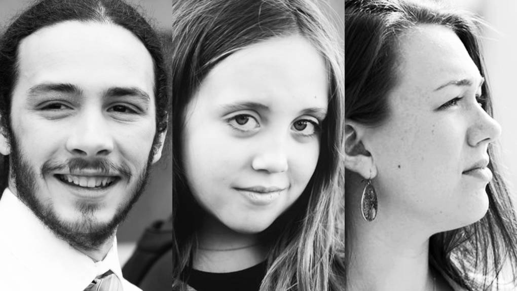
"caption": "Jacob Lebec, Avery McRae, and Kelsey Juliana, left to right, are among 21 young plaintiffs suing the federal government for more aggressive action on climate change.",
"description": "Jacob Lebec, Avery McRae, and Kelsey Juliana, left to right, are among 21 \"youth plaintiffs\" suing the federal government for more aggressive action on climate change.",
"title": "3FI_V02_171208",
"credit": "Our Children's Trust",
"status": "inherit",
"isLoading": false,
"fetchFailed": false
},
"science_1918220": {
"type": "attachments",
"id": "science_1918220",
"meta": {
"index": "attachments_1716263798",
"site": "science",
"id": "1918220",
"found": true
},
"parent": 1918219,
"imgSizes": {
"small": {
"file": "https://ww2.kqed.org/app/uploads/sites/35/2017/12/eclipse-1-03d0b421f44da22ddb6e231d7f10553e8e1bc741-520x389.jpg",
"width": 520,
"mimeType": "image/jpeg",
"height": 389
},
"twentyfourteen-full-width": {
"file": "https://ww2.kqed.org/app/uploads/sites/35/2017/12/eclipse-1-03d0b421f44da22ddb6e231d7f10553e8e1bc741-1038x576.jpg",
"width": 1038,
"mimeType": "image/jpeg",
"height": 576
},
"thumbnail": {
"file": "https://ww2.kqed.org/app/uploads/sites/35/2017/12/eclipse-1-03d0b421f44da22ddb6e231d7f10553e8e1bc741-160x120.jpg",
"width": 160,
"mimeType": "image/jpeg",
"height": 120
},
"fd-sm": {
"file": "https://ww2.kqed.org/app/uploads/sites/35/2017/12/eclipse-1-03d0b421f44da22ddb6e231d7f10553e8e1bc741-960x719.jpg",
"width": 960,
"mimeType": "image/jpeg",
"height": 719
},
"post-thumbnail": {
"file": "https://ww2.kqed.org/app/uploads/sites/35/2017/12/eclipse-1-03d0b421f44da22ddb6e231d7f10553e8e1bc741-672x372.jpg",
"width": 672,
"mimeType": "image/jpeg",
"height": 372
},
"xsmall": {
"file": "https://ww2.kqed.org/app/uploads/sites/35/2017/12/eclipse-1-03d0b421f44da22ddb6e231d7f10553e8e1bc741-375x281.jpg",
"width": 375,
"mimeType": "image/jpeg",
"height": 281
},
"kqedFullSize": {
"file": "https://ww2.kqed.org/app/uploads/sites/35/2017/12/eclipse-1-03d0b421f44da22ddb6e231d7f10553e8e1bc741.jpg",
"width": 1780,
"height": 1333
},
"large": {
"file": "https://ww2.kqed.org/app/uploads/sites/35/2017/12/eclipse-1-03d0b421f44da22ddb6e231d7f10553e8e1bc741-1020x764.jpg",
"width": 1020,
"mimeType": "image/jpeg",
"height": 764
},
"xlarge": {
"file": "https://ww2.kqed.org/app/uploads/sites/35/2017/12/eclipse-1-03d0b421f44da22ddb6e231d7f10553e8e1bc741-1180x884.jpg",
"width": 1180,
"mimeType": "image/jpeg",
"height": 884
},
"guest-author-50": {
"file": "https://ww2.kqed.org/app/uploads/sites/35/2017/12/eclipse-1-03d0b421f44da22ddb6e231d7f10553e8e1bc741-50x50.jpg",
"width": 50,
"mimeType": "image/jpeg",
"height": 50
},
"guest-author-96": {
"file": "https://ww2.kqed.org/app/uploads/sites/35/2017/12/eclipse-1-03d0b421f44da22ddb6e231d7f10553e8e1bc741-96x96.jpg",
"width": 96,
"mimeType": "image/jpeg",
"height": 96
},
"medium": {
"file": "https://ww2.kqed.org/app/uploads/sites/35/2017/12/eclipse-1-03d0b421f44da22ddb6e231d7f10553e8e1bc741-800x599.jpg",
"width": 800,
"mimeType": "image/jpeg",
"height": 599
},
"guest-author-64": {
"file": "https://ww2.kqed.org/app/uploads/sites/35/2017/12/eclipse-1-03d0b421f44da22ddb6e231d7f10553e8e1bc741-64x64.jpg",
"width": 64,
"mimeType": "image/jpeg",
"height": 64
},
"guest-author-32": {
"file": "https://ww2.kqed.org/app/uploads/sites/35/2017/12/eclipse-1-03d0b421f44da22ddb6e231d7f10553e8e1bc741-32x32.jpg",
"width": 32,
"mimeType": "image/jpeg",
"height": 32
},
"fd-med": {
"file": "https://ww2.kqed.org/app/uploads/sites/35/2017/12/eclipse-1-03d0b421f44da22ddb6e231d7f10553e8e1bc741-1180x884.jpg",
"width": 1180,
"mimeType": "image/jpeg",
"height": 884
},
"detail": {
"file": "https://ww2.kqed.org/app/uploads/sites/35/2017/12/eclipse-1-03d0b421f44da22ddb6e231d7f10553e8e1bc741-150x150.jpg",
"width": 150,
"mimeType": "image/jpeg",
"height": 150
},
"medium_large": {
"file": "https://ww2.kqed.org/app/uploads/sites/35/2017/12/eclipse-1-03d0b421f44da22ddb6e231d7f10553e8e1bc741-768x575.jpg",
"width": 768,
"mimeType": "image/jpeg",
"height": 575
},
"guest-author-128": {
"file": "https://ww2.kqed.org/app/uploads/sites/35/2017/12/eclipse-1-03d0b421f44da22ddb6e231d7f10553e8e1bc741-128x128.jpg",
"width": 128,
"mimeType": "image/jpeg",
"height": 128
},
"xxsmall": {
"file": "https://ww2.kqed.org/app/uploads/sites/35/2017/12/eclipse-1-03d0b421f44da22ddb6e231d7f10553e8e1bc741-240x180.jpg",
"width": 240,
"mimeType": "image/jpeg",
"height": 180
}
},
"publishDate": 1512689380,
"modified": 1608333132,
"caption": "Millions of people in the U.S. watched the Aug. 21, 2017 total solar eclipse. It was the subject of David Perlman's final story for the San Francisco Chronicle.",
"description": null,
"title": "Millions of people watched the Aug. 21 total solar eclipse in the U.S. Most emerged unscathed.",
"credit": "David Hume Kennerly/Getty Images",
"status": "inherit",
"altTag": null,
"isLoading": false,
"fetchFailed": false
},
"science_1918211": {
"type": "attachments",
"id": "science_1918211",
"meta": {
"index": "attachments_1716263798",
"site": "science",
"id": "1918211",
"found": true
},
"parent": 1918208,
"imgSizes": {
"small": {
"file": "https://ww2.kqed.org/app/uploads/sites/35/2017/12/iStock-490343450-e1512659696960-520x347.jpg",
"width": 520,
"mimeType": "image/jpeg",
"height": 347
},
"twentyfourteen-full-width": {
"file": "https://ww2.kqed.org/app/uploads/sites/35/2017/12/iStock-490343450-e1512659696960-1038x576.jpg",
"width": 1038,
"mimeType": "image/jpeg",
"height": 576
},
"thumbnail": {
"file": "https://ww2.kqed.org/app/uploads/sites/35/2017/12/iStock-490343450-e1512659696960-160x107.jpg",
"width": 160,
"mimeType": "image/jpeg",
"height": 107
},
"fd-sm": {
"file": "https://ww2.kqed.org/app/uploads/sites/35/2017/12/iStock-490343450-e1512659696960-960x640.jpg",
"width": 960,
"mimeType": "image/jpeg",
"height": 640
},
"post-thumbnail": {
"file": "https://ww2.kqed.org/app/uploads/sites/35/2017/12/iStock-490343450-e1512659696960-672x372.jpg",
"width": 672,
"mimeType": "image/jpeg",
"height": 372
},
"xsmall": {
"file": "https://ww2.kqed.org/app/uploads/sites/35/2017/12/iStock-490343450-e1512659696960-375x250.jpg",
"width": 375,
"mimeType": "image/jpeg",
"height": 250
},
"kqedFullSize": {
"file": "https://ww2.kqed.org/app/uploads/sites/35/2017/12/iStock-490343450-e1512659696960.jpg",
"width": 1920,
"height": 1280
},
"large": {
"file": "https://ww2.kqed.org/app/uploads/sites/35/2017/12/iStock-490343450-e1512659696960-1020x680.jpg",
"width": 1020,
"mimeType": "image/jpeg",
"height": 680
},
"xlarge": {
"file": "https://ww2.kqed.org/app/uploads/sites/35/2017/12/iStock-490343450-e1512659696960-1180x787.jpg",
"width": 1180,
"mimeType": "image/jpeg",
"height": 787
},
"guest-author-50": {
"file": "https://ww2.kqed.org/app/uploads/sites/35/2017/12/iStock-490343450-e1512659696960-50x50.jpg",
"width": 50,
"mimeType": "image/jpeg",
"height": 50
},
"guest-author-96": {
"file": "https://ww2.kqed.org/app/uploads/sites/35/2017/12/iStock-490343450-e1512659696960-96x96.jpg",
"width": 96,
"mimeType": "image/jpeg",
"height": 96
},
"medium": {
"file": "https://ww2.kqed.org/app/uploads/sites/35/2017/12/iStock-490343450-e1512659696960-800x533.jpg",
"width": 800,
"mimeType": "image/jpeg",
"height": 533
},
"guest-author-64": {
"file": "https://ww2.kqed.org/app/uploads/sites/35/2017/12/iStock-490343450-e1512659696960-64x64.jpg",
"width": 64,
"mimeType": "image/jpeg",
"height": 64
},
"guest-author-32": {
"file": "https://ww2.kqed.org/app/uploads/sites/35/2017/12/iStock-490343450-e1512659696960-32x32.jpg",
"width": 32,
"mimeType": "image/jpeg",
"height": 32
},
"fd-lrg": {
"file": "https://ww2.kqed.org/app/uploads/sites/35/2017/12/iStock-490343450-e1512659696960-1920x1280.jpg",
"width": 1920,
"mimeType": "image/jpeg",
"height": 1280
},
"fd-med": {
"file": "https://ww2.kqed.org/app/uploads/sites/35/2017/12/iStock-490343450-e1512659696960-1180x787.jpg",
"width": 1180,
"mimeType": "image/jpeg",
"height": 787
},
"full-width": {
"file": "https://ww2.kqed.org/app/uploads/sites/35/2017/12/iStock-490343450-e1512659696960-1920x1280.jpg",
"width": 1920,
"mimeType": "image/jpeg",
"height": 1280
},
"detail": {
"file": "https://ww2.kqed.org/app/uploads/sites/35/2017/12/iStock-490343450-e1512659696960-150x150.jpg",
"width": 150,
"mimeType": "image/jpeg",
"height": 150
},
"medium_large": {
"file": "https://ww2.kqed.org/app/uploads/sites/35/2017/12/iStock-490343450-e1512659696960-768x512.jpg",
"width": 768,
"mimeType": "image/jpeg",
"height": 512
},
"guest-author-128": {
"file": "https://ww2.kqed.org/app/uploads/sites/35/2017/12/iStock-490343450-e1512659696960-128x128.jpg",
"width": 128,
"mimeType": "image/jpeg",
"height": 128
},
"xxsmall": {
"file": "https://ww2.kqed.org/app/uploads/sites/35/2017/12/iStock-490343450-e1512659696960-240x160.jpg",
"width": 240,
"mimeType": "image/jpeg",
"height": 160
}
},
"publishDate": 1512659476,
"modified": 1512659803,
"caption": "Picture of an old building at Volkswagen Group's headquarters in Wolfsburg, Germany.",
"description": null,
"title": "Volkswagen Plant Wolfsburg",
"credit": "iStock",
"status": "inherit",
"isLoading": false,
"fetchFailed": false
},
"science_1918145": {
"type": "attachments",
"id": "science_1918145",
"meta": {
"index": "attachments_1716263798",
"site": "science",
"id": "1918145",
"found": true
},
"parent": 1918143,
"imgSizes": {
"small": {
"file": "https://ww2.kqed.org/app/uploads/sites/35/2017/12/gettyimages-682629724_wide-87c44ba56ec460381074be6c20a7026313f6be43-520x292.jpg",
"width": 520,
"mimeType": "image/jpeg",
"height": 292
},
"twentyfourteen-full-width": {
"file": "https://ww2.kqed.org/app/uploads/sites/35/2017/12/gettyimages-682629724_wide-87c44ba56ec460381074be6c20a7026313f6be43-1038x576.jpg",
"width": 1038,
"mimeType": "image/jpeg",
"height": 576
},
"thumbnail": {
"file": "https://ww2.kqed.org/app/uploads/sites/35/2017/12/gettyimages-682629724_wide-87c44ba56ec460381074be6c20a7026313f6be43-160x90.jpg",
"width": 160,
"mimeType": "image/jpeg",
"height": 90
},
"fd-sm": {
"file": "https://ww2.kqed.org/app/uploads/sites/35/2017/12/gettyimages-682629724_wide-87c44ba56ec460381074be6c20a7026313f6be43-960x540.jpg",
"width": 960,
"mimeType": "image/jpeg",
"height": 540
},
"post-thumbnail": {
"file": "https://ww2.kqed.org/app/uploads/sites/35/2017/12/gettyimages-682629724_wide-87c44ba56ec460381074be6c20a7026313f6be43-672x372.jpg",
"width": 672,
"mimeType": "image/jpeg",
"height": 372
},
"xsmall": {
"file": "https://ww2.kqed.org/app/uploads/sites/35/2017/12/gettyimages-682629724_wide-87c44ba56ec460381074be6c20a7026313f6be43-375x211.jpg",
"width": 375,
"mimeType": "image/jpeg",
"height": 211
},
"kqedFullSize": {
"file": "https://ww2.kqed.org/app/uploads/sites/35/2017/12/gettyimages-682629724_wide-87c44ba56ec460381074be6c20a7026313f6be43-e1512423745128.jpg",
"width": 1920,
"height": 1080
},
"large": {
"file": "https://ww2.kqed.org/app/uploads/sites/35/2017/12/gettyimages-682629724_wide-87c44ba56ec460381074be6c20a7026313f6be43-1020x574.jpg",
"width": 1020,
"mimeType": "image/jpeg",
"height": 574
},
"xlarge": {
"file": "https://ww2.kqed.org/app/uploads/sites/35/2017/12/gettyimages-682629724_wide-87c44ba56ec460381074be6c20a7026313f6be43-1180x664.jpg",
"width": 1180,
"mimeType": "image/jpeg",
"height": 664
},
"guest-author-50": {
"file": "https://ww2.kqed.org/app/uploads/sites/35/2017/12/gettyimages-682629724_wide-87c44ba56ec460381074be6c20a7026313f6be43-50x50.jpg",
"width": 50,
"mimeType": "image/jpeg",
"height": 50
},
"guest-author-96": {
"file": "https://ww2.kqed.org/app/uploads/sites/35/2017/12/gettyimages-682629724_wide-87c44ba56ec460381074be6c20a7026313f6be43-96x96.jpg",
"width": 96,
"mimeType": "image/jpeg",
"height": 96
},
"medium": {
"file": "https://ww2.kqed.org/app/uploads/sites/35/2017/12/gettyimages-682629724_wide-87c44ba56ec460381074be6c20a7026313f6be43-800x450.jpg",
"width": 800,
"mimeType": "image/jpeg",
"height": 450
},
"guest-author-64": {
"file": "https://ww2.kqed.org/app/uploads/sites/35/2017/12/gettyimages-682629724_wide-87c44ba56ec460381074be6c20a7026313f6be43-64x64.jpg",
"width": 64,
"mimeType": "image/jpeg",
"height": 64
},
"guest-author-32": {
"file": "https://ww2.kqed.org/app/uploads/sites/35/2017/12/gettyimages-682629724_wide-87c44ba56ec460381074be6c20a7026313f6be43-32x32.jpg",
"width": 32,
"mimeType": "image/jpeg",
"height": 32
},
"fd-lrg": {
"file": "https://ww2.kqed.org/app/uploads/sites/35/2017/12/gettyimages-682629724_wide-87c44ba56ec460381074be6c20a7026313f6be43-1920x1080.jpg",
"width": 1920,
"mimeType": "image/jpeg",
"height": 1080
},
"fd-med": {
"file": "https://ww2.kqed.org/app/uploads/sites/35/2017/12/gettyimages-682629724_wide-87c44ba56ec460381074be6c20a7026313f6be43-1180x664.jpg",
"width": 1180,
"mimeType": "image/jpeg",
"height": 664
},
"full-width": {
"file": "https://ww2.kqed.org/app/uploads/sites/35/2017/12/gettyimages-682629724_wide-87c44ba56ec460381074be6c20a7026313f6be43-1920x1080.jpg",
"width": 1920,
"mimeType": "image/jpeg",
"height": 1080
},
"detail": {
"file": "https://ww2.kqed.org/app/uploads/sites/35/2017/12/gettyimages-682629724_wide-87c44ba56ec460381074be6c20a7026313f6be43-150x150.jpg",
"width": 150,
"mimeType": "image/jpeg",
"height": 150
},
"medium_large": {
"file": "https://ww2.kqed.org/app/uploads/sites/35/2017/12/gettyimages-682629724_wide-87c44ba56ec460381074be6c20a7026313f6be43-768x432.jpg",
"width": 768,
"mimeType": "image/jpeg",
"height": 432
},
"guest-author-128": {
"file": "https://ww2.kqed.org/app/uploads/sites/35/2017/12/gettyimages-682629724_wide-87c44ba56ec460381074be6c20a7026313f6be43-128x128.jpg",
"width": 128,
"mimeType": "image/jpeg",
"height": 128
},
"xxsmall": {
"file": "https://ww2.kqed.org/app/uploads/sites/35/2017/12/gettyimages-682629724_wide-87c44ba56ec460381074be6c20a7026313f6be43-240x135.jpg",
"width": 240,
"mimeType": "image/jpeg",
"height": 135
}
},
"publishDate": 1512406015,
"modified": 1512406180,
"caption": "Ancient granaries, part of the House on Fire ruins, are shown here in the South Fork of Mule Canyon in the Bears Ears National Monument outside Blanding, Utah.",
"description": null,
"title": "Ancient granaries, part of the House on Fire ruins, are shown here in the South Fork of Mule Canyon in the Bears Ears National Monument outside Blanding, Utah.",
"credit": "George Frey/Getty Images",
"status": "inherit",
"isLoading": false,
"fetchFailed": false
},
"science_1918144": {
"type": "attachments",
"id": "science_1918144",
"meta": {
"index": "attachments_1716263798",
"site": "science",
"id": "1918144",
"found": true
},
"parent": 1918143,
"imgSizes": {
"small": {
"file": "https://ww2.kqed.org/app/uploads/sites/35/2017/12/broken-bow-arch_wide-df1c68ec5c17660b4d4831d8be38a984ceda0229-520x293.jpg",
"width": 520,
"mimeType": "image/jpeg",
"height": 293
},
"twentyfourteen-full-width": {
"file": "https://ww2.kqed.org/app/uploads/sites/35/2017/12/broken-bow-arch_wide-df1c68ec5c17660b4d4831d8be38a984ceda0229-1038x576.jpg",
"width": 1038,
"mimeType": "image/jpeg",
"height": 576
},
"thumbnail": {
"file": "https://ww2.kqed.org/app/uploads/sites/35/2017/12/broken-bow-arch_wide-df1c68ec5c17660b4d4831d8be38a984ceda0229-160x90.jpg",
"width": 160,
"mimeType": "image/jpeg",
"height": 90
},
"fd-sm": {
"file": "https://ww2.kqed.org/app/uploads/sites/35/2017/12/broken-bow-arch_wide-df1c68ec5c17660b4d4831d8be38a984ceda0229-960x541.jpg",
"width": 960,
"mimeType": "image/jpeg",
"height": 541
},
"post-thumbnail": {
"file": "https://ww2.kqed.org/app/uploads/sites/35/2017/12/broken-bow-arch_wide-df1c68ec5c17660b4d4831d8be38a984ceda0229-672x372.jpg",
"width": 672,
"mimeType": "image/jpeg",
"height": 372
},
"xsmall": {
"file": "https://ww2.kqed.org/app/uploads/sites/35/2017/12/broken-bow-arch_wide-df1c68ec5c17660b4d4831d8be38a984ceda0229-375x211.jpg",
"width": 375,
"mimeType": "image/jpeg",
"height": 211
},
"kqedFullSize": {
"file": "https://ww2.kqed.org/app/uploads/sites/35/2017/12/broken-bow-arch_wide-df1c68ec5c17660b4d4831d8be38a984ceda0229-e1512423722149.jpg",
"width": 1920,
"height": 1082
},
"large": {
"file": "https://ww2.kqed.org/app/uploads/sites/35/2017/12/broken-bow-arch_wide-df1c68ec5c17660b4d4831d8be38a984ceda0229-1020x575.jpg",
"width": 1020,
"mimeType": "image/jpeg",
"height": 575
},
"xlarge": {
"file": "https://ww2.kqed.org/app/uploads/sites/35/2017/12/broken-bow-arch_wide-df1c68ec5c17660b4d4831d8be38a984ceda0229-1180x665.jpg",
"width": 1180,
"mimeType": "image/jpeg",
"height": 665
},
"guest-author-50": {
"file": "https://ww2.kqed.org/app/uploads/sites/35/2017/12/broken-bow-arch_wide-df1c68ec5c17660b4d4831d8be38a984ceda0229-50x50.jpg",
"width": 50,
"mimeType": "image/jpeg",
"height": 50
},
"guest-author-96": {
"file": "https://ww2.kqed.org/app/uploads/sites/35/2017/12/broken-bow-arch_wide-df1c68ec5c17660b4d4831d8be38a984ceda0229-96x96.jpg",
"width": 96,
"mimeType": "image/jpeg",
"height": 96
},
"medium": {
"file": "https://ww2.kqed.org/app/uploads/sites/35/2017/12/broken-bow-arch_wide-df1c68ec5c17660b4d4831d8be38a984ceda0229-800x451.jpg",
"width": 800,
"mimeType": "image/jpeg",
"height": 451
},
"guest-author-64": {
"file": "https://ww2.kqed.org/app/uploads/sites/35/2017/12/broken-bow-arch_wide-df1c68ec5c17660b4d4831d8be38a984ceda0229-64x64.jpg",
"width": 64,
"mimeType": "image/jpeg",
"height": 64
},
"guest-author-32": {
"file": "https://ww2.kqed.org/app/uploads/sites/35/2017/12/broken-bow-arch_wide-df1c68ec5c17660b4d4831d8be38a984ceda0229-32x32.jpg",
"width": 32,
"mimeType": "image/jpeg",
"height": 32
},
"fd-lrg": {
"file": "https://ww2.kqed.org/app/uploads/sites/35/2017/12/broken-bow-arch_wide-df1c68ec5c17660b4d4831d8be38a984ceda0229-1920x1082.jpg",
"width": 1920,
"mimeType": "image/jpeg",
"height": 1082
},
"fd-med": {
"file": "https://ww2.kqed.org/app/uploads/sites/35/2017/12/broken-bow-arch_wide-df1c68ec5c17660b4d4831d8be38a984ceda0229-1180x665.jpg",
"width": 1180,
"mimeType": "image/jpeg",
"height": 665
},
"full-width": {
"file": "https://ww2.kqed.org/app/uploads/sites/35/2017/12/broken-bow-arch_wide-df1c68ec5c17660b4d4831d8be38a984ceda0229-1920x1082.jpg",
"width": 1920,
"mimeType": "image/jpeg",
"height": 1082
},
"detail": {
"file": "https://ww2.kqed.org/app/uploads/sites/35/2017/12/broken-bow-arch_wide-df1c68ec5c17660b4d4831d8be38a984ceda0229-150x150.jpg",
"width": 150,
"mimeType": "image/jpeg",
"height": 150
},
"medium_large": {
"file": "https://ww2.kqed.org/app/uploads/sites/35/2017/12/broken-bow-arch_wide-df1c68ec5c17660b4d4831d8be38a984ceda0229-768x433.jpg",
"width": 768,
"mimeType": "image/jpeg",
"height": 433
},
"guest-author-128": {
"file": "https://ww2.kqed.org/app/uploads/sites/35/2017/12/broken-bow-arch_wide-df1c68ec5c17660b4d4831d8be38a984ceda0229-128x128.jpg",
"width": 128,
"mimeType": "image/jpeg",
"height": 128
},
"xxsmall": {
"file": "https://ww2.kqed.org/app/uploads/sites/35/2017/12/broken-bow-arch_wide-df1c68ec5c17660b4d4831d8be38a984ceda0229-240x135.jpg",
"width": 240,
"mimeType": "image/jpeg",
"height": 135
}
},
"publishDate": 1512406009,
"modified": 1512406143,
"caption": "Broken Bow Arch rises from Willow Canyon in the Escalante Canyons region of Utah's Grand Staircase-Escalante National Monument.\n",
"description": "Broken Bow Arch rises from Willow Canyon in the Escalante Canyons region of Utah’s Grand Staircase-Escalante National Monumen",
"title": "Broken Bow Arch rises from Willow Canyon in the Escalante Canyons region of Utah's Grand Staircase-Escalante National Monument.",
"credit": "Howard Berkes/NPR",
"status": "inherit",
"isLoading": false,
"fetchFailed": false
},
"science_1916319": {
"type": "attachments",
"id": "science_1916319",
"meta": {
"index": "attachments_1716263798",
"site": "science",
"id": "1916319",
"found": true
},
"parent": 1715680,
"imgSizes": {
"small": {
"file": "https://ww2.kqed.org/app/uploads/sites/35/2017/10/34119864293_bb04228c55_o-520x347.jpg",
"width": 520,
"mimeType": "image/jpeg",
"height": 347
},
"twentyfourteen-full-width": {
"file": "https://ww2.kqed.org/app/uploads/sites/35/2017/10/34119864293_bb04228c55_o-1038x576.jpg",
"width": 1038,
"mimeType": "image/jpeg",
"height": 576
},
"thumbnail": {
"file": "https://ww2.kqed.org/app/uploads/sites/35/2017/10/34119864293_bb04228c55_o-160x107.jpg",
"width": 160,
"mimeType": "image/jpeg",
"height": 107
},
"fd-sm": {
"file": "https://ww2.kqed.org/app/uploads/sites/35/2017/10/34119864293_bb04228c55_o-960x640.jpg",
"width": 960,
"mimeType": "image/jpeg",
"height": 640
},
"post-thumbnail": {
"file": "https://ww2.kqed.org/app/uploads/sites/35/2017/10/34119864293_bb04228c55_o-672x372.jpg",
"width": 672,
"mimeType": "image/jpeg",
"height": 372
},
"xsmall": {
"file": "https://ww2.kqed.org/app/uploads/sites/35/2017/10/34119864293_bb04228c55_o-375x250.jpg",
"width": 375,
"mimeType": "image/jpeg",
"height": 250
},
"kqedFullSize": {
"file": "https://ww2.kqed.org/app/uploads/sites/35/2017/10/34119864293_bb04228c55_o.jpg",
"width": 2048,
"height": 1365
},
"large": {
"file": "https://ww2.kqed.org/app/uploads/sites/35/2017/10/34119864293_bb04228c55_o-1020x680.jpg",
"width": 1020,
"mimeType": "image/jpeg",
"height": 680
},
"xlarge": {
"file": "https://ww2.kqed.org/app/uploads/sites/35/2017/10/34119864293_bb04228c55_o-1180x786.jpg",
"width": 1180,
"mimeType": "image/jpeg",
"height": 786
},
"guest-author-50": {
"file": "https://ww2.kqed.org/app/uploads/sites/35/2017/10/34119864293_bb04228c55_o-50x50.jpg",
"width": 50,
"mimeType": "image/jpeg",
"height": 50
},
"guest-author-96": {
"file": "https://ww2.kqed.org/app/uploads/sites/35/2017/10/34119864293_bb04228c55_o-96x96.jpg",
"width": 96,
"mimeType": "image/jpeg",
"height": 96
},
"medium": {
"file": "https://ww2.kqed.org/app/uploads/sites/35/2017/10/34119864293_bb04228c55_o-800x533.jpg",
"width": 800,
"mimeType": "image/jpeg",
"height": 533
},
"guest-author-64": {
"file": "https://ww2.kqed.org/app/uploads/sites/35/2017/10/34119864293_bb04228c55_o-64x64.jpg",
"width": 64,
"mimeType": "image/jpeg",
"height": 64
},
"guest-author-32": {
"file": "https://ww2.kqed.org/app/uploads/sites/35/2017/10/34119864293_bb04228c55_o-32x32.jpg",
"width": 32,
"mimeType": "image/jpeg",
"height": 32
},
"fd-lrg": {
"file": "https://ww2.kqed.org/app/uploads/sites/35/2017/10/34119864293_bb04228c55_o-1920x1280.jpg",
"width": 1920,
"mimeType": "image/jpeg",
"height": 1280
},
"fd-med": {
"file": "https://ww2.kqed.org/app/uploads/sites/35/2017/10/34119864293_bb04228c55_o-1180x786.jpg",
"width": 1180,
"mimeType": "image/jpeg",
"height": 786
},
"full-width": {
"file": "https://ww2.kqed.org/app/uploads/sites/35/2017/10/34119864293_bb04228c55_o-1920x1280.jpg",
"width": 1920,
"mimeType": "image/jpeg",
"height": 1280
},
"detail": {
"file": "https://ww2.kqed.org/app/uploads/sites/35/2017/10/34119864293_bb04228c55_o-150x150.jpg",
"width": 150,
"mimeType": "image/jpeg",
"height": 150
},
"medium_large": {
"file": "https://ww2.kqed.org/app/uploads/sites/35/2017/10/34119864293_bb04228c55_o-768x512.jpg",
"width": 768,
"mimeType": "image/jpeg",
"height": 512
},
"guest-author-128": {
"file": "https://ww2.kqed.org/app/uploads/sites/35/2017/10/34119864293_bb04228c55_o-128x128.jpg",
"width": 128,
"mimeType": "image/jpeg",
"height": 128
},
"xxsmall": {
"file": "https://ww2.kqed.org/app/uploads/sites/35/2017/10/34119864293_bb04228c55_o-240x160.jpg",
"width": 240,
"mimeType": "image/jpeg",
"height": 160
}
},
"publishDate": 1507613975,
"modified": 1507614072,
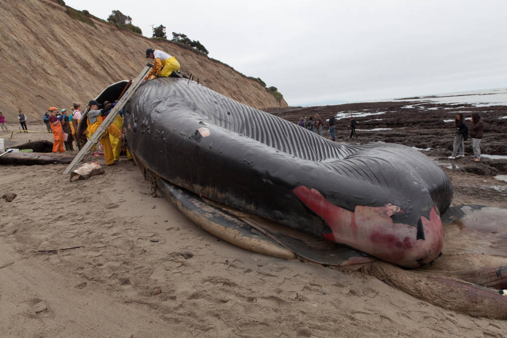
"caption": "A 79-foot long blue whale washed up on a Bolinas beach in May after she was struck by a ship.",
"description": null,
"title": "34119864293_bb04228c55_o",
"credit": "Brian Lee Fisher",
"status": "inherit",
"isLoading": false,
"fetchFailed": false
},
"science_1918020": {
"type": "attachments",
"id": "science_1918020",
"meta": {
"index": "attachments_1716263798",
"site": "science",
"id": "1918020",
"found": true
},
"parent": 1918019,
"imgSizes": {
"small": {
"file": "https://ww2.kqed.org/app/uploads/sites/35/2017/11/ap_16318860875855_slide-9ee489db9692f489aa36a0972acd93b0a6c07dc1-520x347.jpg",
"width": 520,
"mimeType": "image/jpeg",
"height": 347
},
"twentyfourteen-full-width": {
"file": "https://ww2.kqed.org/app/uploads/sites/35/2017/11/ap_16318860875855_slide-9ee489db9692f489aa36a0972acd93b0a6c07dc1-1038x576.jpg",
"width": 1038,
"mimeType": "image/jpeg",
"height": 576
},
"thumbnail": {
"file": "https://ww2.kqed.org/app/uploads/sites/35/2017/11/ap_16318860875855_slide-9ee489db9692f489aa36a0972acd93b0a6c07dc1-160x107.jpg",
"width": 160,
"mimeType": "image/jpeg",
"height": 107
},
"fd-sm": {
"file": "https://ww2.kqed.org/app/uploads/sites/35/2017/11/ap_16318860875855_slide-9ee489db9692f489aa36a0972acd93b0a6c07dc1-960x640.jpg",
"width": 960,
"mimeType": "image/jpeg",
"height": 640
},
"post-thumbnail": {
"file": "https://ww2.kqed.org/app/uploads/sites/35/2017/11/ap_16318860875855_slide-9ee489db9692f489aa36a0972acd93b0a6c07dc1-672x372.jpg",
"width": 672,
"mimeType": "image/jpeg",
"height": 372
},
"xsmall": {
"file": "https://ww2.kqed.org/app/uploads/sites/35/2017/11/ap_16318860875855_slide-9ee489db9692f489aa36a0972acd93b0a6c07dc1-375x250.jpg",
"width": 375,
"mimeType": "image/jpeg",
"height": 250
},
"kqedFullSize": {
"file": "https://ww2.kqed.org/app/uploads/sites/35/2017/11/ap_16318860875855_slide-9ee489db9692f489aa36a0972acd93b0a6c07dc1.jpg",
"width": 2910,
"height": 1940
},
"large": {
"file": "https://ww2.kqed.org/app/uploads/sites/35/2017/11/ap_16318860875855_slide-9ee489db9692f489aa36a0972acd93b0a6c07dc1-1020x680.jpg",
"width": 1020,
"mimeType": "image/jpeg",
"height": 680
},
"xlarge": {
"file": "https://ww2.kqed.org/app/uploads/sites/35/2017/11/ap_16318860875855_slide-9ee489db9692f489aa36a0972acd93b0a6c07dc1-1180x787.jpg",
"width": 1180,
"mimeType": "image/jpeg",
"height": 787
},
"guest-author-50": {
"file": "https://ww2.kqed.org/app/uploads/sites/35/2017/11/ap_16318860875855_slide-9ee489db9692f489aa36a0972acd93b0a6c07dc1-50x50.jpg",
"width": 50,
"mimeType": "image/jpeg",
"height": 50
},
"guest-author-96": {
"file": "https://ww2.kqed.org/app/uploads/sites/35/2017/11/ap_16318860875855_slide-9ee489db9692f489aa36a0972acd93b0a6c07dc1-96x96.jpg",
"width": 96,
"mimeType": "image/jpeg",
"height": 96
},
"medium": {
"file": "https://ww2.kqed.org/app/uploads/sites/35/2017/11/ap_16318860875855_slide-9ee489db9692f489aa36a0972acd93b0a6c07dc1-800x533.jpg",
"width": 800,
"mimeType": "image/jpeg",
"height": 533
},
"guest-author-64": {
"file": "https://ww2.kqed.org/app/uploads/sites/35/2017/11/ap_16318860875855_slide-9ee489db9692f489aa36a0972acd93b0a6c07dc1-64x64.jpg",
"width": 64,
"mimeType": "image/jpeg",
"height": 64
},
"guest-author-32": {
"file": "https://ww2.kqed.org/app/uploads/sites/35/2017/11/ap_16318860875855_slide-9ee489db9692f489aa36a0972acd93b0a6c07dc1-32x32.jpg",
"width": 32,
"mimeType": "image/jpeg",
"height": 32
},
"fd-lrg": {
"file": "https://ww2.kqed.org/app/uploads/sites/35/2017/11/ap_16318860875855_slide-9ee489db9692f489aa36a0972acd93b0a6c07dc1-1920x1280.jpg",
"width": 1920,
"mimeType": "image/jpeg",
"height": 1280
},
"fd-med": {
"file": "https://ww2.kqed.org/app/uploads/sites/35/2017/11/ap_16318860875855_slide-9ee489db9692f489aa36a0972acd93b0a6c07dc1-1180x787.jpg",
"width": 1180,
"mimeType": "image/jpeg",
"height": 787
},
"full-width": {
"file": "https://ww2.kqed.org/app/uploads/sites/35/2017/11/ap_16318860875855_slide-9ee489db9692f489aa36a0972acd93b0a6c07dc1-1920x1280.jpg",
"width": 1920,
"mimeType": "image/jpeg",
"height": 1280
},
"detail": {
"file": "https://ww2.kqed.org/app/uploads/sites/35/2017/11/ap_16318860875855_slide-9ee489db9692f489aa36a0972acd93b0a6c07dc1-150x150.jpg",
"width": 150,
"mimeType": "image/jpeg",
"height": 150
},
"medium_large": {
"file": "https://ww2.kqed.org/app/uploads/sites/35/2017/11/ap_16318860875855_slide-9ee489db9692f489aa36a0972acd93b0a6c07dc1-768x512.jpg",
"width": 768,
"mimeType": "image/jpeg",
"height": 512
},
"guest-author-128": {
"file": "https://ww2.kqed.org/app/uploads/sites/35/2017/11/ap_16318860875855_slide-9ee489db9692f489aa36a0972acd93b0a6c07dc1-128x128.jpg",
"width": 128,
"mimeType": "image/jpeg",
"height": 128
},
"xxsmall": {
"file": "https://ww2.kqed.org/app/uploads/sites/35/2017/11/ap_16318860875855_slide-9ee489db9692f489aa36a0972acd93b0a6c07dc1-240x160.jpg",
"width": 240,
"mimeType": "image/jpeg",
"height": 160
}
},
"publishDate": 1511978895,
"modified": 1511979013,
"caption": "The moon rises beyond the University of Kansas campus in Lawrence, Kan., Nov. 13, 2016. The 2017 supermoon will appear Dec. 3.\n",
"description": "The moon rises beyond the University of Kansas campus in Lawrence, Kan., Nov. 13, 2016. The 2017 supermoon will appear Dec. 3.",
"title": "The moon rises beyond the University of Kansas campus in Lawrence, Kan., Nov. 13, 2016. The 2017 supermoon will appear Dec. 3.",
"credit": "Orlin Wagner/AP",
"status": "inherit",
"isLoading": false,
"fetchFailed": false
},
"science_1918027": {
"type": "attachments",
"id": "science_1918027",
"meta": {
"index": "attachments_1716263798",
"site": "science",
"id": "1918027",
"found": true
},
"parent": 1918025,
"imgSizes": {
"small": {
"file": "https://ww2.kqed.org/app/uploads/sites/35/2017/11/nsf_bldg_h2_wide-4552489090954d074159152de7089e3b0c2629e9-520x292.jpg",
"width": 520,
"mimeType": "image/jpeg",
"height": 292
},
"twentyfourteen-full-width": {
"file": "https://ww2.kqed.org/app/uploads/sites/35/2017/11/nsf_bldg_h2_wide-4552489090954d074159152de7089e3b0c2629e9-1038x576.jpg",
"width": 1038,
"mimeType": "image/jpeg",
"height": 576
},
"thumbnail": {
"file": "https://ww2.kqed.org/app/uploads/sites/35/2017/11/nsf_bldg_h2_wide-4552489090954d074159152de7089e3b0c2629e9-160x90.jpg",
"width": 160,
"mimeType": "image/jpeg",
"height": 90
},
"fd-sm": {
"file": "https://ww2.kqed.org/app/uploads/sites/35/2017/11/nsf_bldg_h2_wide-4552489090954d074159152de7089e3b0c2629e9-960x540.jpg",
"width": 960,
"mimeType": "image/jpeg",
"height": 540
},
"post-thumbnail": {
"file": "https://ww2.kqed.org/app/uploads/sites/35/2017/11/nsf_bldg_h2_wide-4552489090954d074159152de7089e3b0c2629e9-672x372.jpg",
"width": 672,
"mimeType": "image/jpeg",
"height": 372
},
"xsmall": {
"file": "https://ww2.kqed.org/app/uploads/sites/35/2017/11/nsf_bldg_h2_wide-4552489090954d074159152de7089e3b0c2629e9-375x211.jpg",
"width": 375,
"mimeType": "image/jpeg",
"height": 211
},
"kqedFullSize": {
"file": "https://ww2.kqed.org/app/uploads/sites/35/2017/11/nsf_bldg_h2_wide-4552489090954d074159152de7089e3b0c2629e9.jpg",
"width": 2969,
"height": 1670
},
"large": {
"file": "https://ww2.kqed.org/app/uploads/sites/35/2017/11/nsf_bldg_h2_wide-4552489090954d074159152de7089e3b0c2629e9-1020x574.jpg",
"width": 1020,
"mimeType": "image/jpeg",
"height": 574
},
"xlarge": {
"file": "https://ww2.kqed.org/app/uploads/sites/35/2017/11/nsf_bldg_h2_wide-4552489090954d074159152de7089e3b0c2629e9-1180x664.jpg",
"width": 1180,
"mimeType": "image/jpeg",
"height": 664
},
"guest-author-50": {
"file": "https://ww2.kqed.org/app/uploads/sites/35/2017/11/nsf_bldg_h2_wide-4552489090954d074159152de7089e3b0c2629e9-50x50.jpg",
"width": 50,
"mimeType": "image/jpeg",
"height": 50
},
"guest-author-96": {
"file": "https://ww2.kqed.org/app/uploads/sites/35/2017/11/nsf_bldg_h2_wide-4552489090954d074159152de7089e3b0c2629e9-96x96.jpg",
"width": 96,
"mimeType": "image/jpeg",
"height": 96
},
"medium": {
"file": "https://ww2.kqed.org/app/uploads/sites/35/2017/11/nsf_bldg_h2_wide-4552489090954d074159152de7089e3b0c2629e9-800x450.jpg",
"width": 800,
"mimeType": "image/jpeg",
"height": 450
},
"guest-author-64": {
"file": "https://ww2.kqed.org/app/uploads/sites/35/2017/11/nsf_bldg_h2_wide-4552489090954d074159152de7089e3b0c2629e9-64x64.jpg",
"width": 64,
"mimeType": "image/jpeg",
"height": 64
},
"guest-author-32": {
"file": "https://ww2.kqed.org/app/uploads/sites/35/2017/11/nsf_bldg_h2_wide-4552489090954d074159152de7089e3b0c2629e9-32x32.jpg",
"width": 32,
"mimeType": "image/jpeg",
"height": 32
},
"fd-lrg": {
"file": "https://ww2.kqed.org/app/uploads/sites/35/2017/11/nsf_bldg_h2_wide-4552489090954d074159152de7089e3b0c2629e9-1920x1080.jpg",
"width": 1920,
"mimeType": "image/jpeg",
"height": 1080
},
"fd-med": {
"file": "https://ww2.kqed.org/app/uploads/sites/35/2017/11/nsf_bldg_h2_wide-4552489090954d074159152de7089e3b0c2629e9-1180x664.jpg",
"width": 1180,
"mimeType": "image/jpeg",
"height": 664
},
"full-width": {
"file": "https://ww2.kqed.org/app/uploads/sites/35/2017/11/nsf_bldg_h2_wide-4552489090954d074159152de7089e3b0c2629e9-1920x1080.jpg",
"width": 1920,
"mimeType": "image/jpeg",
"height": 1080
},
"detail": {
"file": "https://ww2.kqed.org/app/uploads/sites/35/2017/11/nsf_bldg_h2_wide-4552489090954d074159152de7089e3b0c2629e9-150x150.jpg",
"width": 150,
"mimeType": "image/jpeg",
"height": 150
},
"medium_large": {
"file": "https://ww2.kqed.org/app/uploads/sites/35/2017/11/nsf_bldg_h2_wide-4552489090954d074159152de7089e3b0c2629e9-768x432.jpg",
"width": 768,
"mimeType": "image/jpeg",
"height": 432
},
"guest-author-128": {
"file": "https://ww2.kqed.org/app/uploads/sites/35/2017/11/nsf_bldg_h2_wide-4552489090954d074159152de7089e3b0c2629e9-128x128.jpg",
"width": 128,
"mimeType": "image/jpeg",
"height": 128
},
"xxsmall": {
"file": "https://ww2.kqed.org/app/uploads/sites/35/2017/11/nsf_bldg_h2_wide-4552489090954d074159152de7089e3b0c2629e9-240x135.jpg",
"width": 240,
"mimeType": "image/jpeg",
"height": 135
}
},
"publishDate": 1511979041,
"modified": 1511980793,
"caption": "National Science Foundation grants with the term \"climate change\" in the public summary are down 40 percent this year. Some scientists say they are avoiding the term, hoping to protect funding for their climate change research.",
"description": "National Science Foundation grants with the term \"climate change\" in the public summary are down 40 percent this year. Some scientists say they are avoiding the term, hoping to protect funding for their climate change research.",
"title": "National Science Foundation grants with the term \"climate change\" in the public summary are down 40 percent this year. Some scientists say they are avoiding the term, hoping to protect funding for their climate change research.",
"credit": "National Science Foundation",
"status": "inherit",
"isLoading": false,
"fetchFailed": false
},
"science_1918002": {
"type": "attachments",
"id": "science_1918002",
"meta": {
"index": "attachments_1716263798",
"site": "science",
"id": "1918002",
"found": true
},
"parent": 1917995,
"imgSizes": {
"small": {
"file": "https://ww2.kqed.org/app/uploads/sites/35/2017/11/LNU-complex-tanker-drop-520x293.jpg",
"width": 520,
"mimeType": "image/jpeg",
"height": 293
},
"twentyfourteen-full-width": {
"file": "https://ww2.kqed.org/app/uploads/sites/35/2017/11/LNU-complex-tanker-drop-1038x576.jpg",
"width": 1038,
"mimeType": "image/jpeg",
"height": 576
},
"thumbnail": {
"file": "https://ww2.kqed.org/app/uploads/sites/35/2017/11/LNU-complex-tanker-drop-160x90.jpg",
"width": 160,
"mimeType": "image/jpeg",
"height": 90
},
"fd-sm": {
"file": "https://ww2.kqed.org/app/uploads/sites/35/2017/11/LNU-complex-tanker-drop-960x540.jpg",
"width": 960,
"mimeType": "image/jpeg",
"height": 540
},
"post-thumbnail": {
"file": "https://ww2.kqed.org/app/uploads/sites/35/2017/11/LNU-complex-tanker-drop-672x372.jpg",
"width": 672,
"mimeType": "image/jpeg",
"height": 372
},
"xsmall": {
"file": "https://ww2.kqed.org/app/uploads/sites/35/2017/11/LNU-complex-tanker-drop-375x211.jpg",
"width": 375,
"mimeType": "image/jpeg",
"height": 211
},
"kqedFullSize": {
"file": "https://ww2.kqed.org/app/uploads/sites/35/2017/11/LNU-complex-tanker-drop.jpg",
"width": 1920,
"height": 1080
},
"large": {
"file": "https://ww2.kqed.org/app/uploads/sites/35/2017/11/LNU-complex-tanker-drop-1020x574.jpg",
"width": 1020,
"mimeType": "image/jpeg",
"height": 574
},
"xlarge": {
"file": "https://ww2.kqed.org/app/uploads/sites/35/2017/11/LNU-complex-tanker-drop-1180x664.jpg",
"width": 1180,
"mimeType": "image/jpeg",
"height": 664
},
"guest-author-50": {
"file": "https://ww2.kqed.org/app/uploads/sites/35/2017/11/LNU-complex-tanker-drop-50x50.jpg",
"width": 50,
"mimeType": "image/jpeg",
"height": 50
},
"guest-author-96": {
"file": "https://ww2.kqed.org/app/uploads/sites/35/2017/11/LNU-complex-tanker-drop-96x96.jpg",
"width": 96,
"mimeType": "image/jpeg",
"height": 96
},
"medium": {
"file": "https://ww2.kqed.org/app/uploads/sites/35/2017/11/LNU-complex-tanker-drop-800x450.jpg",
"width": 800,
"mimeType": "image/jpeg",
"height": 450
},
"guest-author-64": {
"file": "https://ww2.kqed.org/app/uploads/sites/35/2017/11/LNU-complex-tanker-drop-64x64.jpg",
"width": 64,
"mimeType": "image/jpeg",
"height": 64
},
"guest-author-32": {
"file": "https://ww2.kqed.org/app/uploads/sites/35/2017/11/LNU-complex-tanker-drop-32x32.jpg",
"width": 32,
"mimeType": "image/jpeg",
"height": 32
},
"fd-lrg": {
"file": "https://ww2.kqed.org/app/uploads/sites/35/2017/11/LNU-complex-tanker-drop-1920x1080.jpg",
"width": 1920,
"mimeType": "image/jpeg",
"height": 1080
},
"fd-med": {
"file": "https://ww2.kqed.org/app/uploads/sites/35/2017/11/LNU-complex-tanker-drop-1180x664.jpg",
"width": 1180,
"mimeType": "image/jpeg",
"height": 664
},
"full-width": {
"file": "https://ww2.kqed.org/app/uploads/sites/35/2017/11/LNU-complex-tanker-drop-1920x1080.jpg",
"width": 1920,
"mimeType": "image/jpeg",
"height": 1080
},
"detail": {
"file": "https://ww2.kqed.org/app/uploads/sites/35/2017/11/LNU-complex-tanker-drop-150x150.jpg",
"width": 150,
"mimeType": "image/jpeg",
"height": 150
},
"medium_large": {
"file": "https://ww2.kqed.org/app/uploads/sites/35/2017/11/LNU-complex-tanker-drop-768x432.jpg",
"width": 768,
"mimeType": "image/jpeg",
"height": 432
},
"guest-author-128": {
"file": "https://ww2.kqed.org/app/uploads/sites/35/2017/11/LNU-complex-tanker-drop-128x128.jpg",
"width": 128,
"mimeType": "image/jpeg",
"height": 128
},
"xxsmall": {
"file": "https://ww2.kqed.org/app/uploads/sites/35/2017/11/LNU-complex-tanker-drop-240x135.jpg",
"width": 240,
"mimeType": "image/jpeg",
"height": 135
}
},
"publishDate": 1511803778,
"modified": 1511803988,
"caption": "A tanker drops fire retardant on October 15, 2017 to suppress fires that were part of the \u003ca href=\"http://www.fire.ca.gov/current_incidents/incidentdetails/Index/1883\" target=\"_blank\" rel=\"noopener\">Central LNU complex\u003c/a>.\n\n\n",
"description": null,
"title": "LNU complex tanker drop",
"credit": "Cal Fire",
"status": "inherit",
"isLoading": false,
"fetchFailed": false
},
"science_1917990": {
"type": "attachments",
"id": "science_1917990",
"meta": {
"index": "attachments_1716263798",
"site": "science",
"id": "1917990",
"found": true
},
"parent": 1917989,
"imgSizes": {
"small": {
"file": "https://ww2.kqed.org/app/uploads/sites/35/2017/11/NASA-520x389.jpg",
"width": 520,
"mimeType": "image/jpeg",
"height": 389
},
"twentyfourteen-full-width": {
"file": "https://ww2.kqed.org/app/uploads/sites/35/2017/11/NASA-800x576.jpg",
"width": 800,
"mimeType": "image/jpeg",
"height": 576
},
"thumbnail": {
"file": "https://ww2.kqed.org/app/uploads/sites/35/2017/11/NASA-160x120.jpg",
"width": 160,
"mimeType": "image/jpeg",
"height": 120
},
"post-thumbnail": {
"file": "https://ww2.kqed.org/app/uploads/sites/35/2017/11/NASA-672x372.jpg",
"width": 672,
"mimeType": "image/jpeg",
"height": 372
},
"xsmall": {
"file": "https://ww2.kqed.org/app/uploads/sites/35/2017/11/NASA-375x281.jpg",
"width": 375,
"mimeType": "image/jpeg",
"height": 281
},
"kqedFullSize": {
"file": "https://ww2.kqed.org/app/uploads/sites/35/2017/11/NASA.jpg",
"width": 800,
"height": 599
},
"guest-author-50": {
"file": "https://ww2.kqed.org/app/uploads/sites/35/2017/11/NASA-50x50.jpg",
"width": 50,
"mimeType": "image/jpeg",
"height": 50
},
"guest-author-96": {
"file": "https://ww2.kqed.org/app/uploads/sites/35/2017/11/NASA-96x96.jpg",
"width": 96,
"mimeType": "image/jpeg",
"height": 96
},
"medium": {
"file": "https://ww2.kqed.org/app/uploads/sites/35/2017/11/NASA-800x599.jpg",
"width": 800,
"mimeType": "image/jpeg",
"height": 599
},
"guest-author-64": {
"file": "https://ww2.kqed.org/app/uploads/sites/35/2017/11/NASA-64x64.jpg",
"width": 64,
"mimeType": "image/jpeg",
"height": 64
},
"guest-author-32": {
"file": "https://ww2.kqed.org/app/uploads/sites/35/2017/11/NASA-32x32.jpg",
"width": 32,
"mimeType": "image/jpeg",
"height": 32
},
"detail": {
"file": "https://ww2.kqed.org/app/uploads/sites/35/2017/11/NASA-150x150.jpg",
"width": 150,
"mimeType": "image/jpeg",
"height": 150
},
"medium_large": {
"file": "https://ww2.kqed.org/app/uploads/sites/35/2017/11/NASA-768x575.jpg",
"width": 768,
"mimeType": "image/jpeg",
"height": 575
},
"guest-author-128": {
"file": "https://ww2.kqed.org/app/uploads/sites/35/2017/11/NASA-128x128.jpg",
"width": 128,
"mimeType": "image/jpeg",
"height": 128
},
"xxsmall": {
"file": "https://ww2.kqed.org/app/uploads/sites/35/2017/11/NASA-240x180.jpg",
"width": 240,
"mimeType": "image/jpeg",
"height": 180
}
},
"publishDate": 1511799287,
"modified": 1511799307,
"caption": null,
"description": null,
"title": "NASA",
"credit": "Joshua Stevens/NASA Earth Observatory",
"status": "inherit",
"isLoading": false,
"fetchFailed": false
},
"science_1917936": {
"type": "attachments",
"id": "science_1917936",
"meta": {
"index": "attachments_1716263798",
"site": "science",
"id": "1917936",
"found": true
},
"parent": 1917907,
"imgSizes": {
"small": {
"file": "https://ww2.kqed.org/app/uploads/sites/35/2017/11/DonnerSR_JEJ_20150226-520x347.jpeg",
"width": 520,
"mimeType": "image/jpeg",
"height": 347
},
"twentyfourteen-full-width": {
"file": "https://ww2.kqed.org/app/uploads/sites/35/2017/11/DonnerSR_JEJ_20150226-1038x576.jpeg",
"width": 1038,
"mimeType": "image/jpeg",
"height": 576
},
"thumbnail": {
"file": "https://ww2.kqed.org/app/uploads/sites/35/2017/11/DonnerSR_JEJ_20150226-160x107.jpeg",
"width": 160,
"mimeType": "image/jpeg",
"height": 107
},
"fd-sm": {
"file": "https://ww2.kqed.org/app/uploads/sites/35/2017/11/DonnerSR_JEJ_20150226-960x641.jpeg",
"width": 960,
"mimeType": "image/jpeg",
"height": 641
},
"post-thumbnail": {
"file": "https://ww2.kqed.org/app/uploads/sites/35/2017/11/DonnerSR_JEJ_20150226-672x372.jpeg",
"width": 672,
"mimeType": "image/jpeg",
"height": 372
},
"xsmall": {
"file": "https://ww2.kqed.org/app/uploads/sites/35/2017/11/DonnerSR_JEJ_20150226-375x250.jpeg",
"width": 375,
"mimeType": "image/jpeg",
"height": 250
},
"kqedFullSize": {
"file": "https://ww2.kqed.org/app/uploads/sites/35/2017/11/DonnerSR_JEJ_20150226.jpeg",
"width": 1280,
"height": 854
},
"large": {
"file": "https://ww2.kqed.org/app/uploads/sites/35/2017/11/DonnerSR_JEJ_20150226-1020x681.jpeg",
"width": 1020,
"mimeType": "image/jpeg",
"height": 681
},
"xlarge": {
"file": "https://ww2.kqed.org/app/uploads/sites/35/2017/11/DonnerSR_JEJ_20150226-1180x787.jpeg",
"width": 1180,
"mimeType": "image/jpeg",
"height": 787
},
"guest-author-50": {
"file": "https://ww2.kqed.org/app/uploads/sites/35/2017/11/DonnerSR_JEJ_20150226-50x50.jpeg",
"width": 50,
"mimeType": "image/jpeg",
"height": 50
},
"guest-author-96": {
"file": "https://ww2.kqed.org/app/uploads/sites/35/2017/11/DonnerSR_JEJ_20150226-96x96.jpeg",
"width": 96,
"mimeType": "image/jpeg",
"height": 96
},
"medium": {
"file": "https://ww2.kqed.org/app/uploads/sites/35/2017/11/DonnerSR_JEJ_20150226-800x534.jpeg",
"width": 800,
"mimeType": "image/jpeg",
"height": 534
},
"guest-author-64": {
"file": "https://ww2.kqed.org/app/uploads/sites/35/2017/11/DonnerSR_JEJ_20150226-64x64.jpeg",
"width": 64,
"mimeType": "image/jpeg",
"height": 64
},
"guest-author-32": {
"file": "https://ww2.kqed.org/app/uploads/sites/35/2017/11/DonnerSR_JEJ_20150226-32x32.jpeg",
"width": 32,
"mimeType": "image/jpeg",
"height": 32
},
"fd-med": {
"file": "https://ww2.kqed.org/app/uploads/sites/35/2017/11/DonnerSR_JEJ_20150226-1180x787.jpeg",
"width": 1180,
"mimeType": "image/jpeg",
"height": 787
},
"detail": {
"file": "https://ww2.kqed.org/app/uploads/sites/35/2017/11/DonnerSR_JEJ_20150226-150x150.jpeg",
"width": 150,
"mimeType": "image/jpeg",
"height": 150
},
"medium_large": {
"file": "https://ww2.kqed.org/app/uploads/sites/35/2017/11/DonnerSR_JEJ_20150226-768x512.jpeg",
"width": 768,
"mimeType": "image/jpeg",
"height": 512
},
"guest-author-128": {
"file": "https://ww2.kqed.org/app/uploads/sites/35/2017/11/DonnerSR_JEJ_20150226-128x128.jpeg",
"width": 128,
"mimeType": "image/jpeg",
"height": 128
},
"xxsmall": {
"file": "https://ww2.kqed.org/app/uploads/sites/35/2017/11/DonnerSR_JEJ_20150226-240x160.jpeg",
"width": 240,
"mimeType": "image/jpeg",
"height": 160
}
},
"publishDate": 1511304546,
"modified": 1511304650,
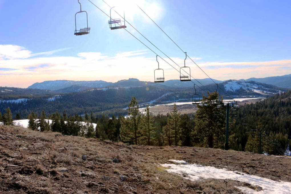
"caption": "In 2015 it was drought that left northern Sierra ski resorts with only patchy snow. In the future rain might be the cause.",
"description": "In 2015 it was drought that left northern Sierra ski resorts with only patchy snow. In the future rain might be the cause.",
"title": "DonnerSR_JEJ_20150226",
"credit": "Joanne Elgart Jennings",
"status": "inherit",
"isLoading": false,
"fetchFailed": false
},
"science_1917875": {
"type": "attachments",
"id": "science_1917875",
"meta": {
"index": "attachments_1716263798",
"site": "science",
"id": "1917875",
"found": true
},
"parent": 1917844,
"imgSizes": {
"small": {
"file": "https://ww2.kqed.org/app/uploads/sites/35/2017/11/RS111_111207-041-520x390.jpg",
"width": 520,
"mimeType": "image/jpeg",
"height": 390
},
"twentyfourteen-full-width": {
"file": "https://ww2.kqed.org/app/uploads/sites/35/2017/11/RS111_111207-041-1038x576.jpg",
"width": 1038,
"mimeType": "image/jpeg",
"height": 576
},
"thumbnail": {
"file": "https://ww2.kqed.org/app/uploads/sites/35/2017/11/RS111_111207-041-160x120.jpg",
"width": 160,
"mimeType": "image/jpeg",
"height": 120
},
"fd-sm": {
"file": "https://ww2.kqed.org/app/uploads/sites/35/2017/11/RS111_111207-041-960x720.jpg",
"width": 960,
"mimeType": "image/jpeg",
"height": 720
},
"post-thumbnail": {
"file": "https://ww2.kqed.org/app/uploads/sites/35/2017/11/RS111_111207-041-672x372.jpg",
"width": 672,
"mimeType": "image/jpeg",
"height": 372
},
"xsmall": {
"file": "https://ww2.kqed.org/app/uploads/sites/35/2017/11/RS111_111207-041-375x281.jpg",
"width": 375,
"mimeType": "image/jpeg",
"height": 281
},
"kqedFullSize": {
"file": "https://ww2.kqed.org/app/uploads/sites/35/2017/11/RS111_111207-041.jpg",
"width": 1600,
"height": 1200
},
"large": {
"file": "https://ww2.kqed.org/app/uploads/sites/35/2017/11/RS111_111207-041-1020x765.jpg",
"width": 1020,
"mimeType": "image/jpeg",
"height": 765
},
"xlarge": {
"file": "https://ww2.kqed.org/app/uploads/sites/35/2017/11/RS111_111207-041-1180x885.jpg",
"width": 1180,
"mimeType": "image/jpeg",
"height": 885
},
"guest-author-50": {
"file": "https://ww2.kqed.org/app/uploads/sites/35/2017/11/RS111_111207-041-50x50.jpg",
"width": 50,
"mimeType": "image/jpeg",
"height": 50
},
"guest-author-96": {
"file": "https://ww2.kqed.org/app/uploads/sites/35/2017/11/RS111_111207-041-96x96.jpg",
"width": 96,
"mimeType": "image/jpeg",
"height": 96
},
"medium": {
"file": "https://ww2.kqed.org/app/uploads/sites/35/2017/11/RS111_111207-041-800x600.jpg",
"width": 800,
"mimeType": "image/jpeg",
"height": 600
},
"guest-author-64": {
"file": "https://ww2.kqed.org/app/uploads/sites/35/2017/11/RS111_111207-041-64x64.jpg",
"width": 64,
"mimeType": "image/jpeg",
"height": 64
},
"guest-author-32": {
"file": "https://ww2.kqed.org/app/uploads/sites/35/2017/11/RS111_111207-041-32x32.jpg",
"width": 32,
"mimeType": "image/jpeg",
"height": 32
},
"fd-med": {
"file": "https://ww2.kqed.org/app/uploads/sites/35/2017/11/RS111_111207-041-1180x885.jpg",
"width": 1180,
"mimeType": "image/jpeg",
"height": 885
},
"detail": {
"file": "https://ww2.kqed.org/app/uploads/sites/35/2017/11/RS111_111207-041-150x150.jpg",
"width": 150,
"mimeType": "image/jpeg",
"height": 150
},
"medium_large": {
"file": "https://ww2.kqed.org/app/uploads/sites/35/2017/11/RS111_111207-041-768x576.jpg",
"width": 768,
"mimeType": "image/jpeg",
"height": 576
},
"guest-author-128": {
"file": "https://ww2.kqed.org/app/uploads/sites/35/2017/11/RS111_111207-041-128x128.jpg",
"width": 128,
"mimeType": "image/jpeg",
"height": 128
},
"xxsmall": {
"file": "https://ww2.kqed.org/app/uploads/sites/35/2017/11/RS111_111207-041-240x180.jpg",
"width": 240,
"mimeType": "image/jpeg",
"height": 180
}
},
"publishDate": 1510975762,
"modified": 1510975850,
"caption": "Cars and trucks generate the largest share of greenhouse gases in California.",
"description": "Cars and trucks generate the largest share of greenhouse gases in California.",
"title": "RS111_111207 041",
"credit": "Craig Miller",
"status": "inherit",
"isLoading": false,
"fetchFailed": false
}
},
"audioPlayerReducer": {
"postId": "stream_live",
"isPaused": true,
"isPlaying": false,
"pfsActive": false,
"pledgeModalIsOpen": true,
"playerDrawerIsOpen": false,
"liveAudioPlayStartedAt": 0,
"liveAudioPlayContext": ""
},
"authorsReducer": {
"byline_science_1918219": {
"type": "authors",
"id": "byline_science_1918219",
"meta": {
"override": true
},
"slug": "byline_science_1918219",
"name": "Nell Greenfieldboyce\u003c/br>NPR",
"isLoading": false
},
"byline_science_1918208": {
"type": "authors",
"id": "byline_science_1918208",
"meta": {
"override": true
},
"slug": "byline_science_1918208",
"name": "Richard Gonzales\u003c/br>NPR",
"isLoading": false
},
"byline_science_1918182": {
"type": "authors",
"id": "byline_science_1918182",
"meta": {
"override": true
},
"slug": "byline_science_1918182",
"name": "Matthew Daly\u003c/br>Associated Press",
"isLoading": false
},
"byline_science_1918143": {
"type": "authors",
"id": "byline_science_1918143",
"meta": {
"override": true
},
"slug": "byline_science_1918143",
"name": "Colin Dwyer",
"isLoading": false
},
"byline_science_1918019": {
"type": "authors",
"id": "byline_science_1918019",
"meta": {
"override": true
},
"slug": "byline_science_1918019",
"name": "Rebecca Feldhaus Adams\u003c/br>NPR",
"isLoading": false
},
"byline_science_1918025": {
"type": "authors",
"id": "byline_science_1918025",
"meta": {
"override": true
},
"slug": "byline_science_1918025",
"name": "Rebecca Hersher\u003c/br>NPR",
"isLoading": false
},
"byline_science_1917995": {
"type": "authors",
"id": "byline_science_1917995",
"meta": {
"override": true
},
"slug": "byline_science_1917995",
"name": "\u003ca href=\"https://www.newsdeeply.com/water/contributor/matt-weiser\" target=\"_blank\" rel=\"noopener\">Matt Weiser\u003c/a>,\u003c/br>Water Deeply",
"isLoading": false
},
"byline_science_1917989": {
"type": "authors",
"id": "byline_science_1917989",
"meta": {
"override": true
},
"slug": "byline_science_1917989",
"name": "\u003ca href=\"https://www.npr.org/people/336057477/marcelo-gleiser\" target=\"_blank\" rel=\"noopener\">Marcelo Gleiser\u003c/a>\u003c/br>NPR",
"isLoading": false
},
"cmiller": {
"type": "authors",
"id": "221",
"meta": {
"index": "authors_1716337520",
"id": "221",
"found": true
},
"name": "Craig Miller",
"firstName": "Craig",
"lastName": "Miller",
"slug": "cmiller",
"email": "craig@voxterra.net",
"display_author_email": false,
"staff_mastheads": [
"science"
],
"title": "Editor Emeritus, Science",
"bio": "Craig is a former KQED Science editor, specializing in weather, climate, water & energy issues, with a little seismology thrown in just to shake things up. Prior to that, he launched and led the station's award-winning multimedia project, Climate Watch. Craig is also an accomplished writer/producer of television documentaries, with a focus on natural resource issues.",
"avatar": "https://secure.gravatar.com/avatar/b91661df645e001a9cafe0861fa685f9?s=600&d=blank&r=g",
"twitter": "voxterra",
"facebook": null,
"instagram": null,
"linkedin": null,
"sites": [
{
"site": "news",
"roles": [
"author"
]
},
{
"site": "futureofyou",
"roles": [
"editor"
]
},
{
"site": "stateofhealth",
"roles": [
"author"
]
},
{
"site": "science",
"roles": [
"editor"
]
},
{
"site": "quest",
"roles": [
"editor"
]
}
],
"headData": {
"title": "Craig Miller | KQED",
"description": "Editor Emeritus, Science",
"ogImgSrc": "https://secure.gravatar.com/avatar/b91661df645e001a9cafe0861fa685f9?s=600&d=blank&r=g",
"twImgSrc": "https://secure.gravatar.com/avatar/b91661df645e001a9cafe0861fa685f9?s=600&d=blank&r=g"
},
"isLoading": false,
"link": "/author/cmiller"
},
"lindseyhoshaw": {
"type": "authors",
"id": "5432",
"meta": {
"index": "authors_1716337520",
"id": "5432",
"found": true
},
"name": "Lindsey Hoshaw",
"firstName": "Lindsey",
"lastName": "Hoshaw",
"slug": "lindseyhoshaw",
"email": "lhoshaw@kqed.org",
"display_author_email": false,
"staff_mastheads": [],
"title": "KQED Contributor",
"bio": "Lindsey Hoshaw is a former interactive producer for KQED Science. Before joining KQED, Lindsey was a science correspondent for The New York Times, The Boston Globe, Forbes and Scientific American. On Twitter @lindseyhoshaw",
"avatar": "https://secure.gravatar.com/avatar/274b07694c998eaa8f26cfabaa941186?s=600&d=mm&r=g",
"twitter": "lindseyhoshaw",
"facebook": "lindsey.hoshaw.9",
"instagram": null,
"linkedin": null,
"sites": [
{
"site": "arts",
"roles": [
"author"
]
},
{
"site": "news",
"roles": [
"subscriber"
]
},
{
"site": "futureofyou",
"roles": [
"editor"
]
},
{
"site": "bayareabites",
"roles": [
"contributor"
]
},
{
"site": "stateofhealth",
"roles": [
"author"
]
},
{
"site": "science",
"roles": [
"edit_theme_options",
"subscriber"
]
},
{
"site": "quest",
"roles": [
"edit_post_subscriptions",
"edit_usergroups",
"unfiltered_html",
"unfiltered_upload",
"leadcoordinator",
"editor"
]
},
{
"site": "food",
"roles": []
}
],
"headData": {
"title": "Lindsey Hoshaw | KQED",
"description": "KQED Contributor",
"ogImgSrc": "https://secure.gravatar.com/avatar/274b07694c998eaa8f26cfabaa941186?s=600&d=mm&r=g",
"twImgSrc": "https://secure.gravatar.com/avatar/274b07694c998eaa8f26cfabaa941186?s=600&d=mm&r=g"
},
"isLoading": false,
"link": "/author/lindseyhoshaw"
}
},
"pagesReducer": {
"science_category_news": {
"type": "terms",
"id": "science_40",
"meta": {
"index": "terms_1716263798",
"site": "science",
"id": "40",
"score": 10.81443
},
"featImg": null,
"name": "News",
"description": null,
"taxonomy": "category",
"headData": {
"twImgId": null,
"twTitle": null,
"ogTitle": null,
"ogImgId": null,
"twDescription": null,
"description": null,
"title": "News Archives | KQED Science",
"ogDescription": null
},
"ttid": 42,
"slug": "news",
"isLoading": false,
"title": "News",
"pageMeta": {
"site": "science",
"WpPageTemplate": "page-topic-editorial",
"currentPage": 190
},
"blocks": [
{
"blockName": "kqed/post-list",
"attrs": {
"layout": "cardArticle2",
"query": "posts/science?category=news",
"seeMore": false,
"paginated": true,
"page": 190
}
},
{
"blockName": "kqed/ad"
}
]
}
},
"pfsSessionReducer": {},
"postsReducer": {
"stream_live": {
"type": "live",
"id": "stream_live",
"audioUrl": "https://streams.kqed.org/kqedradio",
"title": "Live Stream",
"excerpt": "Live Stream information currently unavailable.",
"link": "/radio",
"featImg": "",
"label": {
"name": "KQED Live",
"link": "/"
}
},
"stream_kqedNewscast": {
"type": "posts",
"id": "stream_kqedNewscast",
"audioUrl": "https://www.kqed.org/.stream/anon/radio/RDnews/newscast.mp3?_=1",
"title": "KQED Newscast",
"featImg": "",
"label": {
"name": "88.5 FM",
"link": "/"
}
},
"science_1918228": {
"type": "posts",
"id": "science_1918228",
"meta": {
"index": "posts_1716263798",
"site": "science",
"id": "1918228",
"score": null,
"sort": [
1513002935000
]
},
"parent": 0,
"labelTerm": {},
"blocks": [],
"publishDate": 1513002935,
"format": "audio",
"title": "San Francisco Federal Court Takes Up Young People's Climate Change Suit",
"headTitle": "San Francisco Federal Court Takes Up Young People’s Climate Change Suit | KQED",
"content": "\u003cp>Spot quiz: who said this?\u003c/p>\n\u003cblockquote>\u003cp>\u003cem>“This generation has altered the composition of the atmosphere on a global scale through…a steady increase in carbon dioxide from the burning of fossil fuels.”\u003c/em>\u003c/p>\u003c/blockquote>\n\u003cp>Time’s up.\u003c/p>\n\u003cp>Those were the words of President Lyndon Johnson — in 1965. And you might call him “Exhibit A” in a lawsuit moving through the courts this week, and brought by plaintiffs far too young to remember LBJ.\u003c/p>\n\u003cp>The suit goes back two years to when plaintiffs who now range in age from 12 to 21, sued the Obama Administration over what they consider the U.S. government’s decades-long complicity in the acceleration of global warming.\u003c/p>\n\u003cp>“This is a social rights violation, contributing and promoting climate change,” says Kelsey Juliana of Eugene, Oregon, “because it affects our economy, it affects housing opportunities, it affects — in very serious ways — health.”\u003c/p>\n\u003cp>[ad fullwidth]\u003c/p>\n\u003cp>Juliana is the lead plaintiff in the case,\u003ca href=\"https://www.ourchildrenstrust.org/us/federal-lawsuit\" target=\"_blank\" rel=\"noopener\"> \u003cem>Juliana v. United States\u003c/em>\u003c/a>, which is still battling to get to trial.\u003c/p>\n\u003caside class=\"pullquote alignright\">‘I feel like, as a whole, society right now should be ashamed.’\u003ccite>Avery McRae, age 12\u003c/cite>\u003c/aside>\n\u003cp>“The reality is that our government is just not keeping up with the times,” says the 21-year-old, “and is not keeping up with the urgency and the direness of this climate crisis, which is really why this case is so important and so pressing.”\u003c/p>\n\u003cp>Juliana and her fellow “youth plaintiffs” contend that the federal government has shirked its duty to protect them from the ravages of a changing climate, and thus “infringed on [their] fundamental constitutional rights to life, liberty, and property,” according to the \u003ca href=\"http://blogs2.law.columbia.edu/climate-change-litigation/wp-content/uploads/sites/16/case-documents/2015/20150910_docket-615-cv-1517_complaint-1.pdf\" target=\"_blank\" rel=\"noopener\">original 2015 complaint\u003c/a>, filed in Oregon.\u003c/p>\n\u003cp>After numerous hearings and reams of court filings, the young plaintiffs are now headed to the 9th Circuit Court of Appeals in San Francisco on Monday, where a panel of three judges will hear oral arguments on whether the case can move forward.\u003c/p>\n\u003cp>\u003cem>UPDATE: On Dec. 11, Judges heard oral arguments on the government’s motion. For details, Scott Waldman offers this excellent \u003ca href=\"https://www.eenews.net/climatewire/2017/12/12/stories/1060068695\" target=\"_blank\" rel=\"noopener\">summary for Climatewire\u003c/a>.\u003c/em>\u003c/p>\n\u003cp>“The Trump administration is very scared of our case,” says Phil Gregory, a Burlingame-based lawyer who is representing the youth plaintiffs pro bono.\u003c/p>\n\u003cp>Really? The federal government? Scared of a bunch of kids?\u003c/p>\n\u003cp>“What it will do is place the science in the courtroom,” he says.\u003c/p>\n\u003cfigure id=\"attachment_1918244\" class=\"wp-caption aligncenter\" style=\"max-width: 2000px\">\u003ca href=\"https://ww2.kqed.org/science/wp-content/uploads/sites/35/2017/12/DSC-CUincourt_3907.jpeg\">\u003cimg loading=\"lazy\" decoding=\"async\" class=\"size-full wp-image-1918244\" src=\"https://ww2.kqed.org/science/wp-content/uploads/sites/35/2017/12/DSC-CUincourt_3907.jpeg\" alt=\"Youth plaintiff Kelsey Juliana speaks during a press conference in front of the U.S. Supreme Court in Washington, flanked by co-plaintiffs in their climate suit against the federal government.\" width=\"2000\" height=\"1250\">\u003c/a>\u003cfigcaption class=\"wp-caption-text\">Youth plaintiff Kelsey Juliana speaks during a press conference in front of the U.S. Supreme Court in Washington, flanked by co-plaintiffs in their climate suit against the federal government. \u003ccite>(Robin Loznak)\u003c/cite>\u003c/figcaption>\u003c/figure>\n\u003cp>That is, the Trump administration might have to convince the court that the science linking global warming to things like rising seas and catastrophic wildfires is still too uncertain to constitute a danger (the science endorsed in numerous reports from U.S. government agencies, which the plaintiffs say sort of makes their case).\u003c/p>\n\u003cp>Though the Justice Department declined to comment for this story, its \u003ca href=\"http://climatecasechart.com/case/juliana-v-united-states/\" target=\"_blank\" rel=\"noopener\">court filings\u003c/a> have sought to have the case thrown out. In a motion filed last summer, the government argued that trying the case would place “a staggering burden” on the Trump administration, as it would have to dig up federal documents about climate change and energy policy going back decades.\u003c/p>\n\u003cp>While he admires the plaintiffs’ pluck, legal expert David Levine says he’d be surprised if the case actually gets to trial.\u003c/p>\n\u003cp>“I mean it really is swinging for the fences,” says the UC Hastings law professor, “to have this small group of plaintiffs trying to bring this case against the federal government to effect massive change in policy.”\u003c/p>\n\u003cp>But plaintiff Jacob Lebel, now 20, says without that massive change in policy, his generation will bear the consequences.\u003c/p>\n\u003cp>“Years from now, Trump and his cabinet—they won’t be the ones dealing with starvation and refugees and resource wars and all that stuff,” says Lebel. “We’re the ones who are gonna be dealing with that. As young people, we think about that every single day.”\u003c/p>\n\u003cp>Lebel and his fellow plaintiffs want the courts to force the federal government to set a course that would drastically cut the burning of fossil fuels and dial back atmospheric carbon dioxide — the principal greenhouse gas — from more than 400 parts per million to about 350, a level that scientists have said could stabilize the climate.\u003c/p>\n\u003cp>But is a courtroom the right place to settle the science of climate change?\u003c/p>\n\u003cp>“It’s a little bit like you’re going into a casino,” says Some, like Stanford \u003ca href=\"https://dge.carnegiescience.edu/labs/caldeiralab/\" target=\"_blank\" rel=\"noopener\">climate scientist Ken Caldeira\u003c/a>, “because you don’t know what judge you’re gonna get and what ruling you’re gonna get. So if it ends up embodying bad science into bad law, then that could be bad.”\u003c/p>\n\u003cp>“Bad” because it could give the feds a free pass on climate policy — or as the plaintiffs see it, permission to continue ignoring it.\u003c/p>\n\u003cp>“I feel like, as a whole, society right now should be ashamed,” says Avery McRae.\u003c/p>\n\u003cp>As the youngest plaintiff in the case, she might have the most at stake. But at the ripe old age of 12, she’s not naive about what’s blocking progress on climate at the policy level.\u003c/p>\n\u003cp>“I think that a lot of the choices being made are being made for money,” she laments, “and what a sad thought that we’re putting that before all the beings on this earth. We’re really needing to take action now, and that’s one of the most important things about our lawsuit.”\u003c/p>\n\u003cp>\u003c/p>\n\u003cp>As if to underscore the urgency, \u003ca href=\"https://patricktbrown.org/2017/11/29/greater-future-global-warming-inferred-from-earths-recent-energy-budget/\" target=\"_blank\" rel=\"noopener\">a new study\u003c/a> published just last week by Caldeira’s team at Stanford suggests that most forecast models have likely been understating the pace of global warming.\u003c/p>\n\n",
"stats": {
"hasVideo": false,
"hasChartOrMap": false,
"hasAudio": false,
"hasPolis": false,
"wordCount": 1018,
"hasGoogleForm": false,
"hasGallery": false,
"hasHearkenModule": false,
"iframeSrcs": [],
"paragraphCount": 30
},
"modified": 1704928272,
"excerpt": "This plucky group wants to force climate action at the federal level -- and the White House just wants them to go away.",
"headData": {
"twImgId": "",
"twTitle": "",
"ogTitle": "",
"ogImgId": "",
"twDescription": "",
"description": "This plucky group wants to force climate action at the federal level -- and the White House just wants them to go away.",
"title": "San Francisco Federal Court Takes Up Young People's Climate Change Suit | KQED",
"ogDescription": "",
"schema": {
"@context": "https://schema.org",
"@type": "Article",
"headline": "San Francisco Federal Court Takes Up Young People's Climate Change Suit",
"datePublished": "2017-12-11T06:35:35-08:00",
"dateModified": "2024-01-10T15:11:12-08:00",
"image": "https://cdn.kqed.org/wp-content/uploads/2020/02/KQED-OG-Image@1x.png"
}
},
"guestAuthors": [],
"slug": "san-francisco-federal-court-takes-up-young-peoples-climate-change-suit",
"status": "publish",
"audioUrl": "https://www.kqed.org/.stream/anon/radio/science/2017/12/WEBYouthClimateSuitMiller171211.mp3",
"sticky": false,
"source": "Climate",
"path": "/science/1918228/san-francisco-federal-court-takes-up-young-peoples-climate-change-suit",
"audioDuration": 294000,
"audioTrackLength": null,
"parsedContent": [
{
"type": "contentString",
"content": "\u003cdiv class=\"post-body\">\u003cp>\u003cp>Spot quiz: who said this?\u003c/p>\n\u003cblockquote>\u003cp>\u003cem>“This generation has altered the composition of the atmosphere on a global scale through…a steady increase in carbon dioxide from the burning of fossil fuels.”\u003c/em>\u003c/p>\u003c/blockquote>\n\u003cp>Time’s up.\u003c/p>\n\u003cp>Those were the words of President Lyndon Johnson — in 1965. And you might call him “Exhibit A” in a lawsuit moving through the courts this week, and brought by plaintiffs far too young to remember LBJ.\u003c/p>\n\u003cp>The suit goes back two years to when plaintiffs who now range in age from 12 to 21, sued the Obama Administration over what they consider the U.S. government’s decades-long complicity in the acceleration of global warming.\u003c/p>\n\u003cp>“This is a social rights violation, contributing and promoting climate change,” says Kelsey Juliana of Eugene, Oregon, “because it affects our economy, it affects housing opportunities, it affects — in very serious ways — health.”\u003c/p>\n\u003cp>\u003c/p>\u003c/div>",
"attributes": {
"named": {},
"numeric": []
}
},
{
"type": "component",
"content": "",
"name": "ad",
"attributes": {
"named": {
"label": "fullwidth"
},
"numeric": [
"fullwidth"
]
}
},
{
"type": "contentString",
"content": "\u003cdiv class=\"post-body\">\u003cp>\u003c/p>\n\u003cp>Juliana is the lead plaintiff in the case,\u003ca href=\"https://www.ourchildrenstrust.org/us/federal-lawsuit\" target=\"_blank\" rel=\"noopener\"> \u003cem>Juliana v. United States\u003c/em>\u003c/a>, which is still battling to get to trial.\u003c/p>\n\u003caside class=\"pullquote alignright\">‘I feel like, as a whole, society right now should be ashamed.’\u003ccite>Avery McRae, age 12\u003c/cite>\u003c/aside>\n\u003cp>“The reality is that our government is just not keeping up with the times,” says the 21-year-old, “and is not keeping up with the urgency and the direness of this climate crisis, which is really why this case is so important and so pressing.”\u003c/p>\n\u003cp>Juliana and her fellow “youth plaintiffs” contend that the federal government has shirked its duty to protect them from the ravages of a changing climate, and thus “infringed on [their] fundamental constitutional rights to life, liberty, and property,” according to the \u003ca href=\"http://blogs2.law.columbia.edu/climate-change-litigation/wp-content/uploads/sites/16/case-documents/2015/20150910_docket-615-cv-1517_complaint-1.pdf\" target=\"_blank\" rel=\"noopener\">original 2015 complaint\u003c/a>, filed in Oregon.\u003c/p>\n\u003cp>After numerous hearings and reams of court filings, the young plaintiffs are now headed to the 9th Circuit Court of Appeals in San Francisco on Monday, where a panel of three judges will hear oral arguments on whether the case can move forward.\u003c/p>\n\u003cp>\u003cem>UPDATE: On Dec. 11, Judges heard oral arguments on the government’s motion. For details, Scott Waldman offers this excellent \u003ca href=\"https://www.eenews.net/climatewire/2017/12/12/stories/1060068695\" target=\"_blank\" rel=\"noopener\">summary for Climatewire\u003c/a>.\u003c/em>\u003c/p>\n\u003cp>“The Trump administration is very scared of our case,” says Phil Gregory, a Burlingame-based lawyer who is representing the youth plaintiffs pro bono.\u003c/p>\n\u003cp>Really? The federal government? Scared of a bunch of kids?\u003c/p>\n\u003cp>“What it will do is place the science in the courtroom,” he says.\u003c/p>\n\u003cfigure id=\"attachment_1918244\" class=\"wp-caption aligncenter\" style=\"max-width: 2000px\">\u003ca href=\"https://ww2.kqed.org/science/wp-content/uploads/sites/35/2017/12/DSC-CUincourt_3907.jpeg\">\u003cimg loading=\"lazy\" decoding=\"async\" class=\"size-full wp-image-1918244\" src=\"https://ww2.kqed.org/science/wp-content/uploads/sites/35/2017/12/DSC-CUincourt_3907.jpeg\" alt=\"Youth plaintiff Kelsey Juliana speaks during a press conference in front of the U.S. Supreme Court in Washington, flanked by co-plaintiffs in their climate suit against the federal government.\" width=\"2000\" height=\"1250\">\u003c/a>\u003cfigcaption class=\"wp-caption-text\">Youth plaintiff Kelsey Juliana speaks during a press conference in front of the U.S. Supreme Court in Washington, flanked by co-plaintiffs in their climate suit against the federal government. \u003ccite>(Robin Loznak)\u003c/cite>\u003c/figcaption>\u003c/figure>\n\u003cp>That is, the Trump administration might have to convince the court that the science linking global warming to things like rising seas and catastrophic wildfires is still too uncertain to constitute a danger (the science endorsed in numerous reports from U.S. government agencies, which the plaintiffs say sort of makes their case).\u003c/p>\n\u003cp>Though the Justice Department declined to comment for this story, its \u003ca href=\"http://climatecasechart.com/case/juliana-v-united-states/\" target=\"_blank\" rel=\"noopener\">court filings\u003c/a> have sought to have the case thrown out. In a motion filed last summer, the government argued that trying the case would place “a staggering burden” on the Trump administration, as it would have to dig up federal documents about climate change and energy policy going back decades.\u003c/p>\n\u003cp>While he admires the plaintiffs’ pluck, legal expert David Levine says he’d be surprised if the case actually gets to trial.\u003c/p>\n\u003cp>“I mean it really is swinging for the fences,” says the UC Hastings law professor, “to have this small group of plaintiffs trying to bring this case against the federal government to effect massive change in policy.”\u003c/p>\n\u003cp>But plaintiff Jacob Lebel, now 20, says without that massive change in policy, his generation will bear the consequences.\u003c/p>\n\u003cp>“Years from now, Trump and his cabinet—they won’t be the ones dealing with starvation and refugees and resource wars and all that stuff,” says Lebel. “We’re the ones who are gonna be dealing with that. As young people, we think about that every single day.”\u003c/p>\n\u003cp>Lebel and his fellow plaintiffs want the courts to force the federal government to set a course that would drastically cut the burning of fossil fuels and dial back atmospheric carbon dioxide — the principal greenhouse gas — from more than 400 parts per million to about 350, a level that scientists have said could stabilize the climate.\u003c/p>\n\u003cp>But is a courtroom the right place to settle the science of climate change?\u003c/p>\n\u003cp>“It’s a little bit like you’re going into a casino,” says Some, like Stanford \u003ca href=\"https://dge.carnegiescience.edu/labs/caldeiralab/\" target=\"_blank\" rel=\"noopener\">climate scientist Ken Caldeira\u003c/a>, “because you don’t know what judge you’re gonna get and what ruling you’re gonna get. So if it ends up embodying bad science into bad law, then that could be bad.”\u003c/p>\n\u003cp>“Bad” because it could give the feds a free pass on climate policy — or as the plaintiffs see it, permission to continue ignoring it.\u003c/p>\n\u003cp>“I feel like, as a whole, society right now should be ashamed,” says Avery McRae.\u003c/p>\n\u003cp>As the youngest plaintiff in the case, she might have the most at stake. But at the ripe old age of 12, she’s not naive about what’s blocking progress on climate at the policy level.\u003c/p>\n\u003cp>“I think that a lot of the choices being made are being made for money,” she laments, “and what a sad thought that we’re putting that before all the beings on this earth. We’re really needing to take action now, and that’s one of the most important things about our lawsuit.”\u003c/p>\n\u003cp>\u003c/p>\n\u003cp>As if to underscore the urgency, \u003ca href=\"https://patricktbrown.org/2017/11/29/greater-future-global-warming-inferred-from-earths-recent-energy-budget/\" target=\"_blank\" rel=\"noopener\">a new study\u003c/a> published just last week by Caldeira’s team at Stanford suggests that most forecast models have likely been understating the pace of global warming.\u003c/p>\n\n\u003c/div>\u003c/p>",
"attributes": {
"named": {},
"numeric": []
}
}
],
"link": "/science/1918228/san-francisco-federal-court-takes-up-young-peoples-climate-change-suit",
"authors": [
"221"
],
"categories": [
"science_46",
"science_31",
"science_40",
"science_43"
],
"tags": [
"science_523",
"science_3370",
"science_556"
],
"featImg": "science_1918233",
"label": "source_science_1918228"
},
"science_1918219": {
"type": "posts",
"id": "science_1918219",
"meta": {
"index": "posts_1716263798",
"site": "science",
"id": "1918219",
"score": null,
"sort": [
1512690070000
]
},
"parent": 0,
"labelTerm": {},
"blocks": [],
"publishDate": 1512690070,
"format": "standard",
"title": "Here's What It Looks Like When You Fry Your Eye in an Eclipse",
"headTitle": "Here’s What It Looks Like When You Fry Your Eye in an Eclipse | KQED",
"content": "\u003cp>At least one young woman suffered eye damage as a result of unsafe viewing of the recent total solar eclipse, according to a report published Thursday, but it doesn’t appear that many such injuries occurred.\u003c/p>\n\u003cp>[contextly_sidebar id=”TLby82AtiGw9MQhQUFjwqs3XgUyQfbHg”]Doctors in New York say a woman in her 20s came in three days after looking at the Aug. 21 eclipse without protective glasses. She had peeked several times, for about six seconds, when the sun was only partially covered by the moon.\u003c/p>\n\u003cp>Four hours later, she started experiencing blurred and distorted vision and saw a central black spot in her left eye. The doctors studied her eyes with several different imaging technologies, \u003ca href=\"https://jamanetwork.com/journals/jamaophthalmology/fullarticle/2665184\">described \u003c/a>in the journal \u003cem>JAMA Ophthalmology,\u003c/em> and were able to observe the damage at the cellular level.\u003c/p>\n\u003cp>“We were very surprised at how precisely concordant the imaged damage was with the crescent shape of the eclipse itself,” noted \u003ca href=\"http://www.mountsinai.org/profiles/avnish-a-deobhakta\">Dr. Avnish Deobhakta\u003c/a>, a retina surgeon at New York Eye and Ear Infirmary of Mount Sinai in New York, in an email to NPR.\u003c/p>\n\u003cfigure id=\"attachment_1918221\" class=\"wp-caption alignright\" style=\"max-width: 392px\">\u003ca href=\"https://ww2.kqed.org/science/wp-content/uploads/sites/35/2017/12/figure2_enl-985658f134a9a75a78dbade25333fad69c8d527d.jpe\">\u003cimg loading=\"lazy\" decoding=\"async\" class=\"size-full wp-image-1918221\" src=\"https://ww2.kqed.org/science/wp-content/uploads/sites/35/2017/12/figure2_enl-985658f134a9a75a78dbade25333fad69c8d527d.jpe\" alt=\"\" width=\"392\" height=\"1090\" srcset=\"https://cdn.kqed.org/wp-content/uploads/sites/35/2017/12/figure2_enl-985658f134a9a75a78dbade25333fad69c8d527d.jpe 392w, https://cdn.kqed.org/wp-content/uploads/sites/35/2017/12/figure2_enl-985658f134a9a75a78dbade25333fad69c8d527d-160x445.jpe 160w, https://cdn.kqed.org/wp-content/uploads/sites/35/2017/12/figure2_enl-985658f134a9a75a78dbade25333fad69c8d527d-240x667.jpe 240w, https://cdn.kqed.org/wp-content/uploads/sites/35/2017/12/figure2_enl-985658f134a9a75a78dbade25333fad69c8d527d-375x1043.jpe 375w\" sizes=\"(max-width: 392px) 100vw, 392px\">\u003c/a>\u003cfigcaption class=\"wp-caption-text\">The area between the yellow brackets in the top photo shows the damage to the center part of the retina. The middle image is a type of visual field test and the bottom image uses optical coherence tomography. \u003ccite>(David Hume Kennerly/Getty Images)\u003c/cite>\u003c/figcaption>\u003c/figure>\n\u003cp>He says this was the most severely injured patient they saw after the eclipse. All in all, 22 people came to their urgent care clinic with concerns about possible eclipse-related damage, and most of them complained of blurred vision. Of those, only three showed some degree of abnormality in the retina. Two of them had only mild changes, however, and their symptoms have gone away.\u003c/p>\n\u003cp>[ad fullwidth]\u003c/p>\n\u003cp>The young woman described in this case report, at last check, still has not recovered normal vision. “But we have not been able to follow up with her as closely as we’d like. We would like to see her back in the New Year,” says Deobhakta.\u003c/p>\n\u003cp>Ralph Chou, an expert on eclipse-related eye damage at the University of Waterloo, says he got a report from a colleague of one similar eye injury in Pennsylvania. “This young man had played it safe by only looking at the eclipsing sun with one eye,” notes Chou. “He looked with one eye and he got fried.”\u003c/p>\n\u003cp>While it’s possible that other eye specialists are treating patients but have not publicly reported on them, says Chou, “right now, we haven’t really seen any indication of a lot of cases. … It’s certainly not like what we saw in the United Kingdom after the August 1999 eclipse, where they did a survey and got information on a number of cases of eye damage as a result of observing that eclipse.”\u003c/p>\n\u003cp>Given that some \u003ca href=\"http://ns.umich.edu/new/releases/25108-a-record-number-of-americans-viewed-the-2017-solar-eclipse\">215 million\u003c/a> adult Americans watched the eclipse, says Chou, “it makes us feel like the whole public education campaign was pretty successful.”\u003c/p>\n\u003cp>Injured eyes can often recover in the months following an eclipse, he notes, but if people’s damaged vision hasn’t been improving by now, that means it’s probably permanent.\u003c/p>\n\u003cp>\u003c/p>\n\u003cp>If you still have your special solar glasses and have treated them well, says Chou, you can put them away in a safe place and use them again in 2024, when we’ll get the next total solar eclipse over the continental United States.\u003c/p>\n\u003cdiv class=\"fullattribution\">Copyright 2017 NPR. To see more, visit http://www.npr.org/.\u003cimg decoding=\"async\" src=\"https://www.google-analytics.com/__utm.gif?utmac=UA-5828686-4&utmdt=Here%27s+What+It+Looks+Like+When+You+Fry+Your+Eye+In+An+Eclipse&utme=8(APIKey)9(MDAxOTAwOTE4MDEyMTkxMDAzNjczZDljZA004)\">\u003c/div>\n\n",
"stats": {
"hasVideo": false,
"hasChartOrMap": false,
"hasAudio": false,
"hasPolis": false,
"wordCount": 599,
"hasGoogleForm": false,
"hasGallery": false,
"hasHearkenModule": false,
"iframeSrcs": [],
"paragraphCount": 13
},
"modified": 1704928276,
"excerpt": "Most people seem to have heeded the warning not to look at August's total eclipse without eye protection. But an unlucky few suffered serious injury, and doctors could see changes at a cellular level.",
"headData": {
"twImgId": "",
"twTitle": "",
"ogTitle": "",
"ogImgId": "",
"twDescription": "",
"description": "Most people seem to have heeded the warning not to look at August's total eclipse without eye protection. But an unlucky few suffered serious injury, and doctors could see changes at a cellular level.",
"title": "Here's What It Looks Like When You Fry Your Eye in an Eclipse | KQED",
"ogDescription": "",
"schema": {
"@context": "https://schema.org",
"@type": "Article",
"headline": "Here's What It Looks Like When You Fry Your Eye in an Eclipse",
"datePublished": "2017-12-07T15:41:10-08:00",
"dateModified": "2024-01-10T15:11:16-08:00",
"image": "https://cdn.kqed.org/wp-content/uploads/2020/02/KQED-OG-Image@1x.png"
}
},
"guestAuthors": [],
"slug": "heres-what-it-looks-like-when-you-fry-your-eye-in-an-eclipse",
"status": "publish",
"sourceUrl": "https://www.npr.org/",
"nprApiLink": "http://api.npr.org/query?id=569056796&apiKey=MDAxOTAwOTE4MDEyMTkxMDAzNjczZDljZA004",
"nprByline": "Nell Greenfieldboyce\u003c/br>NPR",
"nprStoryDate": "Thu, 07 Dec 2017 11:06:00 -0500",
"nprLastModifiedDate": "Thu, 07 Dec 2017 17:39:18 -0500",
"sticky": false,
"nprHtmlLink": "https://www.npr.org/sections/health-shots/2017/12/07/569056796/heres-what-it-looks-like-when-you-fry-your-eye-in-an-eclipse?ft=nprml&f=569056796",
"nprImageAgency": "David Hume Kennerly/Getty Images",
"source": "NPR",
"nprStoryId": "569056796",
"nprRetrievedStory": "1",
"nprPubDate": "Thu, 07 Dec 2017 17:39:00 -0500",
"path": "/science/1918219/heres-what-it-looks-like-when-you-fry-your-eye-in-an-eclipse",
"audioTrackLength": null,
"parsedContent": [
{
"type": "contentString",
"content": "\u003cdiv class=\"post-body\">\u003cp>\u003cp>At least one young woman suffered eye damage as a result of unsafe viewing of the recent total solar eclipse, according to a report published Thursday, but it doesn’t appear that many such injuries occurred.\u003c/p>\n\u003cp>\u003c/p>\u003cp>\u003c/p>\u003cp>Doctors in New York say a woman in her 20s came in three days after looking at the Aug. 21 eclipse without protective glasses. She had peeked several times, for about six seconds, when the sun was only partially covered by the moon.\u003c/p>\n\u003cp>Four hours later, she started experiencing blurred and distorted vision and saw a central black spot in her left eye. The doctors studied her eyes with several different imaging technologies, \u003ca href=\"https://jamanetwork.com/journals/jamaophthalmology/fullarticle/2665184\">described \u003c/a>in the journal \u003cem>JAMA Ophthalmology,\u003c/em> and were able to observe the damage at the cellular level.\u003c/p>\n\u003cp>“We were very surprised at how precisely concordant the imaged damage was with the crescent shape of the eclipse itself,” noted \u003ca href=\"http://www.mountsinai.org/profiles/avnish-a-deobhakta\">Dr. Avnish Deobhakta\u003c/a>, a retina surgeon at New York Eye and Ear Infirmary of Mount Sinai in New York, in an email to NPR.\u003c/p>\n\u003cfigure id=\"attachment_1918221\" class=\"wp-caption alignright\" style=\"max-width: 392px\">\u003ca href=\"https://ww2.kqed.org/science/wp-content/uploads/sites/35/2017/12/figure2_enl-985658f134a9a75a78dbade25333fad69c8d527d.jpe\">\u003cimg loading=\"lazy\" decoding=\"async\" class=\"size-full wp-image-1918221\" src=\"https://ww2.kqed.org/science/wp-content/uploads/sites/35/2017/12/figure2_enl-985658f134a9a75a78dbade25333fad69c8d527d.jpe\" alt=\"\" width=\"392\" height=\"1090\" srcset=\"https://cdn.kqed.org/wp-content/uploads/sites/35/2017/12/figure2_enl-985658f134a9a75a78dbade25333fad69c8d527d.jpe 392w, https://cdn.kqed.org/wp-content/uploads/sites/35/2017/12/figure2_enl-985658f134a9a75a78dbade25333fad69c8d527d-160x445.jpe 160w, https://cdn.kqed.org/wp-content/uploads/sites/35/2017/12/figure2_enl-985658f134a9a75a78dbade25333fad69c8d527d-240x667.jpe 240w, https://cdn.kqed.org/wp-content/uploads/sites/35/2017/12/figure2_enl-985658f134a9a75a78dbade25333fad69c8d527d-375x1043.jpe 375w\" sizes=\"(max-width: 392px) 100vw, 392px\">\u003c/a>\u003cfigcaption class=\"wp-caption-text\">The area between the yellow brackets in the top photo shows the damage to the center part of the retina. The middle image is a type of visual field test and the bottom image uses optical coherence tomography. \u003ccite>(David Hume Kennerly/Getty Images)\u003c/cite>\u003c/figcaption>\u003c/figure>\n\u003cp>He says this was the most severely injured patient they saw after the eclipse. All in all, 22 people came to their urgent care clinic with concerns about possible eclipse-related damage, and most of them complained of blurred vision. Of those, only three showed some degree of abnormality in the retina. Two of them had only mild changes, however, and their symptoms have gone away.\u003c/p>\n\u003cp>\u003c/p>\u003c/div>",
"attributes": {
"named": {},
"numeric": []
}
},
{
"type": "component",
"content": "",
"name": "ad",
"attributes": {
"named": {
"label": "fullwidth"
},
"numeric": [
"fullwidth"
]
}
},
{
"type": "contentString",
"content": "\u003cdiv class=\"post-body\">\u003cp>\u003c/p>\n\u003cp>The young woman described in this case report, at last check, still has not recovered normal vision. “But we have not been able to follow up with her as closely as we’d like. We would like to see her back in the New Year,” says Deobhakta.\u003c/p>\n\u003cp>Ralph Chou, an expert on eclipse-related eye damage at the University of Waterloo, says he got a report from a colleague of one similar eye injury in Pennsylvania. “This young man had played it safe by only looking at the eclipsing sun with one eye,” notes Chou. “He looked with one eye and he got fried.”\u003c/p>\n\u003cp>While it’s possible that other eye specialists are treating patients but have not publicly reported on them, says Chou, “right now, we haven’t really seen any indication of a lot of cases. … It’s certainly not like what we saw in the United Kingdom after the August 1999 eclipse, where they did a survey and got information on a number of cases of eye damage as a result of observing that eclipse.”\u003c/p>\n\u003cp>Given that some \u003ca href=\"http://ns.umich.edu/new/releases/25108-a-record-number-of-americans-viewed-the-2017-solar-eclipse\">215 million\u003c/a> adult Americans watched the eclipse, says Chou, “it makes us feel like the whole public education campaign was pretty successful.”\u003c/p>\n\u003cp>Injured eyes can often recover in the months following an eclipse, he notes, but if people’s damaged vision hasn’t been improving by now, that means it’s probably permanent.\u003c/p>\n\u003cp>\u003c/p>\n\u003cp>If you still have your special solar glasses and have treated them well, says Chou, you can put them away in a safe place and use them again in 2024, when we’ll get the next total solar eclipse over the continental United States.\u003c/p>\n\u003cdiv class=\"fullattribution\">Copyright 2017 NPR. To see more, visit http://www.npr.org/.\u003cimg decoding=\"async\" src=\"https://www.google-analytics.com/__utm.gif?utmac=UA-5828686-4&utmdt=Here%27s+What+It+Looks+Like+When+You+Fry+Your+Eye+In+An+Eclipse&utme=8(APIKey)9(MDAxOTAwOTE4MDEyMTkxMDAzNjczZDljZA004)\">\u003c/div>\n\n\u003c/div>\u003c/p>",
"attributes": {
"named": {},
"numeric": []
}
}
],
"link": "/science/1918219/heres-what-it-looks-like-when-you-fry-your-eye-in-an-eclipse",
"authors": [
"byline_science_1918219"
],
"categories": [
"science_28",
"science_3151",
"science_40"
],
"featImg": "science_1918220",
"label": "source_science_1918219"
},
"science_1918208": {
"type": "posts",
"id": "science_1918208",
"meta": {
"index": "posts_1716263798",
"site": "science",
"id": "1918208",
"score": null,
"sort": [
1512659841000
]
},
"parent": 0,
"labelTerm": {},
"blocks": [],
"publishDate": 1512659841,
"format": "standard",
"title": "In Diesel-Emissions Scandal, Senior Volkswagen Executive Sentenced",
"headTitle": "In Diesel-Emissions Scandal, Senior Volkswagen Executive Sentenced | KQED",
"content": "\u003cp>High-ranking U.S.-based Volkswagen executive Oliver Schmidt has been \u003ca href=\"https://www.nytimes.com/2017/12/06/business/oliver-schmidt-volkswagen.html?hp&action=click&pgtype=Homepage&clickSource=story-heading&module=second-column-region®ion=top-news&WT.nav=top-news&_r=1\">sentenced\u003c/a> to seven years in prison and ordered to pay a $400,000 fine for his part in a decade-long diesel-emissions cheating scandal.\u003c/p>\n\u003cp>Schmidt was the chief of Volkswagen’s engineering and environmental office in Michigan. In August, he \u003ca href=\"https://www.nytimes.com/2017/08/04/business/volkswagen-diesel-oliver-schmidt.html\">pleaded guilty\u003c/a> to charges of conspiracy to defraud the federal government and violation of the Clean Air Act by participating in a scheme to circumvent federal emissions tests with rigged devices in diesel cars. Federal regulators uncovered the plot in 2015.\u003c/p>\n\u003cp>Volkswagen already has admitted guilt to charges of conspiracy to commit wire fraud, customs violations and obstruction of justice, as well as violation of the Clean Air Act. The German company has paid more than $20 billion in fines and settlements.\u003c/p>\n\u003cp>In a letter to U.S. District Judge Sean Cox of Detroit, Schmidt acknowledged his guilt. Reading a written \u003ca href=\"https://www.reuters.com/article/us-volkswagen-emissions/volkswagen-executive-sentenced-to-seven-years-for-u-s-emissions-fraud-idUSKBN1E01W1\">statement\u003c/a> in court, Schmidt broke down saying, “I made bad decisions and for that I am sorry.”\u003c/p>\n\u003cp>Federal prosecutors also have charged eight other current or former Volkswagen executives, as \u003cem>The New York Times\u003c/em> reports:\u003c/p>\n\u003cblockquote>\u003cp>“But most of the people suspected of taking part in a conspiracy to defraud United States regulators are out of reach of American justice in Germany, which normally does not extradite its own citizens. Mr. Schmidt may well turn out to suffer the harshest punishment for the emissions fraud even though he was not by any means the only participant or the highest ranking.”\u003c/p>\u003c/blockquote>\n\u003cp>Schmidt was arrested in January while vacationing in Miami with his wife.\u003c/p>\n\u003cdiv class=\"fullattribution\">Copyright 2017 NPR. To see more, visit http://www.npr.org/.\u003cimg decoding=\"async\" src=\"https://www.google-analytics.com/__utm.gif?utmac=UA-5828686-4&utmdt=Senior+Volkswagen+Executive+Sentenced+In+Diesel-Emissions+Scandal&utme=8(APIKey)9(MDAxOTAwOTE4MDEyMTkxMDAzNjczZDljZA004)\">\u003c/div>\n\u003cp>[ad fullwidth]\u003c/p>\u003cp>\u003c/p>\n",
"stats": {
"hasVideo": false,
"hasChartOrMap": false,
"hasAudio": false,
"hasPolis": false,
"wordCount": 282,
"hasGoogleForm": false,
"hasGallery": false,
"hasHearkenModule": false,
"iframeSrcs": [],
"paragraphCount": 9
},
"modified": 1704928278,
"excerpt": "Oliver Schmidt admitted to conspiring to defraud the United States by misleading federal regulators about the emissions of diesel cars and violating clean air laws.",
"headData": {
"twImgId": "",
"twTitle": "",
"ogTitle": "",
"ogImgId": "",
"twDescription": "",
"description": "Oliver Schmidt admitted to conspiring to defraud the United States by misleading federal regulators about the emissions of diesel cars and violating clean air laws.",
"title": "In Diesel-Emissions Scandal, Senior Volkswagen Executive Sentenced | KQED",
"ogDescription": "",
"schema": {
"@context": "https://schema.org",
"@type": "Article",
"headline": "In Diesel-Emissions Scandal, Senior Volkswagen Executive Sentenced",
"datePublished": "2017-12-07T07:17:21-08:00",
"dateModified": "2024-01-10T15:11:18-08:00",
"image": "https://cdn.kqed.org/wp-content/uploads/2020/02/KQED-OG-Image@1x.png"
}
},
"guestAuthors": [],
"slug": "in-diesel-emissions-scandal-senior-volkswagen-executive-sentenced",
"status": "publish",
"sourceUrl": "https://www.npr.org/",
"nprApiLink": "http://api.npr.org/query?id=568949541&apiKey=MDAxOTAwOTE4MDEyMTkxMDAzNjczZDljZA004",
"nprByline": "Richard Gonzales\u003c/br>NPR",
"nprStoryDate": "Wed, 06 Dec 2017 18:01:00 -0500",
"nprLastModifiedDate": "Thu, 07 Dec 2017 08:51:24 -0500",
"sticky": false,
"nprHtmlLink": "https://www.npr.org/sections/thetwo-way/2017/12/06/568949541/senior-volkswagen-executive-sentenced-in-diesel-emissions-scandal?ft=nprml&f=568949541",
"nprImageAgency": "AP",
"source": "NPR",
"nprStoryId": "568949541",
"nprRetrievedStory": "1",
"nprPubDate": "Thu, 07 Dec 2017 08:51:00 -0500",
"path": "/science/1918208/in-diesel-emissions-scandal-senior-volkswagen-executive-sentenced",
"audioTrackLength": null,
"parsedContent": [
{
"type": "contentString",
"content": "\u003cdiv class=\"post-body\">\u003cp>\u003cp>High-ranking U.S.-based Volkswagen executive Oliver Schmidt has been \u003ca href=\"https://www.nytimes.com/2017/12/06/business/oliver-schmidt-volkswagen.html?hp&action=click&pgtype=Homepage&clickSource=story-heading&module=second-column-region®ion=top-news&WT.nav=top-news&_r=1\">sentenced\u003c/a> to seven years in prison and ordered to pay a $400,000 fine for his part in a decade-long diesel-emissions cheating scandal.\u003c/p>\n\u003cp>Schmidt was the chief of Volkswagen’s engineering and environmental office in Michigan. In August, he \u003ca href=\"https://www.nytimes.com/2017/08/04/business/volkswagen-diesel-oliver-schmidt.html\">pleaded guilty\u003c/a> to charges of conspiracy to defraud the federal government and violation of the Clean Air Act by participating in a scheme to circumvent federal emissions tests with rigged devices in diesel cars. Federal regulators uncovered the plot in 2015.\u003c/p>\n\u003cp>Volkswagen already has admitted guilt to charges of conspiracy to commit wire fraud, customs violations and obstruction of justice, as well as violation of the Clean Air Act. The German company has paid more than $20 billion in fines and settlements.\u003c/p>\n\u003cp>In a letter to U.S. District Judge Sean Cox of Detroit, Schmidt acknowledged his guilt. Reading a written \u003ca href=\"https://www.reuters.com/article/us-volkswagen-emissions/volkswagen-executive-sentenced-to-seven-years-for-u-s-emissions-fraud-idUSKBN1E01W1\">statement\u003c/a> in court, Schmidt broke down saying, “I made bad decisions and for that I am sorry.”\u003c/p>\n\u003cp>Federal prosecutors also have charged eight other current or former Volkswagen executives, as \u003cem>The New York Times\u003c/em> reports:\u003c/p>\n\u003cblockquote>\u003cp>“But most of the people suspected of taking part in a conspiracy to defraud United States regulators are out of reach of American justice in Germany, which normally does not extradite its own citizens. Mr. Schmidt may well turn out to suffer the harshest punishment for the emissions fraud even though he was not by any means the only participant or the highest ranking.”\u003c/p>\u003c/blockquote>\n\u003cp>Schmidt was arrested in January while vacationing in Miami with his wife.\u003c/p>\n\u003cdiv class=\"fullattribution\">Copyright 2017 NPR. To see more, visit http://www.npr.org/.\u003cimg decoding=\"async\" src=\"https://www.google-analytics.com/__utm.gif?utmac=UA-5828686-4&utmdt=Senior+Volkswagen+Executive+Sentenced+In+Diesel-Emissions+Scandal&utme=8(APIKey)9(MDAxOTAwOTE4MDEyMTkxMDAzNjczZDljZA004)\">\u003c/div>\n\u003cp>\u003c/p>\u003c/div>",
"attributes": {
"named": {},
"numeric": []
}
},
{
"type": "component",
"content": "",
"name": "ad",
"attributes": {
"named": {
"label": "fullwidth"
},
"numeric": [
"fullwidth"
]
}
},
{
"type": "contentString",
"content": "\u003cdiv class=\"post-body\">\u003cp>\u003c/p>\u003cp>\u003c/p>\n\u003c/div>\u003c/p>",
"attributes": {
"named": {},
"numeric": []
}
}
],
"link": "/science/1918208/in-diesel-emissions-scandal-senior-volkswagen-executive-sentenced",
"authors": [
"byline_science_1918208"
],
"categories": [
"science_31",
"science_35",
"science_40"
],
"tags": [
"science_3370"
],
"featImg": "science_1918211",
"label": "source_science_1918208"
},
"science_1918182": {
"type": "posts",
"id": "science_1918182",
"meta": {
"index": "posts_1716263798",
"site": "science",
"id": "1918182",
"score": null,
"sort": [
1512506037000
]
},
"parent": 0,
"labelTerm": {},
"blocks": [],
"publishDate": 1512506037,
"format": "aside",
"title": "Zinke Says Claim That Trump 'Stole' Public Land Is a Lie",
"headTitle": "Zinke Says Claim That Trump ‘Stole’ Public Land Is a Lie | KQED",
"content": "\u003cp>\u003cspan style=\"font-size: 4.6875em;float: left;line-height: 0.733em;padding: 0.05em 0.1em 0 0;font-family: times, serif, georgia\">I\u003c/span>nterior Secretary Ryan Zinke is strongly disputing a claim by outdoor retailer Patagonia that President Donald Trump “stole” public land by shrinking two national monuments in Utah.\u003c/p>\n\u003cp>Zinke calls the claim — made in large type on \u003ca href=\"http://www.patagonia.com/home/\" target=\"_blank\" rel=\"noopener\">the company’s home page\u003c/a> — “nefarious, false and a lie.”\u003c/p>\n\u003cp>Zinke says in a conference call Tuesday that “it’s shameful and appalling” that Patagonia and other retailers “would blatantly lie in order to get money in their coffers.”\u003c/p>\n\u003cp>https://twitter.com/patagonia/status/937779717662314496\u003c/p>\n\u003cp>Patagonia replaced its usual home page Monday night with a stark message declaring, “The President Stole Your Land.” The message called Trump’s actions to shrink \u003ca href=\"https://www.fs.fed.us/visit/bears-ears-national-monument\" rel=\"noopener\" target=\"_blank\">Bears Ears\u003c/a> and \u003ca href=\"https://utah.com/grand-staircase-escalante\" rel=\"noopener\" target=\"_blank\">Grand Staircase-Escalante \u003c/a>national monuments “illegal” and the largest elimination of protected land in American history.\u003c/p>\n\u003cp>[ad fullwidth]\u003c/p>\n\u003cp>\u003c/p>\n\u003cp>Outdoor retailer REI also criticized Trump but in less harsh language.\u003c/p>\n\n",
"stats": {
"hasVideo": false,
"hasChartOrMap": false,
"hasAudio": false,
"hasPolis": false,
"wordCount": 156,
"hasGoogleForm": false,
"hasGallery": false,
"hasHearkenModule": false,
"iframeSrcs": [],
"paragraphCount": 7
},
"modified": 1704928279,
"excerpt": "Interior Secretary Ryan Zinke addressed backlash from outdoor enthusiasts and retailers after President Trump shrank national monuments in Utah on Monday.",
"headData": {
"twImgId": "",
"twTitle": "",
"ogTitle": "",
"ogImgId": "",
"twDescription": "",
"description": "Interior Secretary Ryan Zinke addressed backlash from outdoor enthusiasts and retailers after President Trump shrank national monuments in Utah on Monday.",
"title": "Zinke Says Claim That Trump 'Stole' Public Land Is a Lie | KQED",
"ogDescription": "",
"schema": {
"@context": "https://schema.org",
"@type": "Article",
"headline": "Zinke Says Claim That Trump 'Stole' Public Land Is a Lie",
"datePublished": "2017-12-05T12:33:57-08:00",
"dateModified": "2024-01-10T15:11:19-08:00",
"image": "https://cdn.kqed.org/wp-content/uploads/2020/02/KQED-OG-Image@1x.png"
}
},
"guestAuthors": [],
"slug": "zinke-says-claim-that-trump-stole-public-land-is-a-lie",
"status": "publish",
"nprByline": "Matthew Daly\u003c/br>Associated Press",
"sticky": false,
"source": "Associated Press",
"path": "/science/1918182/zinke-says-claim-that-trump-stole-public-land-is-a-lie",
"audioTrackLength": null,
"parsedContent": [
{
"type": "contentString",
"content": "\u003cdiv class=\"post-body\">\u003cp>\u003cp>\u003cspan style=\"font-size: 4.6875em;float: left;line-height: 0.733em;padding: 0.05em 0.1em 0 0;font-family: times, serif, georgia\">I\u003c/span>nterior Secretary Ryan Zinke is strongly disputing a claim by outdoor retailer Patagonia that President Donald Trump “stole” public land by shrinking two national monuments in Utah.\u003c/p>\n\u003cp>Zinke calls the claim — made in large type on \u003ca href=\"http://www.patagonia.com/home/\" target=\"_blank\" rel=\"noopener\">the company’s home page\u003c/a> — “nefarious, false and a lie.”\u003c/p>\n\u003cp>Zinke says in a conference call Tuesday that “it’s shameful and appalling” that Patagonia and other retailers “would blatantly lie in order to get money in their coffers.”\u003c/p>\u003c/p>\u003c/div>",
"attributes": {
"named": {},
"numeric": []
}
},
{
"type": "component",
"content": "",
"name": "singleTwitterStatus",
"attributes": {
"named": {
"id": "937779717662314496"
},
"numeric": []
}
},
{
"type": "contentString",
"content": "\u003cdiv class=\"post-body\">\u003cp>\n\u003cp>Patagonia replaced its usual home page Monday night with a stark message declaring, “The President Stole Your Land.” The message called Trump’s actions to shrink \u003ca href=\"https://www.fs.fed.us/visit/bears-ears-national-monument\" rel=\"noopener\" target=\"_blank\">Bears Ears\u003c/a> and \u003ca href=\"https://utah.com/grand-staircase-escalante\" rel=\"noopener\" target=\"_blank\">Grand Staircase-Escalante \u003c/a>national monuments “illegal” and the largest elimination of protected land in American history.\u003c/p>\n\u003cp>\u003c/p>\u003c/div>",
"attributes": {
"named": {},
"numeric": []
}
},
{
"type": "component",
"content": "",
"name": "ad",
"attributes": {
"named": {
"label": "fullwidth"
},
"numeric": [
"fullwidth"
]
}
},
{
"type": "contentString",
"content": "\u003cdiv class=\"post-body\">\u003cp>\u003c/p>\n\u003cp>\u003c/p>\n\u003cp>Outdoor retailer REI also criticized Trump but in less harsh language.\u003c/p>\n\n\u003c/div>\u003c/p>",
"attributes": {
"named": {},
"numeric": []
}
}
],
"link": "/science/1918182/zinke-says-claim-that-trump-stole-public-land-is-a-lie",
"authors": [
"byline_science_1918182"
],
"categories": [
"science_35",
"science_40"
],
"featImg": "science_1918145",
"label": "source_science_1918182"
},
"science_1918143": {
"type": "posts",
"id": "science_1918143",
"meta": {
"index": "posts_1716263798",
"site": "science",
"id": "1918143",
"score": null,
"sort": [
1512393240000
]
},
"parent": 0,
"labelTerm": {
"site": "science"
},
"blocks": [],
"publishDate": 1512393240,
"format": "standard",
"title": "Trump Orders Largest National Monument Reduction in U.S. History",
"headTitle": "Trump Orders Largest National Monument Reduction in U.S. History | KQED",
"content": "\u003cp>\u003cstrong>Updated at 6:30 p.m. PST\u003c/strong>\u003c/p>\n\u003cp>On a visit to Utah on Monday, President Trump announced his proclamations dramatically shrinking the size of the state’s two massive national monuments, Bears Ears and Grand Staircase-Escalante. Taken together, Trump’s orders mark \u003ca href=\"https://www.nps.gov/archeology/sites/antiquities/monumentslist.htm\">the largest reversal\u003c/a> of national monument protections in U.S. history.\u003c/p>\n\u003cp>The change has already been challenged in court by conservation groups.\u003c/p>\n\u003cp>The Bears Ears National Monument will go from roughly 1.3 million acres to roughly 228,000 — only about 15 percent of its original size. And Grand Staircase will be diminished by roughly half, from its nearly 1.9 million acres to about 1 million. The specific numbers were provided to reporters by Interior Secretary Ryan Zinke prior to Trump’s announcement in Salt Lake City.\u003c/p>\n\u003cp>“No one values the splendor of Utah more than you do,” Trump told an enthusiastic crowd Monday, “and no one knows better how to use it.”\u003c/p>\n\u003cp>[ad fullwidth]\u003c/p>\n\u003cp>He noted that before making the decision, he had discussed it with Zinke and the state’s two GOP senators, Orrin Hatch and Mike Lee. Both senators have been outspoken critics of the two national monuments — both protected under \u003ca href=\"https://www.nps.gov/subjects/legal/american-antiquities-act-of-1906.htm\">the 1906 Antiquities Act\u003c/a> by Democratic presidents — framing them as significant federal overreach that deprives Utahans of their own land.\u003c/p>\n\u003cp>And Trump echoed those criticisms Monday.\u003c/p>\n\u003cp>“These abuses of the Antiquities Act give enormous power to faraway bureaucrats at the expense of the people who actually live here, work here and make this place their home,” Trump said.\u003c/p>\n\u003cp>His decision caps months of speculation and a controversial review of the boundaries of large national monuments that protect more than 100,000 acres of U.S. public land. The review, conducted by Zinke, originally looked at more than two dozen \u003ca href=\"https://www.npr.org/sections/thetwo-way/2017/04/28/525883061/photos-see-the-sweeping-american-landscapes-under-review-by-trump\">national monuments\u003c/a> designated by presidential decree since the 1990s.\u003c/p>\n\u003cp>Utah, with its new Bears Ears monument and the Grand Staircase National Monument, has always been at the center of the debate and largely what spurred the review. Trump’s predecessor, President Barack Obama, \u003ca href=\"https://www.npr.org/sections/thetwo-way/2016/12/28/507314596/obama-designates-two-new-national-monuments-in-nevada-and-utah\">created Bears Ears\u003c/a> shortly before leaving office, while the Grand Staircase monument dates to the Clinton administration.\u003c/p>\n\u003cp>And depending on which side you’re on, Monday’s announcement is either about an overreaching federal government that prevented development on large amounts of federal land with little local support or it’s the latest example of the U.S. government breaking promises with Native Americans and eroding environmental protections.\u003c/p>\n\u003cp>\u003cstrong>The case to reduce the monuments\u003c/strong>\u003c/p>\n\u003cp>Utah’s Republican congressional delegation, along with county commissions and conservative groups, pressed the administration to open up these federal lands once more for private use.\u003c/p>\n\u003cp>“President Trump’s decision to reduce these monuments allows us to still protect those areas that need protection, while at the same time keeping the area open and accessible to locals who depend on this land for their daily lives,” said Matt Anderson of the Utah-based Sutherland Institute.\u003c/p>\n\u003cp>Anderson says large, public-land national monuments hurt rural counties. These areas already have large amounts of federal public land, he says, where cattle grazing, mining and other types of private enterprise are heavily regulated.\u003c/p>\n\u003cp>Rural Utah is still fuming from President Bill Clinton’s designation of the Grand Staircase in 1996, which grandfathered in existing cattle-grazing leases and other uses but also nixed a proposed coal mine. Clinton signed the proclamation at the Grand Canyon, in Arizona, and Utah officials at the time said they were blindsided.\u003c/p>\n\u003cp>“When you designate a large national monument, you restrict access to the land and you block traditional uses of the land,” Anderson said.\u003c/p>\n\u003cp>The home of Bears Ears, rural San Juan County, is often cited as one of Utah’s poorest, and more than 60 percent of all its land is owned and managed by the federal government.\u003c/p>\n\u003cp>\u003cstrong>“A sad day for Indigenous people and for America”\u003c/strong>\u003c/p>\n\u003cp>During his speech Monday, Trump said the national monument designations also “prevent Native Americans from having their rightful voice over the sacred land where they practice their most important ancestral and religious traditions.”\u003c/p>\n\u003cp>Many tribal leaders and activists are likely to deeply object to this assessment. For months, they have passionately campaigned to preserve the national monument designations — and now, upon hearing Trump’s proclamations, they are promising to sue.\u003c/p>\n\u003cp>“The Navajo Nation has made repeated requests to meet with President Trump on this issue. The Bears Ears Monument is of critical importance, not only to the Navajo Nation but to many tribes in the region,” Navajo Nation President Russell Begaye said in a written \u003ca href=\"https://us15.campaign-archive.com/?u=0bf367cc7bf787cb9b02b21c8&id=632dd6343f\">statement\u003c/a>.\u003c/p>\n\u003cp>“The decision to reduce the size of the Monument is being made with no tribal consultation,” he said. “The Navajo Nation will defend Bears Ears. The reduction in the size of the Monument leaves us no choice but to litigate this decision.”\u003c/p>\n\u003cp>“Bears Ears National Monument is not just for Native Americans but for all Americans,” Vice President Jonathan Nez said. “This is a sad day for Indigenous people and for America.”\u003c/p>\n\u003cp>Bears Ears is considered some of the most culturally significant land in the American Southwest. Its famous Red Rock Canyon country is dense with ancient artifacts, cliff dwellings and sacred burial grounds. Just a couple of years ago, some of the land was proposed for additional federal protections, but a bill backed by Utah’s House Republicans stalled in Congress. Then, last year, the Obama administration held meetings in the region before declaring it a national monument in late December under the 1906 Antiquities Act.\u003c/p>\n\u003cp>Tribal leaders took to the streets of Salt Lake City over the weekend to protest the president’s decision. At a rally Saturday, Ethel Branch, attorney general of the Navajo Nation, predicted the president wouldn’t even set foot on or see the land in question.\u003c/p>\n\u003cp>“I want him to visit Bears Ears before he takes any action,” Branch told a cheering crowd at a rally outside the Utah Capitol.\u003c/p>\n\u003cp>But Trump did not visit Bears Ears. The monument is more than a five-hour drive from Salt Lake City, and the president’s tight schedule, which included a trip to the Church of Jesus Christ of Latter-day Saints’ Welfare Square, brought him home to the White House by the end of the day.\u003c/p>\n\u003cp>\u003cstrong>Next stop: the courtroom\u003c/strong>\u003c/p>\n\u003cp>The Navajo Nation isn’t the only group to announce its intention to sue the Trump administration over his proclamations. Conservationists have also voiced their objections — and their plans to bring those objections to court.\u003c/p>\n\u003cp>By late Monday, 10 conservation groups had filed a \u003ca href=\"https://earthjustice.org/sites/default/files/files/TWS-v.-Trump.pdf\">lawsuit\u003c/a>, alleging that Trump’s action was “unlawful” and an abuse of his authority. The suit argues that the law “authorizes Presidents to create a national monument; it does not authorize Presidents to abolish them either in whole or in part, as President Trump’s action attempts to do.”\u003c/p>\n\u003cp>“I think the only thing this administration understands is lawsuits,” Yvon Chouinard, founder and CEO of outdoor gear company \u003ca href=\"http://www.patagonia.com/home/\">Patagonia\u003c/a>, \u003ca href=\"http://www.cnn.com/2017/12/04/politics/utah-monuments-trump-weir/index.html\">told CNN\u003c/a>. “We’re losing this planet, and we have an evil government. And not just the federal government, but wacko politicians out of Utah and places. I mean, it’s evil. And I’m not going to stand back and just let evil win.” The company is not a party in the conservationists’ lawsuit.\u003c/p>\n\u003cp>Republicans in Congress have proposed changes to the Antiquities Act, which was originally intended to protect against the looting of ancient artifacts from public land, to make it harder for presidents to use it as a means to create large national monuments.\u003c/p>\n\u003cp>The law, as written, authorizes the president to designate these monuments — but it is gray on the matter of whether a president can actually shrink or abolish a large, already-existing monument. Sixteen presidents have used the Antiquities Act to create public-lands monuments, but legal experts say that the task of modifying public lands has historically been the role of Congress.\u003c/p>\n\u003cp>“President Trump’s dramatic reduction of the Bears Ears National Monument is a direct attack on the Antiquities Act and America’s public lands. We intend to challenge this action in federal court,” Stephanie Meeks, president and CEO of the National Trust for Historic Preservation, said in a statement Monday after the announcement.\u003c/p>\n\u003cp>“Rolling back the designation of Bears Ears leaves thousands of extraordinary archaeological sites vulnerable to looting and vandalism. The President’s action also opens the remarkable Bears Ears’ landscape to incompatible oil and gas development.” she said.\u003c/p>\n\u003cp>“This arbitrary review and illegal action will not go unchallenged,” said Nicole Croft, executive director of Grand Staircase Escalante Partners.\u003c/p>\n\u003cp>Environmentalists like Croft fear the decision could set a precedent for future presidents to unravel protections on federal land.\u003c/p>\n\u003cp>[ad floatright]\u003c/p>\n\u003cp>“The experience of exploration, wonder and humility at the grandeur of the natural world is one our children and their children deserve, and that is what this administration is trying to rob from our future,” she said.\u003c/p>\n\u003cdiv class=\"fullattribution\">Copyright 2017 NPR. To see more, visit http://www.npr.org/.\u003cimg decoding=\"async\" src=\"https://www.google-analytics.com/__utm.gif?utmac=UA-5828686-4&utmdt=Trump+Orders+Largest+National+Monument+Reduction+In+U.S.+History&utme=8(APIKey)9(MDAxOTAwOTE4MDEyMTkxMDAzNjczZDljZA004)\">\u003c/div>\n\n",
"stats": {
"hasVideo": false,
"hasChartOrMap": false,
"hasAudio": false,
"hasPolis": false,
"wordCount": 1575,
"hasGoogleForm": false,
"hasGallery": false,
"hasHearkenModule": false,
"iframeSrcs": [],
"paragraphCount": 41
},
"modified": 1704928280,
"excerpt": "In a speech in Utah on Monday, President Trump announced that his administration will shrink the Bears Ears National Monument by roughly 85 percent and the Grand Staircase by about half its size.",
"headData": {
"twImgId": "",
"twTitle": "",
"ogTitle": "",
"ogImgId": "",
"twDescription": "",
"description": "In a speech in Utah on Monday, President Trump announced that his administration will shrink the Bears Ears National Monument by roughly 85 percent and the Grand Staircase by about half its size.",
"title": "Trump Orders Largest National Monument Reduction in U.S. History | KQED",
"ogDescription": "",
"schema": {
"@context": "https://schema.org",
"@type": "Article",
"headline": "Trump Orders Largest National Monument Reduction in U.S. History",
"datePublished": "2017-12-04T05:14:00-08:00",
"dateModified": "2024-01-10T15:11:20-08:00",
"image": "https://cdn.kqed.org/wp-content/uploads/2020/02/KQED-OG-Image@1x.png"
}
},
"guestAuthors": [],
"slug": "trump-to-take-aim-at-utahs-national-monuments-reversing-predecessors-legacies",
"status": "publish",
"nprApiLink": "http://api.npr.org/query?id=567803476&apiKey=MDAxOTAwOTE4MDEyMTkxMDAzNjczZDljZA004",
"nprStoryDate": "Mon, 04 Dec 2017 05:14:00 -0500",
"nprLastModifiedDate": "Tue, 05 Dec 2017 12:19:43 -0500",
"nprHtmlLink": "https://www.npr.org/sections/thetwo-way/2017/12/04/567803476/trump-dramatically-shrinks-2-utah-national-monuments?ft=nprml&f=567803476",
"nprAudio": "https://ondemand.npr.org/anon.npr-mp3/npr/me/2017/12/20171204_me_trump_to_take_aim_at_utahs_national_monuments_reversing_predecessors_legacies_.mp3?orgId=1&topicId=1003&d=167&p=3&story=567803476&ft=nprml&f=567803476",
"nprImageAgency": "NPR",
"nprAudioM3u": "http://api.npr.org/m3u/1568255266-78cf10.m3u?orgId=1&topicId=1003&d=167&p=3&story=567803476&ft=nprml&f=567803476",
"nprStoryId": "567803476",
"nprByline": "Colin Dwyer",
"sticky": false,
"nprImageCredit": "Howard Berkes",
"nprRetrievedStory": "1",
"nprPubDate": "Tue, 05 Dec 2017 12:19:00 -0500",
"path": "/science/1918143/trump-to-take-aim-at-utahs-national-monuments-reversing-predecessors-legacies",
"audioUrl": "https://ondemand.npr.org/anon.npr-mp3/npr/me/2017/12/20171204_me_trump_to_take_aim_at_utahs_national_monuments_reversing_predecessors_legacies_.mp3?orgId=1&topicId=1003&d=167&p=3&story=567803476&ft=nprml&f=567803476",
"audioTrackLength": null,
"parsedContent": [
{
"type": "contentString",
"content": "\u003cdiv class=\"post-body\">\u003cp>\u003cp>\u003cstrong>Updated at 6:30 p.m. PST\u003c/strong>\u003c/p>\n\u003cp>On a visit to Utah on Monday, President Trump announced his proclamations dramatically shrinking the size of the state’s two massive national monuments, Bears Ears and Grand Staircase-Escalante. Taken together, Trump’s orders mark \u003ca href=\"https://www.nps.gov/archeology/sites/antiquities/monumentslist.htm\">the largest reversal\u003c/a> of national monument protections in U.S. history.\u003c/p>\n\u003cp>The change has already been challenged in court by conservation groups.\u003c/p>\n\u003cp>The Bears Ears National Monument will go from roughly 1.3 million acres to roughly 228,000 — only about 15 percent of its original size. And Grand Staircase will be diminished by roughly half, from its nearly 1.9 million acres to about 1 million. The specific numbers were provided to reporters by Interior Secretary Ryan Zinke prior to Trump’s announcement in Salt Lake City.\u003c/p>\n\u003cp>“No one values the splendor of Utah more than you do,” Trump told an enthusiastic crowd Monday, “and no one knows better how to use it.”\u003c/p>\n\u003cp>\u003c/p>\u003c/div>",
"attributes": {
"named": {},
"numeric": []
}
},
{
"type": "component",
"content": "",
"name": "ad",
"attributes": {
"named": {
"label": "fullwidth"
},
"numeric": [
"fullwidth"
]
}
},
{
"type": "contentString",
"content": "\u003cdiv class=\"post-body\">\u003cp>\u003c/p>\n\u003cp>He noted that before making the decision, he had discussed it with Zinke and the state’s two GOP senators, Orrin Hatch and Mike Lee. Both senators have been outspoken critics of the two national monuments — both protected under \u003ca href=\"https://www.nps.gov/subjects/legal/american-antiquities-act-of-1906.htm\">the 1906 Antiquities Act\u003c/a> by Democratic presidents — framing them as significant federal overreach that deprives Utahans of their own land.\u003c/p>\n\u003cp>And Trump echoed those criticisms Monday.\u003c/p>\n\u003cp>“These abuses of the Antiquities Act give enormous power to faraway bureaucrats at the expense of the people who actually live here, work here and make this place their home,” Trump said.\u003c/p>\n\u003cp>His decision caps months of speculation and a controversial review of the boundaries of large national monuments that protect more than 100,000 acres of U.S. public land. The review, conducted by Zinke, originally looked at more than two dozen \u003ca href=\"https://www.npr.org/sections/thetwo-way/2017/04/28/525883061/photos-see-the-sweeping-american-landscapes-under-review-by-trump\">national monuments\u003c/a> designated by presidential decree since the 1990s.\u003c/p>\n\u003cp>Utah, with its new Bears Ears monument and the Grand Staircase National Monument, has always been at the center of the debate and largely what spurred the review. Trump’s predecessor, President Barack Obama, \u003ca href=\"https://www.npr.org/sections/thetwo-way/2016/12/28/507314596/obama-designates-two-new-national-monuments-in-nevada-and-utah\">created Bears Ears\u003c/a> shortly before leaving office, while the Grand Staircase monument dates to the Clinton administration.\u003c/p>\n\u003cp>And depending on which side you’re on, Monday’s announcement is either about an overreaching federal government that prevented development on large amounts of federal land with little local support or it’s the latest example of the U.S. government breaking promises with Native Americans and eroding environmental protections.\u003c/p>\n\u003cp>\u003cstrong>The case to reduce the monuments\u003c/strong>\u003c/p>\n\u003cp>Utah’s Republican congressional delegation, along with county commissions and conservative groups, pressed the administration to open up these federal lands once more for private use.\u003c/p>\n\u003cp>“President Trump’s decision to reduce these monuments allows us to still protect those areas that need protection, while at the same time keeping the area open and accessible to locals who depend on this land for their daily lives,” said Matt Anderson of the Utah-based Sutherland Institute.\u003c/p>\n\u003cp>Anderson says large, public-land national monuments hurt rural counties. These areas already have large amounts of federal public land, he says, where cattle grazing, mining and other types of private enterprise are heavily regulated.\u003c/p>\n\u003cp>Rural Utah is still fuming from President Bill Clinton’s designation of the Grand Staircase in 1996, which grandfathered in existing cattle-grazing leases and other uses but also nixed a proposed coal mine. Clinton signed the proclamation at the Grand Canyon, in Arizona, and Utah officials at the time said they were blindsided.\u003c/p>\n\u003cp>“When you designate a large national monument, you restrict access to the land and you block traditional uses of the land,” Anderson said.\u003c/p>\n\u003cp>The home of Bears Ears, rural San Juan County, is often cited as one of Utah’s poorest, and more than 60 percent of all its land is owned and managed by the federal government.\u003c/p>\n\u003cp>\u003cstrong>“A sad day for Indigenous people and for America”\u003c/strong>\u003c/p>\n\u003cp>During his speech Monday, Trump said the national monument designations also “prevent Native Americans from having their rightful voice over the sacred land where they practice their most important ancestral and religious traditions.”\u003c/p>\n\u003cp>Many tribal leaders and activists are likely to deeply object to this assessment. For months, they have passionately campaigned to preserve the national monument designations — and now, upon hearing Trump’s proclamations, they are promising to sue.\u003c/p>\n\u003cp>“The Navajo Nation has made repeated requests to meet with President Trump on this issue. The Bears Ears Monument is of critical importance, not only to the Navajo Nation but to many tribes in the region,” Navajo Nation President Russell Begaye said in a written \u003ca href=\"https://us15.campaign-archive.com/?u=0bf367cc7bf787cb9b02b21c8&id=632dd6343f\">statement\u003c/a>.\u003c/p>\n\u003cp>“The decision to reduce the size of the Monument is being made with no tribal consultation,” he said. “The Navajo Nation will defend Bears Ears. The reduction in the size of the Monument leaves us no choice but to litigate this decision.”\u003c/p>\n\u003cp>“Bears Ears National Monument is not just for Native Americans but for all Americans,” Vice President Jonathan Nez said. “This is a sad day for Indigenous people and for America.”\u003c/p>\n\u003cp>Bears Ears is considered some of the most culturally significant land in the American Southwest. Its famous Red Rock Canyon country is dense with ancient artifacts, cliff dwellings and sacred burial grounds. Just a couple of years ago, some of the land was proposed for additional federal protections, but a bill backed by Utah’s House Republicans stalled in Congress. Then, last year, the Obama administration held meetings in the region before declaring it a national monument in late December under the 1906 Antiquities Act.\u003c/p>\n\u003cp>Tribal leaders took to the streets of Salt Lake City over the weekend to protest the president’s decision. At a rally Saturday, Ethel Branch, attorney general of the Navajo Nation, predicted the president wouldn’t even set foot on or see the land in question.\u003c/p>\n\u003cp>“I want him to visit Bears Ears before he takes any action,” Branch told a cheering crowd at a rally outside the Utah Capitol.\u003c/p>\n\u003cp>But Trump did not visit Bears Ears. The monument is more than a five-hour drive from Salt Lake City, and the president’s tight schedule, which included a trip to the Church of Jesus Christ of Latter-day Saints’ Welfare Square, brought him home to the White House by the end of the day.\u003c/p>\n\u003cp>\u003cstrong>Next stop: the courtroom\u003c/strong>\u003c/p>\n\u003cp>The Navajo Nation isn’t the only group to announce its intention to sue the Trump administration over his proclamations. Conservationists have also voiced their objections — and their plans to bring those objections to court.\u003c/p>\n\u003cp>By late Monday, 10 conservation groups had filed a \u003ca href=\"https://earthjustice.org/sites/default/files/files/TWS-v.-Trump.pdf\">lawsuit\u003c/a>, alleging that Trump’s action was “unlawful” and an abuse of his authority. The suit argues that the law “authorizes Presidents to create a national monument; it does not authorize Presidents to abolish them either in whole or in part, as President Trump’s action attempts to do.”\u003c/p>\n\u003cp>“I think the only thing this administration understands is lawsuits,” Yvon Chouinard, founder and CEO of outdoor gear company \u003ca href=\"http://www.patagonia.com/home/\">Patagonia\u003c/a>, \u003ca href=\"http://www.cnn.com/2017/12/04/politics/utah-monuments-trump-weir/index.html\">told CNN\u003c/a>. “We’re losing this planet, and we have an evil government. And not just the federal government, but wacko politicians out of Utah and places. I mean, it’s evil. And I’m not going to stand back and just let evil win.” The company is not a party in the conservationists’ lawsuit.\u003c/p>\n\u003cp>Republicans in Congress have proposed changes to the Antiquities Act, which was originally intended to protect against the looting of ancient artifacts from public land, to make it harder for presidents to use it as a means to create large national monuments.\u003c/p>\n\u003cp>The law, as written, authorizes the president to designate these monuments — but it is gray on the matter of whether a president can actually shrink or abolish a large, already-existing monument. Sixteen presidents have used the Antiquities Act to create public-lands monuments, but legal experts say that the task of modifying public lands has historically been the role of Congress.\u003c/p>\n\u003cp>“President Trump’s dramatic reduction of the Bears Ears National Monument is a direct attack on the Antiquities Act and America’s public lands. We intend to challenge this action in federal court,” Stephanie Meeks, president and CEO of the National Trust for Historic Preservation, said in a statement Monday after the announcement.\u003c/p>\n\u003cp>“Rolling back the designation of Bears Ears leaves thousands of extraordinary archaeological sites vulnerable to looting and vandalism. The President’s action also opens the remarkable Bears Ears’ landscape to incompatible oil and gas development.” she said.\u003c/p>\n\u003cp>“This arbitrary review and illegal action will not go unchallenged,” said Nicole Croft, executive director of Grand Staircase Escalante Partners.\u003c/p>\n\u003cp>Environmentalists like Croft fear the decision could set a precedent for future presidents to unravel protections on federal land.\u003c/p>\n\u003cp>\u003c/p>\u003c/div>",
"attributes": {
"named": {},
"numeric": []
}
},
{
"type": "component",
"content": "",
"name": "ad",
"attributes": {
"named": {
"label": "floatright"
},
"numeric": [
"floatright"
]
}
},
{
"type": "contentString",
"content": "\u003cdiv class=\"post-body\">\u003cp>\u003c/p>\n\u003cp>“The experience of exploration, wonder and humility at the grandeur of the natural world is one our children and their children deserve, and that is what this administration is trying to rob from our future,” she said.\u003c/p>\n\u003cdiv class=\"fullattribution\">Copyright 2017 NPR. To see more, visit http://www.npr.org/.\u003cimg decoding=\"async\" src=\"https://www.google-analytics.com/__utm.gif?utmac=UA-5828686-4&utmdt=Trump+Orders+Largest+National+Monument+Reduction+In+U.S.+History&utme=8(APIKey)9(MDAxOTAwOTE4MDEyMTkxMDAzNjczZDljZA004)\">\u003c/div>\n\n\u003c/div>\u003c/p>",
"attributes": {
"named": {},
"numeric": []
}
}
],
"link": "/science/1918143/trump-to-take-aim-at-utahs-national-monuments-reversing-predecessors-legacies",
"authors": [
"byline_science_1918143"
],
"categories": [
"science_35",
"science_40"
],
"tags": [
"science_3370"
],
"featImg": "science_1918144",
"label": "science"
},
"science_1715680": {
"type": "posts",
"id": "science_1715680",
"meta": {
"index": "posts_1716263798",
"site": "science",
"id": "1715680",
"score": null,
"sort": [
1512374474000
]
},
"parent": 0,
"labelTerm": {
"site": "science"
},
"blocks": [],
"publishDate": 1512374474,
"format": "image",
"title": "Can Song-Loving Robots Help Save Whales From Ships?",
"headTitle": "Can Song-Loving Robots Help Save Whales From Ships? | KQED",
"content": "\u003cp>\u003cspan style=\"font-size: 4.6875em;float: left;line-height: 0.733em;padding: 0.05em 0.1em 0 0;font-family: times, serif, georgia\">B\u003c/span>lue whales, grays and humpbacks are traveling south along the California coast this month to their annual breeding grounds in warm Mexican waters. They feed in the same spots where cargo ships travel to some of the world’s busiest ports — and one strike could be deadly.\u003c/p>\n\u003cp>Scientists have tried for four years to reduce the number of whales killed by ships, but so far it hasn’t worked. Every year, several dozen whales are killed by ship strikes along the West Coast.\u003c/p>\n\u003cp>In the past 14 months, two dead blue whales have washed up on Northern California beaches. A \u003ca href=\"https://ww2.kqed.org/science/2016/10/28/blunt-trauma-found-in-rare-blue-whale-beaching/\" target=\"_blank\" rel=\"noopener\">65-foot long blue whale\u003c/a> washed up in Daly City October 2016 and a \u003ca href=\"http://www.mercurynews.com/2017/05/27/blue-whale-washes-up-dead-along-northern-california-beach/\" target=\"_blank\" rel=\"noopener\">79-foot long blue whale\u003c/a> came ashore May 2017 in Bolinas.\u003c/p>\n\u003cp>On the Bolinas beach, onlookers gathered three weeks after the animal washed ashore, where the stench was putrid. Flies buzzed around the carcass, and the decaying blubber reeked like roadkill.\u003c/p>\n\u003cp>“It’s like that but extreme, more pungent — and it actually — you almost taste it at the same time,” says Barbie Halaska, a biologist with \u003ca href=\"http://www.marinemammalcenter.org/?referrer=https://www.google.com/\" target=\"_blank\" rel=\"noopener\">The Marine Mammal Center\u003c/a>, an animal rescue group in Sausalito. And she’s right, it was akin to sweaty gym shorts.\u003c/p>\n\u003cp>[ad fullwidth]\u003c/p>\n\u003cp>[audio src= https://www.kqed.org/.stream/anon/radio/science/2017/12/WhaleStrikesHowshawWeb.mp3 program=\"KQED Science\" title=\"Can Song-Loving Robots Help Save Whales From Ships?\" image=\" https://ww2.kqed.org/science/wp-content/uploads/sites/35/2017/11/Cascadia_Research_whale_ship.jpg\"]\u003c/p>\n\u003cp>She says the ship strike is obvious from the whale’s 10 broken ribs.\u003c/p>\n\u003cp>“Whale ribs are tough, but to be able to break in two to three places for each rib, it—she had to be hit very hard,” Halaska says.\u003c/p>\n\u003cp>Most years, between one and three whales wash up on California beaches after being struck by a ship. But those are only the ones we see. A \u003ca href=\"http://journals.plos.org/plosone/article/related?id=10.1371/journal.pone.0183052\" target=\"_blank\" rel=\"noopener\">recent paper\u003c/a> in the scientific journal \u003ca href=\"http://journals.plos.org/plosone/\" target=\"_blank\" rel=\"noopener\">PLOS One\u003c/a>, estimates that ships kill roughly 80 whales each year along the U.S. west coast.\u003c/p>\n\u003cp>That study looked at blue and fin whales, which are both endangered. It also included humpback whales, which have distinct populations off the west coast, some of which are threatened.\u003c/p>\n\u003cp>All three species dive to great depths off the California coast—sometimes hundreds of feet—searching for food. The bristly baleen in their mouths acts like an enormous fine-toothed comb, filtering organisms from the cold, nutrient-rich California water. Protein-packed organisms like zooplankton and krill are mainstays of this aquatic buffet.\u003c/p>\n\u003cfigure id=\"attachment_1918099\" class=\"wp-caption alignright\" style=\"max-width: 3107px\">\u003ca href=\"https://ww2.kqed.org/science/wp-content/uploads/sites/35/2017/12/Keener-humpback-.jpg\">\u003cimg loading=\"lazy\" decoding=\"async\" class=\"wp-image-1918099 size-full\" src=\"https://ww2.kqed.org/science/wp-content/uploads/sites/35/2017/12/Keener-humpback-.jpg\" alt=\"\" width=\"3107\" height=\"2405\" srcset=\"https://cdn.kqed.org/wp-content/uploads/sites/35/2017/12/Keener-humpback-.jpg 3107w, https://cdn.kqed.org/wp-content/uploads/sites/35/2017/12/Keener-humpback--160x124.jpg 160w, https://cdn.kqed.org/wp-content/uploads/sites/35/2017/12/Keener-humpback--800x619.jpg 800w, https://cdn.kqed.org/wp-content/uploads/sites/35/2017/12/Keener-humpback--768x594.jpg 768w, https://cdn.kqed.org/wp-content/uploads/sites/35/2017/12/Keener-humpback--1020x790.jpg 1020w, https://cdn.kqed.org/wp-content/uploads/sites/35/2017/12/Keener-humpback--1920x1486.jpg 1920w, https://cdn.kqed.org/wp-content/uploads/sites/35/2017/12/Keener-humpback--1180x913.jpg 1180w, https://cdn.kqed.org/wp-content/uploads/sites/35/2017/12/Keener-humpback--960x743.jpg 960w, https://cdn.kqed.org/wp-content/uploads/sites/35/2017/12/Keener-humpback--240x186.jpg 240w, https://cdn.kqed.org/wp-content/uploads/sites/35/2017/12/Keener-humpback--375x290.jpg 375w, https://cdn.kqed.org/wp-content/uploads/sites/35/2017/12/Keener-humpback--520x403.jpg 520w\" sizes=\"(max-width: 3107px) 100vw, 3107px\">\u003c/a>\u003cfigcaption class=\"wp-caption-text\">A humpback whale spotted inside San Francisco Bay on May 15, 2016. \u003ccite>(Bill Keener/Golden Gate Cetacean Research)\u003c/cite>\u003c/figcaption>\u003c/figure>\n\u003cp>The problem, according to \u003ca href=\"https://channelislands.noaa.gov/contact/hastings.html\" target=\"_blank\" rel=\"noopener\">Sean Hastings\u003c/a> with the \u003ca href=\"http://www.noaa.gov/\" target=\"_blank\" rel=\"noopener\">National Oceanic and Atmospheric Administration\u003c/a>, or NOAA, is that this buffet sits in the middle of a freeway—a cargo ship super-highway.\u003c/p>\n\u003cp>“The whales are busy eating,” he says, “the ships are busy moving to the ports, and unfortunately they collide in the same place.”\u003c/p>\n\u003cp>Oakland is the fifth busiest container port in the U.S. Roughly 1,500 ships motor into the port each year. \u003ca href=\"https://www.linkedin.com/in/john-berge-17846730/\" target=\"_blank\" rel=\"noopener\">John Berge\u003c/a>, Vice President of the industry trade group, the \u003ca href=\"http://www.pmsaship.com/\" target=\"_blank\" rel=\"noopener\">Pacific Merchant Shipping Association\u003c/a>, says ships have limited ability to maneuver in the narrow shipping lanes.\u003c/p>\n\u003cp>“It’s terrible,” says Berge. “Some of the larger ships probably don’t know that they’ve actually struck a whale until, eventually, there is evidence that the whale is draped across the bow.”\u003c/p>\n\u003cp>He says captains in the control room might be ten stories up off the water, and set back hundreds of feet from the bow.\u003c/p>\n\u003cp>In 2013, NOAA and the Coast Guard narrowed the shipping lanes outside San Francisco and the Santa Barbara Channel, to reduce the overlap between whale feeding grounds and ships.\u003c/p>\n\u003cp>NOAA also developed a free app called ‘\u003ca href=\"http://www.whalealert.org/\" target=\"_blank\" rel=\"noopener\">Whale Alert\u003c/a>,’ with real-time notifications of whale sightings, to encourage captains to slow down when the animals are nearby. According to a \u003ca href=\"http://www.bren.ucsb.edu/research/2016Group_Projects/documents/WS_final_cover_appendix.pdf\" target=\"_blank\" rel=\"noopener\">2016 report\u003c/a> from UC Santa Barbara, reducing speed from roughly 23 to 14 miles an hour would cut in half the chance that a whale would die when struck by a ship.\u003c/p>\n\u003cp>But Hastings says it’s difficult to know if these management measures are working. Ships do seem to be staying within the new shipping lanes but they aren’t necessarily slowing down.\u003c/p>\n\u003cp>“We’ve been trying non-incentivized approaches just asking ships to slow down,” says Hastings. “That hasn’t been working.”\u003c/p>\n\u003cp>The number of whales killed by ships now is about the same as before these efforts. On the East Coast, captains must slow down during whale season. That and other measures have \u003ca href=\"https://www.nefsc.noaa.gov/program_review/2015%20%20Review/BACKGROUND/B2A11%20vessel%20strikes.pdf\" target=\"_blank\" rel=\"noopener\">cut the number of documented deaths\u003c/a> from ship strikes for the extremely endangered North Atlantic right whale—from 2 to 1.\u003c/p>\n\u003cfigure id=\"attachment_1916194\" class=\"wp-caption alignleft\" style=\"max-width: 1050px\">\u003ca href=\"https://ww2.kqed.org/science/wp-content/uploads/sites/35/2017/06/20081020-LBFinWhale.jpg\">\u003cimg loading=\"lazy\" decoding=\"async\" class=\"size-full wp-image-1916194\" src=\"https://ww2.kqed.org/science/wp-content/uploads/sites/35/2017/06/20081020-LBFinWhale.jpg\" alt=\"\" width=\"1050\" height=\"700\" srcset=\"https://cdn.kqed.org/wp-content/uploads/sites/35/2017/06/20081020-LBFinWhale.jpg 1050w, https://cdn.kqed.org/wp-content/uploads/sites/35/2017/06/20081020-LBFinWhale-160x107.jpg 160w, https://cdn.kqed.org/wp-content/uploads/sites/35/2017/06/20081020-LBFinWhale-800x533.jpg 800w, https://cdn.kqed.org/wp-content/uploads/sites/35/2017/06/20081020-LBFinWhale-768x512.jpg 768w, https://cdn.kqed.org/wp-content/uploads/sites/35/2017/06/20081020-LBFinWhale-1020x680.jpg 1020w, https://cdn.kqed.org/wp-content/uploads/sites/35/2017/06/20081020-LBFinWhale-960x640.jpg 960w, https://cdn.kqed.org/wp-content/uploads/sites/35/2017/06/20081020-LBFinWhale-240x160.jpg 240w, https://cdn.kqed.org/wp-content/uploads/sites/35/2017/06/20081020-LBFinWhale-375x250.jpg 375w, https://cdn.kqed.org/wp-content/uploads/sites/35/2017/06/20081020-LBFinWhale-520x347.jpg 520w\" sizes=\"(max-width: 1050px) 100vw, 1050px\">\u003c/a>\u003cfigcaption class=\"wp-caption-text\">A fin whale splayed over a ship’s bow in Long Beach on October 20, 2008. \u003ccite>(Alisa Janiger taken under MMSHRP Permit )\u003c/cite>\u003c/figcaption>\u003c/figure>\n\u003cp>Population numbers for the animal are so low that they hover around 450. They could go extinct within the next 20 to 30 years, given the rate at which they’re dying, which is what scientists are trying to prevent.\u003c/p>\n\u003cp>“I think they’re doing amazing things already in this space but it’s also not enough,” says \u003ca href=\"https://labs.eemb.ucsb.edu/mccauley/doug/McCauleyCV_full%20April%202017_webversion.pdf\" target=\"_blank\" rel=\"noopener\">Doug McCauley\u003c/a>, a \u003ca href=\"https://www.ucsb.edu/\" target=\"_blank\" rel=\"noopener\">UC Santa Barbara\u003c/a> ecologist.\u003c/p>\n\u003cp>He directs the \u003ca href=\"https://boi.ucsb.edu/\" target=\"_blank\" rel=\"noopener\">Benioff Ocean Initiative\u003c/a>, a $10 million fund started by \u003ca href=\"https://www.salesforce.com/\" target=\"_blank\" rel=\"noopener\">Salesforce\u003c/a> CEO Marc Benioff and his wife Lynne. The initiative’s first big project seeks to reduce fatal whale ship strikes.\u003c/p>\n\u003cp>The initiative granted $100,000 to \u003ca href=\"http://www.whoi.edu/sbl/liteSite.do?litesiteid=5252\" target=\"_blank\" rel=\"noopener\">Mark Baumgartner\u003c/a> from the Woods Hole Oceanographic Institution in Massachusetts, for his underwater microphones that record whale sounds, which can be used to tell ship captains that whales are nearby.\u003c/p>\n\u003cp>The recorded whale sounds show up on a computer graph as curved lines and dashes. Like sheet music, the symbols represent the “notes” the whale is singing.\u003c/p>\n\u003cp>“On the y-axis is frequency or pitch,” says Baumgartner, “so I like to say Barry White is down here and Mariah Carey is up here.”\u003c/p>\n\u003cfigure id=\"attachment_1918101\" class=\"wp-caption alignright\" style=\"max-width: 7360px\">\u003ca href=\"https://ww2.kqed.org/science/wp-content/uploads/sites/35/2017/12/graphics-Baumgartner-_DSC4996.jpg\">\u003cimg loading=\"lazy\" decoding=\"async\" class=\"size-full wp-image-1918101\" src=\"https://ww2.kqed.org/science/wp-content/uploads/sites/35/2017/12/graphics-Baumgartner-_DSC4996.jpg\" alt=\"\" width=\"7360\" height=\"4912\" srcset=\"https://cdn.kqed.org/wp-content/uploads/sites/35/2017/12/graphics-Baumgartner-_DSC4996.jpg 7360w, https://cdn.kqed.org/wp-content/uploads/sites/35/2017/12/graphics-Baumgartner-_DSC4996-160x107.jpg 160w, https://cdn.kqed.org/wp-content/uploads/sites/35/2017/12/graphics-Baumgartner-_DSC4996-800x534.jpg 800w, https://cdn.kqed.org/wp-content/uploads/sites/35/2017/12/graphics-Baumgartner-_DSC4996-768x513.jpg 768w, https://cdn.kqed.org/wp-content/uploads/sites/35/2017/12/graphics-Baumgartner-_DSC4996-1020x681.jpg 1020w, https://cdn.kqed.org/wp-content/uploads/sites/35/2017/12/graphics-Baumgartner-_DSC4996-1920x1281.jpg 1920w, https://cdn.kqed.org/wp-content/uploads/sites/35/2017/12/graphics-Baumgartner-_DSC4996-1180x788.jpg 1180w, https://cdn.kqed.org/wp-content/uploads/sites/35/2017/12/graphics-Baumgartner-_DSC4996-960x641.jpg 960w, https://cdn.kqed.org/wp-content/uploads/sites/35/2017/12/graphics-Baumgartner-_DSC4996-240x160.jpg 240w, https://cdn.kqed.org/wp-content/uploads/sites/35/2017/12/graphics-Baumgartner-_DSC4996-375x250.jpg 375w, https://cdn.kqed.org/wp-content/uploads/sites/35/2017/12/graphics-Baumgartner-_DSC4996-520x347.jpg 520w\" sizes=\"(max-width: 7360px) 100vw, 7360px\">\u003c/a>\u003cfigcaption class=\"wp-caption-text\">Woods Hole Oceanographic Institution biologist Mark Baumgartner and acoustic analyst Julianne Gurnee review data received from a whale monitoring buoy outside New York Harbor. \u003ccite>(ayne Doucette/Woods Hole Oceanographic Institution)\u003c/cite>\u003c/figcaption>\u003c/figure>\n\u003cp>Baumgartner programmed the devices to identify each species of whale by its song, but he didn’t know if it would work.\u003c/p>\n\u003cp>“I was actually shocked,” he says. “When we did the numbers and came up with nearly 100 percent accuracy, I was kind of dumbfounded.”\u003c/p>\n\u003cp>If a fleet of these underwater devices were installed off the California coast, they could provide real-time feedback around the clock. That would be more reliable than and less expensive than relying on volunteers in boats or planes looking for whales, or other citizen scientists who infrequently post to the ‘Whale Alert’ app.\u003c/p>\n\u003cp>Right now the underwater microphones are attached to buoys off Martha’s Vineyard and the New York Bight, a coastal indentation between New Jersey and New York.\u003c/p>\n\u003cp>Baumgartner also developed custom sensors for two types of underwater robots—the Slocum glider and \u003ca href=\"https://www.liquid-robotics.com/\" target=\"_blank\" rel=\"noopener\">Wave Glider\u003c/a> that actively search for whales off the East Coast.\u003c/p>\n\u003cp>\u003ca href=\"http://dcs.whoi.edu/\" target=\"_blank\" rel=\"noopener\">Wave gliders\u003c/a> sit at the ocean’s surface and use fins for propulsion to search for whales, while \u003ca href=\"http://www.whoi.edu/oceanrobots/robots/glider-phone.html\" target=\"_blank\" rel=\"noopener\">Slocum gliders\u003c/a> dive underwater moving between the surface and seafloor listening for whale calls.\u003c/p>\n\u003cfigure id=\"attachment_1916294\" class=\"wp-caption alignright\" style=\"max-width: 1280px\">\u003ca href=\"https://ww2.kqed.org/science/wp-content/uploads/sites/35/2017/10/whale-buoy-illustration.jpg\">\u003cimg loading=\"lazy\" decoding=\"async\" class=\"wp-image-1916294 size-full\" src=\"https://ww2.kqed.org/science/wp-content/uploads/sites/35/2017/10/whale-buoy-illustration.jpg\" alt=\"\" width=\"1280\" height=\"720\" srcset=\"https://cdn.kqed.org/wp-content/uploads/sites/35/2017/10/whale-buoy-illustration.jpg 1280w, https://cdn.kqed.org/wp-content/uploads/sites/35/2017/10/whale-buoy-illustration-160x90.jpg 160w, https://cdn.kqed.org/wp-content/uploads/sites/35/2017/10/whale-buoy-illustration-800x450.jpg 800w, https://cdn.kqed.org/wp-content/uploads/sites/35/2017/10/whale-buoy-illustration-768x432.jpg 768w, https://cdn.kqed.org/wp-content/uploads/sites/35/2017/10/whale-buoy-illustration-1020x574.jpg 1020w, https://cdn.kqed.org/wp-content/uploads/sites/35/2017/10/whale-buoy-illustration-1180x664.jpg 1180w, https://cdn.kqed.org/wp-content/uploads/sites/35/2017/10/whale-buoy-illustration-960x540.jpg 960w, https://cdn.kqed.org/wp-content/uploads/sites/35/2017/10/whale-buoy-illustration-240x135.jpg 240w, https://cdn.kqed.org/wp-content/uploads/sites/35/2017/10/whale-buoy-illustration-375x211.jpg 375w, https://cdn.kqed.org/wp-content/uploads/sites/35/2017/10/whale-buoy-illustration-520x293.jpg 520w\" sizes=\"(max-width: 1280px) 100vw, 1280px\">\u003c/a>\u003cfigcaption class=\"wp-caption-text\">Different whales make distinctive sounds. The hydrophones and digital acoustic monitoring instrument detect whale calls and transmit information about them from the seafloor up the cable to the buoy, which sends information to a satellite. \u003ccite>(Eric Taylor/WHOI Graphic Services)\u003c/cite>\u003c/figcaption>\u003c/figure>\n\u003cp>Both gliders record whale songs and transmit data via satellite to scientists on land who can send that information to cargo ships or the U.S. Coast Guard.\u003c/p>\n\u003cp>Eventually, McCauley of the Benioff Initiative hopes data from the robots could be incorporated to ships’ automated information system or ‘AIS,’ which is like “air traffic control” for vessels and would appear on ships’ computers. Captains could then use the the real-time whale alert information to slow down.\u003c/p>\n\u003cp>“A couple less news stories about blue whales that are washing up on shore is, for me, a grand success,” says McCauley.\u003c/p>\n\u003cp>By next year McCauley wants to bring these devices to the California coast. The first pilot project involves attaching one of Baumgartner’s instruments to an oil rig off Santa Barbara.\u003c/p>\n\u003cp>[ad floatright]\u003c/p>\n\u003cp>But whether these instruments work or not, might depend on questions like whether ships can slow down without blowing budgets and deadlines.\u003c/p>\n\n",
"stats": {
"hasVideo": false,
"hasChartOrMap": false,
"hasAudio": true,
"hasPolis": false,
"wordCount": 1498,
"hasGoogleForm": false,
"hasGallery": false,
"hasHearkenModule": false,
"iframeSrcs": [],
"paragraphCount": 39
},
"modified": 1704928282,
"excerpt": "Saving whales from deadly encounters with ships has — so far — proven to be a problem scientists aren't sure how to handle. But one entrepreneur is trying to protect these enormous creatures by tuning into their songs.",
"headData": {
"twImgId": "",
"twTitle": "",
"ogTitle": "",
"ogImgId": "",
"twDescription": "",
"description": "Saving whales from deadly encounters with ships has — so far — proven to be a problem scientists aren't sure how to handle. But one entrepreneur is trying to protect these enormous creatures by tuning into their songs.",
"title": "Can Song-Loving Robots Help Save Whales From Ships? | KQED",
"ogDescription": "",
"schema": {
"@context": "https://schema.org",
"@type": "Article",
"headline": "Can Song-Loving Robots Help Save Whales From Ships?",
"datePublished": "2017-12-04T00:01:14-08:00",
"dateModified": "2024-01-10T15:11:22-08:00",
"image": "https://cdn.kqed.org/wp-content/uploads/2020/02/KQED-OG-Image@1x.png"
}
},
"guestAuthors": [],
"slug": "can-song-loving-robots-help-save-whales-from-ships",
"status": "publish",
"excludeFromSiteSearch": "Include",
"sticky": false,
"articleAge": "0",
"path": "/science/1715680/can-song-loving-robots-help-save-whales-from-ships",
"audioTrackLength": null,
"parsedContent": [
{
"type": "contentString",
"content": "\u003cdiv class=\"post-body\">\u003cp>\u003cp>\u003cspan style=\"font-size: 4.6875em;float: left;line-height: 0.733em;padding: 0.05em 0.1em 0 0;font-family: times, serif, georgia\">B\u003c/span>lue whales, grays and humpbacks are traveling south along the California coast this month to their annual breeding grounds in warm Mexican waters. They feed in the same spots where cargo ships travel to some of the world’s busiest ports — and one strike could be deadly.\u003c/p>\n\u003cp>Scientists have tried for four years to reduce the number of whales killed by ships, but so far it hasn’t worked. Every year, several dozen whales are killed by ship strikes along the West Coast.\u003c/p>\n\u003cp>In the past 14 months, two dead blue whales have washed up on Northern California beaches. A \u003ca href=\"https://ww2.kqed.org/science/2016/10/28/blunt-trauma-found-in-rare-blue-whale-beaching/\" target=\"_blank\" rel=\"noopener\">65-foot long blue whale\u003c/a> washed up in Daly City October 2016 and a \u003ca href=\"http://www.mercurynews.com/2017/05/27/blue-whale-washes-up-dead-along-northern-california-beach/\" target=\"_blank\" rel=\"noopener\">79-foot long blue whale\u003c/a> came ashore May 2017 in Bolinas.\u003c/p>\n\u003cp>On the Bolinas beach, onlookers gathered three weeks after the animal washed ashore, where the stench was putrid. Flies buzzed around the carcass, and the decaying blubber reeked like roadkill.\u003c/p>\n\u003cp>“It’s like that but extreme, more pungent — and it actually — you almost taste it at the same time,” says Barbie Halaska, a biologist with \u003ca href=\"http://www.marinemammalcenter.org/?referrer=https://www.google.com/\" target=\"_blank\" rel=\"noopener\">The Marine Mammal Center\u003c/a>, an animal rescue group in Sausalito. And she’s right, it was akin to sweaty gym shorts.\u003c/p>\n\u003cp>\u003c/p>\u003c/div>",
"attributes": {
"named": {},
"numeric": []
}
},
{
"type": "component",
"content": "",
"name": "ad",
"attributes": {
"named": {
"label": "fullwidth"
},
"numeric": [
"fullwidth"
]
}
},
{
"type": "contentString",
"content": "\u003cdiv class=\"post-body\">\u003cp>\u003c/p>\n\u003cp>\u003c/p>\u003c/div>",
"attributes": {
"named": {},
"numeric": []
}
},
{
"type": "component",
"content": "",
"name": "audio",
"attributes": {
"named": {
"src": "https://www.kqed.org/.stream/anon/radio/science/2017/12/WhaleStrikesHowshawWeb.mp3",
"program": "KQED Science",
"title": "Can Song-Loving Robots Help Save Whales From Ships?",
"image": " https://ww2.kqed.org/science/wp-content/uploads/sites/35/2017/11/Cascadia_Research_whale_ship.jpg",
"label": ""
},
"numeric": []
}
},
{
"type": "contentString",
"content": "\u003cdiv class=\"post-body\">\u003cp>\u003c/p>\n\u003cp>She says the ship strike is obvious from the whale’s 10 broken ribs.\u003c/p>\n\u003cp>“Whale ribs are tough, but to be able to break in two to three places for each rib, it—she had to be hit very hard,” Halaska says.\u003c/p>\n\u003cp>Most years, between one and three whales wash up on California beaches after being struck by a ship. But those are only the ones we see. A \u003ca href=\"http://journals.plos.org/plosone/article/related?id=10.1371/journal.pone.0183052\" target=\"_blank\" rel=\"noopener\">recent paper\u003c/a> in the scientific journal \u003ca href=\"http://journals.plos.org/plosone/\" target=\"_blank\" rel=\"noopener\">PLOS One\u003c/a>, estimates that ships kill roughly 80 whales each year along the U.S. west coast.\u003c/p>\n\u003cp>That study looked at blue and fin whales, which are both endangered. It also included humpback whales, which have distinct populations off the west coast, some of which are threatened.\u003c/p>\n\u003cp>All three species dive to great depths off the California coast—sometimes hundreds of feet—searching for food. The bristly baleen in their mouths acts like an enormous fine-toothed comb, filtering organisms from the cold, nutrient-rich California water. Protein-packed organisms like zooplankton and krill are mainstays of this aquatic buffet.\u003c/p>\n\u003cfigure id=\"attachment_1918099\" class=\"wp-caption alignright\" style=\"max-width: 3107px\">\u003ca href=\"https://ww2.kqed.org/science/wp-content/uploads/sites/35/2017/12/Keener-humpback-.jpg\">\u003cimg loading=\"lazy\" decoding=\"async\" class=\"wp-image-1918099 size-full\" src=\"https://ww2.kqed.org/science/wp-content/uploads/sites/35/2017/12/Keener-humpback-.jpg\" alt=\"\" width=\"3107\" height=\"2405\" srcset=\"https://cdn.kqed.org/wp-content/uploads/sites/35/2017/12/Keener-humpback-.jpg 3107w, https://cdn.kqed.org/wp-content/uploads/sites/35/2017/12/Keener-humpback--160x124.jpg 160w, https://cdn.kqed.org/wp-content/uploads/sites/35/2017/12/Keener-humpback--800x619.jpg 800w, https://cdn.kqed.org/wp-content/uploads/sites/35/2017/12/Keener-humpback--768x594.jpg 768w, https://cdn.kqed.org/wp-content/uploads/sites/35/2017/12/Keener-humpback--1020x790.jpg 1020w, https://cdn.kqed.org/wp-content/uploads/sites/35/2017/12/Keener-humpback--1920x1486.jpg 1920w, https://cdn.kqed.org/wp-content/uploads/sites/35/2017/12/Keener-humpback--1180x913.jpg 1180w, https://cdn.kqed.org/wp-content/uploads/sites/35/2017/12/Keener-humpback--960x743.jpg 960w, https://cdn.kqed.org/wp-content/uploads/sites/35/2017/12/Keener-humpback--240x186.jpg 240w, https://cdn.kqed.org/wp-content/uploads/sites/35/2017/12/Keener-humpback--375x290.jpg 375w, https://cdn.kqed.org/wp-content/uploads/sites/35/2017/12/Keener-humpback--520x403.jpg 520w\" sizes=\"(max-width: 3107px) 100vw, 3107px\">\u003c/a>\u003cfigcaption class=\"wp-caption-text\">A humpback whale spotted inside San Francisco Bay on May 15, 2016. \u003ccite>(Bill Keener/Golden Gate Cetacean Research)\u003c/cite>\u003c/figcaption>\u003c/figure>\n\u003cp>The problem, according to \u003ca href=\"https://channelislands.noaa.gov/contact/hastings.html\" target=\"_blank\" rel=\"noopener\">Sean Hastings\u003c/a> with the \u003ca href=\"http://www.noaa.gov/\" target=\"_blank\" rel=\"noopener\">National Oceanic and Atmospheric Administration\u003c/a>, or NOAA, is that this buffet sits in the middle of a freeway—a cargo ship super-highway.\u003c/p>\n\u003cp>“The whales are busy eating,” he says, “the ships are busy moving to the ports, and unfortunately they collide in the same place.”\u003c/p>\n\u003cp>Oakland is the fifth busiest container port in the U.S. Roughly 1,500 ships motor into the port each year. \u003ca href=\"https://www.linkedin.com/in/john-berge-17846730/\" target=\"_blank\" rel=\"noopener\">John Berge\u003c/a>, Vice President of the industry trade group, the \u003ca href=\"http://www.pmsaship.com/\" target=\"_blank\" rel=\"noopener\">Pacific Merchant Shipping Association\u003c/a>, says ships have limited ability to maneuver in the narrow shipping lanes.\u003c/p>\n\u003cp>“It’s terrible,” says Berge. “Some of the larger ships probably don’t know that they’ve actually struck a whale until, eventually, there is evidence that the whale is draped across the bow.”\u003c/p>\n\u003cp>He says captains in the control room might be ten stories up off the water, and set back hundreds of feet from the bow.\u003c/p>\n\u003cp>In 2013, NOAA and the Coast Guard narrowed the shipping lanes outside San Francisco and the Santa Barbara Channel, to reduce the overlap between whale feeding grounds and ships.\u003c/p>\n\u003cp>NOAA also developed a free app called ‘\u003ca href=\"http://www.whalealert.org/\" target=\"_blank\" rel=\"noopener\">Whale Alert\u003c/a>,’ with real-time notifications of whale sightings, to encourage captains to slow down when the animals are nearby. According to a \u003ca href=\"http://www.bren.ucsb.edu/research/2016Group_Projects/documents/WS_final_cover_appendix.pdf\" target=\"_blank\" rel=\"noopener\">2016 report\u003c/a> from UC Santa Barbara, reducing speed from roughly 23 to 14 miles an hour would cut in half the chance that a whale would die when struck by a ship.\u003c/p>\n\u003cp>But Hastings says it’s difficult to know if these management measures are working. Ships do seem to be staying within the new shipping lanes but they aren’t necessarily slowing down.\u003c/p>\n\u003cp>“We’ve been trying non-incentivized approaches just asking ships to slow down,” says Hastings. “That hasn’t been working.”\u003c/p>\n\u003cp>The number of whales killed by ships now is about the same as before these efforts. On the East Coast, captains must slow down during whale season. That and other measures have \u003ca href=\"https://www.nefsc.noaa.gov/program_review/2015%20%20Review/BACKGROUND/B2A11%20vessel%20strikes.pdf\" target=\"_blank\" rel=\"noopener\">cut the number of documented deaths\u003c/a> from ship strikes for the extremely endangered North Atlantic right whale—from 2 to 1.\u003c/p>\n\u003cfigure id=\"attachment_1916194\" class=\"wp-caption alignleft\" style=\"max-width: 1050px\">\u003ca href=\"https://ww2.kqed.org/science/wp-content/uploads/sites/35/2017/06/20081020-LBFinWhale.jpg\">\u003cimg loading=\"lazy\" decoding=\"async\" class=\"size-full wp-image-1916194\" src=\"https://ww2.kqed.org/science/wp-content/uploads/sites/35/2017/06/20081020-LBFinWhale.jpg\" alt=\"\" width=\"1050\" height=\"700\" srcset=\"https://cdn.kqed.org/wp-content/uploads/sites/35/2017/06/20081020-LBFinWhale.jpg 1050w, https://cdn.kqed.org/wp-content/uploads/sites/35/2017/06/20081020-LBFinWhale-160x107.jpg 160w, https://cdn.kqed.org/wp-content/uploads/sites/35/2017/06/20081020-LBFinWhale-800x533.jpg 800w, https://cdn.kqed.org/wp-content/uploads/sites/35/2017/06/20081020-LBFinWhale-768x512.jpg 768w, https://cdn.kqed.org/wp-content/uploads/sites/35/2017/06/20081020-LBFinWhale-1020x680.jpg 1020w, https://cdn.kqed.org/wp-content/uploads/sites/35/2017/06/20081020-LBFinWhale-960x640.jpg 960w, https://cdn.kqed.org/wp-content/uploads/sites/35/2017/06/20081020-LBFinWhale-240x160.jpg 240w, https://cdn.kqed.org/wp-content/uploads/sites/35/2017/06/20081020-LBFinWhale-375x250.jpg 375w, https://cdn.kqed.org/wp-content/uploads/sites/35/2017/06/20081020-LBFinWhale-520x347.jpg 520w\" sizes=\"(max-width: 1050px) 100vw, 1050px\">\u003c/a>\u003cfigcaption class=\"wp-caption-text\">A fin whale splayed over a ship’s bow in Long Beach on October 20, 2008. \u003ccite>(Alisa Janiger taken under MMSHRP Permit )\u003c/cite>\u003c/figcaption>\u003c/figure>\n\u003cp>Population numbers for the animal are so low that they hover around 450. They could go extinct within the next 20 to 30 years, given the rate at which they’re dying, which is what scientists are trying to prevent.\u003c/p>\n\u003cp>“I think they’re doing amazing things already in this space but it’s also not enough,” says \u003ca href=\"https://labs.eemb.ucsb.edu/mccauley/doug/McCauleyCV_full%20April%202017_webversion.pdf\" target=\"_blank\" rel=\"noopener\">Doug McCauley\u003c/a>, a \u003ca href=\"https://www.ucsb.edu/\" target=\"_blank\" rel=\"noopener\">UC Santa Barbara\u003c/a> ecologist.\u003c/p>\n\u003cp>He directs the \u003ca href=\"https://boi.ucsb.edu/\" target=\"_blank\" rel=\"noopener\">Benioff Ocean Initiative\u003c/a>, a $10 million fund started by \u003ca href=\"https://www.salesforce.com/\" target=\"_blank\" rel=\"noopener\">Salesforce\u003c/a> CEO Marc Benioff and his wife Lynne. The initiative’s first big project seeks to reduce fatal whale ship strikes.\u003c/p>\n\u003cp>The initiative granted $100,000 to \u003ca href=\"http://www.whoi.edu/sbl/liteSite.do?litesiteid=5252\" target=\"_blank\" rel=\"noopener\">Mark Baumgartner\u003c/a> from the Woods Hole Oceanographic Institution in Massachusetts, for his underwater microphones that record whale sounds, which can be used to tell ship captains that whales are nearby.\u003c/p>\n\u003cp>The recorded whale sounds show up on a computer graph as curved lines and dashes. Like sheet music, the symbols represent the “notes” the whale is singing.\u003c/p>\n\u003cp>“On the y-axis is frequency or pitch,” says Baumgartner, “so I like to say Barry White is down here and Mariah Carey is up here.”\u003c/p>\n\u003cfigure id=\"attachment_1918101\" class=\"wp-caption alignright\" style=\"max-width: 7360px\">\u003ca href=\"https://ww2.kqed.org/science/wp-content/uploads/sites/35/2017/12/graphics-Baumgartner-_DSC4996.jpg\">\u003cimg loading=\"lazy\" decoding=\"async\" class=\"size-full wp-image-1918101\" src=\"https://ww2.kqed.org/science/wp-content/uploads/sites/35/2017/12/graphics-Baumgartner-_DSC4996.jpg\" alt=\"\" width=\"7360\" height=\"4912\" srcset=\"https://cdn.kqed.org/wp-content/uploads/sites/35/2017/12/graphics-Baumgartner-_DSC4996.jpg 7360w, https://cdn.kqed.org/wp-content/uploads/sites/35/2017/12/graphics-Baumgartner-_DSC4996-160x107.jpg 160w, https://cdn.kqed.org/wp-content/uploads/sites/35/2017/12/graphics-Baumgartner-_DSC4996-800x534.jpg 800w, https://cdn.kqed.org/wp-content/uploads/sites/35/2017/12/graphics-Baumgartner-_DSC4996-768x513.jpg 768w, https://cdn.kqed.org/wp-content/uploads/sites/35/2017/12/graphics-Baumgartner-_DSC4996-1020x681.jpg 1020w, https://cdn.kqed.org/wp-content/uploads/sites/35/2017/12/graphics-Baumgartner-_DSC4996-1920x1281.jpg 1920w, https://cdn.kqed.org/wp-content/uploads/sites/35/2017/12/graphics-Baumgartner-_DSC4996-1180x788.jpg 1180w, https://cdn.kqed.org/wp-content/uploads/sites/35/2017/12/graphics-Baumgartner-_DSC4996-960x641.jpg 960w, https://cdn.kqed.org/wp-content/uploads/sites/35/2017/12/graphics-Baumgartner-_DSC4996-240x160.jpg 240w, https://cdn.kqed.org/wp-content/uploads/sites/35/2017/12/graphics-Baumgartner-_DSC4996-375x250.jpg 375w, https://cdn.kqed.org/wp-content/uploads/sites/35/2017/12/graphics-Baumgartner-_DSC4996-520x347.jpg 520w\" sizes=\"(max-width: 7360px) 100vw, 7360px\">\u003c/a>\u003cfigcaption class=\"wp-caption-text\">Woods Hole Oceanographic Institution biologist Mark Baumgartner and acoustic analyst Julianne Gurnee review data received from a whale monitoring buoy outside New York Harbor. \u003ccite>(ayne Doucette/Woods Hole Oceanographic Institution)\u003c/cite>\u003c/figcaption>\u003c/figure>\n\u003cp>Baumgartner programmed the devices to identify each species of whale by its song, but he didn’t know if it would work.\u003c/p>\n\u003cp>“I was actually shocked,” he says. “When we did the numbers and came up with nearly 100 percent accuracy, I was kind of dumbfounded.”\u003c/p>\n\u003cp>If a fleet of these underwater devices were installed off the California coast, they could provide real-time feedback around the clock. That would be more reliable than and less expensive than relying on volunteers in boats or planes looking for whales, or other citizen scientists who infrequently post to the ‘Whale Alert’ app.\u003c/p>\n\u003cp>Right now the underwater microphones are attached to buoys off Martha’s Vineyard and the New York Bight, a coastal indentation between New Jersey and New York.\u003c/p>\n\u003cp>Baumgartner also developed custom sensors for two types of underwater robots—the Slocum glider and \u003ca href=\"https://www.liquid-robotics.com/\" target=\"_blank\" rel=\"noopener\">Wave Glider\u003c/a> that actively search for whales off the East Coast.\u003c/p>\n\u003cp>\u003ca href=\"http://dcs.whoi.edu/\" target=\"_blank\" rel=\"noopener\">Wave gliders\u003c/a> sit at the ocean’s surface and use fins for propulsion to search for whales, while \u003ca href=\"http://www.whoi.edu/oceanrobots/robots/glider-phone.html\" target=\"_blank\" rel=\"noopener\">Slocum gliders\u003c/a> dive underwater moving between the surface and seafloor listening for whale calls.\u003c/p>\n\u003cfigure id=\"attachment_1916294\" class=\"wp-caption alignright\" style=\"max-width: 1280px\">\u003ca href=\"https://ww2.kqed.org/science/wp-content/uploads/sites/35/2017/10/whale-buoy-illustration.jpg\">\u003cimg loading=\"lazy\" decoding=\"async\" class=\"wp-image-1916294 size-full\" src=\"https://ww2.kqed.org/science/wp-content/uploads/sites/35/2017/10/whale-buoy-illustration.jpg\" alt=\"\" width=\"1280\" height=\"720\" srcset=\"https://cdn.kqed.org/wp-content/uploads/sites/35/2017/10/whale-buoy-illustration.jpg 1280w, https://cdn.kqed.org/wp-content/uploads/sites/35/2017/10/whale-buoy-illustration-160x90.jpg 160w, https://cdn.kqed.org/wp-content/uploads/sites/35/2017/10/whale-buoy-illustration-800x450.jpg 800w, https://cdn.kqed.org/wp-content/uploads/sites/35/2017/10/whale-buoy-illustration-768x432.jpg 768w, https://cdn.kqed.org/wp-content/uploads/sites/35/2017/10/whale-buoy-illustration-1020x574.jpg 1020w, https://cdn.kqed.org/wp-content/uploads/sites/35/2017/10/whale-buoy-illustration-1180x664.jpg 1180w, https://cdn.kqed.org/wp-content/uploads/sites/35/2017/10/whale-buoy-illustration-960x540.jpg 960w, https://cdn.kqed.org/wp-content/uploads/sites/35/2017/10/whale-buoy-illustration-240x135.jpg 240w, https://cdn.kqed.org/wp-content/uploads/sites/35/2017/10/whale-buoy-illustration-375x211.jpg 375w, https://cdn.kqed.org/wp-content/uploads/sites/35/2017/10/whale-buoy-illustration-520x293.jpg 520w\" sizes=\"(max-width: 1280px) 100vw, 1280px\">\u003c/a>\u003cfigcaption class=\"wp-caption-text\">Different whales make distinctive sounds. The hydrophones and digital acoustic monitoring instrument detect whale calls and transmit information about them from the seafloor up the cable to the buoy, which sends information to a satellite. \u003ccite>(Eric Taylor/WHOI Graphic Services)\u003c/cite>\u003c/figcaption>\u003c/figure>\n\u003cp>Both gliders record whale songs and transmit data via satellite to scientists on land who can send that information to cargo ships or the U.S. Coast Guard.\u003c/p>\n\u003cp>Eventually, McCauley of the Benioff Initiative hopes data from the robots could be incorporated to ships’ automated information system or ‘AIS,’ which is like “air traffic control” for vessels and would appear on ships’ computers. Captains could then use the the real-time whale alert information to slow down.\u003c/p>\n\u003cp>“A couple less news stories about blue whales that are washing up on shore is, for me, a grand success,” says McCauley.\u003c/p>\n\u003cp>By next year McCauley wants to bring these devices to the California coast. The first pilot project involves attaching one of Baumgartner’s instruments to an oil rig off Santa Barbara.\u003c/p>\n\u003cp>\u003c/p>\u003c/div>",
"attributes": {
"named": {},
"numeric": []
}
},
{
"type": "component",
"content": "",
"name": "ad",
"attributes": {
"named": {
"label": "floatright"
},
"numeric": [
"floatright"
]
}
},
{
"type": "contentString",
"content": "\u003cdiv class=\"post-body\">\u003cp>\u003c/p>\n\u003cp>But whether these instruments work or not, might depend on questions like whether ships can slow down without blowing budgets and deadlines.\u003c/p>\n\n\u003c/div>\u003c/p>",
"attributes": {
"named": {},
"numeric": []
}
}
],
"link": "/science/1715680/can-song-loving-robots-help-save-whales-from-ships",
"authors": [
"5432"
],
"categories": [
"science_2874",
"science_40",
"science_2873",
"science_43",
"science_98"
],
"tags": [
"science_261",
"science_3370",
"science_5182",
"science_255"
],
"featImg": "science_1916319",
"label": "science"
},
"science_1918019": {
"type": "posts",
"id": "science_1918019",
"meta": {
"index": "posts_1716263798",
"site": "science",
"id": "1918019",
"score": null,
"sort": [
1511982301000
]
},
"parent": 0,
"labelTerm": {
"site": "science"
},
"blocks": [],
"publishDate": 1511982301,
"format": "standard",
"title": "Dance By The Light Of The 2017 Supermoon: The How And When",
"headTitle": "Dance By The Light Of The 2017 Supermoon: The How And When | KQED",
"content": "\u003cp>Between last year’s historic November supermoon and August’s partial solar eclipse, a lunar event that’s coming on Dec. 3 has taken a bit of a back seat. But 2017’s first and only visible supermoon is nothing to sneeze at.\u003c/p>\n\u003cp>The term “supermoon” is popular vernacular. Its scientific name is perigee syzygy. University of Arizona professor \u003ca href=\"https://www.as.arizona.edu/people/faculty/gurtina-besla\">Gurtina Besla\u003c/a> says the phrase means two specific things in reference to the moon’s placement and phase.\u003c/p>\n\u003cp>“Perigee refers to the moon being at its closest distance to the Earth, and syzygy refers to the alignment of multiple bodies — the moon, Earth and sun need to be aligned for us to see a full moon,” Besla told NPR. “So it translates to the closest separation between the moon and Earth when the Earth, moon and sun are aligned.”\u003c/p>\n\u003cp>Because the moon is closer to Earth, it can appear about 14 percent larger than an apogee moon, or micromoon, which is when the moon is at its farthest distance from our planet. NPR’s \u003ca href=\"https://www.npr.org/sections/thetwo-way/2016/11/13/501854717/closest-supermoon-since-1948-arrives-monday-tips-on-seeing-and-photographing-it\">Bill Chappell reported\u003c/a> that last November’s supermoon was the closest Earth’s moon had been to the planet since 1948, and it’s not scheduled to get that close again until 2034.\u003c/p>\n\u003cp>Like any phase of Earth’s moon, a supermoon is safe to view with the naked eye. Besla says she is not personally that excited about the upcoming supermoon because the difference in the moon’s perceived size is negligible. She knows, however, that many will still try to see it at peak viewing time. According to Besla, the best time to see this year’s showing is at 3:45 a.m. ET on Monday, Dec. 4. If that’s a bit too early for a wake-up call, don’t worry. The moon will still appear larger than normal when it’s close to Earth’s horizon at sunset on Dec. 3 and sunrise on Dec. 4.\u003c/p>\n\u003cp>[ad fullwidth]\u003c/p>\n\u003cp>If you can’t make it outside to see it in person, the \u003ca href=\"https://www.virtualtelescope.eu/webtv/\">Virtual Telescope Project\u003c/a> will share a video feed. Or, you could turn to photos online and on social media. \u003ca href=\"https://www.nasa.gov/feature/shoot-the-supermoon-like-a-pro\">NASA offered these recommendations\u003c/a> from its staff photographer Bill Ingalls:\u003c/p>\n\u003cblockquote>\u003cp>” ‘Don’t make the mistake of photographing the moon by itself with no reference to anything,’ he said. ‘I’ve certainly done it myself, but everyone will get that shot. Instead, think of how to make the image creative—that means tying it into some land-based object. It can be a local landmark or anything to give your photo a sense of place.’ “\u003c/p>\u003c/blockquote>\n\u003cp>He also recommends using the reactions on people’s faces in photos. While it’s difficult to get a quality shot with a smartphone, it’s not impossible.\u003c/p>\n\u003cp>“Tap the screen and hold your finger on the object (in this case, the moon) to lock the focus,” Ingalls told NASA. “Then slide your finger up or down to darken or lighten the exposure.”\u003c/p>\n\u003cp>For those using digital cameras, he suggested the daylight setting to get the proper white balance.\u003c/p>\n\u003cp>\u003c/p>\n\u003cp>According to \u003ca href=\"https://news.nationalgeographic.com/2017/11/how-to-see-brightest-supermoon-2017-december-space-science/\">National Geographic\u003c/a>, this is the fourth supermoon of 2017, but the only one visible to the casual observer. The previous three “coincided with new moons, when the lunar disk shows a totally darkened face.”\u003c/p>\n\u003cdiv class=\"fullattribution\">Copyright 2017 NPR. To see more, visit http://www.npr.org/.\u003cimg decoding=\"async\" src=\"https://www.google-analytics.com/__utm.gif?utmac=UA-5828686-4&utmdt=Dance+By+The+Light+Of+The+2017+Supermoon%3A+The+How+And+When+&utme=8(APIKey)9(MDAxOTAwOTE4MDEyMTkxMDAzNjczZDljZA004)\">\u003c/div>\n\n",
"stats": {
"hasVideo": false,
"hasChartOrMap": false,
"hasAudio": false,
"hasPolis": false,
"wordCount": 601,
"hasGoogleForm": false,
"hasGallery": false,
"hasHearkenModule": false,
"iframeSrcs": [],
"paragraphCount": 13
},
"modified": 1704928284,
"excerpt": "The last and only visible such moon of 2017 will appear Dec. 3. The best time to see it is at sunset or the following morning at sunrise, when the moon is near the horizon.",
"headData": {
"twImgId": "",
"twTitle": "",
"ogTitle": "",
"ogImgId": "",
"twDescription": "",
"description": "The last and only visible such moon of 2017 will appear Dec. 3. The best time to see it is at sunset or the following morning at sunrise, when the moon is near the horizon.",
"title": "Dance By The Light Of The 2017 Supermoon: The How And When | KQED",
"ogDescription": "",
"schema": {
"@context": "https://schema.org",
"@type": "Article",
"headline": "Dance By The Light Of The 2017 Supermoon: The How And When",
"datePublished": "2017-11-29T11:05:01-08:00",
"dateModified": "2024-01-10T15:11:24-08:00",
"image": "https://cdn.kqed.org/wp-content/uploads/2020/02/KQED-OG-Image@1x.png"
}
},
"guestAuthors": [],
"slug": "dance-by-the-light-of-the-2017-supermoon-the-how-and-when",
"status": "publish",
"nprApiLink": "http://api.npr.org/query?id=566748110&apiKey=MDAxOTAwOTE4MDEyMTkxMDAzNjczZDljZA004",
"nprByline": "Rebecca Feldhaus Adams\u003c/br>NPR",
"nprStoryDate": "Mon, 27 Nov 2017 19:02:00 -0500",
"nprLastModifiedDate": "Tue, 28 Nov 2017 14:54:09 -0500",
"sticky": false,
"nprHtmlLink": "https://www.npr.org/sections/thetwo-way/2017/11/27/566748110/dance-by-the-light-of-the-2017-supermoon-the-how-and-when?ft=nprml&f=566748110",
"nprImageAgency": "AP",
"nprImageCredit": "Orlin Wagner",
"nprStoryId": "566748110",
"nprRetrievedStory": "1",
"nprPubDate": "Tue, 28 Nov 2017 14:54:00 -0500",
"path": "/science/1918019/dance-by-the-light-of-the-2017-supermoon-the-how-and-when",
"audioTrackLength": null,
"parsedContent": [
{
"type": "contentString",
"content": "\u003cdiv class=\"post-body\">\u003cp>\u003cp>Between last year’s historic November supermoon and August’s partial solar eclipse, a lunar event that’s coming on Dec. 3 has taken a bit of a back seat. But 2017’s first and only visible supermoon is nothing to sneeze at.\u003c/p>\n\u003cp>The term “supermoon” is popular vernacular. Its scientific name is perigee syzygy. University of Arizona professor \u003ca href=\"https://www.as.arizona.edu/people/faculty/gurtina-besla\">Gurtina Besla\u003c/a> says the phrase means two specific things in reference to the moon’s placement and phase.\u003c/p>\n\u003cp>“Perigee refers to the moon being at its closest distance to the Earth, and syzygy refers to the alignment of multiple bodies — the moon, Earth and sun need to be aligned for us to see a full moon,” Besla told NPR. “So it translates to the closest separation between the moon and Earth when the Earth, moon and sun are aligned.”\u003c/p>\n\u003cp>Because the moon is closer to Earth, it can appear about 14 percent larger than an apogee moon, or micromoon, which is when the moon is at its farthest distance from our planet. NPR’s \u003ca href=\"https://www.npr.org/sections/thetwo-way/2016/11/13/501854717/closest-supermoon-since-1948-arrives-monday-tips-on-seeing-and-photographing-it\">Bill Chappell reported\u003c/a> that last November’s supermoon was the closest Earth’s moon had been to the planet since 1948, and it’s not scheduled to get that close again until 2034.\u003c/p>\n\u003cp>Like any phase of Earth’s moon, a supermoon is safe to view with the naked eye. Besla says she is not personally that excited about the upcoming supermoon because the difference in the moon’s perceived size is negligible. She knows, however, that many will still try to see it at peak viewing time. According to Besla, the best time to see this year’s showing is at 3:45 a.m. ET on Monday, Dec. 4. If that’s a bit too early for a wake-up call, don’t worry. The moon will still appear larger than normal when it’s close to Earth’s horizon at sunset on Dec. 3 and sunrise on Dec. 4.\u003c/p>\n\u003cp>\u003c/p>\u003c/div>",
"attributes": {
"named": {},
"numeric": []
}
},
{
"type": "component",
"content": "",
"name": "ad",
"attributes": {
"named": {
"label": "fullwidth"
},
"numeric": [
"fullwidth"
]
}
},
{
"type": "contentString",
"content": "\u003cdiv class=\"post-body\">\u003cp>\u003c/p>\n\u003cp>If you can’t make it outside to see it in person, the \u003ca href=\"https://www.virtualtelescope.eu/webtv/\">Virtual Telescope Project\u003c/a> will share a video feed. Or, you could turn to photos online and on social media. \u003ca href=\"https://www.nasa.gov/feature/shoot-the-supermoon-like-a-pro\">NASA offered these recommendations\u003c/a> from its staff photographer Bill Ingalls:\u003c/p>\n\u003cblockquote>\u003cp>” ‘Don’t make the mistake of photographing the moon by itself with no reference to anything,’ he said. ‘I’ve certainly done it myself, but everyone will get that shot. Instead, think of how to make the image creative—that means tying it into some land-based object. It can be a local landmark or anything to give your photo a sense of place.’ “\u003c/p>\u003c/blockquote>\n\u003cp>He also recommends using the reactions on people’s faces in photos. While it’s difficult to get a quality shot with a smartphone, it’s not impossible.\u003c/p>\n\u003cp>“Tap the screen and hold your finger on the object (in this case, the moon) to lock the focus,” Ingalls told NASA. “Then slide your finger up or down to darken or lighten the exposure.”\u003c/p>\n\u003cp>For those using digital cameras, he suggested the daylight setting to get the proper white balance.\u003c/p>\n\u003cp>\u003c/p>\n\u003cp>According to \u003ca href=\"https://news.nationalgeographic.com/2017/11/how-to-see-brightest-supermoon-2017-december-space-science/\">National Geographic\u003c/a>, this is the fourth supermoon of 2017, but the only one visible to the casual observer. The previous three “coincided with new moons, when the lunar disk shows a totally darkened face.”\u003c/p>\n\u003cdiv class=\"fullattribution\">Copyright 2017 NPR. To see more, visit http://www.npr.org/.\u003cimg decoding=\"async\" src=\"https://www.google-analytics.com/__utm.gif?utmac=UA-5828686-4&utmdt=Dance+By+The+Light+Of+The+2017+Supermoon%3A+The+How+And+When+&utme=8(APIKey)9(MDAxOTAwOTE4MDEyMTkxMDAzNjczZDljZA004)\">\u003c/div>\n\n\u003c/div>\u003c/p>",
"attributes": {
"named": {},
"numeric": []
}
}
],
"link": "/science/1918019/dance-by-the-light-of-the-2017-supermoon-the-how-and-when",
"authors": [
"byline_science_1918019"
],
"categories": [
"science_28",
"science_40"
],
"tags": [
"science_1073"
],
"featImg": "science_1918020",
"label": "science"
},
"science_1918025": {
"type": "posts",
"id": "science_1918025",
"meta": {
"index": "posts_1716263798",
"site": "science",
"id": "1918025",
"score": null,
"sort": [
1511981039000
]
},
"parent": 0,
"labelTerm": {
"site": "science"
},
"blocks": [],
"publishDate": 1511981039,
"format": "standard",
"title": "Climate Scientists Watch Their Words, Hoping To Stave Off Funding Cuts",
"headTitle": "Climate Scientists Watch Their Words, Hoping To Stave Off Funding Cuts | KQED",
"content": "\u003cp>Scientists appear to be self-censoring by omitting the term “climate change” in public grant summaries.\u003c/p>\n\u003cp>An NPR analysis of grants awarded by the National Science Foundation found a steadily decreasing number with the phrase “climate change” in the title or summary, resulting in a sharp drop in the term’s use in 2017. At the same time, the use of alternative terms such as “extreme weather” appears to be rising slightly.\u003c/p>\n\u003caside class=\"pullquote alignright\">Many scientists find themselves in an uncomfortable position. They are caught between environmental advocates looking to recruit allies and right-wing activists who demonize researchers and denigrate their work.\u003c/aside>\n\u003cp>The change in language appears to be driven in part by the Trump administration’s open hostility to the topic of climate change. Earlier this year, President Trump \u003ca href=\"https://www.npr.org/sections/thetwo-way/2017/06/01/530748899/watch-live-trump-announces-decision-on-paris-climate-agreement\">pulled the U.S. out of the Paris climate accord\u003c/a>, and the President’s \u003ca href=\"https://www.documentcloud.org/documents/4311386-Trump-2018-ProposedBudget-Appendix.html\">2018 budget proposal\u003c/a> singled out climate change research programs for elimination.\u003c/p>\n\u003cp>Meanwhile, the Environmental Protection Agency has been systematically removing references to climate change from its official website. Both the EPA’s leader, Scott Pruitt, and Secretary of Energy Rick Perry have said they do not accept the scientific consensus that humans are causing the planet to get warmer.\u003c/p>\n\u003cp>As a result, many scientists find themselves in an uncomfortable position. They are caught between environmental advocates looking to recruit allies and right-wing activists who demonize researchers and denigrate their work.\u003c/p>\n\u003cp>[ad fullwidth]\u003c/p>\n\u003cp>“In the scientific community, we’re very cautious people,” says \u003ca href=\"https://www.depts.ttu.edu/politicalscience/Faculty/Hayhoe_Katharine.php\">Katharine Hayhoe\u003c/a>, the director of the Climate Science Center at Texas Tech. “We tend to be quite averse to notoriety and conflict, so I absolutely have seen self-censorship among my colleagues. [They’ll say] ‘Well, maybe I shouldn’t say it that way, because whatever funding organization or politician or agency won’t appreciate it.'”\u003c/p>\n\u003cp>The NSF data appears to bear out the change in language. While the number of grants with the term “climate change” in the public summary has dropped, the number of grants with the terms “environmental change” or “extreme weather” has increased slightly. That suggests that, even if research topics remain the same, the words scientists use to describe them may change.\u003c/p>\n\u003cfigure id=\"attachment_1918026\" class=\"wp-caption aligncenter\" style=\"max-width: 800px\">\u003cimg loading=\"lazy\" decoding=\"async\" class=\"size-medium wp-image-1918026\" src=\"https://ww2.kqed.org/science/wp-content/uploads/sites/35/2017/11/nsf-grants-seamus-promo_wide-0bea498b15493d7381f43d940c81c196ce6493c1-800x450.png\" alt=\"\" width=\"800\" height=\"450\" srcset=\"https://cdn.kqed.org/wp-content/uploads/sites/35/2017/11/nsf-grants-seamus-promo_wide-0bea498b15493d7381f43d940c81c196ce6493c1-800x450.png 800w, https://cdn.kqed.org/wp-content/uploads/sites/35/2017/11/nsf-grants-seamus-promo_wide-0bea498b15493d7381f43d940c81c196ce6493c1-160x90.png 160w, https://cdn.kqed.org/wp-content/uploads/sites/35/2017/11/nsf-grants-seamus-promo_wide-0bea498b15493d7381f43d940c81c196ce6493c1-768x432.png 768w, https://cdn.kqed.org/wp-content/uploads/sites/35/2017/11/nsf-grants-seamus-promo_wide-0bea498b15493d7381f43d940c81c196ce6493c1-1020x574.png 1020w, https://cdn.kqed.org/wp-content/uploads/sites/35/2017/11/nsf-grants-seamus-promo_wide-0bea498b15493d7381f43d940c81c196ce6493c1-1180x664.png 1180w, https://cdn.kqed.org/wp-content/uploads/sites/35/2017/11/nsf-grants-seamus-promo_wide-0bea498b15493d7381f43d940c81c196ce6493c1-960x540.png 960w, https://cdn.kqed.org/wp-content/uploads/sites/35/2017/11/nsf-grants-seamus-promo_wide-0bea498b15493d7381f43d940c81c196ce6493c1-240x135.png 240w, https://cdn.kqed.org/wp-content/uploads/sites/35/2017/11/nsf-grants-seamus-promo_wide-0bea498b15493d7381f43d940c81c196ce6493c1-375x211.png 375w, https://cdn.kqed.org/wp-content/uploads/sites/35/2017/11/nsf-grants-seamus-promo_wide-0bea498b15493d7381f43d940c81c196ce6493c1-520x293.png 520w, https://cdn.kqed.org/wp-content/uploads/sites/35/2017/11/nsf-grants-seamus-promo_wide-0bea498b15493d7381f43d940c81c196ce6493c1.png 1461w\" sizes=\"(max-width: 800px) 100vw, 800px\">\u003cfigcaption class=\"wp-caption-text\">Grants funded by the National Science Foundation have seen a drop in the use of the phrase “climate change” in public summaries. \u003ccite>(Source: National Science Foundation Credit: Katie Park and Rebecca Hersher/NPR)\u003c/cite>\u003c/figcaption>\u003c/figure>\n\u003cp>“Scientists I know are increasingly using terms like ‘global change’, ‘environmental change’, and ‘extreme weather’, rather than explicitly saying ‘climate change’,” \u003ca href=\"http://harvardforest.fas.harvard.edu/researchers/8560\">Jonathan Thompson\u003c/a>, the senior ecologist at the Harvard Forest, wrote in an email to NPR. Thompson has been the lead investigator on multiple research projects funded by the NSF in recent years. “This seems to be born out of an abundance of caution to limit their exposure to any political landmines in what is already an extremely competitive process,” he wrote.\u003c/p>\n\u003cp>Four other climate researchers acknowledged that they had personally removed the term “climate change” from funding proposals or public summaries in the last year, or had advised graduate students who had done so. All were concerned that if they disclosed their names, it could negatively impact their future funding competitiveness.\u003c/p>\n\u003cp>\u003cstrong>Internal pressure\u003c/strong>\u003c/p>\n\u003cp>The National Science Foundation is widely regarded to be among the most independent bodies funding federal research, so it’s particularly notable when politics seeps into statements by agency officials.\u003c/p>\n\u003cp>Earlier this year, the head of the NSF geosciences directorate, William Easterling, fielded a question from a climate scientist about the language used to describe NSF priorities. “Let me just be perfectly honest, the appetite of NSF right now is doing as little as it needs to to, you know, poke the bear, and yet stand by our scientific principles,” Easterling said, according to a \u003ca href=\"https://www.aip.org/fyi/2017/new-nsf-geosciences-head-charts-course-turbulent-budget-climate\">report by the American Institute of Physics\u003c/a>, a trade group for physicists and engineers.\u003c/p>\n\u003cp>The term climate change, Easterling noted, is “a polarizing icon, for better for worse — obviously for worse, from a scientist’s perspective.”\u003c/p>\n\u003cp>Multiple scientists said Easterling’s comments were one reason they felt it prudent to avoid using the term “climate change” in grant proposals if they could. NSF spokesperson Aya Collins wrote in an email to NPR, “NSF takes no position on the language used by researchers to describe physical processes and outcomes if the merit review process judges the language to be appropriate.”\u003c/p>\n\u003cp>But after a research project has been approved, some scientists say NSF program officers encourage scientists to avoid using the term “climate change” in the public title and description that gets published on the NSF website.\u003c/p>\n\u003cp>Not everyone sees that as a problem, given the political environment. “Every interaction I’ve had with NSF program officers about using the words ‘climate change’ under the current administration is not anything I’d consider a negative form of censorship,” says \u003ca href=\"http://www.bu.edu/earth/people/faculty/michael-dietze/\">Michael Dietze\u003c/a>, a climate scientist at Boston University.\u003c/p>\n\u003cp>“I think we have staff [at NSF] who are genuinely trying to protect U.S. science and U.S. scientists in a hostile environment,” Dietze adds.\u003c/p>\n\u003cp>There is evidence that other agencies are making similar decisions. Earlier this year, a project coordinator at a Department of Energy lab \u003ca href=\"https://www.nature.com/news/us-energy-agency-asked-scientists-to-scrub-references-to-climate-change-1.22513\">emailed a researcher \u003c/a>at Northeastern University asking her to adjust the language a public abstract for research funded by the DOE. The email, which circulated widely among scientists on social media, read in part:\u003c/p>\n\u003cblockquote>\u003cp>“I have been asked to contact you to update the wording in your proposal abstract to remove words such as ‘global warming’ or ‘climate change’. This is being asked as we have to meet the President’s budget language restrictions and don’t want to make any changes without your knowledge or consent.”\u003c/p>\u003c/blockquote>\n\u003cp>As the DOE email suggests, White House rhetoric can have immediate effects on how scientists describe their research. It’s unclear what language the email is referring to, but, among other things, President Trump’s budget proposes $50 million in cuts to the EPA’s Air, Climate and Energy program and rebranding it to remove the word “climate.”\u003c/p>\n\u003cp>At the NSF, it remains unclear whether there is a real threat to research branded “climate”. Even scientists who said they have avoided the term “climate change” in grant proposals say they haven’t seen evidence of direct political meddling in the NSF process for determining who wins funding. That is echoed by \u003ca href=\"https://www.aip.org/staff/mitch-ambrose\">Mitch Ambrose\u003c/a>, a policy analyst for the American Institute of Physics. “I haven’t seen any evidence that the Trump administration has issued any specific guidance to NSF,” he says.\u003c/p>\n\u003cp>[contextly_sidebar id=”bUJYroGTwP5MS8A6IW93BeE5oghA6vH5″]Spokespeople for the House Science and Technology Committee, which oversees the NSF, and the White House Office of Science and Technology did not respond to requests for comment.\u003c/p>\n\u003cp>\u003cstrong>Words matter\u003c/strong>\u003c/p>\n\u003cp>This is not the first time scientists have resorted to euphemism to protect their research. Early studies of human sexuality referred to “\u003ca href=\"https://www.ncbi.nlm.nih.gov/pubmed/955170\">fertility-related behavior\u003c/a>.” Stem cell research was referred to by some Bush-era researchers as “\u003ca href=\"https://www.npr.org/news/specials/cloning/faq_blanknav.html\">therapeutic cloning\u003c/a>.”\u003c/p>\n\u003cp>The web of alternative language can be confusing to policymakers and frustrating for universities and other institutions that support science. Some are concerned that the language scientists use to describe climate change research may lead to similar problems. And, anecdotally, some scientists worry that political pressure may be driving young scientists away from climate studies.\u003c/p>\n\u003cp>“Some people have shifted away from climate research altogether,” in recent years says \u003ca href=\"http://ceoas.oregonstate.edu/profile/mote/\">Philip Mote\u003c/a>, the director of the Oregon Climate Change Research Institute at Oregon State University. The perception of censorship and fierce competition for funding could lead talented students to more lucrative fields such as software development.\u003c/p>\n\u003cp>Avoiding the term “climate change” could also lead to a more fractured scientific community. Climate change research is an inherently interdisciplinary field and shared terminology allows people to collaborate, either through interagency groups or through university departments that reflect the larger trends in available funding.\u003c/p>\n\u003cp>“If we all have to go off in different directions to keep the science moving forward, we lose that community,” says Dietze. “We won’t gather and work together.”\u003c/p>\n\u003cp>And all of that could translate into problems for average citizens. \u003ca href=\"https://cfpub.epa.gov/ncea/global/recordisplay.cfm?deid=322482\">Cities\u003c/a>, some of them already dealing with rising sea levels and more severe storms, rely on the federal government for information about climate change. Water resource managers and emergency officials look to federal climate programs for long-term data. And insurers are using climate change data to determine rates for homeowners.\u003c/p>\n\u003cp>“This is the biggest environmental challenge in human history,” says Mote. “Absent political winds, I don’t think researchers would avoid using the term ‘climate change’ to describe it.”\u003c/p>\n\u003chr>\n\u003cp>[ad floatright]\u003c/p>\n\u003cp>\u003cem>NPR’s Sarah McCammon contributed to this report.\u003c/em>\u003c/p>\n\u003cdiv class=\"fullattribution\">Copyright 2017 NPR. To see more, visit http://www.npr.org/.\u003cimg decoding=\"async\" src=\"https://www.google-analytics.com/__utm.gif?utmac=UA-5828686-4&utmdt=Climate+Scientists+Watch+Their+Words%2C+Hoping+To+Stave+Off+Funding+Cuts&utme=8(APIKey)9(MDAxOTAwOTE4MDEyMTkxMDAzNjczZDljZA004)\">\u003c/div>\n\n",
"stats": {
"hasVideo": false,
"hasChartOrMap": false,
"hasAudio": false,
"hasPolis": false,
"wordCount": 1555,
"hasGoogleForm": false,
"hasGallery": false,
"hasHearkenModule": false,
"iframeSrcs": [],
"paragraphCount": 33
},
"modified": 1704928285,
"excerpt": "After years of budget and political pressure, some climate scientists are changing the way they describe their research, and avoiding the term \"climate change.\"",
"headData": {
"twImgId": "",
"twTitle": "",
"ogTitle": "",
"ogImgId": "",
"twDescription": "",
"description": "After years of budget and political pressure, some climate scientists are changing the way they describe their research, and avoiding the term "climate change."",
"title": "Climate Scientists Watch Their Words, Hoping To Stave Off Funding Cuts | KQED",
"ogDescription": "",
"schema": {
"@context": "https://schema.org",
"@type": "Article",
"headline": "Climate Scientists Watch Their Words, Hoping To Stave Off Funding Cuts",
"datePublished": "2017-11-29T10:43:59-08:00",
"dateModified": "2024-01-10T15:11:25-08:00",
"image": "https://cdn.kqed.org/wp-content/uploads/2020/02/KQED-OG-Image@1x.png"
}
},
"guestAuthors": [],
"slug": "climate-scientists-watch-their-words-hoping-to-stave-off-funding-cuts",
"status": "publish",
"nprApiLink": "http://api.npr.org/query?id=564043596&apiKey=MDAxOTAwOTE4MDEyMTkxMDAzNjczZDljZA004",
"nprStoryDate": "Wed, 29 Nov 2017 05:19:00 -0500",
"nprLastModifiedDate": "Wed, 29 Nov 2017 10:48:45 -0500",
"nprHtmlLink": "https://www.npr.org/sections/thetwo-way/2017/11/29/564043596/climate-scientists-watch-their-words-hoping-to-stave-off-funding-cuts?ft=nprml&f=564043596",
"nprAudio": "https://ondemand.npr.org/anon.npr-mp3/npr/me/2017/11/20171129_me_climate_scientists_watch_their_words_hoping_to_stave_off_funding_cuts.mp3?orgId=1&topicId=1007&d=206&p=3&story=564043596&ft=nprml&f=564043596",
"nprImageAgency": "NPR",
"nprAudioM3u": "http://api.npr.org/m3u/1567133979-d13354.m3u?orgId=1&topicId=1007&d=206&p=3&story=564043596&ft=nprml&f=564043596",
"nprStoryId": "564043596",
"nprByline": "Rebecca Hersher\u003c/br>NPR",
"sticky": false,
"nprImageCredit": "Katie Park and Rebecca Hersher",
"nprRetrievedStory": "1",
"nprPubDate": "Wed, 29 Nov 2017 09:47:00 -0500",
"path": "/science/1918025/climate-scientists-watch-their-words-hoping-to-stave-off-funding-cuts",
"audioUrl": "https://ondemand.npr.org/anon.npr-mp3/npr/me/2017/11/20171129_me_climate_scientists_watch_their_words_hoping_to_stave_off_funding_cuts.mp3?orgId=1&topicId=1007&d=206&p=3&story=564043596&ft=nprml&f=564043596",
"audioTrackLength": null,
"parsedContent": [
{
"type": "contentString",
"content": "\u003cdiv class=\"post-body\">\u003cp>\u003cp>Scientists appear to be self-censoring by omitting the term “climate change” in public grant summaries.\u003c/p>\n\u003cp>An NPR analysis of grants awarded by the National Science Foundation found a steadily decreasing number with the phrase “climate change” in the title or summary, resulting in a sharp drop in the term’s use in 2017. At the same time, the use of alternative terms such as “extreme weather” appears to be rising slightly.\u003c/p>\n\u003caside class=\"pullquote alignright\">Many scientists find themselves in an uncomfortable position. They are caught between environmental advocates looking to recruit allies and right-wing activists who demonize researchers and denigrate their work.\u003c/aside>\n\u003cp>The change in language appears to be driven in part by the Trump administration’s open hostility to the topic of climate change. Earlier this year, President Trump \u003ca href=\"https://www.npr.org/sections/thetwo-way/2017/06/01/530748899/watch-live-trump-announces-decision-on-paris-climate-agreement\">pulled the U.S. out of the Paris climate accord\u003c/a>, and the President’s \u003ca href=\"https://www.documentcloud.org/documents/4311386-Trump-2018-ProposedBudget-Appendix.html\">2018 budget proposal\u003c/a> singled out climate change research programs for elimination.\u003c/p>\n\u003cp>Meanwhile, the Environmental Protection Agency has been systematically removing references to climate change from its official website. Both the EPA’s leader, Scott Pruitt, and Secretary of Energy Rick Perry have said they do not accept the scientific consensus that humans are causing the planet to get warmer.\u003c/p>\n\u003cp>As a result, many scientists find themselves in an uncomfortable position. They are caught between environmental advocates looking to recruit allies and right-wing activists who demonize researchers and denigrate their work.\u003c/p>\n\u003cp>\u003c/p>\u003c/div>",
"attributes": {
"named": {},
"numeric": []
}
},
{
"type": "component",
"content": "",
"name": "ad",
"attributes": {
"named": {
"label": "fullwidth"
},
"numeric": [
"fullwidth"
]
}
},
{
"type": "contentString",
"content": "\u003cdiv class=\"post-body\">\u003cp>\u003c/p>\n\u003cp>“In the scientific community, we’re very cautious people,” says \u003ca href=\"https://www.depts.ttu.edu/politicalscience/Faculty/Hayhoe_Katharine.php\">Katharine Hayhoe\u003c/a>, the director of the Climate Science Center at Texas Tech. “We tend to be quite averse to notoriety and conflict, so I absolutely have seen self-censorship among my colleagues. [They’ll say] ‘Well, maybe I shouldn’t say it that way, because whatever funding organization or politician or agency won’t appreciate it.'”\u003c/p>\n\u003cp>The NSF data appears to bear out the change in language. While the number of grants with the term “climate change” in the public summary has dropped, the number of grants with the terms “environmental change” or “extreme weather” has increased slightly. That suggests that, even if research topics remain the same, the words scientists use to describe them may change.\u003c/p>\n\u003cfigure id=\"attachment_1918026\" class=\"wp-caption aligncenter\" style=\"max-width: 800px\">\u003cimg loading=\"lazy\" decoding=\"async\" class=\"size-medium wp-image-1918026\" src=\"https://ww2.kqed.org/science/wp-content/uploads/sites/35/2017/11/nsf-grants-seamus-promo_wide-0bea498b15493d7381f43d940c81c196ce6493c1-800x450.png\" alt=\"\" width=\"800\" height=\"450\" srcset=\"https://cdn.kqed.org/wp-content/uploads/sites/35/2017/11/nsf-grants-seamus-promo_wide-0bea498b15493d7381f43d940c81c196ce6493c1-800x450.png 800w, https://cdn.kqed.org/wp-content/uploads/sites/35/2017/11/nsf-grants-seamus-promo_wide-0bea498b15493d7381f43d940c81c196ce6493c1-160x90.png 160w, https://cdn.kqed.org/wp-content/uploads/sites/35/2017/11/nsf-grants-seamus-promo_wide-0bea498b15493d7381f43d940c81c196ce6493c1-768x432.png 768w, https://cdn.kqed.org/wp-content/uploads/sites/35/2017/11/nsf-grants-seamus-promo_wide-0bea498b15493d7381f43d940c81c196ce6493c1-1020x574.png 1020w, https://cdn.kqed.org/wp-content/uploads/sites/35/2017/11/nsf-grants-seamus-promo_wide-0bea498b15493d7381f43d940c81c196ce6493c1-1180x664.png 1180w, https://cdn.kqed.org/wp-content/uploads/sites/35/2017/11/nsf-grants-seamus-promo_wide-0bea498b15493d7381f43d940c81c196ce6493c1-960x540.png 960w, https://cdn.kqed.org/wp-content/uploads/sites/35/2017/11/nsf-grants-seamus-promo_wide-0bea498b15493d7381f43d940c81c196ce6493c1-240x135.png 240w, https://cdn.kqed.org/wp-content/uploads/sites/35/2017/11/nsf-grants-seamus-promo_wide-0bea498b15493d7381f43d940c81c196ce6493c1-375x211.png 375w, https://cdn.kqed.org/wp-content/uploads/sites/35/2017/11/nsf-grants-seamus-promo_wide-0bea498b15493d7381f43d940c81c196ce6493c1-520x293.png 520w, https://cdn.kqed.org/wp-content/uploads/sites/35/2017/11/nsf-grants-seamus-promo_wide-0bea498b15493d7381f43d940c81c196ce6493c1.png 1461w\" sizes=\"(max-width: 800px) 100vw, 800px\">\u003cfigcaption class=\"wp-caption-text\">Grants funded by the National Science Foundation have seen a drop in the use of the phrase “climate change” in public summaries. \u003ccite>(Source: National Science Foundation Credit: Katie Park and Rebecca Hersher/NPR)\u003c/cite>\u003c/figcaption>\u003c/figure>\n\u003cp>“Scientists I know are increasingly using terms like ‘global change’, ‘environmental change’, and ‘extreme weather’, rather than explicitly saying ‘climate change’,” \u003ca href=\"http://harvardforest.fas.harvard.edu/researchers/8560\">Jonathan Thompson\u003c/a>, the senior ecologist at the Harvard Forest, wrote in an email to NPR. Thompson has been the lead investigator on multiple research projects funded by the NSF in recent years. “This seems to be born out of an abundance of caution to limit their exposure to any political landmines in what is already an extremely competitive process,” he wrote.\u003c/p>\n\u003cp>Four other climate researchers acknowledged that they had personally removed the term “climate change” from funding proposals or public summaries in the last year, or had advised graduate students who had done so. All were concerned that if they disclosed their names, it could negatively impact their future funding competitiveness.\u003c/p>\n\u003cp>\u003cstrong>Internal pressure\u003c/strong>\u003c/p>\n\u003cp>The National Science Foundation is widely regarded to be among the most independent bodies funding federal research, so it’s particularly notable when politics seeps into statements by agency officials.\u003c/p>\n\u003cp>Earlier this year, the head of the NSF geosciences directorate, William Easterling, fielded a question from a climate scientist about the language used to describe NSF priorities. “Let me just be perfectly honest, the appetite of NSF right now is doing as little as it needs to to, you know, poke the bear, and yet stand by our scientific principles,” Easterling said, according to a \u003ca href=\"https://www.aip.org/fyi/2017/new-nsf-geosciences-head-charts-course-turbulent-budget-climate\">report by the American Institute of Physics\u003c/a>, a trade group for physicists and engineers.\u003c/p>\n\u003cp>The term climate change, Easterling noted, is “a polarizing icon, for better for worse — obviously for worse, from a scientist’s perspective.”\u003c/p>\n\u003cp>Multiple scientists said Easterling’s comments were one reason they felt it prudent to avoid using the term “climate change” in grant proposals if they could. NSF spokesperson Aya Collins wrote in an email to NPR, “NSF takes no position on the language used by researchers to describe physical processes and outcomes if the merit review process judges the language to be appropriate.”\u003c/p>\n\u003cp>But after a research project has been approved, some scientists say NSF program officers encourage scientists to avoid using the term “climate change” in the public title and description that gets published on the NSF website.\u003c/p>\n\u003cp>Not everyone sees that as a problem, given the political environment. “Every interaction I’ve had with NSF program officers about using the words ‘climate change’ under the current administration is not anything I’d consider a negative form of censorship,” says \u003ca href=\"http://www.bu.edu/earth/people/faculty/michael-dietze/\">Michael Dietze\u003c/a>, a climate scientist at Boston University.\u003c/p>\n\u003cp>“I think we have staff [at NSF] who are genuinely trying to protect U.S. science and U.S. scientists in a hostile environment,” Dietze adds.\u003c/p>\n\u003cp>There is evidence that other agencies are making similar decisions. Earlier this year, a project coordinator at a Department of Energy lab \u003ca href=\"https://www.nature.com/news/us-energy-agency-asked-scientists-to-scrub-references-to-climate-change-1.22513\">emailed a researcher \u003c/a>at Northeastern University asking her to adjust the language a public abstract for research funded by the DOE. The email, which circulated widely among scientists on social media, read in part:\u003c/p>\n\u003cblockquote>\u003cp>“I have been asked to contact you to update the wording in your proposal abstract to remove words such as ‘global warming’ or ‘climate change’. This is being asked as we have to meet the President’s budget language restrictions and don’t want to make any changes without your knowledge or consent.”\u003c/p>\u003c/blockquote>\n\u003cp>As the DOE email suggests, White House rhetoric can have immediate effects on how scientists describe their research. It’s unclear what language the email is referring to, but, among other things, President Trump’s budget proposes $50 million in cuts to the EPA’s Air, Climate and Energy program and rebranding it to remove the word “climate.”\u003c/p>\n\u003cp>At the NSF, it remains unclear whether there is a real threat to research branded “climate”. Even scientists who said they have avoided the term “climate change” in grant proposals say they haven’t seen evidence of direct political meddling in the NSF process for determining who wins funding. That is echoed by \u003ca href=\"https://www.aip.org/staff/mitch-ambrose\">Mitch Ambrose\u003c/a>, a policy analyst for the American Institute of Physics. “I haven’t seen any evidence that the Trump administration has issued any specific guidance to NSF,” he says.\u003c/p>\n\u003cp>\u003c/p>\u003cp>\u003c/p>\u003cp>Spokespeople for the House Science and Technology Committee, which oversees the NSF, and the White House Office of Science and Technology did not respond to requests for comment.\u003c/p>\n\u003cp>\u003cstrong>Words matter\u003c/strong>\u003c/p>\n\u003cp>This is not the first time scientists have resorted to euphemism to protect their research. Early studies of human sexuality referred to “\u003ca href=\"https://www.ncbi.nlm.nih.gov/pubmed/955170\">fertility-related behavior\u003c/a>.” Stem cell research was referred to by some Bush-era researchers as “\u003ca href=\"https://www.npr.org/news/specials/cloning/faq_blanknav.html\">therapeutic cloning\u003c/a>.”\u003c/p>\n\u003cp>The web of alternative language can be confusing to policymakers and frustrating for universities and other institutions that support science. Some are concerned that the language scientists use to describe climate change research may lead to similar problems. And, anecdotally, some scientists worry that political pressure may be driving young scientists away from climate studies.\u003c/p>\n\u003cp>“Some people have shifted away from climate research altogether,” in recent years says \u003ca href=\"http://ceoas.oregonstate.edu/profile/mote/\">Philip Mote\u003c/a>, the director of the Oregon Climate Change Research Institute at Oregon State University. The perception of censorship and fierce competition for funding could lead talented students to more lucrative fields such as software development.\u003c/p>\n\u003cp>Avoiding the term “climate change” could also lead to a more fractured scientific community. Climate change research is an inherently interdisciplinary field and shared terminology allows people to collaborate, either through interagency groups or through university departments that reflect the larger trends in available funding.\u003c/p>\n\u003cp>“If we all have to go off in different directions to keep the science moving forward, we lose that community,” says Dietze. “We won’t gather and work together.”\u003c/p>\n\u003cp>And all of that could translate into problems for average citizens. \u003ca href=\"https://cfpub.epa.gov/ncea/global/recordisplay.cfm?deid=322482\">Cities\u003c/a>, some of them already dealing with rising sea levels and more severe storms, rely on the federal government for information about climate change. Water resource managers and emergency officials look to federal climate programs for long-term data. And insurers are using climate change data to determine rates for homeowners.\u003c/p>\n\u003cp>“This is the biggest environmental challenge in human history,” says Mote. “Absent political winds, I don’t think researchers would avoid using the term ‘climate change’ to describe it.”\u003c/p>\n\u003chr>\n\u003cp>\u003c/p>\u003c/div>",
"attributes": {
"named": {},
"numeric": []
}
},
{
"type": "component",
"content": "",
"name": "ad",
"attributes": {
"named": {
"label": "floatright"
},
"numeric": [
"floatright"
]
}
},
{
"type": "contentString",
"content": "\u003cdiv class=\"post-body\">\u003cp>\u003c/p>\n\u003cp>\u003cem>NPR’s Sarah McCammon contributed to this report.\u003c/em>\u003c/p>\n\u003cdiv class=\"fullattribution\">Copyright 2017 NPR. To see more, visit http://www.npr.org/.\u003cimg decoding=\"async\" src=\"https://www.google-analytics.com/__utm.gif?utmac=UA-5828686-4&utmdt=Climate+Scientists+Watch+Their+Words%2C+Hoping+To+Stave+Off+Funding+Cuts&utme=8(APIKey)9(MDAxOTAwOTE4MDEyMTkxMDAzNjczZDljZA004)\">\u003c/div>\n\n\u003c/div>\u003c/p>",
"attributes": {
"named": {},
"numeric": []
}
}
],
"link": "/science/1918025/climate-scientists-watch-their-words-hoping-to-stave-off-funding-cuts",
"authors": [
"byline_science_1918025"
],
"categories": [
"science_31",
"science_40"
],
"tags": [
"science_182",
"science_194",
"science_3370"
],
"featImg": "science_1918027",
"label": "science"
},
"science_1917995": {
"type": "posts",
"id": "science_1917995",
"meta": {
"index": "posts_1716263798",
"site": "science",
"id": "1917995",
"score": null,
"sort": [
1511804542000
]
},
"parent": 0,
"labelTerm": {},
"blocks": [],
"publishDate": 1511804542,
"format": "standard",
"title": "Fire Retardant Use Explodes as Worries About Water, Wildlife Grow",
"headTitle": "Fire Retardant Use Explodes as Worries About Water, Wildlife Grow | KQED",
"content": "\u003cp>\u003cspan style=\"font-size: 4.6875em;float: left;line-height: 0.733em;padding: 0.05em 0.1em 0 0;font-family: times, serif, georgia\">C\u003c/span>hemical fire retardants are considered a vital wildland firefighting tool, helping to slow the spread of flames while ground crews move into position. But as their use increases, the harmful side effects of these chemicals are coming under increasing scrutiny.\u003c/p>\n\u003cp>\u003cspan class=\"s1\">The chemicals, usually dropped from low-flying aircraft, largely consist of ammonia compounds, which are known toxins to fish and other aquatic life. Studies have shown retardants can kill fish, alter soil chemistry, feed harmful algae blooms and even encourage the spread of invasive plants. Yet there is little regulation of their use, and no safer alternatives on the market.\u003c/span>\u003c/p>\n\u003cp>[contextly_sidebar id=”AhBsf9clDWFWhb35p0dJW2ufu4gD5guq”]In California, state firefighting crews have applied \u003cspan class=\"caps\">15.3\u003c/span> million gallons of chemical fire retardants so far this year, according to data provided by CalFire, the state’s wildland firefighting agency. That’s a new record, and double the amount used just three years ago.\u003c/p>\n\u003cp>\u003cspan class=\"s1\">CalFire applied \u003cspan class=\"caps\">2.7\u003c/span> million gallons of retardant in a single one-week period starting October 9 – also a record. Of that amount, about 2 million gallons were used on the North Bay wildfires, which killed 43 people and burned more than 8,000 structures in October as they swept across several counties north of the San Francisco Bay Area, including Sonoma and Napa.\u003c/span>\u003c/p>\n\u003cp>\u003cspan class=\"s1\">The growth of retardant use in California has outpaced federal firefighting: In 2016, the United States Forest Service \u003ca class=\"preview-link\" href=\"https://www.fs.fed.us/fire/retardant/2016_Aerial%20Retardant%20Use%20on%20NFS%20lands_%201_17_2017.pdf\" target=\"_blank\" rel=\"noopener\">\u003cspan class=\"s2\">applied\u003c/span>\u003c/a> 19 million gallons of retardant on all National Forest system lands in the nation, an increase of 55 percent compared to three years earlier.\u003c/span>\u003c/p>\n\u003cp>[ad fullwidth]\u003c/p>\n\u003cp>\u003cspan class=\"s1\">Timothy Ingalsbee, executive director of \u003ca class=\"preview-link\" href=\"https://www.fusee.org/\" target=\"_blank\" rel=\"noopener\">\u003cspan class=\"s2\">Firefighters United for Safety, Ethics and Ecology\u003c/span>\u003c/a>, said chemical fire retardants are overused. They are intended only to slow a fire down so that ground crews have time to reach a fire front and build containment lines. Instead, retardants are being used in place of ground crews, he said.\u003c/span>\u003c/p>\n\u003cp>\u003cspan class=\"s1\">In many cases where people and structures are not threatened, Ingalsbee said, fires should be allowed to burn rather than spending money on retardants and putting pilots at risk.\u003c/span>\u003c/p>\n\u003cp>\u003cspan class=\"s1\">“It looks good on \u003cspan class=\"caps\">TV\u003c/span> – ‘\u003cspan class=\"caps\">CNN\u003c/span> Drops’ is a term firefighters use,” Ingalsbee said. “Eventually, the fire burns through that stuff and keeps on trucking. The worst concern is, they cause some significant impacts, particularly to water quality.”\u003c/span>\u003c/p>\n\u003cp>\u003cspan class=\"s1\">In 2014, scientists at the National Marine Fisheries Service published a \u003ca class=\"preview-link\" href=\"https://www.ncbi.nlm.nih.gov/pubmed/24880550\" target=\"_blank\" rel=\"noopener\">\u003cspan class=\"s2\">study\u003c/span>\u003c/a> showing that two fire-retardant formulations are deadly to Chinook salmon, even when heavily diluted in streams.\u003c/span>\u003c/p>\n\u003cp>\u003cspan class=\"s1\">The chemicals killed salmon at concentrations well below 1 percent of the strength at which the retardants are applied. And the study found the chemicals had lasting effects: Even salmon that survived initially could be killed weeks later when they migrated to salt water, apparently because the chemicals damaged their gills.\u003c/span>\u003c/p>\n\u003cp>\u003cspan class=\"s1\">“They are sensitive at low amounts compared to what is applied,” said Joseph Dietrich, an ecotoxicologist with \u003cspan class=\"caps\">NOAA\u003c/span>’s Northwest Fisheries Science Center and lead author of the study. “It’s a very low concentration compared to what is in the stock solution that’s in a helicopter during a firefighting event.”\u003c/span>\u003c/p>\n\u003cp>\u003cspan class=\"s1\">The retardants evaluated in the study, known by the trade names 259-F and \u003cspan class=\"caps\">LC\u003c/span>–\u003cspan class=\"caps\">95A\u003c/span>, are made by \u003ca class=\"preview-link\" href=\"https://phoschek.com/\" target=\"_blank\" rel=\"noopener\">\u003cspan class=\"s2\">Phos-Chek\u003c/span>\u003c/a>, the \u003cspan class=\"caps\">U.S.\u003c/span> subsidiary of an Israel-based company called \u003cspan class=\"caps\">ICL\u003c/span> Performance Products. Both retardants are still in use by both the Forest Service and CalFire.\u003c/span>\u003c/p>\n\u003cp>\u003cspan class=\"s1\">However, CalFire spokesperson Scott McLean said the agency this year has mainly used a different Phos-Chek formulation known as \u003cspan class=\"caps\">MVP\u003c/span>-F. It is advertised as being a safer product, though it has not yet been subjected to similar studies.\u003c/span>\u003c/p>\n\u003cp>\u003cspan class=\"s1\">CalFire takes its lead in retardant selection from the \u003cspan class=\"caps\">U.S.\u003c/span> Forest Service, which produces a so-called “qualified products list” after testing the chemicals.\u003c/span>\u003c/p>\n\u003cp>\u003cspan class=\"s1\">Most retardants are delivered as a powder, then mixed with water before being loaded onto aircraft. The water is merely a delivery mechanism.\u003c/span>\u003c/p>\n\u003cp>\u003cspan class=\"s1\">The primary ingredient in retardants is an ammonium phosphate or sulfate solution – essentially a type of fertilizer. Other ingredients are exempt from public disclosure under federal law as trade secrets. But one is a gelling agent that allows the ammonia solution to cling to plants, temporarily insulating them from heat and flame to deprive an advancing fire of fuel.\u003c/span>\u003c/p>\n\u003cp>\u003cspan class=\"s1\">McLean said retardants are a vital firefighting tool, and defended their use.\u003c/span>\u003c/p>\n\u003cp>\u003cspan class=\"s1\">“Aerial application of retardant provides support to firefighters on the fire line that could not be otherwise immediately supported by a vehicle, [a] fire engine,” McLean said. “At present, there is no other long-term fire retardant that has met the requirements of the [Forest Service] qualified products list.”\u003c/span>\u003c/p>\n\u003cp>\u003cspan class=\"s1\">Dietrich said it’s likely that \u003cspan class=\"caps\">MVP\u003c/span>-F will also be deadly to salmon. The concentration known to be toxic to fish, as reported by the manufacturer, is still less than 1 percent of the concentration at which the retardant is released by aircraft. This means, again, that it can be heavily diluted in the environment and still remain deadly to fish.\u003c/span>\u003c/p>\n\u003cp>\u003cspan class=\"s1\">The unknown proprietary ingredients in retardants may play a role in this, he said.\u003c/span>\u003c/p>\n\u003cp>\u003cspan class=\"s1\">“They’re definitely enhancing toxicity,” Dietrich said. “\u003c/span>\u003cspan class=\"s3\">Whether they are working with ammonia or just causing separate effects that are accumulating, I couldn’t say. \u003c/span>\u003cspan class=\"s1\">There is some other source of toxicity that comes into play.”\u003c/span>\u003c/p>\n\u003cp>\u003cspan class=\"s1\">Not much is known about how long retardants linger in the environment. But the compounds most often used are known as “long-term” retardants, because they are designed to cling to plants and remain effective for weeks – until they are either burned off or washed away by heavy rain. In the latter case, the chemicals will then flow into streams and lakes.\u003c/span>\u003c/p>\n\u003cp>\u003cspan class=\"s1\">A team at the \u003cspan class=\"caps\">U.S.\u003c/span> Geological Survey is engaged in a large \u003ca class=\"preview-link\" href=\"https://www.cerc.usgs.gov/ScienceTopics.aspx?ScienceTopicId=1\" target=\"_blank\" rel=\"noopener\">\u003cspan class=\"s2\">research effort\u003c/span>\u003c/a> to analyze the longevity of these chemicals once applied. The results have not yet been published, and the team leader did not respond to a request for comment.\u003c/span>\u003c/p>\n\u003cp>\u003cspan class=\"s1\">The Forest Service used fire retardants for decades without analyzing their environmental effects. Then, in 2009, \u003ca class=\"preview-link\" href=\"https://www.fseee.org/\" target=\"_blank\" rel=\"noopener\">\u003cspan class=\"s2\">Forest Service Employees for Environmental Ethics\u003c/span>\u003c/a>, a nonprofit group, sued the agency, blaming retardants for killing 50 endangered steelhead during a fire near Santa Barbara, California.\u003c/span>\u003c/p>\n\u003cp>\u003cspan class=\"s1\">The lawsuit resulted in a court order requiring the Forest Service to prepare an environmental impact study, which was \u003ca class=\"preview-link\" href=\"https://www.fs.fed.us/fire/retardant/eis_info.html\" target=\"_blank\" rel=\"noopener\">\u003cspan class=\"s2\">completed\u003c/span>\u003c/a> in 2011. The study concluded retardants are potentially harmful to wildlife and water quality, and set parameters on their use to minimize these effects. These included mapping sensitive \u003ca class=\"preview-link\" href=\"https://www.arcgis.com/home/webmap/viewer.html?webmap=1920b5b8884643dfb1b391453bbbe998\" target=\"_blank\" rel=\"noopener\">\u003cspan class=\"s2\">exclusion zones\u003c/span>\u003c/a> where retardants may not be used.\u003c/span>\u003c/p>\n\u003cp>\u003cspan class=\"s1\">Also, fire crews are now trained not to drop retardant within 300ft of water bodies if using an airplane, and within 100ft if applied from a helicopter or fire engine. Fire crews can, however, deviate from these guidelines when life or property are threatened.\u003c/span>\u003c/p>\n\u003cp>\u003cspan class=\"s1\">Earlier this year, the Forest Service prepared a \u003ca class=\"preview-link\" href=\"https://www.fs.fed.us/rm/fire/wfcs/ras.htm\" target=\"_blank\" rel=\"noopener\">\u003cspan class=\"s2\">risk assessment\u003c/span>\u003c/a> to evaluate the ecological effects of the latest retardant chemicals. It reviewed the same products analyzed in Dietrich’s study, as well as others, and acknowledged that toxic effects to fish and plants are possible. But it minimized these concerns by reporting, in the case of fish, that long-term exposure is unlikely in flowing-water environments, and stated that plants would be worse off if they were allowed to burn.\u003c/span>\u003c/p>\n\u003cp>\u003cspan class=\"s1\">Ingalsbee said even a 300ft buffer may not be enough to protect water and wildlife. Unpredictable fire-fed winds may spread retardant into a stream or lake from much greater distances, he said. Pilot error is also common.\u003c/span>\u003c/p>\n\u003cp>\u003cspan class=\"s1\">In addition, retardants can alter plant communities long after a fire is extinguished.\u003c/span>\u003c/p>\n\u003cp>\u003cspan class=\"s1\">Invasive plants are known to aggressively colonize burned areas after a fire. The ammonia in retardants is a potent fertilizer: It can become a kind of junk food for invasive plants, which can quickly crowd out native plants after a fire. As a result, in 2008 the \u003cspan class=\"caps\">U.S.\u003c/span> Fish and Wildlife Service \u003ca class=\"preview-link\" href=\"https://www.fws.gov/invasives/pdfs/USFWS_FireMgtAndInvasivesPlants_A_Handbook.pdf\" target=\"_blank\" rel=\"noopener\">\u003cspan class=\"s2\">recommended\u003c/span>\u003c/a> limiting the use of retardants.\u003c/span>\u003c/p>\n\u003cp>\u003cspan class=\"s1\">Officials say retardants are made from “food grade” ingredients and pose no danger to people or animals if ingested.\u003c/span>\u003c/p>\n\u003cp>\u003cspan class=\"s1\">But in the wake of the North Bay fires, Napa County issued an \u003ca class=\"preview-link\" href=\"http://www.countyofnapa.org/Pages/Search.aspx?keywords=retardant\" target=\"_blank\" rel=\"noopener\">\u003cspan class=\"s2\">advisory\u003c/span>\u003c/a> urging residents not to consume fruits and vegetables from backyard gardens that may have been sprayed by fire retardant. Sonoma County offered \u003ca class=\"preview-link\" href=\"http://sonomacounty.ca.gov/EOC-and-PIO/Fires-October-2017/Health-Concerns-and-Resources/%23retardant\" target=\"_blank\" rel=\"noopener\">\u003cspan class=\"s2\">similar\u003c/span>\u003c/a> advice on its website. Both urged residents to wash retardants off plants and buildings “as soon as possible.” But targeting areas hit by retardant may be difficult in some cases, because a coloring agent in the compound is designed to vanish after exposure to sunlight.\u003c/span>\u003c/p>\n\u003cp>\u003cspan class=\"s1\">Fortunately for California’s wine industry, as much as 90 percent of Napa and Sonoma county grapes had been \u003ca class=\"preview-link\" title=\"Link: http://www.winespectator.com/webfeature/show/id/California-Wine-Fire-Road-Ahead\" href=\"http://www.winespectator.com/webfeature/show/id/California-Wine-Fire-Road-Ahead\" target=\"_blank\" rel=\"noopener\">\u003cspan class=\"s2\">harvested\u003c/span>\u003c/a> before the fires swept through. But some vineyards did get hit by retardant drops, and winery owners have said those grapes won’t be harvested.\u003c/span>\u003c/p>\n\u003cp class=\"fin\">\u003cspan class=\"s1\">“The bottom line is, it’s really not benign at all,” Ingalsbee said. “It does have negative effects on native flora and fauna. It does have impacts on water quality and soil.”\u003c/span>\u003c/p>\n\u003cp>[ad floatright]\u003c/p>\n\u003cp class=\"fin\">\u003ci>\u003cspan style=\"font-weight: 400\">This article originally appeared on \u003c/span>\u003c/i>\u003ca href=\"https://mail.kqed.org/owa/redir.aspx?C=9e4bb0e1a7d74f24ba4684ef2533053d&URL=https%3a%2f%2fwww.newsdeeply.com%2fwater\">\u003ci>\u003cspan style=\"font-weight: 400\">Water Deeply\u003c/span>\u003c/i>\u003c/a>\u003ci>\u003cspan style=\"font-weight: 400\">, and you can find it \u003c/span>\u003c/i>\u003ca href=\"https://www.newsdeeply.com/water/articles/2017/11/27/fire-retardant-use-explodes-as-worries-about-water-wildlife-risk-grow\" target=\"_blank\" rel=\"noopener\">\u003ci>\u003cspan style=\"font-weight: 400\">here\u003c/span>\u003c/i>\u003c/a>\u003ci>\u003cspan style=\"font-weight: 400\">. For important news about the California drought, you can \u003c/span>\u003c/i>\u003ca href=\"http://waterdeeply.us5.list-manage.com/subscribe?u=8b78e9a34ff7443ec1e8c62c6&id=2947becb78\">\u003ci>\u003cspan style=\"font-weight: 400\">sign up\u003c/span>\u003c/i>\u003c/a>\u003ci>\u003cspan style=\"font-weight: 400\"> to the Water Deeply email list.\u003c/span>\u003c/i>\u003c/p>\n\n",
"stats": {
"hasVideo": false,
"hasChartOrMap": false,
"hasAudio": false,
"hasPolis": false,
"wordCount": 1653,
"hasGoogleForm": false,
"hasGallery": false,
"hasHearkenModule": false,
"iframeSrcs": [],
"paragraphCount": 35
},
"modified": 1704928287,
"excerpt": "State and federal use of fire-retardant chemicals has grown significantly in recent years. Yet recent studies have shown the toxins are deadly to fish and may contribute to permanent changes in plant communities.",
"headData": {
"twImgId": "",
"twTitle": "",
"ogTitle": "",
"ogImgId": "",
"twDescription": "",
"description": "State and federal use of fire-retardant chemicals has grown significantly in recent years. Yet recent studies have shown the toxins are deadly to fish and may contribute to permanent changes in plant communities.",
"title": "Fire Retardant Use Explodes as Worries About Water, Wildlife Grow | KQED",
"ogDescription": "",
"schema": {
"@context": "https://schema.org",
"@type": "Article",
"headline": "Fire Retardant Use Explodes as Worries About Water, Wildlife Grow",
"datePublished": "2017-11-27T09:42:22-08:00",
"dateModified": "2024-01-10T15:11:27-08:00",
"image": "https://cdn.kqed.org/wp-content/uploads/2020/02/KQED-OG-Image@1x.png"
}
},
"guestAuthors": [],
"slug": "fire-retardant-use-explodes-as-worries-about-water-wildlife-grow",
"status": "publish",
"sourceUrl": "https://www.newsdeeply.com/water",
"nprByline": "\u003ca href=\"https://www.newsdeeply.com/water/contributor/matt-weiser\" target=\"_blank\" rel=\"noopener\">Matt Weiser\u003c/a>,\u003c/br>Water Deeply",
"sticky": false,
"source": "Water Deeply",
"path": "/science/1917995/fire-retardant-use-explodes-as-worries-about-water-wildlife-grow",
"audioTrackLength": null,
"parsedContent": [
{
"type": "contentString",
"content": "\u003cdiv class=\"post-body\">\u003cp>\u003cp>\u003cspan style=\"font-size: 4.6875em;float: left;line-height: 0.733em;padding: 0.05em 0.1em 0 0;font-family: times, serif, georgia\">C\u003c/span>hemical fire retardants are considered a vital wildland firefighting tool, helping to slow the spread of flames while ground crews move into position. But as their use increases, the harmful side effects of these chemicals are coming under increasing scrutiny.\u003c/p>\n\u003cp>\u003cspan class=\"s1\">The chemicals, usually dropped from low-flying aircraft, largely consist of ammonia compounds, which are known toxins to fish and other aquatic life. Studies have shown retardants can kill fish, alter soil chemistry, feed harmful algae blooms and even encourage the spread of invasive plants. Yet there is little regulation of their use, and no safer alternatives on the market.\u003c/span>\u003c/p>\n\u003cp>\u003c/p>\u003cp>\u003c/p>\u003cp>In California, state firefighting crews have applied \u003cspan class=\"caps\">15.3\u003c/span> million gallons of chemical fire retardants so far this year, according to data provided by CalFire, the state’s wildland firefighting agency. That’s a new record, and double the amount used just three years ago.\u003c/p>\n\u003cp>\u003cspan class=\"s1\">CalFire applied \u003cspan class=\"caps\">2.7\u003c/span> million gallons of retardant in a single one-week period starting October 9 – also a record. Of that amount, about 2 million gallons were used on the North Bay wildfires, which killed 43 people and burned more than 8,000 structures in October as they swept across several counties north of the San Francisco Bay Area, including Sonoma and Napa.\u003c/span>\u003c/p>\n\u003cp>\u003cspan class=\"s1\">The growth of retardant use in California has outpaced federal firefighting: In 2016, the United States Forest Service \u003ca class=\"preview-link\" href=\"https://www.fs.fed.us/fire/retardant/2016_Aerial%20Retardant%20Use%20on%20NFS%20lands_%201_17_2017.pdf\" target=\"_blank\" rel=\"noopener\">\u003cspan class=\"s2\">applied\u003c/span>\u003c/a> 19 million gallons of retardant on all National Forest system lands in the nation, an increase of 55 percent compared to three years earlier.\u003c/span>\u003c/p>\n\u003cp>\u003c/p>\u003c/div>",
"attributes": {
"named": {},
"numeric": []
}
},
{
"type": "component",
"content": "",
"name": "ad",
"attributes": {
"named": {
"label": "fullwidth"
},
"numeric": [
"fullwidth"
]
}
},
{
"type": "contentString",
"content": "\u003cdiv class=\"post-body\">\u003cp>\u003c/p>\n\u003cp>\u003cspan class=\"s1\">Timothy Ingalsbee, executive director of \u003ca class=\"preview-link\" href=\"https://www.fusee.org/\" target=\"_blank\" rel=\"noopener\">\u003cspan class=\"s2\">Firefighters United for Safety, Ethics and Ecology\u003c/span>\u003c/a>, said chemical fire retardants are overused. They are intended only to slow a fire down so that ground crews have time to reach a fire front and build containment lines. Instead, retardants are being used in place of ground crews, he said.\u003c/span>\u003c/p>\n\u003cp>\u003cspan class=\"s1\">In many cases where people and structures are not threatened, Ingalsbee said, fires should be allowed to burn rather than spending money on retardants and putting pilots at risk.\u003c/span>\u003c/p>\n\u003cp>\u003cspan class=\"s1\">“It looks good on \u003cspan class=\"caps\">TV\u003c/span> – ‘\u003cspan class=\"caps\">CNN\u003c/span> Drops’ is a term firefighters use,” Ingalsbee said. “Eventually, the fire burns through that stuff and keeps on trucking. The worst concern is, they cause some significant impacts, particularly to water quality.”\u003c/span>\u003c/p>\n\u003cp>\u003cspan class=\"s1\">In 2014, scientists at the National Marine Fisheries Service published a \u003ca class=\"preview-link\" href=\"https://www.ncbi.nlm.nih.gov/pubmed/24880550\" target=\"_blank\" rel=\"noopener\">\u003cspan class=\"s2\">study\u003c/span>\u003c/a> showing that two fire-retardant formulations are deadly to Chinook salmon, even when heavily diluted in streams.\u003c/span>\u003c/p>\n\u003cp>\u003cspan class=\"s1\">The chemicals killed salmon at concentrations well below 1 percent of the strength at which the retardants are applied. And the study found the chemicals had lasting effects: Even salmon that survived initially could be killed weeks later when they migrated to salt water, apparently because the chemicals damaged their gills.\u003c/span>\u003c/p>\n\u003cp>\u003cspan class=\"s1\">“They are sensitive at low amounts compared to what is applied,” said Joseph Dietrich, an ecotoxicologist with \u003cspan class=\"caps\">NOAA\u003c/span>’s Northwest Fisheries Science Center and lead author of the study. “It’s a very low concentration compared to what is in the stock solution that’s in a helicopter during a firefighting event.”\u003c/span>\u003c/p>\n\u003cp>\u003cspan class=\"s1\">The retardants evaluated in the study, known by the trade names 259-F and \u003cspan class=\"caps\">LC\u003c/span>–\u003cspan class=\"caps\">95A\u003c/span>, are made by \u003ca class=\"preview-link\" href=\"https://phoschek.com/\" target=\"_blank\" rel=\"noopener\">\u003cspan class=\"s2\">Phos-Chek\u003c/span>\u003c/a>, the \u003cspan class=\"caps\">U.S.\u003c/span> subsidiary of an Israel-based company called \u003cspan class=\"caps\">ICL\u003c/span> Performance Products. Both retardants are still in use by both the Forest Service and CalFire.\u003c/span>\u003c/p>\n\u003cp>\u003cspan class=\"s1\">However, CalFire spokesperson Scott McLean said the agency this year has mainly used a different Phos-Chek formulation known as \u003cspan class=\"caps\">MVP\u003c/span>-F. It is advertised as being a safer product, though it has not yet been subjected to similar studies.\u003c/span>\u003c/p>\n\u003cp>\u003cspan class=\"s1\">CalFire takes its lead in retardant selection from the \u003cspan class=\"caps\">U.S.\u003c/span> Forest Service, which produces a so-called “qualified products list” after testing the chemicals.\u003c/span>\u003c/p>\n\u003cp>\u003cspan class=\"s1\">Most retardants are delivered as a powder, then mixed with water before being loaded onto aircraft. The water is merely a delivery mechanism.\u003c/span>\u003c/p>\n\u003cp>\u003cspan class=\"s1\">The primary ingredient in retardants is an ammonium phosphate or sulfate solution – essentially a type of fertilizer. Other ingredients are exempt from public disclosure under federal law as trade secrets. But one is a gelling agent that allows the ammonia solution to cling to plants, temporarily insulating them from heat and flame to deprive an advancing fire of fuel.\u003c/span>\u003c/p>\n\u003cp>\u003cspan class=\"s1\">McLean said retardants are a vital firefighting tool, and defended their use.\u003c/span>\u003c/p>\n\u003cp>\u003cspan class=\"s1\">“Aerial application of retardant provides support to firefighters on the fire line that could not be otherwise immediately supported by a vehicle, [a] fire engine,” McLean said. “At present, there is no other long-term fire retardant that has met the requirements of the [Forest Service] qualified products list.”\u003c/span>\u003c/p>\n\u003cp>\u003cspan class=\"s1\">Dietrich said it’s likely that \u003cspan class=\"caps\">MVP\u003c/span>-F will also be deadly to salmon. The concentration known to be toxic to fish, as reported by the manufacturer, is still less than 1 percent of the concentration at which the retardant is released by aircraft. This means, again, that it can be heavily diluted in the environment and still remain deadly to fish.\u003c/span>\u003c/p>\n\u003cp>\u003cspan class=\"s1\">The unknown proprietary ingredients in retardants may play a role in this, he said.\u003c/span>\u003c/p>\n\u003cp>\u003cspan class=\"s1\">“They’re definitely enhancing toxicity,” Dietrich said. “\u003c/span>\u003cspan class=\"s3\">Whether they are working with ammonia or just causing separate effects that are accumulating, I couldn’t say. \u003c/span>\u003cspan class=\"s1\">There is some other source of toxicity that comes into play.”\u003c/span>\u003c/p>\n\u003cp>\u003cspan class=\"s1\">Not much is known about how long retardants linger in the environment. But the compounds most often used are known as “long-term” retardants, because they are designed to cling to plants and remain effective for weeks – until they are either burned off or washed away by heavy rain. In the latter case, the chemicals will then flow into streams and lakes.\u003c/span>\u003c/p>\n\u003cp>\u003cspan class=\"s1\">A team at the \u003cspan class=\"caps\">U.S.\u003c/span> Geological Survey is engaged in a large \u003ca class=\"preview-link\" href=\"https://www.cerc.usgs.gov/ScienceTopics.aspx?ScienceTopicId=1\" target=\"_blank\" rel=\"noopener\">\u003cspan class=\"s2\">research effort\u003c/span>\u003c/a> to analyze the longevity of these chemicals once applied. The results have not yet been published, and the team leader did not respond to a request for comment.\u003c/span>\u003c/p>\n\u003cp>\u003cspan class=\"s1\">The Forest Service used fire retardants for decades without analyzing their environmental effects. Then, in 2009, \u003ca class=\"preview-link\" href=\"https://www.fseee.org/\" target=\"_blank\" rel=\"noopener\">\u003cspan class=\"s2\">Forest Service Employees for Environmental Ethics\u003c/span>\u003c/a>, a nonprofit group, sued the agency, blaming retardants for killing 50 endangered steelhead during a fire near Santa Barbara, California.\u003c/span>\u003c/p>\n\u003cp>\u003cspan class=\"s1\">The lawsuit resulted in a court order requiring the Forest Service to prepare an environmental impact study, which was \u003ca class=\"preview-link\" href=\"https://www.fs.fed.us/fire/retardant/eis_info.html\" target=\"_blank\" rel=\"noopener\">\u003cspan class=\"s2\">completed\u003c/span>\u003c/a> in 2011. The study concluded retardants are potentially harmful to wildlife and water quality, and set parameters on their use to minimize these effects. These included mapping sensitive \u003ca class=\"preview-link\" href=\"https://www.arcgis.com/home/webmap/viewer.html?webmap=1920b5b8884643dfb1b391453bbbe998\" target=\"_blank\" rel=\"noopener\">\u003cspan class=\"s2\">exclusion zones\u003c/span>\u003c/a> where retardants may not be used.\u003c/span>\u003c/p>\n\u003cp>\u003cspan class=\"s1\">Also, fire crews are now trained not to drop retardant within 300ft of water bodies if using an airplane, and within 100ft if applied from a helicopter or fire engine. Fire crews can, however, deviate from these guidelines when life or property are threatened.\u003c/span>\u003c/p>\n\u003cp>\u003cspan class=\"s1\">Earlier this year, the Forest Service prepared a \u003ca class=\"preview-link\" href=\"https://www.fs.fed.us/rm/fire/wfcs/ras.htm\" target=\"_blank\" rel=\"noopener\">\u003cspan class=\"s2\">risk assessment\u003c/span>\u003c/a> to evaluate the ecological effects of the latest retardant chemicals. It reviewed the same products analyzed in Dietrich’s study, as well as others, and acknowledged that toxic effects to fish and plants are possible. But it minimized these concerns by reporting, in the case of fish, that long-term exposure is unlikely in flowing-water environments, and stated that plants would be worse off if they were allowed to burn.\u003c/span>\u003c/p>\n\u003cp>\u003cspan class=\"s1\">Ingalsbee said even a 300ft buffer may not be enough to protect water and wildlife. Unpredictable fire-fed winds may spread retardant into a stream or lake from much greater distances, he said. Pilot error is also common.\u003c/span>\u003c/p>\n\u003cp>\u003cspan class=\"s1\">In addition, retardants can alter plant communities long after a fire is extinguished.\u003c/span>\u003c/p>\n\u003cp>\u003cspan class=\"s1\">Invasive plants are known to aggressively colonize burned areas after a fire. The ammonia in retardants is a potent fertilizer: It can become a kind of junk food for invasive plants, which can quickly crowd out native plants after a fire. As a result, in 2008 the \u003cspan class=\"caps\">U.S.\u003c/span> Fish and Wildlife Service \u003ca class=\"preview-link\" href=\"https://www.fws.gov/invasives/pdfs/USFWS_FireMgtAndInvasivesPlants_A_Handbook.pdf\" target=\"_blank\" rel=\"noopener\">\u003cspan class=\"s2\">recommended\u003c/span>\u003c/a> limiting the use of retardants.\u003c/span>\u003c/p>\n\u003cp>\u003cspan class=\"s1\">Officials say retardants are made from “food grade” ingredients and pose no danger to people or animals if ingested.\u003c/span>\u003c/p>\n\u003cp>\u003cspan class=\"s1\">But in the wake of the North Bay fires, Napa County issued an \u003ca class=\"preview-link\" href=\"http://www.countyofnapa.org/Pages/Search.aspx?keywords=retardant\" target=\"_blank\" rel=\"noopener\">\u003cspan class=\"s2\">advisory\u003c/span>\u003c/a> urging residents not to consume fruits and vegetables from backyard gardens that may have been sprayed by fire retardant. Sonoma County offered \u003ca class=\"preview-link\" href=\"http://sonomacounty.ca.gov/EOC-and-PIO/Fires-October-2017/Health-Concerns-and-Resources/%23retardant\" target=\"_blank\" rel=\"noopener\">\u003cspan class=\"s2\">similar\u003c/span>\u003c/a> advice on its website. Both urged residents to wash retardants off plants and buildings “as soon as possible.” But targeting areas hit by retardant may be difficult in some cases, because a coloring agent in the compound is designed to vanish after exposure to sunlight.\u003c/span>\u003c/p>\n\u003cp>\u003cspan class=\"s1\">Fortunately for California’s wine industry, as much as 90 percent of Napa and Sonoma county grapes had been \u003ca class=\"preview-link\" title=\"Link: http://www.winespectator.com/webfeature/show/id/California-Wine-Fire-Road-Ahead\" href=\"http://www.winespectator.com/webfeature/show/id/California-Wine-Fire-Road-Ahead\" target=\"_blank\" rel=\"noopener\">\u003cspan class=\"s2\">harvested\u003c/span>\u003c/a> before the fires swept through. But some vineyards did get hit by retardant drops, and winery owners have said those grapes won’t be harvested.\u003c/span>\u003c/p>\n\u003cp class=\"fin\">\u003cspan class=\"s1\">“The bottom line is, it’s really not benign at all,” Ingalsbee said. “It does have negative effects on native flora and fauna. It does have impacts on water quality and soil.”\u003c/span>\u003c/p>\n\u003cp>\u003c/p>\u003c/div>",
"attributes": {
"named": {},
"numeric": []
}
},
{
"type": "component",
"content": "",
"name": "ad",
"attributes": {
"named": {
"label": "floatright"
},
"numeric": [
"floatright"
]
}
},
{
"type": "contentString",
"content": "\u003cdiv class=\"post-body\">\u003cp>\u003c/p>\n\u003cp class=\"fin\">\u003ci>\u003cspan style=\"font-weight: 400\">This article originally appeared on \u003c/span>\u003c/i>\u003ca href=\"https://mail.kqed.org/owa/redir.aspx?C=9e4bb0e1a7d74f24ba4684ef2533053d&URL=https%3a%2f%2fwww.newsdeeply.com%2fwater\">\u003ci>\u003cspan style=\"font-weight: 400\">Water Deeply\u003c/span>\u003c/i>\u003c/a>\u003ci>\u003cspan style=\"font-weight: 400\">, and you can find it \u003c/span>\u003c/i>\u003ca href=\"https://www.newsdeeply.com/water/articles/2017/11/27/fire-retardant-use-explodes-as-worries-about-water-wildlife-risk-grow\" target=\"_blank\" rel=\"noopener\">\u003ci>\u003cspan style=\"font-weight: 400\">here\u003c/span>\u003c/i>\u003c/a>\u003ci>\u003cspan style=\"font-weight: 400\">. For important news about the California drought, you can \u003c/span>\u003c/i>\u003ca href=\"http://waterdeeply.us5.list-manage.com/subscribe?u=8b78e9a34ff7443ec1e8c62c6&id=2947becb78\">\u003ci>\u003cspan style=\"font-weight: 400\">sign up\u003c/span>\u003c/i>\u003c/a>\u003ci>\u003cspan style=\"font-weight: 400\"> to the Water Deeply email list.\u003c/span>\u003c/i>\u003c/p>\n\n\u003c/div>\u003c/p>",
"attributes": {
"named": {},
"numeric": []
}
}
],
"link": "/science/1917995/fire-retardant-use-explodes-as-worries-about-water-wildlife-grow",
"authors": [
"byline_science_1917995"
],
"categories": [
"science_35",
"science_40"
],
"tags": [
"science_5194",
"science_112",
"science_3476"
],
"featImg": "science_1918002",
"label": "source_science_1917995"
},
"science_1917989": {
"type": "posts",
"id": "science_1917989",
"meta": {
"index": "posts_1716263798",
"site": "science",
"id": "1917989",
"score": null,
"sort": [
1511800071000
]
},
"parent": 0,
"labelTerm": {},
"blocks": [],
"publishDate": 1511800071,
"format": "standard",
"title": "NASA's Time-Lapse Video: View of a Breathing Earth",
"headTitle": "NASA’s Time-Lapse Video: View of a Breathing Earth | KQED",
"content": "\u003cp>For this post-Thanksgiving week, I’d like to suggest a \u003ca href=\"https://www.space.com/38806-nasa-satellites-watch-earth-breathe-video.html\">remarkable video\u003c/a> produced over two decades by NASA scientists.\u003c/p>\n\u003cp>Satellites monitored populations of plant life on land and oceans, mapping variations of green regions of vegetation and snow cover on the North and South Poles. As seasons pass, we witness a rhythmic dance between white and green, as if the planet itself were breathing.\u003c/p>\n\u003cp>[contextly_sidebar id=”QNrelCvGQBrOJhBLm3a1pv67awjbGfDL”]Vegetation on land is represented on a scale from brown (low vegetation) to dark green (lots of vegetation). In the ocean, populations of microscopic phytoplankton — a type of algae that uses sunlight to turn water and carbon dioxide into oxygen and sugar — are indicated on a scale from purple (low) to yellow (high).\u003c/p>\n\u003cp>We see the Earth changing daily and with the seasons as a living planet — its plants, surface winds, and sea currents responding to the energy coming from the sun.\u003c/p>\n\u003cp>The visualization collated data from Earth-observing satellites like the Sea-viewing Wide Field-of-view Sensor (\u003ca href=\"https://oceancolor.gsfc.nasa.gov/SeaWiFS/\">SeaWiFS\u003c/a>), which started collecting data in 1997, and the Terra, Aqua, and Suomi NPP weather satellites.\u003c/p>\n\u003cp>[ad fullwidth]\u003c/p>\n\u003cp>The changes over the past two decades help scientists understand how the planet is responding both locally and globally to warming trends. Warming ocean temperatures, for example, slow the growth of phytoplankton and, thus, its ability to remove carbon dioxide from the atmosphere. Also visible is the shrinking of the polar caps as the years go by.\u003c/p>\n\u003cp>Going out into space is not only for the purpose of looking outwards. It allows us to look back at our planet as a whole, follow its changes and rhythms, so that we can better learn how to coexist with it and protect its resources for generations to come.\u003c/p>\n\u003cdiv class=\"hr\">\n\u003chr>\n\u003c/div>\n\u003cp>\u003c/p>\n\u003cp>\u003cem>Marcelo Gleiser is a theoretical physicist and writer — and a professor of natural philosophy, physics and astronomy at Dartmouth College. He is the director of the \u003c/em>\u003ca href=\"http://ice.dartmouth.edu/\">Institute for Cross-Disciplinary Engagement\u003c/a>\u003cem> at Dartmouth, co-founder of 13.7 and an active promoter of science to the general public. His latest book is \u003c/em>\u003ca href=\"http://marcelogleiser.com/books/the-simple-beauty-of-the-unexpected-a-natural-philosophers-quest-for-trout-and-the-meaning-of-everything\">The Simple Beauty of the Unexpected: A Natural Philosopher’s Quest for Trout and the Meaning of Everything\u003c/a>\u003cem>. You can keep up with Marcelo on \u003c/em>\u003ca href=\"http://goo.gl/93dHI\">Facebook\u003c/a>\u003cem> and Twitter: \u003c/em>\u003ca href=\"https://twitter.com/#!/mgleiser\">@mgleiser\u003c/a>\u003c/p>\n\n",
"stats": {
"hasVideo": false,
"hasChartOrMap": false,
"hasAudio": false,
"hasPolis": false,
"wordCount": 388,
"hasGoogleForm": false,
"hasGallery": false,
"hasHearkenModule": false,
"iframeSrcs": [],
"paragraphCount": 10
},
"modified": 1704928289,
"excerpt": "In this visualization, based on data collected by scientists, we see Earth changing — its plants, surface winds, and sea currents responding to the energy coming from the sun, says Marcelo Gleiser.",
"headData": {
"twImgId": "",
"twTitle": "",
"ogTitle": "",
"ogImgId": "",
"twDescription": "",
"description": "In this visualization, based on data collected by scientists, we see Earth changing — its plants, surface winds, and sea currents responding to the energy coming from the sun, says Marcelo Gleiser.",
"title": "NASA's Time-Lapse Video: View of a Breathing Earth | KQED",
"ogDescription": "",
"schema": {
"@context": "https://schema.org",
"@type": "Article",
"headline": "NASA's Time-Lapse Video: View of a Breathing Earth",
"datePublished": "2017-11-27T08:27:51-08:00",
"dateModified": "2024-01-10T15:11:29-08:00",
"image": "https://cdn.kqed.org/wp-content/uploads/2020/02/KQED-OG-Image@1x.png"
}
},
"guestAuthors": [],
"slug": "video-a-view-of-a-breathing-earth",
"status": "publish",
"nprByline": "\u003ca href=\"https://www.npr.org/people/336057477/marcelo-gleiser\" target=\"_blank\" rel=\"noopener\">Marcelo Gleiser\u003c/a>\u003c/br>NPR",
"sticky": false,
"source": "NPR",
"path": "/science/1917989/video-a-view-of-a-breathing-earth",
"audioTrackLength": null,
"parsedContent": [
{
"type": "contentString",
"content": "\u003cdiv class=\"post-body\">\u003cp>\u003cp>For this post-Thanksgiving week, I’d like to suggest a \u003ca href=\"https://www.space.com/38806-nasa-satellites-watch-earth-breathe-video.html\">remarkable video\u003c/a> produced over two decades by NASA scientists.\u003c/p>\n\u003cp>Satellites monitored populations of plant life on land and oceans, mapping variations of green regions of vegetation and snow cover on the North and South Poles. As seasons pass, we witness a rhythmic dance between white and green, as if the planet itself were breathing.\u003c/p>\n\u003cp>\u003c/p>\u003cp>\u003c/p>\u003cp>Vegetation on land is represented on a scale from brown (low vegetation) to dark green (lots of vegetation). In the ocean, populations of microscopic phytoplankton — a type of algae that uses sunlight to turn water and carbon dioxide into oxygen and sugar — are indicated on a scale from purple (low) to yellow (high).\u003c/p>\n\u003cp>We see the Earth changing daily and with the seasons as a living planet — its plants, surface winds, and sea currents responding to the energy coming from the sun.\u003c/p>\n\u003cp>The visualization collated data from Earth-observing satellites like the Sea-viewing Wide Field-of-view Sensor (\u003ca href=\"https://oceancolor.gsfc.nasa.gov/SeaWiFS/\">SeaWiFS\u003c/a>), which started collecting data in 1997, and the Terra, Aqua, and Suomi NPP weather satellites.\u003c/p>\n\u003cp>\u003c/p>\u003c/div>",
"attributes": {
"named": {},
"numeric": []
}
},
{
"type": "component",
"content": "",
"name": "ad",
"attributes": {
"named": {
"label": "fullwidth"
},
"numeric": [
"fullwidth"
]
}
},
{
"type": "contentString",
"content": "\u003cdiv class=\"post-body\">\u003cp>\u003c/p>\n\u003cp>The changes over the past two decades help scientists understand how the planet is responding both locally and globally to warming trends. Warming ocean temperatures, for example, slow the growth of phytoplankton and, thus, its ability to remove carbon dioxide from the atmosphere. Also visible is the shrinking of the polar caps as the years go by.\u003c/p>\n\u003cp>Going out into space is not only for the purpose of looking outwards. It allows us to look back at our planet as a whole, follow its changes and rhythms, so that we can better learn how to coexist with it and protect its resources for generations to come.\u003c/p>\n\u003cdiv class=\"hr\">\n\u003chr>\n\u003c/div>\n\u003cp>\u003c/p>\n\u003cp>\u003cem>Marcelo Gleiser is a theoretical physicist and writer — and a professor of natural philosophy, physics and astronomy at Dartmouth College. He is the director of the \u003c/em>\u003ca href=\"http://ice.dartmouth.edu/\">Institute for Cross-Disciplinary Engagement\u003c/a>\u003cem> at Dartmouth, co-founder of 13.7 and an active promoter of science to the general public. His latest book is \u003c/em>\u003ca href=\"http://marcelogleiser.com/books/the-simple-beauty-of-the-unexpected-a-natural-philosophers-quest-for-trout-and-the-meaning-of-everything\">The Simple Beauty of the Unexpected: A Natural Philosopher’s Quest for Trout and the Meaning of Everything\u003c/a>\u003cem>. You can keep up with Marcelo on \u003c/em>\u003ca href=\"http://goo.gl/93dHI\">Facebook\u003c/a>\u003cem> and Twitter: \u003c/em>\u003ca href=\"https://twitter.com/#!/mgleiser\">@mgleiser\u003c/a>\u003c/p>\n\n\u003c/div>\u003c/p>",
"attributes": {
"named": {},
"numeric": []
}
}
],
"link": "/science/1917989/video-a-view-of-a-breathing-earth",
"authors": [
"byline_science_1917989"
],
"categories": [
"science_31",
"science_35",
"science_40"
],
"tags": [
"science_74",
"science_3370",
"science_5175"
],
"featImg": "science_1917990",
"label": "source_science_1917989"
},
"science_1917907": {
"type": "posts",
"id": "science_1917907",
"meta": {
"index": "posts_1716263798",
"site": "science",
"id": "1917907",
"score": null,
"sort": [
1511373611000
]
},
"parent": 0,
"labelTerm": {
"site": "science"
},
"blocks": [],
"publishDate": 1511373611,
"format": "standard",
"title": "The Sierra 'Snow Line' Seems To Be Moving Uphill — Rapidly",
"headTitle": "The Sierra ‘Snow Line’ Seems To Be Moving Uphill — Rapidly | KQED",
"content": "\u003cp>If you make the winter run to Tahoe on a regular basis, it might seem like you’ve had to go farther up the hill to find snow in recent years.\u003c/p>\n\u003cp>Some scientists say it’s not your imagination.\u003c/p>\n\u003cp>Researchers have been keeping their eyes on the “snow line,” the point of elevation where rain turns to snow (or vice versa) during winter storms in the northern Sierra. What they found is that warming temperatures have pushed that level uphill by 1,200-to-1,500 feet in recent years.\u003c/p>\n\u003cp>If that sounds like a lot, even the lead author of the study was surprised when the data came in.\u003c/p>\n\u003cp>“Definitely,” says Ben Hatchett at the \u003ca href=\"https://www.dri.edu/\" target=\"_blank\" rel=\"noopener\">Desert Research Institute\u003c/a> in Reno. “That was a lot of rise in the snow line.” Hatchett says it means more rain and less snow in the mountains overall — and the trend appears to be accelerating. “If this trend continues,” he adds, “that does not bode very well for the northern California watershed.”\u003c/p>\n\u003cp>[ad fullwidth]\u003c/p>\n\u003cp>California \u003ca href=\"https://ww2.kqed.org/science/2017/03/30/see-how-one-years-snowpack-buried-the-california-drought/\" target=\"_blank\" rel=\"noopener\">depends on the Sierra snowpack\u003c/a> to store about a third of the state’s water supply, holding onto it well into the spring months when it can gradually melt into downstream reservoirs.\u003c/p>\n\u003cfigure id=\"attachment_1917924\" class=\"wp-caption aligncenter\" style=\"max-width: 1715px\">\u003ca href=\"https://ww2.kqed.org/science/wp-content/uploads/sites/35/2017/11/snowline-studymap_Water.png\">\u003cimg loading=\"lazy\" decoding=\"async\" class=\"wp-image-1917924 size-full\" src=\"https://ww2.kqed.org/science/wp-content/uploads/sites/35/2017/11/snowline-studymap_Water.png\" alt=\"The snow line study focused on the northern Sierra Nevada over a ten-year period.\" width=\"1715\" height=\"1768\" srcset=\"https://cdn.kqed.org/wp-content/uploads/sites/35/2017/11/snowline-studymap_Water.png 1715w, https://cdn.kqed.org/wp-content/uploads/sites/35/2017/11/snowline-studymap_Water-160x165.png 160w, https://cdn.kqed.org/wp-content/uploads/sites/35/2017/11/snowline-studymap_Water-800x825.png 800w, https://cdn.kqed.org/wp-content/uploads/sites/35/2017/11/snowline-studymap_Water-768x792.png 768w, https://cdn.kqed.org/wp-content/uploads/sites/35/2017/11/snowline-studymap_Water-1020x1052.png 1020w, https://cdn.kqed.org/wp-content/uploads/sites/35/2017/11/snowline-studymap_Water-1180x1216.png 1180w, https://cdn.kqed.org/wp-content/uploads/sites/35/2017/11/snowline-studymap_Water-960x990.png 960w, https://cdn.kqed.org/wp-content/uploads/sites/35/2017/11/snowline-studymap_Water-240x247.png 240w, https://cdn.kqed.org/wp-content/uploads/sites/35/2017/11/snowline-studymap_Water-375x387.png 375w, https://cdn.kqed.org/wp-content/uploads/sites/35/2017/11/snowline-studymap_Water-520x536.png 520w, https://cdn.kqed.org/wp-content/uploads/sites/35/2017/11/snowline-studymap_Water-32x32.png 32w\" sizes=\"(max-width: 1715px) 100vw, 1715px\">\u003c/a>\u003cfigcaption class=\"wp-caption-text\">The snow line study focused on the norhern Sierra Nevada over a ten-year period. \u003ccite>(MDPI/Water)\u003c/cite>\u003c/figcaption>\u003c/figure>\n\u003cp>The study, \u003ca href=\"http://www.mdpi.com/2073-4441/9/11/899/html\" target=\"_blank\" rel=\"noopener\">published this week\u003c/a> in the journal, \u003cem>Water\u003c/em>, used specialized snow level-sensing radar to monitor the rain-snow transition line over a ten-year period. Then the research team cross-checked the results with temperature data to estimate changes in the snow line back to the mid-20th century. What they found, says Hatchett, was that the last decade saw the biggest decrease in the proportion of precipitation falling as snow compared to any decade going back to 1951 (the earliest point examined).\u003cstrong>\u003cbr>\n\u003c/strong>\u003c/p>\n\u003cp>“It is striking,” says Roger Bales, who heads the \u003ca href=\"http://snri.ucmerced.edu/\" target=\"_blank\" rel=\"noopener\">Sierra Nevada Research Institute\u003c/a> at UC Merced and was not on the study team. “This is a huge move uphill.” Though Bales advises caution reading too much into any analysis over a relatively short period of time, he adds that “the Sierra Nevada seems to be changing faster than predicted by the past ‘average’ climate projections.”\u003c/p>\n\u003cp>Some are more skeptical of the results. Noting the relatively short time span of the study, NASA snow hydrologist Tom Painter noted, “That’s not what one would call a trend.” Painter spends much of his time in the Sierra and above it with NASA’s \u003ca href=\"https://aso.jpl.nasa.gov/\" target=\"_blank\" rel=\"noopener\">Airborne Snow Observatory\u003c/a>.\u003c/p>\n\u003cfigure id=\"attachment_1917911\" class=\"wp-caption aligncenter\" style=\"max-width: 2550px\">\u003ca href=\"https://ww2.kqed.org/science/wp-content/uploads/sites/35/2017/11/snowlevel-annotated-crop_ESRL.png\">\u003cimg loading=\"lazy\" decoding=\"async\" class=\"wp-image-1917911 size-full\" src=\"https://ww2.kqed.org/science/wp-content/uploads/sites/35/2017/11/snowlevel-annotated-crop_ESRL.png\" alt='Graph shows the difference in snow elevation between warmer and colder storms. The Sierra has been experiencing more \"warm\" storms overall. Click image to enlarge.' width=\"2550\" height=\"1463\" srcset=\"https://cdn.kqed.org/wp-content/uploads/sites/35/2017/11/snowlevel-annotated-crop_ESRL.png 2550w, https://cdn.kqed.org/wp-content/uploads/sites/35/2017/11/snowlevel-annotated-crop_ESRL-160x92.png 160w, https://cdn.kqed.org/wp-content/uploads/sites/35/2017/11/snowlevel-annotated-crop_ESRL-800x459.png 800w, https://cdn.kqed.org/wp-content/uploads/sites/35/2017/11/snowlevel-annotated-crop_ESRL-768x441.png 768w, https://cdn.kqed.org/wp-content/uploads/sites/35/2017/11/snowlevel-annotated-crop_ESRL-1020x585.png 1020w, https://cdn.kqed.org/wp-content/uploads/sites/35/2017/11/snowlevel-annotated-crop_ESRL-1920x1102.png 1920w, https://cdn.kqed.org/wp-content/uploads/sites/35/2017/11/snowlevel-annotated-crop_ESRL-1180x677.png 1180w, https://cdn.kqed.org/wp-content/uploads/sites/35/2017/11/snowlevel-annotated-crop_ESRL-960x551.png 960w, https://cdn.kqed.org/wp-content/uploads/sites/35/2017/11/snowlevel-annotated-crop_ESRL-240x138.png 240w, https://cdn.kqed.org/wp-content/uploads/sites/35/2017/11/snowlevel-annotated-crop_ESRL-375x215.png 375w, https://cdn.kqed.org/wp-content/uploads/sites/35/2017/11/snowlevel-annotated-crop_ESRL-520x298.png 520w\" sizes=\"(max-width: 2550px) 100vw, 2550px\">\u003c/a>\u003cfigcaption class=\"wp-caption-text\">Graph shows the difference in snow elevation between warmer and colder storms. The Sierra has been experiencing more “warm” storms overall. Click image to enlarge. (NOAA Earth Systems Research Lab) \u003ccite>(WRCC)\u003c/cite>\u003c/figcaption>\u003c/figure>\n\u003cp>Hatchett acknowledges that the matter needs further study, but he does see an emergent trend and attributes much of it to warmer ocean temperatures and an increase in winter storms known as “\u003ca href=\"https://ww2.kqed.org/news/2017/02/21/new-research-shows-atmospheric-rivers-wreak-havoc-around-the-globe/\" target=\"_blank\" rel=\"noopener\">atmospheric rivers\u003c/a>,” which tend to be on the warm side and hence drop rain at relatively high elevations.\u003c/p>\n\u003cp>“What we’re saying is not that all storms are getting warmer,” notes Hatchett, “but in a statistical sense, we’re having more warm storms than we are cool storms. and that’s concerning because the future is projected to have more of these strong, warm storms.”\u003c/p>\n\u003cp>“Our results suggest that warmer ocean temperatures off the West Coast may be contributing to more precipitation as rain than snow in the northern Sierra,” adds Nina Oakley, regional climatologist at the \u003ca href=\"https://wrcc.dri.edu/\" target=\"_blank\" rel=\"noopener\">Western Regional Climate Center\u003c/a> and a member of the study team.\u003c/p>\n\u003cp>That alone would hardly come as a shock to most climate scientists, who for years have predicted this as a symptom of the warming climate. But the pace of the transition suggested by this study is arresting. The team found that three percent more precipitation fell as rain rather than snow in each year from 2008-2017 than in the previous five-year period.\u003c/p>\n\u003cp>“That could certainly change how we manage our water resources,” says Hatchett, “but if it’s a trend that continues, that’s certainly cause for much concern.”\u003c/p>\n\u003cp>That concern would extend beyond the water supply to Sierra ski resorts and the entire mountain ecosystem, which had developed around the presence of snow.\u003c/p>\n\u003cp>\u003c/p>\n\u003cp>The study was a collaboration of researchers at the WRCC and its parent Desert Research Institute, several U.S. universities and the National Oceanographic and Atmospheric Administration’s Earth System Research Laboratory in Boulder, Colorado.\u003c/p>\n\n",
"stats": {
"hasVideo": false,
"hasChartOrMap": false,
"hasAudio": false,
"hasPolis": false,
"wordCount": 790,
"hasGoogleForm": false,
"hasGallery": false,
"hasHearkenModule": false,
"iframeSrcs": [],
"paragraphCount": 18
},
"modified": 1704928293,
"excerpt": "Scientists call new study results \"striking\" and say it has big implications -- and not just for skiers.",
"headData": {
"twImgId": "",
"twTitle": "",
"ogTitle": "",
"ogImgId": "",
"twDescription": "",
"description": "Scientists call new study results "striking" and say it has big implications -- and not just for skiers.",
"title": "The Sierra 'Snow Line' Seems To Be Moving Uphill — Rapidly | KQED",
"ogDescription": "",
"schema": {
"@context": "https://schema.org",
"@type": "Article",
"headline": "The Sierra 'Snow Line' Seems To Be Moving Uphill — Rapidly",
"datePublished": "2017-11-22T10:00:11-08:00",
"dateModified": "2024-01-10T15:11:33-08:00",
"image": "https://cdn.kqed.org/wp-content/uploads/2020/02/KQED-OG-Image@1x.png"
}
},
"guestAuthors": [],
"slug": "the-sierra-snow-line-seems-to-be-moving-uphill-rapidly",
"status": "publish",
"sticky": false,
"path": "/science/1917907/the-sierra-snow-line-seems-to-be-moving-uphill-rapidly",
"audioTrackLength": null,
"parsedContent": [
{
"type": "contentString",
"content": "\u003cdiv class=\"post-body\">\u003cp>\u003cp>If you make the winter run to Tahoe on a regular basis, it might seem like you’ve had to go farther up the hill to find snow in recent years.\u003c/p>\n\u003cp>Some scientists say it’s not your imagination.\u003c/p>\n\u003cp>Researchers have been keeping their eyes on the “snow line,” the point of elevation where rain turns to snow (or vice versa) during winter storms in the northern Sierra. What they found is that warming temperatures have pushed that level uphill by 1,200-to-1,500 feet in recent years.\u003c/p>\n\u003cp>If that sounds like a lot, even the lead author of the study was surprised when the data came in.\u003c/p>\n\u003cp>“Definitely,” says Ben Hatchett at the \u003ca href=\"https://www.dri.edu/\" target=\"_blank\" rel=\"noopener\">Desert Research Institute\u003c/a> in Reno. “That was a lot of rise in the snow line.” Hatchett says it means more rain and less snow in the mountains overall — and the trend appears to be accelerating. “If this trend continues,” he adds, “that does not bode very well for the northern California watershed.”\u003c/p>\n\u003cp>\u003c/p>\u003c/div>",
"attributes": {
"named": {},
"numeric": []
}
},
{
"type": "component",
"content": "",
"name": "ad",
"attributes": {
"named": {
"label": "fullwidth"
},
"numeric": [
"fullwidth"
]
}
},
{
"type": "contentString",
"content": "\u003cdiv class=\"post-body\">\u003cp>\u003c/p>\n\u003cp>California \u003ca href=\"https://ww2.kqed.org/science/2017/03/30/see-how-one-years-snowpack-buried-the-california-drought/\" target=\"_blank\" rel=\"noopener\">depends on the Sierra snowpack\u003c/a> to store about a third of the state’s water supply, holding onto it well into the spring months when it can gradually melt into downstream reservoirs.\u003c/p>\n\u003cfigure id=\"attachment_1917924\" class=\"wp-caption aligncenter\" style=\"max-width: 1715px\">\u003ca href=\"https://ww2.kqed.org/science/wp-content/uploads/sites/35/2017/11/snowline-studymap_Water.png\">\u003cimg loading=\"lazy\" decoding=\"async\" class=\"wp-image-1917924 size-full\" src=\"https://ww2.kqed.org/science/wp-content/uploads/sites/35/2017/11/snowline-studymap_Water.png\" alt=\"The snow line study focused on the northern Sierra Nevada over a ten-year period.\" width=\"1715\" height=\"1768\" srcset=\"https://cdn.kqed.org/wp-content/uploads/sites/35/2017/11/snowline-studymap_Water.png 1715w, https://cdn.kqed.org/wp-content/uploads/sites/35/2017/11/snowline-studymap_Water-160x165.png 160w, https://cdn.kqed.org/wp-content/uploads/sites/35/2017/11/snowline-studymap_Water-800x825.png 800w, https://cdn.kqed.org/wp-content/uploads/sites/35/2017/11/snowline-studymap_Water-768x792.png 768w, https://cdn.kqed.org/wp-content/uploads/sites/35/2017/11/snowline-studymap_Water-1020x1052.png 1020w, https://cdn.kqed.org/wp-content/uploads/sites/35/2017/11/snowline-studymap_Water-1180x1216.png 1180w, https://cdn.kqed.org/wp-content/uploads/sites/35/2017/11/snowline-studymap_Water-960x990.png 960w, https://cdn.kqed.org/wp-content/uploads/sites/35/2017/11/snowline-studymap_Water-240x247.png 240w, https://cdn.kqed.org/wp-content/uploads/sites/35/2017/11/snowline-studymap_Water-375x387.png 375w, https://cdn.kqed.org/wp-content/uploads/sites/35/2017/11/snowline-studymap_Water-520x536.png 520w, https://cdn.kqed.org/wp-content/uploads/sites/35/2017/11/snowline-studymap_Water-32x32.png 32w\" sizes=\"(max-width: 1715px) 100vw, 1715px\">\u003c/a>\u003cfigcaption class=\"wp-caption-text\">The snow line study focused on the norhern Sierra Nevada over a ten-year period. \u003ccite>(MDPI/Water)\u003c/cite>\u003c/figcaption>\u003c/figure>\n\u003cp>The study, \u003ca href=\"http://www.mdpi.com/2073-4441/9/11/899/html\" target=\"_blank\" rel=\"noopener\">published this week\u003c/a> in the journal, \u003cem>Water\u003c/em>, used specialized snow level-sensing radar to monitor the rain-snow transition line over a ten-year period. Then the research team cross-checked the results with temperature data to estimate changes in the snow line back to the mid-20th century. What they found, says Hatchett, was that the last decade saw the biggest decrease in the proportion of precipitation falling as snow compared to any decade going back to 1951 (the earliest point examined).\u003cstrong>\u003cbr>\n\u003c/strong>\u003c/p>\n\u003cp>“It is striking,” says Roger Bales, who heads the \u003ca href=\"http://snri.ucmerced.edu/\" target=\"_blank\" rel=\"noopener\">Sierra Nevada Research Institute\u003c/a> at UC Merced and was not on the study team. “This is a huge move uphill.” Though Bales advises caution reading too much into any analysis over a relatively short period of time, he adds that “the Sierra Nevada seems to be changing faster than predicted by the past ‘average’ climate projections.”\u003c/p>\n\u003cp>Some are more skeptical of the results. Noting the relatively short time span of the study, NASA snow hydrologist Tom Painter noted, “That’s not what one would call a trend.” Painter spends much of his time in the Sierra and above it with NASA’s \u003ca href=\"https://aso.jpl.nasa.gov/\" target=\"_blank\" rel=\"noopener\">Airborne Snow Observatory\u003c/a>.\u003c/p>\n\u003cfigure id=\"attachment_1917911\" class=\"wp-caption aligncenter\" style=\"max-width: 2550px\">\u003ca href=\"https://ww2.kqed.org/science/wp-content/uploads/sites/35/2017/11/snowlevel-annotated-crop_ESRL.png\">\u003cimg loading=\"lazy\" decoding=\"async\" class=\"wp-image-1917911 size-full\" src=\"https://ww2.kqed.org/science/wp-content/uploads/sites/35/2017/11/snowlevel-annotated-crop_ESRL.png\" alt='Graph shows the difference in snow elevation between warmer and colder storms. The Sierra has been experiencing more \"warm\" storms overall. Click image to enlarge.' width=\"2550\" height=\"1463\" srcset=\"https://cdn.kqed.org/wp-content/uploads/sites/35/2017/11/snowlevel-annotated-crop_ESRL.png 2550w, https://cdn.kqed.org/wp-content/uploads/sites/35/2017/11/snowlevel-annotated-crop_ESRL-160x92.png 160w, https://cdn.kqed.org/wp-content/uploads/sites/35/2017/11/snowlevel-annotated-crop_ESRL-800x459.png 800w, https://cdn.kqed.org/wp-content/uploads/sites/35/2017/11/snowlevel-annotated-crop_ESRL-768x441.png 768w, https://cdn.kqed.org/wp-content/uploads/sites/35/2017/11/snowlevel-annotated-crop_ESRL-1020x585.png 1020w, https://cdn.kqed.org/wp-content/uploads/sites/35/2017/11/snowlevel-annotated-crop_ESRL-1920x1102.png 1920w, https://cdn.kqed.org/wp-content/uploads/sites/35/2017/11/snowlevel-annotated-crop_ESRL-1180x677.png 1180w, https://cdn.kqed.org/wp-content/uploads/sites/35/2017/11/snowlevel-annotated-crop_ESRL-960x551.png 960w, https://cdn.kqed.org/wp-content/uploads/sites/35/2017/11/snowlevel-annotated-crop_ESRL-240x138.png 240w, https://cdn.kqed.org/wp-content/uploads/sites/35/2017/11/snowlevel-annotated-crop_ESRL-375x215.png 375w, https://cdn.kqed.org/wp-content/uploads/sites/35/2017/11/snowlevel-annotated-crop_ESRL-520x298.png 520w\" sizes=\"(max-width: 2550px) 100vw, 2550px\">\u003c/a>\u003cfigcaption class=\"wp-caption-text\">Graph shows the difference in snow elevation between warmer and colder storms. The Sierra has been experiencing more “warm” storms overall. Click image to enlarge. (NOAA Earth Systems Research Lab) \u003ccite>(WRCC)\u003c/cite>\u003c/figcaption>\u003c/figure>\n\u003cp>Hatchett acknowledges that the matter needs further study, but he does see an emergent trend and attributes much of it to warmer ocean temperatures and an increase in winter storms known as “\u003ca href=\"https://ww2.kqed.org/news/2017/02/21/new-research-shows-atmospheric-rivers-wreak-havoc-around-the-globe/\" target=\"_blank\" rel=\"noopener\">atmospheric rivers\u003c/a>,” which tend to be on the warm side and hence drop rain at relatively high elevations.\u003c/p>\n\u003cp>“What we’re saying is not that all storms are getting warmer,” notes Hatchett, “but in a statistical sense, we’re having more warm storms than we are cool storms. and that’s concerning because the future is projected to have more of these strong, warm storms.”\u003c/p>\n\u003cp>“Our results suggest that warmer ocean temperatures off the West Coast may be contributing to more precipitation as rain than snow in the northern Sierra,” adds Nina Oakley, regional climatologist at the \u003ca href=\"https://wrcc.dri.edu/\" target=\"_blank\" rel=\"noopener\">Western Regional Climate Center\u003c/a> and a member of the study team.\u003c/p>\n\u003cp>That alone would hardly come as a shock to most climate scientists, who for years have predicted this as a symptom of the warming climate. But the pace of the transition suggested by this study is arresting. The team found that three percent more precipitation fell as rain rather than snow in each year from 2008-2017 than in the previous five-year period.\u003c/p>\n\u003cp>“That could certainly change how we manage our water resources,” says Hatchett, “but if it’s a trend that continues, that’s certainly cause for much concern.”\u003c/p>\n\u003cp>That concern would extend beyond the water supply to Sierra ski resorts and the entire mountain ecosystem, which had developed around the presence of snow.\u003c/p>\n\u003cp>\u003c/p>\n\u003cp>The study was a collaboration of researchers at the WRCC and its parent Desert Research Institute, several U.S. universities and the National Oceanographic and Atmospheric Administration’s Earth System Research Laboratory in Boulder, Colorado.\u003c/p>\n\n\u003c/div>\u003c/p>",
"attributes": {
"named": {},
"numeric": []
}
}
],
"link": "/science/1917907/the-sierra-snow-line-seems-to-be-moving-uphill-rapidly",
"authors": [
"221"
],
"categories": [
"science_31",
"science_40"
],
"tags": [
"science_3180",
"science_1004",
"science_1462"
],
"featImg": "science_1917936",
"label": "science"
},
"science_1917844": {
"type": "posts",
"id": "science_1917844",
"meta": {
"index": "posts_1716263798",
"site": "science",
"id": "1917844",
"score": null,
"sort": [
1511035280000
]
},
"parent": 0,
"labelTerm": {
"site": "science"
},
"blocks": [],
"publishDate": 1511035280,
"format": "standard",
"title": "California Leaves Another Big Footprint at U.N. Climate Talks -- But Does It Matter?",
"headTitle": "California Leaves Another Big Footprint at U.N. Climate Talks — But Does It Matter? | KQED",
"content": "\u003cp>Governor Jerry Brown blazed a trail through this year’s round of U.N. climate talks, just concluded in Bonn, Germany. Along the way he spoke at the Vatican, met with key players in the European Union and signed up some more subnational leaders to his \u003ca href=\"http://under2mou.org/coalition/\" target=\"_blank\" rel=\"noopener\">Under 2 Coalition\u003c/a> for climate action.\u003c/p>\n\u003cp>But can all this activity really help move the needle toward lower \u003ca href=\"http://www.wri.org/blog/2017/04/interactive-chart-explains-worlds-top-10-emitters-and-how-theyve-changed\" target=\"_blank\" rel=\"noopener\">climate emissions\u003c/a>? We put that question to \u003ca href=\"https://www.hewlett.org/people/jonathan-pershing/\" target=\"_blank\" rel=\"noopener\">Jonathan Pershing\u003c/a>, who was the chief U.S. climate negotiator under the Obama administration. He now directs \u003ca href=\"https://www.hewlett.org/programs/environment/\" target=\"_blank\" rel=\"noopener\">environmental programs\u003c/a> at the Hewlett Foundation in Palo Alto.\u003c/p>\n\u003cfigure id=\"attachment_1917868\" class=\"wp-caption alignright\" style=\"max-width: 250px\">\u003cimg loading=\"lazy\" decoding=\"async\" class=\"size-full wp-image-1917868\" src=\"https://ww2.kqed.org/science/wp-content/uploads/sites/35/2017/11/Jonathan-Pershing.png\" alt=\"Jonathan Pershing was the lead U.S. negotiator on the Paris climate accord.\" width=\"250\" height=\"250\" srcset=\"https://cdn.kqed.org/wp-content/uploads/sites/35/2017/11/Jonathan-Pershing.png 250w, https://cdn.kqed.org/wp-content/uploads/sites/35/2017/11/Jonathan-Pershing-160x160.png 160w, https://cdn.kqed.org/wp-content/uploads/sites/35/2017/11/Jonathan-Pershing-240x240.png 240w, https://cdn.kqed.org/wp-content/uploads/sites/35/2017/11/Jonathan-Pershing-32x32.png 32w, https://cdn.kqed.org/wp-content/uploads/sites/35/2017/11/Jonathan-Pershing-50x50.png 50w, https://cdn.kqed.org/wp-content/uploads/sites/35/2017/11/Jonathan-Pershing-64x64.png 64w, https://cdn.kqed.org/wp-content/uploads/sites/35/2017/11/Jonathan-Pershing-96x96.png 96w, https://cdn.kqed.org/wp-content/uploads/sites/35/2017/11/Jonathan-Pershing-128x128.png 128w, https://cdn.kqed.org/wp-content/uploads/sites/35/2017/11/Jonathan-Pershing-150x150.png 150w\" sizes=\"(max-width: 250px) 100vw, 250px\">\u003cfigcaption class=\"wp-caption-text\">Jonathan Pershing was the lead U.S. negotiator on the Paris climate accord. \u003ccite>(The William & Flora Hewlett Foundation)\u003c/cite>\u003c/figcaption>\u003c/figure>\n\u003cp>\u003cstrong>KQED: First of all, where do we stand with respect to the climate agreement signed in Paris in 2015?\u003c/strong>\u003c/p>\n\u003cp>Pershing: The last two years, countries have really moved forward. We’ve seen substantial implementation. In fact, by many we’ve seen even more aggressive implementation than required. So two key countries that we care a lot about: on the Chinese side, they’ve made some major strides [to become] the world’s largest purchaser and installer of renewable energy for electricity.\u003c/p>\n\u003cp>In a case like India’s, they’ve made a pledge to rapidly increase, not just renewable energy, but also electric vehicles. So we’re seeing enormous playing out of the commitments, and in most parts of the world, frankly with the exception of the United States, we’re seeing countries on track and seeking to be even more aggressive than their original targets.\u003c/p>\n\u003cp>[ad fullwidth]\u003c/p>\n\u003cp>\u003cem>[Ed. note: this year Syria signed on to the Paris accord, leaving the U.S. as the only nation not participating, since the Trump administration’s \u003ca href=\"https://ww2.kqed.org/lowdown/2017/06/02/trump-just-backed-the-u-s-out-of-the-paris-climate-accord-this-is-what-were-walking-away-from/\" target=\"_blank\" rel=\"noopener\">repudiation of the agreement\u003c/a>.]\u003c/em>\u003c/p>\n\u003cp>\u003cstrong>KQED: The latest installment of the \u003ca href=\"http://nca2014.globalchange.gov/\" target=\"_blank\" rel=\"noopener\">National Climate Assessment\u003c/a> is out. Does anything jump out at you as particularly concerning? Do you think that the findings in that report up the ante at all or increases the urgency? Or what’s your take on it?\u003c/strong>\u003c/p>\n\u003cp>Pershing: So, every time we come out with a new science assessment, it makes more clear, more explicit, the nature of the crisis — and I use the word crisis advisedly — and the urgency with which we have to act if we want to address it. This report is yet another in a very long series of convincing, compelling articulations about our understanding of the science.\u003c/p>\n\u003cp>There isn’t a body that looks at this issue that doesn’t have the exact same conclusion. It’s getting worse, faster. The damages are more significant. And every time we do another report, it makes those clearer.\u003c/p>\n\u003cfigure id=\"attachment_1917880\" class=\"wp-caption aligncenter\" style=\"max-width: 2351px\">\u003ca href=\"https://ww2.kqed.org/science/wp-content/uploads/sites/35/2017/11/cdiac-ghg-emissions-major-economies.png\">\u003cimg loading=\"lazy\" decoding=\"async\" class=\"wp-image-1917880 size-full\" src=\"https://ww2.kqed.org/science/wp-content/uploads/sites/35/2017/11/cdiac-ghg-emissions-major-economies.png\" alt=\"\" width=\"2351\" height=\"1062\" srcset=\"https://cdn.kqed.org/wp-content/uploads/sites/35/2017/11/cdiac-ghg-emissions-major-economies.png 2351w, https://cdn.kqed.org/wp-content/uploads/sites/35/2017/11/cdiac-ghg-emissions-major-economies-160x72.png 160w, https://cdn.kqed.org/wp-content/uploads/sites/35/2017/11/cdiac-ghg-emissions-major-economies-800x361.png 800w, https://cdn.kqed.org/wp-content/uploads/sites/35/2017/11/cdiac-ghg-emissions-major-economies-768x347.png 768w, https://cdn.kqed.org/wp-content/uploads/sites/35/2017/11/cdiac-ghg-emissions-major-economies-1020x461.png 1020w, https://cdn.kqed.org/wp-content/uploads/sites/35/2017/11/cdiac-ghg-emissions-major-economies-1920x867.png 1920w, https://cdn.kqed.org/wp-content/uploads/sites/35/2017/11/cdiac-ghg-emissions-major-economies-1180x533.png 1180w, https://cdn.kqed.org/wp-content/uploads/sites/35/2017/11/cdiac-ghg-emissions-major-economies-960x434.png 960w, https://cdn.kqed.org/wp-content/uploads/sites/35/2017/11/cdiac-ghg-emissions-major-economies-240x108.png 240w, https://cdn.kqed.org/wp-content/uploads/sites/35/2017/11/cdiac-ghg-emissions-major-economies-375x169.png 375w, https://cdn.kqed.org/wp-content/uploads/sites/35/2017/11/cdiac-ghg-emissions-major-economies-520x235.png 520w\" sizes=\"(max-width: 2351px) 100vw, 2351px\">\u003c/a>\u003cfigcaption class=\"wp-caption-text\">Largest emitters of greenhouse gases, projected to 2020. (Click the image to enlarge). \u003ccite>(Center for Climate & Energy Solutions)\u003c/cite>\u003c/figcaption>\u003c/figure>\n\u003cp>\u003cstrong>KQED: So, let’s talk about Governor Brown, who had a “special advisor” role in Bonn. I’m not sure what significance is attached to that but he has definitely been mounting a major international effort to rally support for climate action. Do you think that he can really make a difference though, without meaningful national policy to back it up?\u003c/strong>\u003c/p>\n\u003cp>Pershing: I don’t think by itself it’s sufficient. But I think that meaningful national policy comes out of a host of different places. It’s not as if the chief executive, the president, decides, “I’m going to change the world tomorrow and it changes.” You’ve got to build coalitions of interest. Those often come from historical preferences and efforts mounted by multiple levels of government, by civil society, by whole coalitions of common interest.\u003c/p>\n\u003cp>So Governor Brown’s trying to do exactly that. And it’s not that he just began this last week. He’s been working in the context of trying to drive state and sub-national action for years now. And this is the next logical step in that program. It’s been given a lot more attention because the executive branch under President Trump has decided not to move. And so Governor Brown’s saying, “Wait a minute. There are those of us who feel that it is imperative that we must move and we’re going to go forward anyway.” And he’s building coalitions of like-minded players.\u003c/p>\n\u003cp>\u003cstrong>KQED: And so you see this activity by Brown as being more than just symbolic?\u003c/strong>\u003c/p>\n\u003cp>Pershing: Considerably more. He’s got enormous capacity to influence California, to work with the states that California has allied with, which represent about half the states in the nation, to really change the national dynamic…to change emissions, and to change the politics.\u003c/p>\n\u003cp>There are a couple of things that only happen at a sub-national level. A couple of examples: cities control building codes. If you want to make your buildings more efficient, it’s often the city that dictates what the minimum standard is. States control certain kinds of things like zoning. They control a lot of our transportation infrastructure. They deal with things like state taxes on gasoline. They’re the ones that can provide incentives for new companies to move in — companies like Tesla or companies like GM developing the [Chevy] Bolt. Those are things that happen often with state incentives. Those aren’t done at the federal level. Those are much more local. Those kinds of things then can be driven by an executive, at a state level, or a city level, or a county level that can drive change.\u003c/p>\n\u003cp>So to me, Governor Brown is tapping into two things. One, the urgency and the need to act and his commitment in California to do so. And two, the fact that governments at these levels have independent authority and autonomy and need to exercise it.\u003c/p>\n\u003cp>\u003cstrong>\u003ca href=\"https://ww2.kqed.org/science/wp-content/uploads/sites/35/2017/11/GHGBreakdown_KQED.png\">\u003cimg loading=\"lazy\" decoding=\"async\" class=\"aligncenter size-full wp-image-1917878\" src=\"https://ww2.kqed.org/science/wp-content/uploads/sites/35/2017/11/GHGBreakdown_KQED.png\" alt=\"\" width=\"615\" height=\"449\" srcset=\"https://cdn.kqed.org/wp-content/uploads/sites/35/2017/11/GHGBreakdown_KQED.png 615w, https://cdn.kqed.org/wp-content/uploads/sites/35/2017/11/GHGBreakdown_KQED-160x117.png 160w, https://cdn.kqed.org/wp-content/uploads/sites/35/2017/11/GHGBreakdown_KQED-240x175.png 240w, https://cdn.kqed.org/wp-content/uploads/sites/35/2017/11/GHGBreakdown_KQED-375x274.png 375w, https://cdn.kqed.org/wp-content/uploads/sites/35/2017/11/GHGBreakdown_KQED-520x380.png 520w\" sizes=\"(max-width: 615px) 100vw, 615px\">\u003c/a>KQED: The governor has claimed that the “Trump factor,” as he put it, will be a minor blip and not amount to a major setback in climate progress. Do you agree with that?\u003c/strong>\u003c/p>\n\u003cp>Pershing: I think he’s right, although I’m not sure I would have characterized it quite the same way. If I look at this problem, the United States is responsible for less than 20% of global emissions…which means that 80% is happening elsewhere. And in the other 80%, every other country except the United States are in and are apparently meeting their commitments.\u003c/p>\n\u003cp>So the United States, therefore, does represent a small share. And with states moving forward and making part of the difference, the difference will be even smaller. But I want to point out a problem with this, because the extension of that could lead people to believe that it doesn’t matter what the U.S. does. And I don’t think that is true. I think it matters deeply. We are a country that is noted for its innovation, for its ability — not just on the technology side — but on the policy side. I think the existence of Paris itself is in part a function of American input and aggressive work on diplomacy. And it will make a difference. We will not succeed as quickly. And if the world moves forward without the U.S., which it’s going to try to do, the U.S. is likely to lose domestically on economic grounds and on climate grounds.\u003c/p>\n\u003cp>The world is faced with a problem it’s never dealt with before. You need the best minds working on it. And California is usually at the forefront, and I think will remain at the forefront of that discussion.\u003c/p>\n\u003cp>[ad floatright]\u003c/p>\n\u003cp>\u003cem>KQED has asked the governor’s office what potential reduction in carbon emissions is represented by the more than 200 members of his Under 2 Coalition. We are told they have not made that calculation.\u003c/em>\u003c/p>\n\n",
"stats": {
"hasVideo": false,
"hasChartOrMap": false,
"hasAudio": false,
"hasPolis": false,
"wordCount": 1345,
"hasGoogleForm": false,
"hasGallery": false,
"hasHearkenModule": false,
"iframeSrcs": [],
"paragraphCount": 23
},
"modified": 1704928294,
"excerpt": "This veteran of multinational climate talks thinks it does. Here's why.",
"headData": {
"twImgId": "",
"twTitle": "",
"ogTitle": "",
"ogImgId": "",
"twDescription": "",
"description": "This veteran of multinational climate talks thinks it does. Here's why.",
"title": "California Leaves Another Big Footprint at U.N. Climate Talks -- But Does It Matter? | KQED",
"ogDescription": "",
"schema": {
"@context": "https://schema.org",
"@type": "Article",
"headline": "California Leaves Another Big Footprint at U.N. Climate Talks -- But Does It Matter?",
"datePublished": "2017-11-18T12:01:20-08:00",
"dateModified": "2024-01-10T15:11:34-08:00",
"image": "https://cdn.kqed.org/wp-content/uploads/2020/02/KQED-OG-Image@1x.png"
}
},
"guestAuthors": [],
"slug": "california-leaves-another-big-footprint-at-u-n-climate-talks-but-does-it-matter",
"status": "publish",
"sticky": false,
"path": "/science/1917844/california-leaves-another-big-footprint-at-u-n-climate-talks-but-does-it-matter",
"audioTrackLength": null,
"parsedContent": [
{
"type": "contentString",
"content": "\u003cdiv class=\"post-body\">\u003cp>\u003cp>Governor Jerry Brown blazed a trail through this year’s round of U.N. climate talks, just concluded in Bonn, Germany. Along the way he spoke at the Vatican, met with key players in the European Union and signed up some more subnational leaders to his \u003ca href=\"http://under2mou.org/coalition/\" target=\"_blank\" rel=\"noopener\">Under 2 Coalition\u003c/a> for climate action.\u003c/p>\n\u003cp>But can all this activity really help move the needle toward lower \u003ca href=\"http://www.wri.org/blog/2017/04/interactive-chart-explains-worlds-top-10-emitters-and-how-theyve-changed\" target=\"_blank\" rel=\"noopener\">climate emissions\u003c/a>? We put that question to \u003ca href=\"https://www.hewlett.org/people/jonathan-pershing/\" target=\"_blank\" rel=\"noopener\">Jonathan Pershing\u003c/a>, who was the chief U.S. climate negotiator under the Obama administration. He now directs \u003ca href=\"https://www.hewlett.org/programs/environment/\" target=\"_blank\" rel=\"noopener\">environmental programs\u003c/a> at the Hewlett Foundation in Palo Alto.\u003c/p>\n\u003cfigure id=\"attachment_1917868\" class=\"wp-caption alignright\" style=\"max-width: 250px\">\u003cimg loading=\"lazy\" decoding=\"async\" class=\"size-full wp-image-1917868\" src=\"https://ww2.kqed.org/science/wp-content/uploads/sites/35/2017/11/Jonathan-Pershing.png\" alt=\"Jonathan Pershing was the lead U.S. negotiator on the Paris climate accord.\" width=\"250\" height=\"250\" srcset=\"https://cdn.kqed.org/wp-content/uploads/sites/35/2017/11/Jonathan-Pershing.png 250w, https://cdn.kqed.org/wp-content/uploads/sites/35/2017/11/Jonathan-Pershing-160x160.png 160w, https://cdn.kqed.org/wp-content/uploads/sites/35/2017/11/Jonathan-Pershing-240x240.png 240w, https://cdn.kqed.org/wp-content/uploads/sites/35/2017/11/Jonathan-Pershing-32x32.png 32w, https://cdn.kqed.org/wp-content/uploads/sites/35/2017/11/Jonathan-Pershing-50x50.png 50w, https://cdn.kqed.org/wp-content/uploads/sites/35/2017/11/Jonathan-Pershing-64x64.png 64w, https://cdn.kqed.org/wp-content/uploads/sites/35/2017/11/Jonathan-Pershing-96x96.png 96w, https://cdn.kqed.org/wp-content/uploads/sites/35/2017/11/Jonathan-Pershing-128x128.png 128w, https://cdn.kqed.org/wp-content/uploads/sites/35/2017/11/Jonathan-Pershing-150x150.png 150w\" sizes=\"(max-width: 250px) 100vw, 250px\">\u003cfigcaption class=\"wp-caption-text\">Jonathan Pershing was the lead U.S. negotiator on the Paris climate accord. \u003ccite>(The William & Flora Hewlett Foundation)\u003c/cite>\u003c/figcaption>\u003c/figure>\n\u003cp>\u003cstrong>KQED: First of all, where do we stand with respect to the climate agreement signed in Paris in 2015?\u003c/strong>\u003c/p>\n\u003cp>Pershing: The last two years, countries have really moved forward. We’ve seen substantial implementation. In fact, by many we’ve seen even more aggressive implementation than required. So two key countries that we care a lot about: on the Chinese side, they’ve made some major strides [to become] the world’s largest purchaser and installer of renewable energy for electricity.\u003c/p>\n\u003cp>In a case like India’s, they’ve made a pledge to rapidly increase, not just renewable energy, but also electric vehicles. So we’re seeing enormous playing out of the commitments, and in most parts of the world, frankly with the exception of the United States, we’re seeing countries on track and seeking to be even more aggressive than their original targets.\u003c/p>\n\u003cp>\u003c/p>\u003c/div>",
"attributes": {
"named": {},
"numeric": []
}
},
{
"type": "component",
"content": "",
"name": "ad",
"attributes": {
"named": {
"label": "fullwidth"
},
"numeric": [
"fullwidth"
]
}
},
{
"type": "contentString",
"content": "\u003cdiv class=\"post-body\">\u003cp>\u003c/p>\n\u003cp>\u003cem>[Ed. note: this year Syria signed on to the Paris accord, leaving the U.S. as the only nation not participating, since the Trump administration’s \u003ca href=\"https://ww2.kqed.org/lowdown/2017/06/02/trump-just-backed-the-u-s-out-of-the-paris-climate-accord-this-is-what-were-walking-away-from/\" target=\"_blank\" rel=\"noopener\">repudiation of the agreement\u003c/a>.]\u003c/em>\u003c/p>\n\u003cp>\u003cstrong>KQED: The latest installment of the \u003ca href=\"http://nca2014.globalchange.gov/\" target=\"_blank\" rel=\"noopener\">National Climate Assessment\u003c/a> is out. Does anything jump out at you as particularly concerning? Do you think that the findings in that report up the ante at all or increases the urgency? Or what’s your take on it?\u003c/strong>\u003c/p>\n\u003cp>Pershing: So, every time we come out with a new science assessment, it makes more clear, more explicit, the nature of the crisis — and I use the word crisis advisedly — and the urgency with which we have to act if we want to address it. This report is yet another in a very long series of convincing, compelling articulations about our understanding of the science.\u003c/p>\n\u003cp>There isn’t a body that looks at this issue that doesn’t have the exact same conclusion. It’s getting worse, faster. The damages are more significant. And every time we do another report, it makes those clearer.\u003c/p>\n\u003cfigure id=\"attachment_1917880\" class=\"wp-caption aligncenter\" style=\"max-width: 2351px\">\u003ca href=\"https://ww2.kqed.org/science/wp-content/uploads/sites/35/2017/11/cdiac-ghg-emissions-major-economies.png\">\u003cimg loading=\"lazy\" decoding=\"async\" class=\"wp-image-1917880 size-full\" src=\"https://ww2.kqed.org/science/wp-content/uploads/sites/35/2017/11/cdiac-ghg-emissions-major-economies.png\" alt=\"\" width=\"2351\" height=\"1062\" srcset=\"https://cdn.kqed.org/wp-content/uploads/sites/35/2017/11/cdiac-ghg-emissions-major-economies.png 2351w, https://cdn.kqed.org/wp-content/uploads/sites/35/2017/11/cdiac-ghg-emissions-major-economies-160x72.png 160w, https://cdn.kqed.org/wp-content/uploads/sites/35/2017/11/cdiac-ghg-emissions-major-economies-800x361.png 800w, https://cdn.kqed.org/wp-content/uploads/sites/35/2017/11/cdiac-ghg-emissions-major-economies-768x347.png 768w, https://cdn.kqed.org/wp-content/uploads/sites/35/2017/11/cdiac-ghg-emissions-major-economies-1020x461.png 1020w, https://cdn.kqed.org/wp-content/uploads/sites/35/2017/11/cdiac-ghg-emissions-major-economies-1920x867.png 1920w, https://cdn.kqed.org/wp-content/uploads/sites/35/2017/11/cdiac-ghg-emissions-major-economies-1180x533.png 1180w, https://cdn.kqed.org/wp-content/uploads/sites/35/2017/11/cdiac-ghg-emissions-major-economies-960x434.png 960w, https://cdn.kqed.org/wp-content/uploads/sites/35/2017/11/cdiac-ghg-emissions-major-economies-240x108.png 240w, https://cdn.kqed.org/wp-content/uploads/sites/35/2017/11/cdiac-ghg-emissions-major-economies-375x169.png 375w, https://cdn.kqed.org/wp-content/uploads/sites/35/2017/11/cdiac-ghg-emissions-major-economies-520x235.png 520w\" sizes=\"(max-width: 2351px) 100vw, 2351px\">\u003c/a>\u003cfigcaption class=\"wp-caption-text\">Largest emitters of greenhouse gases, projected to 2020. (Click the image to enlarge). \u003ccite>(Center for Climate & Energy Solutions)\u003c/cite>\u003c/figcaption>\u003c/figure>\n\u003cp>\u003cstrong>KQED: So, let’s talk about Governor Brown, who had a “special advisor” role in Bonn. I’m not sure what significance is attached to that but he has definitely been mounting a major international effort to rally support for climate action. Do you think that he can really make a difference though, without meaningful national policy to back it up?\u003c/strong>\u003c/p>\n\u003cp>Pershing: I don’t think by itself it’s sufficient. But I think that meaningful national policy comes out of a host of different places. It’s not as if the chief executive, the president, decides, “I’m going to change the world tomorrow and it changes.” You’ve got to build coalitions of interest. Those often come from historical preferences and efforts mounted by multiple levels of government, by civil society, by whole coalitions of common interest.\u003c/p>\n\u003cp>So Governor Brown’s trying to do exactly that. And it’s not that he just began this last week. He’s been working in the context of trying to drive state and sub-national action for years now. And this is the next logical step in that program. It’s been given a lot more attention because the executive branch under President Trump has decided not to move. And so Governor Brown’s saying, “Wait a minute. There are those of us who feel that it is imperative that we must move and we’re going to go forward anyway.” And he’s building coalitions of like-minded players.\u003c/p>\n\u003cp>\u003cstrong>KQED: And so you see this activity by Brown as being more than just symbolic?\u003c/strong>\u003c/p>\n\u003cp>Pershing: Considerably more. He’s got enormous capacity to influence California, to work with the states that California has allied with, which represent about half the states in the nation, to really change the national dynamic…to change emissions, and to change the politics.\u003c/p>\n\u003cp>There are a couple of things that only happen at a sub-national level. A couple of examples: cities control building codes. If you want to make your buildings more efficient, it’s often the city that dictates what the minimum standard is. States control certain kinds of things like zoning. They control a lot of our transportation infrastructure. They deal with things like state taxes on gasoline. They’re the ones that can provide incentives for new companies to move in — companies like Tesla or companies like GM developing the [Chevy] Bolt. Those are things that happen often with state incentives. Those aren’t done at the federal level. Those are much more local. Those kinds of things then can be driven by an executive, at a state level, or a city level, or a county level that can drive change.\u003c/p>\n\u003cp>So to me, Governor Brown is tapping into two things. One, the urgency and the need to act and his commitment in California to do so. And two, the fact that governments at these levels have independent authority and autonomy and need to exercise it.\u003c/p>\n\u003cp>\u003cstrong>\u003ca href=\"https://ww2.kqed.org/science/wp-content/uploads/sites/35/2017/11/GHGBreakdown_KQED.png\">\u003cimg loading=\"lazy\" decoding=\"async\" class=\"aligncenter size-full wp-image-1917878\" src=\"https://ww2.kqed.org/science/wp-content/uploads/sites/35/2017/11/GHGBreakdown_KQED.png\" alt=\"\" width=\"615\" height=\"449\" srcset=\"https://cdn.kqed.org/wp-content/uploads/sites/35/2017/11/GHGBreakdown_KQED.png 615w, https://cdn.kqed.org/wp-content/uploads/sites/35/2017/11/GHGBreakdown_KQED-160x117.png 160w, https://cdn.kqed.org/wp-content/uploads/sites/35/2017/11/GHGBreakdown_KQED-240x175.png 240w, https://cdn.kqed.org/wp-content/uploads/sites/35/2017/11/GHGBreakdown_KQED-375x274.png 375w, https://cdn.kqed.org/wp-content/uploads/sites/35/2017/11/GHGBreakdown_KQED-520x380.png 520w\" sizes=\"(max-width: 615px) 100vw, 615px\">\u003c/a>KQED: The governor has claimed that the “Trump factor,” as he put it, will be a minor blip and not amount to a major setback in climate progress. Do you agree with that?\u003c/strong>\u003c/p>\n\u003cp>Pershing: I think he’s right, although I’m not sure I would have characterized it quite the same way. If I look at this problem, the United States is responsible for less than 20% of global emissions…which means that 80% is happening elsewhere. And in the other 80%, every other country except the United States are in and are apparently meeting their commitments.\u003c/p>\n\u003cp>So the United States, therefore, does represent a small share. And with states moving forward and making part of the difference, the difference will be even smaller. But I want to point out a problem with this, because the extension of that could lead people to believe that it doesn’t matter what the U.S. does. And I don’t think that is true. I think it matters deeply. We are a country that is noted for its innovation, for its ability — not just on the technology side — but on the policy side. I think the existence of Paris itself is in part a function of American input and aggressive work on diplomacy. And it will make a difference. We will not succeed as quickly. And if the world moves forward without the U.S., which it’s going to try to do, the U.S. is likely to lose domestically on economic grounds and on climate grounds.\u003c/p>\n\u003cp>The world is faced with a problem it’s never dealt with before. You need the best minds working on it. And California is usually at the forefront, and I think will remain at the forefront of that discussion.\u003c/p>\n\u003cp>\u003c/p>\u003c/div>",
"attributes": {
"named": {},
"numeric": []
}
},
{
"type": "component",
"content": "",
"name": "ad",
"attributes": {
"named": {
"label": "floatright"
},
"numeric": [
"floatright"
]
}
},
{
"type": "contentString",
"content": "\u003cdiv class=\"post-body\">\u003cp>\u003c/p>\n\u003cp>\u003cem>KQED has asked the governor’s office what potential reduction in carbon emissions is represented by the more than 200 members of his Under 2 Coalition. We are told they have not made that calculation.\u003c/em>\u003c/p>\n\n\u003c/div>\u003c/p>",
"attributes": {
"named": {},
"numeric": []
}
}
],
"link": "/science/1917844/california-leaves-another-big-footprint-at-u-n-climate-talks-but-does-it-matter",
"authors": [
"221"
],
"categories": [
"science_31",
"science_40"
],
"tags": [
"science_556",
"science_452",
"science_101"
],
"featImg": "science_1917875",
"label": "science"
}
},
"podcastsReducer": {
"isFetching": false,
"fetchFailed": false,
"hasFetched": false,
"podcasts": {}
},
"radioProgramsReducer": {
"isFetching": false,
"fetchFailed": false,
"hasFetched": false,
"radioPrograms": {}
},
"radioSearchSegmentsReducer": {},
"programsReducer": {
"all-things-considered": {
"id": "all-things-considered",
"title": "All Things Considered",
"info": "Every weekday, \u003cem>All Things Considered\u003c/em> hosts Robert Siegel, Audie Cornish, Ari Shapiro, and Kelly McEvers present the program's trademark mix of news, interviews, commentaries, reviews, and offbeat features. Michel Martin hosts on the weekends.",
"airtime": "MON-FRI 1pm-2pm, 4:30pm-6:30pm\u003cbr />SAT-SUN 5pm-6pm",
"imageSrc": "https://cdn.kqed.org/wp-content/uploads/2024/04/All-Things-Considered-Podcast-Tile-360x360-1.jpg",
"officialWebsiteLink": "https://www.npr.org/programs/all-things-considered/",
"meta": {
"site": "news",
"source": "npr"
},
"link": "/radio/program/all-things-considered"
},
"american-suburb-podcast": {
"id": "american-suburb-podcast",
"title": "American Suburb: The Podcast",
"tagline": "The flip side of gentrification, told through one town",
"info": "Gentrification is changing cities across America, forcing people from neighborhoods they have long called home. Call them the displaced. Now those priced out of the Bay Area are looking for a better life in an unlikely place. American Suburb follows this migration to one California town along the Delta, 45 miles from San Francisco. But is this once sleepy suburb ready for them?",
"imageSrc": "https://cdn.kqed.org/wp-content/uploads/2024/04/American-Suburb-Podcast-Tile-703x703-1.jpg",
"officialWebsiteLink": "/news/series/american-suburb-podcast",
"meta": {
"site": "news",
"source": "kqed",
"order": 19
},
"link": "/news/series/american-suburb-podcast/",
"subscribe": {
"npr": "https://rpb3r.app.goo.gl/RBrW",
"apple": "https://itunes.apple.com/WebObjects/MZStore.woa/wa/viewPodcast?mt=2&id=1287748328",
"tuneIn": "https://tunein.com/radio/American-Suburb-p1086805/",
"rss": "https://ww2.kqed.org/news/series/american-suburb-podcast/feed/podcast",
"google": "https://podcasts.google.com/feed/aHR0cHM6Ly9mZWVkcy5tZWdhcGhvbmUuZm0vS1FJTkMzMDExODgxNjA5"
}
},
"baycurious": {
"id": "baycurious",
"title": "Bay Curious",
"tagline": "Exploring the Bay Area, one question at a time",
"info": "KQED’s new podcast, Bay Curious, gets to the bottom of the mysteries — both profound and peculiar — that give the Bay Area its unique identity. And we’ll do it with your help! You ask the questions. You decide what Bay Curious investigates. And you join us on the journey to find the answers.",
"imageSrc": "https://cdn.kqed.org/wp-content/uploads/2024/04/Bay-Curious-Podcast-Tile-703x703-1.jpg",
"imageAlt": "KQED Bay Curious",
"officialWebsiteLink": "/news/series/baycurious",
"meta": {
"site": "news",
"source": "kqed",
"order": 3
},
"link": "/podcasts/baycurious",
"subscribe": {
"apple": "https://podcasts.apple.com/us/podcast/bay-curious/id1172473406",
"npr": "https://www.npr.org/podcasts/500557090/bay-curious",
"rss": "https://ww2.kqed.org/news/category/bay-curious-podcast/feed/podcast",
"amazon": "https://music.amazon.com/podcasts/9a90d476-aa04-455d-9a4c-0871ed6216d4/bay-curious",
"stitcher": "https://www.stitcher.com/podcast/kqed/bay-curious",
"spotify": "https://open.spotify.com/show/6O76IdmhixfijmhTZLIJ8k"
}
},
"bbc-world-service": {
"id": "bbc-world-service",
"title": "BBC World Service",
"info": "The day's top stories from BBC News compiled twice daily in the week, once at weekends.",
"airtime": "MON-FRI 9pm-10pm, TUE-FRI 1am-2am",
"imageSrc": "https://cdn.kqed.org/wp-content/uploads/2024/04/BBC-World-Service-Podcast-Tile-360x360-1.jpg",
"officialWebsiteLink": "https://www.bbc.co.uk/sounds/play/live:bbc_world_service",
"meta": {
"site": "news",
"source": "BBC World Service"
},
"link": "/radio/program/bbc-world-service",
"subscribe": {
"apple": "https://itunes.apple.com/us/podcast/global-news-podcast/id135067274?mt=2",
"tuneIn": "https://tunein.com/radio/BBC-World-Service-p455581/",
"rss": "https://podcasts.files.bbci.co.uk/p02nq0gn.rss"
}
},
"californiareport": {
"id": "californiareport",
"title": "The California Report",
"tagline": "California, day by day",
"info": "KQED’s statewide radio news program providing daily coverage of issues, trends and public policy decisions.",
"imageSrc": "https://cdn.kqed.org/wp-content/uploads/2024/04/The-California-Report-Podcast-Tile-703x703-1.jpg",
"imageAlt": "KQED The California Report",
"officialWebsiteLink": "/californiareport",
"meta": {
"site": "news",
"source": "kqed",
"order": 8
},
"link": "/californiareport",
"subscribe": {
"apple": "https://podcasts.apple.com/us/podcast/kqeds-the-california-report/id79681292",
"amazon": "https://music.amazon.com/podcasts/26099305-72af-4542-9dde-ac1807fe36d5/kqed-s-the-california-report",
"npr": "https://www.npr.org/podcasts/432285393/the-california-report",
"stitcher": "https://www.stitcher.com/podcast/kqedfm-kqeds-the-california-report-podcast-8838",
"rss": "https://ww2.kqed.org/news/tag/tcram/feed/podcast"
}
},
"californiareportmagazine": {
"id": "californiareportmagazine",
"title": "The California Report Magazine",
"tagline": "Your state, your stories",
"info": "Every week, The California Report Magazine takes you on a road trip for the ears: to visit the places and meet the people who make California unique. The in-depth storytelling podcast from the California Report.",
"airtime": "FRI 4:30pm-5pm, 6:30pm-7pm, 11pm-11:30pm",
"imageSrc": "https://cdn.kqed.org/wp-content/uploads/2024/04/The-California-Report-Magazine-Podcast-Tile-703x703-1.jpg",
"imageAlt": "KQED The California Report Magazine",
"officialWebsiteLink": "/californiareportmagazine",
"meta": {
"site": "news",
"source": "kqed",
"order": 10
},
"link": "/californiareportmagazine",
"subscribe": {
"apple": "https://podcasts.apple.com/us/podcast/the-california-report-magazine/id1314750545",
"google": "https://podcasts.google.com/feed/aHR0cHM6Ly9mZWVkcy5tZWdhcGhvbmUuZm0vS1FJTkM3NjkwNjk1OTAz",
"npr": "https://www.npr.org/podcasts/564733126/the-california-report-magazine",
"stitcher": "https://www.stitcher.com/podcast/kqed/the-california-report-magazine",
"rss": "https://ww2.kqed.org/news/tag/tcrmag/feed/podcast"
}
},
"city-arts": {
"id": "city-arts",
"title": "City Arts & Lectures",
"info": "A one-hour radio program to hear celebrated writers, artists and thinkers address contemporary ideas and values, often discussing the creative process. Please note: tapes or transcripts are not available",
"imageSrc": "https://ww2.kqed.org/radio/wp-content/uploads/sites/50/2018/05/cityartsandlecture-300x300.jpg",
"officialWebsiteLink": "https://www.cityarts.net/",
"airtime": "SUN 1pm-2pm, TUE 10pm, WED 1am",
"meta": {
"site": "news",
"source": "City Arts & Lectures"
},
"link": "https://www.cityarts.net",
"subscribe": {
"tuneIn": "https://tunein.com/radio/City-Arts-and-Lectures-p692/",
"rss": "https://www.cityarts.net/feed/"
}
},
"closealltabs": {
"id": "closealltabs",
"title": "Close All Tabs",
"tagline": "Your irreverent guide to the trends redefining our world",
"info": "Close All Tabs breaks down how digital culture shapes our world through thoughtful insights and irreverent humor.",
"imageSrc": "https://cdn.kqed.org/wp-content/uploads/2025/02/CAT_2_Tile-scaled.jpg",
"imageAlt": "KQED Close All Tabs",
"officialWebsiteLink": "/podcasts/closealltabs",
"meta": {
"site": "news",
"source": "kqed",
"order": 1
},
"link": "/podcasts/closealltabs",
"subscribe": {
"apple": "https://podcasts.apple.com/us/podcast/close-all-tabs/id214663465",
"rss": "https://feeds.megaphone.fm/KQINC6993880386",
"amazon": "https://music.amazon.com/podcasts/92d9d4ac-67a3-4eed-b10a-fb45d45b1ef2/close-all-tabs",
"spotify": "https://open.spotify.com/show/6LAJFHnGK1pYXYzv6SIol6?si=deb0cae19813417c"
}
},
"code-switch-life-kit": {
"id": "code-switch-life-kit",
"title": "Code Switch / Life Kit",
"info": "\u003cem>Code Switch\u003c/em>, which listeners will hear in the first part of the hour, has fearless and much-needed conversations about race. Hosted by journalists of color, the show tackles the subject of race head-on, exploring how it impacts every part of society — from politics and pop culture to history, sports and more.\u003cbr />\u003cbr />\u003cem>Life Kit\u003c/em>, which will be in the second part of the hour, guides you through spaces and feelings no one prepares you for — from finances to mental health, from workplace microaggressions to imposter syndrome, from relationships to parenting. The show features experts with real world experience and shares their knowledge. Because everyone needs a little help being human.\u003cbr />\u003cbr />\u003ca href=\"https://www.npr.org/podcasts/510312/codeswitch\">\u003cem>Code Switch\u003c/em> offical site and podcast\u003c/a>\u003cbr />\u003ca href=\"https://www.npr.org/lifekit\">\u003cem>Life Kit\u003c/em> offical site and podcast\u003c/a>\u003cbr />",
"airtime": "SUN 9pm-10pm",
"imageSrc": "https://cdn.kqed.org/wp-content/uploads/2024/04/Code-Switch-Life-Kit-Podcast-Tile-360x360-1.jpg",
"meta": {
"site": "radio",
"source": "npr"
},
"link": "/radio/program/code-switch-life-kit",
"subscribe": {
"apple": "https://podcasts.apple.com/podcast/1112190608?mt=2&at=11l79Y&ct=nprdirectory",
"google": "https://podcasts.google.com/feed/aHR0cHM6Ly93d3cubnByLm9yZy9yc3MvcG9kY2FzdC5waHA_aWQ9NTEwMzEy",
"spotify": "https://open.spotify.com/show/3bExJ9JQpkwNhoHvaIIuyV",
"rss": "https://feeds.npr.org/510312/podcast.xml"
}
},
"commonwealth-club": {
"id": "commonwealth-club",
"title": "Commonwealth Club of California Podcast",
"info": "The Commonwealth Club of California is the nation's oldest and largest public affairs forum. As a non-partisan forum, The Club brings to the public airwaves diverse viewpoints on important topics. The Club's weekly radio broadcast - the oldest in the U.S., dating back to 1924 - is carried across the nation on public radio stations and is now podcasting. Our website archive features audio of our recent programs, as well as selected speeches from our long and distinguished history. This podcast feed is usually updated twice a week and is always un-edited.",
"airtime": "THU 10pm, FRI 1am",
"imageSrc": "https://cdn.kqed.org/wp-content/uploads/2024/04/Commonwealth-Club-Podcast-Tile-360x360-1.jpg",
"officialWebsiteLink": "https://www.commonwealthclub.org/podcasts",
"meta": {
"site": "news",
"source": "Commonwealth Club of California"
},
"link": "/radio/program/commonwealth-club",
"subscribe": {
"apple": "https://itunes.apple.com/us/podcast/commonwealth-club-of-california-podcast/id976334034?mt=2",
"google": "https://podcasts.google.com/feed/aHR0cDovL3d3dy5jb21tb253ZWFsdGhjbHViLm9yZy9hdWRpby9wb2RjYXN0L3dlZWtseS54bWw",
"tuneIn": "https://tunein.com/radio/Commonwealth-Club-of-California-p1060/"
}
},
"forum": {
"id": "forum",
"title": "Forum",
"tagline": "The conversation starts here",
"info": "KQED’s live call-in program discussing local, state, national and international issues, as well as in-depth interviews.",
"airtime": "MON-FRI 9am-11am, 10pm-11pm",
"imageSrc": "https://cdn.kqed.org/wp-content/uploads/2024/04/Forum-Podcast-Tile-703x703-1.jpg",
"imageAlt": "KQED Forum with Mina Kim and Alexis Madrigal",
"officialWebsiteLink": "/forum",
"meta": {
"site": "news",
"source": "kqed",
"order": 9
},
"link": "/forum",
"subscribe": {
"apple": "https://podcasts.apple.com/us/podcast/kqeds-forum/id73329719",
"google": "https://podcasts.google.com/feed/aHR0cHM6Ly9mZWVkcy5tZWdhcGhvbmUuZm0vS1FJTkM5NTU3MzgxNjMz",
"npr": "https://www.npr.org/podcasts/432307980/forum",
"stitcher": "https://www.stitcher.com/podcast/kqedfm-kqeds-forum-podcast",
"rss": "https://feeds.megaphone.fm/KQINC9557381633"
}
},
"freakonomics-radio": {
"id": "freakonomics-radio",
"title": "Freakonomics Radio",
"info": "Freakonomics Radio is a one-hour award-winning podcast and public-radio project hosted by Stephen Dubner, with co-author Steve Levitt as a regular guest. It is produced in partnership with WNYC.",
"imageSrc": "https://ww2.kqed.org/news/wp-content/uploads/sites/10/2018/05/freakonomicsRadio.png",
"officialWebsiteLink": "http://freakonomics.com/",
"airtime": "SUN 1am-2am, SAT 3pm-4pm",
"meta": {
"site": "radio",
"source": "WNYC"
},
"link": "/radio/program/freakonomics-radio",
"subscribe": {
"npr": "https://rpb3r.app.goo.gl/4s8b",
"apple": "https://itunes.apple.com/us/podcast/freakonomics-radio/id354668519",
"tuneIn": "https://tunein.com/podcasts/WNYC-Podcasts/Freakonomics-Radio-p272293/",
"rss": "https://feeds.feedburner.com/freakonomicsradio"
}
},
"fresh-air": {
"id": "fresh-air",
"title": "Fresh Air",
"info": "Hosted by Terry Gross, \u003cem>Fresh Air from WHYY\u003c/em> is the Peabody Award-winning weekday magazine of contemporary arts and issues. One of public radio's most popular programs, Fresh Air features intimate conversations with today's biggest luminaries.",
"airtime": "MON-FRI 7pm-8pm",
"imageSrc": "https://cdn.kqed.org/wp-content/uploads/2024/04/Fresh-Air-Podcast-Tile-360x360-1.jpg",
"officialWebsiteLink": "https://www.npr.org/programs/fresh-air/",
"meta": {
"site": "radio",
"source": "npr"
},
"link": "/radio/program/fresh-air",
"subscribe": {
"npr": "https://rpb3r.app.goo.gl/4s8b",
"apple": "https://itunes.apple.com/WebObjects/MZStore.woa/wa/viewPodcast?s=143441&mt=2&id=214089682&at=11l79Y&ct=nprdirectory",
"tuneIn": "https://tunein.com/radio/Fresh-Air-p17/",
"rss": "https://feeds.npr.org/381444908/podcast.xml"
}
},
"here-and-now": {
"id": "here-and-now",
"title": "Here & Now",
"info": "A live production of NPR and WBUR Boston, in collaboration with stations across the country, Here & Now reflects the fluid world of news as it's happening in the middle of the day, with timely, in-depth news, interviews and conversation. Hosted by Robin Young, Jeremy Hobson and Tonya Mosley.",
"airtime": "MON-THU 11am-12pm",
"imageSrc": "https://cdn.kqed.org/wp-content/uploads/2024/04/Here-And-Now-Podcast-Tile-360x360-1.jpg",
"officialWebsiteLink": "http://www.wbur.org/hereandnow",
"meta": {
"site": "news",
"source": "npr"
},
"link": "/radio/program/here-and-now",
"subsdcribe": {
"apple": "https://itunes.apple.com/WebObjects/MZStore.woa/wa/viewPodcast?mt=2&id=426698661",
"tuneIn": "https://tunein.com/radio/Here--Now-p211/",
"rss": "https://feeds.npr.org/510051/podcast.xml"
}
},
"hidden-brain": {
"id": "hidden-brain",
"title": "Hidden Brain",
"info": "Shankar Vedantam uses science and storytelling to reveal the unconscious patterns that drive human behavior, shape our choices and direct our relationships.",
"imageSrc": "https://ww2.kqed.org/radio/wp-content/uploads/sites/50/2018/05/hiddenbrain.jpg",
"officialWebsiteLink": "https://www.npr.org/series/423302056/hidden-brain",
"airtime": "SUN 7pm-8pm",
"meta": {
"site": "news",
"source": "NPR"
},
"link": "/radio/program/hidden-brain",
"subscribe": {
"apple": "https://itunes.apple.com/us/podcast/hidden-brain/id1028908750?mt=2",
"tuneIn": "https://tunein.com/podcasts/Science-Podcasts/Hidden-Brain-p787503/",
"rss": "https://feeds.npr.org/510308/podcast.xml"
}
},
"how-i-built-this": {
"id": "how-i-built-this",
"title": "How I Built This with Guy Raz",
"info": "Guy Raz dives into the stories behind some of the world's best known companies. How I Built This weaves a narrative journey about innovators, entrepreneurs and idealists—and the movements they built.",
"imageSrc": "https://ww2.kqed.org/news/wp-content/uploads/sites/10/2018/05/howIBuiltThis.png",
"officialWebsiteLink": "https://www.npr.org/podcasts/510313/how-i-built-this",
"airtime": "SUN 7:30pm-8pm",
"meta": {
"site": "news",
"source": "npr"
},
"link": "/radio/program/how-i-built-this",
"subscribe": {
"npr": "https://rpb3r.app.goo.gl/3zxy",
"apple": "https://itunes.apple.com/us/podcast/how-i-built-this-with-guy-raz/id1150510297?mt=2",
"tuneIn": "https://tunein.com/podcasts/Arts--Culture-Podcasts/How-I-Built-This-p910896/",
"rss": "https://feeds.npr.org/510313/podcast.xml"
}
},
"hyphenacion": {
"id": "hyphenacion",
"title": "Hyphenación",
"tagline": "Where conversation and cultura meet",
"info": "What kind of no sabo word is Hyphenación? For us, it’s about living within a hyphenation. Like being a third-gen Mexican-American from the Texas border now living that Bay Area Chicano life. Like Xorje! Each week we bring together a couple of hyphenated Latinos to talk all about personal life choices: family, careers, relationships, belonging … everything is on the table. ",
"imageSrc": "https://cdn.kqed.org/wp-content/uploads/2025/03/Hyphenacion_FinalAssets_PodcastTile.png",
"imageAlt": "KQED Hyphenación",
"officialWebsiteLink": "/podcasts/hyphenacion",
"meta": {
"site": "news",
"source": "kqed",
"order": 15
},
"link": "/podcasts/hyphenacion",
"subscribe": {
"apple": "https://podcasts.apple.com/us/podcast/hyphenaci%C3%B3n/id1191591838",
"spotify": "https://open.spotify.com/show/2p3Fifq96nw9BPcmFdIq0o?si=39209f7b25774f38",
"youtube": "https://www.youtube.com/c/kqedarts",
"amazon": "https://music.amazon.com/podcasts/6c3dd23c-93fb-4aab-97ba-1725fa6315f1/hyphenaci%C3%B3n",
"rss": "https://feeds.megaphone.fm/KQINC2275451163"
}
},
"jerrybrown": {
"id": "jerrybrown",
"title": "The Political Mind of Jerry Brown",
"tagline": "Lessons from a lifetime in politics",
"info": "The Political Mind of Jerry Brown brings listeners the wisdom of the former Governor, Mayor, and presidential candidate. Scott Shafer interviewed Brown for more than 40 hours, covering the former governor's life and half-century in the political game – and Brown has some lessons he'd like to share. ",
"imageSrc": "https://cdn.kqed.org/wp-content/uploads/2024/04/The-Political-Mind-of-Jerry-Brown-Podcast-Tile-703x703-1.jpg",
"imageAlt": "KQED The Political Mind of Jerry Brown",
"officialWebsiteLink": "/podcasts/jerrybrown",
"meta": {
"site": "news",
"source": "kqed",
"order": 18
},
"link": "/podcasts/jerrybrown",
"subscribe": {
"npr": "https://www.npr.org/podcasts/790253322/the-political-mind-of-jerry-brown",
"apple": "https://itunes.apple.com/us/podcast/id1492194549",
"rss": "https://ww2.kqed.org/news/series/jerrybrown/feed/podcast/",
"tuneIn": "http://tun.in/pjGcK",
"stitcher": "https://www.stitcher.com/podcast/kqed/the-political-mind-of-jerry-brown",
"spotify": "https://open.spotify.com/show/54C1dmuyFyKMFttY6X2j6r?si=K8SgRCoISNK6ZbjpXrX5-w",
"amazon": "https://music.amazon.com/podcasts/44420f75-3b0e-4301-ab3b-16da6b09e543/the-political-mind-of-jerry-brown"
}
},
"latino-usa": {
"id": "latino-usa",
"title": "Latino USA",
"airtime": "MON 1am-2am, SUN 6pm-7pm",
"info": "Latino USA, the radio journal of news and culture, is the only national, English-language radio program produced from a Latino perspective.",
"imageSrc": "https://ww2.kqed.org/radio/wp-content/uploads/sites/50/2018/04/latinoUsa.jpg",
"officialWebsiteLink": "http://latinousa.org/",
"meta": {
"site": "news",
"source": "npr"
},
"link": "/radio/program/latino-usa",
"subscribe": {
"npr": "https://rpb3r.app.goo.gl/xtTd",
"apple": "https://itunes.apple.com/WebObjects/MZStore.woa/wa/viewPodcast?s=143441&mt=2&id=79681317&at=11l79Y&ct=nprdirectory",
"tuneIn": "https://tunein.com/radio/Latino-USA-p621/",
"rss": "https://feeds.npr.org/510016/podcast.xml"
}
},
"marketplace": {
"id": "marketplace",
"title": "Marketplace",
"info": "Our flagship program, helmed by Kai Ryssdal, examines what the day in money delivered, through stories, conversations, newsworthy numbers and more. Updated Monday through Friday at about 3:30 p.m. PT.",
"airtime": "MON-FRI 4pm-4:30pm, MON-WED 6:30pm-7pm",
"imageSrc": "https://cdn.kqed.org/wp-content/uploads/2024/04/Marketplace-Podcast-Tile-360x360-1.jpg",
"officialWebsiteLink": "https://www.marketplace.org/",
"meta": {
"site": "news",
"source": "American Public Media"
},
"link": "/radio/program/marketplace",
"subscribe": {
"apple": "https://itunes.apple.com/WebObjects/MZStore.woa/wa/viewPodcast?s=143441&mt=2&id=201853034&at=11l79Y&ct=nprdirectory",
"tuneIn": "https://tunein.com/radio/APM-Marketplace-p88/",
"rss": "https://feeds.publicradio.org/public_feeds/marketplace-pm/rss/rss"
}
},
"masters-of-scale": {
"id": "masters-of-scale",
"title": "Masters of Scale",
"info": "Masters of Scale is an original podcast in which LinkedIn co-founder and Greylock Partner Reid Hoffman sets out to describe and prove theories that explain how great entrepreneurs take their companies from zero to a gazillion in ingenious fashion.",
"airtime": "Every other Wednesday June 12 through October 16 at 8pm (repeats Thursdays at 2am)",
"imageSrc": "https://cdn.kqed.org/wp-content/uploads/2024/04/Masters-of-Scale-Podcast-Tile-360x360-1.jpg",
"officialWebsiteLink": "https://mastersofscale.com/",
"meta": {
"site": "radio",
"source": "WaitWhat"
},
"link": "/radio/program/masters-of-scale",
"subscribe": {
"apple": "http://mastersofscale.app.link/",
"rss": "https://rss.art19.com/masters-of-scale"
}
},
"mindshift": {
"id": "mindshift",
"title": "MindShift",
"tagline": "A podcast about the future of learning and how we raise our kids",
"info": "The MindShift podcast explores the innovations in education that are shaping how kids learn. Hosts Ki Sung and Katrina Schwartz introduce listeners to educators, researchers, parents and students who are developing effective ways to improve how kids learn. We cover topics like how fed-up administrators are developing surprising tactics to deal with classroom disruptions; how listening to podcasts are helping kids develop reading skills; the consequences of overparenting; and why interdisciplinary learning can engage students on all ends of the traditional achievement spectrum. This podcast is part of the MindShift education site, a division of KQED News. KQED is an NPR/PBS member station based in San Francisco. You can also visit the MindShift website for episodes and supplemental blog posts or tweet us \u003ca href=\"https://twitter.com/MindShiftKQED\">@MindShiftKQED\u003c/a> or visit us at \u003ca href=\"/mindshift\">MindShift.KQED.org\u003c/a>",
"imageSrc": "https://cdn.kqed.org/wp-content/uploads/2024/04/Mindshift-Podcast-Tile-703x703-1.jpg",
"imageAlt": "KQED MindShift: How We Will Learn",
"officialWebsiteLink": "/mindshift/",
"meta": {
"site": "news",
"source": "kqed",
"order": 12
},
"link": "/podcasts/mindshift",
"subscribe": {
"apple": "https://podcasts.apple.com/us/podcast/mindshift-podcast/id1078765985",
"google": "https://podcasts.google.com/feed/aHR0cHM6Ly9mZWVkcy5tZWdhcGhvbmUuZm0vS1FJTkM1NzY0NjAwNDI5",
"npr": "https://www.npr.org/podcasts/464615685/mind-shift-podcast",
"stitcher": "https://www.stitcher.com/podcast/kqed/stories-teachers-share",
"spotify": "https://open.spotify.com/show/0MxSpNYZKNprFLCl7eEtyx"
}
},
"morning-edition": {
"id": "morning-edition",
"title": "Morning Edition",
"info": "\u003cem>Morning Edition\u003c/em> takes listeners around the country and the world with multi-faceted stories and commentaries every weekday. Hosts Steve Inskeep, David Greene and Rachel Martin bring you the latest breaking news and features to prepare you for the day.",
"airtime": "MON-FRI 3am-9am",
"imageSrc": "https://cdn.kqed.org/wp-content/uploads/2024/04/Morning-Edition-Podcast-Tile-360x360-1.jpg",
"officialWebsiteLink": "https://www.npr.org/programs/morning-edition/",
"meta": {
"site": "news",
"source": "npr"
},
"link": "/radio/program/morning-edition"
},
"onourwatch": {
"id": "onourwatch",
"title": "On Our Watch",
"tagline": "Deeply-reported investigative journalism",
"info": "For decades, the process for how police police themselves has been inconsistent – if not opaque. In some states, like California, these proceedings were completely hidden. After a new police transparency law unsealed scores of internal affairs files, our reporters set out to examine these cases and the shadow world of police discipline. On Our Watch brings listeners into the rooms where officers are questioned and witnesses are interrogated to find out who this system is really protecting. Is it the officers, or the public they've sworn to serve?",
"imageSrc": "https://cdn.kqed.org/wp-content/uploads/2024/04/On-Our-Watch-Podcast-Tile-703x703-1.jpg",
"imageAlt": "On Our Watch from NPR and KQED",
"officialWebsiteLink": "/podcasts/onourwatch",
"meta": {
"site": "news",
"source": "kqed",
"order": 11
},
"link": "/podcasts/onourwatch",
"subscribe": {
"apple": "https://podcasts.apple.com/podcast/id1567098962",
"google": "https://podcasts.google.com/feed/aHR0cHM6Ly9mZWVkcy5ucHIub3JnLzUxMDM2MC9wb2RjYXN0LnhtbD9zYz1nb29nbGVwb2RjYXN0cw",
"npr": "https://rpb3r.app.goo.gl/onourwatch",
"spotify": "https://open.spotify.com/show/0OLWoyizopu6tY1XiuX70x",
"tuneIn": "https://tunein.com/radio/On-Our-Watch-p1436229/",
"stitcher": "https://www.stitcher.com/show/on-our-watch",
"rss": "https://feeds.npr.org/510360/podcast.xml"
}
},
"on-the-media": {
"id": "on-the-media",
"title": "On The Media",
"info": "Our weekly podcast explores how the media 'sausage' is made, casts an incisive eye on fluctuations in the marketplace of ideas, and examines threats to the freedom of information and expression in America and abroad. For one hour a week, the show tries to lift the veil from the process of \"making media,\" especially news media, because it's through that lens that we see the world and the world sees us",
"airtime": "SUN 2pm-3pm, MON 12am-1am",
"imageSrc": "https://ww2.kqed.org/radio/wp-content/uploads/sites/50/2018/04/onTheMedia.png",
"officialWebsiteLink": "https://www.wnycstudios.org/shows/otm",
"meta": {
"site": "news",
"source": "wnyc"
},
"link": "/radio/program/on-the-media",
"subscribe": {
"apple": "https://itunes.apple.com/us/podcast/on-the-media/id73330715?mt=2",
"tuneIn": "https://tunein.com/radio/On-the-Media-p69/",
"rss": "http://feeds.wnyc.org/onthemedia"
}
},
"pbs-newshour": {
"id": "pbs-newshour",
"title": "PBS NewsHour",
"info": "Analysis, background reports and updates from the PBS NewsHour putting today's news in context.",
"airtime": "MON-FRI 3pm-4pm",
"imageSrc": "https://cdn.kqed.org/wp-content/uploads/2024/04/PBS-News-Hour-Podcast-Tile-360x360-1.jpg",
"officialWebsiteLink": "https://www.pbs.org/newshour/",
"meta": {
"site": "news",
"source": "pbs"
},
"link": "/radio/program/pbs-newshour",
"subscribe": {
"apple": "https://itunes.apple.com/us/podcast/pbs-newshour-full-show/id394432287?mt=2",
"tuneIn": "https://tunein.com/radio/PBS-NewsHour---Full-Show-p425698/",
"rss": "https://www.pbs.org/newshour/feeds/rss/podcasts/show"
}
},
"perspectives": {
"id": "perspectives",
"title": "Perspectives",
"tagline": "KQED's series of daily listener commentaries since 1991",
"info": "KQED's series of daily listener commentaries since 1991.",
"imageSrc": "https://cdn.kqed.org/wp-content/uploads/2025/01/Perspectives_Tile_Final.jpg",
"imageAlt": "KQED Perspectives",
"officialWebsiteLink": "/perspectives/",
"meta": {
"site": "radio",
"source": "kqed",
"order": 14
},
"link": "/perspectives",
"subscribe": {
"apple": "https://podcasts.apple.com/us/podcast/id73801135",
"npr": "https://www.npr.org/podcasts/432309616/perspectives",
"rss": "https://ww2.kqed.org/perspectives/category/perspectives/feed/",
"google": "https://podcasts.google.com/feed/aHR0cHM6Ly93dzIua3FlZC5vcmcvcGVyc3BlY3RpdmVzL2NhdGVnb3J5L3BlcnNwZWN0aXZlcy9mZWVkLw"
}
},
"planet-money": {
"id": "planet-money",
"title": "Planet Money",
"info": "The economy explained. Imagine you could call up a friend and say, Meet me at the bar and tell me what's going on with the economy. Now imagine that's actually a fun evening.",
"airtime": "SUN 3pm-4pm",
"imageSrc": "https://ww2.kqed.org/radio/wp-content/uploads/sites/50/2018/04/planetmoney.jpg",
"officialWebsiteLink": "https://www.npr.org/sections/money/",
"meta": {
"site": "news",
"source": "npr"
},
"link": "/radio/program/planet-money",
"subscribe": {
"npr": "https://rpb3r.app.goo.gl/M4f5",
"apple": "https://itunes.apple.com/us/podcast/planet-money/id290783428?mt=2",
"tuneIn": "https://tunein.com/podcasts/Business--Economics-Podcasts/Planet-Money-p164680/",
"rss": "https://feeds.npr.org/510289/podcast.xml"
}
},
"politicalbreakdown": {
"id": "politicalbreakdown",
"title": "Political Breakdown",
"tagline": "Politics from a personal perspective",
"info": "Political Breakdown is a new series that explores the political intersection of California and the nation. Each week hosts Scott Shafer and Marisa Lagos are joined with a new special guest to unpack politics -- with personality — and offer an insider’s glimpse at how politics happens.",
"airtime": "THU 6:30pm-7pm",
"imageSrc": "https://cdn.kqed.org/wp-content/uploads/2024/04/Political-Breakdown-2024-Podcast-Tile-703x703-1.jpg",
"imageAlt": "KQED Political Breakdown",
"officialWebsiteLink": "/podcasts/politicalbreakdown",
"meta": {
"site": "radio",
"source": "kqed",
"order": 5
},
"link": "/podcasts/politicalbreakdown",
"subscribe": {
"apple": "https://podcasts.apple.com/us/podcast/political-breakdown/id1327641087",
"amazon": "https://music.amazon.com/podcasts/e0c2d153-ad36-4c8d-901d-f1da6a724824/political-breakdown",
"npr": "https://www.npr.org/podcasts/572155894/political-breakdown",
"stitcher": "https://www.stitcher.com/podcast/kqed/political-breakdown",
"spotify": "https://open.spotify.com/show/07RVyIjIdk2WDuVehvBMoN",
"rss": "https://ww2.kqed.org/news/tag/political-breakdown/feed/podcast"
}
},
"possible": {
"id": "possible",
"title": "Possible",
"info": "Possible is hosted by entrepreneur Reid Hoffman and writer Aria Finger. Together in Possible, Hoffman and Finger lead enlightening discussions about building a brighter collective future. The show features interviews with visionary guests like Trevor Noah, Sam Altman and Janette Sadik-Khan. Possible paints an optimistic portrait of the world we can create through science, policy, business, art and our shared humanity. It asks: What if everything goes right for once? How can we get there? Each episode also includes a short fiction story generated by advanced AI GPT-4, serving as a thought-provoking springboard to speculate how humanity could leverage technology for good.",
"airtime": "SUN 2pm",
"imageSrc": "https://cdn.kqed.org/wp-content/uploads/2024/04/Possible-Podcast-Tile-360x360-1.jpg",
"officialWebsiteLink": "https://www.possible.fm/",
"meta": {
"site": "news",
"source": "Possible"
},
"link": "/radio/program/possible",
"subscribe": {
"apple": "https://podcasts.apple.com/us/podcast/possible/id1677184070",
"spotify": "https://open.spotify.com/show/730YpdUSNlMyPQwNnyjp4k"
}
},
"pri-the-world": {
"id": "pri-the-world",
"title": "PRI's The World: Latest Edition",
"info": "Each weekday, host Marco Werman and his team of producers bring you the world's most interesting stories in an hour of radio that reminds us just how small our planet really is.",
"airtime": "MON-FRI 2pm-3pm",
"imageSrc": "https://cdn.kqed.org/wp-content/uploads/2024/04/The-World-Podcast-Tile-360x360-1.jpg",
"officialWebsiteLink": "https://www.pri.org/programs/the-world",
"meta": {
"site": "news",
"source": "PRI"
},
"link": "/radio/program/pri-the-world",
"subscribe": {
"apple": "https://itunes.apple.com/us/podcast/pris-the-world-latest-edition/id278196007?mt=2",
"tuneIn": "https://tunein.com/podcasts/News--Politics-Podcasts/PRIs-The-World-p24/",
"rss": "http://feeds.feedburner.com/pri/theworld"
}
},
"radiolab": {
"id": "radiolab",
"title": "Radiolab",
"info": "A two-time Peabody Award-winner, Radiolab is an investigation told through sounds and stories, and centered around one big idea. In the Radiolab world, information sounds like music and science and culture collide. Hosted by Jad Abumrad and Robert Krulwich, the show is designed for listeners who demand skepticism, but appreciate wonder. WNYC Studios is the producer of other leading podcasts including Freakonomics Radio, Death, Sex & Money, On the Media and many more.",
"airtime": "SUN 12am-1am, SAT 2pm-3pm",
"imageSrc": "https://ww2.kqed.org/radio/wp-content/uploads/sites/50/2018/04/radiolab1400.png",
"officialWebsiteLink": "https://www.wnycstudios.org/shows/radiolab/",
"meta": {
"site": "science",
"source": "WNYC"
},
"link": "/radio/program/radiolab",
"subscribe": {
"apple": "https://itunes.apple.com/us/podcast/radiolab/id152249110?mt=2",
"tuneIn": "https://tunein.com/radio/RadioLab-p68032/",
"rss": "https://feeds.wnyc.org/radiolab"
}
},
"reveal": {
"id": "reveal",
"title": "Reveal",
"info": "Created by The Center for Investigative Reporting and PRX, Reveal is public radios first one-hour weekly radio show and podcast dedicated to investigative reporting. Credible, fact based and without a partisan agenda, Reveal combines the power and artistry of driveway moment storytelling with data-rich reporting on critically important issues. The result is stories that inform and inspire, arming our listeners with information to right injustices, hold the powerful accountable and improve lives.Reveal is hosted by Al Letson and showcases the award-winning work of CIR and newsrooms large and small across the nation. In a radio and podcast market crowded with choices, Reveal focuses on important and often surprising stories that illuminate the world for our listeners.",
"airtime": "SAT 4pm-5pm",
"imageSrc": "https://ww2.kqed.org/radio/wp-content/uploads/sites/50/2018/04/reveal300px.png",
"officialWebsiteLink": "https://www.revealnews.org/episodes/",
"meta": {
"site": "news",
"source": "npr"
},
"link": "/radio/program/reveal",
"subscribe": {
"apple": "https://itunes.apple.com/us/podcast/reveal/id886009669",
"tuneIn": "https://tunein.com/radio/Reveal-p679597/",
"rss": "http://feeds.revealradio.org/revealpodcast"
}
},
"rightnowish": {
"id": "rightnowish",
"title": "Rightnowish",
"tagline": "Art is where you find it",
"info": "Rightnowish digs into life in the Bay Area right now… ish. Journalist Pendarvis Harshaw takes us to galleries painted on the sides of liquor stores in West Oakland. We'll dance in warehouses in the Bayview, make smoothies with kids in South Berkeley, and listen to classical music in a 1984 Cutlass Supreme in Richmond. Every week, Pen talks to movers and shakers about how the Bay Area shapes what they create, and how they shape the place we call home.",
"imageSrc": "https://cdn.kqed.org/wp-content/uploads/2024/04/Rightnowish-Podcast-Tile-500x500-1.jpg",
"imageAlt": "KQED Rightnowish with Pendarvis Harshaw",
"officialWebsiteLink": "/podcasts/rightnowish",
"meta": {
"site": "arts",
"source": "kqed",
"order": 16
},
"link": "/podcasts/rightnowish",
"subscribe": {
"npr": "https://www.npr.org/podcasts/721590300/rightnowish",
"rss": "https://ww2.kqed.org/arts/programs/rightnowish/feed/podcast",
"apple": "https://podcasts.apple.com/us/podcast/rightnowish/id1482187648",
"stitcher": "https://www.stitcher.com/podcast/kqed/rightnowish",
"google": "https://podcasts.google.com/feed/aHR0cHM6Ly9mZWVkcy5tZWdhcGhvbmUuZm0vS1FJTkMxMjU5MTY3NDc4",
"spotify": "https://open.spotify.com/show/7kEJuafTzTVan7B78ttz1I"
}
},
"science-friday": {
"id": "science-friday",
"title": "Science Friday",
"info": "Science Friday is a weekly science talk show, broadcast live over public radio stations nationwide. Each week, the show focuses on science topics that are in the news and tries to bring an educated, balanced discussion to bear on the scientific issues at hand. Panels of expert guests join host Ira Flatow, a veteran science journalist, to discuss science and to take questions from listeners during the call-in portion of the program.",
"airtime": "FRI 11am-1pm",
"imageSrc": "https://cdn.kqed.org/wp-content/uploads/2024/04/Science-Friday-Podcast-Tile-360x360-1.jpg",
"officialWebsiteLink": "https://www.wnycstudios.org/shows/science-friday",
"meta": {
"site": "news",
"source": "npr"
},
"link": "/radio/program/science-friday",
"subscribe": {
"apple": "https://itunes.apple.com/WebObjects/MZStore.woa/wa/viewPodcast?s=143441&mt=2&id=73329284&at=11l79Y&ct=nprdirectory",
"tuneIn": "https://tunein.com/radio/Science-Friday-p394/",
"rss": "http://feeds.wnyc.org/science-friday"
}
},
"snap-judgment": {
"id": "snap-judgment",
"title": "Snap Judgment",
"tagline": "Real stories with killer beats",
"info": "The Snap Judgment radio show and podcast mixes real stories with killer beats to produce cinematic, dramatic radio. Snap's musical brand of storytelling dares listeners to see the world through the eyes of another. This is storytelling... with a BEAT!! Snap first aired on public radio stations nationwide in July 2010. Today, Snap Judgment airs on over 450 public radio stations and is brought to the airwaves by KQED & PRX.",
"airtime": "SAT 1pm-2pm, 9pm-10pm",
"imageSrc": "https://cdn.kqed.org/wp-content/uploads/2024/05/Snap-Judgment-Podcast-Tile-703x703-1.jpg",
"imageAlt": "KQED Snap Judgment",
"officialWebsiteLink": "https://snapjudgment.org",
"meta": {
"site": "arts",
"source": "kqed",
"order": 4
},
"link": "https://snapjudgment.org",
"subscribe": {
"apple": "https://podcasts.apple.com/us/podcast/snap-judgment/id283657561",
"npr": "https://www.npr.org/podcasts/449018144/snap-judgment",
"stitcher": "https://www.pandora.com/podcast/snap-judgment/PC:241?source=stitcher-sunset",
"spotify": "https://open.spotify.com/show/3Cct7ZWmxHNAtLgBTqjC5v",
"rss": "https://snap.feed.snapjudgment.org/"
}
},
"soldout": {
"id": "soldout",
"title": "SOLD OUT: Rethinking Housing in America",
"tagline": "A new future for housing",
"info": "Sold Out: Rethinking Housing in America",
"imageSrc": "https://cdn.kqed.org/wp-content/uploads/2024/04/Sold-Out-Podcast-Tile-703x703-1.jpg",
"imageAlt": "KQED Sold Out: Rethinking Housing in America",
"officialWebsiteLink": "/podcasts/soldout",
"meta": {
"site": "news",
"source": "kqed",
"order": 13
},
"link": "/podcasts/soldout",
"subscribe": {
"npr": "https://www.npr.org/podcasts/911586047/s-o-l-d-o-u-t-a-new-future-for-housing",
"apple": "https://podcasts.apple.com/us/podcast/introducing-sold-out-rethinking-housing-in-america/id1531354937",
"rss": "https://feeds.megaphone.fm/soldout",
"spotify": "https://open.spotify.com/show/38dTBSk2ISFoPiyYNoKn1X",
"stitcher": "https://www.stitcher.com/podcast/kqed/sold-out-rethinking-housing-in-america",
"tunein": "https://tunein.com/radio/SOLD-OUT-Rethinking-Housing-in-America-p1365871/"
}
},
"spooked": {
"id": "spooked",
"title": "Spooked",
"tagline": "True-life supernatural stories",
"info": "",
"imageSrc": "https://cdn.kqed.org/wp-content/uploads/2024/10/Spooked-Podcast-Tile-703x703-1.jpg",
"imageAlt": "KQED Spooked",
"officialWebsiteLink": "https://spookedpodcast.org/",
"meta": {
"site": "news",
"source": "kqed",
"order": 7
},
"link": "https://spookedpodcast.org/",
"subscribe": {
"apple": "https://podcasts.apple.com/us/podcast/spooked/id1279361017",
"npr": "https://www.npr.org/podcasts/549547848/snap-judgment-presents-spooked",
"spotify": "https://open.spotify.com/show/76571Rfl3m7PLJQZKQIGCT",
"rss": "https://feeds.simplecast.com/TBotaapn"
}
},
"tech-nation": {
"id": "tech-nation",
"title": "Tech Nation Radio Podcast",
"info": "Tech Nation is a weekly public radio program, hosted by Dr. Moira Gunn. Founded in 1993, it has grown from a simple interview show to a multi-faceted production, featuring conversations with noted technology and science leaders, and a weekly science and technology-related commentary.",
"airtime": "FRI 10pm",
"imageSrc": "https://cdn.kqed.org/wp-content/uploads/2024/04/Tech-Nation-Radio-Podcast-Tile-360x360-1.jpg",
"officialWebsiteLink": "http://technation.podomatic.com/",
"meta": {
"site": "science",
"source": "Tech Nation Media"
},
"link": "/radio/program/tech-nation",
"subscribe": {
"rss": "https://technation.podomatic.com/rss2.xml"
}
},
"ted-radio-hour": {
"id": "ted-radio-hour",
"title": "TED Radio Hour",
"info": "The TED Radio Hour is a journey through fascinating ideas, astonishing inventions, fresh approaches to old problems, and new ways to think and create.",
"airtime": "SUN 3pm-4pm, SAT 10pm-11pm",
"imageSrc": "https://ww2.kqed.org/radio/wp-content/uploads/sites/50/2018/04/tedRadioHour.jpg",
"officialWebsiteLink": "https://www.npr.org/programs/ted-radio-hour/?showDate=2018-06-22",
"meta": {
"site": "news",
"source": "npr"
},
"link": "/radio/program/ted-radio-hour",
"subscribe": {
"npr": "https://rpb3r.app.goo.gl/8vsS",
"apple": "https://itunes.apple.com/WebObjects/MZStore.woa/wa/viewPodcast?s=143441&mt=2&id=523121474&at=11l79Y&ct=nprdirectory",
"tuneIn": "https://tunein.com/radio/TED-Radio-Hour-p418021/",
"rss": "https://feeds.npr.org/510298/podcast.xml"
}
},
"thebay": {
"id": "thebay",
"title": "The Bay",
"tagline": "Local news to keep you rooted",
"info": "Host Devin Katayama walks you through the biggest story of the day with reporters and newsmakers.",
"imageSrc": "https://cdn.kqed.org/wp-content/uploads/2024/04/The-Bay-Podcast-Tile-703x703-1.jpg",
"imageAlt": "KQED The Bay",
"officialWebsiteLink": "/podcasts/thebay",
"meta": {
"site": "radio",
"source": "kqed",
"order": 2
},
"link": "/podcasts/thebay",
"subscribe": {
"apple": "https://podcasts.apple.com/us/podcast/the-bay/id1350043452",
"amazon": "https://music.amazon.com/podcasts/d800ea4c-7a2c-42f2-b861-edaf78a5db0b/the-bay",
"npr": "https://www.npr.org/podcasts/586725995/the-bay",
"stitcher": "https://www.stitcher.com/podcast/kqed/the-bay",
"spotify": "https://open.spotify.com/show/4BIKBKIujizLHlIlBNaAqQ",
"rss": "https://feeds.megaphone.fm/KQINC8259786327"
}
},
"thelatest": {
"id": "thelatest",
"title": "The Latest",
"tagline": "Trusted local news in real time",
"info": "",
"imageSrc": "https://cdn.kqed.org/wp-content/uploads/2025/05/The-Latest-2025-Podcast-Tile-703x703-1.jpg",
"imageAlt": "KQED The Latest",
"officialWebsiteLink": "/thelatest",
"meta": {
"site": "news",
"source": "kqed",
"order": 6
},
"link": "/thelatest",
"subscribe": {
"apple": "https://podcasts.apple.com/us/podcast/the-latest-from-kqed/id1197721799",
"npr": "https://www.npr.org/podcasts/1257949365/the-latest-from-k-q-e-d",
"spotify": "https://open.spotify.com/show/5KIIXMgM9GTi5AepwOYvIZ?si=bd3053fec7244dba",
"rss": "https://feeds.megaphone.fm/KQINC9137121918"
}
},
"theleap": {
"id": "theleap",
"title": "The Leap",
"tagline": "What if you closed your eyes, and jumped?",
"info": "Stories about people making dramatic, risky changes, told by award-winning public radio reporter Judy Campbell.",
"imageSrc": "https://cdn.kqed.org/wp-content/uploads/2024/04/The-Leap-Podcast-Tile-703x703-1.jpg",
"imageAlt": "KQED The Leap",
"officialWebsiteLink": "/podcasts/theleap",
"meta": {
"site": "news",
"source": "kqed",
"order": 17
},
"link": "/podcasts/theleap",
"subscribe": {
"apple": "https://podcasts.apple.com/us/podcast/the-leap/id1046668171",
"npr": "https://www.npr.org/podcasts/447248267/the-leap",
"stitcher": "https://www.stitcher.com/podcast/kqed/the-leap",
"spotify": "https://open.spotify.com/show/3sSlVHHzU0ytLwuGs1SD1U",
"rss": "https://ww2.kqed.org/news/programs/the-leap/feed/podcast"
}
},
"the-moth-radio-hour": {
"id": "the-moth-radio-hour",
"title": "The Moth Radio Hour",
"info": "Since its launch in 1997, The Moth has presented thousands of true stories, told live and without notes, to standing-room-only crowds worldwide. Moth storytellers stand alone, under a spotlight, with only a microphone and a roomful of strangers. The storyteller and the audience embark on a high-wire act of shared experience which is both terrifying and exhilarating. Since 2008, The Moth podcast has featured many of our favorite stories told live on Moth stages around the country. For information on all of our programs and live events, visit themoth.org.",
"airtime": "SAT 8pm-9pm and SUN 11am-12pm",
"imageSrc": "https://ww2.kqed.org/radio/wp-content/uploads/sites/50/2018/04/theMoth.jpg",
"officialWebsiteLink": "https://themoth.org/",
"meta": {
"site": "arts",
"source": "prx"
},
"link": "/radio/program/the-moth-radio-hour",
"subscribe": {
"apple": "https://itunes.apple.com/us/podcast/the-moth-podcast/id275699983?mt=2",
"tuneIn": "https://tunein.com/radio/The-Moth-p273888/",
"rss": "http://feeds.themoth.org/themothpodcast"
}
},
"the-new-yorker-radio-hour": {
"id": "the-new-yorker-radio-hour",
"title": "The New Yorker Radio Hour",
"info": "The New Yorker Radio Hour is a weekly program presented by the magazine's editor, David Remnick, and produced by WNYC Studios and The New Yorker. Each episode features a diverse mix of interviews, profiles, storytelling, and an occasional burst of humor inspired by the magazine, and shaped by its writers, artists, and editors. This isn't a radio version of a magazine, but something all its own, reflecting the rich possibilities of audio storytelling and conversation. Theme music for the show was composed and performed by Merrill Garbus of tUnE-YArDs.",
"airtime": "SAT 10am-11am",
"imageSrc": "https://cdn.kqed.org/wp-content/uploads/2024/04/The-New-Yorker-Podcast-Tile-360x360-1.jpg",
"officialWebsiteLink": "https://www.wnycstudios.org/shows/tnyradiohour",
"meta": {
"site": "arts",
"source": "WNYC"
},
"link": "/radio/program/the-new-yorker-radio-hour",
"subscribe": {
"apple": "https://itunes.apple.com/us/podcast/id1050430296",
"tuneIn": "https://tunein.com/podcasts/WNYC-Podcasts/New-Yorker-Radio-Hour-p803804/",
"rss": "https://feeds.feedburner.com/newyorkerradiohour"
}
},
"the-sam-sanders-show": {
"id": "the-sam-sanders-show",
"title": "The Sam Sanders Show",
"info": "One of public radio's most dynamic voices, Sam Sanders helped launch The NPR Politics Podcast and hosted NPR's hit show It's Been A Minute. Now, the award-winning host returns with something brand new, The Sam Sanders Show. Every week, Sam Sanders and friends dig into the culture that shapes our lives: what's driving the biggest trends, how artists really think, and even the memes you can't stop scrolling past. Sam is beloved for his way of unpacking the world and bringing you up close to fresh currents and engaging conversations. The Sam Sanders Show is smart, funny and always a good time.",
"airtime": "FRI 12-1pm AND SAT 11am-12pm",
"imageSrc": "https://cdn.kqed.org/wp-content/uploads/2025/11/The-Sam-Sanders-Show-Podcast-Tile-400x400-1.jpg",
"officialWebsiteLink": "https://www.kcrw.com/shows/the-sam-sanders-show/latest",
"meta": {
"site": "arts",
"source": "KCRW"
},
"link": "https://www.kcrw.com/shows/the-sam-sanders-show/latest",
"subscribe": {
"rss": "https://feed.cdnstream1.com/zjb/feed/download/ac/28/59/ac28594c-e1d0-4231-8728-61865cdc80e8.xml"
}
},
"the-splendid-table": {
"id": "the-splendid-table",
"title": "The Splendid Table",
"info": "\u003cem>The Splendid Table\u003c/em> hosts our nation's conversations about cooking, sustainability and food culture.",
"imageSrc": "https://cdn.kqed.org/wp-content/uploads/2024/04/The-Splendid-Table-Podcast-Tile-360x360-1.jpg",
"officialWebsiteLink": "https://www.splendidtable.org/",
"airtime": "SUN 10-11 pm",
"meta": {
"site": "radio",
"source": "npr"
},
"link": "/radio/program/the-splendid-table"
},
"this-american-life": {
"id": "this-american-life",
"title": "This American Life",
"info": "This American Life is a weekly public radio show, heard by 2.2 million people on more than 500 stations. Another 2.5 million people download the weekly podcast. It is hosted by Ira Glass, produced in collaboration with Chicago Public Media, delivered to stations by PRX The Public Radio Exchange, and has won all of the major broadcasting awards.",
"airtime": "SAT 12pm-1pm, 7pm-8pm",
"imageSrc": "https://ww2.kqed.org/radio/wp-content/uploads/sites/50/2018/04/thisAmericanLife.png",
"officialWebsiteLink": "https://www.thisamericanlife.org/",
"meta": {
"site": "news",
"source": "wbez"
},
"link": "/radio/program/this-american-life",
"subscribe": {
"apple": "https://itunes.apple.com/WebObjects/MZStore.woa/wa/viewPodcast?s=143441&mt=2&id=201671138&at=11l79Y&ct=nprdirectory",
"rss": "https://www.thisamericanlife.org/podcast/rss.xml"
}
},
"tinydeskradio": {
"id": "tinydeskradio",
"title": "Tiny Desk Radio",
"info": "We're bringing the best of Tiny Desk to the airwaves, only on public radio.",
"airtime": "SUN 8pm and SAT 9pm",
"imageSrc": "https://cdn.kqed.org/wp-content/uploads/2025/04/300x300-For-Member-Station-Logo-Tiny-Desk-Radio-@2x.png",
"officialWebsiteLink": "https://www.npr.org/series/g-s1-52030/tiny-desk-radio",
"meta": {
"site": "news",
"source": "npr"
},
"link": "/radio/program/tinydeskradio",
"subscribe": {
"rss": "https://feeds.npr.org/g-s1-52030/rss.xml"
}
},
"wait-wait-dont-tell-me": {
"id": "wait-wait-dont-tell-me",
"title": "Wait Wait... Don't Tell Me!",
"info": "Peter Sagal and Bill Kurtis host the weekly NPR News quiz show alongside some of the best and brightest news and entertainment personalities.",
"airtime": "SUN 10am-11am, SAT 11am-12pm, SAT 6pm-7pm",
"imageSrc": "https://cdn.kqed.org/wp-content/uploads/2024/04/Wait-Wait-Podcast-Tile-300x300-1.jpg",
"officialWebsiteLink": "https://www.npr.org/programs/wait-wait-dont-tell-me/",
"meta": {
"site": "news",
"source": "npr"
},
"link": "/radio/program/wait-wait-dont-tell-me",
"subscribe": {
"npr": "https://rpb3r.app.goo.gl/Xogv",
"apple": "https://itunes.apple.com/WebObjects/MZStore.woa/wa/viewPodcast?s=143441&mt=2&id=121493804&at=11l79Y&ct=nprdirectory",
"tuneIn": "https://tunein.com/radio/Wait-Wait-Dont-Tell-Me-p46/",
"rss": "https://feeds.npr.org/344098539/podcast.xml"
}
},
"weekend-edition-saturday": {
"id": "weekend-edition-saturday",
"title": "Weekend Edition Saturday",
"info": "Weekend Edition Saturday wraps up the week's news and offers a mix of analysis and features on a wide range of topics, including arts, sports, entertainment, and human interest stories. The two-hour program is hosted by NPR's Peabody Award-winning Scott Simon.",
"airtime": "SAT 5am-10am",
"imageSrc": "https://cdn.kqed.org/wp-content/uploads/2024/04/Weekend-Edition-Podcast-Tile-360x360-1.jpg",
"officialWebsiteLink": "https://www.npr.org/programs/weekend-edition-saturday/",
"meta": {
"site": "news",
"source": "npr"
},
"link": "/radio/program/weekend-edition-saturday"
},
"weekend-edition-sunday": {
"id": "weekend-edition-sunday",
"title": "Weekend Edition Sunday",
"info": "Weekend Edition Sunday features interviews with newsmakers, artists, scientists, politicians, musicians, writers, theologians and historians. The program has covered news events from Nelson Mandela's 1990 release from a South African prison to the capture of Saddam Hussein.",
"airtime": "SUN 5am-10am",
"imageSrc": "https://cdn.kqed.org/wp-content/uploads/2024/04/Weekend-Edition-Podcast-Tile-360x360-1.jpg",
"officialWebsiteLink": "https://www.npr.org/programs/weekend-edition-sunday/",
"meta": {
"site": "news",
"source": "npr"
},
"link": "/radio/program/weekend-edition-sunday"
}
},
"racesReducer": {},
"racesGenElectionReducer": {},
"racesGenElection2026Reducer": {},
"racesGenElection2026PresidentialReducer": {},
"radioSchedulesReducer": {},
"listsReducer": {
"posts/science?category=news": {
"isFetching": false,
"latestQuery": {
"from": 2268,
"size": 12
},
"vitalsOnly": false,
"totalRequested": 12,
"isLoading": false,
"isLoadingMore": true,
"total": {
"value": 3382,
"relation": "eq"
},
"items": [
"science_1918228",
"science_1918219",
"science_1918208",
"science_1918182",
"science_1918143",
"science_1715680",
"science_1918019",
"science_1918025",
"science_1917995",
"science_1917989",
"science_1917907",
"science_1917844"
],
"complete": true
}
},
"recallGuideReducer": {
"intros": {},
"policy": {},
"candidates": {}
},
"savedArticleReducer": {
"articles": [],
"status": {}
},
"newslettersReducer": {
"isFetching": false,
"fetchFailed": false,
"hasFetched": false,
"newsletters": {},
"isSubscribing": false,
"isUnsubscribing": false,
"subscribedNewsletters": {}
},
"termsReducer": {
"about": {
"name": "About",
"type": "terms",
"id": "about",
"slug": "about",
"link": "/about",
"taxonomy": "site"
},
"arts": {
"name": "Arts & Culture",
"grouping": [
"arts",
"pop",
"trulyca"
],
"description": "KQED Arts provides daily in-depth coverage of the Bay Area's music, art, film, performing arts, literature and arts news, as well as cultural commentary and criticism.",
"type": "terms",
"id": "arts",
"slug": "arts",
"link": "/arts",
"taxonomy": "site"
},
"artschool": {
"name": "Art School",
"parent": "arts",
"type": "terms",
"id": "artschool",
"slug": "artschool",
"link": "/artschool",
"taxonomy": "site"
},
"bayareabites": {
"name": "KQED food",
"grouping": [
"food",
"bayareabites",
"checkplease"
],
"parent": "food",
"type": "terms",
"id": "bayareabites",
"slug": "bayareabites",
"link": "/food",
"taxonomy": "site"
},
"bayareahiphop": {
"name": "Bay Area Hiphop",
"type": "terms",
"id": "bayareahiphop",
"slug": "bayareahiphop",
"link": "/bayareahiphop",
"taxonomy": "site"
},
"campaign21": {
"name": "Campaign 21",
"type": "terms",
"id": "campaign21",
"slug": "campaign21",
"link": "/campaign21",
"taxonomy": "site"
},
"careers": {
"name": "Careers",
"type": "terms",
"id": "careers",
"slug": "careers",
"link": "/careers",
"taxonomy": "site"
},
"checkplease": {
"name": "KQED food",
"grouping": [
"food",
"bayareabites",
"checkplease"
],
"parent": "food",
"type": "terms",
"id": "checkplease",
"slug": "checkplease",
"link": "/food",
"taxonomy": "site"
},
"education": {
"name": "Education",
"grouping": [
"education"
],
"type": "terms",
"id": "education",
"slug": "education",
"link": "/education",
"taxonomy": "site"
},
"elections": {
"name": "Elections",
"type": "terms",
"id": "elections",
"slug": "elections",
"link": "/elections",
"taxonomy": "site"
},
"events": {
"name": "Events",
"type": "terms",
"id": "events",
"slug": "events",
"link": "/events",
"taxonomy": "site"
},
"event": {
"name": "Event",
"alias": "events",
"type": "terms",
"id": "event",
"slug": "event",
"link": "/event",
"taxonomy": "site"
},
"filmschoolshorts": {
"name": "Film School Shorts",
"type": "terms",
"id": "filmschoolshorts",
"slug": "filmschoolshorts",
"link": "/filmschoolshorts",
"taxonomy": "site"
},
"food": {
"name": "KQED food",
"grouping": [
"food",
"bayareabites",
"checkplease"
],
"type": "terms",
"id": "food",
"slug": "food",
"link": "/food",
"taxonomy": "site"
},
"forum": {
"name": "Forum",
"relatedContentQuery": "posts/forum?",
"parent": "news",
"type": "terms",
"id": "forum",
"slug": "forum",
"link": "/forum",
"taxonomy": "site"
},
"futureofyou": {
"name": "Future of You",
"grouping": [
"science",
"futureofyou"
],
"parent": "science",
"type": "terms",
"id": "futureofyou",
"slug": "futureofyou",
"link": "/futureofyou",
"taxonomy": "site"
},
"jpepinheart": {
"name": "KQED food",
"relatedContentQuery": "posts/food,bayareabites,checkplease",
"parent": "food",
"type": "terms",
"id": "jpepinheart",
"slug": "jpepinheart",
"link": "/food",
"taxonomy": "site"
},
"liveblog": {
"name": "Live Blog",
"type": "terms",
"id": "liveblog",
"slug": "liveblog",
"link": "/liveblog",
"taxonomy": "site"
},
"livetv": {
"name": "Live TV",
"parent": "tv",
"type": "terms",
"id": "livetv",
"slug": "livetv",
"link": "/livetv",
"taxonomy": "site"
},
"lowdown": {
"name": "The Lowdown",
"relatedContentQuery": "posts/lowdown?",
"parent": "news",
"type": "terms",
"id": "lowdown",
"slug": "lowdown",
"link": "/lowdown",
"taxonomy": "site"
},
"mindshift": {
"name": "Mindshift",
"parent": "news",
"description": "MindShift explores the future of education by highlighting the innovative – and sometimes counterintuitive – ways educators and parents are helping all children succeed.",
"type": "terms",
"id": "mindshift",
"slug": "mindshift",
"link": "/mindshift",
"taxonomy": "site"
},
"news": {
"name": "News",
"grouping": [
"news",
"forum"
],
"type": "terms",
"id": "news",
"slug": "news",
"link": "/news",
"taxonomy": "site"
},
"newsletters": {
"name": "newsletters",
"type": "terms",
"id": "newsletters",
"slug": "newsletters",
"link": "/newsletters",
"taxonomy": "site"
},
"perspectives": {
"name": "Perspectives",
"parent": "radio",
"type": "terms",
"id": "perspectives",
"slug": "perspectives",
"link": "/perspectives",
"taxonomy": "site"
},
"podcasts": {
"name": "Podcasts",
"type": "terms",
"id": "podcasts",
"slug": "podcasts",
"link": "/podcasts",
"taxonomy": "site"
},
"pop": {
"name": "Pop",
"parent": "arts",
"type": "terms",
"id": "pop",
"slug": "pop",
"link": "/pop",
"taxonomy": "site"
},
"pressroom": {
"name": "Pressroom",
"type": "terms",
"id": "pressroom",
"slug": "pressroom",
"link": "/pressroom",
"taxonomy": "site"
},
"quest": {
"name": "Quest",
"parent": "science",
"type": "terms",
"id": "quest",
"slug": "quest",
"link": "/quest",
"taxonomy": "site"
},
"radio": {
"name": "Radio",
"grouping": [
"forum",
"perspectives"
],
"description": "Listen to KQED Public Radio – home of Forum and The California Report – on 88.5 FM in San Francisco, 89.3 FM in Sacramento, 88.3 FM in Santa Rosa and 88.1 FM in Martinez.",
"type": "terms",
"id": "radio",
"slug": "radio",
"link": "/radio",
"taxonomy": "site"
},
"root": {
"name": "KQED",
"image": "https://ww2.kqed.org/app/uploads/2020/02/KQED-OG-Image@1x.png",
"imageWidth": 1200,
"imageHeight": 630,
"headData": {
"title": "KQED | News, Radio, Podcasts, TV | Public Media for Northern California",
"description": "KQED provides public radio, television, and independent reporting on issues that matter to the Bay Area. We’re the NPR and PBS member station for Northern California."
},
"type": "terms",
"id": "root",
"slug": "root",
"link": "/root",
"taxonomy": "site"
},
"science": {
"name": "Science",
"grouping": [
"science",
"futureofyou"
],
"description": "KQED Science brings you award-winning science and environment coverage from the Bay Area and beyond.",
"type": "terms",
"id": "science",
"slug": "science",
"link": "/science",
"taxonomy": "site"
},
"stateofhealth": {
"name": "State of Health",
"parent": "science",
"type": "terms",
"id": "stateofhealth",
"slug": "stateofhealth",
"link": "/stateofhealth",
"taxonomy": "site"
},
"support": {
"name": "Support",
"type": "terms",
"id": "support",
"slug": "support",
"link": "/support",
"taxonomy": "site"
},
"thedolist": {
"name": "The Do List",
"parent": "arts",
"type": "terms",
"id": "thedolist",
"slug": "thedolist",
"link": "/thedolist",
"taxonomy": "site"
},
"trulyca": {
"name": "Truly CA",
"grouping": [
"arts",
"pop",
"trulyca"
],
"parent": "arts",
"type": "terms",
"id": "trulyca",
"slug": "trulyca",
"link": "/trulyca",
"taxonomy": "site"
},
"tv": {
"name": "TV",
"type": "terms",
"id": "tv",
"slug": "tv",
"link": "/tv",
"taxonomy": "site"
},
"voterguide": {
"name": "Voter Guide",
"parent": "elections",
"alias": "elections",
"type": "terms",
"id": "voterguide",
"slug": "voterguide",
"link": "/voterguide",
"taxonomy": "site"
},
"guiaelectoral": {
"name": "Guia Electoral",
"parent": "elections",
"alias": "elections",
"type": "terms",
"id": "guiaelectoral",
"slug": "guiaelectoral",
"link": "/guiaelectoral",
"taxonomy": "site"
},
"science_category_news": {
"isLoading": true
},
"science_40": {
"type": "terms",
"id": "science_40",
"meta": {
"index": "terms_1716263798",
"site": "science",
"id": "40",
"found": true
},
"relationships": {},
"featImg": null,
"name": "News",
"description": null,
"taxonomy": "category",
"headData": {
"twImgId": null,
"twTitle": null,
"ogTitle": null,
"ogImgId": null,
"twDescription": null,
"description": null,
"title": "News Archives | KQED Science",
"ogDescription": null
},
"ttid": 42,
"slug": "news",
"isLoading": false,
"link": "/science/category/news"
},
"source_science_1918228": {
"type": "terms",
"id": "source_science_1918228",
"meta": {
"override": true
},
"name": "Climate",
"isLoading": false
},
"source_science_1918219": {
"type": "terms",
"id": "source_science_1918219",
"meta": {
"override": true
},
"name": "NPR",
"link": "https://www.npr.org/",
"isLoading": false
},
"source_science_1918208": {
"type": "terms",
"id": "source_science_1918208",
"meta": {
"override": true
},
"name": "NPR",
"link": "https://www.npr.org/",
"isLoading": false
},
"source_science_1918182": {
"type": "terms",
"id": "source_science_1918182",
"meta": {
"override": true
},
"name": "Associated Press",
"isLoading": false
},
"source_science_1917995": {
"type": "terms",
"id": "source_science_1917995",
"meta": {
"override": true
},
"name": "Water Deeply",
"link": "https://www.newsdeeply.com/water",
"isLoading": false
},
"source_science_1917989": {
"type": "terms",
"id": "source_science_1917989",
"meta": {
"override": true
},
"name": "NPR",
"isLoading": false
},
"science_46": {
"type": "terms",
"id": "science_46",
"meta": {
"index": "terms_1716263798",
"site": "science",
"id": "46",
"found": true
},
"relationships": {},
"featImg": null,
"name": "Audio",
"description": null,
"taxonomy": "category",
"headData": {
"twImgId": null,
"twTitle": null,
"ogTitle": null,
"ogImgId": null,
"twDescription": null,
"description": null,
"title": "Audio Archives | KQED Science",
"ogDescription": null
},
"ttid": 48,
"slug": "audio",
"isLoading": false,
"link": "/science/category/audio"
},
"science_31": {
"type": "terms",
"id": "science_31",
"meta": {
"index": "terms_1716263798",
"site": "science",
"id": "31",
"found": true
},
"relationships": {},
"featImg": null,
"name": "Climate",
"description": null,
"taxonomy": "category",
"headData": {
"twImgId": null,
"twTitle": null,
"ogTitle": null,
"ogImgId": null,
"twDescription": null,
"description": null,
"title": "Climate Archives | KQED Science",
"ogDescription": null
},
"ttid": 33,
"slug": "climate",
"isLoading": false,
"link": "/science/category/climate"
},
"science_43": {
"type": "terms",
"id": "science_43",
"meta": {
"index": "terms_1716263798",
"site": "science",
"id": "43",
"found": true
},
"relationships": {},
"featImg": null,
"name": "Radio",
"description": null,
"taxonomy": "category",
"headData": {
"twImgId": null,
"twTitle": null,
"ogTitle": null,
"ogImgId": null,
"twDescription": null,
"description": null,
"title": "Radio Archives | KQED Science",
"ogDescription": null
},
"ttid": 45,
"slug": "radio",
"isLoading": false,
"link": "/science/category/radio"
},
"science_523": {
"type": "terms",
"id": "science_523",
"meta": {
"index": "terms_1716263798",
"site": "science",
"id": "523",
"found": true
},
"relationships": {},
"featImg": null,
"name": "climate policy",
"description": null,
"taxonomy": "tag",
"headData": {
"twImgId": null,
"twTitle": null,
"ogTitle": null,
"ogImgId": null,
"twDescription": null,
"description": null,
"title": "climate policy Archives | KQED Science",
"ogDescription": null
},
"ttid": 529,
"slug": "climate-policy",
"isLoading": false,
"link": "/science/tag/climate-policy"
},
"science_3370": {
"type": "terms",
"id": "science_3370",
"meta": {
"index": "terms_1716263798",
"site": "science",
"id": "3370",
"found": true
},
"relationships": {},
"featImg": null,
"name": "featured",
"description": null,
"taxonomy": "tag",
"headData": {
"twImgId": null,
"twTitle": null,
"ogTitle": null,
"ogImgId": null,
"twDescription": null,
"description": null,
"title": "featured Archives | KQED Science",
"ogDescription": null
},
"ttid": 3370,
"slug": "featured",
"isLoading": false,
"link": "/science/tag/featured"
},
"science_556": {
"type": "terms",
"id": "science_556",
"meta": {
"index": "terms_1716263798",
"site": "science",
"id": "556",
"found": true
},
"relationships": {},
"featImg": null,
"name": "global warming",
"description": null,
"taxonomy": "tag",
"headData": {
"twImgId": null,
"twTitle": null,
"ogTitle": null,
"ogImgId": null,
"twDescription": null,
"description": null,
"title": "global warming Archives | KQED Science",
"ogDescription": null
},
"ttid": 562,
"slug": "global-warming",
"isLoading": false,
"link": "/science/tag/global-warming"
},
"science_28": {
"type": "terms",
"id": "science_28",
"meta": {
"index": "terms_1716263798",
"site": "science",
"id": "28",
"found": true
},
"relationships": {},
"featImg": null,
"name": "Astronomy",
"description": "Explore the universe with KQED Science! Dive into the latest astronomy news, discover celestial events, and unravel the mysteries of outer space.",
"taxonomy": "category",
"headData": {
"twImgId": null,
"twTitle": null,
"ogTitle": null,
"ogImgId": null,
"twDescription": null,
"description": "Explore the universe with KQED Science! Dive into the latest astronomy news, discover celestial events, and unravel the mysteries of outer space.",
"title": "Astronomy Articles | KQED Science",
"ogDescription": null
},
"ttid": 30,
"slug": "astronomy",
"isLoading": false,
"link": "/science/category/astronomy"
},
"science_3151": {
"type": "terms",
"id": "science_3151",
"meta": {
"index": "terms_1716263798",
"site": "science",
"id": "3151",
"found": true
},
"relationships": {},
"featImg": null,
"name": "Future of You",
"description": null,
"taxonomy": "category",
"headData": {
"twImgId": null,
"twTitle": null,
"ogTitle": null,
"ogImgId": null,
"twDescription": null,
"description": null,
"title": "Future of You Archives | KQED Science",
"ogDescription": null
},
"ttid": 3151,
"slug": "future-of-you",
"isLoading": false,
"link": "/science/category/future-of-you"
},
"science_35": {
"type": "terms",
"id": "science_35",
"meta": {
"index": "terms_1716263798",
"site": "science",
"id": "35",
"found": true
},
"relationships": {},
"featImg": null,
"name": "Environment",
"description": null,
"taxonomy": "category",
"headData": {
"twImgId": null,
"twTitle": null,
"ogTitle": null,
"ogImgId": null,
"twDescription": null,
"description": null,
"title": "Environment Archives | KQED Science",
"ogDescription": null
},
"ttid": 37,
"slug": "environment",
"isLoading": false,
"link": "/science/category/environment"
},
"science_2874": {
"type": "terms",
"id": "science_2874",
"meta": {
"index": "terms_1716263798",
"site": "science",
"id": "2874",
"found": true
},
"relationships": {},
"featImg": null,
"name": "Animals",
"description": null,
"taxonomy": "category",
"headData": {
"twImgId": null,
"twTitle": null,
"ogTitle": null,
"ogImgId": null,
"twDescription": null,
"description": null,
"title": "Animals Archives | KQED Science",
"ogDescription": null
},
"ttid": 2874,
"slug": "animals",
"isLoading": false,
"link": "/science/category/animals"
},
"science_2873": {
"type": "terms",
"id": "science_2873",
"meta": {
"index": "terms_1716263798",
"site": "science",
"id": "2873",
"found": true
},
"relationships": {},
"featImg": null,
"name": "Oceans",
"description": null,
"taxonomy": "category",
"headData": {
"twImgId": null,
"twTitle": null,
"ogTitle": null,
"ogImgId": null,
"twDescription": null,
"description": null,
"title": "Oceans Archives | KQED Science",
"ogDescription": null
},
"ttid": 2873,
"slug": "oceans",
"isLoading": false,
"link": "/science/category/oceans"
},
"science_98": {
"type": "terms",
"id": "science_98",
"meta": {
"index": "terms_1716263798",
"site": "science",
"id": "98",
"found": true
},
"relationships": {},
"featImg": null,
"name": "Water",
"description": null,
"taxonomy": "category",
"headData": {
"twImgId": null,
"twTitle": null,
"ogTitle": null,
"ogImgId": null,
"twDescription": null,
"description": null,
"title": "Water Archives | KQED Science",
"ogDescription": null
},
"ttid": 102,
"slug": "water",
"isLoading": false,
"link": "/science/category/water"
},
"science_261": {
"type": "terms",
"id": "science_261",
"meta": {
"index": "terms_1716263798",
"site": "science",
"id": "261",
"found": true
},
"relationships": {},
"featImg": null,
"name": "endangered species",
"description": null,
"taxonomy": "tag",
"headData": {
"twImgId": null,
"twTitle": null,
"ogTitle": null,
"ogImgId": null,
"twDescription": null,
"description": null,
"title": "endangered species Archives | KQED Science",
"ogDescription": null
},
"ttid": 265,
"slug": "endangered-species",
"isLoading": false,
"link": "/science/tag/endangered-species"
},
"science_5182": {
"type": "terms",
"id": "science_5182",
"meta": {
"index": "terms_1716263798",
"site": "science",
"id": "5182",
"found": true
},
"relationships": {},
"featImg": null,
"name": "NOAA",
"description": null,
"taxonomy": "tag",
"headData": {
"twImgId": null,
"twTitle": null,
"ogTitle": null,
"ogImgId": null,
"twDescription": null,
"description": null,
"title": "NOAA Archives | KQED Science",
"ogDescription": null
},
"ttid": 5182,
"slug": "noaa",
"isLoading": false,
"link": "/science/tag/noaa"
},
"science_255": {
"type": "terms",
"id": "science_255",
"meta": {
"index": "terms_1716263798",
"site": "science",
"id": "255",
"found": true
},
"relationships": {},
"featImg": null,
"name": "whales",
"description": null,
"taxonomy": "tag",
"headData": {
"twImgId": null,
"twTitle": null,
"ogTitle": null,
"ogImgId": null,
"twDescription": null,
"description": null,
"title": "whales Archives | KQED Science",
"ogDescription": null
},
"ttid": 259,
"slug": "whales",
"isLoading": false,
"link": "/science/tag/whales"
},
"science_1073": {
"type": "terms",
"id": "science_1073",
"meta": {
"index": "terms_1716263798",
"site": "science",
"id": "1073",
"found": true
},
"relationships": {},
"featImg": null,
"name": "astronomy",
"description": null,
"taxonomy": "tag",
"headData": {
"twImgId": null,
"twTitle": null,
"ogTitle": null,
"ogImgId": null,
"twDescription": null,
"description": null,
"title": "astronomy Archives | KQED Science",
"ogDescription": null
},
"ttid": 1081,
"slug": "astronomy-2",
"isLoading": false,
"link": "/science/tag/astronomy-2"
},
"science_182": {
"type": "terms",
"id": "science_182",
"meta": {
"index": "terms_1716263798",
"site": "science",
"id": "182",
"found": true
},
"relationships": {},
"featImg": null,
"name": "climate",
"description": null,
"taxonomy": "tag",
"headData": {
"twImgId": null,
"twTitle": null,
"ogTitle": null,
"ogImgId": null,
"twDescription": null,
"description": null,
"title": "climate Archives | KQED Science",
"ogDescription": null
},
"ttid": 186,
"slug": "climate-2",
"isLoading": false,
"link": "/science/tag/climate-2"
},
"science_194": {
"type": "terms",
"id": "science_194",
"meta": {
"index": "terms_1716263798",
"site": "science",
"id": "194",
"found": true
},
"relationships": {},
"featImg": null,
"name": "climate change",
"description": null,
"taxonomy": "tag",
"headData": {
"twImgId": null,
"twTitle": null,
"ogTitle": null,
"ogImgId": null,
"twDescription": null,
"description": null,
"title": "climate change Archives | KQED Science",
"ogDescription": null
},
"ttid": 198,
"slug": "climate-change",
"isLoading": false,
"link": "/science/tag/climate-change"
},
"science_5194": {
"type": "terms",
"id": "science_5194",
"meta": {
"index": "terms_1716263798",
"site": "science",
"id": "5194",
"found": true
},
"relationships": {},
"featImg": null,
"name": "CAL FIRE",
"description": null,
"taxonomy": "tag",
"headData": {
"twImgId": null,
"twTitle": null,
"ogTitle": null,
"ogImgId": null,
"twDescription": null,
"description": null,
"title": "CAL FIRE Archives | KQED Science",
"ogDescription": null
},
"ttid": 5194,
"slug": "cal-fire",
"isLoading": false,
"link": "/science/tag/cal-fire"
},
"science_112": {
"type": "terms",
"id": "science_112",
"meta": {
"index": "terms_1716263798",
"site": "science",
"id": "112",
"found": true
},
"relationships": {},
"featImg": null,
"name": "fire",
"description": null,
"taxonomy": "tag",
"headData": {
"twImgId": null,
"twTitle": null,
"ogTitle": null,
"ogImgId": null,
"twDescription": null,
"description": null,
"title": "fire Archives | KQED Science",
"ogDescription": null
},
"ttid": 116,
"slug": "fire",
"isLoading": false,
"link": "/science/tag/fire"
},
"science_3476": {
"type": "terms",
"id": "science_3476",
"meta": {
"index": "terms_1716263798",
"site": "science",
"id": "3476",
"found": true
},
"relationships": {},
"featImg": null,
"name": "North Bay Fires",
"description": null,
"taxonomy": "tag",
"headData": {
"twImgId": null,
"twTitle": null,
"ogTitle": null,
"ogImgId": null,
"twDescription": null,
"description": null,
"title": "North Bay Fires Archives | KQED Science",
"ogDescription": null
},
"ttid": 3476,
"slug": "north-bay-fires",
"isLoading": false,
"link": "/science/tag/north-bay-fires"
},
"science_74": {
"type": "terms",
"id": "science_74",
"meta": {
"index": "terms_1716263798",
"site": "science",
"id": "74",
"found": true
},
"relationships": {},
"featImg": null,
"name": "earth",
"description": null,
"taxonomy": "tag",
"headData": {
"twImgId": null,
"twTitle": null,
"ogTitle": null,
"ogImgId": null,
"twDescription": null,
"description": null,
"title": "earth Archives | KQED Science",
"ogDescription": null
},
"ttid": 77,
"slug": "earth",
"isLoading": false,
"link": "/science/tag/earth"
},
"science_5175": {
"type": "terms",
"id": "science_5175",
"meta": {
"index": "terms_1716263798",
"site": "science",
"id": "5175",
"found": true
},
"relationships": {},
"featImg": null,
"name": "NASA",
"description": null,
"taxonomy": "tag",
"headData": {
"twImgId": null,
"twTitle": null,
"ogTitle": null,
"ogImgId": null,
"twDescription": null,
"description": null,
"title": "NASA Archives | KQED Science",
"ogDescription": null
},
"ttid": 5175,
"slug": "nasa",
"isLoading": false,
"link": "/science/tag/nasa"
},
"science_3180": {
"type": "terms",
"id": "science_3180",
"meta": {
"index": "terms_1716263798",
"site": "science",
"id": "3180",
"found": true
},
"relationships": {},
"featImg": null,
"name": "California water supply",
"description": null,
"taxonomy": "tag",
"headData": {
"twImgId": null,
"twTitle": null,
"ogTitle": null,
"ogImgId": null,
"twDescription": null,
"description": null,
"title": "California water supply Archives | KQED Science",
"ogDescription": null
},
"ttid": 3180,
"slug": "california-water-supply",
"isLoading": false,
"link": "/science/tag/california-water-supply"
},
"science_1004": {
"type": "terms",
"id": "science_1004",
"meta": {
"index": "terms_1716263798",
"site": "science",
"id": "1004",
"found": true
},
"relationships": {},
"featImg": null,
"name": "precipitation",
"description": null,
"taxonomy": "tag",
"headData": {
"twImgId": null,
"twTitle": null,
"ogTitle": null,
"ogImgId": null,
"twDescription": null,
"description": null,
"title": "precipitation Archives | KQED Science",
"ogDescription": null
},
"ttid": 1012,
"slug": "precipitation",
"isLoading": false,
"link": "/science/tag/precipitation"
},
"science_1462": {
"type": "terms",
"id": "science_1462",
"meta": {
"index": "terms_1716263798",
"site": "science",
"id": "1462",
"found": true
},
"relationships": {},
"featImg": null,
"name": "Sierra snowpack",
"description": null,
"taxonomy": "tag",
"headData": {
"twImgId": null,
"twTitle": null,
"ogTitle": null,
"ogImgId": null,
"twDescription": null,
"description": null,
"title": "Sierra snowpack Archives | KQED Science",
"ogDescription": null
},
"ttid": 1471,
"slug": "sierra-snowpack",
"isLoading": false,
"link": "/science/tag/sierra-snowpack"
},
"science_452": {
"type": "terms",
"id": "science_452",
"meta": {
"index": "terms_1716263798",
"site": "science",
"id": "452",
"found": true
},
"relationships": {},
"featImg": null,
"name": "greenhouse gas",
"description": null,
"taxonomy": "tag",
"headData": {
"twImgId": null,
"twTitle": null,
"ogTitle": null,
"ogImgId": null,
"twDescription": null,
"description": null,
"title": "greenhouse gas Archives | KQED Science",
"ogDescription": null
},
"ttid": 458,
"slug": "greenhouse-gas",
"isLoading": false,
"link": "/science/tag/greenhouse-gas"
},
"science_101": {
"type": "terms",
"id": "science_101",
"meta": {
"index": "terms_1716263798",
"site": "science",
"id": "101",
"found": true
},
"relationships": {},
"featImg": null,
"name": "Jerry Brown",
"description": null,
"taxonomy": "tag",
"headData": {
"twImgId": null,
"twTitle": null,
"ogTitle": null,
"ogImgId": null,
"twDescription": null,
"description": null,
"title": "Jerry Brown Archives | KQED Science",
"ogDescription": null
},
"ttid": 105,
"slug": "jerry-brown",
"isLoading": false,
"link": "/science/tag/jerry-brown"
}
},
"userPermissionsReducer": {
"wpLoggedIn": false
},
"eventsReducer": {},
"fssReducer": {},
"tvDailyScheduleReducer": {},
"tvWeeklyScheduleReducer": {},
"tvPrimetimeScheduleReducer": {},
"tvMonthlyScheduleReducer": {},
"userAccountReducer": {
"user": {
"email": null,
"emailStatus": "EMAIL_UNVALIDATED",
"loggedStatus": "LOGGED_OUT",
"loggingChecked": false,
"articles": [],
"firstName": null,
"lastName": null,
"phoneNumber": null,
"fetchingMembership": false,
"membershipError": false,
"memberships": [
{
"id": null,
"startDate": null,
"firstName": null,
"lastName": null,
"familyNumber": null,
"memberNumber": null,
"memberSince": null,
"expirationDate": null,
"pfsEligible": false,
"isSustaining": false,
"membershipLevel": "Prospect",
"membershipStatus": "Non Member",
"lastGiftDate": null,
"renewalDate": null,
"lastDonationAmount": null
}
]
},
"authModal": {
"isOpen": false,
"view": "LANDING_VIEW"
},
"error": null
},
"youthMediaReducer": {},
"checkPleaseReducer": {
"filterData": {
"region": {
"key": "Restaurant Region",
"filters": [
"Any Region"
]
},
"cuisine": {
"key": "Restaurant Cuisine",
"filters": [
"Any Cuisine"
]
}
},
"restaurantDataById": {},
"restaurantIdsSorted": [],
"error": null
},
"userAgentReducer": {
"userAgent": "Mozilla/5.0 AppleWebKit/537.36 (KHTML, like Gecko; compatible; ClaudeBot/1.0; +claudebot@anthropic.com)",
"isBot": true
},
"requestOutcomesReducer": {
"notFound": []
}
}