window.__IS_SSR__=true
window.__INITIAL_STATE__={
"attachmentsReducer": {
"audio_0": {
"type": "attachments",
"id": "audio_0",
"imgSizes": {
"kqedFullSize": {
"file": "https://ww2.kqed.org/news/wp-content/themes/KQED-unified/img/audio_bgs/background0.jpg"
}
}
},
"audio_1": {
"type": "attachments",
"id": "audio_1",
"imgSizes": {
"kqedFullSize": {
"file": "https://ww2.kqed.org/news/wp-content/themes/KQED-unified/img/audio_bgs/background1.jpg"
}
}
},
"audio_2": {
"type": "attachments",
"id": "audio_2",
"imgSizes": {
"kqedFullSize": {
"file": "https://ww2.kqed.org/news/wp-content/themes/KQED-unified/img/audio_bgs/background2.jpg"
}
}
},
"audio_3": {
"type": "attachments",
"id": "audio_3",
"imgSizes": {
"kqedFullSize": {
"file": "https://ww2.kqed.org/news/wp-content/themes/KQED-unified/img/audio_bgs/background3.jpg"
}
}
},
"audio_4": {
"type": "attachments",
"id": "audio_4",
"imgSizes": {
"kqedFullSize": {
"file": "https://ww2.kqed.org/news/wp-content/themes/KQED-unified/img/audio_bgs/background4.jpg"
}
}
},
"placeholder": {
"type": "attachments",
"id": "placeholder",
"imgSizes": {
"thumbnail": {
"file": "https://cdn.kqed.org/wp-content/uploads/2024/12/KQED-Default-Image-816638274-2000x1333-1-160x107.jpg",
"width": 160,
"height": 107,
"mimeType": "image/jpeg"
},
"medium": {
"file": "https://cdn.kqed.org/wp-content/uploads/2024/12/KQED-Default-Image-816638274-2000x1333-1-800x533.jpg",
"width": 800,
"height": 533,
"mimeType": "image/jpeg"
},
"medium_large": {
"file": "https://cdn.kqed.org/wp-content/uploads/2024/12/KQED-Default-Image-816638274-2000x1333-1-768x512.jpg",
"width": 768,
"height": 512,
"mimeType": "image/jpeg"
},
"large": {
"file": "https://cdn.kqed.org/wp-content/uploads/2024/12/KQED-Default-Image-816638274-2000x1333-1-1020x680.jpg",
"width": 1020,
"height": 680,
"mimeType": "image/jpeg"
},
"1536x1536": {
"file": "https://cdn.kqed.org/wp-content/uploads/2024/12/KQED-Default-Image-816638274-2000x1333-1-1536x1024.jpg",
"width": 1536,
"height": 1024,
"mimeType": "image/jpeg"
},
"fd-lrg": {
"file": "https://cdn.kqed.org/wp-content/uploads/2024/12/KQED-Default-Image-816638274-2000x1333-1-1536x1024.jpg",
"width": 1536,
"height": 1024,
"mimeType": "image/jpeg"
},
"fd-med": {
"file": "https://cdn.kqed.org/wp-content/uploads/2024/12/KQED-Default-Image-816638274-2000x1333-1-1020x680.jpg",
"width": 1020,
"height": 680,
"mimeType": "image/jpeg"
},
"fd-sm": {
"file": "https://cdn.kqed.org/wp-content/uploads/2024/12/KQED-Default-Image-816638274-2000x1333-1-800x533.jpg",
"width": 800,
"height": 533,
"mimeType": "image/jpeg"
},
"post-thumbnail": {
"file": "https://cdn.kqed.org/wp-content/uploads/2024/12/KQED-Default-Image-816638274-2000x1333-1-672x372.jpg",
"width": 672,
"height": 372,
"mimeType": "image/jpeg"
},
"twentyfourteen-full-width": {
"file": "https://cdn.kqed.org/wp-content/uploads/2024/12/KQED-Default-Image-816638274-2000x1333-1-1038x576.jpg",
"width": 1038,
"height": 576,
"mimeType": "image/jpeg"
},
"xxsmall": {
"file": "https://cdn.kqed.org/wp-content/uploads/2024/12/KQED-Default-Image-816638274-2000x1333-1-160x107.jpg",
"width": 160,
"height": 107,
"mimeType": "image/jpeg"
},
"xsmall": {
"file": "https://cdn.kqed.org/wp-content/uploads/2024/12/KQED-Default-Image-816638274-2000x1333-1-672x372.jpg",
"width": 672,
"height": 372,
"mimeType": "image/jpeg"
},
"small": {
"file": "https://cdn.kqed.org/wp-content/uploads/2024/12/KQED-Default-Image-816638274-2000x1333-1-672x372.jpg",
"width": 672,
"height": 372,
"mimeType": "image/jpeg"
},
"xlarge": {
"file": "https://cdn.kqed.org/wp-content/uploads/2024/12/KQED-Default-Image-816638274-2000x1333-1-1020x680.jpg",
"width": 1020,
"height": 680,
"mimeType": "image/jpeg"
},
"full-width": {
"file": "https://cdn.kqed.org/wp-content/uploads/2024/12/KQED-Default-Image-816638274-2000x1333-1-1920x1280.jpg",
"width": 1920,
"height": 1280,
"mimeType": "image/jpeg"
},
"guest-author-32": {
"file": "https://cdn.kqed.org/wp-content/uploads/2025/01/KQED-Default-Image-816638274-1333x1333-1-160x160.jpg",
"width": 32,
"height": 32,
"mimeType": "image/jpeg"
},
"guest-author-50": {
"file": "https://cdn.kqed.org/wp-content/uploads/2025/01/KQED-Default-Image-816638274-1333x1333-1-160x160.jpg",
"width": 50,
"height": 50,
"mimeType": "image/jpeg"
},
"guest-author-64": {
"file": "https://cdn.kqed.org/wp-content/uploads/2025/01/KQED-Default-Image-816638274-1333x1333-1-160x160.jpg",
"width": 64,
"height": 64,
"mimeType": "image/jpeg"
},
"guest-author-96": {
"file": "https://cdn.kqed.org/wp-content/uploads/2025/01/KQED-Default-Image-816638274-1333x1333-1-160x160.jpg",
"width": 96,
"height": 96,
"mimeType": "image/jpeg"
},
"guest-author-128": {
"file": "https://cdn.kqed.org/wp-content/uploads/2025/01/KQED-Default-Image-816638274-1333x1333-1-160x160.jpg",
"width": 128,
"height": 128,
"mimeType": "image/jpeg"
},
"detail": {
"file": "https://cdn.kqed.org/wp-content/uploads/2025/01/KQED-Default-Image-816638274-1333x1333-1-160x160.jpg",
"width": 160,
"height": 160,
"mimeType": "image/jpeg"
},
"kqedFullSize": {
"file": "https://cdn.kqed.org/wp-content/uploads/2024/12/KQED-Default-Image-816638274-2000x1333-1.jpg",
"width": 2000,
"height": 1333
}
}
},
"science_1982386": {
"type": "attachments",
"id": "science_1982386",
"meta": {
"index": "attachments_1716263798",
"site": "science",
"id": "1982386",
"found": true
},
"title": "US-CLIMATE-WEATHER-FLOOD",
"publishDate": 1682101378,
"status": "inherit",
"parent": 1979603,
"modified": 1682133563,
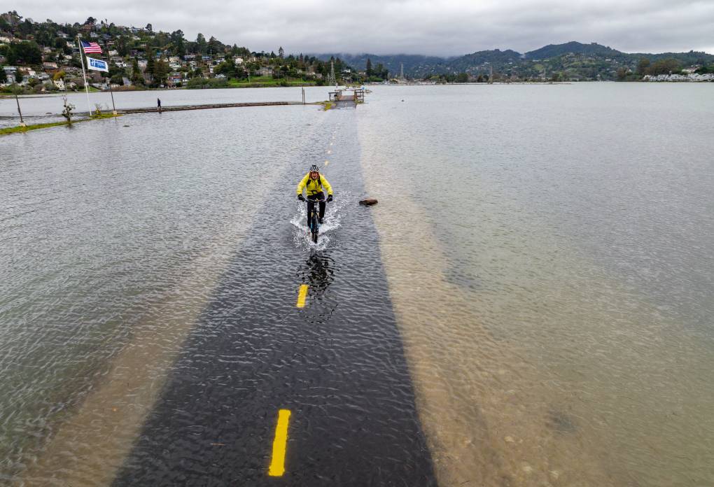
"caption": "An aerial picture taken Jan. 3, 2022, shows a man riding a bike along a flooded Sausalito/Mill Valley bike path during a king tide in Mill Valley. King tides occur when the Earth, moon and sun align in orbit to produce unusually high water levels and can cause local tidal flooding. Over time, sea level rise is raising the height of tidal systems.",
"credit": "Josh Edelson/AFP via Getty Images",
"altTag": "A man wearing a white bike helmet, yellow jacket and black pants rides through several inches of water on a submerged bike trail. Hills and clouds are in the foreground.",
"description": null,
"imgSizes": {
"medium": {
"file": "https://cdn.kqed.org/wp-content/uploads/sites/35/2028/06/GettyImages-1237523373-800x546.jpg",
"width": 800,
"height": 546,
"mimeType": "image/jpeg"
},
"large": {
"file": "https://cdn.kqed.org/wp-content/uploads/sites/35/2028/06/GettyImages-1237523373-1020x696.jpg",
"width": 1020,
"height": 696,
"mimeType": "image/jpeg"
},
"thumbnail": {
"file": "https://cdn.kqed.org/wp-content/uploads/sites/35/2028/06/GettyImages-1237523373-160x109.jpg",
"width": 160,
"height": 109,
"mimeType": "image/jpeg"
},
"medium_large": {
"file": "https://cdn.kqed.org/wp-content/uploads/sites/35/2028/06/GettyImages-1237523373-768x524.jpg",
"width": 768,
"height": 524,
"mimeType": "image/jpeg"
},
"1536x1536": {
"file": "https://cdn.kqed.org/wp-content/uploads/sites/35/2028/06/GettyImages-1237523373-1536x1048.jpg",
"width": 1536,
"height": 1048,
"mimeType": "image/jpeg"
},
"2048x2048": {
"file": "https://cdn.kqed.org/wp-content/uploads/sites/35/2028/06/GettyImages-1237523373-2048x1397.jpg",
"width": 2048,
"height": 1397,
"mimeType": "image/jpeg"
},
"post-thumbnail": {
"file": "https://cdn.kqed.org/wp-content/uploads/sites/35/2028/06/GettyImages-1237523373-672x372.jpg",
"width": 672,
"height": 372,
"mimeType": "image/jpeg"
},
"twentyfourteen-full-width": {
"file": "https://cdn.kqed.org/wp-content/uploads/sites/35/2028/06/GettyImages-1237523373-1038x576.jpg",
"width": 1038,
"height": 576,
"mimeType": "image/jpeg"
},
"full-width": {
"file": "https://cdn.kqed.org/wp-content/uploads/sites/35/2028/06/GettyImages-1237523373-1920x1309.jpg",
"width": 1920,
"height": 1309,
"mimeType": "image/jpeg"
},
"kqedFullSize": {
"file": "https://cdn.kqed.org/wp-content/uploads/sites/35/2028/06/GettyImages-1237523373-scaled-e1753215508590.jpg",
"width": 2000,
"height": 1364
}
},
"isLoading": false,
"fetchFailed": false
},
"science_1982433": {
"type": "attachments",
"id": "science_1982433",
"meta": {
"index": "attachments_1716263798",
"site": "science",
"id": "1982433",
"found": true
},
"parent": 1982407,
"imgSizes": {
"twentyfourteen-full-width": {
"file": "https://ww2.kqed.org/app/uploads/sites/35/2023/04/RS64675_GettyImages-1241524154-qut-1038x576.jpg",
"width": 1038,
"mimeType": "image/jpeg",
"height": 576
},
"thumbnail": {
"file": "https://ww2.kqed.org/app/uploads/sites/35/2023/04/RS64675_GettyImages-1241524154-qut-160x107.jpg",
"width": 160,
"mimeType": "image/jpeg",
"height": 107
},
"post-thumbnail": {
"file": "https://ww2.kqed.org/app/uploads/sites/35/2023/04/RS64675_GettyImages-1241524154-qut-672x372.jpg",
"width": 672,
"mimeType": "image/jpeg",
"height": 372
},
"kqedFullSize": {
"file": "https://ww2.kqed.org/app/uploads/sites/35/2023/04/RS64675_GettyImages-1241524154-qut.jpg",
"width": 1920,
"height": 1280
},
"large": {
"file": "https://ww2.kqed.org/app/uploads/sites/35/2023/04/RS64675_GettyImages-1241524154-qut-1020x680.jpg",
"width": 1020,
"mimeType": "image/jpeg",
"height": 680
},
"1536x1536": {
"file": "https://ww2.kqed.org/app/uploads/sites/35/2023/04/RS64675_GettyImages-1241524154-qut-1536x1024.jpg",
"width": 1536,
"mimeType": "image/jpeg",
"height": 1024
},
"medium": {
"file": "https://ww2.kqed.org/app/uploads/sites/35/2023/04/RS64675_GettyImages-1241524154-qut-800x533.jpg",
"width": 800,
"mimeType": "image/jpeg",
"height": 533
},
"medium_large": {
"file": "https://ww2.kqed.org/app/uploads/sites/35/2023/04/RS64675_GettyImages-1241524154-qut-768x512.jpg",
"width": 768,
"mimeType": "image/jpeg",
"height": 512
}
},
"publishDate": 1682124901,
"modified": 1682124978,
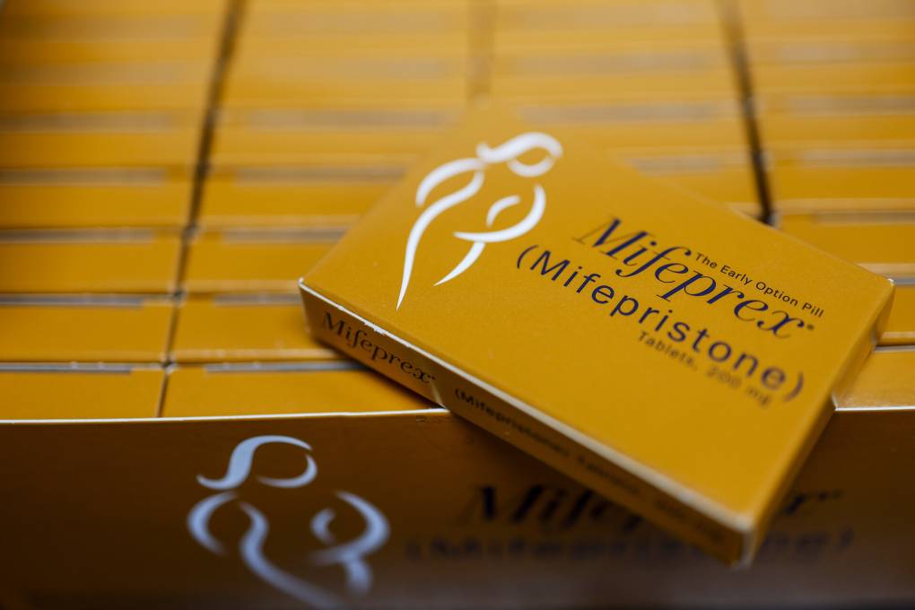
"caption": "Mifepristone (Mifeprex) and Misoprostol, the two drugs used in a medication abortion, are seen at the Women's Reproductive Clinic, which provides legal medication abortion services, in Santa Teresa, New Mexico, on June 17, 2022. ",
"description": null,
"title": "US-ABORTION-TEXAS-NEWMEXICO-CLINIC",
"credit": "Photo by ROBYN BECK/AFP via Getty Images",
"status": "inherit",
"altTag": "A white pill bottle next to three orange pill boxes.",
"isLoading": false,
"fetchFailed": false
},
"science_1982393": {
"type": "attachments",
"id": "science_1982393",
"meta": {
"index": "attachments_1716263798",
"site": "science",
"id": "1982393",
"found": true
},
"parent": 1982376,
"imgSizes": {
"twentyfourteen-full-width": {
"file": "https://ww2.kqed.org/app/uploads/sites/35/2023/04/RS64672_GettyImages-51093187-qut-1038x576.jpg",
"width": 1038,
"mimeType": "image/jpeg",
"height": 576
},
"thumbnail": {
"file": "https://ww2.kqed.org/app/uploads/sites/35/2023/04/RS64672_GettyImages-51093187-qut-160x115.jpg",
"width": 160,
"mimeType": "image/jpeg",
"height": 115
},
"post-thumbnail": {
"file": "https://ww2.kqed.org/app/uploads/sites/35/2023/04/RS64672_GettyImages-51093187-qut-672x372.jpg",
"width": 672,
"mimeType": "image/jpeg",
"height": 372
},
"kqedFullSize": {
"file": "https://ww2.kqed.org/app/uploads/sites/35/2023/04/RS64672_GettyImages-51093187-qut.jpg",
"width": 1920,
"height": 1378
},
"large": {
"file": "https://ww2.kqed.org/app/uploads/sites/35/2023/04/RS64672_GettyImages-51093187-qut-1020x732.jpg",
"width": 1020,
"mimeType": "image/jpeg",
"height": 732
},
"1536x1536": {
"file": "https://ww2.kqed.org/app/uploads/sites/35/2023/04/RS64672_GettyImages-51093187-qut-1536x1102.jpg",
"width": 1536,
"mimeType": "image/jpeg",
"height": 1102
},
"medium": {
"file": "https://ww2.kqed.org/app/uploads/sites/35/2023/04/RS64672_GettyImages-51093187-qut-800x574.jpg",
"width": 800,
"mimeType": "image/jpeg",
"height": 574
},
"medium_large": {
"file": "https://ww2.kqed.org/app/uploads/sites/35/2023/04/RS64672_GettyImages-51093187-qut-768x551.jpg",
"width": 768,
"mimeType": "image/jpeg",
"height": 551
}
},
"publishDate": 1682104793,
"modified": 1682116631,
"caption": "Recent research shows that black-legged ticks carrying the bacteria that causes Lyme disease are capable of thriving along the West Coast.",
"description": null,
"title": "Close Up Of An Adult Female And Nymph Tick Is Shown June 15 2001 On A Fingertip Ticks",
"credit": "Getty Images",
"status": "inherit",
"altTag": "A close up image of a white finger with a large and small black insect on it.",
"isLoading": false,
"fetchFailed": false
},
"science_1982346": {
"type": "attachments",
"id": "science_1982346",
"meta": {
"index": "attachments_1716263798",
"site": "science",
"id": "1982346",
"found": true
},
"parent": 1982342,
"imgSizes": {
"twentyfourteen-full-width": {
"file": "https://ww2.kqed.org/app/uploads/sites/35/2023/04/GettyImages-1247409353-1038x576.jpg",
"width": 1038,
"mimeType": "image/jpeg",
"height": 576
},
"thumbnail": {
"file": "https://ww2.kqed.org/app/uploads/sites/35/2023/04/GettyImages-1247409353-160x107.jpg",
"width": 160,
"mimeType": "image/jpeg",
"height": 107
},
"post-thumbnail": {
"file": "https://ww2.kqed.org/app/uploads/sites/35/2023/04/GettyImages-1247409353-672x372.jpg",
"width": 672,
"mimeType": "image/jpeg",
"height": 372
},
"kqedFullSize": {
"file": "https://ww2.kqed.org/app/uploads/sites/35/2023/04/GettyImages-1247409353-scaled.jpg",
"width": 2560,
"height": 1707
},
"2048x2048": {
"file": "https://ww2.kqed.org/app/uploads/sites/35/2023/04/GettyImages-1247409353-2048x1366.jpg",
"width": 2048,
"mimeType": "image/jpeg",
"height": 1366
},
"large": {
"file": "https://ww2.kqed.org/app/uploads/sites/35/2023/04/GettyImages-1247409353-1020x680.jpg",
"width": 1020,
"mimeType": "image/jpeg",
"height": 680
},
"1536x1536": {
"file": "https://ww2.kqed.org/app/uploads/sites/35/2023/04/GettyImages-1247409353-1536x1024.jpg",
"width": 1536,
"mimeType": "image/jpeg",
"height": 1024
},
"full-width": {
"file": "https://ww2.kqed.org/app/uploads/sites/35/2023/04/GettyImages-1247409353-1920x1281.jpg",
"width": 1920,
"mimeType": "image/jpeg",
"height": 1281
},
"medium": {
"file": "https://ww2.kqed.org/app/uploads/sites/35/2023/04/GettyImages-1247409353-800x534.jpg",
"width": 800,
"mimeType": "image/jpeg",
"height": 534
},
"medium_large": {
"file": "https://ww2.kqed.org/app/uploads/sites/35/2023/04/GettyImages-1247409353-768x512.jpg",
"width": 768,
"mimeType": "image/jpeg",
"height": 512
}
},
"publishDate": 1682012180,
"modified": 1682026819,
"caption": "This photograph taken on Feb. 23, 2023, in Paris shows the anti-diabetic medication Ozempic (semaglutide) made by Danish pharmaceutical company Novo Nordisk.",
"description": null,
"title": "This photograph taken on February 23, 2023, in Paris, shows the anti-diabetic medication \"Ozempic\" (semaglutide) made by Danish pharmaceutical company \"Novo Nordisk\".",
"credit": "Joel Saget/AFP via Getty Images",
"status": "inherit",
"altTag": "A photo of the medication called \"Ozempic.\"",
"isLoading": false,
"fetchFailed": false
},
"science_1982260": {
"type": "attachments",
"id": "science_1982260",
"meta": {
"index": "attachments_1716263798",
"site": "science",
"id": "1982260",
"found": true
},
"parent": 1982256,
"imgSizes": {
"twentyfourteen-full-width": {
"file": "https://ww2.kqed.org/app/uploads/sites/35/2023/04/GettyImages-1134614436-1038x576.jpg",
"width": 1038,
"mimeType": "image/jpeg",
"height": 576
},
"thumbnail": {
"file": "https://ww2.kqed.org/app/uploads/sites/35/2023/04/GettyImages-1134614436-160x107.jpg",
"width": 160,
"mimeType": "image/jpeg",
"height": 107
},
"post-thumbnail": {
"file": "https://ww2.kqed.org/app/uploads/sites/35/2023/04/GettyImages-1134614436-672x372.jpg",
"width": 672,
"mimeType": "image/jpeg",
"height": 372
},
"kqedFullSize": {
"file": "https://ww2.kqed.org/app/uploads/sites/35/2023/04/GettyImages-1134614436-scaled.jpg",
"width": 2560,
"height": 1709
},
"2048x2048": {
"file": "https://ww2.kqed.org/app/uploads/sites/35/2023/04/GettyImages-1134614436-2048x1367.jpg",
"width": 2048,
"mimeType": "image/jpeg",
"height": 1367
},
"large": {
"file": "https://ww2.kqed.org/app/uploads/sites/35/2023/04/GettyImages-1134614436-1020x681.jpg",
"width": 1020,
"mimeType": "image/jpeg",
"height": 681
},
"1536x1536": {
"file": "https://ww2.kqed.org/app/uploads/sites/35/2023/04/GettyImages-1134614436-1536x1025.jpg",
"width": 1536,
"mimeType": "image/jpeg",
"height": 1025
},
"full-width": {
"file": "https://ww2.kqed.org/app/uploads/sites/35/2023/04/GettyImages-1134614436-1920x1282.jpg",
"width": 1920,
"mimeType": "image/jpeg",
"height": 1282
},
"medium": {
"file": "https://ww2.kqed.org/app/uploads/sites/35/2023/04/GettyImages-1134614436-800x534.jpg",
"width": 800,
"mimeType": "image/jpeg",
"height": 534
},
"medium_large": {
"file": "https://ww2.kqed.org/app/uploads/sites/35/2023/04/GettyImages-1134614436-768x513.jpg",
"width": 768,
"mimeType": "image/jpeg",
"height": 513
}
},
"publishDate": 1681408893,
"modified": 1682022078,
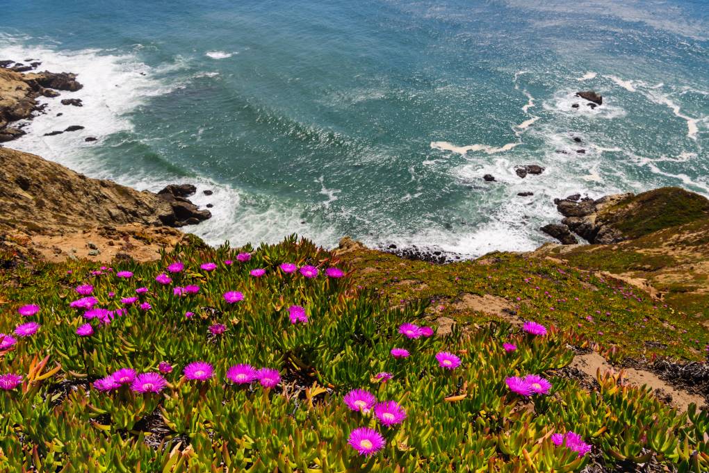
"caption": "Coastal wildflowers at an elephant seal viewpoint, Point Reyes National Seashore.",
"description": null,
"title": "View of Coastal Wildflowers at elephant seal view point, Point Reyes National Seashore, California",
"credit": "YayaErnst/Getty Images",
"status": "inherit",
"altTag": "Purple wildflowers seen on coastal area.",
"isLoading": false,
"fetchFailed": false
},
"science_1982348": {
"type": "attachments",
"id": "science_1982348",
"meta": {
"index": "attachments_1716263798",
"site": "science",
"id": "1982348",
"found": true
},
"parent": 1982345,
"imgSizes": {
"twentyfourteen-full-width": {
"file": "https://ww2.kqed.org/app/uploads/sites/35/2023/04/RS64651_GettyImages-1481952226-qut-1038x576.jpg",
"width": 1038,
"mimeType": "image/jpeg",
"height": 576
},
"thumbnail": {
"file": "https://ww2.kqed.org/app/uploads/sites/35/2023/04/RS64651_GettyImages-1481952226-qut-160x107.jpg",
"width": 160,
"mimeType": "image/jpeg",
"height": 107
},
"post-thumbnail": {
"file": "https://ww2.kqed.org/app/uploads/sites/35/2023/04/RS64651_GettyImages-1481952226-qut-672x372.jpg",
"width": 672,
"mimeType": "image/jpeg",
"height": 372
},
"kqedFullSize": {
"file": "https://ww2.kqed.org/app/uploads/sites/35/2023/04/RS64651_GettyImages-1481952226-qut.jpg",
"width": 1920,
"height": 1280
},
"large": {
"file": "https://ww2.kqed.org/app/uploads/sites/35/2023/04/RS64651_GettyImages-1481952226-qut-1020x680.jpg",
"width": 1020,
"mimeType": "image/jpeg",
"height": 680
},
"1536x1536": {
"file": "https://ww2.kqed.org/app/uploads/sites/35/2023/04/RS64651_GettyImages-1481952226-qut-1536x1024.jpg",
"width": 1536,
"mimeType": "image/jpeg",
"height": 1024
},
"medium": {
"file": "https://ww2.kqed.org/app/uploads/sites/35/2023/04/RS64651_GettyImages-1481952226-qut-800x533.jpg",
"width": 800,
"mimeType": "image/jpeg",
"height": 533
},
"medium_large": {
"file": "https://ww2.kqed.org/app/uploads/sites/35/2023/04/RS64651_GettyImages-1481952226-qut-768x512.jpg",
"width": 768,
"mimeType": "image/jpeg",
"height": 512
}
},
"publishDate": 1682013524,
"modified": 1682014891,
"caption": "In this photo illustration, packages of mifepristone tablets are displayed at a family planning clinic on April 13, 2023, in Rockville, Maryland.",
"description": null,
"title": "Appeals Court Keeps Abortion Pill Mifepristone Available, But With Restrictions",
"credit": "Anna Moneymaker/Getty Images",
"status": "inherit",
"altTag": null,
"isLoading": false,
"fetchFailed": false
},
"science_1982310": {
"type": "attachments",
"id": "science_1982310",
"meta": {
"index": "attachments_1716263798",
"site": "science",
"id": "1982310",
"found": true
},
"parent": 1982309,
"imgSizes": {
"twentyfourteen-full-width": {
"file": "https://ww2.kqed.org/app/uploads/sites/35/2023/04/RS48681_EPA_image_selects_fullsize-5-qut-1038x576.jpg",
"width": 1038,
"mimeType": "image/jpeg",
"height": 576
},
"thumbnail": {
"file": "https://ww2.kqed.org/app/uploads/sites/35/2023/04/RS48681_EPA_image_selects_fullsize-5-qut-160x107.jpg",
"width": 160,
"mimeType": "image/jpeg",
"height": 107
},
"post-thumbnail": {
"file": "https://ww2.kqed.org/app/uploads/sites/35/2023/04/RS48681_EPA_image_selects_fullsize-5-qut-672x372.jpg",
"width": 672,
"mimeType": "image/jpeg",
"height": 372
},
"kqedFullSize": {
"file": "https://ww2.kqed.org/app/uploads/sites/35/2023/04/RS48681_EPA_image_selects_fullsize-5-qut.jpg",
"width": 1920,
"height": 1279
},
"large": {
"file": "https://ww2.kqed.org/app/uploads/sites/35/2023/04/RS48681_EPA_image_selects_fullsize-5-qut-1020x679.jpg",
"width": 1020,
"mimeType": "image/jpeg",
"height": 679
},
"1536x1536": {
"file": "https://ww2.kqed.org/app/uploads/sites/35/2023/04/RS48681_EPA_image_selects_fullsize-5-qut-1536x1023.jpg",
"width": 1536,
"mimeType": "image/jpeg",
"height": 1023
},
"medium": {
"file": "https://ww2.kqed.org/app/uploads/sites/35/2023/04/RS48681_EPA_image_selects_fullsize-5-qut-800x533.jpg",
"width": 800,
"mimeType": "image/jpeg",
"height": 533
},
"medium_large": {
"file": "https://ww2.kqed.org/app/uploads/sites/35/2023/04/RS48681_EPA_image_selects_fullsize-5-qut-768x512.jpg",
"width": 768,
"mimeType": "image/jpeg",
"height": 512
}
},
"publishDate": 1681930992,
"modified": 1681942571,
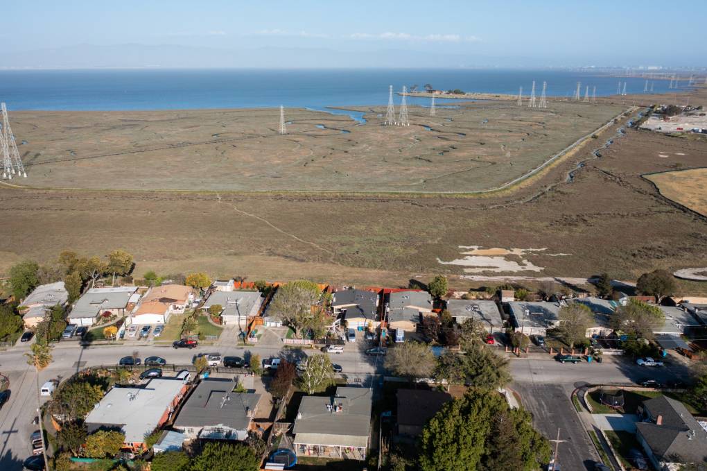
"caption": "Wetlands of San Mateo County offer natural flood protection for neighborhoods of East Palo Alto.",
"description": null,
"title": "RS48681_EPA_image_selects_fullsize-5-qut",
"credit": "JJ Harris/Techboogie/KQED",
"status": "inherit",
"altTag": "Blue bay water in the background, green marshes and homes.",
"isLoading": false,
"fetchFailed": false
},
"science_1982303": {
"type": "attachments",
"id": "science_1982303",
"meta": {
"index": "attachments_1716263798",
"site": "science",
"id": "1982303",
"found": true
},
"parent": 1981958,
"imgSizes": {
"twentyfourteen-full-width": {
"file": "https://ww2.kqed.org/app/uploads/sites/35/2023/04/DL1005_This_Mushroom_Can_Fly_KQED-1038x576.jpg",
"width": 1038,
"mimeType": "image/jpeg",
"height": 576
},
"thumbnail": {
"file": "https://ww2.kqed.org/app/uploads/sites/35/2023/04/DL1005_This_Mushroom_Can_Fly_KQED-160x90.jpg",
"width": 160,
"mimeType": "image/jpeg",
"height": 90
},
"post-thumbnail": {
"file": "https://ww2.kqed.org/app/uploads/sites/35/2023/04/DL1005_This_Mushroom_Can_Fly_KQED-672x372.jpg",
"width": 672,
"mimeType": "image/jpeg",
"height": 372
},
"kqedFullSize": {
"file": "https://ww2.kqed.org/app/uploads/sites/35/2023/04/DL1005_This_Mushroom_Can_Fly_KQED.jpg",
"width": 1920,
"height": 1080
},
"large": {
"file": "https://ww2.kqed.org/app/uploads/sites/35/2023/04/DL1005_This_Mushroom_Can_Fly_KQED-1020x574.jpg",
"width": 1020,
"mimeType": "image/jpeg",
"height": 574
},
"1536x1536": {
"file": "https://ww2.kqed.org/app/uploads/sites/35/2023/04/DL1005_This_Mushroom_Can_Fly_KQED-1536x864.jpg",
"width": 1536,
"mimeType": "image/jpeg",
"height": 864
},
"medium": {
"file": "https://ww2.kqed.org/app/uploads/sites/35/2023/04/DL1005_This_Mushroom_Can_Fly_KQED-800x450.jpg",
"width": 800,
"mimeType": "image/jpeg",
"height": 450
},
"medium_large": {
"file": "https://ww2.kqed.org/app/uploads/sites/35/2023/04/DL1005_This_Mushroom_Can_Fly_KQED-768x432.jpg",
"width": 768,
"mimeType": "image/jpeg",
"height": 432
}
},
"publishDate": 1681514468,
"modified": 1681514556,
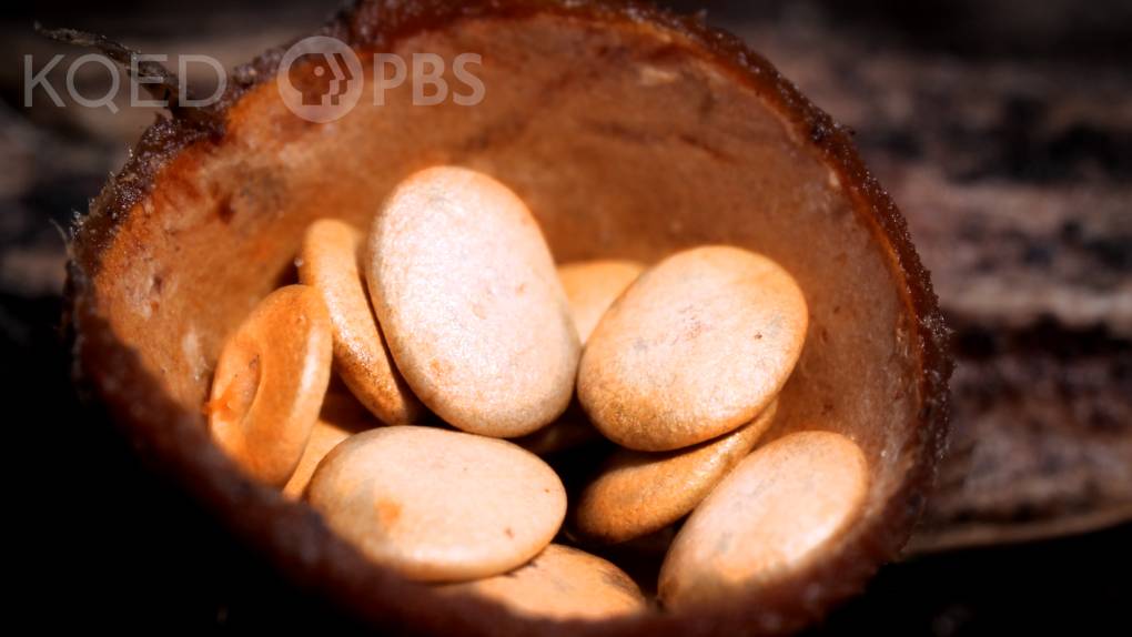
"caption": "This tiny mushroom gets its name from the bird's nest it resembles. ",
"description": null,
"title": "DL1005_This_Mushroom_Can_Fly_KQED",
"credit": "Josh Cassidy/KQED",
"status": "inherit",
"altTag": null,
"isLoading": false,
"fetchFailed": false
},
"science_1982245": {
"type": "attachments",
"id": "science_1982245",
"meta": {
"index": "attachments_1716263798",
"site": "science",
"id": "1982245",
"found": true
},
"parent": 1982244,
"imgSizes": {
"twentyfourteen-full-width": {
"file": "https://ww2.kqed.org/app/uploads/sites/35/2023/04/RS63099_02172023_chabotastronomy-057-qut-1038x576.jpg",
"width": 1038,
"mimeType": "image/jpeg",
"height": 576
},
"thumbnail": {
"file": "https://ww2.kqed.org/app/uploads/sites/35/2023/04/RS63099_02172023_chabotastronomy-057-qut-160x106.jpg",
"width": 160,
"mimeType": "image/jpeg",
"height": 106
},
"post-thumbnail": {
"file": "https://ww2.kqed.org/app/uploads/sites/35/2023/04/RS63099_02172023_chabotastronomy-057-qut-672x372.jpg",
"width": 672,
"mimeType": "image/jpeg",
"height": 372
},
"kqedFullSize": {
"file": "https://ww2.kqed.org/app/uploads/sites/35/2023/04/RS63099_02172023_chabotastronomy-057-qut.jpg",
"width": 1920,
"height": 1277
},
"large": {
"file": "https://ww2.kqed.org/app/uploads/sites/35/2023/04/RS63099_02172023_chabotastronomy-057-qut-1020x678.jpg",
"width": 1020,
"mimeType": "image/jpeg",
"height": 678
},
"1536x1536": {
"file": "https://ww2.kqed.org/app/uploads/sites/35/2023/04/RS63099_02172023_chabotastronomy-057-qut-1536x1022.jpg",
"width": 1536,
"mimeType": "image/jpeg",
"height": 1022
},
"medium": {
"file": "https://ww2.kqed.org/app/uploads/sites/35/2023/04/RS63099_02172023_chabotastronomy-057-qut-800x532.jpg",
"width": 800,
"mimeType": "image/jpeg",
"height": 532
},
"medium_large": {
"file": "https://ww2.kqed.org/app/uploads/sites/35/2023/04/RS63099_02172023_chabotastronomy-057-qut-768x511.jpg",
"width": 768,
"mimeType": "image/jpeg",
"height": 511
}
},
"publishDate": 1681323307,
"modified": 1681495845,
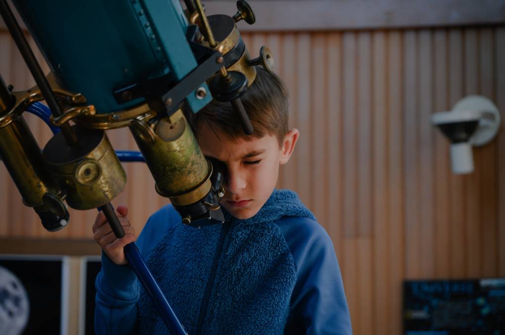
"caption": "Frankie Alonso, 8, peers at Venus through the 8-inch Alvan Clark Refractor at Chabot Space and Science Center in Oakland on Feb. 17, 2023.",
"description": "Frankie Alonso, 8, peers at Venus through the 8″ Alvan Clark Refractor telescope at Chabot Space and Science Center in Oakland on Feb. 17, 2023.",
"title": "Telescope Viewing at Chabot Space and Science Center",
"credit": "Kori Suzuki/KQED",
"status": "inherit",
"altTag": "A kid is looking through a telescope.",
"isLoading": false,
"fetchFailed": false
},
"science_1982235": {
"type": "attachments",
"id": "science_1982235",
"meta": {
"index": "attachments_1716263798",
"site": "science",
"id": "1982235",
"found": true
},
"parent": 1982233,
"imgSizes": {
"twentyfourteen-full-width": {
"file": "https://ww2.kqed.org/app/uploads/sites/35/2023/04/651338main_iss030e260480_rotated_full-NASA-JSC-D.-Pettit-1038x576.jpg",
"width": 1038,
"mimeType": "image/jpeg",
"height": 576
},
"thumbnail": {
"file": "https://ww2.kqed.org/app/uploads/sites/35/2023/04/651338main_iss030e260480_rotated_full-NASA-JSC-D.-Pettit-160x120.jpg",
"width": 160,
"mimeType": "image/jpeg",
"height": 120
},
"post-thumbnail": {
"file": "https://ww2.kqed.org/app/uploads/sites/35/2023/04/651338main_iss030e260480_rotated_full-NASA-JSC-D.-Pettit-672x372.jpg",
"width": 672,
"mimeType": "image/jpeg",
"height": 372
},
"kqedFullSize": {
"file": "https://ww2.kqed.org/app/uploads/sites/35/2023/04/651338main_iss030e260480_rotated_full-NASA-JSC-D.-Pettit.jpg",
"width": 1041,
"height": 782
},
"large": {
"file": "https://ww2.kqed.org/app/uploads/sites/35/2023/04/651338main_iss030e260480_rotated_full-NASA-JSC-D.-Pettit-1020x766.jpg",
"width": 1020,
"mimeType": "image/jpeg",
"height": 766
},
"medium": {
"file": "https://ww2.kqed.org/app/uploads/sites/35/2023/04/651338main_iss030e260480_rotated_full-NASA-JSC-D.-Pettit-800x601.jpg",
"width": 800,
"mimeType": "image/jpeg",
"height": 601
},
"medium_large": {
"file": "https://ww2.kqed.org/app/uploads/sites/35/2023/04/651338main_iss030e260480_rotated_full-NASA-JSC-D.-Pettit-768x577.jpg",
"width": 768,
"mimeType": "image/jpeg",
"height": 577
}
},
"publishDate": 1681253197,
"modified": 1681511856,
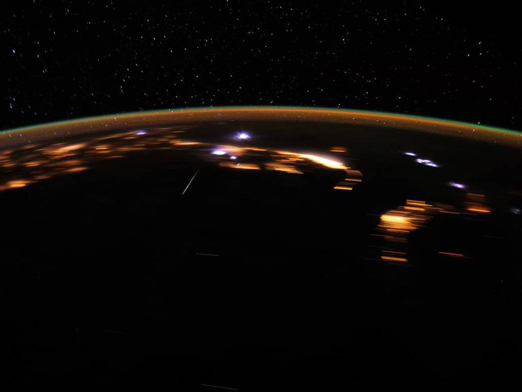
"caption": "View of a meteor captured from space by astronaut Don Pettit aboard the International Space Station during the annual Lyrids meteor shower.",
"description": "A meteor captured from space, by astronaut Don Pettit aboard the International Space Station, during the annual Lyrids Meteor Shower. ",
"title": "651338main_iss030e260480_rotated_full-NASA-JSC-D. Pettit",
"credit": "NASA/JSC/Don Pettit",
"status": "inherit",
"altTag": "A yellow line across a black, dark night.",
"isLoading": false,
"fetchFailed": false
},
"science_1982219": {
"type": "attachments",
"id": "science_1982219",
"meta": {
"index": "attachments_1716263798",
"site": "science",
"id": "1982219",
"found": true
},
"parent": 1982214,
"imgSizes": {
"twentyfourteen-full-width": {
"file": "https://ww2.kqed.org/app/uploads/sites/35/2023/04/GettyImages-827808384-1024x576.jpg",
"width": 1024,
"mimeType": "image/jpeg",
"height": 576
},
"thumbnail": {
"file": "https://ww2.kqed.org/app/uploads/sites/35/2023/04/GettyImages-827808384-160x107.jpg",
"width": 160,
"mimeType": "image/jpeg",
"height": 107
},
"post-thumbnail": {
"file": "https://ww2.kqed.org/app/uploads/sites/35/2023/04/GettyImages-827808384-672x372.jpg",
"width": 672,
"mimeType": "image/jpeg",
"height": 372
},
"kqedFullSize": {
"file": "https://ww2.kqed.org/app/uploads/sites/35/2023/04/GettyImages-827808384.jpg",
"width": 1024,
"height": 683
},
"large": {
"file": "https://ww2.kqed.org/app/uploads/sites/35/2023/04/GettyImages-827808384-1020x680.jpg",
"width": 1020,
"mimeType": "image/jpeg",
"height": 680
},
"medium": {
"file": "https://ww2.kqed.org/app/uploads/sites/35/2023/04/GettyImages-827808384-800x534.jpg",
"width": 800,
"mimeType": "image/jpeg",
"height": 534
},
"medium_large": {
"file": "https://ww2.kqed.org/app/uploads/sites/35/2023/04/GettyImages-827808384-768x512.jpg",
"width": 768,
"mimeType": "image/jpeg",
"height": 512
}
},
"publishDate": 1680895066,
"modified": 1680899969,
"caption": "'Suboxone is the most effective form of treatment for opioid-use disorder, and it's critical that we get people enrolled in it as soon as possible,' said Assemblymember Matt Haney, who introduced the new bill.",
"description": null,
"title": "Students Interview Heroin Addicts In The Bronx For New Overdose Survey",
"credit": "Spencer Platt/Getty Images",
"status": "inherit",
"altTag": "The hand of someone holding a box of Suboxone between their thumb and index finger and a wallet between their index finger and middle finger",
"isLoading": false,
"fetchFailed": false
},
"science_1982200": {
"type": "attachments",
"id": "science_1982200",
"meta": {
"index": "attachments_1716263798",
"site": "science",
"id": "1982200",
"found": true
},
"parent": 1982166,
"imgSizes": {
"twentyfourteen-full-width": {
"file": "https://ww2.kqed.org/app/uploads/sites/35/2023/04/RS33811_camp-fire-traffic-0217-qut-1-1038x576.jpg",
"width": 1038,
"mimeType": "image/jpeg",
"height": 576
},
"thumbnail": {
"file": "https://ww2.kqed.org/app/uploads/sites/35/2023/04/RS33811_camp-fire-traffic-0217-qut-1-160x107.jpg",
"width": 160,
"mimeType": "image/jpeg",
"height": 107
},
"post-thumbnail": {
"file": "https://ww2.kqed.org/app/uploads/sites/35/2023/04/RS33811_camp-fire-traffic-0217-qut-1-672x372.jpg",
"width": 672,
"mimeType": "image/jpeg",
"height": 372
},
"kqedFullSize": {
"file": "https://ww2.kqed.org/app/uploads/sites/35/2023/04/RS33811_camp-fire-traffic-0217-qut-1.jpg",
"width": 1920,
"height": 1280
},
"large": {
"file": "https://ww2.kqed.org/app/uploads/sites/35/2023/04/RS33811_camp-fire-traffic-0217-qut-1-1020x680.jpg",
"width": 1020,
"mimeType": "image/jpeg",
"height": 680
},
"1536x1536": {
"file": "https://ww2.kqed.org/app/uploads/sites/35/2023/04/RS33811_camp-fire-traffic-0217-qut-1-1536x1024.jpg",
"width": 1536,
"mimeType": "image/jpeg",
"height": 1024
},
"medium": {
"file": "https://ww2.kqed.org/app/uploads/sites/35/2023/04/RS33811_camp-fire-traffic-0217-qut-1-800x533.jpg",
"width": 800,
"mimeType": "image/jpeg",
"height": 533
},
"medium_large": {
"file": "https://ww2.kqed.org/app/uploads/sites/35/2023/04/RS33811_camp-fire-traffic-0217-qut-1-768x512.jpg",
"width": 768,
"mimeType": "image/jpeg",
"height": 512
}
},
"publishDate": 1680821667,
"modified": 1680828719,
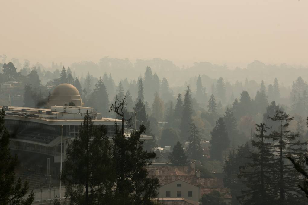
"caption": "The Berkeley Hills filled with smoke from the Butte County fire on Friday Nov. 9, 2018.",
"description": null,
"title": "RS33811_camp-fire-traffic-0217-qut (1)",
"credit": "JP Dobrin/KQED",
"status": "inherit",
"altTag": "Smokey and hazy hillside.",
"isLoading": false,
"fetchFailed": false
}
},
"audioPlayerReducer": {
"postId": "stream_live",
"isPaused": true,
"isPlaying": false,
"pfsActive": false,
"pledgeModalIsOpen": true,
"playerDrawerIsOpen": false,
"liveAudioPlayStartedAt": 0,
"liveAudioPlayContext": ""
},
"authorsReducer": {
"byline_science_1982342": {
"type": "authors",
"id": "byline_science_1982342",
"meta": {
"override": true
},
"slug": "byline_science_1982342",
"name": "Darius Tahir and Hannah Norman \u003cbr>Kaiser Health News\u003c/br>",
"isLoading": false
},
"adembosky": {
"type": "authors",
"id": "3205",
"meta": {
"index": "authors_1716337520",
"id": "3205",
"found": true
},
"name": "April Dembosky",
"firstName": "April",
"lastName": "Dembosky",
"slug": "adembosky",
"email": "adembosky@kqed.org",
"display_author_email": false,
"staff_mastheads": [
"news",
"science"
],
"title": "KQED Health Correspondent",
"bio": "April Dembosky is the health correspondent for KQED News and a regular contributor to NPR. She specializes in covering altered states of mind, from postpartum depression to methamphetamine-induced psychosis to the insanity defense. Her investigative series on insurance companies sidestepping mental health laws won multiple awards, including first place in beat reporting from the national Association of Health Care Journalists. She is the recipient of numerous other prizes and fellowships, including a national Edward R. Murrow award for investigative reporting, a Society of Professional Journalists award for long-form storytelling, and a Carter Center Fellowship for Mental Health Journalism.\r\n\r\nDembosky reported and produced \u003cem>Soundtrack of Silence\u003c/em>, an audio documentary about music and memory that is currently being made into a feature film by Paramount Pictures.\r\n\r\nBefore joining KQED in 2013, Dembosky covered technology and Silicon Valley for \u003cem>The Financial Times of London,\u003c/em> and contributed business and arts stories to \u003cem>Marketplace \u003c/em>and \u003cem>The New York Times.\u003c/em> She got her undergraduate degree in philosophy from Smith College and her master's in journalism from the University of California, Berkeley. She is a classically trained violinist and proud alum of the first symphony orchestra at Burning Man.",
"avatar": "https://secure.gravatar.com/avatar/ef92999be4ceb9ea60701e7dc276f813?s=600&d=blank&r=g",
"twitter": "adembosky",
"facebook": null,
"instagram": null,
"linkedin": null,
"sites": [
{
"site": "arts",
"roles": [
"author"
]
},
{
"site": "news",
"roles": [
"editor"
]
},
{
"site": "futureofyou",
"roles": [
"author"
]
},
{
"site": "stateofhealth",
"roles": [
"editor"
]
},
{
"site": "science",
"roles": [
"editor"
]
},
{
"site": "forum",
"roles": [
"editor"
]
}
],
"headData": {
"title": "April Dembosky | KQED",
"description": "KQED Health Correspondent",
"ogImgSrc": "https://secure.gravatar.com/avatar/ef92999be4ceb9ea60701e7dc276f813?s=600&d=blank&r=g",
"twImgSrc": "https://secure.gravatar.com/avatar/ef92999be4ceb9ea60701e7dc276f813?s=600&d=blank&r=g"
},
"isLoading": false,
"link": "/author/adembosky"
},
"ben-burress": {
"type": "authors",
"id": "6180",
"meta": {
"index": "authors_1716337520",
"id": "6180",
"found": true
},
"name": "Ben Burress",
"firstName": "Ben",
"lastName": "Burress",
"slug": "ben-burress",
"email": "bburress@chabotspace.org",
"display_author_email": false,
"staff_mastheads": [],
"title": null,
"bio": "\u003cstrong>Benjamin Burress\u003c/strong> has been a staff astronomer at Chabot Space & Science Center since July 1999. He graduated from Sonoma State University in 1985 with a bachelor’s degree in physics (and minor in astronomy), after which he signed on for a two-year stint in the Peace Corps, where he taught physics and mathematics in the African nation of Cameroon. From 1989-96 he served on the crew of NASA’s Kuiper Airborne Observatory at Ames Research Center in Mountain View, CA. From 1996-99, he was Head Observer at the Naval Prototype Optical Interferometer program at Lowell Observatory in Flagstaff, AZ.\r\n\r\nRead his \u003ca href=\"http://science.kqed.org/quest/author/ben-burress/\">previous contributions\u003c/a> to \u003ca href=\"http://science.kqed.org/quest/\">QUEST\u003c/a>, a project dedicated to exploring the Science of Sustainability.",
"avatar": "https://secure.gravatar.com/avatar/8263bffa345b7e4923a0b8b9f0f6a161?s=600&d=blank&r=g",
"twitter": null,
"facebook": null,
"instagram": null,
"linkedin": null,
"sites": [
{
"site": "science",
"roles": [
"editor"
]
},
{
"site": "quest",
"roles": [
"subscriber"
]
}
],
"headData": {
"title": "Ben Burress | KQED",
"description": null,
"ogImgSrc": "https://secure.gravatar.com/avatar/8263bffa345b7e4923a0b8b9f0f6a161?s=600&d=blank&r=g",
"twImgSrc": "https://secure.gravatar.com/avatar/8263bffa345b7e4923a0b8b9f0f6a161?s=600&d=blank&r=g"
},
"isLoading": false,
"link": "/author/ben-burress"
},
"gabriela-quiros": {
"type": "authors",
"id": "6186",
"meta": {
"index": "authors_1716337520",
"id": "6186",
"found": true
},
"name": "Gabriela Quirós",
"firstName": "Gabriela",
"lastName": "Quirós",
"slug": "gabriela-quiros",
"email": "gquiros@kqed.org",
"display_author_email": false,
"staff_mastheads": [],
"title": "Supervising Producer",
"bio": "Gabriela Quirós is the \u003cstrong>supervising producer for KQED's web science video series \u003ca href=\"https://www.kqed.org/deeplook\">Deep Look\u003c/a>\u003c/strong>. She joined KQED as a TV producer when its science series QUEST started in 2006 and has covered everything from Alzheimer’s to bee die-offs to dark energy.\r\n\r\nShe won a 2022 AAAS Kavli Science Journalism Award with a team of her Deep Look colleagues. She has won six regional Emmys as a video producer and has shared eight more as the coordinating producer of Deep Look. The episode she produced about \u003ca href=\"https://www.kqed.org/science/728086/how-mosquitoes-use-six-needles-to-suck-your-blood\">How Mosquitoes Use Six Needles to Suck Your Blood\u003c/a> won a Webby \"People's Voice\" award. She has also earned awards from the Jackson Hole Wildlife Film Festival, the Society of Professional Journalists and the Society of Environmental Journalists.\r\n\r\nHer videos for KQED have also aired on NOVA scienceNOW and the PBS NewsHour, and appeared on NPR.org.\r\n\r\nAs an independent filmmaker, she produced and directed the hour-long documentary \u003ca href=\"http://lpbp.org/beautiful-sin-qa-with-producer-gabriela-quiros/\">\u003cem>Beautiful Sin\u003c/em>\u003c/a>, about the surprising story of how Costa Rica became the only country in the world to outlaw in vitro fertilization. The film aired in 2015 on public television stations throughout the U.S., and in Costa Rica.\r\n\r\nShe started her journalism career as a newspaper reporter in Costa Rica, where she grew up. She won the National Science Journalism Award there for a series of articles about organic agriculture, and developed a life-long interest in health reporting. She moved to the Bay Area in 1996 to study documentary filmmaking at the University of California, Berkeley, where she received master’s degrees in journalism and Latin American studies.",
"avatar": "https://secure.gravatar.com/avatar/6d82c20152affd1b434c31a904c40809?s=600&d=blank&r=g",
"twitter": "gabrielaquirosr",
"facebook": null,
"instagram": null,
"linkedin": null,
"sites": [
{
"site": "science",
"roles": []
},
{
"site": "quest",
"roles": [
"ef_view_calendar",
"ef_view_story_budget"
]
}
],
"headData": {
"title": "Gabriela Quirós | KQED",
"description": "Supervising Producer",
"ogImgSrc": "https://secure.gravatar.com/avatar/6d82c20152affd1b434c31a904c40809?s=600&d=blank&r=g",
"twImgSrc": "https://secure.gravatar.com/avatar/6d82c20152affd1b434c31a904c40809?s=600&d=blank&r=g"
},
"isLoading": false,
"link": "/author/gabriela-quiros"
},
"dventon": {
"type": "authors",
"id": "11088",
"meta": {
"index": "authors_1716337520",
"id": "11088",
"found": true
},
"name": "Danielle Venton",
"firstName": "Danielle",
"lastName": "Venton",
"slug": "dventon",
"email": "dventon@kqed.org",
"display_author_email": true,
"staff_mastheads": [
"science"
],
"title": "Science reporter",
"bio": "Danielle Venton is a reporter for KQED Science. She covers wildfires, space and oceans (though she is prone to sea sickness).\r\n\r\nBefore joining KQED in 2015, Danielle was a staff reporter at KRCB in Sonoma County and a freelancer. She studied science communication at UC Santa Cruz and formerly worked at CERN in Geneva, Switzerland where she wrote about computing. She lives in Sonoma County and enjoys backpacking.",
"avatar": "https://secure.gravatar.com/avatar/37b292b5c40c8d93959c4f48d73b5286f41b7abd8588277e941905a3ed4c801c?s=600&d=blank&r=g",
"twitter": "DanielleVenton",
"bluesky": null,
"facebook": null,
"instagram": null,
"linkedin": null,
"sites": [
{
"site": "arts",
"roles": [
"contributor"
]
},
{
"site": "news",
"roles": [
"editor"
]
},
{
"site": "futureofyou",
"roles": [
"editor"
]
},
{
"site": "science",
"roles": [
"editor"
]
},
{
"site": "liveblog",
"roles": [
"contributor"
]
}
],
"headData": {
"title": "Danielle Venton | KQED",
"description": "Science reporter",
"ogImgSrc": "https://secure.gravatar.com/avatar/37b292b5c40c8d93959c4f48d73b5286f41b7abd8588277e941905a3ed4c801c?s=600&d=blank&r=g",
"twImgSrc": "https://secure.gravatar.com/avatar/37b292b5c40c8d93959c4f48d73b5286f41b7abd8588277e941905a3ed4c801c?s=600&d=blank&r=g"
},
"isLoading": false,
"link": "/author/dventon"
},
"lesleymcclurg": {
"type": "authors",
"id": "11229",
"meta": {
"index": "authors_1716337520",
"id": "11229",
"found": true
},
"name": "Lesley McClurg",
"firstName": "Lesley",
"lastName": "McClurg",
"slug": "lesleymcclurg",
"email": "lmcclurg@KQED.org",
"display_author_email": false,
"staff_mastheads": [
"news",
"science"
],
"title": "KQED Health Correspondent",
"bio": "Lesley McClurg is a health correspondent and fill-in host whose work is regularly rebroadcast on NPR and PBS programs. She’s earned multiple regional Emmy awards, a national and a regional Edward R. Murrow award, and was named Best Beat Reporter by the Association of Health Care Journalists. The Society of Professional Journalists has recognized her work several times, and the Society of Environmental Journalists spotlighted her coverage of California’s historic drought.\r\n\r\nBefore joining KQED in 2016, Lesley covered food and sustainability for Capital Public Radio, environmental issues for Colorado Public Radio, and reported for KUOW and KCTS 9 in Seattle. Away from the newsroom, she loves skiing with her daughter, mountain biking with her partner, and playing with Ollie, the family’s goldendoodle. On deadline, she runs almost entirely on chocolate chips.\r\n\r\n ",
"avatar": "https://secure.gravatar.com/avatar/bab49e972ea10c774fe0f5e29dba1722b158f7c0d58a360923d1389d380b2978?s=600&d=blank&r=g",
"twitter": "lesleywmcclurg",
"bluesky": null,
"facebook": null,
"instagram": null,
"linkedin": null,
"sites": [
{
"site": "arts",
"roles": [
"author"
]
},
{
"site": "news",
"roles": [
"editor"
]
},
{
"site": "futureofyou",
"roles": [
"editor"
]
},
{
"site": "stateofhealth",
"roles": [
"author"
]
},
{
"site": "science",
"roles": [
"editor"
]
},
{
"site": "quest",
"roles": [
"subscriber"
]
},
{
"site": "forum",
"roles": [
"administrator"
]
},
{
"site": "liveblog",
"roles": [
"author"
]
}
],
"headData": {
"title": "Lesley McClurg | KQED",
"description": "KQED Health Correspondent",
"ogImgSrc": "https://secure.gravatar.com/avatar/bab49e972ea10c774fe0f5e29dba1722b158f7c0d58a360923d1389d380b2978?s=600&d=blank&r=g",
"twImgSrc": "https://secure.gravatar.com/avatar/bab49e972ea10c774fe0f5e29dba1722b158f7c0d58a360923d1389d380b2978?s=600&d=blank&r=g"
},
"isLoading": false,
"link": "/author/lesleymcclurg"
},
"kevinstark": {
"type": "authors",
"id": "11608",
"meta": {
"index": "authors_1716337520",
"id": "11608",
"found": true
},
"name": "Kevin Stark",
"firstName": "Kevin",
"lastName": "Stark",
"slug": "kevinstark",
"email": "kstark@kqed.org",
"display_author_email": true,
"staff_mastheads": [
"science"
],
"title": "Senior Editor",
"bio": "Kevin is a senior editor for KQED Science, managing the station's health and climate desks. His journalism career began in the Pacific Northwest, and he later became a lead reporter for the San Francisco Public Press. His work has appeared in Pacific Standard magazine, the Energy News Network, the Center for Investigative Reporting's Reveal and WBEZ in Chicago. Kevin joined KQED in 2019, and has covered issues related to energy, wildfire, climate change and the environment.",
"avatar": "https://secure.gravatar.com/avatar/365aaa4b597d3a8374f67504ff0facd323d7906e8eb4be0a7efd2427408e802c?s=600&d=blank&r=g",
"twitter": "starkkev",
"bluesky": null,
"facebook": null,
"instagram": null,
"linkedin": null,
"sites": [
{
"site": "",
"roles": [
"editor"
]
},
{
"site": "news",
"roles": [
"editor"
]
},
{
"site": "science",
"roles": [
"administrator"
]
}
],
"headData": {
"title": "Kevin Stark | KQED",
"description": "Senior Editor",
"ogImgSrc": "https://secure.gravatar.com/avatar/365aaa4b597d3a8374f67504ff0facd323d7906e8eb4be0a7efd2427408e802c?s=600&d=blank&r=g",
"twImgSrc": "https://secure.gravatar.com/avatar/365aaa4b597d3a8374f67504ff0facd323d7906e8eb4be0a7efd2427408e802c?s=600&d=blank&r=g"
},
"isLoading": false,
"link": "/author/kevinstark"
},
"smohamad": {
"type": "authors",
"id": "11631",
"meta": {
"index": "authors_1716337520",
"id": "11631",
"found": true
},
"name": "Sarah Mohamad",
"firstName": "Sarah",
"lastName": "Mohamad",
"slug": "smohamad",
"email": "smohamad@KQED.org",
"display_author_email": true,
"staff_mastheads": [],
"title": "Engagement Producer and Reporter, KQED Science",
"bio": "Sarah Mohamad is an audience engagement reporter and producer for KQED Science. She reports on audience-focused science and environment stories and manages the team's social media, newsletter, and engagement efforts. Prior to this role, she played a key role as project manager for NSF's \u003ca href=\"https://www.kqed.org/crackingthecode\">\u003cem>Cracking the Code: Influencing Millennial Science Engagement\u003c/em> \u003c/a>audience research.",
"avatar": "https://secure.gravatar.com/avatar/e6224957cd82d015183756ddde1f928013a563d7ca2e4565f8c4de1ec64886c5?s=600&d=blank&r=g",
"twitter": "sarahkmohamad",
"bluesky": null,
"facebook": null,
"instagram": null,
"linkedin": null,
"sites": [
{
"site": "",
"roles": [
"editor"
]
},
{
"site": "arts",
"roles": [
"editor"
]
},
{
"site": "news",
"roles": [
"editor"
]
},
{
"site": "about",
"roles": [
"editor"
]
},
{
"site": "science",
"roles": [
"editor"
]
}
],
"headData": {
"title": "Sarah Mohamad | KQED",
"description": "Engagement Producer and Reporter, KQED Science",
"ogImgSrc": "https://secure.gravatar.com/avatar/e6224957cd82d015183756ddde1f928013a563d7ca2e4565f8c4de1ec64886c5?s=600&d=blank&r=g",
"twImgSrc": "https://secure.gravatar.com/avatar/e6224957cd82d015183756ddde1f928013a563d7ca2e4565f8c4de1ec64886c5?s=600&d=blank&r=g"
},
"isLoading": false,
"link": "/author/smohamad"
},
"eromero": {
"type": "authors",
"id": "11746",
"meta": {
"index": "authors_1716337520",
"id": "11746",
"found": true
},
"name": "Ezra David Romero",
"firstName": "Ezra David",
"lastName": "Romero",
"slug": "eromero",
"email": "eromero@kqed.org",
"display_author_email": true,
"staff_mastheads": [
"news",
"science"
],
"title": "Climate Reporter",
"bio": "Ezra David Romero is a climate reporter for KQED News. He covers the absence and excess of water in the Bay Area — think sea level rise, flooding and drought. For nearly a decade he’s covered how warming temperatures are altering the lives of Californians. He’s reported on farmers worried their pistachio trees aren’t getting enough sleep, families desperate for water, scientists studying dying giant sequoias, and alongside firefighters containing wildfires. His work has appeared on local stations across California and nationally on public radio shows like Morning Edition, Here and Now, All Things Considered and Science Friday. ",
"avatar": "https://secure.gravatar.com/avatar/c76404d287c10ed40224227551ac36e24352c7306f106632caf6fead76f8801f?s=600&d=blank&r=g",
"twitter": "ezraromero",
"bluesky": null,
"facebook": null,
"instagram": null,
"linkedin": null,
"sites": [
{
"site": "arts",
"roles": [
"editor"
]
},
{
"site": "news",
"roles": [
"editor"
]
},
{
"site": "science",
"roles": [
"editor"
]
},
{
"site": "liveblog",
"roles": [
"author"
]
}
],
"headData": {
"title": "Ezra David Romero | KQED",
"description": "Climate Reporter",
"ogImgSrc": "https://secure.gravatar.com/avatar/c76404d287c10ed40224227551ac36e24352c7306f106632caf6fead76f8801f?s=600&d=blank&r=g",
"twImgSrc": "https://secure.gravatar.com/avatar/c76404d287c10ed40224227551ac36e24352c7306f106632caf6fead76f8801f?s=600&d=blank&r=g"
},
"isLoading": false,
"link": "/author/eromero"
}
},
"pagesReducer": {
"science_category_news": {
"type": "terms",
"id": "science_40",
"meta": {
"index": "terms_1716263798",
"site": "science",
"id": "40",
"score": 10.813459
},
"featImg": null,
"name": "News",
"description": null,
"taxonomy": "category",
"headData": {
"twImgId": null,
"twTitle": null,
"ogTitle": null,
"ogImgId": null,
"twDescription": null,
"description": null,
"title": "News Archives | KQED Science",
"ogDescription": null
},
"ttid": 42,
"slug": "news",
"isLoading": false,
"title": "News",
"pageMeta": {
"site": "science",
"WpPageTemplate": "page-topic-editorial",
"currentPage": 52
},
"blocks": [
{
"blockName": "kqed/post-list",
"attrs": {
"layout": "cardArticle2",
"query": "posts/science?category=news",
"seeMore": false,
"paginated": true,
"page": 52
}
},
{
"blockName": "kqed/ad"
}
]
}
},
"pfsSessionReducer": {},
"postsReducer": {
"stream_live": {
"type": "live",
"id": "stream_live",
"audioUrl": "https://streams.kqed.org/kqedradio",
"title": "Live Stream",
"excerpt": "Live Stream information currently unavailable.",
"link": "/radio",
"featImg": "",
"label": {
"name": "KQED Live",
"link": "/"
}
},
"stream_kqedNewscast": {
"type": "posts",
"id": "stream_kqedNewscast",
"audioUrl": "https://www.kqed.org/.stream/anon/radio/RDnews/newscast.mp3?_=1",
"title": "KQED Newscast",
"featImg": "",
"label": {
"name": "88.5 FM",
"link": "/"
}
},
"science_1979603": {
"type": "posts",
"id": "science_1979603",
"meta": {
"index": "posts_1716263798",
"site": "science",
"id": "1979603",
"score": null,
"sort": [
1682334001000
]
},
"parent": 0,
"labelTerm": {},
"blocks": [],
"publishDate": 1682334001,
"format": "standard",
"title": "California Overhauls Its Sea Level Rise Plan as Climate Change Reshapes Coastal Life",
"headTitle": "California Overhauls Its Sea Level Rise Plan as Climate Change Reshapes Coastal Life | KQED",
"content": "\u003cp>Sea level rise lapping over and pushing up groundwater under the California shoreline is the next climate threat in a state already thrashed around by wildfire, drought and deluge.\u003c/p>\n\u003cp>State and federal scientists are preparing \u003ca href=\"https://www.oceansciencetrust.org/projects/slr-update2023/\">a comprehensive assessment of the threat that rising seas pose to California\u003c/a>, updating \u003ca href=\"https://www.opc.ca.gov/webmaster/ftp/pdf/agenda_items/20180314/Item3_Exhibit-A_OPC_SLR_Guidance-rd3.pdf\">a highly scientific and complicated document from 2018 (PDF)\u003c/a> with the latest science in user-friendly guidance for local leaders.\u003c/p>\n\u003cp>[pullquote size='small' align='left' citation=\"Patrick Barnard, research scientist, US Geological Survey\"]‘There’s a perception that we’re relatively less at risk than other parts of the country, but we’ve massively built up these extremely low-lying areas. We basically put ourselves in harm’s way.’[/pullquote]\u003c/p>\n\u003cp>The new sea level rise plan will incorporate \u003ca href=\"https://oceanservice.noaa.gov/hazards/sealevelrise/sealevelrise-tech-report.html\">federal climate models from last year\u003c/a> and attempts to compel cities and counties to take ownership of the issue, coordinate and move rapidly to prepare for rising tides at the local level.\u003c/p>\n\u003cp>Currently, state and local agencies use a scattershot range of sea level rise scenarios that forecast 1 foot to more than 1 meter — more than 3 feet — of inundation. The state’s goal with this update is to shore up that messy field, said Dominique Koné, senior science officer with the California Ocean Science Trust.\u003c/p>\n\u003cp>[ad fullwidth]\u003c/p>\n\u003cp>“We want to ensure that if [local agencies] are going to be planning in their different ways, they at least are using the same numbers going forward and we want those decisions to be based on credible information,” he said.\u003c/p>\n\u003cp>The draft report, set to publish this summer, will enshrine into California planning for the first time the expectation of roughly 1 foot of sea level rise by 2050, regardless of future emissions reductions.\u003c/p>\n\u003cp>Ben Hamlington, research scientist in the Sea Level and Ice group at NASA’s Jet Propulsion Laboratory in Southern California, said the state providing this level of certainty should give planners an actionable number to adapt for in the near term.\u003c/p>\n\u003cp>“All the scenarios point us in that direction,” he said, adding that a foot of sea level rise “is as much as we’ve seen over the past 100 years.”\u003c/p>\n\u003cp>But, much more is possible: Sea level rise of a meter or more is “certainly on the table,” Hamlington said. “It’s just a matter of when that will potentially happen.”\u003c/p>\n\u003cp>The report will feature as many as five climate scenarios. Researchers said they would almost surely push the worst-case scenarios, 3 to 10 feet of sea level rise, later in this century and even into the next one, a recognition that there is uncertainty as to how fast the world cuts emissions.\u003c/p>\n\u003cfigure id=\"attachment_1982378\" class=\"wp-caption aligncenter\" style=\"max-width: 800px\">\u003ca href=\"https://ww2.kqed.org/science/2023/04/24/california-overhauls-its-sea-level-rise-plan-as-climate-change-reshapes-coastal-life/pacifica-mobile-home-park/\" rel=\"attachment wp-att-1982378\">\u003cimg loading=\"lazy\" decoding=\"async\" class=\"wp-image-1982378 size-medium\" src=\"https://ww2.kqed.org/app/uploads/sites/35/2028/06/GettyImages-1375461888-800x450.jpg\" alt=\"Mobile homes lined up right on the shoreline, so close that the shadow of the cliff is on the water right below the homes. Waves lapping up over tan sand.\" width=\"800\" height=\"450\" srcset=\"https://cdn.kqed.org/wp-content/uploads/sites/35/2028/06/GettyImages-1375461888-800x450.jpg 800w, https://cdn.kqed.org/wp-content/uploads/sites/35/2028/06/GettyImages-1375461888-1020x573.jpg 1020w, https://cdn.kqed.org/wp-content/uploads/sites/35/2028/06/GettyImages-1375461888-160x90.jpg 160w, https://cdn.kqed.org/wp-content/uploads/sites/35/2028/06/GettyImages-1375461888-768x432.jpg 768w, https://cdn.kqed.org/wp-content/uploads/sites/35/2028/06/GettyImages-1375461888-1536x863.jpg 1536w, https://cdn.kqed.org/wp-content/uploads/sites/35/2028/06/GettyImages-1375461888-2048x1151.jpg 2048w, https://cdn.kqed.org/wp-content/uploads/sites/35/2028/06/GettyImages-1375461888-1920x1079.jpg 1920w\" sizes=\"(max-width: 800px) 100vw, 800px\">\u003c/a>\u003cfigcaption class=\"wp-caption-text\">A mobile home park in Pacifica jutting along the coast. \u003ccite>(Jason Doiy/Getty Images)\u003c/cite>\u003c/figcaption>\u003c/figure>\n\u003cp>The update aims to simplify how cities, counties and agencies plan for rising tides by providing clear information about how to prepare for a far wetter future because of human-caused climate change. It will also include other factors like flood hazards from storms, earthquakes, erosion and groundwater rise, said Patrick Barnard, research scientist with the U.S. Geological Survey.\u003c/p>\n\u003cp>“There’s a perception that we’re relatively less at risk than other parts of the country, but we’ve massively built up these extremely low-lying areas,” he said. “We basically put ourselves in harm’s way.”\u003c/p>\n\u003cp>The state plans to advise cities, counties and developers to examine each project and location’s sea level rise risk. At places with more exposure and vulnerable communities, or with major infrastructure projects like highways, hospitals and bridges, developers will be asked to bolster sea level rise protections for more intense climate scenarios, said Laura Engeman, coastal resilience specialist with the Scripps Institution of Oceanography.\u003c/p>\n\u003cp>“We are in a new future, and everything we do has to be reevaluated consistently,” she said. “The techniques we have used in the past, we don’t quite know how they will perform in the future.”\u003c/p>\n\u003cp>Much of the Bay Area’s low-lying areas built on fill are sinking faster than other areas of California. That means those places may have more effects from sea level rise than others.\u003c/p>\n\u003cp>She advocates for a shift in mindset in how regions prepare for rising tides. Instead of each city or county preparing independently, Engeman argues it’s imperative to tackle sea level rise with a watershed approach where communities adapt together.\u003c/p>\n\u003cfigure id=\"attachment_1982383\" class=\"wp-caption aligncenter\" style=\"max-width: 800px\">\u003ca href=\"https://ww2.kqed.org/science/2023/04/24/california-overhauls-its-sea-level-rise-plan-as-climate-change-reshapes-coastal-life/housing-on-treasure-island-san-francisco-bay-area/\" rel=\"attachment wp-att-1982383\">\u003cimg loading=\"lazy\" decoding=\"async\" class=\"size-medium wp-image-1982383\" src=\"https://ww2.kqed.org/app/uploads/sites/35/2028/06/GettyImages-1315066305-800x450.jpg\" alt=\"An island lined with tan apartments bordered by green grass. Water in the middleg ground and the skyline of San Francisco in the background.\" width=\"800\" height=\"450\" srcset=\"https://cdn.kqed.org/wp-content/uploads/sites/35/2028/06/GettyImages-1315066305-800x450.jpg 800w, https://cdn.kqed.org/wp-content/uploads/sites/35/2028/06/GettyImages-1315066305-1020x573.jpg 1020w, https://cdn.kqed.org/wp-content/uploads/sites/35/2028/06/GettyImages-1315066305-160x90.jpg 160w, https://cdn.kqed.org/wp-content/uploads/sites/35/2028/06/GettyImages-1315066305-768x432.jpg 768w, https://cdn.kqed.org/wp-content/uploads/sites/35/2028/06/GettyImages-1315066305-1536x863.jpg 1536w, https://cdn.kqed.org/wp-content/uploads/sites/35/2028/06/GettyImages-1315066305-2048x1151.jpg 2048w, https://cdn.kqed.org/wp-content/uploads/sites/35/2028/06/GettyImages-1315066305-1920x1079.jpg 1920w\" sizes=\"(max-width: 800px) 100vw, 800px\">\u003c/a>\u003cfigcaption class=\"wp-caption-text\">Sea levels along coastlines in the US will rise up to 1 foot by the year 2050, according to the National Oceanic and Atmospheric Administration (NOAA). \u003ccite>(Jason Doiy/Getty Images)\u003c/cite>\u003c/figcaption>\u003c/figure>\n\u003ch2>Spurring regional collaboration to prepare for sea level rise\u003c/h2>\n\u003cp>In an early April meeting, the San Francisco Bay Conservation and Development Commission, or BCDC, previewed a report to come out later this year on the cost of preparing for rising tides. The big finding? BCDC staff tallied all 192 existing and future seawalls, levees, marshes and other adaptation projects along the 400 miles of the bay shoreline and found it will cost an estimated $110 billion by 2050.\u003c/p>\n\u003cp>The region has earmarked just $5.5 billion for the effort, much less than what is needed to adapt the waterline for rising tides.\u003c/p>\n\u003cp>More than half of the cost comes from three counties: San Mateo, Marin and Alameda.\u003c/p>\n\u003cp>The plan also does not consider the cost of adjusting building codes or strategies like managed retreat — moving people and businesses away from flood zones — which would greatly affect the price of adaptation.\u003c/p>\n\u003cfigure id=\"attachment_1982381\" class=\"wp-caption aligncenter\" style=\"max-width: 800px\">\u003ca href=\"https://ww2.kqed.org/science/2023/04/24/california-overhauls-its-sea-level-rise-plan-as-climate-change-reshapes-coastal-life/us-climate-weather-flood-3/\" rel=\"attachment wp-att-1982381\">\u003cimg loading=\"lazy\" decoding=\"async\" class=\"size-medium wp-image-1982381\" src=\"https://ww2.kqed.org/app/uploads/sites/35/2028/06/GettyImages-1237523011-800x500.jpg\" alt=\"Raised roads cross each other. Water submerges roads under the raised cement byways. A bay and dark green hills are in the background.\" width=\"800\" height=\"500\" srcset=\"https://cdn.kqed.org/wp-content/uploads/sites/35/2028/06/GettyImages-1237523011-800x500.jpg 800w, https://cdn.kqed.org/wp-content/uploads/sites/35/2028/06/GettyImages-1237523011-1020x638.jpg 1020w, https://cdn.kqed.org/wp-content/uploads/sites/35/2028/06/GettyImages-1237523011-160x100.jpg 160w, https://cdn.kqed.org/wp-content/uploads/sites/35/2028/06/GettyImages-1237523011-768x480.jpg 768w, https://cdn.kqed.org/wp-content/uploads/sites/35/2028/06/GettyImages-1237523011-1536x961.jpg 1536w, https://cdn.kqed.org/wp-content/uploads/sites/35/2028/06/GettyImages-1237523011-2048x1281.jpg 2048w, https://cdn.kqed.org/wp-content/uploads/sites/35/2028/06/GettyImages-1237523011-1920x1201.jpg 1920w\" sizes=\"(max-width: 800px) 100vw, 800px\">\u003c/a>\u003cfigcaption class=\"wp-caption-text\">An aerial picture taken Jan. 3, 2022, shows an intersection completely flooded with ocean water during a king tide in Mill Valley. \u003ccite>(Josh Edelson/AFP via Getty Images)\u003c/cite>\u003c/figcaption>\u003c/figure>\n\u003cp>But if leaders fail to act, the bill could actually be much higher at around $230 billion, said Zachary Wasserman, BCDC commission chair.\u003c/p>\n\u003cp>“Would you, if you could, spend $110 billion to avoid $230 billion?” he asked. “I think the answer is yes. The challenge, of course, is where [the money] comes from.”\u003c/p>\n\u003cp>BCDC’s cost estimate is based on 4.9 feet of sea level rise and storm surge by 2050, which is much higher than the state panel of scientists said they would likely recommend as a middle-of-the-road adaptation planning parameter.\u003c/p>\n\u003cp>“We haven’t had major events like hurricanes that make sea level rise a visible thing in people’s minds,” said Dana Brechwald, assistant planning director for climate adaptation for BCDC. “So we don’t have that sense that it has to happen tomorrow. But we need to have all this in place long before 2050 sea level rise occurs.”\u003c/p>\n\u003cp>This month, San Mateo County — the county with arguably the most risk from rising seas statewide — \u003ca href=\"https://www.kqed.org/science/1982309/san-mateo-countys-new-sea-level-rise-plan-calls-for-a-100-foot-buffer-zone-for-shoreline-development\">proposed a 100-foot buffer zone between future developments and the bay\u003c/a>. The voluntary guidance asks developers to build construction along the county’s 53 miles of waterfront above today’s high tide by around 10 feet.\u003c/p>\n\u003cp>“I’d love to be proven wrong and for somebody to say that OneShoreline protected us too much,” said Len Materman, CEO of OneShoreline, San Mateo County’s flood and sea level rise resiliency district.\u003c/p>\n\u003cp>“These developments that are coming in now or in the next few years are going to lock in what our shoreline looks like,” he said.\u003c/p>\n\u003cfigure id=\"attachment_1982384\" class=\"wp-caption aligncenter\" style=\"max-width: 800px\">\u003ca href=\"https://ww2.kqed.org/science/2023/04/24/california-overhauls-its-sea-level-rise-plan-as-climate-change-reshapes-coastal-life/aerial-over-foster-city-california/\" rel=\"attachment wp-att-1982384\">\u003cimg loading=\"lazy\" decoding=\"async\" class=\"size-medium wp-image-1982384\" src=\"https://ww2.kqed.org/app/uploads/sites/35/2028/06/GettyImages-1439326151-800x600.jpg\" alt=\"An aerial photo looking down on they San Francisco Bay. A river cuts through white houses and green marshland. Hills and clouds are in the background. \" width=\"800\" height=\"600\" srcset=\"https://cdn.kqed.org/wp-content/uploads/sites/35/2028/06/GettyImages-1439326151-800x600.jpg 800w, https://cdn.kqed.org/wp-content/uploads/sites/35/2028/06/GettyImages-1439326151-1020x765.jpg 1020w, https://cdn.kqed.org/wp-content/uploads/sites/35/2028/06/GettyImages-1439326151-160x120.jpg 160w, https://cdn.kqed.org/wp-content/uploads/sites/35/2028/06/GettyImages-1439326151-768x576.jpg 768w, https://cdn.kqed.org/wp-content/uploads/sites/35/2028/06/GettyImages-1439326151-1536x1152.jpg 1536w, https://cdn.kqed.org/wp-content/uploads/sites/35/2028/06/GettyImages-1439326151-1920x1440.jpg 1920w, https://cdn.kqed.org/wp-content/uploads/sites/35/2028/06/GettyImages-1439326151.jpg 2000w\" sizes=\"(max-width: 800px) 100vw, 800px\">\u003c/a>\u003cfigcaption class=\"wp-caption-text\">Residential communities and the waterways of Foster City, as seen under a dramatic sky. \u003ccite>(Joey Kotifica/Getty Images)\u003c/cite>\u003c/figcaption>\u003c/figure>\n\u003ch2>Preparing for 1 foot of sea level rise isn’t enough, experts say\u003c/h2>\n\u003cp>But even with this update, some scientists on the state panel said that preparing for only 1 foot of sea level rise by mid-century would be shortsighted. They still need to be convinced the world will reduce greenhouse gas emissions enough to prevent the worst-case scenarios.\u003c/p>\n\u003cp>If all the ice melted in Greenland and Antarctica, there would be more than 200 feet of sea level rise globally — which would swallow much of the Bay Area and could turn San Francisco into an island, said Gary Griggs, distinguished professor of sciences at UC Santa Cruz.\u003c/p>\n\u003cp>He recognizes that just a couple of feet of sea level rise would cause a global disaster.\u003c/p>\n\u003cp>“I’m skeptical because of the uncertainties,” said Griggs. “The starting point is people should be concerned rather than going into denial.”\u003c/p>\n\u003cp>Other scientists want to make sure that the report doesn’t dilute the message of the impact rising tides will likely have on the most vulnerable Californians. Kristina Hill, director of the Institute of Urban and Regional Development at UC Berkeley, was added to the task force because of her connections with community groups across the state.\u003c/p>\n\u003cp>“Sometimes they think of this as technical work, and they don’t want to share it with environmental justice leaders until it’s done,” she said. “I’m hoping they will invite EJ leaders before it’s done.”\u003c/p>\n\u003cp>Hill is also pushing for a section within the update focusing on short-term impacts \u003ca href=\"https://www.kqed.org/science/1980255/a-lesson-in-discrimination-a-toxic-sea-level-rise-crisis-threatens-west-oakland\">like groundwater rise pushed up by rising tides\u003c/a>, which recent science shows will happen decades before water laps over the shoreline. Her research finds \u003ca href=\"https://www.kqed.org/science/1981077/state-regulators-scrutinize-climate-plan-for-controversial-richmond-housing-development\">rising groundwater already infiltrates toxic sites around San Francisco Bay\u003c/a>.\u003c/p>\n\u003cp>[ad floatright]\u003c/p>\n\u003cp>“If you can’t prevent the groundwater from rising, what are you going to do?” Hill said. “That’s the conversation I really want to have because it shows that conventional adaptation is not going to be enough. We really just need to start preparing for this potential of between 4 and 10 feet and see who’s ready for what.”\u003c/p>\n\n",
"stats": {
"hasVideo": false,
"hasChartOrMap": false,
"hasAudio": false,
"hasPolis": false,
"wordCount": 1668,
"hasGoogleForm": false,
"hasGallery": false,
"hasHearkenModule": false,
"iframeSrcs": [],
"paragraphCount": 38
},
"modified": 1704846036,
"excerpt": "The state estimates that adapting all 400 miles of the bay shoreline will cost $110 billion by 2050.",
"headData": {
"twImgId": "",
"twTitle": "",
"ogTitle": "",
"ogImgId": "",
"twDescription": "",
"description": "The state estimates that adapting all 400 miles of the bay shoreline will cost $110 billion by 2050.",
"title": "California Overhauls Its Sea Level Rise Plan as Climate Change Reshapes Coastal Life | KQED",
"ogDescription": "",
"schema": {
"@context": "https://schema.org",
"@type": "Article",
"headline": "California Overhauls Its Sea Level Rise Plan as Climate Change Reshapes Coastal Life",
"datePublished": "2023-04-24T04:00:01-07:00",
"dateModified": "2024-01-09T16:20:36-08:00",
"image": "https://cdn.kqed.org/wp-content/uploads/2020/02/KQED-OG-Image@1x.png"
}
},
"guestAuthors": [],
"slug": "california-overhauls-its-sea-level-rise-plan-as-climate-change-reshapes-coastal-life",
"status": "publish",
"excludeFromSiteSearch": "Include",
"sticky": false,
"source": "Sea level rise",
"articleAge": "0",
"path": "/science/1979603/california-overhauls-its-sea-level-rise-plan-as-climate-change-reshapes-coastal-life",
"audioTrackLength": null,
"parsedContent": [
{
"type": "contentString",
"content": "\u003cdiv class=\"post-body\">\u003cp>\u003cp>Sea level rise lapping over and pushing up groundwater under the California shoreline is the next climate threat in a state already thrashed around by wildfire, drought and deluge.\u003c/p>\n\u003cp>State and federal scientists are preparing \u003ca href=\"https://www.oceansciencetrust.org/projects/slr-update2023/\">a comprehensive assessment of the threat that rising seas pose to California\u003c/a>, updating \u003ca href=\"https://www.opc.ca.gov/webmaster/ftp/pdf/agenda_items/20180314/Item3_Exhibit-A_OPC_SLR_Guidance-rd3.pdf\">a highly scientific and complicated document from 2018 (PDF)\u003c/a> with the latest science in user-friendly guidance for local leaders.\u003c/p>\n\u003cp>\u003c/p>\u003c/div>",
"attributes": {
"named": {},
"numeric": []
}
},
{
"type": "component",
"content": "‘There’s a perception that we’re relatively less at risk than other parts of the country, but we’ve massively built up these extremely low-lying areas. We basically put ourselves in harm’s way.’",
"name": "pullquote",
"attributes": {
"named": {
"size": "small",
"align": "left",
"citation": "Patrick Barnard, research scientist, US Geological Survey",
"label": ""
},
"numeric": []
}
},
{
"type": "contentString",
"content": "\u003cdiv class=\"post-body\">\u003cp>\u003c/p>\n\u003cp>The new sea level rise plan will incorporate \u003ca href=\"https://oceanservice.noaa.gov/hazards/sealevelrise/sealevelrise-tech-report.html\">federal climate models from last year\u003c/a> and attempts to compel cities and counties to take ownership of the issue, coordinate and move rapidly to prepare for rising tides at the local level.\u003c/p>\n\u003cp>Currently, state and local agencies use a scattershot range of sea level rise scenarios that forecast 1 foot to more than 1 meter — more than 3 feet — of inundation. The state’s goal with this update is to shore up that messy field, said Dominique Koné, senior science officer with the California Ocean Science Trust.\u003c/p>\n\u003cp>\u003c/p>\u003c/div>",
"attributes": {
"named": {},
"numeric": []
}
},
{
"type": "component",
"content": "",
"name": "ad",
"attributes": {
"named": {
"label": "fullwidth"
},
"numeric": [
"fullwidth"
]
}
},
{
"type": "contentString",
"content": "\u003cdiv class=\"post-body\">\u003cp>\u003c/p>\n\u003cp>“We want to ensure that if [local agencies] are going to be planning in their different ways, they at least are using the same numbers going forward and we want those decisions to be based on credible information,” he said.\u003c/p>\n\u003cp>The draft report, set to publish this summer, will enshrine into California planning for the first time the expectation of roughly 1 foot of sea level rise by 2050, regardless of future emissions reductions.\u003c/p>\n\u003cp>Ben Hamlington, research scientist in the Sea Level and Ice group at NASA’s Jet Propulsion Laboratory in Southern California, said the state providing this level of certainty should give planners an actionable number to adapt for in the near term.\u003c/p>\n\u003cp>“All the scenarios point us in that direction,” he said, adding that a foot of sea level rise “is as much as we’ve seen over the past 100 years.”\u003c/p>\n\u003cp>But, much more is possible: Sea level rise of a meter or more is “certainly on the table,” Hamlington said. “It’s just a matter of when that will potentially happen.”\u003c/p>\n\u003cp>The report will feature as many as five climate scenarios. Researchers said they would almost surely push the worst-case scenarios, 3 to 10 feet of sea level rise, later in this century and even into the next one, a recognition that there is uncertainty as to how fast the world cuts emissions.\u003c/p>\n\u003cfigure id=\"attachment_1982378\" class=\"wp-caption aligncenter\" style=\"max-width: 800px\">\u003ca href=\"https://ww2.kqed.org/science/2023/04/24/california-overhauls-its-sea-level-rise-plan-as-climate-change-reshapes-coastal-life/pacifica-mobile-home-park/\" rel=\"attachment wp-att-1982378\">\u003cimg loading=\"lazy\" decoding=\"async\" class=\"wp-image-1982378 size-medium\" src=\"https://ww2.kqed.org/app/uploads/sites/35/2028/06/GettyImages-1375461888-800x450.jpg\" alt=\"Mobile homes lined up right on the shoreline, so close that the shadow of the cliff is on the water right below the homes. Waves lapping up over tan sand.\" width=\"800\" height=\"450\" srcset=\"https://cdn.kqed.org/wp-content/uploads/sites/35/2028/06/GettyImages-1375461888-800x450.jpg 800w, https://cdn.kqed.org/wp-content/uploads/sites/35/2028/06/GettyImages-1375461888-1020x573.jpg 1020w, https://cdn.kqed.org/wp-content/uploads/sites/35/2028/06/GettyImages-1375461888-160x90.jpg 160w, https://cdn.kqed.org/wp-content/uploads/sites/35/2028/06/GettyImages-1375461888-768x432.jpg 768w, https://cdn.kqed.org/wp-content/uploads/sites/35/2028/06/GettyImages-1375461888-1536x863.jpg 1536w, https://cdn.kqed.org/wp-content/uploads/sites/35/2028/06/GettyImages-1375461888-2048x1151.jpg 2048w, https://cdn.kqed.org/wp-content/uploads/sites/35/2028/06/GettyImages-1375461888-1920x1079.jpg 1920w\" sizes=\"(max-width: 800px) 100vw, 800px\">\u003c/a>\u003cfigcaption class=\"wp-caption-text\">A mobile home park in Pacifica jutting along the coast. \u003ccite>(Jason Doiy/Getty Images)\u003c/cite>\u003c/figcaption>\u003c/figure>\n\u003cp>The update aims to simplify how cities, counties and agencies plan for rising tides by providing clear information about how to prepare for a far wetter future because of human-caused climate change. It will also include other factors like flood hazards from storms, earthquakes, erosion and groundwater rise, said Patrick Barnard, research scientist with the U.S. Geological Survey.\u003c/p>\n\u003cp>“There’s a perception that we’re relatively less at risk than other parts of the country, but we’ve massively built up these extremely low-lying areas,” he said. “We basically put ourselves in harm’s way.”\u003c/p>\n\u003cp>The state plans to advise cities, counties and developers to examine each project and location’s sea level rise risk. At places with more exposure and vulnerable communities, or with major infrastructure projects like highways, hospitals and bridges, developers will be asked to bolster sea level rise protections for more intense climate scenarios, said Laura Engeman, coastal resilience specialist with the Scripps Institution of Oceanography.\u003c/p>\n\u003cp>“We are in a new future, and everything we do has to be reevaluated consistently,” she said. “The techniques we have used in the past, we don’t quite know how they will perform in the future.”\u003c/p>\n\u003cp>Much of the Bay Area’s low-lying areas built on fill are sinking faster than other areas of California. That means those places may have more effects from sea level rise than others.\u003c/p>\n\u003cp>She advocates for a shift in mindset in how regions prepare for rising tides. Instead of each city or county preparing independently, Engeman argues it’s imperative to tackle sea level rise with a watershed approach where communities adapt together.\u003c/p>\n\u003cfigure id=\"attachment_1982383\" class=\"wp-caption aligncenter\" style=\"max-width: 800px\">\u003ca href=\"https://ww2.kqed.org/science/2023/04/24/california-overhauls-its-sea-level-rise-plan-as-climate-change-reshapes-coastal-life/housing-on-treasure-island-san-francisco-bay-area/\" rel=\"attachment wp-att-1982383\">\u003cimg loading=\"lazy\" decoding=\"async\" class=\"size-medium wp-image-1982383\" src=\"https://ww2.kqed.org/app/uploads/sites/35/2028/06/GettyImages-1315066305-800x450.jpg\" alt=\"An island lined with tan apartments bordered by green grass. Water in the middleg ground and the skyline of San Francisco in the background.\" width=\"800\" height=\"450\" srcset=\"https://cdn.kqed.org/wp-content/uploads/sites/35/2028/06/GettyImages-1315066305-800x450.jpg 800w, https://cdn.kqed.org/wp-content/uploads/sites/35/2028/06/GettyImages-1315066305-1020x573.jpg 1020w, https://cdn.kqed.org/wp-content/uploads/sites/35/2028/06/GettyImages-1315066305-160x90.jpg 160w, https://cdn.kqed.org/wp-content/uploads/sites/35/2028/06/GettyImages-1315066305-768x432.jpg 768w, https://cdn.kqed.org/wp-content/uploads/sites/35/2028/06/GettyImages-1315066305-1536x863.jpg 1536w, https://cdn.kqed.org/wp-content/uploads/sites/35/2028/06/GettyImages-1315066305-2048x1151.jpg 2048w, https://cdn.kqed.org/wp-content/uploads/sites/35/2028/06/GettyImages-1315066305-1920x1079.jpg 1920w\" sizes=\"(max-width: 800px) 100vw, 800px\">\u003c/a>\u003cfigcaption class=\"wp-caption-text\">Sea levels along coastlines in the US will rise up to 1 foot by the year 2050, according to the National Oceanic and Atmospheric Administration (NOAA). \u003ccite>(Jason Doiy/Getty Images)\u003c/cite>\u003c/figcaption>\u003c/figure>\n\u003ch2>Spurring regional collaboration to prepare for sea level rise\u003c/h2>\n\u003cp>In an early April meeting, the San Francisco Bay Conservation and Development Commission, or BCDC, previewed a report to come out later this year on the cost of preparing for rising tides. The big finding? BCDC staff tallied all 192 existing and future seawalls, levees, marshes and other adaptation projects along the 400 miles of the bay shoreline and found it will cost an estimated $110 billion by 2050.\u003c/p>\n\u003cp>The region has earmarked just $5.5 billion for the effort, much less than what is needed to adapt the waterline for rising tides.\u003c/p>\n\u003cp>More than half of the cost comes from three counties: San Mateo, Marin and Alameda.\u003c/p>\n\u003cp>The plan also does not consider the cost of adjusting building codes or strategies like managed retreat — moving people and businesses away from flood zones — which would greatly affect the price of adaptation.\u003c/p>\n\u003cfigure id=\"attachment_1982381\" class=\"wp-caption aligncenter\" style=\"max-width: 800px\">\u003ca href=\"https://ww2.kqed.org/science/2023/04/24/california-overhauls-its-sea-level-rise-plan-as-climate-change-reshapes-coastal-life/us-climate-weather-flood-3/\" rel=\"attachment wp-att-1982381\">\u003cimg loading=\"lazy\" decoding=\"async\" class=\"size-medium wp-image-1982381\" src=\"https://ww2.kqed.org/app/uploads/sites/35/2028/06/GettyImages-1237523011-800x500.jpg\" alt=\"Raised roads cross each other. Water submerges roads under the raised cement byways. A bay and dark green hills are in the background.\" width=\"800\" height=\"500\" srcset=\"https://cdn.kqed.org/wp-content/uploads/sites/35/2028/06/GettyImages-1237523011-800x500.jpg 800w, https://cdn.kqed.org/wp-content/uploads/sites/35/2028/06/GettyImages-1237523011-1020x638.jpg 1020w, https://cdn.kqed.org/wp-content/uploads/sites/35/2028/06/GettyImages-1237523011-160x100.jpg 160w, https://cdn.kqed.org/wp-content/uploads/sites/35/2028/06/GettyImages-1237523011-768x480.jpg 768w, https://cdn.kqed.org/wp-content/uploads/sites/35/2028/06/GettyImages-1237523011-1536x961.jpg 1536w, https://cdn.kqed.org/wp-content/uploads/sites/35/2028/06/GettyImages-1237523011-2048x1281.jpg 2048w, https://cdn.kqed.org/wp-content/uploads/sites/35/2028/06/GettyImages-1237523011-1920x1201.jpg 1920w\" sizes=\"(max-width: 800px) 100vw, 800px\">\u003c/a>\u003cfigcaption class=\"wp-caption-text\">An aerial picture taken Jan. 3, 2022, shows an intersection completely flooded with ocean water during a king tide in Mill Valley. \u003ccite>(Josh Edelson/AFP via Getty Images)\u003c/cite>\u003c/figcaption>\u003c/figure>\n\u003cp>But if leaders fail to act, the bill could actually be much higher at around $230 billion, said Zachary Wasserman, BCDC commission chair.\u003c/p>\n\u003cp>“Would you, if you could, spend $110 billion to avoid $230 billion?” he asked. “I think the answer is yes. The challenge, of course, is where [the money] comes from.”\u003c/p>\n\u003cp>BCDC’s cost estimate is based on 4.9 feet of sea level rise and storm surge by 2050, which is much higher than the state panel of scientists said they would likely recommend as a middle-of-the-road adaptation planning parameter.\u003c/p>\n\u003cp>“We haven’t had major events like hurricanes that make sea level rise a visible thing in people’s minds,” said Dana Brechwald, assistant planning director for climate adaptation for BCDC. “So we don’t have that sense that it has to happen tomorrow. But we need to have all this in place long before 2050 sea level rise occurs.”\u003c/p>\n\u003cp>This month, San Mateo County — the county with arguably the most risk from rising seas statewide — \u003ca href=\"https://www.kqed.org/science/1982309/san-mateo-countys-new-sea-level-rise-plan-calls-for-a-100-foot-buffer-zone-for-shoreline-development\">proposed a 100-foot buffer zone between future developments and the bay\u003c/a>. The voluntary guidance asks developers to build construction along the county’s 53 miles of waterfront above today’s high tide by around 10 feet.\u003c/p>\n\u003cp>“I’d love to be proven wrong and for somebody to say that OneShoreline protected us too much,” said Len Materman, CEO of OneShoreline, San Mateo County’s flood and sea level rise resiliency district.\u003c/p>\n\u003cp>“These developments that are coming in now or in the next few years are going to lock in what our shoreline looks like,” he said.\u003c/p>\n\u003cfigure id=\"attachment_1982384\" class=\"wp-caption aligncenter\" style=\"max-width: 800px\">\u003ca href=\"https://ww2.kqed.org/science/2023/04/24/california-overhauls-its-sea-level-rise-plan-as-climate-change-reshapes-coastal-life/aerial-over-foster-city-california/\" rel=\"attachment wp-att-1982384\">\u003cimg loading=\"lazy\" decoding=\"async\" class=\"size-medium wp-image-1982384\" src=\"https://ww2.kqed.org/app/uploads/sites/35/2028/06/GettyImages-1439326151-800x600.jpg\" alt=\"An aerial photo looking down on they San Francisco Bay. A river cuts through white houses and green marshland. Hills and clouds are in the background. \" width=\"800\" height=\"600\" srcset=\"https://cdn.kqed.org/wp-content/uploads/sites/35/2028/06/GettyImages-1439326151-800x600.jpg 800w, https://cdn.kqed.org/wp-content/uploads/sites/35/2028/06/GettyImages-1439326151-1020x765.jpg 1020w, https://cdn.kqed.org/wp-content/uploads/sites/35/2028/06/GettyImages-1439326151-160x120.jpg 160w, https://cdn.kqed.org/wp-content/uploads/sites/35/2028/06/GettyImages-1439326151-768x576.jpg 768w, https://cdn.kqed.org/wp-content/uploads/sites/35/2028/06/GettyImages-1439326151-1536x1152.jpg 1536w, https://cdn.kqed.org/wp-content/uploads/sites/35/2028/06/GettyImages-1439326151-1920x1440.jpg 1920w, https://cdn.kqed.org/wp-content/uploads/sites/35/2028/06/GettyImages-1439326151.jpg 2000w\" sizes=\"(max-width: 800px) 100vw, 800px\">\u003c/a>\u003cfigcaption class=\"wp-caption-text\">Residential communities and the waterways of Foster City, as seen under a dramatic sky. \u003ccite>(Joey Kotifica/Getty Images)\u003c/cite>\u003c/figcaption>\u003c/figure>\n\u003ch2>Preparing for 1 foot of sea level rise isn’t enough, experts say\u003c/h2>\n\u003cp>But even with this update, some scientists on the state panel said that preparing for only 1 foot of sea level rise by mid-century would be shortsighted. They still need to be convinced the world will reduce greenhouse gas emissions enough to prevent the worst-case scenarios.\u003c/p>\n\u003cp>If all the ice melted in Greenland and Antarctica, there would be more than 200 feet of sea level rise globally — which would swallow much of the Bay Area and could turn San Francisco into an island, said Gary Griggs, distinguished professor of sciences at UC Santa Cruz.\u003c/p>\n\u003cp>He recognizes that just a couple of feet of sea level rise would cause a global disaster.\u003c/p>\n\u003cp>“I’m skeptical because of the uncertainties,” said Griggs. “The starting point is people should be concerned rather than going into denial.”\u003c/p>\n\u003cp>Other scientists want to make sure that the report doesn’t dilute the message of the impact rising tides will likely have on the most vulnerable Californians. Kristina Hill, director of the Institute of Urban and Regional Development at UC Berkeley, was added to the task force because of her connections with community groups across the state.\u003c/p>\n\u003cp>“Sometimes they think of this as technical work, and they don’t want to share it with environmental justice leaders until it’s done,” she said. “I’m hoping they will invite EJ leaders before it’s done.”\u003c/p>\n\u003cp>Hill is also pushing for a section within the update focusing on short-term impacts \u003ca href=\"https://www.kqed.org/science/1980255/a-lesson-in-discrimination-a-toxic-sea-level-rise-crisis-threatens-west-oakland\">like groundwater rise pushed up by rising tides\u003c/a>, which recent science shows will happen decades before water laps over the shoreline. Her research finds \u003ca href=\"https://www.kqed.org/science/1981077/state-regulators-scrutinize-climate-plan-for-controversial-richmond-housing-development\">rising groundwater already infiltrates toxic sites around San Francisco Bay\u003c/a>.\u003c/p>\n\u003cp>\u003c/p>\u003c/div>",
"attributes": {
"named": {},
"numeric": []
}
},
{
"type": "component",
"content": "",
"name": "ad",
"attributes": {
"named": {
"label": "floatright"
},
"numeric": [
"floatright"
]
}
},
{
"type": "contentString",
"content": "\u003cdiv class=\"post-body\">\u003cp>\u003c/p>\n\u003cp>“If you can’t prevent the groundwater from rising, what are you going to do?” Hill said. “That’s the conversation I really want to have because it shows that conventional adaptation is not going to be enough. We really just need to start preparing for this potential of between 4 and 10 feet and see who’s ready for what.”\u003c/p>\n\n\u003c/div>\u003c/p>",
"attributes": {
"named": {},
"numeric": []
}
}
],
"link": "/science/1979603/california-overhauls-its-sea-level-rise-plan-as-climate-change-reshapes-coastal-life",
"authors": [
"11746"
],
"categories": [
"science_31",
"science_35",
"science_40",
"science_4450"
],
"tags": [
"science_4414"
],
"featImg": "science_1982386",
"label": "source_science_1979603"
},
"science_1982407": {
"type": "posts",
"id": "science_1982407",
"meta": {
"index": "posts_1716263798",
"site": "science",
"id": "1982407",
"score": null,
"sort": [
1682120029000
]
},
"parent": 0,
"labelTerm": {},
"blocks": [],
"publishDate": 1682120029,
"format": "standard",
"title": "Supreme Court Rules to Keep Abortion Pill Mifepristone Widely Available for Now",
"headTitle": "Supreme Court Rules to Keep Abortion Pill Mifepristone Widely Available for Now | KQED",
"content": "\u003cp>The U.S. Supreme Court rejected a lower court restriction on mifepristone on Friday, ensuring the commonly used abortion pill will remain widely available in California for now.\u003c/p>\n\u003cp>The justices granted emergency requests from the Biden administration and New York-based Danco Laboratories, maker of the drug. They are appealing a lower court ruling that would roll back Food and Drug Administration approval of mifepristone.\u003c/p>\n\u003cp>The drug has been approved for use in the U.S. since 2000, and more than 5 million people have used it. Mifepristone is used in combination with a second drug, misoprostol, in more than half of all abortions in the U.S.\u003c/p>\n\u003cp>In recent weeks, Planned Parenthood Northern California, which operates 17 clinics from San Francisco up to Eureka, \u003ca href=\"https://www.kqed.org/science/1982345/california-clinics-promise-no-interruption-in-abortion-care-as-supreme-court-weighs-restrictions-on-mifepristone\">vowed to have no interruption in abortion care for its patients\u003c/a>.\u003c/p>\n\u003cp>Staff had been training to swiftly switch protocols for medication abortion, if they could no longer use mifepristone.\u003c/p>\n\u003cp>[ad fullwidth]\u003c/p>\n\u003cp>More than half their patients opt for medication abortion, said Gilda Gonzales, CEO of Planned Parenthood Northern California, which currently involves two medications: mifepristone first, to stop the pregnancy hormone progesterone, and then misoprostol, to cause contractions and empty the uterus.\u003c/p>\n\u003cp>If the courts had restricted access to mifepristone, the clinics would have relied solely on the second drug, misoprostol.\u003c/p>\n\u003cp>Gonzales said in a statement on Friday that her organization will continue to use mifepristone but that they would “remain vigilant in monitoring the appeals process.”\u003c/p>\n\u003cp>“The events of the past several weeks serve as a reminder that reproductive health care is under attack, and opponents will stop at nothing to deteriorate access to care and erode patients’ rights,” she said.\u003c/p>\n\u003cp>California had started to build an emergency stockpile of hundreds of thousands of abortion medication pills, and Gov. Gavin Newsom floated the idea of California manufacturing more using its generic drug label, CalRx.\u003c/p>\n\u003cp>Newsom issued a statement on Friday vowing to continue to fight to protect people’s access to abortion care and saying the Supreme Court was “right to take this action to protect access to medication abortion and put a hold on extreme judicial decisions.”\u003c/p>\n\u003cp>“For now, the Court has followed science, data, and the law rather than an extreme and out of touch political agenda,” he said.\u003c/p>\n\u003cp>Mary Ziegler, a UC Davis law professor, said the 7 to 2 majority vote signals the court is likely to preserve access to the drug in the long term.\u003c/p>\n\u003cp>“One reading of this is that the Supreme Court really doesn’t want to have anything more to do with abortion for a while, and they want to just leave things well enough alone and let each state do its own thing,” she said.\u003c/p>\n\u003cp>But, she said, another reading is that “the Supreme Court just thought this was a case that was too flawed for the court to take entirely seriously, which would mean a better attempt to further limit access to abortion in places like California might need a different response.”\u003c/p>\n\u003ch3>Lower appeals courts to take up abortion pill case\u003c/h3>\n\u003cp>The court’s action Friday almost certainly will leave access to mifepristone unchanged at least into next year as appeals play out, including a potential appeal to the high court.\u003c/p>\n\u003cp>Justices Samuel Alito, the author of last year’s decision overturning Roe v. Wade, and Clarence Thomas voted to allow restrictions to take effect. No other justices commented.\u003c/p>\n\u003cp>President Joe Biden praised the high court for keeping mifepristone available while the court fight continues.\u003c/p>\n\u003cp>“The stakes could not be higher for women across America. I will continue to fight politically-driven attacks on women’s health. But let’s be clear — the American people must continue to use their vote as their voice, and elect a Congress who will pass a law restoring the protections of Roe v. Wade,” Biden said in a statement.\u003c/p>\n\u003cp>Alliance Defending Freedom, representing abortion opponents challenging the FDA’s approval of mifepristone, downplayed the court’s action.\u003c/p>\n\u003cp>“As is common practice, the Supreme Court has decided to maintain the status quo that existed prior to our lawsuit while our challenge to the FDA’s illegal approval of chemical abortion drugs and its removal of critical safeguards for those drugs moves forward,” ADF lawyer Erik Baptist said in a statement.\u003c/p>\n\u003cp>The justices weighed arguments that allowing restrictions contained in lower court rulings to take effect would severely disrupt the availability of mifepristone.\u003c/p>\n\u003cp>The Supreme Court had initially said it would decide by Wednesday whether the restrictions could take effect while the case continues. A one-sentence order signed by Alito on Wednesday gave the justices two additional days, without explanation.\u003c/p>\n\u003ch3>First abortion case since Supreme Court overturned Roe\u003c/h3>\n\u003cp>The challenge to mifepristone, brought by abortion foes, is the first abortion controversy to reach the nation’s highest court since its conservative majority overturned Roe v. Wade 10 months ago and allowed more than a dozen states to effectively ban abortion outright.\u003c/p>\n\u003cp>In his majority opinion last June, Alito said one reason for overturning Roe was to remove federal courts from the abortion fight. “It is time to heed the Constitution and return the issue of abortion to the people’s elected representatives,” he wrote.\u003c/p>\n\u003cp>But even with their court victory, \u003ca class=\"paragraph-link\" href=\"https://apnews.com/article/supreme-court-mifepristone-abortion-drug-3855bb5d5c791e4c0465958bae94519e\">abortion opponents\u003c/a> returned to federal court with a new target: medication abortions, which make up more than half of all abortions in the United States.\u003c/p>\n\u003cp>Patients seeking to end their pregnancies in the first 10 weeks without more invasive surgical abortion can take mifepristone, along with misoprostol. The FDA has eased the terms of mifepristone’s use over the years, including allowing it to be sent through the mail in states that allow access.\u003c/p>\n\u003cp>The abortion opponents filed suit in Texas in November, asserting that the FDA’s original approval of mifepristone 23 years ago and subsequent changes were flawed.\u003c/p>\n\u003cp>They won a ruling on April 7 by U.S. District Judge Matthew Kacsmaryk, an appointee of former President Donald Trump, revoking FDA approval of mifepristone. The judge gave the Biden administration and Danco Laboratories a week to appeal and seek to keep his ruling on hold.\u003c/p>\n\u003cp>Responding to a quick appeal, two more Trump appointees on the 5th U.S. Circuit Court of Appeals said the FDA’s original approval would stand for now. But Judges Andrew Oldham and Kurt Engelhardt said most of the rest of Kacsmaryk’s ruling could take effect while the case winds through federal courts.\u003c/p>\n\u003cp>Their ruling would have effectively nullified changes made by the FDA starting in 2016, including extending from seven to 10 weeks of pregnancy the time when mifepristone can be safely used. The court also would have halted sending the drug in the mail or dispensing it as a generic drug, and patients who seek it would have had to make three in-person visits with a doctor. Patients also might have been required to take a higher dosage of the drug than the FDA says is necessary.\u003c/p>\n\u003cp>The administration and Danco have said that chaos would ensue if those restrictions were to take effect while the case proceeds. Potentially adding to the confusion, a federal judge in Washington has ordered the FDA to preserve access to mifepristone under the current rules in the 17 Democratic-led states and the District of Columbia that filed a separate lawsuit.\u003c/p>\n\u003cp>The Biden administration has said the rulings conflict and create an untenable situation for the FDA.\u003c/p>\n\u003cp>Alito questioned the argument that chaos would result, saying the administration “has not dispelled doubts that it would even obey an unfavorable order in these cases.”\u003c/p>\n\u003cp>And a new legal wrinkle threatened even more complications. GenBioPro, which makes the generic version of mifepristone, filed a lawsuit Wednesday to preemptively block the FDA from removing its drug from the market, in the event that the Supreme Court doesn’t intervene.\u003c/p>\n\u003cp>The Supreme Court was only being asked to block the lower-court rulings through the end of the legal case.\u003c/p>\n\u003cp>The appeals court has sped up its review, but there is no timetable for a ruling.\u003c/p>\n\u003cp>Any appeal to the Supreme Court would follow within three months of a ruling, but with no deadline for the justices to decide whether to review the case.\u003c/p>\n\u003cp>[ad floatright]\u003c/p>\n\u003cp>\u003cem>Associated Press writers Mark Sherman, Jessica Gresko, Geoff Mulvihill and Matthew Perrone contributed to this report.\u003c/em>\u003c/p>\n\n",
"stats": {
"hasVideo": false,
"hasChartOrMap": false,
"hasAudio": false,
"hasPolis": false,
"wordCount": 1426,
"hasGoogleForm": false,
"hasGallery": false,
"hasHearkenModule": false,
"iframeSrcs": [],
"paragraphCount": 41
},
"modified": 1704846038,
"excerpt": "The U.S. Supreme Court ruled Friday to preserve access to the abortion drug while the case is pending appeal. ",
"headData": {
"twImgId": "",
"twTitle": "",
"ogTitle": "",
"ogImgId": "",
"twDescription": "",
"description": "The U.S. Supreme Court ruled Friday to preserve access to the abortion drug while the case is pending appeal. ",
"title": "Supreme Court Rules to Keep Abortion Pill Mifepristone Widely Available for Now | KQED",
"ogDescription": "",
"schema": {
"@context": "https://schema.org",
"@type": "Article",
"headline": "Supreme Court Rules to Keep Abortion Pill Mifepristone Widely Available for Now",
"datePublished": "2023-04-21T16:33:49-07:00",
"dateModified": "2024-01-09T16:20:38-08:00",
"image": "https://cdn.kqed.org/wp-content/uploads/2020/02/KQED-OG-Image@1x.png"
}
},
"guestAuthors": [],
"slug": "supreme-court-rules-to-keep-abortion-pill-widely-available-for-now",
"status": "publish",
"excludeFromSiteSearch": "Include",
"sticky": false,
"source": "Abortion",
"articleAge": "0",
"path": "/science/1982407/supreme-court-rules-to-keep-abortion-pill-widely-available-for-now",
"audioTrackLength": null,
"parsedContent": [
{
"type": "contentString",
"content": "\u003cdiv class=\"post-body\">\u003cp>\u003cp>The U.S. Supreme Court rejected a lower court restriction on mifepristone on Friday, ensuring the commonly used abortion pill will remain widely available in California for now.\u003c/p>\n\u003cp>The justices granted emergency requests from the Biden administration and New York-based Danco Laboratories, maker of the drug. They are appealing a lower court ruling that would roll back Food and Drug Administration approval of mifepristone.\u003c/p>\n\u003cp>The drug has been approved for use in the U.S. since 2000, and more than 5 million people have used it. Mifepristone is used in combination with a second drug, misoprostol, in more than half of all abortions in the U.S.\u003c/p>\n\u003cp>In recent weeks, Planned Parenthood Northern California, which operates 17 clinics from San Francisco up to Eureka, \u003ca href=\"https://www.kqed.org/science/1982345/california-clinics-promise-no-interruption-in-abortion-care-as-supreme-court-weighs-restrictions-on-mifepristone\">vowed to have no interruption in abortion care for its patients\u003c/a>.\u003c/p>\n\u003cp>Staff had been training to swiftly switch protocols for medication abortion, if they could no longer use mifepristone.\u003c/p>\n\u003cp>\u003c/p>\u003c/div>",
"attributes": {
"named": {},
"numeric": []
}
},
{
"type": "component",
"content": "",
"name": "ad",
"attributes": {
"named": {
"label": "fullwidth"
},
"numeric": [
"fullwidth"
]
}
},
{
"type": "contentString",
"content": "\u003cdiv class=\"post-body\">\u003cp>\u003c/p>\n\u003cp>More than half their patients opt for medication abortion, said Gilda Gonzales, CEO of Planned Parenthood Northern California, which currently involves two medications: mifepristone first, to stop the pregnancy hormone progesterone, and then misoprostol, to cause contractions and empty the uterus.\u003c/p>\n\u003cp>If the courts had restricted access to mifepristone, the clinics would have relied solely on the second drug, misoprostol.\u003c/p>\n\u003cp>Gonzales said in a statement on Friday that her organization will continue to use mifepristone but that they would “remain vigilant in monitoring the appeals process.”\u003c/p>\n\u003cp>“The events of the past several weeks serve as a reminder that reproductive health care is under attack, and opponents will stop at nothing to deteriorate access to care and erode patients’ rights,” she said.\u003c/p>\n\u003cp>California had started to build an emergency stockpile of hundreds of thousands of abortion medication pills, and Gov. Gavin Newsom floated the idea of California manufacturing more using its generic drug label, CalRx.\u003c/p>\n\u003cp>Newsom issued a statement on Friday vowing to continue to fight to protect people’s access to abortion care and saying the Supreme Court was “right to take this action to protect access to medication abortion and put a hold on extreme judicial decisions.”\u003c/p>\n\u003cp>“For now, the Court has followed science, data, and the law rather than an extreme and out of touch political agenda,” he said.\u003c/p>\n\u003cp>Mary Ziegler, a UC Davis law professor, said the 7 to 2 majority vote signals the court is likely to preserve access to the drug in the long term.\u003c/p>\n\u003cp>“One reading of this is that the Supreme Court really doesn’t want to have anything more to do with abortion for a while, and they want to just leave things well enough alone and let each state do its own thing,” she said.\u003c/p>\n\u003cp>But, she said, another reading is that “the Supreme Court just thought this was a case that was too flawed for the court to take entirely seriously, which would mean a better attempt to further limit access to abortion in places like California might need a different response.”\u003c/p>\n\u003ch3>Lower appeals courts to take up abortion pill case\u003c/h3>\n\u003cp>The court’s action Friday almost certainly will leave access to mifepristone unchanged at least into next year as appeals play out, including a potential appeal to the high court.\u003c/p>\n\u003cp>Justices Samuel Alito, the author of last year’s decision overturning Roe v. Wade, and Clarence Thomas voted to allow restrictions to take effect. No other justices commented.\u003c/p>\n\u003cp>President Joe Biden praised the high court for keeping mifepristone available while the court fight continues.\u003c/p>\n\u003cp>“The stakes could not be higher for women across America. I will continue to fight politically-driven attacks on women’s health. But let’s be clear — the American people must continue to use their vote as their voice, and elect a Congress who will pass a law restoring the protections of Roe v. Wade,” Biden said in a statement.\u003c/p>\n\u003cp>Alliance Defending Freedom, representing abortion opponents challenging the FDA’s approval of mifepristone, downplayed the court’s action.\u003c/p>\n\u003cp>“As is common practice, the Supreme Court has decided to maintain the status quo that existed prior to our lawsuit while our challenge to the FDA’s illegal approval of chemical abortion drugs and its removal of critical safeguards for those drugs moves forward,” ADF lawyer Erik Baptist said in a statement.\u003c/p>\n\u003cp>The justices weighed arguments that allowing restrictions contained in lower court rulings to take effect would severely disrupt the availability of mifepristone.\u003c/p>\n\u003cp>The Supreme Court had initially said it would decide by Wednesday whether the restrictions could take effect while the case continues. A one-sentence order signed by Alito on Wednesday gave the justices two additional days, without explanation.\u003c/p>\n\u003ch3>First abortion case since Supreme Court overturned Roe\u003c/h3>\n\u003cp>The challenge to mifepristone, brought by abortion foes, is the first abortion controversy to reach the nation’s highest court since its conservative majority overturned Roe v. Wade 10 months ago and allowed more than a dozen states to effectively ban abortion outright.\u003c/p>\n\u003cp>In his majority opinion last June, Alito said one reason for overturning Roe was to remove federal courts from the abortion fight. “It is time to heed the Constitution and return the issue of abortion to the people’s elected representatives,” he wrote.\u003c/p>\n\u003cp>But even with their court victory, \u003ca class=\"paragraph-link\" href=\"https://apnews.com/article/supreme-court-mifepristone-abortion-drug-3855bb5d5c791e4c0465958bae94519e\">abortion opponents\u003c/a> returned to federal court with a new target: medication abortions, which make up more than half of all abortions in the United States.\u003c/p>\n\u003cp>Patients seeking to end their pregnancies in the first 10 weeks without more invasive surgical abortion can take mifepristone, along with misoprostol. The FDA has eased the terms of mifepristone’s use over the years, including allowing it to be sent through the mail in states that allow access.\u003c/p>\n\u003cp>The abortion opponents filed suit in Texas in November, asserting that the FDA’s original approval of mifepristone 23 years ago and subsequent changes were flawed.\u003c/p>\n\u003cp>They won a ruling on April 7 by U.S. District Judge Matthew Kacsmaryk, an appointee of former President Donald Trump, revoking FDA approval of mifepristone. The judge gave the Biden administration and Danco Laboratories a week to appeal and seek to keep his ruling on hold.\u003c/p>\n\u003cp>Responding to a quick appeal, two more Trump appointees on the 5th U.S. Circuit Court of Appeals said the FDA’s original approval would stand for now. But Judges Andrew Oldham and Kurt Engelhardt said most of the rest of Kacsmaryk’s ruling could take effect while the case winds through federal courts.\u003c/p>\n\u003cp>Their ruling would have effectively nullified changes made by the FDA starting in 2016, including extending from seven to 10 weeks of pregnancy the time when mifepristone can be safely used. The court also would have halted sending the drug in the mail or dispensing it as a generic drug, and patients who seek it would have had to make three in-person visits with a doctor. Patients also might have been required to take a higher dosage of the drug than the FDA says is necessary.\u003c/p>\n\u003cp>The administration and Danco have said that chaos would ensue if those restrictions were to take effect while the case proceeds. Potentially adding to the confusion, a federal judge in Washington has ordered the FDA to preserve access to mifepristone under the current rules in the 17 Democratic-led states and the District of Columbia that filed a separate lawsuit.\u003c/p>\n\u003cp>The Biden administration has said the rulings conflict and create an untenable situation for the FDA.\u003c/p>\n\u003cp>Alito questioned the argument that chaos would result, saying the administration “has not dispelled doubts that it would even obey an unfavorable order in these cases.”\u003c/p>\n\u003cp>And a new legal wrinkle threatened even more complications. GenBioPro, which makes the generic version of mifepristone, filed a lawsuit Wednesday to preemptively block the FDA from removing its drug from the market, in the event that the Supreme Court doesn’t intervene.\u003c/p>\n\u003cp>The Supreme Court was only being asked to block the lower-court rulings through the end of the legal case.\u003c/p>\n\u003cp>The appeals court has sped up its review, but there is no timetable for a ruling.\u003c/p>\n\u003cp>Any appeal to the Supreme Court would follow within three months of a ruling, but with no deadline for the justices to decide whether to review the case.\u003c/p>\n\u003cp>\u003c/p>\u003c/div>",
"attributes": {
"named": {},
"numeric": []
}
},
{
"type": "component",
"content": "",
"name": "ad",
"attributes": {
"named": {
"label": "floatright"
},
"numeric": [
"floatright"
]
}
},
{
"type": "contentString",
"content": "\u003cdiv class=\"post-body\">\u003cp>\u003c/p>\n\u003cp>\u003cem>Associated Press writers Mark Sherman, Jessica Gresko, Geoff Mulvihill and Matthew Perrone contributed to this report.\u003c/em>\u003c/p>\n\n\u003c/div>\u003c/p>",
"attributes": {
"named": {},
"numeric": []
}
}
],
"link": "/science/1982407/supreme-court-rules-to-keep-abortion-pill-widely-available-for-now",
"authors": [
"11608",
"3205"
],
"categories": [
"science_39",
"science_40",
"science_4450"
],
"featImg": "science_1982433",
"label": "source_science_1982407"
},
"science_1982376": {
"type": "posts",
"id": "science_1982376",
"meta": {
"index": "posts_1716263798",
"site": "science",
"id": "1982376",
"score": null,
"sort": [
1682116685000
]
},
"parent": 0,
"labelTerm": {},
"blocks": [],
"publishDate": 1682116685,
"format": "standard",
"title": "A Wet Winter Means More Ticks — and Diseases Like Lyme. Here's How to Keep Yourself (and Pets) Safer",
"headTitle": "A Wet Winter Means More Ticks — and Diseases Like Lyme. Here’s How to Keep Yourself (and Pets) Safer | KQED",
"content": "\u003cp>Ticks love moist, wet weather, which means they’re out in droves all across California this spring after historic storms saturated the state.\u003c/p>\n\u003cp>“\u003ca href=\"https://www.kqed.org/science/1982256/best-bay-area-hikes-for-spring-where-to-see-waterfalls-wildflowers-and-mushrooms-after-all-that-rain\">It’s beautiful outside\u003c/a>,” said Linda Giampa, executive director of the Bay Area Lyme Foundation. “Everyone wants to get out and hike. We just want to make sure that people understand what to do and how to be safe out there, because it is going to be a massive tick season.”\u003c/p>\n\u003cp>Giampa said early studies suggest 30% to 40% more ticks are out this year compared to dry years, and this season is likely to last much longer than usual.[aside postID=science_1982256 hero='https://ww2.kqed.org/app/uploads/sites/35/2023/04/GettyImages-1134614436-1020x681.jpg']\u003c/p>\n\u003cp>Forests in Marin, Sonoma and Mendocino counties are hot spots; China Camp State Park is a place to be especially careful. But ticks can be found all across California, including at the beach, hiding in seagrasses. Most years, ticks are found mostly in Northern California, but this year they are likely to show up further south because the entire state was drenched in soaking rain for several months.\u003c/p>\n\u003cp>Tick season is year round, but the prime time is early spring when the nymphs are out. They’re only the size of a poppy seed, but they carry more bacteria than adult ticks — so they’re more likely to transmit illnesses like Lyme disease. Tick-borne illnesses have increased on the West Coast in recent years, and the best way to stay healthy is to prevent getting bitten.\u003c/p>\n\u003cp>[ad fullwidth]\u003c/p>\n\u003cp>Ticks do not fly, and they can’t jump, so the pesky bloodsuckers “quest” by sitting on grasses and bushes stealthily waiting for a mammal to come by. They reach out their front legs and then pounce onto the ankles or legs of humans and animals who come close enough.\u003c/p>\n\u003cp>When you get back from a hike or a run, it’s a good idea to strip down and put all your clothing and shoes in a hot dryer for 20 minutes. Then jump in a hot shower and check your body carefully — especially behind the ears, legs and knees. Ticks tend to grab onto ankles and then crawl upward. If you have a dog, you want to check their armpits, eyes and ears — any area that’s moist.[aside postID=science_1981882 hero='https://ww2.kqed.org/app/uploads/sites/35/2023/03/GettyImages-1141101456-1920x1280.jpg']If you find an embedded tick, use clean tweezers to pull the tick out by its mouth parts. You want to avoid pulling the tick apart or squishing it because that’s how pathogens can potentially spread. Then, Giampa suggests, toss it in a plastic bag and send it to a place like \u003ca href=\"https://www.tickreport.com/?gclid=Cj0KCQjwxYOiBhC9ARIsANiEIfbXREIFSxV2bFdbDWa31_I6VY8IGJU7RWV62_mTFOiIr8ZLAuGPt3UaAldGEALw_wcB\">TickReport \u003c/a>or \u003ca href=\"https://www.ticknology.org/\">Ticknology\u003c/a>, which will test it for disease-causing microbes.\u003c/p>\n\u003cp>\u003c/p>\n\u003cp>Wash your hands and the bite area with soap and water after the tick is removed. Then monitor yourself for symptoms. If you develop a rash or flu-like symptoms within 30 days of a bite, you should see your doctor.\u003c/p>\n\u003ch2>A few resources:\u003c/h2>\n\u003cul>\n\u003cli>\u003ca href=\"https://www.cdph.ca.gov/Programs/CID/DCDC/CDPH%20Document%20Library/CommonCATicks.pdf\">California Department of Health wallet card for tick identification (PDF)\u003c/a>\u003c/li>\n\u003cli>\u003ca href=\"www.bayarealyme.org\">Bay Area Lyme Foundation\u003c/a>\u003c/li>\n\u003cli>\u003ca href=\"https://www.epa.gov/insect-repellents\">EPA-registered tick repellants\u003c/a>\u003c/li>\n\u003c/ul>\n\n",
"stats": {
"hasVideo": false,
"hasChartOrMap": false,
"hasAudio": false,
"hasPolis": false,
"wordCount": 550,
"hasGoogleForm": false,
"hasGallery": false,
"hasHearkenModule": false,
"iframeSrcs": [],
"paragraphCount": 10
},
"modified": 1704846040,
"excerpt": "Ticks love moist, wet weather, which means they’re out in droves all across California this spring after historic storms saturated the state.",
"headData": {
"twImgId": "",
"twTitle": "",
"ogTitle": "",
"ogImgId": "",
"twDescription": "",
"description": "Ticks love moist, wet weather, which means they’re out in droves all across California this spring after historic storms saturated the state.",
"title": "A Wet Winter Means More Ticks — and Diseases Like Lyme. Here's How to Keep Yourself (and Pets) Safer | KQED",
"ogDescription": "",
"schema": {
"@context": "https://schema.org",
"@type": "Article",
"headline": "A Wet Winter Means More Ticks — and Diseases Like Lyme. Here's How to Keep Yourself (and Pets) Safer",
"datePublished": "2023-04-21T15:38:05-07:00",
"dateModified": "2024-01-09T16:20:40-08:00",
"image": "https://cdn.kqed.org/wp-content/uploads/2020/02/KQED-OG-Image@1x.png"
}
},
"guestAuthors": [],
"slug": "after-bountiful-rains-ticks-are-out-in-force-heres-how-to-protect-yourself-bay-area",
"status": "publish",
"excludeFromSiteSearch": "Include",
"sticky": false,
"source": "Health",
"articleAge": "0",
"path": "/science/1982376/after-bountiful-rains-ticks-are-out-in-force-heres-how-to-protect-yourself-bay-area",
"audioTrackLength": null,
"parsedContent": [
{
"type": "contentString",
"content": "\u003cdiv class=\"post-body\">\u003cp>\u003cp>Ticks love moist, wet weather, which means they’re out in droves all across California this spring after historic storms saturated the state.\u003c/p>\n\u003cp>“\u003ca href=\"https://www.kqed.org/science/1982256/best-bay-area-hikes-for-spring-where-to-see-waterfalls-wildflowers-and-mushrooms-after-all-that-rain\">It’s beautiful outside\u003c/a>,” said Linda Giampa, executive director of the Bay Area Lyme Foundation. “Everyone wants to get out and hike. We just want to make sure that people understand what to do and how to be safe out there, because it is going to be a massive tick season.”\u003c/p>\n\u003cp>Giampa said early studies suggest 30% to 40% more ticks are out this year compared to dry years, and this season is likely to last much longer than usual.\u003c/p>\u003c/div>",
"attributes": {
"named": {},
"numeric": []
}
},
{
"type": "component",
"content": "",
"name": "aside",
"attributes": {
"named": {
"postid": "science_1982256",
"hero": "https://ww2.kqed.org/app/uploads/sites/35/2023/04/GettyImages-1134614436-1020x681.jpg",
"label": ""
},
"numeric": []
}
},
{
"type": "contentString",
"content": "\u003cdiv class=\"post-body\">\u003cp>\u003c/p>\n\u003cp>Forests in Marin, Sonoma and Mendocino counties are hot spots; China Camp State Park is a place to be especially careful. But ticks can be found all across California, including at the beach, hiding in seagrasses. Most years, ticks are found mostly in Northern California, but this year they are likely to show up further south because the entire state was drenched in soaking rain for several months.\u003c/p>\n\u003cp>Tick season is year round, but the prime time is early spring when the nymphs are out. They’re only the size of a poppy seed, but they carry more bacteria than adult ticks — so they’re more likely to transmit illnesses like Lyme disease. Tick-borne illnesses have increased on the West Coast in recent years, and the best way to stay healthy is to prevent getting bitten.\u003c/p>\n\u003cp>\u003c/p>\u003c/div>",
"attributes": {
"named": {},
"numeric": []
}
},
{
"type": "component",
"content": "",
"name": "ad",
"attributes": {
"named": {
"label": "fullwidth"
},
"numeric": [
"fullwidth"
]
}
},
{
"type": "contentString",
"content": "\u003cdiv class=\"post-body\">\u003cp>\u003c/p>\n\u003cp>Ticks do not fly, and they can’t jump, so the pesky bloodsuckers “quest” by sitting on grasses and bushes stealthily waiting for a mammal to come by. They reach out their front legs and then pounce onto the ankles or legs of humans and animals who come close enough.\u003c/p>\n\u003cp>When you get back from a hike or a run, it’s a good idea to strip down and put all your clothing and shoes in a hot dryer for 20 minutes. Then jump in a hot shower and check your body carefully — especially behind the ears, legs and knees. Ticks tend to grab onto ankles and then crawl upward. If you have a dog, you want to check their armpits, eyes and ears — any area that’s moist.\u003c/p>\u003c/div>",
"attributes": {
"named": {},
"numeric": []
}
},
{
"type": "component",
"content": "",
"name": "aside",
"attributes": {
"named": {
"postid": "science_1981882",
"hero": "https://ww2.kqed.org/app/uploads/sites/35/2023/03/GettyImages-1141101456-1920x1280.jpg",
"label": ""
},
"numeric": []
}
},
{
"type": "contentString",
"content": "\u003cdiv class=\"post-body\">\u003cp>If you find an embedded tick, use clean tweezers to pull the tick out by its mouth parts. You want to avoid pulling the tick apart or squishing it because that’s how pathogens can potentially spread. Then, Giampa suggests, toss it in a plastic bag and send it to a place like \u003ca href=\"https://www.tickreport.com/?gclid=Cj0KCQjwxYOiBhC9ARIsANiEIfbXREIFSxV2bFdbDWa31_I6VY8IGJU7RWV62_mTFOiIr8ZLAuGPt3UaAldGEALw_wcB\">TickReport \u003c/a>or \u003ca href=\"https://www.ticknology.org/\">Ticknology\u003c/a>, which will test it for disease-causing microbes.\u003c/p>\n\u003cp>\u003c/p>\n\u003cp>Wash your hands and the bite area with soap and water after the tick is removed. Then monitor yourself for symptoms. If you develop a rash or flu-like symptoms within 30 days of a bite, you should see your doctor.\u003c/p>\n\u003ch2>A few resources:\u003c/h2>\n\u003cul>\n\u003cli>\u003ca href=\"https://www.cdph.ca.gov/Programs/CID/DCDC/CDPH%20Document%20Library/CommonCATicks.pdf\">California Department of Health wallet card for tick identification (PDF)\u003c/a>\u003c/li>\n\u003cli>\u003ca href=\"www.bayarealyme.org\">Bay Area Lyme Foundation\u003c/a>\u003c/li>\n\u003cli>\u003ca href=\"https://www.epa.gov/insect-repellents\">EPA-registered tick repellants\u003c/a>\u003c/li>\n\u003c/ul>\n\n\u003c/div>\u003c/p>",
"attributes": {
"named": {},
"numeric": []
}
}
],
"link": "/science/1982376/after-bountiful-rains-ticks-are-out-in-force-heres-how-to-protect-yourself-bay-area",
"authors": [
"11229"
],
"categories": [
"science_2874",
"science_35",
"science_39",
"science_40",
"science_4450"
],
"featImg": "science_1982393",
"label": "source_science_1982376"
},
"science_1982342": {
"type": "posts",
"id": "science_1982342",
"meta": {
"index": "posts_1716263798",
"site": "science",
"id": "1982342",
"score": null,
"sort": [
1682026820000
]
},
"parent": 0,
"labelTerm": {},
"blocks": [],
"publishDate": 1682026820,
"format": "standard",
"title": "Social Media Is Boosting a Billion-Dollar Market for Weight Loss Drugs",
"headTitle": "Social Media Is Boosting a Billion-Dollar Market for Weight Loss Drugs | KQED",
"content": "\u003cp>Suzette Zuena is her own best advertisement for weight loss.\u003c/p>\n\u003cp>Zuena, the “founder/visionary” of LH Spa and Rejuvenation in Livingston and Madison, New Jersey, has dropped 30 pounds. Her husband has lost 42 pounds.\u003c/p>\n\u003cp>“We go out a lot,” Zuena said of the pair’s social routine. “People saw us basically shrinking.” They would ask how the couple did it. Her response: Point people to her spa and a relatively new type of medication — GLP-1 agonists, a class of drug that’s become a weight-loss phenomenon.\u003c/p>\n\u003cp>But she’s not just spreading her message in person. She’s also doing it on Instagram. And she’s not alone. A chorus of voices is singing these drugs’ praises. Last summer, investment bank Morgan Stanley found that mentions of one of these drugs on TikTok had tripled. People are streaming into doctors’ office to inquire about what they’ve heard are miracle drugs.\u003c/p>\n\u003cp>What these patients have heard, doctors said, is nonstop hype, even misinformation, from social media influencers. “I’ll catch people asking for the skinny pen, the weight loss shot or Ozempic,” said \u003ca href=\"https://nyulangone.org/doctors/1942738547/priya-jaisinghani\">Priya Jaisinghani\u003c/a>, an endocrinologist and clinical assistant professor at New York University’s Grossman School of Medicine.\u003c/p>\n\u003cp>[ad fullwidth]\u003c/p>\n\u003cp>Competition to claim a market that \u003ca href=\"https://www.cnbc.com/2022/09/09/eli-lillys-weight-treatment-looks-poised-to-become-100-billion-drug.html\">could be worth $100 billion a year\u003c/a> for drugmakers alone has triggered a wave of advertising that has provoked the concern of regulators and doctors worldwide. But their tools for curbing the ads that go too far are limited — especially when it comes to social media. Regulatory systems are most interested in pharma’s claims, not necessarily those of doctors or their enthused patients.\u003c/p>\n\u003cp>Few drugs of this type are approved by the FDA for weight loss — they include Novo Nordisk’s Wegovy. But after shortages made that treatment harder to get, patients turned to other pharmaceuticals — like Novo Nordisk’s Ozempic and Eli Lilly’s Mounjaro — which are approved only for Type 2 diabetes. Those are often used off-label — though you wouldn’t hear that from many of their online boosters.\u003c/p>\n\u003cp>The drugs have shown promising \u003ca href=\"https://www.ncbi.nlm.nih.gov/pmc/articles/PMC9063254/\">clinical results\u003c/a>, Jaisinghani and her peers emphasize. Patients can lose as much as \u003ca href=\"https://www.nejm.org/doi/full/10.1056/NEJMoa2032183\">15% of their body weight\u003c/a>. Novo Nordisk is \u003ca href=\"https://www.clinicaltrials.gov/ct2/show/NCT03574597\">sponsoring research\u003c/a> to examine whether Wegovy causes reductions in the rate of heart attacks for patients with obesity.\u003c/p>\n\u003cp>The medications, though, come at a high price. Wegovy runs patients paying cash at least $1,305 a month in the Washington, D.C., area, according to a GoodRx search in late March. Insurers only sometimes cover the cost. And patients typically regain much of their lost weight after they stop taking it.\u003c/p>\n\u003ch2>Hype is driving demand\u003c/h2>\n\u003cp>But patients are not necessarily coming to doctors’ offices now because of the science. They are citing things they saw on TikTok, like \u003ca href=\"https://www.tiktok.com/@pagesix/video/7192648715704782123\">Chelsea Handler\u003c/a> and other celebrities talking about their injections. It leads to the questions “how come she can get it” and “why can I not,” said \u003ca href=\"https://healthcare.utah.edu/find-a-doctor/juliana-s-simonetti\">Juliana Simonetti\u003c/a>, a physician and co-director of the comprehensive weight management program at the University of Utah.\u003c/p>\n\u003cp>The excitement — which doctors worry may cause some patients to use medications inappropriately — is coming also from business interests. Some are doctors promoting their venture-capital-backed start-ups. Others are spas hawking everything from wrinkle smoothing and lip plumping to, yes, weight loss benefits of semaglutide, the active ingredient in Wegovy and Ozempic; their prices, often in the hundreds of dollars, are well below what consumers would pay if picking up the prescription at a pharmacy.\u003c/p>\n\u003cp>In the U.S., the FDA has oversight over ads from the pharmaceutical industry, which must acknowledge risks and side effects of drugs. But ads from people who write prescriptions don’t necessarily have the same restrictions. FDA regulations apply if the prescriber is working on behalf of a regulated entity, like a pharmaceutical manufacturer or distributor.\u003c/p>\n\u003cp>“The FDA is also committed to working with external partners, including the Federal Trade Commission (FTC), to address concerns with prescription drug marketing practices of telehealth companies on various platforms, including social media,” agency spokesperson Jeremy Kahn emailed KFF Health News.\u003c/p>\n\u003cp>Pharma firms run campaigns to educate health care professionals or raise “awareness” that may indirectly tout drugs. Novo Nordisk has an \u003ca href=\"https://www.instagram.com/itsbiggerthan/?hl=en\">ongoing internet campaign\u003c/a> to redefine and destigmatize how Americans think of obesity — and, left unmentioned, the drugs that treat it.\u003c/p>\n\u003cp>KFF Health News also found that, beyond the industry group’s examination, at least two \u003ca href=\"https://www.facebook.com/pharmacymentor/photos/a.386940171690317/1671930236524631/?type=3\">other entities\u003c/a> were promoting Novo Nordisk products in the United Kingdom.\u003c/p>\n\u003cp>\u003ca href=\"https://www.tga.gov.au/\">Australian regulators\u003c/a> have taken down nearly 1,900 ads as of early March for improperly plugging various GLP-1 agonists, an agency spokesperson told KFF Health News. Novo Nordisk says it didn’t put up the ads, the majority of which were for their product Ozempic. The regulators are declining to say who’s involved.\u003c/p>\n\u003cp>Doctors are also sounding alarms about the publicity. They believe patients will be driven to use these medications off-label, obtain unreliable forms of these drugs, or exacerbate other health conditions, like eating disorders. The drugs act in part as an appetite suppressant, which can dramatically reduce calorie intake to a concerning degree when not paired with nutritional guidance.\u003c/p>\n\u003cp>\u003ca href=\"https://www.pathlightbh.com/clinical-leadership/elizabeth-wassenaar\">Elizabeth Wassenaar\u003c/a>, a regional medical director for the Eating Recovery Center, believes the drugs and associated advertising buildup will inadvertently trigger eating disorders. KFF Health News found ads showing thin patients measuring themselves with a tape measure and stepping on the scale, with accompanying captions goading viewers into going on GLP-1s.\u003c/p>\n\u003cp>“They’re being marketed very, very pointedly to groups that are vulnerable to experiencing body image dissatisfaction,” she said.\u003c/p>\n\u003cp>Remi Bader, a curve model and TikTok creator specializing in documenting her “realistic” clothing buys, \u003ca href=\"https://podcasts.apple.com/us/podcast/202-ozempic-boyfriend-reveal-w-remi-bader/id1444559244?i=1000593401739\">told one podcast\u003c/a> her story of coming off a “few months” on Ozempic. She said she gained twice the weight back and that her binge eating disorder got “so much worse.” One study, published in the journal Diabetes, Obesity and Metabolism, found \u003ca href=\"https://dom-pubs.onlinelibrary.wiley.com/doi/10.1111/dom.14725\">two-thirds of lost weight came back\u003c/a> after discontinuation of semaglutide.\u003c/p>\n\u003cp>But social media users and influencers — whether with white coats or as ordinary patients — are hopping on every platform to spread news of positive weight loss outcomes. There are those, for instance, who had gastric bypass surgery that didn’t work and are now turning to TikTok for guidance, support and hope as they begin taking a GLP-1. There’s even a poop-centric Facebook group in which people discuss the sometimes fraught topic of the drugs’ effect on their bowel movements.\u003c/p>\n\u003ch2>Commercialism and compounding spark excitement and concern\u003c/h2>\n\u003cp>Some have been so delighted by their medication-assisted weight loss they have become brand ambassadors. \u003ca href=\"https://www.tiktok.com/@samanthaislosingit?_t=8b6ouV4H3U6&_r=1\">Samantha Klecyngier\u003c/a> has dropped at least 58 pounds since she started on Mounjaro. She heard of the drug and her telemedicine weight loss program, \u003ca href=\"https://www.joinsequence.com/\">Sequence\u003c/a>, on TikTok. She and many others who have experienced considerable weight loss since starting the medication regimen point to its positive impact and their improved quality of life. Now she officially promotes the company on the app.\u003c/p>\n\u003cp>Though Klecyngier, a mother of two from the Chicago area, is not diabetic, she uses Mounjaro. When she was growing up, her parents had Type 2 diabetes and other chronic diseases that led them both to have open-heart surgery. Her father lost his life to complications of diabetes. She wants to avoid that fate.\u003c/p>\n\u003cp>But Klecyngier’s story — combining a personal journey with a profit-making entity — is symbolic of another trend on social media: commercialism. There’s a spate of start-ups eyeing big money matching pharmaceuticals and related support with patients. (Sequence, the company Klecyngier pitches, \u003ca href=\"https://www.globenewswire.com/news-release/2023/03/06/2621551/0/en/WeightWatchers-to-Acquire-Sequence-a-Digital-Health-Platform-for-Clinical-Weight-Management.html\">just got acquired by WW\u003c/a>, also known as WeightWatchers.)\u003c/p>\n\u003cp>Some doctors use social media to educate viewers about the drugs. \u003ca href=\"https://www.tiktok.com/@michaelalbertmd?lang=en\">Michael Albert\u003c/a>, chief medical officer of telehealth practice \u003ca href=\"https://www.accomplish.health/about\">Accomplish Health\u003c/a>, says offering information to his more than 250,000 followers has helped point patients to the medical practice. It’s received thousands of patient inquiries, more than the clinic can take on.\u003c/p>\n\u003cp>Companies like Accomplish — start-ups with well-credentialed doctors — are the glossy side of this social media boom.\u003c/p>\n\u003cp>But there are others — like many spas and weight-loss centers — that offer the drugs, sometimes without much medical support, often alongside Botox and dermal fillers. Obesity doctors worry such marketing is creating unrealistic expectations.\u003c/p>\n\u003cp>Some spas and telemedicine operators claim to have “compounded” semaglutide. But compounding — when pharmacies, rather than drug manufacturers, prepare a drug — is a risky proposition, doctors caution. “The risks are enormous,” Simonetti said, warning of potential contamination from poor compounding practices. “The risks of getting bacteria,” she warned, “the risks include death.”\u003c/p>\n\u003cp>Weight-loss clinics also frequently tout unconventional additions to semaglutide, including vitamin B12 and amino acids. Some patients incorrectly believe the former helps with nausea, Jaisinghani said; other clinics tout greater weight loss.\u003c/p>\n\u003cp>Novo Nordisk spokesperson Allison Schneider told KFF Health News in an email that the company shares doctors’ concerns about compounding and that it’s begun sending letters warning “certain Health Care Providers” about the related risks.\u003c/p>\n\u003cp>Some operations defend their use of often-cheaper compounded drugs. LH Spa and Rejuvenation, founded by Zuena, offers a compounded semaglutide formulation from \u003ca href=\"https://qrxweightloss.com/\">QRx Weight Loss\u003c/a> for $500 over four weeks. The spa learned about the regimen from a doctor. “I’m purchasing it,” Zuena said. “It comes next-day air in legitimate vials with lot numbers, expirations.” Patients’ injections and dosages are overseen by on-site medical staff.\u003c/p>\n\u003cp>Most operators in this burgeoning industry are keen to emphasize their products’ high quality or their company’s good works, as they seek money. Ro, a telehealth firm offering GLP-1s, said its marketing campaign in the New York City subway “aims to start an important, sometimes difficult, conversation focused on de-stigmatizing obesity as a condition.”\u003c/p>\n\u003cp>This widespread tactic is nothing short of maddening for pharma industry critics. “They talk about trying to destigmatize obesity at the same time they’re talking about losing weight. They’re co-opting the concept,” said Judy Butler, a research fellow at \u003ca href=\"https://sites.google.com/georgetown.edu/pharmedout/home?authuser=0\">PharmedOut\u003c/a>, a Georgetown University Medical Center project focusing on evidence-based practices for drugs. “They’re trying to sell a weight-loss drug.”\u003c/p>\n\u003cp>[ad floatright]\u003c/p>\n\u003cp>\u003cem>This story was produced by \u003ca href=\"http://khn.org/\">Kaiser Health News\u003c/a>, an editorially independent program of the \u003ca href=\"https://www.kff.org/\">Kaiser Family Foundation\u003c/a>.\u003c/em>\u003c/p>\n\n",
"stats": {
"hasVideo": false,
"hasChartOrMap": false,
"hasAudio": false,
"hasPolis": false,
"wordCount": 1819,
"hasGoogleForm": false,
"hasGallery": false,
"hasHearkenModule": false,
"iframeSrcs": [],
"paragraphCount": 36
},
"modified": 1704846042,
"excerpt": "Online platforms are overflowing with testimonials for GLP-1s. The drugs show promise for inducing weight loss, but many aren’t FDA-approved for that use.",
"headData": {
"twImgId": "",
"twTitle": "",
"ogTitle": "",
"ogImgId": "",
"twDescription": "",
"description": "Online platforms are overflowing with testimonials for GLP-1s. The drugs show promise for inducing weight loss, but many aren’t FDA-approved for that use.",
"title": "Social Media Is Boosting a Billion-Dollar Market for Weight Loss Drugs | KQED",
"ogDescription": "",
"schema": {
"@context": "https://schema.org",
"@type": "Article",
"headline": "Social Media Is Boosting a Billion-Dollar Market for Weight Loss Drugs",
"datePublished": "2023-04-20T14:40:20-07:00",
"dateModified": "2024-01-09T16:20:42-08:00",
"image": "https://cdn.kqed.org/wp-content/uploads/2020/02/KQED-OG-Image@1x.png"
}
},
"guestAuthors": [],
"slug": "social-media-is-boosting-a-billion-dollar-market-for-weight-loss-drugs",
"status": "publish",
"nprByline": "Darius Tahir and Hannah Norman \u003cbr>Kaiser Health News\u003c/br>",
"excludeFromSiteSearch": "Include",
"sticky": false,
"source": "Kaiser Health News",
"showOnAuthorArchivePages": "No",
"articleAge": "0",
"path": "/science/1982342/social-media-is-boosting-a-billion-dollar-market-for-weight-loss-drugs",
"audioTrackLength": null,
"parsedContent": [
{
"type": "contentString",
"content": "\u003cdiv class=\"post-body\">\u003cp>\u003cp>Suzette Zuena is her own best advertisement for weight loss.\u003c/p>\n\u003cp>Zuena, the “founder/visionary” of LH Spa and Rejuvenation in Livingston and Madison, New Jersey, has dropped 30 pounds. Her husband has lost 42 pounds.\u003c/p>\n\u003cp>“We go out a lot,” Zuena said of the pair’s social routine. “People saw us basically shrinking.” They would ask how the couple did it. Her response: Point people to her spa and a relatively new type of medication — GLP-1 agonists, a class of drug that’s become a weight-loss phenomenon.\u003c/p>\n\u003cp>But she’s not just spreading her message in person. She’s also doing it on Instagram. And she’s not alone. A chorus of voices is singing these drugs’ praises. Last summer, investment bank Morgan Stanley found that mentions of one of these drugs on TikTok had tripled. People are streaming into doctors’ office to inquire about what they’ve heard are miracle drugs.\u003c/p>\n\u003cp>What these patients have heard, doctors said, is nonstop hype, even misinformation, from social media influencers. “I’ll catch people asking for the skinny pen, the weight loss shot or Ozempic,” said \u003ca href=\"https://nyulangone.org/doctors/1942738547/priya-jaisinghani\">Priya Jaisinghani\u003c/a>, an endocrinologist and clinical assistant professor at New York University’s Grossman School of Medicine.\u003c/p>\n\u003cp>\u003c/p>\u003c/div>",
"attributes": {
"named": {},
"numeric": []
}
},
{
"type": "component",
"content": "",
"name": "ad",
"attributes": {
"named": {
"label": "fullwidth"
},
"numeric": [
"fullwidth"
]
}
},
{
"type": "contentString",
"content": "\u003cdiv class=\"post-body\">\u003cp>\u003c/p>\n\u003cp>Competition to claim a market that \u003ca href=\"https://www.cnbc.com/2022/09/09/eli-lillys-weight-treatment-looks-poised-to-become-100-billion-drug.html\">could be worth $100 billion a year\u003c/a> for drugmakers alone has triggered a wave of advertising that has provoked the concern of regulators and doctors worldwide. But their tools for curbing the ads that go too far are limited — especially when it comes to social media. Regulatory systems are most interested in pharma’s claims, not necessarily those of doctors or their enthused patients.\u003c/p>\n\u003cp>Few drugs of this type are approved by the FDA for weight loss — they include Novo Nordisk’s Wegovy. But after shortages made that treatment harder to get, patients turned to other pharmaceuticals — like Novo Nordisk’s Ozempic and Eli Lilly’s Mounjaro — which are approved only for Type 2 diabetes. Those are often used off-label — though you wouldn’t hear that from many of their online boosters.\u003c/p>\n\u003cp>The drugs have shown promising \u003ca href=\"https://www.ncbi.nlm.nih.gov/pmc/articles/PMC9063254/\">clinical results\u003c/a>, Jaisinghani and her peers emphasize. Patients can lose as much as \u003ca href=\"https://www.nejm.org/doi/full/10.1056/NEJMoa2032183\">15% of their body weight\u003c/a>. Novo Nordisk is \u003ca href=\"https://www.clinicaltrials.gov/ct2/show/NCT03574597\">sponsoring research\u003c/a> to examine whether Wegovy causes reductions in the rate of heart attacks for patients with obesity.\u003c/p>\n\u003cp>The medications, though, come at a high price. Wegovy runs patients paying cash at least $1,305 a month in the Washington, D.C., area, according to a GoodRx search in late March. Insurers only sometimes cover the cost. And patients typically regain much of their lost weight after they stop taking it.\u003c/p>\n\u003ch2>Hype is driving demand\u003c/h2>\n\u003cp>But patients are not necessarily coming to doctors’ offices now because of the science. They are citing things they saw on TikTok, like \u003ca href=\"https://www.tiktok.com/@pagesix/video/7192648715704782123\">Chelsea Handler\u003c/a> and other celebrities talking about their injections. It leads to the questions “how come she can get it” and “why can I not,” said \u003ca href=\"https://healthcare.utah.edu/find-a-doctor/juliana-s-simonetti\">Juliana Simonetti\u003c/a>, a physician and co-director of the comprehensive weight management program at the University of Utah.\u003c/p>\n\u003cp>The excitement — which doctors worry may cause some patients to use medications inappropriately — is coming also from business interests. Some are doctors promoting their venture-capital-backed start-ups. Others are spas hawking everything from wrinkle smoothing and lip plumping to, yes, weight loss benefits of semaglutide, the active ingredient in Wegovy and Ozempic; their prices, often in the hundreds of dollars, are well below what consumers would pay if picking up the prescription at a pharmacy.\u003c/p>\n\u003cp>In the U.S., the FDA has oversight over ads from the pharmaceutical industry, which must acknowledge risks and side effects of drugs. But ads from people who write prescriptions don’t necessarily have the same restrictions. FDA regulations apply if the prescriber is working on behalf of a regulated entity, like a pharmaceutical manufacturer or distributor.\u003c/p>\n\u003cp>“The FDA is also committed to working with external partners, including the Federal Trade Commission (FTC), to address concerns with prescription drug marketing practices of telehealth companies on various platforms, including social media,” agency spokesperson Jeremy Kahn emailed KFF Health News.\u003c/p>\n\u003cp>Pharma firms run campaigns to educate health care professionals or raise “awareness” that may indirectly tout drugs. Novo Nordisk has an \u003ca href=\"https://www.instagram.com/itsbiggerthan/?hl=en\">ongoing internet campaign\u003c/a> to redefine and destigmatize how Americans think of obesity — and, left unmentioned, the drugs that treat it.\u003c/p>\n\u003cp>KFF Health News also found that, beyond the industry group’s examination, at least two \u003ca href=\"https://www.facebook.com/pharmacymentor/photos/a.386940171690317/1671930236524631/?type=3\">other entities\u003c/a> were promoting Novo Nordisk products in the United Kingdom.\u003c/p>\n\u003cp>\u003ca href=\"https://www.tga.gov.au/\">Australian regulators\u003c/a> have taken down nearly 1,900 ads as of early March for improperly plugging various GLP-1 agonists, an agency spokesperson told KFF Health News. Novo Nordisk says it didn’t put up the ads, the majority of which were for their product Ozempic. The regulators are declining to say who’s involved.\u003c/p>\n\u003cp>Doctors are also sounding alarms about the publicity. They believe patients will be driven to use these medications off-label, obtain unreliable forms of these drugs, or exacerbate other health conditions, like eating disorders. The drugs act in part as an appetite suppressant, which can dramatically reduce calorie intake to a concerning degree when not paired with nutritional guidance.\u003c/p>\n\u003cp>\u003ca href=\"https://www.pathlightbh.com/clinical-leadership/elizabeth-wassenaar\">Elizabeth Wassenaar\u003c/a>, a regional medical director for the Eating Recovery Center, believes the drugs and associated advertising buildup will inadvertently trigger eating disorders. KFF Health News found ads showing thin patients measuring themselves with a tape measure and stepping on the scale, with accompanying captions goading viewers into going on GLP-1s.\u003c/p>\n\u003cp>“They’re being marketed very, very pointedly to groups that are vulnerable to experiencing body image dissatisfaction,” she said.\u003c/p>\n\u003cp>Remi Bader, a curve model and TikTok creator specializing in documenting her “realistic” clothing buys, \u003ca href=\"https://podcasts.apple.com/us/podcast/202-ozempic-boyfriend-reveal-w-remi-bader/id1444559244?i=1000593401739\">told one podcast\u003c/a> her story of coming off a “few months” on Ozempic. She said she gained twice the weight back and that her binge eating disorder got “so much worse.” One study, published in the journal Diabetes, Obesity and Metabolism, found \u003ca href=\"https://dom-pubs.onlinelibrary.wiley.com/doi/10.1111/dom.14725\">two-thirds of lost weight came back\u003c/a> after discontinuation of semaglutide.\u003c/p>\n\u003cp>But social media users and influencers — whether with white coats or as ordinary patients — are hopping on every platform to spread news of positive weight loss outcomes. There are those, for instance, who had gastric bypass surgery that didn’t work and are now turning to TikTok for guidance, support and hope as they begin taking a GLP-1. There’s even a poop-centric Facebook group in which people discuss the sometimes fraught topic of the drugs’ effect on their bowel movements.\u003c/p>\n\u003ch2>Commercialism and compounding spark excitement and concern\u003c/h2>\n\u003cp>Some have been so delighted by their medication-assisted weight loss they have become brand ambassadors. \u003ca href=\"https://www.tiktok.com/@samanthaislosingit?_t=8b6ouV4H3U6&_r=1\">Samantha Klecyngier\u003c/a> has dropped at least 58 pounds since she started on Mounjaro. She heard of the drug and her telemedicine weight loss program, \u003ca href=\"https://www.joinsequence.com/\">Sequence\u003c/a>, on TikTok. She and many others who have experienced considerable weight loss since starting the medication regimen point to its positive impact and their improved quality of life. Now she officially promotes the company on the app.\u003c/p>\n\u003cp>Though Klecyngier, a mother of two from the Chicago area, is not diabetic, she uses Mounjaro. When she was growing up, her parents had Type 2 diabetes and other chronic diseases that led them both to have open-heart surgery. Her father lost his life to complications of diabetes. She wants to avoid that fate.\u003c/p>\n\u003cp>But Klecyngier’s story — combining a personal journey with a profit-making entity — is symbolic of another trend on social media: commercialism. There’s a spate of start-ups eyeing big money matching pharmaceuticals and related support with patients. (Sequence, the company Klecyngier pitches, \u003ca href=\"https://www.globenewswire.com/news-release/2023/03/06/2621551/0/en/WeightWatchers-to-Acquire-Sequence-a-Digital-Health-Platform-for-Clinical-Weight-Management.html\">just got acquired by WW\u003c/a>, also known as WeightWatchers.)\u003c/p>\n\u003cp>Some doctors use social media to educate viewers about the drugs. \u003ca href=\"https://www.tiktok.com/@michaelalbertmd?lang=en\">Michael Albert\u003c/a>, chief medical officer of telehealth practice \u003ca href=\"https://www.accomplish.health/about\">Accomplish Health\u003c/a>, says offering information to his more than 250,000 followers has helped point patients to the medical practice. It’s received thousands of patient inquiries, more than the clinic can take on.\u003c/p>\n\u003cp>Companies like Accomplish — start-ups with well-credentialed doctors — are the glossy side of this social media boom.\u003c/p>\n\u003cp>But there are others — like many spas and weight-loss centers — that offer the drugs, sometimes without much medical support, often alongside Botox and dermal fillers. Obesity doctors worry such marketing is creating unrealistic expectations.\u003c/p>\n\u003cp>Some spas and telemedicine operators claim to have “compounded” semaglutide. But compounding — when pharmacies, rather than drug manufacturers, prepare a drug — is a risky proposition, doctors caution. “The risks are enormous,” Simonetti said, warning of potential contamination from poor compounding practices. “The risks of getting bacteria,” she warned, “the risks include death.”\u003c/p>\n\u003cp>Weight-loss clinics also frequently tout unconventional additions to semaglutide, including vitamin B12 and amino acids. Some patients incorrectly believe the former helps with nausea, Jaisinghani said; other clinics tout greater weight loss.\u003c/p>\n\u003cp>Novo Nordisk spokesperson Allison Schneider told KFF Health News in an email that the company shares doctors’ concerns about compounding and that it’s begun sending letters warning “certain Health Care Providers” about the related risks.\u003c/p>\n\u003cp>Some operations defend their use of often-cheaper compounded drugs. LH Spa and Rejuvenation, founded by Zuena, offers a compounded semaglutide formulation from \u003ca href=\"https://qrxweightloss.com/\">QRx Weight Loss\u003c/a> for $500 over four weeks. The spa learned about the regimen from a doctor. “I’m purchasing it,” Zuena said. “It comes next-day air in legitimate vials with lot numbers, expirations.” Patients’ injections and dosages are overseen by on-site medical staff.\u003c/p>\n\u003cp>Most operators in this burgeoning industry are keen to emphasize their products’ high quality or their company’s good works, as they seek money. Ro, a telehealth firm offering GLP-1s, said its marketing campaign in the New York City subway “aims to start an important, sometimes difficult, conversation focused on de-stigmatizing obesity as a condition.”\u003c/p>\n\u003cp>This widespread tactic is nothing short of maddening for pharma industry critics. “They talk about trying to destigmatize obesity at the same time they’re talking about losing weight. They’re co-opting the concept,” said Judy Butler, a research fellow at \u003ca href=\"https://sites.google.com/georgetown.edu/pharmedout/home?authuser=0\">PharmedOut\u003c/a>, a Georgetown University Medical Center project focusing on evidence-based practices for drugs. “They’re trying to sell a weight-loss drug.”\u003c/p>\n\u003cp>\u003c/p>\u003c/div>",
"attributes": {
"named": {},
"numeric": []
}
},
{
"type": "component",
"content": "",
"name": "ad",
"attributes": {
"named": {
"label": "floatright"
},
"numeric": [
"floatright"
]
}
},
{
"type": "contentString",
"content": "\u003cdiv class=\"post-body\">\u003cp>\u003c/p>\n\u003cp>\u003cem>This story was produced by \u003ca href=\"http://khn.org/\">Kaiser Health News\u003c/a>, an editorially independent program of the \u003ca href=\"https://www.kff.org/\">Kaiser Family Foundation\u003c/a>.\u003c/em>\u003c/p>\n\n\u003c/div>\u003c/p>",
"attributes": {
"named": {},
"numeric": []
}
}
],
"link": "/science/1982342/social-media-is-boosting-a-billion-dollar-market-for-weight-loss-drugs",
"authors": [
"byline_science_1982342"
],
"categories": [
"science_39",
"science_40",
"science_4450"
],
"tags": [
"science_3541",
"science_1050",
"science_5181",
"science_2918",
"science_697"
],
"featImg": "science_1982346",
"label": "source_science_1982342"
},
"science_1982256": {
"type": "posts",
"id": "science_1982256",
"meta": {
"index": "posts_1716263798",
"site": "science",
"id": "1982256",
"score": null,
"sort": [
1682025299000
]
},
"parent": 0,
"labelTerm": {
"site": "science"
},
"blocks": [],
"publishDate": 1682025299,
"format": "standard",
"title": "Best Bay Area Hikes for Spring: Where to See Waterfalls, Wildflowers and Mushrooms After All That Rain",
"headTitle": "Best Bay Area Hikes for Spring: Where to See Waterfalls, Wildflowers and Mushrooms After All That Rain | KQED",
"content": "\u003cp>California experienced a brutally wet winter. But all that rainfall is paving the way for a beautiful Bay Area spring.\u003c/p>\n\u003cp>The rain from the winter storms has brought \u003ca href=\"https://www.kqed.org/forum/2010101892772/lets-go-chasing-waterfalls-and-wildflowers\">gushing waterfalls, meadows with carpets of blooming wildflowers and sprouting mushrooms\u003c/a> — the subject of \u003ca href=\"https://www.kqed.org/forum/2010101892772/lets-go-chasing-waterfalls-and-wildflowers\">a recent radio show from KQED Forum\u003c/a>. Keep reading for our guide to the best Bay Area hikes near you as recommended in that conversation, if you’d like to experience some of these wonders for yourself.\u003c/p>\n\u003ch2>Waterfalls are supercharged right now\u003c/h2>\n\u003cp>Whether you’re planning to visit one of \u003ca href=\"https://www.kqed.org/science/1981882/where-to-see-wildflowers-near-you-in-the-bay-area-plus-the-science-behind-the-super-bloom\">these locations to look for wildflowers\u003c/a> or \u003ca href=\"https://www.kqed.org/forum/2010101892772/lets-go-chasing-waterfalls-and-wildflowers\">chase waterfalls at one of California’s many beautiful parks\u003c/a>, be sure to check the park website to make sure the trails are open — or whether you need a reservation for parking. Bring plenty of water, sunscreen or a hat, hiking boots and a change of shoes, and don’t forget to stay on the trail.\u003c/p>\n\u003cp>Outdoor-guide author Tracy Salcedo recommends heading out to \u003ca href=\"https://www.parks.ca.gov/?page_id=481\">Sugarloaf Ridge State Park\u003c/a> right outside Kenwood. “There’s a waterfall there that is just supercharged right now because of all the rain that we’ve got,” she said. The park is expected to dry out a little over the coming weeks, but for now expect some muddy trails.\u003c/p>\n\u003cfigure id=\"attachment_1982270\" class=\"wp-caption alignnone\" style=\"max-width: 800px\">\u003cimg loading=\"lazy\" decoding=\"async\" class=\"wp-image-1982270 size-medium\" src=\"https://ww2.kqed.org/app/uploads/sites/35/2023/04/GettyImages-500115483-1-800x564.jpg\" alt=\"A waterfall over rocky cliffs into a pool, view with bright orange flowers in the foreground and a reddish cliff with green chapparral beyond it.\" width=\"800\" height=\"564\" srcset=\"https://cdn.kqed.org/wp-content/uploads/sites/35/2023/04/GettyImages-500115483-1-800x564.jpg 800w, https://cdn.kqed.org/wp-content/uploads/sites/35/2023/04/GettyImages-500115483-1-1020x719.jpg 1020w, https://cdn.kqed.org/wp-content/uploads/sites/35/2023/04/GettyImages-500115483-1-160x113.jpg 160w, https://cdn.kqed.org/wp-content/uploads/sites/35/2023/04/GettyImages-500115483-1-768x542.jpg 768w, https://cdn.kqed.org/wp-content/uploads/sites/35/2023/04/GettyImages-500115483-1-1536x1083.jpg 1536w, https://cdn.kqed.org/wp-content/uploads/sites/35/2023/04/GettyImages-500115483-1-2048x1444.jpg 2048w, https://cdn.kqed.org/wp-content/uploads/sites/35/2023/04/GettyImages-500115483-1-1920x1354.jpg 1920w\" sizes=\"(max-width: 800px) 100vw, 800px\">\u003cfigcaption class=\"wp-caption-text\">Alamere Falls at Point Reyes National Seashore. \u003ccite>(Sean Duan/Getty Images)\u003c/cite>\u003c/figcaption>\u003c/figure>\n\u003cp>Salcedo has written multiple books about hiking in California, including \u003cem>Hiking Waterfalls in Northern California: A Guide to the Region’s Best Waterfall Hikes\u003c/em>.\u003c/p>\n\u003cp>[ad fullwidth]\u003c/p>\n\u003cp>She expects that the waterfalls will stay robust for the bulk of the summer since we’ve had an abundance of rain to fuel them.\u003c/p>\n\u003cp>Other waterfall locations recommended on \u003ca href=\"https://www.kqed.org/forum/2010101892772/lets-go-chasing-waterfalls-and-wildflowers\">Forum’s show about post-rain hikes\u003c/a> include:\u003c/p>\n\u003cul>\n\u003cli>\u003ca href=\"https://www.parks.marincounty.org/parkspreserves/preserves/cascade-canyon\">Cascade Canyon Preserve\u003c/a>\u003c/li>\n\u003cli>\u003ca href=\"https://parks.sccgov.org/santa-clara-county-parks/uvas-canyon-county-park\">Uvas Canyon County Park\u003c/a>\u003c/li>\n\u003cli>\u003ca href=\"https://www.nps.gov/pore/planyourvisit/alamere_falls.htm\">Alamere Falls\u003c/a>\u003c/li>\n\u003cli>\u003ca href=\"https://www.alltrails.com/trail/us/california/cataract-falls-trail\">Cataract Falls\u003c/a>\u003c/li>\n\u003c/ul>\n\u003ch2>Wildflowers are starting to bloom\u003c/h2>\n\u003cp>You might already have seen \u003ca href=\"https://www.kqed.org/science/1981882/where-to-see-wildflowers-near-you-in-the-bay-area-plus-the-science-behind-the-super-bloom\">the beautiful wildflowers now blooming in the Bay Area\u003c/a>. The best part is they might be around longer this year compared to last year, due to the rain and cold we’ve been experiencing.\u003c/p>\n\u003cp>California boasts about 6,500 species of plants, 1,600 endemic bees and about 1,300 butterflies and moths. Our state is truly “a biodiversity hot spot,” Radhika Thekkath, president of the Santa Clara Valley chapter of the California Native Plant Society, told \u003ca href=\"https://www.kqed.org/forum/2010101892772/lets-go-chasing-waterfalls-and-wildflowers\">KQED Forum. \u003c/a>[aside postID='science_1981882']\u003c/p>\n\u003cp>Thekkath recommends a number of places to see wildflowers starting to bloom around Santa Clara and San Mateo counties, including:\u003c/p>\n\u003cul>\n\u003cli>\u003ca href=\"https://www.smcgov.org/parks/san-bruno-mountain-park-trails\">San Bruno Mountain\u003c/a>\u003c/li>\n\u003cli>\u003ca href=\"https://www.smcgov.org/parks/edgewood-park-natural-preserve\">Edgewood Park and Natural Preserve\u003c/a>\u003c/li>\n\u003cli>\u003ca href=\"https://www.openspace.org/preserves/pulgas-ridge\">Pulgas Ridge Reserve\u003c/a>\u003c/li>\n\u003cli>\u003ca href=\"https://www.sanjoseca.gov/Home/Components/FacilityDirectory/FacilityDirectory/2088/2028\">Alum Rock Park\u003c/a>\u003c/li>\n\u003c/ul>\n\u003cfigure id=\"attachment_1981893\" class=\"wp-caption alignnone\" style=\"max-width: 800px\">\u003cimg loading=\"lazy\" decoding=\"async\" class=\"wp-image-1981893 size-medium\" src=\"https://ww2.kqed.org/app/uploads/sites/35/2023/03/GettyImages-1133953678-800x533.jpg\" alt=\"\" width=\"800\" height=\"533\" srcset=\"https://cdn.kqed.org/wp-content/uploads/sites/35/2023/03/GettyImages-1133953678-800x533.jpg 800w, https://cdn.kqed.org/wp-content/uploads/sites/35/2023/03/GettyImages-1133953678-1020x680.jpg 1020w, https://cdn.kqed.org/wp-content/uploads/sites/35/2023/03/GettyImages-1133953678-160x107.jpg 160w, https://cdn.kqed.org/wp-content/uploads/sites/35/2023/03/GettyImages-1133953678-768x512.jpg 768w, https://cdn.kqed.org/wp-content/uploads/sites/35/2023/03/GettyImages-1133953678-1536x1024.jpg 1536w, https://cdn.kqed.org/wp-content/uploads/sites/35/2023/03/GettyImages-1133953678-2048x1365.jpg 2048w, https://cdn.kqed.org/wp-content/uploads/sites/35/2023/03/GettyImages-1133953678-1920x1280.jpg 1920w\" sizes=\"(max-width: 800px) 100vw, 800px\">\u003cfigcaption class=\"wp-caption-text\">California poppies in a field. \u003ccite>(Sundry Photography/Getty Images)\u003c/cite>\u003c/figcaption>\u003c/figure>\n\u003cp>Right now, Thekkath said, you’ll see a lot of different species of poppies, lupines, fiddlenecks and goldfields. But compared to this time last year, we’re seeing only about 50% of the species blooming, since last year was a drier and warmer winter.\u003c/p>\n\u003cp>That said, Thekkath assured KQED Forum listeners, people can still expect more spectacular blooms all over California because of the colder winter this year. They’re just … slightly delayed.\u003c/p>\n\u003cp>Thekkath reminded listeners to stay on trails and not step into meadows, which can cause tremendous damage you can’t see. You’re not just threatening the millions of seeds lying in there, waiting for the right moment to germinate, but you could also be “destroying bees, caterpillars, butterflies and insects that rely on these wildflowers to support our local ecology,” she warned.\u003c/p>\n\u003cp>Want even more wildflower hike tips? Read our full guide, “\u003ca href=\"https://www.kqed.org/science/1981882/where-to-see-wildflowers-near-you-in-the-bay-area-plus-the-science-behind-the-super-bloom\">Where to See Wildflowers Near You in the Bay Area\u003c/a>.”\u003c/p>\n\u003ch2>Where to see mushrooms sprouting\u003c/h2>\n\u003cp>The wet year has also extended the mushroom season.\u003c/p>\n\u003cp>“Normally this time of year, it would be at the end of the season,” J.R. Blair, amateur mycologist and retired lecturer in biology at San Francisco State University, told KQED Forum.\u003c/p>\n\u003cp>Blair said that right now, you’ll be able to spot \u003ca href=\"https://www.inaturalist.org/guide_taxa/273265#:~:text=The%20golden%20chanterelle%20lives%20up,excellent%20mushroom%20for%20culinary%20purposes.\">chanterelles\u003c/a>, which have begun to sprout earlier. People should also be looking for yellowfoots and black trumpets, two really good edible mushrooms that can be found fruiting in numbers.\u003c/p>\n\u003cfigure id=\"attachment_1982268\" class=\"wp-caption alignnone\" style=\"max-width: 724px\">\u003cimg loading=\"lazy\" decoding=\"async\" class=\"size-full wp-image-1982268\" src=\"https://ww2.kqed.org/app/uploads/sites/35/2023/04/GettyImages-1251195964.jpg\" alt=\"Mushrooms in the forest.\" width=\"724\" height=\"483\" srcset=\"https://cdn.kqed.org/wp-content/uploads/sites/35/2023/04/GettyImages-1251195964.jpg 724w, https://cdn.kqed.org/wp-content/uploads/sites/35/2023/04/GettyImages-1251195964-160x107.jpg 160w\" sizes=\"(max-width: 724px) 100vw, 724px\">\u003cfigcaption class=\"wp-caption-text\">Three chanterelle mushrooms in the forest. \u003ccite>(Tsvetomir Hristov/Getty Images)\u003c/cite>\u003c/figcaption>\u003c/figure>\n\u003cp>Blair recommended visiting places like \u003ca href=\"https://www.nps.gov/pore/index.htm\">Point Reyes National Seashore\u003c/a> and \u003ca href=\"https://www.parks.ca.gov/?page_id=453\">Salt Point State Park\u003c/a>, which allow mushroom collecting in limited amounts. He reminded people to be sure to check the park websites for any closures.\u003c/p>\n\u003cp>Never gone foraging before and want to try it? Blair advises going on trips with local \u003ca href=\"http://bayareamushrooms.org/\">mycological societies\u003c/a>, where you can learn from people who are more knowledgeable — and, most importantly, who can teach you how to identify the mushrooms you definitely should \u003cem>not\u003c/em> eat.\u003c/p>\n\u003cp>“What you need to do, in essence, is to not only learn the characteristics of the edible species but learn the characteristics of the poisonous lookalikes,” said Blair.\u003c/p>\n\u003ch2>The hikes that offer the ‘3 W’s’: Wildflowers, wildlife and wows\u003c/h2>\n\u003cp>Brad Day, publisher for \u003ca href=\"https://www.weekendsherpa.com/\">WeekendSherpa.com\u003c/a>, recommended that KQED Forum listeners head out to \u003ca href=\"https://www.ebparks.org/parks/sunol\">Sunol Wilderness Regional Preserve in the East Bay\u003c/a> to see some tremendous wildflowers blooming right now. Specifically, he recommends you \u003ca href=\"https://www.ebparks.org/sites/default/files/np-vc-sunol-month-flyer-progams-n2.pdf\">register for the guided wildflower walks in the Little Yosemite area (PDF)\u003c/a> as a great way to learn about the local fauna.\u003c/p>\n\u003cp>The \u003ca href=\"https://www.alltrails.com/trail/us/california/canyon-view-trail-to-little-yosemite--2\">Canyon View Trail to Little Yosemite\u003c/a> brings you through beautiful woodlands and hills, with serene canyon views and a lush stream. Be sure to check out the website for closures and parking fees.\u003c/p>\n\u003cfigure id=\"attachment_1982266\" class=\"wp-caption alignnone\" style=\"max-width: 800px\">\u003cimg loading=\"lazy\" decoding=\"async\" class=\"size-medium wp-image-1982266\" src=\"https://ww2.kqed.org/app/uploads/sites/35/2023/04/GettyImages-1332868867-800x600.jpg\" alt=\"\" width=\"800\" height=\"600\" srcset=\"https://cdn.kqed.org/wp-content/uploads/sites/35/2023/04/GettyImages-1332868867-800x600.jpg 800w, https://cdn.kqed.org/wp-content/uploads/sites/35/2023/04/GettyImages-1332868867-1020x765.jpg 1020w, https://cdn.kqed.org/wp-content/uploads/sites/35/2023/04/GettyImages-1332868867-160x120.jpg 160w, https://cdn.kqed.org/wp-content/uploads/sites/35/2023/04/GettyImages-1332868867-768x576.jpg 768w, https://cdn.kqed.org/wp-content/uploads/sites/35/2023/04/GettyImages-1332868867-1536x1152.jpg 1536w, https://cdn.kqed.org/wp-content/uploads/sites/35/2023/04/GettyImages-1332868867-1920x1440.jpg 1920w, https://cdn.kqed.org/wp-content/uploads/sites/35/2023/04/GettyImages-1332868867.jpg 2000w\" sizes=\"(max-width: 800px) 100vw, 800px\">\u003cfigcaption class=\"wp-caption-text\">Point Reyes National Seashore from Chimney Rock Trail at sunset, in the winter of 2021. \u003ccite>(Conrad J Camit/Getty Images)\u003c/cite>\u003c/figcaption>\u003c/figure>\n\u003cp>\u003ca href=\"https://www.nps.gov/pore/planyourvisit/chimney_rock.htm\">Chimney Rock in Point Reyes\u003c/a> is another spot Day recommends. He says such places have the “three W’s” going for them: “It has the wildflowers, has the wildlife and it has the wowing views,” said Day. And once we get some warmer weather, there will be a bounty of wildflowers at Chimney Rock through the spring.\u003c/p>\n\u003cp>Also, from January through May, there’s a chance you might see migrating gray whales as they head up to Alaska. “In the spring, they usually have had their babies or their calves, so they’re sticking a little bit closer to shore,” said Day. “So your chance of seeing them are a little bit better.”\u003c/p>\n\u003cp>Plus, Chimney Rock is a great place to spot elephant seals. Overall, said Day, Point Reyes is a great place to see a combination of all the wonders of spring.\u003c/p>\n\u003cp>[ad floatright]\u003c/p>\n\u003cp>\u003ca href=\"https://www.kqed.org/forum/2010101892772/lets-go-chasing-waterfalls-and-wildflowers\">See a list of helpful resources and trails from Forum, including these below\u003c/a>:\u003c/p>\n\u003ch2>Related articles:\u003c/h2>\n\u003cul>\n\u003cli>\u003ca href=\"https://friendsofedgewood.org/springtime-wildflower-hikes\">Guided wildflower hikes\u003c/a>\u003c/li>\n\u003cli>\u003ca href=\"https://ebcnps.org/\">California Native Plant Society – East Bay\u003c/a>\u003c/li>\n\u003cli>\u003ca href=\"https://www.cnps-scv.org/\">California Native Plant Society – Santa Clara Valley\u003c/a>\u003c/li>\n\u003cli>\u003ca href=\"https://cnpsmarin.org/\">California Native Plant Society – Marin\u003c/a>\u003c/li>\n\u003cli>\u003ca href=\"https://solanolandtrust.org/protected-lands/jepson-prairie\">Jepson Prairie Preserve in Solano County\u003c/a>\u003c/li>\n\u003cli>\u003ca href=\"https://www.ebparks.org/maps\">East Bay Regional Park District\u003c/a>\u003c/li>\n\u003c/ul>\n\u003ch2>Tips for your hiking plans:\u003c/h2>\n\u003cul>\n\u003cli>Check out the website of the park you plan to visit before heading out to see whether the trails are open, whether you need a reservation for parking, etc.\u003c/li>\n\u003cli>Always bring plenty of water.\u003c/li>\n\u003cli>Always bring sunscreen or a hat (or both!).\u003c/li>\n\u003cli>Always bring hiking boots and maybe a change of shoes for afterward.\u003c/li>\n\u003cli>Stay on the trail and do not step into the meadows.\u003c/li>\n\u003cli>Foraging: Learn the characteristics of the edible species of mushrooms and the characteristics of the poisonous lookalikes.\u003c/li>\n\u003c/ul>\n\u003ch2>Hikes and waterfall sites in the Bay Area and beyond:\u003c/h2>\n\u003cul>\n\u003cli>\u003ca href=\"https://www.openspace.org/preserves/russian-ridge\">Russian Ridge Preserve\u003c/a>\u003c/li>\n\u003cli>\u003ca href=\"https://www.yosemitehikes.com/not-yosemite/hite-cove/hite-cove.htm\">Hite Cove\u003c/a>\u003c/li>\n\u003cli>\u003ca href=\"https://www.nps.gov/pinn/index.htm\">Pinnacles National Park\u003c/a>\u003c/li>\n\u003cli>\u003ca href=\"https://www.parks.ca.gov/?page_id=481\">Sugarloaf Ridge State Park\u003c/a>\u003c/li>\n\u003cli>\u003ca href=\"https://www.ebparks.org/parks/sunol\">Sunol Wilderness Regional Preserve\u003c/a>\u003c/li>\n\u003cli>\u003ca href=\"https://www.parksconservancy.org/parks/mori-point\">Mori Point\u003c/a>\u003c/li>\n\u003cli>\u003ca href=\"https://www.alltrails.com/trail/us/california/carson-falls-trail\">Carson Falls Trail\u003c/a>\u003c/li>\n\u003cli>\u003ca href=\"https://www.chimneyrockpark.com/things-to-do/views-trails/\">Chimney Rock\u003c/a>\u003c/li>\n\u003cli>\u003ca href=\"https://www.nps.gov/pore/planyourvisit/index.htm\">Point Reyes National Seashore\u003c/a>\u003c/li>\n\u003cli>\u003ca href=\"https://www.nps.gov/pore/planyourvisit/alamere_falls.htm\">Alamere Falls\u003c/a>\u003c/li>\n\u003cli>\u003ca href=\"https://www.nps.gov/muwo/index.htm\">Muir Woods\u003c/a>\u003c/li>\n\u003cli>\u003ca href=\"https://www.blm.gov/programs/national-conservation-lands/california/carrizo-plain-national-monument\">Carrizo Plain National Monument\u003c/a>\u003c/li>\n\u003cli>\u003ca href=\"https://www.yosemite.com/what-to-do/merced-river/\">Merced Canyon\u003c/a>\u003c/li>\n\u003cli>\u003ca href=\"https://www.fs.usda.gov/recarea/sierra/recarea/?recid=45748\">Hite Cove Trail\u003c/a>\u003c/li>\n\u003cli>\u003ca href=\"https://www.sonomacounty.com/outdoor-activities/kortum-trail\">Kortum Trail\u003c/a>\u003c/li>\n\u003cli>\u003ca href=\"https://parks.sccgov.org/santa-clara-county-parks/uvas-canyon-county-park\">Uvas Canyon County Park\u003c/a>\u003c/li>\n\u003cli>\u003ca href=\"https://www.parks.marincounty.org/parkspreserves/preserves/cascade-canyon\">Cascade Canyon Preserve\u003c/a>\u003c/li>\n\u003cli>\u003ca href=\"https://www.smcgov.org/parks/san-bruno-mountain-park-trails\">San Bruno Mountain Park\u003c/a>\u003c/li>\n\u003cli>\u003ca href=\"https://www.smcgov.org/parks/edgewood-park-natural-preserve\">Edgewood Park and Natural Preserve\u003c/a>\u003c/li>\n\u003cli>\u003ca href=\"https://www.openspace.org/preserves/pulgas-ridge\">Pulgas Ridge Preserve\u003c/a>\u003c/li>\n\u003cli>\u003ca href=\"https://www.sanjoseca.gov/Home/Components/FacilityDirectory/FacilityDirectory/2088/2028?utm_campaign=google_maps&utm_medium=organic&utm_source=google\">Alum Rock Park\u003c/a>\u003c/li>\n\u003cli>\u003ca href=\"https://parks.sccgov.org/santa-clara-county-parks/almaden-quicksilver-county-park\">Almaden Quicksilver County Park\u003c/a>\u003c/li>\n\u003cli>\u003ca href=\"https://www.alltrails.com/us/california/morgan-hill\">Morgan Hill\u003c/a>\u003c/li>\n\u003cli>\u003ca href=\"https://coepark.net/\">Henry W. Coe State Park\u003c/a>\u003c/li>\n\u003cli>\u003ca href=\"https://www.nature.org/en-us/get-involved/how-to-help/places-we-protect/mount-hamilton-1/\">Mount Hamilton\u003c/a>\u003c/li>\n\u003cli>\u003ca href=\"https://www.visitmendocino.com/location/anderson-valley/\">Anderson Valley\u003c/a>\u003c/li>\n\u003cli>\u003ca href=\"https://hilltromper.com/Del_Puerto_Canyon\">Del Puerto Canyon\u003c/a>\u003c/li>\n\u003c/ul>\n\u003ch2>Dog-friendly Bay Area hikes and waterfall sites:\u003c/h2>\n\u003cul>\n\u003cli>\u003ca href=\"https://www.alltrails.com/trail/us/california/cataract-falls-trail\">Cataract Falls Trail\u003c/a>\u003c/li>\n\u003cli>\u003ca href=\"https://www.openspace.org/preserves/coal-creek\">Coal Creek Preserve\u003c/a>\u003c/li>\n\u003cli>\u003ca href=\"https://www.alltrails.com/trail/us/california/dawn-falls\">Dawn Falls Trail\u003c/a>\u003c/li>\n\u003cli>\u003ca href=\"https://www.hikingproject.com/trail/7084337/berkeley-hills\">Berkeley Hills\u003c/a>\u003c/li>\n\u003cli>\u003ca href=\"https://www.parks.ca.gov/?page_id=471\">Mount Tamalpais State Park\u003c/a>\u003c/li>\n\u003cli>\u003ca href=\"https://sfrecpark.org/716/McLaren-Park\">McLaren Park\u003c/a>\u003c/li>\n\u003c/ul>\n\n",
"stats": {
"hasVideo": false,
"hasChartOrMap": false,
"hasAudio": false,
"hasPolis": false,
"wordCount": 1361,
"hasGoogleForm": false,
"hasGallery": false,
"hasHearkenModule": false,
"iframeSrcs": [],
"paragraphCount": 28
},
"modified": 1704846043,
"excerpt": "Looking for the best springtime hikes to see gushing waterfalls, blooming wildflowers and sprouting mushrooms? We have the guide.",
"headData": {
"twImgId": "",
"twTitle": "",
"ogTitle": "",
"ogImgId": "",
"twDescription": "",
"description": "Looking for the best springtime hikes to see gushing waterfalls, blooming wildflowers and sprouting mushrooms? We have the guide.",
"title": "Best Bay Area Hikes for Spring: Where to See Waterfalls, Wildflowers and Mushrooms After All That Rain | KQED",
"ogDescription": "",
"schema": {
"@context": "https://schema.org",
"@type": "Article",
"headline": "Best Bay Area Hikes for Spring: Where to See Waterfalls, Wildflowers and Mushrooms After All That Rain",
"datePublished": "2023-04-20T14:14:59-07:00",
"dateModified": "2024-01-09T16:20:43-08:00",
"image": "https://cdn.kqed.org/wp-content/uploads/2020/02/KQED-OG-Image@1x.png"
}
},
"guestAuthors": [],
"slug": "best-bay-area-hikes-for-spring-where-to-see-waterfalls-wildflowers-and-mushrooms-after-all-that-rain",
"status": "publish",
"excludeFromSiteSearch": "Include",
"sticky": false,
"articleAge": "0",
"path": "/science/1982256/best-bay-area-hikes-for-spring-where-to-see-waterfalls-wildflowers-and-mushrooms-after-all-that-rain",
"audioTrackLength": null,
"parsedContent": [
{
"type": "contentString",
"content": "\u003cdiv class=\"post-body\">\u003cp>\u003cp>California experienced a brutally wet winter. But all that rainfall is paving the way for a beautiful Bay Area spring.\u003c/p>\n\u003cp>The rain from the winter storms has brought \u003ca href=\"https://www.kqed.org/forum/2010101892772/lets-go-chasing-waterfalls-and-wildflowers\">gushing waterfalls, meadows with carpets of blooming wildflowers and sprouting mushrooms\u003c/a> — the subject of \u003ca href=\"https://www.kqed.org/forum/2010101892772/lets-go-chasing-waterfalls-and-wildflowers\">a recent radio show from KQED Forum\u003c/a>. Keep reading for our guide to the best Bay Area hikes near you as recommended in that conversation, if you’d like to experience some of these wonders for yourself.\u003c/p>\n\u003ch2>Waterfalls are supercharged right now\u003c/h2>\n\u003cp>Whether you’re planning to visit one of \u003ca href=\"https://www.kqed.org/science/1981882/where-to-see-wildflowers-near-you-in-the-bay-area-plus-the-science-behind-the-super-bloom\">these locations to look for wildflowers\u003c/a> or \u003ca href=\"https://www.kqed.org/forum/2010101892772/lets-go-chasing-waterfalls-and-wildflowers\">chase waterfalls at one of California’s many beautiful parks\u003c/a>, be sure to check the park website to make sure the trails are open — or whether you need a reservation for parking. Bring plenty of water, sunscreen or a hat, hiking boots and a change of shoes, and don’t forget to stay on the trail.\u003c/p>\n\u003cp>Outdoor-guide author Tracy Salcedo recommends heading out to \u003ca href=\"https://www.parks.ca.gov/?page_id=481\">Sugarloaf Ridge State Park\u003c/a> right outside Kenwood. “There’s a waterfall there that is just supercharged right now because of all the rain that we’ve got,” she said. The park is expected to dry out a little over the coming weeks, but for now expect some muddy trails.\u003c/p>\n\u003cfigure id=\"attachment_1982270\" class=\"wp-caption alignnone\" style=\"max-width: 800px\">\u003cimg loading=\"lazy\" decoding=\"async\" class=\"wp-image-1982270 size-medium\" src=\"https://ww2.kqed.org/app/uploads/sites/35/2023/04/GettyImages-500115483-1-800x564.jpg\" alt=\"A waterfall over rocky cliffs into a pool, view with bright orange flowers in the foreground and a reddish cliff with green chapparral beyond it.\" width=\"800\" height=\"564\" srcset=\"https://cdn.kqed.org/wp-content/uploads/sites/35/2023/04/GettyImages-500115483-1-800x564.jpg 800w, https://cdn.kqed.org/wp-content/uploads/sites/35/2023/04/GettyImages-500115483-1-1020x719.jpg 1020w, https://cdn.kqed.org/wp-content/uploads/sites/35/2023/04/GettyImages-500115483-1-160x113.jpg 160w, https://cdn.kqed.org/wp-content/uploads/sites/35/2023/04/GettyImages-500115483-1-768x542.jpg 768w, https://cdn.kqed.org/wp-content/uploads/sites/35/2023/04/GettyImages-500115483-1-1536x1083.jpg 1536w, https://cdn.kqed.org/wp-content/uploads/sites/35/2023/04/GettyImages-500115483-1-2048x1444.jpg 2048w, https://cdn.kqed.org/wp-content/uploads/sites/35/2023/04/GettyImages-500115483-1-1920x1354.jpg 1920w\" sizes=\"(max-width: 800px) 100vw, 800px\">\u003cfigcaption class=\"wp-caption-text\">Alamere Falls at Point Reyes National Seashore. \u003ccite>(Sean Duan/Getty Images)\u003c/cite>\u003c/figcaption>\u003c/figure>\n\u003cp>Salcedo has written multiple books about hiking in California, including \u003cem>Hiking Waterfalls in Northern California: A Guide to the Region’s Best Waterfall Hikes\u003c/em>.\u003c/p>\n\u003cp>\u003c/p>\u003c/div>",
"attributes": {
"named": {},
"numeric": []
}
},
{
"type": "component",
"content": "",
"name": "ad",
"attributes": {
"named": {
"label": "fullwidth"
},
"numeric": [
"fullwidth"
]
}
},
{
"type": "contentString",
"content": "\u003cdiv class=\"post-body\">\u003cp>\u003c/p>\n\u003cp>She expects that the waterfalls will stay robust for the bulk of the summer since we’ve had an abundance of rain to fuel them.\u003c/p>\n\u003cp>Other waterfall locations recommended on \u003ca href=\"https://www.kqed.org/forum/2010101892772/lets-go-chasing-waterfalls-and-wildflowers\">Forum’s show about post-rain hikes\u003c/a> include:\u003c/p>\n\u003cul>\n\u003cli>\u003ca href=\"https://www.parks.marincounty.org/parkspreserves/preserves/cascade-canyon\">Cascade Canyon Preserve\u003c/a>\u003c/li>\n\u003cli>\u003ca href=\"https://parks.sccgov.org/santa-clara-county-parks/uvas-canyon-county-park\">Uvas Canyon County Park\u003c/a>\u003c/li>\n\u003cli>\u003ca href=\"https://www.nps.gov/pore/planyourvisit/alamere_falls.htm\">Alamere Falls\u003c/a>\u003c/li>\n\u003cli>\u003ca href=\"https://www.alltrails.com/trail/us/california/cataract-falls-trail\">Cataract Falls\u003c/a>\u003c/li>\n\u003c/ul>\n\u003ch2>Wildflowers are starting to bloom\u003c/h2>\n\u003cp>You might already have seen \u003ca href=\"https://www.kqed.org/science/1981882/where-to-see-wildflowers-near-you-in-the-bay-area-plus-the-science-behind-the-super-bloom\">the beautiful wildflowers now blooming in the Bay Area\u003c/a>. The best part is they might be around longer this year compared to last year, due to the rain and cold we’ve been experiencing.\u003c/p>\n\u003cp>California boasts about 6,500 species of plants, 1,600 endemic bees and about 1,300 butterflies and moths. Our state is truly “a biodiversity hot spot,” Radhika Thekkath, president of the Santa Clara Valley chapter of the California Native Plant Society, told \u003ca href=\"https://www.kqed.org/forum/2010101892772/lets-go-chasing-waterfalls-and-wildflowers\">KQED Forum. \u003c/a>\u003c/p>\u003c/div>",
"attributes": {
"named": {},
"numeric": []
}
},
{
"type": "component",
"content": "",
"name": "aside",
"attributes": {
"named": {
"postid": "science_1981882",
"label": ""
},
"numeric": []
}
},
{
"type": "contentString",
"content": "\u003cdiv class=\"post-body\">\u003cp>\u003c/p>\n\u003cp>Thekkath recommends a number of places to see wildflowers starting to bloom around Santa Clara and San Mateo counties, including:\u003c/p>\n\u003cul>\n\u003cli>\u003ca href=\"https://www.smcgov.org/parks/san-bruno-mountain-park-trails\">San Bruno Mountain\u003c/a>\u003c/li>\n\u003cli>\u003ca href=\"https://www.smcgov.org/parks/edgewood-park-natural-preserve\">Edgewood Park and Natural Preserve\u003c/a>\u003c/li>\n\u003cli>\u003ca href=\"https://www.openspace.org/preserves/pulgas-ridge\">Pulgas Ridge Reserve\u003c/a>\u003c/li>\n\u003cli>\u003ca href=\"https://www.sanjoseca.gov/Home/Components/FacilityDirectory/FacilityDirectory/2088/2028\">Alum Rock Park\u003c/a>\u003c/li>\n\u003c/ul>\n\u003cfigure id=\"attachment_1981893\" class=\"wp-caption alignnone\" style=\"max-width: 800px\">\u003cimg loading=\"lazy\" decoding=\"async\" class=\"wp-image-1981893 size-medium\" src=\"https://ww2.kqed.org/app/uploads/sites/35/2023/03/GettyImages-1133953678-800x533.jpg\" alt=\"\" width=\"800\" height=\"533\" srcset=\"https://cdn.kqed.org/wp-content/uploads/sites/35/2023/03/GettyImages-1133953678-800x533.jpg 800w, https://cdn.kqed.org/wp-content/uploads/sites/35/2023/03/GettyImages-1133953678-1020x680.jpg 1020w, https://cdn.kqed.org/wp-content/uploads/sites/35/2023/03/GettyImages-1133953678-160x107.jpg 160w, https://cdn.kqed.org/wp-content/uploads/sites/35/2023/03/GettyImages-1133953678-768x512.jpg 768w, https://cdn.kqed.org/wp-content/uploads/sites/35/2023/03/GettyImages-1133953678-1536x1024.jpg 1536w, https://cdn.kqed.org/wp-content/uploads/sites/35/2023/03/GettyImages-1133953678-2048x1365.jpg 2048w, https://cdn.kqed.org/wp-content/uploads/sites/35/2023/03/GettyImages-1133953678-1920x1280.jpg 1920w\" sizes=\"(max-width: 800px) 100vw, 800px\">\u003cfigcaption class=\"wp-caption-text\">California poppies in a field. \u003ccite>(Sundry Photography/Getty Images)\u003c/cite>\u003c/figcaption>\u003c/figure>\n\u003cp>Right now, Thekkath said, you’ll see a lot of different species of poppies, lupines, fiddlenecks and goldfields. But compared to this time last year, we’re seeing only about 50% of the species blooming, since last year was a drier and warmer winter.\u003c/p>\n\u003cp>That said, Thekkath assured KQED Forum listeners, people can still expect more spectacular blooms all over California because of the colder winter this year. They’re just … slightly delayed.\u003c/p>\n\u003cp>Thekkath reminded listeners to stay on trails and not step into meadows, which can cause tremendous damage you can’t see. You’re not just threatening the millions of seeds lying in there, waiting for the right moment to germinate, but you could also be “destroying bees, caterpillars, butterflies and insects that rely on these wildflowers to support our local ecology,” she warned.\u003c/p>\n\u003cp>Want even more wildflower hike tips? Read our full guide, “\u003ca href=\"https://www.kqed.org/science/1981882/where-to-see-wildflowers-near-you-in-the-bay-area-plus-the-science-behind-the-super-bloom\">Where to See Wildflowers Near You in the Bay Area\u003c/a>.”\u003c/p>\n\u003ch2>Where to see mushrooms sprouting\u003c/h2>\n\u003cp>The wet year has also extended the mushroom season.\u003c/p>\n\u003cp>“Normally this time of year, it would be at the end of the season,” J.R. Blair, amateur mycologist and retired lecturer in biology at San Francisco State University, told KQED Forum.\u003c/p>\n\u003cp>Blair said that right now, you’ll be able to spot \u003ca href=\"https://www.inaturalist.org/guide_taxa/273265#:~:text=The%20golden%20chanterelle%20lives%20up,excellent%20mushroom%20for%20culinary%20purposes.\">chanterelles\u003c/a>, which have begun to sprout earlier. People should also be looking for yellowfoots and black trumpets, two really good edible mushrooms that can be found fruiting in numbers.\u003c/p>\n\u003cfigure id=\"attachment_1982268\" class=\"wp-caption alignnone\" style=\"max-width: 724px\">\u003cimg loading=\"lazy\" decoding=\"async\" class=\"size-full wp-image-1982268\" src=\"https://ww2.kqed.org/app/uploads/sites/35/2023/04/GettyImages-1251195964.jpg\" alt=\"Mushrooms in the forest.\" width=\"724\" height=\"483\" srcset=\"https://cdn.kqed.org/wp-content/uploads/sites/35/2023/04/GettyImages-1251195964.jpg 724w, https://cdn.kqed.org/wp-content/uploads/sites/35/2023/04/GettyImages-1251195964-160x107.jpg 160w\" sizes=\"(max-width: 724px) 100vw, 724px\">\u003cfigcaption class=\"wp-caption-text\">Three chanterelle mushrooms in the forest. \u003ccite>(Tsvetomir Hristov/Getty Images)\u003c/cite>\u003c/figcaption>\u003c/figure>\n\u003cp>Blair recommended visiting places like \u003ca href=\"https://www.nps.gov/pore/index.htm\">Point Reyes National Seashore\u003c/a> and \u003ca href=\"https://www.parks.ca.gov/?page_id=453\">Salt Point State Park\u003c/a>, which allow mushroom collecting in limited amounts. He reminded people to be sure to check the park websites for any closures.\u003c/p>\n\u003cp>Never gone foraging before and want to try it? Blair advises going on trips with local \u003ca href=\"http://bayareamushrooms.org/\">mycological societies\u003c/a>, where you can learn from people who are more knowledgeable — and, most importantly, who can teach you how to identify the mushrooms you definitely should \u003cem>not\u003c/em> eat.\u003c/p>\n\u003cp>“What you need to do, in essence, is to not only learn the characteristics of the edible species but learn the characteristics of the poisonous lookalikes,” said Blair.\u003c/p>\n\u003ch2>The hikes that offer the ‘3 W’s’: Wildflowers, wildlife and wows\u003c/h2>\n\u003cp>Brad Day, publisher for \u003ca href=\"https://www.weekendsherpa.com/\">WeekendSherpa.com\u003c/a>, recommended that KQED Forum listeners head out to \u003ca href=\"https://www.ebparks.org/parks/sunol\">Sunol Wilderness Regional Preserve in the East Bay\u003c/a> to see some tremendous wildflowers blooming right now. Specifically, he recommends you \u003ca href=\"https://www.ebparks.org/sites/default/files/np-vc-sunol-month-flyer-progams-n2.pdf\">register for the guided wildflower walks in the Little Yosemite area (PDF)\u003c/a> as a great way to learn about the local fauna.\u003c/p>\n\u003cp>The \u003ca href=\"https://www.alltrails.com/trail/us/california/canyon-view-trail-to-little-yosemite--2\">Canyon View Trail to Little Yosemite\u003c/a> brings you through beautiful woodlands and hills, with serene canyon views and a lush stream. Be sure to check out the website for closures and parking fees.\u003c/p>\n\u003cfigure id=\"attachment_1982266\" class=\"wp-caption alignnone\" style=\"max-width: 800px\">\u003cimg loading=\"lazy\" decoding=\"async\" class=\"size-medium wp-image-1982266\" src=\"https://ww2.kqed.org/app/uploads/sites/35/2023/04/GettyImages-1332868867-800x600.jpg\" alt=\"\" width=\"800\" height=\"600\" srcset=\"https://cdn.kqed.org/wp-content/uploads/sites/35/2023/04/GettyImages-1332868867-800x600.jpg 800w, https://cdn.kqed.org/wp-content/uploads/sites/35/2023/04/GettyImages-1332868867-1020x765.jpg 1020w, https://cdn.kqed.org/wp-content/uploads/sites/35/2023/04/GettyImages-1332868867-160x120.jpg 160w, https://cdn.kqed.org/wp-content/uploads/sites/35/2023/04/GettyImages-1332868867-768x576.jpg 768w, https://cdn.kqed.org/wp-content/uploads/sites/35/2023/04/GettyImages-1332868867-1536x1152.jpg 1536w, https://cdn.kqed.org/wp-content/uploads/sites/35/2023/04/GettyImages-1332868867-1920x1440.jpg 1920w, https://cdn.kqed.org/wp-content/uploads/sites/35/2023/04/GettyImages-1332868867.jpg 2000w\" sizes=\"(max-width: 800px) 100vw, 800px\">\u003cfigcaption class=\"wp-caption-text\">Point Reyes National Seashore from Chimney Rock Trail at sunset, in the winter of 2021. \u003ccite>(Conrad J Camit/Getty Images)\u003c/cite>\u003c/figcaption>\u003c/figure>\n\u003cp>\u003ca href=\"https://www.nps.gov/pore/planyourvisit/chimney_rock.htm\">Chimney Rock in Point Reyes\u003c/a> is another spot Day recommends. He says such places have the “three W’s” going for them: “It has the wildflowers, has the wildlife and it has the wowing views,” said Day. And once we get some warmer weather, there will be a bounty of wildflowers at Chimney Rock through the spring.\u003c/p>\n\u003cp>Also, from January through May, there’s a chance you might see migrating gray whales as they head up to Alaska. “In the spring, they usually have had their babies or their calves, so they’re sticking a little bit closer to shore,” said Day. “So your chance of seeing them are a little bit better.”\u003c/p>\n\u003cp>Plus, Chimney Rock is a great place to spot elephant seals. Overall, said Day, Point Reyes is a great place to see a combination of all the wonders of spring.\u003c/p>\n\u003cp>\u003c/p>\u003c/div>",
"attributes": {
"named": {},
"numeric": []
}
},
{
"type": "component",
"content": "",
"name": "ad",
"attributes": {
"named": {
"label": "floatright"
},
"numeric": [
"floatright"
]
}
},
{
"type": "contentString",
"content": "\u003cdiv class=\"post-body\">\u003cp>\u003c/p>\n\u003cp>\u003ca href=\"https://www.kqed.org/forum/2010101892772/lets-go-chasing-waterfalls-and-wildflowers\">See a list of helpful resources and trails from Forum, including these below\u003c/a>:\u003c/p>\n\u003ch2>Related articles:\u003c/h2>\n\u003cul>\n\u003cli>\u003ca href=\"https://friendsofedgewood.org/springtime-wildflower-hikes\">Guided wildflower hikes\u003c/a>\u003c/li>\n\u003cli>\u003ca href=\"https://ebcnps.org/\">California Native Plant Society – East Bay\u003c/a>\u003c/li>\n\u003cli>\u003ca href=\"https://www.cnps-scv.org/\">California Native Plant Society – Santa Clara Valley\u003c/a>\u003c/li>\n\u003cli>\u003ca href=\"https://cnpsmarin.org/\">California Native Plant Society – Marin\u003c/a>\u003c/li>\n\u003cli>\u003ca href=\"https://solanolandtrust.org/protected-lands/jepson-prairie\">Jepson Prairie Preserve in Solano County\u003c/a>\u003c/li>\n\u003cli>\u003ca href=\"https://www.ebparks.org/maps\">East Bay Regional Park District\u003c/a>\u003c/li>\n\u003c/ul>\n\u003ch2>Tips for your hiking plans:\u003c/h2>\n\u003cul>\n\u003cli>Check out the website of the park you plan to visit before heading out to see whether the trails are open, whether you need a reservation for parking, etc.\u003c/li>\n\u003cli>Always bring plenty of water.\u003c/li>\n\u003cli>Always bring sunscreen or a hat (or both!).\u003c/li>\n\u003cli>Always bring hiking boots and maybe a change of shoes for afterward.\u003c/li>\n\u003cli>Stay on the trail and do not step into the meadows.\u003c/li>\n\u003cli>Foraging: Learn the characteristics of the edible species of mushrooms and the characteristics of the poisonous lookalikes.\u003c/li>\n\u003c/ul>\n\u003ch2>Hikes and waterfall sites in the Bay Area and beyond:\u003c/h2>\n\u003cul>\n\u003cli>\u003ca href=\"https://www.openspace.org/preserves/russian-ridge\">Russian Ridge Preserve\u003c/a>\u003c/li>\n\u003cli>\u003ca href=\"https://www.yosemitehikes.com/not-yosemite/hite-cove/hite-cove.htm\">Hite Cove\u003c/a>\u003c/li>\n\u003cli>\u003ca href=\"https://www.nps.gov/pinn/index.htm\">Pinnacles National Park\u003c/a>\u003c/li>\n\u003cli>\u003ca href=\"https://www.parks.ca.gov/?page_id=481\">Sugarloaf Ridge State Park\u003c/a>\u003c/li>\n\u003cli>\u003ca href=\"https://www.ebparks.org/parks/sunol\">Sunol Wilderness Regional Preserve\u003c/a>\u003c/li>\n\u003cli>\u003ca href=\"https://www.parksconservancy.org/parks/mori-point\">Mori Point\u003c/a>\u003c/li>\n\u003cli>\u003ca href=\"https://www.alltrails.com/trail/us/california/carson-falls-trail\">Carson Falls Trail\u003c/a>\u003c/li>\n\u003cli>\u003ca href=\"https://www.chimneyrockpark.com/things-to-do/views-trails/\">Chimney Rock\u003c/a>\u003c/li>\n\u003cli>\u003ca href=\"https://www.nps.gov/pore/planyourvisit/index.htm\">Point Reyes National Seashore\u003c/a>\u003c/li>\n\u003cli>\u003ca href=\"https://www.nps.gov/pore/planyourvisit/alamere_falls.htm\">Alamere Falls\u003c/a>\u003c/li>\n\u003cli>\u003ca href=\"https://www.nps.gov/muwo/index.htm\">Muir Woods\u003c/a>\u003c/li>\n\u003cli>\u003ca href=\"https://www.blm.gov/programs/national-conservation-lands/california/carrizo-plain-national-monument\">Carrizo Plain National Monument\u003c/a>\u003c/li>\n\u003cli>\u003ca href=\"https://www.yosemite.com/what-to-do/merced-river/\">Merced Canyon\u003c/a>\u003c/li>\n\u003cli>\u003ca href=\"https://www.fs.usda.gov/recarea/sierra/recarea/?recid=45748\">Hite Cove Trail\u003c/a>\u003c/li>\n\u003cli>\u003ca href=\"https://www.sonomacounty.com/outdoor-activities/kortum-trail\">Kortum Trail\u003c/a>\u003c/li>\n\u003cli>\u003ca href=\"https://parks.sccgov.org/santa-clara-county-parks/uvas-canyon-county-park\">Uvas Canyon County Park\u003c/a>\u003c/li>\n\u003cli>\u003ca href=\"https://www.parks.marincounty.org/parkspreserves/preserves/cascade-canyon\">Cascade Canyon Preserve\u003c/a>\u003c/li>\n\u003cli>\u003ca href=\"https://www.smcgov.org/parks/san-bruno-mountain-park-trails\">San Bruno Mountain Park\u003c/a>\u003c/li>\n\u003cli>\u003ca href=\"https://www.smcgov.org/parks/edgewood-park-natural-preserve\">Edgewood Park and Natural Preserve\u003c/a>\u003c/li>\n\u003cli>\u003ca href=\"https://www.openspace.org/preserves/pulgas-ridge\">Pulgas Ridge Preserve\u003c/a>\u003c/li>\n\u003cli>\u003ca href=\"https://www.sanjoseca.gov/Home/Components/FacilityDirectory/FacilityDirectory/2088/2028?utm_campaign=google_maps&utm_medium=organic&utm_source=google\">Alum Rock Park\u003c/a>\u003c/li>\n\u003cli>\u003ca href=\"https://parks.sccgov.org/santa-clara-county-parks/almaden-quicksilver-county-park\">Almaden Quicksilver County Park\u003c/a>\u003c/li>\n\u003cli>\u003ca href=\"https://www.alltrails.com/us/california/morgan-hill\">Morgan Hill\u003c/a>\u003c/li>\n\u003cli>\u003ca href=\"https://coepark.net/\">Henry W. Coe State Park\u003c/a>\u003c/li>\n\u003cli>\u003ca href=\"https://www.nature.org/en-us/get-involved/how-to-help/places-we-protect/mount-hamilton-1/\">Mount Hamilton\u003c/a>\u003c/li>\n\u003cli>\u003ca href=\"https://www.visitmendocino.com/location/anderson-valley/\">Anderson Valley\u003c/a>\u003c/li>\n\u003cli>\u003ca href=\"https://hilltromper.com/Del_Puerto_Canyon\">Del Puerto Canyon\u003c/a>\u003c/li>\n\u003c/ul>\n\u003ch2>Dog-friendly Bay Area hikes and waterfall sites:\u003c/h2>\n\u003cul>\n\u003cli>\u003ca href=\"https://www.alltrails.com/trail/us/california/cataract-falls-trail\">Cataract Falls Trail\u003c/a>\u003c/li>\n\u003cli>\u003ca href=\"https://www.openspace.org/preserves/coal-creek\">Coal Creek Preserve\u003c/a>\u003c/li>\n\u003cli>\u003ca href=\"https://www.alltrails.com/trail/us/california/dawn-falls\">Dawn Falls Trail\u003c/a>\u003c/li>\n\u003cli>\u003ca href=\"https://www.hikingproject.com/trail/7084337/berkeley-hills\">Berkeley Hills\u003c/a>\u003c/li>\n\u003cli>\u003ca href=\"https://www.parks.ca.gov/?page_id=471\">Mount Tamalpais State Park\u003c/a>\u003c/li>\n\u003cli>\u003ca href=\"https://sfrecpark.org/716/McLaren-Park\">McLaren Park\u003c/a>\u003c/li>\n\u003c/ul>\n\n\u003c/div>\u003c/p>",
"attributes": {
"named": {},
"numeric": []
}
}
],
"link": "/science/1982256/best-bay-area-hikes-for-spring-where-to-see-waterfalls-wildflowers-and-mushrooms-after-all-that-rain",
"authors": [
"11631"
],
"categories": [
"science_40",
"science_4450"
],
"tags": [
"science_5178",
"science_4417",
"science_254",
"science_179",
"science_4729",
"science_2371"
],
"featImg": "science_1982260",
"label": "science"
},
"science_1982345": {
"type": "posts",
"id": "science_1982345",
"meta": {
"index": "posts_1716263798",
"site": "science",
"id": "1982345",
"score": null,
"sort": [
1682017468000
]
},
"parent": 0,
"labelTerm": {},
"blocks": [],
"publishDate": 1682017468,
"format": "standard",
"title": "California Clinics Promise No Interruption in Abortion Care as Supreme Court Weighs Restrictions on Mifepristone",
"headTitle": "California Clinics Promise No Interruption in Abortion Care as Supreme Court Weighs Restrictions on Mifepristone | KQED",
"content": "\u003cp>Planned Parenthood Northern California is vowing to maintain stability in abortion care in the region, should the U.S. Supreme Court decide to temporarily limit or ban the abortion medication mifepristone, while it sorts through conflicting lower court rulings over the drug.\u003c/p>\n\u003cp>Amid the legal uncertainty of recent weeks, clinicians and staff at the organization’s \u003ca href=\"https://www.plannedparenthood.org/planned-parenthood-northern-california/get-care/our-health-centers\">17 clinics\u003c/a>, from San Francisco to Chico to Eureka, have been training to shift their protocol for medication abortion from a two-drug regimen, to just one drug, if needed.\u003c/p>\n\u003cp>“We know this is part of the opposition’s agenda, to create confusion and chaos,” said Gilda Gonzales, CEO of Planned Parenthood Northern California. “We’re committed to never having an interruption in the care that we provide our patients.”\u003c/p>\n\u003cp>About 55% of patients in the region opt for medication abortion, Gonzales said, which normally involves two medications: mifepristone first, to stop the pregnancy hormone progesterone; then misoprostol, to cause contractions and empty the uterus.\u003c/p>\n\u003cp>If the courts restrict access to mifepristone, the clinics will rely solely on the second drug, misoprostol. The \u003ca href=\"https://www.npr.org/sections/health-shots/2023/04/10/1168857095/misoprostol-only-medical-abortion\">one-drug protocol\u003c/a> is about 5% less effective than the two, though still roughly 90% effective overall in the first trimester, according to UCSF professor of obstetrics and gynecology Daniel Grossman, though it usually causes more side effects, like nausea, vomiting, diarrhea and longer-lasting cramping and bleeding.\u003c/p>\n\u003cp>[ad fullwidth]\u003c/p>\n\u003cp>“As an American, I’m horrified,” Gonzales said, “because if judges can make decisions about drugs that have been utilized for decades based on junk science, and they come off the market, that is a really, really horrible condition.”\u003c/p>\n\u003ch2>California’s response diverges from other liberal states\u003c/h2>\n\u003cp>The Food and Drug Administration first approved mifepristone in 2000. But last fall, a group of anti-abortion physicians called into question the drug’s safety and alleged the agency’s approval of it was wrong. A federal judge in Texas agreed and on April 7 ordered the FDA to suspend availability nationwide. At the same time, a judge in the state of Washington ordered the FDA to preserve the status quo, but that ruling only applied to the 17 Democratic-led states that signed on.\u003c/p>\n\u003cp>California, notably, was not one of them, a decision the state’s attorney general, Rob Bonta, defended on Tuesday as “intentional,” “deliberate” and “strategic.”\u003c/p>\n\u003cp>Blue states are dividing and conquering, he said, with some joining the Washington suit, and others like California, New York and Massachusetts pursuing a different path.\u003c/p>\n\u003cp>“The Washington lawsuit is a suit against the FDA. They are suing the federal government,” he said. “We believe it’s important to have some states, including California, that continue to collaborate, partner and work with the federal government. We are doing that.”\u003c/p>\n\u003cp>In the meantime, California started to build an emergency stockpile of both abortion medications, with the state receiving 250,000 pills of misoprostol last week, with the ability to obtain another 2 million if needed. Gov. Gavin Newsom even implied the state could “set up shop here” and manufacture the medications under California’s generic drug label, CalRx.\u003c/p>\n\u003cp>“And don’t think for a second we don’t have more ideas,” Newsom said Tuesday.\u003c/p>\n\u003cp>The Texas lawsuit is now before the Supreme Court, which has until Friday evening to either extend a stay that maintains availability of mifepristone while the case moves through the court system, or let it expire.\u003c/p>\n\u003cp>If the justices do tell the FDA to restrict mifepristone, the agency could use its discretion and choose not to invest time or money in enforcing the ruling.\u003c/p>\n\u003cp>“Not everybody who speeds gets pulled over. Not everybody who smokes marijuana gets arrested. So the FDA could make off-label use of mifepristone a low priority,” UC Davis law professor Mary Ziegler said. From there, “it would depend on the comfort level” of pharmacies, doctors and clinics in California, to decide whether they want to count on the FDA looking the other way or not.\u003c/p>\n\u003cp>Planned Parenthood’s Northern California clinics won’t defy court orders, Gonzales said, because of the intense political spotlight her organization is under and its continued reliance on federal funding that is routinely under threat. If there is any kind of limit put on mifepristone, for any period of time, she said, they will quickly move to a misoprostol-only protocol until the legal matters are fully resolved.\u003c/p>\n\u003cp>\u003c/p>\n\u003cp>“For us to be stewing or circling in non-clarity will not serve our patients well,” she said. “It is not a surrendering. It is a radical decision for non-interruption.”\u003c/p>\n\n",
"stats": {
"hasVideo": false,
"hasChartOrMap": false,
"hasAudio": false,
"hasPolis": false,
"wordCount": 802,
"hasGoogleForm": false,
"hasGallery": false,
"hasHearkenModule": false,
"iframeSrcs": [],
"paragraphCount": 19
},
"modified": 1704846045,
"excerpt": "Planned Parenthood Northern California is vowing to maintain stability in abortion care in the region.",
"headData": {
"twImgId": "",
"twTitle": "",
"ogTitle": "",
"ogImgId": "",
"twDescription": "",
"description": "Planned Parenthood Northern California is vowing to maintain stability in abortion care in the region.",
"title": "California Clinics Promise No Interruption in Abortion Care as Supreme Court Weighs Restrictions on Mifepristone | KQED",
"ogDescription": "",
"schema": {
"@context": "https://schema.org",
"@type": "Article",
"headline": "California Clinics Promise No Interruption in Abortion Care as Supreme Court Weighs Restrictions on Mifepristone",
"datePublished": "2023-04-20T12:04:28-07:00",
"dateModified": "2024-01-09T16:20:45-08:00",
"image": "https://cdn.kqed.org/wp-content/uploads/2020/02/KQED-OG-Image@1x.png"
}
},
"guestAuthors": [],
"slug": "california-clinics-promise-no-interruption-in-abortion-care-as-supreme-court-weighs-restrictions-on-mifepristone",
"status": "publish",
"excludeFromSiteSearch": "Include",
"sticky": false,
"source": "Abortion",
"articleAge": "0",
"path": "/science/1982345/california-clinics-promise-no-interruption-in-abortion-care-as-supreme-court-weighs-restrictions-on-mifepristone",
"audioTrackLength": null,
"parsedContent": [
{
"type": "contentString",
"content": "\u003cdiv class=\"post-body\">\u003cp>\u003cp>Planned Parenthood Northern California is vowing to maintain stability in abortion care in the region, should the U.S. Supreme Court decide to temporarily limit or ban the abortion medication mifepristone, while it sorts through conflicting lower court rulings over the drug.\u003c/p>\n\u003cp>Amid the legal uncertainty of recent weeks, clinicians and staff at the organization’s \u003ca href=\"https://www.plannedparenthood.org/planned-parenthood-northern-california/get-care/our-health-centers\">17 clinics\u003c/a>, from San Francisco to Chico to Eureka, have been training to shift their protocol for medication abortion from a two-drug regimen, to just one drug, if needed.\u003c/p>\n\u003cp>“We know this is part of the opposition’s agenda, to create confusion and chaos,” said Gilda Gonzales, CEO of Planned Parenthood Northern California. “We’re committed to never having an interruption in the care that we provide our patients.”\u003c/p>\n\u003cp>About 55% of patients in the region opt for medication abortion, Gonzales said, which normally involves two medications: mifepristone first, to stop the pregnancy hormone progesterone; then misoprostol, to cause contractions and empty the uterus.\u003c/p>\n\u003cp>If the courts restrict access to mifepristone, the clinics will rely solely on the second drug, misoprostol. The \u003ca href=\"https://www.npr.org/sections/health-shots/2023/04/10/1168857095/misoprostol-only-medical-abortion\">one-drug protocol\u003c/a> is about 5% less effective than the two, though still roughly 90% effective overall in the first trimester, according to UCSF professor of obstetrics and gynecology Daniel Grossman, though it usually causes more side effects, like nausea, vomiting, diarrhea and longer-lasting cramping and bleeding.\u003c/p>\n\u003cp>\u003c/p>\u003c/div>",
"attributes": {
"named": {},
"numeric": []
}
},
{
"type": "component",
"content": "",
"name": "ad",
"attributes": {
"named": {
"label": "fullwidth"
},
"numeric": [
"fullwidth"
]
}
},
{
"type": "contentString",
"content": "\u003cdiv class=\"post-body\">\u003cp>\u003c/p>\n\u003cp>“As an American, I’m horrified,” Gonzales said, “because if judges can make decisions about drugs that have been utilized for decades based on junk science, and they come off the market, that is a really, really horrible condition.”\u003c/p>\n\u003ch2>California’s response diverges from other liberal states\u003c/h2>\n\u003cp>The Food and Drug Administration first approved mifepristone in 2000. But last fall, a group of anti-abortion physicians called into question the drug’s safety and alleged the agency’s approval of it was wrong. A federal judge in Texas agreed and on April 7 ordered the FDA to suspend availability nationwide. At the same time, a judge in the state of Washington ordered the FDA to preserve the status quo, but that ruling only applied to the 17 Democratic-led states that signed on.\u003c/p>\n\u003cp>California, notably, was not one of them, a decision the state’s attorney general, Rob Bonta, defended on Tuesday as “intentional,” “deliberate” and “strategic.”\u003c/p>\n\u003cp>Blue states are dividing and conquering, he said, with some joining the Washington suit, and others like California, New York and Massachusetts pursuing a different path.\u003c/p>\n\u003cp>“The Washington lawsuit is a suit against the FDA. They are suing the federal government,” he said. “We believe it’s important to have some states, including California, that continue to collaborate, partner and work with the federal government. We are doing that.”\u003c/p>\n\u003cp>In the meantime, California started to build an emergency stockpile of both abortion medications, with the state receiving 250,000 pills of misoprostol last week, with the ability to obtain another 2 million if needed. Gov. Gavin Newsom even implied the state could “set up shop here” and manufacture the medications under California’s generic drug label, CalRx.\u003c/p>\n\u003cp>“And don’t think for a second we don’t have more ideas,” Newsom said Tuesday.\u003c/p>\n\u003cp>The Texas lawsuit is now before the Supreme Court, which has until Friday evening to either extend a stay that maintains availability of mifepristone while the case moves through the court system, or let it expire.\u003c/p>\n\u003cp>If the justices do tell the FDA to restrict mifepristone, the agency could use its discretion and choose not to invest time or money in enforcing the ruling.\u003c/p>\n\u003cp>“Not everybody who speeds gets pulled over. Not everybody who smokes marijuana gets arrested. So the FDA could make off-label use of mifepristone a low priority,” UC Davis law professor Mary Ziegler said. From there, “it would depend on the comfort level” of pharmacies, doctors and clinics in California, to decide whether they want to count on the FDA looking the other way or not.\u003c/p>\n\u003cp>Planned Parenthood’s Northern California clinics won’t defy court orders, Gonzales said, because of the intense political spotlight her organization is under and its continued reliance on federal funding that is routinely under threat. If there is any kind of limit put on mifepristone, for any period of time, she said, they will quickly move to a misoprostol-only protocol until the legal matters are fully resolved.\u003c/p>\n\u003cp>\u003c/p>\n\u003cp>“For us to be stewing or circling in non-clarity will not serve our patients well,” she said. “It is not a surrendering. It is a radical decision for non-interruption.”\u003c/p>\n\n\u003c/div>\u003c/p>",
"attributes": {
"named": {},
"numeric": []
}
}
],
"link": "/science/1982345/california-clinics-promise-no-interruption-in-abortion-care-as-supreme-court-weighs-restrictions-on-mifepristone",
"authors": [
"3205"
],
"categories": [
"science_39",
"science_40",
"science_4450"
],
"tags": [
"science_5178",
"science_1050"
],
"featImg": "science_1982348",
"label": "source_science_1982345"
},
"science_1982309": {
"type": "posts",
"id": "science_1982309",
"meta": {
"index": "posts_1716263798",
"site": "science",
"id": "1982309",
"score": null,
"sort": [
1681945230000
]
},
"parent": 0,
"labelTerm": {},
"blocks": [],
"publishDate": 1681945230,
"format": "standard",
"title": "San Mateo County’s New Sea Level Rise Plan Calls for a 100-Foot Buffer Zone for Shoreline Development",
"headTitle": "San Mateo County’s New Sea Level Rise Plan Calls for a 100-Foot Buffer Zone for Shoreline Development | KQED",
"content": "\u003cp>San Mateo County released first-of-its-kind\u003ca href=\"https://oneshoreline.org/planning-guidance/\"> sea level rise guidance\u003c/a> today, a forceful planning document meant to slow a bonanza of shoreline development and protect a dozen communities from climate-driven flooding near San Francisco Bay, including from rising groundwater and catastrophic flooding during storms.\u003c/p>\n\u003cp>The \u003ca href=\"https://ww2.kqed.org/app/uploads/sites/35/2023/04/OneShoreline-Planning-Guidance-Policy-Draft_04.18.23_PRINT-VERSION-1.pdf\">voluntary guidance (PDF)\u003c/a> asks that any new development along the county’s 53 miles of bayshore be constructed above today’s high tide by around 10 feet in an effort to protect businesses and residents.\u003c/p>\n\u003cp>The plan would also establish a 100-foot buffer zone between future developments and the bay and set new buildings 35 feet back from creeks.\u003c/p>\n\u003cp>[pullquote size='medium' align='left' citation=\"Len Materman, CEO, OneShoreline\"]‘I’d love to be proven wrong and for somebody to say that OneShoreline protected us too much. Let’s provide too much protection rather than under-protecting people.’[/pullquote]\u003c/p>\n\u003cp>“We’re not familiar with any [other guidance] that’s this specific and this aggressive on climate flooding,” said Len Materman, CEO of \u003ca href=\"https://oneshoreline.org/\">OneShoreline\u003c/a>, San Mateo County’s flood and sea level rise resiliency district.\u003c/p>\n\u003cp>[ad fullwidth]\u003c/p>\n\u003cp>The protection standards attempt to safeguard future developments from a far wetter future because of the effects of climate change brought on by humans burning fossil fuels globally.\u003c/p>\n\u003cp>The new guidance could affect developments between Highway 101 and the shoreline in Brisbane, Burlingame, East Palo Alto, Menlo Park, Redwood City and South San Francisco, which are currently in planning. This is an opportunity for developers to adapt their plans for the changing climate, said Materman.\u003c/p>\n\u003cp>“These developments that are coming in now or in the next few years are going to lock in what our shoreline looks like,” he said.\u003c/p>\n\u003cp>The \u003ca href=\"https://www.bcdc.ca.gov/cm/2023/04-06-Briefing-Funding-and-Investment-Framework-presentation.pdf\">Bay Area will need to spend $110 billion dollars to adapt to rising tides (PDF)\u003c/a>, according to a new economic study from the Bay Conservation and Development Commission and the Metropolitan Transportation Commission.\u003c/p>\n\u003cp>The agencies estimate the revenue currently available to pay for these adaptation projects at just $5 billion.\u003c/p>\n\u003ch2>San Mateo plans steps out ahead of California\u003c/h2>\n\u003cp>San Mateo County’s climate scenario goes beyond state recommendations and what most bay agencies are adapting for. Materman said the county should overprepare for climate change, as it’s one of the most at risk in the state from rising tides.\u003c/p>\n\u003cp>“I’d love to be proven wrong and for somebody to say that OneShoreline protected us too much,” he said. “Let’s provide too much protection rather than under-protecting people when we really see the impacts of climate change today.”\u003c/p>\n\u003cp>The guidance also outlines planning tips for dealing with \u003ca href=\"https://www.kqed.org/science/1979645/see-a-map-of-hazardous-sites-at-risk-from-rising-seas\">contaminated sites near the edge of the bay\u003c/a>, liquefaction risk from earthquakes and underground structures like sewers. It recommends that planners consider future storms — \u003ca href=\"https://www.sciencedirect.com/science/article/pii/S2212094722000275\">expected to become 37% wetter by the end of the century\u003c/a>, according to Bay Area climate scientists — by making sure that stormwater infrastructure can handle more significant flows.\u003c/p>\n\u003cp>The recommendations come with \u003ca href=\"https://oneshoreline.maps.arcgis.com/apps/instant/sidebar/index.html?appid=ed2a5cb599ca4651bc6a0c3530271905&locale=en\">risk maps\u003c/a> of sea and groundwater rise due to climate change for planners to understand how the two water sources may inundate communities and businesses near the lip of the bay.\u003c/p>\n\u003cfigure id=\"attachment_1982326\" class=\"wp-caption aligncenter\" style=\"max-width: 640px\">\u003cimg loading=\"lazy\" decoding=\"async\" class=\"size-large wp-image-1982326\" src=\"https://ww2.kqed.org/app/uploads/sites/35/2023/04/ONESHORELINE-SCREENGRAB-1020x712.jpg\" alt=\"A green map of the southern Bay Area, with a large section of San Mateo's coastline in yellow. \" width=\"640\" height=\"447\" srcset=\"https://cdn.kqed.org/wp-content/uploads/sites/35/2023/04/ONESHORELINE-SCREENGRAB-1020x712.jpg 1020w, https://cdn.kqed.org/wp-content/uploads/sites/35/2023/04/ONESHORELINE-SCREENGRAB-800x558.jpg 800w, https://cdn.kqed.org/wp-content/uploads/sites/35/2023/04/ONESHORELINE-SCREENGRAB-160x112.jpg 160w, https://cdn.kqed.org/wp-content/uploads/sites/35/2023/04/ONESHORELINE-SCREENGRAB-768x536.jpg 768w, https://cdn.kqed.org/wp-content/uploads/sites/35/2023/04/ONESHORELINE-SCREENGRAB.jpg 1142w\" sizes=\"(max-width: 640px) 100vw, 640px\">\u003cfigcaption class=\"wp-caption-text\">A screen grab of the county’s sea level rise risk maps.\u003c/figcaption>\u003c/figure>\n\u003cp>Materman said anyone who lives or commutes within San Mateo County should care about the risks from climate flooding because a large portion of the infrastructure that supports its bustling cities is along the waterfront.\u003c/p>\n\u003cp>\u003c/p>\n\u003cp>“Let’s use the knowledge that we have about climate change and the bay to make better decisions, and so we don’t lock in these very expensive, difficult problems when we can try to do something about it preemptively,” he said.\u003c/p>\n\n",
"stats": {
"hasVideo": false,
"hasChartOrMap": false,
"hasAudio": false,
"hasPolis": false,
"wordCount": 640,
"hasGoogleForm": false,
"hasGallery": false,
"hasHearkenModule": false,
"iframeSrcs": [],
"paragraphCount": 18
},
"modified": 1704846047,
"excerpt": "The new planning document is 'voluntary but highly encouraged' for the 12 cities in San Mateo County that border the bay.",
"headData": {
"twImgId": "",
"twTitle": "",
"ogTitle": "",
"ogImgId": "",
"twDescription": "",
"description": "The new planning document is 'voluntary but highly encouraged' for the 12 cities in San Mateo County that border the bay.",
"title": "San Mateo County’s New Sea Level Rise Plan Calls for a 100-Foot Buffer Zone for Shoreline Development | KQED",
"ogDescription": "",
"schema": {
"@context": "https://schema.org",
"@type": "Article",
"headline": "San Mateo County’s New Sea Level Rise Plan Calls for a 100-Foot Buffer Zone for Shoreline Development",
"datePublished": "2023-04-19T16:00:30-07:00",
"dateModified": "2024-01-09T16:20:47-08:00",
"image": "https://cdn.kqed.org/wp-content/uploads/2020/02/KQED-OG-Image@1x.png"
}
},
"guestAuthors": [],
"slug": "san-mateo-countys-new-sea-level-rise-plan-calls-for-a-100-foot-buffer-zone-for-shoreline-development",
"status": "publish",
"excludeFromSiteSearch": "Include",
"sticky": false,
"source": "Sea Level Rise ",
"articleAge": "0",
"path": "/science/1982309/san-mateo-countys-new-sea-level-rise-plan-calls-for-a-100-foot-buffer-zone-for-shoreline-development",
"audioTrackLength": null,
"parsedContent": [
{
"type": "contentString",
"content": "\u003cdiv class=\"post-body\">\u003cp>\u003cp>San Mateo County released first-of-its-kind\u003ca href=\"https://oneshoreline.org/planning-guidance/\"> sea level rise guidance\u003c/a> today, a forceful planning document meant to slow a bonanza of shoreline development and protect a dozen communities from climate-driven flooding near San Francisco Bay, including from rising groundwater and catastrophic flooding during storms.\u003c/p>\n\u003cp>The \u003ca href=\"https://ww2.kqed.org/app/uploads/sites/35/2023/04/OneShoreline-Planning-Guidance-Policy-Draft_04.18.23_PRINT-VERSION-1.pdf\">voluntary guidance (PDF)\u003c/a> asks that any new development along the county’s 53 miles of bayshore be constructed above today’s high tide by around 10 feet in an effort to protect businesses and residents.\u003c/p>\n\u003cp>The plan would also establish a 100-foot buffer zone between future developments and the bay and set new buildings 35 feet back from creeks.\u003c/p>\n\u003cp>\u003c/p>\u003c/div>",
"attributes": {
"named": {},
"numeric": []
}
},
{
"type": "component",
"content": "‘I’d love to be proven wrong and for somebody to say that OneShoreline protected us too much. Let’s provide too much protection rather than under-protecting people.’",
"name": "pullquote",
"attributes": {
"named": {
"size": "medium",
"align": "left",
"citation": "Len Materman, CEO, OneShoreline",
"label": ""
},
"numeric": []
}
},
{
"type": "contentString",
"content": "\u003cdiv class=\"post-body\">\u003cp>\u003c/p>\n\u003cp>“We’re not familiar with any [other guidance] that’s this specific and this aggressive on climate flooding,” said Len Materman, CEO of \u003ca href=\"https://oneshoreline.org/\">OneShoreline\u003c/a>, San Mateo County’s flood and sea level rise resiliency district.\u003c/p>\n\u003cp>\u003c/p>\u003c/div>",
"attributes": {
"named": {},
"numeric": []
}
},
{
"type": "component",
"content": "",
"name": "ad",
"attributes": {
"named": {
"label": "fullwidth"
},
"numeric": [
"fullwidth"
]
}
},
{
"type": "contentString",
"content": "\u003cdiv class=\"post-body\">\u003cp>\u003c/p>\n\u003cp>The protection standards attempt to safeguard future developments from a far wetter future because of the effects of climate change brought on by humans burning fossil fuels globally.\u003c/p>\n\u003cp>The new guidance could affect developments between Highway 101 and the shoreline in Brisbane, Burlingame, East Palo Alto, Menlo Park, Redwood City and South San Francisco, which are currently in planning. This is an opportunity for developers to adapt their plans for the changing climate, said Materman.\u003c/p>\n\u003cp>“These developments that are coming in now or in the next few years are going to lock in what our shoreline looks like,” he said.\u003c/p>\n\u003cp>The \u003ca href=\"https://www.bcdc.ca.gov/cm/2023/04-06-Briefing-Funding-and-Investment-Framework-presentation.pdf\">Bay Area will need to spend $110 billion dollars to adapt to rising tides (PDF)\u003c/a>, according to a new economic study from the Bay Conservation and Development Commission and the Metropolitan Transportation Commission.\u003c/p>\n\u003cp>The agencies estimate the revenue currently available to pay for these adaptation projects at just $5 billion.\u003c/p>\n\u003ch2>San Mateo plans steps out ahead of California\u003c/h2>\n\u003cp>San Mateo County’s climate scenario goes beyond state recommendations and what most bay agencies are adapting for. Materman said the county should overprepare for climate change, as it’s one of the most at risk in the state from rising tides.\u003c/p>\n\u003cp>“I’d love to be proven wrong and for somebody to say that OneShoreline protected us too much,” he said. “Let’s provide too much protection rather than under-protecting people when we really see the impacts of climate change today.”\u003c/p>\n\u003cp>The guidance also outlines planning tips for dealing with \u003ca href=\"https://www.kqed.org/science/1979645/see-a-map-of-hazardous-sites-at-risk-from-rising-seas\">contaminated sites near the edge of the bay\u003c/a>, liquefaction risk from earthquakes and underground structures like sewers. It recommends that planners consider future storms — \u003ca href=\"https://www.sciencedirect.com/science/article/pii/S2212094722000275\">expected to become 37% wetter by the end of the century\u003c/a>, according to Bay Area climate scientists — by making sure that stormwater infrastructure can handle more significant flows.\u003c/p>\n\u003cp>The recommendations come with \u003ca href=\"https://oneshoreline.maps.arcgis.com/apps/instant/sidebar/index.html?appid=ed2a5cb599ca4651bc6a0c3530271905&locale=en\">risk maps\u003c/a> of sea and groundwater rise due to climate change for planners to understand how the two water sources may inundate communities and businesses near the lip of the bay.\u003c/p>\n\u003cfigure id=\"attachment_1982326\" class=\"wp-caption aligncenter\" style=\"max-width: 640px\">\u003cimg loading=\"lazy\" decoding=\"async\" class=\"size-large wp-image-1982326\" src=\"https://ww2.kqed.org/app/uploads/sites/35/2023/04/ONESHORELINE-SCREENGRAB-1020x712.jpg\" alt=\"A green map of the southern Bay Area, with a large section of San Mateo's coastline in yellow. \" width=\"640\" height=\"447\" srcset=\"https://cdn.kqed.org/wp-content/uploads/sites/35/2023/04/ONESHORELINE-SCREENGRAB-1020x712.jpg 1020w, https://cdn.kqed.org/wp-content/uploads/sites/35/2023/04/ONESHORELINE-SCREENGRAB-800x558.jpg 800w, https://cdn.kqed.org/wp-content/uploads/sites/35/2023/04/ONESHORELINE-SCREENGRAB-160x112.jpg 160w, https://cdn.kqed.org/wp-content/uploads/sites/35/2023/04/ONESHORELINE-SCREENGRAB-768x536.jpg 768w, https://cdn.kqed.org/wp-content/uploads/sites/35/2023/04/ONESHORELINE-SCREENGRAB.jpg 1142w\" sizes=\"(max-width: 640px) 100vw, 640px\">\u003cfigcaption class=\"wp-caption-text\">A screen grab of the county’s sea level rise risk maps.\u003c/figcaption>\u003c/figure>\n\u003cp>Materman said anyone who lives or commutes within San Mateo County should care about the risks from climate flooding because a large portion of the infrastructure that supports its bustling cities is along the waterfront.\u003c/p>\n\u003cp>\u003c/p>\n\u003cp>“Let’s use the knowledge that we have about climate change and the bay to make better decisions, and so we don’t lock in these very expensive, difficult problems when we can try to do something about it preemptively,” he said.\u003c/p>\n\n\u003c/div>\u003c/p>",
"attributes": {
"named": {},
"numeric": []
}
}
],
"link": "/science/1982309/san-mateo-countys-new-sea-level-rise-plan-calls-for-a-100-foot-buffer-zone-for-shoreline-development",
"authors": [
"11746"
],
"categories": [
"science_31",
"science_35",
"science_40",
"science_4450"
],
"tags": [
"science_194",
"science_4414",
"science_2114",
"science_4859",
"science_206"
],
"featImg": "science_1982310",
"label": "source_science_1982309"
},
"science_1981958": {
"type": "posts",
"id": "science_1981958",
"meta": {
"index": "posts_1716263798",
"site": "science",
"id": "1981958",
"score": null,
"sort": [
1681829103000
]
},
"guestAuthors": [],
"slug": "this-mushroom-can-fly",
"title": "This Mushroom Can Fly",
"publishDate": 1681829103,
"format": "video",
"headTitle": "This Mushroom Can Fly | KQED",
"labelTerm": {
"term": 1935,
"site": "science"
},
"content": "\u003cp>[dl_subscribe]\u003c/p>\n\u003cp>\u003cem>Bird’s nest fungi look just like a tiny bird’s nest. But those little eggs have no yolks. Each one is a spore sac waiting for a single raindrop to catapult it on a journey with a layover inside the bowels of an herbivore.\u003c/em>\u003c/p>\n\u003ch3>TRANSCRIPT\u003c/h3>\n\u003ch3>\u003c/h3>\n\u003cp>What can a single raindrop do?\u003c/p>\n\u003cp>Send these mysterious eggs on a journey, for one thing.\u003c/p>\n\u003cp>But these eggs have no yolk inside. Instead, they hold millions of spores that will spread this curious little mushroom called a bird’s nest fungus.\u003c/p>\n\u003cp>[ad fullwidth]\u003c/p>\n\u003cp>Two of them would barely cover your thumbnail.\u003c/p>\n\u003cp>They grow up on logs or twigs on the forest floor or mulch in your backyard.\u003c/p>\n\u003cp>The spore sacs, known as peridioles, sit patiently in their splash cup, biding their time.\u003c/p>\n\u003cp>When a raindrop hits the cup, the peridiole hurtles off in milliseconds and lands on the ground or a leaf.\u003c/p>\n\u003cp>Bam! Pow! Zap!\u003c/p>\n\u003cp>As it flies, this peridiole unfurls a cord and with some luck gloms onto a blade of grass.\u003c/p>\n\u003cp>From the back, you can see how the cord wrapped around. A sticky bit at the end, called the hapteron, anchors it.\u003c/p>\n\u003cp>The peridiole doesn’t end up that far from home.\u003c/p>\n\u003cp>It waits dangling from this thin but surprisingly strong cord. It’s made of thousands of entwined threads called hyphae – that same webby material a fungus grows underground.\u003c/p>\n\u003cp>Yoo-hoo! Over here! A hungry deer nibbles the grass and takes the peridiole with it.\u003c/p>\n\u003cp>As it wanders, it scatters the spores in its droppings and spreads the fungus to new frontiers.\u003c/p>\n\u003cp>\u003c/p>\n\u003cp>It’s a slightly undignified journey, propelled by a plop … and a drop.\u003c/p>\n\n",
"blocks": [],
"excerpt": "Bird’s nest fungi look just like a tiny bird's nest. But those little eggs have no yolks. Each one is a spore sac waiting for a single raindrop to catapult it on a journey with a layover inside the bowels of an herbivore.",
"status": "publish",
"parent": 0,
"modified": 1738871238,
"stats": {
"hasAudio": false,
"hasVideo": false,
"hasChartOrMap": false,
"iframeSrcs": [],
"hasGoogleForm": false,
"hasGallery": false,
"hasHearkenModule": false,
"hasPolis": false,
"paragraphCount": 19,
"wordCount": 285
},
"headData": {
"title": "This Mushroom Can Fly | KQED",
"description": "Bird’s nest fungi look just like a tiny bird's nest. But those little eggs have no yolks. Each one is a spore sac waiting for a single raindrop to catapult it on a journey with a layover inside the bowels of an herbivore.",
"ogTitle": "",
"ogDescription": "",
"ogImgId": "",
"twTitle": "",
"twDescription": "",
"twImgId": "",
"schema": {
"@context": "https://schema.org",
"@type": "Article",
"headline": "This Mushroom Can Fly",
"datePublished": "2023-04-18T07:45:03-07:00",
"dateModified": "2025-02-06T11:47:18-08:00",
"image": "https://cdn.kqed.org/wp-content/uploads/2020/02/KQED-OG-Image@1x.png"
}
},
"videoEmbed": "https://www.youtube.com/watch?v=_EBipTLgPUw",
"pbsMediaId": "3079854523",
"sticky": false,
"excludeFromSiteSearch": "Include",
"articleAge": "0",
"path": "/science/1981958/this-mushroom-can-fly",
"audioTrackLength": null,
"parsedContent": [
{
"type": "contentString",
"content": "\u003cdiv class=\"post-body\">\u003cp>\u003cp>\u003c/p>\u003c/div>",
"attributes": {
"named": {},
"numeric": []
}
},
{
"type": "component",
"content": "",
"name": "dl_subscribe",
"attributes": {
"named": {
"label": ""
},
"numeric": []
}
},
{
"type": "contentString",
"content": "\u003cdiv class=\"post-body\">\u003cp>\u003c/p>\n\u003cp>\u003cem>Bird’s nest fungi look just like a tiny bird’s nest. But those little eggs have no yolks. Each one is a spore sac waiting for a single raindrop to catapult it on a journey with a layover inside the bowels of an herbivore.\u003c/em>\u003c/p>\n\u003ch3>TRANSCRIPT\u003c/h3>\n\u003ch3>\u003c/h3>\n\u003cp>What can a single raindrop do?\u003c/p>\n\u003cp>Send these mysterious eggs on a journey, for one thing.\u003c/p>\n\u003cp>But these eggs have no yolk inside. Instead, they hold millions of spores that will spread this curious little mushroom called a bird’s nest fungus.\u003c/p>\n\u003cp>\u003c/p>\u003c/div>",
"attributes": {
"named": {},
"numeric": []
}
},
{
"type": "component",
"content": "",
"name": "ad",
"attributes": {
"named": {
"label": "fullwidth"
},
"numeric": [
"fullwidth"
]
}
},
{
"type": "contentString",
"content": "\u003cdiv class=\"post-body\">\u003cp>\u003c/p>\n\u003cp>Two of them would barely cover your thumbnail.\u003c/p>\n\u003cp>They grow up on logs or twigs on the forest floor or mulch in your backyard.\u003c/p>\n\u003cp>The spore sacs, known as peridioles, sit patiently in their splash cup, biding their time.\u003c/p>\n\u003cp>When a raindrop hits the cup, the peridiole hurtles off in milliseconds and lands on the ground or a leaf.\u003c/p>\n\u003cp>Bam! Pow! Zap!\u003c/p>\n\u003cp>As it flies, this peridiole unfurls a cord and with some luck gloms onto a blade of grass.\u003c/p>\n\u003cp>From the back, you can see how the cord wrapped around. A sticky bit at the end, called the hapteron, anchors it.\u003c/p>\n\u003cp>The peridiole doesn’t end up that far from home.\u003c/p>\n\u003cp>It waits dangling from this thin but surprisingly strong cord. It’s made of thousands of entwined threads called hyphae – that same webby material a fungus grows underground.\u003c/p>\n\u003cp>Yoo-hoo! Over here! A hungry deer nibbles the grass and takes the peridiole with it.\u003c/p>\n\u003cp>As it wanders, it scatters the spores in its droppings and spreads the fungus to new frontiers.\u003c/p>\n\u003cp>\u003c/p>\n\u003cp>It’s a slightly undignified journey, propelled by a plop … and a drop.\u003c/p>\n\n\u003c/div>\u003c/p>",
"attributes": {
"named": {},
"numeric": []
}
}
],
"link": "/science/1981958/this-mushroom-can-fly",
"authors": [
"6186"
],
"series": [
"science_1935"
],
"categories": [
"science_30",
"science_35",
"science_40",
"science_4450",
"science_86"
],
"tags": [
"science_4414",
"science_762"
],
"featImg": "science_1982303",
"label": "science_1935"
},
"science_1982244": {
"type": "posts",
"id": "science_1982244",
"meta": {
"index": "posts_1716263798",
"site": "science",
"id": "1982244",
"score": null,
"sort": [
1681495966000
]
},
"parent": 0,
"labelTerm": {
"site": "science"
},
"blocks": [],
"publishDate": 1681495966,
"format": "standard",
"title": "Meteors, Supermoons, Eclipse: Mark Your Calendars for These 2023 Astronomical Delights",
"headTitle": "Meteors, Supermoons, Eclipse: Mark Your Calendars for These 2023 Astronomical Delights | KQED",
"content": "\u003cp>\u003ca href=\"https://idsw.darksky.org/\">International Dark Sky Week\u003c/a> — the annual celebration of the night sky, to raise awareness of \u003ca href=\"https://www.kqed.org/news/11945083/in-search-of-bright-stars-can-the-bay-area-reduce-its-worsening-light-pollution\">light pollution\u003c/a> globally — is April 15–22. And with the new moon approaching, it’s a perfect time to embrace and appreciate our sparkling, enchanting night skies.\u003c/p>\n\u003cp>If you’re hoping to plan a stargazing trip this year, or just get outside and enjoy the view at a stargazing spot near you, keep reading for a guide to the astronomical events to look for this year — with some night photography tips to keep handy.\u003c/p>\n\u003cp>\u003cstrong>Jump straight to:\u003c/strong>\u003c/p>\n\u003cul>\n\u003cli>\u003cstrong>\u003ca href=\"#annulareclipse\">The big event: October’s eclipse\u003c/a>\u003c/strong>\u003c/li>\n\u003cli>\u003cstrong>\u003ca href=\"#wherefinddarkskies\">Where to find dark skies near you\u003c/a>\u003c/strong>\u003c/li>\n\u003cli>\u003cstrong>\u003ca href=\"#nightphotography\">Expert tips for photographing the night sky\u003c/a>\u003c/strong>\u003c/li>\n\u003c/ul>\n\u003ch2>Meteor showers to watch for\u003c/h2>\n\u003cp>Meteors are small chunks of dirt and dust that were freed up from comets or asteroids that are in orbit around the solar system. The earth intersects with this swarm of dust, and the dust hits Earth’s atmosphere and burns up.\u003c/p>\n\u003cp>According to \u003ca href=\"https://www.kqed.org/author/ben-burress\">Ben Burress\u003c/a>, staff astronomer at \u003ca href=\"https://chabotspace.org/\">Chabot Space and Science Center\u003c/a>, there will be four meteor showers this year that will be worth planning for in the Bay Area and beyond … if \u003ca href=\"https://www.instagram.com/karlthefog/?hl=en\">Karl the Fog\u003c/a> doesn’t get in the way.\u003c/p>\n\u003cp>\u003cstrong>\u003ca href=\"https://www.timeanddate.com/astronomy/meteor-shower/lyrids.html\">See the Lyrids April 21–22, 2023\u003c/a>\u003c/strong>\u003c/p>\n\u003cp>The \u003ca href=\"https://www.kqed.org/science/1982233/the-lyrids-meteor-shower-adds-its-own-fiery-blossoms-to-april-skies\">Lyrids meteor shower\u003c/a> will begin to have excellent visibility during the evening of April 21, and will peak going into the morning of Saturday, April 22 around 2 a.m. The Lyrids will produce about 20 meteors an hour, and because the night will be moonless, it’ll make for a reliable light show. \u003ca href=\"https://www.kqed.org/science/1982233/the-lyrids-meteor-shower-adds-its-own-fiery-blossoms-to-april-skies\">Read more details on how to watch the Lyrids meteor shower with this guide from Burress.\u003c/a>[aside postID=science_1982233 hero='https://ww2.kqed.org/app/uploads/sites/35/2023/04/651338main_iss030e260480_rotated_full-NASA-JSC-D.-Pettit-1020x766.jpg']\u003c/p>\n\u003cp>\u003cstrong>\u003ca href=\"https://www.timeanddate.com/astronomy/meteor-shower/eta-aquarids.html\">See the Eta Aquarids May 5–6, 2023\u003c/a>\u003c/strong>\u003c/p>\n\u003cp>The Eta Aquarid meteor shower will peak from 3 a.m. until 6 a.m. on Saturday, May 6, producing around 60 meteors per hour. The Eta Aquarids is one of two meteor showers created by debris from Comet Halley. Note that there will be a full moon that night, and its light will probably be competing with the meteors. This means your visibility might be low.\u003c/p>\n\u003cp>\u003cstrong>\u003ca href=\"https://www.timeanddate.com/astronomy/meteor-shower/perseid.html\">See the Perseids Aug. 12–13, 2023\u003c/a>\u003c/strong>\u003c/p>\n\u003cp>On Aug. 12 and 13, the Perseids meteor shower, one of the more popular showers occurring in the summer, will be visible in our night skies. It will peak at around 3 a.m. on Sunday, Aug. 13, producing 50 to 100 meteors per hour. There will be a relatively new moon, so not a lot of moonlight will disrupt the view.\u003c/p>\n\u003cp>\u003cstrong>\u003ca href=\"https://www.timeanddate.com/astronomy/meteor-shower/geminids.html\">See the Geminids Dec. 13–14, 2023\u003c/a>\u003c/strong>\u003c/p>\n\u003cp>Unlike other meteor showers, the Geminids are associated with an asteroid called the 3200 Phaethon, instead of a comet. The Geminids produce up to 120 meteors per hour, and a moonless night will again make this worth watching out for. “It’s pretty active and it’s usually nice dark skies because it’s in the winter,” Burress said.\u003c/p>\n\u003ch2>Supermoons to see starting in July\u003c/h2>\n\u003cp>In addition to these meteor showers, we’ll also be able to see \u003ca href=\"https://www.farmersalmanac.com/supermoon-11971#:~:text=The%20first%20is%20on%20July,19th%20in%20Pacific%20Time%20Zone).\">four supermoons this year, in July, August and September\u003c/a>.\u003c/p>\n\u003cp>Supermoons look slightly larger and brighter than your average full moon and are always a spectacle if you get the chance to see them on a clear night. They’re hard to miss.[aside postID=news_11945083 hero='https://ww2.kqed.org/app/uploads/sites/10/2023/03/pexels-griffin-wooldridge-5111788-1020x620.jpg']The first supermoon will be on July 3, and called the buck moon. The sturgeon moon will be visible on Aug. 1, the blue moon on Aug. 31, and the last of the four, the harvest moon, will illuminate our skies on Sept. 29. \u003ca href=\"https://www.farmersalmanac.com/supermoon-11971#:~:text=The%20first%20is%20on%20July,19th%20in%20Pacific%20Time%20Zone).\">Read more about the four supermoons to watch for in 2023.\u003c/a>\u003c/p>\n\u003ch2>\u003ca id=\"annulareclipse\">\u003c/a>The big event: October’s annular solar eclipse\u003c/h2>\n\u003cp>On Oct. 14, 2023, we will be able to experience an \u003ca href=\"https://solarsystem.nasa.gov/eclipses/2023/oct-14-annular/overview/\">annular solar eclipse\u003c/a>. Unlike a total solar eclipse, where the sun is fully covered by the moon, during an annular eclipse the moon is a little bit further away in its orbit.\u003c/p>\n\u003cp>“So it doesn’t quite cover the sun, but it leaves the ring of fire around the dark circle of the moon,” said \u003ca href=\"https://www.fraknoi.com/\">Andrew Fraknoi\u003c/a>, an astronomer and board member of the \u003ca href=\"https://www.seti.org/\">SETI Institute\u003c/a>.\u003c/p>\n\u003cp>The eclipse, which will happen on a Saturday, will chart a path under which you can see it from Oregon all the way to Texas. The Bay Area won’t be in the path of totality, but we will see a partial eclipse, where part of the sun will be covered by the moon, making it notably dimmer outside. \u003ca href=\"https://solarsystem.nasa.gov/eclipses/2023/oct-14-annular/overview/\">See a map of the annular eclipse’s path on the “Where & When” tab from this guide at NASA.gov.\u003c/a>\u003c/p>\n\u003cp>Burress says the moon will block out about 80% of the sun in the morning of Oct. 14 from about 8:05 a.m. to 10:42 a.m. The mid-eclipse, where the sun will mostly be covered, will be around 9:20 a.m.\u003c/p>\n\u003cfigure id=\"attachment_1982248\" class=\"wp-caption alignnone\" style=\"max-width: 800px\">\u003cimg loading=\"lazy\" decoding=\"async\" class=\"size-medium wp-image-1982248\" src=\"https://ww2.kqed.org/app/uploads/sites/35/2023/04/GettyImages-838972500-800x533.jpg\" alt=\"A view of a total solar eclipse when the sun is fully blocked by the moon to create a dark sky. \" width=\"800\" height=\"533\" srcset=\"https://cdn.kqed.org/wp-content/uploads/sites/35/2023/04/GettyImages-838972500-800x533.jpg 800w, https://cdn.kqed.org/wp-content/uploads/sites/35/2023/04/GettyImages-838972500-1020x680.jpg 1020w, https://cdn.kqed.org/wp-content/uploads/sites/35/2023/04/GettyImages-838972500-160x107.jpg 160w, https://cdn.kqed.org/wp-content/uploads/sites/35/2023/04/GettyImages-838972500-768x512.jpg 768w, https://cdn.kqed.org/wp-content/uploads/sites/35/2023/04/GettyImages-838972500-1536x1024.jpg 1536w, https://cdn.kqed.org/wp-content/uploads/sites/35/2023/04/GettyImages-838972500-2048x1365.jpg 2048w, https://cdn.kqed.org/wp-content/uploads/sites/35/2023/04/GettyImages-838972500-1920x1280.jpg 1920w\" sizes=\"(max-width: 800px) 100vw, 800px\">\u003cfigcaption class=\"wp-caption-text\">2017 total solar eclipse. \u003ccite>(Jorge Villalba/Getty Images)\u003c/cite>\u003c/figcaption>\u003c/figure>\n\u003cp>\u003ca href=\"https://en.wikipedia.org/wiki/Solar_eclipse_of_August_21,_2017\">The last time we had a total eclipse of the sun over the United States\u003c/a> was in 2017, an event that awed the nation. Next year, on April 8, 2024, \u003ca href=\"https://solarsystem.nasa.gov/eclipses/2024/apr-8-total/where-when/\">a total eclipse will be visible in the U.S.\u003c/a> once again, starting over Texas and traversing northeast toward Canada, Fraknoi said.\u003c/p>\n\u003cp>Fraknoi is one of the principals in \u003ca href=\"https://www.moore.org/grant-detail?grantId=GBMF10756\">an eclipse education project as part of the Gordon and Betty Moore Foundation\u003c/a> that will be distributing 5 million safe-viewing eclipse glasses and information materials through 10,000 public libraries nationwide. During a solar eclipse, it is never safe to look directly at the sun without solar-filtered eyewear designed for solar viewing.\u003c/p>\n\u003cp>Organizations across North America, including the American Astronomical Society, the Astronomical Society of the Pacific and the National Science Teaching Association, are gearing up to help train eclipse “explainers” and disseminate reliable information.\u003c/p>\n\u003cp>[ad fullwidth]\u003c/p>\n\u003ch2>\u003ca id=\"wherefinddarkskies\">\u003c/a>Where to find dark skies\u003c/h2>\n\u003cp>The general advice for success in stargazing is to \u003ca href=\"https://www.kqed.org/news/11945083/in-search-of-bright-stars-can-the-bay-area-reduce-its-worsening-light-pollution\">find a dark spot, away from city lights\u003c/a>. Once you’ve found it, give your eyes a chance to get adapted, and then look all over the sky.\u003c/p>\n\u003cp>Places like Henry W. Coe State Park in the South Bay, Skyline Boulevard in Oakland and Mount Diablo in the East Bay, Mount Tamalpais and Point Reyes in Marin County, and Bodega Bay in Sonoma County in the North Bay have especially dark skies and optimal conditions for stargazing. On the peninsula, Pescadero and the Santa Cruz Mountains are good spots.\u003c/p>\n\u003cp>If you’re willing to drive a bit further, you can head out of the Bay Area to places like Pinnacles National Park, Death Valley, Yosemite or other national parks that usually have less light pollution. Or, \u003ca href=\"https://darksitefinder.com/dark-sites/list-of-dark-sites/\">refer to a dark sky map\u003c/a> to find out where you’ll have the best view.\u003c/p>\n\u003cp>You can join a free telescope viewing at \u003ca href=\"https://chabotspace.org/events/events-listing/\">Chabot Space and Science Center\u003c/a> in Oakland. On the peninsula, there’s the \u003ca href=\"https://foothill.edu/astronomy/observatory.html\">Foothill College Observatory\u003c/a> in Los Altos Hills, and in the North Bay you can go to the Robert Ferguson Observatory in Sonoma County, which regularly has telescope viewings available to the public.\u003c/p>\n\u003cfigure id=\"attachment_1982247\" class=\"wp-caption alignnone\" style=\"max-width: 800px\">\u003cimg loading=\"lazy\" decoding=\"async\" class=\"size-medium wp-image-1982247\" src=\"https://ww2.kqed.org/app/uploads/sites/35/2023/04/RS63098_02172023_chabotastronomy-040-qut-800x532.jpg\" alt=\"A person is looking through a telescope.\" width=\"800\" height=\"532\" srcset=\"https://cdn.kqed.org/wp-content/uploads/sites/35/2023/04/RS63098_02172023_chabotastronomy-040-qut-800x532.jpg 800w, https://cdn.kqed.org/wp-content/uploads/sites/35/2023/04/RS63098_02172023_chabotastronomy-040-qut-1020x678.jpg 1020w, https://cdn.kqed.org/wp-content/uploads/sites/35/2023/04/RS63098_02172023_chabotastronomy-040-qut-160x106.jpg 160w, https://cdn.kqed.org/wp-content/uploads/sites/35/2023/04/RS63098_02172023_chabotastronomy-040-qut-768x511.jpg 768w, https://cdn.kqed.org/wp-content/uploads/sites/35/2023/04/RS63098_02172023_chabotastronomy-040-qut-1536x1022.jpg 1536w, https://cdn.kqed.org/wp-content/uploads/sites/35/2023/04/RS63098_02172023_chabotastronomy-040-qut.jpg 1920w\" sizes=\"(max-width: 800px) 100vw, 800px\">\u003cfigcaption class=\"wp-caption-text\">Kayleen Mojica, 21, laughs as she peers at Venus through the 8-inch Alvan Clark Refractor telescope at Chabot Space and Science Center in Oakland on Feb. 17, 2023. \u003ccite>(Kori Suzuki/KQED)\u003c/cite>\u003c/figcaption>\u003c/figure>\n\u003cp>Or you could join an astronomy club, like the \u003ca href=\"https://sfaa-astronomy.org/\">San Francisco Amateur Astronomers\u003c/a>.\u003c/p>\n\u003cp>“There are actually hundreds of clubs of astronomy enthusiasts around the country. And in the Bay Area, we have a very rich collection of astronomy clubs,” said Fraknoi.\u003c/p>\n\u003cp>You can find other fellow astronomy enthusiasts on \u003ca href=\"https://nightsky.jpl.nasa.gov/index.cfm\">NASA’s Night Sky Network\u003c/a>, many of whom host star parties and astronomy events, including camping trips.\u003c/p>\n\u003ch2>\u003ca id=\"nightphotography\">\u003c/a>Tips for taking photos of stars and meteor showers\u003c/h2>\n\u003cp>\u003ca href=\"https://www.shreeniclix.com/\">Shreenivasan Manievannan\u003c/a>, a professional photographer and Bay Area resident, has been an advocate at the \u003ca href=\"https://www.darksky.org/\">International Dark-Sky Association\u003c/a> since 2014. He’s involved with public outreach activities that promote the protection of our dark skies. This includes sharing his love of astrophotography through photos and time-lapse videos of the amazing views of our cosmos and organizing workshops about the importance of our dark skies at public libraries.\u003c/p>\n\u003cp>For those interested in taking photos of the night sky, Manievannan says you should first understand which camera suits your need and what you are trying to capture. If you’re planning on shooting high-quality images and are ready to make the investment, Manievannan’s advice is to first \u003ca href=\"https://en.wikipedia.org/wiki/Single-lens_reflex_camera\">look for a basic SLR or mirrorless camera\u003c/a> with a good wide-angle lens, a camera that can take long exposure shots, like 15 to 30 seconds long.\u003c/p>\n\u003cp>If you’re not ready to make an investment but still want to take some good night shots, he says most camera phones these days can take decent photos of the night sky, and are equipped with night mode functions.\u003c/p>\n\u003cp>The second important tip, he says: Make sure you have a camera mount or a tripod. The mounts will help capture those really long exposures, something that can’t be done reliably by just holding it with your hands. \u003ca href=\"https://www.space.com/astrophotography-for-beginners-guide\">Read a detailed guide for astrophotography for beginners from space.com.\u003c/a>\u003c/p>\n\u003cp>https://www.instagram.com/p/Clk42fCu9_l/\u003c/p>\n\u003cp>Timing matters, too. Manievannan said his favorite time of year to capture the Milky Way, for example, is the summer, when “you would be able to see the Milky Way rising in the southeast, soon after sunset.” His favorite places to capture the Milky Way are the Sierra Nevada, Bodega Bay, Davenport and Pescadero. He also recommends looking for the Perseids. “The number of meteors per hour is pretty consistent with Perseids, and the meteors are really bright. And then it has a long trail, too, at times,” he said.\u003c/p>\n\u003cp>These days he particularly enjoys taking his 7-year-old daughter out to enjoy the night sky. “I’ve been taking her since she was 1 or 2,” he said.\u003c/p>\n\u003cp>Manievannan hopes that, especially for Dark Sky Week, while the moon is not as bright, people take the opportunity to step outside to enjoy the beauty of the night sky.\u003c/p>\n\u003cp>To join in the celebration of International Dark Sky Week in the Bay Area, head over to \u003ca href=\"https://darkskypointreyes.com/dark-sky-point-reyes-community-events/\">Point Reyes Station on Wed., April 19\u003c/a>, for a session about light pollution and talks about preserving our dark skies. There’s also a members-only star party with the \u003ca href=\"https://sfaa-astronomy.org/event-5091446\">San Francisco Amateur Astronomers on Sat., April 15 at Mount Tamalpais\u003c/a>.\u003c/p>\n\u003cp>[ad floatright]\u003c/p>\n",
"stats": {
"hasVideo": false,
"hasChartOrMap": false,
"hasAudio": false,
"hasPolis": false,
"wordCount": 1835,
"hasGoogleForm": false,
"hasGallery": false,
"hasHearkenModule": false,
"iframeSrcs": [],
"paragraphCount": 39
},
"modified": 1704846050,
"excerpt": "From meteors and supermoons to an annular eclipse, a guide for the astronomical events to look for in our skies this year — with some night photography tips, too.",
"headData": {
"twImgId": "",
"twTitle": "",
"ogTitle": "",
"ogImgId": "",
"twDescription": "",
"description": "From meteors and supermoons to an annular eclipse, a guide for the astronomical events to look for in our skies this year — with some night photography tips, too.",
"title": "Meteors, Supermoons, Eclipse: Mark Your Calendars for These 2023 Astronomical Delights | KQED",
"ogDescription": "",
"schema": {
"@context": "https://schema.org",
"@type": "Article",
"headline": "Meteors, Supermoons, Eclipse: Mark Your Calendars for These 2023 Astronomical Delights",
"datePublished": "2023-04-14T11:12:46-07:00",
"dateModified": "2024-01-09T16:20:50-08:00",
"image": "https://cdn.kqed.org/wp-content/uploads/2020/02/KQED-OG-Image@1x.png"
}
},
"guestAuthors": [],
"slug": "stargazing-dark-sky-week-supermoon-eclipse",
"status": "publish",
"excludeFromSiteSearch": "Include",
"sticky": false,
"articleAge": "0",
"path": "/science/1982244/stargazing-dark-sky-week-supermoon-eclipse",
"audioTrackLength": null,
"parsedContent": [
{
"type": "contentString",
"content": "\u003cdiv class=\"post-body\">\u003cp>\u003cp>\u003ca href=\"https://idsw.darksky.org/\">International Dark Sky Week\u003c/a> — the annual celebration of the night sky, to raise awareness of \u003ca href=\"https://www.kqed.org/news/11945083/in-search-of-bright-stars-can-the-bay-area-reduce-its-worsening-light-pollution\">light pollution\u003c/a> globally — is April 15–22. And with the new moon approaching, it’s a perfect time to embrace and appreciate our sparkling, enchanting night skies.\u003c/p>\n\u003cp>If you’re hoping to plan a stargazing trip this year, or just get outside and enjoy the view at a stargazing spot near you, keep reading for a guide to the astronomical events to look for this year — with some night photography tips to keep handy.\u003c/p>\n\u003cp>\u003cstrong>Jump straight to:\u003c/strong>\u003c/p>\n\u003cul>\n\u003cli>\u003cstrong>\u003ca href=\"#annulareclipse\">The big event: October’s eclipse\u003c/a>\u003c/strong>\u003c/li>\n\u003cli>\u003cstrong>\u003ca href=\"#wherefinddarkskies\">Where to find dark skies near you\u003c/a>\u003c/strong>\u003c/li>\n\u003cli>\u003cstrong>\u003ca href=\"#nightphotography\">Expert tips for photographing the night sky\u003c/a>\u003c/strong>\u003c/li>\n\u003c/ul>\n\u003ch2>Meteor showers to watch for\u003c/h2>\n\u003cp>Meteors are small chunks of dirt and dust that were freed up from comets or asteroids that are in orbit around the solar system. The earth intersects with this swarm of dust, and the dust hits Earth’s atmosphere and burns up.\u003c/p>\n\u003cp>According to \u003ca href=\"https://www.kqed.org/author/ben-burress\">Ben Burress\u003c/a>, staff astronomer at \u003ca href=\"https://chabotspace.org/\">Chabot Space and Science Center\u003c/a>, there will be four meteor showers this year that will be worth planning for in the Bay Area and beyond … if \u003ca href=\"https://www.instagram.com/karlthefog/?hl=en\">Karl the Fog\u003c/a> doesn’t get in the way.\u003c/p>\n\u003cp>\u003cstrong>\u003ca href=\"https://www.timeanddate.com/astronomy/meteor-shower/lyrids.html\">See the Lyrids April 21–22, 2023\u003c/a>\u003c/strong>\u003c/p>\n\u003cp>The \u003ca href=\"https://www.kqed.org/science/1982233/the-lyrids-meteor-shower-adds-its-own-fiery-blossoms-to-april-skies\">Lyrids meteor shower\u003c/a> will begin to have excellent visibility during the evening of April 21, and will peak going into the morning of Saturday, April 22 around 2 a.m. The Lyrids will produce about 20 meteors an hour, and because the night will be moonless, it’ll make for a reliable light show. \u003ca href=\"https://www.kqed.org/science/1982233/the-lyrids-meteor-shower-adds-its-own-fiery-blossoms-to-april-skies\">Read more details on how to watch the Lyrids meteor shower with this guide from Burress.\u003c/a>\u003c/p>\u003c/div>",
"attributes": {
"named": {},
"numeric": []
}
},
{
"type": "component",
"content": "",
"name": "aside",
"attributes": {
"named": {
"postid": "science_1982233",
"hero": "https://ww2.kqed.org/app/uploads/sites/35/2023/04/651338main_iss030e260480_rotated_full-NASA-JSC-D.-Pettit-1020x766.jpg",
"label": ""
},
"numeric": []
}
},
{
"type": "contentString",
"content": "\u003cdiv class=\"post-body\">\u003cp>\u003c/p>\n\u003cp>\u003cstrong>\u003ca href=\"https://www.timeanddate.com/astronomy/meteor-shower/eta-aquarids.html\">See the Eta Aquarids May 5–6, 2023\u003c/a>\u003c/strong>\u003c/p>\n\u003cp>The Eta Aquarid meteor shower will peak from 3 a.m. until 6 a.m. on Saturday, May 6, producing around 60 meteors per hour. The Eta Aquarids is one of two meteor showers created by debris from Comet Halley. Note that there will be a full moon that night, and its light will probably be competing with the meteors. This means your visibility might be low.\u003c/p>\n\u003cp>\u003cstrong>\u003ca href=\"https://www.timeanddate.com/astronomy/meteor-shower/perseid.html\">See the Perseids Aug. 12–13, 2023\u003c/a>\u003c/strong>\u003c/p>\n\u003cp>On Aug. 12 and 13, the Perseids meteor shower, one of the more popular showers occurring in the summer, will be visible in our night skies. It will peak at around 3 a.m. on Sunday, Aug. 13, producing 50 to 100 meteors per hour. There will be a relatively new moon, so not a lot of moonlight will disrupt the view.\u003c/p>\n\u003cp>\u003cstrong>\u003ca href=\"https://www.timeanddate.com/astronomy/meteor-shower/geminids.html\">See the Geminids Dec. 13–14, 2023\u003c/a>\u003c/strong>\u003c/p>\n\u003cp>Unlike other meteor showers, the Geminids are associated with an asteroid called the 3200 Phaethon, instead of a comet. The Geminids produce up to 120 meteors per hour, and a moonless night will again make this worth watching out for. “It’s pretty active and it’s usually nice dark skies because it’s in the winter,” Burress said.\u003c/p>\n\u003ch2>Supermoons to see starting in July\u003c/h2>\n\u003cp>In addition to these meteor showers, we’ll also be able to see \u003ca href=\"https://www.farmersalmanac.com/supermoon-11971#:~:text=The%20first%20is%20on%20July,19th%20in%20Pacific%20Time%20Zone).\">four supermoons this year, in July, August and September\u003c/a>.\u003c/p>\n\u003cp>Supermoons look slightly larger and brighter than your average full moon and are always a spectacle if you get the chance to see them on a clear night. They’re hard to miss.\u003c/p>\u003c/div>",
"attributes": {
"named": {},
"numeric": []
}
},
{
"type": "component",
"content": "",
"name": "aside",
"attributes": {
"named": {
"postid": "news_11945083",
"hero": "https://ww2.kqed.org/app/uploads/sites/10/2023/03/pexels-griffin-wooldridge-5111788-1020x620.jpg",
"label": ""
},
"numeric": []
}
},
{
"type": "contentString",
"content": "\u003cdiv class=\"post-body\">\u003cp>The first supermoon will be on July 3, and called the buck moon. The sturgeon moon will be visible on Aug. 1, the blue moon on Aug. 31, and the last of the four, the harvest moon, will illuminate our skies on Sept. 29. \u003ca href=\"https://www.farmersalmanac.com/supermoon-11971#:~:text=The%20first%20is%20on%20July,19th%20in%20Pacific%20Time%20Zone).\">Read more about the four supermoons to watch for in 2023.\u003c/a>\u003c/p>\n\u003ch2>\u003ca id=\"annulareclipse\">\u003c/a>The big event: October’s annular solar eclipse\u003c/h2>\n\u003cp>On Oct. 14, 2023, we will be able to experience an \u003ca href=\"https://solarsystem.nasa.gov/eclipses/2023/oct-14-annular/overview/\">annular solar eclipse\u003c/a>. Unlike a total solar eclipse, where the sun is fully covered by the moon, during an annular eclipse the moon is a little bit further away in its orbit.\u003c/p>\n\u003cp>“So it doesn’t quite cover the sun, but it leaves the ring of fire around the dark circle of the moon,” said \u003ca href=\"https://www.fraknoi.com/\">Andrew Fraknoi\u003c/a>, an astronomer and board member of the \u003ca href=\"https://www.seti.org/\">SETI Institute\u003c/a>.\u003c/p>\n\u003cp>The eclipse, which will happen on a Saturday, will chart a path under which you can see it from Oregon all the way to Texas. The Bay Area won’t be in the path of totality, but we will see a partial eclipse, where part of the sun will be covered by the moon, making it notably dimmer outside. \u003ca href=\"https://solarsystem.nasa.gov/eclipses/2023/oct-14-annular/overview/\">See a map of the annular eclipse’s path on the “Where & When” tab from this guide at NASA.gov.\u003c/a>\u003c/p>\n\u003cp>Burress says the moon will block out about 80% of the sun in the morning of Oct. 14 from about 8:05 a.m. to 10:42 a.m. The mid-eclipse, where the sun will mostly be covered, will be around 9:20 a.m.\u003c/p>\n\u003cfigure id=\"attachment_1982248\" class=\"wp-caption alignnone\" style=\"max-width: 800px\">\u003cimg loading=\"lazy\" decoding=\"async\" class=\"size-medium wp-image-1982248\" src=\"https://ww2.kqed.org/app/uploads/sites/35/2023/04/GettyImages-838972500-800x533.jpg\" alt=\"A view of a total solar eclipse when the sun is fully blocked by the moon to create a dark sky. \" width=\"800\" height=\"533\" srcset=\"https://cdn.kqed.org/wp-content/uploads/sites/35/2023/04/GettyImages-838972500-800x533.jpg 800w, https://cdn.kqed.org/wp-content/uploads/sites/35/2023/04/GettyImages-838972500-1020x680.jpg 1020w, https://cdn.kqed.org/wp-content/uploads/sites/35/2023/04/GettyImages-838972500-160x107.jpg 160w, https://cdn.kqed.org/wp-content/uploads/sites/35/2023/04/GettyImages-838972500-768x512.jpg 768w, https://cdn.kqed.org/wp-content/uploads/sites/35/2023/04/GettyImages-838972500-1536x1024.jpg 1536w, https://cdn.kqed.org/wp-content/uploads/sites/35/2023/04/GettyImages-838972500-2048x1365.jpg 2048w, https://cdn.kqed.org/wp-content/uploads/sites/35/2023/04/GettyImages-838972500-1920x1280.jpg 1920w\" sizes=\"(max-width: 800px) 100vw, 800px\">\u003cfigcaption class=\"wp-caption-text\">2017 total solar eclipse. \u003ccite>(Jorge Villalba/Getty Images)\u003c/cite>\u003c/figcaption>\u003c/figure>\n\u003cp>\u003ca href=\"https://en.wikipedia.org/wiki/Solar_eclipse_of_August_21,_2017\">The last time we had a total eclipse of the sun over the United States\u003c/a> was in 2017, an event that awed the nation. Next year, on April 8, 2024, \u003ca href=\"https://solarsystem.nasa.gov/eclipses/2024/apr-8-total/where-when/\">a total eclipse will be visible in the U.S.\u003c/a> once again, starting over Texas and traversing northeast toward Canada, Fraknoi said.\u003c/p>\n\u003cp>Fraknoi is one of the principals in \u003ca href=\"https://www.moore.org/grant-detail?grantId=GBMF10756\">an eclipse education project as part of the Gordon and Betty Moore Foundation\u003c/a> that will be distributing 5 million safe-viewing eclipse glasses and information materials through 10,000 public libraries nationwide. During a solar eclipse, it is never safe to look directly at the sun without solar-filtered eyewear designed for solar viewing.\u003c/p>\n\u003cp>Organizations across North America, including the American Astronomical Society, the Astronomical Society of the Pacific and the National Science Teaching Association, are gearing up to help train eclipse “explainers” and disseminate reliable information.\u003c/p>\n\u003cp>\u003c/p>\u003c/div>",
"attributes": {
"named": {},
"numeric": []
}
},
{
"type": "component",
"content": "",
"name": "ad",
"attributes": {
"named": {
"label": "fullwidth"
},
"numeric": [
"fullwidth"
]
}
},
{
"type": "contentString",
"content": "\u003cdiv class=\"post-body\">\u003cp>\u003c/p>\n\u003ch2>\u003ca id=\"wherefinddarkskies\">\u003c/a>Where to find dark skies\u003c/h2>\n\u003cp>The general advice for success in stargazing is to \u003ca href=\"https://www.kqed.org/news/11945083/in-search-of-bright-stars-can-the-bay-area-reduce-its-worsening-light-pollution\">find a dark spot, away from city lights\u003c/a>. Once you’ve found it, give your eyes a chance to get adapted, and then look all over the sky.\u003c/p>\n\u003cp>Places like Henry W. Coe State Park in the South Bay, Skyline Boulevard in Oakland and Mount Diablo in the East Bay, Mount Tamalpais and Point Reyes in Marin County, and Bodega Bay in Sonoma County in the North Bay have especially dark skies and optimal conditions for stargazing. On the peninsula, Pescadero and the Santa Cruz Mountains are good spots.\u003c/p>\n\u003cp>If you’re willing to drive a bit further, you can head out of the Bay Area to places like Pinnacles National Park, Death Valley, Yosemite or other national parks that usually have less light pollution. Or, \u003ca href=\"https://darksitefinder.com/dark-sites/list-of-dark-sites/\">refer to a dark sky map\u003c/a> to find out where you’ll have the best view.\u003c/p>\n\u003cp>You can join a free telescope viewing at \u003ca href=\"https://chabotspace.org/events/events-listing/\">Chabot Space and Science Center\u003c/a> in Oakland. On the peninsula, there’s the \u003ca href=\"https://foothill.edu/astronomy/observatory.html\">Foothill College Observatory\u003c/a> in Los Altos Hills, and in the North Bay you can go to the Robert Ferguson Observatory in Sonoma County, which regularly has telescope viewings available to the public.\u003c/p>\n\u003cfigure id=\"attachment_1982247\" class=\"wp-caption alignnone\" style=\"max-width: 800px\">\u003cimg loading=\"lazy\" decoding=\"async\" class=\"size-medium wp-image-1982247\" src=\"https://ww2.kqed.org/app/uploads/sites/35/2023/04/RS63098_02172023_chabotastronomy-040-qut-800x532.jpg\" alt=\"A person is looking through a telescope.\" width=\"800\" height=\"532\" srcset=\"https://cdn.kqed.org/wp-content/uploads/sites/35/2023/04/RS63098_02172023_chabotastronomy-040-qut-800x532.jpg 800w, https://cdn.kqed.org/wp-content/uploads/sites/35/2023/04/RS63098_02172023_chabotastronomy-040-qut-1020x678.jpg 1020w, https://cdn.kqed.org/wp-content/uploads/sites/35/2023/04/RS63098_02172023_chabotastronomy-040-qut-160x106.jpg 160w, https://cdn.kqed.org/wp-content/uploads/sites/35/2023/04/RS63098_02172023_chabotastronomy-040-qut-768x511.jpg 768w, https://cdn.kqed.org/wp-content/uploads/sites/35/2023/04/RS63098_02172023_chabotastronomy-040-qut-1536x1022.jpg 1536w, https://cdn.kqed.org/wp-content/uploads/sites/35/2023/04/RS63098_02172023_chabotastronomy-040-qut.jpg 1920w\" sizes=\"(max-width: 800px) 100vw, 800px\">\u003cfigcaption class=\"wp-caption-text\">Kayleen Mojica, 21, laughs as she peers at Venus through the 8-inch Alvan Clark Refractor telescope at Chabot Space and Science Center in Oakland on Feb. 17, 2023. \u003ccite>(Kori Suzuki/KQED)\u003c/cite>\u003c/figcaption>\u003c/figure>\n\u003cp>Or you could join an astronomy club, like the \u003ca href=\"https://sfaa-astronomy.org/\">San Francisco Amateur Astronomers\u003c/a>.\u003c/p>\n\u003cp>“There are actually hundreds of clubs of astronomy enthusiasts around the country. And in the Bay Area, we have a very rich collection of astronomy clubs,” said Fraknoi.\u003c/p>\n\u003cp>You can find other fellow astronomy enthusiasts on \u003ca href=\"https://nightsky.jpl.nasa.gov/index.cfm\">NASA’s Night Sky Network\u003c/a>, many of whom host star parties and astronomy events, including camping trips.\u003c/p>\n\u003ch2>\u003ca id=\"nightphotography\">\u003c/a>Tips for taking photos of stars and meteor showers\u003c/h2>\n\u003cp>\u003ca href=\"https://www.shreeniclix.com/\">Shreenivasan Manievannan\u003c/a>, a professional photographer and Bay Area resident, has been an advocate at the \u003ca href=\"https://www.darksky.org/\">International Dark-Sky Association\u003c/a> since 2014. He’s involved with public outreach activities that promote the protection of our dark skies. This includes sharing his love of astrophotography through photos and time-lapse videos of the amazing views of our cosmos and organizing workshops about the importance of our dark skies at public libraries.\u003c/p>\n\u003cp>For those interested in taking photos of the night sky, Manievannan says you should first understand which camera suits your need and what you are trying to capture. If you’re planning on shooting high-quality images and are ready to make the investment, Manievannan’s advice is to first \u003ca href=\"https://en.wikipedia.org/wiki/Single-lens_reflex_camera\">look for a basic SLR or mirrorless camera\u003c/a> with a good wide-angle lens, a camera that can take long exposure shots, like 15 to 30 seconds long.\u003c/p>\n\u003cp>If you’re not ready to make an investment but still want to take some good night shots, he says most camera phones these days can take decent photos of the night sky, and are equipped with night mode functions.\u003c/p>\n\u003cp>The second important tip, he says: Make sure you have a camera mount or a tripod. The mounts will help capture those really long exposures, something that can’t be done reliably by just holding it with your hands. \u003ca href=\"https://www.space.com/astrophotography-for-beginners-guide\">Read a detailed guide for astrophotography for beginners from space.com.\u003c/a>\u003c/p>\u003c/p>\u003c/div>",
"attributes": {
"named": {},
"numeric": []
}
},
{
"type": "component",
"content": "",
"name": "instagramLink",
"attributes": {
"named": {
"instagramUrl": "https://www.instagram.com/p/Clk42fCu9_l/"
},
"numeric": []
}
},
{
"type": "contentString",
"content": "\u003cdiv class=\"post-body\">\u003cp>\u003cp>Timing matters, too. Manievannan said his favorite time of year to capture the Milky Way, for example, is the summer, when “you would be able to see the Milky Way rising in the southeast, soon after sunset.” His favorite places to capture the Milky Way are the Sierra Nevada, Bodega Bay, Davenport and Pescadero. He also recommends looking for the Perseids. “The number of meteors per hour is pretty consistent with Perseids, and the meteors are really bright. And then it has a long trail, too, at times,” he said.\u003c/p>\n\u003cp>These days he particularly enjoys taking his 7-year-old daughter out to enjoy the night sky. “I’ve been taking her since she was 1 or 2,” he said.\u003c/p>\n\u003cp>Manievannan hopes that, especially for Dark Sky Week, while the moon is not as bright, people take the opportunity to step outside to enjoy the beauty of the night sky.\u003c/p>\n\u003cp>To join in the celebration of International Dark Sky Week in the Bay Area, head over to \u003ca href=\"https://darkskypointreyes.com/dark-sky-point-reyes-community-events/\">Point Reyes Station on Wed., April 19\u003c/a>, for a session about light pollution and talks about preserving our dark skies. There’s also a members-only star party with the \u003ca href=\"https://sfaa-astronomy.org/event-5091446\">San Francisco Amateur Astronomers on Sat., April 15 at Mount Tamalpais\u003c/a>.\u003c/p>\n\u003cp>\u003c/p>\u003c/div>",
"attributes": {
"named": {},
"numeric": []
}
},
{
"type": "component",
"content": "",
"name": "ad",
"attributes": {
"named": {
"label": "floatright"
},
"numeric": [
"floatright"
]
}
},
{
"type": "contentString",
"content": "\u003cdiv class=\"post-body\">\u003cp>\u003c/p>\n\u003c/div>\u003c/p>",
"attributes": {
"named": {},
"numeric": []
}
}
],
"link": "/science/1982244/stargazing-dark-sky-week-supermoon-eclipse",
"authors": [
"11631"
],
"categories": [
"science_28",
"science_40",
"science_4450"
],
"tags": [
"science_1073",
"science_4992",
"science_2648",
"science_577"
],
"featImg": "science_1982245",
"label": "science"
},
"science_1982233": {
"type": "posts",
"id": "science_1982233",
"meta": {
"index": "posts_1716263798",
"site": "science",
"id": "1982233",
"score": null,
"sort": [
1681477234000
]
},
"parent": 0,
"labelTerm": {},
"blocks": [],
"publishDate": 1681477234,
"format": "standard",
"title": "The Lyrids Meteor Shower Adds Its Own Fiery Blossoms to April Skies",
"headTitle": "The Lyrids Meteor Shower Adds Its Own Fiery Blossoms to April Skies | KQED",
"content": "\u003cp>A month into spring, something more than flowers are popping up — or down — meteors! Like pale night-blooming petals falling from a celestial tree, the annual Lyrids meteor shower will cascade over our heads from late evening on April 21 through early morning on Saturday, April 22.\u003c/p>\n\u003ch2>Here’s how to see the meteors\u003c/h2>\n\u003cp>The best time to watch for Lyrids meteors is after midnight on the morning of Saturday, April 22. At this time, the area of the sky the meteors appear to streak from, in the \u003ca href=\"https://www.constellation-guide.com/constellation-list/lyra-constellation/\"> constellation Lyra\u003c/a>, is rising in the east, and by 2 a.m. will be positioned high in the southeast.\u003c/p>\n\u003cfigure id=\"attachment_1982236\" class=\"wp-caption aligncenter\" style=\"max-width: 1131px\">\u003cimg loading=\"lazy\" decoding=\"async\" class=\"wp-image-1982236 size-full\" src=\"https://ww2.kqed.org/app/uploads/sites/35/2023/04/Lyrids-Stellarium-April22-2am.jpg\" alt=\"Black night dotted by white starts and a directional axis across the bottom, showing NE in the lower left, E and SE to the right. \" width=\"1131\" height=\"765\" srcset=\"https://cdn.kqed.org/wp-content/uploads/sites/35/2023/04/Lyrids-Stellarium-April22-2am.jpg 1131w, https://cdn.kqed.org/wp-content/uploads/sites/35/2023/04/Lyrids-Stellarium-April22-2am-800x541.jpg 800w, https://cdn.kqed.org/wp-content/uploads/sites/35/2023/04/Lyrids-Stellarium-April22-2am-1020x690.jpg 1020w, https://cdn.kqed.org/wp-content/uploads/sites/35/2023/04/Lyrids-Stellarium-April22-2am-160x108.jpg 160w, https://cdn.kqed.org/wp-content/uploads/sites/35/2023/04/Lyrids-Stellarium-April22-2am-768x519.jpg 768w\" sizes=\"(max-width: 1131px) 100vw, 1131px\">\u003cfigcaption class=\"wp-caption-text\">The southeastern sky on the morning of April 22 at about 2 a.m. Look for the bright star Vega in the constellation Lyra to gaze at the radiant point of the Lyrids meteor shower. \u003ccite>(Chabot Space and Science Center/Made using Stellarium)\u003c/cite>\u003c/figcaption>\u003c/figure>\n\u003cp>Find a place with a good view of the southeastern sky, \u003ca href=\"https://www.kqed.org/quest/155/dark-secrets\">as far from city lights\u003c/a> as possible, and center your sight on the star Vega, the brightest in Lyra and one of the brightest stars of the night sky.\u003c/p>\n\u003cp>Now, watch and wait — and pay attention to your peripheral vision.\u003c/p>\n\u003cp>Even though the meteors’ point of origin is in Lyra, the meteors can appear anywhere in the sky. In fact, the meteor trails will be longer and more visible the farther they are from their “\u003ca href=\"https://earthsky.org/astronomy-essentials/radiant-point-of-meteor-showers/\">radiant point\u003c/a>” in Lyra since you’re looking at them from the side instead of head-on. \u003ca href=\"https://solarsystem.nasa.gov/asteroids-comets-and-meteors/meteors-and-meteorites/lyrids/in-depth/\">The Lyrids shower\u003c/a> produces up to 18 meteors per hour around its peak of activity, under good seeing conditions and dark, clear skies. The moon won’t be in the sky, only three days past its new phase, so moonlight will not interfere.\u003c/p>\n\u003cp>[ad fullwidth]\u003c/p>\n\u003cp>If you live under city skies \u003ca href=\"https://www.darksky.org/light-pollution/\">inundated by scattered light\u003c/a>, you may miss out on the fainter meteors.\u003c/p>\n\u003cp>Fortunately, the Bay Area has numerous places within a 20- to 30-minute drive that are partly sheltered from light pollution, if you’re willing to make the late-night trip. In the South Bay, Henry W. Coe State Park is a favorite dark-sky watching location. On the peninsula, there are numerous spots from the Santa Cruz Mountains northward along Skyline Boulevard for a pullover with partial protection from city light. In the East Bay, go for the Sunol area, Mount Diablo or a ridgeline pullout along the East Bay hills from Tilden Park southward into Hayward. In the North Bay, you can find miles of darkened rural skies from the coast eastward.\u003c/p>\n\u003ch2>What is a meteor shower?\u003c/h2>\n\u003cp>A \u003ca href=\"https://solarsystem.nasa.gov/asteroids-comets-and-meteors/meteors-and-meteorites/overview/?page=0&per_page=40&order=id+asc&search=&condition_1=meteor_shower%3Abody_type\">meteor\u003c/a> is a small piece of rock or metal, usually not much bigger than a pebble, that can be seen as it burns up in Earth’s atmosphere. Hitting the thin air 30 to 50 miles above Earth’s surface at speeds of tens of miles per second, each dust speck vaporizes to incandescence in a flash, leaving a glowing trail across the sky.\u003c/p>\n\u003cfigure id=\"attachment_1982240\" class=\"wp-caption aligncenter\" style=\"max-width: 632px\">\u003cimg loading=\"lazy\" decoding=\"async\" class=\"wp-image-1982240 size-full\" src=\"https://ww2.kqed.org/app/uploads/sites/35/2023/04/lyrid_shower.jpg\" alt=\"Bright white lights with long tails against a dark blue image. \" width=\"632\" height=\"480\" srcset=\"https://cdn.kqed.org/wp-content/uploads/sites/35/2023/04/lyrid_shower.jpg 632w, https://cdn.kqed.org/wp-content/uploads/sites/35/2023/04/lyrid_shower-160x122.jpg 160w\" sizes=\"(max-width: 632px) 100vw, 632px\">\u003cfigcaption class=\"wp-caption-text\">Long-exposure image of the sky during the 2012 Lyrids meteor shower. \u003ccite>(NASA/MSFC/Danielle Moser)\u003c/cite>\u003c/figcaption>\u003c/figure>\n\u003cp>A \u003ca href=\"https://spaceplace.nasa.gov/meteor-shower/en/\">meteor \u003ci>shower\u003c/i>\u003c/a> happens when Earth passes through a trail of dust left behind in the wake of a comet. Comets are large chunks of rock, ice and other frozen materials, as well as a smattering of dust. A typical comet is several miles in diameter.\u003c/p>\n\u003cp>When a \u003ca href=\"https://solarsystem.nasa.gov/asteroids-comets-and-meteors/comets/overview/?page=0&per_page=40&order=name+asc&search=&condition_1=102%3Aparent_id&condition_2=comet%3Abody_type%3Ailike\">comet\u003c/a> passes close to the sun, it is warmed and some of its ice sublimates into gas, blowing into space and carrying dust with it. Over time, the dust spreads out into a trail along the parent comet’s orbital path.\u003c/p>\n\u003ch2>Where do the Lyrids come from?\u003c/h2>\n\u003cp>Every year, as Earth orbits the sun, it passes through the dust trail of one comet or another, and we see a meteor shower.\u003c/p>\n\u003cp>The comet that left behind the dust for the Lyrids shower is called \u003ca href=\"https://solarsystem.nasa.gov/asteroids-comets-and-meteors/comets/c-1861-g1-thatcher/in-depth/\">C/1861 G1 (Thatcher)\u003c/a>.\u003c/p>\n\u003cfigure id=\"attachment_1982241\" class=\"wp-caption aligncenter\" style=\"max-width: 800px\">\u003cimg loading=\"lazy\" decoding=\"async\" class=\"wp-image-1982241 size-full\" src=\"https://ww2.kqed.org/app/uploads/sites/35/2023/04/comettail.jpg\" alt=\"A black and white image that shows a hazy gas tail and a more diffuse dust tail. \" width=\"800\" height=\"1104\" srcset=\"https://cdn.kqed.org/wp-content/uploads/sites/35/2023/04/comettail.jpg 800w, https://cdn.kqed.org/wp-content/uploads/sites/35/2023/04/comettail-160x221.jpg 160w, https://cdn.kqed.org/wp-content/uploads/sites/35/2023/04/comettail-768x1060.jpg 768w\" sizes=\"(max-width: 800px) 100vw, 800px\">\u003cfigcaption class=\"wp-caption-text\">Diagram of a comet showing its icy nucleus, its ion and dust tails, and the trail of dust it leaves behind in its orbital path. \u003ccite>(NASA)\u003c/cite>\u003c/figcaption>\u003c/figure>\n\u003cp>No one alive today has seen Thatcher, which was discovered in 1861 by astronomer A.E. Thatcher when it last passed close to the sun. And no one alive now will ever see it. Thatcher takes over 415 years to orbit the sun, and won’t come close enough for us to witness until the year 2283!\u003c/p>\n\u003cp>So, as you lie on your blanket under the early morning sky, waiting for the next meteor flare to delight, think about how each one you see was left behind by a comet over 160 years ago.\u003c/p>\n\u003cp>\u003c/p>\n\u003cp>Gone in a flash, but living on in our wonder.\u003c/p>\n\n",
"stats": {
"hasVideo": false,
"hasChartOrMap": false,
"hasAudio": false,
"hasPolis": false,
"wordCount": 796,
"hasGoogleForm": false,
"hasGallery": false,
"hasHearkenModule": false,
"iframeSrcs": [],
"paragraphCount": 17
},
"modified": 1704846052,
"excerpt": "The annual Lyrids meteor shower will cascade over our heads from late evening on April 21 through early morning on Saturday, April 22. ",
"headData": {
"twImgId": "",
"twTitle": "",
"ogTitle": "",
"ogImgId": "",
"twDescription": "",
"description": "The annual Lyrids meteor shower will cascade over our heads from late evening on April 21 through early morning on Saturday, April 22. ",
"title": "The Lyrids Meteor Shower Adds Its Own Fiery Blossoms to April Skies | KQED",
"ogDescription": "",
"schema": {
"@context": "https://schema.org",
"@type": "Article",
"headline": "The Lyrids Meteor Shower Adds Its Own Fiery Blossoms to April Skies",
"datePublished": "2023-04-14T06:00:34-07:00",
"dateModified": "2024-01-09T16:20:52-08:00",
"image": "https://cdn.kqed.org/wp-content/uploads/2020/02/KQED-OG-Image@1x.png"
}
},
"guestAuthors": [],
"slug": "the-lyrids-meteor-shower-adds-its-own-fiery-blossoms-to-april-skies",
"status": "publish",
"excludeFromSiteSearch": "Include",
"sticky": false,
"source": "Astronomy",
"articleAge": "0",
"path": "/science/1982233/the-lyrids-meteor-shower-adds-its-own-fiery-blossoms-to-april-skies",
"audioTrackLength": null,
"parsedContent": [
{
"type": "contentString",
"content": "\u003cdiv class=\"post-body\">\u003cp>\u003cp>A month into spring, something more than flowers are popping up — or down — meteors! Like pale night-blooming petals falling from a celestial tree, the annual Lyrids meteor shower will cascade over our heads from late evening on April 21 through early morning on Saturday, April 22.\u003c/p>\n\u003ch2>Here’s how to see the meteors\u003c/h2>\n\u003cp>The best time to watch for Lyrids meteors is after midnight on the morning of Saturday, April 22. At this time, the area of the sky the meteors appear to streak from, in the \u003ca href=\"https://www.constellation-guide.com/constellation-list/lyra-constellation/\"> constellation Lyra\u003c/a>, is rising in the east, and by 2 a.m. will be positioned high in the southeast.\u003c/p>\n\u003cfigure id=\"attachment_1982236\" class=\"wp-caption aligncenter\" style=\"max-width: 1131px\">\u003cimg loading=\"lazy\" decoding=\"async\" class=\"wp-image-1982236 size-full\" src=\"https://ww2.kqed.org/app/uploads/sites/35/2023/04/Lyrids-Stellarium-April22-2am.jpg\" alt=\"Black night dotted by white starts and a directional axis across the bottom, showing NE in the lower left, E and SE to the right. \" width=\"1131\" height=\"765\" srcset=\"https://cdn.kqed.org/wp-content/uploads/sites/35/2023/04/Lyrids-Stellarium-April22-2am.jpg 1131w, https://cdn.kqed.org/wp-content/uploads/sites/35/2023/04/Lyrids-Stellarium-April22-2am-800x541.jpg 800w, https://cdn.kqed.org/wp-content/uploads/sites/35/2023/04/Lyrids-Stellarium-April22-2am-1020x690.jpg 1020w, https://cdn.kqed.org/wp-content/uploads/sites/35/2023/04/Lyrids-Stellarium-April22-2am-160x108.jpg 160w, https://cdn.kqed.org/wp-content/uploads/sites/35/2023/04/Lyrids-Stellarium-April22-2am-768x519.jpg 768w\" sizes=\"(max-width: 1131px) 100vw, 1131px\">\u003cfigcaption class=\"wp-caption-text\">The southeastern sky on the morning of April 22 at about 2 a.m. Look for the bright star Vega in the constellation Lyra to gaze at the radiant point of the Lyrids meteor shower. \u003ccite>(Chabot Space and Science Center/Made using Stellarium)\u003c/cite>\u003c/figcaption>\u003c/figure>\n\u003cp>Find a place with a good view of the southeastern sky, \u003ca href=\"https://www.kqed.org/quest/155/dark-secrets\">as far from city lights\u003c/a> as possible, and center your sight on the star Vega, the brightest in Lyra and one of the brightest stars of the night sky.\u003c/p>\n\u003cp>Now, watch and wait — and pay attention to your peripheral vision.\u003c/p>\n\u003cp>Even though the meteors’ point of origin is in Lyra, the meteors can appear anywhere in the sky. In fact, the meteor trails will be longer and more visible the farther they are from their “\u003ca href=\"https://earthsky.org/astronomy-essentials/radiant-point-of-meteor-showers/\">radiant point\u003c/a>” in Lyra since you’re looking at them from the side instead of head-on. \u003ca href=\"https://solarsystem.nasa.gov/asteroids-comets-and-meteors/meteors-and-meteorites/lyrids/in-depth/\">The Lyrids shower\u003c/a> produces up to 18 meteors per hour around its peak of activity, under good seeing conditions and dark, clear skies. The moon won’t be in the sky, only three days past its new phase, so moonlight will not interfere.\u003c/p>\n\u003cp>\u003c/p>\u003c/div>",
"attributes": {
"named": {},
"numeric": []
}
},
{
"type": "component",
"content": "",
"name": "ad",
"attributes": {
"named": {
"label": "fullwidth"
},
"numeric": [
"fullwidth"
]
}
},
{
"type": "contentString",
"content": "\u003cdiv class=\"post-body\">\u003cp>\u003c/p>\n\u003cp>If you live under city skies \u003ca href=\"https://www.darksky.org/light-pollution/\">inundated by scattered light\u003c/a>, you may miss out on the fainter meteors.\u003c/p>\n\u003cp>Fortunately, the Bay Area has numerous places within a 20- to 30-minute drive that are partly sheltered from light pollution, if you’re willing to make the late-night trip. In the South Bay, Henry W. Coe State Park is a favorite dark-sky watching location. On the peninsula, there are numerous spots from the Santa Cruz Mountains northward along Skyline Boulevard for a pullover with partial protection from city light. In the East Bay, go for the Sunol area, Mount Diablo or a ridgeline pullout along the East Bay hills from Tilden Park southward into Hayward. In the North Bay, you can find miles of darkened rural skies from the coast eastward.\u003c/p>\n\u003ch2>What is a meteor shower?\u003c/h2>\n\u003cp>A \u003ca href=\"https://solarsystem.nasa.gov/asteroids-comets-and-meteors/meteors-and-meteorites/overview/?page=0&per_page=40&order=id+asc&search=&condition_1=meteor_shower%3Abody_type\">meteor\u003c/a> is a small piece of rock or metal, usually not much bigger than a pebble, that can be seen as it burns up in Earth’s atmosphere. Hitting the thin air 30 to 50 miles above Earth’s surface at speeds of tens of miles per second, each dust speck vaporizes to incandescence in a flash, leaving a glowing trail across the sky.\u003c/p>\n\u003cfigure id=\"attachment_1982240\" class=\"wp-caption aligncenter\" style=\"max-width: 632px\">\u003cimg loading=\"lazy\" decoding=\"async\" class=\"wp-image-1982240 size-full\" src=\"https://ww2.kqed.org/app/uploads/sites/35/2023/04/lyrid_shower.jpg\" alt=\"Bright white lights with long tails against a dark blue image. \" width=\"632\" height=\"480\" srcset=\"https://cdn.kqed.org/wp-content/uploads/sites/35/2023/04/lyrid_shower.jpg 632w, https://cdn.kqed.org/wp-content/uploads/sites/35/2023/04/lyrid_shower-160x122.jpg 160w\" sizes=\"(max-width: 632px) 100vw, 632px\">\u003cfigcaption class=\"wp-caption-text\">Long-exposure image of the sky during the 2012 Lyrids meteor shower. \u003ccite>(NASA/MSFC/Danielle Moser)\u003c/cite>\u003c/figcaption>\u003c/figure>\n\u003cp>A \u003ca href=\"https://spaceplace.nasa.gov/meteor-shower/en/\">meteor \u003ci>shower\u003c/i>\u003c/a> happens when Earth passes through a trail of dust left behind in the wake of a comet. Comets are large chunks of rock, ice and other frozen materials, as well as a smattering of dust. A typical comet is several miles in diameter.\u003c/p>\n\u003cp>When a \u003ca href=\"https://solarsystem.nasa.gov/asteroids-comets-and-meteors/comets/overview/?page=0&per_page=40&order=name+asc&search=&condition_1=102%3Aparent_id&condition_2=comet%3Abody_type%3Ailike\">comet\u003c/a> passes close to the sun, it is warmed and some of its ice sublimates into gas, blowing into space and carrying dust with it. Over time, the dust spreads out into a trail along the parent comet’s orbital path.\u003c/p>\n\u003ch2>Where do the Lyrids come from?\u003c/h2>\n\u003cp>Every year, as Earth orbits the sun, it passes through the dust trail of one comet or another, and we see a meteor shower.\u003c/p>\n\u003cp>The comet that left behind the dust for the Lyrids shower is called \u003ca href=\"https://solarsystem.nasa.gov/asteroids-comets-and-meteors/comets/c-1861-g1-thatcher/in-depth/\">C/1861 G1 (Thatcher)\u003c/a>.\u003c/p>\n\u003cfigure id=\"attachment_1982241\" class=\"wp-caption aligncenter\" style=\"max-width: 800px\">\u003cimg loading=\"lazy\" decoding=\"async\" class=\"wp-image-1982241 size-full\" src=\"https://ww2.kqed.org/app/uploads/sites/35/2023/04/comettail.jpg\" alt=\"A black and white image that shows a hazy gas tail and a more diffuse dust tail. \" width=\"800\" height=\"1104\" srcset=\"https://cdn.kqed.org/wp-content/uploads/sites/35/2023/04/comettail.jpg 800w, https://cdn.kqed.org/wp-content/uploads/sites/35/2023/04/comettail-160x221.jpg 160w, https://cdn.kqed.org/wp-content/uploads/sites/35/2023/04/comettail-768x1060.jpg 768w\" sizes=\"(max-width: 800px) 100vw, 800px\">\u003cfigcaption class=\"wp-caption-text\">Diagram of a comet showing its icy nucleus, its ion and dust tails, and the trail of dust it leaves behind in its orbital path. \u003ccite>(NASA)\u003c/cite>\u003c/figcaption>\u003c/figure>\n\u003cp>No one alive today has seen Thatcher, which was discovered in 1861 by astronomer A.E. Thatcher when it last passed close to the sun. And no one alive now will ever see it. Thatcher takes over 415 years to orbit the sun, and won’t come close enough for us to witness until the year 2283!\u003c/p>\n\u003cp>So, as you lie on your blanket under the early morning sky, waiting for the next meteor flare to delight, think about how each one you see was left behind by a comet over 160 years ago.\u003c/p>\n\u003cp>\u003c/p>\n\u003cp>Gone in a flash, but living on in our wonder.\u003c/p>\n\n\u003c/div>\u003c/p>",
"attributes": {
"named": {},
"numeric": []
}
}
],
"link": "/science/1982233/the-lyrids-meteor-shower-adds-its-own-fiery-blossoms-to-april-skies",
"authors": [
"6180"
],
"categories": [
"science_28",
"science_40",
"science_4450"
],
"tags": [
"science_145",
"science_541",
"science_2648"
],
"featImg": "science_1982235",
"label": "source_science_1982233"
},
"science_1982214": {
"type": "posts",
"id": "science_1982214",
"meta": {
"index": "posts_1716263798",
"site": "science",
"id": "1982214",
"score": null,
"sort": [
1680900239000
]
},
"parent": 0,
"labelTerm": {
"site": "science"
},
"blocks": [],
"publishDate": 1680900239,
"format": "standard",
"title": "New Bill Could Ease Teenagers' Access to Opioid Treatment Amid Ongoing Fentanyl Epidemic",
"headTitle": "New Bill Could Ease Teenagers’ Access to Opioid Treatment Amid Ongoing Fentanyl Epidemic | KQED",
"content": "\u003cp>Three little girls gathered around 20-year-old Charlotte Bleu at a preschool in San José, and squealed, “I like Miss Charlotte! She’s a good teacher.”\u003c/p>\n\u003cp>Bleu beamed, as she looked down at her doting students.\u003c/p>\n\u003cp>She said she’s grateful her life is back on track, just a few years after struggling with depression and numbing her pain with heroin and crystal meth.\u003c/p>\n\u003cp>“I had a plan one day to try to commit suicide, and my plan was to use fentanyl to do it,” said Bleu, recalling a moment of despair when she was just 18. “I wanted all my problems to go away.”\u003c/p>\n\u003cp>In 2021, fentanyl, which can be up to 50 times more potent than heroin, was \u003ca href=\"https://skylab.cdph.ca.gov/ODdash/?tab=CA\">responsible for roughly 20% of deaths among 15- to 24-year-olds in California\u003c/a>. That same year, the state’s \u003ca href=\"https://skylab.cdph.ca.gov/ODdash/?tab=CA\">overall fentanyl-related death toll\u003c/a> was more than six times higher than just three years earlier.[aside postID=news_11945418 hero='https://ww2.kqed.org/app/uploads/sites/10/2023/04/RS63872_012_KQED_SOMABuprenorphineDelivery_03232023-qut-1020x680.jpg']While overdose deaths among young people have skyrocketed across the country in recent years, \u003ca href=\"https://www.kff.org/other/state-indicator/opioid-overdose-deaths-by-age-group/?dataView=1¤tTimeframe=0&sortModel=%7B%22colId%22:%22Location%22,%22sort%22:%22asc%22%7D\">rates in the Golden State are even higher than the national average\u003c/a>.\u003c/p>\n\u003cp>The night Bleu smoked fentanyl for the first time, she overdosed. “I was out for 30 minutes,” she said. “It was crazy. I almost didn’t survive.”\u003c/p>\n\u003cp>Bleu’s friends eventually sprayed three doses of \u003ca href=\"https://nida.nih.gov/publications/drugfacts/naloxone\">Narcan\u003c/a>, which reverses opioid overdoses, into her nose to restore her breathing.\u003c/p>\n\u003cp>That was the beginning of her downward spiral into fentanyl addiction. It was cheap and easy to buy from street dealers in the Tenderloin neighborhood. Every time she tried to quit, withdrawal symptoms — like intense itching, nausea and cold sweats — struck with a vengeance.\u003c/p>\n\u003cp>“I remember laying in bed all day feeling like complete garbage and not knowing if I was going to make it out or not,” Bleu said. “Every few days I would just give up and smoke again because I couldn’t handle the feeling of withdrawal.”\u003c/p>\n\u003cp>She says she had to lose everything before she sought help. “I lost my car, I lost my friends, my boyfriend. I just kind of lost touch with myself,” she said.\u003c/p>\n\u003cp>Bleu was able to start getting help through a Santa Clara County drug counselor who eventually directed her to a \u003ca href=\"https://www.scvmc.org/hospitals-clinics/valley-homeless-health-care-program-vhhp\">new treatment program for youth\u003c/a>.\u003c/p>\n\u003cp>“They were there for me when no one else was,” said Bleu. “They helped me get on Suboxone to get off of the drugs, and help with the withdrawals.”[pullquote align=\"right\" size=\"medium\" citation=\"Dr. Lee Trope, pediatrician, San José\"]‘We’ve been shocked by how many teens and young adults in the community have come to us desperate for help … Some of them are using every two to three hours, like 10 fentanyl pills a day.’[/pullquote]Suboxone, the brand name of the drug \u003ca href=\"https://psychiatry.uams.edu/clinical-care/cast/buprenorphine/\">buprenorphine\u003c/a>, is available as a pill or as a film that dissolves under the tongue. It binds to opioid receptors in the brain but doesn’t activate them all the way, so patients don’t feel high, but also don’t experience withdrawal symptoms.\u003c/p>\n\u003cp>Bleu felt immediate relief when she started taking Suboxone daily, and within a month she started to slowly turn her life around. Now, two years later, she’s still clean, and when she is not teaching preschool, Bleu is in community college studying dental hygiene.\u003c/p>\n\u003cp>“We’ve been shocked by how many teens and young adults in the community have come to us desperate for help,” said Dr. Lee Trope, a pediatrician in San José. “Some of them are using every two to three hours, like 10 fentanyl pills a day.”\u003c/p>\n\u003cp>The fentanyl crisis is actually \u003ca href=\"https://www.mercurynews.com/2022/10/30/we-are-not-trying-to-scare-you-in-california-fentanyl-now-behind-1-out-every-5-youth-deaths/\">much worse in other Bay Area counties like San Francisco and Contra Costa\u003c/a>, according to data-crunching from the Mercury News.\u003c/p>\n\u003cp>But Trope says she often can’t prescribe Suboxone to many of the adolescents who need it most because California requires consent from a parent (or legal guardian) to begin what’s known as medical-assisted treatment (or MAT) for 16- to 18-year-olds.\u003c/p>\n\u003cp>“It’s not uncommon that they’re living on the street,” Trope said. “Many of them are living with grandparents or aunts or uncles because their guardians are in the grips of addiction themselves.”\u003c/p>\n\u003cp>To address that, San Francisco Democratic Assemblymember Matt Haney in February introduced a \u003ca href=\"https://leginfo.legislature.ca.gov/faces/billNavClient.xhtml?bill_id=202320240AB816\">bill\u003c/a> that would allow anyone 16 and over to start Suboxone treatment without the need for parental consent.\u003c/p>\n\u003cfigure id=\"attachment_1982217\" class=\"wp-caption alignright\" style=\"max-width: 800px\">\u003cimg loading=\"lazy\" decoding=\"async\" class=\"size-medium wp-image-1982217\" src=\"https://ww2.kqed.org/app/uploads/sites/35/2023/04/GettyImages-1353920451-800x534.jpg\" alt=\"Headshot of a lightly bearded white man with brown short-cropped hair gesticulating with his left hand and wearing a suit and tie as he speaks into a microphone.\" width=\"800\" height=\"534\" srcset=\"https://cdn.kqed.org/wp-content/uploads/sites/35/2023/04/GettyImages-1353920451-800x534.jpg 800w, https://cdn.kqed.org/wp-content/uploads/sites/35/2023/04/GettyImages-1353920451-1020x680.jpg 1020w, https://cdn.kqed.org/wp-content/uploads/sites/35/2023/04/GettyImages-1353920451-160x107.jpg 160w, https://cdn.kqed.org/wp-content/uploads/sites/35/2023/04/GettyImages-1353920451-768x512.jpg 768w, https://cdn.kqed.org/wp-content/uploads/sites/35/2023/04/GettyImages-1353920451.jpg 1024w\" sizes=\"(max-width: 800px) 100vw, 800px\">\u003cfigcaption class=\"wp-caption-text\">Former San Francisco Supervisor and current Assemblymember Matt Haney speaks during a press conference on Nov. 16, 2021, at City Hall in San Francisco. \u003ccite>(Gabrielle Lurie/The San Francisco Chronicle via Getty Images)\u003c/cite>\u003c/figcaption>\u003c/figure>\n\u003cp>“Teenagers who, for a variety of reasons, can’t talk to their parents about their addiction shouldn’t be prohibited from getting help,” Haney said. “Suboxone is the most effective form of treatment for opioid-use disorder, and it’s critical that we get people enrolled in it as soon as possible.”\u003c/p>\n\u003cp>But Assemblymember Bill Essayli, a Riverside County Republican, worries the proposed legislation will encourage kids to hide their addiction from their parents.\u003c/p>\n\u003cp>“I think it is too sweeping, it’s too broad, and it covers a bigger class of people and minors than the bill is intended to target,” he said.\u003c/p>\n\u003cp>Essayli said he would rather see much narrower legislation limited to kids who are estranged from their parents, and that focuses to a greater degree on connecting them to social services.\u003c/p>\n\u003cp>But Charlotte Bleu in San José isn’t sure she would be here today if she had needed her parents’ permission to start Suboxone treatment.\u003c/p>\n\u003cp>“My parents were very against it,” Bleu said. “They thought that it was an easy way out. They still believed that it was a drug to make me high.”\u003c/p>\n\u003cp>She tried to explain to them that Suboxone only partially activates the opioid receptors, so it does not stimulate euphoria — but she said they didn’t believe her.\u003c/p>\n\u003cp>“I’m so thankful that I did survive, because if I didn’t,” Bleu said, “I wouldn’t have been able to learn all these valuable lessons and get to the healthy point that I am today.”\u003c/p>\n\u003cp>[ad fullwidth]\u003c/p>\n\u003cp>[ad floatright]\u003c/p>\n",
"stats": {
"hasVideo": false,
"hasChartOrMap": false,
"hasAudio": false,
"hasPolis": false,
"wordCount": 1119,
"hasGoogleForm": false,
"hasGallery": false,
"hasHearkenModule": false,
"iframeSrcs": [],
"paragraphCount": 28
},
"modified": 1704846053,
"excerpt": "San Francisco Assemblymember Matt Haney introduced a bill that would allow some teenagers to receive Suboxone/buprenorphine to ease opiate withdrawals without their parents' consent, lifting what he argues is a key barrier to treatment.",
"headData": {
"twImgId": "",
"twTitle": "",
"ogTitle": "",
"ogImgId": "",
"twDescription": "",
"description": "San Francisco Assemblymember Matt Haney introduced a bill that would allow some teenagers to receive Suboxone/buprenorphine to ease opiate withdrawals without their parents' consent, lifting what he argues is a key barrier to treatment.",
"title": "New Bill Could Ease Teenagers' Access to Opioid Treatment Amid Ongoing Fentanyl Epidemic | KQED",
"ogDescription": "",
"schema": {
"@context": "https://schema.org",
"@type": "Article",
"headline": "New Bill Could Ease Teenagers' Access to Opioid Treatment Amid Ongoing Fentanyl Epidemic",
"datePublished": "2023-04-07T13:43:59-07:00",
"dateModified": "2024-01-09T16:20:53-08:00",
"image": "https://cdn.kqed.org/wp-content/uploads/2020/02/KQED-OG-Image@1x.png"
}
},
"guestAuthors": [],
"slug": "new-bill-could-ease-teenagers-access-to-opioid-treatment-amid-ongoing-fentanyl-epidemic",
"status": "publish",
"audioUrl": "https://traffic.omny.fm/d/clips/0af137ef-751e-4b19-a055-aaef00d2d578/ffca7e9f-6831-4[…]f-aaef00f5a073/86d3bb48-10d9-4ff0-a9a5-afd3012aaa68/audio.mp3",
"excludeFromSiteSearch": "Include",
"sticky": false,
"articleAge": "0",
"path": "/science/1982214/new-bill-could-ease-teenagers-access-to-opioid-treatment-amid-ongoing-fentanyl-epidemic",
"audioTrackLength": null,
"parsedContent": [
{
"type": "contentString",
"content": "\u003cdiv class=\"post-body\">\u003cp>\u003cp>Three little girls gathered around 20-year-old Charlotte Bleu at a preschool in San José, and squealed, “I like Miss Charlotte! She’s a good teacher.”\u003c/p>\n\u003cp>Bleu beamed, as she looked down at her doting students.\u003c/p>\n\u003cp>She said she’s grateful her life is back on track, just a few years after struggling with depression and numbing her pain with heroin and crystal meth.\u003c/p>\n\u003cp>“I had a plan one day to try to commit suicide, and my plan was to use fentanyl to do it,” said Bleu, recalling a moment of despair when she was just 18. “I wanted all my problems to go away.”\u003c/p>\n\u003cp>In 2021, fentanyl, which can be up to 50 times more potent than heroin, was \u003ca href=\"https://skylab.cdph.ca.gov/ODdash/?tab=CA\">responsible for roughly 20% of deaths among 15- to 24-year-olds in California\u003c/a>. That same year, the state’s \u003ca href=\"https://skylab.cdph.ca.gov/ODdash/?tab=CA\">overall fentanyl-related death toll\u003c/a> was more than six times higher than just three years earlier.\u003c/p>\u003c/div>",
"attributes": {
"named": {},
"numeric": []
}
},
{
"type": "component",
"content": "",
"name": "aside",
"attributes": {
"named": {
"postid": "news_11945418",
"hero": "https://ww2.kqed.org/app/uploads/sites/10/2023/04/RS63872_012_KQED_SOMABuprenorphineDelivery_03232023-qut-1020x680.jpg",
"label": ""
},
"numeric": []
}
},
{
"type": "contentString",
"content": "\u003cdiv class=\"post-body\">\u003cp>While overdose deaths among young people have skyrocketed across the country in recent years, \u003ca href=\"https://www.kff.org/other/state-indicator/opioid-overdose-deaths-by-age-group/?dataView=1¤tTimeframe=0&sortModel=%7B%22colId%22:%22Location%22,%22sort%22:%22asc%22%7D\">rates in the Golden State are even higher than the national average\u003c/a>.\u003c/p>\n\u003cp>The night Bleu smoked fentanyl for the first time, she overdosed. “I was out for 30 minutes,” she said. “It was crazy. I almost didn’t survive.”\u003c/p>\n\u003cp>Bleu’s friends eventually sprayed three doses of \u003ca href=\"https://nida.nih.gov/publications/drugfacts/naloxone\">Narcan\u003c/a>, which reverses opioid overdoses, into her nose to restore her breathing.\u003c/p>\n\u003cp>That was the beginning of her downward spiral into fentanyl addiction. It was cheap and easy to buy from street dealers in the Tenderloin neighborhood. Every time she tried to quit, withdrawal symptoms — like intense itching, nausea and cold sweats — struck with a vengeance.\u003c/p>\n\u003cp>“I remember laying in bed all day feeling like complete garbage and not knowing if I was going to make it out or not,” Bleu said. “Every few days I would just give up and smoke again because I couldn’t handle the feeling of withdrawal.”\u003c/p>\n\u003cp>She says she had to lose everything before she sought help. “I lost my car, I lost my friends, my boyfriend. I just kind of lost touch with myself,” she said.\u003c/p>\n\u003cp>Bleu was able to start getting help through a Santa Clara County drug counselor who eventually directed her to a \u003ca href=\"https://www.scvmc.org/hospitals-clinics/valley-homeless-health-care-program-vhhp\">new treatment program for youth\u003c/a>.\u003c/p>\n\u003cp>“They were there for me when no one else was,” said Bleu. “They helped me get on Suboxone to get off of the drugs, and help with the withdrawals.”\u003c/p>\u003c/div>",
"attributes": {
"named": {},
"numeric": []
}
},
{
"type": "component",
"content": "‘We’ve been shocked by how many teens and young adults in the community have come to us desperate for help … Some of them are using every two to three hours, like 10 fentanyl pills a day.’",
"name": "pullquote",
"attributes": {
"named": {
"align": "right",
"size": "medium",
"citation": "Dr. Lee Trope, pediatrician, San José",
"label": ""
},
"numeric": []
}
},
{
"type": "contentString",
"content": "\u003cdiv class=\"post-body\">\u003cp>Suboxone, the brand name of the drug \u003ca href=\"https://psychiatry.uams.edu/clinical-care/cast/buprenorphine/\">buprenorphine\u003c/a>, is available as a pill or as a film that dissolves under the tongue. It binds to opioid receptors in the brain but doesn’t activate them all the way, so patients don’t feel high, but also don’t experience withdrawal symptoms.\u003c/p>\n\u003cp>Bleu felt immediate relief when she started taking Suboxone daily, and within a month she started to slowly turn her life around. Now, two years later, she’s still clean, and when she is not teaching preschool, Bleu is in community college studying dental hygiene.\u003c/p>\n\u003cp>“We’ve been shocked by how many teens and young adults in the community have come to us desperate for help,” said Dr. Lee Trope, a pediatrician in San José. “Some of them are using every two to three hours, like 10 fentanyl pills a day.”\u003c/p>\n\u003cp>The fentanyl crisis is actually \u003ca href=\"https://www.mercurynews.com/2022/10/30/we-are-not-trying-to-scare-you-in-california-fentanyl-now-behind-1-out-every-5-youth-deaths/\">much worse in other Bay Area counties like San Francisco and Contra Costa\u003c/a>, according to data-crunching from the Mercury News.\u003c/p>\n\u003cp>But Trope says she often can’t prescribe Suboxone to many of the adolescents who need it most because California requires consent from a parent (or legal guardian) to begin what’s known as medical-assisted treatment (or MAT) for 16- to 18-year-olds.\u003c/p>\n\u003cp>“It’s not uncommon that they’re living on the street,” Trope said. “Many of them are living with grandparents or aunts or uncles because their guardians are in the grips of addiction themselves.”\u003c/p>\n\u003cp>To address that, San Francisco Democratic Assemblymember Matt Haney in February introduced a \u003ca href=\"https://leginfo.legislature.ca.gov/faces/billNavClient.xhtml?bill_id=202320240AB816\">bill\u003c/a> that would allow anyone 16 and over to start Suboxone treatment without the need for parental consent.\u003c/p>\n\u003cfigure id=\"attachment_1982217\" class=\"wp-caption alignright\" style=\"max-width: 800px\">\u003cimg loading=\"lazy\" decoding=\"async\" class=\"size-medium wp-image-1982217\" src=\"https://ww2.kqed.org/app/uploads/sites/35/2023/04/GettyImages-1353920451-800x534.jpg\" alt=\"Headshot of a lightly bearded white man with brown short-cropped hair gesticulating with his left hand and wearing a suit and tie as he speaks into a microphone.\" width=\"800\" height=\"534\" srcset=\"https://cdn.kqed.org/wp-content/uploads/sites/35/2023/04/GettyImages-1353920451-800x534.jpg 800w, https://cdn.kqed.org/wp-content/uploads/sites/35/2023/04/GettyImages-1353920451-1020x680.jpg 1020w, https://cdn.kqed.org/wp-content/uploads/sites/35/2023/04/GettyImages-1353920451-160x107.jpg 160w, https://cdn.kqed.org/wp-content/uploads/sites/35/2023/04/GettyImages-1353920451-768x512.jpg 768w, https://cdn.kqed.org/wp-content/uploads/sites/35/2023/04/GettyImages-1353920451.jpg 1024w\" sizes=\"(max-width: 800px) 100vw, 800px\">\u003cfigcaption class=\"wp-caption-text\">Former San Francisco Supervisor and current Assemblymember Matt Haney speaks during a press conference on Nov. 16, 2021, at City Hall in San Francisco. \u003ccite>(Gabrielle Lurie/The San Francisco Chronicle via Getty Images)\u003c/cite>\u003c/figcaption>\u003c/figure>\n\u003cp>“Teenagers who, for a variety of reasons, can’t talk to their parents about their addiction shouldn’t be prohibited from getting help,” Haney said. “Suboxone is the most effective form of treatment for opioid-use disorder, and it’s critical that we get people enrolled in it as soon as possible.”\u003c/p>\n\u003cp>But Assemblymember Bill Essayli, a Riverside County Republican, worries the proposed legislation will encourage kids to hide their addiction from their parents.\u003c/p>\n\u003cp>“I think it is too sweeping, it’s too broad, and it covers a bigger class of people and minors than the bill is intended to target,” he said.\u003c/p>\n\u003cp>Essayli said he would rather see much narrower legislation limited to kids who are estranged from their parents, and that focuses to a greater degree on connecting them to social services.\u003c/p>\n\u003cp>But Charlotte Bleu in San José isn’t sure she would be here today if she had needed her parents’ permission to start Suboxone treatment.\u003c/p>\n\u003cp>“My parents were very against it,” Bleu said. “They thought that it was an easy way out. They still believed that it was a drug to make me high.”\u003c/p>\n\u003cp>She tried to explain to them that Suboxone only partially activates the opioid receptors, so it does not stimulate euphoria — but she said they didn’t believe her.\u003c/p>\n\u003cp>“I’m so thankful that I did survive, because if I didn’t,” Bleu said, “I wouldn’t have been able to learn all these valuable lessons and get to the healthy point that I am today.”\u003c/p>\n\u003cp>\u003c/p>\u003c/div>",
"attributes": {
"named": {},
"numeric": []
}
},
{
"type": "component",
"content": "",
"name": "ad",
"attributes": {
"named": {
"label": "fullwidth"
},
"numeric": [
"fullwidth"
]
}
},
{
"type": "contentString",
"content": "\u003cdiv class=\"post-body\">\u003cp>\u003c/p>\n\u003cp>\u003c/p>\u003c/div>",
"attributes": {
"named": {},
"numeric": []
}
},
{
"type": "component",
"content": "",
"name": "ad",
"attributes": {
"named": {
"label": "floatright"
},
"numeric": [
"floatright"
]
}
},
{
"type": "contentString",
"content": "\u003cdiv class=\"post-body\">\u003cp>\u003c/p>\n\u003c/div>\u003c/p>",
"attributes": {
"named": {},
"numeric": []
}
}
],
"link": "/science/1982214/new-bill-could-ease-teenagers-access-to-opioid-treatment-amid-ongoing-fentanyl-epidemic",
"authors": [
"11229"
],
"categories": [
"science_39",
"science_4550",
"science_3890",
"science_40",
"science_4450"
],
"tags": [
"science_3072"
],
"featImg": "science_1982219",
"label": "science"
},
"science_1982166": {
"type": "posts",
"id": "science_1982166",
"meta": {
"index": "posts_1716263798",
"site": "science",
"id": "1982166",
"score": null,
"sort": [
1680872451000
]
},
"parent": 0,
"labelTerm": {
"site": "science"
},
"blocks": [],
"publishDate": 1680872451,
"format": "standard",
"title": "Here's Why Wildfire Experts Are Worried About an EPA Plan for Cleaner Air",
"headTitle": "Here’s Why Wildfire Experts Are Worried About an EPA Plan for Cleaner Air | KQED",
"content": "\u003cp>Few laws have been as successful, or saved the United States as much money, as the \u003ca href=\"https://crsreports.congress.gov/product/pdf/RL/RL30853\">Clean Air Act (PDF)\u003c/a>. First enacted in 1955, the act was a response to alarming disasters like the \u003ca href=\"https://www.ncbi.nlm.nih.gov/pmc/articles/PMC5922205/\">Donora Smog\u003c/a> of 1948 in Western Pennsylvania and 1952’s \u003ca href=\"https://www.bbc.com/news/av/uk-england-london-20615186\">Great Smog of London\u003c/a>, where thick dirty air from factories and vehicles enveloped communities for days and caused widespread deaths.\u003c/p>\n\u003cp>Congress intended for the act to be frequently reevaluated and, if necessary, updated. The Environmental Protection Agency sets legal limits for how much pollution air districts are allowed to let into the air. Currently, the EPA is proposing tightening the standard for tiny particulates floating in the air, originating from motors, engines and fires.\u003c/p>\n\u003cp>Updating and tightening the standard is very popular among public health professionals, air regulators and the environmental justice community, who point to a mountain of evidence that this pollution takes lives early.\u003c/p>\n\u003cp>California Attorney General Rob Bonta, along \u003ca href=\"https://oag.ca.gov/system/files/attachments/press-docs/2023-03-28%20AGO%20Coalition%20-%20PM%20NAAQS%20Comment%20Letter.pdf\">with 17 other attorneys general, also supports limit tightening (PDF)\u003c/a>.\u003c/p>\n\u003cp>Many in the environmental justice community, concerned about the disproportionate air pollution burden that many lower-income communities and communities of color live with, would like to see standards tightened even further. In California, that’s especially true in the San Joaquin Valley and the South Coast Air Basin.\u003c/p>\n\u003cp>[ad fullwidth]\u003c/p>\n\u003cp>“We should have had lowered standards years ago. It’s a relief to see it now being proposed,” said Genevieve Amsalem, research and policy director at the Central California Environmental Justice Network. “Any time that you lower that standard, you’re going to be saving lives.”\u003c/p>\n\u003cp>She considers bad air the region’s biggest environmental public health threat, one that especially affects communities of color.[pullquote size='medium' align='left' citation=\"Genevieve Amsalem, research and policy director, Central California Environmental Justice Network\"]‘Everyone knows a parent who has brought their baby, or their 2-year-old, into the ER because they couldn’t breathe. You know, the baby’s turning blue. It’s a story you hear across generations.’[/pullquote]“Everyone knows a parent who has brought their baby, or their 2-year-old, into the ER because they couldn’t breathe. You know, the baby’s turning blue,” Amsalem said. “It’s a story you hear across generations.”\u003c/p>\n\u003cp>Data backs up this impression: Counties in the San Joaquin Valley consistently have among the \u003ca href=\"https://californiahealthline.org/news/dirty-air-and-disasters-sending-kids-to-the-er-for-asthma/\">worst rates of childhood asthma\u003c/a> in the state.\u003c/p>\n\u003cp>But there are worries among the fire science community that the EPA’s proposed rule could have its opposite intended effect. They worry it may leave the state with ultimately worse air in the long run by stifling the use of prescribed fire. The ultimate outcome will affect everyone living in California and beyond.\u003c/p>\n\u003cp>“Wildfire is really challenging the paradigm that is at the core of the Clean Air Act — that emissions can be controlled,” said Michael Wara, an energy and climate scholar at Stanford University in \u003ca href=\"https://www.youtube.com/watch?v=uA1wg9yzGxM&t=32s\">a presentation to students and researchers\u003c/a>.\u003c/p>\n\u003cp>“Wildfire emissions are not being successfully controlled. They’re growing,” he said.\u003c/p>\n\u003cp>The Clean Air Act was written during a time when smokestack air pollution was the key problem standing in the way of healthy air, and the U.S. Forest Service could seemingly put any wildfire out by \u003ca href=\"https://foresthistory.org/research-explore/us-forest-service-history/policy-and-law/fire-u-s-forest-service/u-s-forest-service-fire-suppression/#:~:text=In%201935%2C%20the%20Forest%20Service,eliminate%20fire%20from%20the%20landscape.\">10 a.m. the next day\u003c/a>. All over the country, wildfires bent more or less easily to the will of firefighters, and the big sources of pollution could be regulated at the emission’s source. But that was a different climate reality.\u003c/p>\n\u003ch2>Clean air keeps people out of hospitals\u003c/h2>\n\u003cp>Today, with \u003ca href=\"https://crsreports.congress.gov/product/pdf/R/R44840/4\">emissions from the worst pollutants down by more than 70% (PDF)\u003c/a>, the EPA estimates \u003ca href=\"https://www.epa.gov/clean-air-act-overview/benefits-and-costs-clean-air-act-1990-2020-second-prospective-study#:~:text=In%202020%2C%20the%20Clean%20Air,reductions%20in%20ambient%20particulate%20matter\">the Clean Air Act saves 230,000 lives annually\u003c/a> and hundreds of thousands more from asthma, bronchitis and heart attacks. Public health experts estimate the benefits of all these lives saved and hospital visits avoided into the \u003ca href=\"https://www.epa.gov/clean-air-act-overview/benefits-and-costs-clean-air-act-1970-1990-study-design-and-summary-results\">many trillions of dollars\u003c/a>.\u003c/p>\n\u003cp>Wildfires are now a major producer of both carbon emissions and tiny specks of sooty pollutants known as PM 2.5. A 2022 study from the National Center for Atmospheric Research found that \u003ca href=\"https://www.nature.com/articles/s41467-022-29623-8\">wildfire pollution was beginning to reverse decades of clean air gains\u003c/a>. (Researchers at Stanford in 2020 had \u003ca href=\"https://escholarship.org/content/qt5134m9d8/qt5134m9d8.pdf?t=qpc4ro\">similar findings [PDF]\u003c/a>.)\u003c/p>\n\u003cp>The EPA’s plan would update its standard for PM 2.5.[aside label=\"Related Stories\" tag=\"air-quality\"]Shorthand for “particulate matter of 2.5 microns in size or less,” PM 2.5 is a class of pollutants based on dimensions rather than origin or chemical makeup. It would take about 30 of them lined up to cross the width of a human hair. It’s their size that’s the key problem: It allows them to get deep into the lungs and even cross into the bloodstream, causing heart and respiratory problems. In short, it’s a terrible pollutant.\u003c/p>\n\u003cp>Public comment on the proposal closed late last month, and the EPA is now deciding whether and how to implement revisions.\u003c/p>\n\u003cp>The EPA estimates \u003ca href=\"https://www.epa.gov/sciencematters/epa-researchers-contribute-american-thoracic-society-workshop-report-wildland-fire\">a third of the PM 2.5 we breathe in this country is from wildfires\u003c/a>. For those in the West during wildfire season, it can be 90%.\u003c/p>\n\u003cp>And if wildfire trends continue and worsen, as climate models suggest they will, then we’ve seen nothing yet.\u003c/p>\n\u003cp>To avoid the worst outcomes, Wara of Stanford points to the need to dramatically increase the use of prescribed fire in pyro-adapted landscapes.\u003c/p>\n\u003cp>“Some of the best hopes that we have for reducing public health impacts from wildfire and [general] impacts from wildfire have to do with substituting prescribed fire emission for high-intensity wildfire emission,” he said.\u003c/p>\n\u003ch2>The rub: Wildfire smoke vs. prescribed fire smoke\u003c/h2>\n\u003cp>The EPA enforces its clean air standards. If air districts do not achieve these clean-air goals, then the EPA can take over air permitting within a district and even impose a ban on new federal highway grants.\u003c/p>\n\u003cp>However, EPA officials recognize that sometimes air districts are out of compliance through no fault of their own. In this case, they are allowed to file for an “exceptional event.” In this bureaucratic process, the “event” is linked to the cause of pollution going over the legal limit. It is meant for events that are unforeseeable and are unlikely to occur in the same location again, like a volcanic explosion. If the link can be made, then emissions from that event can be subtracted from the total, and the air district is no longer in trouble with the EPA.\u003c/p>\n\u003cp>To use an analogy, if you couldn’t pay off your credit card bill some month because you had an unforeseen emergency expense, this would be the process by which you might convince the credit card company to waive that charge.\u003c/p>\n\u003cfigure id=\"attachment_1970817\" class=\"wp-caption aligncenter\" style=\"max-width: 2560px\">\u003cimg loading=\"lazy\" decoding=\"async\" class=\"size-full wp-image-1970817\" src=\"https://ww2.kqed.org/app/uploads/sites/35/2020/11/gettyimages-1228496051-11803c34ee7e287ff491ad1597467efb869d819a-scaled.jpg\" alt=\"An aerial view shows neighborhoods enshrouded in smoke as the Bobcat Fire advances toward foothill cities and new evacuation order go into effect on September 13, 2020 in Monrovia, California.\" width=\"2560\" height=\"1920\" srcset=\"https://cdn.kqed.org/wp-content/uploads/sites/35/2020/11/gettyimages-1228496051-11803c34ee7e287ff491ad1597467efb869d819a-scaled.jpg 2560w, https://cdn.kqed.org/wp-content/uploads/sites/35/2020/11/gettyimages-1228496051-11803c34ee7e287ff491ad1597467efb869d819a-800x600.jpg 800w, https://cdn.kqed.org/wp-content/uploads/sites/35/2020/11/gettyimages-1228496051-11803c34ee7e287ff491ad1597467efb869d819a-1020x765.jpg 1020w, https://cdn.kqed.org/wp-content/uploads/sites/35/2020/11/gettyimages-1228496051-11803c34ee7e287ff491ad1597467efb869d819a-160x120.jpg 160w, https://cdn.kqed.org/wp-content/uploads/sites/35/2020/11/gettyimages-1228496051-11803c34ee7e287ff491ad1597467efb869d819a-768x576.jpg 768w, https://cdn.kqed.org/wp-content/uploads/sites/35/2020/11/gettyimages-1228496051-11803c34ee7e287ff491ad1597467efb869d819a-1536x1152.jpg 1536w, https://cdn.kqed.org/wp-content/uploads/sites/35/2020/11/gettyimages-1228496051-11803c34ee7e287ff491ad1597467efb869d819a-2048x1536.jpg 2048w, https://cdn.kqed.org/wp-content/uploads/sites/35/2020/11/gettyimages-1228496051-11803c34ee7e287ff491ad1597467efb869d819a-1920x1440.jpg 1920w\" sizes=\"(max-width: 2560px) 100vw, 2560px\">\u003cfigcaption class=\"wp-caption-text\">An aerial view shows neighborhoods in Monrovia enshrouded in smoke from the Bobcat Fire on Sept. 13, 2020. \u003ccite>(David McNew/Getty Images)\u003c/cite>\u003c/figcaption>\u003c/figure>\n\u003cp>It is a long, technically involved process. A California Air Resources Board (CARB) \u003ca href=\"https://ww2.arb.ca.gov/sites/default/files/2021-11/2020_Northern_California_EE_Full_Demo_Final.pdf\">exceptional events filing (PDF)\u003c/a> for ozone concentrations during the Northern California wildfires of 2020 runs 228 pages.\u003c/p>\n\u003cp>The problem, as seen by many in the wildfire science community, is that while this process essentially means air districts are not on the hook for wildfire smoke, they are on the hook for prescribed fire smoke. And prescribed fire — the most affordable, effective inoculation against future wildfires — has never been used as a basis for an exceptional event in California.\u003c/p>\n\u003cp>But fire scientists and those in fire agencies worry this new rule will stifle the state and federal plans to expand the use of prescribed fire as a core strategy to stem out-of-control wildfires.\u003c/p>\n\u003cp>“We’ve got to start doing larger prescribed burns if we want to make a difference to what is actually happening on our landscape,” said Scott Stephens, fire science professor at UC Berkeley. “That just means there’s going to be more smoke.”\u003c/p>\n\u003cp>Pro-prescribed-fire groups, including the National Association of Forest Service Retirees, have \u003ca href=\"https://nafsr.org/advocacy/2023/031023%20NAFSR%20response%20to%20EPA%20PM2.5%20rule%20change.pdf\">submitted comments detailing their concern (PDF)\u003c/a> that the proposed rule “will reduce the Nation’s ability to implement strategies intended to reduce unwanted wildfire effects on communities and wildlands, including barriers to increasing the pace and scale of prescribed burning.”\u003c/p>\n\u003cfigure id=\"attachment_1976585\" class=\"wp-caption aligncenter\" style=\"max-width: 1998px\">\u003cimg loading=\"lazy\" decoding=\"async\" class=\"size-full wp-image-1976585\" src=\"https://ww2.kqed.org/app/uploads/sites/35/2021/08/winter-oak-woodland-burning-2b67dc9298069f3e95da35a79dcd1b2aa432876f.jpg\" alt=\"A firefighter lights a prescribed burn in Humboldt County to reduce the underbrush without killing trees.\" width=\"1998\" height=\"1499\" srcset=\"https://cdn.kqed.org/wp-content/uploads/sites/35/2021/08/winter-oak-woodland-burning-2b67dc9298069f3e95da35a79dcd1b2aa432876f.jpg 1998w, https://cdn.kqed.org/wp-content/uploads/sites/35/2021/08/winter-oak-woodland-burning-2b67dc9298069f3e95da35a79dcd1b2aa432876f-800x600.jpg 800w, https://cdn.kqed.org/wp-content/uploads/sites/35/2021/08/winter-oak-woodland-burning-2b67dc9298069f3e95da35a79dcd1b2aa432876f-1020x765.jpg 1020w, https://cdn.kqed.org/wp-content/uploads/sites/35/2021/08/winter-oak-woodland-burning-2b67dc9298069f3e95da35a79dcd1b2aa432876f-160x120.jpg 160w, https://cdn.kqed.org/wp-content/uploads/sites/35/2021/08/winter-oak-woodland-burning-2b67dc9298069f3e95da35a79dcd1b2aa432876f-768x576.jpg 768w, https://cdn.kqed.org/wp-content/uploads/sites/35/2021/08/winter-oak-woodland-burning-2b67dc9298069f3e95da35a79dcd1b2aa432876f-1536x1152.jpg 1536w, https://cdn.kqed.org/wp-content/uploads/sites/35/2021/08/winter-oak-woodland-burning-2b67dc9298069f3e95da35a79dcd1b2aa432876f-1920x1440.jpg 1920w\" sizes=\"(max-width: 1998px) 100vw, 1998px\">\u003cfigcaption class=\"wp-caption-text\">Prescribed burns, like this one in Humboldt County, reduce the underbrush without destroying trees. \u003ccite>(Lenya Quinn-Davidson/NPR)\u003c/cite>\u003c/figcaption>\u003c/figure>\n\u003cp>A large group of fire specialists, including professors, cultural burners and ecologists, wrote in a comment letter to the EPA that its plan “would put the EPA on the wrong side of policies and actions planned by federal, state, local and Tribal entities to address the wildfire crisis and ultimately, to reduce harmful PM2.5 emissions and impacts by reducing wildfire smoke.”\u003c/p>\n\u003cp>Smoke from prescribed fires is less intense and less damaging than smoke from wildfires. Many scientists view it as \u003ca href=\"https://www.lung.org/policy-advocacy/healthy-air-campaign/prescribed-fire-report#:~:text=Prescribed%20burns%20can%20be%20used,supporting%20ecosystem%20health%20and%20resiliency.\">a protective trade-off\u003c/a> — some pollution now in exchange for greater fire safety (and less pollution) in the future.\u003c/p>\n\u003ch2>Air districts supportive, with qualifications\u003c/h2>\n\u003cp>Both the \u003ca href=\"https://ww2.arb.ca.gov/news/carb-statement-us-epa-proposal-strengthen-health-based-standards-fine-particulate-matter\">California Air Resources Board\u003c/a> and the \u003ca href=\"https://www.baaqmd.gov/~/media/files/communications-and-outreach/publications/news-releases/2023/pmnaaqs_230105_2023_001-pdf.pdf?la=en\">Bay Area Air Quality Management District (PDF)\u003c/a> have submitted comments supporting a tightening of the PM 2.5 standard. In interviews with KQED, regulators from both organizations also expressed support for prescribed burning.\u003c/p>\n\u003cp>Charles Knoderer, meteorologist at BAAQMD, said that the air district views prescribed burning as a partner and ally in lowering the risk of wildfires.\u003c/p>\n\u003cp>“We can control when they’re doing the burning and we can minimize the amount of smoke that’s released,” he said. “Wildfires will put out a ton more smoke, and at that point there’s really no controlling it.”\u003c/p>\n\u003cp>Neither Bay Area nor California air regulators seem to share the worries of the fire community that the EPA will hamper the increased use of prescribed fire, however.[pullquote size='medium' align='left' citation=\"Charles Knoderer, meteorologist, Bay Area Air Quality Management District\"]‘We can control when they’re doing the burning and we can minimize the amount of smoke that’s released. Wildfires will put out a ton more smoke, and at that point there’s really no controlling it.’[/pullquote]Edie Chang, deputy executive officer at CARB, said her agency has heard from the prescribed-fire community and has brought up the issue in comments to the EPA.\u003c/p>\n\u003cp>“We’re trying to see how we can streamline or make suggestions for how EPA might modify their policies or their guidance to help us be able to balance the increased use of prescribed fire that we need for forest management, for managing and reducing the catastrophic wildfires that we experience in California,” said Chang.\u003c/p>\n\u003cp>She expressed hope that the rule’s implementation phase, which it now heads into, would be the time for nitty-gritty details to be worked out.\u003c/p>\n\u003cp>“Even though they can be expunged from the data, residents are still feeling [the effects of wildfire] very much so,” said Amsalem, of the Central California Environmental Justice Network. She hopes agencies will work out this issue, she said, “because we do need to do more prescribed burning to reduce the catastrophic events.”\u003c/p>\n\u003ch2>EPA’s proposed workaround leaves burners skeptical\u003c/h2>\n\u003cp>The EPA also seems aware of these concerns. In its proposed rule, it says it acknowledges stakeholder concerns about the importance of prescribed fire and intends to work with stakeholders to address these issues. It also says \u003ca href=\"https://www.epa.gov/sites/default/files/2019-08/documents/ee_prescribed_fire_final_guidance_-_august_2019.pdf\">prescribed fires have the potential to qualify for exceptional events (PDF)\u003c/a>, which could encourage their continued and expanded use.\u003c/p>\n\u003cp>However, this has environmental lawyers very concerned. Sara Clark of the law firm Shute, Mihaly and Weinberger works with nonprofit organizations and supports prescribed fire and Indigenous cultural burners. She thinks the EPA’s reasoning as written might not hold up under a judge’s evaluation.[aside label=\"More Stories\" tag=\"prescribed-burning\"]“[The EPA] does a lot of linguistic acrobatics to try and clarify how a prescribed fire is … not reasonably preventable or controllable. But it’s called a ‘controlled burn,’” said Clark. “I’m concerned about the legal underpinnings there.”\u003c/p>\n\u003cp>She also believes that the time and technical expertise needed to file for an exceptional event exemption would make air regulators wary of using it. Extensive documentation and analysis is needed to submit for an exceptional events determination from CARB or the EPA.\u003c/p>\n\u003cp>A recent Government Accountability Office report echoes these concerns. The report says \u003ca href=\"https://www.gao.gov/assets/gao-23-104723.pdf\">the EPA could do a better job working with other agencies to reduce impacts from wildfires (PDF)\u003c/a>, including making it easier to conduct prescribed fires.\u003c/p>\n\u003cp>Stakeholders interviewed by the GAO said that state and local agencies aren’t likely to use the exceptional events provision for prescribed burns because “the agencies would not likely approve prescribed burns that could cause National Ambient Air Quality Standards exceedances in the first place.” And they said that “exceptional event demonstrations are technically complicated and resource intensive.”\u003c/p>\n\u003cp>Put another way, it’s more likely that prescribed burns would never happen if air regulators thought they might have to file for an exceptional event.\u003c/p>\n\u003cp>It is also legally uncharted, or nearly uncharted, territory. \u003ca href=\"https://www.gao.gov/assets/gao-23-104723.pdf\">The EPA has received only one exceptional events demonstration for a prescribed burn (PDF)\u003c/a> — too much ozone was associated with prescribed burns in the Flint Hills of Kansas in December 2012. But since then, no tribal, state or local agency has submitted an exceptional event demonstration for a prescribed burn, according to EPA officials.\u003c/p>\n\u003ch2>Should wildfires be considered exceptional?\u003c/h2>\n\u003cp>The EPA’s proposed rule is based in part on the recommendations of the Clean Air Scientific Advisory Committee, a collection of public health experts. In their \u003ca href=\"https://www.lawandenvironment.com/wp-content/uploads/sites/5/2022/03/casac-review-of-the-epas-policy-assessment-for-the-reconsideration-of-the-national-ambient-air-quality-standards-for-particulate-matter-external-review-draft-october-2021.pdf?utm_source=mondaq&utm_medium=syndication&utm_content=inarticlelink&utm_campaign=article\">letter sent last spring to EPA administrator Michael Regan (PDF)\u003c/a>, they questioned whether even wildfires ought to be routinely considered exceptional events, considering they are the result of human-caused climate change, fire suppression and forest management policies and, often, problems with equipment.\u003c/p>\n\u003cp>“In some parts of the country, wildfires are no longer ‘exceptional’ The dramatic increase in wildfires over the last decade is not natural,” the authors write, pointing to forest management, climate change and utility power lines. “These are (in theory) at least partially controllable.”\u003c/p>\n\u003cp>In UC Berkeley’s Stephens’ view, the rule as proposed is an unacceptable passing of the buck.[pullquote size='medium' align='left' citation=\"Scott Stephens, fire science professor, UC Berkeley\"]‘If you do proactive work like prescribed burning, you have to justify it through a rule that is onerous. But if a wildfire is occurring, causing damage to people, burning down homes, no one’s accountable. I just don’t see how that can work.’[/pullquote]“If you do proactive work like prescribed burning, you have to justify it through a rule that is onerous,” he said. “But if a wildfire is occurring, causing damage to people, burning down homes, no one’s accountable. I just don’t see how that can work.”\u003c/p>\n\u003cp>Of course, for those affected by the worst air quality in the state, pollution is damaging whether it’s from a diesel engine, a prescribed fire or a catastrophic wildfire.\u003c/p>\n\u003cp>Most people interviewed for this story said they hope that as the EPA decides how to implement the rule over the course of this year, it will find a route that both protects public health from human-made sources like smokestacks and tailpipes and encourages proactive wildfire protection.\u003c/p>\n\u003cp>“The key decision is going to be what happens in the U.S. EPA, PM 2.5 rulemaking. It’s really going to set the course for what is allowed or not allowed on the part of air districts over the next five to 10 years,” said Stanford’s Wara. He hopes for a path that can support both priorities.\u003c/p>\n\u003cp>[ad floatright]\u003c/p>\n\u003cp>“But if we just act as if it’s the year 2000 or sometime in the 1990s or even 1970 and the U.S. Forest Service reigned supreme over wildfire in the West?” he said. “We are not going to get this outcome.”\u003c/p>\n\n",
"stats": {
"hasVideo": false,
"hasChartOrMap": false,
"hasAudio": false,
"hasPolis": false,
"wordCount": 2766,
"hasGoogleForm": false,
"hasGallery": false,
"hasHearkenModule": false,
"iframeSrcs": [],
"paragraphCount": 53
},
"modified": 1704846055,
"excerpt": "The EPA is planning to tighten standards within the Clean Air Act, but a difference in how wildfire and prescribed fire smoke are accounted for could lead to perverse incentives.",
"headData": {
"twImgId": "",
"twTitle": "",
"ogTitle": "",
"ogImgId": "",
"twDescription": "",
"description": "The EPA is planning to tighten standards within the Clean Air Act, but a difference in how wildfire and prescribed fire smoke are accounted for could lead to perverse incentives.",
"title": "Here's Why Wildfire Experts Are Worried About an EPA Plan for Cleaner Air | KQED",
"ogDescription": "",
"schema": {
"@context": "https://schema.org",
"@type": "Article",
"headline": "Here's Why Wildfire Experts Are Worried About an EPA Plan for Cleaner Air",
"datePublished": "2023-04-07T06:00:51-07:00",
"dateModified": "2024-01-09T16:20:55-08:00",
"image": "https://cdn.kqed.org/wp-content/uploads/2020/02/KQED-OG-Image@1x.png"
}
},
"guestAuthors": [],
"slug": "the-epa-wants-cleaner-air-but-fire-experts-worry-new-rule-risks-making-it-worse",
"status": "publish",
"excludeFromSiteSearch": "Include",
"sticky": false,
"subhead": "The EPA is planning to tighten standards within the Clean Air Act, but a difference in how wildfire and prescribed fire smoke is accounted for could lead to perverse incentives.",
"articleAge": "0",
"path": "/science/1982166/the-epa-wants-cleaner-air-but-fire-experts-worry-new-rule-risks-making-it-worse",
"audioTrackLength": null,
"parsedContent": [
{
"type": "contentString",
"content": "\u003cdiv class=\"post-body\">\u003cp>\u003cp>Few laws have been as successful, or saved the United States as much money, as the \u003ca href=\"https://crsreports.congress.gov/product/pdf/RL/RL30853\">Clean Air Act (PDF)\u003c/a>. First enacted in 1955, the act was a response to alarming disasters like the \u003ca href=\"https://www.ncbi.nlm.nih.gov/pmc/articles/PMC5922205/\">Donora Smog\u003c/a> of 1948 in Western Pennsylvania and 1952’s \u003ca href=\"https://www.bbc.com/news/av/uk-england-london-20615186\">Great Smog of London\u003c/a>, where thick dirty air from factories and vehicles enveloped communities for days and caused widespread deaths.\u003c/p>\n\u003cp>Congress intended for the act to be frequently reevaluated and, if necessary, updated. The Environmental Protection Agency sets legal limits for how much pollution air districts are allowed to let into the air. Currently, the EPA is proposing tightening the standard for tiny particulates floating in the air, originating from motors, engines and fires.\u003c/p>\n\u003cp>Updating and tightening the standard is very popular among public health professionals, air regulators and the environmental justice community, who point to a mountain of evidence that this pollution takes lives early.\u003c/p>\n\u003cp>California Attorney General Rob Bonta, along \u003ca href=\"https://oag.ca.gov/system/files/attachments/press-docs/2023-03-28%20AGO%20Coalition%20-%20PM%20NAAQS%20Comment%20Letter.pdf\">with 17 other attorneys general, also supports limit tightening (PDF)\u003c/a>.\u003c/p>\n\u003cp>Many in the environmental justice community, concerned about the disproportionate air pollution burden that many lower-income communities and communities of color live with, would like to see standards tightened even further. In California, that’s especially true in the San Joaquin Valley and the South Coast Air Basin.\u003c/p>\n\u003cp>\u003c/p>\u003c/div>",
"attributes": {
"named": {},
"numeric": []
}
},
{
"type": "component",
"content": "",
"name": "ad",
"attributes": {
"named": {
"label": "fullwidth"
},
"numeric": [
"fullwidth"
]
}
},
{
"type": "contentString",
"content": "\u003cdiv class=\"post-body\">\u003cp>\u003c/p>\n\u003cp>“We should have had lowered standards years ago. It’s a relief to see it now being proposed,” said Genevieve Amsalem, research and policy director at the Central California Environmental Justice Network. “Any time that you lower that standard, you’re going to be saving lives.”\u003c/p>\n\u003cp>She considers bad air the region’s biggest environmental public health threat, one that especially affects communities of color.\u003c/p>\u003c/div>",
"attributes": {
"named": {},
"numeric": []
}
},
{
"type": "component",
"content": "‘Everyone knows a parent who has brought their baby, or their 2-year-old, into the ER because they couldn’t breathe. You know, the baby’s turning blue. It’s a story you hear across generations.’",
"name": "pullquote",
"attributes": {
"named": {
"size": "medium",
"align": "left",
"citation": "Genevieve Amsalem, research and policy director, Central California Environmental Justice Network",
"label": ""
},
"numeric": []
}
},
{
"type": "contentString",
"content": "\u003cdiv class=\"post-body\">\u003cp>“Everyone knows a parent who has brought their baby, or their 2-year-old, into the ER because they couldn’t breathe. You know, the baby’s turning blue,” Amsalem said. “It’s a story you hear across generations.”\u003c/p>\n\u003cp>Data backs up this impression: Counties in the San Joaquin Valley consistently have among the \u003ca href=\"https://californiahealthline.org/news/dirty-air-and-disasters-sending-kids-to-the-er-for-asthma/\">worst rates of childhood asthma\u003c/a> in the state.\u003c/p>\n\u003cp>But there are worries among the fire science community that the EPA’s proposed rule could have its opposite intended effect. They worry it may leave the state with ultimately worse air in the long run by stifling the use of prescribed fire. The ultimate outcome will affect everyone living in California and beyond.\u003c/p>\n\u003cp>“Wildfire is really challenging the paradigm that is at the core of the Clean Air Act — that emissions can be controlled,” said Michael Wara, an energy and climate scholar at Stanford University in \u003ca href=\"https://www.youtube.com/watch?v=uA1wg9yzGxM&t=32s\">a presentation to students and researchers\u003c/a>.\u003c/p>\n\u003cp>“Wildfire emissions are not being successfully controlled. They’re growing,” he said.\u003c/p>\n\u003cp>The Clean Air Act was written during a time when smokestack air pollution was the key problem standing in the way of healthy air, and the U.S. Forest Service could seemingly put any wildfire out by \u003ca href=\"https://foresthistory.org/research-explore/us-forest-service-history/policy-and-law/fire-u-s-forest-service/u-s-forest-service-fire-suppression/#:~:text=In%201935%2C%20the%20Forest%20Service,eliminate%20fire%20from%20the%20landscape.\">10 a.m. the next day\u003c/a>. All over the country, wildfires bent more or less easily to the will of firefighters, and the big sources of pollution could be regulated at the emission’s source. But that was a different climate reality.\u003c/p>\n\u003ch2>Clean air keeps people out of hospitals\u003c/h2>\n\u003cp>Today, with \u003ca href=\"https://crsreports.congress.gov/product/pdf/R/R44840/4\">emissions from the worst pollutants down by more than 70% (PDF)\u003c/a>, the EPA estimates \u003ca href=\"https://www.epa.gov/clean-air-act-overview/benefits-and-costs-clean-air-act-1990-2020-second-prospective-study#:~:text=In%202020%2C%20the%20Clean%20Air,reductions%20in%20ambient%20particulate%20matter\">the Clean Air Act saves 230,000 lives annually\u003c/a> and hundreds of thousands more from asthma, bronchitis and heart attacks. Public health experts estimate the benefits of all these lives saved and hospital visits avoided into the \u003ca href=\"https://www.epa.gov/clean-air-act-overview/benefits-and-costs-clean-air-act-1970-1990-study-design-and-summary-results\">many trillions of dollars\u003c/a>.\u003c/p>\n\u003cp>Wildfires are now a major producer of both carbon emissions and tiny specks of sooty pollutants known as PM 2.5. A 2022 study from the National Center for Atmospheric Research found that \u003ca href=\"https://www.nature.com/articles/s41467-022-29623-8\">wildfire pollution was beginning to reverse decades of clean air gains\u003c/a>. (Researchers at Stanford in 2020 had \u003ca href=\"https://escholarship.org/content/qt5134m9d8/qt5134m9d8.pdf?t=qpc4ro\">similar findings [PDF]\u003c/a>.)\u003c/p>\n\u003cp>The EPA’s plan would update its standard for PM 2.5.\u003c/p>\u003c/div>",
"attributes": {
"named": {},
"numeric": []
}
},
{
"type": "component",
"content": "",
"name": "aside",
"attributes": {
"named": {
"label": "Related Stories ",
"tag": "air-quality"
},
"numeric": []
}
},
{
"type": "contentString",
"content": "\u003cdiv class=\"post-body\">\u003cp>Shorthand for “particulate matter of 2.5 microns in size or less,” PM 2.5 is a class of pollutants based on dimensions rather than origin or chemical makeup. It would take about 30 of them lined up to cross the width of a human hair. It’s their size that’s the key problem: It allows them to get deep into the lungs and even cross into the bloodstream, causing heart and respiratory problems. In short, it’s a terrible pollutant.\u003c/p>\n\u003cp>Public comment on the proposal closed late last month, and the EPA is now deciding whether and how to implement revisions.\u003c/p>\n\u003cp>The EPA estimates \u003ca href=\"https://www.epa.gov/sciencematters/epa-researchers-contribute-american-thoracic-society-workshop-report-wildland-fire\">a third of the PM 2.5 we breathe in this country is from wildfires\u003c/a>. For those in the West during wildfire season, it can be 90%.\u003c/p>\n\u003cp>And if wildfire trends continue and worsen, as climate models suggest they will, then we’ve seen nothing yet.\u003c/p>\n\u003cp>To avoid the worst outcomes, Wara of Stanford points to the need to dramatically increase the use of prescribed fire in pyro-adapted landscapes.\u003c/p>\n\u003cp>“Some of the best hopes that we have for reducing public health impacts from wildfire and [general] impacts from wildfire have to do with substituting prescribed fire emission for high-intensity wildfire emission,” he said.\u003c/p>\n\u003ch2>The rub: Wildfire smoke vs. prescribed fire smoke\u003c/h2>\n\u003cp>The EPA enforces its clean air standards. If air districts do not achieve these clean-air goals, then the EPA can take over air permitting within a district and even impose a ban on new federal highway grants.\u003c/p>\n\u003cp>However, EPA officials recognize that sometimes air districts are out of compliance through no fault of their own. In this case, they are allowed to file for an “exceptional event.” In this bureaucratic process, the “event” is linked to the cause of pollution going over the legal limit. It is meant for events that are unforeseeable and are unlikely to occur in the same location again, like a volcanic explosion. If the link can be made, then emissions from that event can be subtracted from the total, and the air district is no longer in trouble with the EPA.\u003c/p>\n\u003cp>To use an analogy, if you couldn’t pay off your credit card bill some month because you had an unforeseen emergency expense, this would be the process by which you might convince the credit card company to waive that charge.\u003c/p>\n\u003cfigure id=\"attachment_1970817\" class=\"wp-caption aligncenter\" style=\"max-width: 2560px\">\u003cimg loading=\"lazy\" decoding=\"async\" class=\"size-full wp-image-1970817\" src=\"https://ww2.kqed.org/app/uploads/sites/35/2020/11/gettyimages-1228496051-11803c34ee7e287ff491ad1597467efb869d819a-scaled.jpg\" alt=\"An aerial view shows neighborhoods enshrouded in smoke as the Bobcat Fire advances toward foothill cities and new evacuation order go into effect on September 13, 2020 in Monrovia, California.\" width=\"2560\" height=\"1920\" srcset=\"https://cdn.kqed.org/wp-content/uploads/sites/35/2020/11/gettyimages-1228496051-11803c34ee7e287ff491ad1597467efb869d819a-scaled.jpg 2560w, https://cdn.kqed.org/wp-content/uploads/sites/35/2020/11/gettyimages-1228496051-11803c34ee7e287ff491ad1597467efb869d819a-800x600.jpg 800w, https://cdn.kqed.org/wp-content/uploads/sites/35/2020/11/gettyimages-1228496051-11803c34ee7e287ff491ad1597467efb869d819a-1020x765.jpg 1020w, https://cdn.kqed.org/wp-content/uploads/sites/35/2020/11/gettyimages-1228496051-11803c34ee7e287ff491ad1597467efb869d819a-160x120.jpg 160w, https://cdn.kqed.org/wp-content/uploads/sites/35/2020/11/gettyimages-1228496051-11803c34ee7e287ff491ad1597467efb869d819a-768x576.jpg 768w, https://cdn.kqed.org/wp-content/uploads/sites/35/2020/11/gettyimages-1228496051-11803c34ee7e287ff491ad1597467efb869d819a-1536x1152.jpg 1536w, https://cdn.kqed.org/wp-content/uploads/sites/35/2020/11/gettyimages-1228496051-11803c34ee7e287ff491ad1597467efb869d819a-2048x1536.jpg 2048w, https://cdn.kqed.org/wp-content/uploads/sites/35/2020/11/gettyimages-1228496051-11803c34ee7e287ff491ad1597467efb869d819a-1920x1440.jpg 1920w\" sizes=\"(max-width: 2560px) 100vw, 2560px\">\u003cfigcaption class=\"wp-caption-text\">An aerial view shows neighborhoods in Monrovia enshrouded in smoke from the Bobcat Fire on Sept. 13, 2020. \u003ccite>(David McNew/Getty Images)\u003c/cite>\u003c/figcaption>\u003c/figure>\n\u003cp>It is a long, technically involved process. A California Air Resources Board (CARB) \u003ca href=\"https://ww2.arb.ca.gov/sites/default/files/2021-11/2020_Northern_California_EE_Full_Demo_Final.pdf\">exceptional events filing (PDF)\u003c/a> for ozone concentrations during the Northern California wildfires of 2020 runs 228 pages.\u003c/p>\n\u003cp>The problem, as seen by many in the wildfire science community, is that while this process essentially means air districts are not on the hook for wildfire smoke, they are on the hook for prescribed fire smoke. And prescribed fire — the most affordable, effective inoculation against future wildfires — has never been used as a basis for an exceptional event in California.\u003c/p>\n\u003cp>But fire scientists and those in fire agencies worry this new rule will stifle the state and federal plans to expand the use of prescribed fire as a core strategy to stem out-of-control wildfires.\u003c/p>\n\u003cp>“We’ve got to start doing larger prescribed burns if we want to make a difference to what is actually happening on our landscape,” said Scott Stephens, fire science professor at UC Berkeley. “That just means there’s going to be more smoke.”\u003c/p>\n\u003cp>Pro-prescribed-fire groups, including the National Association of Forest Service Retirees, have \u003ca href=\"https://nafsr.org/advocacy/2023/031023%20NAFSR%20response%20to%20EPA%20PM2.5%20rule%20change.pdf\">submitted comments detailing their concern (PDF)\u003c/a> that the proposed rule “will reduce the Nation’s ability to implement strategies intended to reduce unwanted wildfire effects on communities and wildlands, including barriers to increasing the pace and scale of prescribed burning.”\u003c/p>\n\u003cfigure id=\"attachment_1976585\" class=\"wp-caption aligncenter\" style=\"max-width: 1998px\">\u003cimg loading=\"lazy\" decoding=\"async\" class=\"size-full wp-image-1976585\" src=\"https://ww2.kqed.org/app/uploads/sites/35/2021/08/winter-oak-woodland-burning-2b67dc9298069f3e95da35a79dcd1b2aa432876f.jpg\" alt=\"A firefighter lights a prescribed burn in Humboldt County to reduce the underbrush without killing trees.\" width=\"1998\" height=\"1499\" srcset=\"https://cdn.kqed.org/wp-content/uploads/sites/35/2021/08/winter-oak-woodland-burning-2b67dc9298069f3e95da35a79dcd1b2aa432876f.jpg 1998w, https://cdn.kqed.org/wp-content/uploads/sites/35/2021/08/winter-oak-woodland-burning-2b67dc9298069f3e95da35a79dcd1b2aa432876f-800x600.jpg 800w, https://cdn.kqed.org/wp-content/uploads/sites/35/2021/08/winter-oak-woodland-burning-2b67dc9298069f3e95da35a79dcd1b2aa432876f-1020x765.jpg 1020w, https://cdn.kqed.org/wp-content/uploads/sites/35/2021/08/winter-oak-woodland-burning-2b67dc9298069f3e95da35a79dcd1b2aa432876f-160x120.jpg 160w, https://cdn.kqed.org/wp-content/uploads/sites/35/2021/08/winter-oak-woodland-burning-2b67dc9298069f3e95da35a79dcd1b2aa432876f-768x576.jpg 768w, https://cdn.kqed.org/wp-content/uploads/sites/35/2021/08/winter-oak-woodland-burning-2b67dc9298069f3e95da35a79dcd1b2aa432876f-1536x1152.jpg 1536w, https://cdn.kqed.org/wp-content/uploads/sites/35/2021/08/winter-oak-woodland-burning-2b67dc9298069f3e95da35a79dcd1b2aa432876f-1920x1440.jpg 1920w\" sizes=\"(max-width: 1998px) 100vw, 1998px\">\u003cfigcaption class=\"wp-caption-text\">Prescribed burns, like this one in Humboldt County, reduce the underbrush without destroying trees. \u003ccite>(Lenya Quinn-Davidson/NPR)\u003c/cite>\u003c/figcaption>\u003c/figure>\n\u003cp>A large group of fire specialists, including professors, cultural burners and ecologists, wrote in a comment letter to the EPA that its plan “would put the EPA on the wrong side of policies and actions planned by federal, state, local and Tribal entities to address the wildfire crisis and ultimately, to reduce harmful PM2.5 emissions and impacts by reducing wildfire smoke.”\u003c/p>\n\u003cp>Smoke from prescribed fires is less intense and less damaging than smoke from wildfires. Many scientists view it as \u003ca href=\"https://www.lung.org/policy-advocacy/healthy-air-campaign/prescribed-fire-report#:~:text=Prescribed%20burns%20can%20be%20used,supporting%20ecosystem%20health%20and%20resiliency.\">a protective trade-off\u003c/a> — some pollution now in exchange for greater fire safety (and less pollution) in the future.\u003c/p>\n\u003ch2>Air districts supportive, with qualifications\u003c/h2>\n\u003cp>Both the \u003ca href=\"https://ww2.arb.ca.gov/news/carb-statement-us-epa-proposal-strengthen-health-based-standards-fine-particulate-matter\">California Air Resources Board\u003c/a> and the \u003ca href=\"https://www.baaqmd.gov/~/media/files/communications-and-outreach/publications/news-releases/2023/pmnaaqs_230105_2023_001-pdf.pdf?la=en\">Bay Area Air Quality Management District (PDF)\u003c/a> have submitted comments supporting a tightening of the PM 2.5 standard. In interviews with KQED, regulators from both organizations also expressed support for prescribed burning.\u003c/p>\n\u003cp>Charles Knoderer, meteorologist at BAAQMD, said that the air district views prescribed burning as a partner and ally in lowering the risk of wildfires.\u003c/p>\n\u003cp>“We can control when they’re doing the burning and we can minimize the amount of smoke that’s released,” he said. “Wildfires will put out a ton more smoke, and at that point there’s really no controlling it.”\u003c/p>\n\u003cp>Neither Bay Area nor California air regulators seem to share the worries of the fire community that the EPA will hamper the increased use of prescribed fire, however.\u003c/p>\u003c/div>",
"attributes": {
"named": {},
"numeric": []
}
},
{
"type": "component",
"content": "‘We can control when they’re doing the burning and we can minimize the amount of smoke that’s released. Wildfires will put out a ton more smoke, and at that point there’s really no controlling it.’",
"name": "pullquote",
"attributes": {
"named": {
"size": "medium",
"align": "left",
"citation": "Charles Knoderer, meteorologist, Bay Area Air Quality Management District",
"label": ""
},
"numeric": []
}
},
{
"type": "contentString",
"content": "\u003cdiv class=\"post-body\">\u003cp>Edie Chang, deputy executive officer at CARB, said her agency has heard from the prescribed-fire community and has brought up the issue in comments to the EPA.\u003c/p>\n\u003cp>“We’re trying to see how we can streamline or make suggestions for how EPA might modify their policies or their guidance to help us be able to balance the increased use of prescribed fire that we need for forest management, for managing and reducing the catastrophic wildfires that we experience in California,” said Chang.\u003c/p>\n\u003cp>She expressed hope that the rule’s implementation phase, which it now heads into, would be the time for nitty-gritty details to be worked out.\u003c/p>\n\u003cp>“Even though they can be expunged from the data, residents are still feeling [the effects of wildfire] very much so,” said Amsalem, of the Central California Environmental Justice Network. She hopes agencies will work out this issue, she said, “because we do need to do more prescribed burning to reduce the catastrophic events.”\u003c/p>\n\u003ch2>EPA’s proposed workaround leaves burners skeptical\u003c/h2>\n\u003cp>The EPA also seems aware of these concerns. In its proposed rule, it says it acknowledges stakeholder concerns about the importance of prescribed fire and intends to work with stakeholders to address these issues. It also says \u003ca href=\"https://www.epa.gov/sites/default/files/2019-08/documents/ee_prescribed_fire_final_guidance_-_august_2019.pdf\">prescribed fires have the potential to qualify for exceptional events (PDF)\u003c/a>, which could encourage their continued and expanded use.\u003c/p>\n\u003cp>However, this has environmental lawyers very concerned. Sara Clark of the law firm Shute, Mihaly and Weinberger works with nonprofit organizations and supports prescribed fire and Indigenous cultural burners. She thinks the EPA’s reasoning as written might not hold up under a judge’s evaluation.\u003c/p>\u003c/div>",
"attributes": {
"named": {},
"numeric": []
}
},
{
"type": "component",
"content": "",
"name": "aside",
"attributes": {
"named": {
"label": "More Stories ",
"tag": "prescribed-burning"
},
"numeric": []
}
},
{
"type": "contentString",
"content": "\u003cdiv class=\"post-body\">\u003cp>“[The EPA] does a lot of linguistic acrobatics to try and clarify how a prescribed fire is … not reasonably preventable or controllable. But it’s called a ‘controlled burn,’” said Clark. “I’m concerned about the legal underpinnings there.”\u003c/p>\n\u003cp>She also believes that the time and technical expertise needed to file for an exceptional event exemption would make air regulators wary of using it. Extensive documentation and analysis is needed to submit for an exceptional events determination from CARB or the EPA.\u003c/p>\n\u003cp>A recent Government Accountability Office report echoes these concerns. The report says \u003ca href=\"https://www.gao.gov/assets/gao-23-104723.pdf\">the EPA could do a better job working with other agencies to reduce impacts from wildfires (PDF)\u003c/a>, including making it easier to conduct prescribed fires.\u003c/p>\n\u003cp>Stakeholders interviewed by the GAO said that state and local agencies aren’t likely to use the exceptional events provision for prescribed burns because “the agencies would not likely approve prescribed burns that could cause National Ambient Air Quality Standards exceedances in the first place.” And they said that “exceptional event demonstrations are technically complicated and resource intensive.”\u003c/p>\n\u003cp>Put another way, it’s more likely that prescribed burns would never happen if air regulators thought they might have to file for an exceptional event.\u003c/p>\n\u003cp>It is also legally uncharted, or nearly uncharted, territory. \u003ca href=\"https://www.gao.gov/assets/gao-23-104723.pdf\">The EPA has received only one exceptional events demonstration for a prescribed burn (PDF)\u003c/a> — too much ozone was associated with prescribed burns in the Flint Hills of Kansas in December 2012. But since then, no tribal, state or local agency has submitted an exceptional event demonstration for a prescribed burn, according to EPA officials.\u003c/p>\n\u003ch2>Should wildfires be considered exceptional?\u003c/h2>\n\u003cp>The EPA’s proposed rule is based in part on the recommendations of the Clean Air Scientific Advisory Committee, a collection of public health experts. In their \u003ca href=\"https://www.lawandenvironment.com/wp-content/uploads/sites/5/2022/03/casac-review-of-the-epas-policy-assessment-for-the-reconsideration-of-the-national-ambient-air-quality-standards-for-particulate-matter-external-review-draft-october-2021.pdf?utm_source=mondaq&utm_medium=syndication&utm_content=inarticlelink&utm_campaign=article\">letter sent last spring to EPA administrator Michael Regan (PDF)\u003c/a>, they questioned whether even wildfires ought to be routinely considered exceptional events, considering they are the result of human-caused climate change, fire suppression and forest management policies and, often, problems with equipment.\u003c/p>\n\u003cp>“In some parts of the country, wildfires are no longer ‘exceptional’ The dramatic increase in wildfires over the last decade is not natural,” the authors write, pointing to forest management, climate change and utility power lines. “These are (in theory) at least partially controllable.”\u003c/p>\n\u003cp>In UC Berkeley’s Stephens’ view, the rule as proposed is an unacceptable passing of the buck.\u003c/p>\u003c/div>",
"attributes": {
"named": {},
"numeric": []
}
},
{
"type": "component",
"content": "‘If you do proactive work like prescribed burning, you have to justify it through a rule that is onerous. But if a wildfire is occurring, causing damage to people, burning down homes, no one’s accountable. I just don’t see how that can work.’",
"name": "pullquote",
"attributes": {
"named": {
"size": "medium",
"align": "left",
"citation": "Scott Stephens, fire science professor, UC Berkeley",
"label": ""
},
"numeric": []
}
},
{
"type": "contentString",
"content": "\u003cdiv class=\"post-body\">\u003cp>“If you do proactive work like prescribed burning, you have to justify it through a rule that is onerous,” he said. “But if a wildfire is occurring, causing damage to people, burning down homes, no one’s accountable. I just don’t see how that can work.”\u003c/p>\n\u003cp>Of course, for those affected by the worst air quality in the state, pollution is damaging whether it’s from a diesel engine, a prescribed fire or a catastrophic wildfire.\u003c/p>\n\u003cp>Most people interviewed for this story said they hope that as the EPA decides how to implement the rule over the course of this year, it will find a route that both protects public health from human-made sources like smokestacks and tailpipes and encourages proactive wildfire protection.\u003c/p>\n\u003cp>“The key decision is going to be what happens in the U.S. EPA, PM 2.5 rulemaking. It’s really going to set the course for what is allowed or not allowed on the part of air districts over the next five to 10 years,” said Stanford’s Wara. He hopes for a path that can support both priorities.\u003c/p>\n\u003cp>\u003c/p>\u003c/div>",
"attributes": {
"named": {},
"numeric": []
}
},
{
"type": "component",
"content": "",
"name": "ad",
"attributes": {
"named": {
"label": "floatright"
},
"numeric": [
"floatright"
]
}
},
{
"type": "contentString",
"content": "\u003cdiv class=\"post-body\">\u003cp>\u003c/p>\n\u003cp>“But if we just act as if it’s the year 2000 or sometime in the 1990s or even 1970 and the U.S. Forest Service reigned supreme over wildfire in the West?” he said. “We are not going to get this outcome.”\u003c/p>\n\n\u003c/div>\u003c/p>",
"attributes": {
"named": {},
"numeric": []
}
}
],
"link": "/science/1982166/the-epa-wants-cleaner-air-but-fire-experts-worry-new-rule-risks-making-it-worse",
"authors": [
"11088"
],
"categories": [
"science_31",
"science_39",
"science_40",
"science_4450",
"science_3730"
],
"tags": [
"science_524",
"science_2080",
"science_4414",
"science_959",
"science_113"
],
"featImg": "science_1982200",
"label": "science"
}
},
"podcastsReducer": {
"isFetching": false,
"fetchFailed": false,
"hasFetched": false,
"podcasts": {}
},
"radioProgramsReducer": {
"isFetching": false,
"fetchFailed": false,
"hasFetched": false,
"radioPrograms": {}
},
"radioSearchSegmentsReducer": {},
"programsReducer": {
"all-things-considered": {
"id": "all-things-considered",
"title": "All Things Considered",
"info": "Every weekday, \u003cem>All Things Considered\u003c/em> hosts Robert Siegel, Audie Cornish, Ari Shapiro, and Kelly McEvers present the program's trademark mix of news, interviews, commentaries, reviews, and offbeat features. Michel Martin hosts on the weekends.",
"airtime": "MON-FRI 1pm-2pm, 4:30pm-6:30pm\u003cbr />SAT-SUN 5pm-6pm",
"imageSrc": "https://cdn.kqed.org/wp-content/uploads/2024/04/All-Things-Considered-Podcast-Tile-360x360-1.jpg",
"officialWebsiteLink": "https://www.npr.org/programs/all-things-considered/",
"meta": {
"site": "news",
"source": "npr"
},
"link": "/radio/program/all-things-considered"
},
"american-suburb-podcast": {
"id": "american-suburb-podcast",
"title": "American Suburb: The Podcast",
"tagline": "The flip side of gentrification, told through one town",
"info": "Gentrification is changing cities across America, forcing people from neighborhoods they have long called home. Call them the displaced. Now those priced out of the Bay Area are looking for a better life in an unlikely place. American Suburb follows this migration to one California town along the Delta, 45 miles from San Francisco. But is this once sleepy suburb ready for them?",
"imageSrc": "https://cdn.kqed.org/wp-content/uploads/2024/04/American-Suburb-Podcast-Tile-703x703-1.jpg",
"officialWebsiteLink": "/news/series/american-suburb-podcast",
"meta": {
"site": "news",
"source": "kqed",
"order": 19
},
"link": "/news/series/american-suburb-podcast/",
"subscribe": {
"npr": "https://rpb3r.app.goo.gl/RBrW",
"apple": "https://itunes.apple.com/WebObjects/MZStore.woa/wa/viewPodcast?mt=2&id=1287748328",
"tuneIn": "https://tunein.com/radio/American-Suburb-p1086805/",
"rss": "https://ww2.kqed.org/news/series/american-suburb-podcast/feed/podcast",
"google": "https://podcasts.google.com/feed/aHR0cHM6Ly9mZWVkcy5tZWdhcGhvbmUuZm0vS1FJTkMzMDExODgxNjA5"
}
},
"baycurious": {
"id": "baycurious",
"title": "Bay Curious",
"tagline": "Exploring the Bay Area, one question at a time",
"info": "KQED’s new podcast, Bay Curious, gets to the bottom of the mysteries — both profound and peculiar — that give the Bay Area its unique identity. And we’ll do it with your help! You ask the questions. You decide what Bay Curious investigates. And you join us on the journey to find the answers.",
"imageSrc": "https://cdn.kqed.org/wp-content/uploads/2024/04/Bay-Curious-Podcast-Tile-703x703-1.jpg",
"imageAlt": "KQED Bay Curious",
"officialWebsiteLink": "/news/series/baycurious",
"meta": {
"site": "news",
"source": "kqed",
"order": 3
},
"link": "/podcasts/baycurious",
"subscribe": {
"apple": "https://podcasts.apple.com/us/podcast/bay-curious/id1172473406",
"npr": "https://www.npr.org/podcasts/500557090/bay-curious",
"rss": "https://ww2.kqed.org/news/category/bay-curious-podcast/feed/podcast",
"amazon": "https://music.amazon.com/podcasts/9a90d476-aa04-455d-9a4c-0871ed6216d4/bay-curious",
"stitcher": "https://www.stitcher.com/podcast/kqed/bay-curious",
"spotify": "https://open.spotify.com/show/6O76IdmhixfijmhTZLIJ8k"
}
},
"bbc-world-service": {
"id": "bbc-world-service",
"title": "BBC World Service",
"info": "The day's top stories from BBC News compiled twice daily in the week, once at weekends.",
"airtime": "MON-FRI 9pm-10pm, TUE-FRI 1am-2am",
"imageSrc": "https://cdn.kqed.org/wp-content/uploads/2024/04/BBC-World-Service-Podcast-Tile-360x360-1.jpg",
"officialWebsiteLink": "https://www.bbc.co.uk/sounds/play/live:bbc_world_service",
"meta": {
"site": "news",
"source": "BBC World Service"
},
"link": "/radio/program/bbc-world-service",
"subscribe": {
"apple": "https://itunes.apple.com/us/podcast/global-news-podcast/id135067274?mt=2",
"tuneIn": "https://tunein.com/radio/BBC-World-Service-p455581/",
"rss": "https://podcasts.files.bbci.co.uk/p02nq0gn.rss"
}
},
"californiareport": {
"id": "californiareport",
"title": "The California Report",
"tagline": "California, day by day",
"info": "KQED’s statewide radio news program providing daily coverage of issues, trends and public policy decisions.",
"imageSrc": "https://cdn.kqed.org/wp-content/uploads/2024/04/The-California-Report-Podcast-Tile-703x703-1.jpg",
"imageAlt": "KQED The California Report",
"officialWebsiteLink": "/californiareport",
"meta": {
"site": "news",
"source": "kqed",
"order": 8
},
"link": "/californiareport",
"subscribe": {
"apple": "https://podcasts.apple.com/us/podcast/kqeds-the-california-report/id79681292",
"amazon": "https://music.amazon.com/podcasts/26099305-72af-4542-9dde-ac1807fe36d5/kqed-s-the-california-report",
"npr": "https://www.npr.org/podcasts/432285393/the-california-report",
"stitcher": "https://www.stitcher.com/podcast/kqedfm-kqeds-the-california-report-podcast-8838",
"rss": "https://ww2.kqed.org/news/tag/tcram/feed/podcast"
}
},
"californiareportmagazine": {
"id": "californiareportmagazine",
"title": "The California Report Magazine",
"tagline": "Your state, your stories",
"info": "Every week, The California Report Magazine takes you on a road trip for the ears: to visit the places and meet the people who make California unique. The in-depth storytelling podcast from the California Report.",
"airtime": "FRI 4:30pm-5pm, 6:30pm-7pm, 11pm-11:30pm",
"imageSrc": "https://cdn.kqed.org/wp-content/uploads/2024/04/The-California-Report-Magazine-Podcast-Tile-703x703-1.jpg",
"imageAlt": "KQED The California Report Magazine",
"officialWebsiteLink": "/californiareportmagazine",
"meta": {
"site": "news",
"source": "kqed",
"order": 10
},
"link": "/californiareportmagazine",
"subscribe": {
"apple": "https://podcasts.apple.com/us/podcast/the-california-report-magazine/id1314750545",
"google": "https://podcasts.google.com/feed/aHR0cHM6Ly9mZWVkcy5tZWdhcGhvbmUuZm0vS1FJTkM3NjkwNjk1OTAz",
"npr": "https://www.npr.org/podcasts/564733126/the-california-report-magazine",
"stitcher": "https://www.stitcher.com/podcast/kqed/the-california-report-magazine",
"rss": "https://ww2.kqed.org/news/tag/tcrmag/feed/podcast"
}
},
"city-arts": {
"id": "city-arts",
"title": "City Arts & Lectures",
"info": "A one-hour radio program to hear celebrated writers, artists and thinkers address contemporary ideas and values, often discussing the creative process. Please note: tapes or transcripts are not available",
"imageSrc": "https://ww2.kqed.org/radio/wp-content/uploads/sites/50/2018/05/cityartsandlecture-300x300.jpg",
"officialWebsiteLink": "https://www.cityarts.net/",
"airtime": "SUN 1pm-2pm, TUE 10pm, WED 1am",
"meta": {
"site": "news",
"source": "City Arts & Lectures"
},
"link": "https://www.cityarts.net",
"subscribe": {
"tuneIn": "https://tunein.com/radio/City-Arts-and-Lectures-p692/",
"rss": "https://www.cityarts.net/feed/"
}
},
"closealltabs": {
"id": "closealltabs",
"title": "Close All Tabs",
"tagline": "Your irreverent guide to the trends redefining our world",
"info": "Close All Tabs breaks down how digital culture shapes our world through thoughtful insights and irreverent humor.",
"imageSrc": "https://cdn.kqed.org/wp-content/uploads/2025/02/CAT_2_Tile-scaled.jpg",
"imageAlt": "KQED Close All Tabs",
"officialWebsiteLink": "/podcasts/closealltabs",
"meta": {
"site": "news",
"source": "kqed",
"order": 1
},
"link": "/podcasts/closealltabs",
"subscribe": {
"apple": "https://podcasts.apple.com/us/podcast/close-all-tabs/id214663465",
"rss": "https://feeds.megaphone.fm/KQINC6993880386",
"amazon": "https://music.amazon.com/podcasts/92d9d4ac-67a3-4eed-b10a-fb45d45b1ef2/close-all-tabs",
"spotify": "https://open.spotify.com/show/6LAJFHnGK1pYXYzv6SIol6?si=deb0cae19813417c"
}
},
"code-switch-life-kit": {
"id": "code-switch-life-kit",
"title": "Code Switch / Life Kit",
"info": "\u003cem>Code Switch\u003c/em>, which listeners will hear in the first part of the hour, has fearless and much-needed conversations about race. Hosted by journalists of color, the show tackles the subject of race head-on, exploring how it impacts every part of society — from politics and pop culture to history, sports and more.\u003cbr />\u003cbr />\u003cem>Life Kit\u003c/em>, which will be in the second part of the hour, guides you through spaces and feelings no one prepares you for — from finances to mental health, from workplace microaggressions to imposter syndrome, from relationships to parenting. The show features experts with real world experience and shares their knowledge. Because everyone needs a little help being human.\u003cbr />\u003cbr />\u003ca href=\"https://www.npr.org/podcasts/510312/codeswitch\">\u003cem>Code Switch\u003c/em> offical site and podcast\u003c/a>\u003cbr />\u003ca href=\"https://www.npr.org/lifekit\">\u003cem>Life Kit\u003c/em> offical site and podcast\u003c/a>\u003cbr />",
"airtime": "SUN 9pm-10pm",
"imageSrc": "https://cdn.kqed.org/wp-content/uploads/2024/04/Code-Switch-Life-Kit-Podcast-Tile-360x360-1.jpg",
"meta": {
"site": "radio",
"source": "npr"
},
"link": "/radio/program/code-switch-life-kit",
"subscribe": {
"apple": "https://podcasts.apple.com/podcast/1112190608?mt=2&at=11l79Y&ct=nprdirectory",
"google": "https://podcasts.google.com/feed/aHR0cHM6Ly93d3cubnByLm9yZy9yc3MvcG9kY2FzdC5waHA_aWQ9NTEwMzEy",
"spotify": "https://open.spotify.com/show/3bExJ9JQpkwNhoHvaIIuyV",
"rss": "https://feeds.npr.org/510312/podcast.xml"
}
},
"commonwealth-club": {
"id": "commonwealth-club",
"title": "Commonwealth Club of California Podcast",
"info": "The Commonwealth Club of California is the nation's oldest and largest public affairs forum. As a non-partisan forum, The Club brings to the public airwaves diverse viewpoints on important topics. The Club's weekly radio broadcast - the oldest in the U.S., dating back to 1924 - is carried across the nation on public radio stations and is now podcasting. Our website archive features audio of our recent programs, as well as selected speeches from our long and distinguished history. This podcast feed is usually updated twice a week and is always un-edited.",
"airtime": "THU 10pm, FRI 1am",
"imageSrc": "https://cdn.kqed.org/wp-content/uploads/2024/04/Commonwealth-Club-Podcast-Tile-360x360-1.jpg",
"officialWebsiteLink": "https://www.commonwealthclub.org/podcasts",
"meta": {
"site": "news",
"source": "Commonwealth Club of California"
},
"link": "/radio/program/commonwealth-club",
"subscribe": {
"apple": "https://itunes.apple.com/us/podcast/commonwealth-club-of-california-podcast/id976334034?mt=2",
"google": "https://podcasts.google.com/feed/aHR0cDovL3d3dy5jb21tb253ZWFsdGhjbHViLm9yZy9hdWRpby9wb2RjYXN0L3dlZWtseS54bWw",
"tuneIn": "https://tunein.com/radio/Commonwealth-Club-of-California-p1060/"
}
},
"forum": {
"id": "forum",
"title": "Forum",
"tagline": "The conversation starts here",
"info": "KQED’s live call-in program discussing local, state, national and international issues, as well as in-depth interviews.",
"airtime": "MON-FRI 9am-11am, 10pm-11pm",
"imageSrc": "https://cdn.kqed.org/wp-content/uploads/2024/04/Forum-Podcast-Tile-703x703-1.jpg",
"imageAlt": "KQED Forum with Mina Kim and Alexis Madrigal",
"officialWebsiteLink": "/forum",
"meta": {
"site": "news",
"source": "kqed",
"order": 9
},
"link": "/forum",
"subscribe": {
"apple": "https://podcasts.apple.com/us/podcast/kqeds-forum/id73329719",
"google": "https://podcasts.google.com/feed/aHR0cHM6Ly9mZWVkcy5tZWdhcGhvbmUuZm0vS1FJTkM5NTU3MzgxNjMz",
"npr": "https://www.npr.org/podcasts/432307980/forum",
"stitcher": "https://www.stitcher.com/podcast/kqedfm-kqeds-forum-podcast",
"rss": "https://feeds.megaphone.fm/KQINC9557381633"
}
},
"freakonomics-radio": {
"id": "freakonomics-radio",
"title": "Freakonomics Radio",
"info": "Freakonomics Radio is a one-hour award-winning podcast and public-radio project hosted by Stephen Dubner, with co-author Steve Levitt as a regular guest. It is produced in partnership with WNYC.",
"imageSrc": "https://ww2.kqed.org/news/wp-content/uploads/sites/10/2018/05/freakonomicsRadio.png",
"officialWebsiteLink": "http://freakonomics.com/",
"airtime": "SUN 1am-2am, SAT 3pm-4pm",
"meta": {
"site": "radio",
"source": "WNYC"
},
"link": "/radio/program/freakonomics-radio",
"subscribe": {
"npr": "https://rpb3r.app.goo.gl/4s8b",
"apple": "https://itunes.apple.com/us/podcast/freakonomics-radio/id354668519",
"tuneIn": "https://tunein.com/podcasts/WNYC-Podcasts/Freakonomics-Radio-p272293/",
"rss": "https://feeds.feedburner.com/freakonomicsradio"
}
},
"fresh-air": {
"id": "fresh-air",
"title": "Fresh Air",
"info": "Hosted by Terry Gross, \u003cem>Fresh Air from WHYY\u003c/em> is the Peabody Award-winning weekday magazine of contemporary arts and issues. One of public radio's most popular programs, Fresh Air features intimate conversations with today's biggest luminaries.",
"airtime": "MON-FRI 7pm-8pm",
"imageSrc": "https://cdn.kqed.org/wp-content/uploads/2024/04/Fresh-Air-Podcast-Tile-360x360-1.jpg",
"officialWebsiteLink": "https://www.npr.org/programs/fresh-air/",
"meta": {
"site": "radio",
"source": "npr"
},
"link": "/radio/program/fresh-air",
"subscribe": {
"npr": "https://rpb3r.app.goo.gl/4s8b",
"apple": "https://itunes.apple.com/WebObjects/MZStore.woa/wa/viewPodcast?s=143441&mt=2&id=214089682&at=11l79Y&ct=nprdirectory",
"tuneIn": "https://tunein.com/radio/Fresh-Air-p17/",
"rss": "https://feeds.npr.org/381444908/podcast.xml"
}
},
"here-and-now": {
"id": "here-and-now",
"title": "Here & Now",
"info": "A live production of NPR and WBUR Boston, in collaboration with stations across the country, Here & Now reflects the fluid world of news as it's happening in the middle of the day, with timely, in-depth news, interviews and conversation. Hosted by Robin Young, Jeremy Hobson and Tonya Mosley.",
"airtime": "MON-THU 11am-12pm",
"imageSrc": "https://cdn.kqed.org/wp-content/uploads/2024/04/Here-And-Now-Podcast-Tile-360x360-1.jpg",
"officialWebsiteLink": "http://www.wbur.org/hereandnow",
"meta": {
"site": "news",
"source": "npr"
},
"link": "/radio/program/here-and-now",
"subsdcribe": {
"apple": "https://itunes.apple.com/WebObjects/MZStore.woa/wa/viewPodcast?mt=2&id=426698661",
"tuneIn": "https://tunein.com/radio/Here--Now-p211/",
"rss": "https://feeds.npr.org/510051/podcast.xml"
}
},
"hidden-brain": {
"id": "hidden-brain",
"title": "Hidden Brain",
"info": "Shankar Vedantam uses science and storytelling to reveal the unconscious patterns that drive human behavior, shape our choices and direct our relationships.",
"imageSrc": "https://ww2.kqed.org/radio/wp-content/uploads/sites/50/2018/05/hiddenbrain.jpg",
"officialWebsiteLink": "https://www.npr.org/series/423302056/hidden-brain",
"airtime": "SUN 7pm-8pm",
"meta": {
"site": "news",
"source": "NPR"
},
"link": "/radio/program/hidden-brain",
"subscribe": {
"apple": "https://itunes.apple.com/us/podcast/hidden-brain/id1028908750?mt=2",
"tuneIn": "https://tunein.com/podcasts/Science-Podcasts/Hidden-Brain-p787503/",
"rss": "https://feeds.npr.org/510308/podcast.xml"
}
},
"how-i-built-this": {
"id": "how-i-built-this",
"title": "How I Built This with Guy Raz",
"info": "Guy Raz dives into the stories behind some of the world's best known companies. How I Built This weaves a narrative journey about innovators, entrepreneurs and idealists—and the movements they built.",
"imageSrc": "https://ww2.kqed.org/news/wp-content/uploads/sites/10/2018/05/howIBuiltThis.png",
"officialWebsiteLink": "https://www.npr.org/podcasts/510313/how-i-built-this",
"airtime": "SUN 7:30pm-8pm",
"meta": {
"site": "news",
"source": "npr"
},
"link": "/radio/program/how-i-built-this",
"subscribe": {
"npr": "https://rpb3r.app.goo.gl/3zxy",
"apple": "https://itunes.apple.com/us/podcast/how-i-built-this-with-guy-raz/id1150510297?mt=2",
"tuneIn": "https://tunein.com/podcasts/Arts--Culture-Podcasts/How-I-Built-This-p910896/",
"rss": "https://feeds.npr.org/510313/podcast.xml"
}
},
"hyphenacion": {
"id": "hyphenacion",
"title": "Hyphenación",
"tagline": "Where conversation and cultura meet",
"info": "What kind of no sabo word is Hyphenación? For us, it’s about living within a hyphenation. Like being a third-gen Mexican-American from the Texas border now living that Bay Area Chicano life. Like Xorje! Each week we bring together a couple of hyphenated Latinos to talk all about personal life choices: family, careers, relationships, belonging … everything is on the table. ",
"imageSrc": "https://cdn.kqed.org/wp-content/uploads/2025/03/Hyphenacion_FinalAssets_PodcastTile.png",
"imageAlt": "KQED Hyphenación",
"officialWebsiteLink": "/podcasts/hyphenacion",
"meta": {
"site": "news",
"source": "kqed",
"order": 15
},
"link": "/podcasts/hyphenacion",
"subscribe": {
"apple": "https://podcasts.apple.com/us/podcast/hyphenaci%C3%B3n/id1191591838",
"spotify": "https://open.spotify.com/show/2p3Fifq96nw9BPcmFdIq0o?si=39209f7b25774f38",
"youtube": "https://www.youtube.com/c/kqedarts",
"amazon": "https://music.amazon.com/podcasts/6c3dd23c-93fb-4aab-97ba-1725fa6315f1/hyphenaci%C3%B3n",
"rss": "https://feeds.megaphone.fm/KQINC2275451163"
}
},
"jerrybrown": {
"id": "jerrybrown",
"title": "The Political Mind of Jerry Brown",
"tagline": "Lessons from a lifetime in politics",
"info": "The Political Mind of Jerry Brown brings listeners the wisdom of the former Governor, Mayor, and presidential candidate. Scott Shafer interviewed Brown for more than 40 hours, covering the former governor's life and half-century in the political game – and Brown has some lessons he'd like to share. ",
"imageSrc": "https://cdn.kqed.org/wp-content/uploads/2024/04/The-Political-Mind-of-Jerry-Brown-Podcast-Tile-703x703-1.jpg",
"imageAlt": "KQED The Political Mind of Jerry Brown",
"officialWebsiteLink": "/podcasts/jerrybrown",
"meta": {
"site": "news",
"source": "kqed",
"order": 18
},
"link": "/podcasts/jerrybrown",
"subscribe": {
"npr": "https://www.npr.org/podcasts/790253322/the-political-mind-of-jerry-brown",
"apple": "https://itunes.apple.com/us/podcast/id1492194549",
"rss": "https://ww2.kqed.org/news/series/jerrybrown/feed/podcast/",
"tuneIn": "http://tun.in/pjGcK",
"stitcher": "https://www.stitcher.com/podcast/kqed/the-political-mind-of-jerry-brown",
"spotify": "https://open.spotify.com/show/54C1dmuyFyKMFttY6X2j6r?si=K8SgRCoISNK6ZbjpXrX5-w",
"amazon": "https://music.amazon.com/podcasts/44420f75-3b0e-4301-ab3b-16da6b09e543/the-political-mind-of-jerry-brown"
}
},
"latino-usa": {
"id": "latino-usa",
"title": "Latino USA",
"airtime": "MON 1am-2am, SUN 6pm-7pm",
"info": "Latino USA, the radio journal of news and culture, is the only national, English-language radio program produced from a Latino perspective.",
"imageSrc": "https://ww2.kqed.org/radio/wp-content/uploads/sites/50/2018/04/latinoUsa.jpg",
"officialWebsiteLink": "http://latinousa.org/",
"meta": {
"site": "news",
"source": "npr"
},
"link": "/radio/program/latino-usa",
"subscribe": {
"npr": "https://rpb3r.app.goo.gl/xtTd",
"apple": "https://itunes.apple.com/WebObjects/MZStore.woa/wa/viewPodcast?s=143441&mt=2&id=79681317&at=11l79Y&ct=nprdirectory",
"tuneIn": "https://tunein.com/radio/Latino-USA-p621/",
"rss": "https://feeds.npr.org/510016/podcast.xml"
}
},
"marketplace": {
"id": "marketplace",
"title": "Marketplace",
"info": "Our flagship program, helmed by Kai Ryssdal, examines what the day in money delivered, through stories, conversations, newsworthy numbers and more. Updated Monday through Friday at about 3:30 p.m. PT.",
"airtime": "MON-FRI 4pm-4:30pm, MON-WED 6:30pm-7pm",
"imageSrc": "https://cdn.kqed.org/wp-content/uploads/2024/04/Marketplace-Podcast-Tile-360x360-1.jpg",
"officialWebsiteLink": "https://www.marketplace.org/",
"meta": {
"site": "news",
"source": "American Public Media"
},
"link": "/radio/program/marketplace",
"subscribe": {
"apple": "https://itunes.apple.com/WebObjects/MZStore.woa/wa/viewPodcast?s=143441&mt=2&id=201853034&at=11l79Y&ct=nprdirectory",
"tuneIn": "https://tunein.com/radio/APM-Marketplace-p88/",
"rss": "https://feeds.publicradio.org/public_feeds/marketplace-pm/rss/rss"
}
},
"masters-of-scale": {
"id": "masters-of-scale",
"title": "Masters of Scale",
"info": "Masters of Scale is an original podcast in which LinkedIn co-founder and Greylock Partner Reid Hoffman sets out to describe and prove theories that explain how great entrepreneurs take their companies from zero to a gazillion in ingenious fashion.",
"airtime": "Every other Wednesday June 12 through October 16 at 8pm (repeats Thursdays at 2am)",
"imageSrc": "https://cdn.kqed.org/wp-content/uploads/2024/04/Masters-of-Scale-Podcast-Tile-360x360-1.jpg",
"officialWebsiteLink": "https://mastersofscale.com/",
"meta": {
"site": "radio",
"source": "WaitWhat"
},
"link": "/radio/program/masters-of-scale",
"subscribe": {
"apple": "http://mastersofscale.app.link/",
"rss": "https://rss.art19.com/masters-of-scale"
}
},
"mindshift": {
"id": "mindshift",
"title": "MindShift",
"tagline": "A podcast about the future of learning and how we raise our kids",
"info": "The MindShift podcast explores the innovations in education that are shaping how kids learn. Hosts Ki Sung and Katrina Schwartz introduce listeners to educators, researchers, parents and students who are developing effective ways to improve how kids learn. We cover topics like how fed-up administrators are developing surprising tactics to deal with classroom disruptions; how listening to podcasts are helping kids develop reading skills; the consequences of overparenting; and why interdisciplinary learning can engage students on all ends of the traditional achievement spectrum. This podcast is part of the MindShift education site, a division of KQED News. KQED is an NPR/PBS member station based in San Francisco. You can also visit the MindShift website for episodes and supplemental blog posts or tweet us \u003ca href=\"https://twitter.com/MindShiftKQED\">@MindShiftKQED\u003c/a> or visit us at \u003ca href=\"/mindshift\">MindShift.KQED.org\u003c/a>",
"imageSrc": "https://cdn.kqed.org/wp-content/uploads/2024/04/Mindshift-Podcast-Tile-703x703-1.jpg",
"imageAlt": "KQED MindShift: How We Will Learn",
"officialWebsiteLink": "/mindshift/",
"meta": {
"site": "news",
"source": "kqed",
"order": 12
},
"link": "/podcasts/mindshift",
"subscribe": {
"apple": "https://podcasts.apple.com/us/podcast/mindshift-podcast/id1078765985",
"google": "https://podcasts.google.com/feed/aHR0cHM6Ly9mZWVkcy5tZWdhcGhvbmUuZm0vS1FJTkM1NzY0NjAwNDI5",
"npr": "https://www.npr.org/podcasts/464615685/mind-shift-podcast",
"stitcher": "https://www.stitcher.com/podcast/kqed/stories-teachers-share",
"spotify": "https://open.spotify.com/show/0MxSpNYZKNprFLCl7eEtyx"
}
},
"morning-edition": {
"id": "morning-edition",
"title": "Morning Edition",
"info": "\u003cem>Morning Edition\u003c/em> takes listeners around the country and the world with multi-faceted stories and commentaries every weekday. Hosts Steve Inskeep, David Greene and Rachel Martin bring you the latest breaking news and features to prepare you for the day.",
"airtime": "MON-FRI 3am-9am",
"imageSrc": "https://cdn.kqed.org/wp-content/uploads/2024/04/Morning-Edition-Podcast-Tile-360x360-1.jpg",
"officialWebsiteLink": "https://www.npr.org/programs/morning-edition/",
"meta": {
"site": "news",
"source": "npr"
},
"link": "/radio/program/morning-edition"
},
"onourwatch": {
"id": "onourwatch",
"title": "On Our Watch",
"tagline": "Deeply-reported investigative journalism",
"info": "For decades, the process for how police police themselves has been inconsistent – if not opaque. In some states, like California, these proceedings were completely hidden. After a new police transparency law unsealed scores of internal affairs files, our reporters set out to examine these cases and the shadow world of police discipline. On Our Watch brings listeners into the rooms where officers are questioned and witnesses are interrogated to find out who this system is really protecting. Is it the officers, or the public they've sworn to serve?",
"imageSrc": "https://cdn.kqed.org/wp-content/uploads/2024/04/On-Our-Watch-Podcast-Tile-703x703-1.jpg",
"imageAlt": "On Our Watch from NPR and KQED",
"officialWebsiteLink": "/podcasts/onourwatch",
"meta": {
"site": "news",
"source": "kqed",
"order": 11
},
"link": "/podcasts/onourwatch",
"subscribe": {
"apple": "https://podcasts.apple.com/podcast/id1567098962",
"google": "https://podcasts.google.com/feed/aHR0cHM6Ly9mZWVkcy5ucHIub3JnLzUxMDM2MC9wb2RjYXN0LnhtbD9zYz1nb29nbGVwb2RjYXN0cw",
"npr": "https://rpb3r.app.goo.gl/onourwatch",
"spotify": "https://open.spotify.com/show/0OLWoyizopu6tY1XiuX70x",
"tuneIn": "https://tunein.com/radio/On-Our-Watch-p1436229/",
"stitcher": "https://www.stitcher.com/show/on-our-watch",
"rss": "https://feeds.npr.org/510360/podcast.xml"
}
},
"on-the-media": {
"id": "on-the-media",
"title": "On The Media",
"info": "Our weekly podcast explores how the media 'sausage' is made, casts an incisive eye on fluctuations in the marketplace of ideas, and examines threats to the freedom of information and expression in America and abroad. For one hour a week, the show tries to lift the veil from the process of \"making media,\" especially news media, because it's through that lens that we see the world and the world sees us",
"airtime": "SUN 2pm-3pm, MON 12am-1am",
"imageSrc": "https://ww2.kqed.org/radio/wp-content/uploads/sites/50/2018/04/onTheMedia.png",
"officialWebsiteLink": "https://www.wnycstudios.org/shows/otm",
"meta": {
"site": "news",
"source": "wnyc"
},
"link": "/radio/program/on-the-media",
"subscribe": {
"apple": "https://itunes.apple.com/us/podcast/on-the-media/id73330715?mt=2",
"tuneIn": "https://tunein.com/radio/On-the-Media-p69/",
"rss": "http://feeds.wnyc.org/onthemedia"
}
},
"pbs-newshour": {
"id": "pbs-newshour",
"title": "PBS NewsHour",
"info": "Analysis, background reports and updates from the PBS NewsHour putting today's news in context.",
"airtime": "MON-FRI 3pm-4pm",
"imageSrc": "https://cdn.kqed.org/wp-content/uploads/2024/04/PBS-News-Hour-Podcast-Tile-360x360-1.jpg",
"officialWebsiteLink": "https://www.pbs.org/newshour/",
"meta": {
"site": "news",
"source": "pbs"
},
"link": "/radio/program/pbs-newshour",
"subscribe": {
"apple": "https://itunes.apple.com/us/podcast/pbs-newshour-full-show/id394432287?mt=2",
"tuneIn": "https://tunein.com/radio/PBS-NewsHour---Full-Show-p425698/",
"rss": "https://www.pbs.org/newshour/feeds/rss/podcasts/show"
}
},
"perspectives": {
"id": "perspectives",
"title": "Perspectives",
"tagline": "KQED's series of daily listener commentaries since 1991",
"info": "KQED's series of daily listener commentaries since 1991.",
"imageSrc": "https://cdn.kqed.org/wp-content/uploads/2025/01/Perspectives_Tile_Final.jpg",
"imageAlt": "KQED Perspectives",
"officialWebsiteLink": "/perspectives/",
"meta": {
"site": "radio",
"source": "kqed",
"order": 14
},
"link": "/perspectives",
"subscribe": {
"apple": "https://podcasts.apple.com/us/podcast/id73801135",
"npr": "https://www.npr.org/podcasts/432309616/perspectives",
"rss": "https://ww2.kqed.org/perspectives/category/perspectives/feed/",
"google": "https://podcasts.google.com/feed/aHR0cHM6Ly93dzIua3FlZC5vcmcvcGVyc3BlY3RpdmVzL2NhdGVnb3J5L3BlcnNwZWN0aXZlcy9mZWVkLw"
}
},
"planet-money": {
"id": "planet-money",
"title": "Planet Money",
"info": "The economy explained. Imagine you could call up a friend and say, Meet me at the bar and tell me what's going on with the economy. Now imagine that's actually a fun evening.",
"airtime": "SUN 3pm-4pm",
"imageSrc": "https://ww2.kqed.org/radio/wp-content/uploads/sites/50/2018/04/planetmoney.jpg",
"officialWebsiteLink": "https://www.npr.org/sections/money/",
"meta": {
"site": "news",
"source": "npr"
},
"link": "/radio/program/planet-money",
"subscribe": {
"npr": "https://rpb3r.app.goo.gl/M4f5",
"apple": "https://itunes.apple.com/us/podcast/planet-money/id290783428?mt=2",
"tuneIn": "https://tunein.com/podcasts/Business--Economics-Podcasts/Planet-Money-p164680/",
"rss": "https://feeds.npr.org/510289/podcast.xml"
}
},
"politicalbreakdown": {
"id": "politicalbreakdown",
"title": "Political Breakdown",
"tagline": "Politics from a personal perspective",
"info": "Political Breakdown is a new series that explores the political intersection of California and the nation. Each week hosts Scott Shafer and Marisa Lagos are joined with a new special guest to unpack politics -- with personality — and offer an insider’s glimpse at how politics happens.",
"airtime": "THU 6:30pm-7pm",
"imageSrc": "https://cdn.kqed.org/wp-content/uploads/2024/04/Political-Breakdown-2024-Podcast-Tile-703x703-1.jpg",
"imageAlt": "KQED Political Breakdown",
"officialWebsiteLink": "/podcasts/politicalbreakdown",
"meta": {
"site": "radio",
"source": "kqed",
"order": 5
},
"link": "/podcasts/politicalbreakdown",
"subscribe": {
"apple": "https://podcasts.apple.com/us/podcast/political-breakdown/id1327641087",
"amazon": "https://music.amazon.com/podcasts/e0c2d153-ad36-4c8d-901d-f1da6a724824/political-breakdown",
"npr": "https://www.npr.org/podcasts/572155894/political-breakdown",
"stitcher": "https://www.stitcher.com/podcast/kqed/political-breakdown",
"spotify": "https://open.spotify.com/show/07RVyIjIdk2WDuVehvBMoN",
"rss": "https://ww2.kqed.org/news/tag/political-breakdown/feed/podcast"
}
},
"possible": {
"id": "possible",
"title": "Possible",
"info": "Possible is hosted by entrepreneur Reid Hoffman and writer Aria Finger. Together in Possible, Hoffman and Finger lead enlightening discussions about building a brighter collective future. The show features interviews with visionary guests like Trevor Noah, Sam Altman and Janette Sadik-Khan. Possible paints an optimistic portrait of the world we can create through science, policy, business, art and our shared humanity. It asks: What if everything goes right for once? How can we get there? Each episode also includes a short fiction story generated by advanced AI GPT-4, serving as a thought-provoking springboard to speculate how humanity could leverage technology for good.",
"airtime": "SUN 2pm",
"imageSrc": "https://cdn.kqed.org/wp-content/uploads/2024/04/Possible-Podcast-Tile-360x360-1.jpg",
"officialWebsiteLink": "https://www.possible.fm/",
"meta": {
"site": "news",
"source": "Possible"
},
"link": "/radio/program/possible",
"subscribe": {
"apple": "https://podcasts.apple.com/us/podcast/possible/id1677184070",
"spotify": "https://open.spotify.com/show/730YpdUSNlMyPQwNnyjp4k"
}
},
"pri-the-world": {
"id": "pri-the-world",
"title": "PRI's The World: Latest Edition",
"info": "Each weekday, host Marco Werman and his team of producers bring you the world's most interesting stories in an hour of radio that reminds us just how small our planet really is.",
"airtime": "MON-FRI 2pm-3pm",
"imageSrc": "https://cdn.kqed.org/wp-content/uploads/2024/04/The-World-Podcast-Tile-360x360-1.jpg",
"officialWebsiteLink": "https://www.pri.org/programs/the-world",
"meta": {
"site": "news",
"source": "PRI"
},
"link": "/radio/program/pri-the-world",
"subscribe": {
"apple": "https://itunes.apple.com/us/podcast/pris-the-world-latest-edition/id278196007?mt=2",
"tuneIn": "https://tunein.com/podcasts/News--Politics-Podcasts/PRIs-The-World-p24/",
"rss": "http://feeds.feedburner.com/pri/theworld"
}
},
"radiolab": {
"id": "radiolab",
"title": "Radiolab",
"info": "A two-time Peabody Award-winner, Radiolab is an investigation told through sounds and stories, and centered around one big idea. In the Radiolab world, information sounds like music and science and culture collide. Hosted by Jad Abumrad and Robert Krulwich, the show is designed for listeners who demand skepticism, but appreciate wonder. WNYC Studios is the producer of other leading podcasts including Freakonomics Radio, Death, Sex & Money, On the Media and many more.",
"airtime": "SUN 12am-1am, SAT 2pm-3pm",
"imageSrc": "https://ww2.kqed.org/radio/wp-content/uploads/sites/50/2018/04/radiolab1400.png",
"officialWebsiteLink": "https://www.wnycstudios.org/shows/radiolab/",
"meta": {
"site": "science",
"source": "WNYC"
},
"link": "/radio/program/radiolab",
"subscribe": {
"apple": "https://itunes.apple.com/us/podcast/radiolab/id152249110?mt=2",
"tuneIn": "https://tunein.com/radio/RadioLab-p68032/",
"rss": "https://feeds.wnyc.org/radiolab"
}
},
"reveal": {
"id": "reveal",
"title": "Reveal",
"info": "Created by The Center for Investigative Reporting and PRX, Reveal is public radios first one-hour weekly radio show and podcast dedicated to investigative reporting. Credible, fact based and without a partisan agenda, Reveal combines the power and artistry of driveway moment storytelling with data-rich reporting on critically important issues. The result is stories that inform and inspire, arming our listeners with information to right injustices, hold the powerful accountable and improve lives.Reveal is hosted by Al Letson and showcases the award-winning work of CIR and newsrooms large and small across the nation. In a radio and podcast market crowded with choices, Reveal focuses on important and often surprising stories that illuminate the world for our listeners.",
"airtime": "SAT 4pm-5pm",
"imageSrc": "https://ww2.kqed.org/radio/wp-content/uploads/sites/50/2018/04/reveal300px.png",
"officialWebsiteLink": "https://www.revealnews.org/episodes/",
"meta": {
"site": "news",
"source": "npr"
},
"link": "/radio/program/reveal",
"subscribe": {
"apple": "https://itunes.apple.com/us/podcast/reveal/id886009669",
"tuneIn": "https://tunein.com/radio/Reveal-p679597/",
"rss": "http://feeds.revealradio.org/revealpodcast"
}
},
"rightnowish": {
"id": "rightnowish",
"title": "Rightnowish",
"tagline": "Art is where you find it",
"info": "Rightnowish digs into life in the Bay Area right now… ish. Journalist Pendarvis Harshaw takes us to galleries painted on the sides of liquor stores in West Oakland. We'll dance in warehouses in the Bayview, make smoothies with kids in South Berkeley, and listen to classical music in a 1984 Cutlass Supreme in Richmond. Every week, Pen talks to movers and shakers about how the Bay Area shapes what they create, and how they shape the place we call home.",
"imageSrc": "https://cdn.kqed.org/wp-content/uploads/2024/04/Rightnowish-Podcast-Tile-500x500-1.jpg",
"imageAlt": "KQED Rightnowish with Pendarvis Harshaw",
"officialWebsiteLink": "/podcasts/rightnowish",
"meta": {
"site": "arts",
"source": "kqed",
"order": 16
},
"link": "/podcasts/rightnowish",
"subscribe": {
"npr": "https://www.npr.org/podcasts/721590300/rightnowish",
"rss": "https://ww2.kqed.org/arts/programs/rightnowish/feed/podcast",
"apple": "https://podcasts.apple.com/us/podcast/rightnowish/id1482187648",
"stitcher": "https://www.stitcher.com/podcast/kqed/rightnowish",
"google": "https://podcasts.google.com/feed/aHR0cHM6Ly9mZWVkcy5tZWdhcGhvbmUuZm0vS1FJTkMxMjU5MTY3NDc4",
"spotify": "https://open.spotify.com/show/7kEJuafTzTVan7B78ttz1I"
}
},
"science-friday": {
"id": "science-friday",
"title": "Science Friday",
"info": "Science Friday is a weekly science talk show, broadcast live over public radio stations nationwide. Each week, the show focuses on science topics that are in the news and tries to bring an educated, balanced discussion to bear on the scientific issues at hand. Panels of expert guests join host Ira Flatow, a veteran science journalist, to discuss science and to take questions from listeners during the call-in portion of the program.",
"airtime": "FRI 11am-1pm",
"imageSrc": "https://cdn.kqed.org/wp-content/uploads/2024/04/Science-Friday-Podcast-Tile-360x360-1.jpg",
"officialWebsiteLink": "https://www.wnycstudios.org/shows/science-friday",
"meta": {
"site": "news",
"source": "npr"
},
"link": "/radio/program/science-friday",
"subscribe": {
"apple": "https://itunes.apple.com/WebObjects/MZStore.woa/wa/viewPodcast?s=143441&mt=2&id=73329284&at=11l79Y&ct=nprdirectory",
"tuneIn": "https://tunein.com/radio/Science-Friday-p394/",
"rss": "http://feeds.wnyc.org/science-friday"
}
},
"snap-judgment": {
"id": "snap-judgment",
"title": "Snap Judgment",
"tagline": "Real stories with killer beats",
"info": "The Snap Judgment radio show and podcast mixes real stories with killer beats to produce cinematic, dramatic radio. Snap's musical brand of storytelling dares listeners to see the world through the eyes of another. This is storytelling... with a BEAT!! Snap first aired on public radio stations nationwide in July 2010. Today, Snap Judgment airs on over 450 public radio stations and is brought to the airwaves by KQED & PRX.",
"airtime": "SAT 1pm-2pm, 9pm-10pm",
"imageSrc": "https://cdn.kqed.org/wp-content/uploads/2024/05/Snap-Judgment-Podcast-Tile-703x703-1.jpg",
"imageAlt": "KQED Snap Judgment",
"officialWebsiteLink": "https://snapjudgment.org",
"meta": {
"site": "arts",
"source": "kqed",
"order": 4
},
"link": "https://snapjudgment.org",
"subscribe": {
"apple": "https://podcasts.apple.com/us/podcast/snap-judgment/id283657561",
"npr": "https://www.npr.org/podcasts/449018144/snap-judgment",
"stitcher": "https://www.pandora.com/podcast/snap-judgment/PC:241?source=stitcher-sunset",
"spotify": "https://open.spotify.com/show/3Cct7ZWmxHNAtLgBTqjC5v",
"rss": "https://snap.feed.snapjudgment.org/"
}
},
"soldout": {
"id": "soldout",
"title": "SOLD OUT: Rethinking Housing in America",
"tagline": "A new future for housing",
"info": "Sold Out: Rethinking Housing in America",
"imageSrc": "https://cdn.kqed.org/wp-content/uploads/2024/04/Sold-Out-Podcast-Tile-703x703-1.jpg",
"imageAlt": "KQED Sold Out: Rethinking Housing in America",
"officialWebsiteLink": "/podcasts/soldout",
"meta": {
"site": "news",
"source": "kqed",
"order": 13
},
"link": "/podcasts/soldout",
"subscribe": {
"npr": "https://www.npr.org/podcasts/911586047/s-o-l-d-o-u-t-a-new-future-for-housing",
"apple": "https://podcasts.apple.com/us/podcast/introducing-sold-out-rethinking-housing-in-america/id1531354937",
"rss": "https://feeds.megaphone.fm/soldout",
"spotify": "https://open.spotify.com/show/38dTBSk2ISFoPiyYNoKn1X",
"stitcher": "https://www.stitcher.com/podcast/kqed/sold-out-rethinking-housing-in-america",
"tunein": "https://tunein.com/radio/SOLD-OUT-Rethinking-Housing-in-America-p1365871/"
}
},
"spooked": {
"id": "spooked",
"title": "Spooked",
"tagline": "True-life supernatural stories",
"info": "",
"imageSrc": "https://cdn.kqed.org/wp-content/uploads/2024/10/Spooked-Podcast-Tile-703x703-1.jpg",
"imageAlt": "KQED Spooked",
"officialWebsiteLink": "https://spookedpodcast.org/",
"meta": {
"site": "news",
"source": "kqed",
"order": 7
},
"link": "https://spookedpodcast.org/",
"subscribe": {
"apple": "https://podcasts.apple.com/us/podcast/spooked/id1279361017",
"npr": "https://www.npr.org/podcasts/549547848/snap-judgment-presents-spooked",
"spotify": "https://open.spotify.com/show/76571Rfl3m7PLJQZKQIGCT",
"rss": "https://feeds.simplecast.com/TBotaapn"
}
},
"tech-nation": {
"id": "tech-nation",
"title": "Tech Nation Radio Podcast",
"info": "Tech Nation is a weekly public radio program, hosted by Dr. Moira Gunn. Founded in 1993, it has grown from a simple interview show to a multi-faceted production, featuring conversations with noted technology and science leaders, and a weekly science and technology-related commentary.",
"airtime": "FRI 10pm",
"imageSrc": "https://cdn.kqed.org/wp-content/uploads/2024/04/Tech-Nation-Radio-Podcast-Tile-360x360-1.jpg",
"officialWebsiteLink": "http://technation.podomatic.com/",
"meta": {
"site": "science",
"source": "Tech Nation Media"
},
"link": "/radio/program/tech-nation",
"subscribe": {
"rss": "https://technation.podomatic.com/rss2.xml"
}
},
"ted-radio-hour": {
"id": "ted-radio-hour",
"title": "TED Radio Hour",
"info": "The TED Radio Hour is a journey through fascinating ideas, astonishing inventions, fresh approaches to old problems, and new ways to think and create.",
"airtime": "SUN 3pm-4pm, SAT 10pm-11pm",
"imageSrc": "https://ww2.kqed.org/radio/wp-content/uploads/sites/50/2018/04/tedRadioHour.jpg",
"officialWebsiteLink": "https://www.npr.org/programs/ted-radio-hour/?showDate=2018-06-22",
"meta": {
"site": "news",
"source": "npr"
},
"link": "/radio/program/ted-radio-hour",
"subscribe": {
"npr": "https://rpb3r.app.goo.gl/8vsS",
"apple": "https://itunes.apple.com/WebObjects/MZStore.woa/wa/viewPodcast?s=143441&mt=2&id=523121474&at=11l79Y&ct=nprdirectory",
"tuneIn": "https://tunein.com/radio/TED-Radio-Hour-p418021/",
"rss": "https://feeds.npr.org/510298/podcast.xml"
}
},
"thebay": {
"id": "thebay",
"title": "The Bay",
"tagline": "Local news to keep you rooted",
"info": "Host Devin Katayama walks you through the biggest story of the day with reporters and newsmakers.",
"imageSrc": "https://cdn.kqed.org/wp-content/uploads/2024/04/The-Bay-Podcast-Tile-703x703-1.jpg",
"imageAlt": "KQED The Bay",
"officialWebsiteLink": "/podcasts/thebay",
"meta": {
"site": "radio",
"source": "kqed",
"order": 2
},
"link": "/podcasts/thebay",
"subscribe": {
"apple": "https://podcasts.apple.com/us/podcast/the-bay/id1350043452",
"amazon": "https://music.amazon.com/podcasts/d800ea4c-7a2c-42f2-b861-edaf78a5db0b/the-bay",
"npr": "https://www.npr.org/podcasts/586725995/the-bay",
"stitcher": "https://www.stitcher.com/podcast/kqed/the-bay",
"spotify": "https://open.spotify.com/show/4BIKBKIujizLHlIlBNaAqQ",
"rss": "https://feeds.megaphone.fm/KQINC8259786327"
}
},
"thelatest": {
"id": "thelatest",
"title": "The Latest",
"tagline": "Trusted local news in real time",
"info": "",
"imageSrc": "https://cdn.kqed.org/wp-content/uploads/2025/05/The-Latest-2025-Podcast-Tile-703x703-1.jpg",
"imageAlt": "KQED The Latest",
"officialWebsiteLink": "/thelatest",
"meta": {
"site": "news",
"source": "kqed",
"order": 6
},
"link": "/thelatest",
"subscribe": {
"apple": "https://podcasts.apple.com/us/podcast/the-latest-from-kqed/id1197721799",
"npr": "https://www.npr.org/podcasts/1257949365/the-latest-from-k-q-e-d",
"spotify": "https://open.spotify.com/show/5KIIXMgM9GTi5AepwOYvIZ?si=bd3053fec7244dba",
"rss": "https://feeds.megaphone.fm/KQINC9137121918"
}
},
"theleap": {
"id": "theleap",
"title": "The Leap",
"tagline": "What if you closed your eyes, and jumped?",
"info": "Stories about people making dramatic, risky changes, told by award-winning public radio reporter Judy Campbell.",
"imageSrc": "https://cdn.kqed.org/wp-content/uploads/2024/04/The-Leap-Podcast-Tile-703x703-1.jpg",
"imageAlt": "KQED The Leap",
"officialWebsiteLink": "/podcasts/theleap",
"meta": {
"site": "news",
"source": "kqed",
"order": 17
},
"link": "/podcasts/theleap",
"subscribe": {
"apple": "https://podcasts.apple.com/us/podcast/the-leap/id1046668171",
"npr": "https://www.npr.org/podcasts/447248267/the-leap",
"stitcher": "https://www.stitcher.com/podcast/kqed/the-leap",
"spotify": "https://open.spotify.com/show/3sSlVHHzU0ytLwuGs1SD1U",
"rss": "https://ww2.kqed.org/news/programs/the-leap/feed/podcast"
}
},
"the-moth-radio-hour": {
"id": "the-moth-radio-hour",
"title": "The Moth Radio Hour",
"info": "Since its launch in 1997, The Moth has presented thousands of true stories, told live and without notes, to standing-room-only crowds worldwide. Moth storytellers stand alone, under a spotlight, with only a microphone and a roomful of strangers. The storyteller and the audience embark on a high-wire act of shared experience which is both terrifying and exhilarating. Since 2008, The Moth podcast has featured many of our favorite stories told live on Moth stages around the country. For information on all of our programs and live events, visit themoth.org.",
"airtime": "SAT 8pm-9pm and SUN 11am-12pm",
"imageSrc": "https://ww2.kqed.org/radio/wp-content/uploads/sites/50/2018/04/theMoth.jpg",
"officialWebsiteLink": "https://themoth.org/",
"meta": {
"site": "arts",
"source": "prx"
},
"link": "/radio/program/the-moth-radio-hour",
"subscribe": {
"apple": "https://itunes.apple.com/us/podcast/the-moth-podcast/id275699983?mt=2",
"tuneIn": "https://tunein.com/radio/The-Moth-p273888/",
"rss": "http://feeds.themoth.org/themothpodcast"
}
},
"the-new-yorker-radio-hour": {
"id": "the-new-yorker-radio-hour",
"title": "The New Yorker Radio Hour",
"info": "The New Yorker Radio Hour is a weekly program presented by the magazine's editor, David Remnick, and produced by WNYC Studios and The New Yorker. Each episode features a diverse mix of interviews, profiles, storytelling, and an occasional burst of humor inspired by the magazine, and shaped by its writers, artists, and editors. This isn't a radio version of a magazine, but something all its own, reflecting the rich possibilities of audio storytelling and conversation. Theme music for the show was composed and performed by Merrill Garbus of tUnE-YArDs.",
"airtime": "SAT 10am-11am",
"imageSrc": "https://cdn.kqed.org/wp-content/uploads/2024/04/The-New-Yorker-Podcast-Tile-360x360-1.jpg",
"officialWebsiteLink": "https://www.wnycstudios.org/shows/tnyradiohour",
"meta": {
"site": "arts",
"source": "WNYC"
},
"link": "/radio/program/the-new-yorker-radio-hour",
"subscribe": {
"apple": "https://itunes.apple.com/us/podcast/id1050430296",
"tuneIn": "https://tunein.com/podcasts/WNYC-Podcasts/New-Yorker-Radio-Hour-p803804/",
"rss": "https://feeds.feedburner.com/newyorkerradiohour"
}
},
"the-sam-sanders-show": {
"id": "the-sam-sanders-show",
"title": "The Sam Sanders Show",
"info": "One of public radio's most dynamic voices, Sam Sanders helped launch The NPR Politics Podcast and hosted NPR's hit show It's Been A Minute. Now, the award-winning host returns with something brand new, The Sam Sanders Show. Every week, Sam Sanders and friends dig into the culture that shapes our lives: what's driving the biggest trends, how artists really think, and even the memes you can't stop scrolling past. Sam is beloved for his way of unpacking the world and bringing you up close to fresh currents and engaging conversations. The Sam Sanders Show is smart, funny and always a good time.",
"airtime": "FRI 12-1pm AND SAT 11am-12pm",
"imageSrc": "https://cdn.kqed.org/wp-content/uploads/2025/11/The-Sam-Sanders-Show-Podcast-Tile-400x400-1.jpg",
"officialWebsiteLink": "https://www.kcrw.com/shows/the-sam-sanders-show/latest",
"meta": {
"site": "arts",
"source": "KCRW"
},
"link": "https://www.kcrw.com/shows/the-sam-sanders-show/latest",
"subscribe": {
"rss": "https://feed.cdnstream1.com/zjb/feed/download/ac/28/59/ac28594c-e1d0-4231-8728-61865cdc80e8.xml"
}
},
"the-splendid-table": {
"id": "the-splendid-table",
"title": "The Splendid Table",
"info": "\u003cem>The Splendid Table\u003c/em> hosts our nation's conversations about cooking, sustainability and food culture.",
"imageSrc": "https://cdn.kqed.org/wp-content/uploads/2024/04/The-Splendid-Table-Podcast-Tile-360x360-1.jpg",
"officialWebsiteLink": "https://www.splendidtable.org/",
"airtime": "SUN 10-11 pm",
"meta": {
"site": "radio",
"source": "npr"
},
"link": "/radio/program/the-splendid-table"
},
"this-american-life": {
"id": "this-american-life",
"title": "This American Life",
"info": "This American Life is a weekly public radio show, heard by 2.2 million people on more than 500 stations. Another 2.5 million people download the weekly podcast. It is hosted by Ira Glass, produced in collaboration with Chicago Public Media, delivered to stations by PRX The Public Radio Exchange, and has won all of the major broadcasting awards.",
"airtime": "SAT 12pm-1pm, 7pm-8pm",
"imageSrc": "https://ww2.kqed.org/radio/wp-content/uploads/sites/50/2018/04/thisAmericanLife.png",
"officialWebsiteLink": "https://www.thisamericanlife.org/",
"meta": {
"site": "news",
"source": "wbez"
},
"link": "/radio/program/this-american-life",
"subscribe": {
"apple": "https://itunes.apple.com/WebObjects/MZStore.woa/wa/viewPodcast?s=143441&mt=2&id=201671138&at=11l79Y&ct=nprdirectory",
"rss": "https://www.thisamericanlife.org/podcast/rss.xml"
}
},
"tinydeskradio": {
"id": "tinydeskradio",
"title": "Tiny Desk Radio",
"info": "We're bringing the best of Tiny Desk to the airwaves, only on public radio.",
"airtime": "SUN 8pm and SAT 9pm",
"imageSrc": "https://cdn.kqed.org/wp-content/uploads/2025/04/300x300-For-Member-Station-Logo-Tiny-Desk-Radio-@2x.png",
"officialWebsiteLink": "https://www.npr.org/series/g-s1-52030/tiny-desk-radio",
"meta": {
"site": "news",
"source": "npr"
},
"link": "/radio/program/tinydeskradio",
"subscribe": {
"rss": "https://feeds.npr.org/g-s1-52030/rss.xml"
}
},
"wait-wait-dont-tell-me": {
"id": "wait-wait-dont-tell-me",
"title": "Wait Wait... Don't Tell Me!",
"info": "Peter Sagal and Bill Kurtis host the weekly NPR News quiz show alongside some of the best and brightest news and entertainment personalities.",
"airtime": "SUN 10am-11am, SAT 11am-12pm, SAT 6pm-7pm",
"imageSrc": "https://cdn.kqed.org/wp-content/uploads/2024/04/Wait-Wait-Podcast-Tile-300x300-1.jpg",
"officialWebsiteLink": "https://www.npr.org/programs/wait-wait-dont-tell-me/",
"meta": {
"site": "news",
"source": "npr"
},
"link": "/radio/program/wait-wait-dont-tell-me",
"subscribe": {
"npr": "https://rpb3r.app.goo.gl/Xogv",
"apple": "https://itunes.apple.com/WebObjects/MZStore.woa/wa/viewPodcast?s=143441&mt=2&id=121493804&at=11l79Y&ct=nprdirectory",
"tuneIn": "https://tunein.com/radio/Wait-Wait-Dont-Tell-Me-p46/",
"rss": "https://feeds.npr.org/344098539/podcast.xml"
}
},
"weekend-edition-saturday": {
"id": "weekend-edition-saturday",
"title": "Weekend Edition Saturday",
"info": "Weekend Edition Saturday wraps up the week's news and offers a mix of analysis and features on a wide range of topics, including arts, sports, entertainment, and human interest stories. The two-hour program is hosted by NPR's Peabody Award-winning Scott Simon.",
"airtime": "SAT 5am-10am",
"imageSrc": "https://cdn.kqed.org/wp-content/uploads/2024/04/Weekend-Edition-Podcast-Tile-360x360-1.jpg",
"officialWebsiteLink": "https://www.npr.org/programs/weekend-edition-saturday/",
"meta": {
"site": "news",
"source": "npr"
},
"link": "/radio/program/weekend-edition-saturday"
},
"weekend-edition-sunday": {
"id": "weekend-edition-sunday",
"title": "Weekend Edition Sunday",
"info": "Weekend Edition Sunday features interviews with newsmakers, artists, scientists, politicians, musicians, writers, theologians and historians. The program has covered news events from Nelson Mandela's 1990 release from a South African prison to the capture of Saddam Hussein.",
"airtime": "SUN 5am-10am",
"imageSrc": "https://cdn.kqed.org/wp-content/uploads/2024/04/Weekend-Edition-Podcast-Tile-360x360-1.jpg",
"officialWebsiteLink": "https://www.npr.org/programs/weekend-edition-sunday/",
"meta": {
"site": "news",
"source": "npr"
},
"link": "/radio/program/weekend-edition-sunday"
}
},
"racesReducer": {},
"racesGenElectionReducer": {},
"racesGenElection2026Reducer": {},
"racesGenElection2026PresidentialReducer": {},
"radioSchedulesReducer": {},
"listsReducer": {
"posts/science?category=news": {
"isFetching": false,
"latestQuery": {
"from": 612,
"size": 12
},
"vitalsOnly": false,
"totalRequested": 12,
"isLoading": false,
"isLoadingMore": true,
"total": {
"value": 3378,
"relation": "eq"
},
"items": [
"science_1979603",
"science_1982407",
"science_1982376",
"science_1982342",
"science_1982256",
"science_1982345",
"science_1982309",
"science_1981958",
"science_1982244",
"science_1982233",
"science_1982214",
"science_1982166"
],
"complete": true
}
},
"recallGuideReducer": {
"intros": {},
"policy": {},
"candidates": {}
},
"savedArticleReducer": {
"articles": [],
"status": {}
},
"newslettersReducer": {
"isFetching": false,
"fetchFailed": false,
"hasFetched": false,
"newsletters": {},
"isSubscribing": false,
"isUnsubscribing": false,
"subscribedNewsletters": {}
},
"termsReducer": {
"about": {
"name": "About",
"type": "terms",
"id": "about",
"slug": "about",
"link": "/about",
"taxonomy": "site"
},
"arts": {
"name": "Arts & Culture",
"grouping": [
"arts",
"pop",
"trulyca"
],
"description": "KQED Arts provides daily in-depth coverage of the Bay Area's music, art, film, performing arts, literature and arts news, as well as cultural commentary and criticism.",
"type": "terms",
"id": "arts",
"slug": "arts",
"link": "/arts",
"taxonomy": "site"
},
"artschool": {
"name": "Art School",
"parent": "arts",
"type": "terms",
"id": "artschool",
"slug": "artschool",
"link": "/artschool",
"taxonomy": "site"
},
"bayareabites": {
"name": "KQED food",
"grouping": [
"food",
"bayareabites",
"checkplease"
],
"parent": "food",
"type": "terms",
"id": "bayareabites",
"slug": "bayareabites",
"link": "/food",
"taxonomy": "site"
},
"bayareahiphop": {
"name": "Bay Area Hiphop",
"type": "terms",
"id": "bayareahiphop",
"slug": "bayareahiphop",
"link": "/bayareahiphop",
"taxonomy": "site"
},
"campaign21": {
"name": "Campaign 21",
"type": "terms",
"id": "campaign21",
"slug": "campaign21",
"link": "/campaign21",
"taxonomy": "site"
},
"careers": {
"name": "Careers",
"type": "terms",
"id": "careers",
"slug": "careers",
"link": "/careers",
"taxonomy": "site"
},
"checkplease": {
"name": "KQED food",
"grouping": [
"food",
"bayareabites",
"checkplease"
],
"parent": "food",
"type": "terms",
"id": "checkplease",
"slug": "checkplease",
"link": "/food",
"taxonomy": "site"
},
"education": {
"name": "Education",
"grouping": [
"education"
],
"type": "terms",
"id": "education",
"slug": "education",
"link": "/education",
"taxonomy": "site"
},
"elections": {
"name": "Elections",
"type": "terms",
"id": "elections",
"slug": "elections",
"link": "/elections",
"taxonomy": "site"
},
"events": {
"name": "Events",
"type": "terms",
"id": "events",
"slug": "events",
"link": "/events",
"taxonomy": "site"
},
"event": {
"name": "Event",
"alias": "events",
"type": "terms",
"id": "event",
"slug": "event",
"link": "/event",
"taxonomy": "site"
},
"filmschoolshorts": {
"name": "Film School Shorts",
"type": "terms",
"id": "filmschoolshorts",
"slug": "filmschoolshorts",
"link": "/filmschoolshorts",
"taxonomy": "site"
},
"food": {
"name": "KQED food",
"grouping": [
"food",
"bayareabites",
"checkplease"
],
"type": "terms",
"id": "food",
"slug": "food",
"link": "/food",
"taxonomy": "site"
},
"forum": {
"name": "Forum",
"relatedContentQuery": "posts/forum?",
"parent": "news",
"type": "terms",
"id": "forum",
"slug": "forum",
"link": "/forum",
"taxonomy": "site"
},
"futureofyou": {
"name": "Future of You",
"grouping": [
"science",
"futureofyou"
],
"parent": "science",
"type": "terms",
"id": "futureofyou",
"slug": "futureofyou",
"link": "/futureofyou",
"taxonomy": "site"
},
"jpepinheart": {
"name": "KQED food",
"relatedContentQuery": "posts/food,bayareabites,checkplease",
"parent": "food",
"type": "terms",
"id": "jpepinheart",
"slug": "jpepinheart",
"link": "/food",
"taxonomy": "site"
},
"liveblog": {
"name": "Live Blog",
"type": "terms",
"id": "liveblog",
"slug": "liveblog",
"link": "/liveblog",
"taxonomy": "site"
},
"livetv": {
"name": "Live TV",
"parent": "tv",
"type": "terms",
"id": "livetv",
"slug": "livetv",
"link": "/livetv",
"taxonomy": "site"
},
"lowdown": {
"name": "The Lowdown",
"relatedContentQuery": "posts/lowdown?",
"parent": "news",
"type": "terms",
"id": "lowdown",
"slug": "lowdown",
"link": "/lowdown",
"taxonomy": "site"
},
"mindshift": {
"name": "Mindshift",
"parent": "news",
"description": "MindShift explores the future of education by highlighting the innovative – and sometimes counterintuitive – ways educators and parents are helping all children succeed.",
"type": "terms",
"id": "mindshift",
"slug": "mindshift",
"link": "/mindshift",
"taxonomy": "site"
},
"news": {
"name": "News",
"grouping": [
"news",
"forum"
],
"type": "terms",
"id": "news",
"slug": "news",
"link": "/news",
"taxonomy": "site"
},
"newsletters": {
"name": "newsletters",
"type": "terms",
"id": "newsletters",
"slug": "newsletters",
"link": "/newsletters",
"taxonomy": "site"
},
"perspectives": {
"name": "Perspectives",
"parent": "radio",
"type": "terms",
"id": "perspectives",
"slug": "perspectives",
"link": "/perspectives",
"taxonomy": "site"
},
"podcasts": {
"name": "Podcasts",
"type": "terms",
"id": "podcasts",
"slug": "podcasts",
"link": "/podcasts",
"taxonomy": "site"
},
"pop": {
"name": "Pop",
"parent": "arts",
"type": "terms",
"id": "pop",
"slug": "pop",
"link": "/pop",
"taxonomy": "site"
},
"pressroom": {
"name": "Pressroom",
"type": "terms",
"id": "pressroom",
"slug": "pressroom",
"link": "/pressroom",
"taxonomy": "site"
},
"quest": {
"name": "Quest",
"parent": "science",
"type": "terms",
"id": "quest",
"slug": "quest",
"link": "/quest",
"taxonomy": "site"
},
"radio": {
"name": "Radio",
"grouping": [
"forum",
"perspectives"
],
"description": "Listen to KQED Public Radio – home of Forum and The California Report – on 88.5 FM in San Francisco, 89.3 FM in Sacramento, 88.3 FM in Santa Rosa and 88.1 FM in Martinez.",
"type": "terms",
"id": "radio",
"slug": "radio",
"link": "/radio",
"taxonomy": "site"
},
"root": {
"name": "KQED",
"image": "https://ww2.kqed.org/app/uploads/2020/02/KQED-OG-Image@1x.png",
"imageWidth": 1200,
"imageHeight": 630,
"headData": {
"title": "KQED | News, Radio, Podcasts, TV | Public Media for Northern California",
"description": "KQED provides public radio, television, and independent reporting on issues that matter to the Bay Area. We’re the NPR and PBS member station for Northern California."
},
"type": "terms",
"id": "root",
"slug": "root",
"link": "/root",
"taxonomy": "site"
},
"science": {
"name": "Science",
"grouping": [
"science",
"futureofyou"
],
"description": "KQED Science brings you award-winning science and environment coverage from the Bay Area and beyond.",
"type": "terms",
"id": "science",
"slug": "science",
"link": "/science",
"taxonomy": "site"
},
"stateofhealth": {
"name": "State of Health",
"parent": "science",
"type": "terms",
"id": "stateofhealth",
"slug": "stateofhealth",
"link": "/stateofhealth",
"taxonomy": "site"
},
"support": {
"name": "Support",
"type": "terms",
"id": "support",
"slug": "support",
"link": "/support",
"taxonomy": "site"
},
"thedolist": {
"name": "The Do List",
"parent": "arts",
"type": "terms",
"id": "thedolist",
"slug": "thedolist",
"link": "/thedolist",
"taxonomy": "site"
},
"trulyca": {
"name": "Truly CA",
"grouping": [
"arts",
"pop",
"trulyca"
],
"parent": "arts",
"type": "terms",
"id": "trulyca",
"slug": "trulyca",
"link": "/trulyca",
"taxonomy": "site"
},
"tv": {
"name": "TV",
"type": "terms",
"id": "tv",
"slug": "tv",
"link": "/tv",
"taxonomy": "site"
},
"voterguide": {
"name": "Voter Guide",
"parent": "elections",
"alias": "elections",
"type": "terms",
"id": "voterguide",
"slug": "voterguide",
"link": "/voterguide",
"taxonomy": "site"
},
"guiaelectoral": {
"name": "Guia Electoral",
"parent": "elections",
"alias": "elections",
"type": "terms",
"id": "guiaelectoral",
"slug": "guiaelectoral",
"link": "/guiaelectoral",
"taxonomy": "site"
},
"science_category_news": {
"isLoading": true
},
"science_40": {
"type": "terms",
"id": "science_40",
"meta": {
"index": "terms_1716263798",
"site": "science",
"id": "40",
"found": true
},
"relationships": {},
"featImg": null,
"name": "News",
"description": null,
"taxonomy": "category",
"headData": {
"twImgId": null,
"twTitle": null,
"ogTitle": null,
"ogImgId": null,
"twDescription": null,
"description": null,
"title": "News Archives | KQED Science",
"ogDescription": null
},
"ttid": 42,
"slug": "news",
"isLoading": false,
"link": "/science/category/news"
},
"source_science_1979603": {
"type": "terms",
"id": "source_science_1979603",
"meta": {
"override": true
},
"name": "Sea level rise",
"isLoading": false
},
"source_science_1982407": {
"type": "terms",
"id": "source_science_1982407",
"meta": {
"override": true
},
"name": "Abortion",
"isLoading": false
},
"source_science_1982376": {
"type": "terms",
"id": "source_science_1982376",
"meta": {
"override": true
},
"name": "Health",
"isLoading": false
},
"source_science_1982342": {
"type": "terms",
"id": "source_science_1982342",
"meta": {
"override": true
},
"name": "Kaiser Health News",
"isLoading": false
},
"source_science_1982345": {
"type": "terms",
"id": "source_science_1982345",
"meta": {
"override": true
},
"name": "Abortion",
"isLoading": false
},
"source_science_1982309": {
"type": "terms",
"id": "source_science_1982309",
"meta": {
"override": true
},
"name": "Sea Level Rise ",
"isLoading": false
},
"source_science_1982233": {
"type": "terms",
"id": "source_science_1982233",
"meta": {
"override": true
},
"name": "Astronomy",
"isLoading": false
},
"science_31": {
"type": "terms",
"id": "science_31",
"meta": {
"index": "terms_1716263798",
"site": "science",
"id": "31",
"found": true
},
"relationships": {},
"featImg": null,
"name": "Climate",
"description": null,
"taxonomy": "category",
"headData": {
"twImgId": null,
"twTitle": null,
"ogTitle": null,
"ogImgId": null,
"twDescription": null,
"description": null,
"title": "Climate Archives | KQED Science",
"ogDescription": null
},
"ttid": 33,
"slug": "climate",
"isLoading": false,
"link": "/science/category/climate"
},
"science_35": {
"type": "terms",
"id": "science_35",
"meta": {
"index": "terms_1716263798",
"site": "science",
"id": "35",
"found": true
},
"relationships": {},
"featImg": null,
"name": "Environment",
"description": null,
"taxonomy": "category",
"headData": {
"twImgId": null,
"twTitle": null,
"ogTitle": null,
"ogImgId": null,
"twDescription": null,
"description": null,
"title": "Environment Archives | KQED Science",
"ogDescription": null
},
"ttid": 37,
"slug": "environment",
"isLoading": false,
"link": "/science/category/environment"
},
"science_4450": {
"type": "terms",
"id": "science_4450",
"meta": {
"index": "terms_1716263798",
"site": "science",
"id": "4450",
"found": true
},
"relationships": {},
"featImg": null,
"name": "Science",
"description": null,
"taxonomy": "category",
"headData": {
"twImgId": null,
"twTitle": null,
"ogTitle": null,
"ogImgId": null,
"twDescription": null,
"description": null,
"title": "Science Archives | KQED Science",
"ogDescription": null
},
"ttid": 4450,
"slug": "science",
"isLoading": false,
"link": "/science/category/science"
},
"science_4414": {
"type": "terms",
"id": "science_4414",
"meta": {
"index": "terms_1716263798",
"site": "science",
"id": "4414",
"found": true
},
"relationships": {},
"featImg": null,
"name": "featured-science",
"description": null,
"taxonomy": "tag",
"headData": {
"twImgId": null,
"twTitle": null,
"ogTitle": null,
"ogImgId": null,
"twDescription": null,
"description": null,
"title": "featured-science Archives | KQED Science",
"ogDescription": null
},
"ttid": 4414,
"slug": "featured-science",
"isLoading": false,
"link": "/science/tag/featured-science"
},
"science_39": {
"type": "terms",
"id": "science_39",
"meta": {
"index": "terms_1716263798",
"site": "science",
"id": "39",
"found": true
},
"relationships": {},
"featImg": null,
"name": "Health",
"description": null,
"taxonomy": "category",
"headData": {
"twImgId": null,
"twTitle": null,
"ogTitle": null,
"ogImgId": null,
"twDescription": null,
"description": null,
"title": "Health Archives | KQED Science",
"ogDescription": null
},
"ttid": 41,
"slug": "health",
"isLoading": false,
"link": "/science/category/health"
},
"science_2874": {
"type": "terms",
"id": "science_2874",
"meta": {
"index": "terms_1716263798",
"site": "science",
"id": "2874",
"found": true
},
"relationships": {},
"featImg": null,
"name": "Animals",
"description": null,
"taxonomy": "category",
"headData": {
"twImgId": null,
"twTitle": null,
"ogTitle": null,
"ogImgId": null,
"twDescription": null,
"description": null,
"title": "Animals Archives | KQED Science",
"ogDescription": null
},
"ttid": 2874,
"slug": "animals",
"isLoading": false,
"link": "/science/category/animals"
},
"science_3541": {
"type": "terms",
"id": "science_3541",
"meta": {
"index": "terms_1716263798",
"site": "science",
"id": "3541",
"found": true
},
"relationships": {},
"featImg": null,
"name": "drugs",
"description": null,
"taxonomy": "tag",
"headData": {
"twImgId": null,
"twTitle": null,
"ogTitle": null,
"ogImgId": null,
"twDescription": null,
"description": null,
"title": "drugs Archives | KQED Science",
"ogDescription": null
},
"ttid": 3541,
"slug": "drugs",
"isLoading": false,
"link": "/science/tag/drugs"
},
"science_1050": {
"type": "terms",
"id": "science_1050",
"meta": {
"index": "terms_1716263798",
"site": "science",
"id": "1050",
"found": true
},
"relationships": {},
"featImg": null,
"name": "FDA",
"description": null,
"taxonomy": "tag",
"headData": {
"twImgId": null,
"twTitle": null,
"ogTitle": null,
"ogImgId": null,
"twDescription": null,
"description": null,
"title": "FDA Archives | KQED Science",
"ogDescription": null
},
"ttid": 1058,
"slug": "fda",
"isLoading": false,
"link": "/science/tag/fda"
},
"science_5181": {
"type": "terms",
"id": "science_5181",
"meta": {
"index": "terms_1716263798",
"site": "science",
"id": "5181",
"found": true
},
"relationships": {},
"featImg": null,
"name": "health",
"description": null,
"taxonomy": "tag",
"headData": {
"twImgId": null,
"twTitle": null,
"ogTitle": null,
"ogImgId": null,
"twDescription": null,
"description": null,
"title": "health Archives | KQED Science",
"ogDescription": null
},
"ttid": 5181,
"slug": "health",
"isLoading": false,
"link": "/science/tag/health"
},
"science_2918": {
"type": "terms",
"id": "science_2918",
"meta": {
"index": "terms_1716263798",
"site": "science",
"id": "2918",
"found": true
},
"relationships": {},
"featImg": null,
"name": "medicine",
"description": null,
"taxonomy": "tag",
"headData": {
"twImgId": null,
"twTitle": null,
"ogTitle": null,
"ogImgId": null,
"twDescription": null,
"description": null,
"title": "medicine Archives | KQED Science",
"ogDescription": null
},
"ttid": 2918,
"slug": "medicine",
"isLoading": false,
"link": "/science/tag/medicine"
},
"science_697": {
"type": "terms",
"id": "science_697",
"meta": {
"index": "terms_1716263798",
"site": "science",
"id": "697",
"found": true
},
"relationships": {},
"featImg": null,
"name": "social media",
"description": null,
"taxonomy": "tag",
"headData": {
"twImgId": null,
"twTitle": null,
"ogTitle": null,
"ogImgId": null,
"twDescription": null,
"description": null,
"title": "social media Archives | KQED Science",
"ogDescription": null
},
"ttid": 704,
"slug": "social-media",
"isLoading": false,
"link": "/science/tag/social-media"
},
"science_5178": {
"type": "terms",
"id": "science_5178",
"meta": {
"index": "terms_1716263798",
"site": "science",
"id": "5178",
"found": true
},
"relationships": {},
"featImg": null,
"name": "California",
"description": null,
"taxonomy": "tag",
"headData": {
"twImgId": null,
"twTitle": null,
"ogTitle": null,
"ogImgId": null,
"twDescription": null,
"description": null,
"title": "California Archives | KQED Science",
"ogDescription": null
},
"ttid": 5178,
"slug": "california",
"isLoading": false,
"link": "/science/tag/california"
},
"science_4417": {
"type": "terms",
"id": "science_4417",
"meta": {
"index": "terms_1716263798",
"site": "science",
"id": "4417",
"found": true
},
"relationships": {},
"featImg": null,
"name": "featured-news",
"description": null,
"taxonomy": "tag",
"headData": {
"twImgId": null,
"twTitle": null,
"ogTitle": null,
"ogImgId": null,
"twDescription": null,
"description": null,
"title": "featured-news Archives | KQED Science",
"ogDescription": null
},
"ttid": 4417,
"slug": "featured-news",
"isLoading": false,
"link": "/science/tag/featured-news"
},
"science_254": {
"type": "terms",
"id": "science_254",
"meta": {
"index": "terms_1716263798",
"site": "science",
"id": "254",
"found": true
},
"relationships": {},
"featImg": null,
"name": "hiking",
"description": null,
"taxonomy": "tag",
"headData": {
"twImgId": null,
"twTitle": null,
"ogTitle": null,
"ogImgId": null,
"twDescription": null,
"description": null,
"title": "hiking Archives | KQED Science",
"ogDescription": null
},
"ttid": 258,
"slug": "hiking",
"isLoading": false,
"link": "/science/tag/hiking"
},
"science_179": {
"type": "terms",
"id": "science_179",
"meta": {
"index": "terms_1716263798",
"site": "science",
"id": "179",
"found": true
},
"relationships": {},
"featImg": null,
"name": "nature",
"description": null,
"taxonomy": "tag",
"headData": {
"twImgId": null,
"twTitle": null,
"ogTitle": null,
"ogImgId": null,
"twDescription": null,
"description": null,
"title": "nature Archives | KQED Science",
"ogDescription": null
},
"ttid": 183,
"slug": "nature",
"isLoading": false,
"link": "/science/tag/nature"
},
"science_4729": {
"type": "terms",
"id": "science_4729",
"meta": {
"index": "terms_1716263798",
"site": "science",
"id": "4729",
"found": true
},
"relationships": {},
"featImg": null,
"name": "outdoors",
"description": null,
"taxonomy": "tag",
"headData": {
"twImgId": null,
"twTitle": null,
"ogTitle": null,
"ogImgId": null,
"twDescription": null,
"description": null,
"title": "outdoors Archives | KQED Science",
"ogDescription": null
},
"ttid": 4729,
"slug": "outdoors",
"isLoading": false,
"link": "/science/tag/outdoors"
},
"science_2371": {
"type": "terms",
"id": "science_2371",
"meta": {
"index": "terms_1716263798",
"site": "science",
"id": "2371",
"found": true
},
"relationships": {},
"featImg": null,
"name": "wildflowers",
"description": null,
"taxonomy": "tag",
"headData": {
"twImgId": null,
"twTitle": null,
"ogTitle": null,
"ogImgId": null,
"twDescription": null,
"description": null,
"title": "wildflowers Archives | KQED Science",
"ogDescription": null
},
"ttid": 2383,
"slug": "wildflowers",
"isLoading": false,
"link": "/science/tag/wildflowers"
},
"science_194": {
"type": "terms",
"id": "science_194",
"meta": {
"index": "terms_1716263798",
"site": "science",
"id": "194",
"found": true
},
"relationships": {},
"featImg": null,
"name": "climate change",
"description": null,
"taxonomy": "tag",
"headData": {
"twImgId": null,
"twTitle": null,
"ogTitle": null,
"ogImgId": null,
"twDescription": null,
"description": null,
"title": "climate change Archives | KQED Science",
"ogDescription": null
},
"ttid": 198,
"slug": "climate-change",
"isLoading": false,
"link": "/science/tag/climate-change"
},
"science_2114": {
"type": "terms",
"id": "science_2114",
"meta": {
"index": "terms_1716263798",
"site": "science",
"id": "2114",
"found": true
},
"relationships": {},
"featImg": null,
"name": "flooding",
"description": null,
"taxonomy": "tag",
"headData": {
"twImgId": null,
"twTitle": null,
"ogTitle": null,
"ogImgId": null,
"twDescription": null,
"description": null,
"title": "flooding Archives | KQED Science",
"ogDescription": null
},
"ttid": 2125,
"slug": "flooding",
"isLoading": false,
"link": "/science/tag/flooding"
},
"science_4859": {
"type": "terms",
"id": "science_4859",
"meta": {
"index": "terms_1716263798",
"site": "science",
"id": "4859",
"found": true
},
"relationships": {},
"featImg": null,
"name": "groundwater rise",
"description": null,
"taxonomy": "tag",
"headData": {
"twImgId": null,
"twTitle": null,
"ogTitle": null,
"ogImgId": null,
"twDescription": null,
"description": null,
"title": "groundwater rise Archives | KQED Science",
"ogDescription": null
},
"ttid": 4859,
"slug": "groundwater-rise",
"isLoading": false,
"link": "/science/tag/groundwater-rise"
},
"science_206": {
"type": "terms",
"id": "science_206",
"meta": {
"index": "terms_1716263798",
"site": "science",
"id": "206",
"found": true
},
"relationships": {},
"featImg": null,
"name": "sea level rise",
"description": null,
"taxonomy": "tag",
"headData": {
"twImgId": null,
"twTitle": null,
"ogTitle": null,
"ogImgId": null,
"twDescription": null,
"description": null,
"title": "sea level rise Archives | KQED Science",
"ogDescription": null
},
"ttid": 210,
"slug": "sea-level-rise",
"isLoading": false,
"link": "/science/tag/sea-level-rise"
},
"science_1935": {
"type": "terms",
"id": "science_1935",
"meta": {
"index": "terms_1716263798",
"site": "science",
"id": "1935",
"found": true
},
"relationships": {},
"featImg": null,
"name": "Deep Look",
"description": "[youtube https://www.youtube.com/watch?v=mpAc7SyETD4?rel=0&w=640&h=360]\r\n\r\n\u003cbr/>\r\n\r\n\u003ch2>About Deep Look\u003c/h2>\r\n\r\n[dl_subscribe]\r\n\r\n\u003cp>See the unseen at the very edge of our visible world. Get a new perspective on our place in the universe and meet extraordinary new friends. Explore big scientific mysteries by going incredibly small with Deep Look, a new ultra-HD (4K) short video series created by KQED San Francisco and presented by PBS Digital Studios.\u003c/p>\r\n\r\n\u003cp>Don't miss an episode! \u003ca href=\"http://goo.gl/8NwXqt\">SUBSCRIBE to Deep Look on YouTube.\u003c/a>\u003c/p>\r\n",
"taxonomy": "series",
"headData": {
"twImgId": null,
"twTitle": null,
"ogTitle": null,
"ogImgId": null,
"twDescription": null,
"description": "[youtube https://www.youtube.com/watch?v=mpAc7SyETD4?rel=0&w=640&h=360] About Deep Look [dl_subscribe] See the unseen at the very edge of our visible world. Get a new perspective on our place in the universe and meet extraordinary new friends. Explore big scientific mysteries by going incredibly small with Deep Look, a new ultra-HD (4K) short video series created by KQED San Francisco and presented by PBS Digital Studios. Don't miss an episode! SUBSCRIBE to Deep Look on YouTube.",
"title": "Deep Look Archives | KQED Science",
"ogDescription": null
},
"ttid": 1946,
"slug": "deep-look",
"isLoading": false,
"link": "/science/series/deep-look"
},
"science_30": {
"type": "terms",
"id": "science_30",
"meta": {
"index": "terms_1716263798",
"site": "science",
"id": "30",
"found": true
},
"relationships": {},
"featImg": null,
"name": "Biology",
"description": null,
"taxonomy": "category",
"headData": {
"twImgId": null,
"twTitle": null,
"ogTitle": null,
"ogImgId": null,
"twDescription": null,
"description": null,
"title": "Biology Archives | KQED Science",
"ogDescription": null
},
"ttid": 32,
"slug": "biology",
"isLoading": false,
"link": "/science/category/biology"
},
"science_86": {
"type": "terms",
"id": "science_86",
"meta": {
"index": "terms_1716263798",
"site": "science",
"id": "86",
"found": true
},
"relationships": {},
"featImg": null,
"name": "Video",
"description": null,
"taxonomy": "category",
"headData": {
"twImgId": null,
"twTitle": null,
"ogTitle": null,
"ogImgId": null,
"twDescription": null,
"description": null,
"title": "Video Archives | KQED Science",
"ogDescription": null
},
"ttid": 89,
"slug": "video",
"isLoading": false,
"link": "/science/category/video"
},
"science_762": {
"type": "terms",
"id": "science_762",
"meta": {
"index": "terms_1716263798",
"site": "science",
"id": "762",
"found": true
},
"relationships": {},
"featImg": null,
"name": "forest",
"description": null,
"taxonomy": "tag",
"headData": {
"twImgId": null,
"twTitle": null,
"ogTitle": null,
"ogImgId": null,
"twDescription": null,
"description": null,
"title": "forest Archives | KQED Science",
"ogDescription": null
},
"ttid": 769,
"slug": "forest",
"isLoading": false,
"link": "/science/tag/forest"
},
"science_28": {
"type": "terms",
"id": "science_28",
"meta": {
"index": "terms_1716263798",
"site": "science",
"id": "28",
"found": true
},
"relationships": {},
"featImg": null,
"name": "Astronomy",
"description": "Explore the universe with KQED Science! Dive into the latest astronomy news, discover celestial events, and unravel the mysteries of outer space.",
"taxonomy": "category",
"headData": {
"twImgId": null,
"twTitle": null,
"ogTitle": null,
"ogImgId": null,
"twDescription": null,
"description": "Explore the universe with KQED Science! Dive into the latest astronomy news, discover celestial events, and unravel the mysteries of outer space.",
"title": "Astronomy Articles | KQED Science",
"ogDescription": null
},
"ttid": 30,
"slug": "astronomy",
"isLoading": false,
"link": "/science/category/astronomy"
},
"science_1073": {
"type": "terms",
"id": "science_1073",
"meta": {
"index": "terms_1716263798",
"site": "science",
"id": "1073",
"found": true
},
"relationships": {},
"featImg": null,
"name": "astronomy",
"description": null,
"taxonomy": "tag",
"headData": {
"twImgId": null,
"twTitle": null,
"ogTitle": null,
"ogImgId": null,
"twDescription": null,
"description": null,
"title": "astronomy Archives | KQED Science",
"ogDescription": null
},
"ttid": 1081,
"slug": "astronomy-2",
"isLoading": false,
"link": "/science/tag/astronomy-2"
},
"science_4992": {
"type": "terms",
"id": "science_4992",
"meta": {
"index": "terms_1716263798",
"site": "science",
"id": "4992",
"found": true
},
"relationships": {},
"featImg": null,
"name": "audience-news",
"description": null,
"taxonomy": "tag",
"headData": {
"twImgId": null,
"twTitle": null,
"ogTitle": null,
"ogImgId": null,
"twDescription": null,
"description": null,
"title": "audience-news Archives | KQED Science",
"ogDescription": null
},
"ttid": 4992,
"slug": "audience-news",
"isLoading": false,
"link": "/science/tag/audience-news"
},
"science_2648": {
"type": "terms",
"id": "science_2648",
"meta": {
"index": "terms_1716263798",
"site": "science",
"id": "2648",
"found": true
},
"relationships": {},
"featImg": null,
"name": "meteor shower",
"description": null,
"taxonomy": "tag",
"headData": {
"twImgId": null,
"twTitle": null,
"ogTitle": null,
"ogImgId": null,
"twDescription": null,
"description": null,
"title": "meteor shower Archives | KQED Science",
"ogDescription": null
},
"ttid": 2660,
"slug": "meteor-shower",
"isLoading": false,
"link": "/science/tag/meteor-shower"
},
"science_577": {
"type": "terms",
"id": "science_577",
"meta": {
"index": "terms_1716263798",
"site": "science",
"id": "577",
"found": true
},
"relationships": {},
"featImg": null,
"name": "space",
"description": null,
"taxonomy": "tag",
"headData": {
"twImgId": null,
"twTitle": null,
"ogTitle": null,
"ogImgId": null,
"twDescription": null,
"description": null,
"title": "space Archives | KQED Science",
"ogDescription": null
},
"ttid": 583,
"slug": "space",
"isLoading": false,
"link": "/science/tag/space"
},
"science_145": {
"type": "terms",
"id": "science_145",
"meta": {
"index": "terms_1716263798",
"site": "science",
"id": "145",
"found": true
},
"relationships": {},
"featImg": null,
"name": "comet",
"description": null,
"taxonomy": "tag",
"headData": {
"twImgId": null,
"twTitle": null,
"ogTitle": null,
"ogImgId": null,
"twDescription": null,
"description": null,
"title": "comet Archives | KQED Science",
"ogDescription": null
},
"ttid": 149,
"slug": "comet",
"isLoading": false,
"link": "/science/tag/comet"
},
"science_541": {
"type": "terms",
"id": "science_541",
"meta": {
"index": "terms_1716263798",
"site": "science",
"id": "541",
"found": true
},
"relationships": {},
"featImg": null,
"name": "meteor",
"description": null,
"taxonomy": "tag",
"headData": {
"twImgId": null,
"twTitle": null,
"ogTitle": null,
"ogImgId": null,
"twDescription": null,
"description": null,
"title": "meteor Archives | KQED Science",
"ogDescription": null
},
"ttid": 547,
"slug": "meteor",
"isLoading": false,
"link": "/science/tag/meteor"
},
"science_4550": {
"type": "terms",
"id": "science_4550",
"meta": {
"index": "terms_1716263798",
"site": "science",
"id": "4550",
"found": true
},
"relationships": {},
"featImg": null,
"name": "Local",
"description": null,
"taxonomy": "category",
"headData": {
"twImgId": null,
"twTitle": null,
"ogTitle": null,
"ogImgId": null,
"twDescription": null,
"description": null,
"title": "Local Archives | KQED Science",
"ogDescription": null
},
"ttid": 4550,
"slug": "local",
"isLoading": false,
"link": "/science/category/local"
},
"science_3890": {
"type": "terms",
"id": "science_3890",
"meta": {
"index": "terms_1716263798",
"site": "science",
"id": "3890",
"found": true
},
"relationships": {},
"featImg": null,
"name": "Medical Science",
"description": null,
"taxonomy": "category",
"headData": {
"twImgId": null,
"twTitle": null,
"ogTitle": null,
"ogImgId": null,
"twDescription": null,
"description": null,
"title": "Medical Science Archives | KQED Science",
"ogDescription": null
},
"ttid": 3890,
"slug": "medical-science",
"isLoading": false,
"link": "/science/category/medical-science"
},
"science_3072": {
"type": "terms",
"id": "science_3072",
"meta": {
"index": "terms_1716263798",
"site": "science",
"id": "3072",
"found": true
},
"relationships": {},
"featImg": null,
"name": "opioid addiction",
"description": null,
"taxonomy": "tag",
"headData": {
"twImgId": null,
"twTitle": null,
"ogTitle": null,
"ogImgId": null,
"twDescription": null,
"description": null,
"title": "opioid addiction Archives | KQED Science",
"ogDescription": null
},
"ttid": 3072,
"slug": "opioid-addiction",
"isLoading": false,
"link": "/science/tag/opioid-addiction"
},
"science_3730": {
"type": "terms",
"id": "science_3730",
"meta": {
"index": "terms_1716263798",
"site": "science",
"id": "3730",
"found": true
},
"relationships": {},
"featImg": null,
"name": "Wildfires",
"description": null,
"taxonomy": "category",
"headData": {
"twImgId": null,
"twTitle": null,
"ogTitle": null,
"ogImgId": null,
"twDescription": null,
"description": null,
"title": "Wildfires Archives | KQED Science",
"ogDescription": null
},
"ttid": 3730,
"slug": "wildfires",
"isLoading": false,
"link": "/science/category/wildfires"
},
"science_524": {
"type": "terms",
"id": "science_524",
"meta": {
"index": "terms_1716263798",
"site": "science",
"id": "524",
"found": true
},
"relationships": {},
"featImg": null,
"name": "air quality",
"description": null,
"taxonomy": "tag",
"headData": {
"twImgId": null,
"twTitle": null,
"ogTitle": null,
"ogImgId": null,
"twDescription": null,
"description": null,
"title": "air quality Archives | KQED Science",
"ogDescription": null
},
"ttid": 530,
"slug": "air-quality",
"isLoading": false,
"link": "/science/tag/air-quality"
},
"science_2080": {
"type": "terms",
"id": "science_2080",
"meta": {
"index": "terms_1716263798",
"site": "science",
"id": "2080",
"found": true
},
"relationships": {},
"featImg": null,
"name": "EPA",
"description": null,
"taxonomy": "tag",
"headData": {
"twImgId": null,
"twTitle": null,
"ogTitle": null,
"ogImgId": null,
"twDescription": null,
"description": null,
"title": "EPA Archives | KQED Science",
"ogDescription": null
},
"ttid": 2091,
"slug": "epa",
"isLoading": false,
"link": "/science/tag/epa"
},
"science_959": {
"type": "terms",
"id": "science_959",
"meta": {
"index": "terms_1716263798",
"site": "science",
"id": "959",
"found": true
},
"relationships": {},
"featImg": null,
"name": "prescribed burning",
"description": null,
"taxonomy": "tag",
"headData": {
"twImgId": null,
"twTitle": null,
"ogTitle": null,
"ogImgId": null,
"twDescription": null,
"description": null,
"title": "prescribed burning Archives | KQED Science",
"ogDescription": null
},
"ttid": 966,
"slug": "prescribed-burning",
"isLoading": false,
"link": "/science/tag/prescribed-burning"
},
"science_113": {
"type": "terms",
"id": "science_113",
"meta": {
"index": "terms_1716263798",
"site": "science",
"id": "113",
"found": true
},
"relationships": {},
"featImg": null,
"name": "wildfire",
"description": null,
"taxonomy": "tag",
"headData": {
"twImgId": null,
"twTitle": null,
"ogTitle": null,
"ogImgId": null,
"twDescription": null,
"description": null,
"title": "wildfire Archives | KQED Science",
"ogDescription": null
},
"ttid": 117,
"slug": "wildfire",
"isLoading": false,
"link": "/science/tag/wildfire"
}
},
"userPermissionsReducer": {
"wpLoggedIn": false
},
"eventsReducer": {},
"fssReducer": {},
"tvDailyScheduleReducer": {},
"tvWeeklyScheduleReducer": {},
"tvPrimetimeScheduleReducer": {},
"tvMonthlyScheduleReducer": {},
"userAccountReducer": {
"user": {
"email": null,
"emailStatus": "EMAIL_UNVALIDATED",
"loggedStatus": "LOGGED_OUT",
"loggingChecked": false,
"articles": [],
"firstName": null,
"lastName": null,
"phoneNumber": null,
"fetchingMembership": false,
"membershipError": false,
"memberships": [
{
"id": null,
"startDate": null,
"firstName": null,
"lastName": null,
"familyNumber": null,
"memberNumber": null,
"memberSince": null,
"expirationDate": null,
"pfsEligible": false,
"isSustaining": false,
"membershipLevel": "Prospect",
"membershipStatus": "Non Member",
"lastGiftDate": null,
"renewalDate": null,
"lastDonationAmount": null
}
]
},
"authModal": {
"isOpen": false,
"view": "LANDING_VIEW"
},
"error": null
},
"youthMediaReducer": {},
"checkPleaseReducer": {
"filterData": {
"region": {
"key": "Restaurant Region",
"filters": [
"Any Region"
]
},
"cuisine": {
"key": "Restaurant Cuisine",
"filters": [
"Any Cuisine"
]
}
},
"restaurantDataById": {},
"restaurantIdsSorted": [],
"error": null
},
"userAgentReducer": {
"userAgent": "Mozilla/5.0 AppleWebKit/537.36 (KHTML, like Gecko; compatible; ClaudeBot/1.0; +claudebot@anthropic.com)",
"isBot": true
},
"requestOutcomesReducer": {
"notFound": []
}
}