window.__IS_SSR__=true
window.__INITIAL_STATE__={
"attachmentsReducer": {
"audio_0": {
"type": "attachments",
"id": "audio_0",
"imgSizes": {
"kqedFullSize": {
"file": "https://ww2.kqed.org/news/wp-content/themes/KQED-unified/img/audio_bgs/background0.jpg"
}
}
},
"audio_1": {
"type": "attachments",
"id": "audio_1",
"imgSizes": {
"kqedFullSize": {
"file": "https://ww2.kqed.org/news/wp-content/themes/KQED-unified/img/audio_bgs/background1.jpg"
}
}
},
"audio_2": {
"type": "attachments",
"id": "audio_2",
"imgSizes": {
"kqedFullSize": {
"file": "https://ww2.kqed.org/news/wp-content/themes/KQED-unified/img/audio_bgs/background2.jpg"
}
}
},
"audio_3": {
"type": "attachments",
"id": "audio_3",
"imgSizes": {
"kqedFullSize": {
"file": "https://ww2.kqed.org/news/wp-content/themes/KQED-unified/img/audio_bgs/background3.jpg"
}
}
},
"audio_4": {
"type": "attachments",
"id": "audio_4",
"imgSizes": {
"kqedFullSize": {
"file": "https://ww2.kqed.org/news/wp-content/themes/KQED-unified/img/audio_bgs/background4.jpg"
}
}
},
"placeholder": {
"type": "attachments",
"id": "placeholder",
"imgSizes": {
"thumbnail": {
"file": "https://cdn.kqed.org/wp-content/uploads/2024/12/KQED-Default-Image-816638274-2000x1333-1-160x107.jpg",
"width": 160,
"height": 107,
"mimeType": "image/jpeg"
},
"medium": {
"file": "https://cdn.kqed.org/wp-content/uploads/2024/12/KQED-Default-Image-816638274-2000x1333-1-800x533.jpg",
"width": 800,
"height": 533,
"mimeType": "image/jpeg"
},
"medium_large": {
"file": "https://cdn.kqed.org/wp-content/uploads/2024/12/KQED-Default-Image-816638274-2000x1333-1-768x512.jpg",
"width": 768,
"height": 512,
"mimeType": "image/jpeg"
},
"large": {
"file": "https://cdn.kqed.org/wp-content/uploads/2024/12/KQED-Default-Image-816638274-2000x1333-1-1020x680.jpg",
"width": 1020,
"height": 680,
"mimeType": "image/jpeg"
},
"1536x1536": {
"file": "https://cdn.kqed.org/wp-content/uploads/2024/12/KQED-Default-Image-816638274-2000x1333-1-1536x1024.jpg",
"width": 1536,
"height": 1024,
"mimeType": "image/jpeg"
},
"fd-lrg": {
"file": "https://cdn.kqed.org/wp-content/uploads/2024/12/KQED-Default-Image-816638274-2000x1333-1-1536x1024.jpg",
"width": 1536,
"height": 1024,
"mimeType": "image/jpeg"
},
"fd-med": {
"file": "https://cdn.kqed.org/wp-content/uploads/2024/12/KQED-Default-Image-816638274-2000x1333-1-1020x680.jpg",
"width": 1020,
"height": 680,
"mimeType": "image/jpeg"
},
"fd-sm": {
"file": "https://cdn.kqed.org/wp-content/uploads/2024/12/KQED-Default-Image-816638274-2000x1333-1-800x533.jpg",
"width": 800,
"height": 533,
"mimeType": "image/jpeg"
},
"post-thumbnail": {
"file": "https://cdn.kqed.org/wp-content/uploads/2024/12/KQED-Default-Image-816638274-2000x1333-1-672x372.jpg",
"width": 672,
"height": 372,
"mimeType": "image/jpeg"
},
"twentyfourteen-full-width": {
"file": "https://cdn.kqed.org/wp-content/uploads/2024/12/KQED-Default-Image-816638274-2000x1333-1-1038x576.jpg",
"width": 1038,
"height": 576,
"mimeType": "image/jpeg"
},
"xxsmall": {
"file": "https://cdn.kqed.org/wp-content/uploads/2024/12/KQED-Default-Image-816638274-2000x1333-1-160x107.jpg",
"width": 160,
"height": 107,
"mimeType": "image/jpeg"
},
"xsmall": {
"file": "https://cdn.kqed.org/wp-content/uploads/2024/12/KQED-Default-Image-816638274-2000x1333-1-672x372.jpg",
"width": 672,
"height": 372,
"mimeType": "image/jpeg"
},
"small": {
"file": "https://cdn.kqed.org/wp-content/uploads/2024/12/KQED-Default-Image-816638274-2000x1333-1-672x372.jpg",
"width": 672,
"height": 372,
"mimeType": "image/jpeg"
},
"xlarge": {
"file": "https://cdn.kqed.org/wp-content/uploads/2024/12/KQED-Default-Image-816638274-2000x1333-1-1020x680.jpg",
"width": 1020,
"height": 680,
"mimeType": "image/jpeg"
},
"full-width": {
"file": "https://cdn.kqed.org/wp-content/uploads/2024/12/KQED-Default-Image-816638274-2000x1333-1-1920x1280.jpg",
"width": 1920,
"height": 1280,
"mimeType": "image/jpeg"
},
"guest-author-32": {
"file": "https://cdn.kqed.org/wp-content/uploads/2025/01/KQED-Default-Image-816638274-1333x1333-1-160x160.jpg",
"width": 32,
"height": 32,
"mimeType": "image/jpeg"
},
"guest-author-50": {
"file": "https://cdn.kqed.org/wp-content/uploads/2025/01/KQED-Default-Image-816638274-1333x1333-1-160x160.jpg",
"width": 50,
"height": 50,
"mimeType": "image/jpeg"
},
"guest-author-64": {
"file": "https://cdn.kqed.org/wp-content/uploads/2025/01/KQED-Default-Image-816638274-1333x1333-1-160x160.jpg",
"width": 64,
"height": 64,
"mimeType": "image/jpeg"
},
"guest-author-96": {
"file": "https://cdn.kqed.org/wp-content/uploads/2025/01/KQED-Default-Image-816638274-1333x1333-1-160x160.jpg",
"width": 96,
"height": 96,
"mimeType": "image/jpeg"
},
"guest-author-128": {
"file": "https://cdn.kqed.org/wp-content/uploads/2025/01/KQED-Default-Image-816638274-1333x1333-1-160x160.jpg",
"width": 128,
"height": 128,
"mimeType": "image/jpeg"
},
"detail": {
"file": "https://cdn.kqed.org/wp-content/uploads/2025/01/KQED-Default-Image-816638274-1333x1333-1-160x160.jpg",
"width": 160,
"height": 160,
"mimeType": "image/jpeg"
},
"kqedFullSize": {
"file": "https://cdn.kqed.org/wp-content/uploads/2024/12/KQED-Default-Image-816638274-2000x1333-1.jpg",
"width": 2000,
"height": 1333
}
}
},
"quest_50110": {
"type": "attachments",
"id": "quest_50110",
"meta": {
"index": "attachments_1716263798",
"site": "quest",
"id": "50110",
"found": true
},
"parent": 50103,
"imgSizes": {
"thumbnail": {
"file": "https://ww2.kqed.org/app/uploads/sites/39/2013/02/kethillstop-400x225.jpg",
"width": 400,
"mimeType": "image/jpeg",
"height": 225
},
"kqedFullSize": {
"file": "https://ww2.kqed.org/app/uploads/sites/39/2013/02/kethillstop.jpg",
"width": 640,
"height": 360
},
"guest-author-96": {
"file": "https://ww2.kqed.org/app/uploads/sites/39/2013/02/kethillstop-96x96.jpg",
"width": 96,
"mimeType": "image/jpeg",
"height": 96
},
"guest-author-64": {
"file": "https://ww2.kqed.org/app/uploads/sites/39/2013/02/kethillstop-64x64.jpg",
"width": 64,
"mimeType": "image/jpeg",
"height": 64
},
"detail": {
"file": "https://ww2.kqed.org/app/uploads/sites/39/2013/02/kethillstop-75x75.jpg",
"width": 75,
"mimeType": "image/jpeg",
"height": 75
},
"guest-author-32": {
"file": "https://ww2.kqed.org/app/uploads/sites/39/2013/02/kethillstop-32x32.jpg",
"width": 32,
"mimeType": "image/jpeg",
"height": 32
},
"guest-author-128": {
"file": "https://ww2.kqed.org/app/uploads/sites/39/2013/02/kethillstop-128x128.jpg",
"width": 128,
"mimeType": "image/jpeg",
"height": 128
}
},
"publishDate": 1362080222,
"modified": 1362080222,
"caption": null,
"description": null,
"title": "kethillstop",
"credit": null,
"status": "inherit",
"isLoading": false,
"fetchFailed": false
},
"quest_49822": {
"type": "attachments",
"id": "quest_49822",
"meta": {
"index": "attachments_1716263798",
"site": "quest",
"id": "49822",
"found": true
},
"parent": 49820,
"imgSizes": {
"thumbnail": {
"file": "https://ww2.kqed.org/app/uploads/sites/39/2013/02/infrasound-400x225.jpg",
"width": 400,
"mimeType": "image/jpeg",
"height": 225
},
"kqedFullSize": {
"file": "https://ww2.kqed.org/app/uploads/sites/39/2013/02/infrasound.jpg",
"width": 640,
"height": 360
},
"guest-author-96": {
"file": "https://ww2.kqed.org/app/uploads/sites/39/2013/02/infrasound-96x96.jpg",
"width": 96,
"mimeType": "image/jpeg",
"height": 96
},
"guest-author-64": {
"file": "https://ww2.kqed.org/app/uploads/sites/39/2013/02/infrasound-64x64.jpg",
"width": 64,
"mimeType": "image/jpeg",
"height": 64
},
"detail": {
"file": "https://ww2.kqed.org/app/uploads/sites/39/2013/02/infrasound-75x75.jpg",
"width": 75,
"mimeType": "image/jpeg",
"height": 75
},
"guest-author-32": {
"file": "https://ww2.kqed.org/app/uploads/sites/39/2013/02/infrasound-32x32.jpg",
"width": 32,
"mimeType": "image/jpeg",
"height": 32
},
"guest-author-128": {
"file": "https://ww2.kqed.org/app/uploads/sites/39/2013/02/infrasound-128x128.jpg",
"width": 128,
"mimeType": "image/jpeg",
"height": 128
}
},
"publishDate": 1361422896,
"modified": 1361422896,
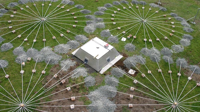
"caption": "Infrasound array at Tristan da Cunha. Gravel covers the input pipes to muffle wind. Image courtesy The Official CTBTO Photostream",
"description": null,
"title": "infrasound",
"credit": null,
"status": "inherit",
"isLoading": false,
"fetchFailed": false
},
"quest_49613": {
"type": "attachments",
"id": "quest_49613",
"meta": {
"index": "attachments_1716263798",
"site": "quest",
"id": "49613",
"found": true
},
"parent": 49612,
"imgSizes": {
"thumbnail": {
"file": "https://ww2.kqed.org/app/uploads/sites/39/2013/02/georomance-400x225.jpg",
"width": 400,
"mimeType": "image/jpeg",
"height": 225
},
"kqedFullSize": {
"file": "https://ww2.kqed.org/app/uploads/sites/39/2013/02/georomance.jpg",
"width": 640,
"height": 360
},
"guest-author-96": {
"file": "https://ww2.kqed.org/app/uploads/sites/39/2013/02/georomance-96x96.jpg",
"width": 96,
"mimeType": "image/jpeg",
"height": 96
},
"guest-author-64": {
"file": "https://ww2.kqed.org/app/uploads/sites/39/2013/02/georomance-64x64.jpg",
"width": 64,
"mimeType": "image/jpeg",
"height": 64
},
"detail": {
"file": "https://ww2.kqed.org/app/uploads/sites/39/2013/02/georomance-75x75.jpg",
"width": 75,
"mimeType": "image/jpeg",
"height": 75
},
"guest-author-32": {
"file": "https://ww2.kqed.org/app/uploads/sites/39/2013/02/georomance-32x32.jpg",
"width": 32,
"mimeType": "image/jpeg",
"height": 32
},
"guest-author-128": {
"file": "https://ww2.kqed.org/app/uploads/sites/39/2013/02/georomance-128x128.jpg",
"width": 128,
"mimeType": "image/jpeg",
"height": 128
}
},
"publishDate": 1360866424,
"modified": 1360866424,
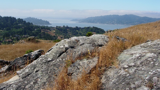
"caption": "Ring Mountain, in Marin County, is as beautiful as it is geological. Photos by Andrew Alden",
"description": null,
"title": "georomance",
"credit": null,
"status": "inherit",
"isLoading": false,
"fetchFailed": false
},
"quest_49565": {
"type": "attachments",
"id": "quest_49565",
"meta": {
"index": "attachments_1716263798",
"site": "quest",
"id": "49565",
"found": true
},
"parent": 49560,
"imgSizes": {
"thumbnail": {
"file": "https://ww2.kqed.org/app/uploads/sites/39/2013/02/pinnacles2-400x225.jpg",
"width": 400,
"mimeType": "image/jpeg",
"height": 225
},
"kqedFullSize": {
"file": "https://ww2.kqed.org/app/uploads/sites/39/2013/02/pinnacles2.jpg",
"width": 640,
"height": 360
},
"guest-author-96": {
"file": "https://ww2.kqed.org/app/uploads/sites/39/2013/02/pinnacles2-96x96.jpg",
"width": 96,
"mimeType": "image/jpeg",
"height": 96
},
"guest-author-64": {
"file": "https://ww2.kqed.org/app/uploads/sites/39/2013/02/pinnacles2-64x64.jpg",
"width": 64,
"mimeType": "image/jpeg",
"height": 64
},
"detail": {
"file": "https://ww2.kqed.org/app/uploads/sites/39/2013/02/pinnacles2-75x75.jpg",
"width": 75,
"mimeType": "image/jpeg",
"height": 75
},
"guest-author-32": {
"file": "https://ww2.kqed.org/app/uploads/sites/39/2013/02/pinnacles2-32x32.jpg",
"width": 32,
"mimeType": "image/jpeg",
"height": 32
},
"guest-author-128": {
"file": "https://ww2.kqed.org/app/uploads/sites/39/2013/02/pinnacles2-128x128.jpg",
"width": 128,
"mimeType": "image/jpeg",
"height": 128
}
},
"publishDate": 1360617369,
"modified": 1360617369,
"caption": "The pinnacles at Pinnacles are remnants of a volcano. (Photo: The Pokerbird/Flickr)",
"description": null,
"title": "pinnacles2",
"credit": null,
"status": "inherit",
"isLoading": false,
"fetchFailed": false
},
"quest_49367": {
"type": "attachments",
"id": "quest_49367",
"meta": {
"index": "attachments_1716263798",
"site": "quest",
"id": "49367",
"found": true
},
"parent": 49366,
"imgSizes": {
"thumbnail": {
"file": "https://ww2.kqed.org/app/uploads/sites/39/2013/02/obsidiansound-400x225.jpg",
"width": 400,
"mimeType": "image/jpeg",
"height": 225
},
"kqedFullSize": {
"file": "https://ww2.kqed.org/app/uploads/sites/39/2013/02/obsidiansound.jpg",
"width": 640,
"height": 360
},
"guest-author-96": {
"file": "https://ww2.kqed.org/app/uploads/sites/39/2013/02/obsidiansound-96x96.jpg",
"width": 96,
"mimeType": "image/jpeg",
"height": 96
},
"guest-author-64": {
"file": "https://ww2.kqed.org/app/uploads/sites/39/2013/02/obsidiansound-64x64.jpg",
"width": 64,
"mimeType": "image/jpeg",
"height": 64
},
"detail": {
"file": "https://ww2.kqed.org/app/uploads/sites/39/2013/02/obsidiansound-75x75.jpg",
"width": 75,
"mimeType": "image/jpeg",
"height": 75
},
"guest-author-32": {
"file": "https://ww2.kqed.org/app/uploads/sites/39/2013/02/obsidiansound-32x32.jpg",
"width": 32,
"mimeType": "image/jpeg",
"height": 32
},
"guest-author-128": {
"file": "https://ww2.kqed.org/app/uploads/sites/39/2013/02/obsidiansound-128x128.jpg",
"width": 128,
"mimeType": "image/jpeg",
"height": 128
}
},
"publishDate": 1360124315,
"modified": 1360124315,
"caption": "This active obsidian flow sounded like breaking glass, which in fact is what it was. Image by Hugh Tuffen, used under Creative Commons license",
"description": null,
"title": "obsidiansound",
"credit": null,
"status": "inherit",
"isLoading": false,
"fetchFailed": false
},
"quest_49224": {
"type": "attachments",
"id": "quest_49224",
"meta": {
"index": "attachments_1716263798",
"site": "quest",
"id": "49224",
"found": true
},
"parent": 49223,
"imgSizes": {
"thumbnail": {
"file": "https://ww2.kqed.org/app/uploads/sites/39/2013/01/CalEQwarningtop-400x225.jpg",
"width": 400,
"mimeType": "image/jpeg",
"height": 225
},
"kqedFullSize": {
"file": "https://ww2.kqed.org/app/uploads/sites/39/2013/01/CalEQwarningtop.jpg",
"width": 640,
"height": 360
},
"guest-author-96": {
"file": "https://ww2.kqed.org/app/uploads/sites/39/2013/01/CalEQwarningtop-96x96.jpg",
"width": 96,
"mimeType": "image/jpeg",
"height": 96
},
"guest-author-64": {
"file": "https://ww2.kqed.org/app/uploads/sites/39/2013/01/CalEQwarningtop-64x64.jpg",
"width": 64,
"mimeType": "image/jpeg",
"height": 64
},
"detail": {
"file": "https://ww2.kqed.org/app/uploads/sites/39/2013/01/CalEQwarningtop-75x75.jpg",
"width": 75,
"mimeType": "image/jpeg",
"height": 75
},
"guest-author-32": {
"file": "https://ww2.kqed.org/app/uploads/sites/39/2013/01/CalEQwarningtop-32x32.jpg",
"width": 32,
"mimeType": "image/jpeg",
"height": 32
},
"guest-author-128": {
"file": "https://ww2.kqed.org/app/uploads/sites/39/2013/01/CalEQwarningtop-128x128.jpg",
"width": 128,
"mimeType": "image/jpeg",
"height": 128
}
},
"publishDate": 1359662273,
"modified": 1359662273,
"caption": "The collapsed Cypress Viaduct was the site of the first earthquake early-warning system, in 1989. USGS photo by Howard Wilshire",
"description": null,
"title": "CalEQwarningtop",
"credit": null,
"status": "inherit",
"isLoading": false,
"fetchFailed": false
},
"quest_49031": {
"type": "attachments",
"id": "quest_49031",
"meta": {
"index": "attachments_1716263798",
"site": "quest",
"id": "49031",
"found": true
},
"parent": 49030,
"imgSizes": {
"thumbnail": {
"file": "https://ww2.kqed.org/app/uploads/sites/39/2013/01/sanbrunomtn-top-400x225.jpg",
"width": 400,
"mimeType": "image/jpeg",
"height": 225
},
"kqedFullSize": {
"file": "https://ww2.kqed.org/app/uploads/sites/39/2013/01/sanbrunomtn-top.jpg",
"width": 640,
"height": 360
},
"guest-author-96": {
"file": "https://ww2.kqed.org/app/uploads/sites/39/2013/01/sanbrunomtn-top-96x96.jpg",
"width": 96,
"mimeType": "image/jpeg",
"height": 96
},
"guest-author-64": {
"file": "https://ww2.kqed.org/app/uploads/sites/39/2013/01/sanbrunomtn-top-64x64.jpg",
"width": 64,
"mimeType": "image/jpeg",
"height": 64
},
"detail": {
"file": "https://ww2.kqed.org/app/uploads/sites/39/2013/01/sanbrunomtn-top-75x75.jpg",
"width": 75,
"mimeType": "image/jpeg",
"height": 75
},
"guest-author-32": {
"file": "https://ww2.kqed.org/app/uploads/sites/39/2013/01/sanbrunomtn-top-32x32.jpg",
"width": 32,
"mimeType": "image/jpeg",
"height": 32
},
"guest-author-128": {
"file": "https://ww2.kqed.org/app/uploads/sites/39/2013/01/sanbrunomtn-top-128x128.jpg",
"width": 128,
"mimeType": "image/jpeg",
"height": 128
}
},
"publishDate": 1359051699,
"modified": 1359051699,
"caption": null,
"description": null,
"title": "sanbrunomtn-top",
"credit": null,
"status": "inherit",
"isLoading": false,
"fetchFailed": false
},
"quest_48551": {
"type": "attachments",
"id": "quest_48551",
"meta": {
"index": "attachments_1716263798",
"site": "quest",
"id": "48551",
"found": true
},
"parent": 48550,
"imgSizes": {
"thumbnail": {
"file": "https://ww2.kqed.org/app/uploads/sites/39/2013/01/lastrampas-top-400x225.jpg",
"width": 400,
"mimeType": "image/jpeg",
"height": 225
},
"kqedFullSize": {
"file": "https://ww2.kqed.org/app/uploads/sites/39/2013/01/lastrampas-top.jpg",
"width": 640,
"height": 360
},
"guest-author-96": {
"file": "https://ww2.kqed.org/app/uploads/sites/39/2013/01/lastrampas-top-96x96.jpg",
"width": 96,
"mimeType": "image/jpeg",
"height": 96
},
"guest-author-64": {
"file": "https://ww2.kqed.org/app/uploads/sites/39/2013/01/lastrampas-top-64x64.jpg",
"width": 64,
"mimeType": "image/jpeg",
"height": 64
},
"detail": {
"file": "https://ww2.kqed.org/app/uploads/sites/39/2013/01/lastrampas-top-75x75.jpg",
"width": 75,
"mimeType": "image/jpeg",
"height": 75
},
"guest-author-32": {
"file": "https://ww2.kqed.org/app/uploads/sites/39/2013/01/lastrampas-top-32x32.jpg",
"width": 32,
"mimeType": "image/jpeg",
"height": 32
},
"guest-author-128": {
"file": "https://ww2.kqed.org/app/uploads/sites/39/2013/01/lastrampas-top-128x128.jpg",
"width": 128,
"mimeType": "image/jpeg",
"height": 128
}
},
"publishDate": 1357845632,
"modified": 1357845632,
"caption": null,
"description": null,
"title": "lastrampas-top",
"credit": null,
"status": "inherit",
"isLoading": false,
"fetchFailed": false
},
"quest_48411": {
"type": "attachments",
"id": "quest_48411",
"meta": {
"index": "attachments_1716263798",
"site": "quest",
"id": "48411",
"found": true
},
"parent": 48410,
"imgSizes": {
"thumbnail": {
"file": "https://ww2.kqed.org/app/uploads/sites/39/2013/01/pinnaclesNP-400x225.jpg",
"width": 400,
"mimeType": "image/jpeg",
"height": 225
},
"kqedFullSize": {
"file": "https://ww2.kqed.org/app/uploads/sites/39/2013/01/pinnaclesNP.jpg",
"width": 640,
"height": 360
},
"guest-author-96": {
"file": "https://ww2.kqed.org/app/uploads/sites/39/2013/01/pinnaclesNP-96x96.jpg",
"width": 96,
"mimeType": "image/jpeg",
"height": 96
},
"guest-author-64": {
"file": "https://ww2.kqed.org/app/uploads/sites/39/2013/01/pinnaclesNP-64x64.jpg",
"width": 64,
"mimeType": "image/jpeg",
"height": 64
},
"detail": {
"file": "https://ww2.kqed.org/app/uploads/sites/39/2013/01/pinnaclesNP-75x75.jpg",
"width": 75,
"mimeType": "image/jpeg",
"height": 75
},
"guest-author-32": {
"file": "https://ww2.kqed.org/app/uploads/sites/39/2013/01/pinnaclesNP-32x32.jpg",
"width": 32,
"mimeType": "image/jpeg",
"height": 32
},
"guest-author-128": {
"file": "https://ww2.kqed.org/app/uploads/sites/39/2013/01/pinnaclesNP-128x128.jpg",
"width": 128,
"mimeType": "image/jpeg",
"height": 128
}
},
"publishDate": 1357241271,
"modified": 1357241271,
"caption": "View from the Pinnacles, on the Pacific plate, to the North America plate across the San Andreas fault. Photo courtesy {link url=http://www.flickr.com/photos/33671002@N00/}Mike Prasad{/link} of Flickr under Creative Commons license",
"description": "View from the Pinnacles, on the Pacific plate, to the North America plate across the San Andreas fault. Photo courtesy {link url=\"http://www.flickr.com/photos/33671002@N00/\"}Mike Prasad{/link} of Flickr under Creative Commons license",
"title": "pinnaclesNP",
"credit": null,
"status": "inherit",
"isLoading": false,
"fetchFailed": false
},
"quest_48292": {
"type": "attachments",
"id": "quest_48292",
"meta": {
"index": "attachments_1716263798",
"site": "quest",
"id": "48292",
"found": true
},
"parent": 48291,
"imgSizes": {
"thumbnail": {
"file": "https://ww2.kqed.org/app/uploads/sites/39/2012/12/xmasquiz-400x225.jpg",
"width": 400,
"mimeType": "image/jpeg",
"height": 225
},
"kqedFullSize": {
"file": "https://ww2.kqed.org/app/uploads/sites/39/2012/12/xmasquiz.jpg",
"width": 640,
"height": 360
},
"guest-author-96": {
"file": "https://ww2.kqed.org/app/uploads/sites/39/2012/12/xmasquiz-96x96.jpg",
"width": 96,
"mimeType": "image/jpeg",
"height": 96
},
"guest-author-64": {
"file": "https://ww2.kqed.org/app/uploads/sites/39/2012/12/xmasquiz-64x64.jpg",
"width": 64,
"mimeType": "image/jpeg",
"height": 64
},
"detail": {
"file": "https://ww2.kqed.org/app/uploads/sites/39/2012/12/xmasquiz-75x75.jpg",
"width": 75,
"mimeType": "image/jpeg",
"height": 75
},
"guest-author-32": {
"file": "https://ww2.kqed.org/app/uploads/sites/39/2012/12/xmasquiz-32x32.jpg",
"width": 32,
"mimeType": "image/jpeg",
"height": 32
},
"guest-author-128": {
"file": "https://ww2.kqed.org/app/uploads/sites/39/2012/12/xmasquiz-128x128.jpg",
"width": 128,
"mimeType": "image/jpeg",
"height": 128
}
},
"publishDate": 1356635539,
"modified": 1356635539,
"caption": "I used this picture in last year's quiz and have not been able to top it, so this will be the permanent Holiday Quiz photo.",
"description": null,
"title": "xmasquiz",
"credit": null,
"status": "inherit",
"isLoading": false,
"fetchFailed": false
},
"quest_48062": {
"type": "attachments",
"id": "quest_48062",
"meta": {
"index": "attachments_1716263798",
"site": "quest",
"id": "48062",
"found": true
},
"parent": 48060,
"imgSizes": {
"thumbnail": {
"file": "https://ww2.kqed.org/app/uploads/sites/39/2012/12/suttermeteor-top-400x225.jpg",
"width": 400,
"mimeType": "image/jpeg",
"height": 225
},
"kqedFullSize": {
"file": "https://ww2.kqed.org/app/uploads/sites/39/2012/12/suttermeteor-top.jpg",
"width": 640,
"height": 360
},
"guest-author-96": {
"file": "https://ww2.kqed.org/app/uploads/sites/39/2012/12/suttermeteor-top-96x96.jpg",
"width": 96,
"mimeType": "image/jpeg",
"height": 96
},
"guest-author-64": {
"file": "https://ww2.kqed.org/app/uploads/sites/39/2012/12/suttermeteor-top-64x64.jpg",
"width": 64,
"mimeType": "image/jpeg",
"height": 64
},
"detail": {
"file": "https://ww2.kqed.org/app/uploads/sites/39/2012/12/suttermeteor-top-75x75.jpg",
"width": 75,
"mimeType": "image/jpeg",
"height": 75
},
"guest-author-32": {
"file": "https://ww2.kqed.org/app/uploads/sites/39/2012/12/suttermeteor-top-32x32.jpg",
"width": 32,
"mimeType": "image/jpeg",
"height": 32
},
"guest-author-128": {
"file": "https://ww2.kqed.org/app/uploads/sites/39/2012/12/suttermeteor-top-128x128.jpg",
"width": 128,
"mimeType": "image/jpeg",
"height": 128
}
},
"publishDate": 1355967298,
"modified": 1355967298,
"caption": "Specimen number SM2 of the Sutter's Mill meteorite fall was run over by a car before NASA scientist Peter Jenniskens found it on April 24, 2012. The largest grain is a centimeter across. Image: P. Jenniskens (SETI Institute) and Eric James (NASA Ames) ",
"description": null,
"title": "suttermeteor-top",
"credit": null,
"status": "inherit",
"isLoading": false,
"fetchFailed": false
},
"quest_48002": {
"type": "attachments",
"id": "quest_48002",
"meta": {
"index": "attachments_1716263798",
"site": "quest",
"id": "48002",
"found": true
},
"parent": 47995,
"imgSizes": {
"thumbnail": {
"file": "https://ww2.kqed.org/app/uploads/sites/39/2012/12/fracking121207-400x225.jpg",
"width": 400,
"mimeType": "image/jpeg",
"height": 225
},
"kqedFullSize": {
"file": "https://ww2.kqed.org/app/uploads/sites/39/2012/12/fracking121207.jpg",
"width": 640,
"height": 360
},
"guest-author-96": {
"file": "https://ww2.kqed.org/app/uploads/sites/39/2012/12/fracking121207-96x96.jpg",
"width": 96,
"mimeType": "image/jpeg",
"height": 96
},
"guest-author-64": {
"file": "https://ww2.kqed.org/app/uploads/sites/39/2012/12/fracking121207-64x64.jpg",
"width": 64,
"mimeType": "image/jpeg",
"height": 64
},
"detail": {
"file": "https://ww2.kqed.org/app/uploads/sites/39/2012/12/fracking121207-75x75.jpg",
"width": 75,
"mimeType": "image/jpeg",
"height": 75
},
"guest-author-32": {
"file": "https://ww2.kqed.org/app/uploads/sites/39/2012/12/fracking121207-32x32.jpg",
"width": 32,
"mimeType": "image/jpeg",
"height": 32
},
"guest-author-128": {
"file": "https://ww2.kqed.org/app/uploads/sites/39/2012/12/fracking121207-128x128.jpg",
"width": 128,
"mimeType": "image/jpeg",
"height": 128
}
},
"publishDate": 1355526460,
"modified": 1355526460,
"caption": "Workers at the Marcellus Shale in Pennsylvania. (MLADEN ANTONOV/AFP/Getty Images)",
"description": "MLADEN ANTONOV/AFP/Getty Images",
"title": "fracking121207",
"credit": null,
"status": "inherit",
"isLoading": false,
"fetchFailed": false
}
},
"audioPlayerReducer": {
"postId": "stream_live",
"isPaused": true,
"isPlaying": false,
"pfsActive": false,
"pledgeModalIsOpen": true,
"playerDrawerIsOpen": false,
"liveAudioPlayStartedAt": 0,
"liveAudioPlayContext": ""
},
"authorsReducer": {
"mollysamuel": {
"type": "authors",
"id": "200",
"meta": {
"index": "authors_1716337520",
"id": "200",
"found": true
},
"name": "Molly Samuel",
"firstName": "Molly",
"lastName": "Samuel",
"slug": "mollysamuel",
"email": "msamuel@kqed.org",
"display_author_email": false,
"staff_mastheads": [],
"title": null,
"bio": "Molly Samuel joined KQED as an intern in 2007, and since then has worked here as a reporter, producer, director and blogger. Before becoming KQED Science’s Multimedia Producer, she was a producer for Climate Watch. Molly has also reported for NPR, KALW and High Country News, and has produced audio stories for The Encyclopedia of Life and the Oakland Museum of California. She was a fellow with the Middlebury Fellowships in Environmental Journalism and a journalist-in-residence at the National Evolutionary Synthesis Center. Molly has a degree in Ancient Greek from Oberlin College and is a co-founder of the record label True Panther Sounds.",
"avatar": "https://secure.gravatar.com/avatar/a6abd3b949a89fe5109fa9917631d0b6?s=600&d=blank&r=g",
"twitter": null,
"facebook": null,
"instagram": null,
"linkedin": null,
"sites": [
{
"site": "news",
"roles": [
"subscriber"
]
},
{
"site": "stateofhealth",
"roles": [
"subscriber"
]
},
{
"site": "science",
"roles": [
"subscriber"
]
},
{
"site": "quest",
"roles": [
"edit_users",
"subscriber"
]
}
],
"headData": {
"title": "Molly Samuel | KQED",
"description": null,
"ogImgSrc": "https://secure.gravatar.com/avatar/a6abd3b949a89fe5109fa9917631d0b6?s=600&d=blank&r=g",
"twImgSrc": "https://secure.gravatar.com/avatar/a6abd3b949a89fe5109fa9917631d0b6?s=600&d=blank&r=g"
},
"isLoading": false,
"link": "/author/mollysamuel"
},
"andrew-alden": {
"type": "authors",
"id": "6228",
"meta": {
"index": "authors_1716337520",
"id": "6228",
"found": true
},
"name": "Andrew Alden",
"firstName": "Andrew",
"lastName": "Alden",
"slug": "andrew-alden",
"email": "alden@andrew-alden.com",
"display_author_email": false,
"staff_mastheads": [],
"title": null,
"bio": "Andrew Alden earned his geology degree at the University of New Hampshire and moved back to the Bay Area to work at the U.S. Geological Survey for six years. He has \u003ca href=\"http://geology.about.com/\">written on geology for About.com\u003c/a> since its founding in 1997. In 2007, he started the Oakland Geology blog, which won recognition as \"Best of the East Bay\" from the \u003ci>East Bay Express\u003c/i> in 2010. In writing about geology in the Bay Area and surroundings, he hopes to share some of the useful and pleasurable insights that geologists give us—not just facts about the deep past, but an attitude that might be called the \u003ci>deep present\u003c/i>.\r\n\r\nRead his \u003ca href=\"http://science.kqed.org/quest/author/andrew-alden/\">previous contributions\u003c/a> to \u003ca href=\"http://http://science.kqed.org/quest/\">QUEST\u003c/a>, a project dedicated to exploring the Science of Sustainability.",
"avatar": "https://secure.gravatar.com/avatar/9eaa0afc32f98c5fc7ce634437334a64?s=600&d=blank&r=g",
"twitter": null,
"facebook": null,
"instagram": null,
"linkedin": null,
"sites": [
{
"site": "science",
"roles": [
"author"
]
},
{
"site": "quest",
"roles": [
"subscriber"
]
}
],
"headData": {
"title": "Andrew Alden | KQED",
"description": null,
"ogImgSrc": "https://secure.gravatar.com/avatar/9eaa0afc32f98c5fc7ce634437334a64?s=600&d=blank&r=g",
"twImgSrc": "https://secure.gravatar.com/avatar/9eaa0afc32f98c5fc7ce634437334a64?s=600&d=blank&r=g"
},
"isLoading": false,
"link": "/author/andrew-alden"
}
},
"pagesReducer": {
"science_category_geology": {
"type": "terms",
"id": "science_38",
"meta": {
"index": "terms_1716263798",
"site": "science",
"id": "38",
"score": 13.559036
},
"featImg": null,
"name": "Geology",
"description": null,
"taxonomy": "category",
"headData": {
"twImgId": null,
"twTitle": null,
"ogTitle": null,
"ogImgId": null,
"twDescription": null,
"description": null,
"title": "Geology Archives | KQED Science",
"ogDescription": null
},
"ttid": 40,
"slug": "geology",
"isLoading": false,
"title": "Geology",
"pageMeta": {
"site": "science",
"WpPageTemplate": "page-topic-editorial",
"currentPage": 21
},
"blocks": [
{
"blockName": "kqed/post-list",
"attrs": {
"layout": "cardArticle2",
"query": "posts/science?category=geology",
"seeMore": false,
"paginated": true,
"page": 21
}
},
{
"blockName": "kqed/ad"
}
]
}
},
"pfsSessionReducer": {},
"postsReducer": {
"stream_live": {
"type": "live",
"id": "stream_live",
"audioUrl": "https://hls.kqed.org/hls/kqed_app/playlist.m3u8",
"title": "Live Stream",
"excerpt": "Live Stream information currently unavailable.",
"link": "/radio",
"featImg": "",
"label": {
"name": "KQED Live",
"link": "/"
}
},
"stream_kqedNewscast": {
"type": "posts",
"id": "stream_kqedNewscast",
"audioUrl": "https://www.kqed.org/.stream/anon/radio/RDnews/newscast.mp3?_=1",
"title": "KQED Newscast",
"featImg": "",
"label": {
"name": "88.5 FM",
"link": "/"
}
},
"quest_50103": {
"type": "posts",
"id": "quest_50103",
"meta": {
"index": "posts_1716263798",
"site": "quest",
"id": "50103",
"score": null,
"sort": [
1362081575000
]
},
"parent": 0,
"labelTerm": {
"site": "quest"
},
"blocks": [],
"publishDate": 1362081575,
"format": "aside",
"disqusTitle": "Side Trips from Interstate 5: Kettleman Hills",
"title": "Side Trips from Interstate 5: Kettleman Hills",
"headTitle": "QUEST | KQED Science",
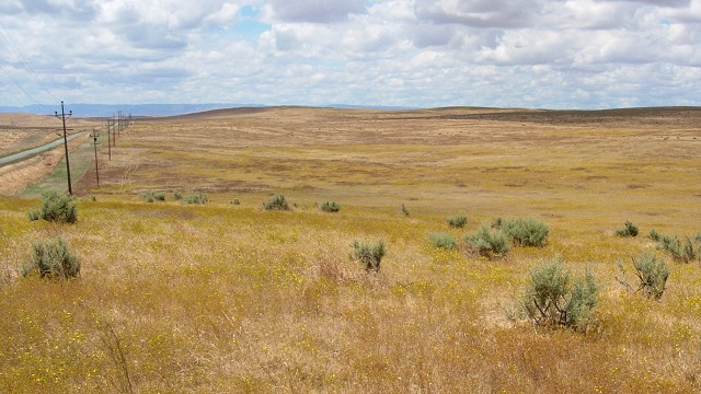
"content": "\u003cp>As you head south on I-5 past Coalinga, the road runs just east of a long range of hills. From on high, and on the geologic map, the Kettleman Hills are a dramatic and obvious example of an anticlinal arch. The center is uplifted and dissected by erosion, so that the insides are the older rocks.\u003c/p>\n\u003cp>\u003ca href=\"http://ww2.kqed.org/quest/2013/02/28/side-trips-from-interstate-5-kettleman-hills/kethillsgeomap/\" rel=\"attachment wp-att-50107\">\u003cimg src=\"http://ww2.kqed.org/quest/wp-content/uploads/sites/39/2013/02/kethillsgeomap.png\" alt=\"kethillsgeomap\" width=\"600\" height=\"400\" class=\"aligncenter size-full wp-image-50107\" srcset=\"https://ww2.kqed.org/app/uploads/sites/39/2013/02/kethillsgeomap.png 600w, https://ww2.kqed.org/app/uploads/sites/39/2013/02/kethillsgeomap-400x267.png 400w\" sizes=\"(max-width: 600px) 100vw, 600px\">\u003c/a>\u003c/p>\n\u003cp>These hills drew the attention of oil drillers early on, but their holes came up dry until October 3rd, 1928, when a well struck a highly overpressured reservoir some 7000 feet down. A gusher resulted that lasted for three years. Oil production from the field was so great that the market was depressed and several other oil-producing states grumbled about the lack of regulation in California. \u003c/p>\n\u003cfigure id=\"attachment_50111\" class=\"wp-caption aligncenter\" style=\"max-width: 600px\">\u003ca href=\"http://ww2.kqed.org/quest/2013/02/28/side-trips-from-interstate-5-kettleman-hills/kethillswellhead/\" rel=\"attachment wp-att-50111\">\u003cimg src=\"http://ww2.kqed.org/quest/wp-content/uploads/sites/39/2013/02/kethillswellhead.jpg\" alt=\"Massive Christmas tree of well controls used in the Kettleman Hills North Dome oil field\" width=\"600\" height=\"468\" class=\"size-full wp-image-50111\" srcset=\"https://ww2.kqed.org/app/uploads/sites/39/2013/02/kethillswellhead.jpg 600w, https://ww2.kqed.org/app/uploads/sites/39/2013/02/kethillswellhead-400x312.jpg 400w\" sizes=\"(max-width: 600px) 100vw, 600px\">\u003c/a>\u003cfigcaption class=\"wp-caption-text\">Massive \"Christmas tree\" of well controls used in the Kettleman Hills North Dome oil field. Photo courtesy {link url=\"http://www.flickr.com/photos/bilbord99/\"}Bill Mulder{/link} of flickr under Creative Commons license\u003c/figcaption>\u003c/figure>\n\u003cp>The town of Avenal arose with the oil boom, along with a host of businesses based on petroleum. \u003c/p>\n\u003cfigure id=\"attachment_50104\" class=\"wp-caption aligncenter\" style=\"max-width: 600px\">\u003ca href=\"http://ww2.kqed.org/quest/2013/02/28/side-trips-from-interstate-5-kettleman-hills/kettlemanking/\" rel=\"attachment wp-att-50104\">\u003cimg src=\"http://ww2.kqed.org/quest/wp-content/uploads/sites/39/2013/02/kettlemanking.png\" alt=\"This company was later acquired by Beacon.\" width=\"600\" height=\"453\" class=\"size-full wp-image-50104\" srcset=\"https://ww2.kqed.org/app/uploads/sites/39/2013/02/kettlemanking.png 600w, https://ww2.kqed.org/app/uploads/sites/39/2013/02/kettlemanking-400x302.png 400w\" sizes=\"(max-width: 600px) 100vw, 600px\">\u003c/a>\u003cfigcaption class=\"wp-caption-text\">This company was later acquired by Beacon. Photo courtesy {link url=\"http://www.flickr.com/photos/thomashawk/\"}Thomas Hawk{/link} of Flickr under Creative Commons license\u003c/figcaption>\u003c/figure>\n\u003cp>The classic geologic treatment of the Kettleman Hills oil field was issued in 1940 by the U.S. Geological Survey as \u003ca href=\"http://pubs.er.usgs.gov/publication/pp195\">Professional Paper 195\u003c/a>. \u003c/p>\n\u003cp>[ad fullwidth]\u003c/p>\n\u003cp>Today the field is almost played out, although you can never discount new advances that might revive it. But the hills remain, blooming every spring. And the roadcuts, where you can access them, are still \u003ca href=\"http://inyo.coffeecup.com/site/kh/kettleman.html\">full of fossils\u003c/a>.\u003c/p>\n\u003cfigure id=\"attachment_50109\" class=\"wp-caption aligncenter\" style=\"max-width: 500px\">\u003ca href=\"http://ww2.kqed.org/quest/2013/02/28/side-trips-from-interstate-5-kettleman-hills/kethillssanddollar/\" rel=\"attachment wp-att-50109\">\u003cimg src=\"http://ww2.kqed.org/quest/wp-content/uploads/sites/39/2013/02/kethillssanddollar.jpg\" alt=\"The sand dollar Dendraster gibbsi\" width=\"500\" height=\"484\" class=\"size-full wp-image-50109\" srcset=\"https://ww2.kqed.org/app/uploads/sites/39/2013/02/kethillssanddollar.jpg 500w, https://ww2.kqed.org/app/uploads/sites/39/2013/02/kethillssanddollar-400x387.jpg 400w, https://ww2.kqed.org/app/uploads/sites/39/2013/02/kethillssanddollar-32x32.jpg 32w\" sizes=\"(max-width: 500px) 100vw, 500px\">\u003c/a>\u003cfigcaption class=\"wp-caption-text\">The sand dollar Dendraster gibbsi, 43 millimeters across, from the interior of the Kettleman Hills. Photo courtesy {link url=\"http://www.flickr.com/photos/jsjgeology/\"}James St. John{/link} of Flickr under Creative Commons license\u003c/figcaption>\u003c/figure>\n\u003cp>You can cross the hills in three places, two of them busy highways: the Avenal cutoff in the north and state route 41 in the middle. I've tried looking for places to pull over on these roads and it basically shouldn't be done. Take the third way, farther south starting at the Utica Avenue exit; head west and then immediately south on 25th Avenue, taking it all the way to Twisselman Road and back to the freeway.\u003c/p>\n\u003cp>\u003ca href=\"http://ww2.kqed.org/quest/2013/02/28/side-trips-from-interstate-5-kettleman-hills/kethillsroutemap/\" rel=\"attachment wp-att-50108\">\u003cimg src=\"http://ww2.kqed.org/quest/wp-content/uploads/sites/39/2013/02/kethillsroutemap.png\" alt=\"kethillsroutemap\" width=\"600\" height=\"425\" class=\"aligncenter size-full wp-image-50108\" srcset=\"https://ww2.kqed.org/app/uploads/sites/39/2013/02/kethillsroutemap.png 600w, https://ww2.kqed.org/app/uploads/sites/39/2013/02/kethillsroutemap-400x283.png 400w\" sizes=\"(max-width: 600px) 100vw, 600px\">\u003c/a>\u003c/p>\n\u003cp>The edge of the hills is marked by the California Aqueduct, which is always worth contemplating.\u003c/p>\n\u003cfigure id=\"attachment_50106\" class=\"wp-caption aligncenter\" style=\"max-width: 600px\">\u003ca href=\"http://ww2.kqed.org/quest/2013/02/28/side-trips-from-interstate-5-kettleman-hills/kethillsaqueduct/\" rel=\"attachment wp-att-50106\">\u003cimg src=\"http://ww2.kqed.org/quest/wp-content/uploads/sites/39/2013/02/kethillsaqueduct.jpg\" alt=\"Photos by Andrew Alden\" width=\"600\" height=\"362\" class=\"size-full wp-image-50106\" srcset=\"https://ww2.kqed.org/app/uploads/sites/39/2013/02/kethillsaqueduct.jpg 600w, https://ww2.kqed.org/app/uploads/sites/39/2013/02/kethillsaqueduct-400x241.jpg 400w\" sizes=\"(max-width: 600px) 100vw, 600px\">\u003c/a>\u003cfigcaption class=\"wp-caption-text\">Photos by Andrew Alden\u003c/figcaption>\u003c/figure>\n\u003cp>There are a few roadcuts worth checking out. They all seem to be full of fossils dating from the Pleistocene, when the Central Valley was an arm of the sea. With the compression of the Coast Ranges, outlying folds in the crust of the San Joaquin Valley were pushed up into anticlines which formed traps for huge amounts of oil and gas.\u003c/p>\n\u003cp>\u003ca href=\"http://ww2.kqed.org/quest/2013/02/28/side-trips-from-interstate-5-kettleman-hills/kethillfossils/\" rel=\"attachment wp-att-50105\">\u003cimg src=\"http://ww2.kqed.org/quest/wp-content/uploads/sites/39/2013/02/kethillfossils.jpg\" alt=\"kethillfossils\" width=\"600\" height=\"400\" class=\"aligncenter size-full wp-image-50105\" srcset=\"https://ww2.kqed.org/app/uploads/sites/39/2013/02/kethillfossils.jpg 600w, https://ww2.kqed.org/app/uploads/sites/39/2013/02/kethillfossils-400x267.jpg 400w\" sizes=\"(max-width: 600px) 100vw, 600px\">\u003c/a>\u003c/p>\n\u003cp>Where Devil's Den Road splits off is the gap between the Middle and South Domes of the Kettleman Hills. East of there was the shoreline of Tulare Lake, an inland sea that was drained away long ago by the farms and cities of the Great Valley. Imagine the effect it must have had on the local climate here. This countryside, at its best, is worlds away from I-5.\u003c/p>\n\u003cp>\u003ca href=\"http://ww2.kqed.org/quest/2013/02/28/side-trips-from-interstate-5-kettleman-hills/kethillstop/\" rel=\"attachment wp-att-50110\">\u003cimg src=\"http://ww2.kqed.org/quest/wp-content/uploads/sites/39/2013/02/kethillstop.jpg\" alt=\"kethillstop\" width=\"640\" height=\"360\" class=\"aligncenter size-full wp-image-50110\" srcset=\"https://ww2.kqed.org/app/uploads/sites/39/2013/02/kethillstop.jpg 640w, https://ww2.kqed.org/app/uploads/sites/39/2013/02/kethillstop-400x225.jpg 400w\" sizes=\"(max-width: 640px) 100vw, 640px\">\u003c/a>\u003c/p>\n\u003cp>\u003c/p>\n\u003cp>Remember, the point of a side trip is not to rush—plenty of opportunity for that on the freeway—and be ready to stop and smell the flowers, or at least sniff the breeze.\u003c/p>\n\n",
"disqusIdentifier": "50103 http://science.kqed.org/quest/?p=50103",
"disqusUrl": "https://ww2.kqed.org/quest/2013/02/28/side-trips-from-interstate-5-kettleman-hills/",
"stats": {
"hasVideo": false,
"hasChartOrMap": false,
"hasAudio": false,
"hasPolis": false,
"wordCount": 568,
"hasGoogleForm": false,
"hasGallery": false,
"hasHearkenModule": false,
"iframeSrcs": [],
"paragraphCount": 16
},
"modified": 1362707277,
"excerpt": "This side trip takes you into the quiet range of hills that runs along the freeway south of Coalinga.",
"headData": {
"twImgId": "",
"twTitle": "",
"ogTitle": "",
"ogImgId": "",
"twDescription": "",
"description": "This side trip takes you into the quiet range of hills that runs along the freeway south of Coalinga.",
"title": "Side Trips from Interstate 5: Kettleman Hills | KQED",
"ogDescription": "",
"schema": {
"@context": "https://schema.org",
"@type": "Article",
"headline": "Side Trips from Interstate 5: Kettleman Hills",
"datePublished": "2013-02-28T11:59:35-08:00",
"dateModified": "2013-03-07T17:47:57-08:00",
"image": "https://cdn.kqed.org/wp-content/uploads/2020/02/KQED-OG-Image@1x.png"
}
},
"guestAuthors": [],
"slug": "side-trips-from-interstate-5-kettleman-hills",
"status": "publish",
"path": "/quest/50103/side-trips-from-interstate-5-kettleman-hills",
"audioTrackLength": null,
"parsedContent": [
{
"type": "contentString",
"content": "\u003cdiv class=\"post-body\">\u003cp>\u003cp>As you head south on I-5 past Coalinga, the road runs just east of a long range of hills. From on high, and on the geologic map, the Kettleman Hills are a dramatic and obvious example of an anticlinal arch. The center is uplifted and dissected by erosion, so that the insides are the older rocks.\u003c/p>\n\u003cp>\u003ca href=\"http://ww2.kqed.org/quest/2013/02/28/side-trips-from-interstate-5-kettleman-hills/kethillsgeomap/\" rel=\"attachment wp-att-50107\">\u003cimg src=\"http://ww2.kqed.org/quest/wp-content/uploads/sites/39/2013/02/kethillsgeomap.png\" alt=\"kethillsgeomap\" width=\"600\" height=\"400\" class=\"aligncenter size-full wp-image-50107\" srcset=\"https://ww2.kqed.org/app/uploads/sites/39/2013/02/kethillsgeomap.png 600w, https://ww2.kqed.org/app/uploads/sites/39/2013/02/kethillsgeomap-400x267.png 400w\" sizes=\"(max-width: 600px) 100vw, 600px\">\u003c/a>\u003c/p>\n\u003cp>These hills drew the attention of oil drillers early on, but their holes came up dry until October 3rd, 1928, when a well struck a highly overpressured reservoir some 7000 feet down. A gusher resulted that lasted for three years. Oil production from the field was so great that the market was depressed and several other oil-producing states grumbled about the lack of regulation in California. \u003c/p>\n\u003cfigure id=\"attachment_50111\" class=\"wp-caption aligncenter\" style=\"max-width: 600px\">\u003ca href=\"http://ww2.kqed.org/quest/2013/02/28/side-trips-from-interstate-5-kettleman-hills/kethillswellhead/\" rel=\"attachment wp-att-50111\">\u003cimg src=\"http://ww2.kqed.org/quest/wp-content/uploads/sites/39/2013/02/kethillswellhead.jpg\" alt=\"Massive Christmas tree of well controls used in the Kettleman Hills North Dome oil field\" width=\"600\" height=\"468\" class=\"size-full wp-image-50111\" srcset=\"https://ww2.kqed.org/app/uploads/sites/39/2013/02/kethillswellhead.jpg 600w, https://ww2.kqed.org/app/uploads/sites/39/2013/02/kethillswellhead-400x312.jpg 400w\" sizes=\"(max-width: 600px) 100vw, 600px\">\u003c/a>\u003cfigcaption class=\"wp-caption-text\">Massive \"Christmas tree\" of well controls used in the Kettleman Hills North Dome oil field. Photo courtesy {link url=\"http://www.flickr.com/photos/bilbord99/\"}Bill Mulder{/link} of flickr under Creative Commons license\u003c/figcaption>\u003c/figure>\n\u003cp>The town of Avenal arose with the oil boom, along with a host of businesses based on petroleum. \u003c/p>\n\u003cfigure id=\"attachment_50104\" class=\"wp-caption aligncenter\" style=\"max-width: 600px\">\u003ca href=\"http://ww2.kqed.org/quest/2013/02/28/side-trips-from-interstate-5-kettleman-hills/kettlemanking/\" rel=\"attachment wp-att-50104\">\u003cimg src=\"http://ww2.kqed.org/quest/wp-content/uploads/sites/39/2013/02/kettlemanking.png\" alt=\"This company was later acquired by Beacon.\" width=\"600\" height=\"453\" class=\"size-full wp-image-50104\" srcset=\"https://ww2.kqed.org/app/uploads/sites/39/2013/02/kettlemanking.png 600w, https://ww2.kqed.org/app/uploads/sites/39/2013/02/kettlemanking-400x302.png 400w\" sizes=\"(max-width: 600px) 100vw, 600px\">\u003c/a>\u003cfigcaption class=\"wp-caption-text\">This company was later acquired by Beacon. Photo courtesy {link url=\"http://www.flickr.com/photos/thomashawk/\"}Thomas Hawk{/link} of Flickr under Creative Commons license\u003c/figcaption>\u003c/figure>\n\u003cp>The classic geologic treatment of the Kettleman Hills oil field was issued in 1940 by the U.S. Geological Survey as \u003ca href=\"http://pubs.er.usgs.gov/publication/pp195\">Professional Paper 195\u003c/a>. \u003c/p>\n\u003cp>\u003c/p>\u003c/div>",
"attributes": {
"named": {},
"numeric": []
}
},
{
"type": "component",
"content": "",
"name": "ad",
"attributes": {
"named": {
"label": "fullwidth"
},
"numeric": [
"fullwidth"
]
}
},
{
"type": "contentString",
"content": "\u003cdiv class=\"post-body\">\u003cp>\u003c/p>\n\u003cp>Today the field is almost played out, although you can never discount new advances that might revive it. But the hills remain, blooming every spring. And the roadcuts, where you can access them, are still \u003ca href=\"http://inyo.coffeecup.com/site/kh/kettleman.html\">full of fossils\u003c/a>.\u003c/p>\n\u003cfigure id=\"attachment_50109\" class=\"wp-caption aligncenter\" style=\"max-width: 500px\">\u003ca href=\"http://ww2.kqed.org/quest/2013/02/28/side-trips-from-interstate-5-kettleman-hills/kethillssanddollar/\" rel=\"attachment wp-att-50109\">\u003cimg src=\"http://ww2.kqed.org/quest/wp-content/uploads/sites/39/2013/02/kethillssanddollar.jpg\" alt=\"The sand dollar Dendraster gibbsi\" width=\"500\" height=\"484\" class=\"size-full wp-image-50109\" srcset=\"https://ww2.kqed.org/app/uploads/sites/39/2013/02/kethillssanddollar.jpg 500w, https://ww2.kqed.org/app/uploads/sites/39/2013/02/kethillssanddollar-400x387.jpg 400w, https://ww2.kqed.org/app/uploads/sites/39/2013/02/kethillssanddollar-32x32.jpg 32w\" sizes=\"(max-width: 500px) 100vw, 500px\">\u003c/a>\u003cfigcaption class=\"wp-caption-text\">The sand dollar Dendraster gibbsi, 43 millimeters across, from the interior of the Kettleman Hills. Photo courtesy {link url=\"http://www.flickr.com/photos/jsjgeology/\"}James St. John{/link} of Flickr under Creative Commons license\u003c/figcaption>\u003c/figure>\n\u003cp>You can cross the hills in three places, two of them busy highways: the Avenal cutoff in the north and state route 41 in the middle. I've tried looking for places to pull over on these roads and it basically shouldn't be done. Take the third way, farther south starting at the Utica Avenue exit; head west and then immediately south on 25th Avenue, taking it all the way to Twisselman Road and back to the freeway.\u003c/p>\n\u003cp>\u003ca href=\"http://ww2.kqed.org/quest/2013/02/28/side-trips-from-interstate-5-kettleman-hills/kethillsroutemap/\" rel=\"attachment wp-att-50108\">\u003cimg src=\"http://ww2.kqed.org/quest/wp-content/uploads/sites/39/2013/02/kethillsroutemap.png\" alt=\"kethillsroutemap\" width=\"600\" height=\"425\" class=\"aligncenter size-full wp-image-50108\" srcset=\"https://ww2.kqed.org/app/uploads/sites/39/2013/02/kethillsroutemap.png 600w, https://ww2.kqed.org/app/uploads/sites/39/2013/02/kethillsroutemap-400x283.png 400w\" sizes=\"(max-width: 600px) 100vw, 600px\">\u003c/a>\u003c/p>\n\u003cp>The edge of the hills is marked by the California Aqueduct, which is always worth contemplating.\u003c/p>\n\u003cfigure id=\"attachment_50106\" class=\"wp-caption aligncenter\" style=\"max-width: 600px\">\u003ca href=\"http://ww2.kqed.org/quest/2013/02/28/side-trips-from-interstate-5-kettleman-hills/kethillsaqueduct/\" rel=\"attachment wp-att-50106\">\u003cimg src=\"http://ww2.kqed.org/quest/wp-content/uploads/sites/39/2013/02/kethillsaqueduct.jpg\" alt=\"Photos by Andrew Alden\" width=\"600\" height=\"362\" class=\"size-full wp-image-50106\" srcset=\"https://ww2.kqed.org/app/uploads/sites/39/2013/02/kethillsaqueduct.jpg 600w, https://ww2.kqed.org/app/uploads/sites/39/2013/02/kethillsaqueduct-400x241.jpg 400w\" sizes=\"(max-width: 600px) 100vw, 600px\">\u003c/a>\u003cfigcaption class=\"wp-caption-text\">Photos by Andrew Alden\u003c/figcaption>\u003c/figure>\n\u003cp>There are a few roadcuts worth checking out. They all seem to be full of fossils dating from the Pleistocene, when the Central Valley was an arm of the sea. With the compression of the Coast Ranges, outlying folds in the crust of the San Joaquin Valley were pushed up into anticlines which formed traps for huge amounts of oil and gas.\u003c/p>\n\u003cp>\u003ca href=\"http://ww2.kqed.org/quest/2013/02/28/side-trips-from-interstate-5-kettleman-hills/kethillfossils/\" rel=\"attachment wp-att-50105\">\u003cimg src=\"http://ww2.kqed.org/quest/wp-content/uploads/sites/39/2013/02/kethillfossils.jpg\" alt=\"kethillfossils\" width=\"600\" height=\"400\" class=\"aligncenter size-full wp-image-50105\" srcset=\"https://ww2.kqed.org/app/uploads/sites/39/2013/02/kethillfossils.jpg 600w, https://ww2.kqed.org/app/uploads/sites/39/2013/02/kethillfossils-400x267.jpg 400w\" sizes=\"(max-width: 600px) 100vw, 600px\">\u003c/a>\u003c/p>\n\u003cp>Where Devil's Den Road splits off is the gap between the Middle and South Domes of the Kettleman Hills. East of there was the shoreline of Tulare Lake, an inland sea that was drained away long ago by the farms and cities of the Great Valley. Imagine the effect it must have had on the local climate here. This countryside, at its best, is worlds away from I-5.\u003c/p>\n\u003cp>\u003ca href=\"http://ww2.kqed.org/quest/2013/02/28/side-trips-from-interstate-5-kettleman-hills/kethillstop/\" rel=\"attachment wp-att-50110\">\u003cimg src=\"http://ww2.kqed.org/quest/wp-content/uploads/sites/39/2013/02/kethillstop.jpg\" alt=\"kethillstop\" width=\"640\" height=\"360\" class=\"aligncenter size-full wp-image-50110\" srcset=\"https://ww2.kqed.org/app/uploads/sites/39/2013/02/kethillstop.jpg 640w, https://ww2.kqed.org/app/uploads/sites/39/2013/02/kethillstop-400x225.jpg 400w\" sizes=\"(max-width: 640px) 100vw, 640px\">\u003c/a>\u003c/p>\n\u003cp>\u003c/p>\n\u003cp>Remember, the point of a side trip is not to rush—plenty of opportunity for that on the freeway—and be ready to stop and smell the flowers, or at least sniff the breeze.\u003c/p>\n\n\u003c/div>\u003c/p>",
"attributes": {
"named": {},
"numeric": []
}
}
],
"link": "/quest/50103/side-trips-from-interstate-5-kettleman-hills",
"authors": [
"6228"
],
"categories": [
"quest_11"
],
"tags": [
"quest_639",
"quest_13200",
"quest_11797",
"quest_9804",
"quest_2057",
"quest_2169",
"quest_13202"
],
"featImg": "quest_50110",
"label": "quest"
},
"quest_49820": {
"type": "posts",
"id": "quest_49820",
"meta": {
"index": "posts_1716263798",
"site": "quest",
"id": "49820",
"score": null,
"sort": [
1361466592000
]
},
"parent": 0,
"labelTerm": {
"site": "quest"
},
"blocks": [],
"publishDate": 1361466592,
"format": "aside",
"disqusTitle": "Infrasound Takes a Bow",
"title": "Infrasound Takes a Bow",
"headTitle": "QUEST | KQED Science",
"content": "\u003cfigure id=\"attachment_49822\" class=\"wp-caption aligncenter\" style=\"max-width: 640px\">\u003ca href=\"http://ww2.kqed.org/quest/2013/02/21/infrasound-takes-a-bow/infrasound/\" rel=\"attachment wp-att-49822\">\u003cimg src=\"http://ww2.kqed.org/quest/wp-content/uploads/sites/39/2013/02/infrasound.jpg\" alt=\"Infrasound array at Tristan da Cunha. Gravel covers the input pipes to muffle wind. Image courtesy The Official CTBTO Photostream\" width=\"640\" height=\"360\" class=\"size-full wp-image-49822\" srcset=\"https://ww2.kqed.org/app/uploads/sites/39/2013/02/infrasound.jpg 640w, https://ww2.kqed.org/app/uploads/sites/39/2013/02/infrasound-400x225.jpg 400w\" sizes=\"(max-width: 640px) 100vw, 640px\">\u003c/a>\u003cfigcaption class=\"wp-caption-text\">Infrasound array at Tristan da Cunha. Gravel covers the input pipes to muffle wind. Image courtesy The Official CTBTO Photostream\u003c/figcaption>\u003c/figure>\n\u003cp>When North Korea conducted its third nuclear explosion on February 12, the global nuclear police, the Comprehensive Test Ban Treaty Organization, detected it immediately and soon afterward released its evidence. Most people probably know that the CTBTO uses seismometers to detect these forbidden explosions, but it also relies on instruments that monitor infrasound: sound that is too low in frequency for us to hear. Stations in Japan and \u003cdel datetime=\"2013-02-22T18:03:23+00:00\">China \u003c/del>Russia recorded the superdeep bass roar of the bomb as it arrived from North Korea through the air, not the ground. \u003c/p>\n\u003cp>Three days later came the big meteor explosion in Russia. That was high in the atmosphere, not underground, and it gave infrasound its chance to shine. The tremendous shock wave that shattered the windows of Chelyabinsk spread over the world and was recorded by 17 of the CTBTO's 45 infrasound stations, even one in Antarctica. (The CTBTO has issued the record from the Antarctic station, \u003ca href=\"https://www.youtube.com/watch?v=H-8ij80vs1E\">sped up 135 times to make it audible.\u003c/a>)\u003c/p>\n\u003cp>Atom bombs and meteors are just part of the subject, though—all sorts of things create infrasound, both natural and human. Natural sources include volcanoes, wind tumbling over mountain ranges, heavy surf, auroras, tornadoes, landslides, earthquakes and of course meteors. Human sources include vehicle traffic of all kinds, rocket launches, sonic booms, quarry blasts, military bombardments and of course nuclear explosions.\u003c/p>\n\u003cp>The lower limit of human hearing—the deepest bass notes of thunder or big church organ pipes—is a frequency of about 20 hertz, and infrasound goes from about 20 Hz down to perhaps 0.001 Hz, or one cycle in a thousand seconds. Anything slower than that is more meteorology than acoustics! Infrasound includes ordinary sound-type pressure waves as well as gravity waves, which are like ripples in a pond only in the atmosphere.\u003c/p>\n\u003cp>Infrasound waves are called microbaroms in the literature. It takes special large instruments to detect them, like the one shown in the photo. The flowerlike apparatus is a set of thin pipes that minimizes the noise of wind, arranged around a pressure sensor. The best instruments are networked arrays of these, scattered over an area measured in acres. Even so, infrasound arrays are put in remote places to avoid the noises of civilization. In California, UC San Diego has a \u003ca href=\"http://l2a.ucsd.edu/\">strong infrasound program\u003c/a> that includes \u003ca href=\"http://l2a.ucsd.edu/L2A_arrayinfo.php\">research arrays\u003c/a> near Temecula, Santa Margarita and Chico. It also runs one of the official CTBTO infrasound sites, near Palm Springs.\u003c/p>\n\u003cp>[ad fullwidth]\u003c/p>\n\u003cp>Science awoke to the potential of infrasound back in 1883, when the enormous eruption of Krakatoa sent waves through the air that registered on barometers around the world. But I first read about infrasound in Robert Heinlein's 1941 novel \u003ci>The Day After Tomorrow\u003c/i> (also known as \u003ci>Sixth Column\u003c/i>), in which \"subsonic\" vibrations were used to induce feelings of terror in an enemy delegation. If I recall correctly, the frequency used was 14 Hz. There is something uncanny about sound that can't be heard, and there is a strong flavor of paranoia around the subject in some circles. High levels of infrasound do have health effects, particularly because the vibrations rattle the whole organism, not just the ears. More benignly, elephants and whales are known to perceive and produce infrasound. And \u003ca href=\"http://geology.about.com/od/infrasonics/a/birdsound.htm\">one intriguing line of research\u003c/a> suggests that migratory birds use infrasound for navigation as a sonic map of the regional landscape.\u003c/p>\n\u003cp>\u003c/p>\n\u003cp>The Comprehensive Test Ban Treaty gave a big boost to infrasound research. In addition to its well-known seismometers and radiation monitors, \u003ca href=\"http://www.ctbto.org/map/#ims\">the CTBTO's worldwide network of sensors\u003c/a> includes a planned total of 60 infrasound stations, of which 45 are working today. (A network of hydrophones, to monitor the seas, is the fourth component.) The United States Senate has still not ratified the treaty, although \u003ca href=\"http://www.ctbto.org/member-states/country-profiles/?country=34&cHash=2a8d71d449c1396faae0a2060b03391a\">Chad did just this month\u003c/a>. President Clinton signed the treaty on September 24, 1996, but ever since then the Senate has failed to do its part. It would be nice if it did, and soon.\u003c/p>\n\n",
"disqusIdentifier": "49820 http://science.kqed.org/quest/?p=49820",
"disqusUrl": "https://ww2.kqed.org/quest/2013/02/21/infrasound-takes-a-bow/",
"stats": {
"hasVideo": false,
"hasChartOrMap": false,
"hasAudio": false,
"hasPolis": false,
"wordCount": 685,
"hasGoogleForm": false,
"hasGallery": false,
"hasHearkenModule": false,
"iframeSrcs": [],
"paragraphCount": 9
},
"modified": 1362707212,
"excerpt": "Last week's events pushed the obscure subject of infrasound into the news. That was music to my science-obsessed ears.",
"headData": {
"twImgId": "",
"twTitle": "",
"ogTitle": "",
"ogImgId": "",
"twDescription": "",
"description": "Last week's events pushed the obscure subject of infrasound into the news. That was music to my science-obsessed ears.",
"title": "Infrasound Takes a Bow | KQED",
"ogDescription": "",
"schema": {
"@context": "https://schema.org",
"@type": "Article",
"headline": "Infrasound Takes a Bow",
"datePublished": "2013-02-21T09:09:52-08:00",
"dateModified": "2013-03-07T17:46:52-08:00",
"image": "https://cdn.kqed.org/wp-content/uploads/2020/02/KQED-OG-Image@1x.png"
}
},
"guestAuthors": [],
"slug": "infrasound-takes-a-bow",
"status": "publish",
"path": "/quest/49820/infrasound-takes-a-bow",
"audioTrackLength": null,
"parsedContent": [
{
"type": "contentString",
"content": "\u003cdiv class=\"post-body\">\u003cp>\u003cfigure id=\"attachment_49822\" class=\"wp-caption aligncenter\" style=\"max-width: 640px\">\u003ca href=\"http://ww2.kqed.org/quest/2013/02/21/infrasound-takes-a-bow/infrasound/\" rel=\"attachment wp-att-49822\">\u003cimg src=\"http://ww2.kqed.org/quest/wp-content/uploads/sites/39/2013/02/infrasound.jpg\" alt=\"Infrasound array at Tristan da Cunha. Gravel covers the input pipes to muffle wind. Image courtesy The Official CTBTO Photostream\" width=\"640\" height=\"360\" class=\"size-full wp-image-49822\" srcset=\"https://ww2.kqed.org/app/uploads/sites/39/2013/02/infrasound.jpg 640w, https://ww2.kqed.org/app/uploads/sites/39/2013/02/infrasound-400x225.jpg 400w\" sizes=\"(max-width: 640px) 100vw, 640px\">\u003c/a>\u003cfigcaption class=\"wp-caption-text\">Infrasound array at Tristan da Cunha. Gravel covers the input pipes to muffle wind. Image courtesy The Official CTBTO Photostream\u003c/figcaption>\u003c/figure>\n\u003cp>When North Korea conducted its third nuclear explosion on February 12, the global nuclear police, the Comprehensive Test Ban Treaty Organization, detected it immediately and soon afterward released its evidence. Most people probably know that the CTBTO uses seismometers to detect these forbidden explosions, but it also relies on instruments that monitor infrasound: sound that is too low in frequency for us to hear. Stations in Japan and \u003cdel datetime=\"2013-02-22T18:03:23+00:00\">China \u003c/del>Russia recorded the superdeep bass roar of the bomb as it arrived from North Korea through the air, not the ground. \u003c/p>\n\u003cp>Three days later came the big meteor explosion in Russia. That was high in the atmosphere, not underground, and it gave infrasound its chance to shine. The tremendous shock wave that shattered the windows of Chelyabinsk spread over the world and was recorded by 17 of the CTBTO's 45 infrasound stations, even one in Antarctica. (The CTBTO has issued the record from the Antarctic station, \u003ca href=\"https://www.youtube.com/watch?v=H-8ij80vs1E\">sped up 135 times to make it audible.\u003c/a>)\u003c/p>\n\u003cp>Atom bombs and meteors are just part of the subject, though—all sorts of things create infrasound, both natural and human. Natural sources include volcanoes, wind tumbling over mountain ranges, heavy surf, auroras, tornadoes, landslides, earthquakes and of course meteors. Human sources include vehicle traffic of all kinds, rocket launches, sonic booms, quarry blasts, military bombardments and of course nuclear explosions.\u003c/p>\n\u003cp>The lower limit of human hearing—the deepest bass notes of thunder or big church organ pipes—is a frequency of about 20 hertz, and infrasound goes from about 20 Hz down to perhaps 0.001 Hz, or one cycle in a thousand seconds. Anything slower than that is more meteorology than acoustics! Infrasound includes ordinary sound-type pressure waves as well as gravity waves, which are like ripples in a pond only in the atmosphere.\u003c/p>\n\u003cp>Infrasound waves are called microbaroms in the literature. It takes special large instruments to detect them, like the one shown in the photo. The flowerlike apparatus is a set of thin pipes that minimizes the noise of wind, arranged around a pressure sensor. The best instruments are networked arrays of these, scattered over an area measured in acres. Even so, infrasound arrays are put in remote places to avoid the noises of civilization. In California, UC San Diego has a \u003ca href=\"http://l2a.ucsd.edu/\">strong infrasound program\u003c/a> that includes \u003ca href=\"http://l2a.ucsd.edu/L2A_arrayinfo.php\">research arrays\u003c/a> near Temecula, Santa Margarita and Chico. It also runs one of the official CTBTO infrasound sites, near Palm Springs.\u003c/p>\n\u003cp>\u003c/p>\u003c/div>",
"attributes": {
"named": {},
"numeric": []
}
},
{
"type": "component",
"content": "",
"name": "ad",
"attributes": {
"named": {
"label": "fullwidth"
},
"numeric": [
"fullwidth"
]
}
},
{
"type": "contentString",
"content": "\u003cdiv class=\"post-body\">\u003cp>\u003c/p>\n\u003cp>Science awoke to the potential of infrasound back in 1883, when the enormous eruption of Krakatoa sent waves through the air that registered on barometers around the world. But I first read about infrasound in Robert Heinlein's 1941 novel \u003ci>The Day After Tomorrow\u003c/i> (also known as \u003ci>Sixth Column\u003c/i>), in which \"subsonic\" vibrations were used to induce feelings of terror in an enemy delegation. If I recall correctly, the frequency used was 14 Hz. There is something uncanny about sound that can't be heard, and there is a strong flavor of paranoia around the subject in some circles. High levels of infrasound do have health effects, particularly because the vibrations rattle the whole organism, not just the ears. More benignly, elephants and whales are known to perceive and produce infrasound. And \u003ca href=\"http://geology.about.com/od/infrasonics/a/birdsound.htm\">one intriguing line of research\u003c/a> suggests that migratory birds use infrasound for navigation as a sonic map of the regional landscape.\u003c/p>\n\u003cp>\u003c/p>\n\u003cp>The Comprehensive Test Ban Treaty gave a big boost to infrasound research. In addition to its well-known seismometers and radiation monitors, \u003ca href=\"http://www.ctbto.org/map/#ims\">the CTBTO's worldwide network of sensors\u003c/a> includes a planned total of 60 infrasound stations, of which 45 are working today. (A network of hydrophones, to monitor the seas, is the fourth component.) The United States Senate has still not ratified the treaty, although \u003ca href=\"http://www.ctbto.org/member-states/country-profiles/?country=34&cHash=2a8d71d449c1396faae0a2060b03391a\">Chad did just this month\u003c/a>. President Clinton signed the treaty on September 24, 1996, but ever since then the Senate has failed to do its part. It would be nice if it did, and soon.\u003c/p>\n\n\u003c/div>\u003c/p>",
"attributes": {
"named": {},
"numeric": []
}
}
],
"link": "/quest/49820/infrasound-takes-a-bow",
"authors": [
"6228"
],
"categories": [
"quest_11",
"quest_16"
],
"tags": [
"quest_10513",
"quest_246",
"quest_11738",
"quest_1799",
"quest_11739",
"quest_13202"
],
"featImg": "quest_49822",
"label": "quest"
},
"quest_49612": {
"type": "posts",
"id": "quest_49612",
"meta": {
"index": "posts_1716263798",
"site": "quest",
"id": "49612",
"score": null,
"sort": [
1360868562000
]
},
"parent": 0,
"labelTerm": {
"site": "quest"
},
"blocks": [],
"publishDate": 1360868562,
"format": "aside",
"disqusTitle": "Romantic Spots for Bay Area Geologists (and Those Who Love Them)",
"title": "Romantic Spots for Bay Area Geologists (and Those Who Love Them)",
"headTitle": "QUEST | KQED Science",
"content": "\u003cfigure id=\"attachment_49613\" class=\"wp-caption alignleft\" style=\"max-width: 300px\">\u003ca href=\"http://ww2.kqed.org/quest/2013/02/14/romantic-spots-for-bay-area-geologists-and-those-who-love-them/georomance/\" rel=\"attachment wp-att-49613\">\u003cimg src=\"http://ww2.kqed.org/quest/wp-content/uploads/sites/39/2013/02/georomance-300x169.jpg\" alt=\"Ring Mountain, in Marin County, is as beautiful as it is geological. Photos by Andrew Alden\" width=\"300\" height=\"169\" class=\"size-thumbnail wp-image-49613\">\u003c/a>\u003cfigcaption class=\"wp-caption-text\">Ring Mountain, in Marin County, is as beautiful as it is geological. Photos by Andrew Alden\u003c/figcaption>\u003c/figure>\n\u003cp>Valentine's Day honors all ties of affection, from schoolchildren's innocent intimacies to the \"likes\" strewn on Facebook. But let's talk about romance and the occasions that nourish it. In the ideal date, one person takes another by the hand and leads him or her into a realm of wonder. And how does one recognize that wonder? Through the passion one senses in the other person and the answering passion in one's own heart.\u003c/p>\n\u003cp>Passion can be found in all things, even chess and mathematics. I'm not capable of being flirtatious with the \u003ca href=\"http://en.wikipedia.org/wiki/Queen's_Gambit\" target=\"_blank\">Queen's Opening\u003c/a> or making you giddy about \u003ca href=\"http://en.wikipedia.org/wiki/L'H%C3%B4pital's_rule\" target=\"_blank\">l'Hôpital's Rule\u003c/a>, but I can speak for geology lovers. \"Heart\" is an anagram of \"Earth\" for us. In the science devoted to landscape and rocks, the perception of color and form is not just an observational tool but an art. And the pursuit of meaning in geology begins with perceptions and intimations of beauty. So I heartily recommend dates with geologists, especially in this part of the world.\u003c/p>\n\u003cp>Ryan Brown, an undergrad studying meteorites at Portland State University, has fond memories of one such date in the Bay Area: \u003c/p>\n\u003cp>\"My pseudo first date took place in San Francisco while I was down there over the holiday break. I met a guy through my friend that I was staying with and he offered to show me around the city. There was a mutual attraction between us, but I was heading back to Portland and he to Iowa City. For that reason I call it a pseudo first date.\u003c/p>\n\u003cp>\"Had it been a first date, it would have been damned near perfect. I say that because he took me to all these geologically interesting spots and just listened to me ramble about the geology. And he was actually interested in what I was saying, too. He didn't get bored when I started to talk about the significance of the chert and pillow basalts at Twin Peaks. Nor did he zone out when I got excited over the possible Bouma sequences at Sutro Baths and the neighboring beach a bit further down. I think he was amused by my ramblings actually.\u003c/p>\n\u003cp>[ad fullwidth]\u003c/p>\n\u003cp>\"Regardless if it was a date or not, the combination of spending the day with a handsome man and looking at some cool geology made for a very ideal day.\"\u003c/p>\n\u003cp>Ah yes, the Bouma sequence (pronounced with a \"wow\"). While still a young grad student, Arnold Bouma discovered the signature of underwater landslides in the rocks—a set of specific features, stacked one atop the other, found in sandstone beds. Almost immediately people named them after Bouma, and for the rest of his long career he was that rare kind of celebrity, an eponym. But it's one thing for me to tell you about Bouma sequences and another to clamber about the Sutro Baths with someone special, finding and sharing them like daisies in a field.\u003c/p>\n\u003cp>Maybe you don't believe me. Here's another example, from Erika Amir, who also recalls a good time in the Bay Area in this post on Twitter: \"My ex-bf told me that he fell in love with me after seeing my enthusiasm the first time I took him to see coastal tafoni!\" And how could he have resisted?\u003c/p>\n\u003cfigure id=\"attachment_49614\" class=\"wp-caption aligncenter\" style=\"max-width: 600px\">\u003ca href=\"http://ww2.kqed.org/quest/2013/02/14/romantic-spots-for-bay-area-geologists-and-those-who-love-them/georomance-tafoni/\" rel=\"attachment wp-att-49614\">\u003cimg src=\"http://ww2.kqed.org/quest/wp-content/uploads/sites/39/2013/02/georomance-tafoni.jpg\" alt=\"Tafoni at Pebble Beach, San Mateo County\" width=\"600\" height=\"439\" class=\"size-full wp-image-49614\" srcset=\"https://ww2.kqed.org/app/uploads/sites/39/2013/02/georomance-tafoni.jpg 600w, https://ww2.kqed.org/app/uploads/sites/39/2013/02/georomance-tafoni-400x293.jpg 400w\" sizes=\"(max-width: 600px) 100vw, 600px\">\u003c/a>\u003cfigcaption class=\"wp-caption-text\">Tafoni at Pebble Beach, San Mateo County\u003c/figcaption>\u003c/figure>\n\u003cp>So if someone interesting proposes a day trip to a cool field site, why not open yourself up to the unexpected? In my two years here on KQED Quest Science Blogs, I've presented 24 different \"Geological Outings Around the Bay\" that would serve admirably:\u003c/p>\n\u003cp>\u003c/p>\n\u003cp>\u003ca href=\"http://ww2.kqed.org/quest/2011/10/13/geological-outings-around-the-bay-albany-hill/\">Albany Hill\u003c/a>\u003cbr>\n\u003ca href=\"http://ww2.kqed.org/quest/2011/04/07/geological-outings-around-the-bay-alum-rock-park/\">Alum Rock Park\u003c/a>\u003cbr>\n\u003ca href=\"http://ww2.kqed.org/quest/2011/06/16/geological-outings-around-the-bay-the-cordelia-and-green-valley-faults/\">The Cordelia and Green Valley faults\u003c/a>\u003cbr>\n\u003ca href=\"http://ww2.kqed.org/quest/2011/07/07/geological-outings-around-the-bay-the-great-slickenside-of-corona-heights/\">The Corona Heights slickenside\u003c/a>\u003cbr>\n\u003ca href=\"http://ww2.kqed.org/quest/2011/11/10/geological-outings-around-the-bay-fitzgerald-marine-preserve/\">Fitzgerald Preserve\u003c/a>\u003cbr>\n\u003ca href=\"http://ww2.kqed.org/quest/2011/11/03/geological-outings-around-the-bay-fremont-peak/\">Fremont Peak\u003c/a>\u003cbr>\n\u003ca href=\"http://ww2.kqed.org/quest/2011/05/05/geological-outings-around-the-bay-a-visit-to-the-hayward-fault/\">The Hayward fault in Hayward\u003c/a>\u003cbr>\n\u003ca href=\"http://ww2.kqed.org/quest/2013/01/10/geological-outings-around-the-bay-las-trampas-regional-wilderness/\">Las Trampas Wilderness\u003c/a>\u003cbr>\n\u003ca href=\"http://ww2.kqed.org/quest/2012/11/15/geological-outings-around-the-bay-los-trancos-open-space/\">Los Trancos and the San Andreas fault\u003c/a>\u003cbr>\n\u003ca href=\"http://ww2.kqed.org/quest/2011/04/21/geological-outings-around-the-bay-marin-headlands/\">Marin Headlands\u003c/a>\u003cbr>\n\u003ca href=\"http://ww2.kqed.org/quest/2011/08/25/geological-outings-around-the-bay-the-moraga-formation/\">Moraga volcanics in the East Bay Hills\u003c/a>\u003cbr>\n\u003ca href=\"http://ww2.kqed.org/quest/2012/01/26/geological-outings-around-the-bay-mount-vaca-and-the-monticello-dam/\">Mount Vaca\u003c/a>\u003cbr>\n\u003ca href=\"http://ww2.kqed.org/quest/2012/02/02/geological-outings-around-the-bay-napa-glass-mountain/\">Napa Glass Mountain\u003c/a>\u003cbr>\n\u003ca href=\"http://ww2.kqed.org/quest/2011/11/24/geological-outings-around-the-bay-natural-bridges/\">Natural Bridges\u003c/a>\u003cbr>\n\u003ca href=\"http://ww2.kqed.org/quest/2012/03/15/geological-outings-around-the-bay-new-almaden/\">New Almaden\u003c/a>\u003cbr>\n\u003ca href=\"http://ww2.kqed.org/quest/2011/03/03/geological-outings-around-the-bay-pebble-beach/\">Pebble Beach\u003c/a>\u003cbr>\n\u003ca href=\"http://ww2.kqed.org/quest/2011/07/28/geological-outings-around-the-bay-point-ao-nuevo/\">Point Año Nuevo\u003c/a>\u003cbr>\n\u003ca href=\"http://ww2.kqed.org/quest/2011/10/06/geological-outings-around-the-bay-point-pinole-and-the-hayward-fault/\">Point Pinole\u003c/a>\u003cbr>\n\u003ca href=\"http://ww2.kqed.org/quest/2011/05/19/geological-outings-around-the-bay-ring-mountain/\">Ring Mountain\u003c/a>\u003cbr>\n\u003ca href=\"http://ww2.kqed.org/quest/2012/05/10/geological-outings-around-the-bay-rodeo-beach/\">Rodeo Beach\u003c/a>\u003cbr>\n\u003ca href=\"http://ww2.kqed.org/quest/2013/01/24/geological-outings-around-the-bay-san-bruno-mountain/\">San Bruno Mountain\u003c/a>\u003cbr>\n\u003ca href=\"http://ww2.kqed.org/quest/2011/03/24/geological-outings-around-the-bay-shell-beach/\">Shell Beach and the mammoth rubbing rocks\u003c/a>\u003cbr>\n\u003ca href=\"http://ww2.kqed.org/quest/2011/06/23/geological-outings-around-the-bay-stinson-beach/\">Stinson Beach\u003c/a>\u003cbr>\n\u003ca href=\"http://ww2.kqed.org/quest/2012/07/19/geological-outings-around-the-bay-sunol-regional-wilderness/\">Sunol Wilderness\u003c/a>\u003c/p>\n\n",
"disqusIdentifier": "49612 http://science.kqed.org/quest/?p=49612",
"disqusUrl": "https://ww2.kqed.org/quest/2013/02/14/romantic-spots-for-bay-area-geologists-and-those-who-love-them/",
"stats": {
"hasVideo": false,
"hasChartOrMap": false,
"hasAudio": false,
"hasPolis": false,
"wordCount": 705,
"hasGoogleForm": false,
"hasGallery": false,
"hasHearkenModule": false,
"iframeSrcs": [],
"paragraphCount": 12
},
"modified": 1360963876,
"excerpt": "Don't be surprised, be delighted if your current or future romantic partner treats you to a day straight up on the rocks.",
"headData": {
"twImgId": "",
"twTitle": "",
"ogTitle": "",
"ogImgId": "",
"twDescription": "",
"description": "Don't be surprised, be delighted if your current or future romantic partner treats you to a day straight up on the rocks.",
"title": "Romantic Spots for Bay Area Geologists (and Those Who Love Them) | KQED",
"ogDescription": "",
"schema": {
"@context": "https://schema.org",
"@type": "Article",
"headline": "Romantic Spots for Bay Area Geologists (and Those Who Love Them)",
"datePublished": "2013-02-14T11:02:42-08:00",
"dateModified": "2013-02-15T13:31:16-08:00",
"image": "https://cdn.kqed.org/wp-content/uploads/2020/02/KQED-OG-Image@1x.png"
}
},
"guestAuthors": [],
"slug": "romantic-spots-for-bay-area-geologists-and-those-who-love-them",
"status": "publish",
"path": "/quest/49612/romantic-spots-for-bay-area-geologists-and-those-who-love-them",
"audioTrackLength": null,
"parsedContent": [
{
"type": "contentString",
"content": "\u003cdiv class=\"post-body\">\u003cp>\u003cfigure id=\"attachment_49613\" class=\"wp-caption alignleft\" style=\"max-width: 300px\">\u003ca href=\"http://ww2.kqed.org/quest/2013/02/14/romantic-spots-for-bay-area-geologists-and-those-who-love-them/georomance/\" rel=\"attachment wp-att-49613\">\u003cimg src=\"http://ww2.kqed.org/quest/wp-content/uploads/sites/39/2013/02/georomance-300x169.jpg\" alt=\"Ring Mountain, in Marin County, is as beautiful as it is geological. Photos by Andrew Alden\" width=\"300\" height=\"169\" class=\"size-thumbnail wp-image-49613\">\u003c/a>\u003cfigcaption class=\"wp-caption-text\">Ring Mountain, in Marin County, is as beautiful as it is geological. Photos by Andrew Alden\u003c/figcaption>\u003c/figure>\n\u003cp>Valentine's Day honors all ties of affection, from schoolchildren's innocent intimacies to the \"likes\" strewn on Facebook. But let's talk about romance and the occasions that nourish it. In the ideal date, one person takes another by the hand and leads him or her into a realm of wonder. And how does one recognize that wonder? Through the passion one senses in the other person and the answering passion in one's own heart.\u003c/p>\n\u003cp>Passion can be found in all things, even chess and mathematics. I'm not capable of being flirtatious with the \u003ca href=\"http://en.wikipedia.org/wiki/Queen's_Gambit\" target=\"_blank\">Queen's Opening\u003c/a> or making you giddy about \u003ca href=\"http://en.wikipedia.org/wiki/L'H%C3%B4pital's_rule\" target=\"_blank\">l'Hôpital's Rule\u003c/a>, but I can speak for geology lovers. \"Heart\" is an anagram of \"Earth\" for us. In the science devoted to landscape and rocks, the perception of color and form is not just an observational tool but an art. And the pursuit of meaning in geology begins with perceptions and intimations of beauty. So I heartily recommend dates with geologists, especially in this part of the world.\u003c/p>\n\u003cp>Ryan Brown, an undergrad studying meteorites at Portland State University, has fond memories of one such date in the Bay Area: \u003c/p>\n\u003cp>\"My pseudo first date took place in San Francisco while I was down there over the holiday break. I met a guy through my friend that I was staying with and he offered to show me around the city. There was a mutual attraction between us, but I was heading back to Portland and he to Iowa City. For that reason I call it a pseudo first date.\u003c/p>\n\u003cp>\"Had it been a first date, it would have been damned near perfect. I say that because he took me to all these geologically interesting spots and just listened to me ramble about the geology. And he was actually interested in what I was saying, too. He didn't get bored when I started to talk about the significance of the chert and pillow basalts at Twin Peaks. Nor did he zone out when I got excited over the possible Bouma sequences at Sutro Baths and the neighboring beach a bit further down. I think he was amused by my ramblings actually.\u003c/p>\n\u003cp>\u003c/p>\u003c/div>",
"attributes": {
"named": {},
"numeric": []
}
},
{
"type": "component",
"content": "",
"name": "ad",
"attributes": {
"named": {
"label": "fullwidth"
},
"numeric": [
"fullwidth"
]
}
},
{
"type": "contentString",
"content": "\u003cdiv class=\"post-body\">\u003cp>\u003c/p>\n\u003cp>\"Regardless if it was a date or not, the combination of spending the day with a handsome man and looking at some cool geology made for a very ideal day.\"\u003c/p>\n\u003cp>Ah yes, the Bouma sequence (pronounced with a \"wow\"). While still a young grad student, Arnold Bouma discovered the signature of underwater landslides in the rocks—a set of specific features, stacked one atop the other, found in sandstone beds. Almost immediately people named them after Bouma, and for the rest of his long career he was that rare kind of celebrity, an eponym. But it's one thing for me to tell you about Bouma sequences and another to clamber about the Sutro Baths with someone special, finding and sharing them like daisies in a field.\u003c/p>\n\u003cp>Maybe you don't believe me. Here's another example, from Erika Amir, who also recalls a good time in the Bay Area in this post on Twitter: \"My ex-bf told me that he fell in love with me after seeing my enthusiasm the first time I took him to see coastal tafoni!\" And how could he have resisted?\u003c/p>\n\u003cfigure id=\"attachment_49614\" class=\"wp-caption aligncenter\" style=\"max-width: 600px\">\u003ca href=\"http://ww2.kqed.org/quest/2013/02/14/romantic-spots-for-bay-area-geologists-and-those-who-love-them/georomance-tafoni/\" rel=\"attachment wp-att-49614\">\u003cimg src=\"http://ww2.kqed.org/quest/wp-content/uploads/sites/39/2013/02/georomance-tafoni.jpg\" alt=\"Tafoni at Pebble Beach, San Mateo County\" width=\"600\" height=\"439\" class=\"size-full wp-image-49614\" srcset=\"https://ww2.kqed.org/app/uploads/sites/39/2013/02/georomance-tafoni.jpg 600w, https://ww2.kqed.org/app/uploads/sites/39/2013/02/georomance-tafoni-400x293.jpg 400w\" sizes=\"(max-width: 600px) 100vw, 600px\">\u003c/a>\u003cfigcaption class=\"wp-caption-text\">Tafoni at Pebble Beach, San Mateo County\u003c/figcaption>\u003c/figure>\n\u003cp>So if someone interesting proposes a day trip to a cool field site, why not open yourself up to the unexpected? In my two years here on KQED Quest Science Blogs, I've presented 24 different \"Geological Outings Around the Bay\" that would serve admirably:\u003c/p>\n\u003cp>\u003c/p>\n\u003cp>\u003ca href=\"http://ww2.kqed.org/quest/2011/10/13/geological-outings-around-the-bay-albany-hill/\">Albany Hill\u003c/a>\u003cbr>\n\u003ca href=\"http://ww2.kqed.org/quest/2011/04/07/geological-outings-around-the-bay-alum-rock-park/\">Alum Rock Park\u003c/a>\u003cbr>\n\u003ca href=\"http://ww2.kqed.org/quest/2011/06/16/geological-outings-around-the-bay-the-cordelia-and-green-valley-faults/\">The Cordelia and Green Valley faults\u003c/a>\u003cbr>\n\u003ca href=\"http://ww2.kqed.org/quest/2011/07/07/geological-outings-around-the-bay-the-great-slickenside-of-corona-heights/\">The Corona Heights slickenside\u003c/a>\u003cbr>\n\u003ca href=\"http://ww2.kqed.org/quest/2011/11/10/geological-outings-around-the-bay-fitzgerald-marine-preserve/\">Fitzgerald Preserve\u003c/a>\u003cbr>\n\u003ca href=\"http://ww2.kqed.org/quest/2011/11/03/geological-outings-around-the-bay-fremont-peak/\">Fremont Peak\u003c/a>\u003cbr>\n\u003ca href=\"http://ww2.kqed.org/quest/2011/05/05/geological-outings-around-the-bay-a-visit-to-the-hayward-fault/\">The Hayward fault in Hayward\u003c/a>\u003cbr>\n\u003ca href=\"http://ww2.kqed.org/quest/2013/01/10/geological-outings-around-the-bay-las-trampas-regional-wilderness/\">Las Trampas Wilderness\u003c/a>\u003cbr>\n\u003ca href=\"http://ww2.kqed.org/quest/2012/11/15/geological-outings-around-the-bay-los-trancos-open-space/\">Los Trancos and the San Andreas fault\u003c/a>\u003cbr>\n\u003ca href=\"http://ww2.kqed.org/quest/2011/04/21/geological-outings-around-the-bay-marin-headlands/\">Marin Headlands\u003c/a>\u003cbr>\n\u003ca href=\"http://ww2.kqed.org/quest/2011/08/25/geological-outings-around-the-bay-the-moraga-formation/\">Moraga volcanics in the East Bay Hills\u003c/a>\u003cbr>\n\u003ca href=\"http://ww2.kqed.org/quest/2012/01/26/geological-outings-around-the-bay-mount-vaca-and-the-monticello-dam/\">Mount Vaca\u003c/a>\u003cbr>\n\u003ca href=\"http://ww2.kqed.org/quest/2012/02/02/geological-outings-around-the-bay-napa-glass-mountain/\">Napa Glass Mountain\u003c/a>\u003cbr>\n\u003ca href=\"http://ww2.kqed.org/quest/2011/11/24/geological-outings-around-the-bay-natural-bridges/\">Natural Bridges\u003c/a>\u003cbr>\n\u003ca href=\"http://ww2.kqed.org/quest/2012/03/15/geological-outings-around-the-bay-new-almaden/\">New Almaden\u003c/a>\u003cbr>\n\u003ca href=\"http://ww2.kqed.org/quest/2011/03/03/geological-outings-around-the-bay-pebble-beach/\">Pebble Beach\u003c/a>\u003cbr>\n\u003ca href=\"http://ww2.kqed.org/quest/2011/07/28/geological-outings-around-the-bay-point-ao-nuevo/\">Point Año Nuevo\u003c/a>\u003cbr>\n\u003ca href=\"http://ww2.kqed.org/quest/2011/10/06/geological-outings-around-the-bay-point-pinole-and-the-hayward-fault/\">Point Pinole\u003c/a>\u003cbr>\n\u003ca href=\"http://ww2.kqed.org/quest/2011/05/19/geological-outings-around-the-bay-ring-mountain/\">Ring Mountain\u003c/a>\u003cbr>\n\u003ca href=\"http://ww2.kqed.org/quest/2012/05/10/geological-outings-around-the-bay-rodeo-beach/\">Rodeo Beach\u003c/a>\u003cbr>\n\u003ca href=\"http://ww2.kqed.org/quest/2013/01/24/geological-outings-around-the-bay-san-bruno-mountain/\">San Bruno Mountain\u003c/a>\u003cbr>\n\u003ca href=\"http://ww2.kqed.org/quest/2011/03/24/geological-outings-around-the-bay-shell-beach/\">Shell Beach and the mammoth rubbing rocks\u003c/a>\u003cbr>\n\u003ca href=\"http://ww2.kqed.org/quest/2011/06/23/geological-outings-around-the-bay-stinson-beach/\">Stinson Beach\u003c/a>\u003cbr>\n\u003ca href=\"http://ww2.kqed.org/quest/2012/07/19/geological-outings-around-the-bay-sunol-regional-wilderness/\">Sunol Wilderness\u003c/a>\u003c/p>\n\n\u003c/div>\u003c/p>",
"attributes": {
"named": {},
"numeric": []
}
}
],
"link": "/quest/49612/romantic-spots-for-bay-area-geologists-and-those-who-love-them",
"authors": [
"6228"
],
"categories": [
"quest_11"
],
"tags": [
"quest_11730",
"quest_771",
"quest_13200",
"quest_10113",
"quest_1881",
"quest_13202",
"quest_2447",
"quest_11729",
"quest_11728"
],
"featImg": "quest_49613",
"label": "quest"
},
"quest_49560": {
"type": "posts",
"id": "quest_49560",
"meta": {
"index": "posts_1716263798",
"site": "quest",
"id": "49560",
"score": null,
"sort": [
1360646377000
]
},
"parent": 0,
"labelTerm": {
"site": "quest"
},
"blocks": [],
"publishDate": 1360646377,
"format": "aside",
"disqusTitle": "Welcoming Pinnacles to the Elite Club of National Parks",
"title": "Welcoming Pinnacles to the Elite Club of National Parks",
"headTitle": "QUEST | KQED Science",
"content": "\u003cfigure id=\"attachment_49565\" class=\"wp-caption aligncenter\" style=\"max-width: 640px\">\u003ca href=\"http://ww2.kqed.org/quest/wp-content/uploads/sites/39/2013/02/pinnacles2.jpg\">\u003cimg src=\"http://ww2.kqed.org/quest/wp-content/uploads/sites/39/2013/02/pinnacles2.jpg\" alt=\"Pinnacles National Park\" width=\"640\" height=\"360\" class=\"size-full wp-image-49565\" srcset=\"https://ww2.kqed.org/app/uploads/sites/39/2013/02/pinnacles2.jpg 640w, https://ww2.kqed.org/app/uploads/sites/39/2013/02/pinnacles2-400x225.jpg 400w\" sizes=\"(max-width: 640px) 100vw, 640px\">\u003c/a>\u003cfigcaption class=\"wp-caption-text\">The pinnacles at Pinnacles are remnants of a volcano. (Photo: The Pokerbird/Flickr)\u003c/figcaption>\u003c/figure>\n\u003cp>If you visit the slice of Central California serenity known as Pinnacles, you might notice the sign out front now says, “National Park.” It became a national park in January when President Barack Obama signed a bill introduced by Central California Congressman Sam Farr. On Monday, the first sign that says so was unveiled.\u003c/p>\n\u003cp>It’s the nation’s 59th national park, and the ninth in California, making it the state with the most national parks. Pinnacles was already a national monument, which comes with the same level of protection as a park. But Farr said the new designation will bring more attention and jobs to Monterey and San Benito counties.\u003c/p>\n\u003cp>“The significance of moving a designation from a monument to a national park is tremendous,” Farr said. “People don’t get in their cars in the summer to see national monuments. They do take the family to visit national parks.”\u003c/p>\n\u003cp>Farr introduced the legislation at the urging of local chambers of commerce. But he’s a bit of a parks geek himself: he named all the national parks in California -- in order of their establishment -- during our interview. His father, Fred Farr was a politician, environmentalist and friend of Ansel Adams. \u003c/p>\n\u003cp>“I always felt that one of the greatest accomplishments you could make in public life is to set aside land in permanent protection and national parks, to me, is the crown jewel of all of those,” said Farr. \u003c/p>\n\u003cfigure id=\"attachment_49572\" class=\"wp-caption aligncenter\" style=\"max-width: 640px\">\u003ca href=\"http://ww2.kqed.org/quest/wp-content/uploads/sites/39/2013/02/Bee-Green_7919.jpg\">\u003cimg src=\"http://ww2.kqed.org/quest/wp-content/uploads/sites/39/2013/02/Bee-Green_7919.jpg\" alt=\"bee pinnacles\" width=\"640\" height=\"360\" class=\"size-full wp-image-49572\" srcset=\"https://ww2.kqed.org/app/uploads/sites/39/2013/02/Bee-Green_7919.jpg 640w, https://ww2.kqed.org/app/uploads/sites/39/2013/02/Bee-Green_7919-400x225.jpg 400w\" sizes=\"(max-width: 640px) 100vw, 640px\">\u003c/a>\u003cfigcaption class=\"wp-caption-text\">There are hundreds of different species of bees in Pinnacles. (Photo: National Park Service)\u003c/figcaption>\u003c/figure>\n\u003cp>\u003ca href=\"http://www.nps.gov/pinn/index.htm\">Pinnacles\u003c/a>, named for the slender rocky spires at its center, is home to endangered California condors and hundreds of species of bees in addition to its \u003ca href=\"http://ww2.kqed.org/quest/2013/01/03/our-newest-national-park-pinnacles-national-monument/\">geological attractions\u003c/a>. It was set aside as a monument by President Theodore Roosevelt in 1908. (Presidents can create national monuments, but only Congress can create national parks.) \u003c/p>\n\u003cp>[ad fullwidth]\u003c/p>\n\u003cp>Documentary filmmaker Ken Burns voiced his support for the elevation of Pinnacles to national park. In a \u003ca href=\"http://www.farr.house.gov/images/stories/Documents/kenburnsletter.pdf\">letter to Congress\u003c/a>, he wrote, “A Pinnacles National Park would preserve a unique portion of our land: not only a critical record of geological time (what John Muir would have called a \"grand geological library\")”\u003c/p>\n\u003cp>“It now takes its place with Yosemite, the greatest collection of geothermal features on Earth, [and] the grandest canyon on earth, the Grand Canyon,\" Burns told me in \u003ca href=\"http://ww2.kqed.org/news/2013/02/08/ken-burns-on-pinnacles-national-park-hallelujah/\">an interview\u003c/a>. (He also said Yosemite is his favorite national park – score one more point for California in the national parks category.)\u003c/p>\n\u003cfigure id=\"attachment_49575\" class=\"wp-caption aligncenter\" style=\"max-width: 640px\">\u003ca href=\"http://ww2.kqed.org/quest/wp-content/uploads/sites/39/2013/02/7798747304_75921556e8_z.jpg\">\u003cimg src=\"http://ww2.kqed.org/quest/wp-content/uploads/sites/39/2013/02/7798747304_75921556e8_z.jpg\" alt=\"California condors have been reintroduced in Pinnacles. In 2010, a pair laid an egg in the park for the first time in 100 years. (Photo: Brian Sims/Flickr)\" width=\"640\" height=\"360\" class=\"size-full wp-image-49575\" srcset=\"https://ww2.kqed.org/app/uploads/sites/39/2013/02/7798747304_75921556e8_z.jpg 640w, https://ww2.kqed.org/app/uploads/sites/39/2013/02/7798747304_75921556e8_z-400x225.jpg 400w\" sizes=\"(max-width: 640px) 100vw, 640px\">\u003c/a>\u003cfigcaption class=\"wp-caption-text\">California condors have been reintroduced in Pinnacles. In 2010, a pair laid an egg in the park for the first time in 100 years. (Photo: Brian Sims/Flickr)\u003c/figcaption>\u003c/figure>\n\u003cp>For Pinnacles staff, much will stay the same. Nichole Andler, chief of interpretation and education at the park, said their uniforms won’t even change. \u003c/p>\n\u003cp>“As far as our day to day jobs, it will all be very similar,” she said. “But there is a lot of excitement around this. It's a neat thing for us too: we work here, we love Pinnacles, we think it’s a special place. We recognize that the public will recognize Pinnacles in a different way now that our name says National Park.”\u003c/p>\n\u003cp>\u003c/p>\n\u003cp>Secretary of the Interior Ken Salazar was at the ceremony Monday afternoon, along with other state and local officials. And rangers were ready with spotting scopes, in case any condors decided to swoop by. \u003c/p>\n\n",
"disqusIdentifier": "49560 http://science.kqed.org/quest/?p=49560",
"disqusUrl": "https://ww2.kqed.org/quest/2013/02/11/welcoming-pinnacles-to-the-elite-club-of-national-parks/",
"stats": {
"hasVideo": false,
"hasChartOrMap": false,
"hasAudio": false,
"hasPolis": false,
"wordCount": 598,
"hasGoogleForm": false,
"hasGallery": false,
"hasHearkenModule": false,
"iframeSrcs": [],
"paragraphCount": 13
},
"modified": 1360646377,
"excerpt": "If you visit the slice of Central California serenity known as Pinnacles, you might notice the sign out front now says, “National Park.”",
"headData": {
"twImgId": "",
"twTitle": "",
"ogTitle": "",
"ogImgId": "",
"twDescription": "",
"description": "If you visit the slice of Central California serenity known as Pinnacles, you might notice the sign out front now says, “National Park.”",
"title": "Welcoming Pinnacles to the Elite Club of National Parks | KQED",
"ogDescription": "",
"schema": {
"@context": "https://schema.org",
"@type": "Article",
"headline": "Welcoming Pinnacles to the Elite Club of National Parks",
"datePublished": "2013-02-11T21:19:37-08:00",
"dateModified": "2013-02-11T21:19:37-08:00",
"image": "https://cdn.kqed.org/wp-content/uploads/2020/02/KQED-OG-Image@1x.png"
}
},
"guestAuthors": [],
"slug": "welcoming-pinnacles-to-the-elite-club-of-national-parks",
"status": "publish",
"path": "/quest/49560/welcoming-pinnacles-to-the-elite-club-of-national-parks",
"audioTrackLength": null,
"parsedContent": [
{
"type": "contentString",
"content": "\u003cdiv class=\"post-body\">\u003cp>\u003cfigure id=\"attachment_49565\" class=\"wp-caption aligncenter\" style=\"max-width: 640px\">\u003ca href=\"http://ww2.kqed.org/quest/wp-content/uploads/sites/39/2013/02/pinnacles2.jpg\">\u003cimg src=\"http://ww2.kqed.org/quest/wp-content/uploads/sites/39/2013/02/pinnacles2.jpg\" alt=\"Pinnacles National Park\" width=\"640\" height=\"360\" class=\"size-full wp-image-49565\" srcset=\"https://ww2.kqed.org/app/uploads/sites/39/2013/02/pinnacles2.jpg 640w, https://ww2.kqed.org/app/uploads/sites/39/2013/02/pinnacles2-400x225.jpg 400w\" sizes=\"(max-width: 640px) 100vw, 640px\">\u003c/a>\u003cfigcaption class=\"wp-caption-text\">The pinnacles at Pinnacles are remnants of a volcano. (Photo: The Pokerbird/Flickr)\u003c/figcaption>\u003c/figure>\n\u003cp>If you visit the slice of Central California serenity known as Pinnacles, you might notice the sign out front now says, “National Park.” It became a national park in January when President Barack Obama signed a bill introduced by Central California Congressman Sam Farr. On Monday, the first sign that says so was unveiled.\u003c/p>\n\u003cp>It’s the nation’s 59th national park, and the ninth in California, making it the state with the most national parks. Pinnacles was already a national monument, which comes with the same level of protection as a park. But Farr said the new designation will bring more attention and jobs to Monterey and San Benito counties.\u003c/p>\n\u003cp>“The significance of moving a designation from a monument to a national park is tremendous,” Farr said. “People don’t get in their cars in the summer to see national monuments. They do take the family to visit national parks.”\u003c/p>\n\u003cp>Farr introduced the legislation at the urging of local chambers of commerce. But he’s a bit of a parks geek himself: he named all the national parks in California -- in order of their establishment -- during our interview. His father, Fred Farr was a politician, environmentalist and friend of Ansel Adams. \u003c/p>\n\u003cp>“I always felt that one of the greatest accomplishments you could make in public life is to set aside land in permanent protection and national parks, to me, is the crown jewel of all of those,” said Farr. \u003c/p>\n\u003cfigure id=\"attachment_49572\" class=\"wp-caption aligncenter\" style=\"max-width: 640px\">\u003ca href=\"http://ww2.kqed.org/quest/wp-content/uploads/sites/39/2013/02/Bee-Green_7919.jpg\">\u003cimg src=\"http://ww2.kqed.org/quest/wp-content/uploads/sites/39/2013/02/Bee-Green_7919.jpg\" alt=\"bee pinnacles\" width=\"640\" height=\"360\" class=\"size-full wp-image-49572\" srcset=\"https://ww2.kqed.org/app/uploads/sites/39/2013/02/Bee-Green_7919.jpg 640w, https://ww2.kqed.org/app/uploads/sites/39/2013/02/Bee-Green_7919-400x225.jpg 400w\" sizes=\"(max-width: 640px) 100vw, 640px\">\u003c/a>\u003cfigcaption class=\"wp-caption-text\">There are hundreds of different species of bees in Pinnacles. (Photo: National Park Service)\u003c/figcaption>\u003c/figure>\n\u003cp>\u003ca href=\"http://www.nps.gov/pinn/index.htm\">Pinnacles\u003c/a>, named for the slender rocky spires at its center, is home to endangered California condors and hundreds of species of bees in addition to its \u003ca href=\"http://ww2.kqed.org/quest/2013/01/03/our-newest-national-park-pinnacles-national-monument/\">geological attractions\u003c/a>. It was set aside as a monument by President Theodore Roosevelt in 1908. (Presidents can create national monuments, but only Congress can create national parks.) \u003c/p>\n\u003cp>\u003c/p>\u003c/div>",
"attributes": {
"named": {},
"numeric": []
}
},
{
"type": "component",
"content": "",
"name": "ad",
"attributes": {
"named": {
"label": "fullwidth"
},
"numeric": [
"fullwidth"
]
}
},
{
"type": "contentString",
"content": "\u003cdiv class=\"post-body\">\u003cp>\u003c/p>\n\u003cp>Documentary filmmaker Ken Burns voiced his support for the elevation of Pinnacles to national park. In a \u003ca href=\"http://www.farr.house.gov/images/stories/Documents/kenburnsletter.pdf\">letter to Congress\u003c/a>, he wrote, “A Pinnacles National Park would preserve a unique portion of our land: not only a critical record of geological time (what John Muir would have called a \"grand geological library\")”\u003c/p>\n\u003cp>“It now takes its place with Yosemite, the greatest collection of geothermal features on Earth, [and] the grandest canyon on earth, the Grand Canyon,\" Burns told me in \u003ca href=\"http://ww2.kqed.org/news/2013/02/08/ken-burns-on-pinnacles-national-park-hallelujah/\">an interview\u003c/a>. (He also said Yosemite is his favorite national park – score one more point for California in the national parks category.)\u003c/p>\n\u003cfigure id=\"attachment_49575\" class=\"wp-caption aligncenter\" style=\"max-width: 640px\">\u003ca href=\"http://ww2.kqed.org/quest/wp-content/uploads/sites/39/2013/02/7798747304_75921556e8_z.jpg\">\u003cimg src=\"http://ww2.kqed.org/quest/wp-content/uploads/sites/39/2013/02/7798747304_75921556e8_z.jpg\" alt=\"California condors have been reintroduced in Pinnacles. In 2010, a pair laid an egg in the park for the first time in 100 years. (Photo: Brian Sims/Flickr)\" width=\"640\" height=\"360\" class=\"size-full wp-image-49575\" srcset=\"https://ww2.kqed.org/app/uploads/sites/39/2013/02/7798747304_75921556e8_z.jpg 640w, https://ww2.kqed.org/app/uploads/sites/39/2013/02/7798747304_75921556e8_z-400x225.jpg 400w\" sizes=\"(max-width: 640px) 100vw, 640px\">\u003c/a>\u003cfigcaption class=\"wp-caption-text\">California condors have been reintroduced in Pinnacles. In 2010, a pair laid an egg in the park for the first time in 100 years. (Photo: Brian Sims/Flickr)\u003c/figcaption>\u003c/figure>\n\u003cp>For Pinnacles staff, much will stay the same. Nichole Andler, chief of interpretation and education at the park, said their uniforms won’t even change. \u003c/p>\n\u003cp>“As far as our day to day jobs, it will all be very similar,” she said. “But there is a lot of excitement around this. It's a neat thing for us too: we work here, we love Pinnacles, we think it’s a special place. We recognize that the public will recognize Pinnacles in a different way now that our name says National Park.”\u003c/p>\n\u003cp>\u003c/p>\n\u003cp>Secretary of the Interior Ken Salazar was at the ceremony Monday afternoon, along with other state and local officials. And rangers were ready with spotting scopes, in case any condors decided to swoop by. \u003c/p>\n\n\u003c/div>\u003c/p>",
"attributes": {
"named": {},
"numeric": []
}
}
],
"link": "/quest/49560/welcoming-pinnacles-to-the-elite-club-of-national-parks",
"authors": [
"200"
],
"categories": [
"quest_9",
"quest_11"
],
"tags": [
"quest_11518",
"quest_1930",
"quest_11673"
],
"featImg": "quest_49565",
"label": "quest"
},
"quest_49366": {
"type": "posts",
"id": "quest_49366",
"meta": {
"index": "posts_1716263798",
"site": "quest",
"id": "49366",
"score": null,
"sort": [
1360252856000
]
},
"parent": 0,
"labelTerm": {
"site": "quest"
},
"blocks": [],
"publishDate": 1360252856,
"format": "aside",
"disqusTitle": "Geological Sounds",
"title": "Geological Sounds",
"headTitle": "QUEST | KQED Science",
"content": "\u003cfigure id=\"attachment_49367\" class=\"wp-caption alignleft\" style=\"max-width: 300px\">\u003ca href=\"http://ww2.kqed.org/quest/2013/02/07/geological-sounds/obsidiansound/\" rel=\"attachment wp-att-49367\">\u003cimg src=\"http://ww2.kqed.org/quest/wp-content/uploads/sites/39/2013/02/obsidiansound-300x169.jpg\" alt=\"This active obsidian flow sounded like breaking glass, which in fact is what it was. Image by Hugh Tuffen, used under Creative Commons license\" width=\"300\" height=\"169\" class=\"size-thumbnail wp-image-49367\">\u003c/a>\u003cfigcaption class=\"wp-caption-text\">This active obsidian flow made sounds like breaking glass, which in fact is what it was. Image by Hugh Tuffen, used under Creative Commons license\u003c/figcaption>\u003c/figure>\n\u003cp>I love it when scientists speak out about their work in their own voices and their own words. A great example is \u003ca href=\"http://www.flickr.com/photos/27337835@N00/sets/72157632557249894/\">a wonderful set of annotated photos on Flickr\u003c/a> that volcanologist Hugh Tuffen put up last month from his recent expedition to Chile's volcano Cordón Caulle. One thing I liked was how he approached and sampled a body of \u003ca href=\"http://ww2.kqed.org/quest/2012/02/02/geological-outings-around-the-bay-napa-glass-mountain/\">obsidian\u003c/a> that was still flowing, several months after its eruption. He could tell the flow was active because its red-hot heart continued to flex its crusty rind, making a memorable noise: \"a succession of platy fracturing sounds, as if a bowl of Rice Krispies cereal were made up of thousands of fragile plates that each broke, rather than the usual snap, crackle and pop.\"\u003c/p>\n\u003cp>Tuffen regretted not being able to record this. But there are some other recordings of volcano-related sounds out there. Similar to the obsidian noise is the hissing crackle of lava flows moving underwater, their glowing interiors instantly freezing into pillow lava. A Hawaiian tour-diving outfit \u003ca href=\"https://www.youtube.com/watch?v=xsJn8izcKtg\">has a video of such scenes\u003c/a>. And volcanologist Boris Behncke, who makes it his business to shoot footage of Sicily's Mount Etna, has captured some good audio of \u003ca href=\"https://www.youtube.com/watch?v=MVQOrODayG4\">the volcano's roaring lava fountains\u003c/a>.\u003c/p>\n\u003cp>Earthquakes, of course, are nothing but a very loud noise made by the Earth, mostly at very low frequencies. The littlest shakers we get in the Bay Area are more easily appreciated as sound rather than vibration, though. Where I live, events on the Hayward fault arrive from almost directly below with a bang like a nearby truck crash. Seismologist Zhigang Peng, of Georgia Tech University, has a fascinating page with \u003ca href=\"http://geophysics.eas.gatech.edu/people/zpeng/Japan_20110311/\">sonifications of the 2011 Tohoku earthquake\u003c/a>, made by simply speeding up the earthquake waves into the audible range. They sound a lot like our local jigglers.\u003c/p>\n\u003cp>If you're ever in a position to watch a flooding river at close range, you might listen for the sound of boulders cracking against each other as they move downstream. One witness told me, \"They can ring like bells.\" \u003ca href=\"https://www.youtube.com/watch?v=J64_XO5qODk\">In one short video\u003c/a>, the rocks sound like big billiard balls in a giant's game. \u003c/p>\n\u003cp>Up in the mountains where the lakes freeze over, those large sheets of ice produce all sorts of eerie noises as the weather changes. Some liken the sounds to giant springs being struck by hammers, or whining cries, or booming. Geologists classify all these under the name of ice yowling. \u003ca href=\"https://www.youtube.com/results?search_query=ice+sounds\">A YouTube search on \"ice sounds\"\u003c/a> turns up a satisfying variety of recordings.\u003c/p>\n\u003cp>[ad fullwidth]\u003c/p>\n\u003cp>On the quieter side is the hum made by certain sand dunes. What I like about this is its totally unthreatening nature, unlike the other sounds I've mentioned. In \u003ca href=\"http://ww2.kqed.org/quest/2012/10/25/more-clues-about-singing-sand/\">my post on singing sands\u003c/a> last year, I included some videos of this rare phenomenon, which you can create by yourself at four places in California.\u003c/p>\n\u003cp>And the quietest geological sound I can think of is the ghostly hiss of the aurora. One witness described it to me as \"like grains of rice sliding on a teflon cutting board.\" For many years scientists considered the sounds of the Northern Lights to be undependable folklore or a psychological illusion. But recently Finnish researchers used an array of microphones to \u003ca href=\"http://www.youtube.com/watch?v=NRZfKqhs6rM\">record the sounds\u003c/a> and pinpoint their origin. The strangest thing about this story is that \u003ca href=\"http://www.eurekalert.org/pub_releases/2012-07/au-son070912.php\">the sounds came out of thin air, about 70 meters above the ground\u003c/a>.\u003c/p>\n\u003cp>\u003c/p>\n\u003cp>What other things have you heard the Earth say?\u003c/p>\n\n",
"disqusIdentifier": "49366 http://science.kqed.org/quest/?p=49366",
"disqusUrl": "https://ww2.kqed.org/quest/2013/02/07/geological-sounds/",
"stats": {
"hasVideo": false,
"hasChartOrMap": false,
"hasAudio": false,
"hasPolis": false,
"wordCount": 608,
"hasGoogleForm": false,
"hasGallery": false,
"hasHearkenModule": false,
"iframeSrcs": [],
"paragraphCount": 10
},
"modified": 1360963928,
"excerpt": "Geology can be heard as well as seen: here's a tour of some sounds that Earth makes.",
"headData": {
"twImgId": "",
"twTitle": "",
"ogTitle": "",
"ogImgId": "",
"twDescription": "",
"description": "Geology can be heard as well as seen: here's a tour of some sounds that Earth makes.",
"title": "Geological Sounds | KQED",
"ogDescription": "",
"schema": {
"@context": "https://schema.org",
"@type": "Article",
"headline": "Geological Sounds",
"datePublished": "2013-02-07T08:00:56-08:00",
"dateModified": "2013-02-15T13:32:08-08:00",
"image": "https://cdn.kqed.org/wp-content/uploads/2020/02/KQED-OG-Image@1x.png"
}
},
"guestAuthors": [],
"slug": "geological-sounds",
"status": "publish",
"path": "/quest/49366/geological-sounds",
"audioTrackLength": null,
"parsedContent": [
{
"type": "contentString",
"content": "\u003cdiv class=\"post-body\">\u003cp>\u003cfigure id=\"attachment_49367\" class=\"wp-caption alignleft\" style=\"max-width: 300px\">\u003ca href=\"http://ww2.kqed.org/quest/2013/02/07/geological-sounds/obsidiansound/\" rel=\"attachment wp-att-49367\">\u003cimg src=\"http://ww2.kqed.org/quest/wp-content/uploads/sites/39/2013/02/obsidiansound-300x169.jpg\" alt=\"This active obsidian flow sounded like breaking glass, which in fact is what it was. Image by Hugh Tuffen, used under Creative Commons license\" width=\"300\" height=\"169\" class=\"size-thumbnail wp-image-49367\">\u003c/a>\u003cfigcaption class=\"wp-caption-text\">This active obsidian flow made sounds like breaking glass, which in fact is what it was. Image by Hugh Tuffen, used under Creative Commons license\u003c/figcaption>\u003c/figure>\n\u003cp>I love it when scientists speak out about their work in their own voices and their own words. A great example is \u003ca href=\"http://www.flickr.com/photos/27337835@N00/sets/72157632557249894/\">a wonderful set of annotated photos on Flickr\u003c/a> that volcanologist Hugh Tuffen put up last month from his recent expedition to Chile's volcano Cordón Caulle. One thing I liked was how he approached and sampled a body of \u003ca href=\"http://ww2.kqed.org/quest/2012/02/02/geological-outings-around-the-bay-napa-glass-mountain/\">obsidian\u003c/a> that was still flowing, several months after its eruption. He could tell the flow was active because its red-hot heart continued to flex its crusty rind, making a memorable noise: \"a succession of platy fracturing sounds, as if a bowl of Rice Krispies cereal were made up of thousands of fragile plates that each broke, rather than the usual snap, crackle and pop.\"\u003c/p>\n\u003cp>Tuffen regretted not being able to record this. But there are some other recordings of volcano-related sounds out there. Similar to the obsidian noise is the hissing crackle of lava flows moving underwater, their glowing interiors instantly freezing into pillow lava. A Hawaiian tour-diving outfit \u003ca href=\"https://www.youtube.com/watch?v=xsJn8izcKtg\">has a video of such scenes\u003c/a>. And volcanologist Boris Behncke, who makes it his business to shoot footage of Sicily's Mount Etna, has captured some good audio of \u003ca href=\"https://www.youtube.com/watch?v=MVQOrODayG4\">the volcano's roaring lava fountains\u003c/a>.\u003c/p>\n\u003cp>Earthquakes, of course, are nothing but a very loud noise made by the Earth, mostly at very low frequencies. The littlest shakers we get in the Bay Area are more easily appreciated as sound rather than vibration, though. Where I live, events on the Hayward fault arrive from almost directly below with a bang like a nearby truck crash. Seismologist Zhigang Peng, of Georgia Tech University, has a fascinating page with \u003ca href=\"http://geophysics.eas.gatech.edu/people/zpeng/Japan_20110311/\">sonifications of the 2011 Tohoku earthquake\u003c/a>, made by simply speeding up the earthquake waves into the audible range. They sound a lot like our local jigglers.\u003c/p>\n\u003cp>If you're ever in a position to watch a flooding river at close range, you might listen for the sound of boulders cracking against each other as they move downstream. One witness told me, \"They can ring like bells.\" \u003ca href=\"https://www.youtube.com/watch?v=J64_XO5qODk\">In one short video\u003c/a>, the rocks sound like big billiard balls in a giant's game. \u003c/p>\n\u003cp>Up in the mountains where the lakes freeze over, those large sheets of ice produce all sorts of eerie noises as the weather changes. Some liken the sounds to giant springs being struck by hammers, or whining cries, or booming. Geologists classify all these under the name of ice yowling. \u003ca href=\"https://www.youtube.com/results?search_query=ice+sounds\">A YouTube search on \"ice sounds\"\u003c/a> turns up a satisfying variety of recordings.\u003c/p>\n\u003cp>\u003c/p>\u003c/div>",
"attributes": {
"named": {},
"numeric": []
}
},
{
"type": "component",
"content": "",
"name": "ad",
"attributes": {
"named": {
"label": "fullwidth"
},
"numeric": [
"fullwidth"
]
}
},
{
"type": "contentString",
"content": "\u003cdiv class=\"post-body\">\u003cp>\u003c/p>\n\u003cp>On the quieter side is the hum made by certain sand dunes. What I like about this is its totally unthreatening nature, unlike the other sounds I've mentioned. In \u003ca href=\"http://ww2.kqed.org/quest/2012/10/25/more-clues-about-singing-sand/\">my post on singing sands\u003c/a> last year, I included some videos of this rare phenomenon, which you can create by yourself at four places in California.\u003c/p>\n\u003cp>And the quietest geological sound I can think of is the ghostly hiss of the aurora. One witness described it to me as \"like grains of rice sliding on a teflon cutting board.\" For many years scientists considered the sounds of the Northern Lights to be undependable folklore or a psychological illusion. But recently Finnish researchers used an array of microphones to \u003ca href=\"http://www.youtube.com/watch?v=NRZfKqhs6rM\">record the sounds\u003c/a> and pinpoint their origin. The strangest thing about this story is that \u003ca href=\"http://www.eurekalert.org/pub_releases/2012-07/au-son070912.php\">the sounds came out of thin air, about 70 meters above the ground\u003c/a>.\u003c/p>\n\u003cp>\u003c/p>\n\u003cp>What other things have you heard the Earth say?\u003c/p>\n\n\u003c/div>\u003c/p>",
"attributes": {
"named": {},
"numeric": []
}
}
],
"link": "/quest/49366/geological-sounds",
"authors": [
"6228"
],
"categories": [
"quest_11"
],
"tags": [
"quest_11717",
"quest_909",
"quest_11714",
"quest_13202",
"quest_11715",
"quest_11716"
],
"featImg": "quest_49367",
"label": "quest"
},
"quest_49223": {
"type": "posts",
"id": "quest_49223",
"meta": {
"index": "posts_1716263798",
"site": "quest",
"id": "49223",
"score": null,
"sort": [
1359663661000
]
},
"parent": 0,
"labelTerm": {
"site": "quest"
},
"blocks": [],
"publishDate": 1359663661,
"format": "aside",
"disqusTitle": "What Makes California's Quake Warning System So Timely?",
"title": "What Makes California's Quake Warning System So Timely?",
"headTitle": "QUEST | KQED Science",
"content": "\u003cfigure id=\"attachment_49224\" class=\"wp-caption alignleft\" style=\"max-width: 300px\">\u003ca href=\"http://ww2.kqed.org/quest/2013/01/31/what-makes-californias-quake-warning-system-so-timely/caleqwarningtop/\" rel=\"attachment wp-att-49224\">\u003cimg src=\"http://ww2.kqed.org/quest/wp-content/uploads/sites/39/2013/01/CalEQwarningtop-300x169.jpg\" alt=\"The collapsed Cypress Viaduct was the site of the first earthquake early-warning system, in 1989. USGS photo by Howard Wilshire\" width=\"300\" height=\"169\" class=\"size-thumbnail wp-image-49224\">\u003c/a>\u003cfigcaption class=\"wp-caption-text\">The collapsed Cypress Viaduct in Oakland was the site of the first earthquake early-warning system, in 1989. USGS photo by Howard Wilshire\u003c/figcaption>\u003c/figure>\n\u003cp>Earlier this week, State Senator Alex Padilla went before the cameras with a group of earthquake scientists to kick-start California into building the world's best earthquake early-warning system. Does such a thing really work? And why should we start now?\u003c/p>\n\u003cp>Early-warning systems are not a scientific boondoggle; they really work. First things first, though: these do not predict earthquakes. Instead, they're automatic systems that detect quakes right at the epicenter, and measure their size almost instantly. With that information, they signal faraway users that strong shaking is on its way RIGHT NOW. You could call that a prediction if you like, an instant shaking prediction. But quake researchers are extremely allergic to the word \"prediction,\" so please call these warning systems. They're like the tsunami warning systems we're familiar with by now, only a lot faster.\u003c/p>\n\u003cp>The Bay Area had the world's first example back in 1989, in the aftermath of the Loma Prieta earthquake. It detected aftershocks. It consisted of a handful of seismographs around the epicenter in the Santa Cruz Mountains, a computer and a microwave radio network. When the computer got enough simultaneous signals from the seismographs, it considered that the detection of a large aftershock and sent out an alarm on the radio network. Crews who were taking down the wreckage of the Cypress Structure, 100 kilometers away, got about 20 seconds of warning to back off and get out. You can imagine how useful that system was to those workers, crude as it was.\u003c/p>\n\u003cp>Today much larger and better systems are at work around the world. Japan's is the most advanced—not so much scientifically, because every system's software uses the latest science, but in terms of being integrated into people's lives. If you saw it in action during the 2011 Tohoku earthquake, you can imagine one like it in California.\u003c/p>\n\u003cp>Senator Padilla's bill was triggered after one of his regular visits to Caltech. (He's an astronomy geek, it turns out.) While he was there, the earthquake people got hold of him and demonstrated the early-warning tools on the California Integrated Seismic Network (\u003ca href=\"http://www.cisn.org/\">CISN\u003c/a>), like the experimental \u003ca href=\"http://www.elarms.org/index.php\">ElarmS\u003c/a> project. The CISN people told him, as they've been telling anyone who will listen for ten years now, that they're ready to roll whenever the money can be found. Right now their research relies on a lean stream of funds from government projects and the Gordon and Betty Moore Foundation.\u003c/p>\n\u003cp>[ad fullwidth]\u003c/p>\n\u003cp>Padilla's bill (\u003ca href=\"http://leginfo.legislature.ca.gov/faces/billNavClient.xhtml?bill_id=201320140SB135\">Senate Bill 135\u003c/a>) is mostly preamble with one new sentence for the Government Code that commits the Office of Emergency Services to work with the CISN partners to \"develop a comprehensive statewide earthquake early warning system in California.\" In the preamble is one unusual item: a reference to \u003ca href=\"http://www.nature.com/nature/journal/vaop/ncurrent/full/nature11703.html\">a dry scientific paper in \u003ci>Nature\u003c/i> last month\u003c/a>. The paper is also prominently featured in Padilla's news release about SB-135, which linked to a Caltech \u003ca href=\"http://www.caltech.edu/content/faulty-behavior\">press-office piece\u003c/a> on the paper.\u003c/p>\n\u003cp>Peggy Hellweg, the CISN point person at Cal Berkeley's Seismological Lab, explained where the paper fits in the larger story. Ever since the 1992 Landers quake in Southern California, she told me, a major weak point in our understanding of earthquake faults is how ruptures can expand beyond the limits we thought they had. At Landers, five separately mapped faults gave way at once in a single rupture. On the larger scale, both the giant 2004 Sumatra and 2011 Tohoku quakes ruptured fault segments that no one expected to fail. As for our own San Andreas fault system, we've always taken it as a given that the so-called creeping section, which runs between San Juan Bautista and Parkfield, separates northern and southern California. We don't expect a rupture on either the north or south end of the fault to rip through the creeping section, because its degree of creep—steady motion without earthquakes—would seem to preclude the more wrenching motion of a proper earthquake. It shouldn't have enough strain energy on it.\u003c/p>\n\u003cp>The \u003ci>Nature\u003c/i> paper combined simulations of faulting with lab tests of actual material drill-sampled from the fault zone that ruptured in the large 1999 Chi Chi earthquake in Taiwan. Its authors described scenarios in which ruptures advancing into a creeping fault, if they hit it just right, would set it off. In fact, that supposedly low-strain creeping section could release quite a lot of energy.\u003c/p>\n\u003cp>The authors suggested that creeping might be a temporary state between the relaxed state right after a quake (no energy) and the \"stuck\" state that most earthquake faults are in (lots of energy). \"Temporary\" in this case means centuries. If their work holds up and can be generalized, then it's plausible that the San Andreas fault could all go at once. \u003ca href=\"http://www.sciencenews.org/view/generic/id/347423/description/Quakes_may_bring_nearby_rocks_closer_to_rupture\">An article in \u003ci>Science News\u003c/i>\u003c/a> quotes some of the cautionary comments, which make the same points I would. \u003c/p>\n\u003cp>\u003c/p>\n\u003cp>It strikes me as unusual that such a scientific article would be used as a \"news hook\" to promote something as fundamental as a new statewide quake-warning system. Normally, in California, we would cite the latest awful earthquake, because that seems to focus people's attention better. But as Senator Padilla said, better to get a system in place before rather than after the next Big One. I absolutely support SB-135 anyway, regardless of this one paper.\u003c/p>\n\n",
"disqusIdentifier": "49223 http://science.kqed.org/quest/?p=49223",
"disqusUrl": "https://ww2.kqed.org/quest/2013/01/31/what-makes-californias-quake-warning-system-so-timely/",
"stats": {
"hasVideo": false,
"hasChartOrMap": false,
"hasAudio": false,
"hasPolis": false,
"wordCount": 935,
"hasGoogleForm": false,
"hasGallery": false,
"hasHearkenModule": false,
"iframeSrcs": [],
"paragraphCount": 12
},
"modified": 1359666812,
"excerpt": "In the age-old war between Northern and Southern California, a change in the science has changed the politics.",
"headData": {
"twImgId": "",
"twTitle": "",
"ogTitle": "",
"ogImgId": "",
"twDescription": "",
"description": "In the age-old war between Northern and Southern California, a change in the science has changed the politics.",
"title": "What Makes California's Quake Warning System So Timely? | KQED",
"ogDescription": "",
"schema": {
"@context": "https://schema.org",
"@type": "Article",
"headline": "What Makes California's Quake Warning System So Timely?",
"datePublished": "2013-01-31T12:21:01-08:00",
"dateModified": "2013-01-31T13:13:32-08:00",
"image": "https://cdn.kqed.org/wp-content/uploads/2020/02/KQED-OG-Image@1x.png"
}
},
"guestAuthors": [],
"slug": "what-makes-californias-quake-warning-system-so-timely",
"status": "publish",
"path": "/quest/49223/what-makes-californias-quake-warning-system-so-timely",
"audioTrackLength": null,
"parsedContent": [
{
"type": "contentString",
"content": "\u003cdiv class=\"post-body\">\u003cp>\u003cfigure id=\"attachment_49224\" class=\"wp-caption alignleft\" style=\"max-width: 300px\">\u003ca href=\"http://ww2.kqed.org/quest/2013/01/31/what-makes-californias-quake-warning-system-so-timely/caleqwarningtop/\" rel=\"attachment wp-att-49224\">\u003cimg src=\"http://ww2.kqed.org/quest/wp-content/uploads/sites/39/2013/01/CalEQwarningtop-300x169.jpg\" alt=\"The collapsed Cypress Viaduct was the site of the first earthquake early-warning system, in 1989. USGS photo by Howard Wilshire\" width=\"300\" height=\"169\" class=\"size-thumbnail wp-image-49224\">\u003c/a>\u003cfigcaption class=\"wp-caption-text\">The collapsed Cypress Viaduct in Oakland was the site of the first earthquake early-warning system, in 1989. USGS photo by Howard Wilshire\u003c/figcaption>\u003c/figure>\n\u003cp>Earlier this week, State Senator Alex Padilla went before the cameras with a group of earthquake scientists to kick-start California into building the world's best earthquake early-warning system. Does such a thing really work? And why should we start now?\u003c/p>\n\u003cp>Early-warning systems are not a scientific boondoggle; they really work. First things first, though: these do not predict earthquakes. Instead, they're automatic systems that detect quakes right at the epicenter, and measure their size almost instantly. With that information, they signal faraway users that strong shaking is on its way RIGHT NOW. You could call that a prediction if you like, an instant shaking prediction. But quake researchers are extremely allergic to the word \"prediction,\" so please call these warning systems. They're like the tsunami warning systems we're familiar with by now, only a lot faster.\u003c/p>\n\u003cp>The Bay Area had the world's first example back in 1989, in the aftermath of the Loma Prieta earthquake. It detected aftershocks. It consisted of a handful of seismographs around the epicenter in the Santa Cruz Mountains, a computer and a microwave radio network. When the computer got enough simultaneous signals from the seismographs, it considered that the detection of a large aftershock and sent out an alarm on the radio network. Crews who were taking down the wreckage of the Cypress Structure, 100 kilometers away, got about 20 seconds of warning to back off and get out. You can imagine how useful that system was to those workers, crude as it was.\u003c/p>\n\u003cp>Today much larger and better systems are at work around the world. Japan's is the most advanced—not so much scientifically, because every system's software uses the latest science, but in terms of being integrated into people's lives. If you saw it in action during the 2011 Tohoku earthquake, you can imagine one like it in California.\u003c/p>\n\u003cp>Senator Padilla's bill was triggered after one of his regular visits to Caltech. (He's an astronomy geek, it turns out.) While he was there, the earthquake people got hold of him and demonstrated the early-warning tools on the California Integrated Seismic Network (\u003ca href=\"http://www.cisn.org/\">CISN\u003c/a>), like the experimental \u003ca href=\"http://www.elarms.org/index.php\">ElarmS\u003c/a> project. The CISN people told him, as they've been telling anyone who will listen for ten years now, that they're ready to roll whenever the money can be found. Right now their research relies on a lean stream of funds from government projects and the Gordon and Betty Moore Foundation.\u003c/p>\n\u003cp>\u003c/p>\u003c/div>",
"attributes": {
"named": {},
"numeric": []
}
},
{
"type": "component",
"content": "",
"name": "ad",
"attributes": {
"named": {
"label": "fullwidth"
},
"numeric": [
"fullwidth"
]
}
},
{
"type": "contentString",
"content": "\u003cdiv class=\"post-body\">\u003cp>\u003c/p>\n\u003cp>Padilla's bill (\u003ca href=\"http://leginfo.legislature.ca.gov/faces/billNavClient.xhtml?bill_id=201320140SB135\">Senate Bill 135\u003c/a>) is mostly preamble with one new sentence for the Government Code that commits the Office of Emergency Services to work with the CISN partners to \"develop a comprehensive statewide earthquake early warning system in California.\" In the preamble is one unusual item: a reference to \u003ca href=\"http://www.nature.com/nature/journal/vaop/ncurrent/full/nature11703.html\">a dry scientific paper in \u003ci>Nature\u003c/i> last month\u003c/a>. The paper is also prominently featured in Padilla's news release about SB-135, which linked to a Caltech \u003ca href=\"http://www.caltech.edu/content/faulty-behavior\">press-office piece\u003c/a> on the paper.\u003c/p>\n\u003cp>Peggy Hellweg, the CISN point person at Cal Berkeley's Seismological Lab, explained where the paper fits in the larger story. Ever since the 1992 Landers quake in Southern California, she told me, a major weak point in our understanding of earthquake faults is how ruptures can expand beyond the limits we thought they had. At Landers, five separately mapped faults gave way at once in a single rupture. On the larger scale, both the giant 2004 Sumatra and 2011 Tohoku quakes ruptured fault segments that no one expected to fail. As for our own San Andreas fault system, we've always taken it as a given that the so-called creeping section, which runs between San Juan Bautista and Parkfield, separates northern and southern California. We don't expect a rupture on either the north or south end of the fault to rip through the creeping section, because its degree of creep—steady motion without earthquakes—would seem to preclude the more wrenching motion of a proper earthquake. It shouldn't have enough strain energy on it.\u003c/p>\n\u003cp>The \u003ci>Nature\u003c/i> paper combined simulations of faulting with lab tests of actual material drill-sampled from the fault zone that ruptured in the large 1999 Chi Chi earthquake in Taiwan. Its authors described scenarios in which ruptures advancing into a creeping fault, if they hit it just right, would set it off. In fact, that supposedly low-strain creeping section could release quite a lot of energy.\u003c/p>\n\u003cp>The authors suggested that creeping might be a temporary state between the relaxed state right after a quake (no energy) and the \"stuck\" state that most earthquake faults are in (lots of energy). \"Temporary\" in this case means centuries. If their work holds up and can be generalized, then it's plausible that the San Andreas fault could all go at once. \u003ca href=\"http://www.sciencenews.org/view/generic/id/347423/description/Quakes_may_bring_nearby_rocks_closer_to_rupture\">An article in \u003ci>Science News\u003c/i>\u003c/a> quotes some of the cautionary comments, which make the same points I would. \u003c/p>\n\u003cp>\u003c/p>\n\u003cp>It strikes me as unusual that such a scientific article would be used as a \"news hook\" to promote something as fundamental as a new statewide quake-warning system. Normally, in California, we would cite the latest awful earthquake, because that seems to focus people's attention better. But as Senator Padilla said, better to get a system in place before rather than after the next Big One. I absolutely support SB-135 anyway, regardless of this one paper.\u003c/p>\n\n\u003c/div>\u003c/p>",
"attributes": {
"named": {},
"numeric": []
}
}
],
"link": "/quest/49223/what-makes-californias-quake-warning-system-so-timely",
"authors": [
"6228"
],
"categories": [
"quest_11"
],
"tags": [
"quest_11711",
"quest_608",
"quest_11710",
"quest_946",
"quest_13202",
"quest_2484"
],
"featImg": "quest_49224",
"label": "quest"
},
"quest_49030": {
"type": "posts",
"id": "quest_49030",
"meta": {
"index": "posts_1716263798",
"site": "quest",
"id": "49030",
"score": null,
"sort": [
1359059410000
]
},
"parent": 0,
"labelTerm": {
"site": "quest"
},
"blocks": [],
"publishDate": 1359059410,
"format": "standard",
"disqusTitle": "Geological Outings Around the Bay: San Bruno Mountain",
"title": "Geological Outings Around the Bay: San Bruno Mountain",
"headTitle": "QUEST | KQED Science",
"content": "\u003cp>San Bruno Mountain has been in the way for a long time. Roadbuilders and railroad companies had to cut their way around this peak, which walls off San Francisco from the San Mateo Peninsula. Ranchers found no forage on it, and urbanizers made little headway on its rugged slopes. Megalomaniac planners once proposed blowing it up and using it as fill to turn the whole Bay into \"made land\" à la Foster City. And I'm sure the airline pilots at SFO would rather it weren't there either.\u003c/p>\n\u003cp>But three sets of users benefit from the mountain today. A quarry on its north side, in Brisbane, produces crushed rock. Several large broadcasting towers serve the city and peninsula from its long ridgetop. And the rest of us can hike this distinctive place in peace and relative quiet because San Bruno Mountain is a \u003ca href=\"http://www.parks.ca.gov/?page_id=518\">state park\u003c/a> that happens to be \u003ca href=\"http://www.co.sanmateo.ca.us/portal/site/parks/menuitem.f13bead76123ee4482439054d17332a0/?vgnextoid=cb7bc8909231e110VgnVCM1000001d37230aRCRD\">run by San Mateo County\u003c/a>.\u003c/p>\n\u003cp>The mountain serves as an island of habitat for some of the Bay Area's most iconic vegetation. As usual, the park literature will give you lots of detail on the plants and little about the rocks. But here's what we know, starting with the bedrock map (excerpted from the San Mateo County geologic map).\u003c/p>\n\u003cfigure id=\"attachment_49032\" class=\"wp-caption aligncenter\" style=\"max-width: 600px\">\u003ca href=\"http://ww2.kqed.org/quest/2013/01/24/geological-outings-around-the-bay-san-bruno-mountain/sanbrunogeo600/\" rel=\"attachment wp-att-49032\">\u003cimg class=\"size-full wp-image-49032\" src=\"http://ww2.kqed.org/quest/wp-content/uploads/sites/39/2013/01/sanbrunogeo600.png\" alt=\"Relevant map units: KJs, San Bruno Mountain sandstone; fs, fsr, Franciscan sandstone and sheared rock (melange); Qc, Colma Formation; Qcl, colluvium (debris); Qhaf, alluvial (stream) sediment; af, artificial fill. San Andreas fault at lower left corner.\" width=\"600\" height=\"500\" srcset=\"https://ww2.kqed.org/app/uploads/sites/39/2013/01/sanbrunogeo600.png 600w, https://ww2.kqed.org/app/uploads/sites/39/2013/01/sanbrunogeo600-400x333.png 400w\" sizes=\"(max-width: 600px) 100vw, 600px\">\u003c/a>\u003cfigcaption class=\"wp-caption-text\">Relevant map units: KJs, San Bruno Mountain sandstone; fs, fsr, Franciscan sandstone and sheared rock (melange); Qc, Colma Formation; Qcl, colluvium (debris); Qhaf, alluvial (stream) sediment; af, artificial fill. San Andreas fault at lower left corner.\u003c/figcaption>\u003c/figure>\n\u003cp>The rock is composed of the coarse, raw sandstone known as \u003ca href=\"http://geology.about.com/od/rocks/ig/sedrockindex/rocpicgraywacke.htm\">graywacke\u003c/a> along with some finer-grained shale. It's strongly layered, as seen in this roadcut on the Bay side along Bayshore Boulevard.\u003c/p>\n\u003cfigure id=\"attachment_49036\" class=\"wp-caption aligncenter\" style=\"max-width: 600px\">\u003ca href=\"http://ww2.kqed.org/quest/2013/01/24/geological-outings-around-the-bay-san-bruno-mountain/sanbrunomtn-outcrop/\" rel=\"attachment wp-att-49036\">\u003cimg class=\"size-full wp-image-49036\" src=\"http://ww2.kqed.org/quest/wp-content/uploads/sites/39/2013/01/sanbrunomtn-outcrop.jpg\" alt=\"Photos by Andrew Alden\" width=\"600\" height=\"382\" srcset=\"https://ww2.kqed.org/app/uploads/sites/39/2013/01/sanbrunomtn-outcrop.jpg 600w, https://ww2.kqed.org/app/uploads/sites/39/2013/01/sanbrunomtn-outcrop-400x255.jpg 400w\" sizes=\"(max-width: 600px) 100vw, 600px\">\u003c/a>\u003cfigcaption class=\"wp-caption-text\">Photos by Andrew Alden\u003c/figcaption>\u003c/figure>\n\u003cp>Here's a piece of it close up. The fresh rock, like you get in quarries, is gray, but at the surface it's brown because of iron oxides that form by weathering.\u003c/p>\n\u003cp>[ad fullwidth]\u003c/p>\n\u003cp>\u003ca href=\"http://ww2.kqed.org/quest/2013/01/24/geological-outings-around-the-bay-san-bruno-mountain/sanbrunomtn-handspec/\" rel=\"attachment wp-att-49035\">\u003cimg class=\"aligncenter size-full wp-image-49035\" src=\"http://ww2.kqed.org/quest/wp-content/uploads/sites/39/2013/01/sanbrunomtn-handspec.jpg\" alt=\"sanbrunomtn-handspec\" width=\"600\" height=\"429\" srcset=\"https://ww2.kqed.org/app/uploads/sites/39/2013/01/sanbrunomtn-handspec.jpg 600w, https://ww2.kqed.org/app/uploads/sites/39/2013/01/sanbrunomtn-handspec-400x286.jpg 400w\" sizes=\"(max-width: 600px) 100vw, 600px\">\u003c/a>\u003c/p>\n\u003cp>The sandstone has a lot of rock particles (lithics) in it, which are rich in iron and which break down readily under surface conditions. The thin brown crust is made of manganese oxides and is coating the surface of a fracture. As you turn pieces of it in the sunlight, you'll see tiny glittering flakes of white mica in it. Under the microscope it displays metamorphic minerals like pumpellyite, showing that the stone was subjected to heat and pressure after it formed.\u003c/p>\n\u003cp>This body of stone is classified as part of the Franciscan Complex, and correlated rocks (the San Bruno Mountain terrane) run north through western San Francisco, including Land's End. The Marin hills from \u003ca href=\"http://ww2.kqed.org/quest/2011/06/23/geological-outings-around-the-bay-stinson-beach/\">Stinson Beach\u003c/a> to southern Tomales Bay, across from Inverness, also are part of it. It has no fossils in it, but the experts say it formed in a marine setting.\u003c/p>\n\u003cp>A paper published in November 2012 (Dumitru et al., \u003ci>Geology\u003c/i>) assigned this rock an Early Eocene date (53-49 million years ago) and concluded that its sand came in a huge flood of sediment from Idaho, where vigorous volcanism was going on at the time. This was not what anyone thought. Most Franciscan sandstones, which are older, are thought to arise from the Californian upheavals in the Sierra Nevada region. Since that time the sandstone was heated and intruded by dikes of lava around 14-12 million years ago, while it was being manhandled by the San Andreas fault system like the rest of the Coast Ranges.\u003c/p>\n\u003cp>But knowing all that doesn't make San Bruno Mountain any more beautiful. And even on hazy days when the amazing view around is occluded, you can still admire the mountain itself.\u003c/p>\n\u003cp>\u003ca href=\"http://ww2.kqed.org/quest/2013/01/24/geological-outings-around-the-bay-san-bruno-mountain/sanbrunomtn-top/\" rel=\"attachment wp-att-49031\">\u003cimg class=\"aligncenter size-full wp-image-49031\" src=\"http://ww2.kqed.org/quest/wp-content/uploads/sites/39/2013/01/sanbrunomtn-top.jpg\" alt=\"sanbrunomtn-top\" width=\"640\" height=\"360\" srcset=\"https://ww2.kqed.org/app/uploads/sites/39/2013/01/sanbrunomtn-top.jpg 640w, https://ww2.kqed.org/app/uploads/sites/39/2013/01/sanbrunomtn-top-400x225.jpg 400w\" sizes=\"(max-width: 640px) 100vw, 640px\">\u003c/a>\u003c/p>\n\u003cp>Wrapping around the mountain's west side is the Colma Formation, which underlies the cemeteries of Colma and surroundings. This is a package of ice age sand, about 125,000 years old, that is the remains of the seashore at a time when the polar ice caps were even smaller than they are today. The ocean was about 10 meters higher than today, and sands from this time are found in the East Bay, all over San Francisco, and up and down the Pacific coast on \u003ca href=\"http://ww2.kqed.org/quest/2011/03/03/geological-outings-around-the-bay-pebble-beach/\">wave-cut platforms\u003c/a>. This map shows the situation at the time the Colma Formation was laid down.\u003c/p>\n\u003cfigure id=\"attachment_49033\" class=\"wp-caption aligncenter\" style=\"max-width: 600px\">\u003ca href=\"http://ww2.kqed.org/quest/2013/01/24/geological-outings-around-the-bay-san-bruno-mountain/sanbrunomtn-bay125ka/\" rel=\"attachment wp-att-49033\">\u003cimg class=\"size-full wp-image-49033\" src=\"http://ww2.kqed.org/quest/wp-content/uploads/sites/39/2013/01/sanbrunomtn-bay125ka.gif\" alt=\"US Geological Survey illustration\" width=\"600\" height=\"400\">\u003c/a>\u003cfigcaption class=\"wp-caption-text\">US Geological Survey illustration\u003c/figcaption>\u003c/figure>\n\u003cp>Much of the Colma Formation is recycled sand from the earlier Merced Formation, but surely the rain and waves here added lots of brown sand from San Bruno Mountain, too. You can see the Colma sands at the far west end of the park, in Daly City at the place on the geologic map where the third question mark sits marking the Hillside fault. This is an exposure in Hillside Park.\u003c/p>\n\u003cp>\u003ca href=\"http://ww2.kqed.org/quest/2013/01/24/geological-outings-around-the-bay-san-bruno-mountain/sanbrunomtn-sand/\" rel=\"attachment wp-att-49037\">\u003cimg class=\"aligncenter size-full wp-image-49037\" src=\"http://ww2.kqed.org/quest/wp-content/uploads/sites/39/2013/01/sanbrunomtn-sand.jpg\" alt=\"sanbrunomtn-sand\" width=\"600\" height=\"450\" srcset=\"https://ww2.kqed.org/app/uploads/sites/39/2013/01/sanbrunomtn-sand.jpg 600w, https://ww2.kqed.org/app/uploads/sites/39/2013/01/sanbrunomtn-sand-400x300.jpg 400w\" sizes=\"(max-width: 600px) 100vw, 600px\">\u003c/a>\u003c/p>\n\u003cp>Like the sandstone of San Bruno Mountain, this sand has a large proportion of lithics, accounting for its dark color. The area looks and feels just like beach dunes, but it's some 400 feet above the sea today. That is a testimony to the geologically rapid disruption of the Bay Area's land by the San Andreas fault system. Nearby is a small patch of dune habitat that San Bruno Mountain Watch is \u003ca href=\"http://www.mountainwatch.org/daly-city-dunes/\">keeping an eye on\u003c/a>.\u003c/p>\n\u003cp>Now is a good time to start visiting San Bruno Mountain instead of driving around it. The wildflower season is just starting, heralded by this ceanothus.\u003c/p>\n\u003cp>\u003c/p>\n\u003cp>\u003ca href=\"http://ww2.kqed.org/quest/2013/01/24/geological-outings-around-the-bay-san-bruno-mountain/sanbrunomtn-cean/\" rel=\"attachment wp-att-49034\">\u003cimg class=\"aligncenter size-full wp-image-49034\" src=\"http://ww2.kqed.org/quest/wp-content/uploads/sites/39/2013/01/sanbrunomtn-cean.jpg\" alt=\"sanbrunomtn-cean\" width=\"600\" height=\"448\" srcset=\"https://ww2.kqed.org/app/uploads/sites/39/2013/01/sanbrunomtn-cean.jpg 600w, https://ww2.kqed.org/app/uploads/sites/39/2013/01/sanbrunomtn-cean-400x299.jpg 400w\" sizes=\"(max-width: 600px) 100vw, 600px\">\u003c/a>\u003c/p>\n\n",
"disqusIdentifier": "49030 http://science.kqed.org/quest/?p=49030",
"disqusUrl": "https://ww2.kqed.org/quest/2013/01/24/geological-outings-around-the-bay-san-bruno-mountain/",
"stats": {
"hasVideo": false,
"hasChartOrMap": false,
"hasAudio": false,
"hasPolis": false,
"wordCount": 888,
"hasGoogleForm": false,
"hasGallery": false,
"hasHearkenModule": false,
"iframeSrcs": [],
"paragraphCount": 19
},
"modified": 1475696828,
"excerpt": "There is no Bay Area peak more central than San Bruno Mountain, and it's remarkably unspoiled.",
"headData": {
"twImgId": "",
"twTitle": "",
"ogTitle": "",
"ogImgId": "",
"twDescription": "",
"description": "There is no Bay Area peak more central than San Bruno Mountain, and it's remarkably unspoiled.",
"title": "Geological Outings Around the Bay: San Bruno Mountain | KQED",
"ogDescription": "",
"schema": {
"@context": "https://schema.org",
"@type": "Article",
"headline": "Geological Outings Around the Bay: San Bruno Mountain",
"datePublished": "2013-01-24T12:30:10-08:00",
"dateModified": "2016-10-05T12:47:08-07:00",
"image": "https://cdn.kqed.org/wp-content/uploads/2020/02/KQED-OG-Image@1x.png"
}
},
"guestAuthors": [],
"slug": "geological-outings-around-the-bay-san-bruno-mountain",
"status": "publish",
"path": "/quest/49030/geological-outings-around-the-bay-san-bruno-mountain",
"audioTrackLength": null,
"parsedContent": [
{
"type": "contentString",
"content": "\u003cdiv class=\"post-body\">\u003cp>\u003cp>San Bruno Mountain has been in the way for a long time. Roadbuilders and railroad companies had to cut their way around this peak, which walls off San Francisco from the San Mateo Peninsula. Ranchers found no forage on it, and urbanizers made little headway on its rugged slopes. Megalomaniac planners once proposed blowing it up and using it as fill to turn the whole Bay into \"made land\" à la Foster City. And I'm sure the airline pilots at SFO would rather it weren't there either.\u003c/p>\n\u003cp>But three sets of users benefit from the mountain today. A quarry on its north side, in Brisbane, produces crushed rock. Several large broadcasting towers serve the city and peninsula from its long ridgetop. And the rest of us can hike this distinctive place in peace and relative quiet because San Bruno Mountain is a \u003ca href=\"http://www.parks.ca.gov/?page_id=518\">state park\u003c/a> that happens to be \u003ca href=\"http://www.co.sanmateo.ca.us/portal/site/parks/menuitem.f13bead76123ee4482439054d17332a0/?vgnextoid=cb7bc8909231e110VgnVCM1000001d37230aRCRD\">run by San Mateo County\u003c/a>.\u003c/p>\n\u003cp>The mountain serves as an island of habitat for some of the Bay Area's most iconic vegetation. As usual, the park literature will give you lots of detail on the plants and little about the rocks. But here's what we know, starting with the bedrock map (excerpted from the San Mateo County geologic map).\u003c/p>\n\u003cfigure id=\"attachment_49032\" class=\"wp-caption aligncenter\" style=\"max-width: 600px\">\u003ca href=\"http://ww2.kqed.org/quest/2013/01/24/geological-outings-around-the-bay-san-bruno-mountain/sanbrunogeo600/\" rel=\"attachment wp-att-49032\">\u003cimg class=\"size-full wp-image-49032\" src=\"http://ww2.kqed.org/quest/wp-content/uploads/sites/39/2013/01/sanbrunogeo600.png\" alt=\"Relevant map units: KJs, San Bruno Mountain sandstone; fs, fsr, Franciscan sandstone and sheared rock (melange); Qc, Colma Formation; Qcl, colluvium (debris); Qhaf, alluvial (stream) sediment; af, artificial fill. San Andreas fault at lower left corner.\" width=\"600\" height=\"500\" srcset=\"https://ww2.kqed.org/app/uploads/sites/39/2013/01/sanbrunogeo600.png 600w, https://ww2.kqed.org/app/uploads/sites/39/2013/01/sanbrunogeo600-400x333.png 400w\" sizes=\"(max-width: 600px) 100vw, 600px\">\u003c/a>\u003cfigcaption class=\"wp-caption-text\">Relevant map units: KJs, San Bruno Mountain sandstone; fs, fsr, Franciscan sandstone and sheared rock (melange); Qc, Colma Formation; Qcl, colluvium (debris); Qhaf, alluvial (stream) sediment; af, artificial fill. San Andreas fault at lower left corner.\u003c/figcaption>\u003c/figure>\n\u003cp>The rock is composed of the coarse, raw sandstone known as \u003ca href=\"http://geology.about.com/od/rocks/ig/sedrockindex/rocpicgraywacke.htm\">graywacke\u003c/a> along with some finer-grained shale. It's strongly layered, as seen in this roadcut on the Bay side along Bayshore Boulevard.\u003c/p>\n\u003cfigure id=\"attachment_49036\" class=\"wp-caption aligncenter\" style=\"max-width: 600px\">\u003ca href=\"http://ww2.kqed.org/quest/2013/01/24/geological-outings-around-the-bay-san-bruno-mountain/sanbrunomtn-outcrop/\" rel=\"attachment wp-att-49036\">\u003cimg class=\"size-full wp-image-49036\" src=\"http://ww2.kqed.org/quest/wp-content/uploads/sites/39/2013/01/sanbrunomtn-outcrop.jpg\" alt=\"Photos by Andrew Alden\" width=\"600\" height=\"382\" srcset=\"https://ww2.kqed.org/app/uploads/sites/39/2013/01/sanbrunomtn-outcrop.jpg 600w, https://ww2.kqed.org/app/uploads/sites/39/2013/01/sanbrunomtn-outcrop-400x255.jpg 400w\" sizes=\"(max-width: 600px) 100vw, 600px\">\u003c/a>\u003cfigcaption class=\"wp-caption-text\">Photos by Andrew Alden\u003c/figcaption>\u003c/figure>\n\u003cp>Here's a piece of it close up. The fresh rock, like you get in quarries, is gray, but at the surface it's brown because of iron oxides that form by weathering.\u003c/p>\n\u003cp>\u003c/p>\u003c/div>",
"attributes": {
"named": {},
"numeric": []
}
},
{
"type": "component",
"content": "",
"name": "ad",
"attributes": {
"named": {
"label": "fullwidth"
},
"numeric": [
"fullwidth"
]
}
},
{
"type": "contentString",
"content": "\u003cdiv class=\"post-body\">\u003cp>\u003c/p>\n\u003cp>\u003ca href=\"http://ww2.kqed.org/quest/2013/01/24/geological-outings-around-the-bay-san-bruno-mountain/sanbrunomtn-handspec/\" rel=\"attachment wp-att-49035\">\u003cimg class=\"aligncenter size-full wp-image-49035\" src=\"http://ww2.kqed.org/quest/wp-content/uploads/sites/39/2013/01/sanbrunomtn-handspec.jpg\" alt=\"sanbrunomtn-handspec\" width=\"600\" height=\"429\" srcset=\"https://ww2.kqed.org/app/uploads/sites/39/2013/01/sanbrunomtn-handspec.jpg 600w, https://ww2.kqed.org/app/uploads/sites/39/2013/01/sanbrunomtn-handspec-400x286.jpg 400w\" sizes=\"(max-width: 600px) 100vw, 600px\">\u003c/a>\u003c/p>\n\u003cp>The sandstone has a lot of rock particles (lithics) in it, which are rich in iron and which break down readily under surface conditions. The thin brown crust is made of manganese oxides and is coating the surface of a fracture. As you turn pieces of it in the sunlight, you'll see tiny glittering flakes of white mica in it. Under the microscope it displays metamorphic minerals like pumpellyite, showing that the stone was subjected to heat and pressure after it formed.\u003c/p>\n\u003cp>This body of stone is classified as part of the Franciscan Complex, and correlated rocks (the San Bruno Mountain terrane) run north through western San Francisco, including Land's End. The Marin hills from \u003ca href=\"http://ww2.kqed.org/quest/2011/06/23/geological-outings-around-the-bay-stinson-beach/\">Stinson Beach\u003c/a> to southern Tomales Bay, across from Inverness, also are part of it. It has no fossils in it, but the experts say it formed in a marine setting.\u003c/p>\n\u003cp>A paper published in November 2012 (Dumitru et al., \u003ci>Geology\u003c/i>) assigned this rock an Early Eocene date (53-49 million years ago) and concluded that its sand came in a huge flood of sediment from Idaho, where vigorous volcanism was going on at the time. This was not what anyone thought. Most Franciscan sandstones, which are older, are thought to arise from the Californian upheavals in the Sierra Nevada region. Since that time the sandstone was heated and intruded by dikes of lava around 14-12 million years ago, while it was being manhandled by the San Andreas fault system like the rest of the Coast Ranges.\u003c/p>\n\u003cp>But knowing all that doesn't make San Bruno Mountain any more beautiful. And even on hazy days when the amazing view around is occluded, you can still admire the mountain itself.\u003c/p>\n\u003cp>\u003ca href=\"http://ww2.kqed.org/quest/2013/01/24/geological-outings-around-the-bay-san-bruno-mountain/sanbrunomtn-top/\" rel=\"attachment wp-att-49031\">\u003cimg class=\"aligncenter size-full wp-image-49031\" src=\"http://ww2.kqed.org/quest/wp-content/uploads/sites/39/2013/01/sanbrunomtn-top.jpg\" alt=\"sanbrunomtn-top\" width=\"640\" height=\"360\" srcset=\"https://ww2.kqed.org/app/uploads/sites/39/2013/01/sanbrunomtn-top.jpg 640w, https://ww2.kqed.org/app/uploads/sites/39/2013/01/sanbrunomtn-top-400x225.jpg 400w\" sizes=\"(max-width: 640px) 100vw, 640px\">\u003c/a>\u003c/p>\n\u003cp>Wrapping around the mountain's west side is the Colma Formation, which underlies the cemeteries of Colma and surroundings. This is a package of ice age sand, about 125,000 years old, that is the remains of the seashore at a time when the polar ice caps were even smaller than they are today. The ocean was about 10 meters higher than today, and sands from this time are found in the East Bay, all over San Francisco, and up and down the Pacific coast on \u003ca href=\"http://ww2.kqed.org/quest/2011/03/03/geological-outings-around-the-bay-pebble-beach/\">wave-cut platforms\u003c/a>. This map shows the situation at the time the Colma Formation was laid down.\u003c/p>\n\u003cfigure id=\"attachment_49033\" class=\"wp-caption aligncenter\" style=\"max-width: 600px\">\u003ca href=\"http://ww2.kqed.org/quest/2013/01/24/geological-outings-around-the-bay-san-bruno-mountain/sanbrunomtn-bay125ka/\" rel=\"attachment wp-att-49033\">\u003cimg class=\"size-full wp-image-49033\" src=\"http://ww2.kqed.org/quest/wp-content/uploads/sites/39/2013/01/sanbrunomtn-bay125ka.gif\" alt=\"US Geological Survey illustration\" width=\"600\" height=\"400\">\u003c/a>\u003cfigcaption class=\"wp-caption-text\">US Geological Survey illustration\u003c/figcaption>\u003c/figure>\n\u003cp>Much of the Colma Formation is recycled sand from the earlier Merced Formation, but surely the rain and waves here added lots of brown sand from San Bruno Mountain, too. You can see the Colma sands at the far west end of the park, in Daly City at the place on the geologic map where the third question mark sits marking the Hillside fault. This is an exposure in Hillside Park.\u003c/p>\n\u003cp>\u003ca href=\"http://ww2.kqed.org/quest/2013/01/24/geological-outings-around-the-bay-san-bruno-mountain/sanbrunomtn-sand/\" rel=\"attachment wp-att-49037\">\u003cimg class=\"aligncenter size-full wp-image-49037\" src=\"http://ww2.kqed.org/quest/wp-content/uploads/sites/39/2013/01/sanbrunomtn-sand.jpg\" alt=\"sanbrunomtn-sand\" width=\"600\" height=\"450\" srcset=\"https://ww2.kqed.org/app/uploads/sites/39/2013/01/sanbrunomtn-sand.jpg 600w, https://ww2.kqed.org/app/uploads/sites/39/2013/01/sanbrunomtn-sand-400x300.jpg 400w\" sizes=\"(max-width: 600px) 100vw, 600px\">\u003c/a>\u003c/p>\n\u003cp>Like the sandstone of San Bruno Mountain, this sand has a large proportion of lithics, accounting for its dark color. The area looks and feels just like beach dunes, but it's some 400 feet above the sea today. That is a testimony to the geologically rapid disruption of the Bay Area's land by the San Andreas fault system. Nearby is a small patch of dune habitat that San Bruno Mountain Watch is \u003ca href=\"http://www.mountainwatch.org/daly-city-dunes/\">keeping an eye on\u003c/a>.\u003c/p>\n\u003cp>Now is a good time to start visiting San Bruno Mountain instead of driving around it. The wildflower season is just starting, heralded by this ceanothus.\u003c/p>\n\u003cp>\u003c/p>\n\u003cp>\u003ca href=\"http://ww2.kqed.org/quest/2013/01/24/geological-outings-around-the-bay-san-bruno-mountain/sanbrunomtn-cean/\" rel=\"attachment wp-att-49034\">\u003cimg class=\"aligncenter size-full wp-image-49034\" src=\"http://ww2.kqed.org/quest/wp-content/uploads/sites/39/2013/01/sanbrunomtn-cean.jpg\" alt=\"sanbrunomtn-cean\" width=\"600\" height=\"448\" srcset=\"https://ww2.kqed.org/app/uploads/sites/39/2013/01/sanbrunomtn-cean.jpg 600w, https://ww2.kqed.org/app/uploads/sites/39/2013/01/sanbrunomtn-cean-400x299.jpg 400w\" sizes=\"(max-width: 600px) 100vw, 600px\">\u003c/a>\u003c/p>\n\n\u003c/div>\u003c/p>",
"attributes": {
"named": {},
"numeric": []
}
}
],
"link": "/quest/49030/geological-outings-around-the-bay-san-bruno-mountain",
"authors": [
"6228"
],
"categories": [
"quest_11"
],
"tags": [
"quest_11699",
"quest_11697",
"quest_11698",
"quest_3580",
"quest_13",
"quest_11696"
],
"featImg": "quest_49031",
"label": "quest"
},
"quest_48550": {
"type": "posts",
"id": "quest_48550",
"meta": {
"index": "posts_1716263798",
"site": "quest",
"id": "48550",
"score": null,
"sort": [
1357852703000
]
},
"parent": 0,
"labelTerm": {
"site": "quest"
},
"blocks": [],
"publishDate": 1357852703,
"format": "aside",
"disqusTitle": "Geological Outings Around the Bay: Las Trampas Regional Wilderness",
"title": "Geological Outings Around the Bay: Las Trampas Regional Wilderness",
"headTitle": "QUEST | KQED Science",
"content": "\u003cp>Each day thousands of people take the back road between Castro Valley and San Ramon through Crow Canyon. They all pass the road up Bollinger Canyon. A handful of people take that road to an unassuming park that holds the highest hills between Mount Diablo and the Bay. Here the rocks between the Hayward and Calaveras faults have been pushed together and rumpled upward into chaparral-covered ridges laced with smaller faults. Both quiet and rugged, Las Trampas Regional Wilderness is an archetypical California place.\u003c/p>\n\u003cp>Here's the topography and park boundaries, as shown in Google Maps with a few landmarks labeled.\u003c/p>\n\u003cp>\u003ca href=\"http://ww2.kqed.org/quest/2013/01/10/geological-outings-around-the-bay-las-trampas-regional-wilderness/lastrampastopomap/\" rel=\"attachment wp-att-48552\">\u003cimg src=\"http://ww2.kqed.org/quest/wp-content/uploads/sites/39/2013/01/lastrampastopomap.jpg\" alt=\"\" title=\"lastrampastopomap\" width=\"600\" height=\"500\" class=\"aligncenter size-full wp-image-48552\" srcset=\"https://ww2.kqed.org/app/uploads/sites/39/2013/01/lastrampastopomap.jpg 600w, https://ww2.kqed.org/app/uploads/sites/39/2013/01/lastrampastopomap-400x333.jpg 400w\" sizes=\"(max-width: 600px) 100vw, 600px\">\u003c/a>\u003c/p>\n\u003cp>And here's the bedrock geology of the same quadrangle. Resistant rocks hold up the ridges while more yielding rocks underlie the valleys, aided by faults and folds.\u003c/p>\n\u003cfigure id=\"attachment_48553\" class=\"wp-caption aligncenter\" style=\"max-width: 600px\">\u003ca href=\"http://ww2.kqed.org/quest/2013/01/10/geological-outings-around-the-bay-las-trampas-regional-wilderness/lastrampasgeomap/\" rel=\"attachment wp-att-48553\">\u003cimg src=\"http://ww2.kqed.org/quest/wp-content/uploads/sites/39/2013/01/lastrampasgeomap.png\" alt=\"\" title=\"lastrampasgeomap\" width=\"600\" height=\"500\" class=\"size-full wp-image-48553\" srcset=\"https://ww2.kqed.org/app/uploads/sites/39/2013/01/lastrampasgeomap.png 600w, https://ww2.kqed.org/app/uploads/sites/39/2013/01/lastrampasgeomap-400x333.png 400w\" sizes=\"(max-width: 600px) 100vw, 600px\">\u003c/a>\u003cfigcaption class=\"wp-caption-text\">Rocks of Las Trampas: Tn, Neroly Formation (Miocene); Tbr/Tbg/Tbd, Briones Formation (Miocene); Tus, unnamed sedimentary/volcanic rocks (Pliocene). Alameda and Contra Costa county geologic maps are spliced together at the thin white line\u003c/figcaption>\u003c/figure>\n\u003cp>The paved trail up the west side of Bollinger Canyon climbs a thousand feet to Rock 2, the park's highest point. Before I took this trail I noted the boulders in the staging area, which include examples of massive sandstone and the distinctive shell hash of the Briones Formation.\u003c/p>\n\u003cfigure id=\"attachment_48554\" class=\"wp-caption aligncenter\" style=\"max-width: 600px\">\u003ca href=\"http://ww2.kqed.org/quest/2013/01/10/geological-outings-around-the-bay-las-trampas-regional-wilderness/lastrampas-shellhash/\" rel=\"attachment wp-att-48554\">\u003cimg src=\"http://ww2.kqed.org/quest/wp-content/uploads/sites/39/2013/01/lastrampas-shellhash.jpg\" alt=\"\" title=\"lastrampas-shellhash\" width=\"600\" height=\"432\" class=\"size-full wp-image-48554\" srcset=\"https://ww2.kqed.org/app/uploads/sites/39/2013/01/lastrampas-shellhash.jpg 600w, https://ww2.kqed.org/app/uploads/sites/39/2013/01/lastrampas-shellhash-400x288.jpg 400w\" sizes=\"(max-width: 600px) 100vw, 600px\">\u003c/a>\u003cfigcaption class=\"wp-caption-text\">Photos by Andrew Alden\u003c/figcaption>\u003c/figure>\n\u003cp>I've shown you this rock elsewhere, at \u003ca href=\"http://ww2.kqed.org/quest/2011/04/07/geological-outings-around-the-bay-alum-rock-park/\">Alum Rock Park\u003c/a>. It's \u003ca href=\"http://ww2.kqed.org/quest/2011/11/17/fossil-collecting-in-the-bay-area/\">attractive to fossil collectors\u003c/a>, but no such activity is allowed here.\u003c/p>\n\u003cp>[ad fullwidth]\u003c/p>\n\u003cp>Along the trail I noticed some boulders of conglomerate as well.\u003c/p>\n\u003cp>\u003ca href=\"http://ww2.kqed.org/quest/2013/01/10/geological-outings-around-the-bay-las-trampas-regional-wilderness/lastrampascongl/\" rel=\"attachment wp-att-48555\">\u003cimg src=\"http://ww2.kqed.org/quest/wp-content/uploads/sites/39/2013/01/lastrampascongl.jpg\" alt=\"\" title=\"lastrampascongl\" width=\"600\" height=\"500\" class=\"aligncenter size-full wp-image-48555\" srcset=\"https://ww2.kqed.org/app/uploads/sites/39/2013/01/lastrampascongl.jpg 600w, https://ww2.kqed.org/app/uploads/sites/39/2013/01/lastrampascongl-400x333.jpg 400w\" sizes=\"(max-width: 600px) 100vw, 600px\">\u003c/a>\u003c/p>\n\u003cp>As a whole, the rocks of Las Trampas testify to a coastal setting similar to today, where coarse sediment washed offshore in large amounts from the flanks of steep and growing hills. Then, as now, landsliding was an important geological process. Look up and down from the trail to see signs of slides, most of them more subtle than this textbook case.\u003c/p>\n\u003cp>\u003ca href=\"http://ww2.kqed.org/quest/2013/01/10/geological-outings-around-the-bay-las-trampas-regional-wilderness/lastrampas-slide/\" rel=\"attachment wp-att-48556\">\u003cimg src=\"http://ww2.kqed.org/quest/wp-content/uploads/sites/39/2013/01/lastrampas-slide.jpg\" alt=\"\" title=\"lastrampas-slide\" width=\"600\" height=\"400\" class=\"aligncenter size-full wp-image-48556\" srcset=\"https://ww2.kqed.org/app/uploads/sites/39/2013/01/lastrampas-slide.jpg 600w, https://ww2.kqed.org/app/uploads/sites/39/2013/01/lastrampas-slide-400x267.jpg 400w\" sizes=\"(max-width: 600px) 100vw, 600px\">\u003c/a>\u003c/p>\n\u003cp>The climb is steep, which means that the view changes rapidly as you ascend. Take a look around each time you pause for breath. First \u003ca href=\"http://ww2.kqed.org/quest/2011/06/02/mount-diablo-views/\">Mount Diablo\u003c/a> emerges from behind Las Trampas Ridge, as does the noise of the San Ramon Valley. The Sierra Nevada is visible when the air is clear enough.\u003c/p>\n\u003cp>\u003ca href=\"http://ww2.kqed.org/quest/2013/01/10/geological-outings-around-the-bay-las-trampas-regional-wilderness/lastrampas-diablo/\" rel=\"attachment wp-att-48557\">\u003cimg src=\"http://ww2.kqed.org/quest/wp-content/uploads/sites/39/2013/01/lastrampas-diablo.jpg\" alt=\"\" title=\"lastrampas-diablo\" width=\"600\" height=\"367\" class=\"aligncenter size-full wp-image-48557\" srcset=\"https://ww2.kqed.org/app/uploads/sites/39/2013/01/lastrampas-diablo.jpg 600w, https://ww2.kqed.org/app/uploads/sites/39/2013/01/lastrampas-diablo-400x245.jpg 400w\" sizes=\"(max-width: 600px) 100vw, 600px\">\u003c/a>\u003c/p>\n\u003cp>The reward of the climb up the valley wall is that you get to stroll along the hawk-encircled ridgetop trails as far as you care to go. On Las Trampas Ridge the sandstone is sculpted by the process of \u003ca href=\"http://geology.about.com/od/geoprocesses/ig/mechweathering/cavweather.htm\">cavernous weathering\u003c/a> into the picturesque hollows called tafoni by geologists.\u003c/p>\n\u003cp>\u003ca href=\"http://ww2.kqed.org/quest/2013/01/10/geological-outings-around-the-bay-las-trampas-regional-wilderness/lastrampas-ss/\" rel=\"attachment wp-att-48558\">\u003cimg src=\"http://ww2.kqed.org/quest/wp-content/uploads/sites/39/2013/01/lastrampas-ss.jpg\" alt=\"\" title=\"lastrampas-ss\" width=\"600\" height=\"400\" class=\"size-full wp-image-48558\" srcset=\"https://ww2.kqed.org/app/uploads/sites/39/2013/01/lastrampas-ss.jpg 600w, https://ww2.kqed.org/app/uploads/sites/39/2013/01/lastrampas-ss-400x267.jpg 400w\" sizes=\"(max-width: 600px) 100vw, 600px\">\u003c/a>\u003c/p>\n\u003cp>The other reward is the sweeping views on all sides. The top of Rocky Ridge, near the transmission tower on Rock 2, offered dramatic views during my visit: westward toward Mount Tam and the Oakland hills . . .\u003c/p>\n\u003cp>\u003ca href=\"http://ww2.kqed.org/quest/2013/01/10/geological-outings-around-the-bay-las-trampas-regional-wilderness/lastrampas-top/\" rel=\"attachment wp-att-48551\">\u003cimg src=\"http://ww2.kqed.org/quest/wp-content/uploads/sites/39/2013/01/lastrampas-top.jpg\" alt=\"\" title=\"lastrampas-top\" width=\"640\" height=\"360\" class=\"aligncenter size-full wp-image-48551\" srcset=\"https://ww2.kqed.org/app/uploads/sites/39/2013/01/lastrampas-top.jpg 640w, https://ww2.kqed.org/app/uploads/sites/39/2013/01/lastrampas-top-400x225.jpg 400w\" sizes=\"(max-width: 640px) 100vw, 640px\">\u003c/a>\u003c/p>\n\u003cp>and southward across the East Bay Municipal Utility District watershed lands to the South Bay and beyond.\u003c/p>\n\u003cp>\u003ca href=\"http://ww2.kqed.org/quest/2013/01/10/geological-outings-around-the-bay-las-trampas-regional-wilderness/lastrampas-south/\" rel=\"attachment wp-att-48559\">\u003cimg src=\"http://ww2.kqed.org/quest/wp-content/uploads/sites/39/2013/01/lastrampas-south.jpg\" alt=\"\" title=\"lastrampas-south\" width=\"600\" height=\"450\" class=\"aligncenter size-full wp-image-48559\" srcset=\"https://ww2.kqed.org/app/uploads/sites/39/2013/01/lastrampas-south.jpg 600w, https://ww2.kqed.org/app/uploads/sites/39/2013/01/lastrampas-south-400x300.jpg 400w\" sizes=\"(max-width: 600px) 100vw, 600px\">\u003c/a>\u003c/p>\n\u003cp>\u003c/p>\n\u003cp>Maybe, like me, you find these views beckoning. Hikers (without dogs) can visit East Bay MUD lands with a permit; \u003ca href=\"http://www.ebmud.com/recreation/trail-use-permit/east-bay-trails\">at ten bucks a year it's a great bargain\u003c/a>.\u003c/p>\n\n",
"disqusIdentifier": "48550 http://science.kqed.org/quest/?p=48550",
"disqusUrl": "https://ww2.kqed.org/quest/2013/01/10/geological-outings-around-the-bay-las-trampas-regional-wilderness/",
"stats": {
"hasVideo": false,
"hasChartOrMap": false,
"hasAudio": false,
"hasPolis": false,
"wordCount": 504,
"hasGoogleForm": false,
"hasGallery": false,
"hasHearkenModule": false,
"iframeSrcs": [],
"paragraphCount": 21
},
"modified": 1360964028,
"excerpt": "Enjoy a quiet canyon amid the noise, haste and rumpled rocks of the East Bay.",
"headData": {
"twImgId": "",
"twTitle": "",
"ogTitle": "",
"ogImgId": "",
"twDescription": "",
"description": "Enjoy a quiet canyon amid the noise, haste and rumpled rocks of the East Bay.",
"title": "Geological Outings Around the Bay: Las Trampas Regional Wilderness | KQED",
"ogDescription": "",
"schema": {
"@context": "https://schema.org",
"@type": "Article",
"headline": "Geological Outings Around the Bay: Las Trampas Regional Wilderness",
"datePublished": "2013-01-10T13:18:23-08:00",
"dateModified": "2013-02-15T13:33:48-08:00",
"image": "https://cdn.kqed.org/wp-content/uploads/2020/02/KQED-OG-Image@1x.png"
}
},
"guestAuthors": [],
"slug": "geological-outings-around-the-bay-las-trampas-regional-wilderness",
"status": "publish",
"path": "/quest/48550/geological-outings-around-the-bay-las-trampas-regional-wilderness",
"audioTrackLength": null,
"parsedContent": [
{
"type": "contentString",
"content": "\u003cdiv class=\"post-body\">\u003cp>\u003cp>Each day thousands of people take the back road between Castro Valley and San Ramon through Crow Canyon. They all pass the road up Bollinger Canyon. A handful of people take that road to an unassuming park that holds the highest hills between Mount Diablo and the Bay. Here the rocks between the Hayward and Calaveras faults have been pushed together and rumpled upward into chaparral-covered ridges laced with smaller faults. Both quiet and rugged, Las Trampas Regional Wilderness is an archetypical California place.\u003c/p>\n\u003cp>Here's the topography and park boundaries, as shown in Google Maps with a few landmarks labeled.\u003c/p>\n\u003cp>\u003ca href=\"http://ww2.kqed.org/quest/2013/01/10/geological-outings-around-the-bay-las-trampas-regional-wilderness/lastrampastopomap/\" rel=\"attachment wp-att-48552\">\u003cimg src=\"http://ww2.kqed.org/quest/wp-content/uploads/sites/39/2013/01/lastrampastopomap.jpg\" alt=\"\" title=\"lastrampastopomap\" width=\"600\" height=\"500\" class=\"aligncenter size-full wp-image-48552\" srcset=\"https://ww2.kqed.org/app/uploads/sites/39/2013/01/lastrampastopomap.jpg 600w, https://ww2.kqed.org/app/uploads/sites/39/2013/01/lastrampastopomap-400x333.jpg 400w\" sizes=\"(max-width: 600px) 100vw, 600px\">\u003c/a>\u003c/p>\n\u003cp>And here's the bedrock geology of the same quadrangle. Resistant rocks hold up the ridges while more yielding rocks underlie the valleys, aided by faults and folds.\u003c/p>\n\u003cfigure id=\"attachment_48553\" class=\"wp-caption aligncenter\" style=\"max-width: 600px\">\u003ca href=\"http://ww2.kqed.org/quest/2013/01/10/geological-outings-around-the-bay-las-trampas-regional-wilderness/lastrampasgeomap/\" rel=\"attachment wp-att-48553\">\u003cimg src=\"http://ww2.kqed.org/quest/wp-content/uploads/sites/39/2013/01/lastrampasgeomap.png\" alt=\"\" title=\"lastrampasgeomap\" width=\"600\" height=\"500\" class=\"size-full wp-image-48553\" srcset=\"https://ww2.kqed.org/app/uploads/sites/39/2013/01/lastrampasgeomap.png 600w, https://ww2.kqed.org/app/uploads/sites/39/2013/01/lastrampasgeomap-400x333.png 400w\" sizes=\"(max-width: 600px) 100vw, 600px\">\u003c/a>\u003cfigcaption class=\"wp-caption-text\">Rocks of Las Trampas: Tn, Neroly Formation (Miocene); Tbr/Tbg/Tbd, Briones Formation (Miocene); Tus, unnamed sedimentary/volcanic rocks (Pliocene). Alameda and Contra Costa county geologic maps are spliced together at the thin white line\u003c/figcaption>\u003c/figure>\n\u003cp>The paved trail up the west side of Bollinger Canyon climbs a thousand feet to Rock 2, the park's highest point. Before I took this trail I noted the boulders in the staging area, which include examples of massive sandstone and the distinctive shell hash of the Briones Formation.\u003c/p>\n\u003cfigure id=\"attachment_48554\" class=\"wp-caption aligncenter\" style=\"max-width: 600px\">\u003ca href=\"http://ww2.kqed.org/quest/2013/01/10/geological-outings-around-the-bay-las-trampas-regional-wilderness/lastrampas-shellhash/\" rel=\"attachment wp-att-48554\">\u003cimg src=\"http://ww2.kqed.org/quest/wp-content/uploads/sites/39/2013/01/lastrampas-shellhash.jpg\" alt=\"\" title=\"lastrampas-shellhash\" width=\"600\" height=\"432\" class=\"size-full wp-image-48554\" srcset=\"https://ww2.kqed.org/app/uploads/sites/39/2013/01/lastrampas-shellhash.jpg 600w, https://ww2.kqed.org/app/uploads/sites/39/2013/01/lastrampas-shellhash-400x288.jpg 400w\" sizes=\"(max-width: 600px) 100vw, 600px\">\u003c/a>\u003cfigcaption class=\"wp-caption-text\">Photos by Andrew Alden\u003c/figcaption>\u003c/figure>\n\u003cp>I've shown you this rock elsewhere, at \u003ca href=\"http://ww2.kqed.org/quest/2011/04/07/geological-outings-around-the-bay-alum-rock-park/\">Alum Rock Park\u003c/a>. It's \u003ca href=\"http://ww2.kqed.org/quest/2011/11/17/fossil-collecting-in-the-bay-area/\">attractive to fossil collectors\u003c/a>, but no such activity is allowed here.\u003c/p>\n\u003cp>\u003c/p>\u003c/div>",
"attributes": {
"named": {},
"numeric": []
}
},
{
"type": "component",
"content": "",
"name": "ad",
"attributes": {
"named": {
"label": "fullwidth"
},
"numeric": [
"fullwidth"
]
}
},
{
"type": "contentString",
"content": "\u003cdiv class=\"post-body\">\u003cp>\u003c/p>\n\u003cp>Along the trail I noticed some boulders of conglomerate as well.\u003c/p>\n\u003cp>\u003ca href=\"http://ww2.kqed.org/quest/2013/01/10/geological-outings-around-the-bay-las-trampas-regional-wilderness/lastrampascongl/\" rel=\"attachment wp-att-48555\">\u003cimg src=\"http://ww2.kqed.org/quest/wp-content/uploads/sites/39/2013/01/lastrampascongl.jpg\" alt=\"\" title=\"lastrampascongl\" width=\"600\" height=\"500\" class=\"aligncenter size-full wp-image-48555\" srcset=\"https://ww2.kqed.org/app/uploads/sites/39/2013/01/lastrampascongl.jpg 600w, https://ww2.kqed.org/app/uploads/sites/39/2013/01/lastrampascongl-400x333.jpg 400w\" sizes=\"(max-width: 600px) 100vw, 600px\">\u003c/a>\u003c/p>\n\u003cp>As a whole, the rocks of Las Trampas testify to a coastal setting similar to today, where coarse sediment washed offshore in large amounts from the flanks of steep and growing hills. Then, as now, landsliding was an important geological process. Look up and down from the trail to see signs of slides, most of them more subtle than this textbook case.\u003c/p>\n\u003cp>\u003ca href=\"http://ww2.kqed.org/quest/2013/01/10/geological-outings-around-the-bay-las-trampas-regional-wilderness/lastrampas-slide/\" rel=\"attachment wp-att-48556\">\u003cimg src=\"http://ww2.kqed.org/quest/wp-content/uploads/sites/39/2013/01/lastrampas-slide.jpg\" alt=\"\" title=\"lastrampas-slide\" width=\"600\" height=\"400\" class=\"aligncenter size-full wp-image-48556\" srcset=\"https://ww2.kqed.org/app/uploads/sites/39/2013/01/lastrampas-slide.jpg 600w, https://ww2.kqed.org/app/uploads/sites/39/2013/01/lastrampas-slide-400x267.jpg 400w\" sizes=\"(max-width: 600px) 100vw, 600px\">\u003c/a>\u003c/p>\n\u003cp>The climb is steep, which means that the view changes rapidly as you ascend. Take a look around each time you pause for breath. First \u003ca href=\"http://ww2.kqed.org/quest/2011/06/02/mount-diablo-views/\">Mount Diablo\u003c/a> emerges from behind Las Trampas Ridge, as does the noise of the San Ramon Valley. The Sierra Nevada is visible when the air is clear enough.\u003c/p>\n\u003cp>\u003ca href=\"http://ww2.kqed.org/quest/2013/01/10/geological-outings-around-the-bay-las-trampas-regional-wilderness/lastrampas-diablo/\" rel=\"attachment wp-att-48557\">\u003cimg src=\"http://ww2.kqed.org/quest/wp-content/uploads/sites/39/2013/01/lastrampas-diablo.jpg\" alt=\"\" title=\"lastrampas-diablo\" width=\"600\" height=\"367\" class=\"aligncenter size-full wp-image-48557\" srcset=\"https://ww2.kqed.org/app/uploads/sites/39/2013/01/lastrampas-diablo.jpg 600w, https://ww2.kqed.org/app/uploads/sites/39/2013/01/lastrampas-diablo-400x245.jpg 400w\" sizes=\"(max-width: 600px) 100vw, 600px\">\u003c/a>\u003c/p>\n\u003cp>The reward of the climb up the valley wall is that you get to stroll along the hawk-encircled ridgetop trails as far as you care to go. On Las Trampas Ridge the sandstone is sculpted by the process of \u003ca href=\"http://geology.about.com/od/geoprocesses/ig/mechweathering/cavweather.htm\">cavernous weathering\u003c/a> into the picturesque hollows called tafoni by geologists.\u003c/p>\n\u003cp>\u003ca href=\"http://ww2.kqed.org/quest/2013/01/10/geological-outings-around-the-bay-las-trampas-regional-wilderness/lastrampas-ss/\" rel=\"attachment wp-att-48558\">\u003cimg src=\"http://ww2.kqed.org/quest/wp-content/uploads/sites/39/2013/01/lastrampas-ss.jpg\" alt=\"\" title=\"lastrampas-ss\" width=\"600\" height=\"400\" class=\"size-full wp-image-48558\" srcset=\"https://ww2.kqed.org/app/uploads/sites/39/2013/01/lastrampas-ss.jpg 600w, https://ww2.kqed.org/app/uploads/sites/39/2013/01/lastrampas-ss-400x267.jpg 400w\" sizes=\"(max-width: 600px) 100vw, 600px\">\u003c/a>\u003c/p>\n\u003cp>The other reward is the sweeping views on all sides. The top of Rocky Ridge, near the transmission tower on Rock 2, offered dramatic views during my visit: westward toward Mount Tam and the Oakland hills . . .\u003c/p>\n\u003cp>\u003ca href=\"http://ww2.kqed.org/quest/2013/01/10/geological-outings-around-the-bay-las-trampas-regional-wilderness/lastrampas-top/\" rel=\"attachment wp-att-48551\">\u003cimg src=\"http://ww2.kqed.org/quest/wp-content/uploads/sites/39/2013/01/lastrampas-top.jpg\" alt=\"\" title=\"lastrampas-top\" width=\"640\" height=\"360\" class=\"aligncenter size-full wp-image-48551\" srcset=\"https://ww2.kqed.org/app/uploads/sites/39/2013/01/lastrampas-top.jpg 640w, https://ww2.kqed.org/app/uploads/sites/39/2013/01/lastrampas-top-400x225.jpg 400w\" sizes=\"(max-width: 640px) 100vw, 640px\">\u003c/a>\u003c/p>\n\u003cp>and southward across the East Bay Municipal Utility District watershed lands to the South Bay and beyond.\u003c/p>\n\u003cp>\u003ca href=\"http://ww2.kqed.org/quest/2013/01/10/geological-outings-around-the-bay-las-trampas-regional-wilderness/lastrampas-south/\" rel=\"attachment wp-att-48559\">\u003cimg src=\"http://ww2.kqed.org/quest/wp-content/uploads/sites/39/2013/01/lastrampas-south.jpg\" alt=\"\" title=\"lastrampas-south\" width=\"600\" height=\"450\" class=\"aligncenter size-full wp-image-48559\" srcset=\"https://ww2.kqed.org/app/uploads/sites/39/2013/01/lastrampas-south.jpg 600w, https://ww2.kqed.org/app/uploads/sites/39/2013/01/lastrampas-south-400x300.jpg 400w\" sizes=\"(max-width: 600px) 100vw, 600px\">\u003c/a>\u003c/p>\n\u003cp>\u003c/p>\n\u003cp>Maybe, like me, you find these views beckoning. Hikers (without dogs) can visit East Bay MUD lands with a permit; \u003ca href=\"http://www.ebmud.com/recreation/trail-use-permit/east-bay-trails\">at ten bucks a year it's a great bargain\u003c/a>.\u003c/p>\n\n\u003c/div>\u003c/p>",
"attributes": {
"named": {},
"numeric": []
}
}
],
"link": "/quest/48550/geological-outings-around-the-bay-las-trampas-regional-wilderness",
"authors": [
"6228"
],
"categories": [
"quest_11"
],
"tags": [
"quest_911",
"quest_912",
"quest_914",
"quest_3405",
"quest_10315",
"quest_11682",
"quest_13202",
"quest_2447"
],
"featImg": "quest_48551",
"label": "quest"
},
"quest_48410": {
"type": "posts",
"id": "quest_48410",
"meta": {
"index": "posts_1716263798",
"site": "quest",
"id": "48410",
"score": null,
"sort": [
1357243146000
]
},
"parent": 0,
"labelTerm": {
"site": "quest"
},
"blocks": [],
"publishDate": 1357243146,
"format": "aside",
"disqusTitle": "Our Newest National Park: Pinnacles National Monument",
"title": "Our Newest National Park: Pinnacles National Monument",
"headTitle": "QUEST | KQED Science",
"content": "\u003cfigure id=\"attachment_48411\" class=\"wp-caption alignleft\" style=\"max-width: 300px\">\u003ca href=\"http://ww2.kqed.org/quest/2013/01/03/our-newest-national-park-pinnacles-national-monument/pinnaclesnp/\" rel=\"attachment wp-att-48411\">\u003cimg src=\"http://ww2.kqed.org/quest/wp-content/uploads/sites/39/2013/01/pinnaclesNP-300x169.jpg\" width=\"300\" height=\"169\" class=\"size-thumbnail wp-image-48411\">\u003c/a>\u003cfigcaption class=\"wp-caption-text\">View from the Pinnacles, on the Pacific plate, to the North America plate across the San Andreas fault. Photo courtesy {link url=\"http://www.flickr.com/photos/33671002@N00/\"}Mike Prasad{/link} of Flickr under Creative Commons license\u003c/figcaption>\u003c/figure>\n\u003cp>One of the last things the 112th Congress did in 2012 was to enact legislation that turns Pinnacles National Monument into the nation's 59th national park. It will replace Yosemite as the nearest national park to the Bay Area, so we should familiarize ourselves with its wealth of natural attractions -- including the geological.\u003c/p>\n\u003cp>Pinnacles has a lot to offer besides rocks and tectonics. It's a crucial \u003ca href=\"http://www.nps.gov/pinn/naturescience/condors.htm\">northern outpost of the California condor\u003c/a> and a stronghold of good habitat for all kinds of animals and plants. The park is reported, among other things, to be the most species-rich area in the world for wild bees. The park's plant checklist is 20 pages long, covering five major habitats. The views from its namesake peaks are phenomenal, and its night skies are dark as can be.\u003c/p>\n\u003cp>The pinnacles of Pinnacles are spires of volcanic rocks: rhyolite, dacite, andesite. These are remnants of a small volcanic complex that dates from early Miocene time, about 23 million years ago. That is quite a bit older than the \u003ca href=\"http://ww2.kqed.org/quest/2011/04/28/bay-area-volcanoes/\">volcanic centers of the Bay Area proper\u003c/a>, which date from the late Miocene, but its tectonic origin is the same: the rearrangement of the Pacific and North America plates that created the San Andreas fault system.\u003c/p>\n\u003cp>The original volcano was probably not right on the new fault but east of it, and it was located near Lancaster in Southern California. We know this because soon after the volcano finished its business, the fault system took hold of it and wrenched it apart. Pinnacles is the western portion. The eastern portion is still down there, where geologists know it as the Neenach Volcanics. That's where I picked up this specimen of rhyolite, just like what you'll see at Pinnacles.\u003c/p>\n\u003cfigure id=\"attachment_48412\" class=\"wp-caption aligncenter\" style=\"max-width: 500px\">\u003ca href=\"http://ww2.kqed.org/quest/2013/01/03/our-newest-national-park-pinnacles-national-monument/neenachlava/\" rel=\"attachment wp-att-48412\">\u003cimg src=\"http://ww2.kqed.org/quest/wp-content/uploads/sites/39/2013/01/neenachlava.jpg\" alt=\"\" title=\"neenachlava\" width=\"500\" height=\"400\" class=\"size-full wp-image-48412\" srcset=\"https://ww2.kqed.org/app/uploads/sites/39/2013/01/neenachlava.jpg 500w, https://ww2.kqed.org/app/uploads/sites/39/2013/01/neenachlava-400x320.jpg 400w\" sizes=\"(max-width: 500px) 100vw, 500px\">\u003c/a>\u003cfigcaption class=\"wp-caption-text\">Rhyolite from 3 Points Road. Photo by Andrew Alden\u003c/figcaption>\u003c/figure>\n\u003cp>The Pinnacles/Neenach connection, or piercing point, documents about 315 kilometers of movement across the San Andreas fault. It's one of the fault's best-known piercing points.\u003c/p>\n\u003cp>[ad fullwidth]\u003c/p>\n\u003cp>At some point during its northward journey, the Pinnacles volcanics sank into a basin created by a spur fault. Otherwise it might have been entirely eroded away by now. Instead it's an island of high lava, sitting between Salinian granite on the west and unrelated sedimentary rocks across the fault on the east. This is very similar to the geologic setting of \u003ca href=\"http://ww2.kqed.org/quest/2011/11/03/geological-outings-around-the-bay-fremont-peak/\">Fremont Peak\u003c/a>, up the fault a little ways. Here's the park boundary superimposed on the \u003ca href=\"http://www.quake.ca.gov/gmaps/GMC/stategeologicmap.html\">state geologic map\u003c/a>.\u003c/p>\n\u003cfigure id=\"attachment_48413\" class=\"wp-caption aligncenter\" style=\"max-width: 600px\">\u003ca href=\"http://ww2.kqed.org/quest/2013/01/03/our-newest-national-park-pinnacles-national-monument/pinnaclesgeomap/\" rel=\"attachment wp-att-48413\">\u003cimg src=\"http://ww2.kqed.org/quest/wp-content/uploads/sites/39/2013/01/pinnaclesgeomap.png\" alt=\"\" title=\"pinnaclesgeomap\" width=\"600\" height=\"450\" class=\"size-full wp-image-48413\" srcset=\"https://ww2.kqed.org/app/uploads/sites/39/2013/01/pinnaclesgeomap.png 600w, https://ww2.kqed.org/app/uploads/sites/39/2013/01/pinnaclesgeomap-400x300.png 400w\" sizes=\"(max-width: 600px) 100vw, 600px\">\u003c/a>\u003cfigcaption class=\"wp-caption-text\">Rocks in the park: pink, Mesozoic granite; Ti/Tv/Tv\u003csup>p\u003c/sup>, Pinnacles volcanics; Mc, Miocene conglomerate.\u003c/figcaption>\u003c/figure>\n\u003cp>The erosion of the Pinnacles has created some unusual features, most notably a number of deep crevices that have become covered by large fallen boulders (talus). The cover of boulders, in fact, has rendered the crevices into caves. If you've visited limestone caves and lava tubes, you'll want to add these rare \u003ca href=\"http://geotripper.blogspot.com/2012/11/inside-pinnacles-volcano-talus-caves-of.html\">talus caves\u003c/a> to your collection. I know I will.\u003c/p>\n\u003cp>\u003c/p>\n\u003cp>Learn more about Pinnacles geology at the \u003ca href=\"http://www.nps.gov/pinn/naturescience/naturalfeaturesandecosystems.htm\">Pinnacles National Monument site\u003c/a>. Rock climbers will want to bookmark the \u003ca href=\"http://www.pinnacles.org/\">Friends of Pinnacles\u003c/a>, who work to keep the park at its best.\u003c/p>\n\n",
"disqusIdentifier": "48410 http://science.kqed.org/quest/?p=48410",
"disqusUrl": "https://ww2.kqed.org/quest/2013/01/03/our-newest-national-park-pinnacles-national-monument/",
"stats": {
"hasVideo": false,
"hasChartOrMap": false,
"hasAudio": false,
"hasPolis": false,
"wordCount": 564,
"hasGoogleForm": false,
"hasGallery": false,
"hasHearkenModule": false,
"iframeSrcs": [],
"paragraphCount": 10
},
"modified": 1360964703,
"excerpt": "This brand-new national park will be the closest one to the Bay Area. Let's get to know it.",
"headData": {
"twImgId": "",
"twTitle": "",
"ogTitle": "",
"ogImgId": "",
"twDescription": "",
"description": "This brand-new national park will be the closest one to the Bay Area. Let's get to know it.",
"title": "Our Newest National Park: Pinnacles National Monument | KQED",
"ogDescription": "",
"schema": {
"@context": "https://schema.org",
"@type": "Article",
"headline": "Our Newest National Park: Pinnacles National Monument",
"datePublished": "2013-01-03T11:59:06-08:00",
"dateModified": "2013-02-15T13:45:03-08:00",
"image": "https://cdn.kqed.org/wp-content/uploads/2020/02/KQED-OG-Image@1x.png"
}
},
"guestAuthors": [],
"slug": "our-newest-national-park-pinnacles-national-monument",
"status": "publish",
"path": "/quest/48410/our-newest-national-park-pinnacles-national-monument",
"audioTrackLength": null,
"parsedContent": [
{
"type": "contentString",
"content": "\u003cdiv class=\"post-body\">\u003cp>\u003cfigure id=\"attachment_48411\" class=\"wp-caption alignleft\" style=\"max-width: 300px\">\u003ca href=\"http://ww2.kqed.org/quest/2013/01/03/our-newest-national-park-pinnacles-national-monument/pinnaclesnp/\" rel=\"attachment wp-att-48411\">\u003cimg src=\"http://ww2.kqed.org/quest/wp-content/uploads/sites/39/2013/01/pinnaclesNP-300x169.jpg\" width=\"300\" height=\"169\" class=\"size-thumbnail wp-image-48411\">\u003c/a>\u003cfigcaption class=\"wp-caption-text\">View from the Pinnacles, on the Pacific plate, to the North America plate across the San Andreas fault. Photo courtesy {link url=\"http://www.flickr.com/photos/33671002@N00/\"}Mike Prasad{/link} of Flickr under Creative Commons license\u003c/figcaption>\u003c/figure>\n\u003cp>One of the last things the 112th Congress did in 2012 was to enact legislation that turns Pinnacles National Monument into the nation's 59th national park. It will replace Yosemite as the nearest national park to the Bay Area, so we should familiarize ourselves with its wealth of natural attractions -- including the geological.\u003c/p>\n\u003cp>Pinnacles has a lot to offer besides rocks and tectonics. It's a crucial \u003ca href=\"http://www.nps.gov/pinn/naturescience/condors.htm\">northern outpost of the California condor\u003c/a> and a stronghold of good habitat for all kinds of animals and plants. The park is reported, among other things, to be the most species-rich area in the world for wild bees. The park's plant checklist is 20 pages long, covering five major habitats. The views from its namesake peaks are phenomenal, and its night skies are dark as can be.\u003c/p>\n\u003cp>The pinnacles of Pinnacles are spires of volcanic rocks: rhyolite, dacite, andesite. These are remnants of a small volcanic complex that dates from early Miocene time, about 23 million years ago. That is quite a bit older than the \u003ca href=\"http://ww2.kqed.org/quest/2011/04/28/bay-area-volcanoes/\">volcanic centers of the Bay Area proper\u003c/a>, which date from the late Miocene, but its tectonic origin is the same: the rearrangement of the Pacific and North America plates that created the San Andreas fault system.\u003c/p>\n\u003cp>The original volcano was probably not right on the new fault but east of it, and it was located near Lancaster in Southern California. We know this because soon after the volcano finished its business, the fault system took hold of it and wrenched it apart. Pinnacles is the western portion. The eastern portion is still down there, where geologists know it as the Neenach Volcanics. That's where I picked up this specimen of rhyolite, just like what you'll see at Pinnacles.\u003c/p>\n\u003cfigure id=\"attachment_48412\" class=\"wp-caption aligncenter\" style=\"max-width: 500px\">\u003ca href=\"http://ww2.kqed.org/quest/2013/01/03/our-newest-national-park-pinnacles-national-monument/neenachlava/\" rel=\"attachment wp-att-48412\">\u003cimg src=\"http://ww2.kqed.org/quest/wp-content/uploads/sites/39/2013/01/neenachlava.jpg\" alt=\"\" title=\"neenachlava\" width=\"500\" height=\"400\" class=\"size-full wp-image-48412\" srcset=\"https://ww2.kqed.org/app/uploads/sites/39/2013/01/neenachlava.jpg 500w, https://ww2.kqed.org/app/uploads/sites/39/2013/01/neenachlava-400x320.jpg 400w\" sizes=\"(max-width: 500px) 100vw, 500px\">\u003c/a>\u003cfigcaption class=\"wp-caption-text\">Rhyolite from 3 Points Road. Photo by Andrew Alden\u003c/figcaption>\u003c/figure>\n\u003cp>The Pinnacles/Neenach connection, or piercing point, documents about 315 kilometers of movement across the San Andreas fault. It's one of the fault's best-known piercing points.\u003c/p>\n\u003cp>\u003c/p>\u003c/div>",
"attributes": {
"named": {},
"numeric": []
}
},
{
"type": "component",
"content": "",
"name": "ad",
"attributes": {
"named": {
"label": "fullwidth"
},
"numeric": [
"fullwidth"
]
}
},
{
"type": "contentString",
"content": "\u003cdiv class=\"post-body\">\u003cp>\u003c/p>\n\u003cp>At some point during its northward journey, the Pinnacles volcanics sank into a basin created by a spur fault. Otherwise it might have been entirely eroded away by now. Instead it's an island of high lava, sitting between Salinian granite on the west and unrelated sedimentary rocks across the fault on the east. This is very similar to the geologic setting of \u003ca href=\"http://ww2.kqed.org/quest/2011/11/03/geological-outings-around-the-bay-fremont-peak/\">Fremont Peak\u003c/a>, up the fault a little ways. Here's the park boundary superimposed on the \u003ca href=\"http://www.quake.ca.gov/gmaps/GMC/stategeologicmap.html\">state geologic map\u003c/a>.\u003c/p>\n\u003cfigure id=\"attachment_48413\" class=\"wp-caption aligncenter\" style=\"max-width: 600px\">\u003ca href=\"http://ww2.kqed.org/quest/2013/01/03/our-newest-national-park-pinnacles-national-monument/pinnaclesgeomap/\" rel=\"attachment wp-att-48413\">\u003cimg src=\"http://ww2.kqed.org/quest/wp-content/uploads/sites/39/2013/01/pinnaclesgeomap.png\" alt=\"\" title=\"pinnaclesgeomap\" width=\"600\" height=\"450\" class=\"size-full wp-image-48413\" srcset=\"https://ww2.kqed.org/app/uploads/sites/39/2013/01/pinnaclesgeomap.png 600w, https://ww2.kqed.org/app/uploads/sites/39/2013/01/pinnaclesgeomap-400x300.png 400w\" sizes=\"(max-width: 600px) 100vw, 600px\">\u003c/a>\u003cfigcaption class=\"wp-caption-text\">Rocks in the park: pink, Mesozoic granite; Ti/Tv/Tv\u003csup>p\u003c/sup>, Pinnacles volcanics; Mc, Miocene conglomerate.\u003c/figcaption>\u003c/figure>\n\u003cp>The erosion of the Pinnacles has created some unusual features, most notably a number of deep crevices that have become covered by large fallen boulders (talus). The cover of boulders, in fact, has rendered the crevices into caves. If you've visited limestone caves and lava tubes, you'll want to add these rare \u003ca href=\"http://geotripper.blogspot.com/2012/11/inside-pinnacles-volcano-talus-caves-of.html\">talus caves\u003c/a> to your collection. I know I will.\u003c/p>\n\u003cp>\u003c/p>\n\u003cp>Learn more about Pinnacles geology at the \u003ca href=\"http://www.nps.gov/pinn/naturescience/naturalfeaturesandecosystems.htm\">Pinnacles National Monument site\u003c/a>. Rock climbers will want to bookmark the \u003ca href=\"http://www.pinnacles.org/\">Friends of Pinnacles\u003c/a>, who work to keep the park at its best.\u003c/p>\n\n\u003c/div>\u003c/p>",
"attributes": {
"named": {},
"numeric": []
}
}
],
"link": "/quest/48410/our-newest-national-park-pinnacles-national-monument",
"authors": [
"6228"
],
"categories": [
"quest_11"
],
"tags": [
"quest_442",
"quest_11611",
"quest_1931",
"quest_11673",
"quest_13202",
"quest_10664",
"quest_3088"
],
"featImg": "quest_48411",
"label": "quest"
},
"quest_48291": {
"type": "posts",
"id": "quest_48291",
"meta": {
"index": "posts_1716263798",
"site": "quest",
"id": "48291",
"score": null,
"sort": [
1356640326000
]
},
"parent": 0,
"labelTerm": {
"site": "quest"
},
"blocks": [],
"publishDate": 1356640326,
"format": "aside",
"disqusTitle": "The 2012 Bay Area Geological Holiday Quiz - Answers Posted",
"title": "The 2012 Bay Area Geological Holiday Quiz - Answers Posted",
"headTitle": "QUEST | KQED Science",
"content": "\u003cfigure id=\"attachment_48292\" class=\"wp-caption alignleft\" style=\"max-width: 300px\">\u003ca href=\"http://ww2.kqed.org/quest/2012/12/27/the-2012-bay-area-geological-holiday-quiz/xmasquiz/\" rel=\"attachment wp-att-48292\">\u003cimg src=\"http://ww2.kqed.org/quest/wp-content/uploads/sites/39/2012/12/xmasquiz-300x169.jpg\" alt=\"\" title=\"xmasquiz\" width=\"300\" height=\"169\" class=\"size-thumbnail wp-image-48292\">\u003c/a>\u003cfigcaption class=\"wp-caption-text\">I used this picture in last year's quiz and have not been able to top it, so this will be the permanent Holiday Quiz photo.\u003c/figcaption>\u003c/figure>\n\u003cp>Welcome to the second annual KQED QUEST Science Blogs Bay Area Geological Holiday Quiz, or KQSBBAGHQ II. As always (he said), this quiz consists of 20 questions centered on the Bay Area's geology. Each has one correct answer, and some of them are based on posts in the Geology category during the last year. \u003c/p>\n\u003cp>Here's the fine print: No prizes are awarded; answers will be added to this post on New Year's Eve; until then please use the comments for questions, not answers. Are we agreed? Thanks, I thought so.\u003c/p>\n\u003cp>1. What fault continues south from where the Hayward fault ends: Calaveras, Morgan Hill, Rodgers Creek, San Andreas?\u003c/p>\n\u003cp>2. What do scientists now call \"Pineapple Express\" storms: airstreams, atmospheric rivers, haboobs, washaways?\u003c/p>\n\u003cp>3. Where is the golden sandstone of Stanford University from: Italy, Palo Alto, Rocklin, San Jose?\u003c/p>\n\u003cp>[ad fullwidth]\u003c/p>\n\u003cp>4. What rock underlies Point San Quentin: melange, rhyolite, sandstone, serpentinite?\u003c/p>\n\u003cp>5. What gave its name to Black Diamond Mines: coal, metallurgical sand, shellmound lime, smoky quartz?\u003c/p>\n\u003cp>6. What makes up the bubbles in our region's hot springs: carbon dioxide, hydrogen sulfide, methane, water vapor?\u003c/p>\n\u003cp>7. What mineral was mined at New Almaden before the Gold Rush: alabaster, bitumen, cinnabar, orpiment?\u003c/p>\n\u003cp>8. What resource was used by the native tribes near St. Helena: coal, obsidian, potsherds, steam?\u003c/p>\n\u003cp>9. What stones whose history involved outer space occur in Sonoma County soils?\u003c/p>\n\u003cp>10. What rock class is the Great Valley Sequence: igneous, metamorphic, plutonic, sedimentary?\u003c/p>\n\u003cp>11. What part of California releases the most seismic energy: Bay Area, Central, Northwest, Southern?\u003c/p>\n\u003cp>12. Where is the Bay Area's most recent volcanism: Clear Lake, Loma Prieta, Mount Diablo, Sutter Buttes?\u003c/p>\n\u003cp>13. What gemstone is sometimes found at Rodeo Beach: aquamarine, carnelian, moonstone, peridot?\u003c/p>\n\u003cp>14. What city straddles the Rodgers Creek fault: Colma, Morgan Hill, Santa Rosa, Vacaville?\u003c/p>\n\u003cp>15. What is the Bluerock district of Antioch named for: blue clay, blue ground, blueschist, celestite?\u003c/p>\n\u003cp>16. How much damage did the Japanese tsunami of March 2011 cause California: none, $15 million, $100 million, $1 billion?\u003c/p>\n\u003cp>17. What resource originates in the Monterey Shale: aggregate, ball clay, petroleum, shale?\u003c/p>\n\u003cp>18. Which South Bay mountain is higher: Fremont Peak, Loma Prieta, Mount Hamilton, Pinnacles?\u003c/p>\n\u003cp>19. Which North Bay mountain is higher: Geyser Peak, Mount Konocti, Mount St. Helena, Mount Vaca?\u003c/p>\n\u003cp>20. What rock type underlies Twin Peaks: basalt, chert, granite, sandstone?\u003c/p>\n\u003cp>\u003cstrong>\u003cem>Added on December 31:\u003c/em>\u003c/strong>\u003c/p>\n\u003cp>All right, keyboards down! Following are the answers. Most of them are found in posts I made during the year, and I've linked the answers to those posts. Another helpful post for some of the questions is the \u003ca href=\"http://ww2.kqed.org/quest/2011/08/04/access-to-geologic-maps-the-landscapes-hidden-rooms/\">list of geologic maps I posted last year\u003c/a>. And the US Geological Survey \u003ca href=\"http://earthquake.usgs.gov/earthquakes/recenteqscanv/FaultMaps/San_Francisco.html\">has an easy page\u003c/a> for learning about Bay Area earthquake faults and watching their current activity.\u003c/p>\n\u003cp>1. Calaveras fault\u003c/p>\n\u003cp>2. \u003ca href=\"http://ww2.kqed.org/quest/2012/11/01/watching-the-atmospheric-rivers-flow/\">Atmospheric rivers\u003c/a>\u003c/p>\n\u003cp>3. \u003ca href=\"http://ww2.kqed.org/quest/2012/08/16/stanfords-signature-sandstone/\">San Jose\u003c/a>\u003c/p>\n\u003cp>4. Melange\u003c/p>\n\u003cp>5. \u003ca href=\"http://ww2.kqed.org/quest/2012/05/17/black-diamond-reopens-visitor-center/\">Coal\u003c/a>\u003c/p>\n\u003cp>6. \u003ca href=\"http://ww2.kqed.org/quest/2012/05/03/which-are-gassier-volcanoes-or-humans/\">Carbon dioxide\u003c/a>\u003c/p>\n\u003cp>7. \u003ca href=\"http://ww2.kqed.org/quest/2012/03/15/geological-outings-around-the-bay-new-almaden/\">Cinnabar\u003c/a>\u003c/p>\n\u003cp>8. \u003ca href=\"http://ww2.kqed.org/quest/2012/02/02/geological-outings-around-the-bay-napa-glass-mountain/\">Obsidian\u003c/a>\u003c/p>\n\u003cp>9. \u003ca href=\"http://ww2.kqed.org/quest/2012/12/13/help-find-the-healdsburg-tektites/\">Tektites\u003c/a>\u003c/p>\n\u003cp>10. \u003ca href=\"http://ww2.kqed.org/quest/wp-content/uploads/sites/39/2012/01/devilsgate-288x162.jpg\">Sedimentary\u003c/a>\u003c/p>\n\u003cp>11. \u003ca href=\"http://ww2.kqed.org/quest/2012/02/16/our-corner-of-cascadia/\">Northwest\u003c/a>\u003c/p>\n\u003cp>12. \u003ca href=\"http://ww2.kqed.org/quest/2012/04/19/the-switching-outlets-of-clear-lake/\">Clear Lake\u003c/a>\u003c/p>\n\u003cp>13. \u003ca href=\"http://ww2.kqed.org/quest/2012/05/10/geological-outings-around-the-bay-rodeo-beach/\">Carnelian\u003c/a>\u003c/p>\n\u003cp>14. Santa Rosa\u003c/p>\n\u003cp>15. \u003ca href=\"http://ww2.kqed.org/quest/2012/06/07/the-blue-rock-of-antioch/\">Blue clay\u003c/a>\u003c/p>\n\u003cp>16. \u003ca href=\"http://ww2.kqed.org/quest/2012/09/27/things-you-may-not-know-about-california-tsunamis/\">$100 million\u003c/a>\u003c/p>\n\u003cp>17. \u003ca href=\"http://ww2.kqed.org/quest/2012/11/29/the-mighty-monterey-formation-in-your-future/\">Petroleum\u003c/a>\u003c/p>\n\u003cp>18. Mount Hamilton\u003c/p>\n\u003cp>19. Mount St. Helena\u003c/p>\n\u003cp>20. Chert\u003c/p>\n\u003cp>\u003c/p>\n\u003cp>Hope you enjoyed the quiz. Same time next year!\u003c/p>\n\n",
"disqusIdentifier": "48291 http://science.kqed.org/quest/?p=48291",
"disqusUrl": "https://ww2.kqed.org/quest/2012/12/27/the-2012-bay-area-geological-holiday-quiz/",
"stats": {
"hasVideo": false,
"hasChartOrMap": false,
"hasAudio": false,
"hasPolis": false,
"wordCount": 555,
"hasGoogleForm": false,
"hasGallery": false,
"hasHearkenModule": false,
"iframeSrcs": [],
"paragraphCount": 47
},
"modified": 1360964732,
"excerpt": "Test your knowledge with the second annual KQED QUEST Science Blogs Bay Area Geological Holiday Quiz.",
"headData": {
"twImgId": "",
"twTitle": "",
"ogTitle": "",
"ogImgId": "",
"twDescription": "",
"description": "Test your knowledge with the second annual KQED QUEST Science Blogs Bay Area Geological Holiday Quiz.",
"title": "The 2012 Bay Area Geological Holiday Quiz - Answers Posted | KQED",
"ogDescription": "",
"schema": {
"@context": "https://schema.org",
"@type": "Article",
"headline": "The 2012 Bay Area Geological Holiday Quiz - Answers Posted",
"datePublished": "2012-12-27T12:32:06-08:00",
"dateModified": "2013-02-15T13:45:32-08:00",
"image": "https://cdn.kqed.org/wp-content/uploads/2020/02/KQED-OG-Image@1x.png"
}
},
"guestAuthors": [],
"slug": "the-2012-bay-area-geological-holiday-quiz",
"status": "publish",
"path": "/quest/48291/the-2012-bay-area-geological-holiday-quiz",
"audioTrackLength": null,
"parsedContent": [
{
"type": "contentString",
"content": "\u003cdiv class=\"post-body\">\u003cp>\u003cfigure id=\"attachment_48292\" class=\"wp-caption alignleft\" style=\"max-width: 300px\">\u003ca href=\"http://ww2.kqed.org/quest/2012/12/27/the-2012-bay-area-geological-holiday-quiz/xmasquiz/\" rel=\"attachment wp-att-48292\">\u003cimg src=\"http://ww2.kqed.org/quest/wp-content/uploads/sites/39/2012/12/xmasquiz-300x169.jpg\" alt=\"\" title=\"xmasquiz\" width=\"300\" height=\"169\" class=\"size-thumbnail wp-image-48292\">\u003c/a>\u003cfigcaption class=\"wp-caption-text\">I used this picture in last year's quiz and have not been able to top it, so this will be the permanent Holiday Quiz photo.\u003c/figcaption>\u003c/figure>\n\u003cp>Welcome to the second annual KQED QUEST Science Blogs Bay Area Geological Holiday Quiz, or KQSBBAGHQ II. As always (he said), this quiz consists of 20 questions centered on the Bay Area's geology. Each has one correct answer, and some of them are based on posts in the Geology category during the last year. \u003c/p>\n\u003cp>Here's the fine print: No prizes are awarded; answers will be added to this post on New Year's Eve; until then please use the comments for questions, not answers. Are we agreed? Thanks, I thought so.\u003c/p>\n\u003cp>1. What fault continues south from where the Hayward fault ends: Calaveras, Morgan Hill, Rodgers Creek, San Andreas?\u003c/p>\n\u003cp>2. What do scientists now call \"Pineapple Express\" storms: airstreams, atmospheric rivers, haboobs, washaways?\u003c/p>\n\u003cp>3. Where is the golden sandstone of Stanford University from: Italy, Palo Alto, Rocklin, San Jose?\u003c/p>\n\u003cp>\u003c/p>\u003c/div>",
"attributes": {
"named": {},
"numeric": []
}
},
{
"type": "component",
"content": "",
"name": "ad",
"attributes": {
"named": {
"label": "fullwidth"
},
"numeric": [
"fullwidth"
]
}
},
{
"type": "contentString",
"content": "\u003cdiv class=\"post-body\">\u003cp>\u003c/p>\n\u003cp>4. What rock underlies Point San Quentin: melange, rhyolite, sandstone, serpentinite?\u003c/p>\n\u003cp>5. What gave its name to Black Diamond Mines: coal, metallurgical sand, shellmound lime, smoky quartz?\u003c/p>\n\u003cp>6. What makes up the bubbles in our region's hot springs: carbon dioxide, hydrogen sulfide, methane, water vapor?\u003c/p>\n\u003cp>7. What mineral was mined at New Almaden before the Gold Rush: alabaster, bitumen, cinnabar, orpiment?\u003c/p>\n\u003cp>8. What resource was used by the native tribes near St. Helena: coal, obsidian, potsherds, steam?\u003c/p>\n\u003cp>9. What stones whose history involved outer space occur in Sonoma County soils?\u003c/p>\n\u003cp>10. What rock class is the Great Valley Sequence: igneous, metamorphic, plutonic, sedimentary?\u003c/p>\n\u003cp>11. What part of California releases the most seismic energy: Bay Area, Central, Northwest, Southern?\u003c/p>\n\u003cp>12. Where is the Bay Area's most recent volcanism: Clear Lake, Loma Prieta, Mount Diablo, Sutter Buttes?\u003c/p>\n\u003cp>13. What gemstone is sometimes found at Rodeo Beach: aquamarine, carnelian, moonstone, peridot?\u003c/p>\n\u003cp>14. What city straddles the Rodgers Creek fault: Colma, Morgan Hill, Santa Rosa, Vacaville?\u003c/p>\n\u003cp>15. What is the Bluerock district of Antioch named for: blue clay, blue ground, blueschist, celestite?\u003c/p>\n\u003cp>16. How much damage did the Japanese tsunami of March 2011 cause California: none, $15 million, $100 million, $1 billion?\u003c/p>\n\u003cp>17. What resource originates in the Monterey Shale: aggregate, ball clay, petroleum, shale?\u003c/p>\n\u003cp>18. Which South Bay mountain is higher: Fremont Peak, Loma Prieta, Mount Hamilton, Pinnacles?\u003c/p>\n\u003cp>19. Which North Bay mountain is higher: Geyser Peak, Mount Konocti, Mount St. Helena, Mount Vaca?\u003c/p>\n\u003cp>20. What rock type underlies Twin Peaks: basalt, chert, granite, sandstone?\u003c/p>\n\u003cp>\u003cstrong>\u003cem>Added on December 31:\u003c/em>\u003c/strong>\u003c/p>\n\u003cp>All right, keyboards down! Following are the answers. Most of them are found in posts I made during the year, and I've linked the answers to those posts. Another helpful post for some of the questions is the \u003ca href=\"http://ww2.kqed.org/quest/2011/08/04/access-to-geologic-maps-the-landscapes-hidden-rooms/\">list of geologic maps I posted last year\u003c/a>. And the US Geological Survey \u003ca href=\"http://earthquake.usgs.gov/earthquakes/recenteqscanv/FaultMaps/San_Francisco.html\">has an easy page\u003c/a> for learning about Bay Area earthquake faults and watching their current activity.\u003c/p>\n\u003cp>1. Calaveras fault\u003c/p>\n\u003cp>2. \u003ca href=\"http://ww2.kqed.org/quest/2012/11/01/watching-the-atmospheric-rivers-flow/\">Atmospheric rivers\u003c/a>\u003c/p>\n\u003cp>3. \u003ca href=\"http://ww2.kqed.org/quest/2012/08/16/stanfords-signature-sandstone/\">San Jose\u003c/a>\u003c/p>\n\u003cp>4. Melange\u003c/p>\n\u003cp>5. \u003ca href=\"http://ww2.kqed.org/quest/2012/05/17/black-diamond-reopens-visitor-center/\">Coal\u003c/a>\u003c/p>\n\u003cp>6. \u003ca href=\"http://ww2.kqed.org/quest/2012/05/03/which-are-gassier-volcanoes-or-humans/\">Carbon dioxide\u003c/a>\u003c/p>\n\u003cp>7. \u003ca href=\"http://ww2.kqed.org/quest/2012/03/15/geological-outings-around-the-bay-new-almaden/\">Cinnabar\u003c/a>\u003c/p>\n\u003cp>8. \u003ca href=\"http://ww2.kqed.org/quest/2012/02/02/geological-outings-around-the-bay-napa-glass-mountain/\">Obsidian\u003c/a>\u003c/p>\n\u003cp>9. \u003ca href=\"http://ww2.kqed.org/quest/2012/12/13/help-find-the-healdsburg-tektites/\">Tektites\u003c/a>\u003c/p>\n\u003cp>10. \u003ca href=\"http://ww2.kqed.org/quest/wp-content/uploads/sites/39/2012/01/devilsgate-288x162.jpg\">Sedimentary\u003c/a>\u003c/p>\n\u003cp>11. \u003ca href=\"http://ww2.kqed.org/quest/2012/02/16/our-corner-of-cascadia/\">Northwest\u003c/a>\u003c/p>\n\u003cp>12. \u003ca href=\"http://ww2.kqed.org/quest/2012/04/19/the-switching-outlets-of-clear-lake/\">Clear Lake\u003c/a>\u003c/p>\n\u003cp>13. \u003ca href=\"http://ww2.kqed.org/quest/2012/05/10/geological-outings-around-the-bay-rodeo-beach/\">Carnelian\u003c/a>\u003c/p>\n\u003cp>14. Santa Rosa\u003c/p>\n\u003cp>15. \u003ca href=\"http://ww2.kqed.org/quest/2012/06/07/the-blue-rock-of-antioch/\">Blue clay\u003c/a>\u003c/p>\n\u003cp>16. \u003ca href=\"http://ww2.kqed.org/quest/2012/09/27/things-you-may-not-know-about-california-tsunamis/\">$100 million\u003c/a>\u003c/p>\n\u003cp>17. \u003ca href=\"http://ww2.kqed.org/quest/2012/11/29/the-mighty-monterey-formation-in-your-future/\">Petroleum\u003c/a>\u003c/p>\n\u003cp>18. Mount Hamilton\u003c/p>\n\u003cp>19. Mount St. Helena\u003c/p>\n\u003cp>20. Chert\u003c/p>\n\u003cp>\u003c/p>\n\u003cp>Hope you enjoyed the quiz. Same time next year!\u003c/p>\n\n\u003c/div>\u003c/p>",
"attributes": {
"named": {},
"numeric": []
}
}
],
"link": "/quest/48291/the-2012-bay-area-geological-holiday-quiz",
"authors": [
"6228"
],
"categories": [
"quest_11"
],
"tags": [
"quest_11667",
"quest_10585",
"quest_13202",
"quest_10584"
],
"featImg": "quest_48292",
"label": "quest"
},
"quest_48060": {
"type": "posts",
"id": "quest_48060",
"meta": {
"index": "posts_1716263798",
"site": "quest",
"id": "48060",
"score": null,
"sort": [
1356032492000
]
},
"parent": 0,
"labelTerm": {
"site": "quest"
},
"blocks": [],
"publishDate": 1356032492,
"format": "aside",
"disqusTitle": "Stardust and Sunbreath in the Sutter's Mill Meteorite",
"title": "Stardust and Sunbreath in the Sutter's Mill Meteorite",
"headTitle": "QUEST | KQED Science",
"content": "\u003cp>On Sunday morning, April 22, 2012 a bright fireball streaked westward over the Reno-Tahoe area, rattling homes with a sonic boom. Shortly afterward, residents of El Dorado County heard the whistling sounds of falling meteorites. Weather radar tracked the hail of stones in midair, and the experts outlined a probable \u003ca href=\"http://ww2.kqed.org/quest/2012/12/13/help-find-the-healdsburg-tektites/\">strewnfield\u003c/a> centered on the site of Sutter's Mill, the place that launched the California Gold Rush in 1848. Soon a meteorite rush began as the story hit the news. Today, eight months later, the journal \u003ci>Science\u003c/i> has published intimate details about this leftover piece from the solar system's infancy.\u003c/p>\n\u003cp>Meteorites are samples of the asteroids, which orbit the sun in the gap between Mars and Jupiter. Today, after more than 4 billion years of collisions with each other, they are mostly broken chunks of rock and iron. A handful of the largest asteroids still have \u003ca href=\"http://geology.about.com/od/planets/a/aa_asteroidgeo.htm\">their original form of little planets\u003c/a>, with iron cores and rocky mantles like Earth or the Moon, although they're pretty banged up. \u003c/p>\n\u003cp>Back in April it made me thrill to hear that the Sutter's Mill rocks were of the type called carbonaceous chondrite (\"CON-drite\"). This is older stuff that escaped processing in a mini-planet asteroid. It lets us peek beyond the birth of the planets to the original cloud of interstellar gas and stardust—the nebula—that first formed the sun and solar system. \u003c/p>\n\u003cp>According to the \u003ci>Science\u003c/i> paper, the Sutter's Mill meteorite started out as a rock the size of a minivan, 2 to 4 meters across. It entered the atmosphere at 28.6 kilometers per second, twice as fast as most meteorites. The rock shattered from the shock at an altitude of 30 miles, producing an explosion of about 4 kilotons yield. Thousands of pieces quickly slowed down to ballistic speed, getting a thin blowtorched crust during the second or two they were supersonic. \u003c/p>\n\u003cfigure id=\"attachment_48061\" class=\"wp-caption aligncenter\" style=\"max-width: 600px\">\u003ca href=\"http://ww2.kqed.org/quest/2012/12/20/stardust-and-sunbreath-in-the-sutters-mill-meteorite/suttermeteor-skin/\" rel=\"attachment wp-att-48061\">\u003cimg src=\"http://ww2.kqed.org/quest/wp-content/uploads/sites/39/2012/12/suttermeteor-skin.jpg\" alt=\"\" title=\"suttermeteor-skin\" width=\"600\" height=\"408\" class=\"size-full wp-image-48061\" srcset=\"https://ww2.kqed.org/app/uploads/sites/39/2012/12/suttermeteor-skin.jpg 600w, https://ww2.kqed.org/app/uploads/sites/39/2012/12/suttermeteor-skin-400x272.jpg 400w\" sizes=\"(max-width: 600px) 100vw, 600px\">\u003c/a>\u003cfigcaption class=\"wp-caption-text\">Crinkly fusion crust (top) and interior of a Sutter's Mill meteorite fragment. Image courtesy Robert Beauford, University of Arkansas\u003c/figcaption>\u003c/figure>\n\u003cp>Scientists from the SETI Institute and NASA Ames Research Center, led by meteor specialist Peter Jenniskens, made an aerial survey of the strewnfield, looking for craters, and found none. For that they hired the airship Eureka in one of the Bay Area zeppelin's most unusual missions. (\u003ca href=\"http://www.airshipventures.com/\">Alas, the Eureka is no more.\u003c/a>)\u003c/p>\n\u003cp>[ad fullwidth]\u003c/p>\n\u003cp>Carbonaceous chondrites look a lot like asphalt, and some are soft enough to cut with a knife. The Sutter's Mill stones are harder than that, though—more like old asphalt. So far, less than a kilogram of meteorite material has been collected. The biggest piece weighs 205 grams, or just over 7 ounces. \u003c/p>\n\u003cfigure id=\"attachment_48062\" class=\"wp-caption aligncenter\" style=\"max-width: 640px\">\u003ca href=\"http://ww2.kqed.org/quest/2012/12/20/stardust-and-sunbreath-in-the-sutters-mill-meteorite/suttermeteor-top/\" rel=\"attachment wp-att-48062\">\u003cimg src=\"http://ww2.kqed.org/quest/wp-content/uploads/sites/39/2012/12/suttermeteor-top.jpg\" alt=\"\" title=\"suttermeteor-top\" width=\"640\" height=\"360\" class=\"size-full wp-image-48062\" srcset=\"https://ww2.kqed.org/app/uploads/sites/39/2012/12/suttermeteor-top.jpg 640w, https://ww2.kqed.org/app/uploads/sites/39/2012/12/suttermeteor-top-400x225.jpg 400w\" sizes=\"(max-width: 640px) 100vw, 640px\">\u003c/a>\u003cfigcaption class=\"wp-caption-text\">Specimen number SM2 of the Sutter's Mill meteorite fall was run over by a car before NASA scientist Peter Jenniskens found it on April 24, 2012. The largest grain is a centimeter across. Image: P. Jenniskens (SETI Institute) and Eric James (NASA Ames) \u003c/figcaption>\u003c/figure>\n\u003cp>The tarry black color marks it as carbonaceous (it's about 2.5 percent carbon), and the little round grains inside are chondrules, tiny droplets made of the minerals olivine and pyroxene that condensed out of the hot nebula. Those are what define a chondrite.\u003c/p>\n\u003cp>The \u003ci>Science\u003c/i> paper describes the Sutter's Mill meteorites as typical of their class, the CM class. The chondrules have been partly erased by reactions with water. These reactions produced minerals that sound surprising to a geologist: clays, dolomite, calcite, serpentine. These tend to disappear when things get rough, geologically speaking, and are not the \u003ca href=\"http://ww2.kqed.org/quest/2012/01/19/treasure-from-the-sky/\">silicate minerals and iron metal\u003c/a> you find in most meteorites. The fact that these minerals are preserved means that the material made it through the entire history of the solar system without being heated beyond about 500°C.\u003c/p>\n\u003cp>The same is true of the carbon-bearing fraction; indeed, some bits of rock appear never to have gotten hotter than about 150°C, or the heat of a moderate oven. Other parts hold high-temperature grains. About 2 percent of the carbon appears to be in microscopic grains of diamond and silicon carbide: ancient stardust created in supernova explosions. Other parts of the carbon fraction hold a whisper of neon and argon from the sun, blown into it by the solar wind as the asteroid drifted in space.\u003c/p>\n\u003cp>The stone is made of broken fragments (a breccia) that was once the outer surface (regolith) of a small asteroid. Between the fragments is very fine grained material. The image below gives a sense of how complex this stuff is.\u003c/p>\n\u003cfigure id=\"attachment_48063\" class=\"wp-caption aligncenter\" style=\"max-width: 531px\">\u003ca href=\"http://ww2.kqed.org/quest/2012/12/20/stardust-and-sunbreath-in-the-sutters-mill-meteorite/suttermetsm47-iron/\" rel=\"attachment wp-att-48063\">\u003cimg src=\"http://ww2.kqed.org/quest/wp-content/uploads/sites/39/2012/12/suttermetSM47-iron-531x360.gif\" alt=\"\" title=\"suttermetSM47-iron\" width=\"531\" height=\"360\" class=\"size-large wp-image-48063\">\u003c/a>\u003cfigcaption class=\"wp-caption-text\">X-ray map of iron abundance in meteorite fragment SM47. From supplementary figure S13A of the Science paper. Click the image to see the 1000-pixel version.\u003c/figcaption>\u003c/figure>\n\u003cp>Two specimens were collected before a rainstorm passed through. This pristine material proved unexpectedly rich in calcium sulfide (CaS), which disappeared after a single rainfall. Formate, acetate, sulfate and chloride likewise were quickly washed out. Another delicate fraction is the natural, non-biological amino acids that carbonaceous chondrites are famous for. In the Sutter's Mill stones the amino acids were less abundant than in other CM-class meteorites. \u003c/p>\n\u003cp>These results don't tell a big new story or topple old theories; they're simply more data for the experts to chew on. But the paper is impressive for the state-of-the-art lab techniques used on these little stones. The text alone (not counting the 72-page supplement) cites results from X-ray tomography, helium pycnometry, magnetic susceptibility tests, backscattered electron mapping, neutron tomography, whole-rock chemistry, thermoluminescence, Raman spectrometry, powder diffractometry, Fourier transform ion cyclotron resonance mass spectrometry, nuclear magnetic resonance spectroscopy, ion chromatography, gas chromatography mass spectroscopy, and liquid chromatography with fluorometric detection and time-of-flight mass spectrometry. The paper has 71 authors from 44 different institutions who call themselves the \u003ca href=\"http://asima.seti.org/sm/\">Sutter's Mill Meteorite Consortium\u003c/a>.\u003c/p>\n\u003cp>[ad floatright]\u003c/p>\n\u003cp>Working backward from the impact, the authors used radar frames, infrasound evidence, and photos taken by witnesses to estimate the size and orbit of the original rock. Its off-center orbit had carried it out near Jupiter at one end, where it must have originated as part of an asteroid, and close to Mercury at the other. There are some asteroids out there with light signatures close to that of the Sutter's Mill object. One of them is 1999 JU3, the target of the upcoming \u003ca href=\"http://b612.jspec.jaxa.jp/hayabusa2/e/index_e.html\">Hayabusa-2 asteroid sampling mission\u003c/a>.\u003c/p>\n\n",
"disqusIdentifier": "48060 http://science.kqed.org/quest/?p=48060",
"disqusUrl": "https://ww2.kqed.org/quest/2012/12/20/stardust-and-sunbreath-in-the-sutters-mill-meteorite/",
"stats": {
"hasVideo": false,
"hasChartOrMap": false,
"hasAudio": false,
"hasPolis": false,
"wordCount": 1075,
"hasGoogleForm": false,
"hasGallery": false,
"hasHearkenModule": false,
"iframeSrcs": [],
"paragraphCount": 15
},
"modified": 1356732175,
"excerpt": "The rare meteorite that fell in the Sierra foothills this spring yielded a rich harvest of scientific data.",
"headData": {
"twImgId": "",
"twTitle": "",
"ogTitle": "",
"ogImgId": "",
"twDescription": "",
"description": "The rare meteorite that fell in the Sierra foothills this spring yielded a rich harvest of scientific data.",
"title": "Stardust and Sunbreath in the Sutter's Mill Meteorite | KQED",
"ogDescription": "",
"schema": {
"@context": "https://schema.org",
"@type": "Article",
"headline": "Stardust and Sunbreath in the Sutter's Mill Meteorite",
"datePublished": "2012-12-20T11:41:32-08:00",
"dateModified": "2012-12-28T14:02:55-08:00",
"image": "https://cdn.kqed.org/wp-content/uploads/2020/02/KQED-OG-Image@1x.png"
}
},
"guestAuthors": [],
"slug": "stardust-and-sunbreath-in-the-sutters-mill-meteorite",
"status": "publish",
"path": "/quest/48060/stardust-and-sunbreath-in-the-sutters-mill-meteorite",
"audioTrackLength": null,
"parsedContent": [
{
"type": "contentString",
"content": "\u003cdiv class=\"post-body\">\u003cp>\u003cp>On Sunday morning, April 22, 2012 a bright fireball streaked westward over the Reno-Tahoe area, rattling homes with a sonic boom. Shortly afterward, residents of El Dorado County heard the whistling sounds of falling meteorites. Weather radar tracked the hail of stones in midair, and the experts outlined a probable \u003ca href=\"http://ww2.kqed.org/quest/2012/12/13/help-find-the-healdsburg-tektites/\">strewnfield\u003c/a> centered on the site of Sutter's Mill, the place that launched the California Gold Rush in 1848. Soon a meteorite rush began as the story hit the news. Today, eight months later, the journal \u003ci>Science\u003c/i> has published intimate details about this leftover piece from the solar system's infancy.\u003c/p>\n\u003cp>Meteorites are samples of the asteroids, which orbit the sun in the gap between Mars and Jupiter. Today, after more than 4 billion years of collisions with each other, they are mostly broken chunks of rock and iron. A handful of the largest asteroids still have \u003ca href=\"http://geology.about.com/od/planets/a/aa_asteroidgeo.htm\">their original form of little planets\u003c/a>, with iron cores and rocky mantles like Earth or the Moon, although they're pretty banged up. \u003c/p>\n\u003cp>Back in April it made me thrill to hear that the Sutter's Mill rocks were of the type called carbonaceous chondrite (\"CON-drite\"). This is older stuff that escaped processing in a mini-planet asteroid. It lets us peek beyond the birth of the planets to the original cloud of interstellar gas and stardust—the nebula—that first formed the sun and solar system. \u003c/p>\n\u003cp>According to the \u003ci>Science\u003c/i> paper, the Sutter's Mill meteorite started out as a rock the size of a minivan, 2 to 4 meters across. It entered the atmosphere at 28.6 kilometers per second, twice as fast as most meteorites. The rock shattered from the shock at an altitude of 30 miles, producing an explosion of about 4 kilotons yield. Thousands of pieces quickly slowed down to ballistic speed, getting a thin blowtorched crust during the second or two they were supersonic. \u003c/p>\n\u003cfigure id=\"attachment_48061\" class=\"wp-caption aligncenter\" style=\"max-width: 600px\">\u003ca href=\"http://ww2.kqed.org/quest/2012/12/20/stardust-and-sunbreath-in-the-sutters-mill-meteorite/suttermeteor-skin/\" rel=\"attachment wp-att-48061\">\u003cimg src=\"http://ww2.kqed.org/quest/wp-content/uploads/sites/39/2012/12/suttermeteor-skin.jpg\" alt=\"\" title=\"suttermeteor-skin\" width=\"600\" height=\"408\" class=\"size-full wp-image-48061\" srcset=\"https://ww2.kqed.org/app/uploads/sites/39/2012/12/suttermeteor-skin.jpg 600w, https://ww2.kqed.org/app/uploads/sites/39/2012/12/suttermeteor-skin-400x272.jpg 400w\" sizes=\"(max-width: 600px) 100vw, 600px\">\u003c/a>\u003cfigcaption class=\"wp-caption-text\">Crinkly fusion crust (top) and interior of a Sutter's Mill meteorite fragment. Image courtesy Robert Beauford, University of Arkansas\u003c/figcaption>\u003c/figure>\n\u003cp>Scientists from the SETI Institute and NASA Ames Research Center, led by meteor specialist Peter Jenniskens, made an aerial survey of the strewnfield, looking for craters, and found none. For that they hired the airship Eureka in one of the Bay Area zeppelin's most unusual missions. (\u003ca href=\"http://www.airshipventures.com/\">Alas, the Eureka is no more.\u003c/a>)\u003c/p>\n\u003cp>\u003c/p>\u003c/div>",
"attributes": {
"named": {},
"numeric": []
}
},
{
"type": "component",
"content": "",
"name": "ad",
"attributes": {
"named": {
"label": "fullwidth"
},
"numeric": [
"fullwidth"
]
}
},
{
"type": "contentString",
"content": "\u003cdiv class=\"post-body\">\u003cp>\u003c/p>\n\u003cp>Carbonaceous chondrites look a lot like asphalt, and some are soft enough to cut with a knife. The Sutter's Mill stones are harder than that, though—more like old asphalt. So far, less than a kilogram of meteorite material has been collected. The biggest piece weighs 205 grams, or just over 7 ounces. \u003c/p>\n\u003cfigure id=\"attachment_48062\" class=\"wp-caption aligncenter\" style=\"max-width: 640px\">\u003ca href=\"http://ww2.kqed.org/quest/2012/12/20/stardust-and-sunbreath-in-the-sutters-mill-meteorite/suttermeteor-top/\" rel=\"attachment wp-att-48062\">\u003cimg src=\"http://ww2.kqed.org/quest/wp-content/uploads/sites/39/2012/12/suttermeteor-top.jpg\" alt=\"\" title=\"suttermeteor-top\" width=\"640\" height=\"360\" class=\"size-full wp-image-48062\" srcset=\"https://ww2.kqed.org/app/uploads/sites/39/2012/12/suttermeteor-top.jpg 640w, https://ww2.kqed.org/app/uploads/sites/39/2012/12/suttermeteor-top-400x225.jpg 400w\" sizes=\"(max-width: 640px) 100vw, 640px\">\u003c/a>\u003cfigcaption class=\"wp-caption-text\">Specimen number SM2 of the Sutter's Mill meteorite fall was run over by a car before NASA scientist Peter Jenniskens found it on April 24, 2012. The largest grain is a centimeter across. Image: P. Jenniskens (SETI Institute) and Eric James (NASA Ames) \u003c/figcaption>\u003c/figure>\n\u003cp>The tarry black color marks it as carbonaceous (it's about 2.5 percent carbon), and the little round grains inside are chondrules, tiny droplets made of the minerals olivine and pyroxene that condensed out of the hot nebula. Those are what define a chondrite.\u003c/p>\n\u003cp>The \u003ci>Science\u003c/i> paper describes the Sutter's Mill meteorites as typical of their class, the CM class. The chondrules have been partly erased by reactions with water. These reactions produced minerals that sound surprising to a geologist: clays, dolomite, calcite, serpentine. These tend to disappear when things get rough, geologically speaking, and are not the \u003ca href=\"http://ww2.kqed.org/quest/2012/01/19/treasure-from-the-sky/\">silicate minerals and iron metal\u003c/a> you find in most meteorites. The fact that these minerals are preserved means that the material made it through the entire history of the solar system without being heated beyond about 500°C.\u003c/p>\n\u003cp>The same is true of the carbon-bearing fraction; indeed, some bits of rock appear never to have gotten hotter than about 150°C, or the heat of a moderate oven. Other parts hold high-temperature grains. About 2 percent of the carbon appears to be in microscopic grains of diamond and silicon carbide: ancient stardust created in supernova explosions. Other parts of the carbon fraction hold a whisper of neon and argon from the sun, blown into it by the solar wind as the asteroid drifted in space.\u003c/p>\n\u003cp>The stone is made of broken fragments (a breccia) that was once the outer surface (regolith) of a small asteroid. Between the fragments is very fine grained material. The image below gives a sense of how complex this stuff is.\u003c/p>\n\u003cfigure id=\"attachment_48063\" class=\"wp-caption aligncenter\" style=\"max-width: 531px\">\u003ca href=\"http://ww2.kqed.org/quest/2012/12/20/stardust-and-sunbreath-in-the-sutters-mill-meteorite/suttermetsm47-iron/\" rel=\"attachment wp-att-48063\">\u003cimg src=\"http://ww2.kqed.org/quest/wp-content/uploads/sites/39/2012/12/suttermetSM47-iron-531x360.gif\" alt=\"\" title=\"suttermetSM47-iron\" width=\"531\" height=\"360\" class=\"size-large wp-image-48063\">\u003c/a>\u003cfigcaption class=\"wp-caption-text\">X-ray map of iron abundance in meteorite fragment SM47. From supplementary figure S13A of the Science paper. Click the image to see the 1000-pixel version.\u003c/figcaption>\u003c/figure>\n\u003cp>Two specimens were collected before a rainstorm passed through. This pristine material proved unexpectedly rich in calcium sulfide (CaS), which disappeared after a single rainfall. Formate, acetate, sulfate and chloride likewise were quickly washed out. Another delicate fraction is the natural, non-biological amino acids that carbonaceous chondrites are famous for. In the Sutter's Mill stones the amino acids were less abundant than in other CM-class meteorites. \u003c/p>\n\u003cp>These results don't tell a big new story or topple old theories; they're simply more data for the experts to chew on. But the paper is impressive for the state-of-the-art lab techniques used on these little stones. The text alone (not counting the 72-page supplement) cites results from X-ray tomography, helium pycnometry, magnetic susceptibility tests, backscattered electron mapping, neutron tomography, whole-rock chemistry, thermoluminescence, Raman spectrometry, powder diffractometry, Fourier transform ion cyclotron resonance mass spectrometry, nuclear magnetic resonance spectroscopy, ion chromatography, gas chromatography mass spectroscopy, and liquid chromatography with fluorometric detection and time-of-flight mass spectrometry. The paper has 71 authors from 44 different institutions who call themselves the \u003ca href=\"http://asima.seti.org/sm/\">Sutter's Mill Meteorite Consortium\u003c/a>.\u003c/p>\n\u003cp>\u003c/p>\u003c/div>",
"attributes": {
"named": {},
"numeric": []
}
},
{
"type": "component",
"content": "",
"name": "ad",
"attributes": {
"named": {
"label": "floatright"
},
"numeric": [
"floatright"
]
}
},
{
"type": "contentString",
"content": "\u003cdiv class=\"post-body\">\u003cp>\u003c/p>\n\u003cp>Working backward from the impact, the authors used radar frames, infrasound evidence, and photos taken by witnesses to estimate the size and orbit of the original rock. Its off-center orbit had carried it out near Jupiter at one end, where it must have originated as part of an asteroid, and close to Mercury at the other. There are some asteroids out there with light signatures close to that of the Sutter's Mill object. One of them is 1999 JU3, the target of the upcoming \u003ca href=\"http://b612.jspec.jaxa.jp/hayabusa2/e/index_e.html\">Hayabusa-2 asteroid sampling mission\u003c/a>.\u003c/p>\n\n\u003c/div>\u003c/p>",
"attributes": {
"named": {},
"numeric": []
}
}
],
"link": "/quest/48060/stardust-and-sunbreath-in-the-sutters-mill-meteorite",
"authors": [
"6228"
],
"categories": [
"quest_11"
],
"tags": [
"quest_10995",
"quest_11656",
"quest_1800",
"quest_13202",
"quest_11655"
],
"featImg": "quest_48062",
"label": "quest"
},
"quest_47995": {
"type": "posts",
"id": "quest_47995",
"meta": {
"index": "posts_1716263798",
"site": "quest",
"id": "47995",
"score": null,
"sort": [
1355533737000
]
},
"parent": 0,
"labelTerm": {
"site": "quest"
},
"blocks": [],
"publishDate": 1355533737,
"format": "aside",
"disqusTitle": "How Do California's Fracking Regulations Compare to Other States'?",
"title": "How Do California's Fracking Regulations Compare to Other States'?",
"headTitle": "QUEST | KQED Science",
"content": "\u003cp>\u003cem>UPDATE: California released \u003ca href=\"http://www.conservation.ca.gov/Index/Pages/Index.aspx\">draft fracking regulations\u003c/a> on December 18. Read a breakdown of the new regulations on \u003ca href=\"http://ww2.kqed.org/news/2012/12/18/calif-regulators-release-draft-fracking-regulations/#regulations\">KQED's News Fix blog\u003c/a>.\u003c/em>\u003c/p>\n\u003cfigure id=\"attachment_48002\" class=\"wp-caption alignleft\" style=\"max-width: 307px\">\u003ca href=\"http://ww2.kqed.org/quest/2012/12/14/how-do-californias-fracking-regulations-compare-to-other-states/fracking121207/\" rel=\"attachment wp-att-48002\">\u003cimg class=\"size-full wp-image-48002 \" title=\"fracking121207\" src=\"http://ww2.kqed.org/quest/wp-content/uploads/sites/39/2012/12/fracking121207.jpg\" alt=\"\" width=\"307\" height=\"173\" srcset=\"https://ww2.kqed.org/app/uploads/sites/39/2012/12/fracking121207.jpg 640w, https://ww2.kqed.org/app/uploads/sites/39/2012/12/fracking121207-400x225.jpg 400w\" sizes=\"(max-width: 307px) 100vw, 307px\">\u003c/a>\u003cfigcaption class=\"wp-caption-text\">Workers at the Marcellus Shale in Pennsylvania. (MLADEN ANTONOV/AFP/Getty Images)\u003c/figcaption>\u003c/figure>\n\u003cp>California regulators are expected to release \u003ca href=\"http://ww2.kqed.org/quest/audio/california-prepares-first-fracking-regulations-joining-nationwide-debate\">new fracking regulations\u003c/a> by the end of the year. The state doesn't currently have fracking-specific rules, but some activity falls under the state's oil and gas regulations. Nationwide, regulations differ from state to state.\u003c/p>\n\u003cp>I spoke with Nathan Richardson who is a resident scholar at \u003ca href=\"http://www.rff.org/Pages/default.aspx\">Resources for the Future\u003c/a>, a policy and economics think tank in Washington, D.C. to learn how California's current oil and gas rules compare to other states'. He’s working on a survey of state fracking regulations around the country. You can explore a \u003ca href=\"http://www.rff.org/centers/energy_economics_and_policy/Pages/Shale_Maps.aspx\">map comparing states\u003c/a> on different issues at RFF’s website.\u003c/p>\n\u003cp>This is an edited version of the interview.\u003c/p>\n\u003cp>\u003cstrong>How do California’s current regulations compare to other states’?\u003c/strong>\u003cbr>\nOur survey is about fracking for shale gas and the majority of fracking occurring in California is for shale oil. But I think it’s still useful to talk about the shale gas regulations in California because a lot of these regulations apply to the process of getting oil and gas from the ground, not fracking in particular.\u003c/p>\n\u003cp>[ad fullwidth]\u003c/p>\n\u003cp>California’s regulations on shale gas are relatively unexceptional. If I wanted to pick out some things where California’s regulations are a little bit different from other states, one thing is that California relies somewhat heavily on its permit process. For casing and cementing in wells, for example, California jumps out as a state that uses a case-by-case approach, as opposed to a uniform statewide standard about how to case and cement a well.\u003c/p>\n\u003cp>One other thing I noticed is when a well is shut down, you don’t want a bunch of idle wells out there because those can cause risks. So states limit the amount of time a well can stay idle. California does limit this amount of time, but the length is among the highest in the country; it's 300 months. It doesn’t necessarily imply that’s the wrong balance to strike, but it is something California does do differently than most other states.\u003cstrong>\u003c/strong>\u003c/p>\n\u003cp>\u003cstrong>Let’s go through some of the big issues when it comes to regulating fracking. The first is what chemicals companies are using in their fracking fluid. How are states handling disclosure?\u003c/strong>\u003cbr>\nOne area where there’s kind of an emerging trend in one direction is with frack fluid disclosure. Not every state that has any shale gas operations requires fluid disclosure, and those states that do require it don’t always require the same thing. Some of the laws that are being passed in diff states are pretty similar, although they have different exceptions for things like trade secrets.\u003c/p>\n\u003cp>[box size=small align=right color=white]\u003cstrong>More Coverage\u003c/strong>\u003c/p>\n\u003cp>See part one from this series - \u003ca href=\"http://ww2.kqed.org/quest/audio/with-large-oil-reserve-california-faces-fracking-debate/\">California's Large Shale Oil Reserve\u003c/a>.\u003c/p>\n\u003cp>Part two - \u003ca href=\"http://ww2.kqed.org/quest/audio/california-prepares-first-fracking-regulations-joining-nationwide-debate/\">California Prepares First Fracking Regulations\u003c/a>.\u003cbr>\n[/box]\u003c/p>\n\u003cp>But there’s a lot of similarity here and it really seems like even in the past couple years the trend has been towards disclosure of these fracking fluids to the public. Part of that’s because either opponents of shale gas or proponents of more regulation for shale gas have really made this an issue that they’ve pushed hard. Also the industry has gotten on board: in a lot of states they’ve realized it’s in their interest to be open about what they’re doing, to help them back up their arguments that this activity is safe. So a consensus has developed around fluid disclosure.\u003c/p>\n\u003cp>\u003cstrong>How do different states deal with wastewater?\u003c/strong>\u003cbr>\nWastewater is complicated. In contrast to what I just talked about with fluid disclosure, this is one of the areas where states have great differences in what they do. There’s different things you can do with the wastewater. You can recycle it, you can inject it under ground, with certain kinds of wastewater you can store it in pits until it evaporates, with some kinds you can even use it in the winter to keep snow and ice off your roadways. There’s a lot of different kinds of fluid that come out of the ground depending on the geological formation and the condition of the well, and local conditions are different.\u003c/p>\n\u003cp>All of this results in a lot of difference among states and how they regulate this. All states allow fluid to be recycled. Many states allow it to be injected underground, but there are a few states that specifically disallow this, in a lot of cases because of fears that this will cause earthquakes.\u003c/p>\n\u003cp>\u003cstrong>What about setback rules? It looks from your \u003ca href=\"http://www.rff.org/centers/energy_economics_and_policy/Pages/Shale_Maps.aspx\">maps\u003c/a> that there is a range from a couple hundred feet to a couple thousand feet.\u003c/strong>\u003cbr>\nSet back restrictions essentially say that you must drill a well at least a certain distance away from something else. That something can be a building, a church or a school, a source of water, a source of drinkable water.\u003c/p>\n\u003cp>This is an interesting story because at the 10,000 foot level, states look the same. But states have different rules about what wells have to be set back from, and how far they have to be set back. States in the west where there just isn’t as much water may be worried about water impacts, while places in the east which are more densely populated but richer in water are more worried about impacts on people and communities. You see some of that reflected in the regulations, but I’d hesitate to call it a trend.\u003c/p>\n\u003cp>\u003cstrong>And what about monitoring for water contamination?\u003c/strong>\u003cbr>\nA few states have regulations that require the developer to test or to pay for testing of local water wells or local water sources before they frack. There are not many states that require this -- only 7 or 8 of them. California does not require this right now as best as we can tell.\u003c/p>\n\u003cp>The reason to do this is, if some problem does occur later, and the driller wants to say, “No that problem was already there, it’s not us,” it allows the state or the landowner to say, “Well let’s go back and check the data and see if you’re right.”\u003c/p>\n\u003cp>If this data isn’t available it makes attributing any contamination that is uncovered later really hard. So there’s some fairly strong arguments for having this pre-drilling testing, but it’s not free and there are also a lot of states that don’t really depend on well water as much so it may or may not make sense to have testing in that state. Even the states that do have testing, the distance away from the well that needs to be tested really varies a lot too.\u003c/p>\n\u003cp>\u003cstrong>What role does the federal government play?\u003c/strong>\u003cbr>\nThe states are the real show here. States are the ones that are on the ground doing the vast majority of regulation, not only of shale gas development, but oil and gas entirely. The entire history of oil and gas has been almost exclusively a state-regulatory activity. Some people don't like that. A lot of greens think the feds should do it. The industry really likes the states doing it.\u003c/p>\n\u003cp>The federal government has always had a role in protecting surface water. The Clean Water Act gives a lot of power to regulate what can and can't be put into rivers and water in the United States. Putting oil and gas waste into water is almost uniformly illegal, and the reason it's illegal is because the federal government prevents it from being done.\u003c/p>\n\u003cp>Air pollution is traditionally a federal area. It's regulated primarily under the Clean Air Act. The EPA passed performance standards, that required oil and gas operations to reduce their emissions of Volatile Organic Compounds, and required them to use processes called \"Green Completion\" that reduce the emission of all kinds of air pollutants, including methane, which is a powerful greenhouse gas.\u003c/p>\n\u003cp>[ad floatright]\u003c/p>\n\u003cp>There is one other layer that is worth mentioning, and it's especially relevant in the West. The federal government is not just a regulator; it's also a huge land owner. And to the extent that the federal government limits what can be done on the lands that it owns, it's really acting as a landowner. Just like if you and I own a piece of property, and a driller wanted to drill there, we could say, \"Yeah, you can do that, but you've gotta use these super safe practices,\" or, \"You can do this and not that.\" The federal government can do that, and the Department of Interior does issue rules about what can and can't be done on its land. It’s just that that starts to look like a regulation when you're in a place like Nevada or Utah, where the federal government owns most of the state.\u003c/p>\n\n",
"disqusIdentifier": "47995 http://science.kqed.org/quest/?p=47995",
"disqusUrl": "https://ww2.kqed.org/quest/2012/12/14/how-do-californias-fracking-regulations-compare-to-other-states/",
"stats": {
"hasVideo": false,
"hasChartOrMap": false,
"hasAudio": false,
"hasPolis": false,
"wordCount": 1560,
"hasGoogleForm": false,
"hasGallery": false,
"hasHearkenModule": false,
"iframeSrcs": [],
"paragraphCount": 25
},
"modified": 1366917832,
"excerpt": "California regulators are expected to release new fracking regulations by the end of the year. Most fracking rules come under state jurisdiction, and different states have different approaches.",
"headData": {
"twImgId": "",
"twTitle": "",
"ogTitle": "",
"ogImgId": "",
"twDescription": "",
"description": "California regulators are expected to release new fracking regulations by the end of the year. Most fracking rules come under state jurisdiction, and different states have different approaches.",
"title": "How Do California's Fracking Regulations Compare to Other States'? | KQED",
"ogDescription": "",
"schema": {
"@context": "https://schema.org",
"@type": "Article",
"headline": "How Do California's Fracking Regulations Compare to Other States'?",
"datePublished": "2012-12-14T17:08:57-08:00",
"dateModified": "2013-04-25T12:23:52-07:00",
"image": "https://cdn.kqed.org/wp-content/uploads/2020/02/KQED-OG-Image@1x.png"
}
},
"guestAuthors": [],
"slug": "how-do-californias-fracking-regulations-compare-to-other-states",
"status": "publish",
"path": "/quest/47995/how-do-californias-fracking-regulations-compare-to-other-states",
"audioTrackLength": null,
"parsedContent": [
{
"type": "contentString",
"content": "\u003cdiv class=\"post-body\">\u003cp>\u003cp>\u003cem>UPDATE: California released \u003ca href=\"http://www.conservation.ca.gov/Index/Pages/Index.aspx\">draft fracking regulations\u003c/a> on December 18. Read a breakdown of the new regulations on \u003ca href=\"http://ww2.kqed.org/news/2012/12/18/calif-regulators-release-draft-fracking-regulations/#regulations\">KQED's News Fix blog\u003c/a>.\u003c/em>\u003c/p>\n\u003cfigure id=\"attachment_48002\" class=\"wp-caption alignleft\" style=\"max-width: 307px\">\u003ca href=\"http://ww2.kqed.org/quest/2012/12/14/how-do-californias-fracking-regulations-compare-to-other-states/fracking121207/\" rel=\"attachment wp-att-48002\">\u003cimg class=\"size-full wp-image-48002 \" title=\"fracking121207\" src=\"http://ww2.kqed.org/quest/wp-content/uploads/sites/39/2012/12/fracking121207.jpg\" alt=\"\" width=\"307\" height=\"173\" srcset=\"https://ww2.kqed.org/app/uploads/sites/39/2012/12/fracking121207.jpg 640w, https://ww2.kqed.org/app/uploads/sites/39/2012/12/fracking121207-400x225.jpg 400w\" sizes=\"(max-width: 307px) 100vw, 307px\">\u003c/a>\u003cfigcaption class=\"wp-caption-text\">Workers at the Marcellus Shale in Pennsylvania. (MLADEN ANTONOV/AFP/Getty Images)\u003c/figcaption>\u003c/figure>\n\u003cp>California regulators are expected to release \u003ca href=\"http://ww2.kqed.org/quest/audio/california-prepares-first-fracking-regulations-joining-nationwide-debate\">new fracking regulations\u003c/a> by the end of the year. The state doesn't currently have fracking-specific rules, but some activity falls under the state's oil and gas regulations. Nationwide, regulations differ from state to state.\u003c/p>\n\u003cp>I spoke with Nathan Richardson who is a resident scholar at \u003ca href=\"http://www.rff.org/Pages/default.aspx\">Resources for the Future\u003c/a>, a policy and economics think tank in Washington, D.C. to learn how California's current oil and gas rules compare to other states'. He’s working on a survey of state fracking regulations around the country. You can explore a \u003ca href=\"http://www.rff.org/centers/energy_economics_and_policy/Pages/Shale_Maps.aspx\">map comparing states\u003c/a> on different issues at RFF’s website.\u003c/p>\n\u003cp>This is an edited version of the interview.\u003c/p>\n\u003cp>\u003cstrong>How do California’s current regulations compare to other states’?\u003c/strong>\u003cbr>\nOur survey is about fracking for shale gas and the majority of fracking occurring in California is for shale oil. But I think it’s still useful to talk about the shale gas regulations in California because a lot of these regulations apply to the process of getting oil and gas from the ground, not fracking in particular.\u003c/p>\n\u003cp>\u003c/p>\u003c/div>",
"attributes": {
"named": {},
"numeric": []
}
},
{
"type": "component",
"content": "",
"name": "ad",
"attributes": {
"named": {
"label": "fullwidth"
},
"numeric": [
"fullwidth"
]
}
},
{
"type": "contentString",
"content": "\u003cdiv class=\"post-body\">\u003cp>\u003c/p>\n\u003cp>California’s regulations on shale gas are relatively unexceptional. If I wanted to pick out some things where California’s regulations are a little bit different from other states, one thing is that California relies somewhat heavily on its permit process. For casing and cementing in wells, for example, California jumps out as a state that uses a case-by-case approach, as opposed to a uniform statewide standard about how to case and cement a well.\u003c/p>\n\u003cp>One other thing I noticed is when a well is shut down, you don’t want a bunch of idle wells out there because those can cause risks. So states limit the amount of time a well can stay idle. California does limit this amount of time, but the length is among the highest in the country; it's 300 months. It doesn’t necessarily imply that’s the wrong balance to strike, but it is something California does do differently than most other states.\u003cstrong>\u003c/strong>\u003c/p>\n\u003cp>\u003cstrong>Let’s go through some of the big issues when it comes to regulating fracking. The first is what chemicals companies are using in their fracking fluid. How are states handling disclosure?\u003c/strong>\u003cbr>\nOne area where there’s kind of an emerging trend in one direction is with frack fluid disclosure. Not every state that has any shale gas operations requires fluid disclosure, and those states that do require it don’t always require the same thing. Some of the laws that are being passed in diff states are pretty similar, although they have different exceptions for things like trade secrets.\u003c/p>\n\u003cp>[box size=small align=right color=white]\u003cstrong>More Coverage\u003c/strong>\u003c/p>\n\u003cp>See part one from this series - \u003ca href=\"http://ww2.kqed.org/quest/audio/with-large-oil-reserve-california-faces-fracking-debate/\">California's Large Shale Oil Reserve\u003c/a>.\u003c/p>\n\u003cp>Part two - \u003ca href=\"http://ww2.kqed.org/quest/audio/california-prepares-first-fracking-regulations-joining-nationwide-debate/\">California Prepares First Fracking Regulations\u003c/a>.\u003cbr>\n[/box]\u003c/p>\n\u003cp>But there’s a lot of similarity here and it really seems like even in the past couple years the trend has been towards disclosure of these fracking fluids to the public. Part of that’s because either opponents of shale gas or proponents of more regulation for shale gas have really made this an issue that they’ve pushed hard. Also the industry has gotten on board: in a lot of states they’ve realized it’s in their interest to be open about what they’re doing, to help them back up their arguments that this activity is safe. So a consensus has developed around fluid disclosure.\u003c/p>\n\u003cp>\u003cstrong>How do different states deal with wastewater?\u003c/strong>\u003cbr>\nWastewater is complicated. In contrast to what I just talked about with fluid disclosure, this is one of the areas where states have great differences in what they do. There’s different things you can do with the wastewater. You can recycle it, you can inject it under ground, with certain kinds of wastewater you can store it in pits until it evaporates, with some kinds you can even use it in the winter to keep snow and ice off your roadways. There’s a lot of different kinds of fluid that come out of the ground depending on the geological formation and the condition of the well, and local conditions are different.\u003c/p>\n\u003cp>All of this results in a lot of difference among states and how they regulate this. All states allow fluid to be recycled. Many states allow it to be injected underground, but there are a few states that specifically disallow this, in a lot of cases because of fears that this will cause earthquakes.\u003c/p>\n\u003cp>\u003cstrong>What about setback rules? It looks from your \u003ca href=\"http://www.rff.org/centers/energy_economics_and_policy/Pages/Shale_Maps.aspx\">maps\u003c/a> that there is a range from a couple hundred feet to a couple thousand feet.\u003c/strong>\u003cbr>\nSet back restrictions essentially say that you must drill a well at least a certain distance away from something else. That something can be a building, a church or a school, a source of water, a source of drinkable water.\u003c/p>\n\u003cp>This is an interesting story because at the 10,000 foot level, states look the same. But states have different rules about what wells have to be set back from, and how far they have to be set back. States in the west where there just isn’t as much water may be worried about water impacts, while places in the east which are more densely populated but richer in water are more worried about impacts on people and communities. You see some of that reflected in the regulations, but I’d hesitate to call it a trend.\u003c/p>\n\u003cp>\u003cstrong>And what about monitoring for water contamination?\u003c/strong>\u003cbr>\nA few states have regulations that require the developer to test or to pay for testing of local water wells or local water sources before they frack. There are not many states that require this -- only 7 or 8 of them. California does not require this right now as best as we can tell.\u003c/p>\n\u003cp>The reason to do this is, if some problem does occur later, and the driller wants to say, “No that problem was already there, it’s not us,” it allows the state or the landowner to say, “Well let’s go back and check the data and see if you’re right.”\u003c/p>\n\u003cp>If this data isn’t available it makes attributing any contamination that is uncovered later really hard. So there’s some fairly strong arguments for having this pre-drilling testing, but it’s not free and there are also a lot of states that don’t really depend on well water as much so it may or may not make sense to have testing in that state. Even the states that do have testing, the distance away from the well that needs to be tested really varies a lot too.\u003c/p>\n\u003cp>\u003cstrong>What role does the federal government play?\u003c/strong>\u003cbr>\nThe states are the real show here. States are the ones that are on the ground doing the vast majority of regulation, not only of shale gas development, but oil and gas entirely. The entire history of oil and gas has been almost exclusively a state-regulatory activity. Some people don't like that. A lot of greens think the feds should do it. The industry really likes the states doing it.\u003c/p>\n\u003cp>The federal government has always had a role in protecting surface water. The Clean Water Act gives a lot of power to regulate what can and can't be put into rivers and water in the United States. Putting oil and gas waste into water is almost uniformly illegal, and the reason it's illegal is because the federal government prevents it from being done.\u003c/p>\n\u003cp>Air pollution is traditionally a federal area. It's regulated primarily under the Clean Air Act. The EPA passed performance standards, that required oil and gas operations to reduce their emissions of Volatile Organic Compounds, and required them to use processes called \"Green Completion\" that reduce the emission of all kinds of air pollutants, including methane, which is a powerful greenhouse gas.\u003c/p>\n\u003cp>\u003c/p>\u003c/div>",
"attributes": {
"named": {},
"numeric": []
}
},
{
"type": "component",
"content": "",
"name": "ad",
"attributes": {
"named": {
"label": "floatright"
},
"numeric": [
"floatright"
]
}
},
{
"type": "contentString",
"content": "\u003cdiv class=\"post-body\">\u003cp>\u003c/p>\n\u003cp>There is one other layer that is worth mentioning, and it's especially relevant in the West. The federal government is not just a regulator; it's also a huge land owner. And to the extent that the federal government limits what can be done on the lands that it owns, it's really acting as a landowner. Just like if you and I own a piece of property, and a driller wanted to drill there, we could say, \"Yeah, you can do that, but you've gotta use these super safe practices,\" or, \"You can do this and not that.\" The federal government can do that, and the Department of Interior does issue rules about what can and can't be done on its land. It’s just that that starts to look like a regulation when you're in a place like Nevada or Utah, where the federal government owns most of the state.\u003c/p>\n\n\u003c/div>\u003c/p>",
"attributes": {
"named": {},
"numeric": []
}
}
],
"link": "/quest/47995/how-do-californias-fracking-regulations-compare-to-other-states",
"authors": [
"200"
],
"categories": [
"quest_11765",
"quest_8",
"quest_9",
"quest_11",
"quest_11766"
],
"tags": [
"quest_10978",
"quest_11518",
"quest_13203"
],
"featImg": "quest_48002",
"label": "quest"
}
},
"podcastsReducer": {
"isFetching": false,
"fetchFailed": false,
"hasFetched": false,
"podcasts": {}
},
"radioProgramsReducer": {
"isFetching": false,
"fetchFailed": false,
"hasFetched": false,
"radioPrograms": {}
},
"radioSearchSegmentsReducer": {},
"programsReducer": {
"all-things-considered": {
"id": "all-things-considered",
"title": "All Things Considered",
"info": "Every weekday, \u003cem>All Things Considered\u003c/em> hosts Robert Siegel, Audie Cornish, Ari Shapiro, and Kelly McEvers present the program's trademark mix of news, interviews, commentaries, reviews, and offbeat features. Michel Martin hosts on the weekends.",
"airtime": "MON-FRI 1pm-2pm, 4:30pm-6:30pm\u003cbr />SAT-SUN 5pm-6pm",
"imageSrc": "https://cdn.kqed.org/wp-content/uploads/2024/04/All-Things-Considered-Podcast-Tile-360x360-1.jpg",
"officialWebsiteLink": "https://www.npr.org/programs/all-things-considered/",
"meta": {
"site": "news",
"source": "npr"
},
"link": "/radio/program/all-things-considered"
},
"american-suburb-podcast": {
"id": "american-suburb-podcast",
"title": "American Suburb: The Podcast",
"tagline": "The flip side of gentrification, told through one town",
"info": "Gentrification is changing cities across America, forcing people from neighborhoods they have long called home. Call them the displaced. Now those priced out of the Bay Area are looking for a better life in an unlikely place. American Suburb follows this migration to one California town along the Delta, 45 miles from San Francisco. But is this once sleepy suburb ready for them?",
"imageSrc": "https://cdn.kqed.org/wp-content/uploads/2024/04/American-Suburb-Podcast-Tile-703x703-1.jpg",
"officialWebsiteLink": "/news/series/american-suburb-podcast",
"meta": {
"site": "news",
"source": "kqed",
"order": 19
},
"link": "/news/series/american-suburb-podcast/",
"subscribe": {
"npr": "https://rpb3r.app.goo.gl/RBrW",
"apple": "https://itunes.apple.com/WebObjects/MZStore.woa/wa/viewPodcast?mt=2&id=1287748328",
"tuneIn": "https://tunein.com/radio/American-Suburb-p1086805/",
"rss": "https://ww2.kqed.org/news/series/american-suburb-podcast/feed/podcast",
"google": "https://podcasts.google.com/feed/aHR0cHM6Ly9mZWVkcy5tZWdhcGhvbmUuZm0vS1FJTkMzMDExODgxNjA5"
}
},
"baycurious": {
"id": "baycurious",
"title": "Bay Curious",
"tagline": "Exploring the Bay Area, one question at a time",
"info": "KQED’s new podcast, Bay Curious, gets to the bottom of the mysteries — both profound and peculiar — that give the Bay Area its unique identity. And we’ll do it with your help! You ask the questions. You decide what Bay Curious investigates. And you join us on the journey to find the answers.",
"imageSrc": "https://cdn.kqed.org/wp-content/uploads/2024/04/Bay-Curious-Podcast-Tile-703x703-1.jpg",
"imageAlt": "KQED Bay Curious",
"officialWebsiteLink": "/news/series/baycurious",
"meta": {
"site": "news",
"source": "kqed",
"order": 3
},
"link": "/podcasts/baycurious",
"subscribe": {
"apple": "https://podcasts.apple.com/us/podcast/bay-curious/id1172473406",
"npr": "https://www.npr.org/podcasts/500557090/bay-curious",
"rss": "https://ww2.kqed.org/news/category/bay-curious-podcast/feed/podcast",
"amazon": "https://music.amazon.com/podcasts/9a90d476-aa04-455d-9a4c-0871ed6216d4/bay-curious",
"stitcher": "https://www.stitcher.com/podcast/kqed/bay-curious",
"spotify": "https://open.spotify.com/show/6O76IdmhixfijmhTZLIJ8k"
}
},
"bbc-world-service": {
"id": "bbc-world-service",
"title": "BBC World Service",
"info": "The day's top stories from BBC News compiled twice daily in the week, once at weekends.",
"airtime": "MON-FRI 9pm-10pm, TUE-FRI 1am-2am",
"imageSrc": "https://cdn.kqed.org/wp-content/uploads/2024/04/BBC-World-Service-Podcast-Tile-360x360-1.jpg",
"officialWebsiteLink": "https://www.bbc.co.uk/sounds/play/live:bbc_world_service",
"meta": {
"site": "news",
"source": "BBC World Service"
},
"link": "/radio/program/bbc-world-service",
"subscribe": {
"apple": "https://itunes.apple.com/us/podcast/global-news-podcast/id135067274?mt=2",
"tuneIn": "https://tunein.com/radio/BBC-World-Service-p455581/",
"rss": "https://podcasts.files.bbci.co.uk/p02nq0gn.rss"
}
},
"californiareport": {
"id": "californiareport",
"title": "The California Report",
"tagline": "California, day by day",
"info": "KQED’s statewide radio news program providing daily coverage of issues, trends and public policy decisions.",
"imageSrc": "https://cdn.kqed.org/wp-content/uploads/2024/04/The-California-Report-Podcast-Tile-703x703-1.jpg",
"imageAlt": "KQED The California Report",
"officialWebsiteLink": "/californiareport",
"meta": {
"site": "news",
"source": "kqed",
"order": 8
},
"link": "/californiareport",
"subscribe": {
"apple": "https://podcasts.apple.com/us/podcast/kqeds-the-california-report/id79681292",
"amazon": "https://music.amazon.com/podcasts/26099305-72af-4542-9dde-ac1807fe36d5/kqed-s-the-california-report",
"npr": "https://www.npr.org/podcasts/432285393/the-california-report",
"stitcher": "https://www.stitcher.com/podcast/kqedfm-kqeds-the-california-report-podcast-8838",
"rss": "https://ww2.kqed.org/news/tag/tcram/feed/podcast"
}
},
"californiareportmagazine": {
"id": "californiareportmagazine",
"title": "The California Report Magazine",
"tagline": "Your state, your stories",
"info": "Every week, The California Report Magazine takes you on a road trip for the ears: to visit the places and meet the people who make California unique. The in-depth storytelling podcast from the California Report.",
"airtime": "FRI 4:30pm-5pm, 6:30pm-7pm, 11pm-11:30pm",
"imageSrc": "https://cdn.kqed.org/wp-content/uploads/2024/04/The-California-Report-Magazine-Podcast-Tile-703x703-1.jpg",
"imageAlt": "KQED The California Report Magazine",
"officialWebsiteLink": "/californiareportmagazine",
"meta": {
"site": "news",
"source": "kqed",
"order": 10
},
"link": "/californiareportmagazine",
"subscribe": {
"apple": "https://podcasts.apple.com/us/podcast/the-california-report-magazine/id1314750545",
"google": "https://podcasts.google.com/feed/aHR0cHM6Ly9mZWVkcy5tZWdhcGhvbmUuZm0vS1FJTkM3NjkwNjk1OTAz",
"npr": "https://www.npr.org/podcasts/564733126/the-california-report-magazine",
"stitcher": "https://www.stitcher.com/podcast/kqed/the-california-report-magazine",
"rss": "https://ww2.kqed.org/news/tag/tcrmag/feed/podcast"
}
},
"city-arts": {
"id": "city-arts",
"title": "City Arts & Lectures",
"info": "A one-hour radio program to hear celebrated writers, artists and thinkers address contemporary ideas and values, often discussing the creative process. Please note: tapes or transcripts are not available",
"imageSrc": "https://ww2.kqed.org/radio/wp-content/uploads/sites/50/2018/05/cityartsandlecture-300x300.jpg",
"officialWebsiteLink": "https://www.cityarts.net/",
"airtime": "SUN 1pm-2pm, TUE 10pm, WED 1am",
"meta": {
"site": "news",
"source": "City Arts & Lectures"
},
"link": "https://www.cityarts.net",
"subscribe": {
"tuneIn": "https://tunein.com/radio/City-Arts-and-Lectures-p692/",
"rss": "https://www.cityarts.net/feed/"
}
},
"closealltabs": {
"id": "closealltabs",
"title": "Close All Tabs",
"tagline": "Your irreverent guide to the trends redefining our world",
"info": "Close All Tabs breaks down how digital culture shapes our world through thoughtful insights and irreverent humor.",
"imageSrc": "https://cdn.kqed.org/wp-content/uploads/2025/02/CAT_2_Tile-scaled.jpg",
"imageAlt": "KQED Close All Tabs",
"officialWebsiteLink": "/podcasts/closealltabs",
"meta": {
"site": "news",
"source": "kqed",
"order": 1
},
"link": "/podcasts/closealltabs",
"subscribe": {
"apple": "https://podcasts.apple.com/us/podcast/close-all-tabs/id214663465",
"rss": "https://feeds.megaphone.fm/KQINC6993880386",
"amazon": "https://music.amazon.com/podcasts/92d9d4ac-67a3-4eed-b10a-fb45d45b1ef2/close-all-tabs",
"spotify": "https://open.spotify.com/show/6LAJFHnGK1pYXYzv6SIol6?si=deb0cae19813417c"
}
},
"code-switch-life-kit": {
"id": "code-switch-life-kit",
"title": "Code Switch / Life Kit",
"info": "\u003cem>Code Switch\u003c/em>, which listeners will hear in the first part of the hour, has fearless and much-needed conversations about race. Hosted by journalists of color, the show tackles the subject of race head-on, exploring how it impacts every part of society — from politics and pop culture to history, sports and more.\u003cbr />\u003cbr />\u003cem>Life Kit\u003c/em>, which will be in the second part of the hour, guides you through spaces and feelings no one prepares you for — from finances to mental health, from workplace microaggressions to imposter syndrome, from relationships to parenting. The show features experts with real world experience and shares their knowledge. Because everyone needs a little help being human.\u003cbr />\u003cbr />\u003ca href=\"https://www.npr.org/podcasts/510312/codeswitch\">\u003cem>Code Switch\u003c/em> offical site and podcast\u003c/a>\u003cbr />\u003ca href=\"https://www.npr.org/lifekit\">\u003cem>Life Kit\u003c/em> offical site and podcast\u003c/a>\u003cbr />",
"airtime": "SUN 9pm-10pm",
"imageSrc": "https://cdn.kqed.org/wp-content/uploads/2024/04/Code-Switch-Life-Kit-Podcast-Tile-360x360-1.jpg",
"meta": {
"site": "radio",
"source": "npr"
},
"link": "/radio/program/code-switch-life-kit",
"subscribe": {
"apple": "https://podcasts.apple.com/podcast/1112190608?mt=2&at=11l79Y&ct=nprdirectory",
"google": "https://podcasts.google.com/feed/aHR0cHM6Ly93d3cubnByLm9yZy9yc3MvcG9kY2FzdC5waHA_aWQ9NTEwMzEy",
"spotify": "https://open.spotify.com/show/3bExJ9JQpkwNhoHvaIIuyV",
"rss": "https://feeds.npr.org/510312/podcast.xml"
}
},
"commonwealth-club": {
"id": "commonwealth-club",
"title": "Commonwealth Club of California Podcast",
"info": "The Commonwealth Club of California is the nation's oldest and largest public affairs forum. As a non-partisan forum, The Club brings to the public airwaves diverse viewpoints on important topics. The Club's weekly radio broadcast - the oldest in the U.S., dating back to 1924 - is carried across the nation on public radio stations and is now podcasting. Our website archive features audio of our recent programs, as well as selected speeches from our long and distinguished history. This podcast feed is usually updated twice a week and is always un-edited.",
"airtime": "THU 10pm, FRI 1am",
"imageSrc": "https://cdn.kqed.org/wp-content/uploads/2024/04/Commonwealth-Club-Podcast-Tile-360x360-1.jpg",
"officialWebsiteLink": "https://www.commonwealthclub.org/podcasts",
"meta": {
"site": "news",
"source": "Commonwealth Club of California"
},
"link": "/radio/program/commonwealth-club",
"subscribe": {
"apple": "https://itunes.apple.com/us/podcast/commonwealth-club-of-california-podcast/id976334034?mt=2",
"google": "https://podcasts.google.com/feed/aHR0cDovL3d3dy5jb21tb253ZWFsdGhjbHViLm9yZy9hdWRpby9wb2RjYXN0L3dlZWtseS54bWw",
"tuneIn": "https://tunein.com/radio/Commonwealth-Club-of-California-p1060/"
}
},
"forum": {
"id": "forum",
"title": "Forum",
"tagline": "The conversation starts here",
"info": "KQED’s live call-in program discussing local, state, national and international issues, as well as in-depth interviews.",
"airtime": "MON-FRI 9am-11am, 10pm-11pm",
"imageSrc": "https://cdn.kqed.org/wp-content/uploads/2024/04/Forum-Podcast-Tile-703x703-1.jpg",
"imageAlt": "KQED Forum with Mina Kim and Alexis Madrigal",
"officialWebsiteLink": "/forum",
"meta": {
"site": "news",
"source": "kqed",
"order": 9
},
"link": "/forum",
"subscribe": {
"apple": "https://podcasts.apple.com/us/podcast/kqeds-forum/id73329719",
"google": "https://podcasts.google.com/feed/aHR0cHM6Ly9mZWVkcy5tZWdhcGhvbmUuZm0vS1FJTkM5NTU3MzgxNjMz",
"npr": "https://www.npr.org/podcasts/432307980/forum",
"stitcher": "https://www.stitcher.com/podcast/kqedfm-kqeds-forum-podcast",
"rss": "https://feeds.megaphone.fm/KQINC9557381633"
}
},
"freakonomics-radio": {
"id": "freakonomics-radio",
"title": "Freakonomics Radio",
"info": "Freakonomics Radio is a one-hour award-winning podcast and public-radio project hosted by Stephen Dubner, with co-author Steve Levitt as a regular guest. It is produced in partnership with WNYC.",
"imageSrc": "https://ww2.kqed.org/news/wp-content/uploads/sites/10/2018/05/freakonomicsRadio.png",
"officialWebsiteLink": "http://freakonomics.com/",
"airtime": "SUN 1am-2am, SAT 3pm-4pm",
"meta": {
"site": "radio",
"source": "WNYC"
},
"link": "/radio/program/freakonomics-radio",
"subscribe": {
"npr": "https://rpb3r.app.goo.gl/4s8b",
"apple": "https://itunes.apple.com/us/podcast/freakonomics-radio/id354668519",
"tuneIn": "https://tunein.com/podcasts/WNYC-Podcasts/Freakonomics-Radio-p272293/",
"rss": "https://feeds.feedburner.com/freakonomicsradio"
}
},
"fresh-air": {
"id": "fresh-air",
"title": "Fresh Air",
"info": "Hosted by Terry Gross, \u003cem>Fresh Air from WHYY\u003c/em> is the Peabody Award-winning weekday magazine of contemporary arts and issues. One of public radio's most popular programs, Fresh Air features intimate conversations with today's biggest luminaries.",
"airtime": "MON-FRI 7pm-8pm",
"imageSrc": "https://cdn.kqed.org/wp-content/uploads/2024/04/Fresh-Air-Podcast-Tile-360x360-1.jpg",
"officialWebsiteLink": "https://www.npr.org/programs/fresh-air/",
"meta": {
"site": "radio",
"source": "npr"
},
"link": "/radio/program/fresh-air",
"subscribe": {
"npr": "https://rpb3r.app.goo.gl/4s8b",
"apple": "https://itunes.apple.com/WebObjects/MZStore.woa/wa/viewPodcast?s=143441&mt=2&id=214089682&at=11l79Y&ct=nprdirectory",
"tuneIn": "https://tunein.com/radio/Fresh-Air-p17/",
"rss": "https://feeds.npr.org/381444908/podcast.xml"
}
},
"here-and-now": {
"id": "here-and-now",
"title": "Here & Now",
"info": "A live production of NPR and WBUR Boston, in collaboration with stations across the country, Here & Now reflects the fluid world of news as it's happening in the middle of the day, with timely, in-depth news, interviews and conversation. Hosted by Robin Young, Jeremy Hobson and Tonya Mosley.",
"airtime": "MON-THU 11am-12pm",
"imageSrc": "https://cdn.kqed.org/wp-content/uploads/2024/04/Here-And-Now-Podcast-Tile-360x360-1.jpg",
"officialWebsiteLink": "http://www.wbur.org/hereandnow",
"meta": {
"site": "news",
"source": "npr"
},
"link": "/radio/program/here-and-now",
"subsdcribe": {
"apple": "https://itunes.apple.com/WebObjects/MZStore.woa/wa/viewPodcast?mt=2&id=426698661",
"tuneIn": "https://tunein.com/radio/Here--Now-p211/",
"rss": "https://feeds.npr.org/510051/podcast.xml"
}
},
"hidden-brain": {
"id": "hidden-brain",
"title": "Hidden Brain",
"info": "Shankar Vedantam uses science and storytelling to reveal the unconscious patterns that drive human behavior, shape our choices and direct our relationships.",
"imageSrc": "https://ww2.kqed.org/radio/wp-content/uploads/sites/50/2018/05/hiddenbrain.jpg",
"officialWebsiteLink": "https://www.npr.org/series/423302056/hidden-brain",
"airtime": "SUN 7pm-8pm",
"meta": {
"site": "news",
"source": "NPR"
},
"link": "/radio/program/hidden-brain",
"subscribe": {
"apple": "https://itunes.apple.com/us/podcast/hidden-brain/id1028908750?mt=2",
"tuneIn": "https://tunein.com/podcasts/Science-Podcasts/Hidden-Brain-p787503/",
"rss": "https://feeds.npr.org/510308/podcast.xml"
}
},
"how-i-built-this": {
"id": "how-i-built-this",
"title": "How I Built This with Guy Raz",
"info": "Guy Raz dives into the stories behind some of the world's best known companies. How I Built This weaves a narrative journey about innovators, entrepreneurs and idealists—and the movements they built.",
"imageSrc": "https://ww2.kqed.org/news/wp-content/uploads/sites/10/2018/05/howIBuiltThis.png",
"officialWebsiteLink": "https://www.npr.org/podcasts/510313/how-i-built-this",
"airtime": "SUN 7:30pm-8pm",
"meta": {
"site": "news",
"source": "npr"
},
"link": "/radio/program/how-i-built-this",
"subscribe": {
"npr": "https://rpb3r.app.goo.gl/3zxy",
"apple": "https://itunes.apple.com/us/podcast/how-i-built-this-with-guy-raz/id1150510297?mt=2",
"tuneIn": "https://tunein.com/podcasts/Arts--Culture-Podcasts/How-I-Built-This-p910896/",
"rss": "https://feeds.npr.org/510313/podcast.xml"
}
},
"hyphenacion": {
"id": "hyphenacion",
"title": "Hyphenación",
"tagline": "Where conversation and cultura meet",
"info": "What kind of no sabo word is Hyphenación? For us, it’s about living within a hyphenation. Like being a third-gen Mexican-American from the Texas border now living that Bay Area Chicano life. Like Xorje! Each week we bring together a couple of hyphenated Latinos to talk all about personal life choices: family, careers, relationships, belonging … everything is on the table. ",
"imageSrc": "https://cdn.kqed.org/wp-content/uploads/2025/03/Hyphenacion_FinalAssets_PodcastTile.png",
"imageAlt": "KQED Hyphenación",
"officialWebsiteLink": "/podcasts/hyphenacion",
"meta": {
"site": "news",
"source": "kqed",
"order": 15
},
"link": "/podcasts/hyphenacion",
"subscribe": {
"apple": "https://podcasts.apple.com/us/podcast/hyphenaci%C3%B3n/id1191591838",
"spotify": "https://open.spotify.com/show/2p3Fifq96nw9BPcmFdIq0o?si=39209f7b25774f38",
"youtube": "https://www.youtube.com/c/kqedarts",
"amazon": "https://music.amazon.com/podcasts/6c3dd23c-93fb-4aab-97ba-1725fa6315f1/hyphenaci%C3%B3n",
"rss": "https://feeds.megaphone.fm/KQINC2275451163"
}
},
"jerrybrown": {
"id": "jerrybrown",
"title": "The Political Mind of Jerry Brown",
"tagline": "Lessons from a lifetime in politics",
"info": "The Political Mind of Jerry Brown brings listeners the wisdom of the former Governor, Mayor, and presidential candidate. Scott Shafer interviewed Brown for more than 40 hours, covering the former governor's life and half-century in the political game – and Brown has some lessons he'd like to share. ",
"imageSrc": "https://cdn.kqed.org/wp-content/uploads/2024/04/The-Political-Mind-of-Jerry-Brown-Podcast-Tile-703x703-1.jpg",
"imageAlt": "KQED The Political Mind of Jerry Brown",
"officialWebsiteLink": "/podcasts/jerrybrown",
"meta": {
"site": "news",
"source": "kqed",
"order": 18
},
"link": "/podcasts/jerrybrown",
"subscribe": {
"npr": "https://www.npr.org/podcasts/790253322/the-political-mind-of-jerry-brown",
"apple": "https://itunes.apple.com/us/podcast/id1492194549",
"rss": "https://ww2.kqed.org/news/series/jerrybrown/feed/podcast/",
"tuneIn": "http://tun.in/pjGcK",
"stitcher": "https://www.stitcher.com/podcast/kqed/the-political-mind-of-jerry-brown",
"spotify": "https://open.spotify.com/show/54C1dmuyFyKMFttY6X2j6r?si=K8SgRCoISNK6ZbjpXrX5-w",
"amazon": "https://music.amazon.com/podcasts/44420f75-3b0e-4301-ab3b-16da6b09e543/the-political-mind-of-jerry-brown"
}
},
"latino-usa": {
"id": "latino-usa",
"title": "Latino USA",
"airtime": "MON 1am-2am, SUN 6pm-7pm",
"info": "Latino USA, the radio journal of news and culture, is the only national, English-language radio program produced from a Latino perspective.",
"imageSrc": "https://ww2.kqed.org/radio/wp-content/uploads/sites/50/2018/04/latinoUsa.jpg",
"officialWebsiteLink": "http://latinousa.org/",
"meta": {
"site": "news",
"source": "npr"
},
"link": "/radio/program/latino-usa",
"subscribe": {
"npr": "https://rpb3r.app.goo.gl/xtTd",
"apple": "https://itunes.apple.com/WebObjects/MZStore.woa/wa/viewPodcast?s=143441&mt=2&id=79681317&at=11l79Y&ct=nprdirectory",
"tuneIn": "https://tunein.com/radio/Latino-USA-p621/",
"rss": "https://feeds.npr.org/510016/podcast.xml"
}
},
"marketplace": {
"id": "marketplace",
"title": "Marketplace",
"info": "Our flagship program, helmed by Kai Ryssdal, examines what the day in money delivered, through stories, conversations, newsworthy numbers and more. Updated Monday through Friday at about 3:30 p.m. PT.",
"airtime": "MON-FRI 4pm-4:30pm, MON-WED 6:30pm-7pm",
"imageSrc": "https://cdn.kqed.org/wp-content/uploads/2024/04/Marketplace-Podcast-Tile-360x360-1.jpg",
"officialWebsiteLink": "https://www.marketplace.org/",
"meta": {
"site": "news",
"source": "American Public Media"
},
"link": "/radio/program/marketplace",
"subscribe": {
"apple": "https://itunes.apple.com/WebObjects/MZStore.woa/wa/viewPodcast?s=143441&mt=2&id=201853034&at=11l79Y&ct=nprdirectory",
"tuneIn": "https://tunein.com/radio/APM-Marketplace-p88/",
"rss": "https://feeds.publicradio.org/public_feeds/marketplace-pm/rss/rss"
}
},
"masters-of-scale": {
"id": "masters-of-scale",
"title": "Masters of Scale",
"info": "Masters of Scale is an original podcast in which LinkedIn co-founder and Greylock Partner Reid Hoffman sets out to describe and prove theories that explain how great entrepreneurs take their companies from zero to a gazillion in ingenious fashion.",
"airtime": "Every other Wednesday June 12 through October 16 at 8pm (repeats Thursdays at 2am)",
"imageSrc": "https://cdn.kqed.org/wp-content/uploads/2024/04/Masters-of-Scale-Podcast-Tile-360x360-1.jpg",
"officialWebsiteLink": "https://mastersofscale.com/",
"meta": {
"site": "radio",
"source": "WaitWhat"
},
"link": "/radio/program/masters-of-scale",
"subscribe": {
"apple": "http://mastersofscale.app.link/",
"rss": "https://rss.art19.com/masters-of-scale"
}
},
"mindshift": {
"id": "mindshift",
"title": "MindShift",
"tagline": "A podcast about the future of learning and how we raise our kids",
"info": "The MindShift podcast explores the innovations in education that are shaping how kids learn. Hosts Ki Sung and Katrina Schwartz introduce listeners to educators, researchers, parents and students who are developing effective ways to improve how kids learn. We cover topics like how fed-up administrators are developing surprising tactics to deal with classroom disruptions; how listening to podcasts are helping kids develop reading skills; the consequences of overparenting; and why interdisciplinary learning can engage students on all ends of the traditional achievement spectrum. This podcast is part of the MindShift education site, a division of KQED News. KQED is an NPR/PBS member station based in San Francisco. You can also visit the MindShift website for episodes and supplemental blog posts or tweet us \u003ca href=\"https://twitter.com/MindShiftKQED\">@MindShiftKQED\u003c/a> or visit us at \u003ca href=\"/mindshift\">MindShift.KQED.org\u003c/a>",
"imageSrc": "https://cdn.kqed.org/wp-content/uploads/2024/04/Mindshift-Podcast-Tile-703x703-1.jpg",
"imageAlt": "KQED MindShift: How We Will Learn",
"officialWebsiteLink": "/mindshift/",
"meta": {
"site": "news",
"source": "kqed",
"order": 12
},
"link": "/podcasts/mindshift",
"subscribe": {
"apple": "https://podcasts.apple.com/us/podcast/mindshift-podcast/id1078765985",
"google": "https://podcasts.google.com/feed/aHR0cHM6Ly9mZWVkcy5tZWdhcGhvbmUuZm0vS1FJTkM1NzY0NjAwNDI5",
"npr": "https://www.npr.org/podcasts/464615685/mind-shift-podcast",
"stitcher": "https://www.stitcher.com/podcast/kqed/stories-teachers-share",
"spotify": "https://open.spotify.com/show/0MxSpNYZKNprFLCl7eEtyx"
}
},
"morning-edition": {
"id": "morning-edition",
"title": "Morning Edition",
"info": "\u003cem>Morning Edition\u003c/em> takes listeners around the country and the world with multi-faceted stories and commentaries every weekday. Hosts Steve Inskeep, David Greene and Rachel Martin bring you the latest breaking news and features to prepare you for the day.",
"airtime": "MON-FRI 3am-9am",
"imageSrc": "https://cdn.kqed.org/wp-content/uploads/2024/04/Morning-Edition-Podcast-Tile-360x360-1.jpg",
"officialWebsiteLink": "https://www.npr.org/programs/morning-edition/",
"meta": {
"site": "news",
"source": "npr"
},
"link": "/radio/program/morning-edition"
},
"onourwatch": {
"id": "onourwatch",
"title": "On Our Watch",
"tagline": "Deeply-reported investigative journalism",
"info": "For decades, the process for how police police themselves has been inconsistent – if not opaque. In some states, like California, these proceedings were completely hidden. After a new police transparency law unsealed scores of internal affairs files, our reporters set out to examine these cases and the shadow world of police discipline. On Our Watch brings listeners into the rooms where officers are questioned and witnesses are interrogated to find out who this system is really protecting. Is it the officers, or the public they've sworn to serve?",
"imageSrc": "https://cdn.kqed.org/wp-content/uploads/2024/04/On-Our-Watch-Podcast-Tile-703x703-1.jpg",
"imageAlt": "On Our Watch from NPR and KQED",
"officialWebsiteLink": "/podcasts/onourwatch",
"meta": {
"site": "news",
"source": "kqed",
"order": 11
},
"link": "/podcasts/onourwatch",
"subscribe": {
"apple": "https://podcasts.apple.com/podcast/id1567098962",
"google": "https://podcasts.google.com/feed/aHR0cHM6Ly9mZWVkcy5ucHIub3JnLzUxMDM2MC9wb2RjYXN0LnhtbD9zYz1nb29nbGVwb2RjYXN0cw",
"npr": "https://rpb3r.app.goo.gl/onourwatch",
"spotify": "https://open.spotify.com/show/0OLWoyizopu6tY1XiuX70x",
"tuneIn": "https://tunein.com/radio/On-Our-Watch-p1436229/",
"stitcher": "https://www.stitcher.com/show/on-our-watch",
"rss": "https://feeds.npr.org/510360/podcast.xml"
}
},
"on-the-media": {
"id": "on-the-media",
"title": "On The Media",
"info": "Our weekly podcast explores how the media 'sausage' is made, casts an incisive eye on fluctuations in the marketplace of ideas, and examines threats to the freedom of information and expression in America and abroad. For one hour a week, the show tries to lift the veil from the process of \"making media,\" especially news media, because it's through that lens that we see the world and the world sees us",
"airtime": "SUN 2pm-3pm, MON 12am-1am",
"imageSrc": "https://ww2.kqed.org/radio/wp-content/uploads/sites/50/2018/04/onTheMedia.png",
"officialWebsiteLink": "https://www.wnycstudios.org/shows/otm",
"meta": {
"site": "news",
"source": "wnyc"
},
"link": "/radio/program/on-the-media",
"subscribe": {
"apple": "https://itunes.apple.com/us/podcast/on-the-media/id73330715?mt=2",
"tuneIn": "https://tunein.com/radio/On-the-Media-p69/",
"rss": "http://feeds.wnyc.org/onthemedia"
}
},
"pbs-newshour": {
"id": "pbs-newshour",
"title": "PBS NewsHour",
"info": "Analysis, background reports and updates from the PBS NewsHour putting today's news in context.",
"airtime": "MON-FRI 3pm-4pm",
"imageSrc": "https://cdn.kqed.org/wp-content/uploads/2024/04/PBS-News-Hour-Podcast-Tile-360x360-1.jpg",
"officialWebsiteLink": "https://www.pbs.org/newshour/",
"meta": {
"site": "news",
"source": "pbs"
},
"link": "/radio/program/pbs-newshour",
"subscribe": {
"apple": "https://itunes.apple.com/us/podcast/pbs-newshour-full-show/id394432287?mt=2",
"tuneIn": "https://tunein.com/radio/PBS-NewsHour---Full-Show-p425698/",
"rss": "https://www.pbs.org/newshour/feeds/rss/podcasts/show"
}
},
"perspectives": {
"id": "perspectives",
"title": "Perspectives",
"tagline": "KQED's series of daily listener commentaries since 1991",
"info": "KQED's series of daily listener commentaries since 1991.",
"imageSrc": "https://cdn.kqed.org/wp-content/uploads/2025/01/Perspectives_Tile_Final.jpg",
"imageAlt": "KQED Perspectives",
"officialWebsiteLink": "/perspectives/",
"meta": {
"site": "radio",
"source": "kqed",
"order": 14
},
"link": "/perspectives",
"subscribe": {
"apple": "https://podcasts.apple.com/us/podcast/id73801135",
"npr": "https://www.npr.org/podcasts/432309616/perspectives",
"rss": "https://ww2.kqed.org/perspectives/category/perspectives/feed/",
"google": "https://podcasts.google.com/feed/aHR0cHM6Ly93dzIua3FlZC5vcmcvcGVyc3BlY3RpdmVzL2NhdGVnb3J5L3BlcnNwZWN0aXZlcy9mZWVkLw"
}
},
"planet-money": {
"id": "planet-money",
"title": "Planet Money",
"info": "The economy explained. Imagine you could call up a friend and say, Meet me at the bar and tell me what's going on with the economy. Now imagine that's actually a fun evening.",
"airtime": "SUN 3pm-4pm",
"imageSrc": "https://ww2.kqed.org/radio/wp-content/uploads/sites/50/2018/04/planetmoney.jpg",
"officialWebsiteLink": "https://www.npr.org/sections/money/",
"meta": {
"site": "news",
"source": "npr"
},
"link": "/radio/program/planet-money",
"subscribe": {
"npr": "https://rpb3r.app.goo.gl/M4f5",
"apple": "https://itunes.apple.com/us/podcast/planet-money/id290783428?mt=2",
"tuneIn": "https://tunein.com/podcasts/Business--Economics-Podcasts/Planet-Money-p164680/",
"rss": "https://feeds.npr.org/510289/podcast.xml"
}
},
"politicalbreakdown": {
"id": "politicalbreakdown",
"title": "Political Breakdown",
"tagline": "Politics from a personal perspective",
"info": "Political Breakdown is a new series that explores the political intersection of California and the nation. Each week hosts Scott Shafer and Marisa Lagos are joined with a new special guest to unpack politics -- with personality — and offer an insider’s glimpse at how politics happens.",
"airtime": "THU 6:30pm-7pm",
"imageSrc": "https://cdn.kqed.org/wp-content/uploads/2024/04/Political-Breakdown-2024-Podcast-Tile-703x703-1.jpg",
"imageAlt": "KQED Political Breakdown",
"officialWebsiteLink": "/podcasts/politicalbreakdown",
"meta": {
"site": "radio",
"source": "kqed",
"order": 5
},
"link": "/podcasts/politicalbreakdown",
"subscribe": {
"apple": "https://podcasts.apple.com/us/podcast/political-breakdown/id1327641087",
"amazon": "https://music.amazon.com/podcasts/e0c2d153-ad36-4c8d-901d-f1da6a724824/political-breakdown",
"npr": "https://www.npr.org/podcasts/572155894/political-breakdown",
"stitcher": "https://www.stitcher.com/podcast/kqed/political-breakdown",
"spotify": "https://open.spotify.com/show/07RVyIjIdk2WDuVehvBMoN",
"rss": "https://ww2.kqed.org/news/tag/political-breakdown/feed/podcast"
}
},
"possible": {
"id": "possible",
"title": "Possible",
"info": "Possible is hosted by entrepreneur Reid Hoffman and writer Aria Finger. Together in Possible, Hoffman and Finger lead enlightening discussions about building a brighter collective future. The show features interviews with visionary guests like Trevor Noah, Sam Altman and Janette Sadik-Khan. Possible paints an optimistic portrait of the world we can create through science, policy, business, art and our shared humanity. It asks: What if everything goes right for once? How can we get there? Each episode also includes a short fiction story generated by advanced AI GPT-4, serving as a thought-provoking springboard to speculate how humanity could leverage technology for good.",
"airtime": "SUN 2pm",
"imageSrc": "https://cdn.kqed.org/wp-content/uploads/2024/04/Possible-Podcast-Tile-360x360-1.jpg",
"officialWebsiteLink": "https://www.possible.fm/",
"meta": {
"site": "news",
"source": "Possible"
},
"link": "/radio/program/possible",
"subscribe": {
"apple": "https://podcasts.apple.com/us/podcast/possible/id1677184070",
"spotify": "https://open.spotify.com/show/730YpdUSNlMyPQwNnyjp4k"
}
},
"pri-the-world": {
"id": "pri-the-world",
"title": "PRI's The World: Latest Edition",
"info": "Each weekday, host Marco Werman and his team of producers bring you the world's most interesting stories in an hour of radio that reminds us just how small our planet really is.",
"airtime": "MON-FRI 2pm-3pm",
"imageSrc": "https://cdn.kqed.org/wp-content/uploads/2024/04/The-World-Podcast-Tile-360x360-1.jpg",
"officialWebsiteLink": "https://www.pri.org/programs/the-world",
"meta": {
"site": "news",
"source": "PRI"
},
"link": "/radio/program/pri-the-world",
"subscribe": {
"apple": "https://itunes.apple.com/us/podcast/pris-the-world-latest-edition/id278196007?mt=2",
"tuneIn": "https://tunein.com/podcasts/News--Politics-Podcasts/PRIs-The-World-p24/",
"rss": "http://feeds.feedburner.com/pri/theworld"
}
},
"radiolab": {
"id": "radiolab",
"title": "Radiolab",
"info": "A two-time Peabody Award-winner, Radiolab is an investigation told through sounds and stories, and centered around one big idea. In the Radiolab world, information sounds like music and science and culture collide. Hosted by Jad Abumrad and Robert Krulwich, the show is designed for listeners who demand skepticism, but appreciate wonder. WNYC Studios is the producer of other leading podcasts including Freakonomics Radio, Death, Sex & Money, On the Media and many more.",
"airtime": "SUN 12am-1am, SAT 2pm-3pm",
"imageSrc": "https://ww2.kqed.org/radio/wp-content/uploads/sites/50/2018/04/radiolab1400.png",
"officialWebsiteLink": "https://www.wnycstudios.org/shows/radiolab/",
"meta": {
"site": "science",
"source": "WNYC"
},
"link": "/radio/program/radiolab",
"subscribe": {
"apple": "https://itunes.apple.com/us/podcast/radiolab/id152249110?mt=2",
"tuneIn": "https://tunein.com/radio/RadioLab-p68032/",
"rss": "https://feeds.wnyc.org/radiolab"
}
},
"reveal": {
"id": "reveal",
"title": "Reveal",
"info": "Created by The Center for Investigative Reporting and PRX, Reveal is public radios first one-hour weekly radio show and podcast dedicated to investigative reporting. Credible, fact based and without a partisan agenda, Reveal combines the power and artistry of driveway moment storytelling with data-rich reporting on critically important issues. The result is stories that inform and inspire, arming our listeners with information to right injustices, hold the powerful accountable and improve lives.Reveal is hosted by Al Letson and showcases the award-winning work of CIR and newsrooms large and small across the nation. In a radio and podcast market crowded with choices, Reveal focuses on important and often surprising stories that illuminate the world for our listeners.",
"airtime": "SAT 4pm-5pm",
"imageSrc": "https://ww2.kqed.org/radio/wp-content/uploads/sites/50/2018/04/reveal300px.png",
"officialWebsiteLink": "https://www.revealnews.org/episodes/",
"meta": {
"site": "news",
"source": "npr"
},
"link": "/radio/program/reveal",
"subscribe": {
"apple": "https://itunes.apple.com/us/podcast/reveal/id886009669",
"tuneIn": "https://tunein.com/radio/Reveal-p679597/",
"rss": "http://feeds.revealradio.org/revealpodcast"
}
},
"rightnowish": {
"id": "rightnowish",
"title": "Rightnowish",
"tagline": "Art is where you find it",
"info": "Rightnowish digs into life in the Bay Area right now… ish. Journalist Pendarvis Harshaw takes us to galleries painted on the sides of liquor stores in West Oakland. We'll dance in warehouses in the Bayview, make smoothies with kids in South Berkeley, and listen to classical music in a 1984 Cutlass Supreme in Richmond. Every week, Pen talks to movers and shakers about how the Bay Area shapes what they create, and how they shape the place we call home.",
"imageSrc": "https://cdn.kqed.org/wp-content/uploads/2024/04/Rightnowish-Podcast-Tile-500x500-1.jpg",
"imageAlt": "KQED Rightnowish with Pendarvis Harshaw",
"officialWebsiteLink": "/podcasts/rightnowish",
"meta": {
"site": "arts",
"source": "kqed",
"order": 16
},
"link": "/podcasts/rightnowish",
"subscribe": {
"npr": "https://www.npr.org/podcasts/721590300/rightnowish",
"rss": "https://ww2.kqed.org/arts/programs/rightnowish/feed/podcast",
"apple": "https://podcasts.apple.com/us/podcast/rightnowish/id1482187648",
"stitcher": "https://www.stitcher.com/podcast/kqed/rightnowish",
"google": "https://podcasts.google.com/feed/aHR0cHM6Ly9mZWVkcy5tZWdhcGhvbmUuZm0vS1FJTkMxMjU5MTY3NDc4",
"spotify": "https://open.spotify.com/show/7kEJuafTzTVan7B78ttz1I"
}
},
"science-friday": {
"id": "science-friday",
"title": "Science Friday",
"info": "Science Friday is a weekly science talk show, broadcast live over public radio stations nationwide. Each week, the show focuses on science topics that are in the news and tries to bring an educated, balanced discussion to bear on the scientific issues at hand. Panels of expert guests join host Ira Flatow, a veteran science journalist, to discuss science and to take questions from listeners during the call-in portion of the program.",
"airtime": "FRI 11am-1pm",
"imageSrc": "https://cdn.kqed.org/wp-content/uploads/2024/04/Science-Friday-Podcast-Tile-360x360-1.jpg",
"officialWebsiteLink": "https://www.wnycstudios.org/shows/science-friday",
"meta": {
"site": "news",
"source": "npr"
},
"link": "/radio/program/science-friday",
"subscribe": {
"apple": "https://itunes.apple.com/WebObjects/MZStore.woa/wa/viewPodcast?s=143441&mt=2&id=73329284&at=11l79Y&ct=nprdirectory",
"tuneIn": "https://tunein.com/radio/Science-Friday-p394/",
"rss": "http://feeds.wnyc.org/science-friday"
}
},
"snap-judgment": {
"id": "snap-judgment",
"title": "Snap Judgment",
"tagline": "Real stories with killer beats",
"info": "The Snap Judgment radio show and podcast mixes real stories with killer beats to produce cinematic, dramatic radio. Snap's musical brand of storytelling dares listeners to see the world through the eyes of another. This is storytelling... with a BEAT!! Snap first aired on public radio stations nationwide in July 2010. Today, Snap Judgment airs on over 450 public radio stations and is brought to the airwaves by KQED & PRX.",
"airtime": "SAT 1pm-2pm, 9pm-10pm",
"imageSrc": "https://cdn.kqed.org/wp-content/uploads/2024/05/Snap-Judgment-Podcast-Tile-703x703-1.jpg",
"imageAlt": "KQED Snap Judgment",
"officialWebsiteLink": "https://snapjudgment.org",
"meta": {
"site": "arts",
"source": "kqed",
"order": 4
},
"link": "https://snapjudgment.org",
"subscribe": {
"apple": "https://podcasts.apple.com/us/podcast/snap-judgment/id283657561",
"npr": "https://www.npr.org/podcasts/449018144/snap-judgment",
"stitcher": "https://www.pandora.com/podcast/snap-judgment/PC:241?source=stitcher-sunset",
"spotify": "https://open.spotify.com/show/3Cct7ZWmxHNAtLgBTqjC5v",
"rss": "https://snap.feed.snapjudgment.org/"
}
},
"soldout": {
"id": "soldout",
"title": "SOLD OUT: Rethinking Housing in America",
"tagline": "A new future for housing",
"info": "Sold Out: Rethinking Housing in America",
"imageSrc": "https://cdn.kqed.org/wp-content/uploads/2024/04/Sold-Out-Podcast-Tile-703x703-1.jpg",
"imageAlt": "KQED Sold Out: Rethinking Housing in America",
"officialWebsiteLink": "/podcasts/soldout",
"meta": {
"site": "news",
"source": "kqed",
"order": 13
},
"link": "/podcasts/soldout",
"subscribe": {
"npr": "https://www.npr.org/podcasts/911586047/s-o-l-d-o-u-t-a-new-future-for-housing",
"apple": "https://podcasts.apple.com/us/podcast/introducing-sold-out-rethinking-housing-in-america/id1531354937",
"rss": "https://feeds.megaphone.fm/soldout",
"spotify": "https://open.spotify.com/show/38dTBSk2ISFoPiyYNoKn1X",
"stitcher": "https://www.stitcher.com/podcast/kqed/sold-out-rethinking-housing-in-america",
"tunein": "https://tunein.com/radio/SOLD-OUT-Rethinking-Housing-in-America-p1365871/"
}
},
"spooked": {
"id": "spooked",
"title": "Spooked",
"tagline": "True-life supernatural stories",
"info": "",
"imageSrc": "https://cdn.kqed.org/wp-content/uploads/2024/10/Spooked-Podcast-Tile-703x703-1.jpg",
"imageAlt": "KQED Spooked",
"officialWebsiteLink": "https://spookedpodcast.org/",
"meta": {
"site": "news",
"source": "kqed",
"order": 7
},
"link": "https://spookedpodcast.org/",
"subscribe": {
"apple": "https://podcasts.apple.com/us/podcast/spooked/id1279361017",
"npr": "https://www.npr.org/podcasts/549547848/snap-judgment-presents-spooked",
"spotify": "https://open.spotify.com/show/76571Rfl3m7PLJQZKQIGCT",
"rss": "https://feeds.simplecast.com/TBotaapn"
}
},
"tech-nation": {
"id": "tech-nation",
"title": "Tech Nation Radio Podcast",
"info": "Tech Nation is a weekly public radio program, hosted by Dr. Moira Gunn. Founded in 1993, it has grown from a simple interview show to a multi-faceted production, featuring conversations with noted technology and science leaders, and a weekly science and technology-related commentary.",
"airtime": "FRI 10pm",
"imageSrc": "https://cdn.kqed.org/wp-content/uploads/2024/04/Tech-Nation-Radio-Podcast-Tile-360x360-1.jpg",
"officialWebsiteLink": "http://technation.podomatic.com/",
"meta": {
"site": "science",
"source": "Tech Nation Media"
},
"link": "/radio/program/tech-nation",
"subscribe": {
"rss": "https://technation.podomatic.com/rss2.xml"
}
},
"ted-radio-hour": {
"id": "ted-radio-hour",
"title": "TED Radio Hour",
"info": "The TED Radio Hour is a journey through fascinating ideas, astonishing inventions, fresh approaches to old problems, and new ways to think and create.",
"airtime": "SUN 3pm-4pm, SAT 10pm-11pm",
"imageSrc": "https://ww2.kqed.org/radio/wp-content/uploads/sites/50/2018/04/tedRadioHour.jpg",
"officialWebsiteLink": "https://www.npr.org/programs/ted-radio-hour/?showDate=2018-06-22",
"meta": {
"site": "news",
"source": "npr"
},
"link": "/radio/program/ted-radio-hour",
"subscribe": {
"npr": "https://rpb3r.app.goo.gl/8vsS",
"apple": "https://itunes.apple.com/WebObjects/MZStore.woa/wa/viewPodcast?s=143441&mt=2&id=523121474&at=11l79Y&ct=nprdirectory",
"tuneIn": "https://tunein.com/radio/TED-Radio-Hour-p418021/",
"rss": "https://feeds.npr.org/510298/podcast.xml"
}
},
"thebay": {
"id": "thebay",
"title": "The Bay",
"tagline": "Local news to keep you rooted",
"info": "Host Devin Katayama walks you through the biggest story of the day with reporters and newsmakers.",
"imageSrc": "https://cdn.kqed.org/wp-content/uploads/2024/04/The-Bay-Podcast-Tile-703x703-1.jpg",
"imageAlt": "KQED The Bay",
"officialWebsiteLink": "/podcasts/thebay",
"meta": {
"site": "radio",
"source": "kqed",
"order": 2
},
"link": "/podcasts/thebay",
"subscribe": {
"apple": "https://podcasts.apple.com/us/podcast/the-bay/id1350043452",
"amazon": "https://music.amazon.com/podcasts/d800ea4c-7a2c-42f2-b861-edaf78a5db0b/the-bay",
"npr": "https://www.npr.org/podcasts/586725995/the-bay",
"stitcher": "https://www.stitcher.com/podcast/kqed/the-bay",
"spotify": "https://open.spotify.com/show/4BIKBKIujizLHlIlBNaAqQ",
"rss": "https://feeds.megaphone.fm/KQINC8259786327"
}
},
"thelatest": {
"id": "thelatest",
"title": "The Latest",
"tagline": "Trusted local news in real time",
"info": "",
"imageSrc": "https://cdn.kqed.org/wp-content/uploads/2025/05/The-Latest-2025-Podcast-Tile-703x703-1.jpg",
"imageAlt": "KQED The Latest",
"officialWebsiteLink": "/thelatest",
"meta": {
"site": "news",
"source": "kqed",
"order": 6
},
"link": "/thelatest",
"subscribe": {
"apple": "https://podcasts.apple.com/us/podcast/the-latest-from-kqed/id1197721799",
"npr": "https://www.npr.org/podcasts/1257949365/the-latest-from-k-q-e-d",
"spotify": "https://open.spotify.com/show/5KIIXMgM9GTi5AepwOYvIZ?si=bd3053fec7244dba",
"rss": "https://feeds.megaphone.fm/KQINC9137121918"
}
},
"theleap": {
"id": "theleap",
"title": "The Leap",
"tagline": "What if you closed your eyes, and jumped?",
"info": "Stories about people making dramatic, risky changes, told by award-winning public radio reporter Judy Campbell.",
"imageSrc": "https://cdn.kqed.org/wp-content/uploads/2024/04/The-Leap-Podcast-Tile-703x703-1.jpg",
"imageAlt": "KQED The Leap",
"officialWebsiteLink": "/podcasts/theleap",
"meta": {
"site": "news",
"source": "kqed",
"order": 17
},
"link": "/podcasts/theleap",
"subscribe": {
"apple": "https://podcasts.apple.com/us/podcast/the-leap/id1046668171",
"npr": "https://www.npr.org/podcasts/447248267/the-leap",
"stitcher": "https://www.stitcher.com/podcast/kqed/the-leap",
"spotify": "https://open.spotify.com/show/3sSlVHHzU0ytLwuGs1SD1U",
"rss": "https://ww2.kqed.org/news/programs/the-leap/feed/podcast"
}
},
"the-moth-radio-hour": {
"id": "the-moth-radio-hour",
"title": "The Moth Radio Hour",
"info": "Since its launch in 1997, The Moth has presented thousands of true stories, told live and without notes, to standing-room-only crowds worldwide. Moth storytellers stand alone, under a spotlight, with only a microphone and a roomful of strangers. The storyteller and the audience embark on a high-wire act of shared experience which is both terrifying and exhilarating. Since 2008, The Moth podcast has featured many of our favorite stories told live on Moth stages around the country. For information on all of our programs and live events, visit themoth.org.",
"airtime": "SAT 8pm-9pm and SUN 11am-12pm",
"imageSrc": "https://ww2.kqed.org/radio/wp-content/uploads/sites/50/2018/04/theMoth.jpg",
"officialWebsiteLink": "https://themoth.org/",
"meta": {
"site": "arts",
"source": "prx"
},
"link": "/radio/program/the-moth-radio-hour",
"subscribe": {
"apple": "https://itunes.apple.com/us/podcast/the-moth-podcast/id275699983?mt=2",
"tuneIn": "https://tunein.com/radio/The-Moth-p273888/",
"rss": "http://feeds.themoth.org/themothpodcast"
}
},
"the-new-yorker-radio-hour": {
"id": "the-new-yorker-radio-hour",
"title": "The New Yorker Radio Hour",
"info": "The New Yorker Radio Hour is a weekly program presented by the magazine's editor, David Remnick, and produced by WNYC Studios and The New Yorker. Each episode features a diverse mix of interviews, profiles, storytelling, and an occasional burst of humor inspired by the magazine, and shaped by its writers, artists, and editors. This isn't a radio version of a magazine, but something all its own, reflecting the rich possibilities of audio storytelling and conversation. Theme music for the show was composed and performed by Merrill Garbus of tUnE-YArDs.",
"airtime": "SAT 10am-11am",
"imageSrc": "https://cdn.kqed.org/wp-content/uploads/2024/04/The-New-Yorker-Podcast-Tile-360x360-1.jpg",
"officialWebsiteLink": "https://www.wnycstudios.org/shows/tnyradiohour",
"meta": {
"site": "arts",
"source": "WNYC"
},
"link": "/radio/program/the-new-yorker-radio-hour",
"subscribe": {
"apple": "https://itunes.apple.com/us/podcast/id1050430296",
"tuneIn": "https://tunein.com/podcasts/WNYC-Podcasts/New-Yorker-Radio-Hour-p803804/",
"rss": "https://feeds.feedburner.com/newyorkerradiohour"
}
},
"the-sam-sanders-show": {
"id": "the-sam-sanders-show",
"title": "The Sam Sanders Show",
"info": "One of public radio's most dynamic voices, Sam Sanders helped launch The NPR Politics Podcast and hosted NPR's hit show It's Been A Minute. Now, the award-winning host returns with something brand new, The Sam Sanders Show. Every week, Sam Sanders and friends dig into the culture that shapes our lives: what's driving the biggest trends, how artists really think, and even the memes you can't stop scrolling past. Sam is beloved for his way of unpacking the world and bringing you up close to fresh currents and engaging conversations. The Sam Sanders Show is smart, funny and always a good time.",
"airtime": "FRI 12-1pm AND SAT 11am-12pm",
"imageSrc": "https://cdn.kqed.org/wp-content/uploads/2025/11/The-Sam-Sanders-Show-Podcast-Tile-400x400-1.jpg",
"officialWebsiteLink": "https://www.kcrw.com/shows/the-sam-sanders-show/latest",
"meta": {
"site": "arts",
"source": "KCRW"
},
"link": "https://www.kcrw.com/shows/the-sam-sanders-show/latest",
"subscribe": {
"rss": "https://feed.cdnstream1.com/zjb/feed/download/ac/28/59/ac28594c-e1d0-4231-8728-61865cdc80e8.xml"
}
},
"the-splendid-table": {
"id": "the-splendid-table",
"title": "The Splendid Table",
"info": "\u003cem>The Splendid Table\u003c/em> hosts our nation's conversations about cooking, sustainability and food culture.",
"imageSrc": "https://cdn.kqed.org/wp-content/uploads/2024/04/The-Splendid-Table-Podcast-Tile-360x360-1.jpg",
"officialWebsiteLink": "https://www.splendidtable.org/",
"airtime": "SUN 10-11 pm",
"meta": {
"site": "radio",
"source": "npr"
},
"link": "/radio/program/the-splendid-table"
},
"this-american-life": {
"id": "this-american-life",
"title": "This American Life",
"info": "This American Life is a weekly public radio show, heard by 2.2 million people on more than 500 stations. Another 2.5 million people download the weekly podcast. It is hosted by Ira Glass, produced in collaboration with Chicago Public Media, delivered to stations by PRX The Public Radio Exchange, and has won all of the major broadcasting awards.",
"airtime": "SAT 12pm-1pm, 7pm-8pm",
"imageSrc": "https://ww2.kqed.org/radio/wp-content/uploads/sites/50/2018/04/thisAmericanLife.png",
"officialWebsiteLink": "https://www.thisamericanlife.org/",
"meta": {
"site": "news",
"source": "wbez"
},
"link": "/radio/program/this-american-life",
"subscribe": {
"apple": "https://itunes.apple.com/WebObjects/MZStore.woa/wa/viewPodcast?s=143441&mt=2&id=201671138&at=11l79Y&ct=nprdirectory",
"rss": "https://www.thisamericanlife.org/podcast/rss.xml"
}
},
"tinydeskradio": {
"id": "tinydeskradio",
"title": "Tiny Desk Radio",
"info": "We're bringing the best of Tiny Desk to the airwaves, only on public radio.",
"airtime": "SUN 8pm and SAT 9pm",
"imageSrc": "https://cdn.kqed.org/wp-content/uploads/2025/04/300x300-For-Member-Station-Logo-Tiny-Desk-Radio-@2x.png",
"officialWebsiteLink": "https://www.npr.org/series/g-s1-52030/tiny-desk-radio",
"meta": {
"site": "news",
"source": "npr"
},
"link": "/radio/program/tinydeskradio",
"subscribe": {
"rss": "https://feeds.npr.org/g-s1-52030/rss.xml"
}
},
"wait-wait-dont-tell-me": {
"id": "wait-wait-dont-tell-me",
"title": "Wait Wait... Don't Tell Me!",
"info": "Peter Sagal and Bill Kurtis host the weekly NPR News quiz show alongside some of the best and brightest news and entertainment personalities.",
"airtime": "SUN 10am-11am, SAT 11am-12pm, SAT 6pm-7pm",
"imageSrc": "https://cdn.kqed.org/wp-content/uploads/2024/04/Wait-Wait-Podcast-Tile-300x300-1.jpg",
"officialWebsiteLink": "https://www.npr.org/programs/wait-wait-dont-tell-me/",
"meta": {
"site": "news",
"source": "npr"
},
"link": "/radio/program/wait-wait-dont-tell-me",
"subscribe": {
"npr": "https://rpb3r.app.goo.gl/Xogv",
"apple": "https://itunes.apple.com/WebObjects/MZStore.woa/wa/viewPodcast?s=143441&mt=2&id=121493804&at=11l79Y&ct=nprdirectory",
"tuneIn": "https://tunein.com/radio/Wait-Wait-Dont-Tell-Me-p46/",
"rss": "https://feeds.npr.org/344098539/podcast.xml"
}
},
"weekend-edition-saturday": {
"id": "weekend-edition-saturday",
"title": "Weekend Edition Saturday",
"info": "Weekend Edition Saturday wraps up the week's news and offers a mix of analysis and features on a wide range of topics, including arts, sports, entertainment, and human interest stories. The two-hour program is hosted by NPR's Peabody Award-winning Scott Simon.",
"airtime": "SAT 5am-10am",
"imageSrc": "https://cdn.kqed.org/wp-content/uploads/2024/04/Weekend-Edition-Podcast-Tile-360x360-1.jpg",
"officialWebsiteLink": "https://www.npr.org/programs/weekend-edition-saturday/",
"meta": {
"site": "news",
"source": "npr"
},
"link": "/radio/program/weekend-edition-saturday"
},
"weekend-edition-sunday": {
"id": "weekend-edition-sunday",
"title": "Weekend Edition Sunday",
"info": "Weekend Edition Sunday features interviews with newsmakers, artists, scientists, politicians, musicians, writers, theologians and historians. The program has covered news events from Nelson Mandela's 1990 release from a South African prison to the capture of Saddam Hussein.",
"airtime": "SUN 5am-10am",
"imageSrc": "https://cdn.kqed.org/wp-content/uploads/2024/04/Weekend-Edition-Podcast-Tile-360x360-1.jpg",
"officialWebsiteLink": "https://www.npr.org/programs/weekend-edition-sunday/",
"meta": {
"site": "news",
"source": "npr"
},
"link": "/radio/program/weekend-edition-sunday"
}
},
"racesReducer": {},
"racesGenElectionReducer": {},
"racesGenElection2026Reducer": {},
"racesGeneralEl2026Reducer": {},
"radioSchedulesReducer": {},
"listsReducer": {
"posts/science?category=geology": {
"isFetching": false,
"latestQuery": {
"from": 240,
"size": 12
},
"vitalsOnly": false,
"totalRequested": 12,
"isLoading": false,
"isLoadingMore": true,
"total": {
"value": 311,
"relation": "eq"
},
"items": [
"quest_50103",
"quest_49820",
"quest_49612",
"quest_49560",
"quest_49366",
"quest_49223",
"quest_49030",
"quest_48550",
"quest_48410",
"quest_48291",
"quest_48060",
"quest_47995"
],
"complete": true
}
},
"recallGuideReducer": {
"intros": {},
"policy": {},
"candidates": {}
},
"savedArticleReducer": {
"articles": [],
"status": {}
},
"newslettersReducer": {
"isFetching": false,
"fetchFailed": false,
"hasFetched": false,
"newsletters": {},
"isSubscribing": false,
"isUnsubscribing": false,
"subscribedNewsletters": {}
},
"termsReducer": {
"about": {
"name": "About",
"type": "terms",
"id": "about",
"slug": "about",
"link": "/about",
"taxonomy": "site"
},
"arts": {
"name": "Arts & Culture",
"grouping": [
"arts",
"pop",
"trulyca"
],
"description": "KQED Arts provides daily in-depth coverage of the Bay Area's music, art, film, performing arts, literature and arts news, as well as cultural commentary and criticism.",
"type": "terms",
"id": "arts",
"slug": "arts",
"link": "/arts",
"taxonomy": "site"
},
"artschool": {
"name": "Art School",
"parent": "arts",
"type": "terms",
"id": "artschool",
"slug": "artschool",
"link": "/artschool",
"taxonomy": "site"
},
"bayareabites": {
"name": "KQED food",
"grouping": [
"food",
"bayareabites",
"checkplease"
],
"parent": "food",
"type": "terms",
"id": "bayareabites",
"slug": "bayareabites",
"link": "/food",
"taxonomy": "site"
},
"bayareahiphop": {
"name": "Bay Area Hiphop",
"type": "terms",
"id": "bayareahiphop",
"slug": "bayareahiphop",
"link": "/bayareahiphop",
"taxonomy": "site"
},
"campaign21": {
"name": "Campaign 21",
"type": "terms",
"id": "campaign21",
"slug": "campaign21",
"link": "/campaign21",
"taxonomy": "site"
},
"careers": {
"name": "Careers",
"type": "terms",
"id": "careers",
"slug": "careers",
"link": "/careers",
"taxonomy": "site"
},
"checkplease": {
"name": "KQED food",
"grouping": [
"food",
"bayareabites",
"checkplease"
],
"parent": "food",
"type": "terms",
"id": "checkplease",
"slug": "checkplease",
"link": "/food",
"taxonomy": "site"
},
"education": {
"name": "Education",
"grouping": [
"education"
],
"type": "terms",
"id": "education",
"slug": "education",
"link": "/education",
"taxonomy": "site"
},
"elections": {
"name": "Elections",
"type": "terms",
"id": "elections",
"slug": "elections",
"link": "/elections",
"taxonomy": "site"
},
"events": {
"name": "Events",
"type": "terms",
"id": "events",
"slug": "events",
"link": "/events",
"taxonomy": "site"
},
"event": {
"name": "Event",
"alias": "events",
"type": "terms",
"id": "event",
"slug": "event",
"link": "/event",
"taxonomy": "site"
},
"filmschoolshorts": {
"name": "Film School Shorts",
"type": "terms",
"id": "filmschoolshorts",
"slug": "filmschoolshorts",
"link": "/filmschoolshorts",
"taxonomy": "site"
},
"food": {
"name": "KQED food",
"grouping": [
"food",
"bayareabites",
"checkplease"
],
"type": "terms",
"id": "food",
"slug": "food",
"link": "/food",
"taxonomy": "site"
},
"forum": {
"name": "Forum",
"relatedContentQuery": "posts/forum?",
"parent": "news",
"type": "terms",
"id": "forum",
"slug": "forum",
"link": "/forum",
"taxonomy": "site"
},
"futureofyou": {
"name": "Future of You",
"grouping": [
"science",
"futureofyou"
],
"parent": "science",
"type": "terms",
"id": "futureofyou",
"slug": "futureofyou",
"link": "/futureofyou",
"taxonomy": "site"
},
"jpepinheart": {
"name": "KQED food",
"relatedContentQuery": "posts/food,bayareabites,checkplease",
"parent": "food",
"type": "terms",
"id": "jpepinheart",
"slug": "jpepinheart",
"link": "/food",
"taxonomy": "site"
},
"liveblog": {
"name": "Live Blog",
"type": "terms",
"id": "liveblog",
"slug": "liveblog",
"link": "/liveblog",
"taxonomy": "site"
},
"livetv": {
"name": "Live TV",
"parent": "tv",
"type": "terms",
"id": "livetv",
"slug": "livetv",
"link": "/livetv",
"taxonomy": "site"
},
"lowdown": {
"name": "The Lowdown",
"relatedContentQuery": "posts/lowdown?",
"parent": "news",
"type": "terms",
"id": "lowdown",
"slug": "lowdown",
"link": "/lowdown",
"taxonomy": "site"
},
"mindshift": {
"name": "Mindshift",
"parent": "news",
"description": "MindShift explores the future of education by highlighting the innovative – and sometimes counterintuitive – ways educators and parents are helping all children succeed.",
"type": "terms",
"id": "mindshift",
"slug": "mindshift",
"link": "/mindshift",
"taxonomy": "site"
},
"news": {
"name": "News",
"grouping": [
"news",
"forum"
],
"type": "terms",
"id": "news",
"slug": "news",
"link": "/news",
"taxonomy": "site"
},
"newsletters": {
"name": "newsletters",
"type": "terms",
"id": "newsletters",
"slug": "newsletters",
"link": "/newsletters",
"taxonomy": "site"
},
"perspectives": {
"name": "Perspectives",
"parent": "radio",
"type": "terms",
"id": "perspectives",
"slug": "perspectives",
"link": "/perspectives",
"taxonomy": "site"
},
"podcasts": {
"name": "Podcasts",
"type": "terms",
"id": "podcasts",
"slug": "podcasts",
"link": "/podcasts",
"taxonomy": "site"
},
"pop": {
"name": "Pop",
"parent": "arts",
"type": "terms",
"id": "pop",
"slug": "pop",
"link": "/pop",
"taxonomy": "site"
},
"pressroom": {
"name": "Pressroom",
"type": "terms",
"id": "pressroom",
"slug": "pressroom",
"link": "/pressroom",
"taxonomy": "site"
},
"quest": {
"name": "Quest",
"parent": "science",
"type": "terms",
"id": "quest",
"slug": "quest",
"link": "/quest",
"taxonomy": "site"
},
"radio": {
"name": "Radio",
"grouping": [
"forum",
"perspectives"
],
"description": "Listen to KQED Public Radio – home of Forum and The California Report – on 88.5 FM in San Francisco, 89.3 FM in Sacramento, 88.3 FM in Santa Rosa and 88.1 FM in Martinez.",
"type": "terms",
"id": "radio",
"slug": "radio",
"link": "/radio",
"taxonomy": "site"
},
"root": {
"name": "KQED",
"image": "https://ww2.kqed.org/app/uploads/2020/02/KQED-OG-Image@1x.png",
"imageWidth": 1200,
"imageHeight": 630,
"headData": {
"title": "KQED | News, Radio, Podcasts, TV | Public Media for Northern California",
"description": "KQED provides public radio, television, and independent reporting on issues that matter to the Bay Area. We’re the NPR and PBS member station for Northern California."
},
"type": "terms",
"id": "root",
"slug": "root",
"link": "/root",
"taxonomy": "site"
},
"science": {
"name": "Science",
"grouping": [
"science",
"futureofyou"
],
"description": "KQED Science brings you award-winning science and environment coverage from the Bay Area and beyond.",
"type": "terms",
"id": "science",
"slug": "science",
"link": "/science",
"taxonomy": "site"
},
"stateofhealth": {
"name": "State of Health",
"parent": "science",
"type": "terms",
"id": "stateofhealth",
"slug": "stateofhealth",
"link": "/stateofhealth",
"taxonomy": "site"
},
"support": {
"name": "Support",
"type": "terms",
"id": "support",
"slug": "support",
"link": "/support",
"taxonomy": "site"
},
"thedolist": {
"name": "The Do List",
"parent": "arts",
"type": "terms",
"id": "thedolist",
"slug": "thedolist",
"link": "/thedolist",
"taxonomy": "site"
},
"trulyca": {
"name": "Truly CA",
"grouping": [
"arts",
"pop",
"trulyca"
],
"parent": "arts",
"type": "terms",
"id": "trulyca",
"slug": "trulyca",
"link": "/trulyca",
"taxonomy": "site"
},
"tv": {
"name": "TV",
"type": "terms",
"id": "tv",
"slug": "tv",
"link": "/tv",
"taxonomy": "site"
},
"voterguide": {
"name": "Voter Guide",
"parent": "elections",
"alias": "elections",
"type": "terms",
"id": "voterguide",
"slug": "voterguide",
"link": "/voterguide",
"taxonomy": "site"
},
"guiaelectoral": {
"name": "Guia Electoral",
"parent": "elections",
"alias": "elections",
"type": "terms",
"id": "guiaelectoral",
"slug": "guiaelectoral",
"link": "/guiaelectoral",
"taxonomy": "site"
},
"science_category_geology": {
"isLoading": true
},
"science_38": {
"type": "terms",
"id": "science_38",
"meta": {
"index": "terms_1716263798",
"site": "science",
"id": "38",
"score": 13.559036
},
"relationships": {},
"featImg": null,
"name": "Geology",
"description": null,
"taxonomy": "category",
"headData": {
"twImgId": null,
"twTitle": null,
"ogTitle": null,
"ogImgId": null,
"twDescription": null,
"description": null,
"title": "Geology Archives | KQED Science",
"ogDescription": null
},
"ttid": 40,
"slug": "geology",
"isLoading": false,
"link": "/science/category/geology"
},
"quest_11": {
"type": "terms",
"id": "quest_11",
"meta": {
"index": "terms_1716263798",
"site": "quest",
"id": "11",
"found": true
},
"relationships": {},
"featImg": null,
"name": "Geology",
"description": null,
"taxonomy": "category",
"headData": {
"twImgId": null,
"twTitle": null,
"ogTitle": null,
"ogImgId": null,
"twDescription": null,
"description": null,
"title": "Geology Archives | KQED Arts",
"ogDescription": null
},
"ttid": 12,
"slug": "geology",
"isLoading": false,
"link": "/quest/category/geology"
},
"quest_639": {
"type": "terms",
"id": "quest_639",
"meta": {
"index": "terms_1716263798",
"site": "quest",
"id": "639",
"found": true
},
"relationships": {},
"featImg": null,
"name": "coast range",
"description": null,
"taxonomy": "tag",
"headData": {
"twImgId": null,
"twTitle": null,
"ogTitle": null,
"ogImgId": null,
"twDescription": null,
"description": null,
"title": "coast range Archives | KQED Arts",
"ogDescription": null
},
"ttid": 644,
"slug": "coast-range",
"isLoading": false,
"link": "/quest/tag/coast-range"
},
"quest_13200": {
"type": "terms",
"id": "quest_13200",
"meta": {
"index": "terms_1716263798",
"site": "quest",
"id": "13200",
"found": true
},
"relationships": {},
"featImg": null,
"name": "Geology",
"description": null,
"taxonomy": "tag",
"headData": {
"twImgId": null,
"twTitle": null,
"ogTitle": null,
"ogImgId": null,
"twDescription": null,
"description": null,
"title": "Geology Archives | KQED Arts",
"ogDescription": null
},
"ttid": 1212,
"slug": "geology",
"isLoading": false,
"link": "/quest/tag/geology"
},
"quest_11797": {
"type": "terms",
"id": "quest_11797",
"meta": {
"index": "terms_1716263798",
"site": "quest",
"id": "11797",
"found": true
},
"relationships": {},
"featImg": null,
"name": "kettleman hills",
"description": null,
"taxonomy": "tag",
"headData": {
"twImgId": null,
"twTitle": null,
"ogTitle": null,
"ogImgId": null,
"twDescription": null,
"description": null,
"title": "kettleman hills Archives | KQED Arts",
"ogDescription": null
},
"ttid": 11833,
"slug": "kettleman-hills",
"isLoading": false,
"link": "/quest/tag/kettleman-hills"
},
"quest_9804": {
"type": "terms",
"id": "quest_9804",
"meta": {
"index": "terms_1716263798",
"site": "quest",
"id": "9804",
"found": true
},
"relationships": {},
"featImg": null,
"name": "natural gas",
"description": null,
"taxonomy": "tag",
"headData": {
"twImgId": null,
"twTitle": null,
"ogTitle": null,
"ogImgId": null,
"twDescription": null,
"description": null,
"title": "natural gas Archives | KQED Arts",
"ogDescription": null
},
"ttid": 9834,
"slug": "natural-gas",
"isLoading": false,
"link": "/quest/tag/natural-gas"
},
"quest_2057": {
"type": "terms",
"id": "quest_2057",
"meta": {
"index": "terms_1716263798",
"site": "quest",
"id": "2057",
"found": true
},
"relationships": {},
"featImg": null,
"name": "oil",
"description": null,
"taxonomy": "tag",
"headData": {
"twImgId": null,
"twTitle": null,
"ogTitle": null,
"ogImgId": null,
"twDescription": null,
"description": null,
"title": "oil Archives | KQED Arts",
"ogDescription": null
},
"ttid": 2070,
"slug": "oil",
"isLoading": false,
"link": "/quest/tag/oil"
},
"quest_2169": {
"type": "terms",
"id": "quest_2169",
"meta": {
"index": "terms_1716263798",
"site": "quest",
"id": "2169",
"found": true
},
"relationships": {},
"featImg": null,
"name": "petroleum",
"description": null,
"taxonomy": "tag",
"headData": {
"twImgId": null,
"twTitle": null,
"ogTitle": null,
"ogImgId": null,
"twDescription": null,
"description": null,
"title": "petroleum Archives | KQED Arts",
"ogDescription": null
},
"ttid": 2183,
"slug": "petroleum",
"isLoading": false,
"link": "/quest/tag/petroleum"
},
"quest_13202": {
"type": "terms",
"id": "quest_13202",
"meta": {
"index": "terms_1716263798",
"site": "quest",
"id": "13202",
"found": true
},
"relationships": {},
"featImg": null,
"name": "QUEST Northern California",
"description": "KQED serves the people of Northern California with a public-supported alternative to commercial media. Home to the most listened-to public radio station in the nation, one of the highest-rated public television services and an award-winning education program, and as a leader and innovator in interactive technology, KQED takes people of all ages on journeys of exploration — exposing them to new people, places and ideas.",
"taxonomy": "tag",
"headData": {
"twImgId": null,
"twTitle": null,
"ogTitle": null,
"ogImgId": null,
"twDescription": null,
"description": "KQED serves the people of Northern California with a public-supported alternative to commercial media. Home to the most listened-to public radio station in the nation, one of the highest-rated public television services and an award-winning education program, and as a leader and innovator in interactive technology, KQED takes people of all ages on journeys of exploration — exposing them to new people, places and ideas.",
"title": "QUEST Northern California Archives | KQED Arts",
"ogDescription": null
},
"ttid": 3254,
"slug": "northern-california",
"isLoading": false,
"link": "/quest/tag/northern-california"
},
"quest_16": {
"type": "terms",
"id": "quest_16",
"meta": {
"index": "terms_1716263798",
"site": "quest",
"id": "16",
"found": true
},
"relationships": {},
"featImg": null,
"name": "Physics",
"description": null,
"taxonomy": "category",
"headData": {
"twImgId": null,
"twTitle": null,
"ogTitle": null,
"ogImgId": null,
"twDescription": null,
"description": null,
"title": "Physics Archives | KQED Arts",
"ogDescription": null
},
"ttid": 17,
"slug": "physics",
"isLoading": false,
"link": "/quest/category/physics"
},
"quest_10513": {
"type": "terms",
"id": "quest_10513",
"meta": {
"index": "terms_1716263798",
"site": "quest",
"id": "10513",
"found": true
},
"relationships": {},
"featImg": null,
"name": "acoustics",
"description": null,
"taxonomy": "tag",
"headData": {
"twImgId": null,
"twTitle": null,
"ogTitle": null,
"ogImgId": null,
"twDescription": null,
"description": null,
"title": "acoustics Archives | KQED Arts",
"ogDescription": null
},
"ttid": 10546,
"slug": "acoustics",
"isLoading": false,
"link": "/quest/tag/acoustics"
},
"quest_246": {
"type": "terms",
"id": "quest_246",
"meta": {
"index": "terms_1716263798",
"site": "quest",
"id": "246",
"found": true
},
"relationships": {},
"featImg": null,
"name": "atmosphere",
"description": null,
"taxonomy": "tag",
"headData": {
"twImgId": null,
"twTitle": null,
"ogTitle": null,
"ogImgId": null,
"twDescription": null,
"description": null,
"title": "atmosphere Archives | KQED Arts",
"ogDescription": null
},
"ttid": 248,
"slug": "atmosphere",
"isLoading": false,
"link": "/quest/tag/atmosphere"
},
"quest_11738": {
"type": "terms",
"id": "quest_11738",
"meta": {
"index": "terms_1716263798",
"site": "quest",
"id": "11738",
"found": true
},
"relationships": {},
"featImg": null,
"name": "infrasound",
"description": null,
"taxonomy": "tag",
"headData": {
"twImgId": null,
"twTitle": null,
"ogTitle": null,
"ogImgId": null,
"twDescription": null,
"description": null,
"title": "infrasound Archives | KQED Arts",
"ogDescription": null
},
"ttid": 11772,
"slug": "infrasound",
"isLoading": false,
"link": "/quest/tag/infrasound"
},
"quest_1799": {
"type": "terms",
"id": "quest_1799",
"meta": {
"index": "terms_1716263798",
"site": "quest",
"id": "1799",
"found": true
},
"relationships": {},
"featImg": null,
"name": "meteor",
"description": null,
"taxonomy": "tag",
"headData": {
"twImgId": null,
"twTitle": null,
"ogTitle": null,
"ogImgId": null,
"twDescription": null,
"description": null,
"title": "meteor Archives | KQED Arts",
"ogDescription": null
},
"ttid": 1811,
"slug": "meteor",
"isLoading": false,
"link": "/quest/tag/meteor"
},
"quest_11739": {
"type": "terms",
"id": "quest_11739",
"meta": {
"index": "terms_1716263798",
"site": "quest",
"id": "11739",
"found": true
},
"relationships": {},
"featImg": null,
"name": "nuclear test ban treaty",
"description": null,
"taxonomy": "tag",
"headData": {
"twImgId": null,
"twTitle": null,
"ogTitle": null,
"ogImgId": null,
"twDescription": null,
"description": null,
"title": "nuclear test ban treaty Archives | KQED Arts",
"ogDescription": null
},
"ttid": 11773,
"slug": "nuclear-test-ban-treaty",
"isLoading": false,
"link": "/quest/tag/nuclear-test-ban-treaty"
},
"quest_11730": {
"type": "terms",
"id": "quest_11730",
"meta": {
"index": "terms_1716263798",
"site": "quest",
"id": "11730",
"found": true
},
"relationships": {},
"featImg": null,
"name": "beaches",
"description": null,
"taxonomy": "tag",
"headData": {
"twImgId": null,
"twTitle": null,
"ogTitle": null,
"ogImgId": null,
"twDescription": null,
"description": null,
"title": "beaches Archives | KQED Arts",
"ogDescription": null
},
"ttid": 11764,
"slug": "beaches",
"isLoading": false,
"link": "/quest/tag/beaches"
},
"quest_771": {
"type": "terms",
"id": "quest_771",
"meta": {
"index": "terms_1716263798",
"site": "quest",
"id": "771",
"found": true
},
"relationships": {},
"featImg": null,
"name": "dating",
"description": null,
"taxonomy": "tag",
"headData": {
"twImgId": null,
"twTitle": null,
"ogTitle": null,
"ogImgId": null,
"twDescription": null,
"description": null,
"title": "dating Archives | KQED Arts",
"ogDescription": null
},
"ttid": 776,
"slug": "dating",
"isLoading": false,
"link": "/quest/tag/dating"
},
"quest_10113": {
"type": "terms",
"id": "quest_10113",
"meta": {
"index": "terms_1716263798",
"site": "quest",
"id": "10113",
"found": true
},
"relationships": {},
"featImg": null,
"name": "Mammoth Rubbing Rocks",
"description": null,
"taxonomy": "tag",
"headData": {
"twImgId": null,
"twTitle": null,
"ogTitle": null,
"ogImgId": null,
"twDescription": null,
"description": null,
"title": "Mammoth Rubbing Rocks Archives | KQED Arts",
"ogDescription": null
},
"ttid": 10145,
"slug": "mammoth-rubbing-rocks",
"isLoading": false,
"link": "/quest/tag/mammoth-rubbing-rocks"
},
"quest_1881": {
"type": "terms",
"id": "quest_1881",
"meta": {
"index": "terms_1716263798",
"site": "quest",
"id": "1881",
"found": true
},
"relationships": {},
"featImg": null,
"name": "mountains",
"description": null,
"taxonomy": "tag",
"headData": {
"twImgId": null,
"twTitle": null,
"ogTitle": null,
"ogImgId": null,
"twDescription": null,
"description": null,
"title": "mountains Archives | KQED Arts",
"ogDescription": null
},
"ttid": 1893,
"slug": "mountains",
"isLoading": false,
"link": "/quest/tag/mountains"
},
"quest_2447": {
"type": "terms",
"id": "quest_2447",
"meta": {
"index": "terms_1716263798",
"site": "quest",
"id": "2447",
"found": true
},
"relationships": {},
"featImg": null,
"name": "rocks",
"description": null,
"taxonomy": "tag",
"headData": {
"twImgId": null,
"twTitle": null,
"ogTitle": null,
"ogImgId": null,
"twDescription": null,
"description": null,
"title": "rocks Archives | KQED Arts",
"ogDescription": null
},
"ttid": 2463,
"slug": "rocks",
"isLoading": false,
"link": "/quest/tag/rocks"
},
"quest_11729": {
"type": "terms",
"id": "quest_11729",
"meta": {
"index": "terms_1716263798",
"site": "quest",
"id": "11729",
"found": true
},
"relationships": {},
"featImg": null,
"name": "romance",
"description": null,
"taxonomy": "tag",
"headData": {
"twImgId": null,
"twTitle": null,
"ogTitle": null,
"ogImgId": null,
"twDescription": null,
"description": null,
"title": "romance Archives | KQED Arts",
"ogDescription": null
},
"ttid": 11763,
"slug": "romance",
"isLoading": false,
"link": "/quest/tag/romance"
},
"quest_11728": {
"type": "terms",
"id": "quest_11728",
"meta": {
"index": "terms_1716263798",
"site": "quest",
"id": "11728",
"found": true
},
"relationships": {},
"featImg": null,
"name": "valentine",
"description": null,
"taxonomy": "tag",
"headData": {
"twImgId": null,
"twTitle": null,
"ogTitle": null,
"ogImgId": null,
"twDescription": null,
"description": null,
"title": "valentine Archives | KQED Arts",
"ogDescription": null
},
"ttid": 11762,
"slug": "valentine",
"isLoading": false,
"link": "/quest/tag/valentine"
},
"quest_9": {
"type": "terms",
"id": "quest_9",
"meta": {
"index": "terms_1716263798",
"site": "quest",
"id": "9",
"found": true
},
"relationships": {},
"featImg": null,
"name": "Environment",
"description": null,
"taxonomy": "category",
"headData": {
"twImgId": null,
"twTitle": null,
"ogTitle": null,
"ogImgId": null,
"twDescription": null,
"description": null,
"title": "Environment Archives | KQED Arts",
"ogDescription": null
},
"ttid": 10,
"slug": "environment",
"isLoading": false,
"link": "/quest/category/environment"
},
"quest_11518": {
"type": "terms",
"id": "quest_11518",
"meta": {
"index": "terms_1716263798",
"site": "quest",
"id": "11518",
"found": true
},
"relationships": {},
"featImg": null,
"name": "KQED Science",
"description": null,
"taxonomy": "tag",
"headData": {
"twImgId": null,
"twTitle": null,
"ogTitle": null,
"ogImgId": null,
"twDescription": null,
"description": null,
"title": "KQED Science Archives | KQED Arts",
"ogDescription": null
},
"ttid": 11552,
"slug": "kqedscience",
"isLoading": false,
"link": "/quest/tag/kqedscience"
},
"quest_1930": {
"type": "terms",
"id": "quest_1930",
"meta": {
"index": "terms_1716263798",
"site": "quest",
"id": "1930",
"found": true
},
"relationships": {},
"featImg": null,
"name": "national park",
"description": null,
"taxonomy": "tag",
"headData": {
"twImgId": null,
"twTitle": null,
"ogTitle": null,
"ogImgId": null,
"twDescription": null,
"description": null,
"title": "national park Archives | KQED Arts",
"ogDescription": null
},
"ttid": 1942,
"slug": "national-park",
"isLoading": false,
"link": "/quest/tag/national-park"
},
"quest_11673": {
"type": "terms",
"id": "quest_11673",
"meta": {
"index": "terms_1716263798",
"site": "quest",
"id": "11673",
"found": true
},
"relationships": {},
"featImg": null,
"name": "pinnacles",
"description": null,
"taxonomy": "tag",
"headData": {
"twImgId": null,
"twTitle": null,
"ogTitle": null,
"ogImgId": null,
"twDescription": null,
"description": null,
"title": "pinnacles Archives | KQED Arts",
"ogDescription": null
},
"ttid": 11707,
"slug": "pinnacles",
"isLoading": false,
"link": "/quest/tag/pinnacles"
},
"quest_11717": {
"type": "terms",
"id": "quest_11717",
"meta": {
"index": "terms_1716263798",
"site": "quest",
"id": "11717",
"found": true
},
"relationships": {},
"featImg": null,
"name": "auroras",
"description": null,
"taxonomy": "tag",
"headData": {
"twImgId": null,
"twTitle": null,
"ogTitle": null,
"ogImgId": null,
"twDescription": null,
"description": null,
"title": "auroras Archives | KQED Arts",
"ogDescription": null
},
"ttid": 11751,
"slug": "auroras",
"isLoading": false,
"link": "/quest/tag/auroras"
},
"quest_909": {
"type": "terms",
"id": "quest_909",
"meta": {
"index": "terms_1716263798",
"site": "quest",
"id": "909",
"found": true
},
"relationships": {},
"featImg": null,
"name": "earthquakes",
"description": null,
"taxonomy": "tag",
"headData": {
"twImgId": null,
"twTitle": null,
"ogTitle": null,
"ogImgId": null,
"twDescription": null,
"description": null,
"title": "earthquakes Archives | KQED Arts",
"ogDescription": null
},
"ttid": 914,
"slug": "earthquakes",
"isLoading": false,
"link": "/quest/tag/earthquakes"
},
"quest_11714": {
"type": "terms",
"id": "quest_11714",
"meta": {
"index": "terms_1716263798",
"site": "quest",
"id": "11714",
"found": true
},
"relationships": {},
"featImg": null,
"name": "geological sounds",
"description": null,
"taxonomy": "tag",
"headData": {
"twImgId": null,
"twTitle": null,
"ogTitle": null,
"ogImgId": null,
"twDescription": null,
"description": null,
"title": "geological sounds Archives | KQED Arts",
"ogDescription": null
},
"ttid": 11748,
"slug": "geological-sounds",
"isLoading": false,
"link": "/quest/tag/geological-sounds"
},
"quest_11715": {
"type": "terms",
"id": "quest_11715",
"meta": {
"index": "terms_1716263798",
"site": "quest",
"id": "11715",
"found": true
},
"relationships": {},
"featImg": null,
"name": "singing sand",
"description": null,
"taxonomy": "tag",
"headData": {
"twImgId": null,
"twTitle": null,
"ogTitle": null,
"ogImgId": null,
"twDescription": null,
"description": null,
"title": "singing sand Archives | KQED Arts",
"ogDescription": null
},
"ttid": 11749,
"slug": "singing-sand",
"isLoading": false,
"link": "/quest/tag/singing-sand"
},
"quest_11716": {
"type": "terms",
"id": "quest_11716",
"meta": {
"index": "terms_1716263798",
"site": "quest",
"id": "11716",
"found": true
},
"relationships": {},
"featImg": null,
"name": "volcanoes",
"description": null,
"taxonomy": "tag",
"headData": {
"twImgId": null,
"twTitle": null,
"ogTitle": null,
"ogImgId": null,
"twDescription": null,
"description": null,
"title": "volcanoes Archives | KQED Arts",
"ogDescription": null
},
"ttid": 11750,
"slug": "volcanoes",
"isLoading": false,
"link": "/quest/tag/volcanoes"
},
"quest_11711": {
"type": "terms",
"id": "quest_11711",
"meta": {
"index": "terms_1716263798",
"site": "quest",
"id": "11711",
"found": true
},
"relationships": {},
"featImg": null,
"name": "alex padilla",
"description": null,
"taxonomy": "tag",
"headData": {
"twImgId": null,
"twTitle": null,
"ogTitle": null,
"ogImgId": null,
"twDescription": null,
"description": null,
"title": "alex padilla Archives | KQED Arts",
"ogDescription": null
},
"ttid": 11745,
"slug": "alex-padilla",
"isLoading": false,
"link": "/quest/tag/alex-padilla"
},
"quest_608": {
"type": "terms",
"id": "quest_608",
"meta": {
"index": "terms_1716263798",
"site": "quest",
"id": "608",
"found": true
},
"relationships": {},
"featImg": null,
"name": "CISN",
"description": null,
"taxonomy": "tag",
"headData": {
"twImgId": null,
"twTitle": null,
"ogTitle": null,
"ogImgId": null,
"twDescription": null,
"description": null,
"title": "CISN Archives | KQED Arts",
"ogDescription": null
},
"ttid": 612,
"slug": "cisn",
"isLoading": false,
"link": "/quest/tag/cisn"
},
"quest_11710": {
"type": "terms",
"id": "quest_11710",
"meta": {
"index": "terms_1716263798",
"site": "quest",
"id": "11710",
"found": true
},
"relationships": {},
"featImg": null,
"name": "earthquake warnings",
"description": null,
"taxonomy": "tag",
"headData": {
"twImgId": null,
"twTitle": null,
"ogTitle": null,
"ogImgId": null,
"twDescription": null,
"description": null,
"title": "earthquake warnings Archives | KQED Arts",
"ogDescription": null
},
"ttid": 11744,
"slug": "earthquake-warnings",
"isLoading": false,
"link": "/quest/tag/earthquake-warnings"
},
"quest_946": {
"type": "terms",
"id": "quest_946",
"meta": {
"index": "terms_1716263798",
"site": "quest",
"id": "946",
"found": true
},
"relationships": {},
"featImg": null,
"name": "ElarmS",
"description": null,
"taxonomy": "tag",
"headData": {
"twImgId": null,
"twTitle": null,
"ogTitle": null,
"ogImgId": null,
"twDescription": null,
"description": null,
"title": "ElarmS Archives | KQED Arts",
"ogDescription": null
},
"ttid": 952,
"slug": "elarms",
"isLoading": false,
"link": "/quest/tag/elarms"
},
"quest_2484": {
"type": "terms",
"id": "quest_2484",
"meta": {
"index": "terms_1716263798",
"site": "quest",
"id": "2484",
"found": true
},
"relationships": {},
"featImg": null,
"name": "san andreas fault",
"description": null,
"taxonomy": "tag",
"headData": {
"twImgId": null,
"twTitle": null,
"ogTitle": null,
"ogImgId": null,
"twDescription": null,
"description": null,
"title": "san andreas fault Archives | KQED Arts",
"ogDescription": null
},
"ttid": 2500,
"slug": "san-andreas-fault",
"isLoading": false,
"link": "/quest/tag/san-andreas-fault"
},
"quest_11699": {
"type": "terms",
"id": "quest_11699",
"meta": {
"index": "terms_1716263798",
"site": "quest",
"id": "11699",
"found": true
},
"relationships": {},
"featImg": null,
"name": "Brisbane",
"description": null,
"taxonomy": "tag",
"headData": {
"twImgId": null,
"twTitle": null,
"ogTitle": null,
"ogImgId": null,
"twDescription": null,
"description": null,
"title": "Brisbane Archives | KQED Arts",
"ogDescription": null
},
"ttid": 11733,
"slug": "brisbane",
"isLoading": false,
"link": "/quest/tag/brisbane"
},
"quest_11697": {
"type": "terms",
"id": "quest_11697",
"meta": {
"index": "terms_1716263798",
"site": "quest",
"id": "11697",
"found": true
},
"relationships": {},
"featImg": null,
"name": "ceanothus",
"description": null,
"taxonomy": "tag",
"headData": {
"twImgId": null,
"twTitle": null,
"ogTitle": null,
"ogImgId": null,
"twDescription": null,
"description": null,
"title": "ceanothus Archives | KQED Arts",
"ogDescription": null
},
"ttid": 11731,
"slug": "ceanothus",
"isLoading": false,
"link": "/quest/tag/ceanothus"
},
"quest_11698": {
"type": "terms",
"id": "quest_11698",
"meta": {
"index": "terms_1716263798",
"site": "quest",
"id": "11698",
"found": true
},
"relationships": {},
"featImg": null,
"name": "Daly City",
"description": null,
"taxonomy": "tag",
"headData": {
"twImgId": null,
"twTitle": null,
"ogTitle": null,
"ogImgId": null,
"twDescription": null,
"description": null,
"title": "Daly City Archives | KQED Arts",
"ogDescription": null
},
"ttid": 11732,
"slug": "daly-city",
"isLoading": false,
"link": "/quest/tag/daly-city"
},
"quest_3580": {
"type": "terms",
"id": "quest_3580",
"meta": {
"index": "terms_1716263798",
"site": "quest",
"id": "3580",
"found": true
},
"relationships": {},
"featImg": null,
"name": "Franciscan Complex",
"description": null,
"taxonomy": "tag",
"headData": {
"twImgId": null,
"twTitle": null,
"ogTitle": null,
"ogImgId": null,
"twDescription": null,
"description": null,
"title": "Franciscan Complex Archives | KQED Arts",
"ogDescription": null
},
"ttid": 3607,
"slug": "franciscan-complex",
"isLoading": false,
"link": "/quest/tag/franciscan-complex"
},
"quest_13": {
"type": "terms",
"id": "quest_13",
"meta": {
"index": "terms_1716263798",
"site": "quest",
"id": "13",
"found": true
},
"relationships": {},
"featImg": null,
"name": "QUEST Northern California",
"description": null,
"taxonomy": "tag",
"headData": {
"twImgId": null,
"twTitle": null,
"ogTitle": null,
"ogImgId": null,
"twDescription": null,
"description": null,
"title": "QUEST Northern California Archives | KQED Arts",
"ogDescription": null
},
"ttid": 1594,
"slug": "northern-california",
"isLoading": false,
"link": "/quest/tag/northern-california"
},
"quest_11696": {
"type": "terms",
"id": "quest_11696",
"meta": {
"index": "terms_1716263798",
"site": "quest",
"id": "11696",
"found": true
},
"relationships": {},
"featImg": null,
"name": "san bruno mountain",
"description": null,
"taxonomy": "tag",
"headData": {
"twImgId": null,
"twTitle": null,
"ogTitle": null,
"ogImgId": null,
"twDescription": null,
"description": null,
"title": "san bruno mountain Archives | KQED Arts",
"ogDescription": null
},
"ttid": 11730,
"slug": "san-bruno-mountain",
"isLoading": false,
"link": "/quest/tag/san-bruno-mountain"
},
"quest_911": {
"type": "terms",
"id": "quest_911",
"meta": {
"index": "terms_1716263798",
"site": "quest",
"id": "911",
"found": true
},
"relationships": {},
"featImg": null,
"name": "east bay municipal utility district",
"description": null,
"taxonomy": "tag",
"headData": {
"twImgId": null,
"twTitle": null,
"ogTitle": null,
"ogImgId": null,
"twDescription": null,
"description": null,
"title": "east bay municipal utility district Archives | KQED Arts",
"ogDescription": null
},
"ttid": 916,
"slug": "east-bay-municipal-utility-district",
"isLoading": false,
"link": "/quest/tag/east-bay-municipal-utility-district"
},
"quest_912": {
"type": "terms",
"id": "quest_912",
"meta": {
"index": "terms_1716263798",
"site": "quest",
"id": "912",
"found": true
},
"relationships": {},
"featImg": null,
"name": "East Bay Regional Parks",
"description": null,
"taxonomy": "tag",
"headData": {
"twImgId": null,
"twTitle": null,
"ogTitle": null,
"ogImgId": null,
"twDescription": null,
"description": null,
"title": "East Bay Regional Parks Archives | KQED Arts",
"ogDescription": null
},
"ttid": 917,
"slug": "east-bay-regional-parks",
"isLoading": false,
"link": "/quest/tag/east-bay-regional-parks"
},
"quest_914": {
"type": "terms",
"id": "quest_914",
"meta": {
"index": "terms_1716263798",
"site": "quest",
"id": "914",
"found": true
},
"relationships": {},
"featImg": null,
"name": "ebmud",
"description": null,
"taxonomy": "tag",
"headData": {
"twImgId": null,
"twTitle": null,
"ogTitle": null,
"ogImgId": null,
"twDescription": null,
"description": null,
"title": "ebmud Archives | KQED Arts",
"ogDescription": null
},
"ttid": 919,
"slug": "ebmud",
"isLoading": false,
"link": "/quest/tag/ebmud"
},
"quest_3405": {
"type": "terms",
"id": "quest_3405",
"meta": {
"index": "terms_1716263798",
"site": "quest",
"id": "3405",
"found": true
},
"relationships": {},
"featImg": null,
"name": "fossils",
"description": null,
"taxonomy": "tag",
"headData": {
"twImgId": null,
"twTitle": null,
"ogTitle": null,
"ogImgId": null,
"twDescription": null,
"description": null,
"title": "fossils Archives | KQED Arts",
"ogDescription": null
},
"ttid": 3431,
"slug": "fossils",
"isLoading": false,
"link": "/quest/tag/fossils"
},
"quest_10315": {
"type": "terms",
"id": "quest_10315",
"meta": {
"index": "terms_1716263798",
"site": "quest",
"id": "10315",
"found": true
},
"relationships": {},
"featImg": null,
"name": "hiking trail",
"description": null,
"taxonomy": "tag",
"headData": {
"twImgId": null,
"twTitle": null,
"ogTitle": null,
"ogImgId": null,
"twDescription": null,
"description": null,
"title": "hiking trail Archives | KQED Arts",
"ogDescription": null
},
"ttid": 10348,
"slug": "hiking-trail",
"isLoading": false,
"link": "/quest/tag/hiking-trail"
},
"quest_11682": {
"type": "terms",
"id": "quest_11682",
"meta": {
"index": "terms_1716263798",
"site": "quest",
"id": "11682",
"found": true
},
"relationships": {},
"featImg": null,
"name": "las trampas",
"description": null,
"taxonomy": "tag",
"headData": {
"twImgId": null,
"twTitle": null,
"ogTitle": null,
"ogImgId": null,
"twDescription": null,
"description": null,
"title": "las trampas Archives | KQED Arts",
"ogDescription": null
},
"ttid": 11716,
"slug": "las-trampas",
"isLoading": false,
"link": "/quest/tag/las-trampas"
},
"quest_442": {
"type": "terms",
"id": "quest_442",
"meta": {
"index": "terms_1716263798",
"site": "quest",
"id": "442",
"found": true
},
"relationships": {},
"featImg": null,
"name": "california condor",
"description": null,
"taxonomy": "tag",
"headData": {
"twImgId": null,
"twTitle": null,
"ogTitle": null,
"ogImgId": null,
"twDescription": null,
"description": null,
"title": "california condor Archives | KQED Arts",
"ogDescription": null
},
"ttid": 445,
"slug": "california-condor",
"isLoading": false,
"link": "/quest/tag/california-condor"
},
"quest_11611": {
"type": "terms",
"id": "quest_11611",
"meta": {
"index": "terms_1716263798",
"site": "quest",
"id": "11611",
"found": true
},
"relationships": {},
"featImg": null,
"name": "caves",
"description": null,
"taxonomy": "tag",
"headData": {
"twImgId": null,
"twTitle": null,
"ogTitle": null,
"ogImgId": null,
"twDescription": null,
"description": null,
"title": "caves Archives | KQED Arts",
"ogDescription": null
},
"ttid": 11645,
"slug": "caves",
"isLoading": false,
"link": "/quest/tag/caves"
},
"quest_1931": {
"type": "terms",
"id": "quest_1931",
"meta": {
"index": "terms_1716263798",
"site": "quest",
"id": "1931",
"found": true
},
"relationships": {},
"featImg": null,
"name": "national parks",
"description": null,
"taxonomy": "tag",
"headData": {
"twImgId": null,
"twTitle": null,
"ogTitle": null,
"ogImgId": null,
"twDescription": null,
"description": null,
"title": "national parks Archives | KQED Arts",
"ogDescription": null
},
"ttid": 1943,
"slug": "national-parks",
"isLoading": false,
"link": "/quest/tag/national-parks"
},
"quest_10664": {
"type": "terms",
"id": "quest_10664",
"meta": {
"index": "terms_1716263798",
"site": "quest",
"id": "10664",
"found": true
},
"relationships": {},
"featImg": null,
"name": "rhyolite",
"description": null,
"taxonomy": "tag",
"headData": {
"twImgId": null,
"twTitle": null,
"ogTitle": null,
"ogImgId": null,
"twDescription": null,
"description": null,
"title": "rhyolite Archives | KQED Arts",
"ogDescription": null
},
"ttid": 10697,
"slug": "rhyolite",
"isLoading": false,
"link": "/quest/tag/rhyolite"
},
"quest_3088": {
"type": "terms",
"id": "quest_3088",
"meta": {
"index": "terms_1716263798",
"site": "quest",
"id": "3088",
"found": true
},
"relationships": {},
"featImg": null,
"name": "volcano",
"description": null,
"taxonomy": "tag",
"headData": {
"twImgId": null,
"twTitle": null,
"ogTitle": null,
"ogImgId": null,
"twDescription": null,
"description": null,
"title": "volcano Archives | KQED Arts",
"ogDescription": null
},
"ttid": 3105,
"slug": "volcano",
"isLoading": false,
"link": "/quest/tag/volcano"
},
"quest_11667": {
"type": "terms",
"id": "quest_11667",
"meta": {
"index": "terms_1716263798",
"site": "quest",
"id": "11667",
"found": true
},
"relationships": {},
"featImg": null,
"name": "christmas",
"description": null,
"taxonomy": "tag",
"headData": {
"twImgId": null,
"twTitle": null,
"ogTitle": null,
"ogImgId": null,
"twDescription": null,
"description": null,
"title": "christmas Archives | KQED Arts",
"ogDescription": null
},
"ttid": 11701,
"slug": "christmas",
"isLoading": false,
"link": "/quest/tag/christmas"
},
"quest_10585": {
"type": "terms",
"id": "quest_10585",
"meta": {
"index": "terms_1716263798",
"site": "quest",
"id": "10585",
"found": true
},
"relationships": {},
"featImg": null,
"name": "geological puzzles",
"description": null,
"taxonomy": "tag",
"headData": {
"twImgId": null,
"twTitle": null,
"ogTitle": null,
"ogImgId": null,
"twDescription": null,
"description": null,
"title": "geological puzzles Archives | KQED Arts",
"ogDescription": null
},
"ttid": 10618,
"slug": "geological-puzzles",
"isLoading": false,
"link": "/quest/tag/geological-puzzles"
},
"quest_10584": {
"type": "terms",
"id": "quest_10584",
"meta": {
"index": "terms_1716263798",
"site": "quest",
"id": "10584",
"found": true
},
"relationships": {},
"featImg": null,
"name": "quiz",
"description": null,
"taxonomy": "tag",
"headData": {
"twImgId": null,
"twTitle": null,
"ogTitle": null,
"ogImgId": null,
"twDescription": null,
"description": null,
"title": "quiz Archives | KQED Arts",
"ogDescription": null
},
"ttid": 10617,
"slug": "quiz",
"isLoading": false,
"link": "/quest/tag/quiz"
},
"quest_10995": {
"type": "terms",
"id": "quest_10995",
"meta": {
"index": "terms_1716263798",
"site": "quest",
"id": "10995",
"found": true
},
"relationships": {},
"featImg": null,
"name": "\"Anissia Ramirez\"",
"description": null,
"taxonomy": "tag",
"headData": {
"twImgId": null,
"twTitle": null,
"ogTitle": null,
"ogImgId": null,
"twDescription": null,
"description": null,
"title": "\"Anissia Ramirez\" Archives | KQED Arts",
"ogDescription": null
},
"ttid": 11028,
"slug": "anissia-ramirez",
"isLoading": false,
"link": "/quest/tag/anissia-ramirez"
},
"quest_11656": {
"type": "terms",
"id": "quest_11656",
"meta": {
"index": "terms_1716263798",
"site": "quest",
"id": "11656",
"found": true
},
"relationships": {},
"featImg": null,
"name": "carbonaceous chondrite",
"description": null,
"taxonomy": "tag",
"headData": {
"twImgId": null,
"twTitle": null,
"ogTitle": null,
"ogImgId": null,
"twDescription": null,
"description": null,
"title": "carbonaceous chondrite Archives | KQED Arts",
"ogDescription": null
},
"ttid": 11690,
"slug": "carbonaceous-chondrite",
"isLoading": false,
"link": "/quest/tag/carbonaceous-chondrite"
},
"quest_1800": {
"type": "terms",
"id": "quest_1800",
"meta": {
"index": "terms_1716263798",
"site": "quest",
"id": "1800",
"found": true
},
"relationships": {},
"featImg": null,
"name": "meteorite",
"description": null,
"taxonomy": "tag",
"headData": {
"twImgId": null,
"twTitle": null,
"ogTitle": null,
"ogImgId": null,
"twDescription": null,
"description": null,
"title": "meteorite Archives | KQED Arts",
"ogDescription": null
},
"ttid": 1812,
"slug": "meteorite",
"isLoading": false,
"link": "/quest/tag/meteorite"
},
"quest_11655": {
"type": "terms",
"id": "quest_11655",
"meta": {
"index": "terms_1716263798",
"site": "quest",
"id": "11655",
"found": true
},
"relationships": {},
"featImg": null,
"name": "sutter's mill",
"description": null,
"taxonomy": "tag",
"headData": {
"twImgId": null,
"twTitle": null,
"ogTitle": null,
"ogImgId": null,
"twDescription": null,
"description": null,
"title": "sutter's mill Archives | KQED Arts",
"ogDescription": null
},
"ttid": 11689,
"slug": "sutters-mill",
"isLoading": false,
"link": "/quest/tag/sutters-mill"
},
"quest_11765": {
"type": "terms",
"id": "quest_11765",
"meta": {
"index": "terms_1716263798",
"site": "quest",
"id": "11765",
"found": true
},
"relationships": {},
"featImg": null,
"name": "Energy",
"description": null,
"taxonomy": "category",
"headData": {
"twImgId": null,
"twTitle": null,
"ogTitle": null,
"ogImgId": null,
"twDescription": null,
"description": null,
"title": "Energy Archives | KQED Arts",
"ogDescription": null
},
"ttid": 11799,
"slug": "energy",
"isLoading": false,
"link": "/quest/category/energy"
},
"quest_8": {
"type": "terms",
"id": "quest_8",
"meta": {
"index": "terms_1716263798",
"site": "quest",
"id": "8",
"found": true
},
"relationships": {},
"featImg": null,
"name": "Engineering",
"description": null,
"taxonomy": "category",
"headData": {
"twImgId": null,
"twTitle": null,
"ogTitle": null,
"ogImgId": null,
"twDescription": null,
"description": null,
"title": "Engineering Archives | KQED Arts",
"ogDescription": null
},
"ttid": 9,
"slug": "engineering",
"isLoading": false,
"link": "/quest/category/engineering"
},
"quest_11766": {
"type": "terms",
"id": "quest_11766",
"meta": {
"index": "terms_1716263798",
"site": "quest",
"id": "11766",
"found": true
},
"relationships": {},
"featImg": null,
"name": "Water",
"description": null,
"taxonomy": "category",
"headData": {
"twImgId": null,
"twTitle": null,
"ogTitle": null,
"ogImgId": null,
"twDescription": null,
"description": null,
"title": "Water Archives | KQED Arts",
"ogDescription": null
},
"ttid": 11800,
"slug": "water",
"isLoading": false,
"link": "/quest/category/water"
},
"quest_10978": {
"type": "terms",
"id": "quest_10978",
"meta": {
"index": "terms_1716263798",
"site": "quest",
"id": "10978",
"found": true
},
"relationships": {},
"featImg": null,
"name": "fracking",
"description": null,
"taxonomy": "tag",
"headData": {
"twImgId": null,
"twTitle": null,
"ogTitle": null,
"ogImgId": null,
"twDescription": null,
"description": null,
"title": "fracking Archives | KQED Arts",
"ogDescription": null
},
"ttid": 11011,
"slug": "fracking",
"isLoading": false,
"link": "/quest/tag/fracking"
},
"quest_13203": {
"type": "terms",
"id": "quest_13203",
"meta": {
"index": "terms_1716263798",
"site": "quest",
"id": "13203",
"found": true
},
"relationships": {},
"featImg": null,
"name": "News",
"description": null,
"taxonomy": "tag",
"headData": {
"twImgId": null,
"twTitle": null,
"ogTitle": null,
"ogImgId": null,
"twDescription": null,
"description": null,
"title": "News Archives | KQED Arts",
"ogDescription": null
},
"ttid": 2001,
"slug": "news",
"isLoading": false,
"link": "/quest/tag/news"
}
},
"userPermissionsReducer": {
"wpLoggedIn": false
},
"eventsReducer": {},
"fssReducer": {},
"tvDailyScheduleReducer": {},
"tvWeeklyScheduleReducer": {},
"tvPrimetimeScheduleReducer": {},
"tvMonthlyScheduleReducer": {},
"userAccountReducer": {
"user": {
"email": null,
"emailStatus": "EMAIL_UNVALIDATED",
"loggedStatus": "LOGGED_OUT",
"loggingChecked": false,
"articles": [],
"firstName": null,
"lastName": null,
"phoneNumber": null,
"fetchingMembership": false,
"membershipError": false,
"memberships": [
{
"id": null,
"startDate": null,
"firstName": null,
"lastName": null,
"familyNumber": null,
"memberNumber": null,
"memberSince": null,
"expirationDate": null,
"pfsEligible": false,
"isSustaining": false,
"membershipLevel": "Prospect",
"membershipStatus": "Non Member",
"lastGiftDate": null,
"renewalDate": null,
"lastDonationAmount": null
}
]
},
"authModal": {
"isOpen": false,
"view": "LANDING_VIEW"
},
"error": null
},
"youthMediaReducer": {},
"checkPleaseReducer": {
"filterData": {
"region": {
"key": "Restaurant Region",
"filters": [
"Any Region"
]
},
"cuisine": {
"key": "Restaurant Cuisine",
"filters": [
"Any Cuisine"
]
}
},
"restaurantDataById": {},
"restaurantIdsSorted": [],
"error": null
},
"userAgentReducer": {
"userAgent": "Mozilla/5.0 AppleWebKit/537.36 (KHTML, like Gecko; compatible; ClaudeBot/1.0; +claudebot@anthropic.com)",
"isBot": true
},
"requestOutcomesReducer": {
"notFound": []
},
"navPromosReducer": {
"isFetching": false,
"fetchFailed": false,
"hasFetched": true,
"promos": {
"news": {
"name": "2026 Voter Guide",
"link": "/voterguide",
"imageURL": "https://cdn.kqed.org/wp-content/uploads/2026/10/Nav-News-Nov2026ElectionCoverage@2x-7bd4aad4.png",
"description": "Get informed in minutes with our Voter Guide for California’s November 3 election."
},
"podcasts-radio": {},
"video-tv": {},
"events": {},
"support": {}
}
}
}