window.__IS_SSR__=true
window.__INITIAL_STATE__={
"attachmentsReducer": {
"audio_0": {
"type": "attachments",
"id": "audio_0",
"imgSizes": {
"kqedFullSize": {
"file": "https://ww2.kqed.org/news/wp-content/themes/KQED-unified/img/audio_bgs/background0.jpg"
}
}
},
"audio_1": {
"type": "attachments",
"id": "audio_1",
"imgSizes": {
"kqedFullSize": {
"file": "https://ww2.kqed.org/news/wp-content/themes/KQED-unified/img/audio_bgs/background1.jpg"
}
}
},
"audio_2": {
"type": "attachments",
"id": "audio_2",
"imgSizes": {
"kqedFullSize": {
"file": "https://ww2.kqed.org/news/wp-content/themes/KQED-unified/img/audio_bgs/background2.jpg"
}
}
},
"audio_3": {
"type": "attachments",
"id": "audio_3",
"imgSizes": {
"kqedFullSize": {
"file": "https://ww2.kqed.org/news/wp-content/themes/KQED-unified/img/audio_bgs/background3.jpg"
}
}
},
"audio_4": {
"type": "attachments",
"id": "audio_4",
"imgSizes": {
"kqedFullSize": {
"file": "https://ww2.kqed.org/news/wp-content/themes/KQED-unified/img/audio_bgs/background4.jpg"
}
}
},
"placeholder": {
"type": "attachments",
"id": "placeholder",
"imgSizes": {
"thumbnail": {
"file": "https://cdn.kqed.org/wp-content/uploads/2024/12/KQED-Default-Image-816638274-2000x1333-1-160x107.jpg",
"width": 160,
"height": 107,
"mimeType": "image/jpeg"
},
"medium": {
"file": "https://cdn.kqed.org/wp-content/uploads/2024/12/KQED-Default-Image-816638274-2000x1333-1-800x533.jpg",
"width": 800,
"height": 533,
"mimeType": "image/jpeg"
},
"medium_large": {
"file": "https://cdn.kqed.org/wp-content/uploads/2024/12/KQED-Default-Image-816638274-2000x1333-1-768x512.jpg",
"width": 768,
"height": 512,
"mimeType": "image/jpeg"
},
"large": {
"file": "https://cdn.kqed.org/wp-content/uploads/2024/12/KQED-Default-Image-816638274-2000x1333-1-1020x680.jpg",
"width": 1020,
"height": 680,
"mimeType": "image/jpeg"
},
"1536x1536": {
"file": "https://cdn.kqed.org/wp-content/uploads/2024/12/KQED-Default-Image-816638274-2000x1333-1-1536x1024.jpg",
"width": 1536,
"height": 1024,
"mimeType": "image/jpeg"
},
"fd-lrg": {
"file": "https://cdn.kqed.org/wp-content/uploads/2024/12/KQED-Default-Image-816638274-2000x1333-1-1536x1024.jpg",
"width": 1536,
"height": 1024,
"mimeType": "image/jpeg"
},
"fd-med": {
"file": "https://cdn.kqed.org/wp-content/uploads/2024/12/KQED-Default-Image-816638274-2000x1333-1-1020x680.jpg",
"width": 1020,
"height": 680,
"mimeType": "image/jpeg"
},
"fd-sm": {
"file": "https://cdn.kqed.org/wp-content/uploads/2024/12/KQED-Default-Image-816638274-2000x1333-1-800x533.jpg",
"width": 800,
"height": 533,
"mimeType": "image/jpeg"
},
"post-thumbnail": {
"file": "https://cdn.kqed.org/wp-content/uploads/2024/12/KQED-Default-Image-816638274-2000x1333-1-672x372.jpg",
"width": 672,
"height": 372,
"mimeType": "image/jpeg"
},
"twentyfourteen-full-width": {
"file": "https://cdn.kqed.org/wp-content/uploads/2024/12/KQED-Default-Image-816638274-2000x1333-1-1038x576.jpg",
"width": 1038,
"height": 576,
"mimeType": "image/jpeg"
},
"xxsmall": {
"file": "https://cdn.kqed.org/wp-content/uploads/2024/12/KQED-Default-Image-816638274-2000x1333-1-160x107.jpg",
"width": 160,
"height": 107,
"mimeType": "image/jpeg"
},
"xsmall": {
"file": "https://cdn.kqed.org/wp-content/uploads/2024/12/KQED-Default-Image-816638274-2000x1333-1-672x372.jpg",
"width": 672,
"height": 372,
"mimeType": "image/jpeg"
},
"small": {
"file": "https://cdn.kqed.org/wp-content/uploads/2024/12/KQED-Default-Image-816638274-2000x1333-1-672x372.jpg",
"width": 672,
"height": 372,
"mimeType": "image/jpeg"
},
"xlarge": {
"file": "https://cdn.kqed.org/wp-content/uploads/2024/12/KQED-Default-Image-816638274-2000x1333-1-1020x680.jpg",
"width": 1020,
"height": 680,
"mimeType": "image/jpeg"
},
"full-width": {
"file": "https://cdn.kqed.org/wp-content/uploads/2024/12/KQED-Default-Image-816638274-2000x1333-1-1920x1280.jpg",
"width": 1920,
"height": 1280,
"mimeType": "image/jpeg"
},
"guest-author-32": {
"file": "https://cdn.kqed.org/wp-content/uploads/2025/01/KQED-Default-Image-816638274-1333x1333-1-160x160.jpg",
"width": 32,
"height": 32,
"mimeType": "image/jpeg"
},
"guest-author-50": {
"file": "https://cdn.kqed.org/wp-content/uploads/2025/01/KQED-Default-Image-816638274-1333x1333-1-160x160.jpg",
"width": 50,
"height": 50,
"mimeType": "image/jpeg"
},
"guest-author-64": {
"file": "https://cdn.kqed.org/wp-content/uploads/2025/01/KQED-Default-Image-816638274-1333x1333-1-160x160.jpg",
"width": 64,
"height": 64,
"mimeType": "image/jpeg"
},
"guest-author-96": {
"file": "https://cdn.kqed.org/wp-content/uploads/2025/01/KQED-Default-Image-816638274-1333x1333-1-160x160.jpg",
"width": 96,
"height": 96,
"mimeType": "image/jpeg"
},
"guest-author-128": {
"file": "https://cdn.kqed.org/wp-content/uploads/2025/01/KQED-Default-Image-816638274-1333x1333-1-160x160.jpg",
"width": 128,
"height": 128,
"mimeType": "image/jpeg"
},
"detail": {
"file": "https://cdn.kqed.org/wp-content/uploads/2025/01/KQED-Default-Image-816638274-1333x1333-1-160x160.jpg",
"width": 160,
"height": 160,
"mimeType": "image/jpeg"
},
"kqedFullSize": {
"file": "https://cdn.kqed.org/wp-content/uploads/2024/12/KQED-Default-Image-816638274-2000x1333-1.jpg",
"width": 2000,
"height": 1333
}
}
},
"science_1981902": {
"type": "attachments",
"id": "science_1981902",
"meta": {
"index": "attachments_1716263798",
"site": "science",
"id": "1981902",
"found": true
},
"parent": 1981900,
"imgSizes": {
"thumbnail": {
"file": "https://ww2.kqed.org/app/uploads/sites/35/2023/03/GettyImages-1248047966-160x86.jpg",
"width": 160,
"mimeType": "image/jpeg",
"height": 86
},
"post-thumbnail": {
"file": "https://ww2.kqed.org/app/uploads/sites/35/2023/03/GettyImages-1248047966-672x372.jpg",
"width": 672,
"mimeType": "image/jpeg",
"height": 372
},
"kqedFullSize": {
"file": "https://ww2.kqed.org/app/uploads/sites/35/2023/03/GettyImages-1248047966.jpg",
"width": 1024,
"height": 551
},
"large": {
"file": "https://ww2.kqed.org/app/uploads/sites/35/2023/03/GettyImages-1248047966-1020x549.jpg",
"width": 1020,
"mimeType": "image/jpeg",
"height": 549
},
"medium": {
"file": "https://ww2.kqed.org/app/uploads/sites/35/2023/03/GettyImages-1248047966-800x430.jpg",
"width": 800,
"mimeType": "image/jpeg",
"height": 430
},
"medium_large": {
"file": "https://ww2.kqed.org/app/uploads/sites/35/2023/03/GettyImages-1248047966-768x413.jpg",
"width": 768,
"mimeType": "image/jpeg",
"height": 413
}
},
"publishDate": 1679341746,
"modified": 1679420194,
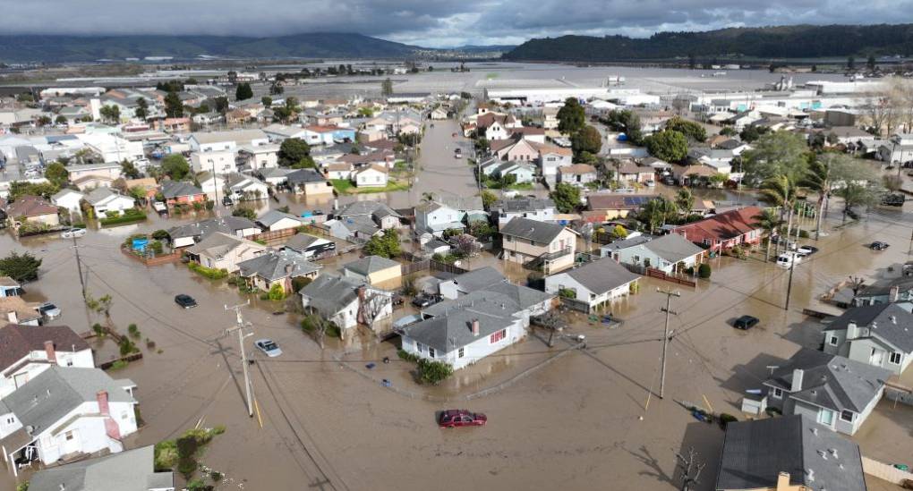
"caption": "Vehicles and homes are engulfed by floodwaters in Pajaro on Saturday, March 11, 2023.",
"description": null,
"title": "TOPSHOT-US-WEATHER-CALIFORNIA-FLOOD",
"credit": "Josh Edelson/AFP via Getty Images",
"status": "inherit",
"altTag": "A group of houses, streets and cars submerged in brown muddy water. Dark skies and mountains are in the background.",
"isLoading": false,
"fetchFailed": false
},
"science_1981838": {
"type": "attachments",
"id": "science_1981838",
"meta": {
"index": "attachments_1716263798",
"site": "science",
"id": "1981838",
"found": true
},
"parent": 1981830,
"imgSizes": {
"twentyfourteen-full-width": {
"file": "https://ww2.kqed.org/app/uploads/sites/35/2023/03/RS22166_P7170153-qut-1038x576.jpg",
"width": 1038,
"mimeType": "image/jpeg",
"height": 576
},
"thumbnail": {
"file": "https://ww2.kqed.org/app/uploads/sites/35/2023/03/RS22166_P7170153-qut-160x120.jpg",
"width": 160,
"mimeType": "image/jpeg",
"height": 120
},
"post-thumbnail": {
"file": "https://ww2.kqed.org/app/uploads/sites/35/2023/03/RS22166_P7170153-qut-672x372.jpg",
"width": 672,
"mimeType": "image/jpeg",
"height": 372
},
"kqedFullSize": {
"file": "https://ww2.kqed.org/app/uploads/sites/35/2023/03/RS22166_P7170153-qut.jpg",
"width": 1920,
"height": 1440
},
"large": {
"file": "https://ww2.kqed.org/app/uploads/sites/35/2023/03/RS22166_P7170153-qut-1020x765.jpg",
"width": 1020,
"mimeType": "image/jpeg",
"height": 765
},
"1536x1536": {
"file": "https://ww2.kqed.org/app/uploads/sites/35/2023/03/RS22166_P7170153-qut-1536x1152.jpg",
"width": 1536,
"mimeType": "image/jpeg",
"height": 1152
},
"medium": {
"file": "https://ww2.kqed.org/app/uploads/sites/35/2023/03/RS22166_P7170153-qut-800x600.jpg",
"width": 800,
"mimeType": "image/jpeg",
"height": 600
},
"medium_large": {
"file": "https://ww2.kqed.org/app/uploads/sites/35/2023/03/RS22166_P7170153-qut-768x576.jpg",
"width": 768,
"mimeType": "image/jpeg",
"height": 576
}
},
"publishDate": 1678216960,
"modified": 1678235946,
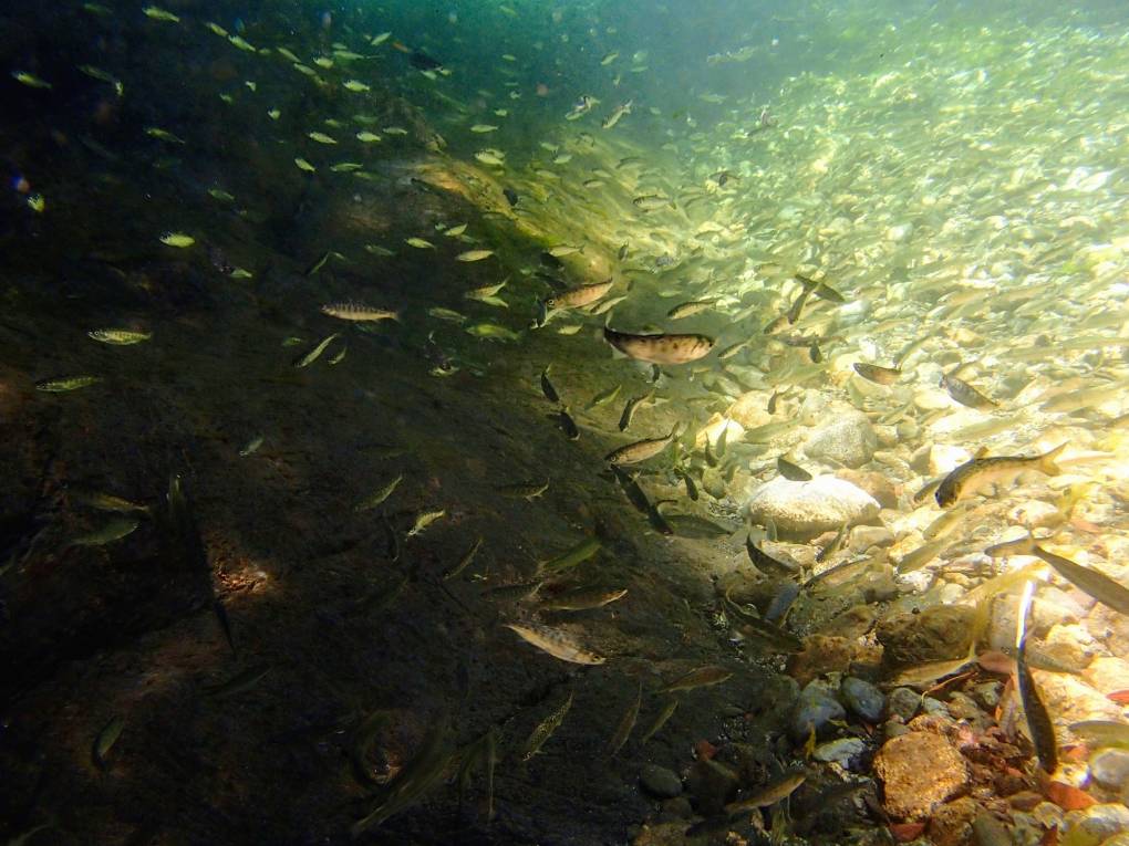
"caption": "The Klamath River is prime habitat for coho salmon, like these juveniles, but that fish has been listed as threatened under the Endangered Species Act.",
"description": null,
"title": "RS22166_P7170153-qut",
"credit": "Jimmy Peterson and Will Harling/Mid Klamath Watershed Council",
"status": "inherit",
"altTag": "Small, silvery fish swim in aqua green light water.",
"isLoading": false,
"fetchFailed": false
},
"science_1981793": {
"type": "attachments",
"id": "science_1981793",
"meta": {
"index": "attachments_1716263798",
"site": "science",
"id": "1981793",
"found": true
},
"parent": 1981790,
"imgSizes": {
"twentyfourteen-full-width": {
"file": "https://ww2.kqed.org/app/uploads/sites/35/2023/03/112922-Drone-Yuma-AZ-MG-CM-01-1038x576.jpg",
"width": 1038,
"mimeType": "image/jpeg",
"height": 576
},
"thumbnail": {
"file": "https://ww2.kqed.org/app/uploads/sites/35/2023/03/112922-Drone-Yuma-AZ-MG-CM-01-160x107.jpg",
"width": 160,
"mimeType": "image/jpeg",
"height": 107
},
"post-thumbnail": {
"file": "https://ww2.kqed.org/app/uploads/sites/35/2023/03/112922-Drone-Yuma-AZ-MG-CM-01-672x372.jpg",
"width": 672,
"mimeType": "image/jpeg",
"height": 372
},
"kqedFullSize": {
"file": "https://ww2.kqed.org/app/uploads/sites/35/2023/03/112922-Drone-Yuma-AZ-MG-CM-01.jpg",
"width": 1200,
"height": 800
},
"large": {
"file": "https://ww2.kqed.org/app/uploads/sites/35/2023/03/112922-Drone-Yuma-AZ-MG-CM-01-1020x680.jpg",
"width": 1020,
"mimeType": "image/jpeg",
"height": 680
},
"medium": {
"file": "https://ww2.kqed.org/app/uploads/sites/35/2023/03/112922-Drone-Yuma-AZ-MG-CM-01-800x533.jpg",
"width": 800,
"mimeType": "image/jpeg",
"height": 533
},
"medium_large": {
"file": "https://ww2.kqed.org/app/uploads/sites/35/2023/03/112922-Drone-Yuma-AZ-MG-CM-01-768x512.jpg",
"width": 768,
"mimeType": "image/jpeg",
"height": 512
}
},
"publishDate": 1677699355,
"modified": 1677719141,
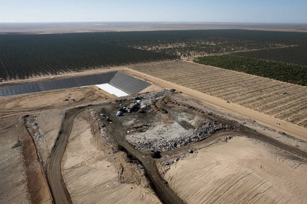
"caption": "The South Yuma County Landfill in Yuma, Arizona, on Nov. 29, 2022.",
"description": null,
"title": "An aerial view of a gray landfill amid beige, sandy soil.",
"credit": "Miguel Gutierrez Jr./CalMatters",
"status": "inherit",
"altTag": "An aerial view of a landfill in Arizona.",
"isLoading": false,
"fetchFailed": false
},
"science_1975436": {
"type": "attachments",
"id": "science_1975436",
"meta": {
"index": "attachments_1716263798",
"site": "science",
"id": "1975436",
"found": true
},
"parent": 1975422,
"imgSizes": {
"twentyfourteen-full-width": {
"file": "https://ww2.kqed.org/app/uploads/sites/35/2021/06/RS48282_008_EastPaloAlto_SeaLevelRise_03292021-qut-1038x576.jpg",
"width": 1038,
"mimeType": "image/jpeg",
"height": 576
},
"thumbnail": {
"file": "https://ww2.kqed.org/app/uploads/sites/35/2021/06/RS48282_008_EastPaloAlto_SeaLevelRise_03292021-qut-160x107.jpg",
"width": 160,
"mimeType": "image/jpeg",
"height": 107
},
"post-thumbnail": {
"file": "https://ww2.kqed.org/app/uploads/sites/35/2021/06/RS48282_008_EastPaloAlto_SeaLevelRise_03292021-qut-672x372.jpg",
"width": 672,
"mimeType": "image/jpeg",
"height": 372
},
"kqedFullSize": {
"file": "https://ww2.kqed.org/app/uploads/sites/35/2021/06/RS48282_008_EastPaloAlto_SeaLevelRise_03292021-qut.jpg",
"width": 1920,
"height": 1280
},
"large": {
"file": "https://ww2.kqed.org/app/uploads/sites/35/2021/06/RS48282_008_EastPaloAlto_SeaLevelRise_03292021-qut-1020x680.jpg",
"width": 1020,
"mimeType": "image/jpeg",
"height": 680
},
"1536x1536": {
"file": "https://ww2.kqed.org/app/uploads/sites/35/2021/06/RS48282_008_EastPaloAlto_SeaLevelRise_03292021-qut-1536x1024.jpg",
"width": 1536,
"mimeType": "image/jpeg",
"height": 1024
},
"medium": {
"file": "https://ww2.kqed.org/app/uploads/sites/35/2021/06/RS48282_008_EastPaloAlto_SeaLevelRise_03292021-qut-800x533.jpg",
"width": 800,
"mimeType": "image/jpeg",
"height": 533
},
"medium_large": {
"file": "https://ww2.kqed.org/app/uploads/sites/35/2021/06/RS48282_008_EastPaloAlto_SeaLevelRise_03292021-qut-768x512.jpg",
"width": 768,
"mimeType": "image/jpeg",
"height": 512
}
},
"publishDate": 1623964239,
"modified": 1677265454,
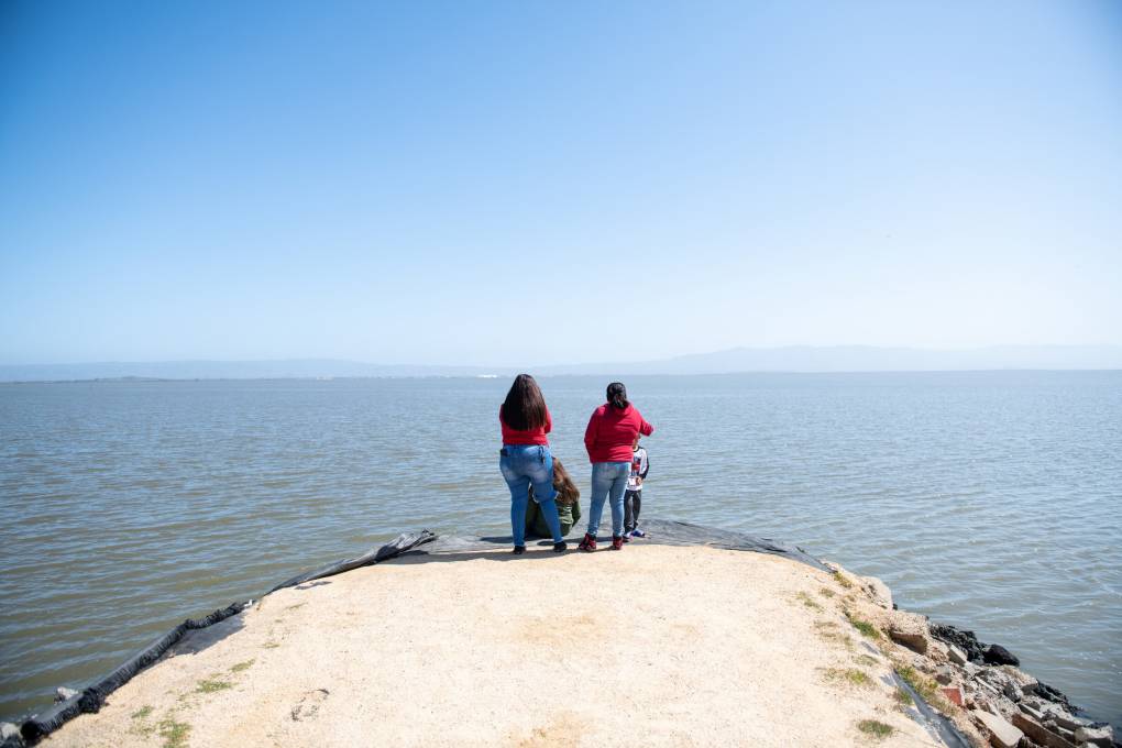
"caption": "A family looks out into the bay from Cooley Landing Park in East Palo Alto on March 29, 2021.",
"description": null,
"title": "RS48282_008_EastPaloAlto_SeaLevelRise_03292021-qut",
"credit": "Beth LaBerge/KQED",
"status": "inherit",
"altTag": "Two women with black hair stand at the end of light sand colored patch of ground looking out onto open water, with blue sky above.",
"isLoading": false,
"fetchFailed": false
},
"science_1981564": {
"type": "attachments",
"id": "science_1981564",
"meta": {
"index": "attachments_1716263798",
"site": "science",
"id": "1981564",
"found": true
},
"parent": 1981501,
"imgSizes": {
"twentyfourteen-full-width": {
"file": "https://ww2.kqed.org/app/uploads/sites/35/2023/02/DEEP_1002_Earthworm_Love_is_Cuddly_and_Complicated_KQED-1038x576.jpg",
"width": 1038,
"mimeType": "image/jpeg",
"height": 576
},
"thumbnail": {
"file": "https://ww2.kqed.org/app/uploads/sites/35/2023/02/DEEP_1002_Earthworm_Love_is_Cuddly_and_Complicated_KQED-160x90.jpg",
"width": 160,
"mimeType": "image/jpeg",
"height": 90
},
"post-thumbnail": {
"file": "https://ww2.kqed.org/app/uploads/sites/35/2023/02/DEEP_1002_Earthworm_Love_is_Cuddly_and_Complicated_KQED-672x372.jpg",
"width": 672,
"mimeType": "image/jpeg",
"height": 372
},
"kqedFullSize": {
"file": "https://ww2.kqed.org/app/uploads/sites/35/2023/02/DEEP_1002_Earthworm_Love_is_Cuddly_and_Complicated_KQED.jpg",
"width": 1920,
"height": 1080
},
"large": {
"file": "https://ww2.kqed.org/app/uploads/sites/35/2023/02/DEEP_1002_Earthworm_Love_is_Cuddly_and_Complicated_KQED-1020x574.jpg",
"width": 1020,
"mimeType": "image/jpeg",
"height": 574
},
"1536x1536": {
"file": "https://ww2.kqed.org/app/uploads/sites/35/2023/02/DEEP_1002_Earthworm_Love_is_Cuddly_and_Complicated_KQED-1536x864.jpg",
"width": 1536,
"mimeType": "image/jpeg",
"height": 864
},
"medium": {
"file": "https://ww2.kqed.org/app/uploads/sites/35/2023/02/DEEP_1002_Earthworm_Love_is_Cuddly_and_Complicated_KQED-800x450.jpg",
"width": 800,
"mimeType": "image/jpeg",
"height": 450
},
"medium_large": {
"file": "https://ww2.kqed.org/app/uploads/sites/35/2023/02/DEEP_1002_Earthworm_Love_is_Cuddly_and_Complicated_KQED-768x432.jpg",
"width": 768,
"mimeType": "image/jpeg",
"height": 432
}
},
"publishDate": 1676051854,
"modified": 1676051915,
"caption": null,
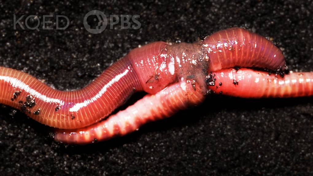
"description": "Two earthworms mate.",
"title": "DEEP_1002_Earthworm_Love_is_Cuddly_and_Complicated_KQED",
"credit": "Kevin Collins/KQED",
"status": "inherit",
"altTag": null,
"isLoading": false,
"fetchFailed": false
},
"science_1981584": {
"type": "attachments",
"id": "science_1981584",
"meta": {
"index": "attachments_1716263798",
"site": "science",
"id": "1981584",
"found": true
},
"parent": 1981541,
"imgSizes": {
"twentyfourteen-full-width": {
"file": "https://ww2.kqed.org/app/uploads/sites/35/2023/02/GettyImages-1428521496-1024x576.jpg",
"width": 1024,
"mimeType": "image/jpeg",
"height": 576
},
"thumbnail": {
"file": "https://ww2.kqed.org/app/uploads/sites/35/2023/02/GettyImages-1428521496-160x107.jpg",
"width": 160,
"mimeType": "image/jpeg",
"height": 107
},
"post-thumbnail": {
"file": "https://ww2.kqed.org/app/uploads/sites/35/2023/02/GettyImages-1428521496-672x372.jpg",
"width": 672,
"mimeType": "image/jpeg",
"height": 372
},
"kqedFullSize": {
"file": "https://ww2.kqed.org/app/uploads/sites/35/2023/02/GettyImages-1428521496.jpg",
"width": 1024,
"height": 683
},
"large": {
"file": "https://ww2.kqed.org/app/uploads/sites/35/2023/02/GettyImages-1428521496-1020x680.jpg",
"width": 1020,
"mimeType": "image/jpeg",
"height": 680
},
"medium": {
"file": "https://ww2.kqed.org/app/uploads/sites/35/2023/02/GettyImages-1428521496-800x534.jpg",
"width": 800,
"mimeType": "image/jpeg",
"height": 534
},
"medium_large": {
"file": "https://ww2.kqed.org/app/uploads/sites/35/2023/02/GettyImages-1428521496-768x512.jpg",
"width": 768,
"mimeType": "image/jpeg",
"height": 512
}
},
"publishDate": 1676062523,
"modified": 1676062592,
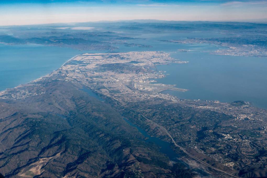
"caption": "San Andreas fault zone and San Francisco.",
"description": null,
"title": "San Andreas fault zone and San Francisco",
"credit": "Marli Miller/UCG/Universal Images Group via Getty Images",
"status": "inherit",
"altTag": "An aerial view of San Francisco peninsula",
"isLoading": false,
"fetchFailed": false
},
"science_1981523": {
"type": "attachments",
"id": "science_1981523",
"meta": {
"index": "attachments_1716263798",
"site": "science",
"id": "1981523",
"found": true
},
"parent": 1981508,
"imgSizes": {
"twentyfourteen-full-width": {
"file": "https://ww2.kqed.org/app/uploads/sites/35/2023/02/RS62627__qut-1038x576.jpg",
"width": 1038,
"mimeType": "image/jpeg",
"height": 576
},
"thumbnail": {
"file": "https://ww2.kqed.org/app/uploads/sites/35/2023/02/RS62627__qut-160x107.jpg",
"width": 160,
"mimeType": "image/jpeg",
"height": 107
},
"post-thumbnail": {
"file": "https://ww2.kqed.org/app/uploads/sites/35/2023/02/RS62627__qut-672x372.jpg",
"width": 672,
"mimeType": "image/jpeg",
"height": 372
},
"kqedFullSize": {
"file": "https://ww2.kqed.org/app/uploads/sites/35/2023/02/RS62627__qut.jpg",
"width": 1920,
"height": 1280
},
"large": {
"file": "https://ww2.kqed.org/app/uploads/sites/35/2023/02/RS62627__qut-1020x680.jpg",
"width": 1020,
"mimeType": "image/jpeg",
"height": 680
},
"1536x1536": {
"file": "https://ww2.kqed.org/app/uploads/sites/35/2023/02/RS62627__qut-1536x1024.jpg",
"width": 1536,
"mimeType": "image/jpeg",
"height": 1024
},
"medium": {
"file": "https://ww2.kqed.org/app/uploads/sites/35/2023/02/RS62627__qut-800x533.jpg",
"width": 800,
"mimeType": "image/jpeg",
"height": 533
},
"medium_large": {
"file": "https://ww2.kqed.org/app/uploads/sites/35/2023/02/RS62627__qut-768x512.jpg",
"width": 768,
"mimeType": "image/jpeg",
"height": 512
}
},
"publishDate": 1675815121,
"modified": 1675895311,
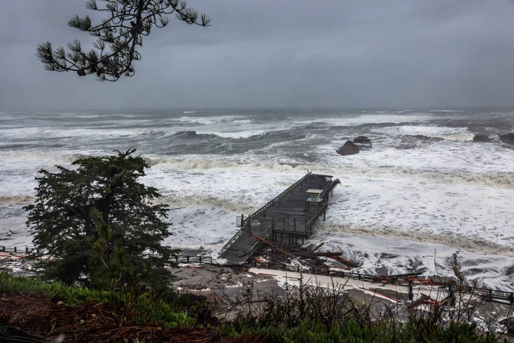
"caption": "Seacliff Pier is seen heavily damaged by a rainstorm in Santa Cruz County, on Thursday, Jan. 5, 2023.",
"description": null,
"title": "SFChronicleWeather",
"credit": "Gabrielle Lurie/The San Francisco Chronicle via Getty Images",
"status": "inherit",
"altTag": null,
"isLoading": false,
"fetchFailed": false
},
"science_1952361": {
"type": "attachments",
"id": "science_1952361",
"meta": {
"index": "attachments_1716263798",
"site": "science",
"id": "1952361",
"found": true
},
"parent": 1949019,
"imgSizes": {
"twentyfourteen-full-width": {
"file": "https://ww2.kqed.org/app/uploads/sites/35/2019/10/Earthquakekit_008-e1576716513646-1-1038x576.jpg",
"width": 1038,
"mimeType": "image/jpeg",
"height": 576
},
"thumbnail": {
"file": "https://ww2.kqed.org/app/uploads/sites/35/2019/10/Earthquakekit_008-e1576716513646-1-160x110.jpg",
"width": 160,
"mimeType": "image/jpeg",
"height": 110
},
"post-thumbnail": {
"file": "https://ww2.kqed.org/app/uploads/sites/35/2019/10/Earthquakekit_008-e1576716513646-1-672x372.jpg",
"width": 672,
"mimeType": "image/jpeg",
"height": 372
},
"kqedFullSize": {
"file": "https://ww2.kqed.org/app/uploads/sites/35/2019/10/Earthquakekit_008-e1576716513646-1.jpg",
"width": 1919,
"height": 1322
},
"large": {
"file": "https://ww2.kqed.org/app/uploads/sites/35/2019/10/Earthquakekit_008-e1576716513646-1-1020x703.jpg",
"width": 1020,
"mimeType": "image/jpeg",
"height": 703
},
"complete_open_graph": {
"file": "https://ww2.kqed.org/app/uploads/sites/35/2019/10/Earthquakekit_008-e1576716513646-1-1200x827.jpg",
"width": 1200,
"mimeType": "image/jpeg",
"height": 827
},
"medium": {
"file": "https://ww2.kqed.org/app/uploads/sites/35/2019/10/Earthquakekit_008-e1576716513646-1-800x551.jpg",
"width": 800,
"mimeType": "image/jpeg",
"height": 551
},
"medium_large": {
"file": "https://ww2.kqed.org/app/uploads/sites/35/2019/10/Earthquakekit_008-e1576716513646-1-768x529.jpg",
"width": 768,
"mimeType": "image/jpeg",
"height": 529
}
},
"publishDate": 1576716600,
"modified": 1666824542,
"caption": "To make his home more safe in case of an earthquake, reporter Peter Arcuni moves a large framed poster from over his couch.",
"description": null,
"title": "Earthquakekit_008-e1576716513646",
"credit": "Lindsey Moore/KQED",
"status": "inherit",
"altTag": null,
"isLoading": false,
"fetchFailed": false
},
"science_1981328": {
"type": "attachments",
"id": "science_1981328",
"meta": {
"index": "attachments_1716263798",
"site": "science",
"id": "1981328",
"found": true
},
"parent": 1981327,
"imgSizes": {
"twentyfourteen-full-width": {
"file": "https://ww2.kqed.org/app/uploads/sites/35/2023/01/RS62246_A_IntroNewt2-qut-1038x576.jpg",
"width": 1038,
"mimeType": "image/jpeg",
"height": 576
},
"thumbnail": {
"file": "https://ww2.kqed.org/app/uploads/sites/35/2023/01/RS62246_A_IntroNewt2-qut-160x107.jpg",
"width": 160,
"mimeType": "image/jpeg",
"height": 107
},
"post-thumbnail": {
"file": "https://ww2.kqed.org/app/uploads/sites/35/2023/01/RS62246_A_IntroNewt2-qut-672x372.jpg",
"width": 672,
"mimeType": "image/jpeg",
"height": 372
},
"kqedFullSize": {
"file": "https://ww2.kqed.org/app/uploads/sites/35/2023/01/RS62246_A_IntroNewt2-qut.jpg",
"width": 1920,
"height": 1281
},
"large": {
"file": "https://ww2.kqed.org/app/uploads/sites/35/2023/01/RS62246_A_IntroNewt2-qut-1020x681.jpg",
"width": 1020,
"mimeType": "image/jpeg",
"height": 681
},
"1536x1536": {
"file": "https://ww2.kqed.org/app/uploads/sites/35/2023/01/RS62246_A_IntroNewt2-qut-1536x1025.jpg",
"width": 1536,
"mimeType": "image/jpeg",
"height": 1025
},
"medium": {
"file": "https://ww2.kqed.org/app/uploads/sites/35/2023/01/RS62246_A_IntroNewt2-qut-800x534.jpg",
"width": 800,
"mimeType": "image/jpeg",
"height": 534
},
"medium_large": {
"file": "https://ww2.kqed.org/app/uploads/sites/35/2023/01/RS62246_A_IntroNewt2-qut-768x512.jpg",
"width": 768,
"mimeType": "image/jpeg",
"height": 512
}
},
"publishDate": 1674689913,
"modified": 1675383129,
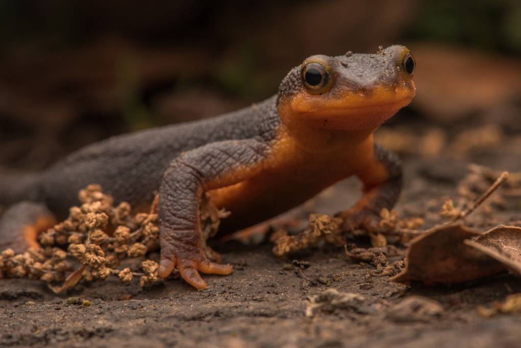
"caption": "A male newt as he migrates toward a pond. Once there he will wait in the water for female newts to arrive.",
"description": "A male newt as he migrates toward a pond. Once there he will wait in the water for female newts to arrive.",
"title": "California Newt",
"credit": "Anton Sorokin/bioGraphic",
"status": "inherit",
"altTag": "A California newt is seen in the outdoors moving towards the camera.",
"isLoading": false,
"fetchFailed": false
},
"science_1981453": {
"type": "attachments",
"id": "science_1981453",
"meta": {
"index": "attachments_1716263798",
"site": "science",
"id": "1981453",
"found": true
},
"parent": 1981391,
"imgSizes": {
"twentyfourteen-full-width": {
"file": "https://ww2.kqed.org/app/uploads/sites/35/2023/02/RS61860_010_KQED_BombCyloneStorm_01042023-qut-1038x576.jpg",
"width": 1038,
"mimeType": "image/jpeg",
"height": 576
},
"thumbnail": {
"file": "https://ww2.kqed.org/app/uploads/sites/35/2023/02/RS61860_010_KQED_BombCyloneStorm_01042023-qut-160x107.jpg",
"width": 160,
"mimeType": "image/jpeg",
"height": 107
},
"post-thumbnail": {
"file": "https://ww2.kqed.org/app/uploads/sites/35/2023/02/RS61860_010_KQED_BombCyloneStorm_01042023-qut-672x372.jpg",
"width": 672,
"mimeType": "image/jpeg",
"height": 372
},
"kqedFullSize": {
"file": "https://ww2.kqed.org/app/uploads/sites/35/2023/02/RS61860_010_KQED_BombCyloneStorm_01042023-qut.jpg",
"width": 1920,
"height": 1280
},
"large": {
"file": "https://ww2.kqed.org/app/uploads/sites/35/2023/02/RS61860_010_KQED_BombCyloneStorm_01042023-qut-1020x680.jpg",
"width": 1020,
"mimeType": "image/jpeg",
"height": 680
},
"1536x1536": {
"file": "https://ww2.kqed.org/app/uploads/sites/35/2023/02/RS61860_010_KQED_BombCyloneStorm_01042023-qut-1536x1024.jpg",
"width": 1536,
"mimeType": "image/jpeg",
"height": 1024
},
"medium": {
"file": "https://ww2.kqed.org/app/uploads/sites/35/2023/02/RS61860_010_KQED_BombCyloneStorm_01042023-qut-800x533.jpg",
"width": 800,
"mimeType": "image/jpeg",
"height": 533
},
"medium_large": {
"file": "https://ww2.kqed.org/app/uploads/sites/35/2023/02/RS61860_010_KQED_BombCyloneStorm_01042023-qut-768x512.jpg",
"width": 768,
"mimeType": "image/jpeg",
"height": 512
}
},
"publishDate": 1675295030,
"modified": 1675305423,
"caption": "Members of the San José Conservation Corps pile sandbags along the San Francisquito Creek in East Palo Alto on Jan. 4, 2023. The creek spilled over its bank and into a nearby community during the storm on Dec. 31.",
"description": null,
"title": "RS61860_010_KQED_BombCyloneStorm_01042023-qut",
"credit": "Beth LaBerge/KQED",
"status": "inherit",
"altTag": "Workers in yellow jackets pile white sandbags up along a levee.",
"isLoading": false,
"fetchFailed": false
},
"science_1981359": {
"type": "attachments",
"id": "science_1981359",
"meta": {
"index": "attachments_1716263798",
"site": "science",
"id": "1981359",
"found": true
},
"parent": 1981358,
"imgSizes": {
"twentyfourteen-full-width": {
"file": "https://ww2.kqed.org/app/uploads/sites/35/2023/01/fema-17-c3a421b9d8bb182607910a50d05a5e9105989d52-1038x576.jpg",
"width": 1038,
"mimeType": "image/jpeg",
"height": 576
},
"thumbnail": {
"file": "https://ww2.kqed.org/app/uploads/sites/35/2023/01/fema-17-c3a421b9d8bb182607910a50d05a5e9105989d52-160x120.jpg",
"width": 160,
"mimeType": "image/jpeg",
"height": 120
},
"post-thumbnail": {
"file": "https://ww2.kqed.org/app/uploads/sites/35/2023/01/fema-17-c3a421b9d8bb182607910a50d05a5e9105989d52-672x372.jpg",
"width": 672,
"mimeType": "image/jpeg",
"height": 372
},
"kqedFullSize": {
"file": "https://ww2.kqed.org/app/uploads/sites/35/2023/01/fema-17-c3a421b9d8bb182607910a50d05a5e9105989d52-scaled.jpg",
"width": 2560,
"height": 1918
},
"2048x2048": {
"file": "https://ww2.kqed.org/app/uploads/sites/35/2023/01/fema-17-c3a421b9d8bb182607910a50d05a5e9105989d52-2048x1534.jpg",
"width": 2048,
"mimeType": "image/jpeg",
"height": 1534
},
"large": {
"file": "https://ww2.kqed.org/app/uploads/sites/35/2023/01/fema-17-c3a421b9d8bb182607910a50d05a5e9105989d52-1020x764.jpg",
"width": 1020,
"mimeType": "image/jpeg",
"height": 764
},
"1536x1536": {
"file": "https://ww2.kqed.org/app/uploads/sites/35/2023/01/fema-17-c3a421b9d8bb182607910a50d05a5e9105989d52-1536x1151.jpg",
"width": 1536,
"mimeType": "image/jpeg",
"height": 1151
},
"full-width": {
"file": "https://ww2.kqed.org/app/uploads/sites/35/2023/01/fema-17-c3a421b9d8bb182607910a50d05a5e9105989d52-1920x1438.jpg",
"width": 1920,
"mimeType": "image/jpeg",
"height": 1438
},
"medium": {
"file": "https://ww2.kqed.org/app/uploads/sites/35/2023/01/fema-17-c3a421b9d8bb182607910a50d05a5e9105989d52-800x599.jpg",
"width": 800,
"mimeType": "image/jpeg",
"height": 599
},
"medium_large": {
"file": "https://ww2.kqed.org/app/uploads/sites/35/2023/01/fema-17-c3a421b9d8bb182607910a50d05a5e9105989d52-768x575.jpg",
"width": 768,
"mimeType": "image/jpeg",
"height": 575
}
},
"publishDate": 1674845145,
"modified": 1674846054,
"caption": "Recent findings about the pollution of waterways near oil refineries underscore health and environmental dangers.",
"description": "Recent findings about the pollution of waterways near oil refineries underscore health and environmental dangers.",
"title": "Recent findings about the pollution of waterways near oil refineries underscore health and environmental dangers.",
"credit": "Ryan Kellman/NPR",
"status": "inherit",
"altTag": "Image shows oil refineries and waterways.",
"isLoading": false,
"fetchFailed": false
},
"science_1981081": {
"type": "attachments",
"id": "science_1981081",
"meta": {
"index": "attachments_1716263798",
"site": "science",
"id": "1981081",
"found": true
},
"parent": 1981077,
"imgSizes": {
"twentyfourteen-full-width": {
"file": "https://ww2.kqed.org/app/uploads/sites/35/2022/12/RS55424_024_KQED_EduardoMartinezRichmond_04072022-qut-1038x576.jpg",
"width": 1038,
"mimeType": "image/jpeg",
"height": 576
},
"thumbnail": {
"file": "https://ww2.kqed.org/app/uploads/sites/35/2022/12/RS55424_024_KQED_EduardoMartinezRichmond_04072022-qut-160x107.jpg",
"width": 160,
"mimeType": "image/jpeg",
"height": 107
},
"post-thumbnail": {
"file": "https://ww2.kqed.org/app/uploads/sites/35/2022/12/RS55424_024_KQED_EduardoMartinezRichmond_04072022-qut-672x372.jpg",
"width": 672,
"mimeType": "image/jpeg",
"height": 372
},
"kqedFullSize": {
"file": "https://ww2.kqed.org/app/uploads/sites/35/2022/12/RS55424_024_KQED_EduardoMartinezRichmond_04072022-qut.jpg",
"width": 1920,
"height": 1280
},
"large": {
"file": "https://ww2.kqed.org/app/uploads/sites/35/2022/12/RS55424_024_KQED_EduardoMartinezRichmond_04072022-qut-1020x680.jpg",
"width": 1020,
"mimeType": "image/jpeg",
"height": 680
},
"1536x1536": {
"file": "https://ww2.kqed.org/app/uploads/sites/35/2022/12/RS55424_024_KQED_EduardoMartinezRichmond_04072022-qut-1536x1024.jpg",
"width": 1536,
"mimeType": "image/jpeg",
"height": 1024
},
"medium": {
"file": "https://ww2.kqed.org/app/uploads/sites/35/2022/12/RS55424_024_KQED_EduardoMartinezRichmond_04072022-qut-800x533.jpg",
"width": 800,
"mimeType": "image/jpeg",
"height": 533
},
"medium_large": {
"file": "https://ww2.kqed.org/app/uploads/sites/35/2022/12/RS55424_024_KQED_EduardoMartinezRichmond_04072022-qut-768x512.jpg",
"width": 768,
"mimeType": "image/jpeg",
"height": 512
}
},
"publishDate": 1671663561,
"modified": 1673571942,
"caption": "A flock of birds flies over marshland at the South Richmond Marshes on April 7, 2022.",
"description": null,
"title": "RS55424_024_KQED_EduardoMartinezRichmond_04072022-qut",
"credit": "Beth LaBerge/KQED",
"status": "inherit",
"altTag": "Birds are small dots in a blue sky above brown, sludgy marshland.",
"isLoading": false,
"fetchFailed": false
}
},
"audioPlayerReducer": {
"postId": "stream_live",
"isPaused": true,
"isPlaying": false,
"pfsActive": false,
"pledgeModalIsOpen": true,
"playerDrawerIsOpen": false,
"liveAudioPlayStartedAt": 0,
"liveAudioPlayContext": ""
},
"authorsReducer": {
"byline_science_1981790": {
"type": "authors",
"id": "byline_science_1981790",
"meta": {
"override": true
},
"slug": "byline_science_1981790",
"name": "\u003ca href=\"https://calmatters.org/author/robert-lewis/\">Robert Lewis\u003c/a>",
"isLoading": false
},
"byline_science_1981508": {
"type": "authors",
"id": "byline_science_1981508",
"meta": {
"override": true
},
"slug": "byline_science_1981508",
"name": "Anna Marie Yanny",
"isLoading": false
},
"byline_science_1981327": {
"type": "authors",
"id": "byline_science_1981327",
"meta": {
"override": true
},
"slug": "byline_science_1981327",
"name": "\u003ca href=\"https://www.biographic.com/contributor/Emily-Sohn/\">Emily Sohn\u003c/a> and \u003ca href=\"https://www.biographic.com/contributor/Anton-Sorokin/\">Anton Sorokin\u003c/a>",
"isLoading": false
},
"byline_science_1981358": {
"type": "authors",
"id": "byline_science_1981358",
"meta": {
"override": true
},
"slug": "byline_science_1981358",
"name": "\u003ca href=\"https://www.npr.org/people/384067907/rebecca-hersher\">Rebecca Hersher\u003c/a>",
"isLoading": false
},
"gabriela-quiros": {
"type": "authors",
"id": "6186",
"meta": {
"index": "authors_1716337520",
"id": "6186",
"found": true
},
"name": "Gabriela Quirós",
"firstName": "Gabriela",
"lastName": "Quirós",
"slug": "gabriela-quiros",
"email": "gquiros@kqed.org",
"display_author_email": false,
"staff_mastheads": [],
"title": "Supervising Producer",
"bio": "Gabriela Quirós is the \u003cstrong>supervising producer for KQED's web science video series \u003ca href=\"https://www.kqed.org/deeplook\">Deep Look\u003c/a>\u003c/strong>. She joined KQED as a TV producer when its science series QUEST started in 2006 and has covered everything from Alzheimer’s to bee die-offs to dark energy.\r\n\r\nShe won a 2022 AAAS Kavli Science Journalism Award with a team of her Deep Look colleagues. She has won six regional Emmys as a video producer and has shared eight more as the coordinating producer of Deep Look. The episode she produced about \u003ca href=\"https://www.kqed.org/science/728086/how-mosquitoes-use-six-needles-to-suck-your-blood\">How Mosquitoes Use Six Needles to Suck Your Blood\u003c/a> won a Webby \"People's Voice\" award. She has also earned awards from the Jackson Hole Wildlife Film Festival, the Society of Professional Journalists and the Society of Environmental Journalists.\r\n\r\nHer videos for KQED have also aired on NOVA scienceNOW and the PBS NewsHour, and appeared on NPR.org.\r\n\r\nAs an independent filmmaker, she produced and directed the hour-long documentary \u003ca href=\"http://lpbp.org/beautiful-sin-qa-with-producer-gabriela-quiros/\">\u003cem>Beautiful Sin\u003c/em>\u003c/a>, about the surprising story of how Costa Rica became the only country in the world to outlaw in vitro fertilization. The film aired in 2015 on public television stations throughout the U.S., and in Costa Rica.\r\n\r\nShe started her journalism career as a newspaper reporter in Costa Rica, where she grew up. She won the National Science Journalism Award there for a series of articles about organic agriculture, and developed a life-long interest in health reporting. She moved to the Bay Area in 1996 to study documentary filmmaking at the University of California, Berkeley, where she received master’s degrees in journalism and Latin American studies.",
"avatar": "https://secure.gravatar.com/avatar/6d82c20152affd1b434c31a904c40809?s=600&d=blank&r=g",
"twitter": "gabrielaquirosr",
"facebook": null,
"instagram": null,
"linkedin": null,
"sites": [
{
"site": "science",
"roles": []
},
{
"site": "quest",
"roles": [
"ef_view_calendar",
"ef_view_story_budget"
]
}
],
"headData": {
"title": "Gabriela Quirós | KQED",
"description": "Supervising Producer",
"ogImgSrc": "https://secure.gravatar.com/avatar/6d82c20152affd1b434c31a904c40809?s=600&d=blank&r=g",
"twImgSrc": "https://secure.gravatar.com/avatar/6d82c20152affd1b434c31a904c40809?s=600&d=blank&r=g"
},
"isLoading": false,
"link": "/author/gabriela-quiros"
},
"dventon": {
"type": "authors",
"id": "11088",
"meta": {
"index": "authors_1716337520",
"id": "11088",
"found": true
},
"name": "Danielle Venton",
"firstName": "Danielle",
"lastName": "Venton",
"slug": "dventon",
"email": "dventon@kqed.org",
"display_author_email": true,
"staff_mastheads": [
"science"
],
"title": "Science reporter",
"bio": "Danielle Venton is a reporter for KQED Science. She covers wildfires, space and oceans (though she is prone to sea sickness).\r\n\r\nBefore joining KQED in 2015, Danielle was a staff reporter at KRCB in Sonoma County and a freelancer. She studied science communication at UC Santa Cruz and formerly worked at CERN in Geneva, Switzerland where she wrote about computing. She lives in Sonoma County and enjoys backpacking.",
"avatar": "https://secure.gravatar.com/avatar/37b292b5c40c8d93959c4f48d73b5286f41b7abd8588277e941905a3ed4c801c?s=600&d=blank&r=g",
"twitter": "DanielleVenton",
"bluesky": null,
"facebook": null,
"instagram": null,
"linkedin": null,
"sites": [
{
"site": "arts",
"roles": [
"contributor"
]
},
{
"site": "news",
"roles": [
"editor"
]
},
{
"site": "futureofyou",
"roles": [
"editor"
]
},
{
"site": "science",
"roles": [
"editor"
]
},
{
"site": "liveblog",
"roles": [
"contributor"
]
}
],
"headData": {
"title": "Danielle Venton | KQED",
"description": "Science reporter",
"ogImgSrc": "https://secure.gravatar.com/avatar/37b292b5c40c8d93959c4f48d73b5286f41b7abd8588277e941905a3ed4c801c?s=600&d=blank&r=g",
"twImgSrc": "https://secure.gravatar.com/avatar/37b292b5c40c8d93959c4f48d73b5286f41b7abd8588277e941905a3ed4c801c?s=600&d=blank&r=g"
},
"isLoading": false,
"link": "/author/dventon"
},
"parcuni": {
"type": "authors",
"id": "11368",
"meta": {
"index": "authors_1716337520",
"id": "11368",
"found": true
},
"name": "Peter Arcuni",
"firstName": "Peter",
"lastName": "Arcuni",
"slug": "parcuni",
"email": "parcuni@KQED.org",
"display_author_email": false,
"staff_mastheads": [
"science"
],
"title": "Reporter",
"bio": "Peter reports radio and online stories for \u003cem>KQED Science\u003c/em>. His work has also appeared on the \u003cem>The California Report\u003c/em> morning show and \u003cem>KQED News\u003c/em>. His production credits include \u003cem>The California Report, The California Report Magazine\u003c/em> and KQED's local news podcast \u003cem>The Bay\u003c/em>. Other credits include NPR's \u003cem>All Things Considered\u003c/em>, WNYC's \u003cem>Science Friday\u003c/em>, WBUR's \u003cem>Here & Now\u003c/em>, WIRED and SFGate. Peter graduated from Brown University and earned a master's degree in journalism from Stanford. He's covered everything from homelessness to wildfires, health, the environment, arts and Thanksgiving in San Quentin prison. In other lives, he played rock n roll music and studied neuroscience. You can email him at: parcuni@kqed.org",
"avatar": "https://secure.gravatar.com/avatar/d5032f6f27199d478af34ad2e1d98732?s=600&d=blank&r=g",
"twitter": "peterarcuni",
"facebook": null,
"instagram": null,
"linkedin": null,
"sites": [
{
"site": "news",
"roles": [
"editor"
]
},
{
"site": "science",
"roles": [
"editor"
]
}
],
"headData": {
"title": "Peter Arcuni | KQED",
"description": "Reporter",
"ogImgSrc": "https://secure.gravatar.com/avatar/d5032f6f27199d478af34ad2e1d98732?s=600&d=blank&r=g",
"twImgSrc": "https://secure.gravatar.com/avatar/d5032f6f27199d478af34ad2e1d98732?s=600&d=blank&r=g"
},
"isLoading": false,
"link": "/author/parcuni"
},
"smohamad": {
"type": "authors",
"id": "11631",
"meta": {
"index": "authors_1716337520",
"id": "11631",
"found": true
},
"name": "Sarah Mohamad",
"firstName": "Sarah",
"lastName": "Mohamad",
"slug": "smohamad",
"email": "smohamad@KQED.org",
"display_author_email": true,
"staff_mastheads": [],
"title": "Engagement Producer and Reporter, KQED Science",
"bio": "Sarah Mohamad is an audience engagement reporter and producer for KQED Science. She reports on audience-focused science and environment stories and manages the team's social media, newsletter, and engagement efforts. Prior to this role, she played a key role as project manager for NSF's \u003ca href=\"https://www.kqed.org/crackingthecode\">\u003cem>Cracking the Code: Influencing Millennial Science Engagement\u003c/em> \u003c/a>audience research.",
"avatar": "https://secure.gravatar.com/avatar/e6224957cd82d015183756ddde1f928013a563d7ca2e4565f8c4de1ec64886c5?s=600&d=blank&r=g",
"twitter": "sarahkmohamad",
"bluesky": null,
"facebook": null,
"instagram": null,
"linkedin": null,
"sites": [
{
"site": "",
"roles": [
"editor"
]
},
{
"site": "arts",
"roles": [
"editor"
]
},
{
"site": "news",
"roles": [
"editor"
]
},
{
"site": "about",
"roles": [
"editor"
]
},
{
"site": "science",
"roles": [
"editor"
]
}
],
"headData": {
"title": "Sarah Mohamad | KQED",
"description": "Engagement Producer and Reporter, KQED Science",
"ogImgSrc": "https://secure.gravatar.com/avatar/e6224957cd82d015183756ddde1f928013a563d7ca2e4565f8c4de1ec64886c5?s=600&d=blank&r=g",
"twImgSrc": "https://secure.gravatar.com/avatar/e6224957cd82d015183756ddde1f928013a563d7ca2e4565f8c4de1ec64886c5?s=600&d=blank&r=g"
},
"isLoading": false,
"link": "/author/smohamad"
},
"eromero": {
"type": "authors",
"id": "11746",
"meta": {
"index": "authors_1716337520",
"id": "11746",
"found": true
},
"name": "Ezra David Romero",
"firstName": "Ezra David",
"lastName": "Romero",
"slug": "eromero",
"email": "eromero@kqed.org",
"display_author_email": true,
"staff_mastheads": [
"news",
"science"
],
"title": "Climate Reporter",
"bio": "Ezra David Romero is a climate reporter for KQED News. He covers the absence and excess of water in the Bay Area — think sea level rise, flooding and drought. For nearly a decade he’s covered how warming temperatures are altering the lives of Californians. He’s reported on farmers worried their pistachio trees aren’t getting enough sleep, families desperate for water, scientists studying dying giant sequoias, and alongside firefighters containing wildfires. His work has appeared on local stations across California and nationally on public radio shows like Morning Edition, Here and Now, All Things Considered and Science Friday. ",
"avatar": "https://secure.gravatar.com/avatar/c76404d287c10ed40224227551ac36e24352c7306f106632caf6fead76f8801f?s=600&d=blank&r=g",
"twitter": "ezraromero",
"bluesky": null,
"facebook": null,
"instagram": null,
"linkedin": null,
"sites": [
{
"site": "arts",
"roles": [
"editor"
]
},
{
"site": "news",
"roles": [
"editor"
]
},
{
"site": "science",
"roles": [
"editor"
]
},
{
"site": "liveblog",
"roles": [
"author"
]
}
],
"headData": {
"title": "Ezra David Romero | KQED",
"description": "Climate Reporter",
"ogImgSrc": "https://secure.gravatar.com/avatar/c76404d287c10ed40224227551ac36e24352c7306f106632caf6fead76f8801f?s=600&d=blank&r=g",
"twImgSrc": "https://secure.gravatar.com/avatar/c76404d287c10ed40224227551ac36e24352c7306f106632caf6fead76f8801f?s=600&d=blank&r=g"
},
"isLoading": false,
"link": "/author/eromero"
}
},
"pagesReducer": {
"science_category_environment": {
"type": "terms",
"id": "science_35",
"meta": {
"index": "terms_1716263798",
"site": "science",
"id": "35",
"score": 12.13823
},
"featImg": null,
"name": "Environment",
"description": null,
"taxonomy": "category",
"headData": {
"twImgId": null,
"twTitle": null,
"ogTitle": null,
"ogImgId": null,
"twDescription": null,
"description": null,
"title": "Environment Archives | KQED Science",
"ogDescription": null
},
"ttid": 37,
"slug": "environment",
"isLoading": false,
"title": "Environment",
"pageMeta": {
"site": "science",
"WpPageTemplate": "page-topic-editorial",
"currentPage": 17
},
"blocks": [
{
"blockName": "kqed/post-list",
"attrs": {
"layout": "cardArticle2",
"query": "posts/science?category=environment",
"seeMore": false,
"paginated": true,
"page": 17
}
},
{
"blockName": "kqed/ad"
}
]
}
},
"pfsSessionReducer": {},
"postsReducer": {
"stream_live": {
"type": "live",
"id": "stream_live",
"audioUrl": "https://streams.kqed.org/kqedradio",
"title": "Live Stream",
"excerpt": "Live Stream information currently unavailable.",
"link": "/radio",
"featImg": "",
"label": {
"name": "KQED Live",
"link": "/"
}
},
"stream_kqedNewscast": {
"type": "posts",
"id": "stream_kqedNewscast",
"audioUrl": "https://www.kqed.org/.stream/anon/radio/RDnews/newscast.mp3?_=1",
"title": "KQED Newscast",
"featImg": "",
"label": {
"name": "88.5 FM",
"link": "/"
}
},
"science_1981900": {
"type": "posts",
"id": "science_1981900",
"meta": {
"index": "posts_1716263798",
"site": "science",
"id": "1981900",
"score": null,
"sort": [
1679421728000
]
},
"parent": 0,
"labelTerm": {},
"blocks": [],
"publishDate": 1679421728,
"format": "standard",
"title": "Fewer Than 10% of Levees in the Greater Bay Area Have a Federal Flood Risk Rating",
"headTitle": "Fewer Than 10% of Levees in the Greater Bay Area Have a Federal Flood Risk Rating | KQED",
"content": "\u003cp>Atmospheric river-fueled storms have hammered the network of hundreds of levees in coastal counties near the San Francisco Bay — from the agricultural fields of Monterey County to urban places like San Leandro, Walnut Creek and Richmond to more rural parts of the North Bay. At least two major levees, in Salinas and Pajaro, have failed since New Year’s Eve.\u003c/p>\n\u003cp>The levee breach along the Pajaro River, which divides Santa Cruz and Monterey counties, left the entire town of Pajaro in a deluge of water. More than 3,000 residents could be displaced for several weeks. The disastrous flood \u003ca href=\"https://www.kqed.org/news/11944008/we-have-nothing-pajaro-farmworkers-face-the-prospect-of-no-income-at-start-of-harvesting-season\">submerged a significant acreage of agricultural land there\u003c/a>, and the mostly lower-income Latino community now faces overwhelming economic and housing uncertainty.\u003c/p>\n\u003cp>The river valley has flooded twice before, in the 1990s. State and federal officials \u003ca href=\"https://www.latimes.com/california/story/2023-03-14/storms-reveal-growing-weaknesses-of-californias-levees\">knew the levee could fail but didn’t fix it\u003c/a>, although a plan was in the works to update the system beginning in 2025.\u003c/p>\n\u003cp>But the dozen atmospheric river storms this winter wouldn’t wait for that construction to begin.\u003c/p>\n\u003cp>“It’s a horrible tragedy, and now it’s happened again,” said Nancy Faulstich, executive director of Regeneración, Pájaro Valley Climate Action. “It feels like it’s exactly a case of environmental injustice that it was known that the levee would fail.”\u003c/p>\n\u003cp>[ad fullwidth]\u003c/p>\n\u003cp>Thirty minutes before water raced down his street, Andy Garcia and his 8-year-old daughter fled.\u003c/p>\n\u003cp>“We just grabbed a few blankets, clothes and some documents and left,” he said. “We had so many years without rain. They had the money but didn’t ever do anything to prevent this from happening.”\u003c/p>\n\u003cp>Garcia fears what he will find on his drowned street when the floodwaters recede.\u003c/p>\n\u003cp>“We probably lost everything,” he said. “I’m just hoping my house didn’t get flooded.”\u003c/p>\n\u003ch2>Large gaps in the federal levee database\u003c/h2>\n\u003cp>Levees are designed with a certain level of flood risk, and the U.S. Army Corps of Engineers rates how safe each levee is as part of the \u003ca href=\"https://levees.sec.usace.army.mil/\">National Levee Database\u003c/a>. But federal risk records are available for less than 10% of the coastal region surrounding the Bay Area. The agency was not available for an interview but did comment via email.\u003c/p>\n\u003cfigure id=\"attachment_1981906\" class=\"wp-caption aligncenter\" style=\"max-width: 800px\">\u003cimg loading=\"lazy\" decoding=\"async\" class=\"wp-image-1981906 size-medium\" src=\"https://ww2.kqed.org/app/uploads/sites/35/2023/03/GettyImages-1248253657-800x600.jpg\" alt=\"Rushing brown water over an dark brown earthen levee. Green trees are submerged under water and agricultural fields fill with water. \" width=\"800\" height=\"600\" srcset=\"https://cdn.kqed.org/wp-content/uploads/sites/35/2023/03/GettyImages-1248253657-800x600.jpg 800w, https://cdn.kqed.org/wp-content/uploads/sites/35/2023/03/GettyImages-1248253657-1020x765.jpg 1020w, https://cdn.kqed.org/wp-content/uploads/sites/35/2023/03/GettyImages-1248253657-160x120.jpg 160w, https://cdn.kqed.org/wp-content/uploads/sites/35/2023/03/GettyImages-1248253657-768x576.jpg 768w, https://cdn.kqed.org/wp-content/uploads/sites/35/2023/03/GettyImages-1248253657.jpg 1024w\" sizes=\"(max-width: 800px) 100vw, 800px\">\u003cfigcaption class=\"wp-caption-text\">The broken levee in Pajaro on Monday, March 13, 2023. Houses were inundated and vehicles submerged when the Pajaro River burst over a crumbling levee overnight Friday into Saturday, with fire crews going door to door to rouse sleeping residents. By Monday morning, the hole had widened to 300 feet, said Monterey County officials. \u003ccite>(Jennifer Cain/AFP via Getty Images)\u003c/cite>\u003c/figcaption>\u003c/figure>\n\u003cp>The database identifies 539 levee systems across 11 counties — Alameda, Contra Costa, Marin, Monterey, Napa, San Francisco, San Mateo, Santa Clara, Santa Cruz, Solano and Sonoma. Forty-one have a low-risk rating, 12 have a moderate-risk rating and 484 have no rating — either because that information doesn’t exist about the levee or the jurisdiction that maintains it hasn’t reported it to the federal government.\u003c/p>\n\u003cp>The state of federal levee records “is an extensive problem that we have been aware of and there won’t be overnight magic to solve this,” said Farshid Vahedifard, professor of civil engineering at Mississippi State University.\u003c/p>\n\u003cp>Levees outside the coastal range in California’s Central Valley — which play an integral part in the state and federal transport of water — also are at risk of breaching. This is where many miles of levees are on private land and are not subject to the same routine inspection and maintenance that state or federal levees undergo. During a recent storm on a farm in the Central Valley, workers filled a failed levee with two trucks piled with dirt.\u003c/p>\n\u003cp>https://twitter.com/agleader/status/1635690151304388608?s=20\u003c/p>\n\u003cp>The California Department of Water Resources proactively tracks levee incidents within the Central Valley as part of its state flood control plan but doesn’t for those outside it. Still, the state has sent assistance to both Salinas and Pajaro.\u003c/p>\n\u003cp>“We need to have coordinated work to improve our fundamental understanding gaps, to develop practice-ready tools to be able to better capture this evolving risk,” said Vahedifard.\u003c/p>\n\u003cp>The ratings from the Army Corps consider how much damage and loss of life could happen if a levee fails, along with its integrity.\u003c/p>\n\u003cp>The region’s 53 low- and moderate-risk levees in places like Alameda, Pajaro, Petaluma, Richmond and Walnut Creek help protect $63 billion of property, more than 450,000 people and more than 119,000 buildings\u003c/p>\n\u003cp>Vahedifard said all levees have the possibility of failing at some point, and climate change increases their fragility. “A low-risk levee does not mean it’s safe forever,” he said. “It’s no secret that California has a marginal levee system.”\u003c/p>\n\u003cp>He studies how repetitive droughts and floods — like the current multiyear dry spell with back-to-back atmospheric river storms within it — weaken and threaten the life of the state’s levees.\u003c/p>\n\u003cp>Because of climate change, atmospheric river-fueled winter storms could become \u003ca href=\"https://www.pnnl.gov/news-media/wettest-winter-storms-western-us-growing-wetter\">around 30% wetter by mid-century\u003c/a>, according to a study published in the journal Nature Climate Change.\u003c/p>\n\u003cfigure id=\"attachment_1981910\" class=\"wp-caption aligncenter\" style=\"max-width: 800px\">\u003cimg loading=\"lazy\" decoding=\"async\" class=\"wp-image-1981910 size-medium\" src=\"https://ww2.kqed.org/app/uploads/sites/35/2023/03/GettyImages-1248482776-800x534.jpg\" alt=\"A dark brown earthen levee with murky brown water flowing over the earthen levee. \" width=\"800\" height=\"534\" srcset=\"https://cdn.kqed.org/wp-content/uploads/sites/35/2023/03/GettyImages-1248482776-800x534.jpg 800w, https://cdn.kqed.org/wp-content/uploads/sites/35/2023/03/GettyImages-1248482776-1020x680.jpg 1020w, https://cdn.kqed.org/wp-content/uploads/sites/35/2023/03/GettyImages-1248482776-160x107.jpg 160w, https://cdn.kqed.org/wp-content/uploads/sites/35/2023/03/GettyImages-1248482776-768x512.jpg 768w, https://cdn.kqed.org/wp-content/uploads/sites/35/2023/03/GettyImages-1248482776.jpg 1024w\" sizes=\"(max-width: 800px) 100vw, 800px\">\u003cfigcaption class=\"wp-caption-text\">Strawberry fields and roads fill with floodwaters as the Salinas River breaks through levees during an atmospheric river storm, in Salinas, on Tuesday, March 14, 2023. \u003ccite>(Melina Mara/The Washington Post via Getty Images)\u003c/cite>\u003c/figcaption>\u003c/figure>\n\u003cp>On top of the severity of storms, Vahedifard said many of the levees are old. People constructed these aged levees with logs, dirt and anything else they could find during the 1900s for a climate that no longer exists.\u003c/p>\n\u003cp>Vahedifard said California has way more levees than the federal government has documented in its levee database.\u003c/p>\n\u003cp>“There are potentially 50% more levees in California that have not been documented,” he said, mostly of levees on private land with little or no maintenance records.\u003c/p>\n\u003ch2>A lot to ask of a passive patch of dirt\u003c/h2>\n\u003cp>While the levee breaks this year have been mostly on tributaries of rivers and creeks in rural areas, many of the levees at low or moderate risk in the region are in major urban areas like Alameda — during the atmospheric river storms in early January, \u003ca href=\"https://www.ktvu.com/news/san-leandro-neighbors-fear-atmospheric-river-after-repeat-canal-collapses-caused-by-storms\">a floodwall near a levee crumbled in a San Leandro neighborhood\u003c/a>.\u003c/p>\n\u003cp>California’s population has ballooned over the past decades to nearly 40 million people, much more than when most levees were built. These piles of dirt of yesteryear are now tasked with several missions: to protect public safety, life, homes, businesses and highways while simultaneously being recreation paths, said Jay Lund, professor of civil and environmental engineering at UC Davis.\u003c/p>\n\u003cp>“It’s a lot to ask of a little passive patch of dirt stuck up on a steep slope,” he said.\u003c/p>\n\u003cfigure id=\"attachment_1981912\" class=\"wp-caption aligncenter\" style=\"max-width: 800px\">\u003cimg loading=\"lazy\" decoding=\"async\" class=\"wp-image-1981912 size-medium\" src=\"https://ww2.kqed.org/app/uploads/sites/35/2023/03/GettyImages-1248048140-800x470.jpg\" alt=\"An aerial photo looking down on a house and cars. All are flooded with a mass of brown murky water. \" width=\"800\" height=\"470\" srcset=\"https://cdn.kqed.org/wp-content/uploads/sites/35/2023/03/GettyImages-1248048140-800x470.jpg 800w, https://cdn.kqed.org/wp-content/uploads/sites/35/2023/03/GettyImages-1248048140-1020x599.jpg 1020w, https://cdn.kqed.org/wp-content/uploads/sites/35/2023/03/GettyImages-1248048140-160x94.jpg 160w, https://cdn.kqed.org/wp-content/uploads/sites/35/2023/03/GettyImages-1248048140-768x451.jpg 768w, https://cdn.kqed.org/wp-content/uploads/sites/35/2023/03/GettyImages-1248048140.jpg 1024w\" sizes=\"(max-width: 800px) 100vw, 800px\">\u003cfigcaption class=\"wp-caption-text\">Cars and homes are engulfed by floodwaters in Pajaro, on Saturday, March 11, 2023. Residents were forced to evacuate in the middle of the night after an atmospheric river storm surge broke the Pajaro levee and sent floodwaters flowing into the community. \u003ccite>(Josh Edelson/AFP via Getty Images)\u003c/cite>\u003c/figcaption>\u003c/figure>\n\u003cp>Flood agencies must comply with state requirements that levees protect urban areas with a 200-year level of flood protection in any given year. That translates to a 0.5% probability of flooding annually. But as climate-fueled storms intensify, Lund said, cities should prepare for deeper floodwaters, even as much as a 500-year flood event with a 0.2% probability. But other levees in rural areas have different standards.\u003c/p>\n\u003cp>The thing is, most people don’t understand what these probabilities mean, Lund said. But he has an idea to help residents understand flood risk in neighborhoods near levees.\u003c/p>\n\u003cp>“Maybe on all the street lamp posts, there should be a painted blue stripe at the level of the 100-year flood [and so on],” he said.\u003c/p>\n\u003cp>While California has always experienced floods — it is a boom-and-bust state with cycles of droughts and floods — human-caused climate change has made these events more intense and severe.\u003c/p>\n\u003cp>Unfortunately, it often takes a tragedy to spur people into preparing for natural disasters like flooding from atmospheric rivers, Lund said.\u003c/p>\n\u003cp>The Pajaro River levee breach could be the moment the state needs to get serious about updating outdated levees.\u003c/p>\n\u003cp>“We have floods and droughts frequently relative to other parts of the world and we pay more attention to water,” he said. “Does that mean we’re perfect? By no means. But it means we can’t be complacent for very long.”\u003c/p>\n\u003cp>[ad floatright]\u003c/p>\n\u003cp>\u003cem>KQED’s Anna Marie Yanny contributed reporting to this story.\u003c/em>\u003c/p>\n\n",
"stats": {
"hasVideo": false,
"hasChartOrMap": false,
"hasAudio": false,
"hasPolis": false,
"wordCount": 1484,
"hasGoogleForm": false,
"hasGallery": false,
"hasHearkenModule": false,
"iframeSrcs": [],
"paragraphCount": 36
},
"modified": 1704846073,
"excerpt": "Many are on private land with little or no maintenance records.",
"headData": {
"twImgId": "",
"twTitle": "",
"ogTitle": "",
"ogImgId": "",
"twDescription": "",
"description": "Many are on private land with little or no maintenance records.",
"title": "Fewer Than 10% of Levees in the Greater Bay Area Have a Federal Flood Risk Rating | KQED",
"ogDescription": "",
"schema": {
"@context": "https://schema.org",
"@type": "Article",
"headline": "Fewer Than 10% of Levees in the Greater Bay Area Have a Federal Flood Risk Rating",
"datePublished": "2023-03-21T11:02:08-07:00",
"dateModified": "2024-01-09T16:21:13-08:00",
"image": "https://cdn.kqed.org/wp-content/uploads/2020/02/KQED-OG-Image@1x.png"
}
},
"guestAuthors": [],
"slug": "fewer-than-10-of-levees-in-the-greater-bay-area-have-a-federal-risk-rating",
"status": "publish",
"excludeFromSiteSearch": "Include",
"sticky": false,
"source": "Flooding",
"articleAge": "0",
"path": "/science/1981900/fewer-than-10-of-levees-in-the-greater-bay-area-have-a-federal-risk-rating",
"audioTrackLength": null,
"parsedContent": [
{
"type": "contentString",
"content": "\u003cdiv class=\"post-body\">\u003cp>\u003cp>Atmospheric river-fueled storms have hammered the network of hundreds of levees in coastal counties near the San Francisco Bay — from the agricultural fields of Monterey County to urban places like San Leandro, Walnut Creek and Richmond to more rural parts of the North Bay. At least two major levees, in Salinas and Pajaro, have failed since New Year’s Eve.\u003c/p>\n\u003cp>The levee breach along the Pajaro River, which divides Santa Cruz and Monterey counties, left the entire town of Pajaro in a deluge of water. More than 3,000 residents could be displaced for several weeks. The disastrous flood \u003ca href=\"https://www.kqed.org/news/11944008/we-have-nothing-pajaro-farmworkers-face-the-prospect-of-no-income-at-start-of-harvesting-season\">submerged a significant acreage of agricultural land there\u003c/a>, and the mostly lower-income Latino community now faces overwhelming economic and housing uncertainty.\u003c/p>\n\u003cp>The river valley has flooded twice before, in the 1990s. State and federal officials \u003ca href=\"https://www.latimes.com/california/story/2023-03-14/storms-reveal-growing-weaknesses-of-californias-levees\">knew the levee could fail but didn’t fix it\u003c/a>, although a plan was in the works to update the system beginning in 2025.\u003c/p>\n\u003cp>But the dozen atmospheric river storms this winter wouldn’t wait for that construction to begin.\u003c/p>\n\u003cp>“It’s a horrible tragedy, and now it’s happened again,” said Nancy Faulstich, executive director of Regeneración, Pájaro Valley Climate Action. “It feels like it’s exactly a case of environmental injustice that it was known that the levee would fail.”\u003c/p>\n\u003cp>\u003c/p>\u003c/div>",
"attributes": {
"named": {},
"numeric": []
}
},
{
"type": "component",
"content": "",
"name": "ad",
"attributes": {
"named": {
"label": "fullwidth"
},
"numeric": [
"fullwidth"
]
}
},
{
"type": "contentString",
"content": "\u003cdiv class=\"post-body\">\u003cp>\u003c/p>\n\u003cp>Thirty minutes before water raced down his street, Andy Garcia and his 8-year-old daughter fled.\u003c/p>\n\u003cp>“We just grabbed a few blankets, clothes and some documents and left,” he said. “We had so many years without rain. They had the money but didn’t ever do anything to prevent this from happening.”\u003c/p>\n\u003cp>Garcia fears what he will find on his drowned street when the floodwaters recede.\u003c/p>\n\u003cp>“We probably lost everything,” he said. “I’m just hoping my house didn’t get flooded.”\u003c/p>\n\u003ch2>Large gaps in the federal levee database\u003c/h2>\n\u003cp>Levees are designed with a certain level of flood risk, and the U.S. Army Corps of Engineers rates how safe each levee is as part of the \u003ca href=\"https://levees.sec.usace.army.mil/\">National Levee Database\u003c/a>. But federal risk records are available for less than 10% of the coastal region surrounding the Bay Area. The agency was not available for an interview but did comment via email.\u003c/p>\n\u003cfigure id=\"attachment_1981906\" class=\"wp-caption aligncenter\" style=\"max-width: 800px\">\u003cimg loading=\"lazy\" decoding=\"async\" class=\"wp-image-1981906 size-medium\" src=\"https://ww2.kqed.org/app/uploads/sites/35/2023/03/GettyImages-1248253657-800x600.jpg\" alt=\"Rushing brown water over an dark brown earthen levee. Green trees are submerged under water and agricultural fields fill with water. \" width=\"800\" height=\"600\" srcset=\"https://cdn.kqed.org/wp-content/uploads/sites/35/2023/03/GettyImages-1248253657-800x600.jpg 800w, https://cdn.kqed.org/wp-content/uploads/sites/35/2023/03/GettyImages-1248253657-1020x765.jpg 1020w, https://cdn.kqed.org/wp-content/uploads/sites/35/2023/03/GettyImages-1248253657-160x120.jpg 160w, https://cdn.kqed.org/wp-content/uploads/sites/35/2023/03/GettyImages-1248253657-768x576.jpg 768w, https://cdn.kqed.org/wp-content/uploads/sites/35/2023/03/GettyImages-1248253657.jpg 1024w\" sizes=\"(max-width: 800px) 100vw, 800px\">\u003cfigcaption class=\"wp-caption-text\">The broken levee in Pajaro on Monday, March 13, 2023. Houses were inundated and vehicles submerged when the Pajaro River burst over a crumbling levee overnight Friday into Saturday, with fire crews going door to door to rouse sleeping residents. By Monday morning, the hole had widened to 300 feet, said Monterey County officials. \u003ccite>(Jennifer Cain/AFP via Getty Images)\u003c/cite>\u003c/figcaption>\u003c/figure>\n\u003cp>The database identifies 539 levee systems across 11 counties — Alameda, Contra Costa, Marin, Monterey, Napa, San Francisco, San Mateo, Santa Clara, Santa Cruz, Solano and Sonoma. Forty-one have a low-risk rating, 12 have a moderate-risk rating and 484 have no rating — either because that information doesn’t exist about the levee or the jurisdiction that maintains it hasn’t reported it to the federal government.\u003c/p>\n\u003cp>The state of federal levee records “is an extensive problem that we have been aware of and there won’t be overnight magic to solve this,” said Farshid Vahedifard, professor of civil engineering at Mississippi State University.\u003c/p>\n\u003cp>Levees outside the coastal range in California’s Central Valley — which play an integral part in the state and federal transport of water — also are at risk of breaching. This is where many miles of levees are on private land and are not subject to the same routine inspection and maintenance that state or federal levees undergo. During a recent storm on a farm in the Central Valley, workers filled a failed levee with two trucks piled with dirt.\u003c/p>\u003c/p>\u003c/div>",
"attributes": {
"named": {},
"numeric": []
}
},
{
"type": "component",
"content": "",
"name": "singleTwitterStatus",
"attributes": {
"named": {
"id": "1635690151304388608"
},
"numeric": []
}
},
{
"type": "contentString",
"content": "\u003cdiv class=\"post-body\">\u003cp>\n\u003cp>The California Department of Water Resources proactively tracks levee incidents within the Central Valley as part of its state flood control plan but doesn’t for those outside it. Still, the state has sent assistance to both Salinas and Pajaro.\u003c/p>\n\u003cp>“We need to have coordinated work to improve our fundamental understanding gaps, to develop practice-ready tools to be able to better capture this evolving risk,” said Vahedifard.\u003c/p>\n\u003cp>The ratings from the Army Corps consider how much damage and loss of life could happen if a levee fails, along with its integrity.\u003c/p>\n\u003cp>The region’s 53 low- and moderate-risk levees in places like Alameda, Pajaro, Petaluma, Richmond and Walnut Creek help protect $63 billion of property, more than 450,000 people and more than 119,000 buildings\u003c/p>\n\u003cp>Vahedifard said all levees have the possibility of failing at some point, and climate change increases their fragility. “A low-risk levee does not mean it’s safe forever,” he said. “It’s no secret that California has a marginal levee system.”\u003c/p>\n\u003cp>He studies how repetitive droughts and floods — like the current multiyear dry spell with back-to-back atmospheric river storms within it — weaken and threaten the life of the state’s levees.\u003c/p>\n\u003cp>Because of climate change, atmospheric river-fueled winter storms could become \u003ca href=\"https://www.pnnl.gov/news-media/wettest-winter-storms-western-us-growing-wetter\">around 30% wetter by mid-century\u003c/a>, according to a study published in the journal Nature Climate Change.\u003c/p>\n\u003cfigure id=\"attachment_1981910\" class=\"wp-caption aligncenter\" style=\"max-width: 800px\">\u003cimg loading=\"lazy\" decoding=\"async\" class=\"wp-image-1981910 size-medium\" src=\"https://ww2.kqed.org/app/uploads/sites/35/2023/03/GettyImages-1248482776-800x534.jpg\" alt=\"A dark brown earthen levee with murky brown water flowing over the earthen levee. \" width=\"800\" height=\"534\" srcset=\"https://cdn.kqed.org/wp-content/uploads/sites/35/2023/03/GettyImages-1248482776-800x534.jpg 800w, https://cdn.kqed.org/wp-content/uploads/sites/35/2023/03/GettyImages-1248482776-1020x680.jpg 1020w, https://cdn.kqed.org/wp-content/uploads/sites/35/2023/03/GettyImages-1248482776-160x107.jpg 160w, https://cdn.kqed.org/wp-content/uploads/sites/35/2023/03/GettyImages-1248482776-768x512.jpg 768w, https://cdn.kqed.org/wp-content/uploads/sites/35/2023/03/GettyImages-1248482776.jpg 1024w\" sizes=\"(max-width: 800px) 100vw, 800px\">\u003cfigcaption class=\"wp-caption-text\">Strawberry fields and roads fill with floodwaters as the Salinas River breaks through levees during an atmospheric river storm, in Salinas, on Tuesday, March 14, 2023. \u003ccite>(Melina Mara/The Washington Post via Getty Images)\u003c/cite>\u003c/figcaption>\u003c/figure>\n\u003cp>On top of the severity of storms, Vahedifard said many of the levees are old. People constructed these aged levees with logs, dirt and anything else they could find during the 1900s for a climate that no longer exists.\u003c/p>\n\u003cp>Vahedifard said California has way more levees than the federal government has documented in its levee database.\u003c/p>\n\u003cp>“There are potentially 50% more levees in California that have not been documented,” he said, mostly of levees on private land with little or no maintenance records.\u003c/p>\n\u003ch2>A lot to ask of a passive patch of dirt\u003c/h2>\n\u003cp>While the levee breaks this year have been mostly on tributaries of rivers and creeks in rural areas, many of the levees at low or moderate risk in the region are in major urban areas like Alameda — during the atmospheric river storms in early January, \u003ca href=\"https://www.ktvu.com/news/san-leandro-neighbors-fear-atmospheric-river-after-repeat-canal-collapses-caused-by-storms\">a floodwall near a levee crumbled in a San Leandro neighborhood\u003c/a>.\u003c/p>\n\u003cp>California’s population has ballooned over the past decades to nearly 40 million people, much more than when most levees were built. These piles of dirt of yesteryear are now tasked with several missions: to protect public safety, life, homes, businesses and highways while simultaneously being recreation paths, said Jay Lund, professor of civil and environmental engineering at UC Davis.\u003c/p>\n\u003cp>“It’s a lot to ask of a little passive patch of dirt stuck up on a steep slope,” he said.\u003c/p>\n\u003cfigure id=\"attachment_1981912\" class=\"wp-caption aligncenter\" style=\"max-width: 800px\">\u003cimg loading=\"lazy\" decoding=\"async\" class=\"wp-image-1981912 size-medium\" src=\"https://ww2.kqed.org/app/uploads/sites/35/2023/03/GettyImages-1248048140-800x470.jpg\" alt=\"An aerial photo looking down on a house and cars. All are flooded with a mass of brown murky water. \" width=\"800\" height=\"470\" srcset=\"https://cdn.kqed.org/wp-content/uploads/sites/35/2023/03/GettyImages-1248048140-800x470.jpg 800w, https://cdn.kqed.org/wp-content/uploads/sites/35/2023/03/GettyImages-1248048140-1020x599.jpg 1020w, https://cdn.kqed.org/wp-content/uploads/sites/35/2023/03/GettyImages-1248048140-160x94.jpg 160w, https://cdn.kqed.org/wp-content/uploads/sites/35/2023/03/GettyImages-1248048140-768x451.jpg 768w, https://cdn.kqed.org/wp-content/uploads/sites/35/2023/03/GettyImages-1248048140.jpg 1024w\" sizes=\"(max-width: 800px) 100vw, 800px\">\u003cfigcaption class=\"wp-caption-text\">Cars and homes are engulfed by floodwaters in Pajaro, on Saturday, March 11, 2023. Residents were forced to evacuate in the middle of the night after an atmospheric river storm surge broke the Pajaro levee and sent floodwaters flowing into the community. \u003ccite>(Josh Edelson/AFP via Getty Images)\u003c/cite>\u003c/figcaption>\u003c/figure>\n\u003cp>Flood agencies must comply with state requirements that levees protect urban areas with a 200-year level of flood protection in any given year. That translates to a 0.5% probability of flooding annually. But as climate-fueled storms intensify, Lund said, cities should prepare for deeper floodwaters, even as much as a 500-year flood event with a 0.2% probability. But other levees in rural areas have different standards.\u003c/p>\n\u003cp>The thing is, most people don’t understand what these probabilities mean, Lund said. But he has an idea to help residents understand flood risk in neighborhoods near levees.\u003c/p>\n\u003cp>“Maybe on all the street lamp posts, there should be a painted blue stripe at the level of the 100-year flood [and so on],” he said.\u003c/p>\n\u003cp>While California has always experienced floods — it is a boom-and-bust state with cycles of droughts and floods — human-caused climate change has made these events more intense and severe.\u003c/p>\n\u003cp>Unfortunately, it often takes a tragedy to spur people into preparing for natural disasters like flooding from atmospheric rivers, Lund said.\u003c/p>\n\u003cp>The Pajaro River levee breach could be the moment the state needs to get serious about updating outdated levees.\u003c/p>\n\u003cp>“We have floods and droughts frequently relative to other parts of the world and we pay more attention to water,” he said. “Does that mean we’re perfect? By no means. But it means we can’t be complacent for very long.”\u003c/p>\n\u003cp>\u003c/p>\u003c/div>",
"attributes": {
"named": {},
"numeric": []
}
},
{
"type": "component",
"content": "",
"name": "ad",
"attributes": {
"named": {
"label": "floatright"
},
"numeric": [
"floatright"
]
}
},
{
"type": "contentString",
"content": "\u003cdiv class=\"post-body\">\u003cp>\u003c/p>\n\u003cp>\u003cem>KQED’s Anna Marie Yanny contributed reporting to this story.\u003c/em>\u003c/p>\n\n\u003c/div>\u003c/p>",
"attributes": {
"named": {},
"numeric": []
}
}
],
"link": "/science/1981900/fewer-than-10-of-levees-in-the-greater-bay-area-have-a-federal-risk-rating",
"authors": [
"11746"
],
"categories": [
"science_31",
"science_35",
"science_40",
"science_4450"
],
"tags": [
"science_4417",
"science_3448",
"science_2114",
"science_2830"
],
"featImg": "science_1981902",
"label": "source_science_1981900"
},
"science_1981830": {
"type": "posts",
"id": "science_1981830",
"meta": {
"index": "posts_1716263798",
"site": "science",
"id": "1981830",
"score": null,
"sort": [
1678284059000
]
},
"parent": 0,
"labelTerm": {},
"blocks": [],
"publishDate": 1678284059,
"format": "standard",
"title": "Threatened Coho Salmon at Risk Due to Federal Mismanagement, Groups Allege",
"headTitle": "Threatened Coho Salmon at Risk Due to Federal Mismanagement, Groups Allege | KQED",
"content": "\u003cp>A few weeks ago, \u003ca href=\"https://www.fisheries.noaa.gov/species/coho-salmon-protected\">federally threatened coho salmon\u003c/a> swam up the Klamath River, spawned and laid egg nests. But some of these nests, or redds, holding as many as 4,000 eggs, may never hatch, owing to reduced water levels in the river.\u003c/p>\n\u003cp>It’s the result of a severe water management bungling, say critics, by the Bureau of Reclamation, which controls how much water flows from Upper Klamath Lake into the river.\u003c/p>\n\u003cp>“My jaw is dropping right now at the way things are being managed,” said Michael Belchik, senior water policy analyst employed by the Yurok Tribe.\u003c/p>\n\u003cp>Tribal nations and commercial fishing groups argue the agency violated the Endangered Species Act when it reduced river flows in mid-March below a minimum level set in a National Oceanic and Atmospheric Administration biological opinion, a series of recommendations and requirements meant to help the salmon recover and ensure river management decisions don’t push the species to the brink of extinction. The bureau blamed years of drought in the Klamath Basin.\u003c/p>\n\u003cp>The Yurok Tribe and the Pacific Coast Federation of Fishermen’s Associations have alerted the Bureau of Reclamation that they intend to sue.\u003c/p>\n\u003cp>[ad fullwidth]\u003c/p>\n\u003cp>“Fish need water. If they don’t get water at any stage of their life, they will die. And so that’s what’s happening right now,” said Amy Cordalis, one of the lawyers bringing the lawsuit. Cordalis is a member of the Yurok Tribe and a commercial fisherwoman.\u003c/p>\n\u003cp>“Already, we’ve observed that redds are being stranded. We know that as we get [further] into March, that’s when the juvenile baby fish will be in the river, and those will also be killed,” Cordalis said.\u003c/p>\n\u003cp>The Bureau of Reclamation, which controls flows and water allocation on the Klamath, says it is caught between competing priorities. They need to keep water in Upper Klamath Lake, above the Klamath Project dam, for two species of suckerfish; also known by local tribes as c’waam and koptu, these are federally endangered species. And they need to keep water flowing into the river so it can support all the life that depends upon it, including salmon and all the species that rely on them. But, they say, there is not enough water in the whole system to meet the needs of the protected species in both the lake and the river.\u003c/p>\n\u003cp>“The adaptive management approach aims to address limited available water supply in the Klamath Basin, given potential future hydrology scenarios and competing needs for listed species in Upper Klamath Lake and the Klamath River,” said the bureau in a \u003ca href=\"https://www.usbr.gov/newsroom/news-release/4423\">Feb. 14 press release\u003c/a>. The agency declined multiple requests for comment for this story.\u003c/p>\n\u003cp>Cuts to river flows could get more drastic as spring begins. Despite wet weather in the basin, the bureau has not yet signaled that it will increase water in the river.\u003c/p>\n\u003cp>http://twitter.com/MichaelBelchik/status/1630257416444182528\u003c/p>\n\u003cp>“Every year is treated like a drought in the Klamath now,” said Craig Tucker, natural resources policy consultant for the Karuk Tribe. “So despite the fact we’ve had an above-average winter so far and it’s still snowing and raining as we speak in the Klamath Basin, the bureau is taking these extraordinary measures.”\u003c/p>\n\u003cfigure id=\"attachment_1981845\" class=\"wp-caption aligncenter\" style=\"max-width: 640px\">\u003cimg loading=\"lazy\" decoding=\"async\" class=\"size-large wp-image-1981845\" src=\"https://ww2.kqed.org/app/uploads/sites/35/2023/03/RS63513_GettyImages-1322779946-2-qut-1020x680.jpg\" alt=\"A blue river winds through green trees rising above a valley. \" width=\"640\" height=\"427\" srcset=\"https://cdn.kqed.org/wp-content/uploads/sites/35/2023/03/RS63513_GettyImages-1322779946-2-qut-1020x680.jpg 1020w, https://cdn.kqed.org/wp-content/uploads/sites/35/2023/03/RS63513_GettyImages-1322779946-2-qut-800x533.jpg 800w, https://cdn.kqed.org/wp-content/uploads/sites/35/2023/03/RS63513_GettyImages-1322779946-2-qut-160x107.jpg 160w, https://cdn.kqed.org/wp-content/uploads/sites/35/2023/03/RS63513_GettyImages-1322779946-2-qut-768x512.jpg 768w, https://cdn.kqed.org/wp-content/uploads/sites/35/2023/03/RS63513_GettyImages-1322779946-2-qut-1536x1024.jpg 1536w, https://cdn.kqed.org/wp-content/uploads/sites/35/2023/03/RS63513_GettyImages-1322779946-2-qut.jpg 1920w\" sizes=\"(max-width: 640px) 100vw, 640px\">\u003cfigcaption class=\"wp-caption-text\">In an aerial view, the Klamath River flows by the Yurok Tribe headquarters on June 9, 2021, in Weitchpec. \u003ccite>(Justin Sullivan/Getty Images)\u003c/cite>\u003c/figcaption>\u003c/figure>\n\u003ch2>Beyond suckers vs. salmon\u003c/h2>\n\u003cp>The suckers-vs.-salmon framing obscures a mistake in judgment made by the bureau last summer, critics say: allocating too much water to farmers for irrigation.\u003c/p>\n\u003cp>“They gave away too much water last year and so there’s a deficit this year,” said Glen Spain, regional director of the Pacific Coast Federation of Fishermen’s Associations. “We can’t let that cycle go on.”\u003c/p>\n\u003cp>“A lot of times this gets portrayed as a clash between two endangered species,” said Belchik, of the Yurok Tribe. “That’s not what’s happening here.”\u003c/p>\n\u003cp>Last summer the bureau allocated more water to agricultural users than it initially planned. In April, the bureau said in a \u003ca href=\"https://www.usbr.gov/newsroom/news-release/4168\">press release\u003c/a> that the Klamath Irrigation Project would be allocated approximately 50,000 acre-feet of water.\u003c/p>\n\u003cp>The \u003ca href=\"https://www.usbr.gov/projects/index.php?id=470\">irrigation project\u003c/a> provides water to approximately 240,000 acres of cropland in south-central Oregon and north-central California. Farmers in the region grow potatoes and other crops.\u003c/p>\n\u003cp>However, bureau staff records reviewed by KQED list the actual amount of water delivered to the Klamath Irrigation Project during the 2022 water year as 95,000 acre-feet. If that extra allocation had not been made then, the lake levels would likely have been many tens of thousands of acre-feet higher.\u003c/p>\n\u003cp>“That’s why it was really surprising to me when [the bureau] started talking about the need to cut river flows in early October. I was like, ‘What is going on here?’” said Belchik. “This was entirely preventable.”\u003c/p>\n\u003ch2>Worries of an ecological collapse\u003c/h2>\n\u003cp>The dire situation now on the river echoes uncomfortably with a devastating year from two decades ago.\u003c/p>\n\u003cp>“The last time the bureau cut close to these levels, it caused the \u003ca href=\"https://www.waterboards.ca.gov/waterrights/water_issues/programs/bay_delta/california_waterfix/exhibits/docs/PCFFA&IGFR/part2/pcffa_155.pdf\">2002 Klamath River fish kill (PDF)\u003c/a>,” said Cordalis.\u003c/p>\n\u003cp>This was one of the \u003ca href=\"https://www.karuk.us/images/docs/press/press%20&%20campaigns/Bring%20the%20Salmon%20Home%20Fact%20Sheet.pdf\">biggest fish kills in U.S. history (PDF)\u003c/a>, leading to the closure of 700 miles of the West Coast commercial ocean salmon fishery in 2006 between northern Oregon and Monterey, California, because there were \u003ca href=\"https://media.fisheries.noaa.gov/dam-migration/30_west_salmon_determination_noaa-sf.pdf\">insufficient Klamath River stocks (PDF)\u003c/a>. The U.S. Commerce Department estimated the \u003ca href=\"https://www.latimes.com/archives/la-xpm-2006-aug-11-me-salmon11-story.html\">loss in revenue\u003c/a> to fishermen at $16 million.\u003c/p>\n\u003cp>“And so the potential implication of this year’s management decision from the Bureau of Reclamation and cutting these flows is that in two, three, four years, we could see [additional] closure[s] of the West Coast salmon fishery because the Klamath stocks are so important,” said Cordalis. “That’s what’s at stake here.”\u003c/p>\n\u003cp>The reduced flows could also harm Chinook salmon, which are important food for endangered populations of orcas.\u003c/p>\n\u003cfigure id=\"attachment_1981846\" class=\"wp-caption aligncenter\" style=\"max-width: 640px\">\u003cimg loading=\"lazy\" decoding=\"async\" class=\"size-large wp-image-1981846\" src=\"https://ww2.kqed.org/app/uploads/sites/35/2023/03/RS22170_IMG_6678-qut-1020x765.jpg\" alt=\"\" width=\"640\" height=\"480\" srcset=\"https://cdn.kqed.org/wp-content/uploads/sites/35/2023/03/RS22170_IMG_6678-qut-1020x765.jpg 1020w, https://cdn.kqed.org/wp-content/uploads/sites/35/2023/03/RS22170_IMG_6678-qut-800x600.jpg 800w, https://cdn.kqed.org/wp-content/uploads/sites/35/2023/03/RS22170_IMG_6678-qut-160x120.jpg 160w, https://cdn.kqed.org/wp-content/uploads/sites/35/2023/03/RS22170_IMG_6678-qut-768x576.jpg 768w, https://cdn.kqed.org/wp-content/uploads/sites/35/2023/03/RS22170_IMG_6678-qut-1536x1152.jpg 1536w, https://cdn.kqed.org/wp-content/uploads/sites/35/2023/03/RS22170_IMG_6678-qut.jpg 1920w\" sizes=\"(max-width: 640px) 100vw, 640px\">\u003cfigcaption class=\"wp-caption-text\">Klamath River coho salmon. \u003ccite>(Jimmy Peterson and Will Harling/Mid Klamath Watershed Council)\u003c/cite>\u003c/figcaption>\u003c/figure>\n\u003ch2>Prompting a lawsuit\u003c/h2>\n\u003cp>The \u003ca href=\"https://drive.google.com/file/d/1oOQYk5ndZebYJQhSW1K-NtqXPuKx4A3O/view\">lawsuit being filed\u003c/a> by the Yurok Tribe, the Pacific Coast Federation of Fishermen’s Associations and Earthjustice will request an emergency injunction to immediately return water flows to the minimum amount required.\u003c/p>\n\u003cp>“It’s simply not legal in our view, for them to take that water from the fish,” said Spain, with the PCFFA. “Fish need actual real water in the river. And that’s what our lawsuit is going to demand, pointing out that it is illegal to go below the minimum flows. That’s what minimum flows mean. That is the minimum. You don’t go below the minimum.”\u003c/p>\n\u003cp>Under the Endangered Species Act, the Bureau of Reclamation must consult with the National Marine Fisheries Service and the U.S. Fish and Wildlife Service to analyze the implications of a decision that deviates from how it is normally supposed to operate.\u003c/p>\n\u003cp>The lawsuit contends this consultation was not completed.\u003c/p>\n\u003cp>“So that means two things,” said Cordalis. “One, they’re not meeting the requirements of the ESA. But two, which I think is even more concerning, is that the federal government has no idea really the scope of harm that will be created by this management decision.”\u003c/p>\n\u003cp>(A National Marine Fisheries Service spokesperson declined to comment on whether the requirement had been met, citing pending litigation.)\u003c/p>\n\u003cp>In a joint \u003ca href=\"https://www.usbr.gov/mp/kbao/docs/doi-noaa-term-sheet2023-klamath-project-operations-final-all-signatures.pdf\">Feb. 13 statement (PDF)\u003c/a>, the Bureau of Reclamation, the National Marine Fisheries Service and U.S. Fish and Wildlife said that water retained in the lake as a result of flows dipping below the minimum must be used only for fish. They also said they would continue meeting and engaging with Klamath Basin tribes.\u003c/p>\n\u003cp>Spain said the bureau has an outdated mindset — they used to be all about providing irrigation water.\u003c/p>\n\u003cp>[ad floatright]\u003c/p>\n\u003cp>“There are a lot of very good people and very good scientists within the Bureau of Reclamation,” he said. “But the culture of the agency has always been that their job is to provide irrigation water. There’s some of that old culture still left. It’s not a science-based decision to prioritize irrigation water over fish and wildlife needs. That’s a political decision.”\u003c/p>\n\n",
"stats": {
"hasVideo": false,
"hasChartOrMap": false,
"hasAudio": false,
"hasPolis": false,
"wordCount": 1441,
"hasGoogleForm": false,
"hasGallery": false,
"hasHearkenModule": false,
"iframeSrcs": [],
"paragraphCount": 34
},
"modified": 1704846075,
"excerpt": "Tribes along the Klamath River and commercial fishing groups say the Bureau of Reclamation released too much water for farmers last summer, and not enough for federally threatened coho salmon eggs to hatch this year.",
"headData": {
"twImgId": "",
"twTitle": "",
"ogTitle": "",
"ogImgId": "",
"twDescription": "",
"description": "Tribes along the Klamath River and commercial fishing groups say the Bureau of Reclamation released too much water for farmers last summer, and not enough for federally threatened coho salmon eggs to hatch this year.",
"title": "Threatened Coho Salmon at Risk Due to Federal Mismanagement, Groups Allege | KQED",
"ogDescription": "",
"schema": {
"@context": "https://schema.org",
"@type": "Article",
"headline": "Threatened Coho Salmon at Risk Due to Federal Mismanagement, Groups Allege",
"datePublished": "2023-03-08T06:00:59-08:00",
"dateModified": "2024-01-09T16:21:15-08:00",
"image": "https://cdn.kqed.org/wp-content/uploads/2020/02/KQED-OG-Image@1x.png"
}
},
"guestAuthors": [],
"slug": "threatened-coho-salmon-at-risk-owing-to-federal-mismanagement-groups-allege",
"status": "publish",
"excludeFromSiteSearch": "Include",
"sticky": false,
"subhead": "How Many Klamath Coho Will Survive Until Summer?",
"source": "Fisheries",
"articleAge": "0",
"path": "/science/1981830/threatened-coho-salmon-at-risk-owing-to-federal-mismanagement-groups-allege",
"audioTrackLength": null,
"parsedContent": [
{
"type": "contentString",
"content": "\u003cdiv class=\"post-body\">\u003cp>\u003cp>A few weeks ago, \u003ca href=\"https://www.fisheries.noaa.gov/species/coho-salmon-protected\">federally threatened coho salmon\u003c/a> swam up the Klamath River, spawned and laid egg nests. But some of these nests, or redds, holding as many as 4,000 eggs, may never hatch, owing to reduced water levels in the river.\u003c/p>\n\u003cp>It’s the result of a severe water management bungling, say critics, by the Bureau of Reclamation, which controls how much water flows from Upper Klamath Lake into the river.\u003c/p>\n\u003cp>“My jaw is dropping right now at the way things are being managed,” said Michael Belchik, senior water policy analyst employed by the Yurok Tribe.\u003c/p>\n\u003cp>Tribal nations and commercial fishing groups argue the agency violated the Endangered Species Act when it reduced river flows in mid-March below a minimum level set in a National Oceanic and Atmospheric Administration biological opinion, a series of recommendations and requirements meant to help the salmon recover and ensure river management decisions don’t push the species to the brink of extinction. The bureau blamed years of drought in the Klamath Basin.\u003c/p>\n\u003cp>The Yurok Tribe and the Pacific Coast Federation of Fishermen’s Associations have alerted the Bureau of Reclamation that they intend to sue.\u003c/p>\n\u003cp>\u003c/p>\u003c/div>",
"attributes": {
"named": {},
"numeric": []
}
},
{
"type": "component",
"content": "",
"name": "ad",
"attributes": {
"named": {
"label": "fullwidth"
},
"numeric": [
"fullwidth"
]
}
},
{
"type": "contentString",
"content": "\u003cdiv class=\"post-body\">\u003cp>\u003c/p>\n\u003cp>“Fish need water. If they don’t get water at any stage of their life, they will die. And so that’s what’s happening right now,” said Amy Cordalis, one of the lawyers bringing the lawsuit. Cordalis is a member of the Yurok Tribe and a commercial fisherwoman.\u003c/p>\n\u003cp>“Already, we’ve observed that redds are being stranded. We know that as we get [further] into March, that’s when the juvenile baby fish will be in the river, and those will also be killed,” Cordalis said.\u003c/p>\n\u003cp>The Bureau of Reclamation, which controls flows and water allocation on the Klamath, says it is caught between competing priorities. They need to keep water in Upper Klamath Lake, above the Klamath Project dam, for two species of suckerfish; also known by local tribes as c’waam and koptu, these are federally endangered species. And they need to keep water flowing into the river so it can support all the life that depends upon it, including salmon and all the species that rely on them. But, they say, there is not enough water in the whole system to meet the needs of the protected species in both the lake and the river.\u003c/p>\n\u003cp>“The adaptive management approach aims to address limited available water supply in the Klamath Basin, given potential future hydrology scenarios and competing needs for listed species in Upper Klamath Lake and the Klamath River,” said the bureau in a \u003ca href=\"https://www.usbr.gov/newsroom/news-release/4423\">Feb. 14 press release\u003c/a>. The agency declined multiple requests for comment for this story.\u003c/p>\n\u003cp>Cuts to river flows could get more drastic as spring begins. Despite wet weather in the basin, the bureau has not yet signaled that it will increase water in the river.\u003c/p>\u003c/p>\u003c/div>",
"attributes": {
"named": {},
"numeric": []
}
},
{
"type": "component",
"content": "",
"name": "singleTwitterStatus",
"attributes": {
"named": {
"id": "1630257416444182528"
},
"numeric": []
}
},
{
"type": "contentString",
"content": "\u003cdiv class=\"post-body\">\u003cp>\n\u003cp>“Every year is treated like a drought in the Klamath now,” said Craig Tucker, natural resources policy consultant for the Karuk Tribe. “So despite the fact we’ve had an above-average winter so far and it’s still snowing and raining as we speak in the Klamath Basin, the bureau is taking these extraordinary measures.”\u003c/p>\n\u003cfigure id=\"attachment_1981845\" class=\"wp-caption aligncenter\" style=\"max-width: 640px\">\u003cimg loading=\"lazy\" decoding=\"async\" class=\"size-large wp-image-1981845\" src=\"https://ww2.kqed.org/app/uploads/sites/35/2023/03/RS63513_GettyImages-1322779946-2-qut-1020x680.jpg\" alt=\"A blue river winds through green trees rising above a valley. \" width=\"640\" height=\"427\" srcset=\"https://cdn.kqed.org/wp-content/uploads/sites/35/2023/03/RS63513_GettyImages-1322779946-2-qut-1020x680.jpg 1020w, https://cdn.kqed.org/wp-content/uploads/sites/35/2023/03/RS63513_GettyImages-1322779946-2-qut-800x533.jpg 800w, https://cdn.kqed.org/wp-content/uploads/sites/35/2023/03/RS63513_GettyImages-1322779946-2-qut-160x107.jpg 160w, https://cdn.kqed.org/wp-content/uploads/sites/35/2023/03/RS63513_GettyImages-1322779946-2-qut-768x512.jpg 768w, https://cdn.kqed.org/wp-content/uploads/sites/35/2023/03/RS63513_GettyImages-1322779946-2-qut-1536x1024.jpg 1536w, https://cdn.kqed.org/wp-content/uploads/sites/35/2023/03/RS63513_GettyImages-1322779946-2-qut.jpg 1920w\" sizes=\"(max-width: 640px) 100vw, 640px\">\u003cfigcaption class=\"wp-caption-text\">In an aerial view, the Klamath River flows by the Yurok Tribe headquarters on June 9, 2021, in Weitchpec. \u003ccite>(Justin Sullivan/Getty Images)\u003c/cite>\u003c/figcaption>\u003c/figure>\n\u003ch2>Beyond suckers vs. salmon\u003c/h2>\n\u003cp>The suckers-vs.-salmon framing obscures a mistake in judgment made by the bureau last summer, critics say: allocating too much water to farmers for irrigation.\u003c/p>\n\u003cp>“They gave away too much water last year and so there’s a deficit this year,” said Glen Spain, regional director of the Pacific Coast Federation of Fishermen’s Associations. “We can’t let that cycle go on.”\u003c/p>\n\u003cp>“A lot of times this gets portrayed as a clash between two endangered species,” said Belchik, of the Yurok Tribe. “That’s not what’s happening here.”\u003c/p>\n\u003cp>Last summer the bureau allocated more water to agricultural users than it initially planned. In April, the bureau said in a \u003ca href=\"https://www.usbr.gov/newsroom/news-release/4168\">press release\u003c/a> that the Klamath Irrigation Project would be allocated approximately 50,000 acre-feet of water.\u003c/p>\n\u003cp>The \u003ca href=\"https://www.usbr.gov/projects/index.php?id=470\">irrigation project\u003c/a> provides water to approximately 240,000 acres of cropland in south-central Oregon and north-central California. Farmers in the region grow potatoes and other crops.\u003c/p>\n\u003cp>However, bureau staff records reviewed by KQED list the actual amount of water delivered to the Klamath Irrigation Project during the 2022 water year as 95,000 acre-feet. If that extra allocation had not been made then, the lake levels would likely have been many tens of thousands of acre-feet higher.\u003c/p>\n\u003cp>“That’s why it was really surprising to me when [the bureau] started talking about the need to cut river flows in early October. I was like, ‘What is going on here?’” said Belchik. “This was entirely preventable.”\u003c/p>\n\u003ch2>Worries of an ecological collapse\u003c/h2>\n\u003cp>The dire situation now on the river echoes uncomfortably with a devastating year from two decades ago.\u003c/p>\n\u003cp>“The last time the bureau cut close to these levels, it caused the \u003ca href=\"https://www.waterboards.ca.gov/waterrights/water_issues/programs/bay_delta/california_waterfix/exhibits/docs/PCFFA&IGFR/part2/pcffa_155.pdf\">2002 Klamath River fish kill (PDF)\u003c/a>,” said Cordalis.\u003c/p>\n\u003cp>This was one of the \u003ca href=\"https://www.karuk.us/images/docs/press/press%20&%20campaigns/Bring%20the%20Salmon%20Home%20Fact%20Sheet.pdf\">biggest fish kills in U.S. history (PDF)\u003c/a>, leading to the closure of 700 miles of the West Coast commercial ocean salmon fishery in 2006 between northern Oregon and Monterey, California, because there were \u003ca href=\"https://media.fisheries.noaa.gov/dam-migration/30_west_salmon_determination_noaa-sf.pdf\">insufficient Klamath River stocks (PDF)\u003c/a>. The U.S. Commerce Department estimated the \u003ca href=\"https://www.latimes.com/archives/la-xpm-2006-aug-11-me-salmon11-story.html\">loss in revenue\u003c/a> to fishermen at $16 million.\u003c/p>\n\u003cp>“And so the potential implication of this year’s management decision from the Bureau of Reclamation and cutting these flows is that in two, three, four years, we could see [additional] closure[s] of the West Coast salmon fishery because the Klamath stocks are so important,” said Cordalis. “That’s what’s at stake here.”\u003c/p>\n\u003cp>The reduced flows could also harm Chinook salmon, which are important food for endangered populations of orcas.\u003c/p>\n\u003cfigure id=\"attachment_1981846\" class=\"wp-caption aligncenter\" style=\"max-width: 640px\">\u003cimg loading=\"lazy\" decoding=\"async\" class=\"size-large wp-image-1981846\" src=\"https://ww2.kqed.org/app/uploads/sites/35/2023/03/RS22170_IMG_6678-qut-1020x765.jpg\" alt=\"\" width=\"640\" height=\"480\" srcset=\"https://cdn.kqed.org/wp-content/uploads/sites/35/2023/03/RS22170_IMG_6678-qut-1020x765.jpg 1020w, https://cdn.kqed.org/wp-content/uploads/sites/35/2023/03/RS22170_IMG_6678-qut-800x600.jpg 800w, https://cdn.kqed.org/wp-content/uploads/sites/35/2023/03/RS22170_IMG_6678-qut-160x120.jpg 160w, https://cdn.kqed.org/wp-content/uploads/sites/35/2023/03/RS22170_IMG_6678-qut-768x576.jpg 768w, https://cdn.kqed.org/wp-content/uploads/sites/35/2023/03/RS22170_IMG_6678-qut-1536x1152.jpg 1536w, https://cdn.kqed.org/wp-content/uploads/sites/35/2023/03/RS22170_IMG_6678-qut.jpg 1920w\" sizes=\"(max-width: 640px) 100vw, 640px\">\u003cfigcaption class=\"wp-caption-text\">Klamath River coho salmon. \u003ccite>(Jimmy Peterson and Will Harling/Mid Klamath Watershed Council)\u003c/cite>\u003c/figcaption>\u003c/figure>\n\u003ch2>Prompting a lawsuit\u003c/h2>\n\u003cp>The \u003ca href=\"https://drive.google.com/file/d/1oOQYk5ndZebYJQhSW1K-NtqXPuKx4A3O/view\">lawsuit being filed\u003c/a> by the Yurok Tribe, the Pacific Coast Federation of Fishermen’s Associations and Earthjustice will request an emergency injunction to immediately return water flows to the minimum amount required.\u003c/p>\n\u003cp>“It’s simply not legal in our view, for them to take that water from the fish,” said Spain, with the PCFFA. “Fish need actual real water in the river. And that’s what our lawsuit is going to demand, pointing out that it is illegal to go below the minimum flows. That’s what minimum flows mean. That is the minimum. You don’t go below the minimum.”\u003c/p>\n\u003cp>Under the Endangered Species Act, the Bureau of Reclamation must consult with the National Marine Fisheries Service and the U.S. Fish and Wildlife Service to analyze the implications of a decision that deviates from how it is normally supposed to operate.\u003c/p>\n\u003cp>The lawsuit contends this consultation was not completed.\u003c/p>\n\u003cp>“So that means two things,” said Cordalis. “One, they’re not meeting the requirements of the ESA. But two, which I think is even more concerning, is that the federal government has no idea really the scope of harm that will be created by this management decision.”\u003c/p>\n\u003cp>(A National Marine Fisheries Service spokesperson declined to comment on whether the requirement had been met, citing pending litigation.)\u003c/p>\n\u003cp>In a joint \u003ca href=\"https://www.usbr.gov/mp/kbao/docs/doi-noaa-term-sheet2023-klamath-project-operations-final-all-signatures.pdf\">Feb. 13 statement (PDF)\u003c/a>, the Bureau of Reclamation, the National Marine Fisheries Service and U.S. Fish and Wildlife said that water retained in the lake as a result of flows dipping below the minimum must be used only for fish. They also said they would continue meeting and engaging with Klamath Basin tribes.\u003c/p>\n\u003cp>Spain said the bureau has an outdated mindset — they used to be all about providing irrigation water.\u003c/p>\n\u003cp>\u003c/p>\u003c/div>",
"attributes": {
"named": {},
"numeric": []
}
},
{
"type": "component",
"content": "",
"name": "ad",
"attributes": {
"named": {
"label": "floatright"
},
"numeric": [
"floatright"
]
}
},
{
"type": "contentString",
"content": "\u003cdiv class=\"post-body\">\u003cp>\u003c/p>\n\u003cp>“There are a lot of very good people and very good scientists within the Bureau of Reclamation,” he said. “But the culture of the agency has always been that their job is to provide irrigation water. There’s some of that old culture still left. It’s not a science-based decision to prioritize irrigation water over fish and wildlife needs. That’s a political decision.”\u003c/p>\n\n\u003c/div>\u003c/p>",
"attributes": {
"named": {},
"numeric": []
}
}
],
"link": "/science/1981830/threatened-coho-salmon-at-risk-owing-to-federal-mismanagement-groups-allege",
"authors": [
"11088"
],
"categories": [
"science_2874",
"science_35",
"science_40",
"science_2873",
"science_4450",
"science_98"
],
"tags": [
"science_1275",
"science_247",
"science_201"
],
"featImg": "science_1981838",
"label": "source_science_1981830"
},
"science_1981790": {
"type": "posts",
"id": "science_1981790",
"meta": {
"index": "posts_1716263798",
"site": "science",
"id": "1981790",
"score": null,
"sort": [
1677765655000
]
},
"guestAuthors": [],
"slug": "california-legislature-reviews-toxic-waste-disposal",
"title": "California Keeps Sending Toxic Soil to Out-of-State Landfills — Newsom and Legislators Are Slow to Change Course",
"publishDate": 1677765655,
"format": "standard",
"headTitle": "California Keeps Sending Toxic Soil to Out-of-State Landfills — Newsom and Legislators Are Slow to Change Course | KQED",
"labelTerm": {},
"content": "\u003cp>State lawmakers are planning an oversight hearing that will look into how California handles toxic soil from old industrial, military and other cleanup sites — waste contaminated with things such as lead, petroleum hydrocarbons and the infamous insecticide DDT.\u003c/p>\n\u003cp>A \u003ca href=\"https://calmatters.org/environment/2023/01/california-toxic-waste-dumped-arizona-utah/\">CalMatters investigation\u003c/a> last month revealed businesses and government agencies routinely dispose of contaminated soil at landfills in Arizona and Utah — states with weaker environmental regulation and oversight — as opposed to in California, where the waste would need to go to specialized hazardous waste disposal facilities.\u003c/p>\n\u003cp>Two of the most heavily used landfills are near Native American reservations in Arizona, including \u003ca href=\"https://www.documentcloud.org/documents/23571798-20211001-consent_order_syclf_final-signed\">one landfill with a spotty environmental record\u003c/a>.\u003c/p>\n\u003cp>California state and local government agencies largely oversee or directly manage the cleanup projects disposing the waste out of state. California’s own hazardous waste watchdog — the Department of Toxic Substances Control — is one of the biggest out-of-state dumpers and has continued to take its toxic waste to Arizona despite the public revelations, according to information the department recently provided.\u003c/p>\n\u003cp>Gov. Gavin Newsom has positioned himself as a national leader on environmental issues. His office failed to respond to requests for comment both before and after CalMatters’ initial report.\u003c/p>\n\u003cp>[ad fullwidth]\u003c/p>\n\u003cp>The as-yet unscheduled hearing had been planned to explore various hazardous waste issues, but the chair of the state Senate’s Environmental Quality Committee said it will now also probe the out-of-state dumping.\u003c/p>\n\u003cp>“It’s a real concern,” said Sen. Ben Allen, a Democrat from Redondo Beach. “I think at a gut level, everybody feels as though every state should be handling its own toxic waste and not sending it across borders to other states and countries with less stringent environmental standards.”\u003c/p>\n\u003cp>CalMatters’ reporting revealed that California businesses and government agencies have disposed of more than 660,000 tons of toxic soil in Arizona landfills since 2018 and nearly a million tons at a Utah landfill, according to data from the state’s hazardous waste tracking system. That includes more than 105,000 tons from the state’s cleanup of lead-contaminated soil in the neighborhoods around the old Exide battery recycling facility in Los Angeles County.\u003c/p>\n\u003cp>The out-of-state landfills are a cheaper option than California’s two hazardous waste disposal facilities, which are in Kings and Kern counties.\u003c/p>\n\u003cp>The Department of Toxic Substances Control took most of the Exide residential cleanup waste to the South Yuma County Landfill, which Arizona environmental regulators in 2021 labeled as posing an “\u003ca href=\"https://www.documentcloud.org/documents/23571796-20210430-south-yuma-county-landfill-inspection-report#document/p25/a2194981\">imminent and substantial threat\u003c/a>” after an inspection noted windblown litter, large amounts of “disease vectors” (flies and birds), and groundwater with elevated levels of chromium — a metal that can harm people and the environment.\u003c/p>\n\u003cp>The landfill made fixes to resolve those and other violations, according to Arizona regulators.\u003c/p>\n\u003cp>Exide waste has continued to go to that state. The Department of Toxic Substances Control shipped 52 loads of hazardous waste from the Exide residential cleanup to the Yuma landfill from Jan. 25 to Feb. 10, according to figures the department provided.\u003c/p>\n\u003cp>In Arizona, one lawmaker told CalMatters that she wasn’t aware California was dumping so much hazardous waste in her state’s landfills and called it “very concerning.”\u003c/p>\n\u003cp>“Arizona is not a dumping ground and hauling California’s hazardous waste so close to Arizona’s agricultural hub and the Colorado River is asking for trouble no matter how many precautions they take,” said Arizona state Rep. Mariana Sandoval, a Democrat whose district includes areas around the South Yuma County Landfill. “I would hope that our new governor will take a close look at this … and encourage California to find landfills in their own state for their own waste.”\u003c/p>\n\u003ch2>New plan coming for California toxic waste\u003c/h2>\n\u003cp>As to whether Californians can expect any major policy change, officials largely pointed to a 2021 law requiring the state to craft a new \u003ca href=\"https://dtsc.ca.gov/hazardous-waste-management-plan/\">hazardous waste management plan\u003c/a>. As part of the process, the Department of Toxic Substances Control is scheduled to release a report in March looking at how much hazardous waste the state is generating and how it’s being handled.\u003c/p>\n\u003cp>“The (Hazardous Waste Management) Plan will propose strategies for reducing hazardous waste generation, managing more waste in state, and addressing issues of concern, such as hazardous waste impacts to disadvantaged communities,” according to a statement from the department.\u003c/p>\n\u003cp>A proposed plan isn’t due until spring 2025.\u003c/p>\n\u003cp>Asked how the state can justify continuing to dump hazardous waste in out-of-state landfills next to Native American reservations, California’s secretary for environmental protection, Yana Garcia, declined an interview request but provided a written statement.\u003c/p>\n\u003cp>“The hazardous waste challenges we face across the country are decades in the making. While we know these issues won’t be resolved overnight, California is fully committed to addressing this urgently, and we are prioritizing investing in the search for solutions to do so,” according to her statement.\u003c/p>\n\u003cp>She said the bill that led to the hazardous waste planning process as well as more stable funding for the department “improved our ability to address this and other toxic waste challenges. Enhancing DTSC’s regulatory oversight and requiring the research and public engagement necessary to come to consensus on solutions moves us in the right direction, but our path to achieve on-the-ground improvements will require true partnership with a multitude of stakeholders and a fundamental shift in how we produce, treat, and handle hazardous waste, across the board.”\u003c/p>\n\u003ch2>Hazardous waste landfills in San Joaquin Valley\u003c/h2>\n\u003cp>Regulators, environmental advocates and lawmakers said the issue is complicated and any solution is likely to be controversial.\u003c/p>\n\u003cp>California is limited in its ability to regulate interstate commerce. State regulators said there’s not much they can do to stop private entities from taking waste across the border.\u003c/p>\n\u003cp>And California has only two hazardous waste landfills, both of them in the San Joaquin Valley: the \u003ca href=\"https://dtsc.ca.gov/kettleman-hills-facility/\">Kettleman Hills Facility\u003c/a> in Kings County and the \u003ca href=\"https://www.envirostor.dtsc.ca.gov/public/hwmp_profile_report?global_id=CAD980675276\">Buttonwillow landfill facility\u003c/a> in Kern County.\u003c/p>\n\u003cp>On paper, the sites appear to have enough space to take contaminated soil. Last year, Jennifer Andrews, a spokesperson for WM (formerly known as Waste Management Inc.), which operates the \u003ca href=\"https://dtsc.ca.gov/kettleman-hills-facility/\">Kettleman Hills Facility\u003c/a>, told CalMatters the site “has enough capacity to meet the State of California’s hazardous waste disposal needs.”\u003c/p>\n\u003cp>“We also have plenty of space to meet the needs of (Department of Toxic Substances Control) waste for years to come, providing the agency permits new disposal units at our site.”\u003c/p>\n\u003cp>But the two landfills have been controversial. Both were the subject of numerous regulatory violations over the years and advocates have long protested about the sites, which are near communities of color. In 2014 the Department of Toxic Substances Control approved \u003ca href=\"https://dtsc.ca.gov/wp-content/uploads/sites/31/2017/03/KettlemanCommunityflyerEnglish512.pdf\">an expansion at Kettleman Hills (PDF)\u003c/a>, prompting environmental justice and community groups to file a civil rights complaint, records show.\u003c/p>\n\u003cp>[pullquote size='medium' align='right' citation='Bradley Angel, executive director, Greenaction for Health and Environmental Justice']‘They need some other alternatives, and the reality is I don’t see them building another hazardous waste landfill.’[/pullquote]\u003c/p>\n\u003cp>Bradley Angel is executive director of Greenaction for Health and Environmental Justice, one of the groups that filed the complaint, which ultimately led to a \u003ca href=\"https://dtsc.ca.gov/2016/08/10/landmark-agreement-reached-to-benefit-environmental-justice-communities-and-resolve-a-civil-rights-complaint-on-hazardous-waste-permitting-decision/\">settlement agreement\u003c/a> including provisions for more health assessment and environmental monitoring, state records show.\u003c/p>\n\u003cp>“They need some other alternatives, and the reality is I don’t see them building another hazardous waste landfill,” Angel said.\u003c/p>\n\u003cp>He said there’s “not the political appetite.”\u003c/p>\n\u003cp>Indeed, the Department of Toxic Substances Control appeared to acknowledge as much in a \u003ca href=\"https://dtsc.ca.gov/wp-content/uploads/sites/31/2021/05/FINAL-CPHWRI-REPORT_ADA_FINAL.pdf?emrc=0e9fe7\">2017 report that looked at ways to reduce hazardous waste\u003c/a>, including treating more contaminated soil on-site as opposed to excavating it. The report cited a “difficulty in gaining consensus in the siting of new facilities” as leading to a focus on strategies to reduce the amount of hazardous waste generated.\u003c/p>\n\u003cp>In other words, if you can’t build more sites to take hazardous waste because nobody wants it in their backyard, then you better figure out a way to make less of it.\u003c/p>\n\u003ch2>Cleaning up hazardous soil\u003c/h2>\n\u003cp>California’s efforts to address a long history of environmental harm at old industrial and military installations produces hundreds of thousands of tons of toxic soil each year.\u003c/p>\n\u003cp>The Department of Toxic Substances Control “is trying to remediate contamination that was created over decades by unscrupulous private sector actors. Now, does that mean they ought to be dumping in Arizona?” Allen, the Democrat from Redondo Beach, asked.\u003c/p>\n\u003cp>The senator said his committee will hold an oversight hearing on the Department of Toxic Substances Control sometime this year. Other topics will likely include recent reporting from \u003cem>The Los Angeles Times\u003c/em> suggesting the state isn’t ensuring properties around the Exide facility are properly \u003ca href=\"https://www.latimes.com/california/story/2023-02-10/exide-lead-cleanup-leaves-fear-and-frustration-in-its-wake\">cleaned of lead-contaminated soil\u003c/a>.\u003c/p>\n\u003cp>“There’s not an easy answer here. But that doesn’t mean that we accept the status quo,” Allen said.\u003c/p>\n\u003cfigure id=\"attachment_1981792\" class=\"wp-caption alignnone\" style=\"max-width: 800px\">\u003cimg loading=\"lazy\" decoding=\"async\" class=\"wp-image-1981792 size-medium\" src=\"https://ww2.kqed.org/app/uploads/sites/35/2023/03/112922-La-Paz-County-AZ-MG-CM-06-800x533.jpg\" alt=\"A landscape of beige, sandy soil and green scrub across it, with a rise the same color as the sand in the distance.\" width=\"800\" height=\"533\" srcset=\"https://cdn.kqed.org/wp-content/uploads/sites/35/2023/03/112922-La-Paz-County-AZ-MG-CM-06-800x533.jpg 800w, https://cdn.kqed.org/wp-content/uploads/sites/35/2023/03/112922-La-Paz-County-AZ-MG-CM-06-1020x679.jpg 1020w, https://cdn.kqed.org/wp-content/uploads/sites/35/2023/03/112922-La-Paz-County-AZ-MG-CM-06-160x107.jpg 160w, https://cdn.kqed.org/wp-content/uploads/sites/35/2023/03/112922-La-Paz-County-AZ-MG-CM-06-768x512.jpg 768w, https://cdn.kqed.org/wp-content/uploads/sites/35/2023/03/112922-La-Paz-County-AZ-MG-CM-06.jpg 1024w\" sizes=\"(max-width: 800px) 100vw, 800px\">\u003cfigcaption class=\"wp-caption-text\">The La Paz County Regional Landfill near the Colorado River Indian Tribes reservation in Arizona on Nov. 29, 2022. \u003ccite>(Miguel Gutierrez Jr./CalMatters)\u003c/cite>\u003c/figcaption>\u003c/figure>\n\u003cp>Other states could, of course, also take action. Oregon in the late 1980s adopted a rule that effectively bars California from dumping hazardous waste in that state’s regular landfills. Nevada has a similar rule. (California disposed of a large amount of contaminated soil at a Nevada facility in recent years, shipping records show. But that site is designed and permitted to handle hazardous waste.)\u003c/p>\n\u003cp>Sandoval, the lawmaker whose district includes an area around the South Yuma landfill, said Arizona legislation to restrict California’s dumping is possible.\u003c/p>\n\u003cp>“Nobody wants that in their backyard,” Sandoval said. “Obviously California doesn’t want it in their backyard. That’s why they’re bringing it over to us.”\u003c/p>\n\u003cp>Utah legislators CalMatters reached out to didn’t respond to requests for comment. Regulators in that state recently signified their intent to deny a permit for a landfill on the banks of the Great Salt Lake that CalMatters reported was planning to take California’s contaminated soil. CalMatters reported in January that the company behind the project filed an economic analysis with its state regulators calling the toxic soil a “unique market opportunity created by California law.”\u003c/p>\n\u003cp>[ad floatright]\u003c/p>\n\u003cp>The \u003ca href=\"https://documents.deq.utah.gov/waste-management-and-radiation-control/facilities/promontory-point-landfill/DSHW-2023-001251.pdf\">proposed permit denial\u003c/a> indicates there is already enough landfill capacity to handle Utah’s waste needs.\u003c/p>\n\n",
"blocks": [],
"excerpt": "California sends toxic soil to landfills in Utah and Arizona, including sites near Native American reservations. Will lawmakers step in to keep the waste in state?",
"status": "publish",
"parent": 0,
"modified": 1725576840,
"stats": {
"hasAudio": false,
"hasVideo": false,
"hasChartOrMap": false,
"iframeSrcs": [],
"hasGoogleForm": false,
"hasGallery": false,
"hasHearkenModule": false,
"hasPolis": false,
"paragraphCount": 43,
"wordCount": 1796
},
"headData": {
"title": "California Keeps Sending Toxic Soil to Out-of-State Landfills — Newsom and Legislators Are Slow to Change Course | KQED",
"description": "California sends toxic soil to landfills in Utah and Arizona, including sites near Native American reservations. Will lawmakers step in to keep the waste in state?",
"ogTitle": "",
"ogDescription": "",
"ogImgId": "",
"twTitle": "",
"twDescription": "",
"twImgId": "",
"schema": {
"@context": "https://schema.org",
"@type": "Article",
"headline": "California Keeps Sending Toxic Soil to Out-of-State Landfills — Newsom and Legislators Are Slow to Change Course",
"datePublished": "2023-03-02T06:00:55-08:00",
"dateModified": "2024-09-05T15:54:00-07:00",
"image": "https://cdn.kqed.org/wp-content/uploads/2020/02/KQED-OG-Image@1x.png"
}
},
"source": "Calmatters",
"sticky": false,
"nprByline": "\u003ca href=\"https://calmatters.org/author/robert-lewis/\">Robert Lewis\u003c/a>",
"excludeFromSiteSearch": "Include",
"showOnAuthorArchivePages": "No",
"articleAge": "0",
"path": "/science/1981790/california-legislature-reviews-toxic-waste-disposal",
"audioTrackLength": null,
"parsedContent": [
{
"type": "contentString",
"content": "\u003cdiv class=\"post-body\">\u003cp>\u003cp>State lawmakers are planning an oversight hearing that will look into how California handles toxic soil from old industrial, military and other cleanup sites — waste contaminated with things such as lead, petroleum hydrocarbons and the infamous insecticide DDT.\u003c/p>\n\u003cp>A \u003ca href=\"https://calmatters.org/environment/2023/01/california-toxic-waste-dumped-arizona-utah/\">CalMatters investigation\u003c/a> last month revealed businesses and government agencies routinely dispose of contaminated soil at landfills in Arizona and Utah — states with weaker environmental regulation and oversight — as opposed to in California, where the waste would need to go to specialized hazardous waste disposal facilities.\u003c/p>\n\u003cp>Two of the most heavily used landfills are near Native American reservations in Arizona, including \u003ca href=\"https://www.documentcloud.org/documents/23571798-20211001-consent_order_syclf_final-signed\">one landfill with a spotty environmental record\u003c/a>.\u003c/p>\n\u003cp>California state and local government agencies largely oversee or directly manage the cleanup projects disposing the waste out of state. California’s own hazardous waste watchdog — the Department of Toxic Substances Control — is one of the biggest out-of-state dumpers and has continued to take its toxic waste to Arizona despite the public revelations, according to information the department recently provided.\u003c/p>\n\u003cp>Gov. Gavin Newsom has positioned himself as a national leader on environmental issues. His office failed to respond to requests for comment both before and after CalMatters’ initial report.\u003c/p>\n\u003cp>\u003c/p>\u003c/div>",
"attributes": {
"named": {},
"numeric": []
}
},
{
"type": "component",
"content": "",
"name": "ad",
"attributes": {
"named": {
"label": "fullwidth"
},
"numeric": [
"fullwidth"
]
}
},
{
"type": "contentString",
"content": "\u003cdiv class=\"post-body\">\u003cp>\u003c/p>\n\u003cp>The as-yet unscheduled hearing had been planned to explore various hazardous waste issues, but the chair of the state Senate’s Environmental Quality Committee said it will now also probe the out-of-state dumping.\u003c/p>\n\u003cp>“It’s a real concern,” said Sen. Ben Allen, a Democrat from Redondo Beach. “I think at a gut level, everybody feels as though every state should be handling its own toxic waste and not sending it across borders to other states and countries with less stringent environmental standards.”\u003c/p>\n\u003cp>CalMatters’ reporting revealed that California businesses and government agencies have disposed of more than 660,000 tons of toxic soil in Arizona landfills since 2018 and nearly a million tons at a Utah landfill, according to data from the state’s hazardous waste tracking system. That includes more than 105,000 tons from the state’s cleanup of lead-contaminated soil in the neighborhoods around the old Exide battery recycling facility in Los Angeles County.\u003c/p>\n\u003cp>The out-of-state landfills are a cheaper option than California’s two hazardous waste disposal facilities, which are in Kings and Kern counties.\u003c/p>\n\u003cp>The Department of Toxic Substances Control took most of the Exide residential cleanup waste to the South Yuma County Landfill, which Arizona environmental regulators in 2021 labeled as posing an “\u003ca href=\"https://www.documentcloud.org/documents/23571796-20210430-south-yuma-county-landfill-inspection-report#document/p25/a2194981\">imminent and substantial threat\u003c/a>” after an inspection noted windblown litter, large amounts of “disease vectors” (flies and birds), and groundwater with elevated levels of chromium — a metal that can harm people and the environment.\u003c/p>\n\u003cp>The landfill made fixes to resolve those and other violations, according to Arizona regulators.\u003c/p>\n\u003cp>Exide waste has continued to go to that state. The Department of Toxic Substances Control shipped 52 loads of hazardous waste from the Exide residential cleanup to the Yuma landfill from Jan. 25 to Feb. 10, according to figures the department provided.\u003c/p>\n\u003cp>In Arizona, one lawmaker told CalMatters that she wasn’t aware California was dumping so much hazardous waste in her state’s landfills and called it “very concerning.”\u003c/p>\n\u003cp>“Arizona is not a dumping ground and hauling California’s hazardous waste so close to Arizona’s agricultural hub and the Colorado River is asking for trouble no matter how many precautions they take,” said Arizona state Rep. Mariana Sandoval, a Democrat whose district includes areas around the South Yuma County Landfill. “I would hope that our new governor will take a close look at this … and encourage California to find landfills in their own state for their own waste.”\u003c/p>\n\u003ch2>New plan coming for California toxic waste\u003c/h2>\n\u003cp>As to whether Californians can expect any major policy change, officials largely pointed to a 2021 law requiring the state to craft a new \u003ca href=\"https://dtsc.ca.gov/hazardous-waste-management-plan/\">hazardous waste management plan\u003c/a>. As part of the process, the Department of Toxic Substances Control is scheduled to release a report in March looking at how much hazardous waste the state is generating and how it’s being handled.\u003c/p>\n\u003cp>“The (Hazardous Waste Management) Plan will propose strategies for reducing hazardous waste generation, managing more waste in state, and addressing issues of concern, such as hazardous waste impacts to disadvantaged communities,” according to a statement from the department.\u003c/p>\n\u003cp>A proposed plan isn’t due until spring 2025.\u003c/p>\n\u003cp>Asked how the state can justify continuing to dump hazardous waste in out-of-state landfills next to Native American reservations, California’s secretary for environmental protection, Yana Garcia, declined an interview request but provided a written statement.\u003c/p>\n\u003cp>“The hazardous waste challenges we face across the country are decades in the making. While we know these issues won’t be resolved overnight, California is fully committed to addressing this urgently, and we are prioritizing investing in the search for solutions to do so,” according to her statement.\u003c/p>\n\u003cp>She said the bill that led to the hazardous waste planning process as well as more stable funding for the department “improved our ability to address this and other toxic waste challenges. Enhancing DTSC’s regulatory oversight and requiring the research and public engagement necessary to come to consensus on solutions moves us in the right direction, but our path to achieve on-the-ground improvements will require true partnership with a multitude of stakeholders and a fundamental shift in how we produce, treat, and handle hazardous waste, across the board.”\u003c/p>\n\u003ch2>Hazardous waste landfills in San Joaquin Valley\u003c/h2>\n\u003cp>Regulators, environmental advocates and lawmakers said the issue is complicated and any solution is likely to be controversial.\u003c/p>\n\u003cp>California is limited in its ability to regulate interstate commerce. State regulators said there’s not much they can do to stop private entities from taking waste across the border.\u003c/p>\n\u003cp>And California has only two hazardous waste landfills, both of them in the San Joaquin Valley: the \u003ca href=\"https://dtsc.ca.gov/kettleman-hills-facility/\">Kettleman Hills Facility\u003c/a> in Kings County and the \u003ca href=\"https://www.envirostor.dtsc.ca.gov/public/hwmp_profile_report?global_id=CAD980675276\">Buttonwillow landfill facility\u003c/a> in Kern County.\u003c/p>\n\u003cp>On paper, the sites appear to have enough space to take contaminated soil. Last year, Jennifer Andrews, a spokesperson for WM (formerly known as Waste Management Inc.), which operates the \u003ca href=\"https://dtsc.ca.gov/kettleman-hills-facility/\">Kettleman Hills Facility\u003c/a>, told CalMatters the site “has enough capacity to meet the State of California’s hazardous waste disposal needs.”\u003c/p>\n\u003cp>“We also have plenty of space to meet the needs of (Department of Toxic Substances Control) waste for years to come, providing the agency permits new disposal units at our site.”\u003c/p>\n\u003cp>But the two landfills have been controversial. Both were the subject of numerous regulatory violations over the years and advocates have long protested about the sites, which are near communities of color. In 2014 the Department of Toxic Substances Control approved \u003ca href=\"https://dtsc.ca.gov/wp-content/uploads/sites/31/2017/03/KettlemanCommunityflyerEnglish512.pdf\">an expansion at Kettleman Hills (PDF)\u003c/a>, prompting environmental justice and community groups to file a civil rights complaint, records show.\u003c/p>\n\u003cp>\u003c/p>\u003c/div>",
"attributes": {
"named": {},
"numeric": []
}
},
{
"type": "component",
"content": "‘They need some other alternatives, and the reality is I don’t see them building another hazardous waste landfill.’",
"name": "pullquote",
"attributes": {
"named": {
"size": "medium",
"align": "right",
"citation": "Bradley Angel, executive director, Greenaction for Health and Environmental Justice",
"label": ""
},
"numeric": []
}
},
{
"type": "contentString",
"content": "\u003cdiv class=\"post-body\">\u003cp>\u003c/p>\n\u003cp>Bradley Angel is executive director of Greenaction for Health and Environmental Justice, one of the groups that filed the complaint, which ultimately led to a \u003ca href=\"https://dtsc.ca.gov/2016/08/10/landmark-agreement-reached-to-benefit-environmental-justice-communities-and-resolve-a-civil-rights-complaint-on-hazardous-waste-permitting-decision/\">settlement agreement\u003c/a> including provisions for more health assessment and environmental monitoring, state records show.\u003c/p>\n\u003cp>“They need some other alternatives, and the reality is I don’t see them building another hazardous waste landfill,” Angel said.\u003c/p>\n\u003cp>He said there’s “not the political appetite.”\u003c/p>\n\u003cp>Indeed, the Department of Toxic Substances Control appeared to acknowledge as much in a \u003ca href=\"https://dtsc.ca.gov/wp-content/uploads/sites/31/2021/05/FINAL-CPHWRI-REPORT_ADA_FINAL.pdf?emrc=0e9fe7\">2017 report that looked at ways to reduce hazardous waste\u003c/a>, including treating more contaminated soil on-site as opposed to excavating it. The report cited a “difficulty in gaining consensus in the siting of new facilities” as leading to a focus on strategies to reduce the amount of hazardous waste generated.\u003c/p>\n\u003cp>In other words, if you can’t build more sites to take hazardous waste because nobody wants it in their backyard, then you better figure out a way to make less of it.\u003c/p>\n\u003ch2>Cleaning up hazardous soil\u003c/h2>\n\u003cp>California’s efforts to address a long history of environmental harm at old industrial and military installations produces hundreds of thousands of tons of toxic soil each year.\u003c/p>\n\u003cp>The Department of Toxic Substances Control “is trying to remediate contamination that was created over decades by unscrupulous private sector actors. Now, does that mean they ought to be dumping in Arizona?” Allen, the Democrat from Redondo Beach, asked.\u003c/p>\n\u003cp>The senator said his committee will hold an oversight hearing on the Department of Toxic Substances Control sometime this year. Other topics will likely include recent reporting from \u003cem>The Los Angeles Times\u003c/em> suggesting the state isn’t ensuring properties around the Exide facility are properly \u003ca href=\"https://www.latimes.com/california/story/2023-02-10/exide-lead-cleanup-leaves-fear-and-frustration-in-its-wake\">cleaned of lead-contaminated soil\u003c/a>.\u003c/p>\n\u003cp>“There’s not an easy answer here. But that doesn’t mean that we accept the status quo,” Allen said.\u003c/p>\n\u003cfigure id=\"attachment_1981792\" class=\"wp-caption alignnone\" style=\"max-width: 800px\">\u003cimg loading=\"lazy\" decoding=\"async\" class=\"wp-image-1981792 size-medium\" src=\"https://ww2.kqed.org/app/uploads/sites/35/2023/03/112922-La-Paz-County-AZ-MG-CM-06-800x533.jpg\" alt=\"A landscape of beige, sandy soil and green scrub across it, with a rise the same color as the sand in the distance.\" width=\"800\" height=\"533\" srcset=\"https://cdn.kqed.org/wp-content/uploads/sites/35/2023/03/112922-La-Paz-County-AZ-MG-CM-06-800x533.jpg 800w, https://cdn.kqed.org/wp-content/uploads/sites/35/2023/03/112922-La-Paz-County-AZ-MG-CM-06-1020x679.jpg 1020w, https://cdn.kqed.org/wp-content/uploads/sites/35/2023/03/112922-La-Paz-County-AZ-MG-CM-06-160x107.jpg 160w, https://cdn.kqed.org/wp-content/uploads/sites/35/2023/03/112922-La-Paz-County-AZ-MG-CM-06-768x512.jpg 768w, https://cdn.kqed.org/wp-content/uploads/sites/35/2023/03/112922-La-Paz-County-AZ-MG-CM-06.jpg 1024w\" sizes=\"(max-width: 800px) 100vw, 800px\">\u003cfigcaption class=\"wp-caption-text\">The La Paz County Regional Landfill near the Colorado River Indian Tribes reservation in Arizona on Nov. 29, 2022. \u003ccite>(Miguel Gutierrez Jr./CalMatters)\u003c/cite>\u003c/figcaption>\u003c/figure>\n\u003cp>Other states could, of course, also take action. Oregon in the late 1980s adopted a rule that effectively bars California from dumping hazardous waste in that state’s regular landfills. Nevada has a similar rule. (California disposed of a large amount of contaminated soil at a Nevada facility in recent years, shipping records show. But that site is designed and permitted to handle hazardous waste.)\u003c/p>\n\u003cp>Sandoval, the lawmaker whose district includes an area around the South Yuma landfill, said Arizona legislation to restrict California’s dumping is possible.\u003c/p>\n\u003cp>“Nobody wants that in their backyard,” Sandoval said. “Obviously California doesn’t want it in their backyard. That’s why they’re bringing it over to us.”\u003c/p>\n\u003cp>Utah legislators CalMatters reached out to didn’t respond to requests for comment. Regulators in that state recently signified their intent to deny a permit for a landfill on the banks of the Great Salt Lake that CalMatters reported was planning to take California’s contaminated soil. CalMatters reported in January that the company behind the project filed an economic analysis with its state regulators calling the toxic soil a “unique market opportunity created by California law.”\u003c/p>\n\u003cp>\u003c/p>\u003c/div>",
"attributes": {
"named": {},
"numeric": []
}
},
{
"type": "component",
"content": "",
"name": "ad",
"attributes": {
"named": {
"label": "floatright"
},
"numeric": [
"floatright"
]
}
},
{
"type": "contentString",
"content": "\u003cdiv class=\"post-body\">\u003cp>\u003c/p>\n\u003cp>The \u003ca href=\"https://documents.deq.utah.gov/waste-management-and-radiation-control/facilities/promontory-point-landfill/DSHW-2023-001251.pdf\">proposed permit denial\u003c/a> indicates there is already enough landfill capacity to handle Utah’s waste needs.\u003c/p>\n\n\u003c/div>\u003c/p>",
"attributes": {
"named": {},
"numeric": []
}
}
],
"link": "/science/1981790/california-legislature-reviews-toxic-waste-disposal",
"authors": [
"byline_science_1981790"
],
"categories": [
"science_31",
"science_35",
"science_40",
"science_4450"
],
"tags": [
"science_182",
"science_194",
"science_192",
"science_490",
"science_309",
"science_381"
],
"featImg": "science_1981793",
"label": "source_science_1981790"
},
"science_1981687": {
"type": "posts",
"id": "science_1981687",
"meta": {
"index": "posts_1716263798",
"site": "science",
"id": "1981687",
"score": null,
"sort": [
1677267014000
]
},
"parent": 0,
"labelTerm": {
"site": "science"
},
"blocks": [],
"publishDate": 1677267014,
"format": "standard",
"title": "The Bay Could Soon Have Its First Region-Wide Sea Level Rise Plan. But Who Would Enforce It?",
"headTitle": "The Bay Could Soon Have Its First Region-Wide Sea Level Rise Plan. But Who Would Enforce It? | KQED",
"content": "\u003cp>A coalition of advocates, academics and government officials are throwing their weight behind a regional strategy to address future sea level rise.\u003c/p>\n\u003cp>They argue that, for the plan to work, state regulators spearheading the effort need new authority to implement it — a policy idea that many stakeholders agree is necessary, but that would require the equivalent of a political Hail Mary pass.\u003c/p>\n\u003cp>“We need to learn how to be a 21st-century sea level rise permitting agency and we’re working on addressing that right now,” said Dana Brechwald, assistant planning director for climate adaptation with the San Francisco Bay Conservation and Development Commission (BCDC). She also oversees the Adapting to Rising Tides program, which seeks to help shoreline communities across nine counties plan for sea level rise.\u003c/p>\n\u003cp>“Our timeline is fairly short, so we have to hit the ground running,” she said.\u003c/p>\n\u003cp>Brechwald is leading the effort to complete the agency’s Regional Shoreline Adaptation Plan, hoping to have it completed by mid-2024 as stipulated by guidelines around more than $5 million in grant funding BCDC won from the Ocean Protection Council and the Coastal Conservancy to pay for it.\u003c/p>\n\u003cp>[ad fullwidth]\u003c/p>\n\u003cp>Brechwald’s team must get buy-in from more than 40 cities and nine counties in the region, engage environmental justice communities and develop uniform sea level rise standards. The BCDC guidance will incorporate the state’s most up-to-date sea level rise models, which come out in the fall.\u003c/p>\n\u003cp>At the moment, preparing for rising seas is mostly a free-for-all. Counties, cities and developers are coming up with plans separately and not all to the same level of protection, which has created a patchwork of inconsistent zoning and differing interpretations of state law. \u003ca href=\"https://www.kqed.org/science/1977890/the-bay-is-rising-newark-residents-wonder-why-the-city-plans-to-develop-its-shoreline\">Developers have been able to dodge regulations\u003c/a> in places like Newark.\u003c/p>\n\u003cp>“We want to make sure we’re considering impacts on neighbors so that we don’t have this issue of one city behind a tall wall and everybody around it flooding,” said Brechwald.\u003c/p>\n\u003cp>Regardless of whether agency staff are able to expand BCDC’s mandate successfully, they will present a vision of what a climate-adapted Bay Area shoreline could become. But at this point, the participation of cities, counties, advocacy groups and agencies would be voluntary.\u003c/p>\n\u003cp>Brechwald acknowledged it takes a long time to gain consensus from local governments and residents who aren’t regularly considering the effects of sea level rise.\u003c/p>\n\u003cp>“The biggest challenge is ensuring that we’re not rushing so much, that our engagement seems cursory, or like we’re checking a box,” she said.\u003c/p>\n\u003ch2>Centering environmental justice in their climate plans\u003c/h2>\n\u003cp>Agency officials have created advisory groups of local elected officials and representatives from environmental justice communities. Some of the environmental justice advisers and consultants will draft an outreach strategy with the agency’s equity subcommittee in the coming months.\u003c/p>\n\u003cp>Phoenix Armenta, BCDC’s senior manager for climate equity and community engagement, works with at least six community organizations and hopes to grow that number.\u003c/p>\n\u003cp>“Getting down to the folks we consider to be front-line communities is one of the biggest challenges for us,” said Armenta, who took the job at BCDC after working as a regional resilience manager for the West Oakland Environmental Indicators Project, a prominent East Bay environmental justice organization.\u003c/p>\n\u003cp>[pullquote size='small' align='left' citation='Will Travis, former executive director, BCDC']‘You can’t just expect that local government by local government will do the right thing.’[/pullquote]\u003c/p>\n\u003cp>Armenta said the regional plan would include direct input from communities of color and people living in lower-income shoreline neighborhoods, many of which already deal with environmental burdens like \u003ca href=\"https://www.kqed.org/science/1980525/it-comes-to-race-marin-city-residents-demand-flood-protections\">flooding\u003c/a> and \u003ca href=\"https://www.kqed.org/science/1979645/see-a-map-of-hazardous-sites-at-risk-from-rising-seas\">contaminated sites\u003c/a>.\u003c/p>\n\u003cp>“We are collectively looking at how we can adjust our processes to reverse that trend and strengthen those communities, so they’re not the ones first hit,” Armenta said.\u003c/p>\n\u003cp>For the regional plan to succeed, BCDC needs to treat front-line communities as climate experts, said Julio Garcia, a BCDC environmental justice adviser and director of the nonprofit Rise South City, which focuses on climate issues in South San Francisco.\u003c/p>\n\u003cp>“By validating the voices of front-line communities, people of color and [non-English] speakers, we can develop something valuable,” he said.\u003c/p>\n\u003ch2>Stakeholder concern over a voluntary approach\u003c/h2>\n\u003cp>Many advocates, academics and officials are skeptical that this regional plan could work if it’s voluntary.\u003c/p>\n\u003cp>“[BCDC] trying to create one document, putting an 18-month timeline on it and build a consensus of everybody, that’s just not going to happen,” said Len Materman, chief executive officer of the San Mateo County Flood and Sea Level Rise Resiliency District.\u003c/p>\n\u003cp>Contra Costa Supervisor John Gioia, who is on BCDC’s task force of elected officials, said that in his experience, it takes decades to change policies. He agreed that the voluntary nature of the project isn’t sufficient and there needs to be an agency with regional authority to get cities, counties and property owners to take sea level rise as an imminent threat.\u003c/p>\n\u003cp>“There’s no real mechanism to require implementation of the plan,” he said. “BCDC has goodwill and expertise and is there to help local jurisdictions. But in the final analysis, it doesn’t have the ability to set the conditions in many areas. And I think that’s what we really need.”[pullquote size='small' align='right' citation='Mark Lubell, professor, UC Davis']‘Regardless of how rational it might be from a risk management perspective, I just think the politics of it are currently not there. I just don’t see it happening.’[/pullquote]A bill vetoed by Gov. Gavin Newsom last fall, SB 867, sought to address the governance gap around planning for future rising tides by requiring local cities to complete sea level rise plans and submit them to the state for approval.\u003c/p>\n\u003cp>Newsom blocked the bill because of “lower-than-expected revenues over the first few months of the fiscal year” and said in his \u003ca href=\"https://www.gov.ca.gov/wp-content/uploads/2022/09/SB-867-VETO.pdf?emrc=ca7567\">veto message (PDF)\u003c/a> that bills requiring ongoing funds should be considered part of the state’s annual budget. Central Coast Democratic State Sen. John Laird reintroduced the legislation in late January as \u003ca href=\"https://leginfo.legislature.ca.gov/faces/billNavClient.xhtml?bill_id=202320240SB272\">SB 272\u003c/a>.\u003c/p>\n\u003cp>The Legislature formed BCDC to protect the bay from being filled in. To change its mission, established by the McAteer-Petris Act in 1965, would likely take new legislation. Will Travis, former executive director of BCDC, said he doesn’t believe there is enough political will to alter the law. He suggested the state create a different agency to enforce sea level rise adaptation across California.\u003c/p>\n\u003cp>“For there to be any kind of a regional strategy for dealing with sea level rise, you can’t just expect that local government by local government will do the right thing,” he said.\u003c/p>\n\u003cp>A first step could be to expand BCDC’s governance, from 100 feet from the shoreline to further inland, where future sea level rise will expand the shoreline, too. From a risk and flood management perspective, UC Davis professor Mark Lubell said growing this jurisdiction will prepare people for a far wetter future.\u003c/p>\n\u003cp>“There’s zero taste for new authority,” said Lubell, who studies governance, including sea level rise. “But regardless of how rational it might be from a risk management perspective, I just think the politics of it are currently not there. I just don’t see it happening.”\u003c/p>\n\u003cp>Brechwald, with BCDC, recently hired an assistant regulatory director for climate adaptation whose role includes analyzing whether or not BCDC’s jurisdiction and authority could expand under current law.\u003c/p>\n\u003cp>[ad floatright]\u003c/p>\n\u003cp>“We don’t know what changes we’re going to make,” she said. “I think we will inevitably go to some sort of mandated adaptation plan. But starting with an incentive-driven plan might be a soft launch into the expectation in the future that everybody will be doing this.”\u003c/p>\n\n",
"stats": {
"hasVideo": false,
"hasChartOrMap": false,
"hasAudio": false,
"hasPolis": false,
"wordCount": 1378,
"hasGoogleForm": false,
"hasGallery": false,
"hasHearkenModule": false,
"iframeSrcs": [],
"paragraphCount": 32
},
"modified": 1704846083,
"excerpt": "State regulators are pushing the policy idea that many stakeholders agree is necessary, but would require the equivalent of a political Hail Mary pass.",
"headData": {
"twImgId": "",
"twTitle": "",
"ogTitle": "",
"ogImgId": "",
"twDescription": "",
"description": "State regulators are pushing the policy idea that many stakeholders agree is necessary, but would require the equivalent of a political Hail Mary pass.",
"title": "The Bay Could Soon Have Its First Region-Wide Sea Level Rise Plan. But Who Would Enforce It? | KQED",
"ogDescription": "",
"schema": {
"@context": "https://schema.org",
"@type": "Article",
"headline": "The Bay Could Soon Have Its First Region-Wide Sea Level Rise Plan. But Who Would Enforce It?",
"datePublished": "2023-02-24T11:30:14-08:00",
"dateModified": "2024-01-09T16:21:23-08:00",
"image": "https://cdn.kqed.org/wp-content/uploads/2020/02/KQED-OG-Image@1x.png"
}
},
"guestAuthors": [],
"slug": "the-bay-could-soon-have-its-first-region-wide-sea-level-rise-plan-but-no-one-to-enforce-it",
"status": "publish",
"excludeFromSiteSearch": "Include",
"sticky": false,
"articleAge": "0",
"path": "/science/1981687/the-bay-could-soon-have-its-first-region-wide-sea-level-rise-plan-but-no-one-to-enforce-it",
"audioTrackLength": null,
"parsedContent": [
{
"type": "contentString",
"content": "\u003cdiv class=\"post-body\">\u003cp>\u003cp>A coalition of advocates, academics and government officials are throwing their weight behind a regional strategy to address future sea level rise.\u003c/p>\n\u003cp>They argue that, for the plan to work, state regulators spearheading the effort need new authority to implement it — a policy idea that many stakeholders agree is necessary, but that would require the equivalent of a political Hail Mary pass.\u003c/p>\n\u003cp>“We need to learn how to be a 21st-century sea level rise permitting agency and we’re working on addressing that right now,” said Dana Brechwald, assistant planning director for climate adaptation with the San Francisco Bay Conservation and Development Commission (BCDC). She also oversees the Adapting to Rising Tides program, which seeks to help shoreline communities across nine counties plan for sea level rise.\u003c/p>\n\u003cp>“Our timeline is fairly short, so we have to hit the ground running,” she said.\u003c/p>\n\u003cp>Brechwald is leading the effort to complete the agency’s Regional Shoreline Adaptation Plan, hoping to have it completed by mid-2024 as stipulated by guidelines around more than $5 million in grant funding BCDC won from the Ocean Protection Council and the Coastal Conservancy to pay for it.\u003c/p>\n\u003cp>\u003c/p>\u003c/div>",
"attributes": {
"named": {},
"numeric": []
}
},
{
"type": "component",
"content": "",
"name": "ad",
"attributes": {
"named": {
"label": "fullwidth"
},
"numeric": [
"fullwidth"
]
}
},
{
"type": "contentString",
"content": "\u003cdiv class=\"post-body\">\u003cp>\u003c/p>\n\u003cp>Brechwald’s team must get buy-in from more than 40 cities and nine counties in the region, engage environmental justice communities and develop uniform sea level rise standards. The BCDC guidance will incorporate the state’s most up-to-date sea level rise models, which come out in the fall.\u003c/p>\n\u003cp>At the moment, preparing for rising seas is mostly a free-for-all. Counties, cities and developers are coming up with plans separately and not all to the same level of protection, which has created a patchwork of inconsistent zoning and differing interpretations of state law. \u003ca href=\"https://www.kqed.org/science/1977890/the-bay-is-rising-newark-residents-wonder-why-the-city-plans-to-develop-its-shoreline\">Developers have been able to dodge regulations\u003c/a> in places like Newark.\u003c/p>\n\u003cp>“We want to make sure we’re considering impacts on neighbors so that we don’t have this issue of one city behind a tall wall and everybody around it flooding,” said Brechwald.\u003c/p>\n\u003cp>Regardless of whether agency staff are able to expand BCDC’s mandate successfully, they will present a vision of what a climate-adapted Bay Area shoreline could become. But at this point, the participation of cities, counties, advocacy groups and agencies would be voluntary.\u003c/p>\n\u003cp>Brechwald acknowledged it takes a long time to gain consensus from local governments and residents who aren’t regularly considering the effects of sea level rise.\u003c/p>\n\u003cp>“The biggest challenge is ensuring that we’re not rushing so much, that our engagement seems cursory, or like we’re checking a box,” she said.\u003c/p>\n\u003ch2>Centering environmental justice in their climate plans\u003c/h2>\n\u003cp>Agency officials have created advisory groups of local elected officials and representatives from environmental justice communities. Some of the environmental justice advisers and consultants will draft an outreach strategy with the agency’s equity subcommittee in the coming months.\u003c/p>\n\u003cp>Phoenix Armenta, BCDC’s senior manager for climate equity and community engagement, works with at least six community organizations and hopes to grow that number.\u003c/p>\n\u003cp>“Getting down to the folks we consider to be front-line communities is one of the biggest challenges for us,” said Armenta, who took the job at BCDC after working as a regional resilience manager for the West Oakland Environmental Indicators Project, a prominent East Bay environmental justice organization.\u003c/p>\n\u003cp>\u003c/p>\u003c/div>",
"attributes": {
"named": {},
"numeric": []
}
},
{
"type": "component",
"content": "‘You can’t just expect that local government by local government will do the right thing.’",
"name": "pullquote",
"attributes": {
"named": {
"size": "small",
"align": "left",
"citation": "Will Travis, former executive director, BCDC",
"label": ""
},
"numeric": []
}
},
{
"type": "contentString",
"content": "\u003cdiv class=\"post-body\">\u003cp>\u003c/p>\n\u003cp>Armenta said the regional plan would include direct input from communities of color and people living in lower-income shoreline neighborhoods, many of which already deal with environmental burdens like \u003ca href=\"https://www.kqed.org/science/1980525/it-comes-to-race-marin-city-residents-demand-flood-protections\">flooding\u003c/a> and \u003ca href=\"https://www.kqed.org/science/1979645/see-a-map-of-hazardous-sites-at-risk-from-rising-seas\">contaminated sites\u003c/a>.\u003c/p>\n\u003cp>“We are collectively looking at how we can adjust our processes to reverse that trend and strengthen those communities, so they’re not the ones first hit,” Armenta said.\u003c/p>\n\u003cp>For the regional plan to succeed, BCDC needs to treat front-line communities as climate experts, said Julio Garcia, a BCDC environmental justice adviser and director of the nonprofit Rise South City, which focuses on climate issues in South San Francisco.\u003c/p>\n\u003cp>“By validating the voices of front-line communities, people of color and [non-English] speakers, we can develop something valuable,” he said.\u003c/p>\n\u003ch2>Stakeholder concern over a voluntary approach\u003c/h2>\n\u003cp>Many advocates, academics and officials are skeptical that this regional plan could work if it’s voluntary.\u003c/p>\n\u003cp>“[BCDC] trying to create one document, putting an 18-month timeline on it and build a consensus of everybody, that’s just not going to happen,” said Len Materman, chief executive officer of the San Mateo County Flood and Sea Level Rise Resiliency District.\u003c/p>\n\u003cp>Contra Costa Supervisor John Gioia, who is on BCDC’s task force of elected officials, said that in his experience, it takes decades to change policies. He agreed that the voluntary nature of the project isn’t sufficient and there needs to be an agency with regional authority to get cities, counties and property owners to take sea level rise as an imminent threat.\u003c/p>\n\u003cp>“There’s no real mechanism to require implementation of the plan,” he said. “BCDC has goodwill and expertise and is there to help local jurisdictions. But in the final analysis, it doesn’t have the ability to set the conditions in many areas. And I think that’s what we really need.”\u003c/p>\u003c/div>",
"attributes": {
"named": {},
"numeric": []
}
},
{
"type": "component",
"content": "‘Regardless of how rational it might be from a risk management perspective, I just think the politics of it are currently not there. I just don’t see it happening.’",
"name": "pullquote",
"attributes": {
"named": {
"size": "small",
"align": "right",
"citation": "Mark Lubell, professor, UC Davis",
"label": ""
},
"numeric": []
}
},
{
"type": "contentString",
"content": "\u003cdiv class=\"post-body\">\u003cp>A bill vetoed by Gov. Gavin Newsom last fall, SB 867, sought to address the governance gap around planning for future rising tides by requiring local cities to complete sea level rise plans and submit them to the state for approval.\u003c/p>\n\u003cp>Newsom blocked the bill because of “lower-than-expected revenues over the first few months of the fiscal year” and said in his \u003ca href=\"https://www.gov.ca.gov/wp-content/uploads/2022/09/SB-867-VETO.pdf?emrc=ca7567\">veto message (PDF)\u003c/a> that bills requiring ongoing funds should be considered part of the state’s annual budget. Central Coast Democratic State Sen. John Laird reintroduced the legislation in late January as \u003ca href=\"https://leginfo.legislature.ca.gov/faces/billNavClient.xhtml?bill_id=202320240SB272\">SB 272\u003c/a>.\u003c/p>\n\u003cp>The Legislature formed BCDC to protect the bay from being filled in. To change its mission, established by the McAteer-Petris Act in 1965, would likely take new legislation. Will Travis, former executive director of BCDC, said he doesn’t believe there is enough political will to alter the law. He suggested the state create a different agency to enforce sea level rise adaptation across California.\u003c/p>\n\u003cp>“For there to be any kind of a regional strategy for dealing with sea level rise, you can’t just expect that local government by local government will do the right thing,” he said.\u003c/p>\n\u003cp>A first step could be to expand BCDC’s governance, from 100 feet from the shoreline to further inland, where future sea level rise will expand the shoreline, too. From a risk and flood management perspective, UC Davis professor Mark Lubell said growing this jurisdiction will prepare people for a far wetter future.\u003c/p>\n\u003cp>“There’s zero taste for new authority,” said Lubell, who studies governance, including sea level rise. “But regardless of how rational it might be from a risk management perspective, I just think the politics of it are currently not there. I just don’t see it happening.”\u003c/p>\n\u003cp>Brechwald, with BCDC, recently hired an assistant regulatory director for climate adaptation whose role includes analyzing whether or not BCDC’s jurisdiction and authority could expand under current law.\u003c/p>\n\u003cp>\u003c/p>\u003c/div>",
"attributes": {
"named": {},
"numeric": []
}
},
{
"type": "component",
"content": "",
"name": "ad",
"attributes": {
"named": {
"label": "floatright"
},
"numeric": [
"floatright"
]
}
},
{
"type": "contentString",
"content": "\u003cdiv class=\"post-body\">\u003cp>\u003c/p>\n\u003cp>“We don’t know what changes we’re going to make,” she said. “I think we will inevitably go to some sort of mandated adaptation plan. But starting with an incentive-driven plan might be a soft launch into the expectation in the future that everybody will be doing this.”\u003c/p>\n\n\u003c/div>\u003c/p>",
"attributes": {
"named": {},
"numeric": []
}
}
],
"link": "/science/1981687/the-bay-could-soon-have-its-first-region-wide-sea-level-rise-plan-but-no-one-to-enforce-it",
"authors": [
"11746"
],
"categories": [
"science_35",
"science_40",
"science_4450"
],
"tags": [
"science_856",
"science_4414",
"science_208",
"science_206"
],
"featImg": "science_1975436",
"label": "science"
},
"science_1981501": {
"type": "posts",
"id": "science_1981501",
"meta": {
"index": "posts_1716263798",
"site": "science",
"id": "1981501",
"score": null,
"sort": [
1676382922000
]
},
"guestAuthors": [],
"slug": "earthworm-love-is-cuddly-and-complicated",
"title": "Earthworm Love Is Cuddly ... and Complicated",
"publishDate": 1676382922,
"format": "video",
"headTitle": "Earthworm Love Is Cuddly … and Complicated | KQED",
"labelTerm": {
"term": 1935,
"site": "science"
},
"content": "\u003cp>[dl_subscribe]\u003cem> Earthworms know a thing or two about romance. They cozy up with a mate inside tubes of slime, then follow a series of intricate steps to make cocoons full of baby worms. \u003c/em>\u003c/p>\n\u003ch3>TRANSCRIPT\u003c/h3>\n\u003cp>Earthworm love. \u003c/p>\n\u003cp>It’s cuddly … and complicated.\u003c/p>\n\u003cp>From the start, the earthworm is built for romance, with four or five pairs of hearts. \u003c/p>\n\u003cp>Finding a match, though? That’s a challenge for these mostly solitary animals.\u003c/p>\n\u003cp>[ad fullwidth]\u003c/p>\n\u003cp>They go out looking when they’re a few months to a year old, and they’ve grown this fleshy, saddle-shaped patch, called a clitellum. They’re now mature enough to get down to business. \u003c/p>\n\u003cp>Tube-shaped invertebrate seeks mate to share loamy soil and good times.\u003c/p>\n\u003cp>The earthworm follows tastes and smells through dirt or leaf litter to find its valentine.\u003c/p>\n\u003cp>It crawls around by anchoring its body with these bristles called setae, then pushing forward with its muscles.\u003c/p>\n\u003cp>Along the way, it fuels up on bacteria and tiny fungi in the soil and leaves, sucking them in with its mouth.\u003c/p>\n\u003cp>Such a luscious … lip?\u003c/p>\n\u003cp>Every earthworm has some non-negotiables: Must breathe through iridescent skin. Must want kids. \u003c/p>\n\u003cp>But being male or female is not one of them. All earthworms are both. They’re hermaphrodites, which automatically doubles their chances of finding a mate.\u003c/p>\n\u003cp>When they do, they waste no time.\u003c/p>\n\u003cp>Side by side, they surround each other with rings of slime they exude from their skin, bodies pointing in opposite directions.\u003c/p>\n\u003cp>And they embrace with these flaps on their clitella.\u003c/p>\n\u003cp>They can canoodle like this for an hour, swapping sperm. \u003c/p>\n\u003cp>It travels outside their bodies, here, where they press up against each other, and flows between these segments into storage sacs inside.\u003c/p>\n\u003cp>But their tender act has a dark side. As they do the deed, the earthworms stab each other with their pointy setae. Those wounds mean the injured lovers won’t be hooking up with others anytime soon. Jealous much?\u003c/p>\n\u003cp>After they’ve parted ways, each earthworm produces a sheath with its clitellum and shimmies it down its tubular body. The protein-rich ring moves over tiny holes where it gathers eggs and some of the collected sperm.\u003c/p>\n\u003cp>Then, it slips right off the worm and becomes a cocoon.\u003c/p>\n\u003cp>\u003c/p>\n\u003cp>Baby worms flourish inside, growing beating hearts that one day they’ll give to their special someone.\u003c/p>\n\n",
"blocks": [],
"excerpt": "Earthworms know a thing or two about romance. They cozy up with a mate inside tubes of slime, then follow a series of intricate steps to make cocoons full of baby worms.",
"status": "publish",
"parent": 0,
"modified": 1738870952,
"stats": {
"hasAudio": false,
"hasVideo": false,
"hasChartOrMap": false,
"iframeSrcs": [],
"hasGoogleForm": false,
"hasGallery": false,
"hasHearkenModule": false,
"hasPolis": false,
"paragraphCount": 24,
"wordCount": 404
},
"headData": {
"title": "Earthworm Love Is Cuddly ... and Complicated | KQED",
"description": "Earthworms know a thing or two about romance. They cozy up with a mate inside tubes of slime, then follow a series of intricate steps to make cocoons full of baby worms.",
"ogTitle": "",
"ogDescription": "",
"ogImgId": "",
"twTitle": "",
"twDescription": "",
"twImgId": "",
"schema": {
"@context": "https://schema.org",
"@type": "Article",
"headline": "Earthworm Love Is Cuddly ... and Complicated",
"datePublished": "2023-02-14T05:55:22-08:00",
"dateModified": "2025-02-06T11:42:32-08:00",
"image": "https://cdn.kqed.org/wp-content/uploads/2020/02/KQED-OG-Image@1x.png"
}
},
"videoEmbed": "https://youtu.be/xjpo6OkuYy0",
"pbsMediaId": "3078205418",
"sourceUrl": "https://youtu.be/xjpo6OkuYy0",
"sticky": false,
"excludeFromSiteSearch": "Include",
"articleAge": "0",
"path": "/science/1981501/earthworm-love-is-cuddly-and-complicated",
"audioTrackLength": null,
"parsedContent": [
{
"type": "contentString",
"content": "\u003cdiv class=\"post-body\">\u003cp>\u003cp>\u003c/p>\u003c/div>",
"attributes": {
"named": {},
"numeric": []
}
},
{
"type": "component",
"content": "",
"name": "dl_subscribe",
"attributes": {
"named": {
"label": ""
},
"numeric": []
}
},
{
"type": "contentString",
"content": "\u003cdiv class=\"post-body\">\u003cp>\u003cem> Earthworms know a thing or two about romance. They cozy up with a mate inside tubes of slime, then follow a series of intricate steps to make cocoons full of baby worms. \u003c/em>\u003c/p>\n\u003ch3>TRANSCRIPT\u003c/h3>\n\u003cp>Earthworm love. \u003c/p>\n\u003cp>It’s cuddly … and complicated.\u003c/p>\n\u003cp>From the start, the earthworm is built for romance, with four or five pairs of hearts. \u003c/p>\n\u003cp>Finding a match, though? That’s a challenge for these mostly solitary animals.\u003c/p>\n\u003cp>\u003c/p>\u003c/div>",
"attributes": {
"named": {},
"numeric": []
}
},
{
"type": "component",
"content": "",
"name": "ad",
"attributes": {
"named": {
"label": "fullwidth"
},
"numeric": [
"fullwidth"
]
}
},
{
"type": "contentString",
"content": "\u003cdiv class=\"post-body\">\u003cp>\u003c/p>\n\u003cp>They go out looking when they’re a few months to a year old, and they’ve grown this fleshy, saddle-shaped patch, called a clitellum. They’re now mature enough to get down to business. \u003c/p>\n\u003cp>Tube-shaped invertebrate seeks mate to share loamy soil and good times.\u003c/p>\n\u003cp>The earthworm follows tastes and smells through dirt or leaf litter to find its valentine.\u003c/p>\n\u003cp>It crawls around by anchoring its body with these bristles called setae, then pushing forward with its muscles.\u003c/p>\n\u003cp>Along the way, it fuels up on bacteria and tiny fungi in the soil and leaves, sucking them in with its mouth.\u003c/p>\n\u003cp>Such a luscious … lip?\u003c/p>\n\u003cp>Every earthworm has some non-negotiables: Must breathe through iridescent skin. Must want kids. \u003c/p>\n\u003cp>But being male or female is not one of them. All earthworms are both. They’re hermaphrodites, which automatically doubles their chances of finding a mate.\u003c/p>\n\u003cp>When they do, they waste no time.\u003c/p>\n\u003cp>Side by side, they surround each other with rings of slime they exude from their skin, bodies pointing in opposite directions.\u003c/p>\n\u003cp>And they embrace with these flaps on their clitella.\u003c/p>\n\u003cp>They can canoodle like this for an hour, swapping sperm. \u003c/p>\n\u003cp>It travels outside their bodies, here, where they press up against each other, and flows between these segments into storage sacs inside.\u003c/p>\n\u003cp>But their tender act has a dark side. As they do the deed, the earthworms stab each other with their pointy setae. Those wounds mean the injured lovers won’t be hooking up with others anytime soon. Jealous much?\u003c/p>\n\u003cp>After they’ve parted ways, each earthworm produces a sheath with its clitellum and shimmies it down its tubular body. The protein-rich ring moves over tiny holes where it gathers eggs and some of the collected sperm.\u003c/p>\n\u003cp>Then, it slips right off the worm and becomes a cocoon.\u003c/p>\n\u003cp>\u003c/p>\n\u003cp>Baby worms flourish inside, growing beating hearts that one day they’ll give to their special someone.\u003c/p>\n\n\u003c/div>\u003c/p>",
"attributes": {
"named": {},
"numeric": []
}
}
],
"link": "/science/1981501/earthworm-love-is-cuddly-and-complicated",
"authors": [
"6186"
],
"series": [
"science_1935"
],
"categories": [
"science_2874",
"science_30",
"science_35",
"science_4450",
"science_86"
],
"tags": [
"science_4414",
"science_1201"
],
"featImg": "science_1981564",
"label": "science_1935"
},
"science_1981541": {
"type": "posts",
"id": "science_1981541",
"meta": {
"index": "posts_1716263798",
"site": "science",
"id": "1981541",
"score": null,
"sort": [
1676064170000
]
},
"guestAuthors": [],
"slug": "earthquake-science",
"title": "Can a 7.8 Earthquake Hit the Bay Area? Here's the Science Behind It",
"publishDate": 1676064170,
"format": "aside",
"headTitle": "Can a 7.8 Earthquake Hit the Bay Area? Here’s the Science Behind It | KQED",
"labelTerm": {},
"content": "\u003cp>The magnitude 7.8 earthquake that rocked parts of Turkey and Syria on Monday, killing more than 23,000 people, resembles a threat that Californians could potentially face. The same type of fault runs across most of the state. Here’s the science behind these huge earthquakes and how to be prepared.\u003c/p>\n\u003ch2>What makes a big earthquake?\u003c/h2>\n\u003cp>Earthquakes result from a slip along a fault line, a geological term for a crack in Earth’s crust. Basically, two slabs of rock suddenly and violently slip past one another, radiating energy in all directions in the form of seismic waves that cause the shaking that people experience. The Turkey earthquake occurred along the East Anatolian fault, a \u003ca href=\"https://www.usgs.gov/media/videos/strike-slip-fault\">strike-slip fault \u003c/a>— where two tectonic plates slide past each other horizontally — that measures hundreds of miles long. The portion that ruptured is at least 100 miles long. Essentially, the longer the length of the fault that ruptures, the larger the magnitude of the earthquake it produces. And the larger the population surrounding the fault lines, the more devastation is caused by the earthquake.[aside postID=news_11940413,science_1933064]“You’re not necessarily seeing stronger ground motions, but you’re seeing a longer duration of ground motion and a greater area that is exposed to the most extreme shaking just because more of the fault is involved in producing the shaking,” said Austin Elliott, a research geologist at the U.S. Geological Survey’s Earthquake Science Center based in Mountain View’s Moffett Field in the South Bay.\u003c/p>\n\u003cp>We have several long faults in the Bay Area that are capable of producing strong earthquakes similar to what happened in Turkey. A strike-slip quake can occur along the San Andreas Fault, for example. The fault line runs 800 miles long from the Salton Sea in Southern California to Cape Mendocino through the Peninsula and San Francisco and along the North Coast.\u003c/p>\n\u003cp>“Tectonically and seismologically, the earthquakes we expect in California are very similar to the earthquakes that have just happened in Turkey,” said Elliott, but, “geographically and demographically, the situation is different.”\u003c/p>\n\u003cp>The San Andreas Fault is largely offshore as it goes north, and is distant from some of the major population centers, Elliott said. Other faults that run through cities, like the Hayward Fault, the Rodgers Creek Fault and the Calaveras Fault, are also capable of large earthquakes, potentially involving more communities in the temblor.\u003c/p>\n\u003cp>\u003ciframe loading=\"lazy\" title=\"Explaining Earthquakes - KQED QUEST\" width=\"640\" height=\"360\" src=\"https://www.youtube.com/embed/wDfIgoXaXis?feature=oembed\" frameborder=\"0\" allow=\"accelerometer; autoplay; clipboard-write; encrypted-media; gyroscope; picture-in-picture; web-share\" referrerpolicy=\"strict-origin-when-cross-origin\" allowfullscreen>\u003c/iframe>\u003c/p>\n\u003cp>Scientists have calculated about a \u003ca href=\"https://pubs.usgs.gov/fs/2016/3020/fs20163020.pdf\">30% chance that the Hayward Fault will “break big” (PDF)\u003c/a> — with a magnitude 6.7 event or bigger — within 30 years. The \u003ca href=\"https://www.usgs.gov/programs/science-application-for-risk-reduction/science/haywired-scenario?qt-science_center_objects=0#qt-science_center_objects\">“HayWired” scenario\u003c/a> from the USGS projects that in the aftermath of a magnitude 7.0 quake in Hayward, 2,500 people would need immediate rescue.\u003c/p>\n\u003cp>“We still consider the Hayward Fault to be the one with the highest probability of producing a large event in the Bay Area in years and decades to come,” said Roland Bürgmann, a UC Berkeley seismologist. ”The damages will be tremendous given the continuing exposure, despite all the great efforts made to mitigate the impact.”\u003c/p>\n\u003cp>Scientists use triangulation to find the \u003ca href=\"https://www.kqed.org/quest/136760/how-to-find-the-epicenter-of-an-earthquake\">epicenter of an earthquake\u003c/a>, collecting seismic data from at least three locations. Every earthquake is recorded on numerous seismographs located in different directions.\u003c/p>\n\u003ch2>Improved building codes and infrastructure\u003c/h2>\n\u003cp>The Bay Area has experienced multiple large-scale earthquakes in history. The 1857 earthquake in Central California was an estimated magnitude 7.8, the 1868 Hayward Fault quake was a magnitude 6.8, and the famous 1906 San Francisco earthquake was at a 7.9 magnitude along the San Andreas Fault. In comparison, the Loma Prieta earthquake of 1989 was a magnitude 6.9.\u003c/p>\n\u003cp>“Each new earthquake teaches us more about what works and what doesn’t work in constructing buildings and infrastructure,” said Elliott.\u003c/p>\n\u003cp>The Bay Area has strong building standards and codes, some of the strictest in the world as far as seismic preparedness, he said. Its built environment is generally well-prepared to withstand the earthquakes seismologists expect in the region. That said, there are still a lot of vulnerable facilities and structures that require seismic retrofitting.\u003c/p>\n\u003cp>“It really takes building codes, planning by all the different agencies and communities involved to be more and more ready,” said Bürgmann.\u003c/p>\n\u003ch2>Earthquake prep from a geologist’s perspective\u003c/h2>\n\u003cp>To prepare for a big earthquake, Elliott recommends using sites like \u003ca href=\"https://www.earthquakecountry.org/bayarea/\">Earthquake Country Alliance\u003c/a>, which has a wealth of preparedness information. Homeowners should make sure their homes are properly braced and bolted to their foundations. California has \u003ca href=\"https://www.earthquakebracebolt.com/\">grant programs\u003c/a> to help to improve the structural stability of your home.[aside postID=science_1949019] At home, look around your space and brace things like bookshelves, televisions and furniture that could be toppled by heavy shaking. Have shoes next to your bed so that if it’s dark and there’s glass on the floors, you don’t step on it and hurt yourself. And don’t forget to prepare your \u003ca href=\"https://www.earthquakecountry.org/step3/\">emergency kit\u003c/a>.\u003c/p>\n\u003cp>After an earthquake, emergency services will be swamped. So it’s important to try to be self-sufficient by having your emergency supplies in hand and knowing basic first aid. Fire departments, paramedics and hospitals are going to be spread thin. So making sure you have your first aid kit within reach is important.\u003c/p>\n\u003cp>Stay connected with your neighbors and friends during this time. “Your neighbors or your friends may live in more vulnerable buildings than you do or vice versa,” said Elliott. “And you may want to be conscious of that as well in your planning.”\u003c/p>\n\u003cp>[ad fullwidth]\u003c/p>\n\u003cp>\u003c/p>\n",
"blocks": [],
"excerpt": "The magnitude 7.8 earthquake that rocked parts of Turkey and Syria on Monday, killing more than 23,000 people, resembles a threat that Californians could potentially face. The same type of fault runs across most of the state. Here's the science behind these huge earthquakes and how to be prepared.",
"status": "publish",
"parent": 0,
"modified": 1727135387,
"stats": {
"hasAudio": false,
"hasVideo": true,
"hasChartOrMap": false,
"iframeSrcs": [],
"hasGoogleForm": false,
"hasGallery": false,
"hasHearkenModule": false,
"hasPolis": false,
"paragraphCount": 18,
"wordCount": 962
},
"headData": {
"title": "Can a 7.8 Earthquake Hit the Bay Area? Here's the Science Behind It | KQED",
"description": "The magnitude 7.8 earthquake that rocked parts of Turkey and Syria on Monday, killing more than 23,000 people, resembles a threat that Californians could potentially face. The same type of fault runs across most of the state. Here's the science behind these huge earthquakes and how to be prepared.",
"ogTitle": "",
"ogDescription": "",
"ogImgId": "",
"twTitle": "",
"twDescription": "",
"twImgId": "",
"schema": {
"@context": "https://schema.org",
"@type": "Article",
"headline": "Can a 7.8 Earthquake Hit the Bay Area? Here's the Science Behind It",
"datePublished": "2023-02-10T13:22:50-08:00",
"dateModified": "2024-09-23T16:49:47-07:00",
"image": "https://cdn.kqed.org/wp-content/uploads/2020/02/KQED-OG-Image@1x.png"
}
},
"source": "Science Podcast",
"sourceUrl": "https://www.kqed.org/science/category/science-podcast",
"sticky": false,
"audioTrackLength": 183,
"templateType": "standard",
"featuredImageType": "standard",
"excludeFromSiteSearch": "Include",
"articleAge": "0",
"path": "/science/1981541/earthquake-science",
"parsedContent": [
{
"type": "contentString",
"content": "\u003cdiv class=\"post-body\">\u003cp>\u003cp>The magnitude 7.8 earthquake that rocked parts of Turkey and Syria on Monday, killing more than 23,000 people, resembles a threat that Californians could potentially face. The same type of fault runs across most of the state. Here’s the science behind these huge earthquakes and how to be prepared.\u003c/p>\n\u003ch2>What makes a big earthquake?\u003c/h2>\n\u003cp>Earthquakes result from a slip along a fault line, a geological term for a crack in Earth’s crust. Basically, two slabs of rock suddenly and violently slip past one another, radiating energy in all directions in the form of seismic waves that cause the shaking that people experience. The Turkey earthquake occurred along the East Anatolian fault, a \u003ca href=\"https://www.usgs.gov/media/videos/strike-slip-fault\">strike-slip fault \u003c/a>— where two tectonic plates slide past each other horizontally — that measures hundreds of miles long. The portion that ruptured is at least 100 miles long. Essentially, the longer the length of the fault that ruptures, the larger the magnitude of the earthquake it produces. And the larger the population surrounding the fault lines, the more devastation is caused by the earthquake.\u003c/p>\u003c/div>",
"attributes": {
"named": {},
"numeric": []
}
},
{
"type": "component",
"content": "",
"name": "aside",
"attributes": {
"named": {
"postid": "news_11940413,science_1933064",
"label": ""
},
"numeric": []
}
},
{
"type": "contentString",
"content": "\u003cdiv class=\"post-body\">\u003cp>“You’re not necessarily seeing stronger ground motions, but you’re seeing a longer duration of ground motion and a greater area that is exposed to the most extreme shaking just because more of the fault is involved in producing the shaking,” said Austin Elliott, a research geologist at the U.S. Geological Survey’s Earthquake Science Center based in Mountain View’s Moffett Field in the South Bay.\u003c/p>\n\u003cp>We have several long faults in the Bay Area that are capable of producing strong earthquakes similar to what happened in Turkey. A strike-slip quake can occur along the San Andreas Fault, for example. The fault line runs 800 miles long from the Salton Sea in Southern California to Cape Mendocino through the Peninsula and San Francisco and along the North Coast.\u003c/p>\n\u003cp>“Tectonically and seismologically, the earthquakes we expect in California are very similar to the earthquakes that have just happened in Turkey,” said Elliott, but, “geographically and demographically, the situation is different.”\u003c/p>\n\u003cp>The San Andreas Fault is largely offshore as it goes north, and is distant from some of the major population centers, Elliott said. Other faults that run through cities, like the Hayward Fault, the Rodgers Creek Fault and the Calaveras Fault, are also capable of large earthquakes, potentially involving more communities in the temblor.\u003c/p>\n\u003cp>\u003ciframe loading=\"lazy\" title=\"Explaining Earthquakes - KQED QUEST\" width=\"640\" height=\"360\" src=\"https://www.youtube.com/embed/wDfIgoXaXis?feature=oembed\" frameborder=\"0\" allow=\"accelerometer; autoplay; clipboard-write; encrypted-media; gyroscope; picture-in-picture; web-share\" referrerpolicy=\"strict-origin-when-cross-origin\" allowfullscreen>\u003c/iframe>\u003c/p>\n\u003cp>Scientists have calculated about a \u003ca href=\"https://pubs.usgs.gov/fs/2016/3020/fs20163020.pdf\">30% chance that the Hayward Fault will “break big” (PDF)\u003c/a> — with a magnitude 6.7 event or bigger — within 30 years. The \u003ca href=\"https://www.usgs.gov/programs/science-application-for-risk-reduction/science/haywired-scenario?qt-science_center_objects=0#qt-science_center_objects\">“HayWired” scenario\u003c/a> from the USGS projects that in the aftermath of a magnitude 7.0 quake in Hayward, 2,500 people would need immediate rescue.\u003c/p>\n\u003cp>“We still consider the Hayward Fault to be the one with the highest probability of producing a large event in the Bay Area in years and decades to come,” said Roland Bürgmann, a UC Berkeley seismologist. ”The damages will be tremendous given the continuing exposure, despite all the great efforts made to mitigate the impact.”\u003c/p>\n\u003cp>Scientists use triangulation to find the \u003ca href=\"https://www.kqed.org/quest/136760/how-to-find-the-epicenter-of-an-earthquake\">epicenter of an earthquake\u003c/a>, collecting seismic data from at least three locations. Every earthquake is recorded on numerous seismographs located in different directions.\u003c/p>\n\u003ch2>Improved building codes and infrastructure\u003c/h2>\n\u003cp>The Bay Area has experienced multiple large-scale earthquakes in history. The 1857 earthquake in Central California was an estimated magnitude 7.8, the 1868 Hayward Fault quake was a magnitude 6.8, and the famous 1906 San Francisco earthquake was at a 7.9 magnitude along the San Andreas Fault. In comparison, the Loma Prieta earthquake of 1989 was a magnitude 6.9.\u003c/p>\n\u003cp>“Each new earthquake teaches us more about what works and what doesn’t work in constructing buildings and infrastructure,” said Elliott.\u003c/p>\n\u003cp>The Bay Area has strong building standards and codes, some of the strictest in the world as far as seismic preparedness, he said. Its built environment is generally well-prepared to withstand the earthquakes seismologists expect in the region. That said, there are still a lot of vulnerable facilities and structures that require seismic retrofitting.\u003c/p>\n\u003cp>“It really takes building codes, planning by all the different agencies and communities involved to be more and more ready,” said Bürgmann.\u003c/p>\n\u003ch2>Earthquake prep from a geologist’s perspective\u003c/h2>\n\u003cp>To prepare for a big earthquake, Elliott recommends using sites like \u003ca href=\"https://www.earthquakecountry.org/bayarea/\">Earthquake Country Alliance\u003c/a>, which has a wealth of preparedness information. Homeowners should make sure their homes are properly braced and bolted to their foundations. California has \u003ca href=\"https://www.earthquakebracebolt.com/\">grant programs\u003c/a> to help to improve the structural stability of your home.\u003c/p>\u003c/div>",
"attributes": {
"named": {},
"numeric": []
}
},
{
"type": "component",
"content": "",
"name": "aside",
"attributes": {
"named": {
"postid": "science_1949019",
"label": ""
},
"numeric": []
}
},
{
"type": "contentString",
"content": "\u003cdiv class=\"post-body\">\u003cp> At home, look around your space and brace things like bookshelves, televisions and furniture that could be toppled by heavy shaking. Have shoes next to your bed so that if it’s dark and there’s glass on the floors, you don’t step on it and hurt yourself. And don’t forget to prepare your \u003ca href=\"https://www.earthquakecountry.org/step3/\">emergency kit\u003c/a>.\u003c/p>\n\u003cp>After an earthquake, emergency services will be swamped. So it’s important to try to be self-sufficient by having your emergency supplies in hand and knowing basic first aid. Fire departments, paramedics and hospitals are going to be spread thin. So making sure you have your first aid kit within reach is important.\u003c/p>\n\u003cp>Stay connected with your neighbors and friends during this time. “Your neighbors or your friends may live in more vulnerable buildings than you do or vice versa,” said Elliott. “And you may want to be conscious of that as well in your planning.”\u003c/p>\n\u003cp>\u003c/p>\u003c/div>",
"attributes": {
"named": {},
"numeric": []
}
},
{
"type": "component",
"content": "",
"name": "ad",
"attributes": {
"named": {
"label": "fullwidth"
},
"numeric": [
"fullwidth"
]
}
},
{
"type": "contentString",
"content": "\u003cdiv class=\"post-body\">\u003cp>\u003c/p>\n\u003cp>\u003c/p>\n\u003c/div>\u003c/p>",
"attributes": {
"named": {},
"numeric": []
}
}
],
"link": "/science/1981541/earthquake-science",
"authors": [
"11631"
],
"programs": [
"science_5376"
],
"categories": [
"science_31",
"science_35",
"science_38",
"science_40",
"science_5141",
"science_4450",
"science_3423"
],
"tags": [
"science_1888",
"science_257",
"science_427",
"science_654",
"science_813"
],
"featImg": "science_1981584",
"label": "source_science_1981541"
},
"science_1981508": {
"type": "posts",
"id": "science_1981508",
"meta": {
"index": "posts_1716263798",
"site": "science",
"id": "1981508",
"score": null,
"sort": [
1675899193000
]
},
"parent": 0,
"labelTerm": {},
"blocks": [],
"publishDate": 1675899193,
"format": "standard",
"title": "Storm Recovery Begins at Beloved State Beach in Santa Cruz County",
"headTitle": "Storm Recovery Begins at Beloved State Beach in Santa Cruz County | KQED",
"content": "\u003cp>On Jan. 5, a frightening storm clobbered Seacliff State Beach and its famous ocean pier leading to a sunken cement ship off the coast of Santa Cruz County.\u003c/p>\n\u003cp>A high tide carried over 15-foot waves ashore, flipping cement benches and smashing driftwood through bathroom doors. The ground collapsed, forming sinkholes in the park’s day use and campground areas, and over half of its iconic pier was destroyed.\u003c/p>\n\u003cp>This storm was one of the nine atmospheric river storms that would pummel Northern California in a span of three weeks. Landslides from the storm parade persisted for many days.\u003c/p>\n\u003cp>Anticipating sea level rise and climate change, the state may need to relocate camping and gathering sites and set bathrooms back from the formidable Pacific Ocean. Officials also are considering building coastal dunes as a buffer against powerful storm waves.\u003c/p>\n\u003cp>Scott Shepherd, a California State Parks employee, speculates that many coastal California parks will inevitably have to do the same: reassess what recreational activities they can provide in the future.\u003c/p>\n\u003cp>[ad fullwidth]\u003c/p>\n\u003cp>“We don’t want people to lose hope,” Shepherd said. He still foresees RV camping, field trips and fishing returning to Seacliff. “It just may look a little different than it has before.”\u003c/p>\n\u003cp>Jill Polizzi and Alice Cannella have walked the length of Seacliff State Beach in Santa Cruz County for over 15 years. The longtime friends often stroll along the park’s accessible walkways, preferring that to their own neighborhood and its streets without sidewalks.\u003c/p>\n\u003cp>On Jan. 25, three weeks after unprecedented storms caused expensive damage to the park, they’re back — with a stroller and sunhats. Unfortunately, for now, their ritual is cut short by large fences.\u003c/p>\n\u003cp>“It’s sad now that they’ve blocked off the other end,” Polizzi said. “I just hope they can afford to get all this back to normal.” The Jan. 5 storm cut power to Polizzi’s block for three days.\u003c/p>\n\u003cp>These kinds of storms aren’t new for California, or necessarily caused by climate change, said Gary Griggs, an oceanographer with UC Santa Cruz. A similar storm hit the park 40 years ago, for example. But climate models predict wetter atmospheric rivers, more landslides and more flooding in the state’s future.\u003c/p>\n\u003cp>“Sea level is going to continue to rise, so anything on the shoreline is probably going to be more and more affected as the years and the decades go by,” Griggs said.\u003c/p>\n\u003cp>Scientists at the Pacific Northwest National Laboratory found that California’s winter storms could get wetter and cover larger areas. They detailed their findings in a new study published in the journal Nature Climate Change. Their \u003ca href=\"https://www.nature.com/articles/s41558-022-01578-0\">soggy storm projections were based on worst-case climate scenarios\u003c/a> of greenhouse gas emissions not reducing.\u003c/p>\n\u003cp>Ruby Leung, an atmospheric scientist and author on the study, said Californians should engineer more resilient buildings and bridges.\u003c/p>\n\u003cp>“The information that we used before to design the infrastructure may not be relevant anymore,” she said.\u003c/p>\n\u003ch2>Investing in stronger infrastructure\u003c/h2>\n\u003cp>The January storm brought down Seacliff’s retaining wall, which now needs reengineering. Its job was to protect the park’s campsites and roadways from the ocean. The wall, which has been destroyed eight times now, should be rebuilt differently, Griggs said, fortified with steel and larger wood logs.\u003c/p>\n\u003cp>State park employees are discussing which materials to use, hoping to brace the retaining wall for rising sea levels coupled with larger storms, said Chris Pereira, the Santa Cruz district roads and trails manager for California State Parks.\u003c/p>\n\u003cp>Everything is on the table, he said, from rebuilding the wall as-is, bolstering it with steel or large rocks, or building dunes, stabilized with plants, logs and rocks.\u003c/p>\n\u003cp>His team is now working with engineers specializing in coastal sea level rise to determine what’s salvageable at the park. The pier, they’ve determined, is not, Pereira said. They’ll have to take it down or rebuild it.\u003c/p>\n\u003cp>Visitor center volunteer Dave Miller used to walk his kids along the pier; he taught them how to fish off the ship at the end. He’s optimistic that the park will be revamped.\u003c/p>\n\u003cp>“Once you’re destroyed this far, they’re gonna build it back — as the president said, build it back better,” said Miller, referencing Pres. Biden’s visit to Seacliff on Jan. 19. “These parks were never designed for things like ADA compliance.”\u003c/p>\n\u003cp>During his visit, Biden pledged to help the state rebuild. He expanded \u003ca href=\"https://www.disasterassistance.gov/\">federal assistance to Californians\u003c/a>, in addition to the \u003ca href=\"https://www.padilla.senate.gov/disaster-resources/\">state’s resources already in place\u003c/a>.\u003c/p>\n\u003cp>“If anybody doubts the climate is changing, then they must have been asleep for the last couple years,” Biden said.\u003c/p>\n\u003cp>He noted California’s vulnerability to extreme weather, from storms to wildfires, saying, “We have to invest in stronger infrastructure to lessen the impact of these disasters, because they become cumulative in a sense.”\u003c/p>\n\u003cfigure id=\"attachment_1981522\" class=\"wp-caption alignleft\" style=\"max-width: 1920px\">\u003cimg loading=\"lazy\" decoding=\"async\" class=\"size-full wp-image-1981522\" src=\"https://ww2.kqed.org/app/uploads/sites/35/2023/02/RS62626__qut.jpg\" alt=\"Government officials in dark coats walk in front of a broken pier. \" width=\"1920\" height=\"1280\" srcset=\"https://cdn.kqed.org/wp-content/uploads/sites/35/2023/02/RS62626__qut.jpg 1920w, https://cdn.kqed.org/wp-content/uploads/sites/35/2023/02/RS62626__qut-800x533.jpg 800w, https://cdn.kqed.org/wp-content/uploads/sites/35/2023/02/RS62626__qut-1020x680.jpg 1020w, https://cdn.kqed.org/wp-content/uploads/sites/35/2023/02/RS62626__qut-160x107.jpg 160w, https://cdn.kqed.org/wp-content/uploads/sites/35/2023/02/RS62626__qut-768x512.jpg 768w, https://cdn.kqed.org/wp-content/uploads/sites/35/2023/02/RS62626__qut-1536x1024.jpg 1536w\" sizes=\"(max-width: 1920px) 100vw, 1920px\">\u003cfigcaption class=\"wp-caption-text\">US Pres. Joe Biden (center) and Gov. Gavin Newsom (far right) visit with first responders and state and local officials to survey recovery efforts in Seacliff State Park in Aptos, on Jan. 19, 2023. \u003ccite>(Andrew Caballero-Reynolds/AFP via Getty Images)\u003c/cite>\u003c/figcaption>\u003c/figure>\n\u003ch2>Rebuilding begins at Seacliff State Beach\u003c/h2>\n\u003cp>Park employees don’t have a time estimate for Seacliff’s restoration. But on Jan. 25, a 13-person crew hauled piles of beached wood into a truck, some of it destined for repairing storm-ravaged trails elsewhere.\u003c/p>\n\u003cp>The team was pulled off fire restoration at Big Basin Redwoods State Park to assist with storm recovery. They helped armor the park with hundreds of tons of rock, to protect it from subsequent swells.\u003c/p>\n\u003cp>“We don’t typically do this kind of work,” said Eamon Reynolds, a crewmember. “[It’s] a little overwhelming at first, but very rewarding at the same time.”\u003c/p>\n\u003cfigure id=\"attachment_1981520\" class=\"wp-caption alignright\" style=\"max-width: 1920px\">\u003cimg loading=\"lazy\" decoding=\"async\" class=\"size-full wp-image-1981520\" src=\"https://ww2.kqed.org/app/uploads/sites/35/2023/02/RS62625__qut.jpg\" alt=\"A bearded man with a chainsaw stands in front of piles of wood. \" width=\"1920\" height=\"1440\" srcset=\"https://cdn.kqed.org/wp-content/uploads/sites/35/2023/02/RS62625__qut.jpg 1920w, https://cdn.kqed.org/wp-content/uploads/sites/35/2023/02/RS62625__qut-800x600.jpg 800w, https://cdn.kqed.org/wp-content/uploads/sites/35/2023/02/RS62625__qut-1020x765.jpg 1020w, https://cdn.kqed.org/wp-content/uploads/sites/35/2023/02/RS62625__qut-160x120.jpg 160w, https://cdn.kqed.org/wp-content/uploads/sites/35/2023/02/RS62625__qut-768x576.jpg 768w, https://cdn.kqed.org/wp-content/uploads/sites/35/2023/02/RS62625__qut-1536x1152.jpg 1536w\" sizes=\"(max-width: 1920px) 100vw, 1920px\">\u003cfigcaption class=\"wp-caption-text\">Piles of driftwood litter the post-storm landscape in Santa Cruz County. State park crewmember Eamon Reynolds repurposed a small amount to build retaining walls in other storm-damaged parks. \u003ccite>(Anna Marie Yanny/KQED)\u003c/cite>\u003c/figcaption>\u003c/figure>\n\u003cp>Reynolds recently built a retaining wall in Henry Cowell Redwoods State Park with wood repurposed from Seacliff. Next, he’ll help repair storm damage in other parks, including at Wilder Ranch, Portola Redwoods and Butano state parks. Rebuilding trails takes longer than people may think, he said.\u003c/p>\n\u003cp>Cannella, one of the local walkers, hopes all pathways at Seacliff will be restored soon. Unfortunately, Pereira said, that likely won’t happen by the spring, with all the damage the storm brought.\u003c/p>\n\u003cp>It was a scary storm, Polizzi recalled.\u003c/p>\n\u003cp>“But, I mean, look where we live. Who could complain?” she said, gesturing at the ocean. “You know, we’re lucky compared to other states that have hurricanes.”\u003c/p>\n\u003cp>[ad floatright]\u003c/p>\n\u003cp>Nearby, Reynolds revs his chain saw over the sound of crashing waves.\u003c/p>\n\n",
"stats": {
"hasVideo": false,
"hasChartOrMap": false,
"hasAudio": false,
"hasPolis": false,
"wordCount": 1177,
"hasGoogleForm": false,
"hasGallery": false,
"hasHearkenModule": false,
"iframeSrcs": [],
"paragraphCount": 33
},
"modified": 1704846094,
"excerpt": "California officials estimate damages from winter storms that pummeled Seacliff State Beach to be in the tens of millions of dollars.",
"headData": {
"twImgId": "",
"twTitle": "",
"ogTitle": "",
"ogImgId": "",
"twDescription": "",
"description": "California officials estimate damages from winter storms that pummeled Seacliff State Beach to be in the tens of millions of dollars.",
"title": "Storm Recovery Begins at Beloved State Beach in Santa Cruz County | KQED",
"ogDescription": "",
"schema": {
"@context": "https://schema.org",
"@type": "Article",
"headline": "Storm Recovery Begins at Beloved State Beach in Santa Cruz County",
"datePublished": "2023-02-08T15:33:13-08:00",
"dateModified": "2024-01-09T16:21:34-08:00",
"image": "https://cdn.kqed.org/wp-content/uploads/2020/02/KQED-OG-Image@1x.png"
}
},
"guestAuthors": [],
"slug": "storm-recovery-begins-at-beloved-state-beach-in-santa-cruz-county",
"status": "publish",
"nprByline": "Anna Marie Yanny",
"excludeFromSiteSearch": "Include",
"sticky": false,
"source": "Storms",
"showOnAuthorArchivePages": "No",
"articleAge": "0",
"path": "/science/1981508/storm-recovery-begins-at-beloved-state-beach-in-santa-cruz-county",
"audioTrackLength": null,
"parsedContent": [
{
"type": "contentString",
"content": "\u003cdiv class=\"post-body\">\u003cp>\u003cp>On Jan. 5, a frightening storm clobbered Seacliff State Beach and its famous ocean pier leading to a sunken cement ship off the coast of Santa Cruz County.\u003c/p>\n\u003cp>A high tide carried over 15-foot waves ashore, flipping cement benches and smashing driftwood through bathroom doors. The ground collapsed, forming sinkholes in the park’s day use and campground areas, and over half of its iconic pier was destroyed.\u003c/p>\n\u003cp>This storm was one of the nine atmospheric river storms that would pummel Northern California in a span of three weeks. Landslides from the storm parade persisted for many days.\u003c/p>\n\u003cp>Anticipating sea level rise and climate change, the state may need to relocate camping and gathering sites and set bathrooms back from the formidable Pacific Ocean. Officials also are considering building coastal dunes as a buffer against powerful storm waves.\u003c/p>\n\u003cp>Scott Shepherd, a California State Parks employee, speculates that many coastal California parks will inevitably have to do the same: reassess what recreational activities they can provide in the future.\u003c/p>\n\u003cp>\u003c/p>\u003c/div>",
"attributes": {
"named": {},
"numeric": []
}
},
{
"type": "component",
"content": "",
"name": "ad",
"attributes": {
"named": {
"label": "fullwidth"
},
"numeric": [
"fullwidth"
]
}
},
{
"type": "contentString",
"content": "\u003cdiv class=\"post-body\">\u003cp>\u003c/p>\n\u003cp>“We don’t want people to lose hope,” Shepherd said. He still foresees RV camping, field trips and fishing returning to Seacliff. “It just may look a little different than it has before.”\u003c/p>\n\u003cp>Jill Polizzi and Alice Cannella have walked the length of Seacliff State Beach in Santa Cruz County for over 15 years. The longtime friends often stroll along the park’s accessible walkways, preferring that to their own neighborhood and its streets without sidewalks.\u003c/p>\n\u003cp>On Jan. 25, three weeks after unprecedented storms caused expensive damage to the park, they’re back — with a stroller and sunhats. Unfortunately, for now, their ritual is cut short by large fences.\u003c/p>\n\u003cp>“It’s sad now that they’ve blocked off the other end,” Polizzi said. “I just hope they can afford to get all this back to normal.” The Jan. 5 storm cut power to Polizzi’s block for three days.\u003c/p>\n\u003cp>These kinds of storms aren’t new for California, or necessarily caused by climate change, said Gary Griggs, an oceanographer with UC Santa Cruz. A similar storm hit the park 40 years ago, for example. But climate models predict wetter atmospheric rivers, more landslides and more flooding in the state’s future.\u003c/p>\n\u003cp>“Sea level is going to continue to rise, so anything on the shoreline is probably going to be more and more affected as the years and the decades go by,” Griggs said.\u003c/p>\n\u003cp>Scientists at the Pacific Northwest National Laboratory found that California’s winter storms could get wetter and cover larger areas. They detailed their findings in a new study published in the journal Nature Climate Change. Their \u003ca href=\"https://www.nature.com/articles/s41558-022-01578-0\">soggy storm projections were based on worst-case climate scenarios\u003c/a> of greenhouse gas emissions not reducing.\u003c/p>\n\u003cp>Ruby Leung, an atmospheric scientist and author on the study, said Californians should engineer more resilient buildings and bridges.\u003c/p>\n\u003cp>“The information that we used before to design the infrastructure may not be relevant anymore,” she said.\u003c/p>\n\u003ch2>Investing in stronger infrastructure\u003c/h2>\n\u003cp>The January storm brought down Seacliff’s retaining wall, which now needs reengineering. Its job was to protect the park’s campsites and roadways from the ocean. The wall, which has been destroyed eight times now, should be rebuilt differently, Griggs said, fortified with steel and larger wood logs.\u003c/p>\n\u003cp>State park employees are discussing which materials to use, hoping to brace the retaining wall for rising sea levels coupled with larger storms, said Chris Pereira, the Santa Cruz district roads and trails manager for California State Parks.\u003c/p>\n\u003cp>Everything is on the table, he said, from rebuilding the wall as-is, bolstering it with steel or large rocks, or building dunes, stabilized with plants, logs and rocks.\u003c/p>\n\u003cp>His team is now working with engineers specializing in coastal sea level rise to determine what’s salvageable at the park. The pier, they’ve determined, is not, Pereira said. They’ll have to take it down or rebuild it.\u003c/p>\n\u003cp>Visitor center volunteer Dave Miller used to walk his kids along the pier; he taught them how to fish off the ship at the end. He’s optimistic that the park will be revamped.\u003c/p>\n\u003cp>“Once you’re destroyed this far, they’re gonna build it back — as the president said, build it back better,” said Miller, referencing Pres. Biden’s visit to Seacliff on Jan. 19. “These parks were never designed for things like ADA compliance.”\u003c/p>\n\u003cp>During his visit, Biden pledged to help the state rebuild. He expanded \u003ca href=\"https://www.disasterassistance.gov/\">federal assistance to Californians\u003c/a>, in addition to the \u003ca href=\"https://www.padilla.senate.gov/disaster-resources/\">state’s resources already in place\u003c/a>.\u003c/p>\n\u003cp>“If anybody doubts the climate is changing, then they must have been asleep for the last couple years,” Biden said.\u003c/p>\n\u003cp>He noted California’s vulnerability to extreme weather, from storms to wildfires, saying, “We have to invest in stronger infrastructure to lessen the impact of these disasters, because they become cumulative in a sense.”\u003c/p>\n\u003cfigure id=\"attachment_1981522\" class=\"wp-caption alignleft\" style=\"max-width: 1920px\">\u003cimg loading=\"lazy\" decoding=\"async\" class=\"size-full wp-image-1981522\" src=\"https://ww2.kqed.org/app/uploads/sites/35/2023/02/RS62626__qut.jpg\" alt=\"Government officials in dark coats walk in front of a broken pier. \" width=\"1920\" height=\"1280\" srcset=\"https://cdn.kqed.org/wp-content/uploads/sites/35/2023/02/RS62626__qut.jpg 1920w, https://cdn.kqed.org/wp-content/uploads/sites/35/2023/02/RS62626__qut-800x533.jpg 800w, https://cdn.kqed.org/wp-content/uploads/sites/35/2023/02/RS62626__qut-1020x680.jpg 1020w, https://cdn.kqed.org/wp-content/uploads/sites/35/2023/02/RS62626__qut-160x107.jpg 160w, https://cdn.kqed.org/wp-content/uploads/sites/35/2023/02/RS62626__qut-768x512.jpg 768w, https://cdn.kqed.org/wp-content/uploads/sites/35/2023/02/RS62626__qut-1536x1024.jpg 1536w\" sizes=\"(max-width: 1920px) 100vw, 1920px\">\u003cfigcaption class=\"wp-caption-text\">US Pres. Joe Biden (center) and Gov. Gavin Newsom (far right) visit with first responders and state and local officials to survey recovery efforts in Seacliff State Park in Aptos, on Jan. 19, 2023. \u003ccite>(Andrew Caballero-Reynolds/AFP via Getty Images)\u003c/cite>\u003c/figcaption>\u003c/figure>\n\u003ch2>Rebuilding begins at Seacliff State Beach\u003c/h2>\n\u003cp>Park employees don’t have a time estimate for Seacliff’s restoration. But on Jan. 25, a 13-person crew hauled piles of beached wood into a truck, some of it destined for repairing storm-ravaged trails elsewhere.\u003c/p>\n\u003cp>The team was pulled off fire restoration at Big Basin Redwoods State Park to assist with storm recovery. They helped armor the park with hundreds of tons of rock, to protect it from subsequent swells.\u003c/p>\n\u003cp>“We don’t typically do this kind of work,” said Eamon Reynolds, a crewmember. “[It’s] a little overwhelming at first, but very rewarding at the same time.”\u003c/p>\n\u003cfigure id=\"attachment_1981520\" class=\"wp-caption alignright\" style=\"max-width: 1920px\">\u003cimg loading=\"lazy\" decoding=\"async\" class=\"size-full wp-image-1981520\" src=\"https://ww2.kqed.org/app/uploads/sites/35/2023/02/RS62625__qut.jpg\" alt=\"A bearded man with a chainsaw stands in front of piles of wood. \" width=\"1920\" height=\"1440\" srcset=\"https://cdn.kqed.org/wp-content/uploads/sites/35/2023/02/RS62625__qut.jpg 1920w, https://cdn.kqed.org/wp-content/uploads/sites/35/2023/02/RS62625__qut-800x600.jpg 800w, https://cdn.kqed.org/wp-content/uploads/sites/35/2023/02/RS62625__qut-1020x765.jpg 1020w, https://cdn.kqed.org/wp-content/uploads/sites/35/2023/02/RS62625__qut-160x120.jpg 160w, https://cdn.kqed.org/wp-content/uploads/sites/35/2023/02/RS62625__qut-768x576.jpg 768w, https://cdn.kqed.org/wp-content/uploads/sites/35/2023/02/RS62625__qut-1536x1152.jpg 1536w\" sizes=\"(max-width: 1920px) 100vw, 1920px\">\u003cfigcaption class=\"wp-caption-text\">Piles of driftwood litter the post-storm landscape in Santa Cruz County. State park crewmember Eamon Reynolds repurposed a small amount to build retaining walls in other storm-damaged parks. \u003ccite>(Anna Marie Yanny/KQED)\u003c/cite>\u003c/figcaption>\u003c/figure>\n\u003cp>Reynolds recently built a retaining wall in Henry Cowell Redwoods State Park with wood repurposed from Seacliff. Next, he’ll help repair storm damage in other parks, including at Wilder Ranch, Portola Redwoods and Butano state parks. Rebuilding trails takes longer than people may think, he said.\u003c/p>\n\u003cp>Cannella, one of the local walkers, hopes all pathways at Seacliff will be restored soon. Unfortunately, Pereira said, that likely won’t happen by the spring, with all the damage the storm brought.\u003c/p>\n\u003cp>It was a scary storm, Polizzi recalled.\u003c/p>\n\u003cp>“But, I mean, look where we live. Who could complain?” she said, gesturing at the ocean. “You know, we’re lucky compared to other states that have hurricanes.”\u003c/p>\n\u003cp>\u003c/p>\u003c/div>",
"attributes": {
"named": {},
"numeric": []
}
},
{
"type": "component",
"content": "",
"name": "ad",
"attributes": {
"named": {
"label": "floatright"
},
"numeric": [
"floatright"
]
}
},
{
"type": "contentString",
"content": "\u003cdiv class=\"post-body\">\u003cp>\u003c/p>\n\u003cp>Nearby, Reynolds revs his chain saw over the sound of crashing waves.\u003c/p>\n\n\u003c/div>\u003c/p>",
"attributes": {
"named": {},
"numeric": []
}
}
],
"link": "/science/1981508/storm-recovery-begins-at-beloved-state-beach-in-santa-cruz-county",
"authors": [
"byline_science_1981508"
],
"categories": [
"science_35",
"science_40",
"science_4450",
"science_98"
],
"tags": [
"science_2227",
"science_4417",
"science_4414"
],
"featImg": "science_1981523",
"label": "source_science_1981508"
},
"science_1949019": {
"type": "posts",
"id": "science_1949019",
"meta": {
"index": "posts_1716263798",
"site": "science",
"id": "1949019",
"score": null,
"sort": [
1675723511000
]
},
"guestAuthors": [],
"slug": "its-about-time-how-to-get-ready-for-the-next-emergency",
"title": "Prepping for the Next Big Quake: One Hour a Day, Four Days",
"publishDate": 1675723511,
"format": "standard",
"headTitle": "Prepping for the Next Big Quake: One Hour a Day, Four Days | KQED",
"labelTerm": {},
"content": "\u003cp>\u003ci>Are you feeling less than secure about how ready you are for a major earthquake emergency? That’s how many of us at KQED were feeling in the wake of \u003ca href=\"https://www.npr.org/2023/02/06/1154818692/turkey-earthquake-syria-rescue-disaster\">the magnitude 7.8 earthquake that struck southeastern Turkey and northern Syria early Monday\u003c/a>. The quake — which has so far killed more than 3,400 people — was followed by at least 55 aftershocks of magnitude 4.3 or greater, \u003ca href=\"https://earthquake.usgs.gov/earthquakes/map/?extent=-30.14513,-76.28906&extent=73.92247,151.34766&sort=smallest&listOnlyShown=true&baseLayer=terrain\">according to the U.S. Geological Survey\u003c/a>.\u003c/i>\u003c/p>\n\u003cp>\u003cem>Back in 2019, we asked science reporter Peter Arcuni to lead us through a four-day prep, spending one hour a day. Here’s how to get ready for the next big Bay Area temblor — the one scientists say is inevitable.\u003c/em>\u003c/p>\n\u003cp>\u003ci>Day One was all about making an emergency plan; Days Two and Three he devoted to assembling earthquake kits. For the final day, Peter took steps to make his home more earthquake safe.\u003c/i>\u003c/p>\n\u003cp>\u003cem>This story was originally published on Oct. 16, 2019. \u003c/em>\u003c/p>\n\u003ch2>Let’s get started\u003c/h2>\n\u003cp>Earlier this month, I awoke to a sound like thunder. Was it a low-flying jet? A truck zooming past? In one, raucous jolt, the mattress, with me atop it, bobbled on its frame.\u003c/p>\n\u003cp>By the time I realized what was going on, the shake, rattle and roll were over.\u003c/p>\n\u003cp>“Did you feel that?” I shouted to my wife and daughter in the other room.\u003c/p>\n\u003cp>No answer. Of course, they were fine, just too caught up in playing fairies, or trolls, or maybe fairy trolls, to notice a mere 3.6 magnitude quake. But the shock was enough for me to read the writing clear across the bedroom wall: \u003cem>It was time to make an earthquake plan\u003c/em>.\u003c/p>\n\u003cp>Yeah, right.\u003c/p>\n\u003cp>I’ve lived in the Bay Area for 16 years, and just about annually I get a brief moment of religion when it comes to quake preparedness. But even though seismic experts offer ample evidence to remind us a big earthquake is not a matter of if, but when, I \u003cem>still\u003c/em> haven’t followed through.\u003c/p>\n\u003cp>[pullquote]Resources\u003c/p>\n\u003cul>\n\u003cli>\u003ca href=\"https://www.earthquakecountry.org/library/Margin_Step_3_Infographics_Flyer.pdf\">Earthquake Country Alliance pamphlet (PDF)\u003c/a>\u003c/li>\n\u003cli>\u003ca href=\"https://www.ready.gov/plan\">FEMA Ready.gov site\u003c/a>\u003c/li>\n\u003cli>\u003ca href=\"https://www.redcross.org/get-help/how-to-prepare-for-emergencies/survival-kit-supplies.html\">American Red Cross survival kit supply list\u003c/a> and \u003ca href=\"https://www.redcross.org/content/dam/redcross/atg/PDF_s/Preparedness___Disaster_Recovery/Disaster_Preparedness/Earthquake/Earthquake.pdf\">earthquake safety checklist\u003c/a>\u003c/li>\n\u003c/ul>\n\u003cp>[/pullquote]\u003c/p>\n\u003cp>True, I’ve got plenty of excuses. In the early days, common sense collided with a misguided feeling of invincibility. Later, it was work, marriage, grad school, fatherhood. Frankly, now in my spare time, I’d simply rather be playing Candyland with my four-year-old daughter than shopping for emergency supplies.\u003c/p>\n\u003cp>In short, it’s the same old story: Life is full and busy, and preparing for disaster feels overwhelming.\u003c/p>\n\u003cp>But guess what? Now I’ve actually been \u003cem>assigned\u003c/em> earthquake preparation by my editors, in the hope we can show that it’s possible to get ready for a disaster in a reasonable amount of time, even amidst the usual perpetual commitments of work, family and daily living.\u003c/p>\n\u003cp>So here are the ground rules for this challenge. For each of four days, I’m allowed to commit just one hour to earthquake preparation, using only the free time I would normally have outside work and family life.[pullquote size=\"medium\" align=\"right\"]Yesterday, we had only a vague notion of what to do if a big earthquake hit. Today we have a solid plan we feel pretty good about.[/pullquote] Join me in finding out how ready we can be in just one hour a day, over four days. I’ll chronicle my success — or not — right here. We may not get to everything, but as I learned from the experts, doing any amount of preparation matters.\u003c/p>\n\u003cp>One thing I realized while embarking on this project: The difference between preparedness and perpetual optimism could be the difference between life and death. In 2018, KQED’s Craig Miller \u003ca href=\"https://www.kqed.org/science/1933064/map-are-you-in-the-severe-damage-zone-for-the-bay-areas-next-big-earthquake\">wrote a story about the Hayward Fault\u003c/a>, which runs 40 miles through the East Bay’s most densely populated areas and could produce the proverbial Big One at any time:\u003c/p>\n\u003cblockquote>\u003cp>The U.S. Geological Survey projects that in the aftermath of a magnitude 7.0 quake on the Hayward, 2,500 people would need immediate rescue. Serious questions remain about whether emergency responders could get to everyone’s aid, given that roads are likely to be blocked and water for fighting fires cut off in many areas — possibly for weeks or months.\u003c/p>\u003c/blockquote>\n\u003cp>“In terms of exposure of hospitals, schools, lifelines, it’s really unequaled,” said UC Berkeley seismologist Roland Burgmann.\u003c/p>\n\u003cp>So … this is a not just an assignment for a journalist, it’s an assignment for \u003cem>everybody\u003c/em>.\u003c/p>\n\u003cp>[audio src=\"https://www.kqed.org/.stream/anon/radio/science/2019/10/ArcuniEarthquakePrep.mp3\" title=\"Day One: Make a Plan\" program=\"KQED Science\" image=\"https://ww2.kqed.org/app/uploads/sites/35/2019/10/Earthquakekit_007.jpg\"]\u003c/p>\n\u003ch2>Day One: Make a plan\u003c/h2>\n\u003cp>Generally speaking, earthquake preparedness is broken into three categories:\u003c/p>\n\u003cul>\n\u003cli>Having survival supplies ready to go\u003c/li>\n\u003cli>Safety-proofing your home\u003c/li>\n\u003cli>Making an emergency plan for the earthquake and its aftermath\u003c/li>\n\u003c/ul>\n\u003cp>I decided to begin my four days of preparation by making an emergency plan.\u003c/p>\n\u003cp>Brian Ferguson, with the Governor’s Office of Emergency Services (Cal OES), says it’s one of the most important steps you can take.\u003c/p>\n\u003cp>“I think it’s a great dinner table conversation that all families should have, if there’s an emergency, here’s what we would do,” he said. “‘We would meet you at this place, we would go this way.’”\u003c/p>\n\u003cp>He told me there’s no one-size-fits-all blueprint, so you’ll need to tailor your plan to your own circumstances. But some guidelines apply to everybody, such as …\u003c/p>\n\u003cp>\u003cstrong>Doorways are out\u003c/strong>\u003c/p>\n\u003cfigure id=\"attachment_1949266\" class=\"wp-caption alignright\" style=\"max-width: 800px\">\u003cimg loading=\"lazy\" decoding=\"async\" class=\"size-medium wp-image-1949266\" src=\"https://ww2.kqed.org/science/wp-content/uploads/sites/35/2019/10/Earthquakekit_004-800x593.jpg\" alt=\"\" width=\"800\" height=\"593\" srcset=\"https://cdn.kqed.org/wp-content/uploads/sites/35/2019/10/Earthquakekit_004-800x593.jpg 800w, https://cdn.kqed.org/wp-content/uploads/sites/35/2019/10/Earthquakekit_004-160x119.jpg 160w, https://cdn.kqed.org/wp-content/uploads/sites/35/2019/10/Earthquakekit_004-768x569.jpg 768w, https://cdn.kqed.org/wp-content/uploads/sites/35/2019/10/Earthquakekit_004-1020x755.jpg 1020w, https://cdn.kqed.org/wp-content/uploads/sites/35/2019/10/Earthquakekit_004-1200x889.jpg 1200w, https://cdn.kqed.org/wp-content/uploads/sites/35/2019/10/Earthquakekit_004.jpg 1920w\" sizes=\"(max-width: 800px) 100vw, 800px\">\u003cfigcaption class=\"wp-caption-text\">Peter Arcuni, his wife, Maureen, and their daughter, Izzy, read a book after collecting all the materials for their earthquake preparedness kit. \u003ccite>(Lindsey Moore/ KQED)\u003c/cite>\u003c/figcaption>\u003c/figure>\n\u003cp>My first conversation today was with my preschooler, Izzy.\u003c/p>\n\u003cp>“Izzy, do you know what an earthquake is?”\u003c/p>\n\u003cp>“It’s when the ground shakes and you have to go hide under a table.”\u003c/p>\n\u003cp>“Hide under the table. That’s a great idea — you know more than I do!”\u003c/p>\n\u003cp>There’s a widespread \u003ca href=\"https://science.howstuffworks.com/nature/climate-weather/storms/10-pieces-of-disaster-safety-advice-you-should-ignore4.htm\">myth\u003c/a> that standing in the doorway is the most protective place to be during a major quake. But most experts say, forget it. Here’s what the U.S. Geological Survey recommends:\u003c/p>\n\u003cp>\u003cem>“DROP, COVER, AND HOLD ON. If you are indoors, when you feel strong earthquake shaking, drop to the floor, take cover under a sturdy desk or table, and hold on to it firmly until the shaking stops. If you are not near a desk or table, drop to the floor against an interior wall and protect your head and neck with your arms.”\u003c/em>\u003c/p>\n\u003cp>Got it.\u003c/p>\n\u003cp>After we tucked the little one in, my wife Maureen and I went to the couch to write out our emergency plan. For this we decided to focus on a handful of essential items from the USGS handbook:\u003c/p>\n\u003cul>\n\u003cli>Locate a safe place outside of your home for your family to meet after the shaking stops.\u003c/li>\n\u003cli>Establish an out-of-area contact person everyone in the household can call to relay information.\u003c/li>\n\u003cli>Provide all family members with a list of important contact phone numbers.\u003c/li>\n\u003cli>Determine where you can live if you can’t stay in your home after an earthquake or other disaster. In other words: Ask friends or relatives in advance if they might be willing to put you up when the Big One hits.\u003c/li>\n\u003c/ul>\n\u003cp>Sounds like a lot. But it took us just under an hour — 56 minutes — to hash most of this out. We even called my cousin in Menlo Park, who agreed to shelter us in case we need to evacuate San Francisco. Because we appeared to have woken her from a deep slumber, I’ll need to confirm she actually \u003cem>remembers\u003c/em> what she’s gotten herself into next time I see her. \u003cem>Sorry to wake you up Carin. And, thanks!\u003c/em>\u003c/p>\n\u003cp>\u003cstrong>Final thoughts: Day One\u003c/strong>\u003c/p>\n\u003cp>I admit I was feeling a bit daunted by the thought of starting this challenge. But I agreed with my wife when she said, “It was not \u003cem>so\u003c/em> bad.”\u003c/p>\n\u003cp>Yesterday, we had only a vague notion of what to do if a big earthquake hit. Today we have a solid plan we feel pretty good about. We have more to do, for sure, but this is a good start.\u003c/p>\n\u003cp>As Brian Ferguson from Cal OES put it: “People feel intimidated by it, but any amount of preparation will make you safer than no preparation.”\u003c/p>\n\u003cp>Tomorrow for our earthquake prep challenge, I’ll go shopping — fun! — for survival supplies.\u003c/p>\n\u003cp>[audio src=\"https://www.kqed.org/.stream/anon/radio/science/2019/10/ArcuniPreparingBigOne.mp3\" title=\"Day Two: Earthquake Kits, or Shopping for Survival\" program=\"KQED Science\" image=\"https://ww2.kqed.org/app/uploads/sites/35/2019/10/EarthquakePrep_001-1.jpg\"]\u003c/p>\n\u003ch2>Day Two: Earthquake kits, or shopping for survival\u003c/h2>\n\u003cp>Yesterday, while my wife, Maureen, and I were mapping out our emergency plan, we took a quick inventory of our emergency supplies. That is, we rifled through the briar patch that is our hallway closet.\u003c/p>\n\u003cp>Our key takeaways: The first aid kit was pretty depleted. Why? Because we’ve been dipping into it for everyday scrapes and burns, rendering the “emergency” in “emergency supplies” meaningless. But there were a few good items, including a hand crank AM/FM radio that triples as both a flashlight and phone charger. We also located the student survival kit purchased from my daughter’s day care.\u003c/p>\n\u003cp>All in all, while we had the \u003cem>beginnings\u003c/em> of an earthquake kit, we did not have an \u003cem>actual\u003c/em> earthquake kit. There were some glaring omissions, like food and water, for instance, and our organization was lacking. Considering that the USGS \u003ca href=\"https://www.usgs.gov/natural-hazards/science-application-risk-reduction/science/haywired-scenario?qt-science_center_objects=0#qt-science_center_objects\">forecasts\u003c/a> the displacement of 77,000 to 152,000 households from a 7.0 earthquake on the Hayward Fault, this was not good.\u003c/p>\n\u003cp>[ad fullwidth]\u003c/p>\n\u003cp>I decided to break my kit preparation into two sessions. First day, shopping; second day, assembling. I used the American Red Cross \u003ca href=\"https://www.redcross.org/get-help/how-to-prepare-for-emergencies/survival-kit-supplies.html\">list of 15 essential items\u003c/a> as a blueprint for the minimum inventory of what we needed.\u003c/p>\n\u003col>\n\u003cli>Water: one gallon per person, per day; three-day supply for evacuation, two-week supply for home\u003c/li>\n\u003cli>Food: nonperishable, easy-to-prepare items; three-day supply for evacuation, two-week supply for home\u003c/li>\n\u003cli>Flashlight\u003c/li>\n\u003cli>Battery-powered or hand-crank radio, a NOAA Weather Radio, if possible\u003c/li>\n\u003cli>Extra batteries\u003c/li>\n\u003cli>Deluxe family first aid kit\u003c/li>\n\u003cli>Medications, seven-day supply, and other necessary medical items\u003c/li>\n\u003cli>Multipurpose tool\u003c/li>\n\u003cli>Sanitation and personal hygiene items\u003c/li>\n\u003cli>Copies of personal documents: medication list and pertinent medical information, proof of address, deed/lease to home, passports, birth certificates, insurance policies\u003c/li>\n\u003cli>Cellphone with chargers\u003c/li>\n\u003cli>Family and emergency contact information\u003c/li>\n\u003cli>Extra cash\u003c/li>\n\u003cli>Emergency blanket\u003c/li>\n\u003cli>Map(s) of the area\u003c/li>\n\u003c/ol>\n\u003cp>Keep in mind the American Red Cross \u003ca href=\"https://www.redcross.org/get-help/how-to-prepare-for-emergencies/survival-kit-supplies.html\">recommends additional items\u003c/a> you should consider, like sleeping bags, work gloves and N95 masks.\u003c/p>\n\u003cfigure id=\"attachment_1949519\" class=\"wp-caption alignright\" style=\"max-width: 800px\">\u003cimg loading=\"lazy\" decoding=\"async\" class=\"size-medium wp-image-1949519\" src=\"https://ww2.kqed.org/science/wp-content/uploads/sites/35/2019/10/EarthquakePrep_001-1-800x598.jpg\" alt=\"\" width=\"800\" height=\"598\" srcset=\"https://cdn.kqed.org/wp-content/uploads/sites/35/2019/10/EarthquakePrep_001-1-800x598.jpg 800w, https://cdn.kqed.org/wp-content/uploads/sites/35/2019/10/EarthquakePrep_001-1-160x120.jpg 160w, https://cdn.kqed.org/wp-content/uploads/sites/35/2019/10/EarthquakePrep_001-1-768x574.jpg 768w, https://cdn.kqed.org/wp-content/uploads/sites/35/2019/10/EarthquakePrep_001-1-1020x763.jpg 1020w, https://cdn.kqed.org/wp-content/uploads/sites/35/2019/10/EarthquakePrep_001-1-1200x898.jpg 1200w, https://cdn.kqed.org/wp-content/uploads/sites/35/2019/10/EarthquakePrep_001-1.jpg 1920w\" sizes=\"(max-width: 800px) 100vw, 800px\">\u003cfigcaption class=\"wp-caption-text\">Reporter Peter Arcuni shops for survival supplies to put into his earthquake kit. \u003ccite>(Lindsey Moore/KQED)\u003c/cite>\u003c/figcaption>\u003c/figure>\n\u003cp>We already had some of the essentials, so we just needed to track down the remaining items, plus a few more we thought were important. Our shopping list included water, food, cash, first aid kit, flashlights, batteries, cell phone charging pack, local maps, hygienic items and the ever-popular all-purpose emergency standby, duct tape.\u003c/p>\n\u003cp>For this challenge, I headed to nearby 24th Street in Noe Valley to hit the Whole Foods, Walgreens and bank, all within a two-block radius. As on the first day, I limited myself to one hour.\u003c/p>\n\u003cp>Timer set.\u003c/p>\n\u003cp>Go.\u003c/p>\n\u003ch2>Canned goods and venison sea salt pepper bars\u003c/h2>\n\u003cp>The American Red Cross recommends you keep on hand at least one gallon of water per person per day, for three days. For me, my wife and daughter, that’s nine gallons. At $0.89 a gallon, I was able to cross that off the list for under 10 bucks. Felt like a pretty good deal.\u003c/p>\n\u003cp>For nonperishable food, I started with the canned goods aisle. I homed in on soups, refried beans and tuna fish, choosing in particular the brands that had pull-off tops so I wouldn’t need a can opener. True, I had a multi-use tool, which included a can opener (of sorts), but do I want to be attempting to poke holes through cans of refried beans during an earthquake emergency? No.\u003c/p>\n\u003cp>Next up: granola bars. Lots of options, of course, so I went for variety, making sure to accommodate my wife’s request for those that are peanut-butter flavored. The venison sea salt pepper bars looked classy, if somewhat pricey, so I decided to indulge.\u003c/p>\n\u003ch2>Small bills, please\u003c/h2>\n\u003cp>Next up was the bank for some cold, hard cash. With power and network outages likely in the event of a big earthquake or other emergency, the places where they still keep the actual money may prove to be inaccessible, and ATMs could very well go down, too. Not to mention credit card machines. So if you end up needing to pay for something, from a bottle of water to a hotel room, you are going to have to use existing cash on hand.\u003c/p>\n\u003cp>How much? That depends on the number of people in your family and where you live, according to Brian Ferguson, from the Governor’s Office of Emergency Services. Emergency experts recommend small denominations, so you won’t have to worry about getting change from stores that may not be able to give it. So I went for a mix of 20s, 10s, fives and ones. And one two-dollar bill for good luck.\u003c/p>\n\u003ch2>Drugstore\u003c/h2>\n\u003cp>I found most of my other items at the pharmacy. Medications aren’t a major issue for my family, but I picked up some extra pain reliever, antihistamine and children’s Tylenol, just in case.\u003c/p>\n\u003cp>If you do take medications, the American Red Cross recommends having a seven-day supply, as well as a list of what they are.\u003c/p>\n\u003ch2>Final thoughts: Day Two\u003c/h2>\n\u003cp>The shopping trip, when factoring in the ride to and from my house, took just about an hour and change. I was able to get most of the items on my list. Here’s where I came up short:\u003c/p>\n\u003cp>\u003cstrong>Local maps\u003c/strong>: These are good to keep on hand if you need to evacuate while cell networks are down. Neither Whole Foods nor Walgreens carried them, but you can find maps at \u003ca href=\"https://www.aaa.com/mapgallery/\">AAA\u003c/a> or order online.\u003c/p>\n\u003cp>\u003cstrong>Cellphone battery charging pack\u003c/strong>: Walgreens had one, but I wasn’t sure it was right for me. So I’m planning to do some research before buying. There are \u003ca href=\"https://www.amazon.com/s?k=emergency+phone+charger&crid=2CXQDD1XT85YG&sprefix=emergency+phone+c%2Caps%2C205&ref=nb_sb_ss_i_1_17\">several options\u003c/a> available online.\u003c/p>\n\u003cp>\u003cstrong>Forgetting to check expiration on food\u003c/strong>: One could assume — and by one, I mean me — that if food is wrapped in plastic, it is nonperishable. This is not true.\u003c/p>\n\u003cp>While evaluating my haul my wife asked if I checked the “best by” dates on the food. I had not. We found that while the canned goods would remain edible for a number of years, about half the granola bars I picked out listed dates about six months from now.\u003c/p>\n\u003cp>Me: But what does date that mean?\u003c/p>\n\u003cp>Maureen: Could we get sick?\u003c/p>\n\u003cp>Me: Maybe. I don’t think so. But …\u003c/p>\n\u003cp>In the end we removed these from the kit. Further research showed we probably would’ve been fine, even if our bars lost their flavor over time.\u003c/p>\n\u003cp>Here’s a breakdown from \u003ca href=\"https://www.consumerreports.org/food-safety/how-to-tell-whether-expired-food-is-safe-to-eat/\">Consumer Reports\u003c/a> on good rules of thumb for nonperishables.\u003c/p>\n\u003cp>But you should always check the expiration dates on your food items, and you’ll also want check your kit periodically to refresh any expired items.\u003c/p>\n\u003cp>In sum, it appears you can grab many of the basic necessities for a survival kit over the course of an hour or a little longer.\u003c/p>\n\u003cp>However, if convenience is a priority, both the \u003ca href=\"https://www.redcross.org/store/preparedness\">American Red Cross\u003c/a> and \u003ca href=\"https://www.amazon.com/s?k=earthquake+survival+kit&crid=3GMZ4T10S4KQ3&sprefix=earthquak%2Caps%2C247&ref=nb_sb_ss_i_2_9\">Amazon\u003c/a> have a variety of survival kits available for a range of prices. Consider your time and needs — this may be a good way to go.\u003c/p>\n\u003cp>Up next, I’ll organize my supplies into a proper earthquake kit!\u003c/p>\n\u003cp>[audio src=\"https://www.kqed.org/.stream/anon/radio/RDnews/2019/10/ArcuniPreparingfortheBigOne.mp3\" title=\"Day Three: Putting Together My Earthquake Kits\" program=\"KQED Science\" image=\"https://ww2.kqed.org/app/uploads/sites/35/2019/10/Earthquakekit_001.jpg\"]\u003c/p>\n\u003ch2>Day Three: Putting together my earthquake kit\u003c/h2>\n\u003cp>A quick note about fatigue: After the first few days of this challenge, I was riding high. Emergency plan, check. Trunkload of survival supplies, yup. Then … the inevitable crash. After a full day of work, making dinner, cleaning the kitchen, bathing my kid, and putting her to bed, I was spent. So I psyched myself up, mustered all the energy I could, and … watched “The Great British Bake Off” on Netflix.\u003c/p>\n\u003cp>It was delightful.\u003c/p>\n\u003cp>We’re only human. Carving out an hour on a given day may not be possible, emotionally or otherwise. So I decided to give myself credit for what I’d already accomplished and go back at it the next morning.\u003c/p>\n\u003cp>Which I did. I started by laying out my earthquake supplies on the living room floor. Satisfying as it was to look at, I still needed to put them somewhere I could find them in a true emergency.\u003c/p>\n\u003cp>\u003ci>“Organize disaster supplies in convenient locations…Keep them where you spend most of your time, so they can be reached even if your building is badly damaged.” — Earthquake Country Alliance\u003c/i>\u003c/p>\n\u003cp>The \u003ca href=\"https://pubs.usgs.gov/gip/2005/15/gip-15.pdf\">U.S. Geological Survey (PDF)\u003c/a> and \u003ca href=\"https://www.earthquakecountry.org/step3/\">EarthquakeCountry.org\u003c/a> provide an assortment of tips on preparing and storing your kits. Here are a few:\u003c/p>\n\u003cul>\n\u003cli>Use backpacks for personal survival kits because they’re easy to grab if you need to evacuate. You want one for each person in your household.\u003c/li>\n\u003cli>You can keep a larger disaster kit in a plastic bin or other waterproof container. This should contain additional food and water, first aid items and other supplies, like an emergency radio, for instance, that you would need if you have to stay put for a while. This kit should also be easy to move around the house or load into a car if necessary.\u003c/li>\n\u003c/ul>\n\u003cp>Sifting through the bedroom closet, I found what I needed: a green plastic tub with a lid and handles for my household kit, and a black backpack with compartments for my to-go bag.\u003c/p>\n\u003cp>After packing my supplies into them, I scouted for storage locations. The bin slid nicely under the bench beside our bed, and I cleared out the bottom shelf of the hallway closet for the backpack, since it’s centrally located in the house. I then stashed some extra gallon jugs of water alongside the bag.\u003c/p>\n\u003cfigure id=\"attachment_1949522\" class=\"wp-caption aligncenter\" style=\"max-width: 800px\">\u003cimg loading=\"lazy\" decoding=\"async\" class=\"size-medium wp-image-1949522\" src=\"https://ww2.kqed.org/science/wp-content/uploads/sites/35/2019/10/Earthquakekit_001-800x545.jpg\" alt=\"\" width=\"800\" height=\"545\" srcset=\"https://cdn.kqed.org/wp-content/uploads/sites/35/2019/10/Earthquakekit_001-800x545.jpg 800w, https://cdn.kqed.org/wp-content/uploads/sites/35/2019/10/Earthquakekit_001-160x109.jpg 160w, https://cdn.kqed.org/wp-content/uploads/sites/35/2019/10/Earthquakekit_001-768x523.jpg 768w, https://cdn.kqed.org/wp-content/uploads/sites/35/2019/10/Earthquakekit_001-1020x694.jpg 1020w, https://cdn.kqed.org/wp-content/uploads/sites/35/2019/10/Earthquakekit_001-1200x817.jpg 1200w, https://cdn.kqed.org/wp-content/uploads/sites/35/2019/10/Earthquakekit_001.jpg 1920w\" sizes=\"(max-width: 800px) 100vw, 800px\">\u003cfigcaption class=\"wp-caption-text\">Organizing survival supplies is an important step in readiness planning, according to emergency experts. \u003ccite>(Lindsey Moore/KQED)\u003c/cite>\u003c/figcaption>\u003c/figure>\n\u003cp>Emergency experts recommend that you also have survival kits for your car and workplace. For today, I focused mainly on the home, though I did throw water, towels and a blanket in the car. I’m considering ordering online additional prepacked kits for the car and work.\u003c/p>\n\u003ch2>Bags for shoes and stuffed animals\u003c/h2>\n\u003cp>Here’s something I hadn’t thought about: Say a big earthquake hits at two in the morning. Suddenly, I’d be in the dark with broken glass and debris all over the floor.\u003c/p>\n\u003cp>The aftermath of an earthquake is no time to wander around the house barefoot. That’s why experts recommend putting a pair of shoes or boots, plus a flashlight, in a plastic bag tied to the foot of your bed or nightstand.\u003c/p>\n\u003cp>“That ensures that you have quick access to getting something on your feet and allows you to safely get up, survey what’s happened to your home and check on your loved ones,” said Cynthia Shaw from \u003ca href=\"https://www.redcross.org/local/california/northern-california-coastal.html\">Red Cross Northern California\u003c/a>.\u003c/p>\n\u003cp>For this, I used kitchen twine.\u003c/p>\n\u003cp>For my 4-year-old daughter, I made up a special bag to add to my to-go backpack. Emergencies can be scary, and they can also involve waiting around for long stretches of time without much to do. So USGS recommends including “comfort items, such as games, crayons, writing materials, and teddy bears” for the little ones.\u003c/p>\n\u003cp>With my daughter’s help, we picked out a soft blanket with purple butterflies on it, coloring pad, storybook and one of her favorite stuffed foxes.\u003c/p>\n\u003ch2>Not just supplies — documents, too\u003c/h2>\n\u003cp>After I took inventory and shopped for supplies, I had tracked down most of the 15 essential survival items recommended by the \u003ca href=\"https://www.redcross.org/get-help/how-to-prepare-for-emergencies/survival-kit-supplies.html\">American Red Cross\u003c/a>, along with some additions, to populate my kit. I even found the Bay Area and California maps I was looking for in the glove box of my car.\u003c/p>\n\u003cp>So I’m done, right?\u003c/p>\n\u003cp>Nope.\u003c/p>\n\u003cp>When putting together survival supplies, it’s easy to obsess over gear and rations. But in emergencies, information matters too.\u003c/p>\n\u003cp>Remember these checklist items from Day Two?\u003c/p>\n\u003cp style=\"padding-left: 30px\">\u003ci>Item 10: Copies of personal documents: medication list and pertinent medical information, proof of address, deed/lease to home, passports, birth certificates, insurance policies\u003c/i>\u003c/p>\n\u003cp style=\"padding-left: 30px\">\u003ci>Item 12: Family and emergency contact information \u003c/i>\u003c/p>\n\u003cp>Well, my wife and I had written out a list of our contacts and made sure we had them in our phones. But we didn’t make a paper copy with the actual numbers, which is important in case cell service isn’t available or you can’t charge your phone.\u003c/p>\n\u003cp>FEMA has a pre-made \u003ca href=\"https://www.ready.gov/kids/make-a-plan\">emergency contact form\u003c/a> you can fill out on your computer and print for your wallet, survival kits and car.\u003c/p>\n\u003cp>As for the documents, we got as far as sorting through the file cabinet where we keep these types of things.\u003c/p>\n\u003cp>Today I decided to fire up the old all-in-one printer-scanner-copier and take care of business. But if you’re like me, nine times out of 10 your ink cartridge is empty. Today was no exception.\u003c/p>\n\u003cp>So I’ve got to get that ink, find a local copy shop or ask the kind people at KQED if it’s okay to print out a few documents for a good cause.\u003c/p>\n\u003cp>That’s was my hour for today. Tomorrow, I’ll be getting out the tool box to make a few home improvements.\u003c/p>\n\u003cp>[audio src=\"https://www.kqed.org/.stream/anon/radio/RDnews/2019/10/ArcuniPreparingBigOne4c.mp3\" title=\"Day Four: Securing the Home\" program=\"KQED Science\" image=\"https://ww2.kqed.org/app/uploads/sites/35/2019/10/Earthquakekit_008.jpg\"]\u003c/p>\n\u003ch2>Day Four: Securing the home\u003c/h2>\n\u003cp>One thing I learned while researching this challenge was that most people who got hurt during earthquakes like Loma Prieta in the Bay Area and Northridge in the Los Angeles area didn’t have buildings or structures collapse on them. Many of the injuries were caused by falling objects or furniture.\u003c/p>\n\u003cp>So for my final hour of this week’s earthquake prep, I surveyed my apartment to see what home improvements I could tackle to make it safer in the event of a big quake.\u003c/p>\n\u003cp>Earthquake Country Alliance has a \u003ca href=\"https://www.earthquakecountry.org/step1/\">thorough guide\u003c/a> to securing your space. Here’s what to look out for:\u003c/p>\n\u003cul>\n\u003cli>Heavy objects hung on the wall, like mirrors or art in glass picture frames\u003c/li>\n\u003cli>Loose objects stored on open shelves or bookcases which can fly through the air during a quake\u003c/li>\n\u003cli>Top-heavy furniture, like dressers, bookcases or TVs that could tip over\u003c/li>\n\u003c/ul>\n\u003cp>In particular, experts say to look out for these potential hazards near places where you spend a lot of time: beds, couches, desks, the kids’ favorite play spaces.\u003c/p>\n\u003cp>After a quick perusal for hazards, I detected a big problem: the large print hanging over our couch in a glass-paned metal frame. My brother got it for us in Nashville, and it really ties the room together. But, it was either gonna have to go or be moved to a safer spot away from the sofa.\u003c/p>\n\u003cp>Another danger zone: the dresser next to my bed, with a digital camera, ceramic mason jar and mementos, including a hefty amethyst stone, lying on top.\u003c/p>\n\u003cp>So I took a quick trip to San Francisco’s Glen Park Hardware, where a few helpful employees showed me some stuff I could use to lock things down.\u003c/p>\n\u003cp>One big find was a product called Museum Wax, which is putty you stick underneath an object so it’ll stay attached to a surface. This was just the ticket for objects like my amethyst.\u003c/p>\n\u003cp>The store also sold furniture safety straps, which let you attach freestanding shelves and armoires to the wall. These use hook-and-eye fixtures and industrial-strength Velcro.\u003c/p>\n\u003cp>I left with the museum wax and a heavy-duty frame hanger that had three nail anchor points for remounting the print.\u003cbr>\n[pullquote size=\"medium\" align=\"right\" citation='Brian Ferguson, Cal OES']‘Any amount of preparation will make you safer than no preparation.’[/pullquote]At home, I lifted the frame off the wall. Its weight confirmed that I’d rather not have it crash on my head under any circumstances.\u003c/p>\n\u003cp>I picked a spot on the opposite wall, across from the sofa, and hammered away. Once the frame was up, I took a breather on the sofa … with a renewed sense of calm.\u003c/p>\n\u003ch2>Final thoughts\u003c/h2>\n\u003cp>That’s it for my hour-a-day earthquake readiness prep. These four days have taught me that spending just an hour here and there can make a world of difference when it comes to getting ready for the next emergency.\u003c/p>\n\u003cp>Sometimes it wore me out. But the 4.5 magnitude quake that rumbled my sofa as I wrote Monday night, and another on Tuesday, offered the jolts of motivation I needed to persevere.\u003c/p>\n\u003cp>There’s more to do, for sure.\u003c/p>\n\u003cp>In four hours, though, I mapped out an emergency plan, prepped survival kits and made my home a safer, or at least less hazardous, place. I’ll repeat here what Brian Ferguson with Cal OES told me on the first day of this challenge:\u003c/p>\n\u003cp>“Any amount of preparation will make you safer than no preparation.”\u003c/p>\n\u003cp>While I have your ear, let’s cram in a few final bits of advice I picked up from experts along the way:\u003c/p>\n\u003cp>Your emergency readiness will depend on your own circumstances. So prepare accordingly. For example, living on landfill in the Bay Area means you may want to take extra steps to secure your home; whereas living in wildfire prone areas may require different preparations. Perhaps you have a large family or pets to consider. We have just one pet, a betta fish named Emily. What would we do with her if the Big One hits? I’ll have to think on that one.\u003c/p>\n\u003cp>No matter your priorities, readiness experts recommend signing up for emergency alerts. California has an early warning \u003ca href=\"https://www.kqed.org/science/1949333/download-californias-new-earthquake-early-warning-app\">ShakeAlert app\u003c/a>. Any amount of extra time you have could save your life.\u003c/p>\n\u003cp>And finally, make a conscious effort to put gas in your car \u003ci>before\u003c/i> the low fuel light comes on. It’ll help if you ever have to evacuate. From now on, I’m gonna try. If nothing else, it’ll make my mom happy.\u003c/p>\n\u003cp>[ad floatright]\u003c/p>\n",
"blocks": [],
"excerpt": "Science reporter Peter Arcuni prepares for an earthquake over four days, spending just an hour each day. Here's how to get ready for the next big Bay Area temblor — the one scientists say is inevitable.",
"status": "publish",
"parent": 0,
"modified": 1727135389,
"stats": {
"hasAudio": true,
"hasVideo": false,
"hasChartOrMap": false,
"iframeSrcs": [],
"hasGoogleForm": false,
"hasGallery": false,
"hasHearkenModule": false,
"hasPolis": false,
"paragraphCount": 118,
"wordCount": 4653
},
"headData": {
"title": "Prepping for the Next Big Quake: One Hour a Day, Four Days | KQED",
"description": "Science reporter Peter Arcuni prepares for an earthquake over four days, spending just an hour each day. Here's how to get ready for the next big Bay Area temblor — the one scientists say is inevitable.",
"ogTitle": "",
"ogDescription": "",
"ogImgId": "",
"twTitle": "",
"twDescription": "",
"twImgId": "",
"schema": {
"@context": "https://schema.org",
"@type": "Article",
"headline": "Prepping for the Next Big Quake: One Hour a Day, Four Days",
"datePublished": "2023-02-06T14:45:11-08:00",
"dateModified": "2024-09-23T16:49:49-07:00",
"image": "https://cdn.kqed.org/wp-content/uploads/2020/02/KQED-OG-Image@1x.png"
}
},
"source": "Earthquakes",
"audioUrl": "https://www.kqed.org/.stream/anon/radio/science/2019/10/ArcuniEarthquakePrep.mp3",
"sticky": false,
"audioTrackLength": 183,
"templateType": "standard",
"featuredImageType": "standard",
"excludeFromSiteSearch": "Include",
"articleAge": "0",
"path": "/science/1949019/its-about-time-how-to-get-ready-for-the-next-emergency",
"parsedContent": [
{
"type": "contentString",
"content": "\u003cdiv class=\"post-body\">\u003cp>\u003cp>\u003ci>Are you feeling less than secure about how ready you are for a major earthquake emergency? That’s how many of us at KQED were feeling in the wake of \u003ca href=\"https://www.npr.org/2023/02/06/1154818692/turkey-earthquake-syria-rescue-disaster\">the magnitude 7.8 earthquake that struck southeastern Turkey and northern Syria early Monday\u003c/a>. The quake — which has so far killed more than 3,400 people — was followed by at least 55 aftershocks of magnitude 4.3 or greater, \u003ca href=\"https://earthquake.usgs.gov/earthquakes/map/?extent=-30.14513,-76.28906&extent=73.92247,151.34766&sort=smallest&listOnlyShown=true&baseLayer=terrain\">according to the U.S. Geological Survey\u003c/a>.\u003c/i>\u003c/p>\n\u003cp>\u003cem>Back in 2019, we asked science reporter Peter Arcuni to lead us through a four-day prep, spending one hour a day. Here’s how to get ready for the next big Bay Area temblor — the one scientists say is inevitable.\u003c/em>\u003c/p>\n\u003cp>\u003ci>Day One was all about making an emergency plan; Days Two and Three he devoted to assembling earthquake kits. For the final day, Peter took steps to make his home more earthquake safe.\u003c/i>\u003c/p>\n\u003cp>\u003cem>This story was originally published on Oct. 16, 2019. \u003c/em>\u003c/p>\n\u003ch2>Let’s get started\u003c/h2>\n\u003cp>Earlier this month, I awoke to a sound like thunder. Was it a low-flying jet? A truck zooming past? In one, raucous jolt, the mattress, with me atop it, bobbled on its frame.\u003c/p>\n\u003cp>By the time I realized what was going on, the shake, rattle and roll were over.\u003c/p>\n\u003cp>“Did you feel that?” I shouted to my wife and daughter in the other room.\u003c/p>\n\u003cp>No answer. Of course, they were fine, just too caught up in playing fairies, or trolls, or maybe fairy trolls, to notice a mere 3.6 magnitude quake. But the shock was enough for me to read the writing clear across the bedroom wall: \u003cem>It was time to make an earthquake plan\u003c/em>.\u003c/p>\n\u003cp>Yeah, right.\u003c/p>\n\u003cp>I’ve lived in the Bay Area for 16 years, and just about annually I get a brief moment of religion when it comes to quake preparedness. But even though seismic experts offer ample evidence to remind us a big earthquake is not a matter of if, but when, I \u003cem>still\u003c/em> haven’t followed through.\u003c/p>\n\u003cp>\u003c/p>\u003c/div>",
"attributes": {
"named": {},
"numeric": []
}
},
{
"type": "component",
"content": "Resources\u003c/p>\n\u003cul>\n\u003cli>\u003ca href=\"https://www.earthquakecountry.org/library/Margin_Step_3_Infographics_Flyer.pdf\">Earthquake Country Alliance pamphlet (PDF)\u003c/a>\u003c/li>\n\u003cli>\u003ca href=\"https://www.ready.gov/plan\">FEMA Ready.gov site\u003c/a>\u003c/li>\n\u003cli>\u003ca href=\"https://www.redcross.org/get-help/how-to-prepare-for-emergencies/survival-kit-supplies.html\">American Red Cross survival kit supply list\u003c/a> and \u003ca href=\"https://www.redcross.org/content/dam/redcross/atg/PDF_s/Preparedness___Disaster_Recovery/Disaster_Preparedness/Earthquake/Earthquake.pdf\">earthquake safety checklist\u003c/a>\u003c/li>\n\u003c/ul>\n\u003cp>",
"name": "pullquote",
"attributes": {
"named": {
"label": ""
},
"numeric": []
}
},
{
"type": "contentString",
"content": "\u003cdiv class=\"post-body\">\u003cp>\u003c/p>\n\u003cp>True, I’ve got plenty of excuses. In the early days, common sense collided with a misguided feeling of invincibility. Later, it was work, marriage, grad school, fatherhood. Frankly, now in my spare time, I’d simply rather be playing Candyland with my four-year-old daughter than shopping for emergency supplies.\u003c/p>\n\u003cp>In short, it’s the same old story: Life is full and busy, and preparing for disaster feels overwhelming.\u003c/p>\n\u003cp>But guess what? Now I’ve actually been \u003cem>assigned\u003c/em> earthquake preparation by my editors, in the hope we can show that it’s possible to get ready for a disaster in a reasonable amount of time, even amidst the usual perpetual commitments of work, family and daily living.\u003c/p>\n\u003cp>So here are the ground rules for this challenge. For each of four days, I’m allowed to commit just one hour to earthquake preparation, using only the free time I would normally have outside work and family life.\u003c/p>\u003c/div>",
"attributes": {
"named": {},
"numeric": []
}
},
{
"type": "component",
"content": "Yesterday, we had only a vague notion of what to do if a big earthquake hit. Today we have a solid plan we feel pretty good about.",
"name": "pullquote",
"attributes": {
"named": {
"size": "medium",
"align": "right",
"label": ""
},
"numeric": []
}
},
{
"type": "contentString",
"content": "\u003cdiv class=\"post-body\">\u003cp> Join me in finding out how ready we can be in just one hour a day, over four days. I’ll chronicle my success — or not — right here. We may not get to everything, but as I learned from the experts, doing any amount of preparation matters.\u003c/p>\n\u003cp>One thing I realized while embarking on this project: The difference between preparedness and perpetual optimism could be the difference between life and death. In 2018, KQED’s Craig Miller \u003ca href=\"https://www.kqed.org/science/1933064/map-are-you-in-the-severe-damage-zone-for-the-bay-areas-next-big-earthquake\">wrote a story about the Hayward Fault\u003c/a>, which runs 40 miles through the East Bay’s most densely populated areas and could produce the proverbial Big One at any time:\u003c/p>\n\u003cblockquote>\u003cp>The U.S. Geological Survey projects that in the aftermath of a magnitude 7.0 quake on the Hayward, 2,500 people would need immediate rescue. Serious questions remain about whether emergency responders could get to everyone’s aid, given that roads are likely to be blocked and water for fighting fires cut off in many areas — possibly for weeks or months.\u003c/p>\u003c/blockquote>\n\u003cp>“In terms of exposure of hospitals, schools, lifelines, it’s really unequaled,” said UC Berkeley seismologist Roland Burgmann.\u003c/p>\n\u003cp>So … this is a not just an assignment for a journalist, it’s an assignment for \u003cem>everybody\u003c/em>.\u003c/p>\n\u003cp>\u003c/p>\u003c/div>",
"attributes": {
"named": {},
"numeric": []
}
},
{
"type": "component",
"content": "",
"name": "audio",
"attributes": {
"named": {
"src": "https://www.kqed.org/.stream/anon/radio/science/2019/10/ArcuniEarthquakePrep.mp3",
"title": "Day One: Make a Plan",
"program": "KQED Science",
"image": "https://ww2.kqed.org/app/uploads/sites/35/2019/10/Earthquakekit_007.jpg",
"label": ""
},
"numeric": []
}
},
{
"type": "contentString",
"content": "\u003cdiv class=\"post-body\">\u003cp>\u003c/p>\n\u003ch2>Day One: Make a plan\u003c/h2>\n\u003cp>Generally speaking, earthquake preparedness is broken into three categories:\u003c/p>\n\u003cul>\n\u003cli>Having survival supplies ready to go\u003c/li>\n\u003cli>Safety-proofing your home\u003c/li>\n\u003cli>Making an emergency plan for the earthquake and its aftermath\u003c/li>\n\u003c/ul>\n\u003cp>I decided to begin my four days of preparation by making an emergency plan.\u003c/p>\n\u003cp>Brian Ferguson, with the Governor’s Office of Emergency Services (Cal OES), says it’s one of the most important steps you can take.\u003c/p>\n\u003cp>“I think it’s a great dinner table conversation that all families should have, if there’s an emergency, here’s what we would do,” he said. “‘We would meet you at this place, we would go this way.’”\u003c/p>\n\u003cp>He told me there’s no one-size-fits-all blueprint, so you’ll need to tailor your plan to your own circumstances. But some guidelines apply to everybody, such as …\u003c/p>\n\u003cp>\u003cstrong>Doorways are out\u003c/strong>\u003c/p>\n\u003cfigure id=\"attachment_1949266\" class=\"wp-caption alignright\" style=\"max-width: 800px\">\u003cimg loading=\"lazy\" decoding=\"async\" class=\"size-medium wp-image-1949266\" src=\"https://ww2.kqed.org/science/wp-content/uploads/sites/35/2019/10/Earthquakekit_004-800x593.jpg\" alt=\"\" width=\"800\" height=\"593\" srcset=\"https://cdn.kqed.org/wp-content/uploads/sites/35/2019/10/Earthquakekit_004-800x593.jpg 800w, https://cdn.kqed.org/wp-content/uploads/sites/35/2019/10/Earthquakekit_004-160x119.jpg 160w, https://cdn.kqed.org/wp-content/uploads/sites/35/2019/10/Earthquakekit_004-768x569.jpg 768w, https://cdn.kqed.org/wp-content/uploads/sites/35/2019/10/Earthquakekit_004-1020x755.jpg 1020w, https://cdn.kqed.org/wp-content/uploads/sites/35/2019/10/Earthquakekit_004-1200x889.jpg 1200w, https://cdn.kqed.org/wp-content/uploads/sites/35/2019/10/Earthquakekit_004.jpg 1920w\" sizes=\"(max-width: 800px) 100vw, 800px\">\u003cfigcaption class=\"wp-caption-text\">Peter Arcuni, his wife, Maureen, and their daughter, Izzy, read a book after collecting all the materials for their earthquake preparedness kit. \u003ccite>(Lindsey Moore/ KQED)\u003c/cite>\u003c/figcaption>\u003c/figure>\n\u003cp>My first conversation today was with my preschooler, Izzy.\u003c/p>\n\u003cp>“Izzy, do you know what an earthquake is?”\u003c/p>\n\u003cp>“It’s when the ground shakes and you have to go hide under a table.”\u003c/p>\n\u003cp>“Hide under the table. That’s a great idea — you know more than I do!”\u003c/p>\n\u003cp>There’s a widespread \u003ca href=\"https://science.howstuffworks.com/nature/climate-weather/storms/10-pieces-of-disaster-safety-advice-you-should-ignore4.htm\">myth\u003c/a> that standing in the doorway is the most protective place to be during a major quake. But most experts say, forget it. Here’s what the U.S. Geological Survey recommends:\u003c/p>\n\u003cp>\u003cem>“DROP, COVER, AND HOLD ON. If you are indoors, when you feel strong earthquake shaking, drop to the floor, take cover under a sturdy desk or table, and hold on to it firmly until the shaking stops. If you are not near a desk or table, drop to the floor against an interior wall and protect your head and neck with your arms.”\u003c/em>\u003c/p>\n\u003cp>Got it.\u003c/p>\n\u003cp>After we tucked the little one in, my wife Maureen and I went to the couch to write out our emergency plan. For this we decided to focus on a handful of essential items from the USGS handbook:\u003c/p>\n\u003cul>\n\u003cli>Locate a safe place outside of your home for your family to meet after the shaking stops.\u003c/li>\n\u003cli>Establish an out-of-area contact person everyone in the household can call to relay information.\u003c/li>\n\u003cli>Provide all family members with a list of important contact phone numbers.\u003c/li>\n\u003cli>Determine where you can live if you can’t stay in your home after an earthquake or other disaster. In other words: Ask friends or relatives in advance if they might be willing to put you up when the Big One hits.\u003c/li>\n\u003c/ul>\n\u003cp>Sounds like a lot. But it took us just under an hour — 56 minutes — to hash most of this out. We even called my cousin in Menlo Park, who agreed to shelter us in case we need to evacuate San Francisco. Because we appeared to have woken her from a deep slumber, I’ll need to confirm she actually \u003cem>remembers\u003c/em> what she’s gotten herself into next time I see her. \u003cem>Sorry to wake you up Carin. And, thanks!\u003c/em>\u003c/p>\n\u003cp>\u003cstrong>Final thoughts: Day One\u003c/strong>\u003c/p>\n\u003cp>I admit I was feeling a bit daunted by the thought of starting this challenge. But I agreed with my wife when she said, “It was not \u003cem>so\u003c/em> bad.”\u003c/p>\n\u003cp>Yesterday, we had only a vague notion of what to do if a big earthquake hit. Today we have a solid plan we feel pretty good about. We have more to do, for sure, but this is a good start.\u003c/p>\n\u003cp>As Brian Ferguson from Cal OES put it: “People feel intimidated by it, but any amount of preparation will make you safer than no preparation.”\u003c/p>\n\u003cp>Tomorrow for our earthquake prep challenge, I’ll go shopping — fun! — for survival supplies.\u003c/p>\n\u003cp>\u003c/p>\u003c/div>",
"attributes": {
"named": {},
"numeric": []
}
},
{
"type": "component",
"content": "",
"name": "audio",
"attributes": {
"named": {
"src": "https://www.kqed.org/.stream/anon/radio/science/2019/10/ArcuniPreparingBigOne.mp3",
"title": "Day Two: Earthquake Kits, or Shopping for Survival",
"program": "KQED Science",
"image": "https://ww2.kqed.org/app/uploads/sites/35/2019/10/EarthquakePrep_001-1.jpg",
"label": ""
},
"numeric": []
}
},
{
"type": "contentString",
"content": "\u003cdiv class=\"post-body\">\u003cp>\u003c/p>\n\u003ch2>Day Two: Earthquake kits, or shopping for survival\u003c/h2>\n\u003cp>Yesterday, while my wife, Maureen, and I were mapping out our emergency plan, we took a quick inventory of our emergency supplies. That is, we rifled through the briar patch that is our hallway closet.\u003c/p>\n\u003cp>Our key takeaways: The first aid kit was pretty depleted. Why? Because we’ve been dipping into it for everyday scrapes and burns, rendering the “emergency” in “emergency supplies” meaningless. But there were a few good items, including a hand crank AM/FM radio that triples as both a flashlight and phone charger. We also located the student survival kit purchased from my daughter’s day care.\u003c/p>\n\u003cp>All in all, while we had the \u003cem>beginnings\u003c/em> of an earthquake kit, we did not have an \u003cem>actual\u003c/em> earthquake kit. There were some glaring omissions, like food and water, for instance, and our organization was lacking. Considering that the USGS \u003ca href=\"https://www.usgs.gov/natural-hazards/science-application-risk-reduction/science/haywired-scenario?qt-science_center_objects=0#qt-science_center_objects\">forecasts\u003c/a> the displacement of 77,000 to 152,000 households from a 7.0 earthquake on the Hayward Fault, this was not good.\u003c/p>\n\u003cp>\u003c/p>\u003c/div>",
"attributes": {
"named": {},
"numeric": []
}
},
{
"type": "component",
"content": "",
"name": "ad",
"attributes": {
"named": {
"label": "fullwidth"
},
"numeric": [
"fullwidth"
]
}
},
{
"type": "contentString",
"content": "\u003cdiv class=\"post-body\">\u003cp>\u003c/p>\n\u003cp>I decided to break my kit preparation into two sessions. First day, shopping; second day, assembling. I used the American Red Cross \u003ca href=\"https://www.redcross.org/get-help/how-to-prepare-for-emergencies/survival-kit-supplies.html\">list of 15 essential items\u003c/a> as a blueprint for the minimum inventory of what we needed.\u003c/p>\n\u003col>\n\u003cli>Water: one gallon per person, per day; three-day supply for evacuation, two-week supply for home\u003c/li>\n\u003cli>Food: nonperishable, easy-to-prepare items; three-day supply for evacuation, two-week supply for home\u003c/li>\n\u003cli>Flashlight\u003c/li>\n\u003cli>Battery-powered or hand-crank radio, a NOAA Weather Radio, if possible\u003c/li>\n\u003cli>Extra batteries\u003c/li>\n\u003cli>Deluxe family first aid kit\u003c/li>\n\u003cli>Medications, seven-day supply, and other necessary medical items\u003c/li>\n\u003cli>Multipurpose tool\u003c/li>\n\u003cli>Sanitation and personal hygiene items\u003c/li>\n\u003cli>Copies of personal documents: medication list and pertinent medical information, proof of address, deed/lease to home, passports, birth certificates, insurance policies\u003c/li>\n\u003cli>Cellphone with chargers\u003c/li>\n\u003cli>Family and emergency contact information\u003c/li>\n\u003cli>Extra cash\u003c/li>\n\u003cli>Emergency blanket\u003c/li>\n\u003cli>Map(s) of the area\u003c/li>\n\u003c/ol>\n\u003cp>Keep in mind the American Red Cross \u003ca href=\"https://www.redcross.org/get-help/how-to-prepare-for-emergencies/survival-kit-supplies.html\">recommends additional items\u003c/a> you should consider, like sleeping bags, work gloves and N95 masks.\u003c/p>\n\u003cfigure id=\"attachment_1949519\" class=\"wp-caption alignright\" style=\"max-width: 800px\">\u003cimg loading=\"lazy\" decoding=\"async\" class=\"size-medium wp-image-1949519\" src=\"https://ww2.kqed.org/science/wp-content/uploads/sites/35/2019/10/EarthquakePrep_001-1-800x598.jpg\" alt=\"\" width=\"800\" height=\"598\" srcset=\"https://cdn.kqed.org/wp-content/uploads/sites/35/2019/10/EarthquakePrep_001-1-800x598.jpg 800w, https://cdn.kqed.org/wp-content/uploads/sites/35/2019/10/EarthquakePrep_001-1-160x120.jpg 160w, https://cdn.kqed.org/wp-content/uploads/sites/35/2019/10/EarthquakePrep_001-1-768x574.jpg 768w, https://cdn.kqed.org/wp-content/uploads/sites/35/2019/10/EarthquakePrep_001-1-1020x763.jpg 1020w, https://cdn.kqed.org/wp-content/uploads/sites/35/2019/10/EarthquakePrep_001-1-1200x898.jpg 1200w, https://cdn.kqed.org/wp-content/uploads/sites/35/2019/10/EarthquakePrep_001-1.jpg 1920w\" sizes=\"(max-width: 800px) 100vw, 800px\">\u003cfigcaption class=\"wp-caption-text\">Reporter Peter Arcuni shops for survival supplies to put into his earthquake kit. \u003ccite>(Lindsey Moore/KQED)\u003c/cite>\u003c/figcaption>\u003c/figure>\n\u003cp>We already had some of the essentials, so we just needed to track down the remaining items, plus a few more we thought were important. Our shopping list included water, food, cash, first aid kit, flashlights, batteries, cell phone charging pack, local maps, hygienic items and the ever-popular all-purpose emergency standby, duct tape.\u003c/p>\n\u003cp>For this challenge, I headed to nearby 24th Street in Noe Valley to hit the Whole Foods, Walgreens and bank, all within a two-block radius. As on the first day, I limited myself to one hour.\u003c/p>\n\u003cp>Timer set.\u003c/p>\n\u003cp>Go.\u003c/p>\n\u003ch2>Canned goods and venison sea salt pepper bars\u003c/h2>\n\u003cp>The American Red Cross recommends you keep on hand at least one gallon of water per person per day, for three days. For me, my wife and daughter, that’s nine gallons. At $0.89 a gallon, I was able to cross that off the list for under 10 bucks. Felt like a pretty good deal.\u003c/p>\n\u003cp>For nonperishable food, I started with the canned goods aisle. I homed in on soups, refried beans and tuna fish, choosing in particular the brands that had pull-off tops so I wouldn’t need a can opener. True, I had a multi-use tool, which included a can opener (of sorts), but do I want to be attempting to poke holes through cans of refried beans during an earthquake emergency? No.\u003c/p>\n\u003cp>Next up: granola bars. Lots of options, of course, so I went for variety, making sure to accommodate my wife’s request for those that are peanut-butter flavored. The venison sea salt pepper bars looked classy, if somewhat pricey, so I decided to indulge.\u003c/p>\n\u003ch2>Small bills, please\u003c/h2>\n\u003cp>Next up was the bank for some cold, hard cash. With power and network outages likely in the event of a big earthquake or other emergency, the places where they still keep the actual money may prove to be inaccessible, and ATMs could very well go down, too. Not to mention credit card machines. So if you end up needing to pay for something, from a bottle of water to a hotel room, you are going to have to use existing cash on hand.\u003c/p>\n\u003cp>How much? That depends on the number of people in your family and where you live, according to Brian Ferguson, from the Governor’s Office of Emergency Services. Emergency experts recommend small denominations, so you won’t have to worry about getting change from stores that may not be able to give it. So I went for a mix of 20s, 10s, fives and ones. And one two-dollar bill for good luck.\u003c/p>\n\u003ch2>Drugstore\u003c/h2>\n\u003cp>I found most of my other items at the pharmacy. Medications aren’t a major issue for my family, but I picked up some extra pain reliever, antihistamine and children’s Tylenol, just in case.\u003c/p>\n\u003cp>If you do take medications, the American Red Cross recommends having a seven-day supply, as well as a list of what they are.\u003c/p>\n\u003ch2>Final thoughts: Day Two\u003c/h2>\n\u003cp>The shopping trip, when factoring in the ride to and from my house, took just about an hour and change. I was able to get most of the items on my list. Here’s where I came up short:\u003c/p>\n\u003cp>\u003cstrong>Local maps\u003c/strong>: These are good to keep on hand if you need to evacuate while cell networks are down. Neither Whole Foods nor Walgreens carried them, but you can find maps at \u003ca href=\"https://www.aaa.com/mapgallery/\">AAA\u003c/a> or order online.\u003c/p>\n\u003cp>\u003cstrong>Cellphone battery charging pack\u003c/strong>: Walgreens had one, but I wasn’t sure it was right for me. So I’m planning to do some research before buying. There are \u003ca href=\"https://www.amazon.com/s?k=emergency+phone+charger&crid=2CXQDD1XT85YG&sprefix=emergency+phone+c%2Caps%2C205&ref=nb_sb_ss_i_1_17\">several options\u003c/a> available online.\u003c/p>\n\u003cp>\u003cstrong>Forgetting to check expiration on food\u003c/strong>: One could assume — and by one, I mean me — that if food is wrapped in plastic, it is nonperishable. This is not true.\u003c/p>\n\u003cp>While evaluating my haul my wife asked if I checked the “best by” dates on the food. I had not. We found that while the canned goods would remain edible for a number of years, about half the granola bars I picked out listed dates about six months from now.\u003c/p>\n\u003cp>Me: But what does date that mean?\u003c/p>\n\u003cp>Maureen: Could we get sick?\u003c/p>\n\u003cp>Me: Maybe. I don’t think so. But …\u003c/p>\n\u003cp>In the end we removed these from the kit. Further research showed we probably would’ve been fine, even if our bars lost their flavor over time.\u003c/p>\n\u003cp>Here’s a breakdown from \u003ca href=\"https://www.consumerreports.org/food-safety/how-to-tell-whether-expired-food-is-safe-to-eat/\">Consumer Reports\u003c/a> on good rules of thumb for nonperishables.\u003c/p>\n\u003cp>But you should always check the expiration dates on your food items, and you’ll also want check your kit periodically to refresh any expired items.\u003c/p>\n\u003cp>In sum, it appears you can grab many of the basic necessities for a survival kit over the course of an hour or a little longer.\u003c/p>\n\u003cp>However, if convenience is a priority, both the \u003ca href=\"https://www.redcross.org/store/preparedness\">American Red Cross\u003c/a> and \u003ca href=\"https://www.amazon.com/s?k=earthquake+survival+kit&crid=3GMZ4T10S4KQ3&sprefix=earthquak%2Caps%2C247&ref=nb_sb_ss_i_2_9\">Amazon\u003c/a> have a variety of survival kits available for a range of prices. Consider your time and needs — this may be a good way to go.\u003c/p>\n\u003cp>Up next, I’ll organize my supplies into a proper earthquake kit!\u003c/p>\n\u003cp>\u003c/p>\u003c/div>",
"attributes": {
"named": {},
"numeric": []
}
},
{
"type": "component",
"content": "",
"name": "audio",
"attributes": {
"named": {
"src": "https://www.kqed.org/.stream/anon/radio/RDnews/2019/10/ArcuniPreparingfortheBigOne.mp3",
"title": "Day Three: Putting Together My Earthquake Kits",
"program": "KQED Science",
"image": "https://ww2.kqed.org/app/uploads/sites/35/2019/10/Earthquakekit_001.jpg",
"label": ""
},
"numeric": []
}
},
{
"type": "contentString",
"content": "\u003cdiv class=\"post-body\">\u003cp>\u003c/p>\n\u003ch2>Day Three: Putting together my earthquake kit\u003c/h2>\n\u003cp>A quick note about fatigue: After the first few days of this challenge, I was riding high. Emergency plan, check. Trunkload of survival supplies, yup. Then … the inevitable crash. After a full day of work, making dinner, cleaning the kitchen, bathing my kid, and putting her to bed, I was spent. So I psyched myself up, mustered all the energy I could, and … watched “The Great British Bake Off” on Netflix.\u003c/p>\n\u003cp>It was delightful.\u003c/p>\n\u003cp>We’re only human. Carving out an hour on a given day may not be possible, emotionally or otherwise. So I decided to give myself credit for what I’d already accomplished and go back at it the next morning.\u003c/p>\n\u003cp>Which I did. I started by laying out my earthquake supplies on the living room floor. Satisfying as it was to look at, I still needed to put them somewhere I could find them in a true emergency.\u003c/p>\n\u003cp>\u003ci>“Organize disaster supplies in convenient locations…Keep them where you spend most of your time, so they can be reached even if your building is badly damaged.” — Earthquake Country Alliance\u003c/i>\u003c/p>\n\u003cp>The \u003ca href=\"https://pubs.usgs.gov/gip/2005/15/gip-15.pdf\">U.S. Geological Survey (PDF)\u003c/a> and \u003ca href=\"https://www.earthquakecountry.org/step3/\">EarthquakeCountry.org\u003c/a> provide an assortment of tips on preparing and storing your kits. Here are a few:\u003c/p>\n\u003cul>\n\u003cli>Use backpacks for personal survival kits because they’re easy to grab if you need to evacuate. You want one for each person in your household.\u003c/li>\n\u003cli>You can keep a larger disaster kit in a plastic bin or other waterproof container. This should contain additional food and water, first aid items and other supplies, like an emergency radio, for instance, that you would need if you have to stay put for a while. This kit should also be easy to move around the house or load into a car if necessary.\u003c/li>\n\u003c/ul>\n\u003cp>Sifting through the bedroom closet, I found what I needed: a green plastic tub with a lid and handles for my household kit, and a black backpack with compartments for my to-go bag.\u003c/p>\n\u003cp>After packing my supplies into them, I scouted for storage locations. The bin slid nicely under the bench beside our bed, and I cleared out the bottom shelf of the hallway closet for the backpack, since it’s centrally located in the house. I then stashed some extra gallon jugs of water alongside the bag.\u003c/p>\n\u003cfigure id=\"attachment_1949522\" class=\"wp-caption aligncenter\" style=\"max-width: 800px\">\u003cimg loading=\"lazy\" decoding=\"async\" class=\"size-medium wp-image-1949522\" src=\"https://ww2.kqed.org/science/wp-content/uploads/sites/35/2019/10/Earthquakekit_001-800x545.jpg\" alt=\"\" width=\"800\" height=\"545\" srcset=\"https://cdn.kqed.org/wp-content/uploads/sites/35/2019/10/Earthquakekit_001-800x545.jpg 800w, https://cdn.kqed.org/wp-content/uploads/sites/35/2019/10/Earthquakekit_001-160x109.jpg 160w, https://cdn.kqed.org/wp-content/uploads/sites/35/2019/10/Earthquakekit_001-768x523.jpg 768w, https://cdn.kqed.org/wp-content/uploads/sites/35/2019/10/Earthquakekit_001-1020x694.jpg 1020w, https://cdn.kqed.org/wp-content/uploads/sites/35/2019/10/Earthquakekit_001-1200x817.jpg 1200w, https://cdn.kqed.org/wp-content/uploads/sites/35/2019/10/Earthquakekit_001.jpg 1920w\" sizes=\"(max-width: 800px) 100vw, 800px\">\u003cfigcaption class=\"wp-caption-text\">Organizing survival supplies is an important step in readiness planning, according to emergency experts. \u003ccite>(Lindsey Moore/KQED)\u003c/cite>\u003c/figcaption>\u003c/figure>\n\u003cp>Emergency experts recommend that you also have survival kits for your car and workplace. For today, I focused mainly on the home, though I did throw water, towels and a blanket in the car. I’m considering ordering online additional prepacked kits for the car and work.\u003c/p>\n\u003ch2>Bags for shoes and stuffed animals\u003c/h2>\n\u003cp>Here’s something I hadn’t thought about: Say a big earthquake hits at two in the morning. Suddenly, I’d be in the dark with broken glass and debris all over the floor.\u003c/p>\n\u003cp>The aftermath of an earthquake is no time to wander around the house barefoot. That’s why experts recommend putting a pair of shoes or boots, plus a flashlight, in a plastic bag tied to the foot of your bed or nightstand.\u003c/p>\n\u003cp>“That ensures that you have quick access to getting something on your feet and allows you to safely get up, survey what’s happened to your home and check on your loved ones,” said Cynthia Shaw from \u003ca href=\"https://www.redcross.org/local/california/northern-california-coastal.html\">Red Cross Northern California\u003c/a>.\u003c/p>\n\u003cp>For this, I used kitchen twine.\u003c/p>\n\u003cp>For my 4-year-old daughter, I made up a special bag to add to my to-go backpack. Emergencies can be scary, and they can also involve waiting around for long stretches of time without much to do. So USGS recommends including “comfort items, such as games, crayons, writing materials, and teddy bears” for the little ones.\u003c/p>\n\u003cp>With my daughter’s help, we picked out a soft blanket with purple butterflies on it, coloring pad, storybook and one of her favorite stuffed foxes.\u003c/p>\n\u003ch2>Not just supplies — documents, too\u003c/h2>\n\u003cp>After I took inventory and shopped for supplies, I had tracked down most of the 15 essential survival items recommended by the \u003ca href=\"https://www.redcross.org/get-help/how-to-prepare-for-emergencies/survival-kit-supplies.html\">American Red Cross\u003c/a>, along with some additions, to populate my kit. I even found the Bay Area and California maps I was looking for in the glove box of my car.\u003c/p>\n\u003cp>So I’m done, right?\u003c/p>\n\u003cp>Nope.\u003c/p>\n\u003cp>When putting together survival supplies, it’s easy to obsess over gear and rations. But in emergencies, information matters too.\u003c/p>\n\u003cp>Remember these checklist items from Day Two?\u003c/p>\n\u003cp style=\"padding-left: 30px\">\u003ci>Item 10: Copies of personal documents: medication list and pertinent medical information, proof of address, deed/lease to home, passports, birth certificates, insurance policies\u003c/i>\u003c/p>\n\u003cp style=\"padding-left: 30px\">\u003ci>Item 12: Family and emergency contact information \u003c/i>\u003c/p>\n\u003cp>Well, my wife and I had written out a list of our contacts and made sure we had them in our phones. But we didn’t make a paper copy with the actual numbers, which is important in case cell service isn’t available or you can’t charge your phone.\u003c/p>\n\u003cp>FEMA has a pre-made \u003ca href=\"https://www.ready.gov/kids/make-a-plan\">emergency contact form\u003c/a> you can fill out on your computer and print for your wallet, survival kits and car.\u003c/p>\n\u003cp>As for the documents, we got as far as sorting through the file cabinet where we keep these types of things.\u003c/p>\n\u003cp>Today I decided to fire up the old all-in-one printer-scanner-copier and take care of business. But if you’re like me, nine times out of 10 your ink cartridge is empty. Today was no exception.\u003c/p>\n\u003cp>So I’ve got to get that ink, find a local copy shop or ask the kind people at KQED if it’s okay to print out a few documents for a good cause.\u003c/p>\n\u003cp>That’s was my hour for today. Tomorrow, I’ll be getting out the tool box to make a few home improvements.\u003c/p>\n\u003cp>\u003c/p>\u003c/div>",
"attributes": {
"named": {},
"numeric": []
}
},
{
"type": "component",
"content": "",
"name": "audio",
"attributes": {
"named": {
"src": "https://www.kqed.org/.stream/anon/radio/RDnews/2019/10/ArcuniPreparingBigOne4c.mp3",
"title": "Day Four: Securing the Home",
"program": "KQED Science",
"image": "https://ww2.kqed.org/app/uploads/sites/35/2019/10/Earthquakekit_008.jpg",
"label": ""
},
"numeric": []
}
},
{
"type": "contentString",
"content": "\u003cdiv class=\"post-body\">\u003cp>\u003c/p>\n\u003ch2>Day Four: Securing the home\u003c/h2>\n\u003cp>One thing I learned while researching this challenge was that most people who got hurt during earthquakes like Loma Prieta in the Bay Area and Northridge in the Los Angeles area didn’t have buildings or structures collapse on them. Many of the injuries were caused by falling objects or furniture.\u003c/p>\n\u003cp>So for my final hour of this week’s earthquake prep, I surveyed my apartment to see what home improvements I could tackle to make it safer in the event of a big quake.\u003c/p>\n\u003cp>Earthquake Country Alliance has a \u003ca href=\"https://www.earthquakecountry.org/step1/\">thorough guide\u003c/a> to securing your space. Here’s what to look out for:\u003c/p>\n\u003cul>\n\u003cli>Heavy objects hung on the wall, like mirrors or art in glass picture frames\u003c/li>\n\u003cli>Loose objects stored on open shelves or bookcases which can fly through the air during a quake\u003c/li>\n\u003cli>Top-heavy furniture, like dressers, bookcases or TVs that could tip over\u003c/li>\n\u003c/ul>\n\u003cp>In particular, experts say to look out for these potential hazards near places where you spend a lot of time: beds, couches, desks, the kids’ favorite play spaces.\u003c/p>\n\u003cp>After a quick perusal for hazards, I detected a big problem: the large print hanging over our couch in a glass-paned metal frame. My brother got it for us in Nashville, and it really ties the room together. But, it was either gonna have to go or be moved to a safer spot away from the sofa.\u003c/p>\n\u003cp>Another danger zone: the dresser next to my bed, with a digital camera, ceramic mason jar and mementos, including a hefty amethyst stone, lying on top.\u003c/p>\n\u003cp>So I took a quick trip to San Francisco’s Glen Park Hardware, where a few helpful employees showed me some stuff I could use to lock things down.\u003c/p>\n\u003cp>One big find was a product called Museum Wax, which is putty you stick underneath an object so it’ll stay attached to a surface. This was just the ticket for objects like my amethyst.\u003c/p>\n\u003cp>The store also sold furniture safety straps, which let you attach freestanding shelves and armoires to the wall. These use hook-and-eye fixtures and industrial-strength Velcro.\u003c/p>\n\u003cp>I left with the museum wax and a heavy-duty frame hanger that had three nail anchor points for remounting the print.\u003cbr>\n\u003c/p>\u003c/div>",
"attributes": {
"named": {},
"numeric": []
}
},
{
"type": "component",
"content": "‘Any amount of preparation will make you safer than no preparation.’",
"name": "pullquote",
"attributes": {
"named": {
"size": "medium",
"align": "right",
"citation": "Brian Ferguson, Cal OES",
"label": ""
},
"numeric": []
}
},
{
"type": "contentString",
"content": "\u003cdiv class=\"post-body\">\u003cp>At home, I lifted the frame off the wall. Its weight confirmed that I’d rather not have it crash on my head under any circumstances.\u003c/p>\n\u003cp>I picked a spot on the opposite wall, across from the sofa, and hammered away. Once the frame was up, I took a breather on the sofa … with a renewed sense of calm.\u003c/p>\n\u003ch2>Final thoughts\u003c/h2>\n\u003cp>That’s it for my hour-a-day earthquake readiness prep. These four days have taught me that spending just an hour here and there can make a world of difference when it comes to getting ready for the next emergency.\u003c/p>\n\u003cp>Sometimes it wore me out. But the 4.5 magnitude quake that rumbled my sofa as I wrote Monday night, and another on Tuesday, offered the jolts of motivation I needed to persevere.\u003c/p>\n\u003cp>There’s more to do, for sure.\u003c/p>\n\u003cp>In four hours, though, I mapped out an emergency plan, prepped survival kits and made my home a safer, or at least less hazardous, place. I’ll repeat here what Brian Ferguson with Cal OES told me on the first day of this challenge:\u003c/p>\n\u003cp>“Any amount of preparation will make you safer than no preparation.”\u003c/p>\n\u003cp>While I have your ear, let’s cram in a few final bits of advice I picked up from experts along the way:\u003c/p>\n\u003cp>Your emergency readiness will depend on your own circumstances. So prepare accordingly. For example, living on landfill in the Bay Area means you may want to take extra steps to secure your home; whereas living in wildfire prone areas may require different preparations. Perhaps you have a large family or pets to consider. We have just one pet, a betta fish named Emily. What would we do with her if the Big One hits? I’ll have to think on that one.\u003c/p>\n\u003cp>No matter your priorities, readiness experts recommend signing up for emergency alerts. California has an early warning \u003ca href=\"https://www.kqed.org/science/1949333/download-californias-new-earthquake-early-warning-app\">ShakeAlert app\u003c/a>. Any amount of extra time you have could save your life.\u003c/p>\n\u003cp>And finally, make a conscious effort to put gas in your car \u003ci>before\u003c/i> the low fuel light comes on. It’ll help if you ever have to evacuate. From now on, I’m gonna try. If nothing else, it’ll make my mom happy.\u003c/p>\n\u003cp>\u003c/p>\u003c/div>",
"attributes": {
"named": {},
"numeric": []
}
},
{
"type": "component",
"content": "",
"name": "ad",
"attributes": {
"named": {
"label": "floatright"
},
"numeric": [
"floatright"
]
}
},
{
"type": "contentString",
"content": "\u003cdiv class=\"post-body\">\u003cp>\u003c/p>\n\u003c/div>\u003c/p>",
"attributes": {
"named": {},
"numeric": []
}
}
],
"link": "/science/1949019/its-about-time-how-to-get-ready-for-the-next-emergency",
"authors": [
"11368"
],
"programs": [
"science_5376"
],
"categories": [
"science_31",
"science_35",
"science_38",
"science_39",
"science_40",
"science_5141",
"science_4450",
"science_3423"
],
"tags": [
"science_1888",
"science_257",
"science_427",
"science_654",
"science_5181",
"science_813"
],
"featImg": "science_1952361",
"label": "source_science_1949019"
},
"science_1981327": {
"type": "posts",
"id": "science_1981327",
"meta": {
"index": "posts_1716263798",
"site": "science",
"id": "1981327",
"score": null,
"sort": [
1675432829000
]
},
"parent": 0,
"labelTerm": {},
"blocks": [],
"publishDate": 1675432829,
"format": "image",
"title": "The Newt Normal: How Will These Remarkable Animals Survive in Extreme Climates?",
"headTitle": "The Newt Normal: How Will These Remarkable Animals Survive in Extreme Climates? | KQED",
"content": "\u003cp>Anton Sorokin was hiking in the hills near his home in Berkeley when he came across a pond that was packed full of newts. For a couple of delightful hours, he watched the amphibians swim to the surface for a breath and then plunge underwater again. With a background in herpetology and wildlife photography, Sorokin took some pictures without any particular project in mind. He thought to himself, “Oh, what a great find!”\u003c/p>\n\u003cp>It was April 2020 and in the ensuing months, Sorokin occasionally drove the 30 minutes from his house to Briones Regional Park, then walked 45 minutes to the pond to see what was happening with the newts. As the season grew warmer, the pond shrank — a typical pattern during the hot, dry summers in this region of California. From his knowledge of the amphibians, Sorokin expected that the water would evaporate eventually and that the newts would strike out for wetter pastures, or else hunker down underground, where some moisture might linger.\u003c/p>\n\u003cfigure id=\"attachment_1981405\" class=\"wp-caption alignnone\" style=\"max-width: 800px\">\u003cimg loading=\"lazy\" decoding=\"async\" class=\"wp-image-1981405 size-medium\" src=\"https://ww2.kqed.org/app/uploads/sites/35/2023/02/RS62247_G_1stRainExodus-qut-800x534.jpg\" alt=\"A California newt is seen emerging from the ground. \" width=\"800\" height=\"534\" srcset=\"https://cdn.kqed.org/wp-content/uploads/sites/35/2023/02/RS62247_G_1stRainExodus-qut-800x534.jpg 800w, https://cdn.kqed.org/wp-content/uploads/sites/35/2023/02/RS62247_G_1stRainExodus-qut-1020x681.jpg 1020w, https://cdn.kqed.org/wp-content/uploads/sites/35/2023/02/RS62247_G_1stRainExodus-qut-160x107.jpg 160w, https://cdn.kqed.org/wp-content/uploads/sites/35/2023/02/RS62247_G_1stRainExodus-qut-768x512.jpg 768w, https://cdn.kqed.org/wp-content/uploads/sites/35/2023/02/RS62247_G_1stRainExodus-qut-1536x1025.jpg 1536w, https://cdn.kqed.org/wp-content/uploads/sites/35/2023/02/RS62247_G_1stRainExodus-qut.jpg 1920w\" sizes=\"(max-width: 800px) 100vw, 800px\">\u003cfigcaption class=\"wp-caption-text\">When the first sprinkle of rain arrives in the fall, newts emerge from the ground to soak in the raindrops. \u003ccite>(Anton Sorokin/bioGraphic)\u003c/cite>\u003c/figcaption>\u003c/figure>\n\u003cp>By late July, however, the water in the pond turned from muddy brown to vibrant green. Sorokin noticed hundreds of newts sitting at the edge of the water, their heads poking out, seemingly deprived of oxygen by mats of algae. Normally, they absorb oxygen through their skin while swimming underwater, surfacing only occasionally for air, so this was weird.\u003c/p>\n\u003cp>Concerned, Sorokin returned frequently, sometimes several times a week. In a summer of wildfires and record-setting heat waves around the area, he watched the pond turn into a field of muddy cracks. Many newts shriveled up and died. When some rain finally came and moistened the mud in November, he watched some survivors hoist themselves out of the cracks and trundle past desiccated carcasses. The next day, all the living newts were nowhere to be seen.\u003c/p>\n\u003cp>Like many animals, California’s newts are facing new challenges because of climate change, according to growing evidence. Although the animals evolved to deal with drought by delaying reproduction when conditions were extreme, the region has become drier for longer than in the past. These extended droughts and related wildfires are putting an unprecedented level of strain on the amphibians, says Lee Kats, an animal ecologist and conservation biologist who studies newts at Pepperdine University in Los Angeles.\u003c/p>\n\u003cfigure id=\"attachment_1981404\" class=\"wp-caption alignnone\" style=\"max-width: 800px\">\u003cimg loading=\"lazy\" decoding=\"async\" class=\"wp-image-1981404 size-medium\" src=\"https://ww2.kqed.org/app/uploads/sites/35/2023/02/RS62248_E_Heatwave11-qut-800x534.jpg\" alt=\"A California newt is seen walking on cracks on an evaporated pond. \" width=\"800\" height=\"534\" srcset=\"https://cdn.kqed.org/wp-content/uploads/sites/35/2023/02/RS62248_E_Heatwave11-qut-800x534.jpg 800w, https://cdn.kqed.org/wp-content/uploads/sites/35/2023/02/RS62248_E_Heatwave11-qut-1020x681.jpg 1020w, https://cdn.kqed.org/wp-content/uploads/sites/35/2023/02/RS62248_E_Heatwave11-qut-160x107.jpg 160w, https://cdn.kqed.org/wp-content/uploads/sites/35/2023/02/RS62248_E_Heatwave11-qut-768x512.jpg 768w, https://cdn.kqed.org/wp-content/uploads/sites/35/2023/02/RS62248_E_Heatwave11-qut-1536x1025.jpg 1536w, https://cdn.kqed.org/wp-content/uploads/sites/35/2023/02/RS62248_E_Heatwave11-qut.jpg 1920w\" sizes=\"(max-width: 800px) 100vw, 800px\">\u003cfigcaption class=\"wp-caption-text\">Surviving newts take refuge in the cracks left by the evaporated water in the pond. Occasionally, the newts will abandon their home in search of better conditions elsewhere, but many succumb to the heat as they traverse the dried mud. \u003ccite>(Anton Sorokin/bioGraphic)\u003c/cite>\u003c/figcaption>\u003c/figure>\n\u003cfigure id=\"attachment_1981403\" class=\"wp-caption alignnone\" style=\"max-width: 800px\">\u003cimg loading=\"lazy\" decoding=\"async\" class=\"wp-image-1981403 size-medium\" src=\"https://ww2.kqed.org/app/uploads/sites/35/2023/02/RS62249_K_NewtPond-qut-800x533.jpg\" alt=\"A pond with a reflection of the clouds and blue sky. \" width=\"800\" height=\"533\" srcset=\"https://cdn.kqed.org/wp-content/uploads/sites/35/2023/02/RS62249_K_NewtPond-qut-800x533.jpg 800w, https://cdn.kqed.org/wp-content/uploads/sites/35/2023/02/RS62249_K_NewtPond-qut-1020x680.jpg 1020w, https://cdn.kqed.org/wp-content/uploads/sites/35/2023/02/RS62249_K_NewtPond-qut-160x107.jpg 160w, https://cdn.kqed.org/wp-content/uploads/sites/35/2023/02/RS62249_K_NewtPond-qut-768x512.jpg 768w, https://cdn.kqed.org/wp-content/uploads/sites/35/2023/02/RS62249_K_NewtPond-qut-1536x1024.jpg 1536w, https://cdn.kqed.org/wp-content/uploads/sites/35/2023/02/RS62249_K_NewtPond-qut.jpg 1920w\" sizes=\"(max-width: 800px) 100vw, 800px\">\u003cfigcaption class=\"wp-caption-text\">The pond is a magnet for wildlife in the area, attracting newts, birds, mammals, insects and other invertebrates. \u003ccite>(Anton Sorokin/bioGraphic)\u003c/cite>\u003c/figcaption>\u003c/figure>\n\u003cfigure id=\"attachment_1981402\" class=\"wp-caption alignnone\" style=\"max-width: 800px\">\u003cimg loading=\"lazy\" decoding=\"async\" class=\"wp-image-1981402 size-medium\" src=\"https://ww2.kqed.org/app/uploads/sites/35/2023/02/RS62250_I_Aftermath-qut-800x534.jpg\" alt=\"Dead newts on the ground.\" width=\"800\" height=\"534\" srcset=\"https://cdn.kqed.org/wp-content/uploads/sites/35/2023/02/RS62250_I_Aftermath-qut-800x534.jpg 800w, https://cdn.kqed.org/wp-content/uploads/sites/35/2023/02/RS62250_I_Aftermath-qut-1020x681.jpg 1020w, https://cdn.kqed.org/wp-content/uploads/sites/35/2023/02/RS62250_I_Aftermath-qut-160x107.jpg 160w, https://cdn.kqed.org/wp-content/uploads/sites/35/2023/02/RS62250_I_Aftermath-qut-768x512.jpg 768w, https://cdn.kqed.org/wp-content/uploads/sites/35/2023/02/RS62250_I_Aftermath-qut-1536x1025.jpg 1536w, https://cdn.kqed.org/wp-content/uploads/sites/35/2023/02/RS62250_I_Aftermath-qut.jpg 1920w\" sizes=\"(max-width: 800px) 100vw, 800px\">\u003cfigcaption class=\"wp-caption-text\">The bodies of the newts that didn’t survive litter the ground. \u003ccite>(Anton Sorokin/bioGraphic)\u003c/cite>\u003c/figcaption>\u003c/figure>\n\u003cp>In recent years, researchers have begun to document deteriorating health in the animals, echoing a decline seen in amphibian populations worldwide. Projections suggest that things will get worse, emphasizing the need to rally around these often-overlooked animals and to help preserve their habitat. “For newts, a strategy that has worked for thousands and thousands of years is not going to work in this climate alteration that we’re experiencing,” Kats says. “And that’s just an incredible tragedy.”\u003c/p>\n\u003cp>After briefly considering whether he could bring buckets of water to the sickly newts, Sorokin decided the best way for him to help was to document what was happening. He kept taking pictures, hoping to draw attention to the challenges facing newts and other creatures in similar circumstances as a result of climate change. “I don’t like seeing animals in a situation where there’s no escape for them and where they’re clearly in trouble,” he says. “It’s not just in far-off exotic locations that this sort of thing is happening. It’s happening all around us. And the newts are one example.”\u003c/p>\n\u003cfigure id=\"attachment_1981401\" class=\"wp-caption alignnone\" style=\"max-width: 800px\">\u003cimg loading=\"lazy\" decoding=\"async\" class=\"wp-image-1981401 size-medium\" src=\"https://ww2.kqed.org/app/uploads/sites/35/2023/02/RS62251_G_1stRainExodus4-qut-800x534.jpg\" alt=\"Three California newts crawl out of cracked mud.\" width=\"800\" height=\"534\" srcset=\"https://cdn.kqed.org/wp-content/uploads/sites/35/2023/02/RS62251_G_1stRainExodus4-qut-800x534.jpg 800w, https://cdn.kqed.org/wp-content/uploads/sites/35/2023/02/RS62251_G_1stRainExodus4-qut-1020x681.jpg 1020w, https://cdn.kqed.org/wp-content/uploads/sites/35/2023/02/RS62251_G_1stRainExodus4-qut-160x107.jpg 160w, https://cdn.kqed.org/wp-content/uploads/sites/35/2023/02/RS62251_G_1stRainExodus4-qut-768x512.jpg 768w, https://cdn.kqed.org/wp-content/uploads/sites/35/2023/02/RS62251_G_1stRainExodus4-qut-1536x1025.jpg 1536w, https://cdn.kqed.org/wp-content/uploads/sites/35/2023/02/RS62251_G_1stRainExodus4-qut.jpg 1920w\" sizes=\"(max-width: 800px) 100vw, 800px\">\u003cfigcaption class=\"wp-caption-text\">As the first raindrops of the season hit the ground and permeate the cracked mud, survivors wriggle out into the open to bask in the rejuvenating moisture. \u003ccite>(Anton Sorokin/bioGraphic)\u003c/cite>\u003c/figcaption>\u003c/figure>\n\u003cfigure id=\"attachment_1981400\" class=\"wp-caption alignnone\" style=\"max-width: 800px\">\u003cimg loading=\"lazy\" decoding=\"async\" class=\"wp-image-1981400 size-medium\" src=\"https://ww2.kqed.org/app/uploads/sites/35/2023/02/RS62252_G_1stRainExodus5-qut-800x534.jpg\" alt=\"\" width=\"800\" height=\"534\" srcset=\"https://cdn.kqed.org/wp-content/uploads/sites/35/2023/02/RS62252_G_1stRainExodus5-qut-800x534.jpg 800w, https://cdn.kqed.org/wp-content/uploads/sites/35/2023/02/RS62252_G_1stRainExodus5-qut-1020x681.jpg 1020w, https://cdn.kqed.org/wp-content/uploads/sites/35/2023/02/RS62252_G_1stRainExodus5-qut-160x107.jpg 160w, https://cdn.kqed.org/wp-content/uploads/sites/35/2023/02/RS62252_G_1stRainExodus5-qut-768x512.jpg 768w, https://cdn.kqed.org/wp-content/uploads/sites/35/2023/02/RS62252_G_1stRainExodus5-qut-1536x1025.jpg 1536w, https://cdn.kqed.org/wp-content/uploads/sites/35/2023/02/RS62252_G_1stRainExodus5-qut.jpg 1920w\" sizes=\"(max-width: 800px) 100vw, 800px\">\u003cfigcaption class=\"wp-caption-text\">The newts rely on rain to fill nearby ponds so they may reproduce. \u003ccite>(Anton Sorokin/bioGraphic)\u003c/cite>\u003c/figcaption>\u003c/figure>\n\u003cp>To those who know and admire it, the newt is many things: a marvel of longevity; a paragon of resiliency; a deadly vessel of poison; a model organism for regenerative medicine; a golden-eyed charmer of quiet charisma. Though newts share a flat, slithery body shape with lizards, they are amphibians (a type of salamander), not reptiles. They live an entirely different kind of life. Instead of the lizard’s flighty speed, newts move slowly and deliberately.\u003c/p>\n\u003cp>Unlike lizards, newts can lose a limb, heart muscle or even the lens of an eye, and grow it back — a miraculous power that has drawn the attention of scientists working to find better ways of repairing damaged organs in humans. With lives that can last for decades, newts are in no rush, Kats says. They’re chill and approachable, but armed with deadly toxins; they’re also brave, often moving almost casually around much larger creatures. They’re carnivores who live without fear. Their appeal is more subtle than the burly attraction of a polar bear or mountain lion. And that’s what makes them so endearing to those who study them. “It’s the charisma that comes with knowledge,” says Kats, who knows them as well as anyone. “I may be too passionate about this animal, but I love it.”\u003c/p>\n\u003cfigure id=\"attachment_1981399\" class=\"wp-caption alignnone\" style=\"max-width: 800px\">\u003cimg loading=\"lazy\" decoding=\"async\" class=\"wp-image-1981399 size-medium\" src=\"https://ww2.kqed.org/app/uploads/sites/35/2023/02/RS62253_A_IntroNewt1-qut-800x534.jpg\" alt=\"A close-up portrait of a newt.\" width=\"800\" height=\"534\" srcset=\"https://cdn.kqed.org/wp-content/uploads/sites/35/2023/02/RS62253_A_IntroNewt1-qut-800x534.jpg 800w, https://cdn.kqed.org/wp-content/uploads/sites/35/2023/02/RS62253_A_IntroNewt1-qut-1020x681.jpg 1020w, https://cdn.kqed.org/wp-content/uploads/sites/35/2023/02/RS62253_A_IntroNewt1-qut-160x107.jpg 160w, https://cdn.kqed.org/wp-content/uploads/sites/35/2023/02/RS62253_A_IntroNewt1-qut-768x512.jpg 768w, https://cdn.kqed.org/wp-content/uploads/sites/35/2023/02/RS62253_A_IntroNewt1-qut-1536x1025.jpg 1536w, https://cdn.kqed.org/wp-content/uploads/sites/35/2023/02/RS62253_A_IntroNewt1-qut.jpg 1920w\" sizes=\"(max-width: 800px) 100vw, 800px\">\u003cfigcaption class=\"wp-caption-text\">A close-up portrait of a newt. \u003ccite>(Anton Sorokin/bioGraphic)\u003c/cite>\u003c/figcaption>\u003c/figure>\n\u003cfigure id=\"attachment_1981398\" class=\"wp-caption alignnone\" style=\"max-width: 800px\">\u003cimg loading=\"lazy\" decoding=\"async\" class=\"wp-image-1981398 size-medium\" src=\"https://ww2.kqed.org/app/uploads/sites/35/2023/02/RS62254_K_WaterAgain-qut-800x533.jpg\" alt=\"A newt swims in a pond. \" width=\"800\" height=\"533\" srcset=\"https://cdn.kqed.org/wp-content/uploads/sites/35/2023/02/RS62254_K_WaterAgain-qut-800x533.jpg 800w, https://cdn.kqed.org/wp-content/uploads/sites/35/2023/02/RS62254_K_WaterAgain-qut-1020x680.jpg 1020w, https://cdn.kqed.org/wp-content/uploads/sites/35/2023/02/RS62254_K_WaterAgain-qut-160x107.jpg 160w, https://cdn.kqed.org/wp-content/uploads/sites/35/2023/02/RS62254_K_WaterAgain-qut-768x512.jpg 768w, https://cdn.kqed.org/wp-content/uploads/sites/35/2023/02/RS62254_K_WaterAgain-qut-1536x1024.jpg 1536w, https://cdn.kqed.org/wp-content/uploads/sites/35/2023/02/RS62254_K_WaterAgain-qut.jpg 1920w\" sizes=\"(max-width: 800px) 100vw, 800px\">\u003cfigcaption class=\"wp-caption-text\">Once the pond contains water again, many of the returning newts are in visibly poor condition. Thankfully, a full pond hosts plenty of aquatic invertebrates for the newts to feed on. \u003ccite>(Anton Sorokin/bioGraphic)\u003c/cite>\u003c/figcaption>\u003c/figure>\n\u003cp>Out of 100 or so newt species around the world, four live in California. Three of them live in the Bay Area. The California newt (Taricha torosa), the kind that Sorokin observed on his hikes, has a range that extends to Southern California, where in the early 1990s, Kats started tagging them in a first-of-its-kind project. He wanted to gather basic information about the animals, so he captured a few dozen, anesthetized them and implanted rice-sized transponders — like the ones veterinarians use to identify pets—into their abdomens. Over time, the number of tagged newts has grown, allowing Kats and colleagues to recapture, identify and take measurements of individuals over time.\u003c/p>\n\u003cp>The results have provided key insights into the lives of newts, their extraordinary abilities, and also their vulnerabilities. Kats found that California newts reappeared around 15 meters of their last sighting, year after year, suggesting that they might not leave their habitats, even if the quality of that environment declines. The tags also revealed extremely long lives. Some of the newts with Kats’s original tags from the 1990s still appear in surveys, and they were already adults when he marked them. It’s not unusual, he says, for newts to live into their 30s and possibly even 40s — a remarkably long life expectancy compared to other amphibians. Many tree frogs live for only three to five years in the wild.\u003c/p>\n\u003cfigure id=\"attachment_1981397\" class=\"wp-caption alignnone\" style=\"max-width: 800px\">\u003cimg loading=\"lazy\" decoding=\"async\" class=\"size-medium wp-image-1981397\" src=\"https://ww2.kqed.org/app/uploads/sites/35/2023/02/RS62255_HealthyNewtsDifferentPond-qut-800x534.jpg\" alt=\"A group of newts gather to breed in a healthy pond.\" width=\"800\" height=\"534\" srcset=\"https://cdn.kqed.org/wp-content/uploads/sites/35/2023/02/RS62255_HealthyNewtsDifferentPond-qut-800x534.jpg 800w, https://cdn.kqed.org/wp-content/uploads/sites/35/2023/02/RS62255_HealthyNewtsDifferentPond-qut-1020x681.jpg 1020w, https://cdn.kqed.org/wp-content/uploads/sites/35/2023/02/RS62255_HealthyNewtsDifferentPond-qut-160x107.jpg 160w, https://cdn.kqed.org/wp-content/uploads/sites/35/2023/02/RS62255_HealthyNewtsDifferentPond-qut-768x512.jpg 768w, https://cdn.kqed.org/wp-content/uploads/sites/35/2023/02/RS62255_HealthyNewtsDifferentPond-qut-1536x1025.jpg 1536w, https://cdn.kqed.org/wp-content/uploads/sites/35/2023/02/RS62255_HealthyNewtsDifferentPond-qut.jpg 1920w\" sizes=\"(max-width: 800px) 100vw, 800px\">\u003cfigcaption class=\"wp-caption-text\">A group of newts gather to breed in a healthy pond. \u003ccite>(Anton Sorokin/bioGraphic)\u003c/cite>\u003c/figcaption>\u003c/figure>\n\u003cp>Over millennia, newts developed strategies for surviving California’s notoriously variable weather, and a long life span was part of the deal, says Samuel Sweet, a herpetologist at the University of California, Santa Barbara. The animals, which spend most of their time on land, rely on streams or ponds for mating and laying eggs. Historically, when water dried up during periodic droughts, they could defer the energy-demanding task of reproduction for a few years. And even when the conditions were unusually dry, they could often still find water. Kats remembers how, 30 years ago, streams in Southern California continued to flow even during particularly dry periods. While longer droughts were already a concern then, he thought those perennial streams would help the newts persevere.\u003c/p>\n\u003cp>Starting around 2013, however, streams that seemed like they would flow forever started to dry up in the springtime for what Kats thinks may be the first time in recorded history. By then, he was collaborating in the tagging work with Gary Bucciarelli, a conservation biologist at the University of California, Los Angeles, whose interests include the neurotoxins that newts harbor in their skin and how these chemicals affect other animals in the ecosystem. (Those toxins are so powerful they killed a 29-year-old man in 1979 after he swallowed an Oregon newt on a dare while under the influence of whiskey, according to a report published in the Journal of the American Medical Association.)\u003c/p>\n\u003cfigure id=\"attachment_1981407\" class=\"wp-caption alignnone\" style=\"max-width: 800px\">\u003cimg loading=\"lazy\" decoding=\"async\" class=\"wp-image-1981407 size-medium\" src=\"https://ww2.kqed.org/app/uploads/sites/35/2023/02/RS62480_BiographicNewt7-2-qut-800x534.jpg\" alt=\"Newts huddle around strands of vegetation in the water. \" width=\"800\" height=\"534\" srcset=\"https://cdn.kqed.org/wp-content/uploads/sites/35/2023/02/RS62480_BiographicNewt7-2-qut-800x534.jpg 800w, https://cdn.kqed.org/wp-content/uploads/sites/35/2023/02/RS62480_BiographicNewt7-2-qut-1020x681.jpg 1020w, https://cdn.kqed.org/wp-content/uploads/sites/35/2023/02/RS62480_BiographicNewt7-2-qut-160x107.jpg 160w, https://cdn.kqed.org/wp-content/uploads/sites/35/2023/02/RS62480_BiographicNewt7-2-qut-768x512.jpg 768w, https://cdn.kqed.org/wp-content/uploads/sites/35/2023/02/RS62480_BiographicNewt7-2-qut-1536x1025.jpg 1536w, https://cdn.kqed.org/wp-content/uploads/sites/35/2023/02/RS62480_BiographicNewt7-2-qut.jpg 1920w\" sizes=\"(max-width: 800px) 100vw, 800px\">\u003cfigcaption class=\"wp-caption-text\">Newts huddle around strands of vegetation where they attach their eggs. As a female lays her eggs, she will remain motionless as the coating surrounding the eggs absorbs water and solidifies to form a gelatinous sac. \u003ccite>(Anton Sorokin/bioGraphic)\u003c/cite>\u003c/figcaption>\u003c/figure>\n\u003cfigure id=\"attachment_1981408\" class=\"wp-caption alignnone\" style=\"max-width: 800px\">\u003cimg loading=\"lazy\" decoding=\"async\" class=\"wp-image-1981408 size-medium\" src=\"https://ww2.kqed.org/app/uploads/sites/35/2023/02/RS62481_BiographicNewt26-2-qut-800x533.jpg\" alt=\"The developing eggs shortly after being laid.\" width=\"800\" height=\"533\" srcset=\"https://cdn.kqed.org/wp-content/uploads/sites/35/2023/02/RS62481_BiographicNewt26-2-qut-800x533.jpg 800w, https://cdn.kqed.org/wp-content/uploads/sites/35/2023/02/RS62481_BiographicNewt26-2-qut-1020x680.jpg 1020w, https://cdn.kqed.org/wp-content/uploads/sites/35/2023/02/RS62481_BiographicNewt26-2-qut-160x107.jpg 160w, https://cdn.kqed.org/wp-content/uploads/sites/35/2023/02/RS62481_BiographicNewt26-2-qut-768x512.jpg 768w, https://cdn.kqed.org/wp-content/uploads/sites/35/2023/02/RS62481_BiographicNewt26-2-qut-1536x1024.jpg 1536w, https://cdn.kqed.org/wp-content/uploads/sites/35/2023/02/RS62481_BiographicNewt26-2-qut.jpg 1920w\" sizes=\"(max-width: 800px) 100vw, 800px\">\u003cfigcaption class=\"wp-caption-text\">The developing eggs shortly after being laid. \u003ccite>(Anton Sorokin/bioGraphic)\u003c/cite>\u003c/figcaption>\u003c/figure>\n\u003cfigure id=\"attachment_1981409\" class=\"wp-caption alignnone\" style=\"max-width: 800px\">\u003cimg loading=\"lazy\" decoding=\"async\" class=\"wp-image-1981409 size-medium\" src=\"https://ww2.kqed.org/app/uploads/sites/35/2023/02/RS62482_BiographicNewt27-qut-800x533.jpg\" alt=\"Newt embryos inside gelatinous case.\" width=\"800\" height=\"533\" srcset=\"https://cdn.kqed.org/wp-content/uploads/sites/35/2023/02/RS62482_BiographicNewt27-qut-800x533.jpg 800w, https://cdn.kqed.org/wp-content/uploads/sites/35/2023/02/RS62482_BiographicNewt27-qut-1020x680.jpg 1020w, https://cdn.kqed.org/wp-content/uploads/sites/35/2023/02/RS62482_BiographicNewt27-qut-160x107.jpg 160w, https://cdn.kqed.org/wp-content/uploads/sites/35/2023/02/RS62482_BiographicNewt27-qut-768x512.jpg 768w, https://cdn.kqed.org/wp-content/uploads/sites/35/2023/02/RS62482_BiographicNewt27-qut-1536x1024.jpg 1536w, https://cdn.kqed.org/wp-content/uploads/sites/35/2023/02/RS62482_BiographicNewt27-qut.jpg 1920w\" sizes=\"(max-width: 800px) 100vw, 800px\">\u003cfigcaption class=\"wp-caption-text\">The newt embryos begin to take shape within a gelatinous case that helps keeps them safe from parasites and predators. \u003ccite>(Anton Sorokin/bioGraphic)\u003c/cite>\u003c/figcaption>\u003c/figure>\n\u003cfigure id=\"attachment_1981410\" class=\"wp-caption alignnone\" style=\"max-width: 800px\">\u003cimg loading=\"lazy\" decoding=\"async\" class=\"wp-image-1981410 size-medium\" src=\"https://ww2.kqed.org/app/uploads/sites/35/2023/02/RS62483_BiographicNewt18-qut-800x533.jpg\" alt=\"Young newts inside gelatinous case that are almost ready to hatch.\" width=\"800\" height=\"533\" srcset=\"https://cdn.kqed.org/wp-content/uploads/sites/35/2023/02/RS62483_BiographicNewt18-qut-800x533.jpg 800w, https://cdn.kqed.org/wp-content/uploads/sites/35/2023/02/RS62483_BiographicNewt18-qut-1020x680.jpg 1020w, https://cdn.kqed.org/wp-content/uploads/sites/35/2023/02/RS62483_BiographicNewt18-qut-160x107.jpg 160w, https://cdn.kqed.org/wp-content/uploads/sites/35/2023/02/RS62483_BiographicNewt18-qut-768x512.jpg 768w, https://cdn.kqed.org/wp-content/uploads/sites/35/2023/02/RS62483_BiographicNewt18-qut-1536x1024.jpg 1536w, https://cdn.kqed.org/wp-content/uploads/sites/35/2023/02/RS62483_BiographicNewt18-qut.jpg 1920w\" sizes=\"(max-width: 800px) 100vw, 800px\">\u003cfigcaption class=\"wp-caption-text\">These young newts are nearly ready to hatch. They will start life with external gills, which will gradually be absorbed as they mature. \u003ccite>(Anton Sorokin/bioGraphic)\u003c/cite>\u003c/figcaption>\u003c/figure>\n\u003cp>The scientists had expanded the newt research from LA’s Santa Monica Mountains south to Orange County and San Diego, east to the San Gabriel Mountains, and north to the Bay Area, Mendocino County and the Sierra Foothills. As the water dried up around LA, researchers started detecting fewer tagged newts, Bucciarelli says. By the end of 2016, many of the newts that did come back to their streams were looking scrawny and unwell. “You could see their ribs, vertebra, the pelvic girdle,” Bucciarelli says. “Things that you should not see in a healthy population.”\u003c/p>\n\u003cp>To figure out what was going on, the researchers looked to their large and long-term data set, where they found that what they were seeing was more than a fluke. Between 2008 and 2016, they found a nearly 20% decline in a measure of body condition among California newts across 30 breeding sites in Southern California. That period of drastic deterioration in size was more rapid than other studies have documented in any other amphibian species, Bucciarelli says. It also coincided with record-setting high temperatures and what is thought to be the most severe drought in California in 1,200 years.\u003c/p>\n\u003cfigure id=\"attachment_1981411\" class=\"wp-caption alignnone\" style=\"max-width: 800px\">\u003cimg loading=\"lazy\" decoding=\"async\" class=\"wp-image-1981411 size-medium\" src=\"https://ww2.kqed.org/app/uploads/sites/35/2023/02/RS62484_I_JuvenileMortality2-qut-800x560.jpg\" alt=\"Multiple juvenile newts that didn't survive harsh conditions seen laying. \" width=\"800\" height=\"560\" srcset=\"https://cdn.kqed.org/wp-content/uploads/sites/35/2023/02/RS62484_I_JuvenileMortality2-qut-800x560.jpg 800w, https://cdn.kqed.org/wp-content/uploads/sites/35/2023/02/RS62484_I_JuvenileMortality2-qut-1020x715.jpg 1020w, https://cdn.kqed.org/wp-content/uploads/sites/35/2023/02/RS62484_I_JuvenileMortality2-qut-160x112.jpg 160w, https://cdn.kqed.org/wp-content/uploads/sites/35/2023/02/RS62484_I_JuvenileMortality2-qut-768x538.jpg 768w, https://cdn.kqed.org/wp-content/uploads/sites/35/2023/02/RS62484_I_JuvenileMortality2-qut-1536x1076.jpg 1536w, https://cdn.kqed.org/wp-content/uploads/sites/35/2023/02/RS62484_I_JuvenileMortality2-qut.jpg 1920w\" sizes=\"(max-width: 800px) 100vw, 800px\">\u003cfigcaption class=\"wp-caption-text\">Although many adult newts are able to survive the drought and harsh conditions, the juveniles are less fortunate. These younger newts were unable to crawl the distance to the sheltering mud cracks. \u003ccite>(Anton Sorokin/bioGraphic)\u003c/cite>\u003c/figcaption>\u003c/figure>\n\u003cp>In Northern California, where climate records didn’t show the same extremes, newts appear to have retained their body condition during the same period. But with modeling, the team predicted that droughts and related declines would soon catch up to newts and other amphibians in the Bay Area and other parts of Northern California. Newts once inhabited 10 streams in the mountains above San Diego, Sweet says. Now they occupy only three of those streams. In Orange County, he estimates half the newt streams that existed in the 1960s are gone because of drought and development. “What we’re seeing in LA and San Diego counties, those are going to be the conditions sometime in the not-too-distant future in San Luis Obispo County and Monterey County,” he says.\u003c/p>\n\u003cp>California newts in Southern California are already classified as a species of special concern by the California Department of Fish and Wildlife, an acknowledgment of their vulnerability, although they are not yet listed as threatened or endangered. As environmental stress becomes relentless, experts worry it may be hard for them to hang on. “These newts down here have adapted to deal with drought. That’s part of our climate here in Southern California landscapes,” Bucciarelli says. “But what they haven’t evolved to deal with is drought simultaneously combined with record warming temperatures, and that’s a result of climate change. Now, a double threat is occurring.”\u003c/p>\n\u003cfigure id=\"attachment_1981412\" class=\"wp-caption alignnone\" style=\"max-width: 800px\">\u003cimg loading=\"lazy\" decoding=\"async\" class=\"wp-image-1981412 size-medium\" src=\"https://ww2.kqed.org/app/uploads/sites/35/2023/02/RS62485_BiographicNewt1-3-qut-800x534.jpg\" alt=\"Newts breeding season begins. \" width=\"800\" height=\"534\" srcset=\"https://cdn.kqed.org/wp-content/uploads/sites/35/2023/02/RS62485_BiographicNewt1-3-qut-800x534.jpg 800w, https://cdn.kqed.org/wp-content/uploads/sites/35/2023/02/RS62485_BiographicNewt1-3-qut-1020x681.jpg 1020w, https://cdn.kqed.org/wp-content/uploads/sites/35/2023/02/RS62485_BiographicNewt1-3-qut-160x107.jpg 160w, https://cdn.kqed.org/wp-content/uploads/sites/35/2023/02/RS62485_BiographicNewt1-3-qut-768x512.jpg 768w, https://cdn.kqed.org/wp-content/uploads/sites/35/2023/02/RS62485_BiographicNewt1-3-qut-1536x1025.jpg 1536w, https://cdn.kqed.org/wp-content/uploads/sites/35/2023/02/RS62485_BiographicNewt1-3-qut.jpg 1920w\" sizes=\"(max-width: 800px) 100vw, 800px\">\u003cfigcaption class=\"wp-caption-text\">After the pond refills, newts return and their breeding season begins. Mated females attach egg masses to submerged vegetation while males wander around looking for mates. \u003ccite>(Anton Sorokin/bioGraphic)\u003c/cite>\u003c/figcaption>\u003c/figure>\n\u003cfigure id=\"attachment_1981413\" class=\"wp-caption alignnone\" style=\"max-width: 800px\">\u003cimg loading=\"lazy\" decoding=\"async\" class=\"wp-image-1981413 size-medium\" src=\"https://ww2.kqed.org/app/uploads/sites/35/2023/02/RS62486_BiographicNewt3-2-qut-800x534.jpg\" alt=\"A pair of submerged newts conserve energy and remain motionless as the gelatinousmatrix surrounding their eggs solidifies and attaches to the vegetation.\" width=\"800\" height=\"534\" srcset=\"https://cdn.kqed.org/wp-content/uploads/sites/35/2023/02/RS62486_BiographicNewt3-2-qut-800x534.jpg 800w, https://cdn.kqed.org/wp-content/uploads/sites/35/2023/02/RS62486_BiographicNewt3-2-qut-1020x681.jpg 1020w, https://cdn.kqed.org/wp-content/uploads/sites/35/2023/02/RS62486_BiographicNewt3-2-qut-160x107.jpg 160w, https://cdn.kqed.org/wp-content/uploads/sites/35/2023/02/RS62486_BiographicNewt3-2-qut-768x512.jpg 768w, https://cdn.kqed.org/wp-content/uploads/sites/35/2023/02/RS62486_BiographicNewt3-2-qut-1536x1025.jpg 1536w, https://cdn.kqed.org/wp-content/uploads/sites/35/2023/02/RS62486_BiographicNewt3-2-qut.jpg 1920w\" sizes=\"(max-width: 800px) 100vw, 800px\">\u003cfigcaption class=\"wp-caption-text\">A pair of submerged newts conserve energy and remain motionless as the gelatinous matrix surrounding their eggs solidifies and attaches to the vegetation. \u003ccite>(Anton Sorokin/bioGraphic)\u003c/cite>\u003c/figcaption>\u003c/figure>\n\u003cp>By the time Sorokin was visiting his newt pond in Berkeley in 2020, COVID-19 had upended life for humans, and California’s newts appeared to be experiencing a pandemic of their own. In addition to newts with protruding hip bones and lack of fat stored on their bodies that Kats and Bucciarelli noted, researchers started finding newts with tail lesions so severe that muscle and skin had worn away to expose the tips of their tail bones. Some animals had clouded eyeballs that looked like cataracts. The animals also acted strangely, whirling around in circles. It was the first major disease in Southern California newts in 30 years, Kats says.\u003c/p>\n\u003cp>Researchers at the U.S. Geological Survey euthanized an emaciated newt to investigate what had sickened it. The researchers found numerous issues, they wrote in a September 2021 report, including lungworms, inflammation in the inner ears, and parasites in its intestinal tract. Yet no single cause could explain all the symptoms. Kats suspects that extended dry spells and high temperatures may have weakened the amphibians’ immune systems, making them more vulnerable to several ordinary infections. “I’m absolutely convinced,” he says, “that the conditions they were experiencing contributed to this major disease outbreak.”\u003c/p>\n\u003cfigure id=\"attachment_1981414\" class=\"wp-caption alignnone\" style=\"max-width: 800px\">\u003cimg loading=\"lazy\" decoding=\"async\" class=\"wp-image-1981414 size-medium\" src=\"https://ww2.kqed.org/app/uploads/sites/35/2023/02/RS62487_F_PredationDifferentPond1-qut-800x534.jpg\" alt=\"A garter snake eats a California newt.\" width=\"800\" height=\"534\" srcset=\"https://cdn.kqed.org/wp-content/uploads/sites/35/2023/02/RS62487_F_PredationDifferentPond1-qut-800x534.jpg 800w, https://cdn.kqed.org/wp-content/uploads/sites/35/2023/02/RS62487_F_PredationDifferentPond1-qut-1020x681.jpg 1020w, https://cdn.kqed.org/wp-content/uploads/sites/35/2023/02/RS62487_F_PredationDifferentPond1-qut-160x107.jpg 160w, https://cdn.kqed.org/wp-content/uploads/sites/35/2023/02/RS62487_F_PredationDifferentPond1-qut-768x512.jpg 768w, https://cdn.kqed.org/wp-content/uploads/sites/35/2023/02/RS62487_F_PredationDifferentPond1-qut-1536x1025.jpg 1536w, https://cdn.kqed.org/wp-content/uploads/sites/35/2023/02/RS62487_F_PredationDifferentPond1-qut.jpg 1920w\" sizes=\"(max-width: 800px) 100vw, 800px\">\u003cfigcaption class=\"wp-caption-text\">As the newts are stranded, they become more susceptible to various threats. Although the newts are poisonous, some predators like this garter snake are still able to eat them. \u003ccite>(Anton Sorokin/bioGraphic)\u003c/cite>\u003c/figcaption>\u003c/figure>\n\u003cp>Strange illnesses and dry streambeds aren’t the only challenges facing newts. Invasive crayfish, somehow unfazed by the newts’ toxins, have been spreading in California lakes and decimating newt populations by feeding on egg masses and larvae. Blooms of cyanobacteria may be another problem: These photosynthetic microorganisms, which produce a variety of toxins of their own, have been proliferating in lakes around the world, a trend linked to warming temperatures, among other factors. In the first assessment of two Southern California lakes, published in 2021, a group of researchers from several universities and government agencies found the highest concentrations ever recorded in the region of three cyanotoxins, which have been linked to health issues in people and wildlife, including amphibians. Sorokin suspects that a cyanobacteria bloom explains the greening of that pond near his Berkeley home.\u003c/p>\n\u003cp>Traffic is another concern. Generally unconcerned with predators because of their poisonous skin, newts move slowly, as if they don’t have a care in the world, Kats says. After spending much of their lives in the woods and waiting on average five years, sometimes longer, to become sexually mature, they often must cross busy roads to get to streams for mating. Drivers don’t usually see them — or else they don’t stop. One of Sweet’s graduate students visited a study site in San Luis Obispo one day after it rained and counted more than 100 road-killed newts. “The average newt there might be 25 or 30 years old,” Sweet says. “They get all ready to breed: ‘I’m going to walk down to the creek and lay my eggs for the first time tonight.’ Squish. They get run over 10 minutes before they do that.”\u003c/p>\n\u003cfigure id=\"attachment_1981415\" class=\"wp-caption alignnone\" style=\"max-width: 800px\">\u003cimg loading=\"lazy\" decoding=\"async\" class=\"wp-image-1981415 size-medium\" src=\"https://ww2.kqed.org/app/uploads/sites/35/2023/02/RS62488_D_Cyanobacteria-qut-800x534.jpg\" alt=\"Blue-green algae. \" width=\"800\" height=\"534\" srcset=\"https://cdn.kqed.org/wp-content/uploads/sites/35/2023/02/RS62488_D_Cyanobacteria-qut-800x534.jpg 800w, https://cdn.kqed.org/wp-content/uploads/sites/35/2023/02/RS62488_D_Cyanobacteria-qut-1020x681.jpg 1020w, https://cdn.kqed.org/wp-content/uploads/sites/35/2023/02/RS62488_D_Cyanobacteria-qut-160x107.jpg 160w, https://cdn.kqed.org/wp-content/uploads/sites/35/2023/02/RS62488_D_Cyanobacteria-qut-768x513.jpg 768w, https://cdn.kqed.org/wp-content/uploads/sites/35/2023/02/RS62488_D_Cyanobacteria-qut-1536x1026.jpg 1536w, https://cdn.kqed.org/wp-content/uploads/sites/35/2023/02/RS62488_D_Cyanobacteria-qut.jpg 1920w\" sizes=\"(max-width: 800px) 100vw, 800px\">\u003cfigcaption class=\"wp-caption-text\">As the pond shrinks and temperatures remain high, the water turns to a slurry of toxic blue-green algae and cyanobacteria. \u003ccite>(Anton Sorokin/bioGraphic)\u003c/cite>\u003c/figcaption>\u003c/figure>\n\u003cfigure id=\"attachment_1981416\" class=\"wp-caption alignnone\" style=\"max-width: 800px\">\u003cimg loading=\"lazy\" decoding=\"async\" class=\"wp-image-1981416 size-medium\" src=\"https://ww2.kqed.org/app/uploads/sites/35/2023/02/RS62489_D_EutrophicationLate11-qut-800x534.jpg\" alt=\"Newts line the edges of the pond with their heads raised above the algae andcyanobacteria.\" width=\"800\" height=\"534\" srcset=\"https://cdn.kqed.org/wp-content/uploads/sites/35/2023/02/RS62489_D_EutrophicationLate11-qut-800x534.jpg 800w, https://cdn.kqed.org/wp-content/uploads/sites/35/2023/02/RS62489_D_EutrophicationLate11-qut-1020x681.jpg 1020w, https://cdn.kqed.org/wp-content/uploads/sites/35/2023/02/RS62489_D_EutrophicationLate11-qut-160x107.jpg 160w, https://cdn.kqed.org/wp-content/uploads/sites/35/2023/02/RS62489_D_EutrophicationLate11-qut-768x512.jpg 768w, https://cdn.kqed.org/wp-content/uploads/sites/35/2023/02/RS62489_D_EutrophicationLate11-qut-1536x1025.jpg 1536w, https://cdn.kqed.org/wp-content/uploads/sites/35/2023/02/RS62489_D_EutrophicationLate11-qut.jpg 1920w\" sizes=\"(max-width: 800px) 100vw, 800px\">\u003cfigcaption class=\"wp-caption-text\">Newts line the edges of the pond with their heads raised above the algae and cyanobacteria to breathe. Although conditions in the pond are noxious, the newts choose to remain — likely because the heat away from the moisture is simply too dangerous. \u003ccite>(Anton Sorokin/bioGraphic)\u003c/cite>\u003c/figcaption>\u003c/figure>\n\u003cp>Habitat fragmentation makes it harder now than in the past for newts to cope with harsh conditions, Sweet adds. When newts experienced changes to the climate in the past, they were able to rebound and expand their range again when conditions improved. But they can’t come back if there isn’t a connected population to replenish them.\u003c/p>\n\u003cp>Altogether, the cards can seem stacked against a species that has endured its share of environmental stress for thousands of years. “The stuff that amphibians like newts are facing is kind of death of a thousand cuts,” Sweet says. “It’s not any one thing. It’s not drought, it’s drought and getting run over when you’re 25 years old and half an hour away from laying eggs for the first time. It’s having your eggs die because a septic tank has overflowed and the stream is full of salt. It’s getting eaten by a raccoon that’s wandering up and down the creek because somebody has garbage out and there are too many raccoons, and the road department wanted to widen the road and fill in the stream with boulders. It’s all this stuff.”\u003c/p>\n\u003cfigure id=\"attachment_1981417\" class=\"wp-caption alignnone\" style=\"max-width: 800px\">\u003cimg loading=\"lazy\" decoding=\"async\" class=\"wp-image-1981417 size-medium\" src=\"https://ww2.kqed.org/app/uploads/sites/35/2023/02/RS62490_D_EutrophicationLate5-qut-800x534.jpg\" alt=\"\" width=\"800\" height=\"534\" srcset=\"https://cdn.kqed.org/wp-content/uploads/sites/35/2023/02/RS62490_D_EutrophicationLate5-qut-800x534.jpg 800w, https://cdn.kqed.org/wp-content/uploads/sites/35/2023/02/RS62490_D_EutrophicationLate5-qut-1020x681.jpg 1020w, https://cdn.kqed.org/wp-content/uploads/sites/35/2023/02/RS62490_D_EutrophicationLate5-qut-160x107.jpg 160w, https://cdn.kqed.org/wp-content/uploads/sites/35/2023/02/RS62490_D_EutrophicationLate5-qut-768x513.jpg 768w, https://cdn.kqed.org/wp-content/uploads/sites/35/2023/02/RS62490_D_EutrophicationLate5-qut-1536x1026.jpg 1536w, https://cdn.kqed.org/wp-content/uploads/sites/35/2023/02/RS62490_D_EutrophicationLate5-qut.jpg 1920w\" sizes=\"(max-width: 800px) 100vw, 800px\">\u003cfigcaption class=\"wp-caption-text\">A newt pokes its head above the algae and cyanobacteria. \u003ccite>(Anton Sorokin/bioGraphic)\u003c/cite>\u003c/figcaption>\u003c/figure>\n\u003cp>Despite all they’re up against, it’s not too late for newts, Kats says. Some environmental groups have mobilized to help newts around the world, including in California. In the hills north of San Francisco, volunteers with the Chileno Valley Newt Brigade spend winter nights picking up the amphibians as they make their way to or from their breeding sites, carrying them across roads to protect them from cars. Along the East Coast and in parts of Berkeley, roads frequented by newts are closed annually for the same reason.\u003c/p>\n\u003cp>Some of the most promising strategies for protecting newts focus on improving and protecting their habitats and ecosystems and, with them, biodiversity more generally, Bucciarelli says. One major effort in the works is California’s 30×30 initiative, an executive order signed by the governor that has a goal of conserving 30% of the state’s land and coastal waters by 2030. Because amphibian habitats span much of the state’s land and watersheds, they stand to benefit substantially from the plan.\u003c/p>\n\u003cp>Habitat protection includes human intervention to mitigate disaster and destruction. Multiple studies in Europe have shown that enlarging and deepening ponds can lead to rapid and major increases in populations of newts, frogs and toads — a technique that could be useful for removing silt after wildfires, as well. Researchers have also found value in “newt hotels,” human-made piles of stones covered with soil and fabric that mimic the kinds of environments the animals use to overwinter in harsh conditions. And in California, government agencies are actively working to create freshwater ponds that are free of invasive species, such as crayfish, to replace what amphibians have lost.\u003c/p>\n\u003cfigure id=\"attachment_1981418\" class=\"wp-caption alignnone\" style=\"max-width: 800px\">\u003cimg loading=\"lazy\" decoding=\"async\" class=\"wp-image-1981418 size-medium\" src=\"https://ww2.kqed.org/app/uploads/sites/35/2023/02/RS62491_NewtinHandB-qut-800x534.jpg\" alt=\"\" width=\"800\" height=\"534\" srcset=\"https://cdn.kqed.org/wp-content/uploads/sites/35/2023/02/RS62491_NewtinHandB-qut-800x534.jpg 800w, https://cdn.kqed.org/wp-content/uploads/sites/35/2023/02/RS62491_NewtinHandB-qut-1020x681.jpg 1020w, https://cdn.kqed.org/wp-content/uploads/sites/35/2023/02/RS62491_NewtinHandB-qut-160x107.jpg 160w, https://cdn.kqed.org/wp-content/uploads/sites/35/2023/02/RS62491_NewtinHandB-qut-768x512.jpg 768w, https://cdn.kqed.org/wp-content/uploads/sites/35/2023/02/RS62491_NewtinHandB-qut-1536x1025.jpg 1536w, https://cdn.kqed.org/wp-content/uploads/sites/35/2023/02/RS62491_NewtinHandB-qut.jpg 1920w\" sizes=\"(max-width: 800px) 100vw, 800px\">\u003cfigcaption class=\"wp-caption-text\">A dead newt in cupped hands. This one succumbed to the heat. \u003ccite>(Anton Sorokin/bioGraphic)\u003c/cite>\u003c/figcaption>\u003c/figure>\n\u003cfigure id=\"attachment_1981419\" class=\"wp-caption alignnone\" style=\"max-width: 800px\">\u003cimg loading=\"lazy\" decoding=\"async\" class=\"wp-image-1981419 size-medium\" src=\"https://ww2.kqed.org/app/uploads/sites/35/2023/02/RS62492_NewtinHandA-qut-800x534.jpg\" alt=\"\" width=\"800\" height=\"534\" srcset=\"https://cdn.kqed.org/wp-content/uploads/sites/35/2023/02/RS62492_NewtinHandA-qut-800x534.jpg 800w, https://cdn.kqed.org/wp-content/uploads/sites/35/2023/02/RS62492_NewtinHandA-qut-1020x681.jpg 1020w, https://cdn.kqed.org/wp-content/uploads/sites/35/2023/02/RS62492_NewtinHandA-qut-160x107.jpg 160w, https://cdn.kqed.org/wp-content/uploads/sites/35/2023/02/RS62492_NewtinHandA-qut-768x512.jpg 768w, https://cdn.kqed.org/wp-content/uploads/sites/35/2023/02/RS62492_NewtinHandA-qut-1536x1025.jpg 1536w, https://cdn.kqed.org/wp-content/uploads/sites/35/2023/02/RS62492_NewtinHandA-qut.jpg 1920w\" sizes=\"(max-width: 800px) 100vw, 800px\">\u003cfigcaption class=\"wp-caption-text\">A live newt in cupped hands. \u003ccite>(Anton Sorokin/bioGraphic)\u003c/cite>\u003c/figcaption>\u003c/figure>\n\u003cp>The California Conservation Genomics Project is another statewide effort to protect amphibians and other creatures, not by protecting habitat but by protecting genetic diversity. The government-funded project aims to sequence the genomes of more than 230 animal and plant species, including some amphibians and reptiles — as a way to identify areas of high and low genetic diversity that should be the focus of conservation work. The newt is not on the sequencing list in part because its genome is gigantic and intractable, Bucciarelli says. But the initiative, which has a goal of producing “the most comprehensive, multispecies, genomic data set ever assembled to help manage regional biodiversity,” focuses on creatures that share newt habitat. Those animals — and newts — would ultimately benefit from any resulting changes and protections.\u003c/p>\n\u003cp>Disease surveillance should help, too, by detecting emerging illnesses before they can spread. In the United States, the USGS has set up a nationwide program to check newts and other amphibians around the country for signs of a fungal infection that has devastated European salamander populations.\u003c/p>\n\u003cp>Efforts like these may give newts a fighting chance to do what they do best: persevere. Because newts are so long-lived, seemingly small measures could help them wait out poor conditions until favorable years return, and with those years the right conditions for mating, experts say.\u003c/p>\n\u003cfigure id=\"attachment_1981420\" class=\"wp-caption alignnone\" style=\"max-width: 800px\">\u003cimg loading=\"lazy\" decoding=\"async\" class=\"wp-image-1981420 size-medium\" src=\"https://ww2.kqed.org/app/uploads/sites/35/2023/02/RS62493_A_IntroNewt3-qut-800x534.jpg\" alt=\"A portrait of a male newt.\" width=\"800\" height=\"534\" srcset=\"https://cdn.kqed.org/wp-content/uploads/sites/35/2023/02/RS62493_A_IntroNewt3-qut-800x534.jpg 800w, https://cdn.kqed.org/wp-content/uploads/sites/35/2023/02/RS62493_A_IntroNewt3-qut-1020x681.jpg 1020w, https://cdn.kqed.org/wp-content/uploads/sites/35/2023/02/RS62493_A_IntroNewt3-qut-160x107.jpg 160w, https://cdn.kqed.org/wp-content/uploads/sites/35/2023/02/RS62493_A_IntroNewt3-qut-768x512.jpg 768w, https://cdn.kqed.org/wp-content/uploads/sites/35/2023/02/RS62493_A_IntroNewt3-qut-1536x1025.jpg 1536w, https://cdn.kqed.org/wp-content/uploads/sites/35/2023/02/RS62493_A_IntroNewt3-qut.jpg 1920w\" sizes=\"(max-width: 800px) 100vw, 800px\">\u003cfigcaption class=\"wp-caption-text\">A male newt migrates toward a pond during the breeding season. \u003ccite>(Anton Sorokin/bioGraphic)\u003c/cite>\u003c/figcaption>\u003c/figure>\n\u003cp>Sorokin has seen this potential for redemption in his Berkeley-area pond over the past two years. When Northern California finally got a real rainy season in late 2021, the pond refilled again. Since then, he has observed plenty of healthy newts and lots of breeding activity. When they come up for air, they sometimes let out a little squeak. Seeing them return has filled him with relief — and also trepidation. He worries about the next dry season and the next generations of newts. He takes photos, he says, to spread his love for newts to a wider audience, and to convince people to care about this animal that doesn’t get its fair share of headlines about the impacts of a changing climate.\u003c/p>\n\u003cp>As we move deeper into the Anthropocene, more humans need to embrace our role in protecting such animals, and we need to start now, says Bucciarelli. We put them in this predicament. It’s up to us to get them out of it. Solving the puzzle of how to help newts could have benefits far beyond one amphibian, he says — creating a road map for how we deal with many other biodiversity issues on a hotter, drier planet.\u003c/p>\n\u003cp>“There are so many dedicated, talented and passionate people working collaboratively to come up with viable solutions. We can’t fix the problems of drought. We can’t make it rain. But we can figure out ways to manage populations so that they have the highest probability of persisting through this really stressful time,” Bucciarelli says. “I have a lot of hope.”\u003c/p>\n\u003cfigure id=\"attachment_1981421\" class=\"wp-caption alignnone\" style=\"max-width: 800px\">\u003cimg loading=\"lazy\" decoding=\"async\" class=\"wp-image-1981421 size-medium\" src=\"https://ww2.kqed.org/app/uploads/sites/35/2023/02/RS62494_BiographicNewt12-qut-800x534.jpg\" alt=\"\" width=\"800\" height=\"534\" srcset=\"https://cdn.kqed.org/wp-content/uploads/sites/35/2023/02/RS62494_BiographicNewt12-qut-800x534.jpg 800w, https://cdn.kqed.org/wp-content/uploads/sites/35/2023/02/RS62494_BiographicNewt12-qut-1020x681.jpg 1020w, https://cdn.kqed.org/wp-content/uploads/sites/35/2023/02/RS62494_BiographicNewt12-qut-160x107.jpg 160w, https://cdn.kqed.org/wp-content/uploads/sites/35/2023/02/RS62494_BiographicNewt12-qut-768x512.jpg 768w, https://cdn.kqed.org/wp-content/uploads/sites/35/2023/02/RS62494_BiographicNewt12-qut-1536x1025.jpg 1536w, https://cdn.kqed.org/wp-content/uploads/sites/35/2023/02/RS62494_BiographicNewt12-qut.jpg 1920w\" sizes=\"(max-width: 800px) 100vw, 800px\">\u003cfigcaption class=\"wp-caption-text\">A male newt holds on tight to a female during a mating event. \u003ccite>(Anton Sorokin/bioGraphic)\u003c/cite>\u003c/figcaption>\u003c/figure>\n\u003cp>\u003cem>This story originally appeared in \u003ca href=\"https://www.biographic.com/the-newt-normal/\">bioGraphic\u003c/a>, an independent magazine about nature and regeneration powered by the California Academy of Sciences.\u003c/em>\u003c/p>\n\u003cp>[ad fullwidth]\u003c/p>\n\u003cp>[ad floatright]\u003c/p>\n",
"stats": {
"hasVideo": false,
"hasChartOrMap": false,
"hasAudio": false,
"hasPolis": false,
"wordCount": 3846,
"hasGoogleForm": false,
"hasGallery": false,
"hasHearkenModule": false,
"iframeSrcs": [],
"paragraphCount": 35
},
"modified": 1704846099,
"excerpt": "Droughts, wildfires, floods, and other extreme weather events are putting an unprecedented strain on California newts. With help, scientists think these remarkable animals will be able to persevere.",
"headData": {
"twImgId": "science_1981328",
"twTitle": "The Newt Normal: How Will These Remarkable Animals Survive in Extreme Climates?",
"ogTitle": "",
"ogImgId": "",
"twDescription": "",
"description": "Droughts, wildfires, floods, and other extreme weather events are putting an unprecedented strain on California newts. With help, scientists think these remarkable animals will be able to persevere.",
"title": "The Newt Normal: How Will These Remarkable Animals Survive in Extreme Climates? | KQED",
"ogDescription": "",
"schema": {
"@context": "https://schema.org",
"@type": "Article",
"headline": "The Newt Normal: How Will These Remarkable Animals Survive in Extreme Climates?",
"datePublished": "2023-02-03T06:00:29-08:00",
"dateModified": "2024-01-09T16:21:39-08:00",
"image": "https://cdn.kqed.org/wp-content/uploads/2020/02/KQED-OG-Image@1x.png"
}
},
"guestAuthors": [],
"slug": "the-newt-normal",
"status": "publish",
"sourceUrl": "https://www.calacademy.org/biographic",
"nprByline": "\u003ca href=\"https://www.biographic.com/contributor/Emily-Sohn/\">Emily Sohn\u003c/a> and \u003ca href=\"https://www.biographic.com/contributor/Anton-Sorokin/\">Anton Sorokin\u003c/a>",
"excludeFromSiteSearch": "Include",
"sticky": false,
"source": "Biographic",
"showOnAuthorArchivePages": "No",
"articleAge": "0",
"path": "/science/1981327/the-newt-normal",
"audioTrackLength": null,
"parsedContent": [
{
"type": "contentString",
"content": "\u003cdiv class=\"post-body\">\u003cp>\u003cp>Anton Sorokin was hiking in the hills near his home in Berkeley when he came across a pond that was packed full of newts. For a couple of delightful hours, he watched the amphibians swim to the surface for a breath and then plunge underwater again. With a background in herpetology and wildlife photography, Sorokin took some pictures without any particular project in mind. He thought to himself, “Oh, what a great find!”\u003c/p>\n\u003cp>It was April 2020 and in the ensuing months, Sorokin occasionally drove the 30 minutes from his house to Briones Regional Park, then walked 45 minutes to the pond to see what was happening with the newts. As the season grew warmer, the pond shrank — a typical pattern during the hot, dry summers in this region of California. From his knowledge of the amphibians, Sorokin expected that the water would evaporate eventually and that the newts would strike out for wetter pastures, or else hunker down underground, where some moisture might linger.\u003c/p>\n\u003cfigure id=\"attachment_1981405\" class=\"wp-caption alignnone\" style=\"max-width: 800px\">\u003cimg loading=\"lazy\" decoding=\"async\" class=\"wp-image-1981405 size-medium\" src=\"https://ww2.kqed.org/app/uploads/sites/35/2023/02/RS62247_G_1stRainExodus-qut-800x534.jpg\" alt=\"A California newt is seen emerging from the ground. \" width=\"800\" height=\"534\" srcset=\"https://cdn.kqed.org/wp-content/uploads/sites/35/2023/02/RS62247_G_1stRainExodus-qut-800x534.jpg 800w, https://cdn.kqed.org/wp-content/uploads/sites/35/2023/02/RS62247_G_1stRainExodus-qut-1020x681.jpg 1020w, https://cdn.kqed.org/wp-content/uploads/sites/35/2023/02/RS62247_G_1stRainExodus-qut-160x107.jpg 160w, https://cdn.kqed.org/wp-content/uploads/sites/35/2023/02/RS62247_G_1stRainExodus-qut-768x512.jpg 768w, https://cdn.kqed.org/wp-content/uploads/sites/35/2023/02/RS62247_G_1stRainExodus-qut-1536x1025.jpg 1536w, https://cdn.kqed.org/wp-content/uploads/sites/35/2023/02/RS62247_G_1stRainExodus-qut.jpg 1920w\" sizes=\"(max-width: 800px) 100vw, 800px\">\u003cfigcaption class=\"wp-caption-text\">When the first sprinkle of rain arrives in the fall, newts emerge from the ground to soak in the raindrops. \u003ccite>(Anton Sorokin/bioGraphic)\u003c/cite>\u003c/figcaption>\u003c/figure>\n\u003cp>By late July, however, the water in the pond turned from muddy brown to vibrant green. Sorokin noticed hundreds of newts sitting at the edge of the water, their heads poking out, seemingly deprived of oxygen by mats of algae. Normally, they absorb oxygen through their skin while swimming underwater, surfacing only occasionally for air, so this was weird.\u003c/p>\n\u003cp>Concerned, Sorokin returned frequently, sometimes several times a week. In a summer of wildfires and record-setting heat waves around the area, he watched the pond turn into a field of muddy cracks. Many newts shriveled up and died. When some rain finally came and moistened the mud in November, he watched some survivors hoist themselves out of the cracks and trundle past desiccated carcasses. The next day, all the living newts were nowhere to be seen.\u003c/p>\n\u003cp>Like many animals, California’s newts are facing new challenges because of climate change, according to growing evidence. Although the animals evolved to deal with drought by delaying reproduction when conditions were extreme, the region has become drier for longer than in the past. These extended droughts and related wildfires are putting an unprecedented level of strain on the amphibians, says Lee Kats, an animal ecologist and conservation biologist who studies newts at Pepperdine University in Los Angeles.\u003c/p>\n\u003cfigure id=\"attachment_1981404\" class=\"wp-caption alignnone\" style=\"max-width: 800px\">\u003cimg loading=\"lazy\" decoding=\"async\" class=\"wp-image-1981404 size-medium\" src=\"https://ww2.kqed.org/app/uploads/sites/35/2023/02/RS62248_E_Heatwave11-qut-800x534.jpg\" alt=\"A California newt is seen walking on cracks on an evaporated pond. \" width=\"800\" height=\"534\" srcset=\"https://cdn.kqed.org/wp-content/uploads/sites/35/2023/02/RS62248_E_Heatwave11-qut-800x534.jpg 800w, https://cdn.kqed.org/wp-content/uploads/sites/35/2023/02/RS62248_E_Heatwave11-qut-1020x681.jpg 1020w, https://cdn.kqed.org/wp-content/uploads/sites/35/2023/02/RS62248_E_Heatwave11-qut-160x107.jpg 160w, https://cdn.kqed.org/wp-content/uploads/sites/35/2023/02/RS62248_E_Heatwave11-qut-768x512.jpg 768w, https://cdn.kqed.org/wp-content/uploads/sites/35/2023/02/RS62248_E_Heatwave11-qut-1536x1025.jpg 1536w, https://cdn.kqed.org/wp-content/uploads/sites/35/2023/02/RS62248_E_Heatwave11-qut.jpg 1920w\" sizes=\"(max-width: 800px) 100vw, 800px\">\u003cfigcaption class=\"wp-caption-text\">Surviving newts take refuge in the cracks left by the evaporated water in the pond. Occasionally, the newts will abandon their home in search of better conditions elsewhere, but many succumb to the heat as they traverse the dried mud. \u003ccite>(Anton Sorokin/bioGraphic)\u003c/cite>\u003c/figcaption>\u003c/figure>\n\u003cfigure id=\"attachment_1981403\" class=\"wp-caption alignnone\" style=\"max-width: 800px\">\u003cimg loading=\"lazy\" decoding=\"async\" class=\"wp-image-1981403 size-medium\" src=\"https://ww2.kqed.org/app/uploads/sites/35/2023/02/RS62249_K_NewtPond-qut-800x533.jpg\" alt=\"A pond with a reflection of the clouds and blue sky. \" width=\"800\" height=\"533\" srcset=\"https://cdn.kqed.org/wp-content/uploads/sites/35/2023/02/RS62249_K_NewtPond-qut-800x533.jpg 800w, https://cdn.kqed.org/wp-content/uploads/sites/35/2023/02/RS62249_K_NewtPond-qut-1020x680.jpg 1020w, https://cdn.kqed.org/wp-content/uploads/sites/35/2023/02/RS62249_K_NewtPond-qut-160x107.jpg 160w, https://cdn.kqed.org/wp-content/uploads/sites/35/2023/02/RS62249_K_NewtPond-qut-768x512.jpg 768w, https://cdn.kqed.org/wp-content/uploads/sites/35/2023/02/RS62249_K_NewtPond-qut-1536x1024.jpg 1536w, https://cdn.kqed.org/wp-content/uploads/sites/35/2023/02/RS62249_K_NewtPond-qut.jpg 1920w\" sizes=\"(max-width: 800px) 100vw, 800px\">\u003cfigcaption class=\"wp-caption-text\">The pond is a magnet for wildlife in the area, attracting newts, birds, mammals, insects and other invertebrates. \u003ccite>(Anton Sorokin/bioGraphic)\u003c/cite>\u003c/figcaption>\u003c/figure>\n\u003cfigure id=\"attachment_1981402\" class=\"wp-caption alignnone\" style=\"max-width: 800px\">\u003cimg loading=\"lazy\" decoding=\"async\" class=\"wp-image-1981402 size-medium\" src=\"https://ww2.kqed.org/app/uploads/sites/35/2023/02/RS62250_I_Aftermath-qut-800x534.jpg\" alt=\"Dead newts on the ground.\" width=\"800\" height=\"534\" srcset=\"https://cdn.kqed.org/wp-content/uploads/sites/35/2023/02/RS62250_I_Aftermath-qut-800x534.jpg 800w, https://cdn.kqed.org/wp-content/uploads/sites/35/2023/02/RS62250_I_Aftermath-qut-1020x681.jpg 1020w, https://cdn.kqed.org/wp-content/uploads/sites/35/2023/02/RS62250_I_Aftermath-qut-160x107.jpg 160w, https://cdn.kqed.org/wp-content/uploads/sites/35/2023/02/RS62250_I_Aftermath-qut-768x512.jpg 768w, https://cdn.kqed.org/wp-content/uploads/sites/35/2023/02/RS62250_I_Aftermath-qut-1536x1025.jpg 1536w, https://cdn.kqed.org/wp-content/uploads/sites/35/2023/02/RS62250_I_Aftermath-qut.jpg 1920w\" sizes=\"(max-width: 800px) 100vw, 800px\">\u003cfigcaption class=\"wp-caption-text\">The bodies of the newts that didn’t survive litter the ground. \u003ccite>(Anton Sorokin/bioGraphic)\u003c/cite>\u003c/figcaption>\u003c/figure>\n\u003cp>In recent years, researchers have begun to document deteriorating health in the animals, echoing a decline seen in amphibian populations worldwide. Projections suggest that things will get worse, emphasizing the need to rally around these often-overlooked animals and to help preserve their habitat. “For newts, a strategy that has worked for thousands and thousands of years is not going to work in this climate alteration that we’re experiencing,” Kats says. “And that’s just an incredible tragedy.”\u003c/p>\n\u003cp>After briefly considering whether he could bring buckets of water to the sickly newts, Sorokin decided the best way for him to help was to document what was happening. He kept taking pictures, hoping to draw attention to the challenges facing newts and other creatures in similar circumstances as a result of climate change. “I don’t like seeing animals in a situation where there’s no escape for them and where they’re clearly in trouble,” he says. “It’s not just in far-off exotic locations that this sort of thing is happening. It’s happening all around us. And the newts are one example.”\u003c/p>\n\u003cfigure id=\"attachment_1981401\" class=\"wp-caption alignnone\" style=\"max-width: 800px\">\u003cimg loading=\"lazy\" decoding=\"async\" class=\"wp-image-1981401 size-medium\" src=\"https://ww2.kqed.org/app/uploads/sites/35/2023/02/RS62251_G_1stRainExodus4-qut-800x534.jpg\" alt=\"Three California newts crawl out of cracked mud.\" width=\"800\" height=\"534\" srcset=\"https://cdn.kqed.org/wp-content/uploads/sites/35/2023/02/RS62251_G_1stRainExodus4-qut-800x534.jpg 800w, https://cdn.kqed.org/wp-content/uploads/sites/35/2023/02/RS62251_G_1stRainExodus4-qut-1020x681.jpg 1020w, https://cdn.kqed.org/wp-content/uploads/sites/35/2023/02/RS62251_G_1stRainExodus4-qut-160x107.jpg 160w, https://cdn.kqed.org/wp-content/uploads/sites/35/2023/02/RS62251_G_1stRainExodus4-qut-768x512.jpg 768w, https://cdn.kqed.org/wp-content/uploads/sites/35/2023/02/RS62251_G_1stRainExodus4-qut-1536x1025.jpg 1536w, https://cdn.kqed.org/wp-content/uploads/sites/35/2023/02/RS62251_G_1stRainExodus4-qut.jpg 1920w\" sizes=\"(max-width: 800px) 100vw, 800px\">\u003cfigcaption class=\"wp-caption-text\">As the first raindrops of the season hit the ground and permeate the cracked mud, survivors wriggle out into the open to bask in the rejuvenating moisture. \u003ccite>(Anton Sorokin/bioGraphic)\u003c/cite>\u003c/figcaption>\u003c/figure>\n\u003cfigure id=\"attachment_1981400\" class=\"wp-caption alignnone\" style=\"max-width: 800px\">\u003cimg loading=\"lazy\" decoding=\"async\" class=\"wp-image-1981400 size-medium\" src=\"https://ww2.kqed.org/app/uploads/sites/35/2023/02/RS62252_G_1stRainExodus5-qut-800x534.jpg\" alt=\"\" width=\"800\" height=\"534\" srcset=\"https://cdn.kqed.org/wp-content/uploads/sites/35/2023/02/RS62252_G_1stRainExodus5-qut-800x534.jpg 800w, https://cdn.kqed.org/wp-content/uploads/sites/35/2023/02/RS62252_G_1stRainExodus5-qut-1020x681.jpg 1020w, https://cdn.kqed.org/wp-content/uploads/sites/35/2023/02/RS62252_G_1stRainExodus5-qut-160x107.jpg 160w, https://cdn.kqed.org/wp-content/uploads/sites/35/2023/02/RS62252_G_1stRainExodus5-qut-768x512.jpg 768w, https://cdn.kqed.org/wp-content/uploads/sites/35/2023/02/RS62252_G_1stRainExodus5-qut-1536x1025.jpg 1536w, https://cdn.kqed.org/wp-content/uploads/sites/35/2023/02/RS62252_G_1stRainExodus5-qut.jpg 1920w\" sizes=\"(max-width: 800px) 100vw, 800px\">\u003cfigcaption class=\"wp-caption-text\">The newts rely on rain to fill nearby ponds so they may reproduce. \u003ccite>(Anton Sorokin/bioGraphic)\u003c/cite>\u003c/figcaption>\u003c/figure>\n\u003cp>To those who know and admire it, the newt is many things: a marvel of longevity; a paragon of resiliency; a deadly vessel of poison; a model organism for regenerative medicine; a golden-eyed charmer of quiet charisma. Though newts share a flat, slithery body shape with lizards, they are amphibians (a type of salamander), not reptiles. They live an entirely different kind of life. Instead of the lizard’s flighty speed, newts move slowly and deliberately.\u003c/p>\n\u003cp>Unlike lizards, newts can lose a limb, heart muscle or even the lens of an eye, and grow it back — a miraculous power that has drawn the attention of scientists working to find better ways of repairing damaged organs in humans. With lives that can last for decades, newts are in no rush, Kats says. They’re chill and approachable, but armed with deadly toxins; they’re also brave, often moving almost casually around much larger creatures. They’re carnivores who live without fear. Their appeal is more subtle than the burly attraction of a polar bear or mountain lion. And that’s what makes them so endearing to those who study them. “It’s the charisma that comes with knowledge,” says Kats, who knows them as well as anyone. “I may be too passionate about this animal, but I love it.”\u003c/p>\n\u003cfigure id=\"attachment_1981399\" class=\"wp-caption alignnone\" style=\"max-width: 800px\">\u003cimg loading=\"lazy\" decoding=\"async\" class=\"wp-image-1981399 size-medium\" src=\"https://ww2.kqed.org/app/uploads/sites/35/2023/02/RS62253_A_IntroNewt1-qut-800x534.jpg\" alt=\"A close-up portrait of a newt.\" width=\"800\" height=\"534\" srcset=\"https://cdn.kqed.org/wp-content/uploads/sites/35/2023/02/RS62253_A_IntroNewt1-qut-800x534.jpg 800w, https://cdn.kqed.org/wp-content/uploads/sites/35/2023/02/RS62253_A_IntroNewt1-qut-1020x681.jpg 1020w, https://cdn.kqed.org/wp-content/uploads/sites/35/2023/02/RS62253_A_IntroNewt1-qut-160x107.jpg 160w, https://cdn.kqed.org/wp-content/uploads/sites/35/2023/02/RS62253_A_IntroNewt1-qut-768x512.jpg 768w, https://cdn.kqed.org/wp-content/uploads/sites/35/2023/02/RS62253_A_IntroNewt1-qut-1536x1025.jpg 1536w, https://cdn.kqed.org/wp-content/uploads/sites/35/2023/02/RS62253_A_IntroNewt1-qut.jpg 1920w\" sizes=\"(max-width: 800px) 100vw, 800px\">\u003cfigcaption class=\"wp-caption-text\">A close-up portrait of a newt. \u003ccite>(Anton Sorokin/bioGraphic)\u003c/cite>\u003c/figcaption>\u003c/figure>\n\u003cfigure id=\"attachment_1981398\" class=\"wp-caption alignnone\" style=\"max-width: 800px\">\u003cimg loading=\"lazy\" decoding=\"async\" class=\"wp-image-1981398 size-medium\" src=\"https://ww2.kqed.org/app/uploads/sites/35/2023/02/RS62254_K_WaterAgain-qut-800x533.jpg\" alt=\"A newt swims in a pond. \" width=\"800\" height=\"533\" srcset=\"https://cdn.kqed.org/wp-content/uploads/sites/35/2023/02/RS62254_K_WaterAgain-qut-800x533.jpg 800w, https://cdn.kqed.org/wp-content/uploads/sites/35/2023/02/RS62254_K_WaterAgain-qut-1020x680.jpg 1020w, https://cdn.kqed.org/wp-content/uploads/sites/35/2023/02/RS62254_K_WaterAgain-qut-160x107.jpg 160w, https://cdn.kqed.org/wp-content/uploads/sites/35/2023/02/RS62254_K_WaterAgain-qut-768x512.jpg 768w, https://cdn.kqed.org/wp-content/uploads/sites/35/2023/02/RS62254_K_WaterAgain-qut-1536x1024.jpg 1536w, https://cdn.kqed.org/wp-content/uploads/sites/35/2023/02/RS62254_K_WaterAgain-qut.jpg 1920w\" sizes=\"(max-width: 800px) 100vw, 800px\">\u003cfigcaption class=\"wp-caption-text\">Once the pond contains water again, many of the returning newts are in visibly poor condition. Thankfully, a full pond hosts plenty of aquatic invertebrates for the newts to feed on. \u003ccite>(Anton Sorokin/bioGraphic)\u003c/cite>\u003c/figcaption>\u003c/figure>\n\u003cp>Out of 100 or so newt species around the world, four live in California. Three of them live in the Bay Area. The California newt (Taricha torosa), the kind that Sorokin observed on his hikes, has a range that extends to Southern California, where in the early 1990s, Kats started tagging them in a first-of-its-kind project. He wanted to gather basic information about the animals, so he captured a few dozen, anesthetized them and implanted rice-sized transponders — like the ones veterinarians use to identify pets—into their abdomens. Over time, the number of tagged newts has grown, allowing Kats and colleagues to recapture, identify and take measurements of individuals over time.\u003c/p>\n\u003cp>The results have provided key insights into the lives of newts, their extraordinary abilities, and also their vulnerabilities. Kats found that California newts reappeared around 15 meters of their last sighting, year after year, suggesting that they might not leave their habitats, even if the quality of that environment declines. The tags also revealed extremely long lives. Some of the newts with Kats’s original tags from the 1990s still appear in surveys, and they were already adults when he marked them. It’s not unusual, he says, for newts to live into their 30s and possibly even 40s — a remarkably long life expectancy compared to other amphibians. Many tree frogs live for only three to five years in the wild.\u003c/p>\n\u003cfigure id=\"attachment_1981397\" class=\"wp-caption alignnone\" style=\"max-width: 800px\">\u003cimg loading=\"lazy\" decoding=\"async\" class=\"size-medium wp-image-1981397\" src=\"https://ww2.kqed.org/app/uploads/sites/35/2023/02/RS62255_HealthyNewtsDifferentPond-qut-800x534.jpg\" alt=\"A group of newts gather to breed in a healthy pond.\" width=\"800\" height=\"534\" srcset=\"https://cdn.kqed.org/wp-content/uploads/sites/35/2023/02/RS62255_HealthyNewtsDifferentPond-qut-800x534.jpg 800w, https://cdn.kqed.org/wp-content/uploads/sites/35/2023/02/RS62255_HealthyNewtsDifferentPond-qut-1020x681.jpg 1020w, https://cdn.kqed.org/wp-content/uploads/sites/35/2023/02/RS62255_HealthyNewtsDifferentPond-qut-160x107.jpg 160w, https://cdn.kqed.org/wp-content/uploads/sites/35/2023/02/RS62255_HealthyNewtsDifferentPond-qut-768x512.jpg 768w, https://cdn.kqed.org/wp-content/uploads/sites/35/2023/02/RS62255_HealthyNewtsDifferentPond-qut-1536x1025.jpg 1536w, https://cdn.kqed.org/wp-content/uploads/sites/35/2023/02/RS62255_HealthyNewtsDifferentPond-qut.jpg 1920w\" sizes=\"(max-width: 800px) 100vw, 800px\">\u003cfigcaption class=\"wp-caption-text\">A group of newts gather to breed in a healthy pond. \u003ccite>(Anton Sorokin/bioGraphic)\u003c/cite>\u003c/figcaption>\u003c/figure>\n\u003cp>Over millennia, newts developed strategies for surviving California’s notoriously variable weather, and a long life span was part of the deal, says Samuel Sweet, a herpetologist at the University of California, Santa Barbara. The animals, which spend most of their time on land, rely on streams or ponds for mating and laying eggs. Historically, when water dried up during periodic droughts, they could defer the energy-demanding task of reproduction for a few years. And even when the conditions were unusually dry, they could often still find water. Kats remembers how, 30 years ago, streams in Southern California continued to flow even during particularly dry periods. While longer droughts were already a concern then, he thought those perennial streams would help the newts persevere.\u003c/p>\n\u003cp>Starting around 2013, however, streams that seemed like they would flow forever started to dry up in the springtime for what Kats thinks may be the first time in recorded history. By then, he was collaborating in the tagging work with Gary Bucciarelli, a conservation biologist at the University of California, Los Angeles, whose interests include the neurotoxins that newts harbor in their skin and how these chemicals affect other animals in the ecosystem. (Those toxins are so powerful they killed a 29-year-old man in 1979 after he swallowed an Oregon newt on a dare while under the influence of whiskey, according to a report published in the Journal of the American Medical Association.)\u003c/p>\n\u003cfigure id=\"attachment_1981407\" class=\"wp-caption alignnone\" style=\"max-width: 800px\">\u003cimg loading=\"lazy\" decoding=\"async\" class=\"wp-image-1981407 size-medium\" src=\"https://ww2.kqed.org/app/uploads/sites/35/2023/02/RS62480_BiographicNewt7-2-qut-800x534.jpg\" alt=\"Newts huddle around strands of vegetation in the water. \" width=\"800\" height=\"534\" srcset=\"https://cdn.kqed.org/wp-content/uploads/sites/35/2023/02/RS62480_BiographicNewt7-2-qut-800x534.jpg 800w, https://cdn.kqed.org/wp-content/uploads/sites/35/2023/02/RS62480_BiographicNewt7-2-qut-1020x681.jpg 1020w, https://cdn.kqed.org/wp-content/uploads/sites/35/2023/02/RS62480_BiographicNewt7-2-qut-160x107.jpg 160w, https://cdn.kqed.org/wp-content/uploads/sites/35/2023/02/RS62480_BiographicNewt7-2-qut-768x512.jpg 768w, https://cdn.kqed.org/wp-content/uploads/sites/35/2023/02/RS62480_BiographicNewt7-2-qut-1536x1025.jpg 1536w, https://cdn.kqed.org/wp-content/uploads/sites/35/2023/02/RS62480_BiographicNewt7-2-qut.jpg 1920w\" sizes=\"(max-width: 800px) 100vw, 800px\">\u003cfigcaption class=\"wp-caption-text\">Newts huddle around strands of vegetation where they attach their eggs. As a female lays her eggs, she will remain motionless as the coating surrounding the eggs absorbs water and solidifies to form a gelatinous sac. \u003ccite>(Anton Sorokin/bioGraphic)\u003c/cite>\u003c/figcaption>\u003c/figure>\n\u003cfigure id=\"attachment_1981408\" class=\"wp-caption alignnone\" style=\"max-width: 800px\">\u003cimg loading=\"lazy\" decoding=\"async\" class=\"wp-image-1981408 size-medium\" src=\"https://ww2.kqed.org/app/uploads/sites/35/2023/02/RS62481_BiographicNewt26-2-qut-800x533.jpg\" alt=\"The developing eggs shortly after being laid.\" width=\"800\" height=\"533\" srcset=\"https://cdn.kqed.org/wp-content/uploads/sites/35/2023/02/RS62481_BiographicNewt26-2-qut-800x533.jpg 800w, https://cdn.kqed.org/wp-content/uploads/sites/35/2023/02/RS62481_BiographicNewt26-2-qut-1020x680.jpg 1020w, https://cdn.kqed.org/wp-content/uploads/sites/35/2023/02/RS62481_BiographicNewt26-2-qut-160x107.jpg 160w, https://cdn.kqed.org/wp-content/uploads/sites/35/2023/02/RS62481_BiographicNewt26-2-qut-768x512.jpg 768w, https://cdn.kqed.org/wp-content/uploads/sites/35/2023/02/RS62481_BiographicNewt26-2-qut-1536x1024.jpg 1536w, https://cdn.kqed.org/wp-content/uploads/sites/35/2023/02/RS62481_BiographicNewt26-2-qut.jpg 1920w\" sizes=\"(max-width: 800px) 100vw, 800px\">\u003cfigcaption class=\"wp-caption-text\">The developing eggs shortly after being laid. \u003ccite>(Anton Sorokin/bioGraphic)\u003c/cite>\u003c/figcaption>\u003c/figure>\n\u003cfigure id=\"attachment_1981409\" class=\"wp-caption alignnone\" style=\"max-width: 800px\">\u003cimg loading=\"lazy\" decoding=\"async\" class=\"wp-image-1981409 size-medium\" src=\"https://ww2.kqed.org/app/uploads/sites/35/2023/02/RS62482_BiographicNewt27-qut-800x533.jpg\" alt=\"Newt embryos inside gelatinous case.\" width=\"800\" height=\"533\" srcset=\"https://cdn.kqed.org/wp-content/uploads/sites/35/2023/02/RS62482_BiographicNewt27-qut-800x533.jpg 800w, https://cdn.kqed.org/wp-content/uploads/sites/35/2023/02/RS62482_BiographicNewt27-qut-1020x680.jpg 1020w, https://cdn.kqed.org/wp-content/uploads/sites/35/2023/02/RS62482_BiographicNewt27-qut-160x107.jpg 160w, https://cdn.kqed.org/wp-content/uploads/sites/35/2023/02/RS62482_BiographicNewt27-qut-768x512.jpg 768w, https://cdn.kqed.org/wp-content/uploads/sites/35/2023/02/RS62482_BiographicNewt27-qut-1536x1024.jpg 1536w, https://cdn.kqed.org/wp-content/uploads/sites/35/2023/02/RS62482_BiographicNewt27-qut.jpg 1920w\" sizes=\"(max-width: 800px) 100vw, 800px\">\u003cfigcaption class=\"wp-caption-text\">The newt embryos begin to take shape within a gelatinous case that helps keeps them safe from parasites and predators. \u003ccite>(Anton Sorokin/bioGraphic)\u003c/cite>\u003c/figcaption>\u003c/figure>\n\u003cfigure id=\"attachment_1981410\" class=\"wp-caption alignnone\" style=\"max-width: 800px\">\u003cimg loading=\"lazy\" decoding=\"async\" class=\"wp-image-1981410 size-medium\" src=\"https://ww2.kqed.org/app/uploads/sites/35/2023/02/RS62483_BiographicNewt18-qut-800x533.jpg\" alt=\"Young newts inside gelatinous case that are almost ready to hatch.\" width=\"800\" height=\"533\" srcset=\"https://cdn.kqed.org/wp-content/uploads/sites/35/2023/02/RS62483_BiographicNewt18-qut-800x533.jpg 800w, https://cdn.kqed.org/wp-content/uploads/sites/35/2023/02/RS62483_BiographicNewt18-qut-1020x680.jpg 1020w, https://cdn.kqed.org/wp-content/uploads/sites/35/2023/02/RS62483_BiographicNewt18-qut-160x107.jpg 160w, https://cdn.kqed.org/wp-content/uploads/sites/35/2023/02/RS62483_BiographicNewt18-qut-768x512.jpg 768w, https://cdn.kqed.org/wp-content/uploads/sites/35/2023/02/RS62483_BiographicNewt18-qut-1536x1024.jpg 1536w, https://cdn.kqed.org/wp-content/uploads/sites/35/2023/02/RS62483_BiographicNewt18-qut.jpg 1920w\" sizes=\"(max-width: 800px) 100vw, 800px\">\u003cfigcaption class=\"wp-caption-text\">These young newts are nearly ready to hatch. They will start life with external gills, which will gradually be absorbed as they mature. \u003ccite>(Anton Sorokin/bioGraphic)\u003c/cite>\u003c/figcaption>\u003c/figure>\n\u003cp>The scientists had expanded the newt research from LA’s Santa Monica Mountains south to Orange County and San Diego, east to the San Gabriel Mountains, and north to the Bay Area, Mendocino County and the Sierra Foothills. As the water dried up around LA, researchers started detecting fewer tagged newts, Bucciarelli says. By the end of 2016, many of the newts that did come back to their streams were looking scrawny and unwell. “You could see their ribs, vertebra, the pelvic girdle,” Bucciarelli says. “Things that you should not see in a healthy population.”\u003c/p>\n\u003cp>To figure out what was going on, the researchers looked to their large and long-term data set, where they found that what they were seeing was more than a fluke. Between 2008 and 2016, they found a nearly 20% decline in a measure of body condition among California newts across 30 breeding sites in Southern California. That period of drastic deterioration in size was more rapid than other studies have documented in any other amphibian species, Bucciarelli says. It also coincided with record-setting high temperatures and what is thought to be the most severe drought in California in 1,200 years.\u003c/p>\n\u003cfigure id=\"attachment_1981411\" class=\"wp-caption alignnone\" style=\"max-width: 800px\">\u003cimg loading=\"lazy\" decoding=\"async\" class=\"wp-image-1981411 size-medium\" src=\"https://ww2.kqed.org/app/uploads/sites/35/2023/02/RS62484_I_JuvenileMortality2-qut-800x560.jpg\" alt=\"Multiple juvenile newts that didn't survive harsh conditions seen laying. \" width=\"800\" height=\"560\" srcset=\"https://cdn.kqed.org/wp-content/uploads/sites/35/2023/02/RS62484_I_JuvenileMortality2-qut-800x560.jpg 800w, https://cdn.kqed.org/wp-content/uploads/sites/35/2023/02/RS62484_I_JuvenileMortality2-qut-1020x715.jpg 1020w, https://cdn.kqed.org/wp-content/uploads/sites/35/2023/02/RS62484_I_JuvenileMortality2-qut-160x112.jpg 160w, https://cdn.kqed.org/wp-content/uploads/sites/35/2023/02/RS62484_I_JuvenileMortality2-qut-768x538.jpg 768w, https://cdn.kqed.org/wp-content/uploads/sites/35/2023/02/RS62484_I_JuvenileMortality2-qut-1536x1076.jpg 1536w, https://cdn.kqed.org/wp-content/uploads/sites/35/2023/02/RS62484_I_JuvenileMortality2-qut.jpg 1920w\" sizes=\"(max-width: 800px) 100vw, 800px\">\u003cfigcaption class=\"wp-caption-text\">Although many adult newts are able to survive the drought and harsh conditions, the juveniles are less fortunate. These younger newts were unable to crawl the distance to the sheltering mud cracks. \u003ccite>(Anton Sorokin/bioGraphic)\u003c/cite>\u003c/figcaption>\u003c/figure>\n\u003cp>In Northern California, where climate records didn’t show the same extremes, newts appear to have retained their body condition during the same period. But with modeling, the team predicted that droughts and related declines would soon catch up to newts and other amphibians in the Bay Area and other parts of Northern California. Newts once inhabited 10 streams in the mountains above San Diego, Sweet says. Now they occupy only three of those streams. In Orange County, he estimates half the newt streams that existed in the 1960s are gone because of drought and development. “What we’re seeing in LA and San Diego counties, those are going to be the conditions sometime in the not-too-distant future in San Luis Obispo County and Monterey County,” he says.\u003c/p>\n\u003cp>California newts in Southern California are already classified as a species of special concern by the California Department of Fish and Wildlife, an acknowledgment of their vulnerability, although they are not yet listed as threatened or endangered. As environmental stress becomes relentless, experts worry it may be hard for them to hang on. “These newts down here have adapted to deal with drought. That’s part of our climate here in Southern California landscapes,” Bucciarelli says. “But what they haven’t evolved to deal with is drought simultaneously combined with record warming temperatures, and that’s a result of climate change. Now, a double threat is occurring.”\u003c/p>\n\u003cfigure id=\"attachment_1981412\" class=\"wp-caption alignnone\" style=\"max-width: 800px\">\u003cimg loading=\"lazy\" decoding=\"async\" class=\"wp-image-1981412 size-medium\" src=\"https://ww2.kqed.org/app/uploads/sites/35/2023/02/RS62485_BiographicNewt1-3-qut-800x534.jpg\" alt=\"Newts breeding season begins. \" width=\"800\" height=\"534\" srcset=\"https://cdn.kqed.org/wp-content/uploads/sites/35/2023/02/RS62485_BiographicNewt1-3-qut-800x534.jpg 800w, https://cdn.kqed.org/wp-content/uploads/sites/35/2023/02/RS62485_BiographicNewt1-3-qut-1020x681.jpg 1020w, https://cdn.kqed.org/wp-content/uploads/sites/35/2023/02/RS62485_BiographicNewt1-3-qut-160x107.jpg 160w, https://cdn.kqed.org/wp-content/uploads/sites/35/2023/02/RS62485_BiographicNewt1-3-qut-768x512.jpg 768w, https://cdn.kqed.org/wp-content/uploads/sites/35/2023/02/RS62485_BiographicNewt1-3-qut-1536x1025.jpg 1536w, https://cdn.kqed.org/wp-content/uploads/sites/35/2023/02/RS62485_BiographicNewt1-3-qut.jpg 1920w\" sizes=\"(max-width: 800px) 100vw, 800px\">\u003cfigcaption class=\"wp-caption-text\">After the pond refills, newts return and their breeding season begins. Mated females attach egg masses to submerged vegetation while males wander around looking for mates. \u003ccite>(Anton Sorokin/bioGraphic)\u003c/cite>\u003c/figcaption>\u003c/figure>\n\u003cfigure id=\"attachment_1981413\" class=\"wp-caption alignnone\" style=\"max-width: 800px\">\u003cimg loading=\"lazy\" decoding=\"async\" class=\"wp-image-1981413 size-medium\" src=\"https://ww2.kqed.org/app/uploads/sites/35/2023/02/RS62486_BiographicNewt3-2-qut-800x534.jpg\" alt=\"A pair of submerged newts conserve energy and remain motionless as the gelatinousmatrix surrounding their eggs solidifies and attaches to the vegetation.\" width=\"800\" height=\"534\" srcset=\"https://cdn.kqed.org/wp-content/uploads/sites/35/2023/02/RS62486_BiographicNewt3-2-qut-800x534.jpg 800w, https://cdn.kqed.org/wp-content/uploads/sites/35/2023/02/RS62486_BiographicNewt3-2-qut-1020x681.jpg 1020w, https://cdn.kqed.org/wp-content/uploads/sites/35/2023/02/RS62486_BiographicNewt3-2-qut-160x107.jpg 160w, https://cdn.kqed.org/wp-content/uploads/sites/35/2023/02/RS62486_BiographicNewt3-2-qut-768x512.jpg 768w, https://cdn.kqed.org/wp-content/uploads/sites/35/2023/02/RS62486_BiographicNewt3-2-qut-1536x1025.jpg 1536w, https://cdn.kqed.org/wp-content/uploads/sites/35/2023/02/RS62486_BiographicNewt3-2-qut.jpg 1920w\" sizes=\"(max-width: 800px) 100vw, 800px\">\u003cfigcaption class=\"wp-caption-text\">A pair of submerged newts conserve energy and remain motionless as the gelatinous matrix surrounding their eggs solidifies and attaches to the vegetation. \u003ccite>(Anton Sorokin/bioGraphic)\u003c/cite>\u003c/figcaption>\u003c/figure>\n\u003cp>By the time Sorokin was visiting his newt pond in Berkeley in 2020, COVID-19 had upended life for humans, and California’s newts appeared to be experiencing a pandemic of their own. In addition to newts with protruding hip bones and lack of fat stored on their bodies that Kats and Bucciarelli noted, researchers started finding newts with tail lesions so severe that muscle and skin had worn away to expose the tips of their tail bones. Some animals had clouded eyeballs that looked like cataracts. The animals also acted strangely, whirling around in circles. It was the first major disease in Southern California newts in 30 years, Kats says.\u003c/p>\n\u003cp>Researchers at the U.S. Geological Survey euthanized an emaciated newt to investigate what had sickened it. The researchers found numerous issues, they wrote in a September 2021 report, including lungworms, inflammation in the inner ears, and parasites in its intestinal tract. Yet no single cause could explain all the symptoms. Kats suspects that extended dry spells and high temperatures may have weakened the amphibians’ immune systems, making them more vulnerable to several ordinary infections. “I’m absolutely convinced,” he says, “that the conditions they were experiencing contributed to this major disease outbreak.”\u003c/p>\n\u003cfigure id=\"attachment_1981414\" class=\"wp-caption alignnone\" style=\"max-width: 800px\">\u003cimg loading=\"lazy\" decoding=\"async\" class=\"wp-image-1981414 size-medium\" src=\"https://ww2.kqed.org/app/uploads/sites/35/2023/02/RS62487_F_PredationDifferentPond1-qut-800x534.jpg\" alt=\"A garter snake eats a California newt.\" width=\"800\" height=\"534\" srcset=\"https://cdn.kqed.org/wp-content/uploads/sites/35/2023/02/RS62487_F_PredationDifferentPond1-qut-800x534.jpg 800w, https://cdn.kqed.org/wp-content/uploads/sites/35/2023/02/RS62487_F_PredationDifferentPond1-qut-1020x681.jpg 1020w, https://cdn.kqed.org/wp-content/uploads/sites/35/2023/02/RS62487_F_PredationDifferentPond1-qut-160x107.jpg 160w, https://cdn.kqed.org/wp-content/uploads/sites/35/2023/02/RS62487_F_PredationDifferentPond1-qut-768x512.jpg 768w, https://cdn.kqed.org/wp-content/uploads/sites/35/2023/02/RS62487_F_PredationDifferentPond1-qut-1536x1025.jpg 1536w, https://cdn.kqed.org/wp-content/uploads/sites/35/2023/02/RS62487_F_PredationDifferentPond1-qut.jpg 1920w\" sizes=\"(max-width: 800px) 100vw, 800px\">\u003cfigcaption class=\"wp-caption-text\">As the newts are stranded, they become more susceptible to various threats. Although the newts are poisonous, some predators like this garter snake are still able to eat them. \u003ccite>(Anton Sorokin/bioGraphic)\u003c/cite>\u003c/figcaption>\u003c/figure>\n\u003cp>Strange illnesses and dry streambeds aren’t the only challenges facing newts. Invasive crayfish, somehow unfazed by the newts’ toxins, have been spreading in California lakes and decimating newt populations by feeding on egg masses and larvae. Blooms of cyanobacteria may be another problem: These photosynthetic microorganisms, which produce a variety of toxins of their own, have been proliferating in lakes around the world, a trend linked to warming temperatures, among other factors. In the first assessment of two Southern California lakes, published in 2021, a group of researchers from several universities and government agencies found the highest concentrations ever recorded in the region of three cyanotoxins, which have been linked to health issues in people and wildlife, including amphibians. Sorokin suspects that a cyanobacteria bloom explains the greening of that pond near his Berkeley home.\u003c/p>\n\u003cp>Traffic is another concern. Generally unconcerned with predators because of their poisonous skin, newts move slowly, as if they don’t have a care in the world, Kats says. After spending much of their lives in the woods and waiting on average five years, sometimes longer, to become sexually mature, they often must cross busy roads to get to streams for mating. Drivers don’t usually see them — or else they don’t stop. One of Sweet’s graduate students visited a study site in San Luis Obispo one day after it rained and counted more than 100 road-killed newts. “The average newt there might be 25 or 30 years old,” Sweet says. “They get all ready to breed: ‘I’m going to walk down to the creek and lay my eggs for the first time tonight.’ Squish. They get run over 10 minutes before they do that.”\u003c/p>\n\u003cfigure id=\"attachment_1981415\" class=\"wp-caption alignnone\" style=\"max-width: 800px\">\u003cimg loading=\"lazy\" decoding=\"async\" class=\"wp-image-1981415 size-medium\" src=\"https://ww2.kqed.org/app/uploads/sites/35/2023/02/RS62488_D_Cyanobacteria-qut-800x534.jpg\" alt=\"Blue-green algae. \" width=\"800\" height=\"534\" srcset=\"https://cdn.kqed.org/wp-content/uploads/sites/35/2023/02/RS62488_D_Cyanobacteria-qut-800x534.jpg 800w, https://cdn.kqed.org/wp-content/uploads/sites/35/2023/02/RS62488_D_Cyanobacteria-qut-1020x681.jpg 1020w, https://cdn.kqed.org/wp-content/uploads/sites/35/2023/02/RS62488_D_Cyanobacteria-qut-160x107.jpg 160w, https://cdn.kqed.org/wp-content/uploads/sites/35/2023/02/RS62488_D_Cyanobacteria-qut-768x513.jpg 768w, https://cdn.kqed.org/wp-content/uploads/sites/35/2023/02/RS62488_D_Cyanobacteria-qut-1536x1026.jpg 1536w, https://cdn.kqed.org/wp-content/uploads/sites/35/2023/02/RS62488_D_Cyanobacteria-qut.jpg 1920w\" sizes=\"(max-width: 800px) 100vw, 800px\">\u003cfigcaption class=\"wp-caption-text\">As the pond shrinks and temperatures remain high, the water turns to a slurry of toxic blue-green algae and cyanobacteria. \u003ccite>(Anton Sorokin/bioGraphic)\u003c/cite>\u003c/figcaption>\u003c/figure>\n\u003cfigure id=\"attachment_1981416\" class=\"wp-caption alignnone\" style=\"max-width: 800px\">\u003cimg loading=\"lazy\" decoding=\"async\" class=\"wp-image-1981416 size-medium\" src=\"https://ww2.kqed.org/app/uploads/sites/35/2023/02/RS62489_D_EutrophicationLate11-qut-800x534.jpg\" alt=\"Newts line the edges of the pond with their heads raised above the algae andcyanobacteria.\" width=\"800\" height=\"534\" srcset=\"https://cdn.kqed.org/wp-content/uploads/sites/35/2023/02/RS62489_D_EutrophicationLate11-qut-800x534.jpg 800w, https://cdn.kqed.org/wp-content/uploads/sites/35/2023/02/RS62489_D_EutrophicationLate11-qut-1020x681.jpg 1020w, https://cdn.kqed.org/wp-content/uploads/sites/35/2023/02/RS62489_D_EutrophicationLate11-qut-160x107.jpg 160w, https://cdn.kqed.org/wp-content/uploads/sites/35/2023/02/RS62489_D_EutrophicationLate11-qut-768x512.jpg 768w, https://cdn.kqed.org/wp-content/uploads/sites/35/2023/02/RS62489_D_EutrophicationLate11-qut-1536x1025.jpg 1536w, https://cdn.kqed.org/wp-content/uploads/sites/35/2023/02/RS62489_D_EutrophicationLate11-qut.jpg 1920w\" sizes=\"(max-width: 800px) 100vw, 800px\">\u003cfigcaption class=\"wp-caption-text\">Newts line the edges of the pond with their heads raised above the algae and cyanobacteria to breathe. Although conditions in the pond are noxious, the newts choose to remain — likely because the heat away from the moisture is simply too dangerous. \u003ccite>(Anton Sorokin/bioGraphic)\u003c/cite>\u003c/figcaption>\u003c/figure>\n\u003cp>Habitat fragmentation makes it harder now than in the past for newts to cope with harsh conditions, Sweet adds. When newts experienced changes to the climate in the past, they were able to rebound and expand their range again when conditions improved. But they can’t come back if there isn’t a connected population to replenish them.\u003c/p>\n\u003cp>Altogether, the cards can seem stacked against a species that has endured its share of environmental stress for thousands of years. “The stuff that amphibians like newts are facing is kind of death of a thousand cuts,” Sweet says. “It’s not any one thing. It’s not drought, it’s drought and getting run over when you’re 25 years old and half an hour away from laying eggs for the first time. It’s having your eggs die because a septic tank has overflowed and the stream is full of salt. It’s getting eaten by a raccoon that’s wandering up and down the creek because somebody has garbage out and there are too many raccoons, and the road department wanted to widen the road and fill in the stream with boulders. It’s all this stuff.”\u003c/p>\n\u003cfigure id=\"attachment_1981417\" class=\"wp-caption alignnone\" style=\"max-width: 800px\">\u003cimg loading=\"lazy\" decoding=\"async\" class=\"wp-image-1981417 size-medium\" src=\"https://ww2.kqed.org/app/uploads/sites/35/2023/02/RS62490_D_EutrophicationLate5-qut-800x534.jpg\" alt=\"\" width=\"800\" height=\"534\" srcset=\"https://cdn.kqed.org/wp-content/uploads/sites/35/2023/02/RS62490_D_EutrophicationLate5-qut-800x534.jpg 800w, https://cdn.kqed.org/wp-content/uploads/sites/35/2023/02/RS62490_D_EutrophicationLate5-qut-1020x681.jpg 1020w, https://cdn.kqed.org/wp-content/uploads/sites/35/2023/02/RS62490_D_EutrophicationLate5-qut-160x107.jpg 160w, https://cdn.kqed.org/wp-content/uploads/sites/35/2023/02/RS62490_D_EutrophicationLate5-qut-768x513.jpg 768w, https://cdn.kqed.org/wp-content/uploads/sites/35/2023/02/RS62490_D_EutrophicationLate5-qut-1536x1026.jpg 1536w, https://cdn.kqed.org/wp-content/uploads/sites/35/2023/02/RS62490_D_EutrophicationLate5-qut.jpg 1920w\" sizes=\"(max-width: 800px) 100vw, 800px\">\u003cfigcaption class=\"wp-caption-text\">A newt pokes its head above the algae and cyanobacteria. \u003ccite>(Anton Sorokin/bioGraphic)\u003c/cite>\u003c/figcaption>\u003c/figure>\n\u003cp>Despite all they’re up against, it’s not too late for newts, Kats says. Some environmental groups have mobilized to help newts around the world, including in California. In the hills north of San Francisco, volunteers with the Chileno Valley Newt Brigade spend winter nights picking up the amphibians as they make their way to or from their breeding sites, carrying them across roads to protect them from cars. Along the East Coast and in parts of Berkeley, roads frequented by newts are closed annually for the same reason.\u003c/p>\n\u003cp>Some of the most promising strategies for protecting newts focus on improving and protecting their habitats and ecosystems and, with them, biodiversity more generally, Bucciarelli says. One major effort in the works is California’s 30×30 initiative, an executive order signed by the governor that has a goal of conserving 30% of the state’s land and coastal waters by 2030. Because amphibian habitats span much of the state’s land and watersheds, they stand to benefit substantially from the plan.\u003c/p>\n\u003cp>Habitat protection includes human intervention to mitigate disaster and destruction. Multiple studies in Europe have shown that enlarging and deepening ponds can lead to rapid and major increases in populations of newts, frogs and toads — a technique that could be useful for removing silt after wildfires, as well. Researchers have also found value in “newt hotels,” human-made piles of stones covered with soil and fabric that mimic the kinds of environments the animals use to overwinter in harsh conditions. And in California, government agencies are actively working to create freshwater ponds that are free of invasive species, such as crayfish, to replace what amphibians have lost.\u003c/p>\n\u003cfigure id=\"attachment_1981418\" class=\"wp-caption alignnone\" style=\"max-width: 800px\">\u003cimg loading=\"lazy\" decoding=\"async\" class=\"wp-image-1981418 size-medium\" src=\"https://ww2.kqed.org/app/uploads/sites/35/2023/02/RS62491_NewtinHandB-qut-800x534.jpg\" alt=\"\" width=\"800\" height=\"534\" srcset=\"https://cdn.kqed.org/wp-content/uploads/sites/35/2023/02/RS62491_NewtinHandB-qut-800x534.jpg 800w, https://cdn.kqed.org/wp-content/uploads/sites/35/2023/02/RS62491_NewtinHandB-qut-1020x681.jpg 1020w, https://cdn.kqed.org/wp-content/uploads/sites/35/2023/02/RS62491_NewtinHandB-qut-160x107.jpg 160w, https://cdn.kqed.org/wp-content/uploads/sites/35/2023/02/RS62491_NewtinHandB-qut-768x512.jpg 768w, https://cdn.kqed.org/wp-content/uploads/sites/35/2023/02/RS62491_NewtinHandB-qut-1536x1025.jpg 1536w, https://cdn.kqed.org/wp-content/uploads/sites/35/2023/02/RS62491_NewtinHandB-qut.jpg 1920w\" sizes=\"(max-width: 800px) 100vw, 800px\">\u003cfigcaption class=\"wp-caption-text\">A dead newt in cupped hands. This one succumbed to the heat. \u003ccite>(Anton Sorokin/bioGraphic)\u003c/cite>\u003c/figcaption>\u003c/figure>\n\u003cfigure id=\"attachment_1981419\" class=\"wp-caption alignnone\" style=\"max-width: 800px\">\u003cimg loading=\"lazy\" decoding=\"async\" class=\"wp-image-1981419 size-medium\" src=\"https://ww2.kqed.org/app/uploads/sites/35/2023/02/RS62492_NewtinHandA-qut-800x534.jpg\" alt=\"\" width=\"800\" height=\"534\" srcset=\"https://cdn.kqed.org/wp-content/uploads/sites/35/2023/02/RS62492_NewtinHandA-qut-800x534.jpg 800w, https://cdn.kqed.org/wp-content/uploads/sites/35/2023/02/RS62492_NewtinHandA-qut-1020x681.jpg 1020w, https://cdn.kqed.org/wp-content/uploads/sites/35/2023/02/RS62492_NewtinHandA-qut-160x107.jpg 160w, https://cdn.kqed.org/wp-content/uploads/sites/35/2023/02/RS62492_NewtinHandA-qut-768x512.jpg 768w, https://cdn.kqed.org/wp-content/uploads/sites/35/2023/02/RS62492_NewtinHandA-qut-1536x1025.jpg 1536w, https://cdn.kqed.org/wp-content/uploads/sites/35/2023/02/RS62492_NewtinHandA-qut.jpg 1920w\" sizes=\"(max-width: 800px) 100vw, 800px\">\u003cfigcaption class=\"wp-caption-text\">A live newt in cupped hands. \u003ccite>(Anton Sorokin/bioGraphic)\u003c/cite>\u003c/figcaption>\u003c/figure>\n\u003cp>The California Conservation Genomics Project is another statewide effort to protect amphibians and other creatures, not by protecting habitat but by protecting genetic diversity. The government-funded project aims to sequence the genomes of more than 230 animal and plant species, including some amphibians and reptiles — as a way to identify areas of high and low genetic diversity that should be the focus of conservation work. The newt is not on the sequencing list in part because its genome is gigantic and intractable, Bucciarelli says. But the initiative, which has a goal of producing “the most comprehensive, multispecies, genomic data set ever assembled to help manage regional biodiversity,” focuses on creatures that share newt habitat. Those animals — and newts — would ultimately benefit from any resulting changes and protections.\u003c/p>\n\u003cp>Disease surveillance should help, too, by detecting emerging illnesses before they can spread. In the United States, the USGS has set up a nationwide program to check newts and other amphibians around the country for signs of a fungal infection that has devastated European salamander populations.\u003c/p>\n\u003cp>Efforts like these may give newts a fighting chance to do what they do best: persevere. Because newts are so long-lived, seemingly small measures could help them wait out poor conditions until favorable years return, and with those years the right conditions for mating, experts say.\u003c/p>\n\u003cfigure id=\"attachment_1981420\" class=\"wp-caption alignnone\" style=\"max-width: 800px\">\u003cimg loading=\"lazy\" decoding=\"async\" class=\"wp-image-1981420 size-medium\" src=\"https://ww2.kqed.org/app/uploads/sites/35/2023/02/RS62493_A_IntroNewt3-qut-800x534.jpg\" alt=\"A portrait of a male newt.\" width=\"800\" height=\"534\" srcset=\"https://cdn.kqed.org/wp-content/uploads/sites/35/2023/02/RS62493_A_IntroNewt3-qut-800x534.jpg 800w, https://cdn.kqed.org/wp-content/uploads/sites/35/2023/02/RS62493_A_IntroNewt3-qut-1020x681.jpg 1020w, https://cdn.kqed.org/wp-content/uploads/sites/35/2023/02/RS62493_A_IntroNewt3-qut-160x107.jpg 160w, https://cdn.kqed.org/wp-content/uploads/sites/35/2023/02/RS62493_A_IntroNewt3-qut-768x512.jpg 768w, https://cdn.kqed.org/wp-content/uploads/sites/35/2023/02/RS62493_A_IntroNewt3-qut-1536x1025.jpg 1536w, https://cdn.kqed.org/wp-content/uploads/sites/35/2023/02/RS62493_A_IntroNewt3-qut.jpg 1920w\" sizes=\"(max-width: 800px) 100vw, 800px\">\u003cfigcaption class=\"wp-caption-text\">A male newt migrates toward a pond during the breeding season. \u003ccite>(Anton Sorokin/bioGraphic)\u003c/cite>\u003c/figcaption>\u003c/figure>\n\u003cp>Sorokin has seen this potential for redemption in his Berkeley-area pond over the past two years. When Northern California finally got a real rainy season in late 2021, the pond refilled again. Since then, he has observed plenty of healthy newts and lots of breeding activity. When they come up for air, they sometimes let out a little squeak. Seeing them return has filled him with relief — and also trepidation. He worries about the next dry season and the next generations of newts. He takes photos, he says, to spread his love for newts to a wider audience, and to convince people to care about this animal that doesn’t get its fair share of headlines about the impacts of a changing climate.\u003c/p>\n\u003cp>As we move deeper into the Anthropocene, more humans need to embrace our role in protecting such animals, and we need to start now, says Bucciarelli. We put them in this predicament. It’s up to us to get them out of it. Solving the puzzle of how to help newts could have benefits far beyond one amphibian, he says — creating a road map for how we deal with many other biodiversity issues on a hotter, drier planet.\u003c/p>\n\u003cp>“There are so many dedicated, talented and passionate people working collaboratively to come up with viable solutions. We can’t fix the problems of drought. We can’t make it rain. But we can figure out ways to manage populations so that they have the highest probability of persisting through this really stressful time,” Bucciarelli says. “I have a lot of hope.”\u003c/p>\n\u003cfigure id=\"attachment_1981421\" class=\"wp-caption alignnone\" style=\"max-width: 800px\">\u003cimg loading=\"lazy\" decoding=\"async\" class=\"wp-image-1981421 size-medium\" src=\"https://ww2.kqed.org/app/uploads/sites/35/2023/02/RS62494_BiographicNewt12-qut-800x534.jpg\" alt=\"\" width=\"800\" height=\"534\" srcset=\"https://cdn.kqed.org/wp-content/uploads/sites/35/2023/02/RS62494_BiographicNewt12-qut-800x534.jpg 800w, https://cdn.kqed.org/wp-content/uploads/sites/35/2023/02/RS62494_BiographicNewt12-qut-1020x681.jpg 1020w, https://cdn.kqed.org/wp-content/uploads/sites/35/2023/02/RS62494_BiographicNewt12-qut-160x107.jpg 160w, https://cdn.kqed.org/wp-content/uploads/sites/35/2023/02/RS62494_BiographicNewt12-qut-768x512.jpg 768w, https://cdn.kqed.org/wp-content/uploads/sites/35/2023/02/RS62494_BiographicNewt12-qut-1536x1025.jpg 1536w, https://cdn.kqed.org/wp-content/uploads/sites/35/2023/02/RS62494_BiographicNewt12-qut.jpg 1920w\" sizes=\"(max-width: 800px) 100vw, 800px\">\u003cfigcaption class=\"wp-caption-text\">A male newt holds on tight to a female during a mating event. \u003ccite>(Anton Sorokin/bioGraphic)\u003c/cite>\u003c/figcaption>\u003c/figure>\n\u003cp>\u003cem>This story originally appeared in \u003ca href=\"https://www.biographic.com/the-newt-normal/\">bioGraphic\u003c/a>, an independent magazine about nature and regeneration powered by the California Academy of Sciences.\u003c/em>\u003c/p>\n\u003cp>\u003c/p>\u003c/div>",
"attributes": {
"named": {},
"numeric": []
}
},
{
"type": "component",
"content": "",
"name": "ad",
"attributes": {
"named": {
"label": "fullwidth"
},
"numeric": [
"fullwidth"
]
}
},
{
"type": "contentString",
"content": "\u003cdiv class=\"post-body\">\u003cp>\u003c/p>\n\u003cp>\u003c/p>\u003c/div>",
"attributes": {
"named": {},
"numeric": []
}
},
{
"type": "component",
"content": "",
"name": "ad",
"attributes": {
"named": {
"label": "floatright"
},
"numeric": [
"floatright"
]
}
},
{
"type": "contentString",
"content": "\u003cdiv class=\"post-body\">\u003cp>\u003c/p>\n\u003c/div>\u003c/p>",
"attributes": {
"named": {},
"numeric": []
}
}
],
"link": "/science/1981327/the-newt-normal",
"authors": [
"byline_science_1981327"
],
"categories": [
"science_31",
"science_35",
"science_40",
"science_2873",
"science_4450"
],
"tags": [
"science_194",
"science_192",
"science_4414"
],
"featImg": "science_1981328",
"label": "source_science_1981327"
},
"science_1981391": {
"type": "posts",
"id": "science_1981391",
"meta": {
"index": "posts_1716263798",
"site": "science",
"id": "1981391",
"score": null,
"sort": [
1675305651000
]
},
"parent": 0,
"labelTerm": {},
"blocks": [],
"publishDate": 1675305651,
"format": "standard",
"title": "East Palo Alto Searches for Storm Recovery Money, and a Long-Term Flooding Fix",
"headTitle": "East Palo Alto Searches for Storm Recovery Money, and a Long-Term Flooding Fix | KQED",
"content": "\u003cp>East Palo Alto is dealing with the aftermath of January’s big storms, and residents living with the consequences of flooding want a long-term fix so it never happens again.\u003c/p>\n\u003cp>On New Year’s Eve, a storm parked over the peninsula, drenching it with nearly 4 inches of rain, flooding Highway 101, downing trees and leaving thousands without power. In East Palo Alto, water spilled over San Francisquito Creek banks into a neighborhood on the western edge of the city.\u003c/p>\n\u003cp>The murky brown water enveloped Woodland Avenue and other streets beyond, swamping more than 20 cars and transforming a parking garage into a muddy lake. The front doorsteps of apartment complexes in this part of town, sandwiched between Highway 101 and the creek, became a gunky tributary originating in the hills at \u003ca href=\"https://www.kqed.org/news/11871565/the-real-history-behind-the-myths-and-mystery-of-stanfords-searsville-lake\">Searsville Lake\u003c/a>.\u003c/p>\n\u003cp>When Antonio López, East Palo Alto’s vice mayor, got the call that the creek had overtopped its borders on New Year’s Eve, he rushed over and found a woman frantically trying to get into her car.\u003c/p>\n\u003cp>“It was heartbreaking trying to salvage all of her possessions because the water came up all the way to the window,” López said as he walked the still-muddy streets following the storm.\u003c/p>\n\u003cp>[ad fullwidth]\u003c/p>\n\u003cp>Crews from East Palo Alto and the U.S. Army Corps of Engineers built a 3-foot-tall and several-hundred-yard-wide sandbag wall to keep the rising water out of the neighborhood as more atmospheric river storms threatened the city.\u003c/p>\n\u003cp>The temporary fix successfully kept the mushrooming creek from again inundating the community of mostly lower-income renters.\u003c/p>\n\u003cp>“The silver lining is it has certainly been a wake-up call,” López said. “A few pounds of sand separates us from flooded parking garages in Silicon Valley. I don’t feel so proud about that. It’s insufficient.”\u003c/p>\n\u003cp>Early estimates from the city and community groups are that flooding caused more than $100,000 worth of damage. This includes totaled cars, tools and other personal belongings stored in trunks and in low-lying garages. Marisela Ramos, president of the East Palo Alto West Side Neighborhood Committee, is organizing residents seeking outside aid to help pay for damages.\u003c/p>\n\u003cfigure id=\"attachment_1981439\" class=\"wp-caption aligncenter\" style=\"max-width: 1920px\">\u003cimg loading=\"lazy\" decoding=\"async\" class=\"size-full wp-image-1981439\" src=\"https://ww2.kqed.org/app/uploads/sites/35/2023/02/RS62503_IMG_0807-qut.jpg\" alt=\"A man wearing a brown jacket and yellow boots poses next to mud brown water. \" width=\"1920\" height=\"1440\" srcset=\"https://cdn.kqed.org/wp-content/uploads/sites/35/2023/02/RS62503_IMG_0807-qut.jpg 1920w, https://cdn.kqed.org/wp-content/uploads/sites/35/2023/02/RS62503_IMG_0807-qut-800x600.jpg 800w, https://cdn.kqed.org/wp-content/uploads/sites/35/2023/02/RS62503_IMG_0807-qut-1020x765.jpg 1020w, https://cdn.kqed.org/wp-content/uploads/sites/35/2023/02/RS62503_IMG_0807-qut-160x120.jpg 160w, https://cdn.kqed.org/wp-content/uploads/sites/35/2023/02/RS62503_IMG_0807-qut-768x576.jpg 768w, https://cdn.kqed.org/wp-content/uploads/sites/35/2023/02/RS62503_IMG_0807-qut-1536x1152.jpg 1536w\" sizes=\"(max-width: 1920px) 100vw, 1920px\">\u003cfigcaption class=\"wp-caption-text\">Antonio López, East Palo Alto’s vice mayor, stands next to floodwaters in the city. \u003ccite>(Ezra David Romero/KQED)\u003c/cite>\u003c/figcaption>\u003c/figure>\n\u003cp>“The cars were their means of transportation to go to work and to generate money to pay their rent for their children’s food,” she said. “They lost basically everything because, without transportation, it is very hard to make a living.”\u003c/p>\n\u003cp>She said most of the residents did not have flood insurance and are struggling to get aid. Ramos questions whether the flooding amounts to negligence by the city, landlords or the authorities who manage the creek.\u003c/p>\n\u003cp>“Why didn’t they act before to prevent this?” she asked. “This happened before. So, why didn’t they put protection on the banks of the creek before the storm?”\u003c/p>\n\u003cp>East Palo Alto has flooded many times over the years. In 1998 a flood of record swamped 1,700 properties, causing more than $28 million in damages.\u003c/p>\n\u003cp>The city is applying for a grant from the Silicon Valley Community Foundation to compensate for the damages, but it’s a slow process.\u003c/p>\n\u003cp>San Mateo County homeowners and renters with damage or losses from the storms can apply for \u003ca href=\"https://www.fema.gov/disaster/4683\">federal disaster assistance\u003c/a>, including grants to pay for temporary housing, transportation, child care and moving expenses. The deadline to apply for aid is March 15, 2023.\u003c/p>\n\u003cp>“This will be of great help to individuals and business owners who suffered losses during the severe storms that dumped 13 inches of rain on the county in December and January,” said U.S. Rep. Kevin Mullin, who represents East Palo Alto, in a \u003ca href=\"https://eshoo.house.gov/media/press-releases/reps-eshoo-and-mullin-announce-federal-disaster-relief-san-mateo-county-0\">release\u003c/a>.\u003c/p>\n\u003cfigure id=\"attachment_1981450\" class=\"wp-caption aligncenter\" style=\"max-width: 1920px\">\u003cimg loading=\"lazy\" decoding=\"async\" class=\"size-full wp-image-1981450\" src=\"https://ww2.kqed.org/app/uploads/sites/35/2023/02/RS61867_015_KQED_BombCyloneStorm_01042023-qut.jpg\" alt='Men in yellow jackets and green helmets create piles of white sandbags behind red tape that says \"danger.\" ' width=\"1920\" height=\"1280\" srcset=\"https://cdn.kqed.org/wp-content/uploads/sites/35/2023/02/RS61867_015_KQED_BombCyloneStorm_01042023-qut.jpg 1920w, https://cdn.kqed.org/wp-content/uploads/sites/35/2023/02/RS61867_015_KQED_BombCyloneStorm_01042023-qut-800x533.jpg 800w, https://cdn.kqed.org/wp-content/uploads/sites/35/2023/02/RS61867_015_KQED_BombCyloneStorm_01042023-qut-1020x680.jpg 1020w, https://cdn.kqed.org/wp-content/uploads/sites/35/2023/02/RS61867_015_KQED_BombCyloneStorm_01042023-qut-160x107.jpg 160w, https://cdn.kqed.org/wp-content/uploads/sites/35/2023/02/RS61867_015_KQED_BombCyloneStorm_01042023-qut-768x512.jpg 768w, https://cdn.kqed.org/wp-content/uploads/sites/35/2023/02/RS61867_015_KQED_BombCyloneStorm_01042023-qut-1536x1024.jpg 1536w\" sizes=\"(max-width: 1920px) 100vw, 1920px\">\u003cfigcaption class=\"wp-caption-text\">Members of the San José Conservation Corps pile sandbags along the San Francisquito Creek in East Palo Alto on Jan. 4, 2023. The creek spilled over its banks and into a nearby community during the storm on Dec. 31. \u003ccite>(Beth LaBerge/KQED)\u003c/cite>\u003c/figcaption>\u003c/figure>\n\u003ch2>Climate change means a wetter future\u003c/h2>\n\u003cp>According to a new study published in the journal Nature Climate Change, atmospheric river storms — monster storms that form over the ocean and flow inland — will only get more intense. The wettest winter storms could become around \u003ca href=\"https://www.pnnl.gov/news-media/wettest-winter-storms-western-us-growing-wetter\">30% wetter by mid-century\u003c/a>.\u003c/p>\n\u003cp>“The precipitation will be more intense, which is important because it can cause flash floods,” said Ruby Leung, study co-author and climate scientist at the Pacific Northwest National Laboratory.\u003c/p>\n\u003cp>She added that the atmospheric river storms would do more than engorge small creeks, also challenging the capacity of larger streams and rivers, especially when infrastructure like levees, freeways or bridges surround them. Waterways that used to sprawl into large marshy areas are now contained into managed stretches with limited capacity; larger storms are expected to bring more water than they can contain.\u003c/p>\n\u003cp>“The information we used before to design infrastructure may not be relevant anymore, and we need to incorporate the knowledge that we now have about how the future may be changing,” she said.\u003c/p>\n\u003ch2>A renewed call to action for East Palo Alto\u003c/h2>\n\u003cp>East Palo Alto council member Ruben Abrica lived through the 1998 storm.\u003c/p>\n\u003cp>He said bolstering the flood protection system for this community of more than 90% people of color is worth the investment.\u003c/p>\n\u003cp>“Climate change is going to affect everyone, but the most vulnerable communities are the ones that will suffer the most unless we join together,” he said.\u003c/p>\n\u003cp>Reducing the flood risk along this meandering waterway is what Margaret Bruce also mulls over daily as the executive director of the San Francisquito Creek Joint Powers Authority.\u003c/p>\n\u003cp>“We know we can’t completely do away with the risk of flooding,” she said. “We can no longer plan our future looking in the rearview mirror. But looking forward is very difficult to foresee.”\u003c/p>\n\u003cfigure id=\"attachment_1981454\" class=\"wp-caption aligncenter\" style=\"max-width: 1920px\">\u003cimg loading=\"lazy\" decoding=\"async\" class=\"size-full wp-image-1981454\" src=\"https://ww2.kqed.org/app/uploads/sites/35/2023/02/RS62506_IMG_0815-1-qut.jpg\" alt='A white sign with black paint says \"Please take no more than 10 bags.\"' width=\"1920\" height=\"1440\" srcset=\"https://cdn.kqed.org/wp-content/uploads/sites/35/2023/02/RS62506_IMG_0815-1-qut.jpg 1920w, https://cdn.kqed.org/wp-content/uploads/sites/35/2023/02/RS62506_IMG_0815-1-qut-800x600.jpg 800w, https://cdn.kqed.org/wp-content/uploads/sites/35/2023/02/RS62506_IMG_0815-1-qut-1020x765.jpg 1020w, https://cdn.kqed.org/wp-content/uploads/sites/35/2023/02/RS62506_IMG_0815-1-qut-160x120.jpg 160w, https://cdn.kqed.org/wp-content/uploads/sites/35/2023/02/RS62506_IMG_0815-1-qut-768x576.jpg 768w, https://cdn.kqed.org/wp-content/uploads/sites/35/2023/02/RS62506_IMG_0815-1-qut-1536x1152.jpg 1536w\" sizes=\"(max-width: 1920px) 100vw, 1920px\">\u003cfigcaption class=\"wp-caption-text\">A sign posted in East Palo Alto during a three-week stretch between December 2022 and January 2023, when nine atmospheric river storms pummeled California. \u003ccite>(Ezra David Romero/KQED)\u003c/cite>\u003c/figcaption>\u003c/figure>\n\u003cp>Her group is leading a creek restoration project from the San Francisco Bay to the mouth of Searsville Dam.\u003c/p>\n\u003cp>The project has multiple parts. The agency \u003ca href=\"https://www.sfcjpa.org/reach-1-downstream-project\">finished the first reach in 2019\u003c/a>, which should protect more than 1,700 properties from the bay to Highway 101 from a 100-year creek flood during a king tide event, plus 3 feet of sea level rise. Compared to today’s high tide, all the work would give the first section \u003ca href=\"https://www.kqed.org/science/1973805/climate-solutions-in-east-palo-alto\">10 feet of protection from rising tides\u003c/a>.\u003c/p>\n\u003cp>The second reach, \u003ca href=\"https://www.sfcjpa.org/reach-1-downstream-project\">Highway 101 to the Pope-Chaucer Bridge\u003c/a>, is the portion that recently flooded along the borders of East Palo Alto, Palo Alto and Menlo Park. The plan is to widen the channel and replace the bridge with a new one allowing more water to pass under it, protecting the community from a 100-year flood event.\u003c/p>\n\u003cp>It’s tentatively scheduled to be completed sometime between 2024 and 2026.\u003c/p>\n\u003cp>The one big issue in completing the project is how to fund it. Bruce said it would cost at least $50 million to restore about a mile of the creek. State or federal infrastructure dollars could help with this effort; otherwise, the partners that make up the authority — East Palo Alto, Menlo Park, Palo Alto, San Mateo County and the Santa Clara Valley Water District — are on the hook to get it finished.\u003c/p>\n\u003cp>The third reach, the rest of the watershed from the recently flooded area to Searsville Dam, is very much in its formative stage. Officials would like to create holding reservoirs along the creek’s upper stretch to store water during a storm.\u003c/p>\n\u003cp>“We don’t know yet if it’s going to be completely feasible,” Bruce said. “It may be so disruptive, costly or technically difficult that we’ll want to think twice about it. But we are considering it.”\u003c/p>\n\u003cp>Even further upstream, at Searsville Lake, Stanford University is designing \u003ca href=\"https://searsville.stanford.edu/overview\">a project to reestablish creeks flowing from the lake\u003c/a>. The reservoir holds only about 10% of its original capacity because it has slowly filled with earth.\u003c/p>\n\u003cp>The university, which owns the dam, wants to create a tunnel gate at its base, establishing water channels to other creeks off the lake, increasing storage capacity by flushing sediment into San Francisquito Creek and then out to the bay. But this would only go into operation after the downstream reaches are finished.\u003c/p>\n\u003cp>The project could free up the reservoir to hold more water during storms to be released after the creek recedes; the state is reviewing its design and environmental impact analysis.\u003c/p>\n\u003cp>“Instead of having the creek as a boundary, the creek has ended up being the thing that joins the counties and these three cities,” Bruce said.\u003c/p>\n\u003cfigure id=\"attachment_1981451\" class=\"wp-caption aligncenter\" style=\"max-width: 1920px\">\u003cimg loading=\"lazy\" decoding=\"async\" class=\"size-full wp-image-1981451\" src=\"https://ww2.kqed.org/app/uploads/sites/35/2023/02/RS61858_006_KQED_BombCyloneStorm_01042023-qut.jpg\" alt=\"Strips of muddy tire prints behind four orange cones.\" width=\"1920\" height=\"1280\" srcset=\"https://cdn.kqed.org/wp-content/uploads/sites/35/2023/02/RS61858_006_KQED_BombCyloneStorm_01042023-qut.jpg 1920w, https://cdn.kqed.org/wp-content/uploads/sites/35/2023/02/RS61858_006_KQED_BombCyloneStorm_01042023-qut-800x533.jpg 800w, https://cdn.kqed.org/wp-content/uploads/sites/35/2023/02/RS61858_006_KQED_BombCyloneStorm_01042023-qut-1020x680.jpg 1020w, https://cdn.kqed.org/wp-content/uploads/sites/35/2023/02/RS61858_006_KQED_BombCyloneStorm_01042023-qut-160x107.jpg 160w, https://cdn.kqed.org/wp-content/uploads/sites/35/2023/02/RS61858_006_KQED_BombCyloneStorm_01042023-qut-768x512.jpg 768w, https://cdn.kqed.org/wp-content/uploads/sites/35/2023/02/RS61858_006_KQED_BombCyloneStorm_01042023-qut-1536x1024.jpg 1536w\" sizes=\"(max-width: 1920px) 100vw, 1920px\">\u003cfigcaption class=\"wp-caption-text\">Mud on the edge of Woodland Avenue along the San Francisquito Creek in East Palo Alto on Jan. 4, 2023. The creek spilled over its banks and into a nearby community during the storm on Dec. 31. \u003ccite>(Beth LaBerge/KQED)\u003c/cite>\u003c/figcaption>\u003c/figure>\n\u003ch2>‘Everybody’s paying attention’\u003c/h2>\n\u003cp>The levee reconstruction and creek restoration along the lower stretch of the waterway significantly reduced the damage that could have happened in this set of atmospheric river storms.\u003c/p>\n\u003cp>Still, the flooding “puts the spotlight on all of us to somehow find the money one way or another, even if we have to beg the president or talk to the governor,” said East Palo Alto council member Abrica. “You can’t just say it’s your problem down there. Because then you condemn the poor communities to be flooded.”\u003c/p>\n\u003cp>Palo Alto and Menlo Park are taking an active role in the creek restoration. The recent storms flooded parts of Menlo Park, said Nikki Nagaya, the city’s deputy manager.\u003c/p>\n\u003cp>“We saw the creek levels spike throughout the lower section in Menlo Park, and we saw some overtopping in that area as well,” she said.\u003c/p>\n\u003cp>While the recent storms are a precursor of what’s to come in a warming world, Nagaya said she isn’t sure the project can be sped up.\u003c/p>\n\u003cp>“I think it will hopefully be a renewed call to action,” she said. “Everybody’s paying attention and wanting to see the work proceed as quickly as possible.”\u003c/p>\n\u003cp>[ad floatright]\u003c/p>\n\u003cp>\u003cem>KQED’s Carlos Cabrera-Lomelí and Anna Marie Yanny contributed reporting to this story.\u003c/em>\u003c/p>\n\n",
"stats": {
"hasVideo": false,
"hasChartOrMap": false,
"hasAudio": false,
"hasPolis": false,
"wordCount": 1803,
"hasGoogleForm": false,
"hasGallery": false,
"hasHearkenModule": false,
"iframeSrcs": [],
"paragraphCount": 45
},
"modified": 1704846103,
"excerpt": "The city of East Palo Alto and its residents are searching for money to pay for flood damages they estimate are more than $100,000.",
"headData": {
"twImgId": "",
"twTitle": "",
"ogTitle": "",
"ogImgId": "",
"twDescription": "",
"description": "The city of East Palo Alto and its residents are searching for money to pay for flood damages they estimate are more than $100,000.",
"title": "East Palo Alto Searches for Storm Recovery Money, and a Long-Term Flooding Fix | KQED",
"ogDescription": "",
"schema": {
"@context": "https://schema.org",
"@type": "Article",
"headline": "East Palo Alto Searches for Storm Recovery Money, and a Long-Term Flooding Fix",
"datePublished": "2023-02-01T18:40:51-08:00",
"dateModified": "2024-01-09T16:21:43-08:00",
"image": "https://cdn.kqed.org/wp-content/uploads/2020/02/KQED-OG-Image@1x.png"
}
},
"guestAuthors": [],
"slug": "east-palo-alto-searches-for-storm-recovery-money-and-a-long-term-flooding-fix",
"status": "publish",
"excludeFromSiteSearch": "Include",
"sticky": false,
"source": "Flooding",
"articleAge": "0",
"path": "/science/1981391/east-palo-alto-searches-for-storm-recovery-money-and-a-long-term-flooding-fix",
"audioTrackLength": null,
"parsedContent": [
{
"type": "contentString",
"content": "\u003cdiv class=\"post-body\">\u003cp>\u003cp>East Palo Alto is dealing with the aftermath of January’s big storms, and residents living with the consequences of flooding want a long-term fix so it never happens again.\u003c/p>\n\u003cp>On New Year’s Eve, a storm parked over the peninsula, drenching it with nearly 4 inches of rain, flooding Highway 101, downing trees and leaving thousands without power. In East Palo Alto, water spilled over San Francisquito Creek banks into a neighborhood on the western edge of the city.\u003c/p>\n\u003cp>The murky brown water enveloped Woodland Avenue and other streets beyond, swamping more than 20 cars and transforming a parking garage into a muddy lake. The front doorsteps of apartment complexes in this part of town, sandwiched between Highway 101 and the creek, became a gunky tributary originating in the hills at \u003ca href=\"https://www.kqed.org/news/11871565/the-real-history-behind-the-myths-and-mystery-of-stanfords-searsville-lake\">Searsville Lake\u003c/a>.\u003c/p>\n\u003cp>When Antonio López, East Palo Alto’s vice mayor, got the call that the creek had overtopped its borders on New Year’s Eve, he rushed over and found a woman frantically trying to get into her car.\u003c/p>\n\u003cp>“It was heartbreaking trying to salvage all of her possessions because the water came up all the way to the window,” López said as he walked the still-muddy streets following the storm.\u003c/p>\n\u003cp>\u003c/p>\u003c/div>",
"attributes": {
"named": {},
"numeric": []
}
},
{
"type": "component",
"content": "",
"name": "ad",
"attributes": {
"named": {
"label": "fullwidth"
},
"numeric": [
"fullwidth"
]
}
},
{
"type": "contentString",
"content": "\u003cdiv class=\"post-body\">\u003cp>\u003c/p>\n\u003cp>Crews from East Palo Alto and the U.S. Army Corps of Engineers built a 3-foot-tall and several-hundred-yard-wide sandbag wall to keep the rising water out of the neighborhood as more atmospheric river storms threatened the city.\u003c/p>\n\u003cp>The temporary fix successfully kept the mushrooming creek from again inundating the community of mostly lower-income renters.\u003c/p>\n\u003cp>“The silver lining is it has certainly been a wake-up call,” López said. “A few pounds of sand separates us from flooded parking garages in Silicon Valley. I don’t feel so proud about that. It’s insufficient.”\u003c/p>\n\u003cp>Early estimates from the city and community groups are that flooding caused more than $100,000 worth of damage. This includes totaled cars, tools and other personal belongings stored in trunks and in low-lying garages. Marisela Ramos, president of the East Palo Alto West Side Neighborhood Committee, is organizing residents seeking outside aid to help pay for damages.\u003c/p>\n\u003cfigure id=\"attachment_1981439\" class=\"wp-caption aligncenter\" style=\"max-width: 1920px\">\u003cimg loading=\"lazy\" decoding=\"async\" class=\"size-full wp-image-1981439\" src=\"https://ww2.kqed.org/app/uploads/sites/35/2023/02/RS62503_IMG_0807-qut.jpg\" alt=\"A man wearing a brown jacket and yellow boots poses next to mud brown water. \" width=\"1920\" height=\"1440\" srcset=\"https://cdn.kqed.org/wp-content/uploads/sites/35/2023/02/RS62503_IMG_0807-qut.jpg 1920w, https://cdn.kqed.org/wp-content/uploads/sites/35/2023/02/RS62503_IMG_0807-qut-800x600.jpg 800w, https://cdn.kqed.org/wp-content/uploads/sites/35/2023/02/RS62503_IMG_0807-qut-1020x765.jpg 1020w, https://cdn.kqed.org/wp-content/uploads/sites/35/2023/02/RS62503_IMG_0807-qut-160x120.jpg 160w, https://cdn.kqed.org/wp-content/uploads/sites/35/2023/02/RS62503_IMG_0807-qut-768x576.jpg 768w, https://cdn.kqed.org/wp-content/uploads/sites/35/2023/02/RS62503_IMG_0807-qut-1536x1152.jpg 1536w\" sizes=\"(max-width: 1920px) 100vw, 1920px\">\u003cfigcaption class=\"wp-caption-text\">Antonio López, East Palo Alto’s vice mayor, stands next to floodwaters in the city. \u003ccite>(Ezra David Romero/KQED)\u003c/cite>\u003c/figcaption>\u003c/figure>\n\u003cp>“The cars were their means of transportation to go to work and to generate money to pay their rent for their children’s food,” she said. “They lost basically everything because, without transportation, it is very hard to make a living.”\u003c/p>\n\u003cp>She said most of the residents did not have flood insurance and are struggling to get aid. Ramos questions whether the flooding amounts to negligence by the city, landlords or the authorities who manage the creek.\u003c/p>\n\u003cp>“Why didn’t they act before to prevent this?” she asked. “This happened before. So, why didn’t they put protection on the banks of the creek before the storm?”\u003c/p>\n\u003cp>East Palo Alto has flooded many times over the years. In 1998 a flood of record swamped 1,700 properties, causing more than $28 million in damages.\u003c/p>\n\u003cp>The city is applying for a grant from the Silicon Valley Community Foundation to compensate for the damages, but it’s a slow process.\u003c/p>\n\u003cp>San Mateo County homeowners and renters with damage or losses from the storms can apply for \u003ca href=\"https://www.fema.gov/disaster/4683\">federal disaster assistance\u003c/a>, including grants to pay for temporary housing, transportation, child care and moving expenses. The deadline to apply for aid is March 15, 2023.\u003c/p>\n\u003cp>“This will be of great help to individuals and business owners who suffered losses during the severe storms that dumped 13 inches of rain on the county in December and January,” said U.S. Rep. Kevin Mullin, who represents East Palo Alto, in a \u003ca href=\"https://eshoo.house.gov/media/press-releases/reps-eshoo-and-mullin-announce-federal-disaster-relief-san-mateo-county-0\">release\u003c/a>.\u003c/p>\n\u003cfigure id=\"attachment_1981450\" class=\"wp-caption aligncenter\" style=\"max-width: 1920px\">\u003cimg loading=\"lazy\" decoding=\"async\" class=\"size-full wp-image-1981450\" src=\"https://ww2.kqed.org/app/uploads/sites/35/2023/02/RS61867_015_KQED_BombCyloneStorm_01042023-qut.jpg\" alt='Men in yellow jackets and green helmets create piles of white sandbags behind red tape that says \"danger.\" ' width=\"1920\" height=\"1280\" srcset=\"https://cdn.kqed.org/wp-content/uploads/sites/35/2023/02/RS61867_015_KQED_BombCyloneStorm_01042023-qut.jpg 1920w, https://cdn.kqed.org/wp-content/uploads/sites/35/2023/02/RS61867_015_KQED_BombCyloneStorm_01042023-qut-800x533.jpg 800w, https://cdn.kqed.org/wp-content/uploads/sites/35/2023/02/RS61867_015_KQED_BombCyloneStorm_01042023-qut-1020x680.jpg 1020w, https://cdn.kqed.org/wp-content/uploads/sites/35/2023/02/RS61867_015_KQED_BombCyloneStorm_01042023-qut-160x107.jpg 160w, https://cdn.kqed.org/wp-content/uploads/sites/35/2023/02/RS61867_015_KQED_BombCyloneStorm_01042023-qut-768x512.jpg 768w, https://cdn.kqed.org/wp-content/uploads/sites/35/2023/02/RS61867_015_KQED_BombCyloneStorm_01042023-qut-1536x1024.jpg 1536w\" sizes=\"(max-width: 1920px) 100vw, 1920px\">\u003cfigcaption class=\"wp-caption-text\">Members of the San José Conservation Corps pile sandbags along the San Francisquito Creek in East Palo Alto on Jan. 4, 2023. The creek spilled over its banks and into a nearby community during the storm on Dec. 31. \u003ccite>(Beth LaBerge/KQED)\u003c/cite>\u003c/figcaption>\u003c/figure>\n\u003ch2>Climate change means a wetter future\u003c/h2>\n\u003cp>According to a new study published in the journal Nature Climate Change, atmospheric river storms — monster storms that form over the ocean and flow inland — will only get more intense. The wettest winter storms could become around \u003ca href=\"https://www.pnnl.gov/news-media/wettest-winter-storms-western-us-growing-wetter\">30% wetter by mid-century\u003c/a>.\u003c/p>\n\u003cp>“The precipitation will be more intense, which is important because it can cause flash floods,” said Ruby Leung, study co-author and climate scientist at the Pacific Northwest National Laboratory.\u003c/p>\n\u003cp>She added that the atmospheric river storms would do more than engorge small creeks, also challenging the capacity of larger streams and rivers, especially when infrastructure like levees, freeways or bridges surround them. Waterways that used to sprawl into large marshy areas are now contained into managed stretches with limited capacity; larger storms are expected to bring more water than they can contain.\u003c/p>\n\u003cp>“The information we used before to design infrastructure may not be relevant anymore, and we need to incorporate the knowledge that we now have about how the future may be changing,” she said.\u003c/p>\n\u003ch2>A renewed call to action for East Palo Alto\u003c/h2>\n\u003cp>East Palo Alto council member Ruben Abrica lived through the 1998 storm.\u003c/p>\n\u003cp>He said bolstering the flood protection system for this community of more than 90% people of color is worth the investment.\u003c/p>\n\u003cp>“Climate change is going to affect everyone, but the most vulnerable communities are the ones that will suffer the most unless we join together,” he said.\u003c/p>\n\u003cp>Reducing the flood risk along this meandering waterway is what Margaret Bruce also mulls over daily as the executive director of the San Francisquito Creek Joint Powers Authority.\u003c/p>\n\u003cp>“We know we can’t completely do away with the risk of flooding,” she said. “We can no longer plan our future looking in the rearview mirror. But looking forward is very difficult to foresee.”\u003c/p>\n\u003cfigure id=\"attachment_1981454\" class=\"wp-caption aligncenter\" style=\"max-width: 1920px\">\u003cimg loading=\"lazy\" decoding=\"async\" class=\"size-full wp-image-1981454\" src=\"https://ww2.kqed.org/app/uploads/sites/35/2023/02/RS62506_IMG_0815-1-qut.jpg\" alt='A white sign with black paint says \"Please take no more than 10 bags.\"' width=\"1920\" height=\"1440\" srcset=\"https://cdn.kqed.org/wp-content/uploads/sites/35/2023/02/RS62506_IMG_0815-1-qut.jpg 1920w, https://cdn.kqed.org/wp-content/uploads/sites/35/2023/02/RS62506_IMG_0815-1-qut-800x600.jpg 800w, https://cdn.kqed.org/wp-content/uploads/sites/35/2023/02/RS62506_IMG_0815-1-qut-1020x765.jpg 1020w, https://cdn.kqed.org/wp-content/uploads/sites/35/2023/02/RS62506_IMG_0815-1-qut-160x120.jpg 160w, https://cdn.kqed.org/wp-content/uploads/sites/35/2023/02/RS62506_IMG_0815-1-qut-768x576.jpg 768w, https://cdn.kqed.org/wp-content/uploads/sites/35/2023/02/RS62506_IMG_0815-1-qut-1536x1152.jpg 1536w\" sizes=\"(max-width: 1920px) 100vw, 1920px\">\u003cfigcaption class=\"wp-caption-text\">A sign posted in East Palo Alto during a three-week stretch between December 2022 and January 2023, when nine atmospheric river storms pummeled California. \u003ccite>(Ezra David Romero/KQED)\u003c/cite>\u003c/figcaption>\u003c/figure>\n\u003cp>Her group is leading a creek restoration project from the San Francisco Bay to the mouth of Searsville Dam.\u003c/p>\n\u003cp>The project has multiple parts. The agency \u003ca href=\"https://www.sfcjpa.org/reach-1-downstream-project\">finished the first reach in 2019\u003c/a>, which should protect more than 1,700 properties from the bay to Highway 101 from a 100-year creek flood during a king tide event, plus 3 feet of sea level rise. Compared to today’s high tide, all the work would give the first section \u003ca href=\"https://www.kqed.org/science/1973805/climate-solutions-in-east-palo-alto\">10 feet of protection from rising tides\u003c/a>.\u003c/p>\n\u003cp>The second reach, \u003ca href=\"https://www.sfcjpa.org/reach-1-downstream-project\">Highway 101 to the Pope-Chaucer Bridge\u003c/a>, is the portion that recently flooded along the borders of East Palo Alto, Palo Alto and Menlo Park. The plan is to widen the channel and replace the bridge with a new one allowing more water to pass under it, protecting the community from a 100-year flood event.\u003c/p>\n\u003cp>It’s tentatively scheduled to be completed sometime between 2024 and 2026.\u003c/p>\n\u003cp>The one big issue in completing the project is how to fund it. Bruce said it would cost at least $50 million to restore about a mile of the creek. State or federal infrastructure dollars could help with this effort; otherwise, the partners that make up the authority — East Palo Alto, Menlo Park, Palo Alto, San Mateo County and the Santa Clara Valley Water District — are on the hook to get it finished.\u003c/p>\n\u003cp>The third reach, the rest of the watershed from the recently flooded area to Searsville Dam, is very much in its formative stage. Officials would like to create holding reservoirs along the creek’s upper stretch to store water during a storm.\u003c/p>\n\u003cp>“We don’t know yet if it’s going to be completely feasible,” Bruce said. “It may be so disruptive, costly or technically difficult that we’ll want to think twice about it. But we are considering it.”\u003c/p>\n\u003cp>Even further upstream, at Searsville Lake, Stanford University is designing \u003ca href=\"https://searsville.stanford.edu/overview\">a project to reestablish creeks flowing from the lake\u003c/a>. The reservoir holds only about 10% of its original capacity because it has slowly filled with earth.\u003c/p>\n\u003cp>The university, which owns the dam, wants to create a tunnel gate at its base, establishing water channels to other creeks off the lake, increasing storage capacity by flushing sediment into San Francisquito Creek and then out to the bay. But this would only go into operation after the downstream reaches are finished.\u003c/p>\n\u003cp>The project could free up the reservoir to hold more water during storms to be released after the creek recedes; the state is reviewing its design and environmental impact analysis.\u003c/p>\n\u003cp>“Instead of having the creek as a boundary, the creek has ended up being the thing that joins the counties and these three cities,” Bruce said.\u003c/p>\n\u003cfigure id=\"attachment_1981451\" class=\"wp-caption aligncenter\" style=\"max-width: 1920px\">\u003cimg loading=\"lazy\" decoding=\"async\" class=\"size-full wp-image-1981451\" src=\"https://ww2.kqed.org/app/uploads/sites/35/2023/02/RS61858_006_KQED_BombCyloneStorm_01042023-qut.jpg\" alt=\"Strips of muddy tire prints behind four orange cones.\" width=\"1920\" height=\"1280\" srcset=\"https://cdn.kqed.org/wp-content/uploads/sites/35/2023/02/RS61858_006_KQED_BombCyloneStorm_01042023-qut.jpg 1920w, https://cdn.kqed.org/wp-content/uploads/sites/35/2023/02/RS61858_006_KQED_BombCyloneStorm_01042023-qut-800x533.jpg 800w, https://cdn.kqed.org/wp-content/uploads/sites/35/2023/02/RS61858_006_KQED_BombCyloneStorm_01042023-qut-1020x680.jpg 1020w, https://cdn.kqed.org/wp-content/uploads/sites/35/2023/02/RS61858_006_KQED_BombCyloneStorm_01042023-qut-160x107.jpg 160w, https://cdn.kqed.org/wp-content/uploads/sites/35/2023/02/RS61858_006_KQED_BombCyloneStorm_01042023-qut-768x512.jpg 768w, https://cdn.kqed.org/wp-content/uploads/sites/35/2023/02/RS61858_006_KQED_BombCyloneStorm_01042023-qut-1536x1024.jpg 1536w\" sizes=\"(max-width: 1920px) 100vw, 1920px\">\u003cfigcaption class=\"wp-caption-text\">Mud on the edge of Woodland Avenue along the San Francisquito Creek in East Palo Alto on Jan. 4, 2023. The creek spilled over its banks and into a nearby community during the storm on Dec. 31. \u003ccite>(Beth LaBerge/KQED)\u003c/cite>\u003c/figcaption>\u003c/figure>\n\u003ch2>‘Everybody’s paying attention’\u003c/h2>\n\u003cp>The levee reconstruction and creek restoration along the lower stretch of the waterway significantly reduced the damage that could have happened in this set of atmospheric river storms.\u003c/p>\n\u003cp>Still, the flooding “puts the spotlight on all of us to somehow find the money one way or another, even if we have to beg the president or talk to the governor,” said East Palo Alto council member Abrica. “You can’t just say it’s your problem down there. Because then you condemn the poor communities to be flooded.”\u003c/p>\n\u003cp>Palo Alto and Menlo Park are taking an active role in the creek restoration. The recent storms flooded parts of Menlo Park, said Nikki Nagaya, the city’s deputy manager.\u003c/p>\n\u003cp>“We saw the creek levels spike throughout the lower section in Menlo Park, and we saw some overtopping in that area as well,” she said.\u003c/p>\n\u003cp>While the recent storms are a precursor of what’s to come in a warming world, Nagaya said she isn’t sure the project can be sped up.\u003c/p>\n\u003cp>“I think it will hopefully be a renewed call to action,” she said. “Everybody’s paying attention and wanting to see the work proceed as quickly as possible.”\u003c/p>\n\u003cp>\u003c/p>\u003c/div>",
"attributes": {
"named": {},
"numeric": []
}
},
{
"type": "component",
"content": "",
"name": "ad",
"attributes": {
"named": {
"label": "floatright"
},
"numeric": [
"floatright"
]
}
},
{
"type": "contentString",
"content": "\u003cdiv class=\"post-body\">\u003cp>\u003c/p>\n\u003cp>\u003cem>KQED’s Carlos Cabrera-Lomelí and Anna Marie Yanny contributed reporting to this story.\u003c/em>\u003c/p>\n\n\u003c/div>\u003c/p>",
"attributes": {
"named": {},
"numeric": []
}
}
],
"link": "/science/1981391/east-palo-alto-searches-for-storm-recovery-money-and-a-long-term-flooding-fix",
"authors": [
"11746"
],
"categories": [
"science_31",
"science_35",
"science_40",
"science_4450",
"science_98"
],
"tags": [
"science_2227",
"science_2943",
"science_4414",
"science_2114"
],
"featImg": "science_1981453",
"label": "source_science_1981391"
},
"science_1981358": {
"type": "posts",
"id": "science_1981358",
"meta": {
"index": "posts_1716263798",
"site": "science",
"id": "1981358",
"score": null,
"sort": [
1674847981000
]
},
"parent": 0,
"labelTerm": {},
"blocks": [],
"publishDate": 1674847981,
"format": "standard",
"title": "Oil Refineries Release Lots of Water Pollution Near Communities of Color, Data Shows",
"headTitle": "Oil Refineries Release Lots of Water Pollution Near Communities of Color, Data Shows | KQED",
"content": "\u003cp>Oil refineries release billions of pounds of pollution annually into waterways, and that pollution disproportionately affects people of color, according to a \u003ca href=\"https://environmentalintegrity.org/wp-content/uploads/2023/01/Refinery-water-pollution-report-EMBARGOED-until-1.26.23.pdf\">new analysis\u003c/a> of Environmental Protection Agency regulatory data.\u003c/p>\n\u003cp>The pollution includes heavy metals, nitrogen and other compounds that can kill aquatic animals, feed harmful algae and make waterways dangerous for humans to fish in, swim in or even touch. The pollution affects communities across the country, but is especially concentrated along the Gulf Coast, in California and near Chicago.\u003c/p>\n\u003cp>The new findings underscore health and environmental dangers across fossil fuel operations, from the wellhead to pipelines, refineries and consumer use.\u003c/p>\n\u003cp>The report was published by the Environmental Integrity Project, an independent watchdog group that routinely analyzes public data collected by the EPA.\u003c/p>\n\u003cp>“This is a highly polluting industry discharging large volumes of wastewater,” says Eric Schaeffer, executive director the Environmental Integrity Project, and former director of the EPA’s Office of Civil Enforcement.\u003c/p>\n\u003cp>The report authors examined EPA water pollution data from 2019 to 2021 for 81 major refineries across the country – about two thirds of all refineries operating in the U.S. Refineries are required to tell the government how much pollution they release into waterways.\u003c/p>\n\u003cp>Most refineries included in the analysis reported releasing extra pollution, beyond what they are legally permitted to. But less than a quarter of those with violations were penalized by the EPA, the data show.\u003c/p>\n\u003cp>“We have a chronic problem with enforcement of the [Clean] Water Act,” Schaeffer says.\u003c/p>\n\u003cp>ExxonMobil, which operates some of the largest refineries in the country including multiple facilities that the report found are among the largest emitters of key pollutants, declined to comment specifically about its operations. Instead, the company referred NPR to a \u003ca href=\"https://www.afpm.org/issues/environment\">general environmental statement\u003c/a> by the American Fuel & Petroleum Manufacturers trade group.\u003c/p>\n\u003cp>“We have preserved and protected land and water resources by implementing waste management programs and adhering to federal guidelines that govern effluent discharge, hazardous waste disposal and other priority areas,” the AFPM statement reads. “We have made great progress in environmental stewardship under the Clean Air Act, the Clean Water Act and many other environmental regulations, and continue to innovate to evolve our operations and products.”\u003c/p>\n\u003ch2>Most of the pollution is happening near communities of color\u003c/h2>\n\u003cp>In the U.S., people with less power have consistently been exposed to more pollution, whether it’s excess air pollution from highways and factories, drinking water contamination, exposure to lead paint or polluted lakes and rivers.\u003c/p>\n\u003cp>That trend shows up clearly in the new report, which finds that the majority of the worst-polluting refineries are located near communities that have lower-than-average income and a higher-than-average proportion of non-White residents.\u003c/p>\n\u003cp>A further NPR analysis of the data finds even more stark inequities: some types of water pollution are concentrated overwhelmingly in communities where people of color live.\u003c/p>\n\u003cp>For example, about three-quarters of the nitrogen, selenium and dissolved solid pollution from oil refineries came from facilities that are surrounded by neighborhoods that are home to people of color.\u003c/p>\n\u003cp>The EPA declined to comment on the report or on NPR’s findings.\u003c/p>\n\u003cp>The new pollution data reinforce what people who live in the shadows of refineries experience every day.\u003c/p>\n\u003cp>“I’m not surprised at all,” says John Beard, a former city council member in Port Arthur, Texas and current director of the local environmental group the Port Arthur Community Action Network. The Gulf Coast city is crisscrossed by bayous and other waterways, and is home to multiple major refineries.\u003c/p>\n\u003cp>Beard says the pollution is obvious. “You can see the [oil] sheen on the water,” he explains. Sometimes the water smells.\u003c/p>\n\u003cp>“This is affecting places where some people make their living fishing,” he explains. Others fish recreationally or as a regular source of food, and Beard worries that some aquatic species may not be safe for human consumption if the water is contaminated with heavy metals and other pollutants.\u003c/p>\n\u003cp>Many waterways near petrochemical facilities have signs warning residents not to touch or fish in the water, but it can be unclear which areas are safe.\u003c/p>\n\u003cp>Beard worked for 38 years at petrochemical facilities in the area, and says the supposed economic benefits for local workers – especially Black people and other people of color who live next to the refineries – are outweighed by the costs to human health and the environment.\u003c/p>\n\u003cfigure id=\"attachment_1981365\" class=\"wp-caption alignnone\" style=\"max-width: 800px\">\u003cimg loading=\"lazy\" decoding=\"async\" class=\"size-medium wp-image-1981365\" src=\"https://ww2.kqed.org/app/uploads/sites/35/2023/01/fema-11_custom-badfa6654d37795d9572c52d7d2d6dfc9ab0bdeb-1-800x531.jpg\" alt=\"An image of the city of Port Arthur in Texas and oil refineries seen in the background. \" width=\"800\" height=\"531\" srcset=\"https://cdn.kqed.org/wp-content/uploads/sites/35/2023/01/fema-11_custom-badfa6654d37795d9572c52d7d2d6dfc9ab0bdeb-1-800x531.jpg 800w, https://cdn.kqed.org/wp-content/uploads/sites/35/2023/01/fema-11_custom-badfa6654d37795d9572c52d7d2d6dfc9ab0bdeb-1-160x106.jpg 160w, https://cdn.kqed.org/wp-content/uploads/sites/35/2023/01/fema-11_custom-badfa6654d37795d9572c52d7d2d6dfc9ab0bdeb-1-768x510.jpg 768w, https://cdn.kqed.org/wp-content/uploads/sites/35/2023/01/fema-11_custom-badfa6654d37795d9572c52d7d2d6dfc9ab0bdeb-1.jpg 1000w\" sizes=\"(max-width: 800px) 100vw, 800px\">\u003cfigcaption class=\"wp-caption-text\">The city of Port Arthur, Texas is home to several refineries that release pollutants into local waterways. \u003ccite>(Ryan Kellman/NPR)\u003c/cite>\u003c/figcaption>\u003c/figure>\n\u003cp>“They don’t build these [refineries] in Beverly Hills, or River Oaks or Madison Avenue. They don’t build them in communities of affluence.” he says. Instead communities that have faced generations of systemic racism also live with polluted air and water. “We pay a severe price.”\u003c/p>\n\u003ch2>Federal rules about water pollution from oil refineries are outdated\u003c/h2>\n\u003cp>The EPA’s water pollution regulations for oil refineries were established in 1985 and don’t cover many pollutants, Schaeffer says. In the nearly 40 years since then, there have been major advances in wastewater treatment methods, he argues, and the Clean Water Act requires the agency to update its pollution limits accordingly.\u003c/p>\n\u003cp>“Nobody thinks that a rotary phone is the best available technology for making a phone call in 2023,” Schaeffer says. “That same thinking was applied in the Clean Water Act. As treatment methods improve, the standards are supposed to get tighter.”\u003c/p>\n\u003cp>In December, Congress approved a modest increase in the EPA’s budget for enforcement of existing environmental regulations. The EPA has not indicated any plans to update its limits on water pollution from oil refineries.\u003c/p>\n\u003cdiv class=\"fullattribution\">Copyright 2023 NPR. To see more, visit https://www.npr.org.\u003cimg decoding=\"async\" src=\"https://www.google-analytics.com/__utm.gif?utmac=UA-5828686-4&utmdt=Oil+refineries+release+lots+of+water+pollution+near+communities+of+color%2C+data+show&utme=8(APIKey)9(MDAxOTAwOTE4MDEyMTkxMDAzNjczZDljZA004)\">\u003c/div>\n\u003cdiv>\u003c/div>\n\u003cdiv>[ad fullwidth]\u003c/div>\n\u003cp>\u003c/p>\n",
"stats": {
"hasVideo": false,
"hasChartOrMap": false,
"hasAudio": false,
"hasPolis": false,
"wordCount": 982,
"hasGoogleForm": false,
"hasGallery": false,
"hasHearkenModule": false,
"iframeSrcs": [],
"paragraphCount": 26
},
"modified": 1704846106,
"excerpt": "Oil refineries release billions of pounds of pollution into waterways each year, according to regulatory data. NPR found that pollution is concentrated near places where people of color live.",
"headData": {
"twImgId": "",
"twTitle": "",
"ogTitle": "",
"ogImgId": "",
"twDescription": "",
"description": "Oil refineries release billions of pounds of pollution into waterways each year, according to regulatory data. NPR found that pollution is concentrated near places where people of color live.",
"title": "Oil Refineries Release Lots of Water Pollution Near Communities of Color, Data Shows | KQED",
"ogDescription": "",
"schema": {
"@context": "https://schema.org",
"@type": "Article",
"headline": "Oil Refineries Release Lots of Water Pollution Near Communities of Color, Data Shows",
"datePublished": "2023-01-27T11:33:01-08:00",
"dateModified": "2024-01-09T16:21:46-08:00",
"image": "https://cdn.kqed.org/wp-content/uploads/2020/02/KQED-OG-Image@1x.png"
}
},
"guestAuthors": [],
"slug": "oil-refineries-release-lots-of-water-pollution-near-communities-of-color-data-show",
"status": "publish",
"nprApiLink": "http://api.npr.org/query?id=1151464514&apiKey=MDAxOTAwOTE4MDEyMTkxMDAzNjczZDljZA004",
"nprStoryDate": "Thu, 26 Jan 2023 16:38:39 -0500",
"excludeFromSiteSearch": "Include",
"nprLastModifiedDate": "Fri, 27 Jan 2023 10:19:02 -0500",
"nprHtmlLink": "https://www.npr.org/2023/01/26/1151464514/oil-refineries-release-lots-of-water-pollution-near-communities-of-color-data-sh?ft=nprml&f=1151464514",
"nprImageAgency": "NPR",
"source": "NPR",
"nprStoryId": "1151464514",
"nprByline": "\u003ca href=\"https://www.npr.org/people/384067907/rebecca-hersher\">Rebecca Hersher\u003c/a>",
"sticky": false,
"nprImageCredit": "Ryan Kellman",
"showOnAuthorArchivePages": "No",
"articleAge": "0",
"nprRetrievedStory": "1",
"nprPubDate": "Fri, 27 Jan 2023 10:19:00 -0500",
"path": "/science/1981358/oil-refineries-release-lots-of-water-pollution-near-communities-of-color-data-show",
"audioTrackLength": null,
"parsedContent": [
{
"type": "contentString",
"content": "\u003cdiv class=\"post-body\">\u003cp>\u003cp>Oil refineries release billions of pounds of pollution annually into waterways, and that pollution disproportionately affects people of color, according to a \u003ca href=\"https://environmentalintegrity.org/wp-content/uploads/2023/01/Refinery-water-pollution-report-EMBARGOED-until-1.26.23.pdf\">new analysis\u003c/a> of Environmental Protection Agency regulatory data.\u003c/p>\n\u003cp>The pollution includes heavy metals, nitrogen and other compounds that can kill aquatic animals, feed harmful algae and make waterways dangerous for humans to fish in, swim in or even touch. The pollution affects communities across the country, but is especially concentrated along the Gulf Coast, in California and near Chicago.\u003c/p>\n\u003cp>The new findings underscore health and environmental dangers across fossil fuel operations, from the wellhead to pipelines, refineries and consumer use.\u003c/p>\n\u003cp>The report was published by the Environmental Integrity Project, an independent watchdog group that routinely analyzes public data collected by the EPA.\u003c/p>\n\u003cp>“This is a highly polluting industry discharging large volumes of wastewater,” says Eric Schaeffer, executive director the Environmental Integrity Project, and former director of the EPA’s Office of Civil Enforcement.\u003c/p>\n\u003cp>The report authors examined EPA water pollution data from 2019 to 2021 for 81 major refineries across the country – about two thirds of all refineries operating in the U.S. Refineries are required to tell the government how much pollution they release into waterways.\u003c/p>\n\u003cp>Most refineries included in the analysis reported releasing extra pollution, beyond what they are legally permitted to. But less than a quarter of those with violations were penalized by the EPA, the data show.\u003c/p>\n\u003cp>“We have a chronic problem with enforcement of the [Clean] Water Act,” Schaeffer says.\u003c/p>\n\u003cp>ExxonMobil, which operates some of the largest refineries in the country including multiple facilities that the report found are among the largest emitters of key pollutants, declined to comment specifically about its operations. Instead, the company referred NPR to a \u003ca href=\"https://www.afpm.org/issues/environment\">general environmental statement\u003c/a> by the American Fuel & Petroleum Manufacturers trade group.\u003c/p>\n\u003cp>“We have preserved and protected land and water resources by implementing waste management programs and adhering to federal guidelines that govern effluent discharge, hazardous waste disposal and other priority areas,” the AFPM statement reads. “We have made great progress in environmental stewardship under the Clean Air Act, the Clean Water Act and many other environmental regulations, and continue to innovate to evolve our operations and products.”\u003c/p>\n\u003ch2>Most of the pollution is happening near communities of color\u003c/h2>\n\u003cp>In the U.S., people with less power have consistently been exposed to more pollution, whether it’s excess air pollution from highways and factories, drinking water contamination, exposure to lead paint or polluted lakes and rivers.\u003c/p>\n\u003cp>That trend shows up clearly in the new report, which finds that the majority of the worst-polluting refineries are located near communities that have lower-than-average income and a higher-than-average proportion of non-White residents.\u003c/p>\n\u003cp>A further NPR analysis of the data finds even more stark inequities: some types of water pollution are concentrated overwhelmingly in communities where people of color live.\u003c/p>\n\u003cp>For example, about three-quarters of the nitrogen, selenium and dissolved solid pollution from oil refineries came from facilities that are surrounded by neighborhoods that are home to people of color.\u003c/p>\n\u003cp>The EPA declined to comment on the report or on NPR’s findings.\u003c/p>\n\u003cp>The new pollution data reinforce what people who live in the shadows of refineries experience every day.\u003c/p>\n\u003cp>“I’m not surprised at all,” says John Beard, a former city council member in Port Arthur, Texas and current director of the local environmental group the Port Arthur Community Action Network. The Gulf Coast city is crisscrossed by bayous and other waterways, and is home to multiple major refineries.\u003c/p>\n\u003cp>Beard says the pollution is obvious. “You can see the [oil] sheen on the water,” he explains. Sometimes the water smells.\u003c/p>\n\u003cp>“This is affecting places where some people make their living fishing,” he explains. Others fish recreationally or as a regular source of food, and Beard worries that some aquatic species may not be safe for human consumption if the water is contaminated with heavy metals and other pollutants.\u003c/p>\n\u003cp>Many waterways near petrochemical facilities have signs warning residents not to touch or fish in the water, but it can be unclear which areas are safe.\u003c/p>\n\u003cp>Beard worked for 38 years at petrochemical facilities in the area, and says the supposed economic benefits for local workers – especially Black people and other people of color who live next to the refineries – are outweighed by the costs to human health and the environment.\u003c/p>\n\u003cfigure id=\"attachment_1981365\" class=\"wp-caption alignnone\" style=\"max-width: 800px\">\u003cimg loading=\"lazy\" decoding=\"async\" class=\"size-medium wp-image-1981365\" src=\"https://ww2.kqed.org/app/uploads/sites/35/2023/01/fema-11_custom-badfa6654d37795d9572c52d7d2d6dfc9ab0bdeb-1-800x531.jpg\" alt=\"An image of the city of Port Arthur in Texas and oil refineries seen in the background. \" width=\"800\" height=\"531\" srcset=\"https://cdn.kqed.org/wp-content/uploads/sites/35/2023/01/fema-11_custom-badfa6654d37795d9572c52d7d2d6dfc9ab0bdeb-1-800x531.jpg 800w, https://cdn.kqed.org/wp-content/uploads/sites/35/2023/01/fema-11_custom-badfa6654d37795d9572c52d7d2d6dfc9ab0bdeb-1-160x106.jpg 160w, https://cdn.kqed.org/wp-content/uploads/sites/35/2023/01/fema-11_custom-badfa6654d37795d9572c52d7d2d6dfc9ab0bdeb-1-768x510.jpg 768w, https://cdn.kqed.org/wp-content/uploads/sites/35/2023/01/fema-11_custom-badfa6654d37795d9572c52d7d2d6dfc9ab0bdeb-1.jpg 1000w\" sizes=\"(max-width: 800px) 100vw, 800px\">\u003cfigcaption class=\"wp-caption-text\">The city of Port Arthur, Texas is home to several refineries that release pollutants into local waterways. \u003ccite>(Ryan Kellman/NPR)\u003c/cite>\u003c/figcaption>\u003c/figure>\n\u003cp>“They don’t build these [refineries] in Beverly Hills, or River Oaks or Madison Avenue. They don’t build them in communities of affluence.” he says. Instead communities that have faced generations of systemic racism also live with polluted air and water. “We pay a severe price.”\u003c/p>\n\u003ch2>Federal rules about water pollution from oil refineries are outdated\u003c/h2>\n\u003cp>The EPA’s water pollution regulations for oil refineries were established in 1985 and don’t cover many pollutants, Schaeffer says. In the nearly 40 years since then, there have been major advances in wastewater treatment methods, he argues, and the Clean Water Act requires the agency to update its pollution limits accordingly.\u003c/p>\n\u003cp>“Nobody thinks that a rotary phone is the best available technology for making a phone call in 2023,” Schaeffer says. “That same thinking was applied in the Clean Water Act. As treatment methods improve, the standards are supposed to get tighter.”\u003c/p>\n\u003cp>In December, Congress approved a modest increase in the EPA’s budget for enforcement of existing environmental regulations. The EPA has not indicated any plans to update its limits on water pollution from oil refineries.\u003c/p>\n\u003cdiv class=\"fullattribution\">Copyright 2023 NPR. To see more, visit https://www.npr.org.\u003cimg decoding=\"async\" src=\"https://www.google-analytics.com/__utm.gif?utmac=UA-5828686-4&utmdt=Oil+refineries+release+lots+of+water+pollution+near+communities+of+color%2C+data+show&utme=8(APIKey)9(MDAxOTAwOTE4MDEyMTkxMDAzNjczZDljZA004)\">\u003c/div>\n\u003cdiv>\u003c/div>\n\u003cdiv>\u003c/p>\u003c/div>",
"attributes": {
"named": {},
"numeric": []
}
},
{
"type": "component",
"content": "",
"name": "ad",
"attributes": {
"named": {
"label": "fullwidth"
},
"numeric": [
"fullwidth"
]
}
},
{
"type": "contentString",
"content": "\u003cdiv class=\"post-body\">\u003cp>\u003c/div>\n\u003cp>\u003c/p>\n\u003c/div>\u003c/p>",
"attributes": {
"named": {},
"numeric": []
}
}
],
"link": "/science/1981358/oil-refineries-release-lots-of-water-pollution-near-communities-of-color-data-show",
"authors": [
"byline_science_1981358"
],
"categories": [
"science_31",
"science_35",
"science_40",
"science_4450"
],
"tags": [
"science_182",
"science_192",
"science_4414",
"science_952",
"science_554"
],
"featImg": "science_1981359",
"label": "source_science_1981358"
},
"science_1981077": {
"type": "posts",
"id": "science_1981077",
"meta": {
"index": "posts_1716263798",
"site": "science",
"id": "1981077",
"score": null,
"sort": [
1673555130000
]
},
"parent": 0,
"labelTerm": {},
"blocks": [],
"publishDate": 1673555130,
"format": "standard",
"title": "State Regulators Scrutinize Climate Plan for Controversial Richmond Housing Development",
"headTitle": "State Regulators Scrutinize Climate Plan for Controversial Richmond Housing Development | KQED",
"content": "\u003cp>The new year is a make-or-break moment for a Richmond housing development atop a contaminated former waterfront site once owned by the global pharmaceutical company AstraZeneca.\u003c/p>\n\u003cp>Plans for \u003ca href=\"https://www.ci.richmond.ca.us/4028/Campus-Bay-Mixed-Use-Project\">developing as many as 4,000 units\u003c/a> on the site have survived scrutiny by officials and legal challenges from environmental groups; the Richmond City Council approved the development years ago.\u003c/p>\n\u003cp>But last summer, state regulators asked the company to examine whether \u003ca href=\"https://www.envirostor.dtsc.ca.gov/public/deliverable_documents/5503620982/20220615%20MEETING%20NOTES%20-%20SEA-LEVEL%20RISE%20EVALUATION%20CHECK%20IN.pdf\">future sea level rise pushing up groundwater should alter the cleanup remedies (PDF)\u003c/a> for the hazardous site before development begins.\u003c/p>\n\u003cp>“The science of sea level rise is progressing, we’re listening to the community, and we’re saying we want more evaluation,” Ian Utz, project manager for the California Department of Toxic Substances Control, or DTSC, told KQED.\u003c/p>\n\u003cp>Utz also tasked two independent researchers to analyze the \u003ca href=\"https://www.envirostor.dtsc.ca.gov/public/community_involvement/4072705924/20220907%20ZENECA%20SLR%20EVALUATION.pdf\">company’s site-wide sea level rise evaluation (PDF)\u003c/a>. AstraZeneca determined that by the year 2050, the site would incur no negative impacts.\u003c/p>\n\u003cp>[ad fullwidth]\u003c/p>\n\u003cp>But the two scientists found the company’s conclusions inadequate. Their analysis, which KQED reviewed, shows that \u003ca href=\"https://www.envirostor.dtsc.ca.gov/public/final_documents2?global_id=07280002&enforcement_id=60534305\">rising sea levels could surface buried contaminants\u003c/a> and expose future residents to them.[pullquote size='medium' align='right' citation='Eduardo Martinez, mayor of Richmond']‘If you make a mess in the corner, you don’t just leave it there; you clean it up. Otherwise, it becomes even more unusable.’[/pullquote]“This is a world-class scary cornucopia of chemicals, many of which will never degrade,” said Kristina Hill, director of the Institute for Urban and Regional Development at UC Berkeley. “It just seems to me on its face to be an injustice and, frankly, stupid to put housing on a contaminated site.”\u003c/p>\n\u003cp>Utz will soon issue his revisions to the cleanup plan and outline next steps for the project, just as Eduardo Martinez, a new progressive mayor, takes over Richmond with the goal of forcing the company to haul away the contaminated soil, rather than the city’s current plan of removing some and capping the remainder.\u003c/p>\n\u003cp>“If you make a mess in the corner, you don’t just leave it there; you clean it up. Otherwise, it becomes even more unusable,” Martinez said.[pullquote size='medium' align='left' citation='Marisol Cantú, Richmond Progressive Alliance ']‘I could see community members and environmental justice advocates, laying themselves down human-chain-style to make sure that no bulldozers pass.’[/pullquote]The 87-acre field of weeds and rubble with a view of Treasure Island, downtown San Francisco, the Berkeley shoreline and the Bay Bridge was once Stauffer Chemical. Climate models show this acreage nearly surrounded by water in just a few decades.\u003c/p>\n\u003cp>The company dumped iron pyrite cylinders into the marsh near the site and made pesticides, herbicides and fertilizers.\u003c/p>\n\u003cp>Zeneca Corp., now called AstraZeneca, purchased the site in the 1980s. The company manufactured sulfuric acid and pesticides and closed the site in 1997; shortly after, the federal government deemed it a Superfund site. The developer, HRP Campus Bay Property LLC, did not return KQED emails for comment.\u003c/p>\n\u003cfigure id=\"attachment_1981084\" class=\"wp-caption aligncenter\" style=\"max-width: 800px\">\u003cimg loading=\"lazy\" decoding=\"async\" class=\"wp-image-1981084 size-medium\" src=\"https://ww2.kqed.org/app/uploads/sites/35/2022/12/RS55026_010_KQED_ChevronRefineryStrike_04072022-qut-800x533.jpg\" alt=\"A woman wearing a light blue jean jacket and a grey terry cloth skirt holds a sign reading, 'Safe Refineries, Save Lives.' She is wearing a wide brimmed grey hat and has red hair. Picketers with other white signs stand behind her. \" width=\"800\" height=\"533\" srcset=\"https://cdn.kqed.org/wp-content/uploads/sites/35/2022/12/RS55026_010_KQED_ChevronRefineryStrike_04072022-qut-800x533.jpg 800w, https://cdn.kqed.org/wp-content/uploads/sites/35/2022/12/RS55026_010_KQED_ChevronRefineryStrike_04072022-qut-1020x680.jpg 1020w, https://cdn.kqed.org/wp-content/uploads/sites/35/2022/12/RS55026_010_KQED_ChevronRefineryStrike_04072022-qut-160x107.jpg 160w, https://cdn.kqed.org/wp-content/uploads/sites/35/2022/12/RS55026_010_KQED_ChevronRefineryStrike_04072022-qut-768x512.jpg 768w, https://cdn.kqed.org/wp-content/uploads/sites/35/2022/12/RS55026_010_KQED_ChevronRefineryStrike_04072022-qut-1536x1024.jpg 1536w, https://cdn.kqed.org/wp-content/uploads/sites/35/2022/12/RS55026_010_KQED_ChevronRefineryStrike_04072022-qut.jpg 1920w\" sizes=\"(max-width: 800px) 100vw, 800px\">\u003cfigcaption class=\"wp-caption-text\">Marisol Cantú walks with Chevron refinery employees and their supporters in front of Gate 14 at the Richmond refinery on April 7, 2022, to protest for worker safety and higher pay. \u003ccite>(Beth LaBerge/KQED)\u003c/cite>\u003c/figcaption>\u003c/figure>\n\u003ch2>Community resistance\u003c/h2>\n\u003cp>Local climate activists, like 34-year-old Marisol Cantú with the Richmond Progressive Alliance, said that a developer building homes on a toxic site will only further environmental injustice and compromise the health of residents in this city of nearly 90% people of color.\u003c/p>\n\u003cp>“People are unaware because I think they are simply trying to survive,” said Cantú of buried contaminants like lead and benzene. She organizes a youth-led climate justice podcast, \u003ca href=\"https://www.richmondlisteningproject.org/\">Richmond Listening Project.\u003c/a>\u003c/p>\n\u003cp>“When you tell them there’s a contaminated site, and the [city] wants to build residential housing on it, they’re flabbergasted,” she said.\u003c/p>\n\u003cp>If construction begins on the housing development and there’s still contamination in the soil, Cantú said advocates will protest.\u003c/p>\n\u003cp>“I could see community members and environmental justice advocates, laying themselves down human-chain-style to make sure that no bulldozers pass,” she said.\u003c/p>\n\u003cp>Two decades of community pushback against the development project have made the AstraZeneca site one of the highest-profile sites in the region. Hundreds, if not thousands, of polluted areas litter the shoreline. Developers are pursuing plans to build homes or businesses above many of these, \u003ca href=\"https://www.kqed.org/science/1979614/for-these-black-bayview-hunters-point-residents-reparations-include-safeguarding-against-rising-toxic-contamination\">like the Hunters Point Naval Shipyard in San Francisco\u003c/a>.\u003c/p>\n\u003cp>At the same time, cities are under pressure to build more homes because of the region’s critical need for affordable housing. The struggle at the Richmond site is an example of the growing challenge of developing the shoreline where the Bay Area’s industrial past intersects with its climate future.\u003c/p>\n\u003cfigure id=\"attachment_1981079\" class=\"wp-caption aligncenter\" style=\"max-width: 800px\">\u003cimg loading=\"lazy\" decoding=\"async\" class=\"size-medium wp-image-1981079\" src=\"https://ww2.kqed.org/app/uploads/sites/35/2022/12/RS55410_008_KQED_EduardoMartinezRichmond_04072022-qut-800x533.jpg\" alt=\"Tips of San Francisco buildings are in the background. A marsh and a buddy bay shore are in the middle and pink flowers are out of focus in the front of the image. \" width=\"800\" height=\"533\" srcset=\"https://cdn.kqed.org/wp-content/uploads/sites/35/2022/12/RS55410_008_KQED_EduardoMartinezRichmond_04072022-qut-800x533.jpg 800w, https://cdn.kqed.org/wp-content/uploads/sites/35/2022/12/RS55410_008_KQED_EduardoMartinezRichmond_04072022-qut-1020x680.jpg 1020w, https://cdn.kqed.org/wp-content/uploads/sites/35/2022/12/RS55410_008_KQED_EduardoMartinezRichmond_04072022-qut-160x107.jpg 160w, https://cdn.kqed.org/wp-content/uploads/sites/35/2022/12/RS55410_008_KQED_EduardoMartinezRichmond_04072022-qut-768x512.jpg 768w, https://cdn.kqed.org/wp-content/uploads/sites/35/2022/12/RS55410_008_KQED_EduardoMartinezRichmond_04072022-qut-1536x1024.jpg 1536w, https://cdn.kqed.org/wp-content/uploads/sites/35/2022/12/RS55410_008_KQED_EduardoMartinezRichmond_04072022-qut.jpg 1920w\" sizes=\"(max-width: 800px) 100vw, 800px\">\u003cfigcaption class=\"wp-caption-text\">The San Francisco skyline can be seen at the South Richmond Marshes on April 7, 2022. \u003ccite>(Beth LeBerge/KQED)\u003c/cite>\u003c/figcaption>\u003c/figure>\n\u003ch2>‘My community is not prepared’\u003c/h2>\n\u003cp>In the late 1990s, Eric Blum built a tan two-story cinder block photography studio a block away from what looked like an abandoned field. It was the perfect spot for his product and nature photography studio — an industrial zone off Interstate 580.\u003c/p>\n\u003cp>Blum’s adult children explored the marsh south of AstraZeneca when they were young.\u003c/p>\n\u003cp>At first, his family was in awe of the colors in the water, soil and a short cliff rising out of the marsh — a mix of purple, apricot and amber hues that almost mirrored the color of the sunset over the water.\u003c/p>\n\u003cfigure id=\"attachment_1981137\" class=\"wp-caption alignright\" style=\"max-width: 800px\">\u003cimg loading=\"lazy\" decoding=\"async\" class=\"size-medium wp-image-1981137\" src=\"https://ww2.kqed.org/app/uploads/sites/35/2022/12/IMG_1560-1-800x600.jpg\" alt=\"A white-haired man wearing a dark blue hoody and blue jeans stands next to a chain link fence. On the other side of the fence is a green weedy field with geese foraging on it.\" width=\"800\" height=\"600\" srcset=\"https://cdn.kqed.org/wp-content/uploads/sites/35/2022/12/IMG_1560-1-800x600.jpg 800w, https://cdn.kqed.org/wp-content/uploads/sites/35/2022/12/IMG_1560-1-1020x765.jpg 1020w, https://cdn.kqed.org/wp-content/uploads/sites/35/2022/12/IMG_1560-1-160x120.jpg 160w, https://cdn.kqed.org/wp-content/uploads/sites/35/2022/12/IMG_1560-1-768x576.jpg 768w, https://cdn.kqed.org/wp-content/uploads/sites/35/2022/12/IMG_1560-1-1536x1152.jpg 1536w, https://cdn.kqed.org/wp-content/uploads/sites/35/2022/12/IMG_1560-1-2048x1536.jpg 2048w, https://cdn.kqed.org/wp-content/uploads/sites/35/2022/12/IMG_1560-1-1920x1440.jpg 1920w\" sizes=\"(max-width: 800px) 100vw, 800px\">\u003cfigcaption class=\"wp-caption-text\">Eric Blum owns a photography studio one block away from the AstraZeneca site. He says a plume of gases has moved off-site to the edge of his property. \u003ccite>(Ezra David Romero/KQED)\u003c/cite>\u003c/figcaption>\u003c/figure>\n\u003cp>In the coming years, he realized some of those vibrant colors were from the contamination, and should have been a kind of skull-and-crossbones warning sign.\u003c/p>\n\u003cp>“My kids walked around the marsh because it was beautiful,” he said. “I didn’t find out until later it was arsenic and heavy metals flowing around.”\u003c/p>\n\u003cp>\u003ca href=\"https://www.envirostor.dtsc.ca.gov/public/profile_report?global_id=07280002\">The company paid consultants to conduct a human health assessment in 2008\u003c/a> that found that cleanup workers could be exposed to contaminants while doing remediation work but that residents living off-site had a low likelihood of exposure.\u003c/p>\n\u003cp>AstraZeneca isn’t the only hazardous site in Richmond; there are 115 toxic spots across the city of 115,000 people, according to a KQED review of state contamination records.\u003c/p>\n\u003cp>These sites include a chemical laboratory where gases, like chloroform, are seeping up through cracks in the building’s foundation from polluted groundwater underneath the property; and gases, heavy metals, fumigants and pesticides have permeated groundwater, soil and surface water at Chevron’s Richmond refinery.\u003c/p>\n\u003cp>Young Richmond residents of color, like 18-year-old climate activist Lizbeth Ibarra, have called for the complete cleanup of contaminated sites like AstraZeneca.\u003c/p>\n\u003cp>“My generation and future generations are going to be the ones left to deal with even worse consequences than we’re already experiencing,” she said.\u003c/p>\n\u003cp>Ibarra, a member of \u003ca href=\"https://www.youthvsapocalypse.org/lizbeth-ibarra\">Youth Vs. Apocalypse\u003c/a>, is sounding an alarm bell over climate issues in her hometown. She says people here often don’t have much time to consider future climate impacts.\u003c/p>\n\u003cp>“My community is not prepared, or even really aware of sea level rise and what can happen because I know a lot of us are working-class people who are just trying to survive,” she said.\u003c/p>\n\u003cfigure id=\"attachment_1981083\" class=\"wp-caption aligncenter\" style=\"max-width: 800px\">\u003cimg loading=\"lazy\" decoding=\"async\" class=\"wp-image-1981083 size-medium\" src=\"https://ww2.kqed.org/app/uploads/sites/35/2022/12/RS55222_003_KQED_LizbethIbarraRichmond_04072022-qut-800x533.jpg\" alt=\"A woman with long black hair and black rimmed glasses kneels in a seaweed filled area of rock. She's wearing a pink shirt and ripped blue jeans at the knees. Water and hills are in the background. \" width=\"800\" height=\"533\" srcset=\"https://cdn.kqed.org/wp-content/uploads/sites/35/2022/12/RS55222_003_KQED_LizbethIbarraRichmond_04072022-qut-800x533.jpg 800w, https://cdn.kqed.org/wp-content/uploads/sites/35/2022/12/RS55222_003_KQED_LizbethIbarraRichmond_04072022-qut-1020x680.jpg 1020w, https://cdn.kqed.org/wp-content/uploads/sites/35/2022/12/RS55222_003_KQED_LizbethIbarraRichmond_04072022-qut-160x107.jpg 160w, https://cdn.kqed.org/wp-content/uploads/sites/35/2022/12/RS55222_003_KQED_LizbethIbarraRichmond_04072022-qut-768x512.jpg 768w, https://cdn.kqed.org/wp-content/uploads/sites/35/2022/12/RS55222_003_KQED_LizbethIbarraRichmond_04072022-qut-1536x1024.jpg 1536w, https://cdn.kqed.org/wp-content/uploads/sites/35/2022/12/RS55222_003_KQED_LizbethIbarraRichmond_04072022-qut.jpg 1920w\" sizes=\"(max-width: 800px) 100vw, 800px\">\u003cfigcaption class=\"wp-caption-text\">Lizbeth Ibarra, a leader with Youth Vs. Apocalypse, sits near the bay at the Miller/Knox Regional Shoreline park in Richmond on April 7, 2022. \u003ccite>(Beth LaBerge/KQED)\u003c/cite>\u003c/figcaption>\u003c/figure>\n\u003ch2>‘We’re stuck because of a political maneuver’\u003c/h2>\n\u003cp>A marsh and a narrow bike trail separate the toxic site from the bay. It’s clear why developers want to turn this patch of land into shoreline housing. The property, filled with yellow flowers and shades of green shrubbery, is beautiful, with the Berkeley, Oakland and San Francisco skylines in view and the natural allure of the bayfront: Birds, porpoises and crabs fill the water below.\u003c/p>\n\u003cp>But residents, advocates and scientists are worried about keeping hazardous chemicals out of the natural environment. Those impacts were detailed in a study from 2012, conducted by UC Davis Bodega Marine Laboratory and UC Santa Barbara researchers, which found that \u003ca href=\"https://jcaa.org/news/references/Fish_Endocrine_Disruption%20in%20Saltmarsh%5b1%5d.pdf\">chemicals leaking into the marsh at the edge of the site have given fish tumors and altered their sexual anatomy (PDF)\u003c/a>.\u003c/p>\n\u003cp>In 2019, the Richmond City Council approved a cleanup plan proposed by the state to remove portions of the contaminated soil and cap the rest with a protective seal above ground. The partial cleanup was not the preferred option of many residents like Blum.\u003c/p>\n\u003cp>“We’re stuck because of a political maneuver,” he said.\u003c/p>\n\u003cp>Tom Butt was the city’s mayor until this month. He pushed for the project and said he was “comfortable” with the DTSC and council-approved plan to leave toxics under a residential housing development.\u003c/p>\n\u003cp>“Housing is our biggest need statewide and region-wide right now, and this would go a long way toward fulfilling that,” he said.\u003c/p>\n\u003cfigure id=\"attachment_1981085\" class=\"wp-caption alignnone\" style=\"max-width: 800px\">\u003cimg loading=\"lazy\" decoding=\"async\" class=\"wp-image-1981085 size-medium\" src=\"https://ww2.kqed.org/app/uploads/sites/35/2022/12/IMG_1728-800x600.jpg\" alt=\"A chain link fence with a sign reading, 'Caution: Hazardous Substances Area. Unauthorized persons keep out.' Behind the fence is a yellow and green weed filled filed and a dirt road. Wispy white clouds fill the blue sky. \" width=\"800\" height=\"600\" srcset=\"https://cdn.kqed.org/wp-content/uploads/sites/35/2022/12/IMG_1728-800x600.jpg 800w, https://cdn.kqed.org/wp-content/uploads/sites/35/2022/12/IMG_1728-1020x765.jpg 1020w, https://cdn.kqed.org/wp-content/uploads/sites/35/2022/12/IMG_1728-160x120.jpg 160w, https://cdn.kqed.org/wp-content/uploads/sites/35/2022/12/IMG_1728-768x576.jpg 768w, https://cdn.kqed.org/wp-content/uploads/sites/35/2022/12/IMG_1728-1536x1152.jpg 1536w, https://cdn.kqed.org/wp-content/uploads/sites/35/2022/12/IMG_1728-2048x1536.jpg 2048w, https://cdn.kqed.org/wp-content/uploads/sites/35/2022/12/IMG_1728-1920x1440.jpg 1920w\" sizes=\"(max-width: 800px) 100vw, 800px\">\u003cfigcaption class=\"wp-caption-text\">The AstraZeneca site closed in the late ’90s. For more than two decades, advocates have fought to make sure the site is fully cleaned up before it can be ready for development. \u003ccite>(Ezra David Romero/KQED)\u003c/cite>\u003c/figcaption>\u003c/figure>\n\u003ch2>‘Groundwater is the conveyor belt for the chemicals’\u003c/h2>\n\u003cp>\u003ca href=\"https://www.envirostor.dtsc.ca.gov/public/community_involvement/4072705924/20220907%20ZENECA%20SLR%20EVALUATION.pdf\">The company-led sea level rise evaluation (PDF)\u003c/a> prepared by consultants found that there will be no negative impacts from rising seas by the year 2050. Still, the developer might have to modify an underground barrier to treat groundwater before it reaches the bay by the end of the century.\u003c/p>\n\u003cp>UC Berkeley’s Hill and University of Arkansas geosciences professor Kevin Befus, who worked on projects for the U.S. Geological Survey modeling groundwater in the Bay Area, reviewed the evaluation for DTSC.\u003c/p>\n\u003cp>Hill’s critique of the AstraZeneca study centers on the model the company’s consultants used to examine rising groundwater, which took a profile of the existing water table and raised it as “if it were frozen in shape.”[pullquote size='medium' citation='Ian Utz, project manager, California Department of Toxic Substances Control']‘We’re going to follow where the science leads us. The sea level rise evaluation is not a one-and-done thing.’[/pullquote]That’s like a “cartoon version” of how liquid moves, she said. “Groundwater isn’t like ice; it’s going to leak out to the sides. It won’t rise in some areas as much. In others, it may rise a lot.”\u003c/p>\n\u003cp>The other independent reviewer, Befus, said his main concern is that the company’s report primarily focused on flooding hazards and not on how rising groundwater will affect contamination.\u003c/p>\n\u003cp>“Groundwater is the conveyor belt for the chemicals,” he said, adding that DTSC should further look at how sea level rise will alter the hydrology under the site. “[The company’s] approach is just not useful for saying which direction chemicals are going to flow. Are they going to flow faster with sea level rise? That’s just not how their model was built.”\u003c/p>\n\u003cp>A clear and easy-to-understand map of how water moves underground should be “absolutely required.”\u003c/p>\n\u003cp>“Doing the due diligence now to make sure that 100 years from now, it isn’t someone else’s big headache, a big expense and doesn’t threaten people’s lives, I think that’s hugely important,” he said.\u003c/p>\n\u003cp>In an emailed statement, AstraZeneca officials said the company is awaiting a response from DTSC.\u003c/p>\n\u003ch2>A new state regulator scrutinizes old cleanup plans\u003c/h2>\n\u003cp>When DTSC hired the 27-year-old Utz as the new project manager at the AstraZeneca site in 2021, some residents were nervous. For years, they had pressed local leaders and state regulators for stronger cleanup plans at the site to little avail. They were worried a new project lead would only mean more of the same.\u003c/p>\n\u003cp>But that skepticism began to disappear when Utz asked Hill and Befus to review the sea level rise analysis.\u003c/p>\n\u003cp>“We’re overjoyed to see this new guy,” said Robert Cheasty, executive director of the group Citizens for East Shore Parks and one of the lawyers behind several lawsuits over the cleanup.\u003c/p>\n\u003cp>Community advocates like environmental attorney Stuart Flashman have failed to stop the project or force a more stringent cleanup through litigation.\u003c/p>\n\u003cp>“He’s the first person I’ve seen in a position of authority that’s saying, ‘You know what? We got to follow the science,’” said Flashman.\u003c/p>\n\u003cp>Utz said he would issue revisions to the company-led evaluation sometime this month. For now, he won’t say whether the cleanup plan will change.\u003c/p>\n\u003cp>“We’re going to follow where the science leads us,” he told KQED in November. “The sea level rise evaluation is not a one-and-done thing.”\u003c/p>\n\u003ch2>Toxics in the ground are mixing like ‘a big ball of spaghetti’\u003c/h2>\n\u003cp>On an abnormally cold October day, Hill and two of her graduate students gathered around a dappled ivory- and gray-colored table eight miles from the toxic site in a lab at UC Berkeley.\u003c/p>\n\u003cp>Hill, with short blond hair and wearing a tan motorcycle jacket, characterized the toxics in the ground in Richmond as “a big ball of spaghetti” and said the company should thoroughly clean up the site before it is redeveloped.\u003c/p>\n\u003cp>Her group has mapped potential plumes of toxic contamination, and Hill said they are likely moving in multiple directions toward sewer lines, businesses and a neighborhood of tract homes southwest of the Superfund site. The group has not measured for contamination in sewers.\u003c/p>\n\u003cfigure id=\"attachment_1981197\" class=\"wp-caption aligncenter\" style=\"max-width: 800px\">\u003cimg loading=\"lazy\" decoding=\"async\" class=\"wp-image-1981197 size-medium\" src=\"https://ww2.kqed.org/app/uploads/sites/35/2023/01/Hill-and-Thomas-2022-Groundwater-flow-directions-and-sewer-line-locations-for-Richmond-south-shoreline-sites-present-conditions-800x456.png\" alt=\"A white map showcasing sewer lines in the town of Richmond next to the a blue area representing the San Francisco Bay. Thin black lines showcase chemicals potentially moving underground. \" width=\"800\" height=\"456\" srcset=\"https://cdn.kqed.org/wp-content/uploads/sites/35/2023/01/Hill-and-Thomas-2022-Groundwater-flow-directions-and-sewer-line-locations-for-Richmond-south-shoreline-sites-present-conditions-800x456.png 800w, https://cdn.kqed.org/wp-content/uploads/sites/35/2023/01/Hill-and-Thomas-2022-Groundwater-flow-directions-and-sewer-line-locations-for-Richmond-south-shoreline-sites-present-conditions-1020x582.png 1020w, https://cdn.kqed.org/wp-content/uploads/sites/35/2023/01/Hill-and-Thomas-2022-Groundwater-flow-directions-and-sewer-line-locations-for-Richmond-south-shoreline-sites-present-conditions-160x91.png 160w, https://cdn.kqed.org/wp-content/uploads/sites/35/2023/01/Hill-and-Thomas-2022-Groundwater-flow-directions-and-sewer-line-locations-for-Richmond-south-shoreline-sites-present-conditions-768x438.png 768w, https://cdn.kqed.org/wp-content/uploads/sites/35/2023/01/Hill-and-Thomas-2022-Groundwater-flow-directions-and-sewer-line-locations-for-Richmond-south-shoreline-sites-present-conditions-1536x876.png 1536w, https://cdn.kqed.org/wp-content/uploads/sites/35/2023/01/Hill-and-Thomas-2022-Groundwater-flow-directions-and-sewer-line-locations-for-Richmond-south-shoreline-sites-present-conditions-1920x1095.png 1920w, https://cdn.kqed.org/wp-content/uploads/sites/35/2023/01/Hill-and-Thomas-2022-Groundwater-flow-directions-and-sewer-line-locations-for-Richmond-south-shoreline-sites-present-conditions.png 2002w\" sizes=\"(max-width: 800px) 100vw, 800px\">\u003cfigcaption class=\"wp-caption-text\">The thin black lines in the middle of the map reveal how groundwater flows from high to low elevations; contaminants are lighter than water and float, moving in the same direction. UC Berkeley researchers found that the contaminants are likely already moving toward homes, sewer lines and the bay. \u003ccite>(Kristina Hill, Justin Thomas/UC Berkeley)\u003c/cite>\u003c/figcaption>\u003c/figure>\n\u003cp>The toxics are also potentially moving because of the topography below the site. AstraZeneca sits above a historic, compacted riverbed, one of a bunch of fingers of an old river valley that meanders underneath Richmond.\u003c/p>\n\u003cp>“Everybody living on one of those fingers is going to be more affected by groundwater than people who live off of those fingers,” she said.\u003c/p>\n\u003cp>Blum’s Richmond photography studio, a block from the site, sits above one of the fingers of this old riverbed. He’s worried contaminants are inching toward his property.\u003c/p>\n\u003cp>“I don’t want to be afraid of the soil I work on,” he said.\u003c/p>\n\u003cp>A DTSC-led groundwater remediation project could clean up the plume, but it’s still in the design phase.\u003c/p>\n\u003cfigure id=\"attachment_1981080\" class=\"wp-caption aligncenter\" style=\"max-width: 800px\">\u003cimg loading=\"lazy\" decoding=\"async\" class=\"wp-image-1981080 size-medium\" src=\"https://ww2.kqed.org/app/uploads/sites/35/2022/12/RS55037_023_KQED_ChevronRefineryStrike_04072022-qut-800x533.jpg\" alt=\"A man wearing a blue shirt with yellow letters holds a white sign reading, 'Strike against Chevron.' A stoplight and fading blue skies are behind him. \" width=\"800\" height=\"533\" srcset=\"https://cdn.kqed.org/wp-content/uploads/sites/35/2022/12/RS55037_023_KQED_ChevronRefineryStrike_04072022-qut-800x533.jpg 800w, https://cdn.kqed.org/wp-content/uploads/sites/35/2022/12/RS55037_023_KQED_ChevronRefineryStrike_04072022-qut-1020x680.jpg 1020w, https://cdn.kqed.org/wp-content/uploads/sites/35/2022/12/RS55037_023_KQED_ChevronRefineryStrike_04072022-qut-160x107.jpg 160w, https://cdn.kqed.org/wp-content/uploads/sites/35/2022/12/RS55037_023_KQED_ChevronRefineryStrike_04072022-qut-768x512.jpg 768w, https://cdn.kqed.org/wp-content/uploads/sites/35/2022/12/RS55037_023_KQED_ChevronRefineryStrike_04072022-qut-1536x1024.jpg 1536w, https://cdn.kqed.org/wp-content/uploads/sites/35/2022/12/RS55037_023_KQED_ChevronRefineryStrike_04072022-qut.jpg 1920w\" sizes=\"(max-width: 800px) 100vw, 800px\">\u003cfigcaption class=\"wp-caption-text\">Eduardo Martinez walks the picket line along with striking Chevron employees and their supporters during a strike for worker safety in front of Gate 14 at the Richmond refinery on April 7, 2022. \u003ccite>(Beth LaBerge/KQED)\u003c/cite>\u003c/figcaption>\u003c/figure>\n\u003ch2>The precautionary principle\u003c/h2>\n\u003cp>Wearing a brilliant blue T-shirt with “Vote for Eduardo for Mayor” inscribed in a mustard hue, Martinez walked a thin strip of asphalt separating the bay from the toxic site last April. His wispy gray hair flounced in the wind whipping off the bay.\u003c/p>\n\u003cp>“I always operate on the precautionary principle, which says that nothing should be there until it’s all cleaned up,” he said.\u003c/p>\n\u003cp>A 100% cleanup is the mission of the 73-year-old. He said he aims to reverse the City Council’s decision under the previous mayor for a lesser cleanup.\u003c/p>\n\u003cp>“The mayor controls the narrative, and I intend to do that,” he said.\u003c/p>\n\u003cp>The fact that industry buried pollution in the soil is a symptom of the lack of care for communities of color like Richmond, according to UC Davis American Studies professor Javier Arbona, who lives in the city.\u003c/p>\n\u003cp>“The disposability of this landscape is linked to white supremacy,” he said. “I keep thinking of this as a site where there is so much human sacrifice.”\u003c/p>\n\u003cp>The temporary cap over the contaminated soil hides a legacy of devaluing the land and the people who live and work on it, he said, walking along the barbed fence line surrounding the site.\u003c/p>\n\u003cp>“Caring for each other also means thinking about the cleanliness of these sites, their preservation and access to these places,” he said.\u003c/p>\n\u003cp>Requiring a complete cleanup of the AstraZeneca site would be a form of repair for past wrongs and would prevent future harm to people and the environment, in his view.\u003c/p>\n\u003cp>[ad floatright]\u003c/p>\n\u003cp>“It could show that victories are attainable,” he said.\u003c/p>\n\n",
"stats": {
"hasVideo": false,
"hasChartOrMap": false,
"hasAudio": false,
"hasPolis": false,
"wordCount": 2896,
"hasGoogleForm": false,
"hasGallery": false,
"hasHearkenModule": false,
"iframeSrcs": [],
"paragraphCount": 70
},
"modified": 1704846113,
"excerpt": "The new year is a make-or-break moment for a controversial Richmond housing development atop a contaminated former waterfront site owned by the global pharmaceutical company AstraZeneca.",
"headData": {
"twImgId": "",
"twTitle": "",
"ogTitle": "",
"ogImgId": "",
"twDescription": "",
"description": "The new year is a make-or-break moment for a controversial Richmond housing development atop a contaminated former waterfront site owned by the global pharmaceutical company AstraZeneca.",
"title": "State Regulators Scrutinize Climate Plan for Controversial Richmond Housing Development | KQED",
"ogDescription": "",
"schema": {
"@context": "https://schema.org",
"@type": "Article",
"headline": "State Regulators Scrutinize Climate Plan for Controversial Richmond Housing Development",
"datePublished": "2023-01-12T12:25:30-08:00",
"dateModified": "2024-01-09T16:21:53-08:00",
"image": "https://cdn.kqed.org/wp-content/uploads/2020/02/KQED-OG-Image@1x.png"
}
},
"guestAuthors": [],
"slug": "state-regulators-scrutinize-climate-plan-for-controversial-richmond-housing-development",
"status": "publish",
"audioUrl": "https://traffic.omny.fm/d/clips/0af137ef-751e-4b19-a055-aaef00d2d578/ffca7e9f-6831-41c5-bcaf-aaef00f5a073/3885208a-1d8b-4586-a399-af94012db402/audio.mp3",
"excludeFromSiteSearch": "Include",
"sticky": false,
"source": "Climate Change",
"articleAge": "0",
"path": "/science/1981077/state-regulators-scrutinize-climate-plan-for-controversial-richmond-housing-development",
"audioTrackLength": null,
"parsedContent": [
{
"type": "contentString",
"content": "\u003cdiv class=\"post-body\">\u003cp>\u003cp>The new year is a make-or-break moment for a Richmond housing development atop a contaminated former waterfront site once owned by the global pharmaceutical company AstraZeneca.\u003c/p>\n\u003cp>Plans for \u003ca href=\"https://www.ci.richmond.ca.us/4028/Campus-Bay-Mixed-Use-Project\">developing as many as 4,000 units\u003c/a> on the site have survived scrutiny by officials and legal challenges from environmental groups; the Richmond City Council approved the development years ago.\u003c/p>\n\u003cp>But last summer, state regulators asked the company to examine whether \u003ca href=\"https://www.envirostor.dtsc.ca.gov/public/deliverable_documents/5503620982/20220615%20MEETING%20NOTES%20-%20SEA-LEVEL%20RISE%20EVALUATION%20CHECK%20IN.pdf\">future sea level rise pushing up groundwater should alter the cleanup remedies (PDF)\u003c/a> for the hazardous site before development begins.\u003c/p>\n\u003cp>“The science of sea level rise is progressing, we’re listening to the community, and we’re saying we want more evaluation,” Ian Utz, project manager for the California Department of Toxic Substances Control, or DTSC, told KQED.\u003c/p>\n\u003cp>Utz also tasked two independent researchers to analyze the \u003ca href=\"https://www.envirostor.dtsc.ca.gov/public/community_involvement/4072705924/20220907%20ZENECA%20SLR%20EVALUATION.pdf\">company’s site-wide sea level rise evaluation (PDF)\u003c/a>. AstraZeneca determined that by the year 2050, the site would incur no negative impacts.\u003c/p>\n\u003cp>\u003c/p>\u003c/div>",
"attributes": {
"named": {},
"numeric": []
}
},
{
"type": "component",
"content": "",
"name": "ad",
"attributes": {
"named": {
"label": "fullwidth"
},
"numeric": [
"fullwidth"
]
}
},
{
"type": "contentString",
"content": "\u003cdiv class=\"post-body\">\u003cp>\u003c/p>\n\u003cp>But the two scientists found the company’s conclusions inadequate. Their analysis, which KQED reviewed, shows that \u003ca href=\"https://www.envirostor.dtsc.ca.gov/public/final_documents2?global_id=07280002&enforcement_id=60534305\">rising sea levels could surface buried contaminants\u003c/a> and expose future residents to them.\u003c/p>\u003c/div>",
"attributes": {
"named": {},
"numeric": []
}
},
{
"type": "component",
"content": "‘If you make a mess in the corner, you don’t just leave it there; you clean it up. Otherwise, it becomes even more unusable.’",
"name": "pullquote",
"attributes": {
"named": {
"size": "medium",
"align": "right",
"citation": "Eduardo Martinez, mayor of Richmond",
"label": ""
},
"numeric": []
}
},
{
"type": "contentString",
"content": "\u003cdiv class=\"post-body\">\u003cp>“This is a world-class scary cornucopia of chemicals, many of which will never degrade,” said Kristina Hill, director of the Institute for Urban and Regional Development at UC Berkeley. “It just seems to me on its face to be an injustice and, frankly, stupid to put housing on a contaminated site.”\u003c/p>\n\u003cp>Utz will soon issue his revisions to the cleanup plan and outline next steps for the project, just as Eduardo Martinez, a new progressive mayor, takes over Richmond with the goal of forcing the company to haul away the contaminated soil, rather than the city’s current plan of removing some and capping the remainder.\u003c/p>\n\u003cp>“If you make a mess in the corner, you don’t just leave it there; you clean it up. Otherwise, it becomes even more unusable,” Martinez said.\u003c/p>\u003c/div>",
"attributes": {
"named": {},
"numeric": []
}
},
{
"type": "component",
"content": "‘I could see community members and environmental justice advocates, laying themselves down human-chain-style to make sure that no bulldozers pass.’",
"name": "pullquote",
"attributes": {
"named": {
"size": "medium",
"align": "left",
"citation": "Marisol Cantú, Richmond Progressive Alliance ",
"label": ""
},
"numeric": []
}
},
{
"type": "contentString",
"content": "\u003cdiv class=\"post-body\">\u003cp>The 87-acre field of weeds and rubble with a view of Treasure Island, downtown San Francisco, the Berkeley shoreline and the Bay Bridge was once Stauffer Chemical. Climate models show this acreage nearly surrounded by water in just a few decades.\u003c/p>\n\u003cp>The company dumped iron pyrite cylinders into the marsh near the site and made pesticides, herbicides and fertilizers.\u003c/p>\n\u003cp>Zeneca Corp., now called AstraZeneca, purchased the site in the 1980s. The company manufactured sulfuric acid and pesticides and closed the site in 1997; shortly after, the federal government deemed it a Superfund site. The developer, HRP Campus Bay Property LLC, did not return KQED emails for comment.\u003c/p>\n\u003cfigure id=\"attachment_1981084\" class=\"wp-caption aligncenter\" style=\"max-width: 800px\">\u003cimg loading=\"lazy\" decoding=\"async\" class=\"wp-image-1981084 size-medium\" src=\"https://ww2.kqed.org/app/uploads/sites/35/2022/12/RS55026_010_KQED_ChevronRefineryStrike_04072022-qut-800x533.jpg\" alt=\"A woman wearing a light blue jean jacket and a grey terry cloth skirt holds a sign reading, 'Safe Refineries, Save Lives.' She is wearing a wide brimmed grey hat and has red hair. Picketers with other white signs stand behind her. \" width=\"800\" height=\"533\" srcset=\"https://cdn.kqed.org/wp-content/uploads/sites/35/2022/12/RS55026_010_KQED_ChevronRefineryStrike_04072022-qut-800x533.jpg 800w, https://cdn.kqed.org/wp-content/uploads/sites/35/2022/12/RS55026_010_KQED_ChevronRefineryStrike_04072022-qut-1020x680.jpg 1020w, https://cdn.kqed.org/wp-content/uploads/sites/35/2022/12/RS55026_010_KQED_ChevronRefineryStrike_04072022-qut-160x107.jpg 160w, https://cdn.kqed.org/wp-content/uploads/sites/35/2022/12/RS55026_010_KQED_ChevronRefineryStrike_04072022-qut-768x512.jpg 768w, https://cdn.kqed.org/wp-content/uploads/sites/35/2022/12/RS55026_010_KQED_ChevronRefineryStrike_04072022-qut-1536x1024.jpg 1536w, https://cdn.kqed.org/wp-content/uploads/sites/35/2022/12/RS55026_010_KQED_ChevronRefineryStrike_04072022-qut.jpg 1920w\" sizes=\"(max-width: 800px) 100vw, 800px\">\u003cfigcaption class=\"wp-caption-text\">Marisol Cantú walks with Chevron refinery employees and their supporters in front of Gate 14 at the Richmond refinery on April 7, 2022, to protest for worker safety and higher pay. \u003ccite>(Beth LaBerge/KQED)\u003c/cite>\u003c/figcaption>\u003c/figure>\n\u003ch2>Community resistance\u003c/h2>\n\u003cp>Local climate activists, like 34-year-old Marisol Cantú with the Richmond Progressive Alliance, said that a developer building homes on a toxic site will only further environmental injustice and compromise the health of residents in this city of nearly 90% people of color.\u003c/p>\n\u003cp>“People are unaware because I think they are simply trying to survive,” said Cantú of buried contaminants like lead and benzene. She organizes a youth-led climate justice podcast, \u003ca href=\"https://www.richmondlisteningproject.org/\">Richmond Listening Project.\u003c/a>\u003c/p>\n\u003cp>“When you tell them there’s a contaminated site, and the [city] wants to build residential housing on it, they’re flabbergasted,” she said.\u003c/p>\n\u003cp>If construction begins on the housing development and there’s still contamination in the soil, Cantú said advocates will protest.\u003c/p>\n\u003cp>“I could see community members and environmental justice advocates, laying themselves down human-chain-style to make sure that no bulldozers pass,” she said.\u003c/p>\n\u003cp>Two decades of community pushback against the development project have made the AstraZeneca site one of the highest-profile sites in the region. Hundreds, if not thousands, of polluted areas litter the shoreline. Developers are pursuing plans to build homes or businesses above many of these, \u003ca href=\"https://www.kqed.org/science/1979614/for-these-black-bayview-hunters-point-residents-reparations-include-safeguarding-against-rising-toxic-contamination\">like the Hunters Point Naval Shipyard in San Francisco\u003c/a>.\u003c/p>\n\u003cp>At the same time, cities are under pressure to build more homes because of the region’s critical need for affordable housing. The struggle at the Richmond site is an example of the growing challenge of developing the shoreline where the Bay Area’s industrial past intersects with its climate future.\u003c/p>\n\u003cfigure id=\"attachment_1981079\" class=\"wp-caption aligncenter\" style=\"max-width: 800px\">\u003cimg loading=\"lazy\" decoding=\"async\" class=\"size-medium wp-image-1981079\" src=\"https://ww2.kqed.org/app/uploads/sites/35/2022/12/RS55410_008_KQED_EduardoMartinezRichmond_04072022-qut-800x533.jpg\" alt=\"Tips of San Francisco buildings are in the background. A marsh and a buddy bay shore are in the middle and pink flowers are out of focus in the front of the image. \" width=\"800\" height=\"533\" srcset=\"https://cdn.kqed.org/wp-content/uploads/sites/35/2022/12/RS55410_008_KQED_EduardoMartinezRichmond_04072022-qut-800x533.jpg 800w, https://cdn.kqed.org/wp-content/uploads/sites/35/2022/12/RS55410_008_KQED_EduardoMartinezRichmond_04072022-qut-1020x680.jpg 1020w, https://cdn.kqed.org/wp-content/uploads/sites/35/2022/12/RS55410_008_KQED_EduardoMartinezRichmond_04072022-qut-160x107.jpg 160w, https://cdn.kqed.org/wp-content/uploads/sites/35/2022/12/RS55410_008_KQED_EduardoMartinezRichmond_04072022-qut-768x512.jpg 768w, https://cdn.kqed.org/wp-content/uploads/sites/35/2022/12/RS55410_008_KQED_EduardoMartinezRichmond_04072022-qut-1536x1024.jpg 1536w, https://cdn.kqed.org/wp-content/uploads/sites/35/2022/12/RS55410_008_KQED_EduardoMartinezRichmond_04072022-qut.jpg 1920w\" sizes=\"(max-width: 800px) 100vw, 800px\">\u003cfigcaption class=\"wp-caption-text\">The San Francisco skyline can be seen at the South Richmond Marshes on April 7, 2022. \u003ccite>(Beth LeBerge/KQED)\u003c/cite>\u003c/figcaption>\u003c/figure>\n\u003ch2>‘My community is not prepared’\u003c/h2>\n\u003cp>In the late 1990s, Eric Blum built a tan two-story cinder block photography studio a block away from what looked like an abandoned field. It was the perfect spot for his product and nature photography studio — an industrial zone off Interstate 580.\u003c/p>\n\u003cp>Blum’s adult children explored the marsh south of AstraZeneca when they were young.\u003c/p>\n\u003cp>At first, his family was in awe of the colors in the water, soil and a short cliff rising out of the marsh — a mix of purple, apricot and amber hues that almost mirrored the color of the sunset over the water.\u003c/p>\n\u003cfigure id=\"attachment_1981137\" class=\"wp-caption alignright\" style=\"max-width: 800px\">\u003cimg loading=\"lazy\" decoding=\"async\" class=\"size-medium wp-image-1981137\" src=\"https://ww2.kqed.org/app/uploads/sites/35/2022/12/IMG_1560-1-800x600.jpg\" alt=\"A white-haired man wearing a dark blue hoody and blue jeans stands next to a chain link fence. On the other side of the fence is a green weedy field with geese foraging on it.\" width=\"800\" height=\"600\" srcset=\"https://cdn.kqed.org/wp-content/uploads/sites/35/2022/12/IMG_1560-1-800x600.jpg 800w, https://cdn.kqed.org/wp-content/uploads/sites/35/2022/12/IMG_1560-1-1020x765.jpg 1020w, https://cdn.kqed.org/wp-content/uploads/sites/35/2022/12/IMG_1560-1-160x120.jpg 160w, https://cdn.kqed.org/wp-content/uploads/sites/35/2022/12/IMG_1560-1-768x576.jpg 768w, https://cdn.kqed.org/wp-content/uploads/sites/35/2022/12/IMG_1560-1-1536x1152.jpg 1536w, https://cdn.kqed.org/wp-content/uploads/sites/35/2022/12/IMG_1560-1-2048x1536.jpg 2048w, https://cdn.kqed.org/wp-content/uploads/sites/35/2022/12/IMG_1560-1-1920x1440.jpg 1920w\" sizes=\"(max-width: 800px) 100vw, 800px\">\u003cfigcaption class=\"wp-caption-text\">Eric Blum owns a photography studio one block away from the AstraZeneca site. He says a plume of gases has moved off-site to the edge of his property. \u003ccite>(Ezra David Romero/KQED)\u003c/cite>\u003c/figcaption>\u003c/figure>\n\u003cp>In the coming years, he realized some of those vibrant colors were from the contamination, and should have been a kind of skull-and-crossbones warning sign.\u003c/p>\n\u003cp>“My kids walked around the marsh because it was beautiful,” he said. “I didn’t find out until later it was arsenic and heavy metals flowing around.”\u003c/p>\n\u003cp>\u003ca href=\"https://www.envirostor.dtsc.ca.gov/public/profile_report?global_id=07280002\">The company paid consultants to conduct a human health assessment in 2008\u003c/a> that found that cleanup workers could be exposed to contaminants while doing remediation work but that residents living off-site had a low likelihood of exposure.\u003c/p>\n\u003cp>AstraZeneca isn’t the only hazardous site in Richmond; there are 115 toxic spots across the city of 115,000 people, according to a KQED review of state contamination records.\u003c/p>\n\u003cp>These sites include a chemical laboratory where gases, like chloroform, are seeping up through cracks in the building’s foundation from polluted groundwater underneath the property; and gases, heavy metals, fumigants and pesticides have permeated groundwater, soil and surface water at Chevron’s Richmond refinery.\u003c/p>\n\u003cp>Young Richmond residents of color, like 18-year-old climate activist Lizbeth Ibarra, have called for the complete cleanup of contaminated sites like AstraZeneca.\u003c/p>\n\u003cp>“My generation and future generations are going to be the ones left to deal with even worse consequences than we’re already experiencing,” she said.\u003c/p>\n\u003cp>Ibarra, a member of \u003ca href=\"https://www.youthvsapocalypse.org/lizbeth-ibarra\">Youth Vs. Apocalypse\u003c/a>, is sounding an alarm bell over climate issues in her hometown. She says people here often don’t have much time to consider future climate impacts.\u003c/p>\n\u003cp>“My community is not prepared, or even really aware of sea level rise and what can happen because I know a lot of us are working-class people who are just trying to survive,” she said.\u003c/p>\n\u003cfigure id=\"attachment_1981083\" class=\"wp-caption aligncenter\" style=\"max-width: 800px\">\u003cimg loading=\"lazy\" decoding=\"async\" class=\"wp-image-1981083 size-medium\" src=\"https://ww2.kqed.org/app/uploads/sites/35/2022/12/RS55222_003_KQED_LizbethIbarraRichmond_04072022-qut-800x533.jpg\" alt=\"A woman with long black hair and black rimmed glasses kneels in a seaweed filled area of rock. She's wearing a pink shirt and ripped blue jeans at the knees. Water and hills are in the background. \" width=\"800\" height=\"533\" srcset=\"https://cdn.kqed.org/wp-content/uploads/sites/35/2022/12/RS55222_003_KQED_LizbethIbarraRichmond_04072022-qut-800x533.jpg 800w, https://cdn.kqed.org/wp-content/uploads/sites/35/2022/12/RS55222_003_KQED_LizbethIbarraRichmond_04072022-qut-1020x680.jpg 1020w, https://cdn.kqed.org/wp-content/uploads/sites/35/2022/12/RS55222_003_KQED_LizbethIbarraRichmond_04072022-qut-160x107.jpg 160w, https://cdn.kqed.org/wp-content/uploads/sites/35/2022/12/RS55222_003_KQED_LizbethIbarraRichmond_04072022-qut-768x512.jpg 768w, https://cdn.kqed.org/wp-content/uploads/sites/35/2022/12/RS55222_003_KQED_LizbethIbarraRichmond_04072022-qut-1536x1024.jpg 1536w, https://cdn.kqed.org/wp-content/uploads/sites/35/2022/12/RS55222_003_KQED_LizbethIbarraRichmond_04072022-qut.jpg 1920w\" sizes=\"(max-width: 800px) 100vw, 800px\">\u003cfigcaption class=\"wp-caption-text\">Lizbeth Ibarra, a leader with Youth Vs. Apocalypse, sits near the bay at the Miller/Knox Regional Shoreline park in Richmond on April 7, 2022. \u003ccite>(Beth LaBerge/KQED)\u003c/cite>\u003c/figcaption>\u003c/figure>\n\u003ch2>‘We’re stuck because of a political maneuver’\u003c/h2>\n\u003cp>A marsh and a narrow bike trail separate the toxic site from the bay. It’s clear why developers want to turn this patch of land into shoreline housing. The property, filled with yellow flowers and shades of green shrubbery, is beautiful, with the Berkeley, Oakland and San Francisco skylines in view and the natural allure of the bayfront: Birds, porpoises and crabs fill the water below.\u003c/p>\n\u003cp>But residents, advocates and scientists are worried about keeping hazardous chemicals out of the natural environment. Those impacts were detailed in a study from 2012, conducted by UC Davis Bodega Marine Laboratory and UC Santa Barbara researchers, which found that \u003ca href=\"https://jcaa.org/news/references/Fish_Endocrine_Disruption%20in%20Saltmarsh%5b1%5d.pdf\">chemicals leaking into the marsh at the edge of the site have given fish tumors and altered their sexual anatomy (PDF)\u003c/a>.\u003c/p>\n\u003cp>In 2019, the Richmond City Council approved a cleanup plan proposed by the state to remove portions of the contaminated soil and cap the rest with a protective seal above ground. The partial cleanup was not the preferred option of many residents like Blum.\u003c/p>\n\u003cp>“We’re stuck because of a political maneuver,” he said.\u003c/p>\n\u003cp>Tom Butt was the city’s mayor until this month. He pushed for the project and said he was “comfortable” with the DTSC and council-approved plan to leave toxics under a residential housing development.\u003c/p>\n\u003cp>“Housing is our biggest need statewide and region-wide right now, and this would go a long way toward fulfilling that,” he said.\u003c/p>\n\u003cfigure id=\"attachment_1981085\" class=\"wp-caption alignnone\" style=\"max-width: 800px\">\u003cimg loading=\"lazy\" decoding=\"async\" class=\"wp-image-1981085 size-medium\" src=\"https://ww2.kqed.org/app/uploads/sites/35/2022/12/IMG_1728-800x600.jpg\" alt=\"A chain link fence with a sign reading, 'Caution: Hazardous Substances Area. Unauthorized persons keep out.' Behind the fence is a yellow and green weed filled filed and a dirt road. Wispy white clouds fill the blue sky. \" width=\"800\" height=\"600\" srcset=\"https://cdn.kqed.org/wp-content/uploads/sites/35/2022/12/IMG_1728-800x600.jpg 800w, https://cdn.kqed.org/wp-content/uploads/sites/35/2022/12/IMG_1728-1020x765.jpg 1020w, https://cdn.kqed.org/wp-content/uploads/sites/35/2022/12/IMG_1728-160x120.jpg 160w, https://cdn.kqed.org/wp-content/uploads/sites/35/2022/12/IMG_1728-768x576.jpg 768w, https://cdn.kqed.org/wp-content/uploads/sites/35/2022/12/IMG_1728-1536x1152.jpg 1536w, https://cdn.kqed.org/wp-content/uploads/sites/35/2022/12/IMG_1728-2048x1536.jpg 2048w, https://cdn.kqed.org/wp-content/uploads/sites/35/2022/12/IMG_1728-1920x1440.jpg 1920w\" sizes=\"(max-width: 800px) 100vw, 800px\">\u003cfigcaption class=\"wp-caption-text\">The AstraZeneca site closed in the late ’90s. For more than two decades, advocates have fought to make sure the site is fully cleaned up before it can be ready for development. \u003ccite>(Ezra David Romero/KQED)\u003c/cite>\u003c/figcaption>\u003c/figure>\n\u003ch2>‘Groundwater is the conveyor belt for the chemicals’\u003c/h2>\n\u003cp>\u003ca href=\"https://www.envirostor.dtsc.ca.gov/public/community_involvement/4072705924/20220907%20ZENECA%20SLR%20EVALUATION.pdf\">The company-led sea level rise evaluation (PDF)\u003c/a> prepared by consultants found that there will be no negative impacts from rising seas by the year 2050. Still, the developer might have to modify an underground barrier to treat groundwater before it reaches the bay by the end of the century.\u003c/p>\n\u003cp>UC Berkeley’s Hill and University of Arkansas geosciences professor Kevin Befus, who worked on projects for the U.S. Geological Survey modeling groundwater in the Bay Area, reviewed the evaluation for DTSC.\u003c/p>\n\u003cp>Hill’s critique of the AstraZeneca study centers on the model the company’s consultants used to examine rising groundwater, which took a profile of the existing water table and raised it as “if it were frozen in shape.”\u003c/p>\u003c/div>",
"attributes": {
"named": {},
"numeric": []
}
},
{
"type": "component",
"content": "‘We’re going to follow where the science leads us. The sea level rise evaluation is not a one-and-done thing.’",
"name": "pullquote",
"attributes": {
"named": {
"size": "medium",
"citation": "Ian Utz, project manager, California Department of Toxic Substances Control",
"label": ""
},
"numeric": []
}
},
{
"type": "contentString",
"content": "\u003cdiv class=\"post-body\">\u003cp>That’s like a “cartoon version” of how liquid moves, she said. “Groundwater isn’t like ice; it’s going to leak out to the sides. It won’t rise in some areas as much. In others, it may rise a lot.”\u003c/p>\n\u003cp>The other independent reviewer, Befus, said his main concern is that the company’s report primarily focused on flooding hazards and not on how rising groundwater will affect contamination.\u003c/p>\n\u003cp>“Groundwater is the conveyor belt for the chemicals,” he said, adding that DTSC should further look at how sea level rise will alter the hydrology under the site. “[The company’s] approach is just not useful for saying which direction chemicals are going to flow. Are they going to flow faster with sea level rise? That’s just not how their model was built.”\u003c/p>\n\u003cp>A clear and easy-to-understand map of how water moves underground should be “absolutely required.”\u003c/p>\n\u003cp>“Doing the due diligence now to make sure that 100 years from now, it isn’t someone else’s big headache, a big expense and doesn’t threaten people’s lives, I think that’s hugely important,” he said.\u003c/p>\n\u003cp>In an emailed statement, AstraZeneca officials said the company is awaiting a response from DTSC.\u003c/p>\n\u003ch2>A new state regulator scrutinizes old cleanup plans\u003c/h2>\n\u003cp>When DTSC hired the 27-year-old Utz as the new project manager at the AstraZeneca site in 2021, some residents were nervous. For years, they had pressed local leaders and state regulators for stronger cleanup plans at the site to little avail. They were worried a new project lead would only mean more of the same.\u003c/p>\n\u003cp>But that skepticism began to disappear when Utz asked Hill and Befus to review the sea level rise analysis.\u003c/p>\n\u003cp>“We’re overjoyed to see this new guy,” said Robert Cheasty, executive director of the group Citizens for East Shore Parks and one of the lawyers behind several lawsuits over the cleanup.\u003c/p>\n\u003cp>Community advocates like environmental attorney Stuart Flashman have failed to stop the project or force a more stringent cleanup through litigation.\u003c/p>\n\u003cp>“He’s the first person I’ve seen in a position of authority that’s saying, ‘You know what? We got to follow the science,’” said Flashman.\u003c/p>\n\u003cp>Utz said he would issue revisions to the company-led evaluation sometime this month. For now, he won’t say whether the cleanup plan will change.\u003c/p>\n\u003cp>“We’re going to follow where the science leads us,” he told KQED in November. “The sea level rise evaluation is not a one-and-done thing.”\u003c/p>\n\u003ch2>Toxics in the ground are mixing like ‘a big ball of spaghetti’\u003c/h2>\n\u003cp>On an abnormally cold October day, Hill and two of her graduate students gathered around a dappled ivory- and gray-colored table eight miles from the toxic site in a lab at UC Berkeley.\u003c/p>\n\u003cp>Hill, with short blond hair and wearing a tan motorcycle jacket, characterized the toxics in the ground in Richmond as “a big ball of spaghetti” and said the company should thoroughly clean up the site before it is redeveloped.\u003c/p>\n\u003cp>Her group has mapped potential plumes of toxic contamination, and Hill said they are likely moving in multiple directions toward sewer lines, businesses and a neighborhood of tract homes southwest of the Superfund site. The group has not measured for contamination in sewers.\u003c/p>\n\u003cfigure id=\"attachment_1981197\" class=\"wp-caption aligncenter\" style=\"max-width: 800px\">\u003cimg loading=\"lazy\" decoding=\"async\" class=\"wp-image-1981197 size-medium\" src=\"https://ww2.kqed.org/app/uploads/sites/35/2023/01/Hill-and-Thomas-2022-Groundwater-flow-directions-and-sewer-line-locations-for-Richmond-south-shoreline-sites-present-conditions-800x456.png\" alt=\"A white map showcasing sewer lines in the town of Richmond next to the a blue area representing the San Francisco Bay. Thin black lines showcase chemicals potentially moving underground. \" width=\"800\" height=\"456\" srcset=\"https://cdn.kqed.org/wp-content/uploads/sites/35/2023/01/Hill-and-Thomas-2022-Groundwater-flow-directions-and-sewer-line-locations-for-Richmond-south-shoreline-sites-present-conditions-800x456.png 800w, https://cdn.kqed.org/wp-content/uploads/sites/35/2023/01/Hill-and-Thomas-2022-Groundwater-flow-directions-and-sewer-line-locations-for-Richmond-south-shoreline-sites-present-conditions-1020x582.png 1020w, https://cdn.kqed.org/wp-content/uploads/sites/35/2023/01/Hill-and-Thomas-2022-Groundwater-flow-directions-and-sewer-line-locations-for-Richmond-south-shoreline-sites-present-conditions-160x91.png 160w, https://cdn.kqed.org/wp-content/uploads/sites/35/2023/01/Hill-and-Thomas-2022-Groundwater-flow-directions-and-sewer-line-locations-for-Richmond-south-shoreline-sites-present-conditions-768x438.png 768w, https://cdn.kqed.org/wp-content/uploads/sites/35/2023/01/Hill-and-Thomas-2022-Groundwater-flow-directions-and-sewer-line-locations-for-Richmond-south-shoreline-sites-present-conditions-1536x876.png 1536w, https://cdn.kqed.org/wp-content/uploads/sites/35/2023/01/Hill-and-Thomas-2022-Groundwater-flow-directions-and-sewer-line-locations-for-Richmond-south-shoreline-sites-present-conditions-1920x1095.png 1920w, https://cdn.kqed.org/wp-content/uploads/sites/35/2023/01/Hill-and-Thomas-2022-Groundwater-flow-directions-and-sewer-line-locations-for-Richmond-south-shoreline-sites-present-conditions.png 2002w\" sizes=\"(max-width: 800px) 100vw, 800px\">\u003cfigcaption class=\"wp-caption-text\">The thin black lines in the middle of the map reveal how groundwater flows from high to low elevations; contaminants are lighter than water and float, moving in the same direction. UC Berkeley researchers found that the contaminants are likely already moving toward homes, sewer lines and the bay. \u003ccite>(Kristina Hill, Justin Thomas/UC Berkeley)\u003c/cite>\u003c/figcaption>\u003c/figure>\n\u003cp>The toxics are also potentially moving because of the topography below the site. AstraZeneca sits above a historic, compacted riverbed, one of a bunch of fingers of an old river valley that meanders underneath Richmond.\u003c/p>\n\u003cp>“Everybody living on one of those fingers is going to be more affected by groundwater than people who live off of those fingers,” she said.\u003c/p>\n\u003cp>Blum’s Richmond photography studio, a block from the site, sits above one of the fingers of this old riverbed. He’s worried contaminants are inching toward his property.\u003c/p>\n\u003cp>“I don’t want to be afraid of the soil I work on,” he said.\u003c/p>\n\u003cp>A DTSC-led groundwater remediation project could clean up the plume, but it’s still in the design phase.\u003c/p>\n\u003cfigure id=\"attachment_1981080\" class=\"wp-caption aligncenter\" style=\"max-width: 800px\">\u003cimg loading=\"lazy\" decoding=\"async\" class=\"wp-image-1981080 size-medium\" src=\"https://ww2.kqed.org/app/uploads/sites/35/2022/12/RS55037_023_KQED_ChevronRefineryStrike_04072022-qut-800x533.jpg\" alt=\"A man wearing a blue shirt with yellow letters holds a white sign reading, 'Strike against Chevron.' A stoplight and fading blue skies are behind him. \" width=\"800\" height=\"533\" srcset=\"https://cdn.kqed.org/wp-content/uploads/sites/35/2022/12/RS55037_023_KQED_ChevronRefineryStrike_04072022-qut-800x533.jpg 800w, https://cdn.kqed.org/wp-content/uploads/sites/35/2022/12/RS55037_023_KQED_ChevronRefineryStrike_04072022-qut-1020x680.jpg 1020w, https://cdn.kqed.org/wp-content/uploads/sites/35/2022/12/RS55037_023_KQED_ChevronRefineryStrike_04072022-qut-160x107.jpg 160w, https://cdn.kqed.org/wp-content/uploads/sites/35/2022/12/RS55037_023_KQED_ChevronRefineryStrike_04072022-qut-768x512.jpg 768w, https://cdn.kqed.org/wp-content/uploads/sites/35/2022/12/RS55037_023_KQED_ChevronRefineryStrike_04072022-qut-1536x1024.jpg 1536w, https://cdn.kqed.org/wp-content/uploads/sites/35/2022/12/RS55037_023_KQED_ChevronRefineryStrike_04072022-qut.jpg 1920w\" sizes=\"(max-width: 800px) 100vw, 800px\">\u003cfigcaption class=\"wp-caption-text\">Eduardo Martinez walks the picket line along with striking Chevron employees and their supporters during a strike for worker safety in front of Gate 14 at the Richmond refinery on April 7, 2022. \u003ccite>(Beth LaBerge/KQED)\u003c/cite>\u003c/figcaption>\u003c/figure>\n\u003ch2>The precautionary principle\u003c/h2>\n\u003cp>Wearing a brilliant blue T-shirt with “Vote for Eduardo for Mayor” inscribed in a mustard hue, Martinez walked a thin strip of asphalt separating the bay from the toxic site last April. His wispy gray hair flounced in the wind whipping off the bay.\u003c/p>\n\u003cp>“I always operate on the precautionary principle, which says that nothing should be there until it’s all cleaned up,” he said.\u003c/p>\n\u003cp>A 100% cleanup is the mission of the 73-year-old. He said he aims to reverse the City Council’s decision under the previous mayor for a lesser cleanup.\u003c/p>\n\u003cp>“The mayor controls the narrative, and I intend to do that,” he said.\u003c/p>\n\u003cp>The fact that industry buried pollution in the soil is a symptom of the lack of care for communities of color like Richmond, according to UC Davis American Studies professor Javier Arbona, who lives in the city.\u003c/p>\n\u003cp>“The disposability of this landscape is linked to white supremacy,” he said. “I keep thinking of this as a site where there is so much human sacrifice.”\u003c/p>\n\u003cp>The temporary cap over the contaminated soil hides a legacy of devaluing the land and the people who live and work on it, he said, walking along the barbed fence line surrounding the site.\u003c/p>\n\u003cp>“Caring for each other also means thinking about the cleanliness of these sites, their preservation and access to these places,” he said.\u003c/p>\n\u003cp>Requiring a complete cleanup of the AstraZeneca site would be a form of repair for past wrongs and would prevent future harm to people and the environment, in his view.\u003c/p>\n\u003cp>\u003c/p>\u003c/div>",
"attributes": {
"named": {},
"numeric": []
}
},
{
"type": "component",
"content": "",
"name": "ad",
"attributes": {
"named": {
"label": "floatright"
},
"numeric": [
"floatright"
]
}
},
{
"type": "contentString",
"content": "\u003cdiv class=\"post-body\">\u003cp>\u003c/p>\n\u003cp>“It could show that victories are attainable,” he said.\u003c/p>\n\n\u003c/div>\u003c/p>",
"attributes": {
"named": {},
"numeric": []
}
}
],
"link": "/science/1981077/state-regulators-scrutinize-climate-plan-for-controversial-richmond-housing-development",
"authors": [
"11746"
],
"categories": [
"science_31",
"science_35",
"science_40",
"science_4450",
"science_98"
],
"tags": [
"science_1754",
"science_4417",
"science_4414",
"science_554",
"science_206"
],
"featImg": "science_1981081",
"label": "source_science_1981077"
}
},
"podcastsReducer": {
"isFetching": false,
"fetchFailed": false,
"hasFetched": false,
"podcasts": {}
},
"radioProgramsReducer": {
"isFetching": false,
"fetchFailed": false,
"hasFetched": false,
"radioPrograms": {}
},
"radioSearchSegmentsReducer": {},
"programsReducer": {
"all-things-considered": {
"id": "all-things-considered",
"title": "All Things Considered",
"info": "Every weekday, \u003cem>All Things Considered\u003c/em> hosts Robert Siegel, Audie Cornish, Ari Shapiro, and Kelly McEvers present the program's trademark mix of news, interviews, commentaries, reviews, and offbeat features. Michel Martin hosts on the weekends.",
"airtime": "MON-FRI 1pm-2pm, 4:30pm-6:30pm\u003cbr />SAT-SUN 5pm-6pm",
"imageSrc": "https://cdn.kqed.org/wp-content/uploads/2024/04/All-Things-Considered-Podcast-Tile-360x360-1.jpg",
"officialWebsiteLink": "https://www.npr.org/programs/all-things-considered/",
"meta": {
"site": "news",
"source": "npr"
},
"link": "/radio/program/all-things-considered"
},
"american-suburb-podcast": {
"id": "american-suburb-podcast",
"title": "American Suburb: The Podcast",
"tagline": "The flip side of gentrification, told through one town",
"info": "Gentrification is changing cities across America, forcing people from neighborhoods they have long called home. Call them the displaced. Now those priced out of the Bay Area are looking for a better life in an unlikely place. American Suburb follows this migration to one California town along the Delta, 45 miles from San Francisco. But is this once sleepy suburb ready for them?",
"imageSrc": "https://cdn.kqed.org/wp-content/uploads/2024/04/American-Suburb-Podcast-Tile-703x703-1.jpg",
"officialWebsiteLink": "/news/series/american-suburb-podcast",
"meta": {
"site": "news",
"source": "kqed",
"order": 19
},
"link": "/news/series/american-suburb-podcast/",
"subscribe": {
"npr": "https://rpb3r.app.goo.gl/RBrW",
"apple": "https://itunes.apple.com/WebObjects/MZStore.woa/wa/viewPodcast?mt=2&id=1287748328",
"tuneIn": "https://tunein.com/radio/American-Suburb-p1086805/",
"rss": "https://ww2.kqed.org/news/series/american-suburb-podcast/feed/podcast",
"google": "https://podcasts.google.com/feed/aHR0cHM6Ly9mZWVkcy5tZWdhcGhvbmUuZm0vS1FJTkMzMDExODgxNjA5"
}
},
"baycurious": {
"id": "baycurious",
"title": "Bay Curious",
"tagline": "Exploring the Bay Area, one question at a time",
"info": "KQED’s new podcast, Bay Curious, gets to the bottom of the mysteries — both profound and peculiar — that give the Bay Area its unique identity. And we’ll do it with your help! You ask the questions. You decide what Bay Curious investigates. And you join us on the journey to find the answers.",
"imageSrc": "https://cdn.kqed.org/wp-content/uploads/2024/04/Bay-Curious-Podcast-Tile-703x703-1.jpg",
"imageAlt": "KQED Bay Curious",
"officialWebsiteLink": "/news/series/baycurious",
"meta": {
"site": "news",
"source": "kqed",
"order": 3
},
"link": "/podcasts/baycurious",
"subscribe": {
"apple": "https://podcasts.apple.com/us/podcast/bay-curious/id1172473406",
"npr": "https://www.npr.org/podcasts/500557090/bay-curious",
"rss": "https://ww2.kqed.org/news/category/bay-curious-podcast/feed/podcast",
"amazon": "https://music.amazon.com/podcasts/9a90d476-aa04-455d-9a4c-0871ed6216d4/bay-curious",
"stitcher": "https://www.stitcher.com/podcast/kqed/bay-curious",
"spotify": "https://open.spotify.com/show/6O76IdmhixfijmhTZLIJ8k"
}
},
"bbc-world-service": {
"id": "bbc-world-service",
"title": "BBC World Service",
"info": "The day's top stories from BBC News compiled twice daily in the week, once at weekends.",
"airtime": "MON-FRI 9pm-10pm, TUE-FRI 1am-2am",
"imageSrc": "https://cdn.kqed.org/wp-content/uploads/2024/04/BBC-World-Service-Podcast-Tile-360x360-1.jpg",
"officialWebsiteLink": "https://www.bbc.co.uk/sounds/play/live:bbc_world_service",
"meta": {
"site": "news",
"source": "BBC World Service"
},
"link": "/radio/program/bbc-world-service",
"subscribe": {
"apple": "https://itunes.apple.com/us/podcast/global-news-podcast/id135067274?mt=2",
"tuneIn": "https://tunein.com/radio/BBC-World-Service-p455581/",
"rss": "https://podcasts.files.bbci.co.uk/p02nq0gn.rss"
}
},
"californiareport": {
"id": "californiareport",
"title": "The California Report",
"tagline": "California, day by day",
"info": "KQED’s statewide radio news program providing daily coverage of issues, trends and public policy decisions.",
"imageSrc": "https://cdn.kqed.org/wp-content/uploads/2024/04/The-California-Report-Podcast-Tile-703x703-1.jpg",
"imageAlt": "KQED The California Report",
"officialWebsiteLink": "/californiareport",
"meta": {
"site": "news",
"source": "kqed",
"order": 8
},
"link": "/californiareport",
"subscribe": {
"apple": "https://podcasts.apple.com/us/podcast/kqeds-the-california-report/id79681292",
"amazon": "https://music.amazon.com/podcasts/26099305-72af-4542-9dde-ac1807fe36d5/kqed-s-the-california-report",
"npr": "https://www.npr.org/podcasts/432285393/the-california-report",
"stitcher": "https://www.stitcher.com/podcast/kqedfm-kqeds-the-california-report-podcast-8838",
"rss": "https://ww2.kqed.org/news/tag/tcram/feed/podcast"
}
},
"californiareportmagazine": {
"id": "californiareportmagazine",
"title": "The California Report Magazine",
"tagline": "Your state, your stories",
"info": "Every week, The California Report Magazine takes you on a road trip for the ears: to visit the places and meet the people who make California unique. The in-depth storytelling podcast from the California Report.",
"airtime": "FRI 4:30pm-5pm, 6:30pm-7pm, 11pm-11:30pm",
"imageSrc": "https://cdn.kqed.org/wp-content/uploads/2024/04/The-California-Report-Magazine-Podcast-Tile-703x703-1.jpg",
"imageAlt": "KQED The California Report Magazine",
"officialWebsiteLink": "/californiareportmagazine",
"meta": {
"site": "news",
"source": "kqed",
"order": 10
},
"link": "/californiareportmagazine",
"subscribe": {
"apple": "https://podcasts.apple.com/us/podcast/the-california-report-magazine/id1314750545",
"google": "https://podcasts.google.com/feed/aHR0cHM6Ly9mZWVkcy5tZWdhcGhvbmUuZm0vS1FJTkM3NjkwNjk1OTAz",
"npr": "https://www.npr.org/podcasts/564733126/the-california-report-magazine",
"stitcher": "https://www.stitcher.com/podcast/kqed/the-california-report-magazine",
"rss": "https://ww2.kqed.org/news/tag/tcrmag/feed/podcast"
}
},
"city-arts": {
"id": "city-arts",
"title": "City Arts & Lectures",
"info": "A one-hour radio program to hear celebrated writers, artists and thinkers address contemporary ideas and values, often discussing the creative process. Please note: tapes or transcripts are not available",
"imageSrc": "https://ww2.kqed.org/radio/wp-content/uploads/sites/50/2018/05/cityartsandlecture-300x300.jpg",
"officialWebsiteLink": "https://www.cityarts.net/",
"airtime": "SUN 1pm-2pm, TUE 10pm, WED 1am",
"meta": {
"site": "news",
"source": "City Arts & Lectures"
},
"link": "https://www.cityarts.net",
"subscribe": {
"tuneIn": "https://tunein.com/radio/City-Arts-and-Lectures-p692/",
"rss": "https://www.cityarts.net/feed/"
}
},
"closealltabs": {
"id": "closealltabs",
"title": "Close All Tabs",
"tagline": "Your irreverent guide to the trends redefining our world",
"info": "Close All Tabs breaks down how digital culture shapes our world through thoughtful insights and irreverent humor.",
"imageSrc": "https://cdn.kqed.org/wp-content/uploads/2025/02/CAT_2_Tile-scaled.jpg",
"imageAlt": "KQED Close All Tabs",
"officialWebsiteLink": "/podcasts/closealltabs",
"meta": {
"site": "news",
"source": "kqed",
"order": 1
},
"link": "/podcasts/closealltabs",
"subscribe": {
"apple": "https://podcasts.apple.com/us/podcast/close-all-tabs/id214663465",
"rss": "https://feeds.megaphone.fm/KQINC6993880386",
"amazon": "https://music.amazon.com/podcasts/92d9d4ac-67a3-4eed-b10a-fb45d45b1ef2/close-all-tabs",
"spotify": "https://open.spotify.com/show/6LAJFHnGK1pYXYzv6SIol6?si=deb0cae19813417c"
}
},
"code-switch-life-kit": {
"id": "code-switch-life-kit",
"title": "Code Switch / Life Kit",
"info": "\u003cem>Code Switch\u003c/em>, which listeners will hear in the first part of the hour, has fearless and much-needed conversations about race. Hosted by journalists of color, the show tackles the subject of race head-on, exploring how it impacts every part of society — from politics and pop culture to history, sports and more.\u003cbr />\u003cbr />\u003cem>Life Kit\u003c/em>, which will be in the second part of the hour, guides you through spaces and feelings no one prepares you for — from finances to mental health, from workplace microaggressions to imposter syndrome, from relationships to parenting. The show features experts with real world experience and shares their knowledge. Because everyone needs a little help being human.\u003cbr />\u003cbr />\u003ca href=\"https://www.npr.org/podcasts/510312/codeswitch\">\u003cem>Code Switch\u003c/em> offical site and podcast\u003c/a>\u003cbr />\u003ca href=\"https://www.npr.org/lifekit\">\u003cem>Life Kit\u003c/em> offical site and podcast\u003c/a>\u003cbr />",
"airtime": "SUN 9pm-10pm",
"imageSrc": "https://cdn.kqed.org/wp-content/uploads/2024/04/Code-Switch-Life-Kit-Podcast-Tile-360x360-1.jpg",
"meta": {
"site": "radio",
"source": "npr"
},
"link": "/radio/program/code-switch-life-kit",
"subscribe": {
"apple": "https://podcasts.apple.com/podcast/1112190608?mt=2&at=11l79Y&ct=nprdirectory",
"google": "https://podcasts.google.com/feed/aHR0cHM6Ly93d3cubnByLm9yZy9yc3MvcG9kY2FzdC5waHA_aWQ9NTEwMzEy",
"spotify": "https://open.spotify.com/show/3bExJ9JQpkwNhoHvaIIuyV",
"rss": "https://feeds.npr.org/510312/podcast.xml"
}
},
"commonwealth-club": {
"id": "commonwealth-club",
"title": "Commonwealth Club of California Podcast",
"info": "The Commonwealth Club of California is the nation's oldest and largest public affairs forum. As a non-partisan forum, The Club brings to the public airwaves diverse viewpoints on important topics. The Club's weekly radio broadcast - the oldest in the U.S., dating back to 1924 - is carried across the nation on public radio stations and is now podcasting. Our website archive features audio of our recent programs, as well as selected speeches from our long and distinguished history. This podcast feed is usually updated twice a week and is always un-edited.",
"airtime": "THU 10pm, FRI 1am",
"imageSrc": "https://cdn.kqed.org/wp-content/uploads/2024/04/Commonwealth-Club-Podcast-Tile-360x360-1.jpg",
"officialWebsiteLink": "https://www.commonwealthclub.org/podcasts",
"meta": {
"site": "news",
"source": "Commonwealth Club of California"
},
"link": "/radio/program/commonwealth-club",
"subscribe": {
"apple": "https://itunes.apple.com/us/podcast/commonwealth-club-of-california-podcast/id976334034?mt=2",
"google": "https://podcasts.google.com/feed/aHR0cDovL3d3dy5jb21tb253ZWFsdGhjbHViLm9yZy9hdWRpby9wb2RjYXN0L3dlZWtseS54bWw",
"tuneIn": "https://tunein.com/radio/Commonwealth-Club-of-California-p1060/"
}
},
"forum": {
"id": "forum",
"title": "Forum",
"tagline": "The conversation starts here",
"info": "KQED’s live call-in program discussing local, state, national and international issues, as well as in-depth interviews.",
"airtime": "MON-FRI 9am-11am, 10pm-11pm",
"imageSrc": "https://cdn.kqed.org/wp-content/uploads/2024/04/Forum-Podcast-Tile-703x703-1.jpg",
"imageAlt": "KQED Forum with Mina Kim and Alexis Madrigal",
"officialWebsiteLink": "/forum",
"meta": {
"site": "news",
"source": "kqed",
"order": 9
},
"link": "/forum",
"subscribe": {
"apple": "https://podcasts.apple.com/us/podcast/kqeds-forum/id73329719",
"google": "https://podcasts.google.com/feed/aHR0cHM6Ly9mZWVkcy5tZWdhcGhvbmUuZm0vS1FJTkM5NTU3MzgxNjMz",
"npr": "https://www.npr.org/podcasts/432307980/forum",
"stitcher": "https://www.stitcher.com/podcast/kqedfm-kqeds-forum-podcast",
"rss": "https://feeds.megaphone.fm/KQINC9557381633"
}
},
"freakonomics-radio": {
"id": "freakonomics-radio",
"title": "Freakonomics Radio",
"info": "Freakonomics Radio is a one-hour award-winning podcast and public-radio project hosted by Stephen Dubner, with co-author Steve Levitt as a regular guest. It is produced in partnership with WNYC.",
"imageSrc": "https://ww2.kqed.org/news/wp-content/uploads/sites/10/2018/05/freakonomicsRadio.png",
"officialWebsiteLink": "http://freakonomics.com/",
"airtime": "SUN 1am-2am, SAT 3pm-4pm",
"meta": {
"site": "radio",
"source": "WNYC"
},
"link": "/radio/program/freakonomics-radio",
"subscribe": {
"npr": "https://rpb3r.app.goo.gl/4s8b",
"apple": "https://itunes.apple.com/us/podcast/freakonomics-radio/id354668519",
"tuneIn": "https://tunein.com/podcasts/WNYC-Podcasts/Freakonomics-Radio-p272293/",
"rss": "https://feeds.feedburner.com/freakonomicsradio"
}
},
"fresh-air": {
"id": "fresh-air",
"title": "Fresh Air",
"info": "Hosted by Terry Gross, \u003cem>Fresh Air from WHYY\u003c/em> is the Peabody Award-winning weekday magazine of contemporary arts and issues. One of public radio's most popular programs, Fresh Air features intimate conversations with today's biggest luminaries.",
"airtime": "MON-FRI 7pm-8pm",
"imageSrc": "https://cdn.kqed.org/wp-content/uploads/2024/04/Fresh-Air-Podcast-Tile-360x360-1.jpg",
"officialWebsiteLink": "https://www.npr.org/programs/fresh-air/",
"meta": {
"site": "radio",
"source": "npr"
},
"link": "/radio/program/fresh-air",
"subscribe": {
"npr": "https://rpb3r.app.goo.gl/4s8b",
"apple": "https://itunes.apple.com/WebObjects/MZStore.woa/wa/viewPodcast?s=143441&mt=2&id=214089682&at=11l79Y&ct=nprdirectory",
"tuneIn": "https://tunein.com/radio/Fresh-Air-p17/",
"rss": "https://feeds.npr.org/381444908/podcast.xml"
}
},
"here-and-now": {
"id": "here-and-now",
"title": "Here & Now",
"info": "A live production of NPR and WBUR Boston, in collaboration with stations across the country, Here & Now reflects the fluid world of news as it's happening in the middle of the day, with timely, in-depth news, interviews and conversation. Hosted by Robin Young, Jeremy Hobson and Tonya Mosley.",
"airtime": "MON-THU 11am-12pm",
"imageSrc": "https://cdn.kqed.org/wp-content/uploads/2024/04/Here-And-Now-Podcast-Tile-360x360-1.jpg",
"officialWebsiteLink": "http://www.wbur.org/hereandnow",
"meta": {
"site": "news",
"source": "npr"
},
"link": "/radio/program/here-and-now",
"subsdcribe": {
"apple": "https://itunes.apple.com/WebObjects/MZStore.woa/wa/viewPodcast?mt=2&id=426698661",
"tuneIn": "https://tunein.com/radio/Here--Now-p211/",
"rss": "https://feeds.npr.org/510051/podcast.xml"
}
},
"hidden-brain": {
"id": "hidden-brain",
"title": "Hidden Brain",
"info": "Shankar Vedantam uses science and storytelling to reveal the unconscious patterns that drive human behavior, shape our choices and direct our relationships.",
"imageSrc": "https://ww2.kqed.org/radio/wp-content/uploads/sites/50/2018/05/hiddenbrain.jpg",
"officialWebsiteLink": "https://www.npr.org/series/423302056/hidden-brain",
"airtime": "SUN 7pm-8pm",
"meta": {
"site": "news",
"source": "NPR"
},
"link": "/radio/program/hidden-brain",
"subscribe": {
"apple": "https://itunes.apple.com/us/podcast/hidden-brain/id1028908750?mt=2",
"tuneIn": "https://tunein.com/podcasts/Science-Podcasts/Hidden-Brain-p787503/",
"rss": "https://feeds.npr.org/510308/podcast.xml"
}
},
"how-i-built-this": {
"id": "how-i-built-this",
"title": "How I Built This with Guy Raz",
"info": "Guy Raz dives into the stories behind some of the world's best known companies. How I Built This weaves a narrative journey about innovators, entrepreneurs and idealists—and the movements they built.",
"imageSrc": "https://ww2.kqed.org/news/wp-content/uploads/sites/10/2018/05/howIBuiltThis.png",
"officialWebsiteLink": "https://www.npr.org/podcasts/510313/how-i-built-this",
"airtime": "SUN 7:30pm-8pm",
"meta": {
"site": "news",
"source": "npr"
},
"link": "/radio/program/how-i-built-this",
"subscribe": {
"npr": "https://rpb3r.app.goo.gl/3zxy",
"apple": "https://itunes.apple.com/us/podcast/how-i-built-this-with-guy-raz/id1150510297?mt=2",
"tuneIn": "https://tunein.com/podcasts/Arts--Culture-Podcasts/How-I-Built-This-p910896/",
"rss": "https://feeds.npr.org/510313/podcast.xml"
}
},
"hyphenacion": {
"id": "hyphenacion",
"title": "Hyphenación",
"tagline": "Where conversation and cultura meet",
"info": "What kind of no sabo word is Hyphenación? For us, it’s about living within a hyphenation. Like being a third-gen Mexican-American from the Texas border now living that Bay Area Chicano life. Like Xorje! Each week we bring together a couple of hyphenated Latinos to talk all about personal life choices: family, careers, relationships, belonging … everything is on the table. ",
"imageSrc": "https://cdn.kqed.org/wp-content/uploads/2025/03/Hyphenacion_FinalAssets_PodcastTile.png",
"imageAlt": "KQED Hyphenación",
"officialWebsiteLink": "/podcasts/hyphenacion",
"meta": {
"site": "news",
"source": "kqed",
"order": 15
},
"link": "/podcasts/hyphenacion",
"subscribe": {
"apple": "https://podcasts.apple.com/us/podcast/hyphenaci%C3%B3n/id1191591838",
"spotify": "https://open.spotify.com/show/2p3Fifq96nw9BPcmFdIq0o?si=39209f7b25774f38",
"youtube": "https://www.youtube.com/c/kqedarts",
"amazon": "https://music.amazon.com/podcasts/6c3dd23c-93fb-4aab-97ba-1725fa6315f1/hyphenaci%C3%B3n",
"rss": "https://feeds.megaphone.fm/KQINC2275451163"
}
},
"jerrybrown": {
"id": "jerrybrown",
"title": "The Political Mind of Jerry Brown",
"tagline": "Lessons from a lifetime in politics",
"info": "The Political Mind of Jerry Brown brings listeners the wisdom of the former Governor, Mayor, and presidential candidate. Scott Shafer interviewed Brown for more than 40 hours, covering the former governor's life and half-century in the political game – and Brown has some lessons he'd like to share. ",
"imageSrc": "https://cdn.kqed.org/wp-content/uploads/2024/04/The-Political-Mind-of-Jerry-Brown-Podcast-Tile-703x703-1.jpg",
"imageAlt": "KQED The Political Mind of Jerry Brown",
"officialWebsiteLink": "/podcasts/jerrybrown",
"meta": {
"site": "news",
"source": "kqed",
"order": 18
},
"link": "/podcasts/jerrybrown",
"subscribe": {
"npr": "https://www.npr.org/podcasts/790253322/the-political-mind-of-jerry-brown",
"apple": "https://itunes.apple.com/us/podcast/id1492194549",
"rss": "https://ww2.kqed.org/news/series/jerrybrown/feed/podcast/",
"tuneIn": "http://tun.in/pjGcK",
"stitcher": "https://www.stitcher.com/podcast/kqed/the-political-mind-of-jerry-brown",
"spotify": "https://open.spotify.com/show/54C1dmuyFyKMFttY6X2j6r?si=K8SgRCoISNK6ZbjpXrX5-w",
"amazon": "https://music.amazon.com/podcasts/44420f75-3b0e-4301-ab3b-16da6b09e543/the-political-mind-of-jerry-brown"
}
},
"latino-usa": {
"id": "latino-usa",
"title": "Latino USA",
"airtime": "MON 1am-2am, SUN 6pm-7pm",
"info": "Latino USA, the radio journal of news and culture, is the only national, English-language radio program produced from a Latino perspective.",
"imageSrc": "https://ww2.kqed.org/radio/wp-content/uploads/sites/50/2018/04/latinoUsa.jpg",
"officialWebsiteLink": "http://latinousa.org/",
"meta": {
"site": "news",
"source": "npr"
},
"link": "/radio/program/latino-usa",
"subscribe": {
"npr": "https://rpb3r.app.goo.gl/xtTd",
"apple": "https://itunes.apple.com/WebObjects/MZStore.woa/wa/viewPodcast?s=143441&mt=2&id=79681317&at=11l79Y&ct=nprdirectory",
"tuneIn": "https://tunein.com/radio/Latino-USA-p621/",
"rss": "https://feeds.npr.org/510016/podcast.xml"
}
},
"marketplace": {
"id": "marketplace",
"title": "Marketplace",
"info": "Our flagship program, helmed by Kai Ryssdal, examines what the day in money delivered, through stories, conversations, newsworthy numbers and more. Updated Monday through Friday at about 3:30 p.m. PT.",
"airtime": "MON-FRI 4pm-4:30pm, MON-WED 6:30pm-7pm",
"imageSrc": "https://cdn.kqed.org/wp-content/uploads/2024/04/Marketplace-Podcast-Tile-360x360-1.jpg",
"officialWebsiteLink": "https://www.marketplace.org/",
"meta": {
"site": "news",
"source": "American Public Media"
},
"link": "/radio/program/marketplace",
"subscribe": {
"apple": "https://itunes.apple.com/WebObjects/MZStore.woa/wa/viewPodcast?s=143441&mt=2&id=201853034&at=11l79Y&ct=nprdirectory",
"tuneIn": "https://tunein.com/radio/APM-Marketplace-p88/",
"rss": "https://feeds.publicradio.org/public_feeds/marketplace-pm/rss/rss"
}
},
"masters-of-scale": {
"id": "masters-of-scale",
"title": "Masters of Scale",
"info": "Masters of Scale is an original podcast in which LinkedIn co-founder and Greylock Partner Reid Hoffman sets out to describe and prove theories that explain how great entrepreneurs take their companies from zero to a gazillion in ingenious fashion.",
"airtime": "Every other Wednesday June 12 through October 16 at 8pm (repeats Thursdays at 2am)",
"imageSrc": "https://cdn.kqed.org/wp-content/uploads/2024/04/Masters-of-Scale-Podcast-Tile-360x360-1.jpg",
"officialWebsiteLink": "https://mastersofscale.com/",
"meta": {
"site": "radio",
"source": "WaitWhat"
},
"link": "/radio/program/masters-of-scale",
"subscribe": {
"apple": "http://mastersofscale.app.link/",
"rss": "https://rss.art19.com/masters-of-scale"
}
},
"mindshift": {
"id": "mindshift",
"title": "MindShift",
"tagline": "A podcast about the future of learning and how we raise our kids",
"info": "The MindShift podcast explores the innovations in education that are shaping how kids learn. Hosts Ki Sung and Katrina Schwartz introduce listeners to educators, researchers, parents and students who are developing effective ways to improve how kids learn. We cover topics like how fed-up administrators are developing surprising tactics to deal with classroom disruptions; how listening to podcasts are helping kids develop reading skills; the consequences of overparenting; and why interdisciplinary learning can engage students on all ends of the traditional achievement spectrum. This podcast is part of the MindShift education site, a division of KQED News. KQED is an NPR/PBS member station based in San Francisco. You can also visit the MindShift website for episodes and supplemental blog posts or tweet us \u003ca href=\"https://twitter.com/MindShiftKQED\">@MindShiftKQED\u003c/a> or visit us at \u003ca href=\"/mindshift\">MindShift.KQED.org\u003c/a>",
"imageSrc": "https://cdn.kqed.org/wp-content/uploads/2024/04/Mindshift-Podcast-Tile-703x703-1.jpg",
"imageAlt": "KQED MindShift: How We Will Learn",
"officialWebsiteLink": "/mindshift/",
"meta": {
"site": "news",
"source": "kqed",
"order": 12
},
"link": "/podcasts/mindshift",
"subscribe": {
"apple": "https://podcasts.apple.com/us/podcast/mindshift-podcast/id1078765985",
"google": "https://podcasts.google.com/feed/aHR0cHM6Ly9mZWVkcy5tZWdhcGhvbmUuZm0vS1FJTkM1NzY0NjAwNDI5",
"npr": "https://www.npr.org/podcasts/464615685/mind-shift-podcast",
"stitcher": "https://www.stitcher.com/podcast/kqed/stories-teachers-share",
"spotify": "https://open.spotify.com/show/0MxSpNYZKNprFLCl7eEtyx"
}
},
"morning-edition": {
"id": "morning-edition",
"title": "Morning Edition",
"info": "\u003cem>Morning Edition\u003c/em> takes listeners around the country and the world with multi-faceted stories and commentaries every weekday. Hosts Steve Inskeep, David Greene and Rachel Martin bring you the latest breaking news and features to prepare you for the day.",
"airtime": "MON-FRI 3am-9am",
"imageSrc": "https://cdn.kqed.org/wp-content/uploads/2024/04/Morning-Edition-Podcast-Tile-360x360-1.jpg",
"officialWebsiteLink": "https://www.npr.org/programs/morning-edition/",
"meta": {
"site": "news",
"source": "npr"
},
"link": "/radio/program/morning-edition"
},
"onourwatch": {
"id": "onourwatch",
"title": "On Our Watch",
"tagline": "Deeply-reported investigative journalism",
"info": "For decades, the process for how police police themselves has been inconsistent – if not opaque. In some states, like California, these proceedings were completely hidden. After a new police transparency law unsealed scores of internal affairs files, our reporters set out to examine these cases and the shadow world of police discipline. On Our Watch brings listeners into the rooms where officers are questioned and witnesses are interrogated to find out who this system is really protecting. Is it the officers, or the public they've sworn to serve?",
"imageSrc": "https://cdn.kqed.org/wp-content/uploads/2024/04/On-Our-Watch-Podcast-Tile-703x703-1.jpg",
"imageAlt": "On Our Watch from NPR and KQED",
"officialWebsiteLink": "/podcasts/onourwatch",
"meta": {
"site": "news",
"source": "kqed",
"order": 11
},
"link": "/podcasts/onourwatch",
"subscribe": {
"apple": "https://podcasts.apple.com/podcast/id1567098962",
"google": "https://podcasts.google.com/feed/aHR0cHM6Ly9mZWVkcy5ucHIub3JnLzUxMDM2MC9wb2RjYXN0LnhtbD9zYz1nb29nbGVwb2RjYXN0cw",
"npr": "https://rpb3r.app.goo.gl/onourwatch",
"spotify": "https://open.spotify.com/show/0OLWoyizopu6tY1XiuX70x",
"tuneIn": "https://tunein.com/radio/On-Our-Watch-p1436229/",
"stitcher": "https://www.stitcher.com/show/on-our-watch",
"rss": "https://feeds.npr.org/510360/podcast.xml"
}
},
"on-the-media": {
"id": "on-the-media",
"title": "On The Media",
"info": "Our weekly podcast explores how the media 'sausage' is made, casts an incisive eye on fluctuations in the marketplace of ideas, and examines threats to the freedom of information and expression in America and abroad. For one hour a week, the show tries to lift the veil from the process of \"making media,\" especially news media, because it's through that lens that we see the world and the world sees us",
"airtime": "SUN 2pm-3pm, MON 12am-1am",
"imageSrc": "https://ww2.kqed.org/radio/wp-content/uploads/sites/50/2018/04/onTheMedia.png",
"officialWebsiteLink": "https://www.wnycstudios.org/shows/otm",
"meta": {
"site": "news",
"source": "wnyc"
},
"link": "/radio/program/on-the-media",
"subscribe": {
"apple": "https://itunes.apple.com/us/podcast/on-the-media/id73330715?mt=2",
"tuneIn": "https://tunein.com/radio/On-the-Media-p69/",
"rss": "http://feeds.wnyc.org/onthemedia"
}
},
"pbs-newshour": {
"id": "pbs-newshour",
"title": "PBS NewsHour",
"info": "Analysis, background reports and updates from the PBS NewsHour putting today's news in context.",
"airtime": "MON-FRI 3pm-4pm",
"imageSrc": "https://cdn.kqed.org/wp-content/uploads/2024/04/PBS-News-Hour-Podcast-Tile-360x360-1.jpg",
"officialWebsiteLink": "https://www.pbs.org/newshour/",
"meta": {
"site": "news",
"source": "pbs"
},
"link": "/radio/program/pbs-newshour",
"subscribe": {
"apple": "https://itunes.apple.com/us/podcast/pbs-newshour-full-show/id394432287?mt=2",
"tuneIn": "https://tunein.com/radio/PBS-NewsHour---Full-Show-p425698/",
"rss": "https://www.pbs.org/newshour/feeds/rss/podcasts/show"
}
},
"perspectives": {
"id": "perspectives",
"title": "Perspectives",
"tagline": "KQED's series of daily listener commentaries since 1991",
"info": "KQED's series of daily listener commentaries since 1991.",
"imageSrc": "https://cdn.kqed.org/wp-content/uploads/2025/01/Perspectives_Tile_Final.jpg",
"imageAlt": "KQED Perspectives",
"officialWebsiteLink": "/perspectives/",
"meta": {
"site": "radio",
"source": "kqed",
"order": 14
},
"link": "/perspectives",
"subscribe": {
"apple": "https://podcasts.apple.com/us/podcast/id73801135",
"npr": "https://www.npr.org/podcasts/432309616/perspectives",
"rss": "https://ww2.kqed.org/perspectives/category/perspectives/feed/",
"google": "https://podcasts.google.com/feed/aHR0cHM6Ly93dzIua3FlZC5vcmcvcGVyc3BlY3RpdmVzL2NhdGVnb3J5L3BlcnNwZWN0aXZlcy9mZWVkLw"
}
},
"planet-money": {
"id": "planet-money",
"title": "Planet Money",
"info": "The economy explained. Imagine you could call up a friend and say, Meet me at the bar and tell me what's going on with the economy. Now imagine that's actually a fun evening.",
"airtime": "SUN 3pm-4pm",
"imageSrc": "https://ww2.kqed.org/radio/wp-content/uploads/sites/50/2018/04/planetmoney.jpg",
"officialWebsiteLink": "https://www.npr.org/sections/money/",
"meta": {
"site": "news",
"source": "npr"
},
"link": "/radio/program/planet-money",
"subscribe": {
"npr": "https://rpb3r.app.goo.gl/M4f5",
"apple": "https://itunes.apple.com/us/podcast/planet-money/id290783428?mt=2",
"tuneIn": "https://tunein.com/podcasts/Business--Economics-Podcasts/Planet-Money-p164680/",
"rss": "https://feeds.npr.org/510289/podcast.xml"
}
},
"politicalbreakdown": {
"id": "politicalbreakdown",
"title": "Political Breakdown",
"tagline": "Politics from a personal perspective",
"info": "Political Breakdown is a new series that explores the political intersection of California and the nation. Each week hosts Scott Shafer and Marisa Lagos are joined with a new special guest to unpack politics -- with personality — and offer an insider’s glimpse at how politics happens.",
"airtime": "THU 6:30pm-7pm",
"imageSrc": "https://cdn.kqed.org/wp-content/uploads/2024/04/Political-Breakdown-2024-Podcast-Tile-703x703-1.jpg",
"imageAlt": "KQED Political Breakdown",
"officialWebsiteLink": "/podcasts/politicalbreakdown",
"meta": {
"site": "radio",
"source": "kqed",
"order": 5
},
"link": "/podcasts/politicalbreakdown",
"subscribe": {
"apple": "https://podcasts.apple.com/us/podcast/political-breakdown/id1327641087",
"amazon": "https://music.amazon.com/podcasts/e0c2d153-ad36-4c8d-901d-f1da6a724824/political-breakdown",
"npr": "https://www.npr.org/podcasts/572155894/political-breakdown",
"stitcher": "https://www.stitcher.com/podcast/kqed/political-breakdown",
"spotify": "https://open.spotify.com/show/07RVyIjIdk2WDuVehvBMoN",
"rss": "https://ww2.kqed.org/news/tag/political-breakdown/feed/podcast"
}
},
"possible": {
"id": "possible",
"title": "Possible",
"info": "Possible is hosted by entrepreneur Reid Hoffman and writer Aria Finger. Together in Possible, Hoffman and Finger lead enlightening discussions about building a brighter collective future. The show features interviews with visionary guests like Trevor Noah, Sam Altman and Janette Sadik-Khan. Possible paints an optimistic portrait of the world we can create through science, policy, business, art and our shared humanity. It asks: What if everything goes right for once? How can we get there? Each episode also includes a short fiction story generated by advanced AI GPT-4, serving as a thought-provoking springboard to speculate how humanity could leverage technology for good.",
"airtime": "SUN 2pm",
"imageSrc": "https://cdn.kqed.org/wp-content/uploads/2024/04/Possible-Podcast-Tile-360x360-1.jpg",
"officialWebsiteLink": "https://www.possible.fm/",
"meta": {
"site": "news",
"source": "Possible"
},
"link": "/radio/program/possible",
"subscribe": {
"apple": "https://podcasts.apple.com/us/podcast/possible/id1677184070",
"spotify": "https://open.spotify.com/show/730YpdUSNlMyPQwNnyjp4k"
}
},
"pri-the-world": {
"id": "pri-the-world",
"title": "PRI's The World: Latest Edition",
"info": "Each weekday, host Marco Werman and his team of producers bring you the world's most interesting stories in an hour of radio that reminds us just how small our planet really is.",
"airtime": "MON-FRI 2pm-3pm",
"imageSrc": "https://cdn.kqed.org/wp-content/uploads/2024/04/The-World-Podcast-Tile-360x360-1.jpg",
"officialWebsiteLink": "https://www.pri.org/programs/the-world",
"meta": {
"site": "news",
"source": "PRI"
},
"link": "/radio/program/pri-the-world",
"subscribe": {
"apple": "https://itunes.apple.com/us/podcast/pris-the-world-latest-edition/id278196007?mt=2",
"tuneIn": "https://tunein.com/podcasts/News--Politics-Podcasts/PRIs-The-World-p24/",
"rss": "http://feeds.feedburner.com/pri/theworld"
}
},
"radiolab": {
"id": "radiolab",
"title": "Radiolab",
"info": "A two-time Peabody Award-winner, Radiolab is an investigation told through sounds and stories, and centered around one big idea. In the Radiolab world, information sounds like music and science and culture collide. Hosted by Jad Abumrad and Robert Krulwich, the show is designed for listeners who demand skepticism, but appreciate wonder. WNYC Studios is the producer of other leading podcasts including Freakonomics Radio, Death, Sex & Money, On the Media and many more.",
"airtime": "SUN 12am-1am, SAT 2pm-3pm",
"imageSrc": "https://ww2.kqed.org/radio/wp-content/uploads/sites/50/2018/04/radiolab1400.png",
"officialWebsiteLink": "https://www.wnycstudios.org/shows/radiolab/",
"meta": {
"site": "science",
"source": "WNYC"
},
"link": "/radio/program/radiolab",
"subscribe": {
"apple": "https://itunes.apple.com/us/podcast/radiolab/id152249110?mt=2",
"tuneIn": "https://tunein.com/radio/RadioLab-p68032/",
"rss": "https://feeds.wnyc.org/radiolab"
}
},
"reveal": {
"id": "reveal",
"title": "Reveal",
"info": "Created by The Center for Investigative Reporting and PRX, Reveal is public radios first one-hour weekly radio show and podcast dedicated to investigative reporting. Credible, fact based and without a partisan agenda, Reveal combines the power and artistry of driveway moment storytelling with data-rich reporting on critically important issues. The result is stories that inform and inspire, arming our listeners with information to right injustices, hold the powerful accountable and improve lives.Reveal is hosted by Al Letson and showcases the award-winning work of CIR and newsrooms large and small across the nation. In a radio and podcast market crowded with choices, Reveal focuses on important and often surprising stories that illuminate the world for our listeners.",
"airtime": "SAT 4pm-5pm",
"imageSrc": "https://ww2.kqed.org/radio/wp-content/uploads/sites/50/2018/04/reveal300px.png",
"officialWebsiteLink": "https://www.revealnews.org/episodes/",
"meta": {
"site": "news",
"source": "npr"
},
"link": "/radio/program/reveal",
"subscribe": {
"apple": "https://itunes.apple.com/us/podcast/reveal/id886009669",
"tuneIn": "https://tunein.com/radio/Reveal-p679597/",
"rss": "http://feeds.revealradio.org/revealpodcast"
}
},
"rightnowish": {
"id": "rightnowish",
"title": "Rightnowish",
"tagline": "Art is where you find it",
"info": "Rightnowish digs into life in the Bay Area right now… ish. Journalist Pendarvis Harshaw takes us to galleries painted on the sides of liquor stores in West Oakland. We'll dance in warehouses in the Bayview, make smoothies with kids in South Berkeley, and listen to classical music in a 1984 Cutlass Supreme in Richmond. Every week, Pen talks to movers and shakers about how the Bay Area shapes what they create, and how they shape the place we call home.",
"imageSrc": "https://cdn.kqed.org/wp-content/uploads/2024/04/Rightnowish-Podcast-Tile-500x500-1.jpg",
"imageAlt": "KQED Rightnowish with Pendarvis Harshaw",
"officialWebsiteLink": "/podcasts/rightnowish",
"meta": {
"site": "arts",
"source": "kqed",
"order": 16
},
"link": "/podcasts/rightnowish",
"subscribe": {
"npr": "https://www.npr.org/podcasts/721590300/rightnowish",
"rss": "https://ww2.kqed.org/arts/programs/rightnowish/feed/podcast",
"apple": "https://podcasts.apple.com/us/podcast/rightnowish/id1482187648",
"stitcher": "https://www.stitcher.com/podcast/kqed/rightnowish",
"google": "https://podcasts.google.com/feed/aHR0cHM6Ly9mZWVkcy5tZWdhcGhvbmUuZm0vS1FJTkMxMjU5MTY3NDc4",
"spotify": "https://open.spotify.com/show/7kEJuafTzTVan7B78ttz1I"
}
},
"science-friday": {
"id": "science-friday",
"title": "Science Friday",
"info": "Science Friday is a weekly science talk show, broadcast live over public radio stations nationwide. Each week, the show focuses on science topics that are in the news and tries to bring an educated, balanced discussion to bear on the scientific issues at hand. Panels of expert guests join host Ira Flatow, a veteran science journalist, to discuss science and to take questions from listeners during the call-in portion of the program.",
"airtime": "FRI 11am-1pm",
"imageSrc": "https://cdn.kqed.org/wp-content/uploads/2024/04/Science-Friday-Podcast-Tile-360x360-1.jpg",
"officialWebsiteLink": "https://www.wnycstudios.org/shows/science-friday",
"meta": {
"site": "news",
"source": "npr"
},
"link": "/radio/program/science-friday",
"subscribe": {
"apple": "https://itunes.apple.com/WebObjects/MZStore.woa/wa/viewPodcast?s=143441&mt=2&id=73329284&at=11l79Y&ct=nprdirectory",
"tuneIn": "https://tunein.com/radio/Science-Friday-p394/",
"rss": "http://feeds.wnyc.org/science-friday"
}
},
"snap-judgment": {
"id": "snap-judgment",
"title": "Snap Judgment",
"tagline": "Real stories with killer beats",
"info": "The Snap Judgment radio show and podcast mixes real stories with killer beats to produce cinematic, dramatic radio. Snap's musical brand of storytelling dares listeners to see the world through the eyes of another. This is storytelling... with a BEAT!! Snap first aired on public radio stations nationwide in July 2010. Today, Snap Judgment airs on over 450 public radio stations and is brought to the airwaves by KQED & PRX.",
"airtime": "SAT 1pm-2pm, 9pm-10pm",
"imageSrc": "https://cdn.kqed.org/wp-content/uploads/2024/05/Snap-Judgment-Podcast-Tile-703x703-1.jpg",
"imageAlt": "KQED Snap Judgment",
"officialWebsiteLink": "https://snapjudgment.org",
"meta": {
"site": "arts",
"source": "kqed",
"order": 4
},
"link": "https://snapjudgment.org",
"subscribe": {
"apple": "https://podcasts.apple.com/us/podcast/snap-judgment/id283657561",
"npr": "https://www.npr.org/podcasts/449018144/snap-judgment",
"stitcher": "https://www.pandora.com/podcast/snap-judgment/PC:241?source=stitcher-sunset",
"spotify": "https://open.spotify.com/show/3Cct7ZWmxHNAtLgBTqjC5v",
"rss": "https://snap.feed.snapjudgment.org/"
}
},
"soldout": {
"id": "soldout",
"title": "SOLD OUT: Rethinking Housing in America",
"tagline": "A new future for housing",
"info": "Sold Out: Rethinking Housing in America",
"imageSrc": "https://cdn.kqed.org/wp-content/uploads/2024/04/Sold-Out-Podcast-Tile-703x703-1.jpg",
"imageAlt": "KQED Sold Out: Rethinking Housing in America",
"officialWebsiteLink": "/podcasts/soldout",
"meta": {
"site": "news",
"source": "kqed",
"order": 13
},
"link": "/podcasts/soldout",
"subscribe": {
"npr": "https://www.npr.org/podcasts/911586047/s-o-l-d-o-u-t-a-new-future-for-housing",
"apple": "https://podcasts.apple.com/us/podcast/introducing-sold-out-rethinking-housing-in-america/id1531354937",
"rss": "https://feeds.megaphone.fm/soldout",
"spotify": "https://open.spotify.com/show/38dTBSk2ISFoPiyYNoKn1X",
"stitcher": "https://www.stitcher.com/podcast/kqed/sold-out-rethinking-housing-in-america",
"tunein": "https://tunein.com/radio/SOLD-OUT-Rethinking-Housing-in-America-p1365871/"
}
},
"spooked": {
"id": "spooked",
"title": "Spooked",
"tagline": "True-life supernatural stories",
"info": "",
"imageSrc": "https://cdn.kqed.org/wp-content/uploads/2024/10/Spooked-Podcast-Tile-703x703-1.jpg",
"imageAlt": "KQED Spooked",
"officialWebsiteLink": "https://spookedpodcast.org/",
"meta": {
"site": "news",
"source": "kqed",
"order": 7
},
"link": "https://spookedpodcast.org/",
"subscribe": {
"apple": "https://podcasts.apple.com/us/podcast/spooked/id1279361017",
"npr": "https://www.npr.org/podcasts/549547848/snap-judgment-presents-spooked",
"spotify": "https://open.spotify.com/show/76571Rfl3m7PLJQZKQIGCT",
"rss": "https://feeds.simplecast.com/TBotaapn"
}
},
"tech-nation": {
"id": "tech-nation",
"title": "Tech Nation Radio Podcast",
"info": "Tech Nation is a weekly public radio program, hosted by Dr. Moira Gunn. Founded in 1993, it has grown from a simple interview show to a multi-faceted production, featuring conversations with noted technology and science leaders, and a weekly science and technology-related commentary.",
"airtime": "FRI 10pm",
"imageSrc": "https://cdn.kqed.org/wp-content/uploads/2024/04/Tech-Nation-Radio-Podcast-Tile-360x360-1.jpg",
"officialWebsiteLink": "http://technation.podomatic.com/",
"meta": {
"site": "science",
"source": "Tech Nation Media"
},
"link": "/radio/program/tech-nation",
"subscribe": {
"rss": "https://technation.podomatic.com/rss2.xml"
}
},
"ted-radio-hour": {
"id": "ted-radio-hour",
"title": "TED Radio Hour",
"info": "The TED Radio Hour is a journey through fascinating ideas, astonishing inventions, fresh approaches to old problems, and new ways to think and create.",
"airtime": "SUN 3pm-4pm, SAT 10pm-11pm",
"imageSrc": "https://ww2.kqed.org/radio/wp-content/uploads/sites/50/2018/04/tedRadioHour.jpg",
"officialWebsiteLink": "https://www.npr.org/programs/ted-radio-hour/?showDate=2018-06-22",
"meta": {
"site": "news",
"source": "npr"
},
"link": "/radio/program/ted-radio-hour",
"subscribe": {
"npr": "https://rpb3r.app.goo.gl/8vsS",
"apple": "https://itunes.apple.com/WebObjects/MZStore.woa/wa/viewPodcast?s=143441&mt=2&id=523121474&at=11l79Y&ct=nprdirectory",
"tuneIn": "https://tunein.com/radio/TED-Radio-Hour-p418021/",
"rss": "https://feeds.npr.org/510298/podcast.xml"
}
},
"thebay": {
"id": "thebay",
"title": "The Bay",
"tagline": "Local news to keep you rooted",
"info": "Host Devin Katayama walks you through the biggest story of the day with reporters and newsmakers.",
"imageSrc": "https://cdn.kqed.org/wp-content/uploads/2024/04/The-Bay-Podcast-Tile-703x703-1.jpg",
"imageAlt": "KQED The Bay",
"officialWebsiteLink": "/podcasts/thebay",
"meta": {
"site": "radio",
"source": "kqed",
"order": 2
},
"link": "/podcasts/thebay",
"subscribe": {
"apple": "https://podcasts.apple.com/us/podcast/the-bay/id1350043452",
"amazon": "https://music.amazon.com/podcasts/d800ea4c-7a2c-42f2-b861-edaf78a5db0b/the-bay",
"npr": "https://www.npr.org/podcasts/586725995/the-bay",
"stitcher": "https://www.stitcher.com/podcast/kqed/the-bay",
"spotify": "https://open.spotify.com/show/4BIKBKIujizLHlIlBNaAqQ",
"rss": "https://feeds.megaphone.fm/KQINC8259786327"
}
},
"thelatest": {
"id": "thelatest",
"title": "The Latest",
"tagline": "Trusted local news in real time",
"info": "",
"imageSrc": "https://cdn.kqed.org/wp-content/uploads/2025/05/The-Latest-2025-Podcast-Tile-703x703-1.jpg",
"imageAlt": "KQED The Latest",
"officialWebsiteLink": "/thelatest",
"meta": {
"site": "news",
"source": "kqed",
"order": 6
},
"link": "/thelatest",
"subscribe": {
"apple": "https://podcasts.apple.com/us/podcast/the-latest-from-kqed/id1197721799",
"npr": "https://www.npr.org/podcasts/1257949365/the-latest-from-k-q-e-d",
"spotify": "https://open.spotify.com/show/5KIIXMgM9GTi5AepwOYvIZ?si=bd3053fec7244dba",
"rss": "https://feeds.megaphone.fm/KQINC9137121918"
}
},
"theleap": {
"id": "theleap",
"title": "The Leap",
"tagline": "What if you closed your eyes, and jumped?",
"info": "Stories about people making dramatic, risky changes, told by award-winning public radio reporter Judy Campbell.",
"imageSrc": "https://cdn.kqed.org/wp-content/uploads/2024/04/The-Leap-Podcast-Tile-703x703-1.jpg",
"imageAlt": "KQED The Leap",
"officialWebsiteLink": "/podcasts/theleap",
"meta": {
"site": "news",
"source": "kqed",
"order": 17
},
"link": "/podcasts/theleap",
"subscribe": {
"apple": "https://podcasts.apple.com/us/podcast/the-leap/id1046668171",
"npr": "https://www.npr.org/podcasts/447248267/the-leap",
"stitcher": "https://www.stitcher.com/podcast/kqed/the-leap",
"spotify": "https://open.spotify.com/show/3sSlVHHzU0ytLwuGs1SD1U",
"rss": "https://ww2.kqed.org/news/programs/the-leap/feed/podcast"
}
},
"the-moth-radio-hour": {
"id": "the-moth-radio-hour",
"title": "The Moth Radio Hour",
"info": "Since its launch in 1997, The Moth has presented thousands of true stories, told live and without notes, to standing-room-only crowds worldwide. Moth storytellers stand alone, under a spotlight, with only a microphone and a roomful of strangers. The storyteller and the audience embark on a high-wire act of shared experience which is both terrifying and exhilarating. Since 2008, The Moth podcast has featured many of our favorite stories told live on Moth stages around the country. For information on all of our programs and live events, visit themoth.org.",
"airtime": "SAT 8pm-9pm and SUN 11am-12pm",
"imageSrc": "https://ww2.kqed.org/radio/wp-content/uploads/sites/50/2018/04/theMoth.jpg",
"officialWebsiteLink": "https://themoth.org/",
"meta": {
"site": "arts",
"source": "prx"
},
"link": "/radio/program/the-moth-radio-hour",
"subscribe": {
"apple": "https://itunes.apple.com/us/podcast/the-moth-podcast/id275699983?mt=2",
"tuneIn": "https://tunein.com/radio/The-Moth-p273888/",
"rss": "http://feeds.themoth.org/themothpodcast"
}
},
"the-new-yorker-radio-hour": {
"id": "the-new-yorker-radio-hour",
"title": "The New Yorker Radio Hour",
"info": "The New Yorker Radio Hour is a weekly program presented by the magazine's editor, David Remnick, and produced by WNYC Studios and The New Yorker. Each episode features a diverse mix of interviews, profiles, storytelling, and an occasional burst of humor inspired by the magazine, and shaped by its writers, artists, and editors. This isn't a radio version of a magazine, but something all its own, reflecting the rich possibilities of audio storytelling and conversation. Theme music for the show was composed and performed by Merrill Garbus of tUnE-YArDs.",
"airtime": "SAT 10am-11am",
"imageSrc": "https://cdn.kqed.org/wp-content/uploads/2024/04/The-New-Yorker-Podcast-Tile-360x360-1.jpg",
"officialWebsiteLink": "https://www.wnycstudios.org/shows/tnyradiohour",
"meta": {
"site": "arts",
"source": "WNYC"
},
"link": "/radio/program/the-new-yorker-radio-hour",
"subscribe": {
"apple": "https://itunes.apple.com/us/podcast/id1050430296",
"tuneIn": "https://tunein.com/podcasts/WNYC-Podcasts/New-Yorker-Radio-Hour-p803804/",
"rss": "https://feeds.feedburner.com/newyorkerradiohour"
}
},
"the-sam-sanders-show": {
"id": "the-sam-sanders-show",
"title": "The Sam Sanders Show",
"info": "One of public radio's most dynamic voices, Sam Sanders helped launch The NPR Politics Podcast and hosted NPR's hit show It's Been A Minute. Now, the award-winning host returns with something brand new, The Sam Sanders Show. Every week, Sam Sanders and friends dig into the culture that shapes our lives: what's driving the biggest trends, how artists really think, and even the memes you can't stop scrolling past. Sam is beloved for his way of unpacking the world and bringing you up close to fresh currents and engaging conversations. The Sam Sanders Show is smart, funny and always a good time.",
"airtime": "FRI 12-1pm AND SAT 11am-12pm",
"imageSrc": "https://cdn.kqed.org/wp-content/uploads/2025/11/The-Sam-Sanders-Show-Podcast-Tile-400x400-1.jpg",
"officialWebsiteLink": "https://www.kcrw.com/shows/the-sam-sanders-show/latest",
"meta": {
"site": "arts",
"source": "KCRW"
},
"link": "https://www.kcrw.com/shows/the-sam-sanders-show/latest",
"subscribe": {
"rss": "https://feed.cdnstream1.com/zjb/feed/download/ac/28/59/ac28594c-e1d0-4231-8728-61865cdc80e8.xml"
}
},
"the-splendid-table": {
"id": "the-splendid-table",
"title": "The Splendid Table",
"info": "\u003cem>The Splendid Table\u003c/em> hosts our nation's conversations about cooking, sustainability and food culture.",
"imageSrc": "https://cdn.kqed.org/wp-content/uploads/2024/04/The-Splendid-Table-Podcast-Tile-360x360-1.jpg",
"officialWebsiteLink": "https://www.splendidtable.org/",
"airtime": "SUN 10-11 pm",
"meta": {
"site": "radio",
"source": "npr"
},
"link": "/radio/program/the-splendid-table"
},
"this-american-life": {
"id": "this-american-life",
"title": "This American Life",
"info": "This American Life is a weekly public radio show, heard by 2.2 million people on more than 500 stations. Another 2.5 million people download the weekly podcast. It is hosted by Ira Glass, produced in collaboration with Chicago Public Media, delivered to stations by PRX The Public Radio Exchange, and has won all of the major broadcasting awards.",
"airtime": "SAT 12pm-1pm, 7pm-8pm",
"imageSrc": "https://ww2.kqed.org/radio/wp-content/uploads/sites/50/2018/04/thisAmericanLife.png",
"officialWebsiteLink": "https://www.thisamericanlife.org/",
"meta": {
"site": "news",
"source": "wbez"
},
"link": "/radio/program/this-american-life",
"subscribe": {
"apple": "https://itunes.apple.com/WebObjects/MZStore.woa/wa/viewPodcast?s=143441&mt=2&id=201671138&at=11l79Y&ct=nprdirectory",
"rss": "https://www.thisamericanlife.org/podcast/rss.xml"
}
},
"tinydeskradio": {
"id": "tinydeskradio",
"title": "Tiny Desk Radio",
"info": "We're bringing the best of Tiny Desk to the airwaves, only on public radio.",
"airtime": "SUN 8pm and SAT 9pm",
"imageSrc": "https://cdn.kqed.org/wp-content/uploads/2025/04/300x300-For-Member-Station-Logo-Tiny-Desk-Radio-@2x.png",
"officialWebsiteLink": "https://www.npr.org/series/g-s1-52030/tiny-desk-radio",
"meta": {
"site": "news",
"source": "npr"
},
"link": "/radio/program/tinydeskradio",
"subscribe": {
"rss": "https://feeds.npr.org/g-s1-52030/rss.xml"
}
},
"wait-wait-dont-tell-me": {
"id": "wait-wait-dont-tell-me",
"title": "Wait Wait... Don't Tell Me!",
"info": "Peter Sagal and Bill Kurtis host the weekly NPR News quiz show alongside some of the best and brightest news and entertainment personalities.",
"airtime": "SUN 10am-11am, SAT 11am-12pm, SAT 6pm-7pm",
"imageSrc": "https://cdn.kqed.org/wp-content/uploads/2024/04/Wait-Wait-Podcast-Tile-300x300-1.jpg",
"officialWebsiteLink": "https://www.npr.org/programs/wait-wait-dont-tell-me/",
"meta": {
"site": "news",
"source": "npr"
},
"link": "/radio/program/wait-wait-dont-tell-me",
"subscribe": {
"npr": "https://rpb3r.app.goo.gl/Xogv",
"apple": "https://itunes.apple.com/WebObjects/MZStore.woa/wa/viewPodcast?s=143441&mt=2&id=121493804&at=11l79Y&ct=nprdirectory",
"tuneIn": "https://tunein.com/radio/Wait-Wait-Dont-Tell-Me-p46/",
"rss": "https://feeds.npr.org/344098539/podcast.xml"
}
},
"weekend-edition-saturday": {
"id": "weekend-edition-saturday",
"title": "Weekend Edition Saturday",
"info": "Weekend Edition Saturday wraps up the week's news and offers a mix of analysis and features on a wide range of topics, including arts, sports, entertainment, and human interest stories. The two-hour program is hosted by NPR's Peabody Award-winning Scott Simon.",
"airtime": "SAT 5am-10am",
"imageSrc": "https://cdn.kqed.org/wp-content/uploads/2024/04/Weekend-Edition-Podcast-Tile-360x360-1.jpg",
"officialWebsiteLink": "https://www.npr.org/programs/weekend-edition-saturday/",
"meta": {
"site": "news",
"source": "npr"
},
"link": "/radio/program/weekend-edition-saturday"
},
"weekend-edition-sunday": {
"id": "weekend-edition-sunday",
"title": "Weekend Edition Sunday",
"info": "Weekend Edition Sunday features interviews with newsmakers, artists, scientists, politicians, musicians, writers, theologians and historians. The program has covered news events from Nelson Mandela's 1990 release from a South African prison to the capture of Saddam Hussein.",
"airtime": "SUN 5am-10am",
"imageSrc": "https://cdn.kqed.org/wp-content/uploads/2024/04/Weekend-Edition-Podcast-Tile-360x360-1.jpg",
"officialWebsiteLink": "https://www.npr.org/programs/weekend-edition-sunday/",
"meta": {
"site": "news",
"source": "npr"
},
"link": "/radio/program/weekend-edition-sunday"
}
},
"racesReducer": {},
"racesGenElectionReducer": {},
"racesGenElection2026Reducer": {},
"racesGenElection2026PresidentialReducer": {},
"radioSchedulesReducer": {},
"listsReducer": {
"posts/science?category=environment": {
"isFetching": false,
"latestQuery": {
"from": 192,
"size": 12
},
"vitalsOnly": false,
"totalRequested": 12,
"isLoading": false,
"isLoadingMore": true,
"total": {
"value": 2654,
"relation": "eq"
},
"items": [
"science_1981900",
"science_1981830",
"science_1981790",
"science_1981687",
"science_1981501",
"science_1981541",
"science_1981508",
"science_1949019",
"science_1981327",
"science_1981391",
"science_1981358",
"science_1981077"
],
"complete": true
}
},
"recallGuideReducer": {
"intros": {},
"policy": {},
"candidates": {}
},
"savedArticleReducer": {
"articles": [],
"status": {}
},
"newslettersReducer": {
"isFetching": false,
"fetchFailed": false,
"hasFetched": false,
"newsletters": {},
"isSubscribing": false,
"isUnsubscribing": false,
"subscribedNewsletters": {}
},
"termsReducer": {
"about": {
"name": "About",
"type": "terms",
"id": "about",
"slug": "about",
"link": "/about",
"taxonomy": "site"
},
"arts": {
"name": "Arts & Culture",
"grouping": [
"arts",
"pop",
"trulyca"
],
"description": "KQED Arts provides daily in-depth coverage of the Bay Area's music, art, film, performing arts, literature and arts news, as well as cultural commentary and criticism.",
"type": "terms",
"id": "arts",
"slug": "arts",
"link": "/arts",
"taxonomy": "site"
},
"artschool": {
"name": "Art School",
"parent": "arts",
"type": "terms",
"id": "artschool",
"slug": "artschool",
"link": "/artschool",
"taxonomy": "site"
},
"bayareabites": {
"name": "KQED food",
"grouping": [
"food",
"bayareabites",
"checkplease"
],
"parent": "food",
"type": "terms",
"id": "bayareabites",
"slug": "bayareabites",
"link": "/food",
"taxonomy": "site"
},
"bayareahiphop": {
"name": "Bay Area Hiphop",
"type": "terms",
"id": "bayareahiphop",
"slug": "bayareahiphop",
"link": "/bayareahiphop",
"taxonomy": "site"
},
"campaign21": {
"name": "Campaign 21",
"type": "terms",
"id": "campaign21",
"slug": "campaign21",
"link": "/campaign21",
"taxonomy": "site"
},
"careers": {
"name": "Careers",
"type": "terms",
"id": "careers",
"slug": "careers",
"link": "/careers",
"taxonomy": "site"
},
"checkplease": {
"name": "KQED food",
"grouping": [
"food",
"bayareabites",
"checkplease"
],
"parent": "food",
"type": "terms",
"id": "checkplease",
"slug": "checkplease",
"link": "/food",
"taxonomy": "site"
},
"education": {
"name": "Education",
"grouping": [
"education"
],
"type": "terms",
"id": "education",
"slug": "education",
"link": "/education",
"taxonomy": "site"
},
"elections": {
"name": "Elections",
"type": "terms",
"id": "elections",
"slug": "elections",
"link": "/elections",
"taxonomy": "site"
},
"events": {
"name": "Events",
"type": "terms",
"id": "events",
"slug": "events",
"link": "/events",
"taxonomy": "site"
},
"event": {
"name": "Event",
"alias": "events",
"type": "terms",
"id": "event",
"slug": "event",
"link": "/event",
"taxonomy": "site"
},
"filmschoolshorts": {
"name": "Film School Shorts",
"type": "terms",
"id": "filmschoolshorts",
"slug": "filmschoolshorts",
"link": "/filmschoolshorts",
"taxonomy": "site"
},
"food": {
"name": "KQED food",
"grouping": [
"food",
"bayareabites",
"checkplease"
],
"type": "terms",
"id": "food",
"slug": "food",
"link": "/food",
"taxonomy": "site"
},
"forum": {
"name": "Forum",
"relatedContentQuery": "posts/forum?",
"parent": "news",
"type": "terms",
"id": "forum",
"slug": "forum",
"link": "/forum",
"taxonomy": "site"
},
"futureofyou": {
"name": "Future of You",
"grouping": [
"science",
"futureofyou"
],
"parent": "science",
"type": "terms",
"id": "futureofyou",
"slug": "futureofyou",
"link": "/futureofyou",
"taxonomy": "site"
},
"jpepinheart": {
"name": "KQED food",
"relatedContentQuery": "posts/food,bayareabites,checkplease",
"parent": "food",
"type": "terms",
"id": "jpepinheart",
"slug": "jpepinheart",
"link": "/food",
"taxonomy": "site"
},
"liveblog": {
"name": "Live Blog",
"type": "terms",
"id": "liveblog",
"slug": "liveblog",
"link": "/liveblog",
"taxonomy": "site"
},
"livetv": {
"name": "Live TV",
"parent": "tv",
"type": "terms",
"id": "livetv",
"slug": "livetv",
"link": "/livetv",
"taxonomy": "site"
},
"lowdown": {
"name": "The Lowdown",
"relatedContentQuery": "posts/lowdown?",
"parent": "news",
"type": "terms",
"id": "lowdown",
"slug": "lowdown",
"link": "/lowdown",
"taxonomy": "site"
},
"mindshift": {
"name": "Mindshift",
"parent": "news",
"description": "MindShift explores the future of education by highlighting the innovative – and sometimes counterintuitive – ways educators and parents are helping all children succeed.",
"type": "terms",
"id": "mindshift",
"slug": "mindshift",
"link": "/mindshift",
"taxonomy": "site"
},
"news": {
"name": "News",
"grouping": [
"news",
"forum"
],
"type": "terms",
"id": "news",
"slug": "news",
"link": "/news",
"taxonomy": "site"
},
"newsletters": {
"name": "newsletters",
"type": "terms",
"id": "newsletters",
"slug": "newsletters",
"link": "/newsletters",
"taxonomy": "site"
},
"perspectives": {
"name": "Perspectives",
"parent": "radio",
"type": "terms",
"id": "perspectives",
"slug": "perspectives",
"link": "/perspectives",
"taxonomy": "site"
},
"podcasts": {
"name": "Podcasts",
"type": "terms",
"id": "podcasts",
"slug": "podcasts",
"link": "/podcasts",
"taxonomy": "site"
},
"pop": {
"name": "Pop",
"parent": "arts",
"type": "terms",
"id": "pop",
"slug": "pop",
"link": "/pop",
"taxonomy": "site"
},
"pressroom": {
"name": "Pressroom",
"type": "terms",
"id": "pressroom",
"slug": "pressroom",
"link": "/pressroom",
"taxonomy": "site"
},
"quest": {
"name": "Quest",
"parent": "science",
"type": "terms",
"id": "quest",
"slug": "quest",
"link": "/quest",
"taxonomy": "site"
},
"radio": {
"name": "Radio",
"grouping": [
"forum",
"perspectives"
],
"description": "Listen to KQED Public Radio – home of Forum and The California Report – on 88.5 FM in San Francisco, 89.3 FM in Sacramento, 88.3 FM in Santa Rosa and 88.1 FM in Martinez.",
"type": "terms",
"id": "radio",
"slug": "radio",
"link": "/radio",
"taxonomy": "site"
},
"root": {
"name": "KQED",
"image": "https://ww2.kqed.org/app/uploads/2020/02/KQED-OG-Image@1x.png",
"imageWidth": 1200,
"imageHeight": 630,
"headData": {
"title": "KQED | News, Radio, Podcasts, TV | Public Media for Northern California",
"description": "KQED provides public radio, television, and independent reporting on issues that matter to the Bay Area. We’re the NPR and PBS member station for Northern California."
},
"type": "terms",
"id": "root",
"slug": "root",
"link": "/root",
"taxonomy": "site"
},
"science": {
"name": "Science",
"grouping": [
"science",
"futureofyou"
],
"description": "KQED Science brings you award-winning science and environment coverage from the Bay Area and beyond.",
"type": "terms",
"id": "science",
"slug": "science",
"link": "/science",
"taxonomy": "site"
},
"stateofhealth": {
"name": "State of Health",
"parent": "science",
"type": "terms",
"id": "stateofhealth",
"slug": "stateofhealth",
"link": "/stateofhealth",
"taxonomy": "site"
},
"support": {
"name": "Support",
"type": "terms",
"id": "support",
"slug": "support",
"link": "/support",
"taxonomy": "site"
},
"thedolist": {
"name": "The Do List",
"parent": "arts",
"type": "terms",
"id": "thedolist",
"slug": "thedolist",
"link": "/thedolist",
"taxonomy": "site"
},
"trulyca": {
"name": "Truly CA",
"grouping": [
"arts",
"pop",
"trulyca"
],
"parent": "arts",
"type": "terms",
"id": "trulyca",
"slug": "trulyca",
"link": "/trulyca",
"taxonomy": "site"
},
"tv": {
"name": "TV",
"type": "terms",
"id": "tv",
"slug": "tv",
"link": "/tv",
"taxonomy": "site"
},
"voterguide": {
"name": "Voter Guide",
"parent": "elections",
"alias": "elections",
"type": "terms",
"id": "voterguide",
"slug": "voterguide",
"link": "/voterguide",
"taxonomy": "site"
},
"guiaelectoral": {
"name": "Guia Electoral",
"parent": "elections",
"alias": "elections",
"type": "terms",
"id": "guiaelectoral",
"slug": "guiaelectoral",
"link": "/guiaelectoral",
"taxonomy": "site"
},
"science_category_environment": {
"isLoading": true
},
"science_35": {
"type": "terms",
"id": "science_35",
"meta": {
"index": "terms_1716263798",
"site": "science",
"id": "35",
"found": true
},
"relationships": {},
"featImg": null,
"name": "Environment",
"description": null,
"taxonomy": "category",
"headData": {
"twImgId": null,
"twTitle": null,
"ogTitle": null,
"ogImgId": null,
"twDescription": null,
"description": null,
"title": "Environment Archives | KQED Science",
"ogDescription": null
},
"ttid": 37,
"slug": "environment",
"isLoading": false,
"link": "/science/category/environment"
},
"source_science_1981900": {
"type": "terms",
"id": "source_science_1981900",
"meta": {
"override": true
},
"name": "Flooding",
"isLoading": false
},
"source_science_1981830": {
"type": "terms",
"id": "source_science_1981830",
"meta": {
"override": true
},
"name": "Fisheries",
"isLoading": false
},
"source_science_1981790": {
"type": "terms",
"id": "source_science_1981790",
"meta": {
"override": true
},
"name": "Calmatters",
"isLoading": false
},
"source_science_1981541": {
"type": "terms",
"id": "source_science_1981541",
"meta": {
"override": true
},
"name": "Science Podcast",
"link": "https://www.kqed.org/science/category/science-podcast",
"isLoading": false
},
"source_science_1981508": {
"type": "terms",
"id": "source_science_1981508",
"meta": {
"override": true
},
"name": "Storms",
"isLoading": false
},
"source_science_1949019": {
"type": "terms",
"id": "source_science_1949019",
"meta": {
"override": true
},
"name": "Earthquakes",
"isLoading": false
},
"source_science_1981327": {
"type": "terms",
"id": "source_science_1981327",
"meta": {
"override": true
},
"name": "Biographic",
"link": "https://www.calacademy.org/biographic",
"isLoading": false
},
"source_science_1981391": {
"type": "terms",
"id": "source_science_1981391",
"meta": {
"override": true
},
"name": "Flooding",
"isLoading": false
},
"source_science_1981358": {
"type": "terms",
"id": "source_science_1981358",
"meta": {
"override": true
},
"name": "NPR",
"isLoading": false
},
"source_science_1981077": {
"type": "terms",
"id": "source_science_1981077",
"meta": {
"override": true
},
"name": "Climate Change",
"isLoading": false
},
"science_31": {
"type": "terms",
"id": "science_31",
"meta": {
"index": "terms_1716263798",
"site": "science",
"id": "31",
"found": true
},
"relationships": {},
"featImg": null,
"name": "Climate",
"description": null,
"taxonomy": "category",
"headData": {
"twImgId": null,
"twTitle": null,
"ogTitle": null,
"ogImgId": null,
"twDescription": null,
"description": null,
"title": "Climate Archives | KQED Science",
"ogDescription": null
},
"ttid": 33,
"slug": "climate",
"isLoading": false,
"link": "/science/category/climate"
},
"science_40": {
"type": "terms",
"id": "science_40",
"meta": {
"index": "terms_1716263798",
"site": "science",
"id": "40",
"found": true
},
"relationships": {},
"featImg": null,
"name": "News",
"description": null,
"taxonomy": "category",
"headData": {
"twImgId": null,
"twTitle": null,
"ogTitle": null,
"ogImgId": null,
"twDescription": null,
"description": null,
"title": "News Archives | KQED Science",
"ogDescription": null
},
"ttid": 42,
"slug": "news",
"isLoading": false,
"link": "/science/category/news"
},
"science_4450": {
"type": "terms",
"id": "science_4450",
"meta": {
"index": "terms_1716263798",
"site": "science",
"id": "4450",
"found": true
},
"relationships": {},
"featImg": null,
"name": "Science",
"description": null,
"taxonomy": "category",
"headData": {
"twImgId": null,
"twTitle": null,
"ogTitle": null,
"ogImgId": null,
"twDescription": null,
"description": null,
"title": "Science Archives | KQED Science",
"ogDescription": null
},
"ttid": 4450,
"slug": "science",
"isLoading": false,
"link": "/science/category/science"
},
"science_4417": {
"type": "terms",
"id": "science_4417",
"meta": {
"index": "terms_1716263798",
"site": "science",
"id": "4417",
"found": true
},
"relationships": {},
"featImg": null,
"name": "featured-news",
"description": null,
"taxonomy": "tag",
"headData": {
"twImgId": null,
"twTitle": null,
"ogTitle": null,
"ogImgId": null,
"twDescription": null,
"description": null,
"title": "featured-news Archives | KQED Science",
"ogDescription": null
},
"ttid": 4417,
"slug": "featured-news",
"isLoading": false,
"link": "/science/tag/featured-news"
},
"science_3448": {
"type": "terms",
"id": "science_3448",
"meta": {
"index": "terms_1716263798",
"site": "science",
"id": "3448",
"found": true
},
"relationships": {},
"featImg": null,
"name": "flood",
"description": null,
"taxonomy": "tag",
"headData": {
"twImgId": null,
"twTitle": null,
"ogTitle": null,
"ogImgId": null,
"twDescription": null,
"description": null,
"title": "flood Archives | KQED Science",
"ogDescription": null
},
"ttid": 3448,
"slug": "flood",
"isLoading": false,
"link": "/science/tag/flood"
},
"science_2114": {
"type": "terms",
"id": "science_2114",
"meta": {
"index": "terms_1716263798",
"site": "science",
"id": "2114",
"found": true
},
"relationships": {},
"featImg": null,
"name": "flooding",
"description": null,
"taxonomy": "tag",
"headData": {
"twImgId": null,
"twTitle": null,
"ogTitle": null,
"ogImgId": null,
"twDescription": null,
"description": null,
"title": "flooding Archives | KQED Science",
"ogDescription": null
},
"ttid": 2125,
"slug": "flooding",
"isLoading": false,
"link": "/science/tag/flooding"
},
"science_2830": {
"type": "terms",
"id": "science_2830",
"meta": {
"index": "terms_1716263798",
"site": "science",
"id": "2830",
"found": true
},
"relationships": {},
"featImg": null,
"name": "levees",
"description": null,
"taxonomy": "tag",
"headData": {
"twImgId": null,
"twTitle": null,
"ogTitle": null,
"ogImgId": null,
"twDescription": null,
"description": null,
"title": "levees Archives | KQED Science",
"ogDescription": null
},
"ttid": 2830,
"slug": "levees",
"isLoading": false,
"link": "/science/tag/levees"
},
"science_2874": {
"type": "terms",
"id": "science_2874",
"meta": {
"index": "terms_1716263798",
"site": "science",
"id": "2874",
"found": true
},
"relationships": {},
"featImg": null,
"name": "Animals",
"description": null,
"taxonomy": "category",
"headData": {
"twImgId": null,
"twTitle": null,
"ogTitle": null,
"ogImgId": null,
"twDescription": null,
"description": null,
"title": "Animals Archives | KQED Science",
"ogDescription": null
},
"ttid": 2874,
"slug": "animals",
"isLoading": false,
"link": "/science/category/animals"
},
"science_2873": {
"type": "terms",
"id": "science_2873",
"meta": {
"index": "terms_1716263798",
"site": "science",
"id": "2873",
"found": true
},
"relationships": {},
"featImg": null,
"name": "Oceans",
"description": null,
"taxonomy": "category",
"headData": {
"twImgId": null,
"twTitle": null,
"ogTitle": null,
"ogImgId": null,
"twDescription": null,
"description": null,
"title": "Oceans Archives | KQED Science",
"ogDescription": null
},
"ttid": 2873,
"slug": "oceans",
"isLoading": false,
"link": "/science/category/oceans"
},
"science_98": {
"type": "terms",
"id": "science_98",
"meta": {
"index": "terms_1716263798",
"site": "science",
"id": "98",
"found": true
},
"relationships": {},
"featImg": null,
"name": "Water",
"description": null,
"taxonomy": "category",
"headData": {
"twImgId": null,
"twTitle": null,
"ogTitle": null,
"ogImgId": null,
"twDescription": null,
"description": null,
"title": "Water Archives | KQED Science",
"ogDescription": null
},
"ttid": 102,
"slug": "water",
"isLoading": false,
"link": "/science/category/water"
},
"science_1275": {
"type": "terms",
"id": "science_1275",
"meta": {
"index": "terms_1716263798",
"site": "science",
"id": "1275",
"found": true
},
"relationships": {},
"featImg": null,
"name": "fishing",
"description": null,
"taxonomy": "tag",
"headData": {
"twImgId": null,
"twTitle": null,
"ogTitle": null,
"ogImgId": null,
"twDescription": null,
"description": null,
"title": "fishing Archives | KQED Science",
"ogDescription": null
},
"ttid": 1284,
"slug": "fishing",
"isLoading": false,
"link": "/science/tag/fishing"
},
"science_247": {
"type": "terms",
"id": "science_247",
"meta": {
"index": "terms_1716263798",
"site": "science",
"id": "247",
"found": true
},
"relationships": {},
"featImg": null,
"name": "salmon",
"description": null,
"taxonomy": "tag",
"headData": {
"twImgId": null,
"twTitle": null,
"ogTitle": null,
"ogImgId": null,
"twDescription": null,
"description": null,
"title": "salmon Archives | KQED Science",
"ogDescription": null
},
"ttid": 251,
"slug": "salmon",
"isLoading": false,
"link": "/science/tag/salmon"
},
"science_201": {
"type": "terms",
"id": "science_201",
"meta": {
"index": "terms_1716263798",
"site": "science",
"id": "201",
"found": true
},
"relationships": {},
"featImg": null,
"name": "water",
"description": null,
"taxonomy": "tag",
"headData": {
"twImgId": null,
"twTitle": null,
"ogTitle": null,
"ogImgId": null,
"twDescription": null,
"description": null,
"title": "water Archives | KQED Science",
"ogDescription": null
},
"ttid": 205,
"slug": "water-2",
"isLoading": false,
"link": "/science/tag/water-2"
},
"science_182": {
"type": "terms",
"id": "science_182",
"meta": {
"index": "terms_1716263798",
"site": "science",
"id": "182",
"found": true
},
"relationships": {},
"featImg": null,
"name": "climate",
"description": null,
"taxonomy": "tag",
"headData": {
"twImgId": null,
"twTitle": null,
"ogTitle": null,
"ogImgId": null,
"twDescription": null,
"description": null,
"title": "climate Archives | KQED Science",
"ogDescription": null
},
"ttid": 186,
"slug": "climate-2",
"isLoading": false,
"link": "/science/tag/climate-2"
},
"science_194": {
"type": "terms",
"id": "science_194",
"meta": {
"index": "terms_1716263798",
"site": "science",
"id": "194",
"found": true
},
"relationships": {},
"featImg": null,
"name": "climate change",
"description": null,
"taxonomy": "tag",
"headData": {
"twImgId": null,
"twTitle": null,
"ogTitle": null,
"ogImgId": null,
"twDescription": null,
"description": null,
"title": "climate change Archives | KQED Science",
"ogDescription": null
},
"ttid": 198,
"slug": "climate-change",
"isLoading": false,
"link": "/science/tag/climate-change"
},
"science_192": {
"type": "terms",
"id": "science_192",
"meta": {
"index": "terms_1716263798",
"site": "science",
"id": "192",
"found": true
},
"relationships": {},
"featImg": null,
"name": "environment",
"description": null,
"taxonomy": "tag",
"headData": {
"twImgId": null,
"twTitle": null,
"ogTitle": null,
"ogImgId": null,
"twDescription": null,
"description": null,
"title": "environment Archives | KQED Science",
"ogDescription": null
},
"ttid": 196,
"slug": "environment-2",
"isLoading": false,
"link": "/science/tag/environment-2"
},
"science_490": {
"type": "terms",
"id": "science_490",
"meta": {
"index": "terms_1716263798",
"site": "science",
"id": "490",
"found": true
},
"relationships": {},
"featImg": null,
"name": "groundwater",
"description": null,
"taxonomy": "tag",
"headData": {
"twImgId": null,
"twTitle": null,
"ogTitle": null,
"ogImgId": null,
"twDescription": null,
"description": null,
"title": "groundwater Archives | KQED Science",
"ogDescription": null
},
"ttid": 496,
"slug": "groundwater",
"isLoading": false,
"link": "/science/tag/groundwater"
},
"science_309": {
"type": "terms",
"id": "science_309",
"meta": {
"index": "terms_1716263798",
"site": "science",
"id": "309",
"found": true
},
"relationships": {},
"featImg": null,
"name": "science",
"description": null,
"taxonomy": "tag",
"headData": {
"twImgId": null,
"twTitle": null,
"ogTitle": null,
"ogImgId": null,
"twDescription": null,
"description": null,
"title": "science Archives | KQED Science",
"ogDescription": null
},
"ttid": 314,
"slug": "science",
"isLoading": false,
"link": "/science/tag/science"
},
"science_381": {
"type": "terms",
"id": "science_381",
"meta": {
"index": "terms_1716263798",
"site": "science",
"id": "381",
"found": true
},
"relationships": {},
"featImg": null,
"name": "toxics",
"description": null,
"taxonomy": "tag",
"headData": {
"twImgId": null,
"twTitle": null,
"ogTitle": null,
"ogImgId": null,
"twDescription": null,
"description": null,
"title": "toxics Archives | KQED Science",
"ogDescription": null
},
"ttid": 387,
"slug": "toxics",
"isLoading": false,
"link": "/science/tag/toxics"
},
"science_856": {
"type": "terms",
"id": "science_856",
"meta": {
"index": "terms_1716263798",
"site": "science",
"id": "856",
"found": true
},
"relationships": {},
"featImg": null,
"name": "bay area",
"description": null,
"taxonomy": "tag",
"headData": {
"twImgId": null,
"twTitle": null,
"ogTitle": null,
"ogImgId": null,
"twDescription": null,
"description": null,
"title": "bay area Archives | KQED Science",
"ogDescription": null
},
"ttid": 862,
"slug": "bay-area",
"isLoading": false,
"link": "/science/tag/bay-area"
},
"science_4414": {
"type": "terms",
"id": "science_4414",
"meta": {
"index": "terms_1716263798",
"site": "science",
"id": "4414",
"found": true
},
"relationships": {},
"featImg": null,
"name": "featured-science",
"description": null,
"taxonomy": "tag",
"headData": {
"twImgId": null,
"twTitle": null,
"ogTitle": null,
"ogImgId": null,
"twDescription": null,
"description": null,
"title": "featured-science Archives | KQED Science",
"ogDescription": null
},
"ttid": 4414,
"slug": "featured-science",
"isLoading": false,
"link": "/science/tag/featured-science"
},
"science_208": {
"type": "terms",
"id": "science_208",
"meta": {
"index": "terms_1716263798",
"site": "science",
"id": "208",
"found": true
},
"relationships": {},
"featImg": null,
"name": "San Francisco Bay",
"description": null,
"taxonomy": "tag",
"headData": {
"twImgId": null,
"twTitle": null,
"ogTitle": null,
"ogImgId": null,
"twDescription": null,
"description": null,
"title": "San Francisco Bay Archives | KQED Science",
"ogDescription": null
},
"ttid": 212,
"slug": "san-francisco-bay",
"isLoading": false,
"link": "/science/tag/san-francisco-bay"
},
"science_206": {
"type": "terms",
"id": "science_206",
"meta": {
"index": "terms_1716263798",
"site": "science",
"id": "206",
"found": true
},
"relationships": {},
"featImg": null,
"name": "sea level rise",
"description": null,
"taxonomy": "tag",
"headData": {
"twImgId": null,
"twTitle": null,
"ogTitle": null,
"ogImgId": null,
"twDescription": null,
"description": null,
"title": "sea level rise Archives | KQED Science",
"ogDescription": null
},
"ttid": 210,
"slug": "sea-level-rise",
"isLoading": false,
"link": "/science/tag/sea-level-rise"
},
"science_1935": {
"type": "terms",
"id": "science_1935",
"meta": {
"index": "terms_1716263798",
"site": "science",
"id": "1935",
"found": true
},
"relationships": {},
"featImg": null,
"name": "Deep Look",
"description": "[youtube https://www.youtube.com/watch?v=mpAc7SyETD4?rel=0&w=640&h=360]\r\n\r\n\u003cbr/>\r\n\r\n\u003ch2>About Deep Look\u003c/h2>\r\n\r\n[dl_subscribe]\r\n\r\n\u003cp>See the unseen at the very edge of our visible world. Get a new perspective on our place in the universe and meet extraordinary new friends. Explore big scientific mysteries by going incredibly small with Deep Look, a new ultra-HD (4K) short video series created by KQED San Francisco and presented by PBS Digital Studios.\u003c/p>\r\n\r\n\u003cp>Don't miss an episode! \u003ca href=\"http://goo.gl/8NwXqt\">SUBSCRIBE to Deep Look on YouTube.\u003c/a>\u003c/p>\r\n",
"taxonomy": "series",
"headData": {
"twImgId": null,
"twTitle": null,
"ogTitle": null,
"ogImgId": null,
"twDescription": null,
"description": "[youtube https://www.youtube.com/watch?v=mpAc7SyETD4?rel=0&w=640&h=360] About Deep Look [dl_subscribe] See the unseen at the very edge of our visible world. Get a new perspective on our place in the universe and meet extraordinary new friends. Explore big scientific mysteries by going incredibly small with Deep Look, a new ultra-HD (4K) short video series created by KQED San Francisco and presented by PBS Digital Studios. Don't miss an episode! SUBSCRIBE to Deep Look on YouTube.",
"title": "Deep Look Archives | KQED Science",
"ogDescription": null
},
"ttid": 1946,
"slug": "deep-look",
"isLoading": false,
"link": "/science/series/deep-look"
},
"science_30": {
"type": "terms",
"id": "science_30",
"meta": {
"index": "terms_1716263798",
"site": "science",
"id": "30",
"found": true
},
"relationships": {},
"featImg": null,
"name": "Biology",
"description": null,
"taxonomy": "category",
"headData": {
"twImgId": null,
"twTitle": null,
"ogTitle": null,
"ogImgId": null,
"twDescription": null,
"description": null,
"title": "Biology Archives | KQED Science",
"ogDescription": null
},
"ttid": 32,
"slug": "biology",
"isLoading": false,
"link": "/science/category/biology"
},
"science_86": {
"type": "terms",
"id": "science_86",
"meta": {
"index": "terms_1716263798",
"site": "science",
"id": "86",
"found": true
},
"relationships": {},
"featImg": null,
"name": "Video",
"description": null,
"taxonomy": "category",
"headData": {
"twImgId": null,
"twTitle": null,
"ogTitle": null,
"ogImgId": null,
"twDescription": null,
"description": null,
"title": "Video Archives | KQED Science",
"ogDescription": null
},
"ttid": 89,
"slug": "video",
"isLoading": false,
"link": "/science/category/video"
},
"science_1201": {
"type": "terms",
"id": "science_1201",
"meta": {
"index": "terms_1716263798",
"site": "science",
"id": "1201",
"found": true
},
"relationships": {},
"featImg": null,
"name": "soil",
"description": null,
"taxonomy": "tag",
"headData": {
"twImgId": null,
"twTitle": null,
"ogTitle": null,
"ogImgId": null,
"twDescription": null,
"description": null,
"title": "soil Archives | KQED Science",
"ogDescription": null
},
"ttid": 1210,
"slug": "soil",
"isLoading": false,
"link": "/science/tag/soil"
},
"science_5376": {
"type": "terms",
"id": "science_5376",
"meta": {
"index": "terms_1716263798",
"site": "science",
"id": "5376",
"found": true
},
"relationships": {},
"name": "Science Podcast",
"slug": "science-podcast",
"taxonomy": "program",
"description": null,
"featImg": null,
"headData": {
"title": "Science Podcast | KQED Science",
"description": null,
"ogTitle": null,
"ogDescription": null,
"ogImgId": null,
"twTitle": null,
"twDescription": null,
"twImgId": null
},
"ttid": 5376,
"isLoading": false,
"link": "/science/program/science-podcast"
},
"science_38": {
"type": "terms",
"id": "science_38",
"meta": {
"index": "terms_1716263798",
"site": "science",
"id": "38",
"found": true
},
"relationships": {},
"featImg": null,
"name": "Geology",
"description": null,
"taxonomy": "category",
"headData": {
"twImgId": null,
"twTitle": null,
"ogTitle": null,
"ogImgId": null,
"twDescription": null,
"description": null,
"title": "Geology Archives | KQED Science",
"ogDescription": null
},
"ttid": 40,
"slug": "geology",
"isLoading": false,
"link": "/science/category/geology"
},
"science_5141": {
"type": "terms",
"id": "science_5141",
"meta": {
"index": "terms_1716263798",
"site": "science",
"id": "5141",
"found": true
},
"relationships": {},
"featImg": null,
"name": "Podcast",
"description": null,
"taxonomy": "category",
"headData": {
"twImgId": null,
"twTitle": null,
"ogTitle": null,
"ogImgId": null,
"twDescription": null,
"description": null,
"title": "Podcast Archives | KQED Science",
"ogDescription": null
},
"ttid": 5141,
"slug": "podcast",
"isLoading": false,
"link": "/science/category/podcast"
},
"science_3423": {
"type": "terms",
"id": "science_3423",
"meta": {
"index": "terms_1716263798",
"site": "science",
"id": "3423",
"found": true
},
"relationships": {},
"featImg": null,
"name": "Science Podcast",
"description": null,
"taxonomy": "category",
"headData": {
"twImgId": null,
"twTitle": null,
"socialTitle": "Bay Area Science: Stories & Insights with KQED's Science Podcasts",
"ogTitle": null,
"ogImgId": null,
"twDescription": null,
"description": "Our captivating podcasts take you on a journey through the Bay Area's vibrant scientific landscape. Discover groundbreaking research & hear expert insights.",
"title": "Bay Area Science: Stories & Insights with KQED's Science Podcasts",
"ogDescription": null
},
"ttid": 3423,
"slug": "science-podcast",
"isLoading": false,
"link": "/science/category/science-podcast"
},
"science_1888": {
"type": "terms",
"id": "science_1888",
"meta": {
"index": "terms_1716263798",
"site": "science",
"id": "1888",
"found": true
},
"relationships": {},
"featImg": null,
"name": "disaster preparedness",
"description": null,
"taxonomy": "tag",
"headData": {
"twImgId": null,
"twTitle": null,
"ogTitle": null,
"ogImgId": null,
"twDescription": null,
"description": null,
"title": "disaster preparedness Archives | KQED Science",
"ogDescription": null
},
"ttid": 1899,
"slug": "disaster-preparedness",
"isLoading": false,
"link": "/science/tag/disaster-preparedness"
},
"science_257": {
"type": "terms",
"id": "science_257",
"meta": {
"index": "terms_1716263798",
"site": "science",
"id": "257",
"found": true
},
"relationships": {},
"featImg": null,
"name": "earthquake",
"description": null,
"taxonomy": "tag",
"headData": {
"twImgId": null,
"twTitle": null,
"ogTitle": null,
"ogImgId": null,
"twDescription": null,
"description": null,
"title": "earthquake Archives | KQED Science",
"ogDescription": null
},
"ttid": 261,
"slug": "earthquake",
"isLoading": false,
"link": "/science/tag/earthquake"
},
"science_427": {
"type": "terms",
"id": "science_427",
"meta": {
"index": "terms_1716263798",
"site": "science",
"id": "427",
"found": true
},
"relationships": {},
"featImg": null,
"name": "earthquakes",
"description": null,
"taxonomy": "tag",
"headData": {
"twImgId": null,
"twTitle": null,
"ogTitle": null,
"ogImgId": null,
"twDescription": null,
"description": null,
"title": "earthquakes Archives | KQED Science",
"ogDescription": null
},
"ttid": 433,
"slug": "earthquakes",
"isLoading": false,
"link": "/science/tag/earthquakes"
},
"science_654": {
"type": "terms",
"id": "science_654",
"meta": {
"index": "terms_1716263798",
"site": "science",
"id": "654",
"found": true
},
"relationships": {},
"featImg": null,
"name": "hayward fault",
"description": null,
"taxonomy": "tag",
"headData": {
"twImgId": null,
"twTitle": null,
"ogTitle": null,
"ogImgId": null,
"twDescription": null,
"description": null,
"title": "hayward fault Archives | KQED Science",
"ogDescription": null
},
"ttid": 660,
"slug": "hayward-fault",
"isLoading": false,
"link": "/science/tag/hayward-fault"
},
"science_813": {
"type": "terms",
"id": "science_813",
"meta": {
"index": "terms_1716263798",
"site": "science",
"id": "813",
"found": true
},
"relationships": {},
"featImg": null,
"name": "news",
"description": null,
"taxonomy": "tag",
"headData": {
"twImgId": null,
"twTitle": null,
"ogTitle": null,
"ogImgId": null,
"twDescription": null,
"description": null,
"title": "news Archives | KQED Science",
"ogDescription": null
},
"ttid": 820,
"slug": "news-2",
"isLoading": false,
"link": "/science/tag/news-2"
},
"science_2227": {
"type": "terms",
"id": "science_2227",
"meta": {
"index": "terms_1716263798",
"site": "science",
"id": "2227",
"found": true
},
"relationships": {},
"featImg": null,
"name": "atmospheric river",
"description": null,
"taxonomy": "tag",
"headData": {
"twImgId": null,
"twTitle": null,
"ogTitle": null,
"ogImgId": null,
"twDescription": null,
"description": null,
"title": "atmospheric river Archives | KQED Science",
"ogDescription": null
},
"ttid": 2239,
"slug": "atmospheric-river",
"isLoading": false,
"link": "/science/tag/atmospheric-river"
},
"science_39": {
"type": "terms",
"id": "science_39",
"meta": {
"index": "terms_1716263798",
"site": "science",
"id": "39",
"found": true
},
"relationships": {},
"featImg": null,
"name": "Health",
"description": null,
"taxonomy": "category",
"headData": {
"twImgId": null,
"twTitle": null,
"ogTitle": null,
"ogImgId": null,
"twDescription": null,
"description": null,
"title": "Health Archives | KQED Science",
"ogDescription": null
},
"ttid": 41,
"slug": "health",
"isLoading": false,
"link": "/science/category/health"
},
"science_5181": {
"type": "terms",
"id": "science_5181",
"meta": {
"index": "terms_1716263798",
"site": "science",
"id": "5181",
"found": true
},
"relationships": {},
"featImg": null,
"name": "health",
"description": null,
"taxonomy": "tag",
"headData": {
"twImgId": null,
"twTitle": null,
"ogTitle": null,
"ogImgId": null,
"twDescription": null,
"description": null,
"title": "health Archives | KQED Science",
"ogDescription": null
},
"ttid": 5181,
"slug": "health",
"isLoading": false,
"link": "/science/tag/health"
},
"science_2943": {
"type": "terms",
"id": "science_2943",
"meta": {
"index": "terms_1716263798",
"site": "science",
"id": "2943",
"found": true
},
"relationships": {},
"featImg": null,
"name": "East Palo Alto",
"description": null,
"taxonomy": "tag",
"headData": {
"twImgId": null,
"twTitle": null,
"ogTitle": null,
"ogImgId": null,
"twDescription": null,
"description": null,
"title": "East Palo Alto Archives | KQED Science",
"ogDescription": null
},
"ttid": 2943,
"slug": "east-palo-alto",
"isLoading": false,
"link": "/science/tag/east-palo-alto"
},
"science_952": {
"type": "terms",
"id": "science_952",
"meta": {
"index": "terms_1716263798",
"site": "science",
"id": "952",
"found": true
},
"relationships": {},
"featImg": null,
"name": "oil",
"description": null,
"taxonomy": "tag",
"headData": {
"twImgId": null,
"twTitle": null,
"ogTitle": null,
"ogImgId": null,
"twDescription": null,
"description": null,
"title": "oil Archives | KQED Science",
"ogDescription": null
},
"ttid": 959,
"slug": "oil",
"isLoading": false,
"link": "/science/tag/oil"
},
"science_554": {
"type": "terms",
"id": "science_554",
"meta": {
"index": "terms_1716263798",
"site": "science",
"id": "554",
"found": true
},
"relationships": {},
"featImg": null,
"name": "pollution",
"description": null,
"taxonomy": "tag",
"headData": {
"twImgId": null,
"twTitle": null,
"ogTitle": null,
"ogImgId": null,
"twDescription": null,
"description": null,
"title": "pollution Archives | KQED Science",
"ogDescription": null
},
"ttid": 560,
"slug": "pollution",
"isLoading": false,
"link": "/science/tag/pollution"
},
"science_1754": {
"type": "terms",
"id": "science_1754",
"meta": {
"index": "terms_1716263798",
"site": "science",
"id": "1754",
"found": true
},
"relationships": {},
"featImg": null,
"name": "environmental justice",
"description": null,
"taxonomy": "tag",
"headData": {
"twImgId": null,
"twTitle": null,
"ogTitle": null,
"ogImgId": null,
"twDescription": null,
"description": null,
"title": "environmental justice Archives | KQED Science",
"ogDescription": null
},
"ttid": 1764,
"slug": "environmental-justice",
"isLoading": false,
"link": "/science/tag/environmental-justice"
}
},
"userPermissionsReducer": {
"wpLoggedIn": false
},
"eventsReducer": {},
"fssReducer": {},
"tvDailyScheduleReducer": {},
"tvWeeklyScheduleReducer": {},
"tvPrimetimeScheduleReducer": {},
"tvMonthlyScheduleReducer": {},
"userAccountReducer": {
"user": {
"email": null,
"emailStatus": "EMAIL_UNVALIDATED",
"loggedStatus": "LOGGED_OUT",
"loggingChecked": false,
"articles": [],
"firstName": null,
"lastName": null,
"phoneNumber": null,
"fetchingMembership": false,
"membershipError": false,
"memberships": [
{
"id": null,
"startDate": null,
"firstName": null,
"lastName": null,
"familyNumber": null,
"memberNumber": null,
"memberSince": null,
"expirationDate": null,
"pfsEligible": false,
"isSustaining": false,
"membershipLevel": "Prospect",
"membershipStatus": "Non Member",
"lastGiftDate": null,
"renewalDate": null,
"lastDonationAmount": null
}
]
},
"authModal": {
"isOpen": false,
"view": "LANDING_VIEW"
},
"error": null
},
"youthMediaReducer": {},
"checkPleaseReducer": {
"filterData": {
"region": {
"key": "Restaurant Region",
"filters": [
"Any Region"
]
},
"cuisine": {
"key": "Restaurant Cuisine",
"filters": [
"Any Cuisine"
]
}
},
"restaurantDataById": {},
"restaurantIdsSorted": [],
"error": null
},
"userAgentReducer": {
"userAgent": "Mozilla/5.0 AppleWebKit/537.36 (KHTML, like Gecko; compatible; ClaudeBot/1.0; +claudebot@anthropic.com)",
"isBot": true
},
"requestOutcomesReducer": {
"notFound": []
}
}