window.__IS_SSR__=true
window.__INITIAL_STATE__={
"attachmentsReducer": {
"audio_0": {
"type": "attachments",
"id": "audio_0",
"imgSizes": {
"kqedFullSize": {
"file": "https://ww2.kqed.org/news/wp-content/themes/KQED-unified/img/audio_bgs/background0.jpg"
}
}
},
"audio_1": {
"type": "attachments",
"id": "audio_1",
"imgSizes": {
"kqedFullSize": {
"file": "https://ww2.kqed.org/news/wp-content/themes/KQED-unified/img/audio_bgs/background1.jpg"
}
}
},
"audio_2": {
"type": "attachments",
"id": "audio_2",
"imgSizes": {
"kqedFullSize": {
"file": "https://ww2.kqed.org/news/wp-content/themes/KQED-unified/img/audio_bgs/background2.jpg"
}
}
},
"audio_3": {
"type": "attachments",
"id": "audio_3",
"imgSizes": {
"kqedFullSize": {
"file": "https://ww2.kqed.org/news/wp-content/themes/KQED-unified/img/audio_bgs/background3.jpg"
}
}
},
"audio_4": {
"type": "attachments",
"id": "audio_4",
"imgSizes": {
"kqedFullSize": {
"file": "https://ww2.kqed.org/news/wp-content/themes/KQED-unified/img/audio_bgs/background4.jpg"
}
}
},
"placeholder": {
"type": "attachments",
"id": "placeholder",
"imgSizes": {
"thumbnail": {
"file": "https://cdn.kqed.org/wp-content/uploads/2024/12/KQED-Default-Image-816638274-2000x1333-1-160x107.jpg",
"width": 160,
"height": 107,
"mimeType": "image/jpeg"
},
"medium": {
"file": "https://cdn.kqed.org/wp-content/uploads/2024/12/KQED-Default-Image-816638274-2000x1333-1-800x533.jpg",
"width": 800,
"height": 533,
"mimeType": "image/jpeg"
},
"medium_large": {
"file": "https://cdn.kqed.org/wp-content/uploads/2024/12/KQED-Default-Image-816638274-2000x1333-1-768x512.jpg",
"width": 768,
"height": 512,
"mimeType": "image/jpeg"
},
"large": {
"file": "https://cdn.kqed.org/wp-content/uploads/2024/12/KQED-Default-Image-816638274-2000x1333-1-1020x680.jpg",
"width": 1020,
"height": 680,
"mimeType": "image/jpeg"
},
"1536x1536": {
"file": "https://cdn.kqed.org/wp-content/uploads/2024/12/KQED-Default-Image-816638274-2000x1333-1-1536x1024.jpg",
"width": 1536,
"height": 1024,
"mimeType": "image/jpeg"
},
"fd-lrg": {
"file": "https://cdn.kqed.org/wp-content/uploads/2024/12/KQED-Default-Image-816638274-2000x1333-1-1536x1024.jpg",
"width": 1536,
"height": 1024,
"mimeType": "image/jpeg"
},
"fd-med": {
"file": "https://cdn.kqed.org/wp-content/uploads/2024/12/KQED-Default-Image-816638274-2000x1333-1-1020x680.jpg",
"width": 1020,
"height": 680,
"mimeType": "image/jpeg"
},
"fd-sm": {
"file": "https://cdn.kqed.org/wp-content/uploads/2024/12/KQED-Default-Image-816638274-2000x1333-1-800x533.jpg",
"width": 800,
"height": 533,
"mimeType": "image/jpeg"
},
"post-thumbnail": {
"file": "https://cdn.kqed.org/wp-content/uploads/2024/12/KQED-Default-Image-816638274-2000x1333-1-672x372.jpg",
"width": 672,
"height": 372,
"mimeType": "image/jpeg"
},
"twentyfourteen-full-width": {
"file": "https://cdn.kqed.org/wp-content/uploads/2024/12/KQED-Default-Image-816638274-2000x1333-1-1038x576.jpg",
"width": 1038,
"height": 576,
"mimeType": "image/jpeg"
},
"xxsmall": {
"file": "https://cdn.kqed.org/wp-content/uploads/2024/12/KQED-Default-Image-816638274-2000x1333-1-160x107.jpg",
"width": 160,
"height": 107,
"mimeType": "image/jpeg"
},
"xsmall": {
"file": "https://cdn.kqed.org/wp-content/uploads/2024/12/KQED-Default-Image-816638274-2000x1333-1-672x372.jpg",
"width": 672,
"height": 372,
"mimeType": "image/jpeg"
},
"small": {
"file": "https://cdn.kqed.org/wp-content/uploads/2024/12/KQED-Default-Image-816638274-2000x1333-1-672x372.jpg",
"width": 672,
"height": 372,
"mimeType": "image/jpeg"
},
"xlarge": {
"file": "https://cdn.kqed.org/wp-content/uploads/2024/12/KQED-Default-Image-816638274-2000x1333-1-1020x680.jpg",
"width": 1020,
"height": 680,
"mimeType": "image/jpeg"
},
"full-width": {
"file": "https://cdn.kqed.org/wp-content/uploads/2024/12/KQED-Default-Image-816638274-2000x1333-1-1920x1280.jpg",
"width": 1920,
"height": 1280,
"mimeType": "image/jpeg"
},
"guest-author-32": {
"file": "https://cdn.kqed.org/wp-content/uploads/2025/01/KQED-Default-Image-816638274-1333x1333-1-160x160.jpg",
"width": 32,
"height": 32,
"mimeType": "image/jpeg"
},
"guest-author-50": {
"file": "https://cdn.kqed.org/wp-content/uploads/2025/01/KQED-Default-Image-816638274-1333x1333-1-160x160.jpg",
"width": 50,
"height": 50,
"mimeType": "image/jpeg"
},
"guest-author-64": {
"file": "https://cdn.kqed.org/wp-content/uploads/2025/01/KQED-Default-Image-816638274-1333x1333-1-160x160.jpg",
"width": 64,
"height": 64,
"mimeType": "image/jpeg"
},
"guest-author-96": {
"file": "https://cdn.kqed.org/wp-content/uploads/2025/01/KQED-Default-Image-816638274-1333x1333-1-160x160.jpg",
"width": 96,
"height": 96,
"mimeType": "image/jpeg"
},
"guest-author-128": {
"file": "https://cdn.kqed.org/wp-content/uploads/2025/01/KQED-Default-Image-816638274-1333x1333-1-160x160.jpg",
"width": 128,
"height": 128,
"mimeType": "image/jpeg"
},
"detail": {
"file": "https://cdn.kqed.org/wp-content/uploads/2025/01/KQED-Default-Image-816638274-1333x1333-1-160x160.jpg",
"width": 160,
"height": 160,
"mimeType": "image/jpeg"
},
"kqedFullSize": {
"file": "https://cdn.kqed.org/wp-content/uploads/2024/12/KQED-Default-Image-816638274-2000x1333-1.jpg",
"width": 2000,
"height": 1333
}
}
},
"science_1982525": {
"type": "attachments",
"id": "science_1982525",
"meta": {
"index": "attachments_1716263798",
"site": "science",
"id": "1982525",
"found": true
},
"parent": 1982513,
"imgSizes": {
"twentyfourteen-full-width": {
"file": "https://ww2.kqed.org/app/uploads/sites/35/2023/04/GettyImages-1485830976-1024x576.jpg",
"width": 1024,
"mimeType": "image/jpeg",
"height": 576
},
"thumbnail": {
"file": "https://ww2.kqed.org/app/uploads/sites/35/2023/04/GettyImages-1485830976-160x106.jpg",
"width": 160,
"mimeType": "image/jpeg",
"height": 106
},
"post-thumbnail": {
"file": "https://ww2.kqed.org/app/uploads/sites/35/2023/04/GettyImages-1485830976-672x372.jpg",
"width": 672,
"mimeType": "image/jpeg",
"height": 372
},
"kqedFullSize": {
"file": "https://ww2.kqed.org/app/uploads/sites/35/2023/04/GettyImages-1485830976.jpg",
"width": 1024,
"height": 679
},
"large": {
"file": "https://ww2.kqed.org/app/uploads/sites/35/2023/04/GettyImages-1485830976-1020x676.jpg",
"width": 1020,
"mimeType": "image/jpeg",
"height": 676
},
"medium": {
"file": "https://ww2.kqed.org/app/uploads/sites/35/2023/04/GettyImages-1485830976-800x530.jpg",
"width": 800,
"mimeType": "image/jpeg",
"height": 530
},
"medium_large": {
"file": "https://ww2.kqed.org/app/uploads/sites/35/2023/04/GettyImages-1485830976-768x509.jpg",
"width": 768,
"mimeType": "image/jpeg",
"height": 509
}
},
"publishDate": 1682953549,
"modified": 1682966916,
"caption": "In an aerial view, earth movers work to raise the Corcoran levee in response to floodwaters along the reemerging Tulare Lake in the Central Valley, on April 27, 2023, near Corcoran.",
"description": null,
"title": "Massive Amounts Of Rain Combined With Winter's Record Breaking Snowpack Causes Historic Flood In California's Central Valley And Beyond",
"credit": "Mario Tama/Getty Image",
"status": "inherit",
"altTag": "Rows of green orchards on the left side of the photo. A long brown earthen levee cuts the photo in two. Trucks speed along the levee. To the right brown murky water fills the space.",
"isLoading": false,
"fetchFailed": false
},
"science_1982488": {
"type": "attachments",
"id": "science_1982488",
"meta": {
"index": "attachments_1716263798",
"site": "science",
"id": "1982488",
"found": true
},
"parent": 1982486,
"imgSizes": {
"twentyfourteen-full-width": {
"file": "https://ww2.kqed.org/app/uploads/sites/35/2023/04/GettyImages-1162213575-1038x576.jpg",
"width": 1038,
"mimeType": "image/jpeg",
"height": 576
},
"thumbnail": {
"file": "https://ww2.kqed.org/app/uploads/sites/35/2023/04/GettyImages-1162213575-160x107.jpg",
"width": 160,
"mimeType": "image/jpeg",
"height": 107
},
"post-thumbnail": {
"file": "https://ww2.kqed.org/app/uploads/sites/35/2023/04/GettyImages-1162213575-672x372.jpg",
"width": 672,
"mimeType": "image/jpeg",
"height": 372
},
"kqedFullSize": {
"file": "https://ww2.kqed.org/app/uploads/sites/35/2023/04/GettyImages-1162213575-scaled.jpg",
"width": 2560,
"height": 1707
},
"2048x2048": {
"file": "https://ww2.kqed.org/app/uploads/sites/35/2023/04/GettyImages-1162213575-2048x1365.jpg",
"width": 2048,
"mimeType": "image/jpeg",
"height": 1365
},
"large": {
"file": "https://ww2.kqed.org/app/uploads/sites/35/2023/04/GettyImages-1162213575-1020x680.jpg",
"width": 1020,
"mimeType": "image/jpeg",
"height": 680
},
"1536x1536": {
"file": "https://ww2.kqed.org/app/uploads/sites/35/2023/04/GettyImages-1162213575-1536x1024.jpg",
"width": 1536,
"mimeType": "image/jpeg",
"height": 1024
},
"full-width": {
"file": "https://ww2.kqed.org/app/uploads/sites/35/2023/04/GettyImages-1162213575-1920x1280.jpg",
"width": 1920,
"mimeType": "image/jpeg",
"height": 1280
},
"medium": {
"file": "https://ww2.kqed.org/app/uploads/sites/35/2023/04/GettyImages-1162213575-800x533.jpg",
"width": 800,
"mimeType": "image/jpeg",
"height": 533
},
"medium_large": {
"file": "https://ww2.kqed.org/app/uploads/sites/35/2023/04/GettyImages-1162213575-768x512.jpg",
"width": 768,
"mimeType": "image/jpeg",
"height": 512
}
},
"publishDate": 1682700080,
"modified": 1682726557,
"caption": "Convict Lake is a popular trout-fishing hole near Mammoth Lakes. ",
"description": "A boat floats in the middle of a lake with steep mountains surrounding it.",
"title": "Exploring the Eastern High Sierra Mountain Range",
"credit": "George Rose/Getty Images",
"status": "inherit",
"altTag": "A boat floats in the middle of a lake with steep mountains surrounding it.",
"isLoading": false,
"fetchFailed": false
},
"science_1982475": {
"type": "attachments",
"id": "science_1982475",
"meta": {
"index": "attachments_1716263798",
"site": "science",
"id": "1982475",
"found": true
},
"parent": 1982474,
"imgSizes": {
"twentyfourteen-full-width": {
"file": "https://ww2.kqed.org/app/uploads/sites/35/2023/04/RS64748_GettyImages-94155923-qut-1038x576.jpg",
"width": 1038,
"mimeType": "image/jpeg",
"height": 576
},
"thumbnail": {
"file": "https://ww2.kqed.org/app/uploads/sites/35/2023/04/RS64748_GettyImages-94155923-qut-160x107.jpg",
"width": 160,
"mimeType": "image/jpeg",
"height": 107
},
"post-thumbnail": {
"file": "https://ww2.kqed.org/app/uploads/sites/35/2023/04/RS64748_GettyImages-94155923-qut-672x372.jpg",
"width": 672,
"mimeType": "image/jpeg",
"height": 372
},
"kqedFullSize": {
"file": "https://ww2.kqed.org/app/uploads/sites/35/2023/04/RS64748_GettyImages-94155923-qut.jpg",
"width": 1920,
"height": 1280
},
"large": {
"file": "https://ww2.kqed.org/app/uploads/sites/35/2023/04/RS64748_GettyImages-94155923-qut-1020x680.jpg",
"width": 1020,
"mimeType": "image/jpeg",
"height": 680
},
"1536x1536": {
"file": "https://ww2.kqed.org/app/uploads/sites/35/2023/04/RS64748_GettyImages-94155923-qut-1536x1024.jpg",
"width": 1536,
"mimeType": "image/jpeg",
"height": 1024
},
"medium": {
"file": "https://ww2.kqed.org/app/uploads/sites/35/2023/04/RS64748_GettyImages-94155923-qut-800x533.jpg",
"width": 800,
"mimeType": "image/jpeg",
"height": 533
},
"medium_large": {
"file": "https://ww2.kqed.org/app/uploads/sites/35/2023/04/RS64748_GettyImages-94155923-qut-768x512.jpg",
"width": 768,
"mimeType": "image/jpeg",
"height": 512
}
},
"publishDate": 1682543060,
"modified": 1682552592,
"caption": "Emissions-producing diesel trucks pass windmills along Interstate 10 on Dec. 8, 2009, near Banning.",
"description": null,
"title": "New Climate Report Names Current Decade As Warmest On Record",
"credit": "David McNew/Getty Images",
"status": "inherit",
"altTag": "White, grey and blue semi-trucks driving along the highway at twilight. Wind turbines in the background.",
"isLoading": false,
"fetchFailed": false
},
"science_1982469": {
"type": "attachments",
"id": "science_1982469",
"meta": {
"index": "attachments_1716263798",
"site": "science",
"id": "1982469",
"found": true
},
"parent": 0,
"imgSizes": {
"twentyfourteen-full-width": {
"file": "https://ww2.kqed.org/app/uploads/sites/35/2023/04/TulareCountyFarmlandGetty-1038x576.jpg",
"width": 1038,
"mimeType": "image/jpeg",
"height": 576
},
"thumbnail": {
"file": "https://ww2.kqed.org/app/uploads/sites/35/2023/04/TulareCountyFarmlandGetty-160x107.jpg",
"width": 160,
"mimeType": "image/jpeg",
"height": 107
},
"post-thumbnail": {
"file": "https://ww2.kqed.org/app/uploads/sites/35/2023/04/TulareCountyFarmlandGetty-672x372.jpg",
"width": 672,
"mimeType": "image/jpeg",
"height": 372
},
"kqedFullSize": {
"file": "https://ww2.kqed.org/app/uploads/sites/35/2023/04/TulareCountyFarmlandGetty.jpg",
"width": 1920,
"height": 1280
},
"large": {
"file": "https://ww2.kqed.org/app/uploads/sites/35/2023/04/TulareCountyFarmlandGetty-1020x680.jpg",
"width": 1020,
"mimeType": "image/jpeg",
"height": 680
},
"1536x1536": {
"file": "https://ww2.kqed.org/app/uploads/sites/35/2023/04/TulareCountyFarmlandGetty-1536x1024.jpg",
"width": 1536,
"mimeType": "image/jpeg",
"height": 1024
},
"medium": {
"file": "https://ww2.kqed.org/app/uploads/sites/35/2023/04/TulareCountyFarmlandGetty-800x533.jpg",
"width": 800,
"mimeType": "image/jpeg",
"height": 533
},
"medium_large": {
"file": "https://ww2.kqed.org/app/uploads/sites/35/2023/04/TulareCountyFarmlandGetty-768x512.jpg",
"width": 768,
"mimeType": "image/jpeg",
"height": 512
}
},
"publishDate": 1682466556,
"modified": 1682528987,
"caption": "Farmland swamped by the reemergence of Tulare Lake, a once-great body of water in the southern Central Valley, on April 13, 2023. Tulare Lake, near Corcoran, is beginning to fill again due to the recent series of major rain and snow storms in the Sierra Nevada.",
"description": null,
"title": "Central Valley Wary of Coming Spring Snow Melt",
"credit": "George Rose/Getty Images",
"status": "inherit",
"altTag": "A white roof of a small home can be seen surrounded by flooded waters. The farmland where this house sits is completely flooded in dark, green waters. The tops of telephone poles stick out from the flood.",
"isLoading": false,
"fetchFailed": false
},
"science_1982449": {
"type": "attachments",
"id": "science_1982449",
"meta": {
"index": "attachments_1716263798",
"site": "science",
"id": "1982449",
"found": true
},
"parent": 1982448,
"imgSizes": {
"twentyfourteen-full-width": {
"file": "https://ww2.kqed.org/app/uploads/sites/35/2023/04/children-smoke_jame-tyska-digital-first-media-east-bay-times-getty-2048x1325-1-1038x576.jpg",
"width": 1038,
"mimeType": "image/jpeg",
"height": 576
},
"thumbnail": {
"file": "https://ww2.kqed.org/app/uploads/sites/35/2023/04/children-smoke_jame-tyska-digital-first-media-east-bay-times-getty-2048x1325-1-160x104.jpg",
"width": 160,
"mimeType": "image/jpeg",
"height": 104
},
"post-thumbnail": {
"file": "https://ww2.kqed.org/app/uploads/sites/35/2023/04/children-smoke_jame-tyska-digital-first-media-east-bay-times-getty-2048x1325-1-672x372.jpg",
"width": 672,
"mimeType": "image/jpeg",
"height": 372
},
"kqedFullSize": {
"file": "https://ww2.kqed.org/app/uploads/sites/35/2023/04/children-smoke_jame-tyska-digital-first-media-east-bay-times-getty-2048x1325-1.jpg",
"width": 2048,
"height": 1325
},
"large": {
"file": "https://ww2.kqed.org/app/uploads/sites/35/2023/04/children-smoke_jame-tyska-digital-first-media-east-bay-times-getty-2048x1325-1-1020x660.jpg",
"width": 1020,
"mimeType": "image/jpeg",
"height": 660
},
"1536x1536": {
"file": "https://ww2.kqed.org/app/uploads/sites/35/2023/04/children-smoke_jame-tyska-digital-first-media-east-bay-times-getty-2048x1325-1-1536x994.jpg",
"width": 1536,
"mimeType": "image/jpeg",
"height": 994
},
"full-width": {
"file": "https://ww2.kqed.org/app/uploads/sites/35/2023/04/children-smoke_jame-tyska-digital-first-media-east-bay-times-getty-2048x1325-1-1920x1242.jpg",
"width": 1920,
"mimeType": "image/jpeg",
"height": 1242
},
"medium": {
"file": "https://ww2.kqed.org/app/uploads/sites/35/2023/04/children-smoke_jame-tyska-digital-first-media-east-bay-times-getty-2048x1325-1-800x518.jpg",
"width": 800,
"mimeType": "image/jpeg",
"height": 518
},
"medium_large": {
"file": "https://ww2.kqed.org/app/uploads/sites/35/2023/04/children-smoke_jame-tyska-digital-first-media-east-bay-times-getty-2048x1325-1-768x497.jpg",
"width": 768,
"mimeType": "image/jpeg",
"height": 497
}
},
"publishDate": 1682376831,
"modified": 1682446583,
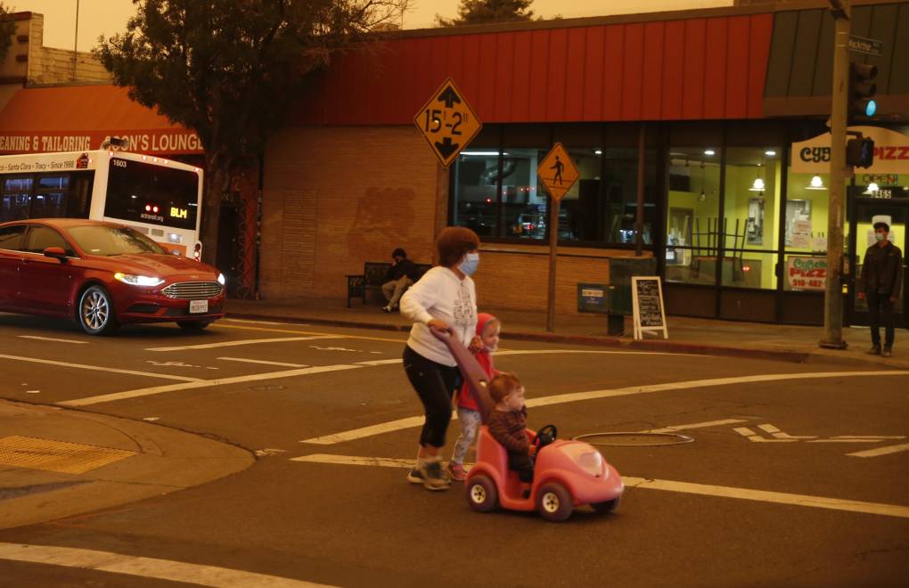
"caption": "A woman and two children cross the street at the intersection of Fruitvale Avenue and MacArthur Boulevard in the Dimond District of Oakland, on Wednesday, Sept. 9, 2020.",
"description": null,
"title": "Wildfire Smoke Orange Sky",
"credit": "Jane Tyska/Digital First Media/East Bay Times via Getty Images",
"status": "inherit",
"altTag": "A woman and children cross the street on a day with orange skies.",
"isLoading": false,
"fetchFailed": false
},
"science_1982386": {
"type": "attachments",
"id": "science_1982386",
"meta": {
"index": "attachments_1716263798",
"site": "science",
"id": "1982386",
"found": true
},
"title": "US-CLIMATE-WEATHER-FLOOD",
"publishDate": 1682101378,
"status": "inherit",
"parent": 1979603,
"modified": 1682133563,
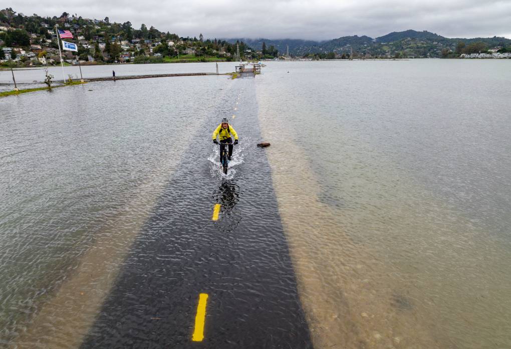
"caption": "An aerial picture taken Jan. 3, 2022, shows a man riding a bike along a flooded Sausalito/Mill Valley bike path during a king tide in Mill Valley. King tides occur when the Earth, moon and sun align in orbit to produce unusually high water levels and can cause local tidal flooding. Over time, sea level rise is raising the height of tidal systems.",
"credit": "Josh Edelson/AFP via Getty Images",
"altTag": "A man wearing a white bike helmet, yellow jacket and black pants rides through several inches of water on a submerged bike trail. Hills and clouds are in the foreground.",
"description": null,
"imgSizes": {
"medium": {
"file": "https://cdn.kqed.org/wp-content/uploads/sites/35/2028/06/GettyImages-1237523373-800x546.jpg",
"width": 800,
"height": 546,
"mimeType": "image/jpeg"
},
"large": {
"file": "https://cdn.kqed.org/wp-content/uploads/sites/35/2028/06/GettyImages-1237523373-1020x696.jpg",
"width": 1020,
"height": 696,
"mimeType": "image/jpeg"
},
"thumbnail": {
"file": "https://cdn.kqed.org/wp-content/uploads/sites/35/2028/06/GettyImages-1237523373-160x109.jpg",
"width": 160,
"height": 109,
"mimeType": "image/jpeg"
},
"medium_large": {
"file": "https://cdn.kqed.org/wp-content/uploads/sites/35/2028/06/GettyImages-1237523373-768x524.jpg",
"width": 768,
"height": 524,
"mimeType": "image/jpeg"
},
"1536x1536": {
"file": "https://cdn.kqed.org/wp-content/uploads/sites/35/2028/06/GettyImages-1237523373-1536x1048.jpg",
"width": 1536,
"height": 1048,
"mimeType": "image/jpeg"
},
"2048x2048": {
"file": "https://cdn.kqed.org/wp-content/uploads/sites/35/2028/06/GettyImages-1237523373-2048x1397.jpg",
"width": 2048,
"height": 1397,
"mimeType": "image/jpeg"
},
"post-thumbnail": {
"file": "https://cdn.kqed.org/wp-content/uploads/sites/35/2028/06/GettyImages-1237523373-672x372.jpg",
"width": 672,
"height": 372,
"mimeType": "image/jpeg"
},
"twentyfourteen-full-width": {
"file": "https://cdn.kqed.org/wp-content/uploads/sites/35/2028/06/GettyImages-1237523373-1038x576.jpg",
"width": 1038,
"height": 576,
"mimeType": "image/jpeg"
},
"full-width": {
"file": "https://cdn.kqed.org/wp-content/uploads/sites/35/2028/06/GettyImages-1237523373-1920x1309.jpg",
"width": 1920,
"height": 1309,
"mimeType": "image/jpeg"
},
"kqedFullSize": {
"file": "https://cdn.kqed.org/wp-content/uploads/sites/35/2028/06/GettyImages-1237523373-scaled-e1753215508590.jpg",
"width": 2000,
"height": 1364
}
},
"isLoading": false,
"fetchFailed": false
},
"science_1982393": {
"type": "attachments",
"id": "science_1982393",
"meta": {
"index": "attachments_1716263798",
"site": "science",
"id": "1982393",
"found": true
},
"parent": 1982376,
"imgSizes": {
"twentyfourteen-full-width": {
"file": "https://ww2.kqed.org/app/uploads/sites/35/2023/04/RS64672_GettyImages-51093187-qut-1038x576.jpg",
"width": 1038,
"mimeType": "image/jpeg",
"height": 576
},
"thumbnail": {
"file": "https://ww2.kqed.org/app/uploads/sites/35/2023/04/RS64672_GettyImages-51093187-qut-160x115.jpg",
"width": 160,
"mimeType": "image/jpeg",
"height": 115
},
"post-thumbnail": {
"file": "https://ww2.kqed.org/app/uploads/sites/35/2023/04/RS64672_GettyImages-51093187-qut-672x372.jpg",
"width": 672,
"mimeType": "image/jpeg",
"height": 372
},
"kqedFullSize": {
"file": "https://ww2.kqed.org/app/uploads/sites/35/2023/04/RS64672_GettyImages-51093187-qut.jpg",
"width": 1920,
"height": 1378
},
"large": {
"file": "https://ww2.kqed.org/app/uploads/sites/35/2023/04/RS64672_GettyImages-51093187-qut-1020x732.jpg",
"width": 1020,
"mimeType": "image/jpeg",
"height": 732
},
"1536x1536": {
"file": "https://ww2.kqed.org/app/uploads/sites/35/2023/04/RS64672_GettyImages-51093187-qut-1536x1102.jpg",
"width": 1536,
"mimeType": "image/jpeg",
"height": 1102
},
"medium": {
"file": "https://ww2.kqed.org/app/uploads/sites/35/2023/04/RS64672_GettyImages-51093187-qut-800x574.jpg",
"width": 800,
"mimeType": "image/jpeg",
"height": 574
},
"medium_large": {
"file": "https://ww2.kqed.org/app/uploads/sites/35/2023/04/RS64672_GettyImages-51093187-qut-768x551.jpg",
"width": 768,
"mimeType": "image/jpeg",
"height": 551
}
},
"publishDate": 1682104793,
"modified": 1682116631,
"caption": "Recent research shows that black-legged ticks carrying the bacteria that causes Lyme disease are capable of thriving along the West Coast.",
"description": null,
"title": "Close Up Of An Adult Female And Nymph Tick Is Shown June 15 2001 On A Fingertip Ticks",
"credit": "Getty Images",
"status": "inherit",
"altTag": "A close up image of a white finger with a large and small black insect on it.",
"isLoading": false,
"fetchFailed": false
},
"science_1982310": {
"type": "attachments",
"id": "science_1982310",
"meta": {
"index": "attachments_1716263798",
"site": "science",
"id": "1982310",
"found": true
},
"parent": 1982309,
"imgSizes": {
"twentyfourteen-full-width": {
"file": "https://ww2.kqed.org/app/uploads/sites/35/2023/04/RS48681_EPA_image_selects_fullsize-5-qut-1038x576.jpg",
"width": 1038,
"mimeType": "image/jpeg",
"height": 576
},
"thumbnail": {
"file": "https://ww2.kqed.org/app/uploads/sites/35/2023/04/RS48681_EPA_image_selects_fullsize-5-qut-160x107.jpg",
"width": 160,
"mimeType": "image/jpeg",
"height": 107
},
"post-thumbnail": {
"file": "https://ww2.kqed.org/app/uploads/sites/35/2023/04/RS48681_EPA_image_selects_fullsize-5-qut-672x372.jpg",
"width": 672,
"mimeType": "image/jpeg",
"height": 372
},
"kqedFullSize": {
"file": "https://ww2.kqed.org/app/uploads/sites/35/2023/04/RS48681_EPA_image_selects_fullsize-5-qut.jpg",
"width": 1920,
"height": 1279
},
"large": {
"file": "https://ww2.kqed.org/app/uploads/sites/35/2023/04/RS48681_EPA_image_selects_fullsize-5-qut-1020x679.jpg",
"width": 1020,
"mimeType": "image/jpeg",
"height": 679
},
"1536x1536": {
"file": "https://ww2.kqed.org/app/uploads/sites/35/2023/04/RS48681_EPA_image_selects_fullsize-5-qut-1536x1023.jpg",
"width": 1536,
"mimeType": "image/jpeg",
"height": 1023
},
"medium": {
"file": "https://ww2.kqed.org/app/uploads/sites/35/2023/04/RS48681_EPA_image_selects_fullsize-5-qut-800x533.jpg",
"width": 800,
"mimeType": "image/jpeg",
"height": 533
},
"medium_large": {
"file": "https://ww2.kqed.org/app/uploads/sites/35/2023/04/RS48681_EPA_image_selects_fullsize-5-qut-768x512.jpg",
"width": 768,
"mimeType": "image/jpeg",
"height": 512
}
},
"publishDate": 1681930992,
"modified": 1681942571,
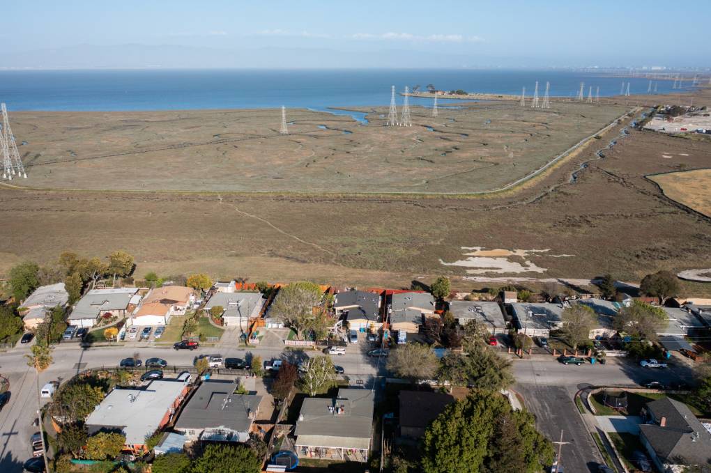
"caption": "Wetlands of San Mateo County offer natural flood protection for neighborhoods of East Palo Alto.",
"description": null,
"title": "RS48681_EPA_image_selects_fullsize-5-qut",
"credit": "JJ Harris/Techboogie/KQED",
"status": "inherit",
"altTag": "Blue bay water in the background, green marshes and homes.",
"isLoading": false,
"fetchFailed": false
},
"science_1982303": {
"type": "attachments",
"id": "science_1982303",
"meta": {
"index": "attachments_1716263798",
"site": "science",
"id": "1982303",
"found": true
},
"parent": 1981958,
"imgSizes": {
"twentyfourteen-full-width": {
"file": "https://ww2.kqed.org/app/uploads/sites/35/2023/04/DL1005_This_Mushroom_Can_Fly_KQED-1038x576.jpg",
"width": 1038,
"mimeType": "image/jpeg",
"height": 576
},
"thumbnail": {
"file": "https://ww2.kqed.org/app/uploads/sites/35/2023/04/DL1005_This_Mushroom_Can_Fly_KQED-160x90.jpg",
"width": 160,
"mimeType": "image/jpeg",
"height": 90
},
"post-thumbnail": {
"file": "https://ww2.kqed.org/app/uploads/sites/35/2023/04/DL1005_This_Mushroom_Can_Fly_KQED-672x372.jpg",
"width": 672,
"mimeType": "image/jpeg",
"height": 372
},
"kqedFullSize": {
"file": "https://ww2.kqed.org/app/uploads/sites/35/2023/04/DL1005_This_Mushroom_Can_Fly_KQED.jpg",
"width": 1920,
"height": 1080
},
"large": {
"file": "https://ww2.kqed.org/app/uploads/sites/35/2023/04/DL1005_This_Mushroom_Can_Fly_KQED-1020x574.jpg",
"width": 1020,
"mimeType": "image/jpeg",
"height": 574
},
"1536x1536": {
"file": "https://ww2.kqed.org/app/uploads/sites/35/2023/04/DL1005_This_Mushroom_Can_Fly_KQED-1536x864.jpg",
"width": 1536,
"mimeType": "image/jpeg",
"height": 864
},
"medium": {
"file": "https://ww2.kqed.org/app/uploads/sites/35/2023/04/DL1005_This_Mushroom_Can_Fly_KQED-800x450.jpg",
"width": 800,
"mimeType": "image/jpeg",
"height": 450
},
"medium_large": {
"file": "https://ww2.kqed.org/app/uploads/sites/35/2023/04/DL1005_This_Mushroom_Can_Fly_KQED-768x432.jpg",
"width": 768,
"mimeType": "image/jpeg",
"height": 432
}
},
"publishDate": 1681514468,
"modified": 1681514556,
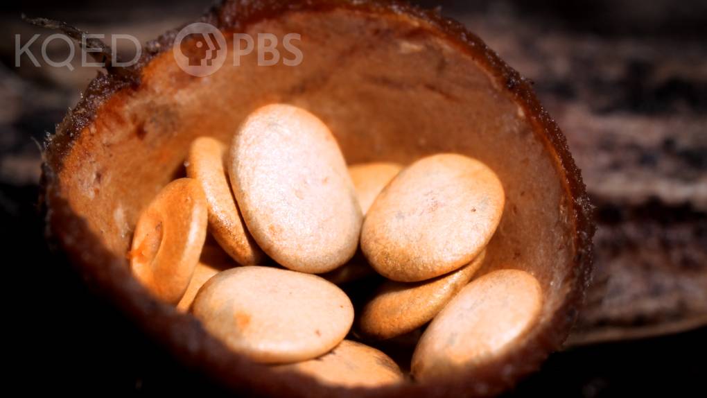
"caption": "This tiny mushroom gets its name from the bird's nest it resembles. ",
"description": null,
"title": "DL1005_This_Mushroom_Can_Fly_KQED",
"credit": "Josh Cassidy/KQED",
"status": "inherit",
"altTag": null,
"isLoading": false,
"fetchFailed": false
},
"science_1982131": {
"type": "attachments",
"id": "science_1982131",
"meta": {
"index": "attachments_1716263798",
"site": "science",
"id": "1982131",
"found": true
},
"parent": 1982130,
"imgSizes": {
"twentyfourteen-full-width": {
"file": "https://ww2.kqed.org/app/uploads/sites/35/2023/04/Treasure_Island_05-1038x576.jpg",
"width": 1038,
"mimeType": "image/jpeg",
"height": 576
},
"thumbnail": {
"file": "https://ww2.kqed.org/app/uploads/sites/35/2023/04/Treasure_Island_05-160x107.jpg",
"width": 160,
"mimeType": "image/jpeg",
"height": 107
},
"post-thumbnail": {
"file": "https://ww2.kqed.org/app/uploads/sites/35/2023/04/Treasure_Island_05-672x372.jpg",
"width": 672,
"mimeType": "image/jpeg",
"height": 372
},
"kqedFullSize": {
"file": "https://ww2.kqed.org/app/uploads/sites/35/2023/04/Treasure_Island_05.jpg",
"width": 1872,
"height": 1248
},
"large": {
"file": "https://ww2.kqed.org/app/uploads/sites/35/2023/04/Treasure_Island_05-1020x680.jpg",
"width": 1020,
"mimeType": "image/jpeg",
"height": 680
},
"1536x1536": {
"file": "https://ww2.kqed.org/app/uploads/sites/35/2023/04/Treasure_Island_05-1536x1024.jpg",
"width": 1536,
"mimeType": "image/jpeg",
"height": 1024
},
"medium": {
"file": "https://ww2.kqed.org/app/uploads/sites/35/2023/04/Treasure_Island_05-800x533.jpg",
"width": 800,
"mimeType": "image/jpeg",
"height": 533
},
"medium_large": {
"file": "https://ww2.kqed.org/app/uploads/sites/35/2023/04/Treasure_Island_05-768x512.jpg",
"width": 768,
"mimeType": "image/jpeg",
"height": 512
}
},
"publishDate": 1680558446,
"modified": 1680664071,
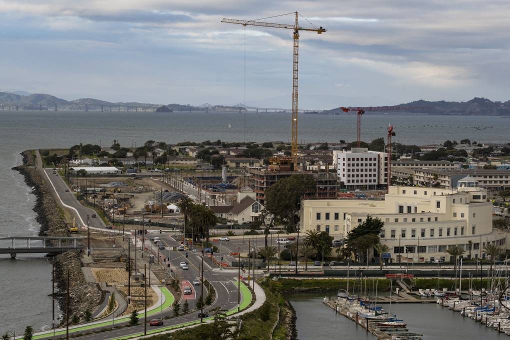
"caption": "Developers have redesigned Treasure Island to withstand a rising San Francisco Bay, elevating land and setting aside space for ever-higher seawalls. Engineers say planned fortifications will hold — but with flood risk accelerating, no one knows for how long.",
"description": "Developers have redesigned Treasure Island to withstand a rising San Francisco Bay, elevating land and setting aside space for ever-higher sea walls. Engineers say planned fortifications will hold — but with flood risk accelerating, no one knows for how long. ",
"title": "Treasure Island",
"credit": "Yesica Prado/San Francisco Public Press",
"status": "inherit",
"altTag": "An aerial view of treasure Island.",
"isLoading": false,
"fetchFailed": false
},
"science_1982148": {
"type": "attachments",
"id": "science_1982148",
"meta": {
"index": "attachments_1716263798",
"site": "science",
"id": "1982148",
"found": true
},
"parent": 1982147,
"imgSizes": {
"twentyfourteen-full-width": {
"file": "https://ww2.kqed.org/app/uploads/sites/35/2023/04/CaliforniaSnow-2048x1412-1-1038x576.jpg",
"width": 1038,
"mimeType": "image/jpeg",
"height": 576
},
"thumbnail": {
"file": "https://ww2.kqed.org/app/uploads/sites/35/2023/04/CaliforniaSnow-2048x1412-1-160x110.jpg",
"width": 160,
"mimeType": "image/jpeg",
"height": 110
},
"post-thumbnail": {
"file": "https://ww2.kqed.org/app/uploads/sites/35/2023/04/CaliforniaSnow-2048x1412-1-672x372.jpg",
"width": 672,
"mimeType": "image/jpeg",
"height": 372
},
"kqedFullSize": {
"file": "https://ww2.kqed.org/app/uploads/sites/35/2023/04/CaliforniaSnow-2048x1412-1.jpg",
"width": 2048,
"height": 1412
},
"large": {
"file": "https://ww2.kqed.org/app/uploads/sites/35/2023/04/CaliforniaSnow-2048x1412-1-1020x703.jpg",
"width": 1020,
"mimeType": "image/jpeg",
"height": 703
},
"1536x1536": {
"file": "https://ww2.kqed.org/app/uploads/sites/35/2023/04/CaliforniaSnow-2048x1412-1-1536x1059.jpg",
"width": 1536,
"mimeType": "image/jpeg",
"height": 1059
},
"full-width": {
"file": "https://ww2.kqed.org/app/uploads/sites/35/2023/04/CaliforniaSnow-2048x1412-1-1920x1324.jpg",
"width": 1920,
"mimeType": "image/jpeg",
"height": 1324
},
"medium": {
"file": "https://ww2.kqed.org/app/uploads/sites/35/2023/04/CaliforniaSnow-2048x1412-1-800x552.jpg",
"width": 800,
"mimeType": "image/jpeg",
"height": 552
},
"medium_large": {
"file": "https://ww2.kqed.org/app/uploads/sites/35/2023/04/CaliforniaSnow-2048x1412-1-768x530.jpg",
"width": 768,
"mimeType": "image/jpeg",
"height": 530
}
},
"publishDate": 1680633649,
"modified": 1680648581,
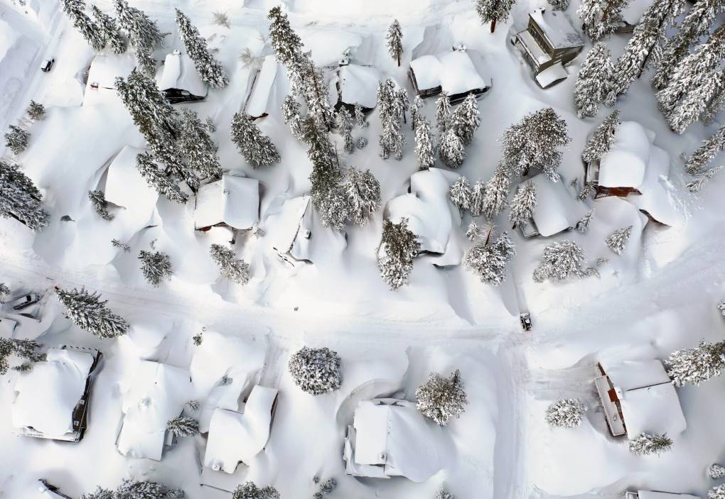
"caption": "In Mammoth Lakes, snow covers roofs next to snowbanks piled up from new and past storms in the Sierra Nevada, in the wake of an atmospheric river event, in March 2023.",
"description": "In Mammoth Lakes, California, snow covers roofs next to snowbanks in March piled up from new and past storms in the Sierra Nevada mountains, in the wake of an atmospheric river event. ",
"title": "California Hit By Another Winter Storm, Deepening The Already Historic Snowpack In Mountain Regions",
"credit": "Mario Tama/Getty Images",
"status": "inherit",
"altTag": "In an aerial view, snow covers roofs next to snowbanks piled up from new and past storms in the Sierra Nevada mountains.",
"isLoading": false,
"fetchFailed": false
},
"science_1982873": {
"type": "attachments",
"id": "science_1982873",
"meta": {
"index": "attachments_1716263798",
"site": "science",
"id": "1982873",
"found": true
},
"parent": 1981963,
"imgSizes": {
"twentyfourteen-full-width": {
"file": "https://ww2.kqed.org/app/uploads/sites/35/2023/03/DL1004-Toad_Tongues-OG-pushedin-HDtest-1038x576.jpg",
"width": 1038,
"mimeType": "image/jpeg",
"height": 576
},
"thumbnail": {
"file": "https://ww2.kqed.org/app/uploads/sites/35/2023/03/DL1004-Toad_Tongues-OG-pushedin-HDtest-160x90.jpg",
"width": 160,
"mimeType": "image/jpeg",
"height": 90
},
"post-thumbnail": {
"file": "https://ww2.kqed.org/app/uploads/sites/35/2023/03/DL1004-Toad_Tongues-OG-pushedin-HDtest-672x372.jpg",
"width": 672,
"mimeType": "image/jpeg",
"height": 372
},
"kqedFullSize": {
"file": "https://ww2.kqed.org/app/uploads/sites/35/2023/03/DL1004-Toad_Tongues-OG-pushedin-HDtest.jpg",
"width": 1920,
"height": 1080
},
"large": {
"file": "https://ww2.kqed.org/app/uploads/sites/35/2023/03/DL1004-Toad_Tongues-OG-pushedin-HDtest-1020x574.jpg",
"width": 1020,
"mimeType": "image/jpeg",
"height": 574
},
"1536x1536": {
"file": "https://ww2.kqed.org/app/uploads/sites/35/2023/03/DL1004-Toad_Tongues-OG-pushedin-HDtest-1536x864.jpg",
"width": 1536,
"mimeType": "image/jpeg",
"height": 864
},
"medium": {
"file": "https://ww2.kqed.org/app/uploads/sites/35/2023/03/DL1004-Toad_Tongues-OG-pushedin-HDtest-800x450.jpg",
"width": 800,
"mimeType": "image/jpeg",
"height": 450
},
"medium_large": {
"file": "https://ww2.kqed.org/app/uploads/sites/35/2023/03/DL1004-Toad_Tongues-OG-pushedin-HDtest-768x432.jpg",
"width": 768,
"mimeType": "image/jpeg",
"height": 432
}
},
"publishDate": 1685665576,
"modified": 1685665576,
"caption": null,
"description": null,
"title": "DL1004-Toad_Tongues-OG-pushedin-HDtest",
"credit": null,
"status": "inherit",
"altTag": null,
"isLoading": false,
"fetchFailed": false
}
},
"audioPlayerReducer": {
"postId": "stream_live",
"isPaused": true,
"isPlaying": false,
"pfsActive": false,
"pledgeModalIsOpen": true,
"playerDrawerIsOpen": false,
"liveAudioPlayStartedAt": 0,
"liveAudioPlayContext": ""
},
"authorsReducer": {
"byline_science_1982448": {
"type": "authors",
"id": "byline_science_1982448",
"meta": {
"override": true
},
"slug": "byline_science_1982448",
"name": "\u003ca href=\"https://insideclimatenews.org/profile/emma-foehringer-merchant/\">Emma Foehringer Merchant\u003c/a> \u003cbr>Inside Climate News \u003cbr>",
"isLoading": false
},
"byline_science_1982130": {
"type": "authors",
"id": "byline_science_1982130",
"meta": {
"override": true
},
"slug": "byline_science_1982130",
"name": "Kristi Coale\u003cbr>San Francisco Public Press",
"isLoading": false
},
"byline_science_1982147": {
"type": "authors",
"id": "byline_science_1982147",
"meta": {
"override": true
},
"slug": "byline_science_1982147",
"name": "\u003ca href=\"https://insideclimatenews.org/profile/emma-foehringer-merchant/\">Emma Foehringer Merchant\u003c/a>",
"isLoading": false
},
"gabriela-quiros": {
"type": "authors",
"id": "6186",
"meta": {
"index": "authors_1716337520",
"id": "6186",
"found": true
},
"name": "Gabriela Quirós",
"firstName": "Gabriela",
"lastName": "Quirós",
"slug": "gabriela-quiros",
"email": "gquiros@kqed.org",
"display_author_email": false,
"staff_mastheads": [],
"title": "Supervising Producer",
"bio": "Gabriela Quirós is the \u003cstrong>supervising producer for KQED's web science video series \u003ca href=\"https://www.kqed.org/deeplook\">Deep Look\u003c/a>\u003c/strong>. She joined KQED as a TV producer when its science series QUEST started in 2006 and has covered everything from Alzheimer’s to bee die-offs to dark energy.\r\n\r\nShe won a 2022 AAAS Kavli Science Journalism Award with a team of her Deep Look colleagues. She has won six regional Emmys as a video producer and has shared eight more as the coordinating producer of Deep Look. The episode she produced about \u003ca href=\"https://www.kqed.org/science/728086/how-mosquitoes-use-six-needles-to-suck-your-blood\">How Mosquitoes Use Six Needles to Suck Your Blood\u003c/a> won a Webby \"People's Voice\" award. She has also earned awards from the Jackson Hole Wildlife Film Festival, the Society of Professional Journalists and the Society of Environmental Journalists.\r\n\r\nHer videos for KQED have also aired on NOVA scienceNOW and the PBS NewsHour, and appeared on NPR.org.\r\n\r\nAs an independent filmmaker, she produced and directed the hour-long documentary \u003ca href=\"http://lpbp.org/beautiful-sin-qa-with-producer-gabriela-quiros/\">\u003cem>Beautiful Sin\u003c/em>\u003c/a>, about the surprising story of how Costa Rica became the only country in the world to outlaw in vitro fertilization. The film aired in 2015 on public television stations throughout the U.S., and in Costa Rica.\r\n\r\nShe started her journalism career as a newspaper reporter in Costa Rica, where she grew up. She won the National Science Journalism Award there for a series of articles about organic agriculture, and developed a life-long interest in health reporting. She moved to the Bay Area in 1996 to study documentary filmmaking at the University of California, Berkeley, where she received master’s degrees in journalism and Latin American studies.",
"avatar": "https://secure.gravatar.com/avatar/6d82c20152affd1b434c31a904c40809?s=600&d=blank&r=g",
"twitter": "gabrielaquirosr",
"facebook": null,
"instagram": null,
"linkedin": null,
"sites": [
{
"site": "science",
"roles": []
},
{
"site": "quest",
"roles": [
"ef_view_calendar",
"ef_view_story_budget"
]
}
],
"headData": {
"title": "Gabriela Quirós | KQED",
"description": "Supervising Producer",
"ogImgSrc": "https://secure.gravatar.com/avatar/6d82c20152affd1b434c31a904c40809?s=600&d=blank&r=g",
"twImgSrc": "https://secure.gravatar.com/avatar/6d82c20152affd1b434c31a904c40809?s=600&d=blank&r=g"
},
"isLoading": false,
"link": "/author/gabriela-quiros"
},
"lklivans": {
"type": "authors",
"id": "8648",
"meta": {
"index": "authors_1716337520",
"id": "8648",
"found": true
},
"name": "Laura Klivans",
"firstName": "Laura",
"lastName": "Klivans",
"slug": "lklivans",
"email": "lklivans@kqed.org",
"display_author_email": true,
"staff_mastheads": [
"news",
"science"
],
"title": "Reporter",
"bio": "Laura Klivans is an award-winning science reporter for KQED News, where she covers climate change with an eye on both groundbreaking progress and gaps in action. She is the former host of KQED's blockbuster video series about tiny, amazing animals, \u003cem>Deep Look\u003c/em>. Her work reaches national audiences through NPR, \u003cem>Here & Now, \u003c/em>PRI, and other major outlets. \r\n\r\nLaura’s won five Northern California Area Emmy Awards for Deep Look and First Place in the Greater Bay Area Journalism Awards for a podcast exploring how one Oakland neighborhood teamed up to reduce planet-heating pollution.\r\n\r\nBeyond her reporting, she hosts and moderates events. In the past, she taught audio storytelling at the UC Berkeley Graduate School of Journalism, led international education programs, worked with immigrants and refugees along the Thai-Burmese border, taught high schoolers sex ed, and was an actress. \r\n\r\nShe's a former UC Berkeley Human Rights Fellow, USC Center for Health Journalism's California Fellow and Coro Fellow in Public Affairs. Laura has a master’s in journalism from UC Berkeley, a master’s in education from Harvard, and an undergraduate degree from Northwestern University.\r\n\r\nShe loves trying to riddle the meaning out of vanity license plates.",
"avatar": "https://secure.gravatar.com/avatar/2d2ecd1550a494cc10ad4a503406965585902124739e775a9b3817eebf1d88be?s=600&d=blank&r=g",
"twitter": "lauraklivans",
"bluesky": null,
"facebook": null,
"instagram": null,
"linkedin": null,
"sites": [
{
"site": "news",
"roles": [
"editor"
]
},
{
"site": "stateofhealth",
"roles": [
"contributor",
"editor"
]
},
{
"site": "science",
"roles": [
"editor"
]
},
{
"site": "forum",
"roles": [
"editor"
]
}
],
"headData": {
"title": "Laura Klivans | KQED",
"description": "Reporter",
"ogImgSrc": "https://secure.gravatar.com/avatar/2d2ecd1550a494cc10ad4a503406965585902124739e775a9b3817eebf1d88be?s=600&d=blank&r=g",
"twImgSrc": "https://secure.gravatar.com/avatar/2d2ecd1550a494cc10ad4a503406965585902124739e775a9b3817eebf1d88be?s=600&d=blank&r=g"
},
"isLoading": false,
"link": "/author/lklivans"
},
"dventon": {
"type": "authors",
"id": "11088",
"meta": {
"index": "authors_1716337520",
"id": "11088",
"found": true
},
"name": "Danielle Venton",
"firstName": "Danielle",
"lastName": "Venton",
"slug": "dventon",
"email": "dventon@kqed.org",
"display_author_email": true,
"staff_mastheads": [
"science"
],
"title": "Science reporter",
"bio": "Danielle Venton is a reporter for KQED Science. She covers wildfires, space and oceans (though she is prone to sea sickness).\r\n\r\nBefore joining KQED in 2015, Danielle was a staff reporter at KRCB in Sonoma County and a freelancer. She studied science communication at UC Santa Cruz and formerly worked at CERN in Geneva, Switzerland where she wrote about computing. She lives in Sonoma County and enjoys backpacking.",
"avatar": "https://secure.gravatar.com/avatar/37b292b5c40c8d93959c4f48d73b5286f41b7abd8588277e941905a3ed4c801c?s=600&d=blank&r=g",
"twitter": "DanielleVenton",
"bluesky": null,
"facebook": null,
"instagram": null,
"linkedin": null,
"sites": [
{
"site": "arts",
"roles": [
"contributor"
]
},
{
"site": "news",
"roles": [
"editor"
]
},
{
"site": "futureofyou",
"roles": [
"editor"
]
},
{
"site": "science",
"roles": [
"editor"
]
},
{
"site": "liveblog",
"roles": [
"contributor"
]
}
],
"headData": {
"title": "Danielle Venton | KQED",
"description": "Science reporter",
"ogImgSrc": "https://secure.gravatar.com/avatar/37b292b5c40c8d93959c4f48d73b5286f41b7abd8588277e941905a3ed4c801c?s=600&d=blank&r=g",
"twImgSrc": "https://secure.gravatar.com/avatar/37b292b5c40c8d93959c4f48d73b5286f41b7abd8588277e941905a3ed4c801c?s=600&d=blank&r=g"
},
"isLoading": false,
"link": "/author/dventon"
},
"lesleymcclurg": {
"type": "authors",
"id": "11229",
"meta": {
"index": "authors_1716337520",
"id": "11229",
"found": true
},
"name": "Lesley McClurg",
"firstName": "Lesley",
"lastName": "McClurg",
"slug": "lesleymcclurg",
"email": "lmcclurg@KQED.org",
"display_author_email": false,
"staff_mastheads": [
"news",
"science"
],
"title": "KQED Health Correspondent",
"bio": "Lesley McClurg is a health correspondent and fill-in host whose work is regularly rebroadcast on NPR and PBS programs. She’s earned multiple regional Emmy awards, a national and a regional Edward R. Murrow award, and was named Best Beat Reporter by the Association of Health Care Journalists. The Society of Professional Journalists has recognized her work several times, and the Society of Environmental Journalists spotlighted her coverage of California’s historic drought.\r\n\r\nBefore joining KQED in 2016, Lesley covered food and sustainability for Capital Public Radio, environmental issues for Colorado Public Radio, and reported for KUOW and KCTS 9 in Seattle. Away from the newsroom, she loves skiing with her daughter, mountain biking with her partner, and playing with Ollie, the family’s goldendoodle. On deadline, she runs almost entirely on chocolate chips.\r\n\r\n ",
"avatar": "https://secure.gravatar.com/avatar/bab49e972ea10c774fe0f5e29dba1722b158f7c0d58a360923d1389d380b2978?s=600&d=blank&r=g",
"twitter": "lesleywmcclurg",
"bluesky": null,
"facebook": null,
"instagram": null,
"linkedin": null,
"sites": [
{
"site": "arts",
"roles": [
"author"
]
},
{
"site": "news",
"roles": [
"editor"
]
},
{
"site": "futureofyou",
"roles": [
"editor"
]
},
{
"site": "stateofhealth",
"roles": [
"author"
]
},
{
"site": "science",
"roles": [
"editor"
]
},
{
"site": "quest",
"roles": [
"subscriber"
]
},
{
"site": "forum",
"roles": [
"administrator"
]
},
{
"site": "liveblog",
"roles": [
"author"
]
}
],
"headData": {
"title": "Lesley McClurg | KQED",
"description": "KQED Health Correspondent",
"ogImgSrc": "https://secure.gravatar.com/avatar/bab49e972ea10c774fe0f5e29dba1722b158f7c0d58a360923d1389d380b2978?s=600&d=blank&r=g",
"twImgSrc": "https://secure.gravatar.com/avatar/bab49e972ea10c774fe0f5e29dba1722b158f7c0d58a360923d1389d380b2978?s=600&d=blank&r=g"
},
"isLoading": false,
"link": "/author/lesleymcclurg"
},
"eromero": {
"type": "authors",
"id": "11746",
"meta": {
"index": "authors_1716337520",
"id": "11746",
"found": true
},
"name": "Ezra David Romero",
"firstName": "Ezra David",
"lastName": "Romero",
"slug": "eromero",
"email": "eromero@kqed.org",
"display_author_email": true,
"staff_mastheads": [
"news",
"science"
],
"title": "Climate Reporter",
"bio": "Ezra David Romero is a climate reporter for KQED News. He covers the absence and excess of water in the Bay Area — think sea level rise, flooding and drought. For nearly a decade he’s covered how warming temperatures are altering the lives of Californians. He’s reported on farmers worried their pistachio trees aren’t getting enough sleep, families desperate for water, scientists studying dying giant sequoias, and alongside firefighters containing wildfires. His work has appeared on local stations across California and nationally on public radio shows like Morning Edition, Here and Now, All Things Considered and Science Friday. ",
"avatar": "https://secure.gravatar.com/avatar/c76404d287c10ed40224227551ac36e24352c7306f106632caf6fead76f8801f?s=600&d=blank&r=g",
"twitter": "ezraromero",
"bluesky": null,
"facebook": null,
"instagram": null,
"linkedin": null,
"sites": [
{
"site": "arts",
"roles": [
"editor"
]
},
{
"site": "news",
"roles": [
"editor"
]
},
{
"site": "science",
"roles": [
"editor"
]
},
{
"site": "liveblog",
"roles": [
"author"
]
}
],
"headData": {
"title": "Ezra David Romero | KQED",
"description": "Climate Reporter",
"ogImgSrc": "https://secure.gravatar.com/avatar/c76404d287c10ed40224227551ac36e24352c7306f106632caf6fead76f8801f?s=600&d=blank&r=g",
"twImgSrc": "https://secure.gravatar.com/avatar/c76404d287c10ed40224227551ac36e24352c7306f106632caf6fead76f8801f?s=600&d=blank&r=g"
},
"isLoading": false,
"link": "/author/eromero"
},
"mschiffman": {
"type": "authors",
"id": "11833",
"meta": {
"index": "authors_1716337520",
"id": "11833",
"found": true
},
"name": "Mimi Schiffman",
"firstName": "Mimi",
"lastName": "Schiffman",
"slug": "mschiffman",
"email": "mschiffman@kqed.org",
"display_author_email": false,
"staff_mastheads": [],
"title": "KQED Contributor",
"bio": "Mimi Schiffman is a producer for Deep Look.\r\n\r\nPrior to joining the Deep Look team she made hundreds of stories over more than a decade as a producer, director of photography and/or editor. \r\n\r\nShe's filmed lemurs finger painting (a favorite pastime of the amazing Duke Lemur Center inhabitants), stayed awake for 36 hours while trailing the first person with dwarfism to complete an Ironman (shout out to John Young, aka \"The Hammer\") and got to interview the late, great Anthony Bourdain.\r\n \r\nFun facts: Mimi's first job was weighing foraminifera - single cell organisms - in tiny foil cups, and she once got a river designated as “Wild and scenic.” She’s passionate about animals in general but very specifically her rescue dog, Henry. And her kid, Sierra and husband, Peter.",
"avatar": "https://secure.gravatar.com/avatar/e8b898539bc6a47f47f94992f0f17948?s=600&d=blank&r=g",
"twitter": null,
"facebook": null,
"instagram": null,
"linkedin": null,
"sites": [
{
"site": "science",
"roles": [
"editor"
]
}
],
"headData": {
"title": "Mimi Schiffman | KQED",
"description": "KQED Contributor",
"ogImgSrc": "https://secure.gravatar.com/avatar/e8b898539bc6a47f47f94992f0f17948?s=600&d=blank&r=g",
"twImgSrc": "https://secure.gravatar.com/avatar/e8b898539bc6a47f47f94992f0f17948?s=600&d=blank&r=g"
},
"isLoading": false,
"link": "/author/mschiffman"
}
},
"pagesReducer": {
"science_category_environment": {
"type": "terms",
"id": "science_35",
"meta": {
"index": "terms_1716263798",
"site": "science",
"id": "35",
"score": 12.138271
},
"featImg": null,
"name": "Environment",
"description": null,
"taxonomy": "category",
"headData": {
"twImgId": null,
"twTitle": null,
"ogTitle": null,
"ogImgId": null,
"twDescription": null,
"description": null,
"title": "Environment Archives | KQED Science",
"ogDescription": null
},
"ttid": 37,
"slug": "environment",
"isLoading": false,
"title": "Environment",
"pageMeta": {
"site": "science",
"WpPageTemplate": "page-topic-editorial",
"currentPage": 16
},
"blocks": [
{
"blockName": "kqed/post-list",
"attrs": {
"layout": "cardArticle2",
"query": "posts/science?category=environment",
"seeMore": false,
"paginated": true,
"page": 16
}
},
{
"blockName": "kqed/ad"
}
]
}
},
"pfsSessionReducer": {},
"postsReducer": {
"stream_live": {
"type": "live",
"id": "stream_live",
"audioUrl": "https://streams.kqed.org/kqedradio",
"title": "Live Stream",
"excerpt": "Live Stream information currently unavailable.",
"link": "/radio",
"featImg": "",
"label": {
"name": "KQED Live",
"link": "/"
}
},
"stream_kqedNewscast": {
"type": "posts",
"id": "stream_kqedNewscast",
"audioUrl": "https://www.kqed.org/.stream/anon/radio/RDnews/newscast.mp3?_=1",
"title": "KQED Newscast",
"featImg": "",
"label": {
"name": "88.5 FM",
"link": "/"
}
},
"science_1982513": {
"type": "posts",
"id": "science_1982513",
"meta": {
"index": "posts_1716263798",
"site": "science",
"id": "1982513",
"score": null,
"sort": [
1683025238000
]
},
"parent": 0,
"labelTerm": {},
"blocks": [],
"publishDate": 1683025238,
"format": "standard",
"title": "'We're Not Prepared': Experts Call for Doubling Levee Protections as California Faces Increasing Floods",
"headTitle": "‘We’re Not Prepared’: Experts Call for Doubling Levee Protections as California Faces Increasing Floods | KQED",
"content": "\u003cp>California water experts and environmental justice advocates are calling for state leaders to mandate that new levees be built with double the federal required protection to withstand the increasingly severe storms caused, in part, by human-caused climate change.\u003c/p>\n\u003cp>California’s levee protection regulations are not uniform; the state’s seemingly endless dikes and causeways are overseen by a patchwork of widely varying rules. Some communities like Pajaro in Monterey County, which was swamped by floodwaters this year, are protected only against smaller storms that happen every eight years, while levees protecting urban areas of the Central Valley are bolstered against much more powerful storms.\u003c/p>\n\u003cp>[pullquote size='small' align='left' citation=\"Sona Mohnot, director of climate equity and climate resilience, The Greenlining Institute\"]‘It’s a climate justice issue to protect a community from storms, period, especially the larger storms. If this is the opportunity to protect the people, then I would want it to be protected to the maximum extent possible.’[/pullquote]\u003c/p>\n\u003cp>Jeffery Mount, senior fellow specializing in water at the Public Policy Institute of California, said that the bare-minimum standard for protection everywhere in the state should be based on the likelihood of a 1-in-200-year storm, which has a 0.5% chance of happening in any given year.\u003c/p>\n\u003cp>“Heads will explode when [planners] hear that recommendation,” said Mount in an email. “The reason I suggest it is simple: There is no way most poor communities could afford something like that, so there has to be a social justice element built in.”\u003c/p>\n\u003cp>[ad fullwidth]\u003c/p>\n\u003cp>The state has no consistent mandate. Most of the state’s \u003ca href=\"https://lao.ca.gov/publications/report/3571\">more than 20,000 miles of flood banks and channels\u003c/a> are operated by local governments, and many miles are on unregulated private land. Levees under the Federal Emergency Management Agency must protect against a 100-year flood or a 1% chance of one occurring in any given year.\u003c/p>\n\u003cp>Put in terms of a common homeowner’s 30-year mortgage, there’s a 1-in-4 chance a house will flood during that time with that level of protection. The storms of the future only increase that probability due to the ongoing effects of climate change, Mount said, adding that “most places don’t even have a 100-year level of protection.”\u003c/p>\n\u003cp>The extreme storms of the future will likely be much wetter than Californians experienced this winter. Daniel Swain, climate scientist at UCLA, said the \u003ca href=\"https://www.kqed.org/science/1982079/this-winters-floods-may-be-only-a-taste-of-the-megafloods-to-come-climate-scientists-warn\">storms that burst over California this winter were half as bad in total rain and snowfall as the megastorms predicted in the years to come\u003c/a>.\u003c/p>\n\u003cp>“As disruptive as [the storms] have been, they are nowhere near close to the plausible worst-case scenario,” he said. “We’ve gotten a taste of what widespread flooding is this winter, but I do think it’s only a taste.”\u003c/p>\n\u003cfigure id=\"attachment_1982522\" class=\"wp-caption aligncenter\" style=\"max-width: 800px\">\u003ca href=\"https://ww2.kqed.org/science/2023/05/02/experts-call-for-doubled-levee-protection-to-battle-climate-change-in-california/allensworth-residents-stave-off-floodwaters/\" rel=\"attachment wp-att-1982522\">\u003cimg loading=\"lazy\" decoding=\"async\" class=\"size-medium wp-image-1982522\" src=\"https://ww2.kqed.org/app/uploads/sites/35/2023/04/GettyImages-1248893678-800x534.jpg\" alt=\"A road marked with the word STOP in white. The road is submerged in water. A car and a stop sign are enshrouded in water. A grey sky in the background.\" width=\"800\" height=\"534\" srcset=\"https://cdn.kqed.org/wp-content/uploads/sites/35/2023/04/GettyImages-1248893678-800x534.jpg 800w, https://cdn.kqed.org/wp-content/uploads/sites/35/2023/04/GettyImages-1248893678-1020x680.jpg 1020w, https://cdn.kqed.org/wp-content/uploads/sites/35/2023/04/GettyImages-1248893678-160x107.jpg 160w, https://cdn.kqed.org/wp-content/uploads/sites/35/2023/04/GettyImages-1248893678-768x512.jpg 768w, https://cdn.kqed.org/wp-content/uploads/sites/35/2023/04/GettyImages-1248893678.jpg 1024w\" sizes=\"(max-width: 800px) 100vw, 800px\">\u003c/a>\u003cfigcaption class=\"wp-caption-text\">On March 18, 2023, vehicles were submerged in floodwaters on Avenue 56 near the Central Valley Highway, a few miles north of Allensworth, where residents fortified the levee protecting their neighborhood. \u003ccite>(Robert Gauthier/Los Angeles Times via Getty Images)\u003c/cite>\u003c/figcaption>\u003c/figure>\n\u003ch2>A perfect time for a big water rethink\u003c/h2>\n\u003cp>As floodwaters recede, Mount and Brett Sanders, his peer at UC Irvine, said \u003ca href=\"https://www.latimes.com/opinion/story/2023-04-07/flood-control-drought-levees-california\">this is the perfect time to rethink and update the state’s aging infrastructure to accommodate the future climate\u003c/a>. Fewer than \u003ca href=\"https://www.kqed.org/science/1981900/fewer-than-10-of-levees-in-the-greater-bay-area-have-a-federal-risk-rating\">10% of levees in the greater Bay Area have a federal risk rating\u003c/a>, according to a KQED analysis of the National Levee Database.\u003c/p>\n\u003cp>“The recent California storms showed us pretty clearly there’s a lot at risk and systems we think are there to protect us may not perform as we expect,” said Sanders, an engineering professor, of levees across the Central Valley and Central Coast that failed during winter storms.\u003c/p>\n\u003cp>But a switch to a higher level of protection must start with conversations locally with the people most affected by flooding, Sanders said.\u003c/p>\n\u003cp>“Those at risk should be involved in the planning process,” he said. “What we’ve tended to see in the past are projects designed by those with greater resources.”\u003c/p>\n\u003cp>Sanders said because no mound of dirt is designed to protect a community completely, legislation should include funding to ensure that when a levee fails or is overtopped, the people, regardless of socioeconomic status, have immediate access to resources.\u003c/p>\n\u003cp>“There will always be floods that are beyond the capacity of systems,” he said. “So, are we doing what we need to do to protect even those that aren’t protected?”\u003c/p>\n\u003ch2>Increasing levee protections is a climate justice issue, say advocates\u003c/h2>\n\u003cp>The levee that burst in March near Pajaro in Monterey County, temporarily displacing thousands of people, was built to protect the area from storms at about an eight-year frequency. A future levee there is limited in its protective scope to the 1-in-100-year storm.\u003c/p>\n\u003cp>“Nobody is fully grasping what is in store in terms of climate impacts,” said Nancy Faulstich, executive director of Regeneración, Pájaro Valley Climate Action. “We’re not prepared, and the expense of accommodating ever-increasing levels of damage from ever-increasing storms will be astronomical.”\u003c/p>\n\u003cp>A small or medium-sized storm could overwhelm the system as it is today, said Mark Strudley, executive director for the Pajaro Regional Flood Management Agency.\u003c/p>\n\u003cp>“The bottom line is it needs to be built very quickly,” he said.\u003c/p>\n\u003cp>Officials are supposed to break ground on a levee upgrade as soon as next year, a project jointly funded by local, state and federal governments that would bring the levee up to a 1-in-100-year storm protection. But it will take about a decade to build.\u003c/p>\n\u003cfigure id=\"attachment_1982523\" class=\"wp-caption aligncenter\" style=\"max-width: 800px\">\u003ca href=\"https://ww2.kqed.org/science/2023/05/02/experts-call-for-doubled-levee-protection-to-battle-climate-change-in-california/us-weather-california-2/\" rel=\"attachment wp-att-1982523\">\u003cimg loading=\"lazy\" decoding=\"async\" class=\"wp-image-1982523 size-medium\" src=\"https://ww2.kqed.org/app/uploads/sites/35/2023/04/GettyImages-1248253330-800x600.jpg\" alt=\"A view of mostly brown water amid green trees, with white tented farmland on the opposite sideway of a roadway unaffected by the flooding.\" width=\"800\" height=\"600\" srcset=\"https://cdn.kqed.org/wp-content/uploads/sites/35/2023/04/GettyImages-1248253330-800x600.jpg 800w, https://cdn.kqed.org/wp-content/uploads/sites/35/2023/04/GettyImages-1248253330-1020x765.jpg 1020w, https://cdn.kqed.org/wp-content/uploads/sites/35/2023/04/GettyImages-1248253330-160x120.jpg 160w, https://cdn.kqed.org/wp-content/uploads/sites/35/2023/04/GettyImages-1248253330-768x576.jpg 768w, https://cdn.kqed.org/wp-content/uploads/sites/35/2023/04/GettyImages-1248253330.jpg 1024w\" sizes=\"(max-width: 800px) 100vw, 800px\">\u003c/a>\u003cfigcaption class=\"wp-caption-text\">This aerial view shows the broken levee in Pajaro on March 13, 2023.\u003c/figcaption>\u003c/figure>\n\u003cp>Strudley said that altering the more-than-$500-million project with more protections would take years and, in the meantime, keep this lower-income community in the path of floodwaters.\u003c/p>\n\u003cp>“It has been a real struggle to get this project developed,” he said. “Another more affluent community would have had a higher prioritization in terms of funding just by virtue of higher property values.”\u003c/p>\n\u003cp>In some areas the levee will be built wider and, in other parts, taller to withstand more water.\u003c/p>\n\u003cp>“There’s not a tremendous benefit to the community by further delaying the process by trying to get a 200-year-level protection,” he said. “What’s important to us is to protect against climate change but also to simply build this project that we have in front of us right now because it affords that protection.”\u003c/p>\n\u003cp>The levee project is designed for a wide range of flooding scenarios, said Stu Townsley, U.S. Army Corps of Engineers deputy district engineer for project management for the San Francisco region.\u003c/p>\n\u003cp>“There’s no way that you can build a levee system that will protect any community from the biggest of big storms in the future,” he said. “It’s just financially and, in many cases, physically infeasible.”\u003c/p>\n\u003cp>He said even the small storms of the future could cause anyone living in a floodplain “to get wet.”\u003c/p>\n\u003cp>But for Sona Mohnot, director of climate equity and climate resilience for the policy and advocacy group The Greenlining Institute, not building the Pajaro levee to withstand the extreme storms of the future only increases the likelihood of the inevitable: another disastrous flood.\u003c/p>\n\u003cp>“It’s a climate justice issue to protect a community from storms, period, especially the larger storms,” she said. “If this is the opportunity to protect the people, then I would want it to be protected to the maximum extent possible.”\u003c/p>\n\u003cfigure id=\"attachment_1982521\" class=\"wp-caption aligncenter\" style=\"max-width: 800px\">\u003ca href=\"https://ww2.kqed.org/science/2023/05/02/experts-call-for-doubled-levee-protection-to-battle-climate-change-in-california/atmospheric-river-flooding-in-san-joaquin-county-of-california/\" rel=\"attachment wp-att-1982521\">\u003cimg loading=\"lazy\" decoding=\"async\" class=\"size-medium wp-image-1982521\" src=\"https://ww2.kqed.org/app/uploads/sites/35/2023/04/GettyImages-1249040682-800x534.jpg\" alt=\"Houses surrounded by dark green water. Water submerges the ground and a blue and white sky are above. \" width=\"800\" height=\"534\" srcset=\"https://cdn.kqed.org/wp-content/uploads/sites/35/2023/04/GettyImages-1249040682-800x534.jpg 800w, https://cdn.kqed.org/wp-content/uploads/sites/35/2023/04/GettyImages-1249040682-1020x680.jpg 1020w, https://cdn.kqed.org/wp-content/uploads/sites/35/2023/04/GettyImages-1249040682-160x107.jpg 160w, https://cdn.kqed.org/wp-content/uploads/sites/35/2023/04/GettyImages-1249040682-768x512.jpg 768w, https://cdn.kqed.org/wp-content/uploads/sites/35/2023/04/GettyImages-1249040682.jpg 1024w\" sizes=\"(max-width: 800px) 100vw, 800px\">\u003c/a>\u003cfigcaption class=\"wp-caption-text\">An aerial view shows homes underwater after levee fails in Manteca of San Joaquin County on March 21, 2023. \u003ccite>(Tayfun Coskun/Anadolu Agency via Getty Images)\u003c/cite>\u003c/figcaption>\u003c/figure>\n\u003ch2>The Legislature has failed to bolster flood protections statewide before\u003c/h2>\n\u003cp>The state Legislature has the power to bolster flood protections, but it will take bold moves. Mount said he is unaware of any effort by state lawmakers to raise the standard, even as a rapidly warming state has had to shell out billions of dollars in flood damages this winter.\u003c/p>\n\u003cp>“I would love to see a long-range look on the part of the Legislature, which acknowledges climate change and its increasing risk, basically by setting a [new] standard statewide,” he said. But he doesn’t expect it.\u003c/p>\n\u003cp>“It’s terrible to say, but I don’t think we had enough damage this year,” he said. “I don’t know if it was enough to get the Legislature off the dime on this to begin to act on it.”\u003c/p>\n\u003cp>Back in the early aughts, during the Schwarzenegger administration, legislators pushed to double the federal standard for most non-federal levees across California to protect against future climate woes.\u003c/p>\n\u003cp>“It was prescient. Nobody else was doing that,” said Mount. “Urban areas just hated it because it was going to be expensive.”\u003c/p>\n\u003cp>“The South Coast and Bay Area folks went nuts because their systems as they’re designed would have to be completely overhauled,” he said. “We’re talking many billions of dollars to do such a thing and they didn’t want to be saddled with that.”\u003c/p>\n\u003cp>[ad floatright]\u003c/p>\n\u003cp>A final version of the legislation only applied \u003ca href=\"https://water.ca.gov/Programs/Flood-Management/Flood-Planning-and-Studies/Central-Valley-Flood-Protection-Plan\" target=\"_blank\" rel=\"noopener\">to densely packed urban areas of the Central Valley\u003c/a>, leaving the rest of the state to come up with its own standards.\u003c/p>\n\n",
"stats": {
"hasVideo": false,
"hasChartOrMap": false,
"hasAudio": false,
"hasPolis": false,
"wordCount": 1641,
"hasGoogleForm": false,
"hasGallery": false,
"hasHearkenModule": false,
"iframeSrcs": [],
"paragraphCount": 38
},
"modified": 1704846025,
"excerpt": "California water experts and environmental justice advocates are pressing the state to adopt a bare-minimum protection standard for all its levees, doubling what the federal government now asks.",
"headData": {
"twImgId": "",
"twTitle": "",
"ogTitle": "",
"ogImgId": "",
"twDescription": "",
"description": "California water experts and environmental justice advocates are pressing the state to adopt a bare-minimum protection standard for all its levees, doubling what the federal government now asks.",
"title": "'We're Not Prepared': Experts Call for Doubling Levee Protections as California Faces Increasing Floods | KQED",
"ogDescription": "",
"schema": {
"@context": "https://schema.org",
"@type": "Article",
"headline": "'We're Not Prepared': Experts Call for Doubling Levee Protections as California Faces Increasing Floods",
"datePublished": "2023-05-02T04:00:38-07:00",
"dateModified": "2024-01-09T16:20:25-08:00",
"image": "https://cdn.kqed.org/wp-content/uploads/2020/02/KQED-OG-Image@1x.png"
}
},
"guestAuthors": [],
"slug": "experts-call-for-doubled-levee-protection-to-battle-climate-change-in-california",
"status": "publish",
"excludeFromSiteSearch": "Include",
"sticky": false,
"subhead": "California water experts and environmental justice advocates are pressing the state to adopt a bare minimum protection standard for all its levees doubling what the federal government now asks. They recommend a social justice element is included so that poor communities can benefit from the increased security.",
"source": "Flooding",
"articleAge": "0",
"path": "/science/1982513/experts-call-for-doubled-levee-protection-to-battle-climate-change-in-california",
"audioTrackLength": null,
"parsedContent": [
{
"type": "contentString",
"content": "\u003cdiv class=\"post-body\">\u003cp>\u003cp>California water experts and environmental justice advocates are calling for state leaders to mandate that new levees be built with double the federal required protection to withstand the increasingly severe storms caused, in part, by human-caused climate change.\u003c/p>\n\u003cp>California’s levee protection regulations are not uniform; the state’s seemingly endless dikes and causeways are overseen by a patchwork of widely varying rules. Some communities like Pajaro in Monterey County, which was swamped by floodwaters this year, are protected only against smaller storms that happen every eight years, while levees protecting urban areas of the Central Valley are bolstered against much more powerful storms.\u003c/p>\n\u003cp>\u003c/p>\u003c/div>",
"attributes": {
"named": {},
"numeric": []
}
},
{
"type": "component",
"content": "‘It’s a climate justice issue to protect a community from storms, period, especially the larger storms. If this is the opportunity to protect the people, then I would want it to be protected to the maximum extent possible.’",
"name": "pullquote",
"attributes": {
"named": {
"size": "small",
"align": "left",
"citation": "Sona Mohnot, director of climate equity and climate resilience, The Greenlining Institute",
"label": ""
},
"numeric": []
}
},
{
"type": "contentString",
"content": "\u003cdiv class=\"post-body\">\u003cp>\u003c/p>\n\u003cp>Jeffery Mount, senior fellow specializing in water at the Public Policy Institute of California, said that the bare-minimum standard for protection everywhere in the state should be based on the likelihood of a 1-in-200-year storm, which has a 0.5% chance of happening in any given year.\u003c/p>\n\u003cp>“Heads will explode when [planners] hear that recommendation,” said Mount in an email. “The reason I suggest it is simple: There is no way most poor communities could afford something like that, so there has to be a social justice element built in.”\u003c/p>\n\u003cp>\u003c/p>\u003c/div>",
"attributes": {
"named": {},
"numeric": []
}
},
{
"type": "component",
"content": "",
"name": "ad",
"attributes": {
"named": {
"label": "fullwidth"
},
"numeric": [
"fullwidth"
]
}
},
{
"type": "contentString",
"content": "\u003cdiv class=\"post-body\">\u003cp>\u003c/p>\n\u003cp>The state has no consistent mandate. Most of the state’s \u003ca href=\"https://lao.ca.gov/publications/report/3571\">more than 20,000 miles of flood banks and channels\u003c/a> are operated by local governments, and many miles are on unregulated private land. Levees under the Federal Emergency Management Agency must protect against a 100-year flood or a 1% chance of one occurring in any given year.\u003c/p>\n\u003cp>Put in terms of a common homeowner’s 30-year mortgage, there’s a 1-in-4 chance a house will flood during that time with that level of protection. The storms of the future only increase that probability due to the ongoing effects of climate change, Mount said, adding that “most places don’t even have a 100-year level of protection.”\u003c/p>\n\u003cp>The extreme storms of the future will likely be much wetter than Californians experienced this winter. Daniel Swain, climate scientist at UCLA, said the \u003ca href=\"https://www.kqed.org/science/1982079/this-winters-floods-may-be-only-a-taste-of-the-megafloods-to-come-climate-scientists-warn\">storms that burst over California this winter were half as bad in total rain and snowfall as the megastorms predicted in the years to come\u003c/a>.\u003c/p>\n\u003cp>“As disruptive as [the storms] have been, they are nowhere near close to the plausible worst-case scenario,” he said. “We’ve gotten a taste of what widespread flooding is this winter, but I do think it’s only a taste.”\u003c/p>\n\u003cfigure id=\"attachment_1982522\" class=\"wp-caption aligncenter\" style=\"max-width: 800px\">\u003ca href=\"https://ww2.kqed.org/science/2023/05/02/experts-call-for-doubled-levee-protection-to-battle-climate-change-in-california/allensworth-residents-stave-off-floodwaters/\" rel=\"attachment wp-att-1982522\">\u003cimg loading=\"lazy\" decoding=\"async\" class=\"size-medium wp-image-1982522\" src=\"https://ww2.kqed.org/app/uploads/sites/35/2023/04/GettyImages-1248893678-800x534.jpg\" alt=\"A road marked with the word STOP in white. The road is submerged in water. A car and a stop sign are enshrouded in water. A grey sky in the background.\" width=\"800\" height=\"534\" srcset=\"https://cdn.kqed.org/wp-content/uploads/sites/35/2023/04/GettyImages-1248893678-800x534.jpg 800w, https://cdn.kqed.org/wp-content/uploads/sites/35/2023/04/GettyImages-1248893678-1020x680.jpg 1020w, https://cdn.kqed.org/wp-content/uploads/sites/35/2023/04/GettyImages-1248893678-160x107.jpg 160w, https://cdn.kqed.org/wp-content/uploads/sites/35/2023/04/GettyImages-1248893678-768x512.jpg 768w, https://cdn.kqed.org/wp-content/uploads/sites/35/2023/04/GettyImages-1248893678.jpg 1024w\" sizes=\"(max-width: 800px) 100vw, 800px\">\u003c/a>\u003cfigcaption class=\"wp-caption-text\">On March 18, 2023, vehicles were submerged in floodwaters on Avenue 56 near the Central Valley Highway, a few miles north of Allensworth, where residents fortified the levee protecting their neighborhood. \u003ccite>(Robert Gauthier/Los Angeles Times via Getty Images)\u003c/cite>\u003c/figcaption>\u003c/figure>\n\u003ch2>A perfect time for a big water rethink\u003c/h2>\n\u003cp>As floodwaters recede, Mount and Brett Sanders, his peer at UC Irvine, said \u003ca href=\"https://www.latimes.com/opinion/story/2023-04-07/flood-control-drought-levees-california\">this is the perfect time to rethink and update the state’s aging infrastructure to accommodate the future climate\u003c/a>. Fewer than \u003ca href=\"https://www.kqed.org/science/1981900/fewer-than-10-of-levees-in-the-greater-bay-area-have-a-federal-risk-rating\">10% of levees in the greater Bay Area have a federal risk rating\u003c/a>, according to a KQED analysis of the National Levee Database.\u003c/p>\n\u003cp>“The recent California storms showed us pretty clearly there’s a lot at risk and systems we think are there to protect us may not perform as we expect,” said Sanders, an engineering professor, of levees across the Central Valley and Central Coast that failed during winter storms.\u003c/p>\n\u003cp>But a switch to a higher level of protection must start with conversations locally with the people most affected by flooding, Sanders said.\u003c/p>\n\u003cp>“Those at risk should be involved in the planning process,” he said. “What we’ve tended to see in the past are projects designed by those with greater resources.”\u003c/p>\n\u003cp>Sanders said because no mound of dirt is designed to protect a community completely, legislation should include funding to ensure that when a levee fails or is overtopped, the people, regardless of socioeconomic status, have immediate access to resources.\u003c/p>\n\u003cp>“There will always be floods that are beyond the capacity of systems,” he said. “So, are we doing what we need to do to protect even those that aren’t protected?”\u003c/p>\n\u003ch2>Increasing levee protections is a climate justice issue, say advocates\u003c/h2>\n\u003cp>The levee that burst in March near Pajaro in Monterey County, temporarily displacing thousands of people, was built to protect the area from storms at about an eight-year frequency. A future levee there is limited in its protective scope to the 1-in-100-year storm.\u003c/p>\n\u003cp>“Nobody is fully grasping what is in store in terms of climate impacts,” said Nancy Faulstich, executive director of Regeneración, Pájaro Valley Climate Action. “We’re not prepared, and the expense of accommodating ever-increasing levels of damage from ever-increasing storms will be astronomical.”\u003c/p>\n\u003cp>A small or medium-sized storm could overwhelm the system as it is today, said Mark Strudley, executive director for the Pajaro Regional Flood Management Agency.\u003c/p>\n\u003cp>“The bottom line is it needs to be built very quickly,” he said.\u003c/p>\n\u003cp>Officials are supposed to break ground on a levee upgrade as soon as next year, a project jointly funded by local, state and federal governments that would bring the levee up to a 1-in-100-year storm protection. But it will take about a decade to build.\u003c/p>\n\u003cfigure id=\"attachment_1982523\" class=\"wp-caption aligncenter\" style=\"max-width: 800px\">\u003ca href=\"https://ww2.kqed.org/science/2023/05/02/experts-call-for-doubled-levee-protection-to-battle-climate-change-in-california/us-weather-california-2/\" rel=\"attachment wp-att-1982523\">\u003cimg loading=\"lazy\" decoding=\"async\" class=\"wp-image-1982523 size-medium\" src=\"https://ww2.kqed.org/app/uploads/sites/35/2023/04/GettyImages-1248253330-800x600.jpg\" alt=\"A view of mostly brown water amid green trees, with white tented farmland on the opposite sideway of a roadway unaffected by the flooding.\" width=\"800\" height=\"600\" srcset=\"https://cdn.kqed.org/wp-content/uploads/sites/35/2023/04/GettyImages-1248253330-800x600.jpg 800w, https://cdn.kqed.org/wp-content/uploads/sites/35/2023/04/GettyImages-1248253330-1020x765.jpg 1020w, https://cdn.kqed.org/wp-content/uploads/sites/35/2023/04/GettyImages-1248253330-160x120.jpg 160w, https://cdn.kqed.org/wp-content/uploads/sites/35/2023/04/GettyImages-1248253330-768x576.jpg 768w, https://cdn.kqed.org/wp-content/uploads/sites/35/2023/04/GettyImages-1248253330.jpg 1024w\" sizes=\"(max-width: 800px) 100vw, 800px\">\u003c/a>\u003cfigcaption class=\"wp-caption-text\">This aerial view shows the broken levee in Pajaro on March 13, 2023.\u003c/figcaption>\u003c/figure>\n\u003cp>Strudley said that altering the more-than-$500-million project with more protections would take years and, in the meantime, keep this lower-income community in the path of floodwaters.\u003c/p>\n\u003cp>“It has been a real struggle to get this project developed,” he said. “Another more affluent community would have had a higher prioritization in terms of funding just by virtue of higher property values.”\u003c/p>\n\u003cp>In some areas the levee will be built wider and, in other parts, taller to withstand more water.\u003c/p>\n\u003cp>“There’s not a tremendous benefit to the community by further delaying the process by trying to get a 200-year-level protection,” he said. “What’s important to us is to protect against climate change but also to simply build this project that we have in front of us right now because it affords that protection.”\u003c/p>\n\u003cp>The levee project is designed for a wide range of flooding scenarios, said Stu Townsley, U.S. Army Corps of Engineers deputy district engineer for project management for the San Francisco region.\u003c/p>\n\u003cp>“There’s no way that you can build a levee system that will protect any community from the biggest of big storms in the future,” he said. “It’s just financially and, in many cases, physically infeasible.”\u003c/p>\n\u003cp>He said even the small storms of the future could cause anyone living in a floodplain “to get wet.”\u003c/p>\n\u003cp>But for Sona Mohnot, director of climate equity and climate resilience for the policy and advocacy group The Greenlining Institute, not building the Pajaro levee to withstand the extreme storms of the future only increases the likelihood of the inevitable: another disastrous flood.\u003c/p>\n\u003cp>“It’s a climate justice issue to protect a community from storms, period, especially the larger storms,” she said. “If this is the opportunity to protect the people, then I would want it to be protected to the maximum extent possible.”\u003c/p>\n\u003cfigure id=\"attachment_1982521\" class=\"wp-caption aligncenter\" style=\"max-width: 800px\">\u003ca href=\"https://ww2.kqed.org/science/2023/05/02/experts-call-for-doubled-levee-protection-to-battle-climate-change-in-california/atmospheric-river-flooding-in-san-joaquin-county-of-california/\" rel=\"attachment wp-att-1982521\">\u003cimg loading=\"lazy\" decoding=\"async\" class=\"size-medium wp-image-1982521\" src=\"https://ww2.kqed.org/app/uploads/sites/35/2023/04/GettyImages-1249040682-800x534.jpg\" alt=\"Houses surrounded by dark green water. Water submerges the ground and a blue and white sky are above. \" width=\"800\" height=\"534\" srcset=\"https://cdn.kqed.org/wp-content/uploads/sites/35/2023/04/GettyImages-1249040682-800x534.jpg 800w, https://cdn.kqed.org/wp-content/uploads/sites/35/2023/04/GettyImages-1249040682-1020x680.jpg 1020w, https://cdn.kqed.org/wp-content/uploads/sites/35/2023/04/GettyImages-1249040682-160x107.jpg 160w, https://cdn.kqed.org/wp-content/uploads/sites/35/2023/04/GettyImages-1249040682-768x512.jpg 768w, https://cdn.kqed.org/wp-content/uploads/sites/35/2023/04/GettyImages-1249040682.jpg 1024w\" sizes=\"(max-width: 800px) 100vw, 800px\">\u003c/a>\u003cfigcaption class=\"wp-caption-text\">An aerial view shows homes underwater after levee fails in Manteca of San Joaquin County on March 21, 2023. \u003ccite>(Tayfun Coskun/Anadolu Agency via Getty Images)\u003c/cite>\u003c/figcaption>\u003c/figure>\n\u003ch2>The Legislature has failed to bolster flood protections statewide before\u003c/h2>\n\u003cp>The state Legislature has the power to bolster flood protections, but it will take bold moves. Mount said he is unaware of any effort by state lawmakers to raise the standard, even as a rapidly warming state has had to shell out billions of dollars in flood damages this winter.\u003c/p>\n\u003cp>“I would love to see a long-range look on the part of the Legislature, which acknowledges climate change and its increasing risk, basically by setting a [new] standard statewide,” he said. But he doesn’t expect it.\u003c/p>\n\u003cp>“It’s terrible to say, but I don’t think we had enough damage this year,” he said. “I don’t know if it was enough to get the Legislature off the dime on this to begin to act on it.”\u003c/p>\n\u003cp>Back in the early aughts, during the Schwarzenegger administration, legislators pushed to double the federal standard for most non-federal levees across California to protect against future climate woes.\u003c/p>\n\u003cp>“It was prescient. Nobody else was doing that,” said Mount. “Urban areas just hated it because it was going to be expensive.”\u003c/p>\n\u003cp>“The South Coast and Bay Area folks went nuts because their systems as they’re designed would have to be completely overhauled,” he said. “We’re talking many billions of dollars to do such a thing and they didn’t want to be saddled with that.”\u003c/p>\n\u003cp>\u003c/p>\u003c/div>",
"attributes": {
"named": {},
"numeric": []
}
},
{
"type": "component",
"content": "",
"name": "ad",
"attributes": {
"named": {
"label": "floatright"
},
"numeric": [
"floatright"
]
}
},
{
"type": "contentString",
"content": "\u003cdiv class=\"post-body\">\u003cp>\u003c/p>\n\u003cp>A final version of the legislation only applied \u003ca href=\"https://water.ca.gov/Programs/Flood-Management/Flood-Planning-and-Studies/Central-Valley-Flood-Protection-Plan\" target=\"_blank\" rel=\"noopener\">to densely packed urban areas of the Central Valley\u003c/a>, leaving the rest of the state to come up with its own standards.\u003c/p>\n\n\u003c/div>\u003c/p>",
"attributes": {
"named": {},
"numeric": []
}
}
],
"link": "/science/1982513/experts-call-for-doubled-levee-protection-to-battle-climate-change-in-california",
"authors": [
"11746"
],
"categories": [
"science_31",
"science_35",
"science_40",
"science_4450",
"science_98"
],
"tags": [
"science_5178",
"science_4417",
"science_316",
"science_2114",
"science_2830",
"science_201"
],
"featImg": "science_1982525",
"label": "source_science_1982513"
},
"science_1982486": {
"type": "posts",
"id": "science_1982486",
"meta": {
"index": "posts_1716263798",
"site": "science",
"id": "1982486",
"score": null,
"sort": [
1682938828000
]
},
"parent": 0,
"labelTerm": {},
"blocks": [],
"publishDate": 1682938828,
"format": "image",
"title": "Big Wildfires Can Devastate California’s Fish. But They Thrive With Frequent, Small Burns",
"headTitle": "Big Wildfires Can Devastate California’s Fish. But They Thrive With Frequent, Small Burns | KQED",
"content": "\u003cp>It’s ingrained in the minds of many fish biologists and conservationists — and many more members of the public — that fire is a destructive force. When fire burns an area, that will be bad.\u003c/p>\n\u003cp>But a burgeoning area of research shows that wildfires can stimulate growth and abundance in freshwater creeks and rivers — particularly low- to moderate-severity fires.\u003c/p>\n\u003cp>“If we don’t have a good grasp of what’s going on with fire, there’s no way we can manage for things like fish, for people, for communities or anything, really,” said Lenya Quinn-Davidson, director of the University of California Agriculture and Natural Resources’ Fire Network, addressing a crowd gathered for a healthy fire and fish workshop at the \u003ca href=\"https://www.calsalmon.org/conferences/40th-annual-salmonid-restoration-conference\">40th Annual Salmonid Restoration Conference\u003c/a> last week in Fortuna.\u003c/p>\n\u003cp>The crowd, composed primarily of fish devotees from nonprofits, regulatory agencies and universities, had gathered to spend the day discussing how the fates of fire and California’s beloved charismatic aquafauna are intertwined.\u003c/p>\n\u003cp>“The future of fire is the future of fish,” said Quinn-Davidson.\u003c/p>\n\u003ch2>Frequent burning and abundant life\u003c/h2>\n\u003cp>Fires can help fish by killing off some trees, leaving fewer straws in the ground and thus more water to flow in streams and rivers. Fires can also improve the quality of fish habitat by providing a little disturbance in the watershed: A little turbidity can make it easier for small fish to hide from other fish or birds that want to eat them; more erosion can mean more rocks and gravel in the stream, useful for spawning; and bigger rocks and downed logs in the water can help create pools and riffles, which help with feeding and hiding. And smoke can dramatically cool down land and water temperatures, a benefit as most California native river fish like cold water.\u003c/p>\n\u003cp>[ad fullwidth]\u003c/p>\n\u003cp>The most frequently burned watersheds in the Sierra Nevada (likely because they are remote and hard to access) have something in common: The fish seem to thrive with the fire. That was a striking finding from a study commissioned by Congress involving several research teams in the 1990s to \u003ca href=\"https://www.fs.usda.gov/research/treesearch/6664\">evaluate the health of the Sierra Nevada\u003c/a>.\u003c/p>\n\u003cp>Carl Skinner, retired research geographer with the U.S. Forest Service, was part of that research group.\u003c/p>\n\u003cp>“What was interesting is that there were aquatic biologists that were studying these creeks also, independent of us,” he said, referring to Deer Creek and Mill Creek, “and they determined that these watersheds contained an intact native fish and amphibian fauna.”\u003c/p>\n\u003cp>In other words, the life in these streams were doing great. They were operating naturally, as they would have prior to the colonization of California by Europeans and the rapid development of the state.\u003c/p>\n\u003cp>A \u003ca href=\"https://www.sciencedirect.com/science/article/abs/pii/S0378112705000599\">2005 study of fish and fire\u003c/a> in Idaho by Bureau of Land Management researcher Timothy Burton found that “even in the most severely impacted streams, habitat conditions and trout populations improved dramatically within 5-10 years.”\u003c/p>\n\u003cp>Floods that followed fires “rejuvenated stream habits” by delivering fine sediments and large amounts of gravel, cobble, woody debris and nutrients that resulted in “higher fish productivities than before the fire,” the study found.\u003c/p>\n\u003ch2>Severe fire prompts a devastating fish kill\u003c/h2>\n\u003cp>The link between fish and fire is not always beneficial.\u003c/p>\n\u003cp>Severe fires, especially with the big debris flows that can follow when rains come, can kill large numbers of fish. Last August the McKinney Fire prompted a devastating fish kill along 50 miles of the Klamath River.\u003c/p>\n\u003cfigure id=\"attachment_1982489\" class=\"wp-caption alignleft\" style=\"max-width: 800px\">\u003cimg loading=\"lazy\" decoding=\"async\" class=\"size-medium wp-image-1982489\" src=\"https://ww2.kqed.org/app/uploads/sites/35/2023/04/GettyImages-1242292458-800x534.jpg\" alt=\"Image shows the conditions of the Klamath River post McKinney fire, which promoted a large fish kill\" width=\"800\" height=\"534\" srcset=\"https://cdn.kqed.org/wp-content/uploads/sites/35/2023/04/GettyImages-1242292458-800x534.jpg 800w, https://cdn.kqed.org/wp-content/uploads/sites/35/2023/04/GettyImages-1242292458-1020x680.jpg 1020w, https://cdn.kqed.org/wp-content/uploads/sites/35/2023/04/GettyImages-1242292458-160x107.jpg 160w, https://cdn.kqed.org/wp-content/uploads/sites/35/2023/04/GettyImages-1242292458-768x512.jpg 768w, https://cdn.kqed.org/wp-content/uploads/sites/35/2023/04/GettyImages-1242292458-1536x1025.jpg 1536w, https://cdn.kqed.org/wp-content/uploads/sites/35/2023/04/GettyImages-1242292458-2048x1366.jpg 2048w, https://cdn.kqed.org/wp-content/uploads/sites/35/2023/04/GettyImages-1242292458-1920x1281.jpg 1920w\" sizes=\"(max-width: 800px) 100vw, 800px\">\u003cfigcaption class=\"wp-caption-text\">The Klamath River runs brown with mud after flash floods hit the McKinney Fire in the Klamath National Forest near Yreka. \u003ccite>(David McNew/AFP via Getty Images)\u003c/cite>\u003c/figcaption>\u003c/figure>\n\u003cp>“It was kind of a combo of worst-case scenarios,” said Toz Soto, fisheries program manager for the Karuk Tribe. “I’ve lived in the Klamath my entire life, and I’ve seen a lot of fires and I’ve seen a lot of debris flows and flood effects and things of this sort. But we’ve never experienced anything quite like this.”\u003c/p>\n\u003cp>The McKinney Fire, which took the lives of four people, broke out in steep territory in a dry area of the mid-Klamath mountains and burned fast and hot, driven by winds. Within days, isolated heavy rains dumped over the burn scar, releasing enormous amounts of mud and rock into the river. The flow of the Klamath River, as measured by a stream gauge, doubled within a matter of hours.\u003c/p>\n\u003cp>Soto said he first noticed a change in the sound of the river. “The rapids weren’t making any noise — they were gurgling, but they weren’t roaring,” he said. “The white water wasn’t white. Things were different.”\u003c/p>\n\u003cp>The extremely muddy, “eerily quiet” water saw big drops in its oxygen content, “pretty much down to zero,” he said.\u003c/p>\n\u003cp>When it’s that low, Soto said, “you might as well just throw the fish up on the bank.”\u003c/p>\n\u003cp>Soto worries that as climate change accelerates the intensity of wildfires and rainstorms, these sorts of events will become more common.\u003c/p>\n\u003cfigure id=\"attachment_1982490\" class=\"wp-caption alignright\" style=\"max-width: 800px\">\u003cimg loading=\"lazy\" decoding=\"async\" class=\"wp-image-1982490 size-medium\" src=\"https://ww2.kqed.org/app/uploads/sites/35/2023/04/GettyImages-1321913919-800x525.jpg\" alt=\"A man with orange bibs hangs over the side of a boat collecting large dead fish from the river. \" width=\"800\" height=\"525\" srcset=\"https://cdn.kqed.org/wp-content/uploads/sites/35/2023/04/GettyImages-1321913919-800x525.jpg 800w, https://cdn.kqed.org/wp-content/uploads/sites/35/2023/04/GettyImages-1321913919-1020x669.jpg 1020w, https://cdn.kqed.org/wp-content/uploads/sites/35/2023/04/GettyImages-1321913919-160x105.jpg 160w, https://cdn.kqed.org/wp-content/uploads/sites/35/2023/04/GettyImages-1321913919-768x504.jpg 768w, https://cdn.kqed.org/wp-content/uploads/sites/35/2023/04/GettyImages-1321913919-1536x1008.jpg 1536w, https://cdn.kqed.org/wp-content/uploads/sites/35/2023/04/GettyImages-1321913919-2048x1344.jpg 2048w, https://cdn.kqed.org/wp-content/uploads/sites/35/2023/04/GettyImages-1321913919-1920x1260.jpg 1920w\" sizes=\"(max-width: 800px) 100vw, 800px\">\u003cfigcaption class=\"wp-caption-text\">Yurok tribe member Thomas Willson of Weitchpec fishes on the Klamath River within Yurok tribal lands in this 2008 photograph. \u003ccite>(Michael Macor/The San Francisco Chronicle via Getty Images)\u003c/cite>\u003c/figcaption>\u003c/figure>\n\u003cp>But there are solutions. Traditional Indigenous knowledge points to the value of using fire to stave off the worst wildfires and to promote health in the forests and aquatic ecosystems.\u003c/p>\n\u003cp>“If we want healthy water for salmon or for drinking or for planting fruits and vegetables, we need to take care of our forest,” said Margo Robbins, Yurok tribal member and executive director of the \u003ca href=\"https://www.culturalfire.org/\">Cultural Fire Management Council\u003c/a>, “and the most efficient, most cost-effective way to take care of the forest is with fire.”\u003c/p>\n\u003cp>“It’s critical for us as Native people to restore those things back into a healthy state,” she said.\u003c/p>\n\u003cp>\u003c/p>\n\u003cp>And, she stressed, everyone has a role: “It’s critical for non-Native people to also take their part in restoring the land to a healthy state, too.”\u003c/p>\n\n",
"stats": {
"hasVideo": false,
"hasChartOrMap": false,
"hasAudio": false,
"hasPolis": false,
"wordCount": 1052,
"hasGoogleForm": false,
"hasGallery": false,
"hasHearkenModule": false,
"iframeSrcs": [],
"paragraphCount": 26
},
"modified": 1704846027,
"excerpt": "A burgeoning area of research shows that wildfires can stimulate growth and abundance in freshwater creeks and rivers — particularly low- to moderate-severity fires.",
"headData": {
"twImgId": "",
"twTitle": "",
"ogTitle": "",
"ogImgId": "",
"twDescription": "",
"description": "A burgeoning area of research shows that wildfires can stimulate growth and abundance in freshwater creeks and rivers — particularly low- to moderate-severity fires.",
"title": "Big Wildfires Can Devastate California’s Fish. But They Thrive With Frequent, Small Burns | KQED",
"ogDescription": "",
"schema": {
"@context": "https://schema.org",
"@type": "Article",
"headline": "Big Wildfires Can Devastate California’s Fish. But They Thrive With Frequent, Small Burns",
"datePublished": "2023-05-01T04:00:28-07:00",
"dateModified": "2024-01-09T16:20:27-08:00",
"image": "https://cdn.kqed.org/wp-content/uploads/2020/02/KQED-OG-Image@1x.png"
}
},
"guestAuthors": [],
"slug": "big-wildfires-devastate-californias-fish-but-they-thrive-with-frequent-small-burns",
"status": "publish",
"excludeFromSiteSearch": "Include",
"sticky": false,
"subhead": "What's good for forest health and fire safety is also good for fish",
"source": "Wildfire ",
"articleAge": "0",
"path": "/science/1982486/big-wildfires-devastate-californias-fish-but-they-thrive-with-frequent-small-burns",
"audioTrackLength": null,
"parsedContent": [
{
"type": "contentString",
"content": "\u003cdiv class=\"post-body\">\u003cp>\u003cp>It’s ingrained in the minds of many fish biologists and conservationists — and many more members of the public — that fire is a destructive force. When fire burns an area, that will be bad.\u003c/p>\n\u003cp>But a burgeoning area of research shows that wildfires can stimulate growth and abundance in freshwater creeks and rivers — particularly low- to moderate-severity fires.\u003c/p>\n\u003cp>“If we don’t have a good grasp of what’s going on with fire, there’s no way we can manage for things like fish, for people, for communities or anything, really,” said Lenya Quinn-Davidson, director of the University of California Agriculture and Natural Resources’ Fire Network, addressing a crowd gathered for a healthy fire and fish workshop at the \u003ca href=\"https://www.calsalmon.org/conferences/40th-annual-salmonid-restoration-conference\">40th Annual Salmonid Restoration Conference\u003c/a> last week in Fortuna.\u003c/p>\n\u003cp>The crowd, composed primarily of fish devotees from nonprofits, regulatory agencies and universities, had gathered to spend the day discussing how the fates of fire and California’s beloved charismatic aquafauna are intertwined.\u003c/p>\n\u003cp>“The future of fire is the future of fish,” said Quinn-Davidson.\u003c/p>\n\u003ch2>Frequent burning and abundant life\u003c/h2>\n\u003cp>Fires can help fish by killing off some trees, leaving fewer straws in the ground and thus more water to flow in streams and rivers. Fires can also improve the quality of fish habitat by providing a little disturbance in the watershed: A little turbidity can make it easier for small fish to hide from other fish or birds that want to eat them; more erosion can mean more rocks and gravel in the stream, useful for spawning; and bigger rocks and downed logs in the water can help create pools and riffles, which help with feeding and hiding. And smoke can dramatically cool down land and water temperatures, a benefit as most California native river fish like cold water.\u003c/p>\n\u003cp>\u003c/p>\u003c/div>",
"attributes": {
"named": {},
"numeric": []
}
},
{
"type": "component",
"content": "",
"name": "ad",
"attributes": {
"named": {
"label": "fullwidth"
},
"numeric": [
"fullwidth"
]
}
},
{
"type": "contentString",
"content": "\u003cdiv class=\"post-body\">\u003cp>\u003c/p>\n\u003cp>The most frequently burned watersheds in the Sierra Nevada (likely because they are remote and hard to access) have something in common: The fish seem to thrive with the fire. That was a striking finding from a study commissioned by Congress involving several research teams in the 1990s to \u003ca href=\"https://www.fs.usda.gov/research/treesearch/6664\">evaluate the health of the Sierra Nevada\u003c/a>.\u003c/p>\n\u003cp>Carl Skinner, retired research geographer with the U.S. Forest Service, was part of that research group.\u003c/p>\n\u003cp>“What was interesting is that there were aquatic biologists that were studying these creeks also, independent of us,” he said, referring to Deer Creek and Mill Creek, “and they determined that these watersheds contained an intact native fish and amphibian fauna.”\u003c/p>\n\u003cp>In other words, the life in these streams were doing great. They were operating naturally, as they would have prior to the colonization of California by Europeans and the rapid development of the state.\u003c/p>\n\u003cp>A \u003ca href=\"https://www.sciencedirect.com/science/article/abs/pii/S0378112705000599\">2005 study of fish and fire\u003c/a> in Idaho by Bureau of Land Management researcher Timothy Burton found that “even in the most severely impacted streams, habitat conditions and trout populations improved dramatically within 5-10 years.”\u003c/p>\n\u003cp>Floods that followed fires “rejuvenated stream habits” by delivering fine sediments and large amounts of gravel, cobble, woody debris and nutrients that resulted in “higher fish productivities than before the fire,” the study found.\u003c/p>\n\u003ch2>Severe fire prompts a devastating fish kill\u003c/h2>\n\u003cp>The link between fish and fire is not always beneficial.\u003c/p>\n\u003cp>Severe fires, especially with the big debris flows that can follow when rains come, can kill large numbers of fish. Last August the McKinney Fire prompted a devastating fish kill along 50 miles of the Klamath River.\u003c/p>\n\u003cfigure id=\"attachment_1982489\" class=\"wp-caption alignleft\" style=\"max-width: 800px\">\u003cimg loading=\"lazy\" decoding=\"async\" class=\"size-medium wp-image-1982489\" src=\"https://ww2.kqed.org/app/uploads/sites/35/2023/04/GettyImages-1242292458-800x534.jpg\" alt=\"Image shows the conditions of the Klamath River post McKinney fire, which promoted a large fish kill\" width=\"800\" height=\"534\" srcset=\"https://cdn.kqed.org/wp-content/uploads/sites/35/2023/04/GettyImages-1242292458-800x534.jpg 800w, https://cdn.kqed.org/wp-content/uploads/sites/35/2023/04/GettyImages-1242292458-1020x680.jpg 1020w, https://cdn.kqed.org/wp-content/uploads/sites/35/2023/04/GettyImages-1242292458-160x107.jpg 160w, https://cdn.kqed.org/wp-content/uploads/sites/35/2023/04/GettyImages-1242292458-768x512.jpg 768w, https://cdn.kqed.org/wp-content/uploads/sites/35/2023/04/GettyImages-1242292458-1536x1025.jpg 1536w, https://cdn.kqed.org/wp-content/uploads/sites/35/2023/04/GettyImages-1242292458-2048x1366.jpg 2048w, https://cdn.kqed.org/wp-content/uploads/sites/35/2023/04/GettyImages-1242292458-1920x1281.jpg 1920w\" sizes=\"(max-width: 800px) 100vw, 800px\">\u003cfigcaption class=\"wp-caption-text\">The Klamath River runs brown with mud after flash floods hit the McKinney Fire in the Klamath National Forest near Yreka. \u003ccite>(David McNew/AFP via Getty Images)\u003c/cite>\u003c/figcaption>\u003c/figure>\n\u003cp>“It was kind of a combo of worst-case scenarios,” said Toz Soto, fisheries program manager for the Karuk Tribe. “I’ve lived in the Klamath my entire life, and I’ve seen a lot of fires and I’ve seen a lot of debris flows and flood effects and things of this sort. But we’ve never experienced anything quite like this.”\u003c/p>\n\u003cp>The McKinney Fire, which took the lives of four people, broke out in steep territory in a dry area of the mid-Klamath mountains and burned fast and hot, driven by winds. Within days, isolated heavy rains dumped over the burn scar, releasing enormous amounts of mud and rock into the river. The flow of the Klamath River, as measured by a stream gauge, doubled within a matter of hours.\u003c/p>\n\u003cp>Soto said he first noticed a change in the sound of the river. “The rapids weren’t making any noise — they were gurgling, but they weren’t roaring,” he said. “The white water wasn’t white. Things were different.”\u003c/p>\n\u003cp>The extremely muddy, “eerily quiet” water saw big drops in its oxygen content, “pretty much down to zero,” he said.\u003c/p>\n\u003cp>When it’s that low, Soto said, “you might as well just throw the fish up on the bank.”\u003c/p>\n\u003cp>Soto worries that as climate change accelerates the intensity of wildfires and rainstorms, these sorts of events will become more common.\u003c/p>\n\u003cfigure id=\"attachment_1982490\" class=\"wp-caption alignright\" style=\"max-width: 800px\">\u003cimg loading=\"lazy\" decoding=\"async\" class=\"wp-image-1982490 size-medium\" src=\"https://ww2.kqed.org/app/uploads/sites/35/2023/04/GettyImages-1321913919-800x525.jpg\" alt=\"A man with orange bibs hangs over the side of a boat collecting large dead fish from the river. \" width=\"800\" height=\"525\" srcset=\"https://cdn.kqed.org/wp-content/uploads/sites/35/2023/04/GettyImages-1321913919-800x525.jpg 800w, https://cdn.kqed.org/wp-content/uploads/sites/35/2023/04/GettyImages-1321913919-1020x669.jpg 1020w, https://cdn.kqed.org/wp-content/uploads/sites/35/2023/04/GettyImages-1321913919-160x105.jpg 160w, https://cdn.kqed.org/wp-content/uploads/sites/35/2023/04/GettyImages-1321913919-768x504.jpg 768w, https://cdn.kqed.org/wp-content/uploads/sites/35/2023/04/GettyImages-1321913919-1536x1008.jpg 1536w, https://cdn.kqed.org/wp-content/uploads/sites/35/2023/04/GettyImages-1321913919-2048x1344.jpg 2048w, https://cdn.kqed.org/wp-content/uploads/sites/35/2023/04/GettyImages-1321913919-1920x1260.jpg 1920w\" sizes=\"(max-width: 800px) 100vw, 800px\">\u003cfigcaption class=\"wp-caption-text\">Yurok tribe member Thomas Willson of Weitchpec fishes on the Klamath River within Yurok tribal lands in this 2008 photograph. \u003ccite>(Michael Macor/The San Francisco Chronicle via Getty Images)\u003c/cite>\u003c/figcaption>\u003c/figure>\n\u003cp>But there are solutions. Traditional Indigenous knowledge points to the value of using fire to stave off the worst wildfires and to promote health in the forests and aquatic ecosystems.\u003c/p>\n\u003cp>“If we want healthy water for salmon or for drinking or for planting fruits and vegetables, we need to take care of our forest,” said Margo Robbins, Yurok tribal member and executive director of the \u003ca href=\"https://www.culturalfire.org/\">Cultural Fire Management Council\u003c/a>, “and the most efficient, most cost-effective way to take care of the forest is with fire.”\u003c/p>\n\u003cp>“It’s critical for us as Native people to restore those things back into a healthy state,” she said.\u003c/p>\n\u003cp>\u003c/p>\n\u003cp>And, she stressed, everyone has a role: “It’s critical for non-Native people to also take their part in restoring the land to a healthy state, too.”\u003c/p>\n\n\u003c/div>\u003c/p>",
"attributes": {
"named": {},
"numeric": []
}
}
],
"link": "/science/1982486/big-wildfires-devastate-californias-fish-but-they-thrive-with-frequent-small-burns",
"authors": [
"11088"
],
"categories": [
"science_2874",
"science_35",
"science_40",
"science_4450",
"science_98",
"science_3730"
],
"tags": [
"science_5178",
"science_192",
"science_4417",
"science_112",
"science_248",
"science_113"
],
"featImg": "science_1982488",
"label": "source_science_1982486"
},
"science_1982474": {
"type": "posts",
"id": "science_1982474",
"meta": {
"index": "posts_1716263798",
"site": "science",
"id": "1982474",
"score": null,
"sort": [
1682593244000
]
},
"parent": 0,
"labelTerm": {},
"blocks": [],
"publishDate": 1682593244,
"format": "standard",
"title": "California Poised to Phase Out Its Fleets of Diesel Trucks",
"headTitle": "California Poised to Phase Out Its Fleets of Diesel Trucks | KQED",
"content": "\u003cp>Nuñez Park in San Bernardino boasts a baseball field, swimming pool and playground where the littlest of humans climb, swing and slide. Sometimes, Ma Carmen Gonzalez, who’s lived in the community for 18 years, will stand at its corner and take in the scene.\u003c/p>\n\u003cp>What she hears, however, are the groans of diesel truck engines, laboring past.\u003c/p>\n\u003cp>On a recent day, she counted 45 big rigs rumbling by in less than 30 minutes. Those trucks, which largely run on diesel, help contribute to \u003ca href=\"https://www.lung.org/research/sota/city-rankings/states/california/san-bernardino\">San Bernardino’s failing grade for air quality\u003c/a>, according to the American Lung Association. It is some of the worst in the nation.\u003c/p>\n\u003cp>“We have a lot of problems with asthma, cancer, allergies,” said Gonzalez, who is an organizer with the People’s Collective for Environmental Justice.\u003c/p>\n\u003cp>That’s why she’s advocating for \u003ca href=\"https://ww2.arb.ca.gov/our-work/programs/advanced-clean-fleets\">proposed regulation to accelerate the transition to zero-emission medium- and heavy-duty trucks\u003c/a> in the state within the next two decades.\u003c/p>\n\u003cp>[ad fullwidth]\u003c/p>\n\u003cp>The California Air Resources Board will vote on the plan this week, which would phase out diesel truck fleets, from Amazon delivery vans to garbage trucks to big rigs, in an effort to clean up toxic air quality and fight climate change.\u003c/p>\n\u003cp>“Trucks only represent 6% of vehicles on the road, but represent a disproportionate amount of emissions,” said Sydney Vergis, who worked on the rules for CARB as a division chief. The agency estimates that the regulation, if passed, would save the state $26.5 billion in health costs.\u003c/p>\n\u003cp>The truck regulation would:\u003c/p>\n\u003cul>\n\u003cli>Require highly polluting drayage trucks, which transport shipping containers from ports and rail yards, to be 100% zero-emission by 2035.\u003c/li>\n\u003cli>Mandate that municipalities and state agencies electrify their fleets of trucks and other heavy-duty vehicles, either by having 50% of their new purchases be electric after 2024 and 100% after 2027, or by gradually increasing the percentage of electric vehicles in their fleets until they are completely zero-emission by 2042.\u003c/li>\n\u003c/ul>\n\u003cp>Also:\u003c/p>\n\u003cul>\n\u003cli>Federal and large commercial fleets (defined as comprising more than 50 trucks or generating more than $50 million in annual revenue) can choose to either buy only zero-emission vehicles after 2024 or gradually transition, reaching 100% by 2042.\u003c/li>\n\u003cli>The rules would require manufacturers to sell only zero-emission trucks by 2036.\u003c/li>\n\u003cli>The requirements would not apply to smaller companies.\u003c/li>\n\u003c/ul>\n\u003cp>California’s more than \u003ca href=\"https://protect-us.mimecast.com/s/52C8CwpkPvsR7wDyiVmCsN?domain=ucsusa.org\">1.8 million commercial trucks are responsible for more than a quarter of its greenhouse gas pollution from transportation (PDF)\u003c/a>, more than 60% of smog-forming nitrogen oxides and more than 55% of fine particulate pollution from vehicles, according to the Union of Concerned Scientists; this pollution, known as PM 2.5, harms both heart and lung health.\u003c/p>\n\u003cp>The proposal builds on the \u003ca href=\"https://ww2.arb.ca.gov/resources/fact-sheets/advanced-clean-trucks-fact-sheet\">Advanced Clean Trucks rule\u003c/a>, which requires that truck makers gradually increase the percentage of electric trucks they sell in California in the coming years. California passed that regulation in 2021.\u003c/p>\n\u003cp>Sam Wilson, senior vehicles analyst with the Union of Concerned Scientists, said passage of the proposed rule would be a win — not only for the environment, but for health.\u003c/p>\n\u003cp>Benefits would be “largely concentrated in disproportionately impacted communities, which is really where we need to be focusing our work,” Wilson said.\u003c/p>\n\u003cp>But Chris Shimoda, senior vice president of government affairs for the California Trucking Association, has concerns. He’s worried there will be insufficient charging infrastructure for electric trucks, particularly public charging stations.\u003c/p>\n\u003cp>Shimoda said he’s worked with CARB for more than 10 years on various regulations, but “I have never had a rule proposed by the Air Board that nearly 100% of our membership says cannot be accomplished.”\u003c/p>\n\u003cp>Bob Ramorino, president of Roadstar Trucking in Hayward, says he’s supportive of the goals of the regulation, but “the timeline is very, very difficult to achieve.” He’s particularly concerned there will not be enough power to meet the demand for charging.\u003c/p>\n\u003cp>\u003c/p>\n\u003cp>Gonzalez of San Bernardino would like even more and stronger regulation. “My community suffers the ravages of discrimination,” she said. “We see other very beautiful places and cities that don’t have trucks, that don’t have nearby warehouses. But we do, and this is reflected in our health.”\u003c/p>\n\n",
"stats": {
"hasVideo": false,
"hasChartOrMap": false,
"hasAudio": false,
"hasPolis": false,
"wordCount": 728,
"hasGoogleForm": false,
"hasGallery": false,
"hasHearkenModule": false,
"iframeSrcs": [],
"paragraphCount": 19
},
"modified": 1704846031,
"excerpt": "The plan would accelerate the transition to zero-emission medium- and heavy-duty trucks in the state within the next two decades.",
"headData": {
"twImgId": "",
"twTitle": "",
"ogTitle": "",
"ogImgId": "",
"twDescription": "",
"description": "The plan would accelerate the transition to zero-emission medium- and heavy-duty trucks in the state within the next two decades.",
"title": "California Poised to Phase Out Its Fleets of Diesel Trucks | KQED",
"ogDescription": "",
"schema": {
"@context": "https://schema.org",
"@type": "Article",
"headline": "California Poised to Phase Out Its Fleets of Diesel Trucks",
"datePublished": "2023-04-27T04:00:44-07:00",
"dateModified": "2024-01-09T16:20:31-08:00",
"image": "https://cdn.kqed.org/wp-content/uploads/2020/02/KQED-OG-Image@1x.png"
}
},
"guestAuthors": [],
"slug": "california-poised-to-phase-out-its-fleets-of-diesel-trucks",
"status": "publish",
"excludeFromSiteSearch": "Include",
"sticky": false,
"source": "Climate Change",
"articleAge": "0",
"path": "/science/1982474/california-poised-to-phase-out-its-fleets-of-diesel-trucks",
"audioTrackLength": null,
"parsedContent": [
{
"type": "contentString",
"content": "\u003cdiv class=\"post-body\">\u003cp>\u003cp>Nuñez Park in San Bernardino boasts a baseball field, swimming pool and playground where the littlest of humans climb, swing and slide. Sometimes, Ma Carmen Gonzalez, who’s lived in the community for 18 years, will stand at its corner and take in the scene.\u003c/p>\n\u003cp>What she hears, however, are the groans of diesel truck engines, laboring past.\u003c/p>\n\u003cp>On a recent day, she counted 45 big rigs rumbling by in less than 30 minutes. Those trucks, which largely run on diesel, help contribute to \u003ca href=\"https://www.lung.org/research/sota/city-rankings/states/california/san-bernardino\">San Bernardino’s failing grade for air quality\u003c/a>, according to the American Lung Association. It is some of the worst in the nation.\u003c/p>\n\u003cp>“We have a lot of problems with asthma, cancer, allergies,” said Gonzalez, who is an organizer with the People’s Collective for Environmental Justice.\u003c/p>\n\u003cp>That’s why she’s advocating for \u003ca href=\"https://ww2.arb.ca.gov/our-work/programs/advanced-clean-fleets\">proposed regulation to accelerate the transition to zero-emission medium- and heavy-duty trucks\u003c/a> in the state within the next two decades.\u003c/p>\n\u003cp>\u003c/p>\u003c/div>",
"attributes": {
"named": {},
"numeric": []
}
},
{
"type": "component",
"content": "",
"name": "ad",
"attributes": {
"named": {
"label": "fullwidth"
},
"numeric": [
"fullwidth"
]
}
},
{
"type": "contentString",
"content": "\u003cdiv class=\"post-body\">\u003cp>\u003c/p>\n\u003cp>The California Air Resources Board will vote on the plan this week, which would phase out diesel truck fleets, from Amazon delivery vans to garbage trucks to big rigs, in an effort to clean up toxic air quality and fight climate change.\u003c/p>\n\u003cp>“Trucks only represent 6% of vehicles on the road, but represent a disproportionate amount of emissions,” said Sydney Vergis, who worked on the rules for CARB as a division chief. The agency estimates that the regulation, if passed, would save the state $26.5 billion in health costs.\u003c/p>\n\u003cp>The truck regulation would:\u003c/p>\n\u003cul>\n\u003cli>Require highly polluting drayage trucks, which transport shipping containers from ports and rail yards, to be 100% zero-emission by 2035.\u003c/li>\n\u003cli>Mandate that municipalities and state agencies electrify their fleets of trucks and other heavy-duty vehicles, either by having 50% of their new purchases be electric after 2024 and 100% after 2027, or by gradually increasing the percentage of electric vehicles in their fleets until they are completely zero-emission by 2042.\u003c/li>\n\u003c/ul>\n\u003cp>Also:\u003c/p>\n\u003cul>\n\u003cli>Federal and large commercial fleets (defined as comprising more than 50 trucks or generating more than $50 million in annual revenue) can choose to either buy only zero-emission vehicles after 2024 or gradually transition, reaching 100% by 2042.\u003c/li>\n\u003cli>The rules would require manufacturers to sell only zero-emission trucks by 2036.\u003c/li>\n\u003cli>The requirements would not apply to smaller companies.\u003c/li>\n\u003c/ul>\n\u003cp>California’s more than \u003ca href=\"https://protect-us.mimecast.com/s/52C8CwpkPvsR7wDyiVmCsN?domain=ucsusa.org\">1.8 million commercial trucks are responsible for more than a quarter of its greenhouse gas pollution from transportation (PDF)\u003c/a>, more than 60% of smog-forming nitrogen oxides and more than 55% of fine particulate pollution from vehicles, according to the Union of Concerned Scientists; this pollution, known as PM 2.5, harms both heart and lung health.\u003c/p>\n\u003cp>The proposal builds on the \u003ca href=\"https://ww2.arb.ca.gov/resources/fact-sheets/advanced-clean-trucks-fact-sheet\">Advanced Clean Trucks rule\u003c/a>, which requires that truck makers gradually increase the percentage of electric trucks they sell in California in the coming years. California passed that regulation in 2021.\u003c/p>\n\u003cp>Sam Wilson, senior vehicles analyst with the Union of Concerned Scientists, said passage of the proposed rule would be a win — not only for the environment, but for health.\u003c/p>\n\u003cp>Benefits would be “largely concentrated in disproportionately impacted communities, which is really where we need to be focusing our work,” Wilson said.\u003c/p>\n\u003cp>But Chris Shimoda, senior vice president of government affairs for the California Trucking Association, has concerns. He’s worried there will be insufficient charging infrastructure for electric trucks, particularly public charging stations.\u003c/p>\n\u003cp>Shimoda said he’s worked with CARB for more than 10 years on various regulations, but “I have never had a rule proposed by the Air Board that nearly 100% of our membership says cannot be accomplished.”\u003c/p>\n\u003cp>Bob Ramorino, president of Roadstar Trucking in Hayward, says he’s supportive of the goals of the regulation, but “the timeline is very, very difficult to achieve.” He’s particularly concerned there will not be enough power to meet the demand for charging.\u003c/p>\n\u003cp>\u003c/p>\n\u003cp>Gonzalez of San Bernardino would like even more and stronger regulation. “My community suffers the ravages of discrimination,” she said. “We see other very beautiful places and cities that don’t have trucks, that don’t have nearby warehouses. But we do, and this is reflected in our health.”\u003c/p>\n\n\u003c/div>\u003c/p>",
"attributes": {
"named": {},
"numeric": []
}
}
],
"link": "/science/1982474/california-poised-to-phase-out-its-fleets-of-diesel-trucks",
"authors": [
"8648"
],
"categories": [
"science_31",
"science_35",
"science_39",
"science_40",
"science_4450"
],
"tags": [
"science_524",
"science_5178",
"science_4093",
"science_354",
"science_4417"
],
"featImg": "science_1982475",
"label": "source_science_1982474"
},
"science_1982460": {
"type": "posts",
"id": "science_1982460",
"meta": {
"index": "posts_1716263798",
"site": "science",
"id": "1982460",
"score": null,
"sort": [
1682467152000
]
},
"parent": 0,
"labelTerm": {
"site": "science"
},
"blocks": [],
"publishDate": 1682467152,
"format": "standard",
"title": "Southern Central Valley Counties Brace for Flooding as Heat Wave Melts Sierra Snowpack",
"headTitle": "Southern Central Valley Counties Brace for Flooding as Heat Wave Melts Sierra Snowpack | KQED",
"content": "\u003cp>Standing before a tractor peeking out of a temporary inland sea, Gov. Gavin Newsom said that if you don’t believe in climate change, visit California.\u003c/p>\n\u003cp>“People here are quite literally just a stone’s throw away in houses that will likely be underwater in a matter of months,” Newsom said, of homes protected by a threatened levee outside the Kings County town of Corcoran, home to 22,000 people and a prison complex.\u003c/p>\n\u003cp>Central Valley counties — Kern, Kings, Fresno and Tulare — are on high alert as the heat melts the southern Sierra’s snowpack, which is at 324% of normal for this date since the state began conducting snow measurements in 1910. The levee protecting Corcoran is in question as the flows push against the structure.\u003c/p>\n\u003cp>[ad fullwidth]\u003c/p>\n\u003cp>“For the governor to be here today lowers the anxiety level in Corcoran,” said Richard Valle, who was born in Corcoran and now represents the town on the Kings County Board of Supervisors.\u003c/p>\n\u003cp>Tulare County Supervisor Eddie Valero said that in the past few months, in his county, atmospheric river flooding breached canals more than 50 times, swamped more than 640 homes, destroyed 37 houses and restored Tulare Lake — a former inland lake historically dried up and replaced by farmland and cities.\u003c/p>\n\u003cp>“People are tired, homes are gutted, lands aren’t harvestable and the livelihoods of many are at stake,” Valero said.\u003c/p>\n\u003cp>Flood risk is expected for the next four months.\u003c/p>\n\u003cp>“We are now into the next phase of the winter-of-2023 storm event and flood emergency, and that is planning for a historic snowmelt season,” said Karla Nemeth, director of the California Department of Water Resources.\u003c/p>\n\u003cp>[pullquote size=\"medium\" align=\"right\" citation=\"Eddie Valero, Tulare County supervisor\"]‘People are tired, homes are gutted, lands aren’t harvestable and the livelihoods of many are at stake.’[/pullquote]\u003c/p>\n\u003cp>A nearly statewide heat wave is expected to bring 90-degree temperatures to inland California, which will begin to melt the massive snowpack — record-breaking in the southern Sierra Nevada — and flow into rivers and reservoirs.\u003c/p>\n\u003cp>The flows have the potential to flood mountain and valley communities; the bounds of Tulare Lake will likely only grow more prominent. In response, state and local governments are taking action to build up levees where possible, modeling how runoff will flow into the valley and taking every chance to protect people in the region.\u003c/p>\n\u003cp>Michael Anderson, the state’s climatologist, said one of the big reasons the big melt will likely occur is because temperatures at night are supposed to stay warm.\u003c/p>\n\u003cp>“Towards the end of the week, we’re gonna see things warm up, and warmer outcomes mean more snowmelt,” he said.\u003c/p>\n\u003cp>But just how much snow will melt is determined by the sun’s angle, the length of the day and how much radiation makes it into the snowpack, Anderson said.\u003c/p>\n\u003cp>“This week is just going to get progressively worse and then maybe relent a bit the following week,” said UCLA climate scientist Daniel Swain. “The problem is there’s nowhere else for this water to go, and the Tulare Lake basin is just going to fill up like a bathtub.”\u003c/p>\n\u003cp>The state is running models to see what the impact of snowmelt might be like in places like the Tulare Lake basin, said Brian Ferguson, deputy director of crisis communications and media relations for the state Office of Emergency Services (Cal OES), at a media briefing Monday.[aside label='More on the Environment' tag='environment']“There’s water jujitsu happening,” he said. “Flowing with the water to put it where it needs to be, but also understanding what are the emergency protective measures we as a state along with our local and federal counterparts can do to help protect these communities.”\u003c/p>\n\u003cp>Ferguson said as the rate of flood risk speeds up, the state is prioritizing public safety. It is approaching the crisis from a regional perspective since four counties have the potential to flood.\u003c/p>\n\u003cp>“We cannot dig our way out of this,” he said. “We just need to be smart about the steps we can take holistically to protect as many people as possible.”\u003c/p>\n\u003cp>The agency is also paying close attention to public infrastructure in the path of floodwaters — things like sewers, hospitals, nursing homes and prisons.\u003c/p>\n\u003cp>“We’re going to have a challenging few weeks to come, but one of the things that we continue to be impressed with is the ability of Californians to come together during these challenging times,” he said.\u003c/p>\n\u003cp>A flooding resource center is now open in the community of Farmersville, and mobile units will be dispatched across the region.\u003c/p>\n\u003cp>\u003c/p>\n",
"stats": {
"hasVideo": false,
"hasChartOrMap": false,
"hasAudio": false,
"hasPolis": false,
"wordCount": 815,
"hasGoogleForm": false,
"hasGallery": false,
"hasHearkenModule": false,
"iframeSrcs": [],
"paragraphCount": 23
},
"modified": 1704846033,
"excerpt": "Central Valley counties Kern, Kings, Fresno and Tulare are on high alert as the heat melts the southern Sierra's snowpack, causing flood risks that will be expected over the next four months.",
"headData": {
"twImgId": "",
"twTitle": "",
"ogTitle": "",
"ogImgId": "",
"twDescription": "",
"description": "Central Valley counties Kern, Kings, Fresno and Tulare are on high alert as the heat melts the southern Sierra's snowpack, causing flood risks that will be expected over the next four months.",
"title": "Southern Central Valley Counties Brace for Flooding as Heat Wave Melts Sierra Snowpack | KQED",
"ogDescription": "",
"schema": {
"@context": "https://schema.org",
"@type": "Article",
"headline": "Southern Central Valley Counties Brace for Flooding as Heat Wave Melts Sierra Snowpack",
"datePublished": "2023-04-25T16:59:12-07:00",
"dateModified": "2024-01-09T16:20:33-08:00",
"image": "https://cdn.kqed.org/wp-content/uploads/2020/02/KQED-OG-Image@1x.png"
}
},
"guestAuthors": [],
"slug": "southern-central-valley-counties-brace-for-flooding-as-heat-wave-melts-sierra-snowpack",
"status": "publish",
"excludeFromSiteSearch": "Include",
"sticky": false,
"articleAge": "0",
"path": "/science/1982460/southern-central-valley-counties-brace-for-flooding-as-heat-wave-melts-sierra-snowpack",
"audioTrackLength": null,
"parsedContent": [
{
"type": "contentString",
"content": "\u003cdiv class=\"post-body\">\u003cp>\u003cp>Standing before a tractor peeking out of a temporary inland sea, Gov. Gavin Newsom said that if you don’t believe in climate change, visit California.\u003c/p>\n\u003cp>“People here are quite literally just a stone’s throw away in houses that will likely be underwater in a matter of months,” Newsom said, of homes protected by a threatened levee outside the Kings County town of Corcoran, home to 22,000 people and a prison complex.\u003c/p>\n\u003cp>Central Valley counties — Kern, Kings, Fresno and Tulare — are on high alert as the heat melts the southern Sierra’s snowpack, which is at 324% of normal for this date since the state began conducting snow measurements in 1910. The levee protecting Corcoran is in question as the flows push against the structure.\u003c/p>\n\u003cp>\u003c/p>\u003c/div>",
"attributes": {
"named": {},
"numeric": []
}
},
{
"type": "component",
"content": "",
"name": "ad",
"attributes": {
"named": {
"label": "fullwidth"
},
"numeric": [
"fullwidth"
]
}
},
{
"type": "contentString",
"content": "\u003cdiv class=\"post-body\">\u003cp>\u003c/p>\n\u003cp>“For the governor to be here today lowers the anxiety level in Corcoran,” said Richard Valle, who was born in Corcoran and now represents the town on the Kings County Board of Supervisors.\u003c/p>\n\u003cp>Tulare County Supervisor Eddie Valero said that in the past few months, in his county, atmospheric river flooding breached canals more than 50 times, swamped more than 640 homes, destroyed 37 houses and restored Tulare Lake — a former inland lake historically dried up and replaced by farmland and cities.\u003c/p>\n\u003cp>“People are tired, homes are gutted, lands aren’t harvestable and the livelihoods of many are at stake,” Valero said.\u003c/p>\n\u003cp>Flood risk is expected for the next four months.\u003c/p>\n\u003cp>“We are now into the next phase of the winter-of-2023 storm event and flood emergency, and that is planning for a historic snowmelt season,” said Karla Nemeth, director of the California Department of Water Resources.\u003c/p>\n\u003cp>\u003c/p>\u003c/div>",
"attributes": {
"named": {},
"numeric": []
}
},
{
"type": "component",
"content": "‘People are tired, homes are gutted, lands aren’t harvestable and the livelihoods of many are at stake.’",
"name": "pullquote",
"attributes": {
"named": {
"size": "medium",
"align": "right",
"citation": "Eddie Valero, Tulare County supervisor",
"label": ""
},
"numeric": []
}
},
{
"type": "contentString",
"content": "\u003cdiv class=\"post-body\">\u003cp>\u003c/p>\n\u003cp>A nearly statewide heat wave is expected to bring 90-degree temperatures to inland California, which will begin to melt the massive snowpack — record-breaking in the southern Sierra Nevada — and flow into rivers and reservoirs.\u003c/p>\n\u003cp>The flows have the potential to flood mountain and valley communities; the bounds of Tulare Lake will likely only grow more prominent. In response, state and local governments are taking action to build up levees where possible, modeling how runoff will flow into the valley and taking every chance to protect people in the region.\u003c/p>\n\u003cp>Michael Anderson, the state’s climatologist, said one of the big reasons the big melt will likely occur is because temperatures at night are supposed to stay warm.\u003c/p>\n\u003cp>“Towards the end of the week, we’re gonna see things warm up, and warmer outcomes mean more snowmelt,” he said.\u003c/p>\n\u003cp>But just how much snow will melt is determined by the sun’s angle, the length of the day and how much radiation makes it into the snowpack, Anderson said.\u003c/p>\n\u003cp>“This week is just going to get progressively worse and then maybe relent a bit the following week,” said UCLA climate scientist Daniel Swain. “The problem is there’s nowhere else for this water to go, and the Tulare Lake basin is just going to fill up like a bathtub.”\u003c/p>\n\u003cp>The state is running models to see what the impact of snowmelt might be like in places like the Tulare Lake basin, said Brian Ferguson, deputy director of crisis communications and media relations for the state Office of Emergency Services (Cal OES), at a media briefing Monday.\u003c/p>\u003c/div>",
"attributes": {
"named": {},
"numeric": []
}
},
{
"type": "component",
"content": "",
"name": "aside",
"attributes": {
"named": {
"label": "More on the Environment ",
"tag": "environment"
},
"numeric": []
}
},
{
"type": "contentString",
"content": "\u003cdiv class=\"post-body\">\u003cp>“There’s water jujitsu happening,” he said. “Flowing with the water to put it where it needs to be, but also understanding what are the emergency protective measures we as a state along with our local and federal counterparts can do to help protect these communities.”\u003c/p>\n\u003cp>Ferguson said as the rate of flood risk speeds up, the state is prioritizing public safety. It is approaching the crisis from a regional perspective since four counties have the potential to flood.\u003c/p>\n\u003cp>“We cannot dig our way out of this,” he said. “We just need to be smart about the steps we can take holistically to protect as many people as possible.”\u003c/p>\n\u003cp>The agency is also paying close attention to public infrastructure in the path of floodwaters — things like sewers, hospitals, nursing homes and prisons.\u003c/p>\n\u003cp>“We’re going to have a challenging few weeks to come, but one of the things that we continue to be impressed with is the ability of Californians to come together during these challenging times,” he said.\u003c/p>\n\u003cp>A flooding resource center is now open in the community of Farmersville, and mobile units will be dispatched across the region.\u003c/p>\n\u003cp>\u003c/p>\n\u003c/div>\u003c/p>",
"attributes": {
"named": {},
"numeric": []
}
}
],
"link": "/science/1982460/southern-central-valley-counties-brace-for-flooding-as-heat-wave-melts-sierra-snowpack",
"authors": [
"11746"
],
"categories": [
"science_35",
"science_40",
"science_4450"
],
"tags": [
"science_5178",
"science_686",
"science_109",
"science_1462"
],
"featImg": "science_1982469",
"label": "science"
},
"science_1982448": {
"type": "posts",
"id": "science_1982448",
"meta": {
"index": "posts_1716263798",
"site": "science",
"id": "1982448",
"score": null,
"sort": [
1682446656000
]
},
"parent": 0,
"labelTerm": {},
"blocks": [],
"publishDate": 1682446656,
"format": "standard",
"title": "UC Researchers Examine How Smoke From California's Megafires Affects Pregnancy and Children",
"headTitle": "UC Researchers Examine How Smoke From California’s Megafires Affects Pregnancy and Children | KQED",
"content": "\u003cp>When wildfires spread through parts of Northern California wine country in 2017, they melted electronics, combusted cars and exploded propane tanks. The fires sent acrid smoke billowing into the sky, its footprint wafting over the state and extending for 500 miles into the Pacific Ocean.\u003c/p>\n\u003cp>At the time, Rebecca Schmidt, a molecular epidemiologist at UC Davis, was working on a study that followed families of children with autism who were expecting another child. When the fires spread, pregnant participants in the research started asking whether they should be worried about the air.\u003c/p>\n\u003cp>Schmidt and her collaborators didn’t know what to say. There wasn’t much existing research on how wildfire smoke affects pregnancy. “I would have been wondering the same thing,” she said. “We really couldn’t tell them how concerned they needed to be.”\u003c/p>\n\u003cp>She decided to try to find the answers herself. Over the last several years, Schmidt and a team of fellow scientists have collected biological samples like hair, saliva and blood from pregnant people in California to better understand the health effects of smoke exposure on babies and those who birth them.\u003c/p>\n\u003cp>The study’s timeline overlapped with numerous huge fires in the state, and researchers are still assessing the results. But the number of participants wasn’t large enough to fully understand the relationship between exposure and birth outcomes or developmental health.\u003c/p>\n\u003cp>[ad fullwidth]\u003c/p>\n\u003cp>Now, Schmidt and a team of researchers are expanding the scope, examining two decades of statewide health and birth records alongside wildfire smoke data to determine which pockets of California are bearing the brunt of the smoke and what effects that environmental exposure could be having on early life. The results could have wide-reaching implications for locations experiencing similar spikes in hazardous fires.\u003c/p>\n\u003cp>“It’s only going to get worse with climate change,” Schmidt said. “Learning about it is relevant for everybody.”\u003c/p>\n\u003cp>The team, which includes nine researchers from UC Davis and UCLA, will be led by Schmidt and Miriam Nuño, a UC Davis biostatistician who researches public health and health disparities. In addition to identifying communities where wildfire smoke may be causing harm and analyzing health impacts, the scientists will engage with community members on ways they can better protect themselves, like wearing N95 masks or installing relatively cheap indoor air filters.\u003c/p>\n\u003cp>Both Nuño and Schmidt have long studied human health. And both grew up in areas where air pollution was a part of daily life.\u003c/p>\n\u003cp>Born and raised in Iowa, Schmidt drove past agricultural fields where pesticides at times hung in the air like a “brown shroud” on her way to school. She lived in the state through graduate school, earning her Ph.D. in epidemiology at the University of Iowa. When she moved to California in 2008, the state was experiencing drought and a devastating fire year.\u003c/p>\n\u003cp>“I remember thinking, ‘Is it going to be like this every year?’” she said. “I’ve definitely had to modify my life around smoke exposure.”\u003c/p>\n\u003cp>Nuño moved to California from Guadalajara, Mexico, when she was 14, settling in Los Angeles and then the city of Riverside, about 60 miles east. In areas inland of Los Angeles, smog and pollution blow in from the west and sit there, with nearby mountains preventing dispersal. At the time, she didn’t realize poor air quality was a problem there, she said, and she didn’t expect to pursue health-related research.\u003c/p>\n\u003cp>“Those clouds of gray smoke — I never grew up realizing that was even an issue,” she said. “Often, you worry about other things, like do you have enough to eat and things like that.”\u003c/p>\n\u003cp>Nuño studied pure mathematics at UC Riverside, and planned on getting her Ph.D. in applied math and biostatistics, although she couldn’t entirely envision a future limited to studying mathematical concepts. Then, while in graduate school, she attended a lecture on math and HIV modeling. “That was really the change for me,” she said. “I want to do research that people can read about, and it can have some change.”\u003c/p>\n\u003cp>After studying math and computational biology during her Ph.D. work at Cornell University and completing fellowships in biostatistics at the Harvard School of Public Health and UCLA, Nuño increasingly focused her research on real-world health data.\u003c/p>\n\u003cp>When the COVID-19 pandemic arrived in 2020, she began working with the city of Davis to forecast infection rates. It was her “first taste,” she said, of how her skills could help focus resources, like testing and vaccination, to reduce the disproportionate health impacts in underserved communities. Mathematical modeling and statistical analysis are powerful, she said, “but if you’re not looking with the lens of equity and health equity, then you’re missing the picture.”\u003c/p>\n\u003cp>This study on wildfire smoke is Nuño’s first collaboration with Schmidt. Their work will be funded by a $1.35 million grant from the U.S. Environmental Protection Agency focused on environmental justice and climate-related health impacts on vulnerable populations and on life stages.\u003c/p>\n\u003cp>To date, only a few studies have looked at the impact of wildfire smoke on birth outcomes, such as a 2022 paper from scientists at Stanford University that \u003ca href=\"https://www.sciencedirect.com/science/article/abs/pii/S001393512101166X?via%3Dihub\">attributed nearly 7,000 preterm births from 2006 to 2012 in California to wildfire smoke exposure\u003c/a>.\u003c/p>\n\u003cp>Past research has largely focused on the years preceding California’s parade of record-breaking wildfires in the last decade. By focusing on a more recent time period that encompasses those extreme fires, the UCLA and UC Davis research may yield different findings from the earlier research, said Amy Padula, an epidemiologist at UCSF’s School of Medicine, who is using California birth records to conduct separate research on wildfire-related air pollution and birth outcomes from 2007 to 2020.\u003c/p>\n\u003cp>More research is needed, said Nuño, in part because of the size of climate-worsened fires but also because of where they’re burning. As people move into forested areas, and wildfires spread to inhabited zones, the flames are combusting not just trees and vegetation but also homes and all the objects inside them. That changes the chemical makeup of smoke and the dangers of exposure.\u003c/p>\n\u003cp>The team is currently mapping the parts of the state that are at high risk for smoke exposure. Then the group will determine where that exposure varies, and how that intersects with race, income level, exposure to pollutants and other factors. In addition to looking at birth weight and gestational age, the team will examine health data on developmental outcomes and autism diagnoses.\u003c/p>\n\u003cp>While data collected from birth records and from measuring wildfire smoke, birth outcomes and later development will guide their work, collaborators are paying close attention to communities where many people spend a lot of time outside, such as agricultural areas where many farmworkers live.\u003c/p>\n\u003cp>Communities of color and lower-income communities experience disproportionate air pollution, and the team expects the same will be true for wildfire exposure.\u003c/p>\n\u003cp>“All of this is systemic,” said Natalia Deeb-Sossa, sociologist and professor of Chicana/o studies at UC Davis, who is working on the team. “Wildfires are now every year more and more common because of climate change. I believe that is something that is affecting more and more of our more vulnerable communities and populations, and I think it’s really important that we do something about it.”\u003c/p>\n\u003cp>Past research has linked air pollution to lower birth weights and preterm births, which can have a negative impact on health later in life. The California study, which will run into 2025, could provide more clarity on the extent to which those effects also result from wildfire smoke, for those inside and outside the state.\u003c/p>\n\u003cp>“The whole world’s been impacted by wildfire smoke at this point,” Schmidt said. “It’s not easy to run from anymore.”\u003c/p>\n\u003cp>[ad floatright]\u003c/p>\n\u003cp>\u003cem>\u003ca href=\"https://insideclimatenews.org/\">Inside Climate News\u003c/a> is a nonprofit, independent news organization that covers climate, energy and the environment. \u003ca href=\"https://insideclimatenews.org/newsletter/\">Sign up for the ICN newsletter here.\u003c/a>\u003c/em>\u003c/p>\n\n",
"stats": {
"hasVideo": false,
"hasChartOrMap": false,
"hasAudio": false,
"hasPolis": false,
"wordCount": 1396,
"hasGoogleForm": false,
"hasGallery": false,
"hasHearkenModule": false,
"iframeSrcs": [],
"paragraphCount": 29
},
"modified": 1704846034,
"excerpt": "The researchers are examining decades of birth records and wildfire smoke data to understand how wildfires affect pregnancy and children’s health.",
"headData": {
"twImgId": "",
"twTitle": "",
"ogTitle": "",
"ogImgId": "",
"twDescription": "",
"description": "The researchers are examining decades of birth records and wildfire smoke data to understand how wildfires affect pregnancy and children’s health.",
"title": "UC Researchers Examine How Smoke From California's Megafires Affects Pregnancy and Children | KQED",
"ogDescription": "",
"schema": {
"@context": "https://schema.org",
"@type": "Article",
"headline": "UC Researchers Examine How Smoke From California's Megafires Affects Pregnancy and Children",
"datePublished": "2023-04-25T11:17:36-07:00",
"dateModified": "2024-01-09T16:20:34-08:00",
"image": "https://cdn.kqed.org/wp-content/uploads/2020/02/KQED-OG-Image@1x.png"
}
},
"guestAuthors": [],
"slug": "uc-researchers-examine-how-smoke-from-californias-megafires-affects-pregnancy-and-children",
"status": "publish",
"nprByline": "\u003ca href=\"https://insideclimatenews.org/profile/emma-foehringer-merchant/\">Emma Foehringer Merchant\u003c/a> \u003cbr>Inside Climate News \u003cbr>",
"excludeFromSiteSearch": "Include",
"sticky": false,
"source": "Inside Climate News",
"showOnAuthorArchivePages": "No",
"articleAge": "0",
"path": "/science/1982448/uc-researchers-examine-how-smoke-from-californias-megafires-affects-pregnancy-and-children",
"audioTrackLength": null,
"parsedContent": [
{
"type": "contentString",
"content": "\u003cdiv class=\"post-body\">\u003cp>\u003cp>When wildfires spread through parts of Northern California wine country in 2017, they melted electronics, combusted cars and exploded propane tanks. The fires sent acrid smoke billowing into the sky, its footprint wafting over the state and extending for 500 miles into the Pacific Ocean.\u003c/p>\n\u003cp>At the time, Rebecca Schmidt, a molecular epidemiologist at UC Davis, was working on a study that followed families of children with autism who were expecting another child. When the fires spread, pregnant participants in the research started asking whether they should be worried about the air.\u003c/p>\n\u003cp>Schmidt and her collaborators didn’t know what to say. There wasn’t much existing research on how wildfire smoke affects pregnancy. “I would have been wondering the same thing,” she said. “We really couldn’t tell them how concerned they needed to be.”\u003c/p>\n\u003cp>She decided to try to find the answers herself. Over the last several years, Schmidt and a team of fellow scientists have collected biological samples like hair, saliva and blood from pregnant people in California to better understand the health effects of smoke exposure on babies and those who birth them.\u003c/p>\n\u003cp>The study’s timeline overlapped with numerous huge fires in the state, and researchers are still assessing the results. But the number of participants wasn’t large enough to fully understand the relationship between exposure and birth outcomes or developmental health.\u003c/p>\n\u003cp>\u003c/p>\u003c/div>",
"attributes": {
"named": {},
"numeric": []
}
},
{
"type": "component",
"content": "",
"name": "ad",
"attributes": {
"named": {
"label": "fullwidth"
},
"numeric": [
"fullwidth"
]
}
},
{
"type": "contentString",
"content": "\u003cdiv class=\"post-body\">\u003cp>\u003c/p>\n\u003cp>Now, Schmidt and a team of researchers are expanding the scope, examining two decades of statewide health and birth records alongside wildfire smoke data to determine which pockets of California are bearing the brunt of the smoke and what effects that environmental exposure could be having on early life. The results could have wide-reaching implications for locations experiencing similar spikes in hazardous fires.\u003c/p>\n\u003cp>“It’s only going to get worse with climate change,” Schmidt said. “Learning about it is relevant for everybody.”\u003c/p>\n\u003cp>The team, which includes nine researchers from UC Davis and UCLA, will be led by Schmidt and Miriam Nuño, a UC Davis biostatistician who researches public health and health disparities. In addition to identifying communities where wildfire smoke may be causing harm and analyzing health impacts, the scientists will engage with community members on ways they can better protect themselves, like wearing N95 masks or installing relatively cheap indoor air filters.\u003c/p>\n\u003cp>Both Nuño and Schmidt have long studied human health. And both grew up in areas where air pollution was a part of daily life.\u003c/p>\n\u003cp>Born and raised in Iowa, Schmidt drove past agricultural fields where pesticides at times hung in the air like a “brown shroud” on her way to school. She lived in the state through graduate school, earning her Ph.D. in epidemiology at the University of Iowa. When she moved to California in 2008, the state was experiencing drought and a devastating fire year.\u003c/p>\n\u003cp>“I remember thinking, ‘Is it going to be like this every year?’” she said. “I’ve definitely had to modify my life around smoke exposure.”\u003c/p>\n\u003cp>Nuño moved to California from Guadalajara, Mexico, when she was 14, settling in Los Angeles and then the city of Riverside, about 60 miles east. In areas inland of Los Angeles, smog and pollution blow in from the west and sit there, with nearby mountains preventing dispersal. At the time, she didn’t realize poor air quality was a problem there, she said, and she didn’t expect to pursue health-related research.\u003c/p>\n\u003cp>“Those clouds of gray smoke — I never grew up realizing that was even an issue,” she said. “Often, you worry about other things, like do you have enough to eat and things like that.”\u003c/p>\n\u003cp>Nuño studied pure mathematics at UC Riverside, and planned on getting her Ph.D. in applied math and biostatistics, although she couldn’t entirely envision a future limited to studying mathematical concepts. Then, while in graduate school, she attended a lecture on math and HIV modeling. “That was really the change for me,” she said. “I want to do research that people can read about, and it can have some change.”\u003c/p>\n\u003cp>After studying math and computational biology during her Ph.D. work at Cornell University and completing fellowships in biostatistics at the Harvard School of Public Health and UCLA, Nuño increasingly focused her research on real-world health data.\u003c/p>\n\u003cp>When the COVID-19 pandemic arrived in 2020, she began working with the city of Davis to forecast infection rates. It was her “first taste,” she said, of how her skills could help focus resources, like testing and vaccination, to reduce the disproportionate health impacts in underserved communities. Mathematical modeling and statistical analysis are powerful, she said, “but if you’re not looking with the lens of equity and health equity, then you’re missing the picture.”\u003c/p>\n\u003cp>This study on wildfire smoke is Nuño’s first collaboration with Schmidt. Their work will be funded by a $1.35 million grant from the U.S. Environmental Protection Agency focused on environmental justice and climate-related health impacts on vulnerable populations and on life stages.\u003c/p>\n\u003cp>To date, only a few studies have looked at the impact of wildfire smoke on birth outcomes, such as a 2022 paper from scientists at Stanford University that \u003ca href=\"https://www.sciencedirect.com/science/article/abs/pii/S001393512101166X?via%3Dihub\">attributed nearly 7,000 preterm births from 2006 to 2012 in California to wildfire smoke exposure\u003c/a>.\u003c/p>\n\u003cp>Past research has largely focused on the years preceding California’s parade of record-breaking wildfires in the last decade. By focusing on a more recent time period that encompasses those extreme fires, the UCLA and UC Davis research may yield different findings from the earlier research, said Amy Padula, an epidemiologist at UCSF’s School of Medicine, who is using California birth records to conduct separate research on wildfire-related air pollution and birth outcomes from 2007 to 2020.\u003c/p>\n\u003cp>More research is needed, said Nuño, in part because of the size of climate-worsened fires but also because of where they’re burning. As people move into forested areas, and wildfires spread to inhabited zones, the flames are combusting not just trees and vegetation but also homes and all the objects inside them. That changes the chemical makeup of smoke and the dangers of exposure.\u003c/p>\n\u003cp>The team is currently mapping the parts of the state that are at high risk for smoke exposure. Then the group will determine where that exposure varies, and how that intersects with race, income level, exposure to pollutants and other factors. In addition to looking at birth weight and gestational age, the team will examine health data on developmental outcomes and autism diagnoses.\u003c/p>\n\u003cp>While data collected from birth records and from measuring wildfire smoke, birth outcomes and later development will guide their work, collaborators are paying close attention to communities where many people spend a lot of time outside, such as agricultural areas where many farmworkers live.\u003c/p>\n\u003cp>Communities of color and lower-income communities experience disproportionate air pollution, and the team expects the same will be true for wildfire exposure.\u003c/p>\n\u003cp>“All of this is systemic,” said Natalia Deeb-Sossa, sociologist and professor of Chicana/o studies at UC Davis, who is working on the team. “Wildfires are now every year more and more common because of climate change. I believe that is something that is affecting more and more of our more vulnerable communities and populations, and I think it’s really important that we do something about it.”\u003c/p>\n\u003cp>Past research has linked air pollution to lower birth weights and preterm births, which can have a negative impact on health later in life. The California study, which will run into 2025, could provide more clarity on the extent to which those effects also result from wildfire smoke, for those inside and outside the state.\u003c/p>\n\u003cp>“The whole world’s been impacted by wildfire smoke at this point,” Schmidt said. “It’s not easy to run from anymore.”\u003c/p>\n\u003cp>\u003c/p>\u003c/div>",
"attributes": {
"named": {},
"numeric": []
}
},
{
"type": "component",
"content": "",
"name": "ad",
"attributes": {
"named": {
"label": "floatright"
},
"numeric": [
"floatright"
]
}
},
{
"type": "contentString",
"content": "\u003cdiv class=\"post-body\">\u003cp>\u003c/p>\n\u003cp>\u003cem>\u003ca href=\"https://insideclimatenews.org/\">Inside Climate News\u003c/a> is a nonprofit, independent news organization that covers climate, energy and the environment. \u003ca href=\"https://insideclimatenews.org/newsletter/\">Sign up for the ICN newsletter here.\u003c/a>\u003c/em>\u003c/p>\n\n\u003c/div>\u003c/p>",
"attributes": {
"named": {},
"numeric": []
}
}
],
"link": "/science/1982448/uc-researchers-examine-how-smoke-from-californias-megafires-affects-pregnancy-and-children",
"authors": [
"byline_science_1982448"
],
"categories": [
"science_31",
"science_35",
"science_39",
"science_40",
"science_4450"
],
"tags": [
"science_512",
"science_112",
"science_5181",
"science_616",
"science_3463",
"science_113"
],
"featImg": "science_1982449",
"label": "source_science_1982448"
},
"science_1979603": {
"type": "posts",
"id": "science_1979603",
"meta": {
"index": "posts_1716263798",
"site": "science",
"id": "1979603",
"score": null,
"sort": [
1682334001000
]
},
"parent": 0,
"labelTerm": {},
"blocks": [],
"publishDate": 1682334001,
"format": "standard",
"title": "California Overhauls Its Sea Level Rise Plan as Climate Change Reshapes Coastal Life",
"headTitle": "California Overhauls Its Sea Level Rise Plan as Climate Change Reshapes Coastal Life | KQED",
"content": "\u003cp>Sea level rise lapping over and pushing up groundwater under the California shoreline is the next climate threat in a state already thrashed around by wildfire, drought and deluge.\u003c/p>\n\u003cp>State and federal scientists are preparing \u003ca href=\"https://www.oceansciencetrust.org/projects/slr-update2023/\">a comprehensive assessment of the threat that rising seas pose to California\u003c/a>, updating \u003ca href=\"https://www.opc.ca.gov/webmaster/ftp/pdf/agenda_items/20180314/Item3_Exhibit-A_OPC_SLR_Guidance-rd3.pdf\">a highly scientific and complicated document from 2018 (PDF)\u003c/a> with the latest science in user-friendly guidance for local leaders.\u003c/p>\n\u003cp>[pullquote size='small' align='left' citation=\"Patrick Barnard, research scientist, US Geological Survey\"]‘There’s a perception that we’re relatively less at risk than other parts of the country, but we’ve massively built up these extremely low-lying areas. We basically put ourselves in harm’s way.’[/pullquote]\u003c/p>\n\u003cp>The new sea level rise plan will incorporate \u003ca href=\"https://oceanservice.noaa.gov/hazards/sealevelrise/sealevelrise-tech-report.html\">federal climate models from last year\u003c/a> and attempts to compel cities and counties to take ownership of the issue, coordinate and move rapidly to prepare for rising tides at the local level.\u003c/p>\n\u003cp>Currently, state and local agencies use a scattershot range of sea level rise scenarios that forecast 1 foot to more than 1 meter — more than 3 feet — of inundation. The state’s goal with this update is to shore up that messy field, said Dominique Koné, senior science officer with the California Ocean Science Trust.\u003c/p>\n\u003cp>[ad fullwidth]\u003c/p>\n\u003cp>“We want to ensure that if [local agencies] are going to be planning in their different ways, they at least are using the same numbers going forward and we want those decisions to be based on credible information,” he said.\u003c/p>\n\u003cp>The draft report, set to publish this summer, will enshrine into California planning for the first time the expectation of roughly 1 foot of sea level rise by 2050, regardless of future emissions reductions.\u003c/p>\n\u003cp>Ben Hamlington, research scientist in the Sea Level and Ice group at NASA’s Jet Propulsion Laboratory in Southern California, said the state providing this level of certainty should give planners an actionable number to adapt for in the near term.\u003c/p>\n\u003cp>“All the scenarios point us in that direction,” he said, adding that a foot of sea level rise “is as much as we’ve seen over the past 100 years.”\u003c/p>\n\u003cp>But, much more is possible: Sea level rise of a meter or more is “certainly on the table,” Hamlington said. “It’s just a matter of when that will potentially happen.”\u003c/p>\n\u003cp>The report will feature as many as five climate scenarios. Researchers said they would almost surely push the worst-case scenarios, 3 to 10 feet of sea level rise, later in this century and even into the next one, a recognition that there is uncertainty as to how fast the world cuts emissions.\u003c/p>\n\u003cfigure id=\"attachment_1982378\" class=\"wp-caption aligncenter\" style=\"max-width: 800px\">\u003ca href=\"https://ww2.kqed.org/science/2023/04/24/california-overhauls-its-sea-level-rise-plan-as-climate-change-reshapes-coastal-life/pacifica-mobile-home-park/\" rel=\"attachment wp-att-1982378\">\u003cimg loading=\"lazy\" decoding=\"async\" class=\"wp-image-1982378 size-medium\" src=\"https://ww2.kqed.org/app/uploads/sites/35/2028/06/GettyImages-1375461888-800x450.jpg\" alt=\"Mobile homes lined up right on the shoreline, so close that the shadow of the cliff is on the water right below the homes. Waves lapping up over tan sand.\" width=\"800\" height=\"450\" srcset=\"https://cdn.kqed.org/wp-content/uploads/sites/35/2028/06/GettyImages-1375461888-800x450.jpg 800w, https://cdn.kqed.org/wp-content/uploads/sites/35/2028/06/GettyImages-1375461888-1020x573.jpg 1020w, https://cdn.kqed.org/wp-content/uploads/sites/35/2028/06/GettyImages-1375461888-160x90.jpg 160w, https://cdn.kqed.org/wp-content/uploads/sites/35/2028/06/GettyImages-1375461888-768x432.jpg 768w, https://cdn.kqed.org/wp-content/uploads/sites/35/2028/06/GettyImages-1375461888-1536x863.jpg 1536w, https://cdn.kqed.org/wp-content/uploads/sites/35/2028/06/GettyImages-1375461888-2048x1151.jpg 2048w, https://cdn.kqed.org/wp-content/uploads/sites/35/2028/06/GettyImages-1375461888-1920x1079.jpg 1920w\" sizes=\"(max-width: 800px) 100vw, 800px\">\u003c/a>\u003cfigcaption class=\"wp-caption-text\">A mobile home park in Pacifica jutting along the coast. \u003ccite>(Jason Doiy/Getty Images)\u003c/cite>\u003c/figcaption>\u003c/figure>\n\u003cp>The update aims to simplify how cities, counties and agencies plan for rising tides by providing clear information about how to prepare for a far wetter future because of human-caused climate change. It will also include other factors like flood hazards from storms, earthquakes, erosion and groundwater rise, said Patrick Barnard, research scientist with the U.S. Geological Survey.\u003c/p>\n\u003cp>“There’s a perception that we’re relatively less at risk than other parts of the country, but we’ve massively built up these extremely low-lying areas,” he said. “We basically put ourselves in harm’s way.”\u003c/p>\n\u003cp>The state plans to advise cities, counties and developers to examine each project and location’s sea level rise risk. At places with more exposure and vulnerable communities, or with major infrastructure projects like highways, hospitals and bridges, developers will be asked to bolster sea level rise protections for more intense climate scenarios, said Laura Engeman, coastal resilience specialist with the Scripps Institution of Oceanography.\u003c/p>\n\u003cp>“We are in a new future, and everything we do has to be reevaluated consistently,” she said. “The techniques we have used in the past, we don’t quite know how they will perform in the future.”\u003c/p>\n\u003cp>Much of the Bay Area’s low-lying areas built on fill are sinking faster than other areas of California. That means those places may have more effects from sea level rise than others.\u003c/p>\n\u003cp>She advocates for a shift in mindset in how regions prepare for rising tides. Instead of each city or county preparing independently, Engeman argues it’s imperative to tackle sea level rise with a watershed approach where communities adapt together.\u003c/p>\n\u003cfigure id=\"attachment_1982383\" class=\"wp-caption aligncenter\" style=\"max-width: 800px\">\u003ca href=\"https://ww2.kqed.org/science/2023/04/24/california-overhauls-its-sea-level-rise-plan-as-climate-change-reshapes-coastal-life/housing-on-treasure-island-san-francisco-bay-area/\" rel=\"attachment wp-att-1982383\">\u003cimg loading=\"lazy\" decoding=\"async\" class=\"size-medium wp-image-1982383\" src=\"https://ww2.kqed.org/app/uploads/sites/35/2028/06/GettyImages-1315066305-800x450.jpg\" alt=\"An island lined with tan apartments bordered by green grass. Water in the middleg ground and the skyline of San Francisco in the background.\" width=\"800\" height=\"450\" srcset=\"https://cdn.kqed.org/wp-content/uploads/sites/35/2028/06/GettyImages-1315066305-800x450.jpg 800w, https://cdn.kqed.org/wp-content/uploads/sites/35/2028/06/GettyImages-1315066305-1020x573.jpg 1020w, https://cdn.kqed.org/wp-content/uploads/sites/35/2028/06/GettyImages-1315066305-160x90.jpg 160w, https://cdn.kqed.org/wp-content/uploads/sites/35/2028/06/GettyImages-1315066305-768x432.jpg 768w, https://cdn.kqed.org/wp-content/uploads/sites/35/2028/06/GettyImages-1315066305-1536x863.jpg 1536w, https://cdn.kqed.org/wp-content/uploads/sites/35/2028/06/GettyImages-1315066305-2048x1151.jpg 2048w, https://cdn.kqed.org/wp-content/uploads/sites/35/2028/06/GettyImages-1315066305-1920x1079.jpg 1920w\" sizes=\"(max-width: 800px) 100vw, 800px\">\u003c/a>\u003cfigcaption class=\"wp-caption-text\">Sea levels along coastlines in the US will rise up to 1 foot by the year 2050, according to the National Oceanic and Atmospheric Administration (NOAA). \u003ccite>(Jason Doiy/Getty Images)\u003c/cite>\u003c/figcaption>\u003c/figure>\n\u003ch2>Spurring regional collaboration to prepare for sea level rise\u003c/h2>\n\u003cp>In an early April meeting, the San Francisco Bay Conservation and Development Commission, or BCDC, previewed a report to come out later this year on the cost of preparing for rising tides. The big finding? BCDC staff tallied all 192 existing and future seawalls, levees, marshes and other adaptation projects along the 400 miles of the bay shoreline and found it will cost an estimated $110 billion by 2050.\u003c/p>\n\u003cp>The region has earmarked just $5.5 billion for the effort, much less than what is needed to adapt the waterline for rising tides.\u003c/p>\n\u003cp>More than half of the cost comes from three counties: San Mateo, Marin and Alameda.\u003c/p>\n\u003cp>The plan also does not consider the cost of adjusting building codes or strategies like managed retreat — moving people and businesses away from flood zones — which would greatly affect the price of adaptation.\u003c/p>\n\u003cfigure id=\"attachment_1982381\" class=\"wp-caption aligncenter\" style=\"max-width: 800px\">\u003ca href=\"https://ww2.kqed.org/science/2023/04/24/california-overhauls-its-sea-level-rise-plan-as-climate-change-reshapes-coastal-life/us-climate-weather-flood-3/\" rel=\"attachment wp-att-1982381\">\u003cimg loading=\"lazy\" decoding=\"async\" class=\"size-medium wp-image-1982381\" src=\"https://ww2.kqed.org/app/uploads/sites/35/2028/06/GettyImages-1237523011-800x500.jpg\" alt=\"Raised roads cross each other. Water submerges roads under the raised cement byways. A bay and dark green hills are in the background.\" width=\"800\" height=\"500\" srcset=\"https://cdn.kqed.org/wp-content/uploads/sites/35/2028/06/GettyImages-1237523011-800x500.jpg 800w, https://cdn.kqed.org/wp-content/uploads/sites/35/2028/06/GettyImages-1237523011-1020x638.jpg 1020w, https://cdn.kqed.org/wp-content/uploads/sites/35/2028/06/GettyImages-1237523011-160x100.jpg 160w, https://cdn.kqed.org/wp-content/uploads/sites/35/2028/06/GettyImages-1237523011-768x480.jpg 768w, https://cdn.kqed.org/wp-content/uploads/sites/35/2028/06/GettyImages-1237523011-1536x961.jpg 1536w, https://cdn.kqed.org/wp-content/uploads/sites/35/2028/06/GettyImages-1237523011-2048x1281.jpg 2048w, https://cdn.kqed.org/wp-content/uploads/sites/35/2028/06/GettyImages-1237523011-1920x1201.jpg 1920w\" sizes=\"(max-width: 800px) 100vw, 800px\">\u003c/a>\u003cfigcaption class=\"wp-caption-text\">An aerial picture taken Jan. 3, 2022, shows an intersection completely flooded with ocean water during a king tide in Mill Valley. \u003ccite>(Josh Edelson/AFP via Getty Images)\u003c/cite>\u003c/figcaption>\u003c/figure>\n\u003cp>But if leaders fail to act, the bill could actually be much higher at around $230 billion, said Zachary Wasserman, BCDC commission chair.\u003c/p>\n\u003cp>“Would you, if you could, spend $110 billion to avoid $230 billion?” he asked. “I think the answer is yes. The challenge, of course, is where [the money] comes from.”\u003c/p>\n\u003cp>BCDC’s cost estimate is based on 4.9 feet of sea level rise and storm surge by 2050, which is much higher than the state panel of scientists said they would likely recommend as a middle-of-the-road adaptation planning parameter.\u003c/p>\n\u003cp>“We haven’t had major events like hurricanes that make sea level rise a visible thing in people’s minds,” said Dana Brechwald, assistant planning director for climate adaptation for BCDC. “So we don’t have that sense that it has to happen tomorrow. But we need to have all this in place long before 2050 sea level rise occurs.”\u003c/p>\n\u003cp>This month, San Mateo County — the county with arguably the most risk from rising seas statewide — \u003ca href=\"https://www.kqed.org/science/1982309/san-mateo-countys-new-sea-level-rise-plan-calls-for-a-100-foot-buffer-zone-for-shoreline-development\">proposed a 100-foot buffer zone between future developments and the bay\u003c/a>. The voluntary guidance asks developers to build construction along the county’s 53 miles of waterfront above today’s high tide by around 10 feet.\u003c/p>\n\u003cp>“I’d love to be proven wrong and for somebody to say that OneShoreline protected us too much,” said Len Materman, CEO of OneShoreline, San Mateo County’s flood and sea level rise resiliency district.\u003c/p>\n\u003cp>“These developments that are coming in now or in the next few years are going to lock in what our shoreline looks like,” he said.\u003c/p>\n\u003cfigure id=\"attachment_1982384\" class=\"wp-caption aligncenter\" style=\"max-width: 800px\">\u003ca href=\"https://ww2.kqed.org/science/2023/04/24/california-overhauls-its-sea-level-rise-plan-as-climate-change-reshapes-coastal-life/aerial-over-foster-city-california/\" rel=\"attachment wp-att-1982384\">\u003cimg loading=\"lazy\" decoding=\"async\" class=\"size-medium wp-image-1982384\" src=\"https://ww2.kqed.org/app/uploads/sites/35/2028/06/GettyImages-1439326151-800x600.jpg\" alt=\"An aerial photo looking down on they San Francisco Bay. A river cuts through white houses and green marshland. Hills and clouds are in the background. \" width=\"800\" height=\"600\" srcset=\"https://cdn.kqed.org/wp-content/uploads/sites/35/2028/06/GettyImages-1439326151-800x600.jpg 800w, https://cdn.kqed.org/wp-content/uploads/sites/35/2028/06/GettyImages-1439326151-1020x765.jpg 1020w, https://cdn.kqed.org/wp-content/uploads/sites/35/2028/06/GettyImages-1439326151-160x120.jpg 160w, https://cdn.kqed.org/wp-content/uploads/sites/35/2028/06/GettyImages-1439326151-768x576.jpg 768w, https://cdn.kqed.org/wp-content/uploads/sites/35/2028/06/GettyImages-1439326151-1536x1152.jpg 1536w, https://cdn.kqed.org/wp-content/uploads/sites/35/2028/06/GettyImages-1439326151-1920x1440.jpg 1920w, https://cdn.kqed.org/wp-content/uploads/sites/35/2028/06/GettyImages-1439326151.jpg 2000w\" sizes=\"(max-width: 800px) 100vw, 800px\">\u003c/a>\u003cfigcaption class=\"wp-caption-text\">Residential communities and the waterways of Foster City, as seen under a dramatic sky. \u003ccite>(Joey Kotifica/Getty Images)\u003c/cite>\u003c/figcaption>\u003c/figure>\n\u003ch2>Preparing for 1 foot of sea level rise isn’t enough, experts say\u003c/h2>\n\u003cp>But even with this update, some scientists on the state panel said that preparing for only 1 foot of sea level rise by mid-century would be shortsighted. They still need to be convinced the world will reduce greenhouse gas emissions enough to prevent the worst-case scenarios.\u003c/p>\n\u003cp>If all the ice melted in Greenland and Antarctica, there would be more than 200 feet of sea level rise globally — which would swallow much of the Bay Area and could turn San Francisco into an island, said Gary Griggs, distinguished professor of sciences at UC Santa Cruz.\u003c/p>\n\u003cp>He recognizes that just a couple of feet of sea level rise would cause a global disaster.\u003c/p>\n\u003cp>“I’m skeptical because of the uncertainties,” said Griggs. “The starting point is people should be concerned rather than going into denial.”\u003c/p>\n\u003cp>Other scientists want to make sure that the report doesn’t dilute the message of the impact rising tides will likely have on the most vulnerable Californians. Kristina Hill, director of the Institute of Urban and Regional Development at UC Berkeley, was added to the task force because of her connections with community groups across the state.\u003c/p>\n\u003cp>“Sometimes they think of this as technical work, and they don’t want to share it with environmental justice leaders until it’s done,” she said. “I’m hoping they will invite EJ leaders before it’s done.”\u003c/p>\n\u003cp>Hill is also pushing for a section within the update focusing on short-term impacts \u003ca href=\"https://www.kqed.org/science/1980255/a-lesson-in-discrimination-a-toxic-sea-level-rise-crisis-threatens-west-oakland\">like groundwater rise pushed up by rising tides\u003c/a>, which recent science shows will happen decades before water laps over the shoreline. Her research finds \u003ca href=\"https://www.kqed.org/science/1981077/state-regulators-scrutinize-climate-plan-for-controversial-richmond-housing-development\">rising groundwater already infiltrates toxic sites around San Francisco Bay\u003c/a>.\u003c/p>\n\u003cp>[ad floatright]\u003c/p>\n\u003cp>“If you can’t prevent the groundwater from rising, what are you going to do?” Hill said. “That’s the conversation I really want to have because it shows that conventional adaptation is not going to be enough. We really just need to start preparing for this potential of between 4 and 10 feet and see who’s ready for what.”\u003c/p>\n\n",
"stats": {
"hasVideo": false,
"hasChartOrMap": false,
"hasAudio": false,
"hasPolis": false,
"wordCount": 1668,
"hasGoogleForm": false,
"hasGallery": false,
"hasHearkenModule": false,
"iframeSrcs": [],
"paragraphCount": 38
},
"modified": 1704846036,
"excerpt": "The state estimates that adapting all 400 miles of the bay shoreline will cost $110 billion by 2050.",
"headData": {
"twImgId": "",
"twTitle": "",
"ogTitle": "",
"ogImgId": "",
"twDescription": "",
"description": "The state estimates that adapting all 400 miles of the bay shoreline will cost $110 billion by 2050.",
"title": "California Overhauls Its Sea Level Rise Plan as Climate Change Reshapes Coastal Life | KQED",
"ogDescription": "",
"schema": {
"@context": "https://schema.org",
"@type": "Article",
"headline": "California Overhauls Its Sea Level Rise Plan as Climate Change Reshapes Coastal Life",
"datePublished": "2023-04-24T04:00:01-07:00",
"dateModified": "2024-01-09T16:20:36-08:00",
"image": "https://cdn.kqed.org/wp-content/uploads/2020/02/KQED-OG-Image@1x.png"
}
},
"guestAuthors": [],
"slug": "california-overhauls-its-sea-level-rise-plan-as-climate-change-reshapes-coastal-life",
"status": "publish",
"excludeFromSiteSearch": "Include",
"sticky": false,
"source": "Sea level rise",
"articleAge": "0",
"path": "/science/1979603/california-overhauls-its-sea-level-rise-plan-as-climate-change-reshapes-coastal-life",
"audioTrackLength": null,
"parsedContent": [
{
"type": "contentString",
"content": "\u003cdiv class=\"post-body\">\u003cp>\u003cp>Sea level rise lapping over and pushing up groundwater under the California shoreline is the next climate threat in a state already thrashed around by wildfire, drought and deluge.\u003c/p>\n\u003cp>State and federal scientists are preparing \u003ca href=\"https://www.oceansciencetrust.org/projects/slr-update2023/\">a comprehensive assessment of the threat that rising seas pose to California\u003c/a>, updating \u003ca href=\"https://www.opc.ca.gov/webmaster/ftp/pdf/agenda_items/20180314/Item3_Exhibit-A_OPC_SLR_Guidance-rd3.pdf\">a highly scientific and complicated document from 2018 (PDF)\u003c/a> with the latest science in user-friendly guidance for local leaders.\u003c/p>\n\u003cp>\u003c/p>\u003c/div>",
"attributes": {
"named": {},
"numeric": []
}
},
{
"type": "component",
"content": "‘There’s a perception that we’re relatively less at risk than other parts of the country, but we’ve massively built up these extremely low-lying areas. We basically put ourselves in harm’s way.’",
"name": "pullquote",
"attributes": {
"named": {
"size": "small",
"align": "left",
"citation": "Patrick Barnard, research scientist, US Geological Survey",
"label": ""
},
"numeric": []
}
},
{
"type": "contentString",
"content": "\u003cdiv class=\"post-body\">\u003cp>\u003c/p>\n\u003cp>The new sea level rise plan will incorporate \u003ca href=\"https://oceanservice.noaa.gov/hazards/sealevelrise/sealevelrise-tech-report.html\">federal climate models from last year\u003c/a> and attempts to compel cities and counties to take ownership of the issue, coordinate and move rapidly to prepare for rising tides at the local level.\u003c/p>\n\u003cp>Currently, state and local agencies use a scattershot range of sea level rise scenarios that forecast 1 foot to more than 1 meter — more than 3 feet — of inundation. The state’s goal with this update is to shore up that messy field, said Dominique Koné, senior science officer with the California Ocean Science Trust.\u003c/p>\n\u003cp>\u003c/p>\u003c/div>",
"attributes": {
"named": {},
"numeric": []
}
},
{
"type": "component",
"content": "",
"name": "ad",
"attributes": {
"named": {
"label": "fullwidth"
},
"numeric": [
"fullwidth"
]
}
},
{
"type": "contentString",
"content": "\u003cdiv class=\"post-body\">\u003cp>\u003c/p>\n\u003cp>“We want to ensure that if [local agencies] are going to be planning in their different ways, they at least are using the same numbers going forward and we want those decisions to be based on credible information,” he said.\u003c/p>\n\u003cp>The draft report, set to publish this summer, will enshrine into California planning for the first time the expectation of roughly 1 foot of sea level rise by 2050, regardless of future emissions reductions.\u003c/p>\n\u003cp>Ben Hamlington, research scientist in the Sea Level and Ice group at NASA’s Jet Propulsion Laboratory in Southern California, said the state providing this level of certainty should give planners an actionable number to adapt for in the near term.\u003c/p>\n\u003cp>“All the scenarios point us in that direction,” he said, adding that a foot of sea level rise “is as much as we’ve seen over the past 100 years.”\u003c/p>\n\u003cp>But, much more is possible: Sea level rise of a meter or more is “certainly on the table,” Hamlington said. “It’s just a matter of when that will potentially happen.”\u003c/p>\n\u003cp>The report will feature as many as five climate scenarios. Researchers said they would almost surely push the worst-case scenarios, 3 to 10 feet of sea level rise, later in this century and even into the next one, a recognition that there is uncertainty as to how fast the world cuts emissions.\u003c/p>\n\u003cfigure id=\"attachment_1982378\" class=\"wp-caption aligncenter\" style=\"max-width: 800px\">\u003ca href=\"https://ww2.kqed.org/science/2023/04/24/california-overhauls-its-sea-level-rise-plan-as-climate-change-reshapes-coastal-life/pacifica-mobile-home-park/\" rel=\"attachment wp-att-1982378\">\u003cimg loading=\"lazy\" decoding=\"async\" class=\"wp-image-1982378 size-medium\" src=\"https://ww2.kqed.org/app/uploads/sites/35/2028/06/GettyImages-1375461888-800x450.jpg\" alt=\"Mobile homes lined up right on the shoreline, so close that the shadow of the cliff is on the water right below the homes. Waves lapping up over tan sand.\" width=\"800\" height=\"450\" srcset=\"https://cdn.kqed.org/wp-content/uploads/sites/35/2028/06/GettyImages-1375461888-800x450.jpg 800w, https://cdn.kqed.org/wp-content/uploads/sites/35/2028/06/GettyImages-1375461888-1020x573.jpg 1020w, https://cdn.kqed.org/wp-content/uploads/sites/35/2028/06/GettyImages-1375461888-160x90.jpg 160w, https://cdn.kqed.org/wp-content/uploads/sites/35/2028/06/GettyImages-1375461888-768x432.jpg 768w, https://cdn.kqed.org/wp-content/uploads/sites/35/2028/06/GettyImages-1375461888-1536x863.jpg 1536w, https://cdn.kqed.org/wp-content/uploads/sites/35/2028/06/GettyImages-1375461888-2048x1151.jpg 2048w, https://cdn.kqed.org/wp-content/uploads/sites/35/2028/06/GettyImages-1375461888-1920x1079.jpg 1920w\" sizes=\"(max-width: 800px) 100vw, 800px\">\u003c/a>\u003cfigcaption class=\"wp-caption-text\">A mobile home park in Pacifica jutting along the coast. \u003ccite>(Jason Doiy/Getty Images)\u003c/cite>\u003c/figcaption>\u003c/figure>\n\u003cp>The update aims to simplify how cities, counties and agencies plan for rising tides by providing clear information about how to prepare for a far wetter future because of human-caused climate change. It will also include other factors like flood hazards from storms, earthquakes, erosion and groundwater rise, said Patrick Barnard, research scientist with the U.S. Geological Survey.\u003c/p>\n\u003cp>“There’s a perception that we’re relatively less at risk than other parts of the country, but we’ve massively built up these extremely low-lying areas,” he said. “We basically put ourselves in harm’s way.”\u003c/p>\n\u003cp>The state plans to advise cities, counties and developers to examine each project and location’s sea level rise risk. At places with more exposure and vulnerable communities, or with major infrastructure projects like highways, hospitals and bridges, developers will be asked to bolster sea level rise protections for more intense climate scenarios, said Laura Engeman, coastal resilience specialist with the Scripps Institution of Oceanography.\u003c/p>\n\u003cp>“We are in a new future, and everything we do has to be reevaluated consistently,” she said. “The techniques we have used in the past, we don’t quite know how they will perform in the future.”\u003c/p>\n\u003cp>Much of the Bay Area’s low-lying areas built on fill are sinking faster than other areas of California. That means those places may have more effects from sea level rise than others.\u003c/p>\n\u003cp>She advocates for a shift in mindset in how regions prepare for rising tides. Instead of each city or county preparing independently, Engeman argues it’s imperative to tackle sea level rise with a watershed approach where communities adapt together.\u003c/p>\n\u003cfigure id=\"attachment_1982383\" class=\"wp-caption aligncenter\" style=\"max-width: 800px\">\u003ca href=\"https://ww2.kqed.org/science/2023/04/24/california-overhauls-its-sea-level-rise-plan-as-climate-change-reshapes-coastal-life/housing-on-treasure-island-san-francisco-bay-area/\" rel=\"attachment wp-att-1982383\">\u003cimg loading=\"lazy\" decoding=\"async\" class=\"size-medium wp-image-1982383\" src=\"https://ww2.kqed.org/app/uploads/sites/35/2028/06/GettyImages-1315066305-800x450.jpg\" alt=\"An island lined with tan apartments bordered by green grass. Water in the middleg ground and the skyline of San Francisco in the background.\" width=\"800\" height=\"450\" srcset=\"https://cdn.kqed.org/wp-content/uploads/sites/35/2028/06/GettyImages-1315066305-800x450.jpg 800w, https://cdn.kqed.org/wp-content/uploads/sites/35/2028/06/GettyImages-1315066305-1020x573.jpg 1020w, https://cdn.kqed.org/wp-content/uploads/sites/35/2028/06/GettyImages-1315066305-160x90.jpg 160w, https://cdn.kqed.org/wp-content/uploads/sites/35/2028/06/GettyImages-1315066305-768x432.jpg 768w, https://cdn.kqed.org/wp-content/uploads/sites/35/2028/06/GettyImages-1315066305-1536x863.jpg 1536w, https://cdn.kqed.org/wp-content/uploads/sites/35/2028/06/GettyImages-1315066305-2048x1151.jpg 2048w, https://cdn.kqed.org/wp-content/uploads/sites/35/2028/06/GettyImages-1315066305-1920x1079.jpg 1920w\" sizes=\"(max-width: 800px) 100vw, 800px\">\u003c/a>\u003cfigcaption class=\"wp-caption-text\">Sea levels along coastlines in the US will rise up to 1 foot by the year 2050, according to the National Oceanic and Atmospheric Administration (NOAA). \u003ccite>(Jason Doiy/Getty Images)\u003c/cite>\u003c/figcaption>\u003c/figure>\n\u003ch2>Spurring regional collaboration to prepare for sea level rise\u003c/h2>\n\u003cp>In an early April meeting, the San Francisco Bay Conservation and Development Commission, or BCDC, previewed a report to come out later this year on the cost of preparing for rising tides. The big finding? BCDC staff tallied all 192 existing and future seawalls, levees, marshes and other adaptation projects along the 400 miles of the bay shoreline and found it will cost an estimated $110 billion by 2050.\u003c/p>\n\u003cp>The region has earmarked just $5.5 billion for the effort, much less than what is needed to adapt the waterline for rising tides.\u003c/p>\n\u003cp>More than half of the cost comes from three counties: San Mateo, Marin and Alameda.\u003c/p>\n\u003cp>The plan also does not consider the cost of adjusting building codes or strategies like managed retreat — moving people and businesses away from flood zones — which would greatly affect the price of adaptation.\u003c/p>\n\u003cfigure id=\"attachment_1982381\" class=\"wp-caption aligncenter\" style=\"max-width: 800px\">\u003ca href=\"https://ww2.kqed.org/science/2023/04/24/california-overhauls-its-sea-level-rise-plan-as-climate-change-reshapes-coastal-life/us-climate-weather-flood-3/\" rel=\"attachment wp-att-1982381\">\u003cimg loading=\"lazy\" decoding=\"async\" class=\"size-medium wp-image-1982381\" src=\"https://ww2.kqed.org/app/uploads/sites/35/2028/06/GettyImages-1237523011-800x500.jpg\" alt=\"Raised roads cross each other. Water submerges roads under the raised cement byways. A bay and dark green hills are in the background.\" width=\"800\" height=\"500\" srcset=\"https://cdn.kqed.org/wp-content/uploads/sites/35/2028/06/GettyImages-1237523011-800x500.jpg 800w, https://cdn.kqed.org/wp-content/uploads/sites/35/2028/06/GettyImages-1237523011-1020x638.jpg 1020w, https://cdn.kqed.org/wp-content/uploads/sites/35/2028/06/GettyImages-1237523011-160x100.jpg 160w, https://cdn.kqed.org/wp-content/uploads/sites/35/2028/06/GettyImages-1237523011-768x480.jpg 768w, https://cdn.kqed.org/wp-content/uploads/sites/35/2028/06/GettyImages-1237523011-1536x961.jpg 1536w, https://cdn.kqed.org/wp-content/uploads/sites/35/2028/06/GettyImages-1237523011-2048x1281.jpg 2048w, https://cdn.kqed.org/wp-content/uploads/sites/35/2028/06/GettyImages-1237523011-1920x1201.jpg 1920w\" sizes=\"(max-width: 800px) 100vw, 800px\">\u003c/a>\u003cfigcaption class=\"wp-caption-text\">An aerial picture taken Jan. 3, 2022, shows an intersection completely flooded with ocean water during a king tide in Mill Valley. \u003ccite>(Josh Edelson/AFP via Getty Images)\u003c/cite>\u003c/figcaption>\u003c/figure>\n\u003cp>But if leaders fail to act, the bill could actually be much higher at around $230 billion, said Zachary Wasserman, BCDC commission chair.\u003c/p>\n\u003cp>“Would you, if you could, spend $110 billion to avoid $230 billion?” he asked. “I think the answer is yes. The challenge, of course, is where [the money] comes from.”\u003c/p>\n\u003cp>BCDC’s cost estimate is based on 4.9 feet of sea level rise and storm surge by 2050, which is much higher than the state panel of scientists said they would likely recommend as a middle-of-the-road adaptation planning parameter.\u003c/p>\n\u003cp>“We haven’t had major events like hurricanes that make sea level rise a visible thing in people’s minds,” said Dana Brechwald, assistant planning director for climate adaptation for BCDC. “So we don’t have that sense that it has to happen tomorrow. But we need to have all this in place long before 2050 sea level rise occurs.”\u003c/p>\n\u003cp>This month, San Mateo County — the county with arguably the most risk from rising seas statewide — \u003ca href=\"https://www.kqed.org/science/1982309/san-mateo-countys-new-sea-level-rise-plan-calls-for-a-100-foot-buffer-zone-for-shoreline-development\">proposed a 100-foot buffer zone between future developments and the bay\u003c/a>. The voluntary guidance asks developers to build construction along the county’s 53 miles of waterfront above today’s high tide by around 10 feet.\u003c/p>\n\u003cp>“I’d love to be proven wrong and for somebody to say that OneShoreline protected us too much,” said Len Materman, CEO of OneShoreline, San Mateo County’s flood and sea level rise resiliency district.\u003c/p>\n\u003cp>“These developments that are coming in now or in the next few years are going to lock in what our shoreline looks like,” he said.\u003c/p>\n\u003cfigure id=\"attachment_1982384\" class=\"wp-caption aligncenter\" style=\"max-width: 800px\">\u003ca href=\"https://ww2.kqed.org/science/2023/04/24/california-overhauls-its-sea-level-rise-plan-as-climate-change-reshapes-coastal-life/aerial-over-foster-city-california/\" rel=\"attachment wp-att-1982384\">\u003cimg loading=\"lazy\" decoding=\"async\" class=\"size-medium wp-image-1982384\" src=\"https://ww2.kqed.org/app/uploads/sites/35/2028/06/GettyImages-1439326151-800x600.jpg\" alt=\"An aerial photo looking down on they San Francisco Bay. A river cuts through white houses and green marshland. Hills and clouds are in the background. \" width=\"800\" height=\"600\" srcset=\"https://cdn.kqed.org/wp-content/uploads/sites/35/2028/06/GettyImages-1439326151-800x600.jpg 800w, https://cdn.kqed.org/wp-content/uploads/sites/35/2028/06/GettyImages-1439326151-1020x765.jpg 1020w, https://cdn.kqed.org/wp-content/uploads/sites/35/2028/06/GettyImages-1439326151-160x120.jpg 160w, https://cdn.kqed.org/wp-content/uploads/sites/35/2028/06/GettyImages-1439326151-768x576.jpg 768w, https://cdn.kqed.org/wp-content/uploads/sites/35/2028/06/GettyImages-1439326151-1536x1152.jpg 1536w, https://cdn.kqed.org/wp-content/uploads/sites/35/2028/06/GettyImages-1439326151-1920x1440.jpg 1920w, https://cdn.kqed.org/wp-content/uploads/sites/35/2028/06/GettyImages-1439326151.jpg 2000w\" sizes=\"(max-width: 800px) 100vw, 800px\">\u003c/a>\u003cfigcaption class=\"wp-caption-text\">Residential communities and the waterways of Foster City, as seen under a dramatic sky. \u003ccite>(Joey Kotifica/Getty Images)\u003c/cite>\u003c/figcaption>\u003c/figure>\n\u003ch2>Preparing for 1 foot of sea level rise isn’t enough, experts say\u003c/h2>\n\u003cp>But even with this update, some scientists on the state panel said that preparing for only 1 foot of sea level rise by mid-century would be shortsighted. They still need to be convinced the world will reduce greenhouse gas emissions enough to prevent the worst-case scenarios.\u003c/p>\n\u003cp>If all the ice melted in Greenland and Antarctica, there would be more than 200 feet of sea level rise globally — which would swallow much of the Bay Area and could turn San Francisco into an island, said Gary Griggs, distinguished professor of sciences at UC Santa Cruz.\u003c/p>\n\u003cp>He recognizes that just a couple of feet of sea level rise would cause a global disaster.\u003c/p>\n\u003cp>“I’m skeptical because of the uncertainties,” said Griggs. “The starting point is people should be concerned rather than going into denial.”\u003c/p>\n\u003cp>Other scientists want to make sure that the report doesn’t dilute the message of the impact rising tides will likely have on the most vulnerable Californians. Kristina Hill, director of the Institute of Urban and Regional Development at UC Berkeley, was added to the task force because of her connections with community groups across the state.\u003c/p>\n\u003cp>“Sometimes they think of this as technical work, and they don’t want to share it with environmental justice leaders until it’s done,” she said. “I’m hoping they will invite EJ leaders before it’s done.”\u003c/p>\n\u003cp>Hill is also pushing for a section within the update focusing on short-term impacts \u003ca href=\"https://www.kqed.org/science/1980255/a-lesson-in-discrimination-a-toxic-sea-level-rise-crisis-threatens-west-oakland\">like groundwater rise pushed up by rising tides\u003c/a>, which recent science shows will happen decades before water laps over the shoreline. Her research finds \u003ca href=\"https://www.kqed.org/science/1981077/state-regulators-scrutinize-climate-plan-for-controversial-richmond-housing-development\">rising groundwater already infiltrates toxic sites around San Francisco Bay\u003c/a>.\u003c/p>\n\u003cp>\u003c/p>\u003c/div>",
"attributes": {
"named": {},
"numeric": []
}
},
{
"type": "component",
"content": "",
"name": "ad",
"attributes": {
"named": {
"label": "floatright"
},
"numeric": [
"floatright"
]
}
},
{
"type": "contentString",
"content": "\u003cdiv class=\"post-body\">\u003cp>\u003c/p>\n\u003cp>“If you can’t prevent the groundwater from rising, what are you going to do?” Hill said. “That’s the conversation I really want to have because it shows that conventional adaptation is not going to be enough. We really just need to start preparing for this potential of between 4 and 10 feet and see who’s ready for what.”\u003c/p>\n\n\u003c/div>\u003c/p>",
"attributes": {
"named": {},
"numeric": []
}
}
],
"link": "/science/1979603/california-overhauls-its-sea-level-rise-plan-as-climate-change-reshapes-coastal-life",
"authors": [
"11746"
],
"categories": [
"science_31",
"science_35",
"science_40",
"science_4450"
],
"tags": [
"science_4414"
],
"featImg": "science_1982386",
"label": "source_science_1979603"
},
"science_1982376": {
"type": "posts",
"id": "science_1982376",
"meta": {
"index": "posts_1716263798",
"site": "science",
"id": "1982376",
"score": null,
"sort": [
1682116685000
]
},
"parent": 0,
"labelTerm": {},
"blocks": [],
"publishDate": 1682116685,
"format": "standard",
"title": "A Wet Winter Means More Ticks — and Diseases Like Lyme. Here's How to Keep Yourself (and Pets) Safer",
"headTitle": "A Wet Winter Means More Ticks — and Diseases Like Lyme. Here’s How to Keep Yourself (and Pets) Safer | KQED",
"content": "\u003cp>Ticks love moist, wet weather, which means they’re out in droves all across California this spring after historic storms saturated the state.\u003c/p>\n\u003cp>“\u003ca href=\"https://www.kqed.org/science/1982256/best-bay-area-hikes-for-spring-where-to-see-waterfalls-wildflowers-and-mushrooms-after-all-that-rain\">It’s beautiful outside\u003c/a>,” said Linda Giampa, executive director of the Bay Area Lyme Foundation. “Everyone wants to get out and hike. We just want to make sure that people understand what to do and how to be safe out there, because it is going to be a massive tick season.”\u003c/p>\n\u003cp>Giampa said early studies suggest 30% to 40% more ticks are out this year compared to dry years, and this season is likely to last much longer than usual.[aside postID=science_1982256 hero='https://ww2.kqed.org/app/uploads/sites/35/2023/04/GettyImages-1134614436-1020x681.jpg']\u003c/p>\n\u003cp>Forests in Marin, Sonoma and Mendocino counties are hot spots; China Camp State Park is a place to be especially careful. But ticks can be found all across California, including at the beach, hiding in seagrasses. Most years, ticks are found mostly in Northern California, but this year they are likely to show up further south because the entire state was drenched in soaking rain for several months.\u003c/p>\n\u003cp>Tick season is year round, but the prime time is early spring when the nymphs are out. They’re only the size of a poppy seed, but they carry more bacteria than adult ticks — so they’re more likely to transmit illnesses like Lyme disease. Tick-borne illnesses have increased on the West Coast in recent years, and the best way to stay healthy is to prevent getting bitten.\u003c/p>\n\u003cp>[ad fullwidth]\u003c/p>\n\u003cp>Ticks do not fly, and they can’t jump, so the pesky bloodsuckers “quest” by sitting on grasses and bushes stealthily waiting for a mammal to come by. They reach out their front legs and then pounce onto the ankles or legs of humans and animals who come close enough.\u003c/p>\n\u003cp>When you get back from a hike or a run, it’s a good idea to strip down and put all your clothing and shoes in a hot dryer for 20 minutes. Then jump in a hot shower and check your body carefully — especially behind the ears, legs and knees. Ticks tend to grab onto ankles and then crawl upward. If you have a dog, you want to check their armpits, eyes and ears — any area that’s moist.[aside postID=science_1981882 hero='https://ww2.kqed.org/app/uploads/sites/35/2023/03/GettyImages-1141101456-1920x1280.jpg']If you find an embedded tick, use clean tweezers to pull the tick out by its mouth parts. You want to avoid pulling the tick apart or squishing it because that’s how pathogens can potentially spread. Then, Giampa suggests, toss it in a plastic bag and send it to a place like \u003ca href=\"https://www.tickreport.com/?gclid=Cj0KCQjwxYOiBhC9ARIsANiEIfbXREIFSxV2bFdbDWa31_I6VY8IGJU7RWV62_mTFOiIr8ZLAuGPt3UaAldGEALw_wcB\">TickReport \u003c/a>or \u003ca href=\"https://www.ticknology.org/\">Ticknology\u003c/a>, which will test it for disease-causing microbes.\u003c/p>\n\u003cp>\u003c/p>\n\u003cp>Wash your hands and the bite area with soap and water after the tick is removed. Then monitor yourself for symptoms. If you develop a rash or flu-like symptoms within 30 days of a bite, you should see your doctor.\u003c/p>\n\u003ch2>A few resources:\u003c/h2>\n\u003cul>\n\u003cli>\u003ca href=\"https://www.cdph.ca.gov/Programs/CID/DCDC/CDPH%20Document%20Library/CommonCATicks.pdf\">California Department of Health wallet card for tick identification (PDF)\u003c/a>\u003c/li>\n\u003cli>\u003ca href=\"www.bayarealyme.org\">Bay Area Lyme Foundation\u003c/a>\u003c/li>\n\u003cli>\u003ca href=\"https://www.epa.gov/insect-repellents\">EPA-registered tick repellants\u003c/a>\u003c/li>\n\u003c/ul>\n\n",
"stats": {
"hasVideo": false,
"hasChartOrMap": false,
"hasAudio": false,
"hasPolis": false,
"wordCount": 550,
"hasGoogleForm": false,
"hasGallery": false,
"hasHearkenModule": false,
"iframeSrcs": [],
"paragraphCount": 10
},
"modified": 1704846040,
"excerpt": "Ticks love moist, wet weather, which means they’re out in droves all across California this spring after historic storms saturated the state.",
"headData": {
"twImgId": "",
"twTitle": "",
"ogTitle": "",
"ogImgId": "",
"twDescription": "",
"description": "Ticks love moist, wet weather, which means they’re out in droves all across California this spring after historic storms saturated the state.",
"title": "A Wet Winter Means More Ticks — and Diseases Like Lyme. Here's How to Keep Yourself (and Pets) Safer | KQED",
"ogDescription": "",
"schema": {
"@context": "https://schema.org",
"@type": "Article",
"headline": "A Wet Winter Means More Ticks — and Diseases Like Lyme. Here's How to Keep Yourself (and Pets) Safer",
"datePublished": "2023-04-21T15:38:05-07:00",
"dateModified": "2024-01-09T16:20:40-08:00",
"image": "https://cdn.kqed.org/wp-content/uploads/2020/02/KQED-OG-Image@1x.png"
}
},
"guestAuthors": [],
"slug": "after-bountiful-rains-ticks-are-out-in-force-heres-how-to-protect-yourself-bay-area",
"status": "publish",
"excludeFromSiteSearch": "Include",
"sticky": false,
"source": "Health",
"articleAge": "0",
"path": "/science/1982376/after-bountiful-rains-ticks-are-out-in-force-heres-how-to-protect-yourself-bay-area",
"audioTrackLength": null,
"parsedContent": [
{
"type": "contentString",
"content": "\u003cdiv class=\"post-body\">\u003cp>\u003cp>Ticks love moist, wet weather, which means they’re out in droves all across California this spring after historic storms saturated the state.\u003c/p>\n\u003cp>“\u003ca href=\"https://www.kqed.org/science/1982256/best-bay-area-hikes-for-spring-where-to-see-waterfalls-wildflowers-and-mushrooms-after-all-that-rain\">It’s beautiful outside\u003c/a>,” said Linda Giampa, executive director of the Bay Area Lyme Foundation. “Everyone wants to get out and hike. We just want to make sure that people understand what to do and how to be safe out there, because it is going to be a massive tick season.”\u003c/p>\n\u003cp>Giampa said early studies suggest 30% to 40% more ticks are out this year compared to dry years, and this season is likely to last much longer than usual.\u003c/p>\u003c/div>",
"attributes": {
"named": {},
"numeric": []
}
},
{
"type": "component",
"content": "",
"name": "aside",
"attributes": {
"named": {
"postid": "science_1982256",
"hero": "https://ww2.kqed.org/app/uploads/sites/35/2023/04/GettyImages-1134614436-1020x681.jpg",
"label": ""
},
"numeric": []
}
},
{
"type": "contentString",
"content": "\u003cdiv class=\"post-body\">\u003cp>\u003c/p>\n\u003cp>Forests in Marin, Sonoma and Mendocino counties are hot spots; China Camp State Park is a place to be especially careful. But ticks can be found all across California, including at the beach, hiding in seagrasses. Most years, ticks are found mostly in Northern California, but this year they are likely to show up further south because the entire state was drenched in soaking rain for several months.\u003c/p>\n\u003cp>Tick season is year round, but the prime time is early spring when the nymphs are out. They’re only the size of a poppy seed, but they carry more bacteria than adult ticks — so they’re more likely to transmit illnesses like Lyme disease. Tick-borne illnesses have increased on the West Coast in recent years, and the best way to stay healthy is to prevent getting bitten.\u003c/p>\n\u003cp>\u003c/p>\u003c/div>",
"attributes": {
"named": {},
"numeric": []
}
},
{
"type": "component",
"content": "",
"name": "ad",
"attributes": {
"named": {
"label": "fullwidth"
},
"numeric": [
"fullwidth"
]
}
},
{
"type": "contentString",
"content": "\u003cdiv class=\"post-body\">\u003cp>\u003c/p>\n\u003cp>Ticks do not fly, and they can’t jump, so the pesky bloodsuckers “quest” by sitting on grasses and bushes stealthily waiting for a mammal to come by. They reach out their front legs and then pounce onto the ankles or legs of humans and animals who come close enough.\u003c/p>\n\u003cp>When you get back from a hike or a run, it’s a good idea to strip down and put all your clothing and shoes in a hot dryer for 20 minutes. Then jump in a hot shower and check your body carefully — especially behind the ears, legs and knees. Ticks tend to grab onto ankles and then crawl upward. If you have a dog, you want to check their armpits, eyes and ears — any area that’s moist.\u003c/p>\u003c/div>",
"attributes": {
"named": {},
"numeric": []
}
},
{
"type": "component",
"content": "",
"name": "aside",
"attributes": {
"named": {
"postid": "science_1981882",
"hero": "https://ww2.kqed.org/app/uploads/sites/35/2023/03/GettyImages-1141101456-1920x1280.jpg",
"label": ""
},
"numeric": []
}
},
{
"type": "contentString",
"content": "\u003cdiv class=\"post-body\">\u003cp>If you find an embedded tick, use clean tweezers to pull the tick out by its mouth parts. You want to avoid pulling the tick apart or squishing it because that’s how pathogens can potentially spread. Then, Giampa suggests, toss it in a plastic bag and send it to a place like \u003ca href=\"https://www.tickreport.com/?gclid=Cj0KCQjwxYOiBhC9ARIsANiEIfbXREIFSxV2bFdbDWa31_I6VY8IGJU7RWV62_mTFOiIr8ZLAuGPt3UaAldGEALw_wcB\">TickReport \u003c/a>or \u003ca href=\"https://www.ticknology.org/\">Ticknology\u003c/a>, which will test it for disease-causing microbes.\u003c/p>\n\u003cp>\u003c/p>\n\u003cp>Wash your hands and the bite area with soap and water after the tick is removed. Then monitor yourself for symptoms. If you develop a rash or flu-like symptoms within 30 days of a bite, you should see your doctor.\u003c/p>\n\u003ch2>A few resources:\u003c/h2>\n\u003cul>\n\u003cli>\u003ca href=\"https://www.cdph.ca.gov/Programs/CID/DCDC/CDPH%20Document%20Library/CommonCATicks.pdf\">California Department of Health wallet card for tick identification (PDF)\u003c/a>\u003c/li>\n\u003cli>\u003ca href=\"www.bayarealyme.org\">Bay Area Lyme Foundation\u003c/a>\u003c/li>\n\u003cli>\u003ca href=\"https://www.epa.gov/insect-repellents\">EPA-registered tick repellants\u003c/a>\u003c/li>\n\u003c/ul>\n\n\u003c/div>\u003c/p>",
"attributes": {
"named": {},
"numeric": []
}
}
],
"link": "/science/1982376/after-bountiful-rains-ticks-are-out-in-force-heres-how-to-protect-yourself-bay-area",
"authors": [
"11229"
],
"categories": [
"science_2874",
"science_35",
"science_39",
"science_40",
"science_4450"
],
"featImg": "science_1982393",
"label": "source_science_1982376"
},
"science_1982309": {
"type": "posts",
"id": "science_1982309",
"meta": {
"index": "posts_1716263798",
"site": "science",
"id": "1982309",
"score": null,
"sort": [
1681945230000
]
},
"parent": 0,
"labelTerm": {},
"blocks": [],
"publishDate": 1681945230,
"format": "standard",
"title": "San Mateo County’s New Sea Level Rise Plan Calls for a 100-Foot Buffer Zone for Shoreline Development",
"headTitle": "San Mateo County’s New Sea Level Rise Plan Calls for a 100-Foot Buffer Zone for Shoreline Development | KQED",
"content": "\u003cp>San Mateo County released first-of-its-kind\u003ca href=\"https://oneshoreline.org/planning-guidance/\"> sea level rise guidance\u003c/a> today, a forceful planning document meant to slow a bonanza of shoreline development and protect a dozen communities from climate-driven flooding near San Francisco Bay, including from rising groundwater and catastrophic flooding during storms.\u003c/p>\n\u003cp>The \u003ca href=\"https://ww2.kqed.org/app/uploads/sites/35/2023/04/OneShoreline-Planning-Guidance-Policy-Draft_04.18.23_PRINT-VERSION-1.pdf\">voluntary guidance (PDF)\u003c/a> asks that any new development along the county’s 53 miles of bayshore be constructed above today’s high tide by around 10 feet in an effort to protect businesses and residents.\u003c/p>\n\u003cp>The plan would also establish a 100-foot buffer zone between future developments and the bay and set new buildings 35 feet back from creeks.\u003c/p>\n\u003cp>[pullquote size='medium' align='left' citation=\"Len Materman, CEO, OneShoreline\"]‘I’d love to be proven wrong and for somebody to say that OneShoreline protected us too much. Let’s provide too much protection rather than under-protecting people.’[/pullquote]\u003c/p>\n\u003cp>“We’re not familiar with any [other guidance] that’s this specific and this aggressive on climate flooding,” said Len Materman, CEO of \u003ca href=\"https://oneshoreline.org/\">OneShoreline\u003c/a>, San Mateo County’s flood and sea level rise resiliency district.\u003c/p>\n\u003cp>[ad fullwidth]\u003c/p>\n\u003cp>The protection standards attempt to safeguard future developments from a far wetter future because of the effects of climate change brought on by humans burning fossil fuels globally.\u003c/p>\n\u003cp>The new guidance could affect developments between Highway 101 and the shoreline in Brisbane, Burlingame, East Palo Alto, Menlo Park, Redwood City and South San Francisco, which are currently in planning. This is an opportunity for developers to adapt their plans for the changing climate, said Materman.\u003c/p>\n\u003cp>“These developments that are coming in now or in the next few years are going to lock in what our shoreline looks like,” he said.\u003c/p>\n\u003cp>The \u003ca href=\"https://www.bcdc.ca.gov/cm/2023/04-06-Briefing-Funding-and-Investment-Framework-presentation.pdf\">Bay Area will need to spend $110 billion dollars to adapt to rising tides (PDF)\u003c/a>, according to a new economic study from the Bay Conservation and Development Commission and the Metropolitan Transportation Commission.\u003c/p>\n\u003cp>The agencies estimate the revenue currently available to pay for these adaptation projects at just $5 billion.\u003c/p>\n\u003ch2>San Mateo plans steps out ahead of California\u003c/h2>\n\u003cp>San Mateo County’s climate scenario goes beyond state recommendations and what most bay agencies are adapting for. Materman said the county should overprepare for climate change, as it’s one of the most at risk in the state from rising tides.\u003c/p>\n\u003cp>“I’d love to be proven wrong and for somebody to say that OneShoreline protected us too much,” he said. “Let’s provide too much protection rather than under-protecting people when we really see the impacts of climate change today.”\u003c/p>\n\u003cp>The guidance also outlines planning tips for dealing with \u003ca href=\"https://www.kqed.org/science/1979645/see-a-map-of-hazardous-sites-at-risk-from-rising-seas\">contaminated sites near the edge of the bay\u003c/a>, liquefaction risk from earthquakes and underground structures like sewers. It recommends that planners consider future storms — \u003ca href=\"https://www.sciencedirect.com/science/article/pii/S2212094722000275\">expected to become 37% wetter by the end of the century\u003c/a>, according to Bay Area climate scientists — by making sure that stormwater infrastructure can handle more significant flows.\u003c/p>\n\u003cp>The recommendations come with \u003ca href=\"https://oneshoreline.maps.arcgis.com/apps/instant/sidebar/index.html?appid=ed2a5cb599ca4651bc6a0c3530271905&locale=en\">risk maps\u003c/a> of sea and groundwater rise due to climate change for planners to understand how the two water sources may inundate communities and businesses near the lip of the bay.\u003c/p>\n\u003cfigure id=\"attachment_1982326\" class=\"wp-caption aligncenter\" style=\"max-width: 640px\">\u003cimg loading=\"lazy\" decoding=\"async\" class=\"size-large wp-image-1982326\" src=\"https://ww2.kqed.org/app/uploads/sites/35/2023/04/ONESHORELINE-SCREENGRAB-1020x712.jpg\" alt=\"A green map of the southern Bay Area, with a large section of San Mateo's coastline in yellow. \" width=\"640\" height=\"447\" srcset=\"https://cdn.kqed.org/wp-content/uploads/sites/35/2023/04/ONESHORELINE-SCREENGRAB-1020x712.jpg 1020w, https://cdn.kqed.org/wp-content/uploads/sites/35/2023/04/ONESHORELINE-SCREENGRAB-800x558.jpg 800w, https://cdn.kqed.org/wp-content/uploads/sites/35/2023/04/ONESHORELINE-SCREENGRAB-160x112.jpg 160w, https://cdn.kqed.org/wp-content/uploads/sites/35/2023/04/ONESHORELINE-SCREENGRAB-768x536.jpg 768w, https://cdn.kqed.org/wp-content/uploads/sites/35/2023/04/ONESHORELINE-SCREENGRAB.jpg 1142w\" sizes=\"(max-width: 640px) 100vw, 640px\">\u003cfigcaption class=\"wp-caption-text\">A screen grab of the county’s sea level rise risk maps.\u003c/figcaption>\u003c/figure>\n\u003cp>Materman said anyone who lives or commutes within San Mateo County should care about the risks from climate flooding because a large portion of the infrastructure that supports its bustling cities is along the waterfront.\u003c/p>\n\u003cp>\u003c/p>\n\u003cp>“Let’s use the knowledge that we have about climate change and the bay to make better decisions, and so we don’t lock in these very expensive, difficult problems when we can try to do something about it preemptively,” he said.\u003c/p>\n\n",
"stats": {
"hasVideo": false,
"hasChartOrMap": false,
"hasAudio": false,
"hasPolis": false,
"wordCount": 640,
"hasGoogleForm": false,
"hasGallery": false,
"hasHearkenModule": false,
"iframeSrcs": [],
"paragraphCount": 18
},
"modified": 1704846047,
"excerpt": "The new planning document is 'voluntary but highly encouraged' for the 12 cities in San Mateo County that border the bay.",
"headData": {
"twImgId": "",
"twTitle": "",
"ogTitle": "",
"ogImgId": "",
"twDescription": "",
"description": "The new planning document is 'voluntary but highly encouraged' for the 12 cities in San Mateo County that border the bay.",
"title": "San Mateo County’s New Sea Level Rise Plan Calls for a 100-Foot Buffer Zone for Shoreline Development | KQED",
"ogDescription": "",
"schema": {
"@context": "https://schema.org",
"@type": "Article",
"headline": "San Mateo County’s New Sea Level Rise Plan Calls for a 100-Foot Buffer Zone for Shoreline Development",
"datePublished": "2023-04-19T16:00:30-07:00",
"dateModified": "2024-01-09T16:20:47-08:00",
"image": "https://cdn.kqed.org/wp-content/uploads/2020/02/KQED-OG-Image@1x.png"
}
},
"guestAuthors": [],
"slug": "san-mateo-countys-new-sea-level-rise-plan-calls-for-a-100-foot-buffer-zone-for-shoreline-development",
"status": "publish",
"excludeFromSiteSearch": "Include",
"sticky": false,
"source": "Sea Level Rise ",
"articleAge": "0",
"path": "/science/1982309/san-mateo-countys-new-sea-level-rise-plan-calls-for-a-100-foot-buffer-zone-for-shoreline-development",
"audioTrackLength": null,
"parsedContent": [
{
"type": "contentString",
"content": "\u003cdiv class=\"post-body\">\u003cp>\u003cp>San Mateo County released first-of-its-kind\u003ca href=\"https://oneshoreline.org/planning-guidance/\"> sea level rise guidance\u003c/a> today, a forceful planning document meant to slow a bonanza of shoreline development and protect a dozen communities from climate-driven flooding near San Francisco Bay, including from rising groundwater and catastrophic flooding during storms.\u003c/p>\n\u003cp>The \u003ca href=\"https://ww2.kqed.org/app/uploads/sites/35/2023/04/OneShoreline-Planning-Guidance-Policy-Draft_04.18.23_PRINT-VERSION-1.pdf\">voluntary guidance (PDF)\u003c/a> asks that any new development along the county’s 53 miles of bayshore be constructed above today’s high tide by around 10 feet in an effort to protect businesses and residents.\u003c/p>\n\u003cp>The plan would also establish a 100-foot buffer zone between future developments and the bay and set new buildings 35 feet back from creeks.\u003c/p>\n\u003cp>\u003c/p>\u003c/div>",
"attributes": {
"named": {},
"numeric": []
}
},
{
"type": "component",
"content": "‘I’d love to be proven wrong and for somebody to say that OneShoreline protected us too much. Let’s provide too much protection rather than under-protecting people.’",
"name": "pullquote",
"attributes": {
"named": {
"size": "medium",
"align": "left",
"citation": "Len Materman, CEO, OneShoreline",
"label": ""
},
"numeric": []
}
},
{
"type": "contentString",
"content": "\u003cdiv class=\"post-body\">\u003cp>\u003c/p>\n\u003cp>“We’re not familiar with any [other guidance] that’s this specific and this aggressive on climate flooding,” said Len Materman, CEO of \u003ca href=\"https://oneshoreline.org/\">OneShoreline\u003c/a>, San Mateo County’s flood and sea level rise resiliency district.\u003c/p>\n\u003cp>\u003c/p>\u003c/div>",
"attributes": {
"named": {},
"numeric": []
}
},
{
"type": "component",
"content": "",
"name": "ad",
"attributes": {
"named": {
"label": "fullwidth"
},
"numeric": [
"fullwidth"
]
}
},
{
"type": "contentString",
"content": "\u003cdiv class=\"post-body\">\u003cp>\u003c/p>\n\u003cp>The protection standards attempt to safeguard future developments from a far wetter future because of the effects of climate change brought on by humans burning fossil fuels globally.\u003c/p>\n\u003cp>The new guidance could affect developments between Highway 101 and the shoreline in Brisbane, Burlingame, East Palo Alto, Menlo Park, Redwood City and South San Francisco, which are currently in planning. This is an opportunity for developers to adapt their plans for the changing climate, said Materman.\u003c/p>\n\u003cp>“These developments that are coming in now or in the next few years are going to lock in what our shoreline looks like,” he said.\u003c/p>\n\u003cp>The \u003ca href=\"https://www.bcdc.ca.gov/cm/2023/04-06-Briefing-Funding-and-Investment-Framework-presentation.pdf\">Bay Area will need to spend $110 billion dollars to adapt to rising tides (PDF)\u003c/a>, according to a new economic study from the Bay Conservation and Development Commission and the Metropolitan Transportation Commission.\u003c/p>\n\u003cp>The agencies estimate the revenue currently available to pay for these adaptation projects at just $5 billion.\u003c/p>\n\u003ch2>San Mateo plans steps out ahead of California\u003c/h2>\n\u003cp>San Mateo County’s climate scenario goes beyond state recommendations and what most bay agencies are adapting for. Materman said the county should overprepare for climate change, as it’s one of the most at risk in the state from rising tides.\u003c/p>\n\u003cp>“I’d love to be proven wrong and for somebody to say that OneShoreline protected us too much,” he said. “Let’s provide too much protection rather than under-protecting people when we really see the impacts of climate change today.”\u003c/p>\n\u003cp>The guidance also outlines planning tips for dealing with \u003ca href=\"https://www.kqed.org/science/1979645/see-a-map-of-hazardous-sites-at-risk-from-rising-seas\">contaminated sites near the edge of the bay\u003c/a>, liquefaction risk from earthquakes and underground structures like sewers. It recommends that planners consider future storms — \u003ca href=\"https://www.sciencedirect.com/science/article/pii/S2212094722000275\">expected to become 37% wetter by the end of the century\u003c/a>, according to Bay Area climate scientists — by making sure that stormwater infrastructure can handle more significant flows.\u003c/p>\n\u003cp>The recommendations come with \u003ca href=\"https://oneshoreline.maps.arcgis.com/apps/instant/sidebar/index.html?appid=ed2a5cb599ca4651bc6a0c3530271905&locale=en\">risk maps\u003c/a> of sea and groundwater rise due to climate change for planners to understand how the two water sources may inundate communities and businesses near the lip of the bay.\u003c/p>\n\u003cfigure id=\"attachment_1982326\" class=\"wp-caption aligncenter\" style=\"max-width: 640px\">\u003cimg loading=\"lazy\" decoding=\"async\" class=\"size-large wp-image-1982326\" src=\"https://ww2.kqed.org/app/uploads/sites/35/2023/04/ONESHORELINE-SCREENGRAB-1020x712.jpg\" alt=\"A green map of the southern Bay Area, with a large section of San Mateo's coastline in yellow. \" width=\"640\" height=\"447\" srcset=\"https://cdn.kqed.org/wp-content/uploads/sites/35/2023/04/ONESHORELINE-SCREENGRAB-1020x712.jpg 1020w, https://cdn.kqed.org/wp-content/uploads/sites/35/2023/04/ONESHORELINE-SCREENGRAB-800x558.jpg 800w, https://cdn.kqed.org/wp-content/uploads/sites/35/2023/04/ONESHORELINE-SCREENGRAB-160x112.jpg 160w, https://cdn.kqed.org/wp-content/uploads/sites/35/2023/04/ONESHORELINE-SCREENGRAB-768x536.jpg 768w, https://cdn.kqed.org/wp-content/uploads/sites/35/2023/04/ONESHORELINE-SCREENGRAB.jpg 1142w\" sizes=\"(max-width: 640px) 100vw, 640px\">\u003cfigcaption class=\"wp-caption-text\">A screen grab of the county’s sea level rise risk maps.\u003c/figcaption>\u003c/figure>\n\u003cp>Materman said anyone who lives or commutes within San Mateo County should care about the risks from climate flooding because a large portion of the infrastructure that supports its bustling cities is along the waterfront.\u003c/p>\n\u003cp>\u003c/p>\n\u003cp>“Let’s use the knowledge that we have about climate change and the bay to make better decisions, and so we don’t lock in these very expensive, difficult problems when we can try to do something about it preemptively,” he said.\u003c/p>\n\n\u003c/div>\u003c/p>",
"attributes": {
"named": {},
"numeric": []
}
}
],
"link": "/science/1982309/san-mateo-countys-new-sea-level-rise-plan-calls-for-a-100-foot-buffer-zone-for-shoreline-development",
"authors": [
"11746"
],
"categories": [
"science_31",
"science_35",
"science_40",
"science_4450"
],
"tags": [
"science_194",
"science_4414",
"science_2114",
"science_4859",
"science_206"
],
"featImg": "science_1982310",
"label": "source_science_1982309"
},
"science_1981958": {
"type": "posts",
"id": "science_1981958",
"meta": {
"index": "posts_1716263798",
"site": "science",
"id": "1981958",
"score": null,
"sort": [
1681829103000
]
},
"guestAuthors": [],
"slug": "this-mushroom-can-fly",
"title": "This Mushroom Can Fly",
"publishDate": 1681829103,
"format": "video",
"headTitle": "This Mushroom Can Fly | KQED",
"labelTerm": {
"term": 1935,
"site": "science"
},
"content": "\u003cp>[dl_subscribe]\u003c/p>\n\u003cp>\u003cem>Bird’s nest fungi look just like a tiny bird’s nest. But those little eggs have no yolks. Each one is a spore sac waiting for a single raindrop to catapult it on a journey with a layover inside the bowels of an herbivore.\u003c/em>\u003c/p>\n\u003ch3>TRANSCRIPT\u003c/h3>\n\u003ch3>\u003c/h3>\n\u003cp>What can a single raindrop do?\u003c/p>\n\u003cp>Send these mysterious eggs on a journey, for one thing.\u003c/p>\n\u003cp>But these eggs have no yolk inside. Instead, they hold millions of spores that will spread this curious little mushroom called a bird’s nest fungus.\u003c/p>\n\u003cp>[ad fullwidth]\u003c/p>\n\u003cp>Two of them would barely cover your thumbnail.\u003c/p>\n\u003cp>They grow up on logs or twigs on the forest floor or mulch in your backyard.\u003c/p>\n\u003cp>The spore sacs, known as peridioles, sit patiently in their splash cup, biding their time.\u003c/p>\n\u003cp>When a raindrop hits the cup, the peridiole hurtles off in milliseconds and lands on the ground or a leaf.\u003c/p>\n\u003cp>Bam! Pow! Zap!\u003c/p>\n\u003cp>As it flies, this peridiole unfurls a cord and with some luck gloms onto a blade of grass.\u003c/p>\n\u003cp>From the back, you can see how the cord wrapped around. A sticky bit at the end, called the hapteron, anchors it.\u003c/p>\n\u003cp>The peridiole doesn’t end up that far from home.\u003c/p>\n\u003cp>It waits dangling from this thin but surprisingly strong cord. It’s made of thousands of entwined threads called hyphae – that same webby material a fungus grows underground.\u003c/p>\n\u003cp>Yoo-hoo! Over here! A hungry deer nibbles the grass and takes the peridiole with it.\u003c/p>\n\u003cp>As it wanders, it scatters the spores in its droppings and spreads the fungus to new frontiers.\u003c/p>\n\u003cp>\u003c/p>\n\u003cp>It’s a slightly undignified journey, propelled by a plop … and a drop.\u003c/p>\n\n",
"blocks": [],
"excerpt": "Bird’s nest fungi look just like a tiny bird's nest. But those little eggs have no yolks. Each one is a spore sac waiting for a single raindrop to catapult it on a journey with a layover inside the bowels of an herbivore.",
"status": "publish",
"parent": 0,
"modified": 1738871238,
"stats": {
"hasAudio": false,
"hasVideo": false,
"hasChartOrMap": false,
"iframeSrcs": [],
"hasGoogleForm": false,
"hasGallery": false,
"hasHearkenModule": false,
"hasPolis": false,
"paragraphCount": 19,
"wordCount": 285
},
"headData": {
"title": "This Mushroom Can Fly | KQED",
"description": "Bird’s nest fungi look just like a tiny bird's nest. But those little eggs have no yolks. Each one is a spore sac waiting for a single raindrop to catapult it on a journey with a layover inside the bowels of an herbivore.",
"ogTitle": "",
"ogDescription": "",
"ogImgId": "",
"twTitle": "",
"twDescription": "",
"twImgId": "",
"schema": {
"@context": "https://schema.org",
"@type": "Article",
"headline": "This Mushroom Can Fly",
"datePublished": "2023-04-18T07:45:03-07:00",
"dateModified": "2025-02-06T11:47:18-08:00",
"image": "https://cdn.kqed.org/wp-content/uploads/2020/02/KQED-OG-Image@1x.png"
}
},
"videoEmbed": "https://www.youtube.com/watch?v=_EBipTLgPUw",
"pbsMediaId": "3079854523",
"sticky": false,
"excludeFromSiteSearch": "Include",
"articleAge": "0",
"path": "/science/1981958/this-mushroom-can-fly",
"audioTrackLength": null,
"parsedContent": [
{
"type": "contentString",
"content": "\u003cdiv class=\"post-body\">\u003cp>\u003cp>\u003c/p>\u003c/div>",
"attributes": {
"named": {},
"numeric": []
}
},
{
"type": "component",
"content": "",
"name": "dl_subscribe",
"attributes": {
"named": {
"label": ""
},
"numeric": []
}
},
{
"type": "contentString",
"content": "\u003cdiv class=\"post-body\">\u003cp>\u003c/p>\n\u003cp>\u003cem>Bird’s nest fungi look just like a tiny bird’s nest. But those little eggs have no yolks. Each one is a spore sac waiting for a single raindrop to catapult it on a journey with a layover inside the bowels of an herbivore.\u003c/em>\u003c/p>\n\u003ch3>TRANSCRIPT\u003c/h3>\n\u003ch3>\u003c/h3>\n\u003cp>What can a single raindrop do?\u003c/p>\n\u003cp>Send these mysterious eggs on a journey, for one thing.\u003c/p>\n\u003cp>But these eggs have no yolk inside. Instead, they hold millions of spores that will spread this curious little mushroom called a bird’s nest fungus.\u003c/p>\n\u003cp>\u003c/p>\u003c/div>",
"attributes": {
"named": {},
"numeric": []
}
},
{
"type": "component",
"content": "",
"name": "ad",
"attributes": {
"named": {
"label": "fullwidth"
},
"numeric": [
"fullwidth"
]
}
},
{
"type": "contentString",
"content": "\u003cdiv class=\"post-body\">\u003cp>\u003c/p>\n\u003cp>Two of them would barely cover your thumbnail.\u003c/p>\n\u003cp>They grow up on logs or twigs on the forest floor or mulch in your backyard.\u003c/p>\n\u003cp>The spore sacs, known as peridioles, sit patiently in their splash cup, biding their time.\u003c/p>\n\u003cp>When a raindrop hits the cup, the peridiole hurtles off in milliseconds and lands on the ground or a leaf.\u003c/p>\n\u003cp>Bam! Pow! Zap!\u003c/p>\n\u003cp>As it flies, this peridiole unfurls a cord and with some luck gloms onto a blade of grass.\u003c/p>\n\u003cp>From the back, you can see how the cord wrapped around. A sticky bit at the end, called the hapteron, anchors it.\u003c/p>\n\u003cp>The peridiole doesn’t end up that far from home.\u003c/p>\n\u003cp>It waits dangling from this thin but surprisingly strong cord. It’s made of thousands of entwined threads called hyphae – that same webby material a fungus grows underground.\u003c/p>\n\u003cp>Yoo-hoo! Over here! A hungry deer nibbles the grass and takes the peridiole with it.\u003c/p>\n\u003cp>As it wanders, it scatters the spores in its droppings and spreads the fungus to new frontiers.\u003c/p>\n\u003cp>\u003c/p>\n\u003cp>It’s a slightly undignified journey, propelled by a plop … and a drop.\u003c/p>\n\n\u003c/div>\u003c/p>",
"attributes": {
"named": {},
"numeric": []
}
}
],
"link": "/science/1981958/this-mushroom-can-fly",
"authors": [
"6186"
],
"series": [
"science_1935"
],
"categories": [
"science_30",
"science_35",
"science_40",
"science_4450",
"science_86"
],
"tags": [
"science_4414",
"science_762"
],
"featImg": "science_1982303",
"label": "science_1935"
},
"science_1982130": {
"type": "posts",
"id": "science_1982130",
"meta": {
"index": "posts_1716263798",
"site": "science",
"id": "1982130",
"score": null,
"sort": [
1680699603000
]
},
"parent": 0,
"labelTerm": {},
"blocks": [],
"publishDate": 1680699603,
"format": "standard",
"title": "Promising to Prevent Floods at Treasure Island, Builders Downplay Risk of Sea Rise",
"headTitle": "Promising to Prevent Floods at Treasure Island, Builders Downplay Risk of Sea Rise | KQED",
"content": "\u003cp>\u003cem>This story was reported by the \u003ca href=\"https://sfpublicpress.org/\">San Francisco Public Press\u003c/a>, an independent nonprofit newsroom focused on accountability journalism, in partnership with Inside Climate News.\u003c/em>\u003c/p>\n\u003cp>Sea level rise is forcing cities around San Francisco Bay to weigh demand for new housing against the need to protect communities from flooding. Builders say they can solve this dilemma with cutting-edge civil engineering. But no one knows whether their ambitious efforts will be enough to keep newly built waterfront real estate safe in coming decades.\u003c/p>\n\u003cp>Meanwhile, developers are busy building — and telling the public that they can mitigate this one effect of climate change, despite mounting evidence that it could be a bigger problem than previously believed.\u003c/p>\n\u003cp>On Treasure Island, a flat tract of 20th-century landfill with epic bay vistas, workers have poured the foundation for a 22-story tower, the first of six planned high-rise buildings, and broken ground on an affordable housing complex. Another, for families and unhoused veterans, is nearly complete. Townhomes, retail space and a waterfront transit hub are also in the pipeline. All told, the $6 billion development would be home to 20,000 people or more.\u003c/p>\n\u003cp>Engineers for the public-private consortium transforming the island, Treasure Island Community Development, say they are pursuing aggressive sea rise adaptation strategies. Improvements include raising some of the land by several feet, preparing a buffer zone for future levees and pumps, and setting aside low-lying open space that could convert to floodable marshland as higher bay waters spill onshore.\u003c/p>\n\u003cp>[ad fullwidth]\u003c/p>\n\u003cp>This is not a cheap endeavor. The development group’s director, Bob Beck, did not return multiple emails and phone calls regarding costs for this work. A 2011 report by the city of San Francisco, which includes Treasure Island, estimated that “geotechnical stabilization” measures would cost $137 million. Storm drains, soil grading and landscape and open-space improvements would add about $120 million.\u003c/p>\n\u003cp>Dilip Trivedi, the site’s project manager with international engineering firm Moffatt and Nichol, has been touting the consortium’s efforts for more than a decade. He said in a recent interview that the most built-up parts of the island should be safe from sea rise through at least 2070. Fifty years or so is a reasonable planning horizon for new developments, he added, and additional phased seawall construction can help future generations stay a step ahead of ever-higher tides.\u003c/p>\n\u003cp>“When you put together significant infrastructure, you don’t want to have to maintain it for about that time,” Trivedi said. “It is what we call project life.”\u003c/p>\n\u003cfigure id=\"attachment_1982132\" class=\"wp-caption alignnone\" style=\"max-width: 800px\">\u003cimg loading=\"lazy\" decoding=\"async\" class=\"size-medium wp-image-1982132\" src=\"https://ww2.kqed.org/app/uploads/sites/35/2023/04/Treasure_Island_03-1536x1025-1-800x534.jpg\" alt=\"Two construction workers seen on the job on residential tower. \" width=\"800\" height=\"534\" srcset=\"https://cdn.kqed.org/wp-content/uploads/sites/35/2023/04/Treasure_Island_03-1536x1025-1-800x534.jpg 800w, https://cdn.kqed.org/wp-content/uploads/sites/35/2023/04/Treasure_Island_03-1536x1025-1-1020x681.jpg 1020w, https://cdn.kqed.org/wp-content/uploads/sites/35/2023/04/Treasure_Island_03-1536x1025-1-160x107.jpg 160w, https://cdn.kqed.org/wp-content/uploads/sites/35/2023/04/Treasure_Island_03-1536x1025-1-768x513.jpg 768w, https://cdn.kqed.org/wp-content/uploads/sites/35/2023/04/Treasure_Island_03-1536x1025-1.jpg 1536w\" sizes=\"(max-width: 800px) 100vw, 800px\">\u003cfigcaption class=\"wp-caption-text\">After years of planning, construction has started on residential towers with sweeping views of San Francisco and the Bay Area. At least 20,000 residents are expected to live on the island by 2035. \u003ccite>(Yesica Prado/San Francisco Public Press)\u003c/cite>\u003c/figcaption>\u003c/figure>\n\u003cp>Climate scientists, however, commonly try to predict sea rise out at least to the year 2100, a time when some current schoolchildren could be octogenarian residents of the island.\u003c/p>\n\u003cp>Every contemporary climate model predicts that, even with deep carbon reductions starting this decade, several feet of sea rise are locked in. The debates for climate adaptation strategy are how many feet and how far down the road we should consider.\u003c/p>\n\u003cp>With ever more sophisticated climate predictions, the outlook for sea level rise has continued to darken, indicating that current trends will likely accelerate through the end of the century. In one pessimistic scenario — which researchers say is among the possibilities in a “business as usual” global greenhouse gas emissions future — much of the island could find itself underwater frequently, and some of the most developed areas could occasionally be threatened with flooding.\u003c/p>\n\u003cp>To home in on Treasure Island’s future, the San Francisco Public Press asked researchers at the United States Geological Survey’s Pacific Coastal and Marine Science Center, based in Santa Cruz, to create a highly localized model of sea rise conditions under various climate scenarios. They found that bay waters could surge higher than the developers have long been saying publicly.\u003c/p>\n\u003cp>In that model, by 2100 there is a small but not insignificant chance of 4 feet, 11 inches of sea level rise — slightly more than what the island’s engineers have accounted for. Adding in the effects of tides, weather and other transient events, such as in the kind of extreme storm seen once in a century, that total could be 2 feet, 11 inches higher.\u003c/p>\n\u003cp>The resulting surge would, at least temporarily, send waves 1 foot, 2 inches higher than the lowest ground floors of some planned housing complexes.\u003c/p>\n\u003cp>\u003cimg loading=\"lazy\" decoding=\"async\" class=\"alignnone size-full wp-image-1982133\" src=\"https://ww2.kqed.org/app/uploads/sites/35/2023/04/SeaLevelRiseSchematic700px.png\" alt=\"Facing Sea Level Rise at Treasure Island\" width=\"700\" height=\"691\" srcset=\"https://cdn.kqed.org/wp-content/uploads/sites/35/2023/04/SeaLevelRiseSchematic700px.png 700w, https://cdn.kqed.org/wp-content/uploads/sites/35/2023/04/SeaLevelRiseSchematic700px-160x158.png 160w\" sizes=\"(max-width: 700px) 100vw, 700px\">\u003c/p>\n\u003cp>While the project’s engineers never address this possibility in their public narratives, documents they have prepared show they have known about similar scenarios for years.\u003c/p>\n\u003cp>Their own maps, which superimpose flood conditions on existing land elevations, line up fairly closely to the Geological Survey’s findings. Yet the engineers have chosen to downplay the likelihood of these outcomes as they pursued permits to build, arguing that novel construction technologies could make the development invulnerable to flooding under any reasonable course of events.\u003c/p>\n\u003cp>In a 2016 sea rise adaptation filing with a regional watershed agency, Moffatt and Nichol included six maps showing potential flood conditions in each construction phase, side by side with maps showing how the planned short- and long-term sea level rise protections would prevent inundation.\u003c/p>\n\u003cp>One map shows 4 feet of sea rise. Before any land improvements, nearly the entire island would have been inundated — up to 8 feet in places — during flooding calculated by FEMA to have a 1% chance of occurring per year. Another part of that document showed a graph that indicated a 4-foot rise was possible by around 2093. The Geological Survey’s extreme scenario model for 2100 puts sea rise closer to 5 feet.\u003c/p>\n\u003cp>But Trivedi said that the raising of the land under many of the buildings, plus additional shoreline improvements, would protect key infrastructure. Beside that map, the engineers showed how the existing 3.5-mile perimeter wall could be raised by 1 to 3 feet, depending on location, which they said would keep much of the island dry, although a note appended to the diagram said: “Does not show intentional flooding from managed retreat on northern and eastern shorelines — TBD.”\u003c/p>\n\u003cp>Within the last year, regulators have started questioning whether the steps developers are taking are sufficient to guarantee that the island remains dry in the long term.\u003c/p>\n\u003cp>“This is a community that will be around a while,” said Ethan Lavine, chief of permits for shoreline development for the Bay Conservation and Development Commission. “At a certain point in time, they will need levee protection.” Lavine’s office is pressing Trivedi and his colleagues to use a more cautious view of climate change when assessing whether Treasure Island’s flood prevention techniques can handle what nature might throw at them.\u003c/p>\n\u003cp>When evaluating permit applications, government agencies require developers to reference the “best available science” to assess threats from climate change. In October 2021, the engineers issued an update to the 2016 filing. In it, Trivedi compared his firm’s sea level rise expectations against studies by several scientific bodies, including California’s Ocean Protection Council and the U.S. Army Corps of Engineers. His preferred predictions minimized the effect of the worst-case scenarios. The only needed change, he argued, would be to move up the time frame for planning adaptations by as much as five years.\u003c/p>\n\u003cp>\u003cimg loading=\"lazy\" decoding=\"async\" class=\"alignnone size-full wp-image-1982134\" src=\"https://ww2.kqed.org/app/uploads/sites/35/2023/04/TreasureIslandSFCA750px.png\" alt=\"Fortifying Treasure Island\" width=\"750\" height=\"864\" srcset=\"https://cdn.kqed.org/wp-content/uploads/sites/35/2023/04/TreasureIslandSFCA750px.png 750w, https://cdn.kqed.org/wp-content/uploads/sites/35/2023/04/TreasureIslandSFCA750px-160x184.png 160w\" sizes=\"(max-width: 750px) 100vw, 750px\">\u003c/p>\n\u003cp>Yet climate policy experts point out that with significant scientific papers being released each year, guidance for builders has become a moving target. Because they admit a great deal of uncertainty in their predictions, scientists always publish their results in charts that consider an array of environmental assumptions.\u003c/p>\n\u003cp>That gives developers leeway to choose which predictions to focus on when describing the risks to their capital investments. Treasure Island could be the most expensive local project in the region’s history to take advantage of this ambiguity.\u003c/p>\n\u003ch2>Projecting optimism\u003c/h2>\n\u003cp>All of Trivedi’s recent public statements conclude that the likelihood of the gloomiest climate scenarios is remote, and that the level of risk to property and lives is insignificant given the proposed engineering fixes. But a close examination of the 2021 adaptation plan offers a few reasons for concern:\u003c/p>\n\u003cul>\n\u003cli>It dismisses high-end forecasts, in which global warming accelerates due to uncontrolled carbon emissions.\u003c/li>\n\u003cli>It selectively cites climate models that make planned infrastructure appear sufficient to virtually eliminate future flood risk.\u003c/li>\n\u003cli>It focuses on relatively short time frames, such as 20 or 50 years, while offering little specificity about expected conditions at the end of the century, which falls within the lifetimes of some children alive today.\u003c/li>\n\u003c/ul>\n\u003cp>Trivedi said in an interview that for planning purposes, he is focused on one recent predicted milestone: 3 feet of sea rise by 2080. In that circumstance, the ground floors of most buildings, to be built upon a now-elevated development pad, would still have a buffer of nearly 4 feet above the average highest tide of today.\u003c/p>\n\u003cp>He also asserted that the Intergovernmental Panel on Climate Change, a scientific committee organized by the United Nations, recently reported sea rise could be less severe than previously forecasted, based on the track record of recent years. “What has been observed is that sea level rise is not tracking” to the most pessimistic scenarios, he said. But there are reasons to question his conclusion.\u003c/p>\n\u003cp>The localized scenario for 2100 examined by the Geological Survey — the one resulting in water levels 1 foot, 2 inches above some developed areas — relies on a climate change prediction assessed to have a probability of 0.5%, that is, a 1-in-200 statistical chance of occurring. That prediction was published by the California Ocean Protection Council, a body of experts organized by the state government, in recent guidelines for community planning.\u003c/p>\n\u003cp>Trivedi said the international group’s current report indicates there’s “low confidence in that scenario happening.” When asked for a citation to back up this claim, Trivedi referenced a “localized model” of the findings from NASA, the National Oceanic and Atmospheric Administration and five other federal agencies.\u003c/p>\n\u003cp>A \u003ca href=\"https://oceanservice.noaa.gov/hazards/sealevelrise/sealevelrise-tech-report.html\">report these agencies jointly issued in February 2022\u003c/a> in fact gave a more nuanced view. In a section titled “Future Mean Sea Level,” the authors did exclude one scenario used by the Ocean Protection Council that had been labeled “extreme” and not given a numerical probability. But that is not the scenario Trivedi said the group ruled out. This same report indicates that the West Coast is likely to see 4 to 8 inches of rise over 30 years, accelerating later in the century.\u003c/p>\n\u003cp>Regardless of the pace of the increase, Treasure Island developers say they have contingency plans relying on future residents or taxpayers to fund the construction of progressively higher walls around the urban zone — several feet every few decades. In its latest update, Moffatt and Nichol said sea level rise of 1 foot by 2043 would trigger the plan to elevate the perimeter.\u003c/p>\n\u003cp>A strategy reliant on levees might seem risky in light of Hurricane Katrina in 2005, when faulty engineering of levees led to catastrophic flooding of parts of New Orleans that sit below the level of the Mississippi River and the Gulf of Mexico. In light of this recent history, Bay Area regulators are starting to ask whether the Treasure Island plan is entirely watertight.\u003c/p>\n\u003cp>A March 2022 letter from the Bay Conservation and Development Commission, the agency that issued the island’s 2016 permit for waterfront areas, called the update too optimistic and tolerant of long-term flooding potential.\u003c/p>\n\u003cp>“Public access along a shoreline and a big mixed-use development require using a medium-to-high-risk projection for sea level rise,” said the commission’s planning manager, Erik Buehmann.\u003c/p>\n\u003ch2>Reengineering shaky ground\u003c/h2>\n\u003cp>On an island built by the government generations ago out of rocks, soil and dredged sand, preparing high-and-dry land would be difficult even if it were not in an earthquake and tsunami zone.\u003c/p>\n\u003cp>In numerous reports and public presentations, Trivedi has said construction workers have elevated land on the 100-acre development pad to 3 feet, 6 inches above the “base flood elevation” — a height calculated by Federal Emergency Management Agency representing a 1% chance of flooding each year. The homes, hotels and businesses there will be set back from the shoreline by 200 to 300 feet on most sides and as much as 1,000 feet from the northern shore because that area is more prone to flooding. Building is planned to roll out in phases through 2035.\u003c/p>\n\u003cp>Workers have spent years using cranes to repeatedly drop heavy weights to compact the soil. They have driven vibrating probes into the earth, filling the holes with concrete for stabilization. They then piled 1 million cubic yards of soil atop the compacted layer. These measures are intended to prevent the kind of ground liquefaction seen in the Marina District and elsewhere during the devastating 1989 Loma Prieta earthquake. Other geological improvements include inserting vertical wick drains, akin to long drinking straws, to help remove water from the soil as it compresses. These techniques have been used by civil engineers around the world for more than 30 years to develop areas without easy access to bedrock.\u003c/p>\n\u003cfigure id=\"attachment_1982135\" class=\"wp-caption alignnone\" style=\"max-width: 800px\">\u003cimg loading=\"lazy\" decoding=\"async\" class=\"size-medium wp-image-1982135\" src=\"https://ww2.kqed.org/app/uploads/sites/35/2023/04/Treasure_Island_07-1536x1024-1-800x533.jpg\" alt=\"A view of compacted yards of soil.\" width=\"800\" height=\"533\" srcset=\"https://cdn.kqed.org/wp-content/uploads/sites/35/2023/04/Treasure_Island_07-1536x1024-1-800x533.jpg 800w, https://cdn.kqed.org/wp-content/uploads/sites/35/2023/04/Treasure_Island_07-1536x1024-1-1020x680.jpg 1020w, https://cdn.kqed.org/wp-content/uploads/sites/35/2023/04/Treasure_Island_07-1536x1024-1-160x107.jpg 160w, https://cdn.kqed.org/wp-content/uploads/sites/35/2023/04/Treasure_Island_07-1536x1024-1-768x512.jpg 768w, https://cdn.kqed.org/wp-content/uploads/sites/35/2023/04/Treasure_Island_07-1536x1024-1.jpg 1536w\" sizes=\"(max-width: 800px) 100vw, 800px\">\u003cfigcaption class=\"wp-caption-text\">Developers have trucked in and compacted 1 million cubic yards of soil to raise the land underneath new buildings in one strategy to mitigate flood risk. \u003ccite>(Yesica Prado/San Francisco Public Press)\u003c/cite>\u003c/figcaption>\u003c/figure>\n\u003cp>Trivedi said these measures, together with a jagged, rocky seawall raised to allow for just over 1 foot of sea rise, would help take energy out of large waves, and the setback would use the landscape to dissipate any possible overtopping before it reaches valuable structures.\u003c/p>\n\u003cp>At the same time, the engineers have recognized that much of the island — particularly the low-lying northern end — are indefensible. Areas that have flooded in the past will eventually be sacrificed to rising waters. That strategy has immediate, concrete consequences: Dozens of existing structures, including homes of about 3,000 people currently living there, are set to be demolished to create open space. Over time these areas could be turned into tidal marshland to protect the newly developed areas from storms.\u003c/p>\n\u003ch2>Regulators balk at a sunny assessment\u003c/h2>\n\u003cp>The Bay Conservation and Development Commission, the agency most empowered to weigh in on new waterfront building, is hamstrung by a legal mandate to regulate only what happens 100 feet inland, regardless of elevation — an artifact of legislation dating from before climate change was a dominant concern.\u003c/p>\n\u003cp>The 2016 permit the agency issued for improvements on Treasure Island’s margins, including a ferry terminal, required adaptation updates every five years. Moffatt and Nichol’s 2021 update concluded that the original adaptation plans needed few changes, except for possibly needing to accelerate, by five years, the planning process for building higher perimeter levees.\u003c/p>\n\u003cp>Regulators balked at the assessment. In a March 2022 letter, the commission advised Moffatt and Nichol to plan more conservatively. The agency demanded consideration of a 1-in-200 chance sea rise scenario, in which seas rise 6 feet, 11 inches by 2100. Adding in a 100-year storm surge, waves could plausibly overtop portions of the sea wall along the southeastern side by about 1 to 2 feet, and along the northern end by about 1 foot. That is an even worse outcome than that predicted by Geological Survey’s localized flooding model.\u003c/p>\n\u003cp>The commission said Moffatt and Nichol seemed too dismissive of chances that things could go wrong.\u003c/p>\n\u003cp>“The permittees decided to design the project considering very low risk of sea level rise related impacts” the letter said, noting also that engineers seemed too focused on the short time horizon of 2080.\u003c/p>\n\u003cp>Trivedi counters that the Treasure Island development was never built upon projections of a certain sea level happening by a certain date, because seawalls can, for all practical purposes, be built arbitrarily high, on whatever schedule is needed.\u003c/p>\n\u003cp>“We adopted an approach where we decided on an allowance we are building into the project,” he said in the interview. “As future projections come out, we will adjust the date of the adaptation.”\u003c/p>\n\u003cp>Commission staff met with planners from Moffatt and Nichol last summer to work out the requested additions to the 2021 adaptation strategy. Buehmann, who worked on the original permit, said follow-up discussions were to be expected because the Treasure Island permit was the first since the commission began requiring builders to submit sea rise assessments. “We didn’t expect it to be perfect the first time,” he said.\u003c/p>\n\u003cp>Whatever comes of this process which Trivedi referred to as merely “an internal thing” that was required for the filing — the adaptation plan is unlikely to change significantly, because the development pad is already in place and huge construction cranes are sprouting up on Treasure Island’s skyline. What is left in the playbook is raising future seawalls, ceding the northern open space and the installation of pumps.\u003c/p>\n\u003cp>Government officials have long acknowledged the inevitability of Treasure Island’s relying on artificial barriers. In 2015, Brad McCrea, regulatory program director at the commission, \u003ca href=\"https://www.sfpublicpress.org/major-s-f-bayfront-developments-advance-despite-sea-rise-warnings/\">told the Public Press\u003c/a>: “At the end of the day, this will be a levee-protected community — there’s no getting around that.” Since then, agency staff have not changed their view.\u003c/p>\n\u003ch2>Rapidly outdated climate science\u003c/h2>\n\u003cp>To determine how high to raise the building pad, Treasure Island builders consulted several climate studies published as early as 1987 and as recently as 2007. At that point, scientists were predicting that by 2100, oceans could rise as much as 4 feet, 7 inches.\u003c/p>\n\u003cp>This forecast was echoed by a state panel of scientists and policy experts in 2009, when then-Gov. Arnold Schwarzenegger visited Treasure Island to announce its findings and call for better sea level rise mitigation.\u003c/p>\n\u003cfigure id=\"attachment_1982136\" class=\"wp-caption alignnone\" style=\"max-width: 800px\">\u003cimg loading=\"lazy\" decoding=\"async\" class=\"size-medium wp-image-1982136\" src=\"https://ww2.kqed.org/app/uploads/sites/35/2023/04/Treasure_Island_09-1536x1024-1-800x533.jpg\" alt=\"A view of the San Francisco skyline from Treasure Island.\" width=\"800\" height=\"533\" srcset=\"https://cdn.kqed.org/wp-content/uploads/sites/35/2023/04/Treasure_Island_09-1536x1024-1-800x533.jpg 800w, https://cdn.kqed.org/wp-content/uploads/sites/35/2023/04/Treasure_Island_09-1536x1024-1-1020x680.jpg 1020w, https://cdn.kqed.org/wp-content/uploads/sites/35/2023/04/Treasure_Island_09-1536x1024-1-160x107.jpg 160w, https://cdn.kqed.org/wp-content/uploads/sites/35/2023/04/Treasure_Island_09-1536x1024-1-768x512.jpg 768w, https://cdn.kqed.org/wp-content/uploads/sites/35/2023/04/Treasure_Island_09-1536x1024-1.jpg 1536w\" sizes=\"(max-width: 800px) 100vw, 800px\">\u003cfigcaption class=\"wp-caption-text\">When finished, Treasure Island could be a spectacular locale for commuters to San Francisco to settle. But residents will face similar flooding challenges to those in waterfront communities throughout the Bay Area. \u003ccite>(Yesica Prado/San Francisco Public Press)\u003c/cite>\u003c/figcaption>\u003c/figure>\n\u003cp>Moffatt and Nichol then relied on these studies to anticipate that the oceans would rise 3 feet by 2075. So the company proposed raising the development pad to 3 feet, 6 inches above the predicted levels for a once-in-a-hundred-year flood.\u003c/p>\n\u003cp>Moffatt and Nichol did not spell out a rationale for setting the height of the development pad, as the \u003ca href=\"https://www.sfpublicpress.org/uncertain-about-rising-seas-developers-using-mid-range-estimate-to-build-up-island/\">Public Press reported in 2010\u003c/a>. The firm did argue that raising it higher could create other problems, such as jeopardizing the island’s stability under the weight of packed soil and adding expense. “At some point it doesn’t become cost-effective — it’s a matter of acceptable levels of risk over your planning horizon,” Trivedi said in an interview then.\u003c/p>\n\u003cp>To be sure, when Treasure Island plans were drawn up, scientific modeling showed wide uncertainty about how much global temperatures could increase. In 2009, scientists around the world were saying that oceans could rise anywhere from a minimum of 3 feet, 3 inches to a maximum of 4 feet, 11 inches by 2100. At that time, the effects of ice melt from land via glaciers, snowpacks and ice caps were little understood.\u003c/p>\n\u003cp>Today, European and U.S. scientists using satellite imagery to measure the shape of Greenland’s ice sheets say melting is outstripping gains from snowfall. In \u003ca href=\"https://www.nature.com/articles/s41558-022-01441-2\">a paper published last August\u003c/a>, they found that no matter how much countries curb emissions, seas will rise by a minimum of 11 inches from this effect alone.\u003c/p>\n\u003ch2>Focusing locally\u003c/h2>\n\u003cp>The U.S. Geological Survey developed the \u003ca href=\"https://ourcoastourfuture.org/science-and-modeling/\">Coastal Storm Modeling System\u003c/a> to help protect waterfront communities. It simulates \u003ca href=\"https://www.nature.com/articles/s41598-019-40742-z#MOESM1\">the forces behind wave and wind data and translates them into local flood projections\u003c/a> that include tides, storm surges, waves and seasonal events such as El Niño.\u003c/p>\n\u003cp>The Public Press requested that the agency simulate a small section of San Francisco Bay, in the vicinity of Treasure Island, relying on probability scenarios for global sea levels in 2100 developed by the \u003ca href=\"https://www.opc.ca.gov/opc-climate-change-program/sea-level-rise-2/\">California Ocean Protection Council\u003c/a> in \u003ca href=\"https://www.opc.ca.gov/webmaster/ftp/pdf/agenda_items/20180314/Item3_Exhibit-A_OPC_SLR_Guidance-rd3.pdf\">a 2018 guidance paper (PDF)\u003c/a>. This report offered up sea rise projections of likelihoods as high as 50% and as low as 0.5%.\u003c/p>\n\u003cp>The Ocean Protection Council’s examination of a wide array of probabilities heavily influenced the Bay Conservation and Development Commission’s critique of the Treasure Island adaptation update. The commission’s biggest concern was that change might happen faster than the engineers were anticipating.\u003c/p>\n\u003cp>\u003c!-- iframe plugin v.4.3 wordpress.org/plugins/iframe/ -->\u003cbr>\n\u003ciframe loading=\"lazy\" allow=\"fullscreen 'none'\" frameborder=\"0\" src=\"https://coastal.climatecentral.org/embed/map/13/-122.3736/37.8082/?theme=water_level&map_type=water_level_above_mhhw&basemap=roadmap&contiguous=true&elevation_model=best_available&water_level=7.8&water_unit=ft\" width=\"100%\" height=\"450\" title=\"Climate Central | Land below 7.8 feet of water\" scrolling=\"yes\" class=\"iframe-class\">\u003c/iframe>\u003c/p>\n\u003cp>\u003cem>\u003cstrong>Explore sea level rise scenarios using \u003ca href=\"https://climatecentral.org/\">Climate Central\u003c/a>’s interactive tool. Here we show floodwaters at 7.8 feet above the present-day high tide line.\u003c/strong>\u003c/em>\u003c/p>\n\u003cp>But Trivedi said the Ocean Protection Council’s past predictions had already failed. “If you look at the year 2022 projections, follow the OPC formulas,” Trivedi said. “We should have seen about 8 inches of sea level rise since 2000. In reality, it has been about 2 inches or less.”\u003c/p>\n\u003cp>Most forecasts predict increased global temperatures due to persistent carbon pollution. But the emissions projections are still hotly contested.\u003c/p>\n\u003cp>The Ocean Protection Council examined two emissions scenarios. \u003ca href=\"https://www.sciencedaily.com/releases/2020/08/200804085912.htm\">One assumed that\u003c/a> carbon dioxide output doubles through 2050. The other imagined more aggressive greenhouse gas reductions — 70% by 2050 and “net zero” emissions by 2080.\u003c/p>\n\u003cp>For the purposes of seeing how bad things could plausibly get, the U.S. Geological Survey used a midlevel emissions scenario. This decision was based on detailed simulations into the next century of swell and waves along the Pacific Ocean. What the researchers found was that paradoxically, milder greenhouse gas levels generated worse storms for California’s coast than do extreme ones.\u003c/p>\n\u003cp>“What’s really changed in the research community is that worst-case scenarios have become more common,” said Patrick Barnard, a research geologist with the agency. “The state is asking communities to prepare for these.”\u003c/p>\n\u003cp>This approach helps waterfront areas learn to be more risk-averse to protect property and lives.\u003c/p>\n\u003ch2>Avoiding mistakes of the past\u003c/h2>\n\u003cp>Foster City is paying a high price for waterfront sprawl. Like Treasure Island, the mid-Peninsula community 25 miles to the south was built entirely on landfill, not unusual in the Bay Area, where efforts to accommodate population growth stretching back to the Gold Rush consumed most of the wetlands and tidal marshes.\u003c/p>\n\u003cp>Foster City did have worries about flooding decades ago. It is shot through with artificial waterways, including two sloughs, several small canals and an artificial lagoon. Barely above sea level before being developed, it would not exist if not for its levees and seawalls.\u003c/p>\n\u003cp>Yet, in 2014 FEMA informed Foster City officials that \u003ca href=\"https://fostercitylevee.org/wp-content/uploads/2021/01/coastal_flood_hazard_study.pdf\">new studies showed (PDF)\u003c/a> the levee system was neither strong nor tall enough to withstand a major storm and the large waves that would result. Update the seawalls and levees, or the entire city would be designated a floodplain, the agency said.\u003c/p>\n\u003cp>Sixty years ago, developers there hauled in tons of sand to raise the land several feet to construct thousands of homes in what became a 33,000-resident community. That was a time when climate change was not a part of city planning vernacular. Today workers are busy widening and raising levees and adding interlocking steel plates as a bulwark against the storms federal regulators warned of, as well as rising seas.\u003c/p>\n\u003cp>But Treasure Island, which is slated to add 8,000 units of housing to accommodate more than 20,000 residents, is still more than a decade away from build-out. What the engineers put in place there in the next few years could avoid Foster City’s mistakes — or compound them.\u003c/p>\n\u003cp>To be sure, some cities are starting to alter blueprints on pace with the evolving science. In October, the Port of San Francisco announced it was collaborating with the Army Corps of Engineers \u003ca href=\"https://sfport.com/files/2022-10/10112022_item_11a_draft_waterfront_adaptation_strategies_final.pdf\">to study how to shore up the city’s seawall along its eastern waterfront (PDF)\u003c/a>, from Fisherman’s Wharf to the Hunters Point Shipyard, to combat both sea rise and earthquake risk. This area includes attractions like the Chase Center sports arena, a project green-lighted before a city-commissioned study surfaced that predicted flooding from sea level rise in the new Mission Bay neighborhood, as \u003ca href=\"https://www.sfpublicpress.org/projects-sailed-through-despite-dire-flood-study/\">the Public Press reported in 2017\u003c/a>.\u003c/p>\n\u003cp>Port officials now say they anticipate 7 feet of sea level rise by the end of the century. That is 2 feet, 5 inches higher than the level Treasure Island’s developers are planning for in their adaptation strategy.\u003c/p>\n\u003cp>The Port’s yearlong effort will consider elevating barriers along the Embarcadero, installing a system of locks at Mission Creek and buying back and cleaning up privately owned landfill areas around Islais Creek to return them to the tidal zone.\u003c/p>\n\u003ch2>Not easy to abandon a home\u003c/h2>\n\u003cp>In the grips of a housing affordability crisis, San Francisco needs new construction. But is a flood zone the wisest place to build? That could depend on how long we expect buildings to last.\u003c/p>\n\u003cp>Barnard, of the U.S. Geological Survey, has traveled to many communities, including Okracoke Island, part of North Carolina’s Outer Banks, to assess how to protect people from storms. In September 2019, Hurricane Dorian shut the island down to visitors. For residents, it was hard to consider leaving a place they have inhabited for seven or eight generations. “You can’t detach people from their place, or their heart,” Barnard said. “They’ll stay until water is up to their nose.”\u003c/p>\n\u003cp>Before the developers moved in, Treasure Island had \u003ca href=\"https://censusreporter.org/profiles/15000US060750179031-bg-1-tract-17903-san-francisco-ca/\">roughly 3,000 residents, according to the 2020 Census\u003c/a>, many living in homes built for the U.S. Navy in the mid-20th century when it was a military base. Nearly half have a household income less than $50,000, and many do not speak English.\u003c/p>\n\u003cp>Now these residents are on tenterhooks. Under an agreement with the developer, people who lived on Treasure Island before 2011 are guaranteed new affordable and rent-controlled units. But the wait times and other inconveniences have been tough. Everyone is living in a construction site with an unreliable electrical grid that browns and blacks out frequently.\u003c/p>\n\u003cfigure id=\"attachment_1982137\" class=\"wp-caption alignnone\" style=\"max-width: 800px\">\u003cimg loading=\"lazy\" decoding=\"async\" class=\"size-medium wp-image-1982137\" src=\"https://ww2.kqed.org/app/uploads/sites/35/2023/04/Treasure_Island_12-1536x1024-1-800x533.jpg\" alt=\"Two people run in a residential area with their dog.\" width=\"800\" height=\"533\" srcset=\"https://cdn.kqed.org/wp-content/uploads/sites/35/2023/04/Treasure_Island_12-1536x1024-1-800x533.jpg 800w, https://cdn.kqed.org/wp-content/uploads/sites/35/2023/04/Treasure_Island_12-1536x1024-1-1020x680.jpg 1020w, https://cdn.kqed.org/wp-content/uploads/sites/35/2023/04/Treasure_Island_12-1536x1024-1-160x107.jpg 160w, https://cdn.kqed.org/wp-content/uploads/sites/35/2023/04/Treasure_Island_12-1536x1024-1-768x512.jpg 768w, https://cdn.kqed.org/wp-content/uploads/sites/35/2023/04/Treasure_Island_12-1536x1024-1.jpg 1536w\" sizes=\"(max-width: 800px) 100vw, 800px\">\u003cfigcaption class=\"wp-caption-text\">Most of the existing low-lying homes on the island, built decades ago, will be razed to make room for new condos, as well as open space that developers say could be abandoned to bay waters as seas rise. \u003ccite>(Yesica Prado/San Francisco Public Press)\u003c/cite>\u003c/figcaption>\u003c/figure>\n\u003cp>The new units are supposed to be comparable to what they had, but longtime islander Christoph Opperman said they have been offered “interim” units that, for example, might not have enough space for a family, or lack laundry facilities.\u003c/p>\n\u003cp>“They’re picking us off one neighborhood at a time by making us do two moves,” Opperman said. “We’re not entitled to just anything on the island, but we are entitled to fair treatment.”\u003c/p>\n\u003cp>Treasure Island’s planners are essentially acknowledging that they must sacrifice part of the island to the bay, even while pursuing a more built-up urban environment just several hundred feet away. This combination of \u003ca href=\"https://www.sfpublicpress.org/researchers-abandon-neighborhoods-avoid-flood-zone-to-limit-sea-level-rise/\">advance and retreat\u003c/a> is all part of the plan, the engineers say.\u003c/p>\n\u003cp>Asked whether he would move to Treasure Island, Trivedi did not hesitate to say yes, observing that no part of the Bay Area was completely free of danger.\u003c/p>\n\u003cp>“I don’t see why not,” he said. “I mean, should people be moving to San Francisco, because of the seismic risk? Buildings are being designed to codes. And flooding is the same way.”\u003c/p>\n\u003cp>\u003cem>This reporting is supported by grants from the\u003ca href=\"https://www.solutionsjournalism.org/topics/business-and-sustainability\"> Solutions Journalism Network’s Business and Sustainability Initiative\u003c/a> and by the \u003ca href=\"http://fij.org/\">Fund for Investigative Journalism\u003c/a>.\u003c/em>\u003c/p>\n\u003cp>[ad floatright]\u003c/p>\n\u003cp>\u003cem>\u003ca href=\"https://insideclimatenews.org/\">Inside Climate News\u003c/a> is a nonprofit, independent news organization that covers climate, energy and the environment. \u003ca href=\"https://insideclimatenews.org/newsletter/\">Sign up for the ICN newsletter here.\u003c/a>\u003c/em>\u003c/p>\n\n",
"stats": {
"hasVideo": false,
"hasChartOrMap": true,
"hasAudio": false,
"hasPolis": false,
"wordCount": 4767,
"hasGoogleForm": false,
"hasGallery": false,
"hasHearkenModule": false,
"iframeSrcs": [
"https://coastal.climatecentral.org/embed/map/13/-122.3736/37.8082/"
],
"paragraphCount": 89
},
"modified": 1704846057,
"excerpt": "One environmental model predicts that by 2100, stormwater could threaten a neighborhood now under construction. Protecting the community depends on extreme waterfront engineering decades into the future.",
"headData": {
"twImgId": "",
"twTitle": "",
"ogTitle": "",
"ogImgId": "",
"twDescription": "",
"description": "One environmental model predicts that by 2100, stormwater could threaten a neighborhood now under construction. Protecting the community depends on extreme waterfront engineering decades into the future.",
"title": "Promising to Prevent Floods at Treasure Island, Builders Downplay Risk of Sea Rise | KQED",
"ogDescription": "",
"schema": {
"@context": "https://schema.org",
"@type": "Article",
"headline": "Promising to Prevent Floods at Treasure Island, Builders Downplay Risk of Sea Rise",
"datePublished": "2023-04-05T06:00:03-07:00",
"dateModified": "2024-01-09T16:20:57-08:00",
"image": "https://cdn.kqed.org/wp-content/uploads/2020/02/KQED-OG-Image@1x.png"
}
},
"guestAuthors": [],
"slug": "promising-to-prevent-floods-at-treasure-island-builders-downplay-risk-of-sea-rise",
"status": "publish",
"nprByline": "Kristi Coale\u003cbr>San Francisco Public Press",
"excludeFromSiteSearch": "Include",
"sticky": false,
"source": "Inside Climate News",
"showOnAuthorArchivePages": "No",
"articleAge": "0",
"path": "/science/1982130/promising-to-prevent-floods-at-treasure-island-builders-downplay-risk-of-sea-rise",
"audioTrackLength": null,
"parsedContent": [
{
"type": "contentString",
"content": "\u003cdiv class=\"post-body\">\u003cp>\u003cp>\u003cem>This story was reported by the \u003ca href=\"https://sfpublicpress.org/\">San Francisco Public Press\u003c/a>, an independent nonprofit newsroom focused on accountability journalism, in partnership with Inside Climate News.\u003c/em>\u003c/p>\n\u003cp>Sea level rise is forcing cities around San Francisco Bay to weigh demand for new housing against the need to protect communities from flooding. Builders say they can solve this dilemma with cutting-edge civil engineering. But no one knows whether their ambitious efforts will be enough to keep newly built waterfront real estate safe in coming decades.\u003c/p>\n\u003cp>Meanwhile, developers are busy building — and telling the public that they can mitigate this one effect of climate change, despite mounting evidence that it could be a bigger problem than previously believed.\u003c/p>\n\u003cp>On Treasure Island, a flat tract of 20th-century landfill with epic bay vistas, workers have poured the foundation for a 22-story tower, the first of six planned high-rise buildings, and broken ground on an affordable housing complex. Another, for families and unhoused veterans, is nearly complete. Townhomes, retail space and a waterfront transit hub are also in the pipeline. All told, the $6 billion development would be home to 20,000 people or more.\u003c/p>\n\u003cp>Engineers for the public-private consortium transforming the island, Treasure Island Community Development, say they are pursuing aggressive sea rise adaptation strategies. Improvements include raising some of the land by several feet, preparing a buffer zone for future levees and pumps, and setting aside low-lying open space that could convert to floodable marshland as higher bay waters spill onshore.\u003c/p>\n\u003cp>\u003c/p>\u003c/div>",
"attributes": {
"named": {},
"numeric": []
}
},
{
"type": "component",
"content": "",
"name": "ad",
"attributes": {
"named": {
"label": "fullwidth"
},
"numeric": [
"fullwidth"
]
}
},
{
"type": "contentString",
"content": "\u003cdiv class=\"post-body\">\u003cp>\u003c/p>\n\u003cp>This is not a cheap endeavor. The development group’s director, Bob Beck, did not return multiple emails and phone calls regarding costs for this work. A 2011 report by the city of San Francisco, which includes Treasure Island, estimated that “geotechnical stabilization” measures would cost $137 million. Storm drains, soil grading and landscape and open-space improvements would add about $120 million.\u003c/p>\n\u003cp>Dilip Trivedi, the site’s project manager with international engineering firm Moffatt and Nichol, has been touting the consortium’s efforts for more than a decade. He said in a recent interview that the most built-up parts of the island should be safe from sea rise through at least 2070. Fifty years or so is a reasonable planning horizon for new developments, he added, and additional phased seawall construction can help future generations stay a step ahead of ever-higher tides.\u003c/p>\n\u003cp>“When you put together significant infrastructure, you don’t want to have to maintain it for about that time,” Trivedi said. “It is what we call project life.”\u003c/p>\n\u003cfigure id=\"attachment_1982132\" class=\"wp-caption alignnone\" style=\"max-width: 800px\">\u003cimg loading=\"lazy\" decoding=\"async\" class=\"size-medium wp-image-1982132\" src=\"https://ww2.kqed.org/app/uploads/sites/35/2023/04/Treasure_Island_03-1536x1025-1-800x534.jpg\" alt=\"Two construction workers seen on the job on residential tower. \" width=\"800\" height=\"534\" srcset=\"https://cdn.kqed.org/wp-content/uploads/sites/35/2023/04/Treasure_Island_03-1536x1025-1-800x534.jpg 800w, https://cdn.kqed.org/wp-content/uploads/sites/35/2023/04/Treasure_Island_03-1536x1025-1-1020x681.jpg 1020w, https://cdn.kqed.org/wp-content/uploads/sites/35/2023/04/Treasure_Island_03-1536x1025-1-160x107.jpg 160w, https://cdn.kqed.org/wp-content/uploads/sites/35/2023/04/Treasure_Island_03-1536x1025-1-768x513.jpg 768w, https://cdn.kqed.org/wp-content/uploads/sites/35/2023/04/Treasure_Island_03-1536x1025-1.jpg 1536w\" sizes=\"(max-width: 800px) 100vw, 800px\">\u003cfigcaption class=\"wp-caption-text\">After years of planning, construction has started on residential towers with sweeping views of San Francisco and the Bay Area. At least 20,000 residents are expected to live on the island by 2035. \u003ccite>(Yesica Prado/San Francisco Public Press)\u003c/cite>\u003c/figcaption>\u003c/figure>\n\u003cp>Climate scientists, however, commonly try to predict sea rise out at least to the year 2100, a time when some current schoolchildren could be octogenarian residents of the island.\u003c/p>\n\u003cp>Every contemporary climate model predicts that, even with deep carbon reductions starting this decade, several feet of sea rise are locked in. The debates for climate adaptation strategy are how many feet and how far down the road we should consider.\u003c/p>\n\u003cp>With ever more sophisticated climate predictions, the outlook for sea level rise has continued to darken, indicating that current trends will likely accelerate through the end of the century. In one pessimistic scenario — which researchers say is among the possibilities in a “business as usual” global greenhouse gas emissions future — much of the island could find itself underwater frequently, and some of the most developed areas could occasionally be threatened with flooding.\u003c/p>\n\u003cp>To home in on Treasure Island’s future, the San Francisco Public Press asked researchers at the United States Geological Survey’s Pacific Coastal and Marine Science Center, based in Santa Cruz, to create a highly localized model of sea rise conditions under various climate scenarios. They found that bay waters could surge higher than the developers have long been saying publicly.\u003c/p>\n\u003cp>In that model, by 2100 there is a small but not insignificant chance of 4 feet, 11 inches of sea level rise — slightly more than what the island’s engineers have accounted for. Adding in the effects of tides, weather and other transient events, such as in the kind of extreme storm seen once in a century, that total could be 2 feet, 11 inches higher.\u003c/p>\n\u003cp>The resulting surge would, at least temporarily, send waves 1 foot, 2 inches higher than the lowest ground floors of some planned housing complexes.\u003c/p>\n\u003cp>\u003cimg loading=\"lazy\" decoding=\"async\" class=\"alignnone size-full wp-image-1982133\" src=\"https://ww2.kqed.org/app/uploads/sites/35/2023/04/SeaLevelRiseSchematic700px.png\" alt=\"Facing Sea Level Rise at Treasure Island\" width=\"700\" height=\"691\" srcset=\"https://cdn.kqed.org/wp-content/uploads/sites/35/2023/04/SeaLevelRiseSchematic700px.png 700w, https://cdn.kqed.org/wp-content/uploads/sites/35/2023/04/SeaLevelRiseSchematic700px-160x158.png 160w\" sizes=\"(max-width: 700px) 100vw, 700px\">\u003c/p>\n\u003cp>While the project’s engineers never address this possibility in their public narratives, documents they have prepared show they have known about similar scenarios for years.\u003c/p>\n\u003cp>Their own maps, which superimpose flood conditions on existing land elevations, line up fairly closely to the Geological Survey’s findings. Yet the engineers have chosen to downplay the likelihood of these outcomes as they pursued permits to build, arguing that novel construction technologies could make the development invulnerable to flooding under any reasonable course of events.\u003c/p>\n\u003cp>In a 2016 sea rise adaptation filing with a regional watershed agency, Moffatt and Nichol included six maps showing potential flood conditions in each construction phase, side by side with maps showing how the planned short- and long-term sea level rise protections would prevent inundation.\u003c/p>\n\u003cp>One map shows 4 feet of sea rise. Before any land improvements, nearly the entire island would have been inundated — up to 8 feet in places — during flooding calculated by FEMA to have a 1% chance of occurring per year. Another part of that document showed a graph that indicated a 4-foot rise was possible by around 2093. The Geological Survey’s extreme scenario model for 2100 puts sea rise closer to 5 feet.\u003c/p>\n\u003cp>But Trivedi said that the raising of the land under many of the buildings, plus additional shoreline improvements, would protect key infrastructure. Beside that map, the engineers showed how the existing 3.5-mile perimeter wall could be raised by 1 to 3 feet, depending on location, which they said would keep much of the island dry, although a note appended to the diagram said: “Does not show intentional flooding from managed retreat on northern and eastern shorelines — TBD.”\u003c/p>\n\u003cp>Within the last year, regulators have started questioning whether the steps developers are taking are sufficient to guarantee that the island remains dry in the long term.\u003c/p>\n\u003cp>“This is a community that will be around a while,” said Ethan Lavine, chief of permits for shoreline development for the Bay Conservation and Development Commission. “At a certain point in time, they will need levee protection.” Lavine’s office is pressing Trivedi and his colleagues to use a more cautious view of climate change when assessing whether Treasure Island’s flood prevention techniques can handle what nature might throw at them.\u003c/p>\n\u003cp>When evaluating permit applications, government agencies require developers to reference the “best available science” to assess threats from climate change. In October 2021, the engineers issued an update to the 2016 filing. In it, Trivedi compared his firm’s sea level rise expectations against studies by several scientific bodies, including California’s Ocean Protection Council and the U.S. Army Corps of Engineers. His preferred predictions minimized the effect of the worst-case scenarios. The only needed change, he argued, would be to move up the time frame for planning adaptations by as much as five years.\u003c/p>\n\u003cp>\u003cimg loading=\"lazy\" decoding=\"async\" class=\"alignnone size-full wp-image-1982134\" src=\"https://ww2.kqed.org/app/uploads/sites/35/2023/04/TreasureIslandSFCA750px.png\" alt=\"Fortifying Treasure Island\" width=\"750\" height=\"864\" srcset=\"https://cdn.kqed.org/wp-content/uploads/sites/35/2023/04/TreasureIslandSFCA750px.png 750w, https://cdn.kqed.org/wp-content/uploads/sites/35/2023/04/TreasureIslandSFCA750px-160x184.png 160w\" sizes=\"(max-width: 750px) 100vw, 750px\">\u003c/p>\n\u003cp>Yet climate policy experts point out that with significant scientific papers being released each year, guidance for builders has become a moving target. Because they admit a great deal of uncertainty in their predictions, scientists always publish their results in charts that consider an array of environmental assumptions.\u003c/p>\n\u003cp>That gives developers leeway to choose which predictions to focus on when describing the risks to their capital investments. Treasure Island could be the most expensive local project in the region’s history to take advantage of this ambiguity.\u003c/p>\n\u003ch2>Projecting optimism\u003c/h2>\n\u003cp>All of Trivedi’s recent public statements conclude that the likelihood of the gloomiest climate scenarios is remote, and that the level of risk to property and lives is insignificant given the proposed engineering fixes. But a close examination of the 2021 adaptation plan offers a few reasons for concern:\u003c/p>\n\u003cul>\n\u003cli>It dismisses high-end forecasts, in which global warming accelerates due to uncontrolled carbon emissions.\u003c/li>\n\u003cli>It selectively cites climate models that make planned infrastructure appear sufficient to virtually eliminate future flood risk.\u003c/li>\n\u003cli>It focuses on relatively short time frames, such as 20 or 50 years, while offering little specificity about expected conditions at the end of the century, which falls within the lifetimes of some children alive today.\u003c/li>\n\u003c/ul>\n\u003cp>Trivedi said in an interview that for planning purposes, he is focused on one recent predicted milestone: 3 feet of sea rise by 2080. In that circumstance, the ground floors of most buildings, to be built upon a now-elevated development pad, would still have a buffer of nearly 4 feet above the average highest tide of today.\u003c/p>\n\u003cp>He also asserted that the Intergovernmental Panel on Climate Change, a scientific committee organized by the United Nations, recently reported sea rise could be less severe than previously forecasted, based on the track record of recent years. “What has been observed is that sea level rise is not tracking” to the most pessimistic scenarios, he said. But there are reasons to question his conclusion.\u003c/p>\n\u003cp>The localized scenario for 2100 examined by the Geological Survey — the one resulting in water levels 1 foot, 2 inches above some developed areas — relies on a climate change prediction assessed to have a probability of 0.5%, that is, a 1-in-200 statistical chance of occurring. That prediction was published by the California Ocean Protection Council, a body of experts organized by the state government, in recent guidelines for community planning.\u003c/p>\n\u003cp>Trivedi said the international group’s current report indicates there’s “low confidence in that scenario happening.” When asked for a citation to back up this claim, Trivedi referenced a “localized model” of the findings from NASA, the National Oceanic and Atmospheric Administration and five other federal agencies.\u003c/p>\n\u003cp>A \u003ca href=\"https://oceanservice.noaa.gov/hazards/sealevelrise/sealevelrise-tech-report.html\">report these agencies jointly issued in February 2022\u003c/a> in fact gave a more nuanced view. In a section titled “Future Mean Sea Level,” the authors did exclude one scenario used by the Ocean Protection Council that had been labeled “extreme” and not given a numerical probability. But that is not the scenario Trivedi said the group ruled out. This same report indicates that the West Coast is likely to see 4 to 8 inches of rise over 30 years, accelerating later in the century.\u003c/p>\n\u003cp>Regardless of the pace of the increase, Treasure Island developers say they have contingency plans relying on future residents or taxpayers to fund the construction of progressively higher walls around the urban zone — several feet every few decades. In its latest update, Moffatt and Nichol said sea level rise of 1 foot by 2043 would trigger the plan to elevate the perimeter.\u003c/p>\n\u003cp>A strategy reliant on levees might seem risky in light of Hurricane Katrina in 2005, when faulty engineering of levees led to catastrophic flooding of parts of New Orleans that sit below the level of the Mississippi River and the Gulf of Mexico. In light of this recent history, Bay Area regulators are starting to ask whether the Treasure Island plan is entirely watertight.\u003c/p>\n\u003cp>A March 2022 letter from the Bay Conservation and Development Commission, the agency that issued the island’s 2016 permit for waterfront areas, called the update too optimistic and tolerant of long-term flooding potential.\u003c/p>\n\u003cp>“Public access along a shoreline and a big mixed-use development require using a medium-to-high-risk projection for sea level rise,” said the commission’s planning manager, Erik Buehmann.\u003c/p>\n\u003ch2>Reengineering shaky ground\u003c/h2>\n\u003cp>On an island built by the government generations ago out of rocks, soil and dredged sand, preparing high-and-dry land would be difficult even if it were not in an earthquake and tsunami zone.\u003c/p>\n\u003cp>In numerous reports and public presentations, Trivedi has said construction workers have elevated land on the 100-acre development pad to 3 feet, 6 inches above the “base flood elevation” — a height calculated by Federal Emergency Management Agency representing a 1% chance of flooding each year. The homes, hotels and businesses there will be set back from the shoreline by 200 to 300 feet on most sides and as much as 1,000 feet from the northern shore because that area is more prone to flooding. Building is planned to roll out in phases through 2035.\u003c/p>\n\u003cp>Workers have spent years using cranes to repeatedly drop heavy weights to compact the soil. They have driven vibrating probes into the earth, filling the holes with concrete for stabilization. They then piled 1 million cubic yards of soil atop the compacted layer. These measures are intended to prevent the kind of ground liquefaction seen in the Marina District and elsewhere during the devastating 1989 Loma Prieta earthquake. Other geological improvements include inserting vertical wick drains, akin to long drinking straws, to help remove water from the soil as it compresses. These techniques have been used by civil engineers around the world for more than 30 years to develop areas without easy access to bedrock.\u003c/p>\n\u003cfigure id=\"attachment_1982135\" class=\"wp-caption alignnone\" style=\"max-width: 800px\">\u003cimg loading=\"lazy\" decoding=\"async\" class=\"size-medium wp-image-1982135\" src=\"https://ww2.kqed.org/app/uploads/sites/35/2023/04/Treasure_Island_07-1536x1024-1-800x533.jpg\" alt=\"A view of compacted yards of soil.\" width=\"800\" height=\"533\" srcset=\"https://cdn.kqed.org/wp-content/uploads/sites/35/2023/04/Treasure_Island_07-1536x1024-1-800x533.jpg 800w, https://cdn.kqed.org/wp-content/uploads/sites/35/2023/04/Treasure_Island_07-1536x1024-1-1020x680.jpg 1020w, https://cdn.kqed.org/wp-content/uploads/sites/35/2023/04/Treasure_Island_07-1536x1024-1-160x107.jpg 160w, https://cdn.kqed.org/wp-content/uploads/sites/35/2023/04/Treasure_Island_07-1536x1024-1-768x512.jpg 768w, https://cdn.kqed.org/wp-content/uploads/sites/35/2023/04/Treasure_Island_07-1536x1024-1.jpg 1536w\" sizes=\"(max-width: 800px) 100vw, 800px\">\u003cfigcaption class=\"wp-caption-text\">Developers have trucked in and compacted 1 million cubic yards of soil to raise the land underneath new buildings in one strategy to mitigate flood risk. \u003ccite>(Yesica Prado/San Francisco Public Press)\u003c/cite>\u003c/figcaption>\u003c/figure>\n\u003cp>Trivedi said these measures, together with a jagged, rocky seawall raised to allow for just over 1 foot of sea rise, would help take energy out of large waves, and the setback would use the landscape to dissipate any possible overtopping before it reaches valuable structures.\u003c/p>\n\u003cp>At the same time, the engineers have recognized that much of the island — particularly the low-lying northern end — are indefensible. Areas that have flooded in the past will eventually be sacrificed to rising waters. That strategy has immediate, concrete consequences: Dozens of existing structures, including homes of about 3,000 people currently living there, are set to be demolished to create open space. Over time these areas could be turned into tidal marshland to protect the newly developed areas from storms.\u003c/p>\n\u003ch2>Regulators balk at a sunny assessment\u003c/h2>\n\u003cp>The Bay Conservation and Development Commission, the agency most empowered to weigh in on new waterfront building, is hamstrung by a legal mandate to regulate only what happens 100 feet inland, regardless of elevation — an artifact of legislation dating from before climate change was a dominant concern.\u003c/p>\n\u003cp>The 2016 permit the agency issued for improvements on Treasure Island’s margins, including a ferry terminal, required adaptation updates every five years. Moffatt and Nichol’s 2021 update concluded that the original adaptation plans needed few changes, except for possibly needing to accelerate, by five years, the planning process for building higher perimeter levees.\u003c/p>\n\u003cp>Regulators balked at the assessment. In a March 2022 letter, the commission advised Moffatt and Nichol to plan more conservatively. The agency demanded consideration of a 1-in-200 chance sea rise scenario, in which seas rise 6 feet, 11 inches by 2100. Adding in a 100-year storm surge, waves could plausibly overtop portions of the sea wall along the southeastern side by about 1 to 2 feet, and along the northern end by about 1 foot. That is an even worse outcome than that predicted by Geological Survey’s localized flooding model.\u003c/p>\n\u003cp>The commission said Moffatt and Nichol seemed too dismissive of chances that things could go wrong.\u003c/p>\n\u003cp>“The permittees decided to design the project considering very low risk of sea level rise related impacts” the letter said, noting also that engineers seemed too focused on the short time horizon of 2080.\u003c/p>\n\u003cp>Trivedi counters that the Treasure Island development was never built upon projections of a certain sea level happening by a certain date, because seawalls can, for all practical purposes, be built arbitrarily high, on whatever schedule is needed.\u003c/p>\n\u003cp>“We adopted an approach where we decided on an allowance we are building into the project,” he said in the interview. “As future projections come out, we will adjust the date of the adaptation.”\u003c/p>\n\u003cp>Commission staff met with planners from Moffatt and Nichol last summer to work out the requested additions to the 2021 adaptation strategy. Buehmann, who worked on the original permit, said follow-up discussions were to be expected because the Treasure Island permit was the first since the commission began requiring builders to submit sea rise assessments. “We didn’t expect it to be perfect the first time,” he said.\u003c/p>\n\u003cp>Whatever comes of this process which Trivedi referred to as merely “an internal thing” that was required for the filing — the adaptation plan is unlikely to change significantly, because the development pad is already in place and huge construction cranes are sprouting up on Treasure Island’s skyline. What is left in the playbook is raising future seawalls, ceding the northern open space and the installation of pumps.\u003c/p>\n\u003cp>Government officials have long acknowledged the inevitability of Treasure Island’s relying on artificial barriers. In 2015, Brad McCrea, regulatory program director at the commission, \u003ca href=\"https://www.sfpublicpress.org/major-s-f-bayfront-developments-advance-despite-sea-rise-warnings/\">told the Public Press\u003c/a>: “At the end of the day, this will be a levee-protected community — there’s no getting around that.” Since then, agency staff have not changed their view.\u003c/p>\n\u003ch2>Rapidly outdated climate science\u003c/h2>\n\u003cp>To determine how high to raise the building pad, Treasure Island builders consulted several climate studies published as early as 1987 and as recently as 2007. At that point, scientists were predicting that by 2100, oceans could rise as much as 4 feet, 7 inches.\u003c/p>\n\u003cp>This forecast was echoed by a state panel of scientists and policy experts in 2009, when then-Gov. Arnold Schwarzenegger visited Treasure Island to announce its findings and call for better sea level rise mitigation.\u003c/p>\n\u003cfigure id=\"attachment_1982136\" class=\"wp-caption alignnone\" style=\"max-width: 800px\">\u003cimg loading=\"lazy\" decoding=\"async\" class=\"size-medium wp-image-1982136\" src=\"https://ww2.kqed.org/app/uploads/sites/35/2023/04/Treasure_Island_09-1536x1024-1-800x533.jpg\" alt=\"A view of the San Francisco skyline from Treasure Island.\" width=\"800\" height=\"533\" srcset=\"https://cdn.kqed.org/wp-content/uploads/sites/35/2023/04/Treasure_Island_09-1536x1024-1-800x533.jpg 800w, https://cdn.kqed.org/wp-content/uploads/sites/35/2023/04/Treasure_Island_09-1536x1024-1-1020x680.jpg 1020w, https://cdn.kqed.org/wp-content/uploads/sites/35/2023/04/Treasure_Island_09-1536x1024-1-160x107.jpg 160w, https://cdn.kqed.org/wp-content/uploads/sites/35/2023/04/Treasure_Island_09-1536x1024-1-768x512.jpg 768w, https://cdn.kqed.org/wp-content/uploads/sites/35/2023/04/Treasure_Island_09-1536x1024-1.jpg 1536w\" sizes=\"(max-width: 800px) 100vw, 800px\">\u003cfigcaption class=\"wp-caption-text\">When finished, Treasure Island could be a spectacular locale for commuters to San Francisco to settle. But residents will face similar flooding challenges to those in waterfront communities throughout the Bay Area. \u003ccite>(Yesica Prado/San Francisco Public Press)\u003c/cite>\u003c/figcaption>\u003c/figure>\n\u003cp>Moffatt and Nichol then relied on these studies to anticipate that the oceans would rise 3 feet by 2075. So the company proposed raising the development pad to 3 feet, 6 inches above the predicted levels for a once-in-a-hundred-year flood.\u003c/p>\n\u003cp>Moffatt and Nichol did not spell out a rationale for setting the height of the development pad, as the \u003ca href=\"https://www.sfpublicpress.org/uncertain-about-rising-seas-developers-using-mid-range-estimate-to-build-up-island/\">Public Press reported in 2010\u003c/a>. The firm did argue that raising it higher could create other problems, such as jeopardizing the island’s stability under the weight of packed soil and adding expense. “At some point it doesn’t become cost-effective — it’s a matter of acceptable levels of risk over your planning horizon,” Trivedi said in an interview then.\u003c/p>\n\u003cp>To be sure, when Treasure Island plans were drawn up, scientific modeling showed wide uncertainty about how much global temperatures could increase. In 2009, scientists around the world were saying that oceans could rise anywhere from a minimum of 3 feet, 3 inches to a maximum of 4 feet, 11 inches by 2100. At that time, the effects of ice melt from land via glaciers, snowpacks and ice caps were little understood.\u003c/p>\n\u003cp>Today, European and U.S. scientists using satellite imagery to measure the shape of Greenland’s ice sheets say melting is outstripping gains from snowfall. In \u003ca href=\"https://www.nature.com/articles/s41558-022-01441-2\">a paper published last August\u003c/a>, they found that no matter how much countries curb emissions, seas will rise by a minimum of 11 inches from this effect alone.\u003c/p>\n\u003ch2>Focusing locally\u003c/h2>\n\u003cp>The U.S. Geological Survey developed the \u003ca href=\"https://ourcoastourfuture.org/science-and-modeling/\">Coastal Storm Modeling System\u003c/a> to help protect waterfront communities. It simulates \u003ca href=\"https://www.nature.com/articles/s41598-019-40742-z#MOESM1\">the forces behind wave and wind data and translates them into local flood projections\u003c/a> that include tides, storm surges, waves and seasonal events such as El Niño.\u003c/p>\n\u003cp>The Public Press requested that the agency simulate a small section of San Francisco Bay, in the vicinity of Treasure Island, relying on probability scenarios for global sea levels in 2100 developed by the \u003ca href=\"https://www.opc.ca.gov/opc-climate-change-program/sea-level-rise-2/\">California Ocean Protection Council\u003c/a> in \u003ca href=\"https://www.opc.ca.gov/webmaster/ftp/pdf/agenda_items/20180314/Item3_Exhibit-A_OPC_SLR_Guidance-rd3.pdf\">a 2018 guidance paper (PDF)\u003c/a>. This report offered up sea rise projections of likelihoods as high as 50% and as low as 0.5%.\u003c/p>\n\u003cp>The Ocean Protection Council’s examination of a wide array of probabilities heavily influenced the Bay Conservation and Development Commission’s critique of the Treasure Island adaptation update. The commission’s biggest concern was that change might happen faster than the engineers were anticipating.\u003c/p>\n\u003cp>\u003c!-- iframe plugin v.4.3 wordpress.org/plugins/iframe/ -->\u003cbr>\n\u003ciframe loading=\"lazy\" allow=\"fullscreen 'none'\" frameborder=\"0\" src=\"https://coastal.climatecentral.org/embed/map/13/-122.3736/37.8082/?theme=water_level&map_type=water_level_above_mhhw&basemap=roadmap&contiguous=true&elevation_model=best_available&water_level=7.8&water_unit=ft\" width=\"100%\" height=\"450\" title=\"Climate Central | Land below 7.8 feet of water\" scrolling=\"yes\" class=\"iframe-class\">\u003c/iframe>\u003c/p>\n\u003cp>\u003cem>\u003cstrong>Explore sea level rise scenarios using \u003ca href=\"https://climatecentral.org/\">Climate Central\u003c/a>’s interactive tool. Here we show floodwaters at 7.8 feet above the present-day high tide line.\u003c/strong>\u003c/em>\u003c/p>\n\u003cp>But Trivedi said the Ocean Protection Council’s past predictions had already failed. “If you look at the year 2022 projections, follow the OPC formulas,” Trivedi said. “We should have seen about 8 inches of sea level rise since 2000. In reality, it has been about 2 inches or less.”\u003c/p>\n\u003cp>Most forecasts predict increased global temperatures due to persistent carbon pollution. But the emissions projections are still hotly contested.\u003c/p>\n\u003cp>The Ocean Protection Council examined two emissions scenarios. \u003ca href=\"https://www.sciencedaily.com/releases/2020/08/200804085912.htm\">One assumed that\u003c/a> carbon dioxide output doubles through 2050. The other imagined more aggressive greenhouse gas reductions — 70% by 2050 and “net zero” emissions by 2080.\u003c/p>\n\u003cp>For the purposes of seeing how bad things could plausibly get, the U.S. Geological Survey used a midlevel emissions scenario. This decision was based on detailed simulations into the next century of swell and waves along the Pacific Ocean. What the researchers found was that paradoxically, milder greenhouse gas levels generated worse storms for California’s coast than do extreme ones.\u003c/p>\n\u003cp>“What’s really changed in the research community is that worst-case scenarios have become more common,” said Patrick Barnard, a research geologist with the agency. “The state is asking communities to prepare for these.”\u003c/p>\n\u003cp>This approach helps waterfront areas learn to be more risk-averse to protect property and lives.\u003c/p>\n\u003ch2>Avoiding mistakes of the past\u003c/h2>\n\u003cp>Foster City is paying a high price for waterfront sprawl. Like Treasure Island, the mid-Peninsula community 25 miles to the south was built entirely on landfill, not unusual in the Bay Area, where efforts to accommodate population growth stretching back to the Gold Rush consumed most of the wetlands and tidal marshes.\u003c/p>\n\u003cp>Foster City did have worries about flooding decades ago. It is shot through with artificial waterways, including two sloughs, several small canals and an artificial lagoon. Barely above sea level before being developed, it would not exist if not for its levees and seawalls.\u003c/p>\n\u003cp>Yet, in 2014 FEMA informed Foster City officials that \u003ca href=\"https://fostercitylevee.org/wp-content/uploads/2021/01/coastal_flood_hazard_study.pdf\">new studies showed (PDF)\u003c/a> the levee system was neither strong nor tall enough to withstand a major storm and the large waves that would result. Update the seawalls and levees, or the entire city would be designated a floodplain, the agency said.\u003c/p>\n\u003cp>Sixty years ago, developers there hauled in tons of sand to raise the land several feet to construct thousands of homes in what became a 33,000-resident community. That was a time when climate change was not a part of city planning vernacular. Today workers are busy widening and raising levees and adding interlocking steel plates as a bulwark against the storms federal regulators warned of, as well as rising seas.\u003c/p>\n\u003cp>But Treasure Island, which is slated to add 8,000 units of housing to accommodate more than 20,000 residents, is still more than a decade away from build-out. What the engineers put in place there in the next few years could avoid Foster City’s mistakes — or compound them.\u003c/p>\n\u003cp>To be sure, some cities are starting to alter blueprints on pace with the evolving science. In October, the Port of San Francisco announced it was collaborating with the Army Corps of Engineers \u003ca href=\"https://sfport.com/files/2022-10/10112022_item_11a_draft_waterfront_adaptation_strategies_final.pdf\">to study how to shore up the city’s seawall along its eastern waterfront (PDF)\u003c/a>, from Fisherman’s Wharf to the Hunters Point Shipyard, to combat both sea rise and earthquake risk. This area includes attractions like the Chase Center sports arena, a project green-lighted before a city-commissioned study surfaced that predicted flooding from sea level rise in the new Mission Bay neighborhood, as \u003ca href=\"https://www.sfpublicpress.org/projects-sailed-through-despite-dire-flood-study/\">the Public Press reported in 2017\u003c/a>.\u003c/p>\n\u003cp>Port officials now say they anticipate 7 feet of sea level rise by the end of the century. That is 2 feet, 5 inches higher than the level Treasure Island’s developers are planning for in their adaptation strategy.\u003c/p>\n\u003cp>The Port’s yearlong effort will consider elevating barriers along the Embarcadero, installing a system of locks at Mission Creek and buying back and cleaning up privately owned landfill areas around Islais Creek to return them to the tidal zone.\u003c/p>\n\u003ch2>Not easy to abandon a home\u003c/h2>\n\u003cp>In the grips of a housing affordability crisis, San Francisco needs new construction. But is a flood zone the wisest place to build? That could depend on how long we expect buildings to last.\u003c/p>\n\u003cp>Barnard, of the U.S. Geological Survey, has traveled to many communities, including Okracoke Island, part of North Carolina’s Outer Banks, to assess how to protect people from storms. In September 2019, Hurricane Dorian shut the island down to visitors. For residents, it was hard to consider leaving a place they have inhabited for seven or eight generations. “You can’t detach people from their place, or their heart,” Barnard said. “They’ll stay until water is up to their nose.”\u003c/p>\n\u003cp>Before the developers moved in, Treasure Island had \u003ca href=\"https://censusreporter.org/profiles/15000US060750179031-bg-1-tract-17903-san-francisco-ca/\">roughly 3,000 residents, according to the 2020 Census\u003c/a>, many living in homes built for the U.S. Navy in the mid-20th century when it was a military base. Nearly half have a household income less than $50,000, and many do not speak English.\u003c/p>\n\u003cp>Now these residents are on tenterhooks. Under an agreement with the developer, people who lived on Treasure Island before 2011 are guaranteed new affordable and rent-controlled units. But the wait times and other inconveniences have been tough. Everyone is living in a construction site with an unreliable electrical grid that browns and blacks out frequently.\u003c/p>\n\u003cfigure id=\"attachment_1982137\" class=\"wp-caption alignnone\" style=\"max-width: 800px\">\u003cimg loading=\"lazy\" decoding=\"async\" class=\"size-medium wp-image-1982137\" src=\"https://ww2.kqed.org/app/uploads/sites/35/2023/04/Treasure_Island_12-1536x1024-1-800x533.jpg\" alt=\"Two people run in a residential area with their dog.\" width=\"800\" height=\"533\" srcset=\"https://cdn.kqed.org/wp-content/uploads/sites/35/2023/04/Treasure_Island_12-1536x1024-1-800x533.jpg 800w, https://cdn.kqed.org/wp-content/uploads/sites/35/2023/04/Treasure_Island_12-1536x1024-1-1020x680.jpg 1020w, https://cdn.kqed.org/wp-content/uploads/sites/35/2023/04/Treasure_Island_12-1536x1024-1-160x107.jpg 160w, https://cdn.kqed.org/wp-content/uploads/sites/35/2023/04/Treasure_Island_12-1536x1024-1-768x512.jpg 768w, https://cdn.kqed.org/wp-content/uploads/sites/35/2023/04/Treasure_Island_12-1536x1024-1.jpg 1536w\" sizes=\"(max-width: 800px) 100vw, 800px\">\u003cfigcaption class=\"wp-caption-text\">Most of the existing low-lying homes on the island, built decades ago, will be razed to make room for new condos, as well as open space that developers say could be abandoned to bay waters as seas rise. \u003ccite>(Yesica Prado/San Francisco Public Press)\u003c/cite>\u003c/figcaption>\u003c/figure>\n\u003cp>The new units are supposed to be comparable to what they had, but longtime islander Christoph Opperman said they have been offered “interim” units that, for example, might not have enough space for a family, or lack laundry facilities.\u003c/p>\n\u003cp>“They’re picking us off one neighborhood at a time by making us do two moves,” Opperman said. “We’re not entitled to just anything on the island, but we are entitled to fair treatment.”\u003c/p>\n\u003cp>Treasure Island’s planners are essentially acknowledging that they must sacrifice part of the island to the bay, even while pursuing a more built-up urban environment just several hundred feet away. This combination of \u003ca href=\"https://www.sfpublicpress.org/researchers-abandon-neighborhoods-avoid-flood-zone-to-limit-sea-level-rise/\">advance and retreat\u003c/a> is all part of the plan, the engineers say.\u003c/p>\n\u003cp>Asked whether he would move to Treasure Island, Trivedi did not hesitate to say yes, observing that no part of the Bay Area was completely free of danger.\u003c/p>\n\u003cp>“I don’t see why not,” he said. “I mean, should people be moving to San Francisco, because of the seismic risk? Buildings are being designed to codes. And flooding is the same way.”\u003c/p>\n\u003cp>\u003cem>This reporting is supported by grants from the\u003ca href=\"https://www.solutionsjournalism.org/topics/business-and-sustainability\"> Solutions Journalism Network’s Business and Sustainability Initiative\u003c/a> and by the \u003ca href=\"http://fij.org/\">Fund for Investigative Journalism\u003c/a>.\u003c/em>\u003c/p>\n\u003cp>\u003c/p>\u003c/div>",
"attributes": {
"named": {},
"numeric": []
}
},
{
"type": "component",
"content": "",
"name": "ad",
"attributes": {
"named": {
"label": "floatright"
},
"numeric": [
"floatright"
]
}
},
{
"type": "contentString",
"content": "\u003cdiv class=\"post-body\">\u003cp>\u003c/p>\n\u003cp>\u003cem>\u003ca href=\"https://insideclimatenews.org/\">Inside Climate News\u003c/a> is a nonprofit, independent news organization that covers climate, energy and the environment. \u003ca href=\"https://insideclimatenews.org/newsletter/\">Sign up for the ICN newsletter here.\u003c/a>\u003c/em>\u003c/p>\n\n\u003c/div>\u003c/p>",
"attributes": {
"named": {},
"numeric": []
}
}
],
"link": "/science/1982130/promising-to-prevent-floods-at-treasure-island-builders-downplay-risk-of-sea-rise",
"authors": [
"byline_science_1982130"
],
"categories": [
"science_31",
"science_35",
"science_40",
"science_4450"
],
"tags": [
"science_2455",
"science_194",
"science_460",
"science_206"
],
"featImg": "science_1982131",
"label": "source_science_1982130"
},
"science_1982147": {
"type": "posts",
"id": "science_1982147",
"meta": {
"index": "posts_1716263798",
"site": "science",
"id": "1982147",
"score": null,
"sort": [
1680638339000
]
},
"parent": 0,
"labelTerm": {},
"blocks": [],
"publishDate": 1680638339,
"format": "standard",
"title": "California Snowpack May Hold Record Amount of Water, With Significant Flooding Possible",
"headTitle": "California Snowpack May Hold Record Amount of Water, With Significant Flooding Possible | KQED",
"content": "\u003cp>California water officials reported on Monday that preliminary data showed the water contained in the state’s April snowpack is near historic levels.\u003c/p>\n\u003cp>Officials previewed the results after a morning measurement south of Lake Tahoe, where the snowpack exceeded 10.5 feet deep at one of California’s 260 snow measurement locations.\u003c/p>\n\u003cp>The state is still waiting for “snow-water equivalent” data to come in from all of those sites, but 2023 may set a historic precedent for the amount of water contained in the state’s April snowpack compared to average levels over the last 30 years.\u003c/p>\n\u003cp>The year 1952 holds the current high on record, at 237% of average. The report is part of a monthly winter and spring custom in the state, where 30% of water comes from melting snow that travels from the mountains down to lower elevations. California’s snowpack usually peaks in April, and the depth of snow affects the state’s water supply all year.\u003c/p>\n\u003cp>This year, an exceptional number of storms from atmospheric rivers dropped enough precipitation on the state for the snowpack to significantly exceed its early April average. Just a year ago, amid drought, officials were performing the same routine on a small patch of snow that measured “maybe a couple inches,” said Sean de Guzman, manager of snow surveys and the water supply forecasting section at California’s Department of Water Resources.\u003c/p>\n\u003cp>[ad fullwidth]\u003c/p>\n\u003cp>All that rain and snow has pulled most of the state out of serious drought for the time being, and shifted attention to the existential threat of flooding. In March, Gov. Gavin Newsom eased some drought restrictions. But water constraints will continue to affect certain parts of the state, even those threatened by flooding. Most of the state’s wells for monitoring groundwater are still below normal levels.\u003c/p>\n\u003cp>“Even though we have this extraordinary snowpack, we know that the droughts are getting deeper and more frequent, and that means we have to use water efficiently, no matter what our hydrologic conditions,” said Karla Nemeth, director of the Department of Water Resources. “It is possible that … there will be simultaneously water supply challenges that come along with drought, but also water supply challenges that come along with very, very significant flooding.”\u003c/p>\n\u003cp>Climate change will make California’s precipitation levels more extreme. Last year, April snowpack was at 35% of average. This year, statewide automated snow sensors logged April 1 snowpack at 237% of average, higher than any other year since those sensors were installed in the 1980s, the Department of Water Resources said on Monday. As it melts in the spring and summer, the huge snowpack could send a deluge of water to parts of the state already overwhelmed with flooding and the effects of recent storms. Officials are preparing for disaster.\u003c/p>\n\u003cp>The Central Valley, which is home to millions of people and, as a region, grows a significant amount of the country’s food, is particularly vulnerable. A lake once considered the largest body of freshwater west of the Mississippi that’s been dry for decades has returned, flooding more than 10,000 acres of farmland; Tulare Lake has reappeared in past flood years, but on Monday, the Department of Water Resources said it was forecasting record-breaking spring snowmelt in the Tulare Lake region, including upwards of 422% of average runoff in one river watershed in the region.\u003c/p>\n\u003cp>Floods have already breached California levees that protect communities and farmland. California needs to devise both long-term and short-term solutions for climatic and hydrologic extremes, said José Pablo Ortiz Partida, a senior water and climate scientist at the environmental advocacy group the Union of Concerned Scientists.\u003c/p>\n\u003cp>“The short term is protecting those communities that are likely to get flooded,” Ortiz Partida said, adding that long-term planning should include efforts like restoring floodplains to let water flow and recharge underground supplies before it creates damage. California’s historic system of levees, dams and reservoirs controls where the state’s water is able to travel.\u003c/p>\n\u003cp>The Department of Water Resources’ Flood Operations Center “will remain on the ready” as melting begins, said Jeremy Arrich, manager of the department’s Division of Flood Management. How quickly the snow melts and flows to lower elevations will depend on spring temperatures as well as soil conditions — saturated soil and burned soil can contribute to runoff because the ground cannot absorb water. Scientists are also concerned about further rainstorms, which could \u003ca href=\"https://theconversation.com/why-rain-on-snow-in-the-california-mountains-worries-scientists-201742\">spur faster melting if they creep into the mountains\u003c/a>.\u003c/p>\n\u003cp>Based on current measurements, the snowpack’s snow-water content is greatest in the central and southern Sierra. Some northern parts of the state remain in drought, as do some areas along the border with Arizona and Nevada. California has been measuring snowpack since 1910 and has added sensor-driven measurements as well as aerial snow observations.\u003c/p>\n\u003cp>As of April 1, California’s water managers shifted from monitoring snow to monitoring runoff, using data and measurements to determine when and how much water will drain into certain parts of the state. Snow surveys usually begin in January and end in April. This year, officials also plan to conduct snowpack measurements in May.\u003c/p>\n\u003cp>“It is truly an extraordinary moment, but we don’t get to stop and enjoy that for too long. We are absolutely very focused on public safety and flood protection,” said Nemeth. “Much more work to be done to adapt to our new climate realities.”\u003c/p>\n\u003cp>\u003c/p>\n\u003cp>\u003cem>\u003ca href=\"https://insideclimatenews.org/\">Inside Climate News\u003c/a> is a nonprofit, independent news organization that covers climate, energy and the environment. \u003ca href=\"https://insideclimatenews.org/newsletter/\">Sign up for the ICN newsletter here.\u003c/a>\u003c/em>\u003c/p>\n\n",
"stats": {
"hasVideo": false,
"hasChartOrMap": false,
"hasAudio": false,
"hasPolis": false,
"wordCount": 967,
"hasGoogleForm": false,
"hasGallery": false,
"hasHearkenModule": false,
"iframeSrcs": [],
"paragraphCount": 18
},
"modified": 1704846058,
"excerpt": "Recently wracked by drought, California is now bracing for the possibility that even more water will deluge communities already overwhelmed by floods.",
"headData": {
"twImgId": "",
"twTitle": "",
"ogTitle": "",
"ogImgId": "",
"twDescription": "",
"description": "Recently wracked by drought, California is now bracing for the possibility that even more water will deluge communities already overwhelmed by floods.",
"title": "California Snowpack May Hold Record Amount of Water, With Significant Flooding Possible | KQED",
"ogDescription": "",
"schema": {
"@context": "https://schema.org",
"@type": "Article",
"headline": "California Snowpack May Hold Record Amount of Water, With Significant Flooding Possible",
"datePublished": "2023-04-04T12:58:59-07:00",
"dateModified": "2024-01-09T16:20:58-08:00",
"image": "https://cdn.kqed.org/wp-content/uploads/2020/02/KQED-OG-Image@1x.png"
}
},
"guestAuthors": [],
"slug": "california-snowpack-may-hold-record-amount-of-water-with-significant-flooding-possible",
"status": "publish",
"nprByline": "\u003ca href=\"https://insideclimatenews.org/profile/emma-foehringer-merchant/\">Emma Foehringer Merchant\u003c/a>",
"excludeFromSiteSearch": "Include",
"sticky": false,
"source": "Inside Climate News",
"showOnAuthorArchivePages": "No",
"articleAge": "0",
"path": "/science/1982147/california-snowpack-may-hold-record-amount-of-water-with-significant-flooding-possible",
"audioTrackLength": null,
"parsedContent": [
{
"type": "contentString",
"content": "\u003cdiv class=\"post-body\">\u003cp>\u003cp>California water officials reported on Monday that preliminary data showed the water contained in the state’s April snowpack is near historic levels.\u003c/p>\n\u003cp>Officials previewed the results after a morning measurement south of Lake Tahoe, where the snowpack exceeded 10.5 feet deep at one of California’s 260 snow measurement locations.\u003c/p>\n\u003cp>The state is still waiting for “snow-water equivalent” data to come in from all of those sites, but 2023 may set a historic precedent for the amount of water contained in the state’s April snowpack compared to average levels over the last 30 years.\u003c/p>\n\u003cp>The year 1952 holds the current high on record, at 237% of average. The report is part of a monthly winter and spring custom in the state, where 30% of water comes from melting snow that travels from the mountains down to lower elevations. California’s snowpack usually peaks in April, and the depth of snow affects the state’s water supply all year.\u003c/p>\n\u003cp>This year, an exceptional number of storms from atmospheric rivers dropped enough precipitation on the state for the snowpack to significantly exceed its early April average. Just a year ago, amid drought, officials were performing the same routine on a small patch of snow that measured “maybe a couple inches,” said Sean de Guzman, manager of snow surveys and the water supply forecasting section at California’s Department of Water Resources.\u003c/p>\n\u003cp>\u003c/p>\u003c/div>",
"attributes": {
"named": {},
"numeric": []
}
},
{
"type": "component",
"content": "",
"name": "ad",
"attributes": {
"named": {
"label": "fullwidth"
},
"numeric": [
"fullwidth"
]
}
},
{
"type": "contentString",
"content": "\u003cdiv class=\"post-body\">\u003cp>\u003c/p>\n\u003cp>All that rain and snow has pulled most of the state out of serious drought for the time being, and shifted attention to the existential threat of flooding. In March, Gov. Gavin Newsom eased some drought restrictions. But water constraints will continue to affect certain parts of the state, even those threatened by flooding. Most of the state’s wells for monitoring groundwater are still below normal levels.\u003c/p>\n\u003cp>“Even though we have this extraordinary snowpack, we know that the droughts are getting deeper and more frequent, and that means we have to use water efficiently, no matter what our hydrologic conditions,” said Karla Nemeth, director of the Department of Water Resources. “It is possible that … there will be simultaneously water supply challenges that come along with drought, but also water supply challenges that come along with very, very significant flooding.”\u003c/p>\n\u003cp>Climate change will make California’s precipitation levels more extreme. Last year, April snowpack was at 35% of average. This year, statewide automated snow sensors logged April 1 snowpack at 237% of average, higher than any other year since those sensors were installed in the 1980s, the Department of Water Resources said on Monday. As it melts in the spring and summer, the huge snowpack could send a deluge of water to parts of the state already overwhelmed with flooding and the effects of recent storms. Officials are preparing for disaster.\u003c/p>\n\u003cp>The Central Valley, which is home to millions of people and, as a region, grows a significant amount of the country’s food, is particularly vulnerable. A lake once considered the largest body of freshwater west of the Mississippi that’s been dry for decades has returned, flooding more than 10,000 acres of farmland; Tulare Lake has reappeared in past flood years, but on Monday, the Department of Water Resources said it was forecasting record-breaking spring snowmelt in the Tulare Lake region, including upwards of 422% of average runoff in one river watershed in the region.\u003c/p>\n\u003cp>Floods have already breached California levees that protect communities and farmland. California needs to devise both long-term and short-term solutions for climatic and hydrologic extremes, said José Pablo Ortiz Partida, a senior water and climate scientist at the environmental advocacy group the Union of Concerned Scientists.\u003c/p>\n\u003cp>“The short term is protecting those communities that are likely to get flooded,” Ortiz Partida said, adding that long-term planning should include efforts like restoring floodplains to let water flow and recharge underground supplies before it creates damage. California’s historic system of levees, dams and reservoirs controls where the state’s water is able to travel.\u003c/p>\n\u003cp>The Department of Water Resources’ Flood Operations Center “will remain on the ready” as melting begins, said Jeremy Arrich, manager of the department’s Division of Flood Management. How quickly the snow melts and flows to lower elevations will depend on spring temperatures as well as soil conditions — saturated soil and burned soil can contribute to runoff because the ground cannot absorb water. Scientists are also concerned about further rainstorms, which could \u003ca href=\"https://theconversation.com/why-rain-on-snow-in-the-california-mountains-worries-scientists-201742\">spur faster melting if they creep into the mountains\u003c/a>.\u003c/p>\n\u003cp>Based on current measurements, the snowpack’s snow-water content is greatest in the central and southern Sierra. Some northern parts of the state remain in drought, as do some areas along the border with Arizona and Nevada. California has been measuring snowpack since 1910 and has added sensor-driven measurements as well as aerial snow observations.\u003c/p>\n\u003cp>As of April 1, California’s water managers shifted from monitoring snow to monitoring runoff, using data and measurements to determine when and how much water will drain into certain parts of the state. Snow surveys usually begin in January and end in April. This year, officials also plan to conduct snowpack measurements in May.\u003c/p>\n\u003cp>“It is truly an extraordinary moment, but we don’t get to stop and enjoy that for too long. We are absolutely very focused on public safety and flood protection,” said Nemeth. “Much more work to be done to adapt to our new climate realities.”\u003c/p>\n\u003cp>\u003c/p>\n\u003cp>\u003cem>\u003ca href=\"https://insideclimatenews.org/\">Inside Climate News\u003c/a> is a nonprofit, independent news organization that covers climate, energy and the environment. \u003ca href=\"https://insideclimatenews.org/newsletter/\">Sign up for the ICN newsletter here.\u003c/a>\u003c/em>\u003c/p>\n\n\u003c/div>\u003c/p>",
"attributes": {
"named": {},
"numeric": []
}
}
],
"link": "/science/1982147/california-snowpack-may-hold-record-amount-of-water-with-significant-flooding-possible",
"authors": [
"byline_science_1982147"
],
"categories": [
"science_31",
"science_35",
"science_40",
"science_4450",
"science_98"
],
"tags": [
"science_3905",
"science_194",
"science_572",
"science_3448",
"science_1462"
],
"featImg": "science_1982148",
"label": "source_science_1982147"
},
"science_1981963": {
"type": "posts",
"id": "science_1981963",
"meta": {
"index": "posts_1716263798",
"site": "science",
"id": "1981963",
"score": null,
"sort": [
1680015342000
]
},
"guestAuthors": [],
"slug": "toad-tongues-slay-with-seriously-sticky-spit",
"title": "What Makes This Frog's Tongue So Fast AND Sticky?",
"publishDate": 1680015342,
"format": "video",
"headTitle": "What Makes This Frog’s Tongue So Fast AND Sticky? | KQED",
"labelTerm": {
"term": 1935,
"site": "science"
},
"content": "\u003cp>[dl_subscribe]\u003cem> How are frogs and toads so amazing at catching bugs? They smack ’em with a supersoft tongue covered in special spit, which flows into every nook and cranny of their target. Then, in less than a second, that spit transforms into a tacky glue, yanking the meal back into the toad’s maw.\u003c/em>\u003c/p>\n\u003ch3>TRANSCRIPT\u003c/h3>\n\u003cp>This is a toad…\u003c/p>\n\u003cp>… and that was a cricket. \u003c/p>\n\u003cp>Let’s see that again.\u003c/p>\n\u003cp> The toad nabs the cricket in the blink of an eye.\u003c/p>\n\u003cp>[ad fullwidth]\u003c/p>\n\u003cp>Actually about 5 times faster than you can blink.\u003c/p>\n\u003cp>Toads are a type of frog, and frogs have some of the softest tongues of any animal.\u003c/p>\n\u003cp>Doesn’t that gooey pink noodle make you want to turn this guy into a prince?\u003c/p>\n\u003cp>The toad pops its lower jaw open, and launches its tongue at its prey.\u003c/p>\n\u003cp> With all this speed and force, how does the toad avoid catapulting its target right off the map?\u003c/p>\n\u003cp> It’s a combo of that super-soft tongue which helps envelop prey … and some very special spit.\u003c/p>\n\u003cp>A toad’s saliva starts off thick and sticky. But when the saliva hits prey at a high speed, it thins out dramatically, pouring into every nook and cranny the tongue touches.\u003c/p>\n\u003cp> And then, it becomes sticky again, drawing that meal down the hatch.\u003c/p>\n\u003cp>[pullquote]\u003cbr>\nADDITIONAL RESOURCES\u003cbr>\n\u003ca href=\"https://academic.oup.com/iob/article/4/1/obac045/6769806?login=false\">Read more about what happens after a toad swallows its prey here\u003c/a>\u003c/p>\n\u003cp>\u003ca href=\"https://www.calacademy.org/scientists/herpetology\">\u003cbr>\nLearn more about amphibians at the California Academy of Sciences\u003c/a>\u003c/p>\n\u003cp>\u003ca href=\"https://royalsocietypublishing.org/doi/10.1098/rsif.2016.0764\">Learn about the non-Newtonian properties of frog saliva in this paper\u003c/a>\u003cbr>\n[/pullquote]\u003c/p>\n\u003cp> In their lab, researchers at Georgia Tech gathered and stretched frog saliva.\u003c/p>\n\u003cp>Good times.\u003c/p>\n\u003cp>They found the saliva morphs from the consistency of honey to water, and back again … in under a second. \u003c/p>\n\u003cp>So…honey! Water! Honey again!\u003c/p>\n\u003cp> Once inside the mouth, the toad has a new problem: ungluing its lunch.\u003c/p>\n\u003cp>To figure out how they do it, scientists at the University of Florida put tiny metal markers on cane toads’ tongues and filmed X-ray footage of them eating.\u003c/p>\n\u003cp>Keep an eye on the gold marker, right here. That’s the toad’s tongue.\u003c/p>\n\u003cp>Out, in, and down.\u003c/p>\n\u003cp>They found the toad basically swallows its own tongue deep into its body, right next to its toady heart.\u003c/p>\n\u003cp>It scrapes off its prey with a rigid piece of cartilage called a hyoid.\u003c/p>\n\u003cp>Right on into that tummy!\u003c/p>\n\u003cp>\u003c/p>\n\u003cp>It’s a meal fit for a prince – a prince with a terrifically tacky tongue.\u003c/p>\n\n",
"blocks": [],
"excerpt": "How are frogs and toads so amazing at catching bugs? They smack ’em with a supersoft tongue covered in special spit.",
"status": "publish",
"parent": 0,
"modified": 1738871053,
"stats": {
"hasAudio": false,
"hasVideo": false,
"hasChartOrMap": false,
"iframeSrcs": [],
"hasGoogleForm": false,
"hasGallery": false,
"hasHearkenModule": false,
"hasPolis": false,
"paragraphCount": 30,
"wordCount": 424
},
"headData": {
"title": "What Makes This Frog's Tongue So Fast AND Sticky? | KQED",
"description": "How are frogs and toads so amazing at catching bugs? They smack ’em with a supersoft tongue covered in special spit.",
"ogTitle": "",
"ogDescription": "",
"ogImgId": "",
"twTitle": "",
"twDescription": "",
"twImgId": "",
"schema": {
"@context": "https://schema.org",
"@type": "Article",
"headline": "What Makes This Frog's Tongue So Fast AND Sticky?",
"datePublished": "2023-03-28T07:55:42-07:00",
"dateModified": "2025-02-06T11:44:13-08:00",
"image": "https://cdn.kqed.org/wp-content/uploads/2020/02/KQED-OG-Image@1x.png"
}
},
"videoEmbed": "https://youtu.be/USxQgEp1GN8",
"pbsMediaId": "3079032567",
"sourceUrl": "https://youtu.be/USxQgEp1GN8",
"sticky": false,
"excludeFromSiteSearch": "Include",
"articleAge": "0",
"path": "/science/1981963/toad-tongues-slay-with-seriously-sticky-spit",
"audioTrackLength": null,
"parsedContent": [
{
"type": "contentString",
"content": "\u003cdiv class=\"post-body\">\u003cp>\u003cp>\u003c/p>\u003c/div>",
"attributes": {
"named": {},
"numeric": []
}
},
{
"type": "component",
"content": "",
"name": "dl_subscribe",
"attributes": {
"named": {
"label": ""
},
"numeric": []
}
},
{
"type": "contentString",
"content": "\u003cdiv class=\"post-body\">\u003cp>\u003cem> How are frogs and toads so amazing at catching bugs? They smack ’em with a supersoft tongue covered in special spit, which flows into every nook and cranny of their target. Then, in less than a second, that spit transforms into a tacky glue, yanking the meal back into the toad’s maw.\u003c/em>\u003c/p>\n\u003ch3>TRANSCRIPT\u003c/h3>\n\u003cp>This is a toad…\u003c/p>\n\u003cp>… and that was a cricket. \u003c/p>\n\u003cp>Let’s see that again.\u003c/p>\n\u003cp> The toad nabs the cricket in the blink of an eye.\u003c/p>\n\u003cp>\u003c/p>\u003c/div>",
"attributes": {
"named": {},
"numeric": []
}
},
{
"type": "component",
"content": "",
"name": "ad",
"attributes": {
"named": {
"label": "fullwidth"
},
"numeric": [
"fullwidth"
]
}
},
{
"type": "contentString",
"content": "\u003cdiv class=\"post-body\">\u003cp>\u003c/p>\n\u003cp>Actually about 5 times faster than you can blink.\u003c/p>\n\u003cp>Toads are a type of frog, and frogs have some of the softest tongues of any animal.\u003c/p>\n\u003cp>Doesn’t that gooey pink noodle make you want to turn this guy into a prince?\u003c/p>\n\u003cp>The toad pops its lower jaw open, and launches its tongue at its prey.\u003c/p>\n\u003cp> With all this speed and force, how does the toad avoid catapulting its target right off the map?\u003c/p>\n\u003cp> It’s a combo of that super-soft tongue which helps envelop prey … and some very special spit.\u003c/p>\n\u003cp>A toad’s saliva starts off thick and sticky. But when the saliva hits prey at a high speed, it thins out dramatically, pouring into every nook and cranny the tongue touches.\u003c/p>\n\u003cp> And then, it becomes sticky again, drawing that meal down the hatch.\u003c/p>\n\u003cp>\u003c/p>\u003c/div>",
"attributes": {
"named": {},
"numeric": []
}
},
{
"type": "component",
"content": "\u003cbr>\nADDITIONAL RESOURCES\u003cbr>\n\u003ca href=\"https://academic.oup.com/iob/article/4/1/obac045/6769806?login=false\">Read more about what happens after a toad swallows its prey here\u003c/a>\u003c/p>\n\u003cp>\u003ca href=\"https://www.calacademy.org/scientists/herpetology\">\u003cbr>\nLearn more about amphibians at the California Academy of Sciences\u003c/a>\u003c/p>\n\u003cp>\u003ca href=\"https://royalsocietypublishing.org/doi/10.1098/rsif.2016.0764\">Learn about the non-Newtonian properties of frog saliva in this paper\u003c/a>\u003cbr>\n",
"name": "pullquote",
"attributes": {
"named": {
"label": ""
},
"numeric": []
}
},
{
"type": "contentString",
"content": "\u003cdiv class=\"post-body\">\u003cp>\u003c/p>\n\u003cp> In their lab, researchers at Georgia Tech gathered and stretched frog saliva.\u003c/p>\n\u003cp>Good times.\u003c/p>\n\u003cp>They found the saliva morphs from the consistency of honey to water, and back again … in under a second. \u003c/p>\n\u003cp>So…honey! Water! Honey again!\u003c/p>\n\u003cp> Once inside the mouth, the toad has a new problem: ungluing its lunch.\u003c/p>\n\u003cp>To figure out how they do it, scientists at the University of Florida put tiny metal markers on cane toads’ tongues and filmed X-ray footage of them eating.\u003c/p>\n\u003cp>Keep an eye on the gold marker, right here. That’s the toad’s tongue.\u003c/p>\n\u003cp>Out, in, and down.\u003c/p>\n\u003cp>They found the toad basically swallows its own tongue deep into its body, right next to its toady heart.\u003c/p>\n\u003cp>It scrapes off its prey with a rigid piece of cartilage called a hyoid.\u003c/p>\n\u003cp>Right on into that tummy!\u003c/p>\n\u003cp>\u003c/p>\n\u003cp>It’s a meal fit for a prince – a prince with a terrifically tacky tongue.\u003c/p>\n\n\u003c/div>\u003c/p>",
"attributes": {
"named": {},
"numeric": []
}
}
],
"link": "/science/1981963/toad-tongues-slay-with-seriously-sticky-spit",
"authors": [
"11833"
],
"series": [
"science_1935"
],
"categories": [
"science_2874",
"science_30",
"science_35",
"science_40",
"science_4450",
"science_86"
],
"tags": [
"science_4414"
],
"featImg": "science_1982873",
"label": "science_1935"
}
},
"podcastsReducer": {
"isFetching": false,
"fetchFailed": false,
"hasFetched": false,
"podcasts": {}
},
"radioProgramsReducer": {
"isFetching": false,
"fetchFailed": false,
"hasFetched": false,
"radioPrograms": {}
},
"radioSearchSegmentsReducer": {},
"programsReducer": {
"all-things-considered": {
"id": "all-things-considered",
"title": "All Things Considered",
"info": "Every weekday, \u003cem>All Things Considered\u003c/em> hosts Robert Siegel, Audie Cornish, Ari Shapiro, and Kelly McEvers present the program's trademark mix of news, interviews, commentaries, reviews, and offbeat features. Michel Martin hosts on the weekends.",
"airtime": "MON-FRI 1pm-2pm, 4:30pm-6:30pm\u003cbr />SAT-SUN 5pm-6pm",
"imageSrc": "https://cdn.kqed.org/wp-content/uploads/2024/04/All-Things-Considered-Podcast-Tile-360x360-1.jpg",
"officialWebsiteLink": "https://www.npr.org/programs/all-things-considered/",
"meta": {
"site": "news",
"source": "npr"
},
"link": "/radio/program/all-things-considered"
},
"american-suburb-podcast": {
"id": "american-suburb-podcast",
"title": "American Suburb: The Podcast",
"tagline": "The flip side of gentrification, told through one town",
"info": "Gentrification is changing cities across America, forcing people from neighborhoods they have long called home. Call them the displaced. Now those priced out of the Bay Area are looking for a better life in an unlikely place. American Suburb follows this migration to one California town along the Delta, 45 miles from San Francisco. But is this once sleepy suburb ready for them?",
"imageSrc": "https://cdn.kqed.org/wp-content/uploads/2024/04/American-Suburb-Podcast-Tile-703x703-1.jpg",
"officialWebsiteLink": "/news/series/american-suburb-podcast",
"meta": {
"site": "news",
"source": "kqed",
"order": 19
},
"link": "/news/series/american-suburb-podcast/",
"subscribe": {
"npr": "https://rpb3r.app.goo.gl/RBrW",
"apple": "https://itunes.apple.com/WebObjects/MZStore.woa/wa/viewPodcast?mt=2&id=1287748328",
"tuneIn": "https://tunein.com/radio/American-Suburb-p1086805/",
"rss": "https://ww2.kqed.org/news/series/american-suburb-podcast/feed/podcast",
"google": "https://podcasts.google.com/feed/aHR0cHM6Ly9mZWVkcy5tZWdhcGhvbmUuZm0vS1FJTkMzMDExODgxNjA5"
}
},
"baycurious": {
"id": "baycurious",
"title": "Bay Curious",
"tagline": "Exploring the Bay Area, one question at a time",
"info": "KQED’s new podcast, Bay Curious, gets to the bottom of the mysteries — both profound and peculiar — that give the Bay Area its unique identity. And we’ll do it with your help! You ask the questions. You decide what Bay Curious investigates. And you join us on the journey to find the answers.",
"imageSrc": "https://cdn.kqed.org/wp-content/uploads/2024/04/Bay-Curious-Podcast-Tile-703x703-1.jpg",
"imageAlt": "KQED Bay Curious",
"officialWebsiteLink": "/news/series/baycurious",
"meta": {
"site": "news",
"source": "kqed",
"order": 3
},
"link": "/podcasts/baycurious",
"subscribe": {
"apple": "https://podcasts.apple.com/us/podcast/bay-curious/id1172473406",
"npr": "https://www.npr.org/podcasts/500557090/bay-curious",
"rss": "https://ww2.kqed.org/news/category/bay-curious-podcast/feed/podcast",
"amazon": "https://music.amazon.com/podcasts/9a90d476-aa04-455d-9a4c-0871ed6216d4/bay-curious",
"stitcher": "https://www.stitcher.com/podcast/kqed/bay-curious",
"spotify": "https://open.spotify.com/show/6O76IdmhixfijmhTZLIJ8k"
}
},
"bbc-world-service": {
"id": "bbc-world-service",
"title": "BBC World Service",
"info": "The day's top stories from BBC News compiled twice daily in the week, once at weekends.",
"airtime": "MON-FRI 9pm-10pm, TUE-FRI 1am-2am",
"imageSrc": "https://cdn.kqed.org/wp-content/uploads/2024/04/BBC-World-Service-Podcast-Tile-360x360-1.jpg",
"officialWebsiteLink": "https://www.bbc.co.uk/sounds/play/live:bbc_world_service",
"meta": {
"site": "news",
"source": "BBC World Service"
},
"link": "/radio/program/bbc-world-service",
"subscribe": {
"apple": "https://itunes.apple.com/us/podcast/global-news-podcast/id135067274?mt=2",
"tuneIn": "https://tunein.com/radio/BBC-World-Service-p455581/",
"rss": "https://podcasts.files.bbci.co.uk/p02nq0gn.rss"
}
},
"californiareport": {
"id": "californiareport",
"title": "The California Report",
"tagline": "California, day by day",
"info": "KQED’s statewide radio news program providing daily coverage of issues, trends and public policy decisions.",
"imageSrc": "https://cdn.kqed.org/wp-content/uploads/2024/04/The-California-Report-Podcast-Tile-703x703-1.jpg",
"imageAlt": "KQED The California Report",
"officialWebsiteLink": "/californiareport",
"meta": {
"site": "news",
"source": "kqed",
"order": 8
},
"link": "/californiareport",
"subscribe": {
"apple": "https://podcasts.apple.com/us/podcast/kqeds-the-california-report/id79681292",
"amazon": "https://music.amazon.com/podcasts/26099305-72af-4542-9dde-ac1807fe36d5/kqed-s-the-california-report",
"npr": "https://www.npr.org/podcasts/432285393/the-california-report",
"stitcher": "https://www.stitcher.com/podcast/kqedfm-kqeds-the-california-report-podcast-8838",
"rss": "https://ww2.kqed.org/news/tag/tcram/feed/podcast"
}
},
"californiareportmagazine": {
"id": "californiareportmagazine",
"title": "The California Report Magazine",
"tagline": "Your state, your stories",
"info": "Every week, The California Report Magazine takes you on a road trip for the ears: to visit the places and meet the people who make California unique. The in-depth storytelling podcast from the California Report.",
"airtime": "FRI 4:30pm-5pm, 6:30pm-7pm, 11pm-11:30pm",
"imageSrc": "https://cdn.kqed.org/wp-content/uploads/2024/04/The-California-Report-Magazine-Podcast-Tile-703x703-1.jpg",
"imageAlt": "KQED The California Report Magazine",
"officialWebsiteLink": "/californiareportmagazine",
"meta": {
"site": "news",
"source": "kqed",
"order": 10
},
"link": "/californiareportmagazine",
"subscribe": {
"apple": "https://podcasts.apple.com/us/podcast/the-california-report-magazine/id1314750545",
"google": "https://podcasts.google.com/feed/aHR0cHM6Ly9mZWVkcy5tZWdhcGhvbmUuZm0vS1FJTkM3NjkwNjk1OTAz",
"npr": "https://www.npr.org/podcasts/564733126/the-california-report-magazine",
"stitcher": "https://www.stitcher.com/podcast/kqed/the-california-report-magazine",
"rss": "https://ww2.kqed.org/news/tag/tcrmag/feed/podcast"
}
},
"city-arts": {
"id": "city-arts",
"title": "City Arts & Lectures",
"info": "A one-hour radio program to hear celebrated writers, artists and thinkers address contemporary ideas and values, often discussing the creative process. Please note: tapes or transcripts are not available",
"imageSrc": "https://ww2.kqed.org/radio/wp-content/uploads/sites/50/2018/05/cityartsandlecture-300x300.jpg",
"officialWebsiteLink": "https://www.cityarts.net/",
"airtime": "SUN 1pm-2pm, TUE 10pm, WED 1am",
"meta": {
"site": "news",
"source": "City Arts & Lectures"
},
"link": "https://www.cityarts.net",
"subscribe": {
"tuneIn": "https://tunein.com/radio/City-Arts-and-Lectures-p692/",
"rss": "https://www.cityarts.net/feed/"
}
},
"closealltabs": {
"id": "closealltabs",
"title": "Close All Tabs",
"tagline": "Your irreverent guide to the trends redefining our world",
"info": "Close All Tabs breaks down how digital culture shapes our world through thoughtful insights and irreverent humor.",
"imageSrc": "https://cdn.kqed.org/wp-content/uploads/2025/02/CAT_2_Tile-scaled.jpg",
"imageAlt": "KQED Close All Tabs",
"officialWebsiteLink": "/podcasts/closealltabs",
"meta": {
"site": "news",
"source": "kqed",
"order": 1
},
"link": "/podcasts/closealltabs",
"subscribe": {
"apple": "https://podcasts.apple.com/us/podcast/close-all-tabs/id214663465",
"rss": "https://feeds.megaphone.fm/KQINC6993880386",
"amazon": "https://music.amazon.com/podcasts/92d9d4ac-67a3-4eed-b10a-fb45d45b1ef2/close-all-tabs",
"spotify": "https://open.spotify.com/show/6LAJFHnGK1pYXYzv6SIol6?si=deb0cae19813417c"
}
},
"code-switch-life-kit": {
"id": "code-switch-life-kit",
"title": "Code Switch / Life Kit",
"info": "\u003cem>Code Switch\u003c/em>, which listeners will hear in the first part of the hour, has fearless and much-needed conversations about race. Hosted by journalists of color, the show tackles the subject of race head-on, exploring how it impacts every part of society — from politics and pop culture to history, sports and more.\u003cbr />\u003cbr />\u003cem>Life Kit\u003c/em>, which will be in the second part of the hour, guides you through spaces and feelings no one prepares you for — from finances to mental health, from workplace microaggressions to imposter syndrome, from relationships to parenting. The show features experts with real world experience and shares their knowledge. Because everyone needs a little help being human.\u003cbr />\u003cbr />\u003ca href=\"https://www.npr.org/podcasts/510312/codeswitch\">\u003cem>Code Switch\u003c/em> offical site and podcast\u003c/a>\u003cbr />\u003ca href=\"https://www.npr.org/lifekit\">\u003cem>Life Kit\u003c/em> offical site and podcast\u003c/a>\u003cbr />",
"airtime": "SUN 9pm-10pm",
"imageSrc": "https://cdn.kqed.org/wp-content/uploads/2024/04/Code-Switch-Life-Kit-Podcast-Tile-360x360-1.jpg",
"meta": {
"site": "radio",
"source": "npr"
},
"link": "/radio/program/code-switch-life-kit",
"subscribe": {
"apple": "https://podcasts.apple.com/podcast/1112190608?mt=2&at=11l79Y&ct=nprdirectory",
"google": "https://podcasts.google.com/feed/aHR0cHM6Ly93d3cubnByLm9yZy9yc3MvcG9kY2FzdC5waHA_aWQ9NTEwMzEy",
"spotify": "https://open.spotify.com/show/3bExJ9JQpkwNhoHvaIIuyV",
"rss": "https://feeds.npr.org/510312/podcast.xml"
}
},
"commonwealth-club": {
"id": "commonwealth-club",
"title": "Commonwealth Club of California Podcast",
"info": "The Commonwealth Club of California is the nation's oldest and largest public affairs forum. As a non-partisan forum, The Club brings to the public airwaves diverse viewpoints on important topics. The Club's weekly radio broadcast - the oldest in the U.S., dating back to 1924 - is carried across the nation on public radio stations and is now podcasting. Our website archive features audio of our recent programs, as well as selected speeches from our long and distinguished history. This podcast feed is usually updated twice a week and is always un-edited.",
"airtime": "THU 10pm, FRI 1am",
"imageSrc": "https://cdn.kqed.org/wp-content/uploads/2024/04/Commonwealth-Club-Podcast-Tile-360x360-1.jpg",
"officialWebsiteLink": "https://www.commonwealthclub.org/podcasts",
"meta": {
"site": "news",
"source": "Commonwealth Club of California"
},
"link": "/radio/program/commonwealth-club",
"subscribe": {
"apple": "https://itunes.apple.com/us/podcast/commonwealth-club-of-california-podcast/id976334034?mt=2",
"google": "https://podcasts.google.com/feed/aHR0cDovL3d3dy5jb21tb253ZWFsdGhjbHViLm9yZy9hdWRpby9wb2RjYXN0L3dlZWtseS54bWw",
"tuneIn": "https://tunein.com/radio/Commonwealth-Club-of-California-p1060/"
}
},
"forum": {
"id": "forum",
"title": "Forum",
"tagline": "The conversation starts here",
"info": "KQED’s live call-in program discussing local, state, national and international issues, as well as in-depth interviews.",
"airtime": "MON-FRI 9am-11am, 10pm-11pm",
"imageSrc": "https://cdn.kqed.org/wp-content/uploads/2024/04/Forum-Podcast-Tile-703x703-1.jpg",
"imageAlt": "KQED Forum with Mina Kim and Alexis Madrigal",
"officialWebsiteLink": "/forum",
"meta": {
"site": "news",
"source": "kqed",
"order": 9
},
"link": "/forum",
"subscribe": {
"apple": "https://podcasts.apple.com/us/podcast/kqeds-forum/id73329719",
"google": "https://podcasts.google.com/feed/aHR0cHM6Ly9mZWVkcy5tZWdhcGhvbmUuZm0vS1FJTkM5NTU3MzgxNjMz",
"npr": "https://www.npr.org/podcasts/432307980/forum",
"stitcher": "https://www.stitcher.com/podcast/kqedfm-kqeds-forum-podcast",
"rss": "https://feeds.megaphone.fm/KQINC9557381633"
}
},
"freakonomics-radio": {
"id": "freakonomics-radio",
"title": "Freakonomics Radio",
"info": "Freakonomics Radio is a one-hour award-winning podcast and public-radio project hosted by Stephen Dubner, with co-author Steve Levitt as a regular guest. It is produced in partnership with WNYC.",
"imageSrc": "https://ww2.kqed.org/news/wp-content/uploads/sites/10/2018/05/freakonomicsRadio.png",
"officialWebsiteLink": "http://freakonomics.com/",
"airtime": "SUN 1am-2am, SAT 3pm-4pm",
"meta": {
"site": "radio",
"source": "WNYC"
},
"link": "/radio/program/freakonomics-radio",
"subscribe": {
"npr": "https://rpb3r.app.goo.gl/4s8b",
"apple": "https://itunes.apple.com/us/podcast/freakonomics-radio/id354668519",
"tuneIn": "https://tunein.com/podcasts/WNYC-Podcasts/Freakonomics-Radio-p272293/",
"rss": "https://feeds.feedburner.com/freakonomicsradio"
}
},
"fresh-air": {
"id": "fresh-air",
"title": "Fresh Air",
"info": "Hosted by Terry Gross, \u003cem>Fresh Air from WHYY\u003c/em> is the Peabody Award-winning weekday magazine of contemporary arts and issues. One of public radio's most popular programs, Fresh Air features intimate conversations with today's biggest luminaries.",
"airtime": "MON-FRI 7pm-8pm",
"imageSrc": "https://cdn.kqed.org/wp-content/uploads/2024/04/Fresh-Air-Podcast-Tile-360x360-1.jpg",
"officialWebsiteLink": "https://www.npr.org/programs/fresh-air/",
"meta": {
"site": "radio",
"source": "npr"
},
"link": "/radio/program/fresh-air",
"subscribe": {
"npr": "https://rpb3r.app.goo.gl/4s8b",
"apple": "https://itunes.apple.com/WebObjects/MZStore.woa/wa/viewPodcast?s=143441&mt=2&id=214089682&at=11l79Y&ct=nprdirectory",
"tuneIn": "https://tunein.com/radio/Fresh-Air-p17/",
"rss": "https://feeds.npr.org/381444908/podcast.xml"
}
},
"here-and-now": {
"id": "here-and-now",
"title": "Here & Now",
"info": "A live production of NPR and WBUR Boston, in collaboration with stations across the country, Here & Now reflects the fluid world of news as it's happening in the middle of the day, with timely, in-depth news, interviews and conversation. Hosted by Robin Young, Jeremy Hobson and Tonya Mosley.",
"airtime": "MON-THU 11am-12pm",
"imageSrc": "https://cdn.kqed.org/wp-content/uploads/2024/04/Here-And-Now-Podcast-Tile-360x360-1.jpg",
"officialWebsiteLink": "http://www.wbur.org/hereandnow",
"meta": {
"site": "news",
"source": "npr"
},
"link": "/radio/program/here-and-now",
"subsdcribe": {
"apple": "https://itunes.apple.com/WebObjects/MZStore.woa/wa/viewPodcast?mt=2&id=426698661",
"tuneIn": "https://tunein.com/radio/Here--Now-p211/",
"rss": "https://feeds.npr.org/510051/podcast.xml"
}
},
"hidden-brain": {
"id": "hidden-brain",
"title": "Hidden Brain",
"info": "Shankar Vedantam uses science and storytelling to reveal the unconscious patterns that drive human behavior, shape our choices and direct our relationships.",
"imageSrc": "https://ww2.kqed.org/radio/wp-content/uploads/sites/50/2018/05/hiddenbrain.jpg",
"officialWebsiteLink": "https://www.npr.org/series/423302056/hidden-brain",
"airtime": "SUN 7pm-8pm",
"meta": {
"site": "news",
"source": "NPR"
},
"link": "/radio/program/hidden-brain",
"subscribe": {
"apple": "https://itunes.apple.com/us/podcast/hidden-brain/id1028908750?mt=2",
"tuneIn": "https://tunein.com/podcasts/Science-Podcasts/Hidden-Brain-p787503/",
"rss": "https://feeds.npr.org/510308/podcast.xml"
}
},
"how-i-built-this": {
"id": "how-i-built-this",
"title": "How I Built This with Guy Raz",
"info": "Guy Raz dives into the stories behind some of the world's best known companies. How I Built This weaves a narrative journey about innovators, entrepreneurs and idealists—and the movements they built.",
"imageSrc": "https://ww2.kqed.org/news/wp-content/uploads/sites/10/2018/05/howIBuiltThis.png",
"officialWebsiteLink": "https://www.npr.org/podcasts/510313/how-i-built-this",
"airtime": "SUN 7:30pm-8pm",
"meta": {
"site": "news",
"source": "npr"
},
"link": "/radio/program/how-i-built-this",
"subscribe": {
"npr": "https://rpb3r.app.goo.gl/3zxy",
"apple": "https://itunes.apple.com/us/podcast/how-i-built-this-with-guy-raz/id1150510297?mt=2",
"tuneIn": "https://tunein.com/podcasts/Arts--Culture-Podcasts/How-I-Built-This-p910896/",
"rss": "https://feeds.npr.org/510313/podcast.xml"
}
},
"hyphenacion": {
"id": "hyphenacion",
"title": "Hyphenación",
"tagline": "Where conversation and cultura meet",
"info": "What kind of no sabo word is Hyphenación? For us, it’s about living within a hyphenation. Like being a third-gen Mexican-American from the Texas border now living that Bay Area Chicano life. Like Xorje! Each week we bring together a couple of hyphenated Latinos to talk all about personal life choices: family, careers, relationships, belonging … everything is on the table. ",
"imageSrc": "https://cdn.kqed.org/wp-content/uploads/2025/03/Hyphenacion_FinalAssets_PodcastTile.png",
"imageAlt": "KQED Hyphenación",
"officialWebsiteLink": "/podcasts/hyphenacion",
"meta": {
"site": "news",
"source": "kqed",
"order": 15
},
"link": "/podcasts/hyphenacion",
"subscribe": {
"apple": "https://podcasts.apple.com/us/podcast/hyphenaci%C3%B3n/id1191591838",
"spotify": "https://open.spotify.com/show/2p3Fifq96nw9BPcmFdIq0o?si=39209f7b25774f38",
"youtube": "https://www.youtube.com/c/kqedarts",
"amazon": "https://music.amazon.com/podcasts/6c3dd23c-93fb-4aab-97ba-1725fa6315f1/hyphenaci%C3%B3n",
"rss": "https://feeds.megaphone.fm/KQINC2275451163"
}
},
"jerrybrown": {
"id": "jerrybrown",
"title": "The Political Mind of Jerry Brown",
"tagline": "Lessons from a lifetime in politics",
"info": "The Political Mind of Jerry Brown brings listeners the wisdom of the former Governor, Mayor, and presidential candidate. Scott Shafer interviewed Brown for more than 40 hours, covering the former governor's life and half-century in the political game – and Brown has some lessons he'd like to share. ",
"imageSrc": "https://cdn.kqed.org/wp-content/uploads/2024/04/The-Political-Mind-of-Jerry-Brown-Podcast-Tile-703x703-1.jpg",
"imageAlt": "KQED The Political Mind of Jerry Brown",
"officialWebsiteLink": "/podcasts/jerrybrown",
"meta": {
"site": "news",
"source": "kqed",
"order": 18
},
"link": "/podcasts/jerrybrown",
"subscribe": {
"npr": "https://www.npr.org/podcasts/790253322/the-political-mind-of-jerry-brown",
"apple": "https://itunes.apple.com/us/podcast/id1492194549",
"rss": "https://ww2.kqed.org/news/series/jerrybrown/feed/podcast/",
"tuneIn": "http://tun.in/pjGcK",
"stitcher": "https://www.stitcher.com/podcast/kqed/the-political-mind-of-jerry-brown",
"spotify": "https://open.spotify.com/show/54C1dmuyFyKMFttY6X2j6r?si=K8SgRCoISNK6ZbjpXrX5-w",
"amazon": "https://music.amazon.com/podcasts/44420f75-3b0e-4301-ab3b-16da6b09e543/the-political-mind-of-jerry-brown"
}
},
"latino-usa": {
"id": "latino-usa",
"title": "Latino USA",
"airtime": "MON 1am-2am, SUN 6pm-7pm",
"info": "Latino USA, the radio journal of news and culture, is the only national, English-language radio program produced from a Latino perspective.",
"imageSrc": "https://ww2.kqed.org/radio/wp-content/uploads/sites/50/2018/04/latinoUsa.jpg",
"officialWebsiteLink": "http://latinousa.org/",
"meta": {
"site": "news",
"source": "npr"
},
"link": "/radio/program/latino-usa",
"subscribe": {
"npr": "https://rpb3r.app.goo.gl/xtTd",
"apple": "https://itunes.apple.com/WebObjects/MZStore.woa/wa/viewPodcast?s=143441&mt=2&id=79681317&at=11l79Y&ct=nprdirectory",
"tuneIn": "https://tunein.com/radio/Latino-USA-p621/",
"rss": "https://feeds.npr.org/510016/podcast.xml"
}
},
"marketplace": {
"id": "marketplace",
"title": "Marketplace",
"info": "Our flagship program, helmed by Kai Ryssdal, examines what the day in money delivered, through stories, conversations, newsworthy numbers and more. Updated Monday through Friday at about 3:30 p.m. PT.",
"airtime": "MON-FRI 4pm-4:30pm, MON-WED 6:30pm-7pm",
"imageSrc": "https://cdn.kqed.org/wp-content/uploads/2024/04/Marketplace-Podcast-Tile-360x360-1.jpg",
"officialWebsiteLink": "https://www.marketplace.org/",
"meta": {
"site": "news",
"source": "American Public Media"
},
"link": "/radio/program/marketplace",
"subscribe": {
"apple": "https://itunes.apple.com/WebObjects/MZStore.woa/wa/viewPodcast?s=143441&mt=2&id=201853034&at=11l79Y&ct=nprdirectory",
"tuneIn": "https://tunein.com/radio/APM-Marketplace-p88/",
"rss": "https://feeds.publicradio.org/public_feeds/marketplace-pm/rss/rss"
}
},
"masters-of-scale": {
"id": "masters-of-scale",
"title": "Masters of Scale",
"info": "Masters of Scale is an original podcast in which LinkedIn co-founder and Greylock Partner Reid Hoffman sets out to describe and prove theories that explain how great entrepreneurs take their companies from zero to a gazillion in ingenious fashion.",
"airtime": "Every other Wednesday June 12 through October 16 at 8pm (repeats Thursdays at 2am)",
"imageSrc": "https://cdn.kqed.org/wp-content/uploads/2024/04/Masters-of-Scale-Podcast-Tile-360x360-1.jpg",
"officialWebsiteLink": "https://mastersofscale.com/",
"meta": {
"site": "radio",
"source": "WaitWhat"
},
"link": "/radio/program/masters-of-scale",
"subscribe": {
"apple": "http://mastersofscale.app.link/",
"rss": "https://rss.art19.com/masters-of-scale"
}
},
"mindshift": {
"id": "mindshift",
"title": "MindShift",
"tagline": "A podcast about the future of learning and how we raise our kids",
"info": "The MindShift podcast explores the innovations in education that are shaping how kids learn. Hosts Ki Sung and Katrina Schwartz introduce listeners to educators, researchers, parents and students who are developing effective ways to improve how kids learn. We cover topics like how fed-up administrators are developing surprising tactics to deal with classroom disruptions; how listening to podcasts are helping kids develop reading skills; the consequences of overparenting; and why interdisciplinary learning can engage students on all ends of the traditional achievement spectrum. This podcast is part of the MindShift education site, a division of KQED News. KQED is an NPR/PBS member station based in San Francisco. You can also visit the MindShift website for episodes and supplemental blog posts or tweet us \u003ca href=\"https://twitter.com/MindShiftKQED\">@MindShiftKQED\u003c/a> or visit us at \u003ca href=\"/mindshift\">MindShift.KQED.org\u003c/a>",
"imageSrc": "https://cdn.kqed.org/wp-content/uploads/2024/04/Mindshift-Podcast-Tile-703x703-1.jpg",
"imageAlt": "KQED MindShift: How We Will Learn",
"officialWebsiteLink": "/mindshift/",
"meta": {
"site": "news",
"source": "kqed",
"order": 12
},
"link": "/podcasts/mindshift",
"subscribe": {
"apple": "https://podcasts.apple.com/us/podcast/mindshift-podcast/id1078765985",
"google": "https://podcasts.google.com/feed/aHR0cHM6Ly9mZWVkcy5tZWdhcGhvbmUuZm0vS1FJTkM1NzY0NjAwNDI5",
"npr": "https://www.npr.org/podcasts/464615685/mind-shift-podcast",
"stitcher": "https://www.stitcher.com/podcast/kqed/stories-teachers-share",
"spotify": "https://open.spotify.com/show/0MxSpNYZKNprFLCl7eEtyx"
}
},
"morning-edition": {
"id": "morning-edition",
"title": "Morning Edition",
"info": "\u003cem>Morning Edition\u003c/em> takes listeners around the country and the world with multi-faceted stories and commentaries every weekday. Hosts Steve Inskeep, David Greene and Rachel Martin bring you the latest breaking news and features to prepare you for the day.",
"airtime": "MON-FRI 3am-9am",
"imageSrc": "https://cdn.kqed.org/wp-content/uploads/2024/04/Morning-Edition-Podcast-Tile-360x360-1.jpg",
"officialWebsiteLink": "https://www.npr.org/programs/morning-edition/",
"meta": {
"site": "news",
"source": "npr"
},
"link": "/radio/program/morning-edition"
},
"onourwatch": {
"id": "onourwatch",
"title": "On Our Watch",
"tagline": "Deeply-reported investigative journalism",
"info": "For decades, the process for how police police themselves has been inconsistent – if not opaque. In some states, like California, these proceedings were completely hidden. After a new police transparency law unsealed scores of internal affairs files, our reporters set out to examine these cases and the shadow world of police discipline. On Our Watch brings listeners into the rooms where officers are questioned and witnesses are interrogated to find out who this system is really protecting. Is it the officers, or the public they've sworn to serve?",
"imageSrc": "https://cdn.kqed.org/wp-content/uploads/2024/04/On-Our-Watch-Podcast-Tile-703x703-1.jpg",
"imageAlt": "On Our Watch from NPR and KQED",
"officialWebsiteLink": "/podcasts/onourwatch",
"meta": {
"site": "news",
"source": "kqed",
"order": 11
},
"link": "/podcasts/onourwatch",
"subscribe": {
"apple": "https://podcasts.apple.com/podcast/id1567098962",
"google": "https://podcasts.google.com/feed/aHR0cHM6Ly9mZWVkcy5ucHIub3JnLzUxMDM2MC9wb2RjYXN0LnhtbD9zYz1nb29nbGVwb2RjYXN0cw",
"npr": "https://rpb3r.app.goo.gl/onourwatch",
"spotify": "https://open.spotify.com/show/0OLWoyizopu6tY1XiuX70x",
"tuneIn": "https://tunein.com/radio/On-Our-Watch-p1436229/",
"stitcher": "https://www.stitcher.com/show/on-our-watch",
"rss": "https://feeds.npr.org/510360/podcast.xml"
}
},
"on-the-media": {
"id": "on-the-media",
"title": "On The Media",
"info": "Our weekly podcast explores how the media 'sausage' is made, casts an incisive eye on fluctuations in the marketplace of ideas, and examines threats to the freedom of information and expression in America and abroad. For one hour a week, the show tries to lift the veil from the process of \"making media,\" especially news media, because it's through that lens that we see the world and the world sees us",
"airtime": "SUN 2pm-3pm, MON 12am-1am",
"imageSrc": "https://ww2.kqed.org/radio/wp-content/uploads/sites/50/2018/04/onTheMedia.png",
"officialWebsiteLink": "https://www.wnycstudios.org/shows/otm",
"meta": {
"site": "news",
"source": "wnyc"
},
"link": "/radio/program/on-the-media",
"subscribe": {
"apple": "https://itunes.apple.com/us/podcast/on-the-media/id73330715?mt=2",
"tuneIn": "https://tunein.com/radio/On-the-Media-p69/",
"rss": "http://feeds.wnyc.org/onthemedia"
}
},
"pbs-newshour": {
"id": "pbs-newshour",
"title": "PBS NewsHour",
"info": "Analysis, background reports and updates from the PBS NewsHour putting today's news in context.",
"airtime": "MON-FRI 3pm-4pm",
"imageSrc": "https://cdn.kqed.org/wp-content/uploads/2024/04/PBS-News-Hour-Podcast-Tile-360x360-1.jpg",
"officialWebsiteLink": "https://www.pbs.org/newshour/",
"meta": {
"site": "news",
"source": "pbs"
},
"link": "/radio/program/pbs-newshour",
"subscribe": {
"apple": "https://itunes.apple.com/us/podcast/pbs-newshour-full-show/id394432287?mt=2",
"tuneIn": "https://tunein.com/radio/PBS-NewsHour---Full-Show-p425698/",
"rss": "https://www.pbs.org/newshour/feeds/rss/podcasts/show"
}
},
"perspectives": {
"id": "perspectives",
"title": "Perspectives",
"tagline": "KQED's series of daily listener commentaries since 1991",
"info": "KQED's series of daily listener commentaries since 1991.",
"imageSrc": "https://cdn.kqed.org/wp-content/uploads/2025/01/Perspectives_Tile_Final.jpg",
"imageAlt": "KQED Perspectives",
"officialWebsiteLink": "/perspectives/",
"meta": {
"site": "radio",
"source": "kqed",
"order": 14
},
"link": "/perspectives",
"subscribe": {
"apple": "https://podcasts.apple.com/us/podcast/id73801135",
"npr": "https://www.npr.org/podcasts/432309616/perspectives",
"rss": "https://ww2.kqed.org/perspectives/category/perspectives/feed/",
"google": "https://podcasts.google.com/feed/aHR0cHM6Ly93dzIua3FlZC5vcmcvcGVyc3BlY3RpdmVzL2NhdGVnb3J5L3BlcnNwZWN0aXZlcy9mZWVkLw"
}
},
"planet-money": {
"id": "planet-money",
"title": "Planet Money",
"info": "The economy explained. Imagine you could call up a friend and say, Meet me at the bar and tell me what's going on with the economy. Now imagine that's actually a fun evening.",
"airtime": "SUN 3pm-4pm",
"imageSrc": "https://ww2.kqed.org/radio/wp-content/uploads/sites/50/2018/04/planetmoney.jpg",
"officialWebsiteLink": "https://www.npr.org/sections/money/",
"meta": {
"site": "news",
"source": "npr"
},
"link": "/radio/program/planet-money",
"subscribe": {
"npr": "https://rpb3r.app.goo.gl/M4f5",
"apple": "https://itunes.apple.com/us/podcast/planet-money/id290783428?mt=2",
"tuneIn": "https://tunein.com/podcasts/Business--Economics-Podcasts/Planet-Money-p164680/",
"rss": "https://feeds.npr.org/510289/podcast.xml"
}
},
"politicalbreakdown": {
"id": "politicalbreakdown",
"title": "Political Breakdown",
"tagline": "Politics from a personal perspective",
"info": "Political Breakdown is a new series that explores the political intersection of California and the nation. Each week hosts Scott Shafer and Marisa Lagos are joined with a new special guest to unpack politics -- with personality — and offer an insider’s glimpse at how politics happens.",
"airtime": "THU 6:30pm-7pm",
"imageSrc": "https://cdn.kqed.org/wp-content/uploads/2024/04/Political-Breakdown-2024-Podcast-Tile-703x703-1.jpg",
"imageAlt": "KQED Political Breakdown",
"officialWebsiteLink": "/podcasts/politicalbreakdown",
"meta": {
"site": "radio",
"source": "kqed",
"order": 5
},
"link": "/podcasts/politicalbreakdown",
"subscribe": {
"apple": "https://podcasts.apple.com/us/podcast/political-breakdown/id1327641087",
"amazon": "https://music.amazon.com/podcasts/e0c2d153-ad36-4c8d-901d-f1da6a724824/political-breakdown",
"npr": "https://www.npr.org/podcasts/572155894/political-breakdown",
"stitcher": "https://www.stitcher.com/podcast/kqed/political-breakdown",
"spotify": "https://open.spotify.com/show/07RVyIjIdk2WDuVehvBMoN",
"rss": "https://ww2.kqed.org/news/tag/political-breakdown/feed/podcast"
}
},
"possible": {
"id": "possible",
"title": "Possible",
"info": "Possible is hosted by entrepreneur Reid Hoffman and writer Aria Finger. Together in Possible, Hoffman and Finger lead enlightening discussions about building a brighter collective future. The show features interviews with visionary guests like Trevor Noah, Sam Altman and Janette Sadik-Khan. Possible paints an optimistic portrait of the world we can create through science, policy, business, art and our shared humanity. It asks: What if everything goes right for once? How can we get there? Each episode also includes a short fiction story generated by advanced AI GPT-4, serving as a thought-provoking springboard to speculate how humanity could leverage technology for good.",
"airtime": "SUN 2pm",
"imageSrc": "https://cdn.kqed.org/wp-content/uploads/2024/04/Possible-Podcast-Tile-360x360-1.jpg",
"officialWebsiteLink": "https://www.possible.fm/",
"meta": {
"site": "news",
"source": "Possible"
},
"link": "/radio/program/possible",
"subscribe": {
"apple": "https://podcasts.apple.com/us/podcast/possible/id1677184070",
"spotify": "https://open.spotify.com/show/730YpdUSNlMyPQwNnyjp4k"
}
},
"pri-the-world": {
"id": "pri-the-world",
"title": "PRI's The World: Latest Edition",
"info": "Each weekday, host Marco Werman and his team of producers bring you the world's most interesting stories in an hour of radio that reminds us just how small our planet really is.",
"airtime": "MON-FRI 2pm-3pm",
"imageSrc": "https://cdn.kqed.org/wp-content/uploads/2024/04/The-World-Podcast-Tile-360x360-1.jpg",
"officialWebsiteLink": "https://www.pri.org/programs/the-world",
"meta": {
"site": "news",
"source": "PRI"
},
"link": "/radio/program/pri-the-world",
"subscribe": {
"apple": "https://itunes.apple.com/us/podcast/pris-the-world-latest-edition/id278196007?mt=2",
"tuneIn": "https://tunein.com/podcasts/News--Politics-Podcasts/PRIs-The-World-p24/",
"rss": "http://feeds.feedburner.com/pri/theworld"
}
},
"radiolab": {
"id": "radiolab",
"title": "Radiolab",
"info": "A two-time Peabody Award-winner, Radiolab is an investigation told through sounds and stories, and centered around one big idea. In the Radiolab world, information sounds like music and science and culture collide. Hosted by Jad Abumrad and Robert Krulwich, the show is designed for listeners who demand skepticism, but appreciate wonder. WNYC Studios is the producer of other leading podcasts including Freakonomics Radio, Death, Sex & Money, On the Media and many more.",
"airtime": "SUN 12am-1am, SAT 2pm-3pm",
"imageSrc": "https://ww2.kqed.org/radio/wp-content/uploads/sites/50/2018/04/radiolab1400.png",
"officialWebsiteLink": "https://www.wnycstudios.org/shows/radiolab/",
"meta": {
"site": "science",
"source": "WNYC"
},
"link": "/radio/program/radiolab",
"subscribe": {
"apple": "https://itunes.apple.com/us/podcast/radiolab/id152249110?mt=2",
"tuneIn": "https://tunein.com/radio/RadioLab-p68032/",
"rss": "https://feeds.wnyc.org/radiolab"
}
},
"reveal": {
"id": "reveal",
"title": "Reveal",
"info": "Created by The Center for Investigative Reporting and PRX, Reveal is public radios first one-hour weekly radio show and podcast dedicated to investigative reporting. Credible, fact based and without a partisan agenda, Reveal combines the power and artistry of driveway moment storytelling with data-rich reporting on critically important issues. The result is stories that inform and inspire, arming our listeners with information to right injustices, hold the powerful accountable and improve lives.Reveal is hosted by Al Letson and showcases the award-winning work of CIR and newsrooms large and small across the nation. In a radio and podcast market crowded with choices, Reveal focuses on important and often surprising stories that illuminate the world for our listeners.",
"airtime": "SAT 4pm-5pm",
"imageSrc": "https://ww2.kqed.org/radio/wp-content/uploads/sites/50/2018/04/reveal300px.png",
"officialWebsiteLink": "https://www.revealnews.org/episodes/",
"meta": {
"site": "news",
"source": "npr"
},
"link": "/radio/program/reveal",
"subscribe": {
"apple": "https://itunes.apple.com/us/podcast/reveal/id886009669",
"tuneIn": "https://tunein.com/radio/Reveal-p679597/",
"rss": "http://feeds.revealradio.org/revealpodcast"
}
},
"rightnowish": {
"id": "rightnowish",
"title": "Rightnowish",
"tagline": "Art is where you find it",
"info": "Rightnowish digs into life in the Bay Area right now… ish. Journalist Pendarvis Harshaw takes us to galleries painted on the sides of liquor stores in West Oakland. We'll dance in warehouses in the Bayview, make smoothies with kids in South Berkeley, and listen to classical music in a 1984 Cutlass Supreme in Richmond. Every week, Pen talks to movers and shakers about how the Bay Area shapes what they create, and how they shape the place we call home.",
"imageSrc": "https://cdn.kqed.org/wp-content/uploads/2024/04/Rightnowish-Podcast-Tile-500x500-1.jpg",
"imageAlt": "KQED Rightnowish with Pendarvis Harshaw",
"officialWebsiteLink": "/podcasts/rightnowish",
"meta": {
"site": "arts",
"source": "kqed",
"order": 16
},
"link": "/podcasts/rightnowish",
"subscribe": {
"npr": "https://www.npr.org/podcasts/721590300/rightnowish",
"rss": "https://ww2.kqed.org/arts/programs/rightnowish/feed/podcast",
"apple": "https://podcasts.apple.com/us/podcast/rightnowish/id1482187648",
"stitcher": "https://www.stitcher.com/podcast/kqed/rightnowish",
"google": "https://podcasts.google.com/feed/aHR0cHM6Ly9mZWVkcy5tZWdhcGhvbmUuZm0vS1FJTkMxMjU5MTY3NDc4",
"spotify": "https://open.spotify.com/show/7kEJuafTzTVan7B78ttz1I"
}
},
"science-friday": {
"id": "science-friday",
"title": "Science Friday",
"info": "Science Friday is a weekly science talk show, broadcast live over public radio stations nationwide. Each week, the show focuses on science topics that are in the news and tries to bring an educated, balanced discussion to bear on the scientific issues at hand. Panels of expert guests join host Ira Flatow, a veteran science journalist, to discuss science and to take questions from listeners during the call-in portion of the program.",
"airtime": "FRI 11am-1pm",
"imageSrc": "https://cdn.kqed.org/wp-content/uploads/2024/04/Science-Friday-Podcast-Tile-360x360-1.jpg",
"officialWebsiteLink": "https://www.wnycstudios.org/shows/science-friday",
"meta": {
"site": "news",
"source": "npr"
},
"link": "/radio/program/science-friday",
"subscribe": {
"apple": "https://itunes.apple.com/WebObjects/MZStore.woa/wa/viewPodcast?s=143441&mt=2&id=73329284&at=11l79Y&ct=nprdirectory",
"tuneIn": "https://tunein.com/radio/Science-Friday-p394/",
"rss": "http://feeds.wnyc.org/science-friday"
}
},
"snap-judgment": {
"id": "snap-judgment",
"title": "Snap Judgment",
"tagline": "Real stories with killer beats",
"info": "The Snap Judgment radio show and podcast mixes real stories with killer beats to produce cinematic, dramatic radio. Snap's musical brand of storytelling dares listeners to see the world through the eyes of another. This is storytelling... with a BEAT!! Snap first aired on public radio stations nationwide in July 2010. Today, Snap Judgment airs on over 450 public radio stations and is brought to the airwaves by KQED & PRX.",
"airtime": "SAT 1pm-2pm, 9pm-10pm",
"imageSrc": "https://cdn.kqed.org/wp-content/uploads/2024/05/Snap-Judgment-Podcast-Tile-703x703-1.jpg",
"imageAlt": "KQED Snap Judgment",
"officialWebsiteLink": "https://snapjudgment.org",
"meta": {
"site": "arts",
"source": "kqed",
"order": 4
},
"link": "https://snapjudgment.org",
"subscribe": {
"apple": "https://podcasts.apple.com/us/podcast/snap-judgment/id283657561",
"npr": "https://www.npr.org/podcasts/449018144/snap-judgment",
"stitcher": "https://www.pandora.com/podcast/snap-judgment/PC:241?source=stitcher-sunset",
"spotify": "https://open.spotify.com/show/3Cct7ZWmxHNAtLgBTqjC5v",
"rss": "https://snap.feed.snapjudgment.org/"
}
},
"soldout": {
"id": "soldout",
"title": "SOLD OUT: Rethinking Housing in America",
"tagline": "A new future for housing",
"info": "Sold Out: Rethinking Housing in America",
"imageSrc": "https://cdn.kqed.org/wp-content/uploads/2024/04/Sold-Out-Podcast-Tile-703x703-1.jpg",
"imageAlt": "KQED Sold Out: Rethinking Housing in America",
"officialWebsiteLink": "/podcasts/soldout",
"meta": {
"site": "news",
"source": "kqed",
"order": 13
},
"link": "/podcasts/soldout",
"subscribe": {
"npr": "https://www.npr.org/podcasts/911586047/s-o-l-d-o-u-t-a-new-future-for-housing",
"apple": "https://podcasts.apple.com/us/podcast/introducing-sold-out-rethinking-housing-in-america/id1531354937",
"rss": "https://feeds.megaphone.fm/soldout",
"spotify": "https://open.spotify.com/show/38dTBSk2ISFoPiyYNoKn1X",
"stitcher": "https://www.stitcher.com/podcast/kqed/sold-out-rethinking-housing-in-america",
"tunein": "https://tunein.com/radio/SOLD-OUT-Rethinking-Housing-in-America-p1365871/"
}
},
"spooked": {
"id": "spooked",
"title": "Spooked",
"tagline": "True-life supernatural stories",
"info": "",
"imageSrc": "https://cdn.kqed.org/wp-content/uploads/2024/10/Spooked-Podcast-Tile-703x703-1.jpg",
"imageAlt": "KQED Spooked",
"officialWebsiteLink": "https://spookedpodcast.org/",
"meta": {
"site": "news",
"source": "kqed",
"order": 7
},
"link": "https://spookedpodcast.org/",
"subscribe": {
"apple": "https://podcasts.apple.com/us/podcast/spooked/id1279361017",
"npr": "https://www.npr.org/podcasts/549547848/snap-judgment-presents-spooked",
"spotify": "https://open.spotify.com/show/76571Rfl3m7PLJQZKQIGCT",
"rss": "https://feeds.simplecast.com/TBotaapn"
}
},
"tech-nation": {
"id": "tech-nation",
"title": "Tech Nation Radio Podcast",
"info": "Tech Nation is a weekly public radio program, hosted by Dr. Moira Gunn. Founded in 1993, it has grown from a simple interview show to a multi-faceted production, featuring conversations with noted technology and science leaders, and a weekly science and technology-related commentary.",
"airtime": "FRI 10pm",
"imageSrc": "https://cdn.kqed.org/wp-content/uploads/2024/04/Tech-Nation-Radio-Podcast-Tile-360x360-1.jpg",
"officialWebsiteLink": "http://technation.podomatic.com/",
"meta": {
"site": "science",
"source": "Tech Nation Media"
},
"link": "/radio/program/tech-nation",
"subscribe": {
"rss": "https://technation.podomatic.com/rss2.xml"
}
},
"ted-radio-hour": {
"id": "ted-radio-hour",
"title": "TED Radio Hour",
"info": "The TED Radio Hour is a journey through fascinating ideas, astonishing inventions, fresh approaches to old problems, and new ways to think and create.",
"airtime": "SUN 3pm-4pm, SAT 10pm-11pm",
"imageSrc": "https://ww2.kqed.org/radio/wp-content/uploads/sites/50/2018/04/tedRadioHour.jpg",
"officialWebsiteLink": "https://www.npr.org/programs/ted-radio-hour/?showDate=2018-06-22",
"meta": {
"site": "news",
"source": "npr"
},
"link": "/radio/program/ted-radio-hour",
"subscribe": {
"npr": "https://rpb3r.app.goo.gl/8vsS",
"apple": "https://itunes.apple.com/WebObjects/MZStore.woa/wa/viewPodcast?s=143441&mt=2&id=523121474&at=11l79Y&ct=nprdirectory",
"tuneIn": "https://tunein.com/radio/TED-Radio-Hour-p418021/",
"rss": "https://feeds.npr.org/510298/podcast.xml"
}
},
"thebay": {
"id": "thebay",
"title": "The Bay",
"tagline": "Local news to keep you rooted",
"info": "Host Devin Katayama walks you through the biggest story of the day with reporters and newsmakers.",
"imageSrc": "https://cdn.kqed.org/wp-content/uploads/2024/04/The-Bay-Podcast-Tile-703x703-1.jpg",
"imageAlt": "KQED The Bay",
"officialWebsiteLink": "/podcasts/thebay",
"meta": {
"site": "radio",
"source": "kqed",
"order": 2
},
"link": "/podcasts/thebay",
"subscribe": {
"apple": "https://podcasts.apple.com/us/podcast/the-bay/id1350043452",
"amazon": "https://music.amazon.com/podcasts/d800ea4c-7a2c-42f2-b861-edaf78a5db0b/the-bay",
"npr": "https://www.npr.org/podcasts/586725995/the-bay",
"stitcher": "https://www.stitcher.com/podcast/kqed/the-bay",
"spotify": "https://open.spotify.com/show/4BIKBKIujizLHlIlBNaAqQ",
"rss": "https://feeds.megaphone.fm/KQINC8259786327"
}
},
"thelatest": {
"id": "thelatest",
"title": "The Latest",
"tagline": "Trusted local news in real time",
"info": "",
"imageSrc": "https://cdn.kqed.org/wp-content/uploads/2025/05/The-Latest-2025-Podcast-Tile-703x703-1.jpg",
"imageAlt": "KQED The Latest",
"officialWebsiteLink": "/thelatest",
"meta": {
"site": "news",
"source": "kqed",
"order": 6
},
"link": "/thelatest",
"subscribe": {
"apple": "https://podcasts.apple.com/us/podcast/the-latest-from-kqed/id1197721799",
"npr": "https://www.npr.org/podcasts/1257949365/the-latest-from-k-q-e-d",
"spotify": "https://open.spotify.com/show/5KIIXMgM9GTi5AepwOYvIZ?si=bd3053fec7244dba",
"rss": "https://feeds.megaphone.fm/KQINC9137121918"
}
},
"theleap": {
"id": "theleap",
"title": "The Leap",
"tagline": "What if you closed your eyes, and jumped?",
"info": "Stories about people making dramatic, risky changes, told by award-winning public radio reporter Judy Campbell.",
"imageSrc": "https://cdn.kqed.org/wp-content/uploads/2024/04/The-Leap-Podcast-Tile-703x703-1.jpg",
"imageAlt": "KQED The Leap",
"officialWebsiteLink": "/podcasts/theleap",
"meta": {
"site": "news",
"source": "kqed",
"order": 17
},
"link": "/podcasts/theleap",
"subscribe": {
"apple": "https://podcasts.apple.com/us/podcast/the-leap/id1046668171",
"npr": "https://www.npr.org/podcasts/447248267/the-leap",
"stitcher": "https://www.stitcher.com/podcast/kqed/the-leap",
"spotify": "https://open.spotify.com/show/3sSlVHHzU0ytLwuGs1SD1U",
"rss": "https://ww2.kqed.org/news/programs/the-leap/feed/podcast"
}
},
"the-moth-radio-hour": {
"id": "the-moth-radio-hour",
"title": "The Moth Radio Hour",
"info": "Since its launch in 1997, The Moth has presented thousands of true stories, told live and without notes, to standing-room-only crowds worldwide. Moth storytellers stand alone, under a spotlight, with only a microphone and a roomful of strangers. The storyteller and the audience embark on a high-wire act of shared experience which is both terrifying and exhilarating. Since 2008, The Moth podcast has featured many of our favorite stories told live on Moth stages around the country. For information on all of our programs and live events, visit themoth.org.",
"airtime": "SAT 8pm-9pm and SUN 11am-12pm",
"imageSrc": "https://ww2.kqed.org/radio/wp-content/uploads/sites/50/2018/04/theMoth.jpg",
"officialWebsiteLink": "https://themoth.org/",
"meta": {
"site": "arts",
"source": "prx"
},
"link": "/radio/program/the-moth-radio-hour",
"subscribe": {
"apple": "https://itunes.apple.com/us/podcast/the-moth-podcast/id275699983?mt=2",
"tuneIn": "https://tunein.com/radio/The-Moth-p273888/",
"rss": "http://feeds.themoth.org/themothpodcast"
}
},
"the-new-yorker-radio-hour": {
"id": "the-new-yorker-radio-hour",
"title": "The New Yorker Radio Hour",
"info": "The New Yorker Radio Hour is a weekly program presented by the magazine's editor, David Remnick, and produced by WNYC Studios and The New Yorker. Each episode features a diverse mix of interviews, profiles, storytelling, and an occasional burst of humor inspired by the magazine, and shaped by its writers, artists, and editors. This isn't a radio version of a magazine, but something all its own, reflecting the rich possibilities of audio storytelling and conversation. Theme music for the show was composed and performed by Merrill Garbus of tUnE-YArDs.",
"airtime": "SAT 10am-11am",
"imageSrc": "https://cdn.kqed.org/wp-content/uploads/2024/04/The-New-Yorker-Podcast-Tile-360x360-1.jpg",
"officialWebsiteLink": "https://www.wnycstudios.org/shows/tnyradiohour",
"meta": {
"site": "arts",
"source": "WNYC"
},
"link": "/radio/program/the-new-yorker-radio-hour",
"subscribe": {
"apple": "https://itunes.apple.com/us/podcast/id1050430296",
"tuneIn": "https://tunein.com/podcasts/WNYC-Podcasts/New-Yorker-Radio-Hour-p803804/",
"rss": "https://feeds.feedburner.com/newyorkerradiohour"
}
},
"the-sam-sanders-show": {
"id": "the-sam-sanders-show",
"title": "The Sam Sanders Show",
"info": "One of public radio's most dynamic voices, Sam Sanders helped launch The NPR Politics Podcast and hosted NPR's hit show It's Been A Minute. Now, the award-winning host returns with something brand new, The Sam Sanders Show. Every week, Sam Sanders and friends dig into the culture that shapes our lives: what's driving the biggest trends, how artists really think, and even the memes you can't stop scrolling past. Sam is beloved for his way of unpacking the world and bringing you up close to fresh currents and engaging conversations. The Sam Sanders Show is smart, funny and always a good time.",
"airtime": "FRI 12-1pm AND SAT 11am-12pm",
"imageSrc": "https://cdn.kqed.org/wp-content/uploads/2025/11/The-Sam-Sanders-Show-Podcast-Tile-400x400-1.jpg",
"officialWebsiteLink": "https://www.kcrw.com/shows/the-sam-sanders-show/latest",
"meta": {
"site": "arts",
"source": "KCRW"
},
"link": "https://www.kcrw.com/shows/the-sam-sanders-show/latest",
"subscribe": {
"rss": "https://feed.cdnstream1.com/zjb/feed/download/ac/28/59/ac28594c-e1d0-4231-8728-61865cdc80e8.xml"
}
},
"the-splendid-table": {
"id": "the-splendid-table",
"title": "The Splendid Table",
"info": "\u003cem>The Splendid Table\u003c/em> hosts our nation's conversations about cooking, sustainability and food culture.",
"imageSrc": "https://cdn.kqed.org/wp-content/uploads/2024/04/The-Splendid-Table-Podcast-Tile-360x360-1.jpg",
"officialWebsiteLink": "https://www.splendidtable.org/",
"airtime": "SUN 10-11 pm",
"meta": {
"site": "radio",
"source": "npr"
},
"link": "/radio/program/the-splendid-table"
},
"this-american-life": {
"id": "this-american-life",
"title": "This American Life",
"info": "This American Life is a weekly public radio show, heard by 2.2 million people on more than 500 stations. Another 2.5 million people download the weekly podcast. It is hosted by Ira Glass, produced in collaboration with Chicago Public Media, delivered to stations by PRX The Public Radio Exchange, and has won all of the major broadcasting awards.",
"airtime": "SAT 12pm-1pm, 7pm-8pm",
"imageSrc": "https://ww2.kqed.org/radio/wp-content/uploads/sites/50/2018/04/thisAmericanLife.png",
"officialWebsiteLink": "https://www.thisamericanlife.org/",
"meta": {
"site": "news",
"source": "wbez"
},
"link": "/radio/program/this-american-life",
"subscribe": {
"apple": "https://itunes.apple.com/WebObjects/MZStore.woa/wa/viewPodcast?s=143441&mt=2&id=201671138&at=11l79Y&ct=nprdirectory",
"rss": "https://www.thisamericanlife.org/podcast/rss.xml"
}
},
"tinydeskradio": {
"id": "tinydeskradio",
"title": "Tiny Desk Radio",
"info": "We're bringing the best of Tiny Desk to the airwaves, only on public radio.",
"airtime": "SUN 8pm and SAT 9pm",
"imageSrc": "https://cdn.kqed.org/wp-content/uploads/2025/04/300x300-For-Member-Station-Logo-Tiny-Desk-Radio-@2x.png",
"officialWebsiteLink": "https://www.npr.org/series/g-s1-52030/tiny-desk-radio",
"meta": {
"site": "news",
"source": "npr"
},
"link": "/radio/program/tinydeskradio",
"subscribe": {
"rss": "https://feeds.npr.org/g-s1-52030/rss.xml"
}
},
"wait-wait-dont-tell-me": {
"id": "wait-wait-dont-tell-me",
"title": "Wait Wait... Don't Tell Me!",
"info": "Peter Sagal and Bill Kurtis host the weekly NPR News quiz show alongside some of the best and brightest news and entertainment personalities.",
"airtime": "SUN 10am-11am, SAT 11am-12pm, SAT 6pm-7pm",
"imageSrc": "https://cdn.kqed.org/wp-content/uploads/2024/04/Wait-Wait-Podcast-Tile-300x300-1.jpg",
"officialWebsiteLink": "https://www.npr.org/programs/wait-wait-dont-tell-me/",
"meta": {
"site": "news",
"source": "npr"
},
"link": "/radio/program/wait-wait-dont-tell-me",
"subscribe": {
"npr": "https://rpb3r.app.goo.gl/Xogv",
"apple": "https://itunes.apple.com/WebObjects/MZStore.woa/wa/viewPodcast?s=143441&mt=2&id=121493804&at=11l79Y&ct=nprdirectory",
"tuneIn": "https://tunein.com/radio/Wait-Wait-Dont-Tell-Me-p46/",
"rss": "https://feeds.npr.org/344098539/podcast.xml"
}
},
"weekend-edition-saturday": {
"id": "weekend-edition-saturday",
"title": "Weekend Edition Saturday",
"info": "Weekend Edition Saturday wraps up the week's news and offers a mix of analysis and features on a wide range of topics, including arts, sports, entertainment, and human interest stories. The two-hour program is hosted by NPR's Peabody Award-winning Scott Simon.",
"airtime": "SAT 5am-10am",
"imageSrc": "https://cdn.kqed.org/wp-content/uploads/2024/04/Weekend-Edition-Podcast-Tile-360x360-1.jpg",
"officialWebsiteLink": "https://www.npr.org/programs/weekend-edition-saturday/",
"meta": {
"site": "news",
"source": "npr"
},
"link": "/radio/program/weekend-edition-saturday"
},
"weekend-edition-sunday": {
"id": "weekend-edition-sunday",
"title": "Weekend Edition Sunday",
"info": "Weekend Edition Sunday features interviews with newsmakers, artists, scientists, politicians, musicians, writers, theologians and historians. The program has covered news events from Nelson Mandela's 1990 release from a South African prison to the capture of Saddam Hussein.",
"airtime": "SUN 5am-10am",
"imageSrc": "https://cdn.kqed.org/wp-content/uploads/2024/04/Weekend-Edition-Podcast-Tile-360x360-1.jpg",
"officialWebsiteLink": "https://www.npr.org/programs/weekend-edition-sunday/",
"meta": {
"site": "news",
"source": "npr"
},
"link": "/radio/program/weekend-edition-sunday"
}
},
"racesReducer": {},
"racesGenElectionReducer": {},
"racesGenElection2026Reducer": {},
"racesGenElection2026PresidentialReducer": {},
"radioSchedulesReducer": {},
"listsReducer": {
"posts/science?category=environment": {
"isFetching": false,
"latestQuery": {
"from": 180,
"size": 12
},
"vitalsOnly": false,
"totalRequested": 12,
"isLoading": false,
"isLoadingMore": true,
"total": {
"value": 2654,
"relation": "eq"
},
"items": [
"science_1982513",
"science_1982486",
"science_1982474",
"science_1982460",
"science_1982448",
"science_1979603",
"science_1982376",
"science_1982309",
"science_1981958",
"science_1982130",
"science_1982147",
"science_1981963"
],
"complete": true
}
},
"recallGuideReducer": {
"intros": {},
"policy": {},
"candidates": {}
},
"savedArticleReducer": {
"articles": [],
"status": {}
},
"newslettersReducer": {
"isFetching": false,
"fetchFailed": false,
"hasFetched": false,
"newsletters": {},
"isSubscribing": false,
"isUnsubscribing": false,
"subscribedNewsletters": {}
},
"termsReducer": {
"about": {
"name": "About",
"type": "terms",
"id": "about",
"slug": "about",
"link": "/about",
"taxonomy": "site"
},
"arts": {
"name": "Arts & Culture",
"grouping": [
"arts",
"pop",
"trulyca"
],
"description": "KQED Arts provides daily in-depth coverage of the Bay Area's music, art, film, performing arts, literature and arts news, as well as cultural commentary and criticism.",
"type": "terms",
"id": "arts",
"slug": "arts",
"link": "/arts",
"taxonomy": "site"
},
"artschool": {
"name": "Art School",
"parent": "arts",
"type": "terms",
"id": "artschool",
"slug": "artschool",
"link": "/artschool",
"taxonomy": "site"
},
"bayareabites": {
"name": "KQED food",
"grouping": [
"food",
"bayareabites",
"checkplease"
],
"parent": "food",
"type": "terms",
"id": "bayareabites",
"slug": "bayareabites",
"link": "/food",
"taxonomy": "site"
},
"bayareahiphop": {
"name": "Bay Area Hiphop",
"type": "terms",
"id": "bayareahiphop",
"slug": "bayareahiphop",
"link": "/bayareahiphop",
"taxonomy": "site"
},
"campaign21": {
"name": "Campaign 21",
"type": "terms",
"id": "campaign21",
"slug": "campaign21",
"link": "/campaign21",
"taxonomy": "site"
},
"careers": {
"name": "Careers",
"type": "terms",
"id": "careers",
"slug": "careers",
"link": "/careers",
"taxonomy": "site"
},
"checkplease": {
"name": "KQED food",
"grouping": [
"food",
"bayareabites",
"checkplease"
],
"parent": "food",
"type": "terms",
"id": "checkplease",
"slug": "checkplease",
"link": "/food",
"taxonomy": "site"
},
"education": {
"name": "Education",
"grouping": [
"education"
],
"type": "terms",
"id": "education",
"slug": "education",
"link": "/education",
"taxonomy": "site"
},
"elections": {
"name": "Elections",
"type": "terms",
"id": "elections",
"slug": "elections",
"link": "/elections",
"taxonomy": "site"
},
"events": {
"name": "Events",
"type": "terms",
"id": "events",
"slug": "events",
"link": "/events",
"taxonomy": "site"
},
"event": {
"name": "Event",
"alias": "events",
"type": "terms",
"id": "event",
"slug": "event",
"link": "/event",
"taxonomy": "site"
},
"filmschoolshorts": {
"name": "Film School Shorts",
"type": "terms",
"id": "filmschoolshorts",
"slug": "filmschoolshorts",
"link": "/filmschoolshorts",
"taxonomy": "site"
},
"food": {
"name": "KQED food",
"grouping": [
"food",
"bayareabites",
"checkplease"
],
"type": "terms",
"id": "food",
"slug": "food",
"link": "/food",
"taxonomy": "site"
},
"forum": {
"name": "Forum",
"relatedContentQuery": "posts/forum?",
"parent": "news",
"type": "terms",
"id": "forum",
"slug": "forum",
"link": "/forum",
"taxonomy": "site"
},
"futureofyou": {
"name": "Future of You",
"grouping": [
"science",
"futureofyou"
],
"parent": "science",
"type": "terms",
"id": "futureofyou",
"slug": "futureofyou",
"link": "/futureofyou",
"taxonomy": "site"
},
"jpepinheart": {
"name": "KQED food",
"relatedContentQuery": "posts/food,bayareabites,checkplease",
"parent": "food",
"type": "terms",
"id": "jpepinheart",
"slug": "jpepinheart",
"link": "/food",
"taxonomy": "site"
},
"liveblog": {
"name": "Live Blog",
"type": "terms",
"id": "liveblog",
"slug": "liveblog",
"link": "/liveblog",
"taxonomy": "site"
},
"livetv": {
"name": "Live TV",
"parent": "tv",
"type": "terms",
"id": "livetv",
"slug": "livetv",
"link": "/livetv",
"taxonomy": "site"
},
"lowdown": {
"name": "The Lowdown",
"relatedContentQuery": "posts/lowdown?",
"parent": "news",
"type": "terms",
"id": "lowdown",
"slug": "lowdown",
"link": "/lowdown",
"taxonomy": "site"
},
"mindshift": {
"name": "Mindshift",
"parent": "news",
"description": "MindShift explores the future of education by highlighting the innovative – and sometimes counterintuitive – ways educators and parents are helping all children succeed.",
"type": "terms",
"id": "mindshift",
"slug": "mindshift",
"link": "/mindshift",
"taxonomy": "site"
},
"news": {
"name": "News",
"grouping": [
"news",
"forum"
],
"type": "terms",
"id": "news",
"slug": "news",
"link": "/news",
"taxonomy": "site"
},
"newsletters": {
"name": "newsletters",
"type": "terms",
"id": "newsletters",
"slug": "newsletters",
"link": "/newsletters",
"taxonomy": "site"
},
"perspectives": {
"name": "Perspectives",
"parent": "radio",
"type": "terms",
"id": "perspectives",
"slug": "perspectives",
"link": "/perspectives",
"taxonomy": "site"
},
"podcasts": {
"name": "Podcasts",
"type": "terms",
"id": "podcasts",
"slug": "podcasts",
"link": "/podcasts",
"taxonomy": "site"
},
"pop": {
"name": "Pop",
"parent": "arts",
"type": "terms",
"id": "pop",
"slug": "pop",
"link": "/pop",
"taxonomy": "site"
},
"pressroom": {
"name": "Pressroom",
"type": "terms",
"id": "pressroom",
"slug": "pressroom",
"link": "/pressroom",
"taxonomy": "site"
},
"quest": {
"name": "Quest",
"parent": "science",
"type": "terms",
"id": "quest",
"slug": "quest",
"link": "/quest",
"taxonomy": "site"
},
"radio": {
"name": "Radio",
"grouping": [
"forum",
"perspectives"
],
"description": "Listen to KQED Public Radio – home of Forum and The California Report – on 88.5 FM in San Francisco, 89.3 FM in Sacramento, 88.3 FM in Santa Rosa and 88.1 FM in Martinez.",
"type": "terms",
"id": "radio",
"slug": "radio",
"link": "/radio",
"taxonomy": "site"
},
"root": {
"name": "KQED",
"image": "https://ww2.kqed.org/app/uploads/2020/02/KQED-OG-Image@1x.png",
"imageWidth": 1200,
"imageHeight": 630,
"headData": {
"title": "KQED | News, Radio, Podcasts, TV | Public Media for Northern California",
"description": "KQED provides public radio, television, and independent reporting on issues that matter to the Bay Area. We’re the NPR and PBS member station for Northern California."
},
"type": "terms",
"id": "root",
"slug": "root",
"link": "/root",
"taxonomy": "site"
},
"science": {
"name": "Science",
"grouping": [
"science",
"futureofyou"
],
"description": "KQED Science brings you award-winning science and environment coverage from the Bay Area and beyond.",
"type": "terms",
"id": "science",
"slug": "science",
"link": "/science",
"taxonomy": "site"
},
"stateofhealth": {
"name": "State of Health",
"parent": "science",
"type": "terms",
"id": "stateofhealth",
"slug": "stateofhealth",
"link": "/stateofhealth",
"taxonomy": "site"
},
"support": {
"name": "Support",
"type": "terms",
"id": "support",
"slug": "support",
"link": "/support",
"taxonomy": "site"
},
"thedolist": {
"name": "The Do List",
"parent": "arts",
"type": "terms",
"id": "thedolist",
"slug": "thedolist",
"link": "/thedolist",
"taxonomy": "site"
},
"trulyca": {
"name": "Truly CA",
"grouping": [
"arts",
"pop",
"trulyca"
],
"parent": "arts",
"type": "terms",
"id": "trulyca",
"slug": "trulyca",
"link": "/trulyca",
"taxonomy": "site"
},
"tv": {
"name": "TV",
"type": "terms",
"id": "tv",
"slug": "tv",
"link": "/tv",
"taxonomy": "site"
},
"voterguide": {
"name": "Voter Guide",
"parent": "elections",
"alias": "elections",
"type": "terms",
"id": "voterguide",
"slug": "voterguide",
"link": "/voterguide",
"taxonomy": "site"
},
"guiaelectoral": {
"name": "Guia Electoral",
"parent": "elections",
"alias": "elections",
"type": "terms",
"id": "guiaelectoral",
"slug": "guiaelectoral",
"link": "/guiaelectoral",
"taxonomy": "site"
},
"science_category_environment": {
"isLoading": true
},
"science_35": {
"type": "terms",
"id": "science_35",
"meta": {
"index": "terms_1716263798",
"site": "science",
"id": "35",
"found": true
},
"relationships": {},
"featImg": null,
"name": "Environment",
"description": null,
"taxonomy": "category",
"headData": {
"twImgId": null,
"twTitle": null,
"ogTitle": null,
"ogImgId": null,
"twDescription": null,
"description": null,
"title": "Environment Archives | KQED Science",
"ogDescription": null
},
"ttid": 37,
"slug": "environment",
"isLoading": false,
"link": "/science/category/environment"
},
"source_science_1982513": {
"type": "terms",
"id": "source_science_1982513",
"meta": {
"override": true
},
"name": "Flooding",
"isLoading": false
},
"source_science_1982486": {
"type": "terms",
"id": "source_science_1982486",
"meta": {
"override": true
},
"name": "Wildfire ",
"isLoading": false
},
"source_science_1982474": {
"type": "terms",
"id": "source_science_1982474",
"meta": {
"override": true
},
"name": "Climate Change",
"isLoading": false
},
"source_science_1982448": {
"type": "terms",
"id": "source_science_1982448",
"meta": {
"override": true
},
"name": "Inside Climate News",
"isLoading": false
},
"source_science_1979603": {
"type": "terms",
"id": "source_science_1979603",
"meta": {
"override": true
},
"name": "Sea level rise",
"isLoading": false
},
"source_science_1982376": {
"type": "terms",
"id": "source_science_1982376",
"meta": {
"override": true
},
"name": "Health",
"isLoading": false
},
"source_science_1982309": {
"type": "terms",
"id": "source_science_1982309",
"meta": {
"override": true
},
"name": "Sea Level Rise ",
"isLoading": false
},
"source_science_1982130": {
"type": "terms",
"id": "source_science_1982130",
"meta": {
"override": true
},
"name": "Inside Climate News",
"isLoading": false
},
"source_science_1982147": {
"type": "terms",
"id": "source_science_1982147",
"meta": {
"override": true
},
"name": "Inside Climate News",
"isLoading": false
},
"science_31": {
"type": "terms",
"id": "science_31",
"meta": {
"index": "terms_1716263798",
"site": "science",
"id": "31",
"found": true
},
"relationships": {},
"featImg": null,
"name": "Climate",
"description": null,
"taxonomy": "category",
"headData": {
"twImgId": null,
"twTitle": null,
"ogTitle": null,
"ogImgId": null,
"twDescription": null,
"description": null,
"title": "Climate Archives | KQED Science",
"ogDescription": null
},
"ttid": 33,
"slug": "climate",
"isLoading": false,
"link": "/science/category/climate"
},
"science_40": {
"type": "terms",
"id": "science_40",
"meta": {
"index": "terms_1716263798",
"site": "science",
"id": "40",
"found": true
},
"relationships": {},
"featImg": null,
"name": "News",
"description": null,
"taxonomy": "category",
"headData": {
"twImgId": null,
"twTitle": null,
"ogTitle": null,
"ogImgId": null,
"twDescription": null,
"description": null,
"title": "News Archives | KQED Science",
"ogDescription": null
},
"ttid": 42,
"slug": "news",
"isLoading": false,
"link": "/science/category/news"
},
"science_4450": {
"type": "terms",
"id": "science_4450",
"meta": {
"index": "terms_1716263798",
"site": "science",
"id": "4450",
"found": true
},
"relationships": {},
"featImg": null,
"name": "Science",
"description": null,
"taxonomy": "category",
"headData": {
"twImgId": null,
"twTitle": null,
"ogTitle": null,
"ogImgId": null,
"twDescription": null,
"description": null,
"title": "Science Archives | KQED Science",
"ogDescription": null
},
"ttid": 4450,
"slug": "science",
"isLoading": false,
"link": "/science/category/science"
},
"science_98": {
"type": "terms",
"id": "science_98",
"meta": {
"index": "terms_1716263798",
"site": "science",
"id": "98",
"found": true
},
"relationships": {},
"featImg": null,
"name": "Water",
"description": null,
"taxonomy": "category",
"headData": {
"twImgId": null,
"twTitle": null,
"ogTitle": null,
"ogImgId": null,
"twDescription": null,
"description": null,
"title": "Water Archives | KQED Science",
"ogDescription": null
},
"ttid": 102,
"slug": "water",
"isLoading": false,
"link": "/science/category/water"
},
"science_5178": {
"type": "terms",
"id": "science_5178",
"meta": {
"index": "terms_1716263798",
"site": "science",
"id": "5178",
"found": true
},
"relationships": {},
"featImg": null,
"name": "California",
"description": null,
"taxonomy": "tag",
"headData": {
"twImgId": null,
"twTitle": null,
"ogTitle": null,
"ogImgId": null,
"twDescription": null,
"description": null,
"title": "California Archives | KQED Science",
"ogDescription": null
},
"ttid": 5178,
"slug": "california",
"isLoading": false,
"link": "/science/tag/california"
},
"science_4417": {
"type": "terms",
"id": "science_4417",
"meta": {
"index": "terms_1716263798",
"site": "science",
"id": "4417",
"found": true
},
"relationships": {},
"featImg": null,
"name": "featured-news",
"description": null,
"taxonomy": "tag",
"headData": {
"twImgId": null,
"twTitle": null,
"ogTitle": null,
"ogImgId": null,
"twDescription": null,
"description": null,
"title": "featured-news Archives | KQED Science",
"ogDescription": null
},
"ttid": 4417,
"slug": "featured-news",
"isLoading": false,
"link": "/science/tag/featured-news"
},
"science_316": {
"type": "terms",
"id": "science_316",
"meta": {
"index": "terms_1716263798",
"site": "science",
"id": "316",
"found": true
},
"relationships": {},
"featImg": null,
"name": "FEMA",
"description": null,
"taxonomy": "tag",
"headData": {
"twImgId": null,
"twTitle": null,
"ogTitle": null,
"ogImgId": null,
"twDescription": null,
"description": null,
"title": "FEMA Archives | KQED Science",
"ogDescription": null
},
"ttid": 322,
"slug": "fema",
"isLoading": false,
"link": "/science/tag/fema"
},
"science_2114": {
"type": "terms",
"id": "science_2114",
"meta": {
"index": "terms_1716263798",
"site": "science",
"id": "2114",
"found": true
},
"relationships": {},
"featImg": null,
"name": "flooding",
"description": null,
"taxonomy": "tag",
"headData": {
"twImgId": null,
"twTitle": null,
"ogTitle": null,
"ogImgId": null,
"twDescription": null,
"description": null,
"title": "flooding Archives | KQED Science",
"ogDescription": null
},
"ttid": 2125,
"slug": "flooding",
"isLoading": false,
"link": "/science/tag/flooding"
},
"science_2830": {
"type": "terms",
"id": "science_2830",
"meta": {
"index": "terms_1716263798",
"site": "science",
"id": "2830",
"found": true
},
"relationships": {},
"featImg": null,
"name": "levees",
"description": null,
"taxonomy": "tag",
"headData": {
"twImgId": null,
"twTitle": null,
"ogTitle": null,
"ogImgId": null,
"twDescription": null,
"description": null,
"title": "levees Archives | KQED Science",
"ogDescription": null
},
"ttid": 2830,
"slug": "levees",
"isLoading": false,
"link": "/science/tag/levees"
},
"science_201": {
"type": "terms",
"id": "science_201",
"meta": {
"index": "terms_1716263798",
"site": "science",
"id": "201",
"found": true
},
"relationships": {},
"featImg": null,
"name": "water",
"description": null,
"taxonomy": "tag",
"headData": {
"twImgId": null,
"twTitle": null,
"ogTitle": null,
"ogImgId": null,
"twDescription": null,
"description": null,
"title": "water Archives | KQED Science",
"ogDescription": null
},
"ttid": 205,
"slug": "water-2",
"isLoading": false,
"link": "/science/tag/water-2"
},
"science_2874": {
"type": "terms",
"id": "science_2874",
"meta": {
"index": "terms_1716263798",
"site": "science",
"id": "2874",
"found": true
},
"relationships": {},
"featImg": null,
"name": "Animals",
"description": null,
"taxonomy": "category",
"headData": {
"twImgId": null,
"twTitle": null,
"ogTitle": null,
"ogImgId": null,
"twDescription": null,
"description": null,
"title": "Animals Archives | KQED Science",
"ogDescription": null
},
"ttid": 2874,
"slug": "animals",
"isLoading": false,
"link": "/science/category/animals"
},
"science_3730": {
"type": "terms",
"id": "science_3730",
"meta": {
"index": "terms_1716263798",
"site": "science",
"id": "3730",
"found": true
},
"relationships": {},
"featImg": null,
"name": "Wildfires",
"description": null,
"taxonomy": "category",
"headData": {
"twImgId": null,
"twTitle": null,
"ogTitle": null,
"ogImgId": null,
"twDescription": null,
"description": null,
"title": "Wildfires Archives | KQED Science",
"ogDescription": null
},
"ttid": 3730,
"slug": "wildfires",
"isLoading": false,
"link": "/science/category/wildfires"
},
"science_192": {
"type": "terms",
"id": "science_192",
"meta": {
"index": "terms_1716263798",
"site": "science",
"id": "192",
"found": true
},
"relationships": {},
"featImg": null,
"name": "environment",
"description": null,
"taxonomy": "tag",
"headData": {
"twImgId": null,
"twTitle": null,
"ogTitle": null,
"ogImgId": null,
"twDescription": null,
"description": null,
"title": "environment Archives | KQED Science",
"ogDescription": null
},
"ttid": 196,
"slug": "environment-2",
"isLoading": false,
"link": "/science/tag/environment-2"
},
"science_112": {
"type": "terms",
"id": "science_112",
"meta": {
"index": "terms_1716263798",
"site": "science",
"id": "112",
"found": true
},
"relationships": {},
"featImg": null,
"name": "fire",
"description": null,
"taxonomy": "tag",
"headData": {
"twImgId": null,
"twTitle": null,
"ogTitle": null,
"ogImgId": null,
"twDescription": null,
"description": null,
"title": "fire Archives | KQED Science",
"ogDescription": null
},
"ttid": 116,
"slug": "fire",
"isLoading": false,
"link": "/science/tag/fire"
},
"science_248": {
"type": "terms",
"id": "science_248",
"meta": {
"index": "terms_1716263798",
"site": "science",
"id": "248",
"found": true
},
"relationships": {},
"featImg": null,
"name": "fish",
"description": null,
"taxonomy": "tag",
"headData": {
"twImgId": null,
"twTitle": null,
"ogTitle": null,
"ogImgId": null,
"twDescription": null,
"description": null,
"title": "fish Archives | KQED Science",
"ogDescription": null
},
"ttid": 252,
"slug": "fish",
"isLoading": false,
"link": "/science/tag/fish"
},
"science_113": {
"type": "terms",
"id": "science_113",
"meta": {
"index": "terms_1716263798",
"site": "science",
"id": "113",
"found": true
},
"relationships": {},
"featImg": null,
"name": "wildfire",
"description": null,
"taxonomy": "tag",
"headData": {
"twImgId": null,
"twTitle": null,
"ogTitle": null,
"ogImgId": null,
"twDescription": null,
"description": null,
"title": "wildfire Archives | KQED Science",
"ogDescription": null
},
"ttid": 117,
"slug": "wildfire",
"isLoading": false,
"link": "/science/tag/wildfire"
},
"science_39": {
"type": "terms",
"id": "science_39",
"meta": {
"index": "terms_1716263798",
"site": "science",
"id": "39",
"found": true
},
"relationships": {},
"featImg": null,
"name": "Health",
"description": null,
"taxonomy": "category",
"headData": {
"twImgId": null,
"twTitle": null,
"ogTitle": null,
"ogImgId": null,
"twDescription": null,
"description": null,
"title": "Health Archives | KQED Science",
"ogDescription": null
},
"ttid": 41,
"slug": "health",
"isLoading": false,
"link": "/science/category/health"
},
"science_524": {
"type": "terms",
"id": "science_524",
"meta": {
"index": "terms_1716263798",
"site": "science",
"id": "524",
"found": true
},
"relationships": {},
"featImg": null,
"name": "air quality",
"description": null,
"taxonomy": "tag",
"headData": {
"twImgId": null,
"twTitle": null,
"ogTitle": null,
"ogImgId": null,
"twDescription": null,
"description": null,
"title": "air quality Archives | KQED Science",
"ogDescription": null
},
"ttid": 530,
"slug": "air-quality",
"isLoading": false,
"link": "/science/tag/air-quality"
},
"science_4093": {
"type": "terms",
"id": "science_4093",
"meta": {
"index": "terms_1716263798",
"site": "science",
"id": "4093",
"found": true
},
"relationships": {},
"featImg": null,
"name": "CARB",
"description": null,
"taxonomy": "tag",
"headData": {
"twImgId": null,
"twTitle": null,
"ogTitle": null,
"ogImgId": null,
"twDescription": null,
"description": null,
"title": "CARB Archives | KQED Science",
"ogDescription": null
},
"ttid": 4093,
"slug": "carb",
"isLoading": false,
"link": "/science/tag/carb"
},
"science_354": {
"type": "terms",
"id": "science_354",
"meta": {
"index": "terms_1716263798",
"site": "science",
"id": "354",
"found": true
},
"relationships": {},
"featImg": null,
"name": "emissions",
"description": null,
"taxonomy": "tag",
"headData": {
"twImgId": null,
"twTitle": null,
"ogTitle": null,
"ogImgId": null,
"twDescription": null,
"description": null,
"title": "emissions Archives | KQED Science",
"ogDescription": null
},
"ttid": 360,
"slug": "emissions",
"isLoading": false,
"link": "/science/tag/emissions"
},
"science_686": {
"type": "terms",
"id": "science_686",
"meta": {
"index": "terms_1716263798",
"site": "science",
"id": "686",
"found": true
},
"relationships": {},
"featImg": null,
"name": "central valley",
"description": null,
"taxonomy": "tag",
"headData": {
"twImgId": null,
"twTitle": null,
"ogTitle": null,
"ogImgId": null,
"twDescription": null,
"description": null,
"title": "central valley Archives | KQED Science",
"ogDescription": null
},
"ttid": 693,
"slug": "central-valley",
"isLoading": false,
"link": "/science/tag/central-valley"
},
"science_109": {
"type": "terms",
"id": "science_109",
"meta": {
"index": "terms_1716263798",
"site": "science",
"id": "109",
"found": true
},
"relationships": {},
"featImg": null,
"name": "sierra nevada",
"description": null,
"taxonomy": "tag",
"headData": {
"twImgId": null,
"twTitle": null,
"ogTitle": null,
"ogImgId": null,
"twDescription": null,
"description": null,
"title": "sierra nevada Archives | KQED Science",
"ogDescription": null
},
"ttid": 113,
"slug": "sierra-nevada",
"isLoading": false,
"link": "/science/tag/sierra-nevada"
},
"science_1462": {
"type": "terms",
"id": "science_1462",
"meta": {
"index": "terms_1716263798",
"site": "science",
"id": "1462",
"found": true
},
"relationships": {},
"featImg": null,
"name": "Sierra snowpack",
"description": null,
"taxonomy": "tag",
"headData": {
"twImgId": null,
"twTitle": null,
"ogTitle": null,
"ogImgId": null,
"twDescription": null,
"description": null,
"title": "Sierra snowpack Archives | KQED Science",
"ogDescription": null
},
"ttid": 1471,
"slug": "sierra-snowpack",
"isLoading": false,
"link": "/science/tag/sierra-snowpack"
},
"science_512": {
"type": "terms",
"id": "science_512",
"meta": {
"index": "terms_1716263798",
"site": "science",
"id": "512",
"found": true
},
"relationships": {},
"featImg": null,
"name": "children",
"description": null,
"taxonomy": "tag",
"headData": {
"twImgId": null,
"twTitle": null,
"ogTitle": null,
"ogImgId": null,
"twDescription": null,
"description": null,
"title": "children Archives | KQED Science",
"ogDescription": null
},
"ttid": 518,
"slug": "children",
"isLoading": false,
"link": "/science/tag/children"
},
"science_5181": {
"type": "terms",
"id": "science_5181",
"meta": {
"index": "terms_1716263798",
"site": "science",
"id": "5181",
"found": true
},
"relationships": {},
"featImg": null,
"name": "health",
"description": null,
"taxonomy": "tag",
"headData": {
"twImgId": null,
"twTitle": null,
"ogTitle": null,
"ogImgId": null,
"twDescription": null,
"description": null,
"title": "health Archives | KQED Science",
"ogDescription": null
},
"ttid": 5181,
"slug": "health",
"isLoading": false,
"link": "/science/tag/health"
},
"science_616": {
"type": "terms",
"id": "science_616",
"meta": {
"index": "terms_1716263798",
"site": "science",
"id": "616",
"found": true
},
"relationships": {},
"featImg": null,
"name": "pregnancy",
"description": null,
"taxonomy": "tag",
"headData": {
"twImgId": null,
"twTitle": null,
"ogTitle": null,
"ogImgId": null,
"twDescription": null,
"description": null,
"title": "pregnancy Archives | KQED Science",
"ogDescription": null
},
"ttid": 622,
"slug": "pregnancy",
"isLoading": false,
"link": "/science/tag/pregnancy"
},
"science_3463": {
"type": "terms",
"id": "science_3463",
"meta": {
"index": "terms_1716263798",
"site": "science",
"id": "3463",
"found": true
},
"relationships": {},
"featImg": null,
"name": "smoke",
"description": null,
"taxonomy": "tag",
"headData": {
"twImgId": null,
"twTitle": null,
"ogTitle": null,
"ogImgId": null,
"twDescription": null,
"description": null,
"title": "smoke Archives | KQED Science",
"ogDescription": null
},
"ttid": 3463,
"slug": "smoke",
"isLoading": false,
"link": "/science/tag/smoke"
},
"science_4414": {
"type": "terms",
"id": "science_4414",
"meta": {
"index": "terms_1716263798",
"site": "science",
"id": "4414",
"found": true
},
"relationships": {},
"featImg": null,
"name": "featured-science",
"description": null,
"taxonomy": "tag",
"headData": {
"twImgId": null,
"twTitle": null,
"ogTitle": null,
"ogImgId": null,
"twDescription": null,
"description": null,
"title": "featured-science Archives | KQED Science",
"ogDescription": null
},
"ttid": 4414,
"slug": "featured-science",
"isLoading": false,
"link": "/science/tag/featured-science"
},
"science_194": {
"type": "terms",
"id": "science_194",
"meta": {
"index": "terms_1716263798",
"site": "science",
"id": "194",
"found": true
},
"relationships": {},
"featImg": null,
"name": "climate change",
"description": null,
"taxonomy": "tag",
"headData": {
"twImgId": null,
"twTitle": null,
"ogTitle": null,
"ogImgId": null,
"twDescription": null,
"description": null,
"title": "climate change Archives | KQED Science",
"ogDescription": null
},
"ttid": 198,
"slug": "climate-change",
"isLoading": false,
"link": "/science/tag/climate-change"
},
"science_4859": {
"type": "terms",
"id": "science_4859",
"meta": {
"index": "terms_1716263798",
"site": "science",
"id": "4859",
"found": true
},
"relationships": {},
"featImg": null,
"name": "groundwater rise",
"description": null,
"taxonomy": "tag",
"headData": {
"twImgId": null,
"twTitle": null,
"ogTitle": null,
"ogImgId": null,
"twDescription": null,
"description": null,
"title": "groundwater rise Archives | KQED Science",
"ogDescription": null
},
"ttid": 4859,
"slug": "groundwater-rise",
"isLoading": false,
"link": "/science/tag/groundwater-rise"
},
"science_206": {
"type": "terms",
"id": "science_206",
"meta": {
"index": "terms_1716263798",
"site": "science",
"id": "206",
"found": true
},
"relationships": {},
"featImg": null,
"name": "sea level rise",
"description": null,
"taxonomy": "tag",
"headData": {
"twImgId": null,
"twTitle": null,
"ogTitle": null,
"ogImgId": null,
"twDescription": null,
"description": null,
"title": "sea level rise Archives | KQED Science",
"ogDescription": null
},
"ttid": 210,
"slug": "sea-level-rise",
"isLoading": false,
"link": "/science/tag/sea-level-rise"
},
"science_1935": {
"type": "terms",
"id": "science_1935",
"meta": {
"index": "terms_1716263798",
"site": "science",
"id": "1935",
"found": true
},
"relationships": {},
"featImg": null,
"name": "Deep Look",
"description": "[youtube https://www.youtube.com/watch?v=mpAc7SyETD4?rel=0&w=640&h=360]\r\n\r\n\u003cbr/>\r\n\r\n\u003ch2>About Deep Look\u003c/h2>\r\n\r\n[dl_subscribe]\r\n\r\n\u003cp>See the unseen at the very edge of our visible world. Get a new perspective on our place in the universe and meet extraordinary new friends. Explore big scientific mysteries by going incredibly small with Deep Look, a new ultra-HD (4K) short video series created by KQED San Francisco and presented by PBS Digital Studios.\u003c/p>\r\n\r\n\u003cp>Don't miss an episode! \u003ca href=\"http://goo.gl/8NwXqt\">SUBSCRIBE to Deep Look on YouTube.\u003c/a>\u003c/p>\r\n",
"taxonomy": "series",
"headData": {
"twImgId": null,
"twTitle": null,
"ogTitle": null,
"ogImgId": null,
"twDescription": null,
"description": "[youtube https://www.youtube.com/watch?v=mpAc7SyETD4?rel=0&w=640&h=360] About Deep Look [dl_subscribe] See the unseen at the very edge of our visible world. Get a new perspective on our place in the universe and meet extraordinary new friends. Explore big scientific mysteries by going incredibly small with Deep Look, a new ultra-HD (4K) short video series created by KQED San Francisco and presented by PBS Digital Studios. Don't miss an episode! SUBSCRIBE to Deep Look on YouTube.",
"title": "Deep Look Archives | KQED Science",
"ogDescription": null
},
"ttid": 1946,
"slug": "deep-look",
"isLoading": false,
"link": "/science/series/deep-look"
},
"science_30": {
"type": "terms",
"id": "science_30",
"meta": {
"index": "terms_1716263798",
"site": "science",
"id": "30",
"found": true
},
"relationships": {},
"featImg": null,
"name": "Biology",
"description": null,
"taxonomy": "category",
"headData": {
"twImgId": null,
"twTitle": null,
"ogTitle": null,
"ogImgId": null,
"twDescription": null,
"description": null,
"title": "Biology Archives | KQED Science",
"ogDescription": null
},
"ttid": 32,
"slug": "biology",
"isLoading": false,
"link": "/science/category/biology"
},
"science_86": {
"type": "terms",
"id": "science_86",
"meta": {
"index": "terms_1716263798",
"site": "science",
"id": "86",
"found": true
},
"relationships": {},
"featImg": null,
"name": "Video",
"description": null,
"taxonomy": "category",
"headData": {
"twImgId": null,
"twTitle": null,
"ogTitle": null,
"ogImgId": null,
"twDescription": null,
"description": null,
"title": "Video Archives | KQED Science",
"ogDescription": null
},
"ttid": 89,
"slug": "video",
"isLoading": false,
"link": "/science/category/video"
},
"science_762": {
"type": "terms",
"id": "science_762",
"meta": {
"index": "terms_1716263798",
"site": "science",
"id": "762",
"found": true
},
"relationships": {},
"featImg": null,
"name": "forest",
"description": null,
"taxonomy": "tag",
"headData": {
"twImgId": null,
"twTitle": null,
"ogTitle": null,
"ogImgId": null,
"twDescription": null,
"description": null,
"title": "forest Archives | KQED Science",
"ogDescription": null
},
"ttid": 769,
"slug": "forest",
"isLoading": false,
"link": "/science/tag/forest"
},
"science_2455": {
"type": "terms",
"id": "science_2455",
"meta": {
"index": "terms_1716263798",
"site": "science",
"id": "2455",
"found": true
},
"relationships": {},
"featImg": null,
"name": "California climate",
"description": null,
"taxonomy": "tag",
"headData": {
"twImgId": null,
"twTitle": null,
"ogTitle": null,
"ogImgId": null,
"twDescription": null,
"description": null,
"title": "California climate Archives | KQED Science",
"ogDescription": null
},
"ttid": 2467,
"slug": "california-climate",
"isLoading": false,
"link": "/science/tag/california-climate"
},
"science_460": {
"type": "terms",
"id": "science_460",
"meta": {
"index": "terms_1716263798",
"site": "science",
"id": "460",
"found": true
},
"relationships": {},
"featImg": null,
"name": "engineering",
"description": null,
"taxonomy": "tag",
"headData": {
"twImgId": null,
"twTitle": null,
"ogTitle": null,
"ogImgId": null,
"twDescription": null,
"description": null,
"title": "engineering Archives | KQED Science",
"ogDescription": null
},
"ttid": 466,
"slug": "engineering-2",
"isLoading": false,
"link": "/science/tag/engineering-2"
},
"science_3905": {
"type": "terms",
"id": "science_3905",
"meta": {
"index": "terms_1716263798",
"site": "science",
"id": "3905",
"found": true
},
"relationships": {},
"featImg": null,
"name": "California water",
"description": null,
"taxonomy": "tag",
"headData": {
"twImgId": null,
"twTitle": null,
"ogTitle": null,
"ogImgId": null,
"twDescription": null,
"description": null,
"title": "California water Archives | KQED Science",
"ogDescription": null
},
"ttid": 3905,
"slug": "california-water",
"isLoading": false,
"link": "/science/tag/california-water"
},
"science_572": {
"type": "terms",
"id": "science_572",
"meta": {
"index": "terms_1716263798",
"site": "science",
"id": "572",
"found": true
},
"relationships": {},
"featImg": null,
"name": "drought",
"description": null,
"taxonomy": "tag",
"headData": {
"twImgId": null,
"twTitle": null,
"ogTitle": null,
"ogImgId": null,
"twDescription": null,
"description": null,
"title": "drought Archives | KQED Science",
"ogDescription": null
},
"ttid": 578,
"slug": "drought",
"isLoading": false,
"link": "/science/tag/drought"
},
"science_3448": {
"type": "terms",
"id": "science_3448",
"meta": {
"index": "terms_1716263798",
"site": "science",
"id": "3448",
"found": true
},
"relationships": {},
"featImg": null,
"name": "flood",
"description": null,
"taxonomy": "tag",
"headData": {
"twImgId": null,
"twTitle": null,
"ogTitle": null,
"ogImgId": null,
"twDescription": null,
"description": null,
"title": "flood Archives | KQED Science",
"ogDescription": null
},
"ttid": 3448,
"slug": "flood",
"isLoading": false,
"link": "/science/tag/flood"
}
},
"userPermissionsReducer": {
"wpLoggedIn": false
},
"eventsReducer": {},
"fssReducer": {},
"tvDailyScheduleReducer": {},
"tvWeeklyScheduleReducer": {},
"tvPrimetimeScheduleReducer": {},
"tvMonthlyScheduleReducer": {},
"userAccountReducer": {
"user": {
"email": null,
"emailStatus": "EMAIL_UNVALIDATED",
"loggedStatus": "LOGGED_OUT",
"loggingChecked": false,
"articles": [],
"firstName": null,
"lastName": null,
"phoneNumber": null,
"fetchingMembership": false,
"membershipError": false,
"memberships": [
{
"id": null,
"startDate": null,
"firstName": null,
"lastName": null,
"familyNumber": null,
"memberNumber": null,
"memberSince": null,
"expirationDate": null,
"pfsEligible": false,
"isSustaining": false,
"membershipLevel": "Prospect",
"membershipStatus": "Non Member",
"lastGiftDate": null,
"renewalDate": null,
"lastDonationAmount": null
}
]
},
"authModal": {
"isOpen": false,
"view": "LANDING_VIEW"
},
"error": null
},
"youthMediaReducer": {},
"checkPleaseReducer": {
"filterData": {
"region": {
"key": "Restaurant Region",
"filters": [
"Any Region"
]
},
"cuisine": {
"key": "Restaurant Cuisine",
"filters": [
"Any Cuisine"
]
}
},
"restaurantDataById": {},
"restaurantIdsSorted": [],
"error": null
},
"userAgentReducer": {
"userAgent": "Mozilla/5.0 AppleWebKit/537.36 (KHTML, like Gecko; compatible; ClaudeBot/1.0; +claudebot@anthropic.com)",
"isBot": true
},
"requestOutcomesReducer": {
"notFound": []
}
}