window.__IS_SSR__=true
window.__INITIAL_STATE__={
"attachmentsReducer": {
"audio_0": {
"type": "attachments",
"id": "audio_0",
"imgSizes": {
"kqedFullSize": {
"file": "https://ww2.kqed.org/news/wp-content/themes/KQED-unified/img/audio_bgs/background0.jpg"
}
}
},
"audio_1": {
"type": "attachments",
"id": "audio_1",
"imgSizes": {
"kqedFullSize": {
"file": "https://ww2.kqed.org/news/wp-content/themes/KQED-unified/img/audio_bgs/background1.jpg"
}
}
},
"audio_2": {
"type": "attachments",
"id": "audio_2",
"imgSizes": {
"kqedFullSize": {
"file": "https://ww2.kqed.org/news/wp-content/themes/KQED-unified/img/audio_bgs/background2.jpg"
}
}
},
"audio_3": {
"type": "attachments",
"id": "audio_3",
"imgSizes": {
"kqedFullSize": {
"file": "https://ww2.kqed.org/news/wp-content/themes/KQED-unified/img/audio_bgs/background3.jpg"
}
}
},
"audio_4": {
"type": "attachments",
"id": "audio_4",
"imgSizes": {
"kqedFullSize": {
"file": "https://ww2.kqed.org/news/wp-content/themes/KQED-unified/img/audio_bgs/background4.jpg"
}
}
},
"placeholder": {
"type": "attachments",
"id": "placeholder",
"imgSizes": {
"thumbnail": {
"file": "https://cdn.kqed.org/wp-content/uploads/2024/12/KQED-Default-Image-816638274-2000x1333-1-160x107.jpg",
"width": 160,
"height": 107,
"mimeType": "image/jpeg"
},
"medium": {
"file": "https://cdn.kqed.org/wp-content/uploads/2024/12/KQED-Default-Image-816638274-2000x1333-1-800x533.jpg",
"width": 800,
"height": 533,
"mimeType": "image/jpeg"
},
"medium_large": {
"file": "https://cdn.kqed.org/wp-content/uploads/2024/12/KQED-Default-Image-816638274-2000x1333-1-768x512.jpg",
"width": 768,
"height": 512,
"mimeType": "image/jpeg"
},
"large": {
"file": "https://cdn.kqed.org/wp-content/uploads/2024/12/KQED-Default-Image-816638274-2000x1333-1-1020x680.jpg",
"width": 1020,
"height": 680,
"mimeType": "image/jpeg"
},
"1536x1536": {
"file": "https://cdn.kqed.org/wp-content/uploads/2024/12/KQED-Default-Image-816638274-2000x1333-1-1536x1024.jpg",
"width": 1536,
"height": 1024,
"mimeType": "image/jpeg"
},
"fd-lrg": {
"file": "https://cdn.kqed.org/wp-content/uploads/2024/12/KQED-Default-Image-816638274-2000x1333-1-1536x1024.jpg",
"width": 1536,
"height": 1024,
"mimeType": "image/jpeg"
},
"fd-med": {
"file": "https://cdn.kqed.org/wp-content/uploads/2024/12/KQED-Default-Image-816638274-2000x1333-1-1020x680.jpg",
"width": 1020,
"height": 680,
"mimeType": "image/jpeg"
},
"fd-sm": {
"file": "https://cdn.kqed.org/wp-content/uploads/2024/12/KQED-Default-Image-816638274-2000x1333-1-800x533.jpg",
"width": 800,
"height": 533,
"mimeType": "image/jpeg"
},
"post-thumbnail": {
"file": "https://cdn.kqed.org/wp-content/uploads/2024/12/KQED-Default-Image-816638274-2000x1333-1-672x372.jpg",
"width": 672,
"height": 372,
"mimeType": "image/jpeg"
},
"twentyfourteen-full-width": {
"file": "https://cdn.kqed.org/wp-content/uploads/2024/12/KQED-Default-Image-816638274-2000x1333-1-1038x576.jpg",
"width": 1038,
"height": 576,
"mimeType": "image/jpeg"
},
"xxsmall": {
"file": "https://cdn.kqed.org/wp-content/uploads/2024/12/KQED-Default-Image-816638274-2000x1333-1-160x107.jpg",
"width": 160,
"height": 107,
"mimeType": "image/jpeg"
},
"xsmall": {
"file": "https://cdn.kqed.org/wp-content/uploads/2024/12/KQED-Default-Image-816638274-2000x1333-1-672x372.jpg",
"width": 672,
"height": 372,
"mimeType": "image/jpeg"
},
"small": {
"file": "https://cdn.kqed.org/wp-content/uploads/2024/12/KQED-Default-Image-816638274-2000x1333-1-672x372.jpg",
"width": 672,
"height": 372,
"mimeType": "image/jpeg"
},
"xlarge": {
"file": "https://cdn.kqed.org/wp-content/uploads/2024/12/KQED-Default-Image-816638274-2000x1333-1-1020x680.jpg",
"width": 1020,
"height": 680,
"mimeType": "image/jpeg"
},
"full-width": {
"file": "https://cdn.kqed.org/wp-content/uploads/2024/12/KQED-Default-Image-816638274-2000x1333-1-1920x1280.jpg",
"width": 1920,
"height": 1280,
"mimeType": "image/jpeg"
},
"guest-author-32": {
"file": "https://cdn.kqed.org/wp-content/uploads/2025/01/KQED-Default-Image-816638274-1333x1333-1-160x160.jpg",
"width": 32,
"height": 32,
"mimeType": "image/jpeg"
},
"guest-author-50": {
"file": "https://cdn.kqed.org/wp-content/uploads/2025/01/KQED-Default-Image-816638274-1333x1333-1-160x160.jpg",
"width": 50,
"height": 50,
"mimeType": "image/jpeg"
},
"guest-author-64": {
"file": "https://cdn.kqed.org/wp-content/uploads/2025/01/KQED-Default-Image-816638274-1333x1333-1-160x160.jpg",
"width": 64,
"height": 64,
"mimeType": "image/jpeg"
},
"guest-author-96": {
"file": "https://cdn.kqed.org/wp-content/uploads/2025/01/KQED-Default-Image-816638274-1333x1333-1-160x160.jpg",
"width": 96,
"height": 96,
"mimeType": "image/jpeg"
},
"guest-author-128": {
"file": "https://cdn.kqed.org/wp-content/uploads/2025/01/KQED-Default-Image-816638274-1333x1333-1-160x160.jpg",
"width": 128,
"height": 128,
"mimeType": "image/jpeg"
},
"detail": {
"file": "https://cdn.kqed.org/wp-content/uploads/2025/01/KQED-Default-Image-816638274-1333x1333-1-160x160.jpg",
"width": 160,
"height": 160,
"mimeType": "image/jpeg"
},
"kqedFullSize": {
"file": "https://cdn.kqed.org/wp-content/uploads/2024/12/KQED-Default-Image-816638274-2000x1333-1.jpg",
"width": 2000,
"height": 1333
}
}
},
"science_1973766": {
"type": "attachments",
"id": "science_1973766",
"meta": {
"index": "attachments_1716263798",
"site": "science",
"id": "1973766",
"found": true
},
"parent": 1973645,
"imgSizes": {
"twentyfourteen-full-width": {
"file": "https://ww2.kqed.org/app/uploads/sites/35/2029/04/RS48532_collage2-qut-1038x576.jpg",
"width": 1038,
"mimeType": "image/jpeg",
"height": 576
},
"thumbnail": {
"file": "https://ww2.kqed.org/app/uploads/sites/35/2029/04/RS48532_collage2-qut-160x108.jpg",
"width": 160,
"mimeType": "image/jpeg",
"height": 108
},
"post-thumbnail": {
"file": "https://ww2.kqed.org/app/uploads/sites/35/2029/04/RS48532_collage2-qut-672x372.jpg",
"width": 672,
"mimeType": "image/jpeg",
"height": 372
},
"kqedFullSize": {
"file": "https://ww2.kqed.org/app/uploads/sites/35/2029/04/RS48532_collage2-qut.jpg",
"width": 1920,
"height": 1296
},
"large": {
"file": "https://ww2.kqed.org/app/uploads/sites/35/2029/04/RS48532_collage2-qut-1020x689.jpg",
"width": 1020,
"mimeType": "image/jpeg",
"height": 689
},
"1536x1536": {
"file": "https://ww2.kqed.org/app/uploads/sites/35/2029/04/RS48532_collage2-qut-1536x1037.jpg",
"width": 1536,
"mimeType": "image/jpeg",
"height": 1037
},
"medium": {
"file": "https://ww2.kqed.org/app/uploads/sites/35/2029/04/RS48532_collage2-qut-800x540.jpg",
"width": 800,
"mimeType": "image/jpeg",
"height": 540
},
"medium_large": {
"file": "https://ww2.kqed.org/app/uploads/sites/35/2029/04/RS48532_collage2-qut-768x518.jpg",
"width": 768,
"mimeType": "image/jpeg",
"height": 518
}
},
"publishDate": 1618507150,
"modified": 1619057580,
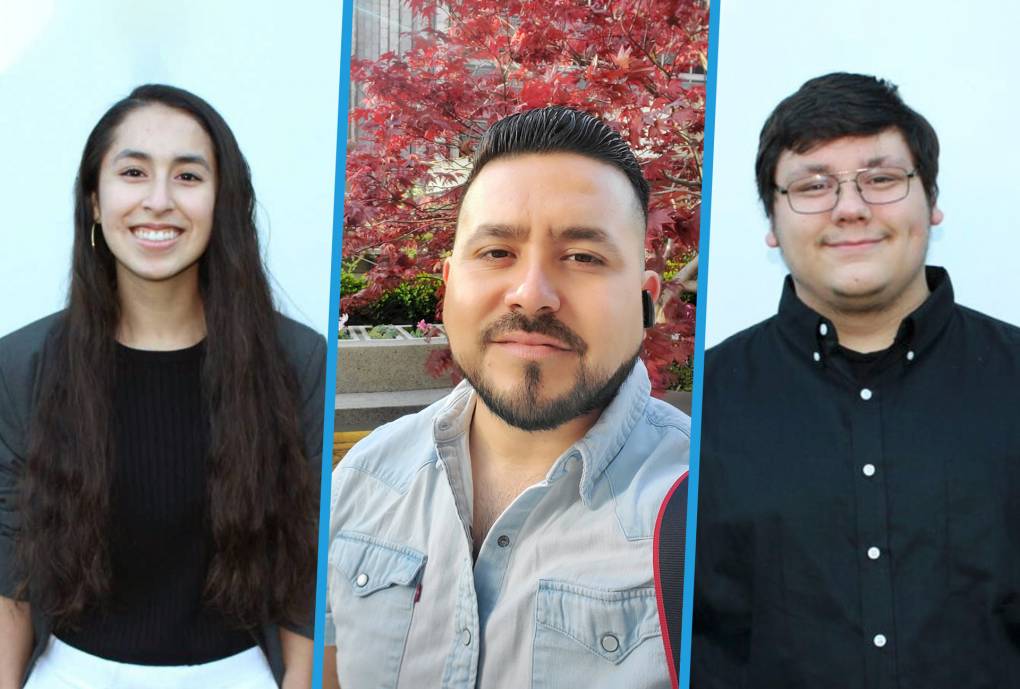
"caption": "East Palo Alto residents Cristina Becerra, left, Ulises Barbosa and Filiberto Zaragoza.",
"description": "East Palo Alto residents Cristina Becerra, Ulises Barbosa, and Filiberto Zaragoza (L-R).",
"title": "RS48532_collage2-qut",
"credit": "Photos courtesy Cristina Becerra, Ulises Barbosa, and Filiberto Zaragoza",
"status": "inherit",
"altTag": "East Palo Alto residents Cristina Becerra, Ulises Barbosa, and Filiberto Zaragoza (L-R).",
"isLoading": false,
"fetchFailed": false
},
"science_1974298": {
"type": "attachments",
"id": "science_1974298",
"meta": {
"index": "attachments_1716263798",
"site": "science",
"id": "1974298",
"found": true
},
"parent": 1974195,
"imgSizes": {
"twentyfourteen-full-width": {
"file": "https://ww2.kqed.org/app/uploads/sites/35/2021/04/Bay-Area-Sea-Level-Rise-1038x576.jpg",
"width": 1038,
"mimeType": "image/jpeg",
"height": 576
},
"thumbnail": {
"file": "https://ww2.kqed.org/app/uploads/sites/35/2021/04/Bay-Area-Sea-Level-Rise-160x90.jpg",
"width": 160,
"mimeType": "image/jpeg",
"height": 90
},
"post-thumbnail": {
"file": "https://ww2.kqed.org/app/uploads/sites/35/2021/04/Bay-Area-Sea-Level-Rise-672x372.jpg",
"width": 672,
"mimeType": "image/jpeg",
"height": 372
},
"kqedFullSize": {
"file": "https://ww2.kqed.org/app/uploads/sites/35/2021/04/Bay-Area-Sea-Level-Rise.jpg",
"width": 1920,
"height": 1080
},
"large": {
"file": "https://ww2.kqed.org/app/uploads/sites/35/2021/04/Bay-Area-Sea-Level-Rise-1020x574.jpg",
"width": 1020,
"mimeType": "image/jpeg",
"height": 574
},
"1536x1536": {
"file": "https://ww2.kqed.org/app/uploads/sites/35/2021/04/Bay-Area-Sea-Level-Rise-1536x864.jpg",
"width": 1536,
"mimeType": "image/jpeg",
"height": 864
},
"medium": {
"file": "https://ww2.kqed.org/app/uploads/sites/35/2021/04/Bay-Area-Sea-Level-Rise-800x450.jpg",
"width": 800,
"mimeType": "image/jpeg",
"height": 450
},
"medium_large": {
"file": "https://ww2.kqed.org/app/uploads/sites/35/2021/04/Bay-Area-Sea-Level-Rise-768x432.jpg",
"width": 768,
"mimeType": "image/jpeg",
"height": 432
}
},
"publishDate": 1619627230,
"modified": 1619627248,
"caption": null,
"description": null,
"title": "El aumento del nivel del mar en el Área de la Bahía",
"credit": null,
"status": "inherit",
"altTag": null,
"isLoading": false,
"fetchFailed": false
},
"science_1974227": {
"type": "attachments",
"id": "science_1974227",
"meta": {
"index": "attachments_1716263798",
"site": "science",
"id": "1974227",
"found": true
},
"parent": 1974191,
"imgSizes": {
"twentyfourteen-full-width": {
"file": "https://ww2.kqed.org/app/uploads/sites/35/2021/04/East-Palo-Alto-sea-level-1020x679-1-1020x576.jpg",
"width": 1020,
"mimeType": "image/jpeg",
"height": 576
},
"thumbnail": {
"file": "https://ww2.kqed.org/app/uploads/sites/35/2021/04/East-Palo-Alto-sea-level-1020x679-1-160x107.jpg",
"width": 160,
"mimeType": "image/jpeg",
"height": 107
},
"post-thumbnail": {
"file": "https://ww2.kqed.org/app/uploads/sites/35/2021/04/East-Palo-Alto-sea-level-1020x679-1-672x372.jpg",
"width": 672,
"mimeType": "image/jpeg",
"height": 372
},
"kqedFullSize": {
"file": "https://ww2.kqed.org/app/uploads/sites/35/2021/04/East-Palo-Alto-sea-level-1020x679-1.jpg",
"width": 1020,
"height": 679
},
"medium": {
"file": "https://ww2.kqed.org/app/uploads/sites/35/2021/04/East-Palo-Alto-sea-level-1020x679-1-800x533.jpg",
"width": 800,
"mimeType": "image/jpeg",
"height": 533
},
"medium_large": {
"file": "https://ww2.kqed.org/app/uploads/sites/35/2021/04/East-Palo-Alto-sea-level-1020x679-1-768x511.jpg",
"width": 768,
"mimeType": "image/jpeg",
"height": 511
}
},
"publishDate": 1619511758,
"modified": 1619512087,
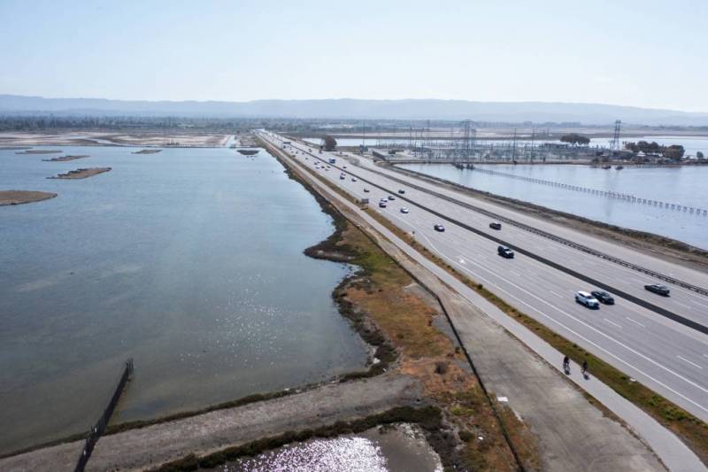
"caption": "El puente Dumbarton, ubicado cerca del Este de Palo Alto, es tan solo una infraestructura del Área de la Bahía que corre un gran riesgo de inundarse en el futuro a medida que aumenta el nivel del mar.",
"description": "El puente Dumbarton, ubicado cerca del Este de Palo Alto, es tan solo una infraestructura del Área de la Bahía que corre un gran riesgo de inundarse en el futuro a medida que aumenta el nivel del mar.",
"title": "East-Palo-Alto-sea-level-1020x679",
"credit": "JJ Harris - Techboogie/KQED",
"status": "inherit",
"altTag": "Una imagen aérea del puente Dumbarton en el Área de la Bahía.",
"isLoading": false,
"fetchFailed": false
},
"science_1973863": {
"type": "attachments",
"id": "science_1973863",
"meta": {
"index": "attachments_1716263798",
"site": "science",
"id": "1973863",
"found": true
},
"parent": 1973805,
"imgSizes": {
"twentyfourteen-full-width": {
"file": "https://ww2.kqed.org/app/uploads/sites/35/2021/04/RS48686_EPA_image_selects_fullsize-3-qut-1038x576.jpg",
"width": 1038,
"mimeType": "image/jpeg",
"height": 576
},
"thumbnail": {
"file": "https://ww2.kqed.org/app/uploads/sites/35/2021/04/RS48686_EPA_image_selects_fullsize-3-qut-160x107.jpg",
"width": 160,
"mimeType": "image/jpeg",
"height": 107
},
"post-thumbnail": {
"file": "https://ww2.kqed.org/app/uploads/sites/35/2021/04/RS48686_EPA_image_selects_fullsize-3-qut-672x372.jpg",
"width": 672,
"mimeType": "image/jpeg",
"height": 372
},
"kqedFullSize": {
"file": "https://ww2.kqed.org/app/uploads/sites/35/2021/04/RS48686_EPA_image_selects_fullsize-3-qut.jpg",
"width": 1920,
"height": 1279
},
"large": {
"file": "https://ww2.kqed.org/app/uploads/sites/35/2021/04/RS48686_EPA_image_selects_fullsize-3-qut-1020x679.jpg",
"width": 1020,
"mimeType": "image/jpeg",
"height": 679
},
"1536x1536": {
"file": "https://ww2.kqed.org/app/uploads/sites/35/2021/04/RS48686_EPA_image_selects_fullsize-3-qut-1536x1023.jpg",
"width": 1536,
"mimeType": "image/jpeg",
"height": 1023
},
"medium": {
"file": "https://ww2.kqed.org/app/uploads/sites/35/2021/04/RS48686_EPA_image_selects_fullsize-3-qut-800x533.jpg",
"width": 800,
"mimeType": "image/jpeg",
"height": 533
},
"medium_large": {
"file": "https://ww2.kqed.org/app/uploads/sites/35/2021/04/RS48686_EPA_image_selects_fullsize-3-qut-768x512.jpg",
"width": 768,
"mimeType": "image/jpeg",
"height": 512
}
},
"publishDate": 1618783879,
"modified": 1645643049,
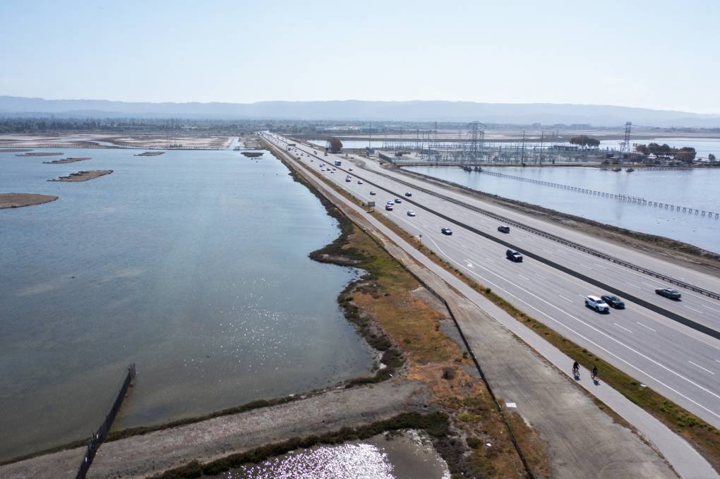
"caption": "The Dumbarton Bridge near the East Palo shoreline and other Bay Area infrastructure are at major risk from flooding as sea level rise accelerates. ",
"description": "The Dumbarton Bridge near the East Palo shoreline and other Bay Area infrastructure are at major risk from flooding as sea level rise accelerates. ",
"title": "RS48686_EPA_image_selects_fullsize-3-qut",
"credit": "JJ Harris/Techboogie/KQED",
"status": "inherit",
"altTag": "A four-lane highway with flat expanses of water on either side and hazy blue sky above.",
"isLoading": false,
"fetchFailed": false
},
"science_1984386": {
"type": "attachments",
"id": "science_1984386",
"meta": {
"index": "attachments_1716263798",
"site": "science",
"id": "1984386",
"found": true
},
"parent": 0,
"imgSizes": {
"twentyfourteen-full-width": {
"file": "https://ww2.kqed.org/app/uploads/sites/35/2023/09/2050-1038x576.jpg",
"width": 1038,
"mimeType": "image/jpeg",
"height": 576
},
"thumbnail": {
"file": "https://ww2.kqed.org/app/uploads/sites/35/2023/09/2050-160x90.jpg",
"width": 160,
"mimeType": "image/jpeg",
"height": 90
},
"post-thumbnail": {
"file": "https://ww2.kqed.org/app/uploads/sites/35/2023/09/2050-672x372.jpg",
"width": 672,
"mimeType": "image/jpeg",
"height": 372
},
"kqedFullSize": {
"file": "https://ww2.kqed.org/app/uploads/sites/35/2023/09/2050.jpg",
"width": 1920,
"height": 1080
},
"large": {
"file": "https://ww2.kqed.org/app/uploads/sites/35/2023/09/2050-1020x574.jpg",
"width": 1020,
"mimeType": "image/jpeg",
"height": 574
},
"1536x1536": {
"file": "https://ww2.kqed.org/app/uploads/sites/35/2023/09/2050-1536x864.jpg",
"width": 1536,
"mimeType": "image/jpeg",
"height": 864
},
"medium": {
"file": "https://ww2.kqed.org/app/uploads/sites/35/2023/09/2050-800x450.jpg",
"width": 800,
"mimeType": "image/jpeg",
"height": 450
},
"medium_large": {
"file": "https://ww2.kqed.org/app/uploads/sites/35/2023/09/2050-768x432.jpg",
"width": 768,
"mimeType": "image/jpeg",
"height": 432
}
},
"publishDate": 1695498022,
"modified": 1695498022,
"caption": null,
"description": null,
"title": "2050",
"credit": null,
"status": "inherit",
"altTag": null,
"isLoading": false,
"fetchFailed": false
},
"science_1973997": {
"type": "attachments",
"id": "science_1973997",
"meta": {
"index": "attachments_1716263798",
"site": "science",
"id": "1973997",
"found": true
},
"parent": 0,
"imgSizes": {
"twentyfourteen-full-width": {
"file": "https://ww2.kqed.org/app/uploads/sites/35/2021/04/NASAEarthRise3_1920x1080-1-1038x576.png",
"width": 1038,
"mimeType": "image/png",
"height": 576
},
"thumbnail": {
"file": "https://ww2.kqed.org/app/uploads/sites/35/2021/04/NASAEarthRise3_1920x1080-1-160x90.png",
"width": 160,
"mimeType": "image/png",
"height": 90
},
"post-thumbnail": {
"file": "https://ww2.kqed.org/app/uploads/sites/35/2021/04/NASAEarthRise3_1920x1080-1-672x372.png",
"width": 672,
"mimeType": "image/png",
"height": 372
},
"kqedFullSize": {
"file": "https://ww2.kqed.org/app/uploads/sites/35/2021/04/NASAEarthRise3_1920x1080-1.png",
"width": 1920,
"height": 1080
},
"large": {
"file": "https://ww2.kqed.org/app/uploads/sites/35/2021/04/NASAEarthRise3_1920x1080-1-1020x574.png",
"width": 1020,
"mimeType": "image/png",
"height": 574
},
"1536x1536": {
"file": "https://ww2.kqed.org/app/uploads/sites/35/2021/04/NASAEarthRise3_1920x1080-1-1536x864.png",
"width": 1536,
"mimeType": "image/png",
"height": 864
},
"medium": {
"file": "https://ww2.kqed.org/app/uploads/sites/35/2021/04/NASAEarthRise3_1920x1080-1-800x450.png",
"width": 800,
"mimeType": "image/png",
"height": 450
},
"medium_large": {
"file": "https://ww2.kqed.org/app/uploads/sites/35/2021/04/NASAEarthRise3_1920x1080-1-768x432.png",
"width": 768,
"mimeType": "image/png",
"height": 432
}
},
"publishDate": 1618988447,
"modified": 1619036322,
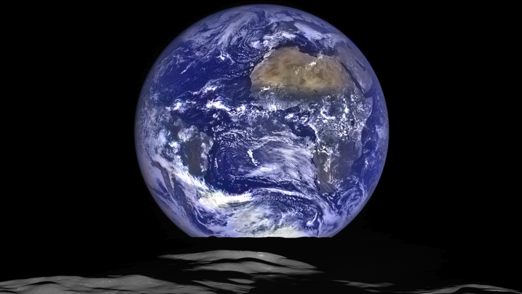
"caption": "A stunning \"Earth Rise\" photo taken in October 2015 by NASA's Lunar Reconnaissance Orbiter from the spacecraft's vantage point in orbit around the moon. ",
"description": null,
"title": "NASAEarthRise3_1920x1080",
"credit": "NASA/Goddard/Arizona State University",
"status": "inherit",
"altTag": null,
"isLoading": false,
"fetchFailed": false
},
"science_1973377": {
"type": "attachments",
"id": "science_1973377",
"meta": {
"index": "attachments_1716263798",
"site": "science",
"id": "1973377",
"found": true
},
"parent": 1973372,
"imgSizes": {
"twentyfourteen-full-width": {
"file": "https://ww2.kqed.org/app/uploads/sites/35/2021/03/RS48091_GettyImages-507138914-qut-1038x576.jpg",
"width": 1038,
"mimeType": "image/jpeg",
"height": 576
},
"thumbnail": {
"file": "https://ww2.kqed.org/app/uploads/sites/35/2021/03/RS48091_GettyImages-507138914-qut-160x108.jpg",
"width": 160,
"mimeType": "image/jpeg",
"height": 108
},
"post-thumbnail": {
"file": "https://ww2.kqed.org/app/uploads/sites/35/2021/03/RS48091_GettyImages-507138914-qut-672x372.jpg",
"width": 672,
"mimeType": "image/jpeg",
"height": 372
},
"kqedFullSize": {
"file": "https://ww2.kqed.org/app/uploads/sites/35/2021/03/RS48091_GettyImages-507138914-qut.jpg",
"width": 1920,
"height": 1291
},
"large": {
"file": "https://ww2.kqed.org/app/uploads/sites/35/2021/03/RS48091_GettyImages-507138914-qut-1020x686.jpg",
"width": 1020,
"mimeType": "image/jpeg",
"height": 686
},
"1536x1536": {
"file": "https://ww2.kqed.org/app/uploads/sites/35/2021/03/RS48091_GettyImages-507138914-qut-1536x1033.jpg",
"width": 1536,
"mimeType": "image/jpeg",
"height": 1033
},
"medium": {
"file": "https://ww2.kqed.org/app/uploads/sites/35/2021/03/RS48091_GettyImages-507138914-qut-800x538.jpg",
"width": 800,
"mimeType": "image/jpeg",
"height": 538
},
"medium_large": {
"file": "https://ww2.kqed.org/app/uploads/sites/35/2021/03/RS48091_GettyImages-507138914-qut-768x516.jpg",
"width": 768,
"mimeType": "image/jpeg",
"height": 516
}
},
"publishDate": 1616692723,
"modified": 1616714564,
"caption": "Houses hang on the edge of an eroding cliff in Pacifica, California, on Jan. 27, 2016.\nStorms and powerful waves caused by El Nino have been intensifying erosion along nearby coastal bluffs and beaches in the area. ",
"description": null,
"title": "RS48091_GettyImages-507138914-qut",
"credit": "Josh Edelson/AFP via Getty Images)",
"status": "inherit",
"altTag": null,
"isLoading": false,
"fetchFailed": false
},
"science_1973344": {
"type": "attachments",
"id": "science_1973344",
"meta": {
"index": "attachments_1716263798",
"site": "science",
"id": "1973344",
"found": true
},
"parent": 1973339,
"imgSizes": {
"twentyfourteen-full-width": {
"file": "https://ww2.kqed.org/app/uploads/sites/35/2021/03/GettyImages-1164210573-1-1038x576.jpg",
"width": 1038,
"mimeType": "image/jpeg",
"height": 576
},
"thumbnail": {
"file": "https://ww2.kqed.org/app/uploads/sites/35/2021/03/GettyImages-1164210573-1-160x106.jpg",
"width": 160,
"mimeType": "image/jpeg",
"height": 106
},
"post-thumbnail": {
"file": "https://ww2.kqed.org/app/uploads/sites/35/2021/03/GettyImages-1164210573-1-672x372.jpg",
"width": 672,
"mimeType": "image/jpeg",
"height": 372
},
"kqedFullSize": {
"file": "https://ww2.kqed.org/app/uploads/sites/35/2021/03/GettyImages-1164210573-1-scaled.jpg",
"width": 2560,
"height": 1692
},
"2048x2048": {
"file": "https://ww2.kqed.org/app/uploads/sites/35/2021/03/GettyImages-1164210573-1-2048x1354.jpg",
"width": 2048,
"mimeType": "image/jpeg",
"height": 1354
},
"large": {
"file": "https://ww2.kqed.org/app/uploads/sites/35/2021/03/GettyImages-1164210573-1-1020x674.jpg",
"width": 1020,
"mimeType": "image/jpeg",
"height": 674
},
"1536x1536": {
"file": "https://ww2.kqed.org/app/uploads/sites/35/2021/03/GettyImages-1164210573-1-1536x1015.jpg",
"width": 1536,
"mimeType": "image/jpeg",
"height": 1015
},
"full-width": {
"file": "https://ww2.kqed.org/app/uploads/sites/35/2021/03/GettyImages-1164210573-1-1920x1269.jpg",
"width": 1920,
"mimeType": "image/jpeg",
"height": 1269
},
"medium": {
"file": "https://ww2.kqed.org/app/uploads/sites/35/2021/03/GettyImages-1164210573-1-800x529.jpg",
"width": 800,
"mimeType": "image/jpeg",
"height": 529
},
"medium_large": {
"file": "https://ww2.kqed.org/app/uploads/sites/35/2021/03/GettyImages-1164210573-1-768x508.jpg",
"width": 768,
"mimeType": "image/jpeg",
"height": 508
}
},
"publishDate": 1616613567,
"modified": 1616710284,
"caption": "Traffic backs up at the San Francisco-Oakland Bay Bridge toll plaza along Interstate 80 on July 25, 2019, in Oakland, California. ",
"description": null,
"title": "California And Four Big Automakers Make Deal To Reduce Emissions",
"credit": "Justin Sullivan/Getty Images",
"status": "inherit",
"altTag": null,
"isLoading": false,
"fetchFailed": false
},
"science_1973282": {
"type": "attachments",
"id": "science_1973282",
"meta": {
"index": "attachments_1716263798",
"site": "science",
"id": "1973282",
"found": true
},
"parent": 1973279,
"imgSizes": {
"twentyfourteen-full-width": {
"file": "https://ww2.kqed.org/app/uploads/sites/35/2021/03/RS47842_GettyImages-81078516-qut-1038x576.jpg",
"width": 1038,
"mimeType": "image/jpeg",
"height": 576
},
"thumbnail": {
"file": "https://ww2.kqed.org/app/uploads/sites/35/2021/03/RS47842_GettyImages-81078516-qut-160x107.jpg",
"width": 160,
"mimeType": "image/jpeg",
"height": 107
},
"post-thumbnail": {
"file": "https://ww2.kqed.org/app/uploads/sites/35/2021/03/RS47842_GettyImages-81078516-qut-672x372.jpg",
"width": 672,
"mimeType": "image/jpeg",
"height": 372
},
"kqedFullSize": {
"file": "https://ww2.kqed.org/app/uploads/sites/35/2021/03/RS47842_GettyImages-81078516-qut.jpg",
"width": 1920,
"height": 1280
},
"large": {
"file": "https://ww2.kqed.org/app/uploads/sites/35/2021/03/RS47842_GettyImages-81078516-qut-1020x680.jpg",
"width": 1020,
"mimeType": "image/jpeg",
"height": 680
},
"1536x1536": {
"file": "https://ww2.kqed.org/app/uploads/sites/35/2021/03/RS47842_GettyImages-81078516-qut-1536x1024.jpg",
"width": 1536,
"mimeType": "image/jpeg",
"height": 1024
},
"medium": {
"file": "https://ww2.kqed.org/app/uploads/sites/35/2021/03/RS47842_GettyImages-81078516-qut-800x533.jpg",
"width": 800,
"mimeType": "image/jpeg",
"height": 533
},
"medium_large": {
"file": "https://ww2.kqed.org/app/uploads/sites/35/2021/03/RS47842_GettyImages-81078516-qut-768x512.jpg",
"width": 768,
"mimeType": "image/jpeg",
"height": 512
}
},
"publishDate": 1615995782,
"modified": 1616010241,
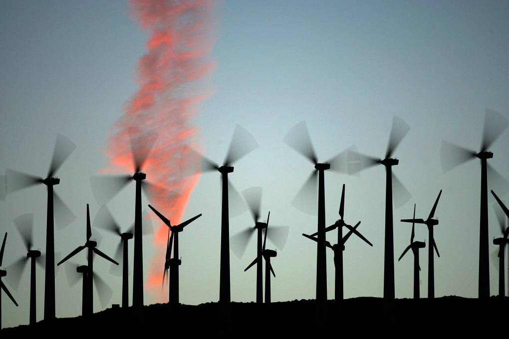
"caption": "Giant wind turbines are powered by strong prevailing winds on May 13, 2008, near Palm Springs, California. ",
"description": null,
"title": "Report Claims 20 Percent Of US's Energy Could Come From Wind Power",
"credit": "David McNew/Getty Images",
"status": "inherit",
"altTag": null,
"isLoading": false,
"fetchFailed": false
},
"science_1973220": {
"type": "attachments",
"id": "science_1973220",
"meta": {
"index": "attachments_1716263798",
"site": "science",
"id": "1973220",
"found": true
},
"parent": 1973217,
"imgSizes": {
"twentyfourteen-full-width": {
"file": "https://ww2.kqed.org/app/uploads/sites/35/2021/03/sea-otter-urchin-med-1038x576.jpg",
"width": 1038,
"mimeType": "image/jpeg",
"height": 576
},
"thumbnail": {
"file": "https://ww2.kqed.org/app/uploads/sites/35/2021/03/sea-otter-urchin-med-160x107.jpg",
"width": 160,
"mimeType": "image/jpeg",
"height": 107
},
"post-thumbnail": {
"file": "https://ww2.kqed.org/app/uploads/sites/35/2021/03/sea-otter-urchin-med-672x372.jpg",
"width": 672,
"mimeType": "image/jpeg",
"height": 372
},
"kqedFullSize": {
"file": "https://ww2.kqed.org/app/uploads/sites/35/2021/03/sea-otter-urchin-med-scaled.jpg",
"width": 2560,
"height": 1707
},
"2048x2048": {
"file": "https://ww2.kqed.org/app/uploads/sites/35/2021/03/sea-otter-urchin-med-2048x1366.jpg",
"width": 2048,
"mimeType": "image/jpeg",
"height": 1366
},
"large": {
"file": "https://ww2.kqed.org/app/uploads/sites/35/2021/03/sea-otter-urchin-med-1020x680.jpg",
"width": 1020,
"mimeType": "image/jpeg",
"height": 680
},
"1536x1536": {
"file": "https://ww2.kqed.org/app/uploads/sites/35/2021/03/sea-otter-urchin-med-1536x1024.jpg",
"width": 1536,
"mimeType": "image/jpeg",
"height": 1024
},
"full-width": {
"file": "https://ww2.kqed.org/app/uploads/sites/35/2021/03/sea-otter-urchin-med-1920x1280.jpg",
"width": 1920,
"mimeType": "image/jpeg",
"height": 1280
},
"medium": {
"file": "https://ww2.kqed.org/app/uploads/sites/35/2021/03/sea-otter-urchin-med-800x533.jpg",
"width": 800,
"mimeType": "image/jpeg",
"height": 533
},
"medium_large": {
"file": "https://ww2.kqed.org/app/uploads/sites/35/2021/03/sea-otter-urchin-med-768x512.jpg",
"width": 768,
"mimeType": "image/jpeg",
"height": 512
}
},
"publishDate": 1615833630,
"modified": 1615833788,
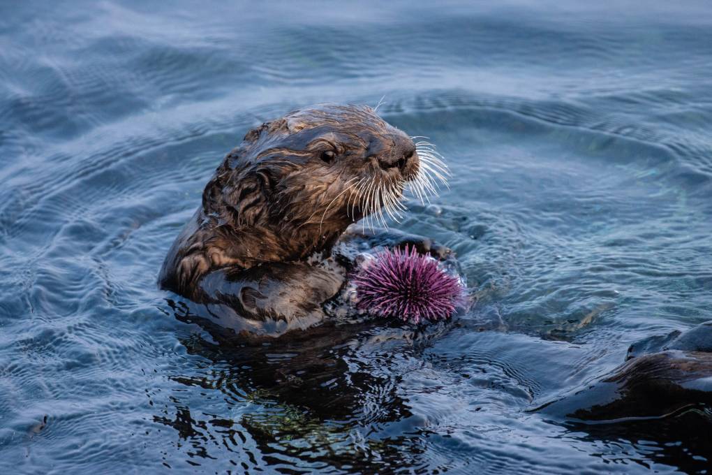
"caption": "A southern sea otter with a purple sea urchin in Monterey Bay,\nCalifornia.",
"description": null,
"title": "sea-otter-urchin-med",
"credit": "Morgan Rector",
"status": "inherit",
"altTag": null,
"isLoading": false,
"fetchFailed": false
},
"science_1973208": {
"type": "attachments",
"id": "science_1973208",
"meta": {
"index": "attachments_1716263798",
"site": "science",
"id": "1973208",
"found": true
},
"parent": 1973205,
"imgSizes": {
"twentyfourteen-full-width": {
"file": "https://ww2.kqed.org/app/uploads/sites/35/2021/03/RS47639_IMG_6419-qut-e1615614373191-1038x576.jpg",
"width": 1038,
"mimeType": "image/jpeg",
"height": 576
},
"thumbnail": {
"file": "https://ww2.kqed.org/app/uploads/sites/35/2021/03/RS47639_IMG_6419-qut-e1615614373191-160x120.jpg",
"width": 160,
"mimeType": "image/jpeg",
"height": 120
},
"post-thumbnail": {
"file": "https://ww2.kqed.org/app/uploads/sites/35/2021/03/RS47639_IMG_6419-qut-e1615614373191-672x372.jpg",
"width": 672,
"mimeType": "image/jpeg",
"height": 372
},
"kqedFullSize": {
"file": "https://ww2.kqed.org/app/uploads/sites/35/2021/03/RS47639_IMG_6419-qut-e1615614373191.jpg",
"width": 1406,
"height": 1051
},
"large": {
"file": "https://ww2.kqed.org/app/uploads/sites/35/2021/03/RS47639_IMG_6419-qut-e1615614373191-1020x762.jpg",
"width": 1020,
"mimeType": "image/jpeg",
"height": 762
},
"1536x1536": {
"file": "https://ww2.kqed.org/app/uploads/sites/35/2021/03/RS47639_IMG_6419-qut-1536x1152.jpg",
"width": 1536,
"mimeType": "image/jpeg",
"height": 1152
},
"medium": {
"file": "https://ww2.kqed.org/app/uploads/sites/35/2021/03/RS47639_IMG_6419-qut-e1615614373191-800x598.jpg",
"width": 800,
"mimeType": "image/jpeg",
"height": 598
},
"medium_large": {
"file": "https://ww2.kqed.org/app/uploads/sites/35/2021/03/RS47639_IMG_6419-qut-e1615614373191-768x574.jpg",
"width": 768,
"mimeType": "image/jpeg",
"height": 574
}
},
"publishDate": 1615614211,
"modified": 1615835902,
"caption": "Mark Koppang, Raley's director of sustainability, stands on the roof of a Raley's supermarket in Sacramento where heat from the market's refrigeration system is discharged. This market keeps their products cool using gases with near zero impact on global warming.",
"description": "Mark Koppang, Raley's Director of Sustainability, stands on the roof of a Raley's supermarket in Sacramento where heat from the market's refrigeration system is discharged. This market keeps their products cool using gases with near zero impact on global warming.",
"title": "RS47639_IMG_6419-qut",
"credit": "Laura Klivans/KQED",
"status": "inherit",
"altTag": "Mark Koppang, Raley's Director of Sustainability, stands on the roof of a Raley's supermarket in Sacramento where heat from the market's refrigeration system is discharged. This market keeps their products cool using gases with near zero impact on global warming.",
"isLoading": false,
"fetchFailed": false
}
},
"audioPlayerReducer": {
"postId": "stream_live",
"isPaused": true,
"isPlaying": false,
"pfsActive": false,
"pledgeModalIsOpen": true,
"playerDrawerIsOpen": false,
"liveAudioPlayStartedAt": 0,
"liveAudioPlayContext": ""
},
"authorsReducer": {
"byline_science_1973372": {
"type": "authors",
"id": "byline_science_1973372",
"meta": {
"override": true
},
"slug": "byline_science_1973372",
"name": "Nathan Rott \u003cbr />NPR\u003cbr>",
"isLoading": false
},
"sevdaeris": {
"type": "authors",
"id": "6364",
"meta": {
"index": "authors_1716337520",
"id": "6364",
"found": true
},
"name": "Sevda Eris",
"firstName": "Sevda",
"lastName": "Eris",
"slug": "sevdaeris",
"email": "seris@kqed.org",
"display_author_email": false,
"staff_mastheads": [],
"title": "Director of Audience Engagement",
"bio": null,
"avatar": "https://secure.gravatar.com/avatar/c99311b4355095e2f7f01ea8bf8e6fba?s=600&d=mm&r=g",
"twitter": null,
"facebook": null,
"instagram": null,
"linkedin": null,
"sites": [
{
"site": "about",
"roles": []
},
{
"site": "science",
"roles": []
},
{
"site": "pressroom",
"roles": []
}
],
"headData": {
"title": "Sevda Eris | KQED",
"description": "Director of Audience Engagement",
"ogImgSrc": "https://secure.gravatar.com/avatar/c99311b4355095e2f7f01ea8bf8e6fba?s=600&d=mm&r=g",
"twImgSrc": "https://secure.gravatar.com/avatar/c99311b4355095e2f7f01ea8bf8e6fba?s=600&d=mm&r=g"
},
"isLoading": false,
"link": "/author/sevdaeris"
},
"lklivans": {
"type": "authors",
"id": "8648",
"meta": {
"index": "authors_1716337520",
"id": "8648",
"found": true
},
"name": "Laura Klivans",
"firstName": "Laura",
"lastName": "Klivans",
"slug": "lklivans",
"email": "lklivans@kqed.org",
"display_author_email": true,
"staff_mastheads": [
"news",
"science"
],
"title": "Reporter",
"bio": "Laura Klivans is an award-winning science reporter for KQED News, where she covers climate change with an eye on both groundbreaking progress and gaps in action. She is the former host of KQED's blockbuster video series about tiny, amazing animals, \u003cem>Deep Look\u003c/em>. Her work reaches national audiences through NPR, \u003cem>Here & Now, \u003c/em>PRI, and other major outlets. \r\n\r\nLaura’s won five Northern California Area Emmy Awards for Deep Look and First Place in the Greater Bay Area Journalism Awards for a podcast exploring how one Oakland neighborhood teamed up to reduce planet-heating pollution.\r\n\r\nBeyond her reporting, she hosts and moderates events. In the past, she taught audio storytelling at the UC Berkeley Graduate School of Journalism, led international education programs, worked with immigrants and refugees along the Thai-Burmese border, taught high schoolers sex ed, and was an actress. \r\n\r\nShe's a former UC Berkeley Human Rights Fellow, USC Center for Health Journalism's California Fellow and Coro Fellow in Public Affairs. Laura has a master’s in journalism from UC Berkeley, a master’s in education from Harvard, and an undergraduate degree from Northwestern University.\r\n\r\nShe loves trying to riddle the meaning out of vanity license plates.",
"avatar": "https://secure.gravatar.com/avatar/2d2ecd1550a494cc10ad4a503406965585902124739e775a9b3817eebf1d88be?s=600&d=blank&r=g",
"twitter": "lauraklivans",
"bluesky": null,
"facebook": null,
"instagram": null,
"linkedin": null,
"sites": [
{
"site": "news",
"roles": [
"editor"
]
},
{
"site": "stateofhealth",
"roles": [
"contributor",
"editor"
]
},
{
"site": "science",
"roles": [
"editor"
]
},
{
"site": "forum",
"roles": [
"editor"
]
}
],
"headData": {
"title": "Laura Klivans | KQED",
"description": "Reporter",
"ogImgSrc": "https://secure.gravatar.com/avatar/2d2ecd1550a494cc10ad4a503406965585902124739e775a9b3817eebf1d88be?s=600&d=blank&r=g",
"twImgSrc": "https://secure.gravatar.com/avatar/2d2ecd1550a494cc10ad4a503406965585902124739e775a9b3817eebf1d88be?s=600&d=blank&r=g"
},
"isLoading": false,
"link": "/author/lklivans"
},
"parcuni": {
"type": "authors",
"id": "11368",
"meta": {
"index": "authors_1716337520",
"id": "11368",
"found": true
},
"name": "Peter Arcuni",
"firstName": "Peter",
"lastName": "Arcuni",
"slug": "parcuni",
"email": "parcuni@KQED.org",
"display_author_email": false,
"staff_mastheads": [
"science"
],
"title": "Reporter",
"bio": "Peter reports radio and online stories for \u003cem>KQED Science\u003c/em>. His work has also appeared on the \u003cem>The California Report\u003c/em> morning show and \u003cem>KQED News\u003c/em>. His production credits include \u003cem>The California Report, The California Report Magazine\u003c/em> and KQED's local news podcast \u003cem>The Bay\u003c/em>. Other credits include NPR's \u003cem>All Things Considered\u003c/em>, WNYC's \u003cem>Science Friday\u003c/em>, WBUR's \u003cem>Here & Now\u003c/em>, WIRED and SFGate. Peter graduated from Brown University and earned a master's degree in journalism from Stanford. He's covered everything from homelessness to wildfires, health, the environment, arts and Thanksgiving in San Quentin prison. In other lives, he played rock n roll music and studied neuroscience. You can email him at: parcuni@kqed.org",
"avatar": "https://secure.gravatar.com/avatar/d5032f6f27199d478af34ad2e1d98732?s=600&d=blank&r=g",
"twitter": "peterarcuni",
"facebook": null,
"instagram": null,
"linkedin": null,
"sites": [
{
"site": "news",
"roles": [
"editor"
]
},
{
"site": "science",
"roles": [
"editor"
]
}
],
"headData": {
"title": "Peter Arcuni | KQED",
"description": "Reporter",
"ogImgSrc": "https://secure.gravatar.com/avatar/d5032f6f27199d478af34ad2e1d98732?s=600&d=blank&r=g",
"twImgSrc": "https://secure.gravatar.com/avatar/d5032f6f27199d478af34ad2e1d98732?s=600&d=blank&r=g"
},
"isLoading": false,
"link": "/author/parcuni"
},
"thailye": {
"type": "authors",
"id": "11501",
"meta": {
"index": "authors_1716337520",
"id": "11501",
"found": true
},
"name": "Teodros Hailye",
"firstName": "Teodros",
"lastName": "Hailye",
"slug": "thailye",
"email": "thailye@KQED.org",
"display_author_email": false,
"staff_mastheads": [],
"title": "Information Designer",
"bio": null,
"avatar": "https://secure.gravatar.com/avatar/bfb755f5a66ebaccd414e310b7d7c94a?s=600&d=blank&r=g",
"twitter": null,
"facebook": null,
"instagram": null,
"linkedin": null,
"sites": [
{
"site": "science",
"roles": []
}
],
"headData": {
"title": "Teodros Hailye | KQED",
"description": "Information Designer",
"ogImgSrc": "https://secure.gravatar.com/avatar/bfb755f5a66ebaccd414e310b7d7c94a?s=600&d=blank&r=g",
"twImgSrc": "https://secure.gravatar.com/avatar/bfb755f5a66ebaccd414e310b7d7c94a?s=600&d=blank&r=g"
},
"isLoading": false,
"link": "/author/thailye"
},
"kevinstark": {
"type": "authors",
"id": "11608",
"meta": {
"index": "authors_1716337520",
"id": "11608",
"found": true
},
"name": "Kevin Stark",
"firstName": "Kevin",
"lastName": "Stark",
"slug": "kevinstark",
"email": "kstark@kqed.org",
"display_author_email": true,
"staff_mastheads": [
"science"
],
"title": "Senior Editor",
"bio": "Kevin is a senior editor for KQED Science, managing the station's health and climate desks. His journalism career began in the Pacific Northwest, and he later became a lead reporter for the San Francisco Public Press. His work has appeared in Pacific Standard magazine, the Energy News Network, the Center for Investigative Reporting's Reveal and WBEZ in Chicago. Kevin joined KQED in 2019, and has covered issues related to energy, wildfire, climate change and the environment.",
"avatar": "https://secure.gravatar.com/avatar/365aaa4b597d3a8374f67504ff0facd323d7906e8eb4be0a7efd2427408e802c?s=600&d=blank&r=g",
"twitter": "starkkev",
"bluesky": null,
"facebook": null,
"instagram": null,
"linkedin": null,
"sites": [
{
"site": "",
"roles": [
"editor"
]
},
{
"site": "news",
"roles": [
"editor"
]
},
{
"site": "science",
"roles": [
"administrator"
]
}
],
"headData": {
"title": "Kevin Stark | KQED",
"description": "Senior Editor",
"ogImgSrc": "https://secure.gravatar.com/avatar/365aaa4b597d3a8374f67504ff0facd323d7906e8eb4be0a7efd2427408e802c?s=600&d=blank&r=g",
"twImgSrc": "https://secure.gravatar.com/avatar/365aaa4b597d3a8374f67504ff0facd323d7906e8eb4be0a7efd2427408e802c?s=600&d=blank&r=g"
},
"isLoading": false,
"link": "/author/kevinstark"
},
"eromero": {
"type": "authors",
"id": "11746",
"meta": {
"index": "authors_1716337520",
"id": "11746",
"found": true
},
"name": "Ezra David Romero",
"firstName": "Ezra David",
"lastName": "Romero",
"slug": "eromero",
"email": "eromero@kqed.org",
"display_author_email": true,
"staff_mastheads": [
"news",
"science"
],
"title": "Climate Reporter",
"bio": "Ezra David Romero is a climate reporter for KQED News. He covers the absence and excess of water in the Bay Area — think sea level rise, flooding and drought. For nearly a decade he’s covered how warming temperatures are altering the lives of Californians. He’s reported on farmers worried their pistachio trees aren’t getting enough sleep, families desperate for water, scientists studying dying giant sequoias, and alongside firefighters containing wildfires. His work has appeared on local stations across California and nationally on public radio shows like Morning Edition, Here and Now, All Things Considered and Science Friday. ",
"avatar": "https://secure.gravatar.com/avatar/c76404d287c10ed40224227551ac36e24352c7306f106632caf6fead76f8801f?s=600&d=blank&r=g",
"twitter": "ezraromero",
"bluesky": null,
"facebook": null,
"instagram": null,
"linkedin": null,
"sites": [
{
"site": "arts",
"roles": [
"editor"
]
},
{
"site": "news",
"roles": [
"editor"
]
},
{
"site": "science",
"roles": [
"editor"
]
},
{
"site": "liveblog",
"roles": [
"author"
]
}
],
"headData": {
"title": "Ezra David Romero | KQED",
"description": "Climate Reporter",
"ogImgSrc": "https://secure.gravatar.com/avatar/c76404d287c10ed40224227551ac36e24352c7306f106632caf6fead76f8801f?s=600&d=blank&r=g",
"twImgSrc": "https://secure.gravatar.com/avatar/c76404d287c10ed40224227551ac36e24352c7306f106632caf6fead76f8801f?s=600&d=blank&r=g"
},
"isLoading": false,
"link": "/author/eromero"
}
},
"pagesReducer": {
"science_category_climate": {
"type": "terms",
"id": "science_31",
"meta": {
"index": "terms_1716263798",
"site": "science",
"id": "31",
"score": 11.06203
},
"featImg": null,
"name": "Climate",
"description": null,
"taxonomy": "category",
"headData": {
"twImgId": null,
"twTitle": null,
"ogTitle": null,
"ogImgId": null,
"twDescription": null,
"description": null,
"title": "Climate Archives | KQED Science",
"ogDescription": null
},
"ttid": 33,
"slug": "climate",
"isLoading": false,
"title": "Climate",
"pageMeta": {
"site": "science",
"WpPageTemplate": "page-topic-editorial",
"currentPage": 41
},
"blocks": [
{
"blockName": "kqed/post-list",
"attrs": {
"layout": "cardArticle2",
"query": "posts/science?category=climate",
"seeMore": false,
"paginated": true,
"page": 41
}
},
{
"blockName": "kqed/ad"
}
]
}
},
"pfsSessionReducer": {},
"postsReducer": {
"stream_live": {
"type": "live",
"id": "stream_live",
"audioUrl": "https://streams.kqed.org/kqedradio",
"title": "Live Stream",
"excerpt": "Live Stream information currently unavailable.",
"link": "/radio",
"featImg": "",
"label": {
"name": "KQED Live",
"link": "/"
}
},
"stream_kqedNewscast": {
"type": "posts",
"id": "stream_kqedNewscast",
"audioUrl": "https://www.kqed.org/.stream/anon/radio/RDnews/newscast.mp3?_=1",
"title": "KQED Newscast",
"featImg": "",
"label": {
"name": "88.5 FM",
"link": "/"
}
},
"science_1974232": {
"type": "posts",
"id": "science_1974232",
"meta": {
"index": "posts_1716263798",
"site": "science",
"id": "1974232",
"score": null,
"sort": [
1619712047000
]
},
"parent": 0,
"labelTerm": {},
"blocks": [],
"publishDate": 1619712047,
"format": "aside",
"title": "En sus propias palabras: Los residentes de la ciudad del Este de Palo Alto responden al aumento del nivel del mar que se avecina",
"headTitle": "En sus propias palabras: Los residentes de la ciudad del Este de Palo Alto responden al aumento del nivel del mar que se avecina | KQED",
"content": "\u003cp>\u003cem>Esta serie es parte de la iniciativa nacional de periodismo ‘\u003ca href=\"http://connected-coastlines.pulitzercenter.org/\" target=\"_blank\" rel=\"noopener noreferrer\">Connected Coastlines\u003c/a>‘ del Centro Pulitzer.\u003c/em>\u003c/p>\n\u003cp>\u003ca href=\"https://www.kqed.org/science/1973645/in-their-own-words-east-palo-alto-residents-on-the-coming-rise-in-sea-level\" target=\"_blank\" rel=\"noopener noreferrer\">\u003cem>Read in English\u003c/em>\u003c/a>\u003c/p>\n\u003cp>El creciente nivel del mar a causa del cambio climático no afectará a todos por igual.\u003c/p>\n\u003cp>En el Área de la Bahía, la ciudad del Este de Palo Alto \u003ca href=\"https://www.kqed.org/science/1974191\" target=\"_blank\" rel=\"noopener noreferrer\">corre un mayor riesgo\u003c/a> ante el aumento del nivel del mar: está rodeada de agua por tres lados y se encuentra junto a la zona sur de la bahía, donde las mareas son las más altas.\u003c/p>\n\u003cp>[aside postID=\"science_1974191,science_1974195\"]Infraestructuras críticas como el puente Dumbarton y la autopista 101 se encuentran dentro o a lado del Este de Palo Alto, y el ascendente nivel del mar en el litoral de la ciudad alterará la vida de muchos en el Área de la Bahía.\u003c/p>\n\u003cp>Pero para las personas con un hogar en esta ciudad, que frecuentan las tiendas y parques del barrio, quienes tienen familia y amistades por todo el vecindario, la posibilidad de que siga subiendo el nivel del mar es algo mucho más estremecedor.\u003c/p>\n\u003cp>A continuación, tres residentes comparten sus perspectivas sobre cómo luchan para proteger a la gente y los lugares que están cerca de sus corazones a medida que el mundo sigue calentándose.\u003c/p>\n\u003cp>Los siguientes testimonios han sido editados para mayor claridad y duración.\u003c/p>\n\u003ch3>Filiberto Zaragoza, de 18 años, estudiante de cuarto año en el bachillerato Menlo-Atherton\u003c/h3>\n\u003cp>Cuando me enteré de lo que es el cambio climático, no sabía cómo procesar esa información. Aún era joven y pensaba, “ah, todo está bien en el mundo”. Pero aprender sobre el tema me hizo cuestionar, ¿qué en verdad está haciendo la gente para ayudarnos?\u003c/p>\n\u003cp>\u003ca href=\"https://ww2.kqed.org/app/uploads/sites/35/2029/04/OwnWordsPhoto1.png\">\u003cimg loading=\"lazy\" decoding=\"async\" class=\"alignright wp-image-1973715 \" src=\"https://ww2.kqed.org/app/uploads/sites/35/2029/04/OwnWordsPhoto1-1020x639.png\" alt=\"\" width=\"426\" height=\"268\" srcset=\"https://cdn.kqed.org/wp-content/uploads/sites/35/2029/04/OwnWordsPhoto1-1020x639.png 1020w, https://cdn.kqed.org/wp-content/uploads/sites/35/2029/04/OwnWordsPhoto1-800x501.png 800w, https://cdn.kqed.org/wp-content/uploads/sites/35/2029/04/OwnWordsPhoto1-160x100.png 160w, https://cdn.kqed.org/wp-content/uploads/sites/35/2029/04/OwnWordsPhoto1-768x481.png 768w, https://cdn.kqed.org/wp-content/uploads/sites/35/2029/04/OwnWordsPhoto1.png 1424w\" sizes=\"(max-width: 426px) 100vw, 426px\">\u003c/a>He vivido en el Este de Palo Alto toda mi vida. Vivimos a lado de la bahía, rodeados de agua. Mi mayor temor es que en el futuro regrese aquí y vea que sólo permanecen ciertas partes de mi ciudad y que los vecindarios que conozco estén sumergidos bajo el agua o inundados.\u003c/p>\n\u003cp>Pero tengo mucha esperanza por el cambio. Soy un integrante principal del grupo ‘Youth United for Community Action’, donde luchamos a favor de la vivienda, la justicia ecológica y la justicia restaurativa. Sé que en el futuro, a medida que las cosas empeoren, YUCA seguirá aquí en el Este de Palo Alto protegiendo a la ciudad.\u003c/p>\n\u003cp>*Nota editorial: ‘Youth United for Community Action’ en español significa: Jóvenes Unidos para Acción Comunitaria y también es conocido como YUCA por sus siglas en inglés.\u003c/p>\n\u003ch3>Ulises Barbosa, de 34 años, trabaja en la construcción\u003c/h3>\n\u003cp>\u003cimg loading=\"lazy\" decoding=\"async\" class=\"alignright wp-image-1973718\" src=\"https://ww2.kqed.org/app/uploads/sites/35/2029/04/Ulises-scaled-e1618344888530-800x1141.jpeg\" alt=\"\" width=\"275\" height=\"392\" srcset=\"https://cdn.kqed.org/wp-content/uploads/sites/35/2029/04/Ulises-scaled-e1618344888530-800x1141.jpeg 800w, https://cdn.kqed.org/wp-content/uploads/sites/35/2029/04/Ulises-scaled-e1618344888530-1020x1455.jpeg 1020w, https://cdn.kqed.org/wp-content/uploads/sites/35/2029/04/Ulises-scaled-e1618344888530-160x228.jpeg 160w, https://cdn.kqed.org/wp-content/uploads/sites/35/2029/04/Ulises-scaled-e1618344888530-768x1095.jpeg 768w, https://cdn.kqed.org/wp-content/uploads/sites/35/2029/04/Ulises-scaled-e1618344888530-1077x1536.jpeg 1077w, https://cdn.kqed.org/wp-content/uploads/sites/35/2029/04/Ulises-scaled-e1618344888530-1436x2048.jpeg 1436w, https://cdn.kqed.org/wp-content/uploads/sites/35/2029/04/Ulises-scaled-e1618344888530.jpeg 1440w\" sizes=\"(max-width: 275px) 100vw, 275px\">\u003c/p>\n\u003cp>La primera vez que me enteré del cambio climático fue algo agridulce. Tuve sentimientos encontrados. Me interesó saber más sobre este tema, pero me di cuenta de que, de una manera inconsciente estábamos dañando nuestro planeta. Y eso me me hizo sentir muy triste e impotente, porque no sabía qué hacer.\u003c/p>\n\u003cp>Los que vivimos aquí en el Este de Palo Alto tenemos miedo porque sabemos que ya hemos sido afectados y que si no ponemos manos a la obra, no seguirá afectando. Nos gustaría tener más conocimiento sobre el cambio climático. Actualmente la mayoría de mis amigos y yo hemos estado asistiendo a una clase de concientización ambiental, en la que se habla mucho del cambio del clima.\u003c/p>\n\u003cp>Vivimos a orillas del mar. El cambio climático puede afectar el nivel del mar lo suficiente como para que este cubra gran parte del Este de Palo Alto, prácticamente tapando todas nuestras viviendas.\u003c/p>\n\u003cp>Pues yo espero que no solamente seamos nosotros, sino que gran parte de la comunidad, los políticos y todo el mundo también se unan para contrarrestar este problema. Mientras tanto, aquí seguiremos poniendo nuestro granito de arena cada día, poco a poco.\u003c/p>\n\u003ch3>Cristina Becerra, de 16 años, estudiante de tercer año en el bachillerato Palo Alto\u003c/h3>\n\u003cp>Me siento muy triste pero también con mucha esperanza y con un sentido de urgencia, hay que hacer esto ahora. Siento que debo de decirles a cuantas personas sea posible de lo que está pasando y lo que pueden hacer para ayudar. Siempre le digo a mi papá que debemos de utilizar la energía solar y que quiero plantar árboles.\u003c/p>\n\u003cp>\u003ca href=\"https://ww2.kqed.org/app/uploads/sites/35/2029/04/Cristina.jpeg\">\u003cimg loading=\"lazy\" decoding=\"async\" class=\"alignright wp-image-1973716\" src=\"https://ww2.kqed.org/app/uploads/sites/35/2029/04/Cristina-1020x680.jpeg\" alt=\"\" width=\"417\" height=\"279\" srcset=\"https://cdn.kqed.org/wp-content/uploads/sites/35/2029/04/Cristina-1020x680.jpeg 1020w, https://cdn.kqed.org/wp-content/uploads/sites/35/2029/04/Cristina-800x533.jpeg 800w, https://cdn.kqed.org/wp-content/uploads/sites/35/2029/04/Cristina-160x107.jpeg 160w, https://cdn.kqed.org/wp-content/uploads/sites/35/2029/04/Cristina-768x512.jpeg 768w, https://cdn.kqed.org/wp-content/uploads/sites/35/2029/04/Cristina.jpeg 1280w\" sizes=\"(max-width: 417px) 100vw, 417px\">\u003c/a>Mi mayor miedo es que si no se hace nada y llegue el día en que todas estas casas se inunden, mucha gente no tendrá un lugar a donde ir, o tenga que vivir con agua en sus pisos. Simplemente no será una situación segura.\u003c/p>\n\u003cp>Y también la preocupación de tener que pagar el alquiler y reparar su hogar, ¿qué se supone que van hacer? ¿A dónde va ir toda esa gente?\u003c/p>\n\u003cp>Mi esperanza es que se logren algunos cambios. Cambios a pequeña escala, como por ejemplo que toda la ciudad del Este de Palo Alto comenzara a usar energía solar. Esto en verdad motivaría a otras ciudades: “Ah, mira lo que ellos están haciendo. Deberíamos hacer eso también”.\u003c/p>\n\u003cp>Espero que el Este de Palo Alto tome medidas preventivas, construyendo diques o simplemente asegurándose de que todas las viviendas, especialmente las que están cercas de las zonas propensas a inundaciones, estén preparadas.\u003c/p>\n\u003cp>\u003cem>Este artículo fue traducido por el periodista, \u003ca href=\"https://www.kqed.org/author/ccabreralomeli\" target=\"_blank\" rel=\"noopener noreferrer\">Carlos Cabrera-Lomelí \u003c/a>y editado por la periodista \u003ca href=\"https://twitter.com/soytapatia\" target=\"_blank\" rel=\"noopener noreferrer\">María Peña\u003c/a> del equipo de \u003ca href=\"https://www.kqed.org/kqedenespanol\" target=\"_blank\" rel=\"noopener noreferrer\">KQED en Español\u003c/a>.\u003c/em>\u003cbr>\n[ad fullwidth]\u003c/p>\n\u003cp>\u003c/p>\n",
"stats": {
"hasVideo": false,
"hasChartOrMap": false,
"hasAudio": false,
"hasPolis": false,
"wordCount": 1041,
"hasGoogleForm": false,
"hasGallery": false,
"hasHearkenModule": false,
"iframeSrcs": [],
"paragraphCount": 24
},
"modified": 1704846643,
"excerpt": "Tres residentes de East Palo Alto hablan sobre lo que es vivir con la amenaza de inundaciones a medida que sube el nivel del mar a causa del cambio climático y lo que están haciendo al respecto.",
"headData": {
"twImgId": "",
"twTitle": "",
"ogTitle": "",
"ogImgId": "",
"twDescription": "",
"description": "Tres residentes de East Palo Alto hablan sobre lo que es vivir con la amenaza de inundaciones a medida que sube el nivel del mar a causa del cambio climático y lo que están haciendo al respecto.",
"title": "En sus propias palabras: Los residentes de la ciudad del Este de Palo Alto responden al aumento del nivel del mar que se avecina | KQED",
"ogDescription": "",
"schema": {
"@context": "https://schema.org",
"@type": "Article",
"headline": "En sus propias palabras: Los residentes de la ciudad del Este de Palo Alto responden al aumento del nivel del mar que se avecina",
"datePublished": "2021-04-29T09:00:47-07:00",
"dateModified": "2024-01-09T16:30:43-08:00",
"image": "https://cdn.kqed.org/wp-content/uploads/2020/02/KQED-OG-Image@1x.png"
}
},
"guestAuthors": [],
"slug": "en-sus-propias-palabras-los-residentes-de-la-ciudad-del-este-de-palo-alto-responden-al-aumento-del-nivel-del-mar-que-se-avecina",
"status": "publish",
"sourceUrl": "https://www.kqed.org/kqedenespanol",
"audioUrl": "https://traffic.omny.fm/d/clips/0af137ef-751e-4b19-a055-aaef00d2d578/ffca7e9f-6831-4[…]f-aaef00f5a073/bcb8dc0d-d1ed-4496-bb0e-ad1701254f79/audio.mp3",
"sticky": false,
"source": "KQED en Español",
"path": "/science/1974232/en-sus-propias-palabras-los-residentes-de-la-ciudad-del-este-de-palo-alto-responden-al-aumento-del-nivel-del-mar-que-se-avecina",
"audioTrackLength": null,
"parsedContent": [
{
"type": "contentString",
"content": "\u003cdiv class=\"post-body\">\u003cp>\u003cp>\u003cem>Esta serie es parte de la iniciativa nacional de periodismo ‘\u003ca href=\"http://connected-coastlines.pulitzercenter.org/\" target=\"_blank\" rel=\"noopener noreferrer\">Connected Coastlines\u003c/a>‘ del Centro Pulitzer.\u003c/em>\u003c/p>\n\u003cp>\u003ca href=\"https://www.kqed.org/science/1973645/in-their-own-words-east-palo-alto-residents-on-the-coming-rise-in-sea-level\" target=\"_blank\" rel=\"noopener noreferrer\">\u003cem>Read in English\u003c/em>\u003c/a>\u003c/p>\n\u003cp>El creciente nivel del mar a causa del cambio climático no afectará a todos por igual.\u003c/p>\n\u003cp>En el Área de la Bahía, la ciudad del Este de Palo Alto \u003ca href=\"https://www.kqed.org/science/1974191\" target=\"_blank\" rel=\"noopener noreferrer\">corre un mayor riesgo\u003c/a> ante el aumento del nivel del mar: está rodeada de agua por tres lados y se encuentra junto a la zona sur de la bahía, donde las mareas son las más altas.\u003c/p>\n\u003cp>\u003c/p>\u003c/div>",
"attributes": {
"named": {},
"numeric": []
}
},
{
"type": "component",
"content": "",
"name": "aside",
"attributes": {
"named": {
"postid": "science_1974191,science_1974195",
"label": ""
},
"numeric": []
}
},
{
"type": "contentString",
"content": "\u003cdiv class=\"post-body\">\u003cp>Infraestructuras críticas como el puente Dumbarton y la autopista 101 se encuentran dentro o a lado del Este de Palo Alto, y el ascendente nivel del mar en el litoral de la ciudad alterará la vida de muchos en el Área de la Bahía.\u003c/p>\n\u003cp>Pero para las personas con un hogar en esta ciudad, que frecuentan las tiendas y parques del barrio, quienes tienen familia y amistades por todo el vecindario, la posibilidad de que siga subiendo el nivel del mar es algo mucho más estremecedor.\u003c/p>\n\u003cp>A continuación, tres residentes comparten sus perspectivas sobre cómo luchan para proteger a la gente y los lugares que están cerca de sus corazones a medida que el mundo sigue calentándose.\u003c/p>\n\u003cp>Los siguientes testimonios han sido editados para mayor claridad y duración.\u003c/p>\n\u003ch3>Filiberto Zaragoza, de 18 años, estudiante de cuarto año en el bachillerato Menlo-Atherton\u003c/h3>\n\u003cp>Cuando me enteré de lo que es el cambio climático, no sabía cómo procesar esa información. Aún era joven y pensaba, “ah, todo está bien en el mundo”. Pero aprender sobre el tema me hizo cuestionar, ¿qué en verdad está haciendo la gente para ayudarnos?\u003c/p>\n\u003cp>\u003ca href=\"https://ww2.kqed.org/app/uploads/sites/35/2029/04/OwnWordsPhoto1.png\">\u003cimg loading=\"lazy\" decoding=\"async\" class=\"alignright wp-image-1973715 \" src=\"https://ww2.kqed.org/app/uploads/sites/35/2029/04/OwnWordsPhoto1-1020x639.png\" alt=\"\" width=\"426\" height=\"268\" srcset=\"https://cdn.kqed.org/wp-content/uploads/sites/35/2029/04/OwnWordsPhoto1-1020x639.png 1020w, https://cdn.kqed.org/wp-content/uploads/sites/35/2029/04/OwnWordsPhoto1-800x501.png 800w, https://cdn.kqed.org/wp-content/uploads/sites/35/2029/04/OwnWordsPhoto1-160x100.png 160w, https://cdn.kqed.org/wp-content/uploads/sites/35/2029/04/OwnWordsPhoto1-768x481.png 768w, https://cdn.kqed.org/wp-content/uploads/sites/35/2029/04/OwnWordsPhoto1.png 1424w\" sizes=\"(max-width: 426px) 100vw, 426px\">\u003c/a>He vivido en el Este de Palo Alto toda mi vida. Vivimos a lado de la bahía, rodeados de agua. Mi mayor temor es que en el futuro regrese aquí y vea que sólo permanecen ciertas partes de mi ciudad y que los vecindarios que conozco estén sumergidos bajo el agua o inundados.\u003c/p>\n\u003cp>Pero tengo mucha esperanza por el cambio. Soy un integrante principal del grupo ‘Youth United for Community Action’, donde luchamos a favor de la vivienda, la justicia ecológica y la justicia restaurativa. Sé que en el futuro, a medida que las cosas empeoren, YUCA seguirá aquí en el Este de Palo Alto protegiendo a la ciudad.\u003c/p>\n\u003cp>*Nota editorial: ‘Youth United for Community Action’ en español significa: Jóvenes Unidos para Acción Comunitaria y también es conocido como YUCA por sus siglas en inglés.\u003c/p>\n\u003ch3>Ulises Barbosa, de 34 años, trabaja en la construcción\u003c/h3>\n\u003cp>\u003cimg loading=\"lazy\" decoding=\"async\" class=\"alignright wp-image-1973718\" src=\"https://ww2.kqed.org/app/uploads/sites/35/2029/04/Ulises-scaled-e1618344888530-800x1141.jpeg\" alt=\"\" width=\"275\" height=\"392\" srcset=\"https://cdn.kqed.org/wp-content/uploads/sites/35/2029/04/Ulises-scaled-e1618344888530-800x1141.jpeg 800w, https://cdn.kqed.org/wp-content/uploads/sites/35/2029/04/Ulises-scaled-e1618344888530-1020x1455.jpeg 1020w, https://cdn.kqed.org/wp-content/uploads/sites/35/2029/04/Ulises-scaled-e1618344888530-160x228.jpeg 160w, https://cdn.kqed.org/wp-content/uploads/sites/35/2029/04/Ulises-scaled-e1618344888530-768x1095.jpeg 768w, https://cdn.kqed.org/wp-content/uploads/sites/35/2029/04/Ulises-scaled-e1618344888530-1077x1536.jpeg 1077w, https://cdn.kqed.org/wp-content/uploads/sites/35/2029/04/Ulises-scaled-e1618344888530-1436x2048.jpeg 1436w, https://cdn.kqed.org/wp-content/uploads/sites/35/2029/04/Ulises-scaled-e1618344888530.jpeg 1440w\" sizes=\"(max-width: 275px) 100vw, 275px\">\u003c/p>\n\u003cp>La primera vez que me enteré del cambio climático fue algo agridulce. Tuve sentimientos encontrados. Me interesó saber más sobre este tema, pero me di cuenta de que, de una manera inconsciente estábamos dañando nuestro planeta. Y eso me me hizo sentir muy triste e impotente, porque no sabía qué hacer.\u003c/p>\n\u003cp>Los que vivimos aquí en el Este de Palo Alto tenemos miedo porque sabemos que ya hemos sido afectados y que si no ponemos manos a la obra, no seguirá afectando. Nos gustaría tener más conocimiento sobre el cambio climático. Actualmente la mayoría de mis amigos y yo hemos estado asistiendo a una clase de concientización ambiental, en la que se habla mucho del cambio del clima.\u003c/p>\n\u003cp>Vivimos a orillas del mar. El cambio climático puede afectar el nivel del mar lo suficiente como para que este cubra gran parte del Este de Palo Alto, prácticamente tapando todas nuestras viviendas.\u003c/p>\n\u003cp>Pues yo espero que no solamente seamos nosotros, sino que gran parte de la comunidad, los políticos y todo el mundo también se unan para contrarrestar este problema. Mientras tanto, aquí seguiremos poniendo nuestro granito de arena cada día, poco a poco.\u003c/p>\n\u003ch3>Cristina Becerra, de 16 años, estudiante de tercer año en el bachillerato Palo Alto\u003c/h3>\n\u003cp>Me siento muy triste pero también con mucha esperanza y con un sentido de urgencia, hay que hacer esto ahora. Siento que debo de decirles a cuantas personas sea posible de lo que está pasando y lo que pueden hacer para ayudar. Siempre le digo a mi papá que debemos de utilizar la energía solar y que quiero plantar árboles.\u003c/p>\n\u003cp>\u003ca href=\"https://ww2.kqed.org/app/uploads/sites/35/2029/04/Cristina.jpeg\">\u003cimg loading=\"lazy\" decoding=\"async\" class=\"alignright wp-image-1973716\" src=\"https://ww2.kqed.org/app/uploads/sites/35/2029/04/Cristina-1020x680.jpeg\" alt=\"\" width=\"417\" height=\"279\" srcset=\"https://cdn.kqed.org/wp-content/uploads/sites/35/2029/04/Cristina-1020x680.jpeg 1020w, https://cdn.kqed.org/wp-content/uploads/sites/35/2029/04/Cristina-800x533.jpeg 800w, https://cdn.kqed.org/wp-content/uploads/sites/35/2029/04/Cristina-160x107.jpeg 160w, https://cdn.kqed.org/wp-content/uploads/sites/35/2029/04/Cristina-768x512.jpeg 768w, https://cdn.kqed.org/wp-content/uploads/sites/35/2029/04/Cristina.jpeg 1280w\" sizes=\"(max-width: 417px) 100vw, 417px\">\u003c/a>Mi mayor miedo es que si no se hace nada y llegue el día en que todas estas casas se inunden, mucha gente no tendrá un lugar a donde ir, o tenga que vivir con agua en sus pisos. Simplemente no será una situación segura.\u003c/p>\n\u003cp>Y también la preocupación de tener que pagar el alquiler y reparar su hogar, ¿qué se supone que van hacer? ¿A dónde va ir toda esa gente?\u003c/p>\n\u003cp>Mi esperanza es que se logren algunos cambios. Cambios a pequeña escala, como por ejemplo que toda la ciudad del Este de Palo Alto comenzara a usar energía solar. Esto en verdad motivaría a otras ciudades: “Ah, mira lo que ellos están haciendo. Deberíamos hacer eso también”.\u003c/p>\n\u003cp>Espero que el Este de Palo Alto tome medidas preventivas, construyendo diques o simplemente asegurándose de que todas las viviendas, especialmente las que están cercas de las zonas propensas a inundaciones, estén preparadas.\u003c/p>\n\u003cp>\u003cem>Este artículo fue traducido por el periodista, \u003ca href=\"https://www.kqed.org/author/ccabreralomeli\" target=\"_blank\" rel=\"noopener noreferrer\">Carlos Cabrera-Lomelí \u003c/a>y editado por la periodista \u003ca href=\"https://twitter.com/soytapatia\" target=\"_blank\" rel=\"noopener noreferrer\">María Peña\u003c/a> del equipo de \u003ca href=\"https://www.kqed.org/kqedenespanol\" target=\"_blank\" rel=\"noopener noreferrer\">KQED en Español\u003c/a>.\u003c/em>\u003cbr>\n\u003c/p>\u003c/div>",
"attributes": {
"named": {},
"numeric": []
}
},
{
"type": "component",
"content": "",
"name": "ad",
"attributes": {
"named": {
"label": "fullwidth"
},
"numeric": [
"fullwidth"
]
}
},
{
"type": "contentString",
"content": "\u003cdiv class=\"post-body\">\u003cp>\u003c/p>\n\u003cp>\u003c/p>\n\u003c/div>\u003c/p>",
"attributes": {
"named": {},
"numeric": []
}
}
],
"link": "/science/1974232/en-sus-propias-palabras-los-residentes-de-la-ciudad-del-este-de-palo-alto-responden-al-aumento-del-nivel-del-mar-que-se-avecina",
"authors": [
"8648"
],
"categories": [
"science_31",
"science_35",
"science_4550",
"science_40",
"science_2873",
"science_4450",
"science_98"
],
"tags": [
"science_2943",
"science_5184",
"science_843",
"science_1155",
"science_206"
],
"featImg": "science_1973766",
"label": "source_science_1974232"
},
"science_1974195": {
"type": "posts",
"id": "science_1974195",
"meta": {
"index": "posts_1716263798",
"site": "science",
"id": "1974195",
"score": null,
"sort": [
1619712037000
]
},
"parent": 0,
"labelTerm": {},
"blocks": [],
"publishDate": 1619712037,
"format": "aside",
"title": "Mapa: Descubre cuáles lugares del Área de la Bahía están en riesgo de inundación por el aumento del nivel del mar",
"headTitle": "Mapa: Descubre cuáles lugares del Área de la Bahía están en riesgo de inundación por el aumento del nivel del mar | KQED",
"content": "\u003cp>\u003cem>Esta serie es parte de la iniciativa nacional de periodismo ‘\u003ca href=\"http://connected-coastlines.pulitzercenter.org/\" target=\"_blank\" rel=\"noopener noreferrer\">Connected Coastlines\u003c/a>‘ del Centro Pulitzer.\u003c/em>\u003c/p>\n\u003cp>\u003ca href=\"https://www.kqed.org/science/1973624/maps-see-which-bay-area-locations-are-at-risk-from-rising-seas\" target=\"_blank\" rel=\"noopener noreferrer\">\u003cem>Read in English\u003c/em>\u003c/a>\u003c/p>\n\u003ch5>Una proyección del aumento del nivel del mar en el Área de la Bahía hasta el 2050\u003c/h5>\n\u003cp style=\"line-height: 90%\">\u003cspan style=\"font-size: small\">\u003cem>Puede mover su mouse para explorar las direcciones del mapa. Puede usar los signos (+) y (-) para acercarse o alejarse. Selecciona la lupa para buscar una dirección específica. Para esconder la leyenda, selecciona la flecha hacia abajo que está ubicada al lado derecho de la leyenda del mapa. Fuentes: USGS, OCOF, Pacific Institute\u003c/em>\u003c/span>\u003cbr>\n\u003c!-- iframe plugin v.4.3 wordpress.org/plugins/iframe/ -->\u003cbr>\n\u003ciframe loading=\"lazy\" src=\"https://kqed.carto.com/u/kqednews/builder/13e1ca7c-3df3-4f40-bcd3-8072f22d9e6c/embed\" width=\"100%\" height=\"500\" scrolling=\"yes\" class=\"iframe-class\" frameborder=\"0\">\u003c/iframe>\n\u003c/p>\n\u003cp>El nivel de la marea alta de la bahía se dirige en una dirección: arriba. Los modelos utilizados en \u003ca href=\"http://www.opc.ca.gov/webmaster/ftp/pdf/docs/rising-seas-in-california-an-update-on-sea-level-rise-science.pdf\" target=\"_blank\" rel=\"noopener noreferrer\">la última evaluación\u003c/a> del aumento del nivel del mar del estado de California, en 2017, incluyen un rango superior que está definido en términos de eventos estadísticamente menos probables. Muestran que la bahía podría elevarse hasta 1.9 pies para el año 2050 y 6.9 pies para los fines de siglo, que son mayores que los niveles demostrados en los dos mapas de esta página.\u003c/p>\n\u003cp>Pero esto podría empeorar aún más: las ciudades que ya se están preparando para posibles inundaciones en los próximos años también tienen que preocuparse por unos metros adicionales de agua que se estrellan contra las costas durante una tormenta intensa.\u003c/p>\n\u003cp>Durante las tormentas, East Palo Alto y otras ciudades a lo largo de la costa de la bahía ya sufren inundaciones y erosión costera, que solo se verán agravadas por el esperando aumento del nivel del mar.\u003c/p>\n\u003cp>“El aumento del nivel del mar es uno de los efectos más seguros del cambio climático”, dijo \u003ca href=\"https://ce.berkeley.edu/people/faculty/stacey\" target=\"_blank\" rel=\"noopener noreferrer\">Mark Stacey\u003c/a>, ingeniero ambiental de UC Berkeley. “Sabemos que gran parte de eso ya está fijo, y sabemos que los mares seguirán aumentando a un ritmo constante y quizás acelerándose en las próximas décadas”.\u003c/p>\n\u003cp>Son pocas las diferencias entre los escenarios de modelado científico antes del año 2050 , pero estas cambian drásticamente después de mediados de siglo de acuerdo conla trayectoria de las emisiones de gases de efecto invernadero, lo cual queda en manos de los seres humanos, y el destino de las placas de hielo en Groenlandia y la Antártida.\u003c/p>\n\u003ch5>Una proyección del aumento del nivel del mar en el Área de la Bahía en 2100\u003c/h5>\n\u003cp style=\"line-height: 90%\">\u003cspan style=\"font-size: small\">\u003cem>Puede mover su mouse para explorar las direcciones del mapa. Puede usar los signos (+) y (-) para acercarse o alejarse. Selecciona la lupa para buscar una dirección específica. Para esconder la leyenda, selecciona la flecha hacia abajo que está ubicada al lado derecho de la leyenda del mapa. Fuentes: USGS, OCOF, Pacific Institute\u003c/em>\u003c/span>\u003cbr>\n\u003c!-- iframe plugin v.4.3 wordpress.org/plugins/iframe/ -->\u003cbr>\n\u003ciframe loading=\"lazy\" src=\"https://kqed.carto.com/u/kqednews/builder/6f66d357-18dc-49af-95d7-f34ca39e38b7/embed\" width=\"100%\" height=\"500\" scrolling=\"yes\" class=\"iframe-class\" frameborder=\"0\">\u003c/iframe>\n\u003c/p>\n\u003cp>Los mapas o modelos científicos no cuentan una historia más drástica, en el que las placas de hielo de Groenlandia y la Antártida colapsan. Pero si esto ocurre, el Área de la Bahía podría ver un aumento de 10 pies del nivel del mar para el 2100, lo que Stacey llama una “aceleración masiva” de 30 a 40 veces más rápida que la tasa de aumento que hemos visto durante el último siglo.\u003c/p>\n\u003cp>“Esto se extiende más allá del alcance de lo que hemos pensado en nuestro horizonte de planificación en términos de la magnitud del cambio que enfrentaremos en esta región”, dijo, y agregó que tal aumento requeriría un “replanteamiento completo de la comunidades en todo el Área de la Bahía, y un cambio de sistemas de infraestructura que sería bastante profundo “.\u003c/p>\n\u003cp>La evaluación del estado dice: “Las reducciones agresivas en las emisiones de gases de efecto invernadero pueden reducir sustancialmente, pero no eliminar, el riesgo de un aumento extremo del nivel del mar en California debido a la pérdida de hielo antártico”.\u003c/p>\n\u003cp>\u003cstrong>Fuente de datos\u003c/strong>\u003cbr>\n\u003cem>Las proyecciones para las inundaciones del Área de la Bahía provienen del escenario 8.5 del “sendero de concentración representativa” o representative concentration pathway en inglés del Panel Intergubernamental sobre el Cambio Climático, como se detalla en \u003ca href=\"http://www.opc.ca.gov/webmaster/ftp/pdf/docs/rising-seas-in-california-an-update-on-sea-level-rise-science.pdf\" target=\"_blank\" rel=\"noopener noreferrer\">la última evaluación científica\u003c/a> del aumento del nivel del mar en California, dirigida por Gary Griggs de UC Santa Cruz.\u003c/em>\u003c/p>\n\u003cp>\u003cem>El escenario asume que “no hay esfuerzos globales significativos para limitar o reducir las emisiones”.\u003c/em>\u003c/p>\n\u003cp>\u003cem>Los mapas utilizan un modelo dinámico de \u003ca href=\"http://ourcoastourfuture.org/\" target=\"_blank\" rel=\"noopener noreferrer\">Our Coast, Our Future\u003c/a>. Las inundaciones estimadas son aproximaciones. Los datos provienen del U.S. Geological Survey Coastal Storm Modeling System 9 CoSMoS v2.1; Barnard et al, 2014.\u003c/em>\u003c/p>\n\u003cp>\u003cem>Este artículo fue traducido por la periodista, \u003ca href=\"https://www.kqed.org/author/lblanco\" target=\"_blank\" rel=\"noopener noreferrer\">Lina Blanco\u003c/a> y editado por la periodista \u003ca href=\"https://www.kqed.org/author/amorga\" target=\"_blank\" rel=\"noopener noreferrer\">Adriana Morga\u003c/a>. \u003c/em>\u003c/p>\n\u003cp>[ad fullwidth]\u003c/p>\n\u003cp>\u003c/p>\n",
"stats": {
"hasVideo": false,
"hasChartOrMap": true,
"hasAudio": false,
"hasPolis": false,
"wordCount": 893,
"hasGoogleForm": false,
"hasGallery": false,
"hasHearkenModule": false,
"iframeSrcs": [
"https://kqed.carto.com/u/kqednews/builder/13e1ca7c-3df3-4f40-bcd3-8072f22d9e6c/embed",
"https://kqed.carto.com/u/kqednews/builder/6f66d357-18dc-49af-95d7-f34ca39e38b7/embed"
],
"paragraphCount": 16
},
"modified": 1704846645,
"excerpt": "El nivel de la marea alta de la bahía se dirige en una dirección: arriba. Explora los lugares del Área de la Bahía que están en riesgo de inundación por el aumento del nivel del mar hasta 2050 y 2100. ",
"headData": {
"twImgId": "",
"twTitle": "",
"ogTitle": "",
"ogImgId": "",
"twDescription": "",
"description": "El nivel de la marea alta de la bahía se dirige en una dirección: arriba. Explora los lugares del Área de la Bahía que están en riesgo de inundación por el aumento del nivel del mar hasta 2050 y 2100. ",
"title": "Mapa: Descubre cuáles lugares del Área de la Bahía están en riesgo de inundación por el aumento del nivel del mar | KQED",
"ogDescription": "",
"schema": {
"@context": "https://schema.org",
"@type": "Article",
"headline": "Mapa: Descubre cuáles lugares del Área de la Bahía están en riesgo de inundación por el aumento del nivel del mar",
"datePublished": "2021-04-29T09:00:37-07:00",
"dateModified": "2024-01-09T16:30:45-08:00",
"image": "https://cdn.kqed.org/wp-content/uploads/2020/02/KQED-OG-Image@1x.png"
}
},
"guestAuthors": [],
"slug": "mapa-ver-los-lugares-en-riesgo-de-inundacion-por-el-aumento-del-nivel-del-mar",
"status": "publish",
"sticky": false,
"source": "Sea Level Rise",
"path": "/science/1974195/mapa-ver-los-lugares-en-riesgo-de-inundacion-por-el-aumento-del-nivel-del-mar",
"audioTrackLength": null,
"parsedContent": [
{
"type": "contentString",
"content": "\u003cdiv class=\"post-body\">\u003cp>\u003cp>\u003cem>Esta serie es parte de la iniciativa nacional de periodismo ‘\u003ca href=\"http://connected-coastlines.pulitzercenter.org/\" target=\"_blank\" rel=\"noopener noreferrer\">Connected Coastlines\u003c/a>‘ del Centro Pulitzer.\u003c/em>\u003c/p>\n\u003cp>\u003ca href=\"https://www.kqed.org/science/1973624/maps-see-which-bay-area-locations-are-at-risk-from-rising-seas\" target=\"_blank\" rel=\"noopener noreferrer\">\u003cem>Read in English\u003c/em>\u003c/a>\u003c/p>\n\u003ch5>Una proyección del aumento del nivel del mar en el Área de la Bahía hasta el 2050\u003c/h5>\n\u003cp style=\"line-height: 90%\">\u003cspan style=\"font-size: small\">\u003cem>Puede mover su mouse para explorar las direcciones del mapa. Puede usar los signos (+) y (-) para acercarse o alejarse. Selecciona la lupa para buscar una dirección específica. Para esconder la leyenda, selecciona la flecha hacia abajo que está ubicada al lado derecho de la leyenda del mapa. Fuentes: USGS, OCOF, Pacific Institute\u003c/em>\u003c/span>\u003cbr>\n\u003c!-- iframe plugin v.4.3 wordpress.org/plugins/iframe/ -->\u003cbr>\n\u003ciframe loading=\"lazy\" src=\"https://kqed.carto.com/u/kqednews/builder/13e1ca7c-3df3-4f40-bcd3-8072f22d9e6c/embed\" width=\"100%\" height=\"500\" scrolling=\"yes\" class=\"iframe-class\" frameborder=\"0\">\u003c/iframe>\n\u003c/p>\n\u003cp>El nivel de la marea alta de la bahía se dirige en una dirección: arriba. Los modelos utilizados en \u003ca href=\"http://www.opc.ca.gov/webmaster/ftp/pdf/docs/rising-seas-in-california-an-update-on-sea-level-rise-science.pdf\" target=\"_blank\" rel=\"noopener noreferrer\">la última evaluación\u003c/a> del aumento del nivel del mar del estado de California, en 2017, incluyen un rango superior que está definido en términos de eventos estadísticamente menos probables. Muestran que la bahía podría elevarse hasta 1.9 pies para el año 2050 y 6.9 pies para los fines de siglo, que son mayores que los niveles demostrados en los dos mapas de esta página.\u003c/p>\n\u003cp>Pero esto podría empeorar aún más: las ciudades que ya se están preparando para posibles inundaciones en los próximos años también tienen que preocuparse por unos metros adicionales de agua que se estrellan contra las costas durante una tormenta intensa.\u003c/p>\n\u003cp>Durante las tormentas, East Palo Alto y otras ciudades a lo largo de la costa de la bahía ya sufren inundaciones y erosión costera, que solo se verán agravadas por el esperando aumento del nivel del mar.\u003c/p>\n\u003cp>“El aumento del nivel del mar es uno de los efectos más seguros del cambio climático”, dijo \u003ca href=\"https://ce.berkeley.edu/people/faculty/stacey\" target=\"_blank\" rel=\"noopener noreferrer\">Mark Stacey\u003c/a>, ingeniero ambiental de UC Berkeley. “Sabemos que gran parte de eso ya está fijo, y sabemos que los mares seguirán aumentando a un ritmo constante y quizás acelerándose en las próximas décadas”.\u003c/p>\n\u003cp>Son pocas las diferencias entre los escenarios de modelado científico antes del año 2050 , pero estas cambian drásticamente después de mediados de siglo de acuerdo conla trayectoria de las emisiones de gases de efecto invernadero, lo cual queda en manos de los seres humanos, y el destino de las placas de hielo en Groenlandia y la Antártida.\u003c/p>\n\u003ch5>Una proyección del aumento del nivel del mar en el Área de la Bahía en 2100\u003c/h5>\n\u003cp style=\"line-height: 90%\">\u003cspan style=\"font-size: small\">\u003cem>Puede mover su mouse para explorar las direcciones del mapa. Puede usar los signos (+) y (-) para acercarse o alejarse. Selecciona la lupa para buscar una dirección específica. Para esconder la leyenda, selecciona la flecha hacia abajo que está ubicada al lado derecho de la leyenda del mapa. Fuentes: USGS, OCOF, Pacific Institute\u003c/em>\u003c/span>\u003cbr>\n\u003c!-- iframe plugin v.4.3 wordpress.org/plugins/iframe/ -->\u003cbr>\n\u003ciframe loading=\"lazy\" src=\"https://kqed.carto.com/u/kqednews/builder/6f66d357-18dc-49af-95d7-f34ca39e38b7/embed\" width=\"100%\" height=\"500\" scrolling=\"yes\" class=\"iframe-class\" frameborder=\"0\">\u003c/iframe>\n\u003c/p>\n\u003cp>Los mapas o modelos científicos no cuentan una historia más drástica, en el que las placas de hielo de Groenlandia y la Antártida colapsan. Pero si esto ocurre, el Área de la Bahía podría ver un aumento de 10 pies del nivel del mar para el 2100, lo que Stacey llama una “aceleración masiva” de 30 a 40 veces más rápida que la tasa de aumento que hemos visto durante el último siglo.\u003c/p>\n\u003cp>“Esto se extiende más allá del alcance de lo que hemos pensado en nuestro horizonte de planificación en términos de la magnitud del cambio que enfrentaremos en esta región”, dijo, y agregó que tal aumento requeriría un “replanteamiento completo de la comunidades en todo el Área de la Bahía, y un cambio de sistemas de infraestructura que sería bastante profundo “.\u003c/p>\n\u003cp>La evaluación del estado dice: “Las reducciones agresivas en las emisiones de gases de efecto invernadero pueden reducir sustancialmente, pero no eliminar, el riesgo de un aumento extremo del nivel del mar en California debido a la pérdida de hielo antártico”.\u003c/p>\n\u003cp>\u003cstrong>Fuente de datos\u003c/strong>\u003cbr>\n\u003cem>Las proyecciones para las inundaciones del Área de la Bahía provienen del escenario 8.5 del “sendero de concentración representativa” o representative concentration pathway en inglés del Panel Intergubernamental sobre el Cambio Climático, como se detalla en \u003ca href=\"http://www.opc.ca.gov/webmaster/ftp/pdf/docs/rising-seas-in-california-an-update-on-sea-level-rise-science.pdf\" target=\"_blank\" rel=\"noopener noreferrer\">la última evaluación científica\u003c/a> del aumento del nivel del mar en California, dirigida por Gary Griggs de UC Santa Cruz.\u003c/em>\u003c/p>\n\u003cp>\u003cem>El escenario asume que “no hay esfuerzos globales significativos para limitar o reducir las emisiones”.\u003c/em>\u003c/p>\n\u003cp>\u003cem>Los mapas utilizan un modelo dinámico de \u003ca href=\"http://ourcoastourfuture.org/\" target=\"_blank\" rel=\"noopener noreferrer\">Our Coast, Our Future\u003c/a>. Las inundaciones estimadas son aproximaciones. Los datos provienen del U.S. Geological Survey Coastal Storm Modeling System 9 CoSMoS v2.1; Barnard et al, 2014.\u003c/em>\u003c/p>\n\u003cp>\u003cem>Este artículo fue traducido por la periodista, \u003ca href=\"https://www.kqed.org/author/lblanco\" target=\"_blank\" rel=\"noopener noreferrer\">Lina Blanco\u003c/a> y editado por la periodista \u003ca href=\"https://www.kqed.org/author/amorga\" target=\"_blank\" rel=\"noopener noreferrer\">Adriana Morga\u003c/a>. \u003c/em>\u003c/p>\n\u003cp>\u003c/p>\u003c/div>",
"attributes": {
"named": {},
"numeric": []
}
},
{
"type": "component",
"content": "",
"name": "ad",
"attributes": {
"named": {
"label": "fullwidth"
},
"numeric": [
"fullwidth"
]
}
},
{
"type": "contentString",
"content": "\u003cdiv class=\"post-body\">\u003cp>\u003c/p>\n\u003cp>\u003c/p>\n\u003c/div>\u003c/p>",
"attributes": {
"named": {},
"numeric": []
}
}
],
"link": "/science/1974195/mapa-ver-los-lugares-en-riesgo-de-inundacion-por-el-aumento-del-nivel-del-mar",
"authors": [
"11501",
"11608"
],
"categories": [
"science_31",
"science_35",
"science_40",
"science_2873",
"science_4450"
],
"tags": [
"science_194",
"science_5184",
"science_206"
],
"featImg": "science_1974298",
"label": "source_science_1974195"
},
"science_1974191": {
"type": "posts",
"id": "science_1974191",
"meta": {
"index": "posts_1716263798",
"site": "science",
"id": "1974191",
"score": null,
"sort": [
1619712029000
]
},
"parent": 0,
"labelTerm": {},
"blocks": [],
"publishDate": 1619712029,
"format": "image",
"title": "¿Qué puede hacer el Área de la Bahía ante el aumento del nivel del mar? El Este de Palo Alto ya está proponiendo algunas soluciones",
"headTitle": "¿Qué puede hacer el Área de la Bahía ante el aumento del nivel del mar? El Este de Palo Alto ya está proponiendo algunas soluciones | KQED",
"content": "\u003cp>\u003cem>Esta serie es parte de la iniciativa nacional de periodismo ‘\u003ca href=\"http://connected-coastlines.pulitzercenter.org/\" target=\"_blank\" rel=\"noopener noreferrer\">Connected Coastlines\u003c/a>‘ del Centro Pulitzer.\u003c/em>\u003c/p>\n\u003cp>\u003ca href=\"https://www.kqed.org/science/1973805/climate-solutions-in-east-palo-alto\" target=\"_blank\" rel=\"noopener noreferrer\">\u003cem>Read in English\u003c/em>\u003c/a>\u003c/p>\n\u003cp>\u003cspan style=\"font-size: 4.6875em;float: left;line-height: 0.733em;padding: 0.05em 0.1em 0 0;font-family: times, serif, georgia\">L\u003c/span>a primera vez que las calles se inundaron, Appollonia Grey ‘Uhilamoelangi, mejor conocida como ‘Mamá Dee’ en su comunidad del Este de Palo Alto, recordó el clima de su natal Samoa, pese a que estas lluvias eran más frías y severas.\u003c/p>\n\u003cp>“Yo me sentía muy feliz esa vez”, dijo ‘Uhilamoelangi, refiriéndose a su primer gran diluvio en el Área de la Bahía. “Yo estaba afuera nadando en la lluvia, jugando en la lluvia. Había agua por todas partes”, agregó.\u003c/p>\n\u003cp>[pullquote]Según las proyecciones, dentro de unos 10 años hasta dos tercios del Este de Palo Alto podrían sufrir inundaciones con regularidad, lo que podría desencadenar un efecto domino de varias crisis alrededor del Área de la Bahía. Ahora, el gobierno, las empresas y los residentes se han unido para intentar prepararse.[/pullquote]Pero la ciudad del Este de Palo Alto es propensa a inundaciones, y en tres instancias en los últimos treinta años, las lluvias torrenciales han devastado a esta localidad que cuenta con alrededor de 30 mil habitantes.\u003c/p>\n\u003cp>“En las dos últimas inundaciones, la pregunta era, ¿dónde está Dios?”, dijo ella. “No me malinterpreten. Yo creo en el poder de la oración. Pero he sobrevivido muchas catástrofes”.\u003c/p>\n\u003cp>Ahora, el nivel del mar en la bahía de San Francisco está subiendo por los efectos del cambio climático, lo cual representa una amenaza existencial para esta pequeña comunidad, compuesta por lo general de familias de color.\u003c/p>\n\u003cp>No es una exageración. El Este de Palo Alto se encuentra situado entre las ciudades de San Francisco y San José, al extremo occidental del puente Dumbarton. De todos los condados del Área de la Bahía, el condado San Mateo es el que corre más riesgo por el aumento del nivel del mar. Y de todas las poblaciones en el condado, el Este de Palo Alto es la más vulnerable a las inundaciones provocadas por el clima.\u003c/p>\n\u003ch5>Una proyección del aumento del nivel del mar en el Área de la Bahía hasta el 2050\u003c/h5>\n\u003cp style=\"line-height: 90%\">\u003cspan style=\"font-size: small\">\u003cem>Puede mover su mouse para explorar las direcciones del mapa. Puede usar los signos (+) y (-) para acercarse o alejarse. Selecciona la lupa para buscar una dirección específica. Para esconder la leyenda, selecciona la flecha hacia abajo que está ubicada al lado derecho de la leyenda del mapa. Fuentes: USGS, OCOF, Pacific Institute\u003c/em>\u003c/span>\u003cbr>\n\u003c!-- iframe plugin v.4.3 wordpress.org/plugins/iframe/ -->\u003cbr>\n\u003ciframe loading=\"lazy\" src=\"https://kqed.carto.com/u/kqednews/builder/13e1ca7c-3df3-4f40-bcd3-8072f22d9e6c/embed\" width=\"100%\" height=\"500\" scrolling=\"yes\" class=\"iframe-class\" frameborder=\"0\">\u003c/iframe>\n\u003c/p>\n\u003cp>Con un área de 2.5 millas cuadradas y repleta de árboles de cítricos y casas estilo rancho, la ciudad está rodeada de agua por sus tres lados: el arroyo San Francisquito que serpentea a lo largo del extremo sur y la bahía, al norte y al este.\u003c/p>\n\u003cp>La mitad del Este de Palo Alto ya ha sido \u003ca href=\"https://www.cityofepa.org/sites/default/files/fileattachments/community_amp_economic_development/page/2531/fema_maps_2015_201509011239377956.pdf\" target=\"_blank\" rel=\"noopener noreferrer\">designada como una zona de inundación\u003c/a> por el gobierno federal. Según las proyecciones, en alrededor de 10 años, hasta dos tercios del terreno dentro de los límites de la ciudad podrían sufrir inundados con regularidad. A mediados del siglo, esas zonas podrían quedar frecuentemente bajo el agua durante las altas mareas.\u003c/p>\n\u003cp>Los efectos del cambio climático están impactando de manera desproporcionada a las comunidades de color como el Este de Palo Alto.\u003c/p>\n\u003cp>[aside postID=\"science_1974232,science_1974195\"]El aburguesamiento (conocido comunmente como ‘gentrificación’) y la afluencia de los gigantes de la tecnología como Facebook, Google y Amazon ha transformado a la ciudad pero aún así, sigue siendo una comunidad mayormente compuesta por personas no blancas. El 66% de la población se identifica como Latina y muchas personas provenientes de las islas del Pacífico, como ‘Uhilamoelangi, viven aquí.\u003c/p>\n\u003cp>Cuando las lluvias son fuertes, el arroyo se desborda e inunda las partes al este de la ciudad y un nivel de mar elevado agravará el problema aún más, complicando la viabilidad de que el Este de Palo Alto siga siendo el hogar para familias obreras, dijo Derek Ouyang académico y gerente de programas con \u003cem>\u003ca href=\"https://www.cityofepa.org/sites/default/files/fileattachments/community_amp_economic_development/page/2531/fema_maps_2015_201509011239377956.pdf\" target=\"_blank\" rel=\"noopener noreferrer\">Stanford Future Bay Initiative\u003c/a>\u003c/em> (o la Iniciativa por el Futuro de la Bahía de Stanford), que trabaja con líderes comunitarios de la ciudad.\u003c/p>\n\u003cp>“Si conocieras a 100 familias del el Este de Palo Alto, quizás 50 de ellas ya han llegado al punto en que sus ahorros son tan bajos…que una inundación…podría ser su límite”, dijo Ouyang.\u003c/p>\n\u003cp>En 1998, las aguas de una inundación \u003ca href=\"https://www.paloaltoonline.com/news/2018/02/03/a-flood-next-time\" target=\"_blank\" rel=\"noopener noreferrer\">anegaron a más de mil hogares\u003c/a>. Y en el 2012, el arroyo se desbordó, resultando en evacuaciones de las zonas afectadas. Para mitigar el riesgo, la ciudad, en colaboración con otras localidades cercanas a través de la oficina de \u003cem>San Francisquito Creek Joint Powers Authority\u003c/em> (o la Autoridad de Poderes Conjuntos del Arroyo San Francisquito) rediseñó partes de su costa.\u003c/p>\n\u003cfigure id=\"attachment_1974199\" class=\"wp-caption alignnone\" style=\"max-width: 1020px\">\u003cimg loading=\"lazy\" decoding=\"async\" class=\"size-full wp-image-1974199\" src=\"https://ww2.kqed.org/app/uploads/sites/35/2021/04/East-Palo-Alto-Flood-1998-1-1020x574-1.jpg\" alt=\"Varias partes del Este de Palo Alto se inundaron en 1998.\" width=\"1020\" height=\"574\" srcset=\"https://cdn.kqed.org/wp-content/uploads/sites/35/2021/04/East-Palo-Alto-Flood-1998-1-1020x574-1.jpg 1020w, https://cdn.kqed.org/wp-content/uploads/sites/35/2021/04/East-Palo-Alto-Flood-1998-1-1020x574-1-800x450.jpg 800w, https://cdn.kqed.org/wp-content/uploads/sites/35/2021/04/East-Palo-Alto-Flood-1998-1-1020x574-1-160x90.jpg 160w, https://cdn.kqed.org/wp-content/uploads/sites/35/2021/04/East-Palo-Alto-Flood-1998-1-1020x574-1-768x432.jpg 768w\" sizes=\"(max-width: 1020px) 100vw, 1020px\">\u003cfigcaption class=\"wp-caption-text\">Varias partes del Este de Palo Alto se inundaron en 1998. \u003ccite>(Teodros Hailye/KQED)\u003c/cite>\u003c/figcaption>\u003c/figure>\n\u003cp>Para algunos residentes del Este de Palo Alto, no es la primera vez que las inundaciones y el cambio climático amenazan a sus hogares.\u003c/p>\n\u003cp>Aquí viven refugiados que huyeron de una crisis ambiental en las islas del Pacífico, donde el nivel del mar aún sigue creciendo. Y ahora, a pesar de que se encuentran a miles de millas de distancia en un nuevo hogar, nuevamente enfrentan amenazas similares.\u003c/p>\n\u003cp>Muchos están colaborando con científicos, la ciudad y la autoridad de poderes conjuntos para salvar hogares restaurando y creando un nuevo humedal que se encuentra en la orilla de la bahía.\u003c/p>\n\u003cp>Y pese a que \u003ca href=\"https://www.cityofepa.org/sites/default/files/fileattachments/finance/page/4321/adopted_fy_2020-21_budget.pdf\" target=\"_blank\" rel=\"noopener noreferrer\">el presupuesto del Este de Palo Alto\u003c/a> (que equivale $41.8 millones) es 325 veces menor que el de San Francisco, la ciudad se está desempeñando muy por encima de su capacidad en términos de planificación para un aumento en la marea.\u003c/p>\n\u003cfigure id=\"attachment_1974211\" class=\"wp-caption alignleft\" style=\"max-width: 480px\">\u003cimg loading=\"lazy\" decoding=\"async\" class=\"size-full wp-image-1974211\" src=\"https://ww2.kqed.org/app/uploads/sites/35/2021/04/RS48667_IMG_2781-sfi-1.jpg\" alt=\"Heleine Grewe, de 17 años, y Leia Grewe, su madre, están afuera en un día soleado.\" width=\"480\" height=\"360\" srcset=\"https://cdn.kqed.org/wp-content/uploads/sites/35/2021/04/RS48667_IMG_2781-sfi-1.jpg 480w, https://cdn.kqed.org/wp-content/uploads/sites/35/2021/04/RS48667_IMG_2781-sfi-1-160x120.jpg 160w\" sizes=\"(max-width: 480px) 100vw, 480px\">\u003cfigcaption class=\"wp-caption-text\">Heleine Grewe, de 17 años con su madre, Leia Grewe, en el Este de Palo Alto. \u003ccite>(Kevin Stark/KQED)\u003c/cite>\u003c/figcaption>\u003c/figure>\n\u003cp>Sin embargo, puede ser no suficiente. Los ecosistemas y la infraestructura del Área de la Bahía están profundamente interconectados, lo que significa que sin un plan regional que incluya a todas las comunidades a lo largo de la bahía, los esfuerzos de los residentes del Este de Palo Alto podrían tener un impacto muy limitado.\u003c/p>\n\u003cp>Tanto los líderes políticos como los activistas comunitarios de la ciudad, muchos quienes son adolescentes frustrados por el hecho de heredar los peores efectos del aumento en el nivel del océano y el derretimiento de las capas de hielo, entienden la importancia de este hecho.\u003c/p>\n\u003cp>“Sólo quiero un plan para el futuro, porque si esto pasa y hay inundaciones por todas partes, la gente debe de saber cómo responder”, dijo Heleine Grewe, una estudiante de 17 años en el último año de la preparatoria Menlo-Atherton.\u003c/p>\n\u003cp>[pullquote align=\"right\" size=\"medium\" citation=\"Leía Grewe, residente del Este de Palo Alto\"]‘Me acuerdo de todos los lugares que no estaban listos…Como lo que pasó con [el huracán] Katrina. Eso nos podría pasar en algunos años.’[/pullquote]Los abuelos maternos de Grewe emigraron de Tonga y la familia de su papá llegó al Este de Palo Alto como parte de una migración más grande de familias afroamericanas a la ciudad a mediados del siglo pasado. Muchos experimentaron \u003ca href=\"https://bos.smcgov.org/history-east-palo-alto#:~:text=East%20Palo%20Alto%20became%20one,in%201983%3A%201%2C782%20to%201%2C767\" target=\"_blank\" rel=\"noopener noreferrer\">acoso inmobiliario\u003c/a> y otras \u003ca href=\"https://www.google.com/books/edition/Hearings_Before_the_United_States_Commis/fUXVAAAAMAAJ?hl=en&gbpv=1&bsq=East%20Palo%20Alto\" target=\"_blank\" rel=\"noopener noreferrer\">tácticas de vivienda discriminatorias\u003c/a>, el resultado de décadas de políticas basadas en la segregación racial.\u003c/p>\n\u003cp>Leia, su madre, teme que el agua llegará con toda su furia a su puerta.\u003c/p>\n\u003cp>“Me acuerdo de todos los lugares que no estaban listos”, dijo ella. “Como lo que pasó con [el hurac\u003cspan style=\"font-weight: 400\">án]\u003c/span> Katrina. Eso nos podría pasar en algunos años”.\u003c/p>\n\u003ch3>Los vínculos del cambio climático\u003c/h3>\n\u003cp>‘Uhilamoelangi emigró de Samoa junto a su esposo Senita (quien también lo conocen como ‘Papá Senter’) a mediados de la década de los 70 debido a que en ese entonces, los huracanes y tsunamis comenzaron a llegar con mayor frecuencia.\u003c/p>\n\u003cp>“Todo los isleños…nunca tenemos una conversación casual sobre la lluvia, las inundaciones”, explicó ella, y agregó, “Cada vez que llega un tsunami a nuestra isla, o cualquiera de las islas, todos nosotros sentimos una conexión y es muy emotivo”.\u003c/p>\n\u003cp>Pero no fue hasta mediados de los años 2010 que ella entendió el vínculo entre estas tormentas tropicales y el calentamiento del planeta.\u003c/p>\n\u003cp>“Yo no sabía lo que era el cambio climático”, dijo ‘Uhilamoelangi.\u003c/p>\n\u003cp>[aside label=\"Aquí puedes escuchar los reportajes que salieron en la radio de esta investigación, en inglés\" link1=\"https://traffic.omny.fm/d/clips/0af137ef-751e-4b19-a055-aaef00d2d578/ffca7e9f-6831-41c5-bcaf-aaef00f5a073/9781a65a-2213-47f8-8203-ad1201221d2f/audio.mp3,Parte 1\" link2=\"https://traffic.omny.fm/d/clips/0af137ef-751e-4b19-a055-aaef00d2d578/ffca7e9f-6831-41c5-bcaf-aaef00f5a073/eceb8c18-f067-4a06-97d7-ad13011a189e/audio.mp3,Parte 2\"]\u003c/p>\n\u003cp>Las inundaciones en el Este de Palo Alto, el clima extremo en Samoa y él aumento del nivel del mar, para ‘Uhilamoelangi, todo esto está conectado.\u003c/p>\n\u003cp>Ella logró entender cómo las inundaciones en el Este de Palo Alto, el clima extremo en Samoa y la subida del nivel del mar están todos interconectados luego de conocer a Violet Saena del grupo \u003ca href=\"https://www.acterra.org/climate-resilient-communities\" target=\"_blank\" rel=\"noopener noreferrer\">\u003cem>Climate Resilient Communities\u003c/em>\u003c/a> (o las ‘Comunidades Resistentes al Clima’), el cual se dedica a proteger los residentes de la península que no están respresentandos en la crisis climática.\u003c/p>\n\u003cp>“Puedo hacer preguntas que parezcan estúpidas, pero Violet siempre me da una respuesta “, dijo Mamá Dee.\u003c/p>\n\u003cp>Saena fue la primera en dirigir los esfuerzos para enfrentar el cambio climático en Samoa, creando el primer plan de resistencia del país . Cuando acompañó a su marido al Área de la Bahía, ella vio cómo esta comunidad también necesitaba entender más sobre este riesgo que se avecina.\u003c/p>\n\u003cp>Con el apoyo de algunos estudiantes de Stanford, ella fue de puerta en puerta en el Este de Palo Alto, preguntando a los residentes qué sabían sobre los efectos del aumento del nivel del mar.\u003c/p>\n\u003cp>“Para mí, esto es algo fácil ya que soy una persona de color y porque vengo de la isla”, dijo ella. “Ellos ven eso y piensan, ‘Ah sí, ella es como nosotros’ “.\u003c/p>\n\u003cfigure id=\"attachment_1974212\" class=\"wp-caption alignright\" style=\"max-width: 1020px\">\u003cimg loading=\"lazy\" decoding=\"async\" class=\"size-full wp-image-1974212\" src=\"https://ww2.kqed.org/app/uploads/sites/35/2021/04/RS48288_014_EastPaloAlto_SeaLevelRise_03292021-qut-1020x680-1.jpg\" alt=\"Violet Saena, directora ejecutiva del grupo 'Comunidades resistentes al clima' en el parque Cooley Landing del Este de Palo Alto.\" width=\"1020\" height=\"680\" srcset=\"https://cdn.kqed.org/wp-content/uploads/sites/35/2021/04/RS48288_014_EastPaloAlto_SeaLevelRise_03292021-qut-1020x680-1.jpg 1020w, https://cdn.kqed.org/wp-content/uploads/sites/35/2021/04/RS48288_014_EastPaloAlto_SeaLevelRise_03292021-qut-1020x680-1-800x533.jpg 800w, https://cdn.kqed.org/wp-content/uploads/sites/35/2021/04/RS48288_014_EastPaloAlto_SeaLevelRise_03292021-qut-1020x680-1-160x107.jpg 160w, https://cdn.kqed.org/wp-content/uploads/sites/35/2021/04/RS48288_014_EastPaloAlto_SeaLevelRise_03292021-qut-1020x680-1-768x512.jpg 768w\" sizes=\"(max-width: 1020px) 100vw, 1020px\">\u003cfigcaption class=\"wp-caption-text\">Violet Saena, directora ejecutiva del grupo ‘Comunidades resistentes al clima’ en el parque Cooley Landing del Este de Palo Alto. \u003ccite>(Beth LaBerge/KQED)\u003c/cite>\u003c/figcaption>\u003c/figure>\n\u003cp>Algo que surgió a raíz de esas pláticas fue la creación de grupos climáticos comunitarios destinados a involucrar y educar a residentes en los planes de adaptación del Este de Palo Alto, así como a ayudarles en sus necesidades básicas.\u003c/p>\n\u003cp>La gente quiere formar parte de “estrategias reales”, dijo Saena. “No sólo les interesa el dique. También quieren saber qué pueden hacer ellos mismos, como manejar cisternas de agua o sistemas de precipitación en sus jardines”, explicó.\u003c/p>\n\u003cp>Ella reconoce que el número de residentes de bajos ingresos que necesitarán ayuda es alto. “No tendrán los medios para comprar otro carro si el que tienen lo pierden en una inundación. Entonces, ¿qué programas podemos desarrollar que puedan ayudar a todos?”\u003c/p>\n\u003cp>Si toda el Área de la Bahía adoptara esta filosofía, la región podría ser mucho más resistente al cambio climático, afirma \u003ca href=\"https://www.elizabethallisonphd.com/\" target=\"_blank\" rel=\"noopener noreferrer\">Elizabeth Allison\u003c/a>, que estudia la intersección entre la religion y la ecología en el Instituto de Estudios Integrales de California.\u003c/p>\n\u003cp>“Creo que debemos adoptar una cierta especie de ética integral de cuidado cuando consideramos el cambio climático”, dijo ella. Esto incluye ser consciente de todo el planeta, incluyendo a las generaciones por venir “de la misma manera que nos importa nuestros vecinos, amistades y familiares”.\u003c/p>\n\u003cp>[pullquote align=\"right\" size=\"medium\" citation=\"Appollonia Grey ‘Uhilamoelangi, o 'Mamá Dee', residente del Este de Palo Alto y líder comunitaria\"]‘Si queremos impedir otro desastre, ¿a dónde iremos?.’[/pullquote]Este tipo de cuidado está en el corazón de \u003ca href=\"https://anamatangi.org/\" target=\"_blank\" rel=\"noopener noreferrer\">\u003cem>Anamantangi Polynesian Voices\u003c/em>\u003c/a> (o ‘Voces polinesias anamantangi’), la organización creada por los ‘Uhilamoelangi, la cual provee asistencia a los inmigrantes recién llegados con escasos recursos. Esto incluye a la educación, algo que motiva mucho a la pareja.\u003c/p>\n\u003cp>“Somos voluntarios de tiempo completo en los esfuerzos para detener el cambio climático”, dijo Mamá Dee, “si queremos impedir otro desastre, ¿a dónde iremos?”\u003c/p>\n\u003cp>No escapando a otra localidad posiblemente más segura, dice ella. La pareja está decidida a quedarse en el Este de Palo Alto, pese a la doble amenaza de la subida del nivel del mar y la gentrificación. Se mantendrán firmes hasta el final.\u003c/p>\n\u003cp>[ad fullwidth]\u003c/p>\n\u003ch3>Un semicírculo de protección\u003c/h3>\n\u003cp>Actualmente existe en desarrollo un proyecto para proteger parte del Este de Palo Alto: un nuevo dique que separaría un segmento de la ciudad y el arroyo de San Francisquito, el cual está conectado a la bahía.\u003c/p>\n\u003cp>“Este proyecto, que ya lleva más de 20 años, comenzó luego de la inundación del 1998”, dijo el alcalde Carlos Romero, parado encima del dique con vista a un vecindario repleto de casas de una planta y calles repletas de carros. “Todo esto estaba inundado. Tenía amigos aquí que sus salas se llenaron con cuatro pies de agua”.\u003c/p>\n\u003cp>Teme que otra inundación arremeta contra el Este de Palo Alto, lo que podría devastar a la ciudad de la misma manera que le pasó a Nueva Orleáns luego del huracán Katrina.\u003c/p>\n\u003cp>“Si te fijas y miras por encima del dique, puedes ver que algunos de los techos están por debajo de ese dique”, dijo el alcalde, “básicamente sería una repetición de lo que le pasó al noveno distrito [de Nuevo Orleáns]”.\u003c/p>\n\u003cfigure id=\"attachment_1974213\" class=\"wp-caption alignright\" style=\"max-width: 1020px\">\u003cimg loading=\"lazy\" decoding=\"async\" class=\"size-full wp-image-1974213\" src=\"https://ww2.kqed.org/app/uploads/sites/35/2021/04/RS48549_Image-from-iOS-12-qut-1020x764-1.jpg\" alt=\"El alcalde del Este de Palo Alto, Carlos Romero, con su bicicleta en el nuevo dique que rodea partes de su ciudad. Las casas a la izquierda se encuentran a un extremo de la ciudad y a la derecha hay un arroyo que conduce a la bahía.\" width=\"1020\" height=\"764\" srcset=\"https://cdn.kqed.org/wp-content/uploads/sites/35/2021/04/RS48549_Image-from-iOS-12-qut-1020x764-1.jpg 1020w, https://cdn.kqed.org/wp-content/uploads/sites/35/2021/04/RS48549_Image-from-iOS-12-qut-1020x764-1-800x599.jpg 800w, https://cdn.kqed.org/wp-content/uploads/sites/35/2021/04/RS48549_Image-from-iOS-12-qut-1020x764-1-160x120.jpg 160w, https://cdn.kqed.org/wp-content/uploads/sites/35/2021/04/RS48549_Image-from-iOS-12-qut-1020x764-1-768x575.jpg 768w\" sizes=\"(max-width: 1020px) 100vw, 1020px\">\u003cfigcaption class=\"wp-caption-text\">El alcalde del Este de Palo Alto, Carlos Romero, con su bicicleta en el nuevo dique que rodea partes de su ciudad. Las casas a la izquierda se encuentran a un extremo de la ciudad y a la derecha hay un arroyo que conduce a la bahía. \u003ccite>(Ezra David Romero/KQED)\u003c/cite>\u003c/figcaption>\u003c/figure>\n\u003cp>Aparte de este nuevo dique, también existe la estructura de otra presa, pero esta es mucho más vieja y “ofrece un poco de protección, pero no mucho”, dijo Tess Byler, directora de proyecto con \u003ca href=\"https://www.sfcjpa.org/\" target=\"_blank\" rel=\"noopener noreferrer\">\u003cem>San Francisquito Creek Joint Powers Authority\u003c/em>\u003c/a>. Ella maneja el programa encargado de proteger a la región de la subida del nivel del mar.\u003c/p>\n\u003cp>La meta es completamente reemplazar el antiguo dique antes del 2030. Este proyecto se ha formalizado en el plan \u003cem>Strategy to Advance Flood Protection, Ecosystems and Recreation along San Francisco Bay\u003c/em> (o la Estrategia para Avanzar en la Protección Contra Inundaciones, Ecosistemas y Recreación a lo largo de la Bahía de San Francisco), mejor conocido como \u003ca href=\"https://www.sfcjpa.org/safer-bay-project\" target=\"_blank\" rel=\"noopener noreferrer\">\u003cem>SAFER Bay\u003c/em>\u003c/a>.\u003c/p>\n\u003cp>Diseñado para soportar simultáneamente una inundación centenal, marea alta y hasta un aumento de 3.5 pies en el nivel del mar, este sistema de arcilla e ingeniería que también incluye pantanos y diques, llegará desde la frontera entre Redwood City y Menlo Park en el norte hasta el límite entre Palo Alto y Mountain View en el sur.\u003c/p>\n\u003cp>En total, este sistema tendrá que contener una proyección adicional de 10 pies en el promedio actual de la altura máxima del agua.\u003c/p>\n\u003cp>Este proyecto se divide en nueve fases, con la primera abarcando Menlo Park y el Este de Palo Alto. La finalización del tramo inicial, prevista para 2024, protegerá cerca de mil 600 inmuebles, la mayoría de las viviendas del Este de Palo Alto cerca de las ciénagas gestionadas por el Servicio de Pesca y Vida Silvestre de los Estados Unidos. En Menlo Park, el plan propone restaurar más de 550 acres de estanques de sal y pantanos.\u003c/p>\n\u003cp>Para lograr formar un círculo de protección en torno a esta parte de la bahía se necesitará cooperación y los fondos de varios propietarios privados y gubernamentales tan diversos como Caltrans, Facebook, varias empresas de servicios públicos y municipios, dice Byler, agregando que también hay que tomar en cuenta la fauna con estatus especial.\u003c/p>\n\u003cp>“Hay varios factores que debemos considerar, por ejemplo, las cosas que no podemos ver, como el posicionamiento de los sistemas de alcantarillado, y las cosas que sí podemos ver como las torres eléctricas”, explicó ella. “Y además debemos de ser conscientes de proteger el marjal que es hogar de muchas maravillosas especies de aves y animales”, dijo.\u003c/p>\n\u003cp>[aside label ='Más en español' tag='kqed-en-espanol']Todavía falta mucho que se debe resolver, dice Byler, incluyendo decidir quién va a construir los diques y cómo se va a limpiar la contaminación de arsénico en la tierra, los restos de una vieja planta procesadora de residuos peligrosos.\u003c/p>\n\u003cp>Aún así, ella está segura que el proyecto seguirá adelante, no sólo por el amplio compromiso de la comunidad, pero también porque muchas entidades parecen estar trabajando juntas, pero quizás no todas a la misma velocidad. Ella dice que fondos estatales podrían ayudar a completar el presupuesto para el proyecto.\u003c/p>\n\u003cp>“Ya tenemos los fondos para el Este de Palo Alto, entonces ese será nuestra primer prioridad”, dijo ella.\u003c/p>\n\u003cp>Pero el sistema de diques es tan solo una solución de ámbito reducido. Para proteger la infraestructura crítica del Área de la Bahía como la autopista 101 se requerirá un enfoque regional que involucre a cada condado de la región, afirma \u003ca href=\"https://oneshoreline.org/staff/\" target=\"_blank\" rel=\"noopener noreferrer\">Len Materman\u003c/a>, director ejecutivo de la dependencia \u003cem>San Mateo County Flood and Sea Level Rise Resiliency District\u003c/em> (o el ‘Distrito para la Resistencia a las Inundaciones y la Subida del Nivel del Mar del Condado de San Mateo’).\u003c/p>\n\u003cp>“Aún no lo logramos, todos los nueve condados”, dijo él e indicó, “cuanto antes se incorporen todos, mejor”.\u003c/p>\n\u003ch3>Una reacción en cadena\u003c/h3>\n\u003cp>Una razón por la cual funcionarios y líderes comunitarios les interesa incluir a toda el Área de la Bahía cuando hablan de soluciones a la crisis climática es que lo que ocurre en el Este de Palo Alto no se va a quedar sólo en esa localidad. Una catástrofe aquí provocará una reacción en cadena la cual podría impactar a millones de habitantes en decenas de ciudades, poniendo en mayor riesgo a quienes viven cerca de la costa.\u003c/p>\n\u003cp>La casa de la familia Grewe, ubicada en una zona de alto riesgo, está situada a la misma altura por encima del nivel del mar, que las salidas y entradas del puente Dumbarton. Si se inundaran estas secciones del puente, una de las arterias de transporte más importantes del sur y el este de la Bahía fallaría, y el sistema de transporte vial de la región se podría convertir rápidamente en un caos total.\u003c/p>\n\u003cp>https://www.youtube.com/watch?v=2KTNaQmeCxY\u003c/p>\n\u003cp>\u003cem>Un vídeo publicado originalmente por la dependencia del agua del valle de Santa Clara que demuestra varios momentos durante la inundación que afectó al Este de Palo Alto luego de que el arroyo de San Francisquito se desbordara.\u003c/em>\u003c/p>\n\u003cp>Lo mismo podría ocurrir para las cadenas de distribución de agua y combustible y las redes de electricidad y comunicaciones, dijo Mark Stacey, un ingeniero ambiental con la Universidad de California en Berkeley. Él explica que el Área de la Bahía es un ecosistema interconectado y que cada rompeolas, cada dique, cada cambio a la costa de la bahía podría tener un gran impacto.\u003c/p>\n\u003cp>En el Este de Palo Alto, una inundación podría provocar una serie de crisis a lo largo de la región.\u003c/p>\n\u003cp>“A medida que nosotros transformamos nuestras costas o a medida que nuestras costas son transformadas por la subida del nivel del mar, las dinámicas de las corrientes en la bahía cambian también”, dijo Stacey. “Cambios a nivel local en el litoral pueden tener impactos regionales en el nivel del mar”, indicó.\u003c/p>\n\u003cp>[pullquote]A medida que distintas comunidades fortalecen sus riberas ante la subida del nivel del mar, las corrientes por venir rebotarán en contra de estos rompeolas. Cuando esto ocurre, la fuerza de estas mismas corrientes irá creciendo en otras partes de la bahía.[/pullquote]Cuando las corrientes marinas entran del Pacífico a la bahía de San Francisco, la desembocadura más grande en la costa oeste, a veces se dispersan a lo largo de los humedales que se encuentran en varios puntos de la bahía y en otras ocasiones suman al nivel del mar cuando rebotan contra los rompeolas ubicados junto la costa, dice Stacey.\u003c/p>\n\u003cp>A medida que distintas comunidades fortalecen sus riberas ante la subida del nivel del mar, las corrientes por venir rebotarán en contra de estos rompeolas. Cuando esto ocurre, la fuerza de estas mismas corrientes irá creciendo en otras partes de la bahía y formaría un ciclo de acción y reacción que podría sumar unas pulgadas adicionales al nivel del mar.\u003c/p>\n\u003cp>Millones de residentes del Área de la Bahía se podrían ver afectados por esto. El sur de la bahía, donde se encuentra el Este de Palo Alto, es la zona más vulnerable a este fenómeno de “amplificación”.\u003c/p>\n\u003cp>Jessica Fain, directora de planeación para la oficina Bay Conservation and Development Commission (en español, la ‘Comisión de Conservación y Desarrollo de la Bahía’ o BCDC por sus siglas en inglés), dice que el Este de Palo Alto es el punto óptimo para abordar en un solo lugar todos los retos relacionados al aumento del nivel del mar.\u003c/p>\n\u003cp>“Aquí se unen todos los puntos”, dijo ella.\u003c/p>\n\u003cfigure id=\"attachment_1974220\" class=\"wp-caption alignnone\" style=\"max-width: 1020px\">\u003cimg loading=\"lazy\" decoding=\"async\" class=\"size-full wp-image-1974220\" src=\"https://ww2.kqed.org/app/uploads/sites/35/2021/04/RS48685_EPA_image_selects_websize-2-1020x680-1.jpg\" alt=\"Una imagen aérea tomada por un drone del puente Dumbarton cerca de la costa del Este de Palo Alto.\" width=\"1020\" height=\"680\" srcset=\"https://cdn.kqed.org/wp-content/uploads/sites/35/2021/04/RS48685_EPA_image_selects_websize-2-1020x680-1.jpg 1020w, https://cdn.kqed.org/wp-content/uploads/sites/35/2021/04/RS48685_EPA_image_selects_websize-2-1020x680-1-800x533.jpg 800w, https://cdn.kqed.org/wp-content/uploads/sites/35/2021/04/RS48685_EPA_image_selects_websize-2-1020x680-1-160x107.jpg 160w, https://cdn.kqed.org/wp-content/uploads/sites/35/2021/04/RS48685_EPA_image_selects_websize-2-1020x680-1-768x512.jpg 768w\" sizes=\"(max-width: 1020px) 100vw, 1020px\">\u003cfigcaption class=\"wp-caption-text\">Una imagen aérea tomada por un drone del puente Dumbarton cerca de la costa del Este de Palo Alto. \u003ccite>(JJ Harris - Techboogie/KQED)\u003c/cite>\u003c/figcaption>\u003c/figure>\n\u003cp>Detrás de la estrategia regional que Fain está ayudando a diseñar, llamada \u003ca href=\"https://www.bayadapt.org/\">\u003cem>Bay Adapt\u003c/em>\u003c/a> (o ‘la Bahía se adapta’), está la convicción de que el aumento del nivel del mar afectará a cada aspecto de la vida. La función original de la dependencia no incluía responder al aumento del nivel del mar pero ha evolucionado para formar nexos entre ciudades, condados, negocios y la gente.\u003c/p>\n\u003cp>Entre las herramientas a la disposición de la BCDC, existen por ejemplo las subvenciones que pueden incluir lineamientos para alentar el cumplimiento de las metas regionales. O también pueden recaudar apoyo para fomentar los buenos proyectos y rechazar aquellos que no son útiles.\u003c/p>\n\u003cp>“Pero todavía no llegamos a ese punto”, dijo Fain.\u003c/p>\n\u003cp>[pullquote align=\"right\" size=\"medium\" citation=\"Julio García, miembro de 'Nuestra Casa'\"]‘Sin mencionar la situación del COVID-19, el [cambio climático] es la crisis número uno que estamos enfrentando ahora.’[/pullquote]Lo que le falta es la autoridad para forzar a ciudades y condados a coordinar su programa de diques y otras soluciones. Por ahora, la BCDC está trabajando con grupos comunitarios por toda el Área de la Bahía para seguir desarrollando un compromiso con las metas de la dependencia.\u003c/p>\n\u003cp>Uno de estos grupos es ‘\u003ca href=\"https://nuestracasa.org/es/\" target=\"_blank\" rel=\"noopener noreferrer\">Nuestra Casa\u003c/a>‘ en el Este de Palo Alto. Julio García dirige clases, talleres y grupos de sondeo para asegurar que se escuche la voz de los residentes en el proceso en que se forman los planes de la BCDC.\u003c/p>\n\u003cp>“Sin mencionar la situación del COVID-19, el [cambio climático] es la crisis número uno que estamos enfrentando ahora”, dijo García. “Como una comunidad de personas de color, como personas que trabajan, esto es algo muy importante. Porque si las casas comienzan a inundarse, ¿a donde nos vamos a ir?”\u003c/p>\n\u003cp>La familia Grewe forman parte de este grupo, donde Heleine enseña una clase de justicia ambiental.\u003c/p>\n\u003cp>“En verdad me encantaría si más ciudades aledañas se unieran para proteger a nuestra pequeña ciudad”, dijo Leía Grewe, durante una junta reciente del grupo.\u003c/p>\n\u003cp>Lo que le preocupa a García, y también a Heleine y Leía, es que si se extienden los marjales con el fin de proteger a las zonas residenciales, esto podría resultar en que suba el costo de la vivienda.\u003c/p>\n\u003cp>“Tendremos que mudarnos a Stockton, a Sacramento”, dijo Leía. “Y detesto eso porque cuando te pones a pensar en el Este de Palo Alto, tenemos a muchos familiares que no pueden regresar. Una propiedad aquí ya está fuera de su alcance”, agregó.\u003c/p>\n\u003cp>Con 27 años de edad, Antonio López es el concejal más joven del Este de San José y él dice que entiende la preocupación que siente la familia Grewe acerca del aburguesamiento.\u003c/p>\n\u003cfigure id=\"attachment_1974216\" class=\"wp-caption alignright\" style=\"max-width: 1020px\">\u003cimg loading=\"lazy\" decoding=\"async\" class=\"size-full wp-image-1974216\" src=\"https://ww2.kqed.org/app/uploads/sites/35/2021/04/RS48562_Image-from-iOS-30-qut-1020x765-1.jpg\" alt=\"Antonio López, concejal de la ciudad del Este de Palo Alto, se recarga sobre un barendal cerca del arroyo de San Francisquito.\" width=\"1020\" height=\"765\" srcset=\"https://cdn.kqed.org/wp-content/uploads/sites/35/2021/04/RS48562_Image-from-iOS-30-qut-1020x765-1.jpg 1020w, https://cdn.kqed.org/wp-content/uploads/sites/35/2021/04/RS48562_Image-from-iOS-30-qut-1020x765-1-800x600.jpg 800w, https://cdn.kqed.org/wp-content/uploads/sites/35/2021/04/RS48562_Image-from-iOS-30-qut-1020x765-1-160x120.jpg 160w, https://cdn.kqed.org/wp-content/uploads/sites/35/2021/04/RS48562_Image-from-iOS-30-qut-1020x765-1-768x576.jpg 768w\" sizes=\"(max-width: 1020px) 100vw, 1020px\">\u003cfigcaption class=\"wp-caption-text\">Antonio López, concejal de la ciudad del Este de Palo Alto, se recarga sobre un barendal cerca del arroyo de San Francisquito. \u003ccite>(Ezra David Romero/KQED)\u003c/cite>\u003c/figcaption>\u003c/figure>\n\u003cp>“Nosotros quienes trabajamos con la ciudad luchamos para que tú puedas seguir aquí y que se escuche tu voz”, dijo él y mantiene que “los diques tan sólo son un símbolo de que todavía tenemos una oportunidad de permanecer aquí”.\u003c/p>\n\u003cp>López guarda una fotografía del arroyo de San Francisquito en su teléfono móvil, la cual demuestra un momento cuando el arroyo, de color café se desbordó, llegando a una pulgada por debajo de las calles.\u003c/p>\n\u003cp>En el mismo lugar que se tomó esta foto ahora existe un dique verde de acero que abraza la figura del arroyo, una \u003ca href=\"https://www.sfcjpa.org/reach-1-downstream-project\" target=\"_blank\" rel=\"noopener noreferrer\">sección del proyecto\u003c/a> fue completada por \u003cem>San Francisquito Creek Joint Powers Authority\u003c/em> en el 2019. En colaboración con esta dependencia, la ciudad del Este de Palo Alto amplió el arroyo, reconstruyó los salares y desarrolló un dique.\u003c/p>\n\u003cp>Contemplando la foto, “veo la ansiedad causada por las inundaciones, pero también veo una oportunidad y un recordatorio de dónde tenemos que estar”, dijo López.\u003c/p>\n\u003cp>\u003cem>Este artículo fue traducido por el periodista, \u003ca href=\"https://www.kqed.org/author/ccabreralomeli\" target=\"_blank\" rel=\"noopener noreferrer\">Carlos Cabrera-Lomelí \u003c/a>y editado por la periodista \u003ca href=\"https://twitter.com/soytapatia\" target=\"_blank\" rel=\"noopener noreferrer\">María Peña\u003c/a> del equipo de \u003ca href=\"https://www.kqed.org/kqedenespanol\" target=\"_blank\" rel=\"noopener noreferrer\">KQED en Español\u003c/a>.\u003c/em>\u003cbr>\n[ad fullwidth]\u003c/p>\n\u003cp>[ad floatright]\u003c/p>\n",
"stats": {
"hasVideo": true,
"hasChartOrMap": true,
"hasAudio": false,
"hasPolis": false,
"wordCount": 5002,
"hasGoogleForm": false,
"hasGallery": false,
"hasHearkenModule": false,
"iframeSrcs": [
"https://kqed.carto.com/u/kqednews/builder/13e1ca7c-3df3-4f40-bcd3-8072f22d9e6c/embed"
],
"paragraphCount": 89
},
"modified": 1704846647,
"excerpt": "East Palo Alto, o el 'Este de Palo Alto' es una pequeña ciudad costeña que enfrenta el reto de inundaciones a medida que sube el nivel del mar a causa del cambio climático. Sin embargo, la comunidad está tomando acción.\r\n",
"headData": {
"twImgId": "",
"twTitle": "",
"ogTitle": "",
"ogImgId": "",
"twDescription": "",
"description": "East Palo Alto, o el 'Este de Palo Alto' es una pequeña ciudad costeña que enfrenta el reto de inundaciones a medida que sube el nivel del mar a causa del cambio climático. Sin embargo, la comunidad está tomando acción.\r\n",
"title": "¿Qué puede hacer el Área de la Bahía ante el aumento del nivel del mar? El Este de Palo Alto ya está proponiendo algunas soluciones | KQED",
"ogDescription": "",
"schema": {
"@context": "https://schema.org",
"@type": "Article",
"headline": "¿Qué puede hacer el Área de la Bahía ante el aumento del nivel del mar? El Este de Palo Alto ya está proponiendo algunas soluciones",
"datePublished": "2021-04-29T09:00:29-07:00",
"dateModified": "2024-01-09T16:30:47-08:00",
"image": "https://cdn.kqed.org/wp-content/uploads/2020/02/KQED-OG-Image@1x.png"
}
},
"guestAuthors": [],
"slug": "que-puede-hacer-el-area-de-la-bahia-ante-el-aumento-del-nivel-del-mar-el-este-de-palo-alto-ya-esta-proponiendo-algunas-soluciones",
"status": "publish",
"sourceUrl": "https://www.kqed.org/kqedenespanol",
"audioUrl": "https://traffic.omny.fm/d/clips/0af137ef-751e-4b19-a055-aaef00d2d578/ffca7e9f-6831-4[…]f-aaef00f5a073/9781a65a-2213-47f8-8203-ad1201221d2f/audio.mp3",
"sticky": false,
"source": "KQED en Español",
"path": "/science/1974191/que-puede-hacer-el-area-de-la-bahia-ante-el-aumento-del-nivel-del-mar-el-este-de-palo-alto-ya-esta-proponiendo-algunas-soluciones",
"audioTrackLength": null,
"parsedContent": [
{
"type": "contentString",
"content": "\u003cdiv class=\"post-body\">\u003cp>\u003cp>\u003cem>Esta serie es parte de la iniciativa nacional de periodismo ‘\u003ca href=\"http://connected-coastlines.pulitzercenter.org/\" target=\"_blank\" rel=\"noopener noreferrer\">Connected Coastlines\u003c/a>‘ del Centro Pulitzer.\u003c/em>\u003c/p>\n\u003cp>\u003ca href=\"https://www.kqed.org/science/1973805/climate-solutions-in-east-palo-alto\" target=\"_blank\" rel=\"noopener noreferrer\">\u003cem>Read in English\u003c/em>\u003c/a>\u003c/p>\n\u003cp>\u003cspan style=\"font-size: 4.6875em;float: left;line-height: 0.733em;padding: 0.05em 0.1em 0 0;font-family: times, serif, georgia\">L\u003c/span>a primera vez que las calles se inundaron, Appollonia Grey ‘Uhilamoelangi, mejor conocida como ‘Mamá Dee’ en su comunidad del Este de Palo Alto, recordó el clima de su natal Samoa, pese a que estas lluvias eran más frías y severas.\u003c/p>\n\u003cp>“Yo me sentía muy feliz esa vez”, dijo ‘Uhilamoelangi, refiriéndose a su primer gran diluvio en el Área de la Bahía. “Yo estaba afuera nadando en la lluvia, jugando en la lluvia. Había agua por todas partes”, agregó.\u003c/p>\n\u003cp>\u003c/p>\u003c/div>",
"attributes": {
"named": {},
"numeric": []
}
},
{
"type": "component",
"content": "Según las proyecciones, dentro de unos 10 años hasta dos tercios del Este de Palo Alto podrían sufrir inundaciones con regularidad, lo que podría desencadenar un efecto domino de varias crisis alrededor del Área de la Bahía. Ahora, el gobierno, las empresas y los residentes se han unido para intentar prepararse.",
"name": "pullquote",
"attributes": {
"named": {
"label": ""
},
"numeric": []
}
},
{
"type": "contentString",
"content": "\u003cdiv class=\"post-body\">\u003cp>Pero la ciudad del Este de Palo Alto es propensa a inundaciones, y en tres instancias en los últimos treinta años, las lluvias torrenciales han devastado a esta localidad que cuenta con alrededor de 30 mil habitantes.\u003c/p>\n\u003cp>“En las dos últimas inundaciones, la pregunta era, ¿dónde está Dios?”, dijo ella. “No me malinterpreten. Yo creo en el poder de la oración. Pero he sobrevivido muchas catástrofes”.\u003c/p>\n\u003cp>Ahora, el nivel del mar en la bahía de San Francisco está subiendo por los efectos del cambio climático, lo cual representa una amenaza existencial para esta pequeña comunidad, compuesta por lo general de familias de color.\u003c/p>\n\u003cp>No es una exageración. El Este de Palo Alto se encuentra situado entre las ciudades de San Francisco y San José, al extremo occidental del puente Dumbarton. De todos los condados del Área de la Bahía, el condado San Mateo es el que corre más riesgo por el aumento del nivel del mar. Y de todas las poblaciones en el condado, el Este de Palo Alto es la más vulnerable a las inundaciones provocadas por el clima.\u003c/p>\n\u003ch5>Una proyección del aumento del nivel del mar en el Área de la Bahía hasta el 2050\u003c/h5>\n\u003cp style=\"line-height: 90%\">\u003cspan style=\"font-size: small\">\u003cem>Puede mover su mouse para explorar las direcciones del mapa. Puede usar los signos (+) y (-) para acercarse o alejarse. Selecciona la lupa para buscar una dirección específica. Para esconder la leyenda, selecciona la flecha hacia abajo que está ubicada al lado derecho de la leyenda del mapa. Fuentes: USGS, OCOF, Pacific Institute\u003c/em>\u003c/span>\u003cbr>\n\u003c!-- iframe plugin v.4.3 wordpress.org/plugins/iframe/ -->\u003cbr>\n\u003ciframe loading=\"lazy\" src=\"https://kqed.carto.com/u/kqednews/builder/13e1ca7c-3df3-4f40-bcd3-8072f22d9e6c/embed\" width=\"100%\" height=\"500\" scrolling=\"yes\" class=\"iframe-class\" frameborder=\"0\">\u003c/iframe>\n\u003c/p>\n\u003cp>Con un área de 2.5 millas cuadradas y repleta de árboles de cítricos y casas estilo rancho, la ciudad está rodeada de agua por sus tres lados: el arroyo San Francisquito que serpentea a lo largo del extremo sur y la bahía, al norte y al este.\u003c/p>\n\u003cp>La mitad del Este de Palo Alto ya ha sido \u003ca href=\"https://www.cityofepa.org/sites/default/files/fileattachments/community_amp_economic_development/page/2531/fema_maps_2015_201509011239377956.pdf\" target=\"_blank\" rel=\"noopener noreferrer\">designada como una zona de inundación\u003c/a> por el gobierno federal. Según las proyecciones, en alrededor de 10 años, hasta dos tercios del terreno dentro de los límites de la ciudad podrían sufrir inundados con regularidad. A mediados del siglo, esas zonas podrían quedar frecuentemente bajo el agua durante las altas mareas.\u003c/p>\n\u003cp>Los efectos del cambio climático están impactando de manera desproporcionada a las comunidades de color como el Este de Palo Alto.\u003c/p>\n\u003cp>\u003c/p>\u003c/div>",
"attributes": {
"named": {},
"numeric": []
}
},
{
"type": "component",
"content": "",
"name": "aside",
"attributes": {
"named": {
"postid": "science_1974232,science_1974195",
"label": ""
},
"numeric": []
}
},
{
"type": "contentString",
"content": "\u003cdiv class=\"post-body\">\u003cp>El aburguesamiento (conocido comunmente como ‘gentrificación’) y la afluencia de los gigantes de la tecnología como Facebook, Google y Amazon ha transformado a la ciudad pero aún así, sigue siendo una comunidad mayormente compuesta por personas no blancas. El 66% de la población se identifica como Latina y muchas personas provenientes de las islas del Pacífico, como ‘Uhilamoelangi, viven aquí.\u003c/p>\n\u003cp>Cuando las lluvias son fuertes, el arroyo se desborda e inunda las partes al este de la ciudad y un nivel de mar elevado agravará el problema aún más, complicando la viabilidad de que el Este de Palo Alto siga siendo el hogar para familias obreras, dijo Derek Ouyang académico y gerente de programas con \u003cem>\u003ca href=\"https://www.cityofepa.org/sites/default/files/fileattachments/community_amp_economic_development/page/2531/fema_maps_2015_201509011239377956.pdf\" target=\"_blank\" rel=\"noopener noreferrer\">Stanford Future Bay Initiative\u003c/a>\u003c/em> (o la Iniciativa por el Futuro de la Bahía de Stanford), que trabaja con líderes comunitarios de la ciudad.\u003c/p>\n\u003cp>“Si conocieras a 100 familias del el Este de Palo Alto, quizás 50 de ellas ya han llegado al punto en que sus ahorros son tan bajos…que una inundación…podría ser su límite”, dijo Ouyang.\u003c/p>\n\u003cp>En 1998, las aguas de una inundación \u003ca href=\"https://www.paloaltoonline.com/news/2018/02/03/a-flood-next-time\" target=\"_blank\" rel=\"noopener noreferrer\">anegaron a más de mil hogares\u003c/a>. Y en el 2012, el arroyo se desbordó, resultando en evacuaciones de las zonas afectadas. Para mitigar el riesgo, la ciudad, en colaboración con otras localidades cercanas a través de la oficina de \u003cem>San Francisquito Creek Joint Powers Authority\u003c/em> (o la Autoridad de Poderes Conjuntos del Arroyo San Francisquito) rediseñó partes de su costa.\u003c/p>\n\u003cfigure id=\"attachment_1974199\" class=\"wp-caption alignnone\" style=\"max-width: 1020px\">\u003cimg loading=\"lazy\" decoding=\"async\" class=\"size-full wp-image-1974199\" src=\"https://ww2.kqed.org/app/uploads/sites/35/2021/04/East-Palo-Alto-Flood-1998-1-1020x574-1.jpg\" alt=\"Varias partes del Este de Palo Alto se inundaron en 1998.\" width=\"1020\" height=\"574\" srcset=\"https://cdn.kqed.org/wp-content/uploads/sites/35/2021/04/East-Palo-Alto-Flood-1998-1-1020x574-1.jpg 1020w, https://cdn.kqed.org/wp-content/uploads/sites/35/2021/04/East-Palo-Alto-Flood-1998-1-1020x574-1-800x450.jpg 800w, https://cdn.kqed.org/wp-content/uploads/sites/35/2021/04/East-Palo-Alto-Flood-1998-1-1020x574-1-160x90.jpg 160w, https://cdn.kqed.org/wp-content/uploads/sites/35/2021/04/East-Palo-Alto-Flood-1998-1-1020x574-1-768x432.jpg 768w\" sizes=\"(max-width: 1020px) 100vw, 1020px\">\u003cfigcaption class=\"wp-caption-text\">Varias partes del Este de Palo Alto se inundaron en 1998. \u003ccite>(Teodros Hailye/KQED)\u003c/cite>\u003c/figcaption>\u003c/figure>\n\u003cp>Para algunos residentes del Este de Palo Alto, no es la primera vez que las inundaciones y el cambio climático amenazan a sus hogares.\u003c/p>\n\u003cp>Aquí viven refugiados que huyeron de una crisis ambiental en las islas del Pacífico, donde el nivel del mar aún sigue creciendo. Y ahora, a pesar de que se encuentran a miles de millas de distancia en un nuevo hogar, nuevamente enfrentan amenazas similares.\u003c/p>\n\u003cp>Muchos están colaborando con científicos, la ciudad y la autoridad de poderes conjuntos para salvar hogares restaurando y creando un nuevo humedal que se encuentra en la orilla de la bahía.\u003c/p>\n\u003cp>Y pese a que \u003ca href=\"https://www.cityofepa.org/sites/default/files/fileattachments/finance/page/4321/adopted_fy_2020-21_budget.pdf\" target=\"_blank\" rel=\"noopener noreferrer\">el presupuesto del Este de Palo Alto\u003c/a> (que equivale $41.8 millones) es 325 veces menor que el de San Francisco, la ciudad se está desempeñando muy por encima de su capacidad en términos de planificación para un aumento en la marea.\u003c/p>\n\u003cfigure id=\"attachment_1974211\" class=\"wp-caption alignleft\" style=\"max-width: 480px\">\u003cimg loading=\"lazy\" decoding=\"async\" class=\"size-full wp-image-1974211\" src=\"https://ww2.kqed.org/app/uploads/sites/35/2021/04/RS48667_IMG_2781-sfi-1.jpg\" alt=\"Heleine Grewe, de 17 años, y Leia Grewe, su madre, están afuera en un día soleado.\" width=\"480\" height=\"360\" srcset=\"https://cdn.kqed.org/wp-content/uploads/sites/35/2021/04/RS48667_IMG_2781-sfi-1.jpg 480w, https://cdn.kqed.org/wp-content/uploads/sites/35/2021/04/RS48667_IMG_2781-sfi-1-160x120.jpg 160w\" sizes=\"(max-width: 480px) 100vw, 480px\">\u003cfigcaption class=\"wp-caption-text\">Heleine Grewe, de 17 años con su madre, Leia Grewe, en el Este de Palo Alto. \u003ccite>(Kevin Stark/KQED)\u003c/cite>\u003c/figcaption>\u003c/figure>\n\u003cp>Sin embargo, puede ser no suficiente. Los ecosistemas y la infraestructura del Área de la Bahía están profundamente interconectados, lo que significa que sin un plan regional que incluya a todas las comunidades a lo largo de la bahía, los esfuerzos de los residentes del Este de Palo Alto podrían tener un impacto muy limitado.\u003c/p>\n\u003cp>Tanto los líderes políticos como los activistas comunitarios de la ciudad, muchos quienes son adolescentes frustrados por el hecho de heredar los peores efectos del aumento en el nivel del océano y el derretimiento de las capas de hielo, entienden la importancia de este hecho.\u003c/p>\n\u003cp>“Sólo quiero un plan para el futuro, porque si esto pasa y hay inundaciones por todas partes, la gente debe de saber cómo responder”, dijo Heleine Grewe, una estudiante de 17 años en el último año de la preparatoria Menlo-Atherton.\u003c/p>\n\u003cp>\u003c/p>\u003c/div>",
"attributes": {
"named": {},
"numeric": []
}
},
{
"type": "component",
"content": "‘Me acuerdo de todos los lugares que no estaban listos…Como lo que pasó con [el huracán] Katrina. Eso nos podría pasar en algunos años.’",
"name": "pullquote",
"attributes": {
"named": {
"align": "right",
"size": "medium",
"citation": "Leía Grewe, residente del Este de Palo Alto",
"label": ""
},
"numeric": []
}
},
{
"type": "contentString",
"content": "\u003cdiv class=\"post-body\">\u003cp>Los abuelos maternos de Grewe emigraron de Tonga y la familia de su papá llegó al Este de Palo Alto como parte de una migración más grande de familias afroamericanas a la ciudad a mediados del siglo pasado. Muchos experimentaron \u003ca href=\"https://bos.smcgov.org/history-east-palo-alto#:~:text=East%20Palo%20Alto%20became%20one,in%201983%3A%201%2C782%20to%201%2C767\" target=\"_blank\" rel=\"noopener noreferrer\">acoso inmobiliario\u003c/a> y otras \u003ca href=\"https://www.google.com/books/edition/Hearings_Before_the_United_States_Commis/fUXVAAAAMAAJ?hl=en&gbpv=1&bsq=East%20Palo%20Alto\" target=\"_blank\" rel=\"noopener noreferrer\">tácticas de vivienda discriminatorias\u003c/a>, el resultado de décadas de políticas basadas en la segregación racial.\u003c/p>\n\u003cp>Leia, su madre, teme que el agua llegará con toda su furia a su puerta.\u003c/p>\n\u003cp>“Me acuerdo de todos los lugares que no estaban listos”, dijo ella. “Como lo que pasó con [el hurac\u003cspan style=\"font-weight: 400\">án]\u003c/span> Katrina. Eso nos podría pasar en algunos años”.\u003c/p>\n\u003ch3>Los vínculos del cambio climático\u003c/h3>\n\u003cp>‘Uhilamoelangi emigró de Samoa junto a su esposo Senita (quien también lo conocen como ‘Papá Senter’) a mediados de la década de los 70 debido a que en ese entonces, los huracanes y tsunamis comenzaron a llegar con mayor frecuencia.\u003c/p>\n\u003cp>“Todo los isleños…nunca tenemos una conversación casual sobre la lluvia, las inundaciones”, explicó ella, y agregó, “Cada vez que llega un tsunami a nuestra isla, o cualquiera de las islas, todos nosotros sentimos una conexión y es muy emotivo”.\u003c/p>\n\u003cp>Pero no fue hasta mediados de los años 2010 que ella entendió el vínculo entre estas tormentas tropicales y el calentamiento del planeta.\u003c/p>\n\u003cp>“Yo no sabía lo que era el cambio climático”, dijo ‘Uhilamoelangi.\u003c/p>\n\u003cp>\u003c/p>\u003c/div>",
"attributes": {
"named": {},
"numeric": []
}
},
{
"type": "component",
"content": "",
"name": "aside",
"attributes": {
"named": {
"label": "Aquí puedes escuchar los reportajes que salieron en la radio de esta investigación, en inglés ",
"link1": "https://traffic.omny.fm/d/clips/0af137ef-751e-4b19-a055-aaef00d2d578/ffca7e9f-6831-41c5-bcaf-aaef00f5a073/9781a65a-2213-47f8-8203-ad1201221d2f/audio.mp3,Parte 1",
"link2": "https://traffic.omny.fm/d/clips/0af137ef-751e-4b19-a055-aaef00d2d578/ffca7e9f-6831-41c5-bcaf-aaef00f5a073/eceb8c18-f067-4a06-97d7-ad13011a189e/audio.mp3,Parte 2"
},
"numeric": []
}
},
{
"type": "contentString",
"content": "\u003cdiv class=\"post-body\">\u003cp>\u003c/p>\n\u003cp>Las inundaciones en el Este de Palo Alto, el clima extremo en Samoa y él aumento del nivel del mar, para ‘Uhilamoelangi, todo esto está conectado.\u003c/p>\n\u003cp>Ella logró entender cómo las inundaciones en el Este de Palo Alto, el clima extremo en Samoa y la subida del nivel del mar están todos interconectados luego de conocer a Violet Saena del grupo \u003ca href=\"https://www.acterra.org/climate-resilient-communities\" target=\"_blank\" rel=\"noopener noreferrer\">\u003cem>Climate Resilient Communities\u003c/em>\u003c/a> (o las ‘Comunidades Resistentes al Clima’), el cual se dedica a proteger los residentes de la península que no están respresentandos en la crisis climática.\u003c/p>\n\u003cp>“Puedo hacer preguntas que parezcan estúpidas, pero Violet siempre me da una respuesta “, dijo Mamá Dee.\u003c/p>\n\u003cp>Saena fue la primera en dirigir los esfuerzos para enfrentar el cambio climático en Samoa, creando el primer plan de resistencia del país . Cuando acompañó a su marido al Área de la Bahía, ella vio cómo esta comunidad también necesitaba entender más sobre este riesgo que se avecina.\u003c/p>\n\u003cp>Con el apoyo de algunos estudiantes de Stanford, ella fue de puerta en puerta en el Este de Palo Alto, preguntando a los residentes qué sabían sobre los efectos del aumento del nivel del mar.\u003c/p>\n\u003cp>“Para mí, esto es algo fácil ya que soy una persona de color y porque vengo de la isla”, dijo ella. “Ellos ven eso y piensan, ‘Ah sí, ella es como nosotros’ “.\u003c/p>\n\u003cfigure id=\"attachment_1974212\" class=\"wp-caption alignright\" style=\"max-width: 1020px\">\u003cimg loading=\"lazy\" decoding=\"async\" class=\"size-full wp-image-1974212\" src=\"https://ww2.kqed.org/app/uploads/sites/35/2021/04/RS48288_014_EastPaloAlto_SeaLevelRise_03292021-qut-1020x680-1.jpg\" alt=\"Violet Saena, directora ejecutiva del grupo 'Comunidades resistentes al clima' en el parque Cooley Landing del Este de Palo Alto.\" width=\"1020\" height=\"680\" srcset=\"https://cdn.kqed.org/wp-content/uploads/sites/35/2021/04/RS48288_014_EastPaloAlto_SeaLevelRise_03292021-qut-1020x680-1.jpg 1020w, https://cdn.kqed.org/wp-content/uploads/sites/35/2021/04/RS48288_014_EastPaloAlto_SeaLevelRise_03292021-qut-1020x680-1-800x533.jpg 800w, https://cdn.kqed.org/wp-content/uploads/sites/35/2021/04/RS48288_014_EastPaloAlto_SeaLevelRise_03292021-qut-1020x680-1-160x107.jpg 160w, https://cdn.kqed.org/wp-content/uploads/sites/35/2021/04/RS48288_014_EastPaloAlto_SeaLevelRise_03292021-qut-1020x680-1-768x512.jpg 768w\" sizes=\"(max-width: 1020px) 100vw, 1020px\">\u003cfigcaption class=\"wp-caption-text\">Violet Saena, directora ejecutiva del grupo ‘Comunidades resistentes al clima’ en el parque Cooley Landing del Este de Palo Alto. \u003ccite>(Beth LaBerge/KQED)\u003c/cite>\u003c/figcaption>\u003c/figure>\n\u003cp>Algo que surgió a raíz de esas pláticas fue la creación de grupos climáticos comunitarios destinados a involucrar y educar a residentes en los planes de adaptación del Este de Palo Alto, así como a ayudarles en sus necesidades básicas.\u003c/p>\n\u003cp>La gente quiere formar parte de “estrategias reales”, dijo Saena. “No sólo les interesa el dique. También quieren saber qué pueden hacer ellos mismos, como manejar cisternas de agua o sistemas de precipitación en sus jardines”, explicó.\u003c/p>\n\u003cp>Ella reconoce que el número de residentes de bajos ingresos que necesitarán ayuda es alto. “No tendrán los medios para comprar otro carro si el que tienen lo pierden en una inundación. Entonces, ¿qué programas podemos desarrollar que puedan ayudar a todos?”\u003c/p>\n\u003cp>Si toda el Área de la Bahía adoptara esta filosofía, la región podría ser mucho más resistente al cambio climático, afirma \u003ca href=\"https://www.elizabethallisonphd.com/\" target=\"_blank\" rel=\"noopener noreferrer\">Elizabeth Allison\u003c/a>, que estudia la intersección entre la religion y la ecología en el Instituto de Estudios Integrales de California.\u003c/p>\n\u003cp>“Creo que debemos adoptar una cierta especie de ética integral de cuidado cuando consideramos el cambio climático”, dijo ella. Esto incluye ser consciente de todo el planeta, incluyendo a las generaciones por venir “de la misma manera que nos importa nuestros vecinos, amistades y familiares”.\u003c/p>\n\u003cp>\u003c/p>\u003c/div>",
"attributes": {
"named": {},
"numeric": []
}
},
{
"type": "component",
"content": "‘Si queremos impedir otro desastre, ¿a dónde iremos?.’",
"name": "pullquote",
"attributes": {
"named": {
"align": "right",
"size": "medium",
"citation": "Appollonia Grey ‘Uhilamoelangi, o 'Mamá Dee', residente del Este de Palo Alto y líder comunitaria",
"label": ""
},
"numeric": []
}
},
{
"type": "contentString",
"content": "\u003cdiv class=\"post-body\">\u003cp>Este tipo de cuidado está en el corazón de \u003ca href=\"https://anamatangi.org/\" target=\"_blank\" rel=\"noopener noreferrer\">\u003cem>Anamantangi Polynesian Voices\u003c/em>\u003c/a> (o ‘Voces polinesias anamantangi’), la organización creada por los ‘Uhilamoelangi, la cual provee asistencia a los inmigrantes recién llegados con escasos recursos. Esto incluye a la educación, algo que motiva mucho a la pareja.\u003c/p>\n\u003cp>“Somos voluntarios de tiempo completo en los esfuerzos para detener el cambio climático”, dijo Mamá Dee, “si queremos impedir otro desastre, ¿a dónde iremos?”\u003c/p>\n\u003cp>No escapando a otra localidad posiblemente más segura, dice ella. La pareja está decidida a quedarse en el Este de Palo Alto, pese a la doble amenaza de la subida del nivel del mar y la gentrificación. Se mantendrán firmes hasta el final.\u003c/p>\n\u003cp>\u003c/p>\u003c/div>",
"attributes": {
"named": {},
"numeric": []
}
},
{
"type": "component",
"content": "",
"name": "ad",
"attributes": {
"named": {
"label": "fullwidth"
},
"numeric": [
"fullwidth"
]
}
},
{
"type": "contentString",
"content": "\u003cdiv class=\"post-body\">\u003cp>\u003c/p>\n\u003ch3>Un semicírculo de protección\u003c/h3>\n\u003cp>Actualmente existe en desarrollo un proyecto para proteger parte del Este de Palo Alto: un nuevo dique que separaría un segmento de la ciudad y el arroyo de San Francisquito, el cual está conectado a la bahía.\u003c/p>\n\u003cp>“Este proyecto, que ya lleva más de 20 años, comenzó luego de la inundación del 1998”, dijo el alcalde Carlos Romero, parado encima del dique con vista a un vecindario repleto de casas de una planta y calles repletas de carros. “Todo esto estaba inundado. Tenía amigos aquí que sus salas se llenaron con cuatro pies de agua”.\u003c/p>\n\u003cp>Teme que otra inundación arremeta contra el Este de Palo Alto, lo que podría devastar a la ciudad de la misma manera que le pasó a Nueva Orleáns luego del huracán Katrina.\u003c/p>\n\u003cp>“Si te fijas y miras por encima del dique, puedes ver que algunos de los techos están por debajo de ese dique”, dijo el alcalde, “básicamente sería una repetición de lo que le pasó al noveno distrito [de Nuevo Orleáns]”.\u003c/p>\n\u003cfigure id=\"attachment_1974213\" class=\"wp-caption alignright\" style=\"max-width: 1020px\">\u003cimg loading=\"lazy\" decoding=\"async\" class=\"size-full wp-image-1974213\" src=\"https://ww2.kqed.org/app/uploads/sites/35/2021/04/RS48549_Image-from-iOS-12-qut-1020x764-1.jpg\" alt=\"El alcalde del Este de Palo Alto, Carlos Romero, con su bicicleta en el nuevo dique que rodea partes de su ciudad. Las casas a la izquierda se encuentran a un extremo de la ciudad y a la derecha hay un arroyo que conduce a la bahía.\" width=\"1020\" height=\"764\" srcset=\"https://cdn.kqed.org/wp-content/uploads/sites/35/2021/04/RS48549_Image-from-iOS-12-qut-1020x764-1.jpg 1020w, https://cdn.kqed.org/wp-content/uploads/sites/35/2021/04/RS48549_Image-from-iOS-12-qut-1020x764-1-800x599.jpg 800w, https://cdn.kqed.org/wp-content/uploads/sites/35/2021/04/RS48549_Image-from-iOS-12-qut-1020x764-1-160x120.jpg 160w, https://cdn.kqed.org/wp-content/uploads/sites/35/2021/04/RS48549_Image-from-iOS-12-qut-1020x764-1-768x575.jpg 768w\" sizes=\"(max-width: 1020px) 100vw, 1020px\">\u003cfigcaption class=\"wp-caption-text\">El alcalde del Este de Palo Alto, Carlos Romero, con su bicicleta en el nuevo dique que rodea partes de su ciudad. Las casas a la izquierda se encuentran a un extremo de la ciudad y a la derecha hay un arroyo que conduce a la bahía. \u003ccite>(Ezra David Romero/KQED)\u003c/cite>\u003c/figcaption>\u003c/figure>\n\u003cp>Aparte de este nuevo dique, también existe la estructura de otra presa, pero esta es mucho más vieja y “ofrece un poco de protección, pero no mucho”, dijo Tess Byler, directora de proyecto con \u003ca href=\"https://www.sfcjpa.org/\" target=\"_blank\" rel=\"noopener noreferrer\">\u003cem>San Francisquito Creek Joint Powers Authority\u003c/em>\u003c/a>. Ella maneja el programa encargado de proteger a la región de la subida del nivel del mar.\u003c/p>\n\u003cp>La meta es completamente reemplazar el antiguo dique antes del 2030. Este proyecto se ha formalizado en el plan \u003cem>Strategy to Advance Flood Protection, Ecosystems and Recreation along San Francisco Bay\u003c/em> (o la Estrategia para Avanzar en la Protección Contra Inundaciones, Ecosistemas y Recreación a lo largo de la Bahía de San Francisco), mejor conocido como \u003ca href=\"https://www.sfcjpa.org/safer-bay-project\" target=\"_blank\" rel=\"noopener noreferrer\">\u003cem>SAFER Bay\u003c/em>\u003c/a>.\u003c/p>\n\u003cp>Diseñado para soportar simultáneamente una inundación centenal, marea alta y hasta un aumento de 3.5 pies en el nivel del mar, este sistema de arcilla e ingeniería que también incluye pantanos y diques, llegará desde la frontera entre Redwood City y Menlo Park en el norte hasta el límite entre Palo Alto y Mountain View en el sur.\u003c/p>\n\u003cp>En total, este sistema tendrá que contener una proyección adicional de 10 pies en el promedio actual de la altura máxima del agua.\u003c/p>\n\u003cp>Este proyecto se divide en nueve fases, con la primera abarcando Menlo Park y el Este de Palo Alto. La finalización del tramo inicial, prevista para 2024, protegerá cerca de mil 600 inmuebles, la mayoría de las viviendas del Este de Palo Alto cerca de las ciénagas gestionadas por el Servicio de Pesca y Vida Silvestre de los Estados Unidos. En Menlo Park, el plan propone restaurar más de 550 acres de estanques de sal y pantanos.\u003c/p>\n\u003cp>Para lograr formar un círculo de protección en torno a esta parte de la bahía se necesitará cooperación y los fondos de varios propietarios privados y gubernamentales tan diversos como Caltrans, Facebook, varias empresas de servicios públicos y municipios, dice Byler, agregando que también hay que tomar en cuenta la fauna con estatus especial.\u003c/p>\n\u003cp>“Hay varios factores que debemos considerar, por ejemplo, las cosas que no podemos ver, como el posicionamiento de los sistemas de alcantarillado, y las cosas que sí podemos ver como las torres eléctricas”, explicó ella. “Y además debemos de ser conscientes de proteger el marjal que es hogar de muchas maravillosas especies de aves y animales”, dijo.\u003c/p>\n\u003cp>\u003c/p>\u003c/div>",
"attributes": {
"named": {},
"numeric": []
}
},
{
"type": "component",
"content": "",
"name": "aside",
"attributes": {
"named": {
"label": "Más en español ",
"tag": "kqed-en-espanol"
},
"numeric": []
}
},
{
"type": "contentString",
"content": "\u003cdiv class=\"post-body\">\u003cp>Todavía falta mucho que se debe resolver, dice Byler, incluyendo decidir quién va a construir los diques y cómo se va a limpiar la contaminación de arsénico en la tierra, los restos de una vieja planta procesadora de residuos peligrosos.\u003c/p>\n\u003cp>Aún así, ella está segura que el proyecto seguirá adelante, no sólo por el amplio compromiso de la comunidad, pero también porque muchas entidades parecen estar trabajando juntas, pero quizás no todas a la misma velocidad. Ella dice que fondos estatales podrían ayudar a completar el presupuesto para el proyecto.\u003c/p>\n\u003cp>“Ya tenemos los fondos para el Este de Palo Alto, entonces ese será nuestra primer prioridad”, dijo ella.\u003c/p>\n\u003cp>Pero el sistema de diques es tan solo una solución de ámbito reducido. Para proteger la infraestructura crítica del Área de la Bahía como la autopista 101 se requerirá un enfoque regional que involucre a cada condado de la región, afirma \u003ca href=\"https://oneshoreline.org/staff/\" target=\"_blank\" rel=\"noopener noreferrer\">Len Materman\u003c/a>, director ejecutivo de la dependencia \u003cem>San Mateo County Flood and Sea Level Rise Resiliency District\u003c/em> (o el ‘Distrito para la Resistencia a las Inundaciones y la Subida del Nivel del Mar del Condado de San Mateo’).\u003c/p>\n\u003cp>“Aún no lo logramos, todos los nueve condados”, dijo él e indicó, “cuanto antes se incorporen todos, mejor”.\u003c/p>\n\u003ch3>Una reacción en cadena\u003c/h3>\n\u003cp>Una razón por la cual funcionarios y líderes comunitarios les interesa incluir a toda el Área de la Bahía cuando hablan de soluciones a la crisis climática es que lo que ocurre en el Este de Palo Alto no se va a quedar sólo en esa localidad. Una catástrofe aquí provocará una reacción en cadena la cual podría impactar a millones de habitantes en decenas de ciudades, poniendo en mayor riesgo a quienes viven cerca de la costa.\u003c/p>\n\u003cp>La casa de la familia Grewe, ubicada en una zona de alto riesgo, está situada a la misma altura por encima del nivel del mar, que las salidas y entradas del puente Dumbarton. Si se inundaran estas secciones del puente, una de las arterias de transporte más importantes del sur y el este de la Bahía fallaría, y el sistema de transporte vial de la región se podría convertir rápidamente en un caos total.\u003c/p>\u003c/p>\u003cp>\u003cspan class='utils-parseShortcode-shortcodes-__youtubeShortcode__embedYoutube'>\n \u003cspan class='utils-parseShortcode-shortcodes-__youtubeShortcode__embedYoutubeInside'>\n \u003ciframe\n loading='lazy'\n class='utils-parseShortcode-shortcodes-__youtubeShortcode__youtubePlayer'\n type='text/html'\n src='//www.youtube.com/embed/2KTNaQmeCxY'\n title='//www.youtube.com/embed/2KTNaQmeCxY'\n allowfullscreen='true'\n style='border:0;'>\u003c/iframe>\n \u003c/span>\n \u003c/span>\u003c/p>\u003cp>\u003cp>\u003cem>Un vídeo publicado originalmente por la dependencia del agua del valle de Santa Clara que demuestra varios momentos durante la inundación que afectó al Este de Palo Alto luego de que el arroyo de San Francisquito se desbordara.\u003c/em>\u003c/p>\n\u003cp>Lo mismo podría ocurrir para las cadenas de distribución de agua y combustible y las redes de electricidad y comunicaciones, dijo Mark Stacey, un ingeniero ambiental con la Universidad de California en Berkeley. Él explica que el Área de la Bahía es un ecosistema interconectado y que cada rompeolas, cada dique, cada cambio a la costa de la bahía podría tener un gran impacto.\u003c/p>\n\u003cp>En el Este de Palo Alto, una inundación podría provocar una serie de crisis a lo largo de la región.\u003c/p>\n\u003cp>“A medida que nosotros transformamos nuestras costas o a medida que nuestras costas son transformadas por la subida del nivel del mar, las dinámicas de las corrientes en la bahía cambian también”, dijo Stacey. “Cambios a nivel local en el litoral pueden tener impactos regionales en el nivel del mar”, indicó.\u003c/p>\n\u003cp>\u003c/p>\u003c/div>",
"attributes": {
"named": {},
"numeric": []
}
},
{
"type": "component",
"content": "A medida que distintas comunidades fortalecen sus riberas ante la subida del nivel del mar, las corrientes por venir rebotarán en contra de estos rompeolas. Cuando esto ocurre, la fuerza de estas mismas corrientes irá creciendo en otras partes de la bahía.",
"name": "pullquote",
"attributes": {
"named": {
"label": ""
},
"numeric": []
}
},
{
"type": "contentString",
"content": "\u003cdiv class=\"post-body\">\u003cp>Cuando las corrientes marinas entran del Pacífico a la bahía de San Francisco, la desembocadura más grande en la costa oeste, a veces se dispersan a lo largo de los humedales que se encuentran en varios puntos de la bahía y en otras ocasiones suman al nivel del mar cuando rebotan contra los rompeolas ubicados junto la costa, dice Stacey.\u003c/p>\n\u003cp>A medida que distintas comunidades fortalecen sus riberas ante la subida del nivel del mar, las corrientes por venir rebotarán en contra de estos rompeolas. Cuando esto ocurre, la fuerza de estas mismas corrientes irá creciendo en otras partes de la bahía y formaría un ciclo de acción y reacción que podría sumar unas pulgadas adicionales al nivel del mar.\u003c/p>\n\u003cp>Millones de residentes del Área de la Bahía se podrían ver afectados por esto. El sur de la bahía, donde se encuentra el Este de Palo Alto, es la zona más vulnerable a este fenómeno de “amplificación”.\u003c/p>\n\u003cp>Jessica Fain, directora de planeación para la oficina Bay Conservation and Development Commission (en español, la ‘Comisión de Conservación y Desarrollo de la Bahía’ o BCDC por sus siglas en inglés), dice que el Este de Palo Alto es el punto óptimo para abordar en un solo lugar todos los retos relacionados al aumento del nivel del mar.\u003c/p>\n\u003cp>“Aquí se unen todos los puntos”, dijo ella.\u003c/p>\n\u003cfigure id=\"attachment_1974220\" class=\"wp-caption alignnone\" style=\"max-width: 1020px\">\u003cimg loading=\"lazy\" decoding=\"async\" class=\"size-full wp-image-1974220\" src=\"https://ww2.kqed.org/app/uploads/sites/35/2021/04/RS48685_EPA_image_selects_websize-2-1020x680-1.jpg\" alt=\"Una imagen aérea tomada por un drone del puente Dumbarton cerca de la costa del Este de Palo Alto.\" width=\"1020\" height=\"680\" srcset=\"https://cdn.kqed.org/wp-content/uploads/sites/35/2021/04/RS48685_EPA_image_selects_websize-2-1020x680-1.jpg 1020w, https://cdn.kqed.org/wp-content/uploads/sites/35/2021/04/RS48685_EPA_image_selects_websize-2-1020x680-1-800x533.jpg 800w, https://cdn.kqed.org/wp-content/uploads/sites/35/2021/04/RS48685_EPA_image_selects_websize-2-1020x680-1-160x107.jpg 160w, https://cdn.kqed.org/wp-content/uploads/sites/35/2021/04/RS48685_EPA_image_selects_websize-2-1020x680-1-768x512.jpg 768w\" sizes=\"(max-width: 1020px) 100vw, 1020px\">\u003cfigcaption class=\"wp-caption-text\">Una imagen aérea tomada por un drone del puente Dumbarton cerca de la costa del Este de Palo Alto. \u003ccite>(JJ Harris - Techboogie/KQED)\u003c/cite>\u003c/figcaption>\u003c/figure>\n\u003cp>Detrás de la estrategia regional que Fain está ayudando a diseñar, llamada \u003ca href=\"https://www.bayadapt.org/\">\u003cem>Bay Adapt\u003c/em>\u003c/a> (o ‘la Bahía se adapta’), está la convicción de que el aumento del nivel del mar afectará a cada aspecto de la vida. La función original de la dependencia no incluía responder al aumento del nivel del mar pero ha evolucionado para formar nexos entre ciudades, condados, negocios y la gente.\u003c/p>\n\u003cp>Entre las herramientas a la disposición de la BCDC, existen por ejemplo las subvenciones que pueden incluir lineamientos para alentar el cumplimiento de las metas regionales. O también pueden recaudar apoyo para fomentar los buenos proyectos y rechazar aquellos que no son útiles.\u003c/p>\n\u003cp>“Pero todavía no llegamos a ese punto”, dijo Fain.\u003c/p>\n\u003cp>\u003c/p>\u003c/div>",
"attributes": {
"named": {},
"numeric": []
}
},
{
"type": "component",
"content": "‘Sin mencionar la situación del COVID-19, el [cambio climático] es la crisis número uno que estamos enfrentando ahora.’",
"name": "pullquote",
"attributes": {
"named": {
"align": "right",
"size": "medium",
"citation": "Julio García, miembro de 'Nuestra Casa'",
"label": ""
},
"numeric": []
}
},
{
"type": "contentString",
"content": "\u003cdiv class=\"post-body\">\u003cp>Lo que le falta es la autoridad para forzar a ciudades y condados a coordinar su programa de diques y otras soluciones. Por ahora, la BCDC está trabajando con grupos comunitarios por toda el Área de la Bahía para seguir desarrollando un compromiso con las metas de la dependencia.\u003c/p>\n\u003cp>Uno de estos grupos es ‘\u003ca href=\"https://nuestracasa.org/es/\" target=\"_blank\" rel=\"noopener noreferrer\">Nuestra Casa\u003c/a>‘ en el Este de Palo Alto. Julio García dirige clases, talleres y grupos de sondeo para asegurar que se escuche la voz de los residentes en el proceso en que se forman los planes de la BCDC.\u003c/p>\n\u003cp>“Sin mencionar la situación del COVID-19, el [cambio climático] es la crisis número uno que estamos enfrentando ahora”, dijo García. “Como una comunidad de personas de color, como personas que trabajan, esto es algo muy importante. Porque si las casas comienzan a inundarse, ¿a donde nos vamos a ir?”\u003c/p>\n\u003cp>La familia Grewe forman parte de este grupo, donde Heleine enseña una clase de justicia ambiental.\u003c/p>\n\u003cp>“En verdad me encantaría si más ciudades aledañas se unieran para proteger a nuestra pequeña ciudad”, dijo Leía Grewe, durante una junta reciente del grupo.\u003c/p>\n\u003cp>Lo que le preocupa a García, y también a Heleine y Leía, es que si se extienden los marjales con el fin de proteger a las zonas residenciales, esto podría resultar en que suba el costo de la vivienda.\u003c/p>\n\u003cp>“Tendremos que mudarnos a Stockton, a Sacramento”, dijo Leía. “Y detesto eso porque cuando te pones a pensar en el Este de Palo Alto, tenemos a muchos familiares que no pueden regresar. Una propiedad aquí ya está fuera de su alcance”, agregó.\u003c/p>\n\u003cp>Con 27 años de edad, Antonio López es el concejal más joven del Este de San José y él dice que entiende la preocupación que siente la familia Grewe acerca del aburguesamiento.\u003c/p>\n\u003cfigure id=\"attachment_1974216\" class=\"wp-caption alignright\" style=\"max-width: 1020px\">\u003cimg loading=\"lazy\" decoding=\"async\" class=\"size-full wp-image-1974216\" src=\"https://ww2.kqed.org/app/uploads/sites/35/2021/04/RS48562_Image-from-iOS-30-qut-1020x765-1.jpg\" alt=\"Antonio López, concejal de la ciudad del Este de Palo Alto, se recarga sobre un barendal cerca del arroyo de San Francisquito.\" width=\"1020\" height=\"765\" srcset=\"https://cdn.kqed.org/wp-content/uploads/sites/35/2021/04/RS48562_Image-from-iOS-30-qut-1020x765-1.jpg 1020w, https://cdn.kqed.org/wp-content/uploads/sites/35/2021/04/RS48562_Image-from-iOS-30-qut-1020x765-1-800x600.jpg 800w, https://cdn.kqed.org/wp-content/uploads/sites/35/2021/04/RS48562_Image-from-iOS-30-qut-1020x765-1-160x120.jpg 160w, https://cdn.kqed.org/wp-content/uploads/sites/35/2021/04/RS48562_Image-from-iOS-30-qut-1020x765-1-768x576.jpg 768w\" sizes=\"(max-width: 1020px) 100vw, 1020px\">\u003cfigcaption class=\"wp-caption-text\">Antonio López, concejal de la ciudad del Este de Palo Alto, se recarga sobre un barendal cerca del arroyo de San Francisquito. \u003ccite>(Ezra David Romero/KQED)\u003c/cite>\u003c/figcaption>\u003c/figure>\n\u003cp>“Nosotros quienes trabajamos con la ciudad luchamos para que tú puedas seguir aquí y que se escuche tu voz”, dijo él y mantiene que “los diques tan sólo son un símbolo de que todavía tenemos una oportunidad de permanecer aquí”.\u003c/p>\n\u003cp>López guarda una fotografía del arroyo de San Francisquito en su teléfono móvil, la cual demuestra un momento cuando el arroyo, de color café se desbordó, llegando a una pulgada por debajo de las calles.\u003c/p>\n\u003cp>En el mismo lugar que se tomó esta foto ahora existe un dique verde de acero que abraza la figura del arroyo, una \u003ca href=\"https://www.sfcjpa.org/reach-1-downstream-project\" target=\"_blank\" rel=\"noopener noreferrer\">sección del proyecto\u003c/a> fue completada por \u003cem>San Francisquito Creek Joint Powers Authority\u003c/em> en el 2019. En colaboración con esta dependencia, la ciudad del Este de Palo Alto amplió el arroyo, reconstruyó los salares y desarrolló un dique.\u003c/p>\n\u003cp>Contemplando la foto, “veo la ansiedad causada por las inundaciones, pero también veo una oportunidad y un recordatorio de dónde tenemos que estar”, dijo López.\u003c/p>\n\u003cp>\u003cem>Este artículo fue traducido por el periodista, \u003ca href=\"https://www.kqed.org/author/ccabreralomeli\" target=\"_blank\" rel=\"noopener noreferrer\">Carlos Cabrera-Lomelí \u003c/a>y editado por la periodista \u003ca href=\"https://twitter.com/soytapatia\" target=\"_blank\" rel=\"noopener noreferrer\">María Peña\u003c/a> del equipo de \u003ca href=\"https://www.kqed.org/kqedenespanol\" target=\"_blank\" rel=\"noopener noreferrer\">KQED en Español\u003c/a>.\u003c/em>\u003cbr>\n\u003c/p>\u003c/div>",
"attributes": {
"named": {},
"numeric": []
}
},
{
"type": "component",
"content": "",
"name": "ad",
"attributes": {
"named": {
"label": "fullwidth"
},
"numeric": [
"fullwidth"
]
}
},
{
"type": "contentString",
"content": "\u003cdiv class=\"post-body\">\u003cp>\u003c/p>\n\u003cp>\u003c/p>\u003c/div>",
"attributes": {
"named": {},
"numeric": []
}
},
{
"type": "component",
"content": "",
"name": "ad",
"attributes": {
"named": {
"label": "floatright"
},
"numeric": [
"floatright"
]
}
},
{
"type": "contentString",
"content": "\u003cdiv class=\"post-body\">\u003cp>\u003c/p>\n\u003c/div>\u003c/p>",
"attributes": {
"named": {},
"numeric": []
}
}
],
"link": "/science/1974191/que-puede-hacer-el-area-de-la-bahia-ante-el-aumento-del-nivel-del-mar-el-este-de-palo-alto-ya-esta-proponiendo-algunas-soluciones",
"authors": [
"11608",
"11746"
],
"categories": [
"science_31",
"science_35",
"science_4550",
"science_40",
"science_2873",
"science_4450",
"science_98"
],
"tags": [
"science_194",
"science_1461",
"science_2943",
"science_5184",
"science_843",
"science_1155",
"science_206"
],
"featImg": "science_1974227",
"label": "source_science_1974191"
},
"science_1973645": {
"type": "posts",
"id": "science_1973645",
"meta": {
"index": "posts_1716263798",
"site": "science",
"id": "1973645",
"score": null,
"sort": [
1619133966000
]
},
"parent": 0,
"labelTerm": {},
"blocks": [],
"publishDate": 1619133966,
"format": "aside",
"title": "In Their Own Words: East Palo Alto Residents on the Coming Rise in Sea Level",
"headTitle": "In Their Own Words: East Palo Alto Residents on the Coming Rise in Sea Level | KQED",
"content": "\u003cp>\u003cem>This series is part of the Pulitzer Center’s nationwide \u003ca href=\"http://connected-coastlines.pulitzercenter.org/\" target=\"_blank\" rel=\"noopener noreferrer\">Connected Coastlines reporting initiative\u003c/a>.\u003c/em>\u003c/p>\n\u003cp>\u003cem>\u003ca href=\"https://www.kqed.org/science/1974232/en-sus-propias-palabras-los-residentes-de-la-ciudad-del-este-de-palo-alto-responden-al-aumento-del-nivel-del-mar-que-se-avecina\" target=\"_blank\" rel=\"noopener noreferrer\">Leer en español\u003c/a>\u003c/em>\u003c/p>\n\u003cp>Rising seas due to climate change will not affect everyone equally.\u003c/p>\n\u003cp>In the Bay Area, the city of East Palo Alto is \u003ca href=\"https://www.kqed.org/science/1973805\" target=\"_blank\" rel=\"noopener noreferrer\">particularly vulnerable\u003c/a> to sea level rise: It’s surrounded by water on three sides; it’s low-lying; and it sits beside the southern part of the bay, where tides are highest.\u003c/p>\n\u003cp>[aside postID=\"science_1973805,science_1973624\"]Critical infrastructure like the Dumbarton Bridge and Highway 101 lie within or next to East Palo Alto, and a rising tide on the city’s shoreline will disrupt life for many in the Bay Area.\u003c/p>\n\u003cp>But to those whose homes line the city’s streets, who frequent its neighborhood stores and parks, whose neighbors are family and friends, the prospect of sea level rise is far more frightening.\u003c/p>\n\u003cp>Below, three residents share their thoughts about protecting the people and places they hold dear as the world continues to warm.\u003c/p>\n\u003cp>The following has been edited for length and clarity.\u003c/p>\n\u003cp>\u003cstrong>Filiberto Zaragoza, 18, senior at Menlo-Atherton High School\u003c/strong>\u003c/p>\n\u003cp>When I first heard of climate change, I wasn’t sure how to take it. I was still young and just thinking, “Oh, the world is fine and everything.” But learning about it made me question, what are people really doing to help out?\u003c/p>\n\u003cp>\u003ca href=\"https://ww2.kqed.org/app/uploads/sites/35/2029/04/OwnWordsPhoto1.png\">\u003cimg loading=\"lazy\" decoding=\"async\" class=\"alignright wp-image-1973715 \" src=\"https://ww2.kqed.org/app/uploads/sites/35/2029/04/OwnWordsPhoto1-1020x639.png\" alt=\"\" width=\"426\" height=\"268\" srcset=\"https://cdn.kqed.org/wp-content/uploads/sites/35/2029/04/OwnWordsPhoto1-1020x639.png 1020w, https://cdn.kqed.org/wp-content/uploads/sites/35/2029/04/OwnWordsPhoto1-800x501.png 800w, https://cdn.kqed.org/wp-content/uploads/sites/35/2029/04/OwnWordsPhoto1-160x100.png 160w, https://cdn.kqed.org/wp-content/uploads/sites/35/2029/04/OwnWordsPhoto1-768x481.png 768w, https://cdn.kqed.org/wp-content/uploads/sites/35/2029/04/OwnWordsPhoto1.png 1424w\" sizes=\"(max-width: 426px) 100vw, 426px\">\u003c/a>I’ve lived in East Palo Alto all my life. We live right by the bay, surrounded by water. My number one biggest fear is coming back here in the future to see only parts of my city still left, having neighborhoods I’ve been through now underwater or flooded.\u003c/p>\n\u003cp>But I am hopeful for change. I am a core member at Youth United for Community Action, where we fight for housing, environmental justice and restorative justice. I know that in the future, as things might get worse, YUCA will still be here in East Palo Alto protecting the city.\u003c/p>\n\u003cp>\u003cstrong>Ulises Barbosa, 34, works in construction\u003c/strong>\u003c/p>\n\u003cp>\u003cimg loading=\"lazy\" decoding=\"async\" class=\"alignright wp-image-1973718\" src=\"https://ww2.kqed.org/app/uploads/sites/35/2029/04/Ulises-scaled-e1618344888530-800x1141.jpeg\" alt=\"\" width=\"275\" height=\"392\" srcset=\"https://cdn.kqed.org/wp-content/uploads/sites/35/2029/04/Ulises-scaled-e1618344888530-800x1141.jpeg 800w, https://cdn.kqed.org/wp-content/uploads/sites/35/2029/04/Ulises-scaled-e1618344888530-1020x1455.jpeg 1020w, https://cdn.kqed.org/wp-content/uploads/sites/35/2029/04/Ulises-scaled-e1618344888530-160x228.jpeg 160w, https://cdn.kqed.org/wp-content/uploads/sites/35/2029/04/Ulises-scaled-e1618344888530-768x1095.jpeg 768w, https://cdn.kqed.org/wp-content/uploads/sites/35/2029/04/Ulises-scaled-e1618344888530-1077x1536.jpeg 1077w, https://cdn.kqed.org/wp-content/uploads/sites/35/2029/04/Ulises-scaled-e1618344888530-1436x2048.jpeg 1436w, https://cdn.kqed.org/wp-content/uploads/sites/35/2029/04/Ulises-scaled-e1618344888530.jpeg 1440w\" sizes=\"(max-width: 275px) 100vw, 275px\">\u003c/p>\n\u003cp>When I first heard about climate change, it was bittersweet. I had mixed emotions. I was interested in learning more about the topic, but I also realized that in an unconscious way we were damaging our planet. And that made me feel very sad and powerless, because I didn’t know what to do.\u003c/p>\n\u003cp>Those of us who live here in East Palo Alto are afraid because we know that we’ve already been affected, and that if we don’t get to work, we’ll continue to be affected. We’d like to learn more about climate change. Right now, most of my friends and I have been taking an environmental awareness class, where they talk a lot about climate change.\u003c/p>\n\u003cp>We live along the seashore. Climate change can affect the sea level enough that it could cover much of East Palo Alto, practically covering our homes.\u003c/p>\n\u003cp>I hope it’s not just us, but also the rest of our community, politicians and people around the world who unite to counteract this problem. Meanwhile, we’ll continue to do our part here, bit by bit, every day.\u003c/p>\n\u003cp>\u003cstrong>Cristina Becerra, 16, junior at Palo Alto High School\u003c/strong>\u003c/p>\n\u003cp>I feel really sad but hopeful, and a sense of urgency — like we have to do this now. I feel I have to tell as many people as possible about what’s going on and how they can help. I always talk to my dad about how we should go solar, and I really want to plant trees.\u003c/p>\n\u003cp>\u003ca href=\"https://ww2.kqed.org/app/uploads/sites/35/2029/04/Cristina.jpeg\">\u003cimg loading=\"lazy\" decoding=\"async\" class=\"alignright wp-image-1973716\" src=\"https://ww2.kqed.org/app/uploads/sites/35/2029/04/Cristina-1020x680.jpeg\" alt=\"\" width=\"417\" height=\"279\" srcset=\"https://cdn.kqed.org/wp-content/uploads/sites/35/2029/04/Cristina-1020x680.jpeg 1020w, https://cdn.kqed.org/wp-content/uploads/sites/35/2029/04/Cristina-800x533.jpeg 800w, https://cdn.kqed.org/wp-content/uploads/sites/35/2029/04/Cristina-160x107.jpeg 160w, https://cdn.kqed.org/wp-content/uploads/sites/35/2029/04/Cristina-768x512.jpeg 768w, https://cdn.kqed.org/wp-content/uploads/sites/35/2029/04/Cristina.jpeg 1280w\" sizes=\"(max-width: 417px) 100vw, 417px\">\u003c/a>My greatest fear is that if nothing is done and the time comes and all these houses flood, a bunch of people have nowhere to go, or have to live with water on the ground. It just won’t be safe.\u003c/p>\n\u003cp>And having to worry about paying rent and fixing your house, what are they supposed to do? Where are all those people going to go?\u003c/p>\n\u003cp>My hope is that some changes are made. Small-scale changes like just East Palo Alto itself, the entire city going solar. That would really motivate other cities: “Oh, look at what they’re doing. We should do that, too.”\u003c/p>\n\u003cp>I hope East Palo Alto is able to take preventive measures, building levees or just making sure that every home, especially those near the areas usually flooded, is prepared.\u003c/p>\n\u003cp>[ad fullwidth]\u003c/p>\n\u003cp>\u003c/p>\n",
"stats": {
"hasVideo": false,
"hasChartOrMap": false,
"hasAudio": false,
"hasPolis": false,
"wordCount": 750,
"hasGoogleForm": false,
"hasGallery": false,
"hasHearkenModule": false,
"iframeSrcs": [],
"paragraphCount": 26
},
"modified": 1704846655,
"excerpt": "East Palo Alto is particularly susceptible to sea level rise. Three of the city's residents talk about living with the threat and what they're doing about it. ",
"headData": {
"twImgId": "",
"twTitle": "",
"ogTitle": "",
"ogImgId": "",
"twDescription": "",
"description": "East Palo Alto is particularly susceptible to sea level rise. Three of the city's residents talk about living with the threat and what they're doing about it. ",
"title": "In Their Own Words: East Palo Alto Residents on the Coming Rise in Sea Level | KQED",
"ogDescription": "",
"schema": {
"@context": "https://schema.org",
"@type": "Article",
"headline": "In Their Own Words: East Palo Alto Residents on the Coming Rise in Sea Level",
"datePublished": "2021-04-22T16:26:06-07:00",
"dateModified": "2024-01-09T16:30:55-08:00",
"image": "https://cdn.kqed.org/wp-content/uploads/2020/02/KQED-OG-Image@1x.png"
}
},
"guestAuthors": [],
"slug": "in-their-own-words-east-palo-alto-residents-on-the-coming-rise-in-sea-level",
"status": "publish",
"audioUrl": "https://traffic.omny.fm/d/clips/0af137ef-751e-4b19-a055-aaef00d2d578/ffca7e9f-6831-4[…]f-aaef00f5a073/bcb8dc0d-d1ed-4496-bb0e-ad1701254f79/audio.mp3",
"sticky": false,
"source": "Sea Level Rise",
"path": "/science/1973645/in-their-own-words-east-palo-alto-residents-on-the-coming-rise-in-sea-level",
"audioTrackLength": null,
"parsedContent": [
{
"type": "contentString",
"content": "\u003cdiv class=\"post-body\">\u003cp>\u003cp>\u003cem>This series is part of the Pulitzer Center’s nationwide \u003ca href=\"http://connected-coastlines.pulitzercenter.org/\" target=\"_blank\" rel=\"noopener noreferrer\">Connected Coastlines reporting initiative\u003c/a>.\u003c/em>\u003c/p>\n\u003cp>\u003cem>\u003ca href=\"https://www.kqed.org/science/1974232/en-sus-propias-palabras-los-residentes-de-la-ciudad-del-este-de-palo-alto-responden-al-aumento-del-nivel-del-mar-que-se-avecina\" target=\"_blank\" rel=\"noopener noreferrer\">Leer en español\u003c/a>\u003c/em>\u003c/p>\n\u003cp>Rising seas due to climate change will not affect everyone equally.\u003c/p>\n\u003cp>In the Bay Area, the city of East Palo Alto is \u003ca href=\"https://www.kqed.org/science/1973805\" target=\"_blank\" rel=\"noopener noreferrer\">particularly vulnerable\u003c/a> to sea level rise: It’s surrounded by water on three sides; it’s low-lying; and it sits beside the southern part of the bay, where tides are highest.\u003c/p>\n\u003cp>\u003c/p>\u003c/div>",
"attributes": {
"named": {},
"numeric": []
}
},
{
"type": "component",
"content": "",
"name": "aside",
"attributes": {
"named": {
"postid": "science_1973805,science_1973624",
"label": ""
},
"numeric": []
}
},
{
"type": "contentString",
"content": "\u003cdiv class=\"post-body\">\u003cp>Critical infrastructure like the Dumbarton Bridge and Highway 101 lie within or next to East Palo Alto, and a rising tide on the city’s shoreline will disrupt life for many in the Bay Area.\u003c/p>\n\u003cp>But to those whose homes line the city’s streets, who frequent its neighborhood stores and parks, whose neighbors are family and friends, the prospect of sea level rise is far more frightening.\u003c/p>\n\u003cp>Below, three residents share their thoughts about protecting the people and places they hold dear as the world continues to warm.\u003c/p>\n\u003cp>The following has been edited for length and clarity.\u003c/p>\n\u003cp>\u003cstrong>Filiberto Zaragoza, 18, senior at Menlo-Atherton High School\u003c/strong>\u003c/p>\n\u003cp>When I first heard of climate change, I wasn’t sure how to take it. I was still young and just thinking, “Oh, the world is fine and everything.” But learning about it made me question, what are people really doing to help out?\u003c/p>\n\u003cp>\u003ca href=\"https://ww2.kqed.org/app/uploads/sites/35/2029/04/OwnWordsPhoto1.png\">\u003cimg loading=\"lazy\" decoding=\"async\" class=\"alignright wp-image-1973715 \" src=\"https://ww2.kqed.org/app/uploads/sites/35/2029/04/OwnWordsPhoto1-1020x639.png\" alt=\"\" width=\"426\" height=\"268\" srcset=\"https://cdn.kqed.org/wp-content/uploads/sites/35/2029/04/OwnWordsPhoto1-1020x639.png 1020w, https://cdn.kqed.org/wp-content/uploads/sites/35/2029/04/OwnWordsPhoto1-800x501.png 800w, https://cdn.kqed.org/wp-content/uploads/sites/35/2029/04/OwnWordsPhoto1-160x100.png 160w, https://cdn.kqed.org/wp-content/uploads/sites/35/2029/04/OwnWordsPhoto1-768x481.png 768w, https://cdn.kqed.org/wp-content/uploads/sites/35/2029/04/OwnWordsPhoto1.png 1424w\" sizes=\"(max-width: 426px) 100vw, 426px\">\u003c/a>I’ve lived in East Palo Alto all my life. We live right by the bay, surrounded by water. My number one biggest fear is coming back here in the future to see only parts of my city still left, having neighborhoods I’ve been through now underwater or flooded.\u003c/p>\n\u003cp>But I am hopeful for change. I am a core member at Youth United for Community Action, where we fight for housing, environmental justice and restorative justice. I know that in the future, as things might get worse, YUCA will still be here in East Palo Alto protecting the city.\u003c/p>\n\u003cp>\u003cstrong>Ulises Barbosa, 34, works in construction\u003c/strong>\u003c/p>\n\u003cp>\u003cimg loading=\"lazy\" decoding=\"async\" class=\"alignright wp-image-1973718\" src=\"https://ww2.kqed.org/app/uploads/sites/35/2029/04/Ulises-scaled-e1618344888530-800x1141.jpeg\" alt=\"\" width=\"275\" height=\"392\" srcset=\"https://cdn.kqed.org/wp-content/uploads/sites/35/2029/04/Ulises-scaled-e1618344888530-800x1141.jpeg 800w, https://cdn.kqed.org/wp-content/uploads/sites/35/2029/04/Ulises-scaled-e1618344888530-1020x1455.jpeg 1020w, https://cdn.kqed.org/wp-content/uploads/sites/35/2029/04/Ulises-scaled-e1618344888530-160x228.jpeg 160w, https://cdn.kqed.org/wp-content/uploads/sites/35/2029/04/Ulises-scaled-e1618344888530-768x1095.jpeg 768w, https://cdn.kqed.org/wp-content/uploads/sites/35/2029/04/Ulises-scaled-e1618344888530-1077x1536.jpeg 1077w, https://cdn.kqed.org/wp-content/uploads/sites/35/2029/04/Ulises-scaled-e1618344888530-1436x2048.jpeg 1436w, https://cdn.kqed.org/wp-content/uploads/sites/35/2029/04/Ulises-scaled-e1618344888530.jpeg 1440w\" sizes=\"(max-width: 275px) 100vw, 275px\">\u003c/p>\n\u003cp>When I first heard about climate change, it was bittersweet. I had mixed emotions. I was interested in learning more about the topic, but I also realized that in an unconscious way we were damaging our planet. And that made me feel very sad and powerless, because I didn’t know what to do.\u003c/p>\n\u003cp>Those of us who live here in East Palo Alto are afraid because we know that we’ve already been affected, and that if we don’t get to work, we’ll continue to be affected. We’d like to learn more about climate change. Right now, most of my friends and I have been taking an environmental awareness class, where they talk a lot about climate change.\u003c/p>\n\u003cp>We live along the seashore. Climate change can affect the sea level enough that it could cover much of East Palo Alto, practically covering our homes.\u003c/p>\n\u003cp>I hope it’s not just us, but also the rest of our community, politicians and people around the world who unite to counteract this problem. Meanwhile, we’ll continue to do our part here, bit by bit, every day.\u003c/p>\n\u003cp>\u003cstrong>Cristina Becerra, 16, junior at Palo Alto High School\u003c/strong>\u003c/p>\n\u003cp>I feel really sad but hopeful, and a sense of urgency — like we have to do this now. I feel I have to tell as many people as possible about what’s going on and how they can help. I always talk to my dad about how we should go solar, and I really want to plant trees.\u003c/p>\n\u003cp>\u003ca href=\"https://ww2.kqed.org/app/uploads/sites/35/2029/04/Cristina.jpeg\">\u003cimg loading=\"lazy\" decoding=\"async\" class=\"alignright wp-image-1973716\" src=\"https://ww2.kqed.org/app/uploads/sites/35/2029/04/Cristina-1020x680.jpeg\" alt=\"\" width=\"417\" height=\"279\" srcset=\"https://cdn.kqed.org/wp-content/uploads/sites/35/2029/04/Cristina-1020x680.jpeg 1020w, https://cdn.kqed.org/wp-content/uploads/sites/35/2029/04/Cristina-800x533.jpeg 800w, https://cdn.kqed.org/wp-content/uploads/sites/35/2029/04/Cristina-160x107.jpeg 160w, https://cdn.kqed.org/wp-content/uploads/sites/35/2029/04/Cristina-768x512.jpeg 768w, https://cdn.kqed.org/wp-content/uploads/sites/35/2029/04/Cristina.jpeg 1280w\" sizes=\"(max-width: 417px) 100vw, 417px\">\u003c/a>My greatest fear is that if nothing is done and the time comes and all these houses flood, a bunch of people have nowhere to go, or have to live with water on the ground. It just won’t be safe.\u003c/p>\n\u003cp>And having to worry about paying rent and fixing your house, what are they supposed to do? Where are all those people going to go?\u003c/p>\n\u003cp>My hope is that some changes are made. Small-scale changes like just East Palo Alto itself, the entire city going solar. That would really motivate other cities: “Oh, look at what they’re doing. We should do that, too.”\u003c/p>\n\u003cp>I hope East Palo Alto is able to take preventive measures, building levees or just making sure that every home, especially those near the areas usually flooded, is prepared.\u003c/p>\n\u003cp>\u003c/p>\u003c/div>",
"attributes": {
"named": {},
"numeric": []
}
},
{
"type": "component",
"content": "",
"name": "ad",
"attributes": {
"named": {
"label": "fullwidth"
},
"numeric": [
"fullwidth"
]
}
},
{
"type": "contentString",
"content": "\u003cdiv class=\"post-body\">\u003cp>\u003c/p>\n\u003cp>\u003c/p>\n\u003c/div>\u003c/p>",
"attributes": {
"named": {},
"numeric": []
}
}
],
"link": "/science/1973645/in-their-own-words-east-palo-alto-residents-on-the-coming-rise-in-sea-level",
"authors": [
"8648"
],
"categories": [
"science_31",
"science_35",
"science_40",
"science_2873",
"science_4450"
],
"tags": [
"science_182",
"science_194",
"science_2943",
"science_206"
],
"featImg": "science_1973766",
"label": "source_science_1973645"
},
"science_1973805": {
"type": "posts",
"id": "science_1973805",
"meta": {
"index": "posts_1716263798",
"site": "science",
"id": "1973805",
"score": null,
"sort": [
1619074904000
]
},
"parent": 0,
"labelTerm": {},
"blocks": [],
"publishDate": 1619074904,
"format": "image",
"title": "What Can the Bay Area Do About Rising Seas? East Palo Alto Has a Few Great Answers",
"headTitle": "What Can the Bay Area Do About Rising Seas? East Palo Alto Has a Few Great Answers | KQED",
"content": "\u003cp>\u003cem>This series is part of the Pulitzer Center’s nationwide \u003ca href=\"http://connected-coastlines.pulitzercenter.org/\" target=\"_blank\" rel=\"noopener noreferrer\">Connected Coastlines reporting initiative\u003c/a>.\u003cbr>\n\u003c/em>\u003c/p>\n\u003cp>\u003ca href=\"https://www.kqed.org/science/1974191/que-puede-hacer-el-area-de-la-bahia-ante-el-aumento-del-nivel-del-mar-el-este-de-palo-alto-ya-esta-proponiendo-algunas-soluciones\" target=\"_blank\" rel=\"noopener noreferrer\">\u003ci data-stringify-type=\"italic\">Leer en español\u003c/i>\u003c/a>\u003c/p>\n\u003cp>\u003cspan style=\"font-size: 4.6875em;float: left;line-height: 0.733em;padding: 0.05em 0.1em 0 0;font-family: times, serif, georgia\">T\u003c/span>he first time the streets flooded, Appollonia Grey ‘Uhilamoelangi, known as Mama Dee in her East Palo Alto community, got a little nostalgic. The weather, though severely inclement, at least reminded her of home in Samoa.\u003c/p>\n\u003cp>“That time I was very happy,” ‘Uhilamoelangi said, about her first Bay Area deluge. “I was outside swimming in the rain, playing in the rain. There was water everywhere.”\u003c/p>\n\u003cp>[pullquote]According to projections, in 10 years or so up to two-thirds of East Palo Alto may regularly experience flooding, which could trigger cascading crises around the bay. Now, government, business and people have forged a new kind of partnership trying to prepare.[/pullquote]But East Palo Alto, with a population of 30,000, is prone to flooding, and three times over the next 30 years, torrential rains devastated the city.\u003c/p>\n\u003cp>“The last two floods over here, the question is, where was God?’ she said. “Don’t get me wrong. I believe in prayers. But I lived through so many disasters.”\u003c/p>\n\u003cp class=\"p1\">Now, the bay waters being pushed higher by the effects of climate change pose an existential threat to this small community of mostly people of color.\u003c/p>\n\u003cp>That’s not hyperbole. East Palo Alto is located between San Francisco and San Jose at the western end of the Dumbarton Bridge. Of all Bay Area counties, San Mateo is the most at risk from sea level rise, and of all places in the county, East Palo Alto is one of the most vulnerable to climate-driven inundation.\u003c/p>\n\u003ch5>Bay Area 2050 Projected Sea Level Rise\u003c/h5>\n\u003cp style=\"line-height: 90%\">\u003cspan style=\"font-size: small\">\u003cem>Use your mouse to move the map. Click the arrow to view the map legend. Use the + and – signs to zoom in and out. Click on the magnifying glass at the bottom to search for a specific address. Click on the down arrow top right of the legend to remove it. Sources: USGS, OCOF, Pacific Institute\u003c/em>\u003c/span>\u003cbr>\n\u003c!-- iframe plugin v.4.3 wordpress.org/plugins/iframe/ -->\u003cbr>\n\u003ciframe loading=\"lazy\" src=\"https://www.arcgis.com/apps/Embed/index.html?webmap=1f92f63dee1840c3b472fc341d98b11d&extent=-122.3564,37.3627,-121.9818,37.6717&home=true&zoom=true&previewImage=false&scale=true&search=true&searchextent=false&details=true&legend=true&active_panel=legend&disable_scroll=true&theme=light\" width=\"100%\" height=\"500\" scrolling=\"yes\" class=\"iframe-class\" frameborder=\"0\">\u003c/iframe>\n\u003c/p>\n\u003cp>Roughly 2.5 square miles of ranch-style homes and citrus trees, the city is bound by water on three sides, the San Francisquito Creek, meandering along the southern edge, the bay lying to the north and east.\u003c/p>\n\u003cp>Already, half of East Palo Alto sits within a federally \u003ca href=\"https://www.cityofepa.org/sites/default/files/fileattachments/community_amp_economic_development/page/2531/fema_maps_2015_201509011239377956.pdf\" target=\"_blank\" rel=\"noopener noreferrer\">\u003cspan class=\"s2\">designated flood zone\u003c/span>\u003c/a>. According to projections, in 10 years or so up to two-thirds of the land within city limits may regularly experience flooding. By mid-century, those areas could be frequently underwater during high tides.\u003c/p>\n\u003cp>[aside postID=\"science_1973645,science_1973624\"]The effects of climate change are disproportionately impacting communities of color like those in East Palo Alto. Gentrification and an influx of tech behemoths like Facebook, Google and Amazon has changed the makeup of the city, but it’s still largely non-white, with a population of 66% Latino. Many Pacific Islanders like ‘Uhilamoelangi also live here.\u003c/p>\n\u003cp>Heavy rains regularly swell the creek and flood the city’s eastern sections, and an elevated sea level will severely exacerbate the problem, undermining the viability of East Palo Alto’s working-class community, says Derek Ouyang, a program manager and lecturer at the \u003ca href=\"http://bay.stanford.edu/\" target=\"_blank\" rel=\"noopener noreferrer\">\u003cspan class=\"s2\">Stanford Future Bay Initiative\u003c/span>\u003c/a> who works with community leaders in the city.\u003c/p>\n\u003cp>“If you were to get to know 100 families in East Palo Alto, maybe 50 out of 100 already are right at that point at which savings are so low that … a flood event … could be that tipping point,” Ouyang said.\u003c/p>\n\u003cp>Floodwaters \u003ca href=\"https://www.paloaltoonline.com/news/2018/02/03/a-flood-next-time\" target=\"_blank\" rel=\"noopener noreferrer\">\u003cspan class=\"s2\">swamped\u003c/span>\u003c/a> more than 1,000 homes here in 1998. In 2012, the creek overtopped its banks, forcing evacuations. The city, working with its neighbors through the San Francisquito Creek Joint Powers Authority, reengineered parts of its shoreline to mitigate the risk.\u003c/p>\n\u003cdiv class=\"mceTemp\">\u003c/div>\n\u003cfigure id=\"attachment_1973972\" class=\"wp-caption aligncenter\" style=\"max-width: 800px\">\u003ca href=\"https://ww2.kqed.org/app/uploads/sites/35/2029/04/East-Palo-Alto-Flood-1998-1.jpg\">\u003cimg loading=\"lazy\" decoding=\"async\" class=\"size-medium wp-image-1973972\" src=\"https://ww2.kqed.org/app/uploads/sites/35/2029/04/East-Palo-Alto-Flood-1998-1-800x450.jpg\" alt=\"\" width=\"800\" height=\"450\" srcset=\"https://cdn.kqed.org/wp-content/uploads/sites/35/2029/04/East-Palo-Alto-Flood-1998-1-800x450.jpg 800w, https://cdn.kqed.org/wp-content/uploads/sites/35/2029/04/East-Palo-Alto-Flood-1998-1-1020x574.jpg 1020w, https://cdn.kqed.org/wp-content/uploads/sites/35/2029/04/East-Palo-Alto-Flood-1998-1-160x90.jpg 160w, https://cdn.kqed.org/wp-content/uploads/sites/35/2029/04/East-Palo-Alto-Flood-1998-1-768x432.jpg 768w, https://cdn.kqed.org/wp-content/uploads/sites/35/2029/04/East-Palo-Alto-Flood-1998-1-1536x864.jpg 1536w, https://cdn.kqed.org/wp-content/uploads/sites/35/2029/04/East-Palo-Alto-Flood-1998-1.jpg 1920w\" sizes=\"(max-width: 800px) 100vw, 800px\">\u003c/a>\u003cfigcaption class=\"wp-caption-text\">Floodwaters swamped East Palo Alto in 1998. \u003ccite>(Teodros Hailye/KQED)\u003c/cite>\u003c/figcaption>\u003c/figure>\n\u003cp>For some in East Palo Alto, flooding and climate change are threatening their homes a second time. Climate refugees here from the Pacific Islands have already fled rising seas, only to face similar threats in a new country thousands of miles away.\u003c/p>\n\u003cp>Many are collaborating with scientists, the city and the joint powers authority to save homes by restoring and creating a new wetland at the bay’s edge.\u003c/p>\n\u003cp>While East Palo Alto’s \u003ca href=\"https://www.cityofepa.org/sites/default/files/fileattachments/finance/page/4321/adopted_fy_2020-21_budget.pdf\" target=\"_blank\" rel=\"noopener noreferrer\">\u003cspan class=\"s2\">budget\u003c/span>\u003c/a>, at $41.8 million, is 325 times smaller than San Francisco’s, the city is punching well above its weight in terms of planning for a higher tide.\u003c/p>\n\u003cfigure id=\"attachment_1973849\" class=\"wp-caption alignleft\" style=\"max-width: 480px\">\u003cimg loading=\"lazy\" decoding=\"async\" class=\"size-full wp-image-1973849\" src=\"https://ww2.kqed.org/app/uploads/sites/35/2021/04/RS48667_IMG_2781-sfi.jpg\" alt=\"\" width=\"480\" height=\"360\" srcset=\"https://cdn.kqed.org/wp-content/uploads/sites/35/2021/04/RS48667_IMG_2781-sfi.jpg 480w, https://cdn.kqed.org/wp-content/uploads/sites/35/2021/04/RS48667_IMG_2781-sfi-160x120.jpg 160w\" sizes=\"(max-width: 480px) 100vw, 480px\">\u003cfigcaption class=\"wp-caption-text\">Heleine Grewe, 17, and Leia Grewe, her mother. \u003ccite>(Kevin Stark/KQED)\u003c/cite>\u003c/figcaption>\u003c/figure>\n\u003cp>Yet, it may not be enough. The interconnected nature of both the Bay Area’s ecosystem and infrastructure means that without a regional plan to protect all communities along the bay, East Palo Alto’s best efforts can be undermined, a fact not lost on city leadership and young activists, some of whom are teenagers frustrated they will inherit a city soon to be transformed by the fury of rising oceans and melting ice sheets.\u003cspan class=\"Apple-converted-space\"> \u003c/span>\u003c/p>\n\u003cp>“I just want a plan for the future, because if this happens and there’s going to be flooding everywhere, people should know how to respond,” said Heleine Grewe, a 17-year-old senior at Menlo-Atherton High School.\u003c/p>\n\u003cp>Grewe’s maternal grandparents emigrated from Tonga, and her dad’s family arrived in a wave of Black Americans who moved to East Palo Alto in the middle of the last century. Many endured \u003ca href=\"https://bos.smcgov.org/history-east-palo-alto#:~:text=East%20Palo%20Alto%20became%20one,in%201983%3A%201%2C782%20to%201%2C767\" target=\"_blank\" rel=\"noopener noreferrer\">\u003cspan class=\"s2\">blockbusting\u003c/span>\u003c/a> and other \u003ca href=\"https://www.google.com/books/edition/Hearings_Before_the_United_States_Commis/fUXVAAAAMAAJ?hl=en&gbpv=1&bsq=East%20Palo%20Alto\" target=\"_blank\" rel=\"noopener noreferrer\">\u003cspan class=\"s2\">discriminatory housing practices\u003c/span>\u003c/a>, decades of bad policy rooted in deliberate racial segregation.\u003c/p>\n\u003cp>Her mom, Leia, is worried the water will come purling through her back door.\u003c/p>\n\u003cp>“I’m thinking back to the places that weren’t ready,” she said. “Let’s talk about Katrina. That could be us in the next couple of years.”\u003c/p>\n\u003cp>\u003cb>Connecting the Climate Change Dots\u003c/b>\u003c/p>\n\u003cp>‘Uhilamoelangi and her husband, Senita, known as Papa Senter, emigrated from Samoa to the United States in the mid-1970s because of the increasing frequency of hurricanes and tsunamis.\u003c/p>\n\u003cp>“All of us islanders … never have a casual conversation [when we] talk about the rain, the flood,” she said. “Anytime there’s a tsunami at home, on any island, all of us connect and emotions rise.”\u003cbr>\nBut it wasn’t until the mid-2010s that she understood the link between those storms and a warming world.\u003c/p>\n\u003cp>“I had no clue at all about climate change,” ‘Uhilamoelangi said.\u003c/p>\n\u003cp>[aside label=\"Listen to the Radio Stories\" link1=\"https://traffic.omny.fm/d/clips/0af137ef-751e-4b19-a055-aaef00d2d578/ffca7e9f-6831-41c5-bcaf-aaef00f5a073/9781a65a-2213-47f8-8203-ad1201221d2f/audio.mp3,Part 1\" link2=\"https://traffic.omny.fm/d/clips/0af137ef-751e-4b19-a055-aaef00d2d578/ffca7e9f-6831-41c5-bcaf-aaef00f5a073/eceb8c18-f067-4a06-97d7-ad13011a189e/audio.mp3,Part 2\" link3=\"https://traffic.omny.fm/d/clips/0af137ef-751e-4b19-a055-aaef00d2d578/ffca7e9f-6831-41c5-bcaf-aaef00f5a073/bcb8dc0d-d1ed-4496-bb0e-ad1701254f79/audio.mp3,Part 3\"]She connected the dots of flooding in East Palo Alto, severe weather in Samoa and rising seas when she met \u003cspan style=\"font-weight: 400\">Violet Wulf-Saena\u003c/span> from \u003ca href=\"https://www.acterra.org/climate-resilient-communities\" target=\"_blank\" rel=\"noopener noreferrer\">\u003cspan class=\"s2\">Climate Resilient Communities\u003c/span>\u003c/a>, a group dedicated to protecting the Peninsula’s underrepresented residents as the climate crisis grows.\u003c/p>\n\u003cp>“I can ask questions that sound like stupid questions, but I always have an answer from Violet,” said Mama Dee.\u003c/p>\n\u003cp>Saena was Samoa’s original climate change officer, creating the country’s first resiliency plan. When she followed her husband to the Bay Area, she saw that the community needed to understand the looming threat. With the help of Stanford students, she went door to door in East Palo Alto, asking people what they knew about the effects of sea level rise.\u003c/p>\n\u003cp>“It’s easier for me, because I’m a person of color and I do come from the island,” she said. “They see that: ‘Oh, yeah, she’s part of us.’”\u003c/p>\n\u003cfigure id=\"attachment_1973818\" class=\"wp-caption alignright\" style=\"max-width: 800px\">\u003cimg loading=\"lazy\" decoding=\"async\" class=\"wp-image-1973818 size-medium\" src=\"https://ww2.kqed.org/app/uploads/sites/35/2021/04/RS48288_014_EastPaloAlto_SeaLevelRise_03292021-qut-800x533.jpg\" alt=\"\" width=\"800\" height=\"533\" srcset=\"https://cdn.kqed.org/wp-content/uploads/sites/35/2021/04/RS48288_014_EastPaloAlto_SeaLevelRise_03292021-qut-800x533.jpg 800w, https://cdn.kqed.org/wp-content/uploads/sites/35/2021/04/RS48288_014_EastPaloAlto_SeaLevelRise_03292021-qut-1020x680.jpg 1020w, https://cdn.kqed.org/wp-content/uploads/sites/35/2021/04/RS48288_014_EastPaloAlto_SeaLevelRise_03292021-qut-160x107.jpg 160w, https://cdn.kqed.org/wp-content/uploads/sites/35/2021/04/RS48288_014_EastPaloAlto_SeaLevelRise_03292021-qut-768x512.jpg 768w, https://cdn.kqed.org/wp-content/uploads/sites/35/2021/04/RS48288_014_EastPaloAlto_SeaLevelRise_03292021-qut-1536x1024.jpg 1536w, https://cdn.kqed.org/wp-content/uploads/sites/35/2021/04/RS48288_014_EastPaloAlto_SeaLevelRise_03292021-qut.jpg 1920w\" sizes=\"(max-width: 800px) 100vw, 800px\">\u003cfigcaption class=\"wp-caption-text\">Climate Resilient Communities Executive Director Violet Wulf-Saena at Cooley Landing Park in East Palo Alto. \u003ccite>(Beth LaBerge/KQED)\u003c/cite>\u003c/figcaption>\u003c/figure>\n\u003cp>Out of those discussions grew community climate groups aimed at educating and involving residents in East Palo Alto’s adaptation plans, as well as helping them with basic needs.\u003c/p>\n\u003cp>People want to take part in “tangible strategies,” \u003cspan style=\"font-weight: 400\">Wulf-Saena\u003c/span> said. “It’s not just the levee. It’s also other things that they can do themselves, like water cisterns or a rain garden system.”\u003c/p>\n\u003cp>She notes the large number of low-income residents who are going to need help. “(T)hey won’t have the means to be able to buy a car if their car is ruined by flooding. So, what programs can we implement that will help everybody?”\u003c/p>\n\u003cp>Such a philosophy, if adopted by the entire Bay Area, can lead to a more climate-resilient region, says \u003ca href=\"https://www.elizabethallisonphd.com/\" target=\"_blank\" rel=\"noopener noreferrer\">\u003cspan class=\"s2\">Elizabeth Allison\u003c/span>\u003c/a>, who studies the intersection of religion and ecology at the California Institute of Integral Studies.\u003c/p>\n\u003cp>“I think that we need to adopt a sort of comprehensive ethic of care, actually, when we think about climate change,” she said. This would mean keeping in mind the entire planet, including future generations, “as if they mattered to us as much as our neighbors and friends and families do.”\u003c/p>\n\u003cp>Care is at the center of the ‘Uhilamoelangis’ organization, \u003ca href=\"https://anamatangi.org/\" target=\"_blank\" rel=\"noopener noreferrer\">\u003cspan class=\"s2\">Anamantangi Polynesian Voices\u003c/span>\u003c/a>, which focuses on helping underserved new arrivals. Through person-to-person education, the couple have found a calling.\u003c/p>\n\u003cp>“We are full-time volunteers for climate change,” Mama Dee said. “To avoid another disaster … where do we run?”\u003c/p>\n\u003cp>Not to higher ground, she says. The couple want East Palo Alto to remain diverse in the face of both sea level rise and gentrification, so they are sticking it out.\u003c/p>\n\u003cp>[ad fullwidth]\u003c/p>\n\u003cp>\u003cb>Semicircle of Protection\u003c/b>\u003c/p>\n\u003cp>Residents in East Palo Alto will be protected in part by a new, high levee, separating a portion of the city from the San Francisquito Creek, which is connected to the bay.\u003c/p>\n\u003cp>“This is a 20-year-in-the making project [that] really started in that 1998 flood,” said Mayor Carlos Romero, standing atop the levee overlooking a neighborhood of mostly one-story homes and car-lined streets. “This was inundated. I had friends here who had 4 feet of water in their living room.”\u003c/p>\n\u003cp>He fears another flooding event would hit East Palo Alto hard, devastating the city much like Hurricane Katrina did to New Orleans.\u003c/p>\n\u003cp>“If you were to just lie down here and look over the levee, you could see that some of the rooftops are below that levee,” he said. “Basically, it’s another Ninth Ward.”\u003c/p>\n\u003cfigure id=\"attachment_1973835\" class=\"wp-caption alignright\" style=\"max-width: 800px\">\u003cimg loading=\"lazy\" decoding=\"async\" class=\"size-medium wp-image-1973835\" src=\"https://ww2.kqed.org/app/uploads/sites/35/2021/04/RS48549_Image-from-iOS-12-qut-800x600.jpg\" alt=\"\" width=\"800\" height=\"600\" srcset=\"https://cdn.kqed.org/wp-content/uploads/sites/35/2021/04/RS48549_Image-from-iOS-12-qut-800x600.jpg 800w, https://cdn.kqed.org/wp-content/uploads/sites/35/2021/04/RS48549_Image-from-iOS-12-qut-1020x764.jpg 1020w, https://cdn.kqed.org/wp-content/uploads/sites/35/2021/04/RS48549_Image-from-iOS-12-qut-160x120.jpg 160w, https://cdn.kqed.org/wp-content/uploads/sites/35/2021/04/RS48549_Image-from-iOS-12-qut-768x576.jpg 768w, https://cdn.kqed.org/wp-content/uploads/sites/35/2021/04/RS48549_Image-from-iOS-12-qut-1536x1151.jpg 1536w, https://cdn.kqed.org/wp-content/uploads/sites/35/2021/04/RS48549_Image-from-iOS-12-qut.jpg 1920w\" sizes=\"(max-width: 800px) 100vw, 800px\">\u003cfigcaption class=\"wp-caption-text\">East Palo Alto Mayor Carlos Romero on the new levee east of East Palo Alto. Homes to the left are the start of the city and to the right is a creek that leads to the bay. \u003ccite>(Ezra David Romero/KQED)\u003c/cite>\u003c/figcaption>\u003c/figure>\n\u003cp>Where this fancy new levee ends, the deteriorating structure it’s replacing picks up, providing “some protection, but not a lot,” said Tess Byler, senior project manager with the \u003ca href=\"https://www.sfcjpa.org/\" target=\"_blank\" rel=\"noopener noreferrer\">\u003cspan class=\"s2\">San Francisquito Creek Joint Powers Authority\u003c/span>\u003c/a>, where she oversees a program to help protect the region from sea level rise.\u003c/p>\n\u003cp>The goal is to have the old levee entirely replaced by 2030. The project has formalized into the Strategy to Advance Flood Protection, Ecosystems and Recreation along San Francisco Bay, less cumbersomely known as \u003ca href=\"https://www.sfcjpa.org/safer-bay-project\" target=\"_blank\" rel=\"noopener noreferrer\">\u003cspan class=\"s2\">SAFER Bay\u003c/span>\u003c/a>.\u003c/p>\n\u003cp>Designed to simultaneously withstand a 100-year flood, high tide, and up to a 3.5 feet rise in sea level, this system of earthen and engineered systems, including marshes and levees, will stretch along the shoreline from the Redwood City-Menlo Park border in the north to the Palo Alto-Mountain View line in the south. Altogether, the system will have to contain a projected additional 10 feet to the current mean high-water mark.\u003c/p>\n\u003cp>The project is split into nine portions, with phase one encompassing East Palo Alto and Menlo Park. Completion of the initial section, scheduled for 2024, will defend nearly 1,600 properties, mostly East Palo Alto homes, along marshes managed by the U.S. Fish & Wildlife Service. In Menlo Park, the plan calls for restoring more than 550 acres of former salt ponds to marsh.\u003c/p>\n\u003cp>To enclose the circle of protection around this chunk of the bay will demand cooperation and dollars from private and government landowners as diverse as Caltrans, Facebook, and various utilities and municipalities, says Byler. Special-status wildlife must also be considered.\u003c/p>\n\u003cp>“It’s just these invisible threads that we have to account for — things that we don’t see — the sanitary sewer alignment —and the electrical towers, which we can,” she said. “And then making sure that we’re being protective of the current high value marsh that is home to many wonderful species of birds and animals.”\u003c/p>\n\u003cp>Much has yet to be decided, Byler says, including figuring out who is going to build the levees and how to clean up arsenic contamination left in the soil from an old hazardous waste plant.\u003c/p>\n\u003cp>Still, she has confidence in the project, not only due to widespread community buy-in, but because the various entities appear to be working together, albeit not at the same pace. She says matching state money may add to the financing, which is almost complete.\u003cbr>\n“We have the funding for East Palo Alto, so that will be our initial focus,” she said.\u003c/p>\n\u003cp>The levee system is just one bite-size solution, though. Protecting critical infrastructure like Highway 101 will take a regional approach that includes every county in the Bay Area, says \u003ca href=\"https://oneshoreline.org/staff/\" target=\"_blank\" rel=\"noopener noreferrer\">\u003cspan class=\"s2\">Len Materman\u003c/span>\u003c/a>, CEO of the San Mateo County Flood and Sea Level Rise Resiliency District.\u003c/p>\n\u003cp>“We’re not there yet, by all nine counties,” he said. “The sooner that everybody’s on board, the better.”\u003c/p>\n\u003cp>\u003cstrong>Cascading Effects\u003c/strong>\u003c/p>\n\u003cp>One reason local stakeholders tend to expand the conversation to the entire Bay Area when they talk about solutions is that what happens in East Palo Alto doesn’t stay in East Alto, at least when it comes to the effects of climate change. A catastrophe here will ripple through the region to affect millions of inhabitants in dozens of cities bordering those on the shoreline most at risk.\u003c/p>\n\u003cp>The Grewes’ at-risk rent home, for instance, is roughly the same distance above sea level as the off-ramps to and from the Dumbarton Bridge. A deluged bridge could mean shutting down one of the major arteries connecting the East and South Bay, throwing the region’s already overburdened transportation system into disarray.\u003c/p>\n\u003cp>https://www.youtube.com/watch?v=2KTNaQmeCxY\u003c/p>\n\u003cp>The same type of snowballing effects holds true for water and fuel distribution, communications systems and electricity, said Mark Stacey, an environmental engineer at UC Berkeley. The Bay Area is one interconnected ecosystem, he says, and every seawall, every dredge, every change to the bay’s edge has an impact.\u003c/p>\n\u003cp>In East Palo Alto, flooding could trigger cascading crises across the region.\u003c/p>\n\u003cp>“As we transform our shorelines or as our shorelines are transformed for us by sea level rise, the tidal dynamics in the bay are themselves altered,” Stacey said. “Local changes in the shoreline can have regional effects on high water levels.”\u003c/p>\n\u003cp>As tides constantly pulse into San Francisco Bay, the largest estuary along the West Coast, they sometimes dissipate gently across wetlands, and at other times raise the water level when pushing off seawalls along the shore, Stacey says.\u003c/p>\n\u003cp>As different communities harden their shorelines against the water’s rise, future tides will slam against these seawalls, amplifying their power elsewhere along the bay and creating a feedback loop that will force the water several inches higher. This will impact millions of Bay Area residents. The southern part of the bay where East Palo Alto is located is most vulnerable to this amplification effect.\u003c/p>\n\u003cfigure id=\"attachment_1973862\" class=\"wp-caption alignright\" style=\"max-width: 800px\">\u003cimg loading=\"lazy\" decoding=\"async\" class=\"size-medium wp-image-1973862\" src=\"https://ww2.kqed.org/app/uploads/sites/35/2021/04/RS48685_EPA_image_selects_websize-2-800x533.jpg\" alt=\"\" width=\"800\" height=\"533\" srcset=\"https://cdn.kqed.org/wp-content/uploads/sites/35/2021/04/RS48685_EPA_image_selects_websize-2-800x533.jpg 800w, https://cdn.kqed.org/wp-content/uploads/sites/35/2021/04/RS48685_EPA_image_selects_websize-2-1020x680.jpg 1020w, https://cdn.kqed.org/wp-content/uploads/sites/35/2021/04/RS48685_EPA_image_selects_websize-2-160x107.jpg 160w, https://cdn.kqed.org/wp-content/uploads/sites/35/2021/04/RS48685_EPA_image_selects_websize-2-768x512.jpg 768w, https://cdn.kqed.org/wp-content/uploads/sites/35/2021/04/RS48685_EPA_image_selects_websize-2-1536x1023.jpg 1536w, https://cdn.kqed.org/wp-content/uploads/sites/35/2021/04/RS48685_EPA_image_selects_websize-2.jpg 1600w\" sizes=\"(max-width: 800px) 100vw, 800px\">\u003cfigcaption class=\"wp-caption-text\">The Dumbarton Bridge near East Palo Alto’s shoreline. \u003ccite>(JJ Harris - Techboogie/KQED)\u003c/cite>\u003c/figcaption>\u003c/figure>\n\u003cp>Jessica Fain, planning director for the Bay Conservation and Development Commission, says East Palo Alto is a “sweet spot” where the Bay Area has the opportunity to address in one place many of the overlapping challenges related to sea level rise.\u003c/p>\n\u003cp>“All lines point to here,” she said.\u003c/p>\n\u003cp>The premise of the regional strategy that Fain is helping to design, called \u003ca href=\"https://www.bayadapt.org/\" target=\"_blank\" rel=\"noopener noreferrer\">\u003cspan class=\"s2\">Bay Adapt\u003c/span>\u003c/a>, is that rising sea levels will affect all aspects of life.\u003cbr>\nThe agency, with no original mandate to take on sea level rise, has had to build a new kind of collaboration between cities, counties, businesses and people. It can use the carrot of grants that include guidance to conform to regional goals. Or it could try to gain a broader mandate to encourage good projects and reject unhelpful ones.\u003c/p>\n\u003cp>“But we’re not quite there yet,” Fain said.\u003c/p>\n\u003cp>Absent a directive to force cities and counties to coordinate their levees and other solutions, BCDC is working with community groups around the bay to encourage buy-in.\u003c/p>\n\u003cp>At the group \u003ca href=\"https://nuestracasa.org/\" target=\"_blank\" rel=\"noopener noreferrer\">\u003cspan class=\"s2\">Nuestra Casa\u003c/span>\u003c/a> in East Palo Alto, program director Julio Garcia runs classes, workshops and focus groups to help give people a seat at the table in the creation of BCDC’s plan.\u003c/p>\n\u003cp>“If we didn’t have COVID-19, [climate change] is the number one crisis that we are facing,” Garcia said. “As a community of color, people who are workers, it is really important. Because if houses start flooding, where are we going to be moving to?”\u003c/p>\n\u003cp>The Grewes are both members of the group, where Heleine teaches an environmental justice class.\u003c/p>\n\u003cp>“I would really love it if more surrounding cities would come together and kind of protect our little city,” Leia Grewe said, during a recent meeting.\u003c/p>\n\u003cp>Garcia’s concern, as well as Heleine’s and Leia’s, is that the expanded marshlands that can protect the homes here could also drive up housing prices.\u003c/p>\n\u003cp>“We’ll get moved out to like Stockton, Sacramento,” Leia said. “And I hate that, because when you think about East Palo Alto … a lot of our family members can’t come back. We can’t afford the property here.”\u003c/p>\n\u003cp>East Palo Alto’s youngest City Council member, 27-year-old Antonio López, says he understands the Grewes’ concerns about gentrification.\u003c/p>\n\u003cfigure id=\"attachment_1973840\" class=\"wp-caption alignright\" style=\"max-width: 800px\">\u003cimg loading=\"lazy\" decoding=\"async\" class=\"size-medium wp-image-1973840\" src=\"https://ww2.kqed.org/app/uploads/sites/35/2021/04/RS48562_Image-from-iOS-30-qut-800x600.jpg\" alt=\"\" width=\"800\" height=\"600\" srcset=\"https://cdn.kqed.org/wp-content/uploads/sites/35/2021/04/RS48562_Image-from-iOS-30-qut-800x600.jpg 800w, https://cdn.kqed.org/wp-content/uploads/sites/35/2021/04/RS48562_Image-from-iOS-30-qut-1020x765.jpg 1020w, https://cdn.kqed.org/wp-content/uploads/sites/35/2021/04/RS48562_Image-from-iOS-30-qut-160x120.jpg 160w, https://cdn.kqed.org/wp-content/uploads/sites/35/2021/04/RS48562_Image-from-iOS-30-qut-768x576.jpg 768w, https://cdn.kqed.org/wp-content/uploads/sites/35/2021/04/RS48562_Image-from-iOS-30-qut-1536x1152.jpg 1536w, https://cdn.kqed.org/wp-content/uploads/sites/35/2021/04/RS48562_Image-from-iOS-30-qut.jpg 1920w\" sizes=\"(max-width: 800px) 100vw, 800px\">\u003cfigcaption class=\"wp-caption-text\">East Palo Alto City Council member Antonio López. \u003ccite>(Ezra David Romero/KQED)\u003c/cite>\u003c/figcaption>\u003c/figure>\n\u003cp>“We here, certainly in the city, are fighting for you to stay here and be able to have a voice at the table,” he said. “The levees are just a symbol of us having that fighting chance of staying here.”\u003c/p>\n\u003cp>López keeps a photo on his phone of San Francisquito Creek, swollen with rainwater, brown with mud, an inch below spilling over into neighborhood streets.\u003c/p>\n\u003cp class=\"p1\">At the same spot the photo was taken, a green steel levee hugs the gentle turns of the creek — a \u003ca href=\"https://www.sfcjpa.org/reach-1-downstream-project\" target=\"_blank\" rel=\"noopener noreferrer\">\u003cspan class=\"s2\">section\u003c/span>\u003c/a> completed by the San Francisquito Creek Joint Powers Authority in 2019. East Palo Alto, working with the authority, widened the creek channel, rebuilt salt marshes and engineered the levee.\u003c/p>\n\u003cp class=\"p1\">Looking at the photo, “I see the anxiety of flood levels, but I also see opportunity and a reminder of where we need to be,” López said.\u003c/p>\n\u003cp>[ad floatright]\u003c/p>\n",
"stats": {
"hasVideo": true,
"hasChartOrMap": true,
"hasAudio": false,
"hasPolis": false,
"wordCount": 3314,
"hasGoogleForm": false,
"hasGallery": false,
"hasHearkenModule": false,
"iframeSrcs": [
"https://www.arcgis.com/apps/Embed/index.html"
],
"paragraphCount": 76
},
"modified": 1704846661,
"excerpt": "East Palo Alto, a small, mostly residential city, is punching well above its weight in terms of planning for the effects of accelerated climate change and the risk of rising tides.",
"headData": {
"twImgId": "",
"twTitle": "",
"ogTitle": "",
"ogImgId": "",
"twDescription": "",
"description": "East Palo Alto, a small, mostly residential city, is punching well above its weight in terms of planning for the effects of accelerated climate change and the risk of rising tides.",
"title": "What Can the Bay Area Do About Rising Seas? East Palo Alto Has a Few Great Answers | KQED",
"ogDescription": "",
"schema": {
"@context": "https://schema.org",
"@type": "Article",
"headline": "What Can the Bay Area Do About Rising Seas? East Palo Alto Has a Few Great Answers",
"datePublished": "2021-04-22T00:01:44-07:00",
"dateModified": "2024-01-09T16:31:01-08:00",
"image": "https://cdn.kqed.org/wp-content/uploads/2020/02/KQED-OG-Image@1x.png"
}
},
"guestAuthors": [],
"slug": "climate-solutions-in-east-palo-alto",
"status": "publish",
"audioUrl": "https://traffic.omny.fm/d/clips/0af137ef-751e-4b19-a055-aaef00d2d578/ffca7e9f-6831-4[…]f-aaef00f5a073/9781a65a-2213-47f8-8203-ad1201221d2f/audio.mp3",
"excludeFromSiteSearch": "Include",
"sticky": false,
"source": "Sea Level Rise",
"articleAge": "0",
"path": "/science/1973805/climate-solutions-in-east-palo-alto",
"audioDuration": 435000,
"audioTrackLength": null,
"parsedContent": [
{
"type": "contentString",
"content": "\u003cdiv class=\"post-body\">\u003cp>\u003cp>\u003cem>This series is part of the Pulitzer Center’s nationwide \u003ca href=\"http://connected-coastlines.pulitzercenter.org/\" target=\"_blank\" rel=\"noopener noreferrer\">Connected Coastlines reporting initiative\u003c/a>.\u003cbr>\n\u003c/em>\u003c/p>\n\u003cp>\u003ca href=\"https://www.kqed.org/science/1974191/que-puede-hacer-el-area-de-la-bahia-ante-el-aumento-del-nivel-del-mar-el-este-de-palo-alto-ya-esta-proponiendo-algunas-soluciones\" target=\"_blank\" rel=\"noopener noreferrer\">\u003ci data-stringify-type=\"italic\">Leer en español\u003c/i>\u003c/a>\u003c/p>\n\u003cp>\u003cspan style=\"font-size: 4.6875em;float: left;line-height: 0.733em;padding: 0.05em 0.1em 0 0;font-family: times, serif, georgia\">T\u003c/span>he first time the streets flooded, Appollonia Grey ‘Uhilamoelangi, known as Mama Dee in her East Palo Alto community, got a little nostalgic. The weather, though severely inclement, at least reminded her of home in Samoa.\u003c/p>\n\u003cp>“That time I was very happy,” ‘Uhilamoelangi said, about her first Bay Area deluge. “I was outside swimming in the rain, playing in the rain. There was water everywhere.”\u003c/p>\n\u003cp>\u003c/p>\u003c/div>",
"attributes": {
"named": {},
"numeric": []
}
},
{
"type": "component",
"content": "According to projections, in 10 years or so up to two-thirds of East Palo Alto may regularly experience flooding, which could trigger cascading crises around the bay. Now, government, business and people have forged a new kind of partnership trying to prepare.",
"name": "pullquote",
"attributes": {
"named": {
"label": ""
},
"numeric": []
}
},
{
"type": "contentString",
"content": "\u003cdiv class=\"post-body\">\u003cp>But East Palo Alto, with a population of 30,000, is prone to flooding, and three times over the next 30 years, torrential rains devastated the city.\u003c/p>\n\u003cp>“The last two floods over here, the question is, where was God?’ she said. “Don’t get me wrong. I believe in prayers. But I lived through so many disasters.”\u003c/p>\n\u003cp class=\"p1\">Now, the bay waters being pushed higher by the effects of climate change pose an existential threat to this small community of mostly people of color.\u003c/p>\n\u003cp>That’s not hyperbole. East Palo Alto is located between San Francisco and San Jose at the western end of the Dumbarton Bridge. Of all Bay Area counties, San Mateo is the most at risk from sea level rise, and of all places in the county, East Palo Alto is one of the most vulnerable to climate-driven inundation.\u003c/p>\n\u003ch5>Bay Area 2050 Projected Sea Level Rise\u003c/h5>\n\u003cp style=\"line-height: 90%\">\u003cspan style=\"font-size: small\">\u003cem>Use your mouse to move the map. Click the arrow to view the map legend. Use the + and – signs to zoom in and out. Click on the magnifying glass at the bottom to search for a specific address. Click on the down arrow top right of the legend to remove it. Sources: USGS, OCOF, Pacific Institute\u003c/em>\u003c/span>\u003cbr>\n\u003c!-- iframe plugin v.4.3 wordpress.org/plugins/iframe/ -->\u003cbr>\n\u003ciframe loading=\"lazy\" src=\"https://www.arcgis.com/apps/Embed/index.html?webmap=1f92f63dee1840c3b472fc341d98b11d&extent=-122.3564,37.3627,-121.9818,37.6717&home=true&zoom=true&previewImage=false&scale=true&search=true&searchextent=false&details=true&legend=true&active_panel=legend&disable_scroll=true&theme=light\" width=\"100%\" height=\"500\" scrolling=\"yes\" class=\"iframe-class\" frameborder=\"0\">\u003c/iframe>\n\u003c/p>\n\u003cp>Roughly 2.5 square miles of ranch-style homes and citrus trees, the city is bound by water on three sides, the San Francisquito Creek, meandering along the southern edge, the bay lying to the north and east.\u003c/p>\n\u003cp>Already, half of East Palo Alto sits within a federally \u003ca href=\"https://www.cityofepa.org/sites/default/files/fileattachments/community_amp_economic_development/page/2531/fema_maps_2015_201509011239377956.pdf\" target=\"_blank\" rel=\"noopener noreferrer\">\u003cspan class=\"s2\">designated flood zone\u003c/span>\u003c/a>. According to projections, in 10 years or so up to two-thirds of the land within city limits may regularly experience flooding. By mid-century, those areas could be frequently underwater during high tides.\u003c/p>\n\u003cp>\u003c/p>\u003c/div>",
"attributes": {
"named": {},
"numeric": []
}
},
{
"type": "component",
"content": "",
"name": "aside",
"attributes": {
"named": {
"postid": "science_1973645,science_1973624",
"label": ""
},
"numeric": []
}
},
{
"type": "contentString",
"content": "\u003cdiv class=\"post-body\">\u003cp>The effects of climate change are disproportionately impacting communities of color like those in East Palo Alto. Gentrification and an influx of tech behemoths like Facebook, Google and Amazon has changed the makeup of the city, but it’s still largely non-white, with a population of 66% Latino. Many Pacific Islanders like ‘Uhilamoelangi also live here.\u003c/p>\n\u003cp>Heavy rains regularly swell the creek and flood the city’s eastern sections, and an elevated sea level will severely exacerbate the problem, undermining the viability of East Palo Alto’s working-class community, says Derek Ouyang, a program manager and lecturer at the \u003ca href=\"http://bay.stanford.edu/\" target=\"_blank\" rel=\"noopener noreferrer\">\u003cspan class=\"s2\">Stanford Future Bay Initiative\u003c/span>\u003c/a> who works with community leaders in the city.\u003c/p>\n\u003cp>“If you were to get to know 100 families in East Palo Alto, maybe 50 out of 100 already are right at that point at which savings are so low that … a flood event … could be that tipping point,” Ouyang said.\u003c/p>\n\u003cp>Floodwaters \u003ca href=\"https://www.paloaltoonline.com/news/2018/02/03/a-flood-next-time\" target=\"_blank\" rel=\"noopener noreferrer\">\u003cspan class=\"s2\">swamped\u003c/span>\u003c/a> more than 1,000 homes here in 1998. In 2012, the creek overtopped its banks, forcing evacuations. The city, working with its neighbors through the San Francisquito Creek Joint Powers Authority, reengineered parts of its shoreline to mitigate the risk.\u003c/p>\n\u003cdiv class=\"mceTemp\">\u003c/div>\n\u003cfigure id=\"attachment_1973972\" class=\"wp-caption aligncenter\" style=\"max-width: 800px\">\u003ca href=\"https://ww2.kqed.org/app/uploads/sites/35/2029/04/East-Palo-Alto-Flood-1998-1.jpg\">\u003cimg loading=\"lazy\" decoding=\"async\" class=\"size-medium wp-image-1973972\" src=\"https://ww2.kqed.org/app/uploads/sites/35/2029/04/East-Palo-Alto-Flood-1998-1-800x450.jpg\" alt=\"\" width=\"800\" height=\"450\" srcset=\"https://cdn.kqed.org/wp-content/uploads/sites/35/2029/04/East-Palo-Alto-Flood-1998-1-800x450.jpg 800w, https://cdn.kqed.org/wp-content/uploads/sites/35/2029/04/East-Palo-Alto-Flood-1998-1-1020x574.jpg 1020w, https://cdn.kqed.org/wp-content/uploads/sites/35/2029/04/East-Palo-Alto-Flood-1998-1-160x90.jpg 160w, https://cdn.kqed.org/wp-content/uploads/sites/35/2029/04/East-Palo-Alto-Flood-1998-1-768x432.jpg 768w, https://cdn.kqed.org/wp-content/uploads/sites/35/2029/04/East-Palo-Alto-Flood-1998-1-1536x864.jpg 1536w, https://cdn.kqed.org/wp-content/uploads/sites/35/2029/04/East-Palo-Alto-Flood-1998-1.jpg 1920w\" sizes=\"(max-width: 800px) 100vw, 800px\">\u003c/a>\u003cfigcaption class=\"wp-caption-text\">Floodwaters swamped East Palo Alto in 1998. \u003ccite>(Teodros Hailye/KQED)\u003c/cite>\u003c/figcaption>\u003c/figure>\n\u003cp>For some in East Palo Alto, flooding and climate change are threatening their homes a second time. Climate refugees here from the Pacific Islands have already fled rising seas, only to face similar threats in a new country thousands of miles away.\u003c/p>\n\u003cp>Many are collaborating with scientists, the city and the joint powers authority to save homes by restoring and creating a new wetland at the bay’s edge.\u003c/p>\n\u003cp>While East Palo Alto’s \u003ca href=\"https://www.cityofepa.org/sites/default/files/fileattachments/finance/page/4321/adopted_fy_2020-21_budget.pdf\" target=\"_blank\" rel=\"noopener noreferrer\">\u003cspan class=\"s2\">budget\u003c/span>\u003c/a>, at $41.8 million, is 325 times smaller than San Francisco’s, the city is punching well above its weight in terms of planning for a higher tide.\u003c/p>\n\u003cfigure id=\"attachment_1973849\" class=\"wp-caption alignleft\" style=\"max-width: 480px\">\u003cimg loading=\"lazy\" decoding=\"async\" class=\"size-full wp-image-1973849\" src=\"https://ww2.kqed.org/app/uploads/sites/35/2021/04/RS48667_IMG_2781-sfi.jpg\" alt=\"\" width=\"480\" height=\"360\" srcset=\"https://cdn.kqed.org/wp-content/uploads/sites/35/2021/04/RS48667_IMG_2781-sfi.jpg 480w, https://cdn.kqed.org/wp-content/uploads/sites/35/2021/04/RS48667_IMG_2781-sfi-160x120.jpg 160w\" sizes=\"(max-width: 480px) 100vw, 480px\">\u003cfigcaption class=\"wp-caption-text\">Heleine Grewe, 17, and Leia Grewe, her mother. \u003ccite>(Kevin Stark/KQED)\u003c/cite>\u003c/figcaption>\u003c/figure>\n\u003cp>Yet, it may not be enough. The interconnected nature of both the Bay Area’s ecosystem and infrastructure means that without a regional plan to protect all communities along the bay, East Palo Alto’s best efforts can be undermined, a fact not lost on city leadership and young activists, some of whom are teenagers frustrated they will inherit a city soon to be transformed by the fury of rising oceans and melting ice sheets.\u003cspan class=\"Apple-converted-space\"> \u003c/span>\u003c/p>\n\u003cp>“I just want a plan for the future, because if this happens and there’s going to be flooding everywhere, people should know how to respond,” said Heleine Grewe, a 17-year-old senior at Menlo-Atherton High School.\u003c/p>\n\u003cp>Grewe’s maternal grandparents emigrated from Tonga, and her dad’s family arrived in a wave of Black Americans who moved to East Palo Alto in the middle of the last century. Many endured \u003ca href=\"https://bos.smcgov.org/history-east-palo-alto#:~:text=East%20Palo%20Alto%20became%20one,in%201983%3A%201%2C782%20to%201%2C767\" target=\"_blank\" rel=\"noopener noreferrer\">\u003cspan class=\"s2\">blockbusting\u003c/span>\u003c/a> and other \u003ca href=\"https://www.google.com/books/edition/Hearings_Before_the_United_States_Commis/fUXVAAAAMAAJ?hl=en&gbpv=1&bsq=East%20Palo%20Alto\" target=\"_blank\" rel=\"noopener noreferrer\">\u003cspan class=\"s2\">discriminatory housing practices\u003c/span>\u003c/a>, decades of bad policy rooted in deliberate racial segregation.\u003c/p>\n\u003cp>Her mom, Leia, is worried the water will come purling through her back door.\u003c/p>\n\u003cp>“I’m thinking back to the places that weren’t ready,” she said. “Let’s talk about Katrina. That could be us in the next couple of years.”\u003c/p>\n\u003cp>\u003cb>Connecting the Climate Change Dots\u003c/b>\u003c/p>\n\u003cp>‘Uhilamoelangi and her husband, Senita, known as Papa Senter, emigrated from Samoa to the United States in the mid-1970s because of the increasing frequency of hurricanes and tsunamis.\u003c/p>\n\u003cp>“All of us islanders … never have a casual conversation [when we] talk about the rain, the flood,” she said. “Anytime there’s a tsunami at home, on any island, all of us connect and emotions rise.”\u003cbr>\nBut it wasn’t until the mid-2010s that she understood the link between those storms and a warming world.\u003c/p>\n\u003cp>“I had no clue at all about climate change,” ‘Uhilamoelangi said.\u003c/p>\n\u003cp>\u003c/p>\u003c/div>",
"attributes": {
"named": {},
"numeric": []
}
},
{
"type": "component",
"content": "",
"name": "aside",
"attributes": {
"named": {
"label": "Listen to the Radio Stories ",
"link1": "https://traffic.omny.fm/d/clips/0af137ef-751e-4b19-a055-aaef00d2d578/ffca7e9f-6831-41c5-bcaf-aaef00f5a073/9781a65a-2213-47f8-8203-ad1201221d2f/audio.mp3,Part 1",
"link2": "https://traffic.omny.fm/d/clips/0af137ef-751e-4b19-a055-aaef00d2d578/ffca7e9f-6831-41c5-bcaf-aaef00f5a073/eceb8c18-f067-4a06-97d7-ad13011a189e/audio.mp3,Part 2",
"link3": "https://traffic.omny.fm/d/clips/0af137ef-751e-4b19-a055-aaef00d2d578/ffca7e9f-6831-41c5-bcaf-aaef00f5a073/bcb8dc0d-d1ed-4496-bb0e-ad1701254f79/audio.mp3,Part 3"
},
"numeric": []
}
},
{
"type": "contentString",
"content": "\u003cdiv class=\"post-body\">\u003cp>She connected the dots of flooding in East Palo Alto, severe weather in Samoa and rising seas when she met \u003cspan style=\"font-weight: 400\">Violet Wulf-Saena\u003c/span> from \u003ca href=\"https://www.acterra.org/climate-resilient-communities\" target=\"_blank\" rel=\"noopener noreferrer\">\u003cspan class=\"s2\">Climate Resilient Communities\u003c/span>\u003c/a>, a group dedicated to protecting the Peninsula’s underrepresented residents as the climate crisis grows.\u003c/p>\n\u003cp>“I can ask questions that sound like stupid questions, but I always have an answer from Violet,” said Mama Dee.\u003c/p>\n\u003cp>Saena was Samoa’s original climate change officer, creating the country’s first resiliency plan. When she followed her husband to the Bay Area, she saw that the community needed to understand the looming threat. With the help of Stanford students, she went door to door in East Palo Alto, asking people what they knew about the effects of sea level rise.\u003c/p>\n\u003cp>“It’s easier for me, because I’m a person of color and I do come from the island,” she said. “They see that: ‘Oh, yeah, she’s part of us.’”\u003c/p>\n\u003cfigure id=\"attachment_1973818\" class=\"wp-caption alignright\" style=\"max-width: 800px\">\u003cimg loading=\"lazy\" decoding=\"async\" class=\"wp-image-1973818 size-medium\" src=\"https://ww2.kqed.org/app/uploads/sites/35/2021/04/RS48288_014_EastPaloAlto_SeaLevelRise_03292021-qut-800x533.jpg\" alt=\"\" width=\"800\" height=\"533\" srcset=\"https://cdn.kqed.org/wp-content/uploads/sites/35/2021/04/RS48288_014_EastPaloAlto_SeaLevelRise_03292021-qut-800x533.jpg 800w, https://cdn.kqed.org/wp-content/uploads/sites/35/2021/04/RS48288_014_EastPaloAlto_SeaLevelRise_03292021-qut-1020x680.jpg 1020w, https://cdn.kqed.org/wp-content/uploads/sites/35/2021/04/RS48288_014_EastPaloAlto_SeaLevelRise_03292021-qut-160x107.jpg 160w, https://cdn.kqed.org/wp-content/uploads/sites/35/2021/04/RS48288_014_EastPaloAlto_SeaLevelRise_03292021-qut-768x512.jpg 768w, https://cdn.kqed.org/wp-content/uploads/sites/35/2021/04/RS48288_014_EastPaloAlto_SeaLevelRise_03292021-qut-1536x1024.jpg 1536w, https://cdn.kqed.org/wp-content/uploads/sites/35/2021/04/RS48288_014_EastPaloAlto_SeaLevelRise_03292021-qut.jpg 1920w\" sizes=\"(max-width: 800px) 100vw, 800px\">\u003cfigcaption class=\"wp-caption-text\">Climate Resilient Communities Executive Director Violet Wulf-Saena at Cooley Landing Park in East Palo Alto. \u003ccite>(Beth LaBerge/KQED)\u003c/cite>\u003c/figcaption>\u003c/figure>\n\u003cp>Out of those discussions grew community climate groups aimed at educating and involving residents in East Palo Alto’s adaptation plans, as well as helping them with basic needs.\u003c/p>\n\u003cp>People want to take part in “tangible strategies,” \u003cspan style=\"font-weight: 400\">Wulf-Saena\u003c/span> said. “It’s not just the levee. It’s also other things that they can do themselves, like water cisterns or a rain garden system.”\u003c/p>\n\u003cp>She notes the large number of low-income residents who are going to need help. “(T)hey won’t have the means to be able to buy a car if their car is ruined by flooding. So, what programs can we implement that will help everybody?”\u003c/p>\n\u003cp>Such a philosophy, if adopted by the entire Bay Area, can lead to a more climate-resilient region, says \u003ca href=\"https://www.elizabethallisonphd.com/\" target=\"_blank\" rel=\"noopener noreferrer\">\u003cspan class=\"s2\">Elizabeth Allison\u003c/span>\u003c/a>, who studies the intersection of religion and ecology at the California Institute of Integral Studies.\u003c/p>\n\u003cp>“I think that we need to adopt a sort of comprehensive ethic of care, actually, when we think about climate change,” she said. This would mean keeping in mind the entire planet, including future generations, “as if they mattered to us as much as our neighbors and friends and families do.”\u003c/p>\n\u003cp>Care is at the center of the ‘Uhilamoelangis’ organization, \u003ca href=\"https://anamatangi.org/\" target=\"_blank\" rel=\"noopener noreferrer\">\u003cspan class=\"s2\">Anamantangi Polynesian Voices\u003c/span>\u003c/a>, which focuses on helping underserved new arrivals. Through person-to-person education, the couple have found a calling.\u003c/p>\n\u003cp>“We are full-time volunteers for climate change,” Mama Dee said. “To avoid another disaster … where do we run?”\u003c/p>\n\u003cp>Not to higher ground, she says. The couple want East Palo Alto to remain diverse in the face of both sea level rise and gentrification, so they are sticking it out.\u003c/p>\n\u003cp>\u003c/p>\u003c/div>",
"attributes": {
"named": {},
"numeric": []
}
},
{
"type": "component",
"content": "",
"name": "ad",
"attributes": {
"named": {
"label": "fullwidth"
},
"numeric": [
"fullwidth"
]
}
},
{
"type": "contentString",
"content": "\u003cdiv class=\"post-body\">\u003cp>\u003c/p>\n\u003cp>\u003cb>Semicircle of Protection\u003c/b>\u003c/p>\n\u003cp>Residents in East Palo Alto will be protected in part by a new, high levee, separating a portion of the city from the San Francisquito Creek, which is connected to the bay.\u003c/p>\n\u003cp>“This is a 20-year-in-the making project [that] really started in that 1998 flood,” said Mayor Carlos Romero, standing atop the levee overlooking a neighborhood of mostly one-story homes and car-lined streets. “This was inundated. I had friends here who had 4 feet of water in their living room.”\u003c/p>\n\u003cp>He fears another flooding event would hit East Palo Alto hard, devastating the city much like Hurricane Katrina did to New Orleans.\u003c/p>\n\u003cp>“If you were to just lie down here and look over the levee, you could see that some of the rooftops are below that levee,” he said. “Basically, it’s another Ninth Ward.”\u003c/p>\n\u003cfigure id=\"attachment_1973835\" class=\"wp-caption alignright\" style=\"max-width: 800px\">\u003cimg loading=\"lazy\" decoding=\"async\" class=\"size-medium wp-image-1973835\" src=\"https://ww2.kqed.org/app/uploads/sites/35/2021/04/RS48549_Image-from-iOS-12-qut-800x600.jpg\" alt=\"\" width=\"800\" height=\"600\" srcset=\"https://cdn.kqed.org/wp-content/uploads/sites/35/2021/04/RS48549_Image-from-iOS-12-qut-800x600.jpg 800w, https://cdn.kqed.org/wp-content/uploads/sites/35/2021/04/RS48549_Image-from-iOS-12-qut-1020x764.jpg 1020w, https://cdn.kqed.org/wp-content/uploads/sites/35/2021/04/RS48549_Image-from-iOS-12-qut-160x120.jpg 160w, https://cdn.kqed.org/wp-content/uploads/sites/35/2021/04/RS48549_Image-from-iOS-12-qut-768x576.jpg 768w, https://cdn.kqed.org/wp-content/uploads/sites/35/2021/04/RS48549_Image-from-iOS-12-qut-1536x1151.jpg 1536w, https://cdn.kqed.org/wp-content/uploads/sites/35/2021/04/RS48549_Image-from-iOS-12-qut.jpg 1920w\" sizes=\"(max-width: 800px) 100vw, 800px\">\u003cfigcaption class=\"wp-caption-text\">East Palo Alto Mayor Carlos Romero on the new levee east of East Palo Alto. Homes to the left are the start of the city and to the right is a creek that leads to the bay. \u003ccite>(Ezra David Romero/KQED)\u003c/cite>\u003c/figcaption>\u003c/figure>\n\u003cp>Where this fancy new levee ends, the deteriorating structure it’s replacing picks up, providing “some protection, but not a lot,” said Tess Byler, senior project manager with the \u003ca href=\"https://www.sfcjpa.org/\" target=\"_blank\" rel=\"noopener noreferrer\">\u003cspan class=\"s2\">San Francisquito Creek Joint Powers Authority\u003c/span>\u003c/a>, where she oversees a program to help protect the region from sea level rise.\u003c/p>\n\u003cp>The goal is to have the old levee entirely replaced by 2030. The project has formalized into the Strategy to Advance Flood Protection, Ecosystems and Recreation along San Francisco Bay, less cumbersomely known as \u003ca href=\"https://www.sfcjpa.org/safer-bay-project\" target=\"_blank\" rel=\"noopener noreferrer\">\u003cspan class=\"s2\">SAFER Bay\u003c/span>\u003c/a>.\u003c/p>\n\u003cp>Designed to simultaneously withstand a 100-year flood, high tide, and up to a 3.5 feet rise in sea level, this system of earthen and engineered systems, including marshes and levees, will stretch along the shoreline from the Redwood City-Menlo Park border in the north to the Palo Alto-Mountain View line in the south. Altogether, the system will have to contain a projected additional 10 feet to the current mean high-water mark.\u003c/p>\n\u003cp>The project is split into nine portions, with phase one encompassing East Palo Alto and Menlo Park. Completion of the initial section, scheduled for 2024, will defend nearly 1,600 properties, mostly East Palo Alto homes, along marshes managed by the U.S. Fish & Wildlife Service. In Menlo Park, the plan calls for restoring more than 550 acres of former salt ponds to marsh.\u003c/p>\n\u003cp>To enclose the circle of protection around this chunk of the bay will demand cooperation and dollars from private and government landowners as diverse as Caltrans, Facebook, and various utilities and municipalities, says Byler. Special-status wildlife must also be considered.\u003c/p>\n\u003cp>“It’s just these invisible threads that we have to account for — things that we don’t see — the sanitary sewer alignment —and the electrical towers, which we can,” she said. “And then making sure that we’re being protective of the current high value marsh that is home to many wonderful species of birds and animals.”\u003c/p>\n\u003cp>Much has yet to be decided, Byler says, including figuring out who is going to build the levees and how to clean up arsenic contamination left in the soil from an old hazardous waste plant.\u003c/p>\n\u003cp>Still, she has confidence in the project, not only due to widespread community buy-in, but because the various entities appear to be working together, albeit not at the same pace. She says matching state money may add to the financing, which is almost complete.\u003cbr>\n“We have the funding for East Palo Alto, so that will be our initial focus,” she said.\u003c/p>\n\u003cp>The levee system is just one bite-size solution, though. Protecting critical infrastructure like Highway 101 will take a regional approach that includes every county in the Bay Area, says \u003ca href=\"https://oneshoreline.org/staff/\" target=\"_blank\" rel=\"noopener noreferrer\">\u003cspan class=\"s2\">Len Materman\u003c/span>\u003c/a>, CEO of the San Mateo County Flood and Sea Level Rise Resiliency District.\u003c/p>\n\u003cp>“We’re not there yet, by all nine counties,” he said. “The sooner that everybody’s on board, the better.”\u003c/p>\n\u003cp>\u003cstrong>Cascading Effects\u003c/strong>\u003c/p>\n\u003cp>One reason local stakeholders tend to expand the conversation to the entire Bay Area when they talk about solutions is that what happens in East Palo Alto doesn’t stay in East Alto, at least when it comes to the effects of climate change. A catastrophe here will ripple through the region to affect millions of inhabitants in dozens of cities bordering those on the shoreline most at risk.\u003c/p>\n\u003cp>The Grewes’ at-risk rent home, for instance, is roughly the same distance above sea level as the off-ramps to and from the Dumbarton Bridge. A deluged bridge could mean shutting down one of the major arteries connecting the East and South Bay, throwing the region’s already overburdened transportation system into disarray.\u003c/p>\u003c/p>\u003cp>\u003cspan class='utils-parseShortcode-shortcodes-__youtubeShortcode__embedYoutube'>\n \u003cspan class='utils-parseShortcode-shortcodes-__youtubeShortcode__embedYoutubeInside'>\n \u003ciframe\n loading='lazy'\n class='utils-parseShortcode-shortcodes-__youtubeShortcode__youtubePlayer'\n type='text/html'\n src='//www.youtube.com/embed/2KTNaQmeCxY'\n title='//www.youtube.com/embed/2KTNaQmeCxY'\n allowfullscreen='true'\n style='border:0;'>\u003c/iframe>\n \u003c/span>\n \u003c/span>\u003c/p>\u003cp>\u003cp>The same type of snowballing effects holds true for water and fuel distribution, communications systems and electricity, said Mark Stacey, an environmental engineer at UC Berkeley. The Bay Area is one interconnected ecosystem, he says, and every seawall, every dredge, every change to the bay’s edge has an impact.\u003c/p>\n\u003cp>In East Palo Alto, flooding could trigger cascading crises across the region.\u003c/p>\n\u003cp>“As we transform our shorelines or as our shorelines are transformed for us by sea level rise, the tidal dynamics in the bay are themselves altered,” Stacey said. “Local changes in the shoreline can have regional effects on high water levels.”\u003c/p>\n\u003cp>As tides constantly pulse into San Francisco Bay, the largest estuary along the West Coast, they sometimes dissipate gently across wetlands, and at other times raise the water level when pushing off seawalls along the shore, Stacey says.\u003c/p>\n\u003cp>As different communities harden their shorelines against the water’s rise, future tides will slam against these seawalls, amplifying their power elsewhere along the bay and creating a feedback loop that will force the water several inches higher. This will impact millions of Bay Area residents. The southern part of the bay where East Palo Alto is located is most vulnerable to this amplification effect.\u003c/p>\n\u003cfigure id=\"attachment_1973862\" class=\"wp-caption alignright\" style=\"max-width: 800px\">\u003cimg loading=\"lazy\" decoding=\"async\" class=\"size-medium wp-image-1973862\" src=\"https://ww2.kqed.org/app/uploads/sites/35/2021/04/RS48685_EPA_image_selects_websize-2-800x533.jpg\" alt=\"\" width=\"800\" height=\"533\" srcset=\"https://cdn.kqed.org/wp-content/uploads/sites/35/2021/04/RS48685_EPA_image_selects_websize-2-800x533.jpg 800w, https://cdn.kqed.org/wp-content/uploads/sites/35/2021/04/RS48685_EPA_image_selects_websize-2-1020x680.jpg 1020w, https://cdn.kqed.org/wp-content/uploads/sites/35/2021/04/RS48685_EPA_image_selects_websize-2-160x107.jpg 160w, https://cdn.kqed.org/wp-content/uploads/sites/35/2021/04/RS48685_EPA_image_selects_websize-2-768x512.jpg 768w, https://cdn.kqed.org/wp-content/uploads/sites/35/2021/04/RS48685_EPA_image_selects_websize-2-1536x1023.jpg 1536w, https://cdn.kqed.org/wp-content/uploads/sites/35/2021/04/RS48685_EPA_image_selects_websize-2.jpg 1600w\" sizes=\"(max-width: 800px) 100vw, 800px\">\u003cfigcaption class=\"wp-caption-text\">The Dumbarton Bridge near East Palo Alto’s shoreline. \u003ccite>(JJ Harris - Techboogie/KQED)\u003c/cite>\u003c/figcaption>\u003c/figure>\n\u003cp>Jessica Fain, planning director for the Bay Conservation and Development Commission, says East Palo Alto is a “sweet spot” where the Bay Area has the opportunity to address in one place many of the overlapping challenges related to sea level rise.\u003c/p>\n\u003cp>“All lines point to here,” she said.\u003c/p>\n\u003cp>The premise of the regional strategy that Fain is helping to design, called \u003ca href=\"https://www.bayadapt.org/\" target=\"_blank\" rel=\"noopener noreferrer\">\u003cspan class=\"s2\">Bay Adapt\u003c/span>\u003c/a>, is that rising sea levels will affect all aspects of life.\u003cbr>\nThe agency, with no original mandate to take on sea level rise, has had to build a new kind of collaboration between cities, counties, businesses and people. It can use the carrot of grants that include guidance to conform to regional goals. Or it could try to gain a broader mandate to encourage good projects and reject unhelpful ones.\u003c/p>\n\u003cp>“But we’re not quite there yet,” Fain said.\u003c/p>\n\u003cp>Absent a directive to force cities and counties to coordinate their levees and other solutions, BCDC is working with community groups around the bay to encourage buy-in.\u003c/p>\n\u003cp>At the group \u003ca href=\"https://nuestracasa.org/\" target=\"_blank\" rel=\"noopener noreferrer\">\u003cspan class=\"s2\">Nuestra Casa\u003c/span>\u003c/a> in East Palo Alto, program director Julio Garcia runs classes, workshops and focus groups to help give people a seat at the table in the creation of BCDC’s plan.\u003c/p>\n\u003cp>“If we didn’t have COVID-19, [climate change] is the number one crisis that we are facing,” Garcia said. “As a community of color, people who are workers, it is really important. Because if houses start flooding, where are we going to be moving to?”\u003c/p>\n\u003cp>The Grewes are both members of the group, where Heleine teaches an environmental justice class.\u003c/p>\n\u003cp>“I would really love it if more surrounding cities would come together and kind of protect our little city,” Leia Grewe said, during a recent meeting.\u003c/p>\n\u003cp>Garcia’s concern, as well as Heleine’s and Leia’s, is that the expanded marshlands that can protect the homes here could also drive up housing prices.\u003c/p>\n\u003cp>“We’ll get moved out to like Stockton, Sacramento,” Leia said. “And I hate that, because when you think about East Palo Alto … a lot of our family members can’t come back. We can’t afford the property here.”\u003c/p>\n\u003cp>East Palo Alto’s youngest City Council member, 27-year-old Antonio López, says he understands the Grewes’ concerns about gentrification.\u003c/p>\n\u003cfigure id=\"attachment_1973840\" class=\"wp-caption alignright\" style=\"max-width: 800px\">\u003cimg loading=\"lazy\" decoding=\"async\" class=\"size-medium wp-image-1973840\" src=\"https://ww2.kqed.org/app/uploads/sites/35/2021/04/RS48562_Image-from-iOS-30-qut-800x600.jpg\" alt=\"\" width=\"800\" height=\"600\" srcset=\"https://cdn.kqed.org/wp-content/uploads/sites/35/2021/04/RS48562_Image-from-iOS-30-qut-800x600.jpg 800w, https://cdn.kqed.org/wp-content/uploads/sites/35/2021/04/RS48562_Image-from-iOS-30-qut-1020x765.jpg 1020w, https://cdn.kqed.org/wp-content/uploads/sites/35/2021/04/RS48562_Image-from-iOS-30-qut-160x120.jpg 160w, https://cdn.kqed.org/wp-content/uploads/sites/35/2021/04/RS48562_Image-from-iOS-30-qut-768x576.jpg 768w, https://cdn.kqed.org/wp-content/uploads/sites/35/2021/04/RS48562_Image-from-iOS-30-qut-1536x1152.jpg 1536w, https://cdn.kqed.org/wp-content/uploads/sites/35/2021/04/RS48562_Image-from-iOS-30-qut.jpg 1920w\" sizes=\"(max-width: 800px) 100vw, 800px\">\u003cfigcaption class=\"wp-caption-text\">East Palo Alto City Council member Antonio López. \u003ccite>(Ezra David Romero/KQED)\u003c/cite>\u003c/figcaption>\u003c/figure>\n\u003cp>“We here, certainly in the city, are fighting for you to stay here and be able to have a voice at the table,” he said. “The levees are just a symbol of us having that fighting chance of staying here.”\u003c/p>\n\u003cp>López keeps a photo on his phone of San Francisquito Creek, swollen with rainwater, brown with mud, an inch below spilling over into neighborhood streets.\u003c/p>\n\u003cp class=\"p1\">At the same spot the photo was taken, a green steel levee hugs the gentle turns of the creek — a \u003ca href=\"https://www.sfcjpa.org/reach-1-downstream-project\" target=\"_blank\" rel=\"noopener noreferrer\">\u003cspan class=\"s2\">section\u003c/span>\u003c/a> completed by the San Francisquito Creek Joint Powers Authority in 2019. East Palo Alto, working with the authority, widened the creek channel, rebuilt salt marshes and engineered the levee.\u003c/p>\n\u003cp class=\"p1\">Looking at the photo, “I see the anxiety of flood levels, but I also see opportunity and a reminder of where we need to be,” López said.\u003c/p>\n\u003cp>\u003c/p>\u003c/div>",
"attributes": {
"named": {},
"numeric": []
}
},
{
"type": "component",
"content": "",
"name": "ad",
"attributes": {
"named": {
"label": "floatright"
},
"numeric": [
"floatright"
]
}
},
{
"type": "contentString",
"content": "\u003cdiv class=\"post-body\">\u003cp>\u003c/p>\n\u003c/div>\u003c/p>",
"attributes": {
"named": {},
"numeric": []
}
}
],
"link": "/science/1973805/climate-solutions-in-east-palo-alto",
"authors": [
"11608",
"11746"
],
"categories": [
"science_31",
"science_35",
"science_40",
"science_2873",
"science_4450"
],
"tags": [
"science_194",
"science_2943",
"science_4414",
"science_206"
],
"featImg": "science_1973863",
"label": "source_science_1973805"
},
"science_1973624": {
"type": "posts",
"id": "science_1973624",
"meta": {
"index": "posts_1716263798",
"site": "science",
"id": "1973624",
"score": null,
"sort": [
1619074885000
]
},
"parent": 0,
"labelTerm": {},
"blocks": [],
"publishDate": 1619074885,
"format": "aside",
"title": "Maps: See Which Bay Area Locations Are at Risk From Rising Seas",
"headTitle": "Maps: See Which Bay Area Locations Are at Risk From Rising Seas | KQED",
"content": "\u003cp>\u003cem>This series is part of the Pulitzer Center’s nationwide \u003ca href=\"http://connected-coastlines.pulitzercenter.org/\" target=\"_blank\" rel=\"noopener noreferrer\">Connected Coastlines reporting initiative\u003c/a>.\u003c/em>\u003c/p>\n\u003cp>\u003cem>\u003ca href=\"https://www.kqed.org/science/1974195/mapa-ver-los-lugares-en-riesgo-de-inundacion-por-el-aumento-del-nivel-del-mar\" target=\"_blank\" rel=\"noopener noreferrer\">Leer en español\u003c/a>\u003c/em>\u003c/p>\n\u003ch5>Bay Area 2050 Projected Sea Level Rise\u003c/h5>\n\u003cp style=\"line-height: 90%\">\u003cspan style=\"font-size: small\">\u003cem>Use your mouse to move the map. Click the arrow to view the map legend. Use the + and – signs to zoom in and out. Click on the magnifying glass at the bottom to search for a specific address. Click on the down arrow top right of the legend to remove it. Sources: USGS, OCOF, Pacific Institute\u003c/em>\u003c/span>\u003cbr>\n\u003c!-- iframe plugin v.4.3 wordpress.org/plugins/iframe/ -->\u003cbr>\n\u003ciframe loading=\"lazy\" src=\"https://www.arcgis.com/apps/Embed/index.html?webmap=1f92f63dee1840c3b472fc341d98b11d&extent=-122.3564,37.3627,-121.9818,37.6717&home=true&zoom=true&previewImage=false&scale=true&search=true&searchextent=false&details=true&legend=true&active_panel=legend&disable_scroll=true&theme=light\" width=\"100%\" height=\"500\" scrolling=\"yes\" class=\"iframe-class\" frameborder=\"0\">\u003c/iframe>\n\u003c/p>\n\u003cp>The bay’s high tide level is going in one direction: up. Models used in the state’s latest sea level rise \u003ca href=\"http://www.opc.ca.gov/webmaster/ftp/pdf/docs/rising-seas-in-california-an-update-on-sea-level-rise-science.pdf\" target=\"_blank\" rel=\"noopener noreferrer\">assessment\u003c/a>, from 2017, include an upper range defined in terms of statistically less probable events. They show the bay could rise by up to 1.9 feet by the year 2050 and 6.9 feet by the end of the century, which are greater than the levels shown in the two maps on this page.\u003c/p>\n\u003cp>But it could get even worse: Cities preparing for future flooding also have to worry about several additional feet of water crashing against their shorelines during a bad storm.\u003c/p>\n\u003cp>Already during storms, East Palo Alto and other cities along the shoreline experience coastal flooding and erosion, which will only be exacerbated by the coming rise in sea level.\u003c/p>\n\u003cp>“Rising seas is one of the most certain of the effects of climate change,” said \u003ca href=\"https://ce.berkeley.edu/people/faculty/stacey\">Mark Stacey\u003c/a>, a UC Berkeley environmental engineer. “We know much of that is already baked in, and we know the seas are going to continue to rise at pace and perhaps accelerate in the coming decades.\u003c/p>\n\u003cp>Differences in scientific modeling scenarios before the year 2050 are minor, but they diverge significantly after mid-century depending on the trajectory of greenhouse gas emissions, which human beings will determine, and the fate of ice sheets in Greenland and Antarctica.\u003c/p>\n\u003ch5>Bay Area 2100 Projected Sea Level Rise\u003c/h5>\n\u003cp style=\"line-height: 90%\">\u003cspan style=\"font-size: small\">\u003cem>Use your mouse to move different directions on the map. Use the + and – signs to zoom in and out. Click on the magnifying glass at the bottom to search for a specific address. Click on the down arrow top right of the legend to remove it. Sources: USGS, OCOF, Pacific Institute\u003c/em>\u003c/span>\u003cbr>\n\u003c!-- iframe plugin v.4.3 wordpress.org/plugins/iframe/ -->\u003cbr>\n\u003ciframe loading=\"lazy\" src=\"https://www.arcgis.com/apps/Embed/index.html?webmap=64c2754019244ff7ae2ac93f22843366&extent=-122.3832,37.3647,-121.9633,37.6737&home=true&zoom=true&previewImage=false&scale=true&search=true&searchextent=false&details=true&legendlayers=true&active_panel=legend&disable_scroll=true&theme=light\" width=\"100%\" height=\"500\" scrolling=\"yes\" class=\"iframe-class\" frameborder=\"0\">\u003c/iframe>\n\u003c/p>\n\u003cp>These models don’t incorporate a more extreme scenario, in which ice sheets in Greenland and Antarctica collapse. If this occurs, the Bay Area could see 10 feet of sea level rise by 2100 — what Stacey calls a “massive acceleration” that’s 30 to 40 times faster than the rate of increase we’ve experienced over the last century.\u003c/p>\n\u003cp>“This goes beyond the scope of what we’ve thought about in planning horizons in terms of the magnitude of change that we’d be facing as a region,” he said, adding that such an increase would require a “complete rethinking of the community surrounding the entire Bay Area, and a move of infrastructure systems that would be pretty profound.”\u003c/p>\n\u003cp>The state’s assessment says: “Aggressive reductions in greenhouse gas emissions may substantially reduce but do not eliminate the risk to California of extreme sea-level rise from Antarctic ice loss.”\u003c/p>\n\u003cp>\u003cstrong>Data Sources\u003c/strong>\u003c/p>\n\u003cp>\u003cem>Projections for Bay Area flooding are from the Intergovernmental Panel on Climate Change “representative concentration pathway” 8.5 scenario as detailed in California’s latest sea level rise science \u003ca href=\"http://www.opc.ca.gov/webmaster/ftp/pdf/docs/rising-seas-in-california-an-update-on-sea-level-rise-science.pdf\" target=\"_blank\" rel=\"noopener noreferrer\">assessment\u003c/a>, led by Gary Griggs from UC Santa Cruz.\u003c/em>\u003c/p>\n\u003cp>\u003cem>The scenario assumes “there are no significant global efforts to limit or reduce emissions.”\u003c/em>\u003c/p>\n\u003cp>\u003cem>The maps uses a dynamic computer model from \u003ca href=\"http://ourcoastourfuture.org/\">Our\u003c/a> \u003ca href=\"http://ourcoastourfuture.org/\">Coast\u003c/a>\u003ca href=\"http://ourcoastourfuture.org/\">, \u003c/a>\u003ca href=\"http://ourcoastourfuture.org/\">Our\u003c/a> \u003ca href=\"http://ourcoastourfuture.org/\">Future\u003c/a>. Flood estimates are approximations. Data are from the U.S. Geological Survey Coastal Storm Modeling System 9 CoSMoS v2.1; Barnard et al, 2014.\u003c/em>\u003c/p>\n\u003cp>[ad fullwidth]\u003c/p>\n\u003cp>\u003c/p>\n",
"stats": {
"hasVideo": false,
"hasChartOrMap": true,
"hasAudio": false,
"hasPolis": false,
"wordCount": 638,
"hasGoogleForm": false,
"hasGallery": false,
"hasHearkenModule": false,
"iframeSrcs": [
"https://www.arcgis.com/apps/Embed/index.html"
],
"paragraphCount": 16
},
"modified": 1704846663,
"excerpt": "The bay’s high tide level is going in one direction: up. See where rising seas are projected to encroach on Bay Area shorelines by 2050 and 2100.",
"headData": {
"twImgId": "",
"twTitle": "",
"ogTitle": "",
"ogImgId": "",
"twDescription": "",
"description": "The bay’s high tide level is going in one direction: up. See where rising seas are projected to encroach on Bay Area shorelines by 2050 and 2100.",
"title": "Maps: See Which Bay Area Locations Are at Risk From Rising Seas | KQED",
"ogDescription": "",
"schema": {
"@context": "https://schema.org",
"@type": "Article",
"headline": "Maps: See Which Bay Area Locations Are at Risk From Rising Seas",
"datePublished": "2021-04-22T00:01:25-07:00",
"dateModified": "2024-01-09T16:31:03-08:00",
"image": "https://cdn.kqed.org/wp-content/uploads/2020/02/KQED-OG-Image@1x.png"
}
},
"guestAuthors": [],
"slug": "maps-see-which-bay-area-locations-are-at-risk-from-rising-seas",
"status": "publish",
"excludeFromSiteSearch": "Include",
"sticky": false,
"source": "Sea Level Rise",
"articleAge": "0",
"path": "/science/1973624/maps-see-which-bay-area-locations-are-at-risk-from-rising-seas",
"audioTrackLength": null,
"parsedContent": [
{
"type": "contentString",
"content": "\u003cdiv class=\"post-body\">\u003cp>\u003cp>\u003cem>This series is part of the Pulitzer Center’s nationwide \u003ca href=\"http://connected-coastlines.pulitzercenter.org/\" target=\"_blank\" rel=\"noopener noreferrer\">Connected Coastlines reporting initiative\u003c/a>.\u003c/em>\u003c/p>\n\u003cp>\u003cem>\u003ca href=\"https://www.kqed.org/science/1974195/mapa-ver-los-lugares-en-riesgo-de-inundacion-por-el-aumento-del-nivel-del-mar\" target=\"_blank\" rel=\"noopener noreferrer\">Leer en español\u003c/a>\u003c/em>\u003c/p>\n\u003ch5>Bay Area 2050 Projected Sea Level Rise\u003c/h5>\n\u003cp style=\"line-height: 90%\">\u003cspan style=\"font-size: small\">\u003cem>Use your mouse to move the map. Click the arrow to view the map legend. Use the + and – signs to zoom in and out. Click on the magnifying glass at the bottom to search for a specific address. Click on the down arrow top right of the legend to remove it. Sources: USGS, OCOF, Pacific Institute\u003c/em>\u003c/span>\u003cbr>\n\u003c!-- iframe plugin v.4.3 wordpress.org/plugins/iframe/ -->\u003cbr>\n\u003ciframe loading=\"lazy\" src=\"https://www.arcgis.com/apps/Embed/index.html?webmap=1f92f63dee1840c3b472fc341d98b11d&extent=-122.3564,37.3627,-121.9818,37.6717&home=true&zoom=true&previewImage=false&scale=true&search=true&searchextent=false&details=true&legend=true&active_panel=legend&disable_scroll=true&theme=light\" width=\"100%\" height=\"500\" scrolling=\"yes\" class=\"iframe-class\" frameborder=\"0\">\u003c/iframe>\n\u003c/p>\n\u003cp>The bay’s high tide level is going in one direction: up. Models used in the state’s latest sea level rise \u003ca href=\"http://www.opc.ca.gov/webmaster/ftp/pdf/docs/rising-seas-in-california-an-update-on-sea-level-rise-science.pdf\" target=\"_blank\" rel=\"noopener noreferrer\">assessment\u003c/a>, from 2017, include an upper range defined in terms of statistically less probable events. They show the bay could rise by up to 1.9 feet by the year 2050 and 6.9 feet by the end of the century, which are greater than the levels shown in the two maps on this page.\u003c/p>\n\u003cp>But it could get even worse: Cities preparing for future flooding also have to worry about several additional feet of water crashing against their shorelines during a bad storm.\u003c/p>\n\u003cp>Already during storms, East Palo Alto and other cities along the shoreline experience coastal flooding and erosion, which will only be exacerbated by the coming rise in sea level.\u003c/p>\n\u003cp>“Rising seas is one of the most certain of the effects of climate change,” said \u003ca href=\"https://ce.berkeley.edu/people/faculty/stacey\">Mark Stacey\u003c/a>, a UC Berkeley environmental engineer. “We know much of that is already baked in, and we know the seas are going to continue to rise at pace and perhaps accelerate in the coming decades.\u003c/p>\n\u003cp>Differences in scientific modeling scenarios before the year 2050 are minor, but they diverge significantly after mid-century depending on the trajectory of greenhouse gas emissions, which human beings will determine, and the fate of ice sheets in Greenland and Antarctica.\u003c/p>\n\u003ch5>Bay Area 2100 Projected Sea Level Rise\u003c/h5>\n\u003cp style=\"line-height: 90%\">\u003cspan style=\"font-size: small\">\u003cem>Use your mouse to move different directions on the map. Use the + and – signs to zoom in and out. Click on the magnifying glass at the bottom to search for a specific address. Click on the down arrow top right of the legend to remove it. Sources: USGS, OCOF, Pacific Institute\u003c/em>\u003c/span>\u003cbr>\n\u003c!-- iframe plugin v.4.3 wordpress.org/plugins/iframe/ -->\u003cbr>\n\u003ciframe loading=\"lazy\" src=\"https://www.arcgis.com/apps/Embed/index.html?webmap=64c2754019244ff7ae2ac93f22843366&extent=-122.3832,37.3647,-121.9633,37.6737&home=true&zoom=true&previewImage=false&scale=true&search=true&searchextent=false&details=true&legendlayers=true&active_panel=legend&disable_scroll=true&theme=light\" width=\"100%\" height=\"500\" scrolling=\"yes\" class=\"iframe-class\" frameborder=\"0\">\u003c/iframe>\n\u003c/p>\n\u003cp>These models don’t incorporate a more extreme scenario, in which ice sheets in Greenland and Antarctica collapse. If this occurs, the Bay Area could see 10 feet of sea level rise by 2100 — what Stacey calls a “massive acceleration” that’s 30 to 40 times faster than the rate of increase we’ve experienced over the last century.\u003c/p>\n\u003cp>“This goes beyond the scope of what we’ve thought about in planning horizons in terms of the magnitude of change that we’d be facing as a region,” he said, adding that such an increase would require a “complete rethinking of the community surrounding the entire Bay Area, and a move of infrastructure systems that would be pretty profound.”\u003c/p>\n\u003cp>The state’s assessment says: “Aggressive reductions in greenhouse gas emissions may substantially reduce but do not eliminate the risk to California of extreme sea-level rise from Antarctic ice loss.”\u003c/p>\n\u003cp>\u003cstrong>Data Sources\u003c/strong>\u003c/p>\n\u003cp>\u003cem>Projections for Bay Area flooding are from the Intergovernmental Panel on Climate Change “representative concentration pathway” 8.5 scenario as detailed in California’s latest sea level rise science \u003ca href=\"http://www.opc.ca.gov/webmaster/ftp/pdf/docs/rising-seas-in-california-an-update-on-sea-level-rise-science.pdf\" target=\"_blank\" rel=\"noopener noreferrer\">assessment\u003c/a>, led by Gary Griggs from UC Santa Cruz.\u003c/em>\u003c/p>\n\u003cp>\u003cem>The scenario assumes “there are no significant global efforts to limit or reduce emissions.”\u003c/em>\u003c/p>\n\u003cp>\u003cem>The maps uses a dynamic computer model from \u003ca href=\"http://ourcoastourfuture.org/\">Our\u003c/a> \u003ca href=\"http://ourcoastourfuture.org/\">Coast\u003c/a>\u003ca href=\"http://ourcoastourfuture.org/\">, \u003c/a>\u003ca href=\"http://ourcoastourfuture.org/\">Our\u003c/a> \u003ca href=\"http://ourcoastourfuture.org/\">Future\u003c/a>. Flood estimates are approximations. Data are from the U.S. Geological Survey Coastal Storm Modeling System 9 CoSMoS v2.1; Barnard et al, 2014.\u003c/em>\u003c/p>\n\u003cp>\u003c/p>\u003c/div>",
"attributes": {
"named": {},
"numeric": []
}
},
{
"type": "component",
"content": "",
"name": "ad",
"attributes": {
"named": {
"label": "fullwidth"
},
"numeric": [
"fullwidth"
]
}
},
{
"type": "contentString",
"content": "\u003cdiv class=\"post-body\">\u003cp>\u003c/p>\n\u003cp>\u003c/p>\n\u003c/div>\u003c/p>",
"attributes": {
"named": {},
"numeric": []
}
}
],
"link": "/science/1973624/maps-see-which-bay-area-locations-are-at-risk-from-rising-seas",
"authors": [
"11501",
"11608"
],
"categories": [
"science_31",
"science_35",
"science_40",
"science_2873",
"science_4450"
],
"tags": [
"science_194",
"science_206"
],
"featImg": "science_1984386",
"label": "source_science_1973624"
},
"science_1973958": {
"type": "posts",
"id": "science_1973958",
"meta": {
"index": "posts_1716263798",
"site": "science",
"id": "1973958",
"score": null,
"sort": [
1619033520000
]
},
"parent": 0,
"labelTerm": {},
"blocks": [],
"publishDate": 1619033520,
"format": "standard",
"title": "Earth Day 2021: 11 Bay Area Events to Get You Inspired",
"headTitle": "Earth Day 2021: 11 Bay Area Events to Get You Inspired | KQED",
"content": "\u003cp>The first Earth Day, on April 22, 1970, kicked off the modern environmental movement with more than 20 million Americans — 10% of the U.S. population — hitting the streets to demand action against unchecked pollution.\u003c/p>\n\u003cp>Now in its 51st year, the event has transformed into a global movement with participation by more than 1 billion people across 192 countries. This year’s theme is “\u003ca href=\"https://www.earthday.org/toolkit-earth-day-2021-restore-our-earth/\">Restore Our Earth\u003c/a>,” emphasizing the importance of enlisting natural processes, emerging green technologies and innovative thinking to restore ecosystems.\u003c/p>\n\u003cp>Last year, on its 50th anniversary, California EPA Secretary Jared Blumenfeld \u003ca href=\"https://www.kqed.org/science/1962618/has-earth-day-had-any-impact-california-environmental-chief-weighs-in\" target=\"_blank\" rel=\"noopener noreferrer\">said \u003c/a>Earth Day has had “a major impact on policy.”\u003c/p>\n\u003cp>“Back in 1970, we didn’t have the Clean Air Act, we didn’t have the Clean Water Act, we didn’t have any federal legislation, really, relating to the environment,” he said. “And people went out on the streets, made their voices heard.”\u003c/p>\n\u003cp>This year Earth Day will be mainly virtual again. But with the Bay Area slowly opening up, there are some in-person options, too. Just remember to mask up and social distance. Below are a few, mostly Bay Area events to put on your radar:\u003c/p>\n\u003cp>\u003ca href=\"https://www.eventbrite.com/e/celebrate-earth-day-outdoors-with-bandaloop-vertical-dance-open-rehearsal-tickets-150758900931\">\u003cstrong>BANDALOOP\u003c/strong>\u003cbr>\n\u003cstrong>Earth Day Vertical Dance Rehearsal Outdoors\u003c/strong>\u003c/a>\u003cbr>\n\u003cstrong>April 22 – 4-5 p.m., Oakland, In-Person Event\u003c/strong>\u003cbr>\nCelebrate Earth Day with aerial dance company BANDALOOP and special guests as the group unveils excerpts from its newest work, LOOM, weaving performance, research and education around the ancestral power and ecological impacts of textiles past, present and future. Event highlights include: Live music by Ben Juodvalkis, Chibueze Crouch, and Charles Peoples III. Special guest speakers include eco-somatic dance artist and inaugural BANDALOOP Artist-In-Residence Jes DeVille, and Phoenix Armenta from the West Oakland Environmental Indicators Project.\u003c/p>\n\u003cfigure id=\"attachment_1974001\" class=\"wp-caption aligncenter\" style=\"max-width: 800px\">\u003ca href=\"https://ww2.kqed.org/app/uploads/sites/35/2021/04/BandaLoop_Photo-by-Krystal-Harfert.jpg\">\u003cimg loading=\"lazy\" decoding=\"async\" class=\"size-full wp-image-1974001\" src=\"https://ww2.kqed.org/app/uploads/sites/35/2021/04/BandaLoop_Photo-by-Krystal-Harfert.jpg\" alt=\"BANDALOOP dancers perform on side of building in Oakland\" width=\"800\" height=\"445\" srcset=\"https://cdn.kqed.org/wp-content/uploads/sites/35/2021/04/BandaLoop_Photo-by-Krystal-Harfert.jpg 800w, https://cdn.kqed.org/wp-content/uploads/sites/35/2021/04/BandaLoop_Photo-by-Krystal-Harfert-160x89.jpg 160w, https://cdn.kqed.org/wp-content/uploads/sites/35/2021/04/BandaLoop_Photo-by-Krystal-Harfert-768x427.jpg 768w\" sizes=\"(max-width: 800px) 100vw, 800px\">\u003c/a>\u003cfigcaption class=\"wp-caption-text\">BANDALOOP dancers perform on the side of the Breuner building in downtown Oakland. \u003ccite>(Krystal Harfert/BANDALOOP)\u003c/cite>\u003c/figcaption>\u003c/figure>\n\u003cp>\u003ca href=\"https://www.calacademy.org/nightlife/nightschool-earth-day-for-the-people\">\u003cstrong>California Academy of Sciences\u003c/strong>\u003cbr>\n\u003cstrong>NightSchool: Earth Day for the People\u003c/strong>\u003c/a>\u003cbr>\n\u003cstrong>April 22 – 7 p.m., Free Virtual Event\u003c/strong>\u003cbr>\nGet inspired by people and organizations radically changing both the health of the environment and their communities through “greenprint” projects that focus on sustainable development, environmental justice, and remaking the food system. Featured speakers include: Elizabeth Hiroyasu, landscape scientist at The Nature Conservancy of California; Dr. Mónica Ramírez-Andreotta, assistant professor at the University of Arizona and director of Project Harvest; and Ashley Yates, media director for Planting Justice.\u003c/p>\n\u003cp>\u003ca href=\"https://chabotspace.org/calendar/saving-the-dark-movie-and-panel-discussion/\">\u003cstrong>Chabot Space and Science Center\u003c/strong>\u003cbr>\n\u003cstrong>Earth Day Screening: Saving the Dark\u003c/strong>\u003c/a>\u003cbr>\n\u003cstrong>April 23 – 7 p.m., Free Virtual Event\u003c/strong>\u003cbr>\nEnjoy a special screening and discussion of “Saving The Dark,” a documentary about astronomy and light pollution. Event highlights include film producer Sriram Murali, joined by astronomers Richard Ozer and Gerald McKeegan, to discuss the costs of light pollution, including its effects on our health, wildlife and environment.\u003c/p>\n\u003cp>\u003ca href=\"https://www.exploratorium.edu/visit/calendar/after-dark-online-earth-day\">\u003cstrong>The Exploratorium\u003c/strong>\u003cbr>\n\u003cstrong>After Dark Online: Earth Day\u003c/strong>\u003c/a>\u003cbr>\n\u003cstrong>April 22 – 7 p.m., Free Virtual Event \u003c/strong>\u003cbr>\nDiscover the work of local organizations that expose inequitable impacts of climate change and advocate for environmental justice and legislation. Event highlights include: Conversations with youth leaders from Oakland-based Youth vs. Apocalypse and a virtual screening of the short film “My 25: The Ocean Between Us,” a student film that merges memories and reality to tell an intimate story of how our oceans have changed.\u003c/p>\n\u003cp>\u003ca href=\"https://www.parksconservancy.org/events/earth-day-2021\">\u003cstrong>Golden Gate National Parks Conservancy\u003cbr>\nEarth Day Events\u003cbr>\nMake a Monarch Butterfly Kite for Earth Day!\u003c/strong>\u003c/a>\u003cbr>\n\u003cstrong>April 22 – 11 a.m.-12 p.m., Free Virtual Event\u003c/strong>\u003cbr>\nJoin National Park Service Ranger Rebecca Au and Price Sheppy as they take you step by step through building your own monarch butterfly kite to fly on Earth Day. You will also hear stories about the monarch butterfly and find out more about what you can do to help these beautiful animals.\u003c/p>\n\u003cp>\u003ca href=\"https://www.parksconservancy.org/events/earth-day-2021\">\u003cstrong>Monitoring Frogs in the Golden Gate National Recreation Area\u003c/strong>\u003c/a>\u003cbr>\n\u003cstrong>April 23 – Noon-1:30 p.m., Free Virtual Event\u003c/strong>\u003cbr>\nLearn about the common and uncommon frogs you can see in the Golden Gate National Recreation Area. Join the conversation and find out about efforts to reintroduce and monitor the California red-legged frog, a threatened population in the park.\u003c/p>\n\u003cp>\u003ca href=\"https://fortmason.org/event/flix/international-ocean-film-festival-2021-earth-day/\">\u003cstrong>International Ocean Film Festival (IOFF)\u003c/strong>\u003cbr>\n\u003cstrong>Earth Day Drive-in Screening at Fort Mason Center For Arts & Culture\u003c/strong>\u003c/a>\u003cbr>\n\u003cstrong>April 22 – 8:30-10:30 p.m.\u003c/strong>\u003cstrong> Tickets Required, $49 Per Vehicle\u003c/strong>\u003cbr>\nIOFF is presenting a special screening of two of its 2021 award-winning films, “Ocean Souls” and “Whales in a Changing Ocean.” This screening is part of the 18th annual IOFF taking place virtually through May 2, showcasing more than 80 independent films, representing 17 countries, reflecting IOFF’s mission of restoring, protecting and balancing ocean biodiversity through independent films. If you can’t make it to the drive-in, these films are also screening virtually. Check out this year’s festival schedule at \u003ca href=\"http://www.IntlOceanFilmFest.org/\">IntlOceanFilmFest.org\u003c/a>\u003c/p>\n\u003cp>\u003cstrong>\u003ca href=\"https://www.kqed.org/events/146656235749\">KQED\u003cbr>\nOn Common Ground: Hyper-Local Climate Resilience\u003c/a>\u003c/strong>\u003cbr>\n\u003cstrong>April 22 – 6 p.m., Free Virtual Event\u003c/strong>\u003cbr>\nMany people can adapt to climate change via migration, but for some, adaptation means finding the solutions to remain in place. KQED’s senior science editor, Katrin Snow, will moderate a conversation on how resiliency takes hold on a local level in two very different locations, Marin City and the Sierra Nevada. Special guests include: Terrie Harris-Green of Shore Up Marin City; Beth Rose Middleton Manning, professor and department chair of the Native American Studies Department at UC Davis; and guest reporter Janelle Marie Salanga, engagement reporting intern at the College Journalism Network.\u003c/p>\n\u003cp>\u003ca href=\"https://www.nasa.gov/earth-day-2021\">\u003cstrong>National Aeronautics and Space Administration (NASA)\u003c/strong>\u003cbr>\n\u003cstrong>Earth Day 2021\u003c/strong>\u003c/a>\u003cbr>\n\u003cstrong>April 21-23 – Multiday, Free Virtual Events\u003c/strong>\u003cbr>\nWhen you think of NASA, you might think of astronauts and missions to Mars. But NASA also has a variety of missions that focus on studying Earth, from sea level rise to hurricanes. NASA’s three-day Earth Day virtual event extravaganza features: Live presentations and chats with NASA Earth science experts; an interactive kid-friendly science fun zone with coloring and activity sheets; and Meet a Scientist videos. Plus, you can find out how you can be a scientist for NASA. There’s also an online scavenger hunt to kick off #GrowForLaunch, a chance to learn about plants grown in space and how you can start your own “space” garden.\u003c/p>\n\u003cp>\u003ca href=\"https://www.oaklandzoo.org/programs-and-events/earth-day\">\u003cstrong>Oakland Zoo\u003c/strong>\u003cbr>\n\u003cstrong>Earth Day Events\u003c/strong>\u003c/a>\u003cbr>\n\u003cstrong>April 22-25 – 10 a.m.-3:30p.m., Timed Tickets Required, $24-$20, Free Virtual Activities\u003c/strong>\u003cbr>\nCelebrate animals and the planet and learn how to take action against the illegal wildlife trade. All guests must reserve a ticket for a specific date and entry time. Event highlights include an in-person scavenger hunt that will focus on animals that need saving from illegal wildlife trade. The zoo also has several online activities to help you act for the planet from the comfort of your own home, such as learning what plants attract pollinators such as bees, butterflies and hummingbirds.\u003c/p>\n\u003cp>\u003ca href=\"https://browercenter.org/wsff-2021\">\u003cstrong>The David Brower Center\u003c/strong>\u003cbr>\n\u003cstrong>Wild and Scenic Film Festival Earth Day 2021\u003c/strong>\u003c/a>\u003cbr>\n\u003cstrong>April 22 – 7 p.m., Tickets Required, General $25, Student $15, Group Rates Available \u003c/strong>\u003cbr>\nThe Wild and Scenic Film Festival, organized by Citizens Climate Lobby Alameda County, the David Brower Center, Earth Island Institute, Green the Church, and Communities for a Better Environment, is hosting a virtual Earth Day screening with films that tell extraordinary stories of local and global front-line communities fighting for environmental justice and restoration. After the live event on the 22nd, all films will be available on-demand from April 23-27. Included with every ticket is an on-demand bonus session featuring five films about threatened wildlife and efforts to protect their habitats and save them from extinction. Get $5 off with this special code: WSFFDBC.\u003c/p>\n\u003cfigure id=\"attachment_1974013\" class=\"wp-caption aligncenter\" style=\"max-width: 800px\">\u003ca href=\"https://ww2.kqed.org/app/uploads/sites/35/2021/04/EarthDay_WSFF-dbc-page-Elephant-and-Woman-.jpg\">\u003cimg loading=\"lazy\" decoding=\"async\" class=\"size-full wp-image-1974013\" src=\"https://ww2.kqed.org/app/uploads/sites/35/2021/04/EarthDay_WSFF-dbc-page-Elephant-and-Woman-.jpg\" alt=\"earthday_wsf\" width=\"800\" height=\"510\" srcset=\"https://cdn.kqed.org/wp-content/uploads/sites/35/2021/04/EarthDay_WSFF-dbc-page-Elephant-and-Woman-.jpg 800w, https://cdn.kqed.org/wp-content/uploads/sites/35/2021/04/EarthDay_WSFF-dbc-page-Elephant-and-Woman--160x102.jpg 160w, https://cdn.kqed.org/wp-content/uploads/sites/35/2021/04/EarthDay_WSFF-dbc-page-Elephant-and-Woman--768x490.jpg 768w\" sizes=\"(max-width: 800px) 100vw, 800px\">\u003c/a>\u003cfigcaption class=\"wp-caption-text\">Included with every ticket is an on-demand bonus session featuring five amazing films about threatened wildlife and efforts to protect their habitats and save them from extinction. \u003ccite>(Wild and Scenic Film Festival)\u003c/cite>\u003c/figcaption>\u003c/figure>\n\u003cp>Check your local event listings for additional Earth Day related community events in your neighborhood. And be sure to bookmark \u003ca href=\"https://www.bayareascience.org\">bayareascience.org\u003c/a> for year-round science and environment events and festivals. Below is a reminder of a few things you can do to make every day Earth Day, courtesy of the \u003ca href=\"https://oceanservice.noaa.gov/ocean/earthday.html\">National Oceanic and Atmospheric Association\u003c/a>.\u003c/p>\n\u003cp>\u003ca href=\"https://ww2.kqed.org/app/uploads/sites/35/2021/04/Earthday-infographic_NOAA2.jpg\">\u003cimg loading=\"lazy\" decoding=\"async\" class=\"aligncenter size-full wp-image-1974014\" src=\"https://ww2.kqed.org/app/uploads/sites/35/2021/04/Earthday-infographic_NOAA2.jpg\" alt=\"NOAAA\" width=\"800\" height=\"501\" srcset=\"https://cdn.kqed.org/wp-content/uploads/sites/35/2021/04/Earthday-infographic_NOAA2.jpg 800w, https://cdn.kqed.org/wp-content/uploads/sites/35/2021/04/Earthday-infographic_NOAA2-160x100.jpg 160w, https://cdn.kqed.org/wp-content/uploads/sites/35/2021/04/Earthday-infographic_NOAA2-768x481.jpg 768w\" sizes=\"(max-width: 800px) 100vw, 800px\">\u003c/a>\u003c/p>\n\u003cp>[ad fullwidth]\u003c/p>\n\u003cp>[ad floatright]\u003c/p>\n",
"stats": {
"hasVideo": false,
"hasChartOrMap": false,
"hasAudio": false,
"hasPolis": false,
"wordCount": 1413,
"hasGoogleForm": false,
"hasGallery": false,
"hasHearkenModule": false,
"iframeSrcs": [],
"paragraphCount": 20
},
"modified": 1704846664,
"excerpt": "Earth Day is mainly virtual again, but there's still plenty to do and see. Check out KQED Science's event picks this year. ",
"headData": {
"twImgId": "",
"twTitle": "",
"ogTitle": "",
"ogImgId": "",
"twDescription": "",
"description": "Earth Day is mainly virtual again, but there's still plenty to do and see. Check out KQED Science's event picks this year. ",
"title": "Earth Day 2021: 11 Bay Area Events to Get You Inspired | KQED",
"ogDescription": "",
"schema": {
"@context": "https://schema.org",
"@type": "Article",
"headline": "Earth Day 2021: 11 Bay Area Events to Get You Inspired",
"datePublished": "2021-04-21T12:32:00-07:00",
"dateModified": "2024-01-09T16:31:04-08:00",
"image": "https://cdn.kqed.org/wp-content/uploads/2020/02/KQED-OG-Image@1x.png"
}
},
"guestAuthors": [],
"slug": "earth-day-2021-11-bay-area-events-to-get-you-inspired",
"status": "publish",
"sticky": false,
"subhead": "Check out KQED's San Francisco Bay Area Earth Day 2021 event picks and get inspired! Enjoy mainly virtual events from the California Academy of Sciences, the Exploratorium, the Golden Gate National Parks Conservancy, the Oakland Zoo and more!",
"source": "Environment",
"path": "/science/1973958/earth-day-2021-11-bay-area-events-to-get-you-inspired",
"audioTrackLength": null,
"parsedContent": [
{
"type": "contentString",
"content": "\u003cdiv class=\"post-body\">\u003cp>\u003cp>The first Earth Day, on April 22, 1970, kicked off the modern environmental movement with more than 20 million Americans — 10% of the U.S. population — hitting the streets to demand action against unchecked pollution.\u003c/p>\n\u003cp>Now in its 51st year, the event has transformed into a global movement with participation by more than 1 billion people across 192 countries. This year’s theme is “\u003ca href=\"https://www.earthday.org/toolkit-earth-day-2021-restore-our-earth/\">Restore Our Earth\u003c/a>,” emphasizing the importance of enlisting natural processes, emerging green technologies and innovative thinking to restore ecosystems.\u003c/p>\n\u003cp>Last year, on its 50th anniversary, California EPA Secretary Jared Blumenfeld \u003ca href=\"https://www.kqed.org/science/1962618/has-earth-day-had-any-impact-california-environmental-chief-weighs-in\" target=\"_blank\" rel=\"noopener noreferrer\">said \u003c/a>Earth Day has had “a major impact on policy.”\u003c/p>\n\u003cp>“Back in 1970, we didn’t have the Clean Air Act, we didn’t have the Clean Water Act, we didn’t have any federal legislation, really, relating to the environment,” he said. “And people went out on the streets, made their voices heard.”\u003c/p>\n\u003cp>This year Earth Day will be mainly virtual again. But with the Bay Area slowly opening up, there are some in-person options, too. Just remember to mask up and social distance. Below are a few, mostly Bay Area events to put on your radar:\u003c/p>\n\u003cp>\u003ca href=\"https://www.eventbrite.com/e/celebrate-earth-day-outdoors-with-bandaloop-vertical-dance-open-rehearsal-tickets-150758900931\">\u003cstrong>BANDALOOP\u003c/strong>\u003cbr>\n\u003cstrong>Earth Day Vertical Dance Rehearsal Outdoors\u003c/strong>\u003c/a>\u003cbr>\n\u003cstrong>April 22 – 4-5 p.m., Oakland, In-Person Event\u003c/strong>\u003cbr>\nCelebrate Earth Day with aerial dance company BANDALOOP and special guests as the group unveils excerpts from its newest work, LOOM, weaving performance, research and education around the ancestral power and ecological impacts of textiles past, present and future. Event highlights include: Live music by Ben Juodvalkis, Chibueze Crouch, and Charles Peoples III. Special guest speakers include eco-somatic dance artist and inaugural BANDALOOP Artist-In-Residence Jes DeVille, and Phoenix Armenta from the West Oakland Environmental Indicators Project.\u003c/p>\n\u003cfigure id=\"attachment_1974001\" class=\"wp-caption aligncenter\" style=\"max-width: 800px\">\u003ca href=\"https://ww2.kqed.org/app/uploads/sites/35/2021/04/BandaLoop_Photo-by-Krystal-Harfert.jpg\">\u003cimg loading=\"lazy\" decoding=\"async\" class=\"size-full wp-image-1974001\" src=\"https://ww2.kqed.org/app/uploads/sites/35/2021/04/BandaLoop_Photo-by-Krystal-Harfert.jpg\" alt=\"BANDALOOP dancers perform on side of building in Oakland\" width=\"800\" height=\"445\" srcset=\"https://cdn.kqed.org/wp-content/uploads/sites/35/2021/04/BandaLoop_Photo-by-Krystal-Harfert.jpg 800w, https://cdn.kqed.org/wp-content/uploads/sites/35/2021/04/BandaLoop_Photo-by-Krystal-Harfert-160x89.jpg 160w, https://cdn.kqed.org/wp-content/uploads/sites/35/2021/04/BandaLoop_Photo-by-Krystal-Harfert-768x427.jpg 768w\" sizes=\"(max-width: 800px) 100vw, 800px\">\u003c/a>\u003cfigcaption class=\"wp-caption-text\">BANDALOOP dancers perform on the side of the Breuner building in downtown Oakland. \u003ccite>(Krystal Harfert/BANDALOOP)\u003c/cite>\u003c/figcaption>\u003c/figure>\n\u003cp>\u003ca href=\"https://www.calacademy.org/nightlife/nightschool-earth-day-for-the-people\">\u003cstrong>California Academy of Sciences\u003c/strong>\u003cbr>\n\u003cstrong>NightSchool: Earth Day for the People\u003c/strong>\u003c/a>\u003cbr>\n\u003cstrong>April 22 – 7 p.m., Free Virtual Event\u003c/strong>\u003cbr>\nGet inspired by people and organizations radically changing both the health of the environment and their communities through “greenprint” projects that focus on sustainable development, environmental justice, and remaking the food system. Featured speakers include: Elizabeth Hiroyasu, landscape scientist at The Nature Conservancy of California; Dr. Mónica Ramírez-Andreotta, assistant professor at the University of Arizona and director of Project Harvest; and Ashley Yates, media director for Planting Justice.\u003c/p>\n\u003cp>\u003ca href=\"https://chabotspace.org/calendar/saving-the-dark-movie-and-panel-discussion/\">\u003cstrong>Chabot Space and Science Center\u003c/strong>\u003cbr>\n\u003cstrong>Earth Day Screening: Saving the Dark\u003c/strong>\u003c/a>\u003cbr>\n\u003cstrong>April 23 – 7 p.m., Free Virtual Event\u003c/strong>\u003cbr>\nEnjoy a special screening and discussion of “Saving The Dark,” a documentary about astronomy and light pollution. Event highlights include film producer Sriram Murali, joined by astronomers Richard Ozer and Gerald McKeegan, to discuss the costs of light pollution, including its effects on our health, wildlife and environment.\u003c/p>\n\u003cp>\u003ca href=\"https://www.exploratorium.edu/visit/calendar/after-dark-online-earth-day\">\u003cstrong>The Exploratorium\u003c/strong>\u003cbr>\n\u003cstrong>After Dark Online: Earth Day\u003c/strong>\u003c/a>\u003cbr>\n\u003cstrong>April 22 – 7 p.m., Free Virtual Event \u003c/strong>\u003cbr>\nDiscover the work of local organizations that expose inequitable impacts of climate change and advocate for environmental justice and legislation. Event highlights include: Conversations with youth leaders from Oakland-based Youth vs. Apocalypse and a virtual screening of the short film “My 25: The Ocean Between Us,” a student film that merges memories and reality to tell an intimate story of how our oceans have changed.\u003c/p>\n\u003cp>\u003ca href=\"https://www.parksconservancy.org/events/earth-day-2021\">\u003cstrong>Golden Gate National Parks Conservancy\u003cbr>\nEarth Day Events\u003cbr>\nMake a Monarch Butterfly Kite for Earth Day!\u003c/strong>\u003c/a>\u003cbr>\n\u003cstrong>April 22 – 11 a.m.-12 p.m., Free Virtual Event\u003c/strong>\u003cbr>\nJoin National Park Service Ranger Rebecca Au and Price Sheppy as they take you step by step through building your own monarch butterfly kite to fly on Earth Day. You will also hear stories about the monarch butterfly and find out more about what you can do to help these beautiful animals.\u003c/p>\n\u003cp>\u003ca href=\"https://www.parksconservancy.org/events/earth-day-2021\">\u003cstrong>Monitoring Frogs in the Golden Gate National Recreation Area\u003c/strong>\u003c/a>\u003cbr>\n\u003cstrong>April 23 – Noon-1:30 p.m., Free Virtual Event\u003c/strong>\u003cbr>\nLearn about the common and uncommon frogs you can see in the Golden Gate National Recreation Area. Join the conversation and find out about efforts to reintroduce and monitor the California red-legged frog, a threatened population in the park.\u003c/p>\n\u003cp>\u003ca href=\"https://fortmason.org/event/flix/international-ocean-film-festival-2021-earth-day/\">\u003cstrong>International Ocean Film Festival (IOFF)\u003c/strong>\u003cbr>\n\u003cstrong>Earth Day Drive-in Screening at Fort Mason Center For Arts & Culture\u003c/strong>\u003c/a>\u003cbr>\n\u003cstrong>April 22 – 8:30-10:30 p.m.\u003c/strong>\u003cstrong> Tickets Required, $49 Per Vehicle\u003c/strong>\u003cbr>\nIOFF is presenting a special screening of two of its 2021 award-winning films, “Ocean Souls” and “Whales in a Changing Ocean.” This screening is part of the 18th annual IOFF taking place virtually through May 2, showcasing more than 80 independent films, representing 17 countries, reflecting IOFF’s mission of restoring, protecting and balancing ocean biodiversity through independent films. If you can’t make it to the drive-in, these films are also screening virtually. Check out this year’s festival schedule at \u003ca href=\"http://www.IntlOceanFilmFest.org/\">IntlOceanFilmFest.org\u003c/a>\u003c/p>\n\u003cp>\u003cstrong>\u003ca href=\"https://www.kqed.org/events/146656235749\">KQED\u003cbr>\nOn Common Ground: Hyper-Local Climate Resilience\u003c/a>\u003c/strong>\u003cbr>\n\u003cstrong>April 22 – 6 p.m., Free Virtual Event\u003c/strong>\u003cbr>\nMany people can adapt to climate change via migration, but for some, adaptation means finding the solutions to remain in place. KQED’s senior science editor, Katrin Snow, will moderate a conversation on how resiliency takes hold on a local level in two very different locations, Marin City and the Sierra Nevada. Special guests include: Terrie Harris-Green of Shore Up Marin City; Beth Rose Middleton Manning, professor and department chair of the Native American Studies Department at UC Davis; and guest reporter Janelle Marie Salanga, engagement reporting intern at the College Journalism Network.\u003c/p>\n\u003cp>\u003ca href=\"https://www.nasa.gov/earth-day-2021\">\u003cstrong>National Aeronautics and Space Administration (NASA)\u003c/strong>\u003cbr>\n\u003cstrong>Earth Day 2021\u003c/strong>\u003c/a>\u003cbr>\n\u003cstrong>April 21-23 – Multiday, Free Virtual Events\u003c/strong>\u003cbr>\nWhen you think of NASA, you might think of astronauts and missions to Mars. But NASA also has a variety of missions that focus on studying Earth, from sea level rise to hurricanes. NASA’s three-day Earth Day virtual event extravaganza features: Live presentations and chats with NASA Earth science experts; an interactive kid-friendly science fun zone with coloring and activity sheets; and Meet a Scientist videos. Plus, you can find out how you can be a scientist for NASA. There’s also an online scavenger hunt to kick off #GrowForLaunch, a chance to learn about plants grown in space and how you can start your own “space” garden.\u003c/p>\n\u003cp>\u003ca href=\"https://www.oaklandzoo.org/programs-and-events/earth-day\">\u003cstrong>Oakland Zoo\u003c/strong>\u003cbr>\n\u003cstrong>Earth Day Events\u003c/strong>\u003c/a>\u003cbr>\n\u003cstrong>April 22-25 – 10 a.m.-3:30p.m., Timed Tickets Required, $24-$20, Free Virtual Activities\u003c/strong>\u003cbr>\nCelebrate animals and the planet and learn how to take action against the illegal wildlife trade. All guests must reserve a ticket for a specific date and entry time. Event highlights include an in-person scavenger hunt that will focus on animals that need saving from illegal wildlife trade. The zoo also has several online activities to help you act for the planet from the comfort of your own home, such as learning what plants attract pollinators such as bees, butterflies and hummingbirds.\u003c/p>\n\u003cp>\u003ca href=\"https://browercenter.org/wsff-2021\">\u003cstrong>The David Brower Center\u003c/strong>\u003cbr>\n\u003cstrong>Wild and Scenic Film Festival Earth Day 2021\u003c/strong>\u003c/a>\u003cbr>\n\u003cstrong>April 22 – 7 p.m., Tickets Required, General $25, Student $15, Group Rates Available \u003c/strong>\u003cbr>\nThe Wild and Scenic Film Festival, organized by Citizens Climate Lobby Alameda County, the David Brower Center, Earth Island Institute, Green the Church, and Communities for a Better Environment, is hosting a virtual Earth Day screening with films that tell extraordinary stories of local and global front-line communities fighting for environmental justice and restoration. After the live event on the 22nd, all films will be available on-demand from April 23-27. Included with every ticket is an on-demand bonus session featuring five films about threatened wildlife and efforts to protect their habitats and save them from extinction. Get $5 off with this special code: WSFFDBC.\u003c/p>\n\u003cfigure id=\"attachment_1974013\" class=\"wp-caption aligncenter\" style=\"max-width: 800px\">\u003ca href=\"https://ww2.kqed.org/app/uploads/sites/35/2021/04/EarthDay_WSFF-dbc-page-Elephant-and-Woman-.jpg\">\u003cimg loading=\"lazy\" decoding=\"async\" class=\"size-full wp-image-1974013\" src=\"https://ww2.kqed.org/app/uploads/sites/35/2021/04/EarthDay_WSFF-dbc-page-Elephant-and-Woman-.jpg\" alt=\"earthday_wsf\" width=\"800\" height=\"510\" srcset=\"https://cdn.kqed.org/wp-content/uploads/sites/35/2021/04/EarthDay_WSFF-dbc-page-Elephant-and-Woman-.jpg 800w, https://cdn.kqed.org/wp-content/uploads/sites/35/2021/04/EarthDay_WSFF-dbc-page-Elephant-and-Woman--160x102.jpg 160w, https://cdn.kqed.org/wp-content/uploads/sites/35/2021/04/EarthDay_WSFF-dbc-page-Elephant-and-Woman--768x490.jpg 768w\" sizes=\"(max-width: 800px) 100vw, 800px\">\u003c/a>\u003cfigcaption class=\"wp-caption-text\">Included with every ticket is an on-demand bonus session featuring five amazing films about threatened wildlife and efforts to protect their habitats and save them from extinction. \u003ccite>(Wild and Scenic Film Festival)\u003c/cite>\u003c/figcaption>\u003c/figure>\n\u003cp>Check your local event listings for additional Earth Day related community events in your neighborhood. And be sure to bookmark \u003ca href=\"https://www.bayareascience.org\">bayareascience.org\u003c/a> for year-round science and environment events and festivals. Below is a reminder of a few things you can do to make every day Earth Day, courtesy of the \u003ca href=\"https://oceanservice.noaa.gov/ocean/earthday.html\">National Oceanic and Atmospheric Association\u003c/a>.\u003c/p>\n\u003cp>\u003ca href=\"https://ww2.kqed.org/app/uploads/sites/35/2021/04/Earthday-infographic_NOAA2.jpg\">\u003cimg loading=\"lazy\" decoding=\"async\" class=\"aligncenter size-full wp-image-1974014\" src=\"https://ww2.kqed.org/app/uploads/sites/35/2021/04/Earthday-infographic_NOAA2.jpg\" alt=\"NOAAA\" width=\"800\" height=\"501\" srcset=\"https://cdn.kqed.org/wp-content/uploads/sites/35/2021/04/Earthday-infographic_NOAA2.jpg 800w, https://cdn.kqed.org/wp-content/uploads/sites/35/2021/04/Earthday-infographic_NOAA2-160x100.jpg 160w, https://cdn.kqed.org/wp-content/uploads/sites/35/2021/04/Earthday-infographic_NOAA2-768x481.jpg 768w\" sizes=\"(max-width: 800px) 100vw, 800px\">\u003c/a>\u003c/p>\n\u003cp>\u003c/p>\u003c/div>",
"attributes": {
"named": {},
"numeric": []
}
},
{
"type": "component",
"content": "",
"name": "ad",
"attributes": {
"named": {
"label": "fullwidth"
},
"numeric": [
"fullwidth"
]
}
},
{
"type": "contentString",
"content": "\u003cdiv class=\"post-body\">\u003cp>\u003c/p>\n\u003cp>\u003c/p>\u003c/div>",
"attributes": {
"named": {},
"numeric": []
}
},
{
"type": "component",
"content": "",
"name": "ad",
"attributes": {
"named": {
"label": "floatright"
},
"numeric": [
"floatright"
]
}
},
{
"type": "contentString",
"content": "\u003cdiv class=\"post-body\">\u003cp>\u003c/p>\n\u003c/div>\u003c/p>",
"attributes": {
"named": {},
"numeric": []
}
}
],
"link": "/science/1973958/earth-day-2021-11-bay-area-events-to-get-you-inspired",
"authors": [
"6364"
],
"categories": [
"science_2874",
"science_28",
"science_30",
"science_31",
"science_32",
"science_33",
"science_35",
"science_37",
"science_4550",
"science_40",
"science_2873",
"science_4450",
"science_3947",
"science_86",
"science_98"
],
"tags": [
"science_986",
"science_1537",
"science_2694"
],
"featImg": "science_1973997",
"label": "source_science_1973958"
},
"science_1973372": {
"type": "posts",
"id": "science_1973372",
"meta": {
"index": "posts_1716263798",
"site": "science",
"id": "1973372",
"score": null,
"sort": [
1616694426000
]
},
"guestAuthors": [],
"slug": "california-lawmaker-proposes-buy-outs-for-homes-threatened-by-rising-sea",
"title": "California Lawmaker Proposes Buyouts for Homes Threatened by Rising Sea",
"publishDate": 1616694426,
"format": "standard",
"headTitle": "California Lawmaker Proposes Buyouts for Homes Threatened by Rising Sea | KQED",
"labelTerm": {},
"content": "\u003cp>At a normal tide on a normal day on the Southern California coast, ankle-high waves glide over a narrow strip of gold sand. On one side sits the largest body of water in the world. On the other, a row of houses with a cumulative value in the hundreds of millions of dollars, propped on water-stained stilts.\u003c/p>\n\u003cp>Property value ebbs and flows, but when it comes to coastal real estate “the trend lines are pretty clear,” says California state Sen. Ben Allen, squinting in the sun. “And they’re not pretty.”\u003c/p>\n\u003cp>Within the span of a 30-year mortgage, \u003ca href=\"https://www.ucsusa.org/resources/underwater\" target=\"_blank\" rel=\"noopener noreferrer\">more than $100 billion\u003c/a> worth of American homes is expected to be at risk of chronic flooding. As the climate warms and oceans rise, narrow strips of sand such as the one Allen is standing on, will be submerged, leaving coastal communities — affluent and not — with the torturous question of how to adjust. Build seawalls? Dump sand? For how long and at what cost?\u003c/p>\n\u003cp>“It’s becoming a really serious resource question for a lot of local governments,” says Allen, who represents coastal communities in the greater Los Angeles area that are spending millions to keep their beaches intact.\u003c/p>\n\u003cp>It’s expensive to fight the sea. It’s expensive not to do so. When property values plummet, so do property taxes. But right now property values here are still high, and Allen wants to put that value to use before it’s gone.\u003c/p>\n\u003cp>[ad fullwidth]\u003c/p>\n\u003cp>That’s why the 43-year-old Democrat has proposed legislation to create a revolving loan program, allowing California counties and communities to purchase vulnerable coastal properties. The goal would then be to rent those properties out, either to the original homeowner or someone else, and use that money to pay off the loan until the property is no longer safe to live in.\u003c/p>\n\u003cp>Think of it like a city-run Airbnb, where the profits go to making sure nobody is left picking up the full tab when the Pacific comes to collect.\u003c/p>\n\u003cp>It’s a strategy that’s never been tried at such a large scale, and its implementation would come with plenty of questions, policy experts say. But there’s hope in various parts of the country that the legislation passes, putting to test a buy-to-rent strategy that could offer a more permanent solution to a growing problem.\u003c/p>\n\u003cp>\u003cstrong>‘Not a Conversation … Communities Want to Have’\u003c/strong>\u003c/p>\n\u003cp>At its core, Allen’s proposal is a buyout program — a government-subsidized effort to limit the state’s longer-term exposure to sea level rise.\u003c/p>\n\u003cp>Within the next 30 years \u003ca href=\"https://lao.ca.gov/Publications/Report/4261\">$8 billion to $10 billion\u003c/a> of existing property in California is expected to be underwater, according to the state’s nonpartisan Legislative Analyst’s Office. An additional $6 billion to $10 billion will be at risk during high tide.\u003c/p>\n\u003cp>“The magnitude of the potential impacts mean that the state cannot afford to indefinitely delay taking steps to prepare,” the report warns. “Waiting too long to initiate adaptation efforts likely will make responding effectively more difficult and costly.”\u003c/p>\n\u003cp>Communities have three options for dealing with that threat: They can defend those properties using seawalls and buffering beaches; they can learn to live with higher waters; or they can retreat, moving to higher ground.\u003c/p>\n\u003cp>The last option is often the least popular, says Julia Stein, a project director at the Emmett Institute on Climate Change and the Environment at UCLA School of Law.\u003c/p>\n\u003cp>“That’s just not a conversation that a lot of coastal communities want to have,” she says.\u003c/p>\n\u003cp>And when the conversation does come up, one of the first questions to arise is cost.\u003c/p>\n\u003cp>Take Del Mar, a low-lying, upscale community north of San Diego. Residents there have been in a \u003ca href=\"https://www.npr.org/2018/12/04/672285546/retreat-is-not-an-option-as-a-california-beach-town-plans-for-rising-seas\" target=\"_blank\" rel=\"noopener noreferrer\">yearslong fight\u003c/a> with the state over the term “managed retreat.” The state wants the city to consider retreating from a particularly vulnerable area. Problem is: The combined market value of the homes in that area is more than $1.5 billion.\u003c/p>\n\u003cp>“There’s a whole lot of research out there that indicates the market value of coastal property just really doesn’t account for sea level rise in a meaningful way right now, and in the ways that it maybe should,” Stein says. “But at some point, the market is going to realize the problem. And at that point, it may be too late.”\u003c/p>\n\u003cp>That’s why Stein helped Allen draft his \u003ca href=\"https://ww2.arb.ca.gov/2020-senate-bill-1293-allen-ben-sea-level-rise-revolving-loan-program-dead\">novel legislation\u003c/a>. She thinks the state needs to get ahead of the problem before it becomes another money pit like wildfires. Thousands of California homes are becoming uninsurable due to wildfire risk despite expensive, ever-expanding efforts to fight them.\u003c/p>\n\u003cp>“I think that’s kind of a vision of the future for some coastal properties,” she says.\u003c/p>\n\u003cp>\u003cstrong>Rent Out Now, Save Money Later\u003c/strong>\u003c/p>\n\u003cp>Over the last 30 years, the Federal Emergency Management Agency has supported buyouts of more than 43,000 U.S. homes, according to an\u003ca href=\"https://www.nrdc.org/experts/anna-weber/going-under-post-flood-buyouts-take-years-complete\"> analysis\u003c/a> by the Natural Resources Defense Council. Most are in the more flood-prone East. A few patterns have emerged.\u003c/p>\n\u003cp>“It’s usually homeowners who are in good standing on their mortgage, after a disaster, who probably can speak pretty good English and are well-off enough to navigate a really complicated, bureaucratic process for three to five years,” says Miyuki Hino, an assistant professor of city and regional planning at the University of North Carolina at Chapel Hill.\u003c/p>\n\u003cp>Just because a property owner is willing to sell a home doesn’t mean the resources exist to carry it out. Demand already exceeds supply, and demand is only going to grow.\u003c/p>\n\u003cp>“We are facing some really unprecedented difficulties, and we need to be willing to experiment and try new things and see what works and what doesn’t,” Hino says. The California proposal fits that bill, even if she has questions about how it would work.\u003c/p>\n\u003cp>Governments have long played landlord for public housing projects, but coastal real estate would be another beast altogether. There’s no guarantee that homeowners would want to participate. And there are questions of equity. Who would get prioritized for buyouts? Is potentially spending public money to buy multimillion-dollar homes the best use of those funds?\u003c/p>\n\u003cp>Andy Keeler, an economist at East Carolina University’s Department of Coastal Studies, believes the answer is yes.\u003c/p>\n\u003cp>Keeler has spent years studying buy-to-rent strategies similar to that proposed in California, and he thinks they could be a useful tool for disrupting a pervasive problem when it comes to coastal real estate.\u003c/p>\n\u003cp>The value of a coastal home is hugely dependent on the public sector, he says. If a city or state invests in protecting properties by building sea walls or nourishing beaches, it signals to homeowners that their property values will stay intact, so they continue to invest in their property. More investment means more reason to protect down the road.\u003c/p>\n\u003cp>“It’s a positive feedback loop that strings out how much longer you’re going to be there,” Keeler says. “All it buys you, which is really valuable, is time.”\u003c/p>\n\u003cp>From a purely economic perspective though, it doesn’t add up. A community pays on the front end, pays again, and again, and then is left with the cleanup and emergency response in the end.\u003c/p>\n\u003cp>Keeler says that link can be broken by taking properties out of the hands of private homeowners, who are getting mixed messages about the value of their homes, and putting them in the hands of the public, which has an interest in not being stuck with all of those bills.\u003c/p>\n\u003cp>Communities can then plan for the eventual phasing out of those properties as sea levels rise. They can plan for the decline in property taxes, and the cleanup costs associated with homes falling into the sea.\u003c/p>\n\u003cp>“We’re going to be looking at really massive relocation sometime in the next couple of hundred years and probably much sooner,” Keeler says. If we don’t manage the timing of that, he fears, it will manage us.\u003c/p>\n\u003cp>\u003cstrong>Nothing Is Forever \u003c/strong>\u003c/p>\n\u003cp>His eyes shadowed from the bright California sun by the brim of his blue Dodgers cap, Allen pulls out his phone and opens the Zillow app.\u003c/p>\n\u003cp>The $8.3 million house just up the beach has a monthly rental estimate of $12,500. Assuming the house could be rented at that rate, it would take about 55 years to pay off — 55 years to make back the money he’s proposing the state loans to local communities.\u003c/p>\n\u003cp>It’s the most expensive house on this stretch of beach though, and Allen says it may not be worth investing in. But it’s also the kind of property that a homeowner would fight to protect, lobbying for public investment in sea walls and other defenses.\u003c/p>\n\u003cp>Allen’s bill passed unanimously through the state’s Senate Natural Resources and Water Committee last week, and he says he’s hopeful it will receive similar support in the broader Legislature.\u003c/p>\n\u003cp>“Nobody wants to come to terms with what’s happening,” he says, watching as people stroll the beach barefoot and smiling. “We want this to be here forever. We want to be able to walk along this beach and enjoy these beautiful houses and this beautiful view forever.”\u003c/p>\n\u003cp>[ad floatright]\u003c/p>\n\u003cp>But, he says, “you can’t beat the sea.”\u003c/p>\n\u003cdiv class=\"fullattribution\">Copyright 2021 NPR. To see more, visit https://www.npr.org.\u003cimg decoding=\"async\" src=\"https://www.google-analytics.com/__utm.gif?utmac=UA-5828686-4&utmdt=California+Has+A+New+Idea+For+Homes+At+Risk+From+Rising+Seas%3A+Buy%2C+Rent%2C+Retreat&utme=8(APIKey)9(MDAxOTAwOTE4MDEyMTkxMDAzNjczZDljZA004)\">\u003c/div>\n\n",
"blocks": [],
"excerpt": "Sea level rise is threatening billions in coastal property. A California lawmaker is proposing a novel way to retreat from the threat: buying and renting out properties as long as they're habitable. ",
"status": "publish",
"parent": 0,
"modified": 1725577054,
"stats": {
"hasAudio": false,
"hasVideo": false,
"hasChartOrMap": false,
"iframeSrcs": [],
"hasGoogleForm": false,
"hasGallery": false,
"hasHearkenModule": false,
"hasPolis": false,
"paragraphCount": 43,
"wordCount": 1651
},
"headData": {
"title": "California Lawmaker Proposes Buyouts for Homes Threatened by Rising Sea | KQED",
"description": "Sea level rise is threatening billions in coastal property. A California lawmaker is proposing a novel way to retreat from the threat: buying and renting out properties as long as they're habitable. ",
"ogTitle": "",
"ogDescription": "",
"ogImgId": "",
"twTitle": "",
"twDescription": "",
"twImgId": "",
"schema": {
"@context": "https://schema.org",
"@type": "Article",
"headline": "California Lawmaker Proposes Buyouts for Homes Threatened by Rising Sea",
"datePublished": "2021-03-25T10:47:06-07:00",
"dateModified": "2024-09-05T15:57:34-07:00",
"image": "https://cdn.kqed.org/wp-content/uploads/2020/02/KQED-OG-Image@1x.png"
}
},
"source": "NPR",
"sticky": false,
"nprByline": "Nathan Rott \u003cbr />NPR\u003cbr>",
"nprStoryId": "978416929",
"nprApiLink": "http://api.npr.org/query?id=978416929&apiKey=MDAxOTAwOTE4MDEyMTkxMDAzNjczZDljZA004",
"nprHtmlLink": "https://www.npr.org/2021/03/21/978416929/california-has-a-new-idea-for-homes-at-risk-from-rising-seas-buy-rent-retreat?ft=nprml&f=978416929",
"nprRetrievedStory": "1",
"nprPubDate": "Mon, 22 Mar 2021 12:00:00 -0400",
"nprStoryDate": "Sun, 21 Mar 2021 07:00:26 -0400",
"nprLastModifiedDate": "Mon, 22 Mar 2021 12:00:17 -0400",
"path": "/science/1973372/california-lawmaker-proposes-buy-outs-for-homes-threatened-by-rising-sea",
"audioTrackLength": null,
"parsedContent": [
{
"type": "contentString",
"content": "\u003cdiv class=\"post-body\">\u003cp>\u003cp>At a normal tide on a normal day on the Southern California coast, ankle-high waves glide over a narrow strip of gold sand. On one side sits the largest body of water in the world. On the other, a row of houses with a cumulative value in the hundreds of millions of dollars, propped on water-stained stilts.\u003c/p>\n\u003cp>Property value ebbs and flows, but when it comes to coastal real estate “the trend lines are pretty clear,” says California state Sen. Ben Allen, squinting in the sun. “And they’re not pretty.”\u003c/p>\n\u003cp>Within the span of a 30-year mortgage, \u003ca href=\"https://www.ucsusa.org/resources/underwater\" target=\"_blank\" rel=\"noopener noreferrer\">more than $100 billion\u003c/a> worth of American homes is expected to be at risk of chronic flooding. As the climate warms and oceans rise, narrow strips of sand such as the one Allen is standing on, will be submerged, leaving coastal communities — affluent and not — with the torturous question of how to adjust. Build seawalls? Dump sand? For how long and at what cost?\u003c/p>\n\u003cp>“It’s becoming a really serious resource question for a lot of local governments,” says Allen, who represents coastal communities in the greater Los Angeles area that are spending millions to keep their beaches intact.\u003c/p>\n\u003cp>It’s expensive to fight the sea. It’s expensive not to do so. When property values plummet, so do property taxes. But right now property values here are still high, and Allen wants to put that value to use before it’s gone.\u003c/p>\n\u003cp>\u003c/p>\u003c/div>",
"attributes": {
"named": {},
"numeric": []
}
},
{
"type": "component",
"content": "",
"name": "ad",
"attributes": {
"named": {
"label": "fullwidth"
},
"numeric": [
"fullwidth"
]
}
},
{
"type": "contentString",
"content": "\u003cdiv class=\"post-body\">\u003cp>\u003c/p>\n\u003cp>That’s why the 43-year-old Democrat has proposed legislation to create a revolving loan program, allowing California counties and communities to purchase vulnerable coastal properties. The goal would then be to rent those properties out, either to the original homeowner or someone else, and use that money to pay off the loan until the property is no longer safe to live in.\u003c/p>\n\u003cp>Think of it like a city-run Airbnb, where the profits go to making sure nobody is left picking up the full tab when the Pacific comes to collect.\u003c/p>\n\u003cp>It’s a strategy that’s never been tried at such a large scale, and its implementation would come with plenty of questions, policy experts say. But there’s hope in various parts of the country that the legislation passes, putting to test a buy-to-rent strategy that could offer a more permanent solution to a growing problem.\u003c/p>\n\u003cp>\u003cstrong>‘Not a Conversation … Communities Want to Have’\u003c/strong>\u003c/p>\n\u003cp>At its core, Allen’s proposal is a buyout program — a government-subsidized effort to limit the state’s longer-term exposure to sea level rise.\u003c/p>\n\u003cp>Within the next 30 years \u003ca href=\"https://lao.ca.gov/Publications/Report/4261\">$8 billion to $10 billion\u003c/a> of existing property in California is expected to be underwater, according to the state’s nonpartisan Legislative Analyst’s Office. An additional $6 billion to $10 billion will be at risk during high tide.\u003c/p>\n\u003cp>“The magnitude of the potential impacts mean that the state cannot afford to indefinitely delay taking steps to prepare,” the report warns. “Waiting too long to initiate adaptation efforts likely will make responding effectively more difficult and costly.”\u003c/p>\n\u003cp>Communities have three options for dealing with that threat: They can defend those properties using seawalls and buffering beaches; they can learn to live with higher waters; or they can retreat, moving to higher ground.\u003c/p>\n\u003cp>The last option is often the least popular, says Julia Stein, a project director at the Emmett Institute on Climate Change and the Environment at UCLA School of Law.\u003c/p>\n\u003cp>“That’s just not a conversation that a lot of coastal communities want to have,” she says.\u003c/p>\n\u003cp>And when the conversation does come up, one of the first questions to arise is cost.\u003c/p>\n\u003cp>Take Del Mar, a low-lying, upscale community north of San Diego. Residents there have been in a \u003ca href=\"https://www.npr.org/2018/12/04/672285546/retreat-is-not-an-option-as-a-california-beach-town-plans-for-rising-seas\" target=\"_blank\" rel=\"noopener noreferrer\">yearslong fight\u003c/a> with the state over the term “managed retreat.” The state wants the city to consider retreating from a particularly vulnerable area. Problem is: The combined market value of the homes in that area is more than $1.5 billion.\u003c/p>\n\u003cp>“There’s a whole lot of research out there that indicates the market value of coastal property just really doesn’t account for sea level rise in a meaningful way right now, and in the ways that it maybe should,” Stein says. “But at some point, the market is going to realize the problem. And at that point, it may be too late.”\u003c/p>\n\u003cp>That’s why Stein helped Allen draft his \u003ca href=\"https://ww2.arb.ca.gov/2020-senate-bill-1293-allen-ben-sea-level-rise-revolving-loan-program-dead\">novel legislation\u003c/a>. She thinks the state needs to get ahead of the problem before it becomes another money pit like wildfires. Thousands of California homes are becoming uninsurable due to wildfire risk despite expensive, ever-expanding efforts to fight them.\u003c/p>\n\u003cp>“I think that’s kind of a vision of the future for some coastal properties,” she says.\u003c/p>\n\u003cp>\u003cstrong>Rent Out Now, Save Money Later\u003c/strong>\u003c/p>\n\u003cp>Over the last 30 years, the Federal Emergency Management Agency has supported buyouts of more than 43,000 U.S. homes, according to an\u003ca href=\"https://www.nrdc.org/experts/anna-weber/going-under-post-flood-buyouts-take-years-complete\"> analysis\u003c/a> by the Natural Resources Defense Council. Most are in the more flood-prone East. A few patterns have emerged.\u003c/p>\n\u003cp>“It’s usually homeowners who are in good standing on their mortgage, after a disaster, who probably can speak pretty good English and are well-off enough to navigate a really complicated, bureaucratic process for three to five years,” says Miyuki Hino, an assistant professor of city and regional planning at the University of North Carolina at Chapel Hill.\u003c/p>\n\u003cp>Just because a property owner is willing to sell a home doesn’t mean the resources exist to carry it out. Demand already exceeds supply, and demand is only going to grow.\u003c/p>\n\u003cp>“We are facing some really unprecedented difficulties, and we need to be willing to experiment and try new things and see what works and what doesn’t,” Hino says. The California proposal fits that bill, even if she has questions about how it would work.\u003c/p>\n\u003cp>Governments have long played landlord for public housing projects, but coastal real estate would be another beast altogether. There’s no guarantee that homeowners would want to participate. And there are questions of equity. Who would get prioritized for buyouts? Is potentially spending public money to buy multimillion-dollar homes the best use of those funds?\u003c/p>\n\u003cp>Andy Keeler, an economist at East Carolina University’s Department of Coastal Studies, believes the answer is yes.\u003c/p>\n\u003cp>Keeler has spent years studying buy-to-rent strategies similar to that proposed in California, and he thinks they could be a useful tool for disrupting a pervasive problem when it comes to coastal real estate.\u003c/p>\n\u003cp>The value of a coastal home is hugely dependent on the public sector, he says. If a city or state invests in protecting properties by building sea walls or nourishing beaches, it signals to homeowners that their property values will stay intact, so they continue to invest in their property. More investment means more reason to protect down the road.\u003c/p>\n\u003cp>“It’s a positive feedback loop that strings out how much longer you’re going to be there,” Keeler says. “All it buys you, which is really valuable, is time.”\u003c/p>\n\u003cp>From a purely economic perspective though, it doesn’t add up. A community pays on the front end, pays again, and again, and then is left with the cleanup and emergency response in the end.\u003c/p>\n\u003cp>Keeler says that link can be broken by taking properties out of the hands of private homeowners, who are getting mixed messages about the value of their homes, and putting them in the hands of the public, which has an interest in not being stuck with all of those bills.\u003c/p>\n\u003cp>Communities can then plan for the eventual phasing out of those properties as sea levels rise. They can plan for the decline in property taxes, and the cleanup costs associated with homes falling into the sea.\u003c/p>\n\u003cp>“We’re going to be looking at really massive relocation sometime in the next couple of hundred years and probably much sooner,” Keeler says. If we don’t manage the timing of that, he fears, it will manage us.\u003c/p>\n\u003cp>\u003cstrong>Nothing Is Forever \u003c/strong>\u003c/p>\n\u003cp>His eyes shadowed from the bright California sun by the brim of his blue Dodgers cap, Allen pulls out his phone and opens the Zillow app.\u003c/p>\n\u003cp>The $8.3 million house just up the beach has a monthly rental estimate of $12,500. Assuming the house could be rented at that rate, it would take about 55 years to pay off — 55 years to make back the money he’s proposing the state loans to local communities.\u003c/p>\n\u003cp>It’s the most expensive house on this stretch of beach though, and Allen says it may not be worth investing in. But it’s also the kind of property that a homeowner would fight to protect, lobbying for public investment in sea walls and other defenses.\u003c/p>\n\u003cp>Allen’s bill passed unanimously through the state’s Senate Natural Resources and Water Committee last week, and he says he’s hopeful it will receive similar support in the broader Legislature.\u003c/p>\n\u003cp>“Nobody wants to come to terms with what’s happening,” he says, watching as people stroll the beach barefoot and smiling. “We want this to be here forever. We want to be able to walk along this beach and enjoy these beautiful houses and this beautiful view forever.”\u003c/p>\n\u003cp>\u003c/p>\u003c/div>",
"attributes": {
"named": {},
"numeric": []
}
},
{
"type": "component",
"content": "",
"name": "ad",
"attributes": {
"named": {
"label": "floatright"
},
"numeric": [
"floatright"
]
}
},
{
"type": "contentString",
"content": "\u003cdiv class=\"post-body\">\u003cp>\u003c/p>\n\u003cp>But, he says, “you can’t beat the sea.”\u003c/p>\n\u003cdiv class=\"fullattribution\">Copyright 2021 NPR. To see more, visit https://www.npr.org.\u003cimg decoding=\"async\" src=\"https://www.google-analytics.com/__utm.gif?utmac=UA-5828686-4&utmdt=California+Has+A+New+Idea+For+Homes+At+Risk+From+Rising+Seas%3A+Buy%2C+Rent%2C+Retreat&utme=8(APIKey)9(MDAxOTAwOTE4MDEyMTkxMDAzNjczZDljZA004)\">\u003c/div>\n\n\u003c/div>\u003c/p>",
"attributes": {
"named": {},
"numeric": []
}
}
],
"link": "/science/1973372/california-lawmaker-proposes-buy-outs-for-homes-threatened-by-rising-sea",
"authors": [
"byline_science_1973372"
],
"categories": [
"science_31",
"science_35",
"science_40",
"science_2873",
"science_4450"
],
"tags": [
"science_194",
"science_2936"
],
"featImg": "science_1973377",
"label": "source_science_1973372"
},
"science_1973339": {
"type": "posts",
"id": "science_1973339",
"meta": {
"index": "posts_1716263798",
"site": "science",
"id": "1973339",
"score": null,
"sort": [
1616627918000
]
},
"parent": 0,
"labelTerm": {},
"blocks": [],
"publishDate": 1616627918,
"format": "standard",
"title": "The Pandemic Led to Unprecedented Declines in Carbon Emissions. But That's Over Now",
"headTitle": "The Pandemic Led to Unprecedented Declines in Carbon Emissions. But That’s Over Now | KQED",
"content": "\u003cp class=\"p1\">Last May, when California’s stay-at-home order had forced a huge number of drivers off the road, environmentalists and state officials saw the disappearance of so many automobiles as a window into a world where climate goals would be tantalizingly achievable.\u003c/p>\n\u003cp class=\"p2\">From March to mid-April 2020, total vehicle miles \u003cspan class=\"s1\">declined\u003c/span> by 75%, with a corresponding reduction in planet-warming gases and smog, according to a UC Davis \u003ca href=\"https://roadecology.ucdavis.edu/files/content/projects/COVID_CHIPs_Impacts_updated_430.pdf\" target=\"_blank\" rel=\"noopener noreferrer\">analysis\u003c/a> conducted by \u003cspan class=\"s2\">Fraser Shilling, co-director of the university’s Road Ecology Center. \u003c/span>\u003c/p>\n\u003cp class=\"p2\">\u003cspan class=\"s2\">Reading those stats, Shilling hoped\u003c/span> one of the more positive lessons of the pandemic would be that society could still function as it vastly reduced driving.\u003c/p>\n\u003cp class=\"p1\">“We’re going to learn a lot during this intervening period,” he \u003ca href=\"https://www.kqed.org/science/1963716/coronavirus-forces-huge-number-of-californians-off-road-as-tele-everything-becomes-new-climate-option\" target=\"_blank\" rel=\"noopener noreferrer\">\u003cspan class=\"s1\">told KQED\u003c/span>\u003c/a> in May. “How do we telecommute? How do we arrange our work at home? Our shopping trips? All of our travel in a different way.”\u003c/p>\n\u003cp class=\"p3\">A year ago, Shilling’s “optimistic projection” was that the change in driving behavior would stick, although many of his colleagues disagreed.\u003c/p>\n\u003cp>[ad fullwidth]\u003c/p>\n\u003cp>\u003cspan class=\"s2\">So far, looks like they were right.\u003c/span>\u003c/p>\n\u003cp>By last fall, car traffic in California had rebounded to roughly 90% of where it had been pre-pandemic, and national studies show that truck traffic went up along with the delivery of food, groceries and goods, Shilling says.\u003c/p>\n\u003cp class=\"p4\">“In the depths of the pandemic and the traffic reduction, people were obviously hoarding,” he said. “They stocked up and then they didn’t need to make as many trips, and we had a huge reduction in overall traffic.”\u003c/p>\n\u003cp>But people adjusted, and while there is less traffic than before the pandemic, “we’ve got more of that goods and services delivery going on, and we may even have an increase in pollution and greenhouse gas emissions,” Shilling said.\u003c/p>\n\u003cp class=\"p4\">Last year, emissions declined by nearly 13% in the U.S. and about 7% globally, the largest annual drop in global energy-related carbon dioxide emissions since World War II.\u003c/p>\n\u003cp>The reduction was driven largely by a sharp drop in vehicle traffic during the first half of the year in the early stage of lockdowns, according to an \u003ca href=\"https://www.nature.com/articles/d41586-021-00090-3\" target=\"_blank\" rel=\"noopener noreferrer\">\u003cspan class=\"s1\">estimate\u003c/span>\u003c/a> by the international \u003ca href=\"https://carbonmonitor.org/\" target=\"_blank\" rel=\"noopener noreferrer\">\u003cspan class=\"s1\">Carbon Monitor\u003c/span>\u003c/a> program.\u003c/p>\n\u003cp class=\"p4\">Shilling maintains that if the amount of driving eliminated during the pandemic could be duplicated, it would put California, at least, on track to reach some of its climate goals, not to mention lead to an improvement in air quality.\u003c/p>\n\u003cp class=\"p4\">But that steep curb in global warming emissions started to reverse during the second half of the year, when economic activity began to recover. Global emissions were 2% higher in December 2020 than in the same month a year earlier, according to \u003ca href=\"https://www.iea.org/news/after-steep-drop-in-early-2020-global-carbon-dioxide-emissions-have-rebounded-strongly\" target=\"_blank\" rel=\"noopener noreferrer\">the International Energy Agency\u003c/a>, an intergovernmental energy analysis and policy group.\u003c/p>\n\u003cp> “A lot of people were hurt and died” during the pandemic, said Shilling, whose son had COVID-19. “It affects everybody. What can we get out of it? Learning. A society that doesn’t learn is just going to repeat all of those mistakes.”\u003c/p>\n\u003cp class=\"p2\">Transportation-related emissions, at nearly 50% of California’s total overall, are the top source of greenhouse gas emissions in the state. That’s despite decades of policies meant to reduce pollution from tailpipes.\u003c/p>\n\u003cp>Last summer, in the wake of wildfires driven by extreme heat, Gov. Gavin Newsom ordered California to \u003ca href=\"https://www.kqed.org/science/1969807/california-to-halt-sales-of-new-gas-cars-by-2035\" target=\"_blank\" rel=\"noopener noreferrer\">\u003cspan class=\"s1\">halt\u003c/span>\u003c/a> the sale of new gasoline-powered cars by 2035, in an effort to accelerate the state’s reduction of greenhouse gases.\u003c/p>\n\u003cp>The mass adoption of electric vehicles will surely be needed if California is going to transition from fossil fuels. But \u003ca href=\"https://www.nature.com/articles/s41558-020-00921-7?utm_source=nclimate_etoc&utm_medium=email&utm_campaign=toc_41558_10_12&utm_content=20201201&sap-outbound-id=53AEBD821997012F268251B4E511EE152EB74E4D\" target=\"_blank\" rel=\"noopener noreferrer\">\u003cspan class=\"s1\">studies\u003c/span>\u003c/a> have shown that in order to meet ambitious climate goals, people will also need to drive less during the many years it will take for gas vehicles to disappear from the state’s roads.\u003c/p>\n\u003cp>Kate Gordon, the governor’s top climate adviser, argued Californians should embrace tele-everything in the fight against climate change, using the internet to reduce driving.\u003c/p>\n\u003cp class=\"p2\">Some technology companies are allowing employees to work from home \u003ca href=\"https://www.vox.com/recode/2020/5/21/21266570/facebook-remote-work-from-home-mark-zuckerberg-twitter-covid-19-coronavirus\" target=\"_blank\" rel=\"noopener noreferrer\">\u003cspan class=\"s1\">permanently\u003c/span>\u003c/a>. But many businesses are just now beginning to grapple with what work life could look like after restrictions to prevent the spread of COVID-19 are lifted.\u003c/p>\n\u003cp class=\"p3\">Remote work offered some white-collar workers a chance to live in less crowded cities and towns, with cheaper rents and lower taxes. But people living in the country or in the suburbs drive a lot more —to work, but also to the grocery store and to visit friends.\u003c/p>\n\u003cp>The Bay Area Council recently released a \u003ca href=\"http://www.bayareaeconomy.org/report/remote-work-in-the-bay-area/\" target=\"_blank\" rel=\"noopener noreferrer\">\u003cspan class=\"s1\">study\u003c/span>\u003c/a> showing that 1.79 million jobs, or 45% of the region’s workforce, could be performed from home, a higher proportion than in Los Angeles and other areas of the state.\u003c/p>\n\u003cp>\u003cspan class=\"s2\">“If each of the region’s 1.79 million people employed in a remote eligible job worked outside of the office for just one day per week, over 1 million single-occupancy vehicle trips could be avoided each week — a reduction of 8% based on pre-COVID-19 travel,” the report’s authors wrote. \u003c/span>\u003c/p>\n\u003cp>Should California make a push to increase remote work, issues of equity could emerge. The state suffers from a vast digital divide, with high-speed internet access available in many of the busiest city centers, but not in remote areas in the Central Valley, Inland Empire, and northern part of the state. Also, remote work capability rises as along with pay. Prior to the pandemic, 51% of the Bay Area’s white workforce, which has a higher average income, were employed in potential work-from-home occupations, compared to only 33% of the Black and 30% of the Latinx workforce.\u003c/p>\n\u003cp class=\"p2\">Which experiments in telecommuting will be maintained on a widespread basis is still unknown. Partly because a year after the state first issued a shelter-in-place order, life has changed for a substantial number of people. Where exactly they will live, commute, and work when the pandemic subsides has not come into focus yet.\u003c/p>\n\u003cp class=\"p3\">Last fall, planners at the Metropolitan Transportation Commission debated a measure requiring workers at Bay Area companies with more than 25 employees to work three days a week from home. But Silicon Valley businesses and Bay Area mayors pushed back on the plan, arguing the requirement for employers was too strict, and could decimate public transit ridership, the Mercury News \u003ca href=\"https://www.mercurynews.com/2020/11/20/bay-area-planners-less-remote-work-more-green-commutes/\">\u003cspan class=\"s1\">reported\u003c/span>\u003c/a>.\u003cspan class=\"Apple-converted-space\"> \u003c/span>\u003c/p>\n\u003cp>The group developed a compromise plan that would require larger companies to ensure that 60% of their employees commute using mass transit, bikes or carpools by the year 2035.\u003c/p>\n\u003cp>If adopted, the policy would ask employers to take responsibility for the congestion, air quality, and climate change impacts of their employees as they go to and from work.\u003c/p>\n\u003cp>[ad floatright]\u003c/p>\n\u003cp class=\"p3\">“Without mandating how large employers do that, [the policy] would set the goal, which I think is a very reasonable thing to do,” said Nick Josefowitz, commissioner with the Metropolitan Transportation Commission.\u003c/p>\n\n",
"stats": {
"hasVideo": false,
"hasChartOrMap": false,
"hasAudio": false,
"hasPolis": false,
"wordCount": 1183,
"hasGoogleForm": false,
"hasGallery": false,
"hasHearkenModule": false,
"iframeSrcs": [],
"paragraphCount": 14
},
"modified": 1704846704,
"excerpt": "Last year, emissions declined by nearly 13% in the U.S. and about 7% globally. But the steep drop has started to reverse. ",
"headData": {
"twImgId": "",
"twTitle": "",
"ogTitle": "",
"ogImgId": "",
"twDescription": "",
"description": "Last year, emissions declined by nearly 13% in the U.S. and about 7% globally. But the steep drop has started to reverse. ",
"title": "The Pandemic Led to Unprecedented Declines in Carbon Emissions. But That's Over Now | KQED",
"ogDescription": "",
"schema": {
"@context": "https://schema.org",
"@type": "Article",
"headline": "The Pandemic Led to Unprecedented Declines in Carbon Emissions. But That's Over Now",
"datePublished": "2021-03-24T16:18:38-07:00",
"dateModified": "2024-01-09T16:31:44-08:00",
"image": "https://cdn.kqed.org/wp-content/uploads/2020/02/KQED-OG-Image@1x.png"
}
},
"guestAuthors": [],
"slug": "the-pandemic-led-to-unprecedented-declines-in-carbon-emissions-but-thats-over-now",
"status": "publish",
"sticky": false,
"source": "Climate Change",
"path": "/science/1973339/the-pandemic-led-to-unprecedented-declines-in-carbon-emissions-but-thats-over-now",
"audioTrackLength": null,
"parsedContent": [
{
"type": "contentString",
"content": "\u003cdiv class=\"post-body\">\u003cp>\u003cp class=\"p1\">Last May, when California’s stay-at-home order had forced a huge number of drivers off the road, environmentalists and state officials saw the disappearance of so many automobiles as a window into a world where climate goals would be tantalizingly achievable.\u003c/p>\n\u003cp class=\"p2\">From March to mid-April 2020, total vehicle miles \u003cspan class=\"s1\">declined\u003c/span> by 75%, with a corresponding reduction in planet-warming gases and smog, according to a UC Davis \u003ca href=\"https://roadecology.ucdavis.edu/files/content/projects/COVID_CHIPs_Impacts_updated_430.pdf\" target=\"_blank\" rel=\"noopener noreferrer\">analysis\u003c/a> conducted by \u003cspan class=\"s2\">Fraser Shilling, co-director of the university’s Road Ecology Center. \u003c/span>\u003c/p>\n\u003cp class=\"p2\">\u003cspan class=\"s2\">Reading those stats, Shilling hoped\u003c/span> one of the more positive lessons of the pandemic would be that society could still function as it vastly reduced driving.\u003c/p>\n\u003cp class=\"p1\">“We’re going to learn a lot during this intervening period,” he \u003ca href=\"https://www.kqed.org/science/1963716/coronavirus-forces-huge-number-of-californians-off-road-as-tele-everything-becomes-new-climate-option\" target=\"_blank\" rel=\"noopener noreferrer\">\u003cspan class=\"s1\">told KQED\u003c/span>\u003c/a> in May. “How do we telecommute? How do we arrange our work at home? Our shopping trips? All of our travel in a different way.”\u003c/p>\n\u003cp class=\"p3\">A year ago, Shilling’s “optimistic projection” was that the change in driving behavior would stick, although many of his colleagues disagreed.\u003c/p>\n\u003cp>\u003c/p>\u003c/div>",
"attributes": {
"named": {},
"numeric": []
}
},
{
"type": "component",
"content": "",
"name": "ad",
"attributes": {
"named": {
"label": "fullwidth"
},
"numeric": [
"fullwidth"
]
}
},
{
"type": "contentString",
"content": "\u003cdiv class=\"post-body\">\u003cp>\u003c/p>\n\u003cp>\u003cspan class=\"s2\">So far, looks like they were right.\u003c/span>\u003c/p>\n\u003cp>By last fall, car traffic in California had rebounded to roughly 90% of where it had been pre-pandemic, and national studies show that truck traffic went up along with the delivery of food, groceries and goods, Shilling says.\u003c/p>\n\u003cp class=\"p4\">“In the depths of the pandemic and the traffic reduction, people were obviously hoarding,” he said. “They stocked up and then they didn’t need to make as many trips, and we had a huge reduction in overall traffic.”\u003c/p>\n\u003cp>But people adjusted, and while there is less traffic than before the pandemic, “we’ve got more of that goods and services delivery going on, and we may even have an increase in pollution and greenhouse gas emissions,” Shilling said.\u003c/p>\n\u003cp class=\"p4\">Last year, emissions declined by nearly 13% in the U.S. and about 7% globally, the largest annual drop in global energy-related carbon dioxide emissions since World War II.\u003c/p>\n\u003cp>The reduction was driven largely by a sharp drop in vehicle traffic during the first half of the year in the early stage of lockdowns, according to an \u003ca href=\"https://www.nature.com/articles/d41586-021-00090-3\" target=\"_blank\" rel=\"noopener noreferrer\">\u003cspan class=\"s1\">estimate\u003c/span>\u003c/a> by the international \u003ca href=\"https://carbonmonitor.org/\" target=\"_blank\" rel=\"noopener noreferrer\">\u003cspan class=\"s1\">Carbon Monitor\u003c/span>\u003c/a> program.\u003c/p>\n\u003cp class=\"p4\">Shilling maintains that if the amount of driving eliminated during the pandemic could be duplicated, it would put California, at least, on track to reach some of its climate goals, not to mention lead to an improvement in air quality.\u003c/p>\n\u003cp class=\"p4\">But that steep curb in global warming emissions started to reverse during the second half of the year, when economic activity began to recover. Global emissions were 2% higher in December 2020 than in the same month a year earlier, according to \u003ca href=\"https://www.iea.org/news/after-steep-drop-in-early-2020-global-carbon-dioxide-emissions-have-rebounded-strongly\" target=\"_blank\" rel=\"noopener noreferrer\">the International Energy Agency\u003c/a>, an intergovernmental energy analysis and policy group.\u003c/p>\n\u003cp> “A lot of people were hurt and died” during the pandemic, said Shilling, whose son had COVID-19. “It affects everybody. What can we get out of it? Learning. A society that doesn’t learn is just going to repeat all of those mistakes.”\u003c/p>\n\u003cp class=\"p2\">Transportation-related emissions, at nearly 50% of California’s total overall, are the top source of greenhouse gas emissions in the state. That’s despite decades of policies meant to reduce pollution from tailpipes.\u003c/p>\n\u003cp>Last summer, in the wake of wildfires driven by extreme heat, Gov. Gavin Newsom ordered California to \u003ca href=\"https://www.kqed.org/science/1969807/california-to-halt-sales-of-new-gas-cars-by-2035\" target=\"_blank\" rel=\"noopener noreferrer\">\u003cspan class=\"s1\">halt\u003c/span>\u003c/a> the sale of new gasoline-powered cars by 2035, in an effort to accelerate the state’s reduction of greenhouse gases.\u003c/p>\n\u003cp>The mass adoption of electric vehicles will surely be needed if California is going to transition from fossil fuels. But \u003ca href=\"https://www.nature.com/articles/s41558-020-00921-7?utm_source=nclimate_etoc&utm_medium=email&utm_campaign=toc_41558_10_12&utm_content=20201201&sap-outbound-id=53AEBD821997012F268251B4E511EE152EB74E4D\" target=\"_blank\" rel=\"noopener noreferrer\">\u003cspan class=\"s1\">studies\u003c/span>\u003c/a> have shown that in order to meet ambitious climate goals, people will also need to drive less during the many years it will take for gas vehicles to disappear from the state’s roads.\u003c/p>\n\u003cp>Kate Gordon, the governor’s top climate adviser, argued Californians should embrace tele-everything in the fight against climate change, using the internet to reduce driving.\u003c/p>\n\u003cp class=\"p2\">Some technology companies are allowing employees to work from home \u003ca href=\"https://www.vox.com/recode/2020/5/21/21266570/facebook-remote-work-from-home-mark-zuckerberg-twitter-covid-19-coronavirus\" target=\"_blank\" rel=\"noopener noreferrer\">\u003cspan class=\"s1\">permanently\u003c/span>\u003c/a>. But many businesses are just now beginning to grapple with what work life could look like after restrictions to prevent the spread of COVID-19 are lifted.\u003c/p>\n\u003cp class=\"p3\">Remote work offered some white-collar workers a chance to live in less crowded cities and towns, with cheaper rents and lower taxes. But people living in the country or in the suburbs drive a lot more —to work, but also to the grocery store and to visit friends.\u003c/p>\n\u003cp>The Bay Area Council recently released a \u003ca href=\"http://www.bayareaeconomy.org/report/remote-work-in-the-bay-area/\" target=\"_blank\" rel=\"noopener noreferrer\">\u003cspan class=\"s1\">study\u003c/span>\u003c/a> showing that 1.79 million jobs, or 45% of the region’s workforce, could be performed from home, a higher proportion than in Los Angeles and other areas of the state.\u003c/p>\n\u003cp>\u003cspan class=\"s2\">“If each of the region’s 1.79 million people employed in a remote eligible job worked outside of the office for just one day per week, over 1 million single-occupancy vehicle trips could be avoided each week — a reduction of 8% based on pre-COVID-19 travel,” the report’s authors wrote. \u003c/span>\u003c/p>\n\u003cp>Should California make a push to increase remote work, issues of equity could emerge. The state suffers from a vast digital divide, with high-speed internet access available in many of the busiest city centers, but not in remote areas in the Central Valley, Inland Empire, and northern part of the state. Also, remote work capability rises as along with pay. Prior to the pandemic, 51% of the Bay Area’s white workforce, which has a higher average income, were employed in potential work-from-home occupations, compared to only 33% of the Black and 30% of the Latinx workforce.\u003c/p>\n\u003cp class=\"p2\">Which experiments in telecommuting will be maintained on a widespread basis is still unknown. Partly because a year after the state first issued a shelter-in-place order, life has changed for a substantial number of people. Where exactly they will live, commute, and work when the pandemic subsides has not come into focus yet.\u003c/p>\n\u003cp class=\"p3\">Last fall, planners at the Metropolitan Transportation Commission debated a measure requiring workers at Bay Area companies with more than 25 employees to work three days a week from home. But Silicon Valley businesses and Bay Area mayors pushed back on the plan, arguing the requirement for employers was too strict, and could decimate public transit ridership, the Mercury News \u003ca href=\"https://www.mercurynews.com/2020/11/20/bay-area-planners-less-remote-work-more-green-commutes/\">\u003cspan class=\"s1\">reported\u003c/span>\u003c/a>.\u003cspan class=\"Apple-converted-space\"> \u003c/span>\u003c/p>\n\u003cp>The group developed a compromise plan that would require larger companies to ensure that 60% of their employees commute using mass transit, bikes or carpools by the year 2035.\u003c/p>\n\u003cp>If adopted, the policy would ask employers to take responsibility for the congestion, air quality, and climate change impacts of their employees as they go to and from work.\u003c/p>\n\u003cp>\u003c/p>\u003c/div>",
"attributes": {
"named": {},
"numeric": []
}
},
{
"type": "component",
"content": "",
"name": "ad",
"attributes": {
"named": {
"label": "floatright"
},
"numeric": [
"floatright"
]
}
},
{
"type": "contentString",
"content": "\u003cdiv class=\"post-body\">\u003cp>\u003c/p>\n\u003cp class=\"p3\">“Without mandating how large employers do that, [the policy] would set the goal, which I think is a very reasonable thing to do,” said Nick Josefowitz, commissioner with the Metropolitan Transportation Commission.\u003c/p>\n\n\u003c/div>\u003c/p>",
"attributes": {
"named": {},
"numeric": []
}
}
],
"link": "/science/1973339/the-pandemic-led-to-unprecedented-declines-in-carbon-emissions-but-thats-over-now",
"authors": [
"11608"
],
"categories": [
"science_31",
"science_35",
"science_40",
"science_4450"
],
"tags": [
"science_194",
"science_4329",
"science_4414"
],
"featImg": "science_1973344",
"label": "source_science_1973339"
},
"science_1973279": {
"type": "posts",
"id": "science_1973279",
"meta": {
"index": "posts_1716263798",
"site": "science",
"id": "1973279",
"score": null,
"sort": [
1616003049000
]
},
"parent": 0,
"labelTerm": {},
"blocks": [],
"publishDate": 1616003049,
"format": "standard",
"title": "California Cities Are Rushing to Ban Gas in New Homes. But the State Is Moving Slower",
"headTitle": "California Cities Are Rushing to Ban Gas in New Homes. But the State Is Moving Slower | KQED",
"content": "\u003cp class=\"p1\">The push to ban natural gas hookups in newly constructed buildings has mushroomed in California since Berkeley passed the first prohibition in 2019.\u003c/p>\n\u003cp class=\"p1\">Altogether, 21 municipalities in the state have passed measures to require all-electric construction, according to a state \u003ca href=\"https://www.energy.ca.gov/programs-and-topics/programs/building-energy-efficiency-standards/2019-building-energy-efficiency-3\" target=\"_blank\" rel=\"noopener noreferrer\">\u003cspan class=\"s1\">tally\u003c/span>\u003c/a>, while an additional 19 discourage gas hookups.\u003c/p>\n\u003cp>Bay Area cities like San Francisco, Oakland and San Jose have closed the spigot on natural gas by passing electric-only building mandates.\u003c/p>\n\u003cp>Environmentalists have sought to harness the momentum of decarbonization efforts, the declining cost of electric appliances, and the clamoring of Californians for the state to move more rapidly to reduce carbon emissions, which fuel climate change.\u003c/p>\n\u003cp>All last year, the groups blitzed officials at the California Energy Commission in hopes of securing an electrification requirement in this year’s building code update, which goes into effect in January 2023.\u003c/p>\n\u003cp>[ad fullwidth]\u003c/p>\n\u003cp class=\"p1\">Stakeholders began debating the update this month in a series of commission meetings, but a statewide natural gas ban sought by environmental groups appears increasingly unlikely after the commission circulated a proposal indicating a preference for incentivizing electric heat pumps rather than a gas ban.\u003c/p>\n\u003cp class=\"p1\">The commission sent out a \u003ca href=\"https://efiling.energy.ca.gov/GetDocument.aspx?tn=236877&DocumentContentId=70032\" target=\"_blank\" rel=\"noopener noreferrer\">\u003cspan class=\"s1\">summary\u003c/span>\u003c/a> of its planned tweaks and is collecting feedback from environmentalists and industry groups as it prepares to release a draft of its 2022 building code later this month in advance of a month-and-a-half-long rulemaking process. The commission is expected to vote on the plan this summer.\u003c/p>\n\u003cp class=\"p1\">While the summary indicates a willingness by the commission to require electrification for new construction, any new mandate will likely not be included in the building code until 2026 at the earliest.\u003c/p>\n\u003cp class=\"p1\">Under the commission’s proposed plan, new homes must be “electric ready,” which means stoves, furnaces, dryers and other appliances that run on gas must have an electric plug installed within 3 feet, with the home’s electrical panel required to include capacity for the future installation of electric appliances.\u003c/p>\n\u003cp class=\"p1\">Title 24 updates, as the code revisions are known, occur every three years. The 2019 version, which included a requirement that all newly constructed buildings have solar panels, went into effect in 2020, and developers and builders say they are still scrambling to catch up to that particular rule.\u003c/p>\n\u003cp>Meanwhile, a statewide building labor group is opposing a bill from a Silicon Valley lawmaker that would ban natural gas in new state buildings. In an opposition letter, the group called it a “part of a concerted extremist political agenda.”\u003c/p>\n\u003cp>Additional critics of these anti-gas policies include other gas industry \u003ca href=\"https://www.latimes.com/opinion/story/2021-03-06/switching-to-all-electric-homes-in-california-would-be-a-mistake\" target=\"_blank\" rel=\"noopener noreferrer\">groups\u003c/a> as well as Southern California Gas Co. and the California Restaurant Association.\u003c/p>\n\u003cp>\u003cb>Labor Takes Aim at Decarbonization Package\u003c/b>\u003c/p>\n\u003cp>To hear first-term state Sen. David Cortese tell it, when he started on the Santa Clara County Board of Supervisors more than a decade ago, the county wasn’t far into its transition to clean energy.\u003cspan class=\"Apple-converted-space\"> \u003c/span>\u003c/p>\n\u003cp>In fact, every school district in the area had made more progress than at the county level, he says. Santa Clara had no environmental stewardship goals, no big solar farms.\u003c/p>\n\u003cp class=\"p1\">“We didn’t even have one of those [solar pilot projects] in the parking lot,” said Cortese.\u003c/p>\n\u003cp>Things have changed, Santa Clara County \u003ca href=\"https://sanjosespotlight.com/santa-clara-county-lawmakers-declare-a-climate-emergency/\">\u003cspan class=\"s1\">declared\u003c/span>\u003c/a> a climate emergency in 2019 and has built four major solar farms, pushing aggressively toward 100% renewable energy.\u003c/p>\n\u003cp>Cortese says he was able to work quickly passing ambitious climate policies with a five-member Board of Supervisors.\u003c/p>\n\u003cp>“I was the president, but any member could just bring an initiative, any Tuesday,” he said. “We didn’t even have a bill deadline. If I had three votes, which I generally did, we could move something that’s the first of its kind in the nation.”\u003c/p>\n\u003cp>He quickly learned the situation was different in Sacramento.\u003c/p>\n\u003cp>By California tradition, freshman legislators introduce their first bill on their first day, and Cortese figured he’d make a splash with a package of climate bills centered on decarbonization, channeling the progress of cities pushing similar plans.\u003c/p>\n\u003cp>One of the bills, \u003ca href=\"https://leginfo.legislature.ca.gov/faces/billTextClient.xhtml?bill_id=202120220SB30\">\u003cspan class=\"s1\">SB 30\u003c/span>\u003c/a>, would ban natural gas in newly constructed state buildings beginning next year and require the state to have a plan for decarbonizing all of its existing buildings by 2035.\u003c/p>\n\u003cp>Another bill, \u003ca href=\"https://leginfo.legislature.ca.gov/faces/billTextClient.xhtml?bill_id=202120220SB31\" target=\"_blank\" rel=\"noopener noreferrer\">SB 31\u003c/a>, would create new building decarbonization programs with a focus on providing opportunities for low-income customers. \u003ca href=\"https://leginfo.legislature.ca.gov/faces/billTextClient.xhtml?bill_id=202120220SB32\" target=\"_blank\" rel=\"noopener noreferrer\">SB 32\u003c/a> would require cities to update their general plans with defined targets for decarbonization.\u003c/p>\n\u003cp>Passage of the bills would send a market signal that decarbonization in new buildings is a priority, and would allow the state to prove that the economics of making them greener can work before imposing the policy on the private market.\u003c/p>\n\u003cp>Such a small-bore change is too little to meet the climate emergency, environmentalists say: California controls about 16 million square feet of state-owned and leased office space in Sacramento, according to \u003ca href=\"https://www.dgs.ca.gov/RESD/Resources/Page-Content/Real-Estate-Services-Division-Resources-List-Folder/State-Facility-Long-Range-Planning-Study\">\u003cspan class=\"s1\">a 2015 assessment\u003c/span>\u003c/a>, including 24 office buildings.\u003cstrong> \u003c/strong>\u003c/p>\n\u003cp>Yet despite its relatively small scope, Cortese’s plan was met with immediate derision from organized labor.\u003c/p>\n\u003cp>Jeremy Smith, deputy legislative director of the State Building & Construction Trades Council, penned a fiery letter to the Legislature, describing the bills “as part of a concerted extremist political agenda aimed at irresponsibly phasing out natural gas from the state’s already unstable and strained energy portfolio.”\u003c/p>\n\u003cp class=\"p1\">Robbie Hunter, the group’s president, says the opposition stems from a “big problem of imbalance in the state,” pointing to August’s rolling blackouts, when about 800,000 Californians went without power for a few hours during a searing heat wave.\u003c/p>\n\u003cp>Hunter’s analysis is that state officials are squeezing Californians from two sides. On the one hand, California is pushing electric cars and “driving up the need for more electricity,” while at the same time “moving against the requirement of gas turbine plants.”\u003c/p>\n\u003cp>“Consumers drive up the need, while you’re reducing the ability to create an electricity baseload,” he said. “The system is far out of whack.”\u003c/p>\n\u003cp class=\"p1\">Another powerful player, the California Building Industry Association, expressed concern to Cortese about potential impacts on “ratepayers, construction costs and grid reliability,” according to Christopher Ochoa, a senior attorney with the group.\u003c/p>\n\u003cp>“We not only have a climate crisis, we have a housing crisis as well,” he said. “Whether it’s housing inventory, affordability or homelessness. How do you balance the costs?”\u003c/p>\n\u003cp class=\"p1\">\u003cb>‘This is Either a Climate Emergency or It’s Not’ \u003c/b>\u003c/p>\n\u003cp class=\"p1\">While industry groups blame the state’s reliance on renewable energy for last summer’s power outage during a blistering heat wave, a \u003ca href=\"http://www.caiso.com/Documents/Preliminary-Root-Cause-Analysis-Rotating-Outages-August-2020.pdf\">\u003cspan class=\"s1\">postmortem\u003c/span>\u003c/a> conducted by three state agencies attributed\u003cspan class=\"Apple-converted-space\"> \u003c/span>the problem to the failure of energy planners to fully anticipate the impact climate change could have on the grid. The analysis found that the state had not lined up enough resources to meet demand during an event that crippled the entire region.\u003c/p>\n\u003cp>California faces increasing energy challenges and strains on its power grid from many directions — transportation electrification, wildfires, increasing temperatures, fossil fuel plant decommissioning, and the state’s goal for reaching carbon neutrality.\u003c/p>\n\u003cp>Felicia Federico, executive director of the California Center for Sustainable Communities at UCLA, says the state needs to address these challenges holistically rather than cling to fossil fuels, which contribute to the kind of extreme heat that creates disruptions like the one to the grid last summer.\u003c/p>\n\u003cp>She points out that electrification can’t happen overnight given how long it takes for building stock to turn over. “That is why we need aggressive programs starting now,” she wrote in an email.\u003c/p>\n\u003cp>“Building electrification is relatively low-tech compared to other technologies for achieving carbon neutrality — we know how to do it, it’s been done in many places, and it’s a critical element of achieving our carbon neutral goals,” she said.\u003c/p>\n\u003cp class=\"p1\">Cortese was more blunt: “Look, this is either a climate emergency or it’s not. If this isn’t the equivalent of a pandemic happening on the greenhouse gas front, then stop now. But it is a problem. It’s a problem I’m committed to solving. If that’s the case, you can’t kick these things to the next two-year session. Buying time is not a good strategy right now. The good strategy is all hands on deck.”\u003c/p>\n\u003cp>\u003cb>Opposition Letter\u003c/b>\u003c/p>\n\u003cp class=\"p1\">The building trade’s opposition letter arrived within a week of Cortese taking office, and it contained a key mischaracterization of his bill.\u003c/p>\n\u003cp>Smith’s letter said, “This bill would prohibit construction of new state, residential, or commercial buildings that have natural gas connections.” The legislation, however, would only apply to state buildings.\u003c/p>\n\u003cp>Percolating behind Cortese’s bills and Hunter’s opposition letter is the effort to ban gas in the statewide building code.\u003c/p>\n\u003cp class=\"p1\">But energy commission officials and draft documents seem to indicate, a few years after requiring solar panels on new homes, staff aren’t ready to make that move,\u003c/p>\n\u003cp class=\"p1\">The solar mandate went into effect in 2020 for builders that filed for permits last year.\u003c/p>\n\u003cp class=\"p1\">For years before, the state required incremental upgrades to walls, attics, windows and other measures to improve energy efficiency and bring down energy costs.\u003c/p>\n\u003cp>The commission’s latest plan appears to lay similar groundwork for a gas ban later this decade, and key environmental groups who have pushed for a state ban on gas in new buildings seem to accept this gradual timeline.\u003c/p>\n\u003cp class=\"p1\">“This approach is not the all-electric code that the clean buildings coalition, including NRDC, and the hundreds of concerned California residents who have been speaking at public hearings over the last six months have been calling for,” Pierre Delforge, a scientist with the Natural Resources Defense Council, \u003ca href=\"https://www.nrdc.org/experts/pierre-delforge/will-california-lead-pollution-free-construction\">\u003cspan class=\"s1\">wrote\u003c/span>\u003c/a> in a blog post. “But with the right balance of carrots and sticks, it could effectively shift most of new construction toward highly efficient electric heat pumps.”\u003c/p>\n\u003cp>The group sent a \u003ca href=\"https://efiling.energy.ca.gov/GetDocument.aspx?tn=237028&DocumentContentId=70198\" target=\"_blank\" rel=\"noopener noreferrer\">letter\u003c/a> asking the commission to commit to requiring all-electric construction by the year 2025.\u003cspan class=\"Apple-converted-space\"> \u003c/span>\u003cspan class=\"Apple-converted-space\"> \u003c/span>\u003c/p>\n\u003cp>\u003cspan class=\"Apple-converted-space\"> \u003c/span>\u003c/p>\n\u003cp>[ad floatright]\u003c/p>\n\u003cp class=\"p1\">\n\u003c/p>\n",
"stats": {
"hasVideo": false,
"hasChartOrMap": false,
"hasAudio": false,
"hasPolis": false,
"wordCount": 1743,
"hasGoogleForm": false,
"hasGallery": false,
"hasHearkenModule": false,
"iframeSrcs": [],
"paragraphCount": 33
},
"modified": 1704846711,
"excerpt": "A statewide natural gas ban sought by environmental groups appears increasingly unlikely until at least the year 2025.",
"headData": {
"twImgId": "",
"twTitle": "",
"ogTitle": "",
"ogImgId": "",
"twDescription": "",
"description": "A statewide natural gas ban sought by environmental groups appears increasingly unlikely until at least the year 2025.",
"title": "California Cities Are Rushing to Ban Gas in New Homes. But the State Is Moving Slower | KQED",
"ogDescription": "",
"schema": {
"@context": "https://schema.org",
"@type": "Article",
"headline": "California Cities Are Rushing to Ban Gas in New Homes. But the State Is Moving Slower",
"datePublished": "2021-03-17T10:44:09-07:00",
"dateModified": "2024-01-09T16:31:51-08:00",
"image": "https://cdn.kqed.org/wp-content/uploads/2020/02/KQED-OG-Image@1x.png"
}
},
"guestAuthors": [],
"slug": "california-cities-are-rushing-to-ban-gas-in-new-homes-but-the-state-is-moving-slower",
"status": "publish",
"sticky": false,
"source": "Climate Change",
"path": "/science/1973279/california-cities-are-rushing-to-ban-gas-in-new-homes-but-the-state-is-moving-slower",
"audioTrackLength": null,
"parsedContent": [
{
"type": "contentString",
"content": "\u003cdiv class=\"post-body\">\u003cp>\u003cp class=\"p1\">The push to ban natural gas hookups in newly constructed buildings has mushroomed in California since Berkeley passed the first prohibition in 2019.\u003c/p>\n\u003cp class=\"p1\">Altogether, 21 municipalities in the state have passed measures to require all-electric construction, according to a state \u003ca href=\"https://www.energy.ca.gov/programs-and-topics/programs/building-energy-efficiency-standards/2019-building-energy-efficiency-3\" target=\"_blank\" rel=\"noopener noreferrer\">\u003cspan class=\"s1\">tally\u003c/span>\u003c/a>, while an additional 19 discourage gas hookups.\u003c/p>\n\u003cp>Bay Area cities like San Francisco, Oakland and San Jose have closed the spigot on natural gas by passing electric-only building mandates.\u003c/p>\n\u003cp>Environmentalists have sought to harness the momentum of decarbonization efforts, the declining cost of electric appliances, and the clamoring of Californians for the state to move more rapidly to reduce carbon emissions, which fuel climate change.\u003c/p>\n\u003cp>All last year, the groups blitzed officials at the California Energy Commission in hopes of securing an electrification requirement in this year’s building code update, which goes into effect in January 2023.\u003c/p>\n\u003cp>\u003c/p>\u003c/div>",
"attributes": {
"named": {},
"numeric": []
}
},
{
"type": "component",
"content": "",
"name": "ad",
"attributes": {
"named": {
"label": "fullwidth"
},
"numeric": [
"fullwidth"
]
}
},
{
"type": "contentString",
"content": "\u003cdiv class=\"post-body\">\u003cp>\u003c/p>\n\u003cp class=\"p1\">Stakeholders began debating the update this month in a series of commission meetings, but a statewide natural gas ban sought by environmental groups appears increasingly unlikely after the commission circulated a proposal indicating a preference for incentivizing electric heat pumps rather than a gas ban.\u003c/p>\n\u003cp class=\"p1\">The commission sent out a \u003ca href=\"https://efiling.energy.ca.gov/GetDocument.aspx?tn=236877&DocumentContentId=70032\" target=\"_blank\" rel=\"noopener noreferrer\">\u003cspan class=\"s1\">summary\u003c/span>\u003c/a> of its planned tweaks and is collecting feedback from environmentalists and industry groups as it prepares to release a draft of its 2022 building code later this month in advance of a month-and-a-half-long rulemaking process. The commission is expected to vote on the plan this summer.\u003c/p>\n\u003cp class=\"p1\">While the summary indicates a willingness by the commission to require electrification for new construction, any new mandate will likely not be included in the building code until 2026 at the earliest.\u003c/p>\n\u003cp class=\"p1\">Under the commission’s proposed plan, new homes must be “electric ready,” which means stoves, furnaces, dryers and other appliances that run on gas must have an electric plug installed within 3 feet, with the home’s electrical panel required to include capacity for the future installation of electric appliances.\u003c/p>\n\u003cp class=\"p1\">Title 24 updates, as the code revisions are known, occur every three years. The 2019 version, which included a requirement that all newly constructed buildings have solar panels, went into effect in 2020, and developers and builders say they are still scrambling to catch up to that particular rule.\u003c/p>\n\u003cp>Meanwhile, a statewide building labor group is opposing a bill from a Silicon Valley lawmaker that would ban natural gas in new state buildings. In an opposition letter, the group called it a “part of a concerted extremist political agenda.”\u003c/p>\n\u003cp>Additional critics of these anti-gas policies include other gas industry \u003ca href=\"https://www.latimes.com/opinion/story/2021-03-06/switching-to-all-electric-homes-in-california-would-be-a-mistake\" target=\"_blank\" rel=\"noopener noreferrer\">groups\u003c/a> as well as Southern California Gas Co. and the California Restaurant Association.\u003c/p>\n\u003cp>\u003cb>Labor Takes Aim at Decarbonization Package\u003c/b>\u003c/p>\n\u003cp>To hear first-term state Sen. David Cortese tell it, when he started on the Santa Clara County Board of Supervisors more than a decade ago, the county wasn’t far into its transition to clean energy.\u003cspan class=\"Apple-converted-space\"> \u003c/span>\u003c/p>\n\u003cp>In fact, every school district in the area had made more progress than at the county level, he says. Santa Clara had no environmental stewardship goals, no big solar farms.\u003c/p>\n\u003cp class=\"p1\">“We didn’t even have one of those [solar pilot projects] in the parking lot,” said Cortese.\u003c/p>\n\u003cp>Things have changed, Santa Clara County \u003ca href=\"https://sanjosespotlight.com/santa-clara-county-lawmakers-declare-a-climate-emergency/\">\u003cspan class=\"s1\">declared\u003c/span>\u003c/a> a climate emergency in 2019 and has built four major solar farms, pushing aggressively toward 100% renewable energy.\u003c/p>\n\u003cp>Cortese says he was able to work quickly passing ambitious climate policies with a five-member Board of Supervisors.\u003c/p>\n\u003cp>“I was the president, but any member could just bring an initiative, any Tuesday,” he said. “We didn’t even have a bill deadline. If I had three votes, which I generally did, we could move something that’s the first of its kind in the nation.”\u003c/p>\n\u003cp>He quickly learned the situation was different in Sacramento.\u003c/p>\n\u003cp>By California tradition, freshman legislators introduce their first bill on their first day, and Cortese figured he’d make a splash with a package of climate bills centered on decarbonization, channeling the progress of cities pushing similar plans.\u003c/p>\n\u003cp>One of the bills, \u003ca href=\"https://leginfo.legislature.ca.gov/faces/billTextClient.xhtml?bill_id=202120220SB30\">\u003cspan class=\"s1\">SB 30\u003c/span>\u003c/a>, would ban natural gas in newly constructed state buildings beginning next year and require the state to have a plan for decarbonizing all of its existing buildings by 2035.\u003c/p>\n\u003cp>Another bill, \u003ca href=\"https://leginfo.legislature.ca.gov/faces/billTextClient.xhtml?bill_id=202120220SB31\" target=\"_blank\" rel=\"noopener noreferrer\">SB 31\u003c/a>, would create new building decarbonization programs with a focus on providing opportunities for low-income customers. \u003ca href=\"https://leginfo.legislature.ca.gov/faces/billTextClient.xhtml?bill_id=202120220SB32\" target=\"_blank\" rel=\"noopener noreferrer\">SB 32\u003c/a> would require cities to update their general plans with defined targets for decarbonization.\u003c/p>\n\u003cp>Passage of the bills would send a market signal that decarbonization in new buildings is a priority, and would allow the state to prove that the economics of making them greener can work before imposing the policy on the private market.\u003c/p>\n\u003cp>Such a small-bore change is too little to meet the climate emergency, environmentalists say: California controls about 16 million square feet of state-owned and leased office space in Sacramento, according to \u003ca href=\"https://www.dgs.ca.gov/RESD/Resources/Page-Content/Real-Estate-Services-Division-Resources-List-Folder/State-Facility-Long-Range-Planning-Study\">\u003cspan class=\"s1\">a 2015 assessment\u003c/span>\u003c/a>, including 24 office buildings.\u003cstrong> \u003c/strong>\u003c/p>\n\u003cp>Yet despite its relatively small scope, Cortese’s plan was met with immediate derision from organized labor.\u003c/p>\n\u003cp>Jeremy Smith, deputy legislative director of the State Building & Construction Trades Council, penned a fiery letter to the Legislature, describing the bills “as part of a concerted extremist political agenda aimed at irresponsibly phasing out natural gas from the state’s already unstable and strained energy portfolio.”\u003c/p>\n\u003cp class=\"p1\">Robbie Hunter, the group’s president, says the opposition stems from a “big problem of imbalance in the state,” pointing to August’s rolling blackouts, when about 800,000 Californians went without power for a few hours during a searing heat wave.\u003c/p>\n\u003cp>Hunter’s analysis is that state officials are squeezing Californians from two sides. On the one hand, California is pushing electric cars and “driving up the need for more electricity,” while at the same time “moving against the requirement of gas turbine plants.”\u003c/p>\n\u003cp>“Consumers drive up the need, while you’re reducing the ability to create an electricity baseload,” he said. “The system is far out of whack.”\u003c/p>\n\u003cp class=\"p1\">Another powerful player, the California Building Industry Association, expressed concern to Cortese about potential impacts on “ratepayers, construction costs and grid reliability,” according to Christopher Ochoa, a senior attorney with the group.\u003c/p>\n\u003cp>“We not only have a climate crisis, we have a housing crisis as well,” he said. “Whether it’s housing inventory, affordability or homelessness. How do you balance the costs?”\u003c/p>\n\u003cp class=\"p1\">\u003cb>‘This is Either a Climate Emergency or It’s Not’ \u003c/b>\u003c/p>\n\u003cp class=\"p1\">While industry groups blame the state’s reliance on renewable energy for last summer’s power outage during a blistering heat wave, a \u003ca href=\"http://www.caiso.com/Documents/Preliminary-Root-Cause-Analysis-Rotating-Outages-August-2020.pdf\">\u003cspan class=\"s1\">postmortem\u003c/span>\u003c/a> conducted by three state agencies attributed\u003cspan class=\"Apple-converted-space\"> \u003c/span>the problem to the failure of energy planners to fully anticipate the impact climate change could have on the grid. The analysis found that the state had not lined up enough resources to meet demand during an event that crippled the entire region.\u003c/p>\n\u003cp>California faces increasing energy challenges and strains on its power grid from many directions — transportation electrification, wildfires, increasing temperatures, fossil fuel plant decommissioning, and the state’s goal for reaching carbon neutrality.\u003c/p>\n\u003cp>Felicia Federico, executive director of the California Center for Sustainable Communities at UCLA, says the state needs to address these challenges holistically rather than cling to fossil fuels, which contribute to the kind of extreme heat that creates disruptions like the one to the grid last summer.\u003c/p>\n\u003cp>She points out that electrification can’t happen overnight given how long it takes for building stock to turn over. “That is why we need aggressive programs starting now,” she wrote in an email.\u003c/p>\n\u003cp>“Building electrification is relatively low-tech compared to other technologies for achieving carbon neutrality — we know how to do it, it’s been done in many places, and it’s a critical element of achieving our carbon neutral goals,” she said.\u003c/p>\n\u003cp class=\"p1\">Cortese was more blunt: “Look, this is either a climate emergency or it’s not. If this isn’t the equivalent of a pandemic happening on the greenhouse gas front, then stop now. But it is a problem. It’s a problem I’m committed to solving. If that’s the case, you can’t kick these things to the next two-year session. Buying time is not a good strategy right now. The good strategy is all hands on deck.”\u003c/p>\n\u003cp>\u003cb>Opposition Letter\u003c/b>\u003c/p>\n\u003cp class=\"p1\">The building trade’s opposition letter arrived within a week of Cortese taking office, and it contained a key mischaracterization of his bill.\u003c/p>\n\u003cp>Smith’s letter said, “This bill would prohibit construction of new state, residential, or commercial buildings that have natural gas connections.” The legislation, however, would only apply to state buildings.\u003c/p>\n\u003cp>Percolating behind Cortese’s bills and Hunter’s opposition letter is the effort to ban gas in the statewide building code.\u003c/p>\n\u003cp class=\"p1\">But energy commission officials and draft documents seem to indicate, a few years after requiring solar panels on new homes, staff aren’t ready to make that move,\u003c/p>\n\u003cp class=\"p1\">The solar mandate went into effect in 2020 for builders that filed for permits last year.\u003c/p>\n\u003cp class=\"p1\">For years before, the state required incremental upgrades to walls, attics, windows and other measures to improve energy efficiency and bring down energy costs.\u003c/p>\n\u003cp>The commission’s latest plan appears to lay similar groundwork for a gas ban later this decade, and key environmental groups who have pushed for a state ban on gas in new buildings seem to accept this gradual timeline.\u003c/p>\n\u003cp class=\"p1\">“This approach is not the all-electric code that the clean buildings coalition, including NRDC, and the hundreds of concerned California residents who have been speaking at public hearings over the last six months have been calling for,” Pierre Delforge, a scientist with the Natural Resources Defense Council, \u003ca href=\"https://www.nrdc.org/experts/pierre-delforge/will-california-lead-pollution-free-construction\">\u003cspan class=\"s1\">wrote\u003c/span>\u003c/a> in a blog post. “But with the right balance of carrots and sticks, it could effectively shift most of new construction toward highly efficient electric heat pumps.”\u003c/p>\n\u003cp>The group sent a \u003ca href=\"https://efiling.energy.ca.gov/GetDocument.aspx?tn=237028&DocumentContentId=70198\" target=\"_blank\" rel=\"noopener noreferrer\">letter\u003c/a> asking the commission to commit to requiring all-electric construction by the year 2025.\u003cspan class=\"Apple-converted-space\"> \u003c/span>\u003cspan class=\"Apple-converted-space\"> \u003c/span>\u003c/p>\n\u003cp>\u003cspan class=\"Apple-converted-space\"> \u003c/span>\u003c/p>\n\u003cp>\u003c/p>\u003c/div>",
"attributes": {
"named": {},
"numeric": []
}
},
{
"type": "component",
"content": "",
"name": "ad",
"attributes": {
"named": {
"label": "floatright"
},
"numeric": [
"floatright"
]
}
},
{
"type": "contentString",
"content": "\u003cdiv class=\"post-body\">\u003cp>\u003c/p>\n\u003cp class=\"p1\">\n\u003c/p>\n\u003c/div>\u003c/p>",
"attributes": {
"named": {},
"numeric": []
}
}
],
"link": "/science/1973279/california-cities-are-rushing-to-ban-gas-in-new-homes-but-the-state-is-moving-slower",
"authors": [
"11608"
],
"categories": [
"science_31",
"science_33",
"science_35",
"science_40",
"science_4450"
],
"tags": [
"science_194",
"science_4414"
],
"featImg": "science_1973282",
"label": "source_science_1973279"
},
"science_1973217": {
"type": "posts",
"id": "science_1973217",
"meta": {
"index": "posts_1716263798",
"site": "science",
"id": "1973217",
"score": null,
"sort": [
1615850446000
]
},
"guestAuthors": [],
"slug": "in-central-california-sea-otters-feast-on-purple-urchins-and-thats-good-for-kelp",
"title": "Kelp, Sea Otters and Urchins. Who's Eating Who in Monterey Bay",
"publishDate": 1615850446,
"format": "audio",
"headTitle": "Kelp, Sea Otters and Urchins. Who’s Eating Who in Monterey Bay | KQED",
"labelTerm": {},
"content": "\u003cp class=\"p1\">Marine scientists have observed a \u003ca href=\"https://www.kqed.org/science/1949757/massive-california-kelp-decline-linked-to-ocean-heat-wave-voracious-sea-urchins\">\u003cspan class=\"s1\">massive decline\u003c/span>\u003c/a> of California’s underwater kelp forests in recent years. Studies have linked the die-off to a host of factors including an ocean heat wave, a deadly sea star virus, and an influx of voracious kelp-eating sea urchins.\u003c/p>\n\u003cp class=\"p1\">Kelp’s long flat leaves and bulbous stems provide habitat for marine mammals, fish and invertebrates in tidal regions along California’s coast. In many regions where kelp once flourished, the ocean floor is now carpeted with spiny purple sea urchins and there’s no kelp to be found. Scientists call these zones the urchin barrens.\u003c/p>\n\u003cp class=\"p1\">A new study out of UC Santa Cruz reveals more about the disappearance of California’s kelp forests, finding the leafy green seaweed is faring better in places where sea otters, a natural urchin predator, are thriving.\u003c/p>\n\u003cfigure id=\"attachment_1973221\" class=\"wp-caption alignright\" style=\"max-width: 800px\">\u003cimg loading=\"lazy\" decoding=\"async\" class=\"size-medium wp-image-1973221\" src=\"https://ww2.kqed.org/app/uploads/sites/35/2021/03/urchin-barren-800x600.jpg\" alt=\"\" width=\"800\" height=\"600\" srcset=\"https://cdn.kqed.org/wp-content/uploads/sites/35/2021/03/urchin-barren-800x600.jpg 800w, https://cdn.kqed.org/wp-content/uploads/sites/35/2021/03/urchin-barren-1020x765.jpg 1020w, https://cdn.kqed.org/wp-content/uploads/sites/35/2021/03/urchin-barren-160x120.jpg 160w, https://cdn.kqed.org/wp-content/uploads/sites/35/2021/03/urchin-barren-768x576.jpg 768w, https://cdn.kqed.org/wp-content/uploads/sites/35/2021/03/urchin-barren-1536x1152.jpg 1536w, https://cdn.kqed.org/wp-content/uploads/sites/35/2021/03/urchin-barren-2048x1536.jpg 2048w, https://cdn.kqed.org/wp-content/uploads/sites/35/2021/03/urchin-barren-1920x1440.jpg 1920w\" sizes=\"(max-width: 800px) 100vw, 800px\">\u003cfigcaption class=\"wp-caption-text\">Most of the kelp forest ecosystem in Northern California has been replaced by urchin barrens dominated by purple sea urchins. \u003ccite>(Katie Sowul/CDFW)\u003c/cite>\u003c/figcaption>\u003c/figure>\n\u003cp class=\"p1\">Several studies have documented the collapse of the kelp ecosystem in California. The story goes something like this: A giant, warm-water “blob” first observed by scientists off the Washington coast in 2013 combined with an El Nino weather event from the south resulted in a prolonged marine heatwave in California from 2014-16. Kelp thrives in colder tidal waters, which have the nutrients it needs to survive. Faced with warmer water, the kelp essentially starved.\u003c/p>\n\u003cp class=\"p1\">The historically hardy plant, which can grow up to 2 feet per day, could have bounced back from the heat wave, but for a disease that that nearly eradicated sunflower stars along the West Coast. This large, 24-limbed starfish feeds on purple sea urchins; without stars around, urchin populations swelled and changed their typical hunting behavior. Instead of merely grazing on fallen kelp leaves, the urchins began gobbling up the kelp’s stalks and seed pods as well.\u003c/p>\n\u003cp class=\"p1\">In Northern California, satellite images have revealed a roughly 95% decline in kelp forest canopy as a result of these events. But in Central California waters, kelp has fared somewhat better.\u003c/p>\n\u003cp class=\"p1\">The Central Coast saw a similar urchin outbreak in 2014, says Joshua Smith, a Ph.D. candidate and kelp forest researcher at UC Santa Cruz. “But what was different here was that instead of having this widespread kelp deforestation, we actually had this patchy mosaic of kelp forests interspersed with these patches of sea urchin barrens\u003ci>,” \u003c/i>he said.\u003c/p>\n\u003cfigure id=\"attachment_1973227\" class=\"wp-caption alignnone\" style=\"max-width: 800px\">\u003cimg loading=\"lazy\" decoding=\"async\" class=\"size-medium wp-image-1973227\" src=\"https://ww2.kqed.org/app/uploads/sites/35/2021/03/Healthy-Kelp-2-800x533.jpg\" alt=\"\" width=\"800\" height=\"533\" srcset=\"https://cdn.kqed.org/wp-content/uploads/sites/35/2021/03/Healthy-Kelp-2-800x533.jpg 800w, https://cdn.kqed.org/wp-content/uploads/sites/35/2021/03/Healthy-Kelp-2-1020x680.jpg 1020w, https://cdn.kqed.org/wp-content/uploads/sites/35/2021/03/Healthy-Kelp-2-160x107.jpg 160w, https://cdn.kqed.org/wp-content/uploads/sites/35/2021/03/Healthy-Kelp-2-768x512.jpg 768w, https://cdn.kqed.org/wp-content/uploads/sites/35/2021/03/Healthy-Kelp-2-1536x1024.jpg 1536w, https://cdn.kqed.org/wp-content/uploads/sites/35/2021/03/Healthy-Kelp-2-2048x1365.jpg 2048w, https://cdn.kqed.org/wp-content/uploads/sites/35/2021/03/Healthy-Kelp-2-1920x1280.jpg 1920w\" sizes=\"(max-width: 800px) 100vw, 800px\">\u003cfigcaption class=\"wp-caption-text\">A healthy forest of giant kelp, Macrocystis pyrifera, in Monterey Bay. \u003ccite>(Michael Langhans)\u003c/cite>\u003c/figcaption>\u003c/figure>\n\u003cp class=\"p1\">Smith says this unique phenomenon gave his group an opportunity to look closer at the factors driving the kelp decline and its potential for recovery.\u003c/p>\n\u003cp class=\"p1\">The \u003ca href=\"https://www.pnas.org/content/118/11/e2012493118\">\u003cspan class=\"s1\">study\u003c/span>\u003c/a>, published this week in \u003cspan class=\"s2\">Proceedings of the National Academy of Sciences\u003c/span>, links the presence of sea otters in Monterey Bay to patches of lush, healthy kelp forest.\u003c/p>\n\u003cp class=\"p3\">Smith called Monterey Bay “sea otter country,” pointing out more of the species inhabited the area than any other in the state.\u003c/p>\n\u003cp class=\"p3\">\u003ci>“\u003c/i>This is a sea otter country,” Smith said. “We have the highest abundance of sea otters here in Monterey Bay than anywhere else in the state\u003ci>.”\u003c/i>\u003c/p>\n\u003cp class=\"p3\">Sea otters, like sunflower stars, are a natural predator of sea urchins. \u003ci> \u003c/i>\u003c/p>\n\u003cp class=\"p3\">“The key finding of what this actually means is that otters are so important for this ecosystem because they are maintaining these remnant patches of kelp forests,” Smith said, “And those patches of kelp are the ultimate source populations to help replenish those barren patches.”\u003c/p>\n\u003cp class=\"p3\">The study shows that the sea otter population in Monterey Bay grew in the wake of the urchin boom, with an increased survival rate for pups.\u003c/p>\n\u003cp class=\"p3\">While scientists can’t say for sure, the lack of sea otters and other urchin predators north of the San Francisco Bay may help explain why Northern California’s kelp forests have suffered more than on other parts of the coast.\u003c/p>\n\u003cfigure id=\"attachment_1973226\" class=\"wp-caption alignnone\" style=\"max-width: 800px\">\u003cimg loading=\"lazy\" decoding=\"async\" class=\"size-medium wp-image-1973226\" src=\"https://ww2.kqed.org/app/uploads/sites/35/2021/03/Urchin-on-Kelp-800x533.jpg\" alt=\"\" width=\"800\" height=\"533\" srcset=\"https://cdn.kqed.org/wp-content/uploads/sites/35/2021/03/Urchin-on-Kelp-800x533.jpg 800w, https://cdn.kqed.org/wp-content/uploads/sites/35/2021/03/Urchin-on-Kelp-1020x680.jpg 1020w, https://cdn.kqed.org/wp-content/uploads/sites/35/2021/03/Urchin-on-Kelp-160x107.jpg 160w, https://cdn.kqed.org/wp-content/uploads/sites/35/2021/03/Urchin-on-Kelp-768x512.jpg 768w, https://cdn.kqed.org/wp-content/uploads/sites/35/2021/03/Urchin-on-Kelp-1536x1024.jpg 1536w, https://cdn.kqed.org/wp-content/uploads/sites/35/2021/03/Urchin-on-Kelp-2048x1365.jpg 2048w, https://cdn.kqed.org/wp-content/uploads/sites/35/2021/03/Urchin-on-Kelp-1920x1280.jpg 1920w\" sizes=\"(max-width: 800px) 100vw, 800px\">\u003cfigcaption class=\"wp-caption-text\">Purple sea urchins feeding on kelp. \u003ccite>(Michael Langhans)\u003c/cite>\u003c/figcaption>\u003c/figure>\n\u003cp class=\"p4\">Sea otters haven’t been spotted on the North Coast since the 1800s, says Meredith McPherson, a UC Santa Cruz marine scientist who recently published \u003ca href=\"https://www.nature.com/articles/s42003-021-01827-6\">\u003cspan class=\"s1\">a separate study\u003c/span>\u003c/a> on Northern California’s kelp decline. “From what we observed in the satellite data from the last 35 years, the kelp had been doing well without sea otters as long as we still had sunflower stars. Once they were gone, there were no urchin predators left in the system.”\u003c/p>\n\u003cp class=\"p4\">Without natural predators, McPherson says, scuba divers are helping maintain what’s left of the region’s kelp forests by plucking out interloping urchins. But while ocean temperatures and nutrient levels have normalized some since the 2014-16 heat waves, she says kelp haven’t seen any significant rebound.\u003c/p>\n\u003cp class=\"p4\">“There seems to be some evidence that some patches of kelp have reemerged in certain areas, but it’s nothing to the extent that we would expect from the historical data,” she said. “The concentrations of urchins are still really high and [are] creating the strong grazing pressure on any kind of recovery.”\u003c/p>\n\u003cp class=\"p4\">McPherson says while the urchin barrens persist, a full-scale kelp recovery is unlikely. Even without kelp to eat, urchins have shown resilience.\u003c/p>\n\u003cp class=\"p4\">“That’s where some people have used the term zombie urchin,” Smith said. “These urchins are remarkable in that they can persist in this starved state in the sea urchin barrens for years.”\u003c/p>\n\u003cp class=\"p4\">Smith’s study revealed that otters largely ignore urchins in the barrens, as they lack the nutritional value of those that have kelp to forage on. Scientists say another environmental event will likely be needed to reduce urchin populations and tip the scales in favor of kelp.\u003c/p>\n\u003cp class=\"p4\">“A number of things could take out the urchins.” Smith said. “It could be urchin disease or it could be a bottom-scouring swell that physically wipes sea urchins off the reef.”\u003c/p>\n\u003cp class=\"p4\">In the meantime, otters may be key to kelp’s chance for a long-term recovery.\u003c/p>\n\u003cp>[ad fullwidth]\u003c/p>\n\u003cp>\u003c/p>\n",
"blocks": [],
"excerpt": "California's underwater kelp forests are suffering massive declines. But a new study shows that sea otters are helping to preserve kelp off the Central Coast.",
"status": "publish",
"parent": 0,
"modified": 1727135430,
"stats": {
"hasAudio": false,
"hasVideo": false,
"hasChartOrMap": false,
"iframeSrcs": [],
"hasGoogleForm": false,
"hasGallery": false,
"hasHearkenModule": false,
"hasPolis": false,
"paragraphCount": 2,
"wordCount": 1032
},
"headData": {
"title": "Kelp, Sea Otters and Urchins. Who's Eating Who in Monterey Bay | KQED",
"description": "California's underwater kelp forests are suffering massive declines. But a new study shows that sea otters are helping to preserve kelp off the Central Coast.",
"ogTitle": "",
"ogDescription": "",
"ogImgId": "",
"twTitle": "",
"twDescription": "",
"twImgId": "",
"schema": {
"@context": "https://schema.org",
"@type": "Article",
"headline": "Kelp, Sea Otters and Urchins. Who's Eating Who in Monterey Bay",
"datePublished": "2021-03-15T16:20:46-07:00",
"dateModified": "2024-09-23T16:50:30-07:00",
"image": "https://cdn.kqed.org/wp-content/uploads/2020/02/KQED-OG-Image@1x.png"
}
},
"source": "Oceans",
"audioUrl": "https://traffic.omny.fm/d/clips/0af137ef-751e-4b19-a055-aaef00d2d578/ffca7e9f-6831-4[…]f-aaef00f5a073/d251c616-163b-4359-bf5c-ace6012b11a8/audio.mp3",
"sticky": false,
"path": "/science/1973217/in-central-california-sea-otters-feast-on-purple-urchins-and-thats-good-for-kelp",
"audioDuration": 281000,
"audioTrackLength": null,
"parsedContent": [
{
"type": "contentString",
"content": "\u003cdiv class=\"post-body\">\u003cp>\u003cp class=\"p1\">Marine scientists have observed a \u003ca href=\"https://www.kqed.org/science/1949757/massive-california-kelp-decline-linked-to-ocean-heat-wave-voracious-sea-urchins\">\u003cspan class=\"s1\">massive decline\u003c/span>\u003c/a> of California’s underwater kelp forests in recent years. Studies have linked the die-off to a host of factors including an ocean heat wave, a deadly sea star virus, and an influx of voracious kelp-eating sea urchins.\u003c/p>\n\u003cp class=\"p1\">Kelp’s long flat leaves and bulbous stems provide habitat for marine mammals, fish and invertebrates in tidal regions along California’s coast. In many regions where kelp once flourished, the ocean floor is now carpeted with spiny purple sea urchins and there’s no kelp to be found. Scientists call these zones the urchin barrens.\u003c/p>\n\u003cp class=\"p1\">A new study out of UC Santa Cruz reveals more about the disappearance of California’s kelp forests, finding the leafy green seaweed is faring better in places where sea otters, a natural urchin predator, are thriving.\u003c/p>\n\u003cfigure id=\"attachment_1973221\" class=\"wp-caption alignright\" style=\"max-width: 800px\">\u003cimg loading=\"lazy\" decoding=\"async\" class=\"size-medium wp-image-1973221\" src=\"https://ww2.kqed.org/app/uploads/sites/35/2021/03/urchin-barren-800x600.jpg\" alt=\"\" width=\"800\" height=\"600\" srcset=\"https://cdn.kqed.org/wp-content/uploads/sites/35/2021/03/urchin-barren-800x600.jpg 800w, https://cdn.kqed.org/wp-content/uploads/sites/35/2021/03/urchin-barren-1020x765.jpg 1020w, https://cdn.kqed.org/wp-content/uploads/sites/35/2021/03/urchin-barren-160x120.jpg 160w, https://cdn.kqed.org/wp-content/uploads/sites/35/2021/03/urchin-barren-768x576.jpg 768w, https://cdn.kqed.org/wp-content/uploads/sites/35/2021/03/urchin-barren-1536x1152.jpg 1536w, https://cdn.kqed.org/wp-content/uploads/sites/35/2021/03/urchin-barren-2048x1536.jpg 2048w, https://cdn.kqed.org/wp-content/uploads/sites/35/2021/03/urchin-barren-1920x1440.jpg 1920w\" sizes=\"(max-width: 800px) 100vw, 800px\">\u003cfigcaption class=\"wp-caption-text\">Most of the kelp forest ecosystem in Northern California has been replaced by urchin barrens dominated by purple sea urchins. \u003ccite>(Katie Sowul/CDFW)\u003c/cite>\u003c/figcaption>\u003c/figure>\n\u003cp class=\"p1\">Several studies have documented the collapse of the kelp ecosystem in California. The story goes something like this: A giant, warm-water “blob” first observed by scientists off the Washington coast in 2013 combined with an El Nino weather event from the south resulted in a prolonged marine heatwave in California from 2014-16. Kelp thrives in colder tidal waters, which have the nutrients it needs to survive. Faced with warmer water, the kelp essentially starved.\u003c/p>\n\u003cp class=\"p1\">The historically hardy plant, which can grow up to 2 feet per day, could have bounced back from the heat wave, but for a disease that that nearly eradicated sunflower stars along the West Coast. This large, 24-limbed starfish feeds on purple sea urchins; without stars around, urchin populations swelled and changed their typical hunting behavior. Instead of merely grazing on fallen kelp leaves, the urchins began gobbling up the kelp’s stalks and seed pods as well.\u003c/p>\n\u003cp class=\"p1\">In Northern California, satellite images have revealed a roughly 95% decline in kelp forest canopy as a result of these events. But in Central California waters, kelp has fared somewhat better.\u003c/p>\n\u003cp class=\"p1\">The Central Coast saw a similar urchin outbreak in 2014, says Joshua Smith, a Ph.D. candidate and kelp forest researcher at UC Santa Cruz. “But what was different here was that instead of having this widespread kelp deforestation, we actually had this patchy mosaic of kelp forests interspersed with these patches of sea urchin barrens\u003ci>,” \u003c/i>he said.\u003c/p>\n\u003cfigure id=\"attachment_1973227\" class=\"wp-caption alignnone\" style=\"max-width: 800px\">\u003cimg loading=\"lazy\" decoding=\"async\" class=\"size-medium wp-image-1973227\" src=\"https://ww2.kqed.org/app/uploads/sites/35/2021/03/Healthy-Kelp-2-800x533.jpg\" alt=\"\" width=\"800\" height=\"533\" srcset=\"https://cdn.kqed.org/wp-content/uploads/sites/35/2021/03/Healthy-Kelp-2-800x533.jpg 800w, https://cdn.kqed.org/wp-content/uploads/sites/35/2021/03/Healthy-Kelp-2-1020x680.jpg 1020w, https://cdn.kqed.org/wp-content/uploads/sites/35/2021/03/Healthy-Kelp-2-160x107.jpg 160w, https://cdn.kqed.org/wp-content/uploads/sites/35/2021/03/Healthy-Kelp-2-768x512.jpg 768w, https://cdn.kqed.org/wp-content/uploads/sites/35/2021/03/Healthy-Kelp-2-1536x1024.jpg 1536w, https://cdn.kqed.org/wp-content/uploads/sites/35/2021/03/Healthy-Kelp-2-2048x1365.jpg 2048w, https://cdn.kqed.org/wp-content/uploads/sites/35/2021/03/Healthy-Kelp-2-1920x1280.jpg 1920w\" sizes=\"(max-width: 800px) 100vw, 800px\">\u003cfigcaption class=\"wp-caption-text\">A healthy forest of giant kelp, Macrocystis pyrifera, in Monterey Bay. \u003ccite>(Michael Langhans)\u003c/cite>\u003c/figcaption>\u003c/figure>\n\u003cp class=\"p1\">Smith says this unique phenomenon gave his group an opportunity to look closer at the factors driving the kelp decline and its potential for recovery.\u003c/p>\n\u003cp class=\"p1\">The \u003ca href=\"https://www.pnas.org/content/118/11/e2012493118\">\u003cspan class=\"s1\">study\u003c/span>\u003c/a>, published this week in \u003cspan class=\"s2\">Proceedings of the National Academy of Sciences\u003c/span>, links the presence of sea otters in Monterey Bay to patches of lush, healthy kelp forest.\u003c/p>\n\u003cp class=\"p3\">Smith called Monterey Bay “sea otter country,” pointing out more of the species inhabited the area than any other in the state.\u003c/p>\n\u003cp class=\"p3\">\u003ci>“\u003c/i>This is a sea otter country,” Smith said. “We have the highest abundance of sea otters here in Monterey Bay than anywhere else in the state\u003ci>.”\u003c/i>\u003c/p>\n\u003cp class=\"p3\">Sea otters, like sunflower stars, are a natural predator of sea urchins. \u003ci> \u003c/i>\u003c/p>\n\u003cp class=\"p3\">“The key finding of what this actually means is that otters are so important for this ecosystem because they are maintaining these remnant patches of kelp forests,” Smith said, “And those patches of kelp are the ultimate source populations to help replenish those barren patches.”\u003c/p>\n\u003cp class=\"p3\">The study shows that the sea otter population in Monterey Bay grew in the wake of the urchin boom, with an increased survival rate for pups.\u003c/p>\n\u003cp class=\"p3\">While scientists can’t say for sure, the lack of sea otters and other urchin predators north of the San Francisco Bay may help explain why Northern California’s kelp forests have suffered more than on other parts of the coast.\u003c/p>\n\u003cfigure id=\"attachment_1973226\" class=\"wp-caption alignnone\" style=\"max-width: 800px\">\u003cimg loading=\"lazy\" decoding=\"async\" class=\"size-medium wp-image-1973226\" src=\"https://ww2.kqed.org/app/uploads/sites/35/2021/03/Urchin-on-Kelp-800x533.jpg\" alt=\"\" width=\"800\" height=\"533\" srcset=\"https://cdn.kqed.org/wp-content/uploads/sites/35/2021/03/Urchin-on-Kelp-800x533.jpg 800w, https://cdn.kqed.org/wp-content/uploads/sites/35/2021/03/Urchin-on-Kelp-1020x680.jpg 1020w, https://cdn.kqed.org/wp-content/uploads/sites/35/2021/03/Urchin-on-Kelp-160x107.jpg 160w, https://cdn.kqed.org/wp-content/uploads/sites/35/2021/03/Urchin-on-Kelp-768x512.jpg 768w, https://cdn.kqed.org/wp-content/uploads/sites/35/2021/03/Urchin-on-Kelp-1536x1024.jpg 1536w, https://cdn.kqed.org/wp-content/uploads/sites/35/2021/03/Urchin-on-Kelp-2048x1365.jpg 2048w, https://cdn.kqed.org/wp-content/uploads/sites/35/2021/03/Urchin-on-Kelp-1920x1280.jpg 1920w\" sizes=\"(max-width: 800px) 100vw, 800px\">\u003cfigcaption class=\"wp-caption-text\">Purple sea urchins feeding on kelp. \u003ccite>(Michael Langhans)\u003c/cite>\u003c/figcaption>\u003c/figure>\n\u003cp class=\"p4\">Sea otters haven’t been spotted on the North Coast since the 1800s, says Meredith McPherson, a UC Santa Cruz marine scientist who recently published \u003ca href=\"https://www.nature.com/articles/s42003-021-01827-6\">\u003cspan class=\"s1\">a separate study\u003c/span>\u003c/a> on Northern California’s kelp decline. “From what we observed in the satellite data from the last 35 years, the kelp had been doing well without sea otters as long as we still had sunflower stars. Once they were gone, there were no urchin predators left in the system.”\u003c/p>\n\u003cp class=\"p4\">Without natural predators, McPherson says, scuba divers are helping maintain what’s left of the region’s kelp forests by plucking out interloping urchins. But while ocean temperatures and nutrient levels have normalized some since the 2014-16 heat waves, she says kelp haven’t seen any significant rebound.\u003c/p>\n\u003cp class=\"p4\">“There seems to be some evidence that some patches of kelp have reemerged in certain areas, but it’s nothing to the extent that we would expect from the historical data,” she said. “The concentrations of urchins are still really high and [are] creating the strong grazing pressure on any kind of recovery.”\u003c/p>\n\u003cp class=\"p4\">McPherson says while the urchin barrens persist, a full-scale kelp recovery is unlikely. Even without kelp to eat, urchins have shown resilience.\u003c/p>\n\u003cp class=\"p4\">“That’s where some people have used the term zombie urchin,” Smith said. “These urchins are remarkable in that they can persist in this starved state in the sea urchin barrens for years.”\u003c/p>\n\u003cp class=\"p4\">Smith’s study revealed that otters largely ignore urchins in the barrens, as they lack the nutritional value of those that have kelp to forage on. Scientists say another environmental event will likely be needed to reduce urchin populations and tip the scales in favor of kelp.\u003c/p>\n\u003cp class=\"p4\">“A number of things could take out the urchins.” Smith said. “It could be urchin disease or it could be a bottom-scouring swell that physically wipes sea urchins off the reef.”\u003c/p>\n\u003cp class=\"p4\">In the meantime, otters may be key to kelp’s chance for a long-term recovery.\u003c/p>\n\u003cp>\u003c/p>\u003c/div>",
"attributes": {
"named": {},
"numeric": []
}
},
{
"type": "component",
"content": "",
"name": "ad",
"attributes": {
"named": {
"label": "fullwidth"
},
"numeric": [
"fullwidth"
]
}
},
{
"type": "contentString",
"content": "\u003cdiv class=\"post-body\">\u003cp>\u003c/p>\n\u003cp>\u003c/p>\n\u003c/div>\u003c/p>",
"attributes": {
"named": {},
"numeric": []
}
}
],
"link": "/science/1973217/in-central-california-sea-otters-feast-on-purple-urchins-and-thats-good-for-kelp",
"authors": [
"11368"
],
"programs": [
"science_5376"
],
"categories": [
"science_2874",
"science_46",
"science_31",
"science_35",
"science_40",
"science_2873",
"science_5141",
"science_43",
"science_4450",
"science_3423"
],
"tags": [
"science_194",
"science_371",
"science_3265",
"science_324",
"science_3266"
],
"featImg": "science_1973220",
"label": "source_science_1973217"
},
"science_1973205": {
"type": "posts",
"id": "science_1973205",
"meta": {
"index": "posts_1716263798",
"site": "science",
"id": "1973205",
"score": null,
"sort": [
1615828852000
]
},
"parent": 0,
"labelTerm": {
"site": "science"
},
"blocks": [],
"publishDate": 1615828852,
"format": "audio",
"title": "Refrigerants Are the Worst Greenhouse Gases You’ve Never Heard Of. Here's What You Can Do",
"headTitle": "Refrigerants Are the Worst Greenhouse Gases You’ve Never Heard Of. Here’s What You Can Do | KQED",
"content": "\u003cp>Open your refrigerator. Take a look around the inside walls. See that label?\u003c/p>\n\u003cp>That is a record of the gas inside, and it’s responsible for keeping your food cold.\u003c/p>\n\u003cp>That gas is called a refrigerant, and refrigerants are found in everything from air conditioning systems to grocery store freezers, from industrial warehouses to Slurpee machines.\u003c/p>\n\u003cp>The majority of the gases used in refrigerants are hydrofluorocarbons, or HFCs. While they work well at keeping things cool, they have a significant drawback: they’re hundreds to thousands of times more potent a greenhouse gas than carbon dioxide.\u003c/p>\n\u003cp>“Hydrofluorocarbons are the worst greenhouse gas that nobody’s heard of,” says Danielle Wright, executive director of the environmental nonprofit, the \u003ca href=\"https://nasrc.org/\" target=\"_blank\" rel=\"noopener noreferrer\">North American Sustainable Refrigeration Council\u003c/a>.\u003c/p>\n\u003cp>[ad fullwidth]\u003c/p>\n\u003cp>Researchers at Project Drawdown, a nonprofit focused on how to cut greenhouse gases, say management and disposal of HFC refrigerants is the \u003ca href=\"https://www.drawdown.org/solutions/refrigerant-management\" target=\"_blank\" rel=\"noopener noreferrer\">number one way\u003c/a> to address climate change globally. Quickly phasing down HFC use has the potential to avert \u003ca href=\"https://acp.copernicus.org/articles/13/6083/2013/acp-13-6083-2013.pdf\" target=\"_blank\" rel=\"noopener noreferrer\">0.5° C in warming by 2100\u003c/a>.\u003c/p>\n\u003cp>“One large glass of HFC 134 has the same warming as a thousand pounds of carbon dioxide pollution from our cars,” says Stanford professor of Earth system science Rob Jackson, referring to one of the most commonly used HFCs. “It’s really an amazingly potent greenhouse gas.”\u003c/p>\n\u003cp>If those gases were well-contained and disposed of properly at the end of their usable life, the high global warming potential of these gases may not have become a major concern.\u003c/p>\n\u003cp>But they are not contained. HFC refrigerants leak. The Environmental Protection Agency estimates supermarkets in the U.S. leak an average of \u003ca href=\"https://www.epa.gov/sites/production/files/documents/gc_averagestoreprofile_final_june_2011_revised_1.pdf\" target=\"_blank\" rel=\"noopener noreferrer\">25% of their refrigerants annually\u003c/a>.\u003c/p>\n\u003cp>Wright’s organization estimates that for the entire U.S., that’s roughly equivalent to the emissions from 12.5 million passenger vehicles driven for one year.\u003c/p>\n\u003cp>“The reason we got to these leaky systems isn’t because we can’t build a leak-proof system, it’s because it’s not cost-effective to do so,” Wright said. Refilling refrigerants is simply less expensive.\u003c/p>\n\u003cp>In California, HFCs account for 4% to 5 % of greenhouse gas emissions today, said Pamela Gupta, a manager overseeing HFC regulations at the California Air Resources Board. But the demand for refrigeration and cooling is growing as Earth warms, Gupta says: “They are the fastest growing source of greenhouse gas emissions in California, nationally and also globally.”\u003c/p>\n\u003cp>While the majority of the HFCs used in California are in air conditioning units, state regulators and academics see promise in addressing HFC use in supermarkets, given the large amount of refrigerant supermarkets use, and their high leak rate.\u003c/p>\n\u003cp>While experts agree it’s important to phase down all greenhouse gases quickly, some are harder to address than others; curbing HFCs is pretty straightforward.\u003c/p>\n\u003cp>“Replacing HFCs is much simpler than eliminating carbon dioxide pollution,” Jackson says. “We don’t have to replace our entire energy and transportation sectors to get rid of HFCs.”\u003c/p>\n\u003cp>\u003cstrong>Refrigeration Isn’t What You Think It Is\u003c/strong>\u003c/p>\n\u003cp>To understand what refrigerants do, it helps to know a little about how they work.\u003c/p>\n\u003cp>Ed Estberg, a refrigeration consultant for Raley’s Supermarkets, knows quite a bit about the subject. His first job as a refrigeration mechanic apprentice was in 1962. He’s spent the decades since gaining expertise in the field. Nonprofit leaders to managers at competitor chains call him a master innovator.\u003c/p>\n\u003cp>Estberg says, to understand refrigeration, you’ve got to wrap your mind around something counterintuitive:\u003c/p>\n\u003cp>“There’s no such thing as cold,” he says. “Absolute zero’s -459.6° F, anything above that has heat in it.”\u003c/p>\n\u003cp>Ice cream, for example, is much warmer than absolute zero. Refrigeration doesn’t actually cool something; it removes the heat from something you want to be cold.\u003c/p>\n\u003cp>“You’re just moving the heat away from the place where you don’t want it to a place you don’t care,” Estberg said.\u003c/p>\n\u003cp>A place like the backside of your refrigerator, where it typically feels warm.\u003c/p>\n\u003cfigure id=\"attachment_1973210\" class=\"wp-caption aligncenter\" style=\"max-width: 800px\">\u003cimg loading=\"lazy\" decoding=\"async\" class=\"wp-image-1973210 size-medium\" src=\"https://ww2.kqed.org/app/uploads/sites/35/2021/03/RS47640_IMG_6403-qut-800x600.jpg\" alt=\"The exposed ceiling of this Raley's on Freeport Boulevard in Sacramento shows some of the thousands of feet of pipes that cycle refrigerants through a store, keeping products cold.\" width=\"800\" height=\"600\" srcset=\"https://cdn.kqed.org/wp-content/uploads/sites/35/2021/03/RS47640_IMG_6403-qut-800x600.jpg 800w, https://cdn.kqed.org/wp-content/uploads/sites/35/2021/03/RS47640_IMG_6403-qut-1020x765.jpg 1020w, https://cdn.kqed.org/wp-content/uploads/sites/35/2021/03/RS47640_IMG_6403-qut-160x120.jpg 160w, https://cdn.kqed.org/wp-content/uploads/sites/35/2021/03/RS47640_IMG_6403-qut-768x576.jpg 768w, https://cdn.kqed.org/wp-content/uploads/sites/35/2021/03/RS47640_IMG_6403-qut-1536x1152.jpg 1536w, https://cdn.kqed.org/wp-content/uploads/sites/35/2021/03/RS47640_IMG_6403-qut.jpg 1920w\" sizes=\"(max-width: 800px) 100vw, 800px\">\u003cfigcaption class=\"wp-caption-text\">The exposed ceiling of this Raley’s on Freeport Boulevard in Sacramento shows some of the thousands of feet of pipes that cycle refrigerants through a store, keeping products cold. \u003ccite>(Laura Klivans/KQED)\u003c/cite>\u003c/figcaption>\u003c/figure>\n\u003cp>In a large supermarket, refrigerants speed through a pipe superhighway, cruising from ceilings down to refrigeration units, where they absorb the ambient heat circling your frozen peas, and travel skyward again, to a machine room above the ceiling.\u003c/p>\n\u003cp>Then, through a master stroke of engineering, the excess heat is discharged as steam or warm air — usually from supermarket roofs.\u003c/p>\n\u003cp>The refrigerants, ready to absorb more heat, then cycle back through the store.\u003c/p>\n\u003cp>\u003cstrong>Why We Use HFCs In the First Place\u003c/strong>\u003c/p>\n\u003cp>For most of the 20th century, the most widely used refrigerants were chlorofluorocarbons, or CFCs. CFCs are synthetic chemicals that were effective at keeping things cool, but had a treacherous side effect: ripping a hole in Earth’s ozone layer, threatening humans and all life with harmful ultraviolet radiation.\u003c/p>\n\u003cp>In 1987, world leaders gathered at a United Nations conference to hammer out an agreement to phase out CFCs: \u003ca href=\"https://ozone.unep.org/treaties/montreal-protocol\" target=\"_blank\" rel=\"noopener noreferrer\">The Montreal Protocol on Substances that Deplete the Ozone Layer\u003c/a>.\u003c/p>\n\u003cp>The Montreal Protocol was the first United Nations treaty to be ratified by all countries.\u003c/p>\n\u003cp>“It’s one of the few things humanity’s done collaboratively that actually worked,” says Project Drawdown senior research fellow Kevin Bayuk.\u003c/p>\n\u003cp>As CFCs phased out, HFCs became the common gases used for refrigeration.\u003c/p>\n\u003cp>Five years ago, nations in the Montreal Protocol, realizing the dangers of HFCs, gathered again in Kigali, Rwanda, to craft a new agreement. In what became known as the \u003ca href=\"https://ozone.unep.org/treaties/montreal-protocol/amendments/kigali-amendment-2016-amendment-montreal-protocol-agreed\" target=\"_blank\" rel=\"noopener noreferrer\">Kigali amendment to the Montreal Protocol, \u003c/a>nations pledged to slash HFCs by more than 80% over 30 years.\u003c/p>\n\u003cp>In January, President Biden asked the Senate to ratify it.\u003c/p>\n\u003cp>Meanwhile, new federal and \u003ca href=\"https://ww2.arb.ca.gov/sites/default/files/2018-12/HFC%20Workshop%20Presentation%20%28October%2024%202018%29%20FINAL.pdf\" target=\"_blank\" rel=\"noopener noreferrer\">California laws\u003c/a> already mirror the Kigali phasedown.\u003c/p>\n\u003cp>\u003cstrong>The Next Step Is a Look to the Past\u003c/strong>\u003c/p>\n\u003cp>To replace HFCs, grocery stores are turning back to what they used before synthetic refrigerants hit the market. These are called natural refrigerants because they’re found in nature and don’t have to be synthesized in a lab. They include ammonia, propane — and carbon dioxide.\u003c/p>\n\u003cp>“Natural refrigerants have zero or near-zero global warming potential,” says Wright of the North American Sustainable Refrigeration Council.\u003c/p>\n\u003cp>One reason companies moved away from natural refrigerants is that they have drawbacks: ammonia is toxic, propane is flammable, and carbon dioxide requires high amounts of pressure. That’s one reason stores that switch can’t simply put natural refrigerants into their existing systems. They have to rebuild the whole system of pipes and heat transfer.\u003c/p>\n\u003cp>Right now, not many stores have done this.\u003c/p>\n\u003cp>“Of the total number of grocery stores in the U.S., only 1% are using natural refrigerants,” Wright says. “If we were to move to, let’s say, 10% adoption, that’s equivalent to about six and a half million cars.”\u003c/p>\n\u003cp>\u003cstrong>The Supermarket of the Future\u003c/strong>\u003c/p>\n\u003cp>A high-ceilinged, natural-light-infused Raley’s supermarket on Freeport Boulevard in Sacramento boasts several climate-friendly features: efficient LED lights, a roof covered in solar panels, and a refrigeration system cooled by two natural refrigerants: carbon dioxide and ammonia. The CO2 circulates through the store, absorbing ambient heat, and the ammonia is used in the machine room above the supermarket floor, to keep it far from customers.\u003c/p>\n\u003cfigure id=\"attachment_1973209\" class=\"wp-caption aligncenter\" style=\"max-width: 800px\">\u003cimg loading=\"lazy\" decoding=\"async\" class=\"wp-image-1973209 size-medium\" src=\"https://ww2.kqed.org/app/uploads/sites/35/2021/03/RS47641_IMG_6416-qut-800x600.jpg\" alt=\"(Left to right) Ed Estberg, Mark Koppang, and Nathan Smith in the machine room of the Raley's on Freeport Boulevard in Sacramento. Carbon dioxide removes heat from the products on the floor of the store, and then ammonia, which is only in the machine room, removes that heat from the carbon dioxide. The heat is discharged as steam or warm air from the roof of the store.\" width=\"800\" height=\"600\" srcset=\"https://cdn.kqed.org/wp-content/uploads/sites/35/2021/03/RS47641_IMG_6416-qut-800x600.jpg 800w, https://cdn.kqed.org/wp-content/uploads/sites/35/2021/03/RS47641_IMG_6416-qut-1020x765.jpg 1020w, https://cdn.kqed.org/wp-content/uploads/sites/35/2021/03/RS47641_IMG_6416-qut-160x120.jpg 160w, https://cdn.kqed.org/wp-content/uploads/sites/35/2021/03/RS47641_IMG_6416-qut-768x576.jpg 768w, https://cdn.kqed.org/wp-content/uploads/sites/35/2021/03/RS47641_IMG_6416-qut-1536x1152.jpg 1536w, https://cdn.kqed.org/wp-content/uploads/sites/35/2021/03/RS47641_IMG_6416-qut.jpg 1920w\" sizes=\"(max-width: 800px) 100vw, 800px\">\u003cfigcaption class=\"wp-caption-text\">Ed Estberg, left, Mark Koppang, and Nathan Smith in the machine room of the Raley’s on Freeport Boulevard in Sacramento. Carbon dioxide removes heat from the products on the floor of the store, and then ammonia, which is only in the machine room, removes that heat from the carbon dioxide. The heat is discharged as steam or warm air from the roof of the store.\u003c/figcaption>\u003c/figure>\n\u003cp>After more than 50 years building and adapting supermarket refrigeration systems based on changing refrigerant regulation, Estberg is hoping to build a system that lasts far into the future.\u003c/p>\n\u003cp>“We wouldn’t want to go through this again,” he says, “It’s expensive and it’s time consuming. And it takes a long time to perfect.”\u003c/p>\n\u003cp>Raley’s and other supermarkets are spurred on by a recent California regulation setting a limit on how much global warming potential is allowed in any new store construction. Currently, the only refrigerants that meet the requirement are natural ones.\u003c/p>\n\u003cp>Raley’s director of sustainability, Mark Koppang, says anything that can help supermarkets defray the cost of building a new system helps. An \u003ca href=\"https://www.smud.org/-/media/Documents/Business-Solutions-and-Rebates/Refrigerant-Pilot-Program-Summary.ashx\" target=\"_blank\" rel=\"noopener noreferrer\">incentive program\u003c/a> from the Sacramento Municipal Utility District helped fund the refrigeration system at the new Raley’s.\u003c/p>\n\u003cp>Would the company make the switch without regulation?\u003c/p>\n\u003cp>“There’s a business decision to be made,” Koppang said. “I think there’s a case to be made that we might not if we didn’t have to. But that’s a moot point now.”\u003c/p>\n\u003cp>\u003cstrong>What Individuals Can Do\u003c/strong>\u003c/p>\n\u003cp>Kevin Bayuk from Project Drawdown says there’s good reason to “to feel optimistic about refrigerants” in the fight to reduce greenhouse gas emissions. “But it does require at least a certain amount of people to put their attention on it.”\u003c/p>\n\u003cp>Here’s how you can do that:\u003c/p>\n\u003cp>\u003cem>Collective action\u003c/em>\u003c/p>\n\u003cul>\n\u003cli>While there are \u003ca href=\"https://www.greenamerica.org/coolit\" target=\"_blank\" rel=\"noopener noreferrer\">some efforts\u003c/a> to push supermarkets to move away from HFCs, Danielle Wright of NASRC thinks that’s “misplaced effort.” Instead, she says, “consumers will have more impact pressuring their local legislators to support policies that incentivize low global warming potential solutions, fast-track innovative technologies, and support workforce training programs.”\u003c/li>\n\u003cli>Students at universities have created groups to address refrigerant management on campus, including recycling student mini-fridges. One example is at \u003ca href=\"https://coolclimate.berkeley.edu/\" target=\"_blank\" rel=\"noopener noreferrer\">UC Berkeley\u003c/a>, another is at \u003ca href=\"https://www.yalerefrigerantsinitiative.org/\" target=\"_blank\" rel=\"noopener noreferrer\">Yale\u003c/a>.\u003c/li>\n\u003c/ul>\n\u003cp>[ad floatright]\u003c/p>\n\u003cp>\u003cem>Individual action\u003c/em>\u003c/p>\n\u003cul>\n\u003cli>The Environmental Investigation Agency has a \u003ca href=\"https://eia-global.org/reports/20200625-hfc-free-refrigerator-list\" target=\"_blank\" rel=\"noopener noreferrer\">guide to purchasing a climate-friendly fridge\u003c/a> for your own home.\u003c/li>\n\u003cli>For people in the technology or financial sectors, Kevin Bayuk of Project Drawdown says there are ample opportunities for innovation to build appliances that accommodate non-HFC refrigerants, and for financing the transition away from HFCs.\u003c/li>\n\u003c/ul>\n\n",
"stats": {
"hasVideo": false,
"hasChartOrMap": false,
"hasAudio": false,
"hasPolis": false,
"wordCount": 1760,
"hasGoogleForm": false,
"hasGallery": false,
"hasHearkenModule": false,
"iframeSrcs": [],
"paragraphCount": 56
},
"modified": 1704846720,
"excerpt": "HFCs are all around us, and they're hundreds to thousands of times more potent greenhouse gases than carbon dioxide. ",
"headData": {
"twImgId": "",
"twTitle": "",
"ogTitle": "",
"ogImgId": "",
"twDescription": "",
"description": "HFCs are all around us, and they're hundreds to thousands of times more potent greenhouse gases than carbon dioxide. ",
"title": "Refrigerants Are the Worst Greenhouse Gases You’ve Never Heard Of. Here's What You Can Do | KQED",
"ogDescription": "",
"schema": {
"@context": "https://schema.org",
"@type": "Article",
"headline": "Refrigerants Are the Worst Greenhouse Gases You’ve Never Heard Of. Here's What You Can Do",
"datePublished": "2021-03-15T10:20:52-07:00",
"dateModified": "2024-01-09T16:32:00-08:00",
"image": "https://cdn.kqed.org/wp-content/uploads/2020/02/KQED-OG-Image@1x.png"
}
},
"guestAuthors": [],
"slug": "refrigerants-are-the-worst-greenhouse-gas-youve-never-heard-of-heres-what-you-can-do",
"status": "publish",
"audioUrl": "https://traffic.omny.fm/d/clips/0af137ef-751e-4b19-a055-aaef00d2d578/ffca7e9f-6831-41c5-bcaf-aaef00f5a073/d07584f5-f2de-4772-a823-acec010f6fd9/audio.mp3",
"sticky": false,
"path": "/science/1973205/refrigerants-are-the-worst-greenhouse-gas-youve-never-heard-of-heres-what-you-can-do",
"audioTrackLength": null,
"parsedContent": [
{
"type": "contentString",
"content": "\u003cdiv class=\"post-body\">\u003cp>\u003cp>Open your refrigerator. Take a look around the inside walls. See that label?\u003c/p>\n\u003cp>That is a record of the gas inside, and it’s responsible for keeping your food cold.\u003c/p>\n\u003cp>That gas is called a refrigerant, and refrigerants are found in everything from air conditioning systems to grocery store freezers, from industrial warehouses to Slurpee machines.\u003c/p>\n\u003cp>The majority of the gases used in refrigerants are hydrofluorocarbons, or HFCs. While they work well at keeping things cool, they have a significant drawback: they’re hundreds to thousands of times more potent a greenhouse gas than carbon dioxide.\u003c/p>\n\u003cp>“Hydrofluorocarbons are the worst greenhouse gas that nobody’s heard of,” says Danielle Wright, executive director of the environmental nonprofit, the \u003ca href=\"https://nasrc.org/\" target=\"_blank\" rel=\"noopener noreferrer\">North American Sustainable Refrigeration Council\u003c/a>.\u003c/p>\n\u003cp>\u003c/p>\u003c/div>",
"attributes": {
"named": {},
"numeric": []
}
},
{
"type": "component",
"content": "",
"name": "ad",
"attributes": {
"named": {
"label": "fullwidth"
},
"numeric": [
"fullwidth"
]
}
},
{
"type": "contentString",
"content": "\u003cdiv class=\"post-body\">\u003cp>\u003c/p>\n\u003cp>Researchers at Project Drawdown, a nonprofit focused on how to cut greenhouse gases, say management and disposal of HFC refrigerants is the \u003ca href=\"https://www.drawdown.org/solutions/refrigerant-management\" target=\"_blank\" rel=\"noopener noreferrer\">number one way\u003c/a> to address climate change globally. Quickly phasing down HFC use has the potential to avert \u003ca href=\"https://acp.copernicus.org/articles/13/6083/2013/acp-13-6083-2013.pdf\" target=\"_blank\" rel=\"noopener noreferrer\">0.5° C in warming by 2100\u003c/a>.\u003c/p>\n\u003cp>“One large glass of HFC 134 has the same warming as a thousand pounds of carbon dioxide pollution from our cars,” says Stanford professor of Earth system science Rob Jackson, referring to one of the most commonly used HFCs. “It’s really an amazingly potent greenhouse gas.”\u003c/p>\n\u003cp>If those gases were well-contained and disposed of properly at the end of their usable life, the high global warming potential of these gases may not have become a major concern.\u003c/p>\n\u003cp>But they are not contained. HFC refrigerants leak. The Environmental Protection Agency estimates supermarkets in the U.S. leak an average of \u003ca href=\"https://www.epa.gov/sites/production/files/documents/gc_averagestoreprofile_final_june_2011_revised_1.pdf\" target=\"_blank\" rel=\"noopener noreferrer\">25% of their refrigerants annually\u003c/a>.\u003c/p>\n\u003cp>Wright’s organization estimates that for the entire U.S., that’s roughly equivalent to the emissions from 12.5 million passenger vehicles driven for one year.\u003c/p>\n\u003cp>“The reason we got to these leaky systems isn’t because we can’t build a leak-proof system, it’s because it’s not cost-effective to do so,” Wright said. Refilling refrigerants is simply less expensive.\u003c/p>\n\u003cp>In California, HFCs account for 4% to 5 % of greenhouse gas emissions today, said Pamela Gupta, a manager overseeing HFC regulations at the California Air Resources Board. But the demand for refrigeration and cooling is growing as Earth warms, Gupta says: “They are the fastest growing source of greenhouse gas emissions in California, nationally and also globally.”\u003c/p>\n\u003cp>While the majority of the HFCs used in California are in air conditioning units, state regulators and academics see promise in addressing HFC use in supermarkets, given the large amount of refrigerant supermarkets use, and their high leak rate.\u003c/p>\n\u003cp>While experts agree it’s important to phase down all greenhouse gases quickly, some are harder to address than others; curbing HFCs is pretty straightforward.\u003c/p>\n\u003cp>“Replacing HFCs is much simpler than eliminating carbon dioxide pollution,” Jackson says. “We don’t have to replace our entire energy and transportation sectors to get rid of HFCs.”\u003c/p>\n\u003cp>\u003cstrong>Refrigeration Isn’t What You Think It Is\u003c/strong>\u003c/p>\n\u003cp>To understand what refrigerants do, it helps to know a little about how they work.\u003c/p>\n\u003cp>Ed Estberg, a refrigeration consultant for Raley’s Supermarkets, knows quite a bit about the subject. His first job as a refrigeration mechanic apprentice was in 1962. He’s spent the decades since gaining expertise in the field. Nonprofit leaders to managers at competitor chains call him a master innovator.\u003c/p>\n\u003cp>Estberg says, to understand refrigeration, you’ve got to wrap your mind around something counterintuitive:\u003c/p>\n\u003cp>“There’s no such thing as cold,” he says. “Absolute zero’s -459.6° F, anything above that has heat in it.”\u003c/p>\n\u003cp>Ice cream, for example, is much warmer than absolute zero. Refrigeration doesn’t actually cool something; it removes the heat from something you want to be cold.\u003c/p>\n\u003cp>“You’re just moving the heat away from the place where you don’t want it to a place you don’t care,” Estberg said.\u003c/p>\n\u003cp>A place like the backside of your refrigerator, where it typically feels warm.\u003c/p>\n\u003cfigure id=\"attachment_1973210\" class=\"wp-caption aligncenter\" style=\"max-width: 800px\">\u003cimg loading=\"lazy\" decoding=\"async\" class=\"wp-image-1973210 size-medium\" src=\"https://ww2.kqed.org/app/uploads/sites/35/2021/03/RS47640_IMG_6403-qut-800x600.jpg\" alt=\"The exposed ceiling of this Raley's on Freeport Boulevard in Sacramento shows some of the thousands of feet of pipes that cycle refrigerants through a store, keeping products cold.\" width=\"800\" height=\"600\" srcset=\"https://cdn.kqed.org/wp-content/uploads/sites/35/2021/03/RS47640_IMG_6403-qut-800x600.jpg 800w, https://cdn.kqed.org/wp-content/uploads/sites/35/2021/03/RS47640_IMG_6403-qut-1020x765.jpg 1020w, https://cdn.kqed.org/wp-content/uploads/sites/35/2021/03/RS47640_IMG_6403-qut-160x120.jpg 160w, https://cdn.kqed.org/wp-content/uploads/sites/35/2021/03/RS47640_IMG_6403-qut-768x576.jpg 768w, https://cdn.kqed.org/wp-content/uploads/sites/35/2021/03/RS47640_IMG_6403-qut-1536x1152.jpg 1536w, https://cdn.kqed.org/wp-content/uploads/sites/35/2021/03/RS47640_IMG_6403-qut.jpg 1920w\" sizes=\"(max-width: 800px) 100vw, 800px\">\u003cfigcaption class=\"wp-caption-text\">The exposed ceiling of this Raley’s on Freeport Boulevard in Sacramento shows some of the thousands of feet of pipes that cycle refrigerants through a store, keeping products cold. \u003ccite>(Laura Klivans/KQED)\u003c/cite>\u003c/figcaption>\u003c/figure>\n\u003cp>In a large supermarket, refrigerants speed through a pipe superhighway, cruising from ceilings down to refrigeration units, where they absorb the ambient heat circling your frozen peas, and travel skyward again, to a machine room above the ceiling.\u003c/p>\n\u003cp>Then, through a master stroke of engineering, the excess heat is discharged as steam or warm air — usually from supermarket roofs.\u003c/p>\n\u003cp>The refrigerants, ready to absorb more heat, then cycle back through the store.\u003c/p>\n\u003cp>\u003cstrong>Why We Use HFCs In the First Place\u003c/strong>\u003c/p>\n\u003cp>For most of the 20th century, the most widely used refrigerants were chlorofluorocarbons, or CFCs. CFCs are synthetic chemicals that were effective at keeping things cool, but had a treacherous side effect: ripping a hole in Earth’s ozone layer, threatening humans and all life with harmful ultraviolet radiation.\u003c/p>\n\u003cp>In 1987, world leaders gathered at a United Nations conference to hammer out an agreement to phase out CFCs: \u003ca href=\"https://ozone.unep.org/treaties/montreal-protocol\" target=\"_blank\" rel=\"noopener noreferrer\">The Montreal Protocol on Substances that Deplete the Ozone Layer\u003c/a>.\u003c/p>\n\u003cp>The Montreal Protocol was the first United Nations treaty to be ratified by all countries.\u003c/p>\n\u003cp>“It’s one of the few things humanity’s done collaboratively that actually worked,” says Project Drawdown senior research fellow Kevin Bayuk.\u003c/p>\n\u003cp>As CFCs phased out, HFCs became the common gases used for refrigeration.\u003c/p>\n\u003cp>Five years ago, nations in the Montreal Protocol, realizing the dangers of HFCs, gathered again in Kigali, Rwanda, to craft a new agreement. In what became known as the \u003ca href=\"https://ozone.unep.org/treaties/montreal-protocol/amendments/kigali-amendment-2016-amendment-montreal-protocol-agreed\" target=\"_blank\" rel=\"noopener noreferrer\">Kigali amendment to the Montreal Protocol, \u003c/a>nations pledged to slash HFCs by more than 80% over 30 years.\u003c/p>\n\u003cp>In January, President Biden asked the Senate to ratify it.\u003c/p>\n\u003cp>Meanwhile, new federal and \u003ca href=\"https://ww2.arb.ca.gov/sites/default/files/2018-12/HFC%20Workshop%20Presentation%20%28October%2024%202018%29%20FINAL.pdf\" target=\"_blank\" rel=\"noopener noreferrer\">California laws\u003c/a> already mirror the Kigali phasedown.\u003c/p>\n\u003cp>\u003cstrong>The Next Step Is a Look to the Past\u003c/strong>\u003c/p>\n\u003cp>To replace HFCs, grocery stores are turning back to what they used before synthetic refrigerants hit the market. These are called natural refrigerants because they’re found in nature and don’t have to be synthesized in a lab. They include ammonia, propane — and carbon dioxide.\u003c/p>\n\u003cp>“Natural refrigerants have zero or near-zero global warming potential,” says Wright of the North American Sustainable Refrigeration Council.\u003c/p>\n\u003cp>One reason companies moved away from natural refrigerants is that they have drawbacks: ammonia is toxic, propane is flammable, and carbon dioxide requires high amounts of pressure. That’s one reason stores that switch can’t simply put natural refrigerants into their existing systems. They have to rebuild the whole system of pipes and heat transfer.\u003c/p>\n\u003cp>Right now, not many stores have done this.\u003c/p>\n\u003cp>“Of the total number of grocery stores in the U.S., only 1% are using natural refrigerants,” Wright says. “If we were to move to, let’s say, 10% adoption, that’s equivalent to about six and a half million cars.”\u003c/p>\n\u003cp>\u003cstrong>The Supermarket of the Future\u003c/strong>\u003c/p>\n\u003cp>A high-ceilinged, natural-light-infused Raley’s supermarket on Freeport Boulevard in Sacramento boasts several climate-friendly features: efficient LED lights, a roof covered in solar panels, and a refrigeration system cooled by two natural refrigerants: carbon dioxide and ammonia. The CO2 circulates through the store, absorbing ambient heat, and the ammonia is used in the machine room above the supermarket floor, to keep it far from customers.\u003c/p>\n\u003cfigure id=\"attachment_1973209\" class=\"wp-caption aligncenter\" style=\"max-width: 800px\">\u003cimg loading=\"lazy\" decoding=\"async\" class=\"wp-image-1973209 size-medium\" src=\"https://ww2.kqed.org/app/uploads/sites/35/2021/03/RS47641_IMG_6416-qut-800x600.jpg\" alt=\"(Left to right) Ed Estberg, Mark Koppang, and Nathan Smith in the machine room of the Raley's on Freeport Boulevard in Sacramento. Carbon dioxide removes heat from the products on the floor of the store, and then ammonia, which is only in the machine room, removes that heat from the carbon dioxide. The heat is discharged as steam or warm air from the roof of the store.\" width=\"800\" height=\"600\" srcset=\"https://cdn.kqed.org/wp-content/uploads/sites/35/2021/03/RS47641_IMG_6416-qut-800x600.jpg 800w, https://cdn.kqed.org/wp-content/uploads/sites/35/2021/03/RS47641_IMG_6416-qut-1020x765.jpg 1020w, https://cdn.kqed.org/wp-content/uploads/sites/35/2021/03/RS47641_IMG_6416-qut-160x120.jpg 160w, https://cdn.kqed.org/wp-content/uploads/sites/35/2021/03/RS47641_IMG_6416-qut-768x576.jpg 768w, https://cdn.kqed.org/wp-content/uploads/sites/35/2021/03/RS47641_IMG_6416-qut-1536x1152.jpg 1536w, https://cdn.kqed.org/wp-content/uploads/sites/35/2021/03/RS47641_IMG_6416-qut.jpg 1920w\" sizes=\"(max-width: 800px) 100vw, 800px\">\u003cfigcaption class=\"wp-caption-text\">Ed Estberg, left, Mark Koppang, and Nathan Smith in the machine room of the Raley’s on Freeport Boulevard in Sacramento. Carbon dioxide removes heat from the products on the floor of the store, and then ammonia, which is only in the machine room, removes that heat from the carbon dioxide. The heat is discharged as steam or warm air from the roof of the store.\u003c/figcaption>\u003c/figure>\n\u003cp>After more than 50 years building and adapting supermarket refrigeration systems based on changing refrigerant regulation, Estberg is hoping to build a system that lasts far into the future.\u003c/p>\n\u003cp>“We wouldn’t want to go through this again,” he says, “It’s expensive and it’s time consuming. And it takes a long time to perfect.”\u003c/p>\n\u003cp>Raley’s and other supermarkets are spurred on by a recent California regulation setting a limit on how much global warming potential is allowed in any new store construction. Currently, the only refrigerants that meet the requirement are natural ones.\u003c/p>\n\u003cp>Raley’s director of sustainability, Mark Koppang, says anything that can help supermarkets defray the cost of building a new system helps. An \u003ca href=\"https://www.smud.org/-/media/Documents/Business-Solutions-and-Rebates/Refrigerant-Pilot-Program-Summary.ashx\" target=\"_blank\" rel=\"noopener noreferrer\">incentive program\u003c/a> from the Sacramento Municipal Utility District helped fund the refrigeration system at the new Raley’s.\u003c/p>\n\u003cp>Would the company make the switch without regulation?\u003c/p>\n\u003cp>“There’s a business decision to be made,” Koppang said. “I think there’s a case to be made that we might not if we didn’t have to. But that’s a moot point now.”\u003c/p>\n\u003cp>\u003cstrong>What Individuals Can Do\u003c/strong>\u003c/p>\n\u003cp>Kevin Bayuk from Project Drawdown says there’s good reason to “to feel optimistic about refrigerants” in the fight to reduce greenhouse gas emissions. “But it does require at least a certain amount of people to put their attention on it.”\u003c/p>\n\u003cp>Here’s how you can do that:\u003c/p>\n\u003cp>\u003cem>Collective action\u003c/em>\u003c/p>\n\u003cul>\n\u003cli>While there are \u003ca href=\"https://www.greenamerica.org/coolit\" target=\"_blank\" rel=\"noopener noreferrer\">some efforts\u003c/a> to push supermarkets to move away from HFCs, Danielle Wright of NASRC thinks that’s “misplaced effort.” Instead, she says, “consumers will have more impact pressuring their local legislators to support policies that incentivize low global warming potential solutions, fast-track innovative technologies, and support workforce training programs.”\u003c/li>\n\u003cli>Students at universities have created groups to address refrigerant management on campus, including recycling student mini-fridges. One example is at \u003ca href=\"https://coolclimate.berkeley.edu/\" target=\"_blank\" rel=\"noopener noreferrer\">UC Berkeley\u003c/a>, another is at \u003ca href=\"https://www.yalerefrigerantsinitiative.org/\" target=\"_blank\" rel=\"noopener noreferrer\">Yale\u003c/a>.\u003c/li>\n\u003c/ul>\n\u003cp>\u003c/p>\u003c/div>",
"attributes": {
"named": {},
"numeric": []
}
},
{
"type": "component",
"content": "",
"name": "ad",
"attributes": {
"named": {
"label": "floatright"
},
"numeric": [
"floatright"
]
}
},
{
"type": "contentString",
"content": "\u003cdiv class=\"post-body\">\u003cp>\u003c/p>\n\u003cp>\u003cem>Individual action\u003c/em>\u003c/p>\n\u003cul>\n\u003cli>The Environmental Investigation Agency has a \u003ca href=\"https://eia-global.org/reports/20200625-hfc-free-refrigerator-list\" target=\"_blank\" rel=\"noopener noreferrer\">guide to purchasing a climate-friendly fridge\u003c/a> for your own home.\u003c/li>\n\u003cli>For people in the technology or financial sectors, Kevin Bayuk of Project Drawdown says there are ample opportunities for innovation to build appliances that accommodate non-HFC refrigerants, and for financing the transition away from HFCs.\u003c/li>\n\u003c/ul>\n\n\u003c/div>\u003c/p>",
"attributes": {
"named": {},
"numeric": []
}
}
],
"link": "/science/1973205/refrigerants-are-the-worst-greenhouse-gas-youve-never-heard-of-heres-what-you-can-do",
"authors": [
"8648"
],
"categories": [
"science_31",
"science_35",
"science_40",
"science_4450"
],
"tags": [
"science_4414"
],
"featImg": "science_1973208",
"label": "science"
}
},
"podcastsReducer": {
"isFetching": false,
"fetchFailed": false,
"hasFetched": false,
"podcasts": {}
},
"radioProgramsReducer": {
"isFetching": false,
"fetchFailed": false,
"hasFetched": false,
"radioPrograms": {}
},
"radioSearchSegmentsReducer": {},
"programsReducer": {
"all-things-considered": {
"id": "all-things-considered",
"title": "All Things Considered",
"info": "Every weekday, \u003cem>All Things Considered\u003c/em> hosts Robert Siegel, Audie Cornish, Ari Shapiro, and Kelly McEvers present the program's trademark mix of news, interviews, commentaries, reviews, and offbeat features. Michel Martin hosts on the weekends.",
"airtime": "MON-FRI 1pm-2pm, 4:30pm-6:30pm\u003cbr />SAT-SUN 5pm-6pm",
"imageSrc": "https://cdn.kqed.org/wp-content/uploads/2024/04/All-Things-Considered-Podcast-Tile-360x360-1.jpg",
"officialWebsiteLink": "https://www.npr.org/programs/all-things-considered/",
"meta": {
"site": "news",
"source": "npr"
},
"link": "/radio/program/all-things-considered"
},
"american-suburb-podcast": {
"id": "american-suburb-podcast",
"title": "American Suburb: The Podcast",
"tagline": "The flip side of gentrification, told through one town",
"info": "Gentrification is changing cities across America, forcing people from neighborhoods they have long called home. Call them the displaced. Now those priced out of the Bay Area are looking for a better life in an unlikely place. American Suburb follows this migration to one California town along the Delta, 45 miles from San Francisco. But is this once sleepy suburb ready for them?",
"imageSrc": "https://cdn.kqed.org/wp-content/uploads/2024/04/American-Suburb-Podcast-Tile-703x703-1.jpg",
"officialWebsiteLink": "/news/series/american-suburb-podcast",
"meta": {
"site": "news",
"source": "kqed",
"order": 19
},
"link": "/news/series/american-suburb-podcast/",
"subscribe": {
"npr": "https://rpb3r.app.goo.gl/RBrW",
"apple": "https://itunes.apple.com/WebObjects/MZStore.woa/wa/viewPodcast?mt=2&id=1287748328",
"tuneIn": "https://tunein.com/radio/American-Suburb-p1086805/",
"rss": "https://ww2.kqed.org/news/series/american-suburb-podcast/feed/podcast",
"google": "https://podcasts.google.com/feed/aHR0cHM6Ly9mZWVkcy5tZWdhcGhvbmUuZm0vS1FJTkMzMDExODgxNjA5"
}
},
"baycurious": {
"id": "baycurious",
"title": "Bay Curious",
"tagline": "Exploring the Bay Area, one question at a time",
"info": "KQED’s new podcast, Bay Curious, gets to the bottom of the mysteries — both profound and peculiar — that give the Bay Area its unique identity. And we’ll do it with your help! You ask the questions. You decide what Bay Curious investigates. And you join us on the journey to find the answers.",
"imageSrc": "https://cdn.kqed.org/wp-content/uploads/2024/04/Bay-Curious-Podcast-Tile-703x703-1.jpg",
"imageAlt": "KQED Bay Curious",
"officialWebsiteLink": "/news/series/baycurious",
"meta": {
"site": "news",
"source": "kqed",
"order": 3
},
"link": "/podcasts/baycurious",
"subscribe": {
"apple": "https://podcasts.apple.com/us/podcast/bay-curious/id1172473406",
"npr": "https://www.npr.org/podcasts/500557090/bay-curious",
"rss": "https://ww2.kqed.org/news/category/bay-curious-podcast/feed/podcast",
"amazon": "https://music.amazon.com/podcasts/9a90d476-aa04-455d-9a4c-0871ed6216d4/bay-curious",
"stitcher": "https://www.stitcher.com/podcast/kqed/bay-curious",
"spotify": "https://open.spotify.com/show/6O76IdmhixfijmhTZLIJ8k"
}
},
"bbc-world-service": {
"id": "bbc-world-service",
"title": "BBC World Service",
"info": "The day's top stories from BBC News compiled twice daily in the week, once at weekends.",
"airtime": "MON-FRI 9pm-10pm, TUE-FRI 1am-2am",
"imageSrc": "https://cdn.kqed.org/wp-content/uploads/2024/04/BBC-World-Service-Podcast-Tile-360x360-1.jpg",
"officialWebsiteLink": "https://www.bbc.co.uk/sounds/play/live:bbc_world_service",
"meta": {
"site": "news",
"source": "BBC World Service"
},
"link": "/radio/program/bbc-world-service",
"subscribe": {
"apple": "https://itunes.apple.com/us/podcast/global-news-podcast/id135067274?mt=2",
"tuneIn": "https://tunein.com/radio/BBC-World-Service-p455581/",
"rss": "https://podcasts.files.bbci.co.uk/p02nq0gn.rss"
}
},
"californiareport": {
"id": "californiareport",
"title": "The California Report",
"tagline": "California, day by day",
"info": "KQED’s statewide radio news program providing daily coverage of issues, trends and public policy decisions.",
"imageSrc": "https://cdn.kqed.org/wp-content/uploads/2024/04/The-California-Report-Podcast-Tile-703x703-1.jpg",
"imageAlt": "KQED The California Report",
"officialWebsiteLink": "/californiareport",
"meta": {
"site": "news",
"source": "kqed",
"order": 8
},
"link": "/californiareport",
"subscribe": {
"apple": "https://podcasts.apple.com/us/podcast/kqeds-the-california-report/id79681292",
"amazon": "https://music.amazon.com/podcasts/26099305-72af-4542-9dde-ac1807fe36d5/kqed-s-the-california-report",
"npr": "https://www.npr.org/podcasts/432285393/the-california-report",
"stitcher": "https://www.stitcher.com/podcast/kqedfm-kqeds-the-california-report-podcast-8838",
"rss": "https://ww2.kqed.org/news/tag/tcram/feed/podcast"
}
},
"californiareportmagazine": {
"id": "californiareportmagazine",
"title": "The California Report Magazine",
"tagline": "Your state, your stories",
"info": "Every week, The California Report Magazine takes you on a road trip for the ears: to visit the places and meet the people who make California unique. The in-depth storytelling podcast from the California Report.",
"airtime": "FRI 4:30pm-5pm, 6:30pm-7pm, 11pm-11:30pm",
"imageSrc": "https://cdn.kqed.org/wp-content/uploads/2024/04/The-California-Report-Magazine-Podcast-Tile-703x703-1.jpg",
"imageAlt": "KQED The California Report Magazine",
"officialWebsiteLink": "/californiareportmagazine",
"meta": {
"site": "news",
"source": "kqed",
"order": 10
},
"link": "/californiareportmagazine",
"subscribe": {
"apple": "https://podcasts.apple.com/us/podcast/the-california-report-magazine/id1314750545",
"google": "https://podcasts.google.com/feed/aHR0cHM6Ly9mZWVkcy5tZWdhcGhvbmUuZm0vS1FJTkM3NjkwNjk1OTAz",
"npr": "https://www.npr.org/podcasts/564733126/the-california-report-magazine",
"stitcher": "https://www.stitcher.com/podcast/kqed/the-california-report-magazine",
"rss": "https://ww2.kqed.org/news/tag/tcrmag/feed/podcast"
}
},
"city-arts": {
"id": "city-arts",
"title": "City Arts & Lectures",
"info": "A one-hour radio program to hear celebrated writers, artists and thinkers address contemporary ideas and values, often discussing the creative process. Please note: tapes or transcripts are not available",
"imageSrc": "https://ww2.kqed.org/radio/wp-content/uploads/sites/50/2018/05/cityartsandlecture-300x300.jpg",
"officialWebsiteLink": "https://www.cityarts.net/",
"airtime": "SUN 1pm-2pm, TUE 10pm, WED 1am",
"meta": {
"site": "news",
"source": "City Arts & Lectures"
},
"link": "https://www.cityarts.net",
"subscribe": {
"tuneIn": "https://tunein.com/radio/City-Arts-and-Lectures-p692/",
"rss": "https://www.cityarts.net/feed/"
}
},
"closealltabs": {
"id": "closealltabs",
"title": "Close All Tabs",
"tagline": "Your irreverent guide to the trends redefining our world",
"info": "Close All Tabs breaks down how digital culture shapes our world through thoughtful insights and irreverent humor.",
"imageSrc": "https://cdn.kqed.org/wp-content/uploads/2025/02/CAT_2_Tile-scaled.jpg",
"imageAlt": "KQED Close All Tabs",
"officialWebsiteLink": "/podcasts/closealltabs",
"meta": {
"site": "news",
"source": "kqed",
"order": 1
},
"link": "/podcasts/closealltabs",
"subscribe": {
"apple": "https://podcasts.apple.com/us/podcast/close-all-tabs/id214663465",
"rss": "https://feeds.megaphone.fm/KQINC6993880386",
"amazon": "https://music.amazon.com/podcasts/92d9d4ac-67a3-4eed-b10a-fb45d45b1ef2/close-all-tabs",
"spotify": "https://open.spotify.com/show/6LAJFHnGK1pYXYzv6SIol6?si=deb0cae19813417c"
}
},
"code-switch-life-kit": {
"id": "code-switch-life-kit",
"title": "Code Switch / Life Kit",
"info": "\u003cem>Code Switch\u003c/em>, which listeners will hear in the first part of the hour, has fearless and much-needed conversations about race. Hosted by journalists of color, the show tackles the subject of race head-on, exploring how it impacts every part of society — from politics and pop culture to history, sports and more.\u003cbr />\u003cbr />\u003cem>Life Kit\u003c/em>, which will be in the second part of the hour, guides you through spaces and feelings no one prepares you for — from finances to mental health, from workplace microaggressions to imposter syndrome, from relationships to parenting. The show features experts with real world experience and shares their knowledge. Because everyone needs a little help being human.\u003cbr />\u003cbr />\u003ca href=\"https://www.npr.org/podcasts/510312/codeswitch\">\u003cem>Code Switch\u003c/em> offical site and podcast\u003c/a>\u003cbr />\u003ca href=\"https://www.npr.org/lifekit\">\u003cem>Life Kit\u003c/em> offical site and podcast\u003c/a>\u003cbr />",
"airtime": "SUN 9pm-10pm",
"imageSrc": "https://cdn.kqed.org/wp-content/uploads/2024/04/Code-Switch-Life-Kit-Podcast-Tile-360x360-1.jpg",
"meta": {
"site": "radio",
"source": "npr"
},
"link": "/radio/program/code-switch-life-kit",
"subscribe": {
"apple": "https://podcasts.apple.com/podcast/1112190608?mt=2&at=11l79Y&ct=nprdirectory",
"google": "https://podcasts.google.com/feed/aHR0cHM6Ly93d3cubnByLm9yZy9yc3MvcG9kY2FzdC5waHA_aWQ9NTEwMzEy",
"spotify": "https://open.spotify.com/show/3bExJ9JQpkwNhoHvaIIuyV",
"rss": "https://feeds.npr.org/510312/podcast.xml"
}
},
"commonwealth-club": {
"id": "commonwealth-club",
"title": "Commonwealth Club of California Podcast",
"info": "The Commonwealth Club of California is the nation's oldest and largest public affairs forum. As a non-partisan forum, The Club brings to the public airwaves diverse viewpoints on important topics. The Club's weekly radio broadcast - the oldest in the U.S., dating back to 1924 - is carried across the nation on public radio stations and is now podcasting. Our website archive features audio of our recent programs, as well as selected speeches from our long and distinguished history. This podcast feed is usually updated twice a week and is always un-edited.",
"airtime": "THU 10pm, FRI 1am",
"imageSrc": "https://cdn.kqed.org/wp-content/uploads/2024/04/Commonwealth-Club-Podcast-Tile-360x360-1.jpg",
"officialWebsiteLink": "https://www.commonwealthclub.org/podcasts",
"meta": {
"site": "news",
"source": "Commonwealth Club of California"
},
"link": "/radio/program/commonwealth-club",
"subscribe": {
"apple": "https://itunes.apple.com/us/podcast/commonwealth-club-of-california-podcast/id976334034?mt=2",
"google": "https://podcasts.google.com/feed/aHR0cDovL3d3dy5jb21tb253ZWFsdGhjbHViLm9yZy9hdWRpby9wb2RjYXN0L3dlZWtseS54bWw",
"tuneIn": "https://tunein.com/radio/Commonwealth-Club-of-California-p1060/"
}
},
"forum": {
"id": "forum",
"title": "Forum",
"tagline": "The conversation starts here",
"info": "KQED’s live call-in program discussing local, state, national and international issues, as well as in-depth interviews.",
"airtime": "MON-FRI 9am-11am, 10pm-11pm",
"imageSrc": "https://cdn.kqed.org/wp-content/uploads/2024/04/Forum-Podcast-Tile-703x703-1.jpg",
"imageAlt": "KQED Forum with Mina Kim and Alexis Madrigal",
"officialWebsiteLink": "/forum",
"meta": {
"site": "news",
"source": "kqed",
"order": 9
},
"link": "/forum",
"subscribe": {
"apple": "https://podcasts.apple.com/us/podcast/kqeds-forum/id73329719",
"google": "https://podcasts.google.com/feed/aHR0cHM6Ly9mZWVkcy5tZWdhcGhvbmUuZm0vS1FJTkM5NTU3MzgxNjMz",
"npr": "https://www.npr.org/podcasts/432307980/forum",
"stitcher": "https://www.stitcher.com/podcast/kqedfm-kqeds-forum-podcast",
"rss": "https://feeds.megaphone.fm/KQINC9557381633"
}
},
"freakonomics-radio": {
"id": "freakonomics-radio",
"title": "Freakonomics Radio",
"info": "Freakonomics Radio is a one-hour award-winning podcast and public-radio project hosted by Stephen Dubner, with co-author Steve Levitt as a regular guest. It is produced in partnership with WNYC.",
"imageSrc": "https://ww2.kqed.org/news/wp-content/uploads/sites/10/2018/05/freakonomicsRadio.png",
"officialWebsiteLink": "http://freakonomics.com/",
"airtime": "SUN 1am-2am, SAT 3pm-4pm",
"meta": {
"site": "radio",
"source": "WNYC"
},
"link": "/radio/program/freakonomics-radio",
"subscribe": {
"npr": "https://rpb3r.app.goo.gl/4s8b",
"apple": "https://itunes.apple.com/us/podcast/freakonomics-radio/id354668519",
"tuneIn": "https://tunein.com/podcasts/WNYC-Podcasts/Freakonomics-Radio-p272293/",
"rss": "https://feeds.feedburner.com/freakonomicsradio"
}
},
"fresh-air": {
"id": "fresh-air",
"title": "Fresh Air",
"info": "Hosted by Terry Gross, \u003cem>Fresh Air from WHYY\u003c/em> is the Peabody Award-winning weekday magazine of contemporary arts and issues. One of public radio's most popular programs, Fresh Air features intimate conversations with today's biggest luminaries.",
"airtime": "MON-FRI 7pm-8pm",
"imageSrc": "https://cdn.kqed.org/wp-content/uploads/2024/04/Fresh-Air-Podcast-Tile-360x360-1.jpg",
"officialWebsiteLink": "https://www.npr.org/programs/fresh-air/",
"meta": {
"site": "radio",
"source": "npr"
},
"link": "/radio/program/fresh-air",
"subscribe": {
"npr": "https://rpb3r.app.goo.gl/4s8b",
"apple": "https://itunes.apple.com/WebObjects/MZStore.woa/wa/viewPodcast?s=143441&mt=2&id=214089682&at=11l79Y&ct=nprdirectory",
"tuneIn": "https://tunein.com/radio/Fresh-Air-p17/",
"rss": "https://feeds.npr.org/381444908/podcast.xml"
}
},
"here-and-now": {
"id": "here-and-now",
"title": "Here & Now",
"info": "A live production of NPR and WBUR Boston, in collaboration with stations across the country, Here & Now reflects the fluid world of news as it's happening in the middle of the day, with timely, in-depth news, interviews and conversation. Hosted by Robin Young, Jeremy Hobson and Tonya Mosley.",
"airtime": "MON-THU 11am-12pm",
"imageSrc": "https://cdn.kqed.org/wp-content/uploads/2024/04/Here-And-Now-Podcast-Tile-360x360-1.jpg",
"officialWebsiteLink": "http://www.wbur.org/hereandnow",
"meta": {
"site": "news",
"source": "npr"
},
"link": "/radio/program/here-and-now",
"subsdcribe": {
"apple": "https://itunes.apple.com/WebObjects/MZStore.woa/wa/viewPodcast?mt=2&id=426698661",
"tuneIn": "https://tunein.com/radio/Here--Now-p211/",
"rss": "https://feeds.npr.org/510051/podcast.xml"
}
},
"hidden-brain": {
"id": "hidden-brain",
"title": "Hidden Brain",
"info": "Shankar Vedantam uses science and storytelling to reveal the unconscious patterns that drive human behavior, shape our choices and direct our relationships.",
"imageSrc": "https://ww2.kqed.org/radio/wp-content/uploads/sites/50/2018/05/hiddenbrain.jpg",
"officialWebsiteLink": "https://www.npr.org/series/423302056/hidden-brain",
"airtime": "SUN 7pm-8pm",
"meta": {
"site": "news",
"source": "NPR"
},
"link": "/radio/program/hidden-brain",
"subscribe": {
"apple": "https://itunes.apple.com/us/podcast/hidden-brain/id1028908750?mt=2",
"tuneIn": "https://tunein.com/podcasts/Science-Podcasts/Hidden-Brain-p787503/",
"rss": "https://feeds.npr.org/510308/podcast.xml"
}
},
"how-i-built-this": {
"id": "how-i-built-this",
"title": "How I Built This with Guy Raz",
"info": "Guy Raz dives into the stories behind some of the world's best known companies. How I Built This weaves a narrative journey about innovators, entrepreneurs and idealists—and the movements they built.",
"imageSrc": "https://ww2.kqed.org/news/wp-content/uploads/sites/10/2018/05/howIBuiltThis.png",
"officialWebsiteLink": "https://www.npr.org/podcasts/510313/how-i-built-this",
"airtime": "SUN 7:30pm-8pm",
"meta": {
"site": "news",
"source": "npr"
},
"link": "/radio/program/how-i-built-this",
"subscribe": {
"npr": "https://rpb3r.app.goo.gl/3zxy",
"apple": "https://itunes.apple.com/us/podcast/how-i-built-this-with-guy-raz/id1150510297?mt=2",
"tuneIn": "https://tunein.com/podcasts/Arts--Culture-Podcasts/How-I-Built-This-p910896/",
"rss": "https://feeds.npr.org/510313/podcast.xml"
}
},
"hyphenacion": {
"id": "hyphenacion",
"title": "Hyphenación",
"tagline": "Where conversation and cultura meet",
"info": "What kind of no sabo word is Hyphenación? For us, it’s about living within a hyphenation. Like being a third-gen Mexican-American from the Texas border now living that Bay Area Chicano life. Like Xorje! Each week we bring together a couple of hyphenated Latinos to talk all about personal life choices: family, careers, relationships, belonging … everything is on the table. ",
"imageSrc": "https://cdn.kqed.org/wp-content/uploads/2025/03/Hyphenacion_FinalAssets_PodcastTile.png",
"imageAlt": "KQED Hyphenación",
"officialWebsiteLink": "/podcasts/hyphenacion",
"meta": {
"site": "news",
"source": "kqed",
"order": 15
},
"link": "/podcasts/hyphenacion",
"subscribe": {
"apple": "https://podcasts.apple.com/us/podcast/hyphenaci%C3%B3n/id1191591838",
"spotify": "https://open.spotify.com/show/2p3Fifq96nw9BPcmFdIq0o?si=39209f7b25774f38",
"youtube": "https://www.youtube.com/c/kqedarts",
"amazon": "https://music.amazon.com/podcasts/6c3dd23c-93fb-4aab-97ba-1725fa6315f1/hyphenaci%C3%B3n",
"rss": "https://feeds.megaphone.fm/KQINC2275451163"
}
},
"jerrybrown": {
"id": "jerrybrown",
"title": "The Political Mind of Jerry Brown",
"tagline": "Lessons from a lifetime in politics",
"info": "The Political Mind of Jerry Brown brings listeners the wisdom of the former Governor, Mayor, and presidential candidate. Scott Shafer interviewed Brown for more than 40 hours, covering the former governor's life and half-century in the political game – and Brown has some lessons he'd like to share. ",
"imageSrc": "https://cdn.kqed.org/wp-content/uploads/2024/04/The-Political-Mind-of-Jerry-Brown-Podcast-Tile-703x703-1.jpg",
"imageAlt": "KQED The Political Mind of Jerry Brown",
"officialWebsiteLink": "/podcasts/jerrybrown",
"meta": {
"site": "news",
"source": "kqed",
"order": 18
},
"link": "/podcasts/jerrybrown",
"subscribe": {
"npr": "https://www.npr.org/podcasts/790253322/the-political-mind-of-jerry-brown",
"apple": "https://itunes.apple.com/us/podcast/id1492194549",
"rss": "https://ww2.kqed.org/news/series/jerrybrown/feed/podcast/",
"tuneIn": "http://tun.in/pjGcK",
"stitcher": "https://www.stitcher.com/podcast/kqed/the-political-mind-of-jerry-brown",
"spotify": "https://open.spotify.com/show/54C1dmuyFyKMFttY6X2j6r?si=K8SgRCoISNK6ZbjpXrX5-w",
"amazon": "https://music.amazon.com/podcasts/44420f75-3b0e-4301-ab3b-16da6b09e543/the-political-mind-of-jerry-brown"
}
},
"latino-usa": {
"id": "latino-usa",
"title": "Latino USA",
"airtime": "MON 1am-2am, SUN 6pm-7pm",
"info": "Latino USA, the radio journal of news and culture, is the only national, English-language radio program produced from a Latino perspective.",
"imageSrc": "https://ww2.kqed.org/radio/wp-content/uploads/sites/50/2018/04/latinoUsa.jpg",
"officialWebsiteLink": "http://latinousa.org/",
"meta": {
"site": "news",
"source": "npr"
},
"link": "/radio/program/latino-usa",
"subscribe": {
"npr": "https://rpb3r.app.goo.gl/xtTd",
"apple": "https://itunes.apple.com/WebObjects/MZStore.woa/wa/viewPodcast?s=143441&mt=2&id=79681317&at=11l79Y&ct=nprdirectory",
"tuneIn": "https://tunein.com/radio/Latino-USA-p621/",
"rss": "https://feeds.npr.org/510016/podcast.xml"
}
},
"marketplace": {
"id": "marketplace",
"title": "Marketplace",
"info": "Our flagship program, helmed by Kai Ryssdal, examines what the day in money delivered, through stories, conversations, newsworthy numbers and more. Updated Monday through Friday at about 3:30 p.m. PT.",
"airtime": "MON-FRI 4pm-4:30pm, MON-WED 6:30pm-7pm",
"imageSrc": "https://cdn.kqed.org/wp-content/uploads/2024/04/Marketplace-Podcast-Tile-360x360-1.jpg",
"officialWebsiteLink": "https://www.marketplace.org/",
"meta": {
"site": "news",
"source": "American Public Media"
},
"link": "/radio/program/marketplace",
"subscribe": {
"apple": "https://itunes.apple.com/WebObjects/MZStore.woa/wa/viewPodcast?s=143441&mt=2&id=201853034&at=11l79Y&ct=nprdirectory",
"tuneIn": "https://tunein.com/radio/APM-Marketplace-p88/",
"rss": "https://feeds.publicradio.org/public_feeds/marketplace-pm/rss/rss"
}
},
"masters-of-scale": {
"id": "masters-of-scale",
"title": "Masters of Scale",
"info": "Masters of Scale is an original podcast in which LinkedIn co-founder and Greylock Partner Reid Hoffman sets out to describe and prove theories that explain how great entrepreneurs take their companies from zero to a gazillion in ingenious fashion.",
"airtime": "Every other Wednesday June 12 through October 16 at 8pm (repeats Thursdays at 2am)",
"imageSrc": "https://cdn.kqed.org/wp-content/uploads/2024/04/Masters-of-Scale-Podcast-Tile-360x360-1.jpg",
"officialWebsiteLink": "https://mastersofscale.com/",
"meta": {
"site": "radio",
"source": "WaitWhat"
},
"link": "/radio/program/masters-of-scale",
"subscribe": {
"apple": "http://mastersofscale.app.link/",
"rss": "https://rss.art19.com/masters-of-scale"
}
},
"mindshift": {
"id": "mindshift",
"title": "MindShift",
"tagline": "A podcast about the future of learning and how we raise our kids",
"info": "The MindShift podcast explores the innovations in education that are shaping how kids learn. Hosts Ki Sung and Katrina Schwartz introduce listeners to educators, researchers, parents and students who are developing effective ways to improve how kids learn. We cover topics like how fed-up administrators are developing surprising tactics to deal with classroom disruptions; how listening to podcasts are helping kids develop reading skills; the consequences of overparenting; and why interdisciplinary learning can engage students on all ends of the traditional achievement spectrum. This podcast is part of the MindShift education site, a division of KQED News. KQED is an NPR/PBS member station based in San Francisco. You can also visit the MindShift website for episodes and supplemental blog posts or tweet us \u003ca href=\"https://twitter.com/MindShiftKQED\">@MindShiftKQED\u003c/a> or visit us at \u003ca href=\"/mindshift\">MindShift.KQED.org\u003c/a>",
"imageSrc": "https://cdn.kqed.org/wp-content/uploads/2024/04/Mindshift-Podcast-Tile-703x703-1.jpg",
"imageAlt": "KQED MindShift: How We Will Learn",
"officialWebsiteLink": "/mindshift/",
"meta": {
"site": "news",
"source": "kqed",
"order": 12
},
"link": "/podcasts/mindshift",
"subscribe": {
"apple": "https://podcasts.apple.com/us/podcast/mindshift-podcast/id1078765985",
"google": "https://podcasts.google.com/feed/aHR0cHM6Ly9mZWVkcy5tZWdhcGhvbmUuZm0vS1FJTkM1NzY0NjAwNDI5",
"npr": "https://www.npr.org/podcasts/464615685/mind-shift-podcast",
"stitcher": "https://www.stitcher.com/podcast/kqed/stories-teachers-share",
"spotify": "https://open.spotify.com/show/0MxSpNYZKNprFLCl7eEtyx"
}
},
"morning-edition": {
"id": "morning-edition",
"title": "Morning Edition",
"info": "\u003cem>Morning Edition\u003c/em> takes listeners around the country and the world with multi-faceted stories and commentaries every weekday. Hosts Steve Inskeep, David Greene and Rachel Martin bring you the latest breaking news and features to prepare you for the day.",
"airtime": "MON-FRI 3am-9am",
"imageSrc": "https://cdn.kqed.org/wp-content/uploads/2024/04/Morning-Edition-Podcast-Tile-360x360-1.jpg",
"officialWebsiteLink": "https://www.npr.org/programs/morning-edition/",
"meta": {
"site": "news",
"source": "npr"
},
"link": "/radio/program/morning-edition"
},
"onourwatch": {
"id": "onourwatch",
"title": "On Our Watch",
"tagline": "Deeply-reported investigative journalism",
"info": "For decades, the process for how police police themselves has been inconsistent – if not opaque. In some states, like California, these proceedings were completely hidden. After a new police transparency law unsealed scores of internal affairs files, our reporters set out to examine these cases and the shadow world of police discipline. On Our Watch brings listeners into the rooms where officers are questioned and witnesses are interrogated to find out who this system is really protecting. Is it the officers, or the public they've sworn to serve?",
"imageSrc": "https://cdn.kqed.org/wp-content/uploads/2024/04/On-Our-Watch-Podcast-Tile-703x703-1.jpg",
"imageAlt": "On Our Watch from NPR and KQED",
"officialWebsiteLink": "/podcasts/onourwatch",
"meta": {
"site": "news",
"source": "kqed",
"order": 11
},
"link": "/podcasts/onourwatch",
"subscribe": {
"apple": "https://podcasts.apple.com/podcast/id1567098962",
"google": "https://podcasts.google.com/feed/aHR0cHM6Ly9mZWVkcy5ucHIub3JnLzUxMDM2MC9wb2RjYXN0LnhtbD9zYz1nb29nbGVwb2RjYXN0cw",
"npr": "https://rpb3r.app.goo.gl/onourwatch",
"spotify": "https://open.spotify.com/show/0OLWoyizopu6tY1XiuX70x",
"tuneIn": "https://tunein.com/radio/On-Our-Watch-p1436229/",
"stitcher": "https://www.stitcher.com/show/on-our-watch",
"rss": "https://feeds.npr.org/510360/podcast.xml"
}
},
"on-the-media": {
"id": "on-the-media",
"title": "On The Media",
"info": "Our weekly podcast explores how the media 'sausage' is made, casts an incisive eye on fluctuations in the marketplace of ideas, and examines threats to the freedom of information and expression in America and abroad. For one hour a week, the show tries to lift the veil from the process of \"making media,\" especially news media, because it's through that lens that we see the world and the world sees us",
"airtime": "SUN 2pm-3pm, MON 12am-1am",
"imageSrc": "https://ww2.kqed.org/radio/wp-content/uploads/sites/50/2018/04/onTheMedia.png",
"officialWebsiteLink": "https://www.wnycstudios.org/shows/otm",
"meta": {
"site": "news",
"source": "wnyc"
},
"link": "/radio/program/on-the-media",
"subscribe": {
"apple": "https://itunes.apple.com/us/podcast/on-the-media/id73330715?mt=2",
"tuneIn": "https://tunein.com/radio/On-the-Media-p69/",
"rss": "http://feeds.wnyc.org/onthemedia"
}
},
"pbs-newshour": {
"id": "pbs-newshour",
"title": "PBS NewsHour",
"info": "Analysis, background reports and updates from the PBS NewsHour putting today's news in context.",
"airtime": "MON-FRI 3pm-4pm",
"imageSrc": "https://cdn.kqed.org/wp-content/uploads/2024/04/PBS-News-Hour-Podcast-Tile-360x360-1.jpg",
"officialWebsiteLink": "https://www.pbs.org/newshour/",
"meta": {
"site": "news",
"source": "pbs"
},
"link": "/radio/program/pbs-newshour",
"subscribe": {
"apple": "https://itunes.apple.com/us/podcast/pbs-newshour-full-show/id394432287?mt=2",
"tuneIn": "https://tunein.com/radio/PBS-NewsHour---Full-Show-p425698/",
"rss": "https://www.pbs.org/newshour/feeds/rss/podcasts/show"
}
},
"perspectives": {
"id": "perspectives",
"title": "Perspectives",
"tagline": "KQED's series of daily listener commentaries since 1991",
"info": "KQED's series of daily listener commentaries since 1991.",
"imageSrc": "https://cdn.kqed.org/wp-content/uploads/2025/01/Perspectives_Tile_Final.jpg",
"imageAlt": "KQED Perspectives",
"officialWebsiteLink": "/perspectives/",
"meta": {
"site": "radio",
"source": "kqed",
"order": 14
},
"link": "/perspectives",
"subscribe": {
"apple": "https://podcasts.apple.com/us/podcast/id73801135",
"npr": "https://www.npr.org/podcasts/432309616/perspectives",
"rss": "https://ww2.kqed.org/perspectives/category/perspectives/feed/",
"google": "https://podcasts.google.com/feed/aHR0cHM6Ly93dzIua3FlZC5vcmcvcGVyc3BlY3RpdmVzL2NhdGVnb3J5L3BlcnNwZWN0aXZlcy9mZWVkLw"
}
},
"planet-money": {
"id": "planet-money",
"title": "Planet Money",
"info": "The economy explained. Imagine you could call up a friend and say, Meet me at the bar and tell me what's going on with the economy. Now imagine that's actually a fun evening.",
"airtime": "SUN 3pm-4pm",
"imageSrc": "https://ww2.kqed.org/radio/wp-content/uploads/sites/50/2018/04/planetmoney.jpg",
"officialWebsiteLink": "https://www.npr.org/sections/money/",
"meta": {
"site": "news",
"source": "npr"
},
"link": "/radio/program/planet-money",
"subscribe": {
"npr": "https://rpb3r.app.goo.gl/M4f5",
"apple": "https://itunes.apple.com/us/podcast/planet-money/id290783428?mt=2",
"tuneIn": "https://tunein.com/podcasts/Business--Economics-Podcasts/Planet-Money-p164680/",
"rss": "https://feeds.npr.org/510289/podcast.xml"
}
},
"politicalbreakdown": {
"id": "politicalbreakdown",
"title": "Political Breakdown",
"tagline": "Politics from a personal perspective",
"info": "Political Breakdown is a new series that explores the political intersection of California and the nation. Each week hosts Scott Shafer and Marisa Lagos are joined with a new special guest to unpack politics -- with personality — and offer an insider’s glimpse at how politics happens.",
"airtime": "THU 6:30pm-7pm",
"imageSrc": "https://cdn.kqed.org/wp-content/uploads/2024/04/Political-Breakdown-2024-Podcast-Tile-703x703-1.jpg",
"imageAlt": "KQED Political Breakdown",
"officialWebsiteLink": "/podcasts/politicalbreakdown",
"meta": {
"site": "radio",
"source": "kqed",
"order": 5
},
"link": "/podcasts/politicalbreakdown",
"subscribe": {
"apple": "https://podcasts.apple.com/us/podcast/political-breakdown/id1327641087",
"amazon": "https://music.amazon.com/podcasts/e0c2d153-ad36-4c8d-901d-f1da6a724824/political-breakdown",
"npr": "https://www.npr.org/podcasts/572155894/political-breakdown",
"stitcher": "https://www.stitcher.com/podcast/kqed/political-breakdown",
"spotify": "https://open.spotify.com/show/07RVyIjIdk2WDuVehvBMoN",
"rss": "https://ww2.kqed.org/news/tag/political-breakdown/feed/podcast"
}
},
"possible": {
"id": "possible",
"title": "Possible",
"info": "Possible is hosted by entrepreneur Reid Hoffman and writer Aria Finger. Together in Possible, Hoffman and Finger lead enlightening discussions about building a brighter collective future. The show features interviews with visionary guests like Trevor Noah, Sam Altman and Janette Sadik-Khan. Possible paints an optimistic portrait of the world we can create through science, policy, business, art and our shared humanity. It asks: What if everything goes right for once? How can we get there? Each episode also includes a short fiction story generated by advanced AI GPT-4, serving as a thought-provoking springboard to speculate how humanity could leverage technology for good.",
"airtime": "SUN 2pm",
"imageSrc": "https://cdn.kqed.org/wp-content/uploads/2024/04/Possible-Podcast-Tile-360x360-1.jpg",
"officialWebsiteLink": "https://www.possible.fm/",
"meta": {
"site": "news",
"source": "Possible"
},
"link": "/radio/program/possible",
"subscribe": {
"apple": "https://podcasts.apple.com/us/podcast/possible/id1677184070",
"spotify": "https://open.spotify.com/show/730YpdUSNlMyPQwNnyjp4k"
}
},
"pri-the-world": {
"id": "pri-the-world",
"title": "PRI's The World: Latest Edition",
"info": "Each weekday, host Marco Werman and his team of producers bring you the world's most interesting stories in an hour of radio that reminds us just how small our planet really is.",
"airtime": "MON-FRI 2pm-3pm",
"imageSrc": "https://cdn.kqed.org/wp-content/uploads/2024/04/The-World-Podcast-Tile-360x360-1.jpg",
"officialWebsiteLink": "https://www.pri.org/programs/the-world",
"meta": {
"site": "news",
"source": "PRI"
},
"link": "/radio/program/pri-the-world",
"subscribe": {
"apple": "https://itunes.apple.com/us/podcast/pris-the-world-latest-edition/id278196007?mt=2",
"tuneIn": "https://tunein.com/podcasts/News--Politics-Podcasts/PRIs-The-World-p24/",
"rss": "http://feeds.feedburner.com/pri/theworld"
}
},
"radiolab": {
"id": "radiolab",
"title": "Radiolab",
"info": "A two-time Peabody Award-winner, Radiolab is an investigation told through sounds and stories, and centered around one big idea. In the Radiolab world, information sounds like music and science and culture collide. Hosted by Jad Abumrad and Robert Krulwich, the show is designed for listeners who demand skepticism, but appreciate wonder. WNYC Studios is the producer of other leading podcasts including Freakonomics Radio, Death, Sex & Money, On the Media and many more.",
"airtime": "SUN 12am-1am, SAT 2pm-3pm",
"imageSrc": "https://ww2.kqed.org/radio/wp-content/uploads/sites/50/2018/04/radiolab1400.png",
"officialWebsiteLink": "https://www.wnycstudios.org/shows/radiolab/",
"meta": {
"site": "science",
"source": "WNYC"
},
"link": "/radio/program/radiolab",
"subscribe": {
"apple": "https://itunes.apple.com/us/podcast/radiolab/id152249110?mt=2",
"tuneIn": "https://tunein.com/radio/RadioLab-p68032/",
"rss": "https://feeds.wnyc.org/radiolab"
}
},
"reveal": {
"id": "reveal",
"title": "Reveal",
"info": "Created by The Center for Investigative Reporting and PRX, Reveal is public radios first one-hour weekly radio show and podcast dedicated to investigative reporting. Credible, fact based and without a partisan agenda, Reveal combines the power and artistry of driveway moment storytelling with data-rich reporting on critically important issues. The result is stories that inform and inspire, arming our listeners with information to right injustices, hold the powerful accountable and improve lives.Reveal is hosted by Al Letson and showcases the award-winning work of CIR and newsrooms large and small across the nation. In a radio and podcast market crowded with choices, Reveal focuses on important and often surprising stories that illuminate the world for our listeners.",
"airtime": "SAT 4pm-5pm",
"imageSrc": "https://ww2.kqed.org/radio/wp-content/uploads/sites/50/2018/04/reveal300px.png",
"officialWebsiteLink": "https://www.revealnews.org/episodes/",
"meta": {
"site": "news",
"source": "npr"
},
"link": "/radio/program/reveal",
"subscribe": {
"apple": "https://itunes.apple.com/us/podcast/reveal/id886009669",
"tuneIn": "https://tunein.com/radio/Reveal-p679597/",
"rss": "http://feeds.revealradio.org/revealpodcast"
}
},
"rightnowish": {
"id": "rightnowish",
"title": "Rightnowish",
"tagline": "Art is where you find it",
"info": "Rightnowish digs into life in the Bay Area right now… ish. Journalist Pendarvis Harshaw takes us to galleries painted on the sides of liquor stores in West Oakland. We'll dance in warehouses in the Bayview, make smoothies with kids in South Berkeley, and listen to classical music in a 1984 Cutlass Supreme in Richmond. Every week, Pen talks to movers and shakers about how the Bay Area shapes what they create, and how they shape the place we call home.",
"imageSrc": "https://cdn.kqed.org/wp-content/uploads/2024/04/Rightnowish-Podcast-Tile-500x500-1.jpg",
"imageAlt": "KQED Rightnowish with Pendarvis Harshaw",
"officialWebsiteLink": "/podcasts/rightnowish",
"meta": {
"site": "arts",
"source": "kqed",
"order": 16
},
"link": "/podcasts/rightnowish",
"subscribe": {
"npr": "https://www.npr.org/podcasts/721590300/rightnowish",
"rss": "https://ww2.kqed.org/arts/programs/rightnowish/feed/podcast",
"apple": "https://podcasts.apple.com/us/podcast/rightnowish/id1482187648",
"stitcher": "https://www.stitcher.com/podcast/kqed/rightnowish",
"google": "https://podcasts.google.com/feed/aHR0cHM6Ly9mZWVkcy5tZWdhcGhvbmUuZm0vS1FJTkMxMjU5MTY3NDc4",
"spotify": "https://open.spotify.com/show/7kEJuafTzTVan7B78ttz1I"
}
},
"science-friday": {
"id": "science-friday",
"title": "Science Friday",
"info": "Science Friday is a weekly science talk show, broadcast live over public radio stations nationwide. Each week, the show focuses on science topics that are in the news and tries to bring an educated, balanced discussion to bear on the scientific issues at hand. Panels of expert guests join host Ira Flatow, a veteran science journalist, to discuss science and to take questions from listeners during the call-in portion of the program.",
"airtime": "FRI 11am-1pm",
"imageSrc": "https://cdn.kqed.org/wp-content/uploads/2024/04/Science-Friday-Podcast-Tile-360x360-1.jpg",
"officialWebsiteLink": "https://www.wnycstudios.org/shows/science-friday",
"meta": {
"site": "news",
"source": "npr"
},
"link": "/radio/program/science-friday",
"subscribe": {
"apple": "https://itunes.apple.com/WebObjects/MZStore.woa/wa/viewPodcast?s=143441&mt=2&id=73329284&at=11l79Y&ct=nprdirectory",
"tuneIn": "https://tunein.com/radio/Science-Friday-p394/",
"rss": "http://feeds.wnyc.org/science-friday"
}
},
"snap-judgment": {
"id": "snap-judgment",
"title": "Snap Judgment",
"tagline": "Real stories with killer beats",
"info": "The Snap Judgment radio show and podcast mixes real stories with killer beats to produce cinematic, dramatic radio. Snap's musical brand of storytelling dares listeners to see the world through the eyes of another. This is storytelling... with a BEAT!! Snap first aired on public radio stations nationwide in July 2010. Today, Snap Judgment airs on over 450 public radio stations and is brought to the airwaves by KQED & PRX.",
"airtime": "SAT 1pm-2pm, 9pm-10pm",
"imageSrc": "https://cdn.kqed.org/wp-content/uploads/2024/05/Snap-Judgment-Podcast-Tile-703x703-1.jpg",
"imageAlt": "KQED Snap Judgment",
"officialWebsiteLink": "https://snapjudgment.org",
"meta": {
"site": "arts",
"source": "kqed",
"order": 4
},
"link": "https://snapjudgment.org",
"subscribe": {
"apple": "https://podcasts.apple.com/us/podcast/snap-judgment/id283657561",
"npr": "https://www.npr.org/podcasts/449018144/snap-judgment",
"stitcher": "https://www.pandora.com/podcast/snap-judgment/PC:241?source=stitcher-sunset",
"spotify": "https://open.spotify.com/show/3Cct7ZWmxHNAtLgBTqjC5v",
"rss": "https://snap.feed.snapjudgment.org/"
}
},
"soldout": {
"id": "soldout",
"title": "SOLD OUT: Rethinking Housing in America",
"tagline": "A new future for housing",
"info": "Sold Out: Rethinking Housing in America",
"imageSrc": "https://cdn.kqed.org/wp-content/uploads/2024/04/Sold-Out-Podcast-Tile-703x703-1.jpg",
"imageAlt": "KQED Sold Out: Rethinking Housing in America",
"officialWebsiteLink": "/podcasts/soldout",
"meta": {
"site": "news",
"source": "kqed",
"order": 13
},
"link": "/podcasts/soldout",
"subscribe": {
"npr": "https://www.npr.org/podcasts/911586047/s-o-l-d-o-u-t-a-new-future-for-housing",
"apple": "https://podcasts.apple.com/us/podcast/introducing-sold-out-rethinking-housing-in-america/id1531354937",
"rss": "https://feeds.megaphone.fm/soldout",
"spotify": "https://open.spotify.com/show/38dTBSk2ISFoPiyYNoKn1X",
"stitcher": "https://www.stitcher.com/podcast/kqed/sold-out-rethinking-housing-in-america",
"tunein": "https://tunein.com/radio/SOLD-OUT-Rethinking-Housing-in-America-p1365871/"
}
},
"spooked": {
"id": "spooked",
"title": "Spooked",
"tagline": "True-life supernatural stories",
"info": "",
"imageSrc": "https://cdn.kqed.org/wp-content/uploads/2024/10/Spooked-Podcast-Tile-703x703-1.jpg",
"imageAlt": "KQED Spooked",
"officialWebsiteLink": "https://spookedpodcast.org/",
"meta": {
"site": "news",
"source": "kqed",
"order": 7
},
"link": "https://spookedpodcast.org/",
"subscribe": {
"apple": "https://podcasts.apple.com/us/podcast/spooked/id1279361017",
"npr": "https://www.npr.org/podcasts/549547848/snap-judgment-presents-spooked",
"spotify": "https://open.spotify.com/show/76571Rfl3m7PLJQZKQIGCT",
"rss": "https://feeds.simplecast.com/TBotaapn"
}
},
"tech-nation": {
"id": "tech-nation",
"title": "Tech Nation Radio Podcast",
"info": "Tech Nation is a weekly public radio program, hosted by Dr. Moira Gunn. Founded in 1993, it has grown from a simple interview show to a multi-faceted production, featuring conversations with noted technology and science leaders, and a weekly science and technology-related commentary.",
"airtime": "FRI 10pm",
"imageSrc": "https://cdn.kqed.org/wp-content/uploads/2024/04/Tech-Nation-Radio-Podcast-Tile-360x360-1.jpg",
"officialWebsiteLink": "http://technation.podomatic.com/",
"meta": {
"site": "science",
"source": "Tech Nation Media"
},
"link": "/radio/program/tech-nation",
"subscribe": {
"rss": "https://technation.podomatic.com/rss2.xml"
}
},
"ted-radio-hour": {
"id": "ted-radio-hour",
"title": "TED Radio Hour",
"info": "The TED Radio Hour is a journey through fascinating ideas, astonishing inventions, fresh approaches to old problems, and new ways to think and create.",
"airtime": "SUN 3pm-4pm, SAT 10pm-11pm",
"imageSrc": "https://ww2.kqed.org/radio/wp-content/uploads/sites/50/2018/04/tedRadioHour.jpg",
"officialWebsiteLink": "https://www.npr.org/programs/ted-radio-hour/?showDate=2018-06-22",
"meta": {
"site": "news",
"source": "npr"
},
"link": "/radio/program/ted-radio-hour",
"subscribe": {
"npr": "https://rpb3r.app.goo.gl/8vsS",
"apple": "https://itunes.apple.com/WebObjects/MZStore.woa/wa/viewPodcast?s=143441&mt=2&id=523121474&at=11l79Y&ct=nprdirectory",
"tuneIn": "https://tunein.com/radio/TED-Radio-Hour-p418021/",
"rss": "https://feeds.npr.org/510298/podcast.xml"
}
},
"thebay": {
"id": "thebay",
"title": "The Bay",
"tagline": "Local news to keep you rooted",
"info": "Host Devin Katayama walks you through the biggest story of the day with reporters and newsmakers.",
"imageSrc": "https://cdn.kqed.org/wp-content/uploads/2024/04/The-Bay-Podcast-Tile-703x703-1.jpg",
"imageAlt": "KQED The Bay",
"officialWebsiteLink": "/podcasts/thebay",
"meta": {
"site": "radio",
"source": "kqed",
"order": 2
},
"link": "/podcasts/thebay",
"subscribe": {
"apple": "https://podcasts.apple.com/us/podcast/the-bay/id1350043452",
"amazon": "https://music.amazon.com/podcasts/d800ea4c-7a2c-42f2-b861-edaf78a5db0b/the-bay",
"npr": "https://www.npr.org/podcasts/586725995/the-bay",
"stitcher": "https://www.stitcher.com/podcast/kqed/the-bay",
"spotify": "https://open.spotify.com/show/4BIKBKIujizLHlIlBNaAqQ",
"rss": "https://feeds.megaphone.fm/KQINC8259786327"
}
},
"thelatest": {
"id": "thelatest",
"title": "The Latest",
"tagline": "Trusted local news in real time",
"info": "",
"imageSrc": "https://cdn.kqed.org/wp-content/uploads/2025/05/The-Latest-2025-Podcast-Tile-703x703-1.jpg",
"imageAlt": "KQED The Latest",
"officialWebsiteLink": "/thelatest",
"meta": {
"site": "news",
"source": "kqed",
"order": 6
},
"link": "/thelatest",
"subscribe": {
"apple": "https://podcasts.apple.com/us/podcast/the-latest-from-kqed/id1197721799",
"npr": "https://www.npr.org/podcasts/1257949365/the-latest-from-k-q-e-d",
"spotify": "https://open.spotify.com/show/5KIIXMgM9GTi5AepwOYvIZ?si=bd3053fec7244dba",
"rss": "https://feeds.megaphone.fm/KQINC9137121918"
}
},
"theleap": {
"id": "theleap",
"title": "The Leap",
"tagline": "What if you closed your eyes, and jumped?",
"info": "Stories about people making dramatic, risky changes, told by award-winning public radio reporter Judy Campbell.",
"imageSrc": "https://cdn.kqed.org/wp-content/uploads/2024/04/The-Leap-Podcast-Tile-703x703-1.jpg",
"imageAlt": "KQED The Leap",
"officialWebsiteLink": "/podcasts/theleap",
"meta": {
"site": "news",
"source": "kqed",
"order": 17
},
"link": "/podcasts/theleap",
"subscribe": {
"apple": "https://podcasts.apple.com/us/podcast/the-leap/id1046668171",
"npr": "https://www.npr.org/podcasts/447248267/the-leap",
"stitcher": "https://www.stitcher.com/podcast/kqed/the-leap",
"spotify": "https://open.spotify.com/show/3sSlVHHzU0ytLwuGs1SD1U",
"rss": "https://ww2.kqed.org/news/programs/the-leap/feed/podcast"
}
},
"the-moth-radio-hour": {
"id": "the-moth-radio-hour",
"title": "The Moth Radio Hour",
"info": "Since its launch in 1997, The Moth has presented thousands of true stories, told live and without notes, to standing-room-only crowds worldwide. Moth storytellers stand alone, under a spotlight, with only a microphone and a roomful of strangers. The storyteller and the audience embark on a high-wire act of shared experience which is both terrifying and exhilarating. Since 2008, The Moth podcast has featured many of our favorite stories told live on Moth stages around the country. For information on all of our programs and live events, visit themoth.org.",
"airtime": "SAT 8pm-9pm and SUN 11am-12pm",
"imageSrc": "https://ww2.kqed.org/radio/wp-content/uploads/sites/50/2018/04/theMoth.jpg",
"officialWebsiteLink": "https://themoth.org/",
"meta": {
"site": "arts",
"source": "prx"
},
"link": "/radio/program/the-moth-radio-hour",
"subscribe": {
"apple": "https://itunes.apple.com/us/podcast/the-moth-podcast/id275699983?mt=2",
"tuneIn": "https://tunein.com/radio/The-Moth-p273888/",
"rss": "http://feeds.themoth.org/themothpodcast"
}
},
"the-new-yorker-radio-hour": {
"id": "the-new-yorker-radio-hour",
"title": "The New Yorker Radio Hour",
"info": "The New Yorker Radio Hour is a weekly program presented by the magazine's editor, David Remnick, and produced by WNYC Studios and The New Yorker. Each episode features a diverse mix of interviews, profiles, storytelling, and an occasional burst of humor inspired by the magazine, and shaped by its writers, artists, and editors. This isn't a radio version of a magazine, but something all its own, reflecting the rich possibilities of audio storytelling and conversation. Theme music for the show was composed and performed by Merrill Garbus of tUnE-YArDs.",
"airtime": "SAT 10am-11am",
"imageSrc": "https://cdn.kqed.org/wp-content/uploads/2024/04/The-New-Yorker-Podcast-Tile-360x360-1.jpg",
"officialWebsiteLink": "https://www.wnycstudios.org/shows/tnyradiohour",
"meta": {
"site": "arts",
"source": "WNYC"
},
"link": "/radio/program/the-new-yorker-radio-hour",
"subscribe": {
"apple": "https://itunes.apple.com/us/podcast/id1050430296",
"tuneIn": "https://tunein.com/podcasts/WNYC-Podcasts/New-Yorker-Radio-Hour-p803804/",
"rss": "https://feeds.feedburner.com/newyorkerradiohour"
}
},
"the-sam-sanders-show": {
"id": "the-sam-sanders-show",
"title": "The Sam Sanders Show",
"info": "One of public radio's most dynamic voices, Sam Sanders helped launch The NPR Politics Podcast and hosted NPR's hit show It's Been A Minute. Now, the award-winning host returns with something brand new, The Sam Sanders Show. Every week, Sam Sanders and friends dig into the culture that shapes our lives: what's driving the biggest trends, how artists really think, and even the memes you can't stop scrolling past. Sam is beloved for his way of unpacking the world and bringing you up close to fresh currents and engaging conversations. The Sam Sanders Show is smart, funny and always a good time.",
"airtime": "FRI 12-1pm AND SAT 11am-12pm",
"imageSrc": "https://cdn.kqed.org/wp-content/uploads/2025/11/The-Sam-Sanders-Show-Podcast-Tile-400x400-1.jpg",
"officialWebsiteLink": "https://www.kcrw.com/shows/the-sam-sanders-show/latest",
"meta": {
"site": "arts",
"source": "KCRW"
},
"link": "https://www.kcrw.com/shows/the-sam-sanders-show/latest",
"subscribe": {
"rss": "https://feed.cdnstream1.com/zjb/feed/download/ac/28/59/ac28594c-e1d0-4231-8728-61865cdc80e8.xml"
}
},
"the-splendid-table": {
"id": "the-splendid-table",
"title": "The Splendid Table",
"info": "\u003cem>The Splendid Table\u003c/em> hosts our nation's conversations about cooking, sustainability and food culture.",
"imageSrc": "https://cdn.kqed.org/wp-content/uploads/2024/04/The-Splendid-Table-Podcast-Tile-360x360-1.jpg",
"officialWebsiteLink": "https://www.splendidtable.org/",
"airtime": "SUN 10-11 pm",
"meta": {
"site": "radio",
"source": "npr"
},
"link": "/radio/program/the-splendid-table"
},
"this-american-life": {
"id": "this-american-life",
"title": "This American Life",
"info": "This American Life is a weekly public radio show, heard by 2.2 million people on more than 500 stations. Another 2.5 million people download the weekly podcast. It is hosted by Ira Glass, produced in collaboration with Chicago Public Media, delivered to stations by PRX The Public Radio Exchange, and has won all of the major broadcasting awards.",
"airtime": "SAT 12pm-1pm, 7pm-8pm",
"imageSrc": "https://ww2.kqed.org/radio/wp-content/uploads/sites/50/2018/04/thisAmericanLife.png",
"officialWebsiteLink": "https://www.thisamericanlife.org/",
"meta": {
"site": "news",
"source": "wbez"
},
"link": "/radio/program/this-american-life",
"subscribe": {
"apple": "https://itunes.apple.com/WebObjects/MZStore.woa/wa/viewPodcast?s=143441&mt=2&id=201671138&at=11l79Y&ct=nprdirectory",
"rss": "https://www.thisamericanlife.org/podcast/rss.xml"
}
},
"tinydeskradio": {
"id": "tinydeskradio",
"title": "Tiny Desk Radio",
"info": "We're bringing the best of Tiny Desk to the airwaves, only on public radio.",
"airtime": "SUN 8pm and SAT 9pm",
"imageSrc": "https://cdn.kqed.org/wp-content/uploads/2025/04/300x300-For-Member-Station-Logo-Tiny-Desk-Radio-@2x.png",
"officialWebsiteLink": "https://www.npr.org/series/g-s1-52030/tiny-desk-radio",
"meta": {
"site": "news",
"source": "npr"
},
"link": "/radio/program/tinydeskradio",
"subscribe": {
"rss": "https://feeds.npr.org/g-s1-52030/rss.xml"
}
},
"wait-wait-dont-tell-me": {
"id": "wait-wait-dont-tell-me",
"title": "Wait Wait... Don't Tell Me!",
"info": "Peter Sagal and Bill Kurtis host the weekly NPR News quiz show alongside some of the best and brightest news and entertainment personalities.",
"airtime": "SUN 10am-11am, SAT 11am-12pm, SAT 6pm-7pm",
"imageSrc": "https://cdn.kqed.org/wp-content/uploads/2024/04/Wait-Wait-Podcast-Tile-300x300-1.jpg",
"officialWebsiteLink": "https://www.npr.org/programs/wait-wait-dont-tell-me/",
"meta": {
"site": "news",
"source": "npr"
},
"link": "/radio/program/wait-wait-dont-tell-me",
"subscribe": {
"npr": "https://rpb3r.app.goo.gl/Xogv",
"apple": "https://itunes.apple.com/WebObjects/MZStore.woa/wa/viewPodcast?s=143441&mt=2&id=121493804&at=11l79Y&ct=nprdirectory",
"tuneIn": "https://tunein.com/radio/Wait-Wait-Dont-Tell-Me-p46/",
"rss": "https://feeds.npr.org/344098539/podcast.xml"
}
},
"weekend-edition-saturday": {
"id": "weekend-edition-saturday",
"title": "Weekend Edition Saturday",
"info": "Weekend Edition Saturday wraps up the week's news and offers a mix of analysis and features on a wide range of topics, including arts, sports, entertainment, and human interest stories. The two-hour program is hosted by NPR's Peabody Award-winning Scott Simon.",
"airtime": "SAT 5am-10am",
"imageSrc": "https://cdn.kqed.org/wp-content/uploads/2024/04/Weekend-Edition-Podcast-Tile-360x360-1.jpg",
"officialWebsiteLink": "https://www.npr.org/programs/weekend-edition-saturday/",
"meta": {
"site": "news",
"source": "npr"
},
"link": "/radio/program/weekend-edition-saturday"
},
"weekend-edition-sunday": {
"id": "weekend-edition-sunday",
"title": "Weekend Edition Sunday",
"info": "Weekend Edition Sunday features interviews with newsmakers, artists, scientists, politicians, musicians, writers, theologians and historians. The program has covered news events from Nelson Mandela's 1990 release from a South African prison to the capture of Saddam Hussein.",
"airtime": "SUN 5am-10am",
"imageSrc": "https://cdn.kqed.org/wp-content/uploads/2024/04/Weekend-Edition-Podcast-Tile-360x360-1.jpg",
"officialWebsiteLink": "https://www.npr.org/programs/weekend-edition-sunday/",
"meta": {
"site": "news",
"source": "npr"
},
"link": "/radio/program/weekend-edition-sunday"
}
},
"racesReducer": {},
"racesGenElectionReducer": {},
"racesGenElection2026Reducer": {},
"radioSchedulesReducer": {},
"listsReducer": {
"posts/science?category=climate": {
"isFetching": false,
"latestQuery": {
"from": 480,
"size": 12
},
"vitalsOnly": false,
"totalRequested": 12,
"isLoading": false,
"isLoadingMore": true,
"total": {
"value": 1586,
"relation": "eq"
},
"items": [
"science_1974232",
"science_1974195",
"science_1974191",
"science_1973645",
"science_1973805",
"science_1973624",
"science_1973958",
"science_1973372",
"science_1973339",
"science_1973279",
"science_1973217",
"science_1973205"
],
"complete": true
}
},
"recallGuideReducer": {
"intros": {},
"policy": {},
"candidates": {}
},
"savedArticleReducer": {
"articles": [],
"status": {}
},
"newslettersReducer": {
"isFetching": false,
"fetchFailed": false,
"hasFetched": false,
"newsletters": {},
"isSubscribing": false,
"isUnsubscribing": false,
"subscribedNewsletters": {}
},
"termsReducer": {
"about": {
"name": "About",
"type": "terms",
"id": "about",
"slug": "about",
"link": "/about",
"taxonomy": "site"
},
"arts": {
"name": "Arts & Culture",
"grouping": [
"arts",
"pop",
"trulyca"
],
"description": "KQED Arts provides daily in-depth coverage of the Bay Area's music, art, film, performing arts, literature and arts news, as well as cultural commentary and criticism.",
"type": "terms",
"id": "arts",
"slug": "arts",
"link": "/arts",
"taxonomy": "site"
},
"artschool": {
"name": "Art School",
"parent": "arts",
"type": "terms",
"id": "artschool",
"slug": "artschool",
"link": "/artschool",
"taxonomy": "site"
},
"bayareabites": {
"name": "KQED food",
"grouping": [
"food",
"bayareabites",
"checkplease"
],
"parent": "food",
"type": "terms",
"id": "bayareabites",
"slug": "bayareabites",
"link": "/food",
"taxonomy": "site"
},
"bayareahiphop": {
"name": "Bay Area Hiphop",
"type": "terms",
"id": "bayareahiphop",
"slug": "bayareahiphop",
"link": "/bayareahiphop",
"taxonomy": "site"
},
"campaign21": {
"name": "Campaign 21",
"type": "terms",
"id": "campaign21",
"slug": "campaign21",
"link": "/campaign21",
"taxonomy": "site"
},
"careers": {
"name": "Careers",
"type": "terms",
"id": "careers",
"slug": "careers",
"link": "/careers",
"taxonomy": "site"
},
"checkplease": {
"name": "KQED food",
"grouping": [
"food",
"bayareabites",
"checkplease"
],
"parent": "food",
"type": "terms",
"id": "checkplease",
"slug": "checkplease",
"link": "/food",
"taxonomy": "site"
},
"education": {
"name": "Education",
"grouping": [
"education"
],
"type": "terms",
"id": "education",
"slug": "education",
"link": "/education",
"taxonomy": "site"
},
"elections": {
"name": "Elections",
"type": "terms",
"id": "elections",
"slug": "elections",
"link": "/elections",
"taxonomy": "site"
},
"events": {
"name": "Events",
"type": "terms",
"id": "events",
"slug": "events",
"link": "/events",
"taxonomy": "site"
},
"event": {
"name": "Event",
"alias": "events",
"type": "terms",
"id": "event",
"slug": "event",
"link": "/event",
"taxonomy": "site"
},
"filmschoolshorts": {
"name": "Film School Shorts",
"type": "terms",
"id": "filmschoolshorts",
"slug": "filmschoolshorts",
"link": "/filmschoolshorts",
"taxonomy": "site"
},
"food": {
"name": "KQED food",
"grouping": [
"food",
"bayareabites",
"checkplease"
],
"type": "terms",
"id": "food",
"slug": "food",
"link": "/food",
"taxonomy": "site"
},
"forum": {
"name": "Forum",
"relatedContentQuery": "posts/forum?",
"parent": "news",
"type": "terms",
"id": "forum",
"slug": "forum",
"link": "/forum",
"taxonomy": "site"
},
"futureofyou": {
"name": "Future of You",
"grouping": [
"science",
"futureofyou"
],
"parent": "science",
"type": "terms",
"id": "futureofyou",
"slug": "futureofyou",
"link": "/futureofyou",
"taxonomy": "site"
},
"jpepinheart": {
"name": "KQED food",
"relatedContentQuery": "posts/food,bayareabites,checkplease",
"parent": "food",
"type": "terms",
"id": "jpepinheart",
"slug": "jpepinheart",
"link": "/food",
"taxonomy": "site"
},
"liveblog": {
"name": "Live Blog",
"type": "terms",
"id": "liveblog",
"slug": "liveblog",
"link": "/liveblog",
"taxonomy": "site"
},
"livetv": {
"name": "Live TV",
"parent": "tv",
"type": "terms",
"id": "livetv",
"slug": "livetv",
"link": "/livetv",
"taxonomy": "site"
},
"lowdown": {
"name": "The Lowdown",
"relatedContentQuery": "posts/lowdown?",
"parent": "news",
"type": "terms",
"id": "lowdown",
"slug": "lowdown",
"link": "/lowdown",
"taxonomy": "site"
},
"mindshift": {
"name": "Mindshift",
"parent": "news",
"description": "MindShift explores the future of education by highlighting the innovative – and sometimes counterintuitive – ways educators and parents are helping all children succeed.",
"type": "terms",
"id": "mindshift",
"slug": "mindshift",
"link": "/mindshift",
"taxonomy": "site"
},
"news": {
"name": "News",
"grouping": [
"news",
"forum"
],
"type": "terms",
"id": "news",
"slug": "news",
"link": "/news",
"taxonomy": "site"
},
"newsletters": {
"name": "newsletters",
"type": "terms",
"id": "newsletters",
"slug": "newsletters",
"link": "/newsletters",
"taxonomy": "site"
},
"perspectives": {
"name": "Perspectives",
"parent": "radio",
"type": "terms",
"id": "perspectives",
"slug": "perspectives",
"link": "/perspectives",
"taxonomy": "site"
},
"podcasts": {
"name": "Podcasts",
"type": "terms",
"id": "podcasts",
"slug": "podcasts",
"link": "/podcasts",
"taxonomy": "site"
},
"pop": {
"name": "Pop",
"parent": "arts",
"type": "terms",
"id": "pop",
"slug": "pop",
"link": "/pop",
"taxonomy": "site"
},
"pressroom": {
"name": "Pressroom",
"type": "terms",
"id": "pressroom",
"slug": "pressroom",
"link": "/pressroom",
"taxonomy": "site"
},
"quest": {
"name": "Quest",
"parent": "science",
"type": "terms",
"id": "quest",
"slug": "quest",
"link": "/quest",
"taxonomy": "site"
},
"radio": {
"name": "Radio",
"grouping": [
"forum",
"perspectives"
],
"description": "Listen to KQED Public Radio – home of Forum and The California Report – on 88.5 FM in San Francisco, 89.3 FM in Sacramento, 88.3 FM in Santa Rosa and 88.1 FM in Martinez.",
"type": "terms",
"id": "radio",
"slug": "radio",
"link": "/radio",
"taxonomy": "site"
},
"root": {
"name": "KQED",
"image": "https://ww2.kqed.org/app/uploads/2020/02/KQED-OG-Image@1x.png",
"imageWidth": 1200,
"imageHeight": 630,
"headData": {
"title": "KQED | News, Radio, Podcasts, TV | Public Media for Northern California",
"description": "KQED provides public radio, television, and independent reporting on issues that matter to the Bay Area. We’re the NPR and PBS member station for Northern California."
},
"type": "terms",
"id": "root",
"slug": "root",
"link": "/root",
"taxonomy": "site"
},
"science": {
"name": "Science",
"grouping": [
"science",
"futureofyou"
],
"description": "KQED Science brings you award-winning science and environment coverage from the Bay Area and beyond.",
"type": "terms",
"id": "science",
"slug": "science",
"link": "/science",
"taxonomy": "site"
},
"stateofhealth": {
"name": "State of Health",
"parent": "science",
"type": "terms",
"id": "stateofhealth",
"slug": "stateofhealth",
"link": "/stateofhealth",
"taxonomy": "site"
},
"support": {
"name": "Support",
"type": "terms",
"id": "support",
"slug": "support",
"link": "/support",
"taxonomy": "site"
},
"thedolist": {
"name": "The Do List",
"parent": "arts",
"type": "terms",
"id": "thedolist",
"slug": "thedolist",
"link": "/thedolist",
"taxonomy": "site"
},
"trulyca": {
"name": "Truly CA",
"grouping": [
"arts",
"pop",
"trulyca"
],
"parent": "arts",
"type": "terms",
"id": "trulyca",
"slug": "trulyca",
"link": "/trulyca",
"taxonomy": "site"
},
"tv": {
"name": "TV",
"type": "terms",
"id": "tv",
"slug": "tv",
"link": "/tv",
"taxonomy": "site"
},
"voterguide": {
"name": "Voter Guide",
"parent": "elections",
"alias": "elections",
"type": "terms",
"id": "voterguide",
"slug": "voterguide",
"link": "/voterguide",
"taxonomy": "site"
},
"guiaelectoral": {
"name": "Guia Electoral",
"parent": "elections",
"alias": "elections",
"type": "terms",
"id": "guiaelectoral",
"slug": "guiaelectoral",
"link": "/guiaelectoral",
"taxonomy": "site"
},
"science_category_climate": {
"isLoading": true
},
"science_31": {
"type": "terms",
"id": "science_31",
"meta": {
"index": "terms_1716263798",
"site": "science",
"id": "31",
"found": true
},
"relationships": {},
"featImg": null,
"name": "Climate",
"description": null,
"taxonomy": "category",
"headData": {
"twImgId": null,
"twTitle": null,
"ogTitle": null,
"ogImgId": null,
"twDescription": null,
"description": null,
"title": "Climate Archives | KQED Science",
"ogDescription": null
},
"ttid": 33,
"slug": "climate",
"isLoading": false,
"link": "/science/category/climate"
},
"source_science_1974232": {
"type": "terms",
"id": "source_science_1974232",
"meta": {
"override": true
},
"name": "KQED en Español",
"link": "https://www.kqed.org/kqedenespanol",
"isLoading": false
},
"source_science_1974195": {
"type": "terms",
"id": "source_science_1974195",
"meta": {
"override": true
},
"name": "Sea Level Rise",
"isLoading": false
},
"source_science_1974191": {
"type": "terms",
"id": "source_science_1974191",
"meta": {
"override": true
},
"name": "KQED en Español",
"link": "https://www.kqed.org/kqedenespanol",
"isLoading": false
},
"source_science_1973645": {
"type": "terms",
"id": "source_science_1973645",
"meta": {
"override": true
},
"name": "Sea Level Rise",
"isLoading": false
},
"source_science_1973805": {
"type": "terms",
"id": "source_science_1973805",
"meta": {
"override": true
},
"name": "Sea Level Rise",
"isLoading": false
},
"source_science_1973624": {
"type": "terms",
"id": "source_science_1973624",
"meta": {
"override": true
},
"name": "Sea Level Rise",
"isLoading": false
},
"source_science_1973958": {
"type": "terms",
"id": "source_science_1973958",
"meta": {
"override": true
},
"name": "Environment",
"isLoading": false
},
"source_science_1973372": {
"type": "terms",
"id": "source_science_1973372",
"meta": {
"override": true
},
"name": "NPR",
"isLoading": false
},
"source_science_1973339": {
"type": "terms",
"id": "source_science_1973339",
"meta": {
"override": true
},
"name": "Climate Change",
"isLoading": false
},
"source_science_1973279": {
"type": "terms",
"id": "source_science_1973279",
"meta": {
"override": true
},
"name": "Climate Change",
"isLoading": false
},
"source_science_1973217": {
"type": "terms",
"id": "source_science_1973217",
"meta": {
"override": true
},
"name": "Oceans",
"isLoading": false
},
"science_35": {
"type": "terms",
"id": "science_35",
"meta": {
"index": "terms_1716263798",
"site": "science",
"id": "35",
"found": true
},
"relationships": {},
"featImg": null,
"name": "Environment",
"description": null,
"taxonomy": "category",
"headData": {
"twImgId": null,
"twTitle": null,
"ogTitle": null,
"ogImgId": null,
"twDescription": null,
"description": null,
"title": "Environment Archives | KQED Science",
"ogDescription": null
},
"ttid": 37,
"slug": "environment",
"isLoading": false,
"link": "/science/category/environment"
},
"science_4550": {
"type": "terms",
"id": "science_4550",
"meta": {
"index": "terms_1716263798",
"site": "science",
"id": "4550",
"found": true
},
"relationships": {},
"featImg": null,
"name": "Local",
"description": null,
"taxonomy": "category",
"headData": {
"twImgId": null,
"twTitle": null,
"ogTitle": null,
"ogImgId": null,
"twDescription": null,
"description": null,
"title": "Local Archives | KQED Science",
"ogDescription": null
},
"ttid": 4550,
"slug": "local",
"isLoading": false,
"link": "/science/category/local"
},
"science_40": {
"type": "terms",
"id": "science_40",
"meta": {
"index": "terms_1716263798",
"site": "science",
"id": "40",
"found": true
},
"relationships": {},
"featImg": null,
"name": "News",
"description": null,
"taxonomy": "category",
"headData": {
"twImgId": null,
"twTitle": null,
"ogTitle": null,
"ogImgId": null,
"twDescription": null,
"description": null,
"title": "News Archives | KQED Science",
"ogDescription": null
},
"ttid": 42,
"slug": "news",
"isLoading": false,
"link": "/science/category/news"
},
"science_2873": {
"type": "terms",
"id": "science_2873",
"meta": {
"index": "terms_1716263798",
"site": "science",
"id": "2873",
"found": true
},
"relationships": {},
"featImg": null,
"name": "Oceans",
"description": null,
"taxonomy": "category",
"headData": {
"twImgId": null,
"twTitle": null,
"ogTitle": null,
"ogImgId": null,
"twDescription": null,
"description": null,
"title": "Oceans Archives | KQED Science",
"ogDescription": null
},
"ttid": 2873,
"slug": "oceans",
"isLoading": false,
"link": "/science/category/oceans"
},
"science_4450": {
"type": "terms",
"id": "science_4450",
"meta": {
"index": "terms_1716263798",
"site": "science",
"id": "4450",
"found": true
},
"relationships": {},
"featImg": null,
"name": "Science",
"description": null,
"taxonomy": "category",
"headData": {
"twImgId": null,
"twTitle": null,
"ogTitle": null,
"ogImgId": null,
"twDescription": null,
"description": null,
"title": "Science Archives | KQED Science",
"ogDescription": null
},
"ttid": 4450,
"slug": "science",
"isLoading": false,
"link": "/science/category/science"
},
"science_98": {
"type": "terms",
"id": "science_98",
"meta": {
"index": "terms_1716263798",
"site": "science",
"id": "98",
"found": true
},
"relationships": {},
"featImg": null,
"name": "Water",
"description": null,
"taxonomy": "category",
"headData": {
"twImgId": null,
"twTitle": null,
"ogTitle": null,
"ogImgId": null,
"twDescription": null,
"description": null,
"title": "Water Archives | KQED Science",
"ogDescription": null
},
"ttid": 102,
"slug": "water",
"isLoading": false,
"link": "/science/category/water"
},
"science_2943": {
"type": "terms",
"id": "science_2943",
"meta": {
"index": "terms_1716263798",
"site": "science",
"id": "2943",
"found": true
},
"relationships": {},
"featImg": null,
"name": "East Palo Alto",
"description": null,
"taxonomy": "tag",
"headData": {
"twImgId": null,
"twTitle": null,
"ogTitle": null,
"ogImgId": null,
"twDescription": null,
"description": null,
"title": "East Palo Alto Archives | KQED Science",
"ogDescription": null
},
"ttid": 2943,
"slug": "east-palo-alto",
"isLoading": false,
"link": "/science/tag/east-palo-alto"
},
"science_5184": {
"type": "terms",
"id": "science_5184",
"meta": {
"index": "terms_1716263798",
"site": "science",
"id": "5184",
"found": true
},
"relationships": {},
"featImg": null,
"name": "KQED en español",
"description": null,
"taxonomy": "tag",
"headData": {
"twImgId": null,
"twTitle": null,
"ogTitle": null,
"ogImgId": null,
"twDescription": null,
"description": null,
"title": "KQED en español Archives | KQED Science",
"ogDescription": null
},
"ttid": 5184,
"slug": "kqed-en-espanol",
"isLoading": false,
"link": "/science/tag/kqed-en-espanol"
},
"science_843": {
"type": "terms",
"id": "science_843",
"meta": {
"index": "terms_1716263798",
"site": "science",
"id": "843",
"found": true
},
"relationships": {},
"featImg": null,
"name": "ocean",
"description": null,
"taxonomy": "tag",
"headData": {
"twImgId": null,
"twTitle": null,
"ogTitle": null,
"ogImgId": null,
"twDescription": null,
"description": null,
"title": "ocean Archives | KQED Science",
"ogDescription": null
},
"ttid": 849,
"slug": "ocean",
"isLoading": false,
"link": "/science/tag/ocean"
},
"science_1155": {
"type": "terms",
"id": "science_1155",
"meta": {
"index": "terms_1716263798",
"site": "science",
"id": "1155",
"found": true
},
"relationships": {},
"featImg": null,
"name": "pacific ocean",
"description": null,
"taxonomy": "tag",
"headData": {
"twImgId": null,
"twTitle": null,
"ogTitle": null,
"ogImgId": null,
"twDescription": null,
"description": null,
"title": "pacific ocean Archives | KQED Science",
"ogDescription": null
},
"ttid": 1164,
"slug": "pacific-ocean",
"isLoading": false,
"link": "/science/tag/pacific-ocean"
},
"science_206": {
"type": "terms",
"id": "science_206",
"meta": {
"index": "terms_1716263798",
"site": "science",
"id": "206",
"found": true
},
"relationships": {},
"featImg": null,
"name": "sea level rise",
"description": null,
"taxonomy": "tag",
"headData": {
"twImgId": null,
"twTitle": null,
"ogTitle": null,
"ogImgId": null,
"twDescription": null,
"description": null,
"title": "sea level rise Archives | KQED Science",
"ogDescription": null
},
"ttid": 210,
"slug": "sea-level-rise",
"isLoading": false,
"link": "/science/tag/sea-level-rise"
},
"science_194": {
"type": "terms",
"id": "science_194",
"meta": {
"index": "terms_1716263798",
"site": "science",
"id": "194",
"found": true
},
"relationships": {},
"featImg": null,
"name": "climate change",
"description": null,
"taxonomy": "tag",
"headData": {
"twImgId": null,
"twTitle": null,
"ogTitle": null,
"ogImgId": null,
"twDescription": null,
"description": null,
"title": "climate change Archives | KQED Science",
"ogDescription": null
},
"ttid": 198,
"slug": "climate-change",
"isLoading": false,
"link": "/science/tag/climate-change"
},
"science_1461": {
"type": "terms",
"id": "science_1461",
"meta": {
"index": "terms_1716263798",
"site": "science",
"id": "1461",
"found": true
},
"relationships": {},
"featImg": null,
"name": "climate change adaptation",
"description": null,
"taxonomy": "tag",
"headData": {
"twImgId": null,
"twTitle": null,
"ogTitle": null,
"ogImgId": null,
"twDescription": null,
"description": null,
"title": "climate change adaptation Archives | KQED Science",
"ogDescription": null
},
"ttid": 1470,
"slug": "climate-change-adaptation",
"isLoading": false,
"link": "/science/tag/climate-change-adaptation"
},
"science_182": {
"type": "terms",
"id": "science_182",
"meta": {
"index": "terms_1716263798",
"site": "science",
"id": "182",
"found": true
},
"relationships": {},
"featImg": null,
"name": "climate",
"description": null,
"taxonomy": "tag",
"headData": {
"twImgId": null,
"twTitle": null,
"ogTitle": null,
"ogImgId": null,
"twDescription": null,
"description": null,
"title": "climate Archives | KQED Science",
"ogDescription": null
},
"ttid": 186,
"slug": "climate-2",
"isLoading": false,
"link": "/science/tag/climate-2"
},
"science_4414": {
"type": "terms",
"id": "science_4414",
"meta": {
"index": "terms_1716263798",
"site": "science",
"id": "4414",
"found": true
},
"relationships": {},
"featImg": null,
"name": "featured-science",
"description": null,
"taxonomy": "tag",
"headData": {
"twImgId": null,
"twTitle": null,
"ogTitle": null,
"ogImgId": null,
"twDescription": null,
"description": null,
"title": "featured-science Archives | KQED Science",
"ogDescription": null
},
"ttid": 4414,
"slug": "featured-science",
"isLoading": false,
"link": "/science/tag/featured-science"
},
"science_2874": {
"type": "terms",
"id": "science_2874",
"meta": {
"index": "terms_1716263798",
"site": "science",
"id": "2874",
"found": true
},
"relationships": {},
"featImg": null,
"name": "Animals",
"description": null,
"taxonomy": "category",
"headData": {
"twImgId": null,
"twTitle": null,
"ogTitle": null,
"ogImgId": null,
"twDescription": null,
"description": null,
"title": "Animals Archives | KQED Science",
"ogDescription": null
},
"ttid": 2874,
"slug": "animals",
"isLoading": false,
"link": "/science/category/animals"
},
"science_28": {
"type": "terms",
"id": "science_28",
"meta": {
"index": "terms_1716263798",
"site": "science",
"id": "28",
"found": true
},
"relationships": {},
"featImg": null,
"name": "Astronomy",
"description": "Explore the universe with KQED Science! Dive into the latest astronomy news, discover celestial events, and unravel the mysteries of outer space.",
"taxonomy": "category",
"headData": {
"twImgId": null,
"twTitle": null,
"ogTitle": null,
"ogImgId": null,
"twDescription": null,
"description": "Explore the universe with KQED Science! Dive into the latest astronomy news, discover celestial events, and unravel the mysteries of outer space.",
"title": "Astronomy Articles | KQED Science",
"ogDescription": null
},
"ttid": 30,
"slug": "astronomy",
"isLoading": false,
"link": "/science/category/astronomy"
},
"science_30": {
"type": "terms",
"id": "science_30",
"meta": {
"index": "terms_1716263798",
"site": "science",
"id": "30",
"found": true
},
"relationships": {},
"featImg": null,
"name": "Biology",
"description": null,
"taxonomy": "category",
"headData": {
"twImgId": null,
"twTitle": null,
"ogTitle": null,
"ogImgId": null,
"twDescription": null,
"description": null,
"title": "Biology Archives | KQED Science",
"ogDescription": null
},
"ttid": 32,
"slug": "biology",
"isLoading": false,
"link": "/science/category/biology"
},
"science_32": {
"type": "terms",
"id": "science_32",
"meta": {
"index": "terms_1716263798",
"site": "science",
"id": "32",
"found": true
},
"relationships": {},
"featImg": null,
"name": "Education",
"description": null,
"taxonomy": "category",
"headData": {
"twImgId": null,
"twTitle": null,
"ogTitle": null,
"ogImgId": null,
"twDescription": null,
"description": null,
"title": "Education Archives | KQED Science",
"ogDescription": null
},
"ttid": 34,
"slug": "education",
"isLoading": false,
"link": "/science/category/education"
},
"science_33": {
"type": "terms",
"id": "science_33",
"meta": {
"index": "terms_1716263798",
"site": "science",
"id": "33",
"found": true
},
"relationships": {},
"featImg": null,
"name": "Energy",
"description": null,
"taxonomy": "category",
"headData": {
"twImgId": null,
"twTitle": null,
"ogTitle": null,
"ogImgId": null,
"twDescription": null,
"description": null,
"title": "Energy Archives | KQED Science",
"ogDescription": null
},
"ttid": 35,
"slug": "energy",
"isLoading": false,
"link": "/science/category/energy"
},
"science_37": {
"type": "terms",
"id": "science_37",
"meta": {
"index": "terms_1716263798",
"site": "science",
"id": "37",
"found": true
},
"relationships": {},
"featImg": null,
"name": "Events",
"description": null,
"taxonomy": "category",
"headData": {
"twImgId": null,
"twTitle": null,
"ogTitle": null,
"ogImgId": null,
"twDescription": null,
"description": null,
"title": "Events Archives | KQED Science",
"ogDescription": null
},
"ttid": 39,
"slug": "events",
"isLoading": false,
"link": "/science/category/events"
},
"science_3947": {
"type": "terms",
"id": "science_3947",
"meta": {
"index": "terms_1716263798",
"site": "science",
"id": "3947",
"found": true
},
"relationships": {},
"featImg": null,
"name": "Space",
"description": null,
"taxonomy": "category",
"headData": {
"twImgId": null,
"twTitle": null,
"ogTitle": null,
"ogImgId": null,
"twDescription": null,
"description": null,
"title": "Space Archives | KQED Science",
"ogDescription": null
},
"ttid": 3947,
"slug": "space",
"isLoading": false,
"link": "/science/category/space"
},
"science_86": {
"type": "terms",
"id": "science_86",
"meta": {
"index": "terms_1716263798",
"site": "science",
"id": "86",
"found": true
},
"relationships": {},
"featImg": null,
"name": "Video",
"description": null,
"taxonomy": "category",
"headData": {
"twImgId": null,
"twTitle": null,
"ogTitle": null,
"ogImgId": null,
"twDescription": null,
"description": null,
"title": "Video Archives | KQED Science",
"ogDescription": null
},
"ttid": 89,
"slug": "video",
"isLoading": false,
"link": "/science/category/video"
},
"science_986": {
"type": "terms",
"id": "science_986",
"meta": {
"index": "terms_1716263798",
"site": "science",
"id": "986",
"found": true
},
"relationships": {},
"featImg": null,
"name": "california academy of sciences",
"description": null,
"taxonomy": "tag",
"headData": {
"twImgId": null,
"twTitle": null,
"ogTitle": null,
"ogImgId": null,
"twDescription": null,
"description": null,
"title": "california academy of sciences Archives | KQED Science",
"ogDescription": null
},
"ttid": 993,
"slug": "california-academy-of-sciences",
"isLoading": false,
"link": "/science/tag/california-academy-of-sciences"
},
"science_1537": {
"type": "terms",
"id": "science_1537",
"meta": {
"index": "terms_1716263798",
"site": "science",
"id": "1537",
"found": true
},
"relationships": {},
"featImg": null,
"name": "Earth Day",
"description": null,
"taxonomy": "tag",
"headData": {
"twImgId": null,
"twTitle": null,
"ogTitle": null,
"ogImgId": null,
"twDescription": null,
"description": null,
"title": "Earth Day Archives | KQED Science",
"ogDescription": null
},
"ttid": 1546,
"slug": "earth-day",
"isLoading": false,
"link": "/science/tag/earth-day"
},
"science_2694": {
"type": "terms",
"id": "science_2694",
"meta": {
"index": "terms_1716263798",
"site": "science",
"id": "2694",
"found": true
},
"relationships": {},
"featImg": null,
"name": "Exploratorium",
"description": null,
"taxonomy": "tag",
"headData": {
"twImgId": null,
"twTitle": null,
"ogTitle": null,
"ogImgId": null,
"twDescription": null,
"description": null,
"title": "Exploratorium Archives | KQED Science",
"ogDescription": null
},
"ttid": 1148,
"slug": "exploratorium",
"isLoading": false,
"link": "/science/tag/exploratorium"
},
"science_2936": {
"type": "terms",
"id": "science_2936",
"meta": {
"index": "terms_1716263798",
"site": "science",
"id": "2936",
"found": true
},
"relationships": {},
"featImg": null,
"name": "NPR",
"description": null,
"taxonomy": "tag",
"headData": {
"twImgId": null,
"twTitle": null,
"ogTitle": null,
"ogImgId": null,
"twDescription": null,
"description": null,
"title": "NPR Archives | KQED Science",
"ogDescription": null
},
"ttid": 2936,
"slug": "npr",
"isLoading": false,
"link": "/science/tag/npr"
},
"science_4329": {
"type": "terms",
"id": "science_4329",
"meta": {
"index": "terms_1716263798",
"site": "science",
"id": "4329",
"found": true
},
"relationships": {},
"featImg": null,
"name": "Coronavirus",
"description": null,
"taxonomy": "tag",
"headData": {
"twImgId": null,
"twTitle": null,
"ogTitle": null,
"ogImgId": null,
"twDescription": null,
"description": null,
"title": "Coronavirus Archives | KQED Science",
"ogDescription": null
},
"ttid": 4329,
"slug": "coronavirus",
"isLoading": false,
"link": "/science/tag/coronavirus"
},
"science_5376": {
"type": "terms",
"id": "science_5376",
"meta": {
"index": "terms_1716263798",
"site": "science",
"id": "5376",
"found": true
},
"relationships": {},
"name": "Science Podcast",
"slug": "science-podcast",
"taxonomy": "program",
"description": null,
"featImg": null,
"headData": {
"title": "Science Podcast | KQED Science",
"description": null,
"ogTitle": null,
"ogDescription": null,
"ogImgId": null,
"twTitle": null,
"twDescription": null,
"twImgId": null
},
"ttid": 5376,
"isLoading": false,
"link": "/science/program/science-podcast"
},
"science_46": {
"type": "terms",
"id": "science_46",
"meta": {
"index": "terms_1716263798",
"site": "science",
"id": "46",
"found": true
},
"relationships": {},
"featImg": null,
"name": "Audio",
"description": null,
"taxonomy": "category",
"headData": {
"twImgId": null,
"twTitle": null,
"ogTitle": null,
"ogImgId": null,
"twDescription": null,
"description": null,
"title": "Audio Archives | KQED Science",
"ogDescription": null
},
"ttid": 48,
"slug": "audio",
"isLoading": false,
"link": "/science/category/audio"
},
"science_5141": {
"type": "terms",
"id": "science_5141",
"meta": {
"index": "terms_1716263798",
"site": "science",
"id": "5141",
"found": true
},
"relationships": {},
"featImg": null,
"name": "Podcast",
"description": null,
"taxonomy": "category",
"headData": {
"twImgId": null,
"twTitle": null,
"ogTitle": null,
"ogImgId": null,
"twDescription": null,
"description": null,
"title": "Podcast Archives | KQED Science",
"ogDescription": null
},
"ttid": 5141,
"slug": "podcast",
"isLoading": false,
"link": "/science/category/podcast"
},
"science_43": {
"type": "terms",
"id": "science_43",
"meta": {
"index": "terms_1716263798",
"site": "science",
"id": "43",
"found": true
},
"relationships": {},
"featImg": null,
"name": "Radio",
"description": null,
"taxonomy": "category",
"headData": {
"twImgId": null,
"twTitle": null,
"ogTitle": null,
"ogImgId": null,
"twDescription": null,
"description": null,
"title": "Radio Archives | KQED Science",
"ogDescription": null
},
"ttid": 45,
"slug": "radio",
"isLoading": false,
"link": "/science/category/radio"
},
"science_3423": {
"type": "terms",
"id": "science_3423",
"meta": {
"index": "terms_1716263798",
"site": "science",
"id": "3423",
"found": true
},
"relationships": {},
"featImg": null,
"name": "Science Podcast",
"description": null,
"taxonomy": "category",
"headData": {
"twImgId": null,
"twTitle": null,
"socialTitle": "Bay Area Science: Stories & Insights with KQED's Science Podcasts",
"ogTitle": null,
"ogImgId": null,
"twDescription": null,
"description": "Our captivating podcasts take you on a journey through the Bay Area's vibrant scientific landscape. Discover groundbreaking research & hear expert insights.",
"title": "Bay Area Science: Stories & Insights with KQED's Science Podcasts",
"ogDescription": null
},
"ttid": 3423,
"slug": "science-podcast",
"isLoading": false,
"link": "/science/category/science-podcast"
},
"science_371": {
"type": "terms",
"id": "science_371",
"meta": {
"index": "terms_1716263798",
"site": "science",
"id": "371",
"found": true
},
"relationships": {},
"featImg": null,
"name": "el nino",
"description": null,
"taxonomy": "tag",
"headData": {
"twImgId": null,
"twTitle": null,
"ogTitle": null,
"ogImgId": null,
"twDescription": null,
"description": null,
"title": "el nino Archives | KQED Science",
"ogDescription": null
},
"ttid": 377,
"slug": "el-nino",
"isLoading": false,
"link": "/science/tag/el-nino"
},
"science_3265": {
"type": "terms",
"id": "science_3265",
"meta": {
"index": "terms_1716263798",
"site": "science",
"id": "3265",
"found": true
},
"relationships": {},
"featImg": null,
"name": "kelp forest",
"description": null,
"taxonomy": "tag",
"headData": {
"twImgId": null,
"twTitle": null,
"ogTitle": null,
"ogImgId": null,
"twDescription": null,
"description": null,
"title": "kelp forest Archives | KQED Science",
"ogDescription": null
},
"ttid": 3265,
"slug": "kelp-forest",
"isLoading": false,
"link": "/science/tag/kelp-forest"
},
"science_324": {
"type": "terms",
"id": "science_324",
"meta": {
"index": "terms_1716263798",
"site": "science",
"id": "324",
"found": true
},
"relationships": {},
"featImg": null,
"name": "oceans",
"description": null,
"taxonomy": "tag",
"headData": {
"twImgId": null,
"twTitle": null,
"ogTitle": null,
"ogImgId": null,
"twDescription": null,
"description": null,
"title": "oceans Archives | KQED Science",
"ogDescription": null
},
"ttid": 330,
"slug": "oceans",
"isLoading": false,
"link": "/science/tag/oceans"
},
"science_3266": {
"type": "terms",
"id": "science_3266",
"meta": {
"index": "terms_1716263798",
"site": "science",
"id": "3266",
"found": true
},
"relationships": {},
"featImg": null,
"name": "sea star wasting disease",
"description": null,
"taxonomy": "tag",
"headData": {
"twImgId": null,
"twTitle": null,
"ogTitle": null,
"ogImgId": null,
"twDescription": null,
"description": null,
"title": "sea star wasting disease Archives | KQED Science",
"ogDescription": null
},
"ttid": 3266,
"slug": "sea-star-wasting-disease",
"isLoading": false,
"link": "/science/tag/sea-star-wasting-disease"
}
},
"userPermissionsReducer": {
"wpLoggedIn": false
},
"eventsReducer": {},
"fssReducer": {},
"tvDailyScheduleReducer": {},
"tvWeeklyScheduleReducer": {},
"tvPrimetimeScheduleReducer": {},
"tvMonthlyScheduleReducer": {},
"userAccountReducer": {
"user": {
"email": null,
"emailStatus": "EMAIL_UNVALIDATED",
"loggedStatus": "LOGGED_OUT",
"loggingChecked": false,
"articles": [],
"firstName": null,
"lastName": null,
"phoneNumber": null,
"fetchingMembership": false,
"membershipError": false,
"memberships": [
{
"id": null,
"startDate": null,
"firstName": null,
"lastName": null,
"familyNumber": null,
"memberNumber": null,
"memberSince": null,
"expirationDate": null,
"pfsEligible": false,
"isSustaining": false,
"membershipLevel": "Prospect",
"membershipStatus": "Non Member",
"lastGiftDate": null,
"renewalDate": null,
"lastDonationAmount": null
}
]
},
"authModal": {
"isOpen": false,
"view": "LANDING_VIEW"
},
"error": null
},
"youthMediaReducer": {},
"checkPleaseReducer": {
"filterData": {
"region": {
"key": "Restaurant Region",
"filters": [
"Any Region"
]
},
"cuisine": {
"key": "Restaurant Cuisine",
"filters": [
"Any Cuisine"
]
}
},
"restaurantDataById": {},
"restaurantIdsSorted": [],
"error": null
},
"userAgentReducer": {
"userAgent": "Mozilla/5.0 AppleWebKit/537.36 (KHTML, like Gecko; compatible; ClaudeBot/1.0; +claudebot@anthropic.com)",
"isBot": true
},
"requestOutcomesReducer": {
"notFound": []
}
}