window.__IS_SSR__=true
window.__INITIAL_STATE__={
"attachmentsReducer": {
"audio_0": {
"type": "attachments",
"id": "audio_0",
"imgSizes": {
"kqedFullSize": {
"file": "https://ww2.kqed.org/news/wp-content/themes/KQED-unified/img/audio_bgs/background0.jpg"
}
}
},
"audio_1": {
"type": "attachments",
"id": "audio_1",
"imgSizes": {
"kqedFullSize": {
"file": "https://ww2.kqed.org/news/wp-content/themes/KQED-unified/img/audio_bgs/background1.jpg"
}
}
},
"audio_2": {
"type": "attachments",
"id": "audio_2",
"imgSizes": {
"kqedFullSize": {
"file": "https://ww2.kqed.org/news/wp-content/themes/KQED-unified/img/audio_bgs/background2.jpg"
}
}
},
"audio_3": {
"type": "attachments",
"id": "audio_3",
"imgSizes": {
"kqedFullSize": {
"file": "https://ww2.kqed.org/news/wp-content/themes/KQED-unified/img/audio_bgs/background3.jpg"
}
}
},
"audio_4": {
"type": "attachments",
"id": "audio_4",
"imgSizes": {
"kqedFullSize": {
"file": "https://ww2.kqed.org/news/wp-content/themes/KQED-unified/img/audio_bgs/background4.jpg"
}
}
},
"placeholder": {
"type": "attachments",
"id": "placeholder",
"imgSizes": {
"thumbnail": {
"file": "https://cdn.kqed.org/wp-content/uploads/2024/12/KQED-Default-Image-816638274-2000x1333-1-160x107.jpg",
"width": 160,
"height": 107,
"mimeType": "image/jpeg"
},
"medium": {
"file": "https://cdn.kqed.org/wp-content/uploads/2024/12/KQED-Default-Image-816638274-2000x1333-1-800x533.jpg",
"width": 800,
"height": 533,
"mimeType": "image/jpeg"
},
"medium_large": {
"file": "https://cdn.kqed.org/wp-content/uploads/2024/12/KQED-Default-Image-816638274-2000x1333-1-768x512.jpg",
"width": 768,
"height": 512,
"mimeType": "image/jpeg"
},
"large": {
"file": "https://cdn.kqed.org/wp-content/uploads/2024/12/KQED-Default-Image-816638274-2000x1333-1-1020x680.jpg",
"width": 1020,
"height": 680,
"mimeType": "image/jpeg"
},
"1536x1536": {
"file": "https://cdn.kqed.org/wp-content/uploads/2024/12/KQED-Default-Image-816638274-2000x1333-1-1536x1024.jpg",
"width": 1536,
"height": 1024,
"mimeType": "image/jpeg"
},
"fd-lrg": {
"file": "https://cdn.kqed.org/wp-content/uploads/2024/12/KQED-Default-Image-816638274-2000x1333-1-1536x1024.jpg",
"width": 1536,
"height": 1024,
"mimeType": "image/jpeg"
},
"fd-med": {
"file": "https://cdn.kqed.org/wp-content/uploads/2024/12/KQED-Default-Image-816638274-2000x1333-1-1020x680.jpg",
"width": 1020,
"height": 680,
"mimeType": "image/jpeg"
},
"fd-sm": {
"file": "https://cdn.kqed.org/wp-content/uploads/2024/12/KQED-Default-Image-816638274-2000x1333-1-800x533.jpg",
"width": 800,
"height": 533,
"mimeType": "image/jpeg"
},
"post-thumbnail": {
"file": "https://cdn.kqed.org/wp-content/uploads/2024/12/KQED-Default-Image-816638274-2000x1333-1-672x372.jpg",
"width": 672,
"height": 372,
"mimeType": "image/jpeg"
},
"twentyfourteen-full-width": {
"file": "https://cdn.kqed.org/wp-content/uploads/2024/12/KQED-Default-Image-816638274-2000x1333-1-1038x576.jpg",
"width": 1038,
"height": 576,
"mimeType": "image/jpeg"
},
"xxsmall": {
"file": "https://cdn.kqed.org/wp-content/uploads/2024/12/KQED-Default-Image-816638274-2000x1333-1-160x107.jpg",
"width": 160,
"height": 107,
"mimeType": "image/jpeg"
},
"xsmall": {
"file": "https://cdn.kqed.org/wp-content/uploads/2024/12/KQED-Default-Image-816638274-2000x1333-1-672x372.jpg",
"width": 672,
"height": 372,
"mimeType": "image/jpeg"
},
"small": {
"file": "https://cdn.kqed.org/wp-content/uploads/2024/12/KQED-Default-Image-816638274-2000x1333-1-672x372.jpg",
"width": 672,
"height": 372,
"mimeType": "image/jpeg"
},
"xlarge": {
"file": "https://cdn.kqed.org/wp-content/uploads/2024/12/KQED-Default-Image-816638274-2000x1333-1-1020x680.jpg",
"width": 1020,
"height": 680,
"mimeType": "image/jpeg"
},
"full-width": {
"file": "https://cdn.kqed.org/wp-content/uploads/2024/12/KQED-Default-Image-816638274-2000x1333-1-1920x1280.jpg",
"width": 1920,
"height": 1280,
"mimeType": "image/jpeg"
},
"guest-author-32": {
"file": "https://cdn.kqed.org/wp-content/uploads/2025/01/KQED-Default-Image-816638274-1333x1333-1-160x160.jpg",
"width": 32,
"height": 32,
"mimeType": "image/jpeg"
},
"guest-author-50": {
"file": "https://cdn.kqed.org/wp-content/uploads/2025/01/KQED-Default-Image-816638274-1333x1333-1-160x160.jpg",
"width": 50,
"height": 50,
"mimeType": "image/jpeg"
},
"guest-author-64": {
"file": "https://cdn.kqed.org/wp-content/uploads/2025/01/KQED-Default-Image-816638274-1333x1333-1-160x160.jpg",
"width": 64,
"height": 64,
"mimeType": "image/jpeg"
},
"guest-author-96": {
"file": "https://cdn.kqed.org/wp-content/uploads/2025/01/KQED-Default-Image-816638274-1333x1333-1-160x160.jpg",
"width": 96,
"height": 96,
"mimeType": "image/jpeg"
},
"guest-author-128": {
"file": "https://cdn.kqed.org/wp-content/uploads/2025/01/KQED-Default-Image-816638274-1333x1333-1-160x160.jpg",
"width": 128,
"height": 128,
"mimeType": "image/jpeg"
},
"detail": {
"file": "https://cdn.kqed.org/wp-content/uploads/2025/01/KQED-Default-Image-816638274-1333x1333-1-160x160.jpg",
"width": 160,
"height": 160,
"mimeType": "image/jpeg"
},
"kqedFullSize": {
"file": "https://cdn.kqed.org/wp-content/uploads/2024/12/KQED-Default-Image-816638274-2000x1333-1.jpg",
"width": 2000,
"height": 1333
}
}
},
"science_1928840": {
"type": "attachments",
"id": "science_1928840",
"meta": {
"index": "attachments_1716263798",
"site": "science",
"id": "1928840",
"found": true
},
"parent": 0,
"imgSizes": {
"small": {
"file": "https://ww2.kqed.org/app/uploads/sites/35/2018/08/GettyImages-1010492924-520x366.jpg",
"width": 520,
"mimeType": "image/jpeg",
"height": 366
},
"twentyfourteen-full-width": {
"file": "https://ww2.kqed.org/app/uploads/sites/35/2018/08/GettyImages-1010492924-1038x576.jpg",
"width": 1038,
"mimeType": "image/jpeg",
"height": 576
},
"thumbnail": {
"file": "https://ww2.kqed.org/app/uploads/sites/35/2018/08/GettyImages-1010492924-160x113.jpg",
"width": 160,
"mimeType": "image/jpeg",
"height": 113
},
"fd-sm": {
"file": "https://ww2.kqed.org/app/uploads/sites/35/2018/08/GettyImages-1010492924-960x675.jpg",
"width": 960,
"mimeType": "image/jpeg",
"height": 675
},
"post-thumbnail": {
"file": "https://ww2.kqed.org/app/uploads/sites/35/2018/08/GettyImages-1010492924-672x372.jpg",
"width": 672,
"mimeType": "image/jpeg",
"height": 372
},
"xsmall": {
"file": "https://ww2.kqed.org/app/uploads/sites/35/2018/08/GettyImages-1010492924-375x264.jpg",
"width": 375,
"mimeType": "image/jpeg",
"height": 264
},
"kqedFullSize": {
"file": "https://ww2.kqed.org/app/uploads/sites/35/2018/08/GettyImages-1010492924.jpg",
"width": 4258,
"height": 2996
},
"large": {
"file": "https://ww2.kqed.org/app/uploads/sites/35/2018/08/GettyImages-1010492924-1020x718.jpg",
"width": 1020,
"mimeType": "image/jpeg",
"height": 718
},
"xlarge": {
"file": "https://ww2.kqed.org/app/uploads/sites/35/2018/08/GettyImages-1010492924-1180x830.jpg",
"width": 1180,
"mimeType": "image/jpeg",
"height": 830
},
"complete_open_graph": {
"file": "https://ww2.kqed.org/app/uploads/sites/35/2018/08/GettyImages-1010492924-1200x844.jpg",
"width": 1200,
"mimeType": "image/jpeg",
"height": 844
},
"guest-author-50": {
"file": "https://ww2.kqed.org/app/uploads/sites/35/2018/08/GettyImages-1010492924-50x50.jpg",
"width": 50,
"mimeType": "image/jpeg",
"height": 50
},
"guest-author-96": {
"file": "https://ww2.kqed.org/app/uploads/sites/35/2018/08/GettyImages-1010492924-96x96.jpg",
"width": 96,
"mimeType": "image/jpeg",
"height": 96
},
"medium": {
"file": "https://ww2.kqed.org/app/uploads/sites/35/2018/08/GettyImages-1010492924-800x563.jpg",
"width": 800,
"mimeType": "image/jpeg",
"height": 563
},
"guest-author-64": {
"file": "https://ww2.kqed.org/app/uploads/sites/35/2018/08/GettyImages-1010492924-64x64.jpg",
"width": 64,
"mimeType": "image/jpeg",
"height": 64
},
"guest-author-32": {
"file": "https://ww2.kqed.org/app/uploads/sites/35/2018/08/GettyImages-1010492924-32x32.jpg",
"width": 32,
"mimeType": "image/jpeg",
"height": 32
},
"fd-lrg": {
"file": "https://ww2.kqed.org/app/uploads/sites/35/2018/08/GettyImages-1010492924-1920x1351.jpg",
"width": 1920,
"mimeType": "image/jpeg",
"height": 1351
},
"fd-med": {
"file": "https://ww2.kqed.org/app/uploads/sites/35/2018/08/GettyImages-1010492924-1180x830.jpg",
"width": 1180,
"mimeType": "image/jpeg",
"height": 830
},
"full-width": {
"file": "https://ww2.kqed.org/app/uploads/sites/35/2018/08/GettyImages-1010492924-1920x1351.jpg",
"width": 1920,
"mimeType": "image/jpeg",
"height": 1351
},
"detail": {
"file": "https://ww2.kqed.org/app/uploads/sites/35/2018/08/GettyImages-1010492924-150x150.jpg",
"width": 150,
"mimeType": "image/jpeg",
"height": 150
},
"medium_large": {
"file": "https://ww2.kqed.org/app/uploads/sites/35/2018/08/GettyImages-1010492924-768x540.jpg",
"width": 768,
"mimeType": "image/jpeg",
"height": 540
},
"guest-author-128": {
"file": "https://ww2.kqed.org/app/uploads/sites/35/2018/08/GettyImages-1010492924-128x128.jpg",
"width": 128,
"mimeType": "image/jpeg",
"height": 128
},
"xxsmall": {
"file": "https://ww2.kqed.org/app/uploads/sites/35/2018/08/GettyImages-1010492924-240x169.jpg",
"width": 240,
"mimeType": "image/jpeg",
"height": 169
}
},
"publishDate": 1533596737,
"modified": 1533596785,
"caption": "A helicopter makes a water drop on wind swept flames from the River fire as it threatens the town of Lakeport, California, on August 3, 2018.\n\n",
"description": null,
"title": "US-ENVIRONMENT-FIRE",
"credit": "Mark Ralston/AFP/Getty Images",
"status": "inherit",
"isLoading": false,
"fetchFailed": false
},
"science_1928574": {
"type": "attachments",
"id": "science_1928574",
"meta": {
"index": "attachments_1716263798",
"site": "science",
"id": "1928574",
"found": true
},
"parent": 1928526,
"imgSizes": {
"small": {
"file": "https://ww2.kqed.org/app/uploads/sites/35/2018/08/GettyImages-103634156-520x349.jpg",
"width": 520,
"mimeType": "image/jpeg",
"height": 349
},
"twentyfourteen-full-width": {
"file": "https://ww2.kqed.org/app/uploads/sites/35/2018/08/GettyImages-103634156-1038x576.jpg",
"width": 1038,
"mimeType": "image/jpeg",
"height": 576
},
"thumbnail": {
"file": "https://ww2.kqed.org/app/uploads/sites/35/2018/08/GettyImages-103634156-160x107.jpg",
"width": 160,
"mimeType": "image/jpeg",
"height": 107
},
"fd-sm": {
"file": "https://ww2.kqed.org/app/uploads/sites/35/2018/08/GettyImages-103634156-960x645.jpg",
"width": 960,
"mimeType": "image/jpeg",
"height": 645
},
"post-thumbnail": {
"file": "https://ww2.kqed.org/app/uploads/sites/35/2018/08/GettyImages-103634156-672x372.jpg",
"width": 672,
"mimeType": "image/jpeg",
"height": 372
},
"xsmall": {
"file": "https://ww2.kqed.org/app/uploads/sites/35/2018/08/GettyImages-103634156-375x252.jpg",
"width": 375,
"mimeType": "image/jpeg",
"height": 252
},
"kqedFullSize": {
"file": "https://ww2.kqed.org/app/uploads/sites/35/2018/08/GettyImages-103634156.jpg",
"width": 4674,
"height": 3138
},
"large": {
"file": "https://ww2.kqed.org/app/uploads/sites/35/2018/08/GettyImages-103634156-1020x685.jpg",
"width": 1020,
"mimeType": "image/jpeg",
"height": 685
},
"xlarge": {
"file": "https://ww2.kqed.org/app/uploads/sites/35/2018/08/GettyImages-103634156-1180x792.jpg",
"width": 1180,
"mimeType": "image/jpeg",
"height": 792
},
"complete_open_graph": {
"file": "https://ww2.kqed.org/app/uploads/sites/35/2018/08/GettyImages-103634156-1200x806.jpg",
"width": 1200,
"mimeType": "image/jpeg",
"height": 806
},
"guest-author-50": {
"file": "https://ww2.kqed.org/app/uploads/sites/35/2018/08/GettyImages-103634156-50x50.jpg",
"width": 50,
"mimeType": "image/jpeg",
"height": 50
},
"guest-author-96": {
"file": "https://ww2.kqed.org/app/uploads/sites/35/2018/08/GettyImages-103634156-96x96.jpg",
"width": 96,
"mimeType": "image/jpeg",
"height": 96
},
"medium": {
"file": "https://ww2.kqed.org/app/uploads/sites/35/2018/08/GettyImages-103634156-800x537.jpg",
"width": 800,
"mimeType": "image/jpeg",
"height": 537
},
"guest-author-64": {
"file": "https://ww2.kqed.org/app/uploads/sites/35/2018/08/GettyImages-103634156-64x64.jpg",
"width": 64,
"mimeType": "image/jpeg",
"height": 64
},
"guest-author-32": {
"file": "https://ww2.kqed.org/app/uploads/sites/35/2018/08/GettyImages-103634156-32x32.jpg",
"width": 32,
"mimeType": "image/jpeg",
"height": 32
},
"fd-lrg": {
"file": "https://ww2.kqed.org/app/uploads/sites/35/2018/08/GettyImages-103634156-1920x1289.jpg",
"width": 1920,
"mimeType": "image/jpeg",
"height": 1289
},
"fd-med": {
"file": "https://ww2.kqed.org/app/uploads/sites/35/2018/08/GettyImages-103634156-1180x792.jpg",
"width": 1180,
"mimeType": "image/jpeg",
"height": 792
},
"full-width": {
"file": "https://ww2.kqed.org/app/uploads/sites/35/2018/08/GettyImages-103634156-1920x1289.jpg",
"width": 1920,
"mimeType": "image/jpeg",
"height": 1289
},
"detail": {
"file": "https://ww2.kqed.org/app/uploads/sites/35/2018/08/GettyImages-103634156-150x150.jpg",
"width": 150,
"mimeType": "image/jpeg",
"height": 150
},
"medium_large": {
"file": "https://ww2.kqed.org/app/uploads/sites/35/2018/08/GettyImages-103634156-768x516.jpg",
"width": 768,
"mimeType": "image/jpeg",
"height": 516
},
"guest-author-128": {
"file": "https://ww2.kqed.org/app/uploads/sites/35/2018/08/GettyImages-103634156-128x128.jpg",
"width": 128,
"mimeType": "image/jpeg",
"height": 128
},
"xxsmall": {
"file": "https://ww2.kqed.org/app/uploads/sites/35/2018/08/GettyImages-103634156-240x161.jpg",
"width": 240,
"mimeType": "image/jpeg",
"height": 161
}
},
"publishDate": 1533247350,
"modified": 1533247626,
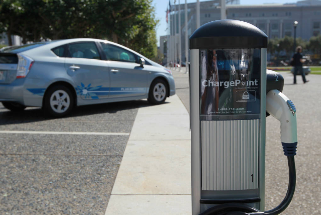
"caption": "An electric vehicle charging station is seen near San Francisco city hall August 25, 2010 in San Francisco, California. \n\n",
"description": null,
"title": "Bay Area Plans Major Expansion Of Electric Vehicle Charging Stations",
"credit": "Justin Sullivan/Getty Images",
"status": "inherit",
"isLoading": false,
"fetchFailed": false
},
"science_1928710": {
"type": "attachments",
"id": "science_1928710",
"meta": {
"index": "attachments_1716263798",
"site": "science",
"id": "1928710",
"found": true
},
"parent": 1928707,
"imgSizes": {
"small": {
"file": "https://ww2.kqed.org/app/uploads/sites/35/2018/08/GettyImages-826780924-520x372.jpg",
"width": 520,
"mimeType": "image/jpeg",
"height": 372
},
"twentyfourteen-full-width": {
"file": "https://ww2.kqed.org/app/uploads/sites/35/2018/08/GettyImages-826780924-1038x576.jpg",
"width": 1038,
"mimeType": "image/jpeg",
"height": 576
},
"thumbnail": {
"file": "https://ww2.kqed.org/app/uploads/sites/35/2018/08/GettyImages-826780924-160x114.jpg",
"width": 160,
"mimeType": "image/jpeg",
"height": 114
},
"fd-sm": {
"file": "https://ww2.kqed.org/app/uploads/sites/35/2018/08/GettyImages-826780924-960x687.jpg",
"width": 960,
"mimeType": "image/jpeg",
"height": 687
},
"post-thumbnail": {
"file": "https://ww2.kqed.org/app/uploads/sites/35/2018/08/GettyImages-826780924-672x372.jpg",
"width": 672,
"mimeType": "image/jpeg",
"height": 372
},
"xsmall": {
"file": "https://ww2.kqed.org/app/uploads/sites/35/2018/08/GettyImages-826780924-375x268.jpg",
"width": 375,
"mimeType": "image/jpeg",
"height": 268
},
"kqedFullSize": {
"file": "https://ww2.kqed.org/app/uploads/sites/35/2018/08/GettyImages-826780924.jpg",
"width": 2500,
"height": 1788
},
"large": {
"file": "https://ww2.kqed.org/app/uploads/sites/35/2018/08/GettyImages-826780924-1020x730.jpg",
"width": 1020,
"mimeType": "image/jpeg",
"height": 730
},
"xlarge": {
"file": "https://ww2.kqed.org/app/uploads/sites/35/2018/08/GettyImages-826780924-1180x844.jpg",
"width": 1180,
"mimeType": "image/jpeg",
"height": 844
},
"complete_open_graph": {
"file": "https://ww2.kqed.org/app/uploads/sites/35/2018/08/GettyImages-826780924-1200x858.jpg",
"width": 1200,
"mimeType": "image/jpeg",
"height": 858
},
"guest-author-50": {
"file": "https://ww2.kqed.org/app/uploads/sites/35/2018/08/GettyImages-826780924-50x50.jpg",
"width": 50,
"mimeType": "image/jpeg",
"height": 50
},
"guest-author-96": {
"file": "https://ww2.kqed.org/app/uploads/sites/35/2018/08/GettyImages-826780924-96x96.jpg",
"width": 96,
"mimeType": "image/jpeg",
"height": 96
},
"medium": {
"file": "https://ww2.kqed.org/app/uploads/sites/35/2018/08/GettyImages-826780924-800x572.jpg",
"width": 800,
"mimeType": "image/jpeg",
"height": 572
},
"guest-author-64": {
"file": "https://ww2.kqed.org/app/uploads/sites/35/2018/08/GettyImages-826780924-64x64.jpg",
"width": 64,
"mimeType": "image/jpeg",
"height": 64
},
"guest-author-32": {
"file": "https://ww2.kqed.org/app/uploads/sites/35/2018/08/GettyImages-826780924-32x32.jpg",
"width": 32,
"mimeType": "image/jpeg",
"height": 32
},
"fd-lrg": {
"file": "https://ww2.kqed.org/app/uploads/sites/35/2018/08/GettyImages-826780924-1920x1373.jpg",
"width": 1920,
"mimeType": "image/jpeg",
"height": 1373
},
"fd-med": {
"file": "https://ww2.kqed.org/app/uploads/sites/35/2018/08/GettyImages-826780924-1180x844.jpg",
"width": 1180,
"mimeType": "image/jpeg",
"height": 844
},
"full-width": {
"file": "https://ww2.kqed.org/app/uploads/sites/35/2018/08/GettyImages-826780924-1920x1373.jpg",
"width": 1920,
"mimeType": "image/jpeg",
"height": 1373
},
"detail": {
"file": "https://ww2.kqed.org/app/uploads/sites/35/2018/08/GettyImages-826780924-150x150.jpg",
"width": 150,
"mimeType": "image/jpeg",
"height": 150
},
"medium_large": {
"file": "https://ww2.kqed.org/app/uploads/sites/35/2018/08/GettyImages-826780924-768x549.jpg",
"width": 768,
"mimeType": "image/jpeg",
"height": 549
},
"guest-author-128": {
"file": "https://ww2.kqed.org/app/uploads/sites/35/2018/08/GettyImages-826780924-128x128.jpg",
"width": 128,
"mimeType": "image/jpeg",
"height": 128
},
"xxsmall": {
"file": "https://ww2.kqed.org/app/uploads/sites/35/2018/08/GettyImages-826780924-240x172.jpg",
"width": 240,
"mimeType": "image/jpeg",
"height": 172
}
},
"publishDate": 1533573985,
"modified": 1533574048,
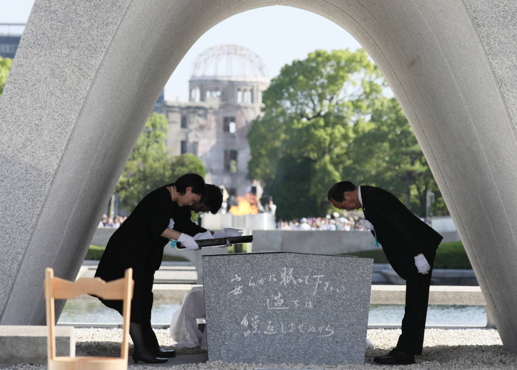
"caption": "Hiroshima Mayor Kazumi Matsui (R) offers a new list of A-bomb dead, people who died since last year's anniversary from the side effects of radiation, during the 72nd anniversary memorial service for the atomic bomb victims at the Peace Memorial Park in Hiroshima on August 6, 2017.\n\n",
"description": null,
"title": "TOPSHOT-JAPAN-US-WWII-NUCLEAR",
"credit": "STR/AFP/Getty Images",
"status": "inherit",
"isLoading": false,
"fetchFailed": false
},
"science_1928703": {
"type": "attachments",
"id": "science_1928703",
"meta": {
"index": "attachments_1716263798",
"site": "science",
"id": "1928703",
"found": true
},
"parent": 1928700,
"imgSizes": {
"small": {
"file": "https://ww2.kqed.org/app/uploads/sites/35/2018/08/054859.ME_.1028.fresno8-520x346.jpg",
"width": 520,
"mimeType": "image/jpeg",
"height": 346
},
"thumbnail": {
"file": "https://ww2.kqed.org/app/uploads/sites/35/2018/08/054859.ME_.1028.fresno8-160x107.jpg",
"width": 160,
"mimeType": "image/jpeg",
"height": 107
},
"post-thumbnail": {
"file": "https://ww2.kqed.org/app/uploads/sites/35/2018/08/054859.ME_.1028.fresno8-672x372.jpg",
"width": 672,
"mimeType": "image/jpeg",
"height": 372
},
"xsmall": {
"file": "https://ww2.kqed.org/app/uploads/sites/35/2018/08/054859.ME_.1028.fresno8-375x250.jpg",
"width": 375,
"mimeType": "image/jpeg",
"height": 250
},
"kqedFullSize": {
"file": "https://ww2.kqed.org/app/uploads/sites/35/2018/08/054859.ME_.1028.fresno8.jpg",
"width": 800,
"height": 533
},
"guest-author-50": {
"file": "https://ww2.kqed.org/app/uploads/sites/35/2018/08/054859.ME_.1028.fresno8-50x50.jpg",
"width": 50,
"mimeType": "image/jpeg",
"height": 50
},
"guest-author-96": {
"file": "https://ww2.kqed.org/app/uploads/sites/35/2018/08/054859.ME_.1028.fresno8-96x96.jpg",
"width": 96,
"mimeType": "image/jpeg",
"height": 96
},
"medium": {
"file": "https://ww2.kqed.org/app/uploads/sites/35/2018/08/054859.ME_.1028.fresno8-800x533.jpg",
"width": 800,
"mimeType": "image/jpeg",
"height": 533
},
"guest-author-64": {
"file": "https://ww2.kqed.org/app/uploads/sites/35/2018/08/054859.ME_.1028.fresno8-64x64.jpg",
"width": 64,
"mimeType": "image/jpeg",
"height": 64
},
"guest-author-32": {
"file": "https://ww2.kqed.org/app/uploads/sites/35/2018/08/054859.ME_.1028.fresno8-32x32.jpg",
"width": 32,
"mimeType": "image/jpeg",
"height": 32
},
"detail": {
"file": "https://ww2.kqed.org/app/uploads/sites/35/2018/08/054859.ME_.1028.fresno8-150x150.jpg",
"width": 150,
"mimeType": "image/jpeg",
"height": 150
},
"medium_large": {
"file": "https://ww2.kqed.org/app/uploads/sites/35/2018/08/054859.ME_.1028.fresno8-768x512.jpg",
"width": 768,
"mimeType": "image/jpeg",
"height": 512
},
"guest-author-128": {
"file": "https://ww2.kqed.org/app/uploads/sites/35/2018/08/054859.ME_.1028.fresno8-128x128.jpg",
"width": 128,
"mimeType": "image/jpeg",
"height": 128
},
"xxsmall": {
"file": "https://ww2.kqed.org/app/uploads/sites/35/2018/08/054859.ME_.1028.fresno8-240x160.jpg",
"width": 240,
"mimeType": "image/jpeg",
"height": 160
}
},
"publishDate": 1533567846,
"modified": 1533567884,
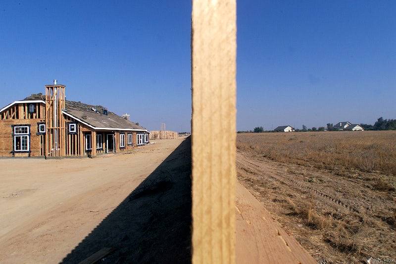
"caption": "New housing construction in California’s San Joaquin Valley poses a threat to some of the best groundwater recharge lands.",
"description": null,
"title": "054859.ME_.1028.fresno8",
"credit": "Spencer Weiner/Los Angeles Times via Getty Images",
"status": "inherit",
"isLoading": false,
"fetchFailed": false
},
"science_1928621": {
"type": "attachments",
"id": "science_1928621",
"meta": {
"index": "attachments_1716263798",
"site": "science",
"id": "1928621",
"found": true
},
"parent": 1928613,
"imgSizes": {
"small": {
"file": "https://ww2.kqed.org/app/uploads/sites/35/2018/08/GettyImages-1008050654-520x341.jpg",
"width": 520,
"mimeType": "image/jpeg",
"height": 341
},
"twentyfourteen-full-width": {
"file": "https://ww2.kqed.org/app/uploads/sites/35/2018/08/GettyImages-1008050654-1038x576.jpg",
"width": 1038,
"mimeType": "image/jpeg",
"height": 576
},
"thumbnail": {
"file": "https://ww2.kqed.org/app/uploads/sites/35/2018/08/GettyImages-1008050654-160x105.jpg",
"width": 160,
"mimeType": "image/jpeg",
"height": 105
},
"fd-sm": {
"file": "https://ww2.kqed.org/app/uploads/sites/35/2018/08/GettyImages-1008050654-960x629.jpg",
"width": 960,
"mimeType": "image/jpeg",
"height": 629
},
"post-thumbnail": {
"file": "https://ww2.kqed.org/app/uploads/sites/35/2018/08/GettyImages-1008050654-672x372.jpg",
"width": 672,
"mimeType": "image/jpeg",
"height": 372
},
"xsmall": {
"file": "https://ww2.kqed.org/app/uploads/sites/35/2018/08/GettyImages-1008050654-375x246.jpg",
"width": 375,
"mimeType": "image/jpeg",
"height": 246
},
"kqedFullSize": {
"file": "https://ww2.kqed.org/app/uploads/sites/35/2018/08/GettyImages-1008050654.jpg",
"width": 4712,
"height": 3086
},
"large": {
"file": "https://ww2.kqed.org/app/uploads/sites/35/2018/08/GettyImages-1008050654-1020x668.jpg",
"width": 1020,
"mimeType": "image/jpeg",
"height": 668
},
"xlarge": {
"file": "https://ww2.kqed.org/app/uploads/sites/35/2018/08/GettyImages-1008050654-1180x773.jpg",
"width": 1180,
"mimeType": "image/jpeg",
"height": 773
},
"complete_open_graph": {
"file": "https://ww2.kqed.org/app/uploads/sites/35/2018/08/GettyImages-1008050654-1200x786.jpg",
"width": 1200,
"mimeType": "image/jpeg",
"height": 786
},
"guest-author-50": {
"file": "https://ww2.kqed.org/app/uploads/sites/35/2018/08/GettyImages-1008050654-50x50.jpg",
"width": 50,
"mimeType": "image/jpeg",
"height": 50
},
"guest-author-96": {
"file": "https://ww2.kqed.org/app/uploads/sites/35/2018/08/GettyImages-1008050654-96x96.jpg",
"width": 96,
"mimeType": "image/jpeg",
"height": 96
},
"medium": {
"file": "https://ww2.kqed.org/app/uploads/sites/35/2018/08/GettyImages-1008050654-800x524.jpg",
"width": 800,
"mimeType": "image/jpeg",
"height": 524
},
"guest-author-64": {
"file": "https://ww2.kqed.org/app/uploads/sites/35/2018/08/GettyImages-1008050654-64x64.jpg",
"width": 64,
"mimeType": "image/jpeg",
"height": 64
},
"guest-author-32": {
"file": "https://ww2.kqed.org/app/uploads/sites/35/2018/08/GettyImages-1008050654-32x32.jpg",
"width": 32,
"mimeType": "image/jpeg",
"height": 32
},
"fd-lrg": {
"file": "https://ww2.kqed.org/app/uploads/sites/35/2018/08/GettyImages-1008050654-1920x1257.jpg",
"width": 1920,
"mimeType": "image/jpeg",
"height": 1257
},
"fd-med": {
"file": "https://ww2.kqed.org/app/uploads/sites/35/2018/08/GettyImages-1008050654-1180x773.jpg",
"width": 1180,
"mimeType": "image/jpeg",
"height": 773
},
"full-width": {
"file": "https://ww2.kqed.org/app/uploads/sites/35/2018/08/GettyImages-1008050654-1920x1257.jpg",
"width": 1920,
"mimeType": "image/jpeg",
"height": 1257
},
"detail": {
"file": "https://ww2.kqed.org/app/uploads/sites/35/2018/08/GettyImages-1008050654-150x150.jpg",
"width": 150,
"mimeType": "image/jpeg",
"height": 150
},
"medium_large": {
"file": "https://ww2.kqed.org/app/uploads/sites/35/2018/08/GettyImages-1008050654-768x503.jpg",
"width": 768,
"mimeType": "image/jpeg",
"height": 503
},
"guest-author-128": {
"file": "https://ww2.kqed.org/app/uploads/sites/35/2018/08/GettyImages-1008050654-128x128.jpg",
"width": 128,
"mimeType": "image/jpeg",
"height": 128
},
"xxsmall": {
"file": "https://ww2.kqed.org/app/uploads/sites/35/2018/08/GettyImages-1008050654-240x157.jpg",
"width": 240,
"mimeType": "image/jpeg",
"height": 157
}
},
"publishDate": 1533322653,
"modified": 1533322720,
"caption": "Smoke rises from the ground after flames passed by houses during the Mendocino Complex fire in Lakeport, California, on July 30, 2018. ",
"description": null,
"title": "US-FIRE-CALIFORNIA",
"credit": "JOSH EDELSON/AFP/Getty Images",
"status": "inherit",
"isLoading": false,
"fetchFailed": false
},
"science_1928564": {
"type": "attachments",
"id": "science_1928564",
"meta": {
"index": "attachments_1716263798",
"site": "science",
"id": "1928564",
"found": true
},
"parent": 1928546,
"imgSizes": {
"small": {
"file": "https://ww2.kqed.org/app/uploads/sites/35/2018/08/guvarnold-520x347.jpg",
"width": 520,
"mimeType": "image/jpeg",
"height": 347
},
"twentyfourteen-full-width": {
"file": "https://ww2.kqed.org/app/uploads/sites/35/2018/08/guvarnold-1038x576.jpg",
"width": 1038,
"mimeType": "image/jpeg",
"height": 576
},
"thumbnail": {
"file": "https://ww2.kqed.org/app/uploads/sites/35/2018/08/guvarnold-160x107.jpg",
"width": 160,
"mimeType": "image/jpeg",
"height": 107
},
"fd-sm": {
"file": "https://ww2.kqed.org/app/uploads/sites/35/2018/08/guvarnold-960x640.jpg",
"width": 960,
"mimeType": "image/jpeg",
"height": 640
},
"post-thumbnail": {
"file": "https://ww2.kqed.org/app/uploads/sites/35/2018/08/guvarnold-672x372.jpg",
"width": 672,
"mimeType": "image/jpeg",
"height": 372
},
"xsmall": {
"file": "https://ww2.kqed.org/app/uploads/sites/35/2018/08/guvarnold-375x250.jpg",
"width": 375,
"mimeType": "image/jpeg",
"height": 250
},
"kqedFullSize": {
"file": "https://ww2.kqed.org/app/uploads/sites/35/2018/08/guvarnold-e1533242993415.jpg",
"width": 1920,
"height": 1280
},
"large": {
"file": "https://ww2.kqed.org/app/uploads/sites/35/2018/08/guvarnold-1020x680.jpg",
"width": 1020,
"mimeType": "image/jpeg",
"height": 680
},
"xlarge": {
"file": "https://ww2.kqed.org/app/uploads/sites/35/2018/08/guvarnold-1180x787.jpg",
"width": 1180,
"mimeType": "image/jpeg",
"height": 787
},
"complete_open_graph": {
"file": "https://ww2.kqed.org/app/uploads/sites/35/2018/08/guvarnold-1200x800.jpg",
"width": 1200,
"mimeType": "image/jpeg",
"height": 800
},
"guest-author-50": {
"file": "https://ww2.kqed.org/app/uploads/sites/35/2018/08/guvarnold-50x50.jpg",
"width": 50,
"mimeType": "image/jpeg",
"height": 50
},
"guest-author-96": {
"file": "https://ww2.kqed.org/app/uploads/sites/35/2018/08/guvarnold-96x96.jpg",
"width": 96,
"mimeType": "image/jpeg",
"height": 96
},
"medium": {
"file": "https://ww2.kqed.org/app/uploads/sites/35/2018/08/guvarnold-800x533.jpg",
"width": 800,
"mimeType": "image/jpeg",
"height": 533
},
"guest-author-64": {
"file": "https://ww2.kqed.org/app/uploads/sites/35/2018/08/guvarnold-64x64.jpg",
"width": 64,
"mimeType": "image/jpeg",
"height": 64
},
"guest-author-32": {
"file": "https://ww2.kqed.org/app/uploads/sites/35/2018/08/guvarnold-32x32.jpg",
"width": 32,
"mimeType": "image/jpeg",
"height": 32
},
"fd-lrg": {
"file": "https://ww2.kqed.org/app/uploads/sites/35/2018/08/guvarnold-1920x1280.jpg",
"width": 1920,
"mimeType": "image/jpeg",
"height": 1280
},
"fd-med": {
"file": "https://ww2.kqed.org/app/uploads/sites/35/2018/08/guvarnold-1180x787.jpg",
"width": 1180,
"mimeType": "image/jpeg",
"height": 787
},
"full-width": {
"file": "https://ww2.kqed.org/app/uploads/sites/35/2018/08/guvarnold-1920x1280.jpg",
"width": 1920,
"mimeType": "image/jpeg",
"height": 1280
},
"detail": {
"file": "https://ww2.kqed.org/app/uploads/sites/35/2018/08/guvarnold-150x150.jpg",
"width": 150,
"mimeType": "image/jpeg",
"height": 150
},
"medium_large": {
"file": "https://ww2.kqed.org/app/uploads/sites/35/2018/08/guvarnold-768x512.jpg",
"width": 768,
"mimeType": "image/jpeg",
"height": 512
},
"guest-author-128": {
"file": "https://ww2.kqed.org/app/uploads/sites/35/2018/08/guvarnold-128x128.jpg",
"width": 128,
"mimeType": "image/jpeg",
"height": 128
},
"xxsmall": {
"file": "https://ww2.kqed.org/app/uploads/sites/35/2018/08/guvarnold-240x160.jpg",
"width": 240,
"mimeType": "image/jpeg",
"height": 160
}
},
"publishDate": 1533242975,
"modified": 1533243065,
"caption": "Arnold Schwarzenegger at a debate at the Climate Summit for Mayors in Copenhagen, 2009. ",
"description": null,
"title": "Arnold Schwarzenegger, governor of the s",
"credit": "Anders Debel Hansen/AFP/Getty Images",
"status": "inherit",
"isLoading": false,
"fetchFailed": false
},
"science_1928484": {
"type": "attachments",
"id": "science_1928484",
"meta": {
"index": "attachments_1716263798",
"site": "science",
"id": "1928484",
"found": true
},
"parent": 1928481,
"imgSizes": {
"small": {
"file": "https://ww2.kqed.org/app/uploads/sites/35/2018/08/RS357_IMG_0799-520x390.jpg",
"width": 520,
"mimeType": "image/jpeg",
"height": 390
},
"twentyfourteen-full-width": {
"file": "https://ww2.kqed.org/app/uploads/sites/35/2018/08/RS357_IMG_0799-1038x576.jpg",
"width": 1038,
"mimeType": "image/jpeg",
"height": 576
},
"thumbnail": {
"file": "https://ww2.kqed.org/app/uploads/sites/35/2018/08/RS357_IMG_0799-160x120.jpg",
"width": 160,
"mimeType": "image/jpeg",
"height": 120
},
"fd-sm": {
"file": "https://ww2.kqed.org/app/uploads/sites/35/2018/08/RS357_IMG_0799-960x720.jpg",
"width": 960,
"mimeType": "image/jpeg",
"height": 720
},
"post-thumbnail": {
"file": "https://ww2.kqed.org/app/uploads/sites/35/2018/08/RS357_IMG_0799-672x372.jpg",
"width": 672,
"mimeType": "image/jpeg",
"height": 372
},
"xsmall": {
"file": "https://ww2.kqed.org/app/uploads/sites/35/2018/08/RS357_IMG_0799-375x281.jpg",
"width": 375,
"mimeType": "image/jpeg",
"height": 281
},
"kqedFullSize": {
"file": "https://ww2.kqed.org/app/uploads/sites/35/2018/08/RS357_IMG_0799.jpg",
"width": 1600,
"height": 1200
},
"large": {
"file": "https://ww2.kqed.org/app/uploads/sites/35/2018/08/RS357_IMG_0799-1020x765.jpg",
"width": 1020,
"mimeType": "image/jpeg",
"height": 765
},
"xlarge": {
"file": "https://ww2.kqed.org/app/uploads/sites/35/2018/08/RS357_IMG_0799-1180x885.jpg",
"width": 1180,
"mimeType": "image/jpeg",
"height": 885
},
"complete_open_graph": {
"file": "https://ww2.kqed.org/app/uploads/sites/35/2018/08/RS357_IMG_0799-1200x900.jpg",
"width": 1200,
"mimeType": "image/jpeg",
"height": 900
},
"guest-author-50": {
"file": "https://ww2.kqed.org/app/uploads/sites/35/2018/08/RS357_IMG_0799-50x50.jpg",
"width": 50,
"mimeType": "image/jpeg",
"height": 50
},
"guest-author-96": {
"file": "https://ww2.kqed.org/app/uploads/sites/35/2018/08/RS357_IMG_0799-96x96.jpg",
"width": 96,
"mimeType": "image/jpeg",
"height": 96
},
"medium": {
"file": "https://ww2.kqed.org/app/uploads/sites/35/2018/08/RS357_IMG_0799-800x600.jpg",
"width": 800,
"mimeType": "image/jpeg",
"height": 600
},
"guest-author-64": {
"file": "https://ww2.kqed.org/app/uploads/sites/35/2018/08/RS357_IMG_0799-64x64.jpg",
"width": 64,
"mimeType": "image/jpeg",
"height": 64
},
"guest-author-32": {
"file": "https://ww2.kqed.org/app/uploads/sites/35/2018/08/RS357_IMG_0799-32x32.jpg",
"width": 32,
"mimeType": "image/jpeg",
"height": 32
},
"fd-med": {
"file": "https://ww2.kqed.org/app/uploads/sites/35/2018/08/RS357_IMG_0799-1180x885.jpg",
"width": 1180,
"mimeType": "image/jpeg",
"height": 885
},
"detail": {
"file": "https://ww2.kqed.org/app/uploads/sites/35/2018/08/RS357_IMG_0799-150x150.jpg",
"width": 150,
"mimeType": "image/jpeg",
"height": 150
},
"medium_large": {
"file": "https://ww2.kqed.org/app/uploads/sites/35/2018/08/RS357_IMG_0799-768x576.jpg",
"width": 768,
"mimeType": "image/jpeg",
"height": 576
},
"guest-author-128": {
"file": "https://ww2.kqed.org/app/uploads/sites/35/2018/08/RS357_IMG_0799-128x128.jpg",
"width": 128,
"mimeType": "image/jpeg",
"height": 128
},
"xxsmall": {
"file": "https://ww2.kqed.org/app/uploads/sites/35/2018/08/RS357_IMG_0799-240x180.jpg",
"width": 240,
"mimeType": "image/jpeg",
"height": 180
}
},
"publishDate": 1533163339,
"modified": 1533163400,
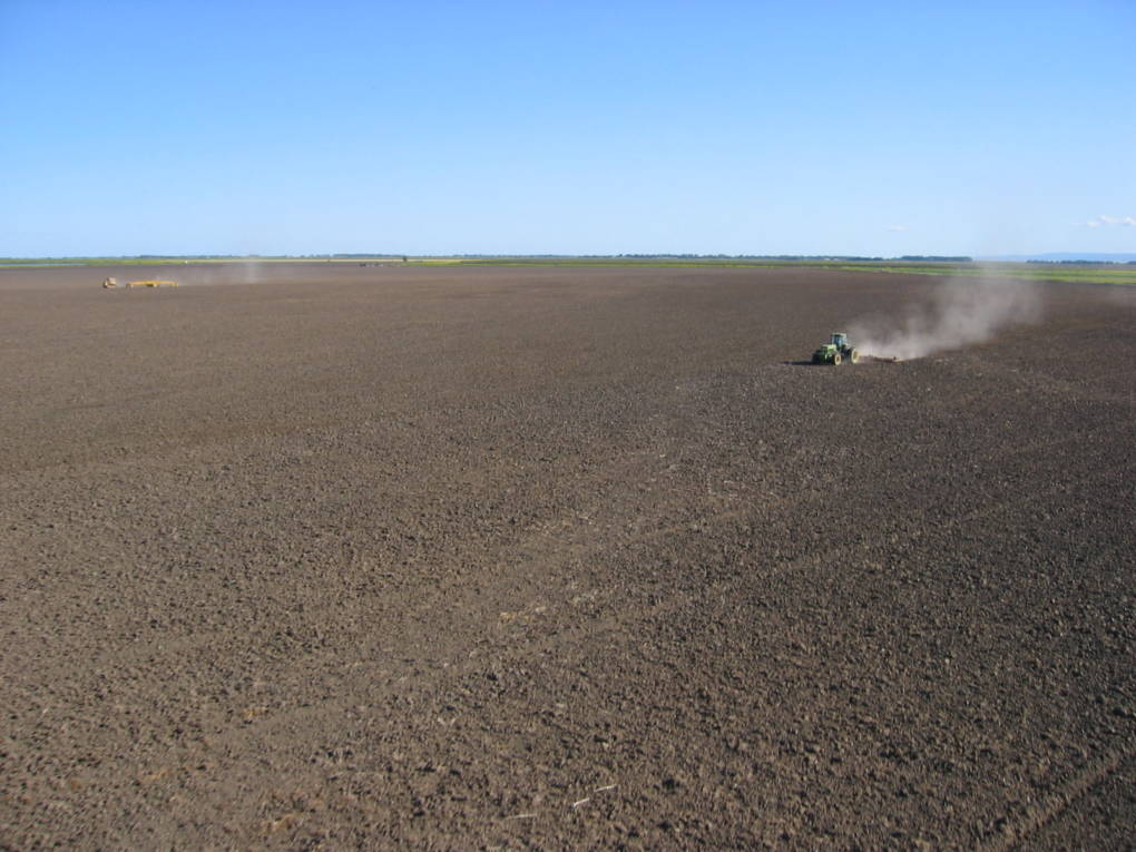
"caption": "A tractor traverses an empty field while tilling the soil. In the most comprehensive study yet of the climate change impacts of soil, researchers found a significant increase in the amount of carbon since the 1990s.",
"description": null,
"title": "RS357_IMG_0799",
"credit": "Craig Miller/ Climate Watch",
"status": "inherit",
"isLoading": false,
"fetchFailed": false
},
"science_1928478": {
"type": "attachments",
"id": "science_1928478",
"meta": {
"index": "attachments_1716263798",
"site": "science",
"id": "1928478",
"found": true
},
"parent": 1928476,
"imgSizes": {
"small": {
"file": "https://ww2.kqed.org/app/uploads/sites/35/2018/08/GettyImages-173465655-520x361.jpg",
"width": 520,
"mimeType": "image/jpeg",
"height": 361
},
"twentyfourteen-full-width": {
"file": "https://ww2.kqed.org/app/uploads/sites/35/2018/08/GettyImages-173465655-1038x576.jpg",
"width": 1038,
"mimeType": "image/jpeg",
"height": 576
},
"thumbnail": {
"file": "https://ww2.kqed.org/app/uploads/sites/35/2018/08/GettyImages-173465655-160x111.jpg",
"width": 160,
"mimeType": "image/jpeg",
"height": 111
},
"fd-sm": {
"file": "https://ww2.kqed.org/app/uploads/sites/35/2018/08/GettyImages-173465655-960x666.jpg",
"width": 960,
"mimeType": "image/jpeg",
"height": 666
},
"post-thumbnail": {
"file": "https://ww2.kqed.org/app/uploads/sites/35/2018/08/GettyImages-173465655-672x372.jpg",
"width": 672,
"mimeType": "image/jpeg",
"height": 372
},
"xsmall": {
"file": "https://ww2.kqed.org/app/uploads/sites/35/2018/08/GettyImages-173465655-375x260.jpg",
"width": 375,
"mimeType": "image/jpeg",
"height": 260
},
"kqedFullSize": {
"file": "https://ww2.kqed.org/app/uploads/sites/35/2018/08/GettyImages-173465655.jpg",
"width": 3000,
"height": 2082
},
"large": {
"file": "https://ww2.kqed.org/app/uploads/sites/35/2018/08/GettyImages-173465655-1020x708.jpg",
"width": 1020,
"mimeType": "image/jpeg",
"height": 708
},
"xlarge": {
"file": "https://ww2.kqed.org/app/uploads/sites/35/2018/08/GettyImages-173465655-1180x819.jpg",
"width": 1180,
"mimeType": "image/jpeg",
"height": 819
},
"complete_open_graph": {
"file": "https://ww2.kqed.org/app/uploads/sites/35/2018/08/GettyImages-173465655-1200x833.jpg",
"width": 1200,
"mimeType": "image/jpeg",
"height": 833
},
"guest-author-50": {
"file": "https://ww2.kqed.org/app/uploads/sites/35/2018/08/GettyImages-173465655-50x50.jpg",
"width": 50,
"mimeType": "image/jpeg",
"height": 50
},
"guest-author-96": {
"file": "https://ww2.kqed.org/app/uploads/sites/35/2018/08/GettyImages-173465655-96x96.jpg",
"width": 96,
"mimeType": "image/jpeg",
"height": 96
},
"medium": {
"file": "https://ww2.kqed.org/app/uploads/sites/35/2018/08/GettyImages-173465655-800x555.jpg",
"width": 800,
"mimeType": "image/jpeg",
"height": 555
},
"guest-author-64": {
"file": "https://ww2.kqed.org/app/uploads/sites/35/2018/08/GettyImages-173465655-64x64.jpg",
"width": 64,
"mimeType": "image/jpeg",
"height": 64
},
"guest-author-32": {
"file": "https://ww2.kqed.org/app/uploads/sites/35/2018/08/GettyImages-173465655-32x32.jpg",
"width": 32,
"mimeType": "image/jpeg",
"height": 32
},
"fd-lrg": {
"file": "https://ww2.kqed.org/app/uploads/sites/35/2018/08/GettyImages-173465655-1920x1332.jpg",
"width": 1920,
"mimeType": "image/jpeg",
"height": 1332
},
"fd-med": {
"file": "https://ww2.kqed.org/app/uploads/sites/35/2018/08/GettyImages-173465655-1180x819.jpg",
"width": 1180,
"mimeType": "image/jpeg",
"height": 819
},
"full-width": {
"file": "https://ww2.kqed.org/app/uploads/sites/35/2018/08/GettyImages-173465655-1920x1332.jpg",
"width": 1920,
"mimeType": "image/jpeg",
"height": 1332
},
"detail": {
"file": "https://ww2.kqed.org/app/uploads/sites/35/2018/08/GettyImages-173465655-150x150.jpg",
"width": 150,
"mimeType": "image/jpeg",
"height": 150
},
"medium_large": {
"file": "https://ww2.kqed.org/app/uploads/sites/35/2018/08/GettyImages-173465655-768x533.jpg",
"width": 768,
"mimeType": "image/jpeg",
"height": 533
},
"guest-author-128": {
"file": "https://ww2.kqed.org/app/uploads/sites/35/2018/08/GettyImages-173465655-128x128.jpg",
"width": 128,
"mimeType": "image/jpeg",
"height": 128
},
"xxsmall": {
"file": "https://ww2.kqed.org/app/uploads/sites/35/2018/08/GettyImages-173465655-240x167.jpg",
"width": 240,
"mimeType": "image/jpeg",
"height": 167
}
},
"publishDate": 1533162625,
"modified": 1533162664,
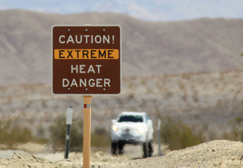
"caption": "Heat waves rise near a heat danger warning sign on July 14, 2013 in Death Valley National Park, California. \n\n",
"description": null,
"title": "Annual Badwater Ultra Marathon Held In Death Valley's Extreme Heat",
"credit": "David McNew/Getty Images",
"status": "inherit",
"isLoading": false,
"fetchFailed": false
},
"science_1927873": {
"type": "attachments",
"id": "science_1927873",
"meta": {
"index": "attachments_1716263798",
"site": "science",
"id": "1927873",
"found": true
},
"parent": 1927865,
"imgSizes": {
"small": {
"file": "https://ww2.kqed.org/app/uploads/sites/35/2018/07/IMG_9443-520x379.jpg",
"width": 520,
"mimeType": "image/jpeg",
"height": 379
},
"twentyfourteen-full-width": {
"file": "https://ww2.kqed.org/app/uploads/sites/35/2018/07/IMG_9443-1038x576.jpg",
"width": 1038,
"mimeType": "image/jpeg",
"height": 576
},
"thumbnail": {
"file": "https://ww2.kqed.org/app/uploads/sites/35/2018/07/IMG_9443-160x117.jpg",
"width": 160,
"mimeType": "image/jpeg",
"height": 117
},
"fd-sm": {
"file": "https://ww2.kqed.org/app/uploads/sites/35/2018/07/IMG_9443-960x700.jpg",
"width": 960,
"mimeType": "image/jpeg",
"height": 700
},
"post-thumbnail": {
"file": "https://ww2.kqed.org/app/uploads/sites/35/2018/07/IMG_9443-672x372.jpg",
"width": 672,
"mimeType": "image/jpeg",
"height": 372
},
"xsmall": {
"file": "https://ww2.kqed.org/app/uploads/sites/35/2018/07/IMG_9443-375x274.jpg",
"width": 375,
"mimeType": "image/jpeg",
"height": 274
},
"kqedFullSize": {
"file": "https://ww2.kqed.org/app/uploads/sites/35/2018/07/IMG_9443.jpg",
"width": 2000,
"height": 1459
},
"large": {
"file": "https://ww2.kqed.org/app/uploads/sites/35/2018/07/IMG_9443-1020x744.jpg",
"width": 1020,
"mimeType": "image/jpeg",
"height": 744
},
"xlarge": {
"file": "https://ww2.kqed.org/app/uploads/sites/35/2018/07/IMG_9443-1180x861.jpg",
"width": 1180,
"mimeType": "image/jpeg",
"height": 861
},
"complete_open_graph": {
"file": "https://ww2.kqed.org/app/uploads/sites/35/2018/07/IMG_9443-1200x875.jpg",
"width": 1200,
"mimeType": "image/jpeg",
"height": 875
},
"guest-author-50": {
"file": "https://ww2.kqed.org/app/uploads/sites/35/2018/07/IMG_9443-50x50.jpg",
"width": 50,
"mimeType": "image/jpeg",
"height": 50
},
"guest-author-96": {
"file": "https://ww2.kqed.org/app/uploads/sites/35/2018/07/IMG_9443-96x96.jpg",
"width": 96,
"mimeType": "image/jpeg",
"height": 96
},
"medium": {
"file": "https://ww2.kqed.org/app/uploads/sites/35/2018/07/IMG_9443-800x584.jpg",
"width": 800,
"mimeType": "image/jpeg",
"height": 584
},
"guest-author-64": {
"file": "https://ww2.kqed.org/app/uploads/sites/35/2018/07/IMG_9443-64x64.jpg",
"width": 64,
"mimeType": "image/jpeg",
"height": 64
},
"guest-author-32": {
"file": "https://ww2.kqed.org/app/uploads/sites/35/2018/07/IMG_9443-32x32.jpg",
"width": 32,
"mimeType": "image/jpeg",
"height": 32
},
"fd-lrg": {
"file": "https://ww2.kqed.org/app/uploads/sites/35/2018/07/IMG_9443-1920x1401.jpg",
"width": 1920,
"mimeType": "image/jpeg",
"height": 1401
},
"fd-med": {
"file": "https://ww2.kqed.org/app/uploads/sites/35/2018/07/IMG_9443-1180x861.jpg",
"width": 1180,
"mimeType": "image/jpeg",
"height": 861
},
"full-width": {
"file": "https://ww2.kqed.org/app/uploads/sites/35/2018/07/IMG_9443-1920x1401.jpg",
"width": 1920,
"mimeType": "image/jpeg",
"height": 1401
},
"detail": {
"file": "https://ww2.kqed.org/app/uploads/sites/35/2018/07/IMG_9443-150x150.jpg",
"width": 150,
"mimeType": "image/jpeg",
"height": 150
},
"medium_large": {
"file": "https://ww2.kqed.org/app/uploads/sites/35/2018/07/IMG_9443-768x560.jpg",
"width": 768,
"mimeType": "image/jpeg",
"height": 560
},
"guest-author-128": {
"file": "https://ww2.kqed.org/app/uploads/sites/35/2018/07/IMG_9443-128x128.jpg",
"width": 128,
"mimeType": "image/jpeg",
"height": 128
},
"xxsmall": {
"file": "https://ww2.kqed.org/app/uploads/sites/35/2018/07/IMG_9443-240x175.jpg",
"width": 240,
"mimeType": "image/jpeg",
"height": 175
}
},
"publishDate": 1532393285,
"modified": 1532393375,
"caption": "The federal Environmental Protection Agency is challenging California's authority to regulate auto emissions.",
"description": "The federal Environmental Protection Agency is challenging California's authority to regulate auto emissions.",
"title": "IMG_9443",
"credit": "Craig Miller",
"status": "inherit",
"isLoading": false,
"fetchFailed": false
},
"science_1928457": {
"type": "attachments",
"id": "science_1928457",
"meta": {
"index": "attachments_1716263798",
"site": "science",
"id": "1928457",
"found": true
},
"parent": 1928448,
"imgSizes": {
"small": {
"file": "https://ww2.kqed.org/app/uploads/sites/35/2018/08/iStock-908501910-520x313.jpg",
"width": 520,
"mimeType": "image/jpeg",
"height": 313
},
"twentyfourteen-full-width": {
"file": "https://ww2.kqed.org/app/uploads/sites/35/2018/08/iStock-908501910-1038x576.jpg",
"width": 1038,
"mimeType": "image/jpeg",
"height": 576
},
"thumbnail": {
"file": "https://ww2.kqed.org/app/uploads/sites/35/2018/08/iStock-908501910-160x96.jpg",
"width": 160,
"mimeType": "image/jpeg",
"height": 96
},
"fd-sm": {
"file": "https://ww2.kqed.org/app/uploads/sites/35/2018/08/iStock-908501910-960x578.jpg",
"width": 960,
"mimeType": "image/jpeg",
"height": 578
},
"post-thumbnail": {
"file": "https://ww2.kqed.org/app/uploads/sites/35/2018/08/iStock-908501910-672x372.jpg",
"width": 672,
"mimeType": "image/jpeg",
"height": 372
},
"xsmall": {
"file": "https://ww2.kqed.org/app/uploads/sites/35/2018/08/iStock-908501910-375x226.jpg",
"width": 375,
"mimeType": "image/jpeg",
"height": 226
},
"kqedFullSize": {
"file": "https://ww2.kqed.org/app/uploads/sites/35/2018/08/iStock-908501910.jpg",
"width": 4464,
"height": 2690
},
"large": {
"file": "https://ww2.kqed.org/app/uploads/sites/35/2018/08/iStock-908501910-1020x615.jpg",
"width": 1020,
"mimeType": "image/jpeg",
"height": 615
},
"xlarge": {
"file": "https://ww2.kqed.org/app/uploads/sites/35/2018/08/iStock-908501910-1180x711.jpg",
"width": 1180,
"mimeType": "image/jpeg",
"height": 711
},
"complete_open_graph": {
"file": "https://ww2.kqed.org/app/uploads/sites/35/2018/08/iStock-908501910-1200x723.jpg",
"width": 1200,
"mimeType": "image/jpeg",
"height": 723
},
"guest-author-50": {
"file": "https://ww2.kqed.org/app/uploads/sites/35/2018/08/iStock-908501910-50x50.jpg",
"width": 50,
"mimeType": "image/jpeg",
"height": 50
},
"guest-author-96": {
"file": "https://ww2.kqed.org/app/uploads/sites/35/2018/08/iStock-908501910-96x96.jpg",
"width": 96,
"mimeType": "image/jpeg",
"height": 96
},
"medium": {
"file": "https://ww2.kqed.org/app/uploads/sites/35/2018/08/iStock-908501910-800x482.jpg",
"width": 800,
"mimeType": "image/jpeg",
"height": 482
},
"guest-author-64": {
"file": "https://ww2.kqed.org/app/uploads/sites/35/2018/08/iStock-908501910-64x64.jpg",
"width": 64,
"mimeType": "image/jpeg",
"height": 64
},
"guest-author-32": {
"file": "https://ww2.kqed.org/app/uploads/sites/35/2018/08/iStock-908501910-32x32.jpg",
"width": 32,
"mimeType": "image/jpeg",
"height": 32
},
"fd-lrg": {
"file": "https://ww2.kqed.org/app/uploads/sites/35/2018/08/iStock-908501910-1920x1157.jpg",
"width": 1920,
"mimeType": "image/jpeg",
"height": 1157
},
"fd-med": {
"file": "https://ww2.kqed.org/app/uploads/sites/35/2018/08/iStock-908501910-1180x711.jpg",
"width": 1180,
"mimeType": "image/jpeg",
"height": 711
},
"full-width": {
"file": "https://ww2.kqed.org/app/uploads/sites/35/2018/08/iStock-908501910-1920x1157.jpg",
"width": 1920,
"mimeType": "image/jpeg",
"height": 1157
},
"detail": {
"file": "https://ww2.kqed.org/app/uploads/sites/35/2018/08/iStock-908501910-150x150.jpg",
"width": 150,
"mimeType": "image/jpeg",
"height": 150
},
"medium_large": {
"file": "https://ww2.kqed.org/app/uploads/sites/35/2018/08/iStock-908501910-768x463.jpg",
"width": 768,
"mimeType": "image/jpeg",
"height": 463
},
"guest-author-128": {
"file": "https://ww2.kqed.org/app/uploads/sites/35/2018/08/iStock-908501910-128x128.jpg",
"width": 128,
"mimeType": "image/jpeg",
"height": 128
},
"xxsmall": {
"file": "https://ww2.kqed.org/app/uploads/sites/35/2018/08/iStock-908501910-240x145.jpg",
"width": 240,
"mimeType": "image/jpeg",
"height": 145
}
},
"publishDate": 1533152390,
"modified": 1533169428,
"caption": "An oil field located just outside of Livermore, shown in the photo, will be shutting down following pushback from residents and environmental groups. ",
"description": null,
"title": "Ranch on the hill and beautiful sky",
"credit": "iStock",
"status": "inherit",
"isLoading": false,
"fetchFailed": false
},
"science_1928437": {
"type": "attachments",
"id": "science_1928437",
"meta": {
"index": "attachments_1716263798",
"site": "science",
"id": "1928437",
"found": true
},
"parent": 1928432,
"imgSizes": {
"small": {
"file": "https://ww2.kqed.org/app/uploads/sites/35/2018/08/766224741-520x312.jpg",
"width": 520,
"mimeType": "image/jpeg",
"height": 312
},
"twentyfourteen-full-width": {
"file": "https://ww2.kqed.org/app/uploads/sites/35/2018/08/766224741-1038x576.jpg",
"width": 1038,
"mimeType": "image/jpeg",
"height": 576
},
"thumbnail": {
"file": "https://ww2.kqed.org/app/uploads/sites/35/2018/08/766224741-160x96.jpg",
"width": 160,
"mimeType": "image/jpeg",
"height": 96
},
"fd-sm": {
"file": "https://ww2.kqed.org/app/uploads/sites/35/2018/08/766224741-960x577.jpg",
"width": 960,
"mimeType": "image/jpeg",
"height": 577
},
"post-thumbnail": {
"file": "https://ww2.kqed.org/app/uploads/sites/35/2018/08/766224741-672x372.jpg",
"width": 672,
"mimeType": "image/jpeg",
"height": 372
},
"xsmall": {
"file": "https://ww2.kqed.org/app/uploads/sites/35/2018/08/766224741-375x225.jpg",
"width": 375,
"mimeType": "image/jpeg",
"height": 225
},
"kqedFullSize": {
"file": "https://ww2.kqed.org/app/uploads/sites/35/2018/08/766224741.jpg",
"width": 1800,
"height": 1081
},
"large": {
"file": "https://ww2.kqed.org/app/uploads/sites/35/2018/08/766224741-1020x613.jpg",
"width": 1020,
"mimeType": "image/jpeg",
"height": 613
},
"xlarge": {
"file": "https://ww2.kqed.org/app/uploads/sites/35/2018/08/766224741-1180x709.jpg",
"width": 1180,
"mimeType": "image/jpeg",
"height": 709
},
"complete_open_graph": {
"file": "https://ww2.kqed.org/app/uploads/sites/35/2018/08/766224741-1200x721.jpg",
"width": 1200,
"mimeType": "image/jpeg",
"height": 721
},
"guest-author-50": {
"file": "https://ww2.kqed.org/app/uploads/sites/35/2018/08/766224741-50x50.jpg",
"width": 50,
"mimeType": "image/jpeg",
"height": 50
},
"guest-author-96": {
"file": "https://ww2.kqed.org/app/uploads/sites/35/2018/08/766224741-96x96.jpg",
"width": 96,
"mimeType": "image/jpeg",
"height": 96
},
"medium": {
"file": "https://ww2.kqed.org/app/uploads/sites/35/2018/08/766224741-800x480.jpg",
"width": 800,
"mimeType": "image/jpeg",
"height": 480
},
"guest-author-64": {
"file": "https://ww2.kqed.org/app/uploads/sites/35/2018/08/766224741-64x64.jpg",
"width": 64,
"mimeType": "image/jpeg",
"height": 64
},
"guest-author-32": {
"file": "https://ww2.kqed.org/app/uploads/sites/35/2018/08/766224741-32x32.jpg",
"width": 32,
"mimeType": "image/jpeg",
"height": 32
},
"fd-med": {
"file": "https://ww2.kqed.org/app/uploads/sites/35/2018/08/766224741-1180x709.jpg",
"width": 1180,
"mimeType": "image/jpeg",
"height": 709
},
"detail": {
"file": "https://ww2.kqed.org/app/uploads/sites/35/2018/08/766224741-150x150.jpg",
"width": 150,
"mimeType": "image/jpeg",
"height": 150
},
"medium_large": {
"file": "https://ww2.kqed.org/app/uploads/sites/35/2018/08/766224741-768x461.jpg",
"width": 768,
"mimeType": "image/jpeg",
"height": 461
},
"guest-author-128": {
"file": "https://ww2.kqed.org/app/uploads/sites/35/2018/08/766224741-128x128.jpg",
"width": 128,
"mimeType": "image/jpeg",
"height": 128
},
"xxsmall": {
"file": "https://ww2.kqed.org/app/uploads/sites/35/2018/08/766224741-240x144.jpg",
"width": 240,
"mimeType": "image/jpeg",
"height": 144
}
},
"publishDate": 1533107729,
"modified": 1533107750,
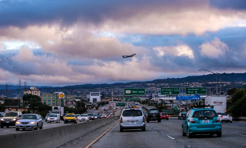
"caption": "Traffic crawls along Highway 101 near San Francisco International Airport.",
"description": null,
"title": "766224741",
"credit": "George Rose/Getty Images",
"status": "inherit",
"isLoading": false,
"fetchFailed": false
}
},
"audioPlayerReducer": {
"postId": "stream_live",
"isPaused": true,
"isPlaying": false,
"pfsActive": false,
"pledgeModalIsOpen": true,
"playerDrawerIsOpen": false,
"liveAudioPlayStartedAt": 0,
"liveAudioPlayContext": ""
},
"authorsReducer": {
"byline_science_1928707": {
"type": "authors",
"id": "byline_science_1928707",
"meta": {
"override": true
},
"slug": "byline_science_1928707",
"name": "Haruka Nuga\u003cbr />The Associated Press",
"isLoading": false
},
"byline_science_1928715": {
"type": "authors",
"id": "byline_science_1928715",
"meta": {
"override": true
},
"slug": "byline_science_1928715",
"name": "Camila Domonoske, NPR",
"isLoading": false
},
"byline_science_1928700": {
"type": "authors",
"id": "byline_science_1928700",
"meta": {
"override": true
},
"slug": "byline_science_1928700",
"name": "Matt Weiser\u003cbr />Water Deeply",
"isLoading": false
},
"byline_science_1928481": {
"type": "authors",
"id": "byline_science_1928481",
"meta": {
"override": true
},
"slug": "byline_science_1928481",
"name": "Seth Borenstein\u003cbr />The Associated Press",
"isLoading": false
},
"byline_science_1928476": {
"type": "authors",
"id": "byline_science_1928476",
"meta": {
"override": true
},
"slug": "byline_science_1928476",
"name": "The Associated Press",
"isLoading": false
},
"byline_science_1928432": {
"type": "authors",
"id": "byline_science_1928432",
"meta": {
"override": true
},
"slug": "byline_science_1928432",
"name": "Alastair Bland\u003cbr />Water Deeply",
"isLoading": false
},
"jbrooks": {
"type": "authors",
"id": "80",
"meta": {
"index": "authors_1716337520",
"id": "80",
"found": true
},
"name": "Jon Brooks",
"firstName": "Jon",
"lastName": "Brooks",
"slug": "jbrooks",
"email": "jbrooks@kqed.org",
"display_author_email": true,
"staff_mastheads": [
"science"
],
"title": "Digital Editor",
"bio": "Jon Brooks is a former Digital Editor for KQED Science. He is the former editor of KQED’s daily news blog, News Fix. In 2014, he won a California Journalism Award for his coverage of ride services like Uber and Lyft and the taxi industry. A veteran blogger, he previously worked for Yahoo! in various news writing and editing roles. Jon is also a playwright whose work has been produced in San Francisco, New York, Italy, and around the U.S. He has written about film for his own blog and studied film at Boston University.",
"avatar": "https://secure.gravatar.com/avatar/98887f7ed1c876ed414d4c915e969584?s=600&d=blank&r=g",
"twitter": "jbrooksfoy",
"facebook": null,
"instagram": null,
"linkedin": null,
"sites": [
{
"site": "arts",
"roles": [
"Contributor",
"editor"
]
},
{
"site": "news",
"roles": [
"author"
]
},
{
"site": "futureofyou",
"roles": [
"administrator"
]
},
{
"site": "mindshift",
"roles": [
"editor"
]
},
{
"site": "stateofhealth",
"roles": [
"editor"
]
},
{
"site": "science",
"roles": [
"administrator"
]
},
{
"site": "quest",
"roles": [
"editor"
]
}
],
"headData": {
"title": "Jon Brooks | KQED",
"description": "Digital Editor",
"ogImgSrc": "https://secure.gravatar.com/avatar/98887f7ed1c876ed414d4c915e969584?s=600&d=blank&r=g",
"twImgSrc": "https://secure.gravatar.com/avatar/98887f7ed1c876ed414d4c915e969584?s=600&d=blank&r=g"
},
"isLoading": false,
"link": "/author/jbrooks"
},
"cmiller": {
"type": "authors",
"id": "221",
"meta": {
"index": "authors_1716337520",
"id": "221",
"found": true
},
"name": "Craig Miller",
"firstName": "Craig",
"lastName": "Miller",
"slug": "cmiller",
"email": "craig@voxterra.net",
"display_author_email": false,
"staff_mastheads": [
"science"
],
"title": "Editor Emeritus, Science",
"bio": "Craig is a former KQED Science editor, specializing in weather, climate, water & energy issues, with a little seismology thrown in just to shake things up. Prior to that, he launched and led the station's award-winning multimedia project, Climate Watch. Craig is also an accomplished writer/producer of television documentaries, with a focus on natural resource issues.",
"avatar": "https://secure.gravatar.com/avatar/b91661df645e001a9cafe0861fa685f9?s=600&d=blank&r=g",
"twitter": "voxterra",
"facebook": null,
"instagram": null,
"linkedin": null,
"sites": [
{
"site": "news",
"roles": [
"author"
]
},
{
"site": "futureofyou",
"roles": [
"editor"
]
},
{
"site": "stateofhealth",
"roles": [
"author"
]
},
{
"site": "science",
"roles": [
"editor"
]
},
{
"site": "quest",
"roles": [
"editor"
]
}
],
"headData": {
"title": "Craig Miller | KQED",
"description": "Editor Emeritus, Science",
"ogImgSrc": "https://secure.gravatar.com/avatar/b91661df645e001a9cafe0861fa685f9?s=600&d=blank&r=g",
"twImgSrc": "https://secure.gravatar.com/avatar/b91661df645e001a9cafe0861fa685f9?s=600&d=blank&r=g"
},
"isLoading": false,
"link": "/author/cmiller"
},
"aahmed": {
"type": "authors",
"id": "11428",
"meta": {
"index": "authors_1716337520",
"id": "11428",
"found": true
},
"name": "Amel Ahmed",
"firstName": "Amel",
"lastName": "Ahmed",
"slug": "aahmed",
"email": "aahmed@kqed.org",
"display_author_email": false,
"staff_mastheads": [],
"title": "KQED Contributor",
"bio": "Amel Ahmed is a reporter for KQED. Prior to joining KQED, Amel worked at Al Jazeera America, Al Jazeera English, Democracy Now! and Punched Productions. She also helped produce \u003cem>Changing Face of Harlem\u003c/em>, a documentary that tracked gentrification in Harlem over a period of ten years. She is a 2013 graduate of Brooklyn Law School and is currently researching war on terror prosecutions for an upcoming book.",
"avatar": "https://secure.gravatar.com/avatar/c8b48ebc98e770640f3013c470d23f3e?s=600&d=blank&r=g",
"twitter": "amelscript",
"facebook": null,
"instagram": null,
"linkedin": null,
"sites": [
{
"site": "futureofyou",
"roles": []
},
{
"site": "science",
"roles": []
}
],
"headData": {
"title": "Amel Ahmed | KQED",
"description": "KQED Contributor",
"ogImgSrc": "https://secure.gravatar.com/avatar/c8b48ebc98e770640f3013c470d23f3e?s=600&d=blank&r=g",
"twImgSrc": "https://secure.gravatar.com/avatar/c8b48ebc98e770640f3013c470d23f3e?s=600&d=blank&r=g"
},
"isLoading": false,
"link": "/author/aahmed"
}
},
"pagesReducer": {
"science_category_news": {
"type": "terms",
"id": "science_40",
"meta": {
"index": "terms_1716263798",
"site": "science",
"id": "40",
"score": 10.814472
},
"featImg": null,
"name": "News",
"description": null,
"taxonomy": "category",
"headData": {
"twImgId": null,
"twTitle": null,
"ogTitle": null,
"ogImgId": null,
"twDescription": null,
"description": null,
"title": "News Archives | KQED Science",
"ogDescription": null
},
"ttid": 42,
"slug": "news",
"isLoading": false,
"title": "News",
"pageMeta": {
"site": "science",
"WpPageTemplate": "page-topic-editorial",
"currentPage": 164
},
"blocks": [
{
"blockName": "kqed/post-list",
"attrs": {
"layout": "cardArticle2",
"query": "posts/science?category=news",
"seeMore": false,
"paginated": true,
"page": 164
}
},
{
"blockName": "kqed/ad"
}
]
}
},
"pfsSessionReducer": {},
"postsReducer": {
"stream_live": {
"type": "live",
"id": "stream_live",
"audioUrl": "https://streams.kqed.org/kqedradio",
"title": "Live Stream",
"excerpt": "Live Stream information currently unavailable.",
"link": "/radio",
"featImg": "",
"label": {
"name": "KQED Live",
"link": "/"
}
},
"stream_kqedNewscast": {
"type": "posts",
"id": "stream_kqedNewscast",
"audioUrl": "https://www.kqed.org/.stream/anon/radio/RDnews/newscast.mp3?_=1",
"title": "KQED Newscast",
"featImg": "",
"label": {
"name": "88.5 FM",
"link": "/"
}
},
"science_1928770": {
"type": "posts",
"id": "science_1928770",
"meta": {
"index": "posts_1716263798",
"site": "science",
"id": "1928770",
"score": null,
"sort": [
1533594924000
]
},
"parent": 0,
"labelTerm": {},
"blocks": [],
"publishDate": 1533594924,
"format": "standard",
"title": "No, President Trump, California Isn't Diverting Its Water Supply Away From Wildfires",
"headTitle": "No, President Trump, California Isn’t Diverting Its Water Supply Away From Wildfires | KQED",
"content": "\u003cp>There are a lot of raging controversies in California’s water policy, but finding water for fighting wildfires isn’t one of them.\u003c/p>\n\u003cp>If you’re watching the Twitter feed from @realDonaldTrump, you might be confused about this. Here’s a tweet that — to say the least — raised eyebrows, when the president sent it out over the weekend:\u003c/p>\n\u003cblockquote class=\"twitter-tweet\">\n\u003cp dir=\"ltr\" lang=\"en\">California wildfires are being magnified & made so much worse by the bad environmental laws which aren’t allowing massive amount of readily available water to be properly utilized. It is being diverted into the Pacific Ocean. Must also tree clear to stop fire spreading!\u003c/p>\n\u003cp>— Donald J. Trump (@realDonaldTrump) \u003ca href=\"https://twitter.com/realDonaldTrump/status/1026228024403021824?ref_src=twsrc%5Etfw\">August 5, 2018\u003c/a>\u003c/p>\u003c/blockquote>\n\u003cp>So here are the facts:\u003c/p>\n\u003cp>First up, KQED called Cal Fire to find out whether, in fact, they’re having any problems getting enough water to fight current wildfires.\u003c/p>\n\u003cp>“We are not having any issues accessing any water supplies,” says Cal Fire spokesman Scott McLean. “We have plenty. The fires are right near reservoirs. We’re doing the job, we’re fighting the fight, we have the resources.”\u003c/p>\n\u003cp>[ad fullwidth]\u003c/p>\n\u003cp>Indeed, the notion that there are water sources in the state that are being diverted is “patently ridiculous,” according to Daniel Swain, a climate scientist at UCLA.[contextly_sidebar id=”FRd26aTPI4xeJqyclf8O3Oa5TUN2j1z6″]\u003c/p>\n\u003cp>“[Firefighters] are drawing water from pretty much every available source,” says Swain. “Every reservoir, river, pond, lake that exists near these fires is essentially fair game for these firefighting efforts.”\u003c/p>\n\u003cp>So what then, is to blame for the ferocity of this year’s wildfires?\u003c/p>\n\u003cp>The \u003ca href=\"https://www.kqed.org/science/1927783/video-how-climate-change-is-wreaking-havoc-on-california\" target=\"_blank\" rel=\"noopener\">consensus from scientists\u003c/a> is that climate change, not lack of water, has contributed in multiple ways to the intensity of fires in California and the higher number of catastrophic fires we are having.\u003c/p>\n\u003cp>“The climate in the West and elsewhere has been getting warmer and that’s leading to drier vegetation, drier forest, drier bush,” Swain says. “And that is acting to change the behavior of these fires, making them burn more intensely, hotter, and move faster.”\u003c/p>\n\u003cp>Nighttime temperatures are also not as low as they used to be, and firefighters have noticed that fires don’t “lay down” at night the way they once did. Climate change is pushing nighttime temperatures \u003ca href=\"https://www.kqed.org/science/1926996/something-else-adding-fuel-to-californias-fire-season-warmer-nights\" target=\"_blank\" rel=\"noopener\">to rise even faster\u003c/a> than daytime temperatures. This means firefighters can’t count on much help from cool nights to get the upper hand on a fire.[contextly_sidebar id=”hhV9BhAr0lc5bwIBhakmX6qQvnC98Wnv”]\u003c/p>\n\u003cp>In addition, urbanization has contributed to the destructiveness of wildfires.\u003c/p>\n\u003cp>“There are just more people moving into harm’s way,” says Swain. “We have expanded our urban areas into the wildland, where there is the risk of wildfires at an increasing rate.”\u003c/p>\n\u003cp>\u003c/p>\n\u003cp>When Trump accuses California of diverting its water supply, he may be referring to a \u003ca href=\"https://www.kqed.org/science/914603/the-biggest-california-water-decision-youve-never-heard-of\" target=\"_blank\" rel=\"noopener\">decision expected this month\u003c/a> by the state water board. The controversy, long a point of contention, has nothing to do with the wildfires or wildfire management. But it’s a big deal. In fact, we call it: \u003ca href=\"https://www.kqed.org/science/914603/the-biggest-california-water-decision-youve-never-heard-of\" target=\"_blank\" rel=\"noopener\">The Biggest California Water Decision You’ve Never Heard Of\u003c/a>.\u003c/p>\n\n",
"stats": {
"hasVideo": false,
"hasChartOrMap": false,
"hasAudio": false,
"hasPolis": false,
"wordCount": 551,
"hasGoogleForm": false,
"hasGallery": false,
"hasHearkenModule": false,
"iframeSrcs": [],
"paragraphCount": 17
},
"modified": 1704927602,
"excerpt": "In a widely criticized tweet, Trump claimed that California water sources are being diverted away from fighting wildfires. We did some fact checking. He's wrong. Here's why.",
"headData": {
"twImgId": "",
"twTitle": "",
"ogTitle": "",
"ogImgId": "",
"twDescription": "",
"description": "In a widely criticized tweet, Trump claimed that California water sources are being diverted away from fighting wildfires. We did some fact checking. He's wrong. Here's why.",
"title": "No, President Trump, California Isn't Diverting Its Water Supply Away From Wildfires | KQED",
"ogDescription": "",
"schema": {
"@context": "https://schema.org",
"@type": "Article",
"headline": "No, President Trump, California Isn't Diverting Its Water Supply Away From Wildfires",
"datePublished": "2018-08-06T15:35:24-07:00",
"dateModified": "2024-01-10T15:00:02-08:00",
"image": "https://cdn.kqed.org/wp-content/uploads/2020/02/KQED-OG-Image@1x.png"
}
},
"guestAuthors": [],
"slug": "no-president-trump-calif-isnt-diverting-its-water-supply-away-from-wildfires",
"status": "publish",
"sticky": false,
"source": "Wildfires",
"path": "/science/1928770/no-president-trump-calif-isnt-diverting-its-water-supply-away-from-wildfires",
"audioTrackLength": null,
"parsedContent": [
{
"type": "contentString",
"content": "\u003cdiv class=\"post-body\">\u003cp>\u003cp>There are a lot of raging controversies in California’s water policy, but finding water for fighting wildfires isn’t one of them.\u003c/p>\n\u003cp>If you’re watching the Twitter feed from @realDonaldTrump, you might be confused about this. Here’s a tweet that — to say the least — raised eyebrows, when the president sent it out over the weekend:\u003c/p>\n\u003cblockquote class=\"twitter-tweet\">\n\u003cp dir=\"ltr\" lang=\"en\">California wildfires are being magnified & made so much worse by the bad environmental laws which aren’t allowing massive amount of readily available water to be properly utilized. It is being diverted into the Pacific Ocean. Must also tree clear to stop fire spreading!\u003c/p>\n\u003cp>— Donald J. Trump (@realDonaldTrump) \u003ca href=\"https://twitter.com/realDonaldTrump/status/1026228024403021824?ref_src=twsrc%5Etfw\">August 5, 2018\u003c/a>\u003c/p>\u003c/blockquote>\n\u003cp>So here are the facts:\u003c/p>\n\u003cp>First up, KQED called Cal Fire to find out whether, in fact, they’re having any problems getting enough water to fight current wildfires.\u003c/p>\n\u003cp>“We are not having any issues accessing any water supplies,” says Cal Fire spokesman Scott McLean. “We have plenty. The fires are right near reservoirs. We’re doing the job, we’re fighting the fight, we have the resources.”\u003c/p>\n\u003cp>\u003c/p>\u003c/div>",
"attributes": {
"named": {},
"numeric": []
}
},
{
"type": "component",
"content": "",
"name": "ad",
"attributes": {
"named": {
"label": "fullwidth"
},
"numeric": [
"fullwidth"
]
}
},
{
"type": "contentString",
"content": "\u003cdiv class=\"post-body\">\u003cp>\u003c/p>\n\u003cp>Indeed, the notion that there are water sources in the state that are being diverted is “patently ridiculous,” according to Daniel Swain, a climate scientist at UCLA.\u003c/p>\u003cp>\u003c/p>\u003cp>\u003c/p>\n\u003cp>“[Firefighters] are drawing water from pretty much every available source,” says Swain. “Every reservoir, river, pond, lake that exists near these fires is essentially fair game for these firefighting efforts.”\u003c/p>\n\u003cp>So what then, is to blame for the ferocity of this year’s wildfires?\u003c/p>\n\u003cp>The \u003ca href=\"https://www.kqed.org/science/1927783/video-how-climate-change-is-wreaking-havoc-on-california\" target=\"_blank\" rel=\"noopener\">consensus from scientists\u003c/a> is that climate change, not lack of water, has contributed in multiple ways to the intensity of fires in California and the higher number of catastrophic fires we are having.\u003c/p>\n\u003cp>“The climate in the West and elsewhere has been getting warmer and that’s leading to drier vegetation, drier forest, drier bush,” Swain says. “And that is acting to change the behavior of these fires, making them burn more intensely, hotter, and move faster.”\u003c/p>\n\u003cp>Nighttime temperatures are also not as low as they used to be, and firefighters have noticed that fires don’t “lay down” at night the way they once did. Climate change is pushing nighttime temperatures \u003ca href=\"https://www.kqed.org/science/1926996/something-else-adding-fuel-to-californias-fire-season-warmer-nights\" target=\"_blank\" rel=\"noopener\">to rise even faster\u003c/a> than daytime temperatures. This means firefighters can’t count on much help from cool nights to get the upper hand on a fire.\u003c/p>\u003cp>\u003c/p>\u003cp>\u003c/p>\n\u003cp>In addition, urbanization has contributed to the destructiveness of wildfires.\u003c/p>\n\u003cp>“There are just more people moving into harm’s way,” says Swain. “We have expanded our urban areas into the wildland, where there is the risk of wildfires at an increasing rate.”\u003c/p>\n\u003cp>\u003c/p>\n\u003cp>When Trump accuses California of diverting its water supply, he may be referring to a \u003ca href=\"https://www.kqed.org/science/914603/the-biggest-california-water-decision-youve-never-heard-of\" target=\"_blank\" rel=\"noopener\">decision expected this month\u003c/a> by the state water board. The controversy, long a point of contention, has nothing to do with the wildfires or wildfire management. But it’s a big deal. In fact, we call it: \u003ca href=\"https://www.kqed.org/science/914603/the-biggest-california-water-decision-youve-never-heard-of\" target=\"_blank\" rel=\"noopener\">The Biggest California Water Decision You’ve Never Heard Of\u003c/a>.\u003c/p>\n\n\u003c/div>\u003c/p>",
"attributes": {
"named": {},
"numeric": []
}
}
],
"link": "/science/1928770/no-president-trump-calif-isnt-diverting-its-water-supply-away-from-wildfires",
"authors": [
"11428"
],
"categories": [
"science_31",
"science_35",
"science_40",
"science_98",
"science_3730"
],
"tags": [
"science_192",
"science_3322",
"science_201",
"science_113"
],
"featImg": "science_1928840",
"label": "source_science_1928770"
},
"science_1928526": {
"type": "posts",
"id": "science_1928526",
"meta": {
"index": "posts_1716263798",
"site": "science",
"id": "1928526",
"score": null,
"sort": [
1533585241000
]
},
"parent": 0,
"labelTerm": {},
"blocks": [],
"publishDate": 1533585241,
"format": "standard",
"title": "Putting 5 Million Electric Cars on California Roads Wouldn't Overwhelm Power Grid: Report",
"headTitle": "Putting 5 Million Electric Cars on California Roads Wouldn’t Overwhelm Power Grid: Report | KQED",
"content": "\u003cp>One \u003ca href=\"https://www.wired.com/story/electric-cars-impact-electric-grid/\" target=\"_blank\" rel=\"noopener\">concern \u003c/a>raised about the proliferation of plug-in electric vehicles in California is that they threaten to overwhelm an already stressed power grid.\u003c/p>\n\u003cp>And yet with transportation being the single largest source of greenhouse gas emissions in the state, the move toward electric vehicles will play a critical role in meeting California’s ambitious climate goals.[contextly_sidebar id=”ABv4pDlWl1S1P2glmujUyNdIAqB3sSwv”]\u003c/p>\n\u003cp>Currently, there are about \u003ca href=\"http://next10.org/sites/default/files/evs-ca-grid-op.pdf\" target=\"_blank\" rel=\"noopener\">369,000 electric cars\u003c/a> on California roads, and Gov. Jerry Brown hopes to bring that number up to 5 million by 2030.\u003c/p>\n\u003cp>That might appear to put electric cars on a collision course with a fragile power grid.\u003c/p>\n\u003cp>But a report released Thursday by San Francisco-based think tank \u003ca href=\"https://next10.org/\" target=\"_blank\" rel=\"noopener\">Next 10\u003c/a> suggests that there’s less cause for worry than some have suggested.\u003c/p>\n\u003cp>[ad fullwidth]\u003c/p>\n\u003cp>“The California grid is well placed to handle rapid growth in PEVs but advance planning and smart policy can ease the transition for the state’s power system,” said the\u003ca href=\"http://next10.org/sites/default/files/ccas-evs-ders-press-release2.pdf\" target=\"_blank\" rel=\"noopener\"> statement\u003c/a> accompanying the report. Next 10 has been an advocate for putting more zero-emission vehicles on the road.\u003c/p>\n\u003cp>The report concludes that 3.9 million PEVs would suck up about 5 percent of the state’s current power needs, adding 15,500 gigawatt-hours to charging demand.\u003c/p>\n\u003cp>Illustrating this modest increase in energy demand, researchers say a\u003cstrong> \u003c/strong>Chevrolet Bolt electric car that drives 50 miles per day uses about the same amount of power as an air conditioner cooling a three-bedroom home for three hours.[contextly_sidebar id=”SLV08DIIcYDT04N0einJ4VNySVyLVsQ2″]\u003c/p>\n\u003cp>The state’s shift toward cleaner transportation will require upgrades to the energy system, according to the report, but the benefits will outweigh the costs.\u003c/p>\n\u003cp>“If California wants to meet its zero-emission vehicle goals while keeping electricity affordable and reliable, it’s worth considering some policy levers that can help,” co-author Anand Gopal said in a statement.\u003c/p>\n\u003cp>Key measures the report recommends for a smoother transition include offering drivers off-peak charging incentives and “smart charging” programs, but the report notes potential barriers to these initiatives.\u003c/p>\n\u003cp>Smart charging is a method of regulating time and rate at which the vehicle is charged based on signals from the grid operator, allowing the car to stop charging at peak times.\u003c/p>\n\u003cp>Among the barriers to a smooth transition to getting so many PEVs on the road, the report cites drivers’ privacy concerns and energy storage programs that use electric vehicle batteries to feed energy back to the grid. Often touted as a solution to grid stress, the report debunks the notion as costly and complex.[contextly_sidebar id=”GwbepcA8Q7D5Usw5DyrX2rre5BNddFQZ\u003c/p>\n\u003cp>Stationary storage devices are a better solution, according to the report, because they’re more convenient to use than a “moving battery.”\u003c/p>\n\u003cp>In addition, advances in technology such as smart devices for thermostats and refrigerators, which promise to make energy distribution more efficient and cost effective, make EV batteries a less attractive option for supplying energy to the grid.\u003c/p>\n\u003cp>\u003c/p>\n\u003cp>As more electric cars hit the road, meeting the increased energy demand might require moving away from investor-owned public utilities and toward smaller, community-based programs, according to Next 10 analysts.\u003c/p>\n\n",
"stats": {
"hasVideo": false,
"hasChartOrMap": false,
"hasAudio": false,
"hasPolis": false,
"wordCount": 548,
"hasGoogleForm": false,
"hasGallery": false,
"hasHearkenModule": false,
"iframeSrcs": [],
"paragraphCount": 18
},
"modified": 1704927604,
"excerpt": "A comprehensive new report looks at the impact of electric cars on California's power grid and outlines measures for making the transition to cleaner transportation smoother.",
"headData": {
"twImgId": "",
"twTitle": "",
"ogTitle": "",
"ogImgId": "",
"twDescription": "",
"description": "A comprehensive new report looks at the impact of electric cars on California's power grid and outlines measures for making the transition to cleaner transportation smoother.",
"title": "Putting 5 Million Electric Cars on California Roads Wouldn't Overwhelm Power Grid: Report | KQED",
"ogDescription": "",
"schema": {
"@context": "https://schema.org",
"@type": "Article",
"headline": "Putting 5 Million Electric Cars on California Roads Wouldn't Overwhelm Power Grid: Report",
"datePublished": "2018-08-06T12:54:01-07:00",
"dateModified": "2024-01-10T15:00:04-08:00",
"image": "https://cdn.kqed.org/wp-content/uploads/2020/02/KQED-OG-Image@1x.png"
}
},
"guestAuthors": [],
"slug": "putting-5-million-electric-cars-on-california-roads-wouldnt-overwhelm-power-grid-report",
"status": "publish",
"sticky": false,
"source": "Environment",
"path": "/science/1928526/putting-5-million-electric-cars-on-california-roads-wouldnt-overwhelm-power-grid-report",
"audioTrackLength": null,
"parsedContent": [
{
"type": "contentString",
"content": "\u003cdiv class=\"post-body\">\u003cp>\u003cp>One \u003ca href=\"https://www.wired.com/story/electric-cars-impact-electric-grid/\" target=\"_blank\" rel=\"noopener\">concern \u003c/a>raised about the proliferation of plug-in electric vehicles in California is that they threaten to overwhelm an already stressed power grid.\u003c/p>\n\u003cp>And yet with transportation being the single largest source of greenhouse gas emissions in the state, the move toward electric vehicles will play a critical role in meeting California’s ambitious climate goals.\u003c/p>\u003cp>\u003c/p>\u003cp>\u003c/p>\n\u003cp>Currently, there are about \u003ca href=\"http://next10.org/sites/default/files/evs-ca-grid-op.pdf\" target=\"_blank\" rel=\"noopener\">369,000 electric cars\u003c/a> on California roads, and Gov. Jerry Brown hopes to bring that number up to 5 million by 2030.\u003c/p>\n\u003cp>That might appear to put electric cars on a collision course with a fragile power grid.\u003c/p>\n\u003cp>But a report released Thursday by San Francisco-based think tank \u003ca href=\"https://next10.org/\" target=\"_blank\" rel=\"noopener\">Next 10\u003c/a> suggests that there’s less cause for worry than some have suggested.\u003c/p>\n\u003cp>\u003c/p>\u003c/div>",
"attributes": {
"named": {},
"numeric": []
}
},
{
"type": "component",
"content": "",
"name": "ad",
"attributes": {
"named": {
"label": "fullwidth"
},
"numeric": [
"fullwidth"
]
}
},
{
"type": "contentString",
"content": "\u003cdiv class=\"post-body\">\u003cp>\u003c/p>\n\u003cp>“The California grid is well placed to handle rapid growth in PEVs but advance planning and smart policy can ease the transition for the state’s power system,” said the\u003ca href=\"http://next10.org/sites/default/files/ccas-evs-ders-press-release2.pdf\" target=\"_blank\" rel=\"noopener\"> statement\u003c/a> accompanying the report. Next 10 has been an advocate for putting more zero-emission vehicles on the road.\u003c/p>\n\u003cp>The report concludes that 3.9 million PEVs would suck up about 5 percent of the state’s current power needs, adding 15,500 gigawatt-hours to charging demand.\u003c/p>\n\u003cp>Illustrating this modest increase in energy demand, researchers say a\u003cstrong> \u003c/strong>Chevrolet Bolt electric car that drives 50 miles per day uses about the same amount of power as an air conditioner cooling a three-bedroom home for three hours.\u003c/p>\u003cp>\u003c/p>\u003cp>\u003c/p>\n\u003cp>The state’s shift toward cleaner transportation will require upgrades to the energy system, according to the report, but the benefits will outweigh the costs.\u003c/p>\n\u003cp>“If California wants to meet its zero-emission vehicle goals while keeping electricity affordable and reliable, it’s worth considering some policy levers that can help,” co-author Anand Gopal said in a statement.\u003c/p>\n\u003cp>Key measures the report recommends for a smoother transition include offering drivers off-peak charging incentives and “smart charging” programs, but the report notes potential barriers to these initiatives.\u003c/p>\n\u003cp>Smart charging is a method of regulating time and rate at which the vehicle is charged based on signals from the grid operator, allowing the car to stop charging at peak times.\u003c/p>\n\u003cp>Among the barriers to a smooth transition to getting so many PEVs on the road, the report cites drivers’ privacy concerns and energy storage programs that use electric vehicle batteries to feed energy back to the grid. Often touted as a solution to grid stress, the report debunks the notion as costly and complex.[contextly_sidebar id=”GwbepcA8Q7D5Usw5DyrX2rre5BNddFQZ\u003c/p>\n\u003cp>Stationary storage devices are a better solution, according to the report, because they’re more convenient to use than a “moving battery.”\u003c/p>\n\u003cp>In addition, advances in technology such as smart devices for thermostats and refrigerators, which promise to make energy distribution more efficient and cost effective, make EV batteries a less attractive option for supplying energy to the grid.\u003c/p>\n\u003cp>\u003c/p>\n\u003cp>As more electric cars hit the road, meeting the increased energy demand might require moving away from investor-owned public utilities and toward smaller, community-based programs, according to Next 10 analysts.\u003c/p>\n\n\u003c/div>\u003c/p>",
"attributes": {
"named": {},
"numeric": []
}
}
],
"link": "/science/1928526/putting-5-million-electric-cars-on-california-roads-wouldnt-overwhelm-power-grid-report",
"authors": [
"11428"
],
"categories": [
"science_31",
"science_33",
"science_89",
"science_35",
"science_40"
],
"tags": [
"science_2889",
"science_523",
"science_3028",
"science_192",
"science_3645"
],
"featImg": "science_1928574",
"label": "source_science_1928526"
},
"science_1928707": {
"type": "posts",
"id": "science_1928707",
"meta": {
"index": "posts_1716263798",
"site": "science",
"id": "1928707",
"score": null,
"sort": [
1533582041000
]
},
"parent": 0,
"labelTerm": {},
"blocks": [],
"publishDate": 1533582041,
"format": "aside",
"title": "Video: What It's Like to Go Through the Hiroshima Bombing in Virtual Reality",
"headTitle": "Video: What It’s Like to Go Through the Hiroshima Bombing in Virtual Reality | KQED",
"content": "\u003cp>https://www.youtube.com/watch?v=RfXULE7UtpA\u003c/p>\n\u003cp>It’s a sunny summer morning in the city of Hiroshima, Japan. Cicadas chirp in the trees. A lone plane flies high overhead. Then a flash of light, followed by a loud blast. Buildings are flattened and smoke rises from crackling fires under a darkened sky.\u003c/p>\n\u003cp>Over two years, a group of Japanese high school students has been painstakingly producing a five-minute virtual reality experience that recreates the sights and sounds of Hiroshima before, during and after the U.S. dropped an atomic bomb on the city 73 years ago Monday.\u003c/p>\n\u003cdiv id=\"div-gpt-ad-1470255291270-0\" class=\"ad-placeholder\">\n\u003cp>By transporting users back in time to the moment when a city was turned into a wasteland, the students and their teacher hope to ensure that something similar never happens again.\u003c/p>\n\u003cp>The Aug. 6, 1945, bombing of Hiroshima killed 140,000 people. Three days later, a second U.S. atomic bomb killed 70,000 people in Nagasaki. Japan surrendered six days after that, ending World War II.\u003c/p>\n\u003cp>“Even without language, once you see the images, you understand,” said Mei Okada, one of the students working on the project at a technical high school in Fukuyama, a city about 100 kilometers (60 miles) east of Hiroshima. “That is definitely one of the merits of this VR experience.”\u003c/p>\n\u003cp>Wearing virtual reality headsets, users can take a walk along the Motoyasu River prior to the blast and see the businesses and buildings that once stood. They can enter the post office and the Shima Hospital courtyard, where the skeletal remains of a building now known as the Atomic Bomb Dome stand on the river’s banks, a testament to what happened.\u003c/p>\n\u003cp>The students, who belong to the computation skill research club at Fukuyama Technical High School, were born more than half a century after the bombing. Yuhi Nakagawa, 18, said he initially didn’t have much interest in what happened when the bombs were dropped; if anything, it was a topic he had avoided.\u003c/p>\n\u003cp>“When I was creating the buildings before the atomic bomb fell and after, I saw many photos of buildings that were gone. I really felt how scary atomic bombs can be,” he said. “So while creating this scenery, I felt it was really important to share this with others.”\u003c/p>\n\u003cp>To recreate Hiroshima, the students studied old photographs and postcards and interviewed survivors of the bombing to hear their experiences and get their feedback on the VR footage. They used computer graphics software to add further details such as lighting and the natural wear and tear on building surfaces.\u003c/p>\n\u003carticle id=\"contentArea\" class=\" \">\n\u003cdiv class=\"articleBody\">\n\u003cp>“Those who knew the city very well tell us it’s done very well. They say it’s very nostalgic,” said Katsushi Hasegawa, a computer teacher who supervises the club. “Sometimes they start to reminisce about their memories from that time, and it really makes me glad that we created this.”\u003c/p>\n\u003cp>The students are working through summer vacation in a classroom without air conditioning, as temperatures reach 95 degrees Fahrenheit. With the survivors aging, Hasegawa said, it’s a race against time.\u003c/p>\n\u003c/div>\n\u003c/article>\n\u003cdiv id=\"taboolaContainer\" class=\"taboolaContainer\">\n\u003cdiv id=\"taboola-below-article-text-links\">\u003c/div>\n\u003cdiv id=\"taboola-below-article-thumbnails-2nd\" class=\" trc_related_container trc_spotlight_widget\">\u003c/div>\n\u003cdiv id=\"taboola-below-article-thumbnails\" class=\" trc_related_container trc_spotlight_widget tbl-feed-container tbl-feed-full-width\">\n\u003cdiv class=\"tbl-feed-header\">\n\u003cdiv class=\"trc-widget-footer\">\n\u003cdiv class=\"logoDiv link-adc \">\u003ca class=\"trc_desktop_adc_link trc_attribution_position_bottom\" href=\"https://popup.taboola.com/en/?template=colorbox&utm_source=associatedpress-apnews&utm_medium=referral&utm_content=thumbnails-feed-b-stream:Below%20Article%20Thumbnails%20%7C%20Card%202:\" target=\"_blank\" rel=\"nofollow noopener\">\u003cspan class=\"trc_adc_wrapper\"> \u003c/span>\u003cspan class=\"trc_logos_v_align\"> \u003c/span>\u003c/a>\u003c/div>\n\u003c/div>\n\u003c/div>\n\u003c/div>\n\u003c/div>\n\u003c/div>\n\u003cp>[ad fullwidth]\u003c/p>\u003cp>\u003c/p>\n",
"stats": {
"hasVideo": true,
"hasChartOrMap": false,
"hasAudio": false,
"hasPolis": false,
"wordCount": 532,
"hasGoogleForm": false,
"hasGallery": false,
"hasHearkenModule": false,
"iframeSrcs": [],
"paragraphCount": 13
},
"modified": 1704927605,
"excerpt": "Although it’s impossible to relive a moment in history, a group of the students have recreated the moment an atomic bomb dropped over the city through VR to portray the livelihood of people that was taken away as a result of the bombing. ",
"headData": {
"twImgId": "",
"twTitle": "",
"ogTitle": "",
"ogImgId": "",
"twDescription": "",
"description": "Although it’s impossible to relive a moment in history, a group of the students have recreated the moment an atomic bomb dropped over the city through VR to portray the livelihood of people that was taken away as a result of the bombing. ",
"title": "Video: What It's Like to Go Through the Hiroshima Bombing in Virtual Reality | KQED",
"ogDescription": "",
"schema": {
"@context": "https://schema.org",
"@type": "Article",
"headline": "Video: What It's Like to Go Through the Hiroshima Bombing in Virtual Reality",
"datePublished": "2018-08-06T12:00:41-07:00",
"dateModified": "2024-01-10T15:00:05-08:00",
"image": "https://cdn.kqed.org/wp-content/uploads/2020/02/KQED-OG-Image@1x.png"
}
},
"guestAuthors": [],
"slug": "japanese-students-use-vr-to-recreate-hiroshima-bombing",
"status": "publish",
"nprByline": "Haruka Nuga\u003cbr />The Associated Press",
"sticky": false,
"source": "Technology",
"path": "/science/1928707/japanese-students-use-vr-to-recreate-hiroshima-bombing",
"audioTrackLength": null,
"parsedContent": [
{
"type": "contentString",
"content": "\u003cdiv class=\"post-body\">\u003cp>\u003c/p>\u003cp>\u003cspan class='utils-parseShortcode-shortcodes-__youtubeShortcode__embedYoutube'>\n \u003cspan class='utils-parseShortcode-shortcodes-__youtubeShortcode__embedYoutubeInside'>\n \u003ciframe\n loading='lazy'\n class='utils-parseShortcode-shortcodes-__youtubeShortcode__youtubePlayer'\n type='text/html'\n src='//www.youtube.com/embed/RfXULE7UtpA'\n title='//www.youtube.com/embed/RfXULE7UtpA'\n allowfullscreen='true'\n style='border:0;'>\u003c/iframe>\n \u003c/span>\n \u003c/span>\u003c/p>\u003cp>\u003cp>It’s a sunny summer morning in the city of Hiroshima, Japan. Cicadas chirp in the trees. A lone plane flies high overhead. Then a flash of light, followed by a loud blast. Buildings are flattened and smoke rises from crackling fires under a darkened sky.\u003c/p>\n\u003cp>Over two years, a group of Japanese high school students has been painstakingly producing a five-minute virtual reality experience that recreates the sights and sounds of Hiroshima before, during and after the U.S. dropped an atomic bomb on the city 73 years ago Monday.\u003c/p>\n\u003cdiv id=\"div-gpt-ad-1470255291270-0\" class=\"ad-placeholder\">\n\u003cp>By transporting users back in time to the moment when a city was turned into a wasteland, the students and their teacher hope to ensure that something similar never happens again.\u003c/p>\n\u003cp>The Aug. 6, 1945, bombing of Hiroshima killed 140,000 people. Three days later, a second U.S. atomic bomb killed 70,000 people in Nagasaki. Japan surrendered six days after that, ending World War II.\u003c/p>\n\u003cp>“Even without language, once you see the images, you understand,” said Mei Okada, one of the students working on the project at a technical high school in Fukuyama, a city about 100 kilometers (60 miles) east of Hiroshima. “That is definitely one of the merits of this VR experience.”\u003c/p>\n\u003cp>Wearing virtual reality headsets, users can take a walk along the Motoyasu River prior to the blast and see the businesses and buildings that once stood. They can enter the post office and the Shima Hospital courtyard, where the skeletal remains of a building now known as the Atomic Bomb Dome stand on the river’s banks, a testament to what happened.\u003c/p>\n\u003cp>The students, who belong to the computation skill research club at Fukuyama Technical High School, were born more than half a century after the bombing. Yuhi Nakagawa, 18, said he initially didn’t have much interest in what happened when the bombs were dropped; if anything, it was a topic he had avoided.\u003c/p>\n\u003cp>“When I was creating the buildings before the atomic bomb fell and after, I saw many photos of buildings that were gone. I really felt how scary atomic bombs can be,” he said. “So while creating this scenery, I felt it was really important to share this with others.”\u003c/p>\n\u003cp>To recreate Hiroshima, the students studied old photographs and postcards and interviewed survivors of the bombing to hear their experiences and get their feedback on the VR footage. They used computer graphics software to add further details such as lighting and the natural wear and tear on building surfaces.\u003c/p>\n\u003carticle id=\"contentArea\" class=\" \">\n\u003cdiv class=\"articleBody\">\n\u003cp>“Those who knew the city very well tell us it’s done very well. They say it’s very nostalgic,” said Katsushi Hasegawa, a computer teacher who supervises the club. “Sometimes they start to reminisce about their memories from that time, and it really makes me glad that we created this.”\u003c/p>\n\u003cp>The students are working through summer vacation in a classroom without air conditioning, as temperatures reach 95 degrees Fahrenheit. With the survivors aging, Hasegawa said, it’s a race against time.\u003c/p>\n\u003c/div>\n\u003c/article>\n\u003cdiv id=\"taboolaContainer\" class=\"taboolaContainer\">\n\u003cdiv id=\"taboola-below-article-text-links\">\u003c/div>\n\u003cdiv id=\"taboola-below-article-thumbnails-2nd\" class=\" trc_related_container trc_spotlight_widget\">\u003c/div>\n\u003cdiv id=\"taboola-below-article-thumbnails\" class=\" trc_related_container trc_spotlight_widget tbl-feed-container tbl-feed-full-width\">\n\u003cdiv class=\"tbl-feed-header\">\n\u003cdiv class=\"trc-widget-footer\">\n\u003cdiv class=\"logoDiv link-adc \">\u003ca class=\"trc_desktop_adc_link trc_attribution_position_bottom\" href=\"https://popup.taboola.com/en/?template=colorbox&utm_source=associatedpress-apnews&utm_medium=referral&utm_content=thumbnails-feed-b-stream:Below%20Article%20Thumbnails%20%7C%20Card%202:\" target=\"_blank\" rel=\"nofollow noopener\">\u003cspan class=\"trc_adc_wrapper\"> \u003c/span>\u003cspan class=\"trc_logos_v_align\"> \u003c/span>\u003c/a>\u003c/div>\n\u003c/div>\n\u003c/div>\n\u003c/div>\n\u003c/div>\n\u003c/div>\n\u003cp>\u003c/p>\u003c/div>",
"attributes": {
"named": {},
"numeric": []
}
},
{
"type": "component",
"content": "",
"name": "ad",
"attributes": {
"named": {
"label": "fullwidth"
},
"numeric": [
"fullwidth"
]
}
},
{
"type": "contentString",
"content": "\u003cdiv class=\"post-body\">\u003cp>\u003c/p>\u003cp>\u003c/p>\n\u003c/div>\u003c/p>",
"attributes": {
"named": {},
"numeric": []
}
}
],
"link": "/science/1928707/japanese-students-use-vr-to-recreate-hiroshima-bombing",
"authors": [
"byline_science_1928707"
],
"categories": [
"science_89",
"science_35",
"science_3151",
"science_3424",
"science_40"
],
"tags": [
"science_2254",
"science_192",
"science_461"
],
"featImg": "science_1928710",
"label": "source_science_1928707"
},
"science_1928715": {
"type": "posts",
"id": "science_1928715",
"meta": {
"index": "posts_1716263798",
"site": "science",
"id": "1928715",
"score": null,
"sort": [
1533576580000
]
},
"parent": 0,
"labelTerm": {},
"blocks": [],
"publishDate": 1533576580,
"format": "standard",
"title": "PHOTOS: As One California Wildfire Ebbs, Another Explodes",
"headTitle": "PHOTOS: As One California Wildfire Ebbs, Another Explodes | KQED",
"content": "\u003cp>\u003cstrong>Updated at 12:36 p.m. ET\u003c/strong>\u003c/p>\n\u003cp>As firefighters work to contain a deadly wildfire in Northern California, another fire is rapidly expanding, threatening new communities and prompting fresh evacuations.\u003c/p>\n\u003cp>The Mendocino Complex Fire is now the second-largest fire in state history. Tricia Austin, public information officer for the Mendocino Complex, tells NPR the previous second-largest fire was the Cedar Fire in 2003, which burned 273,246 acres. The Mendocino Complex is now at 273,664 acres and continuing to grow.\u003c/p>\n\u003cp>The largest fire in state history, last year’s\u003ca href=\"https://www.npr.org/sections/thetwo-way/2018/01/12/577647656/thomas-fire-californias-largest-on-record-is-now-100-percent-contained\" target=\"_blank\" rel=\"noopener\"> Thomas Fire\u003c/a> in Ventura and Santa Barbara counties, charred 281,893 acres before it was contained.\u003c/p>\n\u003cp>Meanwhile, other wildfires in California, Oregon, Washington and Idaho continue to burn vast swathes of land, firefighters have been stretched thin battling the numerous blazes.\u003c/p>\n\u003cp>[ad fullwidth]\u003c/p>\n\u003cp>The headline-grabbing Carr Fire, located in Northern California near the city of Redding, is now 45 percent contained, according to the California Department of Forestry and Fire Protection. The immediate threat to people’s homes has been greatly reduced, Sonja Hutson of member station KQED \u003ca href=\"https://www.npr.org/2018/08/06/635907928/communities-in-california-continue-to-be-ravaged-by-wildfires\" target=\"_blank\" rel=\"noopener\">reports\u003c/a>.\u003c/p>\n\u003cfigure id=\"attachment_1928752\" class=\"wp-caption aligncenter\" style=\"max-width: 800px\">\u003cimg loading=\"lazy\" decoding=\"async\" class=\"size-medium wp-image-1928752\" src=\"https://ww2.kqed.org/science/wp-content/uploads/sites/35/2018/08/ap_18210096192917_custom-ee3e2a39336d0afe727b6675feead5bfad7885c0-s2300-c85-1-800x533.jpg\" alt=\"\" width=\"800\" height=\"533\" srcset=\"https://cdn.kqed.org/wp-content/uploads/sites/35/2018/08/ap_18210096192917_custom-ee3e2a39336d0afe727b6675feead5bfad7885c0-s2300-c85-1-800x533.jpg 800w, https://cdn.kqed.org/wp-content/uploads/sites/35/2018/08/ap_18210096192917_custom-ee3e2a39336d0afe727b6675feead5bfad7885c0-s2300-c85-1-160x107.jpg 160w, https://cdn.kqed.org/wp-content/uploads/sites/35/2018/08/ap_18210096192917_custom-ee3e2a39336d0afe727b6675feead5bfad7885c0-s2300-c85-1-768x511.jpg 768w, https://cdn.kqed.org/wp-content/uploads/sites/35/2018/08/ap_18210096192917_custom-ee3e2a39336d0afe727b6675feead5bfad7885c0-s2300-c85-1-1020x679.jpg 1020w, https://cdn.kqed.org/wp-content/uploads/sites/35/2018/08/ap_18210096192917_custom-ee3e2a39336d0afe727b6675feead5bfad7885c0-s2300-c85-1-1200x799.jpg 1200w, https://cdn.kqed.org/wp-content/uploads/sites/35/2018/08/ap_18210096192917_custom-ee3e2a39336d0afe727b6675feead5bfad7885c0-s2300-c85-1-1920x1278.jpg 1920w, https://cdn.kqed.org/wp-content/uploads/sites/35/2018/08/ap_18210096192917_custom-ee3e2a39336d0afe727b6675feead5bfad7885c0-s2300-c85-1-1180x785.jpg 1180w, https://cdn.kqed.org/wp-content/uploads/sites/35/2018/08/ap_18210096192917_custom-ee3e2a39336d0afe727b6675feead5bfad7885c0-s2300-c85-1-960x639.jpg 960w, https://cdn.kqed.org/wp-content/uploads/sites/35/2018/08/ap_18210096192917_custom-ee3e2a39336d0afe727b6675feead5bfad7885c0-s2300-c85-1-240x160.jpg 240w, https://cdn.kqed.org/wp-content/uploads/sites/35/2018/08/ap_18210096192917_custom-ee3e2a39336d0afe727b6675feead5bfad7885c0-s2300-c85-1-375x250.jpg 375w, https://cdn.kqed.org/wp-content/uploads/sites/35/2018/08/ap_18210096192917_custom-ee3e2a39336d0afe727b6675feead5bfad7885c0-s2300-c85-1-520x346.jpg 520w\" sizes=\"(max-width: 800px) 100vw, 800px\">\u003cfigcaption class=\"wp-caption-text\">A firefighter walks along a containment line while battling a wildfire in Redding, Calif., on July 28. \u003ccite>(Marcio Jose Sanchez/AP)\u003c/cite>\u003c/figcaption>\u003c/figure>\n\u003cp>\u003ca href=\"https://www.npr.org/2018/08/05/635789040/california-fires-spread-rapidly-killing-seventh-victim\" target=\"_blank\" rel=\"noopener\">At least seven people have been killed\u003c/a> in that fire, which has burned more than 160,000 acres of land over the past two weeks.\u003c/p>\n\u003cp>Late last week, state fire officials \u003ca href=\"http://calfire.ca.gov/communications/communications_StatewideFireSummary\" target=\"_blank\" rel=\"noopener\">announced\u003c/a> that the Carr Fire had become the sixth most destructive fire in California history.\u003c/p>\n\u003cp>\u003cimg loading=\"lazy\" decoding=\"async\" class=\"aligncenter size-medium wp-image-1928737\" src=\"https://ww2.kqed.org/science/wp-content/uploads/sites/35/2018/08/gettyimages-1009260288_custom-54911234d7c6b8fd24d128838e3a0d25d15e0e47-2-800x533.jpg\" alt=\"\" width=\"800\" height=\"533\">\u003c/p>\n\u003cp>Meanwhile, attention has shifted to the Mendocino Complex Fire, which now poses a threat to more than 9,000 structures northwest of Sacramento.\u003c/p>\n\u003cfigure id=\"attachment_1928751\" class=\"wp-caption aligncenter\" style=\"max-width: 800px\">\u003cimg loading=\"lazy\" decoding=\"async\" class=\"size-medium wp-image-1928751\" src=\"https://ww2.kqed.org/science/wp-content/uploads/sites/35/2018/08/gettyimages-1011177452_wide-832a3d0a478d168f68f2dfb6156adafb5bca03bd-s2300-c85-800x450.jpg\" alt=\"\" width=\"800\" height=\"450\" srcset=\"https://cdn.kqed.org/wp-content/uploads/sites/35/2018/08/gettyimages-1011177452_wide-832a3d0a478d168f68f2dfb6156adafb5bca03bd-s2300-c85-800x450.jpg 800w, https://cdn.kqed.org/wp-content/uploads/sites/35/2018/08/gettyimages-1011177452_wide-832a3d0a478d168f68f2dfb6156adafb5bca03bd-s2300-c85-160x90.jpg 160w, https://cdn.kqed.org/wp-content/uploads/sites/35/2018/08/gettyimages-1011177452_wide-832a3d0a478d168f68f2dfb6156adafb5bca03bd-s2300-c85-768x432.jpg 768w, https://cdn.kqed.org/wp-content/uploads/sites/35/2018/08/gettyimages-1011177452_wide-832a3d0a478d168f68f2dfb6156adafb5bca03bd-s2300-c85-1020x573.jpg 1020w, https://cdn.kqed.org/wp-content/uploads/sites/35/2018/08/gettyimages-1011177452_wide-832a3d0a478d168f68f2dfb6156adafb5bca03bd-s2300-c85-1200x675.jpg 1200w, https://cdn.kqed.org/wp-content/uploads/sites/35/2018/08/gettyimages-1011177452_wide-832a3d0a478d168f68f2dfb6156adafb5bca03bd-s2300-c85-1920x1079.jpg 1920w, https://cdn.kqed.org/wp-content/uploads/sites/35/2018/08/gettyimages-1011177452_wide-832a3d0a478d168f68f2dfb6156adafb5bca03bd-s2300-c85-1180x663.jpg 1180w, https://cdn.kqed.org/wp-content/uploads/sites/35/2018/08/gettyimages-1011177452_wide-832a3d0a478d168f68f2dfb6156adafb5bca03bd-s2300-c85-960x540.jpg 960w, https://cdn.kqed.org/wp-content/uploads/sites/35/2018/08/gettyimages-1011177452_wide-832a3d0a478d168f68f2dfb6156adafb5bca03bd-s2300-c85-240x135.jpg 240w, https://cdn.kqed.org/wp-content/uploads/sites/35/2018/08/gettyimages-1011177452_wide-832a3d0a478d168f68f2dfb6156adafb5bca03bd-s2300-c85-375x211.jpg 375w, https://cdn.kqed.org/wp-content/uploads/sites/35/2018/08/gettyimages-1011177452_wide-832a3d0a478d168f68f2dfb6156adafb5bca03bd-s2300-c85-520x292.jpg 520w\" sizes=\"(max-width: 800px) 100vw, 800px\">\u003cfigcaption class=\"wp-caption-text\">A firefighter gathers water from a pool while battling the Ranch Fire near Clearlake Oaks, Calif., on Saturday. \u003ccite>(Noah Berger/AFP/Getty Images)\u003c/cite>\u003c/figcaption>\u003c/figure>\n\u003cp>It’s called a “complex” because it consists of two fires being fought simultaneously, KQED’s Hutson explains — the River and the Ranch fires.\u003c/p>\n\u003cp>“The fires … are burning really close together in Mendocino and Lake counties, which are about 20 miles north of the Napa wine country,” she tells NPR’s \u003cem>Morning Edition\u003c/em>. “As a whole, they’re 33 percent contained. There’s over 9,000 structures threatened and 130 destroyed, so they are very destructive.”\u003c/p>\n\u003cfigure id=\"attachment_1928738\" class=\"wp-caption aligncenter\" style=\"max-width: 800px\">\u003cimg loading=\"lazy\" decoding=\"async\" class=\"size-medium wp-image-1928738\" src=\"https://ww2.kqed.org/science/wp-content/uploads/sites/35/2018/08/gettyimages-1011177650_custom-39c82f7bdf8f38c68eaf0b4e84075b56e9d3b0b5-2-800x533.jpg\" alt=\"\" width=\"800\" height=\"533\">\u003cfigcaption class=\"wp-caption-text\">Debbie Prior leads a horse to safety as the Ranch Fire tears down New Long Valley Road near Clearlake Oaks, Calif., on Saturday. The Ranch Fire is part of the Mendocino Complex.\u003c/figcaption>\u003c/figure>\n\u003cp>The communities in the region are largely rural and low-income, which makes the fires even more devastating, she says.\u003c/p>\n\u003cp>“There’s really a lack of affordable housing in the area, so low-income people whose houses get burned down will usually go to where ever they have friends and family they can stay with in the immediate aftermath of the fire,” Hutson says. “And if that’s not in the area, they can miss out on a lot of help from nonprofits and the government in getting them back into housing in the area where they have lived for years.”\u003c/p>\n\u003cfigure id=\"attachment_1928742\" class=\"wp-caption alignnone\" style=\"max-width: 800px\">\u003cimg loading=\"lazy\" decoding=\"async\" class=\"size-medium wp-image-1928742\" src=\"https://ww2.kqed.org/science/wp-content/uploads/sites/35/2018/08/gettyimages-1011177152_custom-0c8f2a32514d7a9f50828397cd2ec9361c0699df-s2300-c85-1-800x533.jpg\" alt=\"\" width=\"800\" height=\"533\" srcset=\"https://cdn.kqed.org/wp-content/uploads/sites/35/2018/08/gettyimages-1011177152_custom-0c8f2a32514d7a9f50828397cd2ec9361c0699df-s2300-c85-1-800x533.jpg 800w, https://cdn.kqed.org/wp-content/uploads/sites/35/2018/08/gettyimages-1011177152_custom-0c8f2a32514d7a9f50828397cd2ec9361c0699df-s2300-c85-1-160x107.jpg 160w, https://cdn.kqed.org/wp-content/uploads/sites/35/2018/08/gettyimages-1011177152_custom-0c8f2a32514d7a9f50828397cd2ec9361c0699df-s2300-c85-1-768x511.jpg 768w, https://cdn.kqed.org/wp-content/uploads/sites/35/2018/08/gettyimages-1011177152_custom-0c8f2a32514d7a9f50828397cd2ec9361c0699df-s2300-c85-1-1020x679.jpg 1020w, https://cdn.kqed.org/wp-content/uploads/sites/35/2018/08/gettyimages-1011177152_custom-0c8f2a32514d7a9f50828397cd2ec9361c0699df-s2300-c85-1-1200x799.jpg 1200w, https://cdn.kqed.org/wp-content/uploads/sites/35/2018/08/gettyimages-1011177152_custom-0c8f2a32514d7a9f50828397cd2ec9361c0699df-s2300-c85-1-1920x1278.jpg 1920w, https://cdn.kqed.org/wp-content/uploads/sites/35/2018/08/gettyimages-1011177152_custom-0c8f2a32514d7a9f50828397cd2ec9361c0699df-s2300-c85-1-1180x785.jpg 1180w, https://cdn.kqed.org/wp-content/uploads/sites/35/2018/08/gettyimages-1011177152_custom-0c8f2a32514d7a9f50828397cd2ec9361c0699df-s2300-c85-1-960x639.jpg 960w, https://cdn.kqed.org/wp-content/uploads/sites/35/2018/08/gettyimages-1011177152_custom-0c8f2a32514d7a9f50828397cd2ec9361c0699df-s2300-c85-1-240x160.jpg 240w, https://cdn.kqed.org/wp-content/uploads/sites/35/2018/08/gettyimages-1011177152_custom-0c8f2a32514d7a9f50828397cd2ec9361c0699df-s2300-c85-1-375x250.jpg 375w, https://cdn.kqed.org/wp-content/uploads/sites/35/2018/08/gettyimages-1011177152_custom-0c8f2a32514d7a9f50828397cd2ec9361c0699df-s2300-c85-1-520x346.jpg 520w\" sizes=\"(max-width: 800px) 100vw, 800px\">\u003cfigcaption class=\"wp-caption-text\">Alex Schenck carries a water bucket while fighting to save his home near Clearlake Oaks, Calif. on Saturday, as the Ranch Fire approached. \u003ccite>(Noah Berger/AFP/Getty Images)\u003c/cite>\u003c/figcaption>\u003c/figure>\n\u003cp>Farther south, the Ferguson Fire — burning for three weeks now — has forced the indefinite closure of the most popular part of Yosemite National Park.\u003c/p>\n\u003cp>At the same time, fires are also burning in \u003ca href=\"https://apnews.com/4a65fcb6c8f5429d91a158692d1db9f6/Crews-battle-fires-in-Washington-state,-Idaho\">Idaho\u003c/a>, \u003ca href=\"https://www.kxly.com/news/crews-still-trying-to-contain-angel-springs-fire-near-davenport/777809048\" target=\"_blank\" rel=\"noopener\">Washington\u003c/a> and \u003ca href=\"https://www.cbsnews.com/news/oregon-wildfire-near-dufur-nearly-triples-in-size-overnight-2018-08-02/\" target=\"_blank\" rel=\"noopener\">Oregon\u003c/a>.\u003c/p>\n\u003cp>\u003c/p>\n\u003cp>The numerous simultaneous blazes have strained the nation’s firefighting resources. Thousands of firefighters are actively working on the ground, and crews from Australia and New Zealand have been \u003ca href=\"https://www.sacbee.com/news/state/california/fires/article215880020.html\" target=\"_blank\" rel=\"noopener\">flown in to assist\u003c/a>.\u003c/p>\n\u003cfigure id=\"attachment_1928748\" class=\"wp-caption alignnone\" style=\"max-width: 800px\">\u003cimg loading=\"lazy\" decoding=\"async\" class=\"size-medium wp-image-1928748\" src=\"https://ww2.kqed.org/science/wp-content/uploads/sites/35/2018/08/gettyimages-1006841212_wide-74198b11b3fdbe0510db207e0754a4692160d996-s2300-c85-800x450.jpg\" alt=\"\" width=\"800\" height=\"450\" srcset=\"https://cdn.kqed.org/wp-content/uploads/sites/35/2018/08/gettyimages-1006841212_wide-74198b11b3fdbe0510db207e0754a4692160d996-s2300-c85-800x450.jpg 800w, https://cdn.kqed.org/wp-content/uploads/sites/35/2018/08/gettyimages-1006841212_wide-74198b11b3fdbe0510db207e0754a4692160d996-s2300-c85-160x90.jpg 160w, https://cdn.kqed.org/wp-content/uploads/sites/35/2018/08/gettyimages-1006841212_wide-74198b11b3fdbe0510db207e0754a4692160d996-s2300-c85-768x432.jpg 768w, https://cdn.kqed.org/wp-content/uploads/sites/35/2018/08/gettyimages-1006841212_wide-74198b11b3fdbe0510db207e0754a4692160d996-s2300-c85-1020x573.jpg 1020w, https://cdn.kqed.org/wp-content/uploads/sites/35/2018/08/gettyimages-1006841212_wide-74198b11b3fdbe0510db207e0754a4692160d996-s2300-c85-1200x675.jpg 1200w, https://cdn.kqed.org/wp-content/uploads/sites/35/2018/08/gettyimages-1006841212_wide-74198b11b3fdbe0510db207e0754a4692160d996-s2300-c85-1920x1079.jpg 1920w, https://cdn.kqed.org/wp-content/uploads/sites/35/2018/08/gettyimages-1006841212_wide-74198b11b3fdbe0510db207e0754a4692160d996-s2300-c85-1180x663.jpg 1180w, https://cdn.kqed.org/wp-content/uploads/sites/35/2018/08/gettyimages-1006841212_wide-74198b11b3fdbe0510db207e0754a4692160d996-s2300-c85-960x540.jpg 960w, https://cdn.kqed.org/wp-content/uploads/sites/35/2018/08/gettyimages-1006841212_wide-74198b11b3fdbe0510db207e0754a4692160d996-s2300-c85-240x135.jpg 240w, https://cdn.kqed.org/wp-content/uploads/sites/35/2018/08/gettyimages-1006841212_wide-74198b11b3fdbe0510db207e0754a4692160d996-s2300-c85-375x211.jpg 375w, https://cdn.kqed.org/wp-content/uploads/sites/35/2018/08/gettyimages-1006841212_wide-74198b11b3fdbe0510db207e0754a4692160d996-s2300-c85-520x292.jpg 520w\" sizes=\"(max-width: 800px) 100vw, 800px\">\u003cfigcaption class=\"wp-caption-text\">A deer stands on a road covered with fire retardant near Redding, Calif., as the Carr Fire burned in the area on July 28. \u003ccite>(Justin Sullivan/Getty Images)\u003c/cite>\u003c/figcaption>\u003c/figure>\n\u003cdiv class=\"fullattribution\">Copyright 2018 NPR. To see more, visit http://www.npr.org/.\u003cimg decoding=\"async\" src=\"https://www.google-analytics.com/__utm.gif?utmac=UA-5828686-4&utmdt=PHOTOS%3A+As+One+California+Wildfire+Ebbs%2C+Another+Explodes&utme=8(APIKey)9(MDAxOTAwOTE4MDEyMTkxMDAzNjczZDljZA004)\">\u003c/div>\n\n",
"stats": {
"hasVideo": false,
"hasChartOrMap": false,
"hasAudio": false,
"hasPolis": false,
"wordCount": 667,
"hasGoogleForm": false,
"hasGallery": false,
"hasHearkenModule": false,
"iframeSrcs": [],
"paragraphCount": 19
},
"modified": 1704927607,
"excerpt": "The Carr Fire, which killed seven people, has been partially contained and the threat to residents reduced. But the Mendocino Complex Fire is now the second-largest wildfire in state history.",
"headData": {
"twImgId": "",
"twTitle": "",
"ogTitle": "",
"ogImgId": "",
"twDescription": "",
"description": "The Carr Fire, which killed seven people, has been partially contained and the threat to residents reduced. But the Mendocino Complex Fire is now the second-largest wildfire in state history.",
"title": "PHOTOS: As One California Wildfire Ebbs, Another Explodes | KQED",
"ogDescription": "",
"schema": {
"@context": "https://schema.org",
"@type": "Article",
"headline": "PHOTOS: As One California Wildfire Ebbs, Another Explodes",
"datePublished": "2018-08-06T10:29:40-07:00",
"dateModified": "2024-01-10T15:00:07-08:00",
"image": "https://cdn.kqed.org/wp-content/uploads/2020/02/KQED-OG-Image@1x.png"
}
},
"guestAuthors": [],
"slug": "photos-as-one-california-wildfire-ebbs-another-explodes",
"status": "publish",
"nprApiLink": "http://api.npr.org/query?id=635983535&apiKey=MDAxOTAwOTE4MDEyMTkxMDAzNjczZDljZA004",
"nprByline": "Camila Domonoske, NPR",
"nprStoryDate": "Mon, 06 Aug 2018 12:13:00 -0400",
"nprLastModifiedDate": "Mon, 06 Aug 2018 12:41:04 -0400",
"sticky": false,
"nprHtmlLink": "https://www.npr.org/2018/08/06/635983535/photos-as-one-california-wildfire-ebbs-another-explodes?ft=nprml&f=635983535",
"nprImageAgency": "AFP/Getty Images",
"nprImageCredit": "Noah Berger",
"source": "Wildfires",
"nprStoryId": "635983535",
"nprRetrievedStory": "1",
"nprPubDate": "Mon, 06 Aug 2018 12:41:00 -0400",
"path": "/science/1928715/photos-as-one-california-wildfire-ebbs-another-explodes",
"audioTrackLength": null,
"parsedContent": [
{
"type": "contentString",
"content": "\u003cdiv class=\"post-body\">\u003cp>\u003cp>\u003cstrong>Updated at 12:36 p.m. ET\u003c/strong>\u003c/p>\n\u003cp>As firefighters work to contain a deadly wildfire in Northern California, another fire is rapidly expanding, threatening new communities and prompting fresh evacuations.\u003c/p>\n\u003cp>The Mendocino Complex Fire is now the second-largest fire in state history. Tricia Austin, public information officer for the Mendocino Complex, tells NPR the previous second-largest fire was the Cedar Fire in 2003, which burned 273,246 acres. The Mendocino Complex is now at 273,664 acres and continuing to grow.\u003c/p>\n\u003cp>The largest fire in state history, last year’s\u003ca href=\"https://www.npr.org/sections/thetwo-way/2018/01/12/577647656/thomas-fire-californias-largest-on-record-is-now-100-percent-contained\" target=\"_blank\" rel=\"noopener\"> Thomas Fire\u003c/a> in Ventura and Santa Barbara counties, charred 281,893 acres before it was contained.\u003c/p>\n\u003cp>Meanwhile, other wildfires in California, Oregon, Washington and Idaho continue to burn vast swathes of land, firefighters have been stretched thin battling the numerous blazes.\u003c/p>\n\u003cp>\u003c/p>\u003c/div>",
"attributes": {
"named": {},
"numeric": []
}
},
{
"type": "component",
"content": "",
"name": "ad",
"attributes": {
"named": {
"label": "fullwidth"
},
"numeric": [
"fullwidth"
]
}
},
{
"type": "contentString",
"content": "\u003cdiv class=\"post-body\">\u003cp>\u003c/p>\n\u003cp>The headline-grabbing Carr Fire, located in Northern California near the city of Redding, is now 45 percent contained, according to the California Department of Forestry and Fire Protection. The immediate threat to people’s homes has been greatly reduced, Sonja Hutson of member station KQED \u003ca href=\"https://www.npr.org/2018/08/06/635907928/communities-in-california-continue-to-be-ravaged-by-wildfires\" target=\"_blank\" rel=\"noopener\">reports\u003c/a>.\u003c/p>\n\u003cfigure id=\"attachment_1928752\" class=\"wp-caption aligncenter\" style=\"max-width: 800px\">\u003cimg loading=\"lazy\" decoding=\"async\" class=\"size-medium wp-image-1928752\" src=\"https://ww2.kqed.org/science/wp-content/uploads/sites/35/2018/08/ap_18210096192917_custom-ee3e2a39336d0afe727b6675feead5bfad7885c0-s2300-c85-1-800x533.jpg\" alt=\"\" width=\"800\" height=\"533\" srcset=\"https://cdn.kqed.org/wp-content/uploads/sites/35/2018/08/ap_18210096192917_custom-ee3e2a39336d0afe727b6675feead5bfad7885c0-s2300-c85-1-800x533.jpg 800w, https://cdn.kqed.org/wp-content/uploads/sites/35/2018/08/ap_18210096192917_custom-ee3e2a39336d0afe727b6675feead5bfad7885c0-s2300-c85-1-160x107.jpg 160w, https://cdn.kqed.org/wp-content/uploads/sites/35/2018/08/ap_18210096192917_custom-ee3e2a39336d0afe727b6675feead5bfad7885c0-s2300-c85-1-768x511.jpg 768w, https://cdn.kqed.org/wp-content/uploads/sites/35/2018/08/ap_18210096192917_custom-ee3e2a39336d0afe727b6675feead5bfad7885c0-s2300-c85-1-1020x679.jpg 1020w, https://cdn.kqed.org/wp-content/uploads/sites/35/2018/08/ap_18210096192917_custom-ee3e2a39336d0afe727b6675feead5bfad7885c0-s2300-c85-1-1200x799.jpg 1200w, https://cdn.kqed.org/wp-content/uploads/sites/35/2018/08/ap_18210096192917_custom-ee3e2a39336d0afe727b6675feead5bfad7885c0-s2300-c85-1-1920x1278.jpg 1920w, https://cdn.kqed.org/wp-content/uploads/sites/35/2018/08/ap_18210096192917_custom-ee3e2a39336d0afe727b6675feead5bfad7885c0-s2300-c85-1-1180x785.jpg 1180w, https://cdn.kqed.org/wp-content/uploads/sites/35/2018/08/ap_18210096192917_custom-ee3e2a39336d0afe727b6675feead5bfad7885c0-s2300-c85-1-960x639.jpg 960w, https://cdn.kqed.org/wp-content/uploads/sites/35/2018/08/ap_18210096192917_custom-ee3e2a39336d0afe727b6675feead5bfad7885c0-s2300-c85-1-240x160.jpg 240w, https://cdn.kqed.org/wp-content/uploads/sites/35/2018/08/ap_18210096192917_custom-ee3e2a39336d0afe727b6675feead5bfad7885c0-s2300-c85-1-375x250.jpg 375w, https://cdn.kqed.org/wp-content/uploads/sites/35/2018/08/ap_18210096192917_custom-ee3e2a39336d0afe727b6675feead5bfad7885c0-s2300-c85-1-520x346.jpg 520w\" sizes=\"(max-width: 800px) 100vw, 800px\">\u003cfigcaption class=\"wp-caption-text\">A firefighter walks along a containment line while battling a wildfire in Redding, Calif., on July 28. \u003ccite>(Marcio Jose Sanchez/AP)\u003c/cite>\u003c/figcaption>\u003c/figure>\n\u003cp>\u003ca href=\"https://www.npr.org/2018/08/05/635789040/california-fires-spread-rapidly-killing-seventh-victim\" target=\"_blank\" rel=\"noopener\">At least seven people have been killed\u003c/a> in that fire, which has burned more than 160,000 acres of land over the past two weeks.\u003c/p>\n\u003cp>Late last week, state fire officials \u003ca href=\"http://calfire.ca.gov/communications/communications_StatewideFireSummary\" target=\"_blank\" rel=\"noopener\">announced\u003c/a> that the Carr Fire had become the sixth most destructive fire in California history.\u003c/p>\n\u003cp>\u003cimg loading=\"lazy\" decoding=\"async\" class=\"aligncenter size-medium wp-image-1928737\" src=\"https://ww2.kqed.org/science/wp-content/uploads/sites/35/2018/08/gettyimages-1009260288_custom-54911234d7c6b8fd24d128838e3a0d25d15e0e47-2-800x533.jpg\" alt=\"\" width=\"800\" height=\"533\">\u003c/p>\n\u003cp>Meanwhile, attention has shifted to the Mendocino Complex Fire, which now poses a threat to more than 9,000 structures northwest of Sacramento.\u003c/p>\n\u003cfigure id=\"attachment_1928751\" class=\"wp-caption aligncenter\" style=\"max-width: 800px\">\u003cimg loading=\"lazy\" decoding=\"async\" class=\"size-medium wp-image-1928751\" src=\"https://ww2.kqed.org/science/wp-content/uploads/sites/35/2018/08/gettyimages-1011177452_wide-832a3d0a478d168f68f2dfb6156adafb5bca03bd-s2300-c85-800x450.jpg\" alt=\"\" width=\"800\" height=\"450\" srcset=\"https://cdn.kqed.org/wp-content/uploads/sites/35/2018/08/gettyimages-1011177452_wide-832a3d0a478d168f68f2dfb6156adafb5bca03bd-s2300-c85-800x450.jpg 800w, https://cdn.kqed.org/wp-content/uploads/sites/35/2018/08/gettyimages-1011177452_wide-832a3d0a478d168f68f2dfb6156adafb5bca03bd-s2300-c85-160x90.jpg 160w, https://cdn.kqed.org/wp-content/uploads/sites/35/2018/08/gettyimages-1011177452_wide-832a3d0a478d168f68f2dfb6156adafb5bca03bd-s2300-c85-768x432.jpg 768w, https://cdn.kqed.org/wp-content/uploads/sites/35/2018/08/gettyimages-1011177452_wide-832a3d0a478d168f68f2dfb6156adafb5bca03bd-s2300-c85-1020x573.jpg 1020w, https://cdn.kqed.org/wp-content/uploads/sites/35/2018/08/gettyimages-1011177452_wide-832a3d0a478d168f68f2dfb6156adafb5bca03bd-s2300-c85-1200x675.jpg 1200w, https://cdn.kqed.org/wp-content/uploads/sites/35/2018/08/gettyimages-1011177452_wide-832a3d0a478d168f68f2dfb6156adafb5bca03bd-s2300-c85-1920x1079.jpg 1920w, https://cdn.kqed.org/wp-content/uploads/sites/35/2018/08/gettyimages-1011177452_wide-832a3d0a478d168f68f2dfb6156adafb5bca03bd-s2300-c85-1180x663.jpg 1180w, https://cdn.kqed.org/wp-content/uploads/sites/35/2018/08/gettyimages-1011177452_wide-832a3d0a478d168f68f2dfb6156adafb5bca03bd-s2300-c85-960x540.jpg 960w, https://cdn.kqed.org/wp-content/uploads/sites/35/2018/08/gettyimages-1011177452_wide-832a3d0a478d168f68f2dfb6156adafb5bca03bd-s2300-c85-240x135.jpg 240w, https://cdn.kqed.org/wp-content/uploads/sites/35/2018/08/gettyimages-1011177452_wide-832a3d0a478d168f68f2dfb6156adafb5bca03bd-s2300-c85-375x211.jpg 375w, https://cdn.kqed.org/wp-content/uploads/sites/35/2018/08/gettyimages-1011177452_wide-832a3d0a478d168f68f2dfb6156adafb5bca03bd-s2300-c85-520x292.jpg 520w\" sizes=\"(max-width: 800px) 100vw, 800px\">\u003cfigcaption class=\"wp-caption-text\">A firefighter gathers water from a pool while battling the Ranch Fire near Clearlake Oaks, Calif., on Saturday. \u003ccite>(Noah Berger/AFP/Getty Images)\u003c/cite>\u003c/figcaption>\u003c/figure>\n\u003cp>It’s called a “complex” because it consists of two fires being fought simultaneously, KQED’s Hutson explains — the River and the Ranch fires.\u003c/p>\n\u003cp>“The fires … are burning really close together in Mendocino and Lake counties, which are about 20 miles north of the Napa wine country,” she tells NPR’s \u003cem>Morning Edition\u003c/em>. “As a whole, they’re 33 percent contained. There’s over 9,000 structures threatened and 130 destroyed, so they are very destructive.”\u003c/p>\n\u003cfigure id=\"attachment_1928738\" class=\"wp-caption aligncenter\" style=\"max-width: 800px\">\u003cimg loading=\"lazy\" decoding=\"async\" class=\"size-medium wp-image-1928738\" src=\"https://ww2.kqed.org/science/wp-content/uploads/sites/35/2018/08/gettyimages-1011177650_custom-39c82f7bdf8f38c68eaf0b4e84075b56e9d3b0b5-2-800x533.jpg\" alt=\"\" width=\"800\" height=\"533\">\u003cfigcaption class=\"wp-caption-text\">Debbie Prior leads a horse to safety as the Ranch Fire tears down New Long Valley Road near Clearlake Oaks, Calif., on Saturday. The Ranch Fire is part of the Mendocino Complex.\u003c/figcaption>\u003c/figure>\n\u003cp>The communities in the region are largely rural and low-income, which makes the fires even more devastating, she says.\u003c/p>\n\u003cp>“There’s really a lack of affordable housing in the area, so low-income people whose houses get burned down will usually go to where ever they have friends and family they can stay with in the immediate aftermath of the fire,” Hutson says. “And if that’s not in the area, they can miss out on a lot of help from nonprofits and the government in getting them back into housing in the area where they have lived for years.”\u003c/p>\n\u003cfigure id=\"attachment_1928742\" class=\"wp-caption alignnone\" style=\"max-width: 800px\">\u003cimg loading=\"lazy\" decoding=\"async\" class=\"size-medium wp-image-1928742\" src=\"https://ww2.kqed.org/science/wp-content/uploads/sites/35/2018/08/gettyimages-1011177152_custom-0c8f2a32514d7a9f50828397cd2ec9361c0699df-s2300-c85-1-800x533.jpg\" alt=\"\" width=\"800\" height=\"533\" srcset=\"https://cdn.kqed.org/wp-content/uploads/sites/35/2018/08/gettyimages-1011177152_custom-0c8f2a32514d7a9f50828397cd2ec9361c0699df-s2300-c85-1-800x533.jpg 800w, https://cdn.kqed.org/wp-content/uploads/sites/35/2018/08/gettyimages-1011177152_custom-0c8f2a32514d7a9f50828397cd2ec9361c0699df-s2300-c85-1-160x107.jpg 160w, https://cdn.kqed.org/wp-content/uploads/sites/35/2018/08/gettyimages-1011177152_custom-0c8f2a32514d7a9f50828397cd2ec9361c0699df-s2300-c85-1-768x511.jpg 768w, https://cdn.kqed.org/wp-content/uploads/sites/35/2018/08/gettyimages-1011177152_custom-0c8f2a32514d7a9f50828397cd2ec9361c0699df-s2300-c85-1-1020x679.jpg 1020w, https://cdn.kqed.org/wp-content/uploads/sites/35/2018/08/gettyimages-1011177152_custom-0c8f2a32514d7a9f50828397cd2ec9361c0699df-s2300-c85-1-1200x799.jpg 1200w, https://cdn.kqed.org/wp-content/uploads/sites/35/2018/08/gettyimages-1011177152_custom-0c8f2a32514d7a9f50828397cd2ec9361c0699df-s2300-c85-1-1920x1278.jpg 1920w, https://cdn.kqed.org/wp-content/uploads/sites/35/2018/08/gettyimages-1011177152_custom-0c8f2a32514d7a9f50828397cd2ec9361c0699df-s2300-c85-1-1180x785.jpg 1180w, https://cdn.kqed.org/wp-content/uploads/sites/35/2018/08/gettyimages-1011177152_custom-0c8f2a32514d7a9f50828397cd2ec9361c0699df-s2300-c85-1-960x639.jpg 960w, https://cdn.kqed.org/wp-content/uploads/sites/35/2018/08/gettyimages-1011177152_custom-0c8f2a32514d7a9f50828397cd2ec9361c0699df-s2300-c85-1-240x160.jpg 240w, https://cdn.kqed.org/wp-content/uploads/sites/35/2018/08/gettyimages-1011177152_custom-0c8f2a32514d7a9f50828397cd2ec9361c0699df-s2300-c85-1-375x250.jpg 375w, https://cdn.kqed.org/wp-content/uploads/sites/35/2018/08/gettyimages-1011177152_custom-0c8f2a32514d7a9f50828397cd2ec9361c0699df-s2300-c85-1-520x346.jpg 520w\" sizes=\"(max-width: 800px) 100vw, 800px\">\u003cfigcaption class=\"wp-caption-text\">Alex Schenck carries a water bucket while fighting to save his home near Clearlake Oaks, Calif. on Saturday, as the Ranch Fire approached. \u003ccite>(Noah Berger/AFP/Getty Images)\u003c/cite>\u003c/figcaption>\u003c/figure>\n\u003cp>Farther south, the Ferguson Fire — burning for three weeks now — has forced the indefinite closure of the most popular part of Yosemite National Park.\u003c/p>\n\u003cp>At the same time, fires are also burning in \u003ca href=\"https://apnews.com/4a65fcb6c8f5429d91a158692d1db9f6/Crews-battle-fires-in-Washington-state,-Idaho\">Idaho\u003c/a>, \u003ca href=\"https://www.kxly.com/news/crews-still-trying-to-contain-angel-springs-fire-near-davenport/777809048\" target=\"_blank\" rel=\"noopener\">Washington\u003c/a> and \u003ca href=\"https://www.cbsnews.com/news/oregon-wildfire-near-dufur-nearly-triples-in-size-overnight-2018-08-02/\" target=\"_blank\" rel=\"noopener\">Oregon\u003c/a>.\u003c/p>\n\u003cp>\u003c/p>\n\u003cp>The numerous simultaneous blazes have strained the nation’s firefighting resources. Thousands of firefighters are actively working on the ground, and crews from Australia and New Zealand have been \u003ca href=\"https://www.sacbee.com/news/state/california/fires/article215880020.html\" target=\"_blank\" rel=\"noopener\">flown in to assist\u003c/a>.\u003c/p>\n\u003cfigure id=\"attachment_1928748\" class=\"wp-caption alignnone\" style=\"max-width: 800px\">\u003cimg loading=\"lazy\" decoding=\"async\" class=\"size-medium wp-image-1928748\" src=\"https://ww2.kqed.org/science/wp-content/uploads/sites/35/2018/08/gettyimages-1006841212_wide-74198b11b3fdbe0510db207e0754a4692160d996-s2300-c85-800x450.jpg\" alt=\"\" width=\"800\" height=\"450\" srcset=\"https://cdn.kqed.org/wp-content/uploads/sites/35/2018/08/gettyimages-1006841212_wide-74198b11b3fdbe0510db207e0754a4692160d996-s2300-c85-800x450.jpg 800w, https://cdn.kqed.org/wp-content/uploads/sites/35/2018/08/gettyimages-1006841212_wide-74198b11b3fdbe0510db207e0754a4692160d996-s2300-c85-160x90.jpg 160w, https://cdn.kqed.org/wp-content/uploads/sites/35/2018/08/gettyimages-1006841212_wide-74198b11b3fdbe0510db207e0754a4692160d996-s2300-c85-768x432.jpg 768w, https://cdn.kqed.org/wp-content/uploads/sites/35/2018/08/gettyimages-1006841212_wide-74198b11b3fdbe0510db207e0754a4692160d996-s2300-c85-1020x573.jpg 1020w, https://cdn.kqed.org/wp-content/uploads/sites/35/2018/08/gettyimages-1006841212_wide-74198b11b3fdbe0510db207e0754a4692160d996-s2300-c85-1200x675.jpg 1200w, https://cdn.kqed.org/wp-content/uploads/sites/35/2018/08/gettyimages-1006841212_wide-74198b11b3fdbe0510db207e0754a4692160d996-s2300-c85-1920x1079.jpg 1920w, https://cdn.kqed.org/wp-content/uploads/sites/35/2018/08/gettyimages-1006841212_wide-74198b11b3fdbe0510db207e0754a4692160d996-s2300-c85-1180x663.jpg 1180w, https://cdn.kqed.org/wp-content/uploads/sites/35/2018/08/gettyimages-1006841212_wide-74198b11b3fdbe0510db207e0754a4692160d996-s2300-c85-960x540.jpg 960w, https://cdn.kqed.org/wp-content/uploads/sites/35/2018/08/gettyimages-1006841212_wide-74198b11b3fdbe0510db207e0754a4692160d996-s2300-c85-240x135.jpg 240w, https://cdn.kqed.org/wp-content/uploads/sites/35/2018/08/gettyimages-1006841212_wide-74198b11b3fdbe0510db207e0754a4692160d996-s2300-c85-375x211.jpg 375w, https://cdn.kqed.org/wp-content/uploads/sites/35/2018/08/gettyimages-1006841212_wide-74198b11b3fdbe0510db207e0754a4692160d996-s2300-c85-520x292.jpg 520w\" sizes=\"(max-width: 800px) 100vw, 800px\">\u003cfigcaption class=\"wp-caption-text\">A deer stands on a road covered with fire retardant near Redding, Calif., as the Carr Fire burned in the area on July 28. \u003ccite>(Justin Sullivan/Getty Images)\u003c/cite>\u003c/figcaption>\u003c/figure>\n\u003cdiv class=\"fullattribution\">Copyright 2018 NPR. To see more, visit http://www.npr.org/.\u003cimg decoding=\"async\" src=\"https://www.google-analytics.com/__utm.gif?utmac=UA-5828686-4&utmdt=PHOTOS%3A+As+One+California+Wildfire+Ebbs%2C+Another+Explodes&utme=8(APIKey)9(MDAxOTAwOTE4MDEyMTkxMDAzNjczZDljZA004)\">\u003c/div>\n\n\u003c/div>\u003c/p>",
"attributes": {
"named": {},
"numeric": []
}
}
],
"link": "/science/1928715/photos-as-one-california-wildfire-ebbs-another-explodes",
"authors": [
"byline_science_1928715"
],
"categories": [
"science_31",
"science_35",
"science_40",
"science_3730"
],
"tags": [
"science_856",
"science_192",
"science_113"
],
"label": "source_science_1928715"
},
"science_1928700": {
"type": "posts",
"id": "science_1928700",
"meta": {
"index": "posts_1716263798",
"site": "science",
"id": "1928700",
"score": null,
"sort": [
1533567600000
]
},
"parent": 0,
"labelTerm": {},
"blocks": [],
"publishDate": 1533567600,
"format": "standard",
"title": "California Groundwater Law Means Big Changes Above Ground, Too",
"headTitle": "California Groundwater Law Means Big Changes Above Ground, Too | KQED",
"content": "\u003cp>The \u003ca href=\"https://water.ca.gov/Programs/Groundwater-Management/SGMA-Groundwater-Management\" target=\"_blank\" rel=\"noopener\">Sustainable Groundwater Management Act\u003c/a> (SGMA), adopted in 2014, will change more than groundwater. The requirement to end overdraft will also transform land use, a massive side effect yet to be widely recognized.[contextly_sidebar id=”QOi46UTw5U1BAOGXmVwGXKGO4eIf3nYb”]\u003c/p>\n\u003cp>Parts of California will literally look different once the law takes full effect. It could put some farmers out of business. It could change how others farm.\u003c/p>\n\u003cp>In some areas, farms will have to be fallowed to reduce groundwater demand. That idled farmland will have lots of important new uses. Some could become wildlife habitat or groundwater recharge basins. Others could be useful for solar energy development and other semi-industrial uses. Undoubtedly, some will become housing subdivisions.\u003c/p>\n\u003cp>City and county government leaders are starting to realize there’s a lot at stake. The landscape itself will change as groundwater extraction changes. Without careful planning, property tax revenues that fund a wide variety of essential government services could be compromised.\u003c/p>\n\u003cp>“I don’t believe it is a groundwater law. I believe it’s a land use law,” said Lorelei Oviatt, director of planning and natural resources in Kern County, the southernmost county in California’s fertile San Joaquin Valley. “In my mind, SGMA has actually opened up doors for new technology – new ways of looking at how we use our land.”\u003c/p>\n\u003cp>[ad fullwidth]\u003c/p>\n\u003cp>Kern County was the \u003ca href=\"https://www.fresnobee.com/news/business/agriculture/article174175846.html\" target=\"_blank\" rel=\"noopener\">most productive\u003c/a> farming county in the state last year in the nation’s most productive farming region. The total value of its agricultural production was $7.2 billion in 2017. Lots of that success was built on groundwater overdraft – which must soon end.\u003c/p>\n\u003cp>But Kern County isn’t alone. Many other California counties are in the same situation. All but three of the 14 groundwater basins in the San Joaquin Valley are ranked as critically overdrafted. Ten others, mostly along the Central Coast, are also critically overdrafted. Several dozen more throughout the state are ranked as high or medium priority, which also face deadlines to bring their aquifers into balance, meaning extraction and replenishment are equalized.[contextly_sidebar id=”h4pBKE0Rb4uVuMszqwXymlJQ2CvTD7WJ”]\u003c/p>\n\u003cp>Many other aquifers in the state are already in balance, and now their managers must figure out how to keep them that way – which means land use will become an issue for all aquifers in the state, said Ellen Hanak, director of the \u003ca href=\"http://www.ppic.org/water/\" target=\"_blank\" rel=\"noopener\">Water Policy Center\u003c/a> at the Public Policy Institute of California.\u003c/p>\n\u003cp>“Everybody everywhere who is implementing SGMA is going to be thinking about how to protect areas that are good for recharge,” said Hanak. “People didn’t think about that in the past, and now they’re going to have to.”\u003c/p>\n\u003cp>As a result, groundwater managers, for the first time, will be paying attention to where new housing is built, and there may be more resistance to sprawl-type suburban development.\u003c/p>\n\u003cp>The best groundwater recharge areas have certain soil types that are good at absorbing water. These areas have already been mapped by, among others, the \u003ca href=\"https://casoilresource.lawr.ucdavis.edu/sagbi/\" target=\"_blank\" rel=\"nofollow noopener\">California \u003c/a>\u003ca href=\"https://casoilresource.lawr.ucdavis.edu/sagbi/\" target=\"_blank\" rel=\"nofollow noopener\">Soil Resource Lab\u003c/a> at the University of California, Davis.\u003c/p>\n\u003cfigure>\n\u003cfigure class=\"wp-caption aligncenter\" style=\"max-width: 800px\">\u003cimg loading=\"lazy\" decoding=\"async\" class=\"extendsBeyondTextColumn\" src=\"https://newsdeeply.imgix.net/20180806000546/BeeFloodedFieldKasler1.jpeg\" alt=\"\" width=\"800\" height=\"400\">\u003cfigcaption class=\"wp-caption-text\">Stormwater floods the 5-acre almond orchard of farmer Nick Blom in an experiment in 2016 to restore the drought-depleted aquifer in Modesto, Calif. (Paul Kitagaki, The Sacramento Bee)\u003c/figcaption>\u003c/figure>\n\u003c/figure>\n\u003cp>Protecting recharge zones from urbanization will become a new focus of growth management, but it can’t be the only focus. In areas like the San Joaquin Valley, there is not a lot of surface water available for recharge because most of it is diverted from Northern California and already in high demand.\u003c/p>\n\u003cp>That leaves storm runoff as the main recharge option, and many areas of the San Joaquin Valley are well suited to that: The valley was a giant floodplain, after all, before it was developed for farming.\u003c/p>\n\u003cp>But storm runoff is not available in all years. In addition, as the PPIC notes in a \u003ca href=\"http://www.ppic.org/publication/replenishing-groundwater-in-the-san-joaquin-valley/\" target=\"_blank\" rel=\"noopener\">recent report\u003c/a>, most available storm runoff occurs in the north part of the San Joaquin Valley, while the best recharge lands are in the south. Hence, new infrastructure will be needed to channel flood flows to basins where it can be recharged.\u003c/p>\n\u003cp>“At best, you can probably meet up to a quarter of the deficit with additional recharge,” Hanak said. “That means you’ve still got a big gap to fill. So there’s a growing recognition that this is going to mean some land coming out of production in the valley.”\u003c/p>\n\u003cp>She estimates 10–12 percent of farmland in the San Joaquin Valley will have to be fallowed as a conservation measure to reduce demand on groundwater. That doesn’t sound like a lot. But it amounts to about 600,000 acres – roughly equal to seven cities the size of Fresno.[contextly_sidebar id=”HwgmZfMBhjUHq1pYaaNOEQxCVtqOSm7g”]\u003c/p>\n\u003cp>How all that land gets reused is a huge issue for the region.\u003c/p>\n\u003cp>A lot of good farmland is also suitable for groundwater recharge, and the two are not incompatible. University of California research found that 3.6 million acres of crops in the state may be \u003ca href=\"http://ucanr.edu/blogs/blogcore/postdetail.cfm?postnum=18393\" target=\"_blank\" rel=\"noopener\">suitable for recharge\u003c/a>. At the right time and in the right quantities, shallow flooding works on crops as diverse as alfalfa, wine grapes and almonds.\u003c/p>\n\u003cp>Kara Heckert, state director of the \u003ca href=\"https://www.farmland.org/\" target=\"_blank\" rel=\"nofollow noopener\">American Farmland Trust\u003c/a>, said it is important to make sure the most productive farmland is spared from fallowing. The nonprofit recently published a report that found 323,000 acres of farmland in the San Joaquin Valley could be lost to development by 2050 as suburban sprawl creeps out from cities like Lodi, Manteca, Hanford and Bakersfield. About half of that acreage is considered high-value farmland.\u003c/p>\n\u003cp>The message is that cities, counties, farmers and groundwater sustainability agencies (GSAs) need to work together in new ways.\u003c/p>\n\u003cp>“Land quality across the San Joaquin Valley should be a consideration used by [GSAs] when they are determining groundwater allocations within their districts,” said Heckert. “Ensuring the best agricultural land continues to receive adequate groundwater supply will help maintain California’s agricultural production and natural heritage.”\u003c/p>\n\u003cp>Hanak said governments could offer a variety of incentives to derive the most benefit from farmland retirement. Grants and tax breaks, for instance, could encourage fallowing in certain areas to create new wildlife refuge areas or to expand existing refuges.\u003c/p>\n\u003cp>Less productive farmland near utility corridors could be rezoned for alternative energy development. This would encourage crop fallowing to cut groundwater use while also boosting property taxes collected on these lands.\u003c/p>\n\u003cp>If farmland is simply fallowed and left bare, Oviatt said, local property taxes will suffer.\u003c/p>\n\u003cfigure>\n\u003cfigure class=\"wp-caption aligncenter\" style=\"max-width: 800px\">\u003cimg loading=\"lazy\" decoding=\"async\" class=\"extendsBeyondTextColumn\" src=\"https://newsdeeply.imgix.net/20180806000510/900_08_us_ca_81_2031.jpg\" alt=\"\" width=\"800\" height=\"533\">\u003cfigcaption class=\"wp-caption-text\">A new water well being drilled in an almond orchard in Tulare County, Calif., in 2014. (Citizens of the Planet/Education Images/UIG via Getty Images)\u003c/figcaption>\u003c/figure>\n\u003c/figure>\n\u003cp>“It can’t just all become open space,” she said. “Open space doesn’t pay enough property taxes to keep our sheriff and our parks and libraries alive. As a land use planner, I believe it’s my responsibility to make sure this works for everyone.”\u003c/p>\n\u003cp>Oviatt noted that local governments face a conflict in planning their growth. State laws encourage them to both conserve water and build more homes to address the housing affordability crisis in California. Those goals are in conflict, especially in a region like the San Joaquin Valley, where many local communities rely on groundwater, and SGMA will make that groundwater harder to come by.\u003c/p>\n\u003cp>“We are not having a big enough dialogue about how the new water rules fit in with this whole idea of building more houses,” she said.\u003c/p>\n\u003cp>One strategy, she said, would be to require all new homes to include on-site gray-water recycling. Another is a water trading scheme for residential development. Kern County already does this in the Tehachapi area, a mountainous community east of Bakersfield that relies on sparse groundwater.\u003c/p>\n\u003cp>A developer who wants to build a 50-home subdivision in Tehachapi can buy the water he needs from other unbuilt lots in the region, if he can find willing sellers. The process concentrates both the water use and the housing development. Something similar could work throughout the San Joaquin Valley to control where development occurs and where groundwater gets pumped.\u003c/p>\n\u003cp>“We need more tools in this new water world we’re in,” Oviatt said.\u003c/p>\n\u003cp>SGMA has been criticized for its distant deadlines, because hundreds of new wells are being drilled in the meantime, putting additional strain on groundwater. But it may turn out to be a good thing that this law creeps along like a wagon train. It will take years to manage all the land use changes that will accompany changes in groundwater use.\u003c/p>\n\u003cp>“I don’t think anybody is under the illusion that it’s all going to work perfectly,” said Hanak. “The good thing about this is, it’s not an overnight thing that’s going to happen. It’s something that people will have some time to plan for.”\u003c/p>\n\u003cp>[ad floatright]\u003c/p>\n\u003cp>\u003ci>\u003cspan style=\"font-weight: 400\">This article originally appeared on \u003c/span>\u003c/i>\u003ca href=\"https://mail.kqed.org/owa/redir.aspx?C=9e4bb0e1a7d74f24ba4684ef2533053d&URL=https%3a%2f%2fwww.newsdeeply.com%2fwater\">\u003ci>\u003cspan style=\"font-weight: 400\">Water Deeply\u003c/span>\u003c/i>\u003c/a>\u003ci>\u003cspan style=\"font-weight: 400\">, and you can find it \u003c/span>\u003c/i>\u003ca href=\"https://www.newsdeeply.com/water/articles/2018/08/06/california-groundwater-law-means-big-changes-above-ground-too\" target=\"_blank\" rel=\"noopener\">\u003ci>\u003cspan style=\"font-weight: 400\">here\u003c/span>\u003c/i>\u003c/a>\u003ci>\u003cspan style=\"font-weight: 400\">. For important news about the California drought, you can \u003c/span>\u003c/i>\u003ca href=\"http://waterdeeply.us5.list-manage.com/subscribe?u=8b78e9a34ff7443ec1e8c62c6&id=2947becb78\">\u003ci>\u003cspan style=\"font-weight: 400\">sign up\u003c/span>\u003c/i>\u003c/a>\u003ci>\u003cspan style=\"font-weight: 400\"> to the Water Deeply email list.\u003c/span>\u003c/i>\u003c/p>\n\n",
"stats": {
"hasVideo": false,
"hasChartOrMap": false,
"hasAudio": false,
"hasPolis": false,
"wordCount": 1561,
"hasGoogleForm": false,
"hasGallery": false,
"hasHearkenModule": false,
"iframeSrcs": [],
"paragraphCount": 35
},
"modified": 1704927609,
"excerpt": "The state’s Sustainable Groundwater Management Act is likely to result in fallowing thousands of acres of farmland. Local governments are just waking up to the big opportunities, and risks, in how that land gets reused.",
"headData": {
"twImgId": "",
"twTitle": "",
"ogTitle": "",
"ogImgId": "",
"twDescription": "",
"description": "The state’s Sustainable Groundwater Management Act is likely to result in fallowing thousands of acres of farmland. Local governments are just waking up to the big opportunities, and risks, in how that land gets reused.",
"title": "California Groundwater Law Means Big Changes Above Ground, Too | KQED",
"ogDescription": "",
"schema": {
"@context": "https://schema.org",
"@type": "Article",
"headline": "California Groundwater Law Means Big Changes Above Ground, Too",
"datePublished": "2018-08-06T08:00:00-07:00",
"dateModified": "2024-01-10T15:00:09-08:00",
"image": "https://cdn.kqed.org/wp-content/uploads/2020/02/KQED-OG-Image@1x.png"
}
},
"guestAuthors": [],
"slug": "california-groundwater-law-means-big-changes-above-ground-too",
"status": "publish",
"nprByline": "Matt Weiser\u003cbr />Water Deeply",
"sticky": false,
"source": "Water",
"path": "/science/1928700/california-groundwater-law-means-big-changes-above-ground-too",
"audioTrackLength": null,
"parsedContent": [
{
"type": "contentString",
"content": "\u003cdiv class=\"post-body\">\u003cp>\u003cp>The \u003ca href=\"https://water.ca.gov/Programs/Groundwater-Management/SGMA-Groundwater-Management\" target=\"_blank\" rel=\"noopener\">Sustainable Groundwater Management Act\u003c/a> (SGMA), adopted in 2014, will change more than groundwater. The requirement to end overdraft will also transform land use, a massive side effect yet to be widely recognized.\u003c/p>\u003cp>\u003c/p>\u003cp>\u003c/p>\n\u003cp>Parts of California will literally look different once the law takes full effect. It could put some farmers out of business. It could change how others farm.\u003c/p>\n\u003cp>In some areas, farms will have to be fallowed to reduce groundwater demand. That idled farmland will have lots of important new uses. Some could become wildlife habitat or groundwater recharge basins. Others could be useful for solar energy development and other semi-industrial uses. Undoubtedly, some will become housing subdivisions.\u003c/p>\n\u003cp>City and county government leaders are starting to realize there’s a lot at stake. The landscape itself will change as groundwater extraction changes. Without careful planning, property tax revenues that fund a wide variety of essential government services could be compromised.\u003c/p>\n\u003cp>“I don’t believe it is a groundwater law. I believe it’s a land use law,” said Lorelei Oviatt, director of planning and natural resources in Kern County, the southernmost county in California’s fertile San Joaquin Valley. “In my mind, SGMA has actually opened up doors for new technology – new ways of looking at how we use our land.”\u003c/p>\n\u003cp>\u003c/p>\u003c/div>",
"attributes": {
"named": {},
"numeric": []
}
},
{
"type": "component",
"content": "",
"name": "ad",
"attributes": {
"named": {
"label": "fullwidth"
},
"numeric": [
"fullwidth"
]
}
},
{
"type": "contentString",
"content": "\u003cdiv class=\"post-body\">\u003cp>\u003c/p>\n\u003cp>Kern County was the \u003ca href=\"https://www.fresnobee.com/news/business/agriculture/article174175846.html\" target=\"_blank\" rel=\"noopener\">most productive\u003c/a> farming county in the state last year in the nation’s most productive farming region. The total value of its agricultural production was $7.2 billion in 2017. Lots of that success was built on groundwater overdraft – which must soon end.\u003c/p>\n\u003cp>But Kern County isn’t alone. Many other California counties are in the same situation. All but three of the 14 groundwater basins in the San Joaquin Valley are ranked as critically overdrafted. Ten others, mostly along the Central Coast, are also critically overdrafted. Several dozen more throughout the state are ranked as high or medium priority, which also face deadlines to bring their aquifers into balance, meaning extraction and replenishment are equalized.\u003c/p>\u003cp>\u003c/p>\u003cp>\u003c/p>\n\u003cp>Many other aquifers in the state are already in balance, and now their managers must figure out how to keep them that way – which means land use will become an issue for all aquifers in the state, said Ellen Hanak, director of the \u003ca href=\"http://www.ppic.org/water/\" target=\"_blank\" rel=\"noopener\">Water Policy Center\u003c/a> at the Public Policy Institute of California.\u003c/p>\n\u003cp>“Everybody everywhere who is implementing SGMA is going to be thinking about how to protect areas that are good for recharge,” said Hanak. “People didn’t think about that in the past, and now they’re going to have to.”\u003c/p>\n\u003cp>As a result, groundwater managers, for the first time, will be paying attention to where new housing is built, and there may be more resistance to sprawl-type suburban development.\u003c/p>\n\u003cp>The best groundwater recharge areas have certain soil types that are good at absorbing water. These areas have already been mapped by, among others, the \u003ca href=\"https://casoilresource.lawr.ucdavis.edu/sagbi/\" target=\"_blank\" rel=\"nofollow noopener\">California \u003c/a>\u003ca href=\"https://casoilresource.lawr.ucdavis.edu/sagbi/\" target=\"_blank\" rel=\"nofollow noopener\">Soil Resource Lab\u003c/a> at the University of California, Davis.\u003c/p>\n\u003cfigure>\n\u003cfigure class=\"wp-caption aligncenter\" style=\"max-width: 800px\">\u003cimg loading=\"lazy\" decoding=\"async\" class=\"extendsBeyondTextColumn\" src=\"https://newsdeeply.imgix.net/20180806000546/BeeFloodedFieldKasler1.jpeg\" alt=\"\" width=\"800\" height=\"400\">\u003cfigcaption class=\"wp-caption-text\">Stormwater floods the 5-acre almond orchard of farmer Nick Blom in an experiment in 2016 to restore the drought-depleted aquifer in Modesto, Calif. (Paul Kitagaki, The Sacramento Bee)\u003c/figcaption>\u003c/figure>\n\u003c/figure>\n\u003cp>Protecting recharge zones from urbanization will become a new focus of growth management, but it can’t be the only focus. In areas like the San Joaquin Valley, there is not a lot of surface water available for recharge because most of it is diverted from Northern California and already in high demand.\u003c/p>\n\u003cp>That leaves storm runoff as the main recharge option, and many areas of the San Joaquin Valley are well suited to that: The valley was a giant floodplain, after all, before it was developed for farming.\u003c/p>\n\u003cp>But storm runoff is not available in all years. In addition, as the PPIC notes in a \u003ca href=\"http://www.ppic.org/publication/replenishing-groundwater-in-the-san-joaquin-valley/\" target=\"_blank\" rel=\"noopener\">recent report\u003c/a>, most available storm runoff occurs in the north part of the San Joaquin Valley, while the best recharge lands are in the south. Hence, new infrastructure will be needed to channel flood flows to basins where it can be recharged.\u003c/p>\n\u003cp>“At best, you can probably meet up to a quarter of the deficit with additional recharge,” Hanak said. “That means you’ve still got a big gap to fill. So there’s a growing recognition that this is going to mean some land coming out of production in the valley.”\u003c/p>\n\u003cp>She estimates 10–12 percent of farmland in the San Joaquin Valley will have to be fallowed as a conservation measure to reduce demand on groundwater. That doesn’t sound like a lot. But it amounts to about 600,000 acres – roughly equal to seven cities the size of Fresno.\u003c/p>\u003cp>\u003c/p>\u003cp>\u003c/p>\n\u003cp>How all that land gets reused is a huge issue for the region.\u003c/p>\n\u003cp>A lot of good farmland is also suitable for groundwater recharge, and the two are not incompatible. University of California research found that 3.6 million acres of crops in the state may be \u003ca href=\"http://ucanr.edu/blogs/blogcore/postdetail.cfm?postnum=18393\" target=\"_blank\" rel=\"noopener\">suitable for recharge\u003c/a>. At the right time and in the right quantities, shallow flooding works on crops as diverse as alfalfa, wine grapes and almonds.\u003c/p>\n\u003cp>Kara Heckert, state director of the \u003ca href=\"https://www.farmland.org/\" target=\"_blank\" rel=\"nofollow noopener\">American Farmland Trust\u003c/a>, said it is important to make sure the most productive farmland is spared from fallowing. The nonprofit recently published a report that found 323,000 acres of farmland in the San Joaquin Valley could be lost to development by 2050 as suburban sprawl creeps out from cities like Lodi, Manteca, Hanford and Bakersfield. About half of that acreage is considered high-value farmland.\u003c/p>\n\u003cp>The message is that cities, counties, farmers and groundwater sustainability agencies (GSAs) need to work together in new ways.\u003c/p>\n\u003cp>“Land quality across the San Joaquin Valley should be a consideration used by [GSAs] when they are determining groundwater allocations within their districts,” said Heckert. “Ensuring the best agricultural land continues to receive adequate groundwater supply will help maintain California’s agricultural production and natural heritage.”\u003c/p>\n\u003cp>Hanak said governments could offer a variety of incentives to derive the most benefit from farmland retirement. Grants and tax breaks, for instance, could encourage fallowing in certain areas to create new wildlife refuge areas or to expand existing refuges.\u003c/p>\n\u003cp>Less productive farmland near utility corridors could be rezoned for alternative energy development. This would encourage crop fallowing to cut groundwater use while also boosting property taxes collected on these lands.\u003c/p>\n\u003cp>If farmland is simply fallowed and left bare, Oviatt said, local property taxes will suffer.\u003c/p>\n\u003cfigure>\n\u003cfigure class=\"wp-caption aligncenter\" style=\"max-width: 800px\">\u003cimg loading=\"lazy\" decoding=\"async\" class=\"extendsBeyondTextColumn\" src=\"https://newsdeeply.imgix.net/20180806000510/900_08_us_ca_81_2031.jpg\" alt=\"\" width=\"800\" height=\"533\">\u003cfigcaption class=\"wp-caption-text\">A new water well being drilled in an almond orchard in Tulare County, Calif., in 2014. (Citizens of the Planet/Education Images/UIG via Getty Images)\u003c/figcaption>\u003c/figure>\n\u003c/figure>\n\u003cp>“It can’t just all become open space,” she said. “Open space doesn’t pay enough property taxes to keep our sheriff and our parks and libraries alive. As a land use planner, I believe it’s my responsibility to make sure this works for everyone.”\u003c/p>\n\u003cp>Oviatt noted that local governments face a conflict in planning their growth. State laws encourage them to both conserve water and build more homes to address the housing affordability crisis in California. Those goals are in conflict, especially in a region like the San Joaquin Valley, where many local communities rely on groundwater, and SGMA will make that groundwater harder to come by.\u003c/p>\n\u003cp>“We are not having a big enough dialogue about how the new water rules fit in with this whole idea of building more houses,” she said.\u003c/p>\n\u003cp>One strategy, she said, would be to require all new homes to include on-site gray-water recycling. Another is a water trading scheme for residential development. Kern County already does this in the Tehachapi area, a mountainous community east of Bakersfield that relies on sparse groundwater.\u003c/p>\n\u003cp>A developer who wants to build a 50-home subdivision in Tehachapi can buy the water he needs from other unbuilt lots in the region, if he can find willing sellers. The process concentrates both the water use and the housing development. Something similar could work throughout the San Joaquin Valley to control where development occurs and where groundwater gets pumped.\u003c/p>\n\u003cp>“We need more tools in this new water world we’re in,” Oviatt said.\u003c/p>\n\u003cp>SGMA has been criticized for its distant deadlines, because hundreds of new wells are being drilled in the meantime, putting additional strain on groundwater. But it may turn out to be a good thing that this law creeps along like a wagon train. It will take years to manage all the land use changes that will accompany changes in groundwater use.\u003c/p>\n\u003cp>“I don’t think anybody is under the illusion that it’s all going to work perfectly,” said Hanak. “The good thing about this is, it’s not an overnight thing that’s going to happen. It’s something that people will have some time to plan for.”\u003c/p>\n\u003cp>\u003c/p>\u003c/div>",
"attributes": {
"named": {},
"numeric": []
}
},
{
"type": "component",
"content": "",
"name": "ad",
"attributes": {
"named": {
"label": "floatright"
},
"numeric": [
"floatright"
]
}
},
{
"type": "contentString",
"content": "\u003cdiv class=\"post-body\">\u003cp>\u003c/p>\n\u003cp>\u003ci>\u003cspan style=\"font-weight: 400\">This article originally appeared on \u003c/span>\u003c/i>\u003ca href=\"https://mail.kqed.org/owa/redir.aspx?C=9e4bb0e1a7d74f24ba4684ef2533053d&URL=https%3a%2f%2fwww.newsdeeply.com%2fwater\">\u003ci>\u003cspan style=\"font-weight: 400\">Water Deeply\u003c/span>\u003c/i>\u003c/a>\u003ci>\u003cspan style=\"font-weight: 400\">, and you can find it \u003c/span>\u003c/i>\u003ca href=\"https://www.newsdeeply.com/water/articles/2018/08/06/california-groundwater-law-means-big-changes-above-ground-too\" target=\"_blank\" rel=\"noopener\">\u003ci>\u003cspan style=\"font-weight: 400\">here\u003c/span>\u003c/i>\u003c/a>\u003ci>\u003cspan style=\"font-weight: 400\">. For important news about the California drought, you can \u003c/span>\u003c/i>\u003ca href=\"http://waterdeeply.us5.list-manage.com/subscribe?u=8b78e9a34ff7443ec1e8c62c6&id=2947becb78\">\u003ci>\u003cspan style=\"font-weight: 400\">sign up\u003c/span>\u003c/i>\u003c/a>\u003ci>\u003cspan style=\"font-weight: 400\"> to the Water Deeply email list.\u003c/span>\u003c/i>\u003c/p>\n\n\u003c/div>\u003c/p>",
"attributes": {
"named": {},
"numeric": []
}
}
],
"link": "/science/1928700/california-groundwater-law-means-big-changes-above-ground-too",
"authors": [
"byline_science_1928700"
],
"categories": [
"science_31",
"science_35",
"science_40",
"science_98"
],
"tags": [
"science_182",
"science_572",
"science_460",
"science_201"
],
"featImg": "science_1928703",
"label": "source_science_1928700"
},
"science_1928613": {
"type": "posts",
"id": "science_1928613",
"meta": {
"index": "posts_1716263798",
"site": "science",
"id": "1928613",
"score": null,
"sort": [
1533336989000
]
},
"parent": 0,
"labelTerm": {},
"blocks": [],
"publishDate": 1533336989,
"format": "standard",
"title": "Weekend Air Advisory Issued for Bay Area Due to Smoky Skies",
"headTitle": "Weekend Air Advisory Issued for Bay Area Due to Smoky Skies | KQED",
"content": "\u003cp>Officials have issued an air advisory for this weekend, as smoke from multiple wildfires billows over the Bay Area, making it difficult for residents to breathe.\u003c/p>\n\u003cp>Residents who smell smoke are urged to remain indoors and keep windows and doors shut until the smoke lifts. [contextly_sidebar id=”kg0JwqclhdRxS64NBlLjgOHQqywsnPQh”]\u003c/p>\n\u003cp>Authorities issued the Air Quality Advisory due to expected northerly winds that will likely spread smoke from several active fires throughout the Bay Area.\u003c/p>\n\u003cp>The \u003ca href=\"http://www.baaqmd.gov/~/media/files/communications-and-outreach/publications/news-releases/2018/smoke_180802_2018_053-pdf.pdf?la=en\" target=\"_blank\" rel=\"noopener\">advisory,\u003c/a> the second highest alert for air quality, is normally posted when unhealthy air conditions make it difficult to breathe and pose a particular health risk to those with weakened immune systems, such as the elderly, youth, and those with respiratory issues, according to the Bay Area Air Quality Management District.\u003c/p>\n\u003cp>According to the state’s \u003ca href=\"https://www.airnow.gov/index.cfm?action=airnow.local_state&stateid=5\" target=\"_blank\" rel=\"noopener\">air-quality website, \u003c/a>the air over large swathes of Northern California is rated as “unhealthy” to “hazardous.”\u003c/p>\n\u003cp>[ad fullwidth]\u003c/p>\n\u003cp>To protect yourself and loved ones, keep indoor air clean by running the air conditioner on recycle. Remember to keep the fresh air intake closed to prevent smoke from getting inside.[contextly_sidebar id=”BsAF8qM22ki06dB9ISomMnSwZKJWCjoz”]\u003c/p>\n\u003cp>If you don’t have an air conditioner, staying indoors is not recommended in extremely hot weather. Instead, try to find an inside, air-conditioned place, such as a library, museum or movie theater.\u003c/p>\n\u003cp>\u003c/p>\n\u003cp>Keep yourself updated on the air quality in your neighborhood by checking the state’s air quality readings \u003ca href=\"http://www.baaqmd.gov/about-air-quality/current-air-quality/air-monitoring-data?&ParameterId=316\" target=\"_blank\" rel=\"noopener\">here\u003c/a>. Updates are provided in real time.\u003c/p>\n\n",
"stats": {
"hasVideo": false,
"hasChartOrMap": false,
"hasAudio": false,
"hasPolis": false,
"wordCount": 257,
"hasGoogleForm": false,
"hasGallery": false,
"hasHearkenModule": false,
"iframeSrcs": [],
"paragraphCount": 10
},
"modified": 1704927611,
"excerpt": "Authorities have issued an Air Quality Advisory for the Bay Area and are warning residents who smell smoke to limit outdoor activity and keep indoor air clean. ",
"headData": {
"twImgId": "",
"twTitle": "",
"ogTitle": "",
"ogImgId": "",
"twDescription": "",
"description": "Authorities have issued an Air Quality Advisory for the Bay Area and are warning residents who smell smoke to limit outdoor activity and keep indoor air clean. ",
"title": "Weekend Air Advisory Issued for Bay Area Due to Smoky Skies | KQED",
"ogDescription": "",
"schema": {
"@context": "https://schema.org",
"@type": "Article",
"headline": "Weekend Air Advisory Issued for Bay Area Due to Smoky Skies",
"datePublished": "2018-08-03T15:56:29-07:00",
"dateModified": "2024-01-10T15:00:11-08:00",
"image": "https://cdn.kqed.org/wp-content/uploads/2020/02/KQED-OG-Image@1x.png"
}
},
"guestAuthors": [],
"slug": "weekend-air-advisory-issued-for-bay-area-due-to-smokey-skies",
"status": "publish",
"sticky": false,
"source": "Environment",
"path": "/science/1928613/weekend-air-advisory-issued-for-bay-area-due-to-smokey-skies",
"audioTrackLength": null,
"parsedContent": [
{
"type": "contentString",
"content": "\u003cdiv class=\"post-body\">\u003cp>\u003cp>Officials have issued an air advisory for this weekend, as smoke from multiple wildfires billows over the Bay Area, making it difficult for residents to breathe.\u003c/p>\n\u003cp>Residents who smell smoke are urged to remain indoors and keep windows and doors shut until the smoke lifts. \u003c/p>\u003cp>\u003c/p>\u003cp>\u003c/p>\n\u003cp>Authorities issued the Air Quality Advisory due to expected northerly winds that will likely spread smoke from several active fires throughout the Bay Area.\u003c/p>\n\u003cp>The \u003ca href=\"http://www.baaqmd.gov/~/media/files/communications-and-outreach/publications/news-releases/2018/smoke_180802_2018_053-pdf.pdf?la=en\" target=\"_blank\" rel=\"noopener\">advisory,\u003c/a> the second highest alert for air quality, is normally posted when unhealthy air conditions make it difficult to breathe and pose a particular health risk to those with weakened immune systems, such as the elderly, youth, and those with respiratory issues, according to the Bay Area Air Quality Management District.\u003c/p>\n\u003cp>According to the state’s \u003ca href=\"https://www.airnow.gov/index.cfm?action=airnow.local_state&stateid=5\" target=\"_blank\" rel=\"noopener\">air-quality website, \u003c/a>the air over large swathes of Northern California is rated as “unhealthy” to “hazardous.”\u003c/p>\n\u003cp>\u003c/p>\u003c/div>",
"attributes": {
"named": {},
"numeric": []
}
},
{
"type": "component",
"content": "",
"name": "ad",
"attributes": {
"named": {
"label": "fullwidth"
},
"numeric": [
"fullwidth"
]
}
},
{
"type": "contentString",
"content": "\u003cdiv class=\"post-body\">\u003cp>\u003c/p>\n\u003cp>To protect yourself and loved ones, keep indoor air clean by running the air conditioner on recycle. Remember to keep the fresh air intake closed to prevent smoke from getting inside.\u003c/p>\u003cp>\u003c/p>\u003cp>\u003c/p>\n\u003cp>If you don’t have an air conditioner, staying indoors is not recommended in extremely hot weather. Instead, try to find an inside, air-conditioned place, such as a library, museum or movie theater.\u003c/p>\n\u003cp>\u003c/p>\n\u003cp>Keep yourself updated on the air quality in your neighborhood by checking the state’s air quality readings \u003ca href=\"http://www.baaqmd.gov/about-air-quality/current-air-quality/air-monitoring-data?&ParameterId=316\" target=\"_blank\" rel=\"noopener\">here\u003c/a>. Updates are provided in real time.\u003c/p>\n\n\u003c/div>\u003c/p>",
"attributes": {
"named": {},
"numeric": []
}
}
],
"link": "/science/1928613/weekend-air-advisory-issued-for-bay-area-due-to-smokey-skies",
"authors": [
"11428"
],
"categories": [
"science_31",
"science_35",
"science_37",
"science_40",
"science_3730"
],
"tags": [
"science_505",
"science_192",
"science_3463",
"science_113"
],
"featImg": "science_1928621",
"label": "source_science_1928613"
},
"science_1928546": {
"type": "posts",
"id": "science_1928546",
"meta": {
"index": "posts_1716263798",
"site": "science",
"id": "1928546",
"score": null,
"sort": [
1533243799000
]
},
"guestAuthors": [],
"slug": "schwarzenegger-goes-off-on-fake-conservatives-in-statement-on-epa-plan",
"title": "Schwarzenegger Goes Off on 'Fake Conservatives' in Statement on EPA Plan",
"publishDate": 1533243799,
"format": "standard",
"headTitle": "Schwarzenegger Goes Off on ‘Fake Conservatives’ in Statement on EPA Plan | KQED",
"labelTerm": {
"site": "science"
},
"content": "\u003cp>From a proposal to \u003ca href=\"https://www.kqed.org/science/1924801/california-moves-closer-to-banning-federal-offshore-drilling\" target=\"_blank\" rel=\"noopener\">reopen offshore drilling\u003c/a> to today’s \u003ca href=\"https://www.kqed.org/science/1927865/trump-epa-ready-to-throw-down-gauntlet-on-calif-auto-emissions\" target=\"_blank\" rel=\"noopener\">announcement\u003c/a> on lowering fuel efficiency requirements, the Trump administration is taking no prisoners in its scorched-earth policy against the kind of environmental regulations Californians have long prized and other states have replicated.\u003c/p>\n\u003cp>And as the current federal government attempts to yank the state’s progressive environmental policies up by their very roots, those with a stake in their success have ratcheted up their public statements of disgust to near-Trumpian levels.\u003c/p>\n\u003cp>Take Gov. Jerry Brown, for instance, who had this to say in a statement today:\u003c/p>\n\u003cblockquote>\u003cp>“For Trump to now destroy a law first enacted at the request of Ronald Reagan five decades ago is a betrayal and an assault on the health of Americans everywhere. Under his reckless scheme, motorists will pay more at the pump, get worse gas mileage and breathe dirtier air. California will fight this stupidity in every conceivable way possible.”\u003c/p>\u003c/blockquote>\n\u003cp>But that was nothing compared to what Brown’s predecessor, Arnold Schwarzenegger, threw Trump’s way. Here’s part of his official statement, issued under the banner of the USC Schwarzenegger Institute:\u003c/p>\n\u003cblockquote>\u003cp>“I am sick and tired of these fake conservatives who believe in states’ rights to make their own policies – as long as state policy is to pollute more. If you want to clean up your air, they throw federalism right out the window. I’ve had it with so-called pro-business conservatives who ignore what actual industry leaders say is best for business. The car companies’ own lobbyist said they hoped the administration would “find a solution that continues to increase fuel efficiency standards.” Let’s be clear: this is a stupid policy and no one asked for this. Businesses prefer certainty – not policies that change with the whims of each new White House.”\u003c/p>\u003c/blockquote>\n\u003cp>Schwarzenegger has been \u003ca href=\"https://www.youtube.com/watch?v=a3jR-NcWzD0\">feuding\u003c/a> with Trump over a host of issues for some time now. The former governor of California and star of such movies as “Terminator,” “Terminator 2,” and “Terminator 3” (as well as “Kindergarten Cop”) has a serious environmental legacy at stake.\u003c/p>\n\u003cp>[ad fullwidth]\u003c/p>\n\u003cp>It was Schwarzenegger who signed AB 32, the state’s landmark — and \u003ca href=\"https://www.kqed.org/science/1927229/california-meets-key-climate-change-goal-early\" target=\"_blank\" rel=\"noopener\">effective\u003c/a> — law that has reduced the greenhouse gas emissions that drive climate change. It was only last month that the California Air Resources Board released data showing that 2016 emissions had fallen below those produced in the state in 1990, a milestone reached four years ahead of schedule.\u003c/p>\n\u003cp>Should today’s EPA plan to revoke the exemption allowing California to go above and beyond federal requirements for auto emissions actually become law (there’s already a lawsuit, naturally), that could all but sink the state’s effort to slash emissions another 40 percent by 2040.\u003c/p>\n\u003cp>Which all goes to say, when it comes to the Governator lambasting the policies of the president, you can count on one thing :\u003c/p>\n\u003cp>\u003c/p>\n\u003cp>He’ll \u003ca href=\"https://www.youtube.com/watch?v=-YEG9DgRHhA\" target=\"_blank\" rel=\"noopener\">be back\u003c/a>.\u003c/p>\n\n",
"blocks": [],
"excerpt": "As the Trump administration attempts to pull California's progressive environmental policies up by the roots, Californians have ratcheted up their disgust to near-Trumpian levels.",
"status": "publish",
"parent": 0,
"modified": 1725578199,
"stats": {
"hasAudio": false,
"hasVideo": false,
"hasChartOrMap": false,
"iframeSrcs": [],
"hasGoogleForm": false,
"hasGallery": false,
"hasHearkenModule": false,
"hasPolis": false,
"paragraphCount": 13,
"wordCount": 518
},
"headData": {
"title": "Schwarzenegger Goes Off on 'Fake Conservatives' in Statement on EPA Plan | KQED",
"description": "As the Trump administration attempts to pull California's progressive environmental policies up by the roots, Californians have ratcheted up their disgust to near-Trumpian levels.",
"ogTitle": "",
"ogDescription": "",
"ogImgId": "",
"twTitle": "",
"twDescription": "",
"twImgId": "",
"schema": {
"@context": "https://schema.org",
"@type": "Article",
"headline": "Schwarzenegger Goes Off on 'Fake Conservatives' in Statement on EPA Plan",
"datePublished": "2018-08-02T14:03:19-07:00",
"dateModified": "2024-09-05T16:16:39-07:00",
"image": "https://cdn.kqed.org/wp-content/uploads/2020/02/KQED-OG-Image@1x.png"
}
},
"sticky": false,
"path": "/science/1928546/schwarzenegger-goes-off-on-fake-conservatives-in-statement-on-epa-plan",
"audioTrackLength": null,
"parsedContent": [
{
"type": "contentString",
"content": "\u003cdiv class=\"post-body\">\u003cp>\u003cp>From a proposal to \u003ca href=\"https://www.kqed.org/science/1924801/california-moves-closer-to-banning-federal-offshore-drilling\" target=\"_blank\" rel=\"noopener\">reopen offshore drilling\u003c/a> to today’s \u003ca href=\"https://www.kqed.org/science/1927865/trump-epa-ready-to-throw-down-gauntlet-on-calif-auto-emissions\" target=\"_blank\" rel=\"noopener\">announcement\u003c/a> on lowering fuel efficiency requirements, the Trump administration is taking no prisoners in its scorched-earth policy against the kind of environmental regulations Californians have long prized and other states have replicated.\u003c/p>\n\u003cp>And as the current federal government attempts to yank the state’s progressive environmental policies up by their very roots, those with a stake in their success have ratcheted up their public statements of disgust to near-Trumpian levels.\u003c/p>\n\u003cp>Take Gov. Jerry Brown, for instance, who had this to say in a statement today:\u003c/p>\n\u003cblockquote>\u003cp>“For Trump to now destroy a law first enacted at the request of Ronald Reagan five decades ago is a betrayal and an assault on the health of Americans everywhere. Under his reckless scheme, motorists will pay more at the pump, get worse gas mileage and breathe dirtier air. California will fight this stupidity in every conceivable way possible.”\u003c/p>\u003c/blockquote>\n\u003cp>But that was nothing compared to what Brown’s predecessor, Arnold Schwarzenegger, threw Trump’s way. Here’s part of his official statement, issued under the banner of the USC Schwarzenegger Institute:\u003c/p>\n\u003cblockquote>\u003cp>“I am sick and tired of these fake conservatives who believe in states’ rights to make their own policies – as long as state policy is to pollute more. If you want to clean up your air, they throw federalism right out the window. I’ve had it with so-called pro-business conservatives who ignore what actual industry leaders say is best for business. The car companies’ own lobbyist said they hoped the administration would “find a solution that continues to increase fuel efficiency standards.” Let’s be clear: this is a stupid policy and no one asked for this. Businesses prefer certainty – not policies that change with the whims of each new White House.”\u003c/p>\u003c/blockquote>\n\u003cp>Schwarzenegger has been \u003ca href=\"https://www.youtube.com/watch?v=a3jR-NcWzD0\">feuding\u003c/a> with Trump over a host of issues for some time now. The former governor of California and star of such movies as “Terminator,” “Terminator 2,” and “Terminator 3” (as well as “Kindergarten Cop”) has a serious environmental legacy at stake.\u003c/p>\n\u003cp>\u003c/p>\u003c/div>",
"attributes": {
"named": {},
"numeric": []
}
},
{
"type": "component",
"content": "",
"name": "ad",
"attributes": {
"named": {
"label": "fullwidth"
},
"numeric": [
"fullwidth"
]
}
},
{
"type": "contentString",
"content": "\u003cdiv class=\"post-body\">\u003cp>\u003c/p>\n\u003cp>It was Schwarzenegger who signed AB 32, the state’s landmark — and \u003ca href=\"https://www.kqed.org/science/1927229/california-meets-key-climate-change-goal-early\" target=\"_blank\" rel=\"noopener\">effective\u003c/a> — law that has reduced the greenhouse gas emissions that drive climate change. It was only last month that the California Air Resources Board released data showing that 2016 emissions had fallen below those produced in the state in 1990, a milestone reached four years ahead of schedule.\u003c/p>\n\u003cp>Should today’s EPA plan to revoke the exemption allowing California to go above and beyond federal requirements for auto emissions actually become law (there’s already a lawsuit, naturally), that could all but sink the state’s effort to slash emissions another 40 percent by 2040.\u003c/p>\n\u003cp>Which all goes to say, when it comes to the Governator lambasting the policies of the president, you can count on one thing :\u003c/p>\n\u003cp>\u003c/p>\n\u003cp>He’ll \u003ca href=\"https://www.youtube.com/watch?v=-YEG9DgRHhA\" target=\"_blank\" rel=\"noopener\">be back\u003c/a>.\u003c/p>\n\n\u003c/div>\u003c/p>",
"attributes": {
"named": {},
"numeric": []
}
}
],
"link": "/science/1928546/schwarzenegger-goes-off-on-fake-conservatives-in-statement-on-epa-plan",
"authors": [
"80"
],
"categories": [
"science_31",
"science_35",
"science_40"
],
"tags": [
"science_194"
],
"featImg": "science_1928564",
"label": "science"
},
"science_1928481": {
"type": "posts",
"id": "science_1928481",
"meta": {
"index": "posts_1716263798",
"site": "science",
"id": "1928481",
"score": null,
"sort": [
1533232834000
]
},
"parent": 0,
"labelTerm": {
"site": "science"
},
"blocks": [],
"publishDate": 1533232834,
"format": "standard",
"title": "Warmer Soil Releasing More Carbon, Worsening Climate Change",
"headTitle": "Warmer Soil Releasing More Carbon, Worsening Climate Change | KQED",
"content": "\u003cp>Even the dirt on the ground is making climate change worse, a new study finds.\u003c/p>\n\u003cp>Plants capture massive amounts of carbon, pumping it into the soil where usually it stays for hundreds or thousands of years.[contextly_sidebar id=”v3ttozJyWQs5K9BIGVidVliV7j6bQ44K”]\u003c/p>\n\u003cp>Observations from across the globe show that as temperatures have warmed, bacteria and fungi in the soil are becoming more active. These turbo-charged microbes are feeding on dead leaves and plants, releasing more heat-trapping carbon dioxide into the air, according to a study in Wednesday’s journal \u003ca href=\"https://www.nature.com/\">Nature\u003c/a> .\u003c/p>\n\u003cp>Scientists call it a vicious cycle of warming. Burning of coal, oil and natural gas heats the air and soil, which worsens warming.\u003c/p>\n\u003cp>This uncontrolled cycle speeds up and amplifies climate change, said Jerry Melillo of the Marine Biological Laboratory in Massachusetts, who wasn’t part of the study.\u003c/p>\n\u003cp>[ad fullwidth]\u003c/p>\n\u003cp>Researchers found a significant increase in the amount of carbon since the 1990s coming out of microbes when compared to other releases of carbon. They analyzed sensor readings, soil measurements, plant growth data and satellite observations in what’s the most comprehensive study yet of the climate change impacts of soil.[contextly_sidebar id=”XrkLbElgnB0X9BQRquMpqsaNDTpklZn4″]\u003c/p>\n\u003cp>“The world really is showing an effect here,” said lead researcher Ben Bond-Lamberty of the Pacific Northwest National Laboratory. “It’s a fingerprint of climate change.”\u003c/p>\n\u003cp>Overall, soil releases about nine times more carbon than human-caused activities, but that’s part of a natural cycle when the amount of carbon released into the air is about equal to the carbon taken out by oceans and plants. Fossil fuel emissions knock the atmosphere out of balance by putting more in than comes out. Heated soil releases more carbon, further putting the cycle out of whack, Bond-Lamberty said.\u003c/p>\n\u003cp>Scientists said as the world continues to warm, the soil will release yet more carbon that it has been holding.\u003c/p>\n\u003cp>\u003c/p>\n\u003cp>If something isn’t done, “we are really in trouble,” said Rattan Lal of Ohio State University, who wasn’t part of the study. He added that proper soil conservation techniques — such as avoiding plowing, off-season cover crop and leaving crop residue on the ground — can help keep more of the carbon in the soil.\u003c/p>\n\n",
"stats": {
"hasVideo": false,
"hasChartOrMap": false,
"hasAudio": false,
"hasPolis": false,
"wordCount": 390,
"hasGoogleForm": false,
"hasGallery": false,
"hasHearkenModule": false,
"iframeSrcs": [],
"paragraphCount": 12
},
"modified": 1704927616,
"excerpt": "In the most comprehensive study yet of the climate change impacts of soil, researchers found a significant increase in the amount of carbon since the 1990s.",
"headData": {
"twImgId": "",
"twTitle": "",
"ogTitle": "",
"ogImgId": "",
"twDescription": "",
"description": "In the most comprehensive study yet of the climate change impacts of soil, researchers found a significant increase in the amount of carbon since the 1990s.",
"title": "Warmer Soil Releasing More Carbon, Worsening Climate Change | KQED",
"ogDescription": "",
"schema": {
"@context": "https://schema.org",
"@type": "Article",
"headline": "Warmer Soil Releasing More Carbon, Worsening Climate Change",
"datePublished": "2018-08-02T11:00:34-07:00",
"dateModified": "2024-01-10T15:00:16-08:00",
"image": "https://cdn.kqed.org/wp-content/uploads/2020/02/KQED-OG-Image@1x.png"
}
},
"guestAuthors": [],
"slug": "warmer-soil-releasing-more-carbon-worsening-climate-change",
"status": "publish",
"nprByline": "Seth Borenstein\u003cbr />The Associated Press",
"sticky": false,
"path": "/science/1928481/warmer-soil-releasing-more-carbon-worsening-climate-change",
"audioTrackLength": null,
"parsedContent": [
{
"type": "contentString",
"content": "\u003cdiv class=\"post-body\">\u003cp>\u003cp>Even the dirt on the ground is making climate change worse, a new study finds.\u003c/p>\n\u003cp>Plants capture massive amounts of carbon, pumping it into the soil where usually it stays for hundreds or thousands of years.\u003c/p>\u003cp>\u003c/p>\u003cp>\u003c/p>\n\u003cp>Observations from across the globe show that as temperatures have warmed, bacteria and fungi in the soil are becoming more active. These turbo-charged microbes are feeding on dead leaves and plants, releasing more heat-trapping carbon dioxide into the air, according to a study in Wednesday’s journal \u003ca href=\"https://www.nature.com/\">Nature\u003c/a> .\u003c/p>\n\u003cp>Scientists call it a vicious cycle of warming. Burning of coal, oil and natural gas heats the air and soil, which worsens warming.\u003c/p>\n\u003cp>This uncontrolled cycle speeds up and amplifies climate change, said Jerry Melillo of the Marine Biological Laboratory in Massachusetts, who wasn’t part of the study.\u003c/p>\n\u003cp>\u003c/p>\u003c/div>",
"attributes": {
"named": {},
"numeric": []
}
},
{
"type": "component",
"content": "",
"name": "ad",
"attributes": {
"named": {
"label": "fullwidth"
},
"numeric": [
"fullwidth"
]
}
},
{
"type": "contentString",
"content": "\u003cdiv class=\"post-body\">\u003cp>\u003c/p>\n\u003cp>Researchers found a significant increase in the amount of carbon since the 1990s coming out of microbes when compared to other releases of carbon. They analyzed sensor readings, soil measurements, plant growth data and satellite observations in what’s the most comprehensive study yet of the climate change impacts of soil.\u003c/p>\u003cp>\u003c/p>\u003cp>\u003c/p>\n\u003cp>“The world really is showing an effect here,” said lead researcher Ben Bond-Lamberty of the Pacific Northwest National Laboratory. “It’s a fingerprint of climate change.”\u003c/p>\n\u003cp>Overall, soil releases about nine times more carbon than human-caused activities, but that’s part of a natural cycle when the amount of carbon released into the air is about equal to the carbon taken out by oceans and plants. Fossil fuel emissions knock the atmosphere out of balance by putting more in than comes out. Heated soil releases more carbon, further putting the cycle out of whack, Bond-Lamberty said.\u003c/p>\n\u003cp>Scientists said as the world continues to warm, the soil will release yet more carbon that it has been holding.\u003c/p>\n\u003cp>\u003c/p>\n\u003cp>If something isn’t done, “we are really in trouble,” said Rattan Lal of Ohio State University, who wasn’t part of the study. He added that proper soil conservation techniques — such as avoiding plowing, off-season cover crop and leaving crop residue on the ground — can help keep more of the carbon in the soil.\u003c/p>\n\n\u003c/div>\u003c/p>",
"attributes": {
"named": {},
"numeric": []
}
}
],
"link": "/science/1928481/warmer-soil-releasing-more-carbon-worsening-climate-change",
"authors": [
"byline_science_1928481"
],
"categories": [
"science_31",
"science_35",
"science_40"
],
"tags": [
"science_765",
"science_194",
"science_192",
"science_556",
"science_452"
],
"featImg": "science_1928484",
"label": "science"
},
"science_1928476": {
"type": "posts",
"id": "science_1928476",
"meta": {
"index": "posts_1716263798",
"site": "science",
"id": "1928476",
"score": null,
"sort": [
1533225636000
]
},
"parent": 0,
"labelTerm": {
"site": "science"
},
"blocks": [],
"publishDate": 1533225636,
"format": "standard",
"title": "Wowzers! Death Valley Sets Tentative World Record for Hottest Month",
"headTitle": "Wowzers! Death Valley Sets Tentative World Record for Hottest Month | KQED",
"content": "\u003cp>The natural furnace of California’s Death Valley was on full broil in July, tentatively setting a world record for hottest month ever.\u003c/p>\n\u003cp>The month’s average temperature was 108.1 degrees, said Todd Lericos, a meteorologist in the Las Vegas office of the National Weather Service.\u003c/p>\n\u003cp>That roasted the previous record, set in Death Valley in July 2017 when the average was 107.4 degrees.\u003c/p>\n\u003cp>“It eclipsed the record by quite a bit,” Lericos said, adding that the data is considered preliminary and needs to be reviewed before it goes into official record books.\u003c/p>\n\u003cp>The temperatures are measured at Furnace Creek in Death Valley National Park, a vast, austere and rugged landscape in the desert of southeastern California that includes Badwater Basin, which at 282 feet (85.9 meters) below sea level is the lowest point in North America.\u003c/p>\n\u003cp>[ad fullwidth]\u003c/p>\n\u003cp>The valley got its morbid name from a group of pioneers who got lost there in 1849-1850 and thought it would be the end, according to the National Park Service. Only one died, however, before they found their way out.\u003c/p>\n\u003cp>Summer heat is so routinely extreme that tourists are warned to drink at least a gallon of water each day, carry additional water in their cars, stay close to their vehicles and watch themselves and others for dizziness, nausea and other symptoms of potentially deadly heat illness.\u003c/p>\n\u003cp>Visitors are urged to “travel prepared to survive,” avoid hiking at low elevations and return to their air-conditioned cars for a cool-down after just 10 to 15 minutes of exposure outdoors.\u003c/p>\n\u003cp>And amid the heat, thunderstorms bring the threat of flash floods.\u003c/p>\n\u003cp>The location holds the world record for highest temperature ever recorded — 134 degrees — set on July 10, 1913.\u003c/p>\n\u003cp>Even with that history, July was exceptional as a weather pattern stoked temperatures.\u003c/p>\n\u003cp>A very persistent high pressure system set up over the Southwest, restricting the movement of air vertically in the atmosphere and creating a heat wave, Lericos said. “It was fairly intense for this time of year,” he said.\u003c/p>\n\u003cp>\u003c/p>\n\u003cp>Among the extreme conditions were four consecutive days reaching a high of 127 degrees and overnight lows that remained over the century mark.\u003c/p>\n\n",
"stats": {
"hasVideo": false,
"hasChartOrMap": false,
"hasAudio": false,
"hasPolis": false,
"wordCount": 377,
"hasGoogleForm": false,
"hasGallery": false,
"hasHearkenModule": false,
"iframeSrcs": [],
"paragraphCount": 15
},
"modified": 1704927618,
"excerpt": "The preliminary data eclipses the record set in Death Valley in July 2017 when the average was 107.4 degrees.",
"headData": {
"twImgId": "",
"twTitle": "",
"ogTitle": "",
"ogImgId": "",
"twDescription": "",
"description": "The preliminary data eclipses the record set in Death Valley in July 2017 when the average was 107.4 degrees.",
"title": "Wowzers! Death Valley Sets Tentative World Record for Hottest Month | KQED",
"ogDescription": "",
"schema": {
"@context": "https://schema.org",
"@type": "Article",
"headline": "Wowzers! Death Valley Sets Tentative World Record for Hottest Month",
"datePublished": "2018-08-02T09:00:36-07:00",
"dateModified": "2024-01-10T15:00:18-08:00",
"image": "https://cdn.kqed.org/wp-content/uploads/2020/02/KQED-OG-Image@1x.png"
}
},
"guestAuthors": [],
"slug": "wowzers-death-valley-sets-tentative-world-record-for-hottest-month",
"status": "publish",
"nprByline": "The Associated Press",
"sticky": false,
"path": "/science/1928476/wowzers-death-valley-sets-tentative-world-record-for-hottest-month",
"audioTrackLength": null,
"parsedContent": [
{
"type": "contentString",
"content": "\u003cdiv class=\"post-body\">\u003cp>\u003cp>The natural furnace of California’s Death Valley was on full broil in July, tentatively setting a world record for hottest month ever.\u003c/p>\n\u003cp>The month’s average temperature was 108.1 degrees, said Todd Lericos, a meteorologist in the Las Vegas office of the National Weather Service.\u003c/p>\n\u003cp>That roasted the previous record, set in Death Valley in July 2017 when the average was 107.4 degrees.\u003c/p>\n\u003cp>“It eclipsed the record by quite a bit,” Lericos said, adding that the data is considered preliminary and needs to be reviewed before it goes into official record books.\u003c/p>\n\u003cp>The temperatures are measured at Furnace Creek in Death Valley National Park, a vast, austere and rugged landscape in the desert of southeastern California that includes Badwater Basin, which at 282 feet (85.9 meters) below sea level is the lowest point in North America.\u003c/p>\n\u003cp>\u003c/p>\u003c/div>",
"attributes": {
"named": {},
"numeric": []
}
},
{
"type": "component",
"content": "",
"name": "ad",
"attributes": {
"named": {
"label": "fullwidth"
},
"numeric": [
"fullwidth"
]
}
},
{
"type": "contentString",
"content": "\u003cdiv class=\"post-body\">\u003cp>\u003c/p>\n\u003cp>The valley got its morbid name from a group of pioneers who got lost there in 1849-1850 and thought it would be the end, according to the National Park Service. Only one died, however, before they found their way out.\u003c/p>\n\u003cp>Summer heat is so routinely extreme that tourists are warned to drink at least a gallon of water each day, carry additional water in their cars, stay close to their vehicles and watch themselves and others for dizziness, nausea and other symptoms of potentially deadly heat illness.\u003c/p>\n\u003cp>Visitors are urged to “travel prepared to survive,” avoid hiking at low elevations and return to their air-conditioned cars for a cool-down after just 10 to 15 minutes of exposure outdoors.\u003c/p>\n\u003cp>And amid the heat, thunderstorms bring the threat of flash floods.\u003c/p>\n\u003cp>The location holds the world record for highest temperature ever recorded — 134 degrees — set on July 10, 1913.\u003c/p>\n\u003cp>Even with that history, July was exceptional as a weather pattern stoked temperatures.\u003c/p>\n\u003cp>A very persistent high pressure system set up over the Southwest, restricting the movement of air vertically in the atmosphere and creating a heat wave, Lericos said. “It was fairly intense for this time of year,” he said.\u003c/p>\n\u003cp>\u003c/p>\n\u003cp>Among the extreme conditions were four consecutive days reaching a high of 127 degrees and overnight lows that remained over the century mark.\u003c/p>\n\n\u003c/div>\u003c/p>",
"attributes": {
"named": {},
"numeric": []
}
}
],
"link": "/science/1928476/wowzers-death-valley-sets-tentative-world-record-for-hottest-month",
"authors": [
"byline_science_1928476"
],
"categories": [
"science_31",
"science_35",
"science_40"
],
"tags": [
"science_194",
"science_192",
"science_383"
],
"featImg": "science_1928478",
"label": "science"
},
"science_1927865": {
"type": "posts",
"id": "science_1927865",
"meta": {
"index": "posts_1716263798",
"site": "science",
"id": "1927865",
"score": null,
"sort": [
1533217532000
]
},
"parent": 0,
"labelTerm": {},
"blocks": [],
"publishDate": 1533217532,
"format": "standard",
"title": "Trump EPA Takes Aim at California's Tougher Fuel Requirements",
"headTitle": "Trump EPA Takes Aim at California’s Tougher Fuel Requirements | KQED",
"content": "\u003cp>The Environmental Protection Agency on Thursday took the wraps off its plan to throttle back requirements for auto fuel efficiency.\u003c/p>\n\u003cp>Nationally, the \u003ca href=\"https://www.epa.gov/newsreleases/us-epa-and-dot-propose-fuel-economy-standards-my-2021-2026-vehicles\" target=\"_blank\" rel=\"noopener\">proposal\u003c/a> essentially freezes automakers’ average fleet efficiency requirements, known as CAFE standards, at the 35 miles-per-gallon level planned for 2020, More stringent standards that were set to go into effect for 2021 to 2026 model years would be shelved, in what EPA calls “a much-needed time-out.”\u003c/p>\n\u003cp>But the move is also seen as a challenge to the longstanding waiver California was granted under the \u003ca href=\"https://www.epa.gov/clean-air-act-overview\" target=\"_blank\" rel=\"noopener\">Clean Air Act, \u003c/a>allowing the state to set its own auto emissions standards. Twelve other states have followed California’s lead and in May, 17 states and the District of Columbia sued the EPA to halt the rollback. Thursday’s EPA action is not the “frontal assault” that some were expecting, but it does put that waiver up for review.\u003c/p>\n\u003cp>In a statement, Governor Jerry Brown called the proposal “a betrayal and an assault on the health of Americans everywhere.” The governor says it would mean consumers “pay more at the pump, get worse gas mileage and breathe dirtier air.”\u003c/p>\n\u003cp>“California will fight this stupidity in every conceivable way possible,” he vowed.\u003c/p>\n\u003cp>[ad fullwidth]\u003c/p>\n\u003cp>Even former California Governor Arnold Schwarzenegger weighed in, calling the move “stupid policy,” and eagerly picking up the gauntlet thrown down by the administration.\u003c/p>\n\u003cp>“I hope some conservatives with a conscience will act in Washington to defend California’s waiver based on these historic Republican values,” he wrote in a statement. “But if not, I’d remind them that California has won this battle before. We will win again.”\u003c/p>\n\u003cp>The state has already successfully sued to retain its automotive autonomy, when it was threatened under the George W. Bush administration.\u003c/p>\n\u003cp>“The state of California is not looking to pick a fight with the Trump administration,” state attorney general Xavier Becerra told reporters in early May, “But we are ready for one — especially when the stakes are so high for the health of our families, our economy, and our planet.”\u003c/p>\n\u003cp>California’s higher standards have been a keystone in the state’s strategy to clear the air of both toxic emissions and greenhouse gases. Transportation is California’s largest single contributor to global warming, accounting for about 40 percent of \u003ca href=\"https://protect-us.mimecast.com/s/qRXuCERPDmINj1LTwuruo?domain=arb.ca.gov\" target=\"_blank\" rel=\"noopener\">greenhouse gas emissions\u003c/a> as of 2016. After bottoming out around 2012, those emissions have begun rising again, despite the state’s efforts to get more alternative-fuel vehicles on the road.\u003c/p>\n\u003cfigure id=\"attachment_1927890\" class=\"wp-caption aligncenter\" style=\"max-width: 635px\">\u003ca href=\"https://ww2.kqed.org/science/wp-content/uploads/sites/35/2018/07/CAEmissions2016_Trans.jpg\">\u003cimg loading=\"lazy\" decoding=\"async\" class=\"size-full wp-image-1927890\" src=\"https://ww2.kqed.org/science/wp-content/uploads/sites/35/2018/07/CAEmissions2016_Trans.jpg\" alt=\"Graph: transportion emissions trends\" width=\"635\" height=\"448\" srcset=\"https://cdn.kqed.org/wp-content/uploads/sites/35/2018/07/CAEmissions2016_Trans.jpg 635w, https://cdn.kqed.org/wp-content/uploads/sites/35/2018/07/CAEmissions2016_Trans-160x113.jpg 160w, https://cdn.kqed.org/wp-content/uploads/sites/35/2018/07/CAEmissions2016_Trans-240x169.jpg 240w, https://cdn.kqed.org/wp-content/uploads/sites/35/2018/07/CAEmissions2016_Trans-375x265.jpg 375w, https://cdn.kqed.org/wp-content/uploads/sites/35/2018/07/CAEmissions2016_Trans-520x367.jpg 520w\" sizes=\"(max-width: 635px) 100vw, 635px\">\u003c/a>\u003cfigcaption class=\"wp-caption-text\">Greenhouse gas emissions from cars and trucks have begun rising again in California. \u003ccite>(Calif. Air Resources Board)\u003c/cite>\u003c/figcaption>\u003c/figure>\n\u003cp> \u003c/p>\n\u003cp>\u003cstrong>EPA Wants to ‘Correct’ Standards\u003c/strong>\u003c/p>\n\u003cp>The EPA says the move is “to correct the national automobile fuel economy and greenhouse gas emissions standards to give the American people greater access to safer, more affordable vehicles that are cleaner for the environment.”\u003c/p>\n\u003cp>The administration also asserts that under the 1975 law that first established the system, only the federal government has the authority to set fuel efficiency standards.\u003c/p>\n\u003cp>Leaning heavily on its safety argument, the administration has dubbed its proposal the SAFE rule, an acronym for Safer Affordable Fuel-Efficient (SAFE) Vehicles, claiming the change would save 1,000 lives per year, a contention that independent experts have questioned.\u003c/p>\n\u003cp>The \u003ca href=\"https://www.kqed.org/science/1921972/epa-moves-to-weaken-landmark-fuel-efficiency-rules\" target=\"_blank\" rel=\"noopener\">long-threatened\u003c/a> EPA rollback was begun under Scott Pruitt, the agency’s first administrator appointed by President Donald Trump. Pruitt, who asserted that California should not be allowed to “dictate” standards to the rest of the nation, later resigned under pressure, replaced by his deputy, Andrew Wheeler. California air regulators, who began negotiations with Pruitt and have continued them under Wheeler, say they see no apparent intent to back off of the anti-regulatory agenda of the Trump administration. But Wheeler seemed at least mildly conciliatory when talking with reporters last week.\u003c/p>\n\u003cp>“We certainly want to work with the state of California,” he said, “to make sure they’re comfortable with the direction the government wants to go.”\u003c/p>\n\u003cp>\u003c/p>\n\u003cp>The EPA action, which is one step in a lengthy process, opens up a 60-day public comment period, leading to a final rule, possibly by the end of the year.\u003c/p>\n\n",
"stats": {
"hasVideo": false,
"hasChartOrMap": false,
"hasAudio": false,
"hasPolis": false,
"wordCount": 732,
"hasGoogleForm": false,
"hasGallery": false,
"hasHearkenModule": false,
"iframeSrcs": [],
"paragraphCount": 19
},
"modified": 1704927619,
"excerpt": "'California will fight this stupidity in every conceivable way possible,' vows Gov. Jerry Brown.",
"headData": {
"twImgId": "",
"twTitle": "",
"ogTitle": "",
"ogImgId": "",
"twDescription": "",
"description": "'California will fight this stupidity in every conceivable way possible,' vows Gov. Jerry Brown.",
"title": "Trump EPA Takes Aim at California's Tougher Fuel Requirements | KQED",
"ogDescription": "",
"schema": {
"@context": "https://schema.org",
"@type": "Article",
"headline": "Trump EPA Takes Aim at California's Tougher Fuel Requirements",
"datePublished": "2018-08-02T06:45:32-07:00",
"dateModified": "2024-01-10T15:00:19-08:00",
"image": "https://cdn.kqed.org/wp-content/uploads/2020/02/KQED-OG-Image@1x.png"
}
},
"guestAuthors": [],
"slug": "trump-epa-ready-to-throw-down-gauntlet-on-calif-auto-emissions",
"status": "publish",
"sticky": false,
"source": "Climate",
"path": "/science/1927865/trump-epa-ready-to-throw-down-gauntlet-on-calif-auto-emissions",
"audioTrackLength": null,
"parsedContent": [
{
"type": "contentString",
"content": "\u003cdiv class=\"post-body\">\u003cp>\u003cp>The Environmental Protection Agency on Thursday took the wraps off its plan to throttle back requirements for auto fuel efficiency.\u003c/p>\n\u003cp>Nationally, the \u003ca href=\"https://www.epa.gov/newsreleases/us-epa-and-dot-propose-fuel-economy-standards-my-2021-2026-vehicles\" target=\"_blank\" rel=\"noopener\">proposal\u003c/a> essentially freezes automakers’ average fleet efficiency requirements, known as CAFE standards, at the 35 miles-per-gallon level planned for 2020, More stringent standards that were set to go into effect for 2021 to 2026 model years would be shelved, in what EPA calls “a much-needed time-out.”\u003c/p>\n\u003cp>But the move is also seen as a challenge to the longstanding waiver California was granted under the \u003ca href=\"https://www.epa.gov/clean-air-act-overview\" target=\"_blank\" rel=\"noopener\">Clean Air Act, \u003c/a>allowing the state to set its own auto emissions standards. Twelve other states have followed California’s lead and in May, 17 states and the District of Columbia sued the EPA to halt the rollback. Thursday’s EPA action is not the “frontal assault” that some were expecting, but it does put that waiver up for review.\u003c/p>\n\u003cp>In a statement, Governor Jerry Brown called the proposal “a betrayal and an assault on the health of Americans everywhere.” The governor says it would mean consumers “pay more at the pump, get worse gas mileage and breathe dirtier air.”\u003c/p>\n\u003cp>“California will fight this stupidity in every conceivable way possible,” he vowed.\u003c/p>\n\u003cp>\u003c/p>\u003c/div>",
"attributes": {
"named": {},
"numeric": []
}
},
{
"type": "component",
"content": "",
"name": "ad",
"attributes": {
"named": {
"label": "fullwidth"
},
"numeric": [
"fullwidth"
]
}
},
{
"type": "contentString",
"content": "\u003cdiv class=\"post-body\">\u003cp>\u003c/p>\n\u003cp>Even former California Governor Arnold Schwarzenegger weighed in, calling the move “stupid policy,” and eagerly picking up the gauntlet thrown down by the administration.\u003c/p>\n\u003cp>“I hope some conservatives with a conscience will act in Washington to defend California’s waiver based on these historic Republican values,” he wrote in a statement. “But if not, I’d remind them that California has won this battle before. We will win again.”\u003c/p>\n\u003cp>The state has already successfully sued to retain its automotive autonomy, when it was threatened under the George W. Bush administration.\u003c/p>\n\u003cp>“The state of California is not looking to pick a fight with the Trump administration,” state attorney general Xavier Becerra told reporters in early May, “But we are ready for one — especially when the stakes are so high for the health of our families, our economy, and our planet.”\u003c/p>\n\u003cp>California’s higher standards have been a keystone in the state’s strategy to clear the air of both toxic emissions and greenhouse gases. Transportation is California’s largest single contributor to global warming, accounting for about 40 percent of \u003ca href=\"https://protect-us.mimecast.com/s/qRXuCERPDmINj1LTwuruo?domain=arb.ca.gov\" target=\"_blank\" rel=\"noopener\">greenhouse gas emissions\u003c/a> as of 2016. After bottoming out around 2012, those emissions have begun rising again, despite the state’s efforts to get more alternative-fuel vehicles on the road.\u003c/p>\n\u003cfigure id=\"attachment_1927890\" class=\"wp-caption aligncenter\" style=\"max-width: 635px\">\u003ca href=\"https://ww2.kqed.org/science/wp-content/uploads/sites/35/2018/07/CAEmissions2016_Trans.jpg\">\u003cimg loading=\"lazy\" decoding=\"async\" class=\"size-full wp-image-1927890\" src=\"https://ww2.kqed.org/science/wp-content/uploads/sites/35/2018/07/CAEmissions2016_Trans.jpg\" alt=\"Graph: transportion emissions trends\" width=\"635\" height=\"448\" srcset=\"https://cdn.kqed.org/wp-content/uploads/sites/35/2018/07/CAEmissions2016_Trans.jpg 635w, https://cdn.kqed.org/wp-content/uploads/sites/35/2018/07/CAEmissions2016_Trans-160x113.jpg 160w, https://cdn.kqed.org/wp-content/uploads/sites/35/2018/07/CAEmissions2016_Trans-240x169.jpg 240w, https://cdn.kqed.org/wp-content/uploads/sites/35/2018/07/CAEmissions2016_Trans-375x265.jpg 375w, https://cdn.kqed.org/wp-content/uploads/sites/35/2018/07/CAEmissions2016_Trans-520x367.jpg 520w\" sizes=\"(max-width: 635px) 100vw, 635px\">\u003c/a>\u003cfigcaption class=\"wp-caption-text\">Greenhouse gas emissions from cars and trucks have begun rising again in California. \u003ccite>(Calif. Air Resources Board)\u003c/cite>\u003c/figcaption>\u003c/figure>\n\u003cp> \u003c/p>\n\u003cp>\u003cstrong>EPA Wants to ‘Correct’ Standards\u003c/strong>\u003c/p>\n\u003cp>The EPA says the move is “to correct the national automobile fuel economy and greenhouse gas emissions standards to give the American people greater access to safer, more affordable vehicles that are cleaner for the environment.”\u003c/p>\n\u003cp>The administration also asserts that under the 1975 law that first established the system, only the federal government has the authority to set fuel efficiency standards.\u003c/p>\n\u003cp>Leaning heavily on its safety argument, the administration has dubbed its proposal the SAFE rule, an acronym for Safer Affordable Fuel-Efficient (SAFE) Vehicles, claiming the change would save 1,000 lives per year, a contention that independent experts have questioned.\u003c/p>\n\u003cp>The \u003ca href=\"https://www.kqed.org/science/1921972/epa-moves-to-weaken-landmark-fuel-efficiency-rules\" target=\"_blank\" rel=\"noopener\">long-threatened\u003c/a> EPA rollback was begun under Scott Pruitt, the agency’s first administrator appointed by President Donald Trump. Pruitt, who asserted that California should not be allowed to “dictate” standards to the rest of the nation, later resigned under pressure, replaced by his deputy, Andrew Wheeler. California air regulators, who began negotiations with Pruitt and have continued them under Wheeler, say they see no apparent intent to back off of the anti-regulatory agenda of the Trump administration. But Wheeler seemed at least mildly conciliatory when talking with reporters last week.\u003c/p>\n\u003cp>“We certainly want to work with the state of California,” he said, “to make sure they’re comfortable with the direction the government wants to go.”\u003c/p>\n\u003cp>\u003c/p>\n\u003cp>The EPA action, which is one step in a lengthy process, opens up a 60-day public comment period, leading to a final rule, possibly by the end of the year.\u003c/p>\n\n\u003c/div>\u003c/p>",
"attributes": {
"named": {},
"numeric": []
}
}
],
"link": "/science/1927865/trump-epa-ready-to-throw-down-gauntlet-on-calif-auto-emissions",
"authors": [
"221"
],
"categories": [
"science_31",
"science_33",
"science_35",
"science_40"
],
"tags": [
"science_2948",
"science_2080",
"science_3370",
"science_3329",
"science_3514"
],
"featImg": "science_1927873",
"label": "source_science_1927865"
},
"science_1928448": {
"type": "posts",
"id": "science_1928448",
"meta": {
"index": "posts_1716263798",
"site": "science",
"id": "1928448",
"score": null,
"sort": [
1533165925000
]
},
"parent": 0,
"labelTerm": {},
"blocks": [],
"publishDate": 1533165925,
"format": "standard",
"title": "East Bay Oil Field to Shut Down Following Local Pushback",
"headTitle": "East Bay Oil Field to Shut Down Following Local Pushback | KQED",
"content": "\u003cp>Alameda County’s lone oil field will close up shop after nearly five decades of production, following a county decision to deny its permits.\u003c/p>\n\u003cp>The field, located just outside of Livermore, produces about 30 barrels of oil a day and is one of two remaining oil producers in Northern California.\u003c/p>\n\u003cp>\u003ca href=\"https://www.ebresources.com/\" target=\"_blank\" rel=\"noopener\">E&B Natural Resources\u003c/a>, which purchased the oil field in 2007, had reapplied for two 10-year conditional use permits in January that were approved in May.\u003c/p>\n\u003caside class=\"pullquote alignright\">’Local governments can make a huge difference in the fight against climate change.’ \u003ccite>Hollin Kretzmann, senior attorney at the Center for Biological Diversity\u003c/cite>\u003c/aside>\n\u003cp>The decision was challenged by two environmental advocacy groups, the Center for Biological Diversity and Livermore Eco Watchdog, because of perceived risks to Livermore’s groundwater. Accompanying the appeal was a signed letter endorsed by more than 20 public health and environmental groups.\u003c/p>\n\u003cp>“If California wants to be a leader in fighting climate change, it makes no sense for us to continue approving oil projects like this around the state,” says Hollin Kretzmann, senior attorney at the center.\u003c/p>\n\u003cp>[ad fullwidth]\u003c/p>\n\u003cp>The groups’ appeal was brought before the Board of Supervisors last week in a hearing that ran for more than three hours. The board ultimately ruled against approving the permits in a 4-0 vote, with Supervisor Nate Miley abstaining.\u003c/p>\n\u003cp>“I think the final vote, 4-0, reflects widespread opposition from people from all parts of the county,” says Kretzmann. “The board prioritized the community rather than the profits of the oil company and they should be applauded for standing up to the oil industry and putting their constituents first.”\u003c/p>\n\u003cp>E&B, based in Bakersfield, uses a method known as waterflooding to extract oil from the ground. The process pumps water down one well, pushing the oil up through a different well.\u003c/p>\n\u003cp>“Local governments can make a huge difference in the fight against climate change by reducing fossil fuel production and moving us toward renewable energy,” says Kretzmann. “Alameda County has shown bold decision-making and it can be a model for other cities and counties.”\u003c/p>\n\u003cp>A spokesperson for E&B called the decision “disappointing,” pointing to a recommendation to approve the permits from the county planning department and a green light from the local zoning board. He also implied that the fight isn’t over.\u003c/p>\n\u003cp>“E&B Natural Resources will continue to explore a mutually agreeable resolution with the County on our conditional use permits,” spokesman Ted Cordova wrote in a statement emailed to KQED.\u003c/p>\n\u003cp>E&B has been cited for safety violations over the years, including a 2015 fine for failing to report a spill and disposing of the contaminated soil without testing for toxic chemicals.\u003c/p>\n\u003cp>Also that year, E&B agreed to an $85,000 settlement with the county for mixing sludge with non-hazardous soils. At the time, the company argued that the violation occurred before E&B took over operations.\u003c/p>\n\u003cp>Two state agencies, the California Division of Oil, Gas and Geothermal Resources and the Water Resources Board, have said that the groundwater \u003ca href=\"https://patch.com/california/livermore/protest-planned-public-meeting-new-exemption-oil-producer\" target=\"_blank\" rel=\"noopener\">beneath the oil field\u003c/a> is not suitable for drinking because of its high mineral and salt content.\u003c/p>\n\u003cp>Kretzmann takes issue with that.\u003c/p>\n\u003cp>\u003c/p>\n\u003cp>“Their own documents show that the water could be treated and used for other types of use,” he says. “The water should be preserved for future use — especially given the fact that California is likely to experience more severe droughts in the future.”\u003c/p>\n\n",
"stats": {
"hasVideo": false,
"hasChartOrMap": false,
"hasAudio": false,
"hasPolis": false,
"wordCount": 608,
"hasGoogleForm": false,
"hasGallery": false,
"hasHearkenModule": false,
"iframeSrcs": [],
"paragraphCount": 18
},
"modified": 1704927621,
"excerpt": "The oil field, in operation since the 1960s, is one of two remaining in Northern California.",
"headData": {
"twImgId": "",
"twTitle": "",
"ogTitle": "",
"ogImgId": "",
"twDescription": "",
"description": "The oil field, in operation since the 1960s, is one of two remaining in Northern California.",
"title": "East Bay Oil Field to Shut Down Following Local Pushback | KQED",
"ogDescription": "",
"schema": {
"@context": "https://schema.org",
"@type": "Article",
"headline": "East Bay Oil Field to Shut Down Following Local Pushback",
"datePublished": "2018-08-01T16:25:25-07:00",
"dateModified": "2024-01-10T15:00:21-08:00",
"image": "https://cdn.kqed.org/wp-content/uploads/2020/02/KQED-OG-Image@1x.png"
}
},
"guestAuthors": [],
"slug": "east-bay-oil-field-to-shut-down-following-local-pushback",
"status": "publish",
"sticky": false,
"source": "Energy",
"path": "/science/1928448/east-bay-oil-field-to-shut-down-following-local-pushback",
"audioTrackLength": null,
"parsedContent": [
{
"type": "contentString",
"content": "\u003cdiv class=\"post-body\">\u003cp>\u003cp>Alameda County’s lone oil field will close up shop after nearly five decades of production, following a county decision to deny its permits.\u003c/p>\n\u003cp>The field, located just outside of Livermore, produces about 30 barrels of oil a day and is one of two remaining oil producers in Northern California.\u003c/p>\n\u003cp>\u003ca href=\"https://www.ebresources.com/\" target=\"_blank\" rel=\"noopener\">E&B Natural Resources\u003c/a>, which purchased the oil field in 2007, had reapplied for two 10-year conditional use permits in January that were approved in May.\u003c/p>\n\u003caside class=\"pullquote alignright\">’Local governments can make a huge difference in the fight against climate change.’ \u003ccite>Hollin Kretzmann, senior attorney at the Center for Biological Diversity\u003c/cite>\u003c/aside>\n\u003cp>The decision was challenged by two environmental advocacy groups, the Center for Biological Diversity and Livermore Eco Watchdog, because of perceived risks to Livermore’s groundwater. Accompanying the appeal was a signed letter endorsed by more than 20 public health and environmental groups.\u003c/p>\n\u003cp>“If California wants to be a leader in fighting climate change, it makes no sense for us to continue approving oil projects like this around the state,” says Hollin Kretzmann, senior attorney at the center.\u003c/p>\n\u003cp>\u003c/p>\u003c/div>",
"attributes": {
"named": {},
"numeric": []
}
},
{
"type": "component",
"content": "",
"name": "ad",
"attributes": {
"named": {
"label": "fullwidth"
},
"numeric": [
"fullwidth"
]
}
},
{
"type": "contentString",
"content": "\u003cdiv class=\"post-body\">\u003cp>\u003c/p>\n\u003cp>The groups’ appeal was brought before the Board of Supervisors last week in a hearing that ran for more than three hours. The board ultimately ruled against approving the permits in a 4-0 vote, with Supervisor Nate Miley abstaining.\u003c/p>\n\u003cp>“I think the final vote, 4-0, reflects widespread opposition from people from all parts of the county,” says Kretzmann. “The board prioritized the community rather than the profits of the oil company and they should be applauded for standing up to the oil industry and putting their constituents first.”\u003c/p>\n\u003cp>E&B, based in Bakersfield, uses a method known as waterflooding to extract oil from the ground. The process pumps water down one well, pushing the oil up through a different well.\u003c/p>\n\u003cp>“Local governments can make a huge difference in the fight against climate change by reducing fossil fuel production and moving us toward renewable energy,” says Kretzmann. “Alameda County has shown bold decision-making and it can be a model for other cities and counties.”\u003c/p>\n\u003cp>A spokesperson for E&B called the decision “disappointing,” pointing to a recommendation to approve the permits from the county planning department and a green light from the local zoning board. He also implied that the fight isn’t over.\u003c/p>\n\u003cp>“E&B Natural Resources will continue to explore a mutually agreeable resolution with the County on our conditional use permits,” spokesman Ted Cordova wrote in a statement emailed to KQED.\u003c/p>\n\u003cp>E&B has been cited for safety violations over the years, including a 2015 fine for failing to report a spill and disposing of the contaminated soil without testing for toxic chemicals.\u003c/p>\n\u003cp>Also that year, E&B agreed to an $85,000 settlement with the county for mixing sludge with non-hazardous soils. At the time, the company argued that the violation occurred before E&B took over operations.\u003c/p>\n\u003cp>Two state agencies, the California Division of Oil, Gas and Geothermal Resources and the Water Resources Board, have said that the groundwater \u003ca href=\"https://patch.com/california/livermore/protest-planned-public-meeting-new-exemption-oil-producer\" target=\"_blank\" rel=\"noopener\">beneath the oil field\u003c/a> is not suitable for drinking because of its high mineral and salt content.\u003c/p>\n\u003cp>Kretzmann takes issue with that.\u003c/p>\n\u003cp>\u003c/p>\n\u003cp>“Their own documents show that the water could be treated and used for other types of use,” he says. “The water should be preserved for future use — especially given the fact that California is likely to experience more severe droughts in the future.”\u003c/p>\n\n\u003c/div>\u003c/p>",
"attributes": {
"named": {},
"numeric": []
}
}
],
"link": "/science/1928448/east-bay-oil-field-to-shut-down-following-local-pushback",
"authors": [
"11428"
],
"categories": [
"science_31",
"science_33",
"science_35",
"science_39",
"science_40",
"science_98"
],
"tags": [
"science_194",
"science_192",
"science_490",
"science_813",
"science_952"
],
"featImg": "science_1928457",
"label": "source_science_1928448"
},
"science_1928432": {
"type": "posts",
"id": "science_1928432",
"meta": {
"index": "posts_1716263798",
"site": "science",
"id": "1928432",
"score": null,
"sort": [
1533150044000
]
},
"parent": 0,
"labelTerm": {},
"blocks": [],
"publishDate": 1533150044,
"format": "standard",
"title": "Does the Bay Area Have Enough Water for Economic Growth and Salmon?",
"headTitle": "Does the Bay Area Have Enough Water for Economic Growth and Salmon? | KQED",
"content": "\u003cp>California’s economy is thriving and its population is growing. San Francisco County alone added more than 120,000 jobs in five years – a huge leap in economic productivity that owes itself largely to the lucrative worlds of finance, technology and biotechnology. As people from around the country and the world continue clamoring to find their place in one of the most expensive and most congested cities, an important question is emerging in public discussions: Does California have enough water to go around, or will natural resources be sacrificed for economic success?[contextly_sidebar id=”IOM1FW0q0h9sncYnZsK1I5oNiqPbEm6Q”]\u003c/p>\n\u003cp>“That’s a question of carrying capacity and social values,” said Peter Drekmeier, policy director of the environmental organization \u003ca href=\"https://www.tuolumne.org/\" target=\"_blank\" rel=\"noopener\">Tuolumne River Trust\u003c/a>, which lobbies to protect the main waterway from which San Francisco receives its water.\u003c/p>\n\u003cp>Drekmeier is one of many who believe that California can grow as an economic powerhouse while maintaining productive aquatic ecosystems resembling their natural and unimpacted character – if, that is, water is divided fairly and consumed efficiently. Others, however, feel that the state’s economy – including agriculture but also urban elements – will need more water in the future, even if this drives some fish species extinct.\u003c/p>\n\u003cp>These differing perspectives are at the heart of a current policy battle in California as the State Water Resources Control Board works to finalize a plan that will determine how much water should be left in critical rivers feeding the Sacramento-San Joaquin Delta. It’s a decision that will impact not just fish and farms, but urban areas like the San Francisco Bay Area where strongly held environmental values may be challenged by economic aspirations.\u003c/p>\n\u003cp>\u003cstrong>Trouble for Fish\u003c/strong>\u003c/p>\n\u003cp>[ad fullwidth]\u003c/p>\n\u003cp>The Tuolumne River is a major tributary of the San Joaquin River, which feeds into the Bay-Delta, the linchpin for California’s statewide water delivery system. It’s also the place from which the San Francisco Public Utilities Commission draws the majority of its water to serve 2.7 million people in San Francisco, Alameda, San Mateo and Santa Clara counties.[contextly_sidebar id=”fTJnnabe0HjHLjO8f01PI13J7x3PjqBl”]\u003c/p>\n\u003cp>As recently as the 1940s, more than 100,000 fall-run Chinook salmon spawned annually in the Tuolumne. In 2015, a little more than \u003ca href=\"https://www.casalmon.org/salmon-snapshots/history/tuolumne-river\" target=\"_blank\" rel=\"noopener\">100 of the fish\u003c/a> swam up the river. Today, the river, studded with several dams and heavily diverted for human use, is considered by many to be in critical condition, and scientists and river advocates say what the Tuolumne and its native fishes need more than anything else is increased flows of water.\u003c/p>\n\u003cp>“Water is just one component of habitat, but it’s a very important one,” said Rene Henery, a biologist with the conservation group \u003ca href=\"https://www.tu.org/\" target=\"_blank\" rel=\"noopener\">Trout Unlimited\u003c/a>.\u003c/p>\n\u003cfigure>\n\u003cfigure class=\"wp-caption aligncenter\" style=\"max-width: 800px\">\u003cimg loading=\"lazy\" decoding=\"async\" class=\"extendsBeyondTextColumn\" src=\"https://newsdeeply.imgix.net/20180729230435/855859271.jpg\" alt=\"\" width=\"800\" height=\"533\">\u003cfigcaption class=\"wp-caption-text\">A worker holds a net as thousands of young fingerling Chinook salmon are released into a holding pen in the San Pablo Bay in June 2015 in Rodeo, California. (Justin Sullivan/Getty Images)\u003c/figcaption>\u003c/figure>\n\u003c/figure>\n\u003cp>State agencies agree, and early in July the State Water Resources Control Board released its \u003ca href=\"https://www.waterboards.ca.gov/waterrights/water_issues/programs/bay_delta/\" target=\"_blank\" rel=\"noopener\">final draft of a plan\u003c/a> to increase the amount of water left in the Tuolumne and two other San Joaquin River tributaries to about 40 percent of their historic, or “unimpaired,” winter and springtime flows. This Bay-Delta Plan Update was announced on July 6 and would allow for flows as low as 30 percent and as high as 50 percent between February and June, a key period for juvenile salmon migrating toward the ocean.\u003c/p>\n\u003cp>“While multiple factors are to blame for the decline [in the Central Valley’s Chinook salmon runs], the magnitude of diversions out of the Sacramento, San Joaquin and other rivers feeding into the Bay-Delta is a major factor in the ecosystem decline,” the board said in a statement.\u003c/p>\n\u003cp>The water board will formally consider adopting the proposed amendment in late August, and if approved, the flow increases would be implemented by 2022. Proposed flow increases for the Sacramento River and its major tributaries, which also feed the Delta, are coming but have not yet been announced.\u003c/p>\n\u003cp>\u003cstrong>Supply Impacts\u003c/strong>\u003c/p>\n\u003cp>Eighty percent of the Tuolumne River is diverted before it reaches the San Joaquin for at least five months of the year, \u003ca href=\"https://www.waterboards.ca.gov/waterrights/water_issues/programs/bay_delta/docs/sed/lsjr_sdwq_summary_070618.pdf\" target=\"_blank\" rel=\"noopener\">according to the Bay-Delta Plan\u003c/a>. About 60 percent of the diverted water is used by farmers, with the rest going to the San Francisco Public Utilities Commission. The proposed flow increases would in most years double the amount of water that remains in the Tuolumne River and the lower reaches of the San Joaquin.[contextly_sidebar id=”8gVPiT0DDfonWaBiVs83o8Jw2O3KJQIk”]\u003c/p>\n\u003cp>However, the water board’s proposed plan appears to be a compromise that leaves both sides unhappy. Scientists and environmental advocates say the river would still need significantly more water than what is being suggested with the proposed flow increase in the Bay-Delta Plan. They want 60 percent of unimpaired flows. Water agencies and irrigation districts, though, oppose the proposal, for it would require them to give up a significant share of the water they currently use.\u003c/p>\n\u003cp>The \u003ca href=\"http://www.sfwater.org/\" target=\"_blank\" rel=\"noopener\">San Francisco Public Utilities Commission\u003c/a>, for instance, is concerned it will not have enough water to get through an extreme drought if the water board’s proposed target is realized. The commission aims to enforce water rationing of no more than 20 percent during an extended drought – a goal it claims is not achievable under the flow cuts proposed by the water board. According to the commission’s assistant general manager for water, Steve Ritchie, the SFPUC currently uses an average of about 205 million gallons per day for its customers. Usage dipped to about 175 million gallons per day during the last drought.\u003c/p>\n\u003cfigure>\n\u003cfigure class=\"wp-caption aligncenter\" style=\"max-width: 2592px\">\u003cimg loading=\"lazy\" decoding=\"async\" class=\"extendsBeyondTextColumn\" src=\"https://newsdeeply.imgix.net/20180729230533/Hetch_Hetchy_Reservoir1.jpg\" alt=\"\" width=\"2592\" height=\"2592\">\u003cfigcaption class=\"wp-caption-text\">Hetch Hetchy Reservoir in Yosemite National Park is the main storage area for the San Francisco Public Utilities Commission, which serves water to 2.7 million people the Bay Area. (Giuseppe Di Rocco, Getty Images)\u003c/figcaption>\u003c/figure>\n\u003c/figure>\n\u003cp>Ritchie said the water board’s proposed flow increases in the Tuolumne will impose severe hardships on his agency and its customers.\u003c/p>\n\u003cp>“We’d be looking at 50 percent cuts from where we are now,” he said.\u003c/p>\n\u003cp>The average San Franciscan uses, on average, 44 gallons of water per day, he said. Half of that would amount to, by far, the lowest per capita water consumption rate of any city in the country – what Ritchie feels would be an unreasonable burden. The 60 percent flow desired by river advocates would strain water users even further. Ritchie noted that most of the conservation gains made during the last drought came from reductions in outdoor landscaping, both on public and private land. That means the additional water conservation that would be necessary under the water board’s flow plan, combined with a drought, would place rationing burdens on indoor use, which could potentially have a harder economic and quality-of-life impact.[contextly_sidebar id=”3mcys4PGxr7ra5HF21fpqW88TFW5dPXx”]\u003c/p>\n\u003cp>Nicole Sandkulla, chief executive and general manager of the \u003ca href=\"http://bawsca.org/\" target=\"_blank\" rel=\"noopener\">Bay Area Water Supply and Conservation Agency\u003c/a>, which represents SFPUC’s wholesale customers in Alameda, San Mateo and Santa Clara counties, said her agency’s customers reduced their water use by 27 percent on average during the last drought. The new flow regime would require permanent use reductions of 25 percent or more beyond current consumption rates. That, she said, could threaten the region’s urban economy. While water agencies would likely impose as much of the rationing as possible on residents, businesses – like restaurants and breweries – might face hardships, too.\u003c/p>\n\u003cp>“We strongly support the Bay-Delta Plan, but it’s our responsibility to raise the question of how this will impact the core of the Bay Area,” she said.\u003c/p>\n\u003cp>Drekmeier argues that the intensive cutbacks described by water agencies would not be necessary. That’s because, throughout the last drought, the SFPUC’s main reservoir – Hetch Hetchy Reservoir – remained mostly filled. At the end of the five-year dry spell, in fact, the commission had enough water in storage to last another three years. Ritchie explained this strategy is a necessary conservation measure to buffer against even more extreme droughts. If the last drought had lasted eight years, he pointed out, the commission would have been essentially out of water.\u003c/p>\n\u003cp>“In Australia, they had a drought that lasted 15 years,” he said.\u003c/p>\n\u003cp>If, in an unlikely worst-case scenario, the utility commission’s reservoirs did run dry, the agency could potentially buy water from farmers, though Ritchie said this idea – advocated by Drekmeier and others – has been tried already without success.\u003c/p>\n\u003cp>“In 2012 we offered $700 per acre-foot for water that farmers were buying for $7 an acre-foot, and they said no,” he said. The farmers declined, he said, “because a lot of them have orchards. They need an ongoing water supply. They can’t just fallow their fields.”\u003c/p>\n\u003cp>\u003cstrong>Ecological Needs\u003c/strong>\u003c/p>\n\u003cp>It isn’t just environmental advocates calling for more water. Research from state and federal agencies, in fact, shows that the water board’s proposed target of 40 percent, with the flexibility to go as high as 50 percent, simply isn’t enough to maintain large and self-sustaining salmon runs – a goal that environmental mandates require.[contextly_sidebar id=”rHj5lEiBjKMUvR1urXMIehALbUj3V9QX”]\u003c/p>\n\u003cp>In a 2010 report on flow requirements in the delta, the State Water Resources Control Board itself concluded that the Sacramento River must be left with 75 percent of its unimpaired flows and the San Joaquin drainage with 60 percent during most of the winter and spring to protect public trust resources, like fish and other wildlife. That figure, however, was calculated without considering other needs, like municipal and agricultural, according to the board’s Division of Water Rights Bay-Delta Team.\u003c/p>\n\u003cp>“The proposed updates to the Bay-Delta Plan are … meant to achieve reasonable protection for fish and wildlife considering these other needs for water,” the board said in an email.\u003c/p>\n\u003cp>In a March 2013 report submitted to the water board, the California Department of Fish and Wildlife stated “that approximately 50-60 percent unimpaired flow is the minimum necessary to re-establish and sustain fish and wildlife beneficial uses” in the San Joaquin River system. It also warned the water board that existing allocations to farms, cities and environmental needs would lead to the deterioration of the rivers’ ecosystem. “[T]he San Joaquin River and its tributaries have been tasked to provide more services than are sustainable,” the department wrote.\u003c/p>\n\u003cp>More than any other component of habitat, salmon need water. Strong correlations exist between high-flow water years – like during El Niño events – and abrupt and dramatic spikes in adult salmon numbers two years later, when fish born in the river have grown to spawning size. In 1985, in the wake of the 1982–1983 El Niño, the Tuolumne’s fall-run Chinook return jumped dramatically to 40,000 fish. By the early 1990s – right after a major drought – the Tuolumne’s returns shriveled away, hovering in the low hundreds for several years. In 2000, after the 1997–1998 El Niño, almost 18,000 adult Chinook swam up the Tuolumne. Since 2005, the returns have averaged several hundred fish, jumping to 1,926 in 2013 – two years after the high-rainfall year of 2011.\u003c/p>\n\u003cp>On the other hand, when flows fall below a critical threshold, survival of young fish declines, said Jon Rosenfield, a conservation biologist with \u003ca href=\"http://www.thebayinstitute.org/\" target=\"_blank\" rel=\"noopener\">The Bay Institute\u003c/a>. Temperatures increase to intolerable levels for eggs and smolts, the adjacent floodplain habitat dries up and the overall time period in which salmon will find favorable conditions is shortened from both ends.\u003c/p>\n\u003cfigure>\n\u003cfigure class=\"wp-caption aligncenter\" style=\"max-width: 2000px\">\u003cimg loading=\"lazy\" decoding=\"async\" class=\"extendsBeyondTextColumn\" src=\"https://newsdeeply.imgix.net/20180729230651/169884.ME_.0106.jpg\" alt=\"\" width=\"2000\" height=\"1125\">\u003cfigcaption class=\"wp-caption-text\">The Tuolumne River winds though Tuolumne Meadows in Yosemite National Park. The river is the main source of water supply for the San Francisco Public Utilities Commission. (Brian van der Brug/Los Angeles Times via Getty Images)\u003c/figcaption>\u003c/figure>\n\u003c/figure>\n\u003cp>But water isn’t the silver bullet for keeping native aquatic ecosystems alive, farm lobbyists and other water users argue. They have long called for alternative actions, like controlling invasive aquatic plants, eliminating non-native predator fish like striped bass, eliminating levees to restore natural floodplain habitat and reducing water pollution as ways to restore crumbling salmon runs.\u003c/p>\n\u003cp>“There are hindrances to salmon survival and out-migration that are not flow-related,” said Sandkulla.[contextly_sidebar id=”UXZynXPKSgEbtFEOUa1Aa4yFFuVqJEoP”]\u003c/p>\n\u003cp>This approach began in earnest in 1995, when a settlement between water users – including the SFPUC – and environmental groups and fishery agencies mandated that dam operations on the Tuolumne be modified to help increase salmon numbers. The settlement has resulted mainly in measures that don’t involve sacrificing water rights, and in the decades since, salmon returns on the Tuolumne have overall declined.\u003c/p>\n\u003cp>“They’ve had 23 years to show that non-flow measures will work, but they just don’t,” Drekmeier said.\u003c/p>\n\u003cp>Ritchie countered that the non-flow measures were not adequately applied in that time due to state funding shortages. In other words, he said, salmon recovery tools other than extra water haven’t been given an honest shot yet.\u003c/p>\n\u003cp>\u003cstrong>Living With Less\u003c/strong>\u003c/p>\n\u003cp>As both sides scrap over the last dregs of what was once a robust and thriving river, the question arises of whether or not the rapid growth of the Bay Area, a generally left-leaning region with an environmentally conscious population, is driving a slow but steady series of extinction events just to the east.\u003c/p>\n\u003cp>Robert Lackey, a fisheries scientist at Oregon State University, said economic growth – often accompanied by human population growth – has historically correlated to drastic declines in wild, naturally reproducing salmon runs, and he expects the same to eventually be true of California.\u003c/p>\n\u003cp>“By the end of the century, California will have European population densities – salmon don’t stand a chance,” he said.\u003c/p>\n\u003cp>He said the fish are not likely to go extinct – just dwindle in number.\u003c/p>\n\u003cp>“We’ll always have boutique runs – museum pieces,” he said, describing minuscule runs of wild spawning salmon that are too small to be fished but can become popular tourist attractions.\u003c/p>\n\u003cp>Henery, at Trout Unlimited, is working on a number of research, restoration and lobbying projects aimed at restoring wild salmon runs. He is hopeful there may be enough water in California’s rivers to support both human needs and thriving fish populations.\u003c/p>\n\u003cp>“I think it’s still totally possible to meet the doubling goals of the Central Valley Project Improvement Act,” he said. That 1992 law mandates that actions be taken to restore self-sustaining, naturally spawning fish populations in the Sacramento and San Joaquin systems. The law has hovered almost lifelessly over water discussions ever since, while salmon numbers have generally declined.[contextly_sidebar id=”rfVqSGllAcrvp5j1HTsYi1AGqTvkpgrT”]\u003c/p>\n\u003cp>Henery thinks the water board’s proposed targets for flows could possibly lay the foundation for rebuilding the Central Valley’s salmon runs if applied in tandem with aggressive habitat restoration work.\u003c/p>\n\u003cp>“Water goes further when you have intact habitat,” he said.\u003c/p>\n\u003cp>For example, water that is allowed to flow downstream and across restored floodplain habitat will have more of a positive effect than water that is released from dams into river channels contained within levees. A great deal of research has shown that salmon smolts that have access to inundated riverbank habitat are several times more likely to survive their downstream journey to the sea than young fish contained within a fast-flowing channel of water. In other words, sufficient water must be combined with appropriate habitat for each of the various inland life stages – spawning, incubation, emergence, rearing and out-migration – of salmon.\u003c/p>\n\u003cp>Henery said he is pleased that the water board has suggested targets for increased flows but said he is disappointed that the proposal has not been accompanied by detailed restoration project plans.\u003c/p>\n\u003cp>Salmon remain relatively plentiful in California only because fish hatcheries release millions of baby salmon each year. Without these facilities, the state’s Chinook runs – largest in the Sacramento and Klamath basins – would collapse in just several years.\u003c/p>\n\u003cp>When it comes to water, humans in California do not face existential threats.\u003c/p>\n\u003cp>“The water board would never actually let San Francisco run out of water – that won’t happen,” Rosenfield said.\u003c/p>\n\u003cp>He discounts claims from the SFPUC that San Francisco is threatened by drought. The city, he said, could reduce its current demands for water through more water recycling, mandatory or subsidized installment of efficient toilets and showerheads, improved irrigation efficiency on public and private lands and fixing its own system’s leaking pipes.[contextly_sidebar id=”fmT2IqTOn1FL8xE6He3SiGjNN9LKISN6″]\u003c/p>\n\u003cp>“There is so much low-hanging fruit,” he said. “San Francisco is way behind the curve.”\u003c/p>\n\u003cp>The commission is, in fact, looking at the possibility of potentially investing in a desalination plant and a potable reuse facility – projects that Ritchie said, if implemented, could take 10 years to build. He is reluctant to impose further hardships on the agency’s customers but recognizes challenges ahead for preserving river ecosystems in California.\u003c/p>\n\u003cp>“We’ll need to be really creative and efficient in how we use water,” he said. “Regulatory difficulties aside, nature is likely to become a problem for us as the climate changes.” He foresees long droughts and the occasional disastrous flood as future climate realities.\u003c/p>\n\u003cp>Henery believes there is room in California for salmon if people make a little space, and probably sacrifice some water.\u003c/p>\n\u003cp>“Fish do absolutely everything they can to survive in the wild,” he said. “Are people in California doing everything they can to use water more efficiently and get by with less? I don’t think so.”\u003c/p>\n\u003cp>[ad floatright]\u003c/p>\n\u003cp>\u003ci>\u003cspan style=\"font-weight: 400\">This article originally appeared on \u003c/span>\u003c/i>\u003ca href=\"https://mail.kqed.org/owa/redir.aspx?C=9e4bb0e1a7d74f24ba4684ef2533053d&URL=https%3a%2f%2fwww.newsdeeply.com%2fwater\" target=\"_blank\" rel=\"noopener\">\u003ci>\u003cspan style=\"font-weight: 400\">Water Deeply\u003c/span>\u003c/i>\u003c/a>\u003ci>\u003cspan style=\"font-weight: 400\">, and you can find it \u003c/span>\u003c/i>\u003ca href=\"https://www.newsdeeply.com/water/articles/2018/07/31/does-the-bay-area-have-enough-water-for-economic-growth-and-salmon\" target=\"_blank\" rel=\"noopener\">\u003ci>\u003cspan style=\"font-weight: 400\">here\u003c/span>\u003c/i>\u003c/a>\u003ci>\u003cspan style=\"font-weight: 400\">. For important news about the California drought, you can \u003c/span>\u003c/i>\u003ca href=\"http://waterdeeply.us5.list-manage.com/subscribe?u=8b78e9a34ff7443ec1e8c62c6&id=2947becb78\" target=\"_blank\" rel=\"noopener\">\u003ci>\u003cspan style=\"font-weight: 400\">sign up\u003c/span>\u003c/i>\u003c/a>\u003ci>\u003cspan style=\"font-weight: 400\"> to the Water Deeply email list.\u003c/span>\u003c/i>\u003c/p>\n\n",
"stats": {
"hasVideo": false,
"hasChartOrMap": false,
"hasAudio": false,
"hasPolis": false,
"wordCount": 3068,
"hasGoogleForm": false,
"hasGallery": false,
"hasHearkenModule": false,
"iframeSrcs": [],
"paragraphCount": 60
},
"modified": 1704927623,
"excerpt": "A final draft of the state’s plan to increase flows in key tributaries of the Bay-Delta will mean more water for fish but less for urban areas like the San Francisco Bay Area.",
"headData": {
"twImgId": "",
"twTitle": "",
"ogTitle": "",
"ogImgId": "",
"twDescription": "",
"description": "A final draft of the state’s plan to increase flows in key tributaries of the Bay-Delta will mean more water for fish but less for urban areas like the San Francisco Bay Area.",
"title": "Does the Bay Area Have Enough Water for Economic Growth and Salmon? | KQED",
"ogDescription": "",
"schema": {
"@context": "https://schema.org",
"@type": "Article",
"headline": "Does the Bay Area Have Enough Water for Economic Growth and Salmon?",
"datePublished": "2018-08-01T12:00:44-07:00",
"dateModified": "2024-01-10T15:00:23-08:00",
"image": "https://cdn.kqed.org/wp-content/uploads/2020/02/KQED-OG-Image@1x.png"
}
},
"guestAuthors": [],
"slug": "does-the-bay-area-have-enough-water-for-economic-growth-and-salmon",
"status": "publish",
"nprByline": "Alastair Bland\u003cbr />Water Deeply",
"sticky": false,
"source": "Water",
"path": "/science/1928432/does-the-bay-area-have-enough-water-for-economic-growth-and-salmon",
"audioTrackLength": null,
"parsedContent": [
{
"type": "contentString",
"content": "\u003cdiv class=\"post-body\">\u003cp>\u003cp>California’s economy is thriving and its population is growing. San Francisco County alone added more than 120,000 jobs in five years – a huge leap in economic productivity that owes itself largely to the lucrative worlds of finance, technology and biotechnology. As people from around the country and the world continue clamoring to find their place in one of the most expensive and most congested cities, an important question is emerging in public discussions: Does California have enough water to go around, or will natural resources be sacrificed for economic success?\u003c/p>\u003cp>\u003c/p>\u003cp>\u003c/p>\n\u003cp>“That’s a question of carrying capacity and social values,” said Peter Drekmeier, policy director of the environmental organization \u003ca href=\"https://www.tuolumne.org/\" target=\"_blank\" rel=\"noopener\">Tuolumne River Trust\u003c/a>, which lobbies to protect the main waterway from which San Francisco receives its water.\u003c/p>\n\u003cp>Drekmeier is one of many who believe that California can grow as an economic powerhouse while maintaining productive aquatic ecosystems resembling their natural and unimpacted character – if, that is, water is divided fairly and consumed efficiently. Others, however, feel that the state’s economy – including agriculture but also urban elements – will need more water in the future, even if this drives some fish species extinct.\u003c/p>\n\u003cp>These differing perspectives are at the heart of a current policy battle in California as the State Water Resources Control Board works to finalize a plan that will determine how much water should be left in critical rivers feeding the Sacramento-San Joaquin Delta. It’s a decision that will impact not just fish and farms, but urban areas like the San Francisco Bay Area where strongly held environmental values may be challenged by economic aspirations.\u003c/p>\n\u003cp>\u003cstrong>Trouble for Fish\u003c/strong>\u003c/p>\n\u003cp>\u003c/p>\u003c/div>",
"attributes": {
"named": {},
"numeric": []
}
},
{
"type": "component",
"content": "",
"name": "ad",
"attributes": {
"named": {
"label": "fullwidth"
},
"numeric": [
"fullwidth"
]
}
},
{
"type": "contentString",
"content": "\u003cdiv class=\"post-body\">\u003cp>\u003c/p>\n\u003cp>The Tuolumne River is a major tributary of the San Joaquin River, which feeds into the Bay-Delta, the linchpin for California’s statewide water delivery system. It’s also the place from which the San Francisco Public Utilities Commission draws the majority of its water to serve 2.7 million people in San Francisco, Alameda, San Mateo and Santa Clara counties.\u003c/p>\u003cp>\u003c/p>\u003cp>\u003c/p>\n\u003cp>As recently as the 1940s, more than 100,000 fall-run Chinook salmon spawned annually in the Tuolumne. In 2015, a little more than \u003ca href=\"https://www.casalmon.org/salmon-snapshots/history/tuolumne-river\" target=\"_blank\" rel=\"noopener\">100 of the fish\u003c/a> swam up the river. Today, the river, studded with several dams and heavily diverted for human use, is considered by many to be in critical condition, and scientists and river advocates say what the Tuolumne and its native fishes need more than anything else is increased flows of water.\u003c/p>\n\u003cp>“Water is just one component of habitat, but it’s a very important one,” said Rene Henery, a biologist with the conservation group \u003ca href=\"https://www.tu.org/\" target=\"_blank\" rel=\"noopener\">Trout Unlimited\u003c/a>.\u003c/p>\n\u003cfigure>\n\u003cfigure class=\"wp-caption aligncenter\" style=\"max-width: 800px\">\u003cimg loading=\"lazy\" decoding=\"async\" class=\"extendsBeyondTextColumn\" src=\"https://newsdeeply.imgix.net/20180729230435/855859271.jpg\" alt=\"\" width=\"800\" height=\"533\">\u003cfigcaption class=\"wp-caption-text\">A worker holds a net as thousands of young fingerling Chinook salmon are released into a holding pen in the San Pablo Bay in June 2015 in Rodeo, California. (Justin Sullivan/Getty Images)\u003c/figcaption>\u003c/figure>\n\u003c/figure>\n\u003cp>State agencies agree, and early in July the State Water Resources Control Board released its \u003ca href=\"https://www.waterboards.ca.gov/waterrights/water_issues/programs/bay_delta/\" target=\"_blank\" rel=\"noopener\">final draft of a plan\u003c/a> to increase the amount of water left in the Tuolumne and two other San Joaquin River tributaries to about 40 percent of their historic, or “unimpaired,” winter and springtime flows. This Bay-Delta Plan Update was announced on July 6 and would allow for flows as low as 30 percent and as high as 50 percent between February and June, a key period for juvenile salmon migrating toward the ocean.\u003c/p>\n\u003cp>“While multiple factors are to blame for the decline [in the Central Valley’s Chinook salmon runs], the magnitude of diversions out of the Sacramento, San Joaquin and other rivers feeding into the Bay-Delta is a major factor in the ecosystem decline,” the board said in a statement.\u003c/p>\n\u003cp>The water board will formally consider adopting the proposed amendment in late August, and if approved, the flow increases would be implemented by 2022. Proposed flow increases for the Sacramento River and its major tributaries, which also feed the Delta, are coming but have not yet been announced.\u003c/p>\n\u003cp>\u003cstrong>Supply Impacts\u003c/strong>\u003c/p>\n\u003cp>Eighty percent of the Tuolumne River is diverted before it reaches the San Joaquin for at least five months of the year, \u003ca href=\"https://www.waterboards.ca.gov/waterrights/water_issues/programs/bay_delta/docs/sed/lsjr_sdwq_summary_070618.pdf\" target=\"_blank\" rel=\"noopener\">according to the Bay-Delta Plan\u003c/a>. About 60 percent of the diverted water is used by farmers, with the rest going to the San Francisco Public Utilities Commission. The proposed flow increases would in most years double the amount of water that remains in the Tuolumne River and the lower reaches of the San Joaquin.\u003c/p>\u003cp>\u003c/p>\u003cp>\u003c/p>\n\u003cp>However, the water board’s proposed plan appears to be a compromise that leaves both sides unhappy. Scientists and environmental advocates say the river would still need significantly more water than what is being suggested with the proposed flow increase in the Bay-Delta Plan. They want 60 percent of unimpaired flows. Water agencies and irrigation districts, though, oppose the proposal, for it would require them to give up a significant share of the water they currently use.\u003c/p>\n\u003cp>The \u003ca href=\"http://www.sfwater.org/\" target=\"_blank\" rel=\"noopener\">San Francisco Public Utilities Commission\u003c/a>, for instance, is concerned it will not have enough water to get through an extreme drought if the water board’s proposed target is realized. The commission aims to enforce water rationing of no more than 20 percent during an extended drought – a goal it claims is not achievable under the flow cuts proposed by the water board. According to the commission’s assistant general manager for water, Steve Ritchie, the SFPUC currently uses an average of about 205 million gallons per day for its customers. Usage dipped to about 175 million gallons per day during the last drought.\u003c/p>\n\u003cfigure>\n\u003cfigure class=\"wp-caption aligncenter\" style=\"max-width: 2592px\">\u003cimg loading=\"lazy\" decoding=\"async\" class=\"extendsBeyondTextColumn\" src=\"https://newsdeeply.imgix.net/20180729230533/Hetch_Hetchy_Reservoir1.jpg\" alt=\"\" width=\"2592\" height=\"2592\">\u003cfigcaption class=\"wp-caption-text\">Hetch Hetchy Reservoir in Yosemite National Park is the main storage area for the San Francisco Public Utilities Commission, which serves water to 2.7 million people the Bay Area. (Giuseppe Di Rocco, Getty Images)\u003c/figcaption>\u003c/figure>\n\u003c/figure>\n\u003cp>Ritchie said the water board’s proposed flow increases in the Tuolumne will impose severe hardships on his agency and its customers.\u003c/p>\n\u003cp>“We’d be looking at 50 percent cuts from where we are now,” he said.\u003c/p>\n\u003cp>The average San Franciscan uses, on average, 44 gallons of water per day, he said. Half of that would amount to, by far, the lowest per capita water consumption rate of any city in the country – what Ritchie feels would be an unreasonable burden. The 60 percent flow desired by river advocates would strain water users even further. Ritchie noted that most of the conservation gains made during the last drought came from reductions in outdoor landscaping, both on public and private land. That means the additional water conservation that would be necessary under the water board’s flow plan, combined with a drought, would place rationing burdens on indoor use, which could potentially have a harder economic and quality-of-life impact.\u003c/p>\u003cp>\u003c/p>\u003cp>\u003c/p>\n\u003cp>Nicole Sandkulla, chief executive and general manager of the \u003ca href=\"http://bawsca.org/\" target=\"_blank\" rel=\"noopener\">Bay Area Water Supply and Conservation Agency\u003c/a>, which represents SFPUC’s wholesale customers in Alameda, San Mateo and Santa Clara counties, said her agency’s customers reduced their water use by 27 percent on average during the last drought. The new flow regime would require permanent use reductions of 25 percent or more beyond current consumption rates. That, she said, could threaten the region’s urban economy. While water agencies would likely impose as much of the rationing as possible on residents, businesses – like restaurants and breweries – might face hardships, too.\u003c/p>\n\u003cp>“We strongly support the Bay-Delta Plan, but it’s our responsibility to raise the question of how this will impact the core of the Bay Area,” she said.\u003c/p>\n\u003cp>Drekmeier argues that the intensive cutbacks described by water agencies would not be necessary. That’s because, throughout the last drought, the SFPUC’s main reservoir – Hetch Hetchy Reservoir – remained mostly filled. At the end of the five-year dry spell, in fact, the commission had enough water in storage to last another three years. Ritchie explained this strategy is a necessary conservation measure to buffer against even more extreme droughts. If the last drought had lasted eight years, he pointed out, the commission would have been essentially out of water.\u003c/p>\n\u003cp>“In Australia, they had a drought that lasted 15 years,” he said.\u003c/p>\n\u003cp>If, in an unlikely worst-case scenario, the utility commission’s reservoirs did run dry, the agency could potentially buy water from farmers, though Ritchie said this idea – advocated by Drekmeier and others – has been tried already without success.\u003c/p>\n\u003cp>“In 2012 we offered $700 per acre-foot for water that farmers were buying for $7 an acre-foot, and they said no,” he said. The farmers declined, he said, “because a lot of them have orchards. They need an ongoing water supply. They can’t just fallow their fields.”\u003c/p>\n\u003cp>\u003cstrong>Ecological Needs\u003c/strong>\u003c/p>\n\u003cp>It isn’t just environmental advocates calling for more water. Research from state and federal agencies, in fact, shows that the water board’s proposed target of 40 percent, with the flexibility to go as high as 50 percent, simply isn’t enough to maintain large and self-sustaining salmon runs – a goal that environmental mandates require.\u003c/p>\u003cp>\u003c/p>\u003cp>\u003c/p>\n\u003cp>In a 2010 report on flow requirements in the delta, the State Water Resources Control Board itself concluded that the Sacramento River must be left with 75 percent of its unimpaired flows and the San Joaquin drainage with 60 percent during most of the winter and spring to protect public trust resources, like fish and other wildlife. That figure, however, was calculated without considering other needs, like municipal and agricultural, according to the board’s Division of Water Rights Bay-Delta Team.\u003c/p>\n\u003cp>“The proposed updates to the Bay-Delta Plan are … meant to achieve reasonable protection for fish and wildlife considering these other needs for water,” the board said in an email.\u003c/p>\n\u003cp>In a March 2013 report submitted to the water board, the California Department of Fish and Wildlife stated “that approximately 50-60 percent unimpaired flow is the minimum necessary to re-establish and sustain fish and wildlife beneficial uses” in the San Joaquin River system. It also warned the water board that existing allocations to farms, cities and environmental needs would lead to the deterioration of the rivers’ ecosystem. “[T]he San Joaquin River and its tributaries have been tasked to provide more services than are sustainable,” the department wrote.\u003c/p>\n\u003cp>More than any other component of habitat, salmon need water. Strong correlations exist between high-flow water years – like during El Niño events – and abrupt and dramatic spikes in adult salmon numbers two years later, when fish born in the river have grown to spawning size. In 1985, in the wake of the 1982–1983 El Niño, the Tuolumne’s fall-run Chinook return jumped dramatically to 40,000 fish. By the early 1990s – right after a major drought – the Tuolumne’s returns shriveled away, hovering in the low hundreds for several years. In 2000, after the 1997–1998 El Niño, almost 18,000 adult Chinook swam up the Tuolumne. Since 2005, the returns have averaged several hundred fish, jumping to 1,926 in 2013 – two years after the high-rainfall year of 2011.\u003c/p>\n\u003cp>On the other hand, when flows fall below a critical threshold, survival of young fish declines, said Jon Rosenfield, a conservation biologist with \u003ca href=\"http://www.thebayinstitute.org/\" target=\"_blank\" rel=\"noopener\">The Bay Institute\u003c/a>. Temperatures increase to intolerable levels for eggs and smolts, the adjacent floodplain habitat dries up and the overall time period in which salmon will find favorable conditions is shortened from both ends.\u003c/p>\n\u003cfigure>\n\u003cfigure class=\"wp-caption aligncenter\" style=\"max-width: 2000px\">\u003cimg loading=\"lazy\" decoding=\"async\" class=\"extendsBeyondTextColumn\" src=\"https://newsdeeply.imgix.net/20180729230651/169884.ME_.0106.jpg\" alt=\"\" width=\"2000\" height=\"1125\">\u003cfigcaption class=\"wp-caption-text\">The Tuolumne River winds though Tuolumne Meadows in Yosemite National Park. The river is the main source of water supply for the San Francisco Public Utilities Commission. (Brian van der Brug/Los Angeles Times via Getty Images)\u003c/figcaption>\u003c/figure>\n\u003c/figure>\n\u003cp>But water isn’t the silver bullet for keeping native aquatic ecosystems alive, farm lobbyists and other water users argue. They have long called for alternative actions, like controlling invasive aquatic plants, eliminating non-native predator fish like striped bass, eliminating levees to restore natural floodplain habitat and reducing water pollution as ways to restore crumbling salmon runs.\u003c/p>\n\u003cp>“There are hindrances to salmon survival and out-migration that are not flow-related,” said Sandkulla.\u003c/p>\u003cp>\u003c/p>\u003cp>\u003c/p>\n\u003cp>This approach began in earnest in 1995, when a settlement between water users – including the SFPUC – and environmental groups and fishery agencies mandated that dam operations on the Tuolumne be modified to help increase salmon numbers. The settlement has resulted mainly in measures that don’t involve sacrificing water rights, and in the decades since, salmon returns on the Tuolumne have overall declined.\u003c/p>\n\u003cp>“They’ve had 23 years to show that non-flow measures will work, but they just don’t,” Drekmeier said.\u003c/p>\n\u003cp>Ritchie countered that the non-flow measures were not adequately applied in that time due to state funding shortages. In other words, he said, salmon recovery tools other than extra water haven’t been given an honest shot yet.\u003c/p>\n\u003cp>\u003cstrong>Living With Less\u003c/strong>\u003c/p>\n\u003cp>As both sides scrap over the last dregs of what was once a robust and thriving river, the question arises of whether or not the rapid growth of the Bay Area, a generally left-leaning region with an environmentally conscious population, is driving a slow but steady series of extinction events just to the east.\u003c/p>\n\u003cp>Robert Lackey, a fisheries scientist at Oregon State University, said economic growth – often accompanied by human population growth – has historically correlated to drastic declines in wild, naturally reproducing salmon runs, and he expects the same to eventually be true of California.\u003c/p>\n\u003cp>“By the end of the century, California will have European population densities – salmon don’t stand a chance,” he said.\u003c/p>\n\u003cp>He said the fish are not likely to go extinct – just dwindle in number.\u003c/p>\n\u003cp>“We’ll always have boutique runs – museum pieces,” he said, describing minuscule runs of wild spawning salmon that are too small to be fished but can become popular tourist attractions.\u003c/p>\n\u003cp>Henery, at Trout Unlimited, is working on a number of research, restoration and lobbying projects aimed at restoring wild salmon runs. He is hopeful there may be enough water in California’s rivers to support both human needs and thriving fish populations.\u003c/p>\n\u003cp>“I think it’s still totally possible to meet the doubling goals of the Central Valley Project Improvement Act,” he said. That 1992 law mandates that actions be taken to restore self-sustaining, naturally spawning fish populations in the Sacramento and San Joaquin systems. The law has hovered almost lifelessly over water discussions ever since, while salmon numbers have generally declined.\u003c/p>\u003cp>\u003c/p>\u003cp>\u003c/p>\n\u003cp>Henery thinks the water board’s proposed targets for flows could possibly lay the foundation for rebuilding the Central Valley’s salmon runs if applied in tandem with aggressive habitat restoration work.\u003c/p>\n\u003cp>“Water goes further when you have intact habitat,” he said.\u003c/p>\n\u003cp>For example, water that is allowed to flow downstream and across restored floodplain habitat will have more of a positive effect than water that is released from dams into river channels contained within levees. A great deal of research has shown that salmon smolts that have access to inundated riverbank habitat are several times more likely to survive their downstream journey to the sea than young fish contained within a fast-flowing channel of water. In other words, sufficient water must be combined with appropriate habitat for each of the various inland life stages – spawning, incubation, emergence, rearing and out-migration – of salmon.\u003c/p>\n\u003cp>Henery said he is pleased that the water board has suggested targets for increased flows but said he is disappointed that the proposal has not been accompanied by detailed restoration project plans.\u003c/p>\n\u003cp>Salmon remain relatively plentiful in California only because fish hatcheries release millions of baby salmon each year. Without these facilities, the state’s Chinook runs – largest in the Sacramento and Klamath basins – would collapse in just several years.\u003c/p>\n\u003cp>When it comes to water, humans in California do not face existential threats.\u003c/p>\n\u003cp>“The water board would never actually let San Francisco run out of water – that won’t happen,” Rosenfield said.\u003c/p>\n\u003cp>He discounts claims from the SFPUC that San Francisco is threatened by drought. The city, he said, could reduce its current demands for water through more water recycling, mandatory or subsidized installment of efficient toilets and showerheads, improved irrigation efficiency on public and private lands and fixing its own system’s leaking pipes.\u003c/p>\u003cp>\u003c/p>\u003cp>\u003c/p>\n\u003cp>“There is so much low-hanging fruit,” he said. “San Francisco is way behind the curve.”\u003c/p>\n\u003cp>The commission is, in fact, looking at the possibility of potentially investing in a desalination plant and a potable reuse facility – projects that Ritchie said, if implemented, could take 10 years to build. He is reluctant to impose further hardships on the agency’s customers but recognizes challenges ahead for preserving river ecosystems in California.\u003c/p>\n\u003cp>“We’ll need to be really creative and efficient in how we use water,” he said. “Regulatory difficulties aside, nature is likely to become a problem for us as the climate changes.” He foresees long droughts and the occasional disastrous flood as future climate realities.\u003c/p>\n\u003cp>Henery believes there is room in California for salmon if people make a little space, and probably sacrifice some water.\u003c/p>\n\u003cp>“Fish do absolutely everything they can to survive in the wild,” he said. “Are people in California doing everything they can to use water more efficiently and get by with less? I don’t think so.”\u003c/p>\n\u003cp>\u003c/p>\u003c/div>",
"attributes": {
"named": {},
"numeric": []
}
},
{
"type": "component",
"content": "",
"name": "ad",
"attributes": {
"named": {
"label": "floatright"
},
"numeric": [
"floatright"
]
}
},
{
"type": "contentString",
"content": "\u003cdiv class=\"post-body\">\u003cp>\u003c/p>\n\u003cp>\u003ci>\u003cspan style=\"font-weight: 400\">This article originally appeared on \u003c/span>\u003c/i>\u003ca href=\"https://mail.kqed.org/owa/redir.aspx?C=9e4bb0e1a7d74f24ba4684ef2533053d&URL=https%3a%2f%2fwww.newsdeeply.com%2fwater\" target=\"_blank\" rel=\"noopener\">\u003ci>\u003cspan style=\"font-weight: 400\">Water Deeply\u003c/span>\u003c/i>\u003c/a>\u003ci>\u003cspan style=\"font-weight: 400\">, and you can find it \u003c/span>\u003c/i>\u003ca href=\"https://www.newsdeeply.com/water/articles/2018/07/31/does-the-bay-area-have-enough-water-for-economic-growth-and-salmon\" target=\"_blank\" rel=\"noopener\">\u003ci>\u003cspan style=\"font-weight: 400\">here\u003c/span>\u003c/i>\u003c/a>\u003ci>\u003cspan style=\"font-weight: 400\">. For important news about the California drought, you can \u003c/span>\u003c/i>\u003ca href=\"http://waterdeeply.us5.list-manage.com/subscribe?u=8b78e9a34ff7443ec1e8c62c6&id=2947becb78\" target=\"_blank\" rel=\"noopener\">\u003ci>\u003cspan style=\"font-weight: 400\">sign up\u003c/span>\u003c/i>\u003c/a>\u003ci>\u003cspan style=\"font-weight: 400\"> to the Water Deeply email list.\u003c/span>\u003c/i>\u003c/p>\n\n\u003c/div>\u003c/p>",
"attributes": {
"named": {},
"numeric": []
}
}
],
"link": "/science/1928432/does-the-bay-area-have-enough-water-for-economic-growth-and-salmon",
"authors": [
"byline_science_1928432"
],
"categories": [
"science_35",
"science_40",
"science_44",
"science_98"
],
"tags": [
"science_856",
"science_192",
"science_247",
"science_201"
],
"featImg": "science_1928437",
"label": "source_science_1928432"
}
},
"podcastsReducer": {
"isFetching": false,
"fetchFailed": false,
"hasFetched": false,
"podcasts": {}
},
"radioProgramsReducer": {
"isFetching": false,
"fetchFailed": false,
"hasFetched": false,
"radioPrograms": {}
},
"radioSearchSegmentsReducer": {},
"programsReducer": {
"all-things-considered": {
"id": "all-things-considered",
"title": "All Things Considered",
"info": "Every weekday, \u003cem>All Things Considered\u003c/em> hosts Robert Siegel, Audie Cornish, Ari Shapiro, and Kelly McEvers present the program's trademark mix of news, interviews, commentaries, reviews, and offbeat features. Michel Martin hosts on the weekends.",
"airtime": "MON-FRI 1pm-2pm, 4:30pm-6:30pm\u003cbr />SAT-SUN 5pm-6pm",
"imageSrc": "https://cdn.kqed.org/wp-content/uploads/2024/04/All-Things-Considered-Podcast-Tile-360x360-1.jpg",
"officialWebsiteLink": "https://www.npr.org/programs/all-things-considered/",
"meta": {
"site": "news",
"source": "npr"
},
"link": "/radio/program/all-things-considered"
},
"american-suburb-podcast": {
"id": "american-suburb-podcast",
"title": "American Suburb: The Podcast",
"tagline": "The flip side of gentrification, told through one town",
"info": "Gentrification is changing cities across America, forcing people from neighborhoods they have long called home. Call them the displaced. Now those priced out of the Bay Area are looking for a better life in an unlikely place. American Suburb follows this migration to one California town along the Delta, 45 miles from San Francisco. But is this once sleepy suburb ready for them?",
"imageSrc": "https://cdn.kqed.org/wp-content/uploads/2024/04/American-Suburb-Podcast-Tile-703x703-1.jpg",
"officialWebsiteLink": "/news/series/american-suburb-podcast",
"meta": {
"site": "news",
"source": "kqed",
"order": 19
},
"link": "/news/series/american-suburb-podcast/",
"subscribe": {
"npr": "https://rpb3r.app.goo.gl/RBrW",
"apple": "https://itunes.apple.com/WebObjects/MZStore.woa/wa/viewPodcast?mt=2&id=1287748328",
"tuneIn": "https://tunein.com/radio/American-Suburb-p1086805/",
"rss": "https://ww2.kqed.org/news/series/american-suburb-podcast/feed/podcast",
"google": "https://podcasts.google.com/feed/aHR0cHM6Ly9mZWVkcy5tZWdhcGhvbmUuZm0vS1FJTkMzMDExODgxNjA5"
}
},
"baycurious": {
"id": "baycurious",
"title": "Bay Curious",
"tagline": "Exploring the Bay Area, one question at a time",
"info": "KQED’s new podcast, Bay Curious, gets to the bottom of the mysteries — both profound and peculiar — that give the Bay Area its unique identity. And we’ll do it with your help! You ask the questions. You decide what Bay Curious investigates. And you join us on the journey to find the answers.",
"imageSrc": "https://cdn.kqed.org/wp-content/uploads/2024/04/Bay-Curious-Podcast-Tile-703x703-1.jpg",
"imageAlt": "KQED Bay Curious",
"officialWebsiteLink": "/news/series/baycurious",
"meta": {
"site": "news",
"source": "kqed",
"order": 3
},
"link": "/podcasts/baycurious",
"subscribe": {
"apple": "https://podcasts.apple.com/us/podcast/bay-curious/id1172473406",
"npr": "https://www.npr.org/podcasts/500557090/bay-curious",
"rss": "https://ww2.kqed.org/news/category/bay-curious-podcast/feed/podcast",
"amazon": "https://music.amazon.com/podcasts/9a90d476-aa04-455d-9a4c-0871ed6216d4/bay-curious",
"stitcher": "https://www.stitcher.com/podcast/kqed/bay-curious",
"spotify": "https://open.spotify.com/show/6O76IdmhixfijmhTZLIJ8k"
}
},
"bbc-world-service": {
"id": "bbc-world-service",
"title": "BBC World Service",
"info": "The day's top stories from BBC News compiled twice daily in the week, once at weekends.",
"airtime": "MON-FRI 9pm-10pm, TUE-FRI 1am-2am",
"imageSrc": "https://cdn.kqed.org/wp-content/uploads/2024/04/BBC-World-Service-Podcast-Tile-360x360-1.jpg",
"officialWebsiteLink": "https://www.bbc.co.uk/sounds/play/live:bbc_world_service",
"meta": {
"site": "news",
"source": "BBC World Service"
},
"link": "/radio/program/bbc-world-service",
"subscribe": {
"apple": "https://itunes.apple.com/us/podcast/global-news-podcast/id135067274?mt=2",
"tuneIn": "https://tunein.com/radio/BBC-World-Service-p455581/",
"rss": "https://podcasts.files.bbci.co.uk/p02nq0gn.rss"
}
},
"californiareport": {
"id": "californiareport",
"title": "The California Report",
"tagline": "California, day by day",
"info": "KQED’s statewide radio news program providing daily coverage of issues, trends and public policy decisions.",
"imageSrc": "https://cdn.kqed.org/wp-content/uploads/2024/04/The-California-Report-Podcast-Tile-703x703-1.jpg",
"imageAlt": "KQED The California Report",
"officialWebsiteLink": "/californiareport",
"meta": {
"site": "news",
"source": "kqed",
"order": 8
},
"link": "/californiareport",
"subscribe": {
"apple": "https://podcasts.apple.com/us/podcast/kqeds-the-california-report/id79681292",
"amazon": "https://music.amazon.com/podcasts/26099305-72af-4542-9dde-ac1807fe36d5/kqed-s-the-california-report",
"npr": "https://www.npr.org/podcasts/432285393/the-california-report",
"stitcher": "https://www.stitcher.com/podcast/kqedfm-kqeds-the-california-report-podcast-8838",
"rss": "https://ww2.kqed.org/news/tag/tcram/feed/podcast"
}
},
"californiareportmagazine": {
"id": "californiareportmagazine",
"title": "The California Report Magazine",
"tagline": "Your state, your stories",
"info": "Every week, The California Report Magazine takes you on a road trip for the ears: to visit the places and meet the people who make California unique. The in-depth storytelling podcast from the California Report.",
"airtime": "FRI 4:30pm-5pm, 6:30pm-7pm, 11pm-11:30pm",
"imageSrc": "https://cdn.kqed.org/wp-content/uploads/2024/04/The-California-Report-Magazine-Podcast-Tile-703x703-1.jpg",
"imageAlt": "KQED The California Report Magazine",
"officialWebsiteLink": "/californiareportmagazine",
"meta": {
"site": "news",
"source": "kqed",
"order": 10
},
"link": "/californiareportmagazine",
"subscribe": {
"apple": "https://podcasts.apple.com/us/podcast/the-california-report-magazine/id1314750545",
"google": "https://podcasts.google.com/feed/aHR0cHM6Ly9mZWVkcy5tZWdhcGhvbmUuZm0vS1FJTkM3NjkwNjk1OTAz",
"npr": "https://www.npr.org/podcasts/564733126/the-california-report-magazine",
"stitcher": "https://www.stitcher.com/podcast/kqed/the-california-report-magazine",
"rss": "https://ww2.kqed.org/news/tag/tcrmag/feed/podcast"
}
},
"city-arts": {
"id": "city-arts",
"title": "City Arts & Lectures",
"info": "A one-hour radio program to hear celebrated writers, artists and thinkers address contemporary ideas and values, often discussing the creative process. Please note: tapes or transcripts are not available",
"imageSrc": "https://ww2.kqed.org/radio/wp-content/uploads/sites/50/2018/05/cityartsandlecture-300x300.jpg",
"officialWebsiteLink": "https://www.cityarts.net/",
"airtime": "SUN 1pm-2pm, TUE 10pm, WED 1am",
"meta": {
"site": "news",
"source": "City Arts & Lectures"
},
"link": "https://www.cityarts.net",
"subscribe": {
"tuneIn": "https://tunein.com/radio/City-Arts-and-Lectures-p692/",
"rss": "https://www.cityarts.net/feed/"
}
},
"closealltabs": {
"id": "closealltabs",
"title": "Close All Tabs",
"tagline": "Your irreverent guide to the trends redefining our world",
"info": "Close All Tabs breaks down how digital culture shapes our world through thoughtful insights and irreverent humor.",
"imageSrc": "https://cdn.kqed.org/wp-content/uploads/2025/02/CAT_2_Tile-scaled.jpg",
"imageAlt": "KQED Close All Tabs",
"officialWebsiteLink": "/podcasts/closealltabs",
"meta": {
"site": "news",
"source": "kqed",
"order": 1
},
"link": "/podcasts/closealltabs",
"subscribe": {
"apple": "https://podcasts.apple.com/us/podcast/close-all-tabs/id214663465",
"rss": "https://feeds.megaphone.fm/KQINC6993880386",
"amazon": "https://music.amazon.com/podcasts/92d9d4ac-67a3-4eed-b10a-fb45d45b1ef2/close-all-tabs",
"spotify": "https://open.spotify.com/show/6LAJFHnGK1pYXYzv6SIol6?si=deb0cae19813417c"
}
},
"code-switch-life-kit": {
"id": "code-switch-life-kit",
"title": "Code Switch / Life Kit",
"info": "\u003cem>Code Switch\u003c/em>, which listeners will hear in the first part of the hour, has fearless and much-needed conversations about race. Hosted by journalists of color, the show tackles the subject of race head-on, exploring how it impacts every part of society — from politics and pop culture to history, sports and more.\u003cbr />\u003cbr />\u003cem>Life Kit\u003c/em>, which will be in the second part of the hour, guides you through spaces and feelings no one prepares you for — from finances to mental health, from workplace microaggressions to imposter syndrome, from relationships to parenting. The show features experts with real world experience and shares their knowledge. Because everyone needs a little help being human.\u003cbr />\u003cbr />\u003ca href=\"https://www.npr.org/podcasts/510312/codeswitch\">\u003cem>Code Switch\u003c/em> offical site and podcast\u003c/a>\u003cbr />\u003ca href=\"https://www.npr.org/lifekit\">\u003cem>Life Kit\u003c/em> offical site and podcast\u003c/a>\u003cbr />",
"airtime": "SUN 9pm-10pm",
"imageSrc": "https://cdn.kqed.org/wp-content/uploads/2024/04/Code-Switch-Life-Kit-Podcast-Tile-360x360-1.jpg",
"meta": {
"site": "radio",
"source": "npr"
},
"link": "/radio/program/code-switch-life-kit",
"subscribe": {
"apple": "https://podcasts.apple.com/podcast/1112190608?mt=2&at=11l79Y&ct=nprdirectory",
"google": "https://podcasts.google.com/feed/aHR0cHM6Ly93d3cubnByLm9yZy9yc3MvcG9kY2FzdC5waHA_aWQ9NTEwMzEy",
"spotify": "https://open.spotify.com/show/3bExJ9JQpkwNhoHvaIIuyV",
"rss": "https://feeds.npr.org/510312/podcast.xml"
}
},
"commonwealth-club": {
"id": "commonwealth-club",
"title": "Commonwealth Club of California Podcast",
"info": "The Commonwealth Club of California is the nation's oldest and largest public affairs forum. As a non-partisan forum, The Club brings to the public airwaves diverse viewpoints on important topics. The Club's weekly radio broadcast - the oldest in the U.S., dating back to 1924 - is carried across the nation on public radio stations and is now podcasting. Our website archive features audio of our recent programs, as well as selected speeches from our long and distinguished history. This podcast feed is usually updated twice a week and is always un-edited.",
"airtime": "THU 10pm, FRI 1am",
"imageSrc": "https://cdn.kqed.org/wp-content/uploads/2024/04/Commonwealth-Club-Podcast-Tile-360x360-1.jpg",
"officialWebsiteLink": "https://www.commonwealthclub.org/podcasts",
"meta": {
"site": "news",
"source": "Commonwealth Club of California"
},
"link": "/radio/program/commonwealth-club",
"subscribe": {
"apple": "https://itunes.apple.com/us/podcast/commonwealth-club-of-california-podcast/id976334034?mt=2",
"google": "https://podcasts.google.com/feed/aHR0cDovL3d3dy5jb21tb253ZWFsdGhjbHViLm9yZy9hdWRpby9wb2RjYXN0L3dlZWtseS54bWw",
"tuneIn": "https://tunein.com/radio/Commonwealth-Club-of-California-p1060/"
}
},
"forum": {
"id": "forum",
"title": "Forum",
"tagline": "The conversation starts here",
"info": "KQED’s live call-in program discussing local, state, national and international issues, as well as in-depth interviews.",
"airtime": "MON-FRI 9am-11am, 10pm-11pm",
"imageSrc": "https://cdn.kqed.org/wp-content/uploads/2024/04/Forum-Podcast-Tile-703x703-1.jpg",
"imageAlt": "KQED Forum with Mina Kim and Alexis Madrigal",
"officialWebsiteLink": "/forum",
"meta": {
"site": "news",
"source": "kqed",
"order": 9
},
"link": "/forum",
"subscribe": {
"apple": "https://podcasts.apple.com/us/podcast/kqeds-forum/id73329719",
"google": "https://podcasts.google.com/feed/aHR0cHM6Ly9mZWVkcy5tZWdhcGhvbmUuZm0vS1FJTkM5NTU3MzgxNjMz",
"npr": "https://www.npr.org/podcasts/432307980/forum",
"stitcher": "https://www.stitcher.com/podcast/kqedfm-kqeds-forum-podcast",
"rss": "https://feeds.megaphone.fm/KQINC9557381633"
}
},
"freakonomics-radio": {
"id": "freakonomics-radio",
"title": "Freakonomics Radio",
"info": "Freakonomics Radio is a one-hour award-winning podcast and public-radio project hosted by Stephen Dubner, with co-author Steve Levitt as a regular guest. It is produced in partnership with WNYC.",
"imageSrc": "https://ww2.kqed.org/news/wp-content/uploads/sites/10/2018/05/freakonomicsRadio.png",
"officialWebsiteLink": "http://freakonomics.com/",
"airtime": "SUN 1am-2am, SAT 3pm-4pm",
"meta": {
"site": "radio",
"source": "WNYC"
},
"link": "/radio/program/freakonomics-radio",
"subscribe": {
"npr": "https://rpb3r.app.goo.gl/4s8b",
"apple": "https://itunes.apple.com/us/podcast/freakonomics-radio/id354668519",
"tuneIn": "https://tunein.com/podcasts/WNYC-Podcasts/Freakonomics-Radio-p272293/",
"rss": "https://feeds.feedburner.com/freakonomicsradio"
}
},
"fresh-air": {
"id": "fresh-air",
"title": "Fresh Air",
"info": "Hosted by Terry Gross, \u003cem>Fresh Air from WHYY\u003c/em> is the Peabody Award-winning weekday magazine of contemporary arts and issues. One of public radio's most popular programs, Fresh Air features intimate conversations with today's biggest luminaries.",
"airtime": "MON-FRI 7pm-8pm",
"imageSrc": "https://cdn.kqed.org/wp-content/uploads/2024/04/Fresh-Air-Podcast-Tile-360x360-1.jpg",
"officialWebsiteLink": "https://www.npr.org/programs/fresh-air/",
"meta": {
"site": "radio",
"source": "npr"
},
"link": "/radio/program/fresh-air",
"subscribe": {
"npr": "https://rpb3r.app.goo.gl/4s8b",
"apple": "https://itunes.apple.com/WebObjects/MZStore.woa/wa/viewPodcast?s=143441&mt=2&id=214089682&at=11l79Y&ct=nprdirectory",
"tuneIn": "https://tunein.com/radio/Fresh-Air-p17/",
"rss": "https://feeds.npr.org/381444908/podcast.xml"
}
},
"here-and-now": {
"id": "here-and-now",
"title": "Here & Now",
"info": "A live production of NPR and WBUR Boston, in collaboration with stations across the country, Here & Now reflects the fluid world of news as it's happening in the middle of the day, with timely, in-depth news, interviews and conversation. Hosted by Robin Young, Jeremy Hobson and Tonya Mosley.",
"airtime": "MON-THU 11am-12pm",
"imageSrc": "https://cdn.kqed.org/wp-content/uploads/2024/04/Here-And-Now-Podcast-Tile-360x360-1.jpg",
"officialWebsiteLink": "http://www.wbur.org/hereandnow",
"meta": {
"site": "news",
"source": "npr"
},
"link": "/radio/program/here-and-now",
"subsdcribe": {
"apple": "https://itunes.apple.com/WebObjects/MZStore.woa/wa/viewPodcast?mt=2&id=426698661",
"tuneIn": "https://tunein.com/radio/Here--Now-p211/",
"rss": "https://feeds.npr.org/510051/podcast.xml"
}
},
"hidden-brain": {
"id": "hidden-brain",
"title": "Hidden Brain",
"info": "Shankar Vedantam uses science and storytelling to reveal the unconscious patterns that drive human behavior, shape our choices and direct our relationships.",
"imageSrc": "https://ww2.kqed.org/radio/wp-content/uploads/sites/50/2018/05/hiddenbrain.jpg",
"officialWebsiteLink": "https://www.npr.org/series/423302056/hidden-brain",
"airtime": "SUN 7pm-8pm",
"meta": {
"site": "news",
"source": "NPR"
},
"link": "/radio/program/hidden-brain",
"subscribe": {
"apple": "https://itunes.apple.com/us/podcast/hidden-brain/id1028908750?mt=2",
"tuneIn": "https://tunein.com/podcasts/Science-Podcasts/Hidden-Brain-p787503/",
"rss": "https://feeds.npr.org/510308/podcast.xml"
}
},
"how-i-built-this": {
"id": "how-i-built-this",
"title": "How I Built This with Guy Raz",
"info": "Guy Raz dives into the stories behind some of the world's best known companies. How I Built This weaves a narrative journey about innovators, entrepreneurs and idealists—and the movements they built.",
"imageSrc": "https://ww2.kqed.org/news/wp-content/uploads/sites/10/2018/05/howIBuiltThis.png",
"officialWebsiteLink": "https://www.npr.org/podcasts/510313/how-i-built-this",
"airtime": "SUN 7:30pm-8pm",
"meta": {
"site": "news",
"source": "npr"
},
"link": "/radio/program/how-i-built-this",
"subscribe": {
"npr": "https://rpb3r.app.goo.gl/3zxy",
"apple": "https://itunes.apple.com/us/podcast/how-i-built-this-with-guy-raz/id1150510297?mt=2",
"tuneIn": "https://tunein.com/podcasts/Arts--Culture-Podcasts/How-I-Built-This-p910896/",
"rss": "https://feeds.npr.org/510313/podcast.xml"
}
},
"hyphenacion": {
"id": "hyphenacion",
"title": "Hyphenación",
"tagline": "Where conversation and cultura meet",
"info": "What kind of no sabo word is Hyphenación? For us, it’s about living within a hyphenation. Like being a third-gen Mexican-American from the Texas border now living that Bay Area Chicano life. Like Xorje! Each week we bring together a couple of hyphenated Latinos to talk all about personal life choices: family, careers, relationships, belonging … everything is on the table. ",
"imageSrc": "https://cdn.kqed.org/wp-content/uploads/2025/03/Hyphenacion_FinalAssets_PodcastTile.png",
"imageAlt": "KQED Hyphenación",
"officialWebsiteLink": "/podcasts/hyphenacion",
"meta": {
"site": "news",
"source": "kqed",
"order": 15
},
"link": "/podcasts/hyphenacion",
"subscribe": {
"apple": "https://podcasts.apple.com/us/podcast/hyphenaci%C3%B3n/id1191591838",
"spotify": "https://open.spotify.com/show/2p3Fifq96nw9BPcmFdIq0o?si=39209f7b25774f38",
"youtube": "https://www.youtube.com/c/kqedarts",
"amazon": "https://music.amazon.com/podcasts/6c3dd23c-93fb-4aab-97ba-1725fa6315f1/hyphenaci%C3%B3n",
"rss": "https://feeds.megaphone.fm/KQINC2275451163"
}
},
"jerrybrown": {
"id": "jerrybrown",
"title": "The Political Mind of Jerry Brown",
"tagline": "Lessons from a lifetime in politics",
"info": "The Political Mind of Jerry Brown brings listeners the wisdom of the former Governor, Mayor, and presidential candidate. Scott Shafer interviewed Brown for more than 40 hours, covering the former governor's life and half-century in the political game – and Brown has some lessons he'd like to share. ",
"imageSrc": "https://cdn.kqed.org/wp-content/uploads/2024/04/The-Political-Mind-of-Jerry-Brown-Podcast-Tile-703x703-1.jpg",
"imageAlt": "KQED The Political Mind of Jerry Brown",
"officialWebsiteLink": "/podcasts/jerrybrown",
"meta": {
"site": "news",
"source": "kqed",
"order": 18
},
"link": "/podcasts/jerrybrown",
"subscribe": {
"npr": "https://www.npr.org/podcasts/790253322/the-political-mind-of-jerry-brown",
"apple": "https://itunes.apple.com/us/podcast/id1492194549",
"rss": "https://ww2.kqed.org/news/series/jerrybrown/feed/podcast/",
"tuneIn": "http://tun.in/pjGcK",
"stitcher": "https://www.stitcher.com/podcast/kqed/the-political-mind-of-jerry-brown",
"spotify": "https://open.spotify.com/show/54C1dmuyFyKMFttY6X2j6r?si=K8SgRCoISNK6ZbjpXrX5-w",
"amazon": "https://music.amazon.com/podcasts/44420f75-3b0e-4301-ab3b-16da6b09e543/the-political-mind-of-jerry-brown"
}
},
"latino-usa": {
"id": "latino-usa",
"title": "Latino USA",
"airtime": "MON 1am-2am, SUN 6pm-7pm",
"info": "Latino USA, the radio journal of news and culture, is the only national, English-language radio program produced from a Latino perspective.",
"imageSrc": "https://ww2.kqed.org/radio/wp-content/uploads/sites/50/2018/04/latinoUsa.jpg",
"officialWebsiteLink": "http://latinousa.org/",
"meta": {
"site": "news",
"source": "npr"
},
"link": "/radio/program/latino-usa",
"subscribe": {
"npr": "https://rpb3r.app.goo.gl/xtTd",
"apple": "https://itunes.apple.com/WebObjects/MZStore.woa/wa/viewPodcast?s=143441&mt=2&id=79681317&at=11l79Y&ct=nprdirectory",
"tuneIn": "https://tunein.com/radio/Latino-USA-p621/",
"rss": "https://feeds.npr.org/510016/podcast.xml"
}
},
"marketplace": {
"id": "marketplace",
"title": "Marketplace",
"info": "Our flagship program, helmed by Kai Ryssdal, examines what the day in money delivered, through stories, conversations, newsworthy numbers and more. Updated Monday through Friday at about 3:30 p.m. PT.",
"airtime": "MON-FRI 4pm-4:30pm, MON-WED 6:30pm-7pm",
"imageSrc": "https://cdn.kqed.org/wp-content/uploads/2024/04/Marketplace-Podcast-Tile-360x360-1.jpg",
"officialWebsiteLink": "https://www.marketplace.org/",
"meta": {
"site": "news",
"source": "American Public Media"
},
"link": "/radio/program/marketplace",
"subscribe": {
"apple": "https://itunes.apple.com/WebObjects/MZStore.woa/wa/viewPodcast?s=143441&mt=2&id=201853034&at=11l79Y&ct=nprdirectory",
"tuneIn": "https://tunein.com/radio/APM-Marketplace-p88/",
"rss": "https://feeds.publicradio.org/public_feeds/marketplace-pm/rss/rss"
}
},
"masters-of-scale": {
"id": "masters-of-scale",
"title": "Masters of Scale",
"info": "Masters of Scale is an original podcast in which LinkedIn co-founder and Greylock Partner Reid Hoffman sets out to describe and prove theories that explain how great entrepreneurs take their companies from zero to a gazillion in ingenious fashion.",
"airtime": "Every other Wednesday June 12 through October 16 at 8pm (repeats Thursdays at 2am)",
"imageSrc": "https://cdn.kqed.org/wp-content/uploads/2024/04/Masters-of-Scale-Podcast-Tile-360x360-1.jpg",
"officialWebsiteLink": "https://mastersofscale.com/",
"meta": {
"site": "radio",
"source": "WaitWhat"
},
"link": "/radio/program/masters-of-scale",
"subscribe": {
"apple": "http://mastersofscale.app.link/",
"rss": "https://rss.art19.com/masters-of-scale"
}
},
"mindshift": {
"id": "mindshift",
"title": "MindShift",
"tagline": "A podcast about the future of learning and how we raise our kids",
"info": "The MindShift podcast explores the innovations in education that are shaping how kids learn. Hosts Ki Sung and Katrina Schwartz introduce listeners to educators, researchers, parents and students who are developing effective ways to improve how kids learn. We cover topics like how fed-up administrators are developing surprising tactics to deal with classroom disruptions; how listening to podcasts are helping kids develop reading skills; the consequences of overparenting; and why interdisciplinary learning can engage students on all ends of the traditional achievement spectrum. This podcast is part of the MindShift education site, a division of KQED News. KQED is an NPR/PBS member station based in San Francisco. You can also visit the MindShift website for episodes and supplemental blog posts or tweet us \u003ca href=\"https://twitter.com/MindShiftKQED\">@MindShiftKQED\u003c/a> or visit us at \u003ca href=\"/mindshift\">MindShift.KQED.org\u003c/a>",
"imageSrc": "https://cdn.kqed.org/wp-content/uploads/2024/04/Mindshift-Podcast-Tile-703x703-1.jpg",
"imageAlt": "KQED MindShift: How We Will Learn",
"officialWebsiteLink": "/mindshift/",
"meta": {
"site": "news",
"source": "kqed",
"order": 12
},
"link": "/podcasts/mindshift",
"subscribe": {
"apple": "https://podcasts.apple.com/us/podcast/mindshift-podcast/id1078765985",
"google": "https://podcasts.google.com/feed/aHR0cHM6Ly9mZWVkcy5tZWdhcGhvbmUuZm0vS1FJTkM1NzY0NjAwNDI5",
"npr": "https://www.npr.org/podcasts/464615685/mind-shift-podcast",
"stitcher": "https://www.stitcher.com/podcast/kqed/stories-teachers-share",
"spotify": "https://open.spotify.com/show/0MxSpNYZKNprFLCl7eEtyx"
}
},
"morning-edition": {
"id": "morning-edition",
"title": "Morning Edition",
"info": "\u003cem>Morning Edition\u003c/em> takes listeners around the country and the world with multi-faceted stories and commentaries every weekday. Hosts Steve Inskeep, David Greene and Rachel Martin bring you the latest breaking news and features to prepare you for the day.",
"airtime": "MON-FRI 3am-9am",
"imageSrc": "https://cdn.kqed.org/wp-content/uploads/2024/04/Morning-Edition-Podcast-Tile-360x360-1.jpg",
"officialWebsiteLink": "https://www.npr.org/programs/morning-edition/",
"meta": {
"site": "news",
"source": "npr"
},
"link": "/radio/program/morning-edition"
},
"onourwatch": {
"id": "onourwatch",
"title": "On Our Watch",
"tagline": "Deeply-reported investigative journalism",
"info": "For decades, the process for how police police themselves has been inconsistent – if not opaque. In some states, like California, these proceedings were completely hidden. After a new police transparency law unsealed scores of internal affairs files, our reporters set out to examine these cases and the shadow world of police discipline. On Our Watch brings listeners into the rooms where officers are questioned and witnesses are interrogated to find out who this system is really protecting. Is it the officers, or the public they've sworn to serve?",
"imageSrc": "https://cdn.kqed.org/wp-content/uploads/2024/04/On-Our-Watch-Podcast-Tile-703x703-1.jpg",
"imageAlt": "On Our Watch from NPR and KQED",
"officialWebsiteLink": "/podcasts/onourwatch",
"meta": {
"site": "news",
"source": "kqed",
"order": 11
},
"link": "/podcasts/onourwatch",
"subscribe": {
"apple": "https://podcasts.apple.com/podcast/id1567098962",
"google": "https://podcasts.google.com/feed/aHR0cHM6Ly9mZWVkcy5ucHIub3JnLzUxMDM2MC9wb2RjYXN0LnhtbD9zYz1nb29nbGVwb2RjYXN0cw",
"npr": "https://rpb3r.app.goo.gl/onourwatch",
"spotify": "https://open.spotify.com/show/0OLWoyizopu6tY1XiuX70x",
"tuneIn": "https://tunein.com/radio/On-Our-Watch-p1436229/",
"stitcher": "https://www.stitcher.com/show/on-our-watch",
"rss": "https://feeds.npr.org/510360/podcast.xml"
}
},
"on-the-media": {
"id": "on-the-media",
"title": "On The Media",
"info": "Our weekly podcast explores how the media 'sausage' is made, casts an incisive eye on fluctuations in the marketplace of ideas, and examines threats to the freedom of information and expression in America and abroad. For one hour a week, the show tries to lift the veil from the process of \"making media,\" especially news media, because it's through that lens that we see the world and the world sees us",
"airtime": "SUN 2pm-3pm, MON 12am-1am",
"imageSrc": "https://ww2.kqed.org/radio/wp-content/uploads/sites/50/2018/04/onTheMedia.png",
"officialWebsiteLink": "https://www.wnycstudios.org/shows/otm",
"meta": {
"site": "news",
"source": "wnyc"
},
"link": "/radio/program/on-the-media",
"subscribe": {
"apple": "https://itunes.apple.com/us/podcast/on-the-media/id73330715?mt=2",
"tuneIn": "https://tunein.com/radio/On-the-Media-p69/",
"rss": "http://feeds.wnyc.org/onthemedia"
}
},
"pbs-newshour": {
"id": "pbs-newshour",
"title": "PBS NewsHour",
"info": "Analysis, background reports and updates from the PBS NewsHour putting today's news in context.",
"airtime": "MON-FRI 3pm-4pm",
"imageSrc": "https://cdn.kqed.org/wp-content/uploads/2024/04/PBS-News-Hour-Podcast-Tile-360x360-1.jpg",
"officialWebsiteLink": "https://www.pbs.org/newshour/",
"meta": {
"site": "news",
"source": "pbs"
},
"link": "/radio/program/pbs-newshour",
"subscribe": {
"apple": "https://itunes.apple.com/us/podcast/pbs-newshour-full-show/id394432287?mt=2",
"tuneIn": "https://tunein.com/radio/PBS-NewsHour---Full-Show-p425698/",
"rss": "https://www.pbs.org/newshour/feeds/rss/podcasts/show"
}
},
"perspectives": {
"id": "perspectives",
"title": "Perspectives",
"tagline": "KQED's series of daily listener commentaries since 1991",
"info": "KQED's series of daily listener commentaries since 1991.",
"imageSrc": "https://cdn.kqed.org/wp-content/uploads/2025/01/Perspectives_Tile_Final.jpg",
"imageAlt": "KQED Perspectives",
"officialWebsiteLink": "/perspectives/",
"meta": {
"site": "radio",
"source": "kqed",
"order": 14
},
"link": "/perspectives",
"subscribe": {
"apple": "https://podcasts.apple.com/us/podcast/id73801135",
"npr": "https://www.npr.org/podcasts/432309616/perspectives",
"rss": "https://ww2.kqed.org/perspectives/category/perspectives/feed/",
"google": "https://podcasts.google.com/feed/aHR0cHM6Ly93dzIua3FlZC5vcmcvcGVyc3BlY3RpdmVzL2NhdGVnb3J5L3BlcnNwZWN0aXZlcy9mZWVkLw"
}
},
"planet-money": {
"id": "planet-money",
"title": "Planet Money",
"info": "The economy explained. Imagine you could call up a friend and say, Meet me at the bar and tell me what's going on with the economy. Now imagine that's actually a fun evening.",
"airtime": "SUN 3pm-4pm",
"imageSrc": "https://ww2.kqed.org/radio/wp-content/uploads/sites/50/2018/04/planetmoney.jpg",
"officialWebsiteLink": "https://www.npr.org/sections/money/",
"meta": {
"site": "news",
"source": "npr"
},
"link": "/radio/program/planet-money",
"subscribe": {
"npr": "https://rpb3r.app.goo.gl/M4f5",
"apple": "https://itunes.apple.com/us/podcast/planet-money/id290783428?mt=2",
"tuneIn": "https://tunein.com/podcasts/Business--Economics-Podcasts/Planet-Money-p164680/",
"rss": "https://feeds.npr.org/510289/podcast.xml"
}
},
"politicalbreakdown": {
"id": "politicalbreakdown",
"title": "Political Breakdown",
"tagline": "Politics from a personal perspective",
"info": "Political Breakdown is a new series that explores the political intersection of California and the nation. Each week hosts Scott Shafer and Marisa Lagos are joined with a new special guest to unpack politics -- with personality — and offer an insider’s glimpse at how politics happens.",
"airtime": "THU 6:30pm-7pm",
"imageSrc": "https://cdn.kqed.org/wp-content/uploads/2024/04/Political-Breakdown-2024-Podcast-Tile-703x703-1.jpg",
"imageAlt": "KQED Political Breakdown",
"officialWebsiteLink": "/podcasts/politicalbreakdown",
"meta": {
"site": "radio",
"source": "kqed",
"order": 5
},
"link": "/podcasts/politicalbreakdown",
"subscribe": {
"apple": "https://podcasts.apple.com/us/podcast/political-breakdown/id1327641087",
"amazon": "https://music.amazon.com/podcasts/e0c2d153-ad36-4c8d-901d-f1da6a724824/political-breakdown",
"npr": "https://www.npr.org/podcasts/572155894/political-breakdown",
"stitcher": "https://www.stitcher.com/podcast/kqed/political-breakdown",
"spotify": "https://open.spotify.com/show/07RVyIjIdk2WDuVehvBMoN",
"rss": "https://ww2.kqed.org/news/tag/political-breakdown/feed/podcast"
}
},
"possible": {
"id": "possible",
"title": "Possible",
"info": "Possible is hosted by entrepreneur Reid Hoffman and writer Aria Finger. Together in Possible, Hoffman and Finger lead enlightening discussions about building a brighter collective future. The show features interviews with visionary guests like Trevor Noah, Sam Altman and Janette Sadik-Khan. Possible paints an optimistic portrait of the world we can create through science, policy, business, art and our shared humanity. It asks: What if everything goes right for once? How can we get there? Each episode also includes a short fiction story generated by advanced AI GPT-4, serving as a thought-provoking springboard to speculate how humanity could leverage technology for good.",
"airtime": "SUN 2pm",
"imageSrc": "https://cdn.kqed.org/wp-content/uploads/2024/04/Possible-Podcast-Tile-360x360-1.jpg",
"officialWebsiteLink": "https://www.possible.fm/",
"meta": {
"site": "news",
"source": "Possible"
},
"link": "/radio/program/possible",
"subscribe": {
"apple": "https://podcasts.apple.com/us/podcast/possible/id1677184070",
"spotify": "https://open.spotify.com/show/730YpdUSNlMyPQwNnyjp4k"
}
},
"pri-the-world": {
"id": "pri-the-world",
"title": "PRI's The World: Latest Edition",
"info": "Each weekday, host Marco Werman and his team of producers bring you the world's most interesting stories in an hour of radio that reminds us just how small our planet really is.",
"airtime": "MON-FRI 2pm-3pm",
"imageSrc": "https://cdn.kqed.org/wp-content/uploads/2024/04/The-World-Podcast-Tile-360x360-1.jpg",
"officialWebsiteLink": "https://www.pri.org/programs/the-world",
"meta": {
"site": "news",
"source": "PRI"
},
"link": "/radio/program/pri-the-world",
"subscribe": {
"apple": "https://itunes.apple.com/us/podcast/pris-the-world-latest-edition/id278196007?mt=2",
"tuneIn": "https://tunein.com/podcasts/News--Politics-Podcasts/PRIs-The-World-p24/",
"rss": "http://feeds.feedburner.com/pri/theworld"
}
},
"radiolab": {
"id": "radiolab",
"title": "Radiolab",
"info": "A two-time Peabody Award-winner, Radiolab is an investigation told through sounds and stories, and centered around one big idea. In the Radiolab world, information sounds like music and science and culture collide. Hosted by Jad Abumrad and Robert Krulwich, the show is designed for listeners who demand skepticism, but appreciate wonder. WNYC Studios is the producer of other leading podcasts including Freakonomics Radio, Death, Sex & Money, On the Media and many more.",
"airtime": "SUN 12am-1am, SAT 2pm-3pm",
"imageSrc": "https://ww2.kqed.org/radio/wp-content/uploads/sites/50/2018/04/radiolab1400.png",
"officialWebsiteLink": "https://www.wnycstudios.org/shows/radiolab/",
"meta": {
"site": "science",
"source": "WNYC"
},
"link": "/radio/program/radiolab",
"subscribe": {
"apple": "https://itunes.apple.com/us/podcast/radiolab/id152249110?mt=2",
"tuneIn": "https://tunein.com/radio/RadioLab-p68032/",
"rss": "https://feeds.wnyc.org/radiolab"
}
},
"reveal": {
"id": "reveal",
"title": "Reveal",
"info": "Created by The Center for Investigative Reporting and PRX, Reveal is public radios first one-hour weekly radio show and podcast dedicated to investigative reporting. Credible, fact based and without a partisan agenda, Reveal combines the power and artistry of driveway moment storytelling with data-rich reporting on critically important issues. The result is stories that inform and inspire, arming our listeners with information to right injustices, hold the powerful accountable and improve lives.Reveal is hosted by Al Letson and showcases the award-winning work of CIR and newsrooms large and small across the nation. In a radio and podcast market crowded with choices, Reveal focuses on important and often surprising stories that illuminate the world for our listeners.",
"airtime": "SAT 4pm-5pm",
"imageSrc": "https://ww2.kqed.org/radio/wp-content/uploads/sites/50/2018/04/reveal300px.png",
"officialWebsiteLink": "https://www.revealnews.org/episodes/",
"meta": {
"site": "news",
"source": "npr"
},
"link": "/radio/program/reveal",
"subscribe": {
"apple": "https://itunes.apple.com/us/podcast/reveal/id886009669",
"tuneIn": "https://tunein.com/radio/Reveal-p679597/",
"rss": "http://feeds.revealradio.org/revealpodcast"
}
},
"rightnowish": {
"id": "rightnowish",
"title": "Rightnowish",
"tagline": "Art is where you find it",
"info": "Rightnowish digs into life in the Bay Area right now… ish. Journalist Pendarvis Harshaw takes us to galleries painted on the sides of liquor stores in West Oakland. We'll dance in warehouses in the Bayview, make smoothies with kids in South Berkeley, and listen to classical music in a 1984 Cutlass Supreme in Richmond. Every week, Pen talks to movers and shakers about how the Bay Area shapes what they create, and how they shape the place we call home.",
"imageSrc": "https://cdn.kqed.org/wp-content/uploads/2024/04/Rightnowish-Podcast-Tile-500x500-1.jpg",
"imageAlt": "KQED Rightnowish with Pendarvis Harshaw",
"officialWebsiteLink": "/podcasts/rightnowish",
"meta": {
"site": "arts",
"source": "kqed",
"order": 16
},
"link": "/podcasts/rightnowish",
"subscribe": {
"npr": "https://www.npr.org/podcasts/721590300/rightnowish",
"rss": "https://ww2.kqed.org/arts/programs/rightnowish/feed/podcast",
"apple": "https://podcasts.apple.com/us/podcast/rightnowish/id1482187648",
"stitcher": "https://www.stitcher.com/podcast/kqed/rightnowish",
"google": "https://podcasts.google.com/feed/aHR0cHM6Ly9mZWVkcy5tZWdhcGhvbmUuZm0vS1FJTkMxMjU5MTY3NDc4",
"spotify": "https://open.spotify.com/show/7kEJuafTzTVan7B78ttz1I"
}
},
"science-friday": {
"id": "science-friday",
"title": "Science Friday",
"info": "Science Friday is a weekly science talk show, broadcast live over public radio stations nationwide. Each week, the show focuses on science topics that are in the news and tries to bring an educated, balanced discussion to bear on the scientific issues at hand. Panels of expert guests join host Ira Flatow, a veteran science journalist, to discuss science and to take questions from listeners during the call-in portion of the program.",
"airtime": "FRI 11am-1pm",
"imageSrc": "https://cdn.kqed.org/wp-content/uploads/2024/04/Science-Friday-Podcast-Tile-360x360-1.jpg",
"officialWebsiteLink": "https://www.wnycstudios.org/shows/science-friday",
"meta": {
"site": "news",
"source": "npr"
},
"link": "/radio/program/science-friday",
"subscribe": {
"apple": "https://itunes.apple.com/WebObjects/MZStore.woa/wa/viewPodcast?s=143441&mt=2&id=73329284&at=11l79Y&ct=nprdirectory",
"tuneIn": "https://tunein.com/radio/Science-Friday-p394/",
"rss": "http://feeds.wnyc.org/science-friday"
}
},
"snap-judgment": {
"id": "snap-judgment",
"title": "Snap Judgment",
"tagline": "Real stories with killer beats",
"info": "The Snap Judgment radio show and podcast mixes real stories with killer beats to produce cinematic, dramatic radio. Snap's musical brand of storytelling dares listeners to see the world through the eyes of another. This is storytelling... with a BEAT!! Snap first aired on public radio stations nationwide in July 2010. Today, Snap Judgment airs on over 450 public radio stations and is brought to the airwaves by KQED & PRX.",
"airtime": "SAT 1pm-2pm, 9pm-10pm",
"imageSrc": "https://cdn.kqed.org/wp-content/uploads/2024/05/Snap-Judgment-Podcast-Tile-703x703-1.jpg",
"imageAlt": "KQED Snap Judgment",
"officialWebsiteLink": "https://snapjudgment.org",
"meta": {
"site": "arts",
"source": "kqed",
"order": 4
},
"link": "https://snapjudgment.org",
"subscribe": {
"apple": "https://podcasts.apple.com/us/podcast/snap-judgment/id283657561",
"npr": "https://www.npr.org/podcasts/449018144/snap-judgment",
"stitcher": "https://www.pandora.com/podcast/snap-judgment/PC:241?source=stitcher-sunset",
"spotify": "https://open.spotify.com/show/3Cct7ZWmxHNAtLgBTqjC5v",
"rss": "https://snap.feed.snapjudgment.org/"
}
},
"soldout": {
"id": "soldout",
"title": "SOLD OUT: Rethinking Housing in America",
"tagline": "A new future for housing",
"info": "Sold Out: Rethinking Housing in America",
"imageSrc": "https://cdn.kqed.org/wp-content/uploads/2024/04/Sold-Out-Podcast-Tile-703x703-1.jpg",
"imageAlt": "KQED Sold Out: Rethinking Housing in America",
"officialWebsiteLink": "/podcasts/soldout",
"meta": {
"site": "news",
"source": "kqed",
"order": 13
},
"link": "/podcasts/soldout",
"subscribe": {
"npr": "https://www.npr.org/podcasts/911586047/s-o-l-d-o-u-t-a-new-future-for-housing",
"apple": "https://podcasts.apple.com/us/podcast/introducing-sold-out-rethinking-housing-in-america/id1531354937",
"rss": "https://feeds.megaphone.fm/soldout",
"spotify": "https://open.spotify.com/show/38dTBSk2ISFoPiyYNoKn1X",
"stitcher": "https://www.stitcher.com/podcast/kqed/sold-out-rethinking-housing-in-america",
"tunein": "https://tunein.com/radio/SOLD-OUT-Rethinking-Housing-in-America-p1365871/"
}
},
"spooked": {
"id": "spooked",
"title": "Spooked",
"tagline": "True-life supernatural stories",
"info": "",
"imageSrc": "https://cdn.kqed.org/wp-content/uploads/2024/10/Spooked-Podcast-Tile-703x703-1.jpg",
"imageAlt": "KQED Spooked",
"officialWebsiteLink": "https://spookedpodcast.org/",
"meta": {
"site": "news",
"source": "kqed",
"order": 7
},
"link": "https://spookedpodcast.org/",
"subscribe": {
"apple": "https://podcasts.apple.com/us/podcast/spooked/id1279361017",
"npr": "https://www.npr.org/podcasts/549547848/snap-judgment-presents-spooked",
"spotify": "https://open.spotify.com/show/76571Rfl3m7PLJQZKQIGCT",
"rss": "https://feeds.simplecast.com/TBotaapn"
}
},
"tech-nation": {
"id": "tech-nation",
"title": "Tech Nation Radio Podcast",
"info": "Tech Nation is a weekly public radio program, hosted by Dr. Moira Gunn. Founded in 1993, it has grown from a simple interview show to a multi-faceted production, featuring conversations with noted technology and science leaders, and a weekly science and technology-related commentary.",
"airtime": "FRI 10pm",
"imageSrc": "https://cdn.kqed.org/wp-content/uploads/2024/04/Tech-Nation-Radio-Podcast-Tile-360x360-1.jpg",
"officialWebsiteLink": "http://technation.podomatic.com/",
"meta": {
"site": "science",
"source": "Tech Nation Media"
},
"link": "/radio/program/tech-nation",
"subscribe": {
"rss": "https://technation.podomatic.com/rss2.xml"
}
},
"ted-radio-hour": {
"id": "ted-radio-hour",
"title": "TED Radio Hour",
"info": "The TED Radio Hour is a journey through fascinating ideas, astonishing inventions, fresh approaches to old problems, and new ways to think and create.",
"airtime": "SUN 3pm-4pm, SAT 10pm-11pm",
"imageSrc": "https://ww2.kqed.org/radio/wp-content/uploads/sites/50/2018/04/tedRadioHour.jpg",
"officialWebsiteLink": "https://www.npr.org/programs/ted-radio-hour/?showDate=2018-06-22",
"meta": {
"site": "news",
"source": "npr"
},
"link": "/radio/program/ted-radio-hour",
"subscribe": {
"npr": "https://rpb3r.app.goo.gl/8vsS",
"apple": "https://itunes.apple.com/WebObjects/MZStore.woa/wa/viewPodcast?s=143441&mt=2&id=523121474&at=11l79Y&ct=nprdirectory",
"tuneIn": "https://tunein.com/radio/TED-Radio-Hour-p418021/",
"rss": "https://feeds.npr.org/510298/podcast.xml"
}
},
"thebay": {
"id": "thebay",
"title": "The Bay",
"tagline": "Local news to keep you rooted",
"info": "Host Devin Katayama walks you through the biggest story of the day with reporters and newsmakers.",
"imageSrc": "https://cdn.kqed.org/wp-content/uploads/2024/04/The-Bay-Podcast-Tile-703x703-1.jpg",
"imageAlt": "KQED The Bay",
"officialWebsiteLink": "/podcasts/thebay",
"meta": {
"site": "radio",
"source": "kqed",
"order": 2
},
"link": "/podcasts/thebay",
"subscribe": {
"apple": "https://podcasts.apple.com/us/podcast/the-bay/id1350043452",
"amazon": "https://music.amazon.com/podcasts/d800ea4c-7a2c-42f2-b861-edaf78a5db0b/the-bay",
"npr": "https://www.npr.org/podcasts/586725995/the-bay",
"stitcher": "https://www.stitcher.com/podcast/kqed/the-bay",
"spotify": "https://open.spotify.com/show/4BIKBKIujizLHlIlBNaAqQ",
"rss": "https://feeds.megaphone.fm/KQINC8259786327"
}
},
"thelatest": {
"id": "thelatest",
"title": "The Latest",
"tagline": "Trusted local news in real time",
"info": "",
"imageSrc": "https://cdn.kqed.org/wp-content/uploads/2025/05/The-Latest-2025-Podcast-Tile-703x703-1.jpg",
"imageAlt": "KQED The Latest",
"officialWebsiteLink": "/thelatest",
"meta": {
"site": "news",
"source": "kqed",
"order": 6
},
"link": "/thelatest",
"subscribe": {
"apple": "https://podcasts.apple.com/us/podcast/the-latest-from-kqed/id1197721799",
"npr": "https://www.npr.org/podcasts/1257949365/the-latest-from-k-q-e-d",
"spotify": "https://open.spotify.com/show/5KIIXMgM9GTi5AepwOYvIZ?si=bd3053fec7244dba",
"rss": "https://feeds.megaphone.fm/KQINC9137121918"
}
},
"theleap": {
"id": "theleap",
"title": "The Leap",
"tagline": "What if you closed your eyes, and jumped?",
"info": "Stories about people making dramatic, risky changes, told by award-winning public radio reporter Judy Campbell.",
"imageSrc": "https://cdn.kqed.org/wp-content/uploads/2024/04/The-Leap-Podcast-Tile-703x703-1.jpg",
"imageAlt": "KQED The Leap",
"officialWebsiteLink": "/podcasts/theleap",
"meta": {
"site": "news",
"source": "kqed",
"order": 17
},
"link": "/podcasts/theleap",
"subscribe": {
"apple": "https://podcasts.apple.com/us/podcast/the-leap/id1046668171",
"npr": "https://www.npr.org/podcasts/447248267/the-leap",
"stitcher": "https://www.stitcher.com/podcast/kqed/the-leap",
"spotify": "https://open.spotify.com/show/3sSlVHHzU0ytLwuGs1SD1U",
"rss": "https://ww2.kqed.org/news/programs/the-leap/feed/podcast"
}
},
"the-moth-radio-hour": {
"id": "the-moth-radio-hour",
"title": "The Moth Radio Hour",
"info": "Since its launch in 1997, The Moth has presented thousands of true stories, told live and without notes, to standing-room-only crowds worldwide. Moth storytellers stand alone, under a spotlight, with only a microphone and a roomful of strangers. The storyteller and the audience embark on a high-wire act of shared experience which is both terrifying and exhilarating. Since 2008, The Moth podcast has featured many of our favorite stories told live on Moth stages around the country. For information on all of our programs and live events, visit themoth.org.",
"airtime": "SAT 8pm-9pm and SUN 11am-12pm",
"imageSrc": "https://ww2.kqed.org/radio/wp-content/uploads/sites/50/2018/04/theMoth.jpg",
"officialWebsiteLink": "https://themoth.org/",
"meta": {
"site": "arts",
"source": "prx"
},
"link": "/radio/program/the-moth-radio-hour",
"subscribe": {
"apple": "https://itunes.apple.com/us/podcast/the-moth-podcast/id275699983?mt=2",
"tuneIn": "https://tunein.com/radio/The-Moth-p273888/",
"rss": "http://feeds.themoth.org/themothpodcast"
}
},
"the-new-yorker-radio-hour": {
"id": "the-new-yorker-radio-hour",
"title": "The New Yorker Radio Hour",
"info": "The New Yorker Radio Hour is a weekly program presented by the magazine's editor, David Remnick, and produced by WNYC Studios and The New Yorker. Each episode features a diverse mix of interviews, profiles, storytelling, and an occasional burst of humor inspired by the magazine, and shaped by its writers, artists, and editors. This isn't a radio version of a magazine, but something all its own, reflecting the rich possibilities of audio storytelling and conversation. Theme music for the show was composed and performed by Merrill Garbus of tUnE-YArDs.",
"airtime": "SAT 10am-11am",
"imageSrc": "https://cdn.kqed.org/wp-content/uploads/2024/04/The-New-Yorker-Podcast-Tile-360x360-1.jpg",
"officialWebsiteLink": "https://www.wnycstudios.org/shows/tnyradiohour",
"meta": {
"site": "arts",
"source": "WNYC"
},
"link": "/radio/program/the-new-yorker-radio-hour",
"subscribe": {
"apple": "https://itunes.apple.com/us/podcast/id1050430296",
"tuneIn": "https://tunein.com/podcasts/WNYC-Podcasts/New-Yorker-Radio-Hour-p803804/",
"rss": "https://feeds.feedburner.com/newyorkerradiohour"
}
},
"the-sam-sanders-show": {
"id": "the-sam-sanders-show",
"title": "The Sam Sanders Show",
"info": "One of public radio's most dynamic voices, Sam Sanders helped launch The NPR Politics Podcast and hosted NPR's hit show It's Been A Minute. Now, the award-winning host returns with something brand new, The Sam Sanders Show. Every week, Sam Sanders and friends dig into the culture that shapes our lives: what's driving the biggest trends, how artists really think, and even the memes you can't stop scrolling past. Sam is beloved for his way of unpacking the world and bringing you up close to fresh currents and engaging conversations. The Sam Sanders Show is smart, funny and always a good time.",
"airtime": "FRI 12-1pm AND SAT 11am-12pm",
"imageSrc": "https://cdn.kqed.org/wp-content/uploads/2025/11/The-Sam-Sanders-Show-Podcast-Tile-400x400-1.jpg",
"officialWebsiteLink": "https://www.kcrw.com/shows/the-sam-sanders-show/latest",
"meta": {
"site": "arts",
"source": "KCRW"
},
"link": "https://www.kcrw.com/shows/the-sam-sanders-show/latest",
"subscribe": {
"rss": "https://feed.cdnstream1.com/zjb/feed/download/ac/28/59/ac28594c-e1d0-4231-8728-61865cdc80e8.xml"
}
},
"the-splendid-table": {
"id": "the-splendid-table",
"title": "The Splendid Table",
"info": "\u003cem>The Splendid Table\u003c/em> hosts our nation's conversations about cooking, sustainability and food culture.",
"imageSrc": "https://cdn.kqed.org/wp-content/uploads/2024/04/The-Splendid-Table-Podcast-Tile-360x360-1.jpg",
"officialWebsiteLink": "https://www.splendidtable.org/",
"airtime": "SUN 10-11 pm",
"meta": {
"site": "radio",
"source": "npr"
},
"link": "/radio/program/the-splendid-table"
},
"this-american-life": {
"id": "this-american-life",
"title": "This American Life",
"info": "This American Life is a weekly public radio show, heard by 2.2 million people on more than 500 stations. Another 2.5 million people download the weekly podcast. It is hosted by Ira Glass, produced in collaboration with Chicago Public Media, delivered to stations by PRX The Public Radio Exchange, and has won all of the major broadcasting awards.",
"airtime": "SAT 12pm-1pm, 7pm-8pm",
"imageSrc": "https://ww2.kqed.org/radio/wp-content/uploads/sites/50/2018/04/thisAmericanLife.png",
"officialWebsiteLink": "https://www.thisamericanlife.org/",
"meta": {
"site": "news",
"source": "wbez"
},
"link": "/radio/program/this-american-life",
"subscribe": {
"apple": "https://itunes.apple.com/WebObjects/MZStore.woa/wa/viewPodcast?s=143441&mt=2&id=201671138&at=11l79Y&ct=nprdirectory",
"rss": "https://www.thisamericanlife.org/podcast/rss.xml"
}
},
"tinydeskradio": {
"id": "tinydeskradio",
"title": "Tiny Desk Radio",
"info": "We're bringing the best of Tiny Desk to the airwaves, only on public radio.",
"airtime": "SUN 8pm and SAT 9pm",
"imageSrc": "https://cdn.kqed.org/wp-content/uploads/2025/04/300x300-For-Member-Station-Logo-Tiny-Desk-Radio-@2x.png",
"officialWebsiteLink": "https://www.npr.org/series/g-s1-52030/tiny-desk-radio",
"meta": {
"site": "news",
"source": "npr"
},
"link": "/radio/program/tinydeskradio",
"subscribe": {
"rss": "https://feeds.npr.org/g-s1-52030/rss.xml"
}
},
"wait-wait-dont-tell-me": {
"id": "wait-wait-dont-tell-me",
"title": "Wait Wait... Don't Tell Me!",
"info": "Peter Sagal and Bill Kurtis host the weekly NPR News quiz show alongside some of the best and brightest news and entertainment personalities.",
"airtime": "SUN 10am-11am, SAT 11am-12pm, SAT 6pm-7pm",
"imageSrc": "https://cdn.kqed.org/wp-content/uploads/2024/04/Wait-Wait-Podcast-Tile-300x300-1.jpg",
"officialWebsiteLink": "https://www.npr.org/programs/wait-wait-dont-tell-me/",
"meta": {
"site": "news",
"source": "npr"
},
"link": "/radio/program/wait-wait-dont-tell-me",
"subscribe": {
"npr": "https://rpb3r.app.goo.gl/Xogv",
"apple": "https://itunes.apple.com/WebObjects/MZStore.woa/wa/viewPodcast?s=143441&mt=2&id=121493804&at=11l79Y&ct=nprdirectory",
"tuneIn": "https://tunein.com/radio/Wait-Wait-Dont-Tell-Me-p46/",
"rss": "https://feeds.npr.org/344098539/podcast.xml"
}
},
"weekend-edition-saturday": {
"id": "weekend-edition-saturday",
"title": "Weekend Edition Saturday",
"info": "Weekend Edition Saturday wraps up the week's news and offers a mix of analysis and features on a wide range of topics, including arts, sports, entertainment, and human interest stories. The two-hour program is hosted by NPR's Peabody Award-winning Scott Simon.",
"airtime": "SAT 5am-10am",
"imageSrc": "https://cdn.kqed.org/wp-content/uploads/2024/04/Weekend-Edition-Podcast-Tile-360x360-1.jpg",
"officialWebsiteLink": "https://www.npr.org/programs/weekend-edition-saturday/",
"meta": {
"site": "news",
"source": "npr"
},
"link": "/radio/program/weekend-edition-saturday"
},
"weekend-edition-sunday": {
"id": "weekend-edition-sunday",
"title": "Weekend Edition Sunday",
"info": "Weekend Edition Sunday features interviews with newsmakers, artists, scientists, politicians, musicians, writers, theologians and historians. The program has covered news events from Nelson Mandela's 1990 release from a South African prison to the capture of Saddam Hussein.",
"airtime": "SUN 5am-10am",
"imageSrc": "https://cdn.kqed.org/wp-content/uploads/2024/04/Weekend-Edition-Podcast-Tile-360x360-1.jpg",
"officialWebsiteLink": "https://www.npr.org/programs/weekend-edition-sunday/",
"meta": {
"site": "news",
"source": "npr"
},
"link": "/radio/program/weekend-edition-sunday"
}
},
"racesReducer": {},
"racesGenElectionReducer": {},
"racesGenElection2026Reducer": {},
"racesGenElection2026PresidentialReducer": {},
"radioSchedulesReducer": {},
"listsReducer": {
"posts/science?category=news": {
"isFetching": false,
"latestQuery": {
"from": 1956,
"size": 12
},
"vitalsOnly": false,
"totalRequested": 12,
"isLoading": false,
"isLoadingMore": true,
"total": {
"value": 3382,
"relation": "eq"
},
"items": [
"science_1928770",
"science_1928526",
"science_1928707",
"science_1928715",
"science_1928700",
"science_1928613",
"science_1928546",
"science_1928481",
"science_1928476",
"science_1927865",
"science_1928448",
"science_1928432"
],
"complete": true
}
},
"recallGuideReducer": {
"intros": {},
"policy": {},
"candidates": {}
},
"savedArticleReducer": {
"articles": [],
"status": {}
},
"newslettersReducer": {
"isFetching": false,
"fetchFailed": false,
"hasFetched": false,
"newsletters": {},
"isSubscribing": false,
"isUnsubscribing": false,
"subscribedNewsletters": {}
},
"termsReducer": {
"about": {
"name": "About",
"type": "terms",
"id": "about",
"slug": "about",
"link": "/about",
"taxonomy": "site"
},
"arts": {
"name": "Arts & Culture",
"grouping": [
"arts",
"pop",
"trulyca"
],
"description": "KQED Arts provides daily in-depth coverage of the Bay Area's music, art, film, performing arts, literature and arts news, as well as cultural commentary and criticism.",
"type": "terms",
"id": "arts",
"slug": "arts",
"link": "/arts",
"taxonomy": "site"
},
"artschool": {
"name": "Art School",
"parent": "arts",
"type": "terms",
"id": "artschool",
"slug": "artschool",
"link": "/artschool",
"taxonomy": "site"
},
"bayareabites": {
"name": "KQED food",
"grouping": [
"food",
"bayareabites",
"checkplease"
],
"parent": "food",
"type": "terms",
"id": "bayareabites",
"slug": "bayareabites",
"link": "/food",
"taxonomy": "site"
},
"bayareahiphop": {
"name": "Bay Area Hiphop",
"type": "terms",
"id": "bayareahiphop",
"slug": "bayareahiphop",
"link": "/bayareahiphop",
"taxonomy": "site"
},
"campaign21": {
"name": "Campaign 21",
"type": "terms",
"id": "campaign21",
"slug": "campaign21",
"link": "/campaign21",
"taxonomy": "site"
},
"careers": {
"name": "Careers",
"type": "terms",
"id": "careers",
"slug": "careers",
"link": "/careers",
"taxonomy": "site"
},
"checkplease": {
"name": "KQED food",
"grouping": [
"food",
"bayareabites",
"checkplease"
],
"parent": "food",
"type": "terms",
"id": "checkplease",
"slug": "checkplease",
"link": "/food",
"taxonomy": "site"
},
"education": {
"name": "Education",
"grouping": [
"education"
],
"type": "terms",
"id": "education",
"slug": "education",
"link": "/education",
"taxonomy": "site"
},
"elections": {
"name": "Elections",
"type": "terms",
"id": "elections",
"slug": "elections",
"link": "/elections",
"taxonomy": "site"
},
"events": {
"name": "Events",
"type": "terms",
"id": "events",
"slug": "events",
"link": "/events",
"taxonomy": "site"
},
"event": {
"name": "Event",
"alias": "events",
"type": "terms",
"id": "event",
"slug": "event",
"link": "/event",
"taxonomy": "site"
},
"filmschoolshorts": {
"name": "Film School Shorts",
"type": "terms",
"id": "filmschoolshorts",
"slug": "filmschoolshorts",
"link": "/filmschoolshorts",
"taxonomy": "site"
},
"food": {
"name": "KQED food",
"grouping": [
"food",
"bayareabites",
"checkplease"
],
"type": "terms",
"id": "food",
"slug": "food",
"link": "/food",
"taxonomy": "site"
},
"forum": {
"name": "Forum",
"relatedContentQuery": "posts/forum?",
"parent": "news",
"type": "terms",
"id": "forum",
"slug": "forum",
"link": "/forum",
"taxonomy": "site"
},
"futureofyou": {
"name": "Future of You",
"grouping": [
"science",
"futureofyou"
],
"parent": "science",
"type": "terms",
"id": "futureofyou",
"slug": "futureofyou",
"link": "/futureofyou",
"taxonomy": "site"
},
"jpepinheart": {
"name": "KQED food",
"relatedContentQuery": "posts/food,bayareabites,checkplease",
"parent": "food",
"type": "terms",
"id": "jpepinheart",
"slug": "jpepinheart",
"link": "/food",
"taxonomy": "site"
},
"liveblog": {
"name": "Live Blog",
"type": "terms",
"id": "liveblog",
"slug": "liveblog",
"link": "/liveblog",
"taxonomy": "site"
},
"livetv": {
"name": "Live TV",
"parent": "tv",
"type": "terms",
"id": "livetv",
"slug": "livetv",
"link": "/livetv",
"taxonomy": "site"
},
"lowdown": {
"name": "The Lowdown",
"relatedContentQuery": "posts/lowdown?",
"parent": "news",
"type": "terms",
"id": "lowdown",
"slug": "lowdown",
"link": "/lowdown",
"taxonomy": "site"
},
"mindshift": {
"name": "Mindshift",
"parent": "news",
"description": "MindShift explores the future of education by highlighting the innovative – and sometimes counterintuitive – ways educators and parents are helping all children succeed.",
"type": "terms",
"id": "mindshift",
"slug": "mindshift",
"link": "/mindshift",
"taxonomy": "site"
},
"news": {
"name": "News",
"grouping": [
"news",
"forum"
],
"type": "terms",
"id": "news",
"slug": "news",
"link": "/news",
"taxonomy": "site"
},
"newsletters": {
"name": "newsletters",
"type": "terms",
"id": "newsletters",
"slug": "newsletters",
"link": "/newsletters",
"taxonomy": "site"
},
"perspectives": {
"name": "Perspectives",
"parent": "radio",
"type": "terms",
"id": "perspectives",
"slug": "perspectives",
"link": "/perspectives",
"taxonomy": "site"
},
"podcasts": {
"name": "Podcasts",
"type": "terms",
"id": "podcasts",
"slug": "podcasts",
"link": "/podcasts",
"taxonomy": "site"
},
"pop": {
"name": "Pop",
"parent": "arts",
"type": "terms",
"id": "pop",
"slug": "pop",
"link": "/pop",
"taxonomy": "site"
},
"pressroom": {
"name": "Pressroom",
"type": "terms",
"id": "pressroom",
"slug": "pressroom",
"link": "/pressroom",
"taxonomy": "site"
},
"quest": {
"name": "Quest",
"parent": "science",
"type": "terms",
"id": "quest",
"slug": "quest",
"link": "/quest",
"taxonomy": "site"
},
"radio": {
"name": "Radio",
"grouping": [
"forum",
"perspectives"
],
"description": "Listen to KQED Public Radio – home of Forum and The California Report – on 88.5 FM in San Francisco, 89.3 FM in Sacramento, 88.3 FM in Santa Rosa and 88.1 FM in Martinez.",
"type": "terms",
"id": "radio",
"slug": "radio",
"link": "/radio",
"taxonomy": "site"
},
"root": {
"name": "KQED",
"image": "https://ww2.kqed.org/app/uploads/2020/02/KQED-OG-Image@1x.png",
"imageWidth": 1200,
"imageHeight": 630,
"headData": {
"title": "KQED | News, Radio, Podcasts, TV | Public Media for Northern California",
"description": "KQED provides public radio, television, and independent reporting on issues that matter to the Bay Area. We’re the NPR and PBS member station for Northern California."
},
"type": "terms",
"id": "root",
"slug": "root",
"link": "/root",
"taxonomy": "site"
},
"science": {
"name": "Science",
"grouping": [
"science",
"futureofyou"
],
"description": "KQED Science brings you award-winning science and environment coverage from the Bay Area and beyond.",
"type": "terms",
"id": "science",
"slug": "science",
"link": "/science",
"taxonomy": "site"
},
"stateofhealth": {
"name": "State of Health",
"parent": "science",
"type": "terms",
"id": "stateofhealth",
"slug": "stateofhealth",
"link": "/stateofhealth",
"taxonomy": "site"
},
"support": {
"name": "Support",
"type": "terms",
"id": "support",
"slug": "support",
"link": "/support",
"taxonomy": "site"
},
"thedolist": {
"name": "The Do List",
"parent": "arts",
"type": "terms",
"id": "thedolist",
"slug": "thedolist",
"link": "/thedolist",
"taxonomy": "site"
},
"trulyca": {
"name": "Truly CA",
"grouping": [
"arts",
"pop",
"trulyca"
],
"parent": "arts",
"type": "terms",
"id": "trulyca",
"slug": "trulyca",
"link": "/trulyca",
"taxonomy": "site"
},
"tv": {
"name": "TV",
"type": "terms",
"id": "tv",
"slug": "tv",
"link": "/tv",
"taxonomy": "site"
},
"voterguide": {
"name": "Voter Guide",
"parent": "elections",
"alias": "elections",
"type": "terms",
"id": "voterguide",
"slug": "voterguide",
"link": "/voterguide",
"taxonomy": "site"
},
"guiaelectoral": {
"name": "Guia Electoral",
"parent": "elections",
"alias": "elections",
"type": "terms",
"id": "guiaelectoral",
"slug": "guiaelectoral",
"link": "/guiaelectoral",
"taxonomy": "site"
},
"science_category_news": {
"isLoading": true
},
"science_40": {
"type": "terms",
"id": "science_40",
"meta": {
"index": "terms_1716263798",
"site": "science",
"id": "40",
"found": true
},
"relationships": {},
"featImg": null,
"name": "News",
"description": null,
"taxonomy": "category",
"headData": {
"twImgId": null,
"twTitle": null,
"ogTitle": null,
"ogImgId": null,
"twDescription": null,
"description": null,
"title": "News Archives | KQED Science",
"ogDescription": null
},
"ttid": 42,
"slug": "news",
"isLoading": false,
"link": "/science/category/news"
},
"source_science_1928770": {
"type": "terms",
"id": "source_science_1928770",
"meta": {
"override": true
},
"name": "Wildfires",
"isLoading": false
},
"source_science_1928526": {
"type": "terms",
"id": "source_science_1928526",
"meta": {
"override": true
},
"name": "Environment",
"isLoading": false
},
"source_science_1928707": {
"type": "terms",
"id": "source_science_1928707",
"meta": {
"override": true
},
"name": "Technology",
"isLoading": false
},
"source_science_1928715": {
"type": "terms",
"id": "source_science_1928715",
"meta": {
"override": true
},
"name": "Wildfires",
"isLoading": false
},
"source_science_1928700": {
"type": "terms",
"id": "source_science_1928700",
"meta": {
"override": true
},
"name": "Water",
"isLoading": false
},
"source_science_1928613": {
"type": "terms",
"id": "source_science_1928613",
"meta": {
"override": true
},
"name": "Environment",
"isLoading": false
},
"source_science_1927865": {
"type": "terms",
"id": "source_science_1927865",
"meta": {
"override": true
},
"name": "Climate",
"isLoading": false
},
"source_science_1928448": {
"type": "terms",
"id": "source_science_1928448",
"meta": {
"override": true
},
"name": "Energy",
"isLoading": false
},
"source_science_1928432": {
"type": "terms",
"id": "source_science_1928432",
"meta": {
"override": true
},
"name": "Water",
"isLoading": false
},
"science_31": {
"type": "terms",
"id": "science_31",
"meta": {
"index": "terms_1716263798",
"site": "science",
"id": "31",
"found": true
},
"relationships": {},
"featImg": null,
"name": "Climate",
"description": null,
"taxonomy": "category",
"headData": {
"twImgId": null,
"twTitle": null,
"ogTitle": null,
"ogImgId": null,
"twDescription": null,
"description": null,
"title": "Climate Archives | KQED Science",
"ogDescription": null
},
"ttid": 33,
"slug": "climate",
"isLoading": false,
"link": "/science/category/climate"
},
"science_35": {
"type": "terms",
"id": "science_35",
"meta": {
"index": "terms_1716263798",
"site": "science",
"id": "35",
"found": true
},
"relationships": {},
"featImg": null,
"name": "Environment",
"description": null,
"taxonomy": "category",
"headData": {
"twImgId": null,
"twTitle": null,
"ogTitle": null,
"ogImgId": null,
"twDescription": null,
"description": null,
"title": "Environment Archives | KQED Science",
"ogDescription": null
},
"ttid": 37,
"slug": "environment",
"isLoading": false,
"link": "/science/category/environment"
},
"science_98": {
"type": "terms",
"id": "science_98",
"meta": {
"index": "terms_1716263798",
"site": "science",
"id": "98",
"found": true
},
"relationships": {},
"featImg": null,
"name": "Water",
"description": null,
"taxonomy": "category",
"headData": {
"twImgId": null,
"twTitle": null,
"ogTitle": null,
"ogImgId": null,
"twDescription": null,
"description": null,
"title": "Water Archives | KQED Science",
"ogDescription": null
},
"ttid": 102,
"slug": "water",
"isLoading": false,
"link": "/science/category/water"
},
"science_3730": {
"type": "terms",
"id": "science_3730",
"meta": {
"index": "terms_1716263798",
"site": "science",
"id": "3730",
"found": true
},
"relationships": {},
"featImg": null,
"name": "Wildfires",
"description": null,
"taxonomy": "category",
"headData": {
"twImgId": null,
"twTitle": null,
"ogTitle": null,
"ogImgId": null,
"twDescription": null,
"description": null,
"title": "Wildfires Archives | KQED Science",
"ogDescription": null
},
"ttid": 3730,
"slug": "wildfires",
"isLoading": false,
"link": "/science/category/wildfires"
},
"science_192": {
"type": "terms",
"id": "science_192",
"meta": {
"index": "terms_1716263798",
"site": "science",
"id": "192",
"found": true
},
"relationships": {},
"featImg": null,
"name": "environment",
"description": null,
"taxonomy": "tag",
"headData": {
"twImgId": null,
"twTitle": null,
"ogTitle": null,
"ogImgId": null,
"twDescription": null,
"description": null,
"title": "environment Archives | KQED Science",
"ogDescription": null
},
"ttid": 196,
"slug": "environment-2",
"isLoading": false,
"link": "/science/tag/environment-2"
},
"science_3322": {
"type": "terms",
"id": "science_3322",
"meta": {
"index": "terms_1716263798",
"site": "science",
"id": "3322",
"found": true
},
"relationships": {},
"featImg": null,
"name": "Trump",
"description": null,
"taxonomy": "tag",
"headData": {
"twImgId": null,
"twTitle": null,
"ogTitle": null,
"ogImgId": null,
"twDescription": null,
"description": null,
"title": "Trump Archives | KQED Science",
"ogDescription": null
},
"ttid": 3322,
"slug": "trump",
"isLoading": false,
"link": "/science/tag/trump"
},
"science_201": {
"type": "terms",
"id": "science_201",
"meta": {
"index": "terms_1716263798",
"site": "science",
"id": "201",
"found": true
},
"relationships": {},
"featImg": null,
"name": "water",
"description": null,
"taxonomy": "tag",
"headData": {
"twImgId": null,
"twTitle": null,
"ogTitle": null,
"ogImgId": null,
"twDescription": null,
"description": null,
"title": "water Archives | KQED Science",
"ogDescription": null
},
"ttid": 205,
"slug": "water-2",
"isLoading": false,
"link": "/science/tag/water-2"
},
"science_113": {
"type": "terms",
"id": "science_113",
"meta": {
"index": "terms_1716263798",
"site": "science",
"id": "113",
"found": true
},
"relationships": {},
"featImg": null,
"name": "wildfire",
"description": null,
"taxonomy": "tag",
"headData": {
"twImgId": null,
"twTitle": null,
"ogTitle": null,
"ogImgId": null,
"twDescription": null,
"description": null,
"title": "wildfire Archives | KQED Science",
"ogDescription": null
},
"ttid": 117,
"slug": "wildfire",
"isLoading": false,
"link": "/science/tag/wildfire"
},
"science_33": {
"type": "terms",
"id": "science_33",
"meta": {
"index": "terms_1716263798",
"site": "science",
"id": "33",
"found": true
},
"relationships": {},
"featImg": null,
"name": "Energy",
"description": null,
"taxonomy": "category",
"headData": {
"twImgId": null,
"twTitle": null,
"ogTitle": null,
"ogImgId": null,
"twDescription": null,
"description": null,
"title": "Energy Archives | KQED Science",
"ogDescription": null
},
"ttid": 35,
"slug": "energy",
"isLoading": false,
"link": "/science/category/energy"
},
"science_89": {
"type": "terms",
"id": "science_89",
"meta": {
"index": "terms_1716263798",
"site": "science",
"id": "89",
"found": true
},
"relationships": {},
"featImg": null,
"name": "Engineering",
"description": null,
"taxonomy": "category",
"headData": {
"twImgId": null,
"twTitle": null,
"ogTitle": null,
"ogImgId": null,
"twDescription": null,
"description": null,
"title": "Engineering Archives | KQED Science",
"ogDescription": null
},
"ttid": 92,
"slug": "engineering",
"isLoading": false,
"link": "/science/category/engineering"
},
"science_2889": {
"type": "terms",
"id": "science_2889",
"meta": {
"index": "terms_1716263798",
"site": "science",
"id": "2889",
"found": true
},
"relationships": {},
"featImg": null,
"name": "clean energy",
"description": null,
"taxonomy": "tag",
"headData": {
"twImgId": null,
"twTitle": null,
"ogTitle": null,
"ogImgId": null,
"twDescription": null,
"description": null,
"title": "clean energy Archives | KQED Science",
"ogDescription": null
},
"ttid": 2889,
"slug": "clean-energy",
"isLoading": false,
"link": "/science/tag/clean-energy"
},
"science_523": {
"type": "terms",
"id": "science_523",
"meta": {
"index": "terms_1716263798",
"site": "science",
"id": "523",
"found": true
},
"relationships": {},
"featImg": null,
"name": "climate policy",
"description": null,
"taxonomy": "tag",
"headData": {
"twImgId": null,
"twTitle": null,
"ogTitle": null,
"ogImgId": null,
"twDescription": null,
"description": null,
"title": "climate policy Archives | KQED Science",
"ogDescription": null
},
"ttid": 529,
"slug": "climate-policy",
"isLoading": false,
"link": "/science/tag/climate-policy"
},
"science_3028": {
"type": "terms",
"id": "science_3028",
"meta": {
"index": "terms_1716263798",
"site": "science",
"id": "3028",
"found": true
},
"relationships": {},
"featImg": null,
"name": "electric car",
"description": null,
"taxonomy": "tag",
"headData": {
"twImgId": null,
"twTitle": null,
"ogTitle": null,
"ogImgId": null,
"twDescription": null,
"description": null,
"title": "electric car Archives | KQED Science",
"ogDescription": null
},
"ttid": 3028,
"slug": "electric-car",
"isLoading": false,
"link": "/science/tag/electric-car"
},
"science_3645": {
"type": "terms",
"id": "science_3645",
"meta": {
"index": "terms_1716263798",
"site": "science",
"id": "3645",
"found": true
},
"relationships": {},
"featImg": null,
"name": "greenhouse emissions",
"description": null,
"taxonomy": "tag",
"headData": {
"twImgId": null,
"twTitle": null,
"ogTitle": null,
"ogImgId": null,
"twDescription": null,
"description": null,
"title": "greenhouse emissions Archives | KQED Science",
"ogDescription": null
},
"ttid": 3645,
"slug": "greenhouse-emissions",
"isLoading": false,
"link": "/science/tag/greenhouse-emissions"
},
"science_3151": {
"type": "terms",
"id": "science_3151",
"meta": {
"index": "terms_1716263798",
"site": "science",
"id": "3151",
"found": true
},
"relationships": {},
"featImg": null,
"name": "Future of You",
"description": null,
"taxonomy": "category",
"headData": {
"twImgId": null,
"twTitle": null,
"ogTitle": null,
"ogImgId": null,
"twDescription": null,
"description": null,
"title": "Future of You Archives | KQED Science",
"ogDescription": null
},
"ttid": 3151,
"slug": "future-of-you",
"isLoading": false,
"link": "/science/category/future-of-you"
},
"science_3424": {
"type": "terms",
"id": "science_3424",
"meta": {
"index": "terms_1716263798",
"site": "science",
"id": "3424",
"found": true
},
"relationships": {},
"featImg": null,
"name": "KQED Future of You",
"description": null,
"taxonomy": "category",
"headData": {
"twImgId": null,
"twTitle": null,
"ogTitle": null,
"ogImgId": null,
"twDescription": null,
"description": null,
"title": "KQED Future of You Archives | KQED Science",
"ogDescription": null
},
"ttid": 3424,
"slug": "kqed-future-of-you",
"isLoading": false,
"link": "/science/category/kqed-future-of-you"
},
"science_2254": {
"type": "terms",
"id": "science_2254",
"meta": {
"index": "terms_1716263798",
"site": "science",
"id": "2254",
"found": true
},
"relationships": {},
"featImg": null,
"name": "digital technology",
"description": null,
"taxonomy": "tag",
"headData": {
"twImgId": null,
"twTitle": null,
"ogTitle": null,
"ogImgId": null,
"twDescription": null,
"description": null,
"title": "digital technology Archives | KQED Science",
"ogDescription": null
},
"ttid": 2266,
"slug": "digital-technology",
"isLoading": false,
"link": "/science/tag/digital-technology"
},
"science_461": {
"type": "terms",
"id": "science_461",
"meta": {
"index": "terms_1716263798",
"site": "science",
"id": "461",
"found": true
},
"relationships": {},
"featImg": null,
"name": "technology",
"description": null,
"taxonomy": "tag",
"headData": {
"twImgId": null,
"twTitle": null,
"ogTitle": null,
"ogImgId": null,
"twDescription": null,
"description": null,
"title": "technology Archives | KQED Science",
"ogDescription": null
},
"ttid": 467,
"slug": "technology",
"isLoading": false,
"link": "/science/tag/technology"
},
"science_856": {
"type": "terms",
"id": "science_856",
"meta": {
"index": "terms_1716263798",
"site": "science",
"id": "856",
"found": true
},
"relationships": {},
"featImg": null,
"name": "bay area",
"description": null,
"taxonomy": "tag",
"headData": {
"twImgId": null,
"twTitle": null,
"ogTitle": null,
"ogImgId": null,
"twDescription": null,
"description": null,
"title": "bay area Archives | KQED Science",
"ogDescription": null
},
"ttid": 862,
"slug": "bay-area",
"isLoading": false,
"link": "/science/tag/bay-area"
},
"science_182": {
"type": "terms",
"id": "science_182",
"meta": {
"index": "terms_1716263798",
"site": "science",
"id": "182",
"found": true
},
"relationships": {},
"featImg": null,
"name": "climate",
"description": null,
"taxonomy": "tag",
"headData": {
"twImgId": null,
"twTitle": null,
"ogTitle": null,
"ogImgId": null,
"twDescription": null,
"description": null,
"title": "climate Archives | KQED Science",
"ogDescription": null
},
"ttid": 186,
"slug": "climate-2",
"isLoading": false,
"link": "/science/tag/climate-2"
},
"science_572": {
"type": "terms",
"id": "science_572",
"meta": {
"index": "terms_1716263798",
"site": "science",
"id": "572",
"found": true
},
"relationships": {},
"featImg": null,
"name": "drought",
"description": null,
"taxonomy": "tag",
"headData": {
"twImgId": null,
"twTitle": null,
"ogTitle": null,
"ogImgId": null,
"twDescription": null,
"description": null,
"title": "drought Archives | KQED Science",
"ogDescription": null
},
"ttid": 578,
"slug": "drought",
"isLoading": false,
"link": "/science/tag/drought"
},
"science_460": {
"type": "terms",
"id": "science_460",
"meta": {
"index": "terms_1716263798",
"site": "science",
"id": "460",
"found": true
},
"relationships": {},
"featImg": null,
"name": "engineering",
"description": null,
"taxonomy": "tag",
"headData": {
"twImgId": null,
"twTitle": null,
"ogTitle": null,
"ogImgId": null,
"twDescription": null,
"description": null,
"title": "engineering Archives | KQED Science",
"ogDescription": null
},
"ttid": 466,
"slug": "engineering-2",
"isLoading": false,
"link": "/science/tag/engineering-2"
},
"science_37": {
"type": "terms",
"id": "science_37",
"meta": {
"index": "terms_1716263798",
"site": "science",
"id": "37",
"found": true
},
"relationships": {},
"featImg": null,
"name": "Events",
"description": null,
"taxonomy": "category",
"headData": {
"twImgId": null,
"twTitle": null,
"ogTitle": null,
"ogImgId": null,
"twDescription": null,
"description": null,
"title": "Events Archives | KQED Science",
"ogDescription": null
},
"ttid": 39,
"slug": "events",
"isLoading": false,
"link": "/science/category/events"
},
"science_505": {
"type": "terms",
"id": "science_505",
"meta": {
"index": "terms_1716263798",
"site": "science",
"id": "505",
"found": true
},
"relationships": {},
"featImg": null,
"name": "air pollution",
"description": null,
"taxonomy": "tag",
"headData": {
"twImgId": null,
"twTitle": null,
"ogTitle": null,
"ogImgId": null,
"twDescription": null,
"description": null,
"title": "air pollution Archives | KQED Science",
"ogDescription": null
},
"ttid": 511,
"slug": "air-pollution",
"isLoading": false,
"link": "/science/tag/air-pollution"
},
"science_3463": {
"type": "terms",
"id": "science_3463",
"meta": {
"index": "terms_1716263798",
"site": "science",
"id": "3463",
"found": true
},
"relationships": {},
"featImg": null,
"name": "smoke",
"description": null,
"taxonomy": "tag",
"headData": {
"twImgId": null,
"twTitle": null,
"ogTitle": null,
"ogImgId": null,
"twDescription": null,
"description": null,
"title": "smoke Archives | KQED Science",
"ogDescription": null
},
"ttid": 3463,
"slug": "smoke",
"isLoading": false,
"link": "/science/tag/smoke"
},
"science_194": {
"type": "terms",
"id": "science_194",
"meta": {
"index": "terms_1716263798",
"site": "science",
"id": "194",
"found": true
},
"relationships": {},
"featImg": null,
"name": "climate change",
"description": null,
"taxonomy": "tag",
"headData": {
"twImgId": null,
"twTitle": null,
"ogTitle": null,
"ogImgId": null,
"twDescription": null,
"description": null,
"title": "climate change Archives | KQED Science",
"ogDescription": null
},
"ttid": 198,
"slug": "climate-change",
"isLoading": false,
"link": "/science/tag/climate-change"
},
"science_765": {
"type": "terms",
"id": "science_765",
"meta": {
"index": "terms_1716263798",
"site": "science",
"id": "765",
"found": true
},
"relationships": {},
"featImg": null,
"name": "carbon",
"description": null,
"taxonomy": "tag",
"headData": {
"twImgId": null,
"twTitle": null,
"ogTitle": null,
"ogImgId": null,
"twDescription": null,
"description": null,
"title": "carbon Archives | KQED Science",
"ogDescription": null
},
"ttid": 772,
"slug": "carbon",
"isLoading": false,
"link": "/science/tag/carbon"
},
"science_556": {
"type": "terms",
"id": "science_556",
"meta": {
"index": "terms_1716263798",
"site": "science",
"id": "556",
"found": true
},
"relationships": {},
"featImg": null,
"name": "global warming",
"description": null,
"taxonomy": "tag",
"headData": {
"twImgId": null,
"twTitle": null,
"ogTitle": null,
"ogImgId": null,
"twDescription": null,
"description": null,
"title": "global warming Archives | KQED Science",
"ogDescription": null
},
"ttid": 562,
"slug": "global-warming",
"isLoading": false,
"link": "/science/tag/global-warming"
},
"science_452": {
"type": "terms",
"id": "science_452",
"meta": {
"index": "terms_1716263798",
"site": "science",
"id": "452",
"found": true
},
"relationships": {},
"featImg": null,
"name": "greenhouse gas",
"description": null,
"taxonomy": "tag",
"headData": {
"twImgId": null,
"twTitle": null,
"ogTitle": null,
"ogImgId": null,
"twDescription": null,
"description": null,
"title": "greenhouse gas Archives | KQED Science",
"ogDescription": null
},
"ttid": 458,
"slug": "greenhouse-gas",
"isLoading": false,
"link": "/science/tag/greenhouse-gas"
},
"science_383": {
"type": "terms",
"id": "science_383",
"meta": {
"index": "terms_1716263798",
"site": "science",
"id": "383",
"found": true
},
"relationships": {},
"featImg": null,
"name": "heat wave",
"description": null,
"taxonomy": "tag",
"headData": {
"twImgId": null,
"twTitle": null,
"ogTitle": null,
"ogImgId": null,
"twDescription": null,
"description": null,
"title": "heat wave Archives | KQED Science",
"ogDescription": null
},
"ttid": 389,
"slug": "heat-wave",
"isLoading": false,
"link": "/science/tag/heat-wave"
},
"science_2948": {
"type": "terms",
"id": "science_2948",
"meta": {
"index": "terms_1716263798",
"site": "science",
"id": "2948",
"found": true
},
"relationships": {},
"featImg": null,
"name": "automobiles",
"description": null,
"taxonomy": "tag",
"headData": {
"twImgId": null,
"twTitle": null,
"ogTitle": null,
"ogImgId": null,
"twDescription": null,
"description": null,
"title": "automobiles Archives | KQED Science",
"ogDescription": null
},
"ttid": 2948,
"slug": "automobiles",
"isLoading": false,
"link": "/science/tag/automobiles"
},
"science_2080": {
"type": "terms",
"id": "science_2080",
"meta": {
"index": "terms_1716263798",
"site": "science",
"id": "2080",
"found": true
},
"relationships": {},
"featImg": null,
"name": "EPA",
"description": null,
"taxonomy": "tag",
"headData": {
"twImgId": null,
"twTitle": null,
"ogTitle": null,
"ogImgId": null,
"twDescription": null,
"description": null,
"title": "EPA Archives | KQED Science",
"ogDescription": null
},
"ttid": 2091,
"slug": "epa",
"isLoading": false,
"link": "/science/tag/epa"
},
"science_3370": {
"type": "terms",
"id": "science_3370",
"meta": {
"index": "terms_1716263798",
"site": "science",
"id": "3370",
"found": true
},
"relationships": {},
"featImg": null,
"name": "featured",
"description": null,
"taxonomy": "tag",
"headData": {
"twImgId": null,
"twTitle": null,
"ogTitle": null,
"ogImgId": null,
"twDescription": null,
"description": null,
"title": "featured Archives | KQED Science",
"ogDescription": null
},
"ttid": 3370,
"slug": "featured",
"isLoading": false,
"link": "/science/tag/featured"
},
"science_3329": {
"type": "terms",
"id": "science_3329",
"meta": {
"index": "terms_1716263798",
"site": "science",
"id": "3329",
"found": true
},
"relationships": {},
"featImg": null,
"name": "fuel efficiency",
"description": null,
"taxonomy": "tag",
"headData": {
"twImgId": null,
"twTitle": null,
"ogTitle": null,
"ogImgId": null,
"twDescription": null,
"description": null,
"title": "fuel efficiency Archives | KQED Science",
"ogDescription": null
},
"ttid": 3329,
"slug": "fuel-efficiency",
"isLoading": false,
"link": "/science/tag/fuel-efficiency"
},
"science_3514": {
"type": "terms",
"id": "science_3514",
"meta": {
"index": "terms_1716263798",
"site": "science",
"id": "3514",
"found": true
},
"relationships": {},
"featImg": null,
"name": "Trump Administration",
"description": null,
"taxonomy": "tag",
"headData": {
"twImgId": null,
"twTitle": null,
"ogTitle": null,
"ogImgId": null,
"twDescription": null,
"description": null,
"title": "Trump Administration Archives | KQED Science",
"ogDescription": null
},
"ttid": 3514,
"slug": "trump-administration",
"isLoading": false,
"link": "/science/tag/trump-administration"
},
"science_39": {
"type": "terms",
"id": "science_39",
"meta": {
"index": "terms_1716263798",
"site": "science",
"id": "39",
"found": true
},
"relationships": {},
"featImg": null,
"name": "Health",
"description": null,
"taxonomy": "category",
"headData": {
"twImgId": null,
"twTitle": null,
"ogTitle": null,
"ogImgId": null,
"twDescription": null,
"description": null,
"title": "Health Archives | KQED Science",
"ogDescription": null
},
"ttid": 41,
"slug": "health",
"isLoading": false,
"link": "/science/category/health"
},
"science_490": {
"type": "terms",
"id": "science_490",
"meta": {
"index": "terms_1716263798",
"site": "science",
"id": "490",
"found": true
},
"relationships": {},
"featImg": null,
"name": "groundwater",
"description": null,
"taxonomy": "tag",
"headData": {
"twImgId": null,
"twTitle": null,
"ogTitle": null,
"ogImgId": null,
"twDescription": null,
"description": null,
"title": "groundwater Archives | KQED Science",
"ogDescription": null
},
"ttid": 496,
"slug": "groundwater",
"isLoading": false,
"link": "/science/tag/groundwater"
},
"science_813": {
"type": "terms",
"id": "science_813",
"meta": {
"index": "terms_1716263798",
"site": "science",
"id": "813",
"found": true
},
"relationships": {},
"featImg": null,
"name": "news",
"description": null,
"taxonomy": "tag",
"headData": {
"twImgId": null,
"twTitle": null,
"ogTitle": null,
"ogImgId": null,
"twDescription": null,
"description": null,
"title": "news Archives | KQED Science",
"ogDescription": null
},
"ttid": 820,
"slug": "news-2",
"isLoading": false,
"link": "/science/tag/news-2"
},
"science_952": {
"type": "terms",
"id": "science_952",
"meta": {
"index": "terms_1716263798",
"site": "science",
"id": "952",
"found": true
},
"relationships": {},
"featImg": null,
"name": "oil",
"description": null,
"taxonomy": "tag",
"headData": {
"twImgId": null,
"twTitle": null,
"ogTitle": null,
"ogImgId": null,
"twDescription": null,
"description": null,
"title": "oil Archives | KQED Science",
"ogDescription": null
},
"ttid": 959,
"slug": "oil",
"isLoading": false,
"link": "/science/tag/oil"
},
"science_44": {
"type": "terms",
"id": "science_44",
"meta": {
"index": "terms_1716263798",
"site": "science",
"id": "44",
"found": true
},
"relationships": {},
"featImg": null,
"name": "Television",
"description": null,
"taxonomy": "category",
"headData": {
"twImgId": null,
"twTitle": null,
"ogTitle": null,
"ogImgId": null,
"twDescription": null,
"description": null,
"title": "Television Archives | KQED Science",
"ogDescription": null
},
"ttid": 46,
"slug": "television",
"isLoading": false,
"link": "/science/category/television"
},
"science_247": {
"type": "terms",
"id": "science_247",
"meta": {
"index": "terms_1716263798",
"site": "science",
"id": "247",
"found": true
},
"relationships": {},
"featImg": null,
"name": "salmon",
"description": null,
"taxonomy": "tag",
"headData": {
"twImgId": null,
"twTitle": null,
"ogTitle": null,
"ogImgId": null,
"twDescription": null,
"description": null,
"title": "salmon Archives | KQED Science",
"ogDescription": null
},
"ttid": 251,
"slug": "salmon",
"isLoading": false,
"link": "/science/tag/salmon"
}
},
"userPermissionsReducer": {
"wpLoggedIn": false
},
"eventsReducer": {},
"fssReducer": {},
"tvDailyScheduleReducer": {},
"tvWeeklyScheduleReducer": {},
"tvPrimetimeScheduleReducer": {},
"tvMonthlyScheduleReducer": {},
"userAccountReducer": {
"user": {
"email": null,
"emailStatus": "EMAIL_UNVALIDATED",
"loggedStatus": "LOGGED_OUT",
"loggingChecked": false,
"articles": [],
"firstName": null,
"lastName": null,
"phoneNumber": null,
"fetchingMembership": false,
"membershipError": false,
"memberships": [
{
"id": null,
"startDate": null,
"firstName": null,
"lastName": null,
"familyNumber": null,
"memberNumber": null,
"memberSince": null,
"expirationDate": null,
"pfsEligible": false,
"isSustaining": false,
"membershipLevel": "Prospect",
"membershipStatus": "Non Member",
"lastGiftDate": null,
"renewalDate": null,
"lastDonationAmount": null
}
]
},
"authModal": {
"isOpen": false,
"view": "LANDING_VIEW"
},
"error": null
},
"youthMediaReducer": {},
"checkPleaseReducer": {
"filterData": {
"region": {
"key": "Restaurant Region",
"filters": [
"Any Region"
]
},
"cuisine": {
"key": "Restaurant Cuisine",
"filters": [
"Any Cuisine"
]
}
},
"restaurantDataById": {},
"restaurantIdsSorted": [],
"error": null
},
"userAgentReducer": {
"userAgent": "Mozilla/5.0 AppleWebKit/537.36 (KHTML, like Gecko; compatible; ClaudeBot/1.0; +claudebot@anthropic.com)",
"isBot": true
},
"requestOutcomesReducer": {
"notFound": []
}
}