window.__IS_SSR__=true
window.__INITIAL_STATE__={
"attachmentsReducer": {
"audio_0": {
"type": "attachments",
"id": "audio_0",
"imgSizes": {
"kqedFullSize": {
"file": "https://ww2.kqed.org/news/wp-content/themes/KQED-unified/img/audio_bgs/background0.jpg"
}
}
},
"audio_1": {
"type": "attachments",
"id": "audio_1",
"imgSizes": {
"kqedFullSize": {
"file": "https://ww2.kqed.org/news/wp-content/themes/KQED-unified/img/audio_bgs/background1.jpg"
}
}
},
"audio_2": {
"type": "attachments",
"id": "audio_2",
"imgSizes": {
"kqedFullSize": {
"file": "https://ww2.kqed.org/news/wp-content/themes/KQED-unified/img/audio_bgs/background2.jpg"
}
}
},
"audio_3": {
"type": "attachments",
"id": "audio_3",
"imgSizes": {
"kqedFullSize": {
"file": "https://ww2.kqed.org/news/wp-content/themes/KQED-unified/img/audio_bgs/background3.jpg"
}
}
},
"audio_4": {
"type": "attachments",
"id": "audio_4",
"imgSizes": {
"kqedFullSize": {
"file": "https://ww2.kqed.org/news/wp-content/themes/KQED-unified/img/audio_bgs/background4.jpg"
}
}
},
"placeholder": {
"type": "attachments",
"id": "placeholder",
"imgSizes": {
"thumbnail": {
"file": "https://cdn.kqed.org/wp-content/uploads/2024/12/KQED-Default-Image-816638274-2000x1333-1-160x107.jpg",
"width": 160,
"height": 107,
"mimeType": "image/jpeg"
},
"medium": {
"file": "https://cdn.kqed.org/wp-content/uploads/2024/12/KQED-Default-Image-816638274-2000x1333-1-800x533.jpg",
"width": 800,
"height": 533,
"mimeType": "image/jpeg"
},
"medium_large": {
"file": "https://cdn.kqed.org/wp-content/uploads/2024/12/KQED-Default-Image-816638274-2000x1333-1-768x512.jpg",
"width": 768,
"height": 512,
"mimeType": "image/jpeg"
},
"large": {
"file": "https://cdn.kqed.org/wp-content/uploads/2024/12/KQED-Default-Image-816638274-2000x1333-1-1020x680.jpg",
"width": 1020,
"height": 680,
"mimeType": "image/jpeg"
},
"1536x1536": {
"file": "https://cdn.kqed.org/wp-content/uploads/2024/12/KQED-Default-Image-816638274-2000x1333-1-1536x1024.jpg",
"width": 1536,
"height": 1024,
"mimeType": "image/jpeg"
},
"fd-lrg": {
"file": "https://cdn.kqed.org/wp-content/uploads/2024/12/KQED-Default-Image-816638274-2000x1333-1-1536x1024.jpg",
"width": 1536,
"height": 1024,
"mimeType": "image/jpeg"
},
"fd-med": {
"file": "https://cdn.kqed.org/wp-content/uploads/2024/12/KQED-Default-Image-816638274-2000x1333-1-1020x680.jpg",
"width": 1020,
"height": 680,
"mimeType": "image/jpeg"
},
"fd-sm": {
"file": "https://cdn.kqed.org/wp-content/uploads/2024/12/KQED-Default-Image-816638274-2000x1333-1-800x533.jpg",
"width": 800,
"height": 533,
"mimeType": "image/jpeg"
},
"post-thumbnail": {
"file": "https://cdn.kqed.org/wp-content/uploads/2024/12/KQED-Default-Image-816638274-2000x1333-1-672x372.jpg",
"width": 672,
"height": 372,
"mimeType": "image/jpeg"
},
"twentyfourteen-full-width": {
"file": "https://cdn.kqed.org/wp-content/uploads/2024/12/KQED-Default-Image-816638274-2000x1333-1-1038x576.jpg",
"width": 1038,
"height": 576,
"mimeType": "image/jpeg"
},
"xxsmall": {
"file": "https://cdn.kqed.org/wp-content/uploads/2024/12/KQED-Default-Image-816638274-2000x1333-1-160x107.jpg",
"width": 160,
"height": 107,
"mimeType": "image/jpeg"
},
"xsmall": {
"file": "https://cdn.kqed.org/wp-content/uploads/2024/12/KQED-Default-Image-816638274-2000x1333-1-672x372.jpg",
"width": 672,
"height": 372,
"mimeType": "image/jpeg"
},
"small": {
"file": "https://cdn.kqed.org/wp-content/uploads/2024/12/KQED-Default-Image-816638274-2000x1333-1-672x372.jpg",
"width": 672,
"height": 372,
"mimeType": "image/jpeg"
},
"xlarge": {
"file": "https://cdn.kqed.org/wp-content/uploads/2024/12/KQED-Default-Image-816638274-2000x1333-1-1020x680.jpg",
"width": 1020,
"height": 680,
"mimeType": "image/jpeg"
},
"full-width": {
"file": "https://cdn.kqed.org/wp-content/uploads/2024/12/KQED-Default-Image-816638274-2000x1333-1-1920x1280.jpg",
"width": 1920,
"height": 1280,
"mimeType": "image/jpeg"
},
"guest-author-32": {
"file": "https://cdn.kqed.org/wp-content/uploads/2025/01/KQED-Default-Image-816638274-1333x1333-1-160x160.jpg",
"width": 32,
"height": 32,
"mimeType": "image/jpeg"
},
"guest-author-50": {
"file": "https://cdn.kqed.org/wp-content/uploads/2025/01/KQED-Default-Image-816638274-1333x1333-1-160x160.jpg",
"width": 50,
"height": 50,
"mimeType": "image/jpeg"
},
"guest-author-64": {
"file": "https://cdn.kqed.org/wp-content/uploads/2025/01/KQED-Default-Image-816638274-1333x1333-1-160x160.jpg",
"width": 64,
"height": 64,
"mimeType": "image/jpeg"
},
"guest-author-96": {
"file": "https://cdn.kqed.org/wp-content/uploads/2025/01/KQED-Default-Image-816638274-1333x1333-1-160x160.jpg",
"width": 96,
"height": 96,
"mimeType": "image/jpeg"
},
"guest-author-128": {
"file": "https://cdn.kqed.org/wp-content/uploads/2025/01/KQED-Default-Image-816638274-1333x1333-1-160x160.jpg",
"width": 128,
"height": 128,
"mimeType": "image/jpeg"
},
"detail": {
"file": "https://cdn.kqed.org/wp-content/uploads/2025/01/KQED-Default-Image-816638274-1333x1333-1-160x160.jpg",
"width": 160,
"height": 160,
"mimeType": "image/jpeg"
},
"kqedFullSize": {
"file": "https://cdn.kqed.org/wp-content/uploads/2024/12/KQED-Default-Image-816638274-2000x1333-1.jpg",
"width": 2000,
"height": 1333
}
}
},
"quest_33179": {
"type": "attachments",
"id": "quest_33179",
"meta": {
"index": "attachments_1716263798",
"site": "quest",
"id": "33179",
"found": true
},
"parent": 33174,
"imgSizes": {
"thumbnail": {
"file": "https://ww2.kqed.org/app/uploads/sites/39/2012/03/newalmaden-400x225.jpg",
"width": 400,
"mimeType": "image/jpeg",
"height": 225
},
"kqedFullSize": {
"file": "https://ww2.kqed.org/app/uploads/sites/39/2012/03/newalmaden.jpg",
"width": 640,
"height": 360
},
"guest-author-96": {
"file": "https://ww2.kqed.org/app/uploads/sites/39/2012/03/newalmaden-96x96.jpg",
"width": 96,
"mimeType": "image/jpeg",
"height": 96
},
"guest-author-64": {
"file": "https://ww2.kqed.org/app/uploads/sites/39/2012/03/newalmaden-64x64.jpg",
"width": 64,
"mimeType": "image/jpeg",
"height": 64
},
"detail": {
"file": "https://ww2.kqed.org/app/uploads/sites/39/2012/03/newalmaden-75x75.jpg",
"width": 75,
"mimeType": "image/jpeg",
"height": 75
},
"guest-author-32": {
"file": "https://ww2.kqed.org/app/uploads/sites/39/2012/03/newalmaden-32x32.jpg",
"width": 32,
"mimeType": "image/jpeg",
"height": 32
},
"guest-author-128": {
"file": "https://ww2.kqed.org/app/uploads/sites/39/2012/03/newalmaden-128x128.jpg",
"width": 128,
"mimeType": "image/jpeg",
"height": 128
}
},
"publishDate": 1331757766,
"modified": 1331757766,
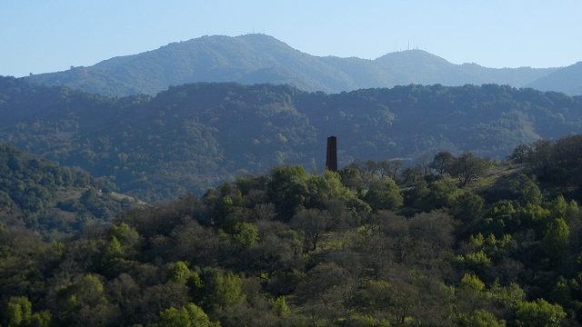
"caption": "View west from Almaden Quicksilver County Park toward Loma Prieta, highest peak of the Sierra Azul. All photos by Andrew Alden.",
"description": null,
"title": "newalmaden",
"credit": null,
"status": "inherit",
"isLoading": false,
"fetchFailed": false
},
"quest_32499": {
"type": "attachments",
"id": "quest_32499",
"meta": {
"index": "attachments_1716263798",
"site": "quest",
"id": "32499",
"found": true
},
"parent": 32484,
"imgSizes": {
"thumbnail": {
"file": "https://ww2.kqed.org/app/uploads/sites/39/2012/03/panoche-400x225.jpg",
"width": 400,
"mimeType": "image/jpeg",
"height": 225
},
"kqedFullSize": {
"file": "https://ww2.kqed.org/app/uploads/sites/39/2012/03/panoche.jpg",
"width": 640,
"height": 360
},
"guest-author-96": {
"file": "https://ww2.kqed.org/app/uploads/sites/39/2012/03/panoche-96x96.jpg",
"width": 96,
"mimeType": "image/jpeg",
"height": 96
},
"guest-author-64": {
"file": "https://ww2.kqed.org/app/uploads/sites/39/2012/03/panoche-64x64.jpg",
"width": 64,
"mimeType": "image/jpeg",
"height": 64
},
"detail": {
"file": "https://ww2.kqed.org/app/uploads/sites/39/2012/03/panoche-75x75.jpg",
"width": 75,
"mimeType": "image/jpeg",
"height": 75
},
"guest-author-32": {
"file": "https://ww2.kqed.org/app/uploads/sites/39/2012/03/panoche-32x32.jpg",
"width": 32,
"mimeType": "image/jpeg",
"height": 32
},
"guest-author-128": {
"file": "https://ww2.kqed.org/app/uploads/sites/39/2012/03/panoche-128x128.jpg",
"width": 128,
"mimeType": "image/jpeg",
"height": 128
}
},
"publishDate": 1331234786,
"modified": 1331234786,
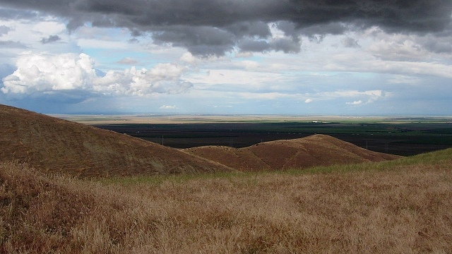
"caption": "The Panoche Hills provide a splendid overlook to the Great Valley on good days. Photos by Andrew Alden",
"description": null,
"title": "panoche",
"credit": null,
"status": "inherit",
"isLoading": false,
"fetchFailed": false
},
"quest_31903": {
"type": "attachments",
"id": "quest_31903",
"meta": {
"index": "attachments_1716263798",
"site": "quest",
"id": "31903",
"found": true
},
"parent": 31902,
"imgSizes": {
"thumbnail": {
"file": "https://ww2.kqed.org/app/uploads/sites/39/2012/03/pacifica-tsusign-400x225.jpg",
"width": 400,
"mimeType": "image/jpeg",
"height": 225
},
"kqedFullSize": {
"file": "https://ww2.kqed.org/app/uploads/sites/39/2012/03/pacifica-tsusign.jpg",
"width": 640,
"height": 360
},
"guest-author-96": {
"file": "https://ww2.kqed.org/app/uploads/sites/39/2012/03/pacifica-tsusign-96x96.jpg",
"width": 96,
"mimeType": "image/jpeg",
"height": 96
},
"guest-author-64": {
"file": "https://ww2.kqed.org/app/uploads/sites/39/2012/03/pacifica-tsusign-64x64.jpg",
"width": 64,
"mimeType": "image/jpeg",
"height": 64
},
"detail": {
"file": "https://ww2.kqed.org/app/uploads/sites/39/2012/03/pacifica-tsusign-75x75.jpg",
"width": 75,
"mimeType": "image/jpeg",
"height": 75
},
"guest-author-32": {
"file": "https://ww2.kqed.org/app/uploads/sites/39/2012/03/pacifica-tsusign-32x32.jpg",
"width": 32,
"mimeType": "image/jpeg",
"height": 32
},
"guest-author-128": {
"file": "https://ww2.kqed.org/app/uploads/sites/39/2012/03/pacifica-tsusign-128x128.jpg",
"width": 128,
"mimeType": "image/jpeg",
"height": 128
}
},
"publishDate": 1330630572,
"modified": 1330630572,
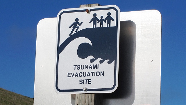
"caption": "Tsunami awareness requires more than just signage; government support for public education and scientific research is crucial too. Photo courtesy {link url=http://www.flickr.com/photos/anitakhart/}Anita Hart{/link} of Flickr under Creative Commons license",
"description": null,
"title": "pacifica-tsusign",
"credit": null,
"status": "inherit",
"isLoading": false,
"fetchFailed": false
},
"quest_31355": {
"type": "attachments",
"id": "quest_31355",
"meta": {
"index": "attachments_1716263798",
"site": "quest",
"id": "31355",
"found": true
},
"parent": 31352,
"imgSizes": {
"thumbnail": {
"file": "https://ww2.kqed.org/app/uploads/sites/39/2012/02/gigapantop-400x225.jpg",
"width": 400,
"mimeType": "image/jpeg",
"height": 225
},
"kqedFullSize": {
"file": "https://ww2.kqed.org/app/uploads/sites/39/2012/02/gigapantop.jpg",
"width": 640,
"height": 360
},
"guest-author-96": {
"file": "https://ww2.kqed.org/app/uploads/sites/39/2012/02/gigapantop-96x96.jpg",
"width": 96,
"mimeType": "image/jpeg",
"height": 96
},
"guest-author-64": {
"file": "https://ww2.kqed.org/app/uploads/sites/39/2012/02/gigapantop-64x64.jpg",
"width": 64,
"mimeType": "image/jpeg",
"height": 64
},
"detail": {
"file": "https://ww2.kqed.org/app/uploads/sites/39/2012/02/gigapantop-75x75.jpg",
"width": 75,
"mimeType": "image/jpeg",
"height": 75
},
"guest-author-32": {
"file": "https://ww2.kqed.org/app/uploads/sites/39/2012/02/gigapantop-32x32.jpg",
"width": 32,
"mimeType": "image/jpeg",
"height": 32
},
"guest-author-128": {
"file": "https://ww2.kqed.org/app/uploads/sites/39/2012/02/gigapantop-128x128.jpg",
"width": 128,
"mimeType": "image/jpeg",
"height": 128
}
},
"publishDate": 1330021924,
"modified": 1330021924,
"caption": "This clean roadcut exposure of Marin County's finest ribbon chert is documented in a gigapan image that can be enlarged 100 times. Image by Ron Schott.",
"description": null,
"title": "gigapantop",
"credit": null,
"status": "inherit",
"isLoading": false,
"fetchFailed": false
},
"quest_30814": {
"type": "attachments",
"id": "quest_30814",
"meta": {
"index": "attachments_1716263798",
"site": "quest",
"id": "30814",
"found": true
},
"parent": 30811,
"imgSizes": {
"thumbnail": {
"file": "https://ww2.kqed.org/app/uploads/sites/39/2012/02/CAcascadiatop-400x225.jpg",
"width": 400,
"mimeType": "image/jpeg",
"height": 225
},
"kqedFullSize": {
"file": "https://ww2.kqed.org/app/uploads/sites/39/2012/02/CAcascadiatop.jpg",
"width": 640,
"height": 360
},
"guest-author-96": {
"file": "https://ww2.kqed.org/app/uploads/sites/39/2012/02/CAcascadiatop-96x96.jpg",
"width": 96,
"mimeType": "image/jpeg",
"height": 96
},
"guest-author-64": {
"file": "https://ww2.kqed.org/app/uploads/sites/39/2012/02/CAcascadiatop-64x64.jpg",
"width": 64,
"mimeType": "image/jpeg",
"height": 64
},
"detail": {
"file": "https://ww2.kqed.org/app/uploads/sites/39/2012/02/CAcascadiatop-75x75.jpg",
"width": 75,
"mimeType": "image/jpeg",
"height": 75
},
"guest-author-32": {
"file": "https://ww2.kqed.org/app/uploads/sites/39/2012/02/CAcascadiatop-32x32.jpg",
"width": 32,
"mimeType": "image/jpeg",
"height": 32
},
"guest-author-128": {
"file": "https://ww2.kqed.org/app/uploads/sites/39/2012/02/CAcascadiatop-128x128.jpg",
"width": 128,
"mimeType": "image/jpeg",
"height": 128
}
},
"publishDate": 1329367019,
"modified": 1329367019,
"caption": "The coastal region of northernmost California, including the Klamath Range shown here, is in the Cascadia subduction zone, America's geological analog of Sumatra. Photo by Andrew Alden",
"description": null,
"title": "CAcascadiatop",
"credit": null,
"status": "inherit",
"isLoading": false,
"fetchFailed": false
},
"quest_77067": {
"type": "attachments",
"id": "quest_77067",
"meta": {
"index": "attachments_1716263798",
"site": "quest",
"id": "77067",
"found": true
},
"parent": 29461,
"imgSizes": {
"twentyfourteen-full-width": {
"file": "https://ww2.kqed.org/app/uploads/sites/39/2012/02/infographic_anatomyofanearthquake-1038x576.jpg",
"width": 1038,
"mimeType": "image/jpeg",
"height": 576
},
"thumbnail": {
"file": "https://ww2.kqed.org/app/uploads/sites/39/2012/02/infographic_anatomyofanearthquake-400x225.jpg",
"width": 400,
"mimeType": "image/jpeg",
"height": 225
},
"fd-sm": {
"file": "https://ww2.kqed.org/app/uploads/sites/39/2012/02/infographic_anatomyofanearthquake-960x540.jpg",
"width": 960,
"mimeType": "image/jpeg",
"height": 540
},
"post-thumbnail": {
"file": "https://ww2.kqed.org/app/uploads/sites/39/2012/02/infographic_anatomyofanearthquake-672x372.jpg",
"width": 672,
"mimeType": "image/jpeg",
"height": 372
},
"kqedFullSize": {
"file": "https://ww2.kqed.org/app/uploads/sites/39/2012/02/infographic_anatomyofanearthquake.jpg",
"width": 2666,
"height": 1500
},
"large": {
"file": "https://ww2.kqed.org/app/uploads/sites/39/2012/02/infographic_anatomyofanearthquake-1440x810.jpg",
"width": 1440,
"mimeType": "image/jpeg",
"height": 810
},
"guest-author-96": {
"file": "https://ww2.kqed.org/app/uploads/sites/39/2012/02/infographic_anatomyofanearthquake-96x96.jpg",
"width": 96,
"mimeType": "image/jpeg",
"height": 96
},
"medium": {
"file": "https://ww2.kqed.org/app/uploads/sites/39/2012/02/infographic_anatomyofanearthquake-800x450.jpg",
"width": 800,
"mimeType": "image/jpeg",
"height": 450
},
"guest-author-64": {
"file": "https://ww2.kqed.org/app/uploads/sites/39/2012/02/infographic_anatomyofanearthquake-64x64.jpg",
"width": 64,
"mimeType": "image/jpeg",
"height": 64
},
"guest-author-32": {
"file": "https://ww2.kqed.org/app/uploads/sites/39/2012/02/infographic_anatomyofanearthquake-32x32.jpg",
"width": 32,
"mimeType": "image/jpeg",
"height": 32
},
"fd-lrg": {
"file": "https://ww2.kqed.org/app/uploads/sites/39/2012/02/infographic_anatomyofanearthquake-1920x1080.jpg",
"width": 1920,
"mimeType": "image/jpeg",
"height": 1080
},
"fd-med": {
"file": "https://ww2.kqed.org/app/uploads/sites/39/2012/02/infographic_anatomyofanearthquake-1180x664.jpg",
"width": 1180,
"mimeType": "image/jpeg",
"height": 664
},
"detail": {
"file": "https://ww2.kqed.org/app/uploads/sites/39/2012/02/infographic_anatomyofanearthquake-75x75.jpg",
"width": 75,
"mimeType": "image/jpeg",
"height": 75
},
"guest-author-128": {
"file": "https://ww2.kqed.org/app/uploads/sites/39/2012/02/infographic_anatomyofanearthquake-128x128.jpg",
"width": 128,
"mimeType": "image/jpeg",
"height": 128
}
},
"publishDate": 1443476173,
"modified": 1460591428,
"caption": "This image by KQED is licensed under a Creative Commons Attribution-NonCommercial-ShareAlike 3.0 Unported License.",
"description": null,
"title": "infographic_anatomyofanearthquake",
"credit": null,
"status": "inherit",
"isLoading": false,
"fetchFailed": false
},
"quest_30065": {
"type": "attachments",
"id": "quest_30065",
"meta": {
"index": "attachments_1716263798",
"site": "quest",
"id": "30065",
"found": true
},
"parent": 30064,
"imgSizes": {
"thumbnail": {
"file": "https://ww2.kqed.org/app/uploads/sites/39/2012/02/obsidiantop-400x225.jpg",
"width": 400,
"mimeType": "image/jpeg",
"height": 225
},
"kqedFullSize": {
"file": "https://ww2.kqed.org/app/uploads/sites/39/2012/02/obsidiantop.jpg",
"width": 640,
"height": 360
},
"guest-author-96": {
"file": "https://ww2.kqed.org/app/uploads/sites/39/2012/02/obsidiantop-96x96.jpg",
"width": 96,
"mimeType": "image/jpeg",
"height": 96
},
"guest-author-64": {
"file": "https://ww2.kqed.org/app/uploads/sites/39/2012/02/obsidiantop-64x64.jpg",
"width": 64,
"mimeType": "image/jpeg",
"height": 64
},
"detail": {
"file": "https://ww2.kqed.org/app/uploads/sites/39/2012/02/obsidiantop-75x75.jpg",
"width": 75,
"mimeType": "image/jpeg",
"height": 75
},
"guest-author-32": {
"file": "https://ww2.kqed.org/app/uploads/sites/39/2012/02/obsidiantop-32x32.jpg",
"width": 32,
"mimeType": "image/jpeg",
"height": 32
},
"guest-author-128": {
"file": "https://ww2.kqed.org/app/uploads/sites/39/2012/02/obsidiantop-128x128.jpg",
"width": 128,
"mimeType": "image/jpeg",
"height": 128
}
},
"publishDate": 1328209396,
"modified": 1328209396,
"caption": "A nodule of Napa Glass Mountain obsidian, etched by hydration during its long burial, reveals signs of its origin as a thick, sticky lava. Photos by Andrew Alden",
"description": null,
"title": "obsidiantop",
"credit": null,
"status": "inherit",
"isLoading": false,
"fetchFailed": false
},
"quest_29810": {
"type": "attachments",
"id": "quest_29810",
"meta": {
"index": "attachments_1716263798",
"site": "quest",
"id": "29810",
"found": true
},
"parent": 29808,
"imgSizes": {
"thumbnail": {
"file": "https://ww2.kqed.org/app/uploads/sites/39/2012/01/devilsgate-400x225.jpg",
"width": 400,
"mimeType": "image/jpeg",
"height": 225
},
"kqedFullSize": {
"file": "https://ww2.kqed.org/app/uploads/sites/39/2012/01/devilsgate.jpg",
"width": 640,
"height": 360
},
"guest-author-96": {
"file": "https://ww2.kqed.org/app/uploads/sites/39/2012/01/devilsgate-96x96.jpg",
"width": 96,
"mimeType": "image/jpeg",
"height": 96
},
"guest-author-64": {
"file": "https://ww2.kqed.org/app/uploads/sites/39/2012/01/devilsgate-64x64.jpg",
"width": 64,
"mimeType": "image/jpeg",
"height": 64
},
"detail": {
"file": "https://ww2.kqed.org/app/uploads/sites/39/2012/01/devilsgate-75x75.jpg",
"width": 75,
"mimeType": "image/jpeg",
"height": 75
},
"guest-author-32": {
"file": "https://ww2.kqed.org/app/uploads/sites/39/2012/01/devilsgate-32x32.jpg",
"width": 32,
"mimeType": "image/jpeg",
"height": 32
},
"guest-author-128": {
"file": "https://ww2.kqed.org/app/uploads/sites/39/2012/01/devilsgate-128x128.jpg",
"width": 128,
"mimeType": "image/jpeg",
"height": 128
}
},
"publishDate": 1327607891,
"modified": 1327607891,
"caption": null,
"description": null,
"title": "devilsgate",
"credit": null,
"status": "inherit",
"isLoading": false,
"fetchFailed": false
},
"quest_29218": {
"type": "attachments",
"id": "quest_29218",
"meta": {
"index": "attachments_1716263798",
"site": "quest",
"id": "29218",
"found": true
},
"parent": 29217,
"imgSizes": {
"thumbnail": {
"file": "https://ww2.kqed.org/app/uploads/sites/39/2012/01/concretiontop-400x225.jpg",
"width": 400,
"mimeType": "image/jpeg",
"height": 225
},
"kqedFullSize": {
"file": "https://ww2.kqed.org/app/uploads/sites/39/2012/01/concretiontop.jpg",
"width": 640,
"height": 360
},
"guest-author-96": {
"file": "https://ww2.kqed.org/app/uploads/sites/39/2012/01/concretiontop-96x96.jpg",
"width": 96,
"mimeType": "image/jpeg",
"height": 96
},
"guest-author-64": {
"file": "https://ww2.kqed.org/app/uploads/sites/39/2012/01/concretiontop-64x64.jpg",
"width": 64,
"mimeType": "image/jpeg",
"height": 64
},
"detail": {
"file": "https://ww2.kqed.org/app/uploads/sites/39/2012/01/concretiontop-75x75.jpg",
"width": 75,
"mimeType": "image/jpeg",
"height": 75
},
"guest-author-32": {
"file": "https://ww2.kqed.org/app/uploads/sites/39/2012/01/concretiontop-32x32.jpg",
"width": 32,
"mimeType": "image/jpeg",
"height": 32
},
"guest-author-128": {
"file": "https://ww2.kqed.org/app/uploads/sites/39/2012/01/concretiontop-128x128.jpg",
"width": 128,
"mimeType": "image/jpeg",
"height": 128
}
},
"publishDate": 1326341749,
"modified": 1326341749,
"caption": "Concretions at Bowling Ball Beach. Photo by {link url=http://www.flickr.com/photos/happenstancephotos/}portmanteaus{/link} under Creative Commons license.",
"description": null,
"title": "concretiontop",
"credit": null,
"status": "inherit",
"isLoading": false,
"fetchFailed": false
},
"quest_28674": {
"type": "attachments",
"id": "quest_28674",
"meta": {
"index": "attachments_1716263798",
"site": "quest",
"id": "28674",
"found": true
},
"parent": 28651,
"imgSizes": {
"thumbnail": {
"file": "https://ww2.kqed.org/app/uploads/sites/39/2011/12/sf_sand640-400x225.jpg",
"width": 400,
"mimeType": "image/jpeg",
"height": 225
},
"kqedFullSize": {
"file": "https://ww2.kqed.org/app/uploads/sites/39/2011/12/sf_sand640.jpg",
"width": 640,
"height": 360
},
"guest-author-96": {
"file": "https://ww2.kqed.org/app/uploads/sites/39/2011/12/sf_sand640-96x96.jpg",
"width": 96,
"mimeType": "image/jpeg",
"height": 96
},
"guest-author-64": {
"file": "https://ww2.kqed.org/app/uploads/sites/39/2011/12/sf_sand640-64x64.jpg",
"width": 64,
"mimeType": "image/jpeg",
"height": 64
},
"detail": {
"file": "https://ww2.kqed.org/app/uploads/sites/39/2011/12/sf_sand640-75x75.jpg",
"width": 75,
"mimeType": "image/jpeg",
"height": 75
},
"guest-author-32": {
"file": "https://ww2.kqed.org/app/uploads/sites/39/2011/12/sf_sand640-32x32.jpg",
"width": 32,
"mimeType": "image/jpeg",
"height": 32
},
"guest-author-128": {
"file": "https://ww2.kqed.org/app/uploads/sites/39/2011/12/sf_sand640-128x128.jpg",
"width": 128,
"mimeType": "image/jpeg",
"height": 128
}
},
"publishDate": 1324595906,
"modified": 1324595906,
"caption": "The next time you go to the beach, whether at the ocean or beside a river, take a closer look at the sand and think about the stories those grains can tell! ",
"description": "The next time you go to the beach, whether at the ocean or beside a river, take a closer look at the sand and think about the stories those grains can tell!\r\n",
"title": "sf_sand640",
"credit": null,
"status": "inherit",
"isLoading": false,
"fetchFailed": false
},
"quest_28656": {
"type": "attachments",
"id": "quest_28656",
"meta": {
"index": "attachments_1716263798",
"site": "quest",
"id": "28656",
"found": true
},
"parent": 28655,
"imgSizes": {
"thumbnail": {
"file": "https://ww2.kqed.org/app/uploads/sites/39/2011/12/diablo-xmasquiz-400x225.jpg",
"width": 400,
"mimeType": "image/jpeg",
"height": 225
},
"kqedFullSize": {
"file": "https://ww2.kqed.org/app/uploads/sites/39/2011/12/diablo-xmasquiz.jpg",
"width": 640,
"height": 360
},
"guest-author-96": {
"file": "https://ww2.kqed.org/app/uploads/sites/39/2011/12/diablo-xmasquiz-96x96.jpg",
"width": 96,
"mimeType": "image/jpeg",
"height": 96
},
"guest-author-64": {
"file": "https://ww2.kqed.org/app/uploads/sites/39/2011/12/diablo-xmasquiz-64x64.jpg",
"width": 64,
"mimeType": "image/jpeg",
"height": 64
},
"detail": {
"file": "https://ww2.kqed.org/app/uploads/sites/39/2011/12/diablo-xmasquiz-75x75.jpg",
"width": 75,
"mimeType": "image/jpeg",
"height": 75
},
"guest-author-32": {
"file": "https://ww2.kqed.org/app/uploads/sites/39/2011/12/diablo-xmasquiz-32x32.jpg",
"width": 32,
"mimeType": "image/jpeg",
"height": 32
},
"guest-author-128": {
"file": "https://ww2.kqed.org/app/uploads/sites/39/2011/12/diablo-xmasquiz-128x128.jpg",
"width": 128,
"mimeType": "image/jpeg",
"height": 128
}
},
"publishDate": 1324525733,
"modified": 1324525733,
"caption": "You know Mount Diablo. But do you know what kind of rock it's made of? Photo by Andrew Alden",
"description": null,
"title": "diablo-xmasquiz",
"credit": null,
"status": "inherit",
"isLoading": false,
"fetchFailed": false
},
"quest_28518": {
"type": "attachments",
"id": "quest_28518",
"meta": {
"index": "attachments_1716263798",
"site": "quest",
"id": "28518",
"found": true
},
"parent": 28517,
"imgSizes": {
"thumbnail": {
"file": "https://ww2.kqed.org/app/uploads/sites/39/2011/12/EQpreptop-400x225.jpg",
"width": 400,
"mimeType": "image/jpeg",
"height": 225
},
"kqedFullSize": {
"file": "https://ww2.kqed.org/app/uploads/sites/39/2011/12/EQpreptop.jpg",
"width": 640,
"height": 360
},
"guest-author-96": {
"file": "https://ww2.kqed.org/app/uploads/sites/39/2011/12/EQpreptop-96x96.jpg",
"width": 96,
"mimeType": "image/jpeg",
"height": 96
},
"guest-author-64": {
"file": "https://ww2.kqed.org/app/uploads/sites/39/2011/12/EQpreptop-64x64.jpg",
"width": 64,
"mimeType": "image/jpeg",
"height": 64
},
"detail": {
"file": "https://ww2.kqed.org/app/uploads/sites/39/2011/12/EQpreptop-75x75.jpg",
"width": 75,
"mimeType": "image/jpeg",
"height": 75
},
"guest-author-32": {
"file": "https://ww2.kqed.org/app/uploads/sites/39/2011/12/EQpreptop-32x32.jpg",
"width": 32,
"mimeType": "image/jpeg",
"height": 32
},
"guest-author-128": {
"file": "https://ww2.kqed.org/app/uploads/sites/39/2011/12/EQpreptop-128x128.jpg",
"width": 128,
"mimeType": "image/jpeg",
"height": 128
}
},
"publishDate": 1323924248,
"modified": 1323924248,
"caption": "The Bay Bridge upgrade is part of the Bay Area's response to future earthquakes. Preparedness in your home is just as essential, and not half as complicated. Photo courtesy {link url=http://www.flickr.com/photos/telstar/}Todd Lappin{/link} under Creative Commons license",
"description": null,
"title": "EQpreptop",
"credit": null,
"status": "inherit",
"isLoading": false,
"fetchFailed": false
}
},
"audioPlayerReducer": {
"postId": "stream_live",
"isPaused": true,
"isPlaying": false,
"pfsActive": false,
"pledgeModalIsOpen": true,
"playerDrawerIsOpen": false,
"liveAudioPlayStartedAt": 0,
"liveAudioPlayContext": ""
},
"authorsReducer": {
"andrew-alden": {
"type": "authors",
"id": "6228",
"meta": {
"index": "authors_1716337520",
"id": "6228",
"found": true
},
"name": "Andrew Alden",
"firstName": "Andrew",
"lastName": "Alden",
"slug": "andrew-alden",
"email": "alden@andrew-alden.com",
"display_author_email": false,
"staff_mastheads": [],
"title": null,
"bio": "Andrew Alden earned his geology degree at the University of New Hampshire and moved back to the Bay Area to work at the U.S. Geological Survey for six years. He has \u003ca href=\"http://geology.about.com/\">written on geology for About.com\u003c/a> since its founding in 1997. In 2007, he started the Oakland Geology blog, which won recognition as \"Best of the East Bay\" from the \u003ci>East Bay Express\u003c/i> in 2010. In writing about geology in the Bay Area and surroundings, he hopes to share some of the useful and pleasurable insights that geologists give us—not just facts about the deep past, but an attitude that might be called the \u003ci>deep present\u003c/i>.\r\n\r\nRead his \u003ca href=\"http://science.kqed.org/quest/author/andrew-alden/\">previous contributions\u003c/a> to \u003ca href=\"http://http://science.kqed.org/quest/\">QUEST\u003c/a>, a project dedicated to exploring the Science of Sustainability.",
"avatar": "https://secure.gravatar.com/avatar/9eaa0afc32f98c5fc7ce634437334a64?s=600&d=blank&r=g",
"twitter": null,
"facebook": null,
"instagram": null,
"linkedin": null,
"sites": [
{
"site": "science",
"roles": [
"author"
]
},
{
"site": "quest",
"roles": [
"subscriber"
]
}
],
"headData": {
"title": "Andrew Alden | KQED",
"description": null,
"ogImgSrc": "https://secure.gravatar.com/avatar/9eaa0afc32f98c5fc7ce634437334a64?s=600&d=blank&r=g",
"twImgSrc": "https://secure.gravatar.com/avatar/9eaa0afc32f98c5fc7ce634437334a64?s=600&d=blank&r=g"
},
"isLoading": false,
"link": "/author/andrew-alden"
},
"quest": {
"type": "authors",
"id": "10216",
"meta": {
"index": "authors_1716337520",
"id": "10216",
"found": true
},
"name": "QUEST Staff",
"firstName": "QUEST",
"lastName": "Staff",
"slug": "quest",
"email": "quest@kqed.orgx",
"display_author_email": false,
"staff_mastheads": [],
"title": null,
"bio": "QUEST, an Emmy Award-winning multimedia science series, has a new focus on the science of sustainability.The half-hour magazine style episodes are produced by a collaboration of six public broadcasters around the country and explore a wide variety of sustainability issues related to food, energy, water, climate and biodiversity. The story segments featured in each show are introduced by on-camera host, environmental journalist \u003ca href=\"http://science.kqed.org/quest/author/pssethi/\">Simran Sethi\u003c/a>. The series also includes half-hour specials that focus on a single topic.\r\n \r\nAll 2013-2014 television programs can be viewed online in their entirety or as individual segments by clicking on the titles and images listed below. The programs are also broadcast in each of our six PBS partner regions including \u003ca href=\"http://science.kqed.org/quest/stations/north-carolina/\">North Carolina\u003c/a>, \u003ca href=\"http://science.kqed.org/quest/stations/ohio/\">Ohio\u003c/a>, \u003ca href=\"http://science.kqed.org/quest/stations/nebraska/\">Nebraska\u003c/a>, \u003ca href=\"http://science.kqed.org/quest/stations/northern-california/\">Northern California\u003c/a> and the \u003ca href=\"http://science.kqed.org/quest/stations/northwest/\">Pacific Northwest\u003c/a>. Check local listings for broadcast dates and times.",
"avatar": "https://secure.gravatar.com/avatar/d3874a881a1fe56a99098a4feea236c8?s=600&d=blank&r=g",
"twitter": null,
"facebook": null,
"instagram": null,
"linkedin": null,
"sites": [
{
"site": "quest",
"roles": [
"editor"
]
}
],
"headData": {
"title": "QUEST Staff | KQED",
"description": null,
"ogImgSrc": "https://secure.gravatar.com/avatar/d3874a881a1fe56a99098a4feea236c8?s=600&d=blank&r=g",
"twImgSrc": "https://secure.gravatar.com/avatar/d3874a881a1fe56a99098a4feea236c8?s=600&d=blank&r=g"
},
"isLoading": false,
"link": "/author/quest"
},
"terrikh": {
"type": "authors",
"id": "10315",
"meta": {
"index": "authors_1716337520",
"id": "10315",
"found": true
},
"name": "Terri Kirby-Hathaway",
"firstName": "Terri",
"lastName": "Kirby-Hathaway",
"slug": "terrikh",
"email": "terrikh@csi.northcarolina.edu",
"display_author_email": false,
"staff_mastheads": [],
"title": null,
"bio": "Terri Kirby Hathaway has been the Marine Education Specialist for North Carolina Sea Grant since October 2003, sharing her knowledge of ocean sciences and aquatic environments with educators statewide. Prior to that, she was the Education Curator at the NC Aquarium on Roanoke Island for 18.5 years. \r\n\r\nTerri is active in state, regional, and national professional organizations, presenting at various conferences and instructing at professional development workshops. In addition, she serves as an Education Associate for the Center for Ocean Sciences Education Excellence – SouthEast working with educators and scientists in North Carolina, South Carolina, and Georgia. An active member of her community, Terri serves on the Board for Outer Banks Hotline, local women’s crisis center, and as a Supervisor for the Dare Soil and Water Conservation Board. \r\n \r\nTerri has a BS in Marine Biology from the University of North Carolina at Wilmington and a MAEd in Science Education from East Carolina University. She and her oceanographer husband Kent live on North Carolina’s beautiful Outer Banks with their three wild and crazy cats!",
"avatar": "https://secure.gravatar.com/avatar/e4823e9c46e0badd7a8a2c2bdb1a2187?s=600&d=blank&r=g",
"twitter": null,
"facebook": null,
"instagram": null,
"linkedin": null,
"sites": [
{
"site": "quest",
"roles": [
"subscriber"
]
}
],
"headData": {
"title": "Terri Kirby-Hathaway | KQED",
"description": null,
"ogImgSrc": "https://secure.gravatar.com/avatar/e4823e9c46e0badd7a8a2c2bdb1a2187?s=600&d=blank&r=g",
"twImgSrc": "https://secure.gravatar.com/avatar/e4823e9c46e0badd7a8a2c2bdb1a2187?s=600&d=blank&r=g"
},
"isLoading": false,
"link": "/author/terrikh"
}
},
"pagesReducer": {
"science_category_geology": {
"type": "terms",
"id": "science_38",
"meta": {
"index": "terms_1716263798",
"site": "science",
"id": "38",
"score": 13.559078
},
"featImg": null,
"name": "Geology",
"description": null,
"taxonomy": "category",
"headData": {
"twImgId": null,
"twTitle": null,
"ogTitle": null,
"ogImgId": null,
"twDescription": null,
"description": null,
"title": "Geology Archives | KQED Science",
"ogDescription": null
},
"ttid": 40,
"slug": "geology",
"isLoading": false,
"title": "Geology",
"pageMeta": {
"site": "science",
"WpPageTemplate": "page-topic-editorial",
"currentPage": 25
},
"blocks": [
{
"blockName": "kqed/post-list",
"attrs": {
"layout": "cardArticle2",
"query": "posts/science?category=geology",
"seeMore": false,
"paginated": true,
"page": 25
}
},
{
"blockName": "kqed/ad"
}
]
}
},
"pfsSessionReducer": {},
"postsReducer": {
"stream_live": {
"type": "live",
"id": "stream_live",
"audioUrl": "https://hls.kqed.org/hls/kqed_app/playlist.m3u8",
"title": "Live Stream",
"excerpt": "Live Stream information currently unavailable.",
"link": "/radio",
"featImg": "",
"label": {
"name": "KQED Live",
"link": "/"
}
},
"stream_kqedNewscast": {
"type": "posts",
"id": "stream_kqedNewscast",
"audioUrl": "https://www.kqed.org/.stream/anon/radio/RDnews/newscast.mp3?_=1",
"title": "KQED Newscast",
"featImg": "",
"label": {
"name": "88.5 FM",
"link": "/"
}
},
"quest_33174": {
"type": "posts",
"id": "quest_33174",
"meta": {
"index": "posts_1716263798",
"site": "quest",
"id": "33174",
"score": null,
"sort": [
1331827215000
]
},
"parent": 0,
"labelTerm": {
"site": "quest"
},
"blocks": [],
"publishDate": 1331827215,
"format": "standard",
"disqusTitle": "Geological Outings Around the Bay: New Almaden",
"title": "Geological Outings Around the Bay: New Almaden",
"headTitle": "QUEST | KQED Science",
"content": "\u003cfigure id=\"attachment_33179\" class=\"wp-caption alignleft\" style=\"max-width: 300px\">\u003ca href=\"http://ww2.kqed.org/quest/2012/03/15/geological-outings-around-the-bay-new-almaden/newalmaden/\" rel=\"attachment wp-att-33179\">\u003cimg src=\"http://ww2.kqed.org/quest/wp-content/uploads/sites/39/2012/03/newalmaden-300x169.jpg\" alt=\"\" title=\"newalmaden\" width=\"300\" height=\"169\" class=\"size-thumbnail wp-image-33179\">\u003c/a>\u003cfigcaption class=\"wp-caption-text\">View west from Almaden Quicksilver County Park toward Loma Prieta, highest peak of the Sierra Azul. All photos by Andrew Alden.\u003c/figcaption>\u003c/figure>\n\u003cp>In the foothills due south of San Jose sit the remnants of California's first mining bonanza, the New Almaden mercury district. Today \u003ca href=\"http://www.newalmaden.org/AQSPark/index.html\">Almaden Quicksilver County Park\u003c/a> is a rugged playground for hikers, bicyclists and equestrians, but lovers of geology and mines have a special kind of fun there.\u003c/p>\n\u003cp>The first Californians mined a deep-red ore they called \u003ci>mohetka\u003c/i> in the heights of Los Capitancillos Ridge. Like other ancient peoples around the world, they used it as a pigment. In 1845 a Mexican visitor recognized the substance as cinnabar or mercury ore. Soon afterward the New World's richest quicksilver mining district began production, supplying the mercury for the refiners of the California Gold Rush. Its name, New Almaden, echoed the famous Almadén mines of Spain. A hundred years later, the mines had yielded mercury in the amount of more than a million flasks—a volume of the liquid metal weighing 76 pounds. Although mining ended in the 1970s, geologists believe that much undiscovered ore remains.\u003c/p>\n\u003cp>Let's look at the geologic map of the area (derived from \u003ca href=\"http://pubs.usgs.gov/of/1998/of98-795/\">USGS Map OF-98-975\u003c/a>). \u003c/p>\n\u003cfigure id=\"attachment_33181\" class=\"wp-caption aligncenter\" style=\"max-width: 627px\">\u003ca href=\"http://ww2.kqed.org/quest/2012/03/15/geological-outings-around-the-bay-new-almaden/newalmadengeomap/\" rel=\"attachment wp-att-33181\">\u003cimg src=\"http://ww2.kqed.org/quest/wp-content/uploads/sites/39/2012/03/newalmadengeomap.png\" alt=\"\" title=\"newalmadengeomap\" width=\"627\" height=\"472\" class=\"size-full wp-image-33181\" srcset=\"https://ww2.kqed.org/app/uploads/sites/39/2012/03/newalmadengeomap.png 627w, https://ww2.kqed.org/app/uploads/sites/39/2012/03/newalmadengeomap-400x301.png 400w\" sizes=\"(max-width: 627px) 100vw, 627px\">\u003c/a>\u003cfigcaption class=\"wp-caption-text\">The New Almaden district runs northwest on Los Capitancillos Ridge from the village of New Almaden. Asterisks mark the four park entrances. Franciscan rock units are fm, melange; fpv, volcanics; gs, greenstone; pink, serpentinite; yellow, silica-carbonate rock; orange, chert. Units with names starting Q, T or K are younger.\u003c/figcaption>\u003c/figure>\n\u003cp>It's kind of a mess, and the details are in the caption, but basically Los Capitancillos Ridge is like many other \u003ca href=\"http://ww2.kqed.org/quest/2011/07/21/bay-area-mercury/\">Bay Area mercury sites\u003c/a>, an intricate mixture of \u003ca href=\"http://ww2.kqed.org/quest/2011/04/21/geological-outings-around-the-bay-marin-headlands/\">Franciscan rocks\u003c/a> and serpentinite that has been kneaded and heated and injected with metal-bearing fluids. These fluids, derived from magma intrusions, replaced the minerals in the serpentinite and turned it into silica-carbonate rock. The cinnabar lodes, in turn, were emplaced in and near the silica-carbonates. As you hike about the ridge, keep an eye underfoot for the widespread \u003ca href=\"http://geology.about.com/od/more_metrocks/ig/serpentinites/\">serpentinite\u003c/a>.\u003c/p>\n\u003cfigure id=\"attachment_33182\" class=\"wp-caption aligncenter\" style=\"max-width: 600px\">\u003ca href=\"http://ww2.kqed.org/quest/2012/03/15/geological-outings-around-the-bay-new-almaden/newalmadenserpentine/\" rel=\"attachment wp-att-33182\">\u003cimg src=\"http://ww2.kqed.org/quest/wp-content/uploads/sites/39/2012/03/newalmadenserpentine.jpg\" alt=\"\" title=\"newalmadenserpentine\" width=\"600\" height=\"438\" class=\"size-full wp-image-33182\" srcset=\"https://ww2.kqed.org/app/uploads/sites/39/2012/03/newalmadenserpentine.jpg 600w, https://ww2.kqed.org/app/uploads/sites/39/2012/03/newalmadenserpentine-400x292.jpg 400w\" sizes=\"(max-width: 600px) 100vw, 600px\">\u003c/a>\u003cfigcaption class=\"wp-caption-text\">Serpentinite boulders in a streambed.\u003c/figcaption>\u003c/figure>\n\u003cp>Among other things, the park contains mines and machinery spanning a century of progress from traditional techniques of medieval origin to modern American facilities. One mine entrance, the San Cristobal tunnel, has been kept open for a short distance.\u003c/p>\n\u003cfigure id=\"attachment_33175\" class=\"wp-caption aligncenter\" style=\"max-width: 500px\">\u003ca href=\"http://ww2.kqed.org/quest/2012/03/15/geological-outings-around-the-bay-new-almaden/sancristobal/\" rel=\"attachment wp-att-33175\">\u003cimg src=\"http://ww2.kqed.org/quest/wp-content/uploads/sites/39/2012/03/sancristobal.jpg\" alt=\"\" title=\"sancristobal\" width=\"500\" height=\"402\" class=\"size-full wp-image-33175\" srcset=\"https://ww2.kqed.org/app/uploads/sites/39/2012/03/sancristobal.jpg 500w, https://ww2.kqed.org/app/uploads/sites/39/2012/03/sancristobal-400x322.jpg 400w\" sizes=\"(max-width: 500px) 100vw, 500px\">\u003c/a>\u003cfigcaption class=\"wp-caption-text\">San Cristobal tunnel, first opened in 1866.\u003c/figcaption>\u003c/figure>\n\u003cp>Go on in and look for the veins in the walls. These are typically filled with quartz or dolomite. \u003c/p>\n\u003cfigure id=\"attachment_33184\" class=\"wp-caption aligncenter\" style=\"max-width: 600px\">\u003ca href=\"http://ww2.kqed.org/quest/2012/03/15/geological-outings-around-the-bay-new-almaden/newalmadenveins/\" rel=\"attachment wp-att-33184\">\u003cimg src=\"http://ww2.kqed.org/quest/wp-content/uploads/sites/39/2012/03/newalmadenveins.jpg\" alt=\"\" title=\"newalmadenveins\" width=\"600\" height=\"450\" class=\"size-full wp-image-33184\" srcset=\"https://ww2.kqed.org/app/uploads/sites/39/2012/03/newalmadenveins.jpg 600w, https://ww2.kqed.org/app/uploads/sites/39/2012/03/newalmadenveins-400x300.jpg 400w\" sizes=\"(max-width: 600px) 100vw, 600px\">\u003c/a>\u003cfigcaption class=\"wp-caption-text\">Veins in the San Cristobal tunnel.\u003c/figcaption>\u003c/figure>\n\u003cp>Another worthwhile spot is the site of the Buena Vista shaft, the deepest in the district. The foundation of the pumphouse is constructed of large blocks of local sandstone and Sierran granite. It was abandoned in 1893.\u003c/p>\n\u003cfigure id=\"attachment_33180\" class=\"wp-caption aligncenter\" style=\"max-width: 600px\">\u003ca href=\"http://ww2.kqed.org/quest/2012/03/15/geological-outings-around-the-bay-new-almaden/newalmadenfoundation/\" rel=\"attachment wp-att-33180\">\u003cimg src=\"http://ww2.kqed.org/quest/wp-content/uploads/sites/39/2012/03/newalmadenfoundation.jpg\" alt=\"\" title=\"newalmadenfoundation\" width=\"600\" height=\"486\" class=\"size-full wp-image-33180\" srcset=\"https://ww2.kqed.org/app/uploads/sites/39/2012/03/newalmadenfoundation.jpg 600w, https://ww2.kqed.org/app/uploads/sites/39/2012/03/newalmadenfoundation-400x324.jpg 400w\" sizes=\"(max-width: 600px) 100vw, 600px\">\u003c/a>\u003cfigcaption class=\"wp-caption-text\">The Buena Vista shaft mainly served to dewater the hills and allow neighboring mines to go deeper in search of cinnabar. \u003c/figcaption>\u003c/figure>\n\u003cp>Nearby are extensive piles of mine tailings. Although this shaft produced only minor amounts of ore, the rocks themselves are interesting. Remember that collecting rocks and minerals is forbidden. A ranger told me that if people kept taking things home with them, eventually there would be no tailings left. I don't see the problem with that, and \u003ca href=\"http://ww2.kqed.org/quest/2011/11/17/fossil-collecting-in-the-bay-area/\">if I could make the rules I would give rockhounds access\u003c/a> to limited parts of the park.\u003c/p>\n\u003cp>[ad fullwidth]\u003c/p>\n\u003cp>\u003ca href=\"http://ww2.kqed.org/quest/2012/03/15/geological-outings-around-the-bay-new-almaden/newalmadentailings/\" rel=\"attachment wp-att-33183\">\u003cimg src=\"http://ww2.kqed.org/quest/wp-content/uploads/sites/39/2012/03/newalmadentailings.jpg\" alt=\"\" title=\"newalmadentailings\" width=\"600\" height=\"450\" class=\"aligncenter size-full wp-image-33183\" srcset=\"https://ww2.kqed.org/app/uploads/sites/39/2012/03/newalmadentailings.jpg 600w, https://ww2.kqed.org/app/uploads/sites/39/2012/03/newalmadentailings-400x300.jpg 400w\" sizes=\"(max-width: 600px) 100vw, 600px\">\u003c/a>\u003c/p>\n\u003cp>Don't miss the views of the surrounding territory. The top photo of this post shows the view west to the Sierra Azul, and to the east are views of the Santa Teresa Hills and Diablo Range.\u003c/p>\n\u003cfigure id=\"attachment_33178\" class=\"wp-caption aligncenter\" style=\"max-width: 600px\">\u003ca href=\"http://ww2.kqed.org/quest/2012/03/15/geological-outings-around-the-bay-new-almaden/hamilton/\" rel=\"attachment wp-att-33178\">\u003cimg src=\"http://ww2.kqed.org/quest/wp-content/uploads/sites/39/2012/03/hamilton.jpg\" alt=\"\" title=\"hamilton\" width=\"600\" height=\"463\" class=\"size-full wp-image-33178\" srcset=\"https://ww2.kqed.org/app/uploads/sites/39/2012/03/hamilton.jpg 600w, https://ww2.kqed.org/app/uploads/sites/39/2012/03/hamilton-400x309.jpg 400w\" sizes=\"(max-width: 600px) 100vw, 600px\">\u003c/a>\u003cfigcaption class=\"wp-caption-text\">Mount Hamilton's observatories stand out beyond the lower Santa Teresa Hills, site of more mercury mines and sandstone quarries.\u003c/figcaption>\u003c/figure>\n\u003cp>The mining museum housed in the Casa Grande, the old manager's residence built in 1854, is full of exhibits and is well worth a visit if you can be there during its brief open hours.\u003c/p>\n\u003cfigure id=\"attachment_33176\" class=\"wp-caption aligncenter\" style=\"max-width: 600px\">\u003ca href=\"http://ww2.kqed.org/quest/2012/03/15/geological-outings-around-the-bay-new-almaden/casagrande/\" rel=\"attachment wp-att-33176\">\u003cimg src=\"http://ww2.kqed.org/quest/wp-content/uploads/sites/39/2012/03/casagrande.jpg\" alt=\"\" title=\"casagrande\" width=\"600\" height=\"459\" class=\"size-full wp-image-33176\" srcset=\"https://ww2.kqed.org/app/uploads/sites/39/2012/03/casagrande.jpg 600w, https://ww2.kqed.org/app/uploads/sites/39/2012/03/casagrande-400x306.jpg 400w\" sizes=\"(max-width: 600px) 100vw, 600px\">\u003c/a>\u003cfigcaption class=\"wp-caption-text\">The Casa Grande has rooms full of period furnishings as well as the Quicksilver Mining Museum.\u003c/figcaption>\u003c/figure>\n\u003cp>The little museum shop has cinnabar from the Guadalupe Mine for sale. This is the only way you can acquire New Almaden specimens today, unless a dealer is selling off a historic collection at a \u003ca href=\"http://ww2.kqed.org/quest/2011/08/18/theres-nothing-like-a-rock-show/\">rock and mineral show\u003c/a>.\u003c/p>\n\u003cfigure id=\"attachment_33177\" class=\"wp-caption aligncenter\" style=\"max-width: 600px\">\u003ca href=\"http://ww2.kqed.org/quest/2012/03/15/geological-outings-around-the-bay-new-almaden/guadalupecinnabar/\" rel=\"attachment wp-att-33177\">\u003cimg src=\"http://ww2.kqed.org/quest/wp-content/uploads/sites/39/2012/03/guadalupecinnabar.jpg\" alt=\"\" title=\"guadalupecinnabar\" width=\"600\" height=\"487\" class=\"size-full wp-image-33177\" srcset=\"https://ww2.kqed.org/app/uploads/sites/39/2012/03/guadalupecinnabar.jpg 600w, https://ww2.kqed.org/app/uploads/sites/39/2012/03/guadalupecinnabar-400x325.jpg 400w\" sizes=\"(max-width: 600px) 100vw, 600px\">\u003c/a>\u003cfigcaption class=\"wp-caption-text\">New Almaden cinnabar is notable for its tiny crystals that give the ore a glittering appearance.\u003c/figcaption>\u003c/figure>\n\u003cp>\u003c/p>\n\u003cp>The definitive source for historic and geologic information on the area is the classic \u003ca href=\"http://openlibrary.org/books/OL7034975M/Geology_and_quicksilver_deposits_of_the_New_Almaden_District_Santa_Clara_County_California\">US Geological Survey Professional Paper 360\u003c/a>, \"Geology and Quicksilver Deposits of the New Almaden District.\"\u003c/p>\n\n",
"disqusIdentifier": "33174 http://science.kqed.org/quest/?p=33174",
"disqusUrl": "https://ww2.kqed.org/quest/2012/03/15/geological-outings-around-the-bay-new-almaden/",
"stats": {
"hasVideo": false,
"hasChartOrMap": false,
"hasAudio": false,
"hasPolis": false,
"wordCount": 754,
"hasGoogleForm": false,
"hasGallery": false,
"hasHearkenModule": false,
"iframeSrcs": [],
"paragraphCount": 15
},
"modified": 1332966126,
"excerpt": "The New Almaden area looms large in Gold Rush history. Today it's an open-air museum of California mining practices and quicksilver geology.",
"headData": {
"twImgId": "",
"twTitle": "",
"ogTitle": "",
"ogImgId": "",
"twDescription": "",
"description": "The New Almaden area looms large in Gold Rush history. Today it's an open-air museum of California mining practices and quicksilver geology.",
"title": "Geological Outings Around the Bay: New Almaden | KQED",
"ogDescription": "",
"schema": {
"@context": "https://schema.org",
"@type": "Article",
"headline": "Geological Outings Around the Bay: New Almaden",
"datePublished": "2012-03-15T09:00:15-07:00",
"dateModified": "2012-03-28T13:22:06-07:00",
"image": "https://cdn.kqed.org/wp-content/uploads/2020/02/KQED-OG-Image@1x.png"
}
},
"guestAuthors": [],
"slug": "geological-outings-around-the-bay-new-almaden",
"status": "publish",
"path": "/quest/33174/geological-outings-around-the-bay-new-almaden",
"audioTrackLength": null,
"parsedContent": [
{
"type": "contentString",
"content": "\u003cdiv class=\"post-body\">\u003cp>\u003cfigure id=\"attachment_33179\" class=\"wp-caption alignleft\" style=\"max-width: 300px\">\u003ca href=\"http://ww2.kqed.org/quest/2012/03/15/geological-outings-around-the-bay-new-almaden/newalmaden/\" rel=\"attachment wp-att-33179\">\u003cimg src=\"http://ww2.kqed.org/quest/wp-content/uploads/sites/39/2012/03/newalmaden-300x169.jpg\" alt=\"\" title=\"newalmaden\" width=\"300\" height=\"169\" class=\"size-thumbnail wp-image-33179\">\u003c/a>\u003cfigcaption class=\"wp-caption-text\">View west from Almaden Quicksilver County Park toward Loma Prieta, highest peak of the Sierra Azul. All photos by Andrew Alden.\u003c/figcaption>\u003c/figure>\n\u003cp>In the foothills due south of San Jose sit the remnants of California's first mining bonanza, the New Almaden mercury district. Today \u003ca href=\"http://www.newalmaden.org/AQSPark/index.html\">Almaden Quicksilver County Park\u003c/a> is a rugged playground for hikers, bicyclists and equestrians, but lovers of geology and mines have a special kind of fun there.\u003c/p>\n\u003cp>The first Californians mined a deep-red ore they called \u003ci>mohetka\u003c/i> in the heights of Los Capitancillos Ridge. Like other ancient peoples around the world, they used it as a pigment. In 1845 a Mexican visitor recognized the substance as cinnabar or mercury ore. Soon afterward the New World's richest quicksilver mining district began production, supplying the mercury for the refiners of the California Gold Rush. Its name, New Almaden, echoed the famous Almadén mines of Spain. A hundred years later, the mines had yielded mercury in the amount of more than a million flasks—a volume of the liquid metal weighing 76 pounds. Although mining ended in the 1970s, geologists believe that much undiscovered ore remains.\u003c/p>\n\u003cp>Let's look at the geologic map of the area (derived from \u003ca href=\"http://pubs.usgs.gov/of/1998/of98-795/\">USGS Map OF-98-975\u003c/a>). \u003c/p>\n\u003cfigure id=\"attachment_33181\" class=\"wp-caption aligncenter\" style=\"max-width: 627px\">\u003ca href=\"http://ww2.kqed.org/quest/2012/03/15/geological-outings-around-the-bay-new-almaden/newalmadengeomap/\" rel=\"attachment wp-att-33181\">\u003cimg src=\"http://ww2.kqed.org/quest/wp-content/uploads/sites/39/2012/03/newalmadengeomap.png\" alt=\"\" title=\"newalmadengeomap\" width=\"627\" height=\"472\" class=\"size-full wp-image-33181\" srcset=\"https://ww2.kqed.org/app/uploads/sites/39/2012/03/newalmadengeomap.png 627w, https://ww2.kqed.org/app/uploads/sites/39/2012/03/newalmadengeomap-400x301.png 400w\" sizes=\"(max-width: 627px) 100vw, 627px\">\u003c/a>\u003cfigcaption class=\"wp-caption-text\">The New Almaden district runs northwest on Los Capitancillos Ridge from the village of New Almaden. Asterisks mark the four park entrances. Franciscan rock units are fm, melange; fpv, volcanics; gs, greenstone; pink, serpentinite; yellow, silica-carbonate rock; orange, chert. Units with names starting Q, T or K are younger.\u003c/figcaption>\u003c/figure>\n\u003cp>It's kind of a mess, and the details are in the caption, but basically Los Capitancillos Ridge is like many other \u003ca href=\"http://ww2.kqed.org/quest/2011/07/21/bay-area-mercury/\">Bay Area mercury sites\u003c/a>, an intricate mixture of \u003ca href=\"http://ww2.kqed.org/quest/2011/04/21/geological-outings-around-the-bay-marin-headlands/\">Franciscan rocks\u003c/a> and serpentinite that has been kneaded and heated and injected with metal-bearing fluids. These fluids, derived from magma intrusions, replaced the minerals in the serpentinite and turned it into silica-carbonate rock. The cinnabar lodes, in turn, were emplaced in and near the silica-carbonates. As you hike about the ridge, keep an eye underfoot for the widespread \u003ca href=\"http://geology.about.com/od/more_metrocks/ig/serpentinites/\">serpentinite\u003c/a>.\u003c/p>\n\u003cfigure id=\"attachment_33182\" class=\"wp-caption aligncenter\" style=\"max-width: 600px\">\u003ca href=\"http://ww2.kqed.org/quest/2012/03/15/geological-outings-around-the-bay-new-almaden/newalmadenserpentine/\" rel=\"attachment wp-att-33182\">\u003cimg src=\"http://ww2.kqed.org/quest/wp-content/uploads/sites/39/2012/03/newalmadenserpentine.jpg\" alt=\"\" title=\"newalmadenserpentine\" width=\"600\" height=\"438\" class=\"size-full wp-image-33182\" srcset=\"https://ww2.kqed.org/app/uploads/sites/39/2012/03/newalmadenserpentine.jpg 600w, https://ww2.kqed.org/app/uploads/sites/39/2012/03/newalmadenserpentine-400x292.jpg 400w\" sizes=\"(max-width: 600px) 100vw, 600px\">\u003c/a>\u003cfigcaption class=\"wp-caption-text\">Serpentinite boulders in a streambed.\u003c/figcaption>\u003c/figure>\n\u003cp>Among other things, the park contains mines and machinery spanning a century of progress from traditional techniques of medieval origin to modern American facilities. One mine entrance, the San Cristobal tunnel, has been kept open for a short distance.\u003c/p>\n\u003cfigure id=\"attachment_33175\" class=\"wp-caption aligncenter\" style=\"max-width: 500px\">\u003ca href=\"http://ww2.kqed.org/quest/2012/03/15/geological-outings-around-the-bay-new-almaden/sancristobal/\" rel=\"attachment wp-att-33175\">\u003cimg src=\"http://ww2.kqed.org/quest/wp-content/uploads/sites/39/2012/03/sancristobal.jpg\" alt=\"\" title=\"sancristobal\" width=\"500\" height=\"402\" class=\"size-full wp-image-33175\" srcset=\"https://ww2.kqed.org/app/uploads/sites/39/2012/03/sancristobal.jpg 500w, https://ww2.kqed.org/app/uploads/sites/39/2012/03/sancristobal-400x322.jpg 400w\" sizes=\"(max-width: 500px) 100vw, 500px\">\u003c/a>\u003cfigcaption class=\"wp-caption-text\">San Cristobal tunnel, first opened in 1866.\u003c/figcaption>\u003c/figure>\n\u003cp>Go on in and look for the veins in the walls. These are typically filled with quartz or dolomite. \u003c/p>\n\u003cfigure id=\"attachment_33184\" class=\"wp-caption aligncenter\" style=\"max-width: 600px\">\u003ca href=\"http://ww2.kqed.org/quest/2012/03/15/geological-outings-around-the-bay-new-almaden/newalmadenveins/\" rel=\"attachment wp-att-33184\">\u003cimg src=\"http://ww2.kqed.org/quest/wp-content/uploads/sites/39/2012/03/newalmadenveins.jpg\" alt=\"\" title=\"newalmadenveins\" width=\"600\" height=\"450\" class=\"size-full wp-image-33184\" srcset=\"https://ww2.kqed.org/app/uploads/sites/39/2012/03/newalmadenveins.jpg 600w, https://ww2.kqed.org/app/uploads/sites/39/2012/03/newalmadenveins-400x300.jpg 400w\" sizes=\"(max-width: 600px) 100vw, 600px\">\u003c/a>\u003cfigcaption class=\"wp-caption-text\">Veins in the San Cristobal tunnel.\u003c/figcaption>\u003c/figure>\n\u003cp>Another worthwhile spot is the site of the Buena Vista shaft, the deepest in the district. The foundation of the pumphouse is constructed of large blocks of local sandstone and Sierran granite. It was abandoned in 1893.\u003c/p>\n\u003cfigure id=\"attachment_33180\" class=\"wp-caption aligncenter\" style=\"max-width: 600px\">\u003ca href=\"http://ww2.kqed.org/quest/2012/03/15/geological-outings-around-the-bay-new-almaden/newalmadenfoundation/\" rel=\"attachment wp-att-33180\">\u003cimg src=\"http://ww2.kqed.org/quest/wp-content/uploads/sites/39/2012/03/newalmadenfoundation.jpg\" alt=\"\" title=\"newalmadenfoundation\" width=\"600\" height=\"486\" class=\"size-full wp-image-33180\" srcset=\"https://ww2.kqed.org/app/uploads/sites/39/2012/03/newalmadenfoundation.jpg 600w, https://ww2.kqed.org/app/uploads/sites/39/2012/03/newalmadenfoundation-400x324.jpg 400w\" sizes=\"(max-width: 600px) 100vw, 600px\">\u003c/a>\u003cfigcaption class=\"wp-caption-text\">The Buena Vista shaft mainly served to dewater the hills and allow neighboring mines to go deeper in search of cinnabar. \u003c/figcaption>\u003c/figure>\n\u003cp>Nearby are extensive piles of mine tailings. Although this shaft produced only minor amounts of ore, the rocks themselves are interesting. Remember that collecting rocks and minerals is forbidden. A ranger told me that if people kept taking things home with them, eventually there would be no tailings left. I don't see the problem with that, and \u003ca href=\"http://ww2.kqed.org/quest/2011/11/17/fossil-collecting-in-the-bay-area/\">if I could make the rules I would give rockhounds access\u003c/a> to limited parts of the park.\u003c/p>\n\u003cp>\u003c/p>\u003c/div>",
"attributes": {
"named": {},
"numeric": []
}
},
{
"type": "component",
"content": "",
"name": "ad",
"attributes": {
"named": {
"label": "fullwidth"
},
"numeric": [
"fullwidth"
]
}
},
{
"type": "contentString",
"content": "\u003cdiv class=\"post-body\">\u003cp>\u003c/p>\n\u003cp>\u003ca href=\"http://ww2.kqed.org/quest/2012/03/15/geological-outings-around-the-bay-new-almaden/newalmadentailings/\" rel=\"attachment wp-att-33183\">\u003cimg src=\"http://ww2.kqed.org/quest/wp-content/uploads/sites/39/2012/03/newalmadentailings.jpg\" alt=\"\" title=\"newalmadentailings\" width=\"600\" height=\"450\" class=\"aligncenter size-full wp-image-33183\" srcset=\"https://ww2.kqed.org/app/uploads/sites/39/2012/03/newalmadentailings.jpg 600w, https://ww2.kqed.org/app/uploads/sites/39/2012/03/newalmadentailings-400x300.jpg 400w\" sizes=\"(max-width: 600px) 100vw, 600px\">\u003c/a>\u003c/p>\n\u003cp>Don't miss the views of the surrounding territory. The top photo of this post shows the view west to the Sierra Azul, and to the east are views of the Santa Teresa Hills and Diablo Range.\u003c/p>\n\u003cfigure id=\"attachment_33178\" class=\"wp-caption aligncenter\" style=\"max-width: 600px\">\u003ca href=\"http://ww2.kqed.org/quest/2012/03/15/geological-outings-around-the-bay-new-almaden/hamilton/\" rel=\"attachment wp-att-33178\">\u003cimg src=\"http://ww2.kqed.org/quest/wp-content/uploads/sites/39/2012/03/hamilton.jpg\" alt=\"\" title=\"hamilton\" width=\"600\" height=\"463\" class=\"size-full wp-image-33178\" srcset=\"https://ww2.kqed.org/app/uploads/sites/39/2012/03/hamilton.jpg 600w, https://ww2.kqed.org/app/uploads/sites/39/2012/03/hamilton-400x309.jpg 400w\" sizes=\"(max-width: 600px) 100vw, 600px\">\u003c/a>\u003cfigcaption class=\"wp-caption-text\">Mount Hamilton's observatories stand out beyond the lower Santa Teresa Hills, site of more mercury mines and sandstone quarries.\u003c/figcaption>\u003c/figure>\n\u003cp>The mining museum housed in the Casa Grande, the old manager's residence built in 1854, is full of exhibits and is well worth a visit if you can be there during its brief open hours.\u003c/p>\n\u003cfigure id=\"attachment_33176\" class=\"wp-caption aligncenter\" style=\"max-width: 600px\">\u003ca href=\"http://ww2.kqed.org/quest/2012/03/15/geological-outings-around-the-bay-new-almaden/casagrande/\" rel=\"attachment wp-att-33176\">\u003cimg src=\"http://ww2.kqed.org/quest/wp-content/uploads/sites/39/2012/03/casagrande.jpg\" alt=\"\" title=\"casagrande\" width=\"600\" height=\"459\" class=\"size-full wp-image-33176\" srcset=\"https://ww2.kqed.org/app/uploads/sites/39/2012/03/casagrande.jpg 600w, https://ww2.kqed.org/app/uploads/sites/39/2012/03/casagrande-400x306.jpg 400w\" sizes=\"(max-width: 600px) 100vw, 600px\">\u003c/a>\u003cfigcaption class=\"wp-caption-text\">The Casa Grande has rooms full of period furnishings as well as the Quicksilver Mining Museum.\u003c/figcaption>\u003c/figure>\n\u003cp>The little museum shop has cinnabar from the Guadalupe Mine for sale. This is the only way you can acquire New Almaden specimens today, unless a dealer is selling off a historic collection at a \u003ca href=\"http://ww2.kqed.org/quest/2011/08/18/theres-nothing-like-a-rock-show/\">rock and mineral show\u003c/a>.\u003c/p>\n\u003cfigure id=\"attachment_33177\" class=\"wp-caption aligncenter\" style=\"max-width: 600px\">\u003ca href=\"http://ww2.kqed.org/quest/2012/03/15/geological-outings-around-the-bay-new-almaden/guadalupecinnabar/\" rel=\"attachment wp-att-33177\">\u003cimg src=\"http://ww2.kqed.org/quest/wp-content/uploads/sites/39/2012/03/guadalupecinnabar.jpg\" alt=\"\" title=\"guadalupecinnabar\" width=\"600\" height=\"487\" class=\"size-full wp-image-33177\" srcset=\"https://ww2.kqed.org/app/uploads/sites/39/2012/03/guadalupecinnabar.jpg 600w, https://ww2.kqed.org/app/uploads/sites/39/2012/03/guadalupecinnabar-400x325.jpg 400w\" sizes=\"(max-width: 600px) 100vw, 600px\">\u003c/a>\u003cfigcaption class=\"wp-caption-text\">New Almaden cinnabar is notable for its tiny crystals that give the ore a glittering appearance.\u003c/figcaption>\u003c/figure>\n\u003cp>\u003c/p>\n\u003cp>The definitive source for historic and geologic information on the area is the classic \u003ca href=\"http://openlibrary.org/books/OL7034975M/Geology_and_quicksilver_deposits_of_the_New_Almaden_District_Santa_Clara_County_California\">US Geological Survey Professional Paper 360\u003c/a>, \"Geology and Quicksilver Deposits of the New Almaden District.\"\u003c/p>\n\n\u003c/div>\u003c/p>",
"attributes": {
"named": {},
"numeric": []
}
}
],
"link": "/quest/33174/geological-outings-around-the-bay-new-almaden",
"authors": [
"6228"
],
"categories": [
"quest_11"
],
"tags": [
"quest_10819",
"quest_3580",
"quest_1791",
"quest_1834",
"quest_9890",
"quest_13202",
"quest_2590",
"quest_3820"
],
"featImg": "quest_33179",
"label": "quest"
},
"quest_32484": {
"type": "posts",
"id": "quest_32484",
"meta": {
"index": "posts_1716263798",
"site": "quest",
"id": "32484",
"score": null,
"sort": [
1331237263000
]
},
"parent": 0,
"labelTerm": {
"site": "quest"
},
"blocks": [],
"publishDate": 1331237263,
"format": "standard",
"disqusTitle": "Side Trips from Interstate 5: Panoche and Tumey Hills",
"title": "Side Trips from Interstate 5: Panoche and Tumey Hills",
"headTitle": "QUEST | KQED Science",
"content": "\u003cfigure id=\"attachment_32499\" class=\"wp-caption alignleft\" style=\"max-width: 300px\">\u003ca href=\"http://ww2.kqed.org/quest/2012/03/08/side-trips-from-interstate-5-panoche-and-tumey-hills/panoche/\" rel=\"attachment wp-att-32499\">\u003cimg src=\"http://ww2.kqed.org/quest/wp-content/uploads/sites/39/2012/03/panoche-300x169.jpg\" alt=\"\" title=\"panoche\" width=\"300\" height=\"169\" class=\"size-thumbnail wp-image-32499\">\u003c/a>\u003cfigcaption class=\"wp-caption-text\">The Panoche Hills provide a splendid overlook to the Great Valley on good days. Photos by Andrew Alden\u003c/figcaption>\u003c/figure>\n\u003cp>Most people, it's probably fair to say, loathe Interstate 5 between Redding and Bakersfield. If all you want to do is get from point A to point B, I-5 enables that, but the road is so smooth and the route so straight that the typical driver resents the time spent on it, even at 80 mph and faster. Traffic can reach dangerous speeds, eyes get glazed, attention wavers, and tempers grow short.\u003c/p>\n\u003cp>As for me, I love the chance to enjoy I-5. I make it a full day's trip to get from the Bay Area to Southern California or the Shasta region, and that gives me a long enough leash to get off the freeway at least once during the day. So I'd like to share with you some of my favorite side trips, and they don't include Santa Nella.\u003c/p>\n\u003cp>One that I've enjoyed several times goes past the Panoche and Tumey Hills, a big patch of wild land along the east side of the Coast Range managed by the Bureau of Land Management. It's a loop of backroad about halfway to Bakersfield, due west of Fresno. Its north end is Little Panoche Road and its south end is Panoche Road. It includes some dirt road and takes a good hour if you don't stop much. Its two notable landmarks are Mercey Hot Springs and the village of Panoche, in well-hidden Panoche Valley. I've never stopped at either place because it's the countryside that attracts me.\u003c/p>\n\u003cp>Let's have a look at the geologic map of the area, derived from the nice \u003ca href=\"http://www.quake.ca.gov/gmaps/GMC/stategeologicmap.html\">interactive state geologic map\u003c/a>:\u003c/p>\n\u003cfigure id=\"attachment_32500\" class=\"wp-caption aligncenter\" style=\"max-width: 640px\">\u003ca href=\"http://ww2.kqed.org/quest/2012/03/08/side-trips-from-interstate-5-panoche-and-tumey-hills/panochegeomap/\" rel=\"attachment wp-att-32500\">\u003cimg src=\"http://ww2.kqed.org/quest/wp-content/uploads/sites/39/2012/03/panochegeomap.jpg\" alt=\"\" title=\"panochegeomap\" width=\"640\" height=\"529\" class=\"size-full wp-image-32500\" srcset=\"https://ww2.kqed.org/app/uploads/sites/39/2012/03/panochegeomap.jpg 640w, https://ww2.kqed.org/app/uploads/sites/39/2012/03/panochegeomap-400x331.jpg 400w\" sizes=\"(max-width: 640px) 100vw, 640px\">\u003c/a>\u003cfigcaption class=\"wp-caption-text\">Significant map units: Ku, upper Cretaceous marine rocks; Ep, Paleocene marine rocks; E, Eocene marine rocks; QP, Pliocene-Pleistocene nonmarine rocks; Q, modern and recent sediment; Qoa, Quaternary river terraces; KJf, Franciscan complex; um, ultramafic rocks\u003c/figcaption>\u003c/figure>\n\u003cp>The bulk of the hills consists of late Cretaceous mudstones, laid down in a shallow sea some 80 million years ago when the Sierra Nevada was a great chain of volcanoes like today's Cascade Range. This sea persisted past Cretaceous time into the succeeding Paleocene and Eocene epochs, perhaps 50 or 40 million years ago. There are rare plesiosaur and mosasaur fossils in the older section and lots of fossil wood throughout. But we don't have time to hunt fossils, although collecting for personal purposes is allowed.\u003c/p>\n\u003cp>[ad fullwidth]\u003c/p>\n\u003cp>Little Panoche Road runs up the valley of Little Panoche Creek, where at least two levels of stream terraces are visible that testify to different episodes of erosion. They in turn are undoubtedly related to the uplift history of these hills.\u003c/p>\n\u003cfigure id=\"attachment_32498\" class=\"wp-caption aligncenter\" style=\"max-width: 600px\">\u003ca href=\"http://ww2.kqed.org/quest/2012/03/08/side-trips-from-interstate-5-panoche-and-tumey-hills/littlepanoche/\" rel=\"attachment wp-att-32498\">\u003cimg src=\"http://ww2.kqed.org/quest/wp-content/uploads/sites/39/2012/03/littlepanoche.jpg\" alt=\"\" title=\"littlepanoche\" width=\"600\" height=\"400\" class=\"size-full wp-image-32498\" srcset=\"https://ww2.kqed.org/app/uploads/sites/39/2012/03/littlepanoche.jpg 600w, https://ww2.kqed.org/app/uploads/sites/39/2012/03/littlepanoche-400x267.jpg 400w\" sizes=\"(max-width: 600px) 100vw, 600px\">\u003c/a>\u003cfigcaption class=\"wp-caption-text\">Looking across Little Panoche Creek to the north flank of the Panoche Hills.\u003c/figcaption>\u003c/figure>\n\u003cp>The road turns south and runs through Little Panoche Valley, passing the low-key \u003ca href=\"https://merceyhotsprings.com/\">Mercey Hot Springs\u003c/a> resort. The entrance to the BLM's \u003ca href=\"http://www.blm.gov/ca/st/en/fo/hollister/recreation/panoche.html\">Panoche Hills Recreation Area\u003c/a> is here, too. At the head of the valley the road cuts through Glaucophane Ridge, an unexpected exposure of old Franciscan rocks, then goes straight south across the wide and gentle Panoche Valley and ends at Panoche Road. This pocket of farmland is one of Central California's hidden gems. The south side of the valley presents a striking set of terraces. These are mapped as river terraces but might be lake beds; I haven't looked into the literature. In either case they, too, attest to ancient episodes of accelerated erosion.\u003c/p>\n\u003cfigure id=\"attachment_32503\" class=\"wp-caption aligncenter\" style=\"max-width: 600px\">\u003ca href=\"http://ww2.kqed.org/quest/2012/03/08/side-trips-from-interstate-5-panoche-and-tumey-hills/panocheterraces/\" rel=\"attachment wp-att-32503\">\u003cimg src=\"http://ww2.kqed.org/quest/wp-content/uploads/sites/39/2012/03/panocheterraces.jpg\" alt=\"\" title=\"panocheterraces\" width=\"600\" height=\"387\" class=\"size-full wp-image-32503\" srcset=\"https://ww2.kqed.org/app/uploads/sites/39/2012/03/panocheterraces.jpg 600w, https://ww2.kqed.org/app/uploads/sites/39/2012/03/panocheterraces-400x258.jpg 400w\" sizes=\"(max-width: 600px) 100vw, 600px\">\u003c/a>\u003cfigcaption class=\"wp-caption-text\">Buck Peak, in the Griswold Hills, and river terraces of the Panoche Valley.\u003c/figcaption>\u003c/figure>\n\u003cp>Panoche Road west eventually gets you to Paicines, south of Hollister. The road east gets you back to I-5, but all of the crooked part is decent dirt. In wet weather, turn back here, or maybe go a little ways on the paved part and daydream about taking New Idria Road south to the remote ghost town of Idria. The eastern end of the valley has good views of the Panoche Hills from the south, but eventually the road crosses the creek without benefit of a bridge and then turns to dirt.\u003c/p>\n\u003cp>\u003ca href=\"http://ww2.kqed.org/quest/2012/03/08/side-trips-from-interstate-5-panoche-and-tumey-hills/panoches/\" rel=\"attachment wp-att-32502\">\u003cimg src=\"http://ww2.kqed.org/quest/wp-content/uploads/sites/39/2012/03/panoches.jpg\" alt=\"\" title=\"panoches\" width=\"600\" height=\"438\" class=\"aligncenter size-full wp-image-32502\" srcset=\"https://ww2.kqed.org/app/uploads/sites/39/2012/03/panoches.jpg 600w, https://ww2.kqed.org/app/uploads/sites/39/2012/03/panoches-400x292.jpg 400w\" sizes=\"(max-width: 600px) 100vw, 600px\">\u003c/a>\u003c/p>\n\u003cp>In fine weather, ford the stream and proceed across some splendid and scenic country.\u003c/p>\n\u003cp>\u003ca href=\"http://ww2.kqed.org/quest/2012/03/08/side-trips-from-interstate-5-panoche-and-tumey-hills/panocheroad/\" rel=\"attachment wp-att-32501\">\u003cimg src=\"http://ww2.kqed.org/quest/wp-content/uploads/sites/39/2012/03/panocheroad.jpg\" alt=\"\" title=\"panocheroad\" width=\"600\" height=\"414\" class=\"aligncenter size-full wp-image-32501\" srcset=\"https://ww2.kqed.org/app/uploads/sites/39/2012/03/panocheroad.jpg 600w, https://ww2.kqed.org/app/uploads/sites/39/2012/03/panocheroad-400x276.jpg 400w\" sizes=\"(max-width: 600px) 100vw, 600px\">\u003c/a>\u003c/p>\n\u003cp>At this point, you are in the \u003ca href=\"http://www.blm.gov/ca/st/en/fo/hollister/recreation/tumey.html\">Tumey Hills Recreation Area\u003c/a>. These hills are lower and drier than the Panoches, and the rocks along the road are quite different. They are young sandstones and conglomerates formed as the Coast Range began to rise, just a few million years ago.\u003c/p>\n\u003cp>\u003ca href=\"http://ww2.kqed.org/quest/2012/03/08/side-trips-from-interstate-5-panoche-and-tumey-hills/tumeycgl/\" rel=\"attachment wp-att-32504\">\u003cimg src=\"http://ww2.kqed.org/quest/wp-content/uploads/sites/39/2012/03/tumeycgl.jpg\" alt=\"\" title=\"tumeycgl\" width=\"500\" height=\"401\" class=\"aligncenter size-full wp-image-32504\" srcset=\"https://ww2.kqed.org/app/uploads/sites/39/2012/03/tumeycgl.jpg 500w, https://ww2.kqed.org/app/uploads/sites/39/2012/03/tumeycgl-400x321.jpg 400w\" sizes=\"(max-width: 500px) 100vw, 500px\">\u003c/a>\u003c/p>\n\u003cp>Watch the road as well as the rocks, but don't miss the landscape. All photos in this post were taken in late March.\u003c/p>\n\u003cp>\u003ca href=\"http://ww2.kqed.org/quest/2012/03/08/side-trips-from-interstate-5-panoche-and-tumey-hills/tumeys/\" rel=\"attachment wp-att-32506\">\u003cimg src=\"http://ww2.kqed.org/quest/wp-content/uploads/sites/39/2012/03/tumeys.jpg\" alt=\"\" title=\"tumeys\" width=\"600\" height=\"473\" class=\"aligncenter size-full wp-image-32506\" srcset=\"https://ww2.kqed.org/app/uploads/sites/39/2012/03/tumeys.jpg 600w, https://ww2.kqed.org/app/uploads/sites/39/2012/03/tumeys-400x315.jpg 400w\" sizes=\"(max-width: 600px) 100vw, 600px\">\u003c/a>\u003c/p>\n\u003cp>When you reach I-5, you'll have a choice of eating places to get you ready to roll again. Maybe, like me, you prefer to think of it as the place where the iron dinosaur used to be. It was the creation of the late Carmon Neff of Chowchilla, and I don't know where it went.\u003c/p>\n\u003cp>\u003c/p>\n\u003cp>\u003ca href=\"http://ww2.kqed.org/quest/2012/03/08/side-trips-from-interstate-5-panoche-and-tumey-hills/tumeydino/\" rel=\"attachment wp-att-32505\">\u003cimg src=\"http://ww2.kqed.org/quest/wp-content/uploads/sites/39/2012/03/tumeydino.jpg\" alt=\"\" title=\"tumeydino\" width=\"600\" height=\"401\" class=\"aligncenter size-full wp-image-32505\" srcset=\"https://ww2.kqed.org/app/uploads/sites/39/2012/03/tumeydino.jpg 600w, https://ww2.kqed.org/app/uploads/sites/39/2012/03/tumeydino-400x267.jpg 400w\" sizes=\"(max-width: 600px) 100vw, 600px\">\u003c/a>\u003c/p>\n\n",
"disqusIdentifier": "32484 http://science.kqed.org/quest/?p=32484",
"disqusUrl": "https://ww2.kqed.org/quest/2012/03/08/side-trips-from-interstate-5-panoche-and-tumey-hills/",
"stats": {
"hasVideo": false,
"hasChartOrMap": false,
"hasAudio": false,
"hasPolis": false,
"wordCount": 848,
"hasGoogleForm": false,
"hasGallery": false,
"hasHearkenModule": false,
"iframeSrcs": [],
"paragraphCount": 19
},
"modified": 1332966031,
"excerpt": "Interstate 5 doesn't have to be a dreary drive. Take a geological side trip on the way, for instance to the hidden Coast Range treasures due west of Fresno.",
"headData": {
"twImgId": "",
"twTitle": "",
"ogTitle": "",
"ogImgId": "",
"twDescription": "",
"description": "Interstate 5 doesn't have to be a dreary drive. Take a geological side trip on the way, for instance to the hidden Coast Range treasures due west of Fresno.",
"title": "Side Trips from Interstate 5: Panoche and Tumey Hills | KQED",
"ogDescription": "",
"schema": {
"@context": "https://schema.org",
"@type": "Article",
"headline": "Side Trips from Interstate 5: Panoche and Tumey Hills",
"datePublished": "2012-03-08T12:07:43-08:00",
"dateModified": "2012-03-28T13:20:31-07:00",
"image": "https://cdn.kqed.org/wp-content/uploads/2020/02/KQED-OG-Image@1x.png"
}
},
"guestAuthors": [],
"slug": "side-trips-from-interstate-5-panoche-and-tumey-hills",
"status": "publish",
"path": "/quest/32484/side-trips-from-interstate-5-panoche-and-tumey-hills",
"audioTrackLength": null,
"parsedContent": [
{
"type": "contentString",
"content": "\u003cdiv class=\"post-body\">\u003cp>\u003cfigure id=\"attachment_32499\" class=\"wp-caption alignleft\" style=\"max-width: 300px\">\u003ca href=\"http://ww2.kqed.org/quest/2012/03/08/side-trips-from-interstate-5-panoche-and-tumey-hills/panoche/\" rel=\"attachment wp-att-32499\">\u003cimg src=\"http://ww2.kqed.org/quest/wp-content/uploads/sites/39/2012/03/panoche-300x169.jpg\" alt=\"\" title=\"panoche\" width=\"300\" height=\"169\" class=\"size-thumbnail wp-image-32499\">\u003c/a>\u003cfigcaption class=\"wp-caption-text\">The Panoche Hills provide a splendid overlook to the Great Valley on good days. Photos by Andrew Alden\u003c/figcaption>\u003c/figure>\n\u003cp>Most people, it's probably fair to say, loathe Interstate 5 between Redding and Bakersfield. If all you want to do is get from point A to point B, I-5 enables that, but the road is so smooth and the route so straight that the typical driver resents the time spent on it, even at 80 mph and faster. Traffic can reach dangerous speeds, eyes get glazed, attention wavers, and tempers grow short.\u003c/p>\n\u003cp>As for me, I love the chance to enjoy I-5. I make it a full day's trip to get from the Bay Area to Southern California or the Shasta region, and that gives me a long enough leash to get off the freeway at least once during the day. So I'd like to share with you some of my favorite side trips, and they don't include Santa Nella.\u003c/p>\n\u003cp>One that I've enjoyed several times goes past the Panoche and Tumey Hills, a big patch of wild land along the east side of the Coast Range managed by the Bureau of Land Management. It's a loop of backroad about halfway to Bakersfield, due west of Fresno. Its north end is Little Panoche Road and its south end is Panoche Road. It includes some dirt road and takes a good hour if you don't stop much. Its two notable landmarks are Mercey Hot Springs and the village of Panoche, in well-hidden Panoche Valley. I've never stopped at either place because it's the countryside that attracts me.\u003c/p>\n\u003cp>Let's have a look at the geologic map of the area, derived from the nice \u003ca href=\"http://www.quake.ca.gov/gmaps/GMC/stategeologicmap.html\">interactive state geologic map\u003c/a>:\u003c/p>\n\u003cfigure id=\"attachment_32500\" class=\"wp-caption aligncenter\" style=\"max-width: 640px\">\u003ca href=\"http://ww2.kqed.org/quest/2012/03/08/side-trips-from-interstate-5-panoche-and-tumey-hills/panochegeomap/\" rel=\"attachment wp-att-32500\">\u003cimg src=\"http://ww2.kqed.org/quest/wp-content/uploads/sites/39/2012/03/panochegeomap.jpg\" alt=\"\" title=\"panochegeomap\" width=\"640\" height=\"529\" class=\"size-full wp-image-32500\" srcset=\"https://ww2.kqed.org/app/uploads/sites/39/2012/03/panochegeomap.jpg 640w, https://ww2.kqed.org/app/uploads/sites/39/2012/03/panochegeomap-400x331.jpg 400w\" sizes=\"(max-width: 640px) 100vw, 640px\">\u003c/a>\u003cfigcaption class=\"wp-caption-text\">Significant map units: Ku, upper Cretaceous marine rocks; Ep, Paleocene marine rocks; E, Eocene marine rocks; QP, Pliocene-Pleistocene nonmarine rocks; Q, modern and recent sediment; Qoa, Quaternary river terraces; KJf, Franciscan complex; um, ultramafic rocks\u003c/figcaption>\u003c/figure>\n\u003cp>The bulk of the hills consists of late Cretaceous mudstones, laid down in a shallow sea some 80 million years ago when the Sierra Nevada was a great chain of volcanoes like today's Cascade Range. This sea persisted past Cretaceous time into the succeeding Paleocene and Eocene epochs, perhaps 50 or 40 million years ago. There are rare plesiosaur and mosasaur fossils in the older section and lots of fossil wood throughout. But we don't have time to hunt fossils, although collecting for personal purposes is allowed.\u003c/p>\n\u003cp>\u003c/p>\u003c/div>",
"attributes": {
"named": {},
"numeric": []
}
},
{
"type": "component",
"content": "",
"name": "ad",
"attributes": {
"named": {
"label": "fullwidth"
},
"numeric": [
"fullwidth"
]
}
},
{
"type": "contentString",
"content": "\u003cdiv class=\"post-body\">\u003cp>\u003c/p>\n\u003cp>Little Panoche Road runs up the valley of Little Panoche Creek, where at least two levels of stream terraces are visible that testify to different episodes of erosion. They in turn are undoubtedly related to the uplift history of these hills.\u003c/p>\n\u003cfigure id=\"attachment_32498\" class=\"wp-caption aligncenter\" style=\"max-width: 600px\">\u003ca href=\"http://ww2.kqed.org/quest/2012/03/08/side-trips-from-interstate-5-panoche-and-tumey-hills/littlepanoche/\" rel=\"attachment wp-att-32498\">\u003cimg src=\"http://ww2.kqed.org/quest/wp-content/uploads/sites/39/2012/03/littlepanoche.jpg\" alt=\"\" title=\"littlepanoche\" width=\"600\" height=\"400\" class=\"size-full wp-image-32498\" srcset=\"https://ww2.kqed.org/app/uploads/sites/39/2012/03/littlepanoche.jpg 600w, https://ww2.kqed.org/app/uploads/sites/39/2012/03/littlepanoche-400x267.jpg 400w\" sizes=\"(max-width: 600px) 100vw, 600px\">\u003c/a>\u003cfigcaption class=\"wp-caption-text\">Looking across Little Panoche Creek to the north flank of the Panoche Hills.\u003c/figcaption>\u003c/figure>\n\u003cp>The road turns south and runs through Little Panoche Valley, passing the low-key \u003ca href=\"https://merceyhotsprings.com/\">Mercey Hot Springs\u003c/a> resort. The entrance to the BLM's \u003ca href=\"http://www.blm.gov/ca/st/en/fo/hollister/recreation/panoche.html\">Panoche Hills Recreation Area\u003c/a> is here, too. At the head of the valley the road cuts through Glaucophane Ridge, an unexpected exposure of old Franciscan rocks, then goes straight south across the wide and gentle Panoche Valley and ends at Panoche Road. This pocket of farmland is one of Central California's hidden gems. The south side of the valley presents a striking set of terraces. These are mapped as river terraces but might be lake beds; I haven't looked into the literature. In either case they, too, attest to ancient episodes of accelerated erosion.\u003c/p>\n\u003cfigure id=\"attachment_32503\" class=\"wp-caption aligncenter\" style=\"max-width: 600px\">\u003ca href=\"http://ww2.kqed.org/quest/2012/03/08/side-trips-from-interstate-5-panoche-and-tumey-hills/panocheterraces/\" rel=\"attachment wp-att-32503\">\u003cimg src=\"http://ww2.kqed.org/quest/wp-content/uploads/sites/39/2012/03/panocheterraces.jpg\" alt=\"\" title=\"panocheterraces\" width=\"600\" height=\"387\" class=\"size-full wp-image-32503\" srcset=\"https://ww2.kqed.org/app/uploads/sites/39/2012/03/panocheterraces.jpg 600w, https://ww2.kqed.org/app/uploads/sites/39/2012/03/panocheterraces-400x258.jpg 400w\" sizes=\"(max-width: 600px) 100vw, 600px\">\u003c/a>\u003cfigcaption class=\"wp-caption-text\">Buck Peak, in the Griswold Hills, and river terraces of the Panoche Valley.\u003c/figcaption>\u003c/figure>\n\u003cp>Panoche Road west eventually gets you to Paicines, south of Hollister. The road east gets you back to I-5, but all of the crooked part is decent dirt. In wet weather, turn back here, or maybe go a little ways on the paved part and daydream about taking New Idria Road south to the remote ghost town of Idria. The eastern end of the valley has good views of the Panoche Hills from the south, but eventually the road crosses the creek without benefit of a bridge and then turns to dirt.\u003c/p>\n\u003cp>\u003ca href=\"http://ww2.kqed.org/quest/2012/03/08/side-trips-from-interstate-5-panoche-and-tumey-hills/panoches/\" rel=\"attachment wp-att-32502\">\u003cimg src=\"http://ww2.kqed.org/quest/wp-content/uploads/sites/39/2012/03/panoches.jpg\" alt=\"\" title=\"panoches\" width=\"600\" height=\"438\" class=\"aligncenter size-full wp-image-32502\" srcset=\"https://ww2.kqed.org/app/uploads/sites/39/2012/03/panoches.jpg 600w, https://ww2.kqed.org/app/uploads/sites/39/2012/03/panoches-400x292.jpg 400w\" sizes=\"(max-width: 600px) 100vw, 600px\">\u003c/a>\u003c/p>\n\u003cp>In fine weather, ford the stream and proceed across some splendid and scenic country.\u003c/p>\n\u003cp>\u003ca href=\"http://ww2.kqed.org/quest/2012/03/08/side-trips-from-interstate-5-panoche-and-tumey-hills/panocheroad/\" rel=\"attachment wp-att-32501\">\u003cimg src=\"http://ww2.kqed.org/quest/wp-content/uploads/sites/39/2012/03/panocheroad.jpg\" alt=\"\" title=\"panocheroad\" width=\"600\" height=\"414\" class=\"aligncenter size-full wp-image-32501\" srcset=\"https://ww2.kqed.org/app/uploads/sites/39/2012/03/panocheroad.jpg 600w, https://ww2.kqed.org/app/uploads/sites/39/2012/03/panocheroad-400x276.jpg 400w\" sizes=\"(max-width: 600px) 100vw, 600px\">\u003c/a>\u003c/p>\n\u003cp>At this point, you are in the \u003ca href=\"http://www.blm.gov/ca/st/en/fo/hollister/recreation/tumey.html\">Tumey Hills Recreation Area\u003c/a>. These hills are lower and drier than the Panoches, and the rocks along the road are quite different. They are young sandstones and conglomerates formed as the Coast Range began to rise, just a few million years ago.\u003c/p>\n\u003cp>\u003ca href=\"http://ww2.kqed.org/quest/2012/03/08/side-trips-from-interstate-5-panoche-and-tumey-hills/tumeycgl/\" rel=\"attachment wp-att-32504\">\u003cimg src=\"http://ww2.kqed.org/quest/wp-content/uploads/sites/39/2012/03/tumeycgl.jpg\" alt=\"\" title=\"tumeycgl\" width=\"500\" height=\"401\" class=\"aligncenter size-full wp-image-32504\" srcset=\"https://ww2.kqed.org/app/uploads/sites/39/2012/03/tumeycgl.jpg 500w, https://ww2.kqed.org/app/uploads/sites/39/2012/03/tumeycgl-400x321.jpg 400w\" sizes=\"(max-width: 500px) 100vw, 500px\">\u003c/a>\u003c/p>\n\u003cp>Watch the road as well as the rocks, but don't miss the landscape. All photos in this post were taken in late March.\u003c/p>\n\u003cp>\u003ca href=\"http://ww2.kqed.org/quest/2012/03/08/side-trips-from-interstate-5-panoche-and-tumey-hills/tumeys/\" rel=\"attachment wp-att-32506\">\u003cimg src=\"http://ww2.kqed.org/quest/wp-content/uploads/sites/39/2012/03/tumeys.jpg\" alt=\"\" title=\"tumeys\" width=\"600\" height=\"473\" class=\"aligncenter size-full wp-image-32506\" srcset=\"https://ww2.kqed.org/app/uploads/sites/39/2012/03/tumeys.jpg 600w, https://ww2.kqed.org/app/uploads/sites/39/2012/03/tumeys-400x315.jpg 400w\" sizes=\"(max-width: 600px) 100vw, 600px\">\u003c/a>\u003c/p>\n\u003cp>When you reach I-5, you'll have a choice of eating places to get you ready to roll again. Maybe, like me, you prefer to think of it as the place where the iron dinosaur used to be. It was the creation of the late Carmon Neff of Chowchilla, and I don't know where it went.\u003c/p>\n\u003cp>\u003c/p>\n\u003cp>\u003ca href=\"http://ww2.kqed.org/quest/2012/03/08/side-trips-from-interstate-5-panoche-and-tumey-hills/tumeydino/\" rel=\"attachment wp-att-32505\">\u003cimg src=\"http://ww2.kqed.org/quest/wp-content/uploads/sites/39/2012/03/tumeydino.jpg\" alt=\"\" title=\"tumeydino\" width=\"600\" height=\"401\" class=\"aligncenter size-full wp-image-32505\" srcset=\"https://ww2.kqed.org/app/uploads/sites/39/2012/03/tumeydino.jpg 600w, https://ww2.kqed.org/app/uploads/sites/39/2012/03/tumeydino-400x267.jpg 400w\" sizes=\"(max-width: 600px) 100vw, 600px\">\u003c/a>\u003c/p>\n\n\u003c/div>\u003c/p>",
"attributes": {
"named": {},
"numeric": []
}
}
],
"link": "/quest/32484/side-trips-from-interstate-5-panoche-and-tumey-hills",
"authors": [
"6228"
],
"categories": [
"quest_11"
],
"tags": [
"quest_533",
"quest_639",
"quest_3403",
"quest_10760",
"quest_2118",
"quest_13202"
],
"featImg": "quest_32499",
"label": "quest"
},
"quest_31902": {
"type": "posts",
"id": "quest_31902",
"meta": {
"index": "posts_1716263798",
"site": "quest",
"id": "31902",
"score": null,
"sort": [
1330633077000
]
},
"parent": 0,
"labelTerm": {
"site": "quest"
},
"blocks": [],
"publishDate": 1330633077,
"format": "standard",
"disqusTitle": "The Half-Life of Disaster Awareness",
"title": "The Half-Life of Disaster Awareness",
"headTitle": "QUEST | KQED Science",
"content": "\u003cp>\u003ca href=\"http://ww2.kqed.org/quest/2012/03/01/the-half-life-of-disaster-awareness/pacifica-tsusign/\" rel=\"attachment wp-att-31903\">\u003cimg src=\"http://ww2.kqed.org/quest/wp-content/uploads/sites/39/2012/03/pacifica-tsusign-300x169.jpg\" alt=\"\" title=\"pacifica-tsusign\" width=\"300\" height=\"169\" class=\"size-thumbnail wp-image-31903\">\u003c/a>\u003c/p>\n\u003cp>After the Sumatra earthquake and tsunami of 2004, the U.S. government quickly expanded funding for the right things. These included the network of \u003ca href=\"http://nctr.pmel.noaa.gov/Dart/\">DART\u003c/a> (Deep-ocean Assessment and Reporting of Tsunamis) seafloor sensors, coastal signage, inundation maps, and procedures to be presented at coastal towns. By 2011, the tsunami program had done a lot of good, and when the giant Tohoku earthquake sent tsunamis across the Pacific, the DART network did its job, emergency workers did theirs, and citizens had a clear idea of what would happen when waves reached America.\u003c/p>\n\u003cp>What now? Most people would probably agree that a useful, well-operating program should be maintained. When the White House proposed to reduce its funding next year, voices of dismay were easy to find. Environmentalist Jeff Ruch said, \"This is like a homeowner trying to economize by disconnecting the smoke detector.\" The \u003ci>Mercury News\u003c/i> editors thundered, \"Nobody wants to find out what an unannounced tsunami might do to America's shores.\" I think those responses are over the top. More realistic was a quote from an emergency management pro: \"Preparedness and public education is perishable. People need to be reminded. It's just like earthquakes.\"\u003c/p>\n\u003cp>The people running the program didn't seem as upset, and \u003ca href=\"http://www.mercurynews.com/science/ci_20057646\">the reported details of the plan\u003c/a> appeared to be consistent with an agency tapering off from buildup to maintenance. Still, beneath the concern was a bit of knowledge that's deeply ingrained among earthquake scientists, especially those in California: awareness is short-lived, peaking with significant events and then declining until the next catastrophe. History tells them so.\u003c/p>\n\u003cp>Early Californians were shaken by earthquakes often. Just since statehood, the Bay Area had damaging quakes (magnitude 6 and greater) in 1861, 1864, 1865, 1866, 1868, 1870, 1881, 1884, 1889, 1890, 1892, 1897, 1898, and then 1906. (See them in \u003ca href=\"http://projects.californiawatch.org/earthquakes/california-earthquake-history/\">this timeline from California Watch\u003c/a>.) Historian Stephen Tobriner has shown that 19th-century San Francisco architects designed their structures in full awareness of earthquakes, although building codes did not reflect the need. The 1906 earthquake was followed by strenuous denial of the hazard on the part of officials and business interests. Building codes did not begin to change until after the Santa Barbara quake of 1925, and the Long Beach quake of 1933 led to the Field Act mandating earthquake-resistant school buildings. Since then, scientists and the state have generally had a good relationship in terms of codes and regulations.\u003c/p>\n\u003cp>[ad fullwidth]\u003c/p>\n\u003cp>Public awareness and mass preparation have been more episodic. In this part of California, large earthquakes virtually disappeared after 1906 until the late 1970s. In the meantime, populations multiplied and memories faded. Since then the tectonic system has been expressing the growing strain that will inevitably spawn the next Big One. It's no wonder that earthquake scientists are staying vigilant. \u003c/p>\n\u003cp>There is a half-life in public awareness, analogous to the half-life of a radioactive isotope, such that measures of concern peak after an event, soon drop, and then taper off more gradually to a background level. (The web-link service bit.ly has documented \u003ca href=\"http://blog.bitly.com/post/9887686919/you-just-shared-a-link-how-long-will-people-pay\">its own version of this half-life\u003c/a>, and marketing researchers incorporate half-life in \u003ca href=\"http://en.wikipedia.org/wiki/Advertising_adstock\">models of advertising\u003c/a>.) Old-timers in seismology can recount waves of government support for their science that crested in the 1960s (in the Cold War context), the 1970s (after the 1971 Whittier quake) and again after our own wake-up event, 1989's Loma Prieta quake. Volcanologists can tell similar stories about \u003ca href=\"http://www.scientificamerican.com/blog/post.cfm?id=bobby-jindal-and-volcano-monitoring-2009-02-25\">volcano monitoring\u003c/a>. The weather service has its ups and downs of government favor, too.\u003c/p>\n\u003cp>\u003c/p>\n\u003cp>Will tsunami researchers have to go through cycles like this before they reach steady levels of support? Undoubtedly. A key task is to raise that background level of awareness. The road signs and inundation models and DART networks have a built-in robustness that assures them a lasting effect beyond the annual budget cycle. It's up to the rest of us to keep paying attention.\u003c/p>\n\n",
"disqusIdentifier": "31902 http://science.kqed.org/quest/?p=31902",
"disqusUrl": "https://ww2.kqed.org/quest/2012/03/01/the-half-life-of-disaster-awareness/",
"stats": {
"hasVideo": false,
"hasChartOrMap": false,
"hasAudio": false,
"hasPolis": false,
"wordCount": 662,
"hasGoogleForm": false,
"hasGallery": false,
"hasHearkenModule": false,
"iframeSrcs": [],
"paragraphCount": 10
},
"modified": 1331149423,
"excerpt": "Moves to trim the federal budget for its tsunami program arouse concern for deep as well as shallow reasons.",
"headData": {
"twImgId": "",
"twTitle": "",
"ogTitle": "",
"ogImgId": "",
"twDescription": "",
"description": "Moves to trim the federal budget for its tsunami program arouse concern for deep as well as shallow reasons.",
"title": "The Half-Life of Disaster Awareness | KQED",
"ogDescription": "",
"schema": {
"@context": "https://schema.org",
"@type": "Article",
"headline": "The Half-Life of Disaster Awareness",
"datePublished": "2012-03-01T12:17:57-08:00",
"dateModified": "2012-03-07T11:43:43-08:00",
"image": "https://cdn.kqed.org/wp-content/uploads/2020/02/KQED-OG-Image@1x.png"
}
},
"guestAuthors": [],
"slug": "the-half-life-of-disaster-awareness",
"status": "publish",
"path": "/quest/31902/the-half-life-of-disaster-awareness",
"audioTrackLength": null,
"parsedContent": [
{
"type": "contentString",
"content": "\u003cdiv class=\"post-body\">\u003cp>\u003cp>\u003ca href=\"http://ww2.kqed.org/quest/2012/03/01/the-half-life-of-disaster-awareness/pacifica-tsusign/\" rel=\"attachment wp-att-31903\">\u003cimg src=\"http://ww2.kqed.org/quest/wp-content/uploads/sites/39/2012/03/pacifica-tsusign-300x169.jpg\" alt=\"\" title=\"pacifica-tsusign\" width=\"300\" height=\"169\" class=\"size-thumbnail wp-image-31903\">\u003c/a>\u003c/p>\n\u003cp>After the Sumatra earthquake and tsunami of 2004, the U.S. government quickly expanded funding for the right things. These included the network of \u003ca href=\"http://nctr.pmel.noaa.gov/Dart/\">DART\u003c/a> (Deep-ocean Assessment and Reporting of Tsunamis) seafloor sensors, coastal signage, inundation maps, and procedures to be presented at coastal towns. By 2011, the tsunami program had done a lot of good, and when the giant Tohoku earthquake sent tsunamis across the Pacific, the DART network did its job, emergency workers did theirs, and citizens had a clear idea of what would happen when waves reached America.\u003c/p>\n\u003cp>What now? Most people would probably agree that a useful, well-operating program should be maintained. When the White House proposed to reduce its funding next year, voices of dismay were easy to find. Environmentalist Jeff Ruch said, \"This is like a homeowner trying to economize by disconnecting the smoke detector.\" The \u003ci>Mercury News\u003c/i> editors thundered, \"Nobody wants to find out what an unannounced tsunami might do to America's shores.\" I think those responses are over the top. More realistic was a quote from an emergency management pro: \"Preparedness and public education is perishable. People need to be reminded. It's just like earthquakes.\"\u003c/p>\n\u003cp>The people running the program didn't seem as upset, and \u003ca href=\"http://www.mercurynews.com/science/ci_20057646\">the reported details of the plan\u003c/a> appeared to be consistent with an agency tapering off from buildup to maintenance. Still, beneath the concern was a bit of knowledge that's deeply ingrained among earthquake scientists, especially those in California: awareness is short-lived, peaking with significant events and then declining until the next catastrophe. History tells them so.\u003c/p>\n\u003cp>Early Californians were shaken by earthquakes often. Just since statehood, the Bay Area had damaging quakes (magnitude 6 and greater) in 1861, 1864, 1865, 1866, 1868, 1870, 1881, 1884, 1889, 1890, 1892, 1897, 1898, and then 1906. (See them in \u003ca href=\"http://projects.californiawatch.org/earthquakes/california-earthquake-history/\">this timeline from California Watch\u003c/a>.) Historian Stephen Tobriner has shown that 19th-century San Francisco architects designed their structures in full awareness of earthquakes, although building codes did not reflect the need. The 1906 earthquake was followed by strenuous denial of the hazard on the part of officials and business interests. Building codes did not begin to change until after the Santa Barbara quake of 1925, and the Long Beach quake of 1933 led to the Field Act mandating earthquake-resistant school buildings. Since then, scientists and the state have generally had a good relationship in terms of codes and regulations.\u003c/p>\n\u003cp>\u003c/p>\u003c/div>",
"attributes": {
"named": {},
"numeric": []
}
},
{
"type": "component",
"content": "",
"name": "ad",
"attributes": {
"named": {
"label": "fullwidth"
},
"numeric": [
"fullwidth"
]
}
},
{
"type": "contentString",
"content": "\u003cdiv class=\"post-body\">\u003cp>\u003c/p>\n\u003cp>Public awareness and mass preparation have been more episodic. In this part of California, large earthquakes virtually disappeared after 1906 until the late 1970s. In the meantime, populations multiplied and memories faded. Since then the tectonic system has been expressing the growing strain that will inevitably spawn the next Big One. It's no wonder that earthquake scientists are staying vigilant. \u003c/p>\n\u003cp>There is a half-life in public awareness, analogous to the half-life of a radioactive isotope, such that measures of concern peak after an event, soon drop, and then taper off more gradually to a background level. (The web-link service bit.ly has documented \u003ca href=\"http://blog.bitly.com/post/9887686919/you-just-shared-a-link-how-long-will-people-pay\">its own version of this half-life\u003c/a>, and marketing researchers incorporate half-life in \u003ca href=\"http://en.wikipedia.org/wiki/Advertising_adstock\">models of advertising\u003c/a>.) Old-timers in seismology can recount waves of government support for their science that crested in the 1960s (in the Cold War context), the 1970s (after the 1971 Whittier quake) and again after our own wake-up event, 1989's Loma Prieta quake. Volcanologists can tell similar stories about \u003ca href=\"http://www.scientificamerican.com/blog/post.cfm?id=bobby-jindal-and-volcano-monitoring-2009-02-25\">volcano monitoring\u003c/a>. The weather service has its ups and downs of government favor, too.\u003c/p>\n\u003cp>\u003c/p>\n\u003cp>Will tsunami researchers have to go through cycles like this before they reach steady levels of support? Undoubtedly. A key task is to raise that background level of awareness. The road signs and inundation models and DART networks have a built-in robustness that assures them a lasting effect beyond the annual budget cycle. It's up to the rest of us to keep paying attention.\u003c/p>\n\n\u003c/div>\u003c/p>",
"attributes": {
"named": {},
"numeric": []
}
}
],
"link": "/quest/31902/the-half-life-of-disaster-awareness",
"authors": [
"6228"
],
"categories": [
"quest_11"
],
"tags": [
"quest_10748",
"quest_909",
"quest_1684",
"quest_10188",
"quest_13202",
"quest_3003"
],
"featImg": "quest_31903",
"label": "quest"
},
"quest_31352": {
"type": "posts",
"id": "quest_31352",
"meta": {
"index": "posts_1716263798",
"site": "quest",
"id": "31352",
"score": null,
"sort": [
1330025854000
]
},
"parent": 0,
"labelTerm": {
"site": "quest"
},
"blocks": [],
"publishDate": 1330025854,
"format": "standard",
"disqusTitle": "Gigapans: Panoramas that Bring You All the Way There",
"title": "Gigapans: Panoramas that Bring You All the Way There",
"headTitle": "QUEST | KQED Science",
"content": "\u003cfigure id=\"attachment_31355\" class=\"wp-caption alignleft\" style=\"max-width: 300px\">\u003ca href=\"http://ww2.kqed.org/quest/2012/02/23/gigapans-panoramas-that-bring-you-all-the-way-there/gigapantop/\" rel=\"attachment wp-att-31355\">\u003cimg src=\"http://ww2.kqed.org/quest/wp-content/uploads/sites/39/2012/02/gigapantop-300x169.jpg\" alt=\"\" title=\"gigapantop\" width=\"300\" height=\"169\" class=\"size-thumbnail wp-image-31355\">\u003c/a>\u003cfigcaption class=\"wp-caption-text\">This clean roadcut exposure of Marin County's finest ribbon chert is documented in a gigapan image that can be enlarged 100 times. Image by Ron Schott.\u003c/figcaption>\u003c/figure>\n\u003cp>If you've ever wished your camera could take a humongous photo that captures everything, then gigapans are for you. Gigapans are billion-pixel images that are stitched together, like a patchwork quilt, from hundreds of shots made by ordinary cameras. A special mount and software programs the camera to take precisely overlapping images, which are then seamlessly merged into one colossal shot tens of thousands of pixels across.\u003c/p>\n\u003cp>Many of us first witnessed the potential of gigapans when photographers compiled them during President Obama's inauguration ceremony on January 20, 2009. \u003ca href=\"http://www.gigapan.com/gigapans/17217\">This example\u003c/a>, by David Bergman, allows you to zoom in and study every face in the crowd that day, from four former presidents to Jane and Joe Blow (and Newt Gingrich is there too). \u003c/p>\n\u003cp>There are over 50,000 gigapans uploaded at \u003ca href=\"http://www.gigapan.com/\">gigapan.com\u003c/a>. Their subjects range from the night sky, to cityscapes, to hotel room interiors.\u003c/p>\n\u003cp>Naturally I would want such a thing used for geology. First I would want to see eye candy, like the Grand Canyon. And places I'll never visit, like the South Pole. Scientists have made gigapans like those—how could they resist?—but they've also made real teaching and research tools.\u003c/p>\n\u003cp>For instance, you and I in the Bay Area can easily drive to the \u003ca href=\"http://ww2.kqed.org/quest/2011/04/21/geological-outings-around-the-bay-marin-headlands/\">Marin Headlands\u003c/a> or elsewhere in Marin County and inspect all the deep-sea red ribbon chert we want. But geology teacher Ron Schott, the leading \u003ca href=\"http://www.gigapan.com/profiles/rschott\">geological gigapanner\u003c/a>, has captured \u003ca href=\"http://www.gigapan.com/gigapans/51412\">a fine roadcut exposure\u003c/a> in the image at the top of this post. Now his students in Kansas can zoom into it as close as being there, inches from the rock face:\u003c/p>\n\u003cfigure id=\"attachment_31353\" class=\"wp-caption aligncenter\" style=\"max-width: 550px\">\u003ca href=\"http://ww2.kqed.org/quest/2012/02/23/gigapans-panoramas-that-bring-you-all-the-way-there/gigapanzoom/\" rel=\"attachment wp-att-31353\">\u003cimg src=\"http://ww2.kqed.org/quest/wp-content/uploads/sites/39/2012/02/gigapanzoom.jpg\" alt=\"\" title=\"gigapanzoom\" width=\"550\" height=\"400\" class=\"size-full wp-image-31353\" srcset=\"https://ww2.kqed.org/app/uploads/sites/39/2012/02/gigapanzoom.jpg 550w, https://ww2.kqed.org/app/uploads/sites/39/2012/02/gigapanzoom-400x291.jpg 400w\" sizes=\"(max-width: 550px) 100vw, 550px\">\u003c/a>\u003cfigcaption class=\"wp-caption-text\">Detail near the left edge of the Marin County roadcut. Image by Ron Schott.\u003c/figcaption>\u003c/figure>\n\u003cp>Any teacher, anywhere, can assign a lab exercise built around this image that's almost as good as a day trip. Instructors can show students the classic \u003ca href=\"http://ww2.kqed.org/quest/2011/07/28/geological-outings-around-the-bay-point-ao-nuevo/\">wave-cut platforms of the California coast\u003c/a> in \u003ca href=\"http://www.gigapan.com/gigapans/40207\">a gigapan\u003c/a> that's every bit as good for teaching as standing on the spot with binoculars—in fact there's \u003ca href=\"http://www.gigapan.org/gigapans/16058/\">a 3D version\u003c/a>, too.\u003c/p>\n\u003cp>[ad fullwidth]\u003c/p>\n\u003cp>It gets better. Northern Virginia Community College's Mid-Atlantic Geo-Imagery Collection (M.A.G.I.C.) has great outcrops, but also great \u003ca href=\"http://gigapan.org/gigapans?tags=m.a.g.i.c.&query=m.a.g.i.c.+sand+sediment\">macros of sand\u003c/a>. A petri dish of Hawaii's green sand, for instance, can be blown up to display every gorgeous olivine grain, microscope style. M.A.G.I.C. is the brainchild of Callan Bentley, an NVCC professor who \u003ca href=\"https://blogs.agu.org/mountainbeltway/category/gigapan/\">features gigapans often in his Mountain Beltway blog\u003c/a>.\u003c/p>\n\u003cfigure id=\"attachment_31354\" class=\"wp-caption aligncenter\" style=\"max-width: 550px\">\u003ca href=\"http://ww2.kqed.org/quest/2012/02/23/gigapans-panoramas-that-bring-you-all-the-way-there/gigapansand/\" rel=\"attachment wp-att-31354\">\u003cimg src=\"http://ww2.kqed.org/quest/wp-content/uploads/sites/39/2012/02/gigapansand.jpg\" alt=\"\" title=\"gigapansand\" width=\"550\" height=\"400\" class=\"size-full wp-image-31354\" srcset=\"https://ww2.kqed.org/app/uploads/sites/39/2012/02/gigapansand.jpg 550w, https://ww2.kqed.org/app/uploads/sites/39/2012/02/gigapansand-400x291.jpg 400w\" sizes=\"(max-width: 550px) 100vw, 550px\">\u003c/a>\u003cfigcaption class=\"wp-caption-text\">M.A.G.I.C. image\u003c/figcaption>\u003c/figure>\n\u003cp>\u003c/p>\n\u003cp>The Obama inauguration gigapan hints at another thing scientists can do, which is to archive and document large-scale natural features in detail. A great example from Yosemite Valley is the \u003ca href=\"http://www.xrez.com/case-studies/national-parks/yosemite-extreme-panoramic-imaging-project/\">Extreme Panoramic Imaging Project\u003c/a>, which compiled a photographic dataset of the granite walls of the entire valley by stitching together 20 gigapans into something I can only call a humongapan. Then this image was tied to a 3D terrain model, constructed from laser scans, for real 21st-century analysis. The project has already pinpointed the sources of rockfalls to aid in analyzing where they may come next, helping protect the public from danger. \u003ca href=\"http://www.gigapan.com/galleries/7749/gigapans/49244\">You can explore the walls of Yosemite in a gigapan of the final product.\u003c/a>\u003c/p>\n\n",
"disqusIdentifier": "31352 http://science.kqed.org/quest/?p=31352",
"disqusUrl": "https://ww2.kqed.org/quest/2012/02/23/gigapans-panoramas-that-bring-you-all-the-way-there/",
"stats": {
"hasVideo": false,
"hasChartOrMap": false,
"hasAudio": false,
"hasPolis": false,
"wordCount": 578,
"hasGoogleForm": false,
"hasGallery": false,
"hasHearkenModule": false,
"iframeSrcs": [],
"paragraphCount": 10
},
"modified": 1331149399,
"excerpt": "These gigantic, zoomable photographs bring all the glory of great places to your screen. They also bring you geologic lessons of all sizes.",
"headData": {
"twImgId": "",
"twTitle": "",
"ogTitle": "",
"ogImgId": "",
"twDescription": "",
"description": "These gigantic, zoomable photographs bring all the glory of great places to your screen. They also bring you geologic lessons of all sizes.",
"title": "Gigapans: Panoramas that Bring You All the Way There | KQED",
"ogDescription": "",
"schema": {
"@context": "https://schema.org",
"@type": "Article",
"headline": "Gigapans: Panoramas that Bring You All the Way There",
"datePublished": "2012-02-23T11:37:34-08:00",
"dateModified": "2012-03-07T11:43:19-08:00",
"image": "https://cdn.kqed.org/wp-content/uploads/2020/02/KQED-OG-Image@1x.png"
}
},
"guestAuthors": [],
"slug": "gigapans-panoramas-that-bring-you-all-the-way-there",
"status": "publish",
"path": "/quest/31352/gigapans-panoramas-that-bring-you-all-the-way-there",
"audioTrackLength": null,
"parsedContent": [
{
"type": "contentString",
"content": "\u003cdiv class=\"post-body\">\u003cp>\u003cfigure id=\"attachment_31355\" class=\"wp-caption alignleft\" style=\"max-width: 300px\">\u003ca href=\"http://ww2.kqed.org/quest/2012/02/23/gigapans-panoramas-that-bring-you-all-the-way-there/gigapantop/\" rel=\"attachment wp-att-31355\">\u003cimg src=\"http://ww2.kqed.org/quest/wp-content/uploads/sites/39/2012/02/gigapantop-300x169.jpg\" alt=\"\" title=\"gigapantop\" width=\"300\" height=\"169\" class=\"size-thumbnail wp-image-31355\">\u003c/a>\u003cfigcaption class=\"wp-caption-text\">This clean roadcut exposure of Marin County's finest ribbon chert is documented in a gigapan image that can be enlarged 100 times. Image by Ron Schott.\u003c/figcaption>\u003c/figure>\n\u003cp>If you've ever wished your camera could take a humongous photo that captures everything, then gigapans are for you. Gigapans are billion-pixel images that are stitched together, like a patchwork quilt, from hundreds of shots made by ordinary cameras. A special mount and software programs the camera to take precisely overlapping images, which are then seamlessly merged into one colossal shot tens of thousands of pixels across.\u003c/p>\n\u003cp>Many of us first witnessed the potential of gigapans when photographers compiled them during President Obama's inauguration ceremony on January 20, 2009. \u003ca href=\"http://www.gigapan.com/gigapans/17217\">This example\u003c/a>, by David Bergman, allows you to zoom in and study every face in the crowd that day, from four former presidents to Jane and Joe Blow (and Newt Gingrich is there too). \u003c/p>\n\u003cp>There are over 50,000 gigapans uploaded at \u003ca href=\"http://www.gigapan.com/\">gigapan.com\u003c/a>. Their subjects range from the night sky, to cityscapes, to hotel room interiors.\u003c/p>\n\u003cp>Naturally I would want such a thing used for geology. First I would want to see eye candy, like the Grand Canyon. And places I'll never visit, like the South Pole. Scientists have made gigapans like those—how could they resist?—but they've also made real teaching and research tools.\u003c/p>\n\u003cp>For instance, you and I in the Bay Area can easily drive to the \u003ca href=\"http://ww2.kqed.org/quest/2011/04/21/geological-outings-around-the-bay-marin-headlands/\">Marin Headlands\u003c/a> or elsewhere in Marin County and inspect all the deep-sea red ribbon chert we want. But geology teacher Ron Schott, the leading \u003ca href=\"http://www.gigapan.com/profiles/rschott\">geological gigapanner\u003c/a>, has captured \u003ca href=\"http://www.gigapan.com/gigapans/51412\">a fine roadcut exposure\u003c/a> in the image at the top of this post. Now his students in Kansas can zoom into it as close as being there, inches from the rock face:\u003c/p>\n\u003cfigure id=\"attachment_31353\" class=\"wp-caption aligncenter\" style=\"max-width: 550px\">\u003ca href=\"http://ww2.kqed.org/quest/2012/02/23/gigapans-panoramas-that-bring-you-all-the-way-there/gigapanzoom/\" rel=\"attachment wp-att-31353\">\u003cimg src=\"http://ww2.kqed.org/quest/wp-content/uploads/sites/39/2012/02/gigapanzoom.jpg\" alt=\"\" title=\"gigapanzoom\" width=\"550\" height=\"400\" class=\"size-full wp-image-31353\" srcset=\"https://ww2.kqed.org/app/uploads/sites/39/2012/02/gigapanzoom.jpg 550w, https://ww2.kqed.org/app/uploads/sites/39/2012/02/gigapanzoom-400x291.jpg 400w\" sizes=\"(max-width: 550px) 100vw, 550px\">\u003c/a>\u003cfigcaption class=\"wp-caption-text\">Detail near the left edge of the Marin County roadcut. Image by Ron Schott.\u003c/figcaption>\u003c/figure>\n\u003cp>Any teacher, anywhere, can assign a lab exercise built around this image that's almost as good as a day trip. Instructors can show students the classic \u003ca href=\"http://ww2.kqed.org/quest/2011/07/28/geological-outings-around-the-bay-point-ao-nuevo/\">wave-cut platforms of the California coast\u003c/a> in \u003ca href=\"http://www.gigapan.com/gigapans/40207\">a gigapan\u003c/a> that's every bit as good for teaching as standing on the spot with binoculars—in fact there's \u003ca href=\"http://www.gigapan.org/gigapans/16058/\">a 3D version\u003c/a>, too.\u003c/p>\n\u003cp>\u003c/p>\u003c/div>",
"attributes": {
"named": {},
"numeric": []
}
},
{
"type": "component",
"content": "",
"name": "ad",
"attributes": {
"named": {
"label": "fullwidth"
},
"numeric": [
"fullwidth"
]
}
},
{
"type": "contentString",
"content": "\u003cdiv class=\"post-body\">\u003cp>\u003c/p>\n\u003cp>It gets better. Northern Virginia Community College's Mid-Atlantic Geo-Imagery Collection (M.A.G.I.C.) has great outcrops, but also great \u003ca href=\"http://gigapan.org/gigapans?tags=m.a.g.i.c.&query=m.a.g.i.c.+sand+sediment\">macros of sand\u003c/a>. A petri dish of Hawaii's green sand, for instance, can be blown up to display every gorgeous olivine grain, microscope style. M.A.G.I.C. is the brainchild of Callan Bentley, an NVCC professor who \u003ca href=\"https://blogs.agu.org/mountainbeltway/category/gigapan/\">features gigapans often in his Mountain Beltway blog\u003c/a>.\u003c/p>\n\u003cfigure id=\"attachment_31354\" class=\"wp-caption aligncenter\" style=\"max-width: 550px\">\u003ca href=\"http://ww2.kqed.org/quest/2012/02/23/gigapans-panoramas-that-bring-you-all-the-way-there/gigapansand/\" rel=\"attachment wp-att-31354\">\u003cimg src=\"http://ww2.kqed.org/quest/wp-content/uploads/sites/39/2012/02/gigapansand.jpg\" alt=\"\" title=\"gigapansand\" width=\"550\" height=\"400\" class=\"size-full wp-image-31354\" srcset=\"https://ww2.kqed.org/app/uploads/sites/39/2012/02/gigapansand.jpg 550w, https://ww2.kqed.org/app/uploads/sites/39/2012/02/gigapansand-400x291.jpg 400w\" sizes=\"(max-width: 550px) 100vw, 550px\">\u003c/a>\u003cfigcaption class=\"wp-caption-text\">M.A.G.I.C. image\u003c/figcaption>\u003c/figure>\n\u003cp>\u003c/p>\n\u003cp>The Obama inauguration gigapan hints at another thing scientists can do, which is to archive and document large-scale natural features in detail. A great example from Yosemite Valley is the \u003ca href=\"http://www.xrez.com/case-studies/national-parks/yosemite-extreme-panoramic-imaging-project/\">Extreme Panoramic Imaging Project\u003c/a>, which compiled a photographic dataset of the granite walls of the entire valley by stitching together 20 gigapans into something I can only call a humongapan. Then this image was tied to a 3D terrain model, constructed from laser scans, for real 21st-century analysis. The project has already pinpointed the sources of rockfalls to aid in analyzing where they may come next, helping protect the public from danger. \u003ca href=\"http://www.gigapan.com/galleries/7749/gigapans/49244\">You can explore the walls of Yosemite in a gigapan of the final product.\u003c/a>\u003c/p>\n\n\u003c/div>\u003c/p>",
"attributes": {
"named": {},
"numeric": []
}
}
],
"link": "/quest/31352/gigapans-panoramas-that-bring-you-all-the-way-there",
"authors": [
"6228"
],
"categories": [
"quest_11"
],
"tags": [
"quest_1738",
"quest_10263",
"quest_2187",
"quest_13202",
"quest_2532",
"quest_3201"
],
"featImg": "quest_31355",
"label": "quest"
},
"quest_30811": {
"type": "posts",
"id": "quest_30811",
"meta": {
"index": "posts_1716263798",
"site": "quest",
"id": "30811",
"score": null,
"sort": [
1329414194000
]
},
"parent": 0,
"labelTerm": {
"site": "quest"
},
"blocks": [],
"publishDate": 1329414194,
"format": "standard",
"disqusTitle": "Our Corner of Cascadia",
"title": "Our Corner of Cascadia",
"headTitle": "QUEST | KQED Science",
"content": "\u003cfigure id=\"attachment_30814\" class=\"wp-caption alignleft\" style=\"max-width: 300px\">\u003ca href=\"http://ww2.kqed.org/quest/2012/02/16/our-corner-of-cascadia/cacascadiatop/\" rel=\"attachment wp-att-30814\">\u003cimg src=\"http://ww2.kqed.org/quest/wp-content/uploads/sites/39/2012/02/CAcascadiatop-300x169.jpg\" alt=\"\" title=\"CAcascadiatop\" width=\"300\" height=\"169\" class=\"size-thumbnail wp-image-30814\">\u003c/a>\u003cfigcaption class=\"wp-caption-text\">The coastal region of northernmost California, including the Klamath Range shown here, is in the Cascadia subduction zone, America's geological analog of Sumatra. Photo by Andrew Alden\u003c/figcaption>\u003c/figure>\n\u003cp>On Monday the 13th, California's largest earthquake in two years, a magnitude 5.6 event, occurred way up in the state's northwest. That's the \u003ci>real\u003c/i> \"earthquake country\" in our state. California has had eight earthquakes of magnitude 5.6 or larger in the last 10 years, and half of them were up there. I think of the area as our Alaska—cold, remote, wet, foggy and rocky. Geologists call it part of Cascadia. What's that?\u003c/p>\n\u003cp>Cascadia refers to the country overlying the Cascadia subduction zone, where a small tectonic plate, the Juan de Fuca plate, is working its way beneath the west coast of North America. From north to south it extends from Canada's Vancouver Island all the way through Washington and Oregon and into California, ending at Cape Mendocino. From west to east it follows the Juan de Fuca plate from the offshore fault where it first plunges beneath the seafloor to approximately the long volcanic chain of the High Cascades. I've marked it on this earthquake map along with \u003ca href=\"http://earthquake.usgs.gov/earthquakes/recenteqsus/Quakes/nc71734741.html\">the February 13 earthquake\u003c/a>.\u003c/p>\n\u003cfigure id=\"attachment_30812\" class=\"wp-caption aligncenter\" style=\"max-width: 577px\">\u003ca href=\"http://ww2.kqed.org/quest/2012/02/16/our-corner-of-cascadia/cacascadiausgsmap/\" rel=\"attachment wp-att-30812\">\u003cimg src=\"http://ww2.kqed.org/quest/wp-content/uploads/sites/39/2012/02/CAcascadiaUSGSmap.gif\" alt=\"\" title=\"CAcascadiaUSGSmap\" width=\"577\" height=\"544\" class=\"size-full wp-image-30812\">\u003c/a>\u003cfigcaption class=\"wp-caption-text\">U.S. Geological Survey map\u003c/figcaption>\u003c/figure>\n\u003cp>Only a little of Cascadia extends into California, but this whole subduction zone could rupture at once in a colossal earthquake the size of Japan's in March 2011 or Sumatra's in December 2004; that is, a giant magnitude 9 event. Such a Cascadia subduction quake happened last in January 1700. We aren't sure whether the rupture came as far south as California then, but the next one certainly could.\u003c/p>\n\u003cp>None of California's other faults are capable of earthquakes that size . . . not even one-tenth that size. Not even the San Andreas fault. An earthquake's energy comes from the amount of rock that can take up stress, and the San Andreas is a vertical ribbon little more than 20 kilometers wide from the ground down. Like a strand of fettucine, it doesn't add up to much no matter how long it gets. Magnitude 8 is considered an absolute maximum for most of California, a very large quake but still only about 3 percent of a magnitude 9 in total energy. In Cascadia, however, the subduction-zone fault is a slanted ribbon with much more surface area—a lasagna noodle. The tectonic geometry is the same as in Japan and Sumatra. Chile, where magnitude 9 events have also occurred, is the same. So is Alaska, where a 9.2 quake occurred in 1964. That's another reason I think of this part of California as our Alaska.\u003c/p>\n\u003cp>Northwestern California releases more seismic energy than any other part of the state. The map below shows about 60 earthquakes of magnitude 5 and greater in the last 40 years. Six of these reached magnitude 7.\u003c/p>\n\u003cfigure id=\"attachment_30813\" class=\"wp-caption aligncenter\" style=\"max-width: 600px\">\u003ca href=\"http://ww2.kqed.org/quest/2012/02/16/our-corner-of-cascadia/cacascadiaeqs/\" rel=\"attachment wp-att-30813\">\u003cimg src=\"http://ww2.kqed.org/quest/wp-content/uploads/sites/39/2012/02/CAcascadiaEQs.png\" alt=\"\" title=\"CAcascadiaEQs\" width=\"600\" height=\"500\" class=\"size-full wp-image-30813\" srcset=\"https://ww2.kqed.org/app/uploads/sites/39/2012/02/CAcascadiaEQs.png 600w, https://ww2.kqed.org/app/uploads/sites/39/2012/02/CAcascadiaEQs-400x333.png 400w\" sizes=\"(max-width: 600px) 100vw, 600px\">\u003c/a>\u003cfigcaption class=\"wp-caption-text\">Map of magnitude 5 and larger events since 1973, plus 1923 quake (M7.2). Data from USGS displayed on Google Earth.\u003c/figcaption>\u003c/figure>\n\u003cp>You may notice that most of the events occurred offshore, beyond the subduction zone (which runs just west of the box with the magnitude key). These arise from cracking within the Juan de Fuca plate as it approaches the coast. There's very little activity inland, along the subduction zone itself. That part of the fault is considered to be locked, building up strain and growing closer to failure.\u003c/p>\n\u003cp>[ad fullwidth]\u003c/p>\n\u003cp>\u003c/p>\n\u003cp>People in that part of California are actually better prepared for earthquakes than the rest of us. First, history leaves them unsurprised by moderate earthquakes like Monday's. Second, like people elsewhere in Cascadia they have been preparing for subduction-quake tsunamis with signage on the beaches. Third, the people have always lived with floods and slides and are more self-reliant than we are. In all these ways, they're just like Alaskans.\u003c/p>\n\n",
"disqusIdentifier": "30811 http://science.kqed.org/quest/?p=30811",
"disqusUrl": "https://ww2.kqed.org/quest/2012/02/16/our-corner-of-cascadia/",
"stats": {
"hasVideo": false,
"hasChartOrMap": false,
"hasAudio": false,
"hasPolis": false,
"wordCount": 659,
"hasGoogleForm": false,
"hasGallery": false,
"hasHearkenModule": false,
"iframeSrcs": [],
"paragraphCount": 9
},
"modified": 1330542078,
"excerpt": "A moderate earthquake this week in northwestern California is a reminder that part of our state lies in Cascadia, our tectonic analog of Sumatra and Japan.",
"headData": {
"twImgId": "",
"twTitle": "",
"ogTitle": "",
"ogImgId": "",
"twDescription": "",
"description": "A moderate earthquake this week in northwestern California is a reminder that part of our state lies in Cascadia, our tectonic analog of Sumatra and Japan.",
"title": "Our Corner of Cascadia | KQED",
"ogDescription": "",
"schema": {
"@context": "https://schema.org",
"@type": "Article",
"headline": "Our Corner of Cascadia",
"datePublished": "2012-02-16T09:43:14-08:00",
"dateModified": "2012-02-29T11:01:18-08:00",
"image": "https://cdn.kqed.org/wp-content/uploads/2020/02/KQED-OG-Image@1x.png"
}
},
"guestAuthors": [],
"slug": "our-corner-of-cascadia",
"status": "publish",
"path": "/quest/30811/our-corner-of-cascadia",
"audioTrackLength": null,
"parsedContent": [
{
"type": "contentString",
"content": "\u003cdiv class=\"post-body\">\u003cp>\u003cfigure id=\"attachment_30814\" class=\"wp-caption alignleft\" style=\"max-width: 300px\">\u003ca href=\"http://ww2.kqed.org/quest/2012/02/16/our-corner-of-cascadia/cacascadiatop/\" rel=\"attachment wp-att-30814\">\u003cimg src=\"http://ww2.kqed.org/quest/wp-content/uploads/sites/39/2012/02/CAcascadiatop-300x169.jpg\" alt=\"\" title=\"CAcascadiatop\" width=\"300\" height=\"169\" class=\"size-thumbnail wp-image-30814\">\u003c/a>\u003cfigcaption class=\"wp-caption-text\">The coastal region of northernmost California, including the Klamath Range shown here, is in the Cascadia subduction zone, America's geological analog of Sumatra. Photo by Andrew Alden\u003c/figcaption>\u003c/figure>\n\u003cp>On Monday the 13th, California's largest earthquake in two years, a magnitude 5.6 event, occurred way up in the state's northwest. That's the \u003ci>real\u003c/i> \"earthquake country\" in our state. California has had eight earthquakes of magnitude 5.6 or larger in the last 10 years, and half of them were up there. I think of the area as our Alaska—cold, remote, wet, foggy and rocky. Geologists call it part of Cascadia. What's that?\u003c/p>\n\u003cp>Cascadia refers to the country overlying the Cascadia subduction zone, where a small tectonic plate, the Juan de Fuca plate, is working its way beneath the west coast of North America. From north to south it extends from Canada's Vancouver Island all the way through Washington and Oregon and into California, ending at Cape Mendocino. From west to east it follows the Juan de Fuca plate from the offshore fault where it first plunges beneath the seafloor to approximately the long volcanic chain of the High Cascades. I've marked it on this earthquake map along with \u003ca href=\"http://earthquake.usgs.gov/earthquakes/recenteqsus/Quakes/nc71734741.html\">the February 13 earthquake\u003c/a>.\u003c/p>\n\u003cfigure id=\"attachment_30812\" class=\"wp-caption aligncenter\" style=\"max-width: 577px\">\u003ca href=\"http://ww2.kqed.org/quest/2012/02/16/our-corner-of-cascadia/cacascadiausgsmap/\" rel=\"attachment wp-att-30812\">\u003cimg src=\"http://ww2.kqed.org/quest/wp-content/uploads/sites/39/2012/02/CAcascadiaUSGSmap.gif\" alt=\"\" title=\"CAcascadiaUSGSmap\" width=\"577\" height=\"544\" class=\"size-full wp-image-30812\">\u003c/a>\u003cfigcaption class=\"wp-caption-text\">U.S. Geological Survey map\u003c/figcaption>\u003c/figure>\n\u003cp>Only a little of Cascadia extends into California, but this whole subduction zone could rupture at once in a colossal earthquake the size of Japan's in March 2011 or Sumatra's in December 2004; that is, a giant magnitude 9 event. Such a Cascadia subduction quake happened last in January 1700. We aren't sure whether the rupture came as far south as California then, but the next one certainly could.\u003c/p>\n\u003cp>None of California's other faults are capable of earthquakes that size . . . not even one-tenth that size. Not even the San Andreas fault. An earthquake's energy comes from the amount of rock that can take up stress, and the San Andreas is a vertical ribbon little more than 20 kilometers wide from the ground down. Like a strand of fettucine, it doesn't add up to much no matter how long it gets. Magnitude 8 is considered an absolute maximum for most of California, a very large quake but still only about 3 percent of a magnitude 9 in total energy. In Cascadia, however, the subduction-zone fault is a slanted ribbon with much more surface area—a lasagna noodle. The tectonic geometry is the same as in Japan and Sumatra. Chile, where magnitude 9 events have also occurred, is the same. So is Alaska, where a 9.2 quake occurred in 1964. That's another reason I think of this part of California as our Alaska.\u003c/p>\n\u003cp>Northwestern California releases more seismic energy than any other part of the state. The map below shows about 60 earthquakes of magnitude 5 and greater in the last 40 years. Six of these reached magnitude 7.\u003c/p>\n\u003cfigure id=\"attachment_30813\" class=\"wp-caption aligncenter\" style=\"max-width: 600px\">\u003ca href=\"http://ww2.kqed.org/quest/2012/02/16/our-corner-of-cascadia/cacascadiaeqs/\" rel=\"attachment wp-att-30813\">\u003cimg src=\"http://ww2.kqed.org/quest/wp-content/uploads/sites/39/2012/02/CAcascadiaEQs.png\" alt=\"\" title=\"CAcascadiaEQs\" width=\"600\" height=\"500\" class=\"size-full wp-image-30813\" srcset=\"https://ww2.kqed.org/app/uploads/sites/39/2012/02/CAcascadiaEQs.png 600w, https://ww2.kqed.org/app/uploads/sites/39/2012/02/CAcascadiaEQs-400x333.png 400w\" sizes=\"(max-width: 600px) 100vw, 600px\">\u003c/a>\u003cfigcaption class=\"wp-caption-text\">Map of magnitude 5 and larger events since 1973, plus 1923 quake (M7.2). Data from USGS displayed on Google Earth.\u003c/figcaption>\u003c/figure>\n\u003cp>You may notice that most of the events occurred offshore, beyond the subduction zone (which runs just west of the box with the magnitude key). These arise from cracking within the Juan de Fuca plate as it approaches the coast. There's very little activity inland, along the subduction zone itself. That part of the fault is considered to be locked, building up strain and growing closer to failure.\u003c/p>\n\u003cp>\u003c/p>\u003c/div>",
"attributes": {
"named": {},
"numeric": []
}
},
{
"type": "component",
"content": "",
"name": "ad",
"attributes": {
"named": {
"label": "fullwidth"
},
"numeric": [
"fullwidth"
]
}
},
{
"type": "contentString",
"content": "\u003cdiv class=\"post-body\">\u003cp>\u003c/p>\n\u003cp>\u003c/p>\n\u003cp>People in that part of California are actually better prepared for earthquakes than the rest of us. First, history leaves them unsurprised by moderate earthquakes like Monday's. Second, like people elsewhere in Cascadia they have been preparing for subduction-quake tsunamis with signage on the beaches. Third, the people have always lived with floods and slides and are more self-reliant than we are. In all these ways, they're just like Alaskans.\u003c/p>\n\n\u003c/div>\u003c/p>",
"attributes": {
"named": {},
"numeric": []
}
}
],
"link": "/quest/30811/our-corner-of-cascadia",
"authors": [
"6228"
],
"categories": [
"quest_11"
],
"tags": [
"quest_10212",
"quest_909",
"quest_10709",
"quest_10710",
"quest_13202",
"quest_3409"
],
"featImg": "quest_30814",
"label": "quest"
},
"quest_29461": {
"type": "posts",
"id": "quest_29461",
"meta": {
"index": "posts_1716263798",
"site": "quest",
"id": "29461",
"score": null,
"sort": [
1328644924000
]
},
"parent": 0,
"labelTerm": {
"site": "quest",
"term": 10627
},
"blocks": [],
"publishDate": 1328644924,
"format": "standard",
"disqusTitle": "Anatomy of an Earthquake",
"title": "Anatomy of an Earthquake",
"headTitle": "QUEST | KQED Science",
"content": "\u003cp>Although the ground beneath us seems solid, it’s actually in constant motion. We usually don’t see it, but we can experience it through earthquakes.\u003c/p>\n\u003cp>Earth's crust is broken up into irregular pieces called tectonic plates. These large pieces of crust were formed by the combination of gravity and rising heat from Earth's core. There are seven major plates and many smaller ones, all moving in relation to each other. The lithosphere refers to the crust and upper mantle that make up these plates.\u003c/p>\n\u003cp>As tectonic plates move past each other along fault zones, they sometimes get stuck. Pressure builds, and when the plates finally give and slip, energy is released as seismic waves, causing the ground to shake. This is an earthquake.\u003c/p>\n\u003cp>The focus is the place inside Earth’s crust where an earthquake originates. The point on the Earth’s surface directly above the focus is the epicenter. When energy is released at the focus, seismic waves travel outward from that point in all directions. There are different types of seismic waves, each one traveling at varying speeds and motions. It's these waves that you feel during an earthquake.\u003c/p>\n\u003cp>\u003cstrong>Fault\u003c/strong>: A fracture in the rocks that make up the Earth’s crust\u003cbr>\n\u003cstrong>Epicenter\u003c/strong>: The point at the surface of the Earth above the focus\u003cbr>\n\u003cstrong>Plates\u003c/strong>: Massive rocks that make up the outer layer of the Earth’s surface and whose movement along faults triggers earthquakes\u003cbr>\n\u003cstrong>Seismic waves\u003c/strong>: Waves that transmit the energy released by an earthquake\u003cbr>\n\u003cstrong>Focus (Hypocenter)\u003c/strong>: The point within the Earth where an earthquake rupture starts\u003c/p>\n\u003cfigure id=\"attachment_77067\" class=\"wp-caption alignleft\" style=\"max-width: 640px\">\u003ca href=\"http://ww2.kqed.org/quest/wp-content/uploads/sites/39/2012/02/infographic_anatomyofanearthquake.jpg\" rel=\"attachment wp-att-77067\">\u003cimg src=\"http://ww2.kqed.org/quest/wp-content/uploads/sites/39/2012/02/infographic_anatomyofanearthquake-1440x810.jpg\" alt=\"Click on the image above to enlarge and/or print. This image by KQED is licensed under a Creative Commons Attribution-NonCommercial-ShareAlike 3.0 Unported License.\" width=\"640\" height=\"360\" class=\"size-large wp-image-77067\" srcset=\"https://ww2.kqed.org/app/uploads/sites/39/2012/02/infographic_anatomyofanearthquake-1440x810.jpg 1440w, https://ww2.kqed.org/app/uploads/sites/39/2012/02/infographic_anatomyofanearthquake-400x225.jpg 400w, https://ww2.kqed.org/app/uploads/sites/39/2012/02/infographic_anatomyofanearthquake-800x450.jpg 800w, https://ww2.kqed.org/app/uploads/sites/39/2012/02/infographic_anatomyofanearthquake-1180x664.jpg 1180w, https://ww2.kqed.org/app/uploads/sites/39/2012/02/infographic_anatomyofanearthquake-960x540.jpg 960w\" sizes=\"(max-width: 640px) 100vw, 640px\">\u003c/a>\u003cfigcaption class=\"wp-caption-text\">Click on the image above to enlarge and/or print. This image by KQED is licensed under a Creative Commons Attribution-NonCommercial-ShareAlike 3.0 Unported License.\u003c/figcaption>\u003c/figure>\n\u003chr>\n\u003cp>This post is part of \u003ca href=\"https://www.calacademy.org/earthquakes\">Exploring Earthquakes\u003c/a>, a rich collection of resources co-presented by the California Academy of Sciences and KQED. This material is also available as a free \u003ca href=\"https://itunes.apple.com/book/earthquake/id552255768?mt=11\">iBooks textbook\u003c/a> and \u003ca href=\"https://itunes.apple.com/us/course/earthquake/id552092722\">iTunes U course\u003c/a>.\u003c/p>\n\u003cp>[ad fullwidth]\u003c/p>\n\u003cp>\u003c/p>\n\u003cp>Don’t miss \u003ca href=\"https://www.calacademy.org/exhibits/earthquake-life-on-a-dynamic-planet\">Earthquake\u003c/a>, an interactive exhibit at the Academy exploring the seismic forces that impact us today and featuring the Shake House, an earthquake simulator.\u003c/p>\n\n",
"disqusIdentifier": "29461 http://science.kqed.org/quest/?page_id=29461",
"disqusUrl": "https://ww2.kqed.org/quest/2012/02/07/earthquakes/",
"stats": {
"hasVideo": false,
"hasChartOrMap": false,
"hasAudio": false,
"hasPolis": false,
"wordCount": 361,
"hasGoogleForm": false,
"hasGallery": false,
"hasHearkenModule": false,
"iframeSrcs": [],
"paragraphCount": 9
},
"modified": 1460679712,
"excerpt": "Dig into the science of earthquakes! Learn the basics of what causes the ground to shake.",
"headData": {
"twImgId": "",
"twTitle": "",
"ogTitle": "",
"ogImgId": "",
"twDescription": "",
"description": "Dig into the science of earthquakes! Learn the basics of what causes the ground to shake.",
"title": "Anatomy of an Earthquake | KQED",
"ogDescription": "",
"schema": {
"@context": "https://schema.org",
"@type": "Article",
"headline": "Anatomy of an Earthquake",
"datePublished": "2012-02-07T12:02:04-08:00",
"dateModified": "2016-04-14T17:21:52-07:00",
"image": "https://cdn.kqed.org/wp-content/uploads/2020/02/KQED-OG-Image@1x.png"
}
},
"guestAuthors": [],
"slug": "earthquakes",
"status": "publish",
"WpPageTemplate": "default",
"path": "/quest/29461/earthquakes",
"audioTrackLength": null,
"parsedContent": [
{
"type": "contentString",
"content": "\u003cdiv class=\"post-body\">\u003cp>\u003cp>Although the ground beneath us seems solid, it’s actually in constant motion. We usually don’t see it, but we can experience it through earthquakes.\u003c/p>\n\u003cp>Earth's crust is broken up into irregular pieces called tectonic plates. These large pieces of crust were formed by the combination of gravity and rising heat from Earth's core. There are seven major plates and many smaller ones, all moving in relation to each other. The lithosphere refers to the crust and upper mantle that make up these plates.\u003c/p>\n\u003cp>As tectonic plates move past each other along fault zones, they sometimes get stuck. Pressure builds, and when the plates finally give and slip, energy is released as seismic waves, causing the ground to shake. This is an earthquake.\u003c/p>\n\u003cp>The focus is the place inside Earth’s crust where an earthquake originates. The point on the Earth’s surface directly above the focus is the epicenter. When energy is released at the focus, seismic waves travel outward from that point in all directions. There are different types of seismic waves, each one traveling at varying speeds and motions. It's these waves that you feel during an earthquake.\u003c/p>\n\u003cp>\u003cstrong>Fault\u003c/strong>: A fracture in the rocks that make up the Earth’s crust\u003cbr>\n\u003cstrong>Epicenter\u003c/strong>: The point at the surface of the Earth above the focus\u003cbr>\n\u003cstrong>Plates\u003c/strong>: Massive rocks that make up the outer layer of the Earth’s surface and whose movement along faults triggers earthquakes\u003cbr>\n\u003cstrong>Seismic waves\u003c/strong>: Waves that transmit the energy released by an earthquake\u003cbr>\n\u003cstrong>Focus (Hypocenter)\u003c/strong>: The point within the Earth where an earthquake rupture starts\u003c/p>\n\u003cfigure id=\"attachment_77067\" class=\"wp-caption alignleft\" style=\"max-width: 640px\">\u003ca href=\"http://ww2.kqed.org/quest/wp-content/uploads/sites/39/2012/02/infographic_anatomyofanearthquake.jpg\" rel=\"attachment wp-att-77067\">\u003cimg src=\"http://ww2.kqed.org/quest/wp-content/uploads/sites/39/2012/02/infographic_anatomyofanearthquake-1440x810.jpg\" alt=\"Click on the image above to enlarge and/or print. This image by KQED is licensed under a Creative Commons Attribution-NonCommercial-ShareAlike 3.0 Unported License.\" width=\"640\" height=\"360\" class=\"size-large wp-image-77067\" srcset=\"https://ww2.kqed.org/app/uploads/sites/39/2012/02/infographic_anatomyofanearthquake-1440x810.jpg 1440w, https://ww2.kqed.org/app/uploads/sites/39/2012/02/infographic_anatomyofanearthquake-400x225.jpg 400w, https://ww2.kqed.org/app/uploads/sites/39/2012/02/infographic_anatomyofanearthquake-800x450.jpg 800w, https://ww2.kqed.org/app/uploads/sites/39/2012/02/infographic_anatomyofanearthquake-1180x664.jpg 1180w, https://ww2.kqed.org/app/uploads/sites/39/2012/02/infographic_anatomyofanearthquake-960x540.jpg 960w\" sizes=\"(max-width: 640px) 100vw, 640px\">\u003c/a>\u003cfigcaption class=\"wp-caption-text\">Click on the image above to enlarge and/or print. This image by KQED is licensed under a Creative Commons Attribution-NonCommercial-ShareAlike 3.0 Unported License.\u003c/figcaption>\u003c/figure>\n\u003chr>\n\u003cp>This post is part of \u003ca href=\"https://www.calacademy.org/earthquakes\">Exploring Earthquakes\u003c/a>, a rich collection of resources co-presented by the California Academy of Sciences and KQED. This material is also available as a free \u003ca href=\"https://itunes.apple.com/book/earthquake/id552255768?mt=11\">iBooks textbook\u003c/a> and \u003ca href=\"https://itunes.apple.com/us/course/earthquake/id552092722\">iTunes U course\u003c/a>.\u003c/p>\n\u003cp>\u003c/p>\u003c/div>",
"attributes": {
"named": {},
"numeric": []
}
},
{
"type": "component",
"content": "",
"name": "ad",
"attributes": {
"named": {
"label": "fullwidth"
},
"numeric": [
"fullwidth"
]
}
},
{
"type": "contentString",
"content": "\u003cdiv class=\"post-body\">\u003cp>\u003c/p>\n\u003cp>\u003c/p>\n\u003cp>Don’t miss \u003ca href=\"https://www.calacademy.org/exhibits/earthquake-life-on-a-dynamic-planet\">Earthquake\u003c/a>, an interactive exhibit at the Academy exploring the seismic forces that impact us today and featuring the Shake House, an earthquake simulator.\u003c/p>\n\n\u003c/div>\u003c/p>",
"attributes": {
"named": {},
"numeric": []
}
}
],
"link": "/quest/29461/earthquakes",
"authors": [
"10216"
],
"categories": [
"quest_11"
],
"tags": [
"quest_909",
"quest_13373",
"quest_13462",
"quest_13461",
"quest_1080",
"quest_2581",
"quest_10733"
],
"collections": [
"quest_10627"
],
"featImg": "quest_77067",
"label": "quest_10627"
},
"quest_30064": {
"type": "posts",
"id": "quest_30064",
"meta": {
"index": "posts_1716263798",
"site": "quest",
"id": "30064",
"score": null,
"sort": [
1328210726000
]
},
"parent": 0,
"labelTerm": {
"site": "quest"
},
"blocks": [],
"publishDate": 1328210726,
"format": "standard",
"disqusTitle": "Geological Outings Around the Bay: Napa Glass Mountain",
"title": "Geological Outings Around the Bay: Napa Glass Mountain",
"headTitle": "QUEST | KQED Science",
"content": "\u003cfigure id=\"attachment_30065\" class=\"wp-caption alignleft\" style=\"max-width: 300px\">\u003ca href=\"http://ww2.kqed.org/quest/2012/02/02/geological-outings-around-the-bay-napa-glass-mountain/obsidiantop/\" rel=\"attachment wp-att-30065\">\u003cimg src=\"http://ww2.kqed.org/quest/wp-content/uploads/sites/39/2012/02/obsidiantop-300x169.jpg\" alt=\"\" title=\"obsidiantop\" width=\"300\" height=\"169\" class=\"size-thumbnail wp-image-30065\">\u003c/a>\u003cfigcaption class=\"wp-caption-text\">A nodule of Napa Glass Mountain obsidian, etched by hydration during its long burial, reveals signs of its origin as a thick, sticky lava. Photos by Andrew Alden\u003c/figcaption>\u003c/figure>\n\u003cp>The Napa Valley is an intriguing place even if wine doesn't interest you. Its very geography has an intangible personality. Running north-south, the valley is lit differently throughout the course of the day. It has the flat valley floor along the Napa River that you'd expect in a major agricultural region, but odd rocky hills are scattered about the valley with the irregularity of tossed pebbles. On behalf of Napa Valley winegrowers, geologists have studied the underlying soils and rocks, tracing from them a history of tectonic upheaval, recent volcanism and gigantic landslides.\u003c/p>\n\u003cp>The western side of the valley is the Mayacamas Mountains, here made up largely of marine sedimentary rocks of the Franciscan and Great Valley complexes (100 to 150 million years old). The eastern side is the Vaca Mountains, which consists mostly of much younger lavas of the Sonoma Volcanics (less than 5 m.y.). Here it is in a simplified geologic map.\u003c/p>\n\u003cfigure id=\"attachment_30067\" class=\"wp-caption aligncenter\" style=\"max-width: 500px\">\u003ca href=\"http://ww2.kqed.org/quest/2012/02/02/geological-outings-around-the-bay-napa-glass-mountain/napavalleymap/\" rel=\"attachment wp-att-30067\">\u003cimg src=\"http://ww2.kqed.org/quest/wp-content/uploads/sites/39/2012/02/napavalleymap.png\" alt=\"\" title=\"napavalleymap\" width=\"500\" height=\"450\" class=\"size-full wp-image-30067\" srcset=\"https://ww2.kqed.org/app/uploads/sites/39/2012/02/napavalleymap.png 500w, https://ww2.kqed.org/app/uploads/sites/39/2012/02/napavalleymap-400x360.png 400w\" sizes=\"(max-width: 500px) 100vw, 500px\">\u003c/a>\u003cfigcaption class=\"wp-caption-text\">The valley floor consists of recent sediments (Q) while young volcanics (T) and older sedimentary rocks line its sides. From USGS Scientific Investigations Map 2956.\u003c/figcaption>\u003c/figure>\n\u003cp>Each set of rocks responds its own way to California climate and yields its own set of soils, and the floodplain between them mixes the two in different blends. Its wide range of soils and settings is part of what makes the Napa Valley such an endless playground for winegrowers. The same was true in prehistoric times, when the valley was a rich habitat for the Wappo and Patwin tribes and other peoples before them. \u003c/p>\n\u003cp>And this brings us to Napa Glass Mountain. \u003c/p>\n\u003cp>The natives made their cutting and scraping tools as needed, chipping them from stone of a few select kinds. The best toolstone is obsidian—a glasslike lava without crystals or bubbles that would mar the sharp edges and flat faces of an effective tool. \u003c/p>\n\u003cp>[ad fullwidth]\u003c/p>\n\u003cp>Obsidian is uncommon. To make it, a lava must have both a very high silica content and a low water content; it also helps to cool quickly. High-silica lava is classified as rhyolite and the Sonoma Volcanics field has plenty, but few rhyolites yield obsidian. Notable sources for the natives in this part of California were Annadel near Santa Rosa, Borax Lake near Clear Lake, and Napa Glass Mountain, which is just north of the town of St. Helena. Toolstone was an important trade item, and archaeologists map its distribution in ancient sites as clues to prehistoric commerce.\u003c/p>\n\u003cp>The Napa obsidian is a stone of a luscious pure black, and you can see it in a large roadcut on the Silverado Trail north of St. Helena at the narrowest point of the Napa River's floodplain. Here's a closeup geologic map.\u003c/p>\n\u003cfigure id=\"attachment_30066\" class=\"wp-caption aligncenter\" style=\"max-width: 600px\">\u003ca href=\"http://ww2.kqed.org/quest/2012/02/02/geological-outings-around-the-bay-napa-glass-mountain/glassmtnmap/\" rel=\"attachment wp-att-30066\">\u003cimg src=\"http://ww2.kqed.org/quest/wp-content/uploads/sites/39/2012/02/glassmtnmap.png\" alt=\"\" title=\"glassmtnmap\" width=\"600\" height=\"350\" class=\"size-full wp-image-30066\" srcset=\"https://ww2.kqed.org/app/uploads/sites/39/2012/02/glassmtnmap.png 600w, https://ww2.kqed.org/app/uploads/sites/39/2012/02/glassmtnmap-400x233.png 400w\" sizes=\"(max-width: 600px) 100vw, 600px\">\u003c/a>\u003cfigcaption class=\"wp-caption-text\">Pinkish units are part of the Sonoma Volcanics (Tsa, Tsr, etc.), gray units are Franciscan rocks, units with \"Q\" are recent sediments. From USGS Scientific Investigations Map 2956.\u003c/figcaption>\u003c/figure>\n\u003cp>The roadcut is just north of the intersection with Lodi Lane; you can park on either side of the road but be careful of traffic. The exposure is tall and shows the crude bedding of the mixed ash and lava beds, now highly weathered.\u003c/p>\n\u003cp>\u003ca href=\"http://ww2.kqed.org/quest/2012/02/02/geological-outings-around-the-bay-napa-glass-mountain/obsidiancrop/\" rel=\"attachment wp-att-30069\">\u003cimg src=\"http://ww2.kqed.org/quest/wp-content/uploads/sites/39/2012/02/obsidiancrop.jpg\" alt=\"\" title=\"obsidiancrop\" width=\"600\" height=\"450\" class=\"aligncenter size-full wp-image-30069\" srcset=\"https://ww2.kqed.org/app/uploads/sites/39/2012/02/obsidiancrop.jpg 600w, https://ww2.kqed.org/app/uploads/sites/39/2012/02/obsidiancrop-400x300.jpg 400w\" sizes=\"(max-width: 600px) 100vw, 600px\">\u003c/a>\u003c/p>\n\u003cp>Obsidian occurs scattered in a whitish matrix in fractured lumps up to a meter long. The matrix may be altered material that was once obsidian, and/or it may consist of fine rhyolite ash—I have not studied it closely enough to hazard a guess. Parts of it may actually be perlite, a lightweight stone that forms where rhyolite reacts with internal water. Obsidian does not last long in the geologic record because its crystal-free substance is prone to attack by chemical weathering.\u003c/p>\n\u003cp>\u003ca href=\"http://ww2.kqed.org/quest/2012/02/02/geological-outings-around-the-bay-napa-glass-mountain/obsidianpod/\" rel=\"attachment wp-att-30070\">\u003cimg src=\"http://ww2.kqed.org/quest/wp-content/uploads/sites/39/2012/02/obsidianpod.jpg\" alt=\"\" title=\"obsidianpod\" width=\"600\" height=\"442\" class=\"aligncenter size-full wp-image-30070\" srcset=\"https://ww2.kqed.org/app/uploads/sites/39/2012/02/obsidianpod.jpg 600w, https://ww2.kqed.org/app/uploads/sites/39/2012/02/obsidianpod-400x295.jpg 400w\" sizes=\"(max-width: 600px) 100vw, 600px\">\u003c/a>\u003c/p>\n\u003cp>You don't need to dig into the cliffs; let other people who actually use obsidian do that risky operation. Instead, poke around your feet and look for bits like these.\u003c/p>\n\u003cp>\u003ca href=\"http://ww2.kqed.org/quest/2012/02/02/geological-outings-around-the-bay-napa-glass-mountain/obsidianbits/\" rel=\"attachment wp-att-30068\">\u003cimg src=\"http://ww2.kqed.org/quest/wp-content/uploads/sites/39/2012/02/obsidianbits.jpg\" alt=\"\" title=\"obsidianbits\" width=\"600\" height=\"400\" class=\"aligncenter size-full wp-image-30068\" srcset=\"https://ww2.kqed.org/app/uploads/sites/39/2012/02/obsidianbits.jpg 600w, https://ww2.kqed.org/app/uploads/sites/39/2012/02/obsidianbits-400x267.jpg 400w\" sizes=\"(max-width: 600px) 100vw, 600px\">\u003c/a>\u003c/p>\n\u003cp>The outsides are rough and coated with white hydration rinds, but inside they display their creamy texture and lustrous conchoidal fracture, the properties that make obsidian the ideal toolstone. Don't be greedy. And be ready to tell passers-by, like the curious police officer I spoke to during my last visit, what this cool place is all about.\u003c/p>\n\u003cp>\u003c/p>\n\u003cp>More:\u003cbr>\n\u003ca href=\"http://geology.about.com/od/more_igrocks/ig/obsidian/\">Obsidian photo gallery\u003c/a>\u003cbr>\n\u003ca href=\"http://geology.about.com/od/rocks/ig/igrockindex/rocpicperlite.htm\">Perlite\u003c/a>\u003cbr>\n\u003ca href=\"http://geology.about.com/od/rocks/ig/igrockindex/rocpicrhyolite.htm\">Rhyolite\u003c/a>\u003cbr>\n\u003ca href=\"http://geology.about.com/od/stone_age_tech/a/stonetools.htm\">Stone Tools\u003c/a>\u003c/p>\n\n",
"disqusIdentifier": "30064 http://science.kqed.org/quest/?p=30064",
"disqusUrl": "https://ww2.kqed.org/quest/2012/02/02/geological-outings-around-the-bay-napa-glass-mountain/",
"stats": {
"hasVideo": false,
"hasChartOrMap": false,
"hasAudio": false,
"hasPolis": false,
"wordCount": 739,
"hasGoogleForm": false,
"hasGallery": false,
"hasHearkenModule": false,
"iframeSrcs": [],
"paragraphCount": 17
},
"modified": 1329183821,
"excerpt": "A Napa Valley roadcut was once a strategic resource center for the local inhabitants. Today it still draws visitors seeking out that resource: obsidian.",
"headData": {
"twImgId": "",
"twTitle": "",
"ogTitle": "",
"ogImgId": "",
"twDescription": "",
"description": "A Napa Valley roadcut was once a strategic resource center for the local inhabitants. Today it still draws visitors seeking out that resource: obsidian.",
"title": "Geological Outings Around the Bay: Napa Glass Mountain | KQED",
"ogDescription": "",
"schema": {
"@context": "https://schema.org",
"@type": "Article",
"headline": "Geological Outings Around the Bay: Napa Glass Mountain",
"datePublished": "2012-02-02T11:25:26-08:00",
"dateModified": "2012-02-13T17:43:41-08:00",
"image": "https://cdn.kqed.org/wp-content/uploads/2020/02/KQED-OG-Image@1x.png"
}
},
"guestAuthors": [],
"slug": "geological-outings-around-the-bay-napa-glass-mountain",
"status": "publish",
"path": "/quest/30064/geological-outings-around-the-bay-napa-glass-mountain",
"audioTrackLength": null,
"parsedContent": [
{
"type": "contentString",
"content": "\u003cdiv class=\"post-body\">\u003cp>\u003cfigure id=\"attachment_30065\" class=\"wp-caption alignleft\" style=\"max-width: 300px\">\u003ca href=\"http://ww2.kqed.org/quest/2012/02/02/geological-outings-around-the-bay-napa-glass-mountain/obsidiantop/\" rel=\"attachment wp-att-30065\">\u003cimg src=\"http://ww2.kqed.org/quest/wp-content/uploads/sites/39/2012/02/obsidiantop-300x169.jpg\" alt=\"\" title=\"obsidiantop\" width=\"300\" height=\"169\" class=\"size-thumbnail wp-image-30065\">\u003c/a>\u003cfigcaption class=\"wp-caption-text\">A nodule of Napa Glass Mountain obsidian, etched by hydration during its long burial, reveals signs of its origin as a thick, sticky lava. Photos by Andrew Alden\u003c/figcaption>\u003c/figure>\n\u003cp>The Napa Valley is an intriguing place even if wine doesn't interest you. Its very geography has an intangible personality. Running north-south, the valley is lit differently throughout the course of the day. It has the flat valley floor along the Napa River that you'd expect in a major agricultural region, but odd rocky hills are scattered about the valley with the irregularity of tossed pebbles. On behalf of Napa Valley winegrowers, geologists have studied the underlying soils and rocks, tracing from them a history of tectonic upheaval, recent volcanism and gigantic landslides.\u003c/p>\n\u003cp>The western side of the valley is the Mayacamas Mountains, here made up largely of marine sedimentary rocks of the Franciscan and Great Valley complexes (100 to 150 million years old). The eastern side is the Vaca Mountains, which consists mostly of much younger lavas of the Sonoma Volcanics (less than 5 m.y.). Here it is in a simplified geologic map.\u003c/p>\n\u003cfigure id=\"attachment_30067\" class=\"wp-caption aligncenter\" style=\"max-width: 500px\">\u003ca href=\"http://ww2.kqed.org/quest/2012/02/02/geological-outings-around-the-bay-napa-glass-mountain/napavalleymap/\" rel=\"attachment wp-att-30067\">\u003cimg src=\"http://ww2.kqed.org/quest/wp-content/uploads/sites/39/2012/02/napavalleymap.png\" alt=\"\" title=\"napavalleymap\" width=\"500\" height=\"450\" class=\"size-full wp-image-30067\" srcset=\"https://ww2.kqed.org/app/uploads/sites/39/2012/02/napavalleymap.png 500w, https://ww2.kqed.org/app/uploads/sites/39/2012/02/napavalleymap-400x360.png 400w\" sizes=\"(max-width: 500px) 100vw, 500px\">\u003c/a>\u003cfigcaption class=\"wp-caption-text\">The valley floor consists of recent sediments (Q) while young volcanics (T) and older sedimentary rocks line its sides. From USGS Scientific Investigations Map 2956.\u003c/figcaption>\u003c/figure>\n\u003cp>Each set of rocks responds its own way to California climate and yields its own set of soils, and the floodplain between them mixes the two in different blends. Its wide range of soils and settings is part of what makes the Napa Valley such an endless playground for winegrowers. The same was true in prehistoric times, when the valley was a rich habitat for the Wappo and Patwin tribes and other peoples before them. \u003c/p>\n\u003cp>And this brings us to Napa Glass Mountain. \u003c/p>\n\u003cp>The natives made their cutting and scraping tools as needed, chipping them from stone of a few select kinds. The best toolstone is obsidian—a glasslike lava without crystals or bubbles that would mar the sharp edges and flat faces of an effective tool. \u003c/p>\n\u003cp>\u003c/p>\u003c/div>",
"attributes": {
"named": {},
"numeric": []
}
},
{
"type": "component",
"content": "",
"name": "ad",
"attributes": {
"named": {
"label": "fullwidth"
},
"numeric": [
"fullwidth"
]
}
},
{
"type": "contentString",
"content": "\u003cdiv class=\"post-body\">\u003cp>\u003c/p>\n\u003cp>Obsidian is uncommon. To make it, a lava must have both a very high silica content and a low water content; it also helps to cool quickly. High-silica lava is classified as rhyolite and the Sonoma Volcanics field has plenty, but few rhyolites yield obsidian. Notable sources for the natives in this part of California were Annadel near Santa Rosa, Borax Lake near Clear Lake, and Napa Glass Mountain, which is just north of the town of St. Helena. Toolstone was an important trade item, and archaeologists map its distribution in ancient sites as clues to prehistoric commerce.\u003c/p>\n\u003cp>The Napa obsidian is a stone of a luscious pure black, and you can see it in a large roadcut on the Silverado Trail north of St. Helena at the narrowest point of the Napa River's floodplain. Here's a closeup geologic map.\u003c/p>\n\u003cfigure id=\"attachment_30066\" class=\"wp-caption aligncenter\" style=\"max-width: 600px\">\u003ca href=\"http://ww2.kqed.org/quest/2012/02/02/geological-outings-around-the-bay-napa-glass-mountain/glassmtnmap/\" rel=\"attachment wp-att-30066\">\u003cimg src=\"http://ww2.kqed.org/quest/wp-content/uploads/sites/39/2012/02/glassmtnmap.png\" alt=\"\" title=\"glassmtnmap\" width=\"600\" height=\"350\" class=\"size-full wp-image-30066\" srcset=\"https://ww2.kqed.org/app/uploads/sites/39/2012/02/glassmtnmap.png 600w, https://ww2.kqed.org/app/uploads/sites/39/2012/02/glassmtnmap-400x233.png 400w\" sizes=\"(max-width: 600px) 100vw, 600px\">\u003c/a>\u003cfigcaption class=\"wp-caption-text\">Pinkish units are part of the Sonoma Volcanics (Tsa, Tsr, etc.), gray units are Franciscan rocks, units with \"Q\" are recent sediments. From USGS Scientific Investigations Map 2956.\u003c/figcaption>\u003c/figure>\n\u003cp>The roadcut is just north of the intersection with Lodi Lane; you can park on either side of the road but be careful of traffic. The exposure is tall and shows the crude bedding of the mixed ash and lava beds, now highly weathered.\u003c/p>\n\u003cp>\u003ca href=\"http://ww2.kqed.org/quest/2012/02/02/geological-outings-around-the-bay-napa-glass-mountain/obsidiancrop/\" rel=\"attachment wp-att-30069\">\u003cimg src=\"http://ww2.kqed.org/quest/wp-content/uploads/sites/39/2012/02/obsidiancrop.jpg\" alt=\"\" title=\"obsidiancrop\" width=\"600\" height=\"450\" class=\"aligncenter size-full wp-image-30069\" srcset=\"https://ww2.kqed.org/app/uploads/sites/39/2012/02/obsidiancrop.jpg 600w, https://ww2.kqed.org/app/uploads/sites/39/2012/02/obsidiancrop-400x300.jpg 400w\" sizes=\"(max-width: 600px) 100vw, 600px\">\u003c/a>\u003c/p>\n\u003cp>Obsidian occurs scattered in a whitish matrix in fractured lumps up to a meter long. The matrix may be altered material that was once obsidian, and/or it may consist of fine rhyolite ash—I have not studied it closely enough to hazard a guess. Parts of it may actually be perlite, a lightweight stone that forms where rhyolite reacts with internal water. Obsidian does not last long in the geologic record because its crystal-free substance is prone to attack by chemical weathering.\u003c/p>\n\u003cp>\u003ca href=\"http://ww2.kqed.org/quest/2012/02/02/geological-outings-around-the-bay-napa-glass-mountain/obsidianpod/\" rel=\"attachment wp-att-30070\">\u003cimg src=\"http://ww2.kqed.org/quest/wp-content/uploads/sites/39/2012/02/obsidianpod.jpg\" alt=\"\" title=\"obsidianpod\" width=\"600\" height=\"442\" class=\"aligncenter size-full wp-image-30070\" srcset=\"https://ww2.kqed.org/app/uploads/sites/39/2012/02/obsidianpod.jpg 600w, https://ww2.kqed.org/app/uploads/sites/39/2012/02/obsidianpod-400x295.jpg 400w\" sizes=\"(max-width: 600px) 100vw, 600px\">\u003c/a>\u003c/p>\n\u003cp>You don't need to dig into the cliffs; let other people who actually use obsidian do that risky operation. Instead, poke around your feet and look for bits like these.\u003c/p>\n\u003cp>\u003ca href=\"http://ww2.kqed.org/quest/2012/02/02/geological-outings-around-the-bay-napa-glass-mountain/obsidianbits/\" rel=\"attachment wp-att-30068\">\u003cimg src=\"http://ww2.kqed.org/quest/wp-content/uploads/sites/39/2012/02/obsidianbits.jpg\" alt=\"\" title=\"obsidianbits\" width=\"600\" height=\"400\" class=\"aligncenter size-full wp-image-30068\" srcset=\"https://ww2.kqed.org/app/uploads/sites/39/2012/02/obsidianbits.jpg 600w, https://ww2.kqed.org/app/uploads/sites/39/2012/02/obsidianbits-400x267.jpg 400w\" sizes=\"(max-width: 600px) 100vw, 600px\">\u003c/a>\u003c/p>\n\u003cp>The outsides are rough and coated with white hydration rinds, but inside they display their creamy texture and lustrous conchoidal fracture, the properties that make obsidian the ideal toolstone. Don't be greedy. And be ready to tell passers-by, like the curious police officer I spoke to during my last visit, what this cool place is all about.\u003c/p>\n\u003cp>\u003c/p>\n\u003cp>More:\u003cbr>\n\u003ca href=\"http://geology.about.com/od/more_igrocks/ig/obsidian/\">Obsidian photo gallery\u003c/a>\u003cbr>\n\u003ca href=\"http://geology.about.com/od/rocks/ig/igrockindex/rocpicperlite.htm\">Perlite\u003c/a>\u003cbr>\n\u003ca href=\"http://geology.about.com/od/rocks/ig/igrockindex/rocpicrhyolite.htm\">Rhyolite\u003c/a>\u003cbr>\n\u003ca href=\"http://geology.about.com/od/stone_age_tech/a/stonetools.htm\">Stone Tools\u003c/a>\u003c/p>\n\n\u003c/div>\u003c/p>",
"attributes": {
"named": {},
"numeric": []
}
}
],
"link": "/quest/30064/geological-outings-around-the-bay-napa-glass-mountain",
"authors": [
"6228"
],
"categories": [
"quest_11"
],
"tags": [
"quest_10666",
"quest_10663",
"quest_1937",
"quest_10665",
"quest_13202",
"quest_10664",
"quest_10667"
],
"featImg": "quest_30065",
"label": "quest"
},
"quest_29808": {
"type": "posts",
"id": "quest_29808",
"meta": {
"index": "posts_1716263798",
"site": "quest",
"id": "29808",
"score": null,
"sort": [
1327609869000
]
},
"parent": 0,
"labelTerm": {
"site": "quest"
},
"blocks": [],
"publishDate": 1327609869,
"format": "standard",
"disqusTitle": "Geological Outings Around the Bay: Mount Vaca and the Monticello Dam",
"title": "Geological Outings Around the Bay: Mount Vaca and the Monticello Dam",
"headTitle": "QUEST | KQED Science",
"content": "\u003cfigure id=\"attachment_29810\" class=\"wp-caption alignleft\" style=\"max-width: 300px\">\u003ca href=\"http://ww2.kqed.org/quest/2012/01/26/geological-outings-around-the-bay-mount-vaca-and-the-monticello-dam/devilsgate/\" rel=\"attachment wp-att-29810\">\u003cimg src=\"http://ww2.kqed.org/quest/wp-content/uploads/sites/39/2012/01/devilsgate-300x169.jpg\" alt=\"\" title=\"devilsgate\" width=\"300\" height=\"169\" class=\"size-thumbnail wp-image-29810\">\u003c/a>\u003cfigcaption class=\"wp-caption-text\">The Monticello Dam occupies Devils Gate, a deep cleft in the massive sandstones of the Great Valley Sequence. Photos by Andrew Alden\u003c/figcaption>\u003c/figure>\n\u003cp>This outing visits two great landmarks of the northeastern Bay Area—one highly visible, the other well hidden. Both feature the same body of rock: the mighty Great Valley Sequence.\u003c/p>\n\u003cp>Most of Northern California's bedrock is part of just three large bodies: the granite of the Sierra, the metamorphic rocks of the Coast Range, and the sedimentary rocks of the Central Valley. All three are parts of one entity: a former subduction zone. Picture the Pacific seafloor plate being carried eastward against the North American continental plate and plunging underneath it—subduction. (That's the exact situation today in the Pacific Northwest, and along the whole west coast of South America.) The descending oceanic plate releases fluids into the continental plate above it, which generate magma and big chains of volcanoes. At the same time, the continent scrapes off pieces of the plunging oceanic plate like the bottom of an escalator gathers trash. The volcanoes quickly erode into sediment, which washes offshore in thick beds of sand, boulders and silt. The Sierra is the exposed roots of the volcano belt, the Franciscan Complex is the scraped-off stuff, and the Great Valley Sequence is the offshore sediment.\u003c/p>\n\u003cp>That all happened long ago, and since then the San Andreas fault has slowly ripped apart the neatly organized subduction zone. At the same time, pressure across the fault has pushed up the Coast Range and curled up the edge of the thick blanket of sedimentary rock in the Central Valley. The arrangement is still close to its original simplicity north of the Bay Area, as this map shows.\u003c/p>\n\u003cfigure id=\"attachment_29813\" class=\"wp-caption aligncenter\" style=\"max-width: 640px\">\u003ca href=\"http://ww2.kqed.org/quest/2012/01/26/geological-outings-around-the-bay-mount-vaca-and-the-monticello-dam/gtvalymap/\" rel=\"attachment wp-att-29813\">\u003cimg src=\"http://ww2.kqed.org/quest/wp-content/uploads/sites/39/2012/01/gtvalymap.gif\" alt=\"\" title=\"gtvalymap\" width=\"640\" height=\"404\" class=\"size-full wp-image-29813\">\u003c/a>\u003cfigcaption class=\"wp-caption-text\">Modified from USGS Open-File Report 90-226\u003c/figcaption>\u003c/figure>\n\u003cp>Below is a closer view of the setting for today's outing. The south end of that long ribbon of Great Valley Sequence rocks is the Vaca Mountains, and the highest part of the range is a sharp hogback called Blue Ridge.\u003c/p>\n\u003cfigure id=\"attachment_29816\" class=\"wp-caption aligncenter\" style=\"max-width: 640px\">\u003ca href=\"http://ww2.kqed.org/quest/2012/01/26/geological-outings-around-the-bay-mount-vaca-and-the-monticello-dam/vacamap/\" rel=\"attachment wp-att-29816\">\u003cimg src=\"http://ww2.kqed.org/quest/wp-content/uploads/sites/39/2012/01/vacamap.jpg\" alt=\"\" title=\"vacamap\" width=\"640\" height=\"531\" class=\"size-full wp-image-29816\" srcset=\"https://ww2.kqed.org/app/uploads/sites/39/2012/01/vacamap.jpg 640w, https://ww2.kqed.org/app/uploads/sites/39/2012/01/vacamap-400x332.jpg 400w\" sizes=\"(max-width: 640px) 100vw, 640px\">\u003c/a>\u003cfigcaption class=\"wp-caption-text\">From USGS map MF-2403, \"Geologic Map of the Northeastern San Francisco Bay Region\"\u003c/figcaption>\u003c/figure>\n\u003cp>Mount Vaca is its highest point, at the west edge of the leftmost green ribbon to the left of the \"i\" in \"Ridge.\" If you follow that geologic boundary north, it meets the dam that created Lake Berryessa, Monticello Dam. \u003c/p>\n\u003cp>[ad fullwidth]\u003c/p>\n\u003cp>Blue Ridge is a massive landmark wherever you are in the Napa County hills or the southern Sacramento Valley. It's high, long and straight. West of Winters its profile is interrupted by a big notch. This is the Berryessa water gap, carved by the waters of Putah Creek as the ridge rose across it.\u003c/p>\n\u003cp>You reach Mount Vaca by taking Pleasants Valley Road north from Fairfield. Two very steep roads go up the mountain, Gates Canyon and Mix Canyon roads. Take Mix Canyon Road (trust me, don't take Gates) and watch carefully for cyclists and descending vehicles. Soon you'll start seeing Great Valley rocks like this thick-bedded sandstone, tilted almost vertical. The sequence is estimated to be about 13 kilometers thick, representing some 80 million years of steady erosion of the Sierra highland into a nearby shallow sea (a foreland basin). The basin steadily sank from the load, like the Louisiana coast does under the sediment load from the Mississippi River.\u003c/p>\n\u003cfigure id=\"attachment_29814\" class=\"wp-caption aligncenter\" style=\"max-width: 600px\">\u003ca href=\"http://ww2.kqed.org/quest/2012/01/26/geological-outings-around-the-bay-mount-vaca-and-the-monticello-dam/gtvlyss/\" rel=\"attachment wp-att-29814\">\u003cimg src=\"http://ww2.kqed.org/quest/wp-content/uploads/sites/39/2012/01/gtvlySS.jpg\" alt=\"\" title=\"gtvlySS\" width=\"600\" height=\"430\" class=\"size-full wp-image-29814\" srcset=\"https://ww2.kqed.org/app/uploads/sites/39/2012/01/gtvlySS.jpg 600w, https://ww2.kqed.org/app/uploads/sites/39/2012/01/gtvlySS-400x287.jpg 400w\" sizes=\"(max-width: 600px) 100vw, 600px\">\u003c/a>\u003cfigcaption class=\"wp-caption-text\">The rocks grow younger from west (right) to east (left).\u003c/figcaption>\u003c/figure>\n\u003cp>At the top of Mix Canyon Road, a spur marked \"Private\" goes left. Go ahead and take it to reach Mount Vaca. The right-hand way, Blue Ridge Road, is also highly scenic. Two-wheel drive is OK, but drive cautiously. The views from along the top of Blue Ridge are fantastic.\u003c/p>\n\u003cp>\u003ca href=\"http://ww2.kqed.org/quest/2012/01/26/geological-outings-around-the-bay-mount-vaca-and-the-monticello-dam/diablofromvaca/\" rel=\"attachment wp-att-29811\">\u003cimg src=\"http://ww2.kqed.org/quest/wp-content/uploads/sites/39/2012/01/diablofromvaca.jpg\" alt=\"\" title=\"diablofromvaca\" width=\"600\" height=\"365\" class=\"size-full wp-image-29811\" srcset=\"https://ww2.kqed.org/app/uploads/sites/39/2012/01/diablofromvaca.jpg 600w, https://ww2.kqed.org/app/uploads/sites/39/2012/01/diablofromvaca-400x243.jpg 400w\" sizes=\"(max-width: 600px) 100vw, 600px\">\u003c/a>\u003c/p>\n\u003cfigure id=\"attachment_29809\" class=\"wp-caption aligncenter\" style=\"max-width: 600px\">\u003ca href=\"http://ww2.kqed.org/quest/2012/01/26/geological-outings-around-the-bay-mount-vaca-and-the-monticello-dam/vacavines/\" rel=\"attachment wp-att-29809\">\u003cimg src=\"http://ww2.kqed.org/quest/wp-content/uploads/sites/39/2012/01/vacavines.jpg\" alt=\"\" title=\"vacavines\" width=\"600\" height=\"414\" class=\"size-full wp-image-29809\" srcset=\"https://ww2.kqed.org/app/uploads/sites/39/2012/01/vacavines.jpg 600w, https://ww2.kqed.org/app/uploads/sites/39/2012/01/vacavines-400x276.jpg 400w\" sizes=\"(max-width: 600px) 100vw, 600px\">\u003c/a>\u003cfigcaption class=\"wp-caption-text\">Grapevines and Mount Tamalpais from Blue Ridge. At about 2600 feet, this may be the highest vineyard in California.\u003c/figcaption>\u003c/figure>\n\u003cp>The ridgeline rocks are massively bedded sandstone of the Venado Formation, roughly 91 million years old. We'll get a better look at them next, at Devil's Gate.\u003c/p>\n\u003cp>Return down to Pleasants Valley Road and resume heading north. Notice the recent downcutting of the stream here. Turn west on state route 128 and head up the canyon of Putah Creek. Instead of climbing Blue Ridge, we're cutting through it. Devil's Gate is the deepest part of the canyon, where the stream crosses the Venado Formation, and the best spot to build the Monticello Dam.\u003c/p>\n\u003cp>\u003ca href=\"http://ww2.kqed.org/quest/2012/01/26/geological-outings-around-the-bay-mount-vaca-and-the-monticello-dam/devilsgate/\" rel=\"attachment wp-att-29810\">\u003cimg src=\"http://ww2.kqed.org/quest/wp-content/uploads/sites/39/2012/01/devilsgate.jpg\" alt=\"\" title=\"devilsgate\" width=\"640\" height=\"360\" class=\"aligncenter size-full wp-image-29810\" srcset=\"https://ww2.kqed.org/app/uploads/sites/39/2012/01/devilsgate.jpg 640w, https://ww2.kqed.org/app/uploads/sites/39/2012/01/devilsgate-400x225.jpg 400w\" sizes=\"(max-width: 640px) 100vw, 640px\">\u003c/a>\u003c/p>\n\u003cp>On both sides of the dam, the Venado is beautifully exposed. This is the natural exposure on the far side of the dam. Roadcuts on the near side expose the Venado in real detail.\u003c/p>\n\u003cp>\u003ca href=\"http://ww2.kqed.org/quest/2012/01/26/geological-outings-around-the-bay-mount-vaca-and-the-monticello-dam/monticellowall/\" rel=\"attachment wp-att-29815\">\u003cimg src=\"http://ww2.kqed.org/quest/wp-content/uploads/sites/39/2012/01/monticellowall.jpg\" alt=\"\" title=\"monticellowall\" width=\"600\" height=\"403\" class=\"aligncenter size-full wp-image-29815\" srcset=\"https://ww2.kqed.org/app/uploads/sites/39/2012/01/monticellowall.jpg 600w, https://ww2.kqed.org/app/uploads/sites/39/2012/01/monticellowall-400x269.jpg 400w\" sizes=\"(max-width: 600px) 100vw, 600px\">\u003c/a>\u003c/p>\n\u003cp>If Lake Berryessa is high, you may be treated to the sight of the dam's \"Glory Hole\" overflow structure, an endless circular waterfall that I photographed in action in May 2006.\u003c/p>\n\u003cp>\u003c/p>\n\u003cp>\u003ca href=\"http://ww2.kqed.org/quest/2012/01/26/geological-outings-around-the-bay-mount-vaca-and-the-monticello-dam/gloryhole/\" rel=\"attachment wp-att-29812\">\u003cimg src=\"http://ww2.kqed.org/quest/wp-content/uploads/sites/39/2012/01/gloryhole.jpg\" alt=\"\" title=\"gloryhole\" width=\"600\" height=\"461\" class=\"aligncenter size-full wp-image-29812\" srcset=\"https://ww2.kqed.org/app/uploads/sites/39/2012/01/gloryhole.jpg 600w, https://ww2.kqed.org/app/uploads/sites/39/2012/01/gloryhole-400x307.jpg 400w\" sizes=\"(max-width: 600px) 100vw, 600px\">\u003c/a>\u003c/p>\n\n",
"disqusIdentifier": "29808 http://science.kqed.org/quest/?p=29808",
"disqusUrl": "https://ww2.kqed.org/quest/2012/01/26/geological-outings-around-the-bay-mount-vaca-and-the-monticello-dam/",
"stats": {
"hasVideo": false,
"hasChartOrMap": false,
"hasAudio": false,
"hasPolis": false,
"wordCount": 806,
"hasGoogleForm": false,
"hasGallery": false,
"hasHearkenModule": false,
"iframeSrcs": [],
"paragraphCount": 18
},
"modified": 1334857023,
"excerpt": "Visit two great landmarks of the northeastern Bay Area—one highly visible, the other well hidden—featuring the same body of rock.",
"headData": {
"twImgId": "",
"twTitle": "",
"ogTitle": "",
"ogImgId": "",
"twDescription": "",
"description": "Visit two great landmarks of the northeastern Bay Area—one highly visible, the other well hidden—featuring the same body of rock.",
"title": "Geological Outings Around the Bay: Mount Vaca and the Monticello Dam | KQED",
"ogDescription": "",
"schema": {
"@context": "https://schema.org",
"@type": "Article",
"headline": "Geological Outings Around the Bay: Mount Vaca and the Monticello Dam",
"datePublished": "2012-01-26T12:31:09-08:00",
"dateModified": "2012-04-19T10:37:03-07:00",
"image": "https://cdn.kqed.org/wp-content/uploads/2020/02/KQED-OG-Image@1x.png"
}
},
"guestAuthors": [],
"slug": "geological-outings-around-the-bay-mount-vaca-and-the-monticello-dam",
"status": "publish",
"path": "/quest/29808/geological-outings-around-the-bay-mount-vaca-and-the-monticello-dam",
"audioTrackLength": null,
"parsedContent": [
{
"type": "contentString",
"content": "\u003cdiv class=\"post-body\">\u003cp>\u003cfigure id=\"attachment_29810\" class=\"wp-caption alignleft\" style=\"max-width: 300px\">\u003ca href=\"http://ww2.kqed.org/quest/2012/01/26/geological-outings-around-the-bay-mount-vaca-and-the-monticello-dam/devilsgate/\" rel=\"attachment wp-att-29810\">\u003cimg src=\"http://ww2.kqed.org/quest/wp-content/uploads/sites/39/2012/01/devilsgate-300x169.jpg\" alt=\"\" title=\"devilsgate\" width=\"300\" height=\"169\" class=\"size-thumbnail wp-image-29810\">\u003c/a>\u003cfigcaption class=\"wp-caption-text\">The Monticello Dam occupies Devils Gate, a deep cleft in the massive sandstones of the Great Valley Sequence. Photos by Andrew Alden\u003c/figcaption>\u003c/figure>\n\u003cp>This outing visits two great landmarks of the northeastern Bay Area—one highly visible, the other well hidden. Both feature the same body of rock: the mighty Great Valley Sequence.\u003c/p>\n\u003cp>Most of Northern California's bedrock is part of just three large bodies: the granite of the Sierra, the metamorphic rocks of the Coast Range, and the sedimentary rocks of the Central Valley. All three are parts of one entity: a former subduction zone. Picture the Pacific seafloor plate being carried eastward against the North American continental plate and plunging underneath it—subduction. (That's the exact situation today in the Pacific Northwest, and along the whole west coast of South America.) The descending oceanic plate releases fluids into the continental plate above it, which generate magma and big chains of volcanoes. At the same time, the continent scrapes off pieces of the plunging oceanic plate like the bottom of an escalator gathers trash. The volcanoes quickly erode into sediment, which washes offshore in thick beds of sand, boulders and silt. The Sierra is the exposed roots of the volcano belt, the Franciscan Complex is the scraped-off stuff, and the Great Valley Sequence is the offshore sediment.\u003c/p>\n\u003cp>That all happened long ago, and since then the San Andreas fault has slowly ripped apart the neatly organized subduction zone. At the same time, pressure across the fault has pushed up the Coast Range and curled up the edge of the thick blanket of sedimentary rock in the Central Valley. The arrangement is still close to its original simplicity north of the Bay Area, as this map shows.\u003c/p>\n\u003cfigure id=\"attachment_29813\" class=\"wp-caption aligncenter\" style=\"max-width: 640px\">\u003ca href=\"http://ww2.kqed.org/quest/2012/01/26/geological-outings-around-the-bay-mount-vaca-and-the-monticello-dam/gtvalymap/\" rel=\"attachment wp-att-29813\">\u003cimg src=\"http://ww2.kqed.org/quest/wp-content/uploads/sites/39/2012/01/gtvalymap.gif\" alt=\"\" title=\"gtvalymap\" width=\"640\" height=\"404\" class=\"size-full wp-image-29813\">\u003c/a>\u003cfigcaption class=\"wp-caption-text\">Modified from USGS Open-File Report 90-226\u003c/figcaption>\u003c/figure>\n\u003cp>Below is a closer view of the setting for today's outing. The south end of that long ribbon of Great Valley Sequence rocks is the Vaca Mountains, and the highest part of the range is a sharp hogback called Blue Ridge.\u003c/p>\n\u003cfigure id=\"attachment_29816\" class=\"wp-caption aligncenter\" style=\"max-width: 640px\">\u003ca href=\"http://ww2.kqed.org/quest/2012/01/26/geological-outings-around-the-bay-mount-vaca-and-the-monticello-dam/vacamap/\" rel=\"attachment wp-att-29816\">\u003cimg src=\"http://ww2.kqed.org/quest/wp-content/uploads/sites/39/2012/01/vacamap.jpg\" alt=\"\" title=\"vacamap\" width=\"640\" height=\"531\" class=\"size-full wp-image-29816\" srcset=\"https://ww2.kqed.org/app/uploads/sites/39/2012/01/vacamap.jpg 640w, https://ww2.kqed.org/app/uploads/sites/39/2012/01/vacamap-400x332.jpg 400w\" sizes=\"(max-width: 640px) 100vw, 640px\">\u003c/a>\u003cfigcaption class=\"wp-caption-text\">From USGS map MF-2403, \"Geologic Map of the Northeastern San Francisco Bay Region\"\u003c/figcaption>\u003c/figure>\n\u003cp>Mount Vaca is its highest point, at the west edge of the leftmost green ribbon to the left of the \"i\" in \"Ridge.\" If you follow that geologic boundary north, it meets the dam that created Lake Berryessa, Monticello Dam. \u003c/p>\n\u003cp>\u003c/p>\u003c/div>",
"attributes": {
"named": {},
"numeric": []
}
},
{
"type": "component",
"content": "",
"name": "ad",
"attributes": {
"named": {
"label": "fullwidth"
},
"numeric": [
"fullwidth"
]
}
},
{
"type": "contentString",
"content": "\u003cdiv class=\"post-body\">\u003cp>\u003c/p>\n\u003cp>Blue Ridge is a massive landmark wherever you are in the Napa County hills or the southern Sacramento Valley. It's high, long and straight. West of Winters its profile is interrupted by a big notch. This is the Berryessa water gap, carved by the waters of Putah Creek as the ridge rose across it.\u003c/p>\n\u003cp>You reach Mount Vaca by taking Pleasants Valley Road north from Fairfield. Two very steep roads go up the mountain, Gates Canyon and Mix Canyon roads. Take Mix Canyon Road (trust me, don't take Gates) and watch carefully for cyclists and descending vehicles. Soon you'll start seeing Great Valley rocks like this thick-bedded sandstone, tilted almost vertical. The sequence is estimated to be about 13 kilometers thick, representing some 80 million years of steady erosion of the Sierra highland into a nearby shallow sea (a foreland basin). The basin steadily sank from the load, like the Louisiana coast does under the sediment load from the Mississippi River.\u003c/p>\n\u003cfigure id=\"attachment_29814\" class=\"wp-caption aligncenter\" style=\"max-width: 600px\">\u003ca href=\"http://ww2.kqed.org/quest/2012/01/26/geological-outings-around-the-bay-mount-vaca-and-the-monticello-dam/gtvlyss/\" rel=\"attachment wp-att-29814\">\u003cimg src=\"http://ww2.kqed.org/quest/wp-content/uploads/sites/39/2012/01/gtvlySS.jpg\" alt=\"\" title=\"gtvlySS\" width=\"600\" height=\"430\" class=\"size-full wp-image-29814\" srcset=\"https://ww2.kqed.org/app/uploads/sites/39/2012/01/gtvlySS.jpg 600w, https://ww2.kqed.org/app/uploads/sites/39/2012/01/gtvlySS-400x287.jpg 400w\" sizes=\"(max-width: 600px) 100vw, 600px\">\u003c/a>\u003cfigcaption class=\"wp-caption-text\">The rocks grow younger from west (right) to east (left).\u003c/figcaption>\u003c/figure>\n\u003cp>At the top of Mix Canyon Road, a spur marked \"Private\" goes left. Go ahead and take it to reach Mount Vaca. The right-hand way, Blue Ridge Road, is also highly scenic. Two-wheel drive is OK, but drive cautiously. The views from along the top of Blue Ridge are fantastic.\u003c/p>\n\u003cp>\u003ca href=\"http://ww2.kqed.org/quest/2012/01/26/geological-outings-around-the-bay-mount-vaca-and-the-monticello-dam/diablofromvaca/\" rel=\"attachment wp-att-29811\">\u003cimg src=\"http://ww2.kqed.org/quest/wp-content/uploads/sites/39/2012/01/diablofromvaca.jpg\" alt=\"\" title=\"diablofromvaca\" width=\"600\" height=\"365\" class=\"size-full wp-image-29811\" srcset=\"https://ww2.kqed.org/app/uploads/sites/39/2012/01/diablofromvaca.jpg 600w, https://ww2.kqed.org/app/uploads/sites/39/2012/01/diablofromvaca-400x243.jpg 400w\" sizes=\"(max-width: 600px) 100vw, 600px\">\u003c/a>\u003c/p>\n\u003cfigure id=\"attachment_29809\" class=\"wp-caption aligncenter\" style=\"max-width: 600px\">\u003ca href=\"http://ww2.kqed.org/quest/2012/01/26/geological-outings-around-the-bay-mount-vaca-and-the-monticello-dam/vacavines/\" rel=\"attachment wp-att-29809\">\u003cimg src=\"http://ww2.kqed.org/quest/wp-content/uploads/sites/39/2012/01/vacavines.jpg\" alt=\"\" title=\"vacavines\" width=\"600\" height=\"414\" class=\"size-full wp-image-29809\" srcset=\"https://ww2.kqed.org/app/uploads/sites/39/2012/01/vacavines.jpg 600w, https://ww2.kqed.org/app/uploads/sites/39/2012/01/vacavines-400x276.jpg 400w\" sizes=\"(max-width: 600px) 100vw, 600px\">\u003c/a>\u003cfigcaption class=\"wp-caption-text\">Grapevines and Mount Tamalpais from Blue Ridge. At about 2600 feet, this may be the highest vineyard in California.\u003c/figcaption>\u003c/figure>\n\u003cp>The ridgeline rocks are massively bedded sandstone of the Venado Formation, roughly 91 million years old. We'll get a better look at them next, at Devil's Gate.\u003c/p>\n\u003cp>Return down to Pleasants Valley Road and resume heading north. Notice the recent downcutting of the stream here. Turn west on state route 128 and head up the canyon of Putah Creek. Instead of climbing Blue Ridge, we're cutting through it. Devil's Gate is the deepest part of the canyon, where the stream crosses the Venado Formation, and the best spot to build the Monticello Dam.\u003c/p>\n\u003cp>\u003ca href=\"http://ww2.kqed.org/quest/2012/01/26/geological-outings-around-the-bay-mount-vaca-and-the-monticello-dam/devilsgate/\" rel=\"attachment wp-att-29810\">\u003cimg src=\"http://ww2.kqed.org/quest/wp-content/uploads/sites/39/2012/01/devilsgate.jpg\" alt=\"\" title=\"devilsgate\" width=\"640\" height=\"360\" class=\"aligncenter size-full wp-image-29810\" srcset=\"https://ww2.kqed.org/app/uploads/sites/39/2012/01/devilsgate.jpg 640w, https://ww2.kqed.org/app/uploads/sites/39/2012/01/devilsgate-400x225.jpg 400w\" sizes=\"(max-width: 640px) 100vw, 640px\">\u003c/a>\u003c/p>\n\u003cp>On both sides of the dam, the Venado is beautifully exposed. This is the natural exposure on the far side of the dam. Roadcuts on the near side expose the Venado in real detail.\u003c/p>\n\u003cp>\u003ca href=\"http://ww2.kqed.org/quest/2012/01/26/geological-outings-around-the-bay-mount-vaca-and-the-monticello-dam/monticellowall/\" rel=\"attachment wp-att-29815\">\u003cimg src=\"http://ww2.kqed.org/quest/wp-content/uploads/sites/39/2012/01/monticellowall.jpg\" alt=\"\" title=\"monticellowall\" width=\"600\" height=\"403\" class=\"aligncenter size-full wp-image-29815\" srcset=\"https://ww2.kqed.org/app/uploads/sites/39/2012/01/monticellowall.jpg 600w, https://ww2.kqed.org/app/uploads/sites/39/2012/01/monticellowall-400x269.jpg 400w\" sizes=\"(max-width: 600px) 100vw, 600px\">\u003c/a>\u003c/p>\n\u003cp>If Lake Berryessa is high, you may be treated to the sight of the dam's \"Glory Hole\" overflow structure, an endless circular waterfall that I photographed in action in May 2006.\u003c/p>\n\u003cp>\u003c/p>\n\u003cp>\u003ca href=\"http://ww2.kqed.org/quest/2012/01/26/geological-outings-around-the-bay-mount-vaca-and-the-monticello-dam/gloryhole/\" rel=\"attachment wp-att-29812\">\u003cimg src=\"http://ww2.kqed.org/quest/wp-content/uploads/sites/39/2012/01/gloryhole.jpg\" alt=\"\" title=\"gloryhole\" width=\"600\" height=\"461\" class=\"aligncenter size-full wp-image-29812\" srcset=\"https://ww2.kqed.org/app/uploads/sites/39/2012/01/gloryhole.jpg 600w, https://ww2.kqed.org/app/uploads/sites/39/2012/01/gloryhole-400x307.jpg 400w\" sizes=\"(max-width: 600px) 100vw, 600px\">\u003c/a>\u003c/p>\n\n\u003c/div>\u003c/p>",
"attributes": {
"named": {},
"numeric": []
}
}
],
"link": "/quest/29808/geological-outings-around-the-bay-mount-vaca-and-the-monticello-dam",
"authors": [
"6228"
],
"categories": [
"quest_11"
],
"tags": [
"quest_10648",
"quest_10647",
"quest_10646",
"quest_13202"
],
"featImg": "quest_29810",
"label": "quest"
},
"quest_29217": {
"type": "posts",
"id": "quest_29217",
"meta": {
"index": "posts_1716263798",
"site": "quest",
"id": "29217",
"score": null,
"sort": [
1326387546000
]
},
"parent": 0,
"labelTerm": {
"site": "quest"
},
"blocks": [],
"publishDate": 1326387546,
"format": "standard",
"disqusTitle": "Confounding Concretions",
"title": "Confounding Concretions",
"headTitle": "QUEST | KQED Science",
"content": "\u003cp>\u003ca href=\"http://ww2.kqed.org/quest/2012/01/12/confounding-concretions/concretiontop/\" rel=\"attachment wp-att-29218\">\u003cimg src=\"http://ww2.kqed.org/quest/wp-content/uploads/sites/39/2012/01/concretiontop.jpg\" alt=\"\" title=\"concretiontop\" width=\"640\" height=\"360\" class=\"size-full wp-image-29218\" srcset=\"https://ww2.kqed.org/app/uploads/sites/39/2012/01/concretiontop.jpg 640w, https://ww2.kqed.org/app/uploads/sites/39/2012/01/concretiontop-400x225.jpg 400w\" sizes=\"(max-width: 640px) 100vw, 640px\">\u003c/a>\u003c/p>\n\u003cp>My line of work brings various people to me, asking about a mineral object they have found. Often that object is a rounded shape of ordinary-looking sedimentary material, cemented into stone. \"It's a very nice concretion,\" I inform them. A concretion is not as exciting as what they hoped it might be—a fossil egg is their fondest wish, followed by a meteorite—but concretions can be sources of wonder and even inspiration, if not money.\u003c/p>\n\u003cp>\"What is this thing in the rock?\" may be the oldest question in geology. It was, at least, the subject of geology's founding document, a short treatise published in 1669 by Nicolaus Steno on \"solids naturally embedded in solids\" better known by the first word of its long Latin title, \"Prodromus.\" It took strenuous reasoning and airtight argument for Steno to establish today's common-sense knowledge that most \"solids in solids\" are either fossils, large sedimentary particles, or mineral crystals of some kind. (\u003ca href=\"http://www.google.com/doodles/nicolas-stenos-374th-birthday\">Steno's birthday was observed yesterday with a \"Google doodle.\"\u003c/a>)\u003c/p>\n\u003cp>Concretions aren't any one of those three possibilities, but a confusing mixture: hard and symmetrical like a crystal, granular like a sedimentary stone, round and organized-looking like a fossil. They look as if they actually grew inside solid rock. And so they did, sort of. They appear to have formed rather early in the process that turns buried sediment into rock, as mineral cement is deposited in layers growing outward from a central point—or perhaps resisting a cementation process advancing inward upon them instead. The grains of sediment were undisturbed; only the cementing mineral, usually calcite or iron oxides, moved in to fix them in place.\u003c/p>\n\u003cp>It can be hard to tell how a concretion might have formed. Some are stony lumps with a fossil or a mineral particle inside, where it's plausible that some chemical mechanism arising from the central object controlled things. Some have fractures inside, filled with crystals. Others, like this concretion I found in the hills of Oakland, have nothing in particular at their core, just pure clay or sand. Geologists find concretions only slightly less puzzling than the general public.\u003c/p>\n\u003cp>[ad fullwidth]\u003c/p>\n\u003cp>\u003ca href=\"http://ww2.kqed.org/quest/2012/01/12/confounding-concretions/concoakclay/\" rel=\"attachment wp-att-29219\">\u003cimg src=\"http://ww2.kqed.org/quest/wp-content/uploads/sites/39/2012/01/concoakclay.jpg\" alt=\"\" title=\"concoakclay\" width=\"500\" height=\"367\" class=\"aligncenter size-full wp-image-29219\" srcset=\"https://ww2.kqed.org/app/uploads/sites/39/2012/01/concoakclay.jpg 500w, https://ww2.kqed.org/app/uploads/sites/39/2012/01/concoakclay-400x294.jpg 400w\" sizes=\"(max-width: 500px) 100vw, 500px\">\u003c/a>\u003c/p>\n\u003cp>While fossil eggs aren't documented in the Bay Area (no dinosaurs at all, in fact) and meteorites aren't either, you may spot concretions wherever sandstone or shale crops out. The biggest ones I know of are in Mendocino County at \u003ca href=\"http://www.parks.ca.gov/?page_id=446\">Schooner Gulch State Beach\u003c/a> near Point Arena, where the stretch north of Gallaway is called Bowling Ball Beach. That's it at the top of this post. There are large ones, less well formed, at Fitzgerald Marine Preserve \u003ca href=\"http://ww2.kqed.org/quest/2011/11/10/geological-outings-around-the-bay-fitzgerald-marine-preserve/\">that I showed here a few weeks back\u003c/a>.\u003c/p>\n\u003cp>\u003c/p>\n\u003cp>Concretions can take many shapes. (I have \u003ca href=\"http://geology.about.com/od/more_sedrocks/ig/concretionpics/\">a gallery of them\u003c/a> on About.com.) In the Imperial Valley on the Mexican border, a site west of Calexico near the iconic mountain El Centinela (Mount Signal) yielded \"sand spikes,\" concretions the shape of a whole clove. Most of them had their long tips pointed west. In 2000, they inspired artist Allan McCollum to make them the basis of a large art project, \"\u003ca href=\"http://allanmccollum.net/allanmcnyc/mtsignaltitlepage.html\">Sand Spikes from Mount Signal\u003c/a>.\" The signature image was a five-meter replica and a hundred life-size copies of one of these curious solids within a solid.\u003c/p>\n\n",
"disqusIdentifier": "29217 http://science.kqed.org/quest/?p=29217",
"disqusUrl": "https://ww2.kqed.org/quest/2012/01/12/confounding-concretions/",
"stats": {
"hasVideo": false,
"hasChartOrMap": false,
"hasAudio": false,
"hasPolis": false,
"wordCount": 554,
"hasGoogleForm": false,
"hasGallery": false,
"hasHearkenModule": false,
"iframeSrcs": [],
"paragraphCount": 10
},
"modified": 1329183725,
"excerpt": "Not crystals, not meteorites and not fossils, concretions puzzle people who find them. Geologists find them only slightly less puzzling than the general public.",
"headData": {
"twImgId": "",
"twTitle": "",
"ogTitle": "",
"ogImgId": "",
"twDescription": "",
"description": "Not crystals, not meteorites and not fossils, concretions puzzle people who find them. Geologists find them only slightly less puzzling than the general public.",
"title": "Confounding Concretions | KQED",
"ogDescription": "",
"schema": {
"@context": "https://schema.org",
"@type": "Article",
"headline": "Confounding Concretions",
"datePublished": "2012-01-12T08:59:06-08:00",
"dateModified": "2012-02-13T17:42:05-08:00",
"image": "https://cdn.kqed.org/wp-content/uploads/2020/02/KQED-OG-Image@1x.png"
}
},
"guestAuthors": [],
"slug": "confounding-concretions",
"status": "publish",
"path": "/quest/29217/confounding-concretions",
"audioTrackLength": null,
"parsedContent": [
{
"type": "contentString",
"content": "\u003cdiv class=\"post-body\">\u003cp>\u003cp>\u003ca href=\"http://ww2.kqed.org/quest/2012/01/12/confounding-concretions/concretiontop/\" rel=\"attachment wp-att-29218\">\u003cimg src=\"http://ww2.kqed.org/quest/wp-content/uploads/sites/39/2012/01/concretiontop.jpg\" alt=\"\" title=\"concretiontop\" width=\"640\" height=\"360\" class=\"size-full wp-image-29218\" srcset=\"https://ww2.kqed.org/app/uploads/sites/39/2012/01/concretiontop.jpg 640w, https://ww2.kqed.org/app/uploads/sites/39/2012/01/concretiontop-400x225.jpg 400w\" sizes=\"(max-width: 640px) 100vw, 640px\">\u003c/a>\u003c/p>\n\u003cp>My line of work brings various people to me, asking about a mineral object they have found. Often that object is a rounded shape of ordinary-looking sedimentary material, cemented into stone. \"It's a very nice concretion,\" I inform them. A concretion is not as exciting as what they hoped it might be—a fossil egg is their fondest wish, followed by a meteorite—but concretions can be sources of wonder and even inspiration, if not money.\u003c/p>\n\u003cp>\"What is this thing in the rock?\" may be the oldest question in geology. It was, at least, the subject of geology's founding document, a short treatise published in 1669 by Nicolaus Steno on \"solids naturally embedded in solids\" better known by the first word of its long Latin title, \"Prodromus.\" It took strenuous reasoning and airtight argument for Steno to establish today's common-sense knowledge that most \"solids in solids\" are either fossils, large sedimentary particles, or mineral crystals of some kind. (\u003ca href=\"http://www.google.com/doodles/nicolas-stenos-374th-birthday\">Steno's birthday was observed yesterday with a \"Google doodle.\"\u003c/a>)\u003c/p>\n\u003cp>Concretions aren't any one of those three possibilities, but a confusing mixture: hard and symmetrical like a crystal, granular like a sedimentary stone, round and organized-looking like a fossil. They look as if they actually grew inside solid rock. And so they did, sort of. They appear to have formed rather early in the process that turns buried sediment into rock, as mineral cement is deposited in layers growing outward from a central point—or perhaps resisting a cementation process advancing inward upon them instead. The grains of sediment were undisturbed; only the cementing mineral, usually calcite or iron oxides, moved in to fix them in place.\u003c/p>\n\u003cp>It can be hard to tell how a concretion might have formed. Some are stony lumps with a fossil or a mineral particle inside, where it's plausible that some chemical mechanism arising from the central object controlled things. Some have fractures inside, filled with crystals. Others, like this concretion I found in the hills of Oakland, have nothing in particular at their core, just pure clay or sand. Geologists find concretions only slightly less puzzling than the general public.\u003c/p>\n\u003cp>\u003c/p>\u003c/div>",
"attributes": {
"named": {},
"numeric": []
}
},
{
"type": "component",
"content": "",
"name": "ad",
"attributes": {
"named": {
"label": "fullwidth"
},
"numeric": [
"fullwidth"
]
}
},
{
"type": "contentString",
"content": "\u003cdiv class=\"post-body\">\u003cp>\u003c/p>\n\u003cp>\u003ca href=\"http://ww2.kqed.org/quest/2012/01/12/confounding-concretions/concoakclay/\" rel=\"attachment wp-att-29219\">\u003cimg src=\"http://ww2.kqed.org/quest/wp-content/uploads/sites/39/2012/01/concoakclay.jpg\" alt=\"\" title=\"concoakclay\" width=\"500\" height=\"367\" class=\"aligncenter size-full wp-image-29219\" srcset=\"https://ww2.kqed.org/app/uploads/sites/39/2012/01/concoakclay.jpg 500w, https://ww2.kqed.org/app/uploads/sites/39/2012/01/concoakclay-400x294.jpg 400w\" sizes=\"(max-width: 500px) 100vw, 500px\">\u003c/a>\u003c/p>\n\u003cp>While fossil eggs aren't documented in the Bay Area (no dinosaurs at all, in fact) and meteorites aren't either, you may spot concretions wherever sandstone or shale crops out. The biggest ones I know of are in Mendocino County at \u003ca href=\"http://www.parks.ca.gov/?page_id=446\">Schooner Gulch State Beach\u003c/a> near Point Arena, where the stretch north of Gallaway is called Bowling Ball Beach. That's it at the top of this post. There are large ones, less well formed, at Fitzgerald Marine Preserve \u003ca href=\"http://ww2.kqed.org/quest/2011/11/10/geological-outings-around-the-bay-fitzgerald-marine-preserve/\">that I showed here a few weeks back\u003c/a>.\u003c/p>\n\u003cp>\u003c/p>\n\u003cp>Concretions can take many shapes. (I have \u003ca href=\"http://geology.about.com/od/more_sedrocks/ig/concretionpics/\">a gallery of them\u003c/a> on About.com.) In the Imperial Valley on the Mexican border, a site west of Calexico near the iconic mountain El Centinela (Mount Signal) yielded \"sand spikes,\" concretions the shape of a whole clove. Most of them had their long tips pointed west. In 2000, they inspired artist Allan McCollum to make them the basis of a large art project, \"\u003ca href=\"http://allanmccollum.net/allanmcnyc/mtsignaltitlepage.html\">Sand Spikes from Mount Signal\u003c/a>.\" The signature image was a five-meter replica and a hundred life-size copies of one of these curious solids within a solid.\u003c/p>\n\n\u003c/div>\u003c/p>",
"attributes": {
"named": {},
"numeric": []
}
}
],
"link": "/quest/29217/confounding-concretions",
"authors": [
"6228"
],
"categories": [
"quest_11"
],
"tags": [
"quest_10617",
"quest_3405",
"quest_13202",
"quest_2577"
],
"featImg": "quest_29218",
"label": "quest"
},
"quest_28651": {
"type": "posts",
"id": "quest_28651",
"meta": {
"index": "posts_1716263798",
"site": "quest",
"id": "28651",
"score": null,
"sort": [
1324596932000
]
},
"parent": 0,
"labelTerm": {
"site": "quest"
},
"blocks": [],
"publishDate": 1324596932,
"format": "standard",
"disqusTitle": "Sand: Hold a Mountain in Your Hand",
"title": "Sand: Hold a Mountain in Your Hand",
"headTitle": "QUEST | KQED Science",
"content": "\u003cfigure id=\"attachment_28674\" class=\"wp-caption alignleft\" style=\"max-width: 300px\">\u003cimg src=\"http://ww2.kqed.org/quest/wp-content/uploads/sites/39/2011/12/sf_sand640-300x169.jpg\" alt=\"The next time you go to the beach, whether at the ocean or beside a river, take a closer look at the sand and think about the stories those grains can tell! \" title=\"sf_sand640\" width=\"300\" height=\"169\" class=\"size-thumbnail wp-image-28674\">\u003cfigcaption class=\"wp-caption-text\">The next time you go to the beach, whether at the ocean or beside a river, take a closer look at the sand and think about the stories those grains can tell! \u003c/figcaption>\u003c/figure>\n\u003cp>Sand . . . we play in it, we stroll on it, we make castles out of it, but what do we really know about it? \u003c/p>\n\u003cp>Most people use the term “sand” to refer to loose material on a beach, but sand is actually a grain size measurement used by geologists to describe sediments varying in size from about 1/16 mm to 2 mm in diameter. Sand can be found not only along ocean beaches, but along flowing rivers and beside land-locked lakes.\u003c/p>\n\u003cp>Mineral and volcanic sands are terrigenous, meaning that they come from the land. Mineral sands start as mountains and boulders and are gradually broken into smaller and smaller particles by weathering and erosion. Being alternately heated and cooled through the seasons, rolling and tumbling around in mountain streams and rivers, rocks are broken apart by the water’s movement. The black sand beaches of some islands (e.g. Hawai’i) are volcanic in origin. Lava rocks, chunks of cooled molten lava, are broken down into sand over time by physical and chemical weathering. \u003c/p>\n\u003cp>Some sand is biogenous, meaning that it comes from living things, such as mollusk shells and corals. The energy from water breaks shells down into tiny pieces that eventually are washed onto beaches. Parrotfish in the tropics use their teeth to scrape off and grind down bits of coral reefs; the undigested particles pass through the fishes’ digestive systems and end up as sand on tropical beaches!\u003c/p>\n\u003cp>If you examine the beauty of beach sand with a magnifying glass, the shape, size, and color of the sand grains can tell many stories. \u003c/p>\n\u003cp>[ad fullwidth]\u003c/p>\n\u003cp>Shape indicates the age of sand grains. Different materials break down at different rates. For example, quartz is very sturdy and takes longer to become sand than the calcium carbonate material of mollusk shells. Younger sand has sharp and angled edges; it needs time and wave action to become rounded. Sand particles that are smooth and well-rounded are evidence that they have been rolled around for awhile. \u003c/p>\n\u003cp>Wave action is the story told with grain size. The story is simple: small waves move small sand grains around; large waves move large grains. In addition, Aeolian transport, or sand movement driven by winds, shifts the sand around on the beach, shaping and reshaping, covering and uncovering.\u003c/p>\n\u003cp>Color offers evidence for source materials – sand particles that are clear, tan, gray, or brown might be quartz or feldspar, black or gray particles could be ilmenite (titanium oxide) or magnetite (iron oxide); garnets are red, mica is silvery black or gray, and shells are purple, white, black, or brown.\u003cbr>\nThe chorus from the song “Mountain in my Hand” (on the Only One Ocean CD by the \u003ca href=\"http://bananaslugs.bandcamp.com/track/mountain-in-my-hand\">Banana Slug String Band\u003c/a>) explains it best:\u003c/p>\n\u003cp>“I’ve got a mountain in my hand from the rain-washed land; down by the sea now is where I stand, with this mountain in my hand trying to understand; Oh, oh, wonderful sand.” \u003c/p>\n\u003ch3>Additional Links\u003c/h3>\n\u003cp>\u003c/p>\n\u003cp>\u003c/p>\n\u003cul>\n\u003cli>\u003ca href=\"http://www.ncseagrant.org/\">Sea Grant North Carolina\u003c/a>\u003c/li>\n\u003c/ul>\n\n",
"disqusIdentifier": "28651 http://science.kqed.org/quest/?p=28651",
"disqusUrl": "https://ww2.kqed.org/quest/2011/12/22/sand-hold-a-mountain-in-your-hand/",
"stats": {
"hasVideo": false,
"hasChartOrMap": false,
"hasAudio": false,
"hasPolis": false,
"wordCount": 543,
"hasGoogleForm": false,
"hasGallery": false,
"hasHearkenModule": false,
"iframeSrcs": [],
"paragraphCount": 12
},
"modified": 1443831458,
"excerpt": "Sand . . . we play in it, we stroll on it, we make castles out of it, but what do we really know about it? The size, shape and location of a grain a sand can tell us a lot about it's origin, makeup and history.",
"headData": {
"twImgId": "",
"twTitle": "",
"ogTitle": "",
"ogImgId": "",
"twDescription": "",
"description": "Sand . . . we play in it, we stroll on it, we make castles out of it, but what do we really know about it? The size, shape and location of a grain a sand can tell us a lot about it's origin, makeup and history.",
"title": "Sand: Hold a Mountain in Your Hand | KQED",
"ogDescription": "",
"schema": {
"@context": "https://schema.org",
"@type": "Article",
"headline": "Sand: Hold a Mountain in Your Hand",
"datePublished": "2011-12-22T15:35:32-08:00",
"dateModified": "2015-10-02T17:17:38-07:00",
"image": "https://cdn.kqed.org/wp-content/uploads/2020/02/KQED-OG-Image@1x.png"
}
},
"guestAuthors": [],
"slug": "sand-hold-a-mountain-in-your-hand",
"status": "publish",
"path": "/quest/28651/sand-hold-a-mountain-in-your-hand",
"audioTrackLength": null,
"parsedContent": [
{
"type": "contentString",
"content": "\u003cdiv class=\"post-body\">\u003cp>\u003cfigure id=\"attachment_28674\" class=\"wp-caption alignleft\" style=\"max-width: 300px\">\u003cimg src=\"http://ww2.kqed.org/quest/wp-content/uploads/sites/39/2011/12/sf_sand640-300x169.jpg\" alt=\"The next time you go to the beach, whether at the ocean or beside a river, take a closer look at the sand and think about the stories those grains can tell! \" title=\"sf_sand640\" width=\"300\" height=\"169\" class=\"size-thumbnail wp-image-28674\">\u003cfigcaption class=\"wp-caption-text\">The next time you go to the beach, whether at the ocean or beside a river, take a closer look at the sand and think about the stories those grains can tell! \u003c/figcaption>\u003c/figure>\n\u003cp>Sand . . . we play in it, we stroll on it, we make castles out of it, but what do we really know about it? \u003c/p>\n\u003cp>Most people use the term “sand” to refer to loose material on a beach, but sand is actually a grain size measurement used by geologists to describe sediments varying in size from about 1/16 mm to 2 mm in diameter. Sand can be found not only along ocean beaches, but along flowing rivers and beside land-locked lakes.\u003c/p>\n\u003cp>Mineral and volcanic sands are terrigenous, meaning that they come from the land. Mineral sands start as mountains and boulders and are gradually broken into smaller and smaller particles by weathering and erosion. Being alternately heated and cooled through the seasons, rolling and tumbling around in mountain streams and rivers, rocks are broken apart by the water’s movement. The black sand beaches of some islands (e.g. Hawai’i) are volcanic in origin. Lava rocks, chunks of cooled molten lava, are broken down into sand over time by physical and chemical weathering. \u003c/p>\n\u003cp>Some sand is biogenous, meaning that it comes from living things, such as mollusk shells and corals. The energy from water breaks shells down into tiny pieces that eventually are washed onto beaches. Parrotfish in the tropics use their teeth to scrape off and grind down bits of coral reefs; the undigested particles pass through the fishes’ digestive systems and end up as sand on tropical beaches!\u003c/p>\n\u003cp>If you examine the beauty of beach sand with a magnifying glass, the shape, size, and color of the sand grains can tell many stories. \u003c/p>\n\u003cp>\u003c/p>\u003c/div>",
"attributes": {
"named": {},
"numeric": []
}
},
{
"type": "component",
"content": "",
"name": "ad",
"attributes": {
"named": {
"label": "fullwidth"
},
"numeric": [
"fullwidth"
]
}
},
{
"type": "contentString",
"content": "\u003cdiv class=\"post-body\">\u003cp>\u003c/p>\n\u003cp>Shape indicates the age of sand grains. Different materials break down at different rates. For example, quartz is very sturdy and takes longer to become sand than the calcium carbonate material of mollusk shells. Younger sand has sharp and angled edges; it needs time and wave action to become rounded. Sand particles that are smooth and well-rounded are evidence that they have been rolled around for awhile. \u003c/p>\n\u003cp>Wave action is the story told with grain size. The story is simple: small waves move small sand grains around; large waves move large grains. In addition, Aeolian transport, or sand movement driven by winds, shifts the sand around on the beach, shaping and reshaping, covering and uncovering.\u003c/p>\n\u003cp>Color offers evidence for source materials – sand particles that are clear, tan, gray, or brown might be quartz or feldspar, black or gray particles could be ilmenite (titanium oxide) or magnetite (iron oxide); garnets are red, mica is silvery black or gray, and shells are purple, white, black, or brown.\u003cbr>\nThe chorus from the song “Mountain in my Hand” (on the Only One Ocean CD by the \u003ca href=\"http://bananaslugs.bandcamp.com/track/mountain-in-my-hand\">Banana Slug String Band\u003c/a>) explains it best:\u003c/p>\n\u003cp>“I’ve got a mountain in my hand from the rain-washed land; down by the sea now is where I stand, with this mountain in my hand trying to understand; Oh, oh, wonderful sand.” \u003c/p>\n\u003ch3>Additional Links\u003c/h3>\n\u003cp>\u003c/p>\n\u003cp>\u003c/p>\n\u003cul>\n\u003cli>\u003ca href=\"http://www.ncseagrant.org/\">Sea Grant North Carolina\u003c/a>\u003c/li>\n\u003c/ul>\n\n\u003c/div>\u003c/p>",
"attributes": {
"named": {},
"numeric": []
}
}
],
"link": "/quest/28651/sand-hold-a-mountain-in-your-hand",
"authors": [
"10315"
],
"categories": [
"quest_4",
"quest_11"
],
"tags": [
"quest_10591",
"quest_294",
"quest_10592",
"quest_10594",
"quest_13200",
"quest_10590",
"quest_3351",
"quest_9996",
"quest_10593",
"quest_10588",
"quest_2349",
"quest_3290",
"quest_10427",
"quest_2498",
"quest_10589",
"quest_10363",
"quest_3395"
],
"featImg": "quest_28674",
"label": "quest"
},
"quest_28655": {
"type": "posts",
"id": "quest_28655",
"meta": {
"index": "posts_1716263798",
"site": "quest",
"id": "28655",
"score": null,
"sort": [
1324577927000
]
},
"parent": 0,
"labelTerm": {
"site": "quest"
},
"blocks": [],
"publishDate": 1324577927,
"format": "standard",
"disqusTitle": "The Bay Area Geological Holiday Quiz",
"title": "The Bay Area Geological Holiday Quiz",
"headTitle": "QUEST | KQED Science",
"content": "\u003cfigure id=\"attachment_28656\" class=\"wp-caption aligncenter\" style=\"max-width: 640px\">\u003ca href=\"http://ww2.kqed.org/quest/2011/12/22/the-bay-area-geological-holiday-quiz/diablo-xmasquiz/\" rel=\"attachment wp-att-28656\">\u003cimg src=\"http://ww2.kqed.org/quest/wp-content/uploads/sites/39/2011/12/diablo-xmasquiz.jpg\" alt=\"\" title=\"diablo-xmasquiz\" width=\"640\" height=\"360\" class=\"size-full wp-image-28656\" srcset=\"https://ww2.kqed.org/app/uploads/sites/39/2011/12/diablo-xmasquiz.jpg 640w, https://ww2.kqed.org/app/uploads/sites/39/2011/12/diablo-xmasquiz-400x225.jpg 400w\" sizes=\"(max-width: 640px) 100vw, 640px\">\u003c/a>\u003cfigcaption class=\"wp-caption-text\">You know Mount Diablo. But do you know what kind of rock it's made of? Photo by Andrew Alden\u003c/figcaption>\u003c/figure>\n\u003cp>If you're like me, one highlight of your Christmas celebration is the consternating quiz that columnist Jon Carroll publishes in the \u003ci>San Francisco Chronicle\u003c/i> every year. Acknowledging the greatness as well as the priority of the Carroll quiz, I am humbly pleased to bring a geological version to the pages of KQED Quest Science Blogs. The quiz is centered on the Bay Area, which in addition to its other virtues is a premier destination for Earth scientists.\u003c/p>\n\u003cp>There are 20 questions, each with one correct answer. Some answers may be found in my posts from this year. Some answers can be found on Google and others cannot, but you're coolest if you don't need to search. There is one big hint on this page.\u003c/p>\n\u003cp>And now the fine print: No prizes are awarded; answers will be added to this post on Boxing Day; until then please post questions, not answers, in the comments. All right? OK!\u003c/p>\n\u003cp>1. What is California's state rock: gold, mariposite, quartz, serpentine?\u003c/p>\n\u003cp>2. How big was the 1906 San Francisco earthquake: 7.8, 8.0, 8.2, 9.0?\u003c/p>\n\u003cp>[ad fullwidth]\u003c/p>\n\u003cp>3. Which of these places is on the North American plate: Aptos, Bolinas, Colma, Davenport?\u003c/p>\n\u003cp>4. Which of these places is on the Pacific plate: San Francisco, San Jose, Santa Clara, Santa Cruz?\u003c/p>\n\u003cp>5. What is the highest magnitude earthquake that the Hayward fault is capable of: 6.7, 7.0, 7.5, 8.0?\u003c/p>\n\u003cp>6. Mount Tamalpais is primarily what rock type: blueschist, chert, marble, melange?\u003c/p>\n\u003cp>7. What mineral resource has NOT been produced in the Bay Area: coal, mercury, petroleum, uranium?\u003c/p>\n\u003cp>8. What fossils are NOT found in the Bay Area: ammonites, dinosaurs, hypsodonts, mammoths?\u003c/p>\n\u003cp>9. What fault continues north where the Hayward fault ends: Calaveras, Rodgers Creek, San Andreas, Zayante?\u003c/p>\n\u003cp>10. Mount Hamilton is primarily what rock type: gneiss, granite, graywacke, greenstone?\u003c/p>\n\u003cp>11. What fault continues north where the Concord fault ends: Flint Hills, Green Valley, Greenville, Maacama?\u003c/p>\n\u003cp>12. Which Spanish word tells you there was once a lime kiln here: calabaza, calavera, calera, calesitas?\u003c/p>\n\u003cp>13. The San Gregorio fault occurs onshore in what county?\u003c/p>\n\u003cp>14. Franciscan rocks are mapped in 14 different entities called what: belts, formations, melanges, terranes?\u003c/p>\n\u003cp>15. What rock type is at the top of Mount Diablo: basalt, harzburgite, rhyolite, schist?\u003c/p>\n\u003cp>16. Which entity allows personal fossil collecting: BLM, Caltrans, Coastal Commission, state parks?\u003c/p>\n\u003cp>17. Which North Bay mountain is an actual (former) volcano: Burdell, Konocti, St. Helena, Tamalpais?\u003c/p>\n\u003cp>18. Mount St. Helena is primarily what rock type: diatomite, serpentinite, slate, tuff?\u003c/p>\n\u003cp>19. What kind of ore was mined south of Livermore during World War II: iron, magnesium, uranium, vanadium?\u003c/p>\n\u003cp>20. Where is the Bay Area's only geyser: Calistoga, The Geysers, Great America Park, Mount Diablo?\u003c/p>\n\u003cp>\u003cstrong>And here are the answers:\u003c/strong>\u003c/p>\n\u003cp>1. California's state rock is serpentine, better known as \u003ca href=\"http://geology.about.com/od/rocks/ig/metrockindex/rocpicserpentinite.htm\">serpentinite\u003c/a>.\u003c/p>\n\u003cp>2. The \u003ca href=\"http://geology.about.com/od/historicearthquakes/a/aa_frisco06.htm\">1906 San Francisco earthquake\u003c/a> was magnitude 7.8.\u003c/p>\n\u003cp>3. Colma is east of the San Andreas fault and therefore on the North American plate.\u003c/p>\n\u003cp>4. Santa Cruz, conversely, is on the Pacific plate.\u003c/p>\n\u003cp>5. The Hayward fault is considered capable of a magnitude 7.5 earthquake.\u003c/p>\n\u003cp>6. Mount Tamalpais is primarily \u003ca href=\"http://ww2.kqed.org/quest/2011/03/24/geological-outings-around-the-bay-shell-beach/\">melange\u003c/a>, an intimate mixture of metamorphic rocks.\u003c/p>\n\u003cp>7. To my knowledge, uranium has never been produced in the Bay Area.\u003c/p>\n\u003cp>8. No dinosaur fossils are known from the Bay Area.\u003c/p>\n\u003cp>9. The Rodgers Creek fault continues north where the Hayward fault ends.\u003c/p>\n\u003cp>10. Mount Hamilton is primarily \u003ca href=\"http://geology.about.com/od/rocks/ig/sedrockindex/rocpicgraywacke.htm\">graywacke\u003c/a>, a variety of sandstone.\u003c/p>\n\u003cp>11. The Green Valley fault continues north where the Concord fault ends.\u003c/p>\n\u003cp>12. \"\u003ca href=\"http://ww2.kqed.org/quest/2011/04/14/calera-limestone-a-gift-from-the-ancient-pacific/\">Calera\u003c/a>\" is the Spanish term for a limekiln, where limestone is roasted into lime. You may now look up the other three words.\u003c/p>\n\u003cp>13. The San Gregorio fault occurs onshore only in \u003ca href=\"http://ww2.kqed.org/quest/2011/07/28/geological-outings-around-the-bay-point-ao-nuevo/\">San\u003c/a> \u003ca href=\"http://ww2.kqed.org/quest/2010/10/28/greater-bay-area-geo-attractions-san-gregorio-beach/\">Mateo\u003c/a> \u003ca href=\"http://ww2.kqed.org/quest/2011/11/10/geological-outings-around-the-bay-fitzgerald-marine-preserve/\">County\u003c/a>, just missing San Francisco and Santa Cruz counties.\u003c/p>\n\u003cp>14. Franciscan rocks are mapped in 14 different entities called terranes.\u003c/p>\n\u003cp>15. The top of Mount Diablo consists mostly of \u003ca href=\"http://geology.about.com/od/more_igrocks/ig/basalt/\">basalt\u003c/a>.\u003c/p>\n\u003cp>16. \u003ca href=\"http://ww2.kqed.org/quest/2011/11/17/fossil-collecting-in-the-bay-area/\">The Bureau of Land Management allows personal fossil collecting\u003c/a> on the public lands it administers.\u003c/p>\n\u003cp>17. \u003ca href=\"http://ww2.kqed.org/quest/2011/04/28/bay-area-volcanoes/\">Mount Konocti\u003c/a>, overlooking Clear Lake, is a former volcano, although the others contain volcanic rocks.\u003c/p>\n\u003cp>18. Mount St. Helena is primarily \u003ca href=\"http://geology.about.com/od/rocks/ig/igrockindex/rocpictuff.htm\">tuff\u003c/a>, or volcanic sediments.\u003c/p>\n\u003cp>19. Magnesium ore, the mineral \u003ca href=\"http://geology.about.com/od/minerals/ig/minpiccarbonates/minpicmagnesite.htm\">magnesite\u003c/a>, was mined in the ultramafic rocks south of Livermore during World War II.\u003c/p>\n\u003cp>\u003c/p>\n\u003cp>20. The Bay Area's only geyser \u003ca href=\"http://geology.about.com/library/bl/images/bloldfaithful.htm\">is in Calistoga\u003c/a>, but it's an artificial one that erupts in a drilled hole.\u003c/p>\n\n",
"disqusIdentifier": "28655 http://science.kqed.org/quest/?p=28655",
"disqusUrl": "https://ww2.kqed.org/quest/2011/12/22/the-bay-area-geological-holiday-quiz/",
"stats": {
"hasVideo": false,
"hasChartOrMap": false,
"hasAudio": false,
"hasPolis": false,
"wordCount": 760,
"hasGoogleForm": false,
"hasGallery": false,
"hasHearkenModule": false,
"iframeSrcs": [],
"paragraphCount": 46
},
"modified": 1326485627,
"excerpt": "Twenty questions, four days to answer them, and one giveaway hint -- that's what this geological quiz is about.",
"headData": {
"twImgId": "",
"twTitle": "",
"ogTitle": "",
"ogImgId": "",
"twDescription": "",
"description": "Twenty questions, four days to answer them, and one giveaway hint -- that's what this geological quiz is about.",
"title": "The Bay Area Geological Holiday Quiz | KQED",
"ogDescription": "",
"schema": {
"@context": "https://schema.org",
"@type": "Article",
"headline": "The Bay Area Geological Holiday Quiz",
"datePublished": "2011-12-22T10:18:47-08:00",
"dateModified": "2012-01-13T12:13:47-08:00",
"image": "https://cdn.kqed.org/wp-content/uploads/2020/02/KQED-OG-Image@1x.png"
}
},
"guestAuthors": [],
"slug": "the-bay-area-geological-holiday-quiz",
"status": "publish",
"path": "/quest/28655/the-bay-area-geological-holiday-quiz",
"audioTrackLength": null,
"parsedContent": [
{
"type": "contentString",
"content": "\u003cdiv class=\"post-body\">\u003cp>\u003cfigure id=\"attachment_28656\" class=\"wp-caption aligncenter\" style=\"max-width: 640px\">\u003ca href=\"http://ww2.kqed.org/quest/2011/12/22/the-bay-area-geological-holiday-quiz/diablo-xmasquiz/\" rel=\"attachment wp-att-28656\">\u003cimg src=\"http://ww2.kqed.org/quest/wp-content/uploads/sites/39/2011/12/diablo-xmasquiz.jpg\" alt=\"\" title=\"diablo-xmasquiz\" width=\"640\" height=\"360\" class=\"size-full wp-image-28656\" srcset=\"https://ww2.kqed.org/app/uploads/sites/39/2011/12/diablo-xmasquiz.jpg 640w, https://ww2.kqed.org/app/uploads/sites/39/2011/12/diablo-xmasquiz-400x225.jpg 400w\" sizes=\"(max-width: 640px) 100vw, 640px\">\u003c/a>\u003cfigcaption class=\"wp-caption-text\">You know Mount Diablo. But do you know what kind of rock it's made of? Photo by Andrew Alden\u003c/figcaption>\u003c/figure>\n\u003cp>If you're like me, one highlight of your Christmas celebration is the consternating quiz that columnist Jon Carroll publishes in the \u003ci>San Francisco Chronicle\u003c/i> every year. Acknowledging the greatness as well as the priority of the Carroll quiz, I am humbly pleased to bring a geological version to the pages of KQED Quest Science Blogs. The quiz is centered on the Bay Area, which in addition to its other virtues is a premier destination for Earth scientists.\u003c/p>\n\u003cp>There are 20 questions, each with one correct answer. Some answers may be found in my posts from this year. Some answers can be found on Google and others cannot, but you're coolest if you don't need to search. There is one big hint on this page.\u003c/p>\n\u003cp>And now the fine print: No prizes are awarded; answers will be added to this post on Boxing Day; until then please post questions, not answers, in the comments. All right? OK!\u003c/p>\n\u003cp>1. What is California's state rock: gold, mariposite, quartz, serpentine?\u003c/p>\n\u003cp>2. How big was the 1906 San Francisco earthquake: 7.8, 8.0, 8.2, 9.0?\u003c/p>\n\u003cp>\u003c/p>\u003c/div>",
"attributes": {
"named": {},
"numeric": []
}
},
{
"type": "component",
"content": "",
"name": "ad",
"attributes": {
"named": {
"label": "fullwidth"
},
"numeric": [
"fullwidth"
]
}
},
{
"type": "contentString",
"content": "\u003cdiv class=\"post-body\">\u003cp>\u003c/p>\n\u003cp>3. Which of these places is on the North American plate: Aptos, Bolinas, Colma, Davenport?\u003c/p>\n\u003cp>4. Which of these places is on the Pacific plate: San Francisco, San Jose, Santa Clara, Santa Cruz?\u003c/p>\n\u003cp>5. What is the highest magnitude earthquake that the Hayward fault is capable of: 6.7, 7.0, 7.5, 8.0?\u003c/p>\n\u003cp>6. Mount Tamalpais is primarily what rock type: blueschist, chert, marble, melange?\u003c/p>\n\u003cp>7. What mineral resource has NOT been produced in the Bay Area: coal, mercury, petroleum, uranium?\u003c/p>\n\u003cp>8. What fossils are NOT found in the Bay Area: ammonites, dinosaurs, hypsodonts, mammoths?\u003c/p>\n\u003cp>9. What fault continues north where the Hayward fault ends: Calaveras, Rodgers Creek, San Andreas, Zayante?\u003c/p>\n\u003cp>10. Mount Hamilton is primarily what rock type: gneiss, granite, graywacke, greenstone?\u003c/p>\n\u003cp>11. What fault continues north where the Concord fault ends: Flint Hills, Green Valley, Greenville, Maacama?\u003c/p>\n\u003cp>12. Which Spanish word tells you there was once a lime kiln here: calabaza, calavera, calera, calesitas?\u003c/p>\n\u003cp>13. The San Gregorio fault occurs onshore in what county?\u003c/p>\n\u003cp>14. Franciscan rocks are mapped in 14 different entities called what: belts, formations, melanges, terranes?\u003c/p>\n\u003cp>15. What rock type is at the top of Mount Diablo: basalt, harzburgite, rhyolite, schist?\u003c/p>\n\u003cp>16. Which entity allows personal fossil collecting: BLM, Caltrans, Coastal Commission, state parks?\u003c/p>\n\u003cp>17. Which North Bay mountain is an actual (former) volcano: Burdell, Konocti, St. Helena, Tamalpais?\u003c/p>\n\u003cp>18. Mount St. Helena is primarily what rock type: diatomite, serpentinite, slate, tuff?\u003c/p>\n\u003cp>19. What kind of ore was mined south of Livermore during World War II: iron, magnesium, uranium, vanadium?\u003c/p>\n\u003cp>20. Where is the Bay Area's only geyser: Calistoga, The Geysers, Great America Park, Mount Diablo?\u003c/p>\n\u003cp>\u003cstrong>And here are the answers:\u003c/strong>\u003c/p>\n\u003cp>1. California's state rock is serpentine, better known as \u003ca href=\"http://geology.about.com/od/rocks/ig/metrockindex/rocpicserpentinite.htm\">serpentinite\u003c/a>.\u003c/p>\n\u003cp>2. The \u003ca href=\"http://geology.about.com/od/historicearthquakes/a/aa_frisco06.htm\">1906 San Francisco earthquake\u003c/a> was magnitude 7.8.\u003c/p>\n\u003cp>3. Colma is east of the San Andreas fault and therefore on the North American plate.\u003c/p>\n\u003cp>4. Santa Cruz, conversely, is on the Pacific plate.\u003c/p>\n\u003cp>5. The Hayward fault is considered capable of a magnitude 7.5 earthquake.\u003c/p>\n\u003cp>6. Mount Tamalpais is primarily \u003ca href=\"http://ww2.kqed.org/quest/2011/03/24/geological-outings-around-the-bay-shell-beach/\">melange\u003c/a>, an intimate mixture of metamorphic rocks.\u003c/p>\n\u003cp>7. To my knowledge, uranium has never been produced in the Bay Area.\u003c/p>\n\u003cp>8. No dinosaur fossils are known from the Bay Area.\u003c/p>\n\u003cp>9. The Rodgers Creek fault continues north where the Hayward fault ends.\u003c/p>\n\u003cp>10. Mount Hamilton is primarily \u003ca href=\"http://geology.about.com/od/rocks/ig/sedrockindex/rocpicgraywacke.htm\">graywacke\u003c/a>, a variety of sandstone.\u003c/p>\n\u003cp>11. The Green Valley fault continues north where the Concord fault ends.\u003c/p>\n\u003cp>12. \"\u003ca href=\"http://ww2.kqed.org/quest/2011/04/14/calera-limestone-a-gift-from-the-ancient-pacific/\">Calera\u003c/a>\" is the Spanish term for a limekiln, where limestone is roasted into lime. You may now look up the other three words.\u003c/p>\n\u003cp>13. The San Gregorio fault occurs onshore only in \u003ca href=\"http://ww2.kqed.org/quest/2011/07/28/geological-outings-around-the-bay-point-ao-nuevo/\">San\u003c/a> \u003ca href=\"http://ww2.kqed.org/quest/2010/10/28/greater-bay-area-geo-attractions-san-gregorio-beach/\">Mateo\u003c/a> \u003ca href=\"http://ww2.kqed.org/quest/2011/11/10/geological-outings-around-the-bay-fitzgerald-marine-preserve/\">County\u003c/a>, just missing San Francisco and Santa Cruz counties.\u003c/p>\n\u003cp>14. Franciscan rocks are mapped in 14 different entities called terranes.\u003c/p>\n\u003cp>15. The top of Mount Diablo consists mostly of \u003ca href=\"http://geology.about.com/od/more_igrocks/ig/basalt/\">basalt\u003c/a>.\u003c/p>\n\u003cp>16. \u003ca href=\"http://ww2.kqed.org/quest/2011/11/17/fossil-collecting-in-the-bay-area/\">The Bureau of Land Management allows personal fossil collecting\u003c/a> on the public lands it administers.\u003c/p>\n\u003cp>17. \u003ca href=\"http://ww2.kqed.org/quest/2011/04/28/bay-area-volcanoes/\">Mount Konocti\u003c/a>, overlooking Clear Lake, is a former volcano, although the others contain volcanic rocks.\u003c/p>\n\u003cp>18. Mount St. Helena is primarily \u003ca href=\"http://geology.about.com/od/rocks/ig/igrockindex/rocpictuff.htm\">tuff\u003c/a>, or volcanic sediments.\u003c/p>\n\u003cp>19. Magnesium ore, the mineral \u003ca href=\"http://geology.about.com/od/minerals/ig/minpiccarbonates/minpicmagnesite.htm\">magnesite\u003c/a>, was mined in the ultramafic rocks south of Livermore during World War II.\u003c/p>\n\u003cp>\u003c/p>\n\u003cp>20. The Bay Area's only geyser \u003ca href=\"http://geology.about.com/library/bl/images/bloldfaithful.htm\">is in Calistoga\u003c/a>, but it's an artificial one that erupts in a drilled hole.\u003c/p>\n\n\u003c/div>\u003c/p>",
"attributes": {
"named": {},
"numeric": []
}
}
],
"link": "/quest/28655/the-bay-area-geological-holiday-quiz",
"authors": [
"6228"
],
"categories": [
"quest_11"
],
"tags": [
"quest_909",
"quest_10586",
"quest_10585",
"quest_9996",
"quest_1881",
"quest_13202",
"quest_10584",
"quest_2447",
"quest_3088"
],
"featImg": "quest_28656",
"label": "quest"
},
"quest_28517": {
"type": "posts",
"id": "quest_28517",
"meta": {
"index": "posts_1716263798",
"site": "quest",
"id": "28517",
"score": null,
"sort": [
1323975030000
]
},
"parent": 0,
"labelTerm": {
"site": "quest"
},
"blocks": [],
"publishDate": 1323975030,
"format": "standard",
"disqusTitle": "Getting Started on Earthquake Preparedness",
"title": "Getting Started on Earthquake Preparedness",
"headTitle": "QUEST | KQED Science",
"content": "\u003cp>\u003ca href=\"http://ww2.kqed.org/quest/2011/12/15/getting-started-on-earthquake-preparedness/eqpreptop/\" rel=\"attachment wp-att-28518\">\u003cimg src=\"http://ww2.kqed.org/quest/wp-content/uploads/sites/39/2011/12/EQpreptop-300x169.jpg\" alt=\"\" title=\"EQpreptop\" width=\"300\" height=\"169\" class=\"size-thumbnail wp-image-28518\">\u003c/a>\u003c/p>\n\u003cp>I've talked about some of the science related to earthquakes here on KQED, things like \u003ca href=\"http://ww2.kqed.org/quest/2011/09/01/shaking-things-up/\">shake-table studies\u003c/a> and \u003ca href=\"http://ww2.kqed.org/quest/2011/05/12/deep-jiggles-with-distant-triggers/\">triggered creep\u003c/a> and \u003ca href=\"http://ww2.kqed.org/quest/2011/06/30/salton-sea-15-months-pregnant/\">long earthquake cycles\u003c/a>. And I've introduced some of the Bay Area's earthquake-producing faults like the San Andreas fault (\u003ca href=\"http://ww2.kqed.org/quest/2011/09/29/geozeum-a-personal-museum-of-geology/\">here\u003c/a>), the Hayward fault (\u003ca href=\"http://ww2.kqed.org/quest/2011/05/05/geological-outings-around-the-bay-a-visit-to-the-hayward-fault/\">here\u003c/a> and \u003ca href=\"http://ww2.kqed.org/quest/2011/10/06/geological-outings-around-the-bay-point-pinole-and-the-hayward-fault/\">here\u003c/a>), the San Gregorio fault (\u003ca href=\"http://ww2.kqed.org/quest/2011/07/28/geological-outings-around-the-bay-point-ao-nuevo/\">here\u003c/a> and \u003ca href=\"http://ww2.kqed.org/quest/2011/11/10/geological-outings-around-the-bay-fitzgerald-marine-preserve/\">here\u003c/a>) and the Green Valley fault (\u003ca>here\u003c/a>). I've showed you some ways to \u003ca href=\"http://ww2.kqed.org/quest/2011/02/17/befriend-your-local-fault/\">friend your local fault\u003c/a> on your own, too. \u003c/p>\n\u003cp>But talking about all this cool fun science is circling around something that's more urgent: earthquakes are on their way, wherever you live in the Bay Area. And by preparing in advance for these earthquakes, you can save a whole lot of trouble for yourself, your family and your neighborhood. \u003c/p>\n\u003cp>I know all this; I've known it and written about it for years. But I shy away from the implications, like a lot of people, and as a result I haven't done much serious preparation. Truth be told, I'm kind of paralyzed at the prospect.\u003c/p>\n\u003cp>There are people out there who understand this resistance to action. They are being as creative as they know how in a sincere effort to draw us into doing the right things. What works?\u003c/p>\n\u003cp>[ad fullwidth]\u003c/p>\n\u003cp>Before I go there, I can tell you what has and hasn't worked for me:\u003c/p>\n\u003cp>1. The authorities tell us that \u003ca href=\"http://pubs.usgs.gov/fs/2008/3027/\">a big, damaging earthquake is a certainty (over 99 percent) in the next 30 years in California\u003c/a>. (My instinctive, self-justifying response is, \"\u003ci>Fine, the Big One will be down south.\u003c/i>\")\u003c/p>\n\u003cp>2. They tell us that a big, damaging earthquake has \u003ca href=\"http://www.scec.org/core/public/sceccontext.php/3935/13663\">2-to-1 odds of happening in the Bay Area\u003c/a> in the next 30 years. (\u003ci>Yeah, the epicenter will most likely be somewhere else and not this year either.\u003c/i>)\u003c/p>\n\u003cp>3. They tell us that damaging shaking from that big quake will affect my area. \u003ca href=\"http://quake.abag.ca.gov/shaking/\">The scenarios\u003c/a> show that problems from the quake will affect my area's infrastructure, its traffic, its economy. (\u003ci>Well . . . that's hard to ignore.\u003c/i>)\u003c/p>\n\u003cp>4. \u003ca href=\"http://earthquake.usgs.gov/regional/nca/simulations/\">Recent, realistic simulations\u003c/a> show that the experience will be scary and challenging under the best of circumstances. (\u003ci>Imagining this keeps me awake sometimes.\u003c/i>)\u003c/p>\n\u003cp>5. You insure yourself against sudden death, illness and car crashes, don't you, so why not treat earthquakes the same way? (\u003ci>Um, O.K.\u003c/i>)\u003c/p>\n\u003cp>Nevertheless, all that feels more like being harangued than being helped. Can earthquake preparation be easy instead? Or failing that, can it be simple? \u003c/p>\n\u003cp>Would you settle for orderly? That is definitely doable. Some things come before other things, and those sincere, creative people have sorted them out in a program called \u003ca href=\"http://www.earthquakecountry.info/roots/seven_steps.html\">Seven Steps to Earthquake Safety\u003c/a>. That turns the daunting mountain of earthquake preparedness into a path, with one step at a time. For instance, step 1 is \"Secure it now!\" That sounds like something with a beginning and an end; like something I could incorporate into my routine, one errand at a time, a small new item in the family-meeting agenda and the household budget. That sounds like something I can actually manage. And once it's done, step 2——but let's not get ahead of ourselves; that's how the paralysis started.\u003c/p>\n\u003cp>\u003c/p>\n\u003cp>There is coaching available, too. At least I think of it that way. A creative team at \u003ca href=\"http://www.totallyunprepared.com/\">TotallyUnprepared.com\u003c/a> has a growing set of stories and demonstrations of the small, ordinary things that make up \"securing it now.\" There's a lovely set of videos answering the simple question, \u003ca href=\"http://www.totallyunprepared.com/our-tv-shows/will-it-shake/\">Will it shake?\u003c/a> The newest one \u003ca href=\"http://www.totallyunprepared.com/2011/12/will-it-shake-snowglobe-edition/\">tests a snowglobe collection\u003c/a>. Of course it will shake; you know that; but it still helps to \u003ci>see\u003c/i> it shake. The \u003ca href=\"http://www.totallyunprepared.com/get-ready-quick/\">how-to section\u003c/a> covers lots of specific problems, from securing refrigerators to getting earthquake insurance. You can even sign up for a regular email message from the Totally Unprepared team with tips and encouragement. Links from Totally Unprepared go to lots of good background info. It seems like just the place to bookmark and, dare I say it, make part of a New Year's resolution.\u003c/p>\n\n",
"disqusIdentifier": "28517 http://science.kqed.org/quest/?p=28517",
"disqusUrl": "https://ww2.kqed.org/quest/2011/12/15/getting-started-on-earthquake-preparedness/",
"stats": {
"hasVideo": false,
"hasChartOrMap": false,
"hasAudio": false,
"hasPolis": false,
"wordCount": 685,
"hasGoogleForm": false,
"hasGallery": false,
"hasHearkenModule": false,
"iframeSrcs": [],
"paragraphCount": 16
},
"modified": 1325108201,
"excerpt": "Preparing your home is a part of the Bay Area's response to future earthquakes that is just as essential as the Bay Bridge upgrade, but you can manage it yourself with some free help.",
"headData": {
"twImgId": "",
"twTitle": "",
"ogTitle": "",
"ogImgId": "",
"twDescription": "",
"description": "Preparing your home is a part of the Bay Area's response to future earthquakes that is just as essential as the Bay Bridge upgrade, but you can manage it yourself with some free help.",
"title": "Getting Started on Earthquake Preparedness | KQED",
"ogDescription": "",
"schema": {
"@context": "https://schema.org",
"@type": "Article",
"headline": "Getting Started on Earthquake Preparedness",
"datePublished": "2011-12-15T10:50:30-08:00",
"dateModified": "2011-12-28T13:36:41-08:00",
"image": "https://cdn.kqed.org/wp-content/uploads/2020/02/KQED-OG-Image@1x.png"
}
},
"guestAuthors": [],
"slug": "getting-started-on-earthquake-preparedness",
"status": "publish",
"path": "/quest/28517/getting-started-on-earthquake-preparedness",
"audioTrackLength": null,
"parsedContent": [
{
"type": "contentString",
"content": "\u003cdiv class=\"post-body\">\u003cp>\u003cp>\u003ca href=\"http://ww2.kqed.org/quest/2011/12/15/getting-started-on-earthquake-preparedness/eqpreptop/\" rel=\"attachment wp-att-28518\">\u003cimg src=\"http://ww2.kqed.org/quest/wp-content/uploads/sites/39/2011/12/EQpreptop-300x169.jpg\" alt=\"\" title=\"EQpreptop\" width=\"300\" height=\"169\" class=\"size-thumbnail wp-image-28518\">\u003c/a>\u003c/p>\n\u003cp>I've talked about some of the science related to earthquakes here on KQED, things like \u003ca href=\"http://ww2.kqed.org/quest/2011/09/01/shaking-things-up/\">shake-table studies\u003c/a> and \u003ca href=\"http://ww2.kqed.org/quest/2011/05/12/deep-jiggles-with-distant-triggers/\">triggered creep\u003c/a> and \u003ca href=\"http://ww2.kqed.org/quest/2011/06/30/salton-sea-15-months-pregnant/\">long earthquake cycles\u003c/a>. And I've introduced some of the Bay Area's earthquake-producing faults like the San Andreas fault (\u003ca href=\"http://ww2.kqed.org/quest/2011/09/29/geozeum-a-personal-museum-of-geology/\">here\u003c/a>), the Hayward fault (\u003ca href=\"http://ww2.kqed.org/quest/2011/05/05/geological-outings-around-the-bay-a-visit-to-the-hayward-fault/\">here\u003c/a> and \u003ca href=\"http://ww2.kqed.org/quest/2011/10/06/geological-outings-around-the-bay-point-pinole-and-the-hayward-fault/\">here\u003c/a>), the San Gregorio fault (\u003ca href=\"http://ww2.kqed.org/quest/2011/07/28/geological-outings-around-the-bay-point-ao-nuevo/\">here\u003c/a> and \u003ca href=\"http://ww2.kqed.org/quest/2011/11/10/geological-outings-around-the-bay-fitzgerald-marine-preserve/\">here\u003c/a>) and the Green Valley fault (\u003ca>here\u003c/a>). I've showed you some ways to \u003ca href=\"http://ww2.kqed.org/quest/2011/02/17/befriend-your-local-fault/\">friend your local fault\u003c/a> on your own, too. \u003c/p>\n\u003cp>But talking about all this cool fun science is circling around something that's more urgent: earthquakes are on their way, wherever you live in the Bay Area. And by preparing in advance for these earthquakes, you can save a whole lot of trouble for yourself, your family and your neighborhood. \u003c/p>\n\u003cp>I know all this; I've known it and written about it for years. But I shy away from the implications, like a lot of people, and as a result I haven't done much serious preparation. Truth be told, I'm kind of paralyzed at the prospect.\u003c/p>\n\u003cp>There are people out there who understand this resistance to action. They are being as creative as they know how in a sincere effort to draw us into doing the right things. What works?\u003c/p>\n\u003cp>\u003c/p>\u003c/div>",
"attributes": {
"named": {},
"numeric": []
}
},
{
"type": "component",
"content": "",
"name": "ad",
"attributes": {
"named": {
"label": "fullwidth"
},
"numeric": [
"fullwidth"
]
}
},
{
"type": "contentString",
"content": "\u003cdiv class=\"post-body\">\u003cp>\u003c/p>\n\u003cp>Before I go there, I can tell you what has and hasn't worked for me:\u003c/p>\n\u003cp>1. The authorities tell us that \u003ca href=\"http://pubs.usgs.gov/fs/2008/3027/\">a big, damaging earthquake is a certainty (over 99 percent) in the next 30 years in California\u003c/a>. (My instinctive, self-justifying response is, \"\u003ci>Fine, the Big One will be down south.\u003c/i>\")\u003c/p>\n\u003cp>2. They tell us that a big, damaging earthquake has \u003ca href=\"http://www.scec.org/core/public/sceccontext.php/3935/13663\">2-to-1 odds of happening in the Bay Area\u003c/a> in the next 30 years. (\u003ci>Yeah, the epicenter will most likely be somewhere else and not this year either.\u003c/i>)\u003c/p>\n\u003cp>3. They tell us that damaging shaking from that big quake will affect my area. \u003ca href=\"http://quake.abag.ca.gov/shaking/\">The scenarios\u003c/a> show that problems from the quake will affect my area's infrastructure, its traffic, its economy. (\u003ci>Well . . . that's hard to ignore.\u003c/i>)\u003c/p>\n\u003cp>4. \u003ca href=\"http://earthquake.usgs.gov/regional/nca/simulations/\">Recent, realistic simulations\u003c/a> show that the experience will be scary and challenging under the best of circumstances. (\u003ci>Imagining this keeps me awake sometimes.\u003c/i>)\u003c/p>\n\u003cp>5. You insure yourself against sudden death, illness and car crashes, don't you, so why not treat earthquakes the same way? (\u003ci>Um, O.K.\u003c/i>)\u003c/p>\n\u003cp>Nevertheless, all that feels more like being harangued than being helped. Can earthquake preparation be easy instead? Or failing that, can it be simple? \u003c/p>\n\u003cp>Would you settle for orderly? That is definitely doable. Some things come before other things, and those sincere, creative people have sorted them out in a program called \u003ca href=\"http://www.earthquakecountry.info/roots/seven_steps.html\">Seven Steps to Earthquake Safety\u003c/a>. That turns the daunting mountain of earthquake preparedness into a path, with one step at a time. For instance, step 1 is \"Secure it now!\" That sounds like something with a beginning and an end; like something I could incorporate into my routine, one errand at a time, a small new item in the family-meeting agenda and the household budget. That sounds like something I can actually manage. And once it's done, step 2——but let's not get ahead of ourselves; that's how the paralysis started.\u003c/p>\n\u003cp>\u003c/p>\n\u003cp>There is coaching available, too. At least I think of it that way. A creative team at \u003ca href=\"http://www.totallyunprepared.com/\">TotallyUnprepared.com\u003c/a> has a growing set of stories and demonstrations of the small, ordinary things that make up \"securing it now.\" There's a lovely set of videos answering the simple question, \u003ca href=\"http://www.totallyunprepared.com/our-tv-shows/will-it-shake/\">Will it shake?\u003c/a> The newest one \u003ca href=\"http://www.totallyunprepared.com/2011/12/will-it-shake-snowglobe-edition/\">tests a snowglobe collection\u003c/a>. Of course it will shake; you know that; but it still helps to \u003ci>see\u003c/i> it shake. The \u003ca href=\"http://www.totallyunprepared.com/get-ready-quick/\">how-to section\u003c/a> covers lots of specific problems, from securing refrigerators to getting earthquake insurance. You can even sign up for a regular email message from the Totally Unprepared team with tips and encouragement. Links from Totally Unprepared go to lots of good background info. It seems like just the place to bookmark and, dare I say it, make part of a New Year's resolution.\u003c/p>\n\n\u003c/div>\u003c/p>",
"attributes": {
"named": {},
"numeric": []
}
}
],
"link": "/quest/28517/getting-started-on-earthquake-preparedness",
"authors": [
"6228"
],
"categories": [
"quest_11"
],
"tags": [
"quest_909",
"quest_10188",
"quest_13202",
"quest_2474"
],
"featImg": "quest_28518",
"label": "quest"
}
},
"podcastsReducer": {
"isFetching": false,
"fetchFailed": false,
"hasFetched": false,
"podcasts": {}
},
"radioProgramsReducer": {
"isFetching": false,
"fetchFailed": false,
"hasFetched": false,
"radioPrograms": {}
},
"radioSearchSegmentsReducer": {},
"programsReducer": {
"all-things-considered": {
"id": "all-things-considered",
"title": "All Things Considered",
"info": "Every weekday, \u003cem>All Things Considered\u003c/em> hosts Robert Siegel, Audie Cornish, Ari Shapiro, and Kelly McEvers present the program's trademark mix of news, interviews, commentaries, reviews, and offbeat features. Michel Martin hosts on the weekends.",
"airtime": "MON-FRI 1pm-2pm, 4:30pm-6:30pm\u003cbr />SAT-SUN 5pm-6pm",
"imageSrc": "https://cdn.kqed.org/wp-content/uploads/2024/04/All-Things-Considered-Podcast-Tile-360x360-1.jpg",
"officialWebsiteLink": "https://www.npr.org/programs/all-things-considered/",
"meta": {
"site": "news",
"source": "npr"
},
"link": "/radio/program/all-things-considered"
},
"american-suburb-podcast": {
"id": "american-suburb-podcast",
"title": "American Suburb: The Podcast",
"tagline": "The flip side of gentrification, told through one town",
"info": "Gentrification is changing cities across America, forcing people from neighborhoods they have long called home. Call them the displaced. Now those priced out of the Bay Area are looking for a better life in an unlikely place. American Suburb follows this migration to one California town along the Delta, 45 miles from San Francisco. But is this once sleepy suburb ready for them?",
"imageSrc": "https://cdn.kqed.org/wp-content/uploads/2024/04/American-Suburb-Podcast-Tile-703x703-1.jpg",
"officialWebsiteLink": "/news/series/american-suburb-podcast",
"meta": {
"site": "news",
"source": "kqed",
"order": 19
},
"link": "/news/series/american-suburb-podcast/",
"subscribe": {
"npr": "https://rpb3r.app.goo.gl/RBrW",
"apple": "https://itunes.apple.com/WebObjects/MZStore.woa/wa/viewPodcast?mt=2&id=1287748328",
"tuneIn": "https://tunein.com/radio/American-Suburb-p1086805/",
"rss": "https://ww2.kqed.org/news/series/american-suburb-podcast/feed/podcast",
"google": "https://podcasts.google.com/feed/aHR0cHM6Ly9mZWVkcy5tZWdhcGhvbmUuZm0vS1FJTkMzMDExODgxNjA5"
}
},
"baycurious": {
"id": "baycurious",
"title": "Bay Curious",
"tagline": "Exploring the Bay Area, one question at a time",
"info": "KQED’s new podcast, Bay Curious, gets to the bottom of the mysteries — both profound and peculiar — that give the Bay Area its unique identity. And we’ll do it with your help! You ask the questions. You decide what Bay Curious investigates. And you join us on the journey to find the answers.",
"imageSrc": "https://cdn.kqed.org/wp-content/uploads/2024/04/Bay-Curious-Podcast-Tile-703x703-1.jpg",
"imageAlt": "KQED Bay Curious",
"officialWebsiteLink": "/news/series/baycurious",
"meta": {
"site": "news",
"source": "kqed",
"order": 3
},
"link": "/podcasts/baycurious",
"subscribe": {
"apple": "https://podcasts.apple.com/us/podcast/bay-curious/id1172473406",
"npr": "https://www.npr.org/podcasts/500557090/bay-curious",
"rss": "https://ww2.kqed.org/news/category/bay-curious-podcast/feed/podcast",
"amazon": "https://music.amazon.com/podcasts/9a90d476-aa04-455d-9a4c-0871ed6216d4/bay-curious",
"stitcher": "https://www.stitcher.com/podcast/kqed/bay-curious",
"spotify": "https://open.spotify.com/show/6O76IdmhixfijmhTZLIJ8k"
}
},
"bbc-world-service": {
"id": "bbc-world-service",
"title": "BBC World Service",
"info": "The day's top stories from BBC News compiled twice daily in the week, once at weekends.",
"airtime": "MON-FRI 9pm-10pm, TUE-FRI 1am-2am",
"imageSrc": "https://cdn.kqed.org/wp-content/uploads/2024/04/BBC-World-Service-Podcast-Tile-360x360-1.jpg",
"officialWebsiteLink": "https://www.bbc.co.uk/sounds/play/live:bbc_world_service",
"meta": {
"site": "news",
"source": "BBC World Service"
},
"link": "/radio/program/bbc-world-service",
"subscribe": {
"apple": "https://itunes.apple.com/us/podcast/global-news-podcast/id135067274?mt=2",
"tuneIn": "https://tunein.com/radio/BBC-World-Service-p455581/",
"rss": "https://podcasts.files.bbci.co.uk/p02nq0gn.rss"
}
},
"californiareport": {
"id": "californiareport",
"title": "The California Report",
"tagline": "California, day by day",
"info": "KQED’s statewide radio news program providing daily coverage of issues, trends and public policy decisions.",
"imageSrc": "https://cdn.kqed.org/wp-content/uploads/2024/04/The-California-Report-Podcast-Tile-703x703-1.jpg",
"imageAlt": "KQED The California Report",
"officialWebsiteLink": "/californiareport",
"meta": {
"site": "news",
"source": "kqed",
"order": 8
},
"link": "/californiareport",
"subscribe": {
"apple": "https://podcasts.apple.com/us/podcast/kqeds-the-california-report/id79681292",
"amazon": "https://music.amazon.com/podcasts/26099305-72af-4542-9dde-ac1807fe36d5/kqed-s-the-california-report",
"npr": "https://www.npr.org/podcasts/432285393/the-california-report",
"stitcher": "https://www.stitcher.com/podcast/kqedfm-kqeds-the-california-report-podcast-8838",
"rss": "https://ww2.kqed.org/news/tag/tcram/feed/podcast"
}
},
"californiareportmagazine": {
"id": "californiareportmagazine",
"title": "The California Report Magazine",
"tagline": "Your state, your stories",
"info": "Every week, The California Report Magazine takes you on a road trip for the ears: to visit the places and meet the people who make California unique. The in-depth storytelling podcast from the California Report.",
"airtime": "FRI 4:30pm-5pm, 6:30pm-7pm, 11pm-11:30pm",
"imageSrc": "https://cdn.kqed.org/wp-content/uploads/2024/04/The-California-Report-Magazine-Podcast-Tile-703x703-1.jpg",
"imageAlt": "KQED The California Report Magazine",
"officialWebsiteLink": "/californiareportmagazine",
"meta": {
"site": "news",
"source": "kqed",
"order": 10
},
"link": "/californiareportmagazine",
"subscribe": {
"apple": "https://podcasts.apple.com/us/podcast/the-california-report-magazine/id1314750545",
"google": "https://podcasts.google.com/feed/aHR0cHM6Ly9mZWVkcy5tZWdhcGhvbmUuZm0vS1FJTkM3NjkwNjk1OTAz",
"npr": "https://www.npr.org/podcasts/564733126/the-california-report-magazine",
"stitcher": "https://www.stitcher.com/podcast/kqed/the-california-report-magazine",
"rss": "https://ww2.kqed.org/news/tag/tcrmag/feed/podcast"
}
},
"city-arts": {
"id": "city-arts",
"title": "City Arts & Lectures",
"info": "A one-hour radio program to hear celebrated writers, artists and thinkers address contemporary ideas and values, often discussing the creative process. Please note: tapes or transcripts are not available",
"imageSrc": "https://ww2.kqed.org/radio/wp-content/uploads/sites/50/2018/05/cityartsandlecture-300x300.jpg",
"officialWebsiteLink": "https://www.cityarts.net/",
"airtime": "SUN 1pm-2pm, TUE 10pm, WED 1am",
"meta": {
"site": "news",
"source": "City Arts & Lectures"
},
"link": "https://www.cityarts.net",
"subscribe": {
"tuneIn": "https://tunein.com/radio/City-Arts-and-Lectures-p692/",
"rss": "https://www.cityarts.net/feed/"
}
},
"closealltabs": {
"id": "closealltabs",
"title": "Close All Tabs",
"tagline": "Your irreverent guide to the trends redefining our world",
"info": "Close All Tabs breaks down how digital culture shapes our world through thoughtful insights and irreverent humor.",
"imageSrc": "https://cdn.kqed.org/wp-content/uploads/2025/02/CAT_2_Tile-scaled.jpg",
"imageAlt": "KQED Close All Tabs",
"officialWebsiteLink": "/podcasts/closealltabs",
"meta": {
"site": "news",
"source": "kqed",
"order": 1
},
"link": "/podcasts/closealltabs",
"subscribe": {
"apple": "https://podcasts.apple.com/us/podcast/close-all-tabs/id214663465",
"rss": "https://feeds.megaphone.fm/KQINC6993880386",
"amazon": "https://music.amazon.com/podcasts/92d9d4ac-67a3-4eed-b10a-fb45d45b1ef2/close-all-tabs",
"spotify": "https://open.spotify.com/show/6LAJFHnGK1pYXYzv6SIol6?si=deb0cae19813417c"
}
},
"code-switch-life-kit": {
"id": "code-switch-life-kit",
"title": "Code Switch / Life Kit",
"info": "\u003cem>Code Switch\u003c/em>, which listeners will hear in the first part of the hour, has fearless and much-needed conversations about race. Hosted by journalists of color, the show tackles the subject of race head-on, exploring how it impacts every part of society — from politics and pop culture to history, sports and more.\u003cbr />\u003cbr />\u003cem>Life Kit\u003c/em>, which will be in the second part of the hour, guides you through spaces and feelings no one prepares you for — from finances to mental health, from workplace microaggressions to imposter syndrome, from relationships to parenting. The show features experts with real world experience and shares their knowledge. Because everyone needs a little help being human.\u003cbr />\u003cbr />\u003ca href=\"https://www.npr.org/podcasts/510312/codeswitch\">\u003cem>Code Switch\u003c/em> offical site and podcast\u003c/a>\u003cbr />\u003ca href=\"https://www.npr.org/lifekit\">\u003cem>Life Kit\u003c/em> offical site and podcast\u003c/a>\u003cbr />",
"airtime": "SUN 9pm-10pm",
"imageSrc": "https://cdn.kqed.org/wp-content/uploads/2024/04/Code-Switch-Life-Kit-Podcast-Tile-360x360-1.jpg",
"meta": {
"site": "radio",
"source": "npr"
},
"link": "/radio/program/code-switch-life-kit",
"subscribe": {
"apple": "https://podcasts.apple.com/podcast/1112190608?mt=2&at=11l79Y&ct=nprdirectory",
"google": "https://podcasts.google.com/feed/aHR0cHM6Ly93d3cubnByLm9yZy9yc3MvcG9kY2FzdC5waHA_aWQ9NTEwMzEy",
"spotify": "https://open.spotify.com/show/3bExJ9JQpkwNhoHvaIIuyV",
"rss": "https://feeds.npr.org/510312/podcast.xml"
}
},
"commonwealth-club": {
"id": "commonwealth-club",
"title": "Commonwealth Club of California Podcast",
"info": "The Commonwealth Club of California is the nation's oldest and largest public affairs forum. As a non-partisan forum, The Club brings to the public airwaves diverse viewpoints on important topics. The Club's weekly radio broadcast - the oldest in the U.S., dating back to 1924 - is carried across the nation on public radio stations and is now podcasting. Our website archive features audio of our recent programs, as well as selected speeches from our long and distinguished history. This podcast feed is usually updated twice a week and is always un-edited.",
"airtime": "THU 10pm, FRI 1am",
"imageSrc": "https://cdn.kqed.org/wp-content/uploads/2024/04/Commonwealth-Club-Podcast-Tile-360x360-1.jpg",
"officialWebsiteLink": "https://www.commonwealthclub.org/podcasts",
"meta": {
"site": "news",
"source": "Commonwealth Club of California"
},
"link": "/radio/program/commonwealth-club",
"subscribe": {
"apple": "https://itunes.apple.com/us/podcast/commonwealth-club-of-california-podcast/id976334034?mt=2",
"google": "https://podcasts.google.com/feed/aHR0cDovL3d3dy5jb21tb253ZWFsdGhjbHViLm9yZy9hdWRpby9wb2RjYXN0L3dlZWtseS54bWw",
"tuneIn": "https://tunein.com/radio/Commonwealth-Club-of-California-p1060/"
}
},
"forum": {
"id": "forum",
"title": "Forum",
"tagline": "The conversation starts here",
"info": "KQED’s live call-in program discussing local, state, national and international issues, as well as in-depth interviews.",
"airtime": "MON-FRI 9am-11am, 10pm-11pm",
"imageSrc": "https://cdn.kqed.org/wp-content/uploads/2024/04/Forum-Podcast-Tile-703x703-1.jpg",
"imageAlt": "KQED Forum with Mina Kim and Alexis Madrigal",
"officialWebsiteLink": "/forum",
"meta": {
"site": "news",
"source": "kqed",
"order": 9
},
"link": "/forum",
"subscribe": {
"apple": "https://podcasts.apple.com/us/podcast/kqeds-forum/id73329719",
"google": "https://podcasts.google.com/feed/aHR0cHM6Ly9mZWVkcy5tZWdhcGhvbmUuZm0vS1FJTkM5NTU3MzgxNjMz",
"npr": "https://www.npr.org/podcasts/432307980/forum",
"stitcher": "https://www.stitcher.com/podcast/kqedfm-kqeds-forum-podcast",
"rss": "https://feeds.megaphone.fm/KQINC9557381633"
}
},
"freakonomics-radio": {
"id": "freakonomics-radio",
"title": "Freakonomics Radio",
"info": "Freakonomics Radio is a one-hour award-winning podcast and public-radio project hosted by Stephen Dubner, with co-author Steve Levitt as a regular guest. It is produced in partnership with WNYC.",
"imageSrc": "https://ww2.kqed.org/news/wp-content/uploads/sites/10/2018/05/freakonomicsRadio.png",
"officialWebsiteLink": "http://freakonomics.com/",
"airtime": "SUN 1am-2am, SAT 3pm-4pm",
"meta": {
"site": "radio",
"source": "WNYC"
},
"link": "/radio/program/freakonomics-radio",
"subscribe": {
"npr": "https://rpb3r.app.goo.gl/4s8b",
"apple": "https://itunes.apple.com/us/podcast/freakonomics-radio/id354668519",
"tuneIn": "https://tunein.com/podcasts/WNYC-Podcasts/Freakonomics-Radio-p272293/",
"rss": "https://feeds.feedburner.com/freakonomicsradio"
}
},
"fresh-air": {
"id": "fresh-air",
"title": "Fresh Air",
"info": "Hosted by Terry Gross, \u003cem>Fresh Air from WHYY\u003c/em> is the Peabody Award-winning weekday magazine of contemporary arts and issues. One of public radio's most popular programs, Fresh Air features intimate conversations with today's biggest luminaries.",
"airtime": "MON-FRI 7pm-8pm",
"imageSrc": "https://cdn.kqed.org/wp-content/uploads/2024/04/Fresh-Air-Podcast-Tile-360x360-1.jpg",
"officialWebsiteLink": "https://www.npr.org/programs/fresh-air/",
"meta": {
"site": "radio",
"source": "npr"
},
"link": "/radio/program/fresh-air",
"subscribe": {
"npr": "https://rpb3r.app.goo.gl/4s8b",
"apple": "https://itunes.apple.com/WebObjects/MZStore.woa/wa/viewPodcast?s=143441&mt=2&id=214089682&at=11l79Y&ct=nprdirectory",
"tuneIn": "https://tunein.com/radio/Fresh-Air-p17/",
"rss": "https://feeds.npr.org/381444908/podcast.xml"
}
},
"here-and-now": {
"id": "here-and-now",
"title": "Here & Now",
"info": "A live production of NPR and WBUR Boston, in collaboration with stations across the country, Here & Now reflects the fluid world of news as it's happening in the middle of the day, with timely, in-depth news, interviews and conversation. Hosted by Robin Young, Jeremy Hobson and Tonya Mosley.",
"airtime": "MON-THU 11am-12pm",
"imageSrc": "https://cdn.kqed.org/wp-content/uploads/2024/04/Here-And-Now-Podcast-Tile-360x360-1.jpg",
"officialWebsiteLink": "http://www.wbur.org/hereandnow",
"meta": {
"site": "news",
"source": "npr"
},
"link": "/radio/program/here-and-now",
"subsdcribe": {
"apple": "https://itunes.apple.com/WebObjects/MZStore.woa/wa/viewPodcast?mt=2&id=426698661",
"tuneIn": "https://tunein.com/radio/Here--Now-p211/",
"rss": "https://feeds.npr.org/510051/podcast.xml"
}
},
"hidden-brain": {
"id": "hidden-brain",
"title": "Hidden Brain",
"info": "Shankar Vedantam uses science and storytelling to reveal the unconscious patterns that drive human behavior, shape our choices and direct our relationships.",
"imageSrc": "https://ww2.kqed.org/radio/wp-content/uploads/sites/50/2018/05/hiddenbrain.jpg",
"officialWebsiteLink": "https://www.npr.org/series/423302056/hidden-brain",
"airtime": "SUN 7pm-8pm",
"meta": {
"site": "news",
"source": "NPR"
},
"link": "/radio/program/hidden-brain",
"subscribe": {
"apple": "https://itunes.apple.com/us/podcast/hidden-brain/id1028908750?mt=2",
"tuneIn": "https://tunein.com/podcasts/Science-Podcasts/Hidden-Brain-p787503/",
"rss": "https://feeds.npr.org/510308/podcast.xml"
}
},
"how-i-built-this": {
"id": "how-i-built-this",
"title": "How I Built This with Guy Raz",
"info": "Guy Raz dives into the stories behind some of the world's best known companies. How I Built This weaves a narrative journey about innovators, entrepreneurs and idealists—and the movements they built.",
"imageSrc": "https://ww2.kqed.org/news/wp-content/uploads/sites/10/2018/05/howIBuiltThis.png",
"officialWebsiteLink": "https://www.npr.org/podcasts/510313/how-i-built-this",
"airtime": "SUN 7:30pm-8pm",
"meta": {
"site": "news",
"source": "npr"
},
"link": "/radio/program/how-i-built-this",
"subscribe": {
"npr": "https://rpb3r.app.goo.gl/3zxy",
"apple": "https://itunes.apple.com/us/podcast/how-i-built-this-with-guy-raz/id1150510297?mt=2",
"tuneIn": "https://tunein.com/podcasts/Arts--Culture-Podcasts/How-I-Built-This-p910896/",
"rss": "https://feeds.npr.org/510313/podcast.xml"
}
},
"hyphenacion": {
"id": "hyphenacion",
"title": "Hyphenación",
"tagline": "Where conversation and cultura meet",
"info": "What kind of no sabo word is Hyphenación? For us, it’s about living within a hyphenation. Like being a third-gen Mexican-American from the Texas border now living that Bay Area Chicano life. Like Xorje! Each week we bring together a couple of hyphenated Latinos to talk all about personal life choices: family, careers, relationships, belonging … everything is on the table. ",
"imageSrc": "https://cdn.kqed.org/wp-content/uploads/2025/03/Hyphenacion_FinalAssets_PodcastTile.png",
"imageAlt": "KQED Hyphenación",
"officialWebsiteLink": "/podcasts/hyphenacion",
"meta": {
"site": "news",
"source": "kqed",
"order": 15
},
"link": "/podcasts/hyphenacion",
"subscribe": {
"apple": "https://podcasts.apple.com/us/podcast/hyphenaci%C3%B3n/id1191591838",
"spotify": "https://open.spotify.com/show/2p3Fifq96nw9BPcmFdIq0o?si=39209f7b25774f38",
"youtube": "https://www.youtube.com/c/kqedarts",
"amazon": "https://music.amazon.com/podcasts/6c3dd23c-93fb-4aab-97ba-1725fa6315f1/hyphenaci%C3%B3n",
"rss": "https://feeds.megaphone.fm/KQINC2275451163"
}
},
"jerrybrown": {
"id": "jerrybrown",
"title": "The Political Mind of Jerry Brown",
"tagline": "Lessons from a lifetime in politics",
"info": "The Political Mind of Jerry Brown brings listeners the wisdom of the former Governor, Mayor, and presidential candidate. Scott Shafer interviewed Brown for more than 40 hours, covering the former governor's life and half-century in the political game – and Brown has some lessons he'd like to share. ",
"imageSrc": "https://cdn.kqed.org/wp-content/uploads/2024/04/The-Political-Mind-of-Jerry-Brown-Podcast-Tile-703x703-1.jpg",
"imageAlt": "KQED The Political Mind of Jerry Brown",
"officialWebsiteLink": "/podcasts/jerrybrown",
"meta": {
"site": "news",
"source": "kqed",
"order": 18
},
"link": "/podcasts/jerrybrown",
"subscribe": {
"npr": "https://www.npr.org/podcasts/790253322/the-political-mind-of-jerry-brown",
"apple": "https://itunes.apple.com/us/podcast/id1492194549",
"rss": "https://ww2.kqed.org/news/series/jerrybrown/feed/podcast/",
"tuneIn": "http://tun.in/pjGcK",
"stitcher": "https://www.stitcher.com/podcast/kqed/the-political-mind-of-jerry-brown",
"spotify": "https://open.spotify.com/show/54C1dmuyFyKMFttY6X2j6r?si=K8SgRCoISNK6ZbjpXrX5-w",
"amazon": "https://music.amazon.com/podcasts/44420f75-3b0e-4301-ab3b-16da6b09e543/the-political-mind-of-jerry-brown"
}
},
"latino-usa": {
"id": "latino-usa",
"title": "Latino USA",
"airtime": "MON 1am-2am, SUN 6pm-7pm",
"info": "Latino USA, the radio journal of news and culture, is the only national, English-language radio program produced from a Latino perspective.",
"imageSrc": "https://ww2.kqed.org/radio/wp-content/uploads/sites/50/2018/04/latinoUsa.jpg",
"officialWebsiteLink": "http://latinousa.org/",
"meta": {
"site": "news",
"source": "npr"
},
"link": "/radio/program/latino-usa",
"subscribe": {
"npr": "https://rpb3r.app.goo.gl/xtTd",
"apple": "https://itunes.apple.com/WebObjects/MZStore.woa/wa/viewPodcast?s=143441&mt=2&id=79681317&at=11l79Y&ct=nprdirectory",
"tuneIn": "https://tunein.com/radio/Latino-USA-p621/",
"rss": "https://feeds.npr.org/510016/podcast.xml"
}
},
"marketplace": {
"id": "marketplace",
"title": "Marketplace",
"info": "Our flagship program, helmed by Kai Ryssdal, examines what the day in money delivered, through stories, conversations, newsworthy numbers and more. Updated Monday through Friday at about 3:30 p.m. PT.",
"airtime": "MON-FRI 4pm-4:30pm, MON-WED 6:30pm-7pm",
"imageSrc": "https://cdn.kqed.org/wp-content/uploads/2024/04/Marketplace-Podcast-Tile-360x360-1.jpg",
"officialWebsiteLink": "https://www.marketplace.org/",
"meta": {
"site": "news",
"source": "American Public Media"
},
"link": "/radio/program/marketplace",
"subscribe": {
"apple": "https://itunes.apple.com/WebObjects/MZStore.woa/wa/viewPodcast?s=143441&mt=2&id=201853034&at=11l79Y&ct=nprdirectory",
"tuneIn": "https://tunein.com/radio/APM-Marketplace-p88/",
"rss": "https://feeds.publicradio.org/public_feeds/marketplace-pm/rss/rss"
}
},
"masters-of-scale": {
"id": "masters-of-scale",
"title": "Masters of Scale",
"info": "Masters of Scale is an original podcast in which LinkedIn co-founder and Greylock Partner Reid Hoffman sets out to describe and prove theories that explain how great entrepreneurs take their companies from zero to a gazillion in ingenious fashion.",
"airtime": "Every other Wednesday June 12 through October 16 at 8pm (repeats Thursdays at 2am)",
"imageSrc": "https://cdn.kqed.org/wp-content/uploads/2024/04/Masters-of-Scale-Podcast-Tile-360x360-1.jpg",
"officialWebsiteLink": "https://mastersofscale.com/",
"meta": {
"site": "radio",
"source": "WaitWhat"
},
"link": "/radio/program/masters-of-scale",
"subscribe": {
"apple": "http://mastersofscale.app.link/",
"rss": "https://rss.art19.com/masters-of-scale"
}
},
"mindshift": {
"id": "mindshift",
"title": "MindShift",
"tagline": "A podcast about the future of learning and how we raise our kids",
"info": "The MindShift podcast explores the innovations in education that are shaping how kids learn. Hosts Ki Sung and Katrina Schwartz introduce listeners to educators, researchers, parents and students who are developing effective ways to improve how kids learn. We cover topics like how fed-up administrators are developing surprising tactics to deal with classroom disruptions; how listening to podcasts are helping kids develop reading skills; the consequences of overparenting; and why interdisciplinary learning can engage students on all ends of the traditional achievement spectrum. This podcast is part of the MindShift education site, a division of KQED News. KQED is an NPR/PBS member station based in San Francisco. You can also visit the MindShift website for episodes and supplemental blog posts or tweet us \u003ca href=\"https://twitter.com/MindShiftKQED\">@MindShiftKQED\u003c/a> or visit us at \u003ca href=\"/mindshift\">MindShift.KQED.org\u003c/a>",
"imageSrc": "https://cdn.kqed.org/wp-content/uploads/2024/04/Mindshift-Podcast-Tile-703x703-1.jpg",
"imageAlt": "KQED MindShift: How We Will Learn",
"officialWebsiteLink": "/mindshift/",
"meta": {
"site": "news",
"source": "kqed",
"order": 12
},
"link": "/podcasts/mindshift",
"subscribe": {
"apple": "https://podcasts.apple.com/us/podcast/mindshift-podcast/id1078765985",
"google": "https://podcasts.google.com/feed/aHR0cHM6Ly9mZWVkcy5tZWdhcGhvbmUuZm0vS1FJTkM1NzY0NjAwNDI5",
"npr": "https://www.npr.org/podcasts/464615685/mind-shift-podcast",
"stitcher": "https://www.stitcher.com/podcast/kqed/stories-teachers-share",
"spotify": "https://open.spotify.com/show/0MxSpNYZKNprFLCl7eEtyx"
}
},
"morning-edition": {
"id": "morning-edition",
"title": "Morning Edition",
"info": "\u003cem>Morning Edition\u003c/em> takes listeners around the country and the world with multi-faceted stories and commentaries every weekday. Hosts Steve Inskeep, David Greene and Rachel Martin bring you the latest breaking news and features to prepare you for the day.",
"airtime": "MON-FRI 3am-9am",
"imageSrc": "https://cdn.kqed.org/wp-content/uploads/2024/04/Morning-Edition-Podcast-Tile-360x360-1.jpg",
"officialWebsiteLink": "https://www.npr.org/programs/morning-edition/",
"meta": {
"site": "news",
"source": "npr"
},
"link": "/radio/program/morning-edition"
},
"onourwatch": {
"id": "onourwatch",
"title": "On Our Watch",
"tagline": "Deeply-reported investigative journalism",
"info": "For decades, the process for how police police themselves has been inconsistent – if not opaque. In some states, like California, these proceedings were completely hidden. After a new police transparency law unsealed scores of internal affairs files, our reporters set out to examine these cases and the shadow world of police discipline. On Our Watch brings listeners into the rooms where officers are questioned and witnesses are interrogated to find out who this system is really protecting. Is it the officers, or the public they've sworn to serve?",
"imageSrc": "https://cdn.kqed.org/wp-content/uploads/2024/04/On-Our-Watch-Podcast-Tile-703x703-1.jpg",
"imageAlt": "On Our Watch from NPR and KQED",
"officialWebsiteLink": "/podcasts/onourwatch",
"meta": {
"site": "news",
"source": "kqed",
"order": 11
},
"link": "/podcasts/onourwatch",
"subscribe": {
"apple": "https://podcasts.apple.com/podcast/id1567098962",
"google": "https://podcasts.google.com/feed/aHR0cHM6Ly9mZWVkcy5ucHIub3JnLzUxMDM2MC9wb2RjYXN0LnhtbD9zYz1nb29nbGVwb2RjYXN0cw",
"npr": "https://rpb3r.app.goo.gl/onourwatch",
"spotify": "https://open.spotify.com/show/0OLWoyizopu6tY1XiuX70x",
"tuneIn": "https://tunein.com/radio/On-Our-Watch-p1436229/",
"stitcher": "https://www.stitcher.com/show/on-our-watch",
"rss": "https://feeds.npr.org/510360/podcast.xml"
}
},
"on-the-media": {
"id": "on-the-media",
"title": "On The Media",
"info": "Our weekly podcast explores how the media 'sausage' is made, casts an incisive eye on fluctuations in the marketplace of ideas, and examines threats to the freedom of information and expression in America and abroad. For one hour a week, the show tries to lift the veil from the process of \"making media,\" especially news media, because it's through that lens that we see the world and the world sees us",
"airtime": "SUN 2pm-3pm, MON 12am-1am",
"imageSrc": "https://ww2.kqed.org/radio/wp-content/uploads/sites/50/2018/04/onTheMedia.png",
"officialWebsiteLink": "https://www.wnycstudios.org/shows/otm",
"meta": {
"site": "news",
"source": "wnyc"
},
"link": "/radio/program/on-the-media",
"subscribe": {
"apple": "https://itunes.apple.com/us/podcast/on-the-media/id73330715?mt=2",
"tuneIn": "https://tunein.com/radio/On-the-Media-p69/",
"rss": "http://feeds.wnyc.org/onthemedia"
}
},
"pbs-newshour": {
"id": "pbs-newshour",
"title": "PBS NewsHour",
"info": "Analysis, background reports and updates from the PBS NewsHour putting today's news in context.",
"airtime": "MON-FRI 3pm-4pm",
"imageSrc": "https://cdn.kqed.org/wp-content/uploads/2024/04/PBS-News-Hour-Podcast-Tile-360x360-1.jpg",
"officialWebsiteLink": "https://www.pbs.org/newshour/",
"meta": {
"site": "news",
"source": "pbs"
},
"link": "/radio/program/pbs-newshour",
"subscribe": {
"apple": "https://itunes.apple.com/us/podcast/pbs-newshour-full-show/id394432287?mt=2",
"tuneIn": "https://tunein.com/radio/PBS-NewsHour---Full-Show-p425698/",
"rss": "https://www.pbs.org/newshour/feeds/rss/podcasts/show"
}
},
"perspectives": {
"id": "perspectives",
"title": "Perspectives",
"tagline": "KQED's series of daily listener commentaries since 1991",
"info": "KQED's series of daily listener commentaries since 1991.",
"imageSrc": "https://cdn.kqed.org/wp-content/uploads/2025/01/Perspectives_Tile_Final.jpg",
"imageAlt": "KQED Perspectives",
"officialWebsiteLink": "/perspectives/",
"meta": {
"site": "radio",
"source": "kqed",
"order": 14
},
"link": "/perspectives",
"subscribe": {
"apple": "https://podcasts.apple.com/us/podcast/id73801135",
"npr": "https://www.npr.org/podcasts/432309616/perspectives",
"rss": "https://ww2.kqed.org/perspectives/category/perspectives/feed/",
"google": "https://podcasts.google.com/feed/aHR0cHM6Ly93dzIua3FlZC5vcmcvcGVyc3BlY3RpdmVzL2NhdGVnb3J5L3BlcnNwZWN0aXZlcy9mZWVkLw"
}
},
"planet-money": {
"id": "planet-money",
"title": "Planet Money",
"info": "The economy explained. Imagine you could call up a friend and say, Meet me at the bar and tell me what's going on with the economy. Now imagine that's actually a fun evening.",
"airtime": "SUN 3pm-4pm",
"imageSrc": "https://ww2.kqed.org/radio/wp-content/uploads/sites/50/2018/04/planetmoney.jpg",
"officialWebsiteLink": "https://www.npr.org/sections/money/",
"meta": {
"site": "news",
"source": "npr"
},
"link": "/radio/program/planet-money",
"subscribe": {
"npr": "https://rpb3r.app.goo.gl/M4f5",
"apple": "https://itunes.apple.com/us/podcast/planet-money/id290783428?mt=2",
"tuneIn": "https://tunein.com/podcasts/Business--Economics-Podcasts/Planet-Money-p164680/",
"rss": "https://feeds.npr.org/510289/podcast.xml"
}
},
"politicalbreakdown": {
"id": "politicalbreakdown",
"title": "Political Breakdown",
"tagline": "Politics from a personal perspective",
"info": "Political Breakdown is a new series that explores the political intersection of California and the nation. Each week hosts Scott Shafer and Marisa Lagos are joined with a new special guest to unpack politics -- with personality — and offer an insider’s glimpse at how politics happens.",
"airtime": "THU 6:30pm-7pm",
"imageSrc": "https://cdn.kqed.org/wp-content/uploads/2024/04/Political-Breakdown-2024-Podcast-Tile-703x703-1.jpg",
"imageAlt": "KQED Political Breakdown",
"officialWebsiteLink": "/podcasts/politicalbreakdown",
"meta": {
"site": "radio",
"source": "kqed",
"order": 5
},
"link": "/podcasts/politicalbreakdown",
"subscribe": {
"apple": "https://podcasts.apple.com/us/podcast/political-breakdown/id1327641087",
"amazon": "https://music.amazon.com/podcasts/e0c2d153-ad36-4c8d-901d-f1da6a724824/political-breakdown",
"npr": "https://www.npr.org/podcasts/572155894/political-breakdown",
"stitcher": "https://www.stitcher.com/podcast/kqed/political-breakdown",
"spotify": "https://open.spotify.com/show/07RVyIjIdk2WDuVehvBMoN",
"rss": "https://ww2.kqed.org/news/tag/political-breakdown/feed/podcast"
}
},
"possible": {
"id": "possible",
"title": "Possible",
"info": "Possible is hosted by entrepreneur Reid Hoffman and writer Aria Finger. Together in Possible, Hoffman and Finger lead enlightening discussions about building a brighter collective future. The show features interviews with visionary guests like Trevor Noah, Sam Altman and Janette Sadik-Khan. Possible paints an optimistic portrait of the world we can create through science, policy, business, art and our shared humanity. It asks: What if everything goes right for once? How can we get there? Each episode also includes a short fiction story generated by advanced AI GPT-4, serving as a thought-provoking springboard to speculate how humanity could leverage technology for good.",
"airtime": "SUN 2pm",
"imageSrc": "https://cdn.kqed.org/wp-content/uploads/2024/04/Possible-Podcast-Tile-360x360-1.jpg",
"officialWebsiteLink": "https://www.possible.fm/",
"meta": {
"site": "news",
"source": "Possible"
},
"link": "/radio/program/possible",
"subscribe": {
"apple": "https://podcasts.apple.com/us/podcast/possible/id1677184070",
"spotify": "https://open.spotify.com/show/730YpdUSNlMyPQwNnyjp4k"
}
},
"pri-the-world": {
"id": "pri-the-world",
"title": "PRI's The World: Latest Edition",
"info": "Each weekday, host Marco Werman and his team of producers bring you the world's most interesting stories in an hour of radio that reminds us just how small our planet really is.",
"airtime": "MON-FRI 2pm-3pm",
"imageSrc": "https://cdn.kqed.org/wp-content/uploads/2024/04/The-World-Podcast-Tile-360x360-1.jpg",
"officialWebsiteLink": "https://www.pri.org/programs/the-world",
"meta": {
"site": "news",
"source": "PRI"
},
"link": "/radio/program/pri-the-world",
"subscribe": {
"apple": "https://itunes.apple.com/us/podcast/pris-the-world-latest-edition/id278196007?mt=2",
"tuneIn": "https://tunein.com/podcasts/News--Politics-Podcasts/PRIs-The-World-p24/",
"rss": "http://feeds.feedburner.com/pri/theworld"
}
},
"radiolab": {
"id": "radiolab",
"title": "Radiolab",
"info": "A two-time Peabody Award-winner, Radiolab is an investigation told through sounds and stories, and centered around one big idea. In the Radiolab world, information sounds like music and science and culture collide. Hosted by Jad Abumrad and Robert Krulwich, the show is designed for listeners who demand skepticism, but appreciate wonder. WNYC Studios is the producer of other leading podcasts including Freakonomics Radio, Death, Sex & Money, On the Media and many more.",
"airtime": "SUN 12am-1am, SAT 2pm-3pm",
"imageSrc": "https://ww2.kqed.org/radio/wp-content/uploads/sites/50/2018/04/radiolab1400.png",
"officialWebsiteLink": "https://www.wnycstudios.org/shows/radiolab/",
"meta": {
"site": "science",
"source": "WNYC"
},
"link": "/radio/program/radiolab",
"subscribe": {
"apple": "https://itunes.apple.com/us/podcast/radiolab/id152249110?mt=2",
"tuneIn": "https://tunein.com/radio/RadioLab-p68032/",
"rss": "https://feeds.wnyc.org/radiolab"
}
},
"reveal": {
"id": "reveal",
"title": "Reveal",
"info": "Created by The Center for Investigative Reporting and PRX, Reveal is public radios first one-hour weekly radio show and podcast dedicated to investigative reporting. Credible, fact based and without a partisan agenda, Reveal combines the power and artistry of driveway moment storytelling with data-rich reporting on critically important issues. The result is stories that inform and inspire, arming our listeners with information to right injustices, hold the powerful accountable and improve lives.Reveal is hosted by Al Letson and showcases the award-winning work of CIR and newsrooms large and small across the nation. In a radio and podcast market crowded with choices, Reveal focuses on important and often surprising stories that illuminate the world for our listeners.",
"airtime": "SAT 4pm-5pm",
"imageSrc": "https://ww2.kqed.org/radio/wp-content/uploads/sites/50/2018/04/reveal300px.png",
"officialWebsiteLink": "https://www.revealnews.org/episodes/",
"meta": {
"site": "news",
"source": "npr"
},
"link": "/radio/program/reveal",
"subscribe": {
"apple": "https://itunes.apple.com/us/podcast/reveal/id886009669",
"tuneIn": "https://tunein.com/radio/Reveal-p679597/",
"rss": "http://feeds.revealradio.org/revealpodcast"
}
},
"rightnowish": {
"id": "rightnowish",
"title": "Rightnowish",
"tagline": "Art is where you find it",
"info": "Rightnowish digs into life in the Bay Area right now… ish. Journalist Pendarvis Harshaw takes us to galleries painted on the sides of liquor stores in West Oakland. We'll dance in warehouses in the Bayview, make smoothies with kids in South Berkeley, and listen to classical music in a 1984 Cutlass Supreme in Richmond. Every week, Pen talks to movers and shakers about how the Bay Area shapes what they create, and how they shape the place we call home.",
"imageSrc": "https://cdn.kqed.org/wp-content/uploads/2024/04/Rightnowish-Podcast-Tile-500x500-1.jpg",
"imageAlt": "KQED Rightnowish with Pendarvis Harshaw",
"officialWebsiteLink": "/podcasts/rightnowish",
"meta": {
"site": "arts",
"source": "kqed",
"order": 16
},
"link": "/podcasts/rightnowish",
"subscribe": {
"npr": "https://www.npr.org/podcasts/721590300/rightnowish",
"rss": "https://ww2.kqed.org/arts/programs/rightnowish/feed/podcast",
"apple": "https://podcasts.apple.com/us/podcast/rightnowish/id1482187648",
"stitcher": "https://www.stitcher.com/podcast/kqed/rightnowish",
"google": "https://podcasts.google.com/feed/aHR0cHM6Ly9mZWVkcy5tZWdhcGhvbmUuZm0vS1FJTkMxMjU5MTY3NDc4",
"spotify": "https://open.spotify.com/show/7kEJuafTzTVan7B78ttz1I"
}
},
"science-friday": {
"id": "science-friday",
"title": "Science Friday",
"info": "Science Friday is a weekly science talk show, broadcast live over public radio stations nationwide. Each week, the show focuses on science topics that are in the news and tries to bring an educated, balanced discussion to bear on the scientific issues at hand. Panels of expert guests join host Ira Flatow, a veteran science journalist, to discuss science and to take questions from listeners during the call-in portion of the program.",
"airtime": "FRI 11am-1pm",
"imageSrc": "https://cdn.kqed.org/wp-content/uploads/2024/04/Science-Friday-Podcast-Tile-360x360-1.jpg",
"officialWebsiteLink": "https://www.wnycstudios.org/shows/science-friday",
"meta": {
"site": "news",
"source": "npr"
},
"link": "/radio/program/science-friday",
"subscribe": {
"apple": "https://itunes.apple.com/WebObjects/MZStore.woa/wa/viewPodcast?s=143441&mt=2&id=73329284&at=11l79Y&ct=nprdirectory",
"tuneIn": "https://tunein.com/radio/Science-Friday-p394/",
"rss": "http://feeds.wnyc.org/science-friday"
}
},
"snap-judgment": {
"id": "snap-judgment",
"title": "Snap Judgment",
"tagline": "Real stories with killer beats",
"info": "The Snap Judgment radio show and podcast mixes real stories with killer beats to produce cinematic, dramatic radio. Snap's musical brand of storytelling dares listeners to see the world through the eyes of another. This is storytelling... with a BEAT!! Snap first aired on public radio stations nationwide in July 2010. Today, Snap Judgment airs on over 450 public radio stations and is brought to the airwaves by KQED & PRX.",
"airtime": "SAT 1pm-2pm, 9pm-10pm",
"imageSrc": "https://cdn.kqed.org/wp-content/uploads/2024/05/Snap-Judgment-Podcast-Tile-703x703-1.jpg",
"imageAlt": "KQED Snap Judgment",
"officialWebsiteLink": "https://snapjudgment.org",
"meta": {
"site": "arts",
"source": "kqed",
"order": 4
},
"link": "https://snapjudgment.org",
"subscribe": {
"apple": "https://podcasts.apple.com/us/podcast/snap-judgment/id283657561",
"npr": "https://www.npr.org/podcasts/449018144/snap-judgment",
"stitcher": "https://www.pandora.com/podcast/snap-judgment/PC:241?source=stitcher-sunset",
"spotify": "https://open.spotify.com/show/3Cct7ZWmxHNAtLgBTqjC5v",
"rss": "https://snap.feed.snapjudgment.org/"
}
},
"soldout": {
"id": "soldout",
"title": "SOLD OUT: Rethinking Housing in America",
"tagline": "A new future for housing",
"info": "Sold Out: Rethinking Housing in America",
"imageSrc": "https://cdn.kqed.org/wp-content/uploads/2024/04/Sold-Out-Podcast-Tile-703x703-1.jpg",
"imageAlt": "KQED Sold Out: Rethinking Housing in America",
"officialWebsiteLink": "/podcasts/soldout",
"meta": {
"site": "news",
"source": "kqed",
"order": 13
},
"link": "/podcasts/soldout",
"subscribe": {
"npr": "https://www.npr.org/podcasts/911586047/s-o-l-d-o-u-t-a-new-future-for-housing",
"apple": "https://podcasts.apple.com/us/podcast/introducing-sold-out-rethinking-housing-in-america/id1531354937",
"rss": "https://feeds.megaphone.fm/soldout",
"spotify": "https://open.spotify.com/show/38dTBSk2ISFoPiyYNoKn1X",
"stitcher": "https://www.stitcher.com/podcast/kqed/sold-out-rethinking-housing-in-america",
"tunein": "https://tunein.com/radio/SOLD-OUT-Rethinking-Housing-in-America-p1365871/"
}
},
"spooked": {
"id": "spooked",
"title": "Spooked",
"tagline": "True-life supernatural stories",
"info": "",
"imageSrc": "https://cdn.kqed.org/wp-content/uploads/2024/10/Spooked-Podcast-Tile-703x703-1.jpg",
"imageAlt": "KQED Spooked",
"officialWebsiteLink": "https://spookedpodcast.org/",
"meta": {
"site": "news",
"source": "kqed",
"order": 7
},
"link": "https://spookedpodcast.org/",
"subscribe": {
"apple": "https://podcasts.apple.com/us/podcast/spooked/id1279361017",
"npr": "https://www.npr.org/podcasts/549547848/snap-judgment-presents-spooked",
"spotify": "https://open.spotify.com/show/76571Rfl3m7PLJQZKQIGCT",
"rss": "https://feeds.simplecast.com/TBotaapn"
}
},
"tech-nation": {
"id": "tech-nation",
"title": "Tech Nation Radio Podcast",
"info": "Tech Nation is a weekly public radio program, hosted by Dr. Moira Gunn. Founded in 1993, it has grown from a simple interview show to a multi-faceted production, featuring conversations with noted technology and science leaders, and a weekly science and technology-related commentary.",
"airtime": "FRI 10pm",
"imageSrc": "https://cdn.kqed.org/wp-content/uploads/2024/04/Tech-Nation-Radio-Podcast-Tile-360x360-1.jpg",
"officialWebsiteLink": "http://technation.podomatic.com/",
"meta": {
"site": "science",
"source": "Tech Nation Media"
},
"link": "/radio/program/tech-nation",
"subscribe": {
"rss": "https://technation.podomatic.com/rss2.xml"
}
},
"ted-radio-hour": {
"id": "ted-radio-hour",
"title": "TED Radio Hour",
"info": "The TED Radio Hour is a journey through fascinating ideas, astonishing inventions, fresh approaches to old problems, and new ways to think and create.",
"airtime": "SUN 3pm-4pm, SAT 10pm-11pm",
"imageSrc": "https://ww2.kqed.org/radio/wp-content/uploads/sites/50/2018/04/tedRadioHour.jpg",
"officialWebsiteLink": "https://www.npr.org/programs/ted-radio-hour/?showDate=2018-06-22",
"meta": {
"site": "news",
"source": "npr"
},
"link": "/radio/program/ted-radio-hour",
"subscribe": {
"npr": "https://rpb3r.app.goo.gl/8vsS",
"apple": "https://itunes.apple.com/WebObjects/MZStore.woa/wa/viewPodcast?s=143441&mt=2&id=523121474&at=11l79Y&ct=nprdirectory",
"tuneIn": "https://tunein.com/radio/TED-Radio-Hour-p418021/",
"rss": "https://feeds.npr.org/510298/podcast.xml"
}
},
"thebay": {
"id": "thebay",
"title": "The Bay",
"tagline": "Local news to keep you rooted",
"info": "Host Devin Katayama walks you through the biggest story of the day with reporters and newsmakers.",
"imageSrc": "https://cdn.kqed.org/wp-content/uploads/2024/04/The-Bay-Podcast-Tile-703x703-1.jpg",
"imageAlt": "KQED The Bay",
"officialWebsiteLink": "/podcasts/thebay",
"meta": {
"site": "radio",
"source": "kqed",
"order": 2
},
"link": "/podcasts/thebay",
"subscribe": {
"apple": "https://podcasts.apple.com/us/podcast/the-bay/id1350043452",
"amazon": "https://music.amazon.com/podcasts/d800ea4c-7a2c-42f2-b861-edaf78a5db0b/the-bay",
"npr": "https://www.npr.org/podcasts/586725995/the-bay",
"stitcher": "https://www.stitcher.com/podcast/kqed/the-bay",
"spotify": "https://open.spotify.com/show/4BIKBKIujizLHlIlBNaAqQ",
"rss": "https://feeds.megaphone.fm/KQINC8259786327"
}
},
"thelatest": {
"id": "thelatest",
"title": "The Latest",
"tagline": "Trusted local news in real time",
"info": "",
"imageSrc": "https://cdn.kqed.org/wp-content/uploads/2025/05/The-Latest-2025-Podcast-Tile-703x703-1.jpg",
"imageAlt": "KQED The Latest",
"officialWebsiteLink": "/thelatest",
"meta": {
"site": "news",
"source": "kqed",
"order": 6
},
"link": "/thelatest",
"subscribe": {
"apple": "https://podcasts.apple.com/us/podcast/the-latest-from-kqed/id1197721799",
"npr": "https://www.npr.org/podcasts/1257949365/the-latest-from-k-q-e-d",
"spotify": "https://open.spotify.com/show/5KIIXMgM9GTi5AepwOYvIZ?si=bd3053fec7244dba",
"rss": "https://feeds.megaphone.fm/KQINC9137121918"
}
},
"theleap": {
"id": "theleap",
"title": "The Leap",
"tagline": "What if you closed your eyes, and jumped?",
"info": "Stories about people making dramatic, risky changes, told by award-winning public radio reporter Judy Campbell.",
"imageSrc": "https://cdn.kqed.org/wp-content/uploads/2024/04/The-Leap-Podcast-Tile-703x703-1.jpg",
"imageAlt": "KQED The Leap",
"officialWebsiteLink": "/podcasts/theleap",
"meta": {
"site": "news",
"source": "kqed",
"order": 17
},
"link": "/podcasts/theleap",
"subscribe": {
"apple": "https://podcasts.apple.com/us/podcast/the-leap/id1046668171",
"npr": "https://www.npr.org/podcasts/447248267/the-leap",
"stitcher": "https://www.stitcher.com/podcast/kqed/the-leap",
"spotify": "https://open.spotify.com/show/3sSlVHHzU0ytLwuGs1SD1U",
"rss": "https://ww2.kqed.org/news/programs/the-leap/feed/podcast"
}
},
"the-moth-radio-hour": {
"id": "the-moth-radio-hour",
"title": "The Moth Radio Hour",
"info": "Since its launch in 1997, The Moth has presented thousands of true stories, told live and without notes, to standing-room-only crowds worldwide. Moth storytellers stand alone, under a spotlight, with only a microphone and a roomful of strangers. The storyteller and the audience embark on a high-wire act of shared experience which is both terrifying and exhilarating. Since 2008, The Moth podcast has featured many of our favorite stories told live on Moth stages around the country. For information on all of our programs and live events, visit themoth.org.",
"airtime": "SAT 8pm-9pm and SUN 11am-12pm",
"imageSrc": "https://ww2.kqed.org/radio/wp-content/uploads/sites/50/2018/04/theMoth.jpg",
"officialWebsiteLink": "https://themoth.org/",
"meta": {
"site": "arts",
"source": "prx"
},
"link": "/radio/program/the-moth-radio-hour",
"subscribe": {
"apple": "https://itunes.apple.com/us/podcast/the-moth-podcast/id275699983?mt=2",
"tuneIn": "https://tunein.com/radio/The-Moth-p273888/",
"rss": "http://feeds.themoth.org/themothpodcast"
}
},
"the-new-yorker-radio-hour": {
"id": "the-new-yorker-radio-hour",
"title": "The New Yorker Radio Hour",
"info": "The New Yorker Radio Hour is a weekly program presented by the magazine's editor, David Remnick, and produced by WNYC Studios and The New Yorker. Each episode features a diverse mix of interviews, profiles, storytelling, and an occasional burst of humor inspired by the magazine, and shaped by its writers, artists, and editors. This isn't a radio version of a magazine, but something all its own, reflecting the rich possibilities of audio storytelling and conversation. Theme music for the show was composed and performed by Merrill Garbus of tUnE-YArDs.",
"airtime": "SAT 10am-11am",
"imageSrc": "https://cdn.kqed.org/wp-content/uploads/2024/04/The-New-Yorker-Podcast-Tile-360x360-1.jpg",
"officialWebsiteLink": "https://www.wnycstudios.org/shows/tnyradiohour",
"meta": {
"site": "arts",
"source": "WNYC"
},
"link": "/radio/program/the-new-yorker-radio-hour",
"subscribe": {
"apple": "https://itunes.apple.com/us/podcast/id1050430296",
"tuneIn": "https://tunein.com/podcasts/WNYC-Podcasts/New-Yorker-Radio-Hour-p803804/",
"rss": "https://feeds.feedburner.com/newyorkerradiohour"
}
},
"the-sam-sanders-show": {
"id": "the-sam-sanders-show",
"title": "The Sam Sanders Show",
"info": "One of public radio's most dynamic voices, Sam Sanders helped launch The NPR Politics Podcast and hosted NPR's hit show It's Been A Minute. Now, the award-winning host returns with something brand new, The Sam Sanders Show. Every week, Sam Sanders and friends dig into the culture that shapes our lives: what's driving the biggest trends, how artists really think, and even the memes you can't stop scrolling past. Sam is beloved for his way of unpacking the world and bringing you up close to fresh currents and engaging conversations. The Sam Sanders Show is smart, funny and always a good time.",
"airtime": "FRI 12-1pm AND SAT 11am-12pm",
"imageSrc": "https://cdn.kqed.org/wp-content/uploads/2025/11/The-Sam-Sanders-Show-Podcast-Tile-400x400-1.jpg",
"officialWebsiteLink": "https://www.kcrw.com/shows/the-sam-sanders-show/latest",
"meta": {
"site": "arts",
"source": "KCRW"
},
"link": "https://www.kcrw.com/shows/the-sam-sanders-show/latest",
"subscribe": {
"rss": "https://feed.cdnstream1.com/zjb/feed/download/ac/28/59/ac28594c-e1d0-4231-8728-61865cdc80e8.xml"
}
},
"the-splendid-table": {
"id": "the-splendid-table",
"title": "The Splendid Table",
"info": "\u003cem>The Splendid Table\u003c/em> hosts our nation's conversations about cooking, sustainability and food culture.",
"imageSrc": "https://cdn.kqed.org/wp-content/uploads/2024/04/The-Splendid-Table-Podcast-Tile-360x360-1.jpg",
"officialWebsiteLink": "https://www.splendidtable.org/",
"airtime": "SUN 10-11 pm",
"meta": {
"site": "radio",
"source": "npr"
},
"link": "/radio/program/the-splendid-table"
},
"this-american-life": {
"id": "this-american-life",
"title": "This American Life",
"info": "This American Life is a weekly public radio show, heard by 2.2 million people on more than 500 stations. Another 2.5 million people download the weekly podcast. It is hosted by Ira Glass, produced in collaboration with Chicago Public Media, delivered to stations by PRX The Public Radio Exchange, and has won all of the major broadcasting awards.",
"airtime": "SAT 12pm-1pm, 7pm-8pm",
"imageSrc": "https://ww2.kqed.org/radio/wp-content/uploads/sites/50/2018/04/thisAmericanLife.png",
"officialWebsiteLink": "https://www.thisamericanlife.org/",
"meta": {
"site": "news",
"source": "wbez"
},
"link": "/radio/program/this-american-life",
"subscribe": {
"apple": "https://itunes.apple.com/WebObjects/MZStore.woa/wa/viewPodcast?s=143441&mt=2&id=201671138&at=11l79Y&ct=nprdirectory",
"rss": "https://www.thisamericanlife.org/podcast/rss.xml"
}
},
"tinydeskradio": {
"id": "tinydeskradio",
"title": "Tiny Desk Radio",
"info": "We're bringing the best of Tiny Desk to the airwaves, only on public radio.",
"airtime": "SUN 8pm and SAT 9pm",
"imageSrc": "https://cdn.kqed.org/wp-content/uploads/2025/04/300x300-For-Member-Station-Logo-Tiny-Desk-Radio-@2x.png",
"officialWebsiteLink": "https://www.npr.org/series/g-s1-52030/tiny-desk-radio",
"meta": {
"site": "news",
"source": "npr"
},
"link": "/radio/program/tinydeskradio",
"subscribe": {
"rss": "https://feeds.npr.org/g-s1-52030/rss.xml"
}
},
"wait-wait-dont-tell-me": {
"id": "wait-wait-dont-tell-me",
"title": "Wait Wait... Don't Tell Me!",
"info": "Peter Sagal and Bill Kurtis host the weekly NPR News quiz show alongside some of the best and brightest news and entertainment personalities.",
"airtime": "SUN 10am-11am, SAT 11am-12pm, SAT 6pm-7pm",
"imageSrc": "https://cdn.kqed.org/wp-content/uploads/2024/04/Wait-Wait-Podcast-Tile-300x300-1.jpg",
"officialWebsiteLink": "https://www.npr.org/programs/wait-wait-dont-tell-me/",
"meta": {
"site": "news",
"source": "npr"
},
"link": "/radio/program/wait-wait-dont-tell-me",
"subscribe": {
"npr": "https://rpb3r.app.goo.gl/Xogv",
"apple": "https://itunes.apple.com/WebObjects/MZStore.woa/wa/viewPodcast?s=143441&mt=2&id=121493804&at=11l79Y&ct=nprdirectory",
"tuneIn": "https://tunein.com/radio/Wait-Wait-Dont-Tell-Me-p46/",
"rss": "https://feeds.npr.org/344098539/podcast.xml"
}
},
"weekend-edition-saturday": {
"id": "weekend-edition-saturday",
"title": "Weekend Edition Saturday",
"info": "Weekend Edition Saturday wraps up the week's news and offers a mix of analysis and features on a wide range of topics, including arts, sports, entertainment, and human interest stories. The two-hour program is hosted by NPR's Peabody Award-winning Scott Simon.",
"airtime": "SAT 5am-10am",
"imageSrc": "https://cdn.kqed.org/wp-content/uploads/2024/04/Weekend-Edition-Podcast-Tile-360x360-1.jpg",
"officialWebsiteLink": "https://www.npr.org/programs/weekend-edition-saturday/",
"meta": {
"site": "news",
"source": "npr"
},
"link": "/radio/program/weekend-edition-saturday"
},
"weekend-edition-sunday": {
"id": "weekend-edition-sunday",
"title": "Weekend Edition Sunday",
"info": "Weekend Edition Sunday features interviews with newsmakers, artists, scientists, politicians, musicians, writers, theologians and historians. The program has covered news events from Nelson Mandela's 1990 release from a South African prison to the capture of Saddam Hussein.",
"airtime": "SUN 5am-10am",
"imageSrc": "https://cdn.kqed.org/wp-content/uploads/2024/04/Weekend-Edition-Podcast-Tile-360x360-1.jpg",
"officialWebsiteLink": "https://www.npr.org/programs/weekend-edition-sunday/",
"meta": {
"site": "news",
"source": "npr"
},
"link": "/radio/program/weekend-edition-sunday"
}
},
"racesReducer": {},
"racesGenElectionReducer": {},
"racesGenElection2026Reducer": {},
"racesGeneralEl2026Reducer": {},
"radioSchedulesReducer": {},
"listsReducer": {
"posts/science?category=geology": {
"isFetching": false,
"latestQuery": {
"from": 288,
"size": 12
},
"vitalsOnly": false,
"totalRequested": 12,
"isLoading": false,
"isLoadingMore": true,
"total": {
"value": 311,
"relation": "eq"
},
"items": [
"quest_33174",
"quest_32484",
"quest_31902",
"quest_31352",
"quest_30811",
"quest_29461",
"quest_30064",
"quest_29808",
"quest_29217",
"quest_28651",
"quest_28655",
"quest_28517"
],
"complete": true
}
},
"recallGuideReducer": {
"intros": {},
"policy": {},
"candidates": {}
},
"savedArticleReducer": {
"articles": [],
"status": {}
},
"newslettersReducer": {
"isFetching": false,
"fetchFailed": false,
"hasFetched": false,
"newsletters": {},
"isSubscribing": false,
"isUnsubscribing": false,
"subscribedNewsletters": {}
},
"termsReducer": {
"about": {
"name": "About",
"type": "terms",
"id": "about",
"slug": "about",
"link": "/about",
"taxonomy": "site"
},
"arts": {
"name": "Arts & Culture",
"grouping": [
"arts",
"pop",
"trulyca"
],
"description": "KQED Arts provides daily in-depth coverage of the Bay Area's music, art, film, performing arts, literature and arts news, as well as cultural commentary and criticism.",
"type": "terms",
"id": "arts",
"slug": "arts",
"link": "/arts",
"taxonomy": "site"
},
"artschool": {
"name": "Art School",
"parent": "arts",
"type": "terms",
"id": "artschool",
"slug": "artschool",
"link": "/artschool",
"taxonomy": "site"
},
"bayareabites": {
"name": "KQED food",
"grouping": [
"food",
"bayareabites",
"checkplease"
],
"parent": "food",
"type": "terms",
"id": "bayareabites",
"slug": "bayareabites",
"link": "/food",
"taxonomy": "site"
},
"bayareahiphop": {
"name": "Bay Area Hiphop",
"type": "terms",
"id": "bayareahiphop",
"slug": "bayareahiphop",
"link": "/bayareahiphop",
"taxonomy": "site"
},
"campaign21": {
"name": "Campaign 21",
"type": "terms",
"id": "campaign21",
"slug": "campaign21",
"link": "/campaign21",
"taxonomy": "site"
},
"careers": {
"name": "Careers",
"type": "terms",
"id": "careers",
"slug": "careers",
"link": "/careers",
"taxonomy": "site"
},
"checkplease": {
"name": "KQED food",
"grouping": [
"food",
"bayareabites",
"checkplease"
],
"parent": "food",
"type": "terms",
"id": "checkplease",
"slug": "checkplease",
"link": "/food",
"taxonomy": "site"
},
"education": {
"name": "Education",
"grouping": [
"education"
],
"type": "terms",
"id": "education",
"slug": "education",
"link": "/education",
"taxonomy": "site"
},
"elections": {
"name": "Elections",
"type": "terms",
"id": "elections",
"slug": "elections",
"link": "/elections",
"taxonomy": "site"
},
"events": {
"name": "Events",
"type": "terms",
"id": "events",
"slug": "events",
"link": "/events",
"taxonomy": "site"
},
"event": {
"name": "Event",
"alias": "events",
"type": "terms",
"id": "event",
"slug": "event",
"link": "/event",
"taxonomy": "site"
},
"filmschoolshorts": {
"name": "Film School Shorts",
"type": "terms",
"id": "filmschoolshorts",
"slug": "filmschoolshorts",
"link": "/filmschoolshorts",
"taxonomy": "site"
},
"food": {
"name": "KQED food",
"grouping": [
"food",
"bayareabites",
"checkplease"
],
"type": "terms",
"id": "food",
"slug": "food",
"link": "/food",
"taxonomy": "site"
},
"forum": {
"name": "Forum",
"relatedContentQuery": "posts/forum?",
"parent": "news",
"type": "terms",
"id": "forum",
"slug": "forum",
"link": "/forum",
"taxonomy": "site"
},
"futureofyou": {
"name": "Future of You",
"grouping": [
"science",
"futureofyou"
],
"parent": "science",
"type": "terms",
"id": "futureofyou",
"slug": "futureofyou",
"link": "/futureofyou",
"taxonomy": "site"
},
"jpepinheart": {
"name": "KQED food",
"relatedContentQuery": "posts/food,bayareabites,checkplease",
"parent": "food",
"type": "terms",
"id": "jpepinheart",
"slug": "jpepinheart",
"link": "/food",
"taxonomy": "site"
},
"liveblog": {
"name": "Live Blog",
"type": "terms",
"id": "liveblog",
"slug": "liveblog",
"link": "/liveblog",
"taxonomy": "site"
},
"livetv": {
"name": "Live TV",
"parent": "tv",
"type": "terms",
"id": "livetv",
"slug": "livetv",
"link": "/livetv",
"taxonomy": "site"
},
"lowdown": {
"name": "The Lowdown",
"relatedContentQuery": "posts/lowdown?",
"parent": "news",
"type": "terms",
"id": "lowdown",
"slug": "lowdown",
"link": "/lowdown",
"taxonomy": "site"
},
"mindshift": {
"name": "Mindshift",
"parent": "news",
"description": "MindShift explores the future of education by highlighting the innovative – and sometimes counterintuitive – ways educators and parents are helping all children succeed.",
"type": "terms",
"id": "mindshift",
"slug": "mindshift",
"link": "/mindshift",
"taxonomy": "site"
},
"news": {
"name": "News",
"grouping": [
"news",
"forum"
],
"type": "terms",
"id": "news",
"slug": "news",
"link": "/news",
"taxonomy": "site"
},
"newsletters": {
"name": "newsletters",
"type": "terms",
"id": "newsletters",
"slug": "newsletters",
"link": "/newsletters",
"taxonomy": "site"
},
"perspectives": {
"name": "Perspectives",
"parent": "radio",
"type": "terms",
"id": "perspectives",
"slug": "perspectives",
"link": "/perspectives",
"taxonomy": "site"
},
"podcasts": {
"name": "Podcasts",
"type": "terms",
"id": "podcasts",
"slug": "podcasts",
"link": "/podcasts",
"taxonomy": "site"
},
"pop": {
"name": "Pop",
"parent": "arts",
"type": "terms",
"id": "pop",
"slug": "pop",
"link": "/pop",
"taxonomy": "site"
},
"pressroom": {
"name": "Pressroom",
"type": "terms",
"id": "pressroom",
"slug": "pressroom",
"link": "/pressroom",
"taxonomy": "site"
},
"quest": {
"name": "Quest",
"parent": "science",
"type": "terms",
"id": "quest",
"slug": "quest",
"link": "/quest",
"taxonomy": "site"
},
"radio": {
"name": "Radio",
"grouping": [
"forum",
"perspectives"
],
"description": "Listen to KQED Public Radio – home of Forum and The California Report – on 88.5 FM in San Francisco, 89.3 FM in Sacramento, 88.3 FM in Santa Rosa and 88.1 FM in Martinez.",
"type": "terms",
"id": "radio",
"slug": "radio",
"link": "/radio",
"taxonomy": "site"
},
"root": {
"name": "KQED",
"image": "https://ww2.kqed.org/app/uploads/2020/02/KQED-OG-Image@1x.png",
"imageWidth": 1200,
"imageHeight": 630,
"headData": {
"title": "KQED | News, Radio, Podcasts, TV | Public Media for Northern California",
"description": "KQED provides public radio, television, and independent reporting on issues that matter to the Bay Area. We’re the NPR and PBS member station for Northern California."
},
"type": "terms",
"id": "root",
"slug": "root",
"link": "/root",
"taxonomy": "site"
},
"science": {
"name": "Science",
"grouping": [
"science",
"futureofyou"
],
"description": "KQED Science brings you award-winning science and environment coverage from the Bay Area and beyond.",
"type": "terms",
"id": "science",
"slug": "science",
"link": "/science",
"taxonomy": "site"
},
"stateofhealth": {
"name": "State of Health",
"parent": "science",
"type": "terms",
"id": "stateofhealth",
"slug": "stateofhealth",
"link": "/stateofhealth",
"taxonomy": "site"
},
"support": {
"name": "Support",
"type": "terms",
"id": "support",
"slug": "support",
"link": "/support",
"taxonomy": "site"
},
"thedolist": {
"name": "The Do List",
"parent": "arts",
"type": "terms",
"id": "thedolist",
"slug": "thedolist",
"link": "/thedolist",
"taxonomy": "site"
},
"trulyca": {
"name": "Truly CA",
"grouping": [
"arts",
"pop",
"trulyca"
],
"parent": "arts",
"type": "terms",
"id": "trulyca",
"slug": "trulyca",
"link": "/trulyca",
"taxonomy": "site"
},
"tv": {
"name": "TV",
"type": "terms",
"id": "tv",
"slug": "tv",
"link": "/tv",
"taxonomy": "site"
},
"voterguide": {
"name": "Voter Guide",
"parent": "elections",
"alias": "elections",
"type": "terms",
"id": "voterguide",
"slug": "voterguide",
"link": "/voterguide",
"taxonomy": "site"
},
"guiaelectoral": {
"name": "Guia Electoral",
"parent": "elections",
"alias": "elections",
"type": "terms",
"id": "guiaelectoral",
"slug": "guiaelectoral",
"link": "/guiaelectoral",
"taxonomy": "site"
},
"science_category_geology": {
"isLoading": true
},
"science_38": {
"type": "terms",
"id": "science_38",
"meta": {
"index": "terms_1716263798",
"site": "science",
"id": "38",
"score": 13.559078
},
"relationships": {},
"featImg": null,
"name": "Geology",
"description": null,
"taxonomy": "category",
"headData": {
"twImgId": null,
"twTitle": null,
"ogTitle": null,
"ogImgId": null,
"twDescription": null,
"description": null,
"title": "Geology Archives | KQED Science",
"ogDescription": null
},
"ttid": 40,
"slug": "geology",
"isLoading": false,
"link": "/science/category/geology"
},
"quest_11": {
"type": "terms",
"id": "quest_11",
"meta": {
"index": "terms_1716263798",
"site": "quest",
"id": "11",
"found": true
},
"relationships": {},
"featImg": null,
"name": "Geology",
"description": null,
"taxonomy": "category",
"headData": {
"twImgId": null,
"twTitle": null,
"ogTitle": null,
"ogImgId": null,
"twDescription": null,
"description": null,
"title": "Geology Archives | KQED Arts",
"ogDescription": null
},
"ttid": 12,
"slug": "geology",
"isLoading": false,
"link": "/quest/category/geology"
},
"quest_10819": {
"type": "terms",
"id": "quest_10819",
"meta": {
"index": "terms_1716263798",
"site": "quest",
"id": "10819",
"found": true
},
"relationships": {},
"featImg": null,
"name": "Almaden Mining Museum",
"description": null,
"taxonomy": "tag",
"headData": {
"twImgId": null,
"twTitle": null,
"ogTitle": null,
"ogImgId": null,
"twDescription": null,
"description": null,
"title": "Almaden Mining Museum Archives | KQED Arts",
"ogDescription": null
},
"ttid": 10852,
"slug": "almaden-mining-museum",
"isLoading": false,
"link": "/quest/tag/almaden-mining-museum"
},
"quest_3580": {
"type": "terms",
"id": "quest_3580",
"meta": {
"index": "terms_1716263798",
"site": "quest",
"id": "3580",
"found": true
},
"relationships": {},
"featImg": null,
"name": "Franciscan Complex",
"description": null,
"taxonomy": "tag",
"headData": {
"twImgId": null,
"twTitle": null,
"ogTitle": null,
"ogImgId": null,
"twDescription": null,
"description": null,
"title": "Franciscan Complex Archives | KQED Arts",
"ogDescription": null
},
"ttid": 3607,
"slug": "franciscan-complex",
"isLoading": false,
"link": "/quest/tag/franciscan-complex"
},
"quest_1791": {
"type": "terms",
"id": "quest_1791",
"meta": {
"index": "terms_1716263798",
"site": "quest",
"id": "1791",
"found": true
},
"relationships": {},
"featImg": null,
"name": "mercury",
"description": null,
"taxonomy": "tag",
"headData": {
"twImgId": null,
"twTitle": null,
"ogTitle": null,
"ogImgId": null,
"twDescription": null,
"description": null,
"title": "mercury Archives | KQED Arts",
"ogDescription": null
},
"ttid": 1803,
"slug": "mercury",
"isLoading": false,
"link": "/quest/tag/mercury"
},
"quest_1834": {
"type": "terms",
"id": "quest_1834",
"meta": {
"index": "terms_1716263798",
"site": "quest",
"id": "1834",
"found": true
},
"relationships": {},
"featImg": null,
"name": "mining",
"description": null,
"taxonomy": "tag",
"headData": {
"twImgId": null,
"twTitle": null,
"ogTitle": null,
"ogImgId": null,
"twDescription": null,
"description": null,
"title": "mining Archives | KQED Arts",
"ogDescription": null
},
"ttid": 1846,
"slug": "mining",
"isLoading": false,
"link": "/quest/tag/mining"
},
"quest_9890": {
"type": "terms",
"id": "quest_9890",
"meta": {
"index": "terms_1716263798",
"site": "quest",
"id": "9890",
"found": true
},
"relationships": {},
"featImg": null,
"name": "new almaden",
"description": null,
"taxonomy": "tag",
"headData": {
"twImgId": null,
"twTitle": null,
"ogTitle": null,
"ogImgId": null,
"twDescription": null,
"description": null,
"title": "new almaden Archives | KQED Arts",
"ogDescription": null
},
"ttid": 9920,
"slug": "new-almaden",
"isLoading": false,
"link": "/quest/tag/new-almaden"
},
"quest_13202": {
"type": "terms",
"id": "quest_13202",
"meta": {
"index": "terms_1716263798",
"site": "quest",
"id": "13202",
"found": true
},
"relationships": {},
"featImg": null,
"name": "QUEST Northern California",
"description": "KQED serves the people of Northern California with a public-supported alternative to commercial media. Home to the most listened-to public radio station in the nation, one of the highest-rated public television services and an award-winning education program, and as a leader and innovator in interactive technology, KQED takes people of all ages on journeys of exploration — exposing them to new people, places and ideas.",
"taxonomy": "tag",
"headData": {
"twImgId": null,
"twTitle": null,
"ogTitle": null,
"ogImgId": null,
"twDescription": null,
"description": "KQED serves the people of Northern California with a public-supported alternative to commercial media. Home to the most listened-to public radio station in the nation, one of the highest-rated public television services and an award-winning education program, and as a leader and innovator in interactive technology, KQED takes people of all ages on journeys of exploration — exposing them to new people, places and ideas.",
"title": "QUEST Northern California Archives | KQED Arts",
"ogDescription": null
},
"ttid": 3254,
"slug": "northern-california",
"isLoading": false,
"link": "/quest/tag/northern-california"
},
"quest_2590": {
"type": "terms",
"id": "quest_2590",
"meta": {
"index": "terms_1716263798",
"site": "quest",
"id": "2590",
"found": true
},
"relationships": {},
"featImg": null,
"name": "serpentinite",
"description": null,
"taxonomy": "tag",
"headData": {
"twImgId": null,
"twTitle": null,
"ogTitle": null,
"ogImgId": null,
"twDescription": null,
"description": null,
"title": "serpentinite Archives | KQED Arts",
"ogDescription": null
},
"ttid": 2606,
"slug": "serpentinite",
"isLoading": false,
"link": "/quest/tag/serpentinite"
},
"quest_3820": {
"type": "terms",
"id": "quest_3820",
"meta": {
"index": "terms_1716263798",
"site": "quest",
"id": "3820",
"found": true
},
"relationships": {},
"featImg": null,
"name": "volcanic rocks",
"description": null,
"taxonomy": "tag",
"headData": {
"twImgId": null,
"twTitle": null,
"ogTitle": null,
"ogImgId": null,
"twDescription": null,
"description": null,
"title": "volcanic rocks Archives | KQED Arts",
"ogDescription": null
},
"ttid": 3848,
"slug": "volcanic-rocks",
"isLoading": false,
"link": "/quest/tag/volcanic-rocks"
},
"quest_533": {
"type": "terms",
"id": "quest_533",
"meta": {
"index": "terms_1716263798",
"site": "quest",
"id": "533",
"found": true
},
"relationships": {},
"featImg": null,
"name": "Central Valley",
"description": null,
"taxonomy": "tag",
"headData": {
"twImgId": null,
"twTitle": null,
"ogTitle": null,
"ogImgId": null,
"twDescription": null,
"description": null,
"title": "Central Valley Archives | KQED Arts",
"ogDescription": null
},
"ttid": 536,
"slug": "central-valley",
"isLoading": false,
"link": "/quest/tag/central-valley"
},
"quest_639": {
"type": "terms",
"id": "quest_639",
"meta": {
"index": "terms_1716263798",
"site": "quest",
"id": "639",
"found": true
},
"relationships": {},
"featImg": null,
"name": "coast range",
"description": null,
"taxonomy": "tag",
"headData": {
"twImgId": null,
"twTitle": null,
"ogTitle": null,
"ogImgId": null,
"twDescription": null,
"description": null,
"title": "coast range Archives | KQED Arts",
"ogDescription": null
},
"ttid": 644,
"slug": "coast-range",
"isLoading": false,
"link": "/quest/tag/coast-range"
},
"quest_3403": {
"type": "terms",
"id": "quest_3403",
"meta": {
"index": "terms_1716263798",
"site": "quest",
"id": "3403",
"found": true
},
"relationships": {},
"featImg": null,
"name": "hot springs",
"description": null,
"taxonomy": "tag",
"headData": {
"twImgId": null,
"twTitle": null,
"ogTitle": null,
"ogImgId": null,
"twDescription": null,
"description": null,
"title": "hot springs Archives | KQED Arts",
"ogDescription": null
},
"ttid": 3429,
"slug": "hot-springs",
"isLoading": false,
"link": "/quest/tag/hot-springs"
},
"quest_10760": {
"type": "terms",
"id": "quest_10760",
"meta": {
"index": "terms_1716263798",
"site": "quest",
"id": "10760",
"found": true
},
"relationships": {},
"featImg": null,
"name": "interstate 5",
"description": null,
"taxonomy": "tag",
"headData": {
"twImgId": null,
"twTitle": null,
"ogTitle": null,
"ogImgId": null,
"twDescription": null,
"description": null,
"title": "interstate 5 Archives | KQED Arts",
"ogDescription": null
},
"ttid": 10793,
"slug": "interstate-5",
"isLoading": false,
"link": "/quest/tag/interstate-5"
},
"quest_2118": {
"type": "terms",
"id": "quest_2118",
"meta": {
"index": "terms_1716263798",
"site": "quest",
"id": "2118",
"found": true
},
"relationships": {},
"featImg": null,
"name": "Panoche Valley",
"description": null,
"taxonomy": "tag",
"headData": {
"twImgId": null,
"twTitle": null,
"ogTitle": null,
"ogImgId": null,
"twDescription": null,
"description": null,
"title": "Panoche Valley Archives | KQED Arts",
"ogDescription": null
},
"ttid": 2131,
"slug": "panoche-valley",
"isLoading": false,
"link": "/quest/tag/panoche-valley"
},
"quest_10748": {
"type": "terms",
"id": "quest_10748",
"meta": {
"index": "terms_1716263798",
"site": "quest",
"id": "10748",
"found": true
},
"relationships": {},
"featImg": null,
"name": "1906",
"description": null,
"taxonomy": "tag",
"headData": {
"twImgId": null,
"twTitle": null,
"ogTitle": null,
"ogImgId": null,
"twDescription": null,
"description": null,
"title": "1906 Archives | KQED Arts",
"ogDescription": null
},
"ttid": 10781,
"slug": "1906",
"isLoading": false,
"link": "/quest/tag/1906"
},
"quest_909": {
"type": "terms",
"id": "quest_909",
"meta": {
"index": "terms_1716263798",
"site": "quest",
"id": "909",
"found": true
},
"relationships": {},
"featImg": null,
"name": "earthquakes",
"description": null,
"taxonomy": "tag",
"headData": {
"twImgId": null,
"twTitle": null,
"ogTitle": null,
"ogImgId": null,
"twDescription": null,
"description": null,
"title": "earthquakes Archives | KQED Arts",
"ogDescription": null
},
"ttid": 914,
"slug": "earthquakes",
"isLoading": false,
"link": "/quest/tag/earthquakes"
},
"quest_1684": {
"type": "terms",
"id": "quest_1684",
"meta": {
"index": "terms_1716263798",
"site": "quest",
"id": "1684",
"found": true
},
"relationships": {},
"featImg": null,
"name": "loma prieta",
"description": null,
"taxonomy": "tag",
"headData": {
"twImgId": null,
"twTitle": null,
"ogTitle": null,
"ogImgId": null,
"twDescription": null,
"description": null,
"title": "loma prieta Archives | KQED Arts",
"ogDescription": null
},
"ttid": 1696,
"slug": "loma-prieta",
"isLoading": false,
"link": "/quest/tag/loma-prieta"
},
"quest_10188": {
"type": "terms",
"id": "quest_10188",
"meta": {
"index": "terms_1716263798",
"site": "quest",
"id": "10188",
"found": true
},
"relationships": {},
"featImg": null,
"name": "preparedness",
"description": null,
"taxonomy": "tag",
"headData": {
"twImgId": null,
"twTitle": null,
"ogTitle": null,
"ogImgId": null,
"twDescription": null,
"description": null,
"title": "preparedness Archives | KQED Arts",
"ogDescription": null
},
"ttid": 10221,
"slug": "preparedness",
"isLoading": false,
"link": "/quest/tag/preparedness"
},
"quest_3003": {
"type": "terms",
"id": "quest_3003",
"meta": {
"index": "terms_1716263798",
"site": "quest",
"id": "3003",
"found": true
},
"relationships": {},
"featImg": null,
"name": "tsunami",
"description": null,
"taxonomy": "tag",
"headData": {
"twImgId": null,
"twTitle": null,
"ogTitle": null,
"ogImgId": null,
"twDescription": null,
"description": null,
"title": "tsunami Archives | KQED Arts",
"ogDescription": null
},
"ttid": 3019,
"slug": "tsunami",
"isLoading": false,
"link": "/quest/tag/tsunami"
},
"quest_1738": {
"type": "terms",
"id": "quest_1738",
"meta": {
"index": "terms_1716263798",
"site": "quest",
"id": "1738",
"found": true
},
"relationships": {},
"featImg": null,
"name": "Marin headlands",
"description": null,
"taxonomy": "tag",
"headData": {
"twImgId": null,
"twTitle": null,
"ogTitle": null,
"ogImgId": null,
"twDescription": null,
"description": null,
"title": "Marin headlands Archives | KQED Arts",
"ogDescription": null
},
"ttid": 1750,
"slug": "marin-headlands",
"isLoading": false,
"link": "/quest/tag/marin-headlands"
},
"quest_10263": {
"type": "terms",
"id": "quest_10263",
"meta": {
"index": "terms_1716263798",
"site": "quest",
"id": "10263",
"found": true
},
"relationships": {},
"featImg": null,
"name": "outcrops",
"description": null,
"taxonomy": "tag",
"headData": {
"twImgId": null,
"twTitle": null,
"ogTitle": null,
"ogImgId": null,
"twDescription": null,
"description": null,
"title": "outcrops Archives | KQED Arts",
"ogDescription": null
},
"ttid": 10296,
"slug": "outcrops",
"isLoading": false,
"link": "/quest/tag/outcrops"
},
"quest_2187": {
"type": "terms",
"id": "quest_2187",
"meta": {
"index": "terms_1716263798",
"site": "quest",
"id": "2187",
"found": true
},
"relationships": {},
"featImg": null,
"name": "photography",
"description": null,
"taxonomy": "tag",
"headData": {
"twImgId": null,
"twTitle": null,
"ogTitle": null,
"ogImgId": null,
"twDescription": null,
"description": null,
"title": "photography Archives | KQED Arts",
"ogDescription": null
},
"ttid": 2201,
"slug": "photography",
"isLoading": false,
"link": "/quest/tag/photography"
},
"quest_2532": {
"type": "terms",
"id": "quest_2532",
"meta": {
"index": "terms_1716263798",
"site": "quest",
"id": "2532",
"found": true
},
"relationships": {},
"featImg": null,
"name": "science education",
"description": null,
"taxonomy": "tag",
"headData": {
"twImgId": null,
"twTitle": null,
"ogTitle": null,
"ogImgId": null,
"twDescription": null,
"description": null,
"title": "science education Archives | KQED Arts",
"ogDescription": null
},
"ttid": 2548,
"slug": "science-education",
"isLoading": false,
"link": "/quest/tag/science-education"
},
"quest_3201": {
"type": "terms",
"id": "quest_3201",
"meta": {
"index": "terms_1716263798",
"site": "quest",
"id": "3201",
"found": true
},
"relationships": {},
"featImg": null,
"name": "yosemite",
"description": null,
"taxonomy": "tag",
"headData": {
"twImgId": null,
"twTitle": null,
"ogTitle": null,
"ogImgId": null,
"twDescription": null,
"description": null,
"title": "yosemite Archives | KQED Arts",
"ogDescription": null
},
"ttid": 3219,
"slug": "yosemite",
"isLoading": false,
"link": "/quest/tag/yosemite"
},
"quest_10212": {
"type": "terms",
"id": "quest_10212",
"meta": {
"index": "terms_1716263798",
"site": "quest",
"id": "10212",
"found": true
},
"relationships": {},
"featImg": null,
"name": "Cascadia subduction zone",
"description": null,
"taxonomy": "tag",
"headData": {
"twImgId": null,
"twTitle": null,
"ogTitle": null,
"ogImgId": null,
"twDescription": null,
"description": null,
"title": "Cascadia subduction zone Archives | KQED Arts",
"ogDescription": null
},
"ttid": 10245,
"slug": "cascadia-subduction-zone",
"isLoading": false,
"link": "/quest/tag/cascadia-subduction-zone"
},
"quest_10709": {
"type": "terms",
"id": "quest_10709",
"meta": {
"index": "terms_1716263798",
"site": "quest",
"id": "10709",
"found": true
},
"relationships": {},
"featImg": null,
"name": "Eureka",
"description": null,
"taxonomy": "tag",
"headData": {
"twImgId": null,
"twTitle": null,
"ogTitle": null,
"ogImgId": null,
"twDescription": null,
"description": null,
"title": "Eureka Archives | KQED Arts",
"ogDescription": null
},
"ttid": 10742,
"slug": "eureka",
"isLoading": false,
"link": "/quest/tag/eureka"
},
"quest_10710": {
"type": "terms",
"id": "quest_10710",
"meta": {
"index": "terms_1716263798",
"site": "quest",
"id": "10710",
"found": true
},
"relationships": {},
"featImg": null,
"name": "Klamath range",
"description": null,
"taxonomy": "tag",
"headData": {
"twImgId": null,
"twTitle": null,
"ogTitle": null,
"ogImgId": null,
"twDescription": null,
"description": null,
"title": "Klamath range Archives | KQED Arts",
"ogDescription": null
},
"ttid": 10743,
"slug": "klamath-range",
"isLoading": false,
"link": "/quest/tag/klamath-range"
},
"quest_3409": {
"type": "terms",
"id": "quest_3409",
"meta": {
"index": "terms_1716263798",
"site": "quest",
"id": "3409",
"found": true
},
"relationships": {},
"featImg": null,
"name": "subduction",
"description": null,
"taxonomy": "tag",
"headData": {
"twImgId": null,
"twTitle": null,
"ogTitle": null,
"ogImgId": null,
"twDescription": null,
"description": null,
"title": "subduction Archives | KQED Arts",
"ogDescription": null
},
"ttid": 3435,
"slug": "subduction",
"isLoading": false,
"link": "/quest/tag/subduction"
},
"quest_13373": {
"type": "terms",
"id": "quest_13373",
"meta": {
"index": "terms_1716263798",
"site": "quest",
"id": "13373",
"found": true
},
"relationships": {},
"featImg": null,
"name": "earthquakes-featured",
"description": null,
"taxonomy": "tag",
"headData": {
"twImgId": null,
"twTitle": null,
"ogTitle": null,
"ogImgId": null,
"twDescription": null,
"description": null,
"title": "earthquakes-featured Archives | KQED Arts",
"ogDescription": null
},
"ttid": 13381,
"slug": "earthquakes-featured",
"isLoading": false,
"link": "/quest/tag/earthquakes-featured"
},
"quest_13462": {
"type": "terms",
"id": "quest_13462",
"meta": {
"index": "terms_1716263798",
"site": "quest",
"id": "13462",
"found": true
},
"relationships": {},
"featImg": null,
"name": "epicenter",
"description": null,
"taxonomy": "tag",
"headData": {
"twImgId": null,
"twTitle": null,
"ogTitle": null,
"ogImgId": null,
"twDescription": null,
"description": null,
"title": "epicenter Archives | KQED Arts",
"ogDescription": null
},
"ttid": 13470,
"slug": "epicenter",
"isLoading": false,
"link": "/quest/tag/epicenter"
},
"quest_13461": {
"type": "terms",
"id": "quest_13461",
"meta": {
"index": "terms_1716263798",
"site": "quest",
"id": "13461",
"found": true
},
"relationships": {},
"featImg": null,
"name": "exploring earthquakes",
"description": null,
"taxonomy": "tag",
"headData": {
"twImgId": null,
"twTitle": null,
"ogTitle": null,
"ogImgId": null,
"twDescription": null,
"description": null,
"title": "exploring earthquakes Archives | KQED Arts",
"ogDescription": null
},
"ttid": 13469,
"slug": "exploring-earthquakes",
"isLoading": false,
"link": "/quest/tag/exploring-earthquakes"
},
"quest_1080": {
"type": "terms",
"id": "quest_1080",
"meta": {
"index": "terms_1716263798",
"site": "quest",
"id": "1080",
"found": true
},
"relationships": {},
"featImg": null,
"name": "fault",
"description": null,
"taxonomy": "tag",
"headData": {
"twImgId": null,
"twTitle": null,
"ogTitle": null,
"ogImgId": null,
"twDescription": null,
"description": null,
"title": "fault Archives | KQED Arts",
"ogDescription": null
},
"ttid": 1089,
"slug": "fault",
"isLoading": false,
"link": "/quest/tag/fault"
},
"quest_2581": {
"type": "terms",
"id": "quest_2581",
"meta": {
"index": "terms_1716263798",
"site": "quest",
"id": "2581",
"found": true
},
"relationships": {},
"featImg": null,
"name": "seismic waves",
"description": null,
"taxonomy": "tag",
"headData": {
"twImgId": null,
"twTitle": null,
"ogTitle": null,
"ogImgId": null,
"twDescription": null,
"description": null,
"title": "seismic waves Archives | KQED Arts",
"ogDescription": null
},
"ttid": 2597,
"slug": "seismic-waves",
"isLoading": false,
"link": "/quest/tag/seismic-waves"
},
"quest_10733": {
"type": "terms",
"id": "quest_10733",
"meta": {
"index": "terms_1716263798",
"site": "quest",
"id": "10733",
"found": true
},
"relationships": {},
"featImg": null,
"name": "seismicity",
"description": null,
"taxonomy": "tag",
"headData": {
"twImgId": null,
"twTitle": null,
"ogTitle": null,
"ogImgId": null,
"twDescription": null,
"description": null,
"title": "seismicity Archives | KQED Arts",
"ogDescription": null
},
"ttid": 10766,
"slug": "seismicity",
"isLoading": false,
"link": "/quest/tag/seismicity"
},
"quest_10627": {
"type": "terms",
"id": "quest_10627",
"meta": {
"index": "terms_1716263798",
"site": "quest",
"id": "10627",
"found": true
},
"relationships": {},
"featImg": null,
"name": "Earthquakes",
"description": null,
"taxonomy": "collection",
"headData": {
"twImgId": null,
"twTitle": null,
"ogTitle": null,
"ogImgId": null,
"twDescription": null,
"description": "KQED's collection on earthquakes provides in-depth information about the science, history, and impact of these powerful forces of nature.",
"title": "Earthquakes - Everything You Need to Know | KQED",
"ogDescription": null
},
"ttid": 10660,
"slug": "earthquakes",
"isLoading": false,
"link": "/quest/collection/earthquakes"
},
"quest_10666": {
"type": "terms",
"id": "quest_10666",
"meta": {
"index": "terms_1716263798",
"site": "quest",
"id": "10666",
"found": true
},
"relationships": {},
"featImg": null,
"name": "archaeology",
"description": null,
"taxonomy": "tag",
"headData": {
"twImgId": null,
"twTitle": null,
"ogTitle": null,
"ogImgId": null,
"twDescription": null,
"description": null,
"title": "archaeology Archives | KQED Arts",
"ogDescription": null
},
"ttid": 10699,
"slug": "archaeology",
"isLoading": false,
"link": "/quest/tag/archaeology"
},
"quest_10663": {
"type": "terms",
"id": "quest_10663",
"meta": {
"index": "terms_1716263798",
"site": "quest",
"id": "10663",
"found": true
},
"relationships": {},
"featImg": null,
"name": "napa valley",
"description": null,
"taxonomy": "tag",
"headData": {
"twImgId": null,
"twTitle": null,
"ogTitle": null,
"ogImgId": null,
"twDescription": null,
"description": null,
"title": "napa valley Archives | KQED Arts",
"ogDescription": null
},
"ttid": 10696,
"slug": "napa-valley",
"isLoading": false,
"link": "/quest/tag/napa-valley"
},
"quest_1937": {
"type": "terms",
"id": "quest_1937",
"meta": {
"index": "terms_1716263798",
"site": "quest",
"id": "1937",
"found": true
},
"relationships": {},
"featImg": null,
"name": "native american",
"description": null,
"taxonomy": "tag",
"headData": {
"twImgId": null,
"twTitle": null,
"ogTitle": null,
"ogImgId": null,
"twDescription": null,
"description": null,
"title": "native american Archives | KQED Arts",
"ogDescription": null
},
"ttid": 1949,
"slug": "native-american",
"isLoading": false,
"link": "/quest/tag/native-american"
},
"quest_10665": {
"type": "terms",
"id": "quest_10665",
"meta": {
"index": "terms_1716263798",
"site": "quest",
"id": "10665",
"found": true
},
"relationships": {},
"featImg": null,
"name": "obsidian",
"description": null,
"taxonomy": "tag",
"headData": {
"twImgId": null,
"twTitle": null,
"ogTitle": null,
"ogImgId": null,
"twDescription": null,
"description": null,
"title": "obsidian Archives | KQED Arts",
"ogDescription": null
},
"ttid": 10698,
"slug": "obsidian",
"isLoading": false,
"link": "/quest/tag/obsidian"
},
"quest_10664": {
"type": "terms",
"id": "quest_10664",
"meta": {
"index": "terms_1716263798",
"site": "quest",
"id": "10664",
"found": true
},
"relationships": {},
"featImg": null,
"name": "rhyolite",
"description": null,
"taxonomy": "tag",
"headData": {
"twImgId": null,
"twTitle": null,
"ogTitle": null,
"ogImgId": null,
"twDescription": null,
"description": null,
"title": "rhyolite Archives | KQED Arts",
"ogDescription": null
},
"ttid": 10697,
"slug": "rhyolite",
"isLoading": false,
"link": "/quest/tag/rhyolite"
},
"quest_10667": {
"type": "terms",
"id": "quest_10667",
"meta": {
"index": "terms_1716263798",
"site": "quest",
"id": "10667",
"found": true
},
"relationships": {},
"featImg": null,
"name": "st. helena",
"description": null,
"taxonomy": "tag",
"headData": {
"twImgId": null,
"twTitle": null,
"ogTitle": null,
"ogImgId": null,
"twDescription": null,
"description": null,
"title": "st. helena Archives | KQED Arts",
"ogDescription": null
},
"ttid": 10700,
"slug": "st-helena",
"isLoading": false,
"link": "/quest/tag/st-helena"
},
"quest_10648": {
"type": "terms",
"id": "quest_10648",
"meta": {
"index": "terms_1716263798",
"site": "quest",
"id": "10648",
"found": true
},
"relationships": {},
"featImg": null,
"name": "great valley sequence",
"description": null,
"taxonomy": "tag",
"headData": {
"twImgId": null,
"twTitle": null,
"ogTitle": null,
"ogImgId": null,
"twDescription": null,
"description": null,
"title": "great valley sequence Archives | KQED Arts",
"ogDescription": null
},
"ttid": 10681,
"slug": "great-valley-sequence",
"isLoading": false,
"link": "/quest/tag/great-valley-sequence"
},
"quest_10647": {
"type": "terms",
"id": "quest_10647",
"meta": {
"index": "terms_1716263798",
"site": "quest",
"id": "10647",
"found": true
},
"relationships": {},
"featImg": null,
"name": "monticello dam",
"description": null,
"taxonomy": "tag",
"headData": {
"twImgId": null,
"twTitle": null,
"ogTitle": null,
"ogImgId": null,
"twDescription": null,
"description": null,
"title": "monticello dam Archives | KQED Arts",
"ogDescription": null
},
"ttid": 10680,
"slug": "monticello-dam",
"isLoading": false,
"link": "/quest/tag/monticello-dam"
},
"quest_10646": {
"type": "terms",
"id": "quest_10646",
"meta": {
"index": "terms_1716263798",
"site": "quest",
"id": "10646",
"found": true
},
"relationships": {},
"featImg": null,
"name": "mount vaca",
"description": null,
"taxonomy": "tag",
"headData": {
"twImgId": null,
"twTitle": null,
"ogTitle": null,
"ogImgId": null,
"twDescription": null,
"description": null,
"title": "mount vaca Archives | KQED Arts",
"ogDescription": null
},
"ttid": 10679,
"slug": "mount-vaca",
"isLoading": false,
"link": "/quest/tag/mount-vaca"
},
"quest_10617": {
"type": "terms",
"id": "quest_10617",
"meta": {
"index": "terms_1716263798",
"site": "quest",
"id": "10617",
"found": true
},
"relationships": {},
"featImg": null,
"name": "concretions",
"description": null,
"taxonomy": "tag",
"headData": {
"twImgId": null,
"twTitle": null,
"ogTitle": null,
"ogImgId": null,
"twDescription": null,
"description": null,
"title": "concretions Archives | KQED Arts",
"ogDescription": null
},
"ttid": 10650,
"slug": "concretions",
"isLoading": false,
"link": "/quest/tag/concretions"
},
"quest_3405": {
"type": "terms",
"id": "quest_3405",
"meta": {
"index": "terms_1716263798",
"site": "quest",
"id": "3405",
"found": true
},
"relationships": {},
"featImg": null,
"name": "fossils",
"description": null,
"taxonomy": "tag",
"headData": {
"twImgId": null,
"twTitle": null,
"ogTitle": null,
"ogImgId": null,
"twDescription": null,
"description": null,
"title": "fossils Archives | KQED Arts",
"ogDescription": null
},
"ttid": 3431,
"slug": "fossils",
"isLoading": false,
"link": "/quest/tag/fossils"
},
"quest_2577": {
"type": "terms",
"id": "quest_2577",
"meta": {
"index": "terms_1716263798",
"site": "quest",
"id": "2577",
"found": true
},
"relationships": {},
"featImg": null,
"name": "sedimentary rock",
"description": null,
"taxonomy": "tag",
"headData": {
"twImgId": null,
"twTitle": null,
"ogTitle": null,
"ogImgId": null,
"twDescription": null,
"description": null,
"title": "sedimentary rock Archives | KQED Arts",
"ogDescription": null
},
"ttid": 2593,
"slug": "sedimentary-rock",
"isLoading": false,
"link": "/quest/tag/sedimentary-rock"
},
"quest_4": {
"type": "terms",
"id": "quest_4",
"meta": {
"index": "terms_1716263798",
"site": "quest",
"id": "4",
"found": true
},
"relationships": {},
"featImg": null,
"name": "Biology",
"description": null,
"taxonomy": "category",
"headData": {
"twImgId": null,
"twTitle": null,
"ogTitle": null,
"ogImgId": null,
"twDescription": null,
"description": null,
"title": "Biology Archives | KQED Arts",
"ogDescription": null
},
"ttid": 4,
"slug": "biology",
"isLoading": false,
"link": "/quest/category/biology"
},
"quest_10591": {
"type": "terms",
"id": "quest_10591",
"meta": {
"index": "terms_1716263798",
"site": "quest",
"id": "10591",
"found": true
},
"relationships": {},
"featImg": null,
"name": "Aeolian transport",
"description": null,
"taxonomy": "tag",
"headData": {
"twImgId": null,
"twTitle": null,
"ogTitle": null,
"ogImgId": null,
"twDescription": null,
"description": null,
"title": "Aeolian transport Archives | KQED Arts",
"ogDescription": null
},
"ttid": 10624,
"slug": "aeolian-transport",
"isLoading": false,
"link": "/quest/tag/aeolian-transport"
},
"quest_294": {
"type": "terms",
"id": "quest_294",
"meta": {
"index": "terms_1716263798",
"site": "quest",
"id": "294",
"found": true
},
"relationships": {},
"featImg": null,
"name": "beach",
"description": null,
"taxonomy": "tag",
"headData": {
"twImgId": null,
"twTitle": null,
"ogTitle": null,
"ogImgId": null,
"twDescription": null,
"description": null,
"title": "beach Archives | KQED Arts",
"ogDescription": null
},
"ttid": 296,
"slug": "beach",
"isLoading": false,
"link": "/quest/tag/beach"
},
"quest_10592": {
"type": "terms",
"id": "quest_10592",
"meta": {
"index": "terms_1716263798",
"site": "quest",
"id": "10592",
"found": true
},
"relationships": {},
"featImg": null,
"name": "biogenous",
"description": null,
"taxonomy": "tag",
"headData": {
"twImgId": null,
"twTitle": null,
"ogTitle": null,
"ogImgId": null,
"twDescription": null,
"description": null,
"title": "biogenous Archives | KQED Arts",
"ogDescription": null
},
"ttid": 10625,
"slug": "biogenous",
"isLoading": false,
"link": "/quest/tag/biogenous"
},
"quest_10594": {
"type": "terms",
"id": "quest_10594",
"meta": {
"index": "terms_1716263798",
"site": "quest",
"id": "10594",
"found": true
},
"relationships": {},
"featImg": null,
"name": "coral",
"description": null,
"taxonomy": "tag",
"headData": {
"twImgId": null,
"twTitle": null,
"ogTitle": null,
"ogImgId": null,
"twDescription": null,
"description": null,
"title": "coral Archives | KQED Arts",
"ogDescription": null
},
"ttid": 10627,
"slug": "coral",
"isLoading": false,
"link": "/quest/tag/coral"
},
"quest_13200": {
"type": "terms",
"id": "quest_13200",
"meta": {
"index": "terms_1716263798",
"site": "quest",
"id": "13200",
"found": true
},
"relationships": {},
"featImg": null,
"name": "Geology",
"description": null,
"taxonomy": "tag",
"headData": {
"twImgId": null,
"twTitle": null,
"ogTitle": null,
"ogImgId": null,
"twDescription": null,
"description": null,
"title": "Geology Archives | KQED Arts",
"ogDescription": null
},
"ttid": 1212,
"slug": "geology",
"isLoading": false,
"link": "/quest/tag/geology"
},
"quest_10590": {
"type": "terms",
"id": "quest_10590",
"meta": {
"index": "terms_1716263798",
"site": "quest",
"id": "10590",
"found": true
},
"relationships": {},
"featImg": null,
"name": "grain",
"description": null,
"taxonomy": "tag",
"headData": {
"twImgId": null,
"twTitle": null,
"ogTitle": null,
"ogImgId": null,
"twDescription": null,
"description": null,
"title": "grain Archives | KQED Arts",
"ogDescription": null
},
"ttid": 10623,
"slug": "grain",
"isLoading": false,
"link": "/quest/tag/grain"
},
"quest_3351": {
"type": "terms",
"id": "quest_3351",
"meta": {
"index": "terms_1716263798",
"site": "quest",
"id": "3351",
"found": true
},
"relationships": {},
"featImg": null,
"name": "kqed",
"description": null,
"taxonomy": "tag",
"headData": {
"twImgId": null,
"twTitle": null,
"ogTitle": null,
"ogImgId": null,
"twDescription": null,
"description": null,
"title": "kqed Archives | KQED Arts",
"ogDescription": null
},
"ttid": 3376,
"slug": "kqed",
"isLoading": false,
"link": "/quest/tag/kqed"
},
"quest_9996": {
"type": "terms",
"id": "quest_9996",
"meta": {
"index": "terms_1716263798",
"site": "quest",
"id": "9996",
"found": true
},
"relationships": {},
"featImg": null,
"name": "minerals",
"description": null,
"taxonomy": "tag",
"headData": {
"twImgId": null,
"twTitle": null,
"ogTitle": null,
"ogImgId": null,
"twDescription": null,
"description": null,
"title": "minerals Archives | KQED Arts",
"ogDescription": null
},
"ttid": 10026,
"slug": "minerals",
"isLoading": false,
"link": "/quest/tag/minerals"
},
"quest_10593": {
"type": "terms",
"id": "quest_10593",
"meta": {
"index": "terms_1716263798",
"site": "quest",
"id": "10593",
"found": true
},
"relationships": {},
"featImg": null,
"name": "mollusk",
"description": null,
"taxonomy": "tag",
"headData": {
"twImgId": null,
"twTitle": null,
"ogTitle": null,
"ogImgId": null,
"twDescription": null,
"description": null,
"title": "mollusk Archives | KQED Arts",
"ogDescription": null
},
"ttid": 10626,
"slug": "mollusk",
"isLoading": false,
"link": "/quest/tag/mollusk"
},
"quest_10588": {
"type": "terms",
"id": "quest_10588",
"meta": {
"index": "terms_1716263798",
"site": "quest",
"id": "10588",
"found": true
},
"relationships": {},
"featImg": null,
"name": "particles",
"description": null,
"taxonomy": "tag",
"headData": {
"twImgId": null,
"twTitle": null,
"ogTitle": null,
"ogImgId": null,
"twDescription": null,
"description": null,
"title": "particles Archives | KQED Arts",
"ogDescription": null
},
"ttid": 10621,
"slug": "particles",
"isLoading": false,
"link": "/quest/tag/particles"
},
"quest_2349": {
"type": "terms",
"id": "quest_2349",
"meta": {
"index": "terms_1716263798",
"site": "quest",
"id": "2349",
"found": true
},
"relationships": {},
"featImg": null,
"name": "QUEST",
"description": null,
"taxonomy": "tag",
"headData": {
"twImgId": null,
"twTitle": null,
"ogTitle": null,
"ogImgId": null,
"twDescription": null,
"description": null,
"title": "QUEST Archives | KQED Arts",
"ogDescription": null
},
"ttid": 2364,
"slug": "quest",
"isLoading": false,
"link": "/quest/tag/quest"
},
"quest_3290": {
"type": "terms",
"id": "quest_3290",
"meta": {
"index": "terms_1716263798",
"site": "quest",
"id": "3290",
"found": true
},
"relationships": {},
"featImg": null,
"name": "QUEST North Carolina",
"description": "\u003ca href=\"http://www.unctv.org/\">UNC-TV\u003c/a> is the most powerful telecommunications vehicle in the state, with a potential audience of over 13.6 million citizens of all ages, ethnic backgrounds, and income levels in North Carolina and portions of Virginia, South Carolina, Tennessee, and Georgia. Each year, UNC-TV produces more than 340 hours of award-winning original programs about North Carolina. With studios and administrative offices located in Research Triangle Park, UNC-TV operates 12 full-power television stations and 25 digital translators (most are located in the western counties), carrying a free broadcast signal to nearly every North Carolina home. In addition, UNC-TV is carried by every cable system in North Carolina and by satellite on both DirecTV and Dish Network. \r\n\r\nAll of the UNC-TV stations broadcast the same three program services, UNC-KD, UNC-EX, and in high definition, UNC-TV. In addition, there is a digital cable only service, UNC-MX. UNC-KD is a 24-hour service for children; UNC-EX is a service devoted to viewers who want to discover new ideas, new places, and new activities; UNC-TV is our public television service in high definition; and UNC-MX features a variety of programs drawn from the other channels as well as additional programs. ",
"taxonomy": "tag",
"headData": {
"twImgId": null,
"twTitle": null,
"ogTitle": null,
"ogImgId": null,
"twDescription": null,
"description": "UNC-TV is the most powerful telecommunications vehicle in the state, with a potential audience of over 13.6 million citizens of all ages, ethnic backgrounds, and income levels in North Carolina and portions of Virginia, South Carolina, Tennessee, and Georgia. Each year, UNC-TV produces more than 340 hours of award-winning original programs about North Carolina. With studios and administrative offices located in Research Triangle Park, UNC-TV operates 12 full-power television stations and 25 digital translators (most are located in the western counties), carrying a free broadcast signal to nearly every North Carolina home. In addition, UNC-TV is carried by every cable system in North Carolina and by satellite on both DirecTV and Dish Network. All of the UNC-TV stations broadcast the same three program services, UNC-KD, UNC-EX, and in high definition, UNC-TV. In addition, there is a digital cable only service, UNC-MX. UNC-KD is a 24-hour service for children; UNC-EX is a service devoted to viewers who want to discover new ideas, new places, and new activities; UNC-TV is our public television service in high definition; and UNC-MX features a variety of programs drawn from the other channels as well as additional programs.",
"title": "QUEST North Carolina Archives | KQED Arts",
"ogDescription": null
},
"ttid": 3311,
"slug": "north-carolina",
"isLoading": false,
"link": "/quest/tag/north-carolina"
},
"quest_10427": {
"type": "terms",
"id": "quest_10427",
"meta": {
"index": "terms_1716263798",
"site": "quest",
"id": "10427",
"found": true
},
"relationships": {},
"featImg": null,
"name": "quest north carolina",
"description": null,
"taxonomy": "tag",
"headData": {
"twImgId": null,
"twTitle": null,
"ogTitle": null,
"ogImgId": null,
"twDescription": null,
"description": null,
"title": "quest north carolina Archives | KQED Arts",
"ogDescription": null
},
"ttid": 10460,
"slug": "quest-north-carolina",
"isLoading": false,
"link": "/quest/tag/quest-north-carolina"
},
"quest_2498": {
"type": "terms",
"id": "quest_2498",
"meta": {
"index": "terms_1716263798",
"site": "quest",
"id": "2498",
"found": true
},
"relationships": {},
"featImg": null,
"name": "sand",
"description": null,
"taxonomy": "tag",
"headData": {
"twImgId": null,
"twTitle": null,
"ogTitle": null,
"ogImgId": null,
"twDescription": null,
"description": null,
"title": "sand Archives | KQED Arts",
"ogDescription": null
},
"ttid": 2514,
"slug": "sand",
"isLoading": false,
"link": "/quest/tag/sand"
},
"quest_10589": {
"type": "terms",
"id": "quest_10589",
"meta": {
"index": "terms_1716263798",
"site": "quest",
"id": "10589",
"found": true
},
"relationships": {},
"featImg": null,
"name": "terrigenous",
"description": null,
"taxonomy": "tag",
"headData": {
"twImgId": null,
"twTitle": null,
"ogTitle": null,
"ogImgId": null,
"twDescription": null,
"description": null,
"title": "terrigenous Archives | KQED Arts",
"ogDescription": null
},
"ttid": 10622,
"slug": "terrigenous",
"isLoading": false,
"link": "/quest/tag/terrigenous"
},
"quest_10363": {
"type": "terms",
"id": "quest_10363",
"meta": {
"index": "terms_1716263798",
"site": "quest",
"id": "10363",
"found": true
},
"relationships": {},
"featImg": null,
"name": "unc-tv",
"description": null,
"taxonomy": "tag",
"headData": {
"twImgId": null,
"twTitle": null,
"ogTitle": null,
"ogImgId": null,
"twDescription": null,
"description": null,
"title": "unc-tv Archives | KQED Arts",
"ogDescription": null
},
"ttid": 10396,
"slug": "unc-tv",
"isLoading": false,
"link": "/quest/tag/unc-tv"
},
"quest_3395": {
"type": "terms",
"id": "quest_3395",
"meta": {
"index": "terms_1716263798",
"site": "quest",
"id": "3395",
"found": true
},
"relationships": {},
"featImg": null,
"name": "waves",
"description": null,
"taxonomy": "tag",
"headData": {
"twImgId": null,
"twTitle": null,
"ogTitle": null,
"ogImgId": null,
"twDescription": null,
"description": null,
"title": "waves Archives | KQED Arts",
"ogDescription": null
},
"ttid": 3421,
"slug": "waves",
"isLoading": false,
"link": "/quest/tag/waves"
},
"quest_10586": {
"type": "terms",
"id": "quest_10586",
"meta": {
"index": "terms_1716263798",
"site": "quest",
"id": "10586",
"found": true
},
"relationships": {},
"featImg": null,
"name": "faults",
"description": null,
"taxonomy": "tag",
"headData": {
"twImgId": null,
"twTitle": null,
"ogTitle": null,
"ogImgId": null,
"twDescription": null,
"description": null,
"title": "faults Archives | KQED Arts",
"ogDescription": null
},
"ttid": 10619,
"slug": "faults",
"isLoading": false,
"link": "/quest/tag/faults"
},
"quest_10585": {
"type": "terms",
"id": "quest_10585",
"meta": {
"index": "terms_1716263798",
"site": "quest",
"id": "10585",
"found": true
},
"relationships": {},
"featImg": null,
"name": "geological puzzles",
"description": null,
"taxonomy": "tag",
"headData": {
"twImgId": null,
"twTitle": null,
"ogTitle": null,
"ogImgId": null,
"twDescription": null,
"description": null,
"title": "geological puzzles Archives | KQED Arts",
"ogDescription": null
},
"ttid": 10618,
"slug": "geological-puzzles",
"isLoading": false,
"link": "/quest/tag/geological-puzzles"
},
"quest_1881": {
"type": "terms",
"id": "quest_1881",
"meta": {
"index": "terms_1716263798",
"site": "quest",
"id": "1881",
"found": true
},
"relationships": {},
"featImg": null,
"name": "mountains",
"description": null,
"taxonomy": "tag",
"headData": {
"twImgId": null,
"twTitle": null,
"ogTitle": null,
"ogImgId": null,
"twDescription": null,
"description": null,
"title": "mountains Archives | KQED Arts",
"ogDescription": null
},
"ttid": 1893,
"slug": "mountains",
"isLoading": false,
"link": "/quest/tag/mountains"
},
"quest_10584": {
"type": "terms",
"id": "quest_10584",
"meta": {
"index": "terms_1716263798",
"site": "quest",
"id": "10584",
"found": true
},
"relationships": {},
"featImg": null,
"name": "quiz",
"description": null,
"taxonomy": "tag",
"headData": {
"twImgId": null,
"twTitle": null,
"ogTitle": null,
"ogImgId": null,
"twDescription": null,
"description": null,
"title": "quiz Archives | KQED Arts",
"ogDescription": null
},
"ttid": 10617,
"slug": "quiz",
"isLoading": false,
"link": "/quest/tag/quiz"
},
"quest_2447": {
"type": "terms",
"id": "quest_2447",
"meta": {
"index": "terms_1716263798",
"site": "quest",
"id": "2447",
"found": true
},
"relationships": {},
"featImg": null,
"name": "rocks",
"description": null,
"taxonomy": "tag",
"headData": {
"twImgId": null,
"twTitle": null,
"ogTitle": null,
"ogImgId": null,
"twDescription": null,
"description": null,
"title": "rocks Archives | KQED Arts",
"ogDescription": null
},
"ttid": 2463,
"slug": "rocks",
"isLoading": false,
"link": "/quest/tag/rocks"
},
"quest_3088": {
"type": "terms",
"id": "quest_3088",
"meta": {
"index": "terms_1716263798",
"site": "quest",
"id": "3088",
"found": true
},
"relationships": {},
"featImg": null,
"name": "volcano",
"description": null,
"taxonomy": "tag",
"headData": {
"twImgId": null,
"twTitle": null,
"ogTitle": null,
"ogImgId": null,
"twDescription": null,
"description": null,
"title": "volcano Archives | KQED Arts",
"ogDescription": null
},
"ttid": 3105,
"slug": "volcano",
"isLoading": false,
"link": "/quest/tag/volcano"
},
"quest_2474": {
"type": "terms",
"id": "quest_2474",
"meta": {
"index": "terms_1716263798",
"site": "quest",
"id": "2474",
"found": true
},
"relationships": {},
"featImg": null,
"name": "safety",
"description": null,
"taxonomy": "tag",
"headData": {
"twImgId": null,
"twTitle": null,
"ogTitle": null,
"ogImgId": null,
"twDescription": null,
"description": null,
"title": "safety Archives | KQED Arts",
"ogDescription": null
},
"ttid": 2490,
"slug": "safety",
"isLoading": false,
"link": "/quest/tag/safety"
}
},
"userPermissionsReducer": {
"wpLoggedIn": false
},
"eventsReducer": {},
"fssReducer": {},
"tvDailyScheduleReducer": {},
"tvWeeklyScheduleReducer": {},
"tvPrimetimeScheduleReducer": {},
"tvMonthlyScheduleReducer": {},
"userAccountReducer": {
"user": {
"email": null,
"emailStatus": "EMAIL_UNVALIDATED",
"loggedStatus": "LOGGED_OUT",
"loggingChecked": false,
"articles": [],
"firstName": null,
"lastName": null,
"phoneNumber": null,
"fetchingMembership": false,
"membershipError": false,
"memberships": [
{
"id": null,
"startDate": null,
"firstName": null,
"lastName": null,
"familyNumber": null,
"memberNumber": null,
"memberSince": null,
"expirationDate": null,
"pfsEligible": false,
"isSustaining": false,
"membershipLevel": "Prospect",
"membershipStatus": "Non Member",
"lastGiftDate": null,
"renewalDate": null,
"lastDonationAmount": null
}
]
},
"authModal": {
"isOpen": false,
"view": "LANDING_VIEW"
},
"error": null
},
"youthMediaReducer": {},
"checkPleaseReducer": {
"filterData": {
"region": {
"key": "Restaurant Region",
"filters": [
"Any Region"
]
},
"cuisine": {
"key": "Restaurant Cuisine",
"filters": [
"Any Cuisine"
]
}
},
"restaurantDataById": {},
"restaurantIdsSorted": [],
"error": null
},
"userAgentReducer": {
"userAgent": "Mozilla/5.0 AppleWebKit/537.36 (KHTML, like Gecko; compatible; ClaudeBot/1.0; +claudebot@anthropic.com)",
"isBot": true
},
"requestOutcomesReducer": {
"notFound": []
},
"navPromosReducer": {
"isFetching": false,
"fetchFailed": false,
"hasFetched": true,
"promos": {
"news": {
"name": "2026 Voter Guide",
"link": "/voterguide",
"imageURL": "https://cdn.kqed.org/wp-content/uploads/2026/10/Nav-News-Nov2026ElectionCoverage@2x-7bd4aad4.png",
"description": "Get informed in minutes with our Voter Guide for California’s November 3 election."
},
"podcasts-radio": {},
"video-tv": {},
"events": {},
"support": {}
}
}
}