window.__IS_SSR__=true
window.__INITIAL_STATE__={
"attachmentsReducer": {
"audio_0": {
"type": "attachments",
"id": "audio_0",
"imgSizes": {
"kqedFullSize": {
"file": "https://ww2.kqed.org/news/wp-content/themes/KQED-unified/img/audio_bgs/background0.jpg"
}
}
},
"audio_1": {
"type": "attachments",
"id": "audio_1",
"imgSizes": {
"kqedFullSize": {
"file": "https://ww2.kqed.org/news/wp-content/themes/KQED-unified/img/audio_bgs/background1.jpg"
}
}
},
"audio_2": {
"type": "attachments",
"id": "audio_2",
"imgSizes": {
"kqedFullSize": {
"file": "https://ww2.kqed.org/news/wp-content/themes/KQED-unified/img/audio_bgs/background2.jpg"
}
}
},
"audio_3": {
"type": "attachments",
"id": "audio_3",
"imgSizes": {
"kqedFullSize": {
"file": "https://ww2.kqed.org/news/wp-content/themes/KQED-unified/img/audio_bgs/background3.jpg"
}
}
},
"audio_4": {
"type": "attachments",
"id": "audio_4",
"imgSizes": {
"kqedFullSize": {
"file": "https://ww2.kqed.org/news/wp-content/themes/KQED-unified/img/audio_bgs/background4.jpg"
}
}
},
"placeholder": {
"type": "attachments",
"id": "placeholder",
"imgSizes": {
"thumbnail": {
"file": "https://cdn.kqed.org/wp-content/uploads/2024/12/KQED-Default-Image-816638274-2000x1333-1-160x107.jpg",
"width": 160,
"height": 107,
"mimeType": "image/jpeg"
},
"medium": {
"file": "https://cdn.kqed.org/wp-content/uploads/2024/12/KQED-Default-Image-816638274-2000x1333-1-800x533.jpg",
"width": 800,
"height": 533,
"mimeType": "image/jpeg"
},
"medium_large": {
"file": "https://cdn.kqed.org/wp-content/uploads/2024/12/KQED-Default-Image-816638274-2000x1333-1-768x512.jpg",
"width": 768,
"height": 512,
"mimeType": "image/jpeg"
},
"large": {
"file": "https://cdn.kqed.org/wp-content/uploads/2024/12/KQED-Default-Image-816638274-2000x1333-1-1020x680.jpg",
"width": 1020,
"height": 680,
"mimeType": "image/jpeg"
},
"1536x1536": {
"file": "https://cdn.kqed.org/wp-content/uploads/2024/12/KQED-Default-Image-816638274-2000x1333-1-1536x1024.jpg",
"width": 1536,
"height": 1024,
"mimeType": "image/jpeg"
},
"fd-lrg": {
"file": "https://cdn.kqed.org/wp-content/uploads/2024/12/KQED-Default-Image-816638274-2000x1333-1-1536x1024.jpg",
"width": 1536,
"height": 1024,
"mimeType": "image/jpeg"
},
"fd-med": {
"file": "https://cdn.kqed.org/wp-content/uploads/2024/12/KQED-Default-Image-816638274-2000x1333-1-1020x680.jpg",
"width": 1020,
"height": 680,
"mimeType": "image/jpeg"
},
"fd-sm": {
"file": "https://cdn.kqed.org/wp-content/uploads/2024/12/KQED-Default-Image-816638274-2000x1333-1-800x533.jpg",
"width": 800,
"height": 533,
"mimeType": "image/jpeg"
},
"post-thumbnail": {
"file": "https://cdn.kqed.org/wp-content/uploads/2024/12/KQED-Default-Image-816638274-2000x1333-1-672x372.jpg",
"width": 672,
"height": 372,
"mimeType": "image/jpeg"
},
"twentyfourteen-full-width": {
"file": "https://cdn.kqed.org/wp-content/uploads/2024/12/KQED-Default-Image-816638274-2000x1333-1-1038x576.jpg",
"width": 1038,
"height": 576,
"mimeType": "image/jpeg"
},
"xxsmall": {
"file": "https://cdn.kqed.org/wp-content/uploads/2024/12/KQED-Default-Image-816638274-2000x1333-1-160x107.jpg",
"width": 160,
"height": 107,
"mimeType": "image/jpeg"
},
"xsmall": {
"file": "https://cdn.kqed.org/wp-content/uploads/2024/12/KQED-Default-Image-816638274-2000x1333-1-672x372.jpg",
"width": 672,
"height": 372,
"mimeType": "image/jpeg"
},
"small": {
"file": "https://cdn.kqed.org/wp-content/uploads/2024/12/KQED-Default-Image-816638274-2000x1333-1-672x372.jpg",
"width": 672,
"height": 372,
"mimeType": "image/jpeg"
},
"xlarge": {
"file": "https://cdn.kqed.org/wp-content/uploads/2024/12/KQED-Default-Image-816638274-2000x1333-1-1020x680.jpg",
"width": 1020,
"height": 680,
"mimeType": "image/jpeg"
},
"full-width": {
"file": "https://cdn.kqed.org/wp-content/uploads/2024/12/KQED-Default-Image-816638274-2000x1333-1-1920x1280.jpg",
"width": 1920,
"height": 1280,
"mimeType": "image/jpeg"
},
"guest-author-32": {
"file": "https://cdn.kqed.org/wp-content/uploads/2025/01/KQED-Default-Image-816638274-1333x1333-1-160x160.jpg",
"width": 32,
"height": 32,
"mimeType": "image/jpeg"
},
"guest-author-50": {
"file": "https://cdn.kqed.org/wp-content/uploads/2025/01/KQED-Default-Image-816638274-1333x1333-1-160x160.jpg",
"width": 50,
"height": 50,
"mimeType": "image/jpeg"
},
"guest-author-64": {
"file": "https://cdn.kqed.org/wp-content/uploads/2025/01/KQED-Default-Image-816638274-1333x1333-1-160x160.jpg",
"width": 64,
"height": 64,
"mimeType": "image/jpeg"
},
"guest-author-96": {
"file": "https://cdn.kqed.org/wp-content/uploads/2025/01/KQED-Default-Image-816638274-1333x1333-1-160x160.jpg",
"width": 96,
"height": 96,
"mimeType": "image/jpeg"
},
"guest-author-128": {
"file": "https://cdn.kqed.org/wp-content/uploads/2025/01/KQED-Default-Image-816638274-1333x1333-1-160x160.jpg",
"width": 128,
"height": 128,
"mimeType": "image/jpeg"
},
"detail": {
"file": "https://cdn.kqed.org/wp-content/uploads/2025/01/KQED-Default-Image-816638274-1333x1333-1-160x160.jpg",
"width": 160,
"height": 160,
"mimeType": "image/jpeg"
},
"kqedFullSize": {
"file": "https://cdn.kqed.org/wp-content/uploads/2024/12/KQED-Default-Image-816638274-2000x1333-1.jpg",
"width": 2000,
"height": 1333
}
}
},
"science_25978": {
"type": "attachments",
"id": "science_25978",
"meta": {
"index": "attachments_1716263798",
"site": "science",
"id": "25978",
"found": true
},
"parent": 25970,
"imgSizes": {
"kqedFullSize": {
"file": "https://ww2.kqed.org/app/uploads/sites/35/2015/01/plane-e1420656752266.jpg",
"width": 640,
"height": 360
}
},
"publishDate": 1420656692,
"modified": 1420656704,
"caption": "(wingsnstuff/Flickr)",
"description": null,
"title": "plane",
"credit": null,
"status": "inherit",
"isLoading": false,
"fetchFailed": false
},
"science_25865": {
"type": "attachments",
"id": "science_25865",
"meta": {
"index": "attachments_1716263798",
"site": "science",
"id": "25865",
"found": true
},
"parent": 25862,
"imgSizes": {
"kqedFullSize": {
"file": "https://ww2.kqed.org/app/uploads/sites/35/2015/01/RS13894_IMG_2969-Edit-qut-e1420492633670.jpg",
"width": 640,
"height": 360
}
},
"publishDate": 1420492557,
"modified": 1420493231,
"caption": "During his inaugural address, Gov. Jerry Brown set new goals for California's renewable energy standards that are the most ambitious in the country. \n(Andrew Nixon/Capital Public Radio)",
"description": null,
"title": "RS13894_IMG_2969-Edit-qut",
"credit": null,
"status": "inherit",
"isLoading": false,
"fetchFailed": false
},
"science_24642": {
"type": "attachments",
"id": "science_24642",
"meta": {
"index": "attachments_1716263798",
"site": "science",
"id": "24642",
"found": true
},
"parent": 24634,
"imgSizes": {
"kqedFullSize": {
"file": "https://ww2.kqed.org/app/uploads/sites/35/2014/12/12290993595_30600f2df7_z-e1418080548549.jpg",
"width": 620,
"height": 348
}
},
"publishDate": 1418080453,
"modified": 1418080858,
"caption": "(Ian Abbott/Flickr)",
"description": null,
"title": "Uvas Reservoir",
"credit": null,
"status": "inherit",
"isLoading": false,
"fetchFailed": false
},
"science_23751": {
"type": "attachments",
"id": "science_23751",
"meta": {
"index": "attachments_1716263798",
"site": "science",
"id": "23751",
"found": true
},
"parent": 23736,
"imgSizes": {
"kqedFullSize": {
"file": "https://ww2.kqed.org/app/uploads/sites/35/2014/11/RS6281_SanFranciscoLightning5-scr.jpg",
"width": 850,
"height": 554
}
},
"publishDate": 1415928800,
"modified": 1415928800,
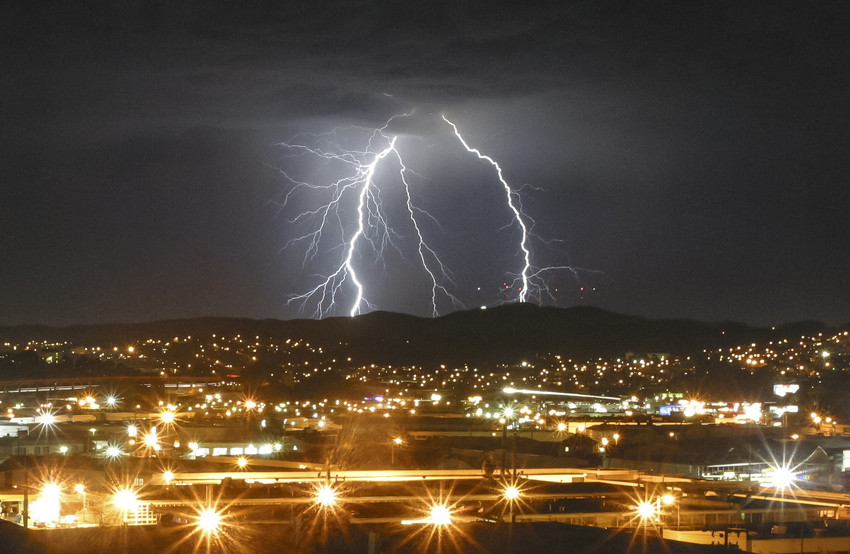
"caption": "Lightning strikes the San Francisco Bay Area in summer 2013. (Steve Byrne/Steve Byrne Photography)",
"description": "Lightning strikes the San Francisco Bay Area in summer 2013. (Steve Byrne/Steve Byrne Photography)",
"title": "RS6281_SanFranciscoLightning5-scr",
"credit": null,
"status": "inherit",
"isLoading": false,
"fetchFailed": false
},
"science_23432": {
"type": "attachments",
"id": "science_23432",
"meta": {
"index": "attachments_1716263798",
"site": "science",
"id": "23432",
"found": true
},
"parent": 23430,
"imgSizes": {
"kqedFullSize": {
"file": "https://ww2.kqed.org/app/uploads/sites/35/2014/11/photo-11.jpg",
"width": 1280,
"height": 960
}
},
"publishDate": 1415202653,
"modified": 1415202653,
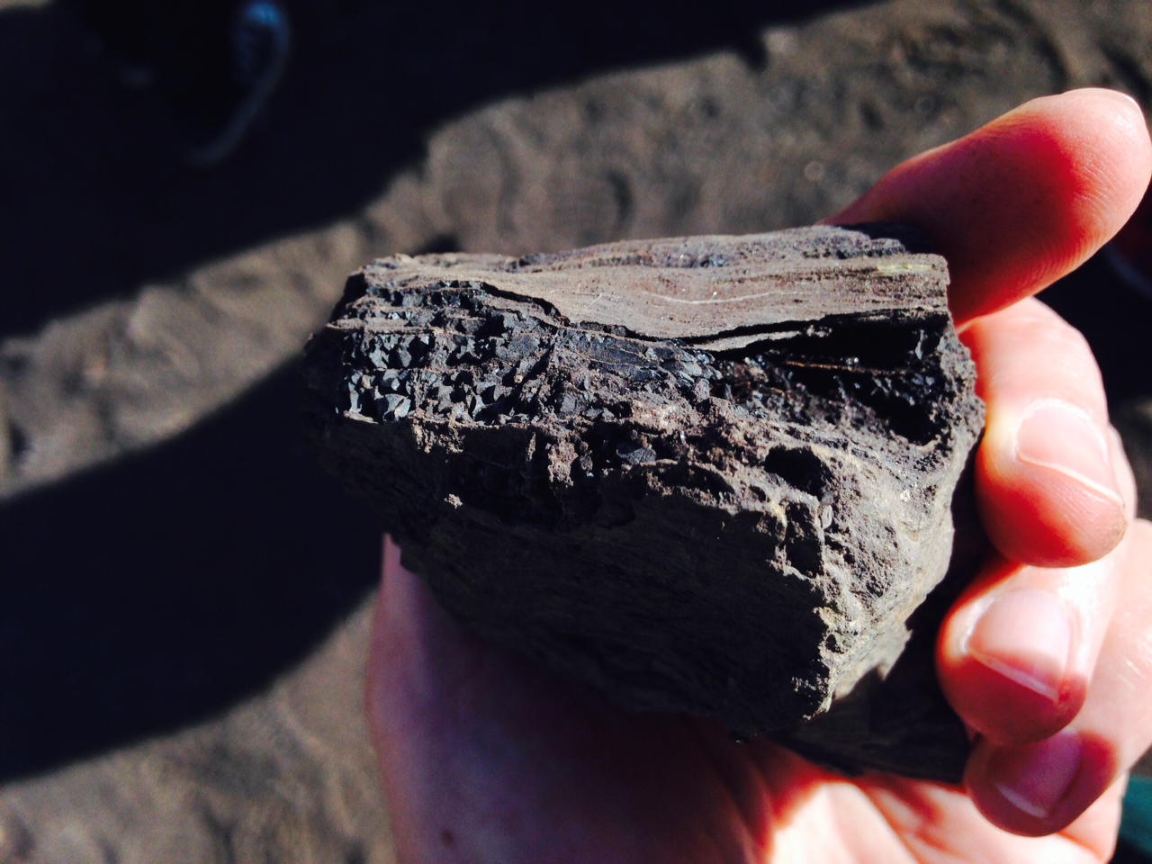
"caption": "A chunk of petrified wood shows evidence of transformation into coal at Black Diamond Mines Regional Preserve. (Sharol Nelson-Embry)",
"description": null,
"title": "photo 1(1)",
"credit": null,
"status": "inherit",
"isLoading": false,
"fetchFailed": false
},
"science_21584": {
"type": "attachments",
"id": "science_21584",
"meta": {
"index": "attachments_1716263798",
"site": "science",
"id": "21584",
"found": true
},
"parent": 21581,
"imgSizes": {
"kqedFullSize": {
"file": "https://ww2.kqed.org/app/uploads/sites/35/2014/09/River-runoff.jpg",
"width": 640,
"height": 360
}
},
"publishDate": 1410469854,
"modified": 1410469854,
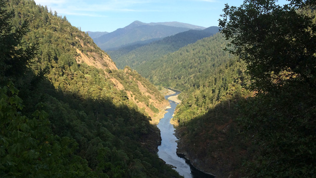
"caption": "Sierra Nevada forests are denser than they once were, potentially reducing the amount of runoff that reaches California's reservoirs. (Dan Brekke/KQED)",
"description": null,
"title": "River-runoff",
"credit": null,
"status": "inherit",
"isLoading": false,
"fetchFailed": false
},
"science_20300": {
"type": "attachments",
"id": "science_20300",
"meta": {
"index": "attachments_1716263798",
"site": "science",
"id": "20300",
"found": true
},
"parent": 20295,
"imgSizes": {
"kqedFullSize": {
"file": "https://ww2.kqed.org/app/uploads/sites/35/2014/08/cover-shot.jpg",
"width": 640,
"height": 360
}
},
"publishDate": 1407205768,
"modified": 1407205768,
"caption": "Sarah Cameron Sunde stands through a tidal cycle in Bass Harbor, Maine on August 15, 2013. (Maridee Slater)",
"description": "Sarah Cameron Sunde stands through a tidal cycle in Bass Harbor, Maine",
"title": "cover shot",
"credit": null,
"status": "inherit",
"isLoading": false,
"fetchFailed": false
},
"science_18980": {
"type": "attachments",
"id": "science_18980",
"meta": {
"index": "attachments_1716263798",
"site": "science",
"id": "18980",
"found": true
},
"parent": 18979,
"imgSizes": {
"kqedFullSize": {
"file": "https://ww2.kqed.org/app/uploads/sites/35/2014/07/photo7-e1404415149117.jpg",
"width": 640,
"height": 356
}
},
"publishDate": 1404364374,
"modified": 1404364374,
"caption": "San Francisco at sunset from the Alameda Oakland Ferry.",
"description": null,
"title": "Ferry view of San Francisco",
"credit": null,
"status": "inherit",
"isLoading": false,
"fetchFailed": false
},
"science_18370": {
"type": "attachments",
"id": "science_18370",
"meta": {
"index": "attachments_1716263798",
"site": "science",
"id": "18370",
"found": true
},
"parent": 18367,
"imgSizes": {
"kqedFullSize": {
"file": "https://ww2.kqed.org/app/uploads/sites/35/2014/06/gaspump_hosetalker2-e1402694020933.jpg",
"width": 640,
"height": 361
}
},
"publishDate": 1402690170,
"modified": 1402690170,
"caption": "A working concept of a gas pump climate change warning labels that the City of Berkeley is considering. (Courtesy 350 Bay Area)",
"description": "A working concept of a gas pump climate change warning labels that the City of Berkeley is considering. (Courtesy 350 Bay Area)",
"title": "gaspump_label",
"credit": null,
"status": "inherit",
"isLoading": false,
"fetchFailed": false
},
"science_17934": {
"type": "attachments",
"id": "science_17934",
"meta": {
"index": "attachments_1716263798",
"site": "science",
"id": "17934",
"found": true
},
"parent": 17905,
"imgSizes": {
"kqedFullSize": {
"file": "https://ww2.kqed.org/app/uploads/sites/35/2014/06/sf-sunset.jpg",
"width": 640,
"height": 360
}
},
"publishDate": 1401664333,
"modified": 1401664333,
"caption": "A San Francisco sunset. (KP Tripathi/Flickr)",
"description": "San Francisco sunset",
"title": "sf-sunset",
"credit": null,
"status": "inherit",
"isLoading": false,
"fetchFailed": false
},
"science_12580": {
"type": "attachments",
"id": "science_12580",
"meta": {
"index": "attachments_1716263798",
"site": "science",
"id": "12580",
"found": true
},
"parent": 12350,
"imgSizes": {
"kqedFullSize": {
"file": "https://ww2.kqed.org/app/uploads/sites/35/2013/12/traffic.jpg",
"width": 640,
"height": 360
}
},
"publishDate": 1388192955,
"modified": 1388192955,
"caption": "A key way for California to cut emissions is by boosting low- and zero-emission vehicles. (Deborah Svoboda/KQED) ",
"description": "A key way for California to cut emissions is by boosting low- and zero-emission vehicles. (Deborah Svoboda/KQED) ",
"title": "traffic",
"credit": null,
"status": "inherit",
"isLoading": false,
"fetchFailed": false
}
},
"audioPlayerReducer": {
"postId": "stream_live",
"isPaused": true,
"isPlaying": false,
"pfsActive": false,
"pledgeModalIsOpen": true,
"playerDrawerIsOpen": false,
"liveAudioPlayStartedAt": 0,
"liveAudioPlayContext": ""
},
"authorsReducer": {
"cmiller": {
"type": "authors",
"id": "221",
"meta": {
"index": "authors_1716337520",
"id": "221",
"found": true
},
"name": "Craig Miller",
"firstName": "Craig",
"lastName": "Miller",
"slug": "cmiller",
"email": "craig@voxterra.net",
"display_author_email": false,
"staff_mastheads": [
"science"
],
"title": "Editor Emeritus, Science",
"bio": "Craig is a former KQED Science editor, specializing in weather, climate, water & energy issues, with a little seismology thrown in just to shake things up. Prior to that, he launched and led the station's award-winning multimedia project, Climate Watch. Craig is also an accomplished writer/producer of television documentaries, with a focus on natural resource issues.",
"avatar": "https://secure.gravatar.com/avatar/b91661df645e001a9cafe0861fa685f9?s=600&d=blank&r=g",
"twitter": "voxterra",
"facebook": null,
"instagram": null,
"linkedin": null,
"sites": [
{
"site": "news",
"roles": [
"author"
]
},
{
"site": "futureofyou",
"roles": [
"editor"
]
},
{
"site": "stateofhealth",
"roles": [
"author"
]
},
{
"site": "science",
"roles": [
"editor"
]
},
{
"site": "quest",
"roles": [
"editor"
]
}
],
"headData": {
"title": "Craig Miller | KQED",
"description": "Editor Emeritus, Science",
"ogImgSrc": "https://secure.gravatar.com/avatar/b91661df645e001a9cafe0861fa685f9?s=600&d=blank&r=g",
"twImgSrc": "https://secure.gravatar.com/avatar/b91661df645e001a9cafe0861fa685f9?s=600&d=blank&r=g"
},
"isLoading": false,
"link": "/author/cmiller"
},
"laurensommer": {
"type": "authors",
"id": "239",
"meta": {
"index": "authors_1716337520",
"id": "239",
"found": true
},
"name": "Lauren Sommer",
"firstName": "Lauren",
"lastName": "Sommer",
"slug": "laurensommer",
"email": "lsommer@kqed.org",
"display_author_email": false,
"staff_mastheads": [],
"title": "KQED Contributor",
"bio": "Lauren is a radio reporter formerly covering environment, water, and energy for KQED Science. As part of her day job, she has scaled Sierra Nevada peaks, run from charging elephant seals, and desperately tried to get her sea legs - all in pursuit of good radio. Her work has appeared on Marketplace, Living on Earth, Science Friday and NPR's Morning Edition and All Things Considered. You can find her on Twitter at \u003ca href=\"https://twitter.com/lesommer\">@lesommer\u003c/a>.",
"avatar": "https://secure.gravatar.com/avatar/33aa3772bb86c6ad45b8aca6a238bbdf?s=600&d=blank&r=g",
"twitter": null,
"facebook": null,
"instagram": null,
"linkedin": null,
"sites": [
{
"site": "news",
"roles": [
"author"
]
},
{
"site": "science",
"roles": [
"editor",
"manage_content_types",
"manage_taxonomies"
]
},
{
"site": "quest",
"roles": [
"editor"
]
}
],
"headData": {
"title": "Lauren Sommer | KQED",
"description": "KQED Contributor",
"ogImgSrc": "https://secure.gravatar.com/avatar/33aa3772bb86c6ad45b8aca6a238bbdf?s=600&d=blank&r=g",
"twImgSrc": "https://secure.gravatar.com/avatar/33aa3772bb86c6ad45b8aca6a238bbdf?s=600&d=blank&r=g"
},
"isLoading": false,
"link": "/author/laurensommer"
},
"sschilling": {
"type": "authors",
"id": "1565",
"meta": {
"index": "authors_1716337520",
"id": "1565",
"found": true
},
"name": "Sally Schilling",
"firstName": "Sally",
"lastName": "Schilling",
"slug": "sschilling",
"email": "sschilling@KQED.org",
"display_author_email": false,
"staff_mastheads": [],
"title": null,
"bio": "KQED Science intern Sally Schilling brings environmental conflicts to life by finding the people most affected by them. She’s recently told the stories of park rangers on the hunt for redwood burl poachers, and the accidental activists in Pittsburg who are fighting a proposed crude oil facility being built in their backyards. Sally is currently studying video journalism and investigative reporting at the UC Berkeley Graduate School of Journalism. She grew up on an organic farm near Davis, Ca.",
"avatar": "https://secure.gravatar.com/avatar/de4c082ea10bfe43a4bc1996b14a3886?s=600&d=blank&r=g",
"twitter": null,
"facebook": null,
"instagram": null,
"linkedin": null,
"sites": [
{
"site": "news",
"roles": [
"author"
]
},
{
"site": "science",
"roles": [
"editor"
]
}
],
"headData": {
"title": "Sally Schilling | KQED",
"description": null,
"ogImgSrc": "https://secure.gravatar.com/avatar/de4c082ea10bfe43a4bc1996b14a3886?s=600&d=blank&r=g",
"twImgSrc": "https://secure.gravatar.com/avatar/de4c082ea10bfe43a4bc1996b14a3886?s=600&d=blank&r=g"
},
"isLoading": false,
"link": "/author/sschilling"
},
"lindseyhoshaw": {
"type": "authors",
"id": "5432",
"meta": {
"index": "authors_1716337520",
"id": "5432",
"found": true
},
"name": "Lindsey Hoshaw",
"firstName": "Lindsey",
"lastName": "Hoshaw",
"slug": "lindseyhoshaw",
"email": "lhoshaw@kqed.org",
"display_author_email": false,
"staff_mastheads": [],
"title": "KQED Contributor",
"bio": "Lindsey Hoshaw is a former interactive producer for KQED Science. Before joining KQED, Lindsey was a science correspondent for The New York Times, The Boston Globe, Forbes and Scientific American. On Twitter @lindseyhoshaw",
"avatar": "https://secure.gravatar.com/avatar/274b07694c998eaa8f26cfabaa941186?s=600&d=mm&r=g",
"twitter": "lindseyhoshaw",
"facebook": "lindsey.hoshaw.9",
"instagram": null,
"linkedin": null,
"sites": [
{
"site": "arts",
"roles": [
"author"
]
},
{
"site": "news",
"roles": [
"subscriber"
]
},
{
"site": "futureofyou",
"roles": [
"editor"
]
},
{
"site": "bayareabites",
"roles": [
"contributor"
]
},
{
"site": "stateofhealth",
"roles": [
"author"
]
},
{
"site": "science",
"roles": [
"edit_theme_options",
"subscriber"
]
},
{
"site": "quest",
"roles": [
"edit_post_subscriptions",
"edit_usergroups",
"unfiltered_html",
"unfiltered_upload",
"leadcoordinator",
"editor"
]
},
{
"site": "food",
"roles": []
}
],
"headData": {
"title": "Lindsey Hoshaw | KQED",
"description": "KQED Contributor",
"ogImgSrc": "https://secure.gravatar.com/avatar/274b07694c998eaa8f26cfabaa941186?s=600&d=mm&r=g",
"twImgSrc": "https://secure.gravatar.com/avatar/274b07694c998eaa8f26cfabaa941186?s=600&d=mm&r=g"
},
"isLoading": false,
"link": "/author/lindseyhoshaw"
},
"dannastaaf": {
"type": "authors",
"id": "6324",
"meta": {
"index": "authors_1716337520",
"id": "6324",
"found": true
},
"name": "Danna Staaf",
"firstName": "Danna",
"lastName": "Staaf",
"slug": "dannastaaf",
"email": "dannajoy@gmail.com",
"display_author_email": false,
"staff_mastheads": [],
"title": null,
"bio": "Danna Staaf is a marine biologist, science writer, novelist, artist, and educator. She holds a PhD in Squid Babies from Stanford and a BA in Biology from the College of Creative Studies at the University of California, Santa Barbara. She helped found the outreach program \u003ca href=\"http://gilly.stanford.edu/outreach.html\">Squids4Kids\u003c/a>, illustrated \u003ca href=\"https://www.thegamecrafter.com/games/the-game-of-science\">The Game of Science\u003c/a>, and blogs at \u003ca href=\"http://www.science20.com/squid_day\">Science 2.0\u003c/a>. She lives in San Jose with her husband, daughter, and cats.",
"avatar": "https://secure.gravatar.com/avatar/62085c2562a0b91949bfd6ff7548082e?s=600&d=blank&r=g",
"twitter": null,
"facebook": null,
"instagram": null,
"linkedin": null,
"sites": [
{
"site": "science",
"roles": [
"author"
]
},
{
"site": "quest",
"roles": [
"subscriber"
]
}
],
"headData": {
"title": "Danna Staaf | KQED",
"description": null,
"ogImgSrc": "https://secure.gravatar.com/avatar/62085c2562a0b91949bfd6ff7548082e?s=600&d=blank&r=g",
"twImgSrc": "https://secure.gravatar.com/avatar/62085c2562a0b91949bfd6ff7548082e?s=600&d=blank&r=g"
},
"isLoading": false,
"link": "/author/dannastaaf"
},
"sharolembry": {
"type": "authors",
"id": "6328",
"meta": {
"index": "authors_1716337520",
"id": "6328",
"found": true
},
"name": "Sharol Nelson-Embry",
"firstName": "Sharol",
"lastName": "Nelson-Embry",
"slug": "sharolembry",
"email": "bobsharol@gmail.com",
"display_author_email": false,
"staff_mastheads": [],
"title": "KQED Contributor",
"bio": "Sharol Nelson-Embry is the Supervising Naturalist at the Crab Cove Visitor Center & Aquarium on San Francisco Bay in Alameda. Crab Cove is part of the East Bay Regional Park District, one of the largest and oldest regional park agencies in the nation. She graduated from Cal Poly, San Luis Obispo with a degree in Natural Resources Management and an epiphany that connecting kids with nature was her destiny. She's been rooted in the Bay Area since 1991 after working at nature centers and outdoor science schools around our fair state. She loves the great variety of habitats stretching from the Bay shoreline to the redwoods, lakes, and hills. Sharol enjoys connecting people to nature with articles in local newspapers and online forums.\r\n\r\nRead her \u003ca href=\"http://science.kqed.org/quest/author/sharolembry/\">previous contributions\u003c/a> to \u003ca href=\"http://http://science.kqed.org/quest/\">QUEST\u003c/a>, a project dedicated to exploring the Science of Sustainability.",
"avatar": "https://secure.gravatar.com/avatar/7d0ffaf107f228c8293464f98d8aeecdc95cf55410e3481c2f4e9f5d0e415cec?s=600&d=blank&r=g",
"twitter": null,
"bluesky": null,
"facebook": null,
"instagram": null,
"linkedin": null,
"sites": [
{
"site": "science",
"roles": [
"subscriber"
]
},
{
"site": "quest",
"roles": [
"subscriber"
]
}
],
"headData": {
"title": "Sharol Nelson-Embry | KQED",
"description": "KQED Contributor",
"ogImgSrc": "https://secure.gravatar.com/avatar/7d0ffaf107f228c8293464f98d8aeecdc95cf55410e3481c2f4e9f5d0e415cec?s=600&d=blank&r=g",
"twImgSrc": "https://secure.gravatar.com/avatar/7d0ffaf107f228c8293464f98d8aeecdc95cf55410e3481c2f4e9f5d0e415cec?s=600&d=blank&r=g"
},
"isLoading": false,
"link": "/author/sharolembry"
},
"kqedscience": {
"type": "authors",
"id": "6387",
"meta": {
"index": "authors_1716337520",
"id": "6387",
"found": true
},
"name": "KQED Science",
"firstName": "KQED",
"lastName": "Science",
"slug": "kqedscience",
"email": "kqedscience@gmail.com",
"display_author_email": false,
"staff_mastheads": [],
"title": null,
"bio": "KQED Science brings you award-winning science and environment coverage from the Bay Area and beyond by the flagship Northern California PBS and NPR affiliate.",
"avatar": "https://secure.gravatar.com/avatar/5a295ff49cf82a8c0f30937d3f788b2f?s=600&d=blank&r=g",
"twitter": null,
"facebook": null,
"instagram": null,
"linkedin": null,
"sites": [
{
"site": "science",
"roles": [
"contributor"
]
},
{
"site": "quest",
"roles": [
"editor"
]
},
{
"site": "food",
"roles": [
"contributor"
]
}
],
"headData": {
"title": "KQED Science | KQED",
"description": null,
"ogImgSrc": "https://secure.gravatar.com/avatar/5a295ff49cf82a8c0f30937d3f788b2f?s=600&d=blank&r=g",
"twImgSrc": "https://secure.gravatar.com/avatar/5a295ff49cf82a8c0f30937d3f788b2f?s=600&d=blank&r=g"
},
"isLoading": false,
"link": "/author/kqedscience"
}
},
"pagesReducer": {
"science_tag_climate-change": {
"type": "terms",
"id": "science_194",
"meta": {
"index": "terms_1716263798",
"site": "science",
"id": "194",
"score": 7.946677
},
"featImg": null,
"name": "climate change",
"description": null,
"taxonomy": "tag",
"headData": {
"twImgId": null,
"twTitle": null,
"ogTitle": null,
"ogImgId": null,
"twDescription": null,
"description": null,
"title": "climate change Archives | KQED Science",
"ogDescription": null
},
"ttid": 198,
"slug": "climate-change",
"isLoading": false,
"title": "climate change",
"pageMeta": {
"site": "science",
"WpPageTemplate": "page-topic-editorial",
"currentPage": 52
},
"blocks": [
{
"blockName": "kqed/post-list",
"attrs": {
"layout": "cardArticle2",
"query": "posts/science?tag=climate-change",
"seeMore": false,
"paginated": true,
"page": 52
}
},
{
"blockName": "kqed/ad"
}
]
}
},
"pfsSessionReducer": {},
"postsReducer": {
"stream_live": {
"type": "live",
"id": "stream_live",
"audioUrl": "https://streams.kqed.org/kqedradio",
"title": "Live Stream",
"excerpt": "Live Stream information currently unavailable.",
"link": "/radio",
"featImg": "",
"label": {
"name": "KQED Live",
"link": "/"
}
},
"stream_kqedNewscast": {
"type": "posts",
"id": "stream_kqedNewscast",
"audioUrl": "https://www.kqed.org/.stream/anon/radio/RDnews/newscast.mp3?_=1",
"title": "KQED Newscast",
"featImg": "",
"label": {
"name": "88.5 FM",
"link": "/"
}
},
"science_25970": {
"type": "posts",
"id": "science_25970",
"meta": {
"index": "posts_1716263798",
"site": "science",
"id": "25970",
"score": null,
"sort": [
1420659036000
]
},
"parent": 0,
"labelTerm": {
"site": "science"
},
"blocks": [],
"publishDate": 1420659036,
"format": "aside",
"title": "Hot, Unfriendly Skies Could Alter Flights",
"headTitle": "Hot, Unfriendly Skies Could Alter Flights | KQED",
"content": "\u003cfigure id=\"attachment_25978\" class=\"wp-caption alignleft\" style=\"max-width: 640px\">\u003ca href=\"http://ww2.kqed.org/science/wp-content/uploads/sites/35/2015/01/plane-e1420656752266.jpg\">\u003cimg loading=\"lazy\" decoding=\"async\" class=\"size-full wp-image-25978\" src=\"http://ww2.kqed.org/science/wp-content/uploads/sites/35/2015/01/plane-e1420656752266.jpg\" alt=\"(wingsnstuff/Flickr)\" width=\"640\" height=\"360\">\u003c/a>\u003cfigcaption class=\"wp-caption-text\">(wingsnstuff/Flickr)\u003c/figcaption>\u003c/figure>\n\u003cp>\u003cstrong>By Brian Kahn\u003cbr>\n\u003ca href=\"http://www.climatecentral.org/\">Climate Central\u003c/a>\u003c/strong>\u003c/p>\n\u003cp>You know those tube socks your grandmother air mails you on your birthday every year? Well, they could become another casualty of global warming. Or at least arrive a few days late.\u003c/p>\n\u003cp>Hot weather is likely to increase the number of days with weight restrictions on cargo planes and even airliners, delaying gifts, air travel and slicing into airlines’ bottom lines according to research presented at the American Geophysical Union’s annual meeting.\u003c/p>\n\u003cp>“Temperature is a big factor in airplane performance and also one of our most confident (future) climate projections,” \u003ca href=\"http://ethancoffel.com/\">Ethan Coffel\u003c/a>, a Ph.D. candidate at \u003ca href=\"http://www.columbia.edu/\">Columbia University\u003c/a> and lead author of \u003ca href=\"http://journals.ametsoc.org/doi/abs/10.1175/WCAS-D-14-00026.1?af=R&\">the new findings\u003c/a>, said.\u003c/p>\n\u003cp>Coffel took a flyer on the research because of his aviation hobby and an interest in unearthing what he called the “hidden cost of climate change” found in the everyday things we take for granted.\u003c/p>\n\u003cp>[ad fullwidth]\u003c/p>\n\u003cp>Previous research has looked at how transatlantic flights could encounter more turbulence in a warming world. Outside of that study, the impacts of climate change on air travel have been left largely unexplored. But it’s a topic ripe for exploration, in part because it could affect so many people.\u003c/p>\n\u003caside class=\"pullquote alignleft\">‘Temperature is a big factor in airplane performance and also one of our most confident (future) climate projections.’\u003ccite>— Ethan Coffel,Columbia University Scientist\u003c/cite>\u003c/aside>\n\u003cp>According to the \u003ca href=\"http://www.iata.org/Pages/default.aspx\">International Air Transport Association\u003c/a>, 3.1 billion people took to the skies in 2013. And that doesn’t even count the business side of things. UPS, for example, ships an average of 2.3 million packages a day by air in the U.S. alone (turns out you aren’t the only one getting tube socks from granny).\u003c/p>\n\u003cp>Hot weather generally means the air is thinner, giving wings less of a lift. The easiest and safest way to work around that on a given day is taking a load off the plane; namely packages or people. Coffel said there’s already a noticeable trend in the number of weight-restricted days at airports in Denver, New York’s LaGuardia, Washington, D.C.’s Reagan, and to a lesser degree, Phoenix.\u003c/p>\n\u003cp>Those four airports form the core of Coffel’s study, which projected daytime highs from May-September — the time of year when the effects of warmer weather on air travel could be most pronounced — through 2070. Coffel also looked at takeoff restrictions for the the Boeing 737-800, one of the most common aircraft used in medium-range flights. According to the latest climate models, daytime highs could be up to 6°F higher at the four airports by 2070 if carbon emissions continue to rise at high levels.\u003c/p>\n\u003cp>Rising temperatures translate to a large increase in the number of days when airplanes would have to reduce their weight by 15,000 lbs. — generally about 30 percent of their payload or 79 passengers — in order to take off at each of the airports, save for Phoenix. The percentage of weight-restricted days could rise by as much as 200 percent compared to today. Reagan could see nearly 80 days with major weight restrictions, the most of the four airports.\u003c/p>\n\u003cp>Coffel said those airports have already seen an increase in weight restrictions since 1980, the year data goes back to, lending further credibility to future increases as temperatures rise.\u003c/p>\n\u003cp>There are ways around this mile-high conundrum but none are ideal. Airports could extend runways, giving planes more room to get up to higher speeds and successful liftoffs. That would be a challenge in urban locations with limited room like LaGuardia and Reagan.\u003c/p>\n\u003cp>Another option would be to push flight schedules around so that more leave in the evening or early morning when temperatures are generally cooler. Planes could also be designed to accelerate faster on current runways or be built with larger wings to create more lift, though that might reduce fuel efficiency when flying at high altitudes.\u003c/p>\n\u003cp>Regardless of their efficacy, all these solutions come with costs and would take many years to implement. Coffel said that although his study only looks at four airports, the findings apply to airports around the world and could have major implications for airlines and and tube sock senders alike.\u003c/p>\n\u003cp>\u003c/p>\n\u003cp>\u003ca href=\"http://www.climatecentral.org/\">Climate Central\u003c/a> \u003cem>is an independent organization that researches and reports on climate change.\u003c/em>\u003c/p>\n\n",
"stats": {
"hasVideo": false,
"hasChartOrMap": false,
"hasAudio": false,
"hasPolis": false,
"wordCount": 739,
"hasGoogleForm": false,
"hasGallery": false,
"hasHearkenModule": false,
"iframeSrcs": [],
"paragraphCount": 17
},
"modified": 1704932433,
"excerpt": "Transatlantic flights could encounter more turbulence in a warming world, which would affect millions of people.",
"headData": {
"twImgId": "",
"twTitle": "",
"ogTitle": "",
"ogImgId": "",
"twDescription": "",
"description": "Transatlantic flights could encounter more turbulence in a warming world, which would affect millions of people.",
"title": "Hot, Unfriendly Skies Could Alter Flights | KQED",
"ogDescription": "",
"schema": {
"@context": "https://schema.org",
"@type": "Article",
"headline": "Hot, Unfriendly Skies Could Alter Flights",
"datePublished": "2015-01-07T11:30:36-08:00",
"dateModified": "2024-01-10T16:20:33-08:00",
"image": "https://cdn.kqed.org/wp-content/uploads/2020/02/KQED-OG-Image@1x.png"
}
},
"guestAuthors": [],
"slug": "hot-unfriendly-skies-could-alter-flights",
"status": "publish",
"sticky": false,
"path": "/science/25970/hot-unfriendly-skies-could-alter-flights",
"audioTrackLength": null,
"parsedContent": [
{
"type": "contentString",
"content": "\u003cdiv class=\"post-body\">\u003cp>\u003cfigure id=\"attachment_25978\" class=\"wp-caption alignleft\" style=\"max-width: 640px\">\u003ca href=\"http://ww2.kqed.org/science/wp-content/uploads/sites/35/2015/01/plane-e1420656752266.jpg\">\u003cimg loading=\"lazy\" decoding=\"async\" class=\"size-full wp-image-25978\" src=\"http://ww2.kqed.org/science/wp-content/uploads/sites/35/2015/01/plane-e1420656752266.jpg\" alt=\"(wingsnstuff/Flickr)\" width=\"640\" height=\"360\">\u003c/a>\u003cfigcaption class=\"wp-caption-text\">(wingsnstuff/Flickr)\u003c/figcaption>\u003c/figure>\n\u003cp>\u003cstrong>By Brian Kahn\u003cbr>\n\u003ca href=\"http://www.climatecentral.org/\">Climate Central\u003c/a>\u003c/strong>\u003c/p>\n\u003cp>You know those tube socks your grandmother air mails you on your birthday every year? Well, they could become another casualty of global warming. Or at least arrive a few days late.\u003c/p>\n\u003cp>Hot weather is likely to increase the number of days with weight restrictions on cargo planes and even airliners, delaying gifts, air travel and slicing into airlines’ bottom lines according to research presented at the American Geophysical Union’s annual meeting.\u003c/p>\n\u003cp>“Temperature is a big factor in airplane performance and also one of our most confident (future) climate projections,” \u003ca href=\"http://ethancoffel.com/\">Ethan Coffel\u003c/a>, a Ph.D. candidate at \u003ca href=\"http://www.columbia.edu/\">Columbia University\u003c/a> and lead author of \u003ca href=\"http://journals.ametsoc.org/doi/abs/10.1175/WCAS-D-14-00026.1?af=R&\">the new findings\u003c/a>, said.\u003c/p>\n\u003cp>Coffel took a flyer on the research because of his aviation hobby and an interest in unearthing what he called the “hidden cost of climate change” found in the everyday things we take for granted.\u003c/p>\n\u003cp>\u003c/p>\u003c/div>",
"attributes": {
"named": {},
"numeric": []
}
},
{
"type": "component",
"content": "",
"name": "ad",
"attributes": {
"named": {
"label": "fullwidth"
},
"numeric": [
"fullwidth"
]
}
},
{
"type": "contentString",
"content": "\u003cdiv class=\"post-body\">\u003cp>\u003c/p>\n\u003cp>Previous research has looked at how transatlantic flights could encounter more turbulence in a warming world. Outside of that study, the impacts of climate change on air travel have been left largely unexplored. But it’s a topic ripe for exploration, in part because it could affect so many people.\u003c/p>\n\u003caside class=\"pullquote alignleft\">‘Temperature is a big factor in airplane performance and also one of our most confident (future) climate projections.’\u003ccite>— Ethan Coffel,Columbia University Scientist\u003c/cite>\u003c/aside>\n\u003cp>According to the \u003ca href=\"http://www.iata.org/Pages/default.aspx\">International Air Transport Association\u003c/a>, 3.1 billion people took to the skies in 2013. And that doesn’t even count the business side of things. UPS, for example, ships an average of 2.3 million packages a day by air in the U.S. alone (turns out you aren’t the only one getting tube socks from granny).\u003c/p>\n\u003cp>Hot weather generally means the air is thinner, giving wings less of a lift. The easiest and safest way to work around that on a given day is taking a load off the plane; namely packages or people. Coffel said there’s already a noticeable trend in the number of weight-restricted days at airports in Denver, New York’s LaGuardia, Washington, D.C.’s Reagan, and to a lesser degree, Phoenix.\u003c/p>\n\u003cp>Those four airports form the core of Coffel’s study, which projected daytime highs from May-September — the time of year when the effects of warmer weather on air travel could be most pronounced — through 2070. Coffel also looked at takeoff restrictions for the the Boeing 737-800, one of the most common aircraft used in medium-range flights. According to the latest climate models, daytime highs could be up to 6°F higher at the four airports by 2070 if carbon emissions continue to rise at high levels.\u003c/p>\n\u003cp>Rising temperatures translate to a large increase in the number of days when airplanes would have to reduce their weight by 15,000 lbs. — generally about 30 percent of their payload or 79 passengers — in order to take off at each of the airports, save for Phoenix. The percentage of weight-restricted days could rise by as much as 200 percent compared to today. Reagan could see nearly 80 days with major weight restrictions, the most of the four airports.\u003c/p>\n\u003cp>Coffel said those airports have already seen an increase in weight restrictions since 1980, the year data goes back to, lending further credibility to future increases as temperatures rise.\u003c/p>\n\u003cp>There are ways around this mile-high conundrum but none are ideal. Airports could extend runways, giving planes more room to get up to higher speeds and successful liftoffs. That would be a challenge in urban locations with limited room like LaGuardia and Reagan.\u003c/p>\n\u003cp>Another option would be to push flight schedules around so that more leave in the evening or early morning when temperatures are generally cooler. Planes could also be designed to accelerate faster on current runways or be built with larger wings to create more lift, though that might reduce fuel efficiency when flying at high altitudes.\u003c/p>\n\u003cp>Regardless of their efficacy, all these solutions come with costs and would take many years to implement. Coffel said that although his study only looks at four airports, the findings apply to airports around the world and could have major implications for airlines and and tube sock senders alike.\u003c/p>\n\u003cp>\u003c/p>\n\u003cp>\u003ca href=\"http://www.climatecentral.org/\">Climate Central\u003c/a> \u003cem>is an independent organization that researches and reports on climate change.\u003c/em>\u003c/p>\n\n\u003c/div>\u003c/p>",
"attributes": {
"named": {},
"numeric": []
}
}
],
"link": "/science/25970/hot-unfriendly-skies-could-alter-flights",
"authors": [
"6387"
],
"categories": [
"science_31",
"science_35"
],
"tags": [
"science_194"
],
"featImg": "science_25978",
"label": "science"
},
"science_25862": {
"type": "posts",
"id": "science_25862",
"meta": {
"index": "posts_1716263798",
"site": "science",
"id": "25862",
"score": null,
"sort": [
1420505018000
]
},
"parent": 0,
"labelTerm": {
"site": "science"
},
"blocks": [],
"publishDate": 1420505018,
"format": "aside",
"title": "Governor Unveils Ambitious New Climate Goals",
"headTitle": "Governor Unveils Ambitious New Climate Goals | KQED",
"content": "\u003cfigure id=\"attachment_25865\" class=\"wp-caption alignleft\" style=\"max-width: 860px\">\u003ca href=\"http://ww2.kqed.org/science/wp-content/uploads/sites/35/2015/01/RS13894_IMG_2969-Edit-qut-e1420492587204-1024x576.jpg\">\u003cimg loading=\"lazy\" decoding=\"async\" class=\" wp-image-25865\" src=\"http://ww2.kqed.org/science/wp-content/uploads/sites/35/2015/01/RS13894_IMG_2969-Edit-qut-e1420492587204-1024x576.jpg\" alt=\"During his inaugural address, Gov. Jerry Brown set new goals for California's renewable energy standards that are the most ambitious in the country. (Andrew Nixon/Capital Public Radio)\" width=\"860\" height=\"484\">\u003c/a>\u003cfigcaption class=\"wp-caption-text\">Gov. Jerry Brown spoke to a joint session of the Legislature in Sacramento during his inaugural address on Monday.\u003cbr>(Andrew Nixon/Capital Public Radio)\u003c/figcaption>\u003c/figure>\n\u003cp>During his fourth\u003ca href=\"http://ww2.kqed.org/news/2015/01/05/an-annotated-guide-to-jerry-browns-state-of-the-state-address\"> inaugural address\u003c/a> in Sacramento Monday, Gov. Jerry Brown focused heavily on energy efficiency, calling for further cuts in consumption as a way to combat global warming.\u003c/p>\n\u003cp>“Taking significant amounts of carbon out of our economy without harming its vibrancy,” Brown said, “is exactly the sort of challenge at which California excels.”\u003c/p>\n\u003caside class=\"pullquote alignleft\">‘This is exciting, it is bold and it is absolutely necessary.’\u003ccite>— Gov. Jerry Brown\u003c/cite>\u003c/aside>\n\u003cp>The governor recommended three items including increasing renewable energy production, decreasing petroleum use and making buildings and heating fuels more efficient.\u003c/p>\n\u003cp>“This is exciting,” Brown said, “it is bold and it is absolutely necessary if we are to have any chance of stopping potentially catastrophic changes to our climate system.”\u003c/p>\n\u003cp>California’s landmark greenhouse gas emissions bills mandated that 33 percent of the state’s energy must come from renewable sources like wind, solar, geothermal and hydropower by 2020. During his speech, Brown upped that goal to 50 percent by 2030.\u003c/p>\n\u003cp>[ad fullwidth]\u003c/p>\n\u003cp>Currently, \u003ca href=\"http://www.energy.ca.gov/renewables/tracking_progress/documents/renewable.pdf\">about 20 percent \u003c/a>of California’s energy comes from renewables, and the \u003ca href=\"http://www.energy.ca.gov/renewables/tracking_progress/documents/renewable.pdf\">latest report\u003c/a> from the California Energy Commission says that number should reach 25 percent by 2016.\u003c/p>\n\u003cp>“California is already 40 percent more energy-efficient than the rest of the nation, thanks to the work that, interestingly, Governor\u003cstrong> \u003c/strong>Brown started when he was governor the first time,” said \u003ca href=\"http://seventhgenerationadvisors.org/index.php?option=com_content&view=article&id=4:terry-tamminen&catid=2&Itemid=4\">Terry Tamminen\u003c/a>, former Secretary of California’s \u003ca href=\"http://www.calepa.ca.gov/\">Environmental Protection Agency\u003c/a>. “I think with the very rapid expansion of wind, solar and storage — which makes it possible to store intermittent resources like wind and solar — that it will be relatively easy to get there by his 2030 deadline.”\u003c/p>\n\u003cp>Among the suggestions Brown offered to meet his aggressive goals: distributed power, expanded rooftop solar, micro-grids, an energy imbalance market, battery storage, and millions of electric and low-carbon vehicles.\u003c/p>\n\u003cp>He acknowledged the goals would be costly but are necessary since current measures alone “are not enough\u003cstrong>.\u003c/strong>”\u003c/p>\n\u003cp>\u003c/p>\n\u003cp>“The challenge is to build for the future, not steal from it,” Brown said, “to live within our means and to keep California ever golden and creative.”\u003c/p>\n\n",
"stats": {
"hasVideo": false,
"hasChartOrMap": false,
"hasAudio": false,
"hasPolis": false,
"wordCount": 402,
"hasGoogleForm": false,
"hasGallery": false,
"hasHearkenModule": false,
"iframeSrcs": [],
"paragraphCount": 12
},
"modified": 1704932443,
"excerpt": "During his inaugural speech on Monday, Gov. Jerry Brown focused heavily on energy efficiency calling for further cuts in consumption as a way to combat global warming.",
"headData": {
"twImgId": "",
"twTitle": "",
"ogTitle": "",
"ogImgId": "",
"twDescription": "",
"description": "During his inaugural speech on Monday, Gov. Jerry Brown focused heavily on energy efficiency calling for further cuts in consumption as a way to combat global warming.",
"title": "Governor Unveils Ambitious New Climate Goals | KQED",
"ogDescription": "",
"schema": {
"@context": "https://schema.org",
"@type": "Article",
"headline": "Governor Unveils Ambitious New Climate Goals",
"datePublished": "2015-01-05T16:43:38-08:00",
"dateModified": "2024-01-10T16:20:43-08:00",
"image": "https://cdn.kqed.org/wp-content/uploads/2020/02/KQED-OG-Image@1x.png"
}
},
"guestAuthors": [],
"slug": "governor-unveils-ambitious-new-climate-goals",
"status": "publish",
"sticky": false,
"path": "/science/25862/governor-unveils-ambitious-new-climate-goals",
"audioTrackLength": null,
"parsedContent": [
{
"type": "contentString",
"content": "\u003cdiv class=\"post-body\">\u003cp>\u003cfigure id=\"attachment_25865\" class=\"wp-caption alignleft\" style=\"max-width: 860px\">\u003ca href=\"http://ww2.kqed.org/science/wp-content/uploads/sites/35/2015/01/RS13894_IMG_2969-Edit-qut-e1420492587204-1024x576.jpg\">\u003cimg loading=\"lazy\" decoding=\"async\" class=\" wp-image-25865\" src=\"http://ww2.kqed.org/science/wp-content/uploads/sites/35/2015/01/RS13894_IMG_2969-Edit-qut-e1420492587204-1024x576.jpg\" alt=\"During his inaugural address, Gov. Jerry Brown set new goals for California's renewable energy standards that are the most ambitious in the country. (Andrew Nixon/Capital Public Radio)\" width=\"860\" height=\"484\">\u003c/a>\u003cfigcaption class=\"wp-caption-text\">Gov. Jerry Brown spoke to a joint session of the Legislature in Sacramento during his inaugural address on Monday.\u003cbr>(Andrew Nixon/Capital Public Radio)\u003c/figcaption>\u003c/figure>\n\u003cp>During his fourth\u003ca href=\"http://ww2.kqed.org/news/2015/01/05/an-annotated-guide-to-jerry-browns-state-of-the-state-address\"> inaugural address\u003c/a> in Sacramento Monday, Gov. Jerry Brown focused heavily on energy efficiency, calling for further cuts in consumption as a way to combat global warming.\u003c/p>\n\u003cp>“Taking significant amounts of carbon out of our economy without harming its vibrancy,” Brown said, “is exactly the sort of challenge at which California excels.”\u003c/p>\n\u003caside class=\"pullquote alignleft\">‘This is exciting, it is bold and it is absolutely necessary.’\u003ccite>— Gov. Jerry Brown\u003c/cite>\u003c/aside>\n\u003cp>The governor recommended three items including increasing renewable energy production, decreasing petroleum use and making buildings and heating fuels more efficient.\u003c/p>\n\u003cp>“This is exciting,” Brown said, “it is bold and it is absolutely necessary if we are to have any chance of stopping potentially catastrophic changes to our climate system.”\u003c/p>\n\u003cp>California’s landmark greenhouse gas emissions bills mandated that 33 percent of the state’s energy must come from renewable sources like wind, solar, geothermal and hydropower by 2020. During his speech, Brown upped that goal to 50 percent by 2030.\u003c/p>\n\u003cp>\u003c/p>\u003c/div>",
"attributes": {
"named": {},
"numeric": []
}
},
{
"type": "component",
"content": "",
"name": "ad",
"attributes": {
"named": {
"label": "fullwidth"
},
"numeric": [
"fullwidth"
]
}
},
{
"type": "contentString",
"content": "\u003cdiv class=\"post-body\">\u003cp>\u003c/p>\n\u003cp>Currently, \u003ca href=\"http://www.energy.ca.gov/renewables/tracking_progress/documents/renewable.pdf\">about 20 percent \u003c/a>of California’s energy comes from renewables, and the \u003ca href=\"http://www.energy.ca.gov/renewables/tracking_progress/documents/renewable.pdf\">latest report\u003c/a> from the California Energy Commission says that number should reach 25 percent by 2016.\u003c/p>\n\u003cp>“California is already 40 percent more energy-efficient than the rest of the nation, thanks to the work that, interestingly, Governor\u003cstrong> \u003c/strong>Brown started when he was governor the first time,” said \u003ca href=\"http://seventhgenerationadvisors.org/index.php?option=com_content&view=article&id=4:terry-tamminen&catid=2&Itemid=4\">Terry Tamminen\u003c/a>, former Secretary of California’s \u003ca href=\"http://www.calepa.ca.gov/\">Environmental Protection Agency\u003c/a>. “I think with the very rapid expansion of wind, solar and storage — which makes it possible to store intermittent resources like wind and solar — that it will be relatively easy to get there by his 2030 deadline.”\u003c/p>\n\u003cp>Among the suggestions Brown offered to meet his aggressive goals: distributed power, expanded rooftop solar, micro-grids, an energy imbalance market, battery storage, and millions of electric and low-carbon vehicles.\u003c/p>\n\u003cp>He acknowledged the goals would be costly but are necessary since current measures alone “are not enough\u003cstrong>.\u003c/strong>”\u003c/p>\n\u003cp>\u003c/p>\n\u003cp>“The challenge is to build for the future, not steal from it,” Brown said, “to live within our means and to keep California ever golden and creative.”\u003c/p>\n\n\u003c/div>\u003c/p>",
"attributes": {
"named": {},
"numeric": []
}
}
],
"link": "/science/25862/governor-unveils-ambitious-new-climate-goals",
"authors": [
"5432"
],
"categories": [
"science_31",
"science_33",
"science_35",
"science_40"
],
"tags": [
"science_121",
"science_194",
"science_101",
"science_140"
],
"featImg": "science_25865",
"label": "science"
},
"science_24634": {
"type": "posts",
"id": "science_24634",
"meta": {
"index": "posts_1716263798",
"site": "science",
"id": "24634",
"score": null,
"sort": [
1418082181000
]
},
"parent": 0,
"labelTerm": {
"site": "science",
"term": 1151
},
"blocks": [],
"publishDate": 1418082181,
"format": "aside",
"title": "California's Drought: Is it Global Warming?",
"headTitle": "California’s Drought: Is it Global Warming? | KQED",
"content": "\u003cfigure id=\"attachment_24642\" class=\"wp-caption alignnone\" style=\"max-width: 640px\">\u003ca href=\"http://ww2.kqed.org/science/wp-content/uploads/sites/35/2014/12/12290993595_30600f2df7_z-e1418080548549.jpg\">\u003cimg loading=\"lazy\" decoding=\"async\" class=\"wp-image-24642\" src=\"http://ww2.kqed.org/science/wp-content/uploads/sites/35/2014/12/12290993595_30600f2df7_z-e1418080548549.jpg\" alt=\"12290993595_30600f2df7_z\" width=\"640\" height=\"359\">\u003c/a>\u003cfigcaption class=\"wp-caption-text\">Uvas Reservoir north of Gilroy stood at less than four percent of its total capacity in early December. (Ian Abbott/Flickr)\u003c/figcaption>\u003c/figure>\n\u003cp>Federal climate scientists say that \u003ca title=\"Q-Sci - Drought Watch\" href=\"http://ww2.kqed.org/science/series/california-drought-watch/?=science_widget\">California’s drought\u003c/a>, now in its fourth year, is not likely the product of human-induced global warming.\u003c/p>\n\u003cp>A \u003ca title=\"NOAA - drought drivers report\" href=\"http://cpo.noaa.gov/ClimatePrograms/ModelingAnalysisPredictionsandProjections/MAPPTaskForces/DroughtTaskForce/CaliforniaDrought.aspx\">new report\u003c/a>, based on seven models that ran 160 “reenactments” of the last three years, concludes that “perhaps about two-thirds of the precipitation deficits” of the last three years have been the product of various convergent factors, including “a randomness of the atmosphere,” says Marty Hoerling, a climate scientist at the \u003ca href=\"http://www.noaa.gov/\">National Oceanic and Atmospheric Administration\u003c/a>‘s Earth System Research Laboratory and one of the study’s co-authors.\u003c/p>\n\u003cp>In other words, it’s been mostly natural variability, which is science-speak for the random year-to-year fluctuations in precipitation that we would normally expect.\u003c/p>\n\u003caside class=\"pullquote alignleft\">The current California drought is ‘one of the most severe’ since 1895.\u003ccite>— Richard Seager,\u003cbr>\nColumbia University\u003c/cite>\u003c/aside>\n\u003cp>Most climate models show that rising greenhouse gas emissions should produce more intense precipitation during California’s core mid-winter “rainy season” and less during the spring months, creating what lead author Richard Seager of Columbia University calls a “shorter, sharper rainy season.”\u003c/p>\n\u003cp>That hasn’t been happening in recent years. Therefore, says Seager, “The events of the last three winters were primarily due to the natural variability of the atmosphere-ocean system.”\u003c/p>\n\u003cp>[ad fullwidth]\u003c/p>\n\u003cp>The report has drawn fire from some scientists and commentators who say that it leaves out the effects of \u003ca title=\"Q-Sci - post\" href=\"http://ww2.kqed.org/news/2014/01/15/heat-breaks-records-all-over-bay-area-weather\">record-high temperatures\u003c/a> in California this year.\u003c/p>\n\u003cp>Brenda Ekwurzel, senior climate scientist at the \u003ca href=\"http://www.ucsusa.org/\">Union of Concerned Scientists\u003c/a>, wrote in a response that, “The NOAA study points to natural variability, but it is important to note that these random variations are happening in the context of higher overall temperatures caused by climate change and warmer temperatures spell trouble for water in California.”\u003c/p>\n\u003cp>It’s well understood that \u003ca title=\"Q-Sci - post\" href=\"http://ww2.kqed.org/science/2014/10/14/high-temps-intensified-california-drought/\">high temperatures tend to exacerbate drought\u003c/a> impacts, baking moisture out of the ground through increased evaporation and transpiration by plants.\u003c/p>\n\u003cp>[contextly_sidebar id=”SJvxYJSRSSNAGhrem6PCh8609h1g5lSK”]\u003c/p>\n\u003cp>In addition, “Warmer temperatures are widening the gap between water supply and demand by contributing to earlier spring snow melt meaning less water is available when demands are the highest in mid-to-late summer,” said UCS climate scientist Juliet Christian-Smith in the same response. “As global warming continues, decreasing snowpack and earlier snowmelt — coupled with increasing demand for water — will likely exacerbate water shortages.”\u003c/p>\n\u003cp>Seager says the “main driver” of the drought has been lack of precipitation, which defied the predictive models amid rising carbon emissions, but he and Hoerling agree that it would be useful to “continue the analysis by looking at the land surface hydrology and working out what the role of increasing temperature was,” as Seager put it to reporters in a conference call.\u003c/p>\n\u003cp>Hydrologist Peter Gleick of the Oakland-based Pacific Institute says the NOAA report lends itself to misinterpretation because of the “fundamental difference between ’cause’ and ‘influence.'”\u003c/p>\n\u003cp>“Asking whether climate changes ’caused’ the current drought is simply the wrong question,” Gleick wrote in an email to KQED. “While there remains plenty of interesting science to be done about how climate changes will cause extreme events in the future, we already see today a growing and clear influence of climate changes on storms and droughts around the world. The influence of human-caused climate change is already apparent.”\u003c/p>\n\u003cp>The NOAA scientists acknowledge the historic nature of the drought itself. Seager describes it as “one of the most severe” since 1895, when the state began keeping precipitation records. Even with December coming down on the wet side so far, it’s impossible to say whether this winter will extend the drought or help bring an end to it, according to Seager and Hoerling.\u003c/p>\n\u003cp>\u003c/p>\n\u003cp>“In the last three years, California lost essentially one whole year’s worth of precipitation,” Seager notes.\u003c/p>\n\n",
"stats": {
"hasVideo": false,
"hasChartOrMap": false,
"hasAudio": false,
"hasPolis": false,
"wordCount": 704,
"hasGoogleForm": false,
"hasGallery": false,
"hasHearkenModule": false,
"iframeSrcs": [],
"paragraphCount": 17
},
"modified": 1704932535,
"excerpt": "Not really, says a new report from federal climate scientists. But others say that report doesn't show the whole picture.",
"headData": {
"twImgId": "",
"twTitle": "",
"ogTitle": "",
"ogImgId": "",
"twDescription": "",
"description": "Not really, says a new report from federal climate scientists. But others say that report doesn't show the whole picture.",
"title": "California's Drought: Is it Global Warming? | KQED",
"ogDescription": "",
"schema": {
"@context": "https://schema.org",
"@type": "Article",
"headline": "California's Drought: Is it Global Warming?",
"datePublished": "2014-12-08T15:43:01-08:00",
"dateModified": "2024-01-10T16:22:15-08:00",
"image": "https://cdn.kqed.org/wp-content/uploads/2020/02/KQED-OG-Image@1x.png"
}
},
"guestAuthors": [],
"slug": "californias-drought-is-it-global-warming",
"status": "publish",
"sticky": false,
"path": "/science/24634/californias-drought-is-it-global-warming",
"audioTrackLength": null,
"parsedContent": [
{
"type": "contentString",
"content": "\u003cdiv class=\"post-body\">\u003cp>\u003cfigure id=\"attachment_24642\" class=\"wp-caption alignnone\" style=\"max-width: 640px\">\u003ca href=\"http://ww2.kqed.org/science/wp-content/uploads/sites/35/2014/12/12290993595_30600f2df7_z-e1418080548549.jpg\">\u003cimg loading=\"lazy\" decoding=\"async\" class=\"wp-image-24642\" src=\"http://ww2.kqed.org/science/wp-content/uploads/sites/35/2014/12/12290993595_30600f2df7_z-e1418080548549.jpg\" alt=\"12290993595_30600f2df7_z\" width=\"640\" height=\"359\">\u003c/a>\u003cfigcaption class=\"wp-caption-text\">Uvas Reservoir north of Gilroy stood at less than four percent of its total capacity in early December. (Ian Abbott/Flickr)\u003c/figcaption>\u003c/figure>\n\u003cp>Federal climate scientists say that \u003ca title=\"Q-Sci - Drought Watch\" href=\"http://ww2.kqed.org/science/series/california-drought-watch/?=science_widget\">California’s drought\u003c/a>, now in its fourth year, is not likely the product of human-induced global warming.\u003c/p>\n\u003cp>A \u003ca title=\"NOAA - drought drivers report\" href=\"http://cpo.noaa.gov/ClimatePrograms/ModelingAnalysisPredictionsandProjections/MAPPTaskForces/DroughtTaskForce/CaliforniaDrought.aspx\">new report\u003c/a>, based on seven models that ran 160 “reenactments” of the last three years, concludes that “perhaps about two-thirds of the precipitation deficits” of the last three years have been the product of various convergent factors, including “a randomness of the atmosphere,” says Marty Hoerling, a climate scientist at the \u003ca href=\"http://www.noaa.gov/\">National Oceanic and Atmospheric Administration\u003c/a>‘s Earth System Research Laboratory and one of the study’s co-authors.\u003c/p>\n\u003cp>In other words, it’s been mostly natural variability, which is science-speak for the random year-to-year fluctuations in precipitation that we would normally expect.\u003c/p>\n\u003caside class=\"pullquote alignleft\">The current California drought is ‘one of the most severe’ since 1895.\u003ccite>— Richard Seager,\u003cbr>\nColumbia University\u003c/cite>\u003c/aside>\n\u003cp>Most climate models show that rising greenhouse gas emissions should produce more intense precipitation during California’s core mid-winter “rainy season” and less during the spring months, creating what lead author Richard Seager of Columbia University calls a “shorter, sharper rainy season.”\u003c/p>\n\u003cp>That hasn’t been happening in recent years. Therefore, says Seager, “The events of the last three winters were primarily due to the natural variability of the atmosphere-ocean system.”\u003c/p>\n\u003cp>\u003c/p>\u003c/div>",
"attributes": {
"named": {},
"numeric": []
}
},
{
"type": "component",
"content": "",
"name": "ad",
"attributes": {
"named": {
"label": "fullwidth"
},
"numeric": [
"fullwidth"
]
}
},
{
"type": "contentString",
"content": "\u003cdiv class=\"post-body\">\u003cp>\u003c/p>\n\u003cp>The report has drawn fire from some scientists and commentators who say that it leaves out the effects of \u003ca title=\"Q-Sci - post\" href=\"http://ww2.kqed.org/news/2014/01/15/heat-breaks-records-all-over-bay-area-weather\">record-high temperatures\u003c/a> in California this year.\u003c/p>\n\u003cp>Brenda Ekwurzel, senior climate scientist at the \u003ca href=\"http://www.ucsusa.org/\">Union of Concerned Scientists\u003c/a>, wrote in a response that, “The NOAA study points to natural variability, but it is important to note that these random variations are happening in the context of higher overall temperatures caused by climate change and warmer temperatures spell trouble for water in California.”\u003c/p>\n\u003cp>It’s well understood that \u003ca title=\"Q-Sci - post\" href=\"http://ww2.kqed.org/science/2014/10/14/high-temps-intensified-california-drought/\">high temperatures tend to exacerbate drought\u003c/a> impacts, baking moisture out of the ground through increased evaporation and transpiration by plants.\u003c/p>\n\u003cp>\u003c/p>\u003cp>\u003c/p>\u003cp>\u003c/p>\n\u003cp>In addition, “Warmer temperatures are widening the gap between water supply and demand by contributing to earlier spring snow melt meaning less water is available when demands are the highest in mid-to-late summer,” said UCS climate scientist Juliet Christian-Smith in the same response. “As global warming continues, decreasing snowpack and earlier snowmelt — coupled with increasing demand for water — will likely exacerbate water shortages.”\u003c/p>\n\u003cp>Seager says the “main driver” of the drought has been lack of precipitation, which defied the predictive models amid rising carbon emissions, but he and Hoerling agree that it would be useful to “continue the analysis by looking at the land surface hydrology and working out what the role of increasing temperature was,” as Seager put it to reporters in a conference call.\u003c/p>\n\u003cp>Hydrologist Peter Gleick of the Oakland-based Pacific Institute says the NOAA report lends itself to misinterpretation because of the “fundamental difference between ’cause’ and ‘influence.'”\u003c/p>\n\u003cp>“Asking whether climate changes ’caused’ the current drought is simply the wrong question,” Gleick wrote in an email to KQED. “While there remains plenty of interesting science to be done about how climate changes will cause extreme events in the future, we already see today a growing and clear influence of climate changes on storms and droughts around the world. The influence of human-caused climate change is already apparent.”\u003c/p>\n\u003cp>The NOAA scientists acknowledge the historic nature of the drought itself. Seager describes it as “one of the most severe” since 1895, when the state began keeping precipitation records. Even with December coming down on the wet side so far, it’s impossible to say whether this winter will extend the drought or help bring an end to it, according to Seager and Hoerling.\u003c/p>\n\u003cp>\u003c/p>\n\u003cp>“In the last three years, California lost essentially one whole year’s worth of precipitation,” Seager notes.\u003c/p>\n\n\u003c/div>\u003c/p>",
"attributes": {
"named": {},
"numeric": []
}
}
],
"link": "/science/24634/californias-drought-is-it-global-warming",
"authors": [
"221"
],
"series": [
"science_1151"
],
"categories": [
"science_31",
"science_40",
"science_98"
],
"tags": [
"science_1622",
"science_194",
"science_572",
"science_5182",
"science_201",
"science_365"
],
"featImg": "science_24642",
"label": "science_1151"
},
"science_23736": {
"type": "posts",
"id": "science_23736",
"meta": {
"index": "posts_1716263798",
"site": "science",
"id": "23736",
"score": null,
"sort": [
1415929425000
]
},
"parent": 0,
"labelTerm": {
"site": "science"
},
"blocks": [],
"publishDate": 1415929425,
"format": "aside",
"title": "Study: Warming Climate Means More Lightning",
"headTitle": "Study: Warming Climate Means More Lightning | KQED",
"content": "\u003cfigure id=\"attachment_23751\" class=\"wp-caption alignnone\" style=\"max-width: 850px\">\u003ca href=\"http://ww2.kqed.org/science/wp-content/uploads/sites/35/2014/11/RS6281_SanFranciscoLightning5-scr.jpg\">\u003cimg loading=\"lazy\" decoding=\"async\" src=\"http://ww2.kqed.org/science/wp-content/uploads/sites/35/2014/11/RS6281_SanFranciscoLightning5-scr.jpg\" alt=\"Lightning strikes the San Francisco Bay Area in summer 2013. (Steve Byrne/Steve Byrne Photography)\" width=\"850\" height=\"554\" class=\"size-full wp-image-23751\">\u003c/a>\u003cfigcaption class=\"wp-caption-text\">Lightning strikes the San Francisco Bay Area in summer 2013. (Steve Byrne/Steve Byrne Photography)\u003c/figcaption>\u003c/figure>\n\u003cp>California’s warming climate is likely to mean a surge in lightning strikes, a development that would not bode well for fire season.\u003c/p>\n\u003cp>A new study suggests that the number of lightning strikes nationwide could jump 50 percent during this century, driven by rising temperatures.\u003c/p>\n\u003cp>“Warm air can hold more water vapor than cool air,” explains \u003ca title=\"UCB - Romps\" href=\"http://romps.berkeley.edu/\">David Romps\u003c/a>, an atmospheric scientist whose team at UC Berkeley came up with \u003ca title=\"UCB - post\" href=\"http://newscenter.berkeley.edu/2014/11/13/lightning-expected-to-increase-by-50-percent-with-global-warming/\">the new projections\u003c/a>, published this week in the journal \u003cem>Science\u003c/em>. “And as we warm the planet, we tend to get more water vapor in the atmosphere, and water vapor is the fuel for thunderstorms.”\u003c/p>\n\u003cp>Romps says every rise of about 2.5 degrees Fahrenheit should produce an 11 percent increase in ground strikes. His team came up with the projections using two key ingredients for lightning: precipitation and convection, the rising air that causes storm clouds to quickly pile up to enormous heights. Assuming average temperatures rise by 7 degrees during this century, he says warmer air will increase both, setting the stage for more electrical storms.\u003c/p>\n\u003cp>“Our hypothesis was that that product of precipitation and storm energy would be a good predictor for lightning, and it turns out to work very well,” says Romps.\u003c/p>\n\u003cp>[ad fullwidth]\u003c/p>\n\u003cp>[contextly_sidebar id=”UVvNEARAmnuHxV4NwdvZPfhxIVv7QylS”]\u003c/p>\n\u003cp>The initial projection applies to the continental U.S. as a whole. Romps says his team will attempt to fine-tune its models to be able to make regional projections.\u003c/p>\n\u003cp>“As we don’t yet know the distribution of this increase, it could be that regions of the country that get a lot of lightning strikes today will get even more in the future,” Romps says, “or it could be that regions that get very few today will get much more than they’re used to.”\u003c/p>\n\u003cp>Or both, presumably. The answer will be important fodder for those who plan and budget for California’s fire season. While most wildfires are caused by human activity, lightning is the spark for many big fires in Northern California.\u003c/p>\n\u003cp>“It’s reasonable to speculate that with a 50 percent increase in lightning strikes, we would get an increase in wildfire frequency,” says Romps. “But we haven’t yet done the work to figure out where geographically this increase occurs and when in the season it occurs, and that would be important to know, to really nail down what the increase in wildfire frequency would be.”\u003c/p>\n\u003cp>\u003c/p>\n\u003cp>So far this year, lightning has been listed as the cause in 446 wildfires in Northern California that came under the primary jurisdiction of the U.S. Forest Service (which tends to handle the more remote fires). Those fires burned more than 276,000 acres combined. According to CalFire, a “lightning siege” comprising thousands of strikes in July and August were responsible for the season’s largest fire, the 130,000-acre \u003ca title=\"KPCC FireTracker - Happy Camp\" href=\"http://firetracker.scpr.org/happy-camp-complex/\">Happy Camp Complex\u003c/a> in the Klamath National Forest.\u003c/p>\n\n",
"stats": {
"hasVideo": false,
"hasChartOrMap": false,
"hasAudio": false,
"hasPolis": false,
"wordCount": 520,
"hasGoogleForm": false,
"hasGallery": false,
"hasHearkenModule": false,
"iframeSrcs": [],
"paragraphCount": 13
},
"modified": 1704932622,
"excerpt": "Memo to firefighters: Modeling by Berkeley researchers suggests a 50 percent spike in ground strikes this century, like the strikes that started last season's largest wildfire in California.",
"headData": {
"twImgId": "",
"twTitle": "",
"ogTitle": "",
"ogImgId": "",
"twDescription": "",
"description": "Memo to firefighters: Modeling by Berkeley researchers suggests a 50 percent spike in ground strikes this century, like the strikes that started last season's largest wildfire in California.",
"title": "Study: Warming Climate Means More Lightning | KQED",
"ogDescription": "",
"schema": {
"@context": "https://schema.org",
"@type": "Article",
"headline": "Study: Warming Climate Means More Lightning",
"datePublished": "2014-11-13T17:43:45-08:00",
"dateModified": "2024-01-10T16:23:42-08:00",
"image": "https://cdn.kqed.org/wp-content/uploads/2020/02/KQED-OG-Image@1x.png"
}
},
"guestAuthors": [],
"slug": "study-warming-climate-means-more-lightning",
"status": "publish",
"sticky": false,
"path": "/science/23736/study-warming-climate-means-more-lightning",
"audioTrackLength": null,
"parsedContent": [
{
"type": "contentString",
"content": "\u003cdiv class=\"post-body\">\u003cp>\u003cfigure id=\"attachment_23751\" class=\"wp-caption alignnone\" style=\"max-width: 850px\">\u003ca href=\"http://ww2.kqed.org/science/wp-content/uploads/sites/35/2014/11/RS6281_SanFranciscoLightning5-scr.jpg\">\u003cimg loading=\"lazy\" decoding=\"async\" src=\"http://ww2.kqed.org/science/wp-content/uploads/sites/35/2014/11/RS6281_SanFranciscoLightning5-scr.jpg\" alt=\"Lightning strikes the San Francisco Bay Area in summer 2013. (Steve Byrne/Steve Byrne Photography)\" width=\"850\" height=\"554\" class=\"size-full wp-image-23751\">\u003c/a>\u003cfigcaption class=\"wp-caption-text\">Lightning strikes the San Francisco Bay Area in summer 2013. (Steve Byrne/Steve Byrne Photography)\u003c/figcaption>\u003c/figure>\n\u003cp>California’s warming climate is likely to mean a surge in lightning strikes, a development that would not bode well for fire season.\u003c/p>\n\u003cp>A new study suggests that the number of lightning strikes nationwide could jump 50 percent during this century, driven by rising temperatures.\u003c/p>\n\u003cp>“Warm air can hold more water vapor than cool air,” explains \u003ca title=\"UCB - Romps\" href=\"http://romps.berkeley.edu/\">David Romps\u003c/a>, an atmospheric scientist whose team at UC Berkeley came up with \u003ca title=\"UCB - post\" href=\"http://newscenter.berkeley.edu/2014/11/13/lightning-expected-to-increase-by-50-percent-with-global-warming/\">the new projections\u003c/a>, published this week in the journal \u003cem>Science\u003c/em>. “And as we warm the planet, we tend to get more water vapor in the atmosphere, and water vapor is the fuel for thunderstorms.”\u003c/p>\n\u003cp>Romps says every rise of about 2.5 degrees Fahrenheit should produce an 11 percent increase in ground strikes. His team came up with the projections using two key ingredients for lightning: precipitation and convection, the rising air that causes storm clouds to quickly pile up to enormous heights. Assuming average temperatures rise by 7 degrees during this century, he says warmer air will increase both, setting the stage for more electrical storms.\u003c/p>\n\u003cp>“Our hypothesis was that that product of precipitation and storm energy would be a good predictor for lightning, and it turns out to work very well,” says Romps.\u003c/p>\n\u003cp>\u003c/p>\u003c/div>",
"attributes": {
"named": {},
"numeric": []
}
},
{
"type": "component",
"content": "",
"name": "ad",
"attributes": {
"named": {
"label": "fullwidth"
},
"numeric": [
"fullwidth"
]
}
},
{
"type": "contentString",
"content": "\u003cdiv class=\"post-body\">\u003cp>\u003c/p>\n\u003cp>\u003c/p>\u003cp>\u003c/p>\u003cp>\u003c/p>\n\u003cp>The initial projection applies to the continental U.S. as a whole. Romps says his team will attempt to fine-tune its models to be able to make regional projections.\u003c/p>\n\u003cp>“As we don’t yet know the distribution of this increase, it could be that regions of the country that get a lot of lightning strikes today will get even more in the future,” Romps says, “or it could be that regions that get very few today will get much more than they’re used to.”\u003c/p>\n\u003cp>Or both, presumably. The answer will be important fodder for those who plan and budget for California’s fire season. While most wildfires are caused by human activity, lightning is the spark for many big fires in Northern California.\u003c/p>\n\u003cp>“It’s reasonable to speculate that with a 50 percent increase in lightning strikes, we would get an increase in wildfire frequency,” says Romps. “But we haven’t yet done the work to figure out where geographically this increase occurs and when in the season it occurs, and that would be important to know, to really nail down what the increase in wildfire frequency would be.”\u003c/p>\n\u003cp>\u003c/p>\n\u003cp>So far this year, lightning has been listed as the cause in 446 wildfires in Northern California that came under the primary jurisdiction of the U.S. Forest Service (which tends to handle the more remote fires). Those fires burned more than 276,000 acres combined. According to CalFire, a “lightning siege” comprising thousands of strikes in July and August were responsible for the season’s largest fire, the 130,000-acre \u003ca title=\"KPCC FireTracker - Happy Camp\" href=\"http://firetracker.scpr.org/happy-camp-complex/\">Happy Camp Complex\u003c/a> in the Klamath National Forest.\u003c/p>\n\n\u003c/div>\u003c/p>",
"attributes": {
"named": {},
"numeric": []
}
}
],
"link": "/science/23736/study-warming-climate-means-more-lightning",
"authors": [
"221"
],
"categories": [
"science_31",
"science_40"
],
"tags": [
"science_194",
"science_1746",
"science_113"
],
"featImg": "science_23751",
"label": "science"
},
"science_23430": {
"type": "posts",
"id": "science_23430",
"meta": {
"index": "posts_1716263798",
"site": "science",
"id": "23430",
"score": null,
"sort": [
1415372415000
]
},
"parent": 0,
"labelTerm": {
"site": "science"
},
"blocks": [],
"publishDate": 1415372415,
"format": "aside",
"title": "Bay Area's Coal Mining History at the Black Diamond Mines Regional Preserve",
"headTitle": "Bay Area’s Coal Mining History at the Black Diamond Mines Regional Preserve | KQED",
"content": "\u003cfigure id=\"attachment_23432\" class=\"wp-caption aligncenter\" style=\"max-width: 1024px\">\u003ca href=\"http://ww2.kqed.org/science/wp-content/uploads/sites/35/2014/11/photo-11-1024x768.jpg\">\u003cimg loading=\"lazy\" decoding=\"async\" class=\"size-large wp-image-23432\" src=\"http://ww2.kqed.org/science/wp-content/uploads/sites/35/2014/11/photo-11-1024x768.jpg\" alt=\"A chunk of petrified wood shows evidence of transformation into coal at Black Diamond Mines Regional Preserve. (Sharol Nelson-Embry)\" width=\"1024\" height=\"768\">\u003c/a>\u003cfigcaption class=\"wp-caption-text\">A chunk of petrified wood shows evidence of transformation into coal at Black Diamond Mines Regional Preserve. (Sharol Nelson-Embry)\u003c/figcaption>\u003c/figure>\n\u003cp>Last week, the United Nations released a sobering \u003ca title=\"United Nations Global Climate Change Report, New York Times Article\" href=\"http://mobile.nytimes.com/2014/11/03/world/europe/global-warming-un-intergovernmental-panel-on-climate-change.html?_r=0&referrer=\" target=\"_blank\" rel=\"noopener\">report on global climate change\u003c/a>, warning that the continuing buildup of greenhouse gases poses “severe, pervasive and irreversible impacts for people and ecosystems.” I considered this as I visited the site of one of the Bay Area’s last coal mines that has been closed since 1906. \u003ca title=\"Black Diamond Mines Regional Preserve, EBRPD\" href=\"http://www.ebparks.org/parks/black_diamond\" target=\"_blank\" rel=\"noopener\">Black Diamond Mines Regional Preserve\u003c/a> features a landscape of steep sandstone hills, chaparral and grassland, with remnants of old coal and sandstone mines pocketing its surface, though all known entrances are sealed or monitored.\u003c/p>\n\u003cfigure id=\"attachment_23433\" class=\"wp-caption alignleft\" style=\"max-width: 121px\">\u003ca href=\"http://ww2.kqed.org/science/wp-content/uploads/sites/35/2014/11/photo-21-121x162.jpg\">\u003cimg loading=\"lazy\" decoding=\"async\" class=\"size-medium wp-image-23433\" src=\"http://ww2.kqed.org/science/wp-content/uploads/sites/35/2014/11/photo-21-121x162.jpg\" alt=\"Our tour group pauses on the way into the sandstone mine to tour the underground workings. (Sharol Nelson-Embry)\" width=\"121\" height=\"162\">\u003c/a>\u003cfigcaption class=\"wp-caption-text\">Our tour group pauses on the way into the sandstone mine to tour the underground workings. (Sharol Nelson-Embry)\u003c/figcaption>\u003c/figure>\n\u003cp>Coal was the fuel that powered the Industrial Revolution. Formed from plants primarily in swamps and bogs, where the plants die and then are altered into coal in the pressurized environment beneath the Earth’s surface. In the tour of Black Diamond, we found petrified wood with coal pockets on some of its surfaces, caught partway through the transformation process. The coal fields around Mount Diablo were discovered in 1855. During its heyday, the area had 12 mines that supported thousands of miners and their families from around the world in five town sites. Four million tons of sub-bituminous and lignite coal was extracted from the Mount Diablo coal fields until the quantity, price and quality was overtaken by a larger operation with higher-quality anthracite coal from Washington State. The townsites were abandoned and houses moved when the mines closed around 1906. The only remnants are the old cemetery on the hillside, non-native trees brought by the miners and grey piles of mine tailings. There were other coal mines in California around the same time, in \u003ca title=\"Tesla Coal Mines\" href=\"http://www.teslacoalmines.org/Tesla.html\" target=\"_blank\" rel=\"noopener\">Tesla\u003c/a> near Livermore, and in \u003ca title=\"Ione Coal Mines\" href=\"http://amadorgold.net/tours/mines/ionecoal/ionecoal.html\" target=\"_blank\" rel=\"noopener\">Ione\u003c/a> (Amador County).\u003c/p>\n\u003cfigure id=\"attachment_23434\" class=\"wp-caption alignright\" style=\"max-width: 216px\">\u003ca href=\"http://ww2.kqed.org/science/wp-content/uploads/sites/35/2014/11/photo-216x162.jpg\">\u003cimg loading=\"lazy\" decoding=\"async\" class=\"size-medium wp-image-23434\" src=\"http://ww2.kqed.org/science/wp-content/uploads/sites/35/2014/11/photo-216x162.jpg\" alt=\"The old coalmine intersects the sandstone mine evidenced by the black seams with some redwood timbers embedded in the six inch tall ribbon of coal. Coal mines were small, oftentimes only about 3 feet tall and oftentimes worked by young children before labor laws mandated against such practices. (Sharol Nelson-Embry)\" width=\"216\" height=\"162\">\u003c/a>\u003cfigcaption class=\"wp-caption-text\">The old coalmine intersects the sandstone mine, evidenced by the black seams with some redwood timbers embedded in the six inch tall ribbon of coal. Coal mines were small, oftentimes only about 3 feet tall and oftentimes worked by young children before labor laws mandated against such practices. (Sharol Nelson-Embry)\u003c/figcaption>\u003c/figure>\n\u003cp>Worldwide, coal accounts for a growing percentage of global energy needs, about 30%, especially in developing countries. The United States ranks number two behind China in coal usage, primarily for electricity production. In comparison to the rest of the U.S., California has only about ten coal production plants, which accounts for less than 1% of the states energy usage. Strict regulations for air quality standards and more plentiful natural gas, hydro power and alternative sources help to meet California’s energy needs.\u003c/p>\n\u003cp>You can visit Black Diamond Mines through November to get an underground mine tour, otherwise you’ll have to wait until February when the tours resume for the season. More information about the weekend public tours is available on the \u003ca title=\"Black Diamond Mines, EBRPD\" href=\"http://www.ebparks.org/parks/black_diamond\" target=\"_blank\" rel=\"noopener\">East Bay Regional Parks website\u003c/a>. The guided tour takes you through the workings of a sandstone mine that operated from 1920-45. The coal mines, collapsed when they were abandoned, can be seen underground where they intersect with the newer sandstone mine. Within the park, visitors can also explore the Prospect Tunnel for 200 feet on their own – bring a flashlight. Though California is one of the most energy efficient states –- 40% less electricity use than the average American according to \u003ca title=\"Sourcewatch.org website\" href=\"http://www.sourcewatch.org/index.php?title=California_and_coal%20\" target=\"_blank\" rel=\"noopener\">Sourcewatch\u003c/a> — you can also consider what else you can do to help reduce greenhouse gas emissions and help halt climate change. Check the \u003ca title=\"EPA Climate Change website\" href=\"http://www.epa.gov/climatechange/wycd/\" target=\"_blank\" rel=\"noopener\">Environmental Protection Agency’s website\u003c/a> to find additional actions you can take to help the planet and ourselves.\u003c/p>\n\u003cp>[ad fullwidth]\u003c/p>\u003cp>\u003c/p>\n",
"stats": {
"hasVideo": false,
"hasChartOrMap": false,
"hasAudio": false,
"hasPolis": false,
"wordCount": 629,
"hasGoogleForm": false,
"hasGallery": false,
"hasHearkenModule": false,
"iframeSrcs": [],
"paragraphCount": 6
},
"modified": 1704932639,
"excerpt": "One-third of the world's energy use relies on the greenhouse gas-producing coal, and the United Nations released a sobering report last week about its ongoing impact on global climate change. Find out about the Bay Area's own legacy with this fuel source.",
"headData": {
"twImgId": "",
"twTitle": "",
"ogTitle": "",
"ogImgId": "",
"twDescription": "",
"description": "One-third of the world's energy use relies on the greenhouse gas-producing coal, and the United Nations released a sobering report last week about its ongoing impact on global climate change. Find out about the Bay Area's own legacy with this fuel source.",
"title": "Bay Area's Coal Mining History at the Black Diamond Mines Regional Preserve | KQED",
"ogDescription": "",
"schema": {
"@context": "https://schema.org",
"@type": "Article",
"headline": "Bay Area's Coal Mining History at the Black Diamond Mines Regional Preserve",
"datePublished": "2014-11-07T07:00:15-08:00",
"dateModified": "2024-01-10T16:23:59-08:00",
"image": "https://cdn.kqed.org/wp-content/uploads/2020/02/KQED-OG-Image@1x.png"
}
},
"guestAuthors": [],
"slug": "bay-areas-coal-mining-history-at-the-black-diamond-mines-regional-preserve",
"status": "publish",
"sticky": false,
"path": "/science/23430/bay-areas-coal-mining-history-at-the-black-diamond-mines-regional-preserve",
"audioTrackLength": null,
"parsedContent": [
{
"type": "contentString",
"content": "\u003cdiv class=\"post-body\">\u003cp>\u003cfigure id=\"attachment_23432\" class=\"wp-caption aligncenter\" style=\"max-width: 1024px\">\u003ca href=\"http://ww2.kqed.org/science/wp-content/uploads/sites/35/2014/11/photo-11-1024x768.jpg\">\u003cimg loading=\"lazy\" decoding=\"async\" class=\"size-large wp-image-23432\" src=\"http://ww2.kqed.org/science/wp-content/uploads/sites/35/2014/11/photo-11-1024x768.jpg\" alt=\"A chunk of petrified wood shows evidence of transformation into coal at Black Diamond Mines Regional Preserve. (Sharol Nelson-Embry)\" width=\"1024\" height=\"768\">\u003c/a>\u003cfigcaption class=\"wp-caption-text\">A chunk of petrified wood shows evidence of transformation into coal at Black Diamond Mines Regional Preserve. (Sharol Nelson-Embry)\u003c/figcaption>\u003c/figure>\n\u003cp>Last week, the United Nations released a sobering \u003ca title=\"United Nations Global Climate Change Report, New York Times Article\" href=\"http://mobile.nytimes.com/2014/11/03/world/europe/global-warming-un-intergovernmental-panel-on-climate-change.html?_r=0&referrer=\" target=\"_blank\" rel=\"noopener\">report on global climate change\u003c/a>, warning that the continuing buildup of greenhouse gases poses “severe, pervasive and irreversible impacts for people and ecosystems.” I considered this as I visited the site of one of the Bay Area’s last coal mines that has been closed since 1906. \u003ca title=\"Black Diamond Mines Regional Preserve, EBRPD\" href=\"http://www.ebparks.org/parks/black_diamond\" target=\"_blank\" rel=\"noopener\">Black Diamond Mines Regional Preserve\u003c/a> features a landscape of steep sandstone hills, chaparral and grassland, with remnants of old coal and sandstone mines pocketing its surface, though all known entrances are sealed or monitored.\u003c/p>\n\u003cfigure id=\"attachment_23433\" class=\"wp-caption alignleft\" style=\"max-width: 121px\">\u003ca href=\"http://ww2.kqed.org/science/wp-content/uploads/sites/35/2014/11/photo-21-121x162.jpg\">\u003cimg loading=\"lazy\" decoding=\"async\" class=\"size-medium wp-image-23433\" src=\"http://ww2.kqed.org/science/wp-content/uploads/sites/35/2014/11/photo-21-121x162.jpg\" alt=\"Our tour group pauses on the way into the sandstone mine to tour the underground workings. (Sharol Nelson-Embry)\" width=\"121\" height=\"162\">\u003c/a>\u003cfigcaption class=\"wp-caption-text\">Our tour group pauses on the way into the sandstone mine to tour the underground workings. (Sharol Nelson-Embry)\u003c/figcaption>\u003c/figure>\n\u003cp>Coal was the fuel that powered the Industrial Revolution. Formed from plants primarily in swamps and bogs, where the plants die and then are altered into coal in the pressurized environment beneath the Earth’s surface. In the tour of Black Diamond, we found petrified wood with coal pockets on some of its surfaces, caught partway through the transformation process. The coal fields around Mount Diablo were discovered in 1855. During its heyday, the area had 12 mines that supported thousands of miners and their families from around the world in five town sites. Four million tons of sub-bituminous and lignite coal was extracted from the Mount Diablo coal fields until the quantity, price and quality was overtaken by a larger operation with higher-quality anthracite coal from Washington State. The townsites were abandoned and houses moved when the mines closed around 1906. The only remnants are the old cemetery on the hillside, non-native trees brought by the miners and grey piles of mine tailings. There were other coal mines in California around the same time, in \u003ca title=\"Tesla Coal Mines\" href=\"http://www.teslacoalmines.org/Tesla.html\" target=\"_blank\" rel=\"noopener\">Tesla\u003c/a> near Livermore, and in \u003ca title=\"Ione Coal Mines\" href=\"http://amadorgold.net/tours/mines/ionecoal/ionecoal.html\" target=\"_blank\" rel=\"noopener\">Ione\u003c/a> (Amador County).\u003c/p>\n\u003cfigure id=\"attachment_23434\" class=\"wp-caption alignright\" style=\"max-width: 216px\">\u003ca href=\"http://ww2.kqed.org/science/wp-content/uploads/sites/35/2014/11/photo-216x162.jpg\">\u003cimg loading=\"lazy\" decoding=\"async\" class=\"size-medium wp-image-23434\" src=\"http://ww2.kqed.org/science/wp-content/uploads/sites/35/2014/11/photo-216x162.jpg\" alt=\"The old coalmine intersects the sandstone mine evidenced by the black seams with some redwood timbers embedded in the six inch tall ribbon of coal. Coal mines were small, oftentimes only about 3 feet tall and oftentimes worked by young children before labor laws mandated against such practices. (Sharol Nelson-Embry)\" width=\"216\" height=\"162\">\u003c/a>\u003cfigcaption class=\"wp-caption-text\">The old coalmine intersects the sandstone mine, evidenced by the black seams with some redwood timbers embedded in the six inch tall ribbon of coal. Coal mines were small, oftentimes only about 3 feet tall and oftentimes worked by young children before labor laws mandated against such practices. (Sharol Nelson-Embry)\u003c/figcaption>\u003c/figure>\n\u003cp>Worldwide, coal accounts for a growing percentage of global energy needs, about 30%, especially in developing countries. The United States ranks number two behind China in coal usage, primarily for electricity production. In comparison to the rest of the U.S., California has only about ten coal production plants, which accounts for less than 1% of the states energy usage. Strict regulations for air quality standards and more plentiful natural gas, hydro power and alternative sources help to meet California’s energy needs.\u003c/p>\n\u003cp>You can visit Black Diamond Mines through November to get an underground mine tour, otherwise you’ll have to wait until February when the tours resume for the season. More information about the weekend public tours is available on the \u003ca title=\"Black Diamond Mines, EBRPD\" href=\"http://www.ebparks.org/parks/black_diamond\" target=\"_blank\" rel=\"noopener\">East Bay Regional Parks website\u003c/a>. The guided tour takes you through the workings of a sandstone mine that operated from 1920-45. The coal mines, collapsed when they were abandoned, can be seen underground where they intersect with the newer sandstone mine. Within the park, visitors can also explore the Prospect Tunnel for 200 feet on their own – bring a flashlight. Though California is one of the most energy efficient states –- 40% less electricity use than the average American according to \u003ca title=\"Sourcewatch.org website\" href=\"http://www.sourcewatch.org/index.php?title=California_and_coal%20\" target=\"_blank\" rel=\"noopener\">Sourcewatch\u003c/a> — you can also consider what else you can do to help reduce greenhouse gas emissions and help halt climate change. Check the \u003ca title=\"EPA Climate Change website\" href=\"http://www.epa.gov/climatechange/wycd/\" target=\"_blank\" rel=\"noopener\">Environmental Protection Agency’s website\u003c/a> to find additional actions you can take to help the planet and ourselves.\u003c/p>\n\u003cp>\u003c/p>\u003c/div>",
"attributes": {
"named": {},
"numeric": []
}
},
{
"type": "component",
"content": "",
"name": "ad",
"attributes": {
"named": {
"label": "fullwidth"
},
"numeric": [
"fullwidth"
]
}
},
{
"type": "contentString",
"content": "\u003cdiv class=\"post-body\">\u003cp>\u003c/p>\u003cp>\u003c/p>\n\u003c/div>\u003c/p>",
"attributes": {
"named": {},
"numeric": []
}
}
],
"link": "/science/23430/bay-areas-coal-mining-history-at-the-black-diamond-mines-regional-preserve",
"authors": [
"6328"
],
"categories": [
"science_31"
],
"tags": [
"science_194",
"science_454"
],
"featImg": "science_23432",
"label": "science"
},
"science_21837": {
"type": "posts",
"id": "science_21837",
"meta": {
"index": "posts_1716263798",
"site": "science",
"id": "21837",
"score": null,
"sort": [
1411331191000
]
},
"parent": 0,
"labelTerm": {
"site": "science"
},
"blocks": [],
"publishDate": 1411331191,
"format": "aside",
"title": "Large Protests In Hundreds Of Cities Vent Ire Over Climate Change",
"headTitle": "Large Protests In Hundreds Of Cities Vent Ire Over Climate Change | KQED",
"content": "\u003cfigure id=\"attachment_21834\" class=\"wp-caption alignnone\" style=\"max-width: 800px\">\u003ca href=\"http://ww2.kqed.org/science/wp-content/uploads/sites/35/2014/09/Peoples-Climate-March-e1411330083958-1024x574.jpg\">\u003cimg loading=\"lazy\" decoding=\"async\" class=\" wp-image-21834\" src=\"http://ww2.kqed.org/science/wp-content/uploads/sites/35/2014/09/Peoples-Climate-March-e1411330083958-1024x574.jpg\" alt=\"Courtesy People's Climate Watch\" width=\"800\" height=\"450\">\u003c/a>\u003cfigcaption class=\"wp-caption-text\">Courtesy People’s Climate Watch\u003c/figcaption>\u003c/figure>\n\u003cp>\u003ca href=\"http://www.npr.org/people/14562108/bill-chappell\">Bill Chappell\u003c/a> for \u003ca href=\"http://www.npr.org/blogs/thetwo-way/2014/09/21/350320021/large-protests-in-hundreds-of-cities-vents-ire-at-climate-change\">NPR\u003c/a>.\u003c/p>\n\u003cp>Streets in New York City and other towns were taken over by marchers Sunday in what organizers called the largest climate change protest in history. The People’s Climate March was timed to draw the notice of world leaders gathering for this week’s U.N. Climate Summit.\u003c/p>\n\u003cp>Overall, organizers estimated around 310,000 people joined the New York march alone. Protesters elsewhere also celebrated large turnouts. A Twitter feed at \u003ca href=\"http://peoplesclimate.org/\">the march’s website\u003c/a> showed crowds of demonstrators marching in Perth and Melbourne, in London and Dublin, and in Johannesburg and Tanzania.\u003c/p>\n\u003cp style=\"color: #111111\">As NPR’s Joel Rose reports from New York, the idea for the huge march started with professor and activist Bill McKibben, as a way to push for actions that limit greenhouse gas emissions. U.N. Secretary-General Ban Ki-moon has said he’ll march with the protesters. \u003ca class=\"rssmi_more\" href=\"http://www.kqed.org/news/story/2014/09/20/143730/organizers_hope_un_climate_march_will_be_largest_in_history?source=npr&category=science\" target=\"_blank\" rel=\"nofollow noopener\">…Read More\u003c/a>\u003c/p>\n\u003cp>Copyright 2014 NPR. To see more, visit \u003ca href=\"http://www.npr.org/\" target=\"_blank\" rel=\"nofollow noopener\">http://www.npr.org/\u003c/a>.\u003c/p>\n\u003cp>[ad fullwidth]\u003c/p>\u003cp>\u003c/p>\n",
"stats": {
"hasVideo": false,
"hasChartOrMap": false,
"hasAudio": false,
"hasPolis": false,
"wordCount": 175,
"hasGoogleForm": false,
"hasGallery": false,
"hasHearkenModule": false,
"iframeSrcs": [],
"paragraphCount": 6
},
"modified": 1704932906,
"excerpt": "Streets in New York City and other towns are being taken over by marchers Sunday in what organizers hope will be the largest climate change protest in history. ",
"headData": {
"twImgId": "",
"twTitle": "",
"ogTitle": "",
"ogImgId": "",
"twDescription": "",
"description": "Streets in New York City and other towns are being taken over by marchers Sunday in what organizers hope will be the largest climate change protest in history. ",
"title": "Large Protests In Hundreds Of Cities Vent Ire Over Climate Change | KQED",
"ogDescription": "",
"schema": {
"@context": "https://schema.org",
"@type": "Article",
"headline": "Large Protests In Hundreds Of Cities Vent Ire Over Climate Change",
"datePublished": "2014-09-21T13:26:31-07:00",
"dateModified": "2024-01-10T16:28:26-08:00",
"image": "https://cdn.kqed.org/wp-content/uploads/2020/02/KQED-OG-Image@1x.png"
}
},
"guestAuthors": [],
"slug": "organizers-hope-u-n-climate-march-will-be-largest-in-history-2",
"status": "publish",
"sticky": false,
"path": "/science/21837/organizers-hope-u-n-climate-march-will-be-largest-in-history-2",
"audioTrackLength": null,
"parsedContent": [
{
"type": "contentString",
"content": "\u003cdiv class=\"post-body\">\u003cp>\u003cfigure id=\"attachment_21834\" class=\"wp-caption alignnone\" style=\"max-width: 800px\">\u003ca href=\"http://ww2.kqed.org/science/wp-content/uploads/sites/35/2014/09/Peoples-Climate-March-e1411330083958-1024x574.jpg\">\u003cimg loading=\"lazy\" decoding=\"async\" class=\" wp-image-21834\" src=\"http://ww2.kqed.org/science/wp-content/uploads/sites/35/2014/09/Peoples-Climate-March-e1411330083958-1024x574.jpg\" alt=\"Courtesy People's Climate Watch\" width=\"800\" height=\"450\">\u003c/a>\u003cfigcaption class=\"wp-caption-text\">Courtesy People’s Climate Watch\u003c/figcaption>\u003c/figure>\n\u003cp>\u003ca href=\"http://www.npr.org/people/14562108/bill-chappell\">Bill Chappell\u003c/a> for \u003ca href=\"http://www.npr.org/blogs/thetwo-way/2014/09/21/350320021/large-protests-in-hundreds-of-cities-vents-ire-at-climate-change\">NPR\u003c/a>.\u003c/p>\n\u003cp>Streets in New York City and other towns were taken over by marchers Sunday in what organizers called the largest climate change protest in history. The People’s Climate March was timed to draw the notice of world leaders gathering for this week’s U.N. Climate Summit.\u003c/p>\n\u003cp>Overall, organizers estimated around 310,000 people joined the New York march alone. Protesters elsewhere also celebrated large turnouts. A Twitter feed at \u003ca href=\"http://peoplesclimate.org/\">the march’s website\u003c/a> showed crowds of demonstrators marching in Perth and Melbourne, in London and Dublin, and in Johannesburg and Tanzania.\u003c/p>\n\u003cp style=\"color: #111111\">As NPR’s Joel Rose reports from New York, the idea for the huge march started with professor and activist Bill McKibben, as a way to push for actions that limit greenhouse gas emissions. U.N. Secretary-General Ban Ki-moon has said he’ll march with the protesters. \u003ca class=\"rssmi_more\" href=\"http://www.kqed.org/news/story/2014/09/20/143730/organizers_hope_un_climate_march_will_be_largest_in_history?source=npr&category=science\" target=\"_blank\" rel=\"nofollow noopener\">…Read More\u003c/a>\u003c/p>\n\u003cp>Copyright 2014 NPR. To see more, visit \u003ca href=\"http://www.npr.org/\" target=\"_blank\" rel=\"nofollow noopener\">http://www.npr.org/\u003c/a>.\u003c/p>\n\u003cp>\u003c/p>\u003c/div>",
"attributes": {
"named": {},
"numeric": []
}
},
{
"type": "component",
"content": "",
"name": "ad",
"attributes": {
"named": {
"label": "fullwidth"
},
"numeric": [
"fullwidth"
]
}
},
{
"type": "contentString",
"content": "\u003cdiv class=\"post-body\">\u003cp>\u003c/p>\u003cp>\u003c/p>\n\u003c/div>\u003c/p>",
"attributes": {
"named": {},
"numeric": []
}
}
],
"link": "/science/21837/organizers-hope-u-n-climate-march-will-be-largest-in-history-2",
"authors": [
"6387"
],
"categories": [
"science_31",
"science_35",
"science_37"
],
"tags": [
"science_194",
"science_134",
"science_64"
],
"label": "science"
},
"science_21581": {
"type": "posts",
"id": "science_21581",
"meta": {
"index": "posts_1716263798",
"site": "science",
"id": "21581",
"score": null,
"sort": [
1410764481000
]
},
"parent": 0,
"labelTerm": {
"site": "science",
"term": 1151
},
"blocks": [],
"publishDate": 1410764481,
"format": "aside",
"title": "Why More Trees in the Sierra Mean Less Water for California",
"headTitle": "Why More Trees in the Sierra Mean Less Water for California | KQED",
"content": "\u003cdiv class=\"audio-wrap\">\n\u003ch2>Listen:\u003c/h2>\n\u003cp>http://www.kqed.org/.stream/anon/radio/science/2014/09/20140915science.mp3\u003c/p>\n\u003c/div>\n\u003cfigure id=\"attachment_21584\" class=\"wp-caption alignleft\" style=\"max-width: 640px\">\u003ca href=\"http://ww2.kqed.org/science/wp-content/uploads/sites/35/2014/09/River-runoff.jpg\">\u003cimg loading=\"lazy\" decoding=\"async\" class=\"size-full wp-image-21584\" src=\"http://ww2.kqed.org/science/wp-content/uploads/sites/35/2014/09/River-runoff.jpg\" alt=\"Sierra Nevada forests are denser than they once were, potentially reducing the amount of runoff that reaches California's reservoirs. (Dan Brekke/KQED)\" width=\"640\" height=\"360\">\u003c/a>\u003cfigcaption class=\"wp-caption-text\">Sierra Nevada forests are denser than they once were, potentially reducing the amount of runoff that reaches California’s reservoirs. (Dan Brekke/KQED)\u003c/figcaption>\u003c/figure>\n\u003cp>With California’s reservoir levels dropping, just about everyone is wishing the state had gotten more water this year. That doesn’t just depend on the weather, according to a team of scientists. Sierra Nevada forests play a big role in the state’s water supply.\u003c/p>\n\u003cp>Just like crops, trees consume water. And Sierra Nevada forests are denser than they once were after decades of fire suppression. That could be reducing the amount of runoff coming from the snowpack — runoff that provides water for most of the state.\u003c/p>\n\u003cp>“We call the Sierra Nevada our water towers for California,” says Roger Bales, a hydrologist with UC Merced. “About 60 percent of our consumable water comes from the Sierra Nevada.”\u003c/p>\n\u003cp>Bales is working in a pine forest about 20 miles west of Lake Tahoe, to understand the balance between and trees and runoff. His team has installed hundreds of sensors in the American River basin to record snow depth and soil moisture.\u003c/p>\n\u003cp>“The snowmelt really enters the soil,” he says, “and flows downslope to the nearest stream channel.”\u003c/p>\n\u003cp>[ad fullwidth]\u003c/p>\n\u003cp>From there, it joins major rivers and \u003ca href=\"http://www.kqed.org/news/science/climatewatch/waterandpower/map.jsp\">goes into reservoirs\u003c/a> and canals that reach \u003ca href=\"http://ww2.kqed.org/science/2014/02/28/bay-area-do-you-know-where-your-water-comes-from/\">all the way to cities and farms\u003c/a> in the Central Valley, Bay Area and Southern California.\u003c/p>\n\u003cfigure id=\"attachment_21585\" class=\"wp-caption alignright\" style=\"max-width: 340px\">\u003ca href=\"http://ww2.kqed.org/science/wp-content/uploads/sites/35/2014/09/bales-729x1024.jpg\">\u003cimg loading=\"lazy\" decoding=\"async\" class=\"wp-image-21585\" src=\"http://ww2.kqed.org/science/wp-content/uploads/sites/35/2014/09/bales-729x1024.jpg\" alt=\"UC Merced's Roger Bales and Ziran Zhang work on a snow sensor tower in the Tahoe National Forest. (Lauren Sommer/KQED)\" width=\"340\" height=\"477\">\u003c/a>\u003cfigcaption class=\"wp-caption-text\">UC Merced’s Roger Bales and Ziran Zhang work on a snow sensor tower in the Tahoe National Forest. (Lauren Sommer/KQED)\u003c/figcaption>\u003c/figure>\n\u003cp>When trees use water through the process of evapotranspiration, it doesn’t run off into rivers and reservoirs. \u003c/p>\n\u003cp>“That water travels up the tree trunk and then goes out through the leaves to the atmosphere,” Bales says. And there are a lot more trees using water today than there once were.\u003c/p>\n\u003cp>Frequent, low-intensity fires once cleared out small trees and maintained spaces in the forest. Decades of suppressing fires has allowed the forest to fill in.\u003c/p>\n\u003cp>“You go back about 100-to-150 years and the forest data show us there were maybe only half as many trees here,” Bales says.\u003c/p>\n\u003cp>The snowpack is also less stable in a dense forest. The snow gets stuck in the trees’ branches before reaching the ground and evaporates faster because it’s more susceptible to sun and wind.\u003c/p>\n\u003cp>Because these changes have happened over millions of acres of forest, Bales says it’s led researchers to a basic question:\u003c/p>\n\u003cp>“If there were half as many trees, would there be more runoff?” he asks.\u003c/p>\n\u003cp>The research points to yes, he says — potentially a lot more.\u003c/p>\n\u003cp>“Is it 20 percent, 30 percent or 40 percent?” Bales says. “We’re sort of in that range. But that’s a hypothesis. Our back-of-the-envelope calculations suggest that you could get anywhere from half a million to a million acre-feet additional water out of the Sierra Nevada.” \u003c/p>\n\u003cp>A million acre-feet of water is enough to supply two million households in California for a year — an amount that could make a big difference during a drought.\u003c/p>\n\u003cp>\u003cstrong>Managing Overgrown Forests\u003c/strong>\u003c/p>\n\u003cp>“I think the water piece is really huge,” says Scott Stephens, professor of fire science at UC Berkeley. “I think it’s under-appreciated but it’s massive.”\u003c/p>\n\u003cp>Stephens has found similar results in the Illilouette Creek basin in Yosemite National Park. About 40 fires have been allowed to burn there over several decades, reducing the number of trees per acre.\u003c/p>\n\u003cp>“It looks like there’s 20 percent more surface water leaving the streams in that area since the fire program began in the mid-1970s,” he says.\u003c/p>\n\u003cp>The widely spaced trees also make the forest more resistant to high-severity fire.\u003c/p>\n\u003cp>[contextly_sidebar id=”ebfC6eGZE6wvva0IQjLqdbheiT23eRrP”]\u003c/p>\n\u003cp>“I call it a potential win-win,” Stephens says. “It’s a win from a fire standpoint to have more resilient forests and also maybe a win in terms of being able to provide a critical resource for California, which is water.”\u003c/p>\n\u003cp>But leaving naturally caused fires to burn over large areas of the Sierra Nevada is tricky, he says, especially near houses and communities.\u003c/p>\n\u003cp>“Letting fire work in those lands is risky,” Stephens says. “Sometimes it’s going to go as expected and once in a while it goes wrong.”\u003c/p>\n\u003cp>Another option is to allow timber companies to cut small trees, thinning the forest. It’s commonly done where roads already exist, but can be prohibitively expensive in remote areas and often faces environmental opposition.\u003c/p>\n\u003cp>Climate change could make the problem even worse. A \u003ca href=\"http://news.uci.edu/press-releases/sierra-nevada-freshwater-runoff-could-drop-26-percent-by-2100-uc-study-finds/\">recent study\u003c/a> from UC Irvine found California’s forests will be using even more water by the end of the century, because warming temperatures will make the growing season longer. Runoff could drop by as much as 26 percent.\u003c/p>\n\u003cp>“If we don’t act today, our grandkids’ grandkids are going to have so few options,” Stephens says. “It’s going to be warmer. It’s going to be more difficult to do this work and they’re going to be basically chasing their tails.”\u003c/p>\n\u003cp>\u003c/p>\n\u003cp>Stephens says the good news is that California water districts are joining the conversation about how to manage forests. While it didn’t used to be on their radar, the connection between trees and our drinking water is becoming hard to ignore.\u003c/p>\n\n",
"stats": {
"hasVideo": false,
"hasChartOrMap": false,
"hasAudio": true,
"hasPolis": false,
"wordCount": 962,
"hasGoogleForm": false,
"hasGallery": false,
"hasHearkenModule": false,
"iframeSrcs": [],
"paragraphCount": 31
},
"modified": 1704932947,
"excerpt": "California water districts are eyeing a potential new source of water: trees. After a century of fire suppression, Sierra Nevada forests are more dense than ever before. And those pine trees are taking up a lot of water that might otherwise run off into California rivers. \r\n",
"headData": {
"twImgId": "",
"twTitle": "",
"ogTitle": "",
"ogImgId": "",
"twDescription": "",
"description": "California water districts are eyeing a potential new source of water: trees. After a century of fire suppression, Sierra Nevada forests are more dense than ever before. And those pine trees are taking up a lot of water that might otherwise run off into California rivers. \r\n",
"title": "Why More Trees in the Sierra Mean Less Water for California | KQED",
"ogDescription": "",
"schema": {
"@context": "https://schema.org",
"@type": "Article",
"headline": "Why More Trees in the Sierra Mean Less Water for California",
"datePublished": "2014-09-15T00:01:21-07:00",
"dateModified": "2024-01-10T16:29:07-08:00",
"image": "https://cdn.kqed.org/wp-content/uploads/2020/02/KQED-OG-Image@1x.png"
}
},
"guestAuthors": [],
"slug": "why-more-trees-in-the-sierra-mean-less-water-for-california",
"status": "publish",
"audioUrl": "http://www.kqed.org/.stream/anon/radio/science/2014/09/20140915science.mp3",
"sticky": false,
"path": "/science/21581/why-more-trees-in-the-sierra-mean-less-water-for-california",
"audioTrackLength": null,
"parsedContent": [
{
"type": "contentString",
"content": "\u003cdiv class=\"post-body\">\u003cp>\u003cdiv class=\"audio-wrap\">\n\u003ch2>Listen:\u003c/h2>\u003c/p>\u003c/div>",
"attributes": {
"named": {},
"numeric": []
}
},
{
"type": "component",
"content": "",
"name": "audioLink",
"attributes": {
"named": {
"src": "http://www.kqed.org/.stream/anon/radio/science/2014/09/20140915science.mp3"
},
"numeric": []
}
},
{
"type": "contentString",
"content": "\u003cdiv class=\"post-body\">\u003cp>\u003c/div>\n\u003cfigure id=\"attachment_21584\" class=\"wp-caption alignleft\" style=\"max-width: 640px\">\u003ca href=\"http://ww2.kqed.org/science/wp-content/uploads/sites/35/2014/09/River-runoff.jpg\">\u003cimg loading=\"lazy\" decoding=\"async\" class=\"size-full wp-image-21584\" src=\"http://ww2.kqed.org/science/wp-content/uploads/sites/35/2014/09/River-runoff.jpg\" alt=\"Sierra Nevada forests are denser than they once were, potentially reducing the amount of runoff that reaches California's reservoirs. (Dan Brekke/KQED)\" width=\"640\" height=\"360\">\u003c/a>\u003cfigcaption class=\"wp-caption-text\">Sierra Nevada forests are denser than they once were, potentially reducing the amount of runoff that reaches California’s reservoirs. (Dan Brekke/KQED)\u003c/figcaption>\u003c/figure>\n\u003cp>With California’s reservoir levels dropping, just about everyone is wishing the state had gotten more water this year. That doesn’t just depend on the weather, according to a team of scientists. Sierra Nevada forests play a big role in the state’s water supply.\u003c/p>\n\u003cp>Just like crops, trees consume water. And Sierra Nevada forests are denser than they once were after decades of fire suppression. That could be reducing the amount of runoff coming from the snowpack — runoff that provides water for most of the state.\u003c/p>\n\u003cp>“We call the Sierra Nevada our water towers for California,” says Roger Bales, a hydrologist with UC Merced. “About 60 percent of our consumable water comes from the Sierra Nevada.”\u003c/p>\n\u003cp>Bales is working in a pine forest about 20 miles west of Lake Tahoe, to understand the balance between and trees and runoff. His team has installed hundreds of sensors in the American River basin to record snow depth and soil moisture.\u003c/p>\n\u003cp>“The snowmelt really enters the soil,” he says, “and flows downslope to the nearest stream channel.”\u003c/p>\n\u003cp>\u003c/p>\u003c/div>",
"attributes": {
"named": {},
"numeric": []
}
},
{
"type": "component",
"content": "",
"name": "ad",
"attributes": {
"named": {
"label": "fullwidth"
},
"numeric": [
"fullwidth"
]
}
},
{
"type": "contentString",
"content": "\u003cdiv class=\"post-body\">\u003cp>\u003c/p>\n\u003cp>From there, it joins major rivers and \u003ca href=\"http://www.kqed.org/news/science/climatewatch/waterandpower/map.jsp\">goes into reservoirs\u003c/a> and canals that reach \u003ca href=\"http://ww2.kqed.org/science/2014/02/28/bay-area-do-you-know-where-your-water-comes-from/\">all the way to cities and farms\u003c/a> in the Central Valley, Bay Area and Southern California.\u003c/p>\n\u003cfigure id=\"attachment_21585\" class=\"wp-caption alignright\" style=\"max-width: 340px\">\u003ca href=\"http://ww2.kqed.org/science/wp-content/uploads/sites/35/2014/09/bales-729x1024.jpg\">\u003cimg loading=\"lazy\" decoding=\"async\" class=\"wp-image-21585\" src=\"http://ww2.kqed.org/science/wp-content/uploads/sites/35/2014/09/bales-729x1024.jpg\" alt=\"UC Merced's Roger Bales and Ziran Zhang work on a snow sensor tower in the Tahoe National Forest. (Lauren Sommer/KQED)\" width=\"340\" height=\"477\">\u003c/a>\u003cfigcaption class=\"wp-caption-text\">UC Merced’s Roger Bales and Ziran Zhang work on a snow sensor tower in the Tahoe National Forest. (Lauren Sommer/KQED)\u003c/figcaption>\u003c/figure>\n\u003cp>When trees use water through the process of evapotranspiration, it doesn’t run off into rivers and reservoirs. \u003c/p>\n\u003cp>“That water travels up the tree trunk and then goes out through the leaves to the atmosphere,” Bales says. And there are a lot more trees using water today than there once were.\u003c/p>\n\u003cp>Frequent, low-intensity fires once cleared out small trees and maintained spaces in the forest. Decades of suppressing fires has allowed the forest to fill in.\u003c/p>\n\u003cp>“You go back about 100-to-150 years and the forest data show us there were maybe only half as many trees here,” Bales says.\u003c/p>\n\u003cp>The snowpack is also less stable in a dense forest. The snow gets stuck in the trees’ branches before reaching the ground and evaporates faster because it’s more susceptible to sun and wind.\u003c/p>\n\u003cp>Because these changes have happened over millions of acres of forest, Bales says it’s led researchers to a basic question:\u003c/p>\n\u003cp>“If there were half as many trees, would there be more runoff?” he asks.\u003c/p>\n\u003cp>The research points to yes, he says — potentially a lot more.\u003c/p>\n\u003cp>“Is it 20 percent, 30 percent or 40 percent?” Bales says. “We’re sort of in that range. But that’s a hypothesis. Our back-of-the-envelope calculations suggest that you could get anywhere from half a million to a million acre-feet additional water out of the Sierra Nevada.” \u003c/p>\n\u003cp>A million acre-feet of water is enough to supply two million households in California for a year — an amount that could make a big difference during a drought.\u003c/p>\n\u003cp>\u003cstrong>Managing Overgrown Forests\u003c/strong>\u003c/p>\n\u003cp>“I think the water piece is really huge,” says Scott Stephens, professor of fire science at UC Berkeley. “I think it’s under-appreciated but it’s massive.”\u003c/p>\n\u003cp>Stephens has found similar results in the Illilouette Creek basin in Yosemite National Park. About 40 fires have been allowed to burn there over several decades, reducing the number of trees per acre.\u003c/p>\n\u003cp>“It looks like there’s 20 percent more surface water leaving the streams in that area since the fire program began in the mid-1970s,” he says.\u003c/p>\n\u003cp>The widely spaced trees also make the forest more resistant to high-severity fire.\u003c/p>\n\u003cp>\u003c/p>\u003cp>\u003c/p>\u003cp>\u003c/p>\n\u003cp>“I call it a potential win-win,” Stephens says. “It’s a win from a fire standpoint to have more resilient forests and also maybe a win in terms of being able to provide a critical resource for California, which is water.”\u003c/p>\n\u003cp>But leaving naturally caused fires to burn over large areas of the Sierra Nevada is tricky, he says, especially near houses and communities.\u003c/p>\n\u003cp>“Letting fire work in those lands is risky,” Stephens says. “Sometimes it’s going to go as expected and once in a while it goes wrong.”\u003c/p>\n\u003cp>Another option is to allow timber companies to cut small trees, thinning the forest. It’s commonly done where roads already exist, but can be prohibitively expensive in remote areas and often faces environmental opposition.\u003c/p>\n\u003cp>Climate change could make the problem even worse. A \u003ca href=\"http://news.uci.edu/press-releases/sierra-nevada-freshwater-runoff-could-drop-26-percent-by-2100-uc-study-finds/\">recent study\u003c/a> from UC Irvine found California’s forests will be using even more water by the end of the century, because warming temperatures will make the growing season longer. Runoff could drop by as much as 26 percent.\u003c/p>\n\u003cp>“If we don’t act today, our grandkids’ grandkids are going to have so few options,” Stephens says. “It’s going to be warmer. It’s going to be more difficult to do this work and they’re going to be basically chasing their tails.”\u003c/p>\n\u003cp>\u003c/p>\n\u003cp>Stephens says the good news is that California water districts are joining the conversation about how to manage forests. While it didn’t used to be on their radar, the connection between trees and our drinking water is becoming hard to ignore.\u003c/p>\n\n\u003c/div>\u003c/p>",
"attributes": {
"named": {},
"numeric": []
}
}
],
"link": "/science/21581/why-more-trees-in-the-sierra-mean-less-water-for-california",
"authors": [
"239"
],
"series": [
"science_1151"
],
"categories": [
"science_46",
"science_31",
"science_35",
"science_40",
"science_43",
"science_98"
],
"tags": [
"science_194",
"science_572",
"science_112",
"science_762",
"science_64",
"science_109",
"science_1127",
"science_787",
"science_201",
"science_113"
],
"featImg": "science_21584",
"label": "science_1151"
},
"science_20295": {
"type": "posts",
"id": "science_20295",
"meta": {
"index": "posts_1716263798",
"site": "science",
"id": "20295",
"score": null,
"sort": [
1407253183000
]
},
"parent": 0,
"labelTerm": {
"site": "science"
},
"blocks": [],
"publishDate": 1407253183,
"format": "aside",
"title": "Artist Will Take a 13-Hour Watery Stand to Draw Attention to Rising Seas",
"headTitle": "Artist Will Take a 13-Hour Watery Stand to Draw Attention to Rising Seas | KQED",
"content": "\u003cfigure id=\"attachment_20300\" class=\"wp-caption alignnone\" style=\"max-width: 640px\">\u003ca href=\"http://ww2.kqed.org/science/wp-content/uploads/sites/35/2014/08/cover-shot.jpg\">\u003cimg loading=\"lazy\" decoding=\"async\" class=\"size-full wp-image-20300\" src=\"http://ww2.kqed.org/science/wp-content/uploads/sites/35/2014/08/cover-shot.jpg\" alt=\"Sarah Cameron Sunde stands through a tidal cycle in Bass Harbor, Maine\" width=\"640\" height=\"360\">\u003c/a>\u003cfigcaption class=\"wp-caption-text\">Sarah Cameron Sunde stands through a tidal cycle in Bass Harbor, Maine on August 15, 2013. (Maridee Slater)\u003c/figcaption>\u003c/figure>\n\u003cp>On August 15th, performance artist Sarah Cameron Sunde will stand in the San Francisco Bay for a tidal cycle of over thirteen hours. At high tide, she’ll be covered up to her neck. This is the third iteration of her \u003ca title=\"36.5 Water Project\" href=\"http://www.365waterproject.org/\">36.5 water project\u003c/a>, which dramatizes the challenge of rising seas.\u003c/p>\n\u003cp>Climate change is driving up sea levels around the globe at an accelerating rate. Tidal gauges show that San Francisco Bay has already risen by 8 inches since 1900. Scientists estimate a further 16-inch rise by 2050, and 55 inches by 2100. The \u003ca title=\"BCDC - Living with a Rising Bay\" href=\"http://www.bcdc.ca.gov/BPA/LivingWithRisingBay.pdf\">Bay Conservation and Development Commission\u003c/a> has used these numbers to project land loss of 281 and 333 square miles, respectively, including residential developments, schools and health care centers, roads and airports.\u003c/p>\n\u003cfigure id=\"attachment_20310\" class=\"wp-caption alignright\" style=\"max-width: 300px\">\u003ca href=\"http://ww2.kqed.org/science/wp-content/uploads/sites/35/2014/08/climate_change_maps_regional55-e1407207820328.jpg\">\u003cimg loading=\"lazy\" decoding=\"async\" class=\"wp-image-20310 size-full\" src=\"http://ww2.kqed.org/science/wp-content/uploads/sites/35/2014/08/climate_change_maps_regional55-e1407207820328.jpg\" alt=\"Potential inundation caused by 55-inch sea level rise by 2100.\" width=\"300\" height=\"307\">\u003c/a>\u003cfigcaption class=\"wp-caption-text\">Potential inundation caused by 55-inch sea level rise by 2100. San Francisco Bay Conservation and Development Commission. Sea level rise data provided by USGS. Knowles, N. 2008. Siegel, S.W. and P. A. M. Bachand, 2002.\u003c/figcaption>\u003c/figure>\n\u003cp>These numbers are personal for Sunde, who grew up in the Bay Area. But it was the destruction Hurricane Sandy wrought on her current home of New York in 2012 that planted the seeds of the 36.5 water project. “All of a sudden I understood in a bigger way that everything is ephemeral,” she says. “In a hundred years from now, or even in my lifetime, it’s very possible that people will have to leave, that the city won’t be able to survive the change.”\u003c/p>\n\u003cp>She took these thoughts with her to an artist residency in Maine, where she spent time on the coast, watching the tide come in. “After seeing a rock getting swallowed, I imagined a body out there in the water, and how beautiful an image that would be.” As a director, she immediately began to wonder who she could cast, then realized, “That’s insane; no one is going to do this for me. Three days later I was in the water.”\u003c/p>\n\u003cp>\u003cb>What Is Your Relationship With the Water?\u003c/b>\u003c/p>\n\u003cp>[ad fullwidth]\u003c/p>\n\u003cp>After standing through an enormous ten and a half foot tidal fluctuation in Maine, Sunde’s second performance could seem anticlimactic. In Akumal, Mexico, for another residency, she stood patiently for twelve hours through a tidal shift of just one foot.\u003c/p>\n\u003cp>But while Maine had been a private performance for her fellow artists, she sought to involve the local community in Akumal. She interviewed locals before her performance, asking: what is your relationship with the water? “Everyone had such a different response, but such a powerful response.”\u003c/p>\n\u003cp>Akumal is on the Yucatán in the Caribbean, a region highly dependent on coastal tourism and therefore highly vulnerable to sea level rise. According to the \u003ca title=\"UCS - Climate Hot Map\" href=\"http://www.climatehotmap.org/global-warming-locations/cancun-mexico.html\">Union of Concerned Scientists\u003c/a>, “Relative to the size of the economy, the Caribbean is the world’s most tourism-dependent region. If climate change makes this region less appealing to tourists because hotels have diminishing beaches, or because resorts experience flooding, the region could suffer serious economic losses and growing poverty.” Forty inches of sea level rise, for example, would flood hundreds of miles of roads and a third of all Caribbean airports. The Mexican government has attempted to rebuild beaches that are already eroding, but such projects are hugely expensive and only postpone the inevitable.\u003c/p>\n\u003cfigure id=\"attachment_20301\" class=\"wp-caption alignleft\" style=\"max-width: 300px\">\u003ca href=\"http://ww2.kqed.org/science/wp-content/uploads/sites/35/2014/08/sarah-BTS-end-moment-e1407207221378.jpg\">\u003cimg loading=\"lazy\" decoding=\"async\" class=\"wp-image-20301 size-full\" src=\"http://ww2.kqed.org/science/wp-content/uploads/sites/35/2014/08/sarah-BTS-end-moment-e1407207221378.jpg\" alt=\"spontaneously joined the artist at the end of her performance in Akumal, Mexico\" width=\"300\" height=\"199\">\u003c/a>\u003cfigcaption class=\"wp-caption-text\">Onlookers spontaneously joined the artist at the end of her performance in Akumal, Mexico, on February 15, 2014. (Scott Brown)\u003c/figcaption>\u003c/figure>\n\u003cp>During the last hour of Sunde’s Akumal performance, a member of the audience walked out to join her, then another and another, until seven people stood together in the sea. “It was totally spontaneous and it really moved me,” she says. So in San Francisco, she’s explicitly inviting the public to join her in the water. “What I’m imaging is that people will show up whenever they can, and they’ll come and stand with me for half an hour, or as long as they want to, and then they’ll leave.”\u003c/p>\n\u003cp>She doesn’t expect anyone to stay through the entire 13-hour, 5-foot tidal cycle, during which she will eat nothing. She will drink water, either brought by kayak or worn in a backpack. “I want it to be hard, but I don’t want to get hypothermia and die,” she says. She plans to wear a wetsuit, or possibly a drysuit—although I’m afraid your humble correspondent may have discouraged her from the warmer course of action. “In a drysuit, you couldn’t pee, could you?” said Sunde after I pointed out that particular drawback. “My God, I didn’t really think about that.”\u003c/p>\n\u003cp>\u003cstrong>Thinking Globally, Yet Intimately\u003c/strong>\u003c/p>\n\u003cp>After San Francisco, Sunde will move her project around the world. The next stop will be Europe, where she plans to stand through a tidal cycle in one of the cities most intimately aware of rising seas: Amsterdam.\u003c/p>\n\u003cp>The Netherlands was fighting to stay dry centuries before the Industrial Revolution heralded anthropogenic climate change. The country is at once uniquely vulnerable, and uniquely prepared to cope. The Dutch have been keeping the sea at bay with an ever-increasingly sophisticated system of dikes, floodgates, and sea walls. But now they’ve begun to work \u003ca title=\"NPR - Dutch Embrace Floods\" href=\"http://www.npr.org/templates/story/story.php?storyId=18229027\">with the water rather than against it\u003c/a>, lowering certain dikes to allow flooding and reduce the pressure in other parts of the system. They’re even experimenting with floating housing developments.\u003c/p>\n\u003cfigure id=\"attachment_20306\" class=\"wp-caption alignright\" style=\"max-width: 300px\">\u003ca href=\"http://ww2.kqed.org/science/wp-content/uploads/sites/35/2014/08/Maine-e1407206859286.jpg\">\u003cimg loading=\"lazy\" decoding=\"async\" class=\"wp-image-20306 size-full\" src=\"http://ww2.kqed.org/science/wp-content/uploads/sites/35/2014/08/Maine-e1407206859286.jpg\" alt=\"Low and high tide during Sunde's first 36.5 performance in Bass Harbor, Maine.\" width=\"300\" height=\"400\">\u003c/a>\u003cfigcaption class=\"wp-caption-text\">Low and high tide during Sunde’s first 36.5 performance in Bass Harbor, Maine. (Maridee Slater)\u003c/figcaption>\u003c/figure>\n\u003cp>Sunde’s husband grew up in the Netherlands, making this a very personal destination for the artist. In fact, she is choosing all of her sites based on intimate connections with her own life. This is art in extremely mixed media: a single human, the world ocean.\u003c/p>\n\u003cp>Sunde hopes her performance will grow with each iteration. Locals will join her in the water, and friends and colleagues around the world will stand with her in spirit. “There’s got to be a way to encourage collective thinking. I believe in that. If we all put our minds on something, good can happen.”\u003c/p>\n\u003cp>If you show up at \u003ca title=\"Wikipedia - Aquatic Park\" href=\"http://en.wikipedia.org/wiki/Aquatic_Park_Historic_District\">Aquatic Park\u003c/a> on August 15th between 9:26am and 10:31pm, you’ll see Sunde and her video crew. You can sit and watch from a variety of vantage points, and you can wade out and join her for a time. At 4:09 pm, high tide, the water will be at her neck.\u003c/p>\n\u003cp>[ad floatright]\u003c/p>\n\u003cp>Another eight-inch rise in sea level would cover her head.\u003c/p>\n\n",
"stats": {
"hasVideo": false,
"hasChartOrMap": false,
"hasAudio": false,
"hasPolis": false,
"wordCount": 1166,
"hasGoogleForm": false,
"hasGallery": false,
"hasHearkenModule": false,
"iframeSrcs": [],
"paragraphCount": 19
},
"modified": 1704933180,
"excerpt": "A performance artist will stand in San Francisco Bay for a tidal cycle of thirteen hours to dramatize the challenge of rising seas. At high tide, she'll be covered up to her neck.",
"headData": {
"twImgId": "",
"twTitle": "",
"ogTitle": "",
"ogImgId": "",
"twDescription": "",
"description": "A performance artist will stand in San Francisco Bay for a tidal cycle of thirteen hours to dramatize the challenge of rising seas. At high tide, she'll be covered up to her neck.",
"title": "Artist Will Take a 13-Hour Watery Stand to Draw Attention to Rising Seas | KQED",
"ogDescription": "",
"schema": {
"@context": "https://schema.org",
"@type": "Article",
"headline": "Artist Will Take a 13-Hour Watery Stand to Draw Attention to Rising Seas",
"datePublished": "2014-08-05T08:39:43-07:00",
"dateModified": "2024-01-10T16:33:00-08:00",
"image": "https://cdn.kqed.org/wp-content/uploads/2020/02/KQED-OG-Image@1x.png"
}
},
"guestAuthors": [],
"slug": "artist-will-take-a-13-hour-watery-stand-to-draw-attention-to-rising-seas",
"status": "publish",
"sticky": false,
"path": "/science/20295/artist-will-take-a-13-hour-watery-stand-to-draw-attention-to-rising-seas",
"audioTrackLength": null,
"parsedContent": [
{
"type": "contentString",
"content": "\u003cdiv class=\"post-body\">\u003cp>\u003cfigure id=\"attachment_20300\" class=\"wp-caption alignnone\" style=\"max-width: 640px\">\u003ca href=\"http://ww2.kqed.org/science/wp-content/uploads/sites/35/2014/08/cover-shot.jpg\">\u003cimg loading=\"lazy\" decoding=\"async\" class=\"size-full wp-image-20300\" src=\"http://ww2.kqed.org/science/wp-content/uploads/sites/35/2014/08/cover-shot.jpg\" alt=\"Sarah Cameron Sunde stands through a tidal cycle in Bass Harbor, Maine\" width=\"640\" height=\"360\">\u003c/a>\u003cfigcaption class=\"wp-caption-text\">Sarah Cameron Sunde stands through a tidal cycle in Bass Harbor, Maine on August 15, 2013. (Maridee Slater)\u003c/figcaption>\u003c/figure>\n\u003cp>On August 15th, performance artist Sarah Cameron Sunde will stand in the San Francisco Bay for a tidal cycle of over thirteen hours. At high tide, she’ll be covered up to her neck. This is the third iteration of her \u003ca title=\"36.5 Water Project\" href=\"http://www.365waterproject.org/\">36.5 water project\u003c/a>, which dramatizes the challenge of rising seas.\u003c/p>\n\u003cp>Climate change is driving up sea levels around the globe at an accelerating rate. Tidal gauges show that San Francisco Bay has already risen by 8 inches since 1900. Scientists estimate a further 16-inch rise by 2050, and 55 inches by 2100. The \u003ca title=\"BCDC - Living with a Rising Bay\" href=\"http://www.bcdc.ca.gov/BPA/LivingWithRisingBay.pdf\">Bay Conservation and Development Commission\u003c/a> has used these numbers to project land loss of 281 and 333 square miles, respectively, including residential developments, schools and health care centers, roads and airports.\u003c/p>\n\u003cfigure id=\"attachment_20310\" class=\"wp-caption alignright\" style=\"max-width: 300px\">\u003ca href=\"http://ww2.kqed.org/science/wp-content/uploads/sites/35/2014/08/climate_change_maps_regional55-e1407207820328.jpg\">\u003cimg loading=\"lazy\" decoding=\"async\" class=\"wp-image-20310 size-full\" src=\"http://ww2.kqed.org/science/wp-content/uploads/sites/35/2014/08/climate_change_maps_regional55-e1407207820328.jpg\" alt=\"Potential inundation caused by 55-inch sea level rise by 2100.\" width=\"300\" height=\"307\">\u003c/a>\u003cfigcaption class=\"wp-caption-text\">Potential inundation caused by 55-inch sea level rise by 2100. San Francisco Bay Conservation and Development Commission. Sea level rise data provided by USGS. Knowles, N. 2008. Siegel, S.W. and P. A. M. Bachand, 2002.\u003c/figcaption>\u003c/figure>\n\u003cp>These numbers are personal for Sunde, who grew up in the Bay Area. But it was the destruction Hurricane Sandy wrought on her current home of New York in 2012 that planted the seeds of the 36.5 water project. “All of a sudden I understood in a bigger way that everything is ephemeral,” she says. “In a hundred years from now, or even in my lifetime, it’s very possible that people will have to leave, that the city won’t be able to survive the change.”\u003c/p>\n\u003cp>She took these thoughts with her to an artist residency in Maine, where she spent time on the coast, watching the tide come in. “After seeing a rock getting swallowed, I imagined a body out there in the water, and how beautiful an image that would be.” As a director, she immediately began to wonder who she could cast, then realized, “That’s insane; no one is going to do this for me. Three days later I was in the water.”\u003c/p>\n\u003cp>\u003cb>What Is Your Relationship With the Water?\u003c/b>\u003c/p>\n\u003cp>\u003c/p>\u003c/div>",
"attributes": {
"named": {},
"numeric": []
}
},
{
"type": "component",
"content": "",
"name": "ad",
"attributes": {
"named": {
"label": "fullwidth"
},
"numeric": [
"fullwidth"
]
}
},
{
"type": "contentString",
"content": "\u003cdiv class=\"post-body\">\u003cp>\u003c/p>\n\u003cp>After standing through an enormous ten and a half foot tidal fluctuation in Maine, Sunde’s second performance could seem anticlimactic. In Akumal, Mexico, for another residency, she stood patiently for twelve hours through a tidal shift of just one foot.\u003c/p>\n\u003cp>But while Maine had been a private performance for her fellow artists, she sought to involve the local community in Akumal. She interviewed locals before her performance, asking: what is your relationship with the water? “Everyone had such a different response, but such a powerful response.”\u003c/p>\n\u003cp>Akumal is on the Yucatán in the Caribbean, a region highly dependent on coastal tourism and therefore highly vulnerable to sea level rise. According to the \u003ca title=\"UCS - Climate Hot Map\" href=\"http://www.climatehotmap.org/global-warming-locations/cancun-mexico.html\">Union of Concerned Scientists\u003c/a>, “Relative to the size of the economy, the Caribbean is the world’s most tourism-dependent region. If climate change makes this region less appealing to tourists because hotels have diminishing beaches, or because resorts experience flooding, the region could suffer serious economic losses and growing poverty.” Forty inches of sea level rise, for example, would flood hundreds of miles of roads and a third of all Caribbean airports. The Mexican government has attempted to rebuild beaches that are already eroding, but such projects are hugely expensive and only postpone the inevitable.\u003c/p>\n\u003cfigure id=\"attachment_20301\" class=\"wp-caption alignleft\" style=\"max-width: 300px\">\u003ca href=\"http://ww2.kqed.org/science/wp-content/uploads/sites/35/2014/08/sarah-BTS-end-moment-e1407207221378.jpg\">\u003cimg loading=\"lazy\" decoding=\"async\" class=\"wp-image-20301 size-full\" src=\"http://ww2.kqed.org/science/wp-content/uploads/sites/35/2014/08/sarah-BTS-end-moment-e1407207221378.jpg\" alt=\"spontaneously joined the artist at the end of her performance in Akumal, Mexico\" width=\"300\" height=\"199\">\u003c/a>\u003cfigcaption class=\"wp-caption-text\">Onlookers spontaneously joined the artist at the end of her performance in Akumal, Mexico, on February 15, 2014. (Scott Brown)\u003c/figcaption>\u003c/figure>\n\u003cp>During the last hour of Sunde’s Akumal performance, a member of the audience walked out to join her, then another and another, until seven people stood together in the sea. “It was totally spontaneous and it really moved me,” she says. So in San Francisco, she’s explicitly inviting the public to join her in the water. “What I’m imaging is that people will show up whenever they can, and they’ll come and stand with me for half an hour, or as long as they want to, and then they’ll leave.”\u003c/p>\n\u003cp>She doesn’t expect anyone to stay through the entire 13-hour, 5-foot tidal cycle, during which she will eat nothing. She will drink water, either brought by kayak or worn in a backpack. “I want it to be hard, but I don’t want to get hypothermia and die,” she says. She plans to wear a wetsuit, or possibly a drysuit—although I’m afraid your humble correspondent may have discouraged her from the warmer course of action. “In a drysuit, you couldn’t pee, could you?” said Sunde after I pointed out that particular drawback. “My God, I didn’t really think about that.”\u003c/p>\n\u003cp>\u003cstrong>Thinking Globally, Yet Intimately\u003c/strong>\u003c/p>\n\u003cp>After San Francisco, Sunde will move her project around the world. The next stop will be Europe, where she plans to stand through a tidal cycle in one of the cities most intimately aware of rising seas: Amsterdam.\u003c/p>\n\u003cp>The Netherlands was fighting to stay dry centuries before the Industrial Revolution heralded anthropogenic climate change. The country is at once uniquely vulnerable, and uniquely prepared to cope. The Dutch have been keeping the sea at bay with an ever-increasingly sophisticated system of dikes, floodgates, and sea walls. But now they’ve begun to work \u003ca title=\"NPR - Dutch Embrace Floods\" href=\"http://www.npr.org/templates/story/story.php?storyId=18229027\">with the water rather than against it\u003c/a>, lowering certain dikes to allow flooding and reduce the pressure in other parts of the system. They’re even experimenting with floating housing developments.\u003c/p>\n\u003cfigure id=\"attachment_20306\" class=\"wp-caption alignright\" style=\"max-width: 300px\">\u003ca href=\"http://ww2.kqed.org/science/wp-content/uploads/sites/35/2014/08/Maine-e1407206859286.jpg\">\u003cimg loading=\"lazy\" decoding=\"async\" class=\"wp-image-20306 size-full\" src=\"http://ww2.kqed.org/science/wp-content/uploads/sites/35/2014/08/Maine-e1407206859286.jpg\" alt=\"Low and high tide during Sunde's first 36.5 performance in Bass Harbor, Maine.\" width=\"300\" height=\"400\">\u003c/a>\u003cfigcaption class=\"wp-caption-text\">Low and high tide during Sunde’s first 36.5 performance in Bass Harbor, Maine. (Maridee Slater)\u003c/figcaption>\u003c/figure>\n\u003cp>Sunde’s husband grew up in the Netherlands, making this a very personal destination for the artist. In fact, she is choosing all of her sites based on intimate connections with her own life. This is art in extremely mixed media: a single human, the world ocean.\u003c/p>\n\u003cp>Sunde hopes her performance will grow with each iteration. Locals will join her in the water, and friends and colleagues around the world will stand with her in spirit. “There’s got to be a way to encourage collective thinking. I believe in that. If we all put our minds on something, good can happen.”\u003c/p>\n\u003cp>If you show up at \u003ca title=\"Wikipedia - Aquatic Park\" href=\"http://en.wikipedia.org/wiki/Aquatic_Park_Historic_District\">Aquatic Park\u003c/a> on August 15th between 9:26am and 10:31pm, you’ll see Sunde and her video crew. You can sit and watch from a variety of vantage points, and you can wade out and join her for a time. At 4:09 pm, high tide, the water will be at her neck.\u003c/p>\n\u003cp>\u003c/p>\u003c/div>",
"attributes": {
"named": {},
"numeric": []
}
},
{
"type": "component",
"content": "",
"name": "ad",
"attributes": {
"named": {
"label": "floatright"
},
"numeric": [
"floatright"
]
}
},
{
"type": "contentString",
"content": "\u003cdiv class=\"post-body\">\u003cp>\u003c/p>\n\u003cp>Another eight-inch rise in sea level would cover her head.\u003c/p>\n\n\u003c/div>\u003c/p>",
"attributes": {
"named": {},
"numeric": []
}
}
],
"link": "/science/20295/artist-will-take-a-13-hour-watery-stand-to-draw-attention-to-rising-seas",
"authors": [
"6324"
],
"categories": [
"science_31"
],
"tags": [
"science_635",
"science_194",
"science_208",
"science_206"
],
"featImg": "science_20300",
"label": "science"
},
"science_18979": {
"type": "posts",
"id": "science_18979",
"meta": {
"index": "posts_1716263798",
"site": "science",
"id": "18979",
"score": null,
"sort": [
1404482453000
]
},
"parent": 0,
"labelTerm": {
"site": "science"
},
"blocks": [],
"publishDate": 1404482453,
"format": "aside",
"title": "Recent Talk on Sea Level Rise Stresses Need for Acceptance and Adaptation",
"headTitle": "Recent Talk on Sea Level Rise Stresses Need for Acceptance and Adaptation | KQED",
"content": "\u003cfigure id=\"attachment_18980\" class=\"wp-caption aligncenter\" style=\"max-width: 1024px\">\u003ca href=\"http://ww2.kqed.org/science/wp-content/uploads/sites/35/2014/07/photo7-1024x768.jpg\">\u003cimg loading=\"lazy\" decoding=\"async\" class=\"wp-image-18980 size-large\" src=\"http://ww2.kqed.org/science/wp-content/uploads/sites/35/2014/07/photo7-1024x768.jpg\" alt=\"San Francisco at sunset from the Alameda Oakland Ferry.\" width=\"1024\" height=\"768\">\u003c/a>\u003cfigcaption class=\"wp-caption-text\">San Francisco at sunset from the San Francisco Bay Ferry.\u003c/figcaption>\u003c/figure>\n\u003cp>On a beautiful summer day last week, we took the late afternoon ferry across the bay to hear oceanographer John Englander speak about sea level rise at the Aquarium of the Bay in San Francisco. His talk, “Melting Ice, Rising Seas and Shifting Shorelines: The New Normal,” pointed to the sobering realities ahead. Rather than being stymied by the potentially overwhelming, unprecedented circumstances ahead of us though, Englander called us to rise to the occasion with innovative ways to adapt and embrace this new reality. With a mixture of humor and solid science, Englander also encouraged us to do everything possible to reduce CO2 levels and slow the global warming trend.\u003c/p>\n\u003caside class=\"pullquote alignleft\">“\u003cstrong>Sea level will keep rising even if everyone on the planet is 100% green and sustainable.\u003c/strong> In fact, even if we somehow magically figured out how to make energy without any carbon emissions, and capped CO2 levels at the current 400 ppm, the oceans will still get higher, changing our coastlines. These are the facts.” — \u003ca title=\"John Englander's website\" href=\"http://www.johnenglander.net/\" target=\"_blank\" rel=\"noopener\">John Englander\u003c/a>\u003c/aside>\n\u003cp>Englander relayed that within decades, not hundreds of years, we’ll be living with a new reality: the North Pole will be ice-free. This, however, will not raise sea levels much as its ice that’s already floating on water. The potential upside, Englander noted with a wry smile, was more direct global shipping routes.\u003c/p>\n\u003cfigure id=\"attachment_18982\" class=\"wp-caption alignleft\" style=\"max-width: 288px\">\u003ca href=\"http://ww2.kqed.org/science/wp-content/uploads/sites/35/2014/07/800px-Diagram_showing_ten_indicators_of_global_warming-288x152.png\">\u003cimg loading=\"lazy\" decoding=\"async\" class=\"size-medium wp-image-18982\" src=\"http://ww2.kqed.org/science/wp-content/uploads/sites/35/2014/07/800px-Diagram_showing_ten_indicators_of_global_warming-288x152.png\" alt=\"Ten indicators of global warming: science shows we've got all ten happening right now. (NOAA)\" width=\"288\" height=\"152\">\u003c/a>\u003cfigcaption class=\"wp-caption-text\">Ten indicators of global warming: science shows we’ve got all ten happening right now. (\u003ca title=\"NOAA graphic of global warming indicators, Wikimedia\" href=\"http://commons.wikimedia.org/wiki/File:Diagram_showing_ten_indicators_of_global_warming.png\" target=\"_blank\" rel=\"noopener\">NOAA\u003c/a>)\u003c/figcaption>\u003c/figure>\n\u003cp>The real concern he expressed was the melting of the glaciers in Antarctica and Greenland where ice is currently supported on landmasses. That ice will flow into the sea and inevitably raise sea levels around the globe. This excellent five-minute video, “\u003ca title=\"Meltwater Pulse 2B, Youtube\" href=\"https://www.youtube.com/watch?v=71l9lzLsBRc&feature=youtu.be\" target=\"_blank\" rel=\"noopener\">Meltwater Pulse 2B,\u003c/a>” from Yale Climate Forum explains what scientists are projecting about these glacier melt rates based on their research.\u003c/p>\n\u003cp>As we took the ferry back across the bay, our vantage point at nearly water level helped us look at the shorelines and areas we know so well with a new perspective. Englander’s presentation was a keen reminder that much work remains to create short and long term plans to adapt to higher sea levels, as individuals, cities and regions. The\u003c/p>\n\u003cfigure id=\"attachment_18981\" class=\"wp-caption alignright\" style=\"max-width: 163px\">\u003ca href=\"http://ww2.kqed.org/science/wp-content/uploads/sites/35/2014/07/Earth_apollo17-163x162.jpg\">\u003cimg loading=\"lazy\" decoding=\"async\" class=\"size-medium wp-image-18981\" src=\"http://ww2.kqed.org/science/wp-content/uploads/sites/35/2014/07/Earth_apollo17-163x162.jpg\" alt=\"The South Pole as seen from Appolo 17 in December 1974. (NASA)\" width=\"163\" height=\"162\">\u003c/a>\u003cfigcaption class=\"wp-caption-text\">The South Pole as seen from Apollo 17 in December 1974; there is less ice now. (\u003ca title=\"Apollo 17 image of South Pole, Wikimedia\" href=\"http://commons.wikimedia.org/wiki/File:Earth_apollo17.jpg\" target=\"_blank\" rel=\"noopener\">NASA\u003c/a>)\u003c/figcaption>\u003c/figure>\n\u003cp>setting sun blazed behind the beautiful city and bridges, just as it will many years into the future. It’s up to us to take action now to create and secure a future where we can live with the circumstances we’ve created: the “New Normal” of higher sea levels.\u003c/p>\n\u003cp>[ad fullwidth]\u003c/p>\n\u003cp>\u003c/p>\n\u003cp>You can catch the major points of Englander’s talk on this eleven minute TEDx Talk, “\u003ca title=\"Sea Level Rise: Fact and Fiction with John Englander, Youtube\" href=\"https://www.youtube.com/watch?v=TH8Q8Ki9fCA\" target=\"_blank\" rel=\"noopener\">Sea Level Rise – Fact & Fiction\u003c/a>.” Englander also has a compelling book available, “\u003ca title=\"High Tide on Main Street website\" href=\"http://hightideonmainstreet.com/\" target=\"_blank\" rel=\"noopener\">High Tide on Main Street\u003c/a>,” as well as a good compilation of other resources on his \u003ca title=\"Recommended Resources, John Englander website\" href=\"http://www.johnenglander.net/recommended-resources\" target=\"_blank\" rel=\"noopener\">website\u003c/a> including books, other websites and climate change research.\u003c/p>\n\n",
"stats": {
"hasVideo": false,
"hasChartOrMap": false,
"hasAudio": false,
"hasPolis": false,
"wordCount": 520,
"hasGoogleForm": false,
"hasGallery": false,
"hasHearkenModule": false,
"iframeSrcs": [],
"paragraphCount": 8
},
"modified": 1704933341,
"excerpt": "Polar ice sheets are shrinking, sea level is rising and 44% of the world's population lives within 90 miles of the sea in the coastal zone. Oceanographer John Englander's addressed these topics in a recent talk, \"Melting Ice, Rising Seas, and Shifting Shorelines: the New Normal\" at the Aquarium of the Bay. ",
"headData": {
"twImgId": "",
"twTitle": "",
"ogTitle": "",
"ogImgId": "",
"twDescription": "",
"description": "Polar ice sheets are shrinking, sea level is rising and 44% of the world's population lives within 90 miles of the sea in the coastal zone. Oceanographer John Englander's addressed these topics in a recent talk, "Melting Ice, Rising Seas, and Shifting Shorelines: the New Normal" at the Aquarium of the Bay. ",
"title": "Recent Talk on Sea Level Rise Stresses Need for Acceptance and Adaptation | KQED",
"ogDescription": "",
"schema": {
"@context": "https://schema.org",
"@type": "Article",
"headline": "Recent Talk on Sea Level Rise Stresses Need for Acceptance and Adaptation",
"datePublished": "2014-07-04T07:00:53-07:00",
"dateModified": "2024-01-10T16:35:41-08:00",
"image": "https://cdn.kqed.org/wp-content/uploads/2020/02/KQED-OG-Image@1x.png"
}
},
"guestAuthors": [],
"slug": "recent-talk-on-sea-level-rise-stresses-need-for-acceptance-and-adaptation",
"status": "publish",
"sticky": false,
"path": "/science/18979/recent-talk-on-sea-level-rise-stresses-need-for-acceptance-and-adaptation",
"audioTrackLength": null,
"parsedContent": [
{
"type": "contentString",
"content": "\u003cdiv class=\"post-body\">\u003cp>\u003cfigure id=\"attachment_18980\" class=\"wp-caption aligncenter\" style=\"max-width: 1024px\">\u003ca href=\"http://ww2.kqed.org/science/wp-content/uploads/sites/35/2014/07/photo7-1024x768.jpg\">\u003cimg loading=\"lazy\" decoding=\"async\" class=\"wp-image-18980 size-large\" src=\"http://ww2.kqed.org/science/wp-content/uploads/sites/35/2014/07/photo7-1024x768.jpg\" alt=\"San Francisco at sunset from the Alameda Oakland Ferry.\" width=\"1024\" height=\"768\">\u003c/a>\u003cfigcaption class=\"wp-caption-text\">San Francisco at sunset from the San Francisco Bay Ferry.\u003c/figcaption>\u003c/figure>\n\u003cp>On a beautiful summer day last week, we took the late afternoon ferry across the bay to hear oceanographer John Englander speak about sea level rise at the Aquarium of the Bay in San Francisco. His talk, “Melting Ice, Rising Seas and Shifting Shorelines: The New Normal,” pointed to the sobering realities ahead. Rather than being stymied by the potentially overwhelming, unprecedented circumstances ahead of us though, Englander called us to rise to the occasion with innovative ways to adapt and embrace this new reality. With a mixture of humor and solid science, Englander also encouraged us to do everything possible to reduce CO2 levels and slow the global warming trend.\u003c/p>\n\u003caside class=\"pullquote alignleft\">“\u003cstrong>Sea level will keep rising even if everyone on the planet is 100% green and sustainable.\u003c/strong> In fact, even if we somehow magically figured out how to make energy without any carbon emissions, and capped CO2 levels at the current 400 ppm, the oceans will still get higher, changing our coastlines. These are the facts.” — \u003ca title=\"John Englander's website\" href=\"http://www.johnenglander.net/\" target=\"_blank\" rel=\"noopener\">John Englander\u003c/a>\u003c/aside>\n\u003cp>Englander relayed that within decades, not hundreds of years, we’ll be living with a new reality: the North Pole will be ice-free. This, however, will not raise sea levels much as its ice that’s already floating on water. The potential upside, Englander noted with a wry smile, was more direct global shipping routes.\u003c/p>\n\u003cfigure id=\"attachment_18982\" class=\"wp-caption alignleft\" style=\"max-width: 288px\">\u003ca href=\"http://ww2.kqed.org/science/wp-content/uploads/sites/35/2014/07/800px-Diagram_showing_ten_indicators_of_global_warming-288x152.png\">\u003cimg loading=\"lazy\" decoding=\"async\" class=\"size-medium wp-image-18982\" src=\"http://ww2.kqed.org/science/wp-content/uploads/sites/35/2014/07/800px-Diagram_showing_ten_indicators_of_global_warming-288x152.png\" alt=\"Ten indicators of global warming: science shows we've got all ten happening right now. (NOAA)\" width=\"288\" height=\"152\">\u003c/a>\u003cfigcaption class=\"wp-caption-text\">Ten indicators of global warming: science shows we’ve got all ten happening right now. (\u003ca title=\"NOAA graphic of global warming indicators, Wikimedia\" href=\"http://commons.wikimedia.org/wiki/File:Diagram_showing_ten_indicators_of_global_warming.png\" target=\"_blank\" rel=\"noopener\">NOAA\u003c/a>)\u003c/figcaption>\u003c/figure>\n\u003cp>The real concern he expressed was the melting of the glaciers in Antarctica and Greenland where ice is currently supported on landmasses. That ice will flow into the sea and inevitably raise sea levels around the globe. This excellent five-minute video, “\u003ca title=\"Meltwater Pulse 2B, Youtube\" href=\"https://www.youtube.com/watch?v=71l9lzLsBRc&feature=youtu.be\" target=\"_blank\" rel=\"noopener\">Meltwater Pulse 2B,\u003c/a>” from Yale Climate Forum explains what scientists are projecting about these glacier melt rates based on their research.\u003c/p>\n\u003cp>As we took the ferry back across the bay, our vantage point at nearly water level helped us look at the shorelines and areas we know so well with a new perspective. Englander’s presentation was a keen reminder that much work remains to create short and long term plans to adapt to higher sea levels, as individuals, cities and regions. The\u003c/p>\n\u003cfigure id=\"attachment_18981\" class=\"wp-caption alignright\" style=\"max-width: 163px\">\u003ca href=\"http://ww2.kqed.org/science/wp-content/uploads/sites/35/2014/07/Earth_apollo17-163x162.jpg\">\u003cimg loading=\"lazy\" decoding=\"async\" class=\"size-medium wp-image-18981\" src=\"http://ww2.kqed.org/science/wp-content/uploads/sites/35/2014/07/Earth_apollo17-163x162.jpg\" alt=\"The South Pole as seen from Appolo 17 in December 1974. (NASA)\" width=\"163\" height=\"162\">\u003c/a>\u003cfigcaption class=\"wp-caption-text\">The South Pole as seen from Apollo 17 in December 1974; there is less ice now. (\u003ca title=\"Apollo 17 image of South Pole, Wikimedia\" href=\"http://commons.wikimedia.org/wiki/File:Earth_apollo17.jpg\" target=\"_blank\" rel=\"noopener\">NASA\u003c/a>)\u003c/figcaption>\u003c/figure>\n\u003cp>setting sun blazed behind the beautiful city and bridges, just as it will many years into the future. It’s up to us to take action now to create and secure a future where we can live with the circumstances we’ve created: the “New Normal” of higher sea levels.\u003c/p>\n\u003cp>\u003c/p>\u003c/div>",
"attributes": {
"named": {},
"numeric": []
}
},
{
"type": "component",
"content": "",
"name": "ad",
"attributes": {
"named": {
"label": "fullwidth"
},
"numeric": [
"fullwidth"
]
}
},
{
"type": "contentString",
"content": "\u003cdiv class=\"post-body\">\u003cp>\u003c/p>\n\u003cp>\u003c/p>\n\u003cp>You can catch the major points of Englander’s talk on this eleven minute TEDx Talk, “\u003ca title=\"Sea Level Rise: Fact and Fiction with John Englander, Youtube\" href=\"https://www.youtube.com/watch?v=TH8Q8Ki9fCA\" target=\"_blank\" rel=\"noopener\">Sea Level Rise – Fact & Fiction\u003c/a>.” Englander also has a compelling book available, “\u003ca title=\"High Tide on Main Street website\" href=\"http://hightideonmainstreet.com/\" target=\"_blank\" rel=\"noopener\">High Tide on Main Street\u003c/a>,” as well as a good compilation of other resources on his \u003ca title=\"Recommended Resources, John Englander website\" href=\"http://www.johnenglander.net/recommended-resources\" target=\"_blank\" rel=\"noopener\">website\u003c/a> including books, other websites and climate change research.\u003c/p>\n\n\u003c/div>\u003c/p>",
"attributes": {
"named": {},
"numeric": []
}
}
],
"link": "/science/18979/recent-talk-on-sea-level-rise-stresses-need-for-acceptance-and-adaptation",
"authors": [
"6328"
],
"categories": [
"science_31"
],
"tags": [
"science_194",
"science_206"
],
"featImg": "science_18980",
"label": "science"
},
"science_18367": {
"type": "posts",
"id": "science_18367",
"meta": {
"index": "posts_1716263798",
"site": "science",
"id": "18367",
"score": null,
"sort": [
1402696103000
]
},
"parent": 0,
"labelTerm": {
"site": "science"
},
"blocks": [],
"publishDate": 1402696103,
"format": "aside",
"title": "Berkeley Considers CO2 Warning Labels at Gas Pumps",
"headTitle": "Berkeley Considers CO2 Warning Labels at Gas Pumps | KQED",
"content": "\u003cfigure id=\"attachment_18370\" class=\"wp-caption aligncenter\" style=\"max-width: 640px\">\u003ca href=\"http://ww2.kqed.org/science/wp-content/uploads/sites/35/2014/06/gaspump_hosetalker2-e1402694020933.jpg\">\u003cimg loading=\"lazy\" decoding=\"async\" class=\"wp-image-18370 size-full\" src=\"http://ww2.kqed.org/science/wp-content/uploads/sites/35/2014/06/gaspump_hosetalker2-e1402694020933.jpg\" alt=\"A working concept of a gas pump climate change warning labels that the City of Berkeley is considering. (Courtesy 350 Bay Area)\" width=\"640\" height=\"361\">\u003c/a>\u003cfigcaption class=\"wp-caption-text\">A working concept of gas pump climate change warning labels that the City of Berkeley is considering. (Courtesy Raymond Pajek)\u003c/figcaption>\u003c/figure>\n\u003cp>The City of Berkeley is considering requiring gas stations to display climate change warning labels on gas pumps. Environmental group \u003ca href=\"http://www.350bayarea.org/\">350 Bay Area\u003c/a>, which is leading the “Beyond The Pump” campaign, says the goal is to inform the public about the harmful effects of CO2 emissions.\u003c/p>\n\u003cp>“We have to change the social context of burning gasoline,” says Jamie Brooks, with 350 Bay Area. Putting messages at the point of sale of gas will influence human behavior, he says. He compared the proposed stickers to the warning labels on cigarettes.\u003c/p>\n\u003cfigure id=\"attachment_18384\" class=\"wp-caption alignright\" style=\"max-width: 298px\">\u003ca href=\"http://ww2.kqed.org/science/wp-content/uploads/sites/35/2014/06/Gas-Label-cropped-image1.jpg\">\u003cimg loading=\"lazy\" decoding=\"async\" class=\"wp-image-18384 size-full\" src=\"http://ww2.kqed.org/science/wp-content/uploads/sites/35/2014/06/Gas-Label-cropped-image1.jpg\" alt=\"A working concept of Berkeley's gas pump warning label. (Courtesy Raymond Pajek)\" width=\"298\" height=\"450\">\u003c/a>\u003cfigcaption class=\"wp-caption-text\">A working concept of Berkeley’s gas pump warning label. (Credit: 350 Bay Area)\u003c/figcaption>\u003c/figure>\n\u003cp>The Western States Petroleum Association sent \u003ca href=\"http://www.ci.berkeley.ca.us/uploadedFiles/Planning_and_Development/Level_3_-_Commissions/Commission_for_Community_Environmental_Advisory/2014%2006%2012_CEAC_AGN_Item%20XII.b.pdf\">a letter\u003c/a> to the City of Berkeley arguing that the ordinance is unconstitutional. The oil lobby group says it would violate a gas station owner’s right to free speech by compelling them to display statements about “alleged” impacts of global warming.\u003c/p>\n\u003cp>But 350 members say the labels would simply cite state laws, such as AB 32, which state that emissions are harmful to humans and the environment.\u003c/p>\n\u003cp>“We feel that the message is accurate and noncontroversial,” said Jack Fleck, a retired transportation engineer and 350 Bay Area member. “It is simply a fact that the state has found that greenhouse gases pose a serious threat to the public health.”\u003c/p>\n\u003cp>[ad fullwidth]\u003c/p>\n\u003cp>\u003c/p>\n\u003cp>Berkeley’s \u003ca href=\"http://www.ci.berkeley.ca.us/Community_Environmental_Advisory_Commission/\">Community Environmental Advisory Commission\u003c/a> voted Thursday in favor of drafting an ordinance. The city council could vote on the proposal as early as this fall.\u003c/p>\n\n",
"stats": {
"hasVideo": false,
"hasChartOrMap": false,
"hasAudio": false,
"hasPolis": false,
"wordCount": 292,
"hasGoogleForm": false,
"hasGallery": false,
"hasHearkenModule": false,
"iframeSrcs": [],
"paragraphCount": 8
},
"modified": 1704933492,
"excerpt": "Environmentalists want Berkeley drivers to see a connection between pumping gas and dumping carbon into the atmosphere.",
"headData": {
"twImgId": "",
"twTitle": "",
"ogTitle": "",
"ogImgId": "",
"twDescription": "",
"description": "Environmentalists want Berkeley drivers to see a connection between pumping gas and dumping carbon into the atmosphere.",
"title": "Berkeley Considers CO2 Warning Labels at Gas Pumps | KQED",
"ogDescription": "",
"schema": {
"@context": "https://schema.org",
"@type": "Article",
"headline": "Berkeley Considers CO2 Warning Labels at Gas Pumps",
"datePublished": "2014-06-13T14:48:23-07:00",
"dateModified": "2024-01-10T16:38:12-08:00",
"image": "https://cdn.kqed.org/wp-content/uploads/2020/02/KQED-OG-Image@1x.png"
}
},
"guestAuthors": [],
"slug": "berkeley-considers-co2-warning-labels-at-gas-pumps",
"status": "publish",
"sticky": false,
"path": "/science/18367/berkeley-considers-co2-warning-labels-at-gas-pumps",
"audioTrackLength": null,
"parsedContent": [
{
"type": "contentString",
"content": "\u003cdiv class=\"post-body\">\u003cp>\u003cfigure id=\"attachment_18370\" class=\"wp-caption aligncenter\" style=\"max-width: 640px\">\u003ca href=\"http://ww2.kqed.org/science/wp-content/uploads/sites/35/2014/06/gaspump_hosetalker2-e1402694020933.jpg\">\u003cimg loading=\"lazy\" decoding=\"async\" class=\"wp-image-18370 size-full\" src=\"http://ww2.kqed.org/science/wp-content/uploads/sites/35/2014/06/gaspump_hosetalker2-e1402694020933.jpg\" alt=\"A working concept of a gas pump climate change warning labels that the City of Berkeley is considering. (Courtesy 350 Bay Area)\" width=\"640\" height=\"361\">\u003c/a>\u003cfigcaption class=\"wp-caption-text\">A working concept of gas pump climate change warning labels that the City of Berkeley is considering. (Courtesy Raymond Pajek)\u003c/figcaption>\u003c/figure>\n\u003cp>The City of Berkeley is considering requiring gas stations to display climate change warning labels on gas pumps. Environmental group \u003ca href=\"http://www.350bayarea.org/\">350 Bay Area\u003c/a>, which is leading the “Beyond The Pump” campaign, says the goal is to inform the public about the harmful effects of CO2 emissions.\u003c/p>\n\u003cp>“We have to change the social context of burning gasoline,” says Jamie Brooks, with 350 Bay Area. Putting messages at the point of sale of gas will influence human behavior, he says. He compared the proposed stickers to the warning labels on cigarettes.\u003c/p>\n\u003cfigure id=\"attachment_18384\" class=\"wp-caption alignright\" style=\"max-width: 298px\">\u003ca href=\"http://ww2.kqed.org/science/wp-content/uploads/sites/35/2014/06/Gas-Label-cropped-image1.jpg\">\u003cimg loading=\"lazy\" decoding=\"async\" class=\"wp-image-18384 size-full\" src=\"http://ww2.kqed.org/science/wp-content/uploads/sites/35/2014/06/Gas-Label-cropped-image1.jpg\" alt=\"A working concept of Berkeley's gas pump warning label. (Courtesy Raymond Pajek)\" width=\"298\" height=\"450\">\u003c/a>\u003cfigcaption class=\"wp-caption-text\">A working concept of Berkeley’s gas pump warning label. (Credit: 350 Bay Area)\u003c/figcaption>\u003c/figure>\n\u003cp>The Western States Petroleum Association sent \u003ca href=\"http://www.ci.berkeley.ca.us/uploadedFiles/Planning_and_Development/Level_3_-_Commissions/Commission_for_Community_Environmental_Advisory/2014%2006%2012_CEAC_AGN_Item%20XII.b.pdf\">a letter\u003c/a> to the City of Berkeley arguing that the ordinance is unconstitutional. The oil lobby group says it would violate a gas station owner’s right to free speech by compelling them to display statements about “alleged” impacts of global warming.\u003c/p>\n\u003cp>But 350 members say the labels would simply cite state laws, such as AB 32, which state that emissions are harmful to humans and the environment.\u003c/p>\n\u003cp>“We feel that the message is accurate and noncontroversial,” said Jack Fleck, a retired transportation engineer and 350 Bay Area member. “It is simply a fact that the state has found that greenhouse gases pose a serious threat to the public health.”\u003c/p>\n\u003cp>\u003c/p>\u003c/div>",
"attributes": {
"named": {},
"numeric": []
}
},
{
"type": "component",
"content": "",
"name": "ad",
"attributes": {
"named": {
"label": "fullwidth"
},
"numeric": [
"fullwidth"
]
}
},
{
"type": "contentString",
"content": "\u003cdiv class=\"post-body\">\u003cp>\u003c/p>\n\u003cp>\u003c/p>\n\u003cp>Berkeley’s \u003ca href=\"http://www.ci.berkeley.ca.us/Community_Environmental_Advisory_Commission/\">Community Environmental Advisory Commission\u003c/a> voted Thursday in favor of drafting an ordinance. The city council could vote on the proposal as early as this fall.\u003c/p>\n\n\u003c/div>\u003c/p>",
"attributes": {
"named": {},
"numeric": []
}
}
],
"link": "/science/18367/berkeley-considers-co2-warning-labels-at-gas-pumps",
"authors": [
"1565"
],
"categories": [
"science_31",
"science_33",
"science_35",
"science_40"
],
"tags": [
"science_1665",
"science_194",
"science_556",
"science_952"
],
"featImg": "science_18370",
"label": "science"
},
"science_17905": {
"type": "posts",
"id": "science_17905",
"meta": {
"index": "posts_1716263798",
"site": "science",
"id": "17905",
"score": null,
"sort": [
1401804005000
]
},
"parent": 0,
"labelTerm": {
"site": "science"
},
"blocks": [],
"publishDate": 1401804005,
"format": "aside",
"title": "Famous Sunset Paintings Reflect Key Air Pollution Events From the Past",
"headTitle": "Famous Sunset Paintings Reflect Key Air Pollution Events From the Past | KQED",
"content": "\u003cfigure id=\"attachment_17934\" class=\"wp-caption alignleft\" style=\"max-width: 640px\">\u003ca href=\"http://ww2.kqed.org/science/wp-content/uploads/sites/35/2014/06/sf-sunset.jpg\">\u003cimg loading=\"lazy\" decoding=\"async\" class=\"size-full wp-image-17934\" src=\"http://ww2.kqed.org/science/wp-content/uploads/sites/35/2014/06/sf-sunset.jpg\" alt=\"San Francisco sunset\" width=\"640\" height=\"360\">\u003c/a>\u003cfigcaption class=\"wp-caption-text\">A San Francisco sunset. (KP Tripathi/\u003ca title=\"Flickr - KP Tripathi\" href=\"https://www.flickr.com/photos/kptripathi/\">Flickr\u003c/a>)\u003c/figcaption>\u003c/figure>\n\u003cp>Last month the Bay Area saw 2014’s first \u003ca title=\"SF Gate - Spare the Air\" href=\"http://blog.sfgate.com/stew/2014/05/12/spare-the-air-advisory-issued-for-bay-area/\">Spare the Air alert\u003c/a>, even as we face an extra-dry \u003ca title=\"NBC - Gov Warns of Fire Season\" href=\"http://www.nbcbayarea.com/news/local/Gov-Jerry-Brown-Says-California-Bracing-for-Its-Toughest-Fire-Season-259736811.html\">fire season\u003c/a> with prospects of worsening air quality. On the bright side, we’re in for some beautiful sunsets! Air pollution scatters light, producing vivid reds that have been faithfully captured by landscape painters over the last 500 years.\u003c/p>\n\u003cp>Researchers in Greece \u003ca title=\"J Atmos Chem Phys - Environmental Information in Paintings\" href=\"http://www.atmos-chem-phys.net/14/2987/2014/acp-14-2987-2014.pdf\">recently found\u003c/a> that sunset paintings by artists such as \u003ca title=\"J.M.W. Turner - Wikipedia\" href=\"http://en.wikipedia.org/wiki/J._M._W._Turner\">J.M.W. Turner\u003c/a> and \u003ca title=\"Edgar Degas\" href=\"http://www.edgar-degas.org/\">Edgar Degas\u003c/a> accurately reflect contemporary pollution events—specifically, the 54 major volcanic eruptions since 1522. As the industrial age dawned and man-made particles began to fill the air, the paintings tracked that too.\u003c/p>\n\u003cp>\u003cb>Volcano vs. Human\u003cbr>\n\u003c/b>\u003c/p>\n\u003cfigure id=\"attachment_17907\" class=\"wp-caption alignleft\" style=\"max-width: 206px\">\u003ca href=\"http://ww2.kqed.org/science/wp-content/uploads/sites/35/2014/05/degas-race-horses-206x162.jpg\">\u003cimg loading=\"lazy\" decoding=\"async\" class=\"size-medium wp-image-17907\" src=\"http://ww2.kqed.org/science/wp-content/uploads/sites/35/2014/05/degas-race-horses-206x162.jpg\" alt='Edgar Degas, \"Race Horses\"' width=\"206\" height=\"162\">\u003c/a>\u003cfigcaption class=\"wp-caption-text\">“Race Horses,” painted by Edgar Degas in 1885, shows a sky reddened by volcanic ash from Krakatoa.\u003c/figcaption>\u003c/figure>\n\u003cp>Volcanoes were polluting the air and altering the global climate long before we humans got in on the act—and they haven’t slowed down since our arrival. Fallout from the catastrophic \u003ca title=\"Wikipedia - 1883 Krakatoa\" href=\"http://en.wikipedia.org/wiki/1883_eruption_of_Krakatoa\">1883 explosion of Krakatoa\u003c/a> in Indonesia colored skies on the other side of the world and cooled the entire planet. But these dramatic effects are short-lived; after a few years the ash clears and the weather returns to normal.\u003c/p>\n\u003cp>Human air pollution is more insidious, a gradual accumulation of emissions rather than a great big geologic belch. But the changes wrought are harder to reverse. Generation after generation of city-dwellers suffer from breathing ground-level contaminants, while other chemicals contribute to the greenhouse effect and waft up to corrode the ozone layer.\u003c/p>\n\u003cp>[ad fullwidth]\u003c/p>\n\u003cp>\u003ca title=\"Christos S. Zerefos\" href=\"http://www.zerefos.gr/en/\">Christos S. Zerefos\u003c/a>, a professor at the Academy of Athens who led the study on pollution in paintings, actually began his career researching \u003ca title=\"Ozone Depletion - Wikipedia\" href=\"http://en.wikipedia.org/wiki/Ozone_depletion\">ozone depletion\u003c/a>. His work helped bring the resulting increase in UV radiation to the world’s attention. This latest paper may seem whimsical by contrast, but in fact a new source of historical data could help guide today’s climate models.\u003c/p>\n\u003cp>\u003cb>Gleaning Science from Art\u003c/b>\u003c/p>\n\u003cfigure id=\"attachment_17908\" class=\"wp-caption alignright\" style=\"max-width: 219px\">\u003ca href=\"http://ww2.kqed.org/science/wp-content/uploads/sites/35/2014/05/greifswald-moonlight-219x162.jpg\">\u003cimg loading=\"lazy\" decoding=\"async\" class=\"size-medium wp-image-17908\" src=\"http://ww2.kqed.org/science/wp-content/uploads/sites/35/2014/05/greifswald-moonlight-219x162.jpg\" alt='\"Griefswald in the Moonlight,\" painted by Caspar David Friedrich' width=\"219\" height=\"162\">\u003c/a>\u003cfigcaption class=\"wp-caption-text\">“Griefswald in the Moonlight,” painted by Caspar David Friedrich in 1817, with averaged R/G ratios indicating air pollution levels. (Zerefos et al., 2014, Atmos. Chem. Phys.)\u003c/figcaption>\u003c/figure>\n\u003cp>How do you turn paintings into data? Zerefos and his colleagues started with a digitized version of each painting. They selected a rectangle of cloudless sky at the horizon, and calculated the average amount of red, green, and blue within. Then they divided red by green, because we humans recognize “redness” in part \u003ca title=\"Color vision opponent process - Wikipedia\" href=\"http://en.wikipedia.org/wiki/Opponent_process\">by contrasting it\u003c/a> with “greenness.”\u003c/p>\n\u003cp>This R/G ratio was then used to calculate pollution: specifically, how many tiny particles called aerosols are suspended in the air. Aerosols are produced both by nature (dust storms, volcanoes, wildfires) and by humans (cars, factories, land-clearing fires). Complicating matters is the fact that human-induced climate change can increase dust storms and wildfires . . . Fortunately, the causes don’t matter to the calculation.\u003c/p>\n\u003cp>\u003ca title=\"Aerosol Optical Depth - NASA\" href=\"http://earthobservatory.nasa.gov/GlobalMaps/view.php?d1=MODAL2_M_AER_OD\">Aerosol optical depth\u003c/a>, or AOD, simply measures how polluted the air is at a given time and place, regardless of the pollution’s origin. The researchers were able to use the R/G ratios from the sunset paintings to predict the AOD of the air at the time of painting: a redder sunset means a higher AOD.\u003c/p>\n\u003cp>\u003cb>Finding Proof in Ice and Dust\u003c/b>\u003c/p>\n\u003cp>These AOD values were then compared to independent measurements of atmospheric pollution that covered the same time range as the paintings, such as \u003ca title=\"Ice Cores 101\" href=\"http://climatechange.umaine.edu/icecores/IceCore/Ice_Core_101.html\">ice cores\u003c/a>. Aerosols are deposited in snow on glaciers, which turns into a new layer of ice. Drilling down from the surface to sample these deeper, older layers provides information about historical air quality—which matched the data from the paintings.\u003c/p>\n\u003cfigure id=\"attachment_17909\" class=\"wp-caption alignleft\" style=\"max-width: 242px\">\u003ca href=\"http://ww2.kqed.org/science/wp-content/uploads/sites/35/2014/05/1024px-Sakurajima_at_Sunset-242x162.jpg\">\u003cimg loading=\"lazy\" decoding=\"async\" class=\"size-medium wp-image-17909\" src=\"http://ww2.kqed.org/science/wp-content/uploads/sites/35/2014/05/1024px-Sakurajima_at_Sunset-242x162.jpg\" alt=\"Sakurajima, one of the most active volcanoes in the world\" width=\"242\" height=\"162\">\u003c/a>\u003cfigcaption class=\"wp-caption-text\">Sakurajima, one of the most active volcanoes in the world. (Kimon Berlin/\u003ca title=\"Flickr - Kimon Berlin\" href=\"https://www.flickr.com/photos/kimon/\">Flickr\u003c/a>)\u003c/figcaption>\u003c/figure>\n\u003cp>Zerefos and his colleagues also tested their painting-to-pollution technique with a modern experiment. While a dust cloud from the Sahara was passing through the sky, they asked a contemporary landscape painter to record the sunset. He did it again after the dust cloud had passed. Although the artist was unaware of the atmospheric changes, the R/G ratios in his two paintings matched independent measurements of AOD during and after the dust cloud.\u003c/p>\n\u003cp>Paintings as a new source of historical data could help scientists better understand the effects of current and future pollution, including climate change. The amount of aerosols in the atmosphere is integral to climate models. A new way of estimating aerosols in the past might help make more accurate predictions for the future.\u003c/p>\n\u003cp>\u003c/p>\n\u003cp>And the fact that Edgar Degas accidentally encoded atmospheric data in “Race Horses” is just really darn cool.\u003c/p>\n\n",
"stats": {
"hasVideo": false,
"hasChartOrMap": false,
"hasAudio": false,
"hasPolis": false,
"wordCount": 804,
"hasGoogleForm": false,
"hasGallery": false,
"hasHearkenModule": false,
"iframeSrcs": [],
"paragraphCount": 17
},
"modified": 1704933551,
"excerpt": "Data about volcanic eruptions and industrial pollution are encoded in great works of art.",
"headData": {
"twImgId": "",
"twTitle": "",
"ogTitle": "",
"ogImgId": "",
"twDescription": "",
"description": "Data about volcanic eruptions and industrial pollution are encoded in great works of art.",
"title": "Famous Sunset Paintings Reflect Key Air Pollution Events From the Past | KQED",
"ogDescription": "",
"schema": {
"@context": "https://schema.org",
"@type": "Article",
"headline": "Famous Sunset Paintings Reflect Key Air Pollution Events From the Past",
"datePublished": "2014-06-03T07:00:05-07:00",
"dateModified": "2024-01-10T16:39:11-08:00",
"image": "https://cdn.kqed.org/wp-content/uploads/2020/02/KQED-OG-Image@1x.png"
}
},
"guestAuthors": [],
"slug": "famous-sunset-paintings-reflect-key-air-pollution-events-from-the-past",
"status": "publish",
"sticky": false,
"path": "/science/17905/famous-sunset-paintings-reflect-key-air-pollution-events-from-the-past",
"audioTrackLength": null,
"parsedContent": [
{
"type": "contentString",
"content": "\u003cdiv class=\"post-body\">\u003cp>\u003cfigure id=\"attachment_17934\" class=\"wp-caption alignleft\" style=\"max-width: 640px\">\u003ca href=\"http://ww2.kqed.org/science/wp-content/uploads/sites/35/2014/06/sf-sunset.jpg\">\u003cimg loading=\"lazy\" decoding=\"async\" class=\"size-full wp-image-17934\" src=\"http://ww2.kqed.org/science/wp-content/uploads/sites/35/2014/06/sf-sunset.jpg\" alt=\"San Francisco sunset\" width=\"640\" height=\"360\">\u003c/a>\u003cfigcaption class=\"wp-caption-text\">A San Francisco sunset. (KP Tripathi/\u003ca title=\"Flickr - KP Tripathi\" href=\"https://www.flickr.com/photos/kptripathi/\">Flickr\u003c/a>)\u003c/figcaption>\u003c/figure>\n\u003cp>Last month the Bay Area saw 2014’s first \u003ca title=\"SF Gate - Spare the Air\" href=\"http://blog.sfgate.com/stew/2014/05/12/spare-the-air-advisory-issued-for-bay-area/\">Spare the Air alert\u003c/a>, even as we face an extra-dry \u003ca title=\"NBC - Gov Warns of Fire Season\" href=\"http://www.nbcbayarea.com/news/local/Gov-Jerry-Brown-Says-California-Bracing-for-Its-Toughest-Fire-Season-259736811.html\">fire season\u003c/a> with prospects of worsening air quality. On the bright side, we’re in for some beautiful sunsets! Air pollution scatters light, producing vivid reds that have been faithfully captured by landscape painters over the last 500 years.\u003c/p>\n\u003cp>Researchers in Greece \u003ca title=\"J Atmos Chem Phys - Environmental Information in Paintings\" href=\"http://www.atmos-chem-phys.net/14/2987/2014/acp-14-2987-2014.pdf\">recently found\u003c/a> that sunset paintings by artists such as \u003ca title=\"J.M.W. Turner - Wikipedia\" href=\"http://en.wikipedia.org/wiki/J._M._W._Turner\">J.M.W. Turner\u003c/a> and \u003ca title=\"Edgar Degas\" href=\"http://www.edgar-degas.org/\">Edgar Degas\u003c/a> accurately reflect contemporary pollution events—specifically, the 54 major volcanic eruptions since 1522. As the industrial age dawned and man-made particles began to fill the air, the paintings tracked that too.\u003c/p>\n\u003cp>\u003cb>Volcano vs. Human\u003cbr>\n\u003c/b>\u003c/p>\n\u003cfigure id=\"attachment_17907\" class=\"wp-caption alignleft\" style=\"max-width: 206px\">\u003ca href=\"http://ww2.kqed.org/science/wp-content/uploads/sites/35/2014/05/degas-race-horses-206x162.jpg\">\u003cimg loading=\"lazy\" decoding=\"async\" class=\"size-medium wp-image-17907\" src=\"http://ww2.kqed.org/science/wp-content/uploads/sites/35/2014/05/degas-race-horses-206x162.jpg\" alt='Edgar Degas, \"Race Horses\"' width=\"206\" height=\"162\">\u003c/a>\u003cfigcaption class=\"wp-caption-text\">“Race Horses,” painted by Edgar Degas in 1885, shows a sky reddened by volcanic ash from Krakatoa.\u003c/figcaption>\u003c/figure>\n\u003cp>Volcanoes were polluting the air and altering the global climate long before we humans got in on the act—and they haven’t slowed down since our arrival. Fallout from the catastrophic \u003ca title=\"Wikipedia - 1883 Krakatoa\" href=\"http://en.wikipedia.org/wiki/1883_eruption_of_Krakatoa\">1883 explosion of Krakatoa\u003c/a> in Indonesia colored skies on the other side of the world and cooled the entire planet. But these dramatic effects are short-lived; after a few years the ash clears and the weather returns to normal.\u003c/p>\n\u003cp>Human air pollution is more insidious, a gradual accumulation of emissions rather than a great big geologic belch. But the changes wrought are harder to reverse. Generation after generation of city-dwellers suffer from breathing ground-level contaminants, while other chemicals contribute to the greenhouse effect and waft up to corrode the ozone layer.\u003c/p>\n\u003cp>\u003c/p>\u003c/div>",
"attributes": {
"named": {},
"numeric": []
}
},
{
"type": "component",
"content": "",
"name": "ad",
"attributes": {
"named": {
"label": "fullwidth"
},
"numeric": [
"fullwidth"
]
}
},
{
"type": "contentString",
"content": "\u003cdiv class=\"post-body\">\u003cp>\u003c/p>\n\u003cp>\u003ca title=\"Christos S. Zerefos\" href=\"http://www.zerefos.gr/en/\">Christos S. Zerefos\u003c/a>, a professor at the Academy of Athens who led the study on pollution in paintings, actually began his career researching \u003ca title=\"Ozone Depletion - Wikipedia\" href=\"http://en.wikipedia.org/wiki/Ozone_depletion\">ozone depletion\u003c/a>. His work helped bring the resulting increase in UV radiation to the world’s attention. This latest paper may seem whimsical by contrast, but in fact a new source of historical data could help guide today’s climate models.\u003c/p>\n\u003cp>\u003cb>Gleaning Science from Art\u003c/b>\u003c/p>\n\u003cfigure id=\"attachment_17908\" class=\"wp-caption alignright\" style=\"max-width: 219px\">\u003ca href=\"http://ww2.kqed.org/science/wp-content/uploads/sites/35/2014/05/greifswald-moonlight-219x162.jpg\">\u003cimg loading=\"lazy\" decoding=\"async\" class=\"size-medium wp-image-17908\" src=\"http://ww2.kqed.org/science/wp-content/uploads/sites/35/2014/05/greifswald-moonlight-219x162.jpg\" alt='\"Griefswald in the Moonlight,\" painted by Caspar David Friedrich' width=\"219\" height=\"162\">\u003c/a>\u003cfigcaption class=\"wp-caption-text\">“Griefswald in the Moonlight,” painted by Caspar David Friedrich in 1817, with averaged R/G ratios indicating air pollution levels. (Zerefos et al., 2014, Atmos. Chem. Phys.)\u003c/figcaption>\u003c/figure>\n\u003cp>How do you turn paintings into data? Zerefos and his colleagues started with a digitized version of each painting. They selected a rectangle of cloudless sky at the horizon, and calculated the average amount of red, green, and blue within. Then they divided red by green, because we humans recognize “redness” in part \u003ca title=\"Color vision opponent process - Wikipedia\" href=\"http://en.wikipedia.org/wiki/Opponent_process\">by contrasting it\u003c/a> with “greenness.”\u003c/p>\n\u003cp>This R/G ratio was then used to calculate pollution: specifically, how many tiny particles called aerosols are suspended in the air. Aerosols are produced both by nature (dust storms, volcanoes, wildfires) and by humans (cars, factories, land-clearing fires). Complicating matters is the fact that human-induced climate change can increase dust storms and wildfires . . . Fortunately, the causes don’t matter to the calculation.\u003c/p>\n\u003cp>\u003ca title=\"Aerosol Optical Depth - NASA\" href=\"http://earthobservatory.nasa.gov/GlobalMaps/view.php?d1=MODAL2_M_AER_OD\">Aerosol optical depth\u003c/a>, or AOD, simply measures how polluted the air is at a given time and place, regardless of the pollution’s origin. The researchers were able to use the R/G ratios from the sunset paintings to predict the AOD of the air at the time of painting: a redder sunset means a higher AOD.\u003c/p>\n\u003cp>\u003cb>Finding Proof in Ice and Dust\u003c/b>\u003c/p>\n\u003cp>These AOD values were then compared to independent measurements of atmospheric pollution that covered the same time range as the paintings, such as \u003ca title=\"Ice Cores 101\" href=\"http://climatechange.umaine.edu/icecores/IceCore/Ice_Core_101.html\">ice cores\u003c/a>. Aerosols are deposited in snow on glaciers, which turns into a new layer of ice. Drilling down from the surface to sample these deeper, older layers provides information about historical air quality—which matched the data from the paintings.\u003c/p>\n\u003cfigure id=\"attachment_17909\" class=\"wp-caption alignleft\" style=\"max-width: 242px\">\u003ca href=\"http://ww2.kqed.org/science/wp-content/uploads/sites/35/2014/05/1024px-Sakurajima_at_Sunset-242x162.jpg\">\u003cimg loading=\"lazy\" decoding=\"async\" class=\"size-medium wp-image-17909\" src=\"http://ww2.kqed.org/science/wp-content/uploads/sites/35/2014/05/1024px-Sakurajima_at_Sunset-242x162.jpg\" alt=\"Sakurajima, one of the most active volcanoes in the world\" width=\"242\" height=\"162\">\u003c/a>\u003cfigcaption class=\"wp-caption-text\">Sakurajima, one of the most active volcanoes in the world. (Kimon Berlin/\u003ca title=\"Flickr - Kimon Berlin\" href=\"https://www.flickr.com/photos/kimon/\">Flickr\u003c/a>)\u003c/figcaption>\u003c/figure>\n\u003cp>Zerefos and his colleagues also tested their painting-to-pollution technique with a modern experiment. While a dust cloud from the Sahara was passing through the sky, they asked a contemporary landscape painter to record the sunset. He did it again after the dust cloud had passed. Although the artist was unaware of the atmospheric changes, the R/G ratios in his two paintings matched independent measurements of AOD during and after the dust cloud.\u003c/p>\n\u003cp>Paintings as a new source of historical data could help scientists better understand the effects of current and future pollution, including climate change. The amount of aerosols in the atmosphere is integral to climate models. A new way of estimating aerosols in the past might help make more accurate predictions for the future.\u003c/p>\n\u003cp>\u003c/p>\n\u003cp>And the fact that Edgar Degas accidentally encoded atmospheric data in “Race Horses” is just really darn cool.\u003c/p>\n\n\u003c/div>\u003c/p>",
"attributes": {
"named": {},
"numeric": []
}
}
],
"link": "/science/17905/famous-sunset-paintings-reflect-key-air-pollution-events-from-the-past",
"authors": [
"6324"
],
"categories": [
"science_31"
],
"tags": [
"science_505",
"science_635",
"science_194",
"science_944"
],
"featImg": "science_17934",
"label": "science"
},
"science_12350": {
"type": "posts",
"id": "science_12350",
"meta": {
"index": "posts_1716263798",
"site": "science",
"id": "12350",
"score": null,
"sort": [
1388413825000
]
},
"parent": 0,
"labelTerm": {
"site": "science"
},
"blocks": [],
"publishDate": 1388413825,
"format": "aside",
"title": "2013: Progress, But Long Road Ahead to California Climate Goals",
"headTitle": "2013: Progress, But Long Road Ahead to California Climate Goals | KQED",
"content": "\u003cp>2013 was a pivotal year for California’s efforts to confront the increasingly ominous threats from climate change.\u003c/p>\n\u003cp>The nation’s broadest cap-and-trade program for carbon pollution kicked in, and Governor Jerry Brown joined in two \u003ca title=\"Q-Sci - post\" href=\"http://ww2.kqed.org/science/2013/10/28/climate-pact-west-coast-states-bc-vow-to-step-up-attack-on-warming/\">new multi-state pacts\u003c/a> aimed at curbing emissions. But seven years after passing its landmark climate law, California’s journey toward attaining its climate goals has just begun.\u003c/p>\n\u003cfigure id=\"attachment_12580\" class=\"wp-caption aligncenter\" style=\"max-width: 640px\">\u003cimg loading=\"lazy\" decoding=\"async\" class=\"size-full wp-image-12580\" src=\"http://ww2.kqed.org/science/wp-content/uploads/sites/35/2013/12/traffic.jpg\" alt=\"A key way for California to cut emissions is by boosting low- and zero-emission vehicles. (Deborah Svoboda/KQED) \" width=\"640\" height=\"360\">\u003cfigcaption class=\"wp-caption-text\">A key way for California to cut emissions is by boosting low- and zero-emission vehicles. (Deborah Svoboda/KQED)\u003c/figcaption>\u003c/figure>\n\u003cp>After years of effort by California policymakers to shrink the state’s carbon footprint, the darnedest thing happened: the economy rebounded from its three-year recession—and \u003ca title=\"Bloomberg - post\" href=\"http://www.bloomberg.com/news/2013-11-04/california-emissions-climb-in-2012-on-low-nuclear-hydro-supply.html\">so did greenhouse gas emissions\u003c/a>.\u003c/p>\n\u003cp>“Over the past year, for instance, we’ve begun to see that emissions are rising again,” says Stanley Young with the California Air Resources Board. “But the interesting thing is that they are not rising as fast as the California economy is growing.”\u003c/p>\n\u003cp>Young’s agency is charged with \u003ca title=\"CARB - scoping plan\" href=\"http://www.arb.ca.gov/cc/scopingplan/scopingplan.htm\">developing rules\u003c/a> to meet the state’s legislated mandate to cut carbon emissions back to 1990 levels, by 2020. Young is not deterred by the post-recession set-back.\u003c/p>\n\u003cp>[ad fullwidth]\u003c/p>\n\u003cp>“We will be able to make our 2020 goals,” he said in an interview. “That is clear.”\u003c/p>\n\u003cp>What’s not so clear is what happens after that.\u003c/p>\n\u003cp>“Our best guess is that we are well on our way to meeting the 2020 standard, so the policies that we have in place do seem to be sufficient for that,” says\u003ca title=\"LBNL - Greenblatt\" href=\"http://eetd.lbl.gov/people/jeffery-greenblatt\"> Jeff Greenblatt\u003c/a>, an energy scientist at Lawrence Berkeley National Lab. “But looking to 2030 and beyond, we’re gonna have to do more.”\u003c/p>\n\u003cp>\u003cstrong>The 80 percent solution\u003c/strong>\u003c/p>\n\u003cp>Greenblatt raised some eyebrows in early November when he \u003ca title=\"LBNL - Report\" href=\"http://eetd.lbl.gov/news/article/57123/estimating-policy-driven-greenh\">published projections\u003c/a> of what it will take to hit California’s long-term goal, set by executive order during the Schwarzenegger years: an 80 percent cut in emissions by 2050.\u003c/p>\n\u003cp>As the Air Board’s Young sees it, California is on a roll: “We’re seeing far more electric vehicles on the road, for instance. That’s an important part of the plan.”\u003c/p>\n\u003cp>But even with the recent impressive growth of plug-in electric cars, it’s early in the game. California just\u003ca title=\"Q-Sci - post\" href=\"http://ww2.kqed.org/science/2013/10/24/california-joins-eight-state-roadmap-toward-more-electric-cars/\"> joined with seven other states\u003c/a> in a push to get 3.3 million “zero-emission” vehicles on the road by 2025. Depending on what you count, there are 25 to 30 million registered vehicles on the road right now, just in California—and Greenblatt says 80 to 90 percent would have to be zero-emission (electric or otherwise) to get to that 2050 goal, because transportation accounts for the biggest single chunk of California’s carbon footprint.\u003c/p>\n\u003cp>“These cars are driving around all over the place, so you can’t capture the CO2 from their tailpipes and store it somewhere,” Greenblatt explained in a recent interview. “So it’s very important to be able to shift to a low-carbon energy carrier like electricity or like hydrogen.”\u003c/p>\n\u003cp>\u003cstrong>Decarbonizing your electrical outlets\u003c/strong>\u003c/p>\n\u003cp>Of course, electric cars are only as clean as the juice that powers them. Regulators say the state is on track to hit another key target for 2020: generating one-third of its electrical power from renewable sources like wind, solar and geothermal. But by Greenblatt’s reckoning, that won’t be enough for the long haul, either.\u003c/p>\n\u003cp>“We essentially need our electricity system to run without any carbon emissions at all in 2050.”\u003c/p>\n\u003cp>Yikes. That’s 100 percent carbon-free electricity. But that daunting assertion doesn’t mean all renewable power, which is good because many experts agree that goal may not be possible. Some have calculated that \u003ca title=\"NPR - story\" href=\"http://www.npr.org/2013/12/02/248230187/slashing-fossil-fuel-consumption-comes-with-a-price\">80 percent renewables\u003c/a> may be technically feasible—but not without a major update to the electrical grid.\u003c/p>\n\u003cp>We may still need to burn some natural gas and capture its carbon emissions, so they don’t get into the air.\u003c/p>\n\u003cp>Since the shutdown of Southern California Edison’s San Onofre nuclear power plant near San Diego, utilities have used natural gas to replace the carbon-free nuclear power lost from the grid. That set off alarms with environmental groups, who took to the streets in San Francisco this month, demanding that state regulators require renewable replacement power.\u003c/p>\n\u003cp>\u003cstrong>An optimist in spite of the numbers\u003c/strong>\u003c/p>\n\u003cp>“I guess I would say, I’m an optimist but I don’t think this is gonna happen without a lot of trial and challenge, says Greenblatt, who expressed concern that his report was misconstrued in news accounts when it came out in November. He says it’s not that we can’t get to the 2050 goals. It’s that we won’t get there unless we step up our game—even beyond the aggressive policies the state has put in place.\u003c/p>\n\u003cp>That’s why this year, the Air Board rolled out \u003ca href=\"http://www.arb.ca.gov/cc/scopingplan/2013_update/discussion_draft.pdf\">a revised playbook\u003c/a> that includes some new initiatives and suggested the state adopt new 2030 goals, moving the target a little closer.\u003c/p>\n\u003cp>“We need a midpoint,” says the Air Board’s Young. “2050 is too far off to really grasp. From a broad policy perspective, we can take a look at where we need to be. But in terms of the programmatic elements, that’s a harder crystal ball.”\u003c/p>\n\u003cp>Already, the idea of a “midterm” target is raising hackles. Some say the state’s landmark climate law has no authority after 2020. So we might need a whole new law to keep things rolling. And even the state’s pioneering cap-and-trade program remains under legal assault from industry.\u003c/p>\n\u003cp>\u003c/p>\n\u003cp>“But I refuse to give up,” says Greenblatt, who says he’s had to reassure his nine-year-old daughter that he’s working on the problem as hard as he can. “I want to live to see 2050 happen and to say we actually did this.”\u003c/p>\n\n",
"stats": {
"hasVideo": false,
"hasChartOrMap": false,
"hasAudio": false,
"hasPolis": false,
"wordCount": 1051,
"hasGoogleForm": false,
"hasGallery": false,
"hasHearkenModule": false,
"iframeSrcs": [],
"paragraphCount": 27
},
"modified": 1704934467,
"excerpt": "Despite its deserved reputation for climate leadership, California will have to hustle to make its own long-range emissions goals.",
"headData": {
"twImgId": "",
"twTitle": "",
"ogTitle": "",
"ogImgId": "",
"twDescription": "",
"description": "Despite its deserved reputation for climate leadership, California will have to hustle to make its own long-range emissions goals.",
"title": "2013: Progress, But Long Road Ahead to California Climate Goals | KQED",
"ogDescription": "",
"schema": {
"@context": "https://schema.org",
"@type": "Article",
"headline": "2013: Progress, But Long Road Ahead to California Climate Goals",
"datePublished": "2013-12-30T06:30:25-08:00",
"dateModified": "2024-01-10T16:54:27-08:00",
"image": "https://cdn.kqed.org/wp-content/uploads/2020/02/KQED-OG-Image@1x.png"
}
},
"guestAuthors": [],
"slug": "2013-progress-but-long-road-ahead-to-calif-climate-goals",
"status": "publish",
"audioUrl": "http://www.kqed.org/.stream/anon/radio/science/2013/12/20131230science.mp3",
"sticky": false,
"path": "/science/12350/2013-progress-but-long-road-ahead-to-calif-climate-goals",
"audioTrackLength": null,
"parsedContent": [
{
"type": "contentString",
"content": "\u003cdiv class=\"post-body\">\u003cp>\u003cp>2013 was a pivotal year for California’s efforts to confront the increasingly ominous threats from climate change.\u003c/p>\n\u003cp>The nation’s broadest cap-and-trade program for carbon pollution kicked in, and Governor Jerry Brown joined in two \u003ca title=\"Q-Sci - post\" href=\"http://ww2.kqed.org/science/2013/10/28/climate-pact-west-coast-states-bc-vow-to-step-up-attack-on-warming/\">new multi-state pacts\u003c/a> aimed at curbing emissions. But seven years after passing its landmark climate law, California’s journey toward attaining its climate goals has just begun.\u003c/p>\n\u003cfigure id=\"attachment_12580\" class=\"wp-caption aligncenter\" style=\"max-width: 640px\">\u003cimg loading=\"lazy\" decoding=\"async\" class=\"size-full wp-image-12580\" src=\"http://ww2.kqed.org/science/wp-content/uploads/sites/35/2013/12/traffic.jpg\" alt=\"A key way for California to cut emissions is by boosting low- and zero-emission vehicles. (Deborah Svoboda/KQED) \" width=\"640\" height=\"360\">\u003cfigcaption class=\"wp-caption-text\">A key way for California to cut emissions is by boosting low- and zero-emission vehicles. (Deborah Svoboda/KQED)\u003c/figcaption>\u003c/figure>\n\u003cp>After years of effort by California policymakers to shrink the state’s carbon footprint, the darnedest thing happened: the economy rebounded from its three-year recession—and \u003ca title=\"Bloomberg - post\" href=\"http://www.bloomberg.com/news/2013-11-04/california-emissions-climb-in-2012-on-low-nuclear-hydro-supply.html\">so did greenhouse gas emissions\u003c/a>.\u003c/p>\n\u003cp>“Over the past year, for instance, we’ve begun to see that emissions are rising again,” says Stanley Young with the California Air Resources Board. “But the interesting thing is that they are not rising as fast as the California economy is growing.”\u003c/p>\n\u003cp>Young’s agency is charged with \u003ca title=\"CARB - scoping plan\" href=\"http://www.arb.ca.gov/cc/scopingplan/scopingplan.htm\">developing rules\u003c/a> to meet the state’s legislated mandate to cut carbon emissions back to 1990 levels, by 2020. Young is not deterred by the post-recession set-back.\u003c/p>\n\u003cp>\u003c/p>\u003c/div>",
"attributes": {
"named": {},
"numeric": []
}
},
{
"type": "component",
"content": "",
"name": "ad",
"attributes": {
"named": {
"label": "fullwidth"
},
"numeric": [
"fullwidth"
]
}
},
{
"type": "contentString",
"content": "\u003cdiv class=\"post-body\">\u003cp>\u003c/p>\n\u003cp>“We will be able to make our 2020 goals,” he said in an interview. “That is clear.”\u003c/p>\n\u003cp>What’s not so clear is what happens after that.\u003c/p>\n\u003cp>“Our best guess is that we are well on our way to meeting the 2020 standard, so the policies that we have in place do seem to be sufficient for that,” says\u003ca title=\"LBNL - Greenblatt\" href=\"http://eetd.lbl.gov/people/jeffery-greenblatt\"> Jeff Greenblatt\u003c/a>, an energy scientist at Lawrence Berkeley National Lab. “But looking to 2030 and beyond, we’re gonna have to do more.”\u003c/p>\n\u003cp>\u003cstrong>The 80 percent solution\u003c/strong>\u003c/p>\n\u003cp>Greenblatt raised some eyebrows in early November when he \u003ca title=\"LBNL - Report\" href=\"http://eetd.lbl.gov/news/article/57123/estimating-policy-driven-greenh\">published projections\u003c/a> of what it will take to hit California’s long-term goal, set by executive order during the Schwarzenegger years: an 80 percent cut in emissions by 2050.\u003c/p>\n\u003cp>As the Air Board’s Young sees it, California is on a roll: “We’re seeing far more electric vehicles on the road, for instance. That’s an important part of the plan.”\u003c/p>\n\u003cp>But even with the recent impressive growth of plug-in electric cars, it’s early in the game. California just\u003ca title=\"Q-Sci - post\" href=\"http://ww2.kqed.org/science/2013/10/24/california-joins-eight-state-roadmap-toward-more-electric-cars/\"> joined with seven other states\u003c/a> in a push to get 3.3 million “zero-emission” vehicles on the road by 2025. Depending on what you count, there are 25 to 30 million registered vehicles on the road right now, just in California—and Greenblatt says 80 to 90 percent would have to be zero-emission (electric or otherwise) to get to that 2050 goal, because transportation accounts for the biggest single chunk of California’s carbon footprint.\u003c/p>\n\u003cp>“These cars are driving around all over the place, so you can’t capture the CO2 from their tailpipes and store it somewhere,” Greenblatt explained in a recent interview. “So it’s very important to be able to shift to a low-carbon energy carrier like electricity or like hydrogen.”\u003c/p>\n\u003cp>\u003cstrong>Decarbonizing your electrical outlets\u003c/strong>\u003c/p>\n\u003cp>Of course, electric cars are only as clean as the juice that powers them. Regulators say the state is on track to hit another key target for 2020: generating one-third of its electrical power from renewable sources like wind, solar and geothermal. But by Greenblatt’s reckoning, that won’t be enough for the long haul, either.\u003c/p>\n\u003cp>“We essentially need our electricity system to run without any carbon emissions at all in 2050.”\u003c/p>\n\u003cp>Yikes. That’s 100 percent carbon-free electricity. But that daunting assertion doesn’t mean all renewable power, which is good because many experts agree that goal may not be possible. Some have calculated that \u003ca title=\"NPR - story\" href=\"http://www.npr.org/2013/12/02/248230187/slashing-fossil-fuel-consumption-comes-with-a-price\">80 percent renewables\u003c/a> may be technically feasible—but not without a major update to the electrical grid.\u003c/p>\n\u003cp>We may still need to burn some natural gas and capture its carbon emissions, so they don’t get into the air.\u003c/p>\n\u003cp>Since the shutdown of Southern California Edison’s San Onofre nuclear power plant near San Diego, utilities have used natural gas to replace the carbon-free nuclear power lost from the grid. That set off alarms with environmental groups, who took to the streets in San Francisco this month, demanding that state regulators require renewable replacement power.\u003c/p>\n\u003cp>\u003cstrong>An optimist in spite of the numbers\u003c/strong>\u003c/p>\n\u003cp>“I guess I would say, I’m an optimist but I don’t think this is gonna happen without a lot of trial and challenge, says Greenblatt, who expressed concern that his report was misconstrued in news accounts when it came out in November. He says it’s not that we can’t get to the 2050 goals. It’s that we won’t get there unless we step up our game—even beyond the aggressive policies the state has put in place.\u003c/p>\n\u003cp>That’s why this year, the Air Board rolled out \u003ca href=\"http://www.arb.ca.gov/cc/scopingplan/2013_update/discussion_draft.pdf\">a revised playbook\u003c/a> that includes some new initiatives and suggested the state adopt new 2030 goals, moving the target a little closer.\u003c/p>\n\u003cp>“We need a midpoint,” says the Air Board’s Young. “2050 is too far off to really grasp. From a broad policy perspective, we can take a look at where we need to be. But in terms of the programmatic elements, that’s a harder crystal ball.”\u003c/p>\n\u003cp>Already, the idea of a “midterm” target is raising hackles. Some say the state’s landmark climate law has no authority after 2020. So we might need a whole new law to keep things rolling. And even the state’s pioneering cap-and-trade program remains under legal assault from industry.\u003c/p>\n\u003cp>\u003c/p>\n\u003cp>“But I refuse to give up,” says Greenblatt, who says he’s had to reassure his nine-year-old daughter that he’s working on the problem as hard as he can. “I want to live to see 2050 happen and to say we actually did this.”\u003c/p>\n\n\u003c/div>\u003c/p>",
"attributes": {
"named": {},
"numeric": []
}
}
],
"link": "/science/12350/2013-progress-but-long-road-ahead-to-calif-climate-goals",
"authors": [
"221"
],
"categories": [
"science_46",
"science_31",
"science_33",
"science_89",
"science_35",
"science_40",
"science_43"
],
"tags": [
"science_122",
"science_121",
"science_194",
"science_845",
"science_135",
"science_354",
"science_140"
],
"featImg": "science_12580",
"label": "science"
}
},
"podcastsReducer": {
"isFetching": false,
"fetchFailed": false,
"hasFetched": false,
"podcasts": {}
},
"radioProgramsReducer": {
"isFetching": false,
"fetchFailed": false,
"hasFetched": false,
"radioPrograms": {}
},
"radioSearchSegmentsReducer": {},
"programsReducer": {
"all-things-considered": {
"id": "all-things-considered",
"title": "All Things Considered",
"info": "Every weekday, \u003cem>All Things Considered\u003c/em> hosts Robert Siegel, Audie Cornish, Ari Shapiro, and Kelly McEvers present the program's trademark mix of news, interviews, commentaries, reviews, and offbeat features. Michel Martin hosts on the weekends.",
"airtime": "MON-FRI 1pm-2pm, 4:30pm-6:30pm\u003cbr />SAT-SUN 5pm-6pm",
"imageSrc": "https://cdn.kqed.org/wp-content/uploads/2024/04/All-Things-Considered-Podcast-Tile-360x360-1.jpg",
"officialWebsiteLink": "https://www.npr.org/programs/all-things-considered/",
"meta": {
"site": "news",
"source": "npr"
},
"link": "/radio/program/all-things-considered"
},
"american-suburb-podcast": {
"id": "american-suburb-podcast",
"title": "American Suburb: The Podcast",
"tagline": "The flip side of gentrification, told through one town",
"info": "Gentrification is changing cities across America, forcing people from neighborhoods they have long called home. Call them the displaced. Now those priced out of the Bay Area are looking for a better life in an unlikely place. American Suburb follows this migration to one California town along the Delta, 45 miles from San Francisco. But is this once sleepy suburb ready for them?",
"imageSrc": "https://cdn.kqed.org/wp-content/uploads/2024/04/American-Suburb-Podcast-Tile-703x703-1.jpg",
"officialWebsiteLink": "/news/series/american-suburb-podcast",
"meta": {
"site": "news",
"source": "kqed",
"order": 19
},
"link": "/news/series/american-suburb-podcast/",
"subscribe": {
"npr": "https://rpb3r.app.goo.gl/RBrW",
"apple": "https://itunes.apple.com/WebObjects/MZStore.woa/wa/viewPodcast?mt=2&id=1287748328",
"tuneIn": "https://tunein.com/radio/American-Suburb-p1086805/",
"rss": "https://ww2.kqed.org/news/series/american-suburb-podcast/feed/podcast",
"google": "https://podcasts.google.com/feed/aHR0cHM6Ly9mZWVkcy5tZWdhcGhvbmUuZm0vS1FJTkMzMDExODgxNjA5"
}
},
"baycurious": {
"id": "baycurious",
"title": "Bay Curious",
"tagline": "Exploring the Bay Area, one question at a time",
"info": "KQED’s new podcast, Bay Curious, gets to the bottom of the mysteries — both profound and peculiar — that give the Bay Area its unique identity. And we’ll do it with your help! You ask the questions. You decide what Bay Curious investigates. And you join us on the journey to find the answers.",
"imageSrc": "https://cdn.kqed.org/wp-content/uploads/2024/04/Bay-Curious-Podcast-Tile-703x703-1.jpg",
"imageAlt": "KQED Bay Curious",
"officialWebsiteLink": "/news/series/baycurious",
"meta": {
"site": "news",
"source": "kqed",
"order": 3
},
"link": "/podcasts/baycurious",
"subscribe": {
"apple": "https://podcasts.apple.com/us/podcast/bay-curious/id1172473406",
"npr": "https://www.npr.org/podcasts/500557090/bay-curious",
"rss": "https://ww2.kqed.org/news/category/bay-curious-podcast/feed/podcast",
"amazon": "https://music.amazon.com/podcasts/9a90d476-aa04-455d-9a4c-0871ed6216d4/bay-curious",
"stitcher": "https://www.stitcher.com/podcast/kqed/bay-curious",
"spotify": "https://open.spotify.com/show/6O76IdmhixfijmhTZLIJ8k"
}
},
"bbc-world-service": {
"id": "bbc-world-service",
"title": "BBC World Service",
"info": "The day's top stories from BBC News compiled twice daily in the week, once at weekends.",
"airtime": "MON-FRI 9pm-10pm, TUE-FRI 1am-2am",
"imageSrc": "https://cdn.kqed.org/wp-content/uploads/2024/04/BBC-World-Service-Podcast-Tile-360x360-1.jpg",
"officialWebsiteLink": "https://www.bbc.co.uk/sounds/play/live:bbc_world_service",
"meta": {
"site": "news",
"source": "BBC World Service"
},
"link": "/radio/program/bbc-world-service",
"subscribe": {
"apple": "https://itunes.apple.com/us/podcast/global-news-podcast/id135067274?mt=2",
"tuneIn": "https://tunein.com/radio/BBC-World-Service-p455581/",
"rss": "https://podcasts.files.bbci.co.uk/p02nq0gn.rss"
}
},
"californiareport": {
"id": "californiareport",
"title": "The California Report",
"tagline": "California, day by day",
"info": "KQED’s statewide radio news program providing daily coverage of issues, trends and public policy decisions.",
"imageSrc": "https://cdn.kqed.org/wp-content/uploads/2024/04/The-California-Report-Podcast-Tile-703x703-1.jpg",
"imageAlt": "KQED The California Report",
"officialWebsiteLink": "/californiareport",
"meta": {
"site": "news",
"source": "kqed",
"order": 8
},
"link": "/californiareport",
"subscribe": {
"apple": "https://podcasts.apple.com/us/podcast/kqeds-the-california-report/id79681292",
"amazon": "https://music.amazon.com/podcasts/26099305-72af-4542-9dde-ac1807fe36d5/kqed-s-the-california-report",
"npr": "https://www.npr.org/podcasts/432285393/the-california-report",
"stitcher": "https://www.stitcher.com/podcast/kqedfm-kqeds-the-california-report-podcast-8838",
"rss": "https://ww2.kqed.org/news/tag/tcram/feed/podcast"
}
},
"californiareportmagazine": {
"id": "californiareportmagazine",
"title": "The California Report Magazine",
"tagline": "Your state, your stories",
"info": "Every week, The California Report Magazine takes you on a road trip for the ears: to visit the places and meet the people who make California unique. The in-depth storytelling podcast from the California Report.",
"airtime": "FRI 4:30pm-5pm, 6:30pm-7pm, 11pm-11:30pm",
"imageSrc": "https://cdn.kqed.org/wp-content/uploads/2024/04/The-California-Report-Magazine-Podcast-Tile-703x703-1.jpg",
"imageAlt": "KQED The California Report Magazine",
"officialWebsiteLink": "/californiareportmagazine",
"meta": {
"site": "news",
"source": "kqed",
"order": 10
},
"link": "/californiareportmagazine",
"subscribe": {
"apple": "https://podcasts.apple.com/us/podcast/the-california-report-magazine/id1314750545",
"google": "https://podcasts.google.com/feed/aHR0cHM6Ly9mZWVkcy5tZWdhcGhvbmUuZm0vS1FJTkM3NjkwNjk1OTAz",
"npr": "https://www.npr.org/podcasts/564733126/the-california-report-magazine",
"stitcher": "https://www.stitcher.com/podcast/kqed/the-california-report-magazine",
"rss": "https://ww2.kqed.org/news/tag/tcrmag/feed/podcast"
}
},
"city-arts": {
"id": "city-arts",
"title": "City Arts & Lectures",
"info": "A one-hour radio program to hear celebrated writers, artists and thinkers address contemporary ideas and values, often discussing the creative process. Please note: tapes or transcripts are not available",
"imageSrc": "https://ww2.kqed.org/radio/wp-content/uploads/sites/50/2018/05/cityartsandlecture-300x300.jpg",
"officialWebsiteLink": "https://www.cityarts.net/",
"airtime": "SUN 1pm-2pm, TUE 10pm, WED 1am",
"meta": {
"site": "news",
"source": "City Arts & Lectures"
},
"link": "https://www.cityarts.net",
"subscribe": {
"tuneIn": "https://tunein.com/radio/City-Arts-and-Lectures-p692/",
"rss": "https://www.cityarts.net/feed/"
}
},
"closealltabs": {
"id": "closealltabs",
"title": "Close All Tabs",
"tagline": "Your irreverent guide to the trends redefining our world",
"info": "Close All Tabs breaks down how digital culture shapes our world through thoughtful insights and irreverent humor.",
"imageSrc": "https://cdn.kqed.org/wp-content/uploads/2025/02/CAT_2_Tile-scaled.jpg",
"imageAlt": "KQED Close All Tabs",
"officialWebsiteLink": "/podcasts/closealltabs",
"meta": {
"site": "news",
"source": "kqed",
"order": 1
},
"link": "/podcasts/closealltabs",
"subscribe": {
"apple": "https://podcasts.apple.com/us/podcast/close-all-tabs/id214663465",
"rss": "https://feeds.megaphone.fm/KQINC6993880386",
"amazon": "https://music.amazon.com/podcasts/92d9d4ac-67a3-4eed-b10a-fb45d45b1ef2/close-all-tabs",
"spotify": "https://open.spotify.com/show/6LAJFHnGK1pYXYzv6SIol6?si=deb0cae19813417c"
}
},
"code-switch-life-kit": {
"id": "code-switch-life-kit",
"title": "Code Switch / Life Kit",
"info": "\u003cem>Code Switch\u003c/em>, which listeners will hear in the first part of the hour, has fearless and much-needed conversations about race. Hosted by journalists of color, the show tackles the subject of race head-on, exploring how it impacts every part of society — from politics and pop culture to history, sports and more.\u003cbr />\u003cbr />\u003cem>Life Kit\u003c/em>, which will be in the second part of the hour, guides you through spaces and feelings no one prepares you for — from finances to mental health, from workplace microaggressions to imposter syndrome, from relationships to parenting. The show features experts with real world experience and shares their knowledge. Because everyone needs a little help being human.\u003cbr />\u003cbr />\u003ca href=\"https://www.npr.org/podcasts/510312/codeswitch\">\u003cem>Code Switch\u003c/em> offical site and podcast\u003c/a>\u003cbr />\u003ca href=\"https://www.npr.org/lifekit\">\u003cem>Life Kit\u003c/em> offical site and podcast\u003c/a>\u003cbr />",
"airtime": "SUN 9pm-10pm",
"imageSrc": "https://cdn.kqed.org/wp-content/uploads/2024/04/Code-Switch-Life-Kit-Podcast-Tile-360x360-1.jpg",
"meta": {
"site": "radio",
"source": "npr"
},
"link": "/radio/program/code-switch-life-kit",
"subscribe": {
"apple": "https://podcasts.apple.com/podcast/1112190608?mt=2&at=11l79Y&ct=nprdirectory",
"google": "https://podcasts.google.com/feed/aHR0cHM6Ly93d3cubnByLm9yZy9yc3MvcG9kY2FzdC5waHA_aWQ9NTEwMzEy",
"spotify": "https://open.spotify.com/show/3bExJ9JQpkwNhoHvaIIuyV",
"rss": "https://feeds.npr.org/510312/podcast.xml"
}
},
"commonwealth-club": {
"id": "commonwealth-club",
"title": "Commonwealth Club of California Podcast",
"info": "The Commonwealth Club of California is the nation's oldest and largest public affairs forum. As a non-partisan forum, The Club brings to the public airwaves diverse viewpoints on important topics. The Club's weekly radio broadcast - the oldest in the U.S., dating back to 1924 - is carried across the nation on public radio stations and is now podcasting. Our website archive features audio of our recent programs, as well as selected speeches from our long and distinguished history. This podcast feed is usually updated twice a week and is always un-edited.",
"airtime": "THU 10pm, FRI 1am",
"imageSrc": "https://cdn.kqed.org/wp-content/uploads/2024/04/Commonwealth-Club-Podcast-Tile-360x360-1.jpg",
"officialWebsiteLink": "https://www.commonwealthclub.org/podcasts",
"meta": {
"site": "news",
"source": "Commonwealth Club of California"
},
"link": "/radio/program/commonwealth-club",
"subscribe": {
"apple": "https://itunes.apple.com/us/podcast/commonwealth-club-of-california-podcast/id976334034?mt=2",
"google": "https://podcasts.google.com/feed/aHR0cDovL3d3dy5jb21tb253ZWFsdGhjbHViLm9yZy9hdWRpby9wb2RjYXN0L3dlZWtseS54bWw",
"tuneIn": "https://tunein.com/radio/Commonwealth-Club-of-California-p1060/"
}
},
"forum": {
"id": "forum",
"title": "Forum",
"tagline": "The conversation starts here",
"info": "KQED’s live call-in program discussing local, state, national and international issues, as well as in-depth interviews.",
"airtime": "MON-FRI 9am-11am, 10pm-11pm",
"imageSrc": "https://cdn.kqed.org/wp-content/uploads/2024/04/Forum-Podcast-Tile-703x703-1.jpg",
"imageAlt": "KQED Forum with Mina Kim and Alexis Madrigal",
"officialWebsiteLink": "/forum",
"meta": {
"site": "news",
"source": "kqed",
"order": 9
},
"link": "/forum",
"subscribe": {
"apple": "https://podcasts.apple.com/us/podcast/kqeds-forum/id73329719",
"google": "https://podcasts.google.com/feed/aHR0cHM6Ly9mZWVkcy5tZWdhcGhvbmUuZm0vS1FJTkM5NTU3MzgxNjMz",
"npr": "https://www.npr.org/podcasts/432307980/forum",
"stitcher": "https://www.stitcher.com/podcast/kqedfm-kqeds-forum-podcast",
"rss": "https://feeds.megaphone.fm/KQINC9557381633"
}
},
"freakonomics-radio": {
"id": "freakonomics-radio",
"title": "Freakonomics Radio",
"info": "Freakonomics Radio is a one-hour award-winning podcast and public-radio project hosted by Stephen Dubner, with co-author Steve Levitt as a regular guest. It is produced in partnership with WNYC.",
"imageSrc": "https://ww2.kqed.org/news/wp-content/uploads/sites/10/2018/05/freakonomicsRadio.png",
"officialWebsiteLink": "http://freakonomics.com/",
"airtime": "SUN 1am-2am, SAT 3pm-4pm",
"meta": {
"site": "radio",
"source": "WNYC"
},
"link": "/radio/program/freakonomics-radio",
"subscribe": {
"npr": "https://rpb3r.app.goo.gl/4s8b",
"apple": "https://itunes.apple.com/us/podcast/freakonomics-radio/id354668519",
"tuneIn": "https://tunein.com/podcasts/WNYC-Podcasts/Freakonomics-Radio-p272293/",
"rss": "https://feeds.feedburner.com/freakonomicsradio"
}
},
"fresh-air": {
"id": "fresh-air",
"title": "Fresh Air",
"info": "Hosted by Terry Gross, \u003cem>Fresh Air from WHYY\u003c/em> is the Peabody Award-winning weekday magazine of contemporary arts and issues. One of public radio's most popular programs, Fresh Air features intimate conversations with today's biggest luminaries.",
"airtime": "MON-FRI 7pm-8pm",
"imageSrc": "https://cdn.kqed.org/wp-content/uploads/2024/04/Fresh-Air-Podcast-Tile-360x360-1.jpg",
"officialWebsiteLink": "https://www.npr.org/programs/fresh-air/",
"meta": {
"site": "radio",
"source": "npr"
},
"link": "/radio/program/fresh-air",
"subscribe": {
"npr": "https://rpb3r.app.goo.gl/4s8b",
"apple": "https://itunes.apple.com/WebObjects/MZStore.woa/wa/viewPodcast?s=143441&mt=2&id=214089682&at=11l79Y&ct=nprdirectory",
"tuneIn": "https://tunein.com/radio/Fresh-Air-p17/",
"rss": "https://feeds.npr.org/381444908/podcast.xml"
}
},
"here-and-now": {
"id": "here-and-now",
"title": "Here & Now",
"info": "A live production of NPR and WBUR Boston, in collaboration with stations across the country, Here & Now reflects the fluid world of news as it's happening in the middle of the day, with timely, in-depth news, interviews and conversation. Hosted by Robin Young, Jeremy Hobson and Tonya Mosley.",
"airtime": "MON-THU 11am-12pm",
"imageSrc": "https://cdn.kqed.org/wp-content/uploads/2024/04/Here-And-Now-Podcast-Tile-360x360-1.jpg",
"officialWebsiteLink": "http://www.wbur.org/hereandnow",
"meta": {
"site": "news",
"source": "npr"
},
"link": "/radio/program/here-and-now",
"subsdcribe": {
"apple": "https://itunes.apple.com/WebObjects/MZStore.woa/wa/viewPodcast?mt=2&id=426698661",
"tuneIn": "https://tunein.com/radio/Here--Now-p211/",
"rss": "https://feeds.npr.org/510051/podcast.xml"
}
},
"hidden-brain": {
"id": "hidden-brain",
"title": "Hidden Brain",
"info": "Shankar Vedantam uses science and storytelling to reveal the unconscious patterns that drive human behavior, shape our choices and direct our relationships.",
"imageSrc": "https://ww2.kqed.org/radio/wp-content/uploads/sites/50/2018/05/hiddenbrain.jpg",
"officialWebsiteLink": "https://www.npr.org/series/423302056/hidden-brain",
"airtime": "SUN 7pm-8pm",
"meta": {
"site": "news",
"source": "NPR"
},
"link": "/radio/program/hidden-brain",
"subscribe": {
"apple": "https://itunes.apple.com/us/podcast/hidden-brain/id1028908750?mt=2",
"tuneIn": "https://tunein.com/podcasts/Science-Podcasts/Hidden-Brain-p787503/",
"rss": "https://feeds.npr.org/510308/podcast.xml"
}
},
"how-i-built-this": {
"id": "how-i-built-this",
"title": "How I Built This with Guy Raz",
"info": "Guy Raz dives into the stories behind some of the world's best known companies. How I Built This weaves a narrative journey about innovators, entrepreneurs and idealists—and the movements they built.",
"imageSrc": "https://ww2.kqed.org/news/wp-content/uploads/sites/10/2018/05/howIBuiltThis.png",
"officialWebsiteLink": "https://www.npr.org/podcasts/510313/how-i-built-this",
"airtime": "SUN 7:30pm-8pm",
"meta": {
"site": "news",
"source": "npr"
},
"link": "/radio/program/how-i-built-this",
"subscribe": {
"npr": "https://rpb3r.app.goo.gl/3zxy",
"apple": "https://itunes.apple.com/us/podcast/how-i-built-this-with-guy-raz/id1150510297?mt=2",
"tuneIn": "https://tunein.com/podcasts/Arts--Culture-Podcasts/How-I-Built-This-p910896/",
"rss": "https://feeds.npr.org/510313/podcast.xml"
}
},
"hyphenacion": {
"id": "hyphenacion",
"title": "Hyphenación",
"tagline": "Where conversation and cultura meet",
"info": "What kind of no sabo word is Hyphenación? For us, it’s about living within a hyphenation. Like being a third-gen Mexican-American from the Texas border now living that Bay Area Chicano life. Like Xorje! Each week we bring together a couple of hyphenated Latinos to talk all about personal life choices: family, careers, relationships, belonging … everything is on the table. ",
"imageSrc": "https://cdn.kqed.org/wp-content/uploads/2025/03/Hyphenacion_FinalAssets_PodcastTile.png",
"imageAlt": "KQED Hyphenación",
"officialWebsiteLink": "/podcasts/hyphenacion",
"meta": {
"site": "news",
"source": "kqed",
"order": 15
},
"link": "/podcasts/hyphenacion",
"subscribe": {
"apple": "https://podcasts.apple.com/us/podcast/hyphenaci%C3%B3n/id1191591838",
"spotify": "https://open.spotify.com/show/2p3Fifq96nw9BPcmFdIq0o?si=39209f7b25774f38",
"youtube": "https://www.youtube.com/c/kqedarts",
"amazon": "https://music.amazon.com/podcasts/6c3dd23c-93fb-4aab-97ba-1725fa6315f1/hyphenaci%C3%B3n",
"rss": "https://feeds.megaphone.fm/KQINC2275451163"
}
},
"jerrybrown": {
"id": "jerrybrown",
"title": "The Political Mind of Jerry Brown",
"tagline": "Lessons from a lifetime in politics",
"info": "The Political Mind of Jerry Brown brings listeners the wisdom of the former Governor, Mayor, and presidential candidate. Scott Shafer interviewed Brown for more than 40 hours, covering the former governor's life and half-century in the political game – and Brown has some lessons he'd like to share. ",
"imageSrc": "https://cdn.kqed.org/wp-content/uploads/2024/04/The-Political-Mind-of-Jerry-Brown-Podcast-Tile-703x703-1.jpg",
"imageAlt": "KQED The Political Mind of Jerry Brown",
"officialWebsiteLink": "/podcasts/jerrybrown",
"meta": {
"site": "news",
"source": "kqed",
"order": 18
},
"link": "/podcasts/jerrybrown",
"subscribe": {
"npr": "https://www.npr.org/podcasts/790253322/the-political-mind-of-jerry-brown",
"apple": "https://itunes.apple.com/us/podcast/id1492194549",
"rss": "https://ww2.kqed.org/news/series/jerrybrown/feed/podcast/",
"tuneIn": "http://tun.in/pjGcK",
"stitcher": "https://www.stitcher.com/podcast/kqed/the-political-mind-of-jerry-brown",
"spotify": "https://open.spotify.com/show/54C1dmuyFyKMFttY6X2j6r?si=K8SgRCoISNK6ZbjpXrX5-w",
"amazon": "https://music.amazon.com/podcasts/44420f75-3b0e-4301-ab3b-16da6b09e543/the-political-mind-of-jerry-brown"
}
},
"latino-usa": {
"id": "latino-usa",
"title": "Latino USA",
"airtime": "MON 1am-2am, SUN 6pm-7pm",
"info": "Latino USA, the radio journal of news and culture, is the only national, English-language radio program produced from a Latino perspective.",
"imageSrc": "https://ww2.kqed.org/radio/wp-content/uploads/sites/50/2018/04/latinoUsa.jpg",
"officialWebsiteLink": "http://latinousa.org/",
"meta": {
"site": "news",
"source": "npr"
},
"link": "/radio/program/latino-usa",
"subscribe": {
"npr": "https://rpb3r.app.goo.gl/xtTd",
"apple": "https://itunes.apple.com/WebObjects/MZStore.woa/wa/viewPodcast?s=143441&mt=2&id=79681317&at=11l79Y&ct=nprdirectory",
"tuneIn": "https://tunein.com/radio/Latino-USA-p621/",
"rss": "https://feeds.npr.org/510016/podcast.xml"
}
},
"marketplace": {
"id": "marketplace",
"title": "Marketplace",
"info": "Our flagship program, helmed by Kai Ryssdal, examines what the day in money delivered, through stories, conversations, newsworthy numbers and more. Updated Monday through Friday at about 3:30 p.m. PT.",
"airtime": "MON-FRI 4pm-4:30pm, MON-WED 6:30pm-7pm",
"imageSrc": "https://cdn.kqed.org/wp-content/uploads/2024/04/Marketplace-Podcast-Tile-360x360-1.jpg",
"officialWebsiteLink": "https://www.marketplace.org/",
"meta": {
"site": "news",
"source": "American Public Media"
},
"link": "/radio/program/marketplace",
"subscribe": {
"apple": "https://itunes.apple.com/WebObjects/MZStore.woa/wa/viewPodcast?s=143441&mt=2&id=201853034&at=11l79Y&ct=nprdirectory",
"tuneIn": "https://tunein.com/radio/APM-Marketplace-p88/",
"rss": "https://feeds.publicradio.org/public_feeds/marketplace-pm/rss/rss"
}
},
"masters-of-scale": {
"id": "masters-of-scale",
"title": "Masters of Scale",
"info": "Masters of Scale is an original podcast in which LinkedIn co-founder and Greylock Partner Reid Hoffman sets out to describe and prove theories that explain how great entrepreneurs take their companies from zero to a gazillion in ingenious fashion.",
"airtime": "Every other Wednesday June 12 through October 16 at 8pm (repeats Thursdays at 2am)",
"imageSrc": "https://cdn.kqed.org/wp-content/uploads/2024/04/Masters-of-Scale-Podcast-Tile-360x360-1.jpg",
"officialWebsiteLink": "https://mastersofscale.com/",
"meta": {
"site": "radio",
"source": "WaitWhat"
},
"link": "/radio/program/masters-of-scale",
"subscribe": {
"apple": "http://mastersofscale.app.link/",
"rss": "https://rss.art19.com/masters-of-scale"
}
},
"mindshift": {
"id": "mindshift",
"title": "MindShift",
"tagline": "A podcast about the future of learning and how we raise our kids",
"info": "The MindShift podcast explores the innovations in education that are shaping how kids learn. Hosts Ki Sung and Katrina Schwartz introduce listeners to educators, researchers, parents and students who are developing effective ways to improve how kids learn. We cover topics like how fed-up administrators are developing surprising tactics to deal with classroom disruptions; how listening to podcasts are helping kids develop reading skills; the consequences of overparenting; and why interdisciplinary learning can engage students on all ends of the traditional achievement spectrum. This podcast is part of the MindShift education site, a division of KQED News. KQED is an NPR/PBS member station based in San Francisco. You can also visit the MindShift website for episodes and supplemental blog posts or tweet us \u003ca href=\"https://twitter.com/MindShiftKQED\">@MindShiftKQED\u003c/a> or visit us at \u003ca href=\"/mindshift\">MindShift.KQED.org\u003c/a>",
"imageSrc": "https://cdn.kqed.org/wp-content/uploads/2024/04/Mindshift-Podcast-Tile-703x703-1.jpg",
"imageAlt": "KQED MindShift: How We Will Learn",
"officialWebsiteLink": "/mindshift/",
"meta": {
"site": "news",
"source": "kqed",
"order": 12
},
"link": "/podcasts/mindshift",
"subscribe": {
"apple": "https://podcasts.apple.com/us/podcast/mindshift-podcast/id1078765985",
"google": "https://podcasts.google.com/feed/aHR0cHM6Ly9mZWVkcy5tZWdhcGhvbmUuZm0vS1FJTkM1NzY0NjAwNDI5",
"npr": "https://www.npr.org/podcasts/464615685/mind-shift-podcast",
"stitcher": "https://www.stitcher.com/podcast/kqed/stories-teachers-share",
"spotify": "https://open.spotify.com/show/0MxSpNYZKNprFLCl7eEtyx"
}
},
"morning-edition": {
"id": "morning-edition",
"title": "Morning Edition",
"info": "\u003cem>Morning Edition\u003c/em> takes listeners around the country and the world with multi-faceted stories and commentaries every weekday. Hosts Steve Inskeep, David Greene and Rachel Martin bring you the latest breaking news and features to prepare you for the day.",
"airtime": "MON-FRI 3am-9am",
"imageSrc": "https://cdn.kqed.org/wp-content/uploads/2024/04/Morning-Edition-Podcast-Tile-360x360-1.jpg",
"officialWebsiteLink": "https://www.npr.org/programs/morning-edition/",
"meta": {
"site": "news",
"source": "npr"
},
"link": "/radio/program/morning-edition"
},
"onourwatch": {
"id": "onourwatch",
"title": "On Our Watch",
"tagline": "Deeply-reported investigative journalism",
"info": "For decades, the process for how police police themselves has been inconsistent – if not opaque. In some states, like California, these proceedings were completely hidden. After a new police transparency law unsealed scores of internal affairs files, our reporters set out to examine these cases and the shadow world of police discipline. On Our Watch brings listeners into the rooms where officers are questioned and witnesses are interrogated to find out who this system is really protecting. Is it the officers, or the public they've sworn to serve?",
"imageSrc": "https://cdn.kqed.org/wp-content/uploads/2024/04/On-Our-Watch-Podcast-Tile-703x703-1.jpg",
"imageAlt": "On Our Watch from NPR and KQED",
"officialWebsiteLink": "/podcasts/onourwatch",
"meta": {
"site": "news",
"source": "kqed",
"order": 11
},
"link": "/podcasts/onourwatch",
"subscribe": {
"apple": "https://podcasts.apple.com/podcast/id1567098962",
"google": "https://podcasts.google.com/feed/aHR0cHM6Ly9mZWVkcy5ucHIub3JnLzUxMDM2MC9wb2RjYXN0LnhtbD9zYz1nb29nbGVwb2RjYXN0cw",
"npr": "https://rpb3r.app.goo.gl/onourwatch",
"spotify": "https://open.spotify.com/show/0OLWoyizopu6tY1XiuX70x",
"tuneIn": "https://tunein.com/radio/On-Our-Watch-p1436229/",
"stitcher": "https://www.stitcher.com/show/on-our-watch",
"rss": "https://feeds.npr.org/510360/podcast.xml"
}
},
"on-the-media": {
"id": "on-the-media",
"title": "On The Media",
"info": "Our weekly podcast explores how the media 'sausage' is made, casts an incisive eye on fluctuations in the marketplace of ideas, and examines threats to the freedom of information and expression in America and abroad. For one hour a week, the show tries to lift the veil from the process of \"making media,\" especially news media, because it's through that lens that we see the world and the world sees us",
"airtime": "SUN 2pm-3pm, MON 12am-1am",
"imageSrc": "https://ww2.kqed.org/radio/wp-content/uploads/sites/50/2018/04/onTheMedia.png",
"officialWebsiteLink": "https://www.wnycstudios.org/shows/otm",
"meta": {
"site": "news",
"source": "wnyc"
},
"link": "/radio/program/on-the-media",
"subscribe": {
"apple": "https://itunes.apple.com/us/podcast/on-the-media/id73330715?mt=2",
"tuneIn": "https://tunein.com/radio/On-the-Media-p69/",
"rss": "http://feeds.wnyc.org/onthemedia"
}
},
"pbs-newshour": {
"id": "pbs-newshour",
"title": "PBS NewsHour",
"info": "Analysis, background reports and updates from the PBS NewsHour putting today's news in context.",
"airtime": "MON-FRI 3pm-4pm",
"imageSrc": "https://cdn.kqed.org/wp-content/uploads/2024/04/PBS-News-Hour-Podcast-Tile-360x360-1.jpg",
"officialWebsiteLink": "https://www.pbs.org/newshour/",
"meta": {
"site": "news",
"source": "pbs"
},
"link": "/radio/program/pbs-newshour",
"subscribe": {
"apple": "https://itunes.apple.com/us/podcast/pbs-newshour-full-show/id394432287?mt=2",
"tuneIn": "https://tunein.com/radio/PBS-NewsHour---Full-Show-p425698/",
"rss": "https://www.pbs.org/newshour/feeds/rss/podcasts/show"
}
},
"perspectives": {
"id": "perspectives",
"title": "Perspectives",
"tagline": "KQED's series of daily listener commentaries since 1991",
"info": "KQED's series of daily listener commentaries since 1991.",
"imageSrc": "https://cdn.kqed.org/wp-content/uploads/2025/01/Perspectives_Tile_Final.jpg",
"imageAlt": "KQED Perspectives",
"officialWebsiteLink": "/perspectives/",
"meta": {
"site": "radio",
"source": "kqed",
"order": 14
},
"link": "/perspectives",
"subscribe": {
"apple": "https://podcasts.apple.com/us/podcast/id73801135",
"npr": "https://www.npr.org/podcasts/432309616/perspectives",
"rss": "https://ww2.kqed.org/perspectives/category/perspectives/feed/",
"google": "https://podcasts.google.com/feed/aHR0cHM6Ly93dzIua3FlZC5vcmcvcGVyc3BlY3RpdmVzL2NhdGVnb3J5L3BlcnNwZWN0aXZlcy9mZWVkLw"
}
},
"planet-money": {
"id": "planet-money",
"title": "Planet Money",
"info": "The economy explained. Imagine you could call up a friend and say, Meet me at the bar and tell me what's going on with the economy. Now imagine that's actually a fun evening.",
"airtime": "SUN 3pm-4pm",
"imageSrc": "https://ww2.kqed.org/radio/wp-content/uploads/sites/50/2018/04/planetmoney.jpg",
"officialWebsiteLink": "https://www.npr.org/sections/money/",
"meta": {
"site": "news",
"source": "npr"
},
"link": "/radio/program/planet-money",
"subscribe": {
"npr": "https://rpb3r.app.goo.gl/M4f5",
"apple": "https://itunes.apple.com/us/podcast/planet-money/id290783428?mt=2",
"tuneIn": "https://tunein.com/podcasts/Business--Economics-Podcasts/Planet-Money-p164680/",
"rss": "https://feeds.npr.org/510289/podcast.xml"
}
},
"politicalbreakdown": {
"id": "politicalbreakdown",
"title": "Political Breakdown",
"tagline": "Politics from a personal perspective",
"info": "Political Breakdown is a new series that explores the political intersection of California and the nation. Each week hosts Scott Shafer and Marisa Lagos are joined with a new special guest to unpack politics -- with personality — and offer an insider’s glimpse at how politics happens.",
"airtime": "THU 6:30pm-7pm",
"imageSrc": "https://cdn.kqed.org/wp-content/uploads/2024/04/Political-Breakdown-2024-Podcast-Tile-703x703-1.jpg",
"imageAlt": "KQED Political Breakdown",
"officialWebsiteLink": "/podcasts/politicalbreakdown",
"meta": {
"site": "radio",
"source": "kqed",
"order": 5
},
"link": "/podcasts/politicalbreakdown",
"subscribe": {
"apple": "https://podcasts.apple.com/us/podcast/political-breakdown/id1327641087",
"amazon": "https://music.amazon.com/podcasts/e0c2d153-ad36-4c8d-901d-f1da6a724824/political-breakdown",
"npr": "https://www.npr.org/podcasts/572155894/political-breakdown",
"stitcher": "https://www.stitcher.com/podcast/kqed/political-breakdown",
"spotify": "https://open.spotify.com/show/07RVyIjIdk2WDuVehvBMoN",
"rss": "https://ww2.kqed.org/news/tag/political-breakdown/feed/podcast"
}
},
"possible": {
"id": "possible",
"title": "Possible",
"info": "Possible is hosted by entrepreneur Reid Hoffman and writer Aria Finger. Together in Possible, Hoffman and Finger lead enlightening discussions about building a brighter collective future. The show features interviews with visionary guests like Trevor Noah, Sam Altman and Janette Sadik-Khan. Possible paints an optimistic portrait of the world we can create through science, policy, business, art and our shared humanity. It asks: What if everything goes right for once? How can we get there? Each episode also includes a short fiction story generated by advanced AI GPT-4, serving as a thought-provoking springboard to speculate how humanity could leverage technology for good.",
"airtime": "SUN 2pm",
"imageSrc": "https://cdn.kqed.org/wp-content/uploads/2024/04/Possible-Podcast-Tile-360x360-1.jpg",
"officialWebsiteLink": "https://www.possible.fm/",
"meta": {
"site": "news",
"source": "Possible"
},
"link": "/radio/program/possible",
"subscribe": {
"apple": "https://podcasts.apple.com/us/podcast/possible/id1677184070",
"spotify": "https://open.spotify.com/show/730YpdUSNlMyPQwNnyjp4k"
}
},
"pri-the-world": {
"id": "pri-the-world",
"title": "PRI's The World: Latest Edition",
"info": "Each weekday, host Marco Werman and his team of producers bring you the world's most interesting stories in an hour of radio that reminds us just how small our planet really is.",
"airtime": "MON-FRI 2pm-3pm",
"imageSrc": "https://cdn.kqed.org/wp-content/uploads/2024/04/The-World-Podcast-Tile-360x360-1.jpg",
"officialWebsiteLink": "https://www.pri.org/programs/the-world",
"meta": {
"site": "news",
"source": "PRI"
},
"link": "/radio/program/pri-the-world",
"subscribe": {
"apple": "https://itunes.apple.com/us/podcast/pris-the-world-latest-edition/id278196007?mt=2",
"tuneIn": "https://tunein.com/podcasts/News--Politics-Podcasts/PRIs-The-World-p24/",
"rss": "http://feeds.feedburner.com/pri/theworld"
}
},
"radiolab": {
"id": "radiolab",
"title": "Radiolab",
"info": "A two-time Peabody Award-winner, Radiolab is an investigation told through sounds and stories, and centered around one big idea. In the Radiolab world, information sounds like music and science and culture collide. Hosted by Jad Abumrad and Robert Krulwich, the show is designed for listeners who demand skepticism, but appreciate wonder. WNYC Studios is the producer of other leading podcasts including Freakonomics Radio, Death, Sex & Money, On the Media and many more.",
"airtime": "SUN 12am-1am, SAT 2pm-3pm",
"imageSrc": "https://ww2.kqed.org/radio/wp-content/uploads/sites/50/2018/04/radiolab1400.png",
"officialWebsiteLink": "https://www.wnycstudios.org/shows/radiolab/",
"meta": {
"site": "science",
"source": "WNYC"
},
"link": "/radio/program/radiolab",
"subscribe": {
"apple": "https://itunes.apple.com/us/podcast/radiolab/id152249110?mt=2",
"tuneIn": "https://tunein.com/radio/RadioLab-p68032/",
"rss": "https://feeds.wnyc.org/radiolab"
}
},
"reveal": {
"id": "reveal",
"title": "Reveal",
"info": "Created by The Center for Investigative Reporting and PRX, Reveal is public radios first one-hour weekly radio show and podcast dedicated to investigative reporting. Credible, fact based and without a partisan agenda, Reveal combines the power and artistry of driveway moment storytelling with data-rich reporting on critically important issues. The result is stories that inform and inspire, arming our listeners with information to right injustices, hold the powerful accountable and improve lives.Reveal is hosted by Al Letson and showcases the award-winning work of CIR and newsrooms large and small across the nation. In a radio and podcast market crowded with choices, Reveal focuses on important and often surprising stories that illuminate the world for our listeners.",
"airtime": "SAT 4pm-5pm",
"imageSrc": "https://ww2.kqed.org/radio/wp-content/uploads/sites/50/2018/04/reveal300px.png",
"officialWebsiteLink": "https://www.revealnews.org/episodes/",
"meta": {
"site": "news",
"source": "npr"
},
"link": "/radio/program/reveal",
"subscribe": {
"apple": "https://itunes.apple.com/us/podcast/reveal/id886009669",
"tuneIn": "https://tunein.com/radio/Reveal-p679597/",
"rss": "http://feeds.revealradio.org/revealpodcast"
}
},
"rightnowish": {
"id": "rightnowish",
"title": "Rightnowish",
"tagline": "Art is where you find it",
"info": "Rightnowish digs into life in the Bay Area right now… ish. Journalist Pendarvis Harshaw takes us to galleries painted on the sides of liquor stores in West Oakland. We'll dance in warehouses in the Bayview, make smoothies with kids in South Berkeley, and listen to classical music in a 1984 Cutlass Supreme in Richmond. Every week, Pen talks to movers and shakers about how the Bay Area shapes what they create, and how they shape the place we call home.",
"imageSrc": "https://cdn.kqed.org/wp-content/uploads/2024/04/Rightnowish-Podcast-Tile-500x500-1.jpg",
"imageAlt": "KQED Rightnowish with Pendarvis Harshaw",
"officialWebsiteLink": "/podcasts/rightnowish",
"meta": {
"site": "arts",
"source": "kqed",
"order": 16
},
"link": "/podcasts/rightnowish",
"subscribe": {
"npr": "https://www.npr.org/podcasts/721590300/rightnowish",
"rss": "https://ww2.kqed.org/arts/programs/rightnowish/feed/podcast",
"apple": "https://podcasts.apple.com/us/podcast/rightnowish/id1482187648",
"stitcher": "https://www.stitcher.com/podcast/kqed/rightnowish",
"google": "https://podcasts.google.com/feed/aHR0cHM6Ly9mZWVkcy5tZWdhcGhvbmUuZm0vS1FJTkMxMjU5MTY3NDc4",
"spotify": "https://open.spotify.com/show/7kEJuafTzTVan7B78ttz1I"
}
},
"science-friday": {
"id": "science-friday",
"title": "Science Friday",
"info": "Science Friday is a weekly science talk show, broadcast live over public radio stations nationwide. Each week, the show focuses on science topics that are in the news and tries to bring an educated, balanced discussion to bear on the scientific issues at hand. Panels of expert guests join host Ira Flatow, a veteran science journalist, to discuss science and to take questions from listeners during the call-in portion of the program.",
"airtime": "FRI 11am-1pm",
"imageSrc": "https://cdn.kqed.org/wp-content/uploads/2024/04/Science-Friday-Podcast-Tile-360x360-1.jpg",
"officialWebsiteLink": "https://www.wnycstudios.org/shows/science-friday",
"meta": {
"site": "news",
"source": "npr"
},
"link": "/radio/program/science-friday",
"subscribe": {
"apple": "https://itunes.apple.com/WebObjects/MZStore.woa/wa/viewPodcast?s=143441&mt=2&id=73329284&at=11l79Y&ct=nprdirectory",
"tuneIn": "https://tunein.com/radio/Science-Friday-p394/",
"rss": "http://feeds.wnyc.org/science-friday"
}
},
"snap-judgment": {
"id": "snap-judgment",
"title": "Snap Judgment",
"tagline": "Real stories with killer beats",
"info": "The Snap Judgment radio show and podcast mixes real stories with killer beats to produce cinematic, dramatic radio. Snap's musical brand of storytelling dares listeners to see the world through the eyes of another. This is storytelling... with a BEAT!! Snap first aired on public radio stations nationwide in July 2010. Today, Snap Judgment airs on over 450 public radio stations and is brought to the airwaves by KQED & PRX.",
"airtime": "SAT 1pm-2pm, 9pm-10pm",
"imageSrc": "https://cdn.kqed.org/wp-content/uploads/2024/05/Snap-Judgment-Podcast-Tile-703x703-1.jpg",
"imageAlt": "KQED Snap Judgment",
"officialWebsiteLink": "https://snapjudgment.org",
"meta": {
"site": "arts",
"source": "kqed",
"order": 4
},
"link": "https://snapjudgment.org",
"subscribe": {
"apple": "https://podcasts.apple.com/us/podcast/snap-judgment/id283657561",
"npr": "https://www.npr.org/podcasts/449018144/snap-judgment",
"stitcher": "https://www.pandora.com/podcast/snap-judgment/PC:241?source=stitcher-sunset",
"spotify": "https://open.spotify.com/show/3Cct7ZWmxHNAtLgBTqjC5v",
"rss": "https://snap.feed.snapjudgment.org/"
}
},
"soldout": {
"id": "soldout",
"title": "SOLD OUT: Rethinking Housing in America",
"tagline": "A new future for housing",
"info": "Sold Out: Rethinking Housing in America",
"imageSrc": "https://cdn.kqed.org/wp-content/uploads/2024/04/Sold-Out-Podcast-Tile-703x703-1.jpg",
"imageAlt": "KQED Sold Out: Rethinking Housing in America",
"officialWebsiteLink": "/podcasts/soldout",
"meta": {
"site": "news",
"source": "kqed",
"order": 13
},
"link": "/podcasts/soldout",
"subscribe": {
"npr": "https://www.npr.org/podcasts/911586047/s-o-l-d-o-u-t-a-new-future-for-housing",
"apple": "https://podcasts.apple.com/us/podcast/introducing-sold-out-rethinking-housing-in-america/id1531354937",
"rss": "https://feeds.megaphone.fm/soldout",
"spotify": "https://open.spotify.com/show/38dTBSk2ISFoPiyYNoKn1X",
"stitcher": "https://www.stitcher.com/podcast/kqed/sold-out-rethinking-housing-in-america",
"tunein": "https://tunein.com/radio/SOLD-OUT-Rethinking-Housing-in-America-p1365871/"
}
},
"spooked": {
"id": "spooked",
"title": "Spooked",
"tagline": "True-life supernatural stories",
"info": "",
"imageSrc": "https://cdn.kqed.org/wp-content/uploads/2024/10/Spooked-Podcast-Tile-703x703-1.jpg",
"imageAlt": "KQED Spooked",
"officialWebsiteLink": "https://spookedpodcast.org/",
"meta": {
"site": "news",
"source": "kqed",
"order": 7
},
"link": "https://spookedpodcast.org/",
"subscribe": {
"apple": "https://podcasts.apple.com/us/podcast/spooked/id1279361017",
"npr": "https://www.npr.org/podcasts/549547848/snap-judgment-presents-spooked",
"spotify": "https://open.spotify.com/show/76571Rfl3m7PLJQZKQIGCT",
"rss": "https://feeds.simplecast.com/TBotaapn"
}
},
"tech-nation": {
"id": "tech-nation",
"title": "Tech Nation Radio Podcast",
"info": "Tech Nation is a weekly public radio program, hosted by Dr. Moira Gunn. Founded in 1993, it has grown from a simple interview show to a multi-faceted production, featuring conversations with noted technology and science leaders, and a weekly science and technology-related commentary.",
"airtime": "FRI 10pm",
"imageSrc": "https://cdn.kqed.org/wp-content/uploads/2024/04/Tech-Nation-Radio-Podcast-Tile-360x360-1.jpg",
"officialWebsiteLink": "http://technation.podomatic.com/",
"meta": {
"site": "science",
"source": "Tech Nation Media"
},
"link": "/radio/program/tech-nation",
"subscribe": {
"rss": "https://technation.podomatic.com/rss2.xml"
}
},
"ted-radio-hour": {
"id": "ted-radio-hour",
"title": "TED Radio Hour",
"info": "The TED Radio Hour is a journey through fascinating ideas, astonishing inventions, fresh approaches to old problems, and new ways to think and create.",
"airtime": "SUN 3pm-4pm, SAT 10pm-11pm",
"imageSrc": "https://ww2.kqed.org/radio/wp-content/uploads/sites/50/2018/04/tedRadioHour.jpg",
"officialWebsiteLink": "https://www.npr.org/programs/ted-radio-hour/?showDate=2018-06-22",
"meta": {
"site": "news",
"source": "npr"
},
"link": "/radio/program/ted-radio-hour",
"subscribe": {
"npr": "https://rpb3r.app.goo.gl/8vsS",
"apple": "https://itunes.apple.com/WebObjects/MZStore.woa/wa/viewPodcast?s=143441&mt=2&id=523121474&at=11l79Y&ct=nprdirectory",
"tuneIn": "https://tunein.com/radio/TED-Radio-Hour-p418021/",
"rss": "https://feeds.npr.org/510298/podcast.xml"
}
},
"thebay": {
"id": "thebay",
"title": "The Bay",
"tagline": "Local news to keep you rooted",
"info": "Host Devin Katayama walks you through the biggest story of the day with reporters and newsmakers.",
"imageSrc": "https://cdn.kqed.org/wp-content/uploads/2024/04/The-Bay-Podcast-Tile-703x703-1.jpg",
"imageAlt": "KQED The Bay",
"officialWebsiteLink": "/podcasts/thebay",
"meta": {
"site": "radio",
"source": "kqed",
"order": 2
},
"link": "/podcasts/thebay",
"subscribe": {
"apple": "https://podcasts.apple.com/us/podcast/the-bay/id1350043452",
"amazon": "https://music.amazon.com/podcasts/d800ea4c-7a2c-42f2-b861-edaf78a5db0b/the-bay",
"npr": "https://www.npr.org/podcasts/586725995/the-bay",
"stitcher": "https://www.stitcher.com/podcast/kqed/the-bay",
"spotify": "https://open.spotify.com/show/4BIKBKIujizLHlIlBNaAqQ",
"rss": "https://feeds.megaphone.fm/KQINC8259786327"
}
},
"thelatest": {
"id": "thelatest",
"title": "The Latest",
"tagline": "Trusted local news in real time",
"info": "",
"imageSrc": "https://cdn.kqed.org/wp-content/uploads/2025/05/The-Latest-2025-Podcast-Tile-703x703-1.jpg",
"imageAlt": "KQED The Latest",
"officialWebsiteLink": "/thelatest",
"meta": {
"site": "news",
"source": "kqed",
"order": 6
},
"link": "/thelatest",
"subscribe": {
"apple": "https://podcasts.apple.com/us/podcast/the-latest-from-kqed/id1197721799",
"npr": "https://www.npr.org/podcasts/1257949365/the-latest-from-k-q-e-d",
"spotify": "https://open.spotify.com/show/5KIIXMgM9GTi5AepwOYvIZ?si=bd3053fec7244dba",
"rss": "https://feeds.megaphone.fm/KQINC9137121918"
}
},
"theleap": {
"id": "theleap",
"title": "The Leap",
"tagline": "What if you closed your eyes, and jumped?",
"info": "Stories about people making dramatic, risky changes, told by award-winning public radio reporter Judy Campbell.",
"imageSrc": "https://cdn.kqed.org/wp-content/uploads/2024/04/The-Leap-Podcast-Tile-703x703-1.jpg",
"imageAlt": "KQED The Leap",
"officialWebsiteLink": "/podcasts/theleap",
"meta": {
"site": "news",
"source": "kqed",
"order": 17
},
"link": "/podcasts/theleap",
"subscribe": {
"apple": "https://podcasts.apple.com/us/podcast/the-leap/id1046668171",
"npr": "https://www.npr.org/podcasts/447248267/the-leap",
"stitcher": "https://www.stitcher.com/podcast/kqed/the-leap",
"spotify": "https://open.spotify.com/show/3sSlVHHzU0ytLwuGs1SD1U",
"rss": "https://ww2.kqed.org/news/programs/the-leap/feed/podcast"
}
},
"the-moth-radio-hour": {
"id": "the-moth-radio-hour",
"title": "The Moth Radio Hour",
"info": "Since its launch in 1997, The Moth has presented thousands of true stories, told live and without notes, to standing-room-only crowds worldwide. Moth storytellers stand alone, under a spotlight, with only a microphone and a roomful of strangers. The storyteller and the audience embark on a high-wire act of shared experience which is both terrifying and exhilarating. Since 2008, The Moth podcast has featured many of our favorite stories told live on Moth stages around the country. For information on all of our programs and live events, visit themoth.org.",
"airtime": "SAT 8pm-9pm and SUN 11am-12pm",
"imageSrc": "https://ww2.kqed.org/radio/wp-content/uploads/sites/50/2018/04/theMoth.jpg",
"officialWebsiteLink": "https://themoth.org/",
"meta": {
"site": "arts",
"source": "prx"
},
"link": "/radio/program/the-moth-radio-hour",
"subscribe": {
"apple": "https://itunes.apple.com/us/podcast/the-moth-podcast/id275699983?mt=2",
"tuneIn": "https://tunein.com/radio/The-Moth-p273888/",
"rss": "http://feeds.themoth.org/themothpodcast"
}
},
"the-new-yorker-radio-hour": {
"id": "the-new-yorker-radio-hour",
"title": "The New Yorker Radio Hour",
"info": "The New Yorker Radio Hour is a weekly program presented by the magazine's editor, David Remnick, and produced by WNYC Studios and The New Yorker. Each episode features a diverse mix of interviews, profiles, storytelling, and an occasional burst of humor inspired by the magazine, and shaped by its writers, artists, and editors. This isn't a radio version of a magazine, but something all its own, reflecting the rich possibilities of audio storytelling and conversation. Theme music for the show was composed and performed by Merrill Garbus of tUnE-YArDs.",
"airtime": "SAT 10am-11am",
"imageSrc": "https://cdn.kqed.org/wp-content/uploads/2024/04/The-New-Yorker-Podcast-Tile-360x360-1.jpg",
"officialWebsiteLink": "https://www.wnycstudios.org/shows/tnyradiohour",
"meta": {
"site": "arts",
"source": "WNYC"
},
"link": "/radio/program/the-new-yorker-radio-hour",
"subscribe": {
"apple": "https://itunes.apple.com/us/podcast/id1050430296",
"tuneIn": "https://tunein.com/podcasts/WNYC-Podcasts/New-Yorker-Radio-Hour-p803804/",
"rss": "https://feeds.feedburner.com/newyorkerradiohour"
}
},
"the-sam-sanders-show": {
"id": "the-sam-sanders-show",
"title": "The Sam Sanders Show",
"info": "One of public radio's most dynamic voices, Sam Sanders helped launch The NPR Politics Podcast and hosted NPR's hit show It's Been A Minute. Now, the award-winning host returns with something brand new, The Sam Sanders Show. Every week, Sam Sanders and friends dig into the culture that shapes our lives: what's driving the biggest trends, how artists really think, and even the memes you can't stop scrolling past. Sam is beloved for his way of unpacking the world and bringing you up close to fresh currents and engaging conversations. The Sam Sanders Show is smart, funny and always a good time.",
"airtime": "FRI 12-1pm AND SAT 11am-12pm",
"imageSrc": "https://cdn.kqed.org/wp-content/uploads/2025/11/The-Sam-Sanders-Show-Podcast-Tile-400x400-1.jpg",
"officialWebsiteLink": "https://www.kcrw.com/shows/the-sam-sanders-show/latest",
"meta": {
"site": "arts",
"source": "KCRW"
},
"link": "https://www.kcrw.com/shows/the-sam-sanders-show/latest",
"subscribe": {
"rss": "https://feed.cdnstream1.com/zjb/feed/download/ac/28/59/ac28594c-e1d0-4231-8728-61865cdc80e8.xml"
}
},
"the-splendid-table": {
"id": "the-splendid-table",
"title": "The Splendid Table",
"info": "\u003cem>The Splendid Table\u003c/em> hosts our nation's conversations about cooking, sustainability and food culture.",
"imageSrc": "https://cdn.kqed.org/wp-content/uploads/2024/04/The-Splendid-Table-Podcast-Tile-360x360-1.jpg",
"officialWebsiteLink": "https://www.splendidtable.org/",
"airtime": "SUN 10-11 pm",
"meta": {
"site": "radio",
"source": "npr"
},
"link": "/radio/program/the-splendid-table"
},
"this-american-life": {
"id": "this-american-life",
"title": "This American Life",
"info": "This American Life is a weekly public radio show, heard by 2.2 million people on more than 500 stations. Another 2.5 million people download the weekly podcast. It is hosted by Ira Glass, produced in collaboration with Chicago Public Media, delivered to stations by PRX The Public Radio Exchange, and has won all of the major broadcasting awards.",
"airtime": "SAT 12pm-1pm, 7pm-8pm",
"imageSrc": "https://ww2.kqed.org/radio/wp-content/uploads/sites/50/2018/04/thisAmericanLife.png",
"officialWebsiteLink": "https://www.thisamericanlife.org/",
"meta": {
"site": "news",
"source": "wbez"
},
"link": "/radio/program/this-american-life",
"subscribe": {
"apple": "https://itunes.apple.com/WebObjects/MZStore.woa/wa/viewPodcast?s=143441&mt=2&id=201671138&at=11l79Y&ct=nprdirectory",
"rss": "https://www.thisamericanlife.org/podcast/rss.xml"
}
},
"tinydeskradio": {
"id": "tinydeskradio",
"title": "Tiny Desk Radio",
"info": "We're bringing the best of Tiny Desk to the airwaves, only on public radio.",
"airtime": "SUN 8pm and SAT 9pm",
"imageSrc": "https://cdn.kqed.org/wp-content/uploads/2025/04/300x300-For-Member-Station-Logo-Tiny-Desk-Radio-@2x.png",
"officialWebsiteLink": "https://www.npr.org/series/g-s1-52030/tiny-desk-radio",
"meta": {
"site": "news",
"source": "npr"
},
"link": "/radio/program/tinydeskradio",
"subscribe": {
"rss": "https://feeds.npr.org/g-s1-52030/rss.xml"
}
},
"wait-wait-dont-tell-me": {
"id": "wait-wait-dont-tell-me",
"title": "Wait Wait... Don't Tell Me!",
"info": "Peter Sagal and Bill Kurtis host the weekly NPR News quiz show alongside some of the best and brightest news and entertainment personalities.",
"airtime": "SUN 10am-11am, SAT 11am-12pm, SAT 6pm-7pm",
"imageSrc": "https://cdn.kqed.org/wp-content/uploads/2024/04/Wait-Wait-Podcast-Tile-300x300-1.jpg",
"officialWebsiteLink": "https://www.npr.org/programs/wait-wait-dont-tell-me/",
"meta": {
"site": "news",
"source": "npr"
},
"link": "/radio/program/wait-wait-dont-tell-me",
"subscribe": {
"npr": "https://rpb3r.app.goo.gl/Xogv",
"apple": "https://itunes.apple.com/WebObjects/MZStore.woa/wa/viewPodcast?s=143441&mt=2&id=121493804&at=11l79Y&ct=nprdirectory",
"tuneIn": "https://tunein.com/radio/Wait-Wait-Dont-Tell-Me-p46/",
"rss": "https://feeds.npr.org/344098539/podcast.xml"
}
},
"weekend-edition-saturday": {
"id": "weekend-edition-saturday",
"title": "Weekend Edition Saturday",
"info": "Weekend Edition Saturday wraps up the week's news and offers a mix of analysis and features on a wide range of topics, including arts, sports, entertainment, and human interest stories. The two-hour program is hosted by NPR's Peabody Award-winning Scott Simon.",
"airtime": "SAT 5am-10am",
"imageSrc": "https://cdn.kqed.org/wp-content/uploads/2024/04/Weekend-Edition-Podcast-Tile-360x360-1.jpg",
"officialWebsiteLink": "https://www.npr.org/programs/weekend-edition-saturday/",
"meta": {
"site": "news",
"source": "npr"
},
"link": "/radio/program/weekend-edition-saturday"
},
"weekend-edition-sunday": {
"id": "weekend-edition-sunday",
"title": "Weekend Edition Sunday",
"info": "Weekend Edition Sunday features interviews with newsmakers, artists, scientists, politicians, musicians, writers, theologians and historians. The program has covered news events from Nelson Mandela's 1990 release from a South African prison to the capture of Saddam Hussein.",
"airtime": "SUN 5am-10am",
"imageSrc": "https://cdn.kqed.org/wp-content/uploads/2024/04/Weekend-Edition-Podcast-Tile-360x360-1.jpg",
"officialWebsiteLink": "https://www.npr.org/programs/weekend-edition-sunday/",
"meta": {
"site": "news",
"source": "npr"
},
"link": "/radio/program/weekend-edition-sunday"
}
},
"racesReducer": {},
"racesGenElectionReducer": {},
"racesGenElection2026Reducer": {},
"radioSchedulesReducer": {},
"listsReducer": {
"posts/science?tag=climate-change": {
"isFetching": false,
"latestQuery": {
"from": 612,
"size": 12
},
"vitalsOnly": false,
"totalRequested": 12,
"isLoading": false,
"isLoadingMore": true,
"total": {
"value": 634,
"relation": "eq"
},
"items": [
"science_25970",
"science_25862",
"science_24634",
"science_23736",
"science_23430",
"science_21837",
"science_21581",
"science_20295",
"science_18979",
"science_18367",
"science_17905",
"science_12350"
],
"complete": true
}
},
"recallGuideReducer": {
"intros": {},
"policy": {},
"candidates": {}
},
"savedArticleReducer": {
"articles": [],
"status": {}
},
"newslettersReducer": {
"isFetching": false,
"fetchFailed": false,
"hasFetched": false,
"newsletters": {},
"isSubscribing": false,
"isUnsubscribing": false,
"subscribedNewsletters": {}
},
"termsReducer": {
"about": {
"name": "About",
"type": "terms",
"id": "about",
"slug": "about",
"link": "/about",
"taxonomy": "site"
},
"arts": {
"name": "Arts & Culture",
"grouping": [
"arts",
"pop",
"trulyca"
],
"description": "KQED Arts provides daily in-depth coverage of the Bay Area's music, art, film, performing arts, literature and arts news, as well as cultural commentary and criticism.",
"type": "terms",
"id": "arts",
"slug": "arts",
"link": "/arts",
"taxonomy": "site"
},
"artschool": {
"name": "Art School",
"parent": "arts",
"type": "terms",
"id": "artschool",
"slug": "artschool",
"link": "/artschool",
"taxonomy": "site"
},
"bayareabites": {
"name": "KQED food",
"grouping": [
"food",
"bayareabites",
"checkplease"
],
"parent": "food",
"type": "terms",
"id": "bayareabites",
"slug": "bayareabites",
"link": "/food",
"taxonomy": "site"
},
"bayareahiphop": {
"name": "Bay Area Hiphop",
"type": "terms",
"id": "bayareahiphop",
"slug": "bayareahiphop",
"link": "/bayareahiphop",
"taxonomy": "site"
},
"campaign21": {
"name": "Campaign 21",
"type": "terms",
"id": "campaign21",
"slug": "campaign21",
"link": "/campaign21",
"taxonomy": "site"
},
"careers": {
"name": "Careers",
"type": "terms",
"id": "careers",
"slug": "careers",
"link": "/careers",
"taxonomy": "site"
},
"checkplease": {
"name": "KQED food",
"grouping": [
"food",
"bayareabites",
"checkplease"
],
"parent": "food",
"type": "terms",
"id": "checkplease",
"slug": "checkplease",
"link": "/food",
"taxonomy": "site"
},
"education": {
"name": "Education",
"grouping": [
"education"
],
"type": "terms",
"id": "education",
"slug": "education",
"link": "/education",
"taxonomy": "site"
},
"elections": {
"name": "Elections",
"type": "terms",
"id": "elections",
"slug": "elections",
"link": "/elections",
"taxonomy": "site"
},
"events": {
"name": "Events",
"type": "terms",
"id": "events",
"slug": "events",
"link": "/events",
"taxonomy": "site"
},
"event": {
"name": "Event",
"alias": "events",
"type": "terms",
"id": "event",
"slug": "event",
"link": "/event",
"taxonomy": "site"
},
"filmschoolshorts": {
"name": "Film School Shorts",
"type": "terms",
"id": "filmschoolshorts",
"slug": "filmschoolshorts",
"link": "/filmschoolshorts",
"taxonomy": "site"
},
"food": {
"name": "KQED food",
"grouping": [
"food",
"bayareabites",
"checkplease"
],
"type": "terms",
"id": "food",
"slug": "food",
"link": "/food",
"taxonomy": "site"
},
"forum": {
"name": "Forum",
"relatedContentQuery": "posts/forum?",
"parent": "news",
"type": "terms",
"id": "forum",
"slug": "forum",
"link": "/forum",
"taxonomy": "site"
},
"futureofyou": {
"name": "Future of You",
"grouping": [
"science",
"futureofyou"
],
"parent": "science",
"type": "terms",
"id": "futureofyou",
"slug": "futureofyou",
"link": "/futureofyou",
"taxonomy": "site"
},
"jpepinheart": {
"name": "KQED food",
"relatedContentQuery": "posts/food,bayareabites,checkplease",
"parent": "food",
"type": "terms",
"id": "jpepinheart",
"slug": "jpepinheart",
"link": "/food",
"taxonomy": "site"
},
"liveblog": {
"name": "Live Blog",
"type": "terms",
"id": "liveblog",
"slug": "liveblog",
"link": "/liveblog",
"taxonomy": "site"
},
"livetv": {
"name": "Live TV",
"parent": "tv",
"type": "terms",
"id": "livetv",
"slug": "livetv",
"link": "/livetv",
"taxonomy": "site"
},
"lowdown": {
"name": "The Lowdown",
"relatedContentQuery": "posts/lowdown?",
"parent": "news",
"type": "terms",
"id": "lowdown",
"slug": "lowdown",
"link": "/lowdown",
"taxonomy": "site"
},
"mindshift": {
"name": "Mindshift",
"parent": "news",
"description": "MindShift explores the future of education by highlighting the innovative – and sometimes counterintuitive – ways educators and parents are helping all children succeed.",
"type": "terms",
"id": "mindshift",
"slug": "mindshift",
"link": "/mindshift",
"taxonomy": "site"
},
"news": {
"name": "News",
"grouping": [
"news",
"forum"
],
"type": "terms",
"id": "news",
"slug": "news",
"link": "/news",
"taxonomy": "site"
},
"newsletters": {
"name": "newsletters",
"type": "terms",
"id": "newsletters",
"slug": "newsletters",
"link": "/newsletters",
"taxonomy": "site"
},
"perspectives": {
"name": "Perspectives",
"parent": "radio",
"type": "terms",
"id": "perspectives",
"slug": "perspectives",
"link": "/perspectives",
"taxonomy": "site"
},
"podcasts": {
"name": "Podcasts",
"type": "terms",
"id": "podcasts",
"slug": "podcasts",
"link": "/podcasts",
"taxonomy": "site"
},
"pop": {
"name": "Pop",
"parent": "arts",
"type": "terms",
"id": "pop",
"slug": "pop",
"link": "/pop",
"taxonomy": "site"
},
"pressroom": {
"name": "Pressroom",
"type": "terms",
"id": "pressroom",
"slug": "pressroom",
"link": "/pressroom",
"taxonomy": "site"
},
"quest": {
"name": "Quest",
"parent": "science",
"type": "terms",
"id": "quest",
"slug": "quest",
"link": "/quest",
"taxonomy": "site"
},
"radio": {
"name": "Radio",
"grouping": [
"forum",
"perspectives"
],
"description": "Listen to KQED Public Radio – home of Forum and The California Report – on 88.5 FM in San Francisco, 89.3 FM in Sacramento, 88.3 FM in Santa Rosa and 88.1 FM in Martinez.",
"type": "terms",
"id": "radio",
"slug": "radio",
"link": "/radio",
"taxonomy": "site"
},
"root": {
"name": "KQED",
"image": "https://ww2.kqed.org/app/uploads/2020/02/KQED-OG-Image@1x.png",
"imageWidth": 1200,
"imageHeight": 630,
"headData": {
"title": "KQED | News, Radio, Podcasts, TV | Public Media for Northern California",
"description": "KQED provides public radio, television, and independent reporting on issues that matter to the Bay Area. We’re the NPR and PBS member station for Northern California."
},
"type": "terms",
"id": "root",
"slug": "root",
"link": "/root",
"taxonomy": "site"
},
"science": {
"name": "Science",
"grouping": [
"science",
"futureofyou"
],
"description": "KQED Science brings you award-winning science and environment coverage from the Bay Area and beyond.",
"type": "terms",
"id": "science",
"slug": "science",
"link": "/science",
"taxonomy": "site"
},
"stateofhealth": {
"name": "State of Health",
"parent": "science",
"type": "terms",
"id": "stateofhealth",
"slug": "stateofhealth",
"link": "/stateofhealth",
"taxonomy": "site"
},
"support": {
"name": "Support",
"type": "terms",
"id": "support",
"slug": "support",
"link": "/support",
"taxonomy": "site"
},
"thedolist": {
"name": "The Do List",
"parent": "arts",
"type": "terms",
"id": "thedolist",
"slug": "thedolist",
"link": "/thedolist",
"taxonomy": "site"
},
"trulyca": {
"name": "Truly CA",
"grouping": [
"arts",
"pop",
"trulyca"
],
"parent": "arts",
"type": "terms",
"id": "trulyca",
"slug": "trulyca",
"link": "/trulyca",
"taxonomy": "site"
},
"tv": {
"name": "TV",
"type": "terms",
"id": "tv",
"slug": "tv",
"link": "/tv",
"taxonomy": "site"
},
"voterguide": {
"name": "Voter Guide",
"parent": "elections",
"alias": "elections",
"type": "terms",
"id": "voterguide",
"slug": "voterguide",
"link": "/voterguide",
"taxonomy": "site"
},
"guiaelectoral": {
"name": "Guia Electoral",
"parent": "elections",
"alias": "elections",
"type": "terms",
"id": "guiaelectoral",
"slug": "guiaelectoral",
"link": "/guiaelectoral",
"taxonomy": "site"
},
"science_tag_climate-change": {
"isLoading": true
},
"science_194": {
"type": "terms",
"id": "science_194",
"meta": {
"index": "terms_1716263798",
"site": "science",
"id": "194",
"found": true
},
"relationships": {},
"featImg": null,
"name": "climate change",
"description": null,
"taxonomy": "tag",
"headData": {
"twImgId": null,
"twTitle": null,
"ogTitle": null,
"ogImgId": null,
"twDescription": null,
"description": null,
"title": "climate change Archives | KQED Science",
"ogDescription": null
},
"ttid": 198,
"slug": "climate-change",
"isLoading": false,
"link": "/science/tag/climate-change"
},
"science_31": {
"type": "terms",
"id": "science_31",
"meta": {
"index": "terms_1716263798",
"site": "science",
"id": "31",
"found": true
},
"relationships": {},
"featImg": null,
"name": "Climate",
"description": null,
"taxonomy": "category",
"headData": {
"twImgId": null,
"twTitle": null,
"ogTitle": null,
"ogImgId": null,
"twDescription": null,
"description": null,
"title": "Climate Archives | KQED Science",
"ogDescription": null
},
"ttid": 33,
"slug": "climate",
"isLoading": false,
"link": "/science/category/climate"
},
"science_35": {
"type": "terms",
"id": "science_35",
"meta": {
"index": "terms_1716263798",
"site": "science",
"id": "35",
"found": true
},
"relationships": {},
"featImg": null,
"name": "Environment",
"description": null,
"taxonomy": "category",
"headData": {
"twImgId": null,
"twTitle": null,
"ogTitle": null,
"ogImgId": null,
"twDescription": null,
"description": null,
"title": "Environment Archives | KQED Science",
"ogDescription": null
},
"ttid": 37,
"slug": "environment",
"isLoading": false,
"link": "/science/category/environment"
},
"science_33": {
"type": "terms",
"id": "science_33",
"meta": {
"index": "terms_1716263798",
"site": "science",
"id": "33",
"found": true
},
"relationships": {},
"featImg": null,
"name": "Energy",
"description": null,
"taxonomy": "category",
"headData": {
"twImgId": null,
"twTitle": null,
"ogTitle": null,
"ogImgId": null,
"twDescription": null,
"description": null,
"title": "Energy Archives | KQED Science",
"ogDescription": null
},
"ttid": 35,
"slug": "energy",
"isLoading": false,
"link": "/science/category/energy"
},
"science_40": {
"type": "terms",
"id": "science_40",
"meta": {
"index": "terms_1716263798",
"site": "science",
"id": "40",
"found": true
},
"relationships": {},
"featImg": null,
"name": "News",
"description": null,
"taxonomy": "category",
"headData": {
"twImgId": null,
"twTitle": null,
"ogTitle": null,
"ogImgId": null,
"twDescription": null,
"description": null,
"title": "News Archives | KQED Science",
"ogDescription": null
},
"ttid": 42,
"slug": "news",
"isLoading": false,
"link": "/science/category/news"
},
"science_121": {
"type": "terms",
"id": "science_121",
"meta": {
"index": "terms_1716263798",
"site": "science",
"id": "121",
"found": true
},
"relationships": {},
"featImg": null,
"name": "cap and trade",
"description": null,
"taxonomy": "tag",
"headData": {
"twImgId": null,
"twTitle": null,
"ogTitle": null,
"ogImgId": null,
"twDescription": null,
"description": null,
"title": "cap and trade Archives | KQED Science",
"ogDescription": null
},
"ttid": 125,
"slug": "cap-and-trade",
"isLoading": false,
"link": "/science/tag/cap-and-trade"
},
"science_101": {
"type": "terms",
"id": "science_101",
"meta": {
"index": "terms_1716263798",
"site": "science",
"id": "101",
"found": true
},
"relationships": {},
"featImg": null,
"name": "Jerry Brown",
"description": null,
"taxonomy": "tag",
"headData": {
"twImgId": null,
"twTitle": null,
"ogTitle": null,
"ogImgId": null,
"twDescription": null,
"description": null,
"title": "Jerry Brown Archives | KQED Science",
"ogDescription": null
},
"ttid": 105,
"slug": "jerry-brown",
"isLoading": false,
"link": "/science/tag/jerry-brown"
},
"science_140": {
"type": "terms",
"id": "science_140",
"meta": {
"index": "terms_1716263798",
"site": "science",
"id": "140",
"found": true
},
"relationships": {},
"featImg": null,
"name": "renewable energy",
"description": null,
"taxonomy": "tag",
"headData": {
"twImgId": null,
"twTitle": null,
"ogTitle": null,
"ogImgId": null,
"twDescription": null,
"description": null,
"title": "renewable energy Archives | KQED Science",
"ogDescription": null
},
"ttid": 144,
"slug": "renewable-energy",
"isLoading": false,
"link": "/science/tag/renewable-energy"
},
"science_1151": {
"type": "terms",
"id": "science_1151",
"meta": {
"index": "terms_1716263798",
"site": "science",
"id": "1151",
"found": true
},
"relationships": {},
"featImg": null,
"name": "Drought Watch",
"description": "\u003cem>What California's reservoirs look like right now (From KQED's \u003ca href=\"http://ww2.kqed.org/lowdown/\">The Lowdown\u003c/a>)\u003c/em>\r\n\r\n[iframe src=\"http://kroodsma.com/KQED/water-supply-master/public/map.html\" width=\"640\" height=\"720\" frameborder=\"0\" scrolling=\"no\"]\r\n\r\n\u003cem>We’re collecting all of our California drought coverage here, starting with the current state of the drought, then providing the \u003ca href=\"#background\">background\u003c/a> and rounding up \u003ca href=\"#river\">all the stories\u003c/a> we’ve produced.\u003c/em>\r\n\r\n\u003cstrong>Relief at Last\r\n\u003c/strong>\r\n\r\nIn early April, after more than five years of the most withering drought on record, California Governor Jerry Brown finally lifted the emergency drought order he issued in January of 2014. By that time, the record-setting winter of 2016-17 had removed all doubt that the drought was over, though concerns over depleted groundwater levels still remain. According to the \u003ca href=\"http://droughtmonitor.unl.edu/\" target=\"_blank\">U.S. Drought Monitor\u003c/a>, less than 10 percent of California remains in “moderate drought” — compared to nearly 100 percent of the state a year ago.\r\n\r\n[http_redir]",
"taxonomy": "series",
"headData": {
"twImgId": null,
"twTitle": null,
"ogTitle": null,
"ogImgId": null,
"twDescription": null,
"description": "What California's reservoirs look like right now (From KQED's The Lowdown) [iframe src=\"http://kroodsma.com/KQED/water-supply-master/public/map.html\" width=\"640\" height=\"720\" frameborder=\"0\" scrolling=\"no\"] We’re collecting all of our California drought coverage here, starting with the current state of the drought, then providing the background and rounding up all the stories we’ve produced. Relief at Last In early April, after more than five years of the most withering drought on record, California Governor Jerry Brown finally lifted the emergency drought order he issued in January of 2014. By that time, the record-setting winter of 2016-17 had removed all doubt that the drought was over, though concerns over depleted groundwater levels still remain. According to the U.S. Drought Monitor, less than 10 percent of California remains in “moderate drought” — compared to nearly 100 percent of the state a year ago. [http_redir]",
"title": "Drought Watch Archives | KQED Science",
"ogDescription": null
},
"ttid": 1160,
"slug": "california-drought-watch",
"isLoading": false,
"link": "/science/series/california-drought-watch"
},
"science_98": {
"type": "terms",
"id": "science_98",
"meta": {
"index": "terms_1716263798",
"site": "science",
"id": "98",
"found": true
},
"relationships": {},
"featImg": null,
"name": "Water",
"description": null,
"taxonomy": "category",
"headData": {
"twImgId": null,
"twTitle": null,
"ogTitle": null,
"ogImgId": null,
"twDescription": null,
"description": null,
"title": "Water Archives | KQED Science",
"ogDescription": null
},
"ttid": 102,
"slug": "water",
"isLoading": false,
"link": "/science/category/water"
},
"science_1622": {
"type": "terms",
"id": "science_1622",
"meta": {
"index": "terms_1716263798",
"site": "science",
"id": "1622",
"found": true
},
"relationships": {},
"featImg": null,
"name": "California drought",
"description": null,
"taxonomy": "tag",
"headData": {
"twImgId": null,
"twTitle": null,
"ogTitle": null,
"ogImgId": null,
"twDescription": null,
"description": null,
"title": "California drought Archives | KQED Science",
"ogDescription": null
},
"ttid": 1631,
"slug": "california-drought",
"isLoading": false,
"link": "/science/tag/california-drought"
},
"science_572": {
"type": "terms",
"id": "science_572",
"meta": {
"index": "terms_1716263798",
"site": "science",
"id": "572",
"found": true
},
"relationships": {},
"featImg": null,
"name": "drought",
"description": null,
"taxonomy": "tag",
"headData": {
"twImgId": null,
"twTitle": null,
"ogTitle": null,
"ogImgId": null,
"twDescription": null,
"description": null,
"title": "drought Archives | KQED Science",
"ogDescription": null
},
"ttid": 578,
"slug": "drought",
"isLoading": false,
"link": "/science/tag/drought"
},
"science_5182": {
"type": "terms",
"id": "science_5182",
"meta": {
"index": "terms_1716263798",
"site": "science",
"id": "5182",
"found": true
},
"relationships": {},
"featImg": null,
"name": "NOAA",
"description": null,
"taxonomy": "tag",
"headData": {
"twImgId": null,
"twTitle": null,
"ogTitle": null,
"ogImgId": null,
"twDescription": null,
"description": null,
"title": "NOAA Archives | KQED Science",
"ogDescription": null
},
"ttid": 5182,
"slug": "noaa",
"isLoading": false,
"link": "/science/tag/noaa"
},
"science_201": {
"type": "terms",
"id": "science_201",
"meta": {
"index": "terms_1716263798",
"site": "science",
"id": "201",
"found": true
},
"relationships": {},
"featImg": null,
"name": "water",
"description": null,
"taxonomy": "tag",
"headData": {
"twImgId": null,
"twTitle": null,
"ogTitle": null,
"ogImgId": null,
"twDescription": null,
"description": null,
"title": "water Archives | KQED Science",
"ogDescription": null
},
"ttid": 205,
"slug": "water-2",
"isLoading": false,
"link": "/science/tag/water-2"
},
"science_365": {
"type": "terms",
"id": "science_365",
"meta": {
"index": "terms_1716263798",
"site": "science",
"id": "365",
"found": true
},
"relationships": {},
"featImg": null,
"name": "weather",
"description": null,
"taxonomy": "tag",
"headData": {
"twImgId": null,
"twTitle": null,
"ogTitle": null,
"ogImgId": null,
"twDescription": null,
"description": null,
"title": "weather Archives | KQED Science",
"ogDescription": null
},
"ttid": 371,
"slug": "weather",
"isLoading": false,
"link": "/science/tag/weather"
},
"science_1746": {
"type": "terms",
"id": "science_1746",
"meta": {
"index": "terms_1716263798",
"site": "science",
"id": "1746",
"found": true
},
"relationships": {},
"featImg": null,
"name": "lightning",
"description": null,
"taxonomy": "tag",
"headData": {
"twImgId": null,
"twTitle": null,
"ogTitle": null,
"ogImgId": null,
"twDescription": null,
"description": null,
"title": "lightning Archives | KQED Science",
"ogDescription": null
},
"ttid": 1756,
"slug": "lightning",
"isLoading": false,
"link": "/science/tag/lightning"
},
"science_113": {
"type": "terms",
"id": "science_113",
"meta": {
"index": "terms_1716263798",
"site": "science",
"id": "113",
"found": true
},
"relationships": {},
"featImg": null,
"name": "wildfire",
"description": null,
"taxonomy": "tag",
"headData": {
"twImgId": null,
"twTitle": null,
"ogTitle": null,
"ogImgId": null,
"twDescription": null,
"description": null,
"title": "wildfire Archives | KQED Science",
"ogDescription": null
},
"ttid": 117,
"slug": "wildfire",
"isLoading": false,
"link": "/science/tag/wildfire"
},
"science_454": {
"type": "terms",
"id": "science_454",
"meta": {
"index": "terms_1716263798",
"site": "science",
"id": "454",
"found": true
},
"relationships": {},
"featImg": null,
"name": "east bay regional parks district",
"description": null,
"taxonomy": "tag",
"headData": {
"twImgId": null,
"twTitle": null,
"ogTitle": null,
"ogImgId": null,
"twDescription": null,
"description": null,
"title": "east bay regional parks district Archives | KQED Science",
"ogDescription": null
},
"ttid": 460,
"slug": "east-bay-regional-parks-district",
"isLoading": false,
"link": "/science/tag/east-bay-regional-parks-district"
},
"science_37": {
"type": "terms",
"id": "science_37",
"meta": {
"index": "terms_1716263798",
"site": "science",
"id": "37",
"found": true
},
"relationships": {},
"featImg": null,
"name": "Events",
"description": null,
"taxonomy": "category",
"headData": {
"twImgId": null,
"twTitle": null,
"ogTitle": null,
"ogImgId": null,
"twDescription": null,
"description": null,
"title": "Events Archives | KQED Science",
"ogDescription": null
},
"ttid": 39,
"slug": "events",
"isLoading": false,
"link": "/science/category/events"
},
"science_134": {
"type": "terms",
"id": "science_134",
"meta": {
"index": "terms_1716263798",
"site": "science",
"id": "134",
"found": true
},
"relationships": {},
"featImg": null,
"name": "energy",
"description": null,
"taxonomy": "tag",
"headData": {
"twImgId": null,
"twTitle": null,
"ogTitle": null,
"ogImgId": null,
"twDescription": null,
"description": null,
"title": "energy Archives | KQED Science",
"ogDescription": null
},
"ttid": 138,
"slug": "energy-2",
"isLoading": false,
"link": "/science/tag/energy-2"
},
"science_64": {
"type": "terms",
"id": "science_64",
"meta": {
"index": "terms_1716263798",
"site": "science",
"id": "64",
"found": true
},
"relationships": {},
"featImg": null,
"name": "full-image",
"description": null,
"taxonomy": "tag",
"headData": {
"twImgId": null,
"twTitle": null,
"ogTitle": null,
"ogImgId": null,
"twDescription": null,
"description": null,
"title": "full-image Archives | KQED Science",
"ogDescription": null
},
"ttid": 67,
"slug": "full-image",
"isLoading": false,
"link": "/science/tag/full-image"
},
"science_46": {
"type": "terms",
"id": "science_46",
"meta": {
"index": "terms_1716263798",
"site": "science",
"id": "46",
"found": true
},
"relationships": {},
"featImg": null,
"name": "Audio",
"description": null,
"taxonomy": "category",
"headData": {
"twImgId": null,
"twTitle": null,
"ogTitle": null,
"ogImgId": null,
"twDescription": null,
"description": null,
"title": "Audio Archives | KQED Science",
"ogDescription": null
},
"ttid": 48,
"slug": "audio",
"isLoading": false,
"link": "/science/category/audio"
},
"science_43": {
"type": "terms",
"id": "science_43",
"meta": {
"index": "terms_1716263798",
"site": "science",
"id": "43",
"found": true
},
"relationships": {},
"featImg": null,
"name": "Radio",
"description": null,
"taxonomy": "category",
"headData": {
"twImgId": null,
"twTitle": null,
"ogTitle": null,
"ogImgId": null,
"twDescription": null,
"description": null,
"title": "Radio Archives | KQED Science",
"ogDescription": null
},
"ttid": 45,
"slug": "radio",
"isLoading": false,
"link": "/science/category/radio"
},
"science_112": {
"type": "terms",
"id": "science_112",
"meta": {
"index": "terms_1716263798",
"site": "science",
"id": "112",
"found": true
},
"relationships": {},
"featImg": null,
"name": "fire",
"description": null,
"taxonomy": "tag",
"headData": {
"twImgId": null,
"twTitle": null,
"ogTitle": null,
"ogImgId": null,
"twDescription": null,
"description": null,
"title": "fire Archives | KQED Science",
"ogDescription": null
},
"ttid": 116,
"slug": "fire",
"isLoading": false,
"link": "/science/tag/fire"
},
"science_762": {
"type": "terms",
"id": "science_762",
"meta": {
"index": "terms_1716263798",
"site": "science",
"id": "762",
"found": true
},
"relationships": {},
"featImg": null,
"name": "forest",
"description": null,
"taxonomy": "tag",
"headData": {
"twImgId": null,
"twTitle": null,
"ogTitle": null,
"ogImgId": null,
"twDescription": null,
"description": null,
"title": "forest Archives | KQED Science",
"ogDescription": null
},
"ttid": 769,
"slug": "forest",
"isLoading": false,
"link": "/science/tag/forest"
},
"science_109": {
"type": "terms",
"id": "science_109",
"meta": {
"index": "terms_1716263798",
"site": "science",
"id": "109",
"found": true
},
"relationships": {},
"featImg": null,
"name": "sierra nevada",
"description": null,
"taxonomy": "tag",
"headData": {
"twImgId": null,
"twTitle": null,
"ogTitle": null,
"ogImgId": null,
"twDescription": null,
"description": null,
"title": "sierra nevada Archives | KQED Science",
"ogDescription": null
},
"ttid": 113,
"slug": "sierra-nevada",
"isLoading": false,
"link": "/science/tag/sierra-nevada"
},
"science_1127": {
"type": "terms",
"id": "science_1127",
"meta": {
"index": "terms_1716263798",
"site": "science",
"id": "1127",
"found": true
},
"relationships": {},
"featImg": null,
"name": "snowpack",
"description": null,
"taxonomy": "tag",
"headData": {
"twImgId": null,
"twTitle": null,
"ogTitle": null,
"ogImgId": null,
"twDescription": null,
"description": null,
"title": "snowpack Archives | KQED Science",
"ogDescription": null
},
"ttid": 1135,
"slug": "snowpack",
"isLoading": false,
"link": "/science/tag/snowpack"
},
"science_787": {
"type": "terms",
"id": "science_787",
"meta": {
"index": "terms_1716263798",
"site": "science",
"id": "787",
"found": true
},
"relationships": {},
"featImg": null,
"name": "trees",
"description": null,
"taxonomy": "tag",
"headData": {
"twImgId": null,
"twTitle": null,
"ogTitle": null,
"ogImgId": null,
"twDescription": null,
"description": null,
"title": "trees Archives | KQED Science",
"ogDescription": null
},
"ttid": 794,
"slug": "trees",
"isLoading": false,
"link": "/science/tag/trees"
},
"science_635": {
"type": "terms",
"id": "science_635",
"meta": {
"index": "terms_1716263798",
"site": "science",
"id": "635",
"found": true
},
"relationships": {},
"featImg": null,
"name": "art",
"description": null,
"taxonomy": "tag",
"headData": {
"twImgId": null,
"twTitle": null,
"ogTitle": null,
"ogImgId": null,
"twDescription": null,
"description": null,
"title": "art Archives | KQED Science",
"ogDescription": null
},
"ttid": 641,
"slug": "art",
"isLoading": false,
"link": "/science/tag/art"
},
"science_208": {
"type": "terms",
"id": "science_208",
"meta": {
"index": "terms_1716263798",
"site": "science",
"id": "208",
"found": true
},
"relationships": {},
"featImg": null,
"name": "San Francisco Bay",
"description": null,
"taxonomy": "tag",
"headData": {
"twImgId": null,
"twTitle": null,
"ogTitle": null,
"ogImgId": null,
"twDescription": null,
"description": null,
"title": "San Francisco Bay Archives | KQED Science",
"ogDescription": null
},
"ttid": 212,
"slug": "san-francisco-bay",
"isLoading": false,
"link": "/science/tag/san-francisco-bay"
},
"science_206": {
"type": "terms",
"id": "science_206",
"meta": {
"index": "terms_1716263798",
"site": "science",
"id": "206",
"found": true
},
"relationships": {},
"featImg": null,
"name": "sea level rise",
"description": null,
"taxonomy": "tag",
"headData": {
"twImgId": null,
"twTitle": null,
"ogTitle": null,
"ogImgId": null,
"twDescription": null,
"description": null,
"title": "sea level rise Archives | KQED Science",
"ogDescription": null
},
"ttid": 210,
"slug": "sea-level-rise",
"isLoading": false,
"link": "/science/tag/sea-level-rise"
},
"science_1665": {
"type": "terms",
"id": "science_1665",
"meta": {
"index": "terms_1716263798",
"site": "science",
"id": "1665",
"found": true
},
"relationships": {},
"featImg": null,
"name": "Berkeley",
"description": null,
"taxonomy": "tag",
"headData": {
"twImgId": null,
"twTitle": null,
"ogTitle": null,
"ogImgId": null,
"twDescription": null,
"description": null,
"title": "Berkeley Archives | KQED Science",
"ogDescription": null
},
"ttid": 1674,
"slug": "berkeley",
"isLoading": false,
"link": "/science/tag/berkeley"
},
"science_556": {
"type": "terms",
"id": "science_556",
"meta": {
"index": "terms_1716263798",
"site": "science",
"id": "556",
"found": true
},
"relationships": {},
"featImg": null,
"name": "global warming",
"description": null,
"taxonomy": "tag",
"headData": {
"twImgId": null,
"twTitle": null,
"ogTitle": null,
"ogImgId": null,
"twDescription": null,
"description": null,
"title": "global warming Archives | KQED Science",
"ogDescription": null
},
"ttid": 562,
"slug": "global-warming",
"isLoading": false,
"link": "/science/tag/global-warming"
},
"science_952": {
"type": "terms",
"id": "science_952",
"meta": {
"index": "terms_1716263798",
"site": "science",
"id": "952",
"found": true
},
"relationships": {},
"featImg": null,
"name": "oil",
"description": null,
"taxonomy": "tag",
"headData": {
"twImgId": null,
"twTitle": null,
"ogTitle": null,
"ogImgId": null,
"twDescription": null,
"description": null,
"title": "oil Archives | KQED Science",
"ogDescription": null
},
"ttid": 959,
"slug": "oil",
"isLoading": false,
"link": "/science/tag/oil"
},
"science_505": {
"type": "terms",
"id": "science_505",
"meta": {
"index": "terms_1716263798",
"site": "science",
"id": "505",
"found": true
},
"relationships": {},
"featImg": null,
"name": "air pollution",
"description": null,
"taxonomy": "tag",
"headData": {
"twImgId": null,
"twTitle": null,
"ogTitle": null,
"ogImgId": null,
"twDescription": null,
"description": null,
"title": "air pollution Archives | KQED Science",
"ogDescription": null
},
"ttid": 511,
"slug": "air-pollution",
"isLoading": false,
"link": "/science/tag/air-pollution"
},
"science_944": {
"type": "terms",
"id": "science_944",
"meta": {
"index": "terms_1716263798",
"site": "science",
"id": "944",
"found": true
},
"relationships": {},
"featImg": null,
"name": "volcanoes",
"description": null,
"taxonomy": "tag",
"headData": {
"twImgId": null,
"twTitle": null,
"ogTitle": null,
"ogImgId": null,
"twDescription": null,
"description": null,
"title": "volcanoes Archives | KQED Science",
"ogDescription": null
},
"ttid": 951,
"slug": "volcanoes",
"isLoading": false,
"link": "/science/tag/volcanoes"
},
"science_89": {
"type": "terms",
"id": "science_89",
"meta": {
"index": "terms_1716263798",
"site": "science",
"id": "89",
"found": true
},
"relationships": {},
"featImg": null,
"name": "Engineering",
"description": null,
"taxonomy": "category",
"headData": {
"twImgId": null,
"twTitle": null,
"ogTitle": null,
"ogImgId": null,
"twDescription": null,
"description": null,
"title": "Engineering Archives | KQED Science",
"ogDescription": null
},
"ttid": 92,
"slug": "engineering",
"isLoading": false,
"link": "/science/category/engineering"
},
"science_122": {
"type": "terms",
"id": "science_122",
"meta": {
"index": "terms_1716263798",
"site": "science",
"id": "122",
"found": true
},
"relationships": {},
"featImg": null,
"name": "ab 32",
"description": null,
"taxonomy": "tag",
"headData": {
"twImgId": null,
"twTitle": null,
"ogTitle": null,
"ogImgId": null,
"twDescription": null,
"description": null,
"title": "ab 32 Archives | KQED Science",
"ogDescription": null
},
"ttid": 126,
"slug": "ab-32",
"isLoading": false,
"link": "/science/tag/ab-32"
},
"science_845": {
"type": "terms",
"id": "science_845",
"meta": {
"index": "terms_1716263798",
"site": "science",
"id": "845",
"found": true
},
"relationships": {},
"featImg": null,
"name": "electric cars",
"description": null,
"taxonomy": "tag",
"headData": {
"twImgId": null,
"twTitle": null,
"ogTitle": null,
"ogImgId": null,
"twDescription": null,
"description": null,
"title": "electric cars Archives | KQED Science",
"ogDescription": null
},
"ttid": 851,
"slug": "electric-cars",
"isLoading": false,
"link": "/science/tag/electric-cars"
},
"science_135": {
"type": "terms",
"id": "science_135",
"meta": {
"index": "terms_1716263798",
"site": "science",
"id": "135",
"found": true
},
"relationships": {},
"featImg": null,
"name": "electricity",
"description": null,
"taxonomy": "tag",
"headData": {
"twImgId": null,
"twTitle": null,
"ogTitle": null,
"ogImgId": null,
"twDescription": null,
"description": null,
"title": "electricity Archives | KQED Science",
"ogDescription": null
},
"ttid": 139,
"slug": "electricity",
"isLoading": false,
"link": "/science/tag/electricity"
},
"science_354": {
"type": "terms",
"id": "science_354",
"meta": {
"index": "terms_1716263798",
"site": "science",
"id": "354",
"found": true
},
"relationships": {},
"featImg": null,
"name": "emissions",
"description": null,
"taxonomy": "tag",
"headData": {
"twImgId": null,
"twTitle": null,
"ogTitle": null,
"ogImgId": null,
"twDescription": null,
"description": null,
"title": "emissions Archives | KQED Science",
"ogDescription": null
},
"ttid": 360,
"slug": "emissions",
"isLoading": false,
"link": "/science/tag/emissions"
}
},
"userPermissionsReducer": {
"wpLoggedIn": false
},
"eventsReducer": {},
"fssReducer": {},
"tvDailyScheduleReducer": {},
"tvWeeklyScheduleReducer": {},
"tvPrimetimeScheduleReducer": {},
"tvMonthlyScheduleReducer": {},
"userAccountReducer": {
"user": {
"email": null,
"emailStatus": "EMAIL_UNVALIDATED",
"loggedStatus": "LOGGED_OUT",
"loggingChecked": false,
"articles": [],
"firstName": null,
"lastName": null,
"phoneNumber": null,
"fetchingMembership": false,
"membershipError": false,
"memberships": [
{
"id": null,
"startDate": null,
"firstName": null,
"lastName": null,
"familyNumber": null,
"memberNumber": null,
"memberSince": null,
"expirationDate": null,
"pfsEligible": false,
"isSustaining": false,
"membershipLevel": "Prospect",
"membershipStatus": "Non Member",
"lastGiftDate": null,
"renewalDate": null,
"lastDonationAmount": null
}
]
},
"authModal": {
"isOpen": false,
"view": "LANDING_VIEW"
},
"error": null
},
"youthMediaReducer": {},
"checkPleaseReducer": {
"filterData": {
"region": {
"key": "Restaurant Region",
"filters": [
"Any Region"
]
},
"cuisine": {
"key": "Restaurant Cuisine",
"filters": [
"Any Cuisine"
]
}
},
"restaurantDataById": {},
"restaurantIdsSorted": [],
"error": null
},
"userAgentReducer": {
"userAgent": "Mozilla/5.0 AppleWebKit/537.36 (KHTML, like Gecko; compatible; ClaudeBot/1.0; +claudebot@anthropic.com)",
"isBot": true
},
"requestOutcomesReducer": {
"notFound": []
}
}