window.__IS_SSR__=true
window.__INITIAL_STATE__={
"attachmentsReducer": {
"audio_0": {
"type": "attachments",
"id": "audio_0",
"imgSizes": {
"kqedFullSize": {
"file": "https://ww2.kqed.org/news/wp-content/themes/KQED-unified/img/audio_bgs/background0.jpg"
}
}
},
"audio_1": {
"type": "attachments",
"id": "audio_1",
"imgSizes": {
"kqedFullSize": {
"file": "https://ww2.kqed.org/news/wp-content/themes/KQED-unified/img/audio_bgs/background1.jpg"
}
}
},
"audio_2": {
"type": "attachments",
"id": "audio_2",
"imgSizes": {
"kqedFullSize": {
"file": "https://ww2.kqed.org/news/wp-content/themes/KQED-unified/img/audio_bgs/background2.jpg"
}
}
},
"audio_3": {
"type": "attachments",
"id": "audio_3",
"imgSizes": {
"kqedFullSize": {
"file": "https://ww2.kqed.org/news/wp-content/themes/KQED-unified/img/audio_bgs/background3.jpg"
}
}
},
"audio_4": {
"type": "attachments",
"id": "audio_4",
"imgSizes": {
"kqedFullSize": {
"file": "https://ww2.kqed.org/news/wp-content/themes/KQED-unified/img/audio_bgs/background4.jpg"
}
}
},
"placeholder": {
"type": "attachments",
"id": "placeholder",
"imgSizes": {
"thumbnail": {
"file": "https://cdn.kqed.org/wp-content/uploads/2024/12/KQED-Default-Image-816638274-2000x1333-1-160x107.jpg",
"width": 160,
"height": 107,
"mimeType": "image/jpeg"
},
"medium": {
"file": "https://cdn.kqed.org/wp-content/uploads/2024/12/KQED-Default-Image-816638274-2000x1333-1-800x533.jpg",
"width": 800,
"height": 533,
"mimeType": "image/jpeg"
},
"medium_large": {
"file": "https://cdn.kqed.org/wp-content/uploads/2024/12/KQED-Default-Image-816638274-2000x1333-1-768x512.jpg",
"width": 768,
"height": 512,
"mimeType": "image/jpeg"
},
"large": {
"file": "https://cdn.kqed.org/wp-content/uploads/2024/12/KQED-Default-Image-816638274-2000x1333-1-1020x680.jpg",
"width": 1020,
"height": 680,
"mimeType": "image/jpeg"
},
"1536x1536": {
"file": "https://cdn.kqed.org/wp-content/uploads/2024/12/KQED-Default-Image-816638274-2000x1333-1-1536x1024.jpg",
"width": 1536,
"height": 1024,
"mimeType": "image/jpeg"
},
"fd-lrg": {
"file": "https://cdn.kqed.org/wp-content/uploads/2024/12/KQED-Default-Image-816638274-2000x1333-1-1536x1024.jpg",
"width": 1536,
"height": 1024,
"mimeType": "image/jpeg"
},
"fd-med": {
"file": "https://cdn.kqed.org/wp-content/uploads/2024/12/KQED-Default-Image-816638274-2000x1333-1-1020x680.jpg",
"width": 1020,
"height": 680,
"mimeType": "image/jpeg"
},
"fd-sm": {
"file": "https://cdn.kqed.org/wp-content/uploads/2024/12/KQED-Default-Image-816638274-2000x1333-1-800x533.jpg",
"width": 800,
"height": 533,
"mimeType": "image/jpeg"
},
"post-thumbnail": {
"file": "https://cdn.kqed.org/wp-content/uploads/2024/12/KQED-Default-Image-816638274-2000x1333-1-672x372.jpg",
"width": 672,
"height": 372,
"mimeType": "image/jpeg"
},
"twentyfourteen-full-width": {
"file": "https://cdn.kqed.org/wp-content/uploads/2024/12/KQED-Default-Image-816638274-2000x1333-1-1038x576.jpg",
"width": 1038,
"height": 576,
"mimeType": "image/jpeg"
},
"xxsmall": {
"file": "https://cdn.kqed.org/wp-content/uploads/2024/12/KQED-Default-Image-816638274-2000x1333-1-160x107.jpg",
"width": 160,
"height": 107,
"mimeType": "image/jpeg"
},
"xsmall": {
"file": "https://cdn.kqed.org/wp-content/uploads/2024/12/KQED-Default-Image-816638274-2000x1333-1-672x372.jpg",
"width": 672,
"height": 372,
"mimeType": "image/jpeg"
},
"small": {
"file": "https://cdn.kqed.org/wp-content/uploads/2024/12/KQED-Default-Image-816638274-2000x1333-1-672x372.jpg",
"width": 672,
"height": 372,
"mimeType": "image/jpeg"
},
"xlarge": {
"file": "https://cdn.kqed.org/wp-content/uploads/2024/12/KQED-Default-Image-816638274-2000x1333-1-1020x680.jpg",
"width": 1020,
"height": 680,
"mimeType": "image/jpeg"
},
"full-width": {
"file": "https://cdn.kqed.org/wp-content/uploads/2024/12/KQED-Default-Image-816638274-2000x1333-1-1920x1280.jpg",
"width": 1920,
"height": 1280,
"mimeType": "image/jpeg"
},
"guest-author-32": {
"file": "https://cdn.kqed.org/wp-content/uploads/2025/01/KQED-Default-Image-816638274-1333x1333-1-160x160.jpg",
"width": 32,
"height": 32,
"mimeType": "image/jpeg"
},
"guest-author-50": {
"file": "https://cdn.kqed.org/wp-content/uploads/2025/01/KQED-Default-Image-816638274-1333x1333-1-160x160.jpg",
"width": 50,
"height": 50,
"mimeType": "image/jpeg"
},
"guest-author-64": {
"file": "https://cdn.kqed.org/wp-content/uploads/2025/01/KQED-Default-Image-816638274-1333x1333-1-160x160.jpg",
"width": 64,
"height": 64,
"mimeType": "image/jpeg"
},
"guest-author-96": {
"file": "https://cdn.kqed.org/wp-content/uploads/2025/01/KQED-Default-Image-816638274-1333x1333-1-160x160.jpg",
"width": 96,
"height": 96,
"mimeType": "image/jpeg"
},
"guest-author-128": {
"file": "https://cdn.kqed.org/wp-content/uploads/2025/01/KQED-Default-Image-816638274-1333x1333-1-160x160.jpg",
"width": 128,
"height": 128,
"mimeType": "image/jpeg"
},
"detail": {
"file": "https://cdn.kqed.org/wp-content/uploads/2025/01/KQED-Default-Image-816638274-1333x1333-1-160x160.jpg",
"width": 160,
"height": 160,
"mimeType": "image/jpeg"
},
"kqedFullSize": {
"file": "https://cdn.kqed.org/wp-content/uploads/2024/12/KQED-Default-Image-816638274-2000x1333-1.jpg",
"width": 2000,
"height": 1333
}
}
},
"science_1991281": {
"type": "attachments",
"id": "science_1991281",
"meta": {
"index": "attachments_1716263798",
"site": "science",
"id": "1991281",
"found": true
},
"parent": 1991280,
"imgSizes": {
"twentyfourteen-full-width": {
"file": "https://cdn.kqed.org/wp-content/uploads/sites/35/2024/02/03292023_kqed_marchrain-083_qut-1038x576.jpg",
"width": 1038,
"mimeType": "image/jpeg",
"height": 576
},
"thumbnail": {
"file": "https://cdn.kqed.org/wp-content/uploads/sites/35/2024/02/03292023_kqed_marchrain-083_qut-160x106.jpg",
"width": 160,
"mimeType": "image/jpeg",
"height": 106
},
"post-thumbnail": {
"file": "https://cdn.kqed.org/wp-content/uploads/sites/35/2024/02/03292023_kqed_marchrain-083_qut-672x372.jpg",
"width": 672,
"mimeType": "image/jpeg",
"height": 372
},
"kqedFullSize": {
"file": "https://cdn.kqed.org/wp-content/uploads/sites/35/2024/02/03292023_kqed_marchrain-083_qut.jpg",
"width": 1920,
"height": 1277
},
"large": {
"file": "https://cdn.kqed.org/wp-content/uploads/sites/35/2024/02/03292023_kqed_marchrain-083_qut-1020x678.jpg",
"width": 1020,
"mimeType": "image/jpeg",
"height": 678
},
"1536x1536": {
"file": "https://cdn.kqed.org/wp-content/uploads/sites/35/2024/02/03292023_kqed_marchrain-083_qut-1536x1022.jpg",
"width": 1536,
"mimeType": "image/jpeg",
"height": 1022
},
"medium": {
"file": "https://cdn.kqed.org/wp-content/uploads/sites/35/2024/02/03292023_kqed_marchrain-083_qut-800x532.jpg",
"width": 800,
"mimeType": "image/jpeg",
"height": 532
},
"medium_large": {
"file": "https://cdn.kqed.org/wp-content/uploads/sites/35/2024/02/03292023_kqed_marchrain-083_qut-768x511.jpg",
"width": 768,
"mimeType": "image/jpeg",
"height": 511
}
},
"publishDate": 1707000934,
"modified": 1707000961,
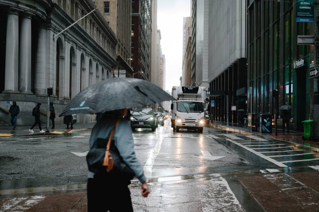
"caption": "A pedestrian walks across the street in downtown San Francisco on March 29, 2023. ",
"description": null,
"title": "03292023_kqed_marchrain 083_qut",
"credit": "Kori Suzuki / KQED News",
"status": "inherit",
"altTag": null,
"isLoading": false,
"fetchFailed": false
},
"science_1991213": {
"type": "attachments",
"id": "science_1991213",
"meta": {
"index": "attachments_1716263798",
"site": "science",
"id": "1991213",
"found": true
},
"parent": 1991212,
"imgSizes": {
"thumbnail": {
"file": "https://cdn.kqed.org/wp-content/uploads/sites/35/2024/01/26972424160_9285ef31ed_b_custom-c1c4497b82e8dcdad49474b35457fd4b1600ac98-160x63.jpg",
"width": 160,
"mimeType": "image/jpeg",
"height": 63
},
"post-thumbnail": {
"file": "https://cdn.kqed.org/wp-content/uploads/sites/35/2024/01/26972424160_9285ef31ed_b_custom-c1c4497b82e8dcdad49474b35457fd4b1600ac98-672x372.jpg",
"width": 672,
"mimeType": "image/jpeg",
"height": 372
},
"kqedFullSize": {
"file": "https://cdn.kqed.org/wp-content/uploads/sites/35/2024/01/26972424160_9285ef31ed_b_custom-c1c4497b82e8dcdad49474b35457fd4b1600ac98.jpg",
"width": 960,
"height": 375
},
"medium": {
"file": "https://cdn.kqed.org/wp-content/uploads/sites/35/2024/01/26972424160_9285ef31ed_b_custom-c1c4497b82e8dcdad49474b35457fd4b1600ac98-800x313.jpg",
"width": 800,
"mimeType": "image/jpeg",
"height": 313
},
"medium_large": {
"file": "https://cdn.kqed.org/wp-content/uploads/sites/35/2024/01/26972424160_9285ef31ed_b_custom-c1c4497b82e8dcdad49474b35457fd4b1600ac98-768x300.jpg",
"width": 768,
"mimeType": "image/jpeg",
"height": 300
}
},
"publishDate": 1706031321,
"modified": 1706031446,
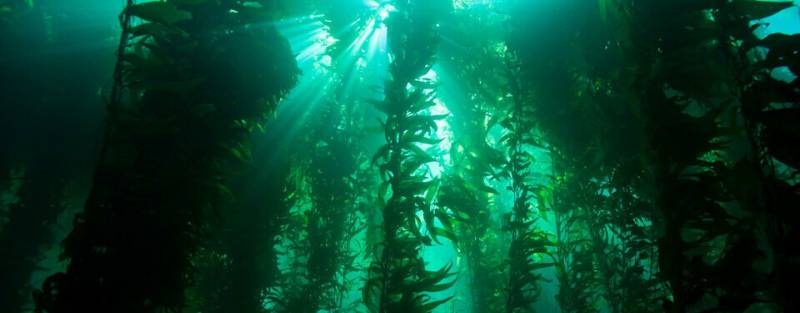
"caption": "Kelp forests are tiered like terrestrial rainforests and serve as key habitats for many marine animals.",
"description": null,
"title": "Kelp forests",
"credit": "NOAA",
"status": "inherit",
"altTag": null,
"isLoading": false,
"fetchFailed": false
},
"science_1991179": {
"type": "attachments",
"id": "science_1991179",
"meta": {
"index": "attachments_1716263798",
"site": "science",
"id": "1991179",
"found": true
},
"parent": 1991177,
"imgSizes": {
"twentyfourteen-full-width": {
"file": "https://cdn.kqed.org/wp-content/uploads/sites/35/2024/01/ap101026164547-e1a91c39fdbaae1f8c7f76b2442810efa085e579-1038x576.jpg",
"width": 1038,
"mimeType": "image/jpeg",
"height": 576
},
"thumbnail": {
"file": "https://cdn.kqed.org/wp-content/uploads/sites/35/2024/01/ap101026164547-e1a91c39fdbaae1f8c7f76b2442810efa085e579-160x120.jpg",
"width": 160,
"mimeType": "image/jpeg",
"height": 120
},
"post-thumbnail": {
"file": "https://cdn.kqed.org/wp-content/uploads/sites/35/2024/01/ap101026164547-e1a91c39fdbaae1f8c7f76b2442810efa085e579-672x372.jpg",
"width": 672,
"mimeType": "image/jpeg",
"height": 372
},
"kqedFullSize": {
"file": "https://cdn.kqed.org/wp-content/uploads/sites/35/2024/01/ap101026164547-e1a91c39fdbaae1f8c7f76b2442810efa085e579-scaled.jpg",
"width": 2560,
"height": 1920
},
"2048x2048": {
"file": "https://cdn.kqed.org/wp-content/uploads/sites/35/2024/01/ap101026164547-e1a91c39fdbaae1f8c7f76b2442810efa085e579-2048x1536.jpg",
"width": 2048,
"mimeType": "image/jpeg",
"height": 1536
},
"large": {
"file": "https://cdn.kqed.org/wp-content/uploads/sites/35/2024/01/ap101026164547-e1a91c39fdbaae1f8c7f76b2442810efa085e579-1020x765.jpg",
"width": 1020,
"mimeType": "image/jpeg",
"height": 765
},
"1536x1536": {
"file": "https://cdn.kqed.org/wp-content/uploads/sites/35/2024/01/ap101026164547-e1a91c39fdbaae1f8c7f76b2442810efa085e579-1536x1152.jpg",
"width": 1536,
"mimeType": "image/jpeg",
"height": 1152
},
"full-width": {
"file": "https://cdn.kqed.org/wp-content/uploads/sites/35/2024/01/ap101026164547-e1a91c39fdbaae1f8c7f76b2442810efa085e579-1920x1440.jpg",
"width": 1920,
"mimeType": "image/jpeg",
"height": 1440
},
"medium": {
"file": "https://cdn.kqed.org/wp-content/uploads/sites/35/2024/01/ap101026164547-e1a91c39fdbaae1f8c7f76b2442810efa085e579-800x600.jpg",
"width": 800,
"mimeType": "image/jpeg",
"height": 600
},
"medium_large": {
"file": "https://cdn.kqed.org/wp-content/uploads/sites/35/2024/01/ap101026164547-e1a91c39fdbaae1f8c7f76b2442810efa085e579-768x576.jpg",
"width": 768,
"mimeType": "image/jpeg",
"height": 576
}
},
"publishDate": 1705946557,
"modified": 1705946742,
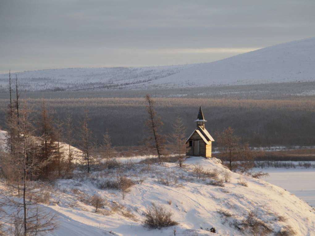
"caption": "Russia has more Arctic land area than any other nation. But since the invasion of Ukraine, it has been harder for Russian scientists to share data about how climate change is affecting the region. This tiny chapel is on the grounds of the Northeast Science Station near the Russian town of Chersky.",
"description": null,
"title": "Russia has more Arctic land area than any other nation. But since the invasion of Ukraine, it has been harder for Russian scientists to share data about how climate change is affecting the region. This tiny chapel is on the grounds of the Northeast Science Station near the Russian town of Chersky.",
"credit": "Arthur Max/AP",
"status": "inherit",
"altTag": null,
"isLoading": false,
"fetchFailed": false
},
"science_1991161": {
"type": "attachments",
"id": "science_1991161",
"meta": {
"index": "attachments_1716263798",
"site": "science",
"id": "1991161",
"found": true
},
"parent": 1991160,
"imgSizes": {
"twentyfourteen-full-width": {
"file": "https://cdn.kqed.org/wp-content/uploads/sites/35/2024/01/Oil-Pump-2048x1366-1-1038x576.jpg",
"width": 1038,
"mimeType": "image/jpeg",
"height": 576
},
"thumbnail": {
"file": "https://cdn.kqed.org/wp-content/uploads/sites/35/2024/01/Oil-Pump-2048x1366-1-160x107.jpg",
"width": 160,
"mimeType": "image/jpeg",
"height": 107
},
"post-thumbnail": {
"file": "https://cdn.kqed.org/wp-content/uploads/sites/35/2024/01/Oil-Pump-2048x1366-1-672x372.jpg",
"width": 672,
"mimeType": "image/jpeg",
"height": 372
},
"kqedFullSize": {
"file": "https://cdn.kqed.org/wp-content/uploads/sites/35/2024/01/Oil-Pump-2048x1366-1.jpg",
"width": 2048,
"height": 1366
},
"large": {
"file": "https://cdn.kqed.org/wp-content/uploads/sites/35/2024/01/Oil-Pump-2048x1366-1-1020x680.jpg",
"width": 1020,
"mimeType": "image/jpeg",
"height": 680
},
"1536x1536": {
"file": "https://cdn.kqed.org/wp-content/uploads/sites/35/2024/01/Oil-Pump-2048x1366-1-1536x1025.jpg",
"width": 1536,
"mimeType": "image/jpeg",
"height": 1025
},
"full-width": {
"file": "https://cdn.kqed.org/wp-content/uploads/sites/35/2024/01/Oil-Pump-2048x1366-1-1920x1281.jpg",
"width": 1920,
"mimeType": "image/jpeg",
"height": 1281
},
"medium": {
"file": "https://cdn.kqed.org/wp-content/uploads/sites/35/2024/01/Oil-Pump-2048x1366-1-800x534.jpg",
"width": 800,
"mimeType": "image/jpeg",
"height": 534
},
"medium_large": {
"file": "https://cdn.kqed.org/wp-content/uploads/sites/35/2024/01/Oil-Pump-2048x1366-1-768x512.jpg",
"width": 768,
"mimeType": "image/jpeg",
"height": 512
}
},
"publishDate": 1705605897,
"modified": 1705613742,
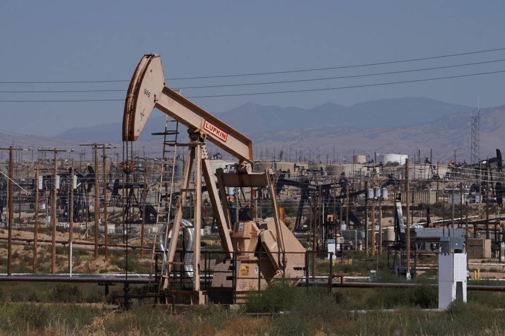
"caption": "An oil pumpjack in Kern County, California.",
"description": null,
"title": "Oil pumpjack",
"credit": "Harika Maddala",
"status": "inherit",
"altTag": "An oil pump is shown beneath a dusty sky.",
"isLoading": false,
"fetchFailed": false
},
"science_1991145": {
"type": "attachments",
"id": "science_1991145",
"meta": {
"index": "attachments_1716263798",
"site": "science",
"id": "1991145",
"found": true
},
"parent": 1991123,
"imgSizes": {
"twentyfourteen-full-width": {
"file": "https://cdn.kqed.org/wp-content/uploads/sites/35/2024/01/240112-ARBalloons-24-BL-1038x576.jpg",
"width": 1038,
"mimeType": "image/jpeg",
"height": 576
},
"thumbnail": {
"file": "https://cdn.kqed.org/wp-content/uploads/sites/35/2024/01/240112-ARBalloons-24-BL-160x107.jpg",
"width": 160,
"mimeType": "image/jpeg",
"height": 107
},
"post-thumbnail": {
"file": "https://cdn.kqed.org/wp-content/uploads/sites/35/2024/01/240112-ARBalloons-24-BL-672x372.jpg",
"width": 672,
"mimeType": "image/jpeg",
"height": 372
},
"kqedFullSize": {
"file": "https://cdn.kqed.org/wp-content/uploads/sites/35/2024/01/240112-ARBalloons-24-BL.jpg",
"width": 1920,
"height": 1280
},
"large": {
"file": "https://cdn.kqed.org/wp-content/uploads/sites/35/2024/01/240112-ARBalloons-24-BL-1020x680.jpg",
"width": 1020,
"mimeType": "image/jpeg",
"height": 680
},
"1536x1536": {
"file": "https://cdn.kqed.org/wp-content/uploads/sites/35/2024/01/240112-ARBalloons-24-BL-1536x1024.jpg",
"width": 1536,
"mimeType": "image/jpeg",
"height": 1024
},
"medium": {
"file": "https://cdn.kqed.org/wp-content/uploads/sites/35/2024/01/240112-ARBalloons-24-BL-800x533.jpg",
"width": 800,
"mimeType": "image/jpeg",
"height": 533
},
"medium_large": {
"file": "https://cdn.kqed.org/wp-content/uploads/sites/35/2024/01/240112-ARBalloons-24-BL-768x512.jpg",
"width": 768,
"mimeType": "image/jpeg",
"height": 512
}
},
"publishDate": 1705530158,
"modified": 1705536629,
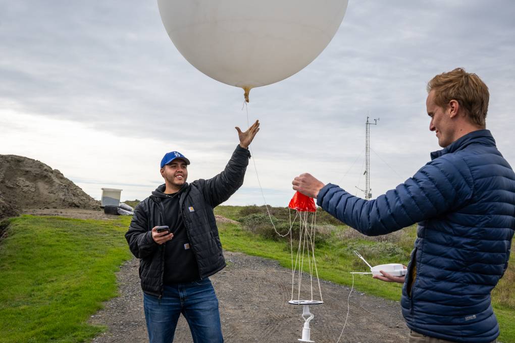
"caption": "Adolfo Lopez Miranda (left) and Jacob Morgan, engineers with the Scripps Institution of Oceanography, release a weather balloon into an atmospheric river-fueled storm to help forecast precipitation levels and locations in the Bay Area at the UC Davis Coastal and Marine Sciences Institute's Bodega Marine Laboratory in Bodega Bay on Jan. 12, 2024.",
"description": null,
"title": "240112-ARBalloons-24-BL",
"credit": "Beth LaBerge/KQED",
"status": "inherit",
"altTag": "A person wearing a black jacket and blue LA Dodgers hat opens their hand to let go of a string on a large white balloon while another person in a blue jacket holds a red parachute attached to the balloon.",
"isLoading": false,
"fetchFailed": false
},
"science_1991098": {
"type": "attachments",
"id": "science_1991098",
"meta": {
"index": "attachments_1716263798",
"site": "science",
"id": "1991098",
"found": true
},
"parent": 1991094,
"imgSizes": {
"twentyfourteen-full-width": {
"file": "https://cdn.kqed.org/wp-content/uploads/sites/35/2024/01/101024-Palisades-Avalanche-AP-CM-04-1038x576.jpg",
"width": 1038,
"mimeType": "image/jpeg",
"height": 576
},
"thumbnail": {
"file": "https://cdn.kqed.org/wp-content/uploads/sites/35/2024/01/101024-Palisades-Avalanche-AP-CM-04-160x107.jpg",
"width": 160,
"mimeType": "image/jpeg",
"height": 107
},
"post-thumbnail": {
"file": "https://cdn.kqed.org/wp-content/uploads/sites/35/2024/01/101024-Palisades-Avalanche-AP-CM-04-672x372.jpg",
"width": 672,
"mimeType": "image/jpeg",
"height": 372
},
"kqedFullSize": {
"file": "https://cdn.kqed.org/wp-content/uploads/sites/35/2024/01/101024-Palisades-Avalanche-AP-CM-04.jpg",
"width": 2000,
"height": 1333
},
"large": {
"file": "https://cdn.kqed.org/wp-content/uploads/sites/35/2024/01/101024-Palisades-Avalanche-AP-CM-04-1020x680.jpg",
"width": 1020,
"mimeType": "image/jpeg",
"height": 680
},
"1536x1536": {
"file": "https://cdn.kqed.org/wp-content/uploads/sites/35/2024/01/101024-Palisades-Avalanche-AP-CM-04-1536x1024.jpg",
"width": 1536,
"mimeType": "image/jpeg",
"height": 1024
},
"full-width": {
"file": "https://cdn.kqed.org/wp-content/uploads/sites/35/2024/01/101024-Palisades-Avalanche-AP-CM-04-1920x1280.jpg",
"width": 1920,
"mimeType": "image/jpeg",
"height": 1280
},
"medium": {
"file": "https://cdn.kqed.org/wp-content/uploads/sites/35/2024/01/101024-Palisades-Avalanche-AP-CM-04-800x533.jpg",
"width": 800,
"mimeType": "image/jpeg",
"height": 533
},
"medium_large": {
"file": "https://cdn.kqed.org/wp-content/uploads/sites/35/2024/01/101024-Palisades-Avalanche-AP-CM-04-768x512.jpg",
"width": 768,
"mimeType": "image/jpeg",
"height": 512
}
},
"publishDate": 1705087806,
"modified": 1705092279,
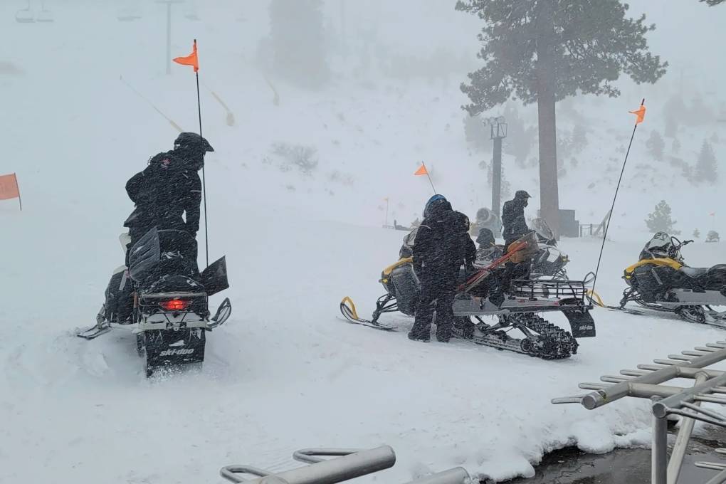
"caption": "Rescue crews work at the scene of an avalanche at the Palisades Tahoe ski resort on Jan. 10, 2024. The avalanche roared through a section of expert trails at the ski resort. ",
"description": null,
"title": "101024-Palisades-Avalanche-AP-CM-04",
"credit": "Mark Sponsler/AP Photo",
"status": "inherit",
"altTag": "Rescue crews on snowmobiles gather in the snow at the bottom of a mountain.",
"isLoading": false,
"fetchFailed": false
},
"science_1985951": {
"type": "attachments",
"id": "science_1985951",
"meta": {
"index": "attachments_1716263798",
"site": "science",
"id": "1985951",
"found": true
},
"parent": 0,
"imgSizes": {
"twentyfourteen-full-width": {
"file": "https://cdn.kqed.org/wp-content/uploads/sites/35/2024/01/240102-SNOW-SURVEY-DWR-FG-04-KQED-1038x576.jpg",
"width": 1038,
"mimeType": "image/jpeg",
"height": 576
},
"thumbnail": {
"file": "https://cdn.kqed.org/wp-content/uploads/sites/35/2024/01/240102-SNOW-SURVEY-DWR-FG-04-KQED-160x108.jpg",
"width": 160,
"mimeType": "image/jpeg",
"height": 108
},
"post-thumbnail": {
"file": "https://cdn.kqed.org/wp-content/uploads/sites/35/2024/01/240102-SNOW-SURVEY-DWR-FG-04-KQED-672x372.jpg",
"width": 672,
"mimeType": "image/jpeg",
"height": 372
},
"kqedFullSize": {
"file": "https://cdn.kqed.org/wp-content/uploads/sites/35/2024/01/240102-SNOW-SURVEY-DWR-FG-04-KQED.jpg",
"width": 2000,
"height": 1350
},
"large": {
"file": "https://cdn.kqed.org/wp-content/uploads/sites/35/2024/01/240102-SNOW-SURVEY-DWR-FG-04-KQED-1020x689.jpg",
"width": 1020,
"mimeType": "image/jpeg",
"height": 689
},
"1536x1536": {
"file": "https://cdn.kqed.org/wp-content/uploads/sites/35/2024/01/240102-SNOW-SURVEY-DWR-FG-04-KQED-1536x1037.jpg",
"width": 1536,
"mimeType": "image/jpeg",
"height": 1037
},
"full-width": {
"file": "https://cdn.kqed.org/wp-content/uploads/sites/35/2024/01/240102-SNOW-SURVEY-DWR-FG-04-KQED-1920x1296.jpg",
"width": 1920,
"mimeType": "image/jpeg",
"height": 1296
},
"medium": {
"file": "https://cdn.kqed.org/wp-content/uploads/sites/35/2024/01/240102-SNOW-SURVEY-DWR-FG-04-KQED-800x540.jpg",
"width": 800,
"mimeType": "image/jpeg",
"height": 540
},
"medium_large": {
"file": "https://cdn.kqed.org/wp-content/uploads/sites/35/2024/01/240102-SNOW-SURVEY-DWR-FG-04-KQED-768x518.jpg",
"width": 768,
"mimeType": "image/jpeg",
"height": 518
}
},
"publishDate": 1704225788,
"modified": 1704237789,
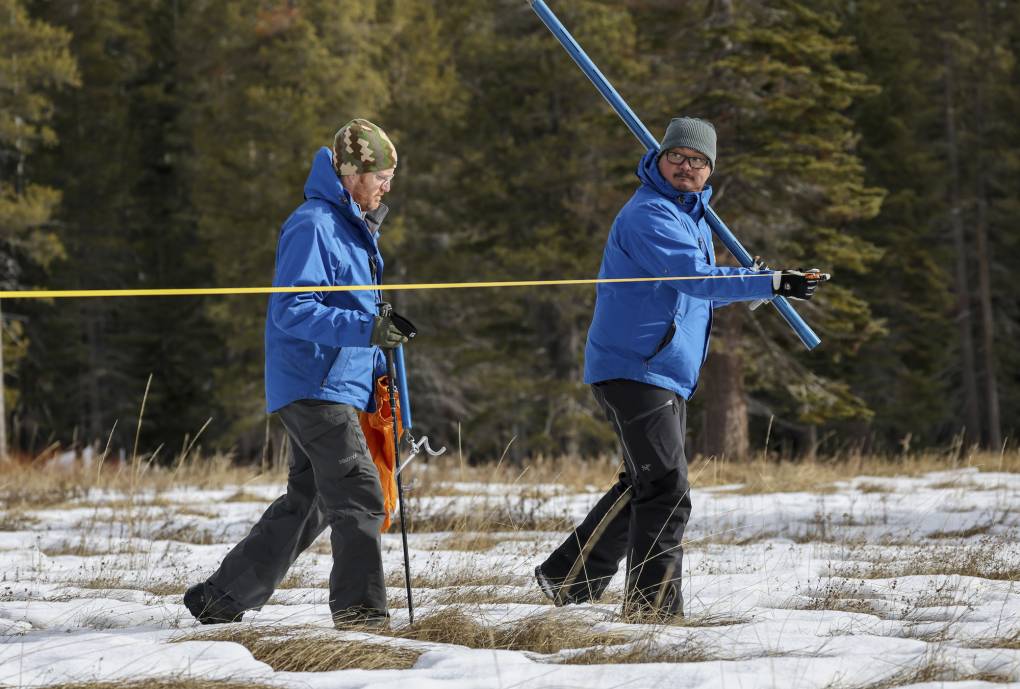
"caption": "Right, Sean de Guzman, manager of the California Department of Water Resources Snow Surveys and Water Supply Forecasting Unit, and Anthony Burdock, water resources engineer, walk in the meadow during the measurement phase of the first snow survey of the season at Phillips Station on Jan. 2, 2024.",
"description": null,
"title": "240102-SNOW SURVEY-DWR-FG-04-KQED",
"credit": "Xavier Mascareñas/California Department of Water Resources",
"status": "inherit",
"altTag": "Two people in blue jackets walk through a snowy field holding equipment.",
"isLoading": false,
"fetchFailed": false
},
"science_1985921": {
"type": "attachments",
"id": "science_1985921",
"meta": {
"index": "attachments_1716263798",
"site": "science",
"id": "1985921",
"found": true
},
"parent": 0,
"imgSizes": {
"twentyfourteen-full-width": {
"file": "https://cdn.kqed.org/wp-content/uploads/sites/35/2023/12/231220-BURLINGAME-GETTY-AH-KQED-1038x576.jpg",
"width": 1038,
"mimeType": "image/jpeg",
"height": 576
},
"thumbnail": {
"file": "https://cdn.kqed.org/wp-content/uploads/sites/35/2023/12/231220-BURLINGAME-GETTY-AH-KQED-160x107.jpg",
"width": 160,
"mimeType": "image/jpeg",
"height": 107
},
"post-thumbnail": {
"file": "https://cdn.kqed.org/wp-content/uploads/sites/35/2023/12/231220-BURLINGAME-GETTY-AH-KQED-672x372.jpg",
"width": 672,
"mimeType": "image/jpeg",
"height": 372
},
"kqedFullSize": {
"file": "https://cdn.kqed.org/wp-content/uploads/sites/35/2023/12/231220-BURLINGAME-GETTY-AH-KQED.jpg",
"width": 2000,
"height": 1333
},
"large": {
"file": "https://cdn.kqed.org/wp-content/uploads/sites/35/2023/12/231220-BURLINGAME-GETTY-AH-KQED-1020x680.jpg",
"width": 1020,
"mimeType": "image/jpeg",
"height": 680
},
"1536x1536": {
"file": "https://cdn.kqed.org/wp-content/uploads/sites/35/2023/12/231220-BURLINGAME-GETTY-AH-KQED-1536x1024.jpg",
"width": 1536,
"mimeType": "image/jpeg",
"height": 1024
},
"full-width": {
"file": "https://cdn.kqed.org/wp-content/uploads/sites/35/2023/12/231220-BURLINGAME-GETTY-AH-KQED-1920x1280.jpg",
"width": 1920,
"mimeType": "image/jpeg",
"height": 1280
},
"medium": {
"file": "https://cdn.kqed.org/wp-content/uploads/sites/35/2023/12/231220-BURLINGAME-GETTY-AH-KQED-800x533.jpg",
"width": 800,
"mimeType": "image/jpeg",
"height": 533
},
"medium_large": {
"file": "https://cdn.kqed.org/wp-content/uploads/sites/35/2023/12/231220-BURLINGAME-GETTY-AH-KQED-768x512.jpg",
"width": 768,
"mimeType": "image/jpeg",
"height": 512
}
},
"publishDate": 1703118204,
"modified": 1703118373,
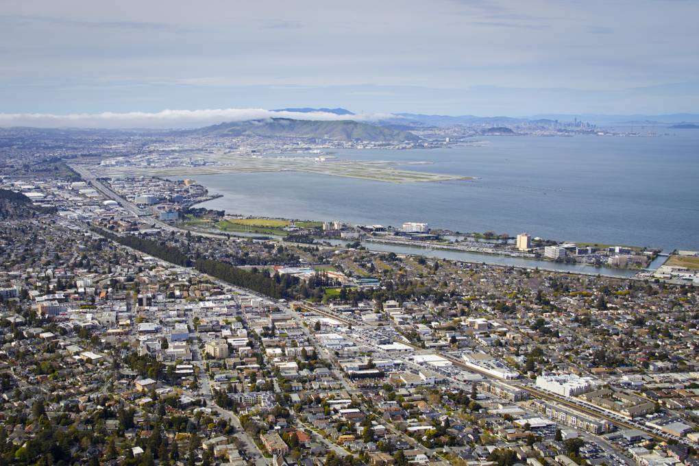
"caption": "An aerial view of Burlingame.",
"description": null,
"title": "Aerial photography view north of Millbrae, San Mateo, San Francisco Bay Area. California, United States.",
"credit": "Andrew Holt/Getty Images",
"status": "inherit",
"altTag": "An aerial view of a city.",
"isLoading": false,
"fetchFailed": false
},
"science_1985896": {
"type": "attachments",
"id": "science_1985896",
"meta": {
"index": "attachments_1716263798",
"site": "science",
"id": "1985896",
"found": true
},
"parent": 1985893,
"imgSizes": {
"twentyfourteen-full-width": {
"file": "https://cdn.kqed.org/wp-content/uploads/sites/35/2023/12/03292023_kqed_marchrain-074-qut-1038x576.jpg",
"width": 1038,
"mimeType": "image/jpeg",
"height": 576
},
"thumbnail": {
"file": "https://cdn.kqed.org/wp-content/uploads/sites/35/2023/12/03292023_kqed_marchrain-074-qut-160x106.jpg",
"width": 160,
"mimeType": "image/jpeg",
"height": 106
},
"post-thumbnail": {
"file": "https://cdn.kqed.org/wp-content/uploads/sites/35/2023/12/03292023_kqed_marchrain-074-qut-672x372.jpg",
"width": 672,
"mimeType": "image/jpeg",
"height": 372
},
"kqedFullSize": {
"file": "https://cdn.kqed.org/wp-content/uploads/sites/35/2023/12/03292023_kqed_marchrain-074-qut.jpg",
"width": 1920,
"height": 1277
},
"large": {
"file": "https://cdn.kqed.org/wp-content/uploads/sites/35/2023/12/03292023_kqed_marchrain-074-qut-1020x678.jpg",
"width": 1020,
"mimeType": "image/jpeg",
"height": 678
},
"1536x1536": {
"file": "https://cdn.kqed.org/wp-content/uploads/sites/35/2023/12/03292023_kqed_marchrain-074-qut-1536x1022.jpg",
"width": 1536,
"mimeType": "image/jpeg",
"height": 1022
},
"medium": {
"file": "https://cdn.kqed.org/wp-content/uploads/sites/35/2023/12/03292023_kqed_marchrain-074-qut-800x532.jpg",
"width": 800,
"mimeType": "image/jpeg",
"height": 532
},
"medium_large": {
"file": "https://cdn.kqed.org/wp-content/uploads/sites/35/2023/12/03292023_kqed_marchrain-074-qut-768x511.jpg",
"width": 768,
"mimeType": "image/jpeg",
"height": 511
}
},
"publishDate": 1702910152,
"modified": 1702943469,
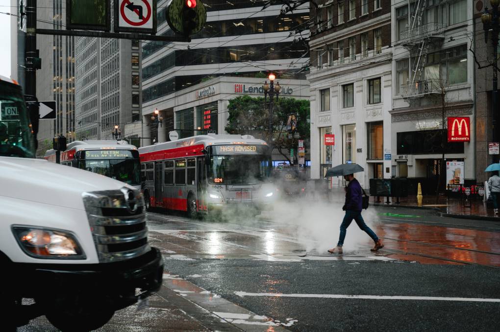
"caption": "A pedestrian walks through a pillar of steam while crossing the street in downtown San Francisco on March 29, 2023. ",
"description": null,
"title": "03292023_kqed_marchrain 074-qut",
"credit": "Kori Suzuki / KQED News",
"status": "inherit",
"altTag": "Rain falls on a red and gray bus.",
"isLoading": false,
"fetchFailed": false
},
"science_1985854": {
"type": "attachments",
"id": "science_1985854",
"meta": {
"index": "attachments_1716263798",
"site": "science",
"id": "1985854",
"found": true
},
"title": "002_KQED_AtmosphericRiver_03142023-qut",
"publishDate": 1702591654,
"status": "inherit",
"parent": 0,
"modified": 1762209865,
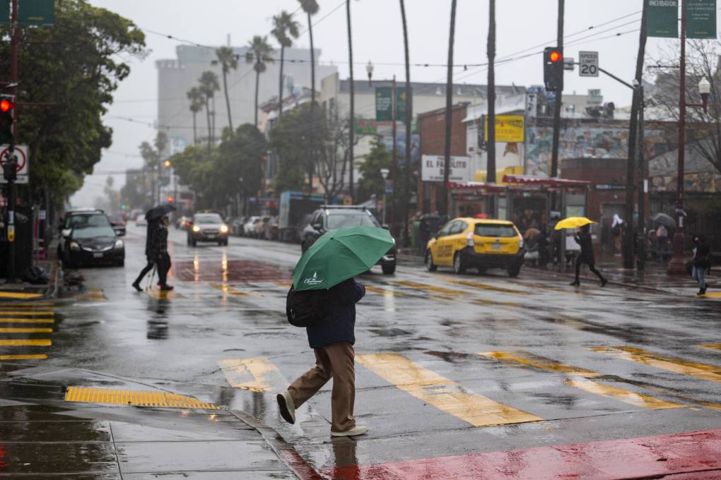
"caption": "A storm moves through San Francisco in the afternoon of March 14, 2023, bringing high winds and rain.",
"credit": "Beth LaBerge/KQED",
"altTag": "A person with a green umbrella crosses a rain-soaked street.",
"description": null,
"imgSizes": {
"medium": {
"file": "https://cdn.kqed.org/wp-content/uploads/sites/35/2023/12/002_KQED_AtmosphericRiver_03142023-qut-800x533.jpg",
"width": 800,
"height": 533,
"mimeType": "image/jpeg"
},
"large": {
"file": "https://cdn.kqed.org/wp-content/uploads/sites/35/2023/12/002_KQED_AtmosphericRiver_03142023-qut-1020x680.jpg",
"width": 1020,
"height": 680,
"mimeType": "image/jpeg"
},
"thumbnail": {
"file": "https://cdn.kqed.org/wp-content/uploads/sites/35/2023/12/002_KQED_AtmosphericRiver_03142023-qut-160x107.jpg",
"width": 160,
"height": 107,
"mimeType": "image/jpeg"
},
"medium_large": {
"file": "https://cdn.kqed.org/wp-content/uploads/sites/35/2023/12/002_KQED_AtmosphericRiver_03142023-qut-768x512.jpg",
"width": 768,
"height": 512,
"mimeType": "image/jpeg"
},
"1536x1536": {
"file": "https://cdn.kqed.org/wp-content/uploads/sites/35/2023/12/002_KQED_AtmosphericRiver_03142023-qut-1536x1024.jpg",
"width": 1536,
"height": 1024,
"mimeType": "image/jpeg"
},
"post-thumbnail": {
"file": "https://cdn.kqed.org/wp-content/uploads/sites/35/2023/12/002_KQED_AtmosphericRiver_03142023-qut-672x372.jpg",
"width": 672,
"height": 372,
"mimeType": "image/jpeg"
},
"twentyfourteen-full-width": {
"file": "https://cdn.kqed.org/wp-content/uploads/sites/35/2023/12/002_KQED_AtmosphericRiver_03142023-qut-1038x576.jpg",
"width": 1038,
"height": 576,
"mimeType": "image/jpeg"
},
"kqedFullSize": {
"file": "https://cdn.kqed.org/wp-content/uploads/sites/35/2023/12/002_KQED_AtmosphericRiver_03142023-qut.jpg",
"width": 1920,
"height": 1280
}
},
"isLoading": false,
"fetchFailed": false
},
"science_1985848": {
"type": "attachments",
"id": "science_1985848",
"meta": {
"index": "attachments_1716263798",
"site": "science",
"id": "1985848",
"found": true
},
"parent": 1985830,
"imgSizes": {
"twentyfourteen-full-width": {
"file": "https://cdn.kqed.org/wp-content/uploads/sites/35/2023/12/GettyImages-1419796991-1024x576.jpg",
"width": 1024,
"mimeType": "image/jpeg",
"height": 576
},
"thumbnail": {
"file": "https://cdn.kqed.org/wp-content/uploads/sites/35/2023/12/GettyImages-1419796991-160x105.jpg",
"width": 160,
"mimeType": "image/jpeg",
"height": 105
},
"post-thumbnail": {
"file": "https://cdn.kqed.org/wp-content/uploads/sites/35/2023/12/GettyImages-1419796991-672x372.jpg",
"width": 672,
"mimeType": "image/jpeg",
"height": 372
},
"kqedFullSize": {
"file": "https://cdn.kqed.org/wp-content/uploads/sites/35/2023/12/GettyImages-1419796991.jpg",
"width": 1024,
"height": 670
},
"large": {
"file": "https://cdn.kqed.org/wp-content/uploads/sites/35/2023/12/GettyImages-1419796991-1020x667.jpg",
"width": 1020,
"mimeType": "image/jpeg",
"height": 667
},
"medium": {
"file": "https://cdn.kqed.org/wp-content/uploads/sites/35/2023/12/GettyImages-1419796991-800x523.jpg",
"width": 800,
"mimeType": "image/jpeg",
"height": 523
},
"medium_large": {
"file": "https://cdn.kqed.org/wp-content/uploads/sites/35/2023/12/GettyImages-1419796991-768x503.jpg",
"width": 768,
"mimeType": "image/jpeg",
"height": 503
}
},
"publishDate": 1702569986,
"modified": 1702570067,
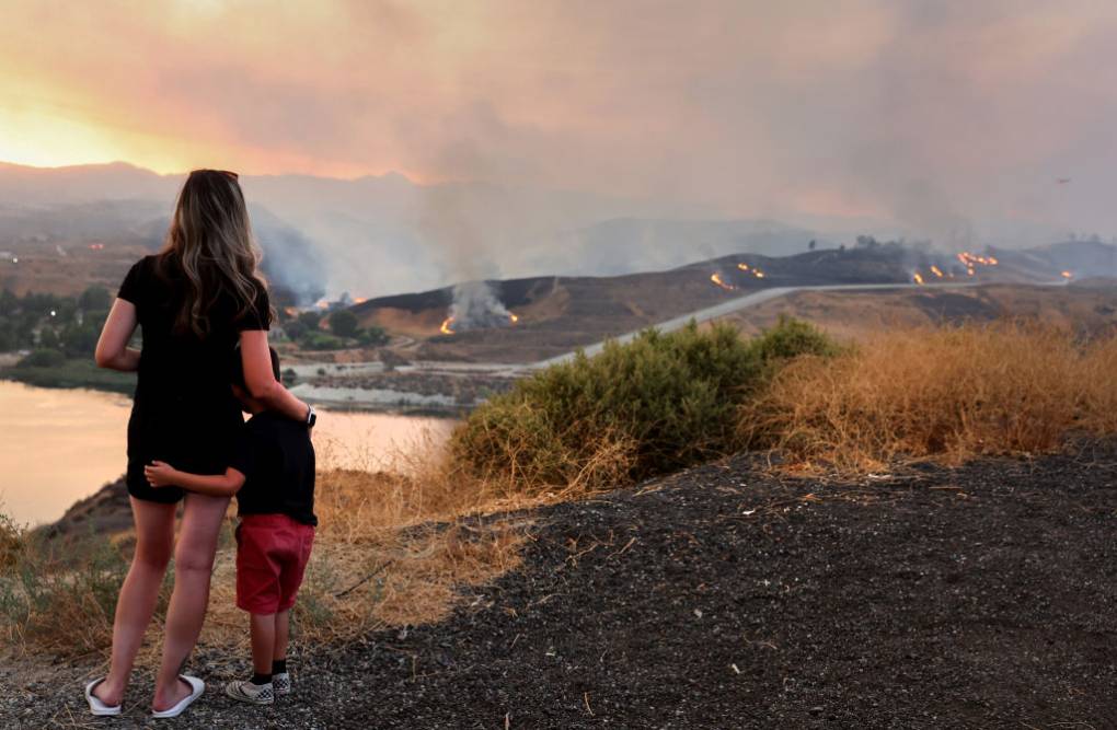
"caption": "A mother embraces her 5-year-old son, whose school was evacuated during the Route Fire, on Aug. 31, 2022 near Castaic, California.",
"description": null,
"title": "Route Fire Burns In Southern California",
"credit": "Mario Tama/Getty Images",
"status": "inherit",
"altTag": "Seen from behind, a woman embraces a young child, as the two watch a fire in the distance.",
"isLoading": false,
"fetchFailed": false
},
"science_1985811": {
"type": "attachments",
"id": "science_1985811",
"meta": {
"index": "attachments_1716263798",
"site": "science",
"id": "1985811",
"found": true
},
"parent": 0,
"imgSizes": {
"twentyfourteen-full-width": {
"file": "https://cdn.kqed.org/wp-content/uploads/sites/35/2023/12/231212-PARADISE-AERIAL-AP-NB-KQED-1038x576.jpg",
"width": 1038,
"mimeType": "image/jpeg",
"height": 576
},
"thumbnail": {
"file": "https://cdn.kqed.org/wp-content/uploads/sites/35/2023/12/231212-PARADISE-AERIAL-AP-NB-KQED-160x107.jpg",
"width": 160,
"mimeType": "image/jpeg",
"height": 107
},
"post-thumbnail": {
"file": "https://cdn.kqed.org/wp-content/uploads/sites/35/2023/12/231212-PARADISE-AERIAL-AP-NB-KQED-672x372.jpg",
"width": 672,
"mimeType": "image/jpeg",
"height": 372
},
"kqedFullSize": {
"file": "https://cdn.kqed.org/wp-content/uploads/sites/35/2023/12/231212-PARADISE-AERIAL-AP-NB-KQED.jpg",
"width": 2000,
"height": 1333
},
"large": {
"file": "https://cdn.kqed.org/wp-content/uploads/sites/35/2023/12/231212-PARADISE-AERIAL-AP-NB-KQED-1020x680.jpg",
"width": 1020,
"mimeType": "image/jpeg",
"height": 680
},
"1536x1536": {
"file": "https://cdn.kqed.org/wp-content/uploads/sites/35/2023/12/231212-PARADISE-AERIAL-AP-NB-KQED-1536x1024.jpg",
"width": 1536,
"mimeType": "image/jpeg",
"height": 1024
},
"full-width": {
"file": "https://cdn.kqed.org/wp-content/uploads/sites/35/2023/12/231212-PARADISE-AERIAL-AP-NB-KQED-1920x1280.jpg",
"width": 1920,
"mimeType": "image/jpeg",
"height": 1280
},
"medium": {
"file": "https://cdn.kqed.org/wp-content/uploads/sites/35/2023/12/231212-PARADISE-AERIAL-AP-NB-KQED-800x533.jpg",
"width": 800,
"mimeType": "image/jpeg",
"height": 533
},
"medium_large": {
"file": "https://cdn.kqed.org/wp-content/uploads/sites/35/2023/12/231212-PARADISE-AERIAL-AP-NB-KQED-768x512.jpg",
"width": 768,
"mimeType": "image/jpeg",
"height": 512
}
},
"publishDate": 1702404350,
"modified": 1702404417,
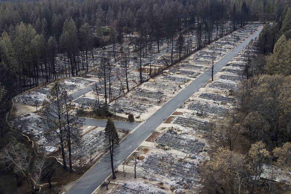
"caption": "Homes leveled by the Camp Fire line the Ridgewood Mobile Home Park retirement community in Paradise.",
"description": null,
"title": "ap_18337858678274",
"credit": "Noah Berger/AP",
"status": "inherit",
"altTag": "A stretch of empty land filled with the charred remains of mobile homes and surrounded by trees, some of which are visibly burnt.",
"isLoading": false,
"fetchFailed": false
}
},
"audioPlayerReducer": {
"postId": "stream_live",
"isPaused": true,
"isPlaying": false,
"pfsActive": false,
"pledgeModalIsOpen": true,
"playerDrawerIsOpen": false,
"liveAudioPlayStartedAt": 0,
"liveAudioPlayContext": ""
},
"authorsReducer": {
"byline_science_1991212": {
"type": "authors",
"id": "byline_science_1991212",
"meta": {
"override": true
},
"slug": "byline_science_1991212",
"name": "\u003ca href=\"https://www.npr.org/people/297147967/ari-daniel\">Ari Daniel\u003c/a>",
"isLoading": false
},
"byline_science_1991177": {
"type": "authors",
"id": "byline_science_1991177",
"meta": {
"override": true
},
"slug": "byline_science_1991177",
"name": "\u003ca href=\"https://www.npr.org/people/384067907/rebecca-hersher\">Rebecca Hersher\u003c/a>",
"isLoading": false
},
"byline_science_1991160": {
"type": "authors",
"id": "byline_science_1991160",
"meta": {
"override": true
},
"slug": "byline_science_1991160",
"name": "\u003ca href=\"https://insideclimatenews.org/profile/emma-foehringer-merchant/\"> Emma Foehringer Merchant, Inside Climate News\u003c/a>\u003cbr>\u003ca href=\"https://www.kvpr.org/people/joshua-yeager/\">Joshua Yeager, KVPR\u003c/a>",
"isLoading": false
},
"byline_science_1991094": {
"type": "authors",
"id": "byline_science_1991094",
"meta": {
"override": true
},
"slug": "byline_science_1991094",
"name": "\u003ca href=\"https://calmatters.org/author/rachel-becker/\">Rachel Becker\u003c/a>",
"isLoading": false
},
"byline_science_1985830": {
"type": "authors",
"id": "byline_science_1985830",
"meta": {
"override": true
},
"slug": "byline_science_1985830",
"name": "Jeff Brady",
"isLoading": false
},
"tgoldberg": {
"type": "authors",
"id": "258",
"meta": {
"index": "authors_1716337520",
"id": "258",
"found": true
},
"name": "Ted Goldberg",
"firstName": "Ted",
"lastName": "Goldberg",
"slug": "tgoldberg",
"email": "tgoldberg@kqed.org",
"display_author_email": true,
"staff_mastheads": [
"news"
],
"title": "KQED Managing Editor, News and Newscasts",
"bio": "Ted Goldberg is Managing Editor of News and Newscasts at KQED. His main reporting beat is the Bay Area's oil refining industry.\r\n\r\nPrior to joining KQED in 2014, Ted worked at CBS News and WCBS AM in New York and Bay City News and KCBS Radio in San Francisco. He graduated from Oberlin College in Ohio in 1998.",
"avatar": "https://secure.gravatar.com/avatar/30ce2e4fe89135e104f89be2394d16225b9d36c121b5b3cb7651ce642978b96f?s=600&d=blank&r=g",
"twitter": "TedrickG",
"bluesky": null,
"facebook": null,
"instagram": null,
"linkedin": null,
"sites": [
{
"site": "news",
"roles": [
"editor"
]
},
{
"site": "science",
"roles": [
"editor"
]
}
],
"headData": {
"title": "Ted Goldberg | KQED",
"description": "KQED Managing Editor, News and Newscasts",
"ogImgSrc": "https://secure.gravatar.com/avatar/30ce2e4fe89135e104f89be2394d16225b9d36c121b5b3cb7651ce642978b96f?s=600&d=blank&r=g",
"twImgSrc": "https://secure.gravatar.com/avatar/30ce2e4fe89135e104f89be2394d16225b9d36c121b5b3cb7651ce642978b96f?s=600&d=blank&r=g"
},
"isLoading": false,
"link": "/author/tgoldberg"
},
"dventon": {
"type": "authors",
"id": "11088",
"meta": {
"index": "authors_1716337520",
"id": "11088",
"found": true
},
"name": "Danielle Venton",
"firstName": "Danielle",
"lastName": "Venton",
"slug": "dventon",
"email": "dventon@kqed.org",
"display_author_email": true,
"staff_mastheads": [
"science"
],
"title": "Science reporter",
"bio": "Danielle Venton is a reporter for KQED Science. She covers wildfires, space and oceans (though she is prone to sea sickness).\r\n\r\nBefore joining KQED in 2015, Danielle was a staff reporter at KRCB in Sonoma County and a freelancer. She studied science communication at UC Santa Cruz and formerly worked at CERN in Geneva, Switzerland where she wrote about computing. She lives in Sonoma County and enjoys backpacking.",
"avatar": "https://secure.gravatar.com/avatar/37b292b5c40c8d93959c4f48d73b5286f41b7abd8588277e941905a3ed4c801c?s=600&d=blank&r=g",
"twitter": "DanielleVenton",
"bluesky": null,
"facebook": null,
"instagram": null,
"linkedin": null,
"sites": [
{
"site": "arts",
"roles": [
"contributor"
]
},
{
"site": "news",
"roles": [
"editor"
]
},
{
"site": "futureofyou",
"roles": [
"editor"
]
},
{
"site": "science",
"roles": [
"editor"
]
},
{
"site": "liveblog",
"roles": [
"contributor"
]
}
],
"headData": {
"title": "Danielle Venton | KQED",
"description": "Science reporter",
"ogImgSrc": "https://secure.gravatar.com/avatar/37b292b5c40c8d93959c4f48d73b5286f41b7abd8588277e941905a3ed4c801c?s=600&d=blank&r=g",
"twImgSrc": "https://secure.gravatar.com/avatar/37b292b5c40c8d93959c4f48d73b5286f41b7abd8588277e941905a3ed4c801c?s=600&d=blank&r=g"
},
"isLoading": false,
"link": "/author/dventon"
},
"kevinstark": {
"type": "authors",
"id": "11608",
"meta": {
"index": "authors_1716337520",
"id": "11608",
"found": true
},
"name": "Kevin Stark",
"firstName": "Kevin",
"lastName": "Stark",
"slug": "kevinstark",
"email": "kstark@kqed.org",
"display_author_email": true,
"staff_mastheads": [
"science"
],
"title": "Senior Editor",
"bio": "Kevin is a senior editor for KQED Science, managing the station's health and climate desks. His journalism career began in the Pacific Northwest, and he later became a lead reporter for the San Francisco Public Press. His work has appeared in Pacific Standard magazine, the Energy News Network, the Center for Investigative Reporting's Reveal and WBEZ in Chicago. Kevin joined KQED in 2019, and has covered issues related to energy, wildfire, climate change and the environment.",
"avatar": "https://secure.gravatar.com/avatar/365aaa4b597d3a8374f67504ff0facd323d7906e8eb4be0a7efd2427408e802c?s=600&d=blank&r=g",
"twitter": "starkkev",
"bluesky": null,
"facebook": null,
"instagram": null,
"linkedin": null,
"sites": [
{
"site": "",
"roles": [
"editor"
]
},
{
"site": "news",
"roles": [
"editor"
]
},
{
"site": "science",
"roles": [
"administrator"
]
}
],
"headData": {
"title": "Kevin Stark | KQED",
"description": "Senior Editor",
"ogImgSrc": "https://secure.gravatar.com/avatar/365aaa4b597d3a8374f67504ff0facd323d7906e8eb4be0a7efd2427408e802c?s=600&d=blank&r=g",
"twImgSrc": "https://secure.gravatar.com/avatar/365aaa4b597d3a8374f67504ff0facd323d7906e8eb4be0a7efd2427408e802c?s=600&d=blank&r=g"
},
"isLoading": false,
"link": "/author/kevinstark"
},
"eromero": {
"type": "authors",
"id": "11746",
"meta": {
"index": "authors_1716337520",
"id": "11746",
"found": true
},
"name": "Ezra David Romero",
"firstName": "Ezra David",
"lastName": "Romero",
"slug": "eromero",
"email": "eromero@kqed.org",
"display_author_email": true,
"staff_mastheads": [
"news",
"science"
],
"title": "Climate Reporter",
"bio": "Ezra David Romero is a climate reporter for KQED News. He covers the absence and excess of water in the Bay Area — think sea level rise, flooding and drought. For nearly a decade he’s covered how warming temperatures are altering the lives of Californians. He’s reported on farmers worried their pistachio trees aren’t getting enough sleep, families desperate for water, scientists studying dying giant sequoias, and alongside firefighters containing wildfires. His work has appeared on local stations across California and nationally on public radio shows like Morning Edition, Here and Now, All Things Considered and Science Friday. ",
"avatar": "https://secure.gravatar.com/avatar/c76404d287c10ed40224227551ac36e24352c7306f106632caf6fead76f8801f?s=600&d=blank&r=g",
"twitter": "ezraromero",
"bluesky": null,
"facebook": null,
"instagram": null,
"linkedin": null,
"sites": [
{
"site": "arts",
"roles": [
"editor"
]
},
{
"site": "news",
"roles": [
"editor"
]
},
{
"site": "science",
"roles": [
"editor"
]
},
{
"site": "liveblog",
"roles": [
"author"
]
}
],
"headData": {
"title": "Ezra David Romero | KQED",
"description": "Climate Reporter",
"ogImgSrc": "https://secure.gravatar.com/avatar/c76404d287c10ed40224227551ac36e24352c7306f106632caf6fead76f8801f?s=600&d=blank&r=g",
"twImgSrc": "https://secure.gravatar.com/avatar/c76404d287c10ed40224227551ac36e24352c7306f106632caf6fead76f8801f?s=600&d=blank&r=g"
},
"isLoading": false,
"link": "/author/eromero"
}
},
"pagesReducer": {
"science_category_climate": {
"type": "terms",
"id": "science_31",
"meta": {
"index": "terms_1716263798",
"site": "science",
"id": "31",
"score": 11.06203
},
"featImg": null,
"name": "Climate",
"description": null,
"taxonomy": "category",
"headData": {
"twImgId": null,
"twTitle": null,
"ogTitle": null,
"ogImgId": null,
"twDescription": null,
"description": null,
"title": "Climate Archives | KQED Science",
"ogDescription": null
},
"ttid": 33,
"slug": "climate",
"isLoading": false,
"title": "Climate",
"pageMeta": {
"site": "science",
"WpPageTemplate": "page-topic-editorial",
"currentPage": 22
},
"blocks": [
{
"blockName": "kqed/post-list",
"attrs": {
"layout": "cardArticle2",
"query": "posts/science?category=climate",
"seeMore": false,
"paginated": true,
"page": 22
}
},
{
"blockName": "kqed/ad"
}
]
}
},
"pfsSessionReducer": {},
"postsReducer": {
"stream_live": {
"type": "live",
"id": "stream_live",
"audioUrl": "https://streams.kqed.org/kqedradio",
"title": "Live Stream",
"excerpt": "Live Stream information currently unavailable.",
"link": "/radio",
"featImg": "",
"label": {
"name": "KQED Live",
"link": "/"
}
},
"stream_kqedNewscast": {
"type": "posts",
"id": "stream_kqedNewscast",
"audioUrl": "https://www.kqed.org/.stream/anon/radio/RDnews/newscast.mp3?_=1",
"title": "KQED Newscast",
"featImg": "",
"label": {
"name": "88.5 FM",
"link": "/"
}
},
"science_1991280": {
"type": "posts",
"id": "science_1991280",
"meta": {
"index": "posts_1716263798",
"site": "science",
"id": "1991280",
"score": null,
"sort": [
1707001436000
]
},
"parent": 0,
"labelTerm": {},
"blocks": [],
"publishDate": 1707001436,
"format": "standard",
"title": "Storm Brings More Powerful Wind and Rain to the Bay Area",
"headTitle": "Storm Brings More Powerful Wind and Rain to the Bay Area | KQED",
"content": "\u003cp>\u003cem>Updated Sunday 8:30 a.m.\u003c/em>\u003c/p>\n\u003cp>Yet another atmospheric river-boosted storm is bringing heavy rain and gusty weather to the Bay Area. The storm is forecast to last through Monday and is expected to be more powerful than those that have hit the region thus far this year, bringing with it the potential of flooding rain and strong winds that could damage trees and lead to power outages.\u003c/p>\n\u003cp>San Jose has issued a \u003ca href=\"https://www.sanjoseca.gov/news-stories/news/emergency-notifications\">proclamation of local emergency — \u003c/a> a mandatory evacuation for unhoused individuals living along the banks of the waterways. The Bay Area Taxi Cab Inc. (408-573-7777) is providing free rides to the Roosevelt Community Center which serves as a warming center for unhoused individuals.\u003c/p>\n\u003cp>A list of \u003ca href=\"https://emergencymanagement.sccgov.org/residents/cold-weather-safety?\">warming centers in San Jose\u003c/a> is located here.\u003c/p>\n\u003cp>\u003cstrong>Jump to:\u003c/strong>\u003c/p>\n\u003cul>\n\u003cli>\u003cstrong>\u003ca href=\"#start\">How should I prepare my home for a storm?\u003c/a>\u003c/strong>\u003c/li>\n\u003cli>\u003cstrong>\u003ca href=\"#sandbags\">Where can I get free sandbags?\u003c/a>\u003c/strong>\u003c/li>\n\u003cli>\u003cstrong>\u003ca href=\"#poweroutages\">How can I be ready for potential power outages?\u003c/a>\u003c/strong>\u003c/li>\n\u003cli>\u003cstrong>\u003ca href=\"#driving\">What are best practices for driving in heavy rain and wind?\u003c/a>\u003c/strong>\u003c/li>\n\u003cli>\u003cstrong>\u003ca href=\"#updates\">How can I receive updates about my area?\u003c/a>\u003c/strong>\u003c/li>\n\u003c/ul>\n\u003cp>The system appears aimed at the Central Coast and Southern California, but the National Weather Service is warning that recent models suggest the Bay Area will be facing much stronger gusting winds than previously anticipated.\u003c/p>\n\u003cp>The weather service’s latest forecast discussion from the Bay Area office said that the “second half of Saturday is when the magic happens.”\u003c/p>\n\u003cp>“Shower activity and south to southeast winds build in the southern portions of the [region], particularly along the Big Sur coast. Winds and showers spread north and east through Saturday night with dangerously strong winds expected in the late night and through Sunday. Rain rates begin to increase into the late night as the main rainband arrives.”\u003c/p>\n\u003cp>Meteorologist Roger Gass with the National Weather Service says he recommends people stay home Sunday if they can — a message that officials have plastered on digital billboards overhead the Bay Bridge, too.\u003c/p>\n\u003cp>“The impacts will be the greatest with some gusts up to 80 miles per hour in the hills,” he said. “We may get up to 70 miles per hour along the coast and within the city we’re expecting gusts in the 45 to 55 mile per hour range.\u003c/p>\n\u003cp>Much of the Bay Area and Central Coast are also under a flood watch through Monday morning, meaning roads, rivers, creeks and rivers are at risk of flooding. Burn scars are also at risk of flash flooding and debris flows.\u003c/p>\n\u003cp>The California Governor’s Office of Emergency Services is monitoring five rivers across the state it says are at risk of flooding, including the Guadalupe River in Santa Clara County, the Russian River in Mendocino County and the Carmel River in Monterey County.\u003c/p>\n\u003cp>https://twitter.com/NWSBayArea/status/1753554716360106346?s=20\u003c/p>\n\u003cp>Gov. Gavin Newsom has activated emergency operations centers around the state and mobilized 8,300 workers to respond to storm impacts.\u003c/p>\n\u003cp>“Avoid going outside as there are dangerous debris, falling tree limbs, and downed power lines. High winds may lead to power outages. Keep your batteries handy for your devices,” said Cal OES director Nancy Ward during a Saturday press conference.\u003c/p>\n\u003cp>The San Francisco Bay Area is forecast to get about three inches of rain between now and Monday afternoon.\u003c/p>\n\u003cp>But the biggest impact for the Bay Area, according to UCLA’s Daniel Swain, could come from the strong winds, which could be “highly disruptive and possibly substantially damaging winds” at times, along the central coast and even parts of the Bay Area.\u003c/p>\n\u003cp>“With an explosively developing surface low expected to be located just a couple hundred miles southwest of the SF Bay Area by late tonight, a major and possibly widespread damaging windstorm will be likely along much of the Central Coast, portions of the SF Bay Area, and possibly also farther north and east (especially across the northern San Joaquin and southern/central Sacramento Valley),” Swain wrote in a blog post posted this morning.\u003c/p>\n\u003cp>This latest series of storms will also bring heavy snow to the Sierra Nevada. The weather service’s Sacramento office warns of “significant mountain travel impacts” from Sunday into Tuesday and that driving in the Tahoe region will bring delays, snow-covered roads, chain control and possible road closures, and could be dangerous.\u003c/p>\n\u003cp>https://twitter.com/nwsreno/status/1753648693155332543?s=46\u003c/p>\n\u003ch2>\u003ca id=\"start\">\u003c/a>How should I start preparing?\u003c/h2>\n\u003cp>First up, understand just how much you — and your home — could be affected by another storm of this magnitude.\u003c/p>\n\u003cp>Previous storms in the Bay Area have knocked down trees, flooded roads and cut power to tens of thousands of homes and businesses, and contributed to several deaths. Winds have also previously forced the cancellation of flights at local airports including San Francisco International Airport.\u003c/p>\n\u003cp>Flooding could mean you have to evacuate your home, or live without crucial services for an extended period. Besides flashlights, experts recommend having \u003ca href=\"https://www.ready.gov/floods#prepare\">an emergency supply kit\u003c/a> ready in both your home and car — should you need to evacuate — that includes nonperishable foods, necessary medications, cleaning supplies and water for several days, in case services are cut off in your area. You can also include \u003ca href=\"https://www.kqed.org/news/11833686/what-to-pack-in-your-emergency-bag-with-covid-19-in-mind\">a copy of your ID, charging cables for your cellphone\u003c/a> and a portable cellphone battery pack.\u003c/p>\n\u003cp>Previous storms in the Bay Area have resulted in power outages that affected over 100,000 \u003ca href=\"https://pgealerts.alerts.pge.com/outagecenter/\">PG&E customers\u003c/a>. \u003ca href=\"#poweroutages\">Read more about preparing your home for a potential power outage \u003c/a>in this next storm.\u003c/p>\n\u003cfigure id=\"attachment_11937690\" class=\"wp-caption alignnone\" style=\"max-width: 1620px\">\u003cimg loading=\"lazy\" decoding=\"async\" class=\"size-full wp-image-11937690\" src=\"https://ww2.kqed.org/app/uploads/sites/10/2023/01/5D65DA1F-1731-42C5-834B-6BA5B80BEF7F.jpg\" alt=\"two people in raincoats stand in shin deep water as they try to clear a drain on a city street in San Francisco\" width=\"1620\" height=\"1080\">\u003cfigcaption class=\"wp-caption-text\">Two Mission District residents work to open a clogged drain on Mission and 21st streets in San Francisco on Jan. 10, 2023.\u003c/figcaption>\u003c/figure>\n\u003cp>[aside postID=\"news_11833686\" hero=\"https://ww2.kqed.org/app/uploads/sites/10/2020/08/pexels-dids-1986996-1-1020x680-1.jpg\"]If your home experienced flooding during previous storms this year — or in storms from years past — officials recommend having sandbags, plastic sheeting and other flood control materials ready. Counties, public utilities and even community organizations across the Bay Area are distributing free sandbags. Keep in mind that some distribution sites, like those in San Francisco and San José, may ask you to show ID to prove you are a resident. \u003ca href=\"#sandbags\">Learn more about where to find sandbags.\u003c/a>\u003c/p>\n\u003cp>Following the atmospheric river storm that hit Northern California on New Year’s Eve, officials around the Bay Area have doubled down on efforts to keep waterways and storm drains clear to reduce the risk of flooding in residential areas. Both \u003ca href=\"https://www.oaklandca.gov/services/adopt-a-drain\">Oakland\u003c/a> and \u003ca href=\"https://sfpuc.org/learning/how-you-can-help/adopt-drain-sf\">San Francisco\u003c/a> have programs where \u003ca href=\"https://www.kqed.org/arts/13923319/you-can-adopt-a-drain-in-san-francisco-with-naming-rights-included\">residents can “adopt” a storm drain in their community\u003c/a> and help remove leaves and other debris.\u003c/p>\n\u003cp>https://twitter.com/valleywater/status/1633925512853856256\u003c/p>\n\u003cp>FEMA also has created a tool that tracks which parts of a city are under flood risk — and to what extent. You can input your address in the \u003ca href=\"https://msc.fema.gov/portal/home\">FEMA Flood Map Service Center\u003c/a>. Once the map tool locates your address, you can select the “Dynamic Map” option to see a more detailed map that may have certain neighborhoods or blocks color coded to represent flood risk.\u003c/p>\n\u003cp>If you are a homeowner, keep in mind that most home insurance plans do \u003cem>not\u003c/em> cover damage caused by flooding. However, you can buy an additional policy with the \u003ca href=\"https://floodsmart.gov/\">National Flood Insurance Program\u003c/a> through your existing insurance provider. It’s important to mention that if you decide to buy a plan now, there is a 30-day wait period for the benefits to begin, so the policy would not cover damages potentially caused by this week’s storms.\u003cbr>\n[ad fullwidth]\u003c/p>\n\u003ch2>\u003ca id=\"sandbags\">\u003c/a>I need sandbags. Where can I get them?\u003c/h2>\n\u003cp>In San Francisco, officials in the past have stressed that only residents who have previously experienced flooding in their homes should seek out the free sandbags provided by city agencies. Additionally, San Mateo County has added on its emergency preparation website that \u003ca href=\"https://www.smcgov.org/ceo/news/prepare-now-heavy-rains-and-strong-winds-forecast-san-mateo-county\">sandbags brought out during a previous storm can be reused\u003c/a>.\u003c/p>\n\u003cp>Santa Clara Valley Water has \u003ca href=\"https://www.youtube.com/watch?v=GpvVAQ57uqM&t=39s\">created a helpful video tutorial on how best to place sandbags around a home\u003c/a>.\u003c/p>\n\u003cp>If your home has flooded in the past and you’re looking to pick up free sandbags, several options are available. Be aware that some sites may offer bags and sand separately or exclusively, and that you may need to bring your own shovel to some locations. You may also be required to prove county residency with an ID. Be sure to research the site you’re visiting before leaving.\u003c/p>\n\u003cp>\u003cstrong>Alameda County\u003c/strong>: In Alameda County, \u003ca href=\"https://www.acpwa.org/prepare-for-winter-storms.page\">residents can pick up sandbags supplied by the County Public Works Agency from four sites\u003c/a>.\u003c/p>\n\u003cp>\u003cstrong>Contra Costa County\u003c/strong>: Each city in Contra Costa County has its own sandbag pickup locations. \u003ca href=\"https://www.contracosta.ca.gov/DocumentCenter/View/55575/Sandbag-City-Contacts-11-20-18-PDF?bidId=\">You can find the contact information for your city’s sandbag distribution site here (PDF).\u003c/a> Additionally, if you live in an unincorporated part of the county,\u003ca href=\"https://contracosta.ca.gov/5976/Sandbags\"> six additional locations are available\u003c/a>.\u003c/p>\n\u003cp>\u003cstrong>Marin County\u003c/strong>: Marin County has a list of both government-provided locations and commercial/retail options for sandbags.\u003c/p>\n\u003cul>\n\u003cli>\u003ca href=\"https://emergency.marincounty.org/pages/flooding#sandbags\">Where to find sandbags in Marin County\u003c/a>\u003c/li>\n\u003c/ul>\n\u003cp>\u003cstrong>Napa County\u003c/strong>: In addition to the county-run sandbag locations below, Napa County also recommends residents of American Canyon, Napa, St. Helena, Calistoga and Yountville \u003ca href=\"https://www.countyofnapa.org/DocumentCenter/View/20444/2023-Sandbag-Locations-PDF?bidId=\">contact their city directly for sandbag locations and availability (PDF)\u003c/a>.\u003c/p>\n\u003cul>\n\u003cli>\u003ca href=\"https://www.smcgov.org/publicworks/storm-preparedness\">Where to find sandbags in San Mateo County\u003c/a>\u003c/li>\n\u003c/ul>\n\u003cp>\u003cstrong>Santa Clara County: \u003c/strong>Santa Clara County residents can pick up free sandbags from \u003ca href=\"https://www.valleywater.org/flooding-safety/flood-ready/sandbags\">several locations managed by Santa Clara Valley Water\u003c/a>.\u003c/p>\n\u003cp>\u003cstrong>Solano County\u003c/strong>: All locations are self-serve and require your own shovel.\u003c/p>\n\u003cul>\n\u003cli>\u003ca href=\"https://www.solanocounty.com/depts/oes/grs/storm_ready/sandbag_information.asp\">Where to find sandbags in Solano County\u003c/a>\u003c/li>\n\u003c/ul>\n\u003cp>\u003cstrong>Sonoma County\u003c/strong>: Sandbags are available at over 10 locations around the county.\u003c/p>\n\u003cul>\n\u003cli>\u003ca href=\"https://socoemergency.org/emergency/flooding/sandbags/\">Where to find sandbags in Sonoma County\u003c/a>\u003c/li>\n\u003c/ul>\n\u003ch2>\u003ca id=\"poweroutages\">\u003c/a>How can I be ready for potential power outages?\u003c/h2>\n\u003cp>Flooding, downed trees and downed power lines: All of these can create the very real possibility of power outages during a storm like this.\u003c/p>\n\u003cp>Remember: It can sometimes take days for PG&E to do safety checks and turn your power back on, particularly if an outage affects a large enough number of people. If you have medical needs that rely on power, consider planning which family members or friends you can stay with during a lengthy power outage. You might also talk to your doctor in advance about how to prepare with medications or mobility needs.\u003c/p>\n\u003cp>\u003cstrong>Things to have close at hand before a potential power outage\u003c/strong>:\u003c/p>\n\u003cul>\n\u003cli>Battery-powered flashlights, ideally one for every household member.\u003c/li>\n\u003cli>A supply of fresh batteries.\u003c/li>\n\u003cli>Portable chargers or battery packs to keep your mobile phone charged.\u003c/li>\n\u003cli>LED candles, instead of wax candles, are recommended by PG&E.\u003c/li>\n\u003cli>A battery-powered radio to hear updates on storm conditions and outages.\u003c/li>\n\u003cli>Nonperishable food (think canned goods) and water: The state recommends having enough food and water for every member of your household for three days.\u003c/li>\n\u003cli>A thermometer to make sure your food is safe to eat (more on that below).\u003c/li>\n\u003c/ul>\n\u003cp>Make sure you know exactly where these crucial items are, so you’re not scrambling to find them in the dark.\u003c/p>\n\u003cp>\u003cstrong>Other things to do ahead of an outage\u003c/strong>:\u003c/p>\n\u003cul>\n\u003cli>Fully charge your cellphone and any portable chargers.\u003c/li>\n\u003cli>Get cash, as ATMs may not work during a power outage.\u003c/li>\n\u003cli>Top your vehicle up with a full tank of gas (similarly, gas stations may not be operational during an outage).\u003c/li>\n\u003cli>Fill up plastic containers with water and store them in your freezer, which you can use later as ice substitutes to keep food fresh.\u003c/li>\n\u003c/ul>\n\u003cp>\u003cstrong>Additionally, make sure you and your household all know:\u003c/strong>\u003c/p>\n\u003cul>\n\u003cli>How to manually open any door in your home or building that requires electricity (think garage doors, apartment complex doors that require key cards).\u003c/li>\n\u003cli>How you’ll communicate in an emergency situation, and not depend on a phone that needs electricity.\u003c/li>\n\u003cli>How you’ll operate a generator, if you have one — check ahead of time that the one you have works, and make sure you know \u003ca href=\"https://www.pge.com/en_US/safety/electrical-safety/electric-generator-safety/electric-generator-safety.page\">how to use it safely and eliminate the risk of carbon-monoxide poisoning\u003c/a>.\u003c/li>\n\u003c/ul>\n\u003cp>As always, you should also consider checking on neighbors, especially those who may need assistance.\u003c/p>\n\u003ch2>What should I do if a power outage hits my home?\u003c/h2>\n\u003cp>\u003cstrong>Turn off almost all your appliances\u003c/strong>\u003c/p>\n\u003cp>If your power goes out, be sure to unplug or turn off any appliances and equipment to prevent damage from surges when the power is restored.\u003c/p>\n\u003cp>PG&E recommends keeping one lamp turned to the on position, to alert you when power has returned. You can then turn each appliance back on one by one.\u003c/p>\n\u003cp>\u003cstrong>Stay far away from any downed power lines, and report them\u003c/strong>\u003c/p>\n\u003cp>\u003ca href=\"https://www.pge.com/en_US/safety/emergency-preparedness/natural-disaster/storms/storms.page\">If you’re near a downed power line, PG&E advises that you assume it’s energized and dangerous\u003c/a> and stay far away from it. You should:\u003c/p>\n\u003cul>\n\u003cli>Make sure that others in your household, especially children, also stay far back from any downed lines.\u003c/li>\n\u003cli>Call 911 to report the downed power line, and make sure you give the location clearly.\u003c/li>\n\u003cli>Then call PG&E to report the downed line, at \u003ca href=\"tel:18007435000\">(800) 743-5000\u003c/a>.\u003c/li>\n\u003c/ul>\n\u003cp>\u003cstrong>Keep your food safe and edible during an outage \u003c/strong>\u003c/p>\n\u003cp>Once your power is out, be especially purposeful about when you open your freezer or your refrigerator.\u003c/p>\n\u003cp>A refrigerator that loses power can keep food cold for about four hours, and a freezer for about 48 hours, if kept closed. Plan to rely on coolers with ice or any water-filled plastic containers you’ve frozen ahead of time.\u003c/p>\n\u003cp>The state recommends that during an outage, you monitor food temperatures with a thermometer — and throw out any food that has a temperature of 40 degrees or higher.\u003c/p>\n\u003cp>If you’re opting to use a camp stove or a grill in the absence of your oven or microwave, you should only use these appliances outdoors.\u003c/p>\n\u003cp>If you’re without power for more than 48 hours, you may qualify for compensation from PG&E. \u003ca href=\"https://www.pge.com/en_US/residential/outages/current-outages/report-view-an-electric-outage/additional-resources/extended-outage-compensation/extended-outage-compensation.page\">Read more about the PG&E Safety Net program\u003c/a>, which offers these payments due to “severe events, like storms.”\u003c/p>\n\u003ch2>\u003ca id=\"driving\">\u003c/a>How can I drive safely in rain and strong winds?\u003c/h2>\n\u003cp>During these storms, officials urge residents to limit unnecessary travel and stay home if at all possible during weather events like these, citing the potential dangers presented by downed trees and power lines in addition to flooding.\u003c/p>\n\u003cp>If you must drive, use your headlights, turn off cruise control, maintain a firm grip on the steering wheel and drive more slowly and cautiously than usual. Leave twice as much space between your vehicle and the one in front of it; wet roads might mean it takes longer to stop. Be alert for debris on the road. If your car begins to hydroplane, do not slam on the brakes. Remain calm, ease off the gas, steer in the direction you want to go and very lightly pump the brakes until you regain traction.\u003c/p>\n\u003cfigure id=\"attachment_11936994\" class=\"wp-caption alignnone\" style=\"max-width: 1478px\">\u003cimg loading=\"lazy\" decoding=\"async\" class=\"size-full wp-image-11936994\" src=\"https://ww2.kqed.org/app/uploads/sites/10/2023/01/E2081DCF-BC1D-480F-B27A-DBB7E0C45B3A.jpg\" alt=\"A red car lies abandoned under a flooded underpass with another car submerged behind it.\" width=\"1478\" height=\"985\">\u003cfigcaption class=\"wp-caption-text\">Two cars are stuck in a flooded underpass at 34th and Webster streets in Oakland on Jan. 4, 2023.\u003c/figcaption>\u003c/figure>\n\u003cp>If flooding occurs, err on the side of caution. Don’t assume you know the depth of a pool of water or the conditions of the road underneath it, especially at night.\u003c/p>\n\u003cp>\u003cstrong>Always turn around rather than driving through a flooded area\u003c/strong> — as few as 6 inches of water is enough to disable or stall a small car, while 12 inches can sweep away a vehicle. If floodwaters begin to rise around your car, abandon the car and move to higher ground on foot. According to the California Department of Water Resources, more people become trapped and die in their vehicles than anywhere else during a flood.\u003c/p>\n\u003ch2>\u003ca id=\"updates\">\u003c/a>How can I receive updates about my area?\u003c/h2>\n\u003cp>If you haven’t done so already, sign up to receive emergency weather alerts from your county. County officials use these notifications to inform residents of weather alerts, street and road closures, and evacuation orders. Find your county below:\u003c/p>\n\u003cul>\n\u003cli>\u003ca href=\"https://www.acgov.org/emergencysite/\">Alameda County emergency alerts\u003c/a>\u003c/li>\n\u003cli>\u003ca href=\"https://www.cityofberkeley.info/EmergencyAlerting/\">City of Berkeley emergency alerts\u003c/a>\u003c/li>\n\u003cli>\u003ca href=\"https://www.contracosta.ca.gov/2269/Emergency-Alerts-Resources\">Contra Costa County emergency alerts\u003c/a>\u003c/li>\n\u003cli>\u003ca href=\"https://emergency.marincounty.org/\">Marin County emergency alerts\u003c/a>\u003c/li>\n\u003cli>\u003ca href=\"https://www.countyofnapa.org/2481/Emergency-Alerts\">Napa County emergency alerts\u003c/a>\u003c/li>\n\u003cli>\u003ca href=\"https://sf.gov/information/be-know-official-emergency-alerts\">City and County of San Francisco emergency alerts\u003c/a>\u003c/li>\n\u003cli>\u003ca href=\"https://cmo.smcgov.org/smc-alert\">San Mateo County emergency alerts\u003c/a>\u003c/li>\n\u003cli>\u003ca href=\"https://emergencymanagement.sccgov.org/AlertSCC\">Santa Clara County emergency alerts\u003c/a>\u003c/li>\n\u003cli>\u003ca href=\"https://www.solanocounty.com/depts/oes/emergency.asp\">Solano County emergency alerts\u003c/a>\u003c/li>\n\u003cli>\u003ca href=\"https://socoemergency.org/get-ready/sign-up/\">Sonoma County emergency alerts\u003c/a>\u003c/li>\n\u003c/ul>\n\u003cp>In San Francisco, officials have asked the public to call 311 to report flooding inside homes, instead of 911. “We still have to run all our critical 911 calls whether it’s a cardiac arrest, a car accident or a fire. If you add all these flooding issues … it can really overtax the system,” Fire Chief Jeanine Nicholson said. “So if you have a little bit of flooding in your home, call 311. If someone is having a heart attack or if someone is being swept by water, call 911.”\u003c/p>\n\u003cp>\u003cem>An earlier version of this story was published on Jan 30, 2024. KQED’s Danielle Venton, Kevin Stark, Daisy Nguyen and Erin Baldassari contributed to this story.\u003c/em>\u003c/p>\n\u003cp>[ad floatright]\u003c/p>\n",
"stats": {
"hasVideo": false,
"hasChartOrMap": false,
"hasAudio": false,
"hasPolis": false,
"wordCount": 2850,
"hasGoogleForm": false,
"hasGallery": false,
"hasHearkenModule": false,
"iframeSrcs": [],
"paragraphCount": 62
},
"modified": 1707066255,
"excerpt": "The storm is forecast to last through Monday and is expected to be more powerful than those that have hit the region thus far this year. ",
"headData": {
"twImgId": "",
"twTitle": "",
"ogTitle": "",
"ogImgId": "",
"twDescription": "",
"description": "The storm is forecast to last through Monday and is expected to be more powerful than those that have hit the region thus far this year. ",
"title": "Storm Brings More Powerful Wind and Rain to the Bay Area | KQED",
"ogDescription": "",
"schema": {
"@context": "https://schema.org",
"@type": "Article",
"headline": "Storm Brings More Powerful Wind and Rain to the Bay Area",
"datePublished": "2024-02-03T15:03:56-08:00",
"dateModified": "2024-02-04T09:04:15-08:00",
"image": "https://cdn.kqed.org/wp-content/uploads/2020/02/KQED-OG-Image@1x.png"
}
},
"guestAuthors": [],
"slug": "incoming-storm-bringing-powerful-wind-rain-to-the-bay-area",
"status": "publish",
"excludeFromSiteSearch": "Include",
"sticky": false,
"source": "Atmospheric River",
"articleAge": "0",
"path": "/science/1991280/incoming-storm-bringing-powerful-wind-rain-to-the-bay-area",
"audioTrackLength": null,
"parsedContent": [
{
"type": "contentString",
"content": "\u003cdiv class=\"post-body\">\u003cp>\u003cp>\u003cem>Updated Sunday 8:30 a.m.\u003c/em>\u003c/p>\n\u003cp>Yet another atmospheric river-boosted storm is bringing heavy rain and gusty weather to the Bay Area. The storm is forecast to last through Monday and is expected to be more powerful than those that have hit the region thus far this year, bringing with it the potential of flooding rain and strong winds that could damage trees and lead to power outages.\u003c/p>\n\u003cp>San Jose has issued a \u003ca href=\"https://www.sanjoseca.gov/news-stories/news/emergency-notifications\">proclamation of local emergency — \u003c/a> a mandatory evacuation for unhoused individuals living along the banks of the waterways. The Bay Area Taxi Cab Inc. (408-573-7777) is providing free rides to the Roosevelt Community Center which serves as a warming center for unhoused individuals.\u003c/p>\n\u003cp>A list of \u003ca href=\"https://emergencymanagement.sccgov.org/residents/cold-weather-safety?\">warming centers in San Jose\u003c/a> is located here.\u003c/p>\n\u003cp>\u003cstrong>Jump to:\u003c/strong>\u003c/p>\n\u003cul>\n\u003cli>\u003cstrong>\u003ca href=\"#start\">How should I prepare my home for a storm?\u003c/a>\u003c/strong>\u003c/li>\n\u003cli>\u003cstrong>\u003ca href=\"#sandbags\">Where can I get free sandbags?\u003c/a>\u003c/strong>\u003c/li>\n\u003cli>\u003cstrong>\u003ca href=\"#poweroutages\">How can I be ready for potential power outages?\u003c/a>\u003c/strong>\u003c/li>\n\u003cli>\u003cstrong>\u003ca href=\"#driving\">What are best practices for driving in heavy rain and wind?\u003c/a>\u003c/strong>\u003c/li>\n\u003cli>\u003cstrong>\u003ca href=\"#updates\">How can I receive updates about my area?\u003c/a>\u003c/strong>\u003c/li>\n\u003c/ul>\n\u003cp>The system appears aimed at the Central Coast and Southern California, but the National Weather Service is warning that recent models suggest the Bay Area will be facing much stronger gusting winds than previously anticipated.\u003c/p>\n\u003cp>The weather service’s latest forecast discussion from the Bay Area office said that the “second half of Saturday is when the magic happens.”\u003c/p>\n\u003cp>“Shower activity and south to southeast winds build in the southern portions of the [region], particularly along the Big Sur coast. Winds and showers spread north and east through Saturday night with dangerously strong winds expected in the late night and through Sunday. Rain rates begin to increase into the late night as the main rainband arrives.”\u003c/p>\n\u003cp>Meteorologist Roger Gass with the National Weather Service says he recommends people stay home Sunday if they can — a message that officials have plastered on digital billboards overhead the Bay Bridge, too.\u003c/p>\n\u003cp>“The impacts will be the greatest with some gusts up to 80 miles per hour in the hills,” he said. “We may get up to 70 miles per hour along the coast and within the city we’re expecting gusts in the 45 to 55 mile per hour range.\u003c/p>\n\u003cp>Much of the Bay Area and Central Coast are also under a flood watch through Monday morning, meaning roads, rivers, creeks and rivers are at risk of flooding. Burn scars are also at risk of flash flooding and debris flows.\u003c/p>\n\u003cp>The California Governor’s Office of Emergency Services is monitoring five rivers across the state it says are at risk of flooding, including the Guadalupe River in Santa Clara County, the Russian River in Mendocino County and the Carmel River in Monterey County.\u003c/p>\u003c/p>\u003c/div>",
"attributes": {
"named": {},
"numeric": []
}
},
{
"type": "component",
"content": "",
"name": "singleTwitterStatus",
"attributes": {
"named": {
"id": "1753554716360106346"
},
"numeric": []
}
},
{
"type": "contentString",
"content": "\u003cdiv class=\"post-body\">\u003cp>\n\u003cp>Gov. Gavin Newsom has activated emergency operations centers around the state and mobilized 8,300 workers to respond to storm impacts.\u003c/p>\n\u003cp>“Avoid going outside as there are dangerous debris, falling tree limbs, and downed power lines. High winds may lead to power outages. Keep your batteries handy for your devices,” said Cal OES director Nancy Ward during a Saturday press conference.\u003c/p>\n\u003cp>The San Francisco Bay Area is forecast to get about three inches of rain between now and Monday afternoon.\u003c/p>\n\u003cp>But the biggest impact for the Bay Area, according to UCLA’s Daniel Swain, could come from the strong winds, which could be “highly disruptive and possibly substantially damaging winds” at times, along the central coast and even parts of the Bay Area.\u003c/p>\n\u003cp>“With an explosively developing surface low expected to be located just a couple hundred miles southwest of the SF Bay Area by late tonight, a major and possibly widespread damaging windstorm will be likely along much of the Central Coast, portions of the SF Bay Area, and possibly also farther north and east (especially across the northern San Joaquin and southern/central Sacramento Valley),” Swain wrote in a blog post posted this morning.\u003c/p>\n\u003cp>This latest series of storms will also bring heavy snow to the Sierra Nevada. The weather service’s Sacramento office warns of “significant mountain travel impacts” from Sunday into Tuesday and that driving in the Tahoe region will bring delays, snow-covered roads, chain control and possible road closures, and could be dangerous.\u003c/p>\u003c/p>\u003c/div>",
"attributes": {
"named": {},
"numeric": []
}
},
{
"type": "component",
"content": "",
"name": "singleTwitterStatus",
"attributes": {
"named": {
"id": "1753648693155332543"
},
"numeric": []
}
},
{
"type": "contentString",
"content": "\u003cdiv class=\"post-body\">\u003cp>\n\u003ch2>\u003ca id=\"start\">\u003c/a>How should I start preparing?\u003c/h2>\n\u003cp>First up, understand just how much you — and your home — could be affected by another storm of this magnitude.\u003c/p>\n\u003cp>Previous storms in the Bay Area have knocked down trees, flooded roads and cut power to tens of thousands of homes and businesses, and contributed to several deaths. Winds have also previously forced the cancellation of flights at local airports including San Francisco International Airport.\u003c/p>\n\u003cp>Flooding could mean you have to evacuate your home, or live without crucial services for an extended period. Besides flashlights, experts recommend having \u003ca href=\"https://www.ready.gov/floods#prepare\">an emergency supply kit\u003c/a> ready in both your home and car — should you need to evacuate — that includes nonperishable foods, necessary medications, cleaning supplies and water for several days, in case services are cut off in your area. You can also include \u003ca href=\"https://www.kqed.org/news/11833686/what-to-pack-in-your-emergency-bag-with-covid-19-in-mind\">a copy of your ID, charging cables for your cellphone\u003c/a> and a portable cellphone battery pack.\u003c/p>\n\u003cp>Previous storms in the Bay Area have resulted in power outages that affected over 100,000 \u003ca href=\"https://pgealerts.alerts.pge.com/outagecenter/\">PG&E customers\u003c/a>. \u003ca href=\"#poweroutages\">Read more about preparing your home for a potential power outage \u003c/a>in this next storm.\u003c/p>\n\u003cfigure id=\"attachment_11937690\" class=\"wp-caption alignnone\" style=\"max-width: 1620px\">\u003cimg loading=\"lazy\" decoding=\"async\" class=\"size-full wp-image-11937690\" src=\"https://ww2.kqed.org/app/uploads/sites/10/2023/01/5D65DA1F-1731-42C5-834B-6BA5B80BEF7F.jpg\" alt=\"two people in raincoats stand in shin deep water as they try to clear a drain on a city street in San Francisco\" width=\"1620\" height=\"1080\">\u003cfigcaption class=\"wp-caption-text\">Two Mission District residents work to open a clogged drain on Mission and 21st streets in San Francisco on Jan. 10, 2023.\u003c/figcaption>\u003c/figure>\n\u003cp>\u003c/p>\u003c/div>",
"attributes": {
"named": {},
"numeric": []
}
},
{
"type": "component",
"content": "",
"name": "aside",
"attributes": {
"named": {
"postid": "news_11833686",
"hero": "https://ww2.kqed.org/app/uploads/sites/10/2020/08/pexels-dids-1986996-1-1020x680-1.jpg",
"label": ""
},
"numeric": []
}
},
{
"type": "contentString",
"content": "\u003cdiv class=\"post-body\">\u003cp>If your home experienced flooding during previous storms this year — or in storms from years past — officials recommend having sandbags, plastic sheeting and other flood control materials ready. Counties, public utilities and even community organizations across the Bay Area are distributing free sandbags. Keep in mind that some distribution sites, like those in San Francisco and San José, may ask you to show ID to prove you are a resident. \u003ca href=\"#sandbags\">Learn more about where to find sandbags.\u003c/a>\u003c/p>\n\u003cp>Following the atmospheric river storm that hit Northern California on New Year’s Eve, officials around the Bay Area have doubled down on efforts to keep waterways and storm drains clear to reduce the risk of flooding in residential areas. Both \u003ca href=\"https://www.oaklandca.gov/services/adopt-a-drain\">Oakland\u003c/a> and \u003ca href=\"https://sfpuc.org/learning/how-you-can-help/adopt-drain-sf\">San Francisco\u003c/a> have programs where \u003ca href=\"https://www.kqed.org/arts/13923319/you-can-adopt-a-drain-in-san-francisco-with-naming-rights-included\">residents can “adopt” a storm drain in their community\u003c/a> and help remove leaves and other debris.\u003c/p>\u003c/p>\u003c/div>",
"attributes": {
"named": {},
"numeric": []
}
},
{
"type": "component",
"content": "",
"name": "singleTwitterStatus",
"attributes": {
"named": {
"id": "1633925512853856256"
},
"numeric": []
}
},
{
"type": "contentString",
"content": "\u003cdiv class=\"post-body\">\u003cp>\n\u003cp>FEMA also has created a tool that tracks which parts of a city are under flood risk — and to what extent. You can input your address in the \u003ca href=\"https://msc.fema.gov/portal/home\">FEMA Flood Map Service Center\u003c/a>. Once the map tool locates your address, you can select the “Dynamic Map” option to see a more detailed map that may have certain neighborhoods or blocks color coded to represent flood risk.\u003c/p>\n\u003cp>If you are a homeowner, keep in mind that most home insurance plans do \u003cem>not\u003c/em> cover damage caused by flooding. However, you can buy an additional policy with the \u003ca href=\"https://floodsmart.gov/\">National Flood Insurance Program\u003c/a> through your existing insurance provider. It’s important to mention that if you decide to buy a plan now, there is a 30-day wait period for the benefits to begin, so the policy would not cover damages potentially caused by this week’s storms.\u003cbr>\n\u003c/p>\u003c/div>",
"attributes": {
"named": {},
"numeric": []
}
},
{
"type": "component",
"content": "",
"name": "ad",
"attributes": {
"named": {
"label": "fullwidth"
},
"numeric": [
"fullwidth"
]
}
},
{
"type": "contentString",
"content": "\u003cdiv class=\"post-body\">\u003cp>\u003c/p>\n\u003ch2>\u003ca id=\"sandbags\">\u003c/a>I need sandbags. Where can I get them?\u003c/h2>\n\u003cp>In San Francisco, officials in the past have stressed that only residents who have previously experienced flooding in their homes should seek out the free sandbags provided by city agencies. Additionally, San Mateo County has added on its emergency preparation website that \u003ca href=\"https://www.smcgov.org/ceo/news/prepare-now-heavy-rains-and-strong-winds-forecast-san-mateo-county\">sandbags brought out during a previous storm can be reused\u003c/a>.\u003c/p>\n\u003cp>Santa Clara Valley Water has \u003ca href=\"https://www.youtube.com/watch?v=GpvVAQ57uqM&t=39s\">created a helpful video tutorial on how best to place sandbags around a home\u003c/a>.\u003c/p>\n\u003cp>If your home has flooded in the past and you’re looking to pick up free sandbags, several options are available. Be aware that some sites may offer bags and sand separately or exclusively, and that you may need to bring your own shovel to some locations. You may also be required to prove county residency with an ID. Be sure to research the site you’re visiting before leaving.\u003c/p>\n\u003cp>\u003cstrong>Alameda County\u003c/strong>: In Alameda County, \u003ca href=\"https://www.acpwa.org/prepare-for-winter-storms.page\">residents can pick up sandbags supplied by the County Public Works Agency from four sites\u003c/a>.\u003c/p>\n\u003cp>\u003cstrong>Contra Costa County\u003c/strong>: Each city in Contra Costa County has its own sandbag pickup locations. \u003ca href=\"https://www.contracosta.ca.gov/DocumentCenter/View/55575/Sandbag-City-Contacts-11-20-18-PDF?bidId=\">You can find the contact information for your city’s sandbag distribution site here (PDF).\u003c/a> Additionally, if you live in an unincorporated part of the county,\u003ca href=\"https://contracosta.ca.gov/5976/Sandbags\"> six additional locations are available\u003c/a>.\u003c/p>\n\u003cp>\u003cstrong>Marin County\u003c/strong>: Marin County has a list of both government-provided locations and commercial/retail options for sandbags.\u003c/p>\n\u003cul>\n\u003cli>\u003ca href=\"https://emergency.marincounty.org/pages/flooding#sandbags\">Where to find sandbags in Marin County\u003c/a>\u003c/li>\n\u003c/ul>\n\u003cp>\u003cstrong>Napa County\u003c/strong>: In addition to the county-run sandbag locations below, Napa County also recommends residents of American Canyon, Napa, St. Helena, Calistoga and Yountville \u003ca href=\"https://www.countyofnapa.org/DocumentCenter/View/20444/2023-Sandbag-Locations-PDF?bidId=\">contact their city directly for sandbag locations and availability (PDF)\u003c/a>.\u003c/p>\n\u003cul>\n\u003cli>\u003ca href=\"https://www.smcgov.org/publicworks/storm-preparedness\">Where to find sandbags in San Mateo County\u003c/a>\u003c/li>\n\u003c/ul>\n\u003cp>\u003cstrong>Santa Clara County: \u003c/strong>Santa Clara County residents can pick up free sandbags from \u003ca href=\"https://www.valleywater.org/flooding-safety/flood-ready/sandbags\">several locations managed by Santa Clara Valley Water\u003c/a>.\u003c/p>\n\u003cp>\u003cstrong>Solano County\u003c/strong>: All locations are self-serve and require your own shovel.\u003c/p>\n\u003cul>\n\u003cli>\u003ca href=\"https://www.solanocounty.com/depts/oes/grs/storm_ready/sandbag_information.asp\">Where to find sandbags in Solano County\u003c/a>\u003c/li>\n\u003c/ul>\n\u003cp>\u003cstrong>Sonoma County\u003c/strong>: Sandbags are available at over 10 locations around the county.\u003c/p>\n\u003cul>\n\u003cli>\u003ca href=\"https://socoemergency.org/emergency/flooding/sandbags/\">Where to find sandbags in Sonoma County\u003c/a>\u003c/li>\n\u003c/ul>\n\u003ch2>\u003ca id=\"poweroutages\">\u003c/a>How can I be ready for potential power outages?\u003c/h2>\n\u003cp>Flooding, downed trees and downed power lines: All of these can create the very real possibility of power outages during a storm like this.\u003c/p>\n\u003cp>Remember: It can sometimes take days for PG&E to do safety checks and turn your power back on, particularly if an outage affects a large enough number of people. If you have medical needs that rely on power, consider planning which family members or friends you can stay with during a lengthy power outage. You might also talk to your doctor in advance about how to prepare with medications or mobility needs.\u003c/p>\n\u003cp>\u003cstrong>Things to have close at hand before a potential power outage\u003c/strong>:\u003c/p>\n\u003cul>\n\u003cli>Battery-powered flashlights, ideally one for every household member.\u003c/li>\n\u003cli>A supply of fresh batteries.\u003c/li>\n\u003cli>Portable chargers or battery packs to keep your mobile phone charged.\u003c/li>\n\u003cli>LED candles, instead of wax candles, are recommended by PG&E.\u003c/li>\n\u003cli>A battery-powered radio to hear updates on storm conditions and outages.\u003c/li>\n\u003cli>Nonperishable food (think canned goods) and water: The state recommends having enough food and water for every member of your household for three days.\u003c/li>\n\u003cli>A thermometer to make sure your food is safe to eat (more on that below).\u003c/li>\n\u003c/ul>\n\u003cp>Make sure you know exactly where these crucial items are, so you’re not scrambling to find them in the dark.\u003c/p>\n\u003cp>\u003cstrong>Other things to do ahead of an outage\u003c/strong>:\u003c/p>\n\u003cul>\n\u003cli>Fully charge your cellphone and any portable chargers.\u003c/li>\n\u003cli>Get cash, as ATMs may not work during a power outage.\u003c/li>\n\u003cli>Top your vehicle up with a full tank of gas (similarly, gas stations may not be operational during an outage).\u003c/li>\n\u003cli>Fill up plastic containers with water and store them in your freezer, which you can use later as ice substitutes to keep food fresh.\u003c/li>\n\u003c/ul>\n\u003cp>\u003cstrong>Additionally, make sure you and your household all know:\u003c/strong>\u003c/p>\n\u003cul>\n\u003cli>How to manually open any door in your home or building that requires electricity (think garage doors, apartment complex doors that require key cards).\u003c/li>\n\u003cli>How you’ll communicate in an emergency situation, and not depend on a phone that needs electricity.\u003c/li>\n\u003cli>How you’ll operate a generator, if you have one — check ahead of time that the one you have works, and make sure you know \u003ca href=\"https://www.pge.com/en_US/safety/electrical-safety/electric-generator-safety/electric-generator-safety.page\">how to use it safely and eliminate the risk of carbon-monoxide poisoning\u003c/a>.\u003c/li>\n\u003c/ul>\n\u003cp>As always, you should also consider checking on neighbors, especially those who may need assistance.\u003c/p>\n\u003ch2>What should I do if a power outage hits my home?\u003c/h2>\n\u003cp>\u003cstrong>Turn off almost all your appliances\u003c/strong>\u003c/p>\n\u003cp>If your power goes out, be sure to unplug or turn off any appliances and equipment to prevent damage from surges when the power is restored.\u003c/p>\n\u003cp>PG&E recommends keeping one lamp turned to the on position, to alert you when power has returned. You can then turn each appliance back on one by one.\u003c/p>\n\u003cp>\u003cstrong>Stay far away from any downed power lines, and report them\u003c/strong>\u003c/p>\n\u003cp>\u003ca href=\"https://www.pge.com/en_US/safety/emergency-preparedness/natural-disaster/storms/storms.page\">If you’re near a downed power line, PG&E advises that you assume it’s energized and dangerous\u003c/a> and stay far away from it. You should:\u003c/p>\n\u003cul>\n\u003cli>Make sure that others in your household, especially children, also stay far back from any downed lines.\u003c/li>\n\u003cli>Call 911 to report the downed power line, and make sure you give the location clearly.\u003c/li>\n\u003cli>Then call PG&E to report the downed line, at \u003ca href=\"tel:18007435000\">(800) 743-5000\u003c/a>.\u003c/li>\n\u003c/ul>\n\u003cp>\u003cstrong>Keep your food safe and edible during an outage \u003c/strong>\u003c/p>\n\u003cp>Once your power is out, be especially purposeful about when you open your freezer or your refrigerator.\u003c/p>\n\u003cp>A refrigerator that loses power can keep food cold for about four hours, and a freezer for about 48 hours, if kept closed. Plan to rely on coolers with ice or any water-filled plastic containers you’ve frozen ahead of time.\u003c/p>\n\u003cp>The state recommends that during an outage, you monitor food temperatures with a thermometer — and throw out any food that has a temperature of 40 degrees or higher.\u003c/p>\n\u003cp>If you’re opting to use a camp stove or a grill in the absence of your oven or microwave, you should only use these appliances outdoors.\u003c/p>\n\u003cp>If you’re without power for more than 48 hours, you may qualify for compensation from PG&E. \u003ca href=\"https://www.pge.com/en_US/residential/outages/current-outages/report-view-an-electric-outage/additional-resources/extended-outage-compensation/extended-outage-compensation.page\">Read more about the PG&E Safety Net program\u003c/a>, which offers these payments due to “severe events, like storms.”\u003c/p>\n\u003ch2>\u003ca id=\"driving\">\u003c/a>How can I drive safely in rain and strong winds?\u003c/h2>\n\u003cp>During these storms, officials urge residents to limit unnecessary travel and stay home if at all possible during weather events like these, citing the potential dangers presented by downed trees and power lines in addition to flooding.\u003c/p>\n\u003cp>If you must drive, use your headlights, turn off cruise control, maintain a firm grip on the steering wheel and drive more slowly and cautiously than usual. Leave twice as much space between your vehicle and the one in front of it; wet roads might mean it takes longer to stop. Be alert for debris on the road. If your car begins to hydroplane, do not slam on the brakes. Remain calm, ease off the gas, steer in the direction you want to go and very lightly pump the brakes until you regain traction.\u003c/p>\n\u003cfigure id=\"attachment_11936994\" class=\"wp-caption alignnone\" style=\"max-width: 1478px\">\u003cimg loading=\"lazy\" decoding=\"async\" class=\"size-full wp-image-11936994\" src=\"https://ww2.kqed.org/app/uploads/sites/10/2023/01/E2081DCF-BC1D-480F-B27A-DBB7E0C45B3A.jpg\" alt=\"A red car lies abandoned under a flooded underpass with another car submerged behind it.\" width=\"1478\" height=\"985\">\u003cfigcaption class=\"wp-caption-text\">Two cars are stuck in a flooded underpass at 34th and Webster streets in Oakland on Jan. 4, 2023.\u003c/figcaption>\u003c/figure>\n\u003cp>If flooding occurs, err on the side of caution. Don’t assume you know the depth of a pool of water or the conditions of the road underneath it, especially at night.\u003c/p>\n\u003cp>\u003cstrong>Always turn around rather than driving through a flooded area\u003c/strong> — as few as 6 inches of water is enough to disable or stall a small car, while 12 inches can sweep away a vehicle. If floodwaters begin to rise around your car, abandon the car and move to higher ground on foot. According to the California Department of Water Resources, more people become trapped and die in their vehicles than anywhere else during a flood.\u003c/p>\n\u003ch2>\u003ca id=\"updates\">\u003c/a>How can I receive updates about my area?\u003c/h2>\n\u003cp>If you haven’t done so already, sign up to receive emergency weather alerts from your county. County officials use these notifications to inform residents of weather alerts, street and road closures, and evacuation orders. Find your county below:\u003c/p>\n\u003cul>\n\u003cli>\u003ca href=\"https://www.acgov.org/emergencysite/\">Alameda County emergency alerts\u003c/a>\u003c/li>\n\u003cli>\u003ca href=\"https://www.cityofberkeley.info/EmergencyAlerting/\">City of Berkeley emergency alerts\u003c/a>\u003c/li>\n\u003cli>\u003ca href=\"https://www.contracosta.ca.gov/2269/Emergency-Alerts-Resources\">Contra Costa County emergency alerts\u003c/a>\u003c/li>\n\u003cli>\u003ca href=\"https://emergency.marincounty.org/\">Marin County emergency alerts\u003c/a>\u003c/li>\n\u003cli>\u003ca href=\"https://www.countyofnapa.org/2481/Emergency-Alerts\">Napa County emergency alerts\u003c/a>\u003c/li>\n\u003cli>\u003ca href=\"https://sf.gov/information/be-know-official-emergency-alerts\">City and County of San Francisco emergency alerts\u003c/a>\u003c/li>\n\u003cli>\u003ca href=\"https://cmo.smcgov.org/smc-alert\">San Mateo County emergency alerts\u003c/a>\u003c/li>\n\u003cli>\u003ca href=\"https://emergencymanagement.sccgov.org/AlertSCC\">Santa Clara County emergency alerts\u003c/a>\u003c/li>\n\u003cli>\u003ca href=\"https://www.solanocounty.com/depts/oes/emergency.asp\">Solano County emergency alerts\u003c/a>\u003c/li>\n\u003cli>\u003ca href=\"https://socoemergency.org/get-ready/sign-up/\">Sonoma County emergency alerts\u003c/a>\u003c/li>\n\u003c/ul>\n\u003cp>In San Francisco, officials have asked the public to call 311 to report flooding inside homes, instead of 911. “We still have to run all our critical 911 calls whether it’s a cardiac arrest, a car accident or a fire. If you add all these flooding issues … it can really overtax the system,” Fire Chief Jeanine Nicholson said. “So if you have a little bit of flooding in your home, call 311. If someone is having a heart attack or if someone is being swept by water, call 911.”\u003c/p>\n\u003cp>\u003cem>An earlier version of this story was published on Jan 30, 2024. KQED’s Danielle Venton, Kevin Stark, Daisy Nguyen and Erin Baldassari contributed to this story.\u003c/em>\u003c/p>\n\u003cp>\u003c/p>\u003c/div>",
"attributes": {
"named": {},
"numeric": []
}
},
{
"type": "component",
"content": "",
"name": "ad",
"attributes": {
"named": {
"label": "floatright"
},
"numeric": [
"floatright"
]
}
},
{
"type": "contentString",
"content": "\u003cdiv class=\"post-body\">\u003cp>\u003c/p>\n\u003c/div>\u003c/p>",
"attributes": {
"named": {},
"numeric": []
}
}
],
"link": "/science/1991280/incoming-storm-bringing-powerful-wind-rain-to-the-bay-area",
"authors": [
"11608"
],
"categories": [
"science_31",
"science_35",
"science_40",
"science_4450"
],
"tags": [
"science_2227",
"science_4417",
"science_365"
],
"featImg": "science_1991281",
"label": "source_science_1991280"
},
"science_1991212": {
"type": "posts",
"id": "science_1991212",
"meta": {
"index": "posts_1716263798",
"site": "science",
"id": "1991212",
"score": null,
"sort": [
1706040351000
]
},
"parent": 0,
"labelTerm": {},
"blocks": [],
"publishDate": 1706040351,
"format": "standard",
"title": "New Fossils Suggest Kelp Forests Have Swayed in the Seas for at Least 32 Million Years",
"headTitle": "New Fossils Suggest Kelp Forests Have Swayed in the Seas for at Least 32 Million Years | KQED",
"content": "\u003cp>The kelp forests that hug the Pacific coastline are an underwater jungle. They’re a thicket of colossal algae intermixed with a pageant of life that includes snails, urchins, sea lions, sea otters, and a host of seabirds.\u003c/p>\n\u003cp>“The current Pacific kelp forests are the base of very rich shallow marine ecosystems,” says \u003ca href=\"https://ib.berkeley.edu/labs/looy/\">Cindy Looy\u003c/a>, a paleobotanist at the University of California at Berkeley.\u003c/p>\n\u003cp>A study published in \u003ca href=\"https://www.pnas.org/doi/10.1073/pnas.2317054121\">\u003cem>PNAS\u003c/em>\u003c/a> presents new evidence that the first kelps were much older than we once suspected, dating back 32 million years — well before the arrival of many of their present-day animal inhabitants.[aside postID='science_1973217,science_1976045,science_1952335' label='Related coverage']\u003c/p>\n\u003cp>This means that kelp was likely available as a food source for ancient marine mammals. And that the foundation of the ecosystem was already in place when kelp later evolved and grew dramatically in height, providing an even greater range of habitats to the ancestors of the animals we associate with them today.\u003c/p>\n\u003cp>When Looy gazes out at the Pacific Ocean from Point Lobos State Natural Reserve in Monterey, California, she knows the kelp forest with all its attendant species pulsates just below the surface.\u003c/p>\n\u003cp>“Just to think,” she says, “that we now added a little tiny piece of the puzzle of when [the kelps] started and how the ecosystem diversified — that makes me very proud.”\u003c/p>\n\u003ch2>A lucky find at the beach\u003c/h2>\n\u003cp>Jim Goedert is a retired railroad signal inspector. He lives outside of Tacoma, Washington where, for years, he’s regularly driven up to the north side of the Olympic Peninsula to walk along the rocky shoreline.\u003c/p>\n\u003cp>“Gray whales and seals come in, and occasionally orcas,” he says. “There are kelp beds offshore.” At low tide, when large swaths of the beach become exposed, Goedert goes in search of fossils including hard, round masses called concretions.\u003c/p>\n\u003cp>“We would crack these open,” he says. “And sometimes there’s a crab or some other fossil in these rocks. But I would find these little squiggly veins or roots. I couldn’t really tell what they were.”\u003c/p>\n\u003cp>One day, during a break on one of his beach walks, Goedert came across a mound that had washed ashore of kelp holdfasts — the root-like structures that fasten the towering algae to the seafloor.\u003c/p>\n\u003cp>“And I thought, ‘That’s what that thing is — kelp,'” he says. “It was just an aha moment.”\u003c/p>\n\u003cp>Goedert packed up some of his best specimens, drove to the post office, and shipped them to Stockholm to a professional.\u003c/p>\n\u003cp>“He just kept sending me holdfasts,” recounts \u003ca href=\"https://www.nrm.se/english/researchandcollections/palaeobiology/staffandcontacts/steffenkiel.9003235.html\">Steffen Kiel\u003c/a>, a senior curator at the Swedish Museum of Natural History and a collaborator and friend of Goedert’s. Some of the fossils weren’t that impressive but “sometimes they were, like, wow,” he says. Still, “I just left it alone for a few years because, as usual, I had other things to do.”\u003c/p>\n\u003cfigure id=\"attachment_1991214\" class=\"wp-caption alignnone\" style=\"max-width: 2288px\">\u003cimg loading=\"lazy\" decoding=\"async\" class=\"size-full wp-image-1991214\" src=\"https://cdn.kqed.org/wp-content/uploads/sites/35/2024/01/s169277_fossil_kelp_holdfast_custom-de5c315f6055f703f989b0c2da4d52bba05252a2.jpg\" alt=\"\" width=\"2288\" height=\"1626\" srcset=\"https://cdn.kqed.org/wp-content/uploads/sites/35/2024/01/s169277_fossil_kelp_holdfast_custom-de5c315f6055f703f989b0c2da4d52bba05252a2.jpg 2288w, https://cdn.kqed.org/wp-content/uploads/sites/35/2024/01/s169277_fossil_kelp_holdfast_custom-de5c315f6055f703f989b0c2da4d52bba05252a2-800x569.jpg 800w, https://cdn.kqed.org/wp-content/uploads/sites/35/2024/01/s169277_fossil_kelp_holdfast_custom-de5c315f6055f703f989b0c2da4d52bba05252a2-1020x725.jpg 1020w, https://cdn.kqed.org/wp-content/uploads/sites/35/2024/01/s169277_fossil_kelp_holdfast_custom-de5c315f6055f703f989b0c2da4d52bba05252a2-160x114.jpg 160w, https://cdn.kqed.org/wp-content/uploads/sites/35/2024/01/s169277_fossil_kelp_holdfast_custom-de5c315f6055f703f989b0c2da4d52bba05252a2-768x546.jpg 768w, https://cdn.kqed.org/wp-content/uploads/sites/35/2024/01/s169277_fossil_kelp_holdfast_custom-de5c315f6055f703f989b0c2da4d52bba05252a2-1536x1092.jpg 1536w, https://cdn.kqed.org/wp-content/uploads/sites/35/2024/01/s169277_fossil_kelp_holdfast_custom-de5c315f6055f703f989b0c2da4d52bba05252a2-2048x1455.jpg 2048w, https://cdn.kqed.org/wp-content/uploads/sites/35/2024/01/s169277_fossil_kelp_holdfast_custom-de5c315f6055f703f989b0c2da4d52bba05252a2-1920x1364.jpg 1920w\" sizes=\"(max-width: 2288px) 100vw, 2288px\">\u003cfigcaption class=\"wp-caption-text\">A fossil showing kelp ‘holdfasts,’ the root-like structures that serve to tether the algae to the seafloor. \u003ccite>(Steffen Kiel)\u003c/cite>\u003c/figcaption>\u003c/figure>\n\u003ch2>Asking a fossil how old it is\u003c/h2>\n\u003cp>Kelp fossils are exceedingly rare. “We all know things fossilize — big vertebrates, dinosaurs, things with bones and hard parts,” says \u003ca href=\"https://www.ceridwenfraser.com/\">Ceridwyn Fraser\u003c/a>, a marine scientist at the University of Otago in New Zealand. “But kelp is a very squidgy organism.” Plus, says Kiel, “they quickly rot away because they are eaten up by microbes and various animals. Kelps are essential[ly] edible, nutritious soft tissue.” It all adds up to very little kelp making it into the fossil record.\u003c/p>\n\u003cp>Years ago, researchers used a single specimen from California to estimate that complex kelps emerged at least 13 or 14 million years ago. (Complex kelps differ from simple kelps in a few ways, including that they have distinct stems and leaves.) More recently, genetics helped push that date back to at least \u003ca href=\"https://www.sciencedirect.com/science/article/abs/pii/S1055790319300892\">30 million years\u003c/a>. But there was no fossil evidence to back that number up, which made Kiel wonder whether the samples he’d received from Goedert might offer some insight. So eventually, he took a closer look, cutting into them and polishing their surfaces.\u003c/p>\n\u003cp>On one, a splotch of root-like tendrils appears to be draped across the rock. “That’s the holdfast,” Kiel says, pointing. “I have various specimens where they were sitting on a bivalve shell, on a clamshell or especially often on barnacles.”\u003c/p>\n\u003cp>He took one of those fossilized shells that the kelp had glued itself to and performed a chemical analysis involving strontium isotopes to determine its age.\u003c/p>\n\u003cp>“We then knew exactly, pretty much exactly, that these fossils were 32 million years old,” Kiel says. “No doubt about it.”\u003c/p>\n\u003cp>This result confirms the earlier genetics work, but the fossils are stronger proof that complex kelp dates back to the early Oligocene, a time of dramatic global cooling.\u003c/p>\n\u003cp>“The whole world’s oceans got a hell [of a] lot colder right at that time,” Kiel says. “Kelp like it cold. So that was a perfect fit.”\u003c/p>\n\u003cp>[ad fullwidth]\u003c/p>\n\u003ch2>Why the earlier arrival of kelp matters\u003c/h2>\n\u003cp>The fact that complex kelp has been around for so long means a couple of things. First, it helps resolve a puzzle about an ancient vegetarian marine mammal related to today’s manatees called the desmostylian.\u003c/p>\n\u003cp>“People were wondering what they were actually feeding on 30 million years ago,” Kiel says. “What kind of green fresh food would there be? And now, our kelp fossils show, yeah, hippo-sized desmostylians most likely were happily feeding on this kelp.”\u003c/p>\n\u003cp>It’s logical, Looy says: “Kelps can grow incredibly fast, and those desmostylians are relatively big, and they have to eat a lot to stay alive.” Now that the researchers know that both kelp and desmostylians were alive at the same time, “we can more or less rewrite the history of the kelp ecosystems,” she says.\u003c/p>\n\u003cp>Here’s the second insight: “This whole rich ecosystem that we know now must have gradually evolved,” Looy says.\u003c/p>\n\u003cp>That is, for millions of years, the kelp ecosystem was quite simple, with the kelps themselves being somewhat short, maybe a few feet tall. Then, around 14 million years ago, much taller kelps evolved, forming the underwater forests we know today. And that’s when a thriving hub of biodiversity slowly began to materialize in this new wealth of vertical habitat — “all these animals that characterize modern kelp ecosystems — full with all sorts of life,” says Kiel, from invertebrates to larger grazers.\u003c/p>\n\u003cp>Fraser, the marine scientist, says the findings are exciting.\u003c/p>\n\u003cp>“I have been approached before by people who thought they had kelp fossils, and I wasn’t convinced,” says Fraser, who wasn’t involved in the study. “But what we’re looking at are very clearly kelp.”\u003c/p>\n\u003cp>Fraser studies kelp evolution and how its DNA mutates, something she anchors in time using the fossil record.\u003c/p>\n\u003cp>“And the annoying thing about kelp is there’s hardly anything known from the fossil record,” Fraser says. “So this will be a tool that I can use now to better understand how kelps are evolving and what’s happened through time.”\u003c/p>\n\u003cp>Kiel says he’s delighted that, once again, fossils have taught him a familiar yet fundamental lesson about our world.\u003c/p>\n\u003cp>To him, they’re an archive of life throughout Earth’s history — an archive that sometimes washes ashore where all you have to do is look for it.\u003c/p>\n\u003cdiv class=\"fullattribution\">\u003cem>Copyright 2024 NPR. To see more, visit https://www.npr.org.\u003cimg decoding=\"async\" src=\"https://www.google-analytics.com/__utm.gif?utmac=UA-5828686-4&utmdt=New+fossils+suggest+kelp+forests+have+swayed+in+the+seas+for+at+least+32+million+years&utme=8(APIKey)9(MDAxOTAwOTE4MDEyMTkxMDAzNjczZDljZA004)\">\u003c/em>\u003c/div>\n\u003cp>[ad floatright]\u003c/p>\n",
"stats": {
"hasVideo": false,
"hasChartOrMap": false,
"hasAudio": false,
"hasPolis": false,
"wordCount": 1332,
"hasGoogleForm": false,
"hasGallery": false,
"hasHearkenModule": false,
"iframeSrcs": [],
"paragraphCount": 33
},
"modified": 1706040142,
"excerpt": "A new study of kelp forests from the coast of Washington state show that kelp forests, which host all manner of marine life, developed tens of millions of years ago. ",
"headData": {
"twImgId": "",
"twTitle": "",
"ogTitle": "",
"ogImgId": "",
"twDescription": "",
"description": "A new study of kelp forests from the coast of Washington state show that kelp forests, which host all manner of marine life, developed tens of millions of years ago. ",
"title": "New Fossils Suggest Kelp Forests Have Swayed in the Seas for at Least 32 Million Years | KQED",
"ogDescription": "",
"schema": {
"@context": "https://schema.org",
"@type": "Article",
"headline": "New Fossils Suggest Kelp Forests Have Swayed in the Seas for at Least 32 Million Years",
"datePublished": "2024-01-23T12:05:51-08:00",
"dateModified": "2024-01-23T12:02:22-08:00",
"image": "https://cdn.kqed.org/wp-content/uploads/2020/02/KQED-OG-Image@1x.png"
}
},
"guestAuthors": [],
"slug": "new-fossils-suggest-kelp-forests-have-swayed-in-the-seas-for-at-least-32-million-years",
"status": "publish",
"nprApiLink": "http://api.npr.org/query?id=1226146217&apiKey=MDAxOTAwOTE4MDEyMTkxMDAzNjczZDljZA004",
"nprStoryDate": "Tue, 23 Jan 2024 05:00:13 -0500",
"excludeFromSiteSearch": "Include",
"nprLastModifiedDate": "Tue, 23 Jan 2024 05:00:13 -0500",
"nprHtmlLink": "https://www.npr.org/2024/01/23/1226146217/new-fossils-suggest-kelp-forests-have-swayed-in-the-seas-for-at-least-32-million?ft=nprml&f=1226146217",
"nprImageAgency": "NOAA",
"source": "NPR",
"nprStoryId": "1226146217",
"nprByline": "\u003ca href=\"https://www.npr.org/people/297147967/ari-daniel\">Ari Daniel\u003c/a>",
"sticky": false,
"showOnAuthorArchivePages": "No",
"articleAge": "0",
"nprRetrievedStory": "1",
"nprPubDate": "Tue, 23 Jan 2024 05:00:00 -0500",
"path": "/science/1991212/new-fossils-suggest-kelp-forests-have-swayed-in-the-seas-for-at-least-32-million-years",
"audioTrackLength": null,
"parsedContent": [
{
"type": "contentString",
"content": "\u003cdiv class=\"post-body\">\u003cp>\u003cp>The kelp forests that hug the Pacific coastline are an underwater jungle. They’re a thicket of colossal algae intermixed with a pageant of life that includes snails, urchins, sea lions, sea otters, and a host of seabirds.\u003c/p>\n\u003cp>“The current Pacific kelp forests are the base of very rich shallow marine ecosystems,” says \u003ca href=\"https://ib.berkeley.edu/labs/looy/\">Cindy Looy\u003c/a>, a paleobotanist at the University of California at Berkeley.\u003c/p>\n\u003cp>A study published in \u003ca href=\"https://www.pnas.org/doi/10.1073/pnas.2317054121\">\u003cem>PNAS\u003c/em>\u003c/a> presents new evidence that the first kelps were much older than we once suspected, dating back 32 million years — well before the arrival of many of their present-day animal inhabitants.\u003c/p>\u003c/div>",
"attributes": {
"named": {},
"numeric": []
}
},
{
"type": "component",
"content": "",
"name": "aside",
"attributes": {
"named": {
"postid": "science_1973217,science_1976045,science_1952335",
"label": "Related coverage "
},
"numeric": []
}
},
{
"type": "contentString",
"content": "\u003cdiv class=\"post-body\">\u003cp>\u003c/p>\n\u003cp>This means that kelp was likely available as a food source for ancient marine mammals. And that the foundation of the ecosystem was already in place when kelp later evolved and grew dramatically in height, providing an even greater range of habitats to the ancestors of the animals we associate with them today.\u003c/p>\n\u003cp>When Looy gazes out at the Pacific Ocean from Point Lobos State Natural Reserve in Monterey, California, she knows the kelp forest with all its attendant species pulsates just below the surface.\u003c/p>\n\u003cp>“Just to think,” she says, “that we now added a little tiny piece of the puzzle of when [the kelps] started and how the ecosystem diversified — that makes me very proud.”\u003c/p>\n\u003ch2>A lucky find at the beach\u003c/h2>\n\u003cp>Jim Goedert is a retired railroad signal inspector. He lives outside of Tacoma, Washington where, for years, he’s regularly driven up to the north side of the Olympic Peninsula to walk along the rocky shoreline.\u003c/p>\n\u003cp>“Gray whales and seals come in, and occasionally orcas,” he says. “There are kelp beds offshore.” At low tide, when large swaths of the beach become exposed, Goedert goes in search of fossils including hard, round masses called concretions.\u003c/p>\n\u003cp>“We would crack these open,” he says. “And sometimes there’s a crab or some other fossil in these rocks. But I would find these little squiggly veins or roots. I couldn’t really tell what they were.”\u003c/p>\n\u003cp>One day, during a break on one of his beach walks, Goedert came across a mound that had washed ashore of kelp holdfasts — the root-like structures that fasten the towering algae to the seafloor.\u003c/p>\n\u003cp>“And I thought, ‘That’s what that thing is — kelp,'” he says. “It was just an aha moment.”\u003c/p>\n\u003cp>Goedert packed up some of his best specimens, drove to the post office, and shipped them to Stockholm to a professional.\u003c/p>\n\u003cp>“He just kept sending me holdfasts,” recounts \u003ca href=\"https://www.nrm.se/english/researchandcollections/palaeobiology/staffandcontacts/steffenkiel.9003235.html\">Steffen Kiel\u003c/a>, a senior curator at the Swedish Museum of Natural History and a collaborator and friend of Goedert’s. Some of the fossils weren’t that impressive but “sometimes they were, like, wow,” he says. Still, “I just left it alone for a few years because, as usual, I had other things to do.”\u003c/p>\n\u003cfigure id=\"attachment_1991214\" class=\"wp-caption alignnone\" style=\"max-width: 2288px\">\u003cimg loading=\"lazy\" decoding=\"async\" class=\"size-full wp-image-1991214\" src=\"https://cdn.kqed.org/wp-content/uploads/sites/35/2024/01/s169277_fossil_kelp_holdfast_custom-de5c315f6055f703f989b0c2da4d52bba05252a2.jpg\" alt=\"\" width=\"2288\" height=\"1626\" srcset=\"https://cdn.kqed.org/wp-content/uploads/sites/35/2024/01/s169277_fossil_kelp_holdfast_custom-de5c315f6055f703f989b0c2da4d52bba05252a2.jpg 2288w, https://cdn.kqed.org/wp-content/uploads/sites/35/2024/01/s169277_fossil_kelp_holdfast_custom-de5c315f6055f703f989b0c2da4d52bba05252a2-800x569.jpg 800w, https://cdn.kqed.org/wp-content/uploads/sites/35/2024/01/s169277_fossil_kelp_holdfast_custom-de5c315f6055f703f989b0c2da4d52bba05252a2-1020x725.jpg 1020w, https://cdn.kqed.org/wp-content/uploads/sites/35/2024/01/s169277_fossil_kelp_holdfast_custom-de5c315f6055f703f989b0c2da4d52bba05252a2-160x114.jpg 160w, https://cdn.kqed.org/wp-content/uploads/sites/35/2024/01/s169277_fossil_kelp_holdfast_custom-de5c315f6055f703f989b0c2da4d52bba05252a2-768x546.jpg 768w, https://cdn.kqed.org/wp-content/uploads/sites/35/2024/01/s169277_fossil_kelp_holdfast_custom-de5c315f6055f703f989b0c2da4d52bba05252a2-1536x1092.jpg 1536w, https://cdn.kqed.org/wp-content/uploads/sites/35/2024/01/s169277_fossil_kelp_holdfast_custom-de5c315f6055f703f989b0c2da4d52bba05252a2-2048x1455.jpg 2048w, https://cdn.kqed.org/wp-content/uploads/sites/35/2024/01/s169277_fossil_kelp_holdfast_custom-de5c315f6055f703f989b0c2da4d52bba05252a2-1920x1364.jpg 1920w\" sizes=\"(max-width: 2288px) 100vw, 2288px\">\u003cfigcaption class=\"wp-caption-text\">A fossil showing kelp ‘holdfasts,’ the root-like structures that serve to tether the algae to the seafloor. \u003ccite>(Steffen Kiel)\u003c/cite>\u003c/figcaption>\u003c/figure>\n\u003ch2>Asking a fossil how old it is\u003c/h2>\n\u003cp>Kelp fossils are exceedingly rare. “We all know things fossilize — big vertebrates, dinosaurs, things with bones and hard parts,” says \u003ca href=\"https://www.ceridwenfraser.com/\">Ceridwyn Fraser\u003c/a>, a marine scientist at the University of Otago in New Zealand. “But kelp is a very squidgy organism.” Plus, says Kiel, “they quickly rot away because they are eaten up by microbes and various animals. Kelps are essential[ly] edible, nutritious soft tissue.” It all adds up to very little kelp making it into the fossil record.\u003c/p>\n\u003cp>Years ago, researchers used a single specimen from California to estimate that complex kelps emerged at least 13 or 14 million years ago. (Complex kelps differ from simple kelps in a few ways, including that they have distinct stems and leaves.) More recently, genetics helped push that date back to at least \u003ca href=\"https://www.sciencedirect.com/science/article/abs/pii/S1055790319300892\">30 million years\u003c/a>. But there was no fossil evidence to back that number up, which made Kiel wonder whether the samples he’d received from Goedert might offer some insight. So eventually, he took a closer look, cutting into them and polishing their surfaces.\u003c/p>\n\u003cp>On one, a splotch of root-like tendrils appears to be draped across the rock. “That’s the holdfast,” Kiel says, pointing. “I have various specimens where they were sitting on a bivalve shell, on a clamshell or especially often on barnacles.”\u003c/p>\n\u003cp>He took one of those fossilized shells that the kelp had glued itself to and performed a chemical analysis involving strontium isotopes to determine its age.\u003c/p>\n\u003cp>“We then knew exactly, pretty much exactly, that these fossils were 32 million years old,” Kiel says. “No doubt about it.”\u003c/p>\n\u003cp>This result confirms the earlier genetics work, but the fossils are stronger proof that complex kelp dates back to the early Oligocene, a time of dramatic global cooling.\u003c/p>\n\u003cp>“The whole world’s oceans got a hell [of a] lot colder right at that time,” Kiel says. “Kelp like it cold. So that was a perfect fit.”\u003c/p>\n\u003cp>\u003c/p>\u003c/div>",
"attributes": {
"named": {},
"numeric": []
}
},
{
"type": "component",
"content": "",
"name": "ad",
"attributes": {
"named": {
"label": "fullwidth"
},
"numeric": [
"fullwidth"
]
}
},
{
"type": "contentString",
"content": "\u003cdiv class=\"post-body\">\u003cp>\u003c/p>\n\u003ch2>Why the earlier arrival of kelp matters\u003c/h2>\n\u003cp>The fact that complex kelp has been around for so long means a couple of things. First, it helps resolve a puzzle about an ancient vegetarian marine mammal related to today’s manatees called the desmostylian.\u003c/p>\n\u003cp>“People were wondering what they were actually feeding on 30 million years ago,” Kiel says. “What kind of green fresh food would there be? And now, our kelp fossils show, yeah, hippo-sized desmostylians most likely were happily feeding on this kelp.”\u003c/p>\n\u003cp>It’s logical, Looy says: “Kelps can grow incredibly fast, and those desmostylians are relatively big, and they have to eat a lot to stay alive.” Now that the researchers know that both kelp and desmostylians were alive at the same time, “we can more or less rewrite the history of the kelp ecosystems,” she says.\u003c/p>\n\u003cp>Here’s the second insight: “This whole rich ecosystem that we know now must have gradually evolved,” Looy says.\u003c/p>\n\u003cp>That is, for millions of years, the kelp ecosystem was quite simple, with the kelps themselves being somewhat short, maybe a few feet tall. Then, around 14 million years ago, much taller kelps evolved, forming the underwater forests we know today. And that’s when a thriving hub of biodiversity slowly began to materialize in this new wealth of vertical habitat — “all these animals that characterize modern kelp ecosystems — full with all sorts of life,” says Kiel, from invertebrates to larger grazers.\u003c/p>\n\u003cp>Fraser, the marine scientist, says the findings are exciting.\u003c/p>\n\u003cp>“I have been approached before by people who thought they had kelp fossils, and I wasn’t convinced,” says Fraser, who wasn’t involved in the study. “But what we’re looking at are very clearly kelp.”\u003c/p>\n\u003cp>Fraser studies kelp evolution and how its DNA mutates, something she anchors in time using the fossil record.\u003c/p>\n\u003cp>“And the annoying thing about kelp is there’s hardly anything known from the fossil record,” Fraser says. “So this will be a tool that I can use now to better understand how kelps are evolving and what’s happened through time.”\u003c/p>\n\u003cp>Kiel says he’s delighted that, once again, fossils have taught him a familiar yet fundamental lesson about our world.\u003c/p>\n\u003cp>To him, they’re an archive of life throughout Earth’s history — an archive that sometimes washes ashore where all you have to do is look for it.\u003c/p>\n\u003cdiv class=\"fullattribution\">\u003cem>Copyright 2024 NPR. To see more, visit https://www.npr.org.\u003cimg decoding=\"async\" src=\"https://www.google-analytics.com/__utm.gif?utmac=UA-5828686-4&utmdt=New+fossils+suggest+kelp+forests+have+swayed+in+the+seas+for+at+least+32+million+years&utme=8(APIKey)9(MDAxOTAwOTE4MDEyMTkxMDAzNjczZDljZA004)\">\u003c/em>\u003c/div>\n\u003cp>\u003c/p>\u003c/div>",
"attributes": {
"named": {},
"numeric": []
}
},
{
"type": "component",
"content": "",
"name": "ad",
"attributes": {
"named": {
"label": "floatright"
},
"numeric": [
"floatright"
]
}
},
{
"type": "contentString",
"content": "\u003cdiv class=\"post-body\">\u003cp>\u003c/p>\n\u003c/div>\u003c/p>",
"attributes": {
"named": {},
"numeric": []
}
}
],
"link": "/science/1991212/new-fossils-suggest-kelp-forests-have-swayed-in-the-seas-for-at-least-32-million-years",
"authors": [
"byline_science_1991212"
],
"categories": [
"science_2874",
"science_31",
"science_35",
"science_40",
"science_4450"
],
"tags": [
"science_323",
"science_5196",
"science_349",
"science_3265",
"science_2549",
"science_843",
"science_1155"
],
"featImg": "science_1991213",
"label": "source_science_1991212"
},
"science_1991177": {
"type": "posts",
"id": "science_1991177",
"meta": {
"index": "posts_1716263798",
"site": "science",
"id": "1991177",
"score": null,
"sort": [
1705955840000
]
},
"parent": 0,
"labelTerm": {},
"blocks": [],
"publishDate": 1705955840,
"format": "standard",
"title": "Why the War in Ukraine Is Bad for Climate Science",
"headTitle": "Why the War in Ukraine Is Bad for Climate Science | KQED",
"content": "\u003cp>Lack of data about conditions in the Russian Arctic is already hampering climate science and will cause ever-growing gaps in our understanding of how climate change affects the fastest-warming region of the planet, scientists warn.\u003c/p>\n\u003cp>The Arctic is warming up to four times faster than the Earth as a whole. And Russia has more Arctic land than any other nation. But, since Russia invaded Ukraine, it’s been increasingly difficult for climate scientists in Russia to collaborate or share data about conditions in the country’s vast frozen areas.\u003c/p>\n\u003cp>That includes basic measurements of temperature and snowfall in the Russian Arctic, as well as more sophisticated details about greenhouse gas emissions and what’s happening to plants and animals in the region.\u003c/p>\n\u003cp>[ad fullwidth]\u003c/p>\n\u003cp>Excluding such data from climate models makes them less accurate, and the problem will get worse over time, a new study warns. “By neglecting Russian sites, we decrease our chances to mitigate the negative consequences of climate change,” says Efrén López-Blanco of Aarhus University in Denmark, who is one of the authors of \u003ca href=\"https://www.nature.com/articles/s41558-023-01903-1\">the paper\u003c/a> published in the journal \u003cem>Nature Climate Change.\u003c/em>\u003c/p>\n\u003cp>In order to build climate models that can accurately predict what will happen to the Arctic in the future, scientists need measurements from across the Arctic. If the available data is concentrated in a few places, like Alaska, Canada and Scandinavia, and excludes Russia’s vast Arctic expanses, then the models will be increasingly inaccurate, the study finds.\u003c/p>\n\u003cp>“It’s a huge landmass,” says Ken Tape, an ecologist at the University of Alaska Fairbanks. “You can’t ignore it.”\u003c/p>\n\u003ch2>\u003cstrong>Beaver access has been cut off for Western scientists\u003c/strong>\u003c/h2>\n\u003cp>Tape is already seeing the negative effects of the war on his area of research. He studies beavers, which are \u003ca href=\"https://alaskapublic.org/2020/05/10/beaver-numbers-have-exploded-in-northwest-alaska-and-theyre-having-some-unexpected-effects/\">moving into the tundra\u003c/a> and are often unpopular neighbors.\u003c/p>\n\u003cp>“It’s like an intruder,” he says. “The connotations are not positive, you know? Especially if fish is a big resource for you, you’re going to be very skeptical of someone who comes in and dams up fish-bearing streams.”\u003c/p>\n\u003cp>Scientists like Tape are studying where beavers are showing up and trying to understand how far North the population will move, how quickly, and at what scale. Such research can help local communities manage the animals: beavers are notorious for turning streams into bogs, for example, which can affect water quality for humans nearby.\u003c/p>\n\u003cp>The research is also important because when beavers build dams, they can disturb the frozen ground, releasing trapped greenhouse gasses as it thaws.\u003c/p>\n\u003cp>A few years ago, Tape helped start the Arctic Beaver Observation Network so scientists all around the Arctic could collaborate and share data. But with the invasion of Ukraine, the dream of Russian collaboration in the project stalled, he says. “We’re having a meeting at the end of February,” he says, “and it’s basically Alaska, Canada and Scandinavia. There’s no one from Russia coming.”\u003c/p>\n\u003cp>On top of that, Western scientists no longer have access to field sites in Russia, he says. Instead, they have to rely on what they can see from space, from satellite images of beaver dams. “You can do a lot from space, but you need to have some boots on the ground confirming what you’re seeing,” Tape says.\u003c/p>\n\u003cfigure id=\"attachment_1991178\" class=\"wp-caption alignnone\" style=\"max-width: 2560px\">\u003cimg loading=\"lazy\" decoding=\"async\" class=\"size-full wp-image-1991178\" src=\"https://cdn.kqed.org/wp-content/uploads/sites/35/2024/01/gettyimages-1068523518-e0b1af529618017fb8f79cfb212643e56bb07337-scaled.jpg\" alt=\"\" width=\"2560\" height=\"1920\" srcset=\"https://cdn.kqed.org/wp-content/uploads/sites/35/2024/01/gettyimages-1068523518-e0b1af529618017fb8f79cfb212643e56bb07337-scaled.jpg 2560w, https://cdn.kqed.org/wp-content/uploads/sites/35/2024/01/gettyimages-1068523518-e0b1af529618017fb8f79cfb212643e56bb07337-800x600.jpg 800w, https://cdn.kqed.org/wp-content/uploads/sites/35/2024/01/gettyimages-1068523518-e0b1af529618017fb8f79cfb212643e56bb07337-1020x765.jpg 1020w, https://cdn.kqed.org/wp-content/uploads/sites/35/2024/01/gettyimages-1068523518-e0b1af529618017fb8f79cfb212643e56bb07337-160x120.jpg 160w, https://cdn.kqed.org/wp-content/uploads/sites/35/2024/01/gettyimages-1068523518-e0b1af529618017fb8f79cfb212643e56bb07337-768x576.jpg 768w, https://cdn.kqed.org/wp-content/uploads/sites/35/2024/01/gettyimages-1068523518-e0b1af529618017fb8f79cfb212643e56bb07337-1536x1152.jpg 1536w, https://cdn.kqed.org/wp-content/uploads/sites/35/2024/01/gettyimages-1068523518-e0b1af529618017fb8f79cfb212643e56bb07337-2048x1536.jpg 2048w, https://cdn.kqed.org/wp-content/uploads/sites/35/2024/01/gettyimages-1068523518-e0b1af529618017fb8f79cfb212643e56bb07337-1920x1440.jpg 1920w\" sizes=\"(max-width: 2560px) 100vw, 2560px\">\u003cfigcaption class=\"wp-caption-text\">People walk next to a cracked panel apartment building in the eastern Siberian city of Yakutsk in 2018. Climate change is causing permafrost, or permanently frozen ground, to thaw across the Arctic. When the earth thaws, it can destabilize building foundations, roads, pipelines and other infrastructure. \u003ccite>(Mladen Antonov/AFP via Getty Images)\u003c/cite>\u003c/figcaption>\u003c/figure>\n\u003ch2>\u003cstrong>For some, it’s a reminder of Cold War science\u003c/strong>\u003c/h2>\n\u003cp>For Russian climate scientists who started their careers in the Soviet Union, the current situation can feel eerily familiar.\u003c/p>\n\u003cp>“In the past — like, Soviet Union past — the data from this part of the world was also limited,” says Vladimir Romanovsky, a permafrost expert at the University of Alaska Fairbanks who trained in Moscow. In the mid-1970s, young scientists had virtually no contact with Western collaborators, he remembers.\u003c/p>\n\u003cp>But when things opened up in the 1990s, he says, his field exploded. “During that time, lots of data became available from the Russian permafrost regions,” he remembers. International scientists started collaborating with Russian scientists to investigate how permafrost was changing.\u003c/p>\n\u003cp>And the research findings were explosive. Permafrost is the permanently frozen ground found across the Arctic. As it thaws, it creates massive problems\u003ca href=\"https://climate.mit.edu/explainers/permafrost\"> for the infrastructure built on top of it\u003c/a>, causing roads to buckle, building foundations to crack and pipelines to break.\u003c/p>\n\u003cp>It can also release enormous amounts of planet-warming gasses trapped within the frozen earth. Scientists now warn that virtually all surface permafrost \u003ca href=\"https://www.gi.alaska.edu/news/study-near-surface-permafrost-will-be-nearly-gone-2100\">could be gone from the Arctic\u003c/a> by the end of the century.\u003c/p>\n\u003cp>But now the data that is so crucial for permafrost science is drying up, Romanovsky says.\u003c/p>\n\u003cp>In the past, he and other Western scientists received temperature and soil measurements from Russian research facilities. “This year, there may not be any data,” he says. “If this will continue into the future, eventually it may have some impact on our understanding [of permafrost changes.]”\u003c/p>\n\u003cp>Romanovsky is also concerned about young Russian scientists who are important to the future of climate research in the region. “It’s very discouraging,” he says. “Eventually, I believe that we will be able to communicate openly again.”\u003c/p>\n\u003cdiv class=\"fullattribution\">\u003cem>Copyright 2024 NPR. To see more, visit https://www.npr.org.\u003cimg decoding=\"async\" src=\"https://www.google-analytics.com/__utm.gif?utmac=UA-5828686-4&utmdt=Why+the+war+in+Ukraine+is+bad+for+climate+science&utme=8(APIKey)9(MDAxOTAwOTE4MDEyMTkxMDAzNjczZDljZA004)\">\u003c/em>\u003c/div>\n\u003cp>\u003c/p>\n",
"stats": {
"hasVideo": false,
"hasChartOrMap": false,
"hasAudio": false,
"hasPolis": false,
"wordCount": 959,
"hasGoogleForm": false,
"hasGallery": false,
"hasHearkenModule": false,
"iframeSrcs": [],
"paragraphCount": 22
},
"modified": 1706041231,
"excerpt": "The invasion of Ukraine hampered collaboration with Russian climate scientists. That's bad news for our collective ability to understand and prepare for a hotter planet. ",
"headData": {
"twImgId": "",
"twTitle": "",
"ogTitle": "",
"ogImgId": "",
"twDescription": "",
"description": "The invasion of Ukraine hampered collaboration with Russian climate scientists. That's bad news for our collective ability to understand and prepare for a hotter planet. ",
"title": "Why the War in Ukraine Is Bad for Climate Science | KQED",
"ogDescription": "",
"schema": {
"@context": "https://schema.org",
"@type": "Article",
"headline": "Why the War in Ukraine Is Bad for Climate Science",
"datePublished": "2024-01-22T12:37:20-08:00",
"dateModified": "2024-01-23T12:20:31-08:00",
"image": "https://cdn.kqed.org/wp-content/uploads/2020/02/KQED-OG-Image@1x.png"
}
},
"guestAuthors": [],
"slug": "why-the-war-in-ukraine-is-bad-for-climate-science",
"status": "publish",
"nprApiLink": "http://api.npr.org/query?id=1225018573&apiKey=MDAxOTAwOTE4MDEyMTkxMDAzNjczZDljZA004",
"templateType": "standard",
"nprStoryDate": "Mon, 22 Jan 2024 11:13:51 -0500",
"excludeFromSiteSearch": "Include",
"nprLastModifiedDate": "Mon, 22 Jan 2024 11:13:51 -0500",
"featuredImageType": "standard",
"nprHtmlLink": "https://www.npr.org/2024/01/22/1225018573/why-the-war-in-ukraine-is-bad-for-climate-science?ft=nprml&f=1225018573",
"nprImageAgency": "AFP via Getty Images",
"source": "NPR",
"nprStoryId": "1225018573",
"nprByline": "\u003ca href=\"https://www.npr.org/people/384067907/rebecca-hersher\">Rebecca Hersher\u003c/a>",
"sticky": false,
"nprImageCredit": "Mladen Antonov",
"showOnAuthorArchivePages": "No",
"articleAge": "0",
"nprRetrievedStory": "1",
"nprPubDate": "Mon, 22 Jan 2024 11:13:00 -0500",
"path": "/science/1991177/why-the-war-in-ukraine-is-bad-for-climate-science",
"audioTrackLength": null,
"parsedContent": [
{
"type": "contentString",
"content": "\u003cdiv class=\"post-body\">\u003cp>\u003cp>Lack of data about conditions in the Russian Arctic is already hampering climate science and will cause ever-growing gaps in our understanding of how climate change affects the fastest-warming region of the planet, scientists warn.\u003c/p>\n\u003cp>The Arctic is warming up to four times faster than the Earth as a whole. And Russia has more Arctic land than any other nation. But, since Russia invaded Ukraine, it’s been increasingly difficult for climate scientists in Russia to collaborate or share data about conditions in the country’s vast frozen areas.\u003c/p>\n\u003cp>That includes basic measurements of temperature and snowfall in the Russian Arctic, as well as more sophisticated details about greenhouse gas emissions and what’s happening to plants and animals in the region.\u003c/p>\n\u003cp>\u003c/p>\u003c/div>",
"attributes": {
"named": {},
"numeric": []
}
},
{
"type": "component",
"content": "",
"name": "ad",
"attributes": {
"named": {
"label": "fullwidth"
},
"numeric": [
"fullwidth"
]
}
},
{
"type": "contentString",
"content": "\u003cdiv class=\"post-body\">\u003cp>\u003c/p>\n\u003cp>Excluding such data from climate models makes them less accurate, and the problem will get worse over time, a new study warns. “By neglecting Russian sites, we decrease our chances to mitigate the negative consequences of climate change,” says Efrén López-Blanco of Aarhus University in Denmark, who is one of the authors of \u003ca href=\"https://www.nature.com/articles/s41558-023-01903-1\">the paper\u003c/a> published in the journal \u003cem>Nature Climate Change.\u003c/em>\u003c/p>\n\u003cp>In order to build climate models that can accurately predict what will happen to the Arctic in the future, scientists need measurements from across the Arctic. If the available data is concentrated in a few places, like Alaska, Canada and Scandinavia, and excludes Russia’s vast Arctic expanses, then the models will be increasingly inaccurate, the study finds.\u003c/p>\n\u003cp>“It’s a huge landmass,” says Ken Tape, an ecologist at the University of Alaska Fairbanks. “You can’t ignore it.”\u003c/p>\n\u003ch2>\u003cstrong>Beaver access has been cut off for Western scientists\u003c/strong>\u003c/h2>\n\u003cp>Tape is already seeing the negative effects of the war on his area of research. He studies beavers, which are \u003ca href=\"https://alaskapublic.org/2020/05/10/beaver-numbers-have-exploded-in-northwest-alaska-and-theyre-having-some-unexpected-effects/\">moving into the tundra\u003c/a> and are often unpopular neighbors.\u003c/p>\n\u003cp>“It’s like an intruder,” he says. “The connotations are not positive, you know? Especially if fish is a big resource for you, you’re going to be very skeptical of someone who comes in and dams up fish-bearing streams.”\u003c/p>\n\u003cp>Scientists like Tape are studying where beavers are showing up and trying to understand how far North the population will move, how quickly, and at what scale. Such research can help local communities manage the animals: beavers are notorious for turning streams into bogs, for example, which can affect water quality for humans nearby.\u003c/p>\n\u003cp>The research is also important because when beavers build dams, they can disturb the frozen ground, releasing trapped greenhouse gasses as it thaws.\u003c/p>\n\u003cp>A few years ago, Tape helped start the Arctic Beaver Observation Network so scientists all around the Arctic could collaborate and share data. But with the invasion of Ukraine, the dream of Russian collaboration in the project stalled, he says. “We’re having a meeting at the end of February,” he says, “and it’s basically Alaska, Canada and Scandinavia. There’s no one from Russia coming.”\u003c/p>\n\u003cp>On top of that, Western scientists no longer have access to field sites in Russia, he says. Instead, they have to rely on what they can see from space, from satellite images of beaver dams. “You can do a lot from space, but you need to have some boots on the ground confirming what you’re seeing,” Tape says.\u003c/p>\n\u003cfigure id=\"attachment_1991178\" class=\"wp-caption alignnone\" style=\"max-width: 2560px\">\u003cimg loading=\"lazy\" decoding=\"async\" class=\"size-full wp-image-1991178\" src=\"https://cdn.kqed.org/wp-content/uploads/sites/35/2024/01/gettyimages-1068523518-e0b1af529618017fb8f79cfb212643e56bb07337-scaled.jpg\" alt=\"\" width=\"2560\" height=\"1920\" srcset=\"https://cdn.kqed.org/wp-content/uploads/sites/35/2024/01/gettyimages-1068523518-e0b1af529618017fb8f79cfb212643e56bb07337-scaled.jpg 2560w, https://cdn.kqed.org/wp-content/uploads/sites/35/2024/01/gettyimages-1068523518-e0b1af529618017fb8f79cfb212643e56bb07337-800x600.jpg 800w, https://cdn.kqed.org/wp-content/uploads/sites/35/2024/01/gettyimages-1068523518-e0b1af529618017fb8f79cfb212643e56bb07337-1020x765.jpg 1020w, https://cdn.kqed.org/wp-content/uploads/sites/35/2024/01/gettyimages-1068523518-e0b1af529618017fb8f79cfb212643e56bb07337-160x120.jpg 160w, https://cdn.kqed.org/wp-content/uploads/sites/35/2024/01/gettyimages-1068523518-e0b1af529618017fb8f79cfb212643e56bb07337-768x576.jpg 768w, https://cdn.kqed.org/wp-content/uploads/sites/35/2024/01/gettyimages-1068523518-e0b1af529618017fb8f79cfb212643e56bb07337-1536x1152.jpg 1536w, https://cdn.kqed.org/wp-content/uploads/sites/35/2024/01/gettyimages-1068523518-e0b1af529618017fb8f79cfb212643e56bb07337-2048x1536.jpg 2048w, https://cdn.kqed.org/wp-content/uploads/sites/35/2024/01/gettyimages-1068523518-e0b1af529618017fb8f79cfb212643e56bb07337-1920x1440.jpg 1920w\" sizes=\"(max-width: 2560px) 100vw, 2560px\">\u003cfigcaption class=\"wp-caption-text\">People walk next to a cracked panel apartment building in the eastern Siberian city of Yakutsk in 2018. Climate change is causing permafrost, or permanently frozen ground, to thaw across the Arctic. When the earth thaws, it can destabilize building foundations, roads, pipelines and other infrastructure. \u003ccite>(Mladen Antonov/AFP via Getty Images)\u003c/cite>\u003c/figcaption>\u003c/figure>\n\u003ch2>\u003cstrong>For some, it’s a reminder of Cold War science\u003c/strong>\u003c/h2>\n\u003cp>For Russian climate scientists who started their careers in the Soviet Union, the current situation can feel eerily familiar.\u003c/p>\n\u003cp>“In the past — like, Soviet Union past — the data from this part of the world was also limited,” says Vladimir Romanovsky, a permafrost expert at the University of Alaska Fairbanks who trained in Moscow. In the mid-1970s, young scientists had virtually no contact with Western collaborators, he remembers.\u003c/p>\n\u003cp>But when things opened up in the 1990s, he says, his field exploded. “During that time, lots of data became available from the Russian permafrost regions,” he remembers. International scientists started collaborating with Russian scientists to investigate how permafrost was changing.\u003c/p>\n\u003cp>And the research findings were explosive. Permafrost is the permanently frozen ground found across the Arctic. As it thaws, it creates massive problems\u003ca href=\"https://climate.mit.edu/explainers/permafrost\"> for the infrastructure built on top of it\u003c/a>, causing roads to buckle, building foundations to crack and pipelines to break.\u003c/p>\n\u003cp>It can also release enormous amounts of planet-warming gasses trapped within the frozen earth. Scientists now warn that virtually all surface permafrost \u003ca href=\"https://www.gi.alaska.edu/news/study-near-surface-permafrost-will-be-nearly-gone-2100\">could be gone from the Arctic\u003c/a> by the end of the century.\u003c/p>\n\u003cp>But now the data that is so crucial for permafrost science is drying up, Romanovsky says.\u003c/p>\n\u003cp>In the past, he and other Western scientists received temperature and soil measurements from Russian research facilities. “This year, there may not be any data,” he says. “If this will continue into the future, eventually it may have some impact on our understanding [of permafrost changes.]”\u003c/p>\n\u003cp>Romanovsky is also concerned about young Russian scientists who are important to the future of climate research in the region. “It’s very discouraging,” he says. “Eventually, I believe that we will be able to communicate openly again.”\u003c/p>\n\u003cdiv class=\"fullattribution\">\u003cem>Copyright 2024 NPR. To see more, visit https://www.npr.org.\u003cimg decoding=\"async\" src=\"https://www.google-analytics.com/__utm.gif?utmac=UA-5828686-4&utmdt=Why+the+war+in+Ukraine+is+bad+for+climate+science&utme=8(APIKey)9(MDAxOTAwOTE4MDEyMTkxMDAzNjczZDljZA004)\">\u003c/em>\u003c/div>\n\u003cp>\u003c/p>\n\u003c/div>\u003c/p>",
"attributes": {
"named": {},
"numeric": []
}
}
],
"link": "/science/1991177/why-the-war-in-ukraine-is-bad-for-climate-science",
"authors": [
"byline_science_1991177"
],
"categories": [
"science_31",
"science_40",
"science_4450"
],
"tags": [
"science_182",
"science_194",
"science_192",
"science_556"
],
"featImg": "science_1991179",
"label": "source_science_1991177"
},
"science_1991160": {
"type": "posts",
"id": "science_1991160",
"meta": {
"index": "posts_1716263798",
"site": "science",
"id": "1991160",
"score": null,
"sort": [
1705615482000
]
},
"parent": 0,
"labelTerm": {},
"blocks": [],
"publishDate": 1705615482,
"format": "standard",
"title": "How Kern County's Carbon Removal Industry Can Save California's Oil Country",
"headTitle": "How Kern County’s Carbon Removal Industry Can Save California’s Oil Country | KQED",
"content": "\u003cp>Omar Hayat sees the future in a patch of dirt near Bakersfield, California, where oil was discovered more than a century ago. That discovery paved the way for Kern County’s lucrative petroleum industry. Now, Hayat hopes to use the same dirt patch to launch a new business — one that may help California reach its ambitious climate goals.\u003c/p>\n\u003cp>“We want to be accepted as a solution,” said Hayat, the executive vice president of operations at California Resources Corporation, one of the state’s leading oil producers.\u003c/p>\n\u003cp>Hayat is leading the company’s push to store climate-warming carbon more than a mile underground in the cracks and crevices of ancient rock formations. The firm is one of several companies developing plans to capture carbon from oil and gas plants and the air and store it deep beneath California’s oil country at the foot of the San Joaquin Valley.\u003c/p>\n\u003cp>Kern County is betting those projects will make it the center of California’s nascent carbon removal and storage industry. The county is already the state’s largest oil producer and a top producer of agricultural products, but climate change — and the state’s effort to mitigate it — threatens those economic mainstays. The county hopes the new carbon management industry will help make up for the hundreds of millions in tax revenue it anticipates losing by 2045 when California plans to phase out all oil drilling and eliminate most carbon emissions.\u003c/p>\n\u003cp>“Our economy is built on oil and agriculture. This is how we keep our libraries open. This is how we provide Meals on Wheels. This is how we provide our services to the million people here,” said Lorelei Oviatt, the county’s director of planning and natural resources.\u003c/p>\n\u003cp>[ad fullwidth]\u003c/p>\n\u003cp>In late December, Kern and the federal government took steps that could allow CRC to begin capturing and storing carbon next year. The county published its draft environmental review of the company’s project, and the U.S. \u003ca href=\"https://www.epa.gov/publicnotices/intent-issue-class-vi-underground-injection-control-permits-carbon-terravault-jv\">Environmental Protection Agency said it plans to approve\u003c/a> permits to allow CRC to inject carbon under an oil field.\u003c/p>\n\u003cp>Kern has found opportunity in renewable energy, becoming the state’s biggest producer of solar and wind energy. But the county’s push for carbon management amounts to a huge experiment — with its economy and community, as well as California’s climate commitments, hanging in the balance.\u003c/p>\n\u003cp>In the \u003ca href=\"https://psbweb.kerncounty.com/planning/pdfs/eirs/ctv1/CTV1_DEIR_Vol_1_Ch_1-12_upd.pdf\">900-page environmental assessment (PDF)\u003c/a>, Kern officials determined that CRC’s project is likely to have “significant and unavoidable” impacts on local air quality, even with measures taken to curb emissions. The report also notes the proximity of proposed pipelines to schools and neighborhoods. Those are among several issues likely to be contested when the public begins weighing in on the project this week.\u003c/p>\n\u003cp>Still, the county sees carbon management as critical to its future.\u003c/p>\n\u003cp>“It’s existential,” Oviatt said. “What is this place going to look like in 30 years? What’s it going to look like in five?”\u003c/p>\n\u003ch2>‘Enormous Numbers’\u003c/h2>\n\u003cp>In addition to moving quickly towards clean sources of energy, countries \u003ca href=\"https://www.ipcc.ch/report/ar6/syr/downloads/report/IPCC_AR6_SYR_LongerReport.pdf\">will need to remove carbon from the air (PDF)\u003c/a> in order to avoid the worst effects of climate change, according to the IPCC, the United Nations panel that assesses the science of climate change.\u003c/p>\n\u003cp>Today, \u003ca href=\"https://res.cloudinary.com/dbtfcnfij/images/v1700717007/Global-Status-of-CCS-Report-Update-23-Nov/Global-Status-of-CCS-Report-Update-23-Nov.pdf?_i=AA\">41 commercial carbon capture facilities (PDF)\u003c/a> are \u003ca href=\"https://www.iea.org/energy-system/carbon-capture-utilisation-and-storage/direct-air-capture\">operating worldwide\u003c/a>. Together, they have the capacity to capture much less than 1% of the emissions that countries produce every year — negating annual emissions equivalent to 49 million metric tons of carbon per year.\u003c/p>\n\u003cp>California, which has positioned itself as a global leader in climate action, wants to pull an unprecedented amount of carbon from the air — 100 million metric tons — by 2045. That represents nearly a quarter of the emissions the state produces today.\u003c/p>\n\u003cp>“Those are enormous numbers, relative to where not just California is today, but where the world is today,” said Michael Wara, director of the climate and energy policy program at Stanford University.\u003c/p>\n\u003cp>Still, the Biden administration is pouring billions into the carbon capture and storage industry, and Kern is racing to get a piece of it. Much of that money goes to regions led by Republican lawmakers who support boosting domestic energy production. Until he resigned from Congress last month, Bakersfield Republican and former House Speaker Kevin McCarthy represented much of Kern County.\u003c/p>\n\u003cp>Last year, the U.S. Department of Energy announced it would offer $3.5 billion for companies to demonstrate direct air capture, a process that sucks carbon from the air so that it can be stowed underground. The department recently said it would give $1.2 billion in grants for “Direct Air Capture hubs” in Louisiana and Texas.\u003c/p>\n\u003cp>Carbon removal projects proposed in California, all located in the conservative-leaning Central Valley, earned more than $20 million from the pool of federal funding for feasibility and planning studies, including roughly $12 million to a group led in part by CRC, Hayat’s company, and the city of Bakersfield. The amount is small compared to the billions to be disbursed elsewhere but significant enough to continue fueling ambitions in Kern.\u003c/p>\n\u003cfigure id=\"attachment_1991162\" class=\"wp-caption alignnone\" style=\"max-width: 1536px\">\u003cimg loading=\"lazy\" decoding=\"async\" class=\"size-full wp-image-1991162\" src=\"https://cdn.kqed.org/wp-content/uploads/sites/35/2024/01/Omar-Hayat-1536x1024-1.jpg\" alt=\"\" width=\"1536\" height=\"1024\" srcset=\"https://cdn.kqed.org/wp-content/uploads/sites/35/2024/01/Omar-Hayat-1536x1024-1.jpg 1536w, https://cdn.kqed.org/wp-content/uploads/sites/35/2024/01/Omar-Hayat-1536x1024-1-800x533.jpg 800w, https://cdn.kqed.org/wp-content/uploads/sites/35/2024/01/Omar-Hayat-1536x1024-1-1020x680.jpg 1020w, https://cdn.kqed.org/wp-content/uploads/sites/35/2024/01/Omar-Hayat-1536x1024-1-160x107.jpg 160w, https://cdn.kqed.org/wp-content/uploads/sites/35/2024/01/Omar-Hayat-1536x1024-1-768x512.jpg 768w\" sizes=\"(max-width: 1536px) 100vw, 1536px\">\u003cfigcaption class=\"wp-caption-text\">Omar Hayat, executive vice president of operations at California Resources Corporation. \u003ccite>(Harika Maddala)\u003c/cite>\u003c/figcaption>\u003c/figure>\n\u003cp>Several other major oil and gas companies are also racing to launch their own carbon capture facilities in Kern, including Chevron and \u003ca href=\"https://www.aeraenergy.com/responsibility/carbon-frontier/\">Aera Energy\u003c/a>. Though certain details of CRC’s carbon removal proposal have not been made public, its ambitions center on a project called “Carbon TerraVault 1.” The project would be located in the Elk Hills Oil Field, one of the most productive in the nation, near the site where oil was discovered in 1911. The company wants to inject millions of tons of liquefied carbon a mile underground, beginning with carbon dioxide from the oilfield.\u003c/p>\n\u003ch2>‘Looking for Hope’\u003c/h2>\n\u003cp>If all of the projects proposed for the county come online, planning director Oviatt said Kern could be home to most of the storage required to achieve the state’s carbon removal goals. Oviatt frames the growth of this industry as inevitable. Even if the projects currently proposed don’t win regulatory approval, she’s confident that more proposals will follow them, she said at a recent public forum.\u003c/p>\n\u003cp>The county estimates that the carbon removal industry could generate as much as $64 million per year in tax revenues and create thousands of jobs. Kern envisions much of that money coming from a proposed \u003ca href=\"https://cmbp.kernplanning.com/\">Carbon Management Business Park\u003c/a>, which it sees as a way to bring in emerging climate-friendly industries — including future direct air capture projects.\u003c/p>\n\u003cp>If the oil industry leaves Kern, more than 16,000 jobs could disappear, and the area’s already-high poverty and unemployment rates could climb. A county-commissioned study estimates the business park could support up to 22,000 permanent jobs, both in carbon removal and adjacent industries.\u003c/p>\n\u003cp>“That’s encouraging,” Oviatt said. “We are looking for hope.”\u003c/p>\n\u003cp>But realizing that vision is dependent on buy-in from the private sector. Oviatt said a handful of companies have expressed interest in the idea, but so far, none have submitted formal applications.\u003c/p>\n\u003cp>And community support for the county’s vision is hardly unanimous. At an October county Board of Supervisors meeting, residents and environmental activists expressed concerns about the need for pipelines to carry carbon across the state, which could rupture or leak.\u003c/p>\n\u003cp>They also questioned whether the proposed TerraVault and business park would worsen air quality. The American Lung Association consistently ranks Kern County’s air as among the most polluted in the country.\u003c/p>\n\u003cp>“It does not make sense to proceed with this park given the current health and air quality conditions in Kern County,” said Emma De La Rosa, an advocate with the Leadership Counsel for Justice and Accountability.\u003c/p>\n\u003cp>Other community organizers like Ileana Navarro with the Central California Environmental Justice Network called for greater transparency and questioned the technology’s track record.\u003c/p>\n\u003cp>“Projects worldwide have failed to live up to their promise on climate benefits, so why take the risk here in our backyards and in the backyards of already overburdened communities?” the Bakersfield resident asked.\u003c/p>\n\u003cfigure id=\"attachment_1991163\" class=\"wp-caption alignnone\" style=\"max-width: 1536px\">\u003cimg loading=\"lazy\" decoding=\"async\" class=\"size-full wp-image-1991163\" src=\"https://cdn.kqed.org/wp-content/uploads/sites/35/2024/01/Oil-Pumps-1536x1024-1.jpg\" alt=\"\" width=\"1536\" height=\"1024\" srcset=\"https://cdn.kqed.org/wp-content/uploads/sites/35/2024/01/Oil-Pumps-1536x1024-1.jpg 1536w, https://cdn.kqed.org/wp-content/uploads/sites/35/2024/01/Oil-Pumps-1536x1024-1-800x533.jpg 800w, https://cdn.kqed.org/wp-content/uploads/sites/35/2024/01/Oil-Pumps-1536x1024-1-1020x680.jpg 1020w, https://cdn.kqed.org/wp-content/uploads/sites/35/2024/01/Oil-Pumps-1536x1024-1-160x107.jpg 160w, https://cdn.kqed.org/wp-content/uploads/sites/35/2024/01/Oil-Pumps-1536x1024-1-768x512.jpg 768w\" sizes=\"(max-width: 1536px) 100vw, 1536px\">\u003cfigcaption class=\"wp-caption-text\">Pumping jacks spread throughout an oilfield in Kern County, California.\u003c/figcaption>\u003c/figure>\n\u003cp>The county’s environmental review shows that pipelines carrying carbon dioxide and injection sites are slated to sit within a few miles of a handful of elementary schools and a couple of towns.\u003c/p>\n\u003cp>Oviatt said that any future project would be located far away from neighborhoods to reduce the health risks to residents. But she was frank about the county’s prospects if a thriving carbon removal industry fails to take off in the region.\u003c/p>\n\u003cp>“I think we’re all concerned about our health, but we’re also concerned: Will Kern County survive these policies of the state of California?” Oviatt told the meeting. “I wanted to make sure the community understands that we are at a very, very difficult crossroads.”\u003c/p>\n\u003ch2>Kern County’s ‘Gift From God’\u003c/h2>\n\u003cp>Carbon can’t be injected and permanently stowed underground just anywhere, but the storage potential in the Central Valley is “a gift from God,” George Peridas, the energy program director at Lawrence Livermore National Laboratory, said at an April symposium on carbon management. The San Joaquin Valley is one of about three dozen areas nationwide with the potential to store the climate pollutant, according to assessments by the U.S. Geological Survey. That’s because, in theory, depleted oil and gas fields can make ideal reservoirs for captured carbon.\u003c/p>\n\u003cp>For decades, petroleum companies operating in the region have made billions pumping fossil fuels out of the ground. Now, these same corporations hope to also make money by pumping liquefied carbon back underground.\u003c/p>\n\u003cp>“It’s just like reconfiguring a Lego set,” Hayat, the oil executive, said. “Instead of using that CO2, for example, for increasing oil and gas production, we’re just putting it away for storage.”\u003c/p>\n\u003cp>But critics say it’s not so simple.\u003c/p>\n\u003cp>Storing carbon permanently and safely remains a complex technological challenge full of potential pitfalls. Extracting oil is different than ensuring carbon stays buried for thousands of years without leaking, according to Daniel Ress, a staff attorney at the Center on Race, Poverty and the Environment. California already has \u003ca href=\"https://www.kvpr.org/local-news/2023-07-21/state-releases-draft-plan-to-plug-leaky-oil-wells-many-of-them-in-kern-county\">thousands of uncapped oil wells\u003c/a>, many of which are leaking greenhouse gasses and other pollutants into the air. Ress is concerned that carbon stored underground could escape.\u003c/p>\n\u003cp>“I’m skeptical that this can be done well in this area where there’s so much oil and gas exploration,” Ress said.\u003c/p>\n\u003cp>Until now, oil companies have almost exclusively injected carbon to extract more oil from the earth. The CEO of Occidental Petroleum — CRC’s former parent company — \u003ca href=\"https://www.politico.com/newsletters/power-switch/2023/12/18/carbon-removal-climate-savior-or-distraction-00132266\">said last year\u003c/a> that carbon removal could give the petroleum industry “a license to continue to operate for the next 60, 70, 80 years.” California law prohibits companies from using captured carbon to enhance drilling in the state. Still, some environmentalists like Ress worry that injecting carbon could be used to extend the life of fossil fuels.\u003c/p>\n\u003cp>Several major obstacles remain on the path to building and operating carbon capture and storage plants. California has just \u003ca href=\"https://www.reuters.com/sustainability/climate-energy/climate-tech-company-heirloom-opens-us-commercial-carbon-capture-plant-2023-11-09/\">one commercial carbon removal project\u003c/a> in operation. The state has also banned new carbon pipelines until federal regulations are put in place, which could challenge CRC’s ambitious plans. Without pipelines to move the carbon from industrial centers to the vault, the company’s potential customer base is limited.\u003c/p>\n\u003cp>But last month, the county and the EPA’s actions boosted CRC’s hope for its TerraVault project. Company president and CEO Francisco Leon called the moves a “significant milestone” in attaining California’s “ambitious climate goals.”\u003c/p>\n\u003cp>Kern is the first county in the state to assess the environmental risks of a carbon storage project, working on the draft for about a year. Still, CRC’s project is facing a potentially lengthy approval process. The planning commission is expected to vote on the project in March, with a vote from county supervisors likely this summer.\u003c/p>\n\u003cp>\u003cem>This story is a collaboration between \u003ca href=\"https://www.kvpr.org/\">KVPR\u003c/a>, Inside Climate News, the Investigative Editing Corps and Report for America.\u003c/em>\u003c/p>\n\u003cp>[ad floatright]\u003c/p>\n\u003cp>\u003cem>\u003ca href=\"https://insideclimatenews.org/\">Inside Climate News\u003c/a> is a nonprofit, independent news organization that covers climate, energy and the environment. Sign up for the ICN newsletter \u003ca href=\"https://insideclimatenews.org/newsletter/\">here\u003c/a>.\u003c/em>\u003c/p>\n\n",
"stats": {
"hasVideo": false,
"hasChartOrMap": false,
"hasAudio": false,
"hasPolis": false,
"wordCount": 2136,
"hasGoogleForm": false,
"hasGallery": false,
"hasHearkenModule": false,
"iframeSrcs": [],
"paragraphCount": 45
},
"modified": 1705621077,
"excerpt": "The county is already the state’s largest oil producer and a top producer of agricultural products, but climate change — and the state’s effort to mitigate it — threatens those economic mainstays.",
"headData": {
"twImgId": "",
"twTitle": "",
"ogTitle": "",
"ogImgId": "",
"twDescription": "",
"description": "The county is already the state’s largest oil producer and a top producer of agricultural products, but climate change — and the state’s effort to mitigate it — threatens those economic mainstays.",
"title": "How Kern County's Carbon Removal Industry Can Save California's Oil Country | KQED",
"ogDescription": "",
"schema": {
"@context": "https://schema.org",
"@type": "Article",
"headline": "How Kern County's Carbon Removal Industry Can Save California's Oil Country",
"datePublished": "2024-01-18T14:04:42-08:00",
"dateModified": "2024-01-18T15:37:57-08:00",
"image": "https://cdn.kqed.org/wp-content/uploads/2020/02/KQED-OG-Image@1x.png"
}
},
"guestAuthors": [],
"slug": "how-kern-countys-carbon-removal-industry-can-save-californias-oil-country",
"status": "publish",
"nprByline": "\u003ca href=\"https://insideclimatenews.org/profile/emma-foehringer-merchant/\"> Emma Foehringer Merchant, Inside Climate News\u003c/a>\u003cbr>\u003ca href=\"https://www.kvpr.org/people/joshua-yeager/\">Joshua Yeager, KVPR\u003c/a>",
"excludeFromSiteSearch": "Include",
"sticky": false,
"source": "Inside Climate News",
"showOnAuthorArchivePages": "No",
"articleAge": "0",
"path": "/science/1991160/how-kern-countys-carbon-removal-industry-can-save-californias-oil-country",
"audioTrackLength": null,
"parsedContent": [
{
"type": "contentString",
"content": "\u003cdiv class=\"post-body\">\u003cp>\u003cp>Omar Hayat sees the future in a patch of dirt near Bakersfield, California, where oil was discovered more than a century ago. That discovery paved the way for Kern County’s lucrative petroleum industry. Now, Hayat hopes to use the same dirt patch to launch a new business — one that may help California reach its ambitious climate goals.\u003c/p>\n\u003cp>“We want to be accepted as a solution,” said Hayat, the executive vice president of operations at California Resources Corporation, one of the state’s leading oil producers.\u003c/p>\n\u003cp>Hayat is leading the company’s push to store climate-warming carbon more than a mile underground in the cracks and crevices of ancient rock formations. The firm is one of several companies developing plans to capture carbon from oil and gas plants and the air and store it deep beneath California’s oil country at the foot of the San Joaquin Valley.\u003c/p>\n\u003cp>Kern County is betting those projects will make it the center of California’s nascent carbon removal and storage industry. The county is already the state’s largest oil producer and a top producer of agricultural products, but climate change — and the state’s effort to mitigate it — threatens those economic mainstays. The county hopes the new carbon management industry will help make up for the hundreds of millions in tax revenue it anticipates losing by 2045 when California plans to phase out all oil drilling and eliminate most carbon emissions.\u003c/p>\n\u003cp>“Our economy is built on oil and agriculture. This is how we keep our libraries open. This is how we provide Meals on Wheels. This is how we provide our services to the million people here,” said Lorelei Oviatt, the county’s director of planning and natural resources.\u003c/p>\n\u003cp>\u003c/p>\u003c/div>",
"attributes": {
"named": {},
"numeric": []
}
},
{
"type": "component",
"content": "",
"name": "ad",
"attributes": {
"named": {
"label": "fullwidth"
},
"numeric": [
"fullwidth"
]
}
},
{
"type": "contentString",
"content": "\u003cdiv class=\"post-body\">\u003cp>\u003c/p>\n\u003cp>In late December, Kern and the federal government took steps that could allow CRC to begin capturing and storing carbon next year. The county published its draft environmental review of the company’s project, and the U.S. \u003ca href=\"https://www.epa.gov/publicnotices/intent-issue-class-vi-underground-injection-control-permits-carbon-terravault-jv\">Environmental Protection Agency said it plans to approve\u003c/a> permits to allow CRC to inject carbon under an oil field.\u003c/p>\n\u003cp>Kern has found opportunity in renewable energy, becoming the state’s biggest producer of solar and wind energy. But the county’s push for carbon management amounts to a huge experiment — with its economy and community, as well as California’s climate commitments, hanging in the balance.\u003c/p>\n\u003cp>In the \u003ca href=\"https://psbweb.kerncounty.com/planning/pdfs/eirs/ctv1/CTV1_DEIR_Vol_1_Ch_1-12_upd.pdf\">900-page environmental assessment (PDF)\u003c/a>, Kern officials determined that CRC’s project is likely to have “significant and unavoidable” impacts on local air quality, even with measures taken to curb emissions. The report also notes the proximity of proposed pipelines to schools and neighborhoods. Those are among several issues likely to be contested when the public begins weighing in on the project this week.\u003c/p>\n\u003cp>Still, the county sees carbon management as critical to its future.\u003c/p>\n\u003cp>“It’s existential,” Oviatt said. “What is this place going to look like in 30 years? What’s it going to look like in five?”\u003c/p>\n\u003ch2>‘Enormous Numbers’\u003c/h2>\n\u003cp>In addition to moving quickly towards clean sources of energy, countries \u003ca href=\"https://www.ipcc.ch/report/ar6/syr/downloads/report/IPCC_AR6_SYR_LongerReport.pdf\">will need to remove carbon from the air (PDF)\u003c/a> in order to avoid the worst effects of climate change, according to the IPCC, the United Nations panel that assesses the science of climate change.\u003c/p>\n\u003cp>Today, \u003ca href=\"https://res.cloudinary.com/dbtfcnfij/images/v1700717007/Global-Status-of-CCS-Report-Update-23-Nov/Global-Status-of-CCS-Report-Update-23-Nov.pdf?_i=AA\">41 commercial carbon capture facilities (PDF)\u003c/a> are \u003ca href=\"https://www.iea.org/energy-system/carbon-capture-utilisation-and-storage/direct-air-capture\">operating worldwide\u003c/a>. Together, they have the capacity to capture much less than 1% of the emissions that countries produce every year — negating annual emissions equivalent to 49 million metric tons of carbon per year.\u003c/p>\n\u003cp>California, which has positioned itself as a global leader in climate action, wants to pull an unprecedented amount of carbon from the air — 100 million metric tons — by 2045. That represents nearly a quarter of the emissions the state produces today.\u003c/p>\n\u003cp>“Those are enormous numbers, relative to where not just California is today, but where the world is today,” said Michael Wara, director of the climate and energy policy program at Stanford University.\u003c/p>\n\u003cp>Still, the Biden administration is pouring billions into the carbon capture and storage industry, and Kern is racing to get a piece of it. Much of that money goes to regions led by Republican lawmakers who support boosting domestic energy production. Until he resigned from Congress last month, Bakersfield Republican and former House Speaker Kevin McCarthy represented much of Kern County.\u003c/p>\n\u003cp>Last year, the U.S. Department of Energy announced it would offer $3.5 billion for companies to demonstrate direct air capture, a process that sucks carbon from the air so that it can be stowed underground. The department recently said it would give $1.2 billion in grants for “Direct Air Capture hubs” in Louisiana and Texas.\u003c/p>\n\u003cp>Carbon removal projects proposed in California, all located in the conservative-leaning Central Valley, earned more than $20 million from the pool of federal funding for feasibility and planning studies, including roughly $12 million to a group led in part by CRC, Hayat’s company, and the city of Bakersfield. The amount is small compared to the billions to be disbursed elsewhere but significant enough to continue fueling ambitions in Kern.\u003c/p>\n\u003cfigure id=\"attachment_1991162\" class=\"wp-caption alignnone\" style=\"max-width: 1536px\">\u003cimg loading=\"lazy\" decoding=\"async\" class=\"size-full wp-image-1991162\" src=\"https://cdn.kqed.org/wp-content/uploads/sites/35/2024/01/Omar-Hayat-1536x1024-1.jpg\" alt=\"\" width=\"1536\" height=\"1024\" srcset=\"https://cdn.kqed.org/wp-content/uploads/sites/35/2024/01/Omar-Hayat-1536x1024-1.jpg 1536w, https://cdn.kqed.org/wp-content/uploads/sites/35/2024/01/Omar-Hayat-1536x1024-1-800x533.jpg 800w, https://cdn.kqed.org/wp-content/uploads/sites/35/2024/01/Omar-Hayat-1536x1024-1-1020x680.jpg 1020w, https://cdn.kqed.org/wp-content/uploads/sites/35/2024/01/Omar-Hayat-1536x1024-1-160x107.jpg 160w, https://cdn.kqed.org/wp-content/uploads/sites/35/2024/01/Omar-Hayat-1536x1024-1-768x512.jpg 768w\" sizes=\"(max-width: 1536px) 100vw, 1536px\">\u003cfigcaption class=\"wp-caption-text\">Omar Hayat, executive vice president of operations at California Resources Corporation. \u003ccite>(Harika Maddala)\u003c/cite>\u003c/figcaption>\u003c/figure>\n\u003cp>Several other major oil and gas companies are also racing to launch their own carbon capture facilities in Kern, including Chevron and \u003ca href=\"https://www.aeraenergy.com/responsibility/carbon-frontier/\">Aera Energy\u003c/a>. Though certain details of CRC’s carbon removal proposal have not been made public, its ambitions center on a project called “Carbon TerraVault 1.” The project would be located in the Elk Hills Oil Field, one of the most productive in the nation, near the site where oil was discovered in 1911. The company wants to inject millions of tons of liquefied carbon a mile underground, beginning with carbon dioxide from the oilfield.\u003c/p>\n\u003ch2>‘Looking for Hope’\u003c/h2>\n\u003cp>If all of the projects proposed for the county come online, planning director Oviatt said Kern could be home to most of the storage required to achieve the state’s carbon removal goals. Oviatt frames the growth of this industry as inevitable. Even if the projects currently proposed don’t win regulatory approval, she’s confident that more proposals will follow them, she said at a recent public forum.\u003c/p>\n\u003cp>The county estimates that the carbon removal industry could generate as much as $64 million per year in tax revenues and create thousands of jobs. Kern envisions much of that money coming from a proposed \u003ca href=\"https://cmbp.kernplanning.com/\">Carbon Management Business Park\u003c/a>, which it sees as a way to bring in emerging climate-friendly industries — including future direct air capture projects.\u003c/p>\n\u003cp>If the oil industry leaves Kern, more than 16,000 jobs could disappear, and the area’s already-high poverty and unemployment rates could climb. A county-commissioned study estimates the business park could support up to 22,000 permanent jobs, both in carbon removal and adjacent industries.\u003c/p>\n\u003cp>“That’s encouraging,” Oviatt said. “We are looking for hope.”\u003c/p>\n\u003cp>But realizing that vision is dependent on buy-in from the private sector. Oviatt said a handful of companies have expressed interest in the idea, but so far, none have submitted formal applications.\u003c/p>\n\u003cp>And community support for the county’s vision is hardly unanimous. At an October county Board of Supervisors meeting, residents and environmental activists expressed concerns about the need for pipelines to carry carbon across the state, which could rupture or leak.\u003c/p>\n\u003cp>They also questioned whether the proposed TerraVault and business park would worsen air quality. The American Lung Association consistently ranks Kern County’s air as among the most polluted in the country.\u003c/p>\n\u003cp>“It does not make sense to proceed with this park given the current health and air quality conditions in Kern County,” said Emma De La Rosa, an advocate with the Leadership Counsel for Justice and Accountability.\u003c/p>\n\u003cp>Other community organizers like Ileana Navarro with the Central California Environmental Justice Network called for greater transparency and questioned the technology’s track record.\u003c/p>\n\u003cp>“Projects worldwide have failed to live up to their promise on climate benefits, so why take the risk here in our backyards and in the backyards of already overburdened communities?” the Bakersfield resident asked.\u003c/p>\n\u003cfigure id=\"attachment_1991163\" class=\"wp-caption alignnone\" style=\"max-width: 1536px\">\u003cimg loading=\"lazy\" decoding=\"async\" class=\"size-full wp-image-1991163\" src=\"https://cdn.kqed.org/wp-content/uploads/sites/35/2024/01/Oil-Pumps-1536x1024-1.jpg\" alt=\"\" width=\"1536\" height=\"1024\" srcset=\"https://cdn.kqed.org/wp-content/uploads/sites/35/2024/01/Oil-Pumps-1536x1024-1.jpg 1536w, https://cdn.kqed.org/wp-content/uploads/sites/35/2024/01/Oil-Pumps-1536x1024-1-800x533.jpg 800w, https://cdn.kqed.org/wp-content/uploads/sites/35/2024/01/Oil-Pumps-1536x1024-1-1020x680.jpg 1020w, https://cdn.kqed.org/wp-content/uploads/sites/35/2024/01/Oil-Pumps-1536x1024-1-160x107.jpg 160w, https://cdn.kqed.org/wp-content/uploads/sites/35/2024/01/Oil-Pumps-1536x1024-1-768x512.jpg 768w\" sizes=\"(max-width: 1536px) 100vw, 1536px\">\u003cfigcaption class=\"wp-caption-text\">Pumping jacks spread throughout an oilfield in Kern County, California.\u003c/figcaption>\u003c/figure>\n\u003cp>The county’s environmental review shows that pipelines carrying carbon dioxide and injection sites are slated to sit within a few miles of a handful of elementary schools and a couple of towns.\u003c/p>\n\u003cp>Oviatt said that any future project would be located far away from neighborhoods to reduce the health risks to residents. But she was frank about the county’s prospects if a thriving carbon removal industry fails to take off in the region.\u003c/p>\n\u003cp>“I think we’re all concerned about our health, but we’re also concerned: Will Kern County survive these policies of the state of California?” Oviatt told the meeting. “I wanted to make sure the community understands that we are at a very, very difficult crossroads.”\u003c/p>\n\u003ch2>Kern County’s ‘Gift From God’\u003c/h2>\n\u003cp>Carbon can’t be injected and permanently stowed underground just anywhere, but the storage potential in the Central Valley is “a gift from God,” George Peridas, the energy program director at Lawrence Livermore National Laboratory, said at an April symposium on carbon management. The San Joaquin Valley is one of about three dozen areas nationwide with the potential to store the climate pollutant, according to assessments by the U.S. Geological Survey. That’s because, in theory, depleted oil and gas fields can make ideal reservoirs for captured carbon.\u003c/p>\n\u003cp>For decades, petroleum companies operating in the region have made billions pumping fossil fuels out of the ground. Now, these same corporations hope to also make money by pumping liquefied carbon back underground.\u003c/p>\n\u003cp>“It’s just like reconfiguring a Lego set,” Hayat, the oil executive, said. “Instead of using that CO2, for example, for increasing oil and gas production, we’re just putting it away for storage.”\u003c/p>\n\u003cp>But critics say it’s not so simple.\u003c/p>\n\u003cp>Storing carbon permanently and safely remains a complex technological challenge full of potential pitfalls. Extracting oil is different than ensuring carbon stays buried for thousands of years without leaking, according to Daniel Ress, a staff attorney at the Center on Race, Poverty and the Environment. California already has \u003ca href=\"https://www.kvpr.org/local-news/2023-07-21/state-releases-draft-plan-to-plug-leaky-oil-wells-many-of-them-in-kern-county\">thousands of uncapped oil wells\u003c/a>, many of which are leaking greenhouse gasses and other pollutants into the air. Ress is concerned that carbon stored underground could escape.\u003c/p>\n\u003cp>“I’m skeptical that this can be done well in this area where there’s so much oil and gas exploration,” Ress said.\u003c/p>\n\u003cp>Until now, oil companies have almost exclusively injected carbon to extract more oil from the earth. The CEO of Occidental Petroleum — CRC’s former parent company — \u003ca href=\"https://www.politico.com/newsletters/power-switch/2023/12/18/carbon-removal-climate-savior-or-distraction-00132266\">said last year\u003c/a> that carbon removal could give the petroleum industry “a license to continue to operate for the next 60, 70, 80 years.” California law prohibits companies from using captured carbon to enhance drilling in the state. Still, some environmentalists like Ress worry that injecting carbon could be used to extend the life of fossil fuels.\u003c/p>\n\u003cp>Several major obstacles remain on the path to building and operating carbon capture and storage plants. California has just \u003ca href=\"https://www.reuters.com/sustainability/climate-energy/climate-tech-company-heirloom-opens-us-commercial-carbon-capture-plant-2023-11-09/\">one commercial carbon removal project\u003c/a> in operation. The state has also banned new carbon pipelines until federal regulations are put in place, which could challenge CRC’s ambitious plans. Without pipelines to move the carbon from industrial centers to the vault, the company’s potential customer base is limited.\u003c/p>\n\u003cp>But last month, the county and the EPA’s actions boosted CRC’s hope for its TerraVault project. Company president and CEO Francisco Leon called the moves a “significant milestone” in attaining California’s “ambitious climate goals.”\u003c/p>\n\u003cp>Kern is the first county in the state to assess the environmental risks of a carbon storage project, working on the draft for about a year. Still, CRC’s project is facing a potentially lengthy approval process. The planning commission is expected to vote on the project in March, with a vote from county supervisors likely this summer.\u003c/p>\n\u003cp>\u003cem>This story is a collaboration between \u003ca href=\"https://www.kvpr.org/\">KVPR\u003c/a>, Inside Climate News, the Investigative Editing Corps and Report for America.\u003c/em>\u003c/p>\n\u003cp>\u003c/p>\u003c/div>",
"attributes": {
"named": {},
"numeric": []
}
},
{
"type": "component",
"content": "",
"name": "ad",
"attributes": {
"named": {
"label": "floatright"
},
"numeric": [
"floatright"
]
}
},
{
"type": "contentString",
"content": "\u003cdiv class=\"post-body\">\u003cp>\u003c/p>\n\u003cp>\u003cem>\u003ca href=\"https://insideclimatenews.org/\">Inside Climate News\u003c/a> is a nonprofit, independent news organization that covers climate, energy and the environment. Sign up for the ICN newsletter \u003ca href=\"https://insideclimatenews.org/newsletter/\">here\u003c/a>.\u003c/em>\u003c/p>\n\n\u003c/div>\u003c/p>",
"attributes": {
"named": {},
"numeric": []
}
}
],
"link": "/science/1991160/how-kern-countys-carbon-removal-industry-can-save-californias-oil-country",
"authors": [
"byline_science_1991160"
],
"categories": [
"science_31",
"science_35",
"science_39",
"science_40",
"science_4450"
],
"tags": [
"science_182",
"science_194",
"science_192",
"science_952"
],
"featImg": "science_1991161",
"label": "source_science_1991160"
},
"science_1991123": {
"type": "posts",
"id": "science_1991123",
"meta": {
"index": "posts_1716263798",
"site": "science",
"id": "1991123",
"score": null,
"sort": [
1705608041000
]
},
"guestAuthors": [],
"slug": "how-giant-balloons-are-helping-california-prepare-for-intense-storms",
"title": "How Giant Balloons Are Helping California Prepare for Intense Storms",
"publishDate": 1705608041,
"format": "standard",
"headTitle": "How Giant Balloons Are Helping California Prepare for Intense Storms | KQED",
"labelTerm": {
"site": "science"
},
"content": "\u003cp>Just before the rays of dawn on Jan. 12 paraded over the cliffs that separate Bodega Bay from the expanse of the Pacific Ocean, Adolfo Lopez Miranda and Jacob Morgan inflated a shapeless giant silicone balloon with helium.\u003c/p>\n\u003cp>The duo worked inside a wooden gray shed.\u003c/p>\n\u003cp>A few minutes before seven, the two men hiked to a nearby hilltop, carrying the now bulging balloon, around 3 feet long and wide.\u003c/p>\n\u003cp>They attached a tiny red parachute with a translucent cord, added an array of weather sensors, and released it like kids at a birthday party.\u003c/p>\n\u003cfigure id=\"attachment_1991143\" class=\"wp-caption alignnone\" style=\"max-width: 1920px\">\u003cimg loading=\"lazy\" decoding=\"async\" class=\"size-full wp-image-1991143\" src=\"https://cdn.kqed.org/wp-content/uploads/sites/35/2024/01/240112-ARBalloons-13-BL.jpg\" alt=\"A person wearing a blue jacket holds a red parachute on a string. A person in a black jacket and blue LA Dodgers hat holds a large white balloon attached to the parachute.\" width=\"1920\" height=\"1280\" srcset=\"https://cdn.kqed.org/wp-content/uploads/sites/35/2024/01/240112-ARBalloons-13-BL.jpg 1920w, https://cdn.kqed.org/wp-content/uploads/sites/35/2024/01/240112-ARBalloons-13-BL-800x533.jpg 800w, https://cdn.kqed.org/wp-content/uploads/sites/35/2024/01/240112-ARBalloons-13-BL-1020x680.jpg 1020w, https://cdn.kqed.org/wp-content/uploads/sites/35/2024/01/240112-ARBalloons-13-BL-160x107.jpg 160w, https://cdn.kqed.org/wp-content/uploads/sites/35/2024/01/240112-ARBalloons-13-BL-768x512.jpg 768w, https://cdn.kqed.org/wp-content/uploads/sites/35/2024/01/240112-ARBalloons-13-BL-1536x1024.jpg 1536w\" sizes=\"(max-width: 1920px) 100vw, 1920px\">\u003cfigcaption class=\"wp-caption-text\">Jacob Morgan (left) and Adolfo Lopez Miranda inflate a weather balloon before launching it into an atmospheric river-fueled storm to help forecast precipitation levels and locations in the Bay Area at the UC Davis Coastal and Marine Sciences Institute’s Bodega Marine Laboratory in Bodega Bay on Jan. 12, 2024. \u003ccite>(Beth LaBerge/KQED)\u003c/cite>\u003c/figcaption>\u003c/figure>\n\u003cp>They watched it lift over the dark ocean toward an incoming rainstorm forced over the Bay Area by \u003ca href=\"https://www.kqed.org/science/1935067/rivers-in-the-sky-what-you-need-to-know-about-atmospheric-river-storms\">an extended, narrow region in the sky transporting moisture called an atmospheric river\u003c/a>.\u003c/p>\n\u003cp>Lopez Miranda and Morgan, engineers with the Scripps Institution of Oceanography, are attempting to better understand these rivers in the sky, which can dump an onslaught of precipitation \u003cstrong>—\u003c/strong> several inches of rain in less than an hour \u003cstrong>— \u003c/strong>and trigger catastrophic flooding.\u003c/p>\n\u003cp>[pullquote align=\"right\" size=\"medium\" citation=\"Jacob Morgan, engineer, Scripps Institution of Oceanography\"]‘It’s really helpful for getting a better understanding of water availability in California and how we can better manage the water that we have and when we should expect to receive a big load of precipitation.’[/pullquote]The duo flew up from San Diego to the UC Davis Coastal and Marine Sciences Institute’s Bodega Marine Laboratory for this storm. The weather balloon they launched directly into the atmospheric river will send back data on the storm’s course as it approaches the coast of California.\u003c/p>\n\u003cp>In 2022, a family of atmospheric rivers dumped so much rain over California that \u003ca href=\"https://www.kqed.org/science/1984643/reluctant-retreat-one-familys-fight-against-climate-induced-flooding\">multiple levees crumbled from the weight and intensity of the water, destroying hundreds of homes and disrupting life for thousands of people\u003c/a>.\u003c/p>\n\u003cp>For each storm, the team launches a new balloon every few hours.\u003c/p>\n\u003cp>As the balloons float higher and higher into the atmosphere, they expand. Attached is a small white styrofoam radiosonde, which collects data — temperature, location, wind speed, wind direction, humidity and pressure — and transmits it to a computer in the wooden shack.\u003c/p>\n\u003cp>As the balloon ascends, the atmospheric pressure decreases, and the balloon eventually swells to the size of a school bus. “When it’s that big, the latex is stretched so thin that eventually it pops,” Morgan said.\u003c/p>\n\u003cfigure id=\"attachment_1991144\" class=\"wp-caption alignnone\" style=\"max-width: 1920px\">\u003cimg loading=\"lazy\" decoding=\"async\" class=\"size-full wp-image-1991144\" src=\"https://cdn.kqed.org/wp-content/uploads/sites/35/2024/01/240112-ARBalloons-18-BL.jpg\" alt=\"A person wearing a black jacket and blue LA Dodgers hat holds a large white balloon while another person holds a red parachute on the end of a string attached to the balloon.\" width=\"1920\" height=\"1280\" srcset=\"https://cdn.kqed.org/wp-content/uploads/sites/35/2024/01/240112-ARBalloons-18-BL.jpg 1920w, https://cdn.kqed.org/wp-content/uploads/sites/35/2024/01/240112-ARBalloons-18-BL-800x533.jpg 800w, https://cdn.kqed.org/wp-content/uploads/sites/35/2024/01/240112-ARBalloons-18-BL-1020x680.jpg 1020w, https://cdn.kqed.org/wp-content/uploads/sites/35/2024/01/240112-ARBalloons-18-BL-160x107.jpg 160w, https://cdn.kqed.org/wp-content/uploads/sites/35/2024/01/240112-ARBalloons-18-BL-768x512.jpg 768w, https://cdn.kqed.org/wp-content/uploads/sites/35/2024/01/240112-ARBalloons-18-BL-1536x1024.jpg 1536w\" sizes=\"(max-width: 1920px) 100vw, 1920px\">\u003cfigcaption class=\"wp-caption-text\">Adolfo Lopez Miranda (left) and Jacob Morgan prepare to launch a weather balloon into an atmospheric river-fueled storm. \u003ccite>(Beth LaBerge/KQED)\u003c/cite>\u003c/figcaption>\u003c/figure>\n\u003cp>According to Morgan, the balloon he released on the morning of Jan. 12 burst around 15 miles into the atmosphere and parachuted down.\u003c/p>\n\u003cp>“Unfortunately, they might land in a tree or mountain,” Lopez Miranda said. “We know where they are, but sometimes they’re miles away from here where we don’t have access to.”\u003c/p>\n\u003cp>[aside label=\"Related Stories\" postID=\"forum_2010101894135,science_1984737,science_19828220\"]All the information the device collects is vital to tell forecasters how fast the storm is approaching, where it’s headed, how warm it will be, and how much rain the storm will likely drop. Within a few hours, the data is uploaded to the university’s database and made available to the National Weather Service to incorporate into real-time forecasting models.\u003c/p>\n\u003cp>“It’s really helpful for getting a better understanding of water availability in California and how we can better manage the water that we have and when we should expect to receive a big load of precipitation,” Morgan said.\u003c/p>\n\u003cp>As the balloons float into the stratosphere, airplanes equipped with similar sensors fly over the storm and survey it from above to understand how the storm is progressing from that perspective above the cloudy mass. The information researchers collect from above and within the storm allows cities, counties and emergency officials to know how to prepare in real time. The information also helps reservoir operators make more informed decisions about how much water to keep in them.\u003c/p>\n\u003cp>“This gives us a better idea of the weather and our decision-making with water-related things,” Lopez Miranda said. “I feel like we’re making better decisions now with all the information we’re getting, so you don’t feel like you’re gambling anymore.”\u003c/p>\n\u003cfigure id=\"attachment_1991147\" class=\"wp-caption alignnone\" style=\"max-width: 1920px\">\u003cimg loading=\"lazy\" decoding=\"async\" class=\"size-full wp-image-1991147\" src=\"https://cdn.kqed.org/wp-content/uploads/sites/35/2024/01/240112-ARBalloons-30-BL.jpg\" alt=\"Five people look up toward an overcast sky with vehicles behind them.\" width=\"1920\" height=\"1280\" srcset=\"https://cdn.kqed.org/wp-content/uploads/sites/35/2024/01/240112-ARBalloons-30-BL.jpg 1920w, https://cdn.kqed.org/wp-content/uploads/sites/35/2024/01/240112-ARBalloons-30-BL-800x533.jpg 800w, https://cdn.kqed.org/wp-content/uploads/sites/35/2024/01/240112-ARBalloons-30-BL-1020x680.jpg 1020w, https://cdn.kqed.org/wp-content/uploads/sites/35/2024/01/240112-ARBalloons-30-BL-160x107.jpg 160w, https://cdn.kqed.org/wp-content/uploads/sites/35/2024/01/240112-ARBalloons-30-BL-768x512.jpg 768w, https://cdn.kqed.org/wp-content/uploads/sites/35/2024/01/240112-ARBalloons-30-BL-1536x1024.jpg 1536w\" sizes=\"(max-width: 1920px) 100vw, 1920px\">\u003cfigcaption class=\"wp-caption-text\">Jacob Morgan points upward at a weather balloon while Adolfo Lopez Miranda (right) and a group of docents look up to spot it in the clouds. \u003ccite>(Beth LaBerge/KQED)\u003c/cite>\u003c/figcaption>\u003c/figure>\n\u003cp>The Scripps balloon project has helped close the gap in knowledge of how a storm will progress, said Lopez-Miranda, who started as an intern with the group.\u003c/p>\n\u003cp>These real-time weather observations provide insights into the potential behavior of future storms made more intense by human-caused climate change, said Chad Hecht, a meteorologist at the Centre for Western Weather and Water Extremes at the University of California, San Diego’s Scripps Institution of Oceanography.\u003c/p>\n\u003cp>“There’s a lot of research that still needs to be done using this data, but what we are seeing is an exacerbation of that feast or famine hydroclimate in California,” he said.\u003c/p>\n\u003cfigure id=\"attachment_1991150\" class=\"wp-caption alignnone\" style=\"max-width: 1920px\">\u003cimg loading=\"lazy\" decoding=\"async\" class=\"size-full wp-image-1991150\" src=\"https://cdn.kqed.org/wp-content/uploads/sites/35/2024/01/240112-ARBalloons-38-BL.jpg\" alt=\"A person looks at a computer screen with green, red, and blue lines on a graph.\" width=\"1920\" height=\"1280\" srcset=\"https://cdn.kqed.org/wp-content/uploads/sites/35/2024/01/240112-ARBalloons-38-BL.jpg 1920w, https://cdn.kqed.org/wp-content/uploads/sites/35/2024/01/240112-ARBalloons-38-BL-800x533.jpg 800w, https://cdn.kqed.org/wp-content/uploads/sites/35/2024/01/240112-ARBalloons-38-BL-1020x680.jpg 1020w, https://cdn.kqed.org/wp-content/uploads/sites/35/2024/01/240112-ARBalloons-38-BL-160x107.jpg 160w, https://cdn.kqed.org/wp-content/uploads/sites/35/2024/01/240112-ARBalloons-38-BL-768x512.jpg 768w, https://cdn.kqed.org/wp-content/uploads/sites/35/2024/01/240112-ARBalloons-38-BL-1536x1024.jpg 1536w\" sizes=\"(max-width: 1920px) 100vw, 1920px\">\u003cfigcaption class=\"wp-caption-text\">Jacob Morgan, an engineer with the Scripps Institution of Oceanography, looks at a program that follows the location of the weather balloon launched into an atmospheric river-fueled storm. \u003ccite>(Beth LaBerge/KQED)\u003c/cite>\u003c/figcaption>\u003c/figure>\n\u003cp>With the pace of human-caused climate change speeding up, the frequency of storms could increase. A study from June 2022 by Bay Area scientists found that \u003ca href=\"https://www.kqed.org/science/1983299/san-franciscos-aging-infrastructure-isnt-ready-for-its-wetter-future\">these deluges from the sky could become up to 37% wetter by the end of the century\u003c/a>.\u003c/p>\n\u003cp>“Our infrastructure is not designed for these big storms, and we’re never going to be able to design it to handle them,” said Kris May, founder of the Pathways Climate Institute, a San Francisco-based consulting firm behind the study. “We’re gonna see more areas that flood that have never flooded before.”\u003c/p>\n\u003cfigure id=\"attachment_1991146\" class=\"wp-caption alignnone\" style=\"max-width: 1920px\">\u003cimg loading=\"lazy\" decoding=\"async\" class=\"size-full wp-image-1991146\" src=\"https://cdn.kqed.org/wp-content/uploads/sites/35/2024/01/240112-ARBalloons-27-BL.jpg\" alt=\"A white balloon with a string hanging from it floats in the sky with clouds behind it.\" width=\"1920\" height=\"1280\" srcset=\"https://cdn.kqed.org/wp-content/uploads/sites/35/2024/01/240112-ARBalloons-27-BL.jpg 1920w, https://cdn.kqed.org/wp-content/uploads/sites/35/2024/01/240112-ARBalloons-27-BL-800x533.jpg 800w, https://cdn.kqed.org/wp-content/uploads/sites/35/2024/01/240112-ARBalloons-27-BL-1020x680.jpg 1020w, https://cdn.kqed.org/wp-content/uploads/sites/35/2024/01/240112-ARBalloons-27-BL-160x107.jpg 160w, https://cdn.kqed.org/wp-content/uploads/sites/35/2024/01/240112-ARBalloons-27-BL-768x512.jpg 768w, https://cdn.kqed.org/wp-content/uploads/sites/35/2024/01/240112-ARBalloons-27-BL-1536x1024.jpg 1536w\" sizes=\"(max-width: 1920px) 100vw, 1920px\">\u003cfigcaption class=\"wp-caption-text\">A weather balloon launched by Adolfo Lopez Miranda and Jacob Morgan heads toward an atmospheric river-fueled storm. \u003ccite>(Beth LaBerge/KQED)\u003c/cite>\u003c/figcaption>\u003c/figure>\n\u003cp>Hecht said data collected by these balloon launches and aircraft is only “scratching the surface” of the knowledge needed to understand future weather intensifying because of climate change. Still, in the immediate, the new precipitation information is helping forecasters better inform people and water managers how to prepare for storms.\u003c/p>\n\u003cp>“To optimize water operations, we need to have the best precipitation forecast as possible because we want to store as much water as possible, but we also don’t want to store too much that leads to flooding impacts,” he said. “We can better prepare, whether that’s going to be on the impactful or beneficial end.”\u003c/p>\n\u003cp>[ad fullwidth]\u003c/p>\n\u003cp>[ad floatright]\u003c/p>\n",
"blocks": [],
"excerpt": "California scientists launch weather balloons into atmospheric river-fueled storms to better forecast where they will hit the Bay Area and how hard. The information is all the more important as climate change increases their frequency and intensity.",
"status": "publish",
"parent": 0,
"modified": 1727217352,
"stats": {
"hasAudio": false,
"hasVideo": false,
"hasChartOrMap": false,
"iframeSrcs": [],
"hasGoogleForm": false,
"hasGallery": false,
"hasHearkenModule": false,
"hasPolis": false,
"paragraphCount": 26,
"wordCount": 1207
},
"headData": {
"title": "How Giant Balloons Are Helping California Prepare for Intense Storms | KQED",
"description": "California scientists launch weather balloons into atmospheric river-fueled storms to better forecast where they will hit the Bay Area and how hard. The information is all the more important as climate change increases their frequency and intensity.",
"ogTitle": "",
"ogDescription": "",
"ogImgId": "",
"twTitle": "",
"twDescription": "",
"twImgId": "",
"schema": {
"@context": "https://schema.org",
"@type": "Article",
"headline": "How Giant Balloons Are Helping California Prepare for Intense Storms",
"datePublished": "2024-01-18T12:00:41-08:00",
"dateModified": "2024-09-24T15:35:52-07:00",
"image": "https://cdn.kqed.org/wp-content/uploads/2020/02/KQED-OG-Image@1x.png"
}
},
"audioUrl": "https://traffic.omny.fm/d/clips/0af137ef-751e-4b19-a055-aaef00d2d578/ffca7e9f-6831-4[…]f-aaef00f5a073/bd246f92-d4b7-42af-8a8a-b0fc01116af4/audio.mp3",
"sticky": false,
"excludeFromSiteSearch": "Include",
"articleAge": "0",
"path": "/science/1991123/how-giant-balloons-are-helping-california-prepare-for-intense-storms",
"audioTrackLength": null,
"parsedContent": [
{
"type": "contentString",
"content": "\u003cdiv class=\"post-body\">\u003cp>\u003cp>Just before the rays of dawn on Jan. 12 paraded over the cliffs that separate Bodega Bay from the expanse of the Pacific Ocean, Adolfo Lopez Miranda and Jacob Morgan inflated a shapeless giant silicone balloon with helium.\u003c/p>\n\u003cp>The duo worked inside a wooden gray shed.\u003c/p>\n\u003cp>A few minutes before seven, the two men hiked to a nearby hilltop, carrying the now bulging balloon, around 3 feet long and wide.\u003c/p>\n\u003cp>They attached a tiny red parachute with a translucent cord, added an array of weather sensors, and released it like kids at a birthday party.\u003c/p>\n\u003cfigure id=\"attachment_1991143\" class=\"wp-caption alignnone\" style=\"max-width: 1920px\">\u003cimg loading=\"lazy\" decoding=\"async\" class=\"size-full wp-image-1991143\" src=\"https://cdn.kqed.org/wp-content/uploads/sites/35/2024/01/240112-ARBalloons-13-BL.jpg\" alt=\"A person wearing a blue jacket holds a red parachute on a string. A person in a black jacket and blue LA Dodgers hat holds a large white balloon attached to the parachute.\" width=\"1920\" height=\"1280\" srcset=\"https://cdn.kqed.org/wp-content/uploads/sites/35/2024/01/240112-ARBalloons-13-BL.jpg 1920w, https://cdn.kqed.org/wp-content/uploads/sites/35/2024/01/240112-ARBalloons-13-BL-800x533.jpg 800w, https://cdn.kqed.org/wp-content/uploads/sites/35/2024/01/240112-ARBalloons-13-BL-1020x680.jpg 1020w, https://cdn.kqed.org/wp-content/uploads/sites/35/2024/01/240112-ARBalloons-13-BL-160x107.jpg 160w, https://cdn.kqed.org/wp-content/uploads/sites/35/2024/01/240112-ARBalloons-13-BL-768x512.jpg 768w, https://cdn.kqed.org/wp-content/uploads/sites/35/2024/01/240112-ARBalloons-13-BL-1536x1024.jpg 1536w\" sizes=\"(max-width: 1920px) 100vw, 1920px\">\u003cfigcaption class=\"wp-caption-text\">Jacob Morgan (left) and Adolfo Lopez Miranda inflate a weather balloon before launching it into an atmospheric river-fueled storm to help forecast precipitation levels and locations in the Bay Area at the UC Davis Coastal and Marine Sciences Institute’s Bodega Marine Laboratory in Bodega Bay on Jan. 12, 2024. \u003ccite>(Beth LaBerge/KQED)\u003c/cite>\u003c/figcaption>\u003c/figure>\n\u003cp>They watched it lift over the dark ocean toward an incoming rainstorm forced over the Bay Area by \u003ca href=\"https://www.kqed.org/science/1935067/rivers-in-the-sky-what-you-need-to-know-about-atmospheric-river-storms\">an extended, narrow region in the sky transporting moisture called an atmospheric river\u003c/a>.\u003c/p>\n\u003cp>Lopez Miranda and Morgan, engineers with the Scripps Institution of Oceanography, are attempting to better understand these rivers in the sky, which can dump an onslaught of precipitation \u003cstrong>—\u003c/strong> several inches of rain in less than an hour \u003cstrong>— \u003c/strong>and trigger catastrophic flooding.\u003c/p>\n\u003cp>\u003c/p>\u003c/div>",
"attributes": {
"named": {},
"numeric": []
}
},
{
"type": "component",
"content": "‘It’s really helpful for getting a better understanding of water availability in California and how we can better manage the water that we have and when we should expect to receive a big load of precipitation.’",
"name": "pullquote",
"attributes": {
"named": {
"align": "right",
"size": "medium",
"citation": "Jacob Morgan, engineer, Scripps Institution of Oceanography",
"label": ""
},
"numeric": []
}
},
{
"type": "contentString",
"content": "\u003cdiv class=\"post-body\">\u003cp>The duo flew up from San Diego to the UC Davis Coastal and Marine Sciences Institute’s Bodega Marine Laboratory for this storm. The weather balloon they launched directly into the atmospheric river will send back data on the storm’s course as it approaches the coast of California.\u003c/p>\n\u003cp>In 2022, a family of atmospheric rivers dumped so much rain over California that \u003ca href=\"https://www.kqed.org/science/1984643/reluctant-retreat-one-familys-fight-against-climate-induced-flooding\">multiple levees crumbled from the weight and intensity of the water, destroying hundreds of homes and disrupting life for thousands of people\u003c/a>.\u003c/p>\n\u003cp>For each storm, the team launches a new balloon every few hours.\u003c/p>\n\u003cp>As the balloons float higher and higher into the atmosphere, they expand. Attached is a small white styrofoam radiosonde, which collects data — temperature, location, wind speed, wind direction, humidity and pressure — and transmits it to a computer in the wooden shack.\u003c/p>\n\u003cp>As the balloon ascends, the atmospheric pressure decreases, and the balloon eventually swells to the size of a school bus. “When it’s that big, the latex is stretched so thin that eventually it pops,” Morgan said.\u003c/p>\n\u003cfigure id=\"attachment_1991144\" class=\"wp-caption alignnone\" style=\"max-width: 1920px\">\u003cimg loading=\"lazy\" decoding=\"async\" class=\"size-full wp-image-1991144\" src=\"https://cdn.kqed.org/wp-content/uploads/sites/35/2024/01/240112-ARBalloons-18-BL.jpg\" alt=\"A person wearing a black jacket and blue LA Dodgers hat holds a large white balloon while another person holds a red parachute on the end of a string attached to the balloon.\" width=\"1920\" height=\"1280\" srcset=\"https://cdn.kqed.org/wp-content/uploads/sites/35/2024/01/240112-ARBalloons-18-BL.jpg 1920w, https://cdn.kqed.org/wp-content/uploads/sites/35/2024/01/240112-ARBalloons-18-BL-800x533.jpg 800w, https://cdn.kqed.org/wp-content/uploads/sites/35/2024/01/240112-ARBalloons-18-BL-1020x680.jpg 1020w, https://cdn.kqed.org/wp-content/uploads/sites/35/2024/01/240112-ARBalloons-18-BL-160x107.jpg 160w, https://cdn.kqed.org/wp-content/uploads/sites/35/2024/01/240112-ARBalloons-18-BL-768x512.jpg 768w, https://cdn.kqed.org/wp-content/uploads/sites/35/2024/01/240112-ARBalloons-18-BL-1536x1024.jpg 1536w\" sizes=\"(max-width: 1920px) 100vw, 1920px\">\u003cfigcaption class=\"wp-caption-text\">Adolfo Lopez Miranda (left) and Jacob Morgan prepare to launch a weather balloon into an atmospheric river-fueled storm. \u003ccite>(Beth LaBerge/KQED)\u003c/cite>\u003c/figcaption>\u003c/figure>\n\u003cp>According to Morgan, the balloon he released on the morning of Jan. 12 burst around 15 miles into the atmosphere and parachuted down.\u003c/p>\n\u003cp>“Unfortunately, they might land in a tree or mountain,” Lopez Miranda said. “We know where they are, but sometimes they’re miles away from here where we don’t have access to.”\u003c/p>\n\u003cp>\u003c/p>\u003c/div>",
"attributes": {
"named": {},
"numeric": []
}
},
{
"type": "component",
"content": "",
"name": "aside",
"attributes": {
"named": {
"label": "Related Stories ",
"postid": "forum_2010101894135,science_1984737,science_19828220"
},
"numeric": []
}
},
{
"type": "contentString",
"content": "\u003cdiv class=\"post-body\">\u003cp>All the information the device collects is vital to tell forecasters how fast the storm is approaching, where it’s headed, how warm it will be, and how much rain the storm will likely drop. Within a few hours, the data is uploaded to the university’s database and made available to the National Weather Service to incorporate into real-time forecasting models.\u003c/p>\n\u003cp>“It’s really helpful for getting a better understanding of water availability in California and how we can better manage the water that we have and when we should expect to receive a big load of precipitation,” Morgan said.\u003c/p>\n\u003cp>As the balloons float into the stratosphere, airplanes equipped with similar sensors fly over the storm and survey it from above to understand how the storm is progressing from that perspective above the cloudy mass. The information researchers collect from above and within the storm allows cities, counties and emergency officials to know how to prepare in real time. The information also helps reservoir operators make more informed decisions about how much water to keep in them.\u003c/p>\n\u003cp>“This gives us a better idea of the weather and our decision-making with water-related things,” Lopez Miranda said. “I feel like we’re making better decisions now with all the information we’re getting, so you don’t feel like you’re gambling anymore.”\u003c/p>\n\u003cfigure id=\"attachment_1991147\" class=\"wp-caption alignnone\" style=\"max-width: 1920px\">\u003cimg loading=\"lazy\" decoding=\"async\" class=\"size-full wp-image-1991147\" src=\"https://cdn.kqed.org/wp-content/uploads/sites/35/2024/01/240112-ARBalloons-30-BL.jpg\" alt=\"Five people look up toward an overcast sky with vehicles behind them.\" width=\"1920\" height=\"1280\" srcset=\"https://cdn.kqed.org/wp-content/uploads/sites/35/2024/01/240112-ARBalloons-30-BL.jpg 1920w, https://cdn.kqed.org/wp-content/uploads/sites/35/2024/01/240112-ARBalloons-30-BL-800x533.jpg 800w, https://cdn.kqed.org/wp-content/uploads/sites/35/2024/01/240112-ARBalloons-30-BL-1020x680.jpg 1020w, https://cdn.kqed.org/wp-content/uploads/sites/35/2024/01/240112-ARBalloons-30-BL-160x107.jpg 160w, https://cdn.kqed.org/wp-content/uploads/sites/35/2024/01/240112-ARBalloons-30-BL-768x512.jpg 768w, https://cdn.kqed.org/wp-content/uploads/sites/35/2024/01/240112-ARBalloons-30-BL-1536x1024.jpg 1536w\" sizes=\"(max-width: 1920px) 100vw, 1920px\">\u003cfigcaption class=\"wp-caption-text\">Jacob Morgan points upward at a weather balloon while Adolfo Lopez Miranda (right) and a group of docents look up to spot it in the clouds. \u003ccite>(Beth LaBerge/KQED)\u003c/cite>\u003c/figcaption>\u003c/figure>\n\u003cp>The Scripps balloon project has helped close the gap in knowledge of how a storm will progress, said Lopez-Miranda, who started as an intern with the group.\u003c/p>\n\u003cp>These real-time weather observations provide insights into the potential behavior of future storms made more intense by human-caused climate change, said Chad Hecht, a meteorologist at the Centre for Western Weather and Water Extremes at the University of California, San Diego’s Scripps Institution of Oceanography.\u003c/p>\n\u003cp>“There’s a lot of research that still needs to be done using this data, but what we are seeing is an exacerbation of that feast or famine hydroclimate in California,” he said.\u003c/p>\n\u003cfigure id=\"attachment_1991150\" class=\"wp-caption alignnone\" style=\"max-width: 1920px\">\u003cimg loading=\"lazy\" decoding=\"async\" class=\"size-full wp-image-1991150\" src=\"https://cdn.kqed.org/wp-content/uploads/sites/35/2024/01/240112-ARBalloons-38-BL.jpg\" alt=\"A person looks at a computer screen with green, red, and blue lines on a graph.\" width=\"1920\" height=\"1280\" srcset=\"https://cdn.kqed.org/wp-content/uploads/sites/35/2024/01/240112-ARBalloons-38-BL.jpg 1920w, https://cdn.kqed.org/wp-content/uploads/sites/35/2024/01/240112-ARBalloons-38-BL-800x533.jpg 800w, https://cdn.kqed.org/wp-content/uploads/sites/35/2024/01/240112-ARBalloons-38-BL-1020x680.jpg 1020w, https://cdn.kqed.org/wp-content/uploads/sites/35/2024/01/240112-ARBalloons-38-BL-160x107.jpg 160w, https://cdn.kqed.org/wp-content/uploads/sites/35/2024/01/240112-ARBalloons-38-BL-768x512.jpg 768w, https://cdn.kqed.org/wp-content/uploads/sites/35/2024/01/240112-ARBalloons-38-BL-1536x1024.jpg 1536w\" sizes=\"(max-width: 1920px) 100vw, 1920px\">\u003cfigcaption class=\"wp-caption-text\">Jacob Morgan, an engineer with the Scripps Institution of Oceanography, looks at a program that follows the location of the weather balloon launched into an atmospheric river-fueled storm. \u003ccite>(Beth LaBerge/KQED)\u003c/cite>\u003c/figcaption>\u003c/figure>\n\u003cp>With the pace of human-caused climate change speeding up, the frequency of storms could increase. A study from June 2022 by Bay Area scientists found that \u003ca href=\"https://www.kqed.org/science/1983299/san-franciscos-aging-infrastructure-isnt-ready-for-its-wetter-future\">these deluges from the sky could become up to 37% wetter by the end of the century\u003c/a>.\u003c/p>\n\u003cp>“Our infrastructure is not designed for these big storms, and we’re never going to be able to design it to handle them,” said Kris May, founder of the Pathways Climate Institute, a San Francisco-based consulting firm behind the study. “We’re gonna see more areas that flood that have never flooded before.”\u003c/p>\n\u003cfigure id=\"attachment_1991146\" class=\"wp-caption alignnone\" style=\"max-width: 1920px\">\u003cimg loading=\"lazy\" decoding=\"async\" class=\"size-full wp-image-1991146\" src=\"https://cdn.kqed.org/wp-content/uploads/sites/35/2024/01/240112-ARBalloons-27-BL.jpg\" alt=\"A white balloon with a string hanging from it floats in the sky with clouds behind it.\" width=\"1920\" height=\"1280\" srcset=\"https://cdn.kqed.org/wp-content/uploads/sites/35/2024/01/240112-ARBalloons-27-BL.jpg 1920w, https://cdn.kqed.org/wp-content/uploads/sites/35/2024/01/240112-ARBalloons-27-BL-800x533.jpg 800w, https://cdn.kqed.org/wp-content/uploads/sites/35/2024/01/240112-ARBalloons-27-BL-1020x680.jpg 1020w, https://cdn.kqed.org/wp-content/uploads/sites/35/2024/01/240112-ARBalloons-27-BL-160x107.jpg 160w, https://cdn.kqed.org/wp-content/uploads/sites/35/2024/01/240112-ARBalloons-27-BL-768x512.jpg 768w, https://cdn.kqed.org/wp-content/uploads/sites/35/2024/01/240112-ARBalloons-27-BL-1536x1024.jpg 1536w\" sizes=\"(max-width: 1920px) 100vw, 1920px\">\u003cfigcaption class=\"wp-caption-text\">A weather balloon launched by Adolfo Lopez Miranda and Jacob Morgan heads toward an atmospheric river-fueled storm. \u003ccite>(Beth LaBerge/KQED)\u003c/cite>\u003c/figcaption>\u003c/figure>\n\u003cp>Hecht said data collected by these balloon launches and aircraft is only “scratching the surface” of the knowledge needed to understand future weather intensifying because of climate change. Still, in the immediate, the new precipitation information is helping forecasters better inform people and water managers how to prepare for storms.\u003c/p>\n\u003cp>“To optimize water operations, we need to have the best precipitation forecast as possible because we want to store as much water as possible, but we also don’t want to store too much that leads to flooding impacts,” he said. “We can better prepare, whether that’s going to be on the impactful or beneficial end.”\u003c/p>\n\u003cp>\u003c/p>\u003c/div>",
"attributes": {
"named": {},
"numeric": []
}
},
{
"type": "component",
"content": "",
"name": "ad",
"attributes": {
"named": {
"label": "fullwidth"
},
"numeric": [
"fullwidth"
]
}
},
{
"type": "contentString",
"content": "\u003cdiv class=\"post-body\">\u003cp>\u003c/p>\n\u003cp>\u003c/p>\u003c/div>",
"attributes": {
"named": {},
"numeric": []
}
},
{
"type": "component",
"content": "",
"name": "ad",
"attributes": {
"named": {
"label": "floatright"
},
"numeric": [
"floatright"
]
}
},
{
"type": "contentString",
"content": "\u003cdiv class=\"post-body\">\u003cp>\u003c/p>\n\u003c/div>\u003c/p>",
"attributes": {
"named": {},
"numeric": []
}
}
],
"link": "/science/1991123/how-giant-balloons-are-helping-california-prepare-for-intense-storms",
"authors": [
"11746"
],
"categories": [
"science_31",
"science_40",
"science_4450",
"science_98"
],
"tags": [
"science_2227",
"science_4417",
"science_4414",
"science_813",
"science_2878",
"science_365",
"science_5205"
],
"featImg": "science_1991145",
"label": "science"
},
"science_1991094": {
"type": "posts",
"id": "science_1991094",
"meta": {
"index": "posts_1716263798",
"site": "science",
"id": "1991094",
"score": null,
"sort": [
1705089610000
]
},
"guestAuthors": [],
"slug": "experts-unsure-if-california-avalanches-will-worsen-with-climate-changes",
"title": "Experts Unsure If California Avalanches Will Worsen With Climate Change",
"publishDate": 1705089610,
"format": "standard",
"headTitle": "Experts Unsure If California Avalanches Will Worsen With Climate Change | KQED",
"labelTerm": {},
"content": "\u003cp>As a popular Tahoe ski resort digs out from a tragedy that \u003ca href=\"https://www.kqed.org/news/11972303/one-dead-following-avalanche-at-palisades-tahoe\">killed a skier\u003c/a> and buried several others, scientists said predicting how the warming planet will affect avalanches in California is elusive at best.\u003c/p>\n\u003cp>Just after lifts opened on Wednesday, an avalanche tore through the Palisades Tahoe ski resort, creating a \u003ca href=\"https://www.facebook.com/story.php/?id=100064556774669&story_fbid=790665709761981\">10-foot-deep debris field\u003c/a> that stretched 450 feet long and 150 feet wide. A second avalanche struck in neighboring Alpine Meadows this afternoon, although no one was injured. The U.S. Forest Service and ski resorts take steps to forecast and \u003ca href=\"https://dot.alaska.gov/stwdmno/documents/History_Military_Weapons_Avalanche.pdf\">prevent dangerous slides (PDF)\u003c/a>, and avalanche \u003ca href=\"https://avalanche.state.co.us/accidents/us\">fatalities at ski resorts\u003c/a> remain rare: Before this week, the last one in California was four years ago.\u003c/p>\n\u003cp>[aside postID=news_11972210,news_11972320 label='More on the Avalanche in Palisades']But what can California’s skiers and snowboarders expect as Sierra Nevada snow patterns become unpredictable due to climate change? Experts say understanding the effects on avalanches is tricky: Climate change is not just a matter of warming temperatures but also \u003ca href=\"https://www.ipcc.ch/srocc/chapter/chapter-2/\">altered patterns in storms and snow cover\u003c/a>.\u003c/p>\n\u003cp>An array of factors such as wind, rain, previous snowpack and temperatures can all enter into the equation of what causes a mass of snow to slide down a mountain.\u003c/p>\n\u003cp>“We are humans working in a natural world. And so everybody does the best they can,” said \u003ca href=\"https://www.inscc.utah.edu/~steenburgh/home/\">Jim Steenburgh\u003c/a>, a University of Utah professor of atmospheric sciences and author of the book \u003cem>Secrets of the Greatest Snow on Earth\u003c/em>.\u003c/p>\n\u003cp>The circumstances that lead to avalanches are multifaceted, Steenburgh said: a weak layer in the snowpack, a steep slope and a trigger — usually people on the slope. The frequency of human-triggered avalanches in the future will largely depend on how many skiers and snowboarders recreate in risky backcountry areas.\u003c/p>\n\u003cp>That also means untangling the effects of climate change is especially difficult, or “elusive,” as \u003ca href=\"https://www.frontiersin.org/articles/10.3389/fphys.2021.639433/full\">one team of scientists said\u003c/a>.\u003c/p>\n\u003cp>[ad fullwidth]\u003c/p>\n\u003cp>Still, researchers are making a few predictions. Lower-elevation areas that see less snow in a warmer future \u003ca href=\"https://www.pnas.org/doi/10.1073/pnas.2107306118\">may see fewer avalanches\u003c/a>, but higher elevations could see more intense storms and the potential effects on avalanches there are uncertain.\u003c/p>\n\u003cp>The United Nations’ Intergovernmental Panel on Climate Change \u003ca href=\"https://www.ipcc.ch/site/assets/uploads/sites/3/2022/03/04_SROCC_Ch02_FINAL.pdf\">reported (PDF)\u003c/a> in 2019 that there was medium evidence for less avalanche hazards at lower elevations and mixed changes at higher elevations. Though the report predicted an increase in avalanches involving wet snow, they found “no clear direction of trend for overall avalanche activity.”\u003c/p>\n\u003cp>Avalanches involving wet snow could increase — as could conditions where scarce snow and cold, clear weather combine to cause persistent weak layers in the snowpack, creating “a major threat to recreationists,” a team of researchers from Switzerland, Italy and the U.S. wrote in a 2021 review paper.\u003c/p>\n\u003cp>Trauma and injuries could rise as snowpacks dwindle, with less snow to cushion blows from the terrain. And wetter avalanches could also increase buried victims’ risk of suffocation in the higher-density snow.\u003c/p>\n\u003cp>“There will be a higher risk of disastrous events where poorly managed winter tourism activities, transportation routes, and exploitation of natural resources lead to increases in exposure,” the international study said.\u003c/p>\n\u003cp>[aside postID=science_1939719 hero='https://cdn.kqed.org/wp-content/uploads/sites/35/2019/03/iStock-161822125.jpg']Mixed findings also were reported on other mountain ranges around the planet. Climate warming was \u003ca href=\"https://www.pnas.org/doi/full/10.1073/pnas.1716913115\">linked to an increase in wet snow avalanches\u003c/a> in the Western Himalayas — which the researchers said “contradict the intuitive notion that warming results in less snow, and thus lower avalanche activity.”\u003c/p>\n\u003cp>But three years later, another team \u003ca href=\"https://www.pnas.org/doi/10.1073/pnas.2107306118\">found\u003c/a> that the number and magnitude of avalanches dropped substantially at low-to-medium elevations of the Vosges Mountains in northeast France as snow became scarce. They predicted that the increases observed in the Alps and Himalayas “will eventually vanish as warming will become more pronounced to reduce snow cover at increasingly higher elevations.”\u003c/p>\n\u003cp>Mike Reitzell, president of Ski California, a trade association of 36 ski areas in California and Nevada, said ski resorts in avalanche-prone terrain already have programs to reduce the dangers – regardless of the impacts of climate change.\u003c/p>\n\u003cp>“The slope angles aren’t going to change with climate change,” Reitzell said. “The type of snowpack that there is, whether it’s a wet snow versus a drier snow, those are things they would already be analyzing anyway.”\u003c/p>\n\u003ch2>‘Dangerous avalanche conditions’\u003c/h2>\n\u003cp>Ski resorts have long used explosives and artillery to trigger avalanches and remove the mass of snow before it can produce avalanches that are dangerous to visitors. “This greatly reduces, but does not eliminate, the avalanche threat,” Steenburgh said.\u003c/p>\n\u003cp>Before the deadly event on Wednesday, the Sierra Avalanche Center \u003ca href=\"https://www.sierraavalanchecenter.org/forecasts/#/central-sierra-nevada\">forecasted\u003c/a> a “considerable” risk of avalanches in the Central Sierra Nevada backcountry.\u003c/p>\n\u003cp>“Dangerous avalanche conditions will continue today. New snow and high winds have \u003ca href=\"https://avalanche.org/avalanche-encyclopedia/snowpack/snowpack-observations/signs-of-instability-red-flags/heavy-snowfall-or-rain/loading-loading-rate/\">loaded\u003c/a> existing weak \u003ca href=\"https://avalanche.org/avalanche-encyclopedia/snowpack/snow-layer/\">layers\u003c/a> in our snowpack. Large avalanches are the main concern today, failing well below our recent storm snow. High winds will also continue to create \u003ca href=\"https://avalanche.org/avalanche-encyclopedia/snowpack/slab/\">slabs\u003c/a> of wind-blown snow in exposed areas,” the center reported.\u003c/p>\n\u003cfigure id=\"attachment_1991099\" class=\"wp-caption aligncenter\" style=\"max-width: 1568px\">\u003ca href=\"https://ww2.kqed.org/science/2024/01/12/experts-unsure-if-california-avalanches-will-worsen-with-climate-changes/011024-palisades-avalanche-ap-cm-03/\" rel=\"attachment wp-att-1991099\">\u003cimg loading=\"lazy\" decoding=\"async\" class=\"size-full wp-image-1991099\" src=\"https://cdn.kqed.org/wp-content/uploads/sites/35/2024/01/011024-Palisades-Avalanche-AP-CM-03.jpg\" alt=\"Two people ski past the bottom of a lift in snowy conditions\" width=\"1568\" height=\"1045\" srcset=\"https://cdn.kqed.org/wp-content/uploads/sites/35/2024/01/011024-Palisades-Avalanche-AP-CM-03.jpg 1568w, https://cdn.kqed.org/wp-content/uploads/sites/35/2024/01/011024-Palisades-Avalanche-AP-CM-03-800x533.jpg 800w, https://cdn.kqed.org/wp-content/uploads/sites/35/2024/01/011024-Palisades-Avalanche-AP-CM-03-1020x680.jpg 1020w, https://cdn.kqed.org/wp-content/uploads/sites/35/2024/01/011024-Palisades-Avalanche-AP-CM-03-160x107.jpg 160w, https://cdn.kqed.org/wp-content/uploads/sites/35/2024/01/011024-Palisades-Avalanche-AP-CM-03-768x512.jpg 768w, https://cdn.kqed.org/wp-content/uploads/sites/35/2024/01/011024-Palisades-Avalanche-AP-CM-03-1536x1024.jpg 1536w\" sizes=\"(max-width: 1568px) 100vw, 1568px\">\u003c/a>\u003cfigcaption class=\"wp-caption-text\">People snowshoe next to a ski lift at Palisades Tahoe on Jan. 10, 2024.\u003c/figcaption>\u003c/figure>\n\u003cp>Palisades Tahoe said the cause of the avalanche was \u003ca href=\"https://blog.palisadestahoe.com/operations/incident-update/\">under investigation\u003c/a>.\u003c/p>\n\u003cp>The resort had already seen a smattering of storms in the months before. Then the wind picked up on Monday night, and light snow started Wednesday morning before the avalanche occurred, according to Chris Johnston, a meteorologist with the National Weather Service office in Reno, Nevada. The storm dropped about 14 inches of snow on \u003ca href=\"https://www.palisadestahoe.com/mountain-information/snow-and-weather\">the resort’s upper mountain area over 24 hours\u003c/a>.\u003c/p>\n\u003cp>The avalanche occurred just minutes after the resort opened on a steep, black diamond run made famous during \u003ca href=\"https://olympics.com/en/olympic-games/squaw-valley-1960\">the 1960 Olympics’ alpine skiing events\u003c/a> at the resort, then called Squaw Valley. It was the first day the famed KT-22 lift had opened for the season. While Palisades \u003ca href=\"https://www.kqed.org/news/11972320/palisades-tahoe-ski-resort-reopens-in-wake-of-deadly-avalanche\">reopened\u003c/a> on Thursday, KT-22 and nine other lifts \u003ca href=\"https://www.palisadestahoe.com/mountain-information/lift-and-grooming-status\">remained closed\u003c/a>.\u003c/p>\n\u003cp>\u003ca href=\"https://www.sjsu.edu/people/craig.clements/\">Craig Clements\u003c/a>, a San Jose State University chair and professor of meteorology who teaches a mountain meteorology class that covers avalanche mechanics, said conditions were primed for an avalanche because high winds transported snow to form a thick slab atop weak layers of snow.\u003c/p>\n\u003cp>“You have a weak shear zone there, and so basically, all that new snow can slide … you just need to trigger it,” Clements said. “And then it will slide downslope — and that is dangerous.”\u003c/p>\n\u003cp>[ad floatright]\u003c/p>\n",
"blocks": [],
"excerpt": "Predicting the effects of climate change on avalanches is elusive and multi-faceted. Lower-elevation areas may see fewer avalanches, but uncertainties remain about higher elevations.",
"status": "publish",
"parent": 0,
"modified": 1725576812,
"stats": {
"hasAudio": false,
"hasVideo": false,
"hasChartOrMap": false,
"iframeSrcs": [],
"hasGoogleForm": false,
"hasGallery": false,
"hasHearkenModule": false,
"hasPolis": false,
"paragraphCount": 26,
"wordCount": 1108
},
"headData": {
"title": "Experts Unsure If California Avalanches Will Worsen With Climate Change | KQED",
"description": "Predicting the effects of climate change on avalanches is elusive and multi-faceted. Lower-elevation areas may see fewer avalanches, but uncertainties remain about higher elevations.",
"ogTitle": "",
"ogDescription": "",
"ogImgId": "",
"twTitle": "",
"twDescription": "",
"twImgId": "",
"schema": {
"@context": "https://schema.org",
"@type": "Article",
"headline": "Experts Unsure If California Avalanches Will Worsen With Climate Change",
"datePublished": "2024-01-12T12:00:10-08:00",
"dateModified": "2024-09-05T15:53:32-07:00",
"image": "https://cdn.kqed.org/wp-content/uploads/2020/02/KQED-OG-Image@1x.png"
}
},
"source": "CalMatters",
"sourceUrl": "https://calmatters.org/environment/2024/01/avalanches-california-climate-change/",
"sticky": false,
"nprByline": "\u003ca href=\"https://calmatters.org/author/rachel-becker/\">Rachel Becker\u003c/a>",
"excludeFromSiteSearch": "Include",
"showOnAuthorArchivePages": "No",
"articleAge": "0",
"path": "/science/1991094/experts-unsure-if-california-avalanches-will-worsen-with-climate-changes",
"audioTrackLength": null,
"parsedContent": [
{
"type": "contentString",
"content": "\u003cdiv class=\"post-body\">\u003cp>\u003cp>As a popular Tahoe ski resort digs out from a tragedy that \u003ca href=\"https://www.kqed.org/news/11972303/one-dead-following-avalanche-at-palisades-tahoe\">killed a skier\u003c/a> and buried several others, scientists said predicting how the warming planet will affect avalanches in California is elusive at best.\u003c/p>\n\u003cp>Just after lifts opened on Wednesday, an avalanche tore through the Palisades Tahoe ski resort, creating a \u003ca href=\"https://www.facebook.com/story.php/?id=100064556774669&story_fbid=790665709761981\">10-foot-deep debris field\u003c/a> that stretched 450 feet long and 150 feet wide. A second avalanche struck in neighboring Alpine Meadows this afternoon, although no one was injured. The U.S. Forest Service and ski resorts take steps to forecast and \u003ca href=\"https://dot.alaska.gov/stwdmno/documents/History_Military_Weapons_Avalanche.pdf\">prevent dangerous slides (PDF)\u003c/a>, and avalanche \u003ca href=\"https://avalanche.state.co.us/accidents/us\">fatalities at ski resorts\u003c/a> remain rare: Before this week, the last one in California was four years ago.\u003c/p>\n\u003cp>\u003c/p>\u003c/div>",
"attributes": {
"named": {},
"numeric": []
}
},
{
"type": "component",
"content": "",
"name": "aside",
"attributes": {
"named": {
"postid": "news_11972210,news_11972320",
"label": "More on the Avalanche in Palisades "
},
"numeric": []
}
},
{
"type": "contentString",
"content": "\u003cdiv class=\"post-body\">\u003cp>But what can California’s skiers and snowboarders expect as Sierra Nevada snow patterns become unpredictable due to climate change? Experts say understanding the effects on avalanches is tricky: Climate change is not just a matter of warming temperatures but also \u003ca href=\"https://www.ipcc.ch/srocc/chapter/chapter-2/\">altered patterns in storms and snow cover\u003c/a>.\u003c/p>\n\u003cp>An array of factors such as wind, rain, previous snowpack and temperatures can all enter into the equation of what causes a mass of snow to slide down a mountain.\u003c/p>\n\u003cp>“We are humans working in a natural world. And so everybody does the best they can,” said \u003ca href=\"https://www.inscc.utah.edu/~steenburgh/home/\">Jim Steenburgh\u003c/a>, a University of Utah professor of atmospheric sciences and author of the book \u003cem>Secrets of the Greatest Snow on Earth\u003c/em>.\u003c/p>\n\u003cp>The circumstances that lead to avalanches are multifaceted, Steenburgh said: a weak layer in the snowpack, a steep slope and a trigger — usually people on the slope. The frequency of human-triggered avalanches in the future will largely depend on how many skiers and snowboarders recreate in risky backcountry areas.\u003c/p>\n\u003cp>That also means untangling the effects of climate change is especially difficult, or “elusive,” as \u003ca href=\"https://www.frontiersin.org/articles/10.3389/fphys.2021.639433/full\">one team of scientists said\u003c/a>.\u003c/p>\n\u003cp>\u003c/p>\u003c/div>",
"attributes": {
"named": {},
"numeric": []
}
},
{
"type": "component",
"content": "",
"name": "ad",
"attributes": {
"named": {
"label": "fullwidth"
},
"numeric": [
"fullwidth"
]
}
},
{
"type": "contentString",
"content": "\u003cdiv class=\"post-body\">\u003cp>\u003c/p>\n\u003cp>Still, researchers are making a few predictions. Lower-elevation areas that see less snow in a warmer future \u003ca href=\"https://www.pnas.org/doi/10.1073/pnas.2107306118\">may see fewer avalanches\u003c/a>, but higher elevations could see more intense storms and the potential effects on avalanches there are uncertain.\u003c/p>\n\u003cp>The United Nations’ Intergovernmental Panel on Climate Change \u003ca href=\"https://www.ipcc.ch/site/assets/uploads/sites/3/2022/03/04_SROCC_Ch02_FINAL.pdf\">reported (PDF)\u003c/a> in 2019 that there was medium evidence for less avalanche hazards at lower elevations and mixed changes at higher elevations. Though the report predicted an increase in avalanches involving wet snow, they found “no clear direction of trend for overall avalanche activity.”\u003c/p>\n\u003cp>Avalanches involving wet snow could increase — as could conditions where scarce snow and cold, clear weather combine to cause persistent weak layers in the snowpack, creating “a major threat to recreationists,” a team of researchers from Switzerland, Italy and the U.S. wrote in a 2021 review paper.\u003c/p>\n\u003cp>Trauma and injuries could rise as snowpacks dwindle, with less snow to cushion blows from the terrain. And wetter avalanches could also increase buried victims’ risk of suffocation in the higher-density snow.\u003c/p>\n\u003cp>“There will be a higher risk of disastrous events where poorly managed winter tourism activities, transportation routes, and exploitation of natural resources lead to increases in exposure,” the international study said.\u003c/p>\n\u003cp>\u003c/p>\u003c/div>",
"attributes": {
"named": {},
"numeric": []
}
},
{
"type": "component",
"content": "",
"name": "aside",
"attributes": {
"named": {
"postid": "science_1939719",
"hero": "https://cdn.kqed.org/wp-content/uploads/sites/35/2019/03/iStock-161822125.jpg",
"label": ""
},
"numeric": []
}
},
{
"type": "contentString",
"content": "\u003cdiv class=\"post-body\">\u003cp>Mixed findings also were reported on other mountain ranges around the planet. Climate warming was \u003ca href=\"https://www.pnas.org/doi/full/10.1073/pnas.1716913115\">linked to an increase in wet snow avalanches\u003c/a> in the Western Himalayas — which the researchers said “contradict the intuitive notion that warming results in less snow, and thus lower avalanche activity.”\u003c/p>\n\u003cp>But three years later, another team \u003ca href=\"https://www.pnas.org/doi/10.1073/pnas.2107306118\">found\u003c/a> that the number and magnitude of avalanches dropped substantially at low-to-medium elevations of the Vosges Mountains in northeast France as snow became scarce. They predicted that the increases observed in the Alps and Himalayas “will eventually vanish as warming will become more pronounced to reduce snow cover at increasingly higher elevations.”\u003c/p>\n\u003cp>Mike Reitzell, president of Ski California, a trade association of 36 ski areas in California and Nevada, said ski resorts in avalanche-prone terrain already have programs to reduce the dangers – regardless of the impacts of climate change.\u003c/p>\n\u003cp>“The slope angles aren’t going to change with climate change,” Reitzell said. “The type of snowpack that there is, whether it’s a wet snow versus a drier snow, those are things they would already be analyzing anyway.”\u003c/p>\n\u003ch2>‘Dangerous avalanche conditions’\u003c/h2>\n\u003cp>Ski resorts have long used explosives and artillery to trigger avalanches and remove the mass of snow before it can produce avalanches that are dangerous to visitors. “This greatly reduces, but does not eliminate, the avalanche threat,” Steenburgh said.\u003c/p>\n\u003cp>Before the deadly event on Wednesday, the Sierra Avalanche Center \u003ca href=\"https://www.sierraavalanchecenter.org/forecasts/#/central-sierra-nevada\">forecasted\u003c/a> a “considerable” risk of avalanches in the Central Sierra Nevada backcountry.\u003c/p>\n\u003cp>“Dangerous avalanche conditions will continue today. New snow and high winds have \u003ca href=\"https://avalanche.org/avalanche-encyclopedia/snowpack/snowpack-observations/signs-of-instability-red-flags/heavy-snowfall-or-rain/loading-loading-rate/\">loaded\u003c/a> existing weak \u003ca href=\"https://avalanche.org/avalanche-encyclopedia/snowpack/snow-layer/\">layers\u003c/a> in our snowpack. Large avalanches are the main concern today, failing well below our recent storm snow. High winds will also continue to create \u003ca href=\"https://avalanche.org/avalanche-encyclopedia/snowpack/slab/\">slabs\u003c/a> of wind-blown snow in exposed areas,” the center reported.\u003c/p>\n\u003cfigure id=\"attachment_1991099\" class=\"wp-caption aligncenter\" style=\"max-width: 1568px\">\u003ca href=\"https://ww2.kqed.org/science/2024/01/12/experts-unsure-if-california-avalanches-will-worsen-with-climate-changes/011024-palisades-avalanche-ap-cm-03/\" rel=\"attachment wp-att-1991099\">\u003cimg loading=\"lazy\" decoding=\"async\" class=\"size-full wp-image-1991099\" src=\"https://cdn.kqed.org/wp-content/uploads/sites/35/2024/01/011024-Palisades-Avalanche-AP-CM-03.jpg\" alt=\"Two people ski past the bottom of a lift in snowy conditions\" width=\"1568\" height=\"1045\" srcset=\"https://cdn.kqed.org/wp-content/uploads/sites/35/2024/01/011024-Palisades-Avalanche-AP-CM-03.jpg 1568w, https://cdn.kqed.org/wp-content/uploads/sites/35/2024/01/011024-Palisades-Avalanche-AP-CM-03-800x533.jpg 800w, https://cdn.kqed.org/wp-content/uploads/sites/35/2024/01/011024-Palisades-Avalanche-AP-CM-03-1020x680.jpg 1020w, https://cdn.kqed.org/wp-content/uploads/sites/35/2024/01/011024-Palisades-Avalanche-AP-CM-03-160x107.jpg 160w, https://cdn.kqed.org/wp-content/uploads/sites/35/2024/01/011024-Palisades-Avalanche-AP-CM-03-768x512.jpg 768w, https://cdn.kqed.org/wp-content/uploads/sites/35/2024/01/011024-Palisades-Avalanche-AP-CM-03-1536x1024.jpg 1536w\" sizes=\"(max-width: 1568px) 100vw, 1568px\">\u003c/a>\u003cfigcaption class=\"wp-caption-text\">People snowshoe next to a ski lift at Palisades Tahoe on Jan. 10, 2024.\u003c/figcaption>\u003c/figure>\n\u003cp>Palisades Tahoe said the cause of the avalanche was \u003ca href=\"https://blog.palisadestahoe.com/operations/incident-update/\">under investigation\u003c/a>.\u003c/p>\n\u003cp>The resort had already seen a smattering of storms in the months before. Then the wind picked up on Monday night, and light snow started Wednesday morning before the avalanche occurred, according to Chris Johnston, a meteorologist with the National Weather Service office in Reno, Nevada. The storm dropped about 14 inches of snow on \u003ca href=\"https://www.palisadestahoe.com/mountain-information/snow-and-weather\">the resort’s upper mountain area over 24 hours\u003c/a>.\u003c/p>\n\u003cp>The avalanche occurred just minutes after the resort opened on a steep, black diamond run made famous during \u003ca href=\"https://olympics.com/en/olympic-games/squaw-valley-1960\">the 1960 Olympics’ alpine skiing events\u003c/a> at the resort, then called Squaw Valley. It was the first day the famed KT-22 lift had opened for the season. While Palisades \u003ca href=\"https://www.kqed.org/news/11972320/palisades-tahoe-ski-resort-reopens-in-wake-of-deadly-avalanche\">reopened\u003c/a> on Thursday, KT-22 and nine other lifts \u003ca href=\"https://www.palisadestahoe.com/mountain-information/lift-and-grooming-status\">remained closed\u003c/a>.\u003c/p>\n\u003cp>\u003ca href=\"https://www.sjsu.edu/people/craig.clements/\">Craig Clements\u003c/a>, a San Jose State University chair and professor of meteorology who teaches a mountain meteorology class that covers avalanche mechanics, said conditions were primed for an avalanche because high winds transported snow to form a thick slab atop weak layers of snow.\u003c/p>\n\u003cp>“You have a weak shear zone there, and so basically, all that new snow can slide … you just need to trigger it,” Clements said. “And then it will slide downslope — and that is dangerous.”\u003c/p>\n\u003cp>\u003c/p>\u003c/div>",
"attributes": {
"named": {},
"numeric": []
}
},
{
"type": "component",
"content": "",
"name": "ad",
"attributes": {
"named": {
"label": "floatright"
},
"numeric": [
"floatright"
]
}
},
{
"type": "contentString",
"content": "\u003cdiv class=\"post-body\">\u003cp>\u003c/p>\n\u003c/div>\u003c/p>",
"attributes": {
"named": {},
"numeric": []
}
}
],
"link": "/science/1991094/experts-unsure-if-california-avalanches-will-worsen-with-climate-changes",
"authors": [
"byline_science_1991094"
],
"categories": [
"science_31",
"science_40",
"science_4450"
],
"tags": [
"science_194",
"science_109",
"science_1462"
],
"featImg": "science_1991098",
"label": "source_science_1991094"
},
"science_1985965": {
"type": "posts",
"id": "science_1985965",
"meta": {
"index": "posts_1716263798",
"site": "science",
"id": "1985965",
"score": null,
"sort": [
1704240037000
]
},
"parent": 0,
"labelTerm": {
"site": "science"
},
"blocks": [],
"publishDate": 1704240037,
"format": "standard",
"title": "California's Snowpack at Record Lows, One-Quarter of Normal in First Measurement of Year",
"headTitle": "California’s Snowpack at Record Lows, One-Quarter of Normal in First Measurement of Year | KQED",
"content": "\u003cp>Standing on a patch of snow near Lake Tahoe, Sean de Guzman, manager of the state’s Snow Surveys and Water Supply Forecasting section, pierced the snow with a metal tube to detect how much snow was on Tuesday’s ground. He then added the number to \u003ca href=\"https://cdec.water.ca.gov/snowapp/sweq.action\">a statewide database of snow measurements\u003c/a>.\u003c/p>\n\u003cp>The bad news? He found the snowpack across the entire Sierra Nevada is just one-quarter of normal. One year ago, he stood on about five feet of snow here \u003ca href=\"https://www.kqed.org/science/1982147/california-snowpack-may-hold-record-amount-of-water-with-significant-flooding-possible\">when the snowpack was at 177% of normal\u003c/a>.\u003c/p>\n\u003cp>“Today’s result shows that it’s really still too early to determine what kind of year we’ll have in terms of wet or dry,” de Guzman said. “Luckily, our statewide reservoirs are still well above average this time of year, thanks partly to how wet it was last year.”\u003c/p>\n\u003cp>The other good news is that meteorologists expect a winter storm to pile up more than a foot of snow on the Sierra Nevada tonight and tomorrow morning.\u003c/p>\n\u003cp>“A cold front is coming in, so the storm is gonna be a little bit colder and snow elevations lower,” de Guzman said. That’ll add snow to the pack.\u003c/p>\n\u003cp>https://twitter.com/UCB_CSSL/status/1742250438123225550?s=20\u003c/p>\n\u003cp>Despite these initial measurement numbers, the Climate Prediction Center’s seasonal outlook for January, February and March still shows an increased chance of above-normal precipitation and snow, partly because this year is an El Niño year. With that climate pattern in mind, there is a possibility that storm after storm could batter the state, ultimately building up the snowpack to record levels.\u003c/p>\n\u003cp>“Right now, California’s preparing for both extreme conditions, either extremely dry or extremely wet conditions,” he said.\u003c/p>\n\u003cp>https://twitter.com/NWSSacramento/status/1742278337001828862?s=20\u003c/p>\n\u003cp>However, not all El Niño years guarantee a wet winter because they “span the gap from dry years to wet years. So by itself, El Niño’s really not a good predictor of the water year,” state climatologist Michael Anderson said.\u003c/p>\n\u003cp>[ad fullwidth]\u003c/p>\n\u003cp>This year, UCLA climate scientist Daniel Swain said a warm December led to “an absolutely abysmal snowpack.”\u003c/p>\n\u003cp>“What this means, as of today, is that the snowpack is at or below all-time record low numbers for the beginning of January,” he said. “I know that it is pretty alarming.”\u003c/p>\n\u003cp>He said there is a possibility of a sequence of three to five storms in the near future that could help build the snowpack, but he said there may be snow drought conditions this winter in part because of warmer temperatures.\u003c/p>\n\u003cp>“I don’t necessarily think this is going to be a good snow year,” he said. “In fact, it might end up being a pretty bad snow year.”\u003c/p>\n\u003cp>When looking back to 1978, UC Berkeley Central Sierra Snow Lab’s Andrew Schwartz said snowfall in California is declining about every month and rainfall is increasing. Those warmer temperatures and decreasing snowfall could complicate how the state stores water for the rest of the year. The snowpack is considered a frozen reservoir that slowly melts into rivers, streams and reservoirs, but if too much snow comes as rain instead, it could overwhelm reservoirs and may complicate water storage for drier times.\u003c/p>\n\u003cp>“This really shows us that our snow season is getting shorter,” he said. “We’re going to have to plan for shorter periods of snowpack and the complications that may bring with our management of water resources.”\u003c/p>\n\u003cfigure id=\"attachment_1985949\" class=\"wp-caption aligncenter\" style=\"max-width: 2000px\">\u003ca href=\"https://ww2.kqed.org/science/240102-snow-survey-dwr-fg-02-kqed/\">\u003cimg loading=\"lazy\" decoding=\"async\" class=\"size-full wp-image-1985949\" src=\"https://cdn.kqed.org/wp-content/uploads/sites/35/2024/01/240102-SNOW-SURVEY-DWR-FG-02-KQED.jpg\" alt=\"An open field with patches of snow and bare grass.\" width=\"2000\" height=\"1333\" srcset=\"https://cdn.kqed.org/wp-content/uploads/sites/35/2024/01/240102-SNOW-SURVEY-DWR-FG-02-KQED.jpg 2000w, https://cdn.kqed.org/wp-content/uploads/sites/35/2024/01/240102-SNOW-SURVEY-DWR-FG-02-KQED-800x533.jpg 800w, https://cdn.kqed.org/wp-content/uploads/sites/35/2024/01/240102-SNOW-SURVEY-DWR-FG-02-KQED-1020x680.jpg 1020w, https://cdn.kqed.org/wp-content/uploads/sites/35/2024/01/240102-SNOW-SURVEY-DWR-FG-02-KQED-160x107.jpg 160w, https://cdn.kqed.org/wp-content/uploads/sites/35/2024/01/240102-SNOW-SURVEY-DWR-FG-02-KQED-768x512.jpg 768w, https://cdn.kqed.org/wp-content/uploads/sites/35/2024/01/240102-SNOW-SURVEY-DWR-FG-02-KQED-1536x1024.jpg 1536w, https://cdn.kqed.org/wp-content/uploads/sites/35/2024/01/240102-SNOW-SURVEY-DWR-FG-02-KQED-1920x1280.jpg 1920w\" sizes=\"(max-width: 2000px) 100vw, 2000px\">\u003c/a>\u003cfigcaption class=\"wp-caption-text\">So far, the snow levels are lacking depth, with a number of bare spots in the meadow where the California Department of Water Resources conducted its first snow survey of the 2024 season. \u003ccite>(Andrew Nixon/California Department of Water Resources)\u003c/cite>\u003c/figcaption>\u003c/figure>\n\u003cp>In the Bay Area, up to an inch of rain could fall in the first storm this week, said National Weather Service meteorologist Dylan Flynn. He expects wind gusts of up to 30 miles per hour and a slight chance of thunderstorms overnight.\u003c/p>\n\u003cp>https://twitter.com/NWSBayArea/status/1742293541580415215?s=20\u003c/p>\n\u003cp>However, the storm is not a slow-moving storm riding an atmospheric river, which can dump rain, creating flooding issues.\u003c/p>\n\u003cp>“It’s just beneficial rain to help our rainfall totals for the year, but we don’t really have a big flooding threat,” he said\u003c/p>\n\u003cp>Flynn forecasts two storm systems Friday and Saturday but said they will likely produce even less rain than today’s storm.\u003c/p>\n\u003cp>“But looking ahead over the next two weeks, that kind of trend is going to continue, where every three days or five days or so, there’s going to be another system that comes through and gives a good amount of rain,” he said. “But there’s nothing that looks like a major, major rain producer like we saw this time last year.”\u003c/p>\n\u003cp>\u003c/p>\n",
"stats": {
"hasVideo": false,
"hasChartOrMap": false,
"hasAudio": false,
"hasPolis": false,
"wordCount": 851,
"hasGoogleForm": false,
"hasGallery": false,
"hasHearkenModule": false,
"iframeSrcs": [],
"paragraphCount": 21
},
"modified": 1704845785,
"excerpt": "Storms this week could add to the snowpack, but climate experts are concerned over the year’s shaky start.",
"headData": {
"twImgId": "",
"twTitle": "",
"ogTitle": "",
"ogImgId": "",
"twDescription": "",
"description": "Storms this week could add to the snowpack, but climate experts are concerned over the year’s shaky start.",
"title": "California's Snowpack at Record Lows, One-Quarter of Normal in First Measurement of Year | KQED",
"ogDescription": "",
"schema": {
"@context": "https://schema.org",
"@type": "Article",
"headline": "California's Snowpack at Record Lows, One-Quarter of Normal in First Measurement of Year",
"datePublished": "2024-01-02T16:00:37-08:00",
"dateModified": "2024-01-09T16:16:25-08:00",
"image": "https://cdn.kqed.org/wp-content/uploads/2020/02/KQED-OG-Image@1x.png"
}
},
"guestAuthors": [],
"slug": "californias-snowpack-at-record-lows-one-quarter-of-normal-in-first-measurement-of-year",
"status": "publish",
"excludeFromSiteSearch": "Include",
"sticky": false,
"articleAge": "0",
"path": "/science/1985965/californias-snowpack-at-record-lows-one-quarter-of-normal-in-first-measurement-of-year",
"audioTrackLength": null,
"parsedContent": [
{
"type": "contentString",
"content": "\u003cdiv class=\"post-body\">\u003cp>\u003cp>Standing on a patch of snow near Lake Tahoe, Sean de Guzman, manager of the state’s Snow Surveys and Water Supply Forecasting section, pierced the snow with a metal tube to detect how much snow was on Tuesday’s ground. He then added the number to \u003ca href=\"https://cdec.water.ca.gov/snowapp/sweq.action\">a statewide database of snow measurements\u003c/a>.\u003c/p>\n\u003cp>The bad news? He found the snowpack across the entire Sierra Nevada is just one-quarter of normal. One year ago, he stood on about five feet of snow here \u003ca href=\"https://www.kqed.org/science/1982147/california-snowpack-may-hold-record-amount-of-water-with-significant-flooding-possible\">when the snowpack was at 177% of normal\u003c/a>.\u003c/p>\n\u003cp>“Today’s result shows that it’s really still too early to determine what kind of year we’ll have in terms of wet or dry,” de Guzman said. “Luckily, our statewide reservoirs are still well above average this time of year, thanks partly to how wet it was last year.”\u003c/p>\n\u003cp>The other good news is that meteorologists expect a winter storm to pile up more than a foot of snow on the Sierra Nevada tonight and tomorrow morning.\u003c/p>\n\u003cp>“A cold front is coming in, so the storm is gonna be a little bit colder and snow elevations lower,” de Guzman said. That’ll add snow to the pack.\u003c/p>\u003c/p>\u003c/div>",
"attributes": {
"named": {},
"numeric": []
}
},
{
"type": "component",
"content": "",
"name": "singleTwitterStatus",
"attributes": {
"named": {
"id": "1742250438123225550"
},
"numeric": []
}
},
{
"type": "contentString",
"content": "\u003cdiv class=\"post-body\">\u003cp>\n\u003cp>Despite these initial measurement numbers, the Climate Prediction Center’s seasonal outlook for January, February and March still shows an increased chance of above-normal precipitation and snow, partly because this year is an El Niño year. With that climate pattern in mind, there is a possibility that storm after storm could batter the state, ultimately building up the snowpack to record levels.\u003c/p>\n\u003cp>“Right now, California’s preparing for both extreme conditions, either extremely dry or extremely wet conditions,” he said.\u003c/p>\u003c/p>\u003c/div>",
"attributes": {
"named": {},
"numeric": []
}
},
{
"type": "component",
"content": "",
"name": "singleTwitterStatus",
"attributes": {
"named": {
"id": "1742278337001828862"
},
"numeric": []
}
},
{
"type": "contentString",
"content": "\u003cdiv class=\"post-body\">\u003cp>\n\u003cp>However, not all El Niño years guarantee a wet winter because they “span the gap from dry years to wet years. So by itself, El Niño’s really not a good predictor of the water year,” state climatologist Michael Anderson said.\u003c/p>\n\u003cp>\u003c/p>\u003c/div>",
"attributes": {
"named": {},
"numeric": []
}
},
{
"type": "component",
"content": "",
"name": "ad",
"attributes": {
"named": {
"label": "fullwidth"
},
"numeric": [
"fullwidth"
]
}
},
{
"type": "contentString",
"content": "\u003cdiv class=\"post-body\">\u003cp>\u003c/p>\n\u003cp>This year, UCLA climate scientist Daniel Swain said a warm December led to “an absolutely abysmal snowpack.”\u003c/p>\n\u003cp>“What this means, as of today, is that the snowpack is at or below all-time record low numbers for the beginning of January,” he said. “I know that it is pretty alarming.”\u003c/p>\n\u003cp>He said there is a possibility of a sequence of three to five storms in the near future that could help build the snowpack, but he said there may be snow drought conditions this winter in part because of warmer temperatures.\u003c/p>\n\u003cp>“I don’t necessarily think this is going to be a good snow year,” he said. “In fact, it might end up being a pretty bad snow year.”\u003c/p>\n\u003cp>When looking back to 1978, UC Berkeley Central Sierra Snow Lab’s Andrew Schwartz said snowfall in California is declining about every month and rainfall is increasing. Those warmer temperatures and decreasing snowfall could complicate how the state stores water for the rest of the year. The snowpack is considered a frozen reservoir that slowly melts into rivers, streams and reservoirs, but if too much snow comes as rain instead, it could overwhelm reservoirs and may complicate water storage for drier times.\u003c/p>\n\u003cp>“This really shows us that our snow season is getting shorter,” he said. “We’re going to have to plan for shorter periods of snowpack and the complications that may bring with our management of water resources.”\u003c/p>\n\u003cfigure id=\"attachment_1985949\" class=\"wp-caption aligncenter\" style=\"max-width: 2000px\">\u003ca href=\"https://ww2.kqed.org/science/240102-snow-survey-dwr-fg-02-kqed/\">\u003cimg loading=\"lazy\" decoding=\"async\" class=\"size-full wp-image-1985949\" src=\"https://cdn.kqed.org/wp-content/uploads/sites/35/2024/01/240102-SNOW-SURVEY-DWR-FG-02-KQED.jpg\" alt=\"An open field with patches of snow and bare grass.\" width=\"2000\" height=\"1333\" srcset=\"https://cdn.kqed.org/wp-content/uploads/sites/35/2024/01/240102-SNOW-SURVEY-DWR-FG-02-KQED.jpg 2000w, https://cdn.kqed.org/wp-content/uploads/sites/35/2024/01/240102-SNOW-SURVEY-DWR-FG-02-KQED-800x533.jpg 800w, https://cdn.kqed.org/wp-content/uploads/sites/35/2024/01/240102-SNOW-SURVEY-DWR-FG-02-KQED-1020x680.jpg 1020w, https://cdn.kqed.org/wp-content/uploads/sites/35/2024/01/240102-SNOW-SURVEY-DWR-FG-02-KQED-160x107.jpg 160w, https://cdn.kqed.org/wp-content/uploads/sites/35/2024/01/240102-SNOW-SURVEY-DWR-FG-02-KQED-768x512.jpg 768w, https://cdn.kqed.org/wp-content/uploads/sites/35/2024/01/240102-SNOW-SURVEY-DWR-FG-02-KQED-1536x1024.jpg 1536w, https://cdn.kqed.org/wp-content/uploads/sites/35/2024/01/240102-SNOW-SURVEY-DWR-FG-02-KQED-1920x1280.jpg 1920w\" sizes=\"(max-width: 2000px) 100vw, 2000px\">\u003c/a>\u003cfigcaption class=\"wp-caption-text\">So far, the snow levels are lacking depth, with a number of bare spots in the meadow where the California Department of Water Resources conducted its first snow survey of the 2024 season. \u003ccite>(Andrew Nixon/California Department of Water Resources)\u003c/cite>\u003c/figcaption>\u003c/figure>\n\u003cp>In the Bay Area, up to an inch of rain could fall in the first storm this week, said National Weather Service meteorologist Dylan Flynn. He expects wind gusts of up to 30 miles per hour and a slight chance of thunderstorms overnight.\u003c/p>\u003c/p>\u003c/div>",
"attributes": {
"named": {},
"numeric": []
}
},
{
"type": "component",
"content": "",
"name": "singleTwitterStatus",
"attributes": {
"named": {
"id": "1742293541580415215"
},
"numeric": []
}
},
{
"type": "contentString",
"content": "\u003cdiv class=\"post-body\">\u003cp>\n\u003cp>However, the storm is not a slow-moving storm riding an atmospheric river, which can dump rain, creating flooding issues.\u003c/p>\n\u003cp>“It’s just beneficial rain to help our rainfall totals for the year, but we don’t really have a big flooding threat,” he said\u003c/p>\n\u003cp>Flynn forecasts two storm systems Friday and Saturday but said they will likely produce even less rain than today’s storm.\u003c/p>\n\u003cp>“But looking ahead over the next two weeks, that kind of trend is going to continue, where every three days or five days or so, there’s going to be another system that comes through and gives a good amount of rain,” he said. “But there’s nothing that looks like a major, major rain producer like we saw this time last year.”\u003c/p>\n\u003cp>\u003c/p>\n\u003c/div>\u003c/p>",
"attributes": {
"named": {},
"numeric": []
}
}
],
"link": "/science/1985965/californias-snowpack-at-record-lows-one-quarter-of-normal-in-first-measurement-of-year",
"authors": [
"11746"
],
"categories": [
"science_31",
"science_40",
"science_4450"
],
"tags": [
"science_572",
"science_371",
"science_1127"
],
"featImg": "science_1985951",
"label": "science"
},
"science_1985919": {
"type": "posts",
"id": "science_1985919",
"meta": {
"index": "posts_1716263798",
"site": "science",
"id": "1985919",
"score": null,
"sort": [
1703592000000
]
},
"guestAuthors": [],
"slug": "san-mateo-county-proposes-off-shore-doors-to-combat-sea-level-rise",
"title": "San Mateo County Proposes Off-Shore Doors to Combat Sea-Level Rise",
"publishDate": 1703592000,
"format": "standard",
"headTitle": "San Mateo County Proposes Off-Shore Doors to Combat Sea-Level Rise | KQED",
"labelTerm": {
"site": "science"
},
"content": "\u003cp>\u003ca href=\"https://www.kqed.org/science/1982309/san-mateo-countys-new-sea-level-rise-plan-calls-for-a-100-foot-buffer-zone-for-shoreline-development\">San Mateo sea-level rise planners\u003c/a> have proposed building \u003ca href=\"https://oneshoreline.org/projects/millbrae-burlingame/\">an off-shore tidal lagoon from the southern edge of San Francisco International Airport to the northern tip of the city of San Mateo\u003c/a>. They want to constrict it with an artificial barrier that would come with a series of doors — tidal gates that would close during big storms or high tides.\u003c/p>\n\u003cp>[pullquote size=\"medium\" align=\"right\" citation=\"John Callaway, wetlands restoration ecologist, University of San Francisco\"]‘There needs to be coordination with other communities around the bay because if you just build a levee or a seawall, you’re just pushing sea-level rise into other communities.’[/pullquote]The goal of the project is to protect Burlingame’s economic corridor — home to a slew of airport hotels, restaurants and tech companies like Meta — from future rising seas as well as inland flooding along half a dozen creeks that flow through the area toward San Francisco Bay, said Len Materman, CEO of OneShoreline, the county’s Flood and Sea Level Rise Resiliency District.\u003c/p>\n\u003cp>“Climate change will affect those ecosystems as the water level rises, and we want to create sustainable ecosystems that we can manage,” he said.\u003c/p>\n\u003cp>The idea is that operators would raise the doors when tides are high, or storms are intense to block water from running over the shoreline.\u003c/p>\n\u003cfigure id=\"attachment_1985926\" class=\"wp-caption aligncenter\" style=\"max-width: 3108px\">\u003ca href=\"https://cdn.kqed.org/wp-content/uploads/sites/35/2023/12/Screenshot-2023-12-20-at-4.39.00-PM-1.png\">\u003cimg loading=\"lazy\" decoding=\"async\" class=\"size-full wp-image-1985926\" src=\"https://cdn.kqed.org/wp-content/uploads/sites/35/2023/12/Screenshot-2023-12-20-at-4.39.00-PM-1.png\" alt='An illustrated map showing \"Footprints of conceptual alternatives considered\" with purple, red and yellow lines. ' width=\"3108\" height=\"1686\" srcset=\"https://cdn.kqed.org/wp-content/uploads/sites/35/2023/12/Screenshot-2023-12-20-at-4.39.00-PM-1.png 3108w, https://cdn.kqed.org/wp-content/uploads/sites/35/2023/12/Screenshot-2023-12-20-at-4.39.00-PM-1-800x434.png 800w, https://cdn.kqed.org/wp-content/uploads/sites/35/2023/12/Screenshot-2023-12-20-at-4.39.00-PM-1-1020x553.png 1020w, https://cdn.kqed.org/wp-content/uploads/sites/35/2023/12/Screenshot-2023-12-20-at-4.39.00-PM-1-160x87.png 160w, https://cdn.kqed.org/wp-content/uploads/sites/35/2023/12/Screenshot-2023-12-20-at-4.39.00-PM-1-768x417.png 768w, https://cdn.kqed.org/wp-content/uploads/sites/35/2023/12/Screenshot-2023-12-20-at-4.39.00-PM-1-1536x833.png 1536w, https://cdn.kqed.org/wp-content/uploads/sites/35/2023/12/Screenshot-2023-12-20-at-4.39.00-PM-1-2048x1111.png 2048w, https://cdn.kqed.org/wp-content/uploads/sites/35/2023/12/Screenshot-2023-12-20-at-4.39.00-PM-1-1920x1042.png 1920w\" sizes=\"(max-width: 3108px) 100vw, 3108px\">\u003c/a>\u003cfigcaption class=\"wp-caption-text\">San Mateo County sea-level rise planners would like to protect the Burlingame shoreline with an offshore barrier that would create a sometimes artificial lagoon within San Francisco Bay. \u003ccite>(Courtesy of OneShoreline)\u003c/cite>\u003c/figcaption>\u003c/figure>\n\u003cp>Still in its conceptual phase, the project resembles a system in Venice, where inflatable floodgates fill with air during high tides and storms. Materman said it could feature oyster beds that act like a reef and benefit the environment by creating a habitat for marine life.\u003c/p>\n\u003cp>[ad fullwidth]\u003c/p>\n\u003cp>The county could install a pump to control inland flooding from heavy rain storms. When the tides fall and the water recede, the operators lower the doors, allowing bay water to permeate the wetland area again.\u003c/p>\n\u003cp>One draft design includes an extension of the Bay Trail running over the tidal gates and a short living sea wall jetting out from the base.\u003c/p>\n\u003cp>They’ve proposed building the nearly three-mile-long offshore barrier from Millbrae to Coyote Point within the city of San Mateo. At first, the tidal doors would be open 99% of the time.\u003c/p>\n\u003cp>[aside postID=\"science_1985322,science_1984830,science_1982875\" label=\"Related Stories\"]As seas rise, the system would likely close more often, Materman said. Scientists project the San Francisco Bay could rise by a foot by 2050 — at which point the doors would close for an hour a day — and 3 feet by the end of the century, when the gates could close for up to 7 hours a day.\u003c/p>\n\u003cp>The county is currently studying the area’s adaptation options, including looking at the impacts and costs of the tidal door system.\u003c/p>\n\u003cp>If the county doesn’t take action, Materman said rising seas could inundate much of this area, including parts of Highway 101 and Burlingame’s economic corridor filled with hotel branches like Marriott, Hilton and Embassy Suites. The area also has a waterfront dim sum restaurant, businesses like It’s-It Ice Cream and the software company Groupup. The estimated \u003ca href=\"https://www.bcdc.ca.gov/cm/2023/04-06-Briefing-Funding-and-Investment-Framework-presentation.pdf\">price of preparing San Mateo County’s shoreline is $11 billion\u003c/a>.\u003c/p>\n\u003ch2>A solution from rising bay water to stormwater\u003c/h2>\n\u003cp>Materman said the tidal system would also give creeks room to drain during heavy rainfall and storms.\u003c/p>\n\u003cp>“It would be a win-win in creating capacity for stormwater [to drain and] to not cause flooding in areas along the bay,” he said.\u003c/p>\n\u003cfigure id=\"attachment_1985927\" class=\"wp-caption aligncenter\" style=\"max-width: 2112px\">\u003ca href=\"https://cdn.kqed.org/wp-content/uploads/sites/35/2023/12/Screenshot-2023-12-20-at-4.42.56-PM.png\">\u003cimg loading=\"lazy\" decoding=\"async\" class=\"size-full wp-image-1985927\" src=\"https://cdn.kqed.org/wp-content/uploads/sites/35/2023/12/Screenshot-2023-12-20-at-4.42.56-PM.png\" alt='A map showing the \"Current 100-year plan\" by the San Francisco Bay.' width=\"2112\" height=\"1170\" srcset=\"https://cdn.kqed.org/wp-content/uploads/sites/35/2023/12/Screenshot-2023-12-20-at-4.42.56-PM.png 2112w, https://cdn.kqed.org/wp-content/uploads/sites/35/2023/12/Screenshot-2023-12-20-at-4.42.56-PM-800x443.png 800w, https://cdn.kqed.org/wp-content/uploads/sites/35/2023/12/Screenshot-2023-12-20-at-4.42.56-PM-1020x565.png 1020w, https://cdn.kqed.org/wp-content/uploads/sites/35/2023/12/Screenshot-2023-12-20-at-4.42.56-PM-160x89.png 160w, https://cdn.kqed.org/wp-content/uploads/sites/35/2023/12/Screenshot-2023-12-20-at-4.42.56-PM-768x425.png 768w, https://cdn.kqed.org/wp-content/uploads/sites/35/2023/12/Screenshot-2023-12-20-at-4.42.56-PM-1536x851.png 1536w, https://cdn.kqed.org/wp-content/uploads/sites/35/2023/12/Screenshot-2023-12-20-at-4.42.56-PM-2048x1135.png 2048w, https://cdn.kqed.org/wp-content/uploads/sites/35/2023/12/Screenshot-2023-12-20-at-4.42.56-PM-672x372.png 672w, https://cdn.kqed.org/wp-content/uploads/sites/35/2023/12/Screenshot-2023-12-20-at-4.42.56-PM-1038x576.png 1038w, https://cdn.kqed.org/wp-content/uploads/sites/35/2023/12/Screenshot-2023-12-20-at-4.42.56-PM-1920x1064.png 1920w\" sizes=\"(max-width: 2112px) 100vw, 2112px\">\u003c/a>\u003cfigcaption class=\"wp-caption-text\">Protecting Burlingame’s economic corridor is important for San Mateo County sea-level rise planners. If they were to flood, the county map of the current 100-year floodplain shows water swamping much of the existing shoreline. \u003ccite>(Courtesy of OneShoreline)\u003c/cite>\u003c/figcaption>\u003c/figure>\n\u003cp>San Mateo County will be the most at-risk California county from sea-level rise by the end of the century, with more than 40% of the county’s land at risk from rising seas, according to Materman. He said out-of-the-box ideas are needed to prepare for the slow-rolling climate impact. The county aims to adapt its 53 miles of bayshore for 10 feet of water beyond today’s high tide levels.\u003c/p>\n\u003cp>Materman said the project could remove much of the area from the Federal Emergency Management Agency flood zone.\u003c/p>\n\u003cp>Planners are also studying two more traditional alternatives: fortifying creeks and the shoreline with levees or building barriers along the shore with gates and pump stations at each creek.\u003c/p>\n\u003cp>“We’re going to need to do something along the shoreline that’s fairly dramatic from the old business as usual of just rebuilding a levee, which in the long term is not the best investment of our resources,” he said.\u003c/p>\n\u003cp>Syed Murtuza, public works director for the city of Burlingame, said the lagoon proposal would be less costly and intrusive than building levees.\u003c/p>\n\u003cp>“Close to one-third of our city revenues come from that area,” he said. “It’s very important to make sure the financial well-being of the city is protected from sea-level rise.”\u003c/p>\n\u003ch2>But would it benefit the existing wetland?\u003c/h2>\n\u003cp>Nícola Ulibarrí, a UC Irvine professor of Urban Planning who studies flooding and climate policy, applauded the ingenuity of the idea.\u003c/p>\n\u003cp>“I like the fact that it is flexible,” she said. “I think it’s a great design relative to options like a levee or a sea wall that will always be there\u003ci>.”\u003c/i>\u003c/p>\n\u003cp>But Ulibarrí said that removing the area from the federal flood zone maps would be premature, given the pace and scale of climate warming \u003ca href=\"https://www.kqed.org/science/1984927/what-does-unavoidable-west-antarctic-ice-shelf-melt-mean-for-the-bay-area\">causing rapid ice melt and sea-level rise\u003c/a>.\u003c/p>\n\u003cp>“The problem is if this ever fails, suddenly you have even more development at risk, damage and even more lives potentially lost,” she said. “So, there’s this potential feedback loop where we put this in to protect people, but then long term, it might backfire.”\u003c/p>\n\u003cp>Elliott White Jr., a coastal ecosystem scientist at Stanford University, said the artificial lagoon could have unintended consequences.\u003c/p>\n\u003cp>As the doors closed more often as the sea rose, the gates would cut off the mudflat from the bay. In the long run, White said this would harm the ecosystem because sediment or dirt in bay water helps build it up. He said this could create a “sediment-starved” wetland that won’t keep up with the pace of rising sea levels.\u003c/p>\n\u003cp>“If you start with the premise that this is already an unhealthy ecosystem and you’re adding something that will reduce its resilience and that reduction is going to increase over time, then you’re effectively dooming that part of the landscape to never be a functioning ecosystem in the long term,” he said.\u003c/p>\n\u003cp>White points to Venice, Italy, where the inflatable floodgates fill with air during high tides and storms. The barrier is similar to the lagoon proposal in that it is flexible and responsive to weather and waves.\u003c/p>\n\u003cp>“In the Venice example, they’ve already greatly exceeded how many times they thought it would be open,” he said, recognizing that the gates have helped keep the city from flooding. “Now they have this very expensive structure operating at a capacity they never truly intended.”\u003c/p>\n\u003cp>John Callaway, a wetlands restoration ecologist at the University of San Francisco, agrees the project could negatively impact the remaining wetland habitat in the area.\u003c/p>\n\u003cp>“The longer the doors are closed, it has implications for water quality because if an area is diked off and not connected to the tides, it’s much more likely to be impacted by pollutants coming down and accumulating that then lead to algal blooms,” he said.\u003c/p>\n\u003cp>Callaway said he is also worried that when the doors are up, they will push the excess water elsewhere, “increasing flooding in other areas.”\u003c/p>\n\u003cp>“There needs to be coordination with other communities around the bay because if you just build a levee or a seawall, you’re just pushing sea-level rise into other communities,” he said.\u003c/p>\n\u003cp>Materman, with OneShoreline, said the proposal would allow them to manage a healthy lagoon and ensure the mudflats remain instead of being pounded by open water as seas rise.\u003c/p>\n\u003cp>[ad floatright]\u003c/p>\n\u003cp>“We’d rather manage a habitat for the shoreline than just add more open water to the bay,” he said.\u003c/p>\n\n",
"blocks": [],
"excerpt": "San Mateo County is exploring building a wall of doors in San Francisco Bay to stave off the rising sea levels in Burlingame. ",
"status": "publish",
"parent": 0,
"modified": 1725576814,
"stats": {
"hasAudio": false,
"hasVideo": false,
"hasChartOrMap": false,
"iframeSrcs": [],
"hasGoogleForm": false,
"hasGallery": false,
"hasHearkenModule": false,
"hasPolis": false,
"paragraphCount": 36,
"wordCount": 1471
},
"headData": {
"title": "San Mateo County Proposes Off-Shore Doors to Combat Sea-Level Rise | KQED",
"description": "San Mateo County is exploring building a wall of doors in San Francisco Bay to stave off the rising sea levels in Burlingame. ",
"ogTitle": "",
"ogDescription": "",
"ogImgId": "",
"twTitle": "",
"twDescription": "",
"twImgId": "",
"schema": {
"@context": "https://schema.org",
"@type": "Article",
"headline": "San Mateo County Proposes Off-Shore Doors to Combat Sea-Level Rise",
"datePublished": "2023-12-26T04:00:00-08:00",
"dateModified": "2024-09-05T15:53:34-07:00",
"image": "https://cdn.kqed.org/wp-content/uploads/2020/02/KQED-OG-Image@1x.png"
}
},
"sticky": false,
"excludeFromSiteSearch": "Include",
"articleAge": "0",
"path": "/science/1985919/san-mateo-county-proposes-off-shore-doors-to-combat-sea-level-rise",
"audioTrackLength": null,
"parsedContent": [
{
"type": "contentString",
"content": "\u003cdiv class=\"post-body\">\u003cp>\u003cp>\u003ca href=\"https://www.kqed.org/science/1982309/san-mateo-countys-new-sea-level-rise-plan-calls-for-a-100-foot-buffer-zone-for-shoreline-development\">San Mateo sea-level rise planners\u003c/a> have proposed building \u003ca href=\"https://oneshoreline.org/projects/millbrae-burlingame/\">an off-shore tidal lagoon from the southern edge of San Francisco International Airport to the northern tip of the city of San Mateo\u003c/a>. They want to constrict it with an artificial barrier that would come with a series of doors — tidal gates that would close during big storms or high tides.\u003c/p>\n\u003cp>\u003c/p>\u003c/div>",
"attributes": {
"named": {},
"numeric": []
}
},
{
"type": "component",
"content": "‘There needs to be coordination with other communities around the bay because if you just build a levee or a seawall, you’re just pushing sea-level rise into other communities.’",
"name": "pullquote",
"attributes": {
"named": {
"size": "medium",
"align": "right",
"citation": "John Callaway, wetlands restoration ecologist, University of San Francisco",
"label": ""
},
"numeric": []
}
},
{
"type": "contentString",
"content": "\u003cdiv class=\"post-body\">\u003cp>The goal of the project is to protect Burlingame’s economic corridor — home to a slew of airport hotels, restaurants and tech companies like Meta — from future rising seas as well as inland flooding along half a dozen creeks that flow through the area toward San Francisco Bay, said Len Materman, CEO of OneShoreline, the county’s Flood and Sea Level Rise Resiliency District.\u003c/p>\n\u003cp>“Climate change will affect those ecosystems as the water level rises, and we want to create sustainable ecosystems that we can manage,” he said.\u003c/p>\n\u003cp>The idea is that operators would raise the doors when tides are high, or storms are intense to block water from running over the shoreline.\u003c/p>\n\u003cfigure id=\"attachment_1985926\" class=\"wp-caption aligncenter\" style=\"max-width: 3108px\">\u003ca href=\"https://cdn.kqed.org/wp-content/uploads/sites/35/2023/12/Screenshot-2023-12-20-at-4.39.00-PM-1.png\">\u003cimg loading=\"lazy\" decoding=\"async\" class=\"size-full wp-image-1985926\" src=\"https://cdn.kqed.org/wp-content/uploads/sites/35/2023/12/Screenshot-2023-12-20-at-4.39.00-PM-1.png\" alt='An illustrated map showing \"Footprints of conceptual alternatives considered\" with purple, red and yellow lines. ' width=\"3108\" height=\"1686\" srcset=\"https://cdn.kqed.org/wp-content/uploads/sites/35/2023/12/Screenshot-2023-12-20-at-4.39.00-PM-1.png 3108w, https://cdn.kqed.org/wp-content/uploads/sites/35/2023/12/Screenshot-2023-12-20-at-4.39.00-PM-1-800x434.png 800w, https://cdn.kqed.org/wp-content/uploads/sites/35/2023/12/Screenshot-2023-12-20-at-4.39.00-PM-1-1020x553.png 1020w, https://cdn.kqed.org/wp-content/uploads/sites/35/2023/12/Screenshot-2023-12-20-at-4.39.00-PM-1-160x87.png 160w, https://cdn.kqed.org/wp-content/uploads/sites/35/2023/12/Screenshot-2023-12-20-at-4.39.00-PM-1-768x417.png 768w, https://cdn.kqed.org/wp-content/uploads/sites/35/2023/12/Screenshot-2023-12-20-at-4.39.00-PM-1-1536x833.png 1536w, https://cdn.kqed.org/wp-content/uploads/sites/35/2023/12/Screenshot-2023-12-20-at-4.39.00-PM-1-2048x1111.png 2048w, https://cdn.kqed.org/wp-content/uploads/sites/35/2023/12/Screenshot-2023-12-20-at-4.39.00-PM-1-1920x1042.png 1920w\" sizes=\"(max-width: 3108px) 100vw, 3108px\">\u003c/a>\u003cfigcaption class=\"wp-caption-text\">San Mateo County sea-level rise planners would like to protect the Burlingame shoreline with an offshore barrier that would create a sometimes artificial lagoon within San Francisco Bay. \u003ccite>(Courtesy of OneShoreline)\u003c/cite>\u003c/figcaption>\u003c/figure>\n\u003cp>Still in its conceptual phase, the project resembles a system in Venice, where inflatable floodgates fill with air during high tides and storms. Materman said it could feature oyster beds that act like a reef and benefit the environment by creating a habitat for marine life.\u003c/p>\n\u003cp>\u003c/p>\u003c/div>",
"attributes": {
"named": {},
"numeric": []
}
},
{
"type": "component",
"content": "",
"name": "ad",
"attributes": {
"named": {
"label": "fullwidth"
},
"numeric": [
"fullwidth"
]
}
},
{
"type": "contentString",
"content": "\u003cdiv class=\"post-body\">\u003cp>\u003c/p>\n\u003cp>The county could install a pump to control inland flooding from heavy rain storms. When the tides fall and the water recede, the operators lower the doors, allowing bay water to permeate the wetland area again.\u003c/p>\n\u003cp>One draft design includes an extension of the Bay Trail running over the tidal gates and a short living sea wall jetting out from the base.\u003c/p>\n\u003cp>They’ve proposed building the nearly three-mile-long offshore barrier from Millbrae to Coyote Point within the city of San Mateo. At first, the tidal doors would be open 99% of the time.\u003c/p>\n\u003cp>\u003c/p>\u003c/div>",
"attributes": {
"named": {},
"numeric": []
}
},
{
"type": "component",
"content": "",
"name": "aside",
"attributes": {
"named": {
"postid": "science_1985322,science_1984830,science_1982875",
"label": "Related Stories "
},
"numeric": []
}
},
{
"type": "contentString",
"content": "\u003cdiv class=\"post-body\">\u003cp>As seas rise, the system would likely close more often, Materman said. Scientists project the San Francisco Bay could rise by a foot by 2050 — at which point the doors would close for an hour a day — and 3 feet by the end of the century, when the gates could close for up to 7 hours a day.\u003c/p>\n\u003cp>The county is currently studying the area’s adaptation options, including looking at the impacts and costs of the tidal door system.\u003c/p>\n\u003cp>If the county doesn’t take action, Materman said rising seas could inundate much of this area, including parts of Highway 101 and Burlingame’s economic corridor filled with hotel branches like Marriott, Hilton and Embassy Suites. The area also has a waterfront dim sum restaurant, businesses like It’s-It Ice Cream and the software company Groupup. The estimated \u003ca href=\"https://www.bcdc.ca.gov/cm/2023/04-06-Briefing-Funding-and-Investment-Framework-presentation.pdf\">price of preparing San Mateo County’s shoreline is $11 billion\u003c/a>.\u003c/p>\n\u003ch2>A solution from rising bay water to stormwater\u003c/h2>\n\u003cp>Materman said the tidal system would also give creeks room to drain during heavy rainfall and storms.\u003c/p>\n\u003cp>“It would be a win-win in creating capacity for stormwater [to drain and] to not cause flooding in areas along the bay,” he said.\u003c/p>\n\u003cfigure id=\"attachment_1985927\" class=\"wp-caption aligncenter\" style=\"max-width: 2112px\">\u003ca href=\"https://cdn.kqed.org/wp-content/uploads/sites/35/2023/12/Screenshot-2023-12-20-at-4.42.56-PM.png\">\u003cimg loading=\"lazy\" decoding=\"async\" class=\"size-full wp-image-1985927\" src=\"https://cdn.kqed.org/wp-content/uploads/sites/35/2023/12/Screenshot-2023-12-20-at-4.42.56-PM.png\" alt='A map showing the \"Current 100-year plan\" by the San Francisco Bay.' width=\"2112\" height=\"1170\" srcset=\"https://cdn.kqed.org/wp-content/uploads/sites/35/2023/12/Screenshot-2023-12-20-at-4.42.56-PM.png 2112w, https://cdn.kqed.org/wp-content/uploads/sites/35/2023/12/Screenshot-2023-12-20-at-4.42.56-PM-800x443.png 800w, https://cdn.kqed.org/wp-content/uploads/sites/35/2023/12/Screenshot-2023-12-20-at-4.42.56-PM-1020x565.png 1020w, https://cdn.kqed.org/wp-content/uploads/sites/35/2023/12/Screenshot-2023-12-20-at-4.42.56-PM-160x89.png 160w, https://cdn.kqed.org/wp-content/uploads/sites/35/2023/12/Screenshot-2023-12-20-at-4.42.56-PM-768x425.png 768w, https://cdn.kqed.org/wp-content/uploads/sites/35/2023/12/Screenshot-2023-12-20-at-4.42.56-PM-1536x851.png 1536w, https://cdn.kqed.org/wp-content/uploads/sites/35/2023/12/Screenshot-2023-12-20-at-4.42.56-PM-2048x1135.png 2048w, https://cdn.kqed.org/wp-content/uploads/sites/35/2023/12/Screenshot-2023-12-20-at-4.42.56-PM-672x372.png 672w, https://cdn.kqed.org/wp-content/uploads/sites/35/2023/12/Screenshot-2023-12-20-at-4.42.56-PM-1038x576.png 1038w, https://cdn.kqed.org/wp-content/uploads/sites/35/2023/12/Screenshot-2023-12-20-at-4.42.56-PM-1920x1064.png 1920w\" sizes=\"(max-width: 2112px) 100vw, 2112px\">\u003c/a>\u003cfigcaption class=\"wp-caption-text\">Protecting Burlingame’s economic corridor is important for San Mateo County sea-level rise planners. If they were to flood, the county map of the current 100-year floodplain shows water swamping much of the existing shoreline. \u003ccite>(Courtesy of OneShoreline)\u003c/cite>\u003c/figcaption>\u003c/figure>\n\u003cp>San Mateo County will be the most at-risk California county from sea-level rise by the end of the century, with more than 40% of the county’s land at risk from rising seas, according to Materman. He said out-of-the-box ideas are needed to prepare for the slow-rolling climate impact. The county aims to adapt its 53 miles of bayshore for 10 feet of water beyond today’s high tide levels.\u003c/p>\n\u003cp>Materman said the project could remove much of the area from the Federal Emergency Management Agency flood zone.\u003c/p>\n\u003cp>Planners are also studying two more traditional alternatives: fortifying creeks and the shoreline with levees or building barriers along the shore with gates and pump stations at each creek.\u003c/p>\n\u003cp>“We’re going to need to do something along the shoreline that’s fairly dramatic from the old business as usual of just rebuilding a levee, which in the long term is not the best investment of our resources,” he said.\u003c/p>\n\u003cp>Syed Murtuza, public works director for the city of Burlingame, said the lagoon proposal would be less costly and intrusive than building levees.\u003c/p>\n\u003cp>“Close to one-third of our city revenues come from that area,” he said. “It’s very important to make sure the financial well-being of the city is protected from sea-level rise.”\u003c/p>\n\u003ch2>But would it benefit the existing wetland?\u003c/h2>\n\u003cp>Nícola Ulibarrí, a UC Irvine professor of Urban Planning who studies flooding and climate policy, applauded the ingenuity of the idea.\u003c/p>\n\u003cp>“I like the fact that it is flexible,” she said. “I think it’s a great design relative to options like a levee or a sea wall that will always be there\u003ci>.”\u003c/i>\u003c/p>\n\u003cp>But Ulibarrí said that removing the area from the federal flood zone maps would be premature, given the pace and scale of climate warming \u003ca href=\"https://www.kqed.org/science/1984927/what-does-unavoidable-west-antarctic-ice-shelf-melt-mean-for-the-bay-area\">causing rapid ice melt and sea-level rise\u003c/a>.\u003c/p>\n\u003cp>“The problem is if this ever fails, suddenly you have even more development at risk, damage and even more lives potentially lost,” she said. “So, there’s this potential feedback loop where we put this in to protect people, but then long term, it might backfire.”\u003c/p>\n\u003cp>Elliott White Jr., a coastal ecosystem scientist at Stanford University, said the artificial lagoon could have unintended consequences.\u003c/p>\n\u003cp>As the doors closed more often as the sea rose, the gates would cut off the mudflat from the bay. In the long run, White said this would harm the ecosystem because sediment or dirt in bay water helps build it up. He said this could create a “sediment-starved” wetland that won’t keep up with the pace of rising sea levels.\u003c/p>\n\u003cp>“If you start with the premise that this is already an unhealthy ecosystem and you’re adding something that will reduce its resilience and that reduction is going to increase over time, then you’re effectively dooming that part of the landscape to never be a functioning ecosystem in the long term,” he said.\u003c/p>\n\u003cp>White points to Venice, Italy, where the inflatable floodgates fill with air during high tides and storms. The barrier is similar to the lagoon proposal in that it is flexible and responsive to weather and waves.\u003c/p>\n\u003cp>“In the Venice example, they’ve already greatly exceeded how many times they thought it would be open,” he said, recognizing that the gates have helped keep the city from flooding. “Now they have this very expensive structure operating at a capacity they never truly intended.”\u003c/p>\n\u003cp>John Callaway, a wetlands restoration ecologist at the University of San Francisco, agrees the project could negatively impact the remaining wetland habitat in the area.\u003c/p>\n\u003cp>“The longer the doors are closed, it has implications for water quality because if an area is diked off and not connected to the tides, it’s much more likely to be impacted by pollutants coming down and accumulating that then lead to algal blooms,” he said.\u003c/p>\n\u003cp>Callaway said he is also worried that when the doors are up, they will push the excess water elsewhere, “increasing flooding in other areas.”\u003c/p>\n\u003cp>“There needs to be coordination with other communities around the bay because if you just build a levee or a seawall, you’re just pushing sea-level rise into other communities,” he said.\u003c/p>\n\u003cp>Materman, with OneShoreline, said the proposal would allow them to manage a healthy lagoon and ensure the mudflats remain instead of being pounded by open water as seas rise.\u003c/p>\n\u003cp>\u003c/p>\u003c/div>",
"attributes": {
"named": {},
"numeric": []
}
},
{
"type": "component",
"content": "",
"name": "ad",
"attributes": {
"named": {
"label": "floatright"
},
"numeric": [
"floatright"
]
}
},
{
"type": "contentString",
"content": "\u003cdiv class=\"post-body\">\u003cp>\u003c/p>\n\u003cp>“We’d rather manage a habitat for the shoreline than just add more open water to the bay,” he said.\u003c/p>\n\n\u003c/div>\u003c/p>",
"attributes": {
"named": {},
"numeric": []
}
}
],
"link": "/science/1985919/san-mateo-county-proposes-off-shore-doors-to-combat-sea-level-rise",
"authors": [
"11746"
],
"categories": [
"science_31",
"science_40",
"science_4450"
],
"tags": [
"science_194",
"science_4417",
"science_4414",
"science_5163",
"science_5164"
],
"featImg": "science_1985921",
"label": "science"
},
"science_1985893": {
"type": "posts",
"id": "science_1985893",
"meta": {
"index": "posts_1716263798",
"site": "science",
"id": "1985893",
"score": null,
"sort": [
1702910989000
]
},
"parent": 0,
"labelTerm": {
"site": "science"
},
"blocks": [],
"publishDate": 1702910989,
"format": "standard",
"title": "Heavy Rain Showers Move Across the Bay Area",
"headTitle": "Heavy Rain Showers Move Across the Bay Area | KQED",
"content": "\u003cp>Strong bands of rain showers are falling on the Bay Area this morning. Wind gusts will increase this afternoon — reaching over 20 miles an hour in coastal areas and some valleys.\u003c/p>\n\u003cp>The National Weather Service said Monday will be day the region is hit hardest by the stormy weather expected to last through Thursday.\u003c/p>\n\u003cp>Two low pressure systems are forecast to bring between one and five inches of rain to most of the region through Thursday.\u003c/p>\n\u003cp>https://twitter.com/NWSBayArea/status/1736720549722915267\u003c/p>\n\u003cp> \u003c/p>\n\u003cp>[ad fullwidth]\u003c/p>\n\u003cp>“First part of Monday is probably gonna have some more moderate to maybe in some areas locally heavy rainfall,” Brayden Murdock, a meteologist with the weather service’s Bay Area office, told KQED.\u003c/p>\n\u003cp>The weather service has issued a flood advisory for parts of the North and East Bay, where urban and small stream flooding caused by excessive rainfall is expected.\u003c/p>\n\u003cp>The storm has caused some minor highway and roadway flooding so far.\u003c/p>\n\u003cp>Over the week, the North Bay and Big Sur Coast are expected to get the most rain. San Francisco is set to get around two or three inches, and the East and South Bay are expected to get less.\u003c/p>\n\u003cp>\u003c/p>\n\u003cp> \u003c/p>\n\n",
"stats": {
"hasVideo": false,
"hasChartOrMap": false,
"hasAudio": false,
"hasPolis": false,
"wordCount": 203,
"hasGoogleForm": false,
"hasGallery": false,
"hasHearkenModule": false,
"iframeSrcs": [],
"paragraphCount": 9
},
"modified": 1704845794,
"excerpt": "Two low pressure systems are forecast to bring between one and five inches of rain to most of the region through Thursday.",
"headData": {
"twImgId": "",
"twTitle": "",
"ogTitle": "",
"ogImgId": "",
"twDescription": "",
"description": "Two low pressure systems are forecast to bring between one and five inches of rain to most of the region through Thursday.",
"title": "Heavy Rain Showers Move Across the Bay Area | KQED",
"ogDescription": "",
"schema": {
"@context": "https://schema.org",
"@type": "Article",
"headline": "Heavy Rain Showers Move Across the Bay Area",
"datePublished": "2023-12-18T06:49:49-08:00",
"dateModified": "2024-01-09T16:16:34-08:00",
"image": "https://cdn.kqed.org/wp-content/uploads/2020/02/KQED-OG-Image@1x.png"
}
},
"guestAuthors": [],
"slug": "heavy-rain-showers-move-across-the-bay-area",
"status": "publish",
"excludeFromSiteSearch": "Include",
"sticky": false,
"articleAge": "0",
"path": "/science/1985893/heavy-rain-showers-move-across-the-bay-area",
"audioTrackLength": null,
"parsedContent": [
{
"type": "contentString",
"content": "\u003cdiv class=\"post-body\">\u003cp>\u003cp>Strong bands of rain showers are falling on the Bay Area this morning. Wind gusts will increase this afternoon — reaching over 20 miles an hour in coastal areas and some valleys.\u003c/p>\n\u003cp>The National Weather Service said Monday will be day the region is hit hardest by the stormy weather expected to last through Thursday.\u003c/p>\n\u003cp>Two low pressure systems are forecast to bring between one and five inches of rain to most of the region through Thursday.\u003c/p>\u003c/p>\u003c/div>",
"attributes": {
"named": {},
"numeric": []
}
},
{
"type": "component",
"content": "",
"name": "singleTwitterStatus",
"attributes": {
"named": {
"id": "1736720549722915267"
},
"numeric": []
}
},
{
"type": "contentString",
"content": "\u003cdiv class=\"post-body\">\u003cp>\n\u003cp> \u003c/p>\n\u003cp>\u003c/p>\u003c/div>",
"attributes": {
"named": {},
"numeric": []
}
},
{
"type": "component",
"content": "",
"name": "ad",
"attributes": {
"named": {
"label": "fullwidth"
},
"numeric": [
"fullwidth"
]
}
},
{
"type": "contentString",
"content": "\u003cdiv class=\"post-body\">\u003cp>\u003c/p>\n\u003cp>“First part of Monday is probably gonna have some more moderate to maybe in some areas locally heavy rainfall,” Brayden Murdock, a meteologist with the weather service’s Bay Area office, told KQED.\u003c/p>\n\u003cp>The weather service has issued a flood advisory for parts of the North and East Bay, where urban and small stream flooding caused by excessive rainfall is expected.\u003c/p>\n\u003cp>The storm has caused some minor highway and roadway flooding so far.\u003c/p>\n\u003cp>Over the week, the North Bay and Big Sur Coast are expected to get the most rain. San Francisco is set to get around two or three inches, and the East and South Bay are expected to get less.\u003c/p>\n\u003cp>\u003c/p>\n\u003cp> \u003c/p>\n\n\u003c/div>\u003c/p>",
"attributes": {
"named": {},
"numeric": []
}
}
],
"link": "/science/1985893/heavy-rain-showers-move-across-the-bay-area",
"authors": [
"11608",
"258"
],
"categories": [
"science_31",
"science_35",
"science_40",
"science_4450"
],
"tags": [
"science_365"
],
"featImg": "science_1985896",
"label": "science"
},
"science_1985890": {
"type": "posts",
"id": "science_1985890",
"meta": {
"index": "posts_1716263798",
"site": "science",
"id": "1985890",
"score": null,
"sort": [
1702858053000
]
},
"guestAuthors": [],
"slug": "bay-area-rain-on-tap-through-much-of-next-week",
"title": "Stormy Weather Returns: What to Expect in the Bay Area",
"publishDate": 1702858053,
"format": "standard",
"headTitle": "Stormy Weather Returns: What to Expect in the Bay Area | KQED",
"labelTerm": {
"site": "science"
},
"content": "\u003cp>\u003cem>Updated 2:15 p.m. Sunday\u003c/em>\u003c/p>\n\u003cp>The National Weather Service said two low-pressure systems are expected to bring one to five inches of \u003ca href=\"https://www.weather.gov/mtr//#\">light to moderate rainfall\u003c/a> to the Bay Area between Sunday and Thursday. The main rain band will move inland early Monday, bringing moderate rain with gusty southwest winds.\u003c/p>\n\u003cp>https://twitter.com/NWSBayArea/status/1736417799101432163\u003c/p>\n\u003cp>“Our rainfall rates aren’t looking strong enough for us to be worried about widespread flooding,” said Brayden Murdock, a meteorologist with the weather service.\u003c/p>\n\u003cp>Murdock said the North Bay and Big Sur are expected to get the most rain. The Bay Area will start to dry up after Thursday as the storm moves south toward Los Angeles and San Diego.\u003c/p>\n\u003cp>[ad fullwidth]\u003c/p>\n\u003cp>\u003cem>Updated 12:40 p.m. Friday\u003c/em>\u003c/p>\n\u003cp>The National Weather Service said a low-pressure system moving over the East Pacific could bring \u003ca href=\"https://www.kqed.org/news/11936674/how-to-prepare-for-this-weeks-atmospheric-river-storm-sandbags-emergency-kits-and-more\">rainfall across the Bay Area\u003c/a> starting Sunday — followed by snow in Tahoe next week.\u003c/p>\n\u003cp>\u003ca href=\"https://www.weather.gov/wrh/TextProduct?product=afdmtr\">The weather service’s latest forecast issued Friday morning\u003c/a> indicated a 20% to 30% chance of thunderstorms late Sunday into Monday.\u003c/p>\n\u003cp>https://twitter.com/NWSBayArea/status/1735659641260941603?s=20\u003c/p>\n\u003cp>“This could wind up also being a windy setup,” said Brayden Murdock, a meteorologist with the weather service. “This might be the time to secure some of those holiday decorations as well as trash cans, trampolines, anything that can blow away.”\u003c/p>\n\u003cp>Murdock said the agency knows rain is coming but is still determining where the largest amounts of rain will fall. “We are looking at great chances for rain going into the weekend going into next week,” he said.\u003c/p>\n\u003ch3>An atmospheric river boost\u003c/h3>\n\u003cp>Scripps Center for Western Weather and Water Extremes at UC San Diego forecasts that the storm will be boosted by \u003ca href=\"https://www.kqed.org/science/1935067/rivers-in-the-sky-what-you-need-to-know-about-atmospheric-river-storms#:~:text=Atmospheric%20rivers%20commonly%20begin%20as,fire%20hose%2C%20pointed%20at%20California.\">atmospheric river conditions\u003c/a> beginning on Sunday.\u003c/p>\n\u003cp>https://twitter.com/CW3E_Scripps/status/1735071319392391627?s=20\u003c/p>\n\u003cp>Southern California could get the brunt of the storm, depending on how slow or fast the storm moves, Murdock said. The forecast indicates it could park over that region, dumping rain over that area.\u003c/p>\n\u003cp>In the Bay Area, the rain could last several days and drop multiple inches of rain.\u003c/p>\n\u003cp>“If the system continues to slow down, then it’s going to be fine-tuning on top of the fine-tuning,” Murdock said. “It’s one of those setups where we’ll have to keep an eye on it.”\u003c/p>\n\u003cp>\u003ca href=\"https://www.kqed.org/science/1985131/bay-area-weather-atmospheric-river-storm-nov-2023-snow-forecast-sierra\">A similar weather event that passed over the region last month\u003c/a> promised strong rainfall across the area but weakened as it approached. Murdock said like the storm last month, this storm could lose steam as it barrels toward the Bay Area.\u003c/p>\n\u003cp>“[If there] is a very steep trough, we could actually wind up getting that low cut off, and then it just loses momentum,” he said.\u003c/p>\n\u003ch3>Snowfall in the Sierra\u003c/h3>\n\u003cp>Forecasters don’t expect heavy snow in the Sierra until Monday.\u003c/p>\n\u003cp>The weather service in Sacramento predicts periods of rain, mountain snow and gusty wind, with several feet of snow possible over higher elevations.\u003c/p>\n\u003cp>https://twitter.com/NWSSacramento/status/1735743210738291094\u003c/p>\n\u003cp>“This storm will likely lead to things like chain controls and transportation problems across Donner Pass,” said Chad Hecht, a meteorologist with the Scripps weather lab. “With that being said, it is kind of on the weaker end [of atmospheric rivers], and I think the main takeaway here is that it’s a longer-duration event. It’s going to snow for a longer period.”\u003c/p>\n\u003cp>Hecht said climate models show a potentially wet pattern for the rest of the month.\u003c/p>\n\u003cp>“There’s definitely a signal out in the longer range forecast for a wet pattern for California,” he said. “Sometimes, these long lead times for those signals can go away. This is a piece of information that you can use for situational awareness that the potential for an active pattern is there.”\u003c/p>\n\u003cp>UCLA climate scientist Daniel Swain wrote on X, formerly known as Twitter, that \u003ca href=\"https://twitter.com/Weather_West/status/1735354001669955813?s=20\">a wet pattern across the entire state “will likely” continue for the next two weeks\u003c/a>.\u003c/p>\n\u003cp>A factor this year is \u003ca href=\"https://www.kqed.org/science/1984737/el-nino-is-back-will-that-mean-rain-and-snow-for-californias-2023-winter\">the potential effects of a strong or super El Niño\u003c/a>, which historically can mean a propensity for a wet winter. Although \u003ca href=\"https://www.kqed.org/science/1982822/6-common-misconceptions-about-el-nino-and-its-impact-on-california-weather\">not all El Niño years mean storms bombard California.\u003c/a>\u003c/p>\n\u003cp>https://twitter.com/Weather_West/status/1735354001669955813?s=20\u003c/p>\n\u003cp>“Sometimes we get a really strong storm, and then nothing after that,” Hecht said. “In the past ten years, we’ve seen several examples that contradict what [climate models] suggest is going to happen across the western United States.”\u003c/p>\n\u003cp>\u003c/p>\n\u003cp>\u003cem>KQED’s Kevin Stark and Natalia Navarro contributed to this story.\u003c/em>\u003c/p>\n\n",
"blocks": [],
"excerpt": "Two low pressure systems are expected to bring one to five inches of light to moderate rainfall to the Bay Area between Sunday and Thursday.",
"status": "publish",
"parent": 0,
"modified": 1749129343,
"stats": {
"hasAudio": false,
"hasVideo": false,
"hasChartOrMap": false,
"iframeSrcs": [],
"hasGoogleForm": false,
"hasGallery": false,
"hasHearkenModule": false,
"hasPolis": false,
"paragraphCount": 26,
"wordCount": 800
},
"headData": {
"title": "Rainy Season Ahead for the Bay Area | KQED",
"description": "Prepare for a wet week as the Bay Area faces multiple storms bringing rain and gusty winds. Stay updated on forecasts and safety tips.",
"ogTitle": "",
"ogDescription": "",
"ogImgId": "",
"twTitle": "",
"twDescription": "",
"twImgId": "",
"socialTitle": "Rainy Season Ahead for the Bay Area | KQED",
"socialDescription": "Prepare for a wet week as the Bay Area faces multiple storms bringing rain and gusty winds. Stay updated on forecasts and safety tips.",
"schema": {
"@context": "https://schema.org",
"@type": "Article",
"headline": "Stormy Weather Returns: What to Expect in the Bay Area",
"datePublished": "2023-12-17T16:07:33-08:00",
"dateModified": "2025-06-05T06:15:43-07:00",
"image": "https://cdn.kqed.org/wp-content/uploads/2020/02/KQED-OG-Image@1x.png"
}
},
"sticky": false,
"WpOldSlug": "incoming-atmospheric-river-could-bring-bay-area-rain-and-snow-to-tahoe",
"templateType": "standard",
"featuredImageType": "standard",
"excludeFromSiteSearch": "Include",
"articleAge": "0",
"path": "/science/1985890/bay-area-rain-on-tap-through-much-of-next-week",
"audioTrackLength": null,
"parsedContent": [
{
"type": "contentString",
"content": "\u003cdiv class=\"post-body\">\u003cp>\u003cp>\u003cem>Updated 2:15 p.m. Sunday\u003c/em>\u003c/p>\n\u003cp>The National Weather Service said two low-pressure systems are expected to bring one to five inches of \u003ca href=\"https://www.weather.gov/mtr//#\">light to moderate rainfall\u003c/a> to the Bay Area between Sunday and Thursday. The main rain band will move inland early Monday, bringing moderate rain with gusty southwest winds.\u003c/p>\u003c/p>\u003c/div>",
"attributes": {
"named": {},
"numeric": []
}
},
{
"type": "component",
"content": "",
"name": "singleTwitterStatus",
"attributes": {
"named": {
"id": "1736417799101432163"
},
"numeric": []
}
},
{
"type": "contentString",
"content": "\u003cdiv class=\"post-body\">\u003cp>\n\u003cp>“Our rainfall rates aren’t looking strong enough for us to be worried about widespread flooding,” said Brayden Murdock, a meteorologist with the weather service.\u003c/p>\n\u003cp>Murdock said the North Bay and Big Sur are expected to get the most rain. The Bay Area will start to dry up after Thursday as the storm moves south toward Los Angeles and San Diego.\u003c/p>\n\u003cp>\u003c/p>\u003c/div>",
"attributes": {
"named": {},
"numeric": []
}
},
{
"type": "component",
"content": "",
"name": "ad",
"attributes": {
"named": {
"label": "fullwidth"
},
"numeric": [
"fullwidth"
]
}
},
{
"type": "contentString",
"content": "\u003cdiv class=\"post-body\">\u003cp>\u003c/p>\n\u003cp>\u003cem>Updated 12:40 p.m. Friday\u003c/em>\u003c/p>\n\u003cp>The National Weather Service said a low-pressure system moving over the East Pacific could bring \u003ca href=\"https://www.kqed.org/news/11936674/how-to-prepare-for-this-weeks-atmospheric-river-storm-sandbags-emergency-kits-and-more\">rainfall across the Bay Area\u003c/a> starting Sunday — followed by snow in Tahoe next week.\u003c/p>\n\u003cp>\u003ca href=\"https://www.weather.gov/wrh/TextProduct?product=afdmtr\">The weather service’s latest forecast issued Friday morning\u003c/a> indicated a 20% to 30% chance of thunderstorms late Sunday into Monday.\u003c/p>\u003c/p>\u003c/div>",
"attributes": {
"named": {},
"numeric": []
}
},
{
"type": "component",
"content": "",
"name": "singleTwitterStatus",
"attributes": {
"named": {
"id": "1735659641260941603"
},
"numeric": []
}
},
{
"type": "contentString",
"content": "\u003cdiv class=\"post-body\">\u003cp>\n\u003cp>“This could wind up also being a windy setup,” said Brayden Murdock, a meteorologist with the weather service. “This might be the time to secure some of those holiday decorations as well as trash cans, trampolines, anything that can blow away.”\u003c/p>\n\u003cp>Murdock said the agency knows rain is coming but is still determining where the largest amounts of rain will fall. “We are looking at great chances for rain going into the weekend going into next week,” he said.\u003c/p>\n\u003ch3>An atmospheric river boost\u003c/h3>\n\u003cp>Scripps Center for Western Weather and Water Extremes at UC San Diego forecasts that the storm will be boosted by \u003ca href=\"https://www.kqed.org/science/1935067/rivers-in-the-sky-what-you-need-to-know-about-atmospheric-river-storms#:~:text=Atmospheric%20rivers%20commonly%20begin%20as,fire%20hose%2C%20pointed%20at%20California.\">atmospheric river conditions\u003c/a> beginning on Sunday.\u003c/p>\u003c/p>\u003c/div>",
"attributes": {
"named": {},
"numeric": []
}
},
{
"type": "component",
"content": "",
"name": "singleTwitterStatus",
"attributes": {
"named": {
"id": "1735071319392391627"
},
"numeric": []
}
},
{
"type": "contentString",
"content": "\u003cdiv class=\"post-body\">\u003cp>\n\u003cp>Southern California could get the brunt of the storm, depending on how slow or fast the storm moves, Murdock said. The forecast indicates it could park over that region, dumping rain over that area.\u003c/p>\n\u003cp>In the Bay Area, the rain could last several days and drop multiple inches of rain.\u003c/p>\n\u003cp>“If the system continues to slow down, then it’s going to be fine-tuning on top of the fine-tuning,” Murdock said. “It’s one of those setups where we’ll have to keep an eye on it.”\u003c/p>\n\u003cp>\u003ca href=\"https://www.kqed.org/science/1985131/bay-area-weather-atmospheric-river-storm-nov-2023-snow-forecast-sierra\">A similar weather event that passed over the region last month\u003c/a> promised strong rainfall across the area but weakened as it approached. Murdock said like the storm last month, this storm could lose steam as it barrels toward the Bay Area.\u003c/p>\n\u003cp>“[If there] is a very steep trough, we could actually wind up getting that low cut off, and then it just loses momentum,” he said.\u003c/p>\n\u003ch3>Snowfall in the Sierra\u003c/h3>\n\u003cp>Forecasters don’t expect heavy snow in the Sierra until Monday.\u003c/p>\n\u003cp>The weather service in Sacramento predicts periods of rain, mountain snow and gusty wind, with several feet of snow possible over higher elevations.\u003c/p>\u003c/p>\u003c/div>",
"attributes": {
"named": {},
"numeric": []
}
},
{
"type": "component",
"content": "",
"name": "singleTwitterStatus",
"attributes": {
"named": {
"id": "1735743210738291094"
},
"numeric": []
}
},
{
"type": "contentString",
"content": "\u003cdiv class=\"post-body\">\u003cp>\n\u003cp>“This storm will likely lead to things like chain controls and transportation problems across Donner Pass,” said Chad Hecht, a meteorologist with the Scripps weather lab. “With that being said, it is kind of on the weaker end [of atmospheric rivers], and I think the main takeaway here is that it’s a longer-duration event. It’s going to snow for a longer period.”\u003c/p>\n\u003cp>Hecht said climate models show a potentially wet pattern for the rest of the month.\u003c/p>\n\u003cp>“There’s definitely a signal out in the longer range forecast for a wet pattern for California,” he said. “Sometimes, these long lead times for those signals can go away. This is a piece of information that you can use for situational awareness that the potential for an active pattern is there.”\u003c/p>\n\u003cp>UCLA climate scientist Daniel Swain wrote on X, formerly known as Twitter, that \u003ca href=\"https://twitter.com/Weather_West/status/1735354001669955813?s=20\">a wet pattern across the entire state “will likely” continue for the next two weeks\u003c/a>.\u003c/p>\n\u003cp>A factor this year is \u003ca href=\"https://www.kqed.org/science/1984737/el-nino-is-back-will-that-mean-rain-and-snow-for-californias-2023-winter\">the potential effects of a strong or super El Niño\u003c/a>, which historically can mean a propensity for a wet winter. Although \u003ca href=\"https://www.kqed.org/science/1982822/6-common-misconceptions-about-el-nino-and-its-impact-on-california-weather\">not all El Niño years mean storms bombard California.\u003c/a>\u003c/p>\u003c/p>\u003c/div>",
"attributes": {
"named": {},
"numeric": []
}
},
{
"type": "component",
"content": "",
"name": "singleTwitterStatus",
"attributes": {
"named": {
"id": "1735354001669955813"
},
"numeric": []
}
},
{
"type": "contentString",
"content": "\u003cdiv class=\"post-body\">\u003cp>\n\u003cp>“Sometimes we get a really strong storm, and then nothing after that,” Hecht said. “In the past ten years, we’ve seen several examples that contradict what [climate models] suggest is going to happen across the western United States.”\u003c/p>\n\u003cp>\u003c/p>\n\u003cp>\u003cem>KQED’s Kevin Stark and Natalia Navarro contributed to this story.\u003c/em>\u003c/p>\n\n\u003c/div>\u003c/p>",
"attributes": {
"named": {},
"numeric": []
}
}
],
"link": "/science/1985890/bay-area-rain-on-tap-through-much-of-next-week",
"authors": [
"11746"
],
"categories": [
"science_31",
"science_35",
"science_40",
"science_4450",
"science_98"
],
"tags": [
"science_4992",
"science_856",
"science_182",
"science_4417",
"science_365"
],
"featImg": "science_1985854",
"label": "science"
},
"science_1985830": {
"type": "posts",
"id": "science_1985830",
"meta": {
"index": "posts_1716263798",
"site": "science",
"id": "1985830",
"score": null,
"sort": [
1702567849000
]
},
"parent": 0,
"labelTerm": {},
"blocks": [],
"publishDate": 1702567849,
"format": "standard",
"title": "18 California Children Are Suing the EPA Over Climate Change",
"headTitle": "18 California Children Are Suing the EPA Over Climate Change | KQED",
"content": "\u003cp>Eighteen California children are suing the Environmental Protection Agency, claiming it violated their constitutional rights by failing to protect them from the effects of climate change. The suit is the latest in a series of climate-related cases filed on behalf of children.\u003c/p>\n\u003cp>According to the federal lawsuit — \u003ca href=\"https://static1.squarespace.com/static/655a2d016eb74e41dc292ed5/t/6576829a565cc6227e10b682/1702265500795/Doc+1+Complaint+2023.12.10.pdf\">Genesis B. v. United States Environmental Protection Agency\u003c/a> — the lead plaintiff, “Genesis B.” is a 17-year-old Long Beach, California resident whose parents can’t afford air conditioning.\u003c/p>\n\u003cp>As the number of extreme heat days increases, the lawsuit said Genesis isn’t able to stay cool in her home during the day. “On many days, Genesis must wait until the evening to do schoolwork when temperatures cool down enough for her to be able to focus,” according to the lawsuit.\u003c/p>\n\u003cp>The other plaintiffs range in age from eight to 17 and are identified by their first names and last initials because they are minors. For each plaintiff, the lawsuit mentions ways that climate change is affecting their lives now, such as wildfires and flooding that have damaged landscapes near them and forced them to evacuate their homes or cancel activities.[aside label=\"more on climate change\" tag=\"climate-change\"]“Time is slipping away, and the impact of the climate crisis is already hitting us directly. We are running from wildfires, being displaced by floods, panicking in hot classrooms during another heat wave,” 15-year-old plaintiff Noah said in a \u003ca href=\"https://static1.squarespace.com/static/655a2d016eb74e41dc292ed5/t/657700495cff6c371800d3a1/1702297673995/2023.12.11+EPA+Case+Filed+press+release.pdf\">statement\u003c/a> provided by the nonprofit, public interest law firm Our Children’s Trust, which filed the suit.\u003c/p>\n\u003cp>The lawsuit comes on the heels of a legal victory in another suit that Our Children’s Trust filed on behalf of children. This summer, a state judge in Montana handed Our Children’s Trust a \u003ca href=\"https://www.npr.org/2023/08/23/1194710955/montana-youth-climate-ruling-could-set-precedent-for-future-climate-litigation\">historic win\u003c/a>. The judge found the state violated 16 young plaintiffs’ “right to a clean and healthful environment.” That case is being appealed.\u003c/p>\n\u003cp>The California federal case claims the EPA violated the children’s constitutional rights by allowing carbon dioxide from burning fossil fuels to warm the climate. It notes the \u003ca href=\"https://www.npr.org/sections/thetwo-way/2009/12/epa_to_label_greenhouse_gases.html\">agency’s 2009 finding\u003c/a> that carbon dioxide, a greenhouse gas, is a public health threat, and children are the most vulnerable.\u003c/p>\n\u003cp>“There is one federal agency explicitly tasked with keeping the air clean and controlling pollution to protect the health of every child and the welfare of a nation—the EPA,” said Julia Olson, chief legal counsel for Our Children’s Trust, in the statement. “The agency has done the opposite when it comes to climate pollution, and it’s time the EPA is held accountable by our courts for violating the U.S. Constitution.”\u003c/p>\n\u003cp>An EPA spokesperson said because of the pending litigation, the agency could not comment on the lawsuit.\u003c/p>\n\u003cp>The lawsuit does not specifically seek financial compensation, other than plaintiff costs and attorneys’ fees. Instead, it asks for various declarations about the environmental rights of children and the EPA’s responsibility to protect them.\u003c/p>\n\u003cp>Our Children’s Trust filed a different federal lawsuit in 2015 — \u003ca href=\"https://www.npr.org/2020/01/17/797416530/kids-climate-case-reluctantly-dismissed-by-appeals-court\">Juliana v. United States\u003c/a> — against the entire government. It was dismissed in 2020 but \u003ca href=\"https://e360.yale.edu/digest/juliana-youth-climate-lawsuit-trial\">revived by an Oregon judge\u003c/a> this summer. The group \u003ca href=\"https://www.ourchildrenstrust.org/pending-state-actions\">also has legal actions pending\u003c/a> in Florida, Hawaii, Utah and Virginia.\u003c/p>\n\u003cdiv class=\"fullattribution\">Copyright 2023 NPR. To see more, visit https://www.npr.org.\u003cimg decoding=\"async\" src=\"https://www.google-analytics.com/__utm.gif?utmac=UA-5828686-4&utmdt=18+California+children+are+suing+the+EPA+over+climate+change&utme=8(APIKey)9(MDAxOTAwOTE4MDEyMTkxMDAzNjczZDljZA004)\">\u003c/div>\n\u003cp>[ad fullwidth]\u003c/p>\n\u003cp>\u003c/p>\n",
"stats": {
"hasVideo": false,
"hasChartOrMap": false,
"hasAudio": false,
"hasPolis": false,
"wordCount": 578,
"hasGoogleForm": false,
"hasGallery": false,
"hasHearkenModule": false,
"iframeSrcs": [],
"paragraphCount": 12
},
"modified": 1704845798,
"excerpt": "The suit, which claims that the effects of climate change — including excessive heat, wildfires, and flooding — are adversely impacting children's lives today, is the latest in a series of climate-related cases filed on behalf of minors.",
"headData": {
"twImgId": "",
"twTitle": "",
"ogTitle": "",
"ogImgId": "",
"twDescription": "",
"description": "The suit, which claims that the effects of climate change — including excessive heat, wildfires, and flooding — are adversely impacting children's lives today, is the latest in a series of climate-related cases filed on behalf of minors.",
"title": "18 California Children Are Suing the EPA Over Climate Change | KQED",
"ogDescription": "",
"schema": {
"@context": "https://schema.org",
"@type": "Article",
"headline": "18 California Children Are Suing the EPA Over Climate Change",
"datePublished": "2023-12-14T07:30:49-08:00",
"dateModified": "2024-01-09T16:16:38-08:00",
"image": "https://cdn.kqed.org/wp-content/uploads/2020/02/KQED-OG-Image@1x.png"
}
},
"guestAuthors": [],
"slug": "18-california-children-are-suing-the-epa-over-climate-change",
"status": "publish",
"nprApiLink": "http://api.npr.org/query?id=1218499186&apiKey=MDAxOTAwOTE4MDEyMTkxMDAzNjczZDljZA004",
"nprStoryDate": "Mon, 11 Dec 2023 14:43:00 -0500",
"excludeFromSiteSearch": "Include",
"nprLastModifiedDate": "Mon, 11 Dec 2023 14:43:00 -0500",
"nprHtmlLink": "https://www.npr.org/2023/12/11/1218499186/18-california-children-are-suing-the-epa-over-climate-change?ft=nprml&f=1218499186",
"nprImageAgency": "Getty Images",
"source": "NPR",
"nprStoryId": "1218499186",
"sourceUrl": "https://www.npr.org",
"nprByline": "Jeff Brady",
"sticky": false,
"nprImageCredit": "William Campbell",
"showOnAuthorArchivePages": "No",
"articleAge": "0",
"nprRetrievedStory": "1",
"nprPubDate": "Mon, 11 Dec 2023 14:43:00 -0500",
"path": "/science/1985830/18-california-children-are-suing-the-epa-over-climate-change",
"audioTrackLength": null,
"parsedContent": [
{
"type": "contentString",
"content": "\u003cdiv class=\"post-body\">\u003cp>\u003cp>Eighteen California children are suing the Environmental Protection Agency, claiming it violated their constitutional rights by failing to protect them from the effects of climate change. The suit is the latest in a series of climate-related cases filed on behalf of children.\u003c/p>\n\u003cp>According to the federal lawsuit — \u003ca href=\"https://static1.squarespace.com/static/655a2d016eb74e41dc292ed5/t/6576829a565cc6227e10b682/1702265500795/Doc+1+Complaint+2023.12.10.pdf\">Genesis B. v. United States Environmental Protection Agency\u003c/a> — the lead plaintiff, “Genesis B.” is a 17-year-old Long Beach, California resident whose parents can’t afford air conditioning.\u003c/p>\n\u003cp>As the number of extreme heat days increases, the lawsuit said Genesis isn’t able to stay cool in her home during the day. “On many days, Genesis must wait until the evening to do schoolwork when temperatures cool down enough for her to be able to focus,” according to the lawsuit.\u003c/p>\n\u003cp>The other plaintiffs range in age from eight to 17 and are identified by their first names and last initials because they are minors. For each plaintiff, the lawsuit mentions ways that climate change is affecting their lives now, such as wildfires and flooding that have damaged landscapes near them and forced them to evacuate their homes or cancel activities.\u003c/p>\u003c/div>",
"attributes": {
"named": {},
"numeric": []
}
},
{
"type": "component",
"content": "",
"name": "aside",
"attributes": {
"named": {
"label": "more on climate change ",
"tag": "climate-change"
},
"numeric": []
}
},
{
"type": "contentString",
"content": "\u003cdiv class=\"post-body\">\u003cp>“Time is slipping away, and the impact of the climate crisis is already hitting us directly. We are running from wildfires, being displaced by floods, panicking in hot classrooms during another heat wave,” 15-year-old plaintiff Noah said in a \u003ca href=\"https://static1.squarespace.com/static/655a2d016eb74e41dc292ed5/t/657700495cff6c371800d3a1/1702297673995/2023.12.11+EPA+Case+Filed+press+release.pdf\">statement\u003c/a> provided by the nonprofit, public interest law firm Our Children’s Trust, which filed the suit.\u003c/p>\n\u003cp>The lawsuit comes on the heels of a legal victory in another suit that Our Children’s Trust filed on behalf of children. This summer, a state judge in Montana handed Our Children’s Trust a \u003ca href=\"https://www.npr.org/2023/08/23/1194710955/montana-youth-climate-ruling-could-set-precedent-for-future-climate-litigation\">historic win\u003c/a>. The judge found the state violated 16 young plaintiffs’ “right to a clean and healthful environment.” That case is being appealed.\u003c/p>\n\u003cp>The California federal case claims the EPA violated the children’s constitutional rights by allowing carbon dioxide from burning fossil fuels to warm the climate. It notes the \u003ca href=\"https://www.npr.org/sections/thetwo-way/2009/12/epa_to_label_greenhouse_gases.html\">agency’s 2009 finding\u003c/a> that carbon dioxide, a greenhouse gas, is a public health threat, and children are the most vulnerable.\u003c/p>\n\u003cp>“There is one federal agency explicitly tasked with keeping the air clean and controlling pollution to protect the health of every child and the welfare of a nation—the EPA,” said Julia Olson, chief legal counsel for Our Children’s Trust, in the statement. “The agency has done the opposite when it comes to climate pollution, and it’s time the EPA is held accountable by our courts for violating the U.S. Constitution.”\u003c/p>\n\u003cp>An EPA spokesperson said because of the pending litigation, the agency could not comment on the lawsuit.\u003c/p>\n\u003cp>The lawsuit does not specifically seek financial compensation, other than plaintiff costs and attorneys’ fees. Instead, it asks for various declarations about the environmental rights of children and the EPA’s responsibility to protect them.\u003c/p>\n\u003cp>Our Children’s Trust filed a different federal lawsuit in 2015 — \u003ca href=\"https://www.npr.org/2020/01/17/797416530/kids-climate-case-reluctantly-dismissed-by-appeals-court\">Juliana v. United States\u003c/a> — against the entire government. It was dismissed in 2020 but \u003ca href=\"https://e360.yale.edu/digest/juliana-youth-climate-lawsuit-trial\">revived by an Oregon judge\u003c/a> this summer. The group \u003ca href=\"https://www.ourchildrenstrust.org/pending-state-actions\">also has legal actions pending\u003c/a> in Florida, Hawaii, Utah and Virginia.\u003c/p>\n\u003cdiv class=\"fullattribution\">Copyright 2023 NPR. To see more, visit https://www.npr.org.\u003cimg decoding=\"async\" src=\"https://www.google-analytics.com/__utm.gif?utmac=UA-5828686-4&utmdt=18+California+children+are+suing+the+EPA+over+climate+change&utme=8(APIKey)9(MDAxOTAwOTE4MDEyMTkxMDAzNjczZDljZA004)\">\u003c/div>\n\u003cp>\u003c/p>\u003c/div>",
"attributes": {
"named": {},
"numeric": []
}
},
{
"type": "component",
"content": "",
"name": "ad",
"attributes": {
"named": {
"label": "fullwidth"
},
"numeric": [
"fullwidth"
]
}
},
{
"type": "contentString",
"content": "\u003cdiv class=\"post-body\">\u003cp>\u003c/p>\n\u003cp>\u003c/p>\n\u003c/div>\u003c/p>",
"attributes": {
"named": {},
"numeric": []
}
}
],
"link": "/science/1985830/18-california-children-are-suing-the-epa-over-climate-change",
"authors": [
"byline_science_1985830"
],
"categories": [
"science_31",
"science_40",
"science_4450"
],
"tags": [
"science_194",
"science_1754",
"science_2209",
"science_2080",
"science_4417",
"science_556",
"science_309"
],
"featImg": "science_1985848",
"label": "source_science_1985830"
},
"science_1985778": {
"type": "posts",
"id": "science_1985778",
"meta": {
"index": "posts_1716263798",
"site": "science",
"id": "1985778",
"score": null,
"sort": [
1702411236000
]
},
"guestAuthors": [],
"slug": "more-california-towns-will-burn-we-should-plan-for-that",
"title": "More California Towns Will Burn. We Should Plan for That",
"publishDate": 1702411236,
"format": "standard",
"headTitle": "More California Towns Will Burn. We Should Plan for That | KQED",
"labelTerm": {
"site": "science"
},
"content": "\u003cp>A couple of relatively quiet fire seasons in California could lull residents into thinking the state’s worst years of fire destruction are behind them. But fire experts who gathered this month at a meeting of the \u003ca href=\"https://fireecology.org/calendar-entries/firecongress23\">Association for Fire Ecology in Monterey\u003c/a> are under no such delusion.\u003c/p>\n\u003cp>California is still in an era of worsening fires in a time of accelerating climate change. The state still has much to learn about enabling beneficial fire and avoiding destruction from out-of-control \u003ca href=\"https://www.kqed.org/wildfires\">wildfires\u003c/a>. And it still lacks the political will to make the hardest choices about building and rebuilding in fire country.\u003c/p>\n\u003cp>Despite all the experience California has had over the past decade of explosive fire growth, extreme wildfire is still poorly understood. But there are reasons for hope, including the expanded role Indigenous people play in state, national and international fire policy.\u003c/p>\n\u003cp>Here are a few key takeaways from a gathering of some of California’s most influential fire experts.\u003c/p>\n\u003cp>[ad fullwidth]\u003c/p>\n\u003ch2>California needs to redesign its ‘fire antagonistic’ neighborhoods\u003c/h2>\n\u003cp>Standing in front of a crowded auditorium, Zeke Lunder showed Google Street View slides of the town of Paradise before the 2018 Camp Fire:\u003c/p>\n\u003cp>Streets thick with trees and brush, houses close together.\u003c/p>\n\u003cp>And then, he showed the after images: Neighborhoods scraped clean down to bare dirt. [pullquote size=\"medium\" align=\"right\" citation=\"Zeke Lunder, founder, Deer Creek Resources\"]‘We need to anticipate that these towns are going to burn down, and we should redevelop them radically after it happens.’[/pullquote]Lunder has spent his career in fire, with experience both in fire suppression and lighting beneficial burns. He now runs Deer Creek Resources, a wildfire mapping and consulting company, and has a thesis: more towns across California are primed to burn down than ever. He said the state is not planning for that — but it should.\u003c/p>\n\u003cp>“We need to anticipate that these towns are going to burn down, and we should redevelop them radically after it happens,” Lunder said.\u003c/p>\n\u003cp>Five years ago, the Camp Fire, one of California’s most destructive wildfires of all time, killed 85 people, destroyed thousands of structures and decimated the town of Paradise.\u003c/p>\n\u003cp>As the town has rebuilt, it has repeated some of the same poor planning mistakes, Lunder said. It’s a tragic example of a place that has wasted an opportunity to embrace a safer fire future.\u003c/p>\n\u003cp>He points, for example, to the housing lots on the edge of town. A road curves along a ridgeline with skinny hilltop homes packed close together — their property running down into a steep, inaccessible canyon.\u003c/p>\n\u003cp>“There’s barely enough room for a house,” Lunder said. “And then, everyone’s got an acre-and-a-half of land that’s so steep. There’s no way to manage this land.”\u003c/p>\n\u003cp>Part of the reason the Camp Fire burned so intensely was that vegetation in that canyon was not regularly cleared. So, residents did not have extra time to evacuate, and firefighters did not have a good chance of taking a stand against the fire.\u003c/p>\n\u003cp>Now, those lots are the same.\u003c/p>\n\u003cp>And people are constructing houses in the same places. Every home that’s built in its old footprint is an obstacle to a safer redevelopment.\u003c/p>\n\u003cp>In Lunder’s reimagining, these dangerous hillside lots could have been transformed into a park that would act as a break in the forest that is otherwise a continuous bed of fuel, leaving the neighborhoods beyond much safer.\u003c/p>\n\u003cfigure id=\"attachment_1985812\" class=\"wp-caption aligncenter\" style=\"max-width: 961px\">\u003cimg loading=\"lazy\" decoding=\"async\" class=\"wp-image-1985812 size-full\" src=\"https://cdn.kqed.org/wp-content/uploads/sites/35/2023/12/231212-Deer-Creek-Resources-KQED.jpg\" alt=\"An aerial view of a tract of land divided into lots.\" width=\"961\" height=\"600\" srcset=\"https://cdn.kqed.org/wp-content/uploads/sites/35/2023/12/231212-Deer-Creek-Resources-KQED.jpg 961w, https://cdn.kqed.org/wp-content/uploads/sites/35/2023/12/231212-Deer-Creek-Resources-KQED-800x499.jpg 800w, https://cdn.kqed.org/wp-content/uploads/sites/35/2023/12/231212-Deer-Creek-Resources-KQED-160x100.jpg 160w, https://cdn.kqed.org/wp-content/uploads/sites/35/2023/12/231212-Deer-Creek-Resources-KQED-768x480.jpg 768w\" sizes=\"(max-width: 961px) 100vw, 961px\">\u003cfigcaption class=\"wp-caption-text\">Property boundaries in the town of Paradise show a row of long lots diving into a steep canyon at one end of town. Vegetation in this canyon could not be easily cleared and provided tinder for the Camp Fire as it raced up the hillside. Instead of redrawing property boundaries in Paradise, local authorities have allowed them to remain largely the same. \u003ccite>(Zeke Lunder/Deer Creek Resources)\u003c/cite>\u003c/figcaption>\u003c/figure>\n\u003cp>“We spent $2 billion to scrape all the houses off the ridge and clean up the toxic waste,” he said. “We could have used another hundred million and bought 5,000 lots [to turn into a park]. But we had no plan. The park district is looking to acquire land for fire buffers. But it’s too late.”\u003c/p>\n\u003cp>Money from the federal and state governments for fuel treatments (thinning, chipping, prescribed burns) has been pouring into communities. But when neighborhoods have been built so the landscape around them can’t be managed, all the money in the world won’t make a difference.\u003c/p>\n\u003cp>Lunder showed another image that, at first glance, looked like the “before” of Paradise: a rural road choked with greenery vying for space with houses intermixed.\u003c/p>\n\u003cp>“This isn’t Paradise here, this is Pollock Pines,” he said, referring to the town west of Lake Tahoe in the foothills of the Sierra Nevada. “It hasn’t burned yet, but I don’t see why it wouldn’t.” [pullquote size=\"medium\" align=\"right\" citation=\"Zeke Lunder, founder, Deer Creek Resources\"]‘This isn’t Paradise here. This is Pollock Pines. It hasn’t burned yet, but I don’t see why it wouldn’t.’[/pullquote]More examples around the state showed the extent of the problem: images from the area around Nevada City, Grass Valley and Marin County, followed by the Oakland hills, were all worryingly crowded with fire fuel and not designed to enable fuel treatment projects.\u003c/p>\n\u003cp>“It’s not physically possible, given the configuration of many of these places, to even do the work,” Lunder said.\u003c/p>\n\u003cp>Lunder said places should be redesigned with fire in mind if they are rebuilt. He pointed to the area burned by the Angora Fire near Fallen Leaf Lake, south of Tahoe, in 2007, where neighborhoods were built to align with the canyon. That meant the spine of the road system followed the winds flowing through the canyon. As a result, the Angora Fire hopscotched from house to house easily, leaving a trail of destruction.\u003c/p>\n\u003cp>“If we’ve been thinking about this before we built a subdivision, maybe we could have oriented the streets perpendicular to the prevailing wind,” he said. “But we don’t think about that, nowhere do we think about that when we build a subdivision.”\u003c/p>\n\u003cp>So, it’s been rebuilt with the same alignment and the same house-to-house potential for the next fire to take it out. Lunder called this type of community “fire antagonistic.”\u003c/p>\n\u003cp>“It’s not that [the neighborhoods] were developed without fire in mind, it’s that they’re actively in fire’s face. What are you going to do about that? We see how that’s working out,” he said.\u003c/p>\n\u003cp>Lunder acknowledged that there are huge hurdles. Counties need a tax base for this work to happen. They need the political will to make decisions like redesigning subdivisions and not allowing some redevelopment that is surely to be unpopular. He is also sensitive to the worry that lower-income residents can be displaced from communities in redevelopment. So, that needs to be considered too, he said.\u003c/p>\n\u003cp>“But we need to start thinking about this now,” Lunder said.\u003c/p>\n\u003ch2>What causes megafires?\u003c/h2>\n\u003cp>Extreme fires, sometimes called “megafires,” are at fault for a lot of the things we don’t like about fire. Burned neighborhoods. Lost lives. Charred landscapes where everything from the trees to the microbes in the soil are killed.\u003c/p>\n\u003cp>So it’s worth understanding how these fires — so intense they’re impervious to firefighters’ efforts — happen and what, if anything, can be done to prevent them. Extreme fires were the topic of a suite of talks held at the same conference.\u003c/p>\n\u003cp>In some respects, we know what drives them:\u003c/p>\n\u003cul>\n\u003cli>Hotter, drier conditions exacerbated by climate change\u003c/li>\n\u003cli>A longer fire season, also thanks to climate change\u003c/li>\n\u003cli>More chaotic weather patterns can promote the development of pyroconvection (when a fire creates its own weather system) and prompt erratic and sudden fire behaviors, overwhelming firefighters’ efforts\u003c/li>\n\u003cli>The history of fire suppression, tree plantations and invasive species\u003c/li>\n\u003c/ul>\n\u003cp>But there are still big gaps in knowledge and no surefire indicators pointing to why some fires merely become big while others go on to become extreme. Some \u003ca href=\"https://www.fs.usda.gov/research/pnw/news/featured/making-megafire-study-explores-why-some-wildfires-grow-fast-and-furious\">surprising research\u003c/a> indicates that extreme fires have flourished under milder weather conditions compared to big fires that behaved more normally.\u003c/p>\n\u003cp>How dry the previous two weeks had been, in these cases, seemed to play a role in influencing fire behavior.\u003c/p>\n\u003cp>\u003ca href=\"https://www.researchgate.net/profile/Andrea-Duane\">Andrea Duane\u003c/a>, a wildfire science researcher at UC Davis, concluded her talk with a sobering reminder that climate projections point toward worse fires in the future, so getting a better handle on extreme fires could not be more timely.\u003c/p>\n\u003ch2>Empowering more indigenous fire\u003c/h2>\n\u003cp>Attendees of the conference said that if there is cause for future hope, it is the voices of native and Indigenous people who are gaining broader influence over California’s fire policy for their intimate knowledge of how to use fire to care for landscapes and people.\u003c/p>\n\u003cp>A session about nurturing indigenous fire stewardship was at capacity, with people sitting on the floor and overflowing into the hall. A few years ago, at these kinds of fire conferences, several speakers mentioned that wouldn’t have been the case. [aside postID=science_1985440 hero='https://ww2.kqed.org/app/uploads/sites/35/2023/11/230626-HousingNevadaCoWildfire-28-BL-qut-1020x680.jpg']Much work remains to be done, however. Several tribal members who also have training in Western science spoke of past damage done by fire agencies who outlawed their practices and about the damage still done by Western scientists who rewrite the past by ignoring their ancestors’ knowledge and stewardship of their lands.\u003c/p>\n\u003cp>Don Hankins, a professor at California State University, Chico, and Plains Miwok from the Central Valley of California’s Sacramento-San Joaquin Delta, presented about \u003ca href=\"https://climateandwildfire.org/cwi-projects/the-stewardship-project/\">The Stewardship Project\u003c/a> — an effort to empower indigenous management.\u003c/p>\n\u003cp>Some of the specific objectives of the project include:\u003c/p>\n\u003cul>\n\u003cli>Reducing or eliminating Bureau of Indian Affairs involvement in fire programs on tribal trust land\u003c/li>\n\u003cli>Enabling meaningful co-management of lands\u003c/li>\n\u003cli>And creating a formal process to enable more land to return to native hands\u003c/li>\n\u003c/ul>\n\u003cp>Hankins said many tribes have “first fire” stories. These tell of devastating fires that char the landscape. And then, through these stories, the people learn to steward the land through fire, trading fires of chance for fires of choice.\u003c/p>\n\u003cp>[ad floatright]\u003c/p>\n",
"blocks": [],
"excerpt": "California continues to grapple with escalating wildfires amid the challenges of climate change. The state faces difficulties in making tough decisions regarding construction in fire-prone areas.",
"status": "publish",
"parent": 0,
"modified": 1725576815,
"stats": {
"hasAudio": false,
"hasVideo": false,
"hasChartOrMap": false,
"iframeSrcs": [],
"hasGoogleForm": false,
"hasGallery": false,
"hasHearkenModule": false,
"hasPolis": false,
"paragraphCount": 40,
"wordCount": 1798
},
"headData": {
"title": "More California Towns Will Burn. We Should Plan for That | KQED",
"description": "California continues to grapple with escalating wildfires amid the challenges of climate change. The state faces difficulties in making tough decisions regarding construction in fire-prone areas.",
"ogTitle": "",
"ogDescription": "",
"ogImgId": "",
"twTitle": "",
"twDescription": "",
"twImgId": "",
"schema": {
"@context": "https://schema.org",
"@type": "Article",
"headline": "More California Towns Will Burn. We Should Plan for That",
"datePublished": "2023-12-12T12:00:36-08:00",
"dateModified": "2024-09-05T15:53:35-07:00",
"image": "https://cdn.kqed.org/wp-content/uploads/2020/02/KQED-OG-Image@1x.png"
}
},
"sticky": false,
"excludeFromSiteSearch": "Include",
"articleAge": "0",
"path": "/science/1985778/more-california-towns-will-burn-we-should-plan-for-that",
"audioTrackLength": null,
"parsedContent": [
{
"type": "contentString",
"content": "\u003cdiv class=\"post-body\">\u003cp>\u003cp>A couple of relatively quiet fire seasons in California could lull residents into thinking the state’s worst years of fire destruction are behind them. But fire experts who gathered this month at a meeting of the \u003ca href=\"https://fireecology.org/calendar-entries/firecongress23\">Association for Fire Ecology in Monterey\u003c/a> are under no such delusion.\u003c/p>\n\u003cp>California is still in an era of worsening fires in a time of accelerating climate change. The state still has much to learn about enabling beneficial fire and avoiding destruction from out-of-control \u003ca href=\"https://www.kqed.org/wildfires\">wildfires\u003c/a>. And it still lacks the political will to make the hardest choices about building and rebuilding in fire country.\u003c/p>\n\u003cp>Despite all the experience California has had over the past decade of explosive fire growth, extreme wildfire is still poorly understood. But there are reasons for hope, including the expanded role Indigenous people play in state, national and international fire policy.\u003c/p>\n\u003cp>Here are a few key takeaways from a gathering of some of California’s most influential fire experts.\u003c/p>\n\u003cp>\u003c/p>\u003c/div>",
"attributes": {
"named": {},
"numeric": []
}
},
{
"type": "component",
"content": "",
"name": "ad",
"attributes": {
"named": {
"label": "fullwidth"
},
"numeric": [
"fullwidth"
]
}
},
{
"type": "contentString",
"content": "\u003cdiv class=\"post-body\">\u003cp>\u003c/p>\n\u003ch2>California needs to redesign its ‘fire antagonistic’ neighborhoods\u003c/h2>\n\u003cp>Standing in front of a crowded auditorium, Zeke Lunder showed Google Street View slides of the town of Paradise before the 2018 Camp Fire:\u003c/p>\n\u003cp>Streets thick with trees and brush, houses close together.\u003c/p>\n\u003cp>And then, he showed the after images: Neighborhoods scraped clean down to bare dirt. \u003c/p>\u003c/div>",
"attributes": {
"named": {},
"numeric": []
}
},
{
"type": "component",
"content": "‘We need to anticipate that these towns are going to burn down, and we should redevelop them radically after it happens.’",
"name": "pullquote",
"attributes": {
"named": {
"size": "medium",
"align": "right",
"citation": "Zeke Lunder, founder, Deer Creek Resources",
"label": ""
},
"numeric": []
}
},
{
"type": "contentString",
"content": "\u003cdiv class=\"post-body\">\u003cp>Lunder has spent his career in fire, with experience both in fire suppression and lighting beneficial burns. He now runs Deer Creek Resources, a wildfire mapping and consulting company, and has a thesis: more towns across California are primed to burn down than ever. He said the state is not planning for that — but it should.\u003c/p>\n\u003cp>“We need to anticipate that these towns are going to burn down, and we should redevelop them radically after it happens,” Lunder said.\u003c/p>\n\u003cp>Five years ago, the Camp Fire, one of California’s most destructive wildfires of all time, killed 85 people, destroyed thousands of structures and decimated the town of Paradise.\u003c/p>\n\u003cp>As the town has rebuilt, it has repeated some of the same poor planning mistakes, Lunder said. It’s a tragic example of a place that has wasted an opportunity to embrace a safer fire future.\u003c/p>\n\u003cp>He points, for example, to the housing lots on the edge of town. A road curves along a ridgeline with skinny hilltop homes packed close together — their property running down into a steep, inaccessible canyon.\u003c/p>\n\u003cp>“There’s barely enough room for a house,” Lunder said. “And then, everyone’s got an acre-and-a-half of land that’s so steep. There’s no way to manage this land.”\u003c/p>\n\u003cp>Part of the reason the Camp Fire burned so intensely was that vegetation in that canyon was not regularly cleared. So, residents did not have extra time to evacuate, and firefighters did not have a good chance of taking a stand against the fire.\u003c/p>\n\u003cp>Now, those lots are the same.\u003c/p>\n\u003cp>And people are constructing houses in the same places. Every home that’s built in its old footprint is an obstacle to a safer redevelopment.\u003c/p>\n\u003cp>In Lunder’s reimagining, these dangerous hillside lots could have been transformed into a park that would act as a break in the forest that is otherwise a continuous bed of fuel, leaving the neighborhoods beyond much safer.\u003c/p>\n\u003cfigure id=\"attachment_1985812\" class=\"wp-caption aligncenter\" style=\"max-width: 961px\">\u003cimg loading=\"lazy\" decoding=\"async\" class=\"wp-image-1985812 size-full\" src=\"https://cdn.kqed.org/wp-content/uploads/sites/35/2023/12/231212-Deer-Creek-Resources-KQED.jpg\" alt=\"An aerial view of a tract of land divided into lots.\" width=\"961\" height=\"600\" srcset=\"https://cdn.kqed.org/wp-content/uploads/sites/35/2023/12/231212-Deer-Creek-Resources-KQED.jpg 961w, https://cdn.kqed.org/wp-content/uploads/sites/35/2023/12/231212-Deer-Creek-Resources-KQED-800x499.jpg 800w, https://cdn.kqed.org/wp-content/uploads/sites/35/2023/12/231212-Deer-Creek-Resources-KQED-160x100.jpg 160w, https://cdn.kqed.org/wp-content/uploads/sites/35/2023/12/231212-Deer-Creek-Resources-KQED-768x480.jpg 768w\" sizes=\"(max-width: 961px) 100vw, 961px\">\u003cfigcaption class=\"wp-caption-text\">Property boundaries in the town of Paradise show a row of long lots diving into a steep canyon at one end of town. Vegetation in this canyon could not be easily cleared and provided tinder for the Camp Fire as it raced up the hillside. Instead of redrawing property boundaries in Paradise, local authorities have allowed them to remain largely the same. \u003ccite>(Zeke Lunder/Deer Creek Resources)\u003c/cite>\u003c/figcaption>\u003c/figure>\n\u003cp>“We spent $2 billion to scrape all the houses off the ridge and clean up the toxic waste,” he said. “We could have used another hundred million and bought 5,000 lots [to turn into a park]. But we had no plan. The park district is looking to acquire land for fire buffers. But it’s too late.”\u003c/p>\n\u003cp>Money from the federal and state governments for fuel treatments (thinning, chipping, prescribed burns) has been pouring into communities. But when neighborhoods have been built so the landscape around them can’t be managed, all the money in the world won’t make a difference.\u003c/p>\n\u003cp>Lunder showed another image that, at first glance, looked like the “before” of Paradise: a rural road choked with greenery vying for space with houses intermixed.\u003c/p>\n\u003cp>“This isn’t Paradise here, this is Pollock Pines,” he said, referring to the town west of Lake Tahoe in the foothills of the Sierra Nevada. “It hasn’t burned yet, but I don’t see why it wouldn’t.” \u003c/p>\u003c/div>",
"attributes": {
"named": {},
"numeric": []
}
},
{
"type": "component",
"content": "‘This isn’t Paradise here. This is Pollock Pines. It hasn’t burned yet, but I don’t see why it wouldn’t.’",
"name": "pullquote",
"attributes": {
"named": {
"size": "medium",
"align": "right",
"citation": "Zeke Lunder, founder, Deer Creek Resources",
"label": ""
},
"numeric": []
}
},
{
"type": "contentString",
"content": "\u003cdiv class=\"post-body\">\u003cp>More examples around the state showed the extent of the problem: images from the area around Nevada City, Grass Valley and Marin County, followed by the Oakland hills, were all worryingly crowded with fire fuel and not designed to enable fuel treatment projects.\u003c/p>\n\u003cp>“It’s not physically possible, given the configuration of many of these places, to even do the work,” Lunder said.\u003c/p>\n\u003cp>Lunder said places should be redesigned with fire in mind if they are rebuilt. He pointed to the area burned by the Angora Fire near Fallen Leaf Lake, south of Tahoe, in 2007, where neighborhoods were built to align with the canyon. That meant the spine of the road system followed the winds flowing through the canyon. As a result, the Angora Fire hopscotched from house to house easily, leaving a trail of destruction.\u003c/p>\n\u003cp>“If we’ve been thinking about this before we built a subdivision, maybe we could have oriented the streets perpendicular to the prevailing wind,” he said. “But we don’t think about that, nowhere do we think about that when we build a subdivision.”\u003c/p>\n\u003cp>So, it’s been rebuilt with the same alignment and the same house-to-house potential for the next fire to take it out. Lunder called this type of community “fire antagonistic.”\u003c/p>\n\u003cp>“It’s not that [the neighborhoods] were developed without fire in mind, it’s that they’re actively in fire’s face. What are you going to do about that? We see how that’s working out,” he said.\u003c/p>\n\u003cp>Lunder acknowledged that there are huge hurdles. Counties need a tax base for this work to happen. They need the political will to make decisions like redesigning subdivisions and not allowing some redevelopment that is surely to be unpopular. He is also sensitive to the worry that lower-income residents can be displaced from communities in redevelopment. So, that needs to be considered too, he said.\u003c/p>\n\u003cp>“But we need to start thinking about this now,” Lunder said.\u003c/p>\n\u003ch2>What causes megafires?\u003c/h2>\n\u003cp>Extreme fires, sometimes called “megafires,” are at fault for a lot of the things we don’t like about fire. Burned neighborhoods. Lost lives. Charred landscapes where everything from the trees to the microbes in the soil are killed.\u003c/p>\n\u003cp>So it’s worth understanding how these fires — so intense they’re impervious to firefighters’ efforts — happen and what, if anything, can be done to prevent them. Extreme fires were the topic of a suite of talks held at the same conference.\u003c/p>\n\u003cp>In some respects, we know what drives them:\u003c/p>\n\u003cul>\n\u003cli>Hotter, drier conditions exacerbated by climate change\u003c/li>\n\u003cli>A longer fire season, also thanks to climate change\u003c/li>\n\u003cli>More chaotic weather patterns can promote the development of pyroconvection (when a fire creates its own weather system) and prompt erratic and sudden fire behaviors, overwhelming firefighters’ efforts\u003c/li>\n\u003cli>The history of fire suppression, tree plantations and invasive species\u003c/li>\n\u003c/ul>\n\u003cp>But there are still big gaps in knowledge and no surefire indicators pointing to why some fires merely become big while others go on to become extreme. Some \u003ca href=\"https://www.fs.usda.gov/research/pnw/news/featured/making-megafire-study-explores-why-some-wildfires-grow-fast-and-furious\">surprising research\u003c/a> indicates that extreme fires have flourished under milder weather conditions compared to big fires that behaved more normally.\u003c/p>\n\u003cp>How dry the previous two weeks had been, in these cases, seemed to play a role in influencing fire behavior.\u003c/p>\n\u003cp>\u003ca href=\"https://www.researchgate.net/profile/Andrea-Duane\">Andrea Duane\u003c/a>, a wildfire science researcher at UC Davis, concluded her talk with a sobering reminder that climate projections point toward worse fires in the future, so getting a better handle on extreme fires could not be more timely.\u003c/p>\n\u003ch2>Empowering more indigenous fire\u003c/h2>\n\u003cp>Attendees of the conference said that if there is cause for future hope, it is the voices of native and Indigenous people who are gaining broader influence over California’s fire policy for their intimate knowledge of how to use fire to care for landscapes and people.\u003c/p>\n\u003cp>A session about nurturing indigenous fire stewardship was at capacity, with people sitting on the floor and overflowing into the hall. A few years ago, at these kinds of fire conferences, several speakers mentioned that wouldn’t have been the case. \u003c/p>\u003c/div>",
"attributes": {
"named": {},
"numeric": []
}
},
{
"type": "component",
"content": "",
"name": "aside",
"attributes": {
"named": {
"postid": "science_1985440",
"hero": "https://ww2.kqed.org/app/uploads/sites/35/2023/11/230626-HousingNevadaCoWildfire-28-BL-qut-1020x680.jpg",
"label": ""
},
"numeric": []
}
},
{
"type": "contentString",
"content": "\u003cdiv class=\"post-body\">\u003cp>Much work remains to be done, however. Several tribal members who also have training in Western science spoke of past damage done by fire agencies who outlawed their practices and about the damage still done by Western scientists who rewrite the past by ignoring their ancestors’ knowledge and stewardship of their lands.\u003c/p>\n\u003cp>Don Hankins, a professor at California State University, Chico, and Plains Miwok from the Central Valley of California’s Sacramento-San Joaquin Delta, presented about \u003ca href=\"https://climateandwildfire.org/cwi-projects/the-stewardship-project/\">The Stewardship Project\u003c/a> — an effort to empower indigenous management.\u003c/p>\n\u003cp>Some of the specific objectives of the project include:\u003c/p>\n\u003cul>\n\u003cli>Reducing or eliminating Bureau of Indian Affairs involvement in fire programs on tribal trust land\u003c/li>\n\u003cli>Enabling meaningful co-management of lands\u003c/li>\n\u003cli>And creating a formal process to enable more land to return to native hands\u003c/li>\n\u003c/ul>\n\u003cp>Hankins said many tribes have “first fire” stories. These tell of devastating fires that char the landscape. And then, through these stories, the people learn to steward the land through fire, trading fires of chance for fires of choice.\u003c/p>\n\u003cp>\u003c/p>\u003c/div>",
"attributes": {
"named": {},
"numeric": []
}
},
{
"type": "component",
"content": "",
"name": "ad",
"attributes": {
"named": {
"label": "floatright"
},
"numeric": [
"floatright"
]
}
},
{
"type": "contentString",
"content": "\u003cdiv class=\"post-body\">\u003cp>\u003c/p>\n\u003c/div>\u003c/p>",
"attributes": {
"named": {},
"numeric": []
}
}
],
"link": "/science/1985778/more-california-towns-will-burn-we-should-plan-for-that",
"authors": [
"11088"
],
"categories": [
"science_31",
"science_40",
"science_4450"
],
"tags": [
"science_4877",
"science_194",
"science_4417",
"science_1498"
],
"featImg": "science_1985811",
"label": "science"
}
},
"podcastsReducer": {
"isFetching": false,
"fetchFailed": false,
"hasFetched": false,
"podcasts": {}
},
"radioProgramsReducer": {
"isFetching": false,
"fetchFailed": false,
"hasFetched": false,
"radioPrograms": {}
},
"radioSearchSegmentsReducer": {},
"programsReducer": {
"all-things-considered": {
"id": "all-things-considered",
"title": "All Things Considered",
"info": "Every weekday, \u003cem>All Things Considered\u003c/em> hosts Robert Siegel, Audie Cornish, Ari Shapiro, and Kelly McEvers present the program's trademark mix of news, interviews, commentaries, reviews, and offbeat features. Michel Martin hosts on the weekends.",
"airtime": "MON-FRI 1pm-2pm, 4:30pm-6:30pm\u003cbr />SAT-SUN 5pm-6pm",
"imageSrc": "https://cdn.kqed.org/wp-content/uploads/2024/04/All-Things-Considered-Podcast-Tile-360x360-1.jpg",
"officialWebsiteLink": "https://www.npr.org/programs/all-things-considered/",
"meta": {
"site": "news",
"source": "npr"
},
"link": "/radio/program/all-things-considered"
},
"american-suburb-podcast": {
"id": "american-suburb-podcast",
"title": "American Suburb: The Podcast",
"tagline": "The flip side of gentrification, told through one town",
"info": "Gentrification is changing cities across America, forcing people from neighborhoods they have long called home. Call them the displaced. Now those priced out of the Bay Area are looking for a better life in an unlikely place. American Suburb follows this migration to one California town along the Delta, 45 miles from San Francisco. But is this once sleepy suburb ready for them?",
"imageSrc": "https://cdn.kqed.org/wp-content/uploads/2024/04/American-Suburb-Podcast-Tile-703x703-1.jpg",
"officialWebsiteLink": "/news/series/american-suburb-podcast",
"meta": {
"site": "news",
"source": "kqed",
"order": 19
},
"link": "/news/series/american-suburb-podcast/",
"subscribe": {
"npr": "https://rpb3r.app.goo.gl/RBrW",
"apple": "https://itunes.apple.com/WebObjects/MZStore.woa/wa/viewPodcast?mt=2&id=1287748328",
"tuneIn": "https://tunein.com/radio/American-Suburb-p1086805/",
"rss": "https://ww2.kqed.org/news/series/american-suburb-podcast/feed/podcast",
"google": "https://podcasts.google.com/feed/aHR0cHM6Ly9mZWVkcy5tZWdhcGhvbmUuZm0vS1FJTkMzMDExODgxNjA5"
}
},
"baycurious": {
"id": "baycurious",
"title": "Bay Curious",
"tagline": "Exploring the Bay Area, one question at a time",
"info": "KQED’s new podcast, Bay Curious, gets to the bottom of the mysteries — both profound and peculiar — that give the Bay Area its unique identity. And we’ll do it with your help! You ask the questions. You decide what Bay Curious investigates. And you join us on the journey to find the answers.",
"imageSrc": "https://cdn.kqed.org/wp-content/uploads/2024/04/Bay-Curious-Podcast-Tile-703x703-1.jpg",
"imageAlt": "KQED Bay Curious",
"officialWebsiteLink": "/news/series/baycurious",
"meta": {
"site": "news",
"source": "kqed",
"order": 3
},
"link": "/podcasts/baycurious",
"subscribe": {
"apple": "https://podcasts.apple.com/us/podcast/bay-curious/id1172473406",
"npr": "https://www.npr.org/podcasts/500557090/bay-curious",
"rss": "https://ww2.kqed.org/news/category/bay-curious-podcast/feed/podcast",
"amazon": "https://music.amazon.com/podcasts/9a90d476-aa04-455d-9a4c-0871ed6216d4/bay-curious",
"stitcher": "https://www.stitcher.com/podcast/kqed/bay-curious",
"spotify": "https://open.spotify.com/show/6O76IdmhixfijmhTZLIJ8k"
}
},
"bbc-world-service": {
"id": "bbc-world-service",
"title": "BBC World Service",
"info": "The day's top stories from BBC News compiled twice daily in the week, once at weekends.",
"airtime": "MON-FRI 9pm-10pm, TUE-FRI 1am-2am",
"imageSrc": "https://cdn.kqed.org/wp-content/uploads/2024/04/BBC-World-Service-Podcast-Tile-360x360-1.jpg",
"officialWebsiteLink": "https://www.bbc.co.uk/sounds/play/live:bbc_world_service",
"meta": {
"site": "news",
"source": "BBC World Service"
},
"link": "/radio/program/bbc-world-service",
"subscribe": {
"apple": "https://itunes.apple.com/us/podcast/global-news-podcast/id135067274?mt=2",
"tuneIn": "https://tunein.com/radio/BBC-World-Service-p455581/",
"rss": "https://podcasts.files.bbci.co.uk/p02nq0gn.rss"
}
},
"californiareport": {
"id": "californiareport",
"title": "The California Report",
"tagline": "California, day by day",
"info": "KQED’s statewide radio news program providing daily coverage of issues, trends and public policy decisions.",
"imageSrc": "https://cdn.kqed.org/wp-content/uploads/2024/04/The-California-Report-Podcast-Tile-703x703-1.jpg",
"imageAlt": "KQED The California Report",
"officialWebsiteLink": "/californiareport",
"meta": {
"site": "news",
"source": "kqed",
"order": 8
},
"link": "/californiareport",
"subscribe": {
"apple": "https://podcasts.apple.com/us/podcast/kqeds-the-california-report/id79681292",
"amazon": "https://music.amazon.com/podcasts/26099305-72af-4542-9dde-ac1807fe36d5/kqed-s-the-california-report",
"npr": "https://www.npr.org/podcasts/432285393/the-california-report",
"stitcher": "https://www.stitcher.com/podcast/kqedfm-kqeds-the-california-report-podcast-8838",
"rss": "https://ww2.kqed.org/news/tag/tcram/feed/podcast"
}
},
"californiareportmagazine": {
"id": "californiareportmagazine",
"title": "The California Report Magazine",
"tagline": "Your state, your stories",
"info": "Every week, The California Report Magazine takes you on a road trip for the ears: to visit the places and meet the people who make California unique. The in-depth storytelling podcast from the California Report.",
"airtime": "FRI 4:30pm-5pm, 6:30pm-7pm, 11pm-11:30pm",
"imageSrc": "https://cdn.kqed.org/wp-content/uploads/2024/04/The-California-Report-Magazine-Podcast-Tile-703x703-1.jpg",
"imageAlt": "KQED The California Report Magazine",
"officialWebsiteLink": "/californiareportmagazine",
"meta": {
"site": "news",
"source": "kqed",
"order": 10
},
"link": "/californiareportmagazine",
"subscribe": {
"apple": "https://podcasts.apple.com/us/podcast/the-california-report-magazine/id1314750545",
"google": "https://podcasts.google.com/feed/aHR0cHM6Ly9mZWVkcy5tZWdhcGhvbmUuZm0vS1FJTkM3NjkwNjk1OTAz",
"npr": "https://www.npr.org/podcasts/564733126/the-california-report-magazine",
"stitcher": "https://www.stitcher.com/podcast/kqed/the-california-report-magazine",
"rss": "https://ww2.kqed.org/news/tag/tcrmag/feed/podcast"
}
},
"city-arts": {
"id": "city-arts",
"title": "City Arts & Lectures",
"info": "A one-hour radio program to hear celebrated writers, artists and thinkers address contemporary ideas and values, often discussing the creative process. Please note: tapes or transcripts are not available",
"imageSrc": "https://ww2.kqed.org/radio/wp-content/uploads/sites/50/2018/05/cityartsandlecture-300x300.jpg",
"officialWebsiteLink": "https://www.cityarts.net/",
"airtime": "SUN 1pm-2pm, TUE 10pm, WED 1am",
"meta": {
"site": "news",
"source": "City Arts & Lectures"
},
"link": "https://www.cityarts.net",
"subscribe": {
"tuneIn": "https://tunein.com/radio/City-Arts-and-Lectures-p692/",
"rss": "https://www.cityarts.net/feed/"
}
},
"closealltabs": {
"id": "closealltabs",
"title": "Close All Tabs",
"tagline": "Your irreverent guide to the trends redefining our world",
"info": "Close All Tabs breaks down how digital culture shapes our world through thoughtful insights and irreverent humor.",
"imageSrc": "https://cdn.kqed.org/wp-content/uploads/2025/02/CAT_2_Tile-scaled.jpg",
"imageAlt": "KQED Close All Tabs",
"officialWebsiteLink": "/podcasts/closealltabs",
"meta": {
"site": "news",
"source": "kqed",
"order": 1
},
"link": "/podcasts/closealltabs",
"subscribe": {
"apple": "https://podcasts.apple.com/us/podcast/close-all-tabs/id214663465",
"rss": "https://feeds.megaphone.fm/KQINC6993880386",
"amazon": "https://music.amazon.com/podcasts/92d9d4ac-67a3-4eed-b10a-fb45d45b1ef2/close-all-tabs",
"spotify": "https://open.spotify.com/show/6LAJFHnGK1pYXYzv6SIol6?si=deb0cae19813417c"
}
},
"code-switch-life-kit": {
"id": "code-switch-life-kit",
"title": "Code Switch / Life Kit",
"info": "\u003cem>Code Switch\u003c/em>, which listeners will hear in the first part of the hour, has fearless and much-needed conversations about race. Hosted by journalists of color, the show tackles the subject of race head-on, exploring how it impacts every part of society — from politics and pop culture to history, sports and more.\u003cbr />\u003cbr />\u003cem>Life Kit\u003c/em>, which will be in the second part of the hour, guides you through spaces and feelings no one prepares you for — from finances to mental health, from workplace microaggressions to imposter syndrome, from relationships to parenting. The show features experts with real world experience and shares their knowledge. Because everyone needs a little help being human.\u003cbr />\u003cbr />\u003ca href=\"https://www.npr.org/podcasts/510312/codeswitch\">\u003cem>Code Switch\u003c/em> offical site and podcast\u003c/a>\u003cbr />\u003ca href=\"https://www.npr.org/lifekit\">\u003cem>Life Kit\u003c/em> offical site and podcast\u003c/a>\u003cbr />",
"airtime": "SUN 9pm-10pm",
"imageSrc": "https://cdn.kqed.org/wp-content/uploads/2024/04/Code-Switch-Life-Kit-Podcast-Tile-360x360-1.jpg",
"meta": {
"site": "radio",
"source": "npr"
},
"link": "/radio/program/code-switch-life-kit",
"subscribe": {
"apple": "https://podcasts.apple.com/podcast/1112190608?mt=2&at=11l79Y&ct=nprdirectory",
"google": "https://podcasts.google.com/feed/aHR0cHM6Ly93d3cubnByLm9yZy9yc3MvcG9kY2FzdC5waHA_aWQ9NTEwMzEy",
"spotify": "https://open.spotify.com/show/3bExJ9JQpkwNhoHvaIIuyV",
"rss": "https://feeds.npr.org/510312/podcast.xml"
}
},
"commonwealth-club": {
"id": "commonwealth-club",
"title": "Commonwealth Club of California Podcast",
"info": "The Commonwealth Club of California is the nation's oldest and largest public affairs forum. As a non-partisan forum, The Club brings to the public airwaves diverse viewpoints on important topics. The Club's weekly radio broadcast - the oldest in the U.S., dating back to 1924 - is carried across the nation on public radio stations and is now podcasting. Our website archive features audio of our recent programs, as well as selected speeches from our long and distinguished history. This podcast feed is usually updated twice a week and is always un-edited.",
"airtime": "THU 10pm, FRI 1am",
"imageSrc": "https://cdn.kqed.org/wp-content/uploads/2024/04/Commonwealth-Club-Podcast-Tile-360x360-1.jpg",
"officialWebsiteLink": "https://www.commonwealthclub.org/podcasts",
"meta": {
"site": "news",
"source": "Commonwealth Club of California"
},
"link": "/radio/program/commonwealth-club",
"subscribe": {
"apple": "https://itunes.apple.com/us/podcast/commonwealth-club-of-california-podcast/id976334034?mt=2",
"google": "https://podcasts.google.com/feed/aHR0cDovL3d3dy5jb21tb253ZWFsdGhjbHViLm9yZy9hdWRpby9wb2RjYXN0L3dlZWtseS54bWw",
"tuneIn": "https://tunein.com/radio/Commonwealth-Club-of-California-p1060/"
}
},
"forum": {
"id": "forum",
"title": "Forum",
"tagline": "The conversation starts here",
"info": "KQED’s live call-in program discussing local, state, national and international issues, as well as in-depth interviews.",
"airtime": "MON-FRI 9am-11am, 10pm-11pm",
"imageSrc": "https://cdn.kqed.org/wp-content/uploads/2024/04/Forum-Podcast-Tile-703x703-1.jpg",
"imageAlt": "KQED Forum with Mina Kim and Alexis Madrigal",
"officialWebsiteLink": "/forum",
"meta": {
"site": "news",
"source": "kqed",
"order": 9
},
"link": "/forum",
"subscribe": {
"apple": "https://podcasts.apple.com/us/podcast/kqeds-forum/id73329719",
"google": "https://podcasts.google.com/feed/aHR0cHM6Ly9mZWVkcy5tZWdhcGhvbmUuZm0vS1FJTkM5NTU3MzgxNjMz",
"npr": "https://www.npr.org/podcasts/432307980/forum",
"stitcher": "https://www.stitcher.com/podcast/kqedfm-kqeds-forum-podcast",
"rss": "https://feeds.megaphone.fm/KQINC9557381633"
}
},
"freakonomics-radio": {
"id": "freakonomics-radio",
"title": "Freakonomics Radio",
"info": "Freakonomics Radio is a one-hour award-winning podcast and public-radio project hosted by Stephen Dubner, with co-author Steve Levitt as a regular guest. It is produced in partnership with WNYC.",
"imageSrc": "https://ww2.kqed.org/news/wp-content/uploads/sites/10/2018/05/freakonomicsRadio.png",
"officialWebsiteLink": "http://freakonomics.com/",
"airtime": "SUN 1am-2am, SAT 3pm-4pm",
"meta": {
"site": "radio",
"source": "WNYC"
},
"link": "/radio/program/freakonomics-radio",
"subscribe": {
"npr": "https://rpb3r.app.goo.gl/4s8b",
"apple": "https://itunes.apple.com/us/podcast/freakonomics-radio/id354668519",
"tuneIn": "https://tunein.com/podcasts/WNYC-Podcasts/Freakonomics-Radio-p272293/",
"rss": "https://feeds.feedburner.com/freakonomicsradio"
}
},
"fresh-air": {
"id": "fresh-air",
"title": "Fresh Air",
"info": "Hosted by Terry Gross, \u003cem>Fresh Air from WHYY\u003c/em> is the Peabody Award-winning weekday magazine of contemporary arts and issues. One of public radio's most popular programs, Fresh Air features intimate conversations with today's biggest luminaries.",
"airtime": "MON-FRI 7pm-8pm",
"imageSrc": "https://cdn.kqed.org/wp-content/uploads/2024/04/Fresh-Air-Podcast-Tile-360x360-1.jpg",
"officialWebsiteLink": "https://www.npr.org/programs/fresh-air/",
"meta": {
"site": "radio",
"source": "npr"
},
"link": "/radio/program/fresh-air",
"subscribe": {
"npr": "https://rpb3r.app.goo.gl/4s8b",
"apple": "https://itunes.apple.com/WebObjects/MZStore.woa/wa/viewPodcast?s=143441&mt=2&id=214089682&at=11l79Y&ct=nprdirectory",
"tuneIn": "https://tunein.com/radio/Fresh-Air-p17/",
"rss": "https://feeds.npr.org/381444908/podcast.xml"
}
},
"here-and-now": {
"id": "here-and-now",
"title": "Here & Now",
"info": "A live production of NPR and WBUR Boston, in collaboration with stations across the country, Here & Now reflects the fluid world of news as it's happening in the middle of the day, with timely, in-depth news, interviews and conversation. Hosted by Robin Young, Jeremy Hobson and Tonya Mosley.",
"airtime": "MON-THU 11am-12pm",
"imageSrc": "https://cdn.kqed.org/wp-content/uploads/2024/04/Here-And-Now-Podcast-Tile-360x360-1.jpg",
"officialWebsiteLink": "http://www.wbur.org/hereandnow",
"meta": {
"site": "news",
"source": "npr"
},
"link": "/radio/program/here-and-now",
"subsdcribe": {
"apple": "https://itunes.apple.com/WebObjects/MZStore.woa/wa/viewPodcast?mt=2&id=426698661",
"tuneIn": "https://tunein.com/radio/Here--Now-p211/",
"rss": "https://feeds.npr.org/510051/podcast.xml"
}
},
"hidden-brain": {
"id": "hidden-brain",
"title": "Hidden Brain",
"info": "Shankar Vedantam uses science and storytelling to reveal the unconscious patterns that drive human behavior, shape our choices and direct our relationships.",
"imageSrc": "https://ww2.kqed.org/radio/wp-content/uploads/sites/50/2018/05/hiddenbrain.jpg",
"officialWebsiteLink": "https://www.npr.org/series/423302056/hidden-brain",
"airtime": "SUN 7pm-8pm",
"meta": {
"site": "news",
"source": "NPR"
},
"link": "/radio/program/hidden-brain",
"subscribe": {
"apple": "https://itunes.apple.com/us/podcast/hidden-brain/id1028908750?mt=2",
"tuneIn": "https://tunein.com/podcasts/Science-Podcasts/Hidden-Brain-p787503/",
"rss": "https://feeds.npr.org/510308/podcast.xml"
}
},
"how-i-built-this": {
"id": "how-i-built-this",
"title": "How I Built This with Guy Raz",
"info": "Guy Raz dives into the stories behind some of the world's best known companies. How I Built This weaves a narrative journey about innovators, entrepreneurs and idealists—and the movements they built.",
"imageSrc": "https://ww2.kqed.org/news/wp-content/uploads/sites/10/2018/05/howIBuiltThis.png",
"officialWebsiteLink": "https://www.npr.org/podcasts/510313/how-i-built-this",
"airtime": "SUN 7:30pm-8pm",
"meta": {
"site": "news",
"source": "npr"
},
"link": "/radio/program/how-i-built-this",
"subscribe": {
"npr": "https://rpb3r.app.goo.gl/3zxy",
"apple": "https://itunes.apple.com/us/podcast/how-i-built-this-with-guy-raz/id1150510297?mt=2",
"tuneIn": "https://tunein.com/podcasts/Arts--Culture-Podcasts/How-I-Built-This-p910896/",
"rss": "https://feeds.npr.org/510313/podcast.xml"
}
},
"hyphenacion": {
"id": "hyphenacion",
"title": "Hyphenación",
"tagline": "Where conversation and cultura meet",
"info": "What kind of no sabo word is Hyphenación? For us, it’s about living within a hyphenation. Like being a third-gen Mexican-American from the Texas border now living that Bay Area Chicano life. Like Xorje! Each week we bring together a couple of hyphenated Latinos to talk all about personal life choices: family, careers, relationships, belonging … everything is on the table. ",
"imageSrc": "https://cdn.kqed.org/wp-content/uploads/2025/03/Hyphenacion_FinalAssets_PodcastTile.png",
"imageAlt": "KQED Hyphenación",
"officialWebsiteLink": "/podcasts/hyphenacion",
"meta": {
"site": "news",
"source": "kqed",
"order": 15
},
"link": "/podcasts/hyphenacion",
"subscribe": {
"apple": "https://podcasts.apple.com/us/podcast/hyphenaci%C3%B3n/id1191591838",
"spotify": "https://open.spotify.com/show/2p3Fifq96nw9BPcmFdIq0o?si=39209f7b25774f38",
"youtube": "https://www.youtube.com/c/kqedarts",
"amazon": "https://music.amazon.com/podcasts/6c3dd23c-93fb-4aab-97ba-1725fa6315f1/hyphenaci%C3%B3n",
"rss": "https://feeds.megaphone.fm/KQINC2275451163"
}
},
"jerrybrown": {
"id": "jerrybrown",
"title": "The Political Mind of Jerry Brown",
"tagline": "Lessons from a lifetime in politics",
"info": "The Political Mind of Jerry Brown brings listeners the wisdom of the former Governor, Mayor, and presidential candidate. Scott Shafer interviewed Brown for more than 40 hours, covering the former governor's life and half-century in the political game – and Brown has some lessons he'd like to share. ",
"imageSrc": "https://cdn.kqed.org/wp-content/uploads/2024/04/The-Political-Mind-of-Jerry-Brown-Podcast-Tile-703x703-1.jpg",
"imageAlt": "KQED The Political Mind of Jerry Brown",
"officialWebsiteLink": "/podcasts/jerrybrown",
"meta": {
"site": "news",
"source": "kqed",
"order": 18
},
"link": "/podcasts/jerrybrown",
"subscribe": {
"npr": "https://www.npr.org/podcasts/790253322/the-political-mind-of-jerry-brown",
"apple": "https://itunes.apple.com/us/podcast/id1492194549",
"rss": "https://ww2.kqed.org/news/series/jerrybrown/feed/podcast/",
"tuneIn": "http://tun.in/pjGcK",
"stitcher": "https://www.stitcher.com/podcast/kqed/the-political-mind-of-jerry-brown",
"spotify": "https://open.spotify.com/show/54C1dmuyFyKMFttY6X2j6r?si=K8SgRCoISNK6ZbjpXrX5-w",
"amazon": "https://music.amazon.com/podcasts/44420f75-3b0e-4301-ab3b-16da6b09e543/the-political-mind-of-jerry-brown"
}
},
"latino-usa": {
"id": "latino-usa",
"title": "Latino USA",
"airtime": "MON 1am-2am, SUN 6pm-7pm",
"info": "Latino USA, the radio journal of news and culture, is the only national, English-language radio program produced from a Latino perspective.",
"imageSrc": "https://ww2.kqed.org/radio/wp-content/uploads/sites/50/2018/04/latinoUsa.jpg",
"officialWebsiteLink": "http://latinousa.org/",
"meta": {
"site": "news",
"source": "npr"
},
"link": "/radio/program/latino-usa",
"subscribe": {
"npr": "https://rpb3r.app.goo.gl/xtTd",
"apple": "https://itunes.apple.com/WebObjects/MZStore.woa/wa/viewPodcast?s=143441&mt=2&id=79681317&at=11l79Y&ct=nprdirectory",
"tuneIn": "https://tunein.com/radio/Latino-USA-p621/",
"rss": "https://feeds.npr.org/510016/podcast.xml"
}
},
"marketplace": {
"id": "marketplace",
"title": "Marketplace",
"info": "Our flagship program, helmed by Kai Ryssdal, examines what the day in money delivered, through stories, conversations, newsworthy numbers and more. Updated Monday through Friday at about 3:30 p.m. PT.",
"airtime": "MON-FRI 4pm-4:30pm, MON-WED 6:30pm-7pm",
"imageSrc": "https://cdn.kqed.org/wp-content/uploads/2024/04/Marketplace-Podcast-Tile-360x360-1.jpg",
"officialWebsiteLink": "https://www.marketplace.org/",
"meta": {
"site": "news",
"source": "American Public Media"
},
"link": "/radio/program/marketplace",
"subscribe": {
"apple": "https://itunes.apple.com/WebObjects/MZStore.woa/wa/viewPodcast?s=143441&mt=2&id=201853034&at=11l79Y&ct=nprdirectory",
"tuneIn": "https://tunein.com/radio/APM-Marketplace-p88/",
"rss": "https://feeds.publicradio.org/public_feeds/marketplace-pm/rss/rss"
}
},
"masters-of-scale": {
"id": "masters-of-scale",
"title": "Masters of Scale",
"info": "Masters of Scale is an original podcast in which LinkedIn co-founder and Greylock Partner Reid Hoffman sets out to describe and prove theories that explain how great entrepreneurs take their companies from zero to a gazillion in ingenious fashion.",
"airtime": "Every other Wednesday June 12 through October 16 at 8pm (repeats Thursdays at 2am)",
"imageSrc": "https://cdn.kqed.org/wp-content/uploads/2024/04/Masters-of-Scale-Podcast-Tile-360x360-1.jpg",
"officialWebsiteLink": "https://mastersofscale.com/",
"meta": {
"site": "radio",
"source": "WaitWhat"
},
"link": "/radio/program/masters-of-scale",
"subscribe": {
"apple": "http://mastersofscale.app.link/",
"rss": "https://rss.art19.com/masters-of-scale"
}
},
"mindshift": {
"id": "mindshift",
"title": "MindShift",
"tagline": "A podcast about the future of learning and how we raise our kids",
"info": "The MindShift podcast explores the innovations in education that are shaping how kids learn. Hosts Ki Sung and Katrina Schwartz introduce listeners to educators, researchers, parents and students who are developing effective ways to improve how kids learn. We cover topics like how fed-up administrators are developing surprising tactics to deal with classroom disruptions; how listening to podcasts are helping kids develop reading skills; the consequences of overparenting; and why interdisciplinary learning can engage students on all ends of the traditional achievement spectrum. This podcast is part of the MindShift education site, a division of KQED News. KQED is an NPR/PBS member station based in San Francisco. You can also visit the MindShift website for episodes and supplemental blog posts or tweet us \u003ca href=\"https://twitter.com/MindShiftKQED\">@MindShiftKQED\u003c/a> or visit us at \u003ca href=\"/mindshift\">MindShift.KQED.org\u003c/a>",
"imageSrc": "https://cdn.kqed.org/wp-content/uploads/2024/04/Mindshift-Podcast-Tile-703x703-1.jpg",
"imageAlt": "KQED MindShift: How We Will Learn",
"officialWebsiteLink": "/mindshift/",
"meta": {
"site": "news",
"source": "kqed",
"order": 12
},
"link": "/podcasts/mindshift",
"subscribe": {
"apple": "https://podcasts.apple.com/us/podcast/mindshift-podcast/id1078765985",
"google": "https://podcasts.google.com/feed/aHR0cHM6Ly9mZWVkcy5tZWdhcGhvbmUuZm0vS1FJTkM1NzY0NjAwNDI5",
"npr": "https://www.npr.org/podcasts/464615685/mind-shift-podcast",
"stitcher": "https://www.stitcher.com/podcast/kqed/stories-teachers-share",
"spotify": "https://open.spotify.com/show/0MxSpNYZKNprFLCl7eEtyx"
}
},
"morning-edition": {
"id": "morning-edition",
"title": "Morning Edition",
"info": "\u003cem>Morning Edition\u003c/em> takes listeners around the country and the world with multi-faceted stories and commentaries every weekday. Hosts Steve Inskeep, David Greene and Rachel Martin bring you the latest breaking news and features to prepare you for the day.",
"airtime": "MON-FRI 3am-9am",
"imageSrc": "https://cdn.kqed.org/wp-content/uploads/2024/04/Morning-Edition-Podcast-Tile-360x360-1.jpg",
"officialWebsiteLink": "https://www.npr.org/programs/morning-edition/",
"meta": {
"site": "news",
"source": "npr"
},
"link": "/radio/program/morning-edition"
},
"onourwatch": {
"id": "onourwatch",
"title": "On Our Watch",
"tagline": "Deeply-reported investigative journalism",
"info": "For decades, the process for how police police themselves has been inconsistent – if not opaque. In some states, like California, these proceedings were completely hidden. After a new police transparency law unsealed scores of internal affairs files, our reporters set out to examine these cases and the shadow world of police discipline. On Our Watch brings listeners into the rooms where officers are questioned and witnesses are interrogated to find out who this system is really protecting. Is it the officers, or the public they've sworn to serve?",
"imageSrc": "https://cdn.kqed.org/wp-content/uploads/2024/04/On-Our-Watch-Podcast-Tile-703x703-1.jpg",
"imageAlt": "On Our Watch from NPR and KQED",
"officialWebsiteLink": "/podcasts/onourwatch",
"meta": {
"site": "news",
"source": "kqed",
"order": 11
},
"link": "/podcasts/onourwatch",
"subscribe": {
"apple": "https://podcasts.apple.com/podcast/id1567098962",
"google": "https://podcasts.google.com/feed/aHR0cHM6Ly9mZWVkcy5ucHIub3JnLzUxMDM2MC9wb2RjYXN0LnhtbD9zYz1nb29nbGVwb2RjYXN0cw",
"npr": "https://rpb3r.app.goo.gl/onourwatch",
"spotify": "https://open.spotify.com/show/0OLWoyizopu6tY1XiuX70x",
"tuneIn": "https://tunein.com/radio/On-Our-Watch-p1436229/",
"stitcher": "https://www.stitcher.com/show/on-our-watch",
"rss": "https://feeds.npr.org/510360/podcast.xml"
}
},
"on-the-media": {
"id": "on-the-media",
"title": "On The Media",
"info": "Our weekly podcast explores how the media 'sausage' is made, casts an incisive eye on fluctuations in the marketplace of ideas, and examines threats to the freedom of information and expression in America and abroad. For one hour a week, the show tries to lift the veil from the process of \"making media,\" especially news media, because it's through that lens that we see the world and the world sees us",
"airtime": "SUN 2pm-3pm, MON 12am-1am",
"imageSrc": "https://ww2.kqed.org/radio/wp-content/uploads/sites/50/2018/04/onTheMedia.png",
"officialWebsiteLink": "https://www.wnycstudios.org/shows/otm",
"meta": {
"site": "news",
"source": "wnyc"
},
"link": "/radio/program/on-the-media",
"subscribe": {
"apple": "https://itunes.apple.com/us/podcast/on-the-media/id73330715?mt=2",
"tuneIn": "https://tunein.com/radio/On-the-Media-p69/",
"rss": "http://feeds.wnyc.org/onthemedia"
}
},
"pbs-newshour": {
"id": "pbs-newshour",
"title": "PBS NewsHour",
"info": "Analysis, background reports and updates from the PBS NewsHour putting today's news in context.",
"airtime": "MON-FRI 3pm-4pm",
"imageSrc": "https://cdn.kqed.org/wp-content/uploads/2024/04/PBS-News-Hour-Podcast-Tile-360x360-1.jpg",
"officialWebsiteLink": "https://www.pbs.org/newshour/",
"meta": {
"site": "news",
"source": "pbs"
},
"link": "/radio/program/pbs-newshour",
"subscribe": {
"apple": "https://itunes.apple.com/us/podcast/pbs-newshour-full-show/id394432287?mt=2",
"tuneIn": "https://tunein.com/radio/PBS-NewsHour---Full-Show-p425698/",
"rss": "https://www.pbs.org/newshour/feeds/rss/podcasts/show"
}
},
"perspectives": {
"id": "perspectives",
"title": "Perspectives",
"tagline": "KQED's series of daily listener commentaries since 1991",
"info": "KQED's series of daily listener commentaries since 1991.",
"imageSrc": "https://cdn.kqed.org/wp-content/uploads/2025/01/Perspectives_Tile_Final.jpg",
"imageAlt": "KQED Perspectives",
"officialWebsiteLink": "/perspectives/",
"meta": {
"site": "radio",
"source": "kqed",
"order": 14
},
"link": "/perspectives",
"subscribe": {
"apple": "https://podcasts.apple.com/us/podcast/id73801135",
"npr": "https://www.npr.org/podcasts/432309616/perspectives",
"rss": "https://ww2.kqed.org/perspectives/category/perspectives/feed/",
"google": "https://podcasts.google.com/feed/aHR0cHM6Ly93dzIua3FlZC5vcmcvcGVyc3BlY3RpdmVzL2NhdGVnb3J5L3BlcnNwZWN0aXZlcy9mZWVkLw"
}
},
"planet-money": {
"id": "planet-money",
"title": "Planet Money",
"info": "The economy explained. Imagine you could call up a friend and say, Meet me at the bar and tell me what's going on with the economy. Now imagine that's actually a fun evening.",
"airtime": "SUN 3pm-4pm",
"imageSrc": "https://ww2.kqed.org/radio/wp-content/uploads/sites/50/2018/04/planetmoney.jpg",
"officialWebsiteLink": "https://www.npr.org/sections/money/",
"meta": {
"site": "news",
"source": "npr"
},
"link": "/radio/program/planet-money",
"subscribe": {
"npr": "https://rpb3r.app.goo.gl/M4f5",
"apple": "https://itunes.apple.com/us/podcast/planet-money/id290783428?mt=2",
"tuneIn": "https://tunein.com/podcasts/Business--Economics-Podcasts/Planet-Money-p164680/",
"rss": "https://feeds.npr.org/510289/podcast.xml"
}
},
"politicalbreakdown": {
"id": "politicalbreakdown",
"title": "Political Breakdown",
"tagline": "Politics from a personal perspective",
"info": "Political Breakdown is a new series that explores the political intersection of California and the nation. Each week hosts Scott Shafer and Marisa Lagos are joined with a new special guest to unpack politics -- with personality — and offer an insider’s glimpse at how politics happens.",
"airtime": "THU 6:30pm-7pm",
"imageSrc": "https://cdn.kqed.org/wp-content/uploads/2024/04/Political-Breakdown-2024-Podcast-Tile-703x703-1.jpg",
"imageAlt": "KQED Political Breakdown",
"officialWebsiteLink": "/podcasts/politicalbreakdown",
"meta": {
"site": "radio",
"source": "kqed",
"order": 5
},
"link": "/podcasts/politicalbreakdown",
"subscribe": {
"apple": "https://podcasts.apple.com/us/podcast/political-breakdown/id1327641087",
"amazon": "https://music.amazon.com/podcasts/e0c2d153-ad36-4c8d-901d-f1da6a724824/political-breakdown",
"npr": "https://www.npr.org/podcasts/572155894/political-breakdown",
"stitcher": "https://www.stitcher.com/podcast/kqed/political-breakdown",
"spotify": "https://open.spotify.com/show/07RVyIjIdk2WDuVehvBMoN",
"rss": "https://ww2.kqed.org/news/tag/political-breakdown/feed/podcast"
}
},
"possible": {
"id": "possible",
"title": "Possible",
"info": "Possible is hosted by entrepreneur Reid Hoffman and writer Aria Finger. Together in Possible, Hoffman and Finger lead enlightening discussions about building a brighter collective future. The show features interviews with visionary guests like Trevor Noah, Sam Altman and Janette Sadik-Khan. Possible paints an optimistic portrait of the world we can create through science, policy, business, art and our shared humanity. It asks: What if everything goes right for once? How can we get there? Each episode also includes a short fiction story generated by advanced AI GPT-4, serving as a thought-provoking springboard to speculate how humanity could leverage technology for good.",
"airtime": "SUN 2pm",
"imageSrc": "https://cdn.kqed.org/wp-content/uploads/2024/04/Possible-Podcast-Tile-360x360-1.jpg",
"officialWebsiteLink": "https://www.possible.fm/",
"meta": {
"site": "news",
"source": "Possible"
},
"link": "/radio/program/possible",
"subscribe": {
"apple": "https://podcasts.apple.com/us/podcast/possible/id1677184070",
"spotify": "https://open.spotify.com/show/730YpdUSNlMyPQwNnyjp4k"
}
},
"pri-the-world": {
"id": "pri-the-world",
"title": "PRI's The World: Latest Edition",
"info": "Each weekday, host Marco Werman and his team of producers bring you the world's most interesting stories in an hour of radio that reminds us just how small our planet really is.",
"airtime": "MON-FRI 2pm-3pm",
"imageSrc": "https://cdn.kqed.org/wp-content/uploads/2024/04/The-World-Podcast-Tile-360x360-1.jpg",
"officialWebsiteLink": "https://www.pri.org/programs/the-world",
"meta": {
"site": "news",
"source": "PRI"
},
"link": "/radio/program/pri-the-world",
"subscribe": {
"apple": "https://itunes.apple.com/us/podcast/pris-the-world-latest-edition/id278196007?mt=2",
"tuneIn": "https://tunein.com/podcasts/News--Politics-Podcasts/PRIs-The-World-p24/",
"rss": "http://feeds.feedburner.com/pri/theworld"
}
},
"radiolab": {
"id": "radiolab",
"title": "Radiolab",
"info": "A two-time Peabody Award-winner, Radiolab is an investigation told through sounds and stories, and centered around one big idea. In the Radiolab world, information sounds like music and science and culture collide. Hosted by Jad Abumrad and Robert Krulwich, the show is designed for listeners who demand skepticism, but appreciate wonder. WNYC Studios is the producer of other leading podcasts including Freakonomics Radio, Death, Sex & Money, On the Media and many more.",
"airtime": "SUN 12am-1am, SAT 2pm-3pm",
"imageSrc": "https://ww2.kqed.org/radio/wp-content/uploads/sites/50/2018/04/radiolab1400.png",
"officialWebsiteLink": "https://www.wnycstudios.org/shows/radiolab/",
"meta": {
"site": "science",
"source": "WNYC"
},
"link": "/radio/program/radiolab",
"subscribe": {
"apple": "https://itunes.apple.com/us/podcast/radiolab/id152249110?mt=2",
"tuneIn": "https://tunein.com/radio/RadioLab-p68032/",
"rss": "https://feeds.wnyc.org/radiolab"
}
},
"reveal": {
"id": "reveal",
"title": "Reveal",
"info": "Created by The Center for Investigative Reporting and PRX, Reveal is public radios first one-hour weekly radio show and podcast dedicated to investigative reporting. Credible, fact based and without a partisan agenda, Reveal combines the power and artistry of driveway moment storytelling with data-rich reporting on critically important issues. The result is stories that inform and inspire, arming our listeners with information to right injustices, hold the powerful accountable and improve lives.Reveal is hosted by Al Letson and showcases the award-winning work of CIR and newsrooms large and small across the nation. In a radio and podcast market crowded with choices, Reveal focuses on important and often surprising stories that illuminate the world for our listeners.",
"airtime": "SAT 4pm-5pm",
"imageSrc": "https://ww2.kqed.org/radio/wp-content/uploads/sites/50/2018/04/reveal300px.png",
"officialWebsiteLink": "https://www.revealnews.org/episodes/",
"meta": {
"site": "news",
"source": "npr"
},
"link": "/radio/program/reveal",
"subscribe": {
"apple": "https://itunes.apple.com/us/podcast/reveal/id886009669",
"tuneIn": "https://tunein.com/radio/Reveal-p679597/",
"rss": "http://feeds.revealradio.org/revealpodcast"
}
},
"rightnowish": {
"id": "rightnowish",
"title": "Rightnowish",
"tagline": "Art is where you find it",
"info": "Rightnowish digs into life in the Bay Area right now… ish. Journalist Pendarvis Harshaw takes us to galleries painted on the sides of liquor stores in West Oakland. We'll dance in warehouses in the Bayview, make smoothies with kids in South Berkeley, and listen to classical music in a 1984 Cutlass Supreme in Richmond. Every week, Pen talks to movers and shakers about how the Bay Area shapes what they create, and how they shape the place we call home.",
"imageSrc": "https://cdn.kqed.org/wp-content/uploads/2024/04/Rightnowish-Podcast-Tile-500x500-1.jpg",
"imageAlt": "KQED Rightnowish with Pendarvis Harshaw",
"officialWebsiteLink": "/podcasts/rightnowish",
"meta": {
"site": "arts",
"source": "kqed",
"order": 16
},
"link": "/podcasts/rightnowish",
"subscribe": {
"npr": "https://www.npr.org/podcasts/721590300/rightnowish",
"rss": "https://ww2.kqed.org/arts/programs/rightnowish/feed/podcast",
"apple": "https://podcasts.apple.com/us/podcast/rightnowish/id1482187648",
"stitcher": "https://www.stitcher.com/podcast/kqed/rightnowish",
"google": "https://podcasts.google.com/feed/aHR0cHM6Ly9mZWVkcy5tZWdhcGhvbmUuZm0vS1FJTkMxMjU5MTY3NDc4",
"spotify": "https://open.spotify.com/show/7kEJuafTzTVan7B78ttz1I"
}
},
"science-friday": {
"id": "science-friday",
"title": "Science Friday",
"info": "Science Friday is a weekly science talk show, broadcast live over public radio stations nationwide. Each week, the show focuses on science topics that are in the news and tries to bring an educated, balanced discussion to bear on the scientific issues at hand. Panels of expert guests join host Ira Flatow, a veteran science journalist, to discuss science and to take questions from listeners during the call-in portion of the program.",
"airtime": "FRI 11am-1pm",
"imageSrc": "https://cdn.kqed.org/wp-content/uploads/2024/04/Science-Friday-Podcast-Tile-360x360-1.jpg",
"officialWebsiteLink": "https://www.wnycstudios.org/shows/science-friday",
"meta": {
"site": "news",
"source": "npr"
},
"link": "/radio/program/science-friday",
"subscribe": {
"apple": "https://itunes.apple.com/WebObjects/MZStore.woa/wa/viewPodcast?s=143441&mt=2&id=73329284&at=11l79Y&ct=nprdirectory",
"tuneIn": "https://tunein.com/radio/Science-Friday-p394/",
"rss": "http://feeds.wnyc.org/science-friday"
}
},
"snap-judgment": {
"id": "snap-judgment",
"title": "Snap Judgment",
"tagline": "Real stories with killer beats",
"info": "The Snap Judgment radio show and podcast mixes real stories with killer beats to produce cinematic, dramatic radio. Snap's musical brand of storytelling dares listeners to see the world through the eyes of another. This is storytelling... with a BEAT!! Snap first aired on public radio stations nationwide in July 2010. Today, Snap Judgment airs on over 450 public radio stations and is brought to the airwaves by KQED & PRX.",
"airtime": "SAT 1pm-2pm, 9pm-10pm",
"imageSrc": "https://cdn.kqed.org/wp-content/uploads/2024/05/Snap-Judgment-Podcast-Tile-703x703-1.jpg",
"imageAlt": "KQED Snap Judgment",
"officialWebsiteLink": "https://snapjudgment.org",
"meta": {
"site": "arts",
"source": "kqed",
"order": 4
},
"link": "https://snapjudgment.org",
"subscribe": {
"apple": "https://podcasts.apple.com/us/podcast/snap-judgment/id283657561",
"npr": "https://www.npr.org/podcasts/449018144/snap-judgment",
"stitcher": "https://www.pandora.com/podcast/snap-judgment/PC:241?source=stitcher-sunset",
"spotify": "https://open.spotify.com/show/3Cct7ZWmxHNAtLgBTqjC5v",
"rss": "https://snap.feed.snapjudgment.org/"
}
},
"soldout": {
"id": "soldout",
"title": "SOLD OUT: Rethinking Housing in America",
"tagline": "A new future for housing",
"info": "Sold Out: Rethinking Housing in America",
"imageSrc": "https://cdn.kqed.org/wp-content/uploads/2024/04/Sold-Out-Podcast-Tile-703x703-1.jpg",
"imageAlt": "KQED Sold Out: Rethinking Housing in America",
"officialWebsiteLink": "/podcasts/soldout",
"meta": {
"site": "news",
"source": "kqed",
"order": 13
},
"link": "/podcasts/soldout",
"subscribe": {
"npr": "https://www.npr.org/podcasts/911586047/s-o-l-d-o-u-t-a-new-future-for-housing",
"apple": "https://podcasts.apple.com/us/podcast/introducing-sold-out-rethinking-housing-in-america/id1531354937",
"rss": "https://feeds.megaphone.fm/soldout",
"spotify": "https://open.spotify.com/show/38dTBSk2ISFoPiyYNoKn1X",
"stitcher": "https://www.stitcher.com/podcast/kqed/sold-out-rethinking-housing-in-america",
"tunein": "https://tunein.com/radio/SOLD-OUT-Rethinking-Housing-in-America-p1365871/"
}
},
"spooked": {
"id": "spooked",
"title": "Spooked",
"tagline": "True-life supernatural stories",
"info": "",
"imageSrc": "https://cdn.kqed.org/wp-content/uploads/2024/10/Spooked-Podcast-Tile-703x703-1.jpg",
"imageAlt": "KQED Spooked",
"officialWebsiteLink": "https://spookedpodcast.org/",
"meta": {
"site": "news",
"source": "kqed",
"order": 7
},
"link": "https://spookedpodcast.org/",
"subscribe": {
"apple": "https://podcasts.apple.com/us/podcast/spooked/id1279361017",
"npr": "https://www.npr.org/podcasts/549547848/snap-judgment-presents-spooked",
"spotify": "https://open.spotify.com/show/76571Rfl3m7PLJQZKQIGCT",
"rss": "https://feeds.simplecast.com/TBotaapn"
}
},
"tech-nation": {
"id": "tech-nation",
"title": "Tech Nation Radio Podcast",
"info": "Tech Nation is a weekly public radio program, hosted by Dr. Moira Gunn. Founded in 1993, it has grown from a simple interview show to a multi-faceted production, featuring conversations with noted technology and science leaders, and a weekly science and technology-related commentary.",
"airtime": "FRI 10pm",
"imageSrc": "https://cdn.kqed.org/wp-content/uploads/2024/04/Tech-Nation-Radio-Podcast-Tile-360x360-1.jpg",
"officialWebsiteLink": "http://technation.podomatic.com/",
"meta": {
"site": "science",
"source": "Tech Nation Media"
},
"link": "/radio/program/tech-nation",
"subscribe": {
"rss": "https://technation.podomatic.com/rss2.xml"
}
},
"ted-radio-hour": {
"id": "ted-radio-hour",
"title": "TED Radio Hour",
"info": "The TED Radio Hour is a journey through fascinating ideas, astonishing inventions, fresh approaches to old problems, and new ways to think and create.",
"airtime": "SUN 3pm-4pm, SAT 10pm-11pm",
"imageSrc": "https://ww2.kqed.org/radio/wp-content/uploads/sites/50/2018/04/tedRadioHour.jpg",
"officialWebsiteLink": "https://www.npr.org/programs/ted-radio-hour/?showDate=2018-06-22",
"meta": {
"site": "news",
"source": "npr"
},
"link": "/radio/program/ted-radio-hour",
"subscribe": {
"npr": "https://rpb3r.app.goo.gl/8vsS",
"apple": "https://itunes.apple.com/WebObjects/MZStore.woa/wa/viewPodcast?s=143441&mt=2&id=523121474&at=11l79Y&ct=nprdirectory",
"tuneIn": "https://tunein.com/radio/TED-Radio-Hour-p418021/",
"rss": "https://feeds.npr.org/510298/podcast.xml"
}
},
"thebay": {
"id": "thebay",
"title": "The Bay",
"tagline": "Local news to keep you rooted",
"info": "Host Devin Katayama walks you through the biggest story of the day with reporters and newsmakers.",
"imageSrc": "https://cdn.kqed.org/wp-content/uploads/2024/04/The-Bay-Podcast-Tile-703x703-1.jpg",
"imageAlt": "KQED The Bay",
"officialWebsiteLink": "/podcasts/thebay",
"meta": {
"site": "radio",
"source": "kqed",
"order": 2
},
"link": "/podcasts/thebay",
"subscribe": {
"apple": "https://podcasts.apple.com/us/podcast/the-bay/id1350043452",
"amazon": "https://music.amazon.com/podcasts/d800ea4c-7a2c-42f2-b861-edaf78a5db0b/the-bay",
"npr": "https://www.npr.org/podcasts/586725995/the-bay",
"stitcher": "https://www.stitcher.com/podcast/kqed/the-bay",
"spotify": "https://open.spotify.com/show/4BIKBKIujizLHlIlBNaAqQ",
"rss": "https://feeds.megaphone.fm/KQINC8259786327"
}
},
"thelatest": {
"id": "thelatest",
"title": "The Latest",
"tagline": "Trusted local news in real time",
"info": "",
"imageSrc": "https://cdn.kqed.org/wp-content/uploads/2025/05/The-Latest-2025-Podcast-Tile-703x703-1.jpg",
"imageAlt": "KQED The Latest",
"officialWebsiteLink": "/thelatest",
"meta": {
"site": "news",
"source": "kqed",
"order": 6
},
"link": "/thelatest",
"subscribe": {
"apple": "https://podcasts.apple.com/us/podcast/the-latest-from-kqed/id1197721799",
"npr": "https://www.npr.org/podcasts/1257949365/the-latest-from-k-q-e-d",
"spotify": "https://open.spotify.com/show/5KIIXMgM9GTi5AepwOYvIZ?si=bd3053fec7244dba",
"rss": "https://feeds.megaphone.fm/KQINC9137121918"
}
},
"theleap": {
"id": "theleap",
"title": "The Leap",
"tagline": "What if you closed your eyes, and jumped?",
"info": "Stories about people making dramatic, risky changes, told by award-winning public radio reporter Judy Campbell.",
"imageSrc": "https://cdn.kqed.org/wp-content/uploads/2024/04/The-Leap-Podcast-Tile-703x703-1.jpg",
"imageAlt": "KQED The Leap",
"officialWebsiteLink": "/podcasts/theleap",
"meta": {
"site": "news",
"source": "kqed",
"order": 17
},
"link": "/podcasts/theleap",
"subscribe": {
"apple": "https://podcasts.apple.com/us/podcast/the-leap/id1046668171",
"npr": "https://www.npr.org/podcasts/447248267/the-leap",
"stitcher": "https://www.stitcher.com/podcast/kqed/the-leap",
"spotify": "https://open.spotify.com/show/3sSlVHHzU0ytLwuGs1SD1U",
"rss": "https://ww2.kqed.org/news/programs/the-leap/feed/podcast"
}
},
"the-moth-radio-hour": {
"id": "the-moth-radio-hour",
"title": "The Moth Radio Hour",
"info": "Since its launch in 1997, The Moth has presented thousands of true stories, told live and without notes, to standing-room-only crowds worldwide. Moth storytellers stand alone, under a spotlight, with only a microphone and a roomful of strangers. The storyteller and the audience embark on a high-wire act of shared experience which is both terrifying and exhilarating. Since 2008, The Moth podcast has featured many of our favorite stories told live on Moth stages around the country. For information on all of our programs and live events, visit themoth.org.",
"airtime": "SAT 8pm-9pm and SUN 11am-12pm",
"imageSrc": "https://ww2.kqed.org/radio/wp-content/uploads/sites/50/2018/04/theMoth.jpg",
"officialWebsiteLink": "https://themoth.org/",
"meta": {
"site": "arts",
"source": "prx"
},
"link": "/radio/program/the-moth-radio-hour",
"subscribe": {
"apple": "https://itunes.apple.com/us/podcast/the-moth-podcast/id275699983?mt=2",
"tuneIn": "https://tunein.com/radio/The-Moth-p273888/",
"rss": "http://feeds.themoth.org/themothpodcast"
}
},
"the-new-yorker-radio-hour": {
"id": "the-new-yorker-radio-hour",
"title": "The New Yorker Radio Hour",
"info": "The New Yorker Radio Hour is a weekly program presented by the magazine's editor, David Remnick, and produced by WNYC Studios and The New Yorker. Each episode features a diverse mix of interviews, profiles, storytelling, and an occasional burst of humor inspired by the magazine, and shaped by its writers, artists, and editors. This isn't a radio version of a magazine, but something all its own, reflecting the rich possibilities of audio storytelling and conversation. Theme music for the show was composed and performed by Merrill Garbus of tUnE-YArDs.",
"airtime": "SAT 10am-11am",
"imageSrc": "https://cdn.kqed.org/wp-content/uploads/2024/04/The-New-Yorker-Podcast-Tile-360x360-1.jpg",
"officialWebsiteLink": "https://www.wnycstudios.org/shows/tnyradiohour",
"meta": {
"site": "arts",
"source": "WNYC"
},
"link": "/radio/program/the-new-yorker-radio-hour",
"subscribe": {
"apple": "https://itunes.apple.com/us/podcast/id1050430296",
"tuneIn": "https://tunein.com/podcasts/WNYC-Podcasts/New-Yorker-Radio-Hour-p803804/",
"rss": "https://feeds.feedburner.com/newyorkerradiohour"
}
},
"the-sam-sanders-show": {
"id": "the-sam-sanders-show",
"title": "The Sam Sanders Show",
"info": "One of public radio's most dynamic voices, Sam Sanders helped launch The NPR Politics Podcast and hosted NPR's hit show It's Been A Minute. Now, the award-winning host returns with something brand new, The Sam Sanders Show. Every week, Sam Sanders and friends dig into the culture that shapes our lives: what's driving the biggest trends, how artists really think, and even the memes you can't stop scrolling past. Sam is beloved for his way of unpacking the world and bringing you up close to fresh currents and engaging conversations. The Sam Sanders Show is smart, funny and always a good time.",
"airtime": "FRI 12-1pm AND SAT 11am-12pm",
"imageSrc": "https://cdn.kqed.org/wp-content/uploads/2025/11/The-Sam-Sanders-Show-Podcast-Tile-400x400-1.jpg",
"officialWebsiteLink": "https://www.kcrw.com/shows/the-sam-sanders-show/latest",
"meta": {
"site": "arts",
"source": "KCRW"
},
"link": "https://www.kcrw.com/shows/the-sam-sanders-show/latest",
"subscribe": {
"rss": "https://feed.cdnstream1.com/zjb/feed/download/ac/28/59/ac28594c-e1d0-4231-8728-61865cdc80e8.xml"
}
},
"the-splendid-table": {
"id": "the-splendid-table",
"title": "The Splendid Table",
"info": "\u003cem>The Splendid Table\u003c/em> hosts our nation's conversations about cooking, sustainability and food culture.",
"imageSrc": "https://cdn.kqed.org/wp-content/uploads/2024/04/The-Splendid-Table-Podcast-Tile-360x360-1.jpg",
"officialWebsiteLink": "https://www.splendidtable.org/",
"airtime": "SUN 10-11 pm",
"meta": {
"site": "radio",
"source": "npr"
},
"link": "/radio/program/the-splendid-table"
},
"this-american-life": {
"id": "this-american-life",
"title": "This American Life",
"info": "This American Life is a weekly public radio show, heard by 2.2 million people on more than 500 stations. Another 2.5 million people download the weekly podcast. It is hosted by Ira Glass, produced in collaboration with Chicago Public Media, delivered to stations by PRX The Public Radio Exchange, and has won all of the major broadcasting awards.",
"airtime": "SAT 12pm-1pm, 7pm-8pm",
"imageSrc": "https://ww2.kqed.org/radio/wp-content/uploads/sites/50/2018/04/thisAmericanLife.png",
"officialWebsiteLink": "https://www.thisamericanlife.org/",
"meta": {
"site": "news",
"source": "wbez"
},
"link": "/radio/program/this-american-life",
"subscribe": {
"apple": "https://itunes.apple.com/WebObjects/MZStore.woa/wa/viewPodcast?s=143441&mt=2&id=201671138&at=11l79Y&ct=nprdirectory",
"rss": "https://www.thisamericanlife.org/podcast/rss.xml"
}
},
"tinydeskradio": {
"id": "tinydeskradio",
"title": "Tiny Desk Radio",
"info": "We're bringing the best of Tiny Desk to the airwaves, only on public radio.",
"airtime": "SUN 8pm and SAT 9pm",
"imageSrc": "https://cdn.kqed.org/wp-content/uploads/2025/04/300x300-For-Member-Station-Logo-Tiny-Desk-Radio-@2x.png",
"officialWebsiteLink": "https://www.npr.org/series/g-s1-52030/tiny-desk-radio",
"meta": {
"site": "news",
"source": "npr"
},
"link": "/radio/program/tinydeskradio",
"subscribe": {
"rss": "https://feeds.npr.org/g-s1-52030/rss.xml"
}
},
"wait-wait-dont-tell-me": {
"id": "wait-wait-dont-tell-me",
"title": "Wait Wait... Don't Tell Me!",
"info": "Peter Sagal and Bill Kurtis host the weekly NPR News quiz show alongside some of the best and brightest news and entertainment personalities.",
"airtime": "SUN 10am-11am, SAT 11am-12pm, SAT 6pm-7pm",
"imageSrc": "https://cdn.kqed.org/wp-content/uploads/2024/04/Wait-Wait-Podcast-Tile-300x300-1.jpg",
"officialWebsiteLink": "https://www.npr.org/programs/wait-wait-dont-tell-me/",
"meta": {
"site": "news",
"source": "npr"
},
"link": "/radio/program/wait-wait-dont-tell-me",
"subscribe": {
"npr": "https://rpb3r.app.goo.gl/Xogv",
"apple": "https://itunes.apple.com/WebObjects/MZStore.woa/wa/viewPodcast?s=143441&mt=2&id=121493804&at=11l79Y&ct=nprdirectory",
"tuneIn": "https://tunein.com/radio/Wait-Wait-Dont-Tell-Me-p46/",
"rss": "https://feeds.npr.org/344098539/podcast.xml"
}
},
"weekend-edition-saturday": {
"id": "weekend-edition-saturday",
"title": "Weekend Edition Saturday",
"info": "Weekend Edition Saturday wraps up the week's news and offers a mix of analysis and features on a wide range of topics, including arts, sports, entertainment, and human interest stories. The two-hour program is hosted by NPR's Peabody Award-winning Scott Simon.",
"airtime": "SAT 5am-10am",
"imageSrc": "https://cdn.kqed.org/wp-content/uploads/2024/04/Weekend-Edition-Podcast-Tile-360x360-1.jpg",
"officialWebsiteLink": "https://www.npr.org/programs/weekend-edition-saturday/",
"meta": {
"site": "news",
"source": "npr"
},
"link": "/radio/program/weekend-edition-saturday"
},
"weekend-edition-sunday": {
"id": "weekend-edition-sunday",
"title": "Weekend Edition Sunday",
"info": "Weekend Edition Sunday features interviews with newsmakers, artists, scientists, politicians, musicians, writers, theologians and historians. The program has covered news events from Nelson Mandela's 1990 release from a South African prison to the capture of Saddam Hussein.",
"airtime": "SUN 5am-10am",
"imageSrc": "https://cdn.kqed.org/wp-content/uploads/2024/04/Weekend-Edition-Podcast-Tile-360x360-1.jpg",
"officialWebsiteLink": "https://www.npr.org/programs/weekend-edition-sunday/",
"meta": {
"site": "news",
"source": "npr"
},
"link": "/radio/program/weekend-edition-sunday"
}
},
"racesReducer": {},
"racesGenElectionReducer": {},
"racesGenElection2026Reducer": {},
"radioSchedulesReducer": {},
"listsReducer": {
"posts/science?category=climate": {
"isFetching": false,
"latestQuery": {
"from": 252,
"size": 12
},
"vitalsOnly": false,
"totalRequested": 12,
"isLoading": false,
"isLoadingMore": true,
"total": {
"value": 1586,
"relation": "eq"
},
"items": [
"science_1991280",
"science_1991212",
"science_1991177",
"science_1991160",
"science_1991123",
"science_1991094",
"science_1985965",
"science_1985919",
"science_1985893",
"science_1985890",
"science_1985830",
"science_1985778"
],
"complete": true
}
},
"recallGuideReducer": {
"intros": {},
"policy": {},
"candidates": {}
},
"savedArticleReducer": {
"articles": [],
"status": {}
},
"newslettersReducer": {
"isFetching": false,
"fetchFailed": false,
"hasFetched": false,
"newsletters": {},
"isSubscribing": false,
"isUnsubscribing": false,
"subscribedNewsletters": {}
},
"termsReducer": {
"about": {
"name": "About",
"type": "terms",
"id": "about",
"slug": "about",
"link": "/about",
"taxonomy": "site"
},
"arts": {
"name": "Arts & Culture",
"grouping": [
"arts",
"pop",
"trulyca"
],
"description": "KQED Arts provides daily in-depth coverage of the Bay Area's music, art, film, performing arts, literature and arts news, as well as cultural commentary and criticism.",
"type": "terms",
"id": "arts",
"slug": "arts",
"link": "/arts",
"taxonomy": "site"
},
"artschool": {
"name": "Art School",
"parent": "arts",
"type": "terms",
"id": "artschool",
"slug": "artschool",
"link": "/artschool",
"taxonomy": "site"
},
"bayareabites": {
"name": "KQED food",
"grouping": [
"food",
"bayareabites",
"checkplease"
],
"parent": "food",
"type": "terms",
"id": "bayareabites",
"slug": "bayareabites",
"link": "/food",
"taxonomy": "site"
},
"bayareahiphop": {
"name": "Bay Area Hiphop",
"type": "terms",
"id": "bayareahiphop",
"slug": "bayareahiphop",
"link": "/bayareahiphop",
"taxonomy": "site"
},
"campaign21": {
"name": "Campaign 21",
"type": "terms",
"id": "campaign21",
"slug": "campaign21",
"link": "/campaign21",
"taxonomy": "site"
},
"careers": {
"name": "Careers",
"type": "terms",
"id": "careers",
"slug": "careers",
"link": "/careers",
"taxonomy": "site"
},
"checkplease": {
"name": "KQED food",
"grouping": [
"food",
"bayareabites",
"checkplease"
],
"parent": "food",
"type": "terms",
"id": "checkplease",
"slug": "checkplease",
"link": "/food",
"taxonomy": "site"
},
"education": {
"name": "Education",
"grouping": [
"education"
],
"type": "terms",
"id": "education",
"slug": "education",
"link": "/education",
"taxonomy": "site"
},
"elections": {
"name": "Elections",
"type": "terms",
"id": "elections",
"slug": "elections",
"link": "/elections",
"taxonomy": "site"
},
"events": {
"name": "Events",
"type": "terms",
"id": "events",
"slug": "events",
"link": "/events",
"taxonomy": "site"
},
"event": {
"name": "Event",
"alias": "events",
"type": "terms",
"id": "event",
"slug": "event",
"link": "/event",
"taxonomy": "site"
},
"filmschoolshorts": {
"name": "Film School Shorts",
"type": "terms",
"id": "filmschoolshorts",
"slug": "filmschoolshorts",
"link": "/filmschoolshorts",
"taxonomy": "site"
},
"food": {
"name": "KQED food",
"grouping": [
"food",
"bayareabites",
"checkplease"
],
"type": "terms",
"id": "food",
"slug": "food",
"link": "/food",
"taxonomy": "site"
},
"forum": {
"name": "Forum",
"relatedContentQuery": "posts/forum?",
"parent": "news",
"type": "terms",
"id": "forum",
"slug": "forum",
"link": "/forum",
"taxonomy": "site"
},
"futureofyou": {
"name": "Future of You",
"grouping": [
"science",
"futureofyou"
],
"parent": "science",
"type": "terms",
"id": "futureofyou",
"slug": "futureofyou",
"link": "/futureofyou",
"taxonomy": "site"
},
"jpepinheart": {
"name": "KQED food",
"relatedContentQuery": "posts/food,bayareabites,checkplease",
"parent": "food",
"type": "terms",
"id": "jpepinheart",
"slug": "jpepinheart",
"link": "/food",
"taxonomy": "site"
},
"liveblog": {
"name": "Live Blog",
"type": "terms",
"id": "liveblog",
"slug": "liveblog",
"link": "/liveblog",
"taxonomy": "site"
},
"livetv": {
"name": "Live TV",
"parent": "tv",
"type": "terms",
"id": "livetv",
"slug": "livetv",
"link": "/livetv",
"taxonomy": "site"
},
"lowdown": {
"name": "The Lowdown",
"relatedContentQuery": "posts/lowdown?",
"parent": "news",
"type": "terms",
"id": "lowdown",
"slug": "lowdown",
"link": "/lowdown",
"taxonomy": "site"
},
"mindshift": {
"name": "Mindshift",
"parent": "news",
"description": "MindShift explores the future of education by highlighting the innovative – and sometimes counterintuitive – ways educators and parents are helping all children succeed.",
"type": "terms",
"id": "mindshift",
"slug": "mindshift",
"link": "/mindshift",
"taxonomy": "site"
},
"news": {
"name": "News",
"grouping": [
"news",
"forum"
],
"type": "terms",
"id": "news",
"slug": "news",
"link": "/news",
"taxonomy": "site"
},
"newsletters": {
"name": "newsletters",
"type": "terms",
"id": "newsletters",
"slug": "newsletters",
"link": "/newsletters",
"taxonomy": "site"
},
"perspectives": {
"name": "Perspectives",
"parent": "radio",
"type": "terms",
"id": "perspectives",
"slug": "perspectives",
"link": "/perspectives",
"taxonomy": "site"
},
"podcasts": {
"name": "Podcasts",
"type": "terms",
"id": "podcasts",
"slug": "podcasts",
"link": "/podcasts",
"taxonomy": "site"
},
"pop": {
"name": "Pop",
"parent": "arts",
"type": "terms",
"id": "pop",
"slug": "pop",
"link": "/pop",
"taxonomy": "site"
},
"pressroom": {
"name": "Pressroom",
"type": "terms",
"id": "pressroom",
"slug": "pressroom",
"link": "/pressroom",
"taxonomy": "site"
},
"quest": {
"name": "Quest",
"parent": "science",
"type": "terms",
"id": "quest",
"slug": "quest",
"link": "/quest",
"taxonomy": "site"
},
"radio": {
"name": "Radio",
"grouping": [
"forum",
"perspectives"
],
"description": "Listen to KQED Public Radio – home of Forum and The California Report – on 88.5 FM in San Francisco, 89.3 FM in Sacramento, 88.3 FM in Santa Rosa and 88.1 FM in Martinez.",
"type": "terms",
"id": "radio",
"slug": "radio",
"link": "/radio",
"taxonomy": "site"
},
"root": {
"name": "KQED",
"image": "https://ww2.kqed.org/app/uploads/2020/02/KQED-OG-Image@1x.png",
"imageWidth": 1200,
"imageHeight": 630,
"headData": {
"title": "KQED | News, Radio, Podcasts, TV | Public Media for Northern California",
"description": "KQED provides public radio, television, and independent reporting on issues that matter to the Bay Area. We’re the NPR and PBS member station for Northern California."
},
"type": "terms",
"id": "root",
"slug": "root",
"link": "/root",
"taxonomy": "site"
},
"science": {
"name": "Science",
"grouping": [
"science",
"futureofyou"
],
"description": "KQED Science brings you award-winning science and environment coverage from the Bay Area and beyond.",
"type": "terms",
"id": "science",
"slug": "science",
"link": "/science",
"taxonomy": "site"
},
"stateofhealth": {
"name": "State of Health",
"parent": "science",
"type": "terms",
"id": "stateofhealth",
"slug": "stateofhealth",
"link": "/stateofhealth",
"taxonomy": "site"
},
"support": {
"name": "Support",
"type": "terms",
"id": "support",
"slug": "support",
"link": "/support",
"taxonomy": "site"
},
"thedolist": {
"name": "The Do List",
"parent": "arts",
"type": "terms",
"id": "thedolist",
"slug": "thedolist",
"link": "/thedolist",
"taxonomy": "site"
},
"trulyca": {
"name": "Truly CA",
"grouping": [
"arts",
"pop",
"trulyca"
],
"parent": "arts",
"type": "terms",
"id": "trulyca",
"slug": "trulyca",
"link": "/trulyca",
"taxonomy": "site"
},
"tv": {
"name": "TV",
"type": "terms",
"id": "tv",
"slug": "tv",
"link": "/tv",
"taxonomy": "site"
},
"voterguide": {
"name": "Voter Guide",
"parent": "elections",
"alias": "elections",
"type": "terms",
"id": "voterguide",
"slug": "voterguide",
"link": "/voterguide",
"taxonomy": "site"
},
"guiaelectoral": {
"name": "Guia Electoral",
"parent": "elections",
"alias": "elections",
"type": "terms",
"id": "guiaelectoral",
"slug": "guiaelectoral",
"link": "/guiaelectoral",
"taxonomy": "site"
},
"science_category_climate": {
"isLoading": true
},
"science_31": {
"type": "terms",
"id": "science_31",
"meta": {
"index": "terms_1716263798",
"site": "science",
"id": "31",
"found": true
},
"relationships": {},
"featImg": null,
"name": "Climate",
"description": null,
"taxonomy": "category",
"headData": {
"twImgId": null,
"twTitle": null,
"ogTitle": null,
"ogImgId": null,
"twDescription": null,
"description": null,
"title": "Climate Archives | KQED Science",
"ogDescription": null
},
"ttid": 33,
"slug": "climate",
"isLoading": false,
"link": "/science/category/climate"
},
"source_science_1991280": {
"type": "terms",
"id": "source_science_1991280",
"meta": {
"override": true
},
"name": "Atmospheric River",
"isLoading": false
},
"source_science_1991212": {
"type": "terms",
"id": "source_science_1991212",
"meta": {
"override": true
},
"name": "NPR",
"isLoading": false
},
"source_science_1991177": {
"type": "terms",
"id": "source_science_1991177",
"meta": {
"override": true
},
"name": "NPR",
"isLoading": false
},
"source_science_1991160": {
"type": "terms",
"id": "source_science_1991160",
"meta": {
"override": true
},
"name": "Inside Climate News",
"isLoading": false
},
"source_science_1991094": {
"type": "terms",
"id": "source_science_1991094",
"meta": {
"override": true
},
"name": "CalMatters",
"link": "https://calmatters.org/environment/2024/01/avalanches-california-climate-change/",
"isLoading": false
},
"source_science_1985830": {
"type": "terms",
"id": "source_science_1985830",
"meta": {
"override": true
},
"name": "NPR",
"link": "https://www.npr.org",
"isLoading": false
},
"science_35": {
"type": "terms",
"id": "science_35",
"meta": {
"index": "terms_1716263798",
"site": "science",
"id": "35",
"found": true
},
"relationships": {},
"featImg": null,
"name": "Environment",
"description": null,
"taxonomy": "category",
"headData": {
"twImgId": null,
"twTitle": null,
"ogTitle": null,
"ogImgId": null,
"twDescription": null,
"description": null,
"title": "Environment Archives | KQED Science",
"ogDescription": null
},
"ttid": 37,
"slug": "environment",
"isLoading": false,
"link": "/science/category/environment"
},
"science_40": {
"type": "terms",
"id": "science_40",
"meta": {
"index": "terms_1716263798",
"site": "science",
"id": "40",
"found": true
},
"relationships": {},
"featImg": null,
"name": "News",
"description": null,
"taxonomy": "category",
"headData": {
"twImgId": null,
"twTitle": null,
"ogTitle": null,
"ogImgId": null,
"twDescription": null,
"description": null,
"title": "News Archives | KQED Science",
"ogDescription": null
},
"ttid": 42,
"slug": "news",
"isLoading": false,
"link": "/science/category/news"
},
"science_4450": {
"type": "terms",
"id": "science_4450",
"meta": {
"index": "terms_1716263798",
"site": "science",
"id": "4450",
"found": true
},
"relationships": {},
"featImg": null,
"name": "Science",
"description": null,
"taxonomy": "category",
"headData": {
"twImgId": null,
"twTitle": null,
"ogTitle": null,
"ogImgId": null,
"twDescription": null,
"description": null,
"title": "Science Archives | KQED Science",
"ogDescription": null
},
"ttid": 4450,
"slug": "science",
"isLoading": false,
"link": "/science/category/science"
},
"science_2227": {
"type": "terms",
"id": "science_2227",
"meta": {
"index": "terms_1716263798",
"site": "science",
"id": "2227",
"found": true
},
"relationships": {},
"featImg": null,
"name": "atmospheric river",
"description": null,
"taxonomy": "tag",
"headData": {
"twImgId": null,
"twTitle": null,
"ogTitle": null,
"ogImgId": null,
"twDescription": null,
"description": null,
"title": "atmospheric river Archives | KQED Science",
"ogDescription": null
},
"ttid": 2239,
"slug": "atmospheric-river",
"isLoading": false,
"link": "/science/tag/atmospheric-river"
},
"science_4417": {
"type": "terms",
"id": "science_4417",
"meta": {
"index": "terms_1716263798",
"site": "science",
"id": "4417",
"found": true
},
"relationships": {},
"featImg": null,
"name": "featured-news",
"description": null,
"taxonomy": "tag",
"headData": {
"twImgId": null,
"twTitle": null,
"ogTitle": null,
"ogImgId": null,
"twDescription": null,
"description": null,
"title": "featured-news Archives | KQED Science",
"ogDescription": null
},
"ttid": 4417,
"slug": "featured-news",
"isLoading": false,
"link": "/science/tag/featured-news"
},
"science_365": {
"type": "terms",
"id": "science_365",
"meta": {
"index": "terms_1716263798",
"site": "science",
"id": "365",
"found": true
},
"relationships": {},
"featImg": null,
"name": "weather",
"description": null,
"taxonomy": "tag",
"headData": {
"twImgId": null,
"twTitle": null,
"ogTitle": null,
"ogImgId": null,
"twDescription": null,
"description": null,
"title": "weather Archives | KQED Science",
"ogDescription": null
},
"ttid": 371,
"slug": "weather",
"isLoading": false,
"link": "/science/tag/weather"
},
"science_2874": {
"type": "terms",
"id": "science_2874",
"meta": {
"index": "terms_1716263798",
"site": "science",
"id": "2874",
"found": true
},
"relationships": {},
"featImg": null,
"name": "Animals",
"description": null,
"taxonomy": "category",
"headData": {
"twImgId": null,
"twTitle": null,
"ogTitle": null,
"ogImgId": null,
"twDescription": null,
"description": null,
"title": "Animals Archives | KQED Science",
"ogDescription": null
},
"ttid": 2874,
"slug": "animals",
"isLoading": false,
"link": "/science/category/animals"
},
"science_323": {
"type": "terms",
"id": "science_323",
"meta": {
"index": "terms_1716263798",
"site": "science",
"id": "323",
"found": true
},
"relationships": {},
"featImg": null,
"name": "algae",
"description": null,
"taxonomy": "tag",
"headData": {
"twImgId": null,
"twTitle": null,
"ogTitle": null,
"ogImgId": null,
"twDescription": null,
"description": null,
"title": "algae Archives | KQED Science",
"ogDescription": null
},
"ttid": 329,
"slug": "algae",
"isLoading": false,
"link": "/science/tag/algae"
},
"science_5196": {
"type": "terms",
"id": "science_5196",
"meta": {
"index": "terms_1716263798",
"site": "science",
"id": "5196",
"found": true
},
"relationships": {},
"featImg": null,
"name": "biology",
"description": null,
"taxonomy": "tag",
"headData": {
"twImgId": null,
"twTitle": null,
"ogTitle": null,
"ogImgId": null,
"twDescription": null,
"description": null,
"title": "biology Archives | KQED Science",
"ogDescription": null
},
"ttid": 5196,
"slug": "biology",
"isLoading": false,
"link": "/science/tag/biology"
},
"science_349": {
"type": "terms",
"id": "science_349",
"meta": {
"index": "terms_1716263798",
"site": "science",
"id": "349",
"found": true
},
"relationships": {},
"featImg": null,
"name": "fossils",
"description": null,
"taxonomy": "tag",
"headData": {
"twImgId": null,
"twTitle": null,
"ogTitle": null,
"ogImgId": null,
"twDescription": null,
"description": null,
"title": "fossils Archives | KQED Science",
"ogDescription": null
},
"ttid": 355,
"slug": "fossils",
"isLoading": false,
"link": "/science/tag/fossils"
},
"science_3265": {
"type": "terms",
"id": "science_3265",
"meta": {
"index": "terms_1716263798",
"site": "science",
"id": "3265",
"found": true
},
"relationships": {},
"featImg": null,
"name": "kelp forest",
"description": null,
"taxonomy": "tag",
"headData": {
"twImgId": null,
"twTitle": null,
"ogTitle": null,
"ogImgId": null,
"twDescription": null,
"description": null,
"title": "kelp forest Archives | KQED Science",
"ogDescription": null
},
"ttid": 3265,
"slug": "kelp-forest",
"isLoading": false,
"link": "/science/tag/kelp-forest"
},
"science_2549": {
"type": "terms",
"id": "science_2549",
"meta": {
"index": "terms_1716263798",
"site": "science",
"id": "2549",
"found": true
},
"relationships": {},
"featImg": null,
"name": "marine animals",
"description": null,
"taxonomy": "tag",
"headData": {
"twImgId": null,
"twTitle": null,
"ogTitle": null,
"ogImgId": null,
"twDescription": null,
"description": null,
"title": "marine animals Archives | KQED Science",
"ogDescription": null
},
"ttid": 2561,
"slug": "marine-animals",
"isLoading": false,
"link": "/science/tag/marine-animals"
},
"science_843": {
"type": "terms",
"id": "science_843",
"meta": {
"index": "terms_1716263798",
"site": "science",
"id": "843",
"found": true
},
"relationships": {},
"featImg": null,
"name": "ocean",
"description": null,
"taxonomy": "tag",
"headData": {
"twImgId": null,
"twTitle": null,
"ogTitle": null,
"ogImgId": null,
"twDescription": null,
"description": null,
"title": "ocean Archives | KQED Science",
"ogDescription": null
},
"ttid": 849,
"slug": "ocean",
"isLoading": false,
"link": "/science/tag/ocean"
},
"science_1155": {
"type": "terms",
"id": "science_1155",
"meta": {
"index": "terms_1716263798",
"site": "science",
"id": "1155",
"found": true
},
"relationships": {},
"featImg": null,
"name": "pacific ocean",
"description": null,
"taxonomy": "tag",
"headData": {
"twImgId": null,
"twTitle": null,
"ogTitle": null,
"ogImgId": null,
"twDescription": null,
"description": null,
"title": "pacific ocean Archives | KQED Science",
"ogDescription": null
},
"ttid": 1164,
"slug": "pacific-ocean",
"isLoading": false,
"link": "/science/tag/pacific-ocean"
},
"science_182": {
"type": "terms",
"id": "science_182",
"meta": {
"index": "terms_1716263798",
"site": "science",
"id": "182",
"found": true
},
"relationships": {},
"featImg": null,
"name": "climate",
"description": null,
"taxonomy": "tag",
"headData": {
"twImgId": null,
"twTitle": null,
"ogTitle": null,
"ogImgId": null,
"twDescription": null,
"description": null,
"title": "climate Archives | KQED Science",
"ogDescription": null
},
"ttid": 186,
"slug": "climate-2",
"isLoading": false,
"link": "/science/tag/climate-2"
},
"science_194": {
"type": "terms",
"id": "science_194",
"meta": {
"index": "terms_1716263798",
"site": "science",
"id": "194",
"found": true
},
"relationships": {},
"featImg": null,
"name": "climate change",
"description": null,
"taxonomy": "tag",
"headData": {
"twImgId": null,
"twTitle": null,
"ogTitle": null,
"ogImgId": null,
"twDescription": null,
"description": null,
"title": "climate change Archives | KQED Science",
"ogDescription": null
},
"ttid": 198,
"slug": "climate-change",
"isLoading": false,
"link": "/science/tag/climate-change"
},
"science_192": {
"type": "terms",
"id": "science_192",
"meta": {
"index": "terms_1716263798",
"site": "science",
"id": "192",
"found": true
},
"relationships": {},
"featImg": null,
"name": "environment",
"description": null,
"taxonomy": "tag",
"headData": {
"twImgId": null,
"twTitle": null,
"ogTitle": null,
"ogImgId": null,
"twDescription": null,
"description": null,
"title": "environment Archives | KQED Science",
"ogDescription": null
},
"ttid": 196,
"slug": "environment-2",
"isLoading": false,
"link": "/science/tag/environment-2"
},
"science_556": {
"type": "terms",
"id": "science_556",
"meta": {
"index": "terms_1716263798",
"site": "science",
"id": "556",
"found": true
},
"relationships": {},
"featImg": null,
"name": "global warming",
"description": null,
"taxonomy": "tag",
"headData": {
"twImgId": null,
"twTitle": null,
"ogTitle": null,
"ogImgId": null,
"twDescription": null,
"description": null,
"title": "global warming Archives | KQED Science",
"ogDescription": null
},
"ttid": 562,
"slug": "global-warming",
"isLoading": false,
"link": "/science/tag/global-warming"
},
"science_39": {
"type": "terms",
"id": "science_39",
"meta": {
"index": "terms_1716263798",
"site": "science",
"id": "39",
"found": true
},
"relationships": {},
"featImg": null,
"name": "Health",
"description": null,
"taxonomy": "category",
"headData": {
"twImgId": null,
"twTitle": null,
"ogTitle": null,
"ogImgId": null,
"twDescription": null,
"description": null,
"title": "Health Archives | KQED Science",
"ogDescription": null
},
"ttid": 41,
"slug": "health",
"isLoading": false,
"link": "/science/category/health"
},
"science_952": {
"type": "terms",
"id": "science_952",
"meta": {
"index": "terms_1716263798",
"site": "science",
"id": "952",
"found": true
},
"relationships": {},
"featImg": null,
"name": "oil",
"description": null,
"taxonomy": "tag",
"headData": {
"twImgId": null,
"twTitle": null,
"ogTitle": null,
"ogImgId": null,
"twDescription": null,
"description": null,
"title": "oil Archives | KQED Science",
"ogDescription": null
},
"ttid": 959,
"slug": "oil",
"isLoading": false,
"link": "/science/tag/oil"
},
"science_98": {
"type": "terms",
"id": "science_98",
"meta": {
"index": "terms_1716263798",
"site": "science",
"id": "98",
"found": true
},
"relationships": {},
"featImg": null,
"name": "Water",
"description": null,
"taxonomy": "category",
"headData": {
"twImgId": null,
"twTitle": null,
"ogTitle": null,
"ogImgId": null,
"twDescription": null,
"description": null,
"title": "Water Archives | KQED Science",
"ogDescription": null
},
"ttid": 102,
"slug": "water",
"isLoading": false,
"link": "/science/category/water"
},
"science_4414": {
"type": "terms",
"id": "science_4414",
"meta": {
"index": "terms_1716263798",
"site": "science",
"id": "4414",
"found": true
},
"relationships": {},
"featImg": null,
"name": "featured-science",
"description": null,
"taxonomy": "tag",
"headData": {
"twImgId": null,
"twTitle": null,
"ogTitle": null,
"ogImgId": null,
"twDescription": null,
"description": null,
"title": "featured-science Archives | KQED Science",
"ogDescription": null
},
"ttid": 4414,
"slug": "featured-science",
"isLoading": false,
"link": "/science/tag/featured-science"
},
"science_813": {
"type": "terms",
"id": "science_813",
"meta": {
"index": "terms_1716263798",
"site": "science",
"id": "813",
"found": true
},
"relationships": {},
"featImg": null,
"name": "news",
"description": null,
"taxonomy": "tag",
"headData": {
"twImgId": null,
"twTitle": null,
"ogTitle": null,
"ogImgId": null,
"twDescription": null,
"description": null,
"title": "news Archives | KQED Science",
"ogDescription": null
},
"ttid": 820,
"slug": "news-2",
"isLoading": false,
"link": "/science/tag/news-2"
},
"science_2878": {
"type": "terms",
"id": "science_2878",
"meta": {
"index": "terms_1716263798",
"site": "science",
"id": "2878",
"found": true
},
"relationships": {},
"featImg": null,
"name": "storms",
"description": null,
"taxonomy": "tag",
"headData": {
"twImgId": null,
"twTitle": null,
"ogTitle": null,
"ogImgId": null,
"twDescription": null,
"description": null,
"title": "storms Archives | KQED Science",
"ogDescription": null
},
"ttid": 2878,
"slug": "storms",
"isLoading": false,
"link": "/science/tag/storms"
},
"science_5205": {
"type": "terms",
"id": "science_5205",
"meta": {
"index": "terms_1716263798",
"site": "science",
"id": "5205",
"found": true
},
"relationships": {},
"featImg": null,
"name": "weather balloon",
"description": null,
"taxonomy": "tag",
"headData": {
"twImgId": null,
"twTitle": null,
"ogTitle": null,
"ogImgId": null,
"twDescription": null,
"description": null,
"title": "weather balloon Archives | KQED Science",
"ogDescription": null
},
"ttid": 5205,
"slug": "weather-balloon",
"isLoading": false,
"link": "/science/tag/weather-balloon"
},
"science_109": {
"type": "terms",
"id": "science_109",
"meta": {
"index": "terms_1716263798",
"site": "science",
"id": "109",
"found": true
},
"relationships": {},
"featImg": null,
"name": "sierra nevada",
"description": null,
"taxonomy": "tag",
"headData": {
"twImgId": null,
"twTitle": null,
"ogTitle": null,
"ogImgId": null,
"twDescription": null,
"description": null,
"title": "sierra nevada Archives | KQED Science",
"ogDescription": null
},
"ttid": 113,
"slug": "sierra-nevada",
"isLoading": false,
"link": "/science/tag/sierra-nevada"
},
"science_1462": {
"type": "terms",
"id": "science_1462",
"meta": {
"index": "terms_1716263798",
"site": "science",
"id": "1462",
"found": true
},
"relationships": {},
"featImg": null,
"name": "Sierra snowpack",
"description": null,
"taxonomy": "tag",
"headData": {
"twImgId": null,
"twTitle": null,
"ogTitle": null,
"ogImgId": null,
"twDescription": null,
"description": null,
"title": "Sierra snowpack Archives | KQED Science",
"ogDescription": null
},
"ttid": 1471,
"slug": "sierra-snowpack",
"isLoading": false,
"link": "/science/tag/sierra-snowpack"
},
"science_572": {
"type": "terms",
"id": "science_572",
"meta": {
"index": "terms_1716263798",
"site": "science",
"id": "572",
"found": true
},
"relationships": {},
"featImg": null,
"name": "drought",
"description": null,
"taxonomy": "tag",
"headData": {
"twImgId": null,
"twTitle": null,
"ogTitle": null,
"ogImgId": null,
"twDescription": null,
"description": null,
"title": "drought Archives | KQED Science",
"ogDescription": null
},
"ttid": 578,
"slug": "drought",
"isLoading": false,
"link": "/science/tag/drought"
},
"science_371": {
"type": "terms",
"id": "science_371",
"meta": {
"index": "terms_1716263798",
"site": "science",
"id": "371",
"found": true
},
"relationships": {},
"featImg": null,
"name": "el nino",
"description": null,
"taxonomy": "tag",
"headData": {
"twImgId": null,
"twTitle": null,
"ogTitle": null,
"ogImgId": null,
"twDescription": null,
"description": null,
"title": "el nino Archives | KQED Science",
"ogDescription": null
},
"ttid": 377,
"slug": "el-nino",
"isLoading": false,
"link": "/science/tag/el-nino"
},
"science_1127": {
"type": "terms",
"id": "science_1127",
"meta": {
"index": "terms_1716263798",
"site": "science",
"id": "1127",
"found": true
},
"relationships": {},
"featImg": null,
"name": "snowpack",
"description": null,
"taxonomy": "tag",
"headData": {
"twImgId": null,
"twTitle": null,
"ogTitle": null,
"ogImgId": null,
"twDescription": null,
"description": null,
"title": "snowpack Archives | KQED Science",
"ogDescription": null
},
"ttid": 1135,
"slug": "snowpack",
"isLoading": false,
"link": "/science/tag/snowpack"
},
"science_5163": {
"type": "terms",
"id": "science_5163",
"meta": {
"index": "terms_1716263798",
"site": "science",
"id": "5163",
"found": true
},
"relationships": {},
"featImg": null,
"name": "San Mateo",
"description": null,
"taxonomy": "tag",
"headData": {
"twImgId": null,
"twTitle": null,
"ogTitle": null,
"ogImgId": null,
"twDescription": null,
"description": null,
"title": "San Mateo Archives | KQED Science",
"ogDescription": null
},
"ttid": 5163,
"slug": "san-mateo",
"isLoading": false,
"link": "/science/tag/san-mateo"
},
"science_5164": {
"type": "terms",
"id": "science_5164",
"meta": {
"index": "terms_1716263798",
"site": "science",
"id": "5164",
"found": true
},
"relationships": {},
"featImg": null,
"name": "tidal lagoon",
"description": null,
"taxonomy": "tag",
"headData": {
"twImgId": null,
"twTitle": null,
"ogTitle": null,
"ogImgId": null,
"twDescription": null,
"description": null,
"title": "tidal lagoon Archives | KQED Science",
"ogDescription": null
},
"ttid": 5164,
"slug": "tidal-lagoon",
"isLoading": false,
"link": "/science/tag/tidal-lagoon"
},
"science_4992": {
"type": "terms",
"id": "science_4992",
"meta": {
"index": "terms_1716263798",
"site": "science",
"id": "4992",
"found": true
},
"relationships": {},
"featImg": null,
"name": "audience-news",
"description": null,
"taxonomy": "tag",
"headData": {
"twImgId": null,
"twTitle": null,
"ogTitle": null,
"ogImgId": null,
"twDescription": null,
"description": null,
"title": "audience-news Archives | KQED Science",
"ogDescription": null
},
"ttid": 4992,
"slug": "audience-news",
"isLoading": false,
"link": "/science/tag/audience-news"
},
"science_856": {
"type": "terms",
"id": "science_856",
"meta": {
"index": "terms_1716263798",
"site": "science",
"id": "856",
"found": true
},
"relationships": {},
"featImg": null,
"name": "bay area",
"description": null,
"taxonomy": "tag",
"headData": {
"twImgId": null,
"twTitle": null,
"ogTitle": null,
"ogImgId": null,
"twDescription": null,
"description": null,
"title": "bay area Archives | KQED Science",
"ogDescription": null
},
"ttid": 862,
"slug": "bay-area",
"isLoading": false,
"link": "/science/tag/bay-area"
},
"science_1754": {
"type": "terms",
"id": "science_1754",
"meta": {
"index": "terms_1716263798",
"site": "science",
"id": "1754",
"found": true
},
"relationships": {},
"featImg": null,
"name": "environmental justice",
"description": null,
"taxonomy": "tag",
"headData": {
"twImgId": null,
"twTitle": null,
"ogTitle": null,
"ogImgId": null,
"twDescription": null,
"description": null,
"title": "environmental justice Archives | KQED Science",
"ogDescription": null
},
"ttid": 1764,
"slug": "environmental-justice",
"isLoading": false,
"link": "/science/tag/environmental-justice"
},
"science_2209": {
"type": "terms",
"id": "science_2209",
"meta": {
"index": "terms_1716263798",
"site": "science",
"id": "2209",
"found": true
},
"relationships": {},
"featImg": null,
"name": "Environmental Protection Agency",
"description": null,
"taxonomy": "tag",
"headData": {
"twImgId": null,
"twTitle": null,
"ogTitle": null,
"ogImgId": null,
"twDescription": null,
"description": null,
"title": "Environmental Protection Agency Archives | KQED Science",
"ogDescription": null
},
"ttid": 2221,
"slug": "environmental-protection-agency",
"isLoading": false,
"link": "/science/tag/environmental-protection-agency"
},
"science_2080": {
"type": "terms",
"id": "science_2080",
"meta": {
"index": "terms_1716263798",
"site": "science",
"id": "2080",
"found": true
},
"relationships": {},
"featImg": null,
"name": "EPA",
"description": null,
"taxonomy": "tag",
"headData": {
"twImgId": null,
"twTitle": null,
"ogTitle": null,
"ogImgId": null,
"twDescription": null,
"description": null,
"title": "EPA Archives | KQED Science",
"ogDescription": null
},
"ttid": 2091,
"slug": "epa",
"isLoading": false,
"link": "/science/tag/epa"
},
"science_309": {
"type": "terms",
"id": "science_309",
"meta": {
"index": "terms_1716263798",
"site": "science",
"id": "309",
"found": true
},
"relationships": {},
"featImg": null,
"name": "science",
"description": null,
"taxonomy": "tag",
"headData": {
"twImgId": null,
"twTitle": null,
"ogTitle": null,
"ogImgId": null,
"twDescription": null,
"description": null,
"title": "science Archives | KQED Science",
"ogDescription": null
},
"ttid": 314,
"slug": "science",
"isLoading": false,
"link": "/science/tag/science"
},
"science_4877": {
"type": "terms",
"id": "science_4877",
"meta": {
"index": "terms_1716263798",
"site": "science",
"id": "4877",
"found": true
},
"relationships": {},
"featImg": null,
"name": "California Wildfire",
"description": null,
"taxonomy": "tag",
"headData": {
"twImgId": null,
"twTitle": null,
"ogTitle": null,
"ogImgId": null,
"twDescription": null,
"description": null,
"title": "California Wildfire Archives | KQED Science",
"ogDescription": null
},
"ttid": 4877,
"slug": "california-wildfire",
"isLoading": false,
"link": "/science/tag/california-wildfire"
},
"science_1498": {
"type": "terms",
"id": "science_1498",
"meta": {
"index": "terms_1716263798",
"site": "science",
"id": "1498",
"found": true
},
"relationships": {},
"featImg": null,
"name": "wildfire prevention",
"description": null,
"taxonomy": "tag",
"headData": {
"twImgId": null,
"twTitle": null,
"ogTitle": null,
"ogImgId": null,
"twDescription": null,
"description": null,
"title": "wildfire prevention Archives | KQED Science",
"ogDescription": null
},
"ttid": 1507,
"slug": "wildfire-prevention",
"isLoading": false,
"link": "/science/tag/wildfire-prevention"
}
},
"userPermissionsReducer": {
"wpLoggedIn": false
},
"eventsReducer": {},
"fssReducer": {},
"tvDailyScheduleReducer": {},
"tvWeeklyScheduleReducer": {},
"tvPrimetimeScheduleReducer": {},
"tvMonthlyScheduleReducer": {},
"userAccountReducer": {
"user": {
"email": null,
"emailStatus": "EMAIL_UNVALIDATED",
"loggedStatus": "LOGGED_OUT",
"loggingChecked": false,
"articles": [],
"firstName": null,
"lastName": null,
"phoneNumber": null,
"fetchingMembership": false,
"membershipError": false,
"memberships": [
{
"id": null,
"startDate": null,
"firstName": null,
"lastName": null,
"familyNumber": null,
"memberNumber": null,
"memberSince": null,
"expirationDate": null,
"pfsEligible": false,
"isSustaining": false,
"membershipLevel": "Prospect",
"membershipStatus": "Non Member",
"lastGiftDate": null,
"renewalDate": null,
"lastDonationAmount": null
}
]
},
"authModal": {
"isOpen": false,
"view": "LANDING_VIEW"
},
"error": null
},
"youthMediaReducer": {},
"checkPleaseReducer": {
"filterData": {
"region": {
"key": "Restaurant Region",
"filters": [
"Any Region"
]
},
"cuisine": {
"key": "Restaurant Cuisine",
"filters": [
"Any Cuisine"
]
}
},
"restaurantDataById": {},
"restaurantIdsSorted": [],
"error": null
},
"userAgentReducer": {
"userAgent": "Mozilla/5.0 AppleWebKit/537.36 (KHTML, like Gecko; compatible; ClaudeBot/1.0; +claudebot@anthropic.com)",
"isBot": true
},
"requestOutcomesReducer": {
"notFound": []
}
}