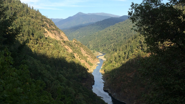
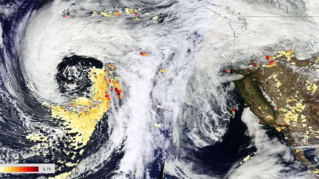
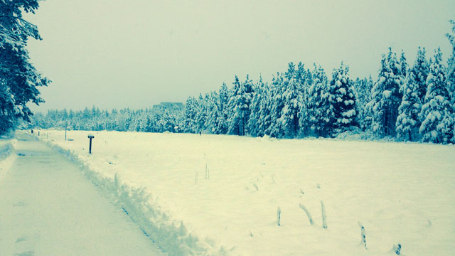
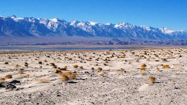
window.__IS_SSR__=true
window.__INITIAL_STATE__={
"attachmentsReducer": {
"audio_0": {
"type": "attachments",
"id": "audio_0",
"imgSizes": {
"kqedFullSize": {
"file": "https://ww2.kqed.org/news/wp-content/themes/KQED-unified/img/audio_bgs/background0.jpg"
}
}
},
"audio_1": {
"type": "attachments",
"id": "audio_1",
"imgSizes": {
"kqedFullSize": {
"file": "https://ww2.kqed.org/news/wp-content/themes/KQED-unified/img/audio_bgs/background1.jpg"
}
}
},
"audio_2": {
"type": "attachments",
"id": "audio_2",
"imgSizes": {
"kqedFullSize": {
"file": "https://ww2.kqed.org/news/wp-content/themes/KQED-unified/img/audio_bgs/background2.jpg"
}
}
},
"audio_3": {
"type": "attachments",
"id": "audio_3",
"imgSizes": {
"kqedFullSize": {
"file": "https://ww2.kqed.org/news/wp-content/themes/KQED-unified/img/audio_bgs/background3.jpg"
}
}
},
"audio_4": {
"type": "attachments",
"id": "audio_4",
"imgSizes": {
"kqedFullSize": {
"file": "https://ww2.kqed.org/news/wp-content/themes/KQED-unified/img/audio_bgs/background4.jpg"
}
}
},
"placeholder": {
"type": "attachments",
"id": "placeholder",
"imgSizes": {
"thumbnail": {
"file": "https://cdn.kqed.org/wp-content/uploads/2024/12/KQED-Default-Image-816638274-2000x1333-1-160x107.jpg",
"width": 160,
"height": 107,
"mimeType": "image/jpeg"
},
"medium": {
"file": "https://cdn.kqed.org/wp-content/uploads/2024/12/KQED-Default-Image-816638274-2000x1333-1-800x533.jpg",
"width": 800,
"height": 533,
"mimeType": "image/jpeg"
},
"medium_large": {
"file": "https://cdn.kqed.org/wp-content/uploads/2024/12/KQED-Default-Image-816638274-2000x1333-1-768x512.jpg",
"width": 768,
"height": 512,
"mimeType": "image/jpeg"
},
"large": {
"file": "https://cdn.kqed.org/wp-content/uploads/2024/12/KQED-Default-Image-816638274-2000x1333-1-1020x680.jpg",
"width": 1020,
"height": 680,
"mimeType": "image/jpeg"
},
"1536x1536": {
"file": "https://cdn.kqed.org/wp-content/uploads/2024/12/KQED-Default-Image-816638274-2000x1333-1-1536x1024.jpg",
"width": 1536,
"height": 1024,
"mimeType": "image/jpeg"
},
"fd-lrg": {
"file": "https://cdn.kqed.org/wp-content/uploads/2024/12/KQED-Default-Image-816638274-2000x1333-1-1536x1024.jpg",
"width": 1536,
"height": 1024,
"mimeType": "image/jpeg"
},
"fd-med": {
"file": "https://cdn.kqed.org/wp-content/uploads/2024/12/KQED-Default-Image-816638274-2000x1333-1-1020x680.jpg",
"width": 1020,
"height": 680,
"mimeType": "image/jpeg"
},
"fd-sm": {
"file": "https://cdn.kqed.org/wp-content/uploads/2024/12/KQED-Default-Image-816638274-2000x1333-1-800x533.jpg",
"width": 800,
"height": 533,
"mimeType": "image/jpeg"
},
"post-thumbnail": {
"file": "https://cdn.kqed.org/wp-content/uploads/2024/12/KQED-Default-Image-816638274-2000x1333-1-672x372.jpg",
"width": 672,
"height": 372,
"mimeType": "image/jpeg"
},
"twentyfourteen-full-width": {
"file": "https://cdn.kqed.org/wp-content/uploads/2024/12/KQED-Default-Image-816638274-2000x1333-1-1038x576.jpg",
"width": 1038,
"height": 576,
"mimeType": "image/jpeg"
},
"xxsmall": {
"file": "https://cdn.kqed.org/wp-content/uploads/2024/12/KQED-Default-Image-816638274-2000x1333-1-160x107.jpg",
"width": 160,
"height": 107,
"mimeType": "image/jpeg"
},
"xsmall": {
"file": "https://cdn.kqed.org/wp-content/uploads/2024/12/KQED-Default-Image-816638274-2000x1333-1-672x372.jpg",
"width": 672,
"height": 372,
"mimeType": "image/jpeg"
},
"small": {
"file": "https://cdn.kqed.org/wp-content/uploads/2024/12/KQED-Default-Image-816638274-2000x1333-1-672x372.jpg",
"width": 672,
"height": 372,
"mimeType": "image/jpeg"
},
"xlarge": {
"file": "https://cdn.kqed.org/wp-content/uploads/2024/12/KQED-Default-Image-816638274-2000x1333-1-1020x680.jpg",
"width": 1020,
"height": 680,
"mimeType": "image/jpeg"
},
"full-width": {
"file": "https://cdn.kqed.org/wp-content/uploads/2024/12/KQED-Default-Image-816638274-2000x1333-1-1920x1280.jpg",
"width": 1920,
"height": 1280,
"mimeType": "image/jpeg"
},
"guest-author-32": {
"file": "https://cdn.kqed.org/wp-content/uploads/2025/01/KQED-Default-Image-816638274-1333x1333-1-160x160.jpg",
"width": 32,
"height": 32,
"mimeType": "image/jpeg"
},
"guest-author-50": {
"file": "https://cdn.kqed.org/wp-content/uploads/2025/01/KQED-Default-Image-816638274-1333x1333-1-160x160.jpg",
"width": 50,
"height": 50,
"mimeType": "image/jpeg"
},
"guest-author-64": {
"file": "https://cdn.kqed.org/wp-content/uploads/2025/01/KQED-Default-Image-816638274-1333x1333-1-160x160.jpg",
"width": 64,
"height": 64,
"mimeType": "image/jpeg"
},
"guest-author-96": {
"file": "https://cdn.kqed.org/wp-content/uploads/2025/01/KQED-Default-Image-816638274-1333x1333-1-160x160.jpg",
"width": 96,
"height": 96,
"mimeType": "image/jpeg"
},
"guest-author-128": {
"file": "https://cdn.kqed.org/wp-content/uploads/2025/01/KQED-Default-Image-816638274-1333x1333-1-160x160.jpg",
"width": 128,
"height": 128,
"mimeType": "image/jpeg"
},
"detail": {
"file": "https://cdn.kqed.org/wp-content/uploads/2025/01/KQED-Default-Image-816638274-1333x1333-1-160x160.jpg",
"width": 160,
"height": 160,
"mimeType": "image/jpeg"
},
"kqedFullSize": {
"file": "https://cdn.kqed.org/wp-content/uploads/2024/12/KQED-Default-Image-816638274-2000x1333-1.jpg",
"width": 2000,
"height": 1333
}
}
},
"science_21584": {
"type": "attachments",
"id": "science_21584",
"meta": {
"index": "attachments_1716263798",
"site": "science",
"id": "21584",
"found": true
},
"parent": 21581,
"imgSizes": {
"kqedFullSize": {
"file": "https://ww2.kqed.org/app/uploads/sites/35/2014/09/River-runoff.jpg",
"width": 640,
"height": 360
}
},
"publishDate": 1410469854,
"modified": 1410469854,
"caption": "Sierra Nevada forests are denser than they once were, potentially reducing the amount of runoff that reaches California's reservoirs. (Dan Brekke/KQED)",
"description": null,
"title": "River-runoff",
"credit": null,
"status": "inherit",
"isLoading": false,
"fetchFailed": false
},
"science_15129": {
"type": "attachments",
"id": "science_15129",
"meta": {
"index": "attachments_1716263798",
"site": "science",
"id": "15129",
"found": true
},
"parent": 15123,
"imgSizes": {
"kqedFullSize": {
"file": "https://ww2.kqed.org/app/uploads/sites/35/2014/03/Worldview-Terra_0226-0228Storm_TrueColor-AOT0224.jpg",
"width": 640,
"height": 360
}
},
"publishDate": 1394237182,
"modified": 1394237182,
"caption": "A storm approaching California on February 24th had large amounts of dust at the center, as shown by the orange areas.\n(NASA Earth Observing System Data and Information System)",
"description": null,
"title": "Worldview-Terra_0226-0228Storm_TrueColor-AOT0224",
"credit": null,
"status": "inherit",
"isLoading": false,
"fetchFailed": false
},
"science_13766": {
"type": "attachments",
"id": "science_13766",
"meta": {
"index": "attachments_1716263798",
"site": "science",
"id": "13766",
"found": true
},
"parent": 13758,
"imgSizes": {
"kqedFullSize": {
"file": "https://ww2.kqed.org/app/uploads/sites/35/2014/01/snowytahoe.jpg",
"width": 640,
"height": 360
}
},
"publishDate": 1391125389,
"modified": 1391125389,
"caption": "Snow accumulating at lake level in South Lake Tahoe on Thursday. (Jim Siler)",
"description": "Snow accumulating at lake level in South Lake Tahoe on Thursday. (Jim Siler)",
"title": "snowytahoe",
"credit": null,
"status": "inherit",
"isLoading": false,
"fetchFailed": false
},
"science_8034": {
"type": "attachments",
"id": "science_8034",
"meta": {
"index": "attachments_1716263798",
"site": "science",
"id": "8034",
"found": true
},
"parent": 8032,
"imgSizes": {
"kqedFullSize": {
"file": "https://ww2.kqed.org/app/uploads/sites/35/2013/09/southernsierra.jpg",
"width": 640,
"height": 360
}
},
"publishDate": 1378406044,
"modified": 1378406044,
"caption": "East face of the southern Sierra Nevada at Owens Lake. Photo courtesy \u003ca href=\"http://www.flickr.com/photos/matthigh/\">Matthew Lee High\u003c/a> of Flickr via Creative Commons license",
"description": null,
"title": "southernsierra",
"credit": null,
"status": "inherit",
"isLoading": false,
"fetchFailed": false
},
"science_3328": {
"type": "attachments",
"id": "science_3328",
"meta": {
"index": "attachments_1716263798",
"site": "science",
"id": "3328",
"found": true
},
"parent": 3284,
"imgSizes": {
"kqedFullSize": {
"file": "https://ww2.kqed.org/app/uploads/sites/35/2013/05/Lyell_Stock_p921-e1369354344722.jpg",
"width": 640,
"height": 360
}
},
"publishDate": 1369354171,
"modified": 1369354171,
"caption": "Geologist Greg Stock climbs the Lyell Glacier in Yosemite. (Photo: Tim Palmer)",
"description": "Geologist Greg Stock climbs the Lyell Glacier in Yosemite. (Photo: Tim Palmer)",
"title": "Lyell_Stock_p92",
"credit": null,
"status": "inherit",
"isLoading": false,
"fetchFailed": false
},
"science_3338": {
"type": "attachments",
"id": "science_3338",
"meta": {
"index": "attachments_1716263798",
"site": "science",
"id": "3338",
"found": true
},
"parent": 3068,
"imgSizes": {
"kqedFullSize": {
"file": "https://ww2.kqed.org/app/uploads/sites/35/2013/05/Palmer-16x9-e1369355912500.jpg",
"width": 640,
"height": 360
}
},
"publishDate": 1369355830,
"modified": 1369355830,
"caption": "California’s mountain ranges harbor about 130 glaciers. In 2010, nature photographer Tim Palmer spent several months climbing and shooting them. (Photo: Jeff Pflueger/Heyday)",
"description": "California’s mountain ranges harbor about 130 glaciers. In 2010, nature photographer Tim Palmer spent several months climbing and shooting them. (Photo: Jeff Pflueger/Heyday)",
"title": "Palmer-16x9",
"credit": null,
"status": "inherit",
"isLoading": false,
"fetchFailed": false
},
"science_3011": {
"type": "attachments",
"id": "science_3011",
"meta": {
"index": "attachments_1716263798",
"site": "science",
"id": "3011",
"found": true
},
"parent": 3000,
"imgSizes": {
"kqedFullSize": {
"file": "https://ww2.kqed.org/app/uploads/sites/35/2013/05/placerville-top.jpg",
"width": 640,
"height": 360
}
},
"publishDate": 1368912280,
"modified": 1368912280,
"caption": null,
"description": null,
"title": "placerville-top",
"credit": null,
"status": "inherit",
"isLoading": false,
"fetchFailed": false
},
"science_2527": {
"type": "attachments",
"id": "science_2527",
"meta": {
"index": "attachments_1716263798",
"site": "science",
"id": "2527",
"found": true
},
"parent": 2451,
"imgSizes": {
"kqedFullSize": {
"file": "https://ww2.kqed.org/app/uploads/sites/35/2013/05/swe-640x360-e1368218832481.jpg",
"width": 640,
"height": 360
}
},
"publishDate": 1368218759,
"modified": 1368218759,
"caption": "Snow water equivalent on Mt. Lyell in Yosemite National Park. Red areas have the most water.(Courtesy NASA.)",
"description": "Map showing snow water equivalent at Mt. Lyell. Courtesy NASA.",
"title": "swe-640x360",
"credit": null,
"status": "inherit",
"isLoading": false,
"fetchFailed": false
}
},
"audioPlayerReducer": {
"postId": "stream_live",
"isPaused": true,
"isPlaying": false,
"pfsActive": false,
"pledgeModalIsOpen": true,
"playerDrawerIsOpen": false,
"liveAudioPlayStartedAt": 0,
"liveAudioPlayContext": ""
},
"authorsReducer": {
"3432": {
"type": "authors",
"id": "3432",
"meta": {
"override": true
},
"slug": "3432",
"name": "Jeremy Miller",
"firstName": "Jeremy",
"lastName": "Miller",
"bio": "Jeremy Miller is a contributing editor for High Country News, and his stories have appeared in numerous publications including Harper's, Orion, Men's Journal, Earth Island Journal, The Boston Globe and The San Francisco Chronicle Sunday Magazine. He currently lives in the East Bay with his wife, Emma, and children, Deirdre and Owen.",
"email": "jjmiller1@mac.com",
"isLoading": false
},
"mollysamuel": {
"type": "authors",
"id": "200",
"meta": {
"index": "authors_1716337520",
"id": "200",
"found": true
},
"name": "Molly Samuel",
"firstName": "Molly",
"lastName": "Samuel",
"slug": "mollysamuel",
"email": "msamuel@kqed.org",
"display_author_email": false,
"staff_mastheads": [],
"title": null,
"bio": "Molly Samuel joined KQED as an intern in 2007, and since then has worked here as a reporter, producer, director and blogger. Before becoming KQED Science’s Multimedia Producer, she was a producer for Climate Watch. Molly has also reported for NPR, KALW and High Country News, and has produced audio stories for The Encyclopedia of Life and the Oakland Museum of California. She was a fellow with the Middlebury Fellowships in Environmental Journalism and a journalist-in-residence at the National Evolutionary Synthesis Center. Molly has a degree in Ancient Greek from Oberlin College and is a co-founder of the record label True Panther Sounds.",
"avatar": "https://secure.gravatar.com/avatar/a6abd3b949a89fe5109fa9917631d0b6?s=600&d=blank&r=g",
"twitter": null,
"facebook": null,
"instagram": null,
"linkedin": null,
"sites": [
{
"site": "news",
"roles": [
"subscriber"
]
},
{
"site": "stateofhealth",
"roles": [
"subscriber"
]
},
{
"site": "science",
"roles": [
"subscriber"
]
},
{
"site": "quest",
"roles": [
"edit_users",
"subscriber"
]
}
],
"headData": {
"title": "Molly Samuel | KQED",
"description": null,
"ogImgSrc": "https://secure.gravatar.com/avatar/a6abd3b949a89fe5109fa9917631d0b6?s=600&d=blank&r=g",
"twImgSrc": "https://secure.gravatar.com/avatar/a6abd3b949a89fe5109fa9917631d0b6?s=600&d=blank&r=g"
},
"isLoading": false,
"link": "/author/mollysamuel"
},
"cmiller": {
"type": "authors",
"id": "221",
"meta": {
"index": "authors_1716337520",
"id": "221",
"found": true
},
"name": "Craig Miller",
"firstName": "Craig",
"lastName": "Miller",
"slug": "cmiller",
"email": "craig@voxterra.net",
"display_author_email": false,
"staff_mastheads": [
"science"
],
"title": "Editor Emeritus, Science",
"bio": "Craig is a former KQED Science editor, specializing in weather, climate, water & energy issues, with a little seismology thrown in just to shake things up. Prior to that, he launched and led the station's award-winning multimedia project, Climate Watch. Craig is also an accomplished writer/producer of television documentaries, with a focus on natural resource issues.",
"avatar": "https://secure.gravatar.com/avatar/b91661df645e001a9cafe0861fa685f9?s=600&d=blank&r=g",
"twitter": "voxterra",
"facebook": null,
"instagram": null,
"linkedin": null,
"sites": [
{
"site": "news",
"roles": [
"author"
]
},
{
"site": "futureofyou",
"roles": [
"editor"
]
},
{
"site": "stateofhealth",
"roles": [
"author"
]
},
{
"site": "science",
"roles": [
"editor"
]
},
{
"site": "quest",
"roles": [
"editor"
]
}
],
"headData": {
"title": "Craig Miller | KQED",
"description": "Editor Emeritus, Science",
"ogImgSrc": "https://secure.gravatar.com/avatar/b91661df645e001a9cafe0861fa685f9?s=600&d=blank&r=g",
"twImgSrc": "https://secure.gravatar.com/avatar/b91661df645e001a9cafe0861fa685f9?s=600&d=blank&r=g"
},
"isLoading": false,
"link": "/author/cmiller"
},
"laurensommer": {
"type": "authors",
"id": "239",
"meta": {
"index": "authors_1716337520",
"id": "239",
"found": true
},
"name": "Lauren Sommer",
"firstName": "Lauren",
"lastName": "Sommer",
"slug": "laurensommer",
"email": "lsommer@kqed.org",
"display_author_email": false,
"staff_mastheads": [],
"title": "KQED Contributor",
"bio": "Lauren is a radio reporter formerly covering environment, water, and energy for KQED Science. As part of her day job, she has scaled Sierra Nevada peaks, run from charging elephant seals, and desperately tried to get her sea legs - all in pursuit of good radio. Her work has appeared on Marketplace, Living on Earth, Science Friday and NPR's Morning Edition and All Things Considered. You can find her on Twitter at \u003ca href=\"https://twitter.com/lesommer\">@lesommer\u003c/a>.",
"avatar": "https://secure.gravatar.com/avatar/33aa3772bb86c6ad45b8aca6a238bbdf?s=600&d=blank&r=g",
"twitter": null,
"facebook": null,
"instagram": null,
"linkedin": null,
"sites": [
{
"site": "news",
"roles": [
"author"
]
},
{
"site": "science",
"roles": [
"editor",
"manage_content_types",
"manage_taxonomies"
]
},
{
"site": "quest",
"roles": [
"editor"
]
}
],
"headData": {
"title": "Lauren Sommer | KQED",
"description": "KQED Contributor",
"ogImgSrc": "https://secure.gravatar.com/avatar/33aa3772bb86c6ad45b8aca6a238bbdf?s=600&d=blank&r=g",
"twImgSrc": "https://secure.gravatar.com/avatar/33aa3772bb86c6ad45b8aca6a238bbdf?s=600&d=blank&r=g"
},
"isLoading": false,
"link": "/author/laurensommer"
},
"andrew-alden": {
"type": "authors",
"id": "6228",
"meta": {
"index": "authors_1716337520",
"id": "6228",
"found": true
},
"name": "Andrew Alden",
"firstName": "Andrew",
"lastName": "Alden",
"slug": "andrew-alden",
"email": "alden@andrew-alden.com",
"display_author_email": false,
"staff_mastheads": [],
"title": null,
"bio": "Andrew Alden earned his geology degree at the University of New Hampshire and moved back to the Bay Area to work at the U.S. Geological Survey for six years. He has \u003ca href=\"http://geology.about.com/\">written on geology for About.com\u003c/a> since its founding in 1997. In 2007, he started the Oakland Geology blog, which won recognition as \"Best of the East Bay\" from the \u003ci>East Bay Express\u003c/i> in 2010. In writing about geology in the Bay Area and surroundings, he hopes to share some of the useful and pleasurable insights that geologists give us—not just facts about the deep past, but an attitude that might be called the \u003ci>deep present\u003c/i>.\r\n\r\nRead his \u003ca href=\"http://science.kqed.org/quest/author/andrew-alden/\">previous contributions\u003c/a> to \u003ca href=\"http://http://science.kqed.org/quest/\">QUEST\u003c/a>, a project dedicated to exploring the Science of Sustainability.",
"avatar": "https://secure.gravatar.com/avatar/9eaa0afc32f98c5fc7ce634437334a64?s=600&d=blank&r=g",
"twitter": null,
"facebook": null,
"instagram": null,
"linkedin": null,
"sites": [
{
"site": "science",
"roles": [
"author"
]
},
{
"site": "quest",
"roles": [
"subscriber"
]
}
],
"headData": {
"title": "Andrew Alden | KQED",
"description": null,
"ogImgSrc": "https://secure.gravatar.com/avatar/9eaa0afc32f98c5fc7ce634437334a64?s=600&d=blank&r=g",
"twImgSrc": "https://secure.gravatar.com/avatar/9eaa0afc32f98c5fc7ce634437334a64?s=600&d=blank&r=g"
},
"isLoading": false,
"link": "/author/andrew-alden"
}
},
"pagesReducer": {
"science_tag_sierra-nevada": {
"type": "terms",
"id": "science_109",
"meta": {
"index": "terms_1716263798",
"site": "science",
"id": "109",
"score": 8.934093
},
"featImg": null,
"name": "sierra nevada",
"description": null,
"taxonomy": "tag",
"headData": {
"twImgId": null,
"twTitle": null,
"ogTitle": null,
"ogImgId": null,
"twDescription": null,
"description": null,
"title": "sierra nevada Archives | KQED Science",
"ogDescription": null
},
"ttid": 113,
"slug": "sierra-nevada",
"isLoading": false,
"title": "sierra nevada",
"pageMeta": {
"site": "science",
"WpPageTemplate": "page-topic-editorial",
"currentPage": 4
},
"blocks": [
{
"blockName": "kqed/post-list",
"attrs": {
"layout": "cardArticle2",
"query": "posts/science?tag=sierra-nevada",
"seeMore": false,
"paginated": true,
"page": 4
}
},
{
"blockName": "kqed/ad"
}
]
}
},
"pfsSessionReducer": {},
"postsReducer": {
"stream_live": {
"type": "live",
"id": "stream_live",
"audioUrl": "https://streams.kqed.org/kqedradio",
"title": "Live Stream",
"excerpt": "Live Stream information currently unavailable.",
"link": "/radio",
"featImg": "",
"label": {
"name": "KQED Live",
"link": "/"
}
},
"stream_kqedNewscast": {
"type": "posts",
"id": "stream_kqedNewscast",
"audioUrl": "https://www.kqed.org/.stream/anon/radio/RDnews/newscast.mp3?_=1",
"title": "KQED Newscast",
"featImg": "",
"label": {
"name": "88.5 FM",
"link": "/"
}
},
"science_21581": {
"type": "posts",
"id": "science_21581",
"meta": {
"index": "posts_1716263798",
"site": "science",
"id": "21581",
"score": null,
"sort": [
1410764481000
]
},
"parent": 0,
"labelTerm": {
"site": "science",
"term": 1151
},
"blocks": [],
"publishDate": 1410764481,
"format": "aside",
"title": "Why More Trees in the Sierra Mean Less Water for California",
"headTitle": "Why More Trees in the Sierra Mean Less Water for California | KQED",
"content": "\u003cdiv class=\"audio-wrap\">\n\u003ch2>Listen:\u003c/h2>\n\u003cp>http://www.kqed.org/.stream/anon/radio/science/2014/09/20140915science.mp3\u003c/p>\n\u003c/div>\n\u003cfigure id=\"attachment_21584\" class=\"wp-caption alignleft\" style=\"max-width: 640px\">\u003ca href=\"http://ww2.kqed.org/science/wp-content/uploads/sites/35/2014/09/River-runoff.jpg\">\u003cimg loading=\"lazy\" decoding=\"async\" class=\"size-full wp-image-21584\" src=\"http://ww2.kqed.org/science/wp-content/uploads/sites/35/2014/09/River-runoff.jpg\" alt=\"Sierra Nevada forests are denser than they once were, potentially reducing the amount of runoff that reaches California's reservoirs. (Dan Brekke/KQED)\" width=\"640\" height=\"360\">\u003c/a>\u003cfigcaption class=\"wp-caption-text\">Sierra Nevada forests are denser than they once were, potentially reducing the amount of runoff that reaches California’s reservoirs. (Dan Brekke/KQED)\u003c/figcaption>\u003c/figure>\n\u003cp>With California’s reservoir levels dropping, just about everyone is wishing the state had gotten more water this year. That doesn’t just depend on the weather, according to a team of scientists. Sierra Nevada forests play a big role in the state’s water supply.\u003c/p>\n\u003cp>Just like crops, trees consume water. And Sierra Nevada forests are denser than they once were after decades of fire suppression. That could be reducing the amount of runoff coming from the snowpack — runoff that provides water for most of the state.\u003c/p>\n\u003cp>“We call the Sierra Nevada our water towers for California,” says Roger Bales, a hydrologist with UC Merced. “About 60 percent of our consumable water comes from the Sierra Nevada.”\u003c/p>\n\u003cp>Bales is working in a pine forest about 20 miles west of Lake Tahoe, to understand the balance between and trees and runoff. His team has installed hundreds of sensors in the American River basin to record snow depth and soil moisture.\u003c/p>\n\u003cp>“The snowmelt really enters the soil,” he says, “and flows downslope to the nearest stream channel.”\u003c/p>\n\u003cp>[ad fullwidth]\u003c/p>\n\u003cp>From there, it joins major rivers and \u003ca href=\"http://www.kqed.org/news/science/climatewatch/waterandpower/map.jsp\">goes into reservoirs\u003c/a> and canals that reach \u003ca href=\"http://ww2.kqed.org/science/2014/02/28/bay-area-do-you-know-where-your-water-comes-from/\">all the way to cities and farms\u003c/a> in the Central Valley, Bay Area and Southern California.\u003c/p>\n\u003cfigure id=\"attachment_21585\" class=\"wp-caption alignright\" style=\"max-width: 340px\">\u003ca href=\"http://ww2.kqed.org/science/wp-content/uploads/sites/35/2014/09/bales-729x1024.jpg\">\u003cimg loading=\"lazy\" decoding=\"async\" class=\"wp-image-21585\" src=\"http://ww2.kqed.org/science/wp-content/uploads/sites/35/2014/09/bales-729x1024.jpg\" alt=\"UC Merced's Roger Bales and Ziran Zhang work on a snow sensor tower in the Tahoe National Forest. (Lauren Sommer/KQED)\" width=\"340\" height=\"477\">\u003c/a>\u003cfigcaption class=\"wp-caption-text\">UC Merced’s Roger Bales and Ziran Zhang work on a snow sensor tower in the Tahoe National Forest. (Lauren Sommer/KQED)\u003c/figcaption>\u003c/figure>\n\u003cp>When trees use water through the process of evapotranspiration, it doesn’t run off into rivers and reservoirs. \u003c/p>\n\u003cp>“That water travels up the tree trunk and then goes out through the leaves to the atmosphere,” Bales says. And there are a lot more trees using water today than there once were.\u003c/p>\n\u003cp>Frequent, low-intensity fires once cleared out small trees and maintained spaces in the forest. Decades of suppressing fires has allowed the forest to fill in.\u003c/p>\n\u003cp>“You go back about 100-to-150 years and the forest data show us there were maybe only half as many trees here,” Bales says.\u003c/p>\n\u003cp>The snowpack is also less stable in a dense forest. The snow gets stuck in the trees’ branches before reaching the ground and evaporates faster because it’s more susceptible to sun and wind.\u003c/p>\n\u003cp>Because these changes have happened over millions of acres of forest, Bales says it’s led researchers to a basic question:\u003c/p>\n\u003cp>“If there were half as many trees, would there be more runoff?” he asks.\u003c/p>\n\u003cp>The research points to yes, he says — potentially a lot more.\u003c/p>\n\u003cp>“Is it 20 percent, 30 percent or 40 percent?” Bales says. “We’re sort of in that range. But that’s a hypothesis. Our back-of-the-envelope calculations suggest that you could get anywhere from half a million to a million acre-feet additional water out of the Sierra Nevada.” \u003c/p>\n\u003cp>A million acre-feet of water is enough to supply two million households in California for a year — an amount that could make a big difference during a drought.\u003c/p>\n\u003cp>\u003cstrong>Managing Overgrown Forests\u003c/strong>\u003c/p>\n\u003cp>“I think the water piece is really huge,” says Scott Stephens, professor of fire science at UC Berkeley. “I think it’s under-appreciated but it’s massive.”\u003c/p>\n\u003cp>Stephens has found similar results in the Illilouette Creek basin in Yosemite National Park. About 40 fires have been allowed to burn there over several decades, reducing the number of trees per acre.\u003c/p>\n\u003cp>“It looks like there’s 20 percent more surface water leaving the streams in that area since the fire program began in the mid-1970s,” he says.\u003c/p>\n\u003cp>The widely spaced trees also make the forest more resistant to high-severity fire.\u003c/p>\n\u003cp>[contextly_sidebar id=”ebfC6eGZE6wvva0IQjLqdbheiT23eRrP”]\u003c/p>\n\u003cp>“I call it a potential win-win,” Stephens says. “It’s a win from a fire standpoint to have more resilient forests and also maybe a win in terms of being able to provide a critical resource for California, which is water.”\u003c/p>\n\u003cp>But leaving naturally caused fires to burn over large areas of the Sierra Nevada is tricky, he says, especially near houses and communities.\u003c/p>\n\u003cp>“Letting fire work in those lands is risky,” Stephens says. “Sometimes it’s going to go as expected and once in a while it goes wrong.”\u003c/p>\n\u003cp>Another option is to allow timber companies to cut small trees, thinning the forest. It’s commonly done where roads already exist, but can be prohibitively expensive in remote areas and often faces environmental opposition.\u003c/p>\n\u003cp>Climate change could make the problem even worse. A \u003ca href=\"http://news.uci.edu/press-releases/sierra-nevada-freshwater-runoff-could-drop-26-percent-by-2100-uc-study-finds/\">recent study\u003c/a> from UC Irvine found California’s forests will be using even more water by the end of the century, because warming temperatures will make the growing season longer. Runoff could drop by as much as 26 percent.\u003c/p>\n\u003cp>“If we don’t act today, our grandkids’ grandkids are going to have so few options,” Stephens says. “It’s going to be warmer. It’s going to be more difficult to do this work and they’re going to be basically chasing their tails.”\u003c/p>\n\u003cp>\u003c/p>\n\u003cp>Stephens says the good news is that California water districts are joining the conversation about how to manage forests. While it didn’t used to be on their radar, the connection between trees and our drinking water is becoming hard to ignore.\u003c/p>\n\n",
"stats": {
"hasVideo": false,
"hasChartOrMap": false,
"hasAudio": true,
"hasPolis": false,
"wordCount": 962,
"hasGoogleForm": false,
"hasGallery": false,
"hasHearkenModule": false,
"iframeSrcs": [],
"paragraphCount": 31
},
"modified": 1704932947,
"excerpt": "California water districts are eyeing a potential new source of water: trees. After a century of fire suppression, Sierra Nevada forests are more dense than ever before. And those pine trees are taking up a lot of water that might otherwise run off into California rivers. \r\n",
"headData": {
"twImgId": "",
"twTitle": "",
"ogTitle": "",
"ogImgId": "",
"twDescription": "",
"description": "California water districts are eyeing a potential new source of water: trees. After a century of fire suppression, Sierra Nevada forests are more dense than ever before. And those pine trees are taking up a lot of water that might otherwise run off into California rivers. \r\n",
"title": "Why More Trees in the Sierra Mean Less Water for California | KQED",
"ogDescription": "",
"schema": {
"@context": "https://schema.org",
"@type": "Article",
"headline": "Why More Trees in the Sierra Mean Less Water for California",
"datePublished": "2014-09-15T00:01:21-07:00",
"dateModified": "2024-01-10T16:29:07-08:00",
"image": "https://cdn.kqed.org/wp-content/uploads/2020/02/KQED-OG-Image@1x.png"
}
},
"guestAuthors": [],
"slug": "why-more-trees-in-the-sierra-mean-less-water-for-california",
"status": "publish",
"audioUrl": "http://www.kqed.org/.stream/anon/radio/science/2014/09/20140915science.mp3",
"sticky": false,
"path": "/science/21581/why-more-trees-in-the-sierra-mean-less-water-for-california",
"audioTrackLength": null,
"parsedContent": [
{
"type": "contentString",
"content": "\u003cdiv class=\"post-body\">\u003cp>\u003cdiv class=\"audio-wrap\">\n\u003ch2>Listen:\u003c/h2>\u003c/p>\u003c/div>",
"attributes": {
"named": {},
"numeric": []
}
},
{
"type": "component",
"content": "",
"name": "audioLink",
"attributes": {
"named": {
"src": "http://www.kqed.org/.stream/anon/radio/science/2014/09/20140915science.mp3"
},
"numeric": []
}
},
{
"type": "contentString",
"content": "\u003cdiv class=\"post-body\">\u003cp>\u003c/div>\n\u003cfigure id=\"attachment_21584\" class=\"wp-caption alignleft\" style=\"max-width: 640px\">\u003ca href=\"http://ww2.kqed.org/science/wp-content/uploads/sites/35/2014/09/River-runoff.jpg\">\u003cimg loading=\"lazy\" decoding=\"async\" class=\"size-full wp-image-21584\" src=\"http://ww2.kqed.org/science/wp-content/uploads/sites/35/2014/09/River-runoff.jpg\" alt=\"Sierra Nevada forests are denser than they once were, potentially reducing the amount of runoff that reaches California's reservoirs. (Dan Brekke/KQED)\" width=\"640\" height=\"360\">\u003c/a>\u003cfigcaption class=\"wp-caption-text\">Sierra Nevada forests are denser than they once were, potentially reducing the amount of runoff that reaches California’s reservoirs. (Dan Brekke/KQED)\u003c/figcaption>\u003c/figure>\n\u003cp>With California’s reservoir levels dropping, just about everyone is wishing the state had gotten more water this year. That doesn’t just depend on the weather, according to a team of scientists. Sierra Nevada forests play a big role in the state’s water supply.\u003c/p>\n\u003cp>Just like crops, trees consume water. And Sierra Nevada forests are denser than they once were after decades of fire suppression. That could be reducing the amount of runoff coming from the snowpack — runoff that provides water for most of the state.\u003c/p>\n\u003cp>“We call the Sierra Nevada our water towers for California,” says Roger Bales, a hydrologist with UC Merced. “About 60 percent of our consumable water comes from the Sierra Nevada.”\u003c/p>\n\u003cp>Bales is working in a pine forest about 20 miles west of Lake Tahoe, to understand the balance between and trees and runoff. His team has installed hundreds of sensors in the American River basin to record snow depth and soil moisture.\u003c/p>\n\u003cp>“The snowmelt really enters the soil,” he says, “and flows downslope to the nearest stream channel.”\u003c/p>\n\u003cp>\u003c/p>\u003c/div>",
"attributes": {
"named": {},
"numeric": []
}
},
{
"type": "component",
"content": "",
"name": "ad",
"attributes": {
"named": {
"label": "fullwidth"
},
"numeric": [
"fullwidth"
]
}
},
{
"type": "contentString",
"content": "\u003cdiv class=\"post-body\">\u003cp>\u003c/p>\n\u003cp>From there, it joins major rivers and \u003ca href=\"http://www.kqed.org/news/science/climatewatch/waterandpower/map.jsp\">goes into reservoirs\u003c/a> and canals that reach \u003ca href=\"http://ww2.kqed.org/science/2014/02/28/bay-area-do-you-know-where-your-water-comes-from/\">all the way to cities and farms\u003c/a> in the Central Valley, Bay Area and Southern California.\u003c/p>\n\u003cfigure id=\"attachment_21585\" class=\"wp-caption alignright\" style=\"max-width: 340px\">\u003ca href=\"http://ww2.kqed.org/science/wp-content/uploads/sites/35/2014/09/bales-729x1024.jpg\">\u003cimg loading=\"lazy\" decoding=\"async\" class=\"wp-image-21585\" src=\"http://ww2.kqed.org/science/wp-content/uploads/sites/35/2014/09/bales-729x1024.jpg\" alt=\"UC Merced's Roger Bales and Ziran Zhang work on a snow sensor tower in the Tahoe National Forest. (Lauren Sommer/KQED)\" width=\"340\" height=\"477\">\u003c/a>\u003cfigcaption class=\"wp-caption-text\">UC Merced’s Roger Bales and Ziran Zhang work on a snow sensor tower in the Tahoe National Forest. (Lauren Sommer/KQED)\u003c/figcaption>\u003c/figure>\n\u003cp>When trees use water through the process of evapotranspiration, it doesn’t run off into rivers and reservoirs. \u003c/p>\n\u003cp>“That water travels up the tree trunk and then goes out through the leaves to the atmosphere,” Bales says. And there are a lot more trees using water today than there once were.\u003c/p>\n\u003cp>Frequent, low-intensity fires once cleared out small trees and maintained spaces in the forest. Decades of suppressing fires has allowed the forest to fill in.\u003c/p>\n\u003cp>“You go back about 100-to-150 years and the forest data show us there were maybe only half as many trees here,” Bales says.\u003c/p>\n\u003cp>The snowpack is also less stable in a dense forest. The snow gets stuck in the trees’ branches before reaching the ground and evaporates faster because it’s more susceptible to sun and wind.\u003c/p>\n\u003cp>Because these changes have happened over millions of acres of forest, Bales says it’s led researchers to a basic question:\u003c/p>\n\u003cp>“If there were half as many trees, would there be more runoff?” he asks.\u003c/p>\n\u003cp>The research points to yes, he says — potentially a lot more.\u003c/p>\n\u003cp>“Is it 20 percent, 30 percent or 40 percent?” Bales says. “We’re sort of in that range. But that’s a hypothesis. Our back-of-the-envelope calculations suggest that you could get anywhere from half a million to a million acre-feet additional water out of the Sierra Nevada.” \u003c/p>\n\u003cp>A million acre-feet of water is enough to supply two million households in California for a year — an amount that could make a big difference during a drought.\u003c/p>\n\u003cp>\u003cstrong>Managing Overgrown Forests\u003c/strong>\u003c/p>\n\u003cp>“I think the water piece is really huge,” says Scott Stephens, professor of fire science at UC Berkeley. “I think it’s under-appreciated but it’s massive.”\u003c/p>\n\u003cp>Stephens has found similar results in the Illilouette Creek basin in Yosemite National Park. About 40 fires have been allowed to burn there over several decades, reducing the number of trees per acre.\u003c/p>\n\u003cp>“It looks like there’s 20 percent more surface water leaving the streams in that area since the fire program began in the mid-1970s,” he says.\u003c/p>\n\u003cp>The widely spaced trees also make the forest more resistant to high-severity fire.\u003c/p>\n\u003cp>\u003c/p>\u003cp>\u003c/p>\u003cp>\u003c/p>\n\u003cp>“I call it a potential win-win,” Stephens says. “It’s a win from a fire standpoint to have more resilient forests and also maybe a win in terms of being able to provide a critical resource for California, which is water.”\u003c/p>\n\u003cp>But leaving naturally caused fires to burn over large areas of the Sierra Nevada is tricky, he says, especially near houses and communities.\u003c/p>\n\u003cp>“Letting fire work in those lands is risky,” Stephens says. “Sometimes it’s going to go as expected and once in a while it goes wrong.”\u003c/p>\n\u003cp>Another option is to allow timber companies to cut small trees, thinning the forest. It’s commonly done where roads already exist, but can be prohibitively expensive in remote areas and often faces environmental opposition.\u003c/p>\n\u003cp>Climate change could make the problem even worse. A \u003ca href=\"http://news.uci.edu/press-releases/sierra-nevada-freshwater-runoff-could-drop-26-percent-by-2100-uc-study-finds/\">recent study\u003c/a> from UC Irvine found California’s forests will be using even more water by the end of the century, because warming temperatures will make the growing season longer. Runoff could drop by as much as 26 percent.\u003c/p>\n\u003cp>“If we don’t act today, our grandkids’ grandkids are going to have so few options,” Stephens says. “It’s going to be warmer. It’s going to be more difficult to do this work and they’re going to be basically chasing their tails.”\u003c/p>\n\u003cp>\u003c/p>\n\u003cp>Stephens says the good news is that California water districts are joining the conversation about how to manage forests. While it didn’t used to be on their radar, the connection between trees and our drinking water is becoming hard to ignore.\u003c/p>\n\n\u003c/div>\u003c/p>",
"attributes": {
"named": {},
"numeric": []
}
}
],
"link": "/science/21581/why-more-trees-in-the-sierra-mean-less-water-for-california",
"authors": [
"239"
],
"series": [
"science_1151"
],
"categories": [
"science_46",
"science_31",
"science_35",
"science_40",
"science_43",
"science_98"
],
"tags": [
"science_194",
"science_572",
"science_112",
"science_762",
"science_64",
"science_109",
"science_1127",
"science_787",
"science_201",
"science_113"
],
"featImg": "science_21584",
"label": "science_1151"
},
"science_15123": {
"type": "posts",
"id": "science_15123",
"meta": {
"index": "posts_1716263798",
"site": "science",
"id": "15123",
"score": null,
"sort": [
1394458221000
]
},
"parent": 0,
"labelTerm": {
"site": "science",
"term": 1151
},
"blocks": [],
"publishDate": 1394458221,
"format": "aside",
"title": "Why Distant Dust Storms Matter to California Rainfall",
"headTitle": "Why Distant Dust Storms Matter to California Rainfall | KQED",
"content": "\u003cdiv class=\"audio-wrap\">\n\u003ch2>Listen:\u003c/h2>\n\u003cp>http://www.kqed.org/.stream/anon/radio/science/2014/03/20140310science.mp3\u003c/p>\n\u003c/div>\n\u003cfigure id=\"attachment_15129\" class=\"wp-caption alignleft\" style=\"max-width: 640px\">\u003ca href=\"http://ww2.kqed.org/science/wp-content/uploads/sites/35/2014/03/Worldview-Terra_0226-0228Storm_TrueColor-AOT0224.jpg\">\u003cimg loading=\"lazy\" decoding=\"async\" class=\"size-full wp-image-15129\" src=\"http://ww2.kqed.org/science/wp-content/uploads/sites/35/2014/03/Worldview-Terra_0226-0228Storm_TrueColor-AOT0224.jpg\" alt=\"A storm approaching California on February 24th had what researchers say is a large amount of dust at the center, as shown by the orange areas. (NASA Earth Observing System Data and Information System)\" width=\"640\" height=\"360\">\u003c/a>\u003cfigcaption class=\"wp-caption-text\">A storm approaching California on February 24 had large amounts of dust at the center, as shown by the highlighted orange areas. (NASA Earth Observing System Data and Information System)\u003c/figcaption>\u003c/figure>\n\u003cp>California’s recent rainstorms, as welcome as they were, haven’t been enough to save the state from a serious drought this year. The rainy season typically winds down by late March.\u003c/p>\n\u003cp>Scientists are trying to understand why some storms unload lots of rain and snow in California and others don’t. They’re finding it could be linked to dust storms thousands of miles away.\u003c/p>\n\u003cp>\u003cstrong>Seeds of a Storm\u003c/strong>\u003c/p>\n\u003cp>On a windy bluff overlooking the Pacific Ocean, Kim Prather, an atmospheric chemist at the University of California, San Diego, eyes a bank of dark clouds in the distance.\u003c/p>\n\u003cp>“It’s coming in,” she says. “I think it’s the front.”\u003c/p>\n\u003cp>[ad fullwidth]\u003c/p>\n\u003cp>Rain is what Prather and her team have been waiting for. They’ve set up a large truck trailer full of scientific equipment at the Bodega Marine Laboratory, about an hour north of San Francisco.\u003c/p>\n\u003cp>Clouds are made up of water vapor, but that’s not the only ingredient needed for rain. Tiny particles like pollution, sea spray, dust and smoke, are the seeds of a rainstorm. The water inside a cloud condenses on these aerosols, growing larger and larger until it becomes a raindrop or snowflake that’s heavy enough to fall.\u003c/p>\n\u003cp>Large pumps on the trailer next to us are pulling in millions of these particles, so Prather and her team can examine them one by one.\u003c/p>\n\u003cp>“We didn’t expect there to be much dust here, but in fact, there are parcels of dust continuously coming across the Pacific right now,” she says.\u003c/p>\n\u003cp>The dust has made its way from the deserts of Asia and Africa. Dust storms send particles miles into the air, then they drift to California in 7 to 10 days.\u003c/p>\n\u003cfigure id=\"attachment_15133\" class=\"wp-caption alignleft\" style=\"max-width: 640px\">\u003ca href=\"http://ww2.kqed.org/science/wp-content/uploads/sites/35/2014/03/Prather.jpg\">\u003cimg loading=\"lazy\" decoding=\"async\" class=\"size-full wp-image-15133\" src=\"http://ww2.kqed.org/science/wp-content/uploads/sites/35/2014/03/Prather.jpg\" alt=\"Kim Prather watches are air particles are tested, inside a research trailer in Bodega Bay. (Lauren Sommer/KQED)\" width=\"640\" height=\"380\">\u003c/a>\u003cfigcaption class=\"wp-caption-text\">Kim Prather watches as her mobile lab tests air particles inside a research trailer in Bodega Bay. (Lauren Sommer/KQED)\u003c/figcaption>\u003c/figure>\n\u003cp>Prather has studied dust like this before, when she \u003ca href=\"http://atofms.ucsd.edu/content/calwater-2009-2011\">flew through Sierra Nevada snowstorms\u003c/a> in a small research plane.\u003c/p>\n\u003cp>“So days with dust, we found, were days where you had the most snow on the ground consistently,” she says. “And it’s not a lot of dust. It’s just the right amount of dust that comes in and seeds the very top of the clouds.”\u003c/p>\n\u003cp>In one study, Prather found that the right kind of dust storm \u003ca href=\"http://ucsdnews.ucsd.edu/feature/intercontinental_rainmakers\">could boost snowfall\u003c/a> in the Sierra Nevada by 40 percent. It happens because dust helps ice crystals grow. Ice formation appears to be the magic recipe for producing lots of precipitation.\u003c/p>\n\u003cp>“Ice is a very picky process,” Prather says. “Ice only likes to form on certain surfaces. Dust seems to be very good. Bacteria—biological particles seem to be very good.”\u003c/p>\n\u003cp>Yep—bacteria. “Dust will come out of the ground with microbes on it and so there are microbes that are \u003ca href=\"http://www.npr.org/2013/01/29/170459317/bird-plane-bacteria-microbes-thrive-in-storm-clouds\">still alive in those clouds\u003c/a>,” she says.\u003c/p>\n\u003cp>[contextly_sidebar id=”e2d0ec59e2858dd0f66f678a2f5178d7″]\u003c/p>\n\u003cp>Other particles appear to have the opposite effect. Urban air pollution, both from California and coming over from Asia, seems to reduce precipitation in the Sierra. The particles are small, creating a lot of water droplets that aren’t quite heavy enough to fall.\u003c/p>\n\u003cp>Prather says there’s still a lot to understand about the effects that particles have on the weather, but the information could help improve weather forecasting.\u003c/p>\n\u003cp>“Are we getting more precipitation?” she says. “Are we getting less precipitation? The ultimate goal is to be able to feed this into weather forecast models and improve those models, where they actually take into account the seeds. Right now, they don’t.”\u003c/p>\n\u003cp>\u003cstrong>Updating Weather Models\u003c/strong>\u003c/p>\n\u003cp>“From an operational perspective, we are giving that very serious consideration,” says Bill Lapenta, who runs the \u003ca href=\"http://www.ncep.noaa.gov/\">weather forecasting division\u003c/a> of the National Weather Service.\u003c/p>\n\u003cp>Daily weather forecasts come from giant simulations that run on supercomputers. Adding more dynamics, like the behavior of dust storms, increases costs for the agency.\u003c/p>\n\u003cp>“It adds an additional amount of complexity which then requires more computational resources,” he says.\u003c/p>\n\u003cp>\u003cstrong>Dust and Particles Transported Around the Globe://www.youtube.com/watch?v=kQyxFpQCs7U\n\nWeather models are updated generally only once a year, because changes can have far-reaching consequences. “The models have to be run on time, every time,” Lapenta says. The information is key for preparing the public for extreme weather and floods.\n\nStill, Lapenta says he’s hoping to start including dust storms and other sources of particles in the next five years. “I do believe that in the end, including the effects of dust particles in these complex models will help improve the precipitation forecast,” he says.\n\n\u003cstrong>Storing More Water for Drought\u003c/strong>\u003c/strong>\u003c/p>\n\u003cp>An improved forecast could help California manage its water supplies better, leading to fuller reservoirs that help buffer California against drought.\u003c/p>\n\u003cp>“The storms that provide the beneficial water that we really need badly this year?” says Marty Ralph, director of the Center for Western Weather and Water Extremes at the Scripps Institution of Oceanography. “It often comes in just a few events each winter, and that’s really the make or break thing for the season.”\u003c/p>\n\u003cp>California’s \u003ca href=\"http://cdec.water.ca.gov/cdecapp/resapp/getResGraphsMain.action\">network of reservoirs\u003c/a> stores that runoff. But reservoirs are required to release a lot of stored water in the fall and early winter, in order to make room for runoff from extreme storms and protect against floods.\u003c/p>\n\u003cp>“In the future, it may be possible if we can predict these storms accurately enough ahead of time, we could maybe keep a little extra water in there, knowing that if we had three days lead time we could release that water in a safe and appropriate way,” Ralph says.\u003c/p>\n\u003cp>Then, if the storms turn out to be small, reservoirs wouldn’t be releasing water that California needs later in the summer.\u003c/p>\n\u003cp>Dynamically managing reservoirs this way would require a major change in the operating rules. A \u003ca href=\"http://huffman.house.gov/media-center/press-releases/huffman-introduces-bill-to-modernize-army-corps-of-engineers-reservoir\">bill recently introduced\u003c/a> in the U.S. House by Sonoma County Democrat Jared Huffman would provide some of that flexibility.\u003c/p>\n\u003cp>\u003c/p>\n\u003cp>Given the improvements in weather forecasting science and California’s propensity for drought, many say it’s a change whose time has come.\u003c/p>\n\n",
"stats": {
"hasVideo": false,
"hasChartOrMap": false,
"hasAudio": true,
"hasPolis": false,
"wordCount": 1112,
"hasGoogleForm": false,
"hasGallery": false,
"hasHearkenModule": false,
"iframeSrcs": [],
"paragraphCount": 33
},
"modified": 1704934045,
"excerpt": "Scientists are finding that dust storms in Asia and Africa influence how much snow falls in the Sierra Nevada. The research could help make weather forecasting more accurate and improve how California manages its water supply.",
"headData": {
"twImgId": "",
"twTitle": "",
"ogTitle": "",
"ogImgId": "",
"twDescription": "",
"description": "Scientists are finding that dust storms in Asia and Africa influence how much snow falls in the Sierra Nevada. The research could help make weather forecasting more accurate and improve how California manages its water supply.",
"title": "Why Distant Dust Storms Matter to California Rainfall | KQED",
"ogDescription": "",
"schema": {
"@context": "https://schema.org",
"@type": "Article",
"headline": "Why Distant Dust Storms Matter to California Rainfall",
"datePublished": "2014-03-10T06:30:21-07:00",
"dateModified": "2024-01-10T16:47:25-08:00",
"image": "https://cdn.kqed.org/wp-content/uploads/2020/02/KQED-OG-Image@1x.png"
}
},
"guestAuthors": [],
"slug": "drought-distant-dust-storms-matter-to-california-rainfall",
"status": "publish",
"audioUrl": "http://www.kqed.org/.stream/anon/radio/science/2014/03/20140310science.mp3",
"sticky": false,
"path": "/science/15123/drought-distant-dust-storms-matter-to-california-rainfall",
"audioTrackLength": null,
"parsedContent": [
{
"type": "contentString",
"content": "\u003cdiv class=\"post-body\">\u003cp>\u003cdiv class=\"audio-wrap\">\n\u003ch2>Listen:\u003c/h2>\u003c/p>\u003c/div>",
"attributes": {
"named": {},
"numeric": []
}
},
{
"type": "component",
"content": "",
"name": "audioLink",
"attributes": {
"named": {
"src": "http://www.kqed.org/.stream/anon/radio/science/2014/03/20140310science.mp3"
},
"numeric": []
}
},
{
"type": "contentString",
"content": "\u003cdiv class=\"post-body\">\u003cp>\u003c/div>\n\u003cfigure id=\"attachment_15129\" class=\"wp-caption alignleft\" style=\"max-width: 640px\">\u003ca href=\"http://ww2.kqed.org/science/wp-content/uploads/sites/35/2014/03/Worldview-Terra_0226-0228Storm_TrueColor-AOT0224.jpg\">\u003cimg loading=\"lazy\" decoding=\"async\" class=\"size-full wp-image-15129\" src=\"http://ww2.kqed.org/science/wp-content/uploads/sites/35/2014/03/Worldview-Terra_0226-0228Storm_TrueColor-AOT0224.jpg\" alt=\"A storm approaching California on February 24th had what researchers say is a large amount of dust at the center, as shown by the orange areas. (NASA Earth Observing System Data and Information System)\" width=\"640\" height=\"360\">\u003c/a>\u003cfigcaption class=\"wp-caption-text\">A storm approaching California on February 24 had large amounts of dust at the center, as shown by the highlighted orange areas. (NASA Earth Observing System Data and Information System)\u003c/figcaption>\u003c/figure>\n\u003cp>California’s recent rainstorms, as welcome as they were, haven’t been enough to save the state from a serious drought this year. The rainy season typically winds down by late March.\u003c/p>\n\u003cp>Scientists are trying to understand why some storms unload lots of rain and snow in California and others don’t. They’re finding it could be linked to dust storms thousands of miles away.\u003c/p>\n\u003cp>\u003cstrong>Seeds of a Storm\u003c/strong>\u003c/p>\n\u003cp>On a windy bluff overlooking the Pacific Ocean, Kim Prather, an atmospheric chemist at the University of California, San Diego, eyes a bank of dark clouds in the distance.\u003c/p>\n\u003cp>“It’s coming in,” she says. “I think it’s the front.”\u003c/p>\n\u003cp>\u003c/p>\u003c/div>",
"attributes": {
"named": {},
"numeric": []
}
},
{
"type": "component",
"content": "",
"name": "ad",
"attributes": {
"named": {
"label": "fullwidth"
},
"numeric": [
"fullwidth"
]
}
},
{
"type": "contentString",
"content": "\u003cdiv class=\"post-body\">\u003cp>\u003c/p>\n\u003cp>Rain is what Prather and her team have been waiting for. They’ve set up a large truck trailer full of scientific equipment at the Bodega Marine Laboratory, about an hour north of San Francisco.\u003c/p>\n\u003cp>Clouds are made up of water vapor, but that’s not the only ingredient needed for rain. Tiny particles like pollution, sea spray, dust and smoke, are the seeds of a rainstorm. The water inside a cloud condenses on these aerosols, growing larger and larger until it becomes a raindrop or snowflake that’s heavy enough to fall.\u003c/p>\n\u003cp>Large pumps on the trailer next to us are pulling in millions of these particles, so Prather and her team can examine them one by one.\u003c/p>\n\u003cp>“We didn’t expect there to be much dust here, but in fact, there are parcels of dust continuously coming across the Pacific right now,” she says.\u003c/p>\n\u003cp>The dust has made its way from the deserts of Asia and Africa. Dust storms send particles miles into the air, then they drift to California in 7 to 10 days.\u003c/p>\n\u003cfigure id=\"attachment_15133\" class=\"wp-caption alignleft\" style=\"max-width: 640px\">\u003ca href=\"http://ww2.kqed.org/science/wp-content/uploads/sites/35/2014/03/Prather.jpg\">\u003cimg loading=\"lazy\" decoding=\"async\" class=\"size-full wp-image-15133\" src=\"http://ww2.kqed.org/science/wp-content/uploads/sites/35/2014/03/Prather.jpg\" alt=\"Kim Prather watches are air particles are tested, inside a research trailer in Bodega Bay. (Lauren Sommer/KQED)\" width=\"640\" height=\"380\">\u003c/a>\u003cfigcaption class=\"wp-caption-text\">Kim Prather watches as her mobile lab tests air particles inside a research trailer in Bodega Bay. (Lauren Sommer/KQED)\u003c/figcaption>\u003c/figure>\n\u003cp>Prather has studied dust like this before, when she \u003ca href=\"http://atofms.ucsd.edu/content/calwater-2009-2011\">flew through Sierra Nevada snowstorms\u003c/a> in a small research plane.\u003c/p>\n\u003cp>“So days with dust, we found, were days where you had the most snow on the ground consistently,” she says. “And it’s not a lot of dust. It’s just the right amount of dust that comes in and seeds the very top of the clouds.”\u003c/p>\n\u003cp>In one study, Prather found that the right kind of dust storm \u003ca href=\"http://ucsdnews.ucsd.edu/feature/intercontinental_rainmakers\">could boost snowfall\u003c/a> in the Sierra Nevada by 40 percent. It happens because dust helps ice crystals grow. Ice formation appears to be the magic recipe for producing lots of precipitation.\u003c/p>\n\u003cp>“Ice is a very picky process,” Prather says. “Ice only likes to form on certain surfaces. Dust seems to be very good. Bacteria—biological particles seem to be very good.”\u003c/p>\n\u003cp>Yep—bacteria. “Dust will come out of the ground with microbes on it and so there are microbes that are \u003ca href=\"http://www.npr.org/2013/01/29/170459317/bird-plane-bacteria-microbes-thrive-in-storm-clouds\">still alive in those clouds\u003c/a>,” she says.\u003c/p>\n\u003cp>\u003c/p>\u003cp>\u003c/p>\u003cp>\u003c/p>\n\u003cp>Other particles appear to have the opposite effect. Urban air pollution, both from California and coming over from Asia, seems to reduce precipitation in the Sierra. The particles are small, creating a lot of water droplets that aren’t quite heavy enough to fall.\u003c/p>\n\u003cp>Prather says there’s still a lot to understand about the effects that particles have on the weather, but the information could help improve weather forecasting.\u003c/p>\n\u003cp>“Are we getting more precipitation?” she says. “Are we getting less precipitation? The ultimate goal is to be able to feed this into weather forecast models and improve those models, where they actually take into account the seeds. Right now, they don’t.”\u003c/p>\n\u003cp>\u003cstrong>Updating Weather Models\u003c/strong>\u003c/p>\n\u003cp>“From an operational perspective, we are giving that very serious consideration,” says Bill Lapenta, who runs the \u003ca href=\"http://www.ncep.noaa.gov/\">weather forecasting division\u003c/a> of the National Weather Service.\u003c/p>\n\u003cp>Daily weather forecasts come from giant simulations that run on supercomputers. Adding more dynamics, like the behavior of dust storms, increases costs for the agency.\u003c/p>\n\u003cp>“It adds an additional amount of complexity which then requires more computational resources,” he says.\u003c/p>\n\u003cp>\u003cstrong>Dust and Particles Transported Around the Globe://www.youtube.com/watch?v=kQyxFpQCs7U\n\nWeather models are updated generally only once a year, because changes can have far-reaching consequences. “The models have to be run on time, every time,” Lapenta says. The information is key for preparing the public for extreme weather and floods.\n\nStill, Lapenta says he’s hoping to start including dust storms and other sources of particles in the next five years. “I do believe that in the end, including the effects of dust particles in these complex models will help improve the precipitation forecast,” he says.\n\n\u003cstrong>Storing More Water for Drought\u003c/strong>\u003c/strong>\u003c/p>\n\u003cp>An improved forecast could help California manage its water supplies better, leading to fuller reservoirs that help buffer California against drought.\u003c/p>\n\u003cp>“The storms that provide the beneficial water that we really need badly this year?” says Marty Ralph, director of the Center for Western Weather and Water Extremes at the Scripps Institution of Oceanography. “It often comes in just a few events each winter, and that’s really the make or break thing for the season.”\u003c/p>\n\u003cp>California’s \u003ca href=\"http://cdec.water.ca.gov/cdecapp/resapp/getResGraphsMain.action\">network of reservoirs\u003c/a> stores that runoff. But reservoirs are required to release a lot of stored water in the fall and early winter, in order to make room for runoff from extreme storms and protect against floods.\u003c/p>\n\u003cp>“In the future, it may be possible if we can predict these storms accurately enough ahead of time, we could maybe keep a little extra water in there, knowing that if we had three days lead time we could release that water in a safe and appropriate way,” Ralph says.\u003c/p>\n\u003cp>Then, if the storms turn out to be small, reservoirs wouldn’t be releasing water that California needs later in the summer.\u003c/p>\n\u003cp>Dynamically managing reservoirs this way would require a major change in the operating rules. A \u003ca href=\"http://huffman.house.gov/media-center/press-releases/huffman-introduces-bill-to-modernize-army-corps-of-engineers-reservoir\">bill recently introduced\u003c/a> in the U.S. House by Sonoma County Democrat Jared Huffman would provide some of that flexibility.\u003c/p>\n\u003cp>\u003c/p>\n\u003cp>Given the improvements in weather forecasting science and California’s propensity for drought, many say it’s a change whose time has come.\u003c/p>\n\n\u003c/div>\u003c/p>",
"attributes": {
"named": {},
"numeric": []
}
}
],
"link": "/science/15123/drought-distant-dust-storms-matter-to-california-rainfall",
"authors": [
"239"
],
"series": [
"science_1151"
],
"categories": [
"science_46",
"science_29",
"science_35",
"science_40",
"science_43",
"science_98"
],
"tags": [
"science_572",
"science_64",
"science_1213",
"science_1196",
"science_109",
"science_110",
"science_365"
],
"featImg": "science_15129",
"label": "science_1151"
},
"science_13758": {
"type": "posts",
"id": "science_13758",
"meta": {
"index": "posts_1716263798",
"site": "science",
"id": "13758",
"score": null,
"sort": [
1391125935000
]
},
"parent": 0,
"labelTerm": {
"site": "science",
"term": 1151
},
"blocks": [],
"publishDate": 1391125935,
"format": "aside",
"title": "Sierra Snow Survey Offers Little Hope as Drought Lingers",
"headTitle": "Sierra Snow Survey Offers Little Hope as Drought Lingers | KQED",
"content": "\u003cfigure id=\"attachment_13766\" class=\"wp-caption alignleft\" style=\"max-width: 640px\">\u003cimg loading=\"lazy\" decoding=\"async\" class=\"size-full wp-image-13766\" src=\"http://ww2.kqed.org/science/wp-content/uploads/sites/35/2014/01/snowytahoe.jpg\" alt=\"Snow is accumulating at lake level in South Lake Tahoe. (Jim Siler)\" width=\"640\" height=\"360\">\u003cfigcaption class=\"wp-caption-text\">Accumulations in South Lake Tahoe on Thursday provided mostly window dressing for the monthly snow survey. (Jim Siler)\u003c/figcaption>\u003c/figure>\n\u003cp>Snow finally came to the Sierra on Thursday but the flurries were too little, too late, to plump up the closely-watched Sierra snowpack.\u003c/p>\n\u003cp>About six inches of heavy, wet snow blanketed areas near Lake Tahoe, just as state water managers were scrounging for some good news for the \u003ca title=\"CDEC - Snowpack\" href=\"http://cdec.water.ca.gov/cdecapp/snowapp/sweq.action\">monthly Sierra snow survey\u003c/a>. They didn’t find much to celebrate.\u003c/p>\n\u003cp>[contextly_sidebar id=”e17969dcba3a0cd128270772da553a21″]\u003c/p>\n\u003cp>Water managers keep a close eye on two measures. First: where the snowpack stands compared to the average for this date. Answer: just 12 percent of normal, statewide. That shatters the previous mark for this point in the winter of 21 percent, which had stood for more than 20 years.\u003c/p>\n\u003cp>The second number is even more sobering: Thursday’s measurements put the water content of Sierra snows at just 7 percent of the average for April 1st, when accumulation is typically at its peak and the runoff season is about to start. With just two months to go, that’s a lot of precipitation to make up, considering that California counts on the mountain snowpack for about a third of its water.\u003c/p>\n\u003cp>[ad fullwidth]\u003c/p>\n\u003cp>National Weather Service forecasters in Sacramento called the current unsettled conditions, “the first significant weather system to affect the region in almost two months.” And it’s the end of January. That means two of the three months most counted on for Northern California’s annual precipitation have gone by the boards with barely a whimper.\u003c/p>\n\u003cp>A mix of snow and rain showers could linger into the weekend but hope of another wave of precipitation next week has largely evaporated, and \u003ca title=\"NWS - map\" href=\"http://www.cpc.ncep.noaa.gov/products/predictions/30day/\">longer-range forecasts remain stubbornly dry\u003c/a>.\u003c/p>\n\u003cp>\u003c/p>\n\u003cp>Governor Jerry Brown has begun \u003ca title=\"SF Gate - post\" href=\"http://www.sfgate.com/science/article/California-drought-Meager-snowpack-sets-new-5190495.php\">using the term, “megadrought”\u003c/a> to describe current conditions. Earlier this week, state health officials \u003ca title=\"Q-Sci - post\" href=\"http://ww2.kqed.org/science/2014/01/29/california-drought-17-communities-on-the-critical-list/\">identified 17 communities\u003c/a> that could exhaust their water supplies sometime in the next one to four months, including several parts of Sonoma and Mendocino Counties. Meanwhile, the state Department of Fish & Wildlife \u003ca title=\"Lake County Times - post\" href=\"http://www.lakeconews.com/index.php?option=com_content&view=article&id=35175:cdfw-puts-closures-in-effect-on-some-rivers-recommends-more-changes-to-the-fish-and-game-commission&catid=44:recreation&Itemid=176\">closed off significant stretches\u003c/a> of northern California rivers to fishing, until river conditions improve. Officials say water levels were so low in some places that fish were being trapped in small, isolated pools.The closures included portions of the Russian and American Rivers, in effect through April.\u003c/p>\n\n",
"stats": {
"hasVideo": false,
"hasChartOrMap": false,
"hasAudio": false,
"hasPolis": false,
"wordCount": 402,
"hasGoogleForm": false,
"hasGallery": false,
"hasHearkenModule": false,
"iframeSrcs": [],
"paragraphCount": 10
},
"modified": 1704934280,
"excerpt": "And the clock is ticking toward April 1, when snow accumulation usually peaks.",
"headData": {
"twImgId": "",
"twTitle": "",
"ogTitle": "",
"ogImgId": "",
"twDescription": "",
"description": "And the clock is ticking toward April 1, when snow accumulation usually peaks.",
"title": "Sierra Snow Survey Offers Little Hope as Drought Lingers | KQED",
"ogDescription": "",
"schema": {
"@context": "https://schema.org",
"@type": "Article",
"headline": "Sierra Snow Survey Offers Little Hope as Drought Lingers",
"datePublished": "2014-01-30T15:52:15-08:00",
"dateModified": "2024-01-10T16:51:20-08:00",
"image": "https://cdn.kqed.org/wp-content/uploads/2020/02/KQED-OG-Image@1x.png"
}
},
"guestAuthors": [],
"slug": "sierra-snow-survey-offers-little-hope-as-drought-lingers",
"status": "publish",
"sticky": false,
"path": "/science/13758/sierra-snow-survey-offers-little-hope-as-drought-lingers",
"audioTrackLength": null,
"parsedContent": [
{
"type": "contentString",
"content": "\u003cdiv class=\"post-body\">\u003cp>\u003cfigure id=\"attachment_13766\" class=\"wp-caption alignleft\" style=\"max-width: 640px\">\u003cimg loading=\"lazy\" decoding=\"async\" class=\"size-full wp-image-13766\" src=\"http://ww2.kqed.org/science/wp-content/uploads/sites/35/2014/01/snowytahoe.jpg\" alt=\"Snow is accumulating at lake level in South Lake Tahoe. (Jim Siler)\" width=\"640\" height=\"360\">\u003cfigcaption class=\"wp-caption-text\">Accumulations in South Lake Tahoe on Thursday provided mostly window dressing for the monthly snow survey. (Jim Siler)\u003c/figcaption>\u003c/figure>\n\u003cp>Snow finally came to the Sierra on Thursday but the flurries were too little, too late, to plump up the closely-watched Sierra snowpack.\u003c/p>\n\u003cp>About six inches of heavy, wet snow blanketed areas near Lake Tahoe, just as state water managers were scrounging for some good news for the \u003ca title=\"CDEC - Snowpack\" href=\"http://cdec.water.ca.gov/cdecapp/snowapp/sweq.action\">monthly Sierra snow survey\u003c/a>. They didn’t find much to celebrate.\u003c/p>\n\u003cp>\u003c/p>\u003cp>\u003c/p>\u003cp>\u003c/p>\n\u003cp>Water managers keep a close eye on two measures. First: where the snowpack stands compared to the average for this date. Answer: just 12 percent of normal, statewide. That shatters the previous mark for this point in the winter of 21 percent, which had stood for more than 20 years.\u003c/p>\n\u003cp>The second number is even more sobering: Thursday’s measurements put the water content of Sierra snows at just 7 percent of the average for April 1st, when accumulation is typically at its peak and the runoff season is about to start. With just two months to go, that’s a lot of precipitation to make up, considering that California counts on the mountain snowpack for about a third of its water.\u003c/p>\n\u003cp>\u003c/p>\u003c/div>",
"attributes": {
"named": {},
"numeric": []
}
},
{
"type": "component",
"content": "",
"name": "ad",
"attributes": {
"named": {
"label": "fullwidth"
},
"numeric": [
"fullwidth"
]
}
},
{
"type": "contentString",
"content": "\u003cdiv class=\"post-body\">\u003cp>\u003c/p>\n\u003cp>National Weather Service forecasters in Sacramento called the current unsettled conditions, “the first significant weather system to affect the region in almost two months.” And it’s the end of January. That means two of the three months most counted on for Northern California’s annual precipitation have gone by the boards with barely a whimper.\u003c/p>\n\u003cp>A mix of snow and rain showers could linger into the weekend but hope of another wave of precipitation next week has largely evaporated, and \u003ca title=\"NWS - map\" href=\"http://www.cpc.ncep.noaa.gov/products/predictions/30day/\">longer-range forecasts remain stubbornly dry\u003c/a>.\u003c/p>\n\u003cp>\u003c/p>\n\u003cp>Governor Jerry Brown has begun \u003ca title=\"SF Gate - post\" href=\"http://www.sfgate.com/science/article/California-drought-Meager-snowpack-sets-new-5190495.php\">using the term, “megadrought”\u003c/a> to describe current conditions. Earlier this week, state health officials \u003ca title=\"Q-Sci - post\" href=\"http://ww2.kqed.org/science/2014/01/29/california-drought-17-communities-on-the-critical-list/\">identified 17 communities\u003c/a> that could exhaust their water supplies sometime in the next one to four months, including several parts of Sonoma and Mendocino Counties. Meanwhile, the state Department of Fish & Wildlife \u003ca title=\"Lake County Times - post\" href=\"http://www.lakeconews.com/index.php?option=com_content&view=article&id=35175:cdfw-puts-closures-in-effect-on-some-rivers-recommends-more-changes-to-the-fish-and-game-commission&catid=44:recreation&Itemid=176\">closed off significant stretches\u003c/a> of northern California rivers to fishing, until river conditions improve. Officials say water levels were so low in some places that fish were being trapped in small, isolated pools.The closures included portions of the Russian and American Rivers, in effect through April.\u003c/p>\n\n\u003c/div>\u003c/p>",
"attributes": {
"named": {},
"numeric": []
}
}
],
"link": "/science/13758/sierra-snow-survey-offers-little-hope-as-drought-lingers",
"authors": [
"221"
],
"series": [
"science_1151"
],
"categories": [
"science_31",
"science_39",
"science_40",
"science_98"
],
"tags": [
"science_572",
"science_64",
"science_109",
"science_1243",
"science_1127",
"science_110"
],
"featImg": "science_13766",
"label": "science_1151"
},
"science_8032": {
"type": "posts",
"id": "science_8032",
"meta": {
"index": "posts_1716263798",
"site": "science",
"id": "8032",
"score": null,
"sort": [
1378411205000
]
},
"parent": 0,
"labelTerm": {
"site": "science"
},
"blocks": [],
"publishDate": 1378411205,
"format": "aside",
"title": "How California's Warping Microplate Makes Its Faults Creep",
"headTitle": "How California’s Warping Microplate Makes Its Faults Creep | KQED",
"content": "\u003cp>Last week I gave a walking tour of the Hayward fault along the Oakland-Berkeley border. Among other things, I talked about the fault’s peculiar behavior called aseismic creep, in which the two sides of the fault move slowly past each other at just a few millimeters per year without the help of earthquakes. I pointed out places where creep has been gently distorting the streets. I explained that creep doesn’t remove much earthquake energy because it only affects shallow parts of the fault that can’t store much energy anyway. But I couldn’t say much more about it because geologists studying the creep problem have lots of questions, several hypotheses, and no answers.\u003c/p>\n\u003cfigure id=\"attachment_8037\" class=\"wp-caption aligncenter\" style=\"max-width: 600px\">\u003ca href=\"http://ww2.kqed.org/science/wp-content/uploads/sites/35/2013/09/stonewallfault.jpg\" rel=\"attachment wp-att-8037\">\u003cimg loading=\"lazy\" decoding=\"async\" class=\"size-full wp-image-8037\" src=\"http://ww2.kqed.org/science/wp-content/uploads/sites/35/2013/09/stonewallfault.jpg\" alt=\"Hayward fault creep\" width=\"600\" height=\"360\">\u003c/a>\u003cfigcaption class=\"wp-caption-text\">The creeping Hayward fault crosses Oakland’s Stonewall Road in 2001. All of this has since been rebuilt. Photo by Andrew Alden\u003c/figcaption>\u003c/figure>\n\u003cp>Just days later, \u003ca href=\"http://geology.gsapubs.org/content/41/9/\">the September issue of the journal \u003cem>Geology\u003c/em>\u003c/a> came out with a paper that makes an intriguing connection between our creeping faults and slow activity on the other side of the Sierra Nevada microplate, where the Earth’s outer shell is secretly splitting apart.\u003c/p>\n\u003cp>(That’s right: The heart of California—the Central Valley and the mountains that ring it—is a separate tectonic plate, bounded by fault zones all the way around. The Sierra Nevada microplate rotates slightly and moves northwest at a few millimeters per year relative to the rest of the North America plate. California really \u003cem>is\u003c/em> different from its neighbors.)\u003c/p>\n\u003cp>Fault creep is quite uncommon in general, but a big central section of the San Andreas fault complex is creeping today while on either side the fault is locked, building up energy for large earthquakes like the 1906 quake in Northern California and the 1857 Fort Tejon quake in Southern California. The so-called creeping section runs from the village of Parkfield east of Paso Robles up to San Juan Bautista. Near there the Calaveras fault splits off from the San Andreas, and in turn the Hayward fault splits off from the Calaveras—and both of those faults also creep. See them shown in blue in this figure from the \u003cem>Geology\u003c/em> paper. The authors are Laetitia Le Pourhiet, a French geophysicist, and Jason Saleeby, a geologist at Caltech’s \u003ca href=\"http://www.tectonics.caltech.edu/research/\">Tectonics Observatory\u003c/a> who has studied the southern Sierra Nevada for decades.\u003c/p>\n\u003cfigure id=\"attachment_8033\" class=\"wp-caption aligncenter\" style=\"max-width: 568px\">\u003ca href=\"http://ww2.kqed.org/science/wp-content/uploads/sites/35/2013/09/fig1pourhietsaleeby.jpg\" rel=\"attachment wp-att-8033\">\u003cimg loading=\"lazy\" decoding=\"async\" class=\"size-full wp-image-8033\" src=\"http://ww2.kqed.org/science/wp-content/uploads/sites/35/2013/09/fig1pourhietsaleeby.jpg\" alt=\"Figure 1 Le Pourhiet-Saleeby paper\" width=\"568\" height=\"566\">\u003c/a>\u003cfigcaption class=\"wp-caption-text\">Figure 1 of Le Pourhiet and Saleeby, “\u003ca href=\"http://geology.gsapubs.org/content/41/9/999.abstract\">Lithospheric convective instability could induce creep along part of the San Andreas fault\u003c/a>,” \u003cem>Geology\u003c/em> v. 41, p. 999-1002 (Sept. 2013). Stars mark notable earthquakes in (north to south) 1906, 1989, 1983, 2004 and 1857.\u003c/figcaption>\u003c/figure>\n\u003cp>One of Saleeby’s most interesting lines of research is exploring how the dense rocky root of the southern Sierra broke off (delaminated) and sank into the hotter, softer mantle beneath to form a “lithospheric drip” starting about 4 million years ago. On the east side of the Sierra, the mountains responded by springing upward to create the dramatic eastern face that includes Mount Whitney, highest peak in the 48 states.\u003c/p>\n\u003cfigure id=\"attachment_8034\" class=\"wp-caption aligncenter\" style=\"max-width: 640px\">\u003ca href=\"http://ww2.kqed.org/science/wp-content/uploads/sites/35/2013/09/southernsierra.jpg\" rel=\"attachment wp-att-8034\">\u003cimg loading=\"lazy\" decoding=\"async\" class=\"size-full wp-image-8034\" src=\"http://ww2.kqed.org/science/wp-content/uploads/sites/35/2013/09/southernsierra.jpg\" alt=\"Southern Sierra Nevada\" width=\"640\" height=\"360\">\u003c/a>\u003cfigcaption class=\"wp-caption-text\">East face of the southern Sierra Nevada at Owens Lake. Photo courtesy \u003ca href=\"http://www.flickr.com/photos/matthigh/\">Matthew Lee High\u003c/a> of Flickr via Creative Commons license\u003c/figcaption>\u003c/figure>\n\u003cp>The “Big Drip”, if I may call it that, is bending and twisting the rest of our microplate. On its west side, the drip is still attached and pulling down on the crust. The result is that the southern Great Valley is at its widest and deepest there, in the Tulare geologic basin. If you think of the Earth’s crust across central California as an air mattress floating in a pool, imagine a swimmer grabbing it in the middle from below and pulling down. The east end (the Sierra) bends upward and the middle (the Tulare basin) bends down.\u003c/p>\n\u003cp>[ad fullwidth]\u003c/p>\n\u003cp>What happens farther west? Le Pourhiet did the computer modeling to show that the west side of the microplate arches upward by a hundred feet or so. That side is pinned against the San Andreas fault so it can’t simply break and spring upward like the eastern Sierra, which is being pulled away from Nevada.\u003c/p>\n\u003cfigure id=\"attachment_8035\" class=\"wp-caption aligncenter\" style=\"max-width: 546px\">\u003ca href=\"http://ww2.kqed.org/science/wp-content/uploads/sites/35/2013/09/fig3pourhietsaleeby.png\" rel=\"attachment wp-att-8035\">\u003cimg loading=\"lazy\" decoding=\"async\" class=\"size-full wp-image-8035\" src=\"http://ww2.kqed.org/science/wp-content/uploads/sites/35/2013/09/fig3pourhietsaleeby.png\" alt=\"Sierra Nevada microplate warpage\" width=\"546\" height=\"450\">\u003c/a>\u003cfigcaption class=\"wp-caption-text\">Part of Figure 3 of the \u003cem>Geology\u003c/em> paper; colors show the calculated vertical movements in response to the Big Drip.\u003c/figcaption>\u003c/figure>\n\u003cp>When the authors fed that result into a model of the San Andreas fault’s physics, the model accounted for the size and nature of the creeping section. There, most of the fault between the surface and its base at around 15 kilometers depth turns out weak and slippery, and only a narrow band of rock in the middle of that range has enough friction to gather a lot of strain energy. For the creeping section the model suggests a pattern of earthquakes no bigger than magnitude 6 or so, plus lots of creep. (In this picture the Bay Area is near the edge of that pattern, so while our faults creep they still are considered able to clobber us with magnitude-7 events.)\u003c/p>\n\u003cp>\u003c/p>\n\u003cp>So is any of this a scientific fact? Not yet; it’s just another good hypothesis that fits a variety of data but needs refinement. Scientific consensus is when everyone accepts a good hypothesis and moves ahead because they’ve run out of good counterarguments. We definitely haven’t reached that point for the San Andreas fault system. In the meantime, I can show you examples of Hayward fault creep \u003ca href=\"http://science.kqed.org/quest/2011/05/05/geological-outings-around-the-bay-a-visit-to-the-hayward-fault/\">in Hayward\u003c/a>, \u003ca href=\"http://science.kqed.org/quest/2013/04/18/gallegos-winery-and-the-hayward-fault/\">in Fremont\u003c/a> and \u003ca href=\"http://science.kqed.org/quest/2011/10/06/geological-outings-around-the-bay-point-pinole-and-the-hayward-fault/\">in Pinole\u003c/a>.\u003c/p>\n\n",
"stats": {
"hasVideo": false,
"hasChartOrMap": false,
"hasAudio": false,
"hasPolis": false,
"wordCount": 922,
"hasGoogleForm": false,
"hasGallery": false,
"hasHearkenModule": false,
"iframeSrcs": [],
"paragraphCount": 11
},
"modified": 1704935119,
"excerpt": "A tectonic \"Big Drip\" beneath the southern Sierra Nevada is connected to the creeping faults of Northern California in a new paper published in \u003ci>Geology\u003c/i>.",
"headData": {
"twImgId": "",
"twTitle": "",
"ogTitle": "",
"ogImgId": "",
"twDescription": "",
"description": "A tectonic "Big Drip" beneath the southern Sierra Nevada is connected to the creeping faults of Northern California in a new paper published in Geology.",
"title": "How California's Warping Microplate Makes Its Faults Creep | KQED",
"ogDescription": "",
"schema": {
"@context": "https://schema.org",
"@type": "Article",
"headline": "How California's Warping Microplate Makes Its Faults Creep",
"datePublished": "2013-09-05T13:00:05-07:00",
"dateModified": "2024-01-10T17:05:19-08:00",
"image": "https://cdn.kqed.org/wp-content/uploads/2020/02/KQED-OG-Image@1x.png"
}
},
"guestAuthors": [],
"slug": "how-californias-warping-microplate-makes-its-faults-creep",
"status": "publish",
"sticky": false,
"path": "/science/8032/how-californias-warping-microplate-makes-its-faults-creep",
"audioTrackLength": null,
"parsedContent": [
{
"type": "contentString",
"content": "\u003cdiv class=\"post-body\">\u003cp>\u003cp>Last week I gave a walking tour of the Hayward fault along the Oakland-Berkeley border. Among other things, I talked about the fault’s peculiar behavior called aseismic creep, in which the two sides of the fault move slowly past each other at just a few millimeters per year without the help of earthquakes. I pointed out places where creep has been gently distorting the streets. I explained that creep doesn’t remove much earthquake energy because it only affects shallow parts of the fault that can’t store much energy anyway. But I couldn’t say much more about it because geologists studying the creep problem have lots of questions, several hypotheses, and no answers.\u003c/p>\n\u003cfigure id=\"attachment_8037\" class=\"wp-caption aligncenter\" style=\"max-width: 600px\">\u003ca href=\"http://ww2.kqed.org/science/wp-content/uploads/sites/35/2013/09/stonewallfault.jpg\" rel=\"attachment wp-att-8037\">\u003cimg loading=\"lazy\" decoding=\"async\" class=\"size-full wp-image-8037\" src=\"http://ww2.kqed.org/science/wp-content/uploads/sites/35/2013/09/stonewallfault.jpg\" alt=\"Hayward fault creep\" width=\"600\" height=\"360\">\u003c/a>\u003cfigcaption class=\"wp-caption-text\">The creeping Hayward fault crosses Oakland’s Stonewall Road in 2001. All of this has since been rebuilt. Photo by Andrew Alden\u003c/figcaption>\u003c/figure>\n\u003cp>Just days later, \u003ca href=\"http://geology.gsapubs.org/content/41/9/\">the September issue of the journal \u003cem>Geology\u003c/em>\u003c/a> came out with a paper that makes an intriguing connection between our creeping faults and slow activity on the other side of the Sierra Nevada microplate, where the Earth’s outer shell is secretly splitting apart.\u003c/p>\n\u003cp>(That’s right: The heart of California—the Central Valley and the mountains that ring it—is a separate tectonic plate, bounded by fault zones all the way around. The Sierra Nevada microplate rotates slightly and moves northwest at a few millimeters per year relative to the rest of the North America plate. California really \u003cem>is\u003c/em> different from its neighbors.)\u003c/p>\n\u003cp>Fault creep is quite uncommon in general, but a big central section of the San Andreas fault complex is creeping today while on either side the fault is locked, building up energy for large earthquakes like the 1906 quake in Northern California and the 1857 Fort Tejon quake in Southern California. The so-called creeping section runs from the village of Parkfield east of Paso Robles up to San Juan Bautista. Near there the Calaveras fault splits off from the San Andreas, and in turn the Hayward fault splits off from the Calaveras—and both of those faults also creep. See them shown in blue in this figure from the \u003cem>Geology\u003c/em> paper. The authors are Laetitia Le Pourhiet, a French geophysicist, and Jason Saleeby, a geologist at Caltech’s \u003ca href=\"http://www.tectonics.caltech.edu/research/\">Tectonics Observatory\u003c/a> who has studied the southern Sierra Nevada for decades.\u003c/p>\n\u003cfigure id=\"attachment_8033\" class=\"wp-caption aligncenter\" style=\"max-width: 568px\">\u003ca href=\"http://ww2.kqed.org/science/wp-content/uploads/sites/35/2013/09/fig1pourhietsaleeby.jpg\" rel=\"attachment wp-att-8033\">\u003cimg loading=\"lazy\" decoding=\"async\" class=\"size-full wp-image-8033\" src=\"http://ww2.kqed.org/science/wp-content/uploads/sites/35/2013/09/fig1pourhietsaleeby.jpg\" alt=\"Figure 1 Le Pourhiet-Saleeby paper\" width=\"568\" height=\"566\">\u003c/a>\u003cfigcaption class=\"wp-caption-text\">Figure 1 of Le Pourhiet and Saleeby, “\u003ca href=\"http://geology.gsapubs.org/content/41/9/999.abstract\">Lithospheric convective instability could induce creep along part of the San Andreas fault\u003c/a>,” \u003cem>Geology\u003c/em> v. 41, p. 999-1002 (Sept. 2013). Stars mark notable earthquakes in (north to south) 1906, 1989, 1983, 2004 and 1857.\u003c/figcaption>\u003c/figure>\n\u003cp>One of Saleeby’s most interesting lines of research is exploring how the dense rocky root of the southern Sierra broke off (delaminated) and sank into the hotter, softer mantle beneath to form a “lithospheric drip” starting about 4 million years ago. On the east side of the Sierra, the mountains responded by springing upward to create the dramatic eastern face that includes Mount Whitney, highest peak in the 48 states.\u003c/p>\n\u003cfigure id=\"attachment_8034\" class=\"wp-caption aligncenter\" style=\"max-width: 640px\">\u003ca href=\"http://ww2.kqed.org/science/wp-content/uploads/sites/35/2013/09/southernsierra.jpg\" rel=\"attachment wp-att-8034\">\u003cimg loading=\"lazy\" decoding=\"async\" class=\"size-full wp-image-8034\" src=\"http://ww2.kqed.org/science/wp-content/uploads/sites/35/2013/09/southernsierra.jpg\" alt=\"Southern Sierra Nevada\" width=\"640\" height=\"360\">\u003c/a>\u003cfigcaption class=\"wp-caption-text\">East face of the southern Sierra Nevada at Owens Lake. Photo courtesy \u003ca href=\"http://www.flickr.com/photos/matthigh/\">Matthew Lee High\u003c/a> of Flickr via Creative Commons license\u003c/figcaption>\u003c/figure>\n\u003cp>The “Big Drip”, if I may call it that, is bending and twisting the rest of our microplate. On its west side, the drip is still attached and pulling down on the crust. The result is that the southern Great Valley is at its widest and deepest there, in the Tulare geologic basin. If you think of the Earth’s crust across central California as an air mattress floating in a pool, imagine a swimmer grabbing it in the middle from below and pulling down. The east end (the Sierra) bends upward and the middle (the Tulare basin) bends down.\u003c/p>\n\u003cp>\u003c/p>\u003c/div>",
"attributes": {
"named": {},
"numeric": []
}
},
{
"type": "component",
"content": "",
"name": "ad",
"attributes": {
"named": {
"label": "fullwidth"
},
"numeric": [
"fullwidth"
]
}
},
{
"type": "contentString",
"content": "\u003cdiv class=\"post-body\">\u003cp>\u003c/p>\n\u003cp>What happens farther west? Le Pourhiet did the computer modeling to show that the west side of the microplate arches upward by a hundred feet or so. That side is pinned against the San Andreas fault so it can’t simply break and spring upward like the eastern Sierra, which is being pulled away from Nevada.\u003c/p>\n\u003cfigure id=\"attachment_8035\" class=\"wp-caption aligncenter\" style=\"max-width: 546px\">\u003ca href=\"http://ww2.kqed.org/science/wp-content/uploads/sites/35/2013/09/fig3pourhietsaleeby.png\" rel=\"attachment wp-att-8035\">\u003cimg loading=\"lazy\" decoding=\"async\" class=\"size-full wp-image-8035\" src=\"http://ww2.kqed.org/science/wp-content/uploads/sites/35/2013/09/fig3pourhietsaleeby.png\" alt=\"Sierra Nevada microplate warpage\" width=\"546\" height=\"450\">\u003c/a>\u003cfigcaption class=\"wp-caption-text\">Part of Figure 3 of the \u003cem>Geology\u003c/em> paper; colors show the calculated vertical movements in response to the Big Drip.\u003c/figcaption>\u003c/figure>\n\u003cp>When the authors fed that result into a model of the San Andreas fault’s physics, the model accounted for the size and nature of the creeping section. There, most of the fault between the surface and its base at around 15 kilometers depth turns out weak and slippery, and only a narrow band of rock in the middle of that range has enough friction to gather a lot of strain energy. For the creeping section the model suggests a pattern of earthquakes no bigger than magnitude 6 or so, plus lots of creep. (In this picture the Bay Area is near the edge of that pattern, so while our faults creep they still are considered able to clobber us with magnitude-7 events.)\u003c/p>\n\u003cp>\u003c/p>\n\u003cp>So is any of this a scientific fact? Not yet; it’s just another good hypothesis that fits a variety of data but needs refinement. Scientific consensus is when everyone accepts a good hypothesis and moves ahead because they’ve run out of good counterarguments. We definitely haven’t reached that point for the San Andreas fault system. In the meantime, I can show you examples of Hayward fault creep \u003ca href=\"http://science.kqed.org/quest/2011/05/05/geological-outings-around-the-bay-a-visit-to-the-hayward-fault/\">in Hayward\u003c/a>, \u003ca href=\"http://science.kqed.org/quest/2013/04/18/gallegos-winery-and-the-hayward-fault/\">in Fremont\u003c/a> and \u003ca href=\"http://science.kqed.org/quest/2011/10/06/geological-outings-around-the-bay-point-pinole-and-the-hayward-fault/\">in Pinole\u003c/a>.\u003c/p>\n\n\u003c/div>\u003c/p>",
"attributes": {
"named": {},
"numeric": []
}
}
],
"link": "/science/8032/how-californias-warping-microplate-makes-its-faults-creep",
"authors": [
"6228"
],
"categories": [
"science_38"
],
"tags": [
"science_5178",
"science_654",
"science_591",
"science_546",
"science_109"
],
"featImg": "science_8034",
"label": "science"
},
"science_3284": {
"type": "posts",
"id": "science_3284",
"meta": {
"index": "posts_1716263798",
"site": "science",
"id": "3284",
"score": null,
"sort": [
1369636231000
]
},
"parent": 0,
"labelTerm": {
"site": "science",
"term": 3259
},
"blocks": [],
"publishDate": 1369636231,
"format": "aside",
"title": "California’s Vanishing Glaciers: A Defining Moment",
"headTitle": "California’s Vanishing Glaciers: A Defining Moment | KQED",
"content": "\u003cfigure id=\"attachment_3328\" class=\"wp-caption alignleft\" style=\"max-width: 640px\">\u003cimg loading=\"lazy\" decoding=\"async\" class=\"size-full wp-image-3328\" src=\"http://ww2.kqed.org/science/wp-content/uploads/sites/35/2013/05/Lyell_Stock_p921-e1369354344722.jpg\" alt=\"Geologist Greg Stock climbs the Lyell Glacier in Yosemite. (Photo: Tim Palmer)\" width=\"640\" height=\"360\">\u003cfigcaption class=\"wp-caption-text\">Geologist Greg Stock climbs the Lyell Glacier in Yosemite. (Photo: Tim Palmer)\u003c/figcaption>\u003c/figure>\n\u003cp>Last September, I climbed with a team of scientists and volunteers into the remote high country of Yosemite National Park, onto the ashen hide of the park’s largest ice sheet, the Lyell Glacier.\u003c/p>\n\u003cp>I was there to report but also to assist Greg Stock, Yosemite’s geologist, and Robert Anderson, a glacier researcher from the University of Colorado, in a four-year survey of the \u003ca title=\"Wiki - Lyell Glacier\" href=\"http://en.wikipedia.org/wiki/Lyell_Glacier\">Lyell\u003c/a> and neighboring \u003ca title=\"Wiki - Maclure Glacier\" href=\"http://en.wikipedia.org/wiki/Maclure_Glacier\">Maclure Glacier\u003c/a>. The objective was to measure the rate of the Lyell and Maclure’s downhill advance by surveying an array of PVC stakes Stock and his team had driven into the ice over the last few summers. On an earlier trip, in July, we drilled in several new stakes with a six-foot ice auger. Two months of ferocious melting had uprooted many of these. The ones that remained in place were bent like reeds, barely anchored to the ice.\u003c/p>\n\u003ctable border=\"0\" cellspacing=\"10\" align=\"alignright\">\n\u003ctbody>\n\u003ctr>\n\u003ctd>\u003c/td>\n\u003c/tr>\n\u003c/tbody>\n\u003c/table>\n\u003cp>The story of disappearing ice is \u003ca title=\"Science Daily - post\" href=\"http://www.sciencedaily.com/releases/2013/05/130513174811.htm\">a global narrative\u003c/a>. The Lyell and Maclure – like glaciers and ice sheets worldwide – are in rapid state of retreat. Before the trip, the Lyell and Maclure were presumed to be “true” glaciers – that is, thick slabs of ice dragged downhill under their own weight, scouring the land as they move.\u003c/p>\n\u003cp>But after we came down from the ice, Stock would come to a sober realization. Amid decades of rising average temperatures, the Lyell and Maclure have lost roughly 65 percent of their surface area and an even greater proportion of their volume. As a result of this mass melting, the Lyell Glacier \u003ca title=\"NPS - release\" href=\"http://www.nps.gov/yose/parknews/lyellglacier.htm\">has stopped moving\u003c/a> altogether – transformed from a “living” glacier to a dead patch of ice.\u003c/p>\n\u003cp>Which is to say, the Lyell Glacier is a glacier no more.\u003c/p>\n\u003cp>[ad fullwidth]\u003c/p>\n\u003cp>This is not just a matter of semantics. Meltwater from the Lyell and Maclure feeds the Tuolomne River, the main artery of Hetch Hetchy Reservoir, which supplies water to 2.4 million residents in the Bay Area.\u003c/p>\n\u003ctable border=\"0\" cellspacing=\"10\" align=\"left\">\n\u003ctbody>\n\u003ctr>\n\u003ctd>\u003c/td>\n\u003c/tr>\n\u003c/tbody>\n\u003c/table>\n\u003cp>Though the total volume of water they contribute to Hetch Hetchy is minimal, the glaciers and permanent snowfields of the Sierra act as important buffers. In late summer, many High Sierra streams go dry. But glacier-fed streams like the Tuolomne supply year-round water to numerous plants, animals – not to mention thirsty hikers.\u003c/p>\n\u003cp>Beyond local effects, glaciers respond to long-term changes in average temperature and precipitation, and serve as powerful barometers of climate change. One or two cold or warm years won’t have much effect. But string a decade or two of warm years together and you will see dramatic reductions in ice cover. This warming trend corresponds to a diminution of the state’s snowpack. As of May 1, the state’s snowpack stood at a meager \u003ca title=\"DWR - release\" href=\"http://www.water.ca.gov/news/newsreleases/2013/050213.pdf\">17 percent of average\u003c/a>. Statewide, snowpack is expected to dwindle by 25 percent by the middle of the century, according to the Department of Water Resources.\u003c/p>\n\u003cfigure id=\"attachment_3331\" class=\"wp-caption aligncenter\" style=\"max-width: 640px\">\u003cimg loading=\"lazy\" decoding=\"async\" class=\"size-full wp-image-3331\" src=\"http://ww2.kqed.org/science/wp-content/uploads/sites/35/2013/05/yosemite_glaciers_900-e1369354643426.jpg\" alt=\"(Yael Braha/KQED)\" width=\"640\" height=\"407\">\u003cfigcaption class=\"wp-caption-text\">(Yael Braha/KQED)\u003c/figcaption>\u003c/figure>\n\u003cp>\u003cstrong>Ice-Fueled Heated Debate\u003c/strong>\u003c/p>\n\u003cp>Beyond their vital ecological roles, these glaciers were also the stage for one of the greatest scientific feuds in California history.\u003c/p>\n\u003cp>When the great wanderer and chronicler of the Sierra, John Muir, traveled to Lyell and Maclure in the 1870s, he was in a heated debate with Josiah Whitney, California’s eminent state geologist, who derided Muir as “a mere sheepherder” for venturing into a field in which he had no formal training. Whitney believed a great earthquake was responsible for the formation of Yosemite Valley.\u003c/p>\n\u003cp>Muir, however, postulated that Ice Age glaciers had sculpted Yosemite’s characteristic cliffs and smooth granite faces. Moreover, he knew small glaciers still existed in high recesses of the Sierra. To prove his point, he set out for Mount Maclure on August 21, 1872. When he arrived, he drove tall stakes of whitebark pine into the ice, surveying them with a makeshift plumb-bob to ensure they’d been set in a straight line. If the stakes had moved when he returned, Muir would have powerful evidence that Maclure’s ice sheet was, in fact, a “living” glacier, moving downhill under its own weight.\u003c/p>\n\u003cp>Muir returned in October and found that the stakes set near the glacier’s edge had shifted little, but those in the center showed significant movement. As Muir related in an 1875 \u003cem>Harper’s Magazine\u003c/em> article called “The Living Glaciers of California,” that stake had traveled “forty-seven inches in forty-six days, or about one inch every twenty-four hours.”\u003c/p>\n\u003cp>Though his debate with Whitney would rage long after his discovery, Muir’s ideas today have been mostly vindicated. Around 10 million years ago, the granite of Yosemite Valley was uplifted and simultaneously \u003ca title=\"Yosemite\" href=\"http://www.yosemite.ca.us/formation/\">cut by the Merced River\u003c/a>. Then, about 2 or 3 million years ago, during the Ice Age, Earth’s climate cooled rapidly and the glaciers took over – scouring the undulating granite canyons, or “yosemites”– including its most famous, Yosemite Valley.\u003c/p>\n\u003cfigure id=\"attachment_3322\" class=\"wp-caption aligncenter\" style=\"max-width: 640px\">\u003ca href=\"http://ww2.kqed.org/science/wp-content/uploads/sites/35/2013/05/yosemitemap-e1369353940264.jpg\">\u003cimg loading=\"lazy\" decoding=\"async\" class=\"size-full wp-image-3322 \" src=\"http://ww2.kqed.org/science/wp-content/uploads/sites/35/2013/05/yosemitemap-e1369353940264.jpg\" alt=\"(Map: USGS)\" width=\"640\" height=\"371\">\u003c/a>\u003cfigcaption class=\"wp-caption-text\">(Map: USGS)\u003c/figcaption>\u003c/figure>\n\u003cp>In Muir’s time, the Sierra’s glaciers were near their maximum extent from the so-called Little Ice Age glaciation, a period of cooling and glacial advance that began around 700 years ago. If Stock and Anderson’s estimates hold, these great shapers of the Sierra may be gone within decades.\u003c/p>\n\u003cp>Some of Yosemite’s glaciers have already vanished. In August, I hiked up Illilouette Creek and into the Clark Range, to the site of the Black Mountain Glacier, the first “discovered” by Muir in 1871. He wrote of descending into a deep crevasse known as a \u003cem>bergschrund \u003c/em>along the glacier’s uppermost reaches.\u003c/p>\n\u003cblockquote>\u003cp>\u003cem>Its chambered hollows were hung with a multitude of clustered icicles, amidst which thin subdued light pulsed and shimmered with indescribable loveliness. Water dripped and tinkled overhead, and from far below came strange, solemn murmurs from currents feeding their way among veins and fissures on the bottom. \u003c/em>\u003c/p>\u003c/blockquote>\n\u003cp>Today nothing remains of the Black Mountain Glacier but a few ellipses of snow in a vast basin of gray talus.\u003c/p>\n\u003cp>\u003cstrong>Death Throes of a Glacier\u003c/strong>\u003c/p>\n\u003cfigure id=\"attachment_3032\" class=\"wp-caption alignright\" style=\"max-width: 251px\">\u003ca href=\"http://ww2.kqed.org/science/wp-content/uploads/sites/35/2013/05/MG_5390-Edit.jpeg\" rel=\"attachment wp-att-3032\">\u003cimg loading=\"lazy\" decoding=\"async\" class=\" wp-image-3032 \" src=\"http://ww2.kqed.org/science/wp-content/uploads/sites/35/2013/05/MG_5390-Edit.jpeg\" alt=\"Lyell Glacier (Photo: Kirk Keeler)\" width=\"251\" height=\"512\">\u003c/a>\u003cfigcaption class=\"wp-caption-text\">Lyell Glacier (Photo: Kirk Keeler)\u003c/figcaption>\u003c/figure>\n\u003cp>The Lyell Glacier is rapidly approaching a similar fate. \u003ca title=\"UCSD - image\" href=\"http://ucsdnews.ucsd.edu/thisweek/2009/05/images/icemelt01.jpg\">A photograph from 1903\u003c/a> shows the Lyell Glacier as an unbroken swath of white. In the 110 years of melting since, the Lyell has been cleaved into two separate ice fields. The indications of disappearance are even more dramatic from the Lyell’s surface. High on a cliff on Mt. Lyell is a hand-painted orange letter “K.” When Point K was established in the 1930s, it was at the level of the ice; today, more than 120 feet of bare rock separate it from the glacier’s surface.\u003c/p>\n\u003cp>The fading glaciers signal serious problems for the state’s already strained water supplies. A 2008 study conducted by a former hydrologist for Hetch Hetchy Water and Power, for example, predicted that 1.5 degrees Celsius of warming would trigger an uphill shift of snowpack by 2,000 feet by the end of the century – rendering nearly 60 percent of the Hetch Hetchy watershed snow-free by 2100. The Feather River, the main tributary of the Sacramento River, the state’s largest river (and key source of water to the State Water Project) is particularly vulnerable, says Michael Anderson, California’s state climatologist, since much of its snowpack is held at “lower” elevations between 5,000 and 6,000 feet.\u003c/p>\n\u003cp>\u003cstrong>Movement Can Be Deceiving\u003c/strong>\u003c/p>\n\u003cp>The day after Stock’s findings on the Lyell, we climbed into the ragged basin of the Maclure Glacier. Unlike the surface of the Lyell, the Maclure bears deep, dark crevasses – signs of a still active glacier. At the Maclure’s edge, dozens of wooden stakes from previous surveys were strewn in the rubble – spat out over the decades from the surging tongue of ice.\u003c/p>\n\u003cp>On the steep slopes of the Maclure, the team set out as they had on the Lyell – scouring the ice for the white PVC stakes and re-surveying them. As afternoon temperatures climbed, runoff from the glacier rose to a dull roar, pouring through vibrant blue fissures into the glacier’s recesses.\u003c/p>\n\u003cp>After the last of the stakes had been surveyed, the team descended. Stock and Anderson pored over the data, performing a few quick calculations. What they found was stunning. The Maclure was not only still moving, it was moving at almost the exact rate Muir calculated back in 1872 – “\u003cem>one inch every twenty four hours.”\u003c/em> Somehow, in spite of its loss of ice, the Maclure continues to move at nearly the same velocity that Muir detected.\u003c/p>\n\u003cp>Stock and Anderson may have a solution to the conundrum: The mechanics of the Maclure’s motion may have shifted over a century-and-a-half. Turns out glaciers move by one of two possible mechanisms: deformation and sliding. Deformation is the way the world’s very large glaciers move, with the ice moving in layers or “sheets,” the uppermost sheets moving fastest and farthest.\u003c/p>\n\u003cp>Sliding, on the other hand is not dictated by thickness but the steepness and structure of the rock under the ice as well as the amount of meltwater coating the glacial bed. This meltwater, Stock explains, can come from one of two sources — melting snow and ice on the surface and “pressure melting” of ice at the bed of the glacier as it is forced around bumps in the bedrock. This water acts as a kind of lubricant, allowing the whole glacier to slide at once.\u003c/p>\n\u003cp>Stock and Anderson suspect that while the extreme loss of ice has caused deformation to cease, sliding continues to move the Maclure at the same rate measured by Muir. But this scenario may not be a sign of the Maclure’s health. “You can move even a thin carapace of ice if you’ve just got a lubricant underneath it,” says Stock, careful to point out that under a critical threshold thickness – one that the Lyell Glacier seems to have crossed and one the Maclure may be fast approaching – movement stops altogether.\u003c/p>\n\u003ctable border=\"0\" cellspacing=\"10\" align=\"alignright\">\n\u003ctbody>\n\u003ctr>\n\u003ctd>\u003c/td>\n\u003c/tr>\n\u003c/tbody>\n\u003c/table>\n\u003cp>The best evidence for sliding can be seen from \u003cem>underneath\u003c/em> the Maclure. At the glacier’s edge, a lip of ice cantilevers precariously over the talus. Stock, Anderson and the rest of the team quickly duck under, revealing a cave of ice, in most places no more than three feet high and extending perhaps 150 feet beneath the glacier.\u003c/p>\n\u003cp>The cavern was adorned with surreal stalactites and colonnades of contorted ice, some of which probably derived from snow that fell hundreds of years before the first Europeans arrived on the continent. Above our heads, long straight grooves glittered with ice crystals – clear marks of a glacier actively grinding down its rocky bed. Though I knew the Maclure’s footprint was vastly different from when Muir visited 140 years earlier, I couldn’t help but imagine him here, slithering on hands and knees in this magnificent hollow.\u003c/p>\n\u003cp>Our reverie was soon broken. In less than a half-hour, our body heat had discernibly raised the temperature in the cave. Small droplets fell from the low ceiling, making the floor slippery and the tug of gravity more pronounced. It was getting late and we had a long hike back to camp. There was a bright doorway, a glowing oval, where the sun was shining. I snapped a final photograph and slid toward the light.\u003c/p>\n\u003cp>\u003cem>A longer version of this article appears in \u003ca title=\"Earth Island Journal - main\" href=\"http://www.earthisland.org/journal/index.php/eij/article/the_dying_glaciers_of_california/\">Earth Island Journal\u003c/a>. Our thanks to EIJ for sharing Jeremy Miller’s work with us. Photos in the sound modules are by Jonathan Byers and Kirk Keeler.\u003cbr>\n\u003c/em>\u003c/p>\n\u003cp>[ad floatright]\u003c/p>\n\u003cp>\u003cem>You can see more photos and hear more about the role of glaciers in California’s ecosystem in a \u003ca href=\"http://ww2.kqed.org/science/audio/a-summer-communing-with-californias-glaciers\">conversation between KQED Science Editor Craig Miller and Tim Palmer\u003c/a>, author of \u003c/em>California Glaciers\u003cem>.\u003cbr>\n\u003c/em>\u003c/p>\n\u003cdiv>\n\u003chr align=\"left\" size=\"1\" width=\"33%\">\n\u003c/div>\n\n",
"stats": {
"hasVideo": false,
"hasChartOrMap": false,
"hasAudio": false,
"hasPolis": false,
"wordCount": 2041,
"hasGoogleForm": false,
"hasGallery": false,
"hasHearkenModule": false,
"iframeSrcs": [],
"paragraphCount": 35
},
"modified": 1704935715,
"excerpt": "The Lyell and Maclure glaciers in Yosemite – like glaciers and ice sheets worldwide – are in rapid state of retreat. The Lyell and Maclure were presumed to be “true” glaciers – that is, thick slabs of ice dragged downhill under their own weight, scouring the land as they move – but scientists are discovering that the Maclure is deteriorating as it moves, and the Lyell is no longer moving at all.",
"headData": {
"twImgId": "",
"twTitle": "",
"ogTitle": "",
"ogImgId": "",
"twDescription": "",
"description": "The Lyell and Maclure glaciers in Yosemite – like glaciers and ice sheets worldwide – are in rapid state of retreat. The Lyell and Maclure were presumed to be “true” glaciers – that is, thick slabs of ice dragged downhill under their own weight, scouring the land as they move – but scientists are discovering that the Maclure is deteriorating as it moves, and the Lyell is no longer moving at all.",
"title": "California’s Vanishing Glaciers: A Defining Moment | KQED",
"ogDescription": "",
"schema": {
"@context": "https://schema.org",
"@type": "Article",
"headline": "California’s Vanishing Glaciers: A Defining Moment",
"datePublished": "2013-05-26T23:30:31-07:00",
"dateModified": "2024-01-10T17:15:15-08:00",
"image": "https://cdn.kqed.org/wp-content/uploads/2020/02/KQED-OG-Image@1x.png"
}
},
"guestAuthors": [
{
"userLogin": "jeremy-miller",
"firstName": "Jeremy",
"lastName": "Miller",
"website": "",
"displayName": "Jeremy Miller",
"linkedAccount": "jeremymiller",
"nickname": "",
"description": "Jeremy Miller is a contributing editor for High Country News, and his stories have appeared in numerous publications including Harper's, Orion, Men's Journal, Earth Island Journal, The Boston Globe and The San Francisco Chronicle Sunday Magazine. He currently lives in the East Bay with his wife, Emma, and children, Deirdre and Owen.",
"userEmail": "jjmiller1@mac.com",
"ID": "3432",
"type": "guest-author",
"userNicename": "jeremy-miller"
}
],
"slug": "californias-vanishing-glaciers-a-defining-moment",
"status": "publish",
"sticky": false,
"path": "/science/3284/californias-vanishing-glaciers-a-defining-moment",
"audioTrackLength": null,
"parsedContent": [
{
"type": "contentString",
"content": "\u003cdiv class=\"post-body\">\u003cp>\u003cfigure id=\"attachment_3328\" class=\"wp-caption alignleft\" style=\"max-width: 640px\">\u003cimg loading=\"lazy\" decoding=\"async\" class=\"size-full wp-image-3328\" src=\"http://ww2.kqed.org/science/wp-content/uploads/sites/35/2013/05/Lyell_Stock_p921-e1369354344722.jpg\" alt=\"Geologist Greg Stock climbs the Lyell Glacier in Yosemite. (Photo: Tim Palmer)\" width=\"640\" height=\"360\">\u003cfigcaption class=\"wp-caption-text\">Geologist Greg Stock climbs the Lyell Glacier in Yosemite. (Photo: Tim Palmer)\u003c/figcaption>\u003c/figure>\n\u003cp>Last September, I climbed with a team of scientists and volunteers into the remote high country of Yosemite National Park, onto the ashen hide of the park’s largest ice sheet, the Lyell Glacier.\u003c/p>\n\u003cp>I was there to report but also to assist Greg Stock, Yosemite’s geologist, and Robert Anderson, a glacier researcher from the University of Colorado, in a four-year survey of the \u003ca title=\"Wiki - Lyell Glacier\" href=\"http://en.wikipedia.org/wiki/Lyell_Glacier\">Lyell\u003c/a> and neighboring \u003ca title=\"Wiki - Maclure Glacier\" href=\"http://en.wikipedia.org/wiki/Maclure_Glacier\">Maclure Glacier\u003c/a>. The objective was to measure the rate of the Lyell and Maclure’s downhill advance by surveying an array of PVC stakes Stock and his team had driven into the ice over the last few summers. On an earlier trip, in July, we drilled in several new stakes with a six-foot ice auger. Two months of ferocious melting had uprooted many of these. The ones that remained in place were bent like reeds, barely anchored to the ice.\u003c/p>\n\u003ctable border=\"0\" cellspacing=\"10\" align=\"alignright\">\n\u003ctbody>\n\u003ctr>\n\u003ctd>\u003c/td>\n\u003c/tr>\n\u003c/tbody>\n\u003c/table>\n\u003cp>The story of disappearing ice is \u003ca title=\"Science Daily - post\" href=\"http://www.sciencedaily.com/releases/2013/05/130513174811.htm\">a global narrative\u003c/a>. The Lyell and Maclure – like glaciers and ice sheets worldwide – are in rapid state of retreat. Before the trip, the Lyell and Maclure were presumed to be “true” glaciers – that is, thick slabs of ice dragged downhill under their own weight, scouring the land as they move.\u003c/p>\n\u003cp>But after we came down from the ice, Stock would come to a sober realization. Amid decades of rising average temperatures, the Lyell and Maclure have lost roughly 65 percent of their surface area and an even greater proportion of their volume. As a result of this mass melting, the Lyell Glacier \u003ca title=\"NPS - release\" href=\"http://www.nps.gov/yose/parknews/lyellglacier.htm\">has stopped moving\u003c/a> altogether – transformed from a “living” glacier to a dead patch of ice.\u003c/p>\n\u003cp>Which is to say, the Lyell Glacier is a glacier no more.\u003c/p>\n\u003cp>\u003c/p>\u003c/div>",
"attributes": {
"named": {},
"numeric": []
}
},
{
"type": "component",
"content": "",
"name": "ad",
"attributes": {
"named": {
"label": "fullwidth"
},
"numeric": [
"fullwidth"
]
}
},
{
"type": "contentString",
"content": "\u003cdiv class=\"post-body\">\u003cp>\u003c/p>\n\u003cp>This is not just a matter of semantics. Meltwater from the Lyell and Maclure feeds the Tuolomne River, the main artery of Hetch Hetchy Reservoir, which supplies water to 2.4 million residents in the Bay Area.\u003c/p>\n\u003ctable border=\"0\" cellspacing=\"10\" align=\"left\">\n\u003ctbody>\n\u003ctr>\n\u003ctd>\u003c/td>\n\u003c/tr>\n\u003c/tbody>\n\u003c/table>\n\u003cp>Though the total volume of water they contribute to Hetch Hetchy is minimal, the glaciers and permanent snowfields of the Sierra act as important buffers. In late summer, many High Sierra streams go dry. But glacier-fed streams like the Tuolomne supply year-round water to numerous plants, animals – not to mention thirsty hikers.\u003c/p>\n\u003cp>Beyond local effects, glaciers respond to long-term changes in average temperature and precipitation, and serve as powerful barometers of climate change. One or two cold or warm years won’t have much effect. But string a decade or two of warm years together and you will see dramatic reductions in ice cover. This warming trend corresponds to a diminution of the state’s snowpack. As of May 1, the state’s snowpack stood at a meager \u003ca title=\"DWR - release\" href=\"http://www.water.ca.gov/news/newsreleases/2013/050213.pdf\">17 percent of average\u003c/a>. Statewide, snowpack is expected to dwindle by 25 percent by the middle of the century, according to the Department of Water Resources.\u003c/p>\n\u003cfigure id=\"attachment_3331\" class=\"wp-caption aligncenter\" style=\"max-width: 640px\">\u003cimg loading=\"lazy\" decoding=\"async\" class=\"size-full wp-image-3331\" src=\"http://ww2.kqed.org/science/wp-content/uploads/sites/35/2013/05/yosemite_glaciers_900-e1369354643426.jpg\" alt=\"(Yael Braha/KQED)\" width=\"640\" height=\"407\">\u003cfigcaption class=\"wp-caption-text\">(Yael Braha/KQED)\u003c/figcaption>\u003c/figure>\n\u003cp>\u003cstrong>Ice-Fueled Heated Debate\u003c/strong>\u003c/p>\n\u003cp>Beyond their vital ecological roles, these glaciers were also the stage for one of the greatest scientific feuds in California history.\u003c/p>\n\u003cp>When the great wanderer and chronicler of the Sierra, John Muir, traveled to Lyell and Maclure in the 1870s, he was in a heated debate with Josiah Whitney, California’s eminent state geologist, who derided Muir as “a mere sheepherder” for venturing into a field in which he had no formal training. Whitney believed a great earthquake was responsible for the formation of Yosemite Valley.\u003c/p>\n\u003cp>Muir, however, postulated that Ice Age glaciers had sculpted Yosemite’s characteristic cliffs and smooth granite faces. Moreover, he knew small glaciers still existed in high recesses of the Sierra. To prove his point, he set out for Mount Maclure on August 21, 1872. When he arrived, he drove tall stakes of whitebark pine into the ice, surveying them with a makeshift plumb-bob to ensure they’d been set in a straight line. If the stakes had moved when he returned, Muir would have powerful evidence that Maclure’s ice sheet was, in fact, a “living” glacier, moving downhill under its own weight.\u003c/p>\n\u003cp>Muir returned in October and found that the stakes set near the glacier’s edge had shifted little, but those in the center showed significant movement. As Muir related in an 1875 \u003cem>Harper’s Magazine\u003c/em> article called “The Living Glaciers of California,” that stake had traveled “forty-seven inches in forty-six days, or about one inch every twenty-four hours.”\u003c/p>\n\u003cp>Though his debate with Whitney would rage long after his discovery, Muir’s ideas today have been mostly vindicated. Around 10 million years ago, the granite of Yosemite Valley was uplifted and simultaneously \u003ca title=\"Yosemite\" href=\"http://www.yosemite.ca.us/formation/\">cut by the Merced River\u003c/a>. Then, about 2 or 3 million years ago, during the Ice Age, Earth’s climate cooled rapidly and the glaciers took over – scouring the undulating granite canyons, or “yosemites”– including its most famous, Yosemite Valley.\u003c/p>\n\u003cfigure id=\"attachment_3322\" class=\"wp-caption aligncenter\" style=\"max-width: 640px\">\u003ca href=\"http://ww2.kqed.org/science/wp-content/uploads/sites/35/2013/05/yosemitemap-e1369353940264.jpg\">\u003cimg loading=\"lazy\" decoding=\"async\" class=\"size-full wp-image-3322 \" src=\"http://ww2.kqed.org/science/wp-content/uploads/sites/35/2013/05/yosemitemap-e1369353940264.jpg\" alt=\"(Map: USGS)\" width=\"640\" height=\"371\">\u003c/a>\u003cfigcaption class=\"wp-caption-text\">(Map: USGS)\u003c/figcaption>\u003c/figure>\n\u003cp>In Muir’s time, the Sierra’s glaciers were near their maximum extent from the so-called Little Ice Age glaciation, a period of cooling and glacial advance that began around 700 years ago. If Stock and Anderson’s estimates hold, these great shapers of the Sierra may be gone within decades.\u003c/p>\n\u003cp>Some of Yosemite’s glaciers have already vanished. In August, I hiked up Illilouette Creek and into the Clark Range, to the site of the Black Mountain Glacier, the first “discovered” by Muir in 1871. He wrote of descending into a deep crevasse known as a \u003cem>bergschrund \u003c/em>along the glacier’s uppermost reaches.\u003c/p>\n\u003cblockquote>\u003cp>\u003cem>Its chambered hollows were hung with a multitude of clustered icicles, amidst which thin subdued light pulsed and shimmered with indescribable loveliness. Water dripped and tinkled overhead, and from far below came strange, solemn murmurs from currents feeding their way among veins and fissures on the bottom. \u003c/em>\u003c/p>\u003c/blockquote>\n\u003cp>Today nothing remains of the Black Mountain Glacier but a few ellipses of snow in a vast basin of gray talus.\u003c/p>\n\u003cp>\u003cstrong>Death Throes of a Glacier\u003c/strong>\u003c/p>\n\u003cfigure id=\"attachment_3032\" class=\"wp-caption alignright\" style=\"max-width: 251px\">\u003ca href=\"http://ww2.kqed.org/science/wp-content/uploads/sites/35/2013/05/MG_5390-Edit.jpeg\" rel=\"attachment wp-att-3032\">\u003cimg loading=\"lazy\" decoding=\"async\" class=\" wp-image-3032 \" src=\"http://ww2.kqed.org/science/wp-content/uploads/sites/35/2013/05/MG_5390-Edit.jpeg\" alt=\"Lyell Glacier (Photo: Kirk Keeler)\" width=\"251\" height=\"512\">\u003c/a>\u003cfigcaption class=\"wp-caption-text\">Lyell Glacier (Photo: Kirk Keeler)\u003c/figcaption>\u003c/figure>\n\u003cp>The Lyell Glacier is rapidly approaching a similar fate. \u003ca title=\"UCSD - image\" href=\"http://ucsdnews.ucsd.edu/thisweek/2009/05/images/icemelt01.jpg\">A photograph from 1903\u003c/a> shows the Lyell Glacier as an unbroken swath of white. In the 110 years of melting since, the Lyell has been cleaved into two separate ice fields. The indications of disappearance are even more dramatic from the Lyell’s surface. High on a cliff on Mt. Lyell is a hand-painted orange letter “K.” When Point K was established in the 1930s, it was at the level of the ice; today, more than 120 feet of bare rock separate it from the glacier’s surface.\u003c/p>\n\u003cp>The fading glaciers signal serious problems for the state’s already strained water supplies. A 2008 study conducted by a former hydrologist for Hetch Hetchy Water and Power, for example, predicted that 1.5 degrees Celsius of warming would trigger an uphill shift of snowpack by 2,000 feet by the end of the century – rendering nearly 60 percent of the Hetch Hetchy watershed snow-free by 2100. The Feather River, the main tributary of the Sacramento River, the state’s largest river (and key source of water to the State Water Project) is particularly vulnerable, says Michael Anderson, California’s state climatologist, since much of its snowpack is held at “lower” elevations between 5,000 and 6,000 feet.\u003c/p>\n\u003cp>\u003cstrong>Movement Can Be Deceiving\u003c/strong>\u003c/p>\n\u003cp>The day after Stock’s findings on the Lyell, we climbed into the ragged basin of the Maclure Glacier. Unlike the surface of the Lyell, the Maclure bears deep, dark crevasses – signs of a still active glacier. At the Maclure’s edge, dozens of wooden stakes from previous surveys were strewn in the rubble – spat out over the decades from the surging tongue of ice.\u003c/p>\n\u003cp>On the steep slopes of the Maclure, the team set out as they had on the Lyell – scouring the ice for the white PVC stakes and re-surveying them. As afternoon temperatures climbed, runoff from the glacier rose to a dull roar, pouring through vibrant blue fissures into the glacier’s recesses.\u003c/p>\n\u003cp>After the last of the stakes had been surveyed, the team descended. Stock and Anderson pored over the data, performing a few quick calculations. What they found was stunning. The Maclure was not only still moving, it was moving at almost the exact rate Muir calculated back in 1872 – “\u003cem>one inch every twenty four hours.”\u003c/em> Somehow, in spite of its loss of ice, the Maclure continues to move at nearly the same velocity that Muir detected.\u003c/p>\n\u003cp>Stock and Anderson may have a solution to the conundrum: The mechanics of the Maclure’s motion may have shifted over a century-and-a-half. Turns out glaciers move by one of two possible mechanisms: deformation and sliding. Deformation is the way the world’s very large glaciers move, with the ice moving in layers or “sheets,” the uppermost sheets moving fastest and farthest.\u003c/p>\n\u003cp>Sliding, on the other hand is not dictated by thickness but the steepness and structure of the rock under the ice as well as the amount of meltwater coating the glacial bed. This meltwater, Stock explains, can come from one of two sources — melting snow and ice on the surface and “pressure melting” of ice at the bed of the glacier as it is forced around bumps in the bedrock. This water acts as a kind of lubricant, allowing the whole glacier to slide at once.\u003c/p>\n\u003cp>Stock and Anderson suspect that while the extreme loss of ice has caused deformation to cease, sliding continues to move the Maclure at the same rate measured by Muir. But this scenario may not be a sign of the Maclure’s health. “You can move even a thin carapace of ice if you’ve just got a lubricant underneath it,” says Stock, careful to point out that under a critical threshold thickness – one that the Lyell Glacier seems to have crossed and one the Maclure may be fast approaching – movement stops altogether.\u003c/p>\n\u003ctable border=\"0\" cellspacing=\"10\" align=\"alignright\">\n\u003ctbody>\n\u003ctr>\n\u003ctd>\u003c/td>\n\u003c/tr>\n\u003c/tbody>\n\u003c/table>\n\u003cp>The best evidence for sliding can be seen from \u003cem>underneath\u003c/em> the Maclure. At the glacier’s edge, a lip of ice cantilevers precariously over the talus. Stock, Anderson and the rest of the team quickly duck under, revealing a cave of ice, in most places no more than three feet high and extending perhaps 150 feet beneath the glacier.\u003c/p>\n\u003cp>The cavern was adorned with surreal stalactites and colonnades of contorted ice, some of which probably derived from snow that fell hundreds of years before the first Europeans arrived on the continent. Above our heads, long straight grooves glittered with ice crystals – clear marks of a glacier actively grinding down its rocky bed. Though I knew the Maclure’s footprint was vastly different from when Muir visited 140 years earlier, I couldn’t help but imagine him here, slithering on hands and knees in this magnificent hollow.\u003c/p>\n\u003cp>Our reverie was soon broken. In less than a half-hour, our body heat had discernibly raised the temperature in the cave. Small droplets fell from the low ceiling, making the floor slippery and the tug of gravity more pronounced. It was getting late and we had a long hike back to camp. There was a bright doorway, a glowing oval, where the sun was shining. I snapped a final photograph and slid toward the light.\u003c/p>\n\u003cp>\u003cem>A longer version of this article appears in \u003ca title=\"Earth Island Journal - main\" href=\"http://www.earthisland.org/journal/index.php/eij/article/the_dying_glaciers_of_california/\">Earth Island Journal\u003c/a>. Our thanks to EIJ for sharing Jeremy Miller’s work with us. Photos in the sound modules are by Jonathan Byers and Kirk Keeler.\u003cbr>\n\u003c/em>\u003c/p>\n\u003cp>\u003c/p>\u003c/div>",
"attributes": {
"named": {},
"numeric": []
}
},
{
"type": "component",
"content": "",
"name": "ad",
"attributes": {
"named": {
"label": "floatright"
},
"numeric": [
"floatright"
]
}
},
{
"type": "contentString",
"content": "\u003cdiv class=\"post-body\">\u003cp>\u003c/p>\n\u003cp>\u003cem>You can see more photos and hear more about the role of glaciers in California’s ecosystem in a \u003ca href=\"http://ww2.kqed.org/science/audio/a-summer-communing-with-californias-glaciers\">conversation between KQED Science Editor Craig Miller and Tim Palmer\u003c/a>, author of \u003c/em>California Glaciers\u003cem>.\u003cbr>\n\u003c/em>\u003c/p>\n\u003cdiv>\n\u003chr align=\"left\" size=\"1\" width=\"33%\">\n\u003c/div>\n\n\u003c/div>\u003c/p>",
"attributes": {
"named": {},
"numeric": []
}
}
],
"link": "/science/3284/californias-vanishing-glaciers-a-defining-moment",
"authors": [
"3432"
],
"series": [
"science_3259"
],
"categories": [
"science_31",
"science_38",
"science_40",
"science_98"
],
"tags": [
"science_64",
"science_109",
"science_107",
"science_159"
],
"featImg": "science_3328",
"label": "science_3259"
},
"science_3068": {
"type": "posts",
"id": "science_3068",
"meta": {
"index": "posts_1716263798",
"site": "science",
"id": "3068",
"score": null,
"sort": [
1369406549000
]
},
"parent": 0,
"labelTerm": {
"site": "science",
"term": 3259
},
"blocks": [],
"publishDate": 1369406549,
"format": "aside",
"title": "A Summer Communing With California's Glaciers",
"headTitle": "A Summer Communing With California’s Glaciers | KQED",
"content": "\u003cdiv class=\"audio-wrap\">\n\u003ch2>Listen:\u003c/h2>\n\u003cp>http://www.kqed.org/.stream/anon/radio/science/2013/05/2013-05-27-science.mp3\u003c/p>\n\u003c/div>\n\u003cp>Earlier this year, geologists in Yosemite Park came to the sad conclusion that one of California’s iconic glaciers, the Lyell, had ground to a halt, having lost too much mass to sustain its downward movement.\u003c/p>\n\u003cp>Knowing that California’s approximately 130 (depending on your definition) glaciers will not be around forever, author and naturalist Tim Palmer spent the summer of 2010 on a personal quest to climb and photograph as many of these frozen giants as he could manage. I spoke with him shortly after publication of his ensuing book, \u003cem>California Glaciers\u003c/em> (Heyday).\u003c/p>\n\u003cfigure id=\"attachment_3108\" class=\"wp-caption aligncenter\" style=\"max-width: 640px\">\u003ca href=\"http://ww2.kqed.org/science/wp-content/uploads/sites/35/2013/05/Palmer_JeffPflueger-e1369168994516.jpg\" rel=\"attachment wp-att-3108\">\u003cimg loading=\"lazy\" decoding=\"async\" class=\"size-full wp-image-3108\" src=\"http://ww2.kqed.org/science/wp-content/uploads/sites/35/2013/05/Palmer_JeffPflueger-e1369168994516.jpg\" alt=\"Nature photographer Tim Palmer spent several months climbing and shooting California glaciers in 2010. (Photo: Jeff Pflueger/Heyday)\" width=\"640\" height=\"427\">\u003c/a>\u003cfigcaption class=\"wp-caption-text\">California’s mountain ranges harbor about 130 glaciers. In 2010, nature photographer Tim Palmer spent several months climbing and shooting them. (Photo: Jeff Pflueger/Heyday)\u003c/figcaption>\u003c/figure>\n\u003cp>CM: I know that a number of California’s glaciers have been re-surveyed, comparing them now with photographs taken a century ago. The shrinkage is starkly evident in some of them.\u003c/p>\n\u003cp>TP: What that shows – picture an aerial or planned view looking straight down – the area of ice gets smaller as the glacier shrinks, so we see that easily. But the glacier is also getting thinner, which we don’t see. This is not theoretical — the McLure Glacier is losing two feet of thickness per year. That could be typical of other Sierra glaciers. We could be down to almost the last year [and] it would look about the same size but it would only be two feet thick. And the next year: gone. So, the rate of loss is actually far faster than what we see by comparing those photos.\u003c/p>\n\u003cfigure id=\"attachment_3105\" class=\"wp-caption aligncenter\" style=\"max-width: 640px\">\u003ca href=\"http://ww2.kqed.org/science/wp-content/uploads/sites/35/2013/05/Lyell_1903_p96-e1369167735535.jpg\" rel=\"attachment wp-att-3105\">\u003cimg loading=\"lazy\" decoding=\"async\" class=\"size-full wp-image-3105\" src=\"http://ww2.kqed.org/science/wp-content/uploads/sites/35/2013/05/Lyell_1903_p96-e1369167735535.jpg\" alt=\"The Lyell Glacier, as photographed by G. K. Gilbert in August of 1903 (Photo: USGS)\" width=\"640\" height=\"431\">\u003c/a>\u003cfigcaption class=\"wp-caption-text\">The Lyell Glacier, as photographed by G. K. Gilbert in August of 1903 (Photo: USGS)\u003c/figcaption>\u003c/figure>\n\u003cfigure id=\"attachment_3106\" class=\"wp-caption aligncenter\" style=\"max-width: 640px\">\u003ca href=\"http://ww2.kqed.org/science/wp-content/uploads/sites/35/2013/05/Lyell_2010_p96-e1369168344512.jpg\" rel=\"attachment wp-att-3106\">\u003cimg loading=\"lazy\" decoding=\"async\" class=\"size-full wp-image-3106\" src=\"http://ww2.kqed.org/science/wp-content/uploads/sites/35/2013/05/Lyell_2010_p96-e1369168344512.jpg\" alt=\"The Lyell Glacier, shown from the same vantage point in September, 2010. (Photo: Tim Palmer/Heyday)\" width=\"640\" height=\"423\">\u003c/a>\u003cfigcaption class=\"wp-caption-text\">The Lyell Glacier, shown from the same vantage point in September, 2010. (Photo: Tim Palmer/Heyday)\u003c/figcaption>\u003c/figure>\n\u003cp>CM: What makes this worrisome?\u003c/p>\n\u003cp>[ad fullwidth]\u003c/p>\n\u003cp>TP: The glaciers have been receding so long — except for Mount Shasta — they’re really not that big anymore. They do provide water to the rivers below them — no less than the Tuolumne which provides for San Francisco’s water and the Owens, which provides for Los Angeles’s water. They do provide water late in the season. Virtually all the other streams have almost completely dried up because the snow has melted by August-September. The glacial streams continue to run, nourishing the ecosystem below them, the fish, the riparian life and of course the people who use that water later on. But that’s not really the main point. The main point here is that the glaciers are simply the most visible sign that we have of climate change and global warming.\u003c/p>\n\u003cp>Their loss directly correlates to the diminishment of the Sierra snowpack and that is an enormous issue for California. Some of the best estimates I was able to uncover are that 52 percent of the early summer runoff will be gone in this century because of the snowpack shrinking. Twenty-five percent of farm supplies are likely to be gone, disappear, because of that.\u003c/p>\n\u003cfigure id=\"attachment_3111\" class=\"wp-caption alignright\" style=\"max-width: 269px\">\u003ca href=\"http://ww2.kqed.org/science/wp-content/uploads/sites/35/2013/05/Maclure_p20.jpg\" rel=\"attachment wp-att-3111\">\u003cimg loading=\"lazy\" decoding=\"async\" class=\" wp-image-3111 \" src=\"http://ww2.kqed.org/science/wp-content/uploads/sites/35/2013/05/Maclure_p20.jpg\" alt=\"Inside the bergschrund, where the top of the Maclure Glacier curls away from the mountainside.\" width=\"269\" height=\"410\">\u003c/a>\u003cfigcaption class=\"wp-caption-text\">Inside the bergschrund, where the top of the Maclure Glacier curls away from the mountainside. (Tim Palmer/Heyday)\u003c/figcaption>\u003c/figure>\n\u003cp>CM: You describe a number of John Muir moments that you had when you were up there, in this kind of secret world where very few people go. I mean you’ve actually crawled inside some of these glaciers that have these natural pockets in them, almost womblike in a sense, if a little cold. Try to give us a sense of what you feel when you’re up there.\u003c/p>\n\u003cp>TP: My fate 140 years later was to follow, in a sense, in [Muir’s] footsteps and report that these glaciers are disappearing very rapidly. I was in the same place on a very different mission. The connection was actually really fun in a lot of ways though because he went to many of the same places. When I climbed into that cave at the base of the McClure Glacier — it was an opening just about four feet high — I crawled in there and I could scoot back about 50 feet or so to where it tapered shut. It was very dark on the inside but light was coming in through the entrance. The ceiling was just like, if you can picture, a black wet mirror above you. That’s what the whole ceiling was like, just utterly smooth. There were rocks on the ground and water trickling here and there, but ice all around me. It was totally silent. One of the first things I thought was, “John Muir would have loved it in here.”\u003c/p>\n\u003cp>There’s something particularly poignant and powerful about connecting to a place that’s changing so rapidly, that’s actually being lost. I was just totally stoked to be up there doing this. But at the same time, I realized that this incredible beauty I was seeing, I would never see again and that people after me would never have the opportunity to see. Even in a few years, you won’t be able to see exactly what I saw. The next generation probably won’t be able to see most of these glaciers at all.\u003c/p>\n\u003cp>But by being able to show this real manifestation of the changes we’re making, I am hopeful that people will get it and that people will become motivated to deal with the changes that are coming.\u003c/p>\n\u003cfigure id=\"attachment_3116\" class=\"wp-caption aligncenter\" style=\"max-width: 640px\">\u003ca href=\"http://ww2.kqed.org/science/wp-content/uploads/sites/35/2013/05/NPalisade_p106-e1369171449599.jpg\" rel=\"attachment wp-att-3116\">\u003cimg loading=\"lazy\" decoding=\"async\" class=\"size-full wp-image-3116\" src=\"http://ww2.kqed.org/science/wp-content/uploads/sites/35/2013/05/NPalisade_p106-e1369171449599.jpg\" alt=\"The North Palisade Glacier, in the southern Sierra Nevada. (Tim Palmer/Heyday)\" width=\"640\" height=\"418\">\u003c/a>\u003cfigcaption class=\"wp-caption-text\">The North Palisade is the largest Glacier in the Sierra Nevada and one of the most dramatic. It’s namesake mountain rises to more than 14,ooo feet. (Tim Palmer/Heyday)\u003c/figcaption>\u003c/figure>\n\u003cp>\u003c/p>\n\u003cp> \u003c/p>\n\n",
"stats": {
"hasVideo": false,
"hasChartOrMap": false,
"hasAudio": true,
"hasPolis": false,
"wordCount": 973,
"hasGoogleForm": false,
"hasGallery": false,
"hasHearkenModule": false,
"iframeSrcs": [],
"paragraphCount": 13
},
"modified": 1704935724,
"excerpt": "Earlier this year, geologists in Yosemite Park came to the sad conclusion that one of California's iconic glaciers, the Lyell, had ground to a halt, having lost too much mass to sustain its downward movement. Knowing that California's approximately 130 glaciers will not be around forever, Tim Palmer spent a summer on a personal quest to climb and photograph as many of these frozen giants as he could manage.",
"headData": {
"twImgId": "",
"twTitle": "",
"ogTitle": "",
"ogImgId": "",
"twDescription": "",
"description": "Earlier this year, geologists in Yosemite Park came to the sad conclusion that one of California's iconic glaciers, the Lyell, had ground to a halt, having lost too much mass to sustain its downward movement. Knowing that California's approximately 130 glaciers will not be around forever, Tim Palmer spent a summer on a personal quest to climb and photograph as many of these frozen giants as he could manage.",
"title": "A Summer Communing With California's Glaciers | KQED",
"ogDescription": "",
"schema": {
"@context": "https://schema.org",
"@type": "Article",
"headline": "A Summer Communing With California's Glaciers",
"datePublished": "2013-05-24T07:42:29-07:00",
"dateModified": "2024-01-10T17:15:24-08:00",
"image": "https://cdn.kqed.org/wp-content/uploads/2020/02/KQED-OG-Image@1x.png"
}
},
"guestAuthors": [],
"slug": "a-summer-communing-with-californias-glaciers",
"status": "publish",
"audioUrl": "http://www.kqed.org/.stream/anon/radio/science/2013/05/2013-05-27-science.mp3",
"sticky": false,
"path": "/science/3068/a-summer-communing-with-californias-glaciers",
"audioTrackLength": null,
"parsedContent": [
{
"type": "contentString",
"content": "\u003cdiv class=\"post-body\">\u003cp>\u003cdiv class=\"audio-wrap\">\n\u003ch2>Listen:\u003c/h2>\n\u003cp>http://www.kqed.org/.stream/anon/radio/science/2013/05/2013-05-27-science.mp3\u003c/p>\n\u003c/div>\n\u003cp>Earlier this year, geologists in Yosemite Park came to the sad conclusion that one of California’s iconic glaciers, the Lyell, had ground to a halt, having lost too much mass to sustain its downward movement.\u003c/p>\n\u003cp>Knowing that California’s approximately 130 (depending on your definition) glaciers will not be around forever, author and naturalist Tim Palmer spent the summer of 2010 on a personal quest to climb and photograph as many of these frozen giants as he could manage. I spoke with him shortly after publication of his ensuing book, \u003cem>California Glaciers\u003c/em> (Heyday).\u003c/p>\n\u003cfigure id=\"attachment_3108\" class=\"wp-caption aligncenter\" style=\"max-width: 640px\">\u003ca href=\"http://ww2.kqed.org/science/wp-content/uploads/sites/35/2013/05/Palmer_JeffPflueger-e1369168994516.jpg\" rel=\"attachment wp-att-3108\">\u003cimg loading=\"lazy\" decoding=\"async\" class=\"size-full wp-image-3108\" src=\"http://ww2.kqed.org/science/wp-content/uploads/sites/35/2013/05/Palmer_JeffPflueger-e1369168994516.jpg\" alt=\"Nature photographer Tim Palmer spent several months climbing and shooting California glaciers in 2010. (Photo: Jeff Pflueger/Heyday)\" width=\"640\" height=\"427\">\u003c/a>\u003cfigcaption class=\"wp-caption-text\">California’s mountain ranges harbor about 130 glaciers. In 2010, nature photographer Tim Palmer spent several months climbing and shooting them. (Photo: Jeff Pflueger/Heyday)\u003c/figcaption>\u003c/figure>\n\u003cp>CM: I know that a number of California’s glaciers have been re-surveyed, comparing them now with photographs taken a century ago. The shrinkage is starkly evident in some of them.\u003c/p>\n\u003cp>TP: What that shows – picture an aerial or planned view looking straight down – the area of ice gets smaller as the glacier shrinks, so we see that easily. But the glacier is also getting thinner, which we don’t see. This is not theoretical — the McLure Glacier is losing two feet of thickness per year. That could be typical of other Sierra glaciers. We could be down to almost the last year [and] it would look about the same size but it would only be two feet thick. And the next year: gone. So, the rate of loss is actually far faster than what we see by comparing those photos.\u003c/p>\n\u003cfigure id=\"attachment_3105\" class=\"wp-caption aligncenter\" style=\"max-width: 640px\">\u003ca href=\"http://ww2.kqed.org/science/wp-content/uploads/sites/35/2013/05/Lyell_1903_p96-e1369167735535.jpg\" rel=\"attachment wp-att-3105\">\u003cimg loading=\"lazy\" decoding=\"async\" class=\"size-full wp-image-3105\" src=\"http://ww2.kqed.org/science/wp-content/uploads/sites/35/2013/05/Lyell_1903_p96-e1369167735535.jpg\" alt=\"The Lyell Glacier, as photographed by G. K. Gilbert in August of 1903 (Photo: USGS)\" width=\"640\" height=\"431\">\u003c/a>\u003cfigcaption class=\"wp-caption-text\">The Lyell Glacier, as photographed by G. K. Gilbert in August of 1903 (Photo: USGS)\u003c/figcaption>\u003c/figure>\n\u003cfigure id=\"attachment_3106\" class=\"wp-caption aligncenter\" style=\"max-width: 640px\">\u003ca href=\"http://ww2.kqed.org/science/wp-content/uploads/sites/35/2013/05/Lyell_2010_p96-e1369168344512.jpg\" rel=\"attachment wp-att-3106\">\u003cimg loading=\"lazy\" decoding=\"async\" class=\"size-full wp-image-3106\" src=\"http://ww2.kqed.org/science/wp-content/uploads/sites/35/2013/05/Lyell_2010_p96-e1369168344512.jpg\" alt=\"The Lyell Glacier, shown from the same vantage point in September, 2010. (Photo: Tim Palmer/Heyday)\" width=\"640\" height=\"423\">\u003c/a>\u003cfigcaption class=\"wp-caption-text\">The Lyell Glacier, shown from the same vantage point in September, 2010. (Photo: Tim Palmer/Heyday)\u003c/figcaption>\u003c/figure>\n\u003cp>CM: What makes this worrisome?\u003c/p>\n\u003cp>\u003c/p>\u003c/div>",
"attributes": {
"named": {},
"numeric": []
}
},
{
"type": "component",
"content": "",
"name": "ad",
"attributes": {
"named": {
"label": "fullwidth"
},
"numeric": [
"fullwidth"
]
}
},
{
"type": "contentString",
"content": "\u003cdiv class=\"post-body\">\u003cp>\u003c/p>\n\u003cp>TP: The glaciers have been receding so long — except for Mount Shasta — they’re really not that big anymore. They do provide water to the rivers below them — no less than the Tuolumne which provides for San Francisco’s water and the Owens, which provides for Los Angeles’s water. They do provide water late in the season. Virtually all the other streams have almost completely dried up because the snow has melted by August-September. The glacial streams continue to run, nourishing the ecosystem below them, the fish, the riparian life and of course the people who use that water later on. But that’s not really the main point. The main point here is that the glaciers are simply the most visible sign that we have of climate change and global warming.\u003c/p>\n\u003cp>Their loss directly correlates to the diminishment of the Sierra snowpack and that is an enormous issue for California. Some of the best estimates I was able to uncover are that 52 percent of the early summer runoff will be gone in this century because of the snowpack shrinking. Twenty-five percent of farm supplies are likely to be gone, disappear, because of that.\u003c/p>\n\u003cfigure id=\"attachment_3111\" class=\"wp-caption alignright\" style=\"max-width: 269px\">\u003ca href=\"http://ww2.kqed.org/science/wp-content/uploads/sites/35/2013/05/Maclure_p20.jpg\" rel=\"attachment wp-att-3111\">\u003cimg loading=\"lazy\" decoding=\"async\" class=\" wp-image-3111 \" src=\"http://ww2.kqed.org/science/wp-content/uploads/sites/35/2013/05/Maclure_p20.jpg\" alt=\"Inside the bergschrund, where the top of the Maclure Glacier curls away from the mountainside.\" width=\"269\" height=\"410\">\u003c/a>\u003cfigcaption class=\"wp-caption-text\">Inside the bergschrund, where the top of the Maclure Glacier curls away from the mountainside. (Tim Palmer/Heyday)\u003c/figcaption>\u003c/figure>\n\u003cp>CM: You describe a number of John Muir moments that you had when you were up there, in this kind of secret world where very few people go. I mean you’ve actually crawled inside some of these glaciers that have these natural pockets in them, almost womblike in a sense, if a little cold. Try to give us a sense of what you feel when you’re up there.\u003c/p>\n\u003cp>TP: My fate 140 years later was to follow, in a sense, in [Muir’s] footsteps and report that these glaciers are disappearing very rapidly. I was in the same place on a very different mission. The connection was actually really fun in a lot of ways though because he went to many of the same places. When I climbed into that cave at the base of the McClure Glacier — it was an opening just about four feet high — I crawled in there and I could scoot back about 50 feet or so to where it tapered shut. It was very dark on the inside but light was coming in through the entrance. The ceiling was just like, if you can picture, a black wet mirror above you. That’s what the whole ceiling was like, just utterly smooth. There were rocks on the ground and water trickling here and there, but ice all around me. It was totally silent. One of the first things I thought was, “John Muir would have loved it in here.”\u003c/p>\n\u003cp>There’s something particularly poignant and powerful about connecting to a place that’s changing so rapidly, that’s actually being lost. I was just totally stoked to be up there doing this. But at the same time, I realized that this incredible beauty I was seeing, I would never see again and that people after me would never have the opportunity to see. Even in a few years, you won’t be able to see exactly what I saw. The next generation probably won’t be able to see most of these glaciers at all.\u003c/p>\n\u003cp>But by being able to show this real manifestation of the changes we’re making, I am hopeful that people will get it and that people will become motivated to deal with the changes that are coming.\u003c/p>\n\u003cfigure id=\"attachment_3116\" class=\"wp-caption aligncenter\" style=\"max-width: 640px\">\u003ca href=\"http://ww2.kqed.org/science/wp-content/uploads/sites/35/2013/05/NPalisade_p106-e1369171449599.jpg\" rel=\"attachment wp-att-3116\">\u003cimg loading=\"lazy\" decoding=\"async\" class=\"size-full wp-image-3116\" src=\"http://ww2.kqed.org/science/wp-content/uploads/sites/35/2013/05/NPalisade_p106-e1369171449599.jpg\" alt=\"The North Palisade Glacier, in the southern Sierra Nevada. (Tim Palmer/Heyday)\" width=\"640\" height=\"418\">\u003c/a>\u003cfigcaption class=\"wp-caption-text\">The North Palisade is the largest Glacier in the Sierra Nevada and one of the most dramatic. It’s namesake mountain rises to more than 14,ooo feet. (Tim Palmer/Heyday)\u003c/figcaption>\u003c/figure>\n\u003cp>\u003c/p>\n\u003cp> \u003c/p>\n\n\u003c/div>\u003c/p>",
"attributes": {
"named": {},
"numeric": []
}
}
],
"link": "/science/3068/a-summer-communing-with-californias-glaciers",
"authors": [
"221"
],
"series": [
"science_3259"
],
"categories": [
"science_46",
"science_31",
"science_38",
"science_43",
"science_98"
],
"tags": [
"science_182",
"science_64",
"science_109",
"science_107",
"science_159"
],
"featImg": "science_3338",
"label": "science_3259"
},
"science_3000": {
"type": "posts",
"id": "science_3000",
"meta": {
"index": "posts_1716263798",
"site": "science",
"id": "3000",
"score": null,
"sort": [
1369296057000
]
},
"parent": 0,
"labelTerm": {
"site": "science"
},
"blocks": [],
"publishDate": 1369296057,
"format": "aside",
"title": "Geological Side Trips from Interstate 80: Placerville",
"headTitle": "Geological Side Trips from Interstate 80: Placerville | KQED",
"content": "\u003cp>Here’s a way to turn the routine roar up I-80 into a jaunt through part of the \u003ca href=\"http://en.wikipedia.org/wiki/Mother_lode\" target=\"_blank\" rel=\"noopener\">Mother Lode\u003c/a> in Placerville. If you like warmth, the Sierra foothills can give you heat, but this side trip also takes you places to cool your feet.\u003c/p>\n\u003cp>The route starts with US Route 50, which splits off I-80 just west of Sacramento. I covered the first part of this stretch in the \u003ca href=\"http://science.kqed.org/quest/2013/05/02/geological-side-trips-from-interstate-80-through-folsom-to-loomis/\">Folsom-to-Loomis side trip\u003c/a>. On this trip, though, you stay on 50 to Placerville, then strike north across the watershed of the American River to Auburn, where I-80 is the ridge route to the crest of the Sierra Nevada. With minimal stops it takes a couple hours, but there are lots of places to linger.\u003c/p>\n\u003cp>\u003ca href=\"http://ww2.kqed.org/science/2013/05/23/geological-side-trips-from-interstate-80-placerville/placervilleloopmap/\" rel=\"attachment wp-att-3005\">\u003cimg loading=\"lazy\" decoding=\"async\" src=\"http://ww2.kqed.org/science/wp-content/uploads/sites/35/2013/05/placervilleloopmap.png\" alt=\"placervilleloopmap\" width=\"600\" height=\"400\" class=\"aligncenter size-full wp-image-3005\">\u003c/a>\u003c/p>\n\u003cp>Once past Folsom, the road starts to climb into the Sierra foothills. The big range has a wide western fringe of older rocks, much of them about 160 million years old from Jurassic time. The great batholiths of white Sierran granite are farther east, where this older cover has mostly eroded away. The rocks you’ll see are the type that yielded California’s hard-rock gold. Here’s the geologic map of that part of the route.\u003c/p>\n\u003cfigure id=\"attachment_3002\" class=\"wp-caption aligncenter\" style=\"max-width: 600px\">\u003ca href=\"http://ww2.kqed.org/science/wp-content/uploads/sites/35/2013/05/placervillegeomap.png\" rel=\"attachment wp-att-3002\">\u003cimg loading=\"lazy\" decoding=\"async\" src=\"http://ww2.kqed.org/science/wp-content/uploads/sites/35/2013/05/placervillegeomap.png\" alt=\"geologic map\" width=\"600\" height=\"550\" class=\"size-full wp-image-3002\">\u003c/a>\u003cfigcaption class=\"wp-caption-text\">Rock units: m/um, mafic and ultramafic rocks of early Mesozoic age (ophiolite); J, marine rocks of Jurassic age; Mzv, volcanic rocks of Mesozoic age; gr\u003csup>Mz\u003c/sup>, late Jurassic granite; gb, late Jurassic gabbro. From the \u003ca href=\"http://www.quake.ca.gov/gmaps/GMC/stategeologicmap.html\">online State Geologic Map\u003c/a>\u003c/figcaption>\u003c/figure>\n\u003cp>The Mother Lode is a string of gold-bearing quartz veins and related rocks that stretches along the Melones fault zone. That’s where Placerville is. This route also goes through Coloma, where the Gold Rush began in 1848. That gold was nuggets in the river gravel, or placer (“PLASS-er”) gold.\u003c/p>\n\u003cp>[ad fullwidth]\u003c/p>\n\u003cp>The beginning and the end of the route on the geologic map goes through the Smartville complex, which is the remains of an old volcanic island chain that collided with ancient California in Jurassic time. You won’t see it in the landscape, but the rocks around Shingle Springs conceal a major fault inside the complex. There’s some very nice slate to be found there . . .\u003c/p>\n\u003cp>\u003ca href=\"http://ww2.kqed.org/science/2013/05/23/geological-side-trips-from-interstate-80-placerville/placerville-slate/\" rel=\"attachment wp-att-3010\">\u003cimg loading=\"lazy\" decoding=\"async\" src=\"http://ww2.kqed.org/science/wp-content/uploads/sites/35/2013/05/placerville-slate.jpg\" alt=\"slate\" width=\"600\" height=\"450\" class=\"aligncenter size-full wp-image-3010\">\u003c/a>\u003c/p>\n\u003cp>and peridotite, from deep in the ocean crust, with its distinctive density, dark-green color and rusty weathering rind. Serpentine is abundant here too.\u003c/p>\n\u003cp>\u003ca href=\"http://ww2.kqed.org/science/2013/05/23/geological-side-trips-from-interstate-80-placerville/placerville-perid/\" rel=\"attachment wp-att-3007\">\u003cimg loading=\"lazy\" decoding=\"async\" src=\"http://ww2.kqed.org/science/wp-content/uploads/sites/35/2013/05/placerville-perid.jpg\" alt=\"peridotite\" width=\"500\" height=\"385\" class=\"aligncenter size-full wp-image-3007\">\u003c/a>\u003c/p>\n\u003cp>Placerville features lots of history from its days as a Gold Rush center. Some of the history lurks just off the main street in the form of cryptic diggings and other structures.\u003c/p>\n\u003cp>\u003ca href=\"http://ww2.kqed.org/science/2013/05/23/geological-side-trips-from-interstate-80-placerville/placerville-ruin/\" rel=\"attachment wp-att-3009\">\u003cimg loading=\"lazy\" decoding=\"async\" src=\"http://ww2.kqed.org/science/wp-content/uploads/sites/35/2013/05/placerville-ruin.jpg\" alt=\"placerville ruin\" width=\"500\" height=\"378\" class=\"aligncenter size-full wp-image-3009\">\u003c/a>\u003c/p>\n\u003cp>More formally, you can tour the workings of a former gold mine just north of town at Gold Bug Park. This stamp mill at the park was used to pound the gold-bearing rock into powder for processing.\u003c/p>\n\u003cp>\u003ca href=\"http://ww2.kqed.org/science/2013/05/23/geological-side-trips-from-interstate-80-placerville/placerville-goldbug/\" rel=\"attachment wp-att-3003\">\u003cimg loading=\"lazy\" decoding=\"async\" src=\"http://ww2.kqed.org/science/wp-content/uploads/sites/35/2013/05/placerville-goldbug.jpg\" alt=\"gold bug park\" width=\"500\" height=\"450\" class=\"aligncenter size-full wp-image-3003\">\u003c/a>\u003c/p>\n\u003cp>Another destination I can recommend is Lava Cap Winery, northeast of town. The Sierra foothills are a thriving wine region, but Lava Cap was founded by a retired geologist, the late David Jones of the U.S. Geological Survey. His deep knowledge of rock, soil and terrain informs the wide variety of grapes grown on the property, and lots of Bay Area geologists consider it something of a pilgrimage.\u003c/p>\n\u003cp>\u003ca href=\"http://ww2.kqed.org/science/2013/05/23/geological-side-trips-from-interstate-80-placerville/placerville-lavacap/\" rel=\"attachment wp-att-3004\">\u003cimg loading=\"lazy\" decoding=\"async\" src=\"http://ww2.kqed.org/science/wp-content/uploads/sites/35/2013/05/placerville-lavacap.jpg\" alt=\"lava cap\" width=\"500\" height=\"402\" class=\"aligncenter size-full wp-image-3004\">\u003c/a>\u003c/p>\n\u003cp>The rest of the trip takes state route 49 through the tiny town of Coloma, where a state historic park recalls the earliest days of the Gold Rush. An outdoor museum houses exhibits including this menacing “monitor,” which once directed huge streams of water against gravel hillsides to yield the bulk of California’s placer gold production.\u003c/p>\n\u003cp>\u003ca href=\"http://ww2.kqed.org/science/2013/05/23/geological-side-trips-from-interstate-80-placerville/placerville-monitor/\" rel=\"attachment wp-att-3006\">\u003cimg loading=\"lazy\" decoding=\"async\" src=\"http://ww2.kqed.org/science/wp-content/uploads/sites/35/2013/05/placerville-monitor.jpg\" alt=\"coloma monitor\" width=\"500\" height=\"375\" class=\"aligncenter size-full wp-image-3006\">\u003c/a>\u003c/p>\n\u003cp>Across the South Fork American River, next to the bridge, is a public gold-panning zone where you can seek your own nuggets—and get your feet nice and cold.\u003c/p>\n\u003cp>\u003ca href=\"http://ww2.kqed.org/science/2013/05/23/geological-side-trips-from-interstate-80-placerville/placerville-am-river/\" rel=\"attachment wp-att-3001\">\u003cimg loading=\"lazy\" decoding=\"async\" src=\"http://ww2.kqed.org/science/wp-content/uploads/sites/35/2013/05/placerville-Am-River.jpg\" alt=\"coloma panning zone\" width=\"600\" height=\"420\" class=\"aligncenter size-full wp-image-3001\">\u003c/a>\u003c/p>\n\u003cp>This part of the route runs through a small body of granite, which makes for a picturesque countryside as you head north. \u003c/p>\n\u003cp>\u003ca href=\"http://ww2.kqed.org/science/2013/05/23/geological-side-trips-from-interstate-80-placerville/placerville-top/\" rel=\"attachment wp-att-3011\">\u003cimg loading=\"lazy\" decoding=\"async\" src=\"http://ww2.kqed.org/science/wp-content/uploads/sites/35/2013/05/placerville-top.jpg\" alt=\"placerville-top\" width=\"640\" height=\"360\" class=\"aligncenter size-full wp-image-3011\">\u003c/a>\u003c/p>\n\u003cp>Just past the village of Cool, you’ll enter the big gorge of the main American River. The river crossing is a popular spot for boaters and soakers of feet. The old rail bridge downstream from the highway, built around 1900, is reserved for pedestrians today. And of course the rocks, scoured by regular floods, are beautifully displayed.\u003c/p>\n\u003cp>\u003ca href=\"http://ww2.kqed.org/science/2013/05/23/geological-side-trips-from-interstate-80-placerville/placerville-riverfork/\" rel=\"attachment wp-att-3008\">\u003cimg loading=\"lazy\" decoding=\"async\" src=\"http://ww2.kqed.org/science/wp-content/uploads/sites/35/2013/05/placerville-riverfork.jpg\" alt=\"placerville-riverfork\" width=\"600\" height=\"446\" class=\"aligncenter size-full wp-image-3008\">\u003c/a>\u003c/p>\n\u003cp>\u003c/p>\n\u003cp>From here a steep climb out of the American River gorge brings you to Auburn and the freeway. Now you can return from taking time to making time.\u003c/p>\n\n",
"stats": {
"hasVideo": false,
"hasChartOrMap": false,
"hasAudio": false,
"hasPolis": false,
"wordCount": 738,
"hasGoogleForm": false,
"hasGallery": false,
"hasHearkenModule": false,
"iframeSrcs": [],
"paragraphCount": 26
},
"modified": 1704935735,
"excerpt": "This loop through the gold country's rocks and history will have you taking your time, rather than trying to make time.",
"headData": {
"twImgId": "",
"twTitle": "",
"ogTitle": "",
"ogImgId": "",
"twDescription": "",
"description": "This loop through the gold country's rocks and history will have you taking your time, rather than trying to make time.",
"title": "Geological Side Trips from Interstate 80: Placerville | KQED",
"ogDescription": "",
"schema": {
"@context": "https://schema.org",
"@type": "Article",
"headline": "Geological Side Trips from Interstate 80: Placerville",
"datePublished": "2013-05-23T01:00:57-07:00",
"dateModified": "2024-01-10T17:15:35-08:00",
"image": "https://cdn.kqed.org/wp-content/uploads/2020/02/KQED-OG-Image@1x.png"
}
},
"guestAuthors": [],
"slug": "geological-side-trips-from-interstate-80-placerville",
"status": "publish",
"sticky": false,
"path": "/science/3000/geological-side-trips-from-interstate-80-placerville",
"audioTrackLength": null,
"parsedContent": [
{
"type": "contentString",
"content": "\u003cdiv class=\"post-body\">\u003cp>\u003cp>Here’s a way to turn the routine roar up I-80 into a jaunt through part of the \u003ca href=\"http://en.wikipedia.org/wiki/Mother_lode\" target=\"_blank\" rel=\"noopener\">Mother Lode\u003c/a> in Placerville. If you like warmth, the Sierra foothills can give you heat, but this side trip also takes you places to cool your feet.\u003c/p>\n\u003cp>The route starts with US Route 50, which splits off I-80 just west of Sacramento. I covered the first part of this stretch in the \u003ca href=\"http://science.kqed.org/quest/2013/05/02/geological-side-trips-from-interstate-80-through-folsom-to-loomis/\">Folsom-to-Loomis side trip\u003c/a>. On this trip, though, you stay on 50 to Placerville, then strike north across the watershed of the American River to Auburn, where I-80 is the ridge route to the crest of the Sierra Nevada. With minimal stops it takes a couple hours, but there are lots of places to linger.\u003c/p>\n\u003cp>\u003ca href=\"http://ww2.kqed.org/science/2013/05/23/geological-side-trips-from-interstate-80-placerville/placervilleloopmap/\" rel=\"attachment wp-att-3005\">\u003cimg loading=\"lazy\" decoding=\"async\" src=\"http://ww2.kqed.org/science/wp-content/uploads/sites/35/2013/05/placervilleloopmap.png\" alt=\"placervilleloopmap\" width=\"600\" height=\"400\" class=\"aligncenter size-full wp-image-3005\">\u003c/a>\u003c/p>\n\u003cp>Once past Folsom, the road starts to climb into the Sierra foothills. The big range has a wide western fringe of older rocks, much of them about 160 million years old from Jurassic time. The great batholiths of white Sierran granite are farther east, where this older cover has mostly eroded away. The rocks you’ll see are the type that yielded California’s hard-rock gold. Here’s the geologic map of that part of the route.\u003c/p>\n\u003cfigure id=\"attachment_3002\" class=\"wp-caption aligncenter\" style=\"max-width: 600px\">\u003ca href=\"http://ww2.kqed.org/science/wp-content/uploads/sites/35/2013/05/placervillegeomap.png\" rel=\"attachment wp-att-3002\">\u003cimg loading=\"lazy\" decoding=\"async\" src=\"http://ww2.kqed.org/science/wp-content/uploads/sites/35/2013/05/placervillegeomap.png\" alt=\"geologic map\" width=\"600\" height=\"550\" class=\"size-full wp-image-3002\">\u003c/a>\u003cfigcaption class=\"wp-caption-text\">Rock units: m/um, mafic and ultramafic rocks of early Mesozoic age (ophiolite); J, marine rocks of Jurassic age; Mzv, volcanic rocks of Mesozoic age; gr\u003csup>Mz\u003c/sup>, late Jurassic granite; gb, late Jurassic gabbro. From the \u003ca href=\"http://www.quake.ca.gov/gmaps/GMC/stategeologicmap.html\">online State Geologic Map\u003c/a>\u003c/figcaption>\u003c/figure>\n\u003cp>The Mother Lode is a string of gold-bearing quartz veins and related rocks that stretches along the Melones fault zone. That’s where Placerville is. This route also goes through Coloma, where the Gold Rush began in 1848. That gold was nuggets in the river gravel, or placer (“PLASS-er”) gold.\u003c/p>\n\u003cp>\u003c/p>\u003c/div>",
"attributes": {
"named": {},
"numeric": []
}
},
{
"type": "component",
"content": "",
"name": "ad",
"attributes": {
"named": {
"label": "fullwidth"
},
"numeric": [
"fullwidth"
]
}
},
{
"type": "contentString",
"content": "\u003cdiv class=\"post-body\">\u003cp>\u003c/p>\n\u003cp>The beginning and the end of the route on the geologic map goes through the Smartville complex, which is the remains of an old volcanic island chain that collided with ancient California in Jurassic time. You won’t see it in the landscape, but the rocks around Shingle Springs conceal a major fault inside the complex. There’s some very nice slate to be found there . . .\u003c/p>\n\u003cp>\u003ca href=\"http://ww2.kqed.org/science/2013/05/23/geological-side-trips-from-interstate-80-placerville/placerville-slate/\" rel=\"attachment wp-att-3010\">\u003cimg loading=\"lazy\" decoding=\"async\" src=\"http://ww2.kqed.org/science/wp-content/uploads/sites/35/2013/05/placerville-slate.jpg\" alt=\"slate\" width=\"600\" height=\"450\" class=\"aligncenter size-full wp-image-3010\">\u003c/a>\u003c/p>\n\u003cp>and peridotite, from deep in the ocean crust, with its distinctive density, dark-green color and rusty weathering rind. Serpentine is abundant here too.\u003c/p>\n\u003cp>\u003ca href=\"http://ww2.kqed.org/science/2013/05/23/geological-side-trips-from-interstate-80-placerville/placerville-perid/\" rel=\"attachment wp-att-3007\">\u003cimg loading=\"lazy\" decoding=\"async\" src=\"http://ww2.kqed.org/science/wp-content/uploads/sites/35/2013/05/placerville-perid.jpg\" alt=\"peridotite\" width=\"500\" height=\"385\" class=\"aligncenter size-full wp-image-3007\">\u003c/a>\u003c/p>\n\u003cp>Placerville features lots of history from its days as a Gold Rush center. Some of the history lurks just off the main street in the form of cryptic diggings and other structures.\u003c/p>\n\u003cp>\u003ca href=\"http://ww2.kqed.org/science/2013/05/23/geological-side-trips-from-interstate-80-placerville/placerville-ruin/\" rel=\"attachment wp-att-3009\">\u003cimg loading=\"lazy\" decoding=\"async\" src=\"http://ww2.kqed.org/science/wp-content/uploads/sites/35/2013/05/placerville-ruin.jpg\" alt=\"placerville ruin\" width=\"500\" height=\"378\" class=\"aligncenter size-full wp-image-3009\">\u003c/a>\u003c/p>\n\u003cp>More formally, you can tour the workings of a former gold mine just north of town at Gold Bug Park. This stamp mill at the park was used to pound the gold-bearing rock into powder for processing.\u003c/p>\n\u003cp>\u003ca href=\"http://ww2.kqed.org/science/2013/05/23/geological-side-trips-from-interstate-80-placerville/placerville-goldbug/\" rel=\"attachment wp-att-3003\">\u003cimg loading=\"lazy\" decoding=\"async\" src=\"http://ww2.kqed.org/science/wp-content/uploads/sites/35/2013/05/placerville-goldbug.jpg\" alt=\"gold bug park\" width=\"500\" height=\"450\" class=\"aligncenter size-full wp-image-3003\">\u003c/a>\u003c/p>\n\u003cp>Another destination I can recommend is Lava Cap Winery, northeast of town. The Sierra foothills are a thriving wine region, but Lava Cap was founded by a retired geologist, the late David Jones of the U.S. Geological Survey. His deep knowledge of rock, soil and terrain informs the wide variety of grapes grown on the property, and lots of Bay Area geologists consider it something of a pilgrimage.\u003c/p>\n\u003cp>\u003ca href=\"http://ww2.kqed.org/science/2013/05/23/geological-side-trips-from-interstate-80-placerville/placerville-lavacap/\" rel=\"attachment wp-att-3004\">\u003cimg loading=\"lazy\" decoding=\"async\" src=\"http://ww2.kqed.org/science/wp-content/uploads/sites/35/2013/05/placerville-lavacap.jpg\" alt=\"lava cap\" width=\"500\" height=\"402\" class=\"aligncenter size-full wp-image-3004\">\u003c/a>\u003c/p>\n\u003cp>The rest of the trip takes state route 49 through the tiny town of Coloma, where a state historic park recalls the earliest days of the Gold Rush. An outdoor museum houses exhibits including this menacing “monitor,” which once directed huge streams of water against gravel hillsides to yield the bulk of California’s placer gold production.\u003c/p>\n\u003cp>\u003ca href=\"http://ww2.kqed.org/science/2013/05/23/geological-side-trips-from-interstate-80-placerville/placerville-monitor/\" rel=\"attachment wp-att-3006\">\u003cimg loading=\"lazy\" decoding=\"async\" src=\"http://ww2.kqed.org/science/wp-content/uploads/sites/35/2013/05/placerville-monitor.jpg\" alt=\"coloma monitor\" width=\"500\" height=\"375\" class=\"aligncenter size-full wp-image-3006\">\u003c/a>\u003c/p>\n\u003cp>Across the South Fork American River, next to the bridge, is a public gold-panning zone where you can seek your own nuggets—and get your feet nice and cold.\u003c/p>\n\u003cp>\u003ca href=\"http://ww2.kqed.org/science/2013/05/23/geological-side-trips-from-interstate-80-placerville/placerville-am-river/\" rel=\"attachment wp-att-3001\">\u003cimg loading=\"lazy\" decoding=\"async\" src=\"http://ww2.kqed.org/science/wp-content/uploads/sites/35/2013/05/placerville-Am-River.jpg\" alt=\"coloma panning zone\" width=\"600\" height=\"420\" class=\"aligncenter size-full wp-image-3001\">\u003c/a>\u003c/p>\n\u003cp>This part of the route runs through a small body of granite, which makes for a picturesque countryside as you head north. \u003c/p>\n\u003cp>\u003ca href=\"http://ww2.kqed.org/science/2013/05/23/geological-side-trips-from-interstate-80-placerville/placerville-top/\" rel=\"attachment wp-att-3011\">\u003cimg loading=\"lazy\" decoding=\"async\" src=\"http://ww2.kqed.org/science/wp-content/uploads/sites/35/2013/05/placerville-top.jpg\" alt=\"placerville-top\" width=\"640\" height=\"360\" class=\"aligncenter size-full wp-image-3011\">\u003c/a>\u003c/p>\n\u003cp>Just past the village of Cool, you’ll enter the big gorge of the main American River. The river crossing is a popular spot for boaters and soakers of feet. The old rail bridge downstream from the highway, built around 1900, is reserved for pedestrians today. And of course the rocks, scoured by regular floods, are beautifully displayed.\u003c/p>\n\u003cp>\u003ca href=\"http://ww2.kqed.org/science/2013/05/23/geological-side-trips-from-interstate-80-placerville/placerville-riverfork/\" rel=\"attachment wp-att-3008\">\u003cimg loading=\"lazy\" decoding=\"async\" src=\"http://ww2.kqed.org/science/wp-content/uploads/sites/35/2013/05/placerville-riverfork.jpg\" alt=\"placerville-riverfork\" width=\"600\" height=\"446\" class=\"aligncenter size-full wp-image-3008\">\u003c/a>\u003c/p>\n\u003cp>\u003c/p>\n\u003cp>From here a steep climb out of the American River gorge brings you to Auburn and the freeway. Now you can return from taking time to making time.\u003c/p>\n\n\u003c/div>\u003c/p>",
"attributes": {
"named": {},
"numeric": []
}
}
],
"link": "/science/3000/geological-side-trips-from-interstate-80-placerville",
"authors": [
"6228"
],
"categories": [
"science_38"
],
"tags": [
"science_109"
],
"featImg": "science_3011",
"label": "science"
},
"science_2451": {
"type": "posts",
"id": "science_2451",
"meta": {
"index": "posts_1716263798",
"site": "science",
"id": "2451",
"score": null,
"sort": [
1368225456000
]
},
"parent": 0,
"labelTerm": {
"site": "science"
},
"blocks": [],
"publishDate": 1368225456,
"format": "aside",
"title": "Airborne Lasers Yield Better Measure of California's Water Supply",
"headTitle": "Airborne Lasers Yield Better Measure of California’s Water Supply | KQED",
"content": "\u003cdiv class=\"audio-wrap\">\n\u003ch2>Listen:\u003c/h2>\n\u003cp>http://www.kqed.org/.stream/anon/radio/science/2013/05/2013-05-13-science.mp3\u003c/p>\n\u003c/div>\n\u003cp>California has had one weird winter this year: lots of snow and rain early, and almost none since January. It’s in years like this that it’s especially crucial to know just how much water to expect from melting Sierra snows — runoff that provides about a third of the state’s water supply. Current estimates combine patchy measurements with a kind of sophisticated guesswork. But that may be about to change with new technology that’s currently being tested.\u003c/p>\n\u003cfigure id=\"attachment_2527\" class=\"wp-caption aligncenter\" style=\"max-width: 640px\">\u003cimg loading=\"lazy\" decoding=\"async\" class=\"size-full wp-image-2527\" src=\"http://ww2.kqed.org/science/wp-content/uploads/sites/35/2013/05/swe-640x360-e1368218832481.jpg\" alt=\"Map generated with data from the ASO showing snow water equivalent on Mt. Lyell in Yosemite National Park in early April. Red areas have the most water. (Courtesy NASA.)\" width=\"640\" height=\"360\">\u003cfigcaption class=\"wp-caption-text\">Map generated with data from the ASO showing snow-water equivalent on Mt. Lyell in Yosemite National Park in early April. Red areas have the most water. (Image: NASA)\u003c/figcaption>\u003c/figure>\n\u003ch4>The Limits of Statistics\u003c/h4>\n\u003cp>A funny thing happened when I accompanied Frank Gehrke out on the regular Sierra snow survey this month. He and a group of reporters made their way out to one of the meadows near South Lake Tahoe where he conducts the monthly manual survey in the winter and spring. But this time, there was nothing to do.\u003c/p>\n\u003caside class=\"pullquote alignleft\">“A reservoir operator has to be nimble and take action now.”\u003c/aside>\n\u003cp>“There’s not even a patch of snow we can seek out and measure,” he said. It wasn’t a surprise — he knew it had all melted already.\u003c/p>\n\u003cp>Normally he’d stick an aluminum tube into the snow and weigh it to calculate the amount of water in the snow, or the snow-water equivalent.\u003c/p>\n\u003cp>“That’s been the procedure really since about 1910,” said Gehrke, who’s been doing it for years as the \u003ca href=\"http://cdec.water.ca.gov/snow/\">snow survey\u003c/a> chief for the California Department of Water Resources (DWR). But that’s a little difficult when, as on this day, spring had sprung at the survey site.\u003c/p>\n\u003cp>[ad fullwidth]\u003c/p>\n\u003cp>DWR uses a combination of manual surveys and remote electronic sensors that feed a statistical model to project how much water there will be for cities and farms throughout the state when the snow melts each summer. But they never really know, exactly.\u003c/p>\n\u003cp>That can get nerve-wracking for water managers like Bruce McGurk, who used to run San Francisco’s \u003ca href=\"http://www.sfwater.org/index.aspx?page=92\">Hetch Hetchy Reservoir\u003c/a>.\u003c/p>\n\u003cp>“I wouldn’t quite call it chicken,” McGurk said. “But you sure are watching. You’re hedging; you’re always being aware. You can’t be too full too early.” That would put people downstream at risk if there were a big late-season storm. On the other hand, managers need to keep enough in storage, to get through the dry summer. “A reservoir operator has to be nimble and take action now,” he added.\u003c/p>\n\u003cfigure id=\"attachment_2544\" class=\"wp-caption alignright\" style=\"max-width: 384px\">\u003cimg loading=\"lazy\" decoding=\"async\" class=\" wp-image-2544 \" src=\"http://ww2.kqed.org/science/wp-content/uploads/sites/35/2013/05/IMG_5027-e1368221337628.jpg\" alt=\"ASO NASA DWR water snow twin otter\" width=\"384\" height=\"288\">\u003cfigcaption class=\"wp-caption-text\">Tom Painter of NASA and Frank Gehrke of DWR in front of the Twin Otter. (Molly Samuel/KQED)\u003c/figcaption>\u003c/figure>\n\u003cp>Which is why McGurk is excited about the project he’s working on with NASA, DWR and the San Francisco Public Utilities Commission, which runs Hetch Hetchy.\u003c/p>\n\u003ch4>Going Airborne\u003c/h4>\n\u003cp>It’s called the \u003ca href=\"http://aso.jpl.nasa.gov/\">Airborne Snow Observatory\u003c/a>, or ASO: an airplane outfitted with instruments that give scientists a better understanding of the snowpack than they’ve ever had before.\u003c/p>\n\u003cp>“It’s kind of like looking at your TV screen,” said Tom Painter of NASA’s Jet Propulsion Laboratory at CalTech, the principal investigator on the project. “Your TV screen is the mountain basin,” he explained. And the way we’re currently measuring the snow in the mountains is by just looking at a few points — ike a screen that’s blank except for a few illuminated pixels — and using statistics to complete the picture.\u003c/p>\n\u003cp>“What we’re doing,” said Painter, “is turning on the entire TV set. We’re allowing you to see every one of the pixels.”\u003c/p>\n\u003cp>The end result is a set of more comprehensive maps showing how much water is really up there, in the mountains. This is the first month of the three-year, four million-dollar project, funded by NASA and DWR. Right now, they’re focusing on a watershed in the Rockies and the Tuolumne River in Yosemite, which feeds into Hetch Hetchy. It’s a test phase, to work out the kinks.\u003c/p>\n\u003ch4>The Plane\u003c/h4>\n\u003cfigure id=\"attachment_2553\" class=\"wp-caption aligncenter\" style=\"max-width: 1024px\">\u003cimg loading=\"lazy\" decoding=\"async\" class=\"size-large wp-image-2553\" src=\"http://ww2.kqed.org/science/wp-content/uploads/sites/35/2013/05/twinotter640x360-1024x576.jpg\" alt=\"lidar spectrometer twin otter\" width=\"1024\" height=\"576\">\u003cfigcaption class=\"wp-caption-text\">The Twin Otter used for the ASO is mounted with a spectrometer, a camera and lidar device. (Molly Samuel/KQED)\u003c/figcaption>\u003c/figure>\n\u003cp>The maps are created with two high-tech tools mounted in a DeHavilland Twin Otter, a Canadian-built aircraft frequently used for research flights. Painter offered a tour of the gear mounted inside.\u003c/p>\n\u003cp>“The lidar lets us know the snow depth,” he said. Lidar is a laser that measures distance — really accurately, and really quickly. (If you’ve ever been pulled over by a police officer using a “radar” gun, you’re familiar with the technology.) By multiplying snow depth and snow density — the density calculation comes from manual surveys — you get the all-important snow water equivalent.\u003c/p>\n\u003cp>“The spectrometer here, the black box, this allows us to know how much \u003ca href=\"http://blogs.kqed.org/climatewatch/2010/04/29/whats-an-albedo-and-why-you-should-care/\">sunlight is being absorbed\u003c/a> by the snow surface,” he said. That tells scientists when the snow will melt.\u003c/p>\n\u003cp>“(The maps) are really beautiful,” Painter says. “The spatial distribution of snow water equivalent is — maybe it’s an acquired taste — but I think it’s fascinating and quite beautiful.”\u003c/p>\n\u003cfigure id=\"attachment_2535\" class=\"wp-caption aligncenter\" style=\"max-width: 640px\">\u003cimg loading=\"lazy\" decoding=\"async\" class=\"size-full wp-image-2535\" src=\"http://ww2.kqed.org/science/wp-content/uploads/sites/35/2013/05/Picture2-e1368219677597.jpg\" alt=\"Data from the spectrometer draped on snow-on digital elevation surface shows snow-covered areas and the granite of Mt. Lyell's peak. (Courtesy NASA)\" width=\"640\" height=\"408\">\u003cfigcaption class=\"wp-caption-text\">Data from the spectrometer draped over topographical information from the lidar shows snow-covered areas and the granite of Mt. Lyell’s peak. The storied Lyell Glacier is visible in the upper left portion of the image. (NASA)\u003c/figcaption>\u003c/figure>\n\u003cp>The scenery from the plane isn’t bad, either. On a sample flight in the Lake Tahoe area, flight operator Cate Heneghan, who usually works on NASA space missions, marveled at the famously clear water.\u003c/p>\n\u003cp>“It’s greens and blues,” she said over the crackly headset. “You know, you see pictures, but you always wonder: is it color enhanced? But then you come here and see it in real life and you go, ‘Whoop, no, I guess it’s not color enhanced.'”\u003c/p>\n\u003cp>Heneghan operates the scientific instruments and coordinates between the plane’s pilots and Gehrke and Painter, who work in the back. The plane crisscrosses the watershed, measuring the depth of the snow and how much light it’s reflecting, down to the half-meter.\u003c/p>\n\u003ch4>Big Snow Data\u003c/h4>\n\u003cp>After the flight, a team from NASA works around the clock to process all that data. The goal is to run weekly flights, with a 24-hour turnaround time, so it’s relevant to reservoir managers. McGurk is a consultant on the project, coordinating between NASA and Hetch Hetchy.\u003c/p>\n\u003caside class=\"pullquote alignleft\">“People are going to start to think, ‘Wow, I don’t know how they operated before this.’”\u003c/aside>\n\u003cp>“Yeah we all get real excited when the images start to come back and everybody goes ‘Woah, cool look at that,’” he laughed.\u003c/p>\n\u003cp>These tools are becoming increasingly important. Painter says that statistical models rely on historical data. And with a changing climate, the future is going to look less and less like the past.\u003c/p>\n\u003cp>“With these physical measurements, you don’t have to rely on what happened last year,” he explained. “What happened over last 10 years, what happened over the last 20 years, has no bearing on your ability to model the snow-melt in this year.”\u003c/p>\n\u003cp>Gehrke, elder statesman of California snow surveys, welcomed the change. He said this program, along with new stations that measure \u003ca href=\"https://www.facebook.com/media/set/?set=a.10151415328907449.1073741832.95205192448&type=1\">atmospheric rivers\u003c/a> and a program that supports better coordination between water managers is bringing in a next generation of water management in California.\u003c/p>\n\u003cp>“You know, it’s sort of like the internet,” he said. “Initially, it’s like, ‘Yeah, whatever, who cares.’ And all of a sudden, it’s now like, people can hardly go anywhere without it. And I think that’s what we’re going to find, as all of this starts to build out, people are going to start to think, ‘Wow, I don’t know how they operated before this.'”\u003c/p>\n\u003cp>[ad floatright]\u003c/p>\n\u003cp>With this new data, water managers will be better able to plan for water supply, flood control, hydropower and the environment. And scientists will be able to use this deluge of data, too, to learn more about the alpine environment, one of the places most threatened by climate change.\u003c/p>\n\n",
"stats": {
"hasVideo": false,
"hasChartOrMap": false,
"hasAudio": true,
"hasPolis": false,
"wordCount": 1474,
"hasGoogleForm": false,
"hasGallery": false,
"hasHearkenModule": false,
"iframeSrcs": [],
"paragraphCount": 29
},
"modified": 1704935793,
"excerpt": "Snow runoff from the Sierra Nevada provides about a third of the state's water supply. Current estimates of how much water is in the mountains combine patchy measurements with a kind of sophisticated guesswork. But that may be about to change with new technology that's currently being tested.",
"headData": {
"twImgId": "",
"twTitle": "",
"ogTitle": "",
"ogImgId": "",
"twDescription": "",
"description": "Snow runoff from the Sierra Nevada provides about a third of the state's water supply. Current estimates of how much water is in the mountains combine patchy measurements with a kind of sophisticated guesswork. But that may be about to change with new technology that's currently being tested.",
"title": "Airborne Lasers Yield Better Measure of California's Water Supply | KQED",
"ogDescription": "",
"schema": {
"@context": "https://schema.org",
"@type": "Article",
"headline": "Airborne Lasers Yield Better Measure of California's Water Supply",
"datePublished": "2013-05-10T15:37:36-07:00",
"dateModified": "2024-01-10T17:16:33-08:00",
"image": "https://cdn.kqed.org/wp-content/uploads/2020/02/KQED-OG-Image@1x.png"
}
},
"guestAuthors": [],
"slug": "airborne-lasers-yield-better-measure-of-californias-water-supply",
"status": "publish",
"audioUrl": "http://www.kqed.org/.stream/anon/radio/science/2013/05/2013-05-13-science.mp3",
"sticky": false,
"path": "/science/2451/airborne-lasers-yield-better-measure-of-californias-water-supply",
"audioTrackLength": null,
"parsedContent": [
{
"type": "contentString",
"content": "\u003cdiv class=\"post-body\">\u003cp>\u003cdiv class=\"audio-wrap\">\n\u003ch2>Listen:\u003c/h2>\n\u003cp>http://www.kqed.org/.stream/anon/radio/science/2013/05/2013-05-13-science.mp3\u003c/p>\n\u003c/div>\n\u003cp>California has had one weird winter this year: lots of snow and rain early, and almost none since January. It’s in years like this that it’s especially crucial to know just how much water to expect from melting Sierra snows — runoff that provides about a third of the state’s water supply. Current estimates combine patchy measurements with a kind of sophisticated guesswork. But that may be about to change with new technology that’s currently being tested.\u003c/p>\n\u003cfigure id=\"attachment_2527\" class=\"wp-caption aligncenter\" style=\"max-width: 640px\">\u003cimg loading=\"lazy\" decoding=\"async\" class=\"size-full wp-image-2527\" src=\"http://ww2.kqed.org/science/wp-content/uploads/sites/35/2013/05/swe-640x360-e1368218832481.jpg\" alt=\"Map generated with data from the ASO showing snow water equivalent on Mt. Lyell in Yosemite National Park in early April. Red areas have the most water. (Courtesy NASA.)\" width=\"640\" height=\"360\">\u003cfigcaption class=\"wp-caption-text\">Map generated with data from the ASO showing snow-water equivalent on Mt. Lyell in Yosemite National Park in early April. Red areas have the most water. (Image: NASA)\u003c/figcaption>\u003c/figure>\n\u003ch4>The Limits of Statistics\u003c/h4>\n\u003cp>A funny thing happened when I accompanied Frank Gehrke out on the regular Sierra snow survey this month. He and a group of reporters made their way out to one of the meadows near South Lake Tahoe where he conducts the monthly manual survey in the winter and spring. But this time, there was nothing to do.\u003c/p>\n\u003caside class=\"pullquote alignleft\">“A reservoir operator has to be nimble and take action now.”\u003c/aside>\n\u003cp>“There’s not even a patch of snow we can seek out and measure,” he said. It wasn’t a surprise — he knew it had all melted already.\u003c/p>\n\u003cp>Normally he’d stick an aluminum tube into the snow and weigh it to calculate the amount of water in the snow, or the snow-water equivalent.\u003c/p>\n\u003cp>“That’s been the procedure really since about 1910,” said Gehrke, who’s been doing it for years as the \u003ca href=\"http://cdec.water.ca.gov/snow/\">snow survey\u003c/a> chief for the California Department of Water Resources (DWR). But that’s a little difficult when, as on this day, spring had sprung at the survey site.\u003c/p>\n\u003cp>\u003c/p>\u003c/div>",
"attributes": {
"named": {},
"numeric": []
}
},
{
"type": "component",
"content": "",
"name": "ad",
"attributes": {
"named": {
"label": "fullwidth"
},
"numeric": [
"fullwidth"
]
}
},
{
"type": "contentString",
"content": "\u003cdiv class=\"post-body\">\u003cp>\u003c/p>\n\u003cp>DWR uses a combination of manual surveys and remote electronic sensors that feed a statistical model to project how much water there will be for cities and farms throughout the state when the snow melts each summer. But they never really know, exactly.\u003c/p>\n\u003cp>That can get nerve-wracking for water managers like Bruce McGurk, who used to run San Francisco’s \u003ca href=\"http://www.sfwater.org/index.aspx?page=92\">Hetch Hetchy Reservoir\u003c/a>.\u003c/p>\n\u003cp>“I wouldn’t quite call it chicken,” McGurk said. “But you sure are watching. You’re hedging; you’re always being aware. You can’t be too full too early.” That would put people downstream at risk if there were a big late-season storm. On the other hand, managers need to keep enough in storage, to get through the dry summer. “A reservoir operator has to be nimble and take action now,” he added.\u003c/p>\n\u003cfigure id=\"attachment_2544\" class=\"wp-caption alignright\" style=\"max-width: 384px\">\u003cimg loading=\"lazy\" decoding=\"async\" class=\" wp-image-2544 \" src=\"http://ww2.kqed.org/science/wp-content/uploads/sites/35/2013/05/IMG_5027-e1368221337628.jpg\" alt=\"ASO NASA DWR water snow twin otter\" width=\"384\" height=\"288\">\u003cfigcaption class=\"wp-caption-text\">Tom Painter of NASA and Frank Gehrke of DWR in front of the Twin Otter. (Molly Samuel/KQED)\u003c/figcaption>\u003c/figure>\n\u003cp>Which is why McGurk is excited about the project he’s working on with NASA, DWR and the San Francisco Public Utilities Commission, which runs Hetch Hetchy.\u003c/p>\n\u003ch4>Going Airborne\u003c/h4>\n\u003cp>It’s called the \u003ca href=\"http://aso.jpl.nasa.gov/\">Airborne Snow Observatory\u003c/a>, or ASO: an airplane outfitted with instruments that give scientists a better understanding of the snowpack than they’ve ever had before.\u003c/p>\n\u003cp>“It’s kind of like looking at your TV screen,” said Tom Painter of NASA’s Jet Propulsion Laboratory at CalTech, the principal investigator on the project. “Your TV screen is the mountain basin,” he explained. And the way we’re currently measuring the snow in the mountains is by just looking at a few points — ike a screen that’s blank except for a few illuminated pixels — and using statistics to complete the picture.\u003c/p>\n\u003cp>“What we’re doing,” said Painter, “is turning on the entire TV set. We’re allowing you to see every one of the pixels.”\u003c/p>\n\u003cp>The end result is a set of more comprehensive maps showing how much water is really up there, in the mountains. This is the first month of the three-year, four million-dollar project, funded by NASA and DWR. Right now, they’re focusing on a watershed in the Rockies and the Tuolumne River in Yosemite, which feeds into Hetch Hetchy. It’s a test phase, to work out the kinks.\u003c/p>\n\u003ch4>The Plane\u003c/h4>\n\u003cfigure id=\"attachment_2553\" class=\"wp-caption aligncenter\" style=\"max-width: 1024px\">\u003cimg loading=\"lazy\" decoding=\"async\" class=\"size-large wp-image-2553\" src=\"http://ww2.kqed.org/science/wp-content/uploads/sites/35/2013/05/twinotter640x360-1024x576.jpg\" alt=\"lidar spectrometer twin otter\" width=\"1024\" height=\"576\">\u003cfigcaption class=\"wp-caption-text\">The Twin Otter used for the ASO is mounted with a spectrometer, a camera and lidar device. (Molly Samuel/KQED)\u003c/figcaption>\u003c/figure>\n\u003cp>The maps are created with two high-tech tools mounted in a DeHavilland Twin Otter, a Canadian-built aircraft frequently used for research flights. Painter offered a tour of the gear mounted inside.\u003c/p>\n\u003cp>“The lidar lets us know the snow depth,” he said. Lidar is a laser that measures distance — really accurately, and really quickly. (If you’ve ever been pulled over by a police officer using a “radar” gun, you’re familiar with the technology.) By multiplying snow depth and snow density — the density calculation comes from manual surveys — you get the all-important snow water equivalent.\u003c/p>\n\u003cp>“The spectrometer here, the black box, this allows us to know how much \u003ca href=\"http://blogs.kqed.org/climatewatch/2010/04/29/whats-an-albedo-and-why-you-should-care/\">sunlight is being absorbed\u003c/a> by the snow surface,” he said. That tells scientists when the snow will melt.\u003c/p>\n\u003cp>“(The maps) are really beautiful,” Painter says. “The spatial distribution of snow water equivalent is — maybe it’s an acquired taste — but I think it’s fascinating and quite beautiful.”\u003c/p>\n\u003cfigure id=\"attachment_2535\" class=\"wp-caption aligncenter\" style=\"max-width: 640px\">\u003cimg loading=\"lazy\" decoding=\"async\" class=\"size-full wp-image-2535\" src=\"http://ww2.kqed.org/science/wp-content/uploads/sites/35/2013/05/Picture2-e1368219677597.jpg\" alt=\"Data from the spectrometer draped on snow-on digital elevation surface shows snow-covered areas and the granite of Mt. Lyell's peak. (Courtesy NASA)\" width=\"640\" height=\"408\">\u003cfigcaption class=\"wp-caption-text\">Data from the spectrometer draped over topographical information from the lidar shows snow-covered areas and the granite of Mt. Lyell’s peak. The storied Lyell Glacier is visible in the upper left portion of the image. (NASA)\u003c/figcaption>\u003c/figure>\n\u003cp>The scenery from the plane isn’t bad, either. On a sample flight in the Lake Tahoe area, flight operator Cate Heneghan, who usually works on NASA space missions, marveled at the famously clear water.\u003c/p>\n\u003cp>“It’s greens and blues,” she said over the crackly headset. “You know, you see pictures, but you always wonder: is it color enhanced? But then you come here and see it in real life and you go, ‘Whoop, no, I guess it’s not color enhanced.'”\u003c/p>\n\u003cp>Heneghan operates the scientific instruments and coordinates between the plane’s pilots and Gehrke and Painter, who work in the back. The plane crisscrosses the watershed, measuring the depth of the snow and how much light it’s reflecting, down to the half-meter.\u003c/p>\n\u003ch4>Big Snow Data\u003c/h4>\n\u003cp>After the flight, a team from NASA works around the clock to process all that data. The goal is to run weekly flights, with a 24-hour turnaround time, so it’s relevant to reservoir managers. McGurk is a consultant on the project, coordinating between NASA and Hetch Hetchy.\u003c/p>\n\u003caside class=\"pullquote alignleft\">“People are going to start to think, ‘Wow, I don’t know how they operated before this.’”\u003c/aside>\n\u003cp>“Yeah we all get real excited when the images start to come back and everybody goes ‘Woah, cool look at that,’” he laughed.\u003c/p>\n\u003cp>These tools are becoming increasingly important. Painter says that statistical models rely on historical data. And with a changing climate, the future is going to look less and less like the past.\u003c/p>\n\u003cp>“With these physical measurements, you don’t have to rely on what happened last year,” he explained. “What happened over last 10 years, what happened over the last 20 years, has no bearing on your ability to model the snow-melt in this year.”\u003c/p>\n\u003cp>Gehrke, elder statesman of California snow surveys, welcomed the change. He said this program, along with new stations that measure \u003ca href=\"https://www.facebook.com/media/set/?set=a.10151415328907449.1073741832.95205192448&type=1\">atmospheric rivers\u003c/a> and a program that supports better coordination between water managers is bringing in a next generation of water management in California.\u003c/p>\n\u003cp>“You know, it’s sort of like the internet,” he said. “Initially, it’s like, ‘Yeah, whatever, who cares.’ And all of a sudden, it’s now like, people can hardly go anywhere without it. And I think that’s what we’re going to find, as all of this starts to build out, people are going to start to think, ‘Wow, I don’t know how they operated before this.'”\u003c/p>\n\u003cp>\u003c/p>\u003c/div>",
"attributes": {
"named": {},
"numeric": []
}
},
{
"type": "component",
"content": "",
"name": "ad",
"attributes": {
"named": {
"label": "floatright"
},
"numeric": [
"floatright"
]
}
},
{
"type": "contentString",
"content": "\u003cdiv class=\"post-body\">\u003cp>\u003c/p>\n\u003cp>With this new data, water managers will be better able to plan for water supply, flood control, hydropower and the environment. And scientists will be able to use this deluge of data, too, to learn more about the alpine environment, one of the places most threatened by climate change.\u003c/p>\n\n\u003c/div>\u003c/p>",
"attributes": {
"named": {},
"numeric": []
}
}
],
"link": "/science/2451/airborne-lasers-yield-better-measure-of-californias-water-supply",
"authors": [
"200"
],
"categories": [
"science_46",
"science_31",
"science_40",
"science_43",
"science_98"
],
"tags": [
"science_109",
"science_107",
"science_110"
],
"featImg": "science_2527",
"label": "science"
}
},
"podcastsReducer": {
"isFetching": false,
"fetchFailed": false,
"hasFetched": false,
"podcasts": {}
},
"radioProgramsReducer": {
"isFetching": false,
"fetchFailed": false,
"hasFetched": false,
"radioPrograms": {}
},
"programsReducer": {
"all-things-considered": {
"id": "all-things-considered",
"title": "All Things Considered",
"info": "Every weekday, \u003cem>All Things Considered\u003c/em> hosts Robert Siegel, Audie Cornish, Ari Shapiro, and Kelly McEvers present the program's trademark mix of news, interviews, commentaries, reviews, and offbeat features. Michel Martin hosts on the weekends.",
"airtime": "MON-FRI 1pm-2pm, 4:30pm-6:30pm\u003cbr />SAT-SUN 5pm-6pm",
"imageSrc": "https://cdn.kqed.org/wp-content/uploads/2024/04/All-Things-Considered-Podcast-Tile-360x360-1.jpg",
"officialWebsiteLink": "https://www.npr.org/programs/all-things-considered/",
"meta": {
"site": "news",
"source": "npr"
},
"link": "/radio/program/all-things-considered"
},
"american-suburb-podcast": {
"id": "american-suburb-podcast",
"title": "American Suburb: The Podcast",
"tagline": "The flip side of gentrification, told through one town",
"info": "Gentrification is changing cities across America, forcing people from neighborhoods they have long called home. Call them the displaced. Now those priced out of the Bay Area are looking for a better life in an unlikely place. American Suburb follows this migration to one California town along the Delta, 45 miles from San Francisco. But is this once sleepy suburb ready for them?",
"imageSrc": "https://cdn.kqed.org/wp-content/uploads/2024/04/American-Suburb-Podcast-Tile-703x703-1.jpg",
"officialWebsiteLink": "/news/series/american-suburb-podcast",
"meta": {
"site": "news",
"source": "kqed",
"order": 19
},
"link": "/news/series/american-suburb-podcast/",
"subscribe": {
"npr": "https://rpb3r.app.goo.gl/RBrW",
"apple": "https://itunes.apple.com/WebObjects/MZStore.woa/wa/viewPodcast?mt=2&id=1287748328",
"tuneIn": "https://tunein.com/radio/American-Suburb-p1086805/",
"rss": "https://ww2.kqed.org/news/series/american-suburb-podcast/feed/podcast",
"google": "https://podcasts.google.com/feed/aHR0cHM6Ly9mZWVkcy5tZWdhcGhvbmUuZm0vS1FJTkMzMDExODgxNjA5"
}
},
"baycurious": {
"id": "baycurious",
"title": "Bay Curious",
"tagline": "Exploring the Bay Area, one question at a time",
"info": "KQED’s new podcast, Bay Curious, gets to the bottom of the mysteries — both profound and peculiar — that give the Bay Area its unique identity. And we’ll do it with your help! You ask the questions. You decide what Bay Curious investigates. And you join us on the journey to find the answers.",
"imageSrc": "https://cdn.kqed.org/wp-content/uploads/2024/04/Bay-Curious-Podcast-Tile-703x703-1.jpg",
"imageAlt": "KQED Bay Curious",
"officialWebsiteLink": "/news/series/baycurious",
"meta": {
"site": "news",
"source": "kqed",
"order": 3
},
"link": "/podcasts/baycurious",
"subscribe": {
"apple": "https://podcasts.apple.com/us/podcast/bay-curious/id1172473406",
"npr": "https://www.npr.org/podcasts/500557090/bay-curious",
"rss": "https://ww2.kqed.org/news/category/bay-curious-podcast/feed/podcast",
"amazon": "https://music.amazon.com/podcasts/9a90d476-aa04-455d-9a4c-0871ed6216d4/bay-curious",
"stitcher": "https://www.stitcher.com/podcast/kqed/bay-curious",
"spotify": "https://open.spotify.com/show/6O76IdmhixfijmhTZLIJ8k"
}
},
"bbc-world-service": {
"id": "bbc-world-service",
"title": "BBC World Service",
"info": "The day's top stories from BBC News compiled twice daily in the week, once at weekends.",
"airtime": "MON-FRI 9pm-10pm, TUE-FRI 1am-2am",
"imageSrc": "https://cdn.kqed.org/wp-content/uploads/2024/04/BBC-World-Service-Podcast-Tile-360x360-1.jpg",
"officialWebsiteLink": "https://www.bbc.co.uk/sounds/play/live:bbc_world_service",
"meta": {
"site": "news",
"source": "BBC World Service"
},
"link": "/radio/program/bbc-world-service",
"subscribe": {
"apple": "https://itunes.apple.com/us/podcast/global-news-podcast/id135067274?mt=2",
"tuneIn": "https://tunein.com/radio/BBC-World-Service-p455581/",
"rss": "https://podcasts.files.bbci.co.uk/p02nq0gn.rss"
}
},
"californiareport": {
"id": "californiareport",
"title": "The California Report",
"tagline": "California, day by day",
"info": "KQED’s statewide radio news program providing daily coverage of issues, trends and public policy decisions.",
"imageSrc": "https://cdn.kqed.org/wp-content/uploads/2024/04/The-California-Report-Podcast-Tile-703x703-1.jpg",
"imageAlt": "KQED The California Report",
"officialWebsiteLink": "/californiareport",
"meta": {
"site": "news",
"source": "kqed",
"order": 8
},
"link": "/californiareport",
"subscribe": {
"apple": "https://podcasts.apple.com/us/podcast/kqeds-the-california-report/id79681292",
"amazon": "https://music.amazon.com/podcasts/26099305-72af-4542-9dde-ac1807fe36d5/kqed-s-the-california-report",
"npr": "https://www.npr.org/podcasts/432285393/the-california-report",
"stitcher": "https://www.stitcher.com/podcast/kqedfm-kqeds-the-california-report-podcast-8838",
"rss": "https://ww2.kqed.org/news/tag/tcram/feed/podcast"
}
},
"californiareportmagazine": {
"id": "californiareportmagazine",
"title": "The California Report Magazine",
"tagline": "Your state, your stories",
"info": "Every week, The California Report Magazine takes you on a road trip for the ears: to visit the places and meet the people who make California unique. The in-depth storytelling podcast from the California Report.",
"airtime": "FRI 4:30pm-5pm, 6:30pm-7pm, 11pm-11:30pm",
"imageSrc": "https://cdn.kqed.org/wp-content/uploads/2024/04/The-California-Report-Magazine-Podcast-Tile-703x703-1.jpg",
"imageAlt": "KQED The California Report Magazine",
"officialWebsiteLink": "/californiareportmagazine",
"meta": {
"site": "news",
"source": "kqed",
"order": 10
},
"link": "/californiareportmagazine",
"subscribe": {
"apple": "https://podcasts.apple.com/us/podcast/the-california-report-magazine/id1314750545",
"google": "https://podcasts.google.com/feed/aHR0cHM6Ly9mZWVkcy5tZWdhcGhvbmUuZm0vS1FJTkM3NjkwNjk1OTAz",
"npr": "https://www.npr.org/podcasts/564733126/the-california-report-magazine",
"stitcher": "https://www.stitcher.com/podcast/kqed/the-california-report-magazine",
"rss": "https://ww2.kqed.org/news/tag/tcrmag/feed/podcast"
}
},
"city-arts": {
"id": "city-arts",
"title": "City Arts & Lectures",
"info": "A one-hour radio program to hear celebrated writers, artists and thinkers address contemporary ideas and values, often discussing the creative process. Please note: tapes or transcripts are not available",
"imageSrc": "https://ww2.kqed.org/radio/wp-content/uploads/sites/50/2018/05/cityartsandlecture-300x300.jpg",
"officialWebsiteLink": "https://www.cityarts.net/",
"airtime": "SUN 1pm-2pm, TUE 10pm, WED 1am",
"meta": {
"site": "news",
"source": "City Arts & Lectures"
},
"link": "https://www.cityarts.net",
"subscribe": {
"tuneIn": "https://tunein.com/radio/City-Arts-and-Lectures-p692/",
"rss": "https://www.cityarts.net/feed/"
}
},
"closealltabs": {
"id": "closealltabs",
"title": "Close All Tabs",
"tagline": "Your irreverent guide to the trends redefining our world",
"info": "Close All Tabs breaks down how digital culture shapes our world through thoughtful insights and irreverent humor.",
"imageSrc": "https://cdn.kqed.org/wp-content/uploads/2025/02/CAT_2_Tile-scaled.jpg",
"imageAlt": "KQED Close All Tabs",
"officialWebsiteLink": "/podcasts/closealltabs",
"meta": {
"site": "news",
"source": "kqed",
"order": 1
},
"link": "/podcasts/closealltabs",
"subscribe": {
"apple": "https://podcasts.apple.com/us/podcast/close-all-tabs/id214663465",
"rss": "https://feeds.megaphone.fm/KQINC6993880386",
"amazon": "https://music.amazon.com/podcasts/92d9d4ac-67a3-4eed-b10a-fb45d45b1ef2/close-all-tabs",
"spotify": "https://open.spotify.com/show/6LAJFHnGK1pYXYzv6SIol6?si=deb0cae19813417c"
}
},
"code-switch-life-kit": {
"id": "code-switch-life-kit",
"title": "Code Switch / Life Kit",
"info": "\u003cem>Code Switch\u003c/em>, which listeners will hear in the first part of the hour, has fearless and much-needed conversations about race. Hosted by journalists of color, the show tackles the subject of race head-on, exploring how it impacts every part of society — from politics and pop culture to history, sports and more.\u003cbr />\u003cbr />\u003cem>Life Kit\u003c/em>, which will be in the second part of the hour, guides you through spaces and feelings no one prepares you for — from finances to mental health, from workplace microaggressions to imposter syndrome, from relationships to parenting. The show features experts with real world experience and shares their knowledge. Because everyone needs a little help being human.\u003cbr />\u003cbr />\u003ca href=\"https://www.npr.org/podcasts/510312/codeswitch\">\u003cem>Code Switch\u003c/em> offical site and podcast\u003c/a>\u003cbr />\u003ca href=\"https://www.npr.org/lifekit\">\u003cem>Life Kit\u003c/em> offical site and podcast\u003c/a>\u003cbr />",
"airtime": "SUN 9pm-10pm",
"imageSrc": "https://cdn.kqed.org/wp-content/uploads/2024/04/Code-Switch-Life-Kit-Podcast-Tile-360x360-1.jpg",
"meta": {
"site": "radio",
"source": "npr"
},
"link": "/radio/program/code-switch-life-kit",
"subscribe": {
"apple": "https://podcasts.apple.com/podcast/1112190608?mt=2&at=11l79Y&ct=nprdirectory",
"google": "https://podcasts.google.com/feed/aHR0cHM6Ly93d3cubnByLm9yZy9yc3MvcG9kY2FzdC5waHA_aWQ9NTEwMzEy",
"spotify": "https://open.spotify.com/show/3bExJ9JQpkwNhoHvaIIuyV",
"rss": "https://feeds.npr.org/510312/podcast.xml"
}
},
"commonwealth-club": {
"id": "commonwealth-club",
"title": "Commonwealth Club of California Podcast",
"info": "The Commonwealth Club of California is the nation's oldest and largest public affairs forum. As a non-partisan forum, The Club brings to the public airwaves diverse viewpoints on important topics. The Club's weekly radio broadcast - the oldest in the U.S., dating back to 1924 - is carried across the nation on public radio stations and is now podcasting. Our website archive features audio of our recent programs, as well as selected speeches from our long and distinguished history. This podcast feed is usually updated twice a week and is always un-edited.",
"airtime": "THU 10pm, FRI 1am",
"imageSrc": "https://cdn.kqed.org/wp-content/uploads/2024/04/Commonwealth-Club-Podcast-Tile-360x360-1.jpg",
"officialWebsiteLink": "https://www.commonwealthclub.org/podcasts",
"meta": {
"site": "news",
"source": "Commonwealth Club of California"
},
"link": "/radio/program/commonwealth-club",
"subscribe": {
"apple": "https://itunes.apple.com/us/podcast/commonwealth-club-of-california-podcast/id976334034?mt=2",
"google": "https://podcasts.google.com/feed/aHR0cDovL3d3dy5jb21tb253ZWFsdGhjbHViLm9yZy9hdWRpby9wb2RjYXN0L3dlZWtseS54bWw",
"tuneIn": "https://tunein.com/radio/Commonwealth-Club-of-California-p1060/"
}
},
"forum": {
"id": "forum",
"title": "Forum",
"tagline": "The conversation starts here",
"info": "KQED’s live call-in program discussing local, state, national and international issues, as well as in-depth interviews.",
"airtime": "MON-FRI 9am-11am, 10pm-11pm",
"imageSrc": "https://cdn.kqed.org/wp-content/uploads/2024/04/Forum-Podcast-Tile-703x703-1.jpg",
"imageAlt": "KQED Forum with Mina Kim and Alexis Madrigal",
"officialWebsiteLink": "/forum",
"meta": {
"site": "news",
"source": "kqed",
"order": 9
},
"link": "/forum",
"subscribe": {
"apple": "https://podcasts.apple.com/us/podcast/kqeds-forum/id73329719",
"google": "https://podcasts.google.com/feed/aHR0cHM6Ly9mZWVkcy5tZWdhcGhvbmUuZm0vS1FJTkM5NTU3MzgxNjMz",
"npr": "https://www.npr.org/podcasts/432307980/forum",
"stitcher": "https://www.stitcher.com/podcast/kqedfm-kqeds-forum-podcast",
"rss": "https://feeds.megaphone.fm/KQINC9557381633"
}
},
"freakonomics-radio": {
"id": "freakonomics-radio",
"title": "Freakonomics Radio",
"info": "Freakonomics Radio is a one-hour award-winning podcast and public-radio project hosted by Stephen Dubner, with co-author Steve Levitt as a regular guest. It is produced in partnership with WNYC.",
"imageSrc": "https://ww2.kqed.org/news/wp-content/uploads/sites/10/2018/05/freakonomicsRadio.png",
"officialWebsiteLink": "http://freakonomics.com/",
"airtime": "SUN 1am-2am, SAT 3pm-4pm",
"meta": {
"site": "radio",
"source": "WNYC"
},
"link": "/radio/program/freakonomics-radio",
"subscribe": {
"npr": "https://rpb3r.app.goo.gl/4s8b",
"apple": "https://itunes.apple.com/us/podcast/freakonomics-radio/id354668519",
"tuneIn": "https://tunein.com/podcasts/WNYC-Podcasts/Freakonomics-Radio-p272293/",
"rss": "https://feeds.feedburner.com/freakonomicsradio"
}
},
"fresh-air": {
"id": "fresh-air",
"title": "Fresh Air",
"info": "Hosted by Terry Gross, \u003cem>Fresh Air from WHYY\u003c/em> is the Peabody Award-winning weekday magazine of contemporary arts and issues. One of public radio's most popular programs, Fresh Air features intimate conversations with today's biggest luminaries.",
"airtime": "MON-FRI 7pm-8pm",
"imageSrc": "https://cdn.kqed.org/wp-content/uploads/2024/04/Fresh-Air-Podcast-Tile-360x360-1.jpg",
"officialWebsiteLink": "https://www.npr.org/programs/fresh-air/",
"meta": {
"site": "radio",
"source": "npr"
},
"link": "/radio/program/fresh-air",
"subscribe": {
"npr": "https://rpb3r.app.goo.gl/4s8b",
"apple": "https://itunes.apple.com/WebObjects/MZStore.woa/wa/viewPodcast?s=143441&mt=2&id=214089682&at=11l79Y&ct=nprdirectory",
"tuneIn": "https://tunein.com/radio/Fresh-Air-p17/",
"rss": "https://feeds.npr.org/381444908/podcast.xml"
}
},
"here-and-now": {
"id": "here-and-now",
"title": "Here & Now",
"info": "A live production of NPR and WBUR Boston, in collaboration with stations across the country, Here & Now reflects the fluid world of news as it's happening in the middle of the day, with timely, in-depth news, interviews and conversation. Hosted by Robin Young, Jeremy Hobson and Tonya Mosley.",
"airtime": "MON-THU 11am-12pm",
"imageSrc": "https://cdn.kqed.org/wp-content/uploads/2024/04/Here-And-Now-Podcast-Tile-360x360-1.jpg",
"officialWebsiteLink": "http://www.wbur.org/hereandnow",
"meta": {
"site": "news",
"source": "npr"
},
"link": "/radio/program/here-and-now",
"subsdcribe": {
"apple": "https://itunes.apple.com/WebObjects/MZStore.woa/wa/viewPodcast?mt=2&id=426698661",
"tuneIn": "https://tunein.com/radio/Here--Now-p211/",
"rss": "https://feeds.npr.org/510051/podcast.xml"
}
},
"hidden-brain": {
"id": "hidden-brain",
"title": "Hidden Brain",
"info": "Shankar Vedantam uses science and storytelling to reveal the unconscious patterns that drive human behavior, shape our choices and direct our relationships.",
"imageSrc": "https://ww2.kqed.org/radio/wp-content/uploads/sites/50/2018/05/hiddenbrain.jpg",
"officialWebsiteLink": "https://www.npr.org/series/423302056/hidden-brain",
"airtime": "SUN 7pm-8pm",
"meta": {
"site": "news",
"source": "NPR"
},
"link": "/radio/program/hidden-brain",
"subscribe": {
"apple": "https://itunes.apple.com/us/podcast/hidden-brain/id1028908750?mt=2",
"tuneIn": "https://tunein.com/podcasts/Science-Podcasts/Hidden-Brain-p787503/",
"rss": "https://feeds.npr.org/510308/podcast.xml"
}
},
"how-i-built-this": {
"id": "how-i-built-this",
"title": "How I Built This with Guy Raz",
"info": "Guy Raz dives into the stories behind some of the world's best known companies. How I Built This weaves a narrative journey about innovators, entrepreneurs and idealists—and the movements they built.",
"imageSrc": "https://ww2.kqed.org/news/wp-content/uploads/sites/10/2018/05/howIBuiltThis.png",
"officialWebsiteLink": "https://www.npr.org/podcasts/510313/how-i-built-this",
"airtime": "SUN 7:30pm-8pm",
"meta": {
"site": "news",
"source": "npr"
},
"link": "/radio/program/how-i-built-this",
"subscribe": {
"npr": "https://rpb3r.app.goo.gl/3zxy",
"apple": "https://itunes.apple.com/us/podcast/how-i-built-this-with-guy-raz/id1150510297?mt=2",
"tuneIn": "https://tunein.com/podcasts/Arts--Culture-Podcasts/How-I-Built-This-p910896/",
"rss": "https://feeds.npr.org/510313/podcast.xml"
}
},
"hyphenacion": {
"id": "hyphenacion",
"title": "Hyphenación",
"tagline": "Where conversation and cultura meet",
"info": "What kind of no sabo word is Hyphenación? For us, it’s about living within a hyphenation. Like being a third-gen Mexican-American from the Texas border now living that Bay Area Chicano life. Like Xorje! Each week we bring together a couple of hyphenated Latinos to talk all about personal life choices: family, careers, relationships, belonging … everything is on the table. ",
"imageSrc": "https://cdn.kqed.org/wp-content/uploads/2025/03/Hyphenacion_FinalAssets_PodcastTile.png",
"imageAlt": "KQED Hyphenación",
"officialWebsiteLink": "/podcasts/hyphenacion",
"meta": {
"site": "news",
"source": "kqed",
"order": 15
},
"link": "/podcasts/hyphenacion",
"subscribe": {
"apple": "https://podcasts.apple.com/us/podcast/hyphenaci%C3%B3n/id1191591838",
"spotify": "https://open.spotify.com/show/2p3Fifq96nw9BPcmFdIq0o?si=39209f7b25774f38",
"youtube": "https://www.youtube.com/c/kqedarts",
"amazon": "https://music.amazon.com/podcasts/6c3dd23c-93fb-4aab-97ba-1725fa6315f1/hyphenaci%C3%B3n",
"rss": "https://feeds.megaphone.fm/KQINC2275451163"
}
},
"jerrybrown": {
"id": "jerrybrown",
"title": "The Political Mind of Jerry Brown",
"tagline": "Lessons from a lifetime in politics",
"info": "The Political Mind of Jerry Brown brings listeners the wisdom of the former Governor, Mayor, and presidential candidate. Scott Shafer interviewed Brown for more than 40 hours, covering the former governor's life and half-century in the political game – and Brown has some lessons he'd like to share. ",
"imageSrc": "https://cdn.kqed.org/wp-content/uploads/2024/04/The-Political-Mind-of-Jerry-Brown-Podcast-Tile-703x703-1.jpg",
"imageAlt": "KQED The Political Mind of Jerry Brown",
"officialWebsiteLink": "/podcasts/jerrybrown",
"meta": {
"site": "news",
"source": "kqed",
"order": 18
},
"link": "/podcasts/jerrybrown",
"subscribe": {
"npr": "https://www.npr.org/podcasts/790253322/the-political-mind-of-jerry-brown",
"apple": "https://itunes.apple.com/us/podcast/id1492194549",
"rss": "https://ww2.kqed.org/news/series/jerrybrown/feed/podcast/",
"tuneIn": "http://tun.in/pjGcK",
"stitcher": "https://www.stitcher.com/podcast/kqed/the-political-mind-of-jerry-brown",
"spotify": "https://open.spotify.com/show/54C1dmuyFyKMFttY6X2j6r?si=K8SgRCoISNK6ZbjpXrX5-w",
"amazon": "https://music.amazon.com/podcasts/44420f75-3b0e-4301-ab3b-16da6b09e543/the-political-mind-of-jerry-brown"
}
},
"latino-usa": {
"id": "latino-usa",
"title": "Latino USA",
"airtime": "MON 1am-2am, SUN 6pm-7pm",
"info": "Latino USA, the radio journal of news and culture, is the only national, English-language radio program produced from a Latino perspective.",
"imageSrc": "https://ww2.kqed.org/radio/wp-content/uploads/sites/50/2018/04/latinoUsa.jpg",
"officialWebsiteLink": "http://latinousa.org/",
"meta": {
"site": "news",
"source": "npr"
},
"link": "/radio/program/latino-usa",
"subscribe": {
"npr": "https://rpb3r.app.goo.gl/xtTd",
"apple": "https://itunes.apple.com/WebObjects/MZStore.woa/wa/viewPodcast?s=143441&mt=2&id=79681317&at=11l79Y&ct=nprdirectory",
"tuneIn": "https://tunein.com/radio/Latino-USA-p621/",
"rss": "https://feeds.npr.org/510016/podcast.xml"
}
},
"marketplace": {
"id": "marketplace",
"title": "Marketplace",
"info": "Our flagship program, helmed by Kai Ryssdal, examines what the day in money delivered, through stories, conversations, newsworthy numbers and more. Updated Monday through Friday at about 3:30 p.m. PT.",
"airtime": "MON-FRI 4pm-4:30pm, MON-WED 6:30pm-7pm",
"imageSrc": "https://cdn.kqed.org/wp-content/uploads/2024/04/Marketplace-Podcast-Tile-360x360-1.jpg",
"officialWebsiteLink": "https://www.marketplace.org/",
"meta": {
"site": "news",
"source": "American Public Media"
},
"link": "/radio/program/marketplace",
"subscribe": {
"apple": "https://itunes.apple.com/WebObjects/MZStore.woa/wa/viewPodcast?s=143441&mt=2&id=201853034&at=11l79Y&ct=nprdirectory",
"tuneIn": "https://tunein.com/radio/APM-Marketplace-p88/",
"rss": "https://feeds.publicradio.org/public_feeds/marketplace-pm/rss/rss"
}
},
"masters-of-scale": {
"id": "masters-of-scale",
"title": "Masters of Scale",
"info": "Masters of Scale is an original podcast in which LinkedIn co-founder and Greylock Partner Reid Hoffman sets out to describe and prove theories that explain how great entrepreneurs take their companies from zero to a gazillion in ingenious fashion.",
"airtime": "Every other Wednesday June 12 through October 16 at 8pm (repeats Thursdays at 2am)",
"imageSrc": "https://cdn.kqed.org/wp-content/uploads/2024/04/Masters-of-Scale-Podcast-Tile-360x360-1.jpg",
"officialWebsiteLink": "https://mastersofscale.com/",
"meta": {
"site": "radio",
"source": "WaitWhat"
},
"link": "/radio/program/masters-of-scale",
"subscribe": {
"apple": "http://mastersofscale.app.link/",
"rss": "https://rss.art19.com/masters-of-scale"
}
},
"mindshift": {
"id": "mindshift",
"title": "MindShift",
"tagline": "A podcast about the future of learning and how we raise our kids",
"info": "The MindShift podcast explores the innovations in education that are shaping how kids learn. Hosts Ki Sung and Katrina Schwartz introduce listeners to educators, researchers, parents and students who are developing effective ways to improve how kids learn. We cover topics like how fed-up administrators are developing surprising tactics to deal with classroom disruptions; how listening to podcasts are helping kids develop reading skills; the consequences of overparenting; and why interdisciplinary learning can engage students on all ends of the traditional achievement spectrum. This podcast is part of the MindShift education site, a division of KQED News. KQED is an NPR/PBS member station based in San Francisco. You can also visit the MindShift website for episodes and supplemental blog posts or tweet us \u003ca href=\"https://twitter.com/MindShiftKQED\">@MindShiftKQED\u003c/a> or visit us at \u003ca href=\"/mindshift\">MindShift.KQED.org\u003c/a>",
"imageSrc": "https://cdn.kqed.org/wp-content/uploads/2024/04/Mindshift-Podcast-Tile-703x703-1.jpg",
"imageAlt": "KQED MindShift: How We Will Learn",
"officialWebsiteLink": "/mindshift/",
"meta": {
"site": "news",
"source": "kqed",
"order": 12
},
"link": "/podcasts/mindshift",
"subscribe": {
"apple": "https://podcasts.apple.com/us/podcast/mindshift-podcast/id1078765985",
"google": "https://podcasts.google.com/feed/aHR0cHM6Ly9mZWVkcy5tZWdhcGhvbmUuZm0vS1FJTkM1NzY0NjAwNDI5",
"npr": "https://www.npr.org/podcasts/464615685/mind-shift-podcast",
"stitcher": "https://www.stitcher.com/podcast/kqed/stories-teachers-share",
"spotify": "https://open.spotify.com/show/0MxSpNYZKNprFLCl7eEtyx"
}
},
"morning-edition": {
"id": "morning-edition",
"title": "Morning Edition",
"info": "\u003cem>Morning Edition\u003c/em> takes listeners around the country and the world with multi-faceted stories and commentaries every weekday. Hosts Steve Inskeep, David Greene and Rachel Martin bring you the latest breaking news and features to prepare you for the day.",
"airtime": "MON-FRI 3am-9am",
"imageSrc": "https://cdn.kqed.org/wp-content/uploads/2024/04/Morning-Edition-Podcast-Tile-360x360-1.jpg",
"officialWebsiteLink": "https://www.npr.org/programs/morning-edition/",
"meta": {
"site": "news",
"source": "npr"
},
"link": "/radio/program/morning-edition"
},
"onourwatch": {
"id": "onourwatch",
"title": "On Our Watch",
"tagline": "Deeply-reported investigative journalism",
"info": "For decades, the process for how police police themselves has been inconsistent – if not opaque. In some states, like California, these proceedings were completely hidden. After a new police transparency law unsealed scores of internal affairs files, our reporters set out to examine these cases and the shadow world of police discipline. On Our Watch brings listeners into the rooms where officers are questioned and witnesses are interrogated to find out who this system is really protecting. Is it the officers, or the public they've sworn to serve?",
"imageSrc": "https://cdn.kqed.org/wp-content/uploads/2024/04/On-Our-Watch-Podcast-Tile-703x703-1.jpg",
"imageAlt": "On Our Watch from NPR and KQED",
"officialWebsiteLink": "/podcasts/onourwatch",
"meta": {
"site": "news",
"source": "kqed",
"order": 11
},
"link": "/podcasts/onourwatch",
"subscribe": {
"apple": "https://podcasts.apple.com/podcast/id1567098962",
"google": "https://podcasts.google.com/feed/aHR0cHM6Ly9mZWVkcy5ucHIub3JnLzUxMDM2MC9wb2RjYXN0LnhtbD9zYz1nb29nbGVwb2RjYXN0cw",
"npr": "https://rpb3r.app.goo.gl/onourwatch",
"spotify": "https://open.spotify.com/show/0OLWoyizopu6tY1XiuX70x",
"tuneIn": "https://tunein.com/radio/On-Our-Watch-p1436229/",
"stitcher": "https://www.stitcher.com/show/on-our-watch",
"rss": "https://feeds.npr.org/510360/podcast.xml"
}
},
"on-the-media": {
"id": "on-the-media",
"title": "On The Media",
"info": "Our weekly podcast explores how the media 'sausage' is made, casts an incisive eye on fluctuations in the marketplace of ideas, and examines threats to the freedom of information and expression in America and abroad. For one hour a week, the show tries to lift the veil from the process of \"making media,\" especially news media, because it's through that lens that we see the world and the world sees us",
"airtime": "SUN 2pm-3pm, MON 12am-1am",
"imageSrc": "https://ww2.kqed.org/radio/wp-content/uploads/sites/50/2018/04/onTheMedia.png",
"officialWebsiteLink": "https://www.wnycstudios.org/shows/otm",
"meta": {
"site": "news",
"source": "wnyc"
},
"link": "/radio/program/on-the-media",
"subscribe": {
"apple": "https://itunes.apple.com/us/podcast/on-the-media/id73330715?mt=2",
"tuneIn": "https://tunein.com/radio/On-the-Media-p69/",
"rss": "http://feeds.wnyc.org/onthemedia"
}
},
"pbs-newshour": {
"id": "pbs-newshour",
"title": "PBS NewsHour",
"info": "Analysis, background reports and updates from the PBS NewsHour putting today's news in context.",
"airtime": "MON-FRI 3pm-4pm",
"imageSrc": "https://cdn.kqed.org/wp-content/uploads/2024/04/PBS-News-Hour-Podcast-Tile-360x360-1.jpg",
"officialWebsiteLink": "https://www.pbs.org/newshour/",
"meta": {
"site": "news",
"source": "pbs"
},
"link": "/radio/program/pbs-newshour",
"subscribe": {
"apple": "https://itunes.apple.com/us/podcast/pbs-newshour-full-show/id394432287?mt=2",
"tuneIn": "https://tunein.com/radio/PBS-NewsHour---Full-Show-p425698/",
"rss": "https://www.pbs.org/newshour/feeds/rss/podcasts/show"
}
},
"perspectives": {
"id": "perspectives",
"title": "Perspectives",
"tagline": "KQED's series of daily listener commentaries since 1991",
"info": "KQED's series of daily listener commentaries since 1991.",
"imageSrc": "https://cdn.kqed.org/wp-content/uploads/2025/01/Perspectives_Tile_Final.jpg",
"imageAlt": "KQED Perspectives",
"officialWebsiteLink": "/perspectives/",
"meta": {
"site": "radio",
"source": "kqed",
"order": 14
},
"link": "/perspectives",
"subscribe": {
"apple": "https://podcasts.apple.com/us/podcast/id73801135",
"npr": "https://www.npr.org/podcasts/432309616/perspectives",
"rss": "https://ww2.kqed.org/perspectives/category/perspectives/feed/",
"google": "https://podcasts.google.com/feed/aHR0cHM6Ly93dzIua3FlZC5vcmcvcGVyc3BlY3RpdmVzL2NhdGVnb3J5L3BlcnNwZWN0aXZlcy9mZWVkLw"
}
},
"planet-money": {
"id": "planet-money",
"title": "Planet Money",
"info": "The economy explained. Imagine you could call up a friend and say, Meet me at the bar and tell me what's going on with the economy. Now imagine that's actually a fun evening.",
"airtime": "SUN 3pm-4pm",
"imageSrc": "https://ww2.kqed.org/radio/wp-content/uploads/sites/50/2018/04/planetmoney.jpg",
"officialWebsiteLink": "https://www.npr.org/sections/money/",
"meta": {
"site": "news",
"source": "npr"
},
"link": "/radio/program/planet-money",
"subscribe": {
"npr": "https://rpb3r.app.goo.gl/M4f5",
"apple": "https://itunes.apple.com/us/podcast/planet-money/id290783428?mt=2",
"tuneIn": "https://tunein.com/podcasts/Business--Economics-Podcasts/Planet-Money-p164680/",
"rss": "https://feeds.npr.org/510289/podcast.xml"
}
},
"politicalbreakdown": {
"id": "politicalbreakdown",
"title": "Political Breakdown",
"tagline": "Politics from a personal perspective",
"info": "Political Breakdown is a new series that explores the political intersection of California and the nation. Each week hosts Scott Shafer and Marisa Lagos are joined with a new special guest to unpack politics -- with personality — and offer an insider’s glimpse at how politics happens.",
"airtime": "THU 6:30pm-7pm",
"imageSrc": "https://cdn.kqed.org/wp-content/uploads/2024/04/Political-Breakdown-2024-Podcast-Tile-703x703-1.jpg",
"imageAlt": "KQED Political Breakdown",
"officialWebsiteLink": "/podcasts/politicalbreakdown",
"meta": {
"site": "radio",
"source": "kqed",
"order": 5
},
"link": "/podcasts/politicalbreakdown",
"subscribe": {
"apple": "https://podcasts.apple.com/us/podcast/political-breakdown/id1327641087",
"amazon": "https://music.amazon.com/podcasts/e0c2d153-ad36-4c8d-901d-f1da6a724824/political-breakdown",
"npr": "https://www.npr.org/podcasts/572155894/political-breakdown",
"stitcher": "https://www.stitcher.com/podcast/kqed/political-breakdown",
"spotify": "https://open.spotify.com/show/07RVyIjIdk2WDuVehvBMoN",
"rss": "https://ww2.kqed.org/news/tag/political-breakdown/feed/podcast"
}
},
"possible": {
"id": "possible",
"title": "Possible",
"info": "Possible is hosted by entrepreneur Reid Hoffman and writer Aria Finger. Together in Possible, Hoffman and Finger lead enlightening discussions about building a brighter collective future. The show features interviews with visionary guests like Trevor Noah, Sam Altman and Janette Sadik-Khan. Possible paints an optimistic portrait of the world we can create through science, policy, business, art and our shared humanity. It asks: What if everything goes right for once? How can we get there? Each episode also includes a short fiction story generated by advanced AI GPT-4, serving as a thought-provoking springboard to speculate how humanity could leverage technology for good.",
"airtime": "SUN 2pm",
"imageSrc": "https://cdn.kqed.org/wp-content/uploads/2024/04/Possible-Podcast-Tile-360x360-1.jpg",
"officialWebsiteLink": "https://www.possible.fm/",
"meta": {
"site": "news",
"source": "Possible"
},
"link": "/radio/program/possible",
"subscribe": {
"apple": "https://podcasts.apple.com/us/podcast/possible/id1677184070",
"spotify": "https://open.spotify.com/show/730YpdUSNlMyPQwNnyjp4k"
}
},
"pri-the-world": {
"id": "pri-the-world",
"title": "PRI's The World: Latest Edition",
"info": "Each weekday, host Marco Werman and his team of producers bring you the world's most interesting stories in an hour of radio that reminds us just how small our planet really is.",
"airtime": "MON-FRI 2pm-3pm",
"imageSrc": "https://cdn.kqed.org/wp-content/uploads/2024/04/The-World-Podcast-Tile-360x360-1.jpg",
"officialWebsiteLink": "https://www.pri.org/programs/the-world",
"meta": {
"site": "news",
"source": "PRI"
},
"link": "/radio/program/pri-the-world",
"subscribe": {
"apple": "https://itunes.apple.com/us/podcast/pris-the-world-latest-edition/id278196007?mt=2",
"tuneIn": "https://tunein.com/podcasts/News--Politics-Podcasts/PRIs-The-World-p24/",
"rss": "http://feeds.feedburner.com/pri/theworld"
}
},
"radiolab": {
"id": "radiolab",
"title": "Radiolab",
"info": "A two-time Peabody Award-winner, Radiolab is an investigation told through sounds and stories, and centered around one big idea. In the Radiolab world, information sounds like music and science and culture collide. Hosted by Jad Abumrad and Robert Krulwich, the show is designed for listeners who demand skepticism, but appreciate wonder. WNYC Studios is the producer of other leading podcasts including Freakonomics Radio, Death, Sex & Money, On the Media and many more.",
"airtime": "SUN 12am-1am, SAT 2pm-3pm",
"imageSrc": "https://ww2.kqed.org/radio/wp-content/uploads/sites/50/2018/04/radiolab1400.png",
"officialWebsiteLink": "https://www.wnycstudios.org/shows/radiolab/",
"meta": {
"site": "science",
"source": "WNYC"
},
"link": "/radio/program/radiolab",
"subscribe": {
"apple": "https://itunes.apple.com/us/podcast/radiolab/id152249110?mt=2",
"tuneIn": "https://tunein.com/radio/RadioLab-p68032/",
"rss": "https://feeds.wnyc.org/radiolab"
}
},
"reveal": {
"id": "reveal",
"title": "Reveal",
"info": "Created by The Center for Investigative Reporting and PRX, Reveal is public radios first one-hour weekly radio show and podcast dedicated to investigative reporting. Credible, fact based and without a partisan agenda, Reveal combines the power and artistry of driveway moment storytelling with data-rich reporting on critically important issues. The result is stories that inform and inspire, arming our listeners with information to right injustices, hold the powerful accountable and improve lives.Reveal is hosted by Al Letson and showcases the award-winning work of CIR and newsrooms large and small across the nation. In a radio and podcast market crowded with choices, Reveal focuses on important and often surprising stories that illuminate the world for our listeners.",
"airtime": "SAT 4pm-5pm",
"imageSrc": "https://ww2.kqed.org/radio/wp-content/uploads/sites/50/2018/04/reveal300px.png",
"officialWebsiteLink": "https://www.revealnews.org/episodes/",
"meta": {
"site": "news",
"source": "npr"
},
"link": "/radio/program/reveal",
"subscribe": {
"apple": "https://itunes.apple.com/us/podcast/reveal/id886009669",
"tuneIn": "https://tunein.com/radio/Reveal-p679597/",
"rss": "http://feeds.revealradio.org/revealpodcast"
}
},
"rightnowish": {
"id": "rightnowish",
"title": "Rightnowish",
"tagline": "Art is where you find it",
"info": "Rightnowish digs into life in the Bay Area right now… ish. Journalist Pendarvis Harshaw takes us to galleries painted on the sides of liquor stores in West Oakland. We'll dance in warehouses in the Bayview, make smoothies with kids in South Berkeley, and listen to classical music in a 1984 Cutlass Supreme in Richmond. Every week, Pen talks to movers and shakers about how the Bay Area shapes what they create, and how they shape the place we call home.",
"imageSrc": "https://cdn.kqed.org/wp-content/uploads/2024/04/Rightnowish-Podcast-Tile-500x500-1.jpg",
"imageAlt": "KQED Rightnowish with Pendarvis Harshaw",
"officialWebsiteLink": "/podcasts/rightnowish",
"meta": {
"site": "arts",
"source": "kqed",
"order": 16
},
"link": "/podcasts/rightnowish",
"subscribe": {
"npr": "https://www.npr.org/podcasts/721590300/rightnowish",
"rss": "https://ww2.kqed.org/arts/programs/rightnowish/feed/podcast",
"apple": "https://podcasts.apple.com/us/podcast/rightnowish/id1482187648",
"stitcher": "https://www.stitcher.com/podcast/kqed/rightnowish",
"google": "https://podcasts.google.com/feed/aHR0cHM6Ly9mZWVkcy5tZWdhcGhvbmUuZm0vS1FJTkMxMjU5MTY3NDc4",
"spotify": "https://open.spotify.com/show/7kEJuafTzTVan7B78ttz1I"
}
},
"science-friday": {
"id": "science-friday",
"title": "Science Friday",
"info": "Science Friday is a weekly science talk show, broadcast live over public radio stations nationwide. Each week, the show focuses on science topics that are in the news and tries to bring an educated, balanced discussion to bear on the scientific issues at hand. Panels of expert guests join host Ira Flatow, a veteran science journalist, to discuss science and to take questions from listeners during the call-in portion of the program.",
"airtime": "FRI 11am-1pm",
"imageSrc": "https://cdn.kqed.org/wp-content/uploads/2024/04/Science-Friday-Podcast-Tile-360x360-1.jpg",
"officialWebsiteLink": "https://www.wnycstudios.org/shows/science-friday",
"meta": {
"site": "news",
"source": "npr"
},
"link": "/radio/program/science-friday",
"subscribe": {
"apple": "https://itunes.apple.com/WebObjects/MZStore.woa/wa/viewPodcast?s=143441&mt=2&id=73329284&at=11l79Y&ct=nprdirectory",
"tuneIn": "https://tunein.com/radio/Science-Friday-p394/",
"rss": "http://feeds.wnyc.org/science-friday"
}
},
"snap-judgment": {
"id": "snap-judgment",
"title": "Snap Judgment",
"tagline": "Real stories with killer beats",
"info": "The Snap Judgment radio show and podcast mixes real stories with killer beats to produce cinematic, dramatic radio. Snap's musical brand of storytelling dares listeners to see the world through the eyes of another. This is storytelling... with a BEAT!! Snap first aired on public radio stations nationwide in July 2010. Today, Snap Judgment airs on over 450 public radio stations and is brought to the airwaves by KQED & PRX.",
"airtime": "SAT 1pm-2pm, 9pm-10pm",
"imageSrc": "https://cdn.kqed.org/wp-content/uploads/2024/05/Snap-Judgment-Podcast-Tile-703x703-1.jpg",
"imageAlt": "KQED Snap Judgment",
"officialWebsiteLink": "https://snapjudgment.org",
"meta": {
"site": "arts",
"source": "kqed",
"order": 4
},
"link": "https://snapjudgment.org",
"subscribe": {
"apple": "https://podcasts.apple.com/us/podcast/snap-judgment/id283657561",
"npr": "https://www.npr.org/podcasts/449018144/snap-judgment",
"stitcher": "https://www.pandora.com/podcast/snap-judgment/PC:241?source=stitcher-sunset",
"spotify": "https://open.spotify.com/show/3Cct7ZWmxHNAtLgBTqjC5v",
"rss": "https://snap.feed.snapjudgment.org/"
}
},
"soldout": {
"id": "soldout",
"title": "SOLD OUT: Rethinking Housing in America",
"tagline": "A new future for housing",
"info": "Sold Out: Rethinking Housing in America",
"imageSrc": "https://cdn.kqed.org/wp-content/uploads/2024/04/Sold-Out-Podcast-Tile-703x703-1.jpg",
"imageAlt": "KQED Sold Out: Rethinking Housing in America",
"officialWebsiteLink": "/podcasts/soldout",
"meta": {
"site": "news",
"source": "kqed",
"order": 13
},
"link": "/podcasts/soldout",
"subscribe": {
"npr": "https://www.npr.org/podcasts/911586047/s-o-l-d-o-u-t-a-new-future-for-housing",
"apple": "https://podcasts.apple.com/us/podcast/introducing-sold-out-rethinking-housing-in-america/id1531354937",
"rss": "https://feeds.megaphone.fm/soldout",
"spotify": "https://open.spotify.com/show/38dTBSk2ISFoPiyYNoKn1X",
"stitcher": "https://www.stitcher.com/podcast/kqed/sold-out-rethinking-housing-in-america",
"tunein": "https://tunein.com/radio/SOLD-OUT-Rethinking-Housing-in-America-p1365871/"
}
},
"spooked": {
"id": "spooked",
"title": "Spooked",
"tagline": "True-life supernatural stories",
"info": "",
"imageSrc": "https://cdn.kqed.org/wp-content/uploads/2024/10/Spooked-Podcast-Tile-703x703-1.jpg",
"imageAlt": "KQED Spooked",
"officialWebsiteLink": "https://spookedpodcast.org/",
"meta": {
"site": "news",
"source": "kqed",
"order": 7
},
"link": "https://spookedpodcast.org/",
"subscribe": {
"apple": "https://podcasts.apple.com/us/podcast/spooked/id1279361017",
"npr": "https://www.npr.org/podcasts/549547848/snap-judgment-presents-spooked",
"spotify": "https://open.spotify.com/show/76571Rfl3m7PLJQZKQIGCT",
"rss": "https://feeds.simplecast.com/TBotaapn"
}
},
"tech-nation": {
"id": "tech-nation",
"title": "Tech Nation Radio Podcast",
"info": "Tech Nation is a weekly public radio program, hosted by Dr. Moira Gunn. Founded in 1993, it has grown from a simple interview show to a multi-faceted production, featuring conversations with noted technology and science leaders, and a weekly science and technology-related commentary.",
"airtime": "FRI 10pm",
"imageSrc": "https://cdn.kqed.org/wp-content/uploads/2024/04/Tech-Nation-Radio-Podcast-Tile-360x360-1.jpg",
"officialWebsiteLink": "http://technation.podomatic.com/",
"meta": {
"site": "science",
"source": "Tech Nation Media"
},
"link": "/radio/program/tech-nation",
"subscribe": {
"rss": "https://technation.podomatic.com/rss2.xml"
}
},
"ted-radio-hour": {
"id": "ted-radio-hour",
"title": "TED Radio Hour",
"info": "The TED Radio Hour is a journey through fascinating ideas, astonishing inventions, fresh approaches to old problems, and new ways to think and create.",
"airtime": "SUN 3pm-4pm, SAT 10pm-11pm",
"imageSrc": "https://ww2.kqed.org/radio/wp-content/uploads/sites/50/2018/04/tedRadioHour.jpg",
"officialWebsiteLink": "https://www.npr.org/programs/ted-radio-hour/?showDate=2018-06-22",
"meta": {
"site": "news",
"source": "npr"
},
"link": "/radio/program/ted-radio-hour",
"subscribe": {
"npr": "https://rpb3r.app.goo.gl/8vsS",
"apple": "https://itunes.apple.com/WebObjects/MZStore.woa/wa/viewPodcast?s=143441&mt=2&id=523121474&at=11l79Y&ct=nprdirectory",
"tuneIn": "https://tunein.com/radio/TED-Radio-Hour-p418021/",
"rss": "https://feeds.npr.org/510298/podcast.xml"
}
},
"thebay": {
"id": "thebay",
"title": "The Bay",
"tagline": "Local news to keep you rooted",
"info": "Host Devin Katayama walks you through the biggest story of the day with reporters and newsmakers.",
"imageSrc": "https://cdn.kqed.org/wp-content/uploads/2024/04/The-Bay-Podcast-Tile-703x703-1.jpg",
"imageAlt": "KQED The Bay",
"officialWebsiteLink": "/podcasts/thebay",
"meta": {
"site": "radio",
"source": "kqed",
"order": 2
},
"link": "/podcasts/thebay",
"subscribe": {
"apple": "https://podcasts.apple.com/us/podcast/the-bay/id1350043452",
"amazon": "https://music.amazon.com/podcasts/d800ea4c-7a2c-42f2-b861-edaf78a5db0b/the-bay",
"npr": "https://www.npr.org/podcasts/586725995/the-bay",
"stitcher": "https://www.stitcher.com/podcast/kqed/the-bay",
"spotify": "https://open.spotify.com/show/4BIKBKIujizLHlIlBNaAqQ",
"rss": "https://feeds.megaphone.fm/KQINC8259786327"
}
},
"thelatest": {
"id": "thelatest",
"title": "The Latest",
"tagline": "Trusted local news in real time",
"info": "",
"imageSrc": "https://cdn.kqed.org/wp-content/uploads/2025/05/The-Latest-2025-Podcast-Tile-703x703-1.jpg",
"imageAlt": "KQED The Latest",
"officialWebsiteLink": "/thelatest",
"meta": {
"site": "news",
"source": "kqed",
"order": 6
},
"link": "/thelatest",
"subscribe": {
"apple": "https://podcasts.apple.com/us/podcast/the-latest-from-kqed/id1197721799",
"npr": "https://www.npr.org/podcasts/1257949365/the-latest-from-k-q-e-d",
"spotify": "https://open.spotify.com/show/5KIIXMgM9GTi5AepwOYvIZ?si=bd3053fec7244dba",
"rss": "https://feeds.megaphone.fm/KQINC9137121918"
}
},
"theleap": {
"id": "theleap",
"title": "The Leap",
"tagline": "What if you closed your eyes, and jumped?",
"info": "Stories about people making dramatic, risky changes, told by award-winning public radio reporter Judy Campbell.",
"imageSrc": "https://cdn.kqed.org/wp-content/uploads/2024/04/The-Leap-Podcast-Tile-703x703-1.jpg",
"imageAlt": "KQED The Leap",
"officialWebsiteLink": "/podcasts/theleap",
"meta": {
"site": "news",
"source": "kqed",
"order": 17
},
"link": "/podcasts/theleap",
"subscribe": {
"apple": "https://podcasts.apple.com/us/podcast/the-leap/id1046668171",
"npr": "https://www.npr.org/podcasts/447248267/the-leap",
"stitcher": "https://www.stitcher.com/podcast/kqed/the-leap",
"spotify": "https://open.spotify.com/show/3sSlVHHzU0ytLwuGs1SD1U",
"rss": "https://ww2.kqed.org/news/programs/the-leap/feed/podcast"
}
},
"the-moth-radio-hour": {
"id": "the-moth-radio-hour",
"title": "The Moth Radio Hour",
"info": "Since its launch in 1997, The Moth has presented thousands of true stories, told live and without notes, to standing-room-only crowds worldwide. Moth storytellers stand alone, under a spotlight, with only a microphone and a roomful of strangers. The storyteller and the audience embark on a high-wire act of shared experience which is both terrifying and exhilarating. Since 2008, The Moth podcast has featured many of our favorite stories told live on Moth stages around the country. For information on all of our programs and live events, visit themoth.org.",
"airtime": "SAT 8pm-9pm and SUN 11am-12pm",
"imageSrc": "https://ww2.kqed.org/radio/wp-content/uploads/sites/50/2018/04/theMoth.jpg",
"officialWebsiteLink": "https://themoth.org/",
"meta": {
"site": "arts",
"source": "prx"
},
"link": "/radio/program/the-moth-radio-hour",
"subscribe": {
"apple": "https://itunes.apple.com/us/podcast/the-moth-podcast/id275699983?mt=2",
"tuneIn": "https://tunein.com/radio/The-Moth-p273888/",
"rss": "http://feeds.themoth.org/themothpodcast"
}
},
"the-new-yorker-radio-hour": {
"id": "the-new-yorker-radio-hour",
"title": "The New Yorker Radio Hour",
"info": "The New Yorker Radio Hour is a weekly program presented by the magazine's editor, David Remnick, and produced by WNYC Studios and The New Yorker. Each episode features a diverse mix of interviews, profiles, storytelling, and an occasional burst of humor inspired by the magazine, and shaped by its writers, artists, and editors. This isn't a radio version of a magazine, but something all its own, reflecting the rich possibilities of audio storytelling and conversation. Theme music for the show was composed and performed by Merrill Garbus of tUnE-YArDs.",
"airtime": "SAT 10am-11am",
"imageSrc": "https://cdn.kqed.org/wp-content/uploads/2024/04/The-New-Yorker-Podcast-Tile-360x360-1.jpg",
"officialWebsiteLink": "https://www.wnycstudios.org/shows/tnyradiohour",
"meta": {
"site": "arts",
"source": "WNYC"
},
"link": "/radio/program/the-new-yorker-radio-hour",
"subscribe": {
"apple": "https://itunes.apple.com/us/podcast/id1050430296",
"tuneIn": "https://tunein.com/podcasts/WNYC-Podcasts/New-Yorker-Radio-Hour-p803804/",
"rss": "https://feeds.feedburner.com/newyorkerradiohour"
}
},
"the-sam-sanders-show": {
"id": "the-sam-sanders-show",
"title": "The Sam Sanders Show",
"info": "One of public radio's most dynamic voices, Sam Sanders helped launch The NPR Politics Podcast and hosted NPR's hit show It's Been A Minute. Now, the award-winning host returns with something brand new, The Sam Sanders Show. Every week, Sam Sanders and friends dig into the culture that shapes our lives: what's driving the biggest trends, how artists really think, and even the memes you can't stop scrolling past. Sam is beloved for his way of unpacking the world and bringing you up close to fresh currents and engaging conversations. The Sam Sanders Show is smart, funny and always a good time.",
"airtime": "FRI 12-1pm AND SAT 11am-12pm",
"imageSrc": "https://cdn.kqed.org/wp-content/uploads/2025/11/The-Sam-Sanders-Show-Podcast-Tile-400x400-1.jpg",
"officialWebsiteLink": "https://www.kcrw.com/shows/the-sam-sanders-show/latest",
"meta": {
"site": "arts",
"source": "KCRW"
},
"link": "https://www.kcrw.com/shows/the-sam-sanders-show/latest",
"subscribe": {
"rss": "https://feed.cdnstream1.com/zjb/feed/download/ac/28/59/ac28594c-e1d0-4231-8728-61865cdc80e8.xml"
}
},
"the-splendid-table": {
"id": "the-splendid-table",
"title": "The Splendid Table",
"info": "\u003cem>The Splendid Table\u003c/em> hosts our nation's conversations about cooking, sustainability and food culture.",
"imageSrc": "https://cdn.kqed.org/wp-content/uploads/2024/04/The-Splendid-Table-Podcast-Tile-360x360-1.jpg",
"officialWebsiteLink": "https://www.splendidtable.org/",
"airtime": "SUN 10-11 pm",
"meta": {
"site": "radio",
"source": "npr"
},
"link": "/radio/program/the-splendid-table"
},
"this-american-life": {
"id": "this-american-life",
"title": "This American Life",
"info": "This American Life is a weekly public radio show, heard by 2.2 million people on more than 500 stations. Another 2.5 million people download the weekly podcast. It is hosted by Ira Glass, produced in collaboration with Chicago Public Media, delivered to stations by PRX The Public Radio Exchange, and has won all of the major broadcasting awards.",
"airtime": "SAT 12pm-1pm, 7pm-8pm",
"imageSrc": "https://ww2.kqed.org/radio/wp-content/uploads/sites/50/2018/04/thisAmericanLife.png",
"officialWebsiteLink": "https://www.thisamericanlife.org/",
"meta": {
"site": "news",
"source": "wbez"
},
"link": "/radio/program/this-american-life",
"subscribe": {
"apple": "https://itunes.apple.com/WebObjects/MZStore.woa/wa/viewPodcast?s=143441&mt=2&id=201671138&at=11l79Y&ct=nprdirectory",
"rss": "https://www.thisamericanlife.org/podcast/rss.xml"
}
},
"tinydeskradio": {
"id": "tinydeskradio",
"title": "Tiny Desk Radio",
"info": "We're bringing the best of Tiny Desk to the airwaves, only on public radio.",
"airtime": "SUN 8pm and SAT 9pm",
"imageSrc": "https://cdn.kqed.org/wp-content/uploads/2025/04/300x300-For-Member-Station-Logo-Tiny-Desk-Radio-@2x.png",
"officialWebsiteLink": "https://www.npr.org/series/g-s1-52030/tiny-desk-radio",
"meta": {
"site": "news",
"source": "npr"
},
"link": "/radio/program/tinydeskradio",
"subscribe": {
"rss": "https://feeds.npr.org/g-s1-52030/rss.xml"
}
},
"wait-wait-dont-tell-me": {
"id": "wait-wait-dont-tell-me",
"title": "Wait Wait... Don't Tell Me!",
"info": "Peter Sagal and Bill Kurtis host the weekly NPR News quiz show alongside some of the best and brightest news and entertainment personalities.",
"airtime": "SUN 10am-11am, SAT 11am-12pm, SAT 6pm-7pm",
"imageSrc": "https://cdn.kqed.org/wp-content/uploads/2024/04/Wait-Wait-Podcast-Tile-300x300-1.jpg",
"officialWebsiteLink": "https://www.npr.org/programs/wait-wait-dont-tell-me/",
"meta": {
"site": "news",
"source": "npr"
},
"link": "/radio/program/wait-wait-dont-tell-me",
"subscribe": {
"npr": "https://rpb3r.app.goo.gl/Xogv",
"apple": "https://itunes.apple.com/WebObjects/MZStore.woa/wa/viewPodcast?s=143441&mt=2&id=121493804&at=11l79Y&ct=nprdirectory",
"tuneIn": "https://tunein.com/radio/Wait-Wait-Dont-Tell-Me-p46/",
"rss": "https://feeds.npr.org/344098539/podcast.xml"
}
},
"weekend-edition-saturday": {
"id": "weekend-edition-saturday",
"title": "Weekend Edition Saturday",
"info": "Weekend Edition Saturday wraps up the week's news and offers a mix of analysis and features on a wide range of topics, including arts, sports, entertainment, and human interest stories. The two-hour program is hosted by NPR's Peabody Award-winning Scott Simon.",
"airtime": "SAT 5am-10am",
"imageSrc": "https://cdn.kqed.org/wp-content/uploads/2024/04/Weekend-Edition-Podcast-Tile-360x360-1.jpg",
"officialWebsiteLink": "https://www.npr.org/programs/weekend-edition-saturday/",
"meta": {
"site": "news",
"source": "npr"
},
"link": "/radio/program/weekend-edition-saturday"
},
"weekend-edition-sunday": {
"id": "weekend-edition-sunday",
"title": "Weekend Edition Sunday",
"info": "Weekend Edition Sunday features interviews with newsmakers, artists, scientists, politicians, musicians, writers, theologians and historians. The program has covered news events from Nelson Mandela's 1990 release from a South African prison to the capture of Saddam Hussein.",
"airtime": "SUN 5am-10am",
"imageSrc": "https://cdn.kqed.org/wp-content/uploads/2024/04/Weekend-Edition-Podcast-Tile-360x360-1.jpg",
"officialWebsiteLink": "https://www.npr.org/programs/weekend-edition-sunday/",
"meta": {
"site": "news",
"source": "npr"
},
"link": "/radio/program/weekend-edition-sunday"
}
},
"racesReducer": {},
"racesGenElectionReducer": {},
"racesGenElection2026Reducer": {},
"radioSchedulesReducer": {},
"listsReducer": {
"posts/science?tag=sierra-nevada": {
"isFetching": false,
"latestQuery": {
"from": 36,
"size": 12
},
"vitalsOnly": false,
"totalRequested": 8,
"isLoading": false,
"isLoadingMore": true,
"total": {
"value": 44,
"relation": "eq"
},
"items": [
"science_21581",
"science_15123",
"science_13758",
"science_8032",
"science_3284",
"science_3068",
"science_3000",
"science_2451"
],
"complete": true
}
},
"recallGuideReducer": {
"intros": {},
"policy": {},
"candidates": {}
},
"savedArticleReducer": {
"articles": [],
"status": {}
},
"newslettersReducer": {
"isFetching": false,
"fetchFailed": false,
"hasFetched": false,
"newsletters": {},
"isSubscribing": false,
"isUnsubscribing": false,
"subscribedNewsletters": {}
},
"termsReducer": {
"about": {
"name": "About",
"type": "terms",
"id": "about",
"slug": "about",
"link": "/about",
"taxonomy": "site"
},
"arts": {
"name": "Arts & Culture",
"grouping": [
"arts",
"pop",
"trulyca"
],
"description": "KQED Arts provides daily in-depth coverage of the Bay Area's music, art, film, performing arts, literature and arts news, as well as cultural commentary and criticism.",
"type": "terms",
"id": "arts",
"slug": "arts",
"link": "/arts",
"taxonomy": "site"
},
"artschool": {
"name": "Art School",
"parent": "arts",
"type": "terms",
"id": "artschool",
"slug": "artschool",
"link": "/artschool",
"taxonomy": "site"
},
"bayareabites": {
"name": "KQED food",
"grouping": [
"food",
"bayareabites",
"checkplease"
],
"parent": "food",
"type": "terms",
"id": "bayareabites",
"slug": "bayareabites",
"link": "/food",
"taxonomy": "site"
},
"bayareahiphop": {
"name": "Bay Area Hiphop",
"type": "terms",
"id": "bayareahiphop",
"slug": "bayareahiphop",
"link": "/bayareahiphop",
"taxonomy": "site"
},
"campaign21": {
"name": "Campaign 21",
"type": "terms",
"id": "campaign21",
"slug": "campaign21",
"link": "/campaign21",
"taxonomy": "site"
},
"careers": {
"name": "Careers",
"type": "terms",
"id": "careers",
"slug": "careers",
"link": "/careers",
"taxonomy": "site"
},
"checkplease": {
"name": "KQED food",
"grouping": [
"food",
"bayareabites",
"checkplease"
],
"parent": "food",
"type": "terms",
"id": "checkplease",
"slug": "checkplease",
"link": "/food",
"taxonomy": "site"
},
"education": {
"name": "Education",
"grouping": [
"education"
],
"type": "terms",
"id": "education",
"slug": "education",
"link": "/education",
"taxonomy": "site"
},
"elections": {
"name": "Elections",
"type": "terms",
"id": "elections",
"slug": "elections",
"link": "/elections",
"taxonomy": "site"
},
"events": {
"name": "Events",
"type": "terms",
"id": "events",
"slug": "events",
"link": "/events",
"taxonomy": "site"
},
"event": {
"name": "Event",
"alias": "events",
"type": "terms",
"id": "event",
"slug": "event",
"link": "/event",
"taxonomy": "site"
},
"filmschoolshorts": {
"name": "Film School Shorts",
"type": "terms",
"id": "filmschoolshorts",
"slug": "filmschoolshorts",
"link": "/filmschoolshorts",
"taxonomy": "site"
},
"food": {
"name": "KQED food",
"grouping": [
"food",
"bayareabites",
"checkplease"
],
"type": "terms",
"id": "food",
"slug": "food",
"link": "/food",
"taxonomy": "site"
},
"forum": {
"name": "Forum",
"relatedContentQuery": "posts/forum?",
"parent": "news",
"type": "terms",
"id": "forum",
"slug": "forum",
"link": "/forum",
"taxonomy": "site"
},
"futureofyou": {
"name": "Future of You",
"grouping": [
"science",
"futureofyou"
],
"parent": "science",
"type": "terms",
"id": "futureofyou",
"slug": "futureofyou",
"link": "/futureofyou",
"taxonomy": "site"
},
"jpepinheart": {
"name": "KQED food",
"relatedContentQuery": "posts/food,bayareabites,checkplease",
"parent": "food",
"type": "terms",
"id": "jpepinheart",
"slug": "jpepinheart",
"link": "/food",
"taxonomy": "site"
},
"liveblog": {
"name": "Live Blog",
"type": "terms",
"id": "liveblog",
"slug": "liveblog",
"link": "/liveblog",
"taxonomy": "site"
},
"livetv": {
"name": "Live TV",
"parent": "tv",
"type": "terms",
"id": "livetv",
"slug": "livetv",
"link": "/livetv",
"taxonomy": "site"
},
"lowdown": {
"name": "The Lowdown",
"relatedContentQuery": "posts/lowdown?",
"parent": "news",
"type": "terms",
"id": "lowdown",
"slug": "lowdown",
"link": "/lowdown",
"taxonomy": "site"
},
"mindshift": {
"name": "Mindshift",
"parent": "news",
"description": "MindShift explores the future of education by highlighting the innovative – and sometimes counterintuitive – ways educators and parents are helping all children succeed.",
"type": "terms",
"id": "mindshift",
"slug": "mindshift",
"link": "/mindshift",
"taxonomy": "site"
},
"news": {
"name": "News",
"grouping": [
"news",
"forum"
],
"type": "terms",
"id": "news",
"slug": "news",
"link": "/news",
"taxonomy": "site"
},
"newsletters": {
"name": "newsletters",
"type": "terms",
"id": "newsletters",
"slug": "newsletters",
"link": "/newsletters",
"taxonomy": "site"
},
"perspectives": {
"name": "Perspectives",
"parent": "radio",
"type": "terms",
"id": "perspectives",
"slug": "perspectives",
"link": "/perspectives",
"taxonomy": "site"
},
"podcasts": {
"name": "Podcasts",
"type": "terms",
"id": "podcasts",
"slug": "podcasts",
"link": "/podcasts",
"taxonomy": "site"
},
"pop": {
"name": "Pop",
"parent": "arts",
"type": "terms",
"id": "pop",
"slug": "pop",
"link": "/pop",
"taxonomy": "site"
},
"pressroom": {
"name": "Pressroom",
"type": "terms",
"id": "pressroom",
"slug": "pressroom",
"link": "/pressroom",
"taxonomy": "site"
},
"quest": {
"name": "Quest",
"parent": "science",
"type": "terms",
"id": "quest",
"slug": "quest",
"link": "/quest",
"taxonomy": "site"
},
"radio": {
"name": "Radio",
"grouping": [
"forum",
"perspectives"
],
"description": "Listen to KQED Public Radio – home of Forum and The California Report – on 88.5 FM in San Francisco, 89.3 FM in Sacramento, 88.3 FM in Santa Rosa and 88.1 FM in Martinez.",
"type": "terms",
"id": "radio",
"slug": "radio",
"link": "/radio",
"taxonomy": "site"
},
"root": {
"name": "KQED",
"image": "https://ww2.kqed.org/app/uploads/2020/02/KQED-OG-Image@1x.png",
"imageWidth": 1200,
"imageHeight": 630,
"headData": {
"title": "KQED | News, Radio, Podcasts, TV | Public Media for Northern California",
"description": "KQED provides public radio, television, and independent reporting on issues that matter to the Bay Area. We’re the NPR and PBS member station for Northern California."
},
"type": "terms",
"id": "root",
"slug": "root",
"link": "/root",
"taxonomy": "site"
},
"science": {
"name": "Science",
"grouping": [
"science",
"futureofyou"
],
"description": "KQED Science brings you award-winning science and environment coverage from the Bay Area and beyond.",
"type": "terms",
"id": "science",
"slug": "science",
"link": "/science",
"taxonomy": "site"
},
"stateofhealth": {
"name": "State of Health",
"parent": "science",
"type": "terms",
"id": "stateofhealth",
"slug": "stateofhealth",
"link": "/stateofhealth",
"taxonomy": "site"
},
"support": {
"name": "Support",
"type": "terms",
"id": "support",
"slug": "support",
"link": "/support",
"taxonomy": "site"
},
"thedolist": {
"name": "The Do List",
"parent": "arts",
"type": "terms",
"id": "thedolist",
"slug": "thedolist",
"link": "/thedolist",
"taxonomy": "site"
},
"trulyca": {
"name": "Truly CA",
"grouping": [
"arts",
"pop",
"trulyca"
],
"parent": "arts",
"type": "terms",
"id": "trulyca",
"slug": "trulyca",
"link": "/trulyca",
"taxonomy": "site"
},
"tv": {
"name": "TV",
"type": "terms",
"id": "tv",
"slug": "tv",
"link": "/tv",
"taxonomy": "site"
},
"voterguide": {
"name": "Voter Guide",
"parent": "elections",
"alias": "elections",
"type": "terms",
"id": "voterguide",
"slug": "voterguide",
"link": "/voterguide",
"taxonomy": "site"
},
"guiaelectoral": {
"name": "Guia Electoral",
"parent": "elections",
"alias": "elections",
"type": "terms",
"id": "guiaelectoral",
"slug": "guiaelectoral",
"link": "/guiaelectoral",
"taxonomy": "site"
},
"science_tag_sierra-nevada": {
"isLoading": true
},
"science_109": {
"type": "terms",
"id": "science_109",
"meta": {
"index": "terms_1716263798",
"site": "science",
"id": "109",
"found": true
},
"relationships": {},
"featImg": null,
"name": "sierra nevada",
"description": null,
"taxonomy": "tag",
"headData": {
"twImgId": null,
"twTitle": null,
"ogTitle": null,
"ogImgId": null,
"twDescription": null,
"description": null,
"title": "sierra nevada Archives | KQED Science",
"ogDescription": null
},
"ttid": 113,
"slug": "sierra-nevada",
"isLoading": false,
"link": "/science/tag/sierra-nevada"
},
"science_1151": {
"type": "terms",
"id": "science_1151",
"meta": {
"index": "terms_1716263798",
"site": "science",
"id": "1151",
"found": true
},
"relationships": {},
"featImg": null,
"name": "Drought Watch",
"description": "\u003cem>What California's reservoirs look like right now (From KQED's \u003ca href=\"http://ww2.kqed.org/lowdown/\">The Lowdown\u003c/a>)\u003c/em>\r\n\r\n[iframe src=\"http://kroodsma.com/KQED/water-supply-master/public/map.html\" width=\"640\" height=\"720\" frameborder=\"0\" scrolling=\"no\"]\r\n\r\n\u003cem>We’re collecting all of our California drought coverage here, starting with the current state of the drought, then providing the \u003ca href=\"#background\">background\u003c/a> and rounding up \u003ca href=\"#river\">all the stories\u003c/a> we’ve produced.\u003c/em>\r\n\r\n\u003cstrong>Relief at Last\r\n\u003c/strong>\r\n\r\nIn early April, after more than five years of the most withering drought on record, California Governor Jerry Brown finally lifted the emergency drought order he issued in January of 2014. By that time, the record-setting winter of 2016-17 had removed all doubt that the drought was over, though concerns over depleted groundwater levels still remain. According to the \u003ca href=\"http://droughtmonitor.unl.edu/\" target=\"_blank\">U.S. Drought Monitor\u003c/a>, less than 10 percent of California remains in “moderate drought” — compared to nearly 100 percent of the state a year ago.\r\n\r\n[http_redir]",
"taxonomy": "series",
"headData": {
"twImgId": null,
"twTitle": null,
"ogTitle": null,
"ogImgId": null,
"twDescription": null,
"description": "What California's reservoirs look like right now (From KQED's The Lowdown) [iframe src=\"http://kroodsma.com/KQED/water-supply-master/public/map.html\" width=\"640\" height=\"720\" frameborder=\"0\" scrolling=\"no\"] We’re collecting all of our California drought coverage here, starting with the current state of the drought, then providing the background and rounding up all the stories we’ve produced. Relief at Last In early April, after more than five years of the most withering drought on record, California Governor Jerry Brown finally lifted the emergency drought order he issued in January of 2014. By that time, the record-setting winter of 2016-17 had removed all doubt that the drought was over, though concerns over depleted groundwater levels still remain. According to the U.S. Drought Monitor, less than 10 percent of California remains in “moderate drought” — compared to nearly 100 percent of the state a year ago. [http_redir]",
"title": "Drought Watch Archives | KQED Science",
"ogDescription": null
},
"ttid": 1160,
"slug": "california-drought-watch",
"isLoading": false,
"link": "/science/series/california-drought-watch"
},
"science_46": {
"type": "terms",
"id": "science_46",
"meta": {
"index": "terms_1716263798",
"site": "science",
"id": "46",
"found": true
},
"relationships": {},
"featImg": null,
"name": "Audio",
"description": null,
"taxonomy": "category",
"headData": {
"twImgId": null,
"twTitle": null,
"ogTitle": null,
"ogImgId": null,
"twDescription": null,
"description": null,
"title": "Audio Archives | KQED Science",
"ogDescription": null
},
"ttid": 48,
"slug": "audio",
"isLoading": false,
"link": "/science/category/audio"
},
"science_31": {
"type": "terms",
"id": "science_31",
"meta": {
"index": "terms_1716263798",
"site": "science",
"id": "31",
"found": true
},
"relationships": {},
"featImg": null,
"name": "Climate",
"description": null,
"taxonomy": "category",
"headData": {
"twImgId": null,
"twTitle": null,
"ogTitle": null,
"ogImgId": null,
"twDescription": null,
"description": null,
"title": "Climate Archives | KQED Science",
"ogDescription": null
},
"ttid": 33,
"slug": "climate",
"isLoading": false,
"link": "/science/category/climate"
},
"science_35": {
"type": "terms",
"id": "science_35",
"meta": {
"index": "terms_1716263798",
"site": "science",
"id": "35",
"found": true
},
"relationships": {},
"featImg": null,
"name": "Environment",
"description": null,
"taxonomy": "category",
"headData": {
"twImgId": null,
"twTitle": null,
"ogTitle": null,
"ogImgId": null,
"twDescription": null,
"description": null,
"title": "Environment Archives | KQED Science",
"ogDescription": null
},
"ttid": 37,
"slug": "environment",
"isLoading": false,
"link": "/science/category/environment"
},
"science_40": {
"type": "terms",
"id": "science_40",
"meta": {
"index": "terms_1716263798",
"site": "science",
"id": "40",
"found": true
},
"relationships": {},
"featImg": null,
"name": "News",
"description": null,
"taxonomy": "category",
"headData": {
"twImgId": null,
"twTitle": null,
"ogTitle": null,
"ogImgId": null,
"twDescription": null,
"description": null,
"title": "News Archives | KQED Science",
"ogDescription": null
},
"ttid": 42,
"slug": "news",
"isLoading": false,
"link": "/science/category/news"
},
"science_43": {
"type": "terms",
"id": "science_43",
"meta": {
"index": "terms_1716263798",
"site": "science",
"id": "43",
"found": true
},
"relationships": {},
"featImg": null,
"name": "Radio",
"description": null,
"taxonomy": "category",
"headData": {
"twImgId": null,
"twTitle": null,
"ogTitle": null,
"ogImgId": null,
"twDescription": null,
"description": null,
"title": "Radio Archives | KQED Science",
"ogDescription": null
},
"ttid": 45,
"slug": "radio",
"isLoading": false,
"link": "/science/category/radio"
},
"science_98": {
"type": "terms",
"id": "science_98",
"meta": {
"index": "terms_1716263798",
"site": "science",
"id": "98",
"found": true
},
"relationships": {},
"featImg": null,
"name": "Water",
"description": null,
"taxonomy": "category",
"headData": {
"twImgId": null,
"twTitle": null,
"ogTitle": null,
"ogImgId": null,
"twDescription": null,
"description": null,
"title": "Water Archives | KQED Science",
"ogDescription": null
},
"ttid": 102,
"slug": "water",
"isLoading": false,
"link": "/science/category/water"
},
"science_194": {
"type": "terms",
"id": "science_194",
"meta": {
"index": "terms_1716263798",
"site": "science",
"id": "194",
"found": true
},
"relationships": {},
"featImg": null,
"name": "climate change",
"description": null,
"taxonomy": "tag",
"headData": {
"twImgId": null,
"twTitle": null,
"ogTitle": null,
"ogImgId": null,
"twDescription": null,
"description": null,
"title": "climate change Archives | KQED Science",
"ogDescription": null
},
"ttid": 198,
"slug": "climate-change",
"isLoading": false,
"link": "/science/tag/climate-change"
},
"science_572": {
"type": "terms",
"id": "science_572",
"meta": {
"index": "terms_1716263798",
"site": "science",
"id": "572",
"found": true
},
"relationships": {},
"featImg": null,
"name": "drought",
"description": null,
"taxonomy": "tag",
"headData": {
"twImgId": null,
"twTitle": null,
"ogTitle": null,
"ogImgId": null,
"twDescription": null,
"description": null,
"title": "drought Archives | KQED Science",
"ogDescription": null
},
"ttid": 578,
"slug": "drought",
"isLoading": false,
"link": "/science/tag/drought"
},
"science_112": {
"type": "terms",
"id": "science_112",
"meta": {
"index": "terms_1716263798",
"site": "science",
"id": "112",
"found": true
},
"relationships": {},
"featImg": null,
"name": "fire",
"description": null,
"taxonomy": "tag",
"headData": {
"twImgId": null,
"twTitle": null,
"ogTitle": null,
"ogImgId": null,
"twDescription": null,
"description": null,
"title": "fire Archives | KQED Science",
"ogDescription": null
},
"ttid": 116,
"slug": "fire",
"isLoading": false,
"link": "/science/tag/fire"
},
"science_762": {
"type": "terms",
"id": "science_762",
"meta": {
"index": "terms_1716263798",
"site": "science",
"id": "762",
"found": true
},
"relationships": {},
"featImg": null,
"name": "forest",
"description": null,
"taxonomy": "tag",
"headData": {
"twImgId": null,
"twTitle": null,
"ogTitle": null,
"ogImgId": null,
"twDescription": null,
"description": null,
"title": "forest Archives | KQED Science",
"ogDescription": null
},
"ttid": 769,
"slug": "forest",
"isLoading": false,
"link": "/science/tag/forest"
},
"science_64": {
"type": "terms",
"id": "science_64",
"meta": {
"index": "terms_1716263798",
"site": "science",
"id": "64",
"found": true
},
"relationships": {},
"featImg": null,
"name": "full-image",
"description": null,
"taxonomy": "tag",
"headData": {
"twImgId": null,
"twTitle": null,
"ogTitle": null,
"ogImgId": null,
"twDescription": null,
"description": null,
"title": "full-image Archives | KQED Science",
"ogDescription": null
},
"ttid": 67,
"slug": "full-image",
"isLoading": false,
"link": "/science/tag/full-image"
},
"science_1127": {
"type": "terms",
"id": "science_1127",
"meta": {
"index": "terms_1716263798",
"site": "science",
"id": "1127",
"found": true
},
"relationships": {},
"featImg": null,
"name": "snowpack",
"description": null,
"taxonomy": "tag",
"headData": {
"twImgId": null,
"twTitle": null,
"ogTitle": null,
"ogImgId": null,
"twDescription": null,
"description": null,
"title": "snowpack Archives | KQED Science",
"ogDescription": null
},
"ttid": 1135,
"slug": "snowpack",
"isLoading": false,
"link": "/science/tag/snowpack"
},
"science_787": {
"type": "terms",
"id": "science_787",
"meta": {
"index": "terms_1716263798",
"site": "science",
"id": "787",
"found": true
},
"relationships": {},
"featImg": null,
"name": "trees",
"description": null,
"taxonomy": "tag",
"headData": {
"twImgId": null,
"twTitle": null,
"ogTitle": null,
"ogImgId": null,
"twDescription": null,
"description": null,
"title": "trees Archives | KQED Science",
"ogDescription": null
},
"ttid": 794,
"slug": "trees",
"isLoading": false,
"link": "/science/tag/trees"
},
"science_201": {
"type": "terms",
"id": "science_201",
"meta": {
"index": "terms_1716263798",
"site": "science",
"id": "201",
"found": true
},
"relationships": {},
"featImg": null,
"name": "water",
"description": null,
"taxonomy": "tag",
"headData": {
"twImgId": null,
"twTitle": null,
"ogTitle": null,
"ogImgId": null,
"twDescription": null,
"description": null,
"title": "water Archives | KQED Science",
"ogDescription": null
},
"ttid": 205,
"slug": "water-2",
"isLoading": false,
"link": "/science/tag/water-2"
},
"science_113": {
"type": "terms",
"id": "science_113",
"meta": {
"index": "terms_1716263798",
"site": "science",
"id": "113",
"found": true
},
"relationships": {},
"featImg": null,
"name": "wildfire",
"description": null,
"taxonomy": "tag",
"headData": {
"twImgId": null,
"twTitle": null,
"ogTitle": null,
"ogImgId": null,
"twDescription": null,
"description": null,
"title": "wildfire Archives | KQED Science",
"ogDescription": null
},
"ttid": 117,
"slug": "wildfire",
"isLoading": false,
"link": "/science/tag/wildfire"
},
"science_29": {
"type": "terms",
"id": "science_29",
"meta": {
"index": "terms_1716263798",
"site": "science",
"id": "29",
"found": true
},
"relationships": {},
"featImg": null,
"name": "Chemistry",
"description": null,
"taxonomy": "category",
"headData": {
"twImgId": null,
"twTitle": null,
"ogTitle": null,
"ogImgId": null,
"twDescription": null,
"description": null,
"title": "Chemistry Archives | KQED Science",
"ogDescription": null
},
"ttid": 31,
"slug": "chemistry",
"isLoading": false,
"link": "/science/category/chemistry"
},
"science_1213": {
"type": "terms",
"id": "science_1213",
"meta": {
"index": "terms_1716263798",
"site": "science",
"id": "1213",
"found": true
},
"relationships": {},
"featImg": null,
"name": "rain",
"description": null,
"taxonomy": "tag",
"headData": {
"twImgId": null,
"twTitle": null,
"ogTitle": null,
"ogImgId": null,
"twDescription": null,
"description": null,
"title": "rain Archives | KQED Science",
"ogDescription": null
},
"ttid": 1222,
"slug": "rain",
"isLoading": false,
"link": "/science/tag/rain"
},
"science_1196": {
"type": "terms",
"id": "science_1196",
"meta": {
"index": "terms_1716263798",
"site": "science",
"id": "1196",
"found": true
},
"relationships": {},
"featImg": null,
"name": "reservoirs",
"description": null,
"taxonomy": "tag",
"headData": {
"twImgId": null,
"twTitle": null,
"ogTitle": null,
"ogImgId": null,
"twDescription": null,
"description": null,
"title": "reservoirs Archives | KQED Science",
"ogDescription": null
},
"ttid": 1205,
"slug": "reservoirs",
"isLoading": false,
"link": "/science/tag/reservoirs"
},
"science_110": {
"type": "terms",
"id": "science_110",
"meta": {
"index": "terms_1716263798",
"site": "science",
"id": "110",
"found": true
},
"relationships": {},
"featImg": null,
"name": "water supply",
"description": null,
"taxonomy": "tag",
"headData": {
"twImgId": null,
"twTitle": null,
"ogTitle": null,
"ogImgId": null,
"twDescription": null,
"description": null,
"title": "water supply Archives | KQED Science",
"ogDescription": null
},
"ttid": 114,
"slug": "water-supply",
"isLoading": false,
"link": "/science/tag/water-supply"
},
"science_365": {
"type": "terms",
"id": "science_365",
"meta": {
"index": "terms_1716263798",
"site": "science",
"id": "365",
"found": true
},
"relationships": {},
"featImg": null,
"name": "weather",
"description": null,
"taxonomy": "tag",
"headData": {
"twImgId": null,
"twTitle": null,
"ogTitle": null,
"ogImgId": null,
"twDescription": null,
"description": null,
"title": "weather Archives | KQED Science",
"ogDescription": null
},
"ttid": 371,
"slug": "weather",
"isLoading": false,
"link": "/science/tag/weather"
},
"science_39": {
"type": "terms",
"id": "science_39",
"meta": {
"index": "terms_1716263798",
"site": "science",
"id": "39",
"found": true
},
"relationships": {},
"featImg": null,
"name": "Health",
"description": null,
"taxonomy": "category",
"headData": {
"twImgId": null,
"twTitle": null,
"ogTitle": null,
"ogImgId": null,
"twDescription": null,
"description": null,
"title": "Health Archives | KQED Science",
"ogDescription": null
},
"ttid": 41,
"slug": "health",
"isLoading": false,
"link": "/science/category/health"
},
"science_1243": {
"type": "terms",
"id": "science_1243",
"meta": {
"index": "terms_1716263798",
"site": "science",
"id": "1243",
"found": true
},
"relationships": {},
"featImg": null,
"name": "snow survey",
"description": null,
"taxonomy": "tag",
"headData": {
"twImgId": null,
"twTitle": null,
"ogTitle": null,
"ogImgId": null,
"twDescription": null,
"description": null,
"title": "snow survey Archives | KQED Science",
"ogDescription": null
},
"ttid": 1252,
"slug": "snow-survey",
"isLoading": false,
"link": "/science/tag/snow-survey"
},
"science_38": {
"type": "terms",
"id": "science_38",
"meta": {
"index": "terms_1716263798",
"site": "science",
"id": "38",
"found": true
},
"relationships": {},
"featImg": null,
"name": "Geology",
"description": null,
"taxonomy": "category",
"headData": {
"twImgId": null,
"twTitle": null,
"ogTitle": null,
"ogImgId": null,
"twDescription": null,
"description": null,
"title": "Geology Archives | KQED Science",
"ogDescription": null
},
"ttid": 40,
"slug": "geology",
"isLoading": false,
"link": "/science/category/geology"
},
"science_5178": {
"type": "terms",
"id": "science_5178",
"meta": {
"index": "terms_1716263798",
"site": "science",
"id": "5178",
"found": true
},
"relationships": {},
"featImg": null,
"name": "California",
"description": null,
"taxonomy": "tag",
"headData": {
"twImgId": null,
"twTitle": null,
"ogTitle": null,
"ogImgId": null,
"twDescription": null,
"description": null,
"title": "California Archives | KQED Science",
"ogDescription": null
},
"ttid": 5178,
"slug": "california",
"isLoading": false,
"link": "/science/tag/california"
},
"science_654": {
"type": "terms",
"id": "science_654",
"meta": {
"index": "terms_1716263798",
"site": "science",
"id": "654",
"found": true
},
"relationships": {},
"featImg": null,
"name": "hayward fault",
"description": null,
"taxonomy": "tag",
"headData": {
"twImgId": null,
"twTitle": null,
"ogTitle": null,
"ogImgId": null,
"twDescription": null,
"description": null,
"title": "hayward fault Archives | KQED Science",
"ogDescription": null
},
"ttid": 660,
"slug": "hayward-fault",
"isLoading": false,
"link": "/science/tag/hayward-fault"
},
"science_591": {
"type": "terms",
"id": "science_591",
"meta": {
"index": "terms_1716263798",
"site": "science",
"id": "591",
"found": true
},
"relationships": {},
"featImg": null,
"name": "plate tectonics",
"description": null,
"taxonomy": "tag",
"headData": {
"twImgId": null,
"twTitle": null,
"ogTitle": null,
"ogImgId": null,
"twDescription": null,
"description": null,
"title": "plate tectonics Archives | KQED Science",
"ogDescription": null
},
"ttid": 597,
"slug": "plate-tectonics",
"isLoading": false,
"link": "/science/tag/plate-tectonics"
},
"science_546": {
"type": "terms",
"id": "science_546",
"meta": {
"index": "terms_1716263798",
"site": "science",
"id": "546",
"found": true
},
"relationships": {},
"featImg": null,
"name": "san andreas fault",
"description": null,
"taxonomy": "tag",
"headData": {
"twImgId": null,
"twTitle": null,
"ogTitle": null,
"ogImgId": null,
"twDescription": null,
"description": null,
"title": "san andreas fault Archives | KQED Science",
"ogDescription": null
},
"ttid": 552,
"slug": "san-andreas-fault",
"isLoading": false,
"link": "/science/tag/san-andreas-fault"
},
"science_3259": {
"type": "terms",
"id": "science_3259",
"meta": {
"index": "terms_1716263798",
"site": "science",
"id": "3259",
"found": true
},
"relationships": {},
"featImg": null,
"name": "PBS Nature Presents Yosemite",
"description": "\u003ciframe width=\"640\" height=\"470\" src=\"https://player.pbs.org/viralplayer/2365985049/?chapter=1\" frameborder=\"0\" marginwidth=\"0\" marginheight=\"0\" scrolling=\"no\" seamless allowfullscreen>\u003c/iframe>\r\n\r\nYosemite Valley is a land forged in wildfire and sculpted by water, the delicate balance of these two elements are essential to the creatures and trees that call this land their home. But with climates changing and temperatures rising, the Sierras are under siege. Water is scarcer and the threat of fire is more common. Join scientists, experts, and adventurers as they trudge through mountains of snow, climb trees as tall as buildings, and soar high in the air to spy just how these global changes are affecting one of America’s greatest wildernesses.\r\n\r\nPBS NATURE'S \u003cem>\u003cstrong>YOSEMITE\u003c/strong>\u003c/em> airs Wednesday, March 29 at 8PM on KQED 9.\r\n\r\n[youtube https://www.youtube.com/watch?v=HwMPQjTZFLg]\r\n\r\n\u003cstrong>Featured Stories\u003c/strong>",
"taxonomy": "series",
"headData": {
"twImgId": null,
"twTitle": null,
"ogTitle": null,
"ogImgId": null,
"twDescription": null,
"description": "Yosemite Valley is a land forged in wildfire and sculpted by water, the delicate balance of these two elements are essential to the creatures and trees that call this land their home. But with climates changing and temperatures rising, the Sierras are under siege. Water is scarcer and the threat of fire is more common. Join scientists, experts, and adventurers as they trudge through mountains of snow, climb trees as tall as buildings, and soar high in the air to spy just how these global changes are affecting one of America’s greatest wildernesses. PBS NATURE'S YOSEMITE airs Wednesday, March 29 at 8PM on KQED 9. [youtube https://www.youtube.com/watch?v=HwMPQjTZFLg] Featured Stories",
"title": "PBS Nature Presents Yosemite Archives | KQED Science",
"ogDescription": null
},
"ttid": 3259,
"slug": "yosemite",
"isLoading": false,
"link": "/science/series/yosemite"
},
"science_107": {
"type": "terms",
"id": "science_107",
"meta": {
"index": "terms_1716263798",
"site": "science",
"id": "107",
"found": true
},
"relationships": {},
"featImg": null,
"name": "snow",
"description": null,
"taxonomy": "tag",
"headData": {
"twImgId": null,
"twTitle": null,
"ogTitle": null,
"ogImgId": null,
"twDescription": null,
"description": null,
"title": "snow Archives | KQED Science",
"ogDescription": null
},
"ttid": 111,
"slug": "snow",
"isLoading": false,
"link": "/science/tag/snow"
},
"science_159": {
"type": "terms",
"id": "science_159",
"meta": {
"index": "terms_1716263798",
"site": "science",
"id": "159",
"found": true
},
"relationships": {},
"featImg": null,
"name": "Yosemite",
"description": null,
"taxonomy": "tag",
"headData": {
"twImgId": null,
"twTitle": null,
"ogTitle": null,
"ogImgId": null,
"twDescription": null,
"description": null,
"title": "Yosemite Archives | KQED Science",
"ogDescription": null
},
"ttid": 163,
"slug": "yosemite",
"isLoading": false,
"link": "/science/tag/yosemite"
},
"science_182": {
"type": "terms",
"id": "science_182",
"meta": {
"index": "terms_1716263798",
"site": "science",
"id": "182",
"found": true
},
"relationships": {},
"featImg": null,
"name": "climate",
"description": null,
"taxonomy": "tag",
"headData": {
"twImgId": null,
"twTitle": null,
"ogTitle": null,
"ogImgId": null,
"twDescription": null,
"description": null,
"title": "climate Archives | KQED Science",
"ogDescription": null
},
"ttid": 186,
"slug": "climate-2",
"isLoading": false,
"link": "/science/tag/climate-2"
}
},
"userPermissionsReducer": {
"wpLoggedIn": false
},
"eventsReducer": {},
"fssReducer": {},
"tvDailyScheduleReducer": {},
"tvWeeklyScheduleReducer": {},
"tvPrimetimeScheduleReducer": {},
"tvMonthlyScheduleReducer": {},
"userAccountReducer": {
"user": {
"email": null,
"emailStatus": "EMAIL_UNVALIDATED",
"loggedStatus": "LOGGED_OUT",
"loggingChecked": false,
"articles": [],
"firstName": null,
"lastName": null,
"phoneNumber": null,
"fetchingMembership": false,
"membershipError": false,
"memberships": [
{
"id": null,
"startDate": null,
"firstName": null,
"lastName": null,
"familyNumber": null,
"memberNumber": null,
"memberSince": null,
"expirationDate": null,
"pfsEligible": false,
"isSustaining": false,
"membershipLevel": "Prospect",
"membershipStatus": "Non Member",
"lastGiftDate": null,
"renewalDate": null,
"lastDonationAmount": null
}
]
},
"authModal": {
"isOpen": false,
"view": "LANDING_VIEW"
},
"error": null
},
"youthMediaReducer": {},
"checkPleaseReducer": {
"filterData": {
"region": {
"key": "Restaurant Region",
"filters": [
"Any Region"
]
},
"cuisine": {
"key": "Restaurant Cuisine",
"filters": [
"Any Cuisine"
]
}
},
"restaurantDataById": {},
"restaurantIdsSorted": [],
"error": null
},
"userAgentReducer": {
"userAgent": "Mozilla/5.0 AppleWebKit/537.36 (KHTML, like Gecko; compatible; ClaudeBot/1.0; +claudebot@anthropic.com)",
"isBot": true
}
}