window.__IS_SSR__=true
window.__INITIAL_STATE__={
"attachmentsReducer": {
"audio_0": {
"type": "attachments",
"id": "audio_0",
"imgSizes": {
"kqedFullSize": {
"file": "https://ww2.kqed.org/news/wp-content/themes/KQED-unified/img/audio_bgs/background0.jpg"
}
}
},
"audio_1": {
"type": "attachments",
"id": "audio_1",
"imgSizes": {
"kqedFullSize": {
"file": "https://ww2.kqed.org/news/wp-content/themes/KQED-unified/img/audio_bgs/background1.jpg"
}
}
},
"audio_2": {
"type": "attachments",
"id": "audio_2",
"imgSizes": {
"kqedFullSize": {
"file": "https://ww2.kqed.org/news/wp-content/themes/KQED-unified/img/audio_bgs/background2.jpg"
}
}
},
"audio_3": {
"type": "attachments",
"id": "audio_3",
"imgSizes": {
"kqedFullSize": {
"file": "https://ww2.kqed.org/news/wp-content/themes/KQED-unified/img/audio_bgs/background3.jpg"
}
}
},
"audio_4": {
"type": "attachments",
"id": "audio_4",
"imgSizes": {
"kqedFullSize": {
"file": "https://ww2.kqed.org/news/wp-content/themes/KQED-unified/img/audio_bgs/background4.jpg"
}
}
},
"placeholder": {
"type": "attachments",
"id": "placeholder",
"imgSizes": {
"thumbnail": {
"file": "https://cdn.kqed.org/wp-content/uploads/2024/12/KQED-Default-Image-816638274-2000x1333-1-160x107.jpg",
"width": 160,
"height": 107,
"mimeType": "image/jpeg"
},
"medium": {
"file": "https://cdn.kqed.org/wp-content/uploads/2024/12/KQED-Default-Image-816638274-2000x1333-1-800x533.jpg",
"width": 800,
"height": 533,
"mimeType": "image/jpeg"
},
"medium_large": {
"file": "https://cdn.kqed.org/wp-content/uploads/2024/12/KQED-Default-Image-816638274-2000x1333-1-768x512.jpg",
"width": 768,
"height": 512,
"mimeType": "image/jpeg"
},
"large": {
"file": "https://cdn.kqed.org/wp-content/uploads/2024/12/KQED-Default-Image-816638274-2000x1333-1-1020x680.jpg",
"width": 1020,
"height": 680,
"mimeType": "image/jpeg"
},
"1536x1536": {
"file": "https://cdn.kqed.org/wp-content/uploads/2024/12/KQED-Default-Image-816638274-2000x1333-1-1536x1024.jpg",
"width": 1536,
"height": 1024,
"mimeType": "image/jpeg"
},
"fd-lrg": {
"file": "https://cdn.kqed.org/wp-content/uploads/2024/12/KQED-Default-Image-816638274-2000x1333-1-1536x1024.jpg",
"width": 1536,
"height": 1024,
"mimeType": "image/jpeg"
},
"fd-med": {
"file": "https://cdn.kqed.org/wp-content/uploads/2024/12/KQED-Default-Image-816638274-2000x1333-1-1020x680.jpg",
"width": 1020,
"height": 680,
"mimeType": "image/jpeg"
},
"fd-sm": {
"file": "https://cdn.kqed.org/wp-content/uploads/2024/12/KQED-Default-Image-816638274-2000x1333-1-800x533.jpg",
"width": 800,
"height": 533,
"mimeType": "image/jpeg"
},
"post-thumbnail": {
"file": "https://cdn.kqed.org/wp-content/uploads/2024/12/KQED-Default-Image-816638274-2000x1333-1-672x372.jpg",
"width": 672,
"height": 372,
"mimeType": "image/jpeg"
},
"twentyfourteen-full-width": {
"file": "https://cdn.kqed.org/wp-content/uploads/2024/12/KQED-Default-Image-816638274-2000x1333-1-1038x576.jpg",
"width": 1038,
"height": 576,
"mimeType": "image/jpeg"
},
"xxsmall": {
"file": "https://cdn.kqed.org/wp-content/uploads/2024/12/KQED-Default-Image-816638274-2000x1333-1-160x107.jpg",
"width": 160,
"height": 107,
"mimeType": "image/jpeg"
},
"xsmall": {
"file": "https://cdn.kqed.org/wp-content/uploads/2024/12/KQED-Default-Image-816638274-2000x1333-1-672x372.jpg",
"width": 672,
"height": 372,
"mimeType": "image/jpeg"
},
"small": {
"file": "https://cdn.kqed.org/wp-content/uploads/2024/12/KQED-Default-Image-816638274-2000x1333-1-672x372.jpg",
"width": 672,
"height": 372,
"mimeType": "image/jpeg"
},
"xlarge": {
"file": "https://cdn.kqed.org/wp-content/uploads/2024/12/KQED-Default-Image-816638274-2000x1333-1-1020x680.jpg",
"width": 1020,
"height": 680,
"mimeType": "image/jpeg"
},
"full-width": {
"file": "https://cdn.kqed.org/wp-content/uploads/2024/12/KQED-Default-Image-816638274-2000x1333-1-1920x1280.jpg",
"width": 1920,
"height": 1280,
"mimeType": "image/jpeg"
},
"guest-author-32": {
"file": "https://cdn.kqed.org/wp-content/uploads/2025/01/KQED-Default-Image-816638274-1333x1333-1-160x160.jpg",
"width": 32,
"height": 32,
"mimeType": "image/jpeg"
},
"guest-author-50": {
"file": "https://cdn.kqed.org/wp-content/uploads/2025/01/KQED-Default-Image-816638274-1333x1333-1-160x160.jpg",
"width": 50,
"height": 50,
"mimeType": "image/jpeg"
},
"guest-author-64": {
"file": "https://cdn.kqed.org/wp-content/uploads/2025/01/KQED-Default-Image-816638274-1333x1333-1-160x160.jpg",
"width": 64,
"height": 64,
"mimeType": "image/jpeg"
},
"guest-author-96": {
"file": "https://cdn.kqed.org/wp-content/uploads/2025/01/KQED-Default-Image-816638274-1333x1333-1-160x160.jpg",
"width": 96,
"height": 96,
"mimeType": "image/jpeg"
},
"guest-author-128": {
"file": "https://cdn.kqed.org/wp-content/uploads/2025/01/KQED-Default-Image-816638274-1333x1333-1-160x160.jpg",
"width": 128,
"height": 128,
"mimeType": "image/jpeg"
},
"detail": {
"file": "https://cdn.kqed.org/wp-content/uploads/2025/01/KQED-Default-Image-816638274-1333x1333-1-160x160.jpg",
"width": 160,
"height": 160,
"mimeType": "image/jpeg"
},
"kqedFullSize": {
"file": "https://cdn.kqed.org/wp-content/uploads/2024/12/KQED-Default-Image-816638274-2000x1333-1.jpg",
"width": 2000,
"height": 1333
}
}
},
"news_11326923": {
"type": "attachments",
"id": "news_11326923",
"meta": {
"index": "attachments_1716263798",
"site": "news",
"id": "11326923",
"found": true
},
"parent": 11326829,
"imgSizes": {
"small": {
"file": "https://ww2.kqed.org/app/uploads/sites/10/2017/02/RS24298_IMG_6647-qut-520x390.jpg",
"width": 520,
"mimeType": "image/jpeg",
"height": 390
},
"twentyfourteen-full-width": {
"file": "https://ww2.kqed.org/app/uploads/sites/10/2017/02/RS24298_IMG_6647-qut-1038x576.jpg",
"width": 1038,
"mimeType": "image/jpeg",
"height": 576
},
"thumbnail": {
"file": "https://ww2.kqed.org/app/uploads/sites/10/2017/02/RS24298_IMG_6647-qut-160x120.jpg",
"width": 160,
"mimeType": "image/jpeg",
"height": 120
},
"fd-sm": {
"file": "https://ww2.kqed.org/app/uploads/sites/10/2017/02/RS24298_IMG_6647-qut-960x720.jpg",
"width": 960,
"mimeType": "image/jpeg",
"height": 720
},
"post-thumbnail": {
"file": "https://ww2.kqed.org/app/uploads/sites/10/2017/02/RS24298_IMG_6647-qut-672x372.jpg",
"width": 672,
"mimeType": "image/jpeg",
"height": 372
},
"xsmall": {
"file": "https://ww2.kqed.org/app/uploads/sites/10/2017/02/RS24298_IMG_6647-qut-375x281.jpg",
"width": 375,
"mimeType": "image/jpeg",
"height": 281
},
"kqedFullSize": {
"file": "https://ww2.kqed.org/app/uploads/sites/10/2017/02/RS24298_IMG_6647-qut.jpg",
"width": 1920,
"height": 1440
},
"large": {
"file": "https://ww2.kqed.org/app/uploads/sites/10/2017/02/RS24298_IMG_6647-qut-1020x765.jpg",
"width": 1020,
"mimeType": "image/jpeg",
"height": 765
},
"xlarge": {
"file": "https://ww2.kqed.org/app/uploads/sites/10/2017/02/RS24298_IMG_6647-qut-1180x885.jpg",
"width": 1180,
"mimeType": "image/jpeg",
"height": 885
},
"guest-author-50": {
"file": "https://ww2.kqed.org/app/uploads/sites/10/2017/02/RS24298_IMG_6647-qut-50x50.jpg",
"width": 50,
"mimeType": "image/jpeg",
"height": 50
},
"guest-author-96": {
"file": "https://ww2.kqed.org/app/uploads/sites/10/2017/02/RS24298_IMG_6647-qut-96x96.jpg",
"width": 96,
"mimeType": "image/jpeg",
"height": 96
},
"medium": {
"file": "https://ww2.kqed.org/app/uploads/sites/10/2017/02/RS24298_IMG_6647-qut-800x600.jpg",
"width": 800,
"mimeType": "image/jpeg",
"height": 600
},
"guest-author-64": {
"file": "https://ww2.kqed.org/app/uploads/sites/10/2017/02/RS24298_IMG_6647-qut-64x64.jpg",
"width": 64,
"mimeType": "image/jpeg",
"height": 64
},
"guest-author-32": {
"file": "https://ww2.kqed.org/app/uploads/sites/10/2017/02/RS24298_IMG_6647-qut-32x32.jpg",
"width": 32,
"mimeType": "image/jpeg",
"height": 32
},
"fd-lrg": {
"file": "https://ww2.kqed.org/app/uploads/sites/10/2017/02/RS24298_IMG_6647-qut-1920x1440.jpg",
"width": 1920,
"mimeType": "image/jpeg",
"height": 1440
},
"fd-med": {
"file": "https://ww2.kqed.org/app/uploads/sites/10/2017/02/RS24298_IMG_6647-qut-1180x885.jpg",
"width": 1180,
"mimeType": "image/jpeg",
"height": 885
},
"full-width": {
"file": "https://ww2.kqed.org/app/uploads/sites/10/2017/02/RS24298_IMG_6647-qut-1920x1440.jpg",
"width": 1920,
"mimeType": "image/jpeg",
"height": 1440
},
"detail": {
"file": "https://ww2.kqed.org/app/uploads/sites/10/2017/02/RS24298_IMG_6647-qut-150x150.jpg",
"width": 150,
"mimeType": "image/jpeg",
"height": 150
},
"guest-author-128": {
"file": "https://ww2.kqed.org/app/uploads/sites/10/2017/02/RS24298_IMG_6647-qut-128x128.jpg",
"width": 128,
"mimeType": "image/jpeg",
"height": 128
},
"xxsmall": {
"file": "https://ww2.kqed.org/app/uploads/sites/10/2017/02/RS24298_IMG_6647-qut-240x180.jpg",
"width": 240,
"mimeType": "image/jpeg",
"height": 180
}
},
"publishDate": 1487708791,
"modified": 1487708899,
"caption": "San Jose Fire Department plows through floodwaters on Feb. 21, 2017, looking for people to help after torrential rains triggered flooding.",
"description": null,
"title": "RS24298_IMG_6647-qut",
"credit": "Peter Jon Shuler/KQED",
"status": "inherit",
"isLoading": false,
"fetchFailed": false
},
"news_11321379": {
"type": "attachments",
"id": "news_11321379",
"meta": {
"index": "attachments_1716263798",
"site": "news",
"id": "11321379",
"found": true
},
"parent": 11321309,
"imgSizes": {
"small": {
"file": "https://ww2.kqed.org/app/uploads/sites/10/2017/02/SCraig_Sealevelrise-520x345.jpg",
"width": 520,
"mimeType": "image/jpeg",
"height": 345
},
"twentyfourteen-full-width": {
"file": "https://ww2.kqed.org/app/uploads/sites/10/2017/02/SCraig_Sealevelrise-1024x576.jpg",
"width": 1024,
"mimeType": "image/jpeg",
"height": 576
},
"thumbnail": {
"file": "https://ww2.kqed.org/app/uploads/sites/10/2017/02/SCraig_Sealevelrise-160x106.jpg",
"width": 160,
"mimeType": "image/jpeg",
"height": 106
},
"fd-sm": {
"file": "https://ww2.kqed.org/app/uploads/sites/10/2017/02/SCraig_Sealevelrise-960x638.jpg",
"width": 960,
"mimeType": "image/jpeg",
"height": 638
},
"post-thumbnail": {
"file": "https://ww2.kqed.org/app/uploads/sites/10/2017/02/SCraig_Sealevelrise-672x372.jpg",
"width": 672,
"mimeType": "image/jpeg",
"height": 372
},
"xsmall": {
"file": "https://ww2.kqed.org/app/uploads/sites/10/2017/02/SCraig_Sealevelrise-375x249.jpg",
"width": 375,
"mimeType": "image/jpeg",
"height": 249
},
"kqedFullSize": {
"file": "https://ww2.kqed.org/app/uploads/sites/10/2017/02/SCraig_Sealevelrise.jpg",
"width": 1024,
"height": 680
},
"large": {
"file": "https://ww2.kqed.org/app/uploads/sites/10/2017/02/SCraig_Sealevelrise-1020x677.jpg",
"width": 1020,
"mimeType": "image/jpeg",
"height": 677
},
"guest-author-50": {
"file": "https://ww2.kqed.org/app/uploads/sites/10/2017/02/SCraig_Sealevelrise-50x50.jpg",
"width": 50,
"mimeType": "image/jpeg",
"height": 50
},
"guest-author-96": {
"file": "https://ww2.kqed.org/app/uploads/sites/10/2017/02/SCraig_Sealevelrise-96x96.jpg",
"width": 96,
"mimeType": "image/jpeg",
"height": 96
},
"medium": {
"file": "https://ww2.kqed.org/app/uploads/sites/10/2017/02/SCraig_Sealevelrise-800x531.jpg",
"width": 800,
"mimeType": "image/jpeg",
"height": 531
},
"guest-author-64": {
"file": "https://ww2.kqed.org/app/uploads/sites/10/2017/02/SCraig_Sealevelrise-64x64.jpg",
"width": 64,
"mimeType": "image/jpeg",
"height": 64
},
"guest-author-32": {
"file": "https://ww2.kqed.org/app/uploads/sites/10/2017/02/SCraig_Sealevelrise-32x32.jpg",
"width": 32,
"mimeType": "image/jpeg",
"height": 32
},
"detail": {
"file": "https://ww2.kqed.org/app/uploads/sites/10/2017/02/SCraig_Sealevelrise-150x150.jpg",
"width": 150,
"mimeType": "image/jpeg",
"height": 150
},
"guest-author-128": {
"file": "https://ww2.kqed.org/app/uploads/sites/10/2017/02/SCraig_Sealevelrise-128x128.jpg",
"width": 128,
"mimeType": "image/jpeg",
"height": 128
},
"xxsmall": {
"file": "https://ww2.kqed.org/app/uploads/sites/10/2017/02/SCraig_Sealevelrise-240x159.jpg",
"width": 240,
"mimeType": "image/jpeg",
"height": 159
}
},
"publishDate": 1487363356,
"modified": 1487725982,
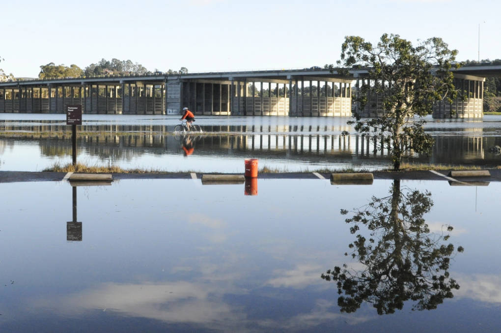
"caption": "A cyclist pedals on a flooded path in Marin during a king tide. ",
"description": null,
"title": "High Tides in Bay Area",
"credit": "Sarah Craig/KQED",
"status": "inherit",
"isLoading": false,
"fetchFailed": false
},
"news_11321296": {
"type": "attachments",
"id": "news_11321296",
"meta": {
"index": "attachments_1716263798",
"site": "news",
"id": "11321296",
"found": true
},
"parent": 11321289,
"imgSizes": {
"small": {
"file": "https://ww2.kqed.org/app/uploads/sites/10/2017/02/Firefall-520x351.jpg",
"width": 520,
"mimeType": "image/jpeg",
"height": 351
},
"twentyfourteen-full-width": {
"file": "https://ww2.kqed.org/app/uploads/sites/10/2017/02/Firefall-1038x576.jpg",
"width": 1038,
"mimeType": "image/jpeg",
"height": 576
},
"thumbnail": {
"file": "https://ww2.kqed.org/app/uploads/sites/10/2017/02/Firefall-160x108.jpg",
"width": 160,
"mimeType": "image/jpeg",
"height": 108
},
"fd-sm": {
"file": "https://ww2.kqed.org/app/uploads/sites/10/2017/02/Firefall-960x648.jpg",
"width": 960,
"mimeType": "image/jpeg",
"height": 648
},
"post-thumbnail": {
"file": "https://ww2.kqed.org/app/uploads/sites/10/2017/02/Firefall-672x372.jpg",
"width": 672,
"mimeType": "image/jpeg",
"height": 372
},
"xsmall": {
"file": "https://ww2.kqed.org/app/uploads/sites/10/2017/02/Firefall-375x253.jpg",
"width": 375,
"mimeType": "image/jpeg",
"height": 253
},
"kqedFullSize": {
"file": "https://ww2.kqed.org/app/uploads/sites/10/2017/02/Firefall.jpg",
"width": 1920,
"height": 1296
},
"large": {
"file": "https://ww2.kqed.org/app/uploads/sites/10/2017/02/Firefall-1020x689.jpg",
"width": 1020,
"mimeType": "image/jpeg",
"height": 689
},
"xlarge": {
"file": "https://ww2.kqed.org/app/uploads/sites/10/2017/02/Firefall-1180x797.jpg",
"width": 1180,
"mimeType": "image/jpeg",
"height": 797
},
"guest-author-50": {
"file": "https://ww2.kqed.org/app/uploads/sites/10/2017/02/Firefall-50x50.jpg",
"width": 50,
"mimeType": "image/jpeg",
"height": 50
},
"guest-author-96": {
"file": "https://ww2.kqed.org/app/uploads/sites/10/2017/02/Firefall-96x96.jpg",
"width": 96,
"mimeType": "image/jpeg",
"height": 96
},
"medium": {
"file": "https://ww2.kqed.org/app/uploads/sites/10/2017/02/Firefall-800x540.jpg",
"width": 800,
"mimeType": "image/jpeg",
"height": 540
},
"guest-author-64": {
"file": "https://ww2.kqed.org/app/uploads/sites/10/2017/02/Firefall-64x64.jpg",
"width": 64,
"mimeType": "image/jpeg",
"height": 64
},
"guest-author-32": {
"file": "https://ww2.kqed.org/app/uploads/sites/10/2017/02/Firefall-32x32.jpg",
"width": 32,
"mimeType": "image/jpeg",
"height": 32
},
"fd-lrg": {
"file": "https://ww2.kqed.org/app/uploads/sites/10/2017/02/Firefall-1920x1296.jpg",
"width": 1920,
"mimeType": "image/jpeg",
"height": 1296
},
"fd-med": {
"file": "https://ww2.kqed.org/app/uploads/sites/10/2017/02/Firefall-1180x797.jpg",
"width": 1180,
"mimeType": "image/jpeg",
"height": 797
},
"full-width": {
"file": "https://ww2.kqed.org/app/uploads/sites/10/2017/02/Firefall-1920x1296.jpg",
"width": 1920,
"mimeType": "image/jpeg",
"height": 1296
},
"detail": {
"file": "https://ww2.kqed.org/app/uploads/sites/10/2017/02/Firefall-150x150.jpg",
"width": 150,
"mimeType": "image/jpeg",
"height": 150
},
"guest-author-128": {
"file": "https://ww2.kqed.org/app/uploads/sites/10/2017/02/Firefall-128x128.jpg",
"width": 128,
"mimeType": "image/jpeg",
"height": 128
},
"xxsmall": {
"file": "https://ww2.kqed.org/app/uploads/sites/10/2017/02/Firefall-240x162.jpg",
"width": 240,
"mimeType": "image/jpeg",
"height": 162
}
},
"publishDate": 1487360800,
"modified": 1487374719,
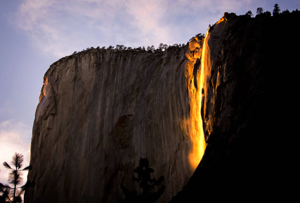
"caption": "Around the third week of February each year, Horsetail Fall lights up Yosemite National Park with a spectacle of orange and red.",
"description": null,
"title": "Firefall",
"credit": "Steve Corey/Flickr",
"status": "inherit",
"isLoading": false,
"fetchFailed": false
},
"science_1413409": {
"type": "attachments",
"id": "science_1413409",
"meta": {
"index": "attachments_1716263798",
"site": "science",
"id": "1413409",
"found": true
},
"parent": 1413406,
"imgSizes": {
"small": {
"file": "https://ww2.kqed.org/app/uploads/sites/35/2017/02/DBK_San_Joaquin_Flood_01_07_1997-520x306.jpg",
"width": 520,
"mimeType": "image/jpeg",
"height": 306
},
"twentyfourteen-full-width": {
"file": "https://ww2.kqed.org/app/uploads/sites/35/2017/02/DBK_San_Joaquin_Flood_01_07_1997-1038x576.jpg",
"width": 1038,
"mimeType": "image/jpeg",
"height": 576
},
"thumbnail": {
"file": "https://ww2.kqed.org/app/uploads/sites/35/2017/02/DBK_San_Joaquin_Flood_01_07_1997-160x94.jpg",
"width": 160,
"mimeType": "image/jpeg",
"height": 94
},
"fd-sm": {
"file": "https://ww2.kqed.org/app/uploads/sites/35/2017/02/DBK_San_Joaquin_Flood_01_07_1997-960x565.jpg",
"width": 960,
"mimeType": "image/jpeg",
"height": 565
},
"post-thumbnail": {
"file": "https://ww2.kqed.org/app/uploads/sites/35/2017/02/DBK_San_Joaquin_Flood_01_07_1997-672x372.jpg",
"width": 672,
"mimeType": "image/jpeg",
"height": 372
},
"xsmall": {
"file": "https://ww2.kqed.org/app/uploads/sites/35/2017/02/DBK_San_Joaquin_Flood_01_07_1997-375x221.jpg",
"width": 375,
"mimeType": "image/jpeg",
"height": 221
},
"kqedFullSize": {
"file": "https://ww2.kqed.org/app/uploads/sites/35/2017/02/DBK_San_Joaquin_Flood_01_07_1997.jpg",
"width": 1920,
"height": 1130
},
"large": {
"file": "https://ww2.kqed.org/app/uploads/sites/35/2017/02/DBK_San_Joaquin_Flood_01_07_1997-1020x600.jpg",
"width": 1020,
"mimeType": "image/jpeg",
"height": 600
},
"xlarge": {
"file": "https://ww2.kqed.org/app/uploads/sites/35/2017/02/DBK_San_Joaquin_Flood_01_07_1997-1180x694.jpg",
"width": 1180,
"mimeType": "image/jpeg",
"height": 694
},
"guest-author-50": {
"file": "https://ww2.kqed.org/app/uploads/sites/35/2017/02/DBK_San_Joaquin_Flood_01_07_1997-50x50.jpg",
"width": 50,
"mimeType": "image/jpeg",
"height": 50
},
"guest-author-96": {
"file": "https://ww2.kqed.org/app/uploads/sites/35/2017/02/DBK_San_Joaquin_Flood_01_07_1997-96x96.jpg",
"width": 96,
"mimeType": "image/jpeg",
"height": 96
},
"medium": {
"file": "https://ww2.kqed.org/app/uploads/sites/35/2017/02/DBK_San_Joaquin_Flood_01_07_1997-800x471.jpg",
"width": 800,
"mimeType": "image/jpeg",
"height": 471
},
"guest-author-64": {
"file": "https://ww2.kqed.org/app/uploads/sites/35/2017/02/DBK_San_Joaquin_Flood_01_07_1997-64x64.jpg",
"width": 64,
"mimeType": "image/jpeg",
"height": 64
},
"guest-author-32": {
"file": "https://ww2.kqed.org/app/uploads/sites/35/2017/02/DBK_San_Joaquin_Flood_01_07_1997-32x32.jpg",
"width": 32,
"mimeType": "image/jpeg",
"height": 32
},
"fd-lrg": {
"file": "https://ww2.kqed.org/app/uploads/sites/35/2017/02/DBK_San_Joaquin_Flood_01_07_1997-1920x1130.jpg",
"width": 1920,
"mimeType": "image/jpeg",
"height": 1130
},
"fd-med": {
"file": "https://ww2.kqed.org/app/uploads/sites/35/2017/02/DBK_San_Joaquin_Flood_01_07_1997-1180x694.jpg",
"width": 1180,
"mimeType": "image/jpeg",
"height": 694
},
"full-width": {
"file": "https://ww2.kqed.org/app/uploads/sites/35/2017/02/DBK_San_Joaquin_Flood_01_07_1997-1920x1130.jpg",
"width": 1920,
"mimeType": "image/jpeg",
"height": 1130
},
"detail": {
"file": "https://ww2.kqed.org/app/uploads/sites/35/2017/02/DBK_San_Joaquin_Flood_01_07_1997-150x150.jpg",
"width": 150,
"mimeType": "image/jpeg",
"height": 150
},
"medium_large": {
"file": "https://ww2.kqed.org/app/uploads/sites/35/2017/02/DBK_San_Joaquin_Flood_01_07_1997-768x452.jpg",
"width": 768,
"mimeType": "image/jpeg",
"height": 452
},
"guest-author-128": {
"file": "https://ww2.kqed.org/app/uploads/sites/35/2017/02/DBK_San_Joaquin_Flood_01_07_1997-128x128.jpg",
"width": 128,
"mimeType": "image/jpeg",
"height": 128
},
"xxsmall": {
"file": "https://ww2.kqed.org/app/uploads/sites/35/2017/02/DBK_San_Joaquin_Flood_01_07_1997-240x141.jpg",
"width": 240,
"mimeType": "image/jpeg",
"height": 141
}
},
"publishDate": 1487382680,
"modified": 1487382793,
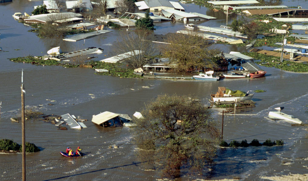
"caption": "A 1997 flood on the San Joaquin River. That year 300 square miles flooded across the state.",
"description": null,
"title": "DBK_San_Joaquin_Flood_01_07_1997",
"credit": "Dale Kolke/California Department of Water Resources",
"status": "inherit",
"isLoading": false,
"fetchFailed": false
},
"news_11319806": {
"type": "attachments",
"id": "news_11319806",
"meta": {
"index": "attachments_1716263798",
"site": "news",
"id": "11319806",
"found": true
},
"parent": 11319795,
"imgSizes": {
"small": {
"file": "https://ww2.kqed.org/app/uploads/sites/10/2017/02/RS24264_GettyImages-635173108-qut-1-520x347.jpg",
"width": 520,
"mimeType": "image/jpeg",
"height": 347
},
"twentyfourteen-full-width": {
"file": "https://ww2.kqed.org/app/uploads/sites/10/2017/02/RS24264_GettyImages-635173108-qut-1-1038x576.jpg",
"width": 1038,
"mimeType": "image/jpeg",
"height": 576
},
"thumbnail": {
"file": "https://ww2.kqed.org/app/uploads/sites/10/2017/02/RS24264_GettyImages-635173108-qut-1-160x107.jpg",
"width": 160,
"mimeType": "image/jpeg",
"height": 107
},
"fd-sm": {
"file": "https://ww2.kqed.org/app/uploads/sites/10/2017/02/RS24264_GettyImages-635173108-qut-1-960x640.jpg",
"width": 960,
"mimeType": "image/jpeg",
"height": 640
},
"post-thumbnail": {
"file": "https://ww2.kqed.org/app/uploads/sites/10/2017/02/RS24264_GettyImages-635173108-qut-1-672x372.jpg",
"width": 672,
"mimeType": "image/jpeg",
"height": 372
},
"xsmall": {
"file": "https://ww2.kqed.org/app/uploads/sites/10/2017/02/RS24264_GettyImages-635173108-qut-1-375x250.jpg",
"width": 375,
"mimeType": "image/jpeg",
"height": 250
},
"kqedFullSize": {
"file": "https://ww2.kqed.org/app/uploads/sites/10/2017/02/RS24264_GettyImages-635173108-qut-1.jpg",
"width": 1920,
"height": 1280
},
"large": {
"file": "https://ww2.kqed.org/app/uploads/sites/10/2017/02/RS24264_GettyImages-635173108-qut-1-1020x680.jpg",
"width": 1020,
"mimeType": "image/jpeg",
"height": 680
},
"xlarge": {
"file": "https://ww2.kqed.org/app/uploads/sites/10/2017/02/RS24264_GettyImages-635173108-qut-1-1180x787.jpg",
"width": 1180,
"mimeType": "image/jpeg",
"height": 787
},
"guest-author-50": {
"file": "https://ww2.kqed.org/app/uploads/sites/10/2017/02/RS24264_GettyImages-635173108-qut-1-50x50.jpg",
"width": 50,
"mimeType": "image/jpeg",
"height": 50
},
"guest-author-96": {
"file": "https://ww2.kqed.org/app/uploads/sites/10/2017/02/RS24264_GettyImages-635173108-qut-1-96x96.jpg",
"width": 96,
"mimeType": "image/jpeg",
"height": 96
},
"medium": {
"file": "https://ww2.kqed.org/app/uploads/sites/10/2017/02/RS24264_GettyImages-635173108-qut-1-800x533.jpg",
"width": 800,
"mimeType": "image/jpeg",
"height": 533
},
"guest-author-64": {
"file": "https://ww2.kqed.org/app/uploads/sites/10/2017/02/RS24264_GettyImages-635173108-qut-1-64x64.jpg",
"width": 64,
"mimeType": "image/jpeg",
"height": 64
},
"guest-author-32": {
"file": "https://ww2.kqed.org/app/uploads/sites/10/2017/02/RS24264_GettyImages-635173108-qut-1-32x32.jpg",
"width": 32,
"mimeType": "image/jpeg",
"height": 32
},
"fd-lrg": {
"file": "https://ww2.kqed.org/app/uploads/sites/10/2017/02/RS24264_GettyImages-635173108-qut-1-1920x1280.jpg",
"width": 1920,
"mimeType": "image/jpeg",
"height": 1280
},
"fd-med": {
"file": "https://ww2.kqed.org/app/uploads/sites/10/2017/02/RS24264_GettyImages-635173108-qut-1-1180x787.jpg",
"width": 1180,
"mimeType": "image/jpeg",
"height": 787
},
"full-width": {
"file": "https://ww2.kqed.org/app/uploads/sites/10/2017/02/RS24264_GettyImages-635173108-qut-1-1920x1280.jpg",
"width": 1920,
"mimeType": "image/jpeg",
"height": 1280
},
"detail": {
"file": "https://ww2.kqed.org/app/uploads/sites/10/2017/02/RS24264_GettyImages-635173108-qut-1-150x150.jpg",
"width": 150,
"mimeType": "image/jpeg",
"height": 150
},
"guest-author-128": {
"file": "https://ww2.kqed.org/app/uploads/sites/10/2017/02/RS24264_GettyImages-635173108-qut-1-128x128.jpg",
"width": 128,
"mimeType": "image/jpeg",
"height": 128
},
"xxsmall": {
"file": "https://ww2.kqed.org/app/uploads/sites/10/2017/02/RS24264_GettyImages-635173108-qut-1-240x160.jpg",
"width": 240,
"mimeType": "image/jpeg",
"height": 160
}
},
"publishDate": 1487276610,
"modified": 1487372013,
"caption": "The Oroville Dam spillway releases 100,000 cubic feet of water per second down the main spillway in Oroville, California, on Feb. 13, 2017.",
"description": null,
"title": "RS24264_GettyImages-635173108-qut",
"credit": "Josh Edelson/AFP/Getty Images",
"status": "inherit",
"isLoading": false,
"fetchFailed": false
},
"news_11321225": {
"type": "attachments",
"id": "news_11321225",
"meta": {
"index": "attachments_1716263798",
"site": "news",
"id": "11321225",
"found": true
},
"parent": 11321221,
"imgSizes": {
"small": {
"file": "https://ww2.kqed.org/app/uploads/sites/10/2017/02/pruitt-1920-520x347.jpg",
"width": 520,
"mimeType": "image/jpeg",
"height": 347
},
"twentyfourteen-full-width": {
"file": "https://ww2.kqed.org/app/uploads/sites/10/2017/02/pruitt-1920-1038x576.jpg",
"width": 1038,
"mimeType": "image/jpeg",
"height": 576
},
"thumbnail": {
"file": "https://ww2.kqed.org/app/uploads/sites/10/2017/02/pruitt-1920-160x107.jpg",
"width": 160,
"mimeType": "image/jpeg",
"height": 107
},
"fd-sm": {
"file": "https://ww2.kqed.org/app/uploads/sites/10/2017/02/pruitt-1920-960x640.jpg",
"width": 960,
"mimeType": "image/jpeg",
"height": 640
},
"post-thumbnail": {
"file": "https://ww2.kqed.org/app/uploads/sites/10/2017/02/pruitt-1920-672x372.jpg",
"width": 672,
"mimeType": "image/jpeg",
"height": 372
},
"xsmall": {
"file": "https://ww2.kqed.org/app/uploads/sites/10/2017/02/pruitt-1920-375x250.jpg",
"width": 375,
"mimeType": "image/jpeg",
"height": 250
},
"kqedFullSize": {
"file": "https://ww2.kqed.org/app/uploads/sites/10/2017/02/pruitt-1920.jpg",
"width": 1920,
"height": 1280
},
"large": {
"file": "https://ww2.kqed.org/app/uploads/sites/10/2017/02/pruitt-1920-1020x680.jpg",
"width": 1020,
"mimeType": "image/jpeg",
"height": 680
},
"xlarge": {
"file": "https://ww2.kqed.org/app/uploads/sites/10/2017/02/pruitt-1920-1180x787.jpg",
"width": 1180,
"mimeType": "image/jpeg",
"height": 787
},
"guest-author-50": {
"file": "https://ww2.kqed.org/app/uploads/sites/10/2017/02/pruitt-1920-50x50.jpg",
"width": 50,
"mimeType": "image/jpeg",
"height": 50
},
"guest-author-96": {
"file": "https://ww2.kqed.org/app/uploads/sites/10/2017/02/pruitt-1920-96x96.jpg",
"width": 96,
"mimeType": "image/jpeg",
"height": 96
},
"medium": {
"file": "https://ww2.kqed.org/app/uploads/sites/10/2017/02/pruitt-1920-800x533.jpg",
"width": 800,
"mimeType": "image/jpeg",
"height": 533
},
"guest-author-64": {
"file": "https://ww2.kqed.org/app/uploads/sites/10/2017/02/pruitt-1920-64x64.jpg",
"width": 64,
"mimeType": "image/jpeg",
"height": 64
},
"guest-author-32": {
"file": "https://ww2.kqed.org/app/uploads/sites/10/2017/02/pruitt-1920-32x32.jpg",
"width": 32,
"mimeType": "image/jpeg",
"height": 32
},
"fd-lrg": {
"file": "https://ww2.kqed.org/app/uploads/sites/10/2017/02/pruitt-1920-1920x1280.jpg",
"width": 1920,
"mimeType": "image/jpeg",
"height": 1280
},
"fd-med": {
"file": "https://ww2.kqed.org/app/uploads/sites/10/2017/02/pruitt-1920-1180x787.jpg",
"width": 1180,
"mimeType": "image/jpeg",
"height": 787
},
"full-width": {
"file": "https://ww2.kqed.org/app/uploads/sites/10/2017/02/pruitt-1920-1920x1280.jpg",
"width": 1920,
"mimeType": "image/jpeg",
"height": 1280
},
"detail": {
"file": "https://ww2.kqed.org/app/uploads/sites/10/2017/02/pruitt-1920-150x150.jpg",
"width": 150,
"mimeType": "image/jpeg",
"height": 150
},
"guest-author-128": {
"file": "https://ww2.kqed.org/app/uploads/sites/10/2017/02/pruitt-1920-128x128.jpg",
"width": 128,
"mimeType": "image/jpeg",
"height": 128
},
"xxsmall": {
"file": "https://ww2.kqed.org/app/uploads/sites/10/2017/02/pruitt-1920-240x160.jpg",
"width": 240,
"mimeType": "image/jpeg",
"height": 160
}
},
"publishDate": 1487356349,
"modified": 1487370760,
"caption": "Oklahoma Attorney General Scott Pruitt, President-elect Donald Trump's choice to head the Environmental Protection Agency, testifies during his confirmation hearing before the Senate Committee on Environment and Public Works on Capitol Hill Jan.18, 2017, in Washington, D.C.",
"description": null,
"title": "pruitt-1920",
"credit": "Aaron P. Bernstein/Getty Images",
"status": "inherit",
"isLoading": false,
"fetchFailed": false
},
"news_11316665": {
"type": "attachments",
"id": "news_11316665",
"meta": {
"index": "attachments_1716263798",
"site": "news",
"id": "11316665",
"found": true
},
"parent": 11316663,
"imgSizes": {
"small": {
"file": "https://ww2.kqed.org/app/uploads/sites/10/2017/02/RS24264_GettyImages-635173108-qut-520x347.jpg",
"width": 520,
"mimeType": "image/jpeg",
"height": 347
},
"twentyfourteen-full-width": {
"file": "https://ww2.kqed.org/app/uploads/sites/10/2017/02/RS24264_GettyImages-635173108-qut-1038x576.jpg",
"width": 1038,
"mimeType": "image/jpeg",
"height": 576
},
"thumbnail": {
"file": "https://ww2.kqed.org/app/uploads/sites/10/2017/02/RS24264_GettyImages-635173108-qut-160x107.jpg",
"width": 160,
"mimeType": "image/jpeg",
"height": 107
},
"fd-sm": {
"file": "https://ww2.kqed.org/app/uploads/sites/10/2017/02/RS24264_GettyImages-635173108-qut-960x640.jpg",
"width": 960,
"mimeType": "image/jpeg",
"height": 640
},
"post-thumbnail": {
"file": "https://ww2.kqed.org/app/uploads/sites/10/2017/02/RS24264_GettyImages-635173108-qut-672x372.jpg",
"width": 672,
"mimeType": "image/jpeg",
"height": 372
},
"xsmall": {
"file": "https://ww2.kqed.org/app/uploads/sites/10/2017/02/RS24264_GettyImages-635173108-qut-375x250.jpg",
"width": 375,
"mimeType": "image/jpeg",
"height": 250
},
"kqedFullSize": {
"file": "https://ww2.kqed.org/app/uploads/sites/10/2017/02/RS24264_GettyImages-635173108-qut.jpg",
"width": 1920,
"height": 1280
},
"large": {
"file": "https://ww2.kqed.org/app/uploads/sites/10/2017/02/RS24264_GettyImages-635173108-qut-1020x680.jpg",
"width": 1020,
"mimeType": "image/jpeg",
"height": 680
},
"xlarge": {
"file": "https://ww2.kqed.org/app/uploads/sites/10/2017/02/RS24264_GettyImages-635173108-qut-1180x787.jpg",
"width": 1180,
"mimeType": "image/jpeg",
"height": 787
},
"guest-author-50": {
"file": "https://ww2.kqed.org/app/uploads/sites/10/2017/02/RS24264_GettyImages-635173108-qut-50x50.jpg",
"width": 50,
"mimeType": "image/jpeg",
"height": 50
},
"guest-author-96": {
"file": "https://ww2.kqed.org/app/uploads/sites/10/2017/02/RS24264_GettyImages-635173108-qut-96x96.jpg",
"width": 96,
"mimeType": "image/jpeg",
"height": 96
},
"medium": {
"file": "https://ww2.kqed.org/app/uploads/sites/10/2017/02/RS24264_GettyImages-635173108-qut-800x533.jpg",
"width": 800,
"mimeType": "image/jpeg",
"height": 533
},
"guest-author-64": {
"file": "https://ww2.kqed.org/app/uploads/sites/10/2017/02/RS24264_GettyImages-635173108-qut-64x64.jpg",
"width": 64,
"mimeType": "image/jpeg",
"height": 64
},
"guest-author-32": {
"file": "https://ww2.kqed.org/app/uploads/sites/10/2017/02/RS24264_GettyImages-635173108-qut-32x32.jpg",
"width": 32,
"mimeType": "image/jpeg",
"height": 32
},
"fd-lrg": {
"file": "https://ww2.kqed.org/app/uploads/sites/10/2017/02/RS24264_GettyImages-635173108-qut-1920x1280.jpg",
"width": 1920,
"mimeType": "image/jpeg",
"height": 1280
},
"fd-med": {
"file": "https://ww2.kqed.org/app/uploads/sites/10/2017/02/RS24264_GettyImages-635173108-qut-1180x787.jpg",
"width": 1180,
"mimeType": "image/jpeg",
"height": 787
},
"full-width": {
"file": "https://ww2.kqed.org/app/uploads/sites/10/2017/02/RS24264_GettyImages-635173108-qut-1920x1280.jpg",
"width": 1920,
"mimeType": "image/jpeg",
"height": 1280
},
"detail": {
"file": "https://ww2.kqed.org/app/uploads/sites/10/2017/02/RS24264_GettyImages-635173108-qut-150x150.jpg",
"width": 150,
"mimeType": "image/jpeg",
"height": 150
},
"guest-author-128": {
"file": "https://ww2.kqed.org/app/uploads/sites/10/2017/02/RS24264_GettyImages-635173108-qut-128x128.jpg",
"width": 128,
"mimeType": "image/jpeg",
"height": 128
},
"xxsmall": {
"file": "https://ww2.kqed.org/app/uploads/sites/10/2017/02/RS24264_GettyImages-635173108-qut-240x160.jpg",
"width": 240,
"mimeType": "image/jpeg",
"height": 160
}
},
"publishDate": 1487103481,
"modified": 1519679192,
"caption": "The Oroville Dam spillway releases 100,000 cubic feet of water per second down the main spillway in Oroville, California on February 13, 2017.",
"description": null,
"title": "Oroville Dam Spillway",
"credit": "Josh Edelson/AFP-Getty Images",
"status": "inherit",
"isLoading": false,
"fetchFailed": false
},
"news_11316753": {
"type": "attachments",
"id": "news_11316753",
"meta": {
"index": "attachments_1716263798",
"site": "news",
"id": "11316753",
"found": true
},
"parent": 11316751,
"imgSizes": {
"small": {
"file": "https://ww2.kqed.org/app/uploads/sites/10/2017/02/MissileLaunch-520x320.jpg",
"width": 520,
"mimeType": "image/jpeg",
"height": 320
},
"twentyfourteen-full-width": {
"file": "https://ww2.kqed.org/app/uploads/sites/10/2017/02/MissileLaunch-1038x576.jpg",
"width": 1038,
"mimeType": "image/jpeg",
"height": 576
},
"thumbnail": {
"file": "https://ww2.kqed.org/app/uploads/sites/10/2017/02/MissileLaunch-160x99.jpg",
"width": 160,
"mimeType": "image/jpeg",
"height": 99
},
"fd-sm": {
"file": "https://ww2.kqed.org/app/uploads/sites/10/2017/02/MissileLaunch-960x591.jpg",
"width": 960,
"mimeType": "image/jpeg",
"height": 591
},
"post-thumbnail": {
"file": "https://ww2.kqed.org/app/uploads/sites/10/2017/02/MissileLaunch-672x372.jpg",
"width": 672,
"mimeType": "image/jpeg",
"height": 372
},
"xsmall": {
"file": "https://ww2.kqed.org/app/uploads/sites/10/2017/02/MissileLaunch-375x231.jpg",
"width": 375,
"mimeType": "image/jpeg",
"height": 231
},
"kqedFullSize": {
"file": "https://ww2.kqed.org/app/uploads/sites/10/2017/02/MissileLaunch.jpg",
"width": 1920,
"height": 1182
},
"large": {
"file": "https://ww2.kqed.org/app/uploads/sites/10/2017/02/MissileLaunch-1020x628.jpg",
"width": 1020,
"mimeType": "image/jpeg",
"height": 628
},
"xlarge": {
"file": "https://ww2.kqed.org/app/uploads/sites/10/2017/02/MissileLaunch-1180x726.jpg",
"width": 1180,
"mimeType": "image/jpeg",
"height": 726
},
"guest-author-50": {
"file": "https://ww2.kqed.org/app/uploads/sites/10/2017/02/MissileLaunch-50x50.jpg",
"width": 50,
"mimeType": "image/jpeg",
"height": 50
},
"guest-author-96": {
"file": "https://ww2.kqed.org/app/uploads/sites/10/2017/02/MissileLaunch-96x96.jpg",
"width": 96,
"mimeType": "image/jpeg",
"height": 96
},
"medium": {
"file": "https://ww2.kqed.org/app/uploads/sites/10/2017/02/MissileLaunch-800x493.jpg",
"width": 800,
"mimeType": "image/jpeg",
"height": 493
},
"guest-author-64": {
"file": "https://ww2.kqed.org/app/uploads/sites/10/2017/02/MissileLaunch-64x64.jpg",
"width": 64,
"mimeType": "image/jpeg",
"height": 64
},
"guest-author-32": {
"file": "https://ww2.kqed.org/app/uploads/sites/10/2017/02/MissileLaunch-32x32.jpg",
"width": 32,
"mimeType": "image/jpeg",
"height": 32
},
"fd-lrg": {
"file": "https://ww2.kqed.org/app/uploads/sites/10/2017/02/MissileLaunch-1920x1182.jpg",
"width": 1920,
"mimeType": "image/jpeg",
"height": 1182
},
"fd-med": {
"file": "https://ww2.kqed.org/app/uploads/sites/10/2017/02/MissileLaunch-1180x726.jpg",
"width": 1180,
"mimeType": "image/jpeg",
"height": 726
},
"full-width": {
"file": "https://ww2.kqed.org/app/uploads/sites/10/2017/02/MissileLaunch-1920x1182.jpg",
"width": 1920,
"mimeType": "image/jpeg",
"height": 1182
},
"detail": {
"file": "https://ww2.kqed.org/app/uploads/sites/10/2017/02/MissileLaunch-150x150.jpg",
"width": 150,
"mimeType": "image/jpeg",
"height": 150
},
"guest-author-128": {
"file": "https://ww2.kqed.org/app/uploads/sites/10/2017/02/MissileLaunch-128x128.jpg",
"width": 128,
"mimeType": "image/jpeg",
"height": 128
},
"xxsmall": {
"file": "https://ww2.kqed.org/app/uploads/sites/10/2017/02/MissileLaunch-240x148.jpg",
"width": 240,
"mimeType": "image/jpeg",
"height": 148
}
},
"publishDate": 1487108079,
"modified": 1487108149,
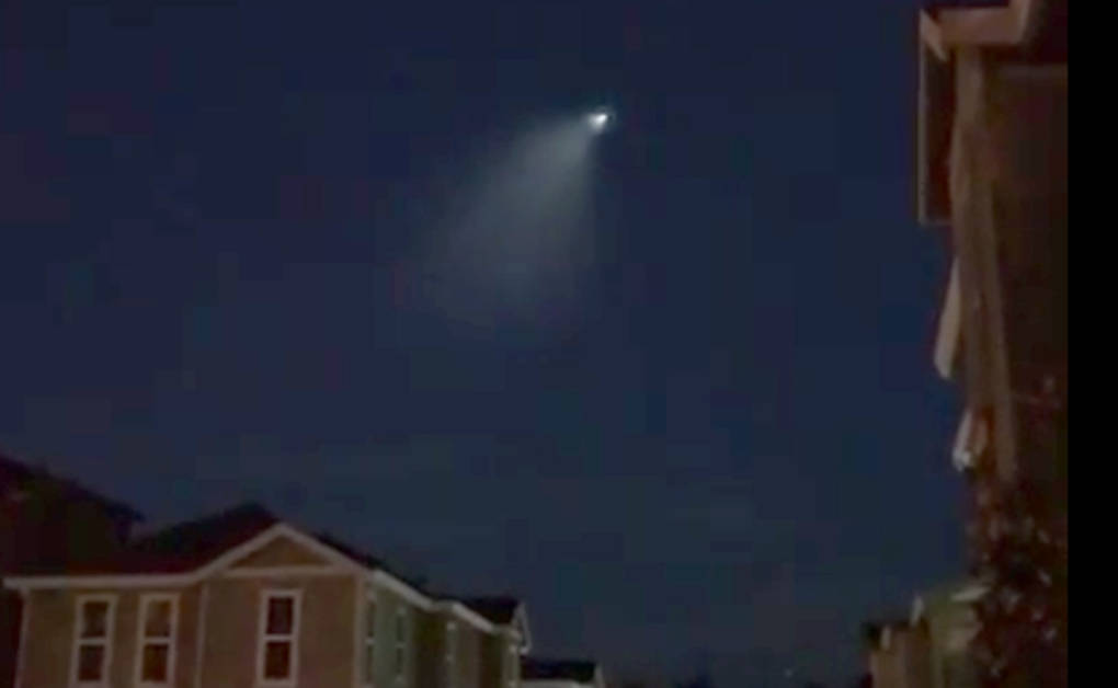
"caption": "A Bay Area resident captured video of the Trident II missile launch early Tuesday morning.",
"description": "A Bay Area resident captured video of the Trident II missile launch early Tuesday morning.",
"title": "MissileLaunch",
"credit": "Jason Poon/YouTube",
"status": "inherit",
"isLoading": false,
"fetchFailed": false
},
"news_11316742": {
"type": "attachments",
"id": "news_11316742",
"meta": {
"index": "attachments_1716263798",
"site": "news",
"id": "11316742",
"found": true
},
"parent": 11316663,
"imgSizes": {
"small": {
"file": "https://ww2.kqed.org/app/uploads/sites/10/2017/02/OrovilleFloodingMain-520x324.jpg",
"width": 520,
"mimeType": "image/jpeg",
"height": 324
},
"twentyfourteen-full-width": {
"file": "https://ww2.kqed.org/app/uploads/sites/10/2017/02/OrovilleFloodingMain-1038x576.jpg",
"width": 1038,
"mimeType": "image/jpeg",
"height": 576
},
"thumbnail": {
"file": "https://ww2.kqed.org/app/uploads/sites/10/2017/02/OrovilleFloodingMain-160x100.jpg",
"width": 160,
"mimeType": "image/jpeg",
"height": 100
},
"fd-sm": {
"file": "https://ww2.kqed.org/app/uploads/sites/10/2017/02/OrovilleFloodingMain-960x599.jpg",
"width": 960,
"mimeType": "image/jpeg",
"height": 599
},
"post-thumbnail": {
"file": "https://ww2.kqed.org/app/uploads/sites/10/2017/02/OrovilleFloodingMain-672x372.jpg",
"width": 672,
"mimeType": "image/jpeg",
"height": 372
},
"xsmall": {
"file": "https://ww2.kqed.org/app/uploads/sites/10/2017/02/OrovilleFloodingMain-375x234.jpg",
"width": 375,
"mimeType": "image/jpeg",
"height": 234
},
"kqedFullSize": {
"file": "https://ww2.kqed.org/app/uploads/sites/10/2017/02/OrovilleFloodingMain.jpg",
"width": 1920,
"height": 1197
},
"large": {
"file": "https://ww2.kqed.org/app/uploads/sites/10/2017/02/OrovilleFloodingMain-1020x636.jpg",
"width": 1020,
"mimeType": "image/jpeg",
"height": 636
},
"xlarge": {
"file": "https://ww2.kqed.org/app/uploads/sites/10/2017/02/OrovilleFloodingMain-1180x736.jpg",
"width": 1180,
"mimeType": "image/jpeg",
"height": 736
},
"guest-author-50": {
"file": "https://ww2.kqed.org/app/uploads/sites/10/2017/02/OrovilleFloodingMain-50x50.jpg",
"width": 50,
"mimeType": "image/jpeg",
"height": 50
},
"guest-author-96": {
"file": "https://ww2.kqed.org/app/uploads/sites/10/2017/02/OrovilleFloodingMain-96x96.jpg",
"width": 96,
"mimeType": "image/jpeg",
"height": 96
},
"medium": {
"file": "https://ww2.kqed.org/app/uploads/sites/10/2017/02/OrovilleFloodingMain-800x499.jpg",
"width": 800,
"mimeType": "image/jpeg",
"height": 499
},
"guest-author-64": {
"file": "https://ww2.kqed.org/app/uploads/sites/10/2017/02/OrovilleFloodingMain-64x64.jpg",
"width": 64,
"mimeType": "image/jpeg",
"height": 64
},
"guest-author-32": {
"file": "https://ww2.kqed.org/app/uploads/sites/10/2017/02/OrovilleFloodingMain-32x32.jpg",
"width": 32,
"mimeType": "image/jpeg",
"height": 32
},
"fd-lrg": {
"file": "https://ww2.kqed.org/app/uploads/sites/10/2017/02/OrovilleFloodingMain-1920x1197.jpg",
"width": 1920,
"mimeType": "image/jpeg",
"height": 1197
},
"fd-med": {
"file": "https://ww2.kqed.org/app/uploads/sites/10/2017/02/OrovilleFloodingMain-1180x736.jpg",
"width": 1180,
"mimeType": "image/jpeg",
"height": 736
},
"full-width": {
"file": "https://ww2.kqed.org/app/uploads/sites/10/2017/02/OrovilleFloodingMain-1920x1197.jpg",
"width": 1920,
"mimeType": "image/jpeg",
"height": 1197
},
"detail": {
"file": "https://ww2.kqed.org/app/uploads/sites/10/2017/02/OrovilleFloodingMain-150x150.jpg",
"width": 150,
"mimeType": "image/jpeg",
"height": 150
},
"guest-author-128": {
"file": "https://ww2.kqed.org/app/uploads/sites/10/2017/02/OrovilleFloodingMain-128x128.jpg",
"width": 128,
"mimeType": "image/jpeg",
"height": 128
},
"xxsmall": {
"file": "https://ww2.kqed.org/app/uploads/sites/10/2017/02/OrovilleFloodingMain-240x150.jpg",
"width": 240,
"mimeType": "image/jpeg",
"height": 150
}
},
"publishDate": 1487106787,
"modified": 1487112221,
"caption": "Almost 200,000 people were under evacuation orders in Northern California Monday after a threat of catastrophic failure at the United States' tallest dam. Officials said the threat had subsided for the moment as water levels at the Oroville Dam, 75 miles (120 kilometers) north of Sacramento, have eased. But people were still being told to stay out of the area.",
"description": "Almost 200,000 people were under evacuation orders in northern California Monday after a threat of catastrophic failure at the United States' tallest dam. Officials said the threat had subsided for the moment as water levels at the Oroville Dam, 75 miles (120 kilometers) north of Sacramento, have eased. But people were still being told to stay out of the area.",
"title": "OrovilleFloodingMain",
"credit": "JOSH EDELSON/AFP/Getty Images",
"status": "inherit",
"isLoading": false,
"fetchFailed": false
},
"news_11315404": {
"type": "attachments",
"id": "news_11315404",
"meta": {
"index": "attachments_1716263798",
"site": "news",
"id": "11315404",
"found": true
},
"parent": 11310630,
"imgSizes": {
"small": {
"file": "https://ww2.kqed.org/app/uploads/sites/10/2017/02/RS24183_Gorn-Gas-Engines-web1-qut-520x347.jpg",
"width": 520,
"mimeType": "image/jpeg",
"height": 347
},
"twentyfourteen-full-width": {
"file": "https://ww2.kqed.org/app/uploads/sites/10/2017/02/RS24183_Gorn-Gas-Engines-web1-qut-1038x576.jpg",
"width": 1038,
"mimeType": "image/jpeg",
"height": 576
},
"thumbnail": {
"file": "https://ww2.kqed.org/app/uploads/sites/10/2017/02/RS24183_Gorn-Gas-Engines-web1-qut-160x107.jpg",
"width": 160,
"mimeType": "image/jpeg",
"height": 107
},
"fd-sm": {
"file": "https://ww2.kqed.org/app/uploads/sites/10/2017/02/RS24183_Gorn-Gas-Engines-web1-qut-960x640.jpg",
"width": 960,
"mimeType": "image/jpeg",
"height": 640
},
"post-thumbnail": {
"file": "https://ww2.kqed.org/app/uploads/sites/10/2017/02/RS24183_Gorn-Gas-Engines-web1-qut-672x372.jpg",
"width": 672,
"mimeType": "image/jpeg",
"height": 372
},
"xsmall": {
"file": "https://ww2.kqed.org/app/uploads/sites/10/2017/02/RS24183_Gorn-Gas-Engines-web1-qut-375x250.jpg",
"width": 375,
"mimeType": "image/jpeg",
"height": 250
},
"kqedFullSize": {
"file": "https://ww2.kqed.org/app/uploads/sites/10/2017/02/RS24183_Gorn-Gas-Engines-web1-qut.jpg",
"width": 1920,
"height": 1280
},
"large": {
"file": "https://ww2.kqed.org/app/uploads/sites/10/2017/02/RS24183_Gorn-Gas-Engines-web1-qut-1020x680.jpg",
"width": 1020,
"mimeType": "image/jpeg",
"height": 680
},
"xlarge": {
"file": "https://ww2.kqed.org/app/uploads/sites/10/2017/02/RS24183_Gorn-Gas-Engines-web1-qut-1180x787.jpg",
"width": 1180,
"mimeType": "image/jpeg",
"height": 787
},
"guest-author-50": {
"file": "https://ww2.kqed.org/app/uploads/sites/10/2017/02/RS24183_Gorn-Gas-Engines-web1-qut-50x50.jpg",
"width": 50,
"mimeType": "image/jpeg",
"height": 50
},
"guest-author-96": {
"file": "https://ww2.kqed.org/app/uploads/sites/10/2017/02/RS24183_Gorn-Gas-Engines-web1-qut-96x96.jpg",
"width": 96,
"mimeType": "image/jpeg",
"height": 96
},
"medium": {
"file": "https://ww2.kqed.org/app/uploads/sites/10/2017/02/RS24183_Gorn-Gas-Engines-web1-qut-800x533.jpg",
"width": 800,
"mimeType": "image/jpeg",
"height": 533
},
"guest-author-64": {
"file": "https://ww2.kqed.org/app/uploads/sites/10/2017/02/RS24183_Gorn-Gas-Engines-web1-qut-64x64.jpg",
"width": 64,
"mimeType": "image/jpeg",
"height": 64
},
"guest-author-32": {
"file": "https://ww2.kqed.org/app/uploads/sites/10/2017/02/RS24183_Gorn-Gas-Engines-web1-qut-32x32.jpg",
"width": 32,
"mimeType": "image/jpeg",
"height": 32
},
"fd-lrg": {
"file": "https://ww2.kqed.org/app/uploads/sites/10/2017/02/RS24183_Gorn-Gas-Engines-web1-qut-1920x1280.jpg",
"width": 1920,
"mimeType": "image/jpeg",
"height": 1280
},
"fd-med": {
"file": "https://ww2.kqed.org/app/uploads/sites/10/2017/02/RS24183_Gorn-Gas-Engines-web1-qut-1180x787.jpg",
"width": 1180,
"mimeType": "image/jpeg",
"height": 787
},
"full-width": {
"file": "https://ww2.kqed.org/app/uploads/sites/10/2017/02/RS24183_Gorn-Gas-Engines-web1-qut-1920x1280.jpg",
"width": 1920,
"mimeType": "image/jpeg",
"height": 1280
},
"detail": {
"file": "https://ww2.kqed.org/app/uploads/sites/10/2017/02/RS24183_Gorn-Gas-Engines-web1-qut-150x150.jpg",
"width": 150,
"mimeType": "image/jpeg",
"height": 150
},
"guest-author-128": {
"file": "https://ww2.kqed.org/app/uploads/sites/10/2017/02/RS24183_Gorn-Gas-Engines-web1-qut-128x128.jpg",
"width": 128,
"mimeType": "image/jpeg",
"height": 128
},
"xxsmall": {
"file": "https://ww2.kqed.org/app/uploads/sites/10/2017/02/RS24183_Gorn-Gas-Engines-web1-qut-240x160.jpg",
"width": 240,
"mimeType": "image/jpeg",
"height": 160
}
},
"publishDate": 1487027996,
"modified": 1487030165,
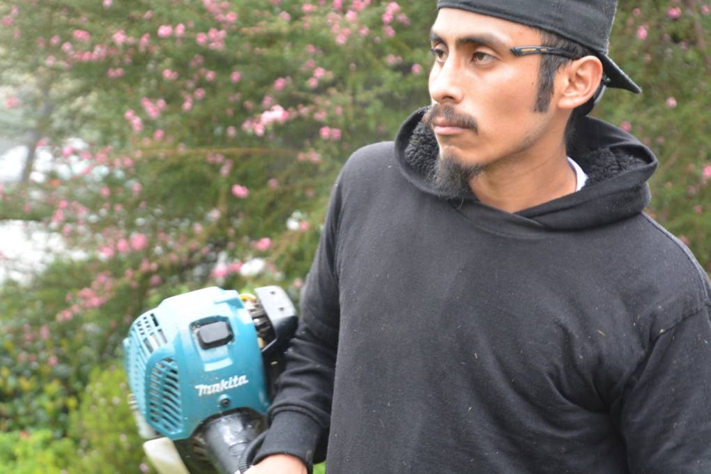
"caption": "Jose Delgado works with gas-powered equipment at a front yard in western Los Angeles. The state air quality board has proposed new regulations to cut down on pollution from small gas engines, which are soon expected to release more ozone-damaging emissions than cars do.",
"description": null,
"title": "RS24183_Gorn-Gas Engines-web1-qut",
"credit": "David Gorn/KQED",
"status": "inherit",
"isLoading": false,
"fetchFailed": false
},
"futureofyou_336284": {
"type": "attachments",
"id": "futureofyou_336284",
"meta": {
"index": "attachments_1716263798",
"site": "futureofyou",
"id": "336284",
"found": true
},
"parent": 333254,
"imgSizes": {
"small": {
"file": "https://ww2.kqed.org/app/uploads/sites/13/2017/02/Multitask-768x512-520x347.jpg",
"width": 520,
"mimeType": "image/jpeg",
"height": 347
},
"thumbnail": {
"file": "https://ww2.kqed.org/app/uploads/sites/13/2017/02/Multitask-768x512-160x107.jpg",
"width": 160,
"mimeType": "image/jpeg",
"height": 107
},
"post-thumbnail": {
"file": "https://ww2.kqed.org/app/uploads/sites/13/2017/02/Multitask-768x512-672x372.jpg",
"width": 672,
"mimeType": "image/jpeg",
"height": 372
},
"xsmall": {
"file": "https://ww2.kqed.org/app/uploads/sites/13/2017/02/Multitask-768x512-375x250.jpg",
"width": 375,
"mimeType": "image/jpeg",
"height": 250
},
"kqedFullSize": {
"file": "https://ww2.kqed.org/app/uploads/sites/13/2017/02/Multitask-768x512.jpg",
"width": 768,
"height": 512
},
"guest-author-50": {
"file": "https://ww2.kqed.org/app/uploads/sites/13/2017/02/Multitask-768x512-50x50.jpg",
"width": 50,
"mimeType": "image/jpeg",
"height": 50
},
"guest-author-96": {
"file": "https://ww2.kqed.org/app/uploads/sites/13/2017/02/Multitask-768x512-96x96.jpg",
"width": 96,
"mimeType": "image/jpeg",
"height": 96
},
"guest-author-64": {
"file": "https://ww2.kqed.org/app/uploads/sites/13/2017/02/Multitask-768x512-64x64.jpg",
"width": 64,
"mimeType": "image/jpeg",
"height": 64
},
"guest-author-32": {
"file": "https://ww2.kqed.org/app/uploads/sites/13/2017/02/Multitask-768x512-32x32.jpg",
"width": 32,
"mimeType": "image/jpeg",
"height": 32
},
"detail": {
"file": "https://ww2.kqed.org/app/uploads/sites/13/2017/02/Multitask-768x512-150x150.jpg",
"width": 150,
"mimeType": "image/jpeg",
"height": 150
},
"medium_large": {
"file": "https://ww2.kqed.org/app/uploads/sites/13/2017/02/Multitask-768x512-768x512.jpg",
"width": 768,
"mimeType": "image/jpeg",
"height": 512
},
"guest-author-128": {
"file": "https://ww2.kqed.org/app/uploads/sites/13/2017/02/Multitask-768x512-128x128.jpg",
"width": 128,
"mimeType": "image/jpeg",
"height": 128
},
"xxsmall": {
"file": "https://ww2.kqed.org/app/uploads/sites/13/2017/02/Multitask-768x512-240x160.jpg",
"width": 240,
"mimeType": "image/jpeg",
"height": 160
}
},
"publishDate": 1487005329,
"modified": 1487005354,
"caption": null,
"description": null,
"title": "Multitask-768x512",
"credit": "Teodros Hailye/KQED",
"status": "inherit",
"isLoading": false,
"fetchFailed": false
},
"news_11314174": {
"type": "attachments",
"id": "news_11314174",
"meta": {
"index": "attachments_1716263798",
"site": "news",
"id": "11314174",
"found": true
},
"parent": 11314167,
"imgSizes": {
"small": {
"file": "https://ww2.kqed.org/app/uploads/sites/10/2017/02/RS24248_MainAux_DWR-qut-520x390.jpg",
"width": 520,
"mimeType": "image/jpeg",
"height": 390
},
"twentyfourteen-full-width": {
"file": "https://ww2.kqed.org/app/uploads/sites/10/2017/02/RS24248_MainAux_DWR-qut-1038x576.jpg",
"width": 1038,
"mimeType": "image/jpeg",
"height": 576
},
"thumbnail": {
"file": "https://ww2.kqed.org/app/uploads/sites/10/2017/02/RS24248_MainAux_DWR-qut-160x120.jpg",
"width": 160,
"mimeType": "image/jpeg",
"height": 120
},
"fd-sm": {
"file": "https://ww2.kqed.org/app/uploads/sites/10/2017/02/RS24248_MainAux_DWR-qut-960x720.jpg",
"width": 960,
"mimeType": "image/jpeg",
"height": 720
},
"post-thumbnail": {
"file": "https://ww2.kqed.org/app/uploads/sites/10/2017/02/RS24248_MainAux_DWR-qut-672x372.jpg",
"width": 672,
"mimeType": "image/jpeg",
"height": 372
},
"xsmall": {
"file": "https://ww2.kqed.org/app/uploads/sites/10/2017/02/RS24248_MainAux_DWR-qut-375x281.jpg",
"width": 375,
"mimeType": "image/jpeg",
"height": 281
},
"kqedFullSize": {
"file": "https://ww2.kqed.org/app/uploads/sites/10/2017/02/RS24248_MainAux_DWR-qut.jpg",
"width": 1224,
"height": 918
},
"large": {
"file": "https://ww2.kqed.org/app/uploads/sites/10/2017/02/RS24248_MainAux_DWR-qut-1020x765.jpg",
"width": 1020,
"mimeType": "image/jpeg",
"height": 765
},
"xlarge": {
"file": "https://ww2.kqed.org/app/uploads/sites/10/2017/02/RS24248_MainAux_DWR-qut-1180x885.jpg",
"width": 1180,
"mimeType": "image/jpeg",
"height": 885
},
"guest-author-50": {
"file": "https://ww2.kqed.org/app/uploads/sites/10/2017/02/RS24248_MainAux_DWR-qut-50x50.jpg",
"width": 50,
"mimeType": "image/jpeg",
"height": 50
},
"guest-author-96": {
"file": "https://ww2.kqed.org/app/uploads/sites/10/2017/02/RS24248_MainAux_DWR-qut-96x96.jpg",
"width": 96,
"mimeType": "image/jpeg",
"height": 96
},
"medium": {
"file": "https://ww2.kqed.org/app/uploads/sites/10/2017/02/RS24248_MainAux_DWR-qut-800x600.jpg",
"width": 800,
"mimeType": "image/jpeg",
"height": 600
},
"guest-author-64": {
"file": "https://ww2.kqed.org/app/uploads/sites/10/2017/02/RS24248_MainAux_DWR-qut-64x64.jpg",
"width": 64,
"mimeType": "image/jpeg",
"height": 64
},
"guest-author-32": {
"file": "https://ww2.kqed.org/app/uploads/sites/10/2017/02/RS24248_MainAux_DWR-qut-32x32.jpg",
"width": 32,
"mimeType": "image/jpeg",
"height": 32
},
"fd-med": {
"file": "https://ww2.kqed.org/app/uploads/sites/10/2017/02/RS24248_MainAux_DWR-qut-1180x885.jpg",
"width": 1180,
"mimeType": "image/jpeg",
"height": 885
},
"detail": {
"file": "https://ww2.kqed.org/app/uploads/sites/10/2017/02/RS24248_MainAux_DWR-qut-150x150.jpg",
"width": 150,
"mimeType": "image/jpeg",
"height": 150
},
"guest-author-128": {
"file": "https://ww2.kqed.org/app/uploads/sites/10/2017/02/RS24248_MainAux_DWR-qut-128x128.jpg",
"width": 128,
"mimeType": "image/jpeg",
"height": 128
},
"xxsmall": {
"file": "https://ww2.kqed.org/app/uploads/sites/10/2017/02/RS24248_MainAux_DWR-qut-240x180.jpg",
"width": 240,
"mimeType": "image/jpeg",
"height": 180
}
},
"publishDate": 1486956508,
"modified": 1487025707,
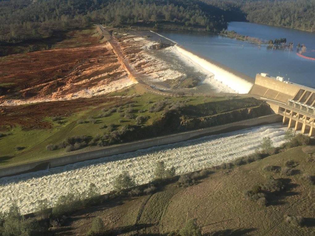
"caption": "Main spillway and auxiliary spillway at Oroville Dam taken on Saturday, Feb. 11, 2017. about 3 p.m. ",
"description": null,
"title": "RS24248_MainAux_DWR-qut",
"credit": "William Croyle/California Dept. of Water Resources",
"status": "inherit",
"isLoading": false,
"fetchFailed": false
}
},
"audioPlayerReducer": {
"postId": "stream_live",
"isPaused": true,
"isPlaying": false,
"pfsActive": false,
"pledgeModalIsOpen": true,
"playerDrawerIsOpen": false,
"liveAudioPlayStartedAt": 0,
"liveAudioPlayContext": ""
},
"authorsReducer": {
"byline_news_11326829": {
"type": "authors",
"id": "byline_news_11326829",
"meta": {
"override": true
},
"slug": "byline_news_11326829",
"name": "\u003cstrong>Kristen J. Bender\u003cbr>Associated Press\u003c/strong>",
"isLoading": false
},
"byline_news_11321289": {
"type": "authors",
"id": "byline_news_11321289",
"meta": {
"override": true
},
"slug": "byline_news_11321289",
"name": "Colin Dwyer",
"isLoading": false
},
"byline_news_11319795": {
"type": "authors",
"id": "byline_news_11319795",
"meta": {
"override": true
},
"slug": "byline_news_11319795",
"name": "\u003cstrong>Mariana Urban\u003c/strong>",
"isLoading": false
},
"byline_news_11321221": {
"type": "authors",
"id": "byline_news_11321221",
"meta": {
"override": true
},
"slug": "byline_news_11321221",
"name": "\u003cstrong>\u003ca href=\"http://www.npr.org/people/444796749/scott-detrow\">Scott Detrow\u003c/a>\u003cbr />\u003ca href=\"http://www.npr.org/\">NPR\u003c/a>\u003c/strong>",
"isLoading": false
},
"byline_news_11316751": {
"type": "authors",
"id": "byline_news_11316751",
"meta": {
"override": true
},
"slug": "byline_news_11316751",
"name": "Associated Press",
"isLoading": false
},
"byline_futureofyou_333254": {
"type": "authors",
"id": "byline_futureofyou_333254",
"meta": {
"override": true
},
"slug": "byline_futureofyou_333254",
"name": "Sharon Begley\u003cbr />\u003ca href=\"https://www.statnews.com/\">STAT\u003c/a>",
"isLoading": false
},
"kqed": {
"type": "authors",
"id": "236",
"meta": {
"index": "authors_1716337520",
"id": "236",
"found": true
},
"name": "KQED News Staff",
"firstName": "KQED News Staff",
"lastName": null,
"slug": "kqed",
"email": "faq@kqed.org",
"display_author_email": false,
"staff_mastheads": [],
"title": null,
"bio": null,
"avatar": "https://secure.gravatar.com/avatar/ef0e801a68c4c54afa9180db14084167?s=600&d=blank&r=g",
"twitter": null,
"facebook": null,
"instagram": null,
"linkedin": null,
"sites": [
{
"site": "arts",
"roles": [
"contributor"
]
},
{
"site": "news",
"roles": [
"editor"
]
},
{
"site": "futureofyou",
"roles": [
"author"
]
}
],
"headData": {
"title": "KQED News Staff | KQED",
"description": null,
"ogImgSrc": "https://secure.gravatar.com/avatar/ef0e801a68c4c54afa9180db14084167?s=600&d=blank&r=g",
"twImgSrc": "https://secure.gravatar.com/avatar/ef0e801a68c4c54afa9180db14084167?s=600&d=blank&r=g"
},
"isLoading": false,
"link": "/author/kqed"
},
"laurensommer": {
"type": "authors",
"id": "239",
"meta": {
"index": "authors_1716337520",
"id": "239",
"found": true
},
"name": "Lauren Sommer",
"firstName": "Lauren",
"lastName": "Sommer",
"slug": "laurensommer",
"email": "lsommer@kqed.org",
"display_author_email": false,
"staff_mastheads": [],
"title": "KQED Contributor",
"bio": "Lauren is a radio reporter formerly covering environment, water, and energy for KQED Science. As part of her day job, she has scaled Sierra Nevada peaks, run from charging elephant seals, and desperately tried to get her sea legs - all in pursuit of good radio. Her work has appeared on Marketplace, Living on Earth, Science Friday and NPR's Morning Edition and All Things Considered. You can find her on Twitter at \u003ca href=\"https://twitter.com/lesommer\">@lesommer\u003c/a>.",
"avatar": "https://secure.gravatar.com/avatar/33aa3772bb86c6ad45b8aca6a238bbdf?s=600&d=blank&r=g",
"twitter": null,
"facebook": null,
"instagram": null,
"linkedin": null,
"sites": [
{
"site": "news",
"roles": [
"author"
]
},
{
"site": "science",
"roles": [
"editor",
"manage_content_types",
"manage_taxonomies"
]
},
{
"site": "quest",
"roles": [
"editor"
]
}
],
"headData": {
"title": "Lauren Sommer | KQED",
"description": "KQED Contributor",
"ogImgSrc": "https://secure.gravatar.com/avatar/33aa3772bb86c6ad45b8aca6a238bbdf?s=600&d=blank&r=g",
"twImgSrc": "https://secure.gravatar.com/avatar/33aa3772bb86c6ad45b8aca6a238bbdf?s=600&d=blank&r=g"
},
"isLoading": false,
"link": "/author/laurensommer"
},
"dgorn": {
"type": "authors",
"id": "8656",
"meta": {
"index": "authors_1716337520",
"id": "8656",
"found": true
},
"name": "David Gorn",
"firstName": "David",
"lastName": "Gorn",
"slug": "dgorn",
"email": "dgorn+donotmail@sbcglobal.net",
"display_author_email": false,
"staff_mastheads": [],
"title": "KQED Contributor",
"bio": "David Gorn is the former Deputy News Director of KQED Radio. His public radio pieces have appeared on NPR, the World, Marketplace and the California Report.",
"avatar": "https://secure.gravatar.com/avatar/a6ad3e1eec1712e19b986b9395614010?s=600&d=blank&r=g",
"twitter": null,
"facebook": null,
"instagram": null,
"linkedin": null,
"sites": [
{
"site": "news",
"roles": [
"subscriber"
]
},
{
"site": "futureofyou",
"roles": [
"author"
]
},
{
"site": "science",
"roles": [
"author"
]
},
{
"site": "quest",
"roles": [
"editor"
]
}
],
"headData": {
"title": "David Gorn | KQED",
"description": "KQED Contributor",
"ogImgSrc": "https://secure.gravatar.com/avatar/a6ad3e1eec1712e19b986b9395614010?s=600&d=blank&r=g",
"twImgSrc": "https://secure.gravatar.com/avatar/a6ad3e1eec1712e19b986b9395614010?s=600&d=blank&r=g"
},
"isLoading": false,
"link": "/author/dgorn"
},
"mleitsinger": {
"type": "authors",
"id": "11310",
"meta": {
"index": "authors_1716337520",
"id": "11310",
"found": true
},
"name": "Miranda Leitsinger",
"firstName": "Miranda",
"lastName": "Leitsinger",
"slug": "mleitsinger",
"email": "mleitsinger@KQED.org",
"display_author_email": false,
"staff_mastheads": [
"news"
],
"title": "KQED Contributor",
"bio": "Miranda Leitsinger has worked in journalism as a reporter and editor since 2000, including seven years at The Associated Press in locales such as Cambodia and Puerto Rico, four years at NBC News Digital in New York and 2.5 years at CNN.com International in Hong Kong. Major stories she has covered included sexual abuse in the yoga community, the rise of women in local politics post-2016 election, the struggle over LGBTQ inclusion in the Boy Scouts, aftermath of the 2004 and 2011 tsunamis, the Aurora movie theater attack, the Newtown school shooting, Superstorm Sandy and the Boston Marathon bombing.",
"avatar": "https://secure.gravatar.com/avatar/cdd00de7be92aab3b7fd3d915e02033d?s=600&d=blank&r=g",
"twitter": "mimileitsinger",
"facebook": null,
"instagram": null,
"linkedin": null,
"sites": [
{
"site": "arts",
"roles": [
"author"
]
},
{
"site": "news",
"roles": [
"subscriber"
]
},
{
"site": "futureofyou",
"roles": [
"editor"
]
},
{
"site": "stateofhealth",
"roles": [
"editor"
]
}
],
"headData": {
"title": "Miranda Leitsinger | KQED",
"description": "KQED Contributor",
"ogImgSrc": "https://secure.gravatar.com/avatar/cdd00de7be92aab3b7fd3d915e02033d?s=600&d=blank&r=g",
"twImgSrc": "https://secure.gravatar.com/avatar/cdd00de7be92aab3b7fd3d915e02033d?s=600&d=blank&r=g"
},
"isLoading": false,
"link": "/author/mleitsinger"
},
"scraig": {
"type": "authors",
"id": "11327",
"meta": {
"index": "authors_1716337520",
"id": "11327",
"found": true
},
"name": "Sarah Craig",
"firstName": "Sarah",
"lastName": "Craig",
"slug": "scraig",
"email": "scraig@KQED.org",
"display_author_email": false,
"staff_mastheads": [],
"title": "KQED Contributor",
"bio": "Sarah Craig is a freelance radio reporter and documentary photographer. She is currently working on \u003cem>Dreams of Dust\u003c/em>, @dreamsofdust, a multimedia project that documents stories of climate migration in California’s Central Valley, previously funded by the California Humanities. Her completed projects include \u003cem>\u003ca href=\"http://www.facesoffracking.org/\" target=\"_blank\" rel=\"nofollow noopener noreferrer\">Faces of Fracking\u003c/a>,\u003c/em> an investigation into the impact of fracking on the people and places of California, and \u003cem>\u003ca href=\"http://sarahcraig.visura.co/gulf-disaster-2\" target=\"_blank\" rel=\"nofollow noopener noreferrer\">The Gulf Disaster\u003c/a>,\u003c/em> stories on the lives of fishermen in the aftermath of the BP spill. Her work has been published by Marketplace, KQED's Bay Curious and Q'ed Up podcasts, KQED's California Report Magazine, KALW's Crosscurrents, Grist.org, High Country News, Earth Island Journal, and others. Sarah received a B.A. in Geography at Vassar College and attended the \u003ca href=\"http://www.salt.edu/\" target=\"_blank\" rel=\"nofollow noopener noreferrer\">Salt Institute of Documentary Studies\u003c/a> in Portland, ME. She recently received an Excellence in Journalism Award from the NorCal Society of Professional Journalists for her documentary radio piece, \u003ca href=\"http://kalw.org/post/215-will-water-come#stream/0\">\"Will the Water Come.\"\u003c/a> Email: scraig@kqed.org Twitter: @sarahcraigmedia Website: sarahcraigmedia.com",
"avatar": "https://secure.gravatar.com/avatar/97f17950c828429d3df9f2907412a50b?s=600&d=blank&r=g",
"twitter": null,
"facebook": null,
"instagram": null,
"linkedin": null,
"sites": [
{
"site": "news",
"roles": [
"subscriber"
]
},
{
"site": "science",
"roles": [
"editor"
]
}
],
"headData": {
"title": "Sarah Craig | KQED",
"description": "KQED Contributor",
"ogImgSrc": "https://secure.gravatar.com/avatar/97f17950c828429d3df9f2907412a50b?s=600&d=blank&r=g",
"twImgSrc": "https://secure.gravatar.com/avatar/97f17950c828429d3df9f2907412a50b?s=600&d=blank&r=g"
},
"isLoading": false,
"link": "/author/scraig"
}
},
"pagesReducer": {
"science_category_environment": {
"type": "terms",
"id": "science_35",
"meta": {
"index": "terms_1716263798",
"site": "science",
"id": "35",
"score": 12.138481
},
"featImg": null,
"name": "Environment",
"description": null,
"taxonomy": "category",
"headData": {
"twImgId": null,
"twTitle": null,
"ogTitle": null,
"ogImgId": null,
"twDescription": null,
"description": null,
"title": "Environment Archives | KQED Science",
"ogDescription": null
},
"ttid": 37,
"slug": "environment",
"isLoading": false,
"title": "Environment",
"pageMeta": {
"site": "science",
"WpPageTemplate": "page-topic-editorial",
"currentPage": 119
},
"blocks": [
{
"blockName": "kqed/post-list",
"attrs": {
"layout": "cardArticle2",
"query": "posts/science?category=environment",
"seeMore": false,
"paginated": true,
"page": 119
}
},
{
"blockName": "kqed/ad"
}
]
}
},
"pfsSessionReducer": {},
"postsReducer": {
"stream_live": {
"type": "live",
"id": "stream_live",
"audioUrl": "https://streams.kqed.org/kqedradio",
"title": "Live Stream",
"excerpt": "Live Stream information currently unavailable.",
"link": "/radio",
"featImg": "",
"label": {
"name": "KQED Live",
"link": "/"
}
},
"stream_kqedNewscast": {
"type": "posts",
"id": "stream_kqedNewscast",
"audioUrl": "https://www.kqed.org/.stream/anon/radio/RDnews/newscast.mp3?_=1",
"title": "KQED Newscast",
"featImg": "",
"label": {
"name": "88.5 FM",
"link": "/"
}
},
"news_11326829": {
"type": "posts",
"id": "news_11326829",
"meta": {
"index": "posts_1716263798",
"site": "news",
"id": "11326829",
"score": null,
"sort": [
1487708422000
]
},
"parent": 0,
"labelTerm": {
"site": "news",
"term": 72
},
"blocks": [],
"publishDate": 1487708422,
"format": "image",
"disqusTitle": "Storms Drench California, Half of State Under Flood, Snow Advisories",
"title": "Storms Drench California, Half of State Under Flood, Snow Advisories",
"headTitle": "The California Report | KQED News",
"content": "\u003cp>Fire crews rescued five people who were stranded in flooding at a homeless encampment along a San Jose creek on Tuesday after a series of robust storms drenched Northern California.\u003c/p>\n\u003cp>In the San Joaquin Valley, farmers used their tractors and other equipment to help shore up an endangered levee along the San Joaquin River.\u003c/p>\n\u003cp>The dramatic actions were prompted by the latest in a series of \"atmospheric rivers\" of moisture that have saturated the once-drought-stricken region in recent weeks.\u003c/p>\n\u003cblockquote class=\"twitter-tweet\" data-width=\"550\" data-dnt=\"true\">\n\u003cp lang=\"en\" dir=\"ltr\">\u003ca href=\"https://twitter.com/SJFD?ref_src=twsrc%5Etfw\">@SJFD\u003c/a> handling major flooding avoid the area Senter and Phelan \u003ca href=\"https://t.co/5nREMAUBZZ\">pic.twitter.com/5nREMAUBZZ\u003c/a>\u003c/p>\n\u003cp>— San Jose Fire Dept. (@SJFD) \u003ca href=\"https://twitter.com/SJFD/status/834100691530428416?ref_src=twsrc%5Etfw\">February 21, 2017\u003c/a>\u003c/p>\u003c/blockquote>\n\u003cp>\u003cscript async src=\"https://platform.twitter.com/widgets.js\" charset=\"utf-8\">\u003c/script>\u003c/p>\n\u003cp>The downpours swelled waterways to flood levels and left about half the state under flood, wind and snow advisories.\u003c/p>\n\u003cp>[ad fullwidth]\u003c/p>\n\u003cp>The storm system began to weaken Tuesday after dumping more than a half-inch of rain in the San Joaquin Valley, over an inch in San Francisco, and more than 5 inches in the mountains above Big Sur in the past 24 hours, the National Weather Service reported.\u003c/p>\n\u003cp>Dry weather was expected to return Wednesday.\u003c/p>\n\u003cp>In San Jose, the fire department was called to Coyote Creek amid reports of as many as 40 people being stranded at the homeless encampment.\u003c/p>\n\u003cblockquote class=\"twitter-tweet\" data-width=\"550\" data-dnt=\"true\">\n\u003cp lang=\"en\" dir=\"ltr\">San Jose broke a daily rainfall record yesterday(Feb 20). 1.87\" of rain fell, breaking the previous record of 0.98\" set in 1914! \u003ca href=\"https://twitter.com/hashtag/cawx?src=hash&ref_src=twsrc%5Etfw\">#cawx\u003c/a> \u003ca href=\"https://twitter.com/hashtag/ksjc?src=hash&ref_src=twsrc%5Etfw\">#ksjc\u003c/a>\u003c/p>\n\u003cp>— NWS Bay Area (@NWSBayArea) \u003ca href=\"https://twitter.com/NWSBayArea/status/834025019906854913?ref_src=twsrc%5Etfw\">February 21, 2017\u003c/a>\u003c/p>\u003c/blockquote>\n\u003cp>\u003cscript async src=\"https://platform.twitter.com/widgets.js\" charset=\"utf-8\">\u003c/script>\u003c/p>\n\u003cp>That number turned out to be inaccurate and everyone was located, fire Capt. Mitch Matlow said.\u003c/p>\n\u003cp>The conditions of the five people rescued were not immediately available.\u003c/p>\n\u003cfigure id=\"attachment_11326835\" class=\"wp-caption alignnone\" style=\"max-width: 800px\">\u003cimg class=\"size-medium wp-image-11326835\" src=\"https://ww2.kqed.org/news/wp-content/uploads/sites/10/2017/02/RS24294_MountHamilton_SantaClara-800x600.jpg\" alt=\"Road washed away on Mount Hamilton in Santa Clara County on Feb. 20, 2017.\" width=\"800\" height=\"600\">\u003cfigcaption class=\"wp-caption-text\">Road washed away on Mount Hamilton in Santa Clara County on Feb. 20, 2017. \u003ccite>(Santa Clara County Parks Expiration date)\u003c/cite>\u003c/figcaption>\u003c/figure>\n\u003cfigure id=\"attachment_11326844\" class=\"wp-caption alignright\" style=\"max-width: 800px\">\u003cimg class=\"wp-image-11326844 size-medium\" src=\"https://ww2.kqed.org/news/wp-content/uploads/sites/10/2017/02/RS24295_CoyoteCreek_SantaClara-800x1067.jpg\" alt=\"Water washes over Coyote Creek Trail in Coyote Creek Golf Club in Santa Clara County on Feb. 20, 2017.\" width=\"800\" height=\"1067\" srcset=\"https://ww2.kqed.org/app/uploads/sites/10/2017/02/RS24295_CoyoteCreek_SantaClara-800x1067.jpg 800w, https://ww2.kqed.org/app/uploads/sites/10/2017/02/RS24295_CoyoteCreek_SantaClara-160x213.jpg 160w, https://ww2.kqed.org/app/uploads/sites/10/2017/02/RS24295_CoyoteCreek_SantaClara-1020x1360.jpg 1020w, https://ww2.kqed.org/app/uploads/sites/10/2017/02/RS24295_CoyoteCreek_SantaClara-1180x1573.jpg 1180w, https://ww2.kqed.org/app/uploads/sites/10/2017/02/RS24295_CoyoteCreek_SantaClara-960x1280.jpg 960w, https://ww2.kqed.org/app/uploads/sites/10/2017/02/RS24295_CoyoteCreek_SantaClara-240x320.jpg 240w, https://ww2.kqed.org/app/uploads/sites/10/2017/02/RS24295_CoyoteCreek_SantaClara-375x500.jpg 375w, https://ww2.kqed.org/app/uploads/sites/10/2017/02/RS24295_CoyoteCreek_SantaClara-520x693.jpg 520w, https://ww2.kqed.org/app/uploads/sites/10/2017/02/RS24295_CoyoteCreek_SantaClara.jpg 1536w\" sizes=\"(max-width: 800px) 100vw, 800px\">\u003cfigcaption class=\"wp-caption-text\">Water washes over Coyote Creek Trail in Coyote Creek Golf Club in Santa Clara County on Feb. 20, 2017. \u003ccite>(Santa Clara County Parks)\u003c/cite>\u003c/figcaption>\u003c/figure>\n\u003cp>In the San Joaquin Valley, a flash flood warning remained in effect following a levee break along the San Joaquin River that prompted an evacuation order for about 500 people living mainly in ranch and farmland areas near Manteca.\u003c/p>\n\u003cp>\"When the water gets that high and more water is coming, there is just too much pressure and levees can break,\" said Tim Daly, a spokesman with the San Joaquin County Office of Emergency Services.\u003c/p>\n\u003cp>Dino Warda of Manteca told KCRA-TV that some farmers took their tractors and other equipment to the levee to help shore it up.\u003c/p>\n\u003cp>In Monterey County, people living along a section of the Carmel River were told to leave, as were those in a neighborhood of Salinas near Santa Rita Creek.\u003c/p>\n\u003cp>In Lake County, northwest of Sacramento, about 100 homes in two mobile home parks and nearby streets were evacuated when nearby Clear Lake rose a foot above flood stage.\u003c/p>\n\u003cblockquote class=\"twitter-tweet\" data-width=\"550\" data-dnt=\"true\">\n\u003cp lang=\"en\" dir=\"ltr\">2/21@10:41 am\u003cbr>Showers continue across \u003ca href=\"https://twitter.com/hashtag/BayArea?src=hash&ref_src=twsrc%5Etfw\">#BayArea\u003c/a> adding to already saturated/flooded grounds.\u003cbr>Don't drive thru flooded areas!\u003ca href=\"https://twitter.com/hashtag/cawx?src=hash&ref_src=twsrc%5Etfw\">#cawx\u003c/a> \u003ca href=\"https://twitter.com/hashtag/CAFlood?src=hash&ref_src=twsrc%5Etfw\">#CAFlood\u003c/a> \u003ca href=\"https://t.co/tUPBg4jDC0\">pic.twitter.com/tUPBg4jDC0\u003c/a>\u003c/p>\n\u003cp>— NWS Bay Area (@NWSBayArea) \u003ca href=\"https://twitter.com/NWSBayArea/status/834111322023456769?ref_src=twsrc%5Etfw\">February 21, 2017\u003c/a>\u003c/p>\u003c/blockquote>\n\u003cp>\u003cscript async src=\"https://platform.twitter.com/widgets.js\" charset=\"utf-8\">\u003c/script>\u003c/p>\n\u003cp>\"It's very serious,\" county Sheriff Brian Martin said of the potential for flooding. \"There's going to be widespread property damage ... our ground's been saturated.\"\u003c/p>\n\u003cp>No injuries were reported.\u003c/p>\n\u003cp>The Carmel River, which has flooded several times in the past month, and the Salinas River were also expected to approach flood levels.\u003c/p>\n\u003cp>At the Don Pedro reservoir, which captures water from the Tuolumne River, operators opened a spillway for the first time in 20 years.\u003c/p>\n\u003cblockquote class=\"twitter-tweet\" data-width=\"550\" data-dnt=\"true\">\n\u003cp lang=\"en\" dir=\"ltr\">Here is a map showing locations of rock/mud slides & debris flows. To see current road closures \u003ca href=\"https://t.co/gCrqlfeGez\">https://t.co/gCrqlfeGez\u003c/a> \u003ca href=\"https://twitter.com/hashtag/cawx?src=hash&ref_src=twsrc%5Etfw\">#cawx\u003c/a> \u003ca href=\"https://twitter.com/hashtag/CAflood?src=hash&ref_src=twsrc%5Etfw\">#CAflood\u003c/a> \u003ca href=\"https://t.co/ik1a2nXKE4\">pic.twitter.com/ik1a2nXKE4\u003c/a>\u003c/p>\n\u003cp>— NWS Bay Area (@NWSBayArea) \u003ca href=\"https://twitter.com/NWSBayArea/status/834116592409706496?ref_src=twsrc%5Etfw\">February 21, 2017\u003c/a>\u003c/p>\u003c/blockquote>\n\u003cp>\u003cscript async src=\"https://platform.twitter.com/widgets.js\" charset=\"utf-8\">\u003c/script>\u003c/p>\n\u003cp>In the Sierra Nevada, a portion of Highway 50 — a main route to Lake Tahoe — was in danger of collapsing after the shoulder gave way following heavy storms, the California Highway Patrol reported. Numerous mudslides have blocked the road for days at a time in recent weeks.\u003c/p>\n\u003cp>\u003c/p>\n\u003cp>The water level kept falling at \u003ca href=\"https://ww2.kqed.org/news/2017/02/07/engineers-assess-spillway-problem-at-oroville-dam/\">Oroville Dam\u003c/a>, where a damaged spillway had raised major flood concerns and prompted the evacuation of 188,000 people a week ago.\u003c/p>\n\n",
"disqusIdentifier": "11326829 https://ww2.kqed.org/news/?p=11326829",
"disqusUrl": "https://ww2.kqed.org/news/2017/02/21/storm-tears-through-california-half-of-state-under-flood-snow-advisories/",
"stats": {
"hasVideo": false,
"hasChartOrMap": false,
"hasAudio": false,
"hasPolis": false,
"wordCount": 688,
"hasGoogleForm": false,
"hasGallery": false,
"hasHearkenModule": false,
"iframeSrcs": [],
"paragraphCount": 30
},
"modified": 1493419331,
"excerpt": "This is just the latest in a series of atmospheric rivers of moisture that have saturated the formerly drought-stricken region in recent weeks.",
"headData": {
"twImgId": "",
"twTitle": "",
"ogTitle": "",
"ogImgId": "",
"twDescription": "",
"description": "This is just the latest in a series of atmospheric rivers of moisture that have saturated the formerly drought-stricken region in recent weeks.",
"title": "Storms Drench California, Half of State Under Flood, Snow Advisories | KQED",
"ogDescription": "",
"schema": {
"@context": "https://schema.org",
"@type": "NewsArticle",
"headline": "Storms Drench California, Half of State Under Flood, Snow Advisories",
"datePublished": "2017-02-21T12:20:22-08:00",
"dateModified": "2017-04-28T15:42:11-07:00",
"image": "https://cdn.kqed.org/wp-content/uploads/2020/02/KQED-OG-Image@1x.png",
"isAccessibleForFree": "True",
"publisher": {
"@type": "NewsMediaOrganization",
"@id": "https://www.kqed.org/#organization",
"name": "KQED",
"logo": "https://cdn.kqed.org/wp-content/uploads/2020/02/KQED-OG-Image@1x.png",
"url": "https://www.kqed.org",
"sameAs": [
"https://www.facebook.com/KQED",
"https://twitter.com/KQED",
"https://www.instagram.com/kqed/",
"https://www.tiktok.com/@kqedofficial",
"https://www.linkedin.com/company/kqed",
"https://www.youtube.com/channel/UCeC0IOo7i1P_61zVUWbJ4nw"
]
}
}
},
"guestAuthors": [],
"slug": "storm-tears-through-california-half-of-state-under-flood-snow-advisories",
"status": "publish",
"nprByline": "\u003cstrong>Kristen J. Bender\u003cbr>Associated Press\u003c/strong>",
"path": "/news/11326829/storm-tears-through-california-half-of-state-under-flood-snow-advisories",
"audioTrackLength": null,
"parsedContent": [
{
"type": "contentString",
"content": "\u003cdiv class=\"post-body\">\u003cp>\u003cp>Fire crews rescued five people who were stranded in flooding at a homeless encampment along a San Jose creek on Tuesday after a series of robust storms drenched Northern California.\u003c/p>\n\u003cp>In the San Joaquin Valley, farmers used their tractors and other equipment to help shore up an endangered levee along the San Joaquin River.\u003c/p>\n\u003cp>The dramatic actions were prompted by the latest in a series of \"atmospheric rivers\" of moisture that have saturated the once-drought-stricken region in recent weeks.\u003c/p>\n\u003cblockquote class=\"twitter-tweet\" data-width=\"550\" data-dnt=\"true\">\n\u003cp lang=\"en\" dir=\"ltr\">\u003ca href=\"https://twitter.com/SJFD?ref_src=twsrc%5Etfw\">@SJFD\u003c/a> handling major flooding avoid the area Senter and Phelan \u003ca href=\"https://t.co/5nREMAUBZZ\">pic.twitter.com/5nREMAUBZZ\u003c/a>\u003c/p>\n\u003cp>— San Jose Fire Dept. (@SJFD) \u003ca href=\"https://twitter.com/SJFD/status/834100691530428416?ref_src=twsrc%5Etfw\">February 21, 2017\u003c/a>\u003c/p>\u003c/blockquote>\n\u003cp>\u003cscript async src=\"https://platform.twitter.com/widgets.js\" charset=\"utf-8\">\u003c/script>\u003c/p>\n\u003cp>The downpours swelled waterways to flood levels and left about half the state under flood, wind and snow advisories.\u003c/p>\n\u003cp>\u003c/p>\u003c/div>",
"attributes": {
"named": {},
"numeric": []
}
},
{
"type": "component",
"content": "",
"name": "ad",
"attributes": {
"named": {
"label": "fullwidth"
},
"numeric": [
"fullwidth"
]
}
},
{
"type": "contentString",
"content": "\u003cdiv class=\"post-body\">\u003cp>\u003c/p>\n\u003cp>The storm system began to weaken Tuesday after dumping more than a half-inch of rain in the San Joaquin Valley, over an inch in San Francisco, and more than 5 inches in the mountains above Big Sur in the past 24 hours, the National Weather Service reported.\u003c/p>\n\u003cp>Dry weather was expected to return Wednesday.\u003c/p>\n\u003cp>In San Jose, the fire department was called to Coyote Creek amid reports of as many as 40 people being stranded at the homeless encampment.\u003c/p>\n\u003cblockquote class=\"twitter-tweet\" data-width=\"550\" data-dnt=\"true\">\n\u003cp lang=\"en\" dir=\"ltr\">San Jose broke a daily rainfall record yesterday(Feb 20). 1.87\" of rain fell, breaking the previous record of 0.98\" set in 1914! \u003ca href=\"https://twitter.com/hashtag/cawx?src=hash&ref_src=twsrc%5Etfw\">#cawx\u003c/a> \u003ca href=\"https://twitter.com/hashtag/ksjc?src=hash&ref_src=twsrc%5Etfw\">#ksjc\u003c/a>\u003c/p>\n\u003cp>— NWS Bay Area (@NWSBayArea) \u003ca href=\"https://twitter.com/NWSBayArea/status/834025019906854913?ref_src=twsrc%5Etfw\">February 21, 2017\u003c/a>\u003c/p>\u003c/blockquote>\n\u003cp>\u003cscript async src=\"https://platform.twitter.com/widgets.js\" charset=\"utf-8\">\u003c/script>\u003c/p>\n\u003cp>That number turned out to be inaccurate and everyone was located, fire Capt. Mitch Matlow said.\u003c/p>\n\u003cp>The conditions of the five people rescued were not immediately available.\u003c/p>\n\u003cfigure id=\"attachment_11326835\" class=\"wp-caption alignnone\" style=\"max-width: 800px\">\u003cimg class=\"size-medium wp-image-11326835\" src=\"https://ww2.kqed.org/news/wp-content/uploads/sites/10/2017/02/RS24294_MountHamilton_SantaClara-800x600.jpg\" alt=\"Road washed away on Mount Hamilton in Santa Clara County on Feb. 20, 2017.\" width=\"800\" height=\"600\">\u003cfigcaption class=\"wp-caption-text\">Road washed away on Mount Hamilton in Santa Clara County on Feb. 20, 2017. \u003ccite>(Santa Clara County Parks Expiration date)\u003c/cite>\u003c/figcaption>\u003c/figure>\n\u003cfigure id=\"attachment_11326844\" class=\"wp-caption alignright\" style=\"max-width: 800px\">\u003cimg class=\"wp-image-11326844 size-medium\" src=\"https://ww2.kqed.org/news/wp-content/uploads/sites/10/2017/02/RS24295_CoyoteCreek_SantaClara-800x1067.jpg\" alt=\"Water washes over Coyote Creek Trail in Coyote Creek Golf Club in Santa Clara County on Feb. 20, 2017.\" width=\"800\" height=\"1067\" srcset=\"https://ww2.kqed.org/app/uploads/sites/10/2017/02/RS24295_CoyoteCreek_SantaClara-800x1067.jpg 800w, https://ww2.kqed.org/app/uploads/sites/10/2017/02/RS24295_CoyoteCreek_SantaClara-160x213.jpg 160w, https://ww2.kqed.org/app/uploads/sites/10/2017/02/RS24295_CoyoteCreek_SantaClara-1020x1360.jpg 1020w, https://ww2.kqed.org/app/uploads/sites/10/2017/02/RS24295_CoyoteCreek_SantaClara-1180x1573.jpg 1180w, https://ww2.kqed.org/app/uploads/sites/10/2017/02/RS24295_CoyoteCreek_SantaClara-960x1280.jpg 960w, https://ww2.kqed.org/app/uploads/sites/10/2017/02/RS24295_CoyoteCreek_SantaClara-240x320.jpg 240w, https://ww2.kqed.org/app/uploads/sites/10/2017/02/RS24295_CoyoteCreek_SantaClara-375x500.jpg 375w, https://ww2.kqed.org/app/uploads/sites/10/2017/02/RS24295_CoyoteCreek_SantaClara-520x693.jpg 520w, https://ww2.kqed.org/app/uploads/sites/10/2017/02/RS24295_CoyoteCreek_SantaClara.jpg 1536w\" sizes=\"(max-width: 800px) 100vw, 800px\">\u003cfigcaption class=\"wp-caption-text\">Water washes over Coyote Creek Trail in Coyote Creek Golf Club in Santa Clara County on Feb. 20, 2017. \u003ccite>(Santa Clara County Parks)\u003c/cite>\u003c/figcaption>\u003c/figure>\n\u003cp>In the San Joaquin Valley, a flash flood warning remained in effect following a levee break along the San Joaquin River that prompted an evacuation order for about 500 people living mainly in ranch and farmland areas near Manteca.\u003c/p>\n\u003cp>\"When the water gets that high and more water is coming, there is just too much pressure and levees can break,\" said Tim Daly, a spokesman with the San Joaquin County Office of Emergency Services.\u003c/p>\n\u003cp>Dino Warda of Manteca told KCRA-TV that some farmers took their tractors and other equipment to the levee to help shore it up.\u003c/p>\n\u003cp>In Monterey County, people living along a section of the Carmel River were told to leave, as were those in a neighborhood of Salinas near Santa Rita Creek.\u003c/p>\n\u003cp>In Lake County, northwest of Sacramento, about 100 homes in two mobile home parks and nearby streets were evacuated when nearby Clear Lake rose a foot above flood stage.\u003c/p>\n\u003cblockquote class=\"twitter-tweet\" data-width=\"550\" data-dnt=\"true\">\n\u003cp lang=\"en\" dir=\"ltr\">2/21@10:41 am\u003cbr>Showers continue across \u003ca href=\"https://twitter.com/hashtag/BayArea?src=hash&ref_src=twsrc%5Etfw\">#BayArea\u003c/a> adding to already saturated/flooded grounds.\u003cbr>Don't drive thru flooded areas!\u003ca href=\"https://twitter.com/hashtag/cawx?src=hash&ref_src=twsrc%5Etfw\">#cawx\u003c/a> \u003ca href=\"https://twitter.com/hashtag/CAFlood?src=hash&ref_src=twsrc%5Etfw\">#CAFlood\u003c/a> \u003ca href=\"https://t.co/tUPBg4jDC0\">pic.twitter.com/tUPBg4jDC0\u003c/a>\u003c/p>\n\u003cp>— NWS Bay Area (@NWSBayArea) \u003ca href=\"https://twitter.com/NWSBayArea/status/834111322023456769?ref_src=twsrc%5Etfw\">February 21, 2017\u003c/a>\u003c/p>\u003c/blockquote>\n\u003cp>\u003cscript async src=\"https://platform.twitter.com/widgets.js\" charset=\"utf-8\">\u003c/script>\u003c/p>\n\u003cp>\"It's very serious,\" county Sheriff Brian Martin said of the potential for flooding. \"There's going to be widespread property damage ... our ground's been saturated.\"\u003c/p>\n\u003cp>No injuries were reported.\u003c/p>\n\u003cp>The Carmel River, which has flooded several times in the past month, and the Salinas River were also expected to approach flood levels.\u003c/p>\n\u003cp>At the Don Pedro reservoir, which captures water from the Tuolumne River, operators opened a spillway for the first time in 20 years.\u003c/p>\n\u003cblockquote class=\"twitter-tweet\" data-width=\"550\" data-dnt=\"true\">\n\u003cp lang=\"en\" dir=\"ltr\">Here is a map showing locations of rock/mud slides & debris flows. To see current road closures \u003ca href=\"https://t.co/gCrqlfeGez\">https://t.co/gCrqlfeGez\u003c/a> \u003ca href=\"https://twitter.com/hashtag/cawx?src=hash&ref_src=twsrc%5Etfw\">#cawx\u003c/a> \u003ca href=\"https://twitter.com/hashtag/CAflood?src=hash&ref_src=twsrc%5Etfw\">#CAflood\u003c/a> \u003ca href=\"https://t.co/ik1a2nXKE4\">pic.twitter.com/ik1a2nXKE4\u003c/a>\u003c/p>\n\u003cp>— NWS Bay Area (@NWSBayArea) \u003ca href=\"https://twitter.com/NWSBayArea/status/834116592409706496?ref_src=twsrc%5Etfw\">February 21, 2017\u003c/a>\u003c/p>\u003c/blockquote>\n\u003cp>\u003cscript async src=\"https://platform.twitter.com/widgets.js\" charset=\"utf-8\">\u003c/script>\u003c/p>\n\u003cp>In the Sierra Nevada, a portion of Highway 50 — a main route to Lake Tahoe — was in danger of collapsing after the shoulder gave way following heavy storms, the California Highway Patrol reported. Numerous mudslides have blocked the road for days at a time in recent weeks.\u003c/p>\n\u003cp>\u003c/p>\n\u003cp>The water level kept falling at \u003ca href=\"https://ww2.kqed.org/news/2017/02/07/engineers-assess-spillway-problem-at-oroville-dam/\">Oroville Dam\u003c/a>, where a damaged spillway had raised major flood concerns and prompted the evacuation of 188,000 people a week ago.\u003c/p>\n\n\u003c/div>\u003c/p>",
"attributes": {
"named": {},
"numeric": []
}
}
],
"link": "/news/11326829/storm-tears-through-california-half-of-state-under-flood-snow-advisories",
"authors": [
"byline_news_11326829"
],
"programs": [
"news_6944",
"news_72"
],
"categories": [
"news_19906",
"news_8",
"news_356"
],
"tags": [
"news_20120",
"news_18022",
"news_20559"
],
"featImg": "news_11326923",
"label": "news_72"
},
"news_11321309": {
"type": "posts",
"id": "news_11321309",
"meta": {
"index": "posts_1716263798",
"site": "news",
"id": "11321309",
"score": null,
"sort": [
1487579449000
]
},
"guestAuthors": [],
"slug": "californias-biggest-security-threat-climate-change-says-former-adviser",
"title": "California’s Biggest Security Threat? Climate Change, Says Former Adviser",
"publishDate": 1487579449,
"format": "standard",
"headTitle": "California’s Biggest Security Threat? Climate Change, Says Former Adviser | KQED",
"labelTerm": {
"term": 72,
"site": "news"
},
"content": "\u003cp>Charges of Russian meddling in the 2016 election, cybersecurity and terrorism are topics that have recently dominated the national security conversation.\u003c/p>\n\u003cp>But according to Richard Clarke, it’s climate change that poses an imminent threat to our nation’s shores.\u003c/p>\n\u003cp>Clarke is the former U.S. national security adviser who gained notoriety after \u003ca href=\"https://www.democracynow.org/2014/5/28/former_counterterrorism_czar_richard_clarke_bush\" target=\"_blank\" rel=\"noopener\">criticizing the George W. Bush administration\u003c/a> for the war in Iraq, saying Bush is guilty of war crimes.\u003c/p>\n\u003cp>He was in San Francisco last week for the \u003ca href=\"https://www.rsaconference.com/events/us17\" target=\"_blank\" rel=\"noopener\">2017 RSA Conference\u003c/a> — the world’s leading conference on cybersecurity — but he had rising seas on his mind.\u003c/p>\n\u003cp>[audio src=\"http://www.kqed.org/.stream/anon/radio/tcr/2017/02/2017-02-17c-tcr.mp3\" Image=\"https://ww2.kqed.org/news/wp-content/uploads/sites/10/2017/02/SCraig_Sealevelrise-800x531.jpg\" Title=\"Climate Change Is California's Biggest Threat, Says Former National Security Adviser\" program=\"The California Report\"]\u003c/p>\n\u003cp>“Californians and anyone living on the coast need to be worried about sea level rise, which can happen much faster than we anticipated,” he said.\u003c/p>\n\u003cp>[ad fullwidth]\u003c/p>\n\u003cp>Clarke is concerned about chaos that will occur not just in California, but around the globe from rising seas that could displace millions of people.\u003c/p>\n\u003cp>He noted that the \u003ca href=\"https://www.nytimes.com/2015/03/03/science/earth/study-links-syria-conflict-to-drought-caused-by-climate-change.html?_r=0\" target=\"_blank\" rel=\"noopener\">drought in Syria contributed to that country’s refugee crisis\u003c/a>, and pointed to the situation as an example of how a changing climate can lead to political instability.\u003c/p>\n\u003cp>“If sea level rise happens to the extent it could … when you have millions of people who are on the move … that usually results, as we’ve seen in the Syrian refugee crisis, in political disruption and security problems.”\u003c/p>\n\u003cfigure id=\"attachment_11321928\" class=\"wp-caption aligncenter\" style=\"max-width: 800px\">\u003cimg loading=\"lazy\" decoding=\"async\" class=\"size-medium wp-image-11321928\" src=\"https://ww2.kqed.org/news/wp-content/uploads/sites/10/2017/02/RichardClarke-800x547.jpg\" alt=\"Former U.S. National Security Adviser Richard Clarke.\" width=\"800\" height=\"547\" srcset=\"https://cdn.kqed.org/wp-content/uploads/sites/10/2017/02/RichardClarke-800x547.jpg 800w, https://cdn.kqed.org/wp-content/uploads/sites/10/2017/02/RichardClarke-160x109.jpg 160w, https://cdn.kqed.org/wp-content/uploads/sites/10/2017/02/RichardClarke-1020x697.jpg 1020w, https://cdn.kqed.org/wp-content/uploads/sites/10/2017/02/RichardClarke.jpg 1920w, https://cdn.kqed.org/wp-content/uploads/sites/10/2017/02/RichardClarke-1180x806.jpg 1180w, https://cdn.kqed.org/wp-content/uploads/sites/10/2017/02/RichardClarke-960x656.jpg 960w, https://cdn.kqed.org/wp-content/uploads/sites/10/2017/02/RichardClarke-240x164.jpg 240w, https://cdn.kqed.org/wp-content/uploads/sites/10/2017/02/RichardClarke-375x256.jpg 375w, https://cdn.kqed.org/wp-content/uploads/sites/10/2017/02/RichardClarke-520x355.jpg 520w\" sizes=\"(max-width: 800px) 100vw, 800px\">\u003cfigcaption class=\"wp-caption-text\">Former U.S. National Security Adviser Richard Clarke. \u003ccite>(Alex Wong/Getty Images)\u003c/cite>\u003c/figcaption>\u003c/figure>\n\u003cp>Clarke also stressed that the United States’ federal budget will be hit hard.\u003c/p>\n\u003cp>“You are going to be spending huge amounts of money on flood control and reconstruction of infrastructure,” he said.\u003c/p>\n\u003cp>\u003c/p>\n\u003cp>“So much so, that you won’t continue to have money to continue to afford a large defense establishment like we have now.”\u003c/p>\n\n",
"blocks": [],
"excerpt": "Former National Security Adviser Richard Clarke warns of serious security problems if sea level rise results in the dramatic displacement of people.",
"status": "publish",
"parent": 0,
"modified": 1726001781,
"stats": {
"hasAudio": true,
"hasVideo": false,
"hasChartOrMap": false,
"iframeSrcs": [],
"hasGoogleForm": false,
"hasGallery": false,
"hasHearkenModule": false,
"hasPolis": false,
"paragraphCount": 13,
"wordCount": 360
},
"headData": {
"title": "California’s Biggest Security Threat? Climate Change, Says Former Adviser | KQED",
"description": "Former National Security Adviser Richard Clarke warns of serious security problems if sea level rise results in the dramatic displacement of people.",
"ogTitle": "",
"ogDescription": "",
"ogImgId": "",
"twTitle": "",
"twDescription": "",
"twImgId": "",
"schema": {
"@context": "https://schema.org",
"@type": "NewsArticle",
"headline": "California’s Biggest Security Threat? Climate Change, Says Former Adviser",
"datePublished": "2017-02-20T00:30:49-08:00",
"dateModified": "2024-09-10T13:56:21-07:00",
"image": "https://cdn.kqed.org/wp-content/uploads/2020/02/KQED-OG-Image@1x.png",
"isAccessibleForFree": "True",
"publisher": {
"@type": "NewsMediaOrganization",
"@id": "https://www.kqed.org/#organization",
"name": "KQED",
"logo": "https://cdn.kqed.org/wp-content/uploads/2020/02/KQED-OG-Image@1x.png",
"url": "https://www.kqed.org",
"sameAs": [
"https://www.facebook.com/KQED",
"https://twitter.com/KQED",
"https://www.instagram.com/kqed/",
"https://www.tiktok.com/@kqedofficial",
"https://www.linkedin.com/company/kqed",
"https://www.youtube.com/channel/UCeC0IOo7i1P_61zVUWbJ4nw"
]
}
}
},
"sticky": false,
"path": "/news/11321309/californias-biggest-security-threat-climate-change-says-former-adviser",
"audioUrl": "http://www.kqed.org/.stream/anon/radio/tcr/2017/02/2017-02-17c-tcr.mp3",
"audioDuration": null,
"audioTrackLength": null,
"parsedContent": [
{
"type": "contentString",
"content": "\u003cdiv class=\"post-body\">\u003cp>\u003cp>Charges of Russian meddling in the 2016 election, cybersecurity and terrorism are topics that have recently dominated the national security conversation.\u003c/p>\n\u003cp>But according to Richard Clarke, it’s climate change that poses an imminent threat to our nation’s shores.\u003c/p>\n\u003cp>Clarke is the former U.S. national security adviser who gained notoriety after \u003ca href=\"https://www.democracynow.org/2014/5/28/former_counterterrorism_czar_richard_clarke_bush\" target=\"_blank\" rel=\"noopener\">criticizing the George W. Bush administration\u003c/a> for the war in Iraq, saying Bush is guilty of war crimes.\u003c/p>\n\u003cp>He was in San Francisco last week for the \u003ca href=\"https://www.rsaconference.com/events/us17\" target=\"_blank\" rel=\"noopener\">2017 RSA Conference\u003c/a> — the world’s leading conference on cybersecurity — but he had rising seas on his mind.\u003c/p>\n\u003cp>\u003c/p>\u003c/div>",
"attributes": {
"named": {},
"numeric": []
}
},
{
"type": "component",
"content": "",
"name": "audio",
"attributes": {
"named": {
"src": "http://www.kqed.org/.stream/anon/radio/tcr/2017/02/2017-02-17c-tcr.mp3",
"image": "https://ww2.kqed.org/news/wp-content/uploads/sites/10/2017/02/SCraig_Sealevelrise-800x531.jpg",
"title": "Climate Change Is California's Biggest Threat, Says Former National Security Adviser",
"program": "The California Report",
"label": ""
},
"numeric": []
}
},
{
"type": "contentString",
"content": "\u003cdiv class=\"post-body\">\u003cp>\u003c/p>\n\u003cp>“Californians and anyone living on the coast need to be worried about sea level rise, which can happen much faster than we anticipated,” he said.\u003c/p>\n\u003cp>\u003c/p>\u003c/div>",
"attributes": {
"named": {},
"numeric": []
}
},
{
"type": "component",
"content": "",
"name": "ad",
"attributes": {
"named": {
"label": "fullwidth"
},
"numeric": [
"fullwidth"
]
}
},
{
"type": "contentString",
"content": "\u003cdiv class=\"post-body\">\u003cp>\u003c/p>\n\u003cp>Clarke is concerned about chaos that will occur not just in California, but around the globe from rising seas that could displace millions of people.\u003c/p>\n\u003cp>He noted that the \u003ca href=\"https://www.nytimes.com/2015/03/03/science/earth/study-links-syria-conflict-to-drought-caused-by-climate-change.html?_r=0\" target=\"_blank\" rel=\"noopener\">drought in Syria contributed to that country’s refugee crisis\u003c/a>, and pointed to the situation as an example of how a changing climate can lead to political instability.\u003c/p>\n\u003cp>“If sea level rise happens to the extent it could … when you have millions of people who are on the move … that usually results, as we’ve seen in the Syrian refugee crisis, in political disruption and security problems.”\u003c/p>\n\u003cfigure id=\"attachment_11321928\" class=\"wp-caption aligncenter\" style=\"max-width: 800px\">\u003cimg loading=\"lazy\" decoding=\"async\" class=\"size-medium wp-image-11321928\" src=\"https://ww2.kqed.org/news/wp-content/uploads/sites/10/2017/02/RichardClarke-800x547.jpg\" alt=\"Former U.S. National Security Adviser Richard Clarke.\" width=\"800\" height=\"547\" srcset=\"https://cdn.kqed.org/wp-content/uploads/sites/10/2017/02/RichardClarke-800x547.jpg 800w, https://cdn.kqed.org/wp-content/uploads/sites/10/2017/02/RichardClarke-160x109.jpg 160w, https://cdn.kqed.org/wp-content/uploads/sites/10/2017/02/RichardClarke-1020x697.jpg 1020w, https://cdn.kqed.org/wp-content/uploads/sites/10/2017/02/RichardClarke.jpg 1920w, https://cdn.kqed.org/wp-content/uploads/sites/10/2017/02/RichardClarke-1180x806.jpg 1180w, https://cdn.kqed.org/wp-content/uploads/sites/10/2017/02/RichardClarke-960x656.jpg 960w, https://cdn.kqed.org/wp-content/uploads/sites/10/2017/02/RichardClarke-240x164.jpg 240w, https://cdn.kqed.org/wp-content/uploads/sites/10/2017/02/RichardClarke-375x256.jpg 375w, https://cdn.kqed.org/wp-content/uploads/sites/10/2017/02/RichardClarke-520x355.jpg 520w\" sizes=\"(max-width: 800px) 100vw, 800px\">\u003cfigcaption class=\"wp-caption-text\">Former U.S. National Security Adviser Richard Clarke. \u003ccite>(Alex Wong/Getty Images)\u003c/cite>\u003c/figcaption>\u003c/figure>\n\u003cp>Clarke also stressed that the United States’ federal budget will be hit hard.\u003c/p>\n\u003cp>“You are going to be spending huge amounts of money on flood control and reconstruction of infrastructure,” he said.\u003c/p>\n\u003cp>\u003c/p>\n\u003cp>“So much so, that you won’t continue to have money to continue to afford a large defense establishment like we have now.”\u003c/p>\n\n\u003c/div>\u003c/p>",
"attributes": {
"named": {},
"numeric": []
}
}
],
"link": "/news/11321309/californias-biggest-security-threat-climate-change-says-former-adviser",
"authors": [
"11327"
],
"programs": [
"news_6944",
"news_72"
],
"categories": [
"news_34165",
"news_19906",
"news_8",
"news_13",
"news_356"
],
"tags": [
"news_255",
"news_17619",
"news_17968",
"news_17286"
],
"featImg": "news_11321379",
"label": "news_72"
},
"news_11321289": {
"type": "posts",
"id": "news_11321289",
"meta": {
"index": "posts_1716263798",
"site": "news",
"id": "11321289",
"score": null,
"sort": [
1487520051000
]
},
"parent": 0,
"labelTerm": {},
"blocks": [],
"publishDate": 1487520051,
"format": "video",
"disqusTitle": "WATCH: Window Opens for Yosemite's 'Firefall' to Dazzle",
"title": "WATCH: Window Opens for Yosemite's 'Firefall' to Dazzle",
"headTitle": "The California Report | KQED News",
"content": "\u003cp>It's been a long week. Take a moment — \u003cem>or even a minute!\u003c/em> — to watch something beautiful.\u003c/p>\n\u003cp>Around the third week of February each year, Horsetail Fall lights up Yosemite National Park with a spectacle of orange and red. The phenomenon, which has taken on the decidedly majestic nickname \"firefall,\" is an optical trick of the sunset when a host of conditions are just right.\u003c/p>\n\u003cp>If the waterfall is flowing with snowmelt, if Earth is aligned with the sun just so — as it is this time of year — and if the skies are clear enough to let that sunlight through, the fall appears to flare with the fiery glow of lava.\u003c/p>\n\u003cp>https://twitter.com/Interior/status/831299773944717312\u003c/p>\n\u003cp>It kindles into life for just about 10 minutes a day.\u003c/p>\n\u003cp>[ad fullwidth]\u003c/p>\n\u003cp>The tiny window doesn't dissuade the swarm of zoom lens-toting photographers from descending on the spot each year -- photographers such as Michael Frye, who \u003ca href=\"http://www.npr.org/sections/pictureshow/2012/02/21/147206195/from-waterfall-to-lavafall-yosemites-fleeting-phenomenon\">spoke with NPR's Audie Cornish\u003c/a> about the sight in 2012.\u003c/p>\n\u003cp>[contextly_sidebar id=\"QOAyp7OEdTd4XV1LC4RggGTj0d2bwqws\"]\u003c/p>\n\u003cp>\"It's this narrow ribbon of water falling from this high cliff, the eastern buttress of [the El Capitan rock formation],\" he says. \"Just that narrow little ribbon of water is lit and everything else around it is dark. And with the right light, that water can turn orange or even red.\"\u003c/p>\n\u003cp>Thankfully, Frye and his fellow photographers — and videographers — have taken the trouble to send back dispatches of these glowing minutes.\u003c/p>\n\u003cp>\u003c/p>\n\u003cp>Copyright 2017 NPR. To see more, visit \u003ca href=\"http://www.npr.org/\" target=\"_blank\">NPR.org\u003c/a>.\u003c/p>\n\n",
"disqusIdentifier": "11321289 https://ww2.kqed.org/news/?p=11321289",
"disqusUrl": "https://ww2.kqed.org/news/2017/02/19/watch-window-opens-for-yosemites-firefall-to-dazzle/",
"stats": {
"hasVideo": false,
"hasChartOrMap": false,
"hasAudio": false,
"hasPolis": false,
"wordCount": 257,
"hasGoogleForm": false,
"hasGallery": false,
"hasHearkenModule": false,
"iframeSrcs": [],
"paragraphCount": 11
},
"modified": 1487374753,
"excerpt": "Once a year around this time, when conditions are just right, Horsetail Fall in Yosemite National Park lights up at sunset with a majestic spectacle of orange and yellow.",
"headData": {
"twImgId": "",
"twTitle": "",
"ogTitle": "",
"ogImgId": "",
"twDescription": "",
"description": "Once a year around this time, when conditions are just right, Horsetail Fall in Yosemite National Park lights up at sunset with a majestic spectacle of orange and yellow.",
"title": "WATCH: Window Opens for Yosemite's 'Firefall' to Dazzle | KQED",
"ogDescription": "",
"schema": {
"@context": "https://schema.org",
"@type": "NewsArticle",
"headline": "WATCH: Window Opens for Yosemite's 'Firefall' to Dazzle",
"datePublished": "2017-02-19T08:00:51-08:00",
"dateModified": "2017-02-17T15:39:13-08:00",
"image": "https://cdn.kqed.org/wp-content/uploads/2020/02/KQED-OG-Image@1x.png",
"isAccessibleForFree": "True",
"publisher": {
"@type": "NewsMediaOrganization",
"@id": "https://www.kqed.org/#organization",
"name": "KQED",
"logo": "https://cdn.kqed.org/wp-content/uploads/2020/02/KQED-OG-Image@1x.png",
"url": "https://www.kqed.org",
"sameAs": [
"https://www.facebook.com/KQED",
"https://twitter.com/KQED",
"https://www.instagram.com/kqed/",
"https://www.tiktok.com/@kqedofficial",
"https://www.linkedin.com/company/kqed",
"https://www.youtube.com/channel/UCeC0IOo7i1P_61zVUWbJ4nw"
]
}
}
},
"guestAuthors": [],
"slug": "watch-window-opens-for-yosemites-firefall-to-dazzle",
"status": "publish",
"sourceUrl": "http://www.npr.org/",
"nprApiLink": "http://api.npr.org/query?id=515767853&apiKey=MDAxOTAwOTE4MDEyMTkxMDAzNjczZDljZA004",
"videoEmbed": "https://www.youtube.com/watch?v=kIUcuLqakgA",
"nprByline": "Colin Dwyer",
"nprStoryDate": "Fri, 17 Feb 2017 12:25:00 -0500",
"nprLastModifiedDate": "Fri, 17 Feb 2017 14:09:08 -0500",
"nprHtmlLink": "http://www.npr.org/sections/thetwo-way/2017/02/17/515767853/watch-the-firefall-offers-a-grand-glimpse-of-a-glow-in-flow?ft=nprml&f=515767853",
"source": "NPR",
"nprStoryId": "515767853",
"nprRetrievedStory": "1",
"nprPubDate": "Fri, 17 Feb 2017 14:09:00 -0500",
"path": "/news/11321289/watch-window-opens-for-yosemites-firefall-to-dazzle",
"audioTrackLength": null,
"parsedContent": [
{
"type": "contentString",
"content": "\u003cdiv class=\"post-body\">\u003cp>\u003cp>It's been a long week. Take a moment — \u003cem>or even a minute!\u003c/em> — to watch something beautiful.\u003c/p>\n\u003cp>Around the third week of February each year, Horsetail Fall lights up Yosemite National Park with a spectacle of orange and red. The phenomenon, which has taken on the decidedly majestic nickname \"firefall,\" is an optical trick of the sunset when a host of conditions are just right.\u003c/p>\n\u003cp>If the waterfall is flowing with snowmelt, if Earth is aligned with the sun just so — as it is this time of year — and if the skies are clear enough to let that sunlight through, the fall appears to flare with the fiery glow of lava.\u003c/p>\u003c/p>\u003c/div>",
"attributes": {
"named": {},
"numeric": []
}
},
{
"type": "component",
"content": "",
"name": "singleTwitterStatus",
"attributes": {
"named": {
"id": "831299773944717312"
},
"numeric": []
}
},
{
"type": "contentString",
"content": "\u003cdiv class=\"post-body\">\u003cp>\n\u003cp>It kindles into life for just about 10 minutes a day.\u003c/p>\n\u003cp>\u003c/p>\u003c/div>",
"attributes": {
"named": {},
"numeric": []
}
},
{
"type": "component",
"content": "",
"name": "ad",
"attributes": {
"named": {
"label": "fullwidth"
},
"numeric": [
"fullwidth"
]
}
},
{
"type": "contentString",
"content": "\u003cdiv class=\"post-body\">\u003cp>\u003c/p>\n\u003cp>The tiny window doesn't dissuade the swarm of zoom lens-toting photographers from descending on the spot each year -- photographers such as Michael Frye, who \u003ca href=\"http://www.npr.org/sections/pictureshow/2012/02/21/147206195/from-waterfall-to-lavafall-yosemites-fleeting-phenomenon\">spoke with NPR's Audie Cornish\u003c/a> about the sight in 2012.\u003c/p>\n\u003cp>\u003c/p>\u003cp>\u003c/p>\u003cp>\u003c/p>\n\u003cp>\"It's this narrow ribbon of water falling from this high cliff, the eastern buttress of [the El Capitan rock formation],\" he says. \"Just that narrow little ribbon of water is lit and everything else around it is dark. And with the right light, that water can turn orange or even red.\"\u003c/p>\n\u003cp>Thankfully, Frye and his fellow photographers — and videographers — have taken the trouble to send back dispatches of these glowing minutes.\u003c/p>\n\u003cp>\u003c/p>\n\u003cp>Copyright 2017 NPR. To see more, visit \u003ca href=\"http://www.npr.org/\" target=\"_blank\">NPR.org\u003c/a>.\u003c/p>\n\n\u003c/div>\u003c/p>",
"attributes": {
"named": {},
"numeric": []
}
}
],
"link": "/news/11321289/watch-window-opens-for-yosemites-firefall-to-dazzle",
"authors": [
"byline_news_11321289"
],
"programs": [
"news_6944",
"news_72"
],
"categories": [
"news_19906",
"news_8",
"news_356"
],
"tags": [
"news_17286",
"news_4746"
],
"affiliates": [
"news_253"
],
"featImg": "news_11321296",
"label": "source_news_11321289"
},
"science_1413406": {
"type": "posts",
"id": "science_1413406",
"meta": {
"index": "posts_1716263798",
"site": "science",
"id": "1413406",
"score": null,
"sort": [
1487385910000
]
},
"parent": 0,
"labelTerm": {
"site": "science",
"term": 1151
},
"blocks": [],
"publishDate": 1487385910,
"format": "standard",
"title": "Another California Dam Grapples With Flood Danger",
"headTitle": "Another California Dam Grapples With Flood Danger | KQED",
"content": "\u003cp>With yet another major rainstorm pelting California, water agencies around the state are preparing for flooding, as the state’s infrastructure strains under the onslaught of water.\u003c/p>\n\u003cp>Officials are still working to \u003ca href=\"https://ww2.kqed.org/news/2017/02/07/engineers-assess-spillway-problem-at-oroville-dam/\">lower the water level\u003c/a> behind \u003ca href=\"https://ww2.kqed.org/news/2017/02/12/photos-oroville-dam-spillway-trouble-and-evacuation/\">Oroville Dam\u003c/a>, where last Sunday rising waters threatened to cause a catastrophic failure of the auxiliary spillway — but another reservoir is expected to use its auxiliary spillway for the first time in 20 years, potentially causing flooding downstream.\u003c/p>\n\u003cp>\u003ca href=\"http://www.tid.org/water/projects/don-pedro-reservoir\">Don Pedro Reservoir\u003c/a>, which supplies water to nearly 6,000 farms in the San Joaquin Valley, has filled quickly in the last month, rising above levels recommended by flood control engineers.\u003c/p>\n\u003caside class=\"pullquote alignright\">‘We would expect some localized flooding at certain points on the Tuolumne River.’\u003cbr>\n\u003ccite>Herb Smart, Turlock Irrigation District\u003c/cite>\u003c/aside>\n\u003cp>Operators are \u003ca href=\"http://www.spk-wc.usace.army.mil/fcgi-bin/getplot.py?plot=dnpr&wy=2017&interval=d&length=wy\" target=\"_blank\" rel=\"noopener\">releasing as much water as possible\u003c/a> to make room for anticipated storm runoff. The lake level is hovering around 826 feet in elevation, close to the 830-foot maximum.\u003c/p>\n\u003cp>But with almost five inches of rain expected on Monday and Tuesday, officials say if the forecast pans out, they might need to open their “controlled spillway.”\u003c/p>\n\u003cp>[ad fullwidth]\u003c/p>\n\u003cp>The last time the spillway was used in 1997, parts of Modesto were flooded.\u003c/p>\n\u003cp>“That storm came on fast,” says Herb Smart, spokesman for the Turlock Irrigation District, which co-manages Don Pedro. “This time, we are looking at flows, — if the forecast holds — that are nowhere near the flows in 1997.”\u003c/p>\n\u003cp>Still, Smart says they’re working with the Stanislaus County Office of Emergency Services to identify which areas are now at risk.\u003c/p>\n\u003cp>“It’s tough to tell at this point, but we would expect some localized flooding at certain points on the Tuolumne River that are more low-lying areas,” says Smart.\u003c/p>\n\u003cp>Water flow to the spillway is controlled by three 45-foot gates that lead into a rock channel that was carved out when the spillway was last used in 1997. From there, it rejoins the Tuolumne River.\u003c/p>\n\u003cfigure id=\"attachment_1413740\" class=\"wp-caption aligncenter\" style=\"max-width: 2590px\">\u003cimg loading=\"lazy\" decoding=\"async\" class=\"wp-image-1413740 size-full\" src=\"https://ww2.kqed.org/science/wp-content/uploads/sites/35/2017/02/TID-spillway.jpg\" alt=\"The controlled auxiliary spillway on Don Pedro Dam.\" width=\"2590\" height=\"1598\" srcset=\"https://cdn.kqed.org/wp-content/uploads/sites/35/2017/02/TID-spillway.jpg 2590w, https://cdn.kqed.org/wp-content/uploads/sites/35/2017/02/TID-spillway-160x99.jpg 160w, https://cdn.kqed.org/wp-content/uploads/sites/35/2017/02/TID-spillway-800x494.jpg 800w, https://cdn.kqed.org/wp-content/uploads/sites/35/2017/02/TID-spillway-768x474.jpg 768w, https://cdn.kqed.org/wp-content/uploads/sites/35/2017/02/TID-spillway-1020x629.jpg 1020w, https://cdn.kqed.org/wp-content/uploads/sites/35/2017/02/TID-spillway-1920x1185.jpg 1920w, https://cdn.kqed.org/wp-content/uploads/sites/35/2017/02/TID-spillway-1180x728.jpg 1180w, https://cdn.kqed.org/wp-content/uploads/sites/35/2017/02/TID-spillway-960x592.jpg 960w, https://cdn.kqed.org/wp-content/uploads/sites/35/2017/02/TID-spillway-240x148.jpg 240w, https://cdn.kqed.org/wp-content/uploads/sites/35/2017/02/TID-spillway-375x231.jpg 375w, https://cdn.kqed.org/wp-content/uploads/sites/35/2017/02/TID-spillway-520x321.jpg 520w\" sizes=\"(max-width: 2590px) 100vw, 2590px\">\u003cfigcaption class=\"wp-caption-text\">The controlled auxiliary spillway on Don Pedro Dam. \u003ccite>(Turlock Irrigation District)\u003c/cite>\u003c/figcaption>\u003c/figure>\n\u003cp>The dam also has an unlined emergency spillway, much like Oroville Dam’s earthen slope, over which water would flow if the reservoir fills completely. While Oroville’s earthen spillway was designed to handle cascades of more than 200,000 cubic feet per second, engineers at the state Department of Water Resources were stunned by how quickly the bank melted away under just a small fraction of that force last weekend.\u003c/p>\n\u003cp>Operators at Don Pedro got clearance from the Army Corps of Engineers to increase their releases recently, but they say the limiting factor is the narrow river channel downstream, which can’t handle extremely high flows.\u003c/p>\n\u003cp>“We were trying to push out as much water as we could,” says Smart. “The channel capacity has been hard. Oroville is able to push tens of thousands of cfs, but we just don’t have that luxury.”\u003c/p>\n\u003cp>Reservoir managers in California \u003ca href=\"https://ww2.kqed.org/science/2016/02/29/california-reservoirs-are-dumping-water-in-a-drought-but-science-could-change-that/\" target=\"_blank\" rel=\"noopener\">try to walk a tightrope\u003c/a> – staying as full as possible in the winter to boost their summer supplies, while also leaving enough room to capture winter storm runoff. The maximum levels during the wet season are set by the federal government, and require congressional action to change.\u003c/p>\n\u003cp>Smart says another constraint at Don Pedro is water that enters the Tuolumne River from Dry Creek, which further strains the river channel’s capacity.\u003c/p>\n\u003cp>“That’s water we have to account for in how we release water from Don Pedro because it’s not controlled,” said Smart. “That was a really tricky balance.”\u003c/p>\n\u003cp>\u003c/p>\n\u003cp>Flood information \u003ca href=\"http://www.stanemergency.org/naturaldisasters/2017Flood.shtm\" target=\"_blank\" rel=\"noopener\">can be found at the Stanislaus County Office of Emergency Services\u003c/a>.\u003c/p>\n\n",
"stats": {
"hasVideo": false,
"hasChartOrMap": false,
"hasAudio": false,
"hasPolis": false,
"wordCount": 631,
"hasGoogleForm": false,
"hasGallery": false,
"hasHearkenModule": false,
"iframeSrcs": [],
"paragraphCount": 19
},
"modified": 1704929068,
"excerpt": "Areas around Modesto could see flooding next week, if Don Pedro Reservoir opens a spillway for the first time in 20 years.",
"headData": {
"twImgId": "",
"twTitle": "",
"ogTitle": "",
"ogImgId": "",
"twDescription": "",
"description": "Areas around Modesto could see flooding next week, if Don Pedro Reservoir opens a spillway for the first time in 20 years.",
"title": "Another California Dam Grapples With Flood Danger | KQED",
"ogDescription": "",
"schema": {
"@context": "https://schema.org",
"@type": "Article",
"headline": "Another California Dam Grapples With Flood Danger",
"datePublished": "2017-02-17T18:45:10-08:00",
"dateModified": "2024-01-10T15:24:28-08:00",
"image": "https://cdn.kqed.org/wp-content/uploads/2020/02/KQED-OG-Image@1x.png"
}
},
"guestAuthors": [],
"slug": "another-california-dam-grapples-with-flood-danger",
"status": "publish",
"sticky": false,
"path": "/science/1413406/another-california-dam-grapples-with-flood-danger",
"audioTrackLength": null,
"parsedContent": [
{
"type": "contentString",
"content": "\u003cdiv class=\"post-body\">\u003cp>\u003cp>With yet another major rainstorm pelting California, water agencies around the state are preparing for flooding, as the state’s infrastructure strains under the onslaught of water.\u003c/p>\n\u003cp>Officials are still working to \u003ca href=\"https://ww2.kqed.org/news/2017/02/07/engineers-assess-spillway-problem-at-oroville-dam/\">lower the water level\u003c/a> behind \u003ca href=\"https://ww2.kqed.org/news/2017/02/12/photos-oroville-dam-spillway-trouble-and-evacuation/\">Oroville Dam\u003c/a>, where last Sunday rising waters threatened to cause a catastrophic failure of the auxiliary spillway — but another reservoir is expected to use its auxiliary spillway for the first time in 20 years, potentially causing flooding downstream.\u003c/p>\n\u003cp>\u003ca href=\"http://www.tid.org/water/projects/don-pedro-reservoir\">Don Pedro Reservoir\u003c/a>, which supplies water to nearly 6,000 farms in the San Joaquin Valley, has filled quickly in the last month, rising above levels recommended by flood control engineers.\u003c/p>\n\u003caside class=\"pullquote alignright\">‘We would expect some localized flooding at certain points on the Tuolumne River.’\u003cbr>\n\u003ccite>Herb Smart, Turlock Irrigation District\u003c/cite>\u003c/aside>\n\u003cp>Operators are \u003ca href=\"http://www.spk-wc.usace.army.mil/fcgi-bin/getplot.py?plot=dnpr&wy=2017&interval=d&length=wy\" target=\"_blank\" rel=\"noopener\">releasing as much water as possible\u003c/a> to make room for anticipated storm runoff. The lake level is hovering around 826 feet in elevation, close to the 830-foot maximum.\u003c/p>\n\u003cp>But with almost five inches of rain expected on Monday and Tuesday, officials say if the forecast pans out, they might need to open their “controlled spillway.”\u003c/p>\n\u003cp>\u003c/p>\u003c/div>",
"attributes": {
"named": {},
"numeric": []
}
},
{
"type": "component",
"content": "",
"name": "ad",
"attributes": {
"named": {
"label": "fullwidth"
},
"numeric": [
"fullwidth"
]
}
},
{
"type": "contentString",
"content": "\u003cdiv class=\"post-body\">\u003cp>\u003c/p>\n\u003cp>The last time the spillway was used in 1997, parts of Modesto were flooded.\u003c/p>\n\u003cp>“That storm came on fast,” says Herb Smart, spokesman for the Turlock Irrigation District, which co-manages Don Pedro. “This time, we are looking at flows, — if the forecast holds — that are nowhere near the flows in 1997.”\u003c/p>\n\u003cp>Still, Smart says they’re working with the Stanislaus County Office of Emergency Services to identify which areas are now at risk.\u003c/p>\n\u003cp>“It’s tough to tell at this point, but we would expect some localized flooding at certain points on the Tuolumne River that are more low-lying areas,” says Smart.\u003c/p>\n\u003cp>Water flow to the spillway is controlled by three 45-foot gates that lead into a rock channel that was carved out when the spillway was last used in 1997. From there, it rejoins the Tuolumne River.\u003c/p>\n\u003cfigure id=\"attachment_1413740\" class=\"wp-caption aligncenter\" style=\"max-width: 2590px\">\u003cimg loading=\"lazy\" decoding=\"async\" class=\"wp-image-1413740 size-full\" src=\"https://ww2.kqed.org/science/wp-content/uploads/sites/35/2017/02/TID-spillway.jpg\" alt=\"The controlled auxiliary spillway on Don Pedro Dam.\" width=\"2590\" height=\"1598\" srcset=\"https://cdn.kqed.org/wp-content/uploads/sites/35/2017/02/TID-spillway.jpg 2590w, https://cdn.kqed.org/wp-content/uploads/sites/35/2017/02/TID-spillway-160x99.jpg 160w, https://cdn.kqed.org/wp-content/uploads/sites/35/2017/02/TID-spillway-800x494.jpg 800w, https://cdn.kqed.org/wp-content/uploads/sites/35/2017/02/TID-spillway-768x474.jpg 768w, https://cdn.kqed.org/wp-content/uploads/sites/35/2017/02/TID-spillway-1020x629.jpg 1020w, https://cdn.kqed.org/wp-content/uploads/sites/35/2017/02/TID-spillway-1920x1185.jpg 1920w, https://cdn.kqed.org/wp-content/uploads/sites/35/2017/02/TID-spillway-1180x728.jpg 1180w, https://cdn.kqed.org/wp-content/uploads/sites/35/2017/02/TID-spillway-960x592.jpg 960w, https://cdn.kqed.org/wp-content/uploads/sites/35/2017/02/TID-spillway-240x148.jpg 240w, https://cdn.kqed.org/wp-content/uploads/sites/35/2017/02/TID-spillway-375x231.jpg 375w, https://cdn.kqed.org/wp-content/uploads/sites/35/2017/02/TID-spillway-520x321.jpg 520w\" sizes=\"(max-width: 2590px) 100vw, 2590px\">\u003cfigcaption class=\"wp-caption-text\">The controlled auxiliary spillway on Don Pedro Dam. \u003ccite>(Turlock Irrigation District)\u003c/cite>\u003c/figcaption>\u003c/figure>\n\u003cp>The dam also has an unlined emergency spillway, much like Oroville Dam’s earthen slope, over which water would flow if the reservoir fills completely. While Oroville’s earthen spillway was designed to handle cascades of more than 200,000 cubic feet per second, engineers at the state Department of Water Resources were stunned by how quickly the bank melted away under just a small fraction of that force last weekend.\u003c/p>\n\u003cp>Operators at Don Pedro got clearance from the Army Corps of Engineers to increase their releases recently, but they say the limiting factor is the narrow river channel downstream, which can’t handle extremely high flows.\u003c/p>\n\u003cp>“We were trying to push out as much water as we could,” says Smart. “The channel capacity has been hard. Oroville is able to push tens of thousands of cfs, but we just don’t have that luxury.”\u003c/p>\n\u003cp>Reservoir managers in California \u003ca href=\"https://ww2.kqed.org/science/2016/02/29/california-reservoirs-are-dumping-water-in-a-drought-but-science-could-change-that/\" target=\"_blank\" rel=\"noopener\">try to walk a tightrope\u003c/a> – staying as full as possible in the winter to boost their summer supplies, while also leaving enough room to capture winter storm runoff. The maximum levels during the wet season are set by the federal government, and require congressional action to change.\u003c/p>\n\u003cp>Smart says another constraint at Don Pedro is water that enters the Tuolumne River from Dry Creek, which further strains the river channel’s capacity.\u003c/p>\n\u003cp>“That’s water we have to account for in how we release water from Don Pedro because it’s not controlled,” said Smart. “That was a really tricky balance.”\u003c/p>\n\u003cp>\u003c/p>\n\u003cp>Flood information \u003ca href=\"http://www.stanemergency.org/naturaldisasters/2017Flood.shtm\" target=\"_blank\" rel=\"noopener\">can be found at the Stanislaus County Office of Emergency Services\u003c/a>.\u003c/p>\n\n\u003c/div>\u003c/p>",
"attributes": {
"named": {},
"numeric": []
}
}
],
"link": "/science/1413406/another-california-dam-grapples-with-flood-danger",
"authors": [
"239"
],
"series": [
"science_87",
"science_1151"
],
"categories": [
"science_89",
"science_35",
"science_40",
"science_98"
],
"tags": [
"science_1195",
"science_1196",
"science_201"
],
"featImg": "science_1413409",
"label": "science_1151"
},
"news_11319795": {
"type": "posts",
"id": "news_11319795",
"meta": {
"index": "posts_1716263798",
"site": "news",
"id": "11319795",
"score": null,
"sort": [
1487370054000
]
},
"parent": 0,
"labelTerm": {
"site": "news",
"term": 72
},
"blocks": [],
"publishDate": 1487370054,
"format": "standard",
"disqusTitle": "Inmates Take Part in Emergency Response to Crisis at Oroville Dam",
"title": "Inmates Take Part in Emergency Response to Crisis at Oroville Dam",
"headTitle": "The California Report | KQED News",
"content": "\u003cp>State prison inmates have been among the workers rushed to help deal with \u003ca href=\"https://ww2.kqed.org/news/2017/02/07/engineers-assess-spillway-problem-at-oroville-dam/\" target=\"_blank\">the crisis at Oroville Dam.\u003c/a>\u003c/p>\n\u003cp>[contextly_sidebar id=\"kPGPYGj5D6gZqyPF2Xb8OoYbJmgUyKvs\"]\u003c/p>\n\u003cp>Last weekend, as many as 250 inmates were at the site, and Wednesday, 24 inmates in two work crews were still helping clear loose material from the dam's badly eroded emergency spillway to prevent debris from being washed into the waterway below. In addition to receiving training for their work outside prison walls, inmates are paid $2 a day.\u003c/p>\n\u003cp>“Even though they do predominantly firefighting duty in the summer months, most of the time these are crews out doing conservation work at other times of the year, and they respond whenever Cal Fire or, in this case, the Department of Water Resources, ask for our help,\" California Department of Corrections and Rehabilitation spokesman Bill Sessa said.\u003c/p>\n\u003cp>Sessa said inmates trained to work on fire lines have experience needed at Oroville, like clearing out dead tree limbs and brush.\u003c/p>\n\u003cp>[ad fullwidth]\u003c/p>\n\u003cp>“We go day by day, based on whether or not Cal Fire asks for help,\" Sessa said. \"If we’re asked for help, we do, and if they do not need us, the crews go off and work on other projects.”\u003c/p>\n\u003cp>On Tuesday, Feb. 7, a crater opened on the dam's main spillway, forcing dam managers first to shut it down for assessment and then allow only limited releases down the damaged concrete chute. Meantime, Lake Oroville, the giant reservoir behind the dam, rose rapidly as runoff from last week's major storm flowed in.\u003c/p>\n\u003cp>Early last Saturday, the lake level crested more than a foot above a never-before-used emergency spillway structure, and the resulting erosion on the hillside below prompted officials to issue an emergency evacuation order for those living downstream. At the same time, managers increase flows down the damaged main spillway. That strategy has proved successful in lowering the lake, which on Friday afternoon was 42 feet below the emergency spillway.\u003c/p>\n\u003cp>\u003c/p>\n\u003cp>\u003cem>KQED's Don Clyde contributed to this post.\u003c/em>\u003c/p>\n\n",
"disqusIdentifier": "11319795 https://ww2.kqed.org/news/?p=11319795",
"disqusUrl": "https://ww2.kqed.org/news/2017/02/17/inmates-take-part-in-emergency-response-to-crisis-at-oroville-dam/",
"stats": {
"hasVideo": false,
"hasChartOrMap": false,
"hasAudio": false,
"hasPolis": false,
"wordCount": 341,
"hasGoogleForm": false,
"hasGallery": false,
"hasHearkenModule": false,
"iframeSrcs": [],
"paragraphCount": 11
},
"modified": 1487375566,
"excerpt": "More than 250 prisoners worked clearing brush and debris from emergency spillway site. ",
"headData": {
"twImgId": "",
"twTitle": "",
"ogTitle": "",
"ogImgId": "",
"twDescription": "",
"description": "More than 250 prisoners worked clearing brush and debris from emergency spillway site. ",
"title": "Inmates Take Part in Emergency Response to Crisis at Oroville Dam | KQED",
"ogDescription": "",
"schema": {
"@context": "https://schema.org",
"@type": "NewsArticle",
"headline": "Inmates Take Part in Emergency Response to Crisis at Oroville Dam",
"datePublished": "2017-02-17T14:20:54-08:00",
"dateModified": "2017-02-17T15:52:46-08:00",
"image": "https://cdn.kqed.org/wp-content/uploads/2020/02/KQED-OG-Image@1x.png",
"isAccessibleForFree": "True",
"publisher": {
"@type": "NewsMediaOrganization",
"@id": "https://www.kqed.org/#organization",
"name": "KQED",
"logo": "https://cdn.kqed.org/wp-content/uploads/2020/02/KQED-OG-Image@1x.png",
"url": "https://www.kqed.org",
"sameAs": [
"https://www.facebook.com/KQED",
"https://twitter.com/KQED",
"https://www.instagram.com/kqed/",
"https://www.tiktok.com/@kqedofficial",
"https://www.linkedin.com/company/kqed",
"https://www.youtube.com/channel/UCeC0IOo7i1P_61zVUWbJ4nw"
]
}
}
},
"guestAuthors": [],
"slug": "inmates-take-part-in-emergency-response-to-crisis-at-oroville-dam",
"status": "publish",
"nprByline": "\u003cstrong>Mariana Urban\u003c/strong>",
"path": "/news/11319795/inmates-take-part-in-emergency-response-to-crisis-at-oroville-dam",
"audioTrackLength": null,
"parsedContent": [
{
"type": "contentString",
"content": "\u003cdiv class=\"post-body\">\u003cp>\u003cp>State prison inmates have been among the workers rushed to help deal with \u003ca href=\"https://ww2.kqed.org/news/2017/02/07/engineers-assess-spillway-problem-at-oroville-dam/\" target=\"_blank\">the crisis at Oroville Dam.\u003c/a>\u003c/p>\n\u003cp>\u003c/p>\u003cp>\u003c/p>\u003cp>\u003c/p>\n\u003cp>Last weekend, as many as 250 inmates were at the site, and Wednesday, 24 inmates in two work crews were still helping clear loose material from the dam's badly eroded emergency spillway to prevent debris from being washed into the waterway below. In addition to receiving training for their work outside prison walls, inmates are paid $2 a day.\u003c/p>\n\u003cp>“Even though they do predominantly firefighting duty in the summer months, most of the time these are crews out doing conservation work at other times of the year, and they respond whenever Cal Fire or, in this case, the Department of Water Resources, ask for our help,\" California Department of Corrections and Rehabilitation spokesman Bill Sessa said.\u003c/p>\n\u003cp>Sessa said inmates trained to work on fire lines have experience needed at Oroville, like clearing out dead tree limbs and brush.\u003c/p>\n\u003cp>\u003c/p>\u003c/div>",
"attributes": {
"named": {},
"numeric": []
}
},
{
"type": "component",
"content": "",
"name": "ad",
"attributes": {
"named": {
"label": "fullwidth"
},
"numeric": [
"fullwidth"
]
}
},
{
"type": "contentString",
"content": "\u003cdiv class=\"post-body\">\u003cp>\u003c/p>\n\u003cp>“We go day by day, based on whether or not Cal Fire asks for help,\" Sessa said. \"If we’re asked for help, we do, and if they do not need us, the crews go off and work on other projects.”\u003c/p>\n\u003cp>On Tuesday, Feb. 7, a crater opened on the dam's main spillway, forcing dam managers first to shut it down for assessment and then allow only limited releases down the damaged concrete chute. Meantime, Lake Oroville, the giant reservoir behind the dam, rose rapidly as runoff from last week's major storm flowed in.\u003c/p>\n\u003cp>Early last Saturday, the lake level crested more than a foot above a never-before-used emergency spillway structure, and the resulting erosion on the hillside below prompted officials to issue an emergency evacuation order for those living downstream. At the same time, managers increase flows down the damaged main spillway. That strategy has proved successful in lowering the lake, which on Friday afternoon was 42 feet below the emergency spillway.\u003c/p>\n\u003cp>\u003c/p>\n\u003cp>\u003cem>KQED's Don Clyde contributed to this post.\u003c/em>\u003c/p>\n\n\u003c/div>\u003c/p>",
"attributes": {
"named": {},
"numeric": []
}
}
],
"link": "/news/11319795/inmates-take-part-in-emergency-response-to-crisis-at-oroville-dam",
"authors": [
"byline_news_11319795"
],
"programs": [
"news_6944",
"news_72"
],
"categories": [
"news_19906",
"news_8",
"news_356"
],
"tags": [
"news_19542",
"news_4175"
],
"featImg": "news_11319806",
"label": "news_72"
},
"news_11321221": {
"type": "posts",
"id": "news_11321221",
"meta": {
"index": "posts_1716263798",
"site": "news",
"id": "11321221",
"score": null,
"sort": [
1487356942000
]
},
"guestAuthors": [],
"slug": "scott-pruitt-confirmed-to-lead-environmental-protection-agency",
"title": "Scott Pruitt Confirmed to Lead Environmental Protection Agency",
"publishDate": 1487356942,
"format": "standard",
"headTitle": "Scott Pruitt Confirmed to Lead Environmental Protection Agency | KQED",
"labelTerm": {},
"content": "\u003cp>Oklahoma Attorney General Scott Pruitt has been confirmed as the next administrator of the U.S. Environmental Protection Agency.\u003c/p>\n\u003cp>The Senate approved Pruitt on a 52-46 vote on Friday afternoon, with two Democrats — Joe Manchin of West Virginia and Heidi Heitkamp of North Dakota — voting for his nomination. Republican Susan Collins of Maine voted no.\u003c/p>\n\u003cp>The vote came after a failed Democratic attempt to delay the confirmation proceedings until after a new batch of documents from Pruitt’s state office are made public under court order. Those emails will be released beginning next week.\u003c/p>\n\u003cp>[contextly_sidebar id=”J0bYdlOjSeamgI9Rpi9xJowdl2GSn31g”]\u003c/p>\n\u003cp>Pruitt has come under fire for coordinating closely with energy companies in his attempts to scale back and block federal environmental regulations. \u003ca href=\"https://www.nytimes.com/2014/12/07/us/politics/energy-firms-in-secretive-alliance-with-attorneys-general.html\" target=\"_blank\" rel=\"noopener\">The New York Times reported\u003c/a> that, at times, Pruitt had simply copied and pasted suggested language from energy company onto state letterhead, and then sent it to the EPA.\u003c/p>\n\u003cp>[ad fullwidth]\u003c/p>\n\u003cp>Pruitt will almost certainly take the EPA in a drastically new direction.\u003c/p>\n\u003cp>The agency aggressively drafted and enforced new environmental rules during the Obama administration, tightening federal standards for vehicle emissions, water quality and pollution at power plants. Pruitt is expected to slow or reverse much of that, scaling back regulations and deferring to states on environmental enforcement.\u003c/p>\n\u003cp>As Oklahoma’s attorney general, Pruitt led legal challenge after legal challenge against EPA regulations, even describing himself in his official biography as “a leading advocate against the EPA’s activist agenda.”\u003c/p>\n\u003cp>Pruitt argued during his confirmation hearing that he wasn’t against environmental quality standards — he just thinks that they are better enforced on the state level. “The states are not mere vessels of federal will,” Pruitt testified. “They don’t exist simply to carry out federal dictates from Washington, D.C. There are substantive requirements, obligations, authority, jurisdiction granted to the states under our environmental statutes. That needs to be respected.”\u003c/p>\n\u003cp>That’s a view shared by many Republicans. But former Bush administration EPA Administrator \u003ca href=\"http://www.npr.org/2016/12/14/505512636/ex-epa-chief-whitman-criticizes-scott-pruitt-trump-s-choice-to-head-the-agency\" target=\"_blank\" rel=\"noopener\">Christine Todd Whitman told NPR\u003c/a> she’s worried Pruitt’s skepticism goes too far for him to be an effective head of the agency. “He seems to have a level of distrust that is unusual coming into an agency, because it doesn’t necessarily bode well for good relations with the career staff that are there, with whom you have to work and you need to get things done,” she said.\u003c/p>\n\u003cp>[contextly_sidebar id=”O2pQsaMwy8i2PQwOZtQ9mfF2yVlvbcYU”]\u003c/p>\n\u003cp>Whitman also questioned Pruitt’s belief in climate change. While Pruitt did tell senators during his confirmation hearing that “science tells us that the climate is changing and human activity in some manner impacts that change,” he said “the extent of that [human] impact is subject to continuing debate and dialogue.”\u003c/p>\n\u003cp>Regardless of Pruitt’s personal beliefs on climate change, he’s expected to dismantle the EPA’s main rule aimed at lowering the United States’ carbon footprint: the Obama administration’s Clean Power Plan.\u003c/p>\n\u003cp>The rule would lower carbon dioxide emissions from power plants by about 30 percent over the coming decades, and is the linchpin of the United States’ plan to meet its obligations under the Paris Climate Agreement.\u003c/p>\n\u003cp>The Clean Power Plan is currently held up in federal court. President Trump campaigned on reversing it, and Pruitt was among the state attorneys general who sued to block the regulation from ever taking effect.\u003c/p>\n\u003cp>\u003c/p>\n\u003cp>Copyright 2017 NPR. To see more, visit http://www.npr.org/.\u003c/p>\n\n",
"blocks": [],
"excerpt": "The Senate has confirmed Oklahoma Attorney General Scott Pruitt as the EPA's next administrator. Pruitt is a longtime critic of the agency.",
"status": "publish",
"parent": 0,
"modified": 1721152221,
"stats": {
"hasAudio": false,
"hasVideo": false,
"hasChartOrMap": false,
"iframeSrcs": [],
"hasGoogleForm": false,
"hasGallery": false,
"hasHearkenModule": false,
"hasPolis": false,
"paragraphCount": 18,
"wordCount": 602
},
"headData": {
"title": "Scott Pruitt Confirmed to Lead Environmental Protection Agency | KQED",
"description": "The Senate has confirmed Oklahoma Attorney General Scott Pruitt as the EPA's next administrator. Pruitt is a longtime critic of the agency.",
"ogTitle": "",
"ogDescription": "",
"ogImgId": "",
"twTitle": "",
"twDescription": "",
"twImgId": "",
"schema": {
"@context": "https://schema.org",
"@type": "NewsArticle",
"headline": "Scott Pruitt Confirmed to Lead Environmental Protection Agency",
"datePublished": "2017-02-17T10:42:22-08:00",
"dateModified": "2024-07-16T10:50:21-07:00",
"image": "https://cdn.kqed.org/wp-content/uploads/2020/02/KQED-OG-Image@1x.png",
"isAccessibleForFree": "True",
"publisher": {
"@type": "NewsMediaOrganization",
"@id": "https://www.kqed.org/#organization",
"name": "KQED",
"logo": "https://cdn.kqed.org/wp-content/uploads/2020/02/KQED-OG-Image@1x.png",
"url": "https://www.kqed.org",
"sameAs": [
"https://www.facebook.com/KQED",
"https://twitter.com/KQED",
"https://www.instagram.com/kqed/",
"https://www.tiktok.com/@kqedofficial",
"https://www.linkedin.com/company/kqed",
"https://www.youtube.com/channel/UCeC0IOo7i1P_61zVUWbJ4nw"
]
}
}
},
"source": "NPR",
"sourceUrl": "http://www.npr.org/",
"sticky": false,
"nprImageCredit": "J. Scott Applewhite",
"nprByline": "\u003cstrong>\u003ca href=\"http://www.npr.org/people/444796749/scott-detrow\">Scott Detrow\u003c/a>\u003cbr />\u003ca href=\"http://www.npr.org/\">NPR\u003c/a>\u003c/strong>",
"nprImageAgency": "AP",
"nprStoryId": "515802629",
"nprApiLink": "http://api.npr.org/query?id=515802629&apiKey=MDAxOTAwOTE4MDEyMTkxMDAzNjczZDljZA004",
"nprHtmlLink": "http://www.npr.org/2017/02/17/515802629/scott-pruitt-confirmed-to-lead-environmental-protection-agency?ft=nprml&f=515802629",
"nprRetrievedStory": "1",
"nprPubDate": "Fri, 17 Feb 2017 13:26:00 -0500",
"nprStoryDate": "Fri, 17 Feb 2017 13:22:00 -0500",
"nprLastModifiedDate": "Fri, 17 Feb 2017 13:26:54 -0500",
"path": "/news/11321221/scott-pruitt-confirmed-to-lead-environmental-protection-agency",
"audioTrackLength": null,
"parsedContent": [
{
"type": "contentString",
"content": "\u003cdiv class=\"post-body\">\u003cp>\u003cp>Oklahoma Attorney General Scott Pruitt has been confirmed as the next administrator of the U.S. Environmental Protection Agency.\u003c/p>\n\u003cp>The Senate approved Pruitt on a 52-46 vote on Friday afternoon, with two Democrats — Joe Manchin of West Virginia and Heidi Heitkamp of North Dakota — voting for his nomination. Republican Susan Collins of Maine voted no.\u003c/p>\n\u003cp>The vote came after a failed Democratic attempt to delay the confirmation proceedings until after a new batch of documents from Pruitt’s state office are made public under court order. Those emails will be released beginning next week.\u003c/p>\n\u003cp>\u003c/p>\u003cp>\u003c/p>\u003cp>\u003c/p>\n\u003cp>Pruitt has come under fire for coordinating closely with energy companies in his attempts to scale back and block federal environmental regulations. \u003ca href=\"https://www.nytimes.com/2014/12/07/us/politics/energy-firms-in-secretive-alliance-with-attorneys-general.html\" target=\"_blank\" rel=\"noopener\">The New York Times reported\u003c/a> that, at times, Pruitt had simply copied and pasted suggested language from energy company onto state letterhead, and then sent it to the EPA.\u003c/p>\n\u003cp>\u003c/p>\u003c/div>",
"attributes": {
"named": {},
"numeric": []
}
},
{
"type": "component",
"content": "",
"name": "ad",
"attributes": {
"named": {
"label": "fullwidth"
},
"numeric": [
"fullwidth"
]
}
},
{
"type": "contentString",
"content": "\u003cdiv class=\"post-body\">\u003cp>\u003c/p>\n\u003cp>Pruitt will almost certainly take the EPA in a drastically new direction.\u003c/p>\n\u003cp>The agency aggressively drafted and enforced new environmental rules during the Obama administration, tightening federal standards for vehicle emissions, water quality and pollution at power plants. Pruitt is expected to slow or reverse much of that, scaling back regulations and deferring to states on environmental enforcement.\u003c/p>\n\u003cp>As Oklahoma’s attorney general, Pruitt led legal challenge after legal challenge against EPA regulations, even describing himself in his official biography as “a leading advocate against the EPA’s activist agenda.”\u003c/p>\n\u003cp>Pruitt argued during his confirmation hearing that he wasn’t against environmental quality standards — he just thinks that they are better enforced on the state level. “The states are not mere vessels of federal will,” Pruitt testified. “They don’t exist simply to carry out federal dictates from Washington, D.C. There are substantive requirements, obligations, authority, jurisdiction granted to the states under our environmental statutes. That needs to be respected.”\u003c/p>\n\u003cp>That’s a view shared by many Republicans. But former Bush administration EPA Administrator \u003ca href=\"http://www.npr.org/2016/12/14/505512636/ex-epa-chief-whitman-criticizes-scott-pruitt-trump-s-choice-to-head-the-agency\" target=\"_blank\" rel=\"noopener\">Christine Todd Whitman told NPR\u003c/a> she’s worried Pruitt’s skepticism goes too far for him to be an effective head of the agency. “He seems to have a level of distrust that is unusual coming into an agency, because it doesn’t necessarily bode well for good relations with the career staff that are there, with whom you have to work and you need to get things done,” she said.\u003c/p>\n\u003cp>\u003c/p>\u003cp>\u003c/p>\u003cp>\u003c/p>\n\u003cp>Whitman also questioned Pruitt’s belief in climate change. While Pruitt did tell senators during his confirmation hearing that “science tells us that the climate is changing and human activity in some manner impacts that change,” he said “the extent of that [human] impact is subject to continuing debate and dialogue.”\u003c/p>\n\u003cp>Regardless of Pruitt’s personal beliefs on climate change, he’s expected to dismantle the EPA’s main rule aimed at lowering the United States’ carbon footprint: the Obama administration’s Clean Power Plan.\u003c/p>\n\u003cp>The rule would lower carbon dioxide emissions from power plants by about 30 percent over the coming decades, and is the linchpin of the United States’ plan to meet its obligations under the Paris Climate Agreement.\u003c/p>\n\u003cp>The Clean Power Plan is currently held up in federal court. President Trump campaigned on reversing it, and Pruitt was among the state attorneys general who sued to block the regulation from ever taking effect.\u003c/p>\n\u003cp>\u003c/p>\n\u003cp>Copyright 2017 NPR. To see more, visit http://www.npr.org/.\u003c/p>\n\n\u003c/div>\u003c/p>",
"attributes": {
"named": {},
"numeric": []
}
}
],
"link": "/news/11321221/scott-pruitt-confirmed-to-lead-environmental-protection-agency",
"authors": [
"byline_news_11321221"
],
"programs": [
"news_6944",
"news_72"
],
"categories": [
"news_19906",
"news_8",
"news_13",
"news_356"
],
"tags": [
"news_1323",
"news_17286"
],
"affiliates": [
"news_253"
],
"featImg": "news_11321225",
"label": "source_news_11321221"
},
"news_11316835": {
"type": "posts",
"id": "news_11316835",
"meta": {
"index": "posts_1716263798",
"site": "news",
"id": "11316835",
"score": null,
"sort": [
1487113966000
]
},
"parent": 0,
"labelTerm": {
"site": "news",
"term": 72
},
"blocks": [],
"publishDate": 1487113966,
"format": "standard",
"disqusTitle": "Lake Oroville: Evacuation Order Lifted, Water Level Falling",
"title": "Lake Oroville: Evacuation Order Lifted, Water Level Falling",
"headTitle": "The California Report | KQED News",
"content": "\u003cp>The evacuation order affecting about 180,000 residents along the course of the Feather River below Oroville Dam has been reduced to a warning, allowing residents to go home and businesses to resume operations, the Butte County Sheriff Kory Honea said Tuesday.\u003c/p>\n\u003cp>“Taking into account the current level of risk, the predicted strength of the next round of inclement weather and the capacity of the lake to accommodate increased inflow associated with those storms, we have concluded that it is safe to reduce the immediate evacuation order currently in place to an evacuation warning,” Honea said.\u003c/p>\n\u003cp>The inflow of water to the reservoir continues to drop as about 100,000 cubic feet of water per second is being released, said Bill Croyle, acting chief of the California Department of Water Resources.\u003c/p>\n\u003cp>“We’re continuing to make significant gains in removing water from the reservoir,” he said.\u003c/p>\n\u003cp>[contextly_sidebar id=\"nOESs4zsoA75lJPtiRYRTKnjK5aqaoot\"]\u003c/p>\n\u003cp>The goal is to get the level of the reservoir down to flood control storage, which is about 850 feet.\u003c/p>\n\u003cp>[ad fullwidth]\u003c/p>\n\u003cp>\"The spillway has been stable for four days,\" he said. \"That’s important for today and in the coming days. … But really preparing also for the remainder of the wet season.\"\u003c/p>\n\u003cp>\u003c/p>\n\u003cp>The \u003ca href=\"http://ww2.kqed.org/news/2017/02/07/engineers-assess-spillway-problem-at-oroville-dam/\">crisis at the dam\u003c/a> began last Tuesday when officials detected a problem on the principal spillway and shut it down to investigate. Their investigations revealed a partial collapse and erosion, forcing them to slow releases and ultimately opt to use the emergency spillway - which had never been used since the dam began operating in 1968.\u003c/p>\n\n",
"disqusIdentifier": "11316835 https://ww2.kqed.org/news/?p=11316835",
"disqusUrl": "https://ww2.kqed.org/news/2017/02/14/lake-oroville-evacuation-order-lifted-water-level-falling/",
"stats": {
"hasVideo": false,
"hasChartOrMap": false,
"hasAudio": false,
"hasPolis": false,
"wordCount": 267,
"hasGoogleForm": false,
"hasGallery": false,
"hasHearkenModule": false,
"iframeSrcs": [],
"paragraphCount": 10
},
"modified": 1487114837,
"excerpt": "Oroville residents can return home with water levels falling at Lake Oroville, officials say.",
"headData": {
"twImgId": "",
"twTitle": "",
"ogTitle": "",
"ogImgId": "",
"twDescription": "",
"description": "Oroville residents can return home with water levels falling at Lake Oroville, officials say.",
"title": "Lake Oroville: Evacuation Order Lifted, Water Level Falling | KQED",
"ogDescription": "",
"schema": {
"@context": "https://schema.org",
"@type": "NewsArticle",
"headline": "Lake Oroville: Evacuation Order Lifted, Water Level Falling",
"datePublished": "2017-02-14T15:12:46-08:00",
"dateModified": "2017-02-14T15:27:17-08:00",
"image": "https://cdn.kqed.org/wp-content/uploads/2020/02/KQED-OG-Image@1x.png",
"isAccessibleForFree": "True",
"publisher": {
"@type": "NewsMediaOrganization",
"@id": "https://www.kqed.org/#organization",
"name": "KQED",
"logo": "https://cdn.kqed.org/wp-content/uploads/2020/02/KQED-OG-Image@1x.png",
"url": "https://www.kqed.org",
"sameAs": [
"https://www.facebook.com/KQED",
"https://twitter.com/KQED",
"https://www.instagram.com/kqed/",
"https://www.tiktok.com/@kqedofficial",
"https://www.linkedin.com/company/kqed",
"https://www.youtube.com/channel/UCeC0IOo7i1P_61zVUWbJ4nw"
]
}
}
},
"guestAuthors": [],
"slug": "lake-oroville-evacuation-order-lifted-water-level-falling",
"status": "publish",
"path": "/news/11316835/lake-oroville-evacuation-order-lifted-water-level-falling",
"audioTrackLength": null,
"parsedContent": [
{
"type": "contentString",
"content": "\u003cdiv class=\"post-body\">\u003cp>\u003cp>The evacuation order affecting about 180,000 residents along the course of the Feather River below Oroville Dam has been reduced to a warning, allowing residents to go home and businesses to resume operations, the Butte County Sheriff Kory Honea said Tuesday.\u003c/p>\n\u003cp>“Taking into account the current level of risk, the predicted strength of the next round of inclement weather and the capacity of the lake to accommodate increased inflow associated with those storms, we have concluded that it is safe to reduce the immediate evacuation order currently in place to an evacuation warning,” Honea said.\u003c/p>\n\u003cp>The inflow of water to the reservoir continues to drop as about 100,000 cubic feet of water per second is being released, said Bill Croyle, acting chief of the California Department of Water Resources.\u003c/p>\n\u003cp>“We’re continuing to make significant gains in removing water from the reservoir,” he said.\u003c/p>\n\u003cp>\u003c/p>\u003cp>\u003c/p>\u003cp>\u003c/p>\n\u003cp>The goal is to get the level of the reservoir down to flood control storage, which is about 850 feet.\u003c/p>\n\u003cp>\u003c/p>\u003c/div>",
"attributes": {
"named": {},
"numeric": []
}
},
{
"type": "component",
"content": "",
"name": "ad",
"attributes": {
"named": {
"label": "fullwidth"
},
"numeric": [
"fullwidth"
]
}
},
{
"type": "contentString",
"content": "\u003cdiv class=\"post-body\">\u003cp>\u003c/p>\n\u003cp>\"The spillway has been stable for four days,\" he said. \"That’s important for today and in the coming days. … But really preparing also for the remainder of the wet season.\"\u003c/p>\n\u003cp>\u003c/p>\n\u003cp>The \u003ca href=\"http://ww2.kqed.org/news/2017/02/07/engineers-assess-spillway-problem-at-oroville-dam/\">crisis at the dam\u003c/a> began last Tuesday when officials detected a problem on the principal spillway and shut it down to investigate. Their investigations revealed a partial collapse and erosion, forcing them to slow releases and ultimately opt to use the emergency spillway - which had never been used since the dam began operating in 1968.\u003c/p>\n\n\u003c/div>\u003c/p>",
"attributes": {
"named": {},
"numeric": []
}
}
],
"link": "/news/11316835/lake-oroville-evacuation-order-lifted-water-level-falling",
"authors": [
"236"
],
"programs": [
"news_6944",
"news_72"
],
"categories": [
"news_19906",
"news_8",
"news_356"
],
"tags": [
"news_3431",
"news_4175",
"news_20509"
],
"featImg": "news_11316665",
"label": "news_72"
},
"news_11316751": {
"type": "posts",
"id": "news_11316751",
"meta": {
"index": "posts_1716263798",
"site": "news",
"id": "11316751",
"score": null,
"sort": [
1487108593000
]
},
"parent": 0,
"labelTerm": {
"site": "news",
"term": 72
},
"blocks": [],
"publishDate": 1487108593,
"format": "standard",
"disqusTitle": "Bright Light in Bay Area Sky Was Missile Test",
"title": "Bright Light in Bay Area Sky Was Missile Test",
"headTitle": "The California Report | KQED News",
"content": "\u003cp>SAN FRANCISCO -- A bright light with a glowing tail spotted in the San Francisco Bay Area sky early Tuesday morning was a Navy missile test that had been in the works for years.\u003c/p>\n\u003cp>U.S. Navy spokesman John Daniels \u003ca href=\"http://www.eastbaytimes.com/2017/02/14/bright-object-seen-across-bay-area-sky/\" target=\"_blank\">told the East Bay Times\u003c/a> that a submarine off the coast launched a Trident II D-5 missile at 3:30 a.m. and another at 6:20 a.m.\u003c/p>\n\u003cp>https://www.youtube.com/watch?v=eiqx1A7dtXY\u003c/p>\n\u003cp>Daniels said the routine test was \"not in response to any ongoing world activities\" and that tests are conducted for training and maintenance of the missile system. He said the missiles fly over water, and not over inhabited areas.\u003c/p>\n\u003cp>The Trident II is a three-stage missile with a 4,000-mile range. Daniels said residents likely saw stage one, which lasts about a minute, and possibly part of stage two.\u003c/p>\n\u003cp>[ad fullwidth]\u003c/p>\n\u003cp>https://twitter.com/InsaneViku/status/831512038425841664\u003c/p>\n\u003cp>\u003c/p>\n\u003cp>https://twitter.com/davidtorrenews/status/831509363021930497\u003c/p>\n\n",
"disqusIdentifier": "11316751 https://ww2.kqed.org/news/?p=11316751",
"disqusUrl": "https://ww2.kqed.org/news/2017/02/14/bright-light-in-bay-area-sky-was-missile-test/",
"stats": {
"hasVideo": true,
"hasChartOrMap": false,
"hasAudio": false,
"hasPolis": false,
"wordCount": 161,
"hasGoogleForm": false,
"hasGallery": false,
"hasHearkenModule": false,
"iframeSrcs": [],
"paragraphCount": 6
},
"modified": 1487110973,
"excerpt": "A U.S. Navy spokesman said the routine test early Tuesday morning was 'not in response to any ongoing world activities.'",
"headData": {
"twImgId": "",
"twTitle": "",
"ogTitle": "",
"ogImgId": "",
"twDescription": "",
"description": "A U.S. Navy spokesman said the routine test early Tuesday morning was 'not in response to any ongoing world activities.'",
"title": "Bright Light in Bay Area Sky Was Missile Test | KQED",
"ogDescription": "",
"schema": {
"@context": "https://schema.org",
"@type": "NewsArticle",
"headline": "Bright Light in Bay Area Sky Was Missile Test",
"datePublished": "2017-02-14T13:43:13-08:00",
"dateModified": "2017-02-14T14:22:53-08:00",
"image": "https://cdn.kqed.org/wp-content/uploads/2020/02/KQED-OG-Image@1x.png",
"isAccessibleForFree": "True",
"publisher": {
"@type": "NewsMediaOrganization",
"@id": "https://www.kqed.org/#organization",
"name": "KQED",
"logo": "https://cdn.kqed.org/wp-content/uploads/2020/02/KQED-OG-Image@1x.png",
"url": "https://www.kqed.org",
"sameAs": [
"https://www.facebook.com/KQED",
"https://twitter.com/KQED",
"https://www.instagram.com/kqed/",
"https://www.tiktok.com/@kqedofficial",
"https://www.linkedin.com/company/kqed",
"https://www.youtube.com/channel/UCeC0IOo7i1P_61zVUWbJ4nw"
]
}
}
},
"guestAuthors": [],
"slug": "bright-light-in-bay-area-sky-was-missile-test",
"status": "publish",
"nprByline": "Associated Press",
"path": "/news/11316751/bright-light-in-bay-area-sky-was-missile-test",
"audioTrackLength": null,
"parsedContent": [
{
"type": "contentString",
"content": "\u003cdiv class=\"post-body\">\u003cp>\u003cp>SAN FRANCISCO -- A bright light with a glowing tail spotted in the San Francisco Bay Area sky early Tuesday morning was a Navy missile test that had been in the works for years.\u003c/p>\n\u003cp>U.S. Navy spokesman John Daniels \u003ca href=\"http://www.eastbaytimes.com/2017/02/14/bright-object-seen-across-bay-area-sky/\" target=\"_blank\">told the East Bay Times\u003c/a> that a submarine off the coast launched a Trident II D-5 missile at 3:30 a.m. and another at 6:20 a.m.\u003c/p>\u003c/p>\u003cp>\u003cspan class='utils-parseShortcode-shortcodes-__youtubeShortcode__embedYoutube'>\n \u003cspan class='utils-parseShortcode-shortcodes-__youtubeShortcode__embedYoutubeInside'>\n \u003ciframe\n loading='lazy'\n class='utils-parseShortcode-shortcodes-__youtubeShortcode__youtubePlayer'\n type='text/html'\n src='//www.youtube.com/embed/eiqx1A7dtXY'\n title='//www.youtube.com/embed/eiqx1A7dtXY'\n allowfullscreen='true'\n style='border:0;'>\u003c/iframe>\n \u003c/span>\n \u003c/span>\u003c/p>\u003cp>\u003cp>Daniels said the routine test was \"not in response to any ongoing world activities\" and that tests are conducted for training and maintenance of the missile system. He said the missiles fly over water, and not over inhabited areas.\u003c/p>\n\u003cp>The Trident II is a three-stage missile with a 4,000-mile range. Daniels said residents likely saw stage one, which lasts about a minute, and possibly part of stage two.\u003c/p>\n\u003cp>\u003c/p>\u003c/div>",
"attributes": {
"named": {},
"numeric": []
}
},
{
"type": "component",
"content": "",
"name": "ad",
"attributes": {
"named": {
"label": "fullwidth"
},
"numeric": [
"fullwidth"
]
}
},
{
"type": "contentString",
"content": "\u003cdiv class=\"post-body\">\u003cp>\u003c/p>\u003c/p>\u003c/div>",
"attributes": {
"named": {},
"numeric": []
}
},
{
"type": "component",
"content": "",
"name": "singleTwitterStatus",
"attributes": {
"named": {
"id": "831512038425841664"
},
"numeric": []
}
},
{
"type": "contentString",
"content": "\u003cdiv class=\"post-body\">\u003cp>\n\u003cp>\u003c/p>\u003c/p>\u003c/div>",
"attributes": {
"named": {},
"numeric": []
}
},
{
"type": "component",
"content": "",
"name": "singleTwitterStatus",
"attributes": {
"named": {
"id": "831509363021930497"
},
"numeric": []
}
},
{
"type": "contentString",
"content": "\u003cdiv class=\"post-body\">\u003cp>\n\n\u003c/div>\u003c/p>",
"attributes": {
"named": {},
"numeric": []
}
}
],
"link": "/news/11316751/bright-light-in-bay-area-sky-was-missile-test",
"authors": [
"byline_news_11316751"
],
"programs": [
"news_6944",
"news_72"
],
"categories": [
"news_8",
"news_356",
"news_248"
],
"tags": [
"news_17286",
"news_4220"
],
"featImg": "news_11316753",
"label": "news_72"
},
"news_11316663": {
"type": "posts",
"id": "news_11316663",
"meta": {
"index": "posts_1716263798",
"site": "news",
"id": "11316663",
"score": null,
"sort": [
1487105657000
]
},
"guestAuthors": [],
"slug": "photos-oroville-spillway-problems-evacuees-and-flooding",
"title": "PHOTOS: Oroville Spillway Problems, Evacuees and Flooding",
"publishDate": 1487105657,
"format": "image",
"headTitle": "PHOTOS: Oroville Spillway Problems, Evacuees and Flooding | KQED",
"labelTerm": {
"term": 72,
"site": "news"
},
"content": "\u003cp>Large-scale releases of water are ongoing at Oroville Dam, where the water level has fallen to about 12 feet below the emergency spillway structure that engineers believed was on the verge of failure on Sunday.\u003c/p>\n\u003cp>Here are some photos of the main and emergency spillways, the evacuees and the flooding.\u003c/p>\n\u003cfigure id=\"attachment_11316672\" class=\"wp-caption aligncenter\" style=\"max-width: 800px\">\u003cimg loading=\"lazy\" decoding=\"async\" class=\"wp-image-11316672 size-medium\" src=\"https://ww2.kqed.org/news/wp-content/uploads/sites/10/2017/02/KG_oro_spillway_damage-12011_02_13_2017-1-800x546.jpg\" alt=\"California Department of Water Resources crews inspect and evaluate the erosion just below the Lake Oroville Emergency Spillway site after lake levels receded on Monday morning. The outflow from the primary Oroville Spillway remains at 100,000 cubic feet per second (cfs) to decrease the lake level by 50 feet to handle the next round of storms this week. Photo taken February 13, 2017. \" width=\"800\" height=\"546\" srcset=\"https://cdn.kqed.org/wp-content/uploads/sites/10/2017/02/KG_oro_spillway_damage-12011_02_13_2017-1-800x546.jpg 800w, https://cdn.kqed.org/wp-content/uploads/sites/10/2017/02/KG_oro_spillway_damage-12011_02_13_2017-1-160x109.jpg 160w, https://cdn.kqed.org/wp-content/uploads/sites/10/2017/02/KG_oro_spillway_damage-12011_02_13_2017-1-1020x696.jpg 1020w, https://cdn.kqed.org/wp-content/uploads/sites/10/2017/02/KG_oro_spillway_damage-12011_02_13_2017-1-1920x1310.jpg 1920w, https://cdn.kqed.org/wp-content/uploads/sites/10/2017/02/KG_oro_spillway_damage-12011_02_13_2017-1-1180x805.jpg 1180w, https://cdn.kqed.org/wp-content/uploads/sites/10/2017/02/KG_oro_spillway_damage-12011_02_13_2017-1-960x655.jpg 960w, https://cdn.kqed.org/wp-content/uploads/sites/10/2017/02/KG_oro_spillway_damage-12011_02_13_2017-1-240x164.jpg 240w, https://cdn.kqed.org/wp-content/uploads/sites/10/2017/02/KG_oro_spillway_damage-12011_02_13_2017-1-375x256.jpg 375w, https://cdn.kqed.org/wp-content/uploads/sites/10/2017/02/KG_oro_spillway_damage-12011_02_13_2017-1-520x355.jpg 520w\" sizes=\"(max-width: 800px) 100vw, 800px\">\u003cfigcaption class=\"wp-caption-text\">California Department of Water Resources crews inspect and evaluate the erosion just below the Lake Oroville Emergency Spillway site after lake levels receded on Monday morning. The outflow from the primary Oroville Spillway remains at 100,000 cubic feet per second (cfs) to decrease the lake level by 50 feet to handle the next round of storms this week. Photo taken Feb. 13, 2017. \u003ccite>(Kelly M. Grow/ California Department of Water Resources)\u003c/cite>\u003c/figcaption>\u003c/figure>\n\u003cfigure id=\"attachment_11316665\" class=\"wp-caption aligncenter\" style=\"max-width: 800px\">\u003cimg loading=\"lazy\" decoding=\"async\" class=\"wp-image-11316665 size-medium\" src=\"https://ww2.kqed.org/news/wp-content/uploads/sites/10/2017/02/RS24264_GettyImages-635173108-qut-800x533.jpg\" alt=\"The Oroville Dam spillway releases 100,000 cubic feet of water per second down the main spillway in Oroville, California on February 13, 2017 Almost 200,000 people were under evacuation orders in northern California Monday after a threat of catastrophic failure at the United States' tallest dam. Officials said the threat had subsided for the moment as water levels at the Oroville Dam, 75 miles (120 kilometers) north of Sacramento, have eased. But people were still being told to stay out of the area.\" width=\"800\" height=\"533\" srcset=\"https://cdn.kqed.org/wp-content/uploads/sites/10/2017/02/RS24264_GettyImages-635173108-qut-800x533.jpg 800w, https://cdn.kqed.org/wp-content/uploads/sites/10/2017/02/RS24264_GettyImages-635173108-qut-160x107.jpg 160w, https://cdn.kqed.org/wp-content/uploads/sites/10/2017/02/RS24264_GettyImages-635173108-qut-1020x680.jpg 1020w, https://cdn.kqed.org/wp-content/uploads/sites/10/2017/02/RS24264_GettyImages-635173108-qut.jpg 1920w, https://cdn.kqed.org/wp-content/uploads/sites/10/2017/02/RS24264_GettyImages-635173108-qut-1180x787.jpg 1180w, https://cdn.kqed.org/wp-content/uploads/sites/10/2017/02/RS24264_GettyImages-635173108-qut-960x640.jpg 960w, https://cdn.kqed.org/wp-content/uploads/sites/10/2017/02/RS24264_GettyImages-635173108-qut-240x160.jpg 240w, https://cdn.kqed.org/wp-content/uploads/sites/10/2017/02/RS24264_GettyImages-635173108-qut-375x250.jpg 375w, https://cdn.kqed.org/wp-content/uploads/sites/10/2017/02/RS24264_GettyImages-635173108-qut-520x347.jpg 520w\" sizes=\"(max-width: 800px) 100vw, 800px\">\u003cfigcaption class=\"wp-caption-text\">The Oroville Dam spillway releases 100,000 cubic feet of water per second down the main spillway in Oroville, California, on Feb. 13, 2017. \u003ccite>(Josh Edelson/AFP-Getty Images)\u003c/cite>\u003c/figcaption>\u003c/figure>\n\u003cfigure id=\"attachment_11316673\" class=\"wp-caption aligncenter\" style=\"max-width: 800px\">\u003cimg loading=\"lazy\" decoding=\"async\" class=\"size-medium wp-image-11316673\" src=\"https://ww2.kqed.org/news/wp-content/uploads/sites/10/2017/02/KG_oro_spillway_damage-12018_02_13_2017-800x535.jpg\" alt=\"California Department of Water Resources crews inspect and evaluate the erosion just below the Lake Oroville Emergency Spillway site after lake levels receded on Monday morning. The outflow from the primary Oroville Spillway remains at 100,000 cubic feet per second (cfs) to decrease the lake level by 50 feet to handle the next round of storms this week. Photo taken February 13, 2017. Kelly M. Grow/ California Department of Water Resources, FOR EDITORIAL USE ONLY\" width=\"800\" height=\"535\">\u003cfigcaption class=\"wp-caption-text\">California Department of Water Resources crews inspect and evaluate the erosion just below the Lake Oroville Emergency Spillway site after lake levels receded on Monday morning. The outflow from the primary Oroville Spillway remains at 100,000 cubic feet per second (cfs) to decrease the lake level by 50 feet to handle the next round of storms this week. Photo taken Feb. 13, 2017. Kelly M. Grow/ California Department of Water Resources \u003ccite>(Kelly M. Grow/ California Department of Water Resources)\u003c/cite>\u003c/figcaption>\u003c/figure>\n\u003cfigure id=\"attachment_11316671\" class=\"wp-caption aligncenter\" style=\"max-width: 800px\">\u003cimg loading=\"lazy\" decoding=\"async\" class=\"size-medium wp-image-11316671\" src=\"https://ww2.kqed.org/news/wp-content/uploads/sites/10/2017/02/KG_oro_spillway_damage-11907_02_13_2017-800x455.jpg\" alt=\"California Department of Water Resources continues to release 100,000 cubic feet per second (cfs) of water from the primary Oroville Spillway, while crews inspect and evaluate the erosion just below the Lake Oroville Emergency Spillway site on Monday February 13, 2017. Kelly M. Grow/ California Department of Water Resources, FOR EDITORIAL USE ONLY\" width=\"800\" height=\"455\" srcset=\"https://cdn.kqed.org/wp-content/uploads/sites/10/2017/02/KG_oro_spillway_damage-11907_02_13_2017-800x455.jpg 800w, https://cdn.kqed.org/wp-content/uploads/sites/10/2017/02/KG_oro_spillway_damage-11907_02_13_2017-160x91.jpg 160w, https://cdn.kqed.org/wp-content/uploads/sites/10/2017/02/KG_oro_spillway_damage-11907_02_13_2017-1020x580.jpg 1020w, https://cdn.kqed.org/wp-content/uploads/sites/10/2017/02/KG_oro_spillway_damage-11907_02_13_2017-1920x1091.jpg 1920w, https://cdn.kqed.org/wp-content/uploads/sites/10/2017/02/KG_oro_spillway_damage-11907_02_13_2017-1180x671.jpg 1180w, https://cdn.kqed.org/wp-content/uploads/sites/10/2017/02/KG_oro_spillway_damage-11907_02_13_2017-960x546.jpg 960w, https://cdn.kqed.org/wp-content/uploads/sites/10/2017/02/KG_oro_spillway_damage-11907_02_13_2017-240x136.jpg 240w, https://cdn.kqed.org/wp-content/uploads/sites/10/2017/02/KG_oro_spillway_damage-11907_02_13_2017-375x213.jpg 375w, https://cdn.kqed.org/wp-content/uploads/sites/10/2017/02/KG_oro_spillway_damage-11907_02_13_2017-520x296.jpg 520w\" sizes=\"(max-width: 800px) 100vw, 800px\">\u003cfigcaption class=\"wp-caption-text\">Crews inspect and evaluate the erosion just below the Lake Oroville Emergency Spillway site on Monday Feb. 13, 2017. Kelly M. Grow/ California Department of Water Resources \u003ccite>(Kelly M. Grow/ California Department of Water Resources)\u003c/cite>\u003c/figcaption>\u003c/figure>\n\u003cfigure id=\"attachment_11316668\" class=\"wp-caption aligncenter\" style=\"max-width: 800px\">\u003cimg loading=\"lazy\" decoding=\"async\" class=\"size-medium wp-image-11316668\" src=\"https://ww2.kqed.org/news/wp-content/uploads/sites/10/2017/02/KG_oro_spillway_damage-11835_02_13_2017-800x509.jpg\" alt=\"A huge spray cloud hangs over the Oroville Spillway as the California Department of Water Resources continues to release 100,000 cubic feet per second (cfs) from the damage spillway to decrease the lake level by 50 feet to handle the next round of storms expected this week. Photo taken February 13, 2017. \" width=\"800\" height=\"509\" srcset=\"https://cdn.kqed.org/wp-content/uploads/sites/10/2017/02/KG_oro_spillway_damage-11835_02_13_2017-800x509.jpg 800w, https://cdn.kqed.org/wp-content/uploads/sites/10/2017/02/KG_oro_spillway_damage-11835_02_13_2017-160x102.jpg 160w, https://cdn.kqed.org/wp-content/uploads/sites/10/2017/02/KG_oro_spillway_damage-11835_02_13_2017-1020x649.jpg 1020w, https://cdn.kqed.org/wp-content/uploads/sites/10/2017/02/KG_oro_spillway_damage-11835_02_13_2017-1920x1221.jpg 1920w, https://cdn.kqed.org/wp-content/uploads/sites/10/2017/02/KG_oro_spillway_damage-11835_02_13_2017-1180x750.jpg 1180w, https://cdn.kqed.org/wp-content/uploads/sites/10/2017/02/KG_oro_spillway_damage-11835_02_13_2017-960x610.jpg 960w, https://cdn.kqed.org/wp-content/uploads/sites/10/2017/02/KG_oro_spillway_damage-11835_02_13_2017-240x153.jpg 240w, https://cdn.kqed.org/wp-content/uploads/sites/10/2017/02/KG_oro_spillway_damage-11835_02_13_2017-375x238.jpg 375w, https://cdn.kqed.org/wp-content/uploads/sites/10/2017/02/KG_oro_spillway_damage-11835_02_13_2017-520x331.jpg 520w\" sizes=\"(max-width: 800px) 100vw, 800px\">\u003cfigcaption class=\"wp-caption-text\">A huge spray cloud hangs over the Oroville Spillway as the California Department of Water Resources continues to release 100,000 cubic feet per second (cfs) from the damaged spillway to decrease the lake level by 50 feet to handle the next round of storms expected this week. Photo taken Feb. 13, 2017. \u003ccite>(Kelly M. Grow/ California Department of Water Resources)\u003c/cite>\u003c/figcaption>\u003c/figure>\n\u003cfigure id=\"attachment_11316679\" class=\"wp-caption aligncenter\" style=\"max-width: 800px\">\u003cimg loading=\"lazy\" decoding=\"async\" class=\"size-medium wp-image-11316679\" src=\"https://ww2.kqed.org/news/wp-content/uploads/sites/10/2017/02/RS24269_GettyImages-635190672-qut-800x494.jpg\" alt=\"Evacuees Steve Allen (R) and Alicia Castro (L) lay on a cot at the Placer County Fairgrounds evacuation center in Roseville, California on February 13, 2017. Almost 200,000 people were under evacuation orders in northern California Monday after a threat of catastrophic failure at the United States' tallest dam. Officials said the threat had subsided for the moment as water levels at the Oroville Dam, 75 miles (120 kilometers) north of Sacramento, have eased. But people were still being told to stay out of the area.\" width=\"800\" height=\"494\" srcset=\"https://cdn.kqed.org/wp-content/uploads/sites/10/2017/02/RS24269_GettyImages-635190672-qut-800x494.jpg 800w, https://cdn.kqed.org/wp-content/uploads/sites/10/2017/02/RS24269_GettyImages-635190672-qut-160x99.jpg 160w, https://cdn.kqed.org/wp-content/uploads/sites/10/2017/02/RS24269_GettyImages-635190672-qut-1020x630.jpg 1020w, https://cdn.kqed.org/wp-content/uploads/sites/10/2017/02/RS24269_GettyImages-635190672-qut.jpg 1920w, https://cdn.kqed.org/wp-content/uploads/sites/10/2017/02/RS24269_GettyImages-635190672-qut-1180x729.jpg 1180w, https://cdn.kqed.org/wp-content/uploads/sites/10/2017/02/RS24269_GettyImages-635190672-qut-960x593.jpg 960w, https://cdn.kqed.org/wp-content/uploads/sites/10/2017/02/RS24269_GettyImages-635190672-qut-240x148.jpg 240w, https://cdn.kqed.org/wp-content/uploads/sites/10/2017/02/RS24269_GettyImages-635190672-qut-375x232.jpg 375w, https://cdn.kqed.org/wp-content/uploads/sites/10/2017/02/RS24269_GettyImages-635190672-qut-520x321.jpg 520w\" sizes=\"(max-width: 800px) 100vw, 800px\">\u003cfigcaption class=\"wp-caption-text\">Evacuees Steve Allen (R) and Alicia Castro (L) lay on a cot at the Placer County Fairgrounds evacuation center in Roseville, California, on Feb. 13, 2017. \u003ccite>(JOSH EDELSON/AFP/Getty Images)\u003c/cite>\u003c/figcaption>\u003c/figure>\n\u003cfigure id=\"attachment_11316678\" class=\"wp-caption aligncenter\" style=\"max-width: 800px\">\u003cimg loading=\"lazy\" decoding=\"async\" class=\"size-medium wp-image-11316678\" src=\"https://ww2.kqed.org/news/wp-content/uploads/sites/10/2017/02/RS24268_GettyImages-635190572-qut-800x542.jpg\" alt=\"Evacuee Karina Garcia (L) looks on at the Placer County Fairgrounds evacuation center in Roseville, California on February 13, 2017. Almost 200,000 people were under evacuation orders in northern California Monday after a threat of catastrophic failure at the United States' tallest dam. Officials said the threat had subsided for the moment as water levels at the Oroville Dam, 75 miles (120 kilometers) north of Sacramento, have eased. But people were still being told to stay out of the area. \" width=\"800\" height=\"542\" srcset=\"https://cdn.kqed.org/wp-content/uploads/sites/10/2017/02/RS24268_GettyImages-635190572-qut-800x542.jpg 800w, https://cdn.kqed.org/wp-content/uploads/sites/10/2017/02/RS24268_GettyImages-635190572-qut-160x108.jpg 160w, https://cdn.kqed.org/wp-content/uploads/sites/10/2017/02/RS24268_GettyImages-635190572-qut-1020x691.jpg 1020w, https://cdn.kqed.org/wp-content/uploads/sites/10/2017/02/RS24268_GettyImages-635190572-qut.jpg 1920w, https://cdn.kqed.org/wp-content/uploads/sites/10/2017/02/RS24268_GettyImages-635190572-qut-1180x799.jpg 1180w, https://cdn.kqed.org/wp-content/uploads/sites/10/2017/02/RS24268_GettyImages-635190572-qut-960x650.jpg 960w, https://cdn.kqed.org/wp-content/uploads/sites/10/2017/02/RS24268_GettyImages-635190572-qut-240x163.jpg 240w, https://cdn.kqed.org/wp-content/uploads/sites/10/2017/02/RS24268_GettyImages-635190572-qut-375x254.jpg 375w, https://cdn.kqed.org/wp-content/uploads/sites/10/2017/02/RS24268_GettyImages-635190572-qut-520x352.jpg 520w\" sizes=\"(max-width: 800px) 100vw, 800px\">\u003cfigcaption class=\"wp-caption-text\">Evacuee Karina Garcia (L) looks on at the Placer County Fairgrounds evacuation center in Roseville, California, on Feb. 13, 2017. \u003ccite>(JOSH EDELSON/AFP/Getty Images)\u003c/cite>\u003c/figcaption>\u003c/figure>\n\u003cfigure id=\"attachment_11316674\" class=\"wp-caption aligncenter\" style=\"max-width: 800px\">\u003cimg loading=\"lazy\" decoding=\"async\" class=\"size-medium wp-image-11316674\" src=\"https://ww2.kqed.org/news/wp-content/uploads/sites/10/2017/02/RS24267_GettyImages-635168888-qut-800x488.jpg\" alt=\"A swingset sways from rushing water at Riverbend Park as the Oroville Dam releases water down the spillway in Oroville, California, on Feb. 13, 2017. Almost 200,000 people were under evacuation orders in northern California Monday after a threat of catastrophic failure at the United States' tallest dam. Officials said the threat had subsided for the moment as water levels at the Oroville Dam, 75 miles (120 kilometers) north of Sacramento, have eased. But people were still being told to stay out of the area.\" width=\"800\" height=\"488\" srcset=\"https://cdn.kqed.org/wp-content/uploads/sites/10/2017/02/RS24267_GettyImages-635168888-qut-800x488.jpg 800w, https://cdn.kqed.org/wp-content/uploads/sites/10/2017/02/RS24267_GettyImages-635168888-qut-160x98.jpg 160w, https://cdn.kqed.org/wp-content/uploads/sites/10/2017/02/RS24267_GettyImages-635168888-qut-1020x622.jpg 1020w, https://cdn.kqed.org/wp-content/uploads/sites/10/2017/02/RS24267_GettyImages-635168888-qut.jpg 1920w, https://cdn.kqed.org/wp-content/uploads/sites/10/2017/02/RS24267_GettyImages-635168888-qut-1180x719.jpg 1180w, https://cdn.kqed.org/wp-content/uploads/sites/10/2017/02/RS24267_GettyImages-635168888-qut-960x585.jpg 960w, https://cdn.kqed.org/wp-content/uploads/sites/10/2017/02/RS24267_GettyImages-635168888-qut-240x146.jpg 240w, https://cdn.kqed.org/wp-content/uploads/sites/10/2017/02/RS24267_GettyImages-635168888-qut-375x229.jpg 375w, https://cdn.kqed.org/wp-content/uploads/sites/10/2017/02/RS24267_GettyImages-635168888-qut-520x317.jpg 520w\" sizes=\"(max-width: 800px) 100vw, 800px\">\u003cfigcaption class=\"wp-caption-text\">A swing set sways from rushing water at Riverbend Park as the Oroville Dam releases water down the spillway in Oroville, California, on Feb. 13, 2017. Nearly 200,000 people were under evacuation orders in Northern California after a threat of catastrophic failure at the United States’ tallest dam. Officials said the threat had subsided as water levels at the Oroville Dam, 75 miles north of Sacramento, have eased. But people were still being told to stay out of the area. \u003ccite>(JOSH EDELSON/AFP/Getty Images)\u003c/cite>\u003c/figcaption>\u003c/figure>\n\u003cfigure id=\"attachment_11316664\" class=\"wp-caption aligncenter\" style=\"max-width: 800px\">\u003cimg loading=\"lazy\" decoding=\"async\" class=\"size-medium wp-image-11316664\" src=\"https://ww2.kqed.org/news/wp-content/uploads/sites/10/2017/02/RS24263_GettyImages-635176484-qut-800x496.jpg\" alt=\"Riverbend Park is seen under flood water in Oroville, California on February 13, 2017. .Almost 200,000 people were under evacuation orders in northern California Monday after a threat of catastrophic failure at the United States' tallest dam. Officials said the threat had subsided for the moment as water levels at the Oroville Dam, 75 miles (120 kilometers) north of Sacramento, have eased. But people were still being told to stay out of the area. \" width=\"800\" height=\"496\" srcset=\"https://cdn.kqed.org/wp-content/uploads/sites/10/2017/02/RS24263_GettyImages-635176484-qut-800x496.jpg 800w, https://cdn.kqed.org/wp-content/uploads/sites/10/2017/02/RS24263_GettyImages-635176484-qut-160x99.jpg 160w, https://cdn.kqed.org/wp-content/uploads/sites/10/2017/02/RS24263_GettyImages-635176484-qut-1020x632.jpg 1020w, https://cdn.kqed.org/wp-content/uploads/sites/10/2017/02/RS24263_GettyImages-635176484-qut.jpg 1920w, https://cdn.kqed.org/wp-content/uploads/sites/10/2017/02/RS24263_GettyImages-635176484-qut-1180x731.jpg 1180w, https://cdn.kqed.org/wp-content/uploads/sites/10/2017/02/RS24263_GettyImages-635176484-qut-960x595.jpg 960w, https://cdn.kqed.org/wp-content/uploads/sites/10/2017/02/RS24263_GettyImages-635176484-qut-240x149.jpg 240w, https://cdn.kqed.org/wp-content/uploads/sites/10/2017/02/RS24263_GettyImages-635176484-qut-375x232.jpg 375w, https://cdn.kqed.org/wp-content/uploads/sites/10/2017/02/RS24263_GettyImages-635176484-qut-520x322.jpg 520w\" sizes=\"(max-width: 800px) 100vw, 800px\">\u003cfigcaption class=\"wp-caption-text\">Riverbend Park is seen under flood water in Oroville, California, on Feb. 13, 2017. \u003ccite>(JOSH EDELSON/AFP/Getty Images)\u003c/cite>\u003c/figcaption>\u003c/figure>\n\u003cp> \u003c/p>\n\u003cfigure id=\"attachment_11316676\" class=\"wp-caption aligncenter\" style=\"max-width: 800px\">\u003cimg loading=\"lazy\" decoding=\"async\" class=\"size-medium wp-image-11316676\" src=\"https://ww2.kqed.org/news/wp-content/uploads/sites/10/2017/02/RS24266_GettyImages-635175152-qut-800x533.jpg\" alt=\"An orchard is turned to swamp land as flood waters rise near Oroville, California, on Feb. 13, 2017. \" width=\"800\" height=\"533\" srcset=\"https://cdn.kqed.org/wp-content/uploads/sites/10/2017/02/RS24266_GettyImages-635175152-qut-800x533.jpg 800w, https://cdn.kqed.org/wp-content/uploads/sites/10/2017/02/RS24266_GettyImages-635175152-qut-160x107.jpg 160w, https://cdn.kqed.org/wp-content/uploads/sites/10/2017/02/RS24266_GettyImages-635175152-qut-1020x680.jpg 1020w, https://cdn.kqed.org/wp-content/uploads/sites/10/2017/02/RS24266_GettyImages-635175152-qut.jpg 1920w, https://cdn.kqed.org/wp-content/uploads/sites/10/2017/02/RS24266_GettyImages-635175152-qut-1180x787.jpg 1180w, https://cdn.kqed.org/wp-content/uploads/sites/10/2017/02/RS24266_GettyImages-635175152-qut-960x640.jpg 960w, https://cdn.kqed.org/wp-content/uploads/sites/10/2017/02/RS24266_GettyImages-635175152-qut-240x160.jpg 240w, https://cdn.kqed.org/wp-content/uploads/sites/10/2017/02/RS24266_GettyImages-635175152-qut-375x250.jpg 375w, https://cdn.kqed.org/wp-content/uploads/sites/10/2017/02/RS24266_GettyImages-635175152-qut-520x347.jpg 520w\" sizes=\"(max-width: 800px) 100vw, 800px\">\u003cfigcaption class=\"wp-caption-text\">An orchard is turned to swamp land as flood waters rise near Oroville, California, on Feb. 13, 2017. \u003ccite>(JOSH EDELSON/AFP/Getty Images)\u003c/cite>\u003c/figcaption>\u003c/figure>\n\u003cp>[ad fullwidth]\u003c/p>\u003cp>\u003c/p>\n",
"blocks": [],
"excerpt": "Large-scale releases of water are ongoing at Oroville Dam.",
"status": "publish",
"parent": 0,
"modified": 1721152177,
"stats": {
"hasAudio": false,
"hasVideo": false,
"hasChartOrMap": false,
"iframeSrcs": [],
"hasGoogleForm": false,
"hasGallery": false,
"hasHearkenModule": false,
"hasPolis": false,
"paragraphCount": 4,
"wordCount": 524
},
"headData": {
"title": "PHOTOS: Oroville Spillway Problems, Evacuees and Flooding | KQED",
"description": "Large-scale releases of water are ongoing at Oroville Dam.",
"ogTitle": "",
"ogDescription": "",
"ogImgId": "",
"twTitle": "",
"twDescription": "",
"twImgId": "",
"schema": {
"@context": "https://schema.org",
"@type": "NewsArticle",
"headline": "PHOTOS: Oroville Spillway Problems, Evacuees and Flooding",
"datePublished": "2017-02-14T12:54:17-08:00",
"dateModified": "2024-07-16T10:49:37-07:00",
"image": "https://cdn.kqed.org/wp-content/uploads/2020/02/KQED-OG-Image@1x.png",
"isAccessibleForFree": "True",
"publisher": {
"@type": "NewsMediaOrganization",
"@id": "https://www.kqed.org/#organization",
"name": "KQED",
"logo": "https://cdn.kqed.org/wp-content/uploads/2020/02/KQED-OG-Image@1x.png",
"url": "https://www.kqed.org",
"sameAs": [
"https://www.facebook.com/KQED",
"https://twitter.com/KQED",
"https://www.instagram.com/kqed/",
"https://www.tiktok.com/@kqedofficial",
"https://www.linkedin.com/company/kqed",
"https://www.youtube.com/channel/UCeC0IOo7i1P_61zVUWbJ4nw"
]
}
}
},
"sticky": false,
"path": "/news/11316663/photos-oroville-spillway-problems-evacuees-and-flooding",
"audioTrackLength": null,
"parsedContent": [
{
"type": "contentString",
"content": "\u003cdiv class=\"post-body\">\u003cp>\u003cp>Large-scale releases of water are ongoing at Oroville Dam, where the water level has fallen to about 12 feet below the emergency spillway structure that engineers believed was on the verge of failure on Sunday.\u003c/p>\n\u003cp>Here are some photos of the main and emergency spillways, the evacuees and the flooding.\u003c/p>\n\u003cfigure id=\"attachment_11316672\" class=\"wp-caption aligncenter\" style=\"max-width: 800px\">\u003cimg loading=\"lazy\" decoding=\"async\" class=\"wp-image-11316672 size-medium\" src=\"https://ww2.kqed.org/news/wp-content/uploads/sites/10/2017/02/KG_oro_spillway_damage-12011_02_13_2017-1-800x546.jpg\" alt=\"California Department of Water Resources crews inspect and evaluate the erosion just below the Lake Oroville Emergency Spillway site after lake levels receded on Monday morning. The outflow from the primary Oroville Spillway remains at 100,000 cubic feet per second (cfs) to decrease the lake level by 50 feet to handle the next round of storms this week. Photo taken February 13, 2017. \" width=\"800\" height=\"546\" srcset=\"https://cdn.kqed.org/wp-content/uploads/sites/10/2017/02/KG_oro_spillway_damage-12011_02_13_2017-1-800x546.jpg 800w, https://cdn.kqed.org/wp-content/uploads/sites/10/2017/02/KG_oro_spillway_damage-12011_02_13_2017-1-160x109.jpg 160w, https://cdn.kqed.org/wp-content/uploads/sites/10/2017/02/KG_oro_spillway_damage-12011_02_13_2017-1-1020x696.jpg 1020w, https://cdn.kqed.org/wp-content/uploads/sites/10/2017/02/KG_oro_spillway_damage-12011_02_13_2017-1-1920x1310.jpg 1920w, https://cdn.kqed.org/wp-content/uploads/sites/10/2017/02/KG_oro_spillway_damage-12011_02_13_2017-1-1180x805.jpg 1180w, https://cdn.kqed.org/wp-content/uploads/sites/10/2017/02/KG_oro_spillway_damage-12011_02_13_2017-1-960x655.jpg 960w, https://cdn.kqed.org/wp-content/uploads/sites/10/2017/02/KG_oro_spillway_damage-12011_02_13_2017-1-240x164.jpg 240w, https://cdn.kqed.org/wp-content/uploads/sites/10/2017/02/KG_oro_spillway_damage-12011_02_13_2017-1-375x256.jpg 375w, https://cdn.kqed.org/wp-content/uploads/sites/10/2017/02/KG_oro_spillway_damage-12011_02_13_2017-1-520x355.jpg 520w\" sizes=\"(max-width: 800px) 100vw, 800px\">\u003cfigcaption class=\"wp-caption-text\">California Department of Water Resources crews inspect and evaluate the erosion just below the Lake Oroville Emergency Spillway site after lake levels receded on Monday morning. The outflow from the primary Oroville Spillway remains at 100,000 cubic feet per second (cfs) to decrease the lake level by 50 feet to handle the next round of storms this week. Photo taken Feb. 13, 2017. \u003ccite>(Kelly M. Grow/ California Department of Water Resources)\u003c/cite>\u003c/figcaption>\u003c/figure>\n\u003cfigure id=\"attachment_11316665\" class=\"wp-caption aligncenter\" style=\"max-width: 800px\">\u003cimg loading=\"lazy\" decoding=\"async\" class=\"wp-image-11316665 size-medium\" src=\"https://ww2.kqed.org/news/wp-content/uploads/sites/10/2017/02/RS24264_GettyImages-635173108-qut-800x533.jpg\" alt=\"The Oroville Dam spillway releases 100,000 cubic feet of water per second down the main spillway in Oroville, California on February 13, 2017 Almost 200,000 people were under evacuation orders in northern California Monday after a threat of catastrophic failure at the United States' tallest dam. Officials said the threat had subsided for the moment as water levels at the Oroville Dam, 75 miles (120 kilometers) north of Sacramento, have eased. But people were still being told to stay out of the area.\" width=\"800\" height=\"533\" srcset=\"https://cdn.kqed.org/wp-content/uploads/sites/10/2017/02/RS24264_GettyImages-635173108-qut-800x533.jpg 800w, https://cdn.kqed.org/wp-content/uploads/sites/10/2017/02/RS24264_GettyImages-635173108-qut-160x107.jpg 160w, https://cdn.kqed.org/wp-content/uploads/sites/10/2017/02/RS24264_GettyImages-635173108-qut-1020x680.jpg 1020w, https://cdn.kqed.org/wp-content/uploads/sites/10/2017/02/RS24264_GettyImages-635173108-qut.jpg 1920w, https://cdn.kqed.org/wp-content/uploads/sites/10/2017/02/RS24264_GettyImages-635173108-qut-1180x787.jpg 1180w, https://cdn.kqed.org/wp-content/uploads/sites/10/2017/02/RS24264_GettyImages-635173108-qut-960x640.jpg 960w, https://cdn.kqed.org/wp-content/uploads/sites/10/2017/02/RS24264_GettyImages-635173108-qut-240x160.jpg 240w, https://cdn.kqed.org/wp-content/uploads/sites/10/2017/02/RS24264_GettyImages-635173108-qut-375x250.jpg 375w, https://cdn.kqed.org/wp-content/uploads/sites/10/2017/02/RS24264_GettyImages-635173108-qut-520x347.jpg 520w\" sizes=\"(max-width: 800px) 100vw, 800px\">\u003cfigcaption class=\"wp-caption-text\">The Oroville Dam spillway releases 100,000 cubic feet of water per second down the main spillway in Oroville, California, on Feb. 13, 2017. \u003ccite>(Josh Edelson/AFP-Getty Images)\u003c/cite>\u003c/figcaption>\u003c/figure>\n\u003cfigure id=\"attachment_11316673\" class=\"wp-caption aligncenter\" style=\"max-width: 800px\">\u003cimg loading=\"lazy\" decoding=\"async\" class=\"size-medium wp-image-11316673\" src=\"https://ww2.kqed.org/news/wp-content/uploads/sites/10/2017/02/KG_oro_spillway_damage-12018_02_13_2017-800x535.jpg\" alt=\"California Department of Water Resources crews inspect and evaluate the erosion just below the Lake Oroville Emergency Spillway site after lake levels receded on Monday morning. The outflow from the primary Oroville Spillway remains at 100,000 cubic feet per second (cfs) to decrease the lake level by 50 feet to handle the next round of storms this week. Photo taken February 13, 2017. Kelly M. Grow/ California Department of Water Resources, FOR EDITORIAL USE ONLY\" width=\"800\" height=\"535\">\u003cfigcaption class=\"wp-caption-text\">California Department of Water Resources crews inspect and evaluate the erosion just below the Lake Oroville Emergency Spillway site after lake levels receded on Monday morning. The outflow from the primary Oroville Spillway remains at 100,000 cubic feet per second (cfs) to decrease the lake level by 50 feet to handle the next round of storms this week. Photo taken Feb. 13, 2017. Kelly M. Grow/ California Department of Water Resources \u003ccite>(Kelly M. Grow/ California Department of Water Resources)\u003c/cite>\u003c/figcaption>\u003c/figure>\n\u003cfigure id=\"attachment_11316671\" class=\"wp-caption aligncenter\" style=\"max-width: 800px\">\u003cimg loading=\"lazy\" decoding=\"async\" class=\"size-medium wp-image-11316671\" src=\"https://ww2.kqed.org/news/wp-content/uploads/sites/10/2017/02/KG_oro_spillway_damage-11907_02_13_2017-800x455.jpg\" alt=\"California Department of Water Resources continues to release 100,000 cubic feet per second (cfs) of water from the primary Oroville Spillway, while crews inspect and evaluate the erosion just below the Lake Oroville Emergency Spillway site on Monday February 13, 2017. Kelly M. Grow/ California Department of Water Resources, FOR EDITORIAL USE ONLY\" width=\"800\" height=\"455\" srcset=\"https://cdn.kqed.org/wp-content/uploads/sites/10/2017/02/KG_oro_spillway_damage-11907_02_13_2017-800x455.jpg 800w, https://cdn.kqed.org/wp-content/uploads/sites/10/2017/02/KG_oro_spillway_damage-11907_02_13_2017-160x91.jpg 160w, https://cdn.kqed.org/wp-content/uploads/sites/10/2017/02/KG_oro_spillway_damage-11907_02_13_2017-1020x580.jpg 1020w, https://cdn.kqed.org/wp-content/uploads/sites/10/2017/02/KG_oro_spillway_damage-11907_02_13_2017-1920x1091.jpg 1920w, https://cdn.kqed.org/wp-content/uploads/sites/10/2017/02/KG_oro_spillway_damage-11907_02_13_2017-1180x671.jpg 1180w, https://cdn.kqed.org/wp-content/uploads/sites/10/2017/02/KG_oro_spillway_damage-11907_02_13_2017-960x546.jpg 960w, https://cdn.kqed.org/wp-content/uploads/sites/10/2017/02/KG_oro_spillway_damage-11907_02_13_2017-240x136.jpg 240w, https://cdn.kqed.org/wp-content/uploads/sites/10/2017/02/KG_oro_spillway_damage-11907_02_13_2017-375x213.jpg 375w, https://cdn.kqed.org/wp-content/uploads/sites/10/2017/02/KG_oro_spillway_damage-11907_02_13_2017-520x296.jpg 520w\" sizes=\"(max-width: 800px) 100vw, 800px\">\u003cfigcaption class=\"wp-caption-text\">Crews inspect and evaluate the erosion just below the Lake Oroville Emergency Spillway site on Monday Feb. 13, 2017. Kelly M. Grow/ California Department of Water Resources \u003ccite>(Kelly M. Grow/ California Department of Water Resources)\u003c/cite>\u003c/figcaption>\u003c/figure>\n\u003cfigure id=\"attachment_11316668\" class=\"wp-caption aligncenter\" style=\"max-width: 800px\">\u003cimg loading=\"lazy\" decoding=\"async\" class=\"size-medium wp-image-11316668\" src=\"https://ww2.kqed.org/news/wp-content/uploads/sites/10/2017/02/KG_oro_spillway_damage-11835_02_13_2017-800x509.jpg\" alt=\"A huge spray cloud hangs over the Oroville Spillway as the California Department of Water Resources continues to release 100,000 cubic feet per second (cfs) from the damage spillway to decrease the lake level by 50 feet to handle the next round of storms expected this week. Photo taken February 13, 2017. \" width=\"800\" height=\"509\" srcset=\"https://cdn.kqed.org/wp-content/uploads/sites/10/2017/02/KG_oro_spillway_damage-11835_02_13_2017-800x509.jpg 800w, https://cdn.kqed.org/wp-content/uploads/sites/10/2017/02/KG_oro_spillway_damage-11835_02_13_2017-160x102.jpg 160w, https://cdn.kqed.org/wp-content/uploads/sites/10/2017/02/KG_oro_spillway_damage-11835_02_13_2017-1020x649.jpg 1020w, https://cdn.kqed.org/wp-content/uploads/sites/10/2017/02/KG_oro_spillway_damage-11835_02_13_2017-1920x1221.jpg 1920w, https://cdn.kqed.org/wp-content/uploads/sites/10/2017/02/KG_oro_spillway_damage-11835_02_13_2017-1180x750.jpg 1180w, https://cdn.kqed.org/wp-content/uploads/sites/10/2017/02/KG_oro_spillway_damage-11835_02_13_2017-960x610.jpg 960w, https://cdn.kqed.org/wp-content/uploads/sites/10/2017/02/KG_oro_spillway_damage-11835_02_13_2017-240x153.jpg 240w, https://cdn.kqed.org/wp-content/uploads/sites/10/2017/02/KG_oro_spillway_damage-11835_02_13_2017-375x238.jpg 375w, https://cdn.kqed.org/wp-content/uploads/sites/10/2017/02/KG_oro_spillway_damage-11835_02_13_2017-520x331.jpg 520w\" sizes=\"(max-width: 800px) 100vw, 800px\">\u003cfigcaption class=\"wp-caption-text\">A huge spray cloud hangs over the Oroville Spillway as the California Department of Water Resources continues to release 100,000 cubic feet per second (cfs) from the damaged spillway to decrease the lake level by 50 feet to handle the next round of storms expected this week. Photo taken Feb. 13, 2017. \u003ccite>(Kelly M. Grow/ California Department of Water Resources)\u003c/cite>\u003c/figcaption>\u003c/figure>\n\u003cfigure id=\"attachment_11316679\" class=\"wp-caption aligncenter\" style=\"max-width: 800px\">\u003cimg loading=\"lazy\" decoding=\"async\" class=\"size-medium wp-image-11316679\" src=\"https://ww2.kqed.org/news/wp-content/uploads/sites/10/2017/02/RS24269_GettyImages-635190672-qut-800x494.jpg\" alt=\"Evacuees Steve Allen (R) and Alicia Castro (L) lay on a cot at the Placer County Fairgrounds evacuation center in Roseville, California on February 13, 2017. Almost 200,000 people were under evacuation orders in northern California Monday after a threat of catastrophic failure at the United States' tallest dam. Officials said the threat had subsided for the moment as water levels at the Oroville Dam, 75 miles (120 kilometers) north of Sacramento, have eased. But people were still being told to stay out of the area.\" width=\"800\" height=\"494\" srcset=\"https://cdn.kqed.org/wp-content/uploads/sites/10/2017/02/RS24269_GettyImages-635190672-qut-800x494.jpg 800w, https://cdn.kqed.org/wp-content/uploads/sites/10/2017/02/RS24269_GettyImages-635190672-qut-160x99.jpg 160w, https://cdn.kqed.org/wp-content/uploads/sites/10/2017/02/RS24269_GettyImages-635190672-qut-1020x630.jpg 1020w, https://cdn.kqed.org/wp-content/uploads/sites/10/2017/02/RS24269_GettyImages-635190672-qut.jpg 1920w, https://cdn.kqed.org/wp-content/uploads/sites/10/2017/02/RS24269_GettyImages-635190672-qut-1180x729.jpg 1180w, https://cdn.kqed.org/wp-content/uploads/sites/10/2017/02/RS24269_GettyImages-635190672-qut-960x593.jpg 960w, https://cdn.kqed.org/wp-content/uploads/sites/10/2017/02/RS24269_GettyImages-635190672-qut-240x148.jpg 240w, https://cdn.kqed.org/wp-content/uploads/sites/10/2017/02/RS24269_GettyImages-635190672-qut-375x232.jpg 375w, https://cdn.kqed.org/wp-content/uploads/sites/10/2017/02/RS24269_GettyImages-635190672-qut-520x321.jpg 520w\" sizes=\"(max-width: 800px) 100vw, 800px\">\u003cfigcaption class=\"wp-caption-text\">Evacuees Steve Allen (R) and Alicia Castro (L) lay on a cot at the Placer County Fairgrounds evacuation center in Roseville, California, on Feb. 13, 2017. \u003ccite>(JOSH EDELSON/AFP/Getty Images)\u003c/cite>\u003c/figcaption>\u003c/figure>\n\u003cfigure id=\"attachment_11316678\" class=\"wp-caption aligncenter\" style=\"max-width: 800px\">\u003cimg loading=\"lazy\" decoding=\"async\" class=\"size-medium wp-image-11316678\" src=\"https://ww2.kqed.org/news/wp-content/uploads/sites/10/2017/02/RS24268_GettyImages-635190572-qut-800x542.jpg\" alt=\"Evacuee Karina Garcia (L) looks on at the Placer County Fairgrounds evacuation center in Roseville, California on February 13, 2017. Almost 200,000 people were under evacuation orders in northern California Monday after a threat of catastrophic failure at the United States' tallest dam. Officials said the threat had subsided for the moment as water levels at the Oroville Dam, 75 miles (120 kilometers) north of Sacramento, have eased. But people were still being told to stay out of the area. \" width=\"800\" height=\"542\" srcset=\"https://cdn.kqed.org/wp-content/uploads/sites/10/2017/02/RS24268_GettyImages-635190572-qut-800x542.jpg 800w, https://cdn.kqed.org/wp-content/uploads/sites/10/2017/02/RS24268_GettyImages-635190572-qut-160x108.jpg 160w, https://cdn.kqed.org/wp-content/uploads/sites/10/2017/02/RS24268_GettyImages-635190572-qut-1020x691.jpg 1020w, https://cdn.kqed.org/wp-content/uploads/sites/10/2017/02/RS24268_GettyImages-635190572-qut.jpg 1920w, https://cdn.kqed.org/wp-content/uploads/sites/10/2017/02/RS24268_GettyImages-635190572-qut-1180x799.jpg 1180w, https://cdn.kqed.org/wp-content/uploads/sites/10/2017/02/RS24268_GettyImages-635190572-qut-960x650.jpg 960w, https://cdn.kqed.org/wp-content/uploads/sites/10/2017/02/RS24268_GettyImages-635190572-qut-240x163.jpg 240w, https://cdn.kqed.org/wp-content/uploads/sites/10/2017/02/RS24268_GettyImages-635190572-qut-375x254.jpg 375w, https://cdn.kqed.org/wp-content/uploads/sites/10/2017/02/RS24268_GettyImages-635190572-qut-520x352.jpg 520w\" sizes=\"(max-width: 800px) 100vw, 800px\">\u003cfigcaption class=\"wp-caption-text\">Evacuee Karina Garcia (L) looks on at the Placer County Fairgrounds evacuation center in Roseville, California, on Feb. 13, 2017. \u003ccite>(JOSH EDELSON/AFP/Getty Images)\u003c/cite>\u003c/figcaption>\u003c/figure>\n\u003cfigure id=\"attachment_11316674\" class=\"wp-caption aligncenter\" style=\"max-width: 800px\">\u003cimg loading=\"lazy\" decoding=\"async\" class=\"size-medium wp-image-11316674\" src=\"https://ww2.kqed.org/news/wp-content/uploads/sites/10/2017/02/RS24267_GettyImages-635168888-qut-800x488.jpg\" alt=\"A swingset sways from rushing water at Riverbend Park as the Oroville Dam releases water down the spillway in Oroville, California, on Feb. 13, 2017. Almost 200,000 people were under evacuation orders in northern California Monday after a threat of catastrophic failure at the United States' tallest dam. Officials said the threat had subsided for the moment as water levels at the Oroville Dam, 75 miles (120 kilometers) north of Sacramento, have eased. But people were still being told to stay out of the area.\" width=\"800\" height=\"488\" srcset=\"https://cdn.kqed.org/wp-content/uploads/sites/10/2017/02/RS24267_GettyImages-635168888-qut-800x488.jpg 800w, https://cdn.kqed.org/wp-content/uploads/sites/10/2017/02/RS24267_GettyImages-635168888-qut-160x98.jpg 160w, https://cdn.kqed.org/wp-content/uploads/sites/10/2017/02/RS24267_GettyImages-635168888-qut-1020x622.jpg 1020w, https://cdn.kqed.org/wp-content/uploads/sites/10/2017/02/RS24267_GettyImages-635168888-qut.jpg 1920w, https://cdn.kqed.org/wp-content/uploads/sites/10/2017/02/RS24267_GettyImages-635168888-qut-1180x719.jpg 1180w, https://cdn.kqed.org/wp-content/uploads/sites/10/2017/02/RS24267_GettyImages-635168888-qut-960x585.jpg 960w, https://cdn.kqed.org/wp-content/uploads/sites/10/2017/02/RS24267_GettyImages-635168888-qut-240x146.jpg 240w, https://cdn.kqed.org/wp-content/uploads/sites/10/2017/02/RS24267_GettyImages-635168888-qut-375x229.jpg 375w, https://cdn.kqed.org/wp-content/uploads/sites/10/2017/02/RS24267_GettyImages-635168888-qut-520x317.jpg 520w\" sizes=\"(max-width: 800px) 100vw, 800px\">\u003cfigcaption class=\"wp-caption-text\">A swing set sways from rushing water at Riverbend Park as the Oroville Dam releases water down the spillway in Oroville, California, on Feb. 13, 2017. Nearly 200,000 people were under evacuation orders in Northern California after a threat of catastrophic failure at the United States’ tallest dam. Officials said the threat had subsided as water levels at the Oroville Dam, 75 miles north of Sacramento, have eased. But people were still being told to stay out of the area. \u003ccite>(JOSH EDELSON/AFP/Getty Images)\u003c/cite>\u003c/figcaption>\u003c/figure>\n\u003cfigure id=\"attachment_11316664\" class=\"wp-caption aligncenter\" style=\"max-width: 800px\">\u003cimg loading=\"lazy\" decoding=\"async\" class=\"size-medium wp-image-11316664\" src=\"https://ww2.kqed.org/news/wp-content/uploads/sites/10/2017/02/RS24263_GettyImages-635176484-qut-800x496.jpg\" alt=\"Riverbend Park is seen under flood water in Oroville, California on February 13, 2017. .Almost 200,000 people were under evacuation orders in northern California Monday after a threat of catastrophic failure at the United States' tallest dam. Officials said the threat had subsided for the moment as water levels at the Oroville Dam, 75 miles (120 kilometers) north of Sacramento, have eased. But people were still being told to stay out of the area. \" width=\"800\" height=\"496\" srcset=\"https://cdn.kqed.org/wp-content/uploads/sites/10/2017/02/RS24263_GettyImages-635176484-qut-800x496.jpg 800w, https://cdn.kqed.org/wp-content/uploads/sites/10/2017/02/RS24263_GettyImages-635176484-qut-160x99.jpg 160w, https://cdn.kqed.org/wp-content/uploads/sites/10/2017/02/RS24263_GettyImages-635176484-qut-1020x632.jpg 1020w, https://cdn.kqed.org/wp-content/uploads/sites/10/2017/02/RS24263_GettyImages-635176484-qut.jpg 1920w, https://cdn.kqed.org/wp-content/uploads/sites/10/2017/02/RS24263_GettyImages-635176484-qut-1180x731.jpg 1180w, https://cdn.kqed.org/wp-content/uploads/sites/10/2017/02/RS24263_GettyImages-635176484-qut-960x595.jpg 960w, https://cdn.kqed.org/wp-content/uploads/sites/10/2017/02/RS24263_GettyImages-635176484-qut-240x149.jpg 240w, https://cdn.kqed.org/wp-content/uploads/sites/10/2017/02/RS24263_GettyImages-635176484-qut-375x232.jpg 375w, https://cdn.kqed.org/wp-content/uploads/sites/10/2017/02/RS24263_GettyImages-635176484-qut-520x322.jpg 520w\" sizes=\"(max-width: 800px) 100vw, 800px\">\u003cfigcaption class=\"wp-caption-text\">Riverbend Park is seen under flood water in Oroville, California, on Feb. 13, 2017. \u003ccite>(JOSH EDELSON/AFP/Getty Images)\u003c/cite>\u003c/figcaption>\u003c/figure>\n\u003cp> \u003c/p>\n\u003cfigure id=\"attachment_11316676\" class=\"wp-caption aligncenter\" style=\"max-width: 800px\">\u003cimg loading=\"lazy\" decoding=\"async\" class=\"size-medium wp-image-11316676\" src=\"https://ww2.kqed.org/news/wp-content/uploads/sites/10/2017/02/RS24266_GettyImages-635175152-qut-800x533.jpg\" alt=\"An orchard is turned to swamp land as flood waters rise near Oroville, California, on Feb. 13, 2017. \" width=\"800\" height=\"533\" srcset=\"https://cdn.kqed.org/wp-content/uploads/sites/10/2017/02/RS24266_GettyImages-635175152-qut-800x533.jpg 800w, https://cdn.kqed.org/wp-content/uploads/sites/10/2017/02/RS24266_GettyImages-635175152-qut-160x107.jpg 160w, https://cdn.kqed.org/wp-content/uploads/sites/10/2017/02/RS24266_GettyImages-635175152-qut-1020x680.jpg 1020w, https://cdn.kqed.org/wp-content/uploads/sites/10/2017/02/RS24266_GettyImages-635175152-qut.jpg 1920w, https://cdn.kqed.org/wp-content/uploads/sites/10/2017/02/RS24266_GettyImages-635175152-qut-1180x787.jpg 1180w, https://cdn.kqed.org/wp-content/uploads/sites/10/2017/02/RS24266_GettyImages-635175152-qut-960x640.jpg 960w, https://cdn.kqed.org/wp-content/uploads/sites/10/2017/02/RS24266_GettyImages-635175152-qut-240x160.jpg 240w, https://cdn.kqed.org/wp-content/uploads/sites/10/2017/02/RS24266_GettyImages-635175152-qut-375x250.jpg 375w, https://cdn.kqed.org/wp-content/uploads/sites/10/2017/02/RS24266_GettyImages-635175152-qut-520x347.jpg 520w\" sizes=\"(max-width: 800px) 100vw, 800px\">\u003cfigcaption class=\"wp-caption-text\">An orchard is turned to swamp land as flood waters rise near Oroville, California, on Feb. 13, 2017. \u003ccite>(JOSH EDELSON/AFP/Getty Images)\u003c/cite>\u003c/figcaption>\u003c/figure>\n\u003cp>\u003c/p>\u003c/div>",
"attributes": {
"named": {},
"numeric": []
}
},
{
"type": "component",
"content": "",
"name": "ad",
"attributes": {
"named": {
"label": "fullwidth"
},
"numeric": [
"fullwidth"
]
}
},
{
"type": "contentString",
"content": "\u003cdiv class=\"post-body\">\u003cp>\u003c/p>\u003cp>\u003c/p>\n\u003c/div>\u003c/p>",
"attributes": {
"named": {},
"numeric": []
}
}
],
"link": "/news/11316663/photos-oroville-spillway-problems-evacuees-and-flooding",
"authors": [
"11310"
],
"programs": [
"news_6944",
"news_72"
],
"categories": [
"news_19906",
"news_8",
"news_356"
],
"tags": [
"news_3431",
"news_4175",
"news_20536",
"news_20509",
"news_17286"
],
"featImg": "news_11316742",
"label": "news_72"
},
"news_11310630": {
"type": "posts",
"id": "news_11310630",
"meta": {
"index": "posts_1716263798",
"site": "news",
"id": "11310630",
"score": null,
"sort": [
1487028663000
]
},
"guestAuthors": [],
"slug": "more-pollution-than-cars-gas-powered-gardening-equipment-poses-the-next-air-quality-threat",
"title": "More Pollution Than Cars? Gas-Powered Gardening Equipment Poses the Next Air Quality Threat",
"publishDate": 1487028663,
"format": "audio",
"headTitle": "More Pollution Than Cars? Gas-Powered Gardening Equipment Poses the Next Air Quality Threat | KQED",
"labelTerm": {
"term": 72,
"site": "news"
},
"content": "\u003cp>They may look pretty innocuous — those leaf blowers, hedge trimmers and gas mowers wielded by a small army of gardening crews across the state.\u003c/p>\n\u003caside class=\"pullquote alignright\">Yes, really, there will be more pollution from gas-powered gardening equipment than from cars.\u003c/aside>\n\u003cp>They’re not.\u003c/p>\n\u003cp>According to state air quality officials, those machines are some of the biggest polluters in California. In fact, by 2020, leaf blowers and other small gas engines will create more ozone pollution than all of the passenger cars in the state.\u003c/p>\n\u003cp>Yes, really, there will be more pollution from gas-powered gardening equipment than from cars, confirms Michael Benjamin, division chief at the California Air Resources Board.\u003c/p>\n\u003cp>“We expect that ozone-contributing pollutants from small off-road engines will exceed those same emissions from cars around the 2020 time frame,” says Benjamin.\u003c/p>\n\u003cp>[ad fullwidth]\u003c/p>\n\u003cp>There’s a reason for that: Regulations on car exhaust have gotten tighter and tighter over the years, substantially reducing their ozone-damaging emissions. At the same time, while there have been some controls on the smaller gas engines, there haven’t been enough, says Benjamin.\u003c/p>\n\u003cp>Pollutants from all of those hedge trimmers and gas chainsaws across the state add up.\u003c/p>\n\u003cp>“There are about 16 million pieces of small off-road equipment in California. That compares to a vehicle population of about 18 million statewide,” he says.\u003c/p>\n\u003cp>So the state is planning some sweeping changes to fix that. The \u003ca href=\"https://www.arb.ca.gov/homepage.htm\">California Air Resources Board \u003c/a>just proposed a \u003ca href=\"https://www.arb.ca.gov/msprog/offroad/sore/sore.htm\">new rule change\u003c/a>—to lower emissions from small gas engines by 85 percent within a decade, starting in 2020.\u003c/p>\n\u003cfigure id=\"attachment_11315407\" class=\"wp-caption alignright\" style=\"max-width: 640px\">\u003ca href=\"https://ww2.kqed.org/news/wp-content/uploads/sites/10/2017/02/RS24186_DSC_2799-qut.jpg\">\u003cimg loading=\"lazy\" decoding=\"async\" class=\"size-large wp-image-11315407\" src=\"https://ww2.kqed.org/news/wp-content/uploads/sites/10/2017/02/RS24186_DSC_2799-qut-1020x1530.jpg\" alt=\"Ulysses Solorcano works on Bautista's gardening crew in LA.\" width=\"640\" height=\"960\" srcset=\"https://cdn.kqed.org/wp-content/uploads/sites/10/2017/02/RS24186_DSC_2799-qut-1020x1530.jpg 1020w, https://cdn.kqed.org/wp-content/uploads/sites/10/2017/02/RS24186_DSC_2799-qut-160x240.jpg 160w, https://cdn.kqed.org/wp-content/uploads/sites/10/2017/02/RS24186_DSC_2799-qut-800x1200.jpg 800w, https://cdn.kqed.org/wp-content/uploads/sites/10/2017/02/RS24186_DSC_2799-qut.jpg 1920w, https://cdn.kqed.org/wp-content/uploads/sites/10/2017/02/RS24186_DSC_2799-qut-1180x1770.jpg 1180w, https://cdn.kqed.org/wp-content/uploads/sites/10/2017/02/RS24186_DSC_2799-qut-960x1440.jpg 960w, https://cdn.kqed.org/wp-content/uploads/sites/10/2017/02/RS24186_DSC_2799-qut-240x360.jpg 240w, https://cdn.kqed.org/wp-content/uploads/sites/10/2017/02/RS24186_DSC_2799-qut-375x563.jpg 375w, https://cdn.kqed.org/wp-content/uploads/sites/10/2017/02/RS24186_DSC_2799-qut-520x780.jpg 520w\" sizes=\"(max-width: 640px) 100vw, 640px\">\u003c/a>\u003cfigcaption class=\"wp-caption-text\">Ulysses Solorcano works on Noe Bautista’s gardening crew in L.A. \u003ccite>(David Gorn/KQED)\u003c/cite>\u003c/figcaption>\u003c/figure>\n\u003cp>That will affect landscaping and gardening crews across the state. Noe Bautista of Los Angeles has been on the front line of that pollution most of his life. He has worked on a gardening crew for decades—inhaling the formaldehyde, benzene and particulate matter in the equipment fumes, and enduring up to 100 decibels of noise and constant machine vibration all day, six days per week.\u003c/p>\n\u003cp>“It’s pretty bad,” says Bautista. “You have to be smelling that smoke all the time, and it can cause you a lot of health problems, allergies and getting sick all the time.”\u003c/p>\n\u003cp>Now he runs Bautista’s Landscaping in western L.A., so he doesn’t run the gear himself anymore, but he sees his workers facing the same hazards every day.\u003c/p>\n\u003cp>“You can feel it right away,” he says. “You have a headache right away with all that smoke.”\u003c/p>\n\u003cp>Bautista is determined that his workers won’t endure the same health problems he’s had. \u003ca href=\"http://www.dir.ca.gov/dosh/\">Cal/OSHA\u003c/a> does have workplace safety guidelines in place and that helps, he says. But on many small gardening crews, most of the young workers either don’t know they should be wearing face masks or earplugs, or they refuse to wear them.\u003c/p>\n\u003cp>That’s why Bautista agreed to work with a nonprofit based in Santa Monica called \u003ca href=\"https://www.agza.net/\">American Green Zone Alliance\u003c/a> (AGZA), which is trying to get these crews to switch to electric machinery.\u003c/p>\n\u003cp>Dan Mabe heads the AGZA group. At an expansive backyard in western Los Angeles, he has spread out a wide lawnful of equipment for Bautista’s workers to test. Once they try out the green machinery — which has less vibration, less noise and no fumes — they’re hooked, says Mabe.\u003c/p>\n\u003cp>And breakthroughs in technology have given the electric equipment additional power with longer battery life, so it makes sense financially to switch, too, he says.\u003c/p>\n\u003cfigure id=\"attachment_11315406\" class=\"wp-caption aligncenter\" style=\"max-width: 640px\">\u003ca href=\"https://ww2.kqed.org/news/wp-content/uploads/sites/10/2017/02/RS24161_IMG_4354-qut.jpg\">\u003cimg loading=\"lazy\" decoding=\"async\" class=\"wp-image-11315406 size-large\" src=\"https://ww2.kqed.org/news/wp-content/uploads/sites/10/2017/02/RS24161_IMG_4354-qut-1020x765.jpg\" alt=\"RS24161_IMG_4354-qut\" width=\"640\" height=\"480\" srcset=\"https://cdn.kqed.org/wp-content/uploads/sites/10/2017/02/RS24161_IMG_4354-qut-1020x765.jpg 1020w, https://cdn.kqed.org/wp-content/uploads/sites/10/2017/02/RS24161_IMG_4354-qut-160x120.jpg 160w, https://cdn.kqed.org/wp-content/uploads/sites/10/2017/02/RS24161_IMG_4354-qut-800x600.jpg 800w, https://cdn.kqed.org/wp-content/uploads/sites/10/2017/02/RS24161_IMG_4354-qut.jpg 1920w, https://cdn.kqed.org/wp-content/uploads/sites/10/2017/02/RS24161_IMG_4354-qut-1180x885.jpg 1180w, https://cdn.kqed.org/wp-content/uploads/sites/10/2017/02/RS24161_IMG_4354-qut-960x720.jpg 960w, https://cdn.kqed.org/wp-content/uploads/sites/10/2017/02/RS24161_IMG_4354-qut-240x180.jpg 240w, https://cdn.kqed.org/wp-content/uploads/sites/10/2017/02/RS24161_IMG_4354-qut-375x281.jpg 375w, https://cdn.kqed.org/wp-content/uploads/sites/10/2017/02/RS24161_IMG_4354-qut-520x390.jpg 520w\" sizes=\"(max-width: 640px) 100vw, 640px\">\u003c/a>\u003cfigcaption class=\"wp-caption-text\">Dan Mabe and Noe Bautista talk about replacing his crew’s gas-powered equipment with electric versions. \u003ccite>(David Gorn/KQED)\u003c/cite>\u003c/figcaption>\u003c/figure>\n\u003cp>Mabe has worked these gardening crews himself — “since I was 7 years old” — and has the health scares and breathing problems to prove it. Mabe’s crusade to trade in gas for electric machinery is based on a desire to improve air quality and workers’ health. But there’s another motivation for him. Many gardening crews across California are Latino, he says, and that takes the discussion to another level.\u003c/p>\n\u003cp>“You can call it environmental justice. It’s a demographic that isn’t really being addressed.”\u003c/p>\n\u003cp>Of course, cost will be the sticking point. Many small crews could have trouble affording an upgrade to cleaner equipment.\u003c/p>\n\u003cp>That’s why the air quality board is putting $200,000 as seed money toward an incentive program to help landscape crews upgrade their gas equipment or convert to electric gear.\u003c/p>\n\u003cp>But according to Sandra Giarde, executive director of the \u003ca href=\"http://www.clca.org/\">California Landscape Contractors Association\u003c/a>, those incentive programs usually fall woefully short of actual replacement cost.\u003c/p>\n\u003cp>And, she adds, the association is worried that manufacturers could pass on costs from new air quality requirements, in the form of higher prices.\u003c/p>\n\u003cp>Bautista, for one, is ponying up the cash now and making the switch.\u003c/p>\n\u003cp>\u003c/p>\n\u003cp>Not only for health reasons, and not only to get ahead of impending new regulations. He says the economics are actually in his favor. With huge recent improvements in battery life and power, he hopes in the long run he’s going to save a little money.\u003c/p>\n\n",
"blocks": [],
"excerpt": "The California Air Resources Board is attempting to lower emissions from small gas engines by 85 percent within a decade.",
"status": "publish",
"parent": 0,
"modified": 1721149265,
"stats": {
"hasAudio": false,
"hasVideo": false,
"hasChartOrMap": false,
"iframeSrcs": [],
"hasGoogleForm": false,
"hasGallery": false,
"hasHearkenModule": false,
"hasPolis": false,
"paragraphCount": 27,
"wordCount": 906
},
"headData": {
"title": "More Pollution Than Cars? Gas-Powered Gardening Equipment Poses the Next Air Quality Threat | KQED",
"description": "The California Air Resources Board is attempting to lower emissions from small gas engines by 85 percent within a decade.",
"ogTitle": "",
"ogDescription": "",
"ogImgId": "",
"twTitle": "",
"twDescription": "",
"twImgId": "",
"schema": {
"@context": "https://schema.org",
"@type": "NewsArticle",
"headline": "More Pollution Than Cars? Gas-Powered Gardening Equipment Poses the Next Air Quality Threat",
"datePublished": "2017-02-13T15:31:03-08:00",
"dateModified": "2024-07-16T10:01:05-07:00",
"image": "https://cdn.kqed.org/wp-content/uploads/2020/02/KQED-OG-Image@1x.png",
"isAccessibleForFree": "True",
"publisher": {
"@type": "NewsMediaOrganization",
"@id": "https://www.kqed.org/#organization",
"name": "KQED",
"logo": "https://cdn.kqed.org/wp-content/uploads/2020/02/KQED-OG-Image@1x.png",
"url": "https://www.kqed.org",
"sameAs": [
"https://www.facebook.com/KQED",
"https://twitter.com/KQED",
"https://www.instagram.com/kqed/",
"https://www.tiktok.com/@kqedofficial",
"https://www.linkedin.com/company/kqed",
"https://www.youtube.com/channel/UCeC0IOo7i1P_61zVUWbJ4nw"
]
}
}
},
"audioUrl": "http://www.kqed.org/.stream/anon/radio/tcr/2017/02/2017-02-13b-tcr.mp3",
"guestFields": "0",
"sticky": false,
"path": "/news/11310630/more-pollution-than-cars-gas-powered-gardening-equipment-poses-the-next-air-quality-threat",
"audioTrackLength": null,
"parsedContent": [
{
"type": "contentString",
"content": "\u003cdiv class=\"post-body\">\u003cp>\u003cp>They may look pretty innocuous — those leaf blowers, hedge trimmers and gas mowers wielded by a small army of gardening crews across the state.\u003c/p>\n\u003caside class=\"pullquote alignright\">Yes, really, there will be more pollution from gas-powered gardening equipment than from cars.\u003c/aside>\n\u003cp>They’re not.\u003c/p>\n\u003cp>According to state air quality officials, those machines are some of the biggest polluters in California. In fact, by 2020, leaf blowers and other small gas engines will create more ozone pollution than all of the passenger cars in the state.\u003c/p>\n\u003cp>Yes, really, there will be more pollution from gas-powered gardening equipment than from cars, confirms Michael Benjamin, division chief at the California Air Resources Board.\u003c/p>\n\u003cp>“We expect that ozone-contributing pollutants from small off-road engines will exceed those same emissions from cars around the 2020 time frame,” says Benjamin.\u003c/p>\n\u003cp>\u003c/p>\u003c/div>",
"attributes": {
"named": {},
"numeric": []
}
},
{
"type": "component",
"content": "",
"name": "ad",
"attributes": {
"named": {
"label": "fullwidth"
},
"numeric": [
"fullwidth"
]
}
},
{
"type": "contentString",
"content": "\u003cdiv class=\"post-body\">\u003cp>\u003c/p>\n\u003cp>There’s a reason for that: Regulations on car exhaust have gotten tighter and tighter over the years, substantially reducing their ozone-damaging emissions. At the same time, while there have been some controls on the smaller gas engines, there haven’t been enough, says Benjamin.\u003c/p>\n\u003cp>Pollutants from all of those hedge trimmers and gas chainsaws across the state add up.\u003c/p>\n\u003cp>“There are about 16 million pieces of small off-road equipment in California. That compares to a vehicle population of about 18 million statewide,” he says.\u003c/p>\n\u003cp>So the state is planning some sweeping changes to fix that. The \u003ca href=\"https://www.arb.ca.gov/homepage.htm\">California Air Resources Board \u003c/a>just proposed a \u003ca href=\"https://www.arb.ca.gov/msprog/offroad/sore/sore.htm\">new rule change\u003c/a>—to lower emissions from small gas engines by 85 percent within a decade, starting in 2020.\u003c/p>\n\u003cfigure id=\"attachment_11315407\" class=\"wp-caption alignright\" style=\"max-width: 640px\">\u003ca href=\"https://ww2.kqed.org/news/wp-content/uploads/sites/10/2017/02/RS24186_DSC_2799-qut.jpg\">\u003cimg loading=\"lazy\" decoding=\"async\" class=\"size-large wp-image-11315407\" src=\"https://ww2.kqed.org/news/wp-content/uploads/sites/10/2017/02/RS24186_DSC_2799-qut-1020x1530.jpg\" alt=\"Ulysses Solorcano works on Bautista's gardening crew in LA.\" width=\"640\" height=\"960\" srcset=\"https://cdn.kqed.org/wp-content/uploads/sites/10/2017/02/RS24186_DSC_2799-qut-1020x1530.jpg 1020w, https://cdn.kqed.org/wp-content/uploads/sites/10/2017/02/RS24186_DSC_2799-qut-160x240.jpg 160w, https://cdn.kqed.org/wp-content/uploads/sites/10/2017/02/RS24186_DSC_2799-qut-800x1200.jpg 800w, https://cdn.kqed.org/wp-content/uploads/sites/10/2017/02/RS24186_DSC_2799-qut.jpg 1920w, https://cdn.kqed.org/wp-content/uploads/sites/10/2017/02/RS24186_DSC_2799-qut-1180x1770.jpg 1180w, https://cdn.kqed.org/wp-content/uploads/sites/10/2017/02/RS24186_DSC_2799-qut-960x1440.jpg 960w, https://cdn.kqed.org/wp-content/uploads/sites/10/2017/02/RS24186_DSC_2799-qut-240x360.jpg 240w, https://cdn.kqed.org/wp-content/uploads/sites/10/2017/02/RS24186_DSC_2799-qut-375x563.jpg 375w, https://cdn.kqed.org/wp-content/uploads/sites/10/2017/02/RS24186_DSC_2799-qut-520x780.jpg 520w\" sizes=\"(max-width: 640px) 100vw, 640px\">\u003c/a>\u003cfigcaption class=\"wp-caption-text\">Ulysses Solorcano works on Noe Bautista’s gardening crew in L.A. \u003ccite>(David Gorn/KQED)\u003c/cite>\u003c/figcaption>\u003c/figure>\n\u003cp>That will affect landscaping and gardening crews across the state. Noe Bautista of Los Angeles has been on the front line of that pollution most of his life. He has worked on a gardening crew for decades—inhaling the formaldehyde, benzene and particulate matter in the equipment fumes, and enduring up to 100 decibels of noise and constant machine vibration all day, six days per week.\u003c/p>\n\u003cp>“It’s pretty bad,” says Bautista. “You have to be smelling that smoke all the time, and it can cause you a lot of health problems, allergies and getting sick all the time.”\u003c/p>\n\u003cp>Now he runs Bautista’s Landscaping in western L.A., so he doesn’t run the gear himself anymore, but he sees his workers facing the same hazards every day.\u003c/p>\n\u003cp>“You can feel it right away,” he says. “You have a headache right away with all that smoke.”\u003c/p>\n\u003cp>Bautista is determined that his workers won’t endure the same health problems he’s had. \u003ca href=\"http://www.dir.ca.gov/dosh/\">Cal/OSHA\u003c/a> does have workplace safety guidelines in place and that helps, he says. But on many small gardening crews, most of the young workers either don’t know they should be wearing face masks or earplugs, or they refuse to wear them.\u003c/p>\n\u003cp>That’s why Bautista agreed to work with a nonprofit based in Santa Monica called \u003ca href=\"https://www.agza.net/\">American Green Zone Alliance\u003c/a> (AGZA), which is trying to get these crews to switch to electric machinery.\u003c/p>\n\u003cp>Dan Mabe heads the AGZA group. At an expansive backyard in western Los Angeles, he has spread out a wide lawnful of equipment for Bautista’s workers to test. Once they try out the green machinery — which has less vibration, less noise and no fumes — they’re hooked, says Mabe.\u003c/p>\n\u003cp>And breakthroughs in technology have given the electric equipment additional power with longer battery life, so it makes sense financially to switch, too, he says.\u003c/p>\n\u003cfigure id=\"attachment_11315406\" class=\"wp-caption aligncenter\" style=\"max-width: 640px\">\u003ca href=\"https://ww2.kqed.org/news/wp-content/uploads/sites/10/2017/02/RS24161_IMG_4354-qut.jpg\">\u003cimg loading=\"lazy\" decoding=\"async\" class=\"wp-image-11315406 size-large\" src=\"https://ww2.kqed.org/news/wp-content/uploads/sites/10/2017/02/RS24161_IMG_4354-qut-1020x765.jpg\" alt=\"RS24161_IMG_4354-qut\" width=\"640\" height=\"480\" srcset=\"https://cdn.kqed.org/wp-content/uploads/sites/10/2017/02/RS24161_IMG_4354-qut-1020x765.jpg 1020w, https://cdn.kqed.org/wp-content/uploads/sites/10/2017/02/RS24161_IMG_4354-qut-160x120.jpg 160w, https://cdn.kqed.org/wp-content/uploads/sites/10/2017/02/RS24161_IMG_4354-qut-800x600.jpg 800w, https://cdn.kqed.org/wp-content/uploads/sites/10/2017/02/RS24161_IMG_4354-qut.jpg 1920w, https://cdn.kqed.org/wp-content/uploads/sites/10/2017/02/RS24161_IMG_4354-qut-1180x885.jpg 1180w, https://cdn.kqed.org/wp-content/uploads/sites/10/2017/02/RS24161_IMG_4354-qut-960x720.jpg 960w, https://cdn.kqed.org/wp-content/uploads/sites/10/2017/02/RS24161_IMG_4354-qut-240x180.jpg 240w, https://cdn.kqed.org/wp-content/uploads/sites/10/2017/02/RS24161_IMG_4354-qut-375x281.jpg 375w, https://cdn.kqed.org/wp-content/uploads/sites/10/2017/02/RS24161_IMG_4354-qut-520x390.jpg 520w\" sizes=\"(max-width: 640px) 100vw, 640px\">\u003c/a>\u003cfigcaption class=\"wp-caption-text\">Dan Mabe and Noe Bautista talk about replacing his crew’s gas-powered equipment with electric versions. \u003ccite>(David Gorn/KQED)\u003c/cite>\u003c/figcaption>\u003c/figure>\n\u003cp>Mabe has worked these gardening crews himself — “since I was 7 years old” — and has the health scares and breathing problems to prove it. Mabe’s crusade to trade in gas for electric machinery is based on a desire to improve air quality and workers’ health. But there’s another motivation for him. Many gardening crews across California are Latino, he says, and that takes the discussion to another level.\u003c/p>\n\u003cp>“You can call it environmental justice. It’s a demographic that isn’t really being addressed.”\u003c/p>\n\u003cp>Of course, cost will be the sticking point. Many small crews could have trouble affording an upgrade to cleaner equipment.\u003c/p>\n\u003cp>That’s why the air quality board is putting $200,000 as seed money toward an incentive program to help landscape crews upgrade their gas equipment or convert to electric gear.\u003c/p>\n\u003cp>But according to Sandra Giarde, executive director of the \u003ca href=\"http://www.clca.org/\">California Landscape Contractors Association\u003c/a>, those incentive programs usually fall woefully short of actual replacement cost.\u003c/p>\n\u003cp>And, she adds, the association is worried that manufacturers could pass on costs from new air quality requirements, in the form of higher prices.\u003c/p>\n\u003cp>Bautista, for one, is ponying up the cash now and making the switch.\u003c/p>\n\u003cp>\u003c/p>\n\u003cp>Not only for health reasons, and not only to get ahead of impending new regulations. He says the economics are actually in his favor. With huge recent improvements in battery life and power, he hopes in the long run he’s going to save a little money.\u003c/p>\n\n\u003c/div>\u003c/p>",
"attributes": {
"named": {},
"numeric": []
}
}
],
"link": "/news/11310630/more-pollution-than-cars-gas-powered-gardening-equipment-poses-the-next-air-quality-threat",
"authors": [
"8656"
],
"programs": [
"news_72"
],
"categories": [
"news_19906",
"news_8",
"news_356"
],
"tags": [
"news_5620",
"news_6402",
"news_17286"
],
"featImg": "news_11315404",
"label": "news_72"
},
"futureofyou_333254": {
"type": "posts",
"id": "futureofyou_333254",
"meta": {
"index": "posts_1716263798",
"site": "futureofyou",
"id": "333254",
"score": null,
"sort": [
1487698776000
]
},
"parent": 0,
"labelTerm": {},
"blocks": [],
"publishDate": 1487698776,
"format": "standard",
"disqusTitle": "Why We Compulsively Check Our Phones",
"title": "Why We Compulsively Check Our Phones",
"headTitle": "KQED Future of You | KQED Science",
"content": "\u003cp>It was not psychiatry’s finest hour. Just over 20 years ago a psychotherapist claimed he had discovered a new mental illness, which he named Internet Abuse Disorder. He saw it all around him: people compulsively reading websites and sending email and feeling anxious if they couldn’t. Psychiatrists and laypeople alike flocked to a listserv to share their experience with this supposed affliction, and the American Psychiatric Association appointed a task force to explore whether there was sufficient evidence to support recognizing internet “abuse” as a mental disorder.\u003c/p>\n\u003caside class=\"pullquote alignright\">An existential dread engulfs some people who are cut off from the online world.\u003c/aside>\n\u003cp>Verdict: There wasn’t then and there isn’t now. Spending hours each day online via either mobile devices or the stationary kind is not a mental illness. In fact, the original proposal, by the late Dr. Ivan Goldberg, was meant as a joke.\u003c/p>\n\u003cp>[contextly_sidebar id=\"v1Vm2rYzINUSkLHhmrEoRc3mBkYRkZme\"]More than any other behavior that people engage in compulsively, the digital version — from checking Facebook to texting — shows that just because you’re compulsive about something doesn’t mean you have a broken brain. To the contrary. As with other compulsions that fall well short of pathology, the allure of being online sheds light on some of the mind’s most salient, and utterly normal, operations, according to the latest research. From our desire to connect to the way we respond to unpredictable rewards, our minds are wired in a way that lets digital technology sink its hooks into us.\u003c/p>\n\u003cp>First, a definition. A compulsive behavior is one that is repeated and chronic, and arises from a feeling of anxiety. Just as someone with obsessive-compulsive disorder (OCD) compulsively and repeatedly washes her hands, for instance, to alleviate the anxiety that comes from believing she is covered with germs, so mentally healthy people who behave compulsively are also driven by anxiety. (Checking one’s phone repeatedly is not considered a disorder, however, because the behavior is grounded in reality, not a delusion, and it usually doesn’t get in the way of living a normal life.)\u003c/p>\n\u003cp>Often, said Moez Limayem, of the University of South Florida, who led a \u003ca href=\"http://onlinelibrary.wiley.com/doi/10.1111/isj.12065/abstract\" target=\"_blank\">2015 study\u003c/a> on mobile use, “The underlying motivation to use a mobile phone is not pleasure,” but is instead “a response to heightened stress and anxiety.”\u003c/p>\n\u003cp>[ad fullwidth]\u003c/p>\n\u003cp>Start with the fact that many of us feel anxious if we’re not making use of every tiny slice of time. The effort required for a single online “transaction” — a click, a view, checking Instagram or Facebook — is minuscule, so much so that not texting or reading your smartphone screen feels like a greater burden than doing so. “The timescale on which you work with online technology is central to making it compelling,” said psychologist Tom Stafford of the University of Sheffield in England. “What else can you do in five seconds that’s interesting? Why not check your phone?” This is a large part of why “using the internet can be compulsive,” he said.\u003c/p>\n\u003cp>One reason we often feel anxious if we’re not using every tiny slice of time is that we find it hard—even unpleasant and anxiety-producing to be alone with our thoughts, as a \u003ca href=\"http://science.sciencemag.org/content/345/6192/75\" target=\"_blank\">2014 study\u003c/a> showed. Researchers led by social psychologist Timothy Wilson of the University of Virginia gave volunteers two options: do “nothing” for 15 minutes or give themselves a small electric shock (which three-quarters had previously told the researchers they’d pay money not to experience). Two-thirds of the men and one-quarter of the women chose the latter, so anxious were they for “something to do.”\u003c/p>\n\u003cp>“The untutored mind does not like to be alone with itself,” Wilson concluded.\u003c/p>\n\u003cp>Especially when the mind encounters payoffs structured like a slot machine’s. Like those one-armed bandits, the digital world offers what are called intermittent/variable rewards: An action — pulling the slot machine’s arm, checking for texts — can bring either a payoff or nothing. Most of what fills your Twitter feed or Facebook updates is digital dross. (“Barbara changed her Facebook picture!”) Payoff: zero. But every so often, you find a gem — a friend offering Bruce Springsteen tickets, an acquaintance posting a link to the morning’s must-read Trump story.\u003c/p>\n\u003cp>“If I give you a treat sometimes, you have to keep checking all the time: You don’t know when it will come,” said Stafford. “No matter how frequently you check, even if you checked only a second ago, a brilliant email might have just come in. You feel anxiety about possibly missing something.” Such low-cost, occasionally high-reward activities are catnip to the brain.\u003c/p>\n\u003cp>If we’re prevented from compulsively checking for texts, the anxiety that the compulsive behavior alleviates comes roaring back. Psychologists have found that people who are separated from their smartphone experience an elevated heart rate and other signs of anxiety.\u003c/p>\n\u003cp>In one \u003ca href=\"http://www.sciencedirect.com/science/article/pii/S0747563215303332\" target=\"_blank\">2016 study\u003c/a>, volunteers who filled out a standard questionnaire about their smartphone use and emotions told researchers that they turn to their phones “to avoid negative experiences or feelings” and “to cope [with] or escape from feelings related to an anxiety-inducing situation.” Psychologist Alejandro Lleras, of the University of Illinois at Urbana-Champaign, who led the study, described it as a security-blanket effect, absorbing our bubbling-over anxiety.\u003c/p>\n\u003cp>That fits with studies finding that people text as a way to escape anxiety; something like 70 percent of study participants say smartphones and texting help them overcome anxiety and other negative moods. It’s become a stereotype that people in awkward (read: anxiety-provoking) situations “turn to their mobile phones as a way to disengage,” the Illinois researchers wrote, especially “during times of more intense distress.”\u003c/p>\n\u003cp>Lleras and a colleague gave volunteers a short writing assignment that, they explained (falsely), would be evaluated by two experts. To ratchet up the stress further, the researchers said the experts would also interview them about their essay. While waiting for that, half the volunteers had access to their mobile phones and half didn’t. Among those who were able to text and surf to their anxiety-ridden-heart’s content, half felt intense anxiety. In comparison, three-quarters of those who were deprived of their phones did, the researchers reported.\u003c/p>\n\u003cp>By giving in to a compulsion to use their phone, many of the study volunteers were able to defuse much of their anxiety. “People seem to be less vulnerable to becoming stressed in anxiety-provoking situations when they have access” to their mobile phone, the researchers wrote.\u003c/p>\n\u003cp>It’s not only being deprived of those variable-interval rewards that makes ditching their smartphone unthinkable for many people. Because it has become our main connection to other people and the world at large, the anxiety that comes from not being able to check it arises, too, from the feeling of missing something, as if everyone else is plugged in, connected, on top of things, and you aren’t.\u003c/p>\n\u003cp>“There are people who feel, if I’m not there, if I’m not on that site, I’m missing something — something about my friends, or my health, or anything else,” said psychiatrist Dr. David Reiss, who practices in San Diego.\u003c/p>\n\u003cp>The internet exploits this FOMO, or fear of missing out. Being disconnected is synonymous with missing out.\u003c/p>\n\u003cp>By making us feel we are always connected to the world, smartphones also alleviate the anxiety that otherwise floods into us from feeling alone and untethered. A character in the 2014 New York City production of Laura Eason’s play “Sex with Strangers,” learning there’s no cellphone service at a bed-and-breakfast, says, “People will think I’m dead.” People don’t like feeling dead.\u003c/p>\n\u003cp>A \u003ca href=\"https://withoutmedia.wordpress.com/\" target=\"_blank\">2010 study\u003c/a> by the International Center for Media and the Public Agenda at the University of Maryland showed how profound an existential dread engulfs people cut off from the online world. The researchers asked 200 students to abstain from using their phones and computers (and all other media) for 24 hours. Describing their experience, the students said they felt disconnected and anxious that they were missing out on something, using terms evoking compulsion: \u003cem>Frantically craving. Very anxious. Extremely antsy. Miserable. Jittery. Crazy.\u003c/em>\u003c/p>\n\u003cp>It’s worth reading some of their comments:“Texting and IM’ing my friends gives me a constant feeling of comfort … the fact that I was not able to communicate with anyone via technology was almost unbearable.”\u003c/p>\n\u003cp>“I feel so disconnected from all the people who I think are calling me, but really they aren’t half the time.”\u003c/p>\n\u003cp>“I couldn’t take it anymore being in my room … alone … with nothing to occupy my mind so I gave up.”\u003c/p>\n\u003cp>And if we do miss out? If we’re not connected? If existence is defined these days by an online presence, then not being online is not to exist. Human history knows no greater motivation for action than the existential one of raging against the dying of the light. When we are not online, when we are not connected, when we miss out, we do not exist, and that causes the most unbearable and existential anxiety there is.That is how we should understand the digital compulsion: not as a pathology, but as the result of the online world’s ability to tap into something deep in the human psyche and make many of us digital casualties.\u003c/p>\n\u003cp>\u003cem>This story was originally published by \u003ca href=\"https://www.statnews.com/2017/02/08/social-media-compulsion-mental-illness/\" target=\"_blank\">STAT\u003c/a>, an online publication of Boston Globe Media that covers health, medicine, and scientific discovery.\u003c/em>\u003c/p>\n\u003cp>\u003cem>It has been adapted from Sharon Begley’s book “\u003ca href=\"https://www.amazon.com/Cant-Just-Stop-Investigation-Compulsions/dp/1476725829\">Can’t. Just. Stop\u003c/a>.: An Investigation of Compulsions,” published by Simon & Schuster on Feb. 7.\u003c/em>\u003c/p>\n\u003cp>\u003cem>Sharon Begley can be reached at \u003ca href=\"mailto:sharon.begley@statnews.com\">sharon.begley@statnews.com\u003c/a>\u003c/em>\u003c/p>\n\u003cp>[ad floatright]\u003c/p>\n\u003cp>\u003cem>Follow Sharon on Twitter \u003ca href=\"https://twitter.com/sxbegle\" target=\"_blank\">@sxbegle\u003c/a>\u003c/em>\u003c/p>\n\n",
"disqusIdentifier": "333254 https://ww2.kqed.org/futureofyou/?p=333254",
"disqusUrl": "https://ww2.kqed.org/futureofyou/2017/02/21/why-we-compulsively-check-our-phones/",
"stats": {
"hasVideo": false,
"hasChartOrMap": false,
"hasAudio": false,
"hasPolis": false,
"wordCount": 1741,
"hasGoogleForm": false,
"hasGallery": false,
"hasHearkenModule": false,
"iframeSrcs": [],
"paragraphCount": 30
},
"modified": 1487719660,
"excerpt": "From our desire to connect to the way we respond to unpredictable rewards, our minds are wired in a way that lets digital technology sink its hooks into us.",
"headData": {
"twImgId": "",
"twTitle": "",
"ogTitle": "",
"ogImgId": "",
"twDescription": "",
"description": "From our desire to connect to the way we respond to unpredictable rewards, our minds are wired in a way that lets digital technology sink its hooks into us.",
"title": "Why We Compulsively Check Our Phones | KQED",
"ogDescription": "",
"schema": {
"@context": "https://schema.org",
"@type": "Article",
"headline": "Why We Compulsively Check Our Phones",
"datePublished": "2017-02-21T09:39:36-08:00",
"dateModified": "2017-02-21T15:27:40-08:00",
"image": "https://cdn.kqed.org/wp-content/uploads/2020/02/KQED-OG-Image@1x.png"
}
},
"guestAuthors": [],
"slug": "why-we-compulsively-check-our-phones",
"status": "publish",
"customPermalink": "2017/02/13/why-we-compulsively-check-our-phones/",
"nprByline": "Sharon Begley\u003cbr />\u003ca href=\"https://www.statnews.com/\">STAT\u003c/a>",
"source": "STAT",
"path": "/futureofyou/333254/why-we-compulsively-check-our-phones",
"audioTrackLength": null,
"parsedContent": [
{
"type": "contentString",
"content": "\u003cdiv class=\"post-body\">\u003cp>\u003cp>It was not psychiatry’s finest hour. Just over 20 years ago a psychotherapist claimed he had discovered a new mental illness, which he named Internet Abuse Disorder. He saw it all around him: people compulsively reading websites and sending email and feeling anxious if they couldn’t. Psychiatrists and laypeople alike flocked to a listserv to share their experience with this supposed affliction, and the American Psychiatric Association appointed a task force to explore whether there was sufficient evidence to support recognizing internet “abuse” as a mental disorder.\u003c/p>\n\u003caside class=\"pullquote alignright\">An existential dread engulfs some people who are cut off from the online world.\u003c/aside>\n\u003cp>Verdict: There wasn’t then and there isn’t now. Spending hours each day online via either mobile devices or the stationary kind is not a mental illness. In fact, the original proposal, by the late Dr. Ivan Goldberg, was meant as a joke.\u003c/p>\n\u003cp>\u003c/p>\u003cp>\u003c/p>\u003cp>More than any other behavior that people engage in compulsively, the digital version — from checking Facebook to texting — shows that just because you’re compulsive about something doesn’t mean you have a broken brain. To the contrary. As with other compulsions that fall well short of pathology, the allure of being online sheds light on some of the mind’s most salient, and utterly normal, operations, according to the latest research. From our desire to connect to the way we respond to unpredictable rewards, our minds are wired in a way that lets digital technology sink its hooks into us.\u003c/p>\n\u003cp>First, a definition. A compulsive behavior is one that is repeated and chronic, and arises from a feeling of anxiety. Just as someone with obsessive-compulsive disorder (OCD) compulsively and repeatedly washes her hands, for instance, to alleviate the anxiety that comes from believing she is covered with germs, so mentally healthy people who behave compulsively are also driven by anxiety. (Checking one’s phone repeatedly is not considered a disorder, however, because the behavior is grounded in reality, not a delusion, and it usually doesn’t get in the way of living a normal life.)\u003c/p>\n\u003cp>Often, said Moez Limayem, of the University of South Florida, who led a \u003ca href=\"http://onlinelibrary.wiley.com/doi/10.1111/isj.12065/abstract\" target=\"_blank\">2015 study\u003c/a> on mobile use, “The underlying motivation to use a mobile phone is not pleasure,” but is instead “a response to heightened stress and anxiety.”\u003c/p>\n\u003cp>\u003c/p>\u003c/div>",
"attributes": {
"named": {},
"numeric": []
}
},
{
"type": "component",
"content": "",
"name": "ad",
"attributes": {
"named": {
"label": "fullwidth"
},
"numeric": [
"fullwidth"
]
}
},
{
"type": "contentString",
"content": "\u003cdiv class=\"post-body\">\u003cp>\u003c/p>\n\u003cp>Start with the fact that many of us feel anxious if we’re not making use of every tiny slice of time. The effort required for a single online “transaction” — a click, a view, checking Instagram or Facebook — is minuscule, so much so that not texting or reading your smartphone screen feels like a greater burden than doing so. “The timescale on which you work with online technology is central to making it compelling,” said psychologist Tom Stafford of the University of Sheffield in England. “What else can you do in five seconds that’s interesting? Why not check your phone?” This is a large part of why “using the internet can be compulsive,” he said.\u003c/p>\n\u003cp>One reason we often feel anxious if we’re not using every tiny slice of time is that we find it hard—even unpleasant and anxiety-producing to be alone with our thoughts, as a \u003ca href=\"http://science.sciencemag.org/content/345/6192/75\" target=\"_blank\">2014 study\u003c/a> showed. Researchers led by social psychologist Timothy Wilson of the University of Virginia gave volunteers two options: do “nothing” for 15 minutes or give themselves a small electric shock (which three-quarters had previously told the researchers they’d pay money not to experience). Two-thirds of the men and one-quarter of the women chose the latter, so anxious were they for “something to do.”\u003c/p>\n\u003cp>“The untutored mind does not like to be alone with itself,” Wilson concluded.\u003c/p>\n\u003cp>Especially when the mind encounters payoffs structured like a slot machine’s. Like those one-armed bandits, the digital world offers what are called intermittent/variable rewards: An action — pulling the slot machine’s arm, checking for texts — can bring either a payoff or nothing. Most of what fills your Twitter feed or Facebook updates is digital dross. (“Barbara changed her Facebook picture!”) Payoff: zero. But every so often, you find a gem — a friend offering Bruce Springsteen tickets, an acquaintance posting a link to the morning’s must-read Trump story.\u003c/p>\n\u003cp>“If I give you a treat sometimes, you have to keep checking all the time: You don’t know when it will come,” said Stafford. “No matter how frequently you check, even if you checked only a second ago, a brilliant email might have just come in. You feel anxiety about possibly missing something.” Such low-cost, occasionally high-reward activities are catnip to the brain.\u003c/p>\n\u003cp>If we’re prevented from compulsively checking for texts, the anxiety that the compulsive behavior alleviates comes roaring back. Psychologists have found that people who are separated from their smartphone experience an elevated heart rate and other signs of anxiety.\u003c/p>\n\u003cp>In one \u003ca href=\"http://www.sciencedirect.com/science/article/pii/S0747563215303332\" target=\"_blank\">2016 study\u003c/a>, volunteers who filled out a standard questionnaire about their smartphone use and emotions told researchers that they turn to their phones “to avoid negative experiences or feelings” and “to cope [with] or escape from feelings related to an anxiety-inducing situation.” Psychologist Alejandro Lleras, of the University of Illinois at Urbana-Champaign, who led the study, described it as a security-blanket effect, absorbing our bubbling-over anxiety.\u003c/p>\n\u003cp>That fits with studies finding that people text as a way to escape anxiety; something like 70 percent of study participants say smartphones and texting help them overcome anxiety and other negative moods. It’s become a stereotype that people in awkward (read: anxiety-provoking) situations “turn to their mobile phones as a way to disengage,” the Illinois researchers wrote, especially “during times of more intense distress.”\u003c/p>\n\u003cp>Lleras and a colleague gave volunteers a short writing assignment that, they explained (falsely), would be evaluated by two experts. To ratchet up the stress further, the researchers said the experts would also interview them about their essay. While waiting for that, half the volunteers had access to their mobile phones and half didn’t. Among those who were able to text and surf to their anxiety-ridden-heart’s content, half felt intense anxiety. In comparison, three-quarters of those who were deprived of their phones did, the researchers reported.\u003c/p>\n\u003cp>By giving in to a compulsion to use their phone, many of the study volunteers were able to defuse much of their anxiety. “People seem to be less vulnerable to becoming stressed in anxiety-provoking situations when they have access” to their mobile phone, the researchers wrote.\u003c/p>\n\u003cp>It’s not only being deprived of those variable-interval rewards that makes ditching their smartphone unthinkable for many people. Because it has become our main connection to other people and the world at large, the anxiety that comes from not being able to check it arises, too, from the feeling of missing something, as if everyone else is plugged in, connected, on top of things, and you aren’t.\u003c/p>\n\u003cp>“There are people who feel, if I’m not there, if I’m not on that site, I’m missing something — something about my friends, or my health, or anything else,” said psychiatrist Dr. David Reiss, who practices in San Diego.\u003c/p>\n\u003cp>The internet exploits this FOMO, or fear of missing out. Being disconnected is synonymous with missing out.\u003c/p>\n\u003cp>By making us feel we are always connected to the world, smartphones also alleviate the anxiety that otherwise floods into us from feeling alone and untethered. A character in the 2014 New York City production of Laura Eason’s play “Sex with Strangers,” learning there’s no cellphone service at a bed-and-breakfast, says, “People will think I’m dead.” People don’t like feeling dead.\u003c/p>\n\u003cp>A \u003ca href=\"https://withoutmedia.wordpress.com/\" target=\"_blank\">2010 study\u003c/a> by the International Center for Media and the Public Agenda at the University of Maryland showed how profound an existential dread engulfs people cut off from the online world. The researchers asked 200 students to abstain from using their phones and computers (and all other media) for 24 hours. Describing their experience, the students said they felt disconnected and anxious that they were missing out on something, using terms evoking compulsion: \u003cem>Frantically craving. Very anxious. Extremely antsy. Miserable. Jittery. Crazy.\u003c/em>\u003c/p>\n\u003cp>It’s worth reading some of their comments:“Texting and IM’ing my friends gives me a constant feeling of comfort … the fact that I was not able to communicate with anyone via technology was almost unbearable.”\u003c/p>\n\u003cp>“I feel so disconnected from all the people who I think are calling me, but really they aren’t half the time.”\u003c/p>\n\u003cp>“I couldn’t take it anymore being in my room … alone … with nothing to occupy my mind so I gave up.”\u003c/p>\n\u003cp>And if we do miss out? If we’re not connected? If existence is defined these days by an online presence, then not being online is not to exist. Human history knows no greater motivation for action than the existential one of raging against the dying of the light. When we are not online, when we are not connected, when we miss out, we do not exist, and that causes the most unbearable and existential anxiety there is.That is how we should understand the digital compulsion: not as a pathology, but as the result of the online world’s ability to tap into something deep in the human psyche and make many of us digital casualties.\u003c/p>\n\u003cp>\u003cem>This story was originally published by \u003ca href=\"https://www.statnews.com/2017/02/08/social-media-compulsion-mental-illness/\" target=\"_blank\">STAT\u003c/a>, an online publication of Boston Globe Media that covers health, medicine, and scientific discovery.\u003c/em>\u003c/p>\n\u003cp>\u003cem>It has been adapted from Sharon Begley’s book “\u003ca href=\"https://www.amazon.com/Cant-Just-Stop-Investigation-Compulsions/dp/1476725829\">Can’t. Just. Stop\u003c/a>.: An Investigation of Compulsions,” published by Simon & Schuster on Feb. 7.\u003c/em>\u003c/p>\n\u003cp>\u003cem>Sharon Begley can be reached at \u003ca href=\"mailto:sharon.begley@statnews.com\">sharon.begley@statnews.com\u003c/a>\u003c/em>\u003c/p>\n\u003cp>\u003c/p>\u003c/div>",
"attributes": {
"named": {},
"numeric": []
}
},
{
"type": "component",
"content": "",
"name": "ad",
"attributes": {
"named": {
"label": "floatright"
},
"numeric": [
"floatright"
]
}
},
{
"type": "contentString",
"content": "\u003cdiv class=\"post-body\">\u003cp>\u003c/p>\n\u003cp>\u003cem>Follow Sharon on Twitter \u003ca href=\"https://twitter.com/sxbegle\" target=\"_blank\">@sxbegle\u003c/a>\u003c/em>\u003c/p>\n\n\u003c/div>\u003c/p>",
"attributes": {
"named": {},
"numeric": []
}
}
],
"link": "/futureofyou/333254/why-we-compulsively-check-our-phones",
"authors": [
"byline_futureofyou_333254"
],
"categories": [
"futureofyou_452",
"futureofyou_1",
"futureofyou_73",
"futureofyou_1061"
],
"tags": [
"futureofyou_1183",
"futureofyou_724"
],
"featImg": "futureofyou_336284",
"label": "source_futureofyou_333254"
},
"news_11314167": {
"type": "posts",
"id": "news_11314167",
"meta": {
"index": "posts_1716263798",
"site": "news",
"id": "11314167",
"score": null,
"sort": [
1486957307000
]
},
"guestAuthors": [],
"slug": "photos-oroville-dam-spillway-trouble-and-evacuation",
"title": "PHOTOS: Oroville Dam Spillway Trouble and Evacuation",
"publishDate": 1486957307,
"format": "image",
"headTitle": "PHOTOS: Oroville Dam Spillway Trouble and Evacuation | KQED",
"labelTerm": {
"term": 72,
"site": "news"
},
"content": "\u003cp>Officials say the “auxiliary” spillway at Oroville Dam could fail at any time and are ordering emergency evacuations from Oroville to Gridley. The California Department of Water Resources urged residents of Oroville to head north, toward Chico. Residents elsewhere downstream should follow the orders of their local law enforcement, the department said. Officials have set up an evacuation shelter at the Silver Dollar Fairgrounds in Chico.\u003c/p>\n\u003cp>The auxiliary spillway is separate from the main dam structure. It’s essentially an ungated 1,700-foot-wide notch in the rim of the reservoir, which began overflowing Saturday morning, days after the dam’s concrete-lined main spillway began to crumble.\u003c/p>\n\u003cp>Here are some photos of the evacuation, and the main and emergency spillways.\u003c/p>\n\u003cfigure id=\"attachment_11314172\" class=\"wp-caption aligncenter\" style=\"max-width: 800px\">\u003cimg loading=\"lazy\" decoding=\"async\" class=\"wp-image-11314172 size-medium\" src=\"https://ww2.kqed.org/news/wp-content/uploads/sites/10/2017/02/RS24246_C4gr-h5UoAERpkg-qut-800x600.jpg\" alt=\"RS24246_C4gr-h5UoAERpkg-qut\" width=\"800\" height=\"600\" srcset=\"https://cdn.kqed.org/wp-content/uploads/sites/10/2017/02/RS24246_C4gr-h5UoAERpkg-qut-800x600.jpg 800w, https://cdn.kqed.org/wp-content/uploads/sites/10/2017/02/RS24246_C4gr-h5UoAERpkg-qut-160x120.jpg 160w, https://cdn.kqed.org/wp-content/uploads/sites/10/2017/02/RS24246_C4gr-h5UoAERpkg-qut-1020x765.jpg 1020w, https://cdn.kqed.org/wp-content/uploads/sites/10/2017/02/RS24246_C4gr-h5UoAERpkg-qut-960x720.jpg 960w, https://cdn.kqed.org/wp-content/uploads/sites/10/2017/02/RS24246_C4gr-h5UoAERpkg-qut-240x180.jpg 240w, https://cdn.kqed.org/wp-content/uploads/sites/10/2017/02/RS24246_C4gr-h5UoAERpkg-qut-375x281.jpg 375w, https://cdn.kqed.org/wp-content/uploads/sites/10/2017/02/RS24246_C4gr-h5UoAERpkg-qut-520x390.jpg 520w, https://cdn.kqed.org/wp-content/uploads/sites/10/2017/02/RS24246_C4gr-h5UoAERpkg-qut.jpg 1024w\" sizes=\"(max-width: 800px) 100vw, 800px\">\u003cfigcaption class=\"wp-caption-text\">There’s heavy traffic as Oroville Dam evacuees look for safe refuge . (Dan Brekke/KQED)\u003c/figcaption>\u003c/figure>\n\u003cfigure id=\"attachment_11314173\" class=\"wp-caption aligncenter\" style=\"max-width: 800px\">\u003cimg loading=\"lazy\" decoding=\"async\" class=\"wp-image-11314173 size-medium\" src=\"https://ww2.kqed.org/news/wp-content/uploads/sites/10/2017/02/RS24247_C4gwc3-UMAADodX-qut-800x600.jpg\" alt=\"RS24247_C4gwc3-UMAADodX-qut\" width=\"800\" height=\"600\" srcset=\"https://cdn.kqed.org/wp-content/uploads/sites/10/2017/02/RS24247_C4gwc3-UMAADodX-qut-800x600.jpg 800w, https://cdn.kqed.org/wp-content/uploads/sites/10/2017/02/RS24247_C4gwc3-UMAADodX-qut-160x120.jpg 160w, https://cdn.kqed.org/wp-content/uploads/sites/10/2017/02/RS24247_C4gwc3-UMAADodX-qut-1020x765.jpg 1020w, https://cdn.kqed.org/wp-content/uploads/sites/10/2017/02/RS24247_C4gwc3-UMAADodX-qut-960x720.jpg 960w, https://cdn.kqed.org/wp-content/uploads/sites/10/2017/02/RS24247_C4gwc3-UMAADodX-qut-240x180.jpg 240w, https://cdn.kqed.org/wp-content/uploads/sites/10/2017/02/RS24247_C4gwc3-UMAADodX-qut-375x281.jpg 375w, https://cdn.kqed.org/wp-content/uploads/sites/10/2017/02/RS24247_C4gwc3-UMAADodX-qut-520x390.jpg 520w, https://cdn.kqed.org/wp-content/uploads/sites/10/2017/02/RS24247_C4gwc3-UMAADodX-qut.jpg 1024w\" sizes=\"(max-width: 800px) 100vw, 800px\">\u003cfigcaption class=\"wp-caption-text\">Marilyn McKinney, Carolyn Garrett and Philip Haar at Chico fairgrounds after evacuating due to the Oroville Spillway problem. Neighborhood ‘was like zombie apocalypse’ with people rushing to leave, Haar said. (Dan Brekke/KQED)\u003c/figcaption>\u003c/figure>\n\u003cblockquote class=\"twitter-tweet\" data-width=\"500\" data-dnt=\"true\">\n\u003cp lang=\"en\" dir=\"ltr\">Video from 12:30 today. Water released over Lake Oroville spillway at 100K cfs. Lake level 6' below Emerg. spillway. \u003ca href=\"https://t.co/DKbe1mwgZi\">pic.twitter.com/DKbe1mwgZi\u003c/a>\u003c/p>\n\u003cp>— California Governor's Office of Emergency Services (@Cal_OES) \u003ca href=\"https://twitter.com/Cal_OES/status/831253413253885952?ref_src=twsrc%5Etfw\">February 13, 2017\u003c/a>\u003c/p>\u003c/blockquote>\n\u003cp>\u003cscript async src=\"https://platform.twitter.com/widgets.js\" charset=\"utf-8\">\u003c/script>\u003c/p>\n\u003cfigure id=\"attachment_11315201\" class=\"wp-caption aligncenter\" style=\"max-width: 800px\">\u003ca href=\"https://ww2.kqed.org/news/wp-content/uploads/sites/10/2017/02/KG_oro_spillway_damage_11211_02_12_2017.jpg\">\u003cimg loading=\"lazy\" decoding=\"async\" class=\"size-large wp-image-11315201\" src=\"https://ww2.kqed.org/news/wp-content/uploads/sites/10/2017/02/KG_oro_spillway_damage_11211_02_12_2017-1020x634.jpg\" alt=\"55,000 cubic feet per second of water was discharged from the Lake Oroville damaged spillway on Sunday morning.\" width=\"800\" height=\"533\">\u003c/a>\u003cfigcaption class=\"wp-caption-text\">55,000 cubic feet per second of water was discharged from the Lake Oroville damaged spillway on Sunday morning. \u003ccite>(Kelly M. Grow/ California Department of Water Resources)\u003c/cite>\u003c/figcaption>\u003c/figure>\n\u003cfigure id=\"attachment_11315204\" class=\"wp-caption aligncenter\" style=\"max-width: 800px\">\u003ca href=\"https://ww2.kqed.org/news/wp-content/uploads/sites/10/2017/02/FL_Oroville-1290.jpg\">\u003cimg loading=\"lazy\" decoding=\"async\" class=\"size-large wp-image-11315204\" src=\"https://ww2.kqed.org/news/wp-content/uploads/sites/10/2017/02/FL_Oroville-1290-1020x681.jpg\" alt=\"Water flows down the auxiliary spillway at Oroville Dam on Saturday. Florence Low/California Department of Water Resources\" width=\"800\" height=\"533\">\u003c/a>\u003cfigcaption class=\"wp-caption-text\">Water flows down the auxiliary spillway at Oroville Dam on Saturday. \u003ccite>(Florence Low/California Department of Water Resources)\u003c/cite>\u003c/figcaption>\u003c/figure>\n\u003cfigure id=\"attachment_11314176\" class=\"wp-caption aligncenter\" style=\"max-width: 800px\">\u003cimg loading=\"lazy\" decoding=\"async\" class=\"size-medium wp-image-11314176\" src=\"https://ww2.kqed.org/news/wp-content/uploads/sites/10/2017/02/RS24249_Main_Rainbow-qut-800x600.jpg\" alt=\"Damaged main Oroville Dam spillway with eroded hillside. Feather River Fish Hatchery showing rearing runs and spawning facility. Photo taken on Feb. 11, 2017 at about 3:00 p.m. \" width=\"800\" height=\"600\" srcset=\"https://cdn.kqed.org/wp-content/uploads/sites/10/2017/02/RS24249_Main_Rainbow-qut-800x600.jpg 800w, https://cdn.kqed.org/wp-content/uploads/sites/10/2017/02/RS24249_Main_Rainbow-qut-160x120.jpg 160w, https://cdn.kqed.org/wp-content/uploads/sites/10/2017/02/RS24249_Main_Rainbow-qut-1020x765.jpg 1020w, https://cdn.kqed.org/wp-content/uploads/sites/10/2017/02/RS24249_Main_Rainbow-qut-1180x885.jpg 1180w, https://cdn.kqed.org/wp-content/uploads/sites/10/2017/02/RS24249_Main_Rainbow-qut-960x720.jpg 960w, https://cdn.kqed.org/wp-content/uploads/sites/10/2017/02/RS24249_Main_Rainbow-qut-240x180.jpg 240w, https://cdn.kqed.org/wp-content/uploads/sites/10/2017/02/RS24249_Main_Rainbow-qut-375x281.jpg 375w, https://cdn.kqed.org/wp-content/uploads/sites/10/2017/02/RS24249_Main_Rainbow-qut-520x390.jpg 520w, https://cdn.kqed.org/wp-content/uploads/sites/10/2017/02/RS24249_Main_Rainbow-qut.jpg 1224w\" sizes=\"(max-width: 800px) 100vw, 800px\">\u003cfigcaption class=\"wp-caption-text\">Damaged main Oroville Dam spillway with eroded hillside. Feather River Fish Hatchery showing rearing runs and spawning facility. Photo taken on Feb. 11, 2017, about 3 p.m. \u003ccite>(William Croyle/California Dept. of Water Resources)\u003c/cite>\u003c/figcaption>\u003c/figure>\n\u003cfigure id=\"attachment_11313613\" class=\"wp-caption aligncenter\" style=\"max-width: 800px\">\u003cimg loading=\"lazy\" decoding=\"async\" class=\"wp-image-11313613 size-medium\" src=\"https://ww2.kqed.org/news/wp-content/uploads/sites/10/2017/02/DK_Oro_spillway_damage_02_11_2017_3891-800x445.jpg\" alt=\"DK_Oro_spillway_damage_02_11_2017_3891\" width=\"800\" height=\"445\" srcset=\"https://cdn.kqed.org/wp-content/uploads/sites/10/2017/02/DK_Oro_spillway_damage_02_11_2017_3891-800x445.jpg 800w, https://cdn.kqed.org/wp-content/uploads/sites/10/2017/02/DK_Oro_spillway_damage_02_11_2017_3891-160x89.jpg 160w, https://cdn.kqed.org/wp-content/uploads/sites/10/2017/02/DK_Oro_spillway_damage_02_11_2017_3891-1020x568.jpg 1020w, https://cdn.kqed.org/wp-content/uploads/sites/10/2017/02/DK_Oro_spillway_damage_02_11_2017_3891-1920x1069.jpg 1920w, https://cdn.kqed.org/wp-content/uploads/sites/10/2017/02/DK_Oro_spillway_damage_02_11_2017_3891-1180x657.jpg 1180w, https://cdn.kqed.org/wp-content/uploads/sites/10/2017/02/DK_Oro_spillway_damage_02_11_2017_3891-960x534.jpg 960w, https://cdn.kqed.org/wp-content/uploads/sites/10/2017/02/DK_Oro_spillway_damage_02_11_2017_3891-1038x576.jpg 1038w, https://cdn.kqed.org/wp-content/uploads/sites/10/2017/02/DK_Oro_spillway_damage_02_11_2017_3891-240x134.jpg 240w, https://cdn.kqed.org/wp-content/uploads/sites/10/2017/02/DK_Oro_spillway_damage_02_11_2017_3891-375x209.jpg 375w, https://cdn.kqed.org/wp-content/uploads/sites/10/2017/02/DK_Oro_spillway_damage_02_11_2017_3891-520x289.jpg 520w\" sizes=\"(max-width: 800px) 100vw, 800px\">\u003cfigcaption class=\"wp-caption-text\">Feather River after officials began using Oroville emergency spillway. (Craig Miller/KQED)\u003c/figcaption>\u003c/figure>\n\u003cfigure id=\"attachment_11314168\" class=\"wp-caption aligncenter\" style=\"max-width: 800px\">\u003cimg loading=\"lazy\" decoding=\"async\" class=\"wp-image-11314168 size-medium\" src=\"https://ww2.kqed.org/news/wp-content/uploads/sites/10/2017/02/RS24242_C4fHcW5VcAAkNpn-qut-800x600.jpg\" alt=\"RS24242_C4fHcW5VcAAkNpn-qut\" width=\"800\" height=\"600\" srcset=\"https://cdn.kqed.org/wp-content/uploads/sites/10/2017/02/RS24242_C4fHcW5VcAAkNpn-qut-800x600.jpg 800w, https://cdn.kqed.org/wp-content/uploads/sites/10/2017/02/RS24242_C4fHcW5VcAAkNpn-qut-160x120.jpg 160w, https://cdn.kqed.org/wp-content/uploads/sites/10/2017/02/RS24242_C4fHcW5VcAAkNpn-qut-1020x765.jpg 1020w, https://cdn.kqed.org/wp-content/uploads/sites/10/2017/02/RS24242_C4fHcW5VcAAkNpn-qut.jpg 1920w, https://cdn.kqed.org/wp-content/uploads/sites/10/2017/02/RS24242_C4fHcW5VcAAkNpn-qut-1180x885.jpg 1180w, https://cdn.kqed.org/wp-content/uploads/sites/10/2017/02/RS24242_C4fHcW5VcAAkNpn-qut-960x720.jpg 960w, https://cdn.kqed.org/wp-content/uploads/sites/10/2017/02/RS24242_C4fHcW5VcAAkNpn-qut-240x180.jpg 240w, https://cdn.kqed.org/wp-content/uploads/sites/10/2017/02/RS24242_C4fHcW5VcAAkNpn-qut-375x281.jpg 375w, https://cdn.kqed.org/wp-content/uploads/sites/10/2017/02/RS24242_C4fHcW5VcAAkNpn-qut-520x390.jpg 520w\" sizes=\"(max-width: 800px) 100vw, 800px\">\u003cfigcaption class=\"wp-caption-text\">Water flows into the Feather River after officials began using emergency spillway for Oroville Dam. (Craig Miller/KQED)\u003c/figcaption>\u003c/figure>\n\u003cfigure id=\"attachment_11314171\" class=\"wp-caption aligncenter\" style=\"max-width: 800px\">\u003cimg loading=\"lazy\" decoding=\"async\" class=\"wp-image-11314171 size-medium\" src=\"https://ww2.kqed.org/news/wp-content/uploads/sites/10/2017/02/RS24245_C4fdTicVYAIZ9BL-qut-800x533.jpg\" alt=\"RS24245_C4fdTicVYAIZ9BL-qut\" width=\"800\" height=\"533\" srcset=\"https://cdn.kqed.org/wp-content/uploads/sites/10/2017/02/RS24245_C4fdTicVYAIZ9BL-qut-800x533.jpg 800w, https://cdn.kqed.org/wp-content/uploads/sites/10/2017/02/RS24245_C4fdTicVYAIZ9BL-qut-160x107.jpg 160w, https://cdn.kqed.org/wp-content/uploads/sites/10/2017/02/RS24245_C4fdTicVYAIZ9BL-qut-1020x680.jpg 1020w, https://cdn.kqed.org/wp-content/uploads/sites/10/2017/02/RS24245_C4fdTicVYAIZ9BL-qut.jpg 1920w, https://cdn.kqed.org/wp-content/uploads/sites/10/2017/02/RS24245_C4fdTicVYAIZ9BL-qut-1180x787.jpg 1180w, https://cdn.kqed.org/wp-content/uploads/sites/10/2017/02/RS24245_C4fdTicVYAIZ9BL-qut-960x640.jpg 960w, https://cdn.kqed.org/wp-content/uploads/sites/10/2017/02/RS24245_C4fdTicVYAIZ9BL-qut-240x160.jpg 240w, https://cdn.kqed.org/wp-content/uploads/sites/10/2017/02/RS24245_C4fdTicVYAIZ9BL-qut-375x250.jpg 375w, https://cdn.kqed.org/wp-content/uploads/sites/10/2017/02/RS24245_C4fdTicVYAIZ9BL-qut-520x347.jpg 520w\" sizes=\"(max-width: 800px) 100vw, 800px\">\u003cfigcaption class=\"wp-caption-text\">Water flows into the Feather River after officials began using emergency spillway for Oroville Dam. (Craig Miller/KQED)\u003c/figcaption>\u003c/figure>\n\u003cfigure id=\"attachment_11313611\" class=\"wp-caption aligncenter\" style=\"max-width: 800px\">\u003cimg loading=\"lazy\" decoding=\"async\" class=\"wp-image-11313611 size-medium\" src=\"https://ww2.kqed.org/news/wp-content/uploads/sites/10/2017/02/DK_Oro_spillway_damage_02_11_2017_3889-800x553.jpg\" alt=\"Water from the Oroville Dam Auxiliary Spillway flows into the Feather River and carries debris in the river, just downstream from the damaged main spillway. Oroville Dam itself remains safe and there is no imminent threat to the public. Photo taken February 11, 2017. Dale Kolke / California Department of Water Resources\" width=\"800\" height=\"553\" srcset=\"https://cdn.kqed.org/wp-content/uploads/sites/10/2017/02/DK_Oro_spillway_damage_02_11_2017_3889-800x553.jpg 800w, https://cdn.kqed.org/wp-content/uploads/sites/10/2017/02/DK_Oro_spillway_damage_02_11_2017_3889-160x111.jpg 160w, https://cdn.kqed.org/wp-content/uploads/sites/10/2017/02/DK_Oro_spillway_damage_02_11_2017_3889-1020x705.jpg 1020w, https://cdn.kqed.org/wp-content/uploads/sites/10/2017/02/DK_Oro_spillway_damage_02_11_2017_3889-1920x1327.jpg 1920w, https://cdn.kqed.org/wp-content/uploads/sites/10/2017/02/DK_Oro_spillway_damage_02_11_2017_3889-1180x816.jpg 1180w, https://cdn.kqed.org/wp-content/uploads/sites/10/2017/02/DK_Oro_spillway_damage_02_11_2017_3889-960x664.jpg 960w, https://cdn.kqed.org/wp-content/uploads/sites/10/2017/02/DK_Oro_spillway_damage_02_11_2017_3889-240x166.jpg 240w, https://cdn.kqed.org/wp-content/uploads/sites/10/2017/02/DK_Oro_spillway_damage_02_11_2017_3889-375x259.jpg 375w, https://cdn.kqed.org/wp-content/uploads/sites/10/2017/02/DK_Oro_spillway_damage_02_11_2017_3889-520x359.jpg 520w\" sizes=\"(max-width: 800px) 100vw, 800px\">\u003cfigcaption class=\"wp-caption-text\">Water from the Oroville Dam Auxiliary Spillway flows into the Feather River and carries debris in the river, just downstream from the damaged main spillway. Photo taken Feb. 11, 2017. (Dale Kolke/California Department of Water Resources)\u003c/figcaption>\u003c/figure>\n\u003cfigure id=\"attachment_11307359\" class=\"wp-caption aligncenter\" style=\"max-width: 800px\">\u003ca href=\"https://ww2.kqed.org/news/wp-content/uploads/sites/10/2017/02/KG_oro_spillway_damage_10055.jpg\">\u003cimg loading=\"lazy\" decoding=\"async\" class=\"wp-image-11307359 size-large\" src=\"https://ww2.kqed.org/news/wp-content/uploads/sites/10/2017/02/KG_oro_spillway_damage_10055-1020x679.jpg\" alt=\"California Department of Water Resources photos taken Tuesday, Feb. 7, 2017, show extensive damage to the Oroville Dam spillway and severe erosion to area adjacent to spillway structure.\" width=\"800\" height=\"533\" srcset=\"https://cdn.kqed.org/wp-content/uploads/sites/10/2017/02/KG_oro_spillway_damage_10055-1020x679.jpg 1020w, https://cdn.kqed.org/wp-content/uploads/sites/10/2017/02/KG_oro_spillway_damage_10055-160x106.jpg 160w, https://cdn.kqed.org/wp-content/uploads/sites/10/2017/02/KG_oro_spillway_damage_10055-800x532.jpg 800w, https://cdn.kqed.org/wp-content/uploads/sites/10/2017/02/KG_oro_spillway_damage_10055-1920x1278.jpg 1920w, https://cdn.kqed.org/wp-content/uploads/sites/10/2017/02/KG_oro_spillway_damage_10055-1180x785.jpg 1180w, https://cdn.kqed.org/wp-content/uploads/sites/10/2017/02/KG_oro_spillway_damage_10055-960x639.jpg 960w, https://cdn.kqed.org/wp-content/uploads/sites/10/2017/02/KG_oro_spillway_damage_10055-240x160.jpg 240w, https://cdn.kqed.org/wp-content/uploads/sites/10/2017/02/KG_oro_spillway_damage_10055-375x250.jpg 375w, https://cdn.kqed.org/wp-content/uploads/sites/10/2017/02/KG_oro_spillway_damage_10055-520x346.jpg 520w\" sizes=\"(max-width: 800px) 100vw, 800px\">\u003c/a>\u003cfigcaption class=\"wp-caption-text\">California Department of Water Resources photos taken Tuesday, Feb. 7, 2017, show extensive damage to the Oroville Dam spillway and severe erosion to area adjacent to spillway structure. \u003ccite>(Kelly M. Grow/Department of Water Resources)\u003c/cite>\u003c/figcaption>\u003c/figure>\n\u003cfigure id=\"attachment_11307363\" class=\"wp-caption aligncenter\" style=\"max-width: 800px\">\u003ca href=\"https://ww2.kqed.org/news/wp-content/uploads/sites/10/2017/02/KG_oro_spillway_damage_10164.jpg\">\u003cimg loading=\"lazy\" decoding=\"async\" class=\"size-large wp-image-11307363\" src=\"https://ww2.kqed.org/news/wp-content/uploads/sites/10/2017/02/KG_oro_spillway_damage_10164-1020x681.jpg\" alt=\"The California Department of Water Resources has suspended flows from the Oroville Dam spillway after a concrete section eroded on the middle section of the spillway. Kelly M. Grow/ California Department of Water Resources\" width=\"800\" height=\"533\" srcset=\"https://cdn.kqed.org/wp-content/uploads/sites/10/2017/02/KG_oro_spillway_damage_10164-1020x681.jpg 1020w, https://cdn.kqed.org/wp-content/uploads/sites/10/2017/02/KG_oro_spillway_damage_10164-160x107.jpg 160w, https://cdn.kqed.org/wp-content/uploads/sites/10/2017/02/KG_oro_spillway_damage_10164-800x534.jpg 800w, https://cdn.kqed.org/wp-content/uploads/sites/10/2017/02/KG_oro_spillway_damage_10164-1920x1282.jpg 1920w, https://cdn.kqed.org/wp-content/uploads/sites/10/2017/02/KG_oro_spillway_damage_10164-1180x788.jpg 1180w, https://cdn.kqed.org/wp-content/uploads/sites/10/2017/02/KG_oro_spillway_damage_10164-960x641.jpg 960w, https://cdn.kqed.org/wp-content/uploads/sites/10/2017/02/KG_oro_spillway_damage_10164-240x160.jpg 240w, https://cdn.kqed.org/wp-content/uploads/sites/10/2017/02/KG_oro_spillway_damage_10164-375x250.jpg 375w, https://cdn.kqed.org/wp-content/uploads/sites/10/2017/02/KG_oro_spillway_damage_10164-520x347.jpg 520w\" sizes=\"(max-width: 800px) 100vw, 800px\">\u003c/a>\u003cfigcaption class=\"wp-caption-text\">A concrete section eroded on the middle section of the spillway. (Kelly M. Grow/California Department of Water Resources)\u003c/figcaption>\u003c/figure>\n\u003cp>[ad fullwidth]\u003c/p>\u003cp>\u003c/p>\n",
"blocks": [],
"excerpt": "The auxiliary spillway began overflowing Saturday morning, days after the dam’s concrete-lined main spillway began to crumble.",
"status": "publish",
"parent": 0,
"modified": 1721152182,
"stats": {
"hasAudio": false,
"hasVideo": false,
"hasChartOrMap": false,
"iframeSrcs": [],
"hasGoogleForm": false,
"hasGallery": false,
"hasHearkenModule": false,
"hasPolis": false,
"paragraphCount": 7,
"wordCount": 437
},
"headData": {
"title": "PHOTOS: Oroville Dam Spillway Trouble and Evacuation | KQED",
"description": "The auxiliary spillway began overflowing Saturday morning, days after the dam’s concrete-lined main spillway began to crumble.",
"ogTitle": "",
"ogDescription": "",
"ogImgId": "",
"twTitle": "",
"twDescription": "",
"twImgId": "",
"schema": {
"@context": "https://schema.org",
"@type": "NewsArticle",
"headline": "PHOTOS: Oroville Dam Spillway Trouble and Evacuation",
"datePublished": "2017-02-12T19:41:47-08:00",
"dateModified": "2024-07-16T10:49:42-07:00",
"image": "https://cdn.kqed.org/wp-content/uploads/2020/02/KQED-OG-Image@1x.png",
"isAccessibleForFree": "True",
"publisher": {
"@type": "NewsMediaOrganization",
"@id": "https://www.kqed.org/#organization",
"name": "KQED",
"logo": "https://cdn.kqed.org/wp-content/uploads/2020/02/KQED-OG-Image@1x.png",
"url": "https://www.kqed.org",
"sameAs": [
"https://www.facebook.com/KQED",
"https://twitter.com/KQED",
"https://www.instagram.com/kqed/",
"https://www.tiktok.com/@kqedofficial",
"https://www.linkedin.com/company/kqed",
"https://www.youtube.com/channel/UCeC0IOo7i1P_61zVUWbJ4nw"
]
}
}
},
"sticky": false,
"path": "/news/11314167/photos-oroville-dam-spillway-trouble-and-evacuation",
"audioTrackLength": null,
"parsedContent": [
{
"type": "contentString",
"content": "\u003cdiv class=\"post-body\">\u003cp>\u003cp>Officials say the “auxiliary” spillway at Oroville Dam could fail at any time and are ordering emergency evacuations from Oroville to Gridley. The California Department of Water Resources urged residents of Oroville to head north, toward Chico. Residents elsewhere downstream should follow the orders of their local law enforcement, the department said. Officials have set up an evacuation shelter at the Silver Dollar Fairgrounds in Chico.\u003c/p>\n\u003cp>The auxiliary spillway is separate from the main dam structure. It’s essentially an ungated 1,700-foot-wide notch in the rim of the reservoir, which began overflowing Saturday morning, days after the dam’s concrete-lined main spillway began to crumble.\u003c/p>\n\u003cp>Here are some photos of the evacuation, and the main and emergency spillways.\u003c/p>\n\u003cfigure id=\"attachment_11314172\" class=\"wp-caption aligncenter\" style=\"max-width: 800px\">\u003cimg loading=\"lazy\" decoding=\"async\" class=\"wp-image-11314172 size-medium\" src=\"https://ww2.kqed.org/news/wp-content/uploads/sites/10/2017/02/RS24246_C4gr-h5UoAERpkg-qut-800x600.jpg\" alt=\"RS24246_C4gr-h5UoAERpkg-qut\" width=\"800\" height=\"600\" srcset=\"https://cdn.kqed.org/wp-content/uploads/sites/10/2017/02/RS24246_C4gr-h5UoAERpkg-qut-800x600.jpg 800w, https://cdn.kqed.org/wp-content/uploads/sites/10/2017/02/RS24246_C4gr-h5UoAERpkg-qut-160x120.jpg 160w, https://cdn.kqed.org/wp-content/uploads/sites/10/2017/02/RS24246_C4gr-h5UoAERpkg-qut-1020x765.jpg 1020w, https://cdn.kqed.org/wp-content/uploads/sites/10/2017/02/RS24246_C4gr-h5UoAERpkg-qut-960x720.jpg 960w, https://cdn.kqed.org/wp-content/uploads/sites/10/2017/02/RS24246_C4gr-h5UoAERpkg-qut-240x180.jpg 240w, https://cdn.kqed.org/wp-content/uploads/sites/10/2017/02/RS24246_C4gr-h5UoAERpkg-qut-375x281.jpg 375w, https://cdn.kqed.org/wp-content/uploads/sites/10/2017/02/RS24246_C4gr-h5UoAERpkg-qut-520x390.jpg 520w, https://cdn.kqed.org/wp-content/uploads/sites/10/2017/02/RS24246_C4gr-h5UoAERpkg-qut.jpg 1024w\" sizes=\"(max-width: 800px) 100vw, 800px\">\u003cfigcaption class=\"wp-caption-text\">There’s heavy traffic as Oroville Dam evacuees look for safe refuge . (Dan Brekke/KQED)\u003c/figcaption>\u003c/figure>\n\u003cfigure id=\"attachment_11314173\" class=\"wp-caption aligncenter\" style=\"max-width: 800px\">\u003cimg loading=\"lazy\" decoding=\"async\" class=\"wp-image-11314173 size-medium\" src=\"https://ww2.kqed.org/news/wp-content/uploads/sites/10/2017/02/RS24247_C4gwc3-UMAADodX-qut-800x600.jpg\" alt=\"RS24247_C4gwc3-UMAADodX-qut\" width=\"800\" height=\"600\" srcset=\"https://cdn.kqed.org/wp-content/uploads/sites/10/2017/02/RS24247_C4gwc3-UMAADodX-qut-800x600.jpg 800w, https://cdn.kqed.org/wp-content/uploads/sites/10/2017/02/RS24247_C4gwc3-UMAADodX-qut-160x120.jpg 160w, https://cdn.kqed.org/wp-content/uploads/sites/10/2017/02/RS24247_C4gwc3-UMAADodX-qut-1020x765.jpg 1020w, https://cdn.kqed.org/wp-content/uploads/sites/10/2017/02/RS24247_C4gwc3-UMAADodX-qut-960x720.jpg 960w, https://cdn.kqed.org/wp-content/uploads/sites/10/2017/02/RS24247_C4gwc3-UMAADodX-qut-240x180.jpg 240w, https://cdn.kqed.org/wp-content/uploads/sites/10/2017/02/RS24247_C4gwc3-UMAADodX-qut-375x281.jpg 375w, https://cdn.kqed.org/wp-content/uploads/sites/10/2017/02/RS24247_C4gwc3-UMAADodX-qut-520x390.jpg 520w, https://cdn.kqed.org/wp-content/uploads/sites/10/2017/02/RS24247_C4gwc3-UMAADodX-qut.jpg 1024w\" sizes=\"(max-width: 800px) 100vw, 800px\">\u003cfigcaption class=\"wp-caption-text\">Marilyn McKinney, Carolyn Garrett and Philip Haar at Chico fairgrounds after evacuating due to the Oroville Spillway problem. Neighborhood ‘was like zombie apocalypse’ with people rushing to leave, Haar said. (Dan Brekke/KQED)\u003c/figcaption>\u003c/figure>\n\u003cblockquote class=\"twitter-tweet\" data-width=\"500\" data-dnt=\"true\">\n\u003cp lang=\"en\" dir=\"ltr\">Video from 12:30 today. Water released over Lake Oroville spillway at 100K cfs. Lake level 6' below Emerg. spillway. \u003ca href=\"https://t.co/DKbe1mwgZi\">pic.twitter.com/DKbe1mwgZi\u003c/a>\u003c/p>\n\u003cp>— California Governor's Office of Emergency Services (@Cal_OES) \u003ca href=\"https://twitter.com/Cal_OES/status/831253413253885952?ref_src=twsrc%5Etfw\">February 13, 2017\u003c/a>\u003c/p>\u003c/blockquote>\n\u003cp>\u003cscript async src=\"https://platform.twitter.com/widgets.js\" charset=\"utf-8\">\u003c/script>\u003c/p>\n\u003cfigure id=\"attachment_11315201\" class=\"wp-caption aligncenter\" style=\"max-width: 800px\">\u003ca href=\"https://ww2.kqed.org/news/wp-content/uploads/sites/10/2017/02/KG_oro_spillway_damage_11211_02_12_2017.jpg\">\u003cimg loading=\"lazy\" decoding=\"async\" class=\"size-large wp-image-11315201\" src=\"https://ww2.kqed.org/news/wp-content/uploads/sites/10/2017/02/KG_oro_spillway_damage_11211_02_12_2017-1020x634.jpg\" alt=\"55,000 cubic feet per second of water was discharged from the Lake Oroville damaged spillway on Sunday morning.\" width=\"800\" height=\"533\">\u003c/a>\u003cfigcaption class=\"wp-caption-text\">55,000 cubic feet per second of water was discharged from the Lake Oroville damaged spillway on Sunday morning. \u003ccite>(Kelly M. Grow/ California Department of Water Resources)\u003c/cite>\u003c/figcaption>\u003c/figure>\n\u003cfigure id=\"attachment_11315204\" class=\"wp-caption aligncenter\" style=\"max-width: 800px\">\u003ca href=\"https://ww2.kqed.org/news/wp-content/uploads/sites/10/2017/02/FL_Oroville-1290.jpg\">\u003cimg loading=\"lazy\" decoding=\"async\" class=\"size-large wp-image-11315204\" src=\"https://ww2.kqed.org/news/wp-content/uploads/sites/10/2017/02/FL_Oroville-1290-1020x681.jpg\" alt=\"Water flows down the auxiliary spillway at Oroville Dam on Saturday. Florence Low/California Department of Water Resources\" width=\"800\" height=\"533\">\u003c/a>\u003cfigcaption class=\"wp-caption-text\">Water flows down the auxiliary spillway at Oroville Dam on Saturday. \u003ccite>(Florence Low/California Department of Water Resources)\u003c/cite>\u003c/figcaption>\u003c/figure>\n\u003cfigure id=\"attachment_11314176\" class=\"wp-caption aligncenter\" style=\"max-width: 800px\">\u003cimg loading=\"lazy\" decoding=\"async\" class=\"size-medium wp-image-11314176\" src=\"https://ww2.kqed.org/news/wp-content/uploads/sites/10/2017/02/RS24249_Main_Rainbow-qut-800x600.jpg\" alt=\"Damaged main Oroville Dam spillway with eroded hillside. Feather River Fish Hatchery showing rearing runs and spawning facility. Photo taken on Feb. 11, 2017 at about 3:00 p.m. \" width=\"800\" height=\"600\" srcset=\"https://cdn.kqed.org/wp-content/uploads/sites/10/2017/02/RS24249_Main_Rainbow-qut-800x600.jpg 800w, https://cdn.kqed.org/wp-content/uploads/sites/10/2017/02/RS24249_Main_Rainbow-qut-160x120.jpg 160w, https://cdn.kqed.org/wp-content/uploads/sites/10/2017/02/RS24249_Main_Rainbow-qut-1020x765.jpg 1020w, https://cdn.kqed.org/wp-content/uploads/sites/10/2017/02/RS24249_Main_Rainbow-qut-1180x885.jpg 1180w, https://cdn.kqed.org/wp-content/uploads/sites/10/2017/02/RS24249_Main_Rainbow-qut-960x720.jpg 960w, https://cdn.kqed.org/wp-content/uploads/sites/10/2017/02/RS24249_Main_Rainbow-qut-240x180.jpg 240w, https://cdn.kqed.org/wp-content/uploads/sites/10/2017/02/RS24249_Main_Rainbow-qut-375x281.jpg 375w, https://cdn.kqed.org/wp-content/uploads/sites/10/2017/02/RS24249_Main_Rainbow-qut-520x390.jpg 520w, https://cdn.kqed.org/wp-content/uploads/sites/10/2017/02/RS24249_Main_Rainbow-qut.jpg 1224w\" sizes=\"(max-width: 800px) 100vw, 800px\">\u003cfigcaption class=\"wp-caption-text\">Damaged main Oroville Dam spillway with eroded hillside. Feather River Fish Hatchery showing rearing runs and spawning facility. Photo taken on Feb. 11, 2017, about 3 p.m. \u003ccite>(William Croyle/California Dept. of Water Resources)\u003c/cite>\u003c/figcaption>\u003c/figure>\n\u003cfigure id=\"attachment_11313613\" class=\"wp-caption aligncenter\" style=\"max-width: 800px\">\u003cimg loading=\"lazy\" decoding=\"async\" class=\"wp-image-11313613 size-medium\" src=\"https://ww2.kqed.org/news/wp-content/uploads/sites/10/2017/02/DK_Oro_spillway_damage_02_11_2017_3891-800x445.jpg\" alt=\"DK_Oro_spillway_damage_02_11_2017_3891\" width=\"800\" height=\"445\" srcset=\"https://cdn.kqed.org/wp-content/uploads/sites/10/2017/02/DK_Oro_spillway_damage_02_11_2017_3891-800x445.jpg 800w, https://cdn.kqed.org/wp-content/uploads/sites/10/2017/02/DK_Oro_spillway_damage_02_11_2017_3891-160x89.jpg 160w, https://cdn.kqed.org/wp-content/uploads/sites/10/2017/02/DK_Oro_spillway_damage_02_11_2017_3891-1020x568.jpg 1020w, https://cdn.kqed.org/wp-content/uploads/sites/10/2017/02/DK_Oro_spillway_damage_02_11_2017_3891-1920x1069.jpg 1920w, https://cdn.kqed.org/wp-content/uploads/sites/10/2017/02/DK_Oro_spillway_damage_02_11_2017_3891-1180x657.jpg 1180w, https://cdn.kqed.org/wp-content/uploads/sites/10/2017/02/DK_Oro_spillway_damage_02_11_2017_3891-960x534.jpg 960w, https://cdn.kqed.org/wp-content/uploads/sites/10/2017/02/DK_Oro_spillway_damage_02_11_2017_3891-1038x576.jpg 1038w, https://cdn.kqed.org/wp-content/uploads/sites/10/2017/02/DK_Oro_spillway_damage_02_11_2017_3891-240x134.jpg 240w, https://cdn.kqed.org/wp-content/uploads/sites/10/2017/02/DK_Oro_spillway_damage_02_11_2017_3891-375x209.jpg 375w, https://cdn.kqed.org/wp-content/uploads/sites/10/2017/02/DK_Oro_spillway_damage_02_11_2017_3891-520x289.jpg 520w\" sizes=\"(max-width: 800px) 100vw, 800px\">\u003cfigcaption class=\"wp-caption-text\">Feather River after officials began using Oroville emergency spillway. (Craig Miller/KQED)\u003c/figcaption>\u003c/figure>\n\u003cfigure id=\"attachment_11314168\" class=\"wp-caption aligncenter\" style=\"max-width: 800px\">\u003cimg loading=\"lazy\" decoding=\"async\" class=\"wp-image-11314168 size-medium\" src=\"https://ww2.kqed.org/news/wp-content/uploads/sites/10/2017/02/RS24242_C4fHcW5VcAAkNpn-qut-800x600.jpg\" alt=\"RS24242_C4fHcW5VcAAkNpn-qut\" width=\"800\" height=\"600\" srcset=\"https://cdn.kqed.org/wp-content/uploads/sites/10/2017/02/RS24242_C4fHcW5VcAAkNpn-qut-800x600.jpg 800w, https://cdn.kqed.org/wp-content/uploads/sites/10/2017/02/RS24242_C4fHcW5VcAAkNpn-qut-160x120.jpg 160w, https://cdn.kqed.org/wp-content/uploads/sites/10/2017/02/RS24242_C4fHcW5VcAAkNpn-qut-1020x765.jpg 1020w, https://cdn.kqed.org/wp-content/uploads/sites/10/2017/02/RS24242_C4fHcW5VcAAkNpn-qut.jpg 1920w, https://cdn.kqed.org/wp-content/uploads/sites/10/2017/02/RS24242_C4fHcW5VcAAkNpn-qut-1180x885.jpg 1180w, https://cdn.kqed.org/wp-content/uploads/sites/10/2017/02/RS24242_C4fHcW5VcAAkNpn-qut-960x720.jpg 960w, https://cdn.kqed.org/wp-content/uploads/sites/10/2017/02/RS24242_C4fHcW5VcAAkNpn-qut-240x180.jpg 240w, https://cdn.kqed.org/wp-content/uploads/sites/10/2017/02/RS24242_C4fHcW5VcAAkNpn-qut-375x281.jpg 375w, https://cdn.kqed.org/wp-content/uploads/sites/10/2017/02/RS24242_C4fHcW5VcAAkNpn-qut-520x390.jpg 520w\" sizes=\"(max-width: 800px) 100vw, 800px\">\u003cfigcaption class=\"wp-caption-text\">Water flows into the Feather River after officials began using emergency spillway for Oroville Dam. (Craig Miller/KQED)\u003c/figcaption>\u003c/figure>\n\u003cfigure id=\"attachment_11314171\" class=\"wp-caption aligncenter\" style=\"max-width: 800px\">\u003cimg loading=\"lazy\" decoding=\"async\" class=\"wp-image-11314171 size-medium\" src=\"https://ww2.kqed.org/news/wp-content/uploads/sites/10/2017/02/RS24245_C4fdTicVYAIZ9BL-qut-800x533.jpg\" alt=\"RS24245_C4fdTicVYAIZ9BL-qut\" width=\"800\" height=\"533\" srcset=\"https://cdn.kqed.org/wp-content/uploads/sites/10/2017/02/RS24245_C4fdTicVYAIZ9BL-qut-800x533.jpg 800w, https://cdn.kqed.org/wp-content/uploads/sites/10/2017/02/RS24245_C4fdTicVYAIZ9BL-qut-160x107.jpg 160w, https://cdn.kqed.org/wp-content/uploads/sites/10/2017/02/RS24245_C4fdTicVYAIZ9BL-qut-1020x680.jpg 1020w, https://cdn.kqed.org/wp-content/uploads/sites/10/2017/02/RS24245_C4fdTicVYAIZ9BL-qut.jpg 1920w, https://cdn.kqed.org/wp-content/uploads/sites/10/2017/02/RS24245_C4fdTicVYAIZ9BL-qut-1180x787.jpg 1180w, https://cdn.kqed.org/wp-content/uploads/sites/10/2017/02/RS24245_C4fdTicVYAIZ9BL-qut-960x640.jpg 960w, https://cdn.kqed.org/wp-content/uploads/sites/10/2017/02/RS24245_C4fdTicVYAIZ9BL-qut-240x160.jpg 240w, https://cdn.kqed.org/wp-content/uploads/sites/10/2017/02/RS24245_C4fdTicVYAIZ9BL-qut-375x250.jpg 375w, https://cdn.kqed.org/wp-content/uploads/sites/10/2017/02/RS24245_C4fdTicVYAIZ9BL-qut-520x347.jpg 520w\" sizes=\"(max-width: 800px) 100vw, 800px\">\u003cfigcaption class=\"wp-caption-text\">Water flows into the Feather River after officials began using emergency spillway for Oroville Dam. (Craig Miller/KQED)\u003c/figcaption>\u003c/figure>\n\u003cfigure id=\"attachment_11313611\" class=\"wp-caption aligncenter\" style=\"max-width: 800px\">\u003cimg loading=\"lazy\" decoding=\"async\" class=\"wp-image-11313611 size-medium\" src=\"https://ww2.kqed.org/news/wp-content/uploads/sites/10/2017/02/DK_Oro_spillway_damage_02_11_2017_3889-800x553.jpg\" alt=\"Water from the Oroville Dam Auxiliary Spillway flows into the Feather River and carries debris in the river, just downstream from the damaged main spillway. Oroville Dam itself remains safe and there is no imminent threat to the public. Photo taken February 11, 2017. Dale Kolke / California Department of Water Resources\" width=\"800\" height=\"553\" srcset=\"https://cdn.kqed.org/wp-content/uploads/sites/10/2017/02/DK_Oro_spillway_damage_02_11_2017_3889-800x553.jpg 800w, https://cdn.kqed.org/wp-content/uploads/sites/10/2017/02/DK_Oro_spillway_damage_02_11_2017_3889-160x111.jpg 160w, https://cdn.kqed.org/wp-content/uploads/sites/10/2017/02/DK_Oro_spillway_damage_02_11_2017_3889-1020x705.jpg 1020w, https://cdn.kqed.org/wp-content/uploads/sites/10/2017/02/DK_Oro_spillway_damage_02_11_2017_3889-1920x1327.jpg 1920w, https://cdn.kqed.org/wp-content/uploads/sites/10/2017/02/DK_Oro_spillway_damage_02_11_2017_3889-1180x816.jpg 1180w, https://cdn.kqed.org/wp-content/uploads/sites/10/2017/02/DK_Oro_spillway_damage_02_11_2017_3889-960x664.jpg 960w, https://cdn.kqed.org/wp-content/uploads/sites/10/2017/02/DK_Oro_spillway_damage_02_11_2017_3889-240x166.jpg 240w, https://cdn.kqed.org/wp-content/uploads/sites/10/2017/02/DK_Oro_spillway_damage_02_11_2017_3889-375x259.jpg 375w, https://cdn.kqed.org/wp-content/uploads/sites/10/2017/02/DK_Oro_spillway_damage_02_11_2017_3889-520x359.jpg 520w\" sizes=\"(max-width: 800px) 100vw, 800px\">\u003cfigcaption class=\"wp-caption-text\">Water from the Oroville Dam Auxiliary Spillway flows into the Feather River and carries debris in the river, just downstream from the damaged main spillway. Photo taken Feb. 11, 2017. (Dale Kolke/California Department of Water Resources)\u003c/figcaption>\u003c/figure>\n\u003cfigure id=\"attachment_11307359\" class=\"wp-caption aligncenter\" style=\"max-width: 800px\">\u003ca href=\"https://ww2.kqed.org/news/wp-content/uploads/sites/10/2017/02/KG_oro_spillway_damage_10055.jpg\">\u003cimg loading=\"lazy\" decoding=\"async\" class=\"wp-image-11307359 size-large\" src=\"https://ww2.kqed.org/news/wp-content/uploads/sites/10/2017/02/KG_oro_spillway_damage_10055-1020x679.jpg\" alt=\"California Department of Water Resources photos taken Tuesday, Feb. 7, 2017, show extensive damage to the Oroville Dam spillway and severe erosion to area adjacent to spillway structure.\" width=\"800\" height=\"533\" srcset=\"https://cdn.kqed.org/wp-content/uploads/sites/10/2017/02/KG_oro_spillway_damage_10055-1020x679.jpg 1020w, https://cdn.kqed.org/wp-content/uploads/sites/10/2017/02/KG_oro_spillway_damage_10055-160x106.jpg 160w, https://cdn.kqed.org/wp-content/uploads/sites/10/2017/02/KG_oro_spillway_damage_10055-800x532.jpg 800w, https://cdn.kqed.org/wp-content/uploads/sites/10/2017/02/KG_oro_spillway_damage_10055-1920x1278.jpg 1920w, https://cdn.kqed.org/wp-content/uploads/sites/10/2017/02/KG_oro_spillway_damage_10055-1180x785.jpg 1180w, https://cdn.kqed.org/wp-content/uploads/sites/10/2017/02/KG_oro_spillway_damage_10055-960x639.jpg 960w, https://cdn.kqed.org/wp-content/uploads/sites/10/2017/02/KG_oro_spillway_damage_10055-240x160.jpg 240w, https://cdn.kqed.org/wp-content/uploads/sites/10/2017/02/KG_oro_spillway_damage_10055-375x250.jpg 375w, https://cdn.kqed.org/wp-content/uploads/sites/10/2017/02/KG_oro_spillway_damage_10055-520x346.jpg 520w\" sizes=\"(max-width: 800px) 100vw, 800px\">\u003c/a>\u003cfigcaption class=\"wp-caption-text\">California Department of Water Resources photos taken Tuesday, Feb. 7, 2017, show extensive damage to the Oroville Dam spillway and severe erosion to area adjacent to spillway structure. \u003ccite>(Kelly M. Grow/Department of Water Resources)\u003c/cite>\u003c/figcaption>\u003c/figure>\n\u003cfigure id=\"attachment_11307363\" class=\"wp-caption aligncenter\" style=\"max-width: 800px\">\u003ca href=\"https://ww2.kqed.org/news/wp-content/uploads/sites/10/2017/02/KG_oro_spillway_damage_10164.jpg\">\u003cimg loading=\"lazy\" decoding=\"async\" class=\"size-large wp-image-11307363\" src=\"https://ww2.kqed.org/news/wp-content/uploads/sites/10/2017/02/KG_oro_spillway_damage_10164-1020x681.jpg\" alt=\"The California Department of Water Resources has suspended flows from the Oroville Dam spillway after a concrete section eroded on the middle section of the spillway. Kelly M. Grow/ California Department of Water Resources\" width=\"800\" height=\"533\" srcset=\"https://cdn.kqed.org/wp-content/uploads/sites/10/2017/02/KG_oro_spillway_damage_10164-1020x681.jpg 1020w, https://cdn.kqed.org/wp-content/uploads/sites/10/2017/02/KG_oro_spillway_damage_10164-160x107.jpg 160w, https://cdn.kqed.org/wp-content/uploads/sites/10/2017/02/KG_oro_spillway_damage_10164-800x534.jpg 800w, https://cdn.kqed.org/wp-content/uploads/sites/10/2017/02/KG_oro_spillway_damage_10164-1920x1282.jpg 1920w, https://cdn.kqed.org/wp-content/uploads/sites/10/2017/02/KG_oro_spillway_damage_10164-1180x788.jpg 1180w, https://cdn.kqed.org/wp-content/uploads/sites/10/2017/02/KG_oro_spillway_damage_10164-960x641.jpg 960w, https://cdn.kqed.org/wp-content/uploads/sites/10/2017/02/KG_oro_spillway_damage_10164-240x160.jpg 240w, https://cdn.kqed.org/wp-content/uploads/sites/10/2017/02/KG_oro_spillway_damage_10164-375x250.jpg 375w, https://cdn.kqed.org/wp-content/uploads/sites/10/2017/02/KG_oro_spillway_damage_10164-520x347.jpg 520w\" sizes=\"(max-width: 800px) 100vw, 800px\">\u003c/a>\u003cfigcaption class=\"wp-caption-text\">A concrete section eroded on the middle section of the spillway. (Kelly M. Grow/California Department of Water Resources)\u003c/figcaption>\u003c/figure>\n\u003cp>\u003c/p>\u003c/div>",
"attributes": {
"named": {},
"numeric": []
}
},
{
"type": "component",
"content": "",
"name": "ad",
"attributes": {
"named": {
"label": "fullwidth"
},
"numeric": [
"fullwidth"
]
}
},
{
"type": "contentString",
"content": "\u003cdiv class=\"post-body\">\u003cp>\u003c/p>\u003cp>\u003c/p>\n\u003c/div>\u003c/p>",
"attributes": {
"named": {},
"numeric": []
}
}
],
"link": "/news/11314167/photos-oroville-dam-spillway-trouble-and-evacuation",
"authors": [
"11310"
],
"programs": [
"news_6944",
"news_72"
],
"categories": [
"news_19906",
"news_8",
"news_356"
],
"tags": [
"news_4175",
"news_20509",
"news_17286",
"news_483"
],
"featImg": "news_11314174",
"label": "news_72"
}
},
"podcastsReducer": {
"isFetching": false,
"fetchFailed": false,
"hasFetched": false,
"podcasts": {}
},
"radioProgramsReducer": {
"isFetching": false,
"fetchFailed": false,
"hasFetched": false,
"radioPrograms": {}
},
"radioSearchSegmentsReducer": {},
"programsReducer": {
"all-things-considered": {
"id": "all-things-considered",
"title": "All Things Considered",
"info": "Every weekday, \u003cem>All Things Considered\u003c/em> hosts Robert Siegel, Audie Cornish, Ari Shapiro, and Kelly McEvers present the program's trademark mix of news, interviews, commentaries, reviews, and offbeat features. Michel Martin hosts on the weekends.",
"airtime": "MON-FRI 1pm-2pm, 4:30pm-6:30pm\u003cbr />SAT-SUN 5pm-6pm",
"imageSrc": "https://cdn.kqed.org/wp-content/uploads/2024/04/All-Things-Considered-Podcast-Tile-360x360-1.jpg",
"officialWebsiteLink": "https://www.npr.org/programs/all-things-considered/",
"meta": {
"site": "news",
"source": "npr"
},
"link": "/radio/program/all-things-considered"
},
"american-suburb-podcast": {
"id": "american-suburb-podcast",
"title": "American Suburb: The Podcast",
"tagline": "The flip side of gentrification, told through one town",
"info": "Gentrification is changing cities across America, forcing people from neighborhoods they have long called home. Call them the displaced. Now those priced out of the Bay Area are looking for a better life in an unlikely place. American Suburb follows this migration to one California town along the Delta, 45 miles from San Francisco. But is this once sleepy suburb ready for them?",
"imageSrc": "https://cdn.kqed.org/wp-content/uploads/2024/04/American-Suburb-Podcast-Tile-703x703-1.jpg",
"officialWebsiteLink": "/news/series/american-suburb-podcast",
"meta": {
"site": "news",
"source": "kqed",
"order": 19
},
"link": "/news/series/american-suburb-podcast/",
"subscribe": {
"npr": "https://rpb3r.app.goo.gl/RBrW",
"apple": "https://itunes.apple.com/WebObjects/MZStore.woa/wa/viewPodcast?mt=2&id=1287748328",
"tuneIn": "https://tunein.com/radio/American-Suburb-p1086805/",
"rss": "https://ww2.kqed.org/news/series/american-suburb-podcast/feed/podcast",
"google": "https://podcasts.google.com/feed/aHR0cHM6Ly9mZWVkcy5tZWdhcGhvbmUuZm0vS1FJTkMzMDExODgxNjA5"
}
},
"baycurious": {
"id": "baycurious",
"title": "Bay Curious",
"tagline": "Exploring the Bay Area, one question at a time",
"info": "KQED’s new podcast, Bay Curious, gets to the bottom of the mysteries — both profound and peculiar — that give the Bay Area its unique identity. And we’ll do it with your help! You ask the questions. You decide what Bay Curious investigates. And you join us on the journey to find the answers.",
"imageSrc": "https://cdn.kqed.org/wp-content/uploads/2024/04/Bay-Curious-Podcast-Tile-703x703-1.jpg",
"imageAlt": "KQED Bay Curious",
"officialWebsiteLink": "/news/series/baycurious",
"meta": {
"site": "news",
"source": "kqed",
"order": 3
},
"link": "/podcasts/baycurious",
"subscribe": {
"apple": "https://podcasts.apple.com/us/podcast/bay-curious/id1172473406",
"npr": "https://www.npr.org/podcasts/500557090/bay-curious",
"rss": "https://ww2.kqed.org/news/category/bay-curious-podcast/feed/podcast",
"amazon": "https://music.amazon.com/podcasts/9a90d476-aa04-455d-9a4c-0871ed6216d4/bay-curious",
"stitcher": "https://www.stitcher.com/podcast/kqed/bay-curious",
"spotify": "https://open.spotify.com/show/6O76IdmhixfijmhTZLIJ8k"
}
},
"bbc-world-service": {
"id": "bbc-world-service",
"title": "BBC World Service",
"info": "The day's top stories from BBC News compiled twice daily in the week, once at weekends.",
"airtime": "MON-FRI 9pm-10pm, TUE-FRI 1am-2am",
"imageSrc": "https://cdn.kqed.org/wp-content/uploads/2024/04/BBC-World-Service-Podcast-Tile-360x360-1.jpg",
"officialWebsiteLink": "https://www.bbc.co.uk/sounds/play/live:bbc_world_service",
"meta": {
"site": "news",
"source": "BBC World Service"
},
"link": "/radio/program/bbc-world-service",
"subscribe": {
"apple": "https://itunes.apple.com/us/podcast/global-news-podcast/id135067274?mt=2",
"tuneIn": "https://tunein.com/radio/BBC-World-Service-p455581/",
"rss": "https://podcasts.files.bbci.co.uk/p02nq0gn.rss"
}
},
"californiareport": {
"id": "californiareport",
"title": "The California Report",
"tagline": "California, day by day",
"info": "KQED’s statewide radio news program providing daily coverage of issues, trends and public policy decisions.",
"imageSrc": "https://cdn.kqed.org/wp-content/uploads/2024/04/The-California-Report-Podcast-Tile-703x703-1.jpg",
"imageAlt": "KQED The California Report",
"officialWebsiteLink": "/californiareport",
"meta": {
"site": "news",
"source": "kqed",
"order": 8
},
"link": "/californiareport",
"subscribe": {
"apple": "https://podcasts.apple.com/us/podcast/kqeds-the-california-report/id79681292",
"amazon": "https://music.amazon.com/podcasts/26099305-72af-4542-9dde-ac1807fe36d5/kqed-s-the-california-report",
"npr": "https://www.npr.org/podcasts/432285393/the-california-report",
"stitcher": "https://www.stitcher.com/podcast/kqedfm-kqeds-the-california-report-podcast-8838",
"rss": "https://ww2.kqed.org/news/tag/tcram/feed/podcast"
}
},
"californiareportmagazine": {
"id": "californiareportmagazine",
"title": "The California Report Magazine",
"tagline": "Your state, your stories",
"info": "Every week, The California Report Magazine takes you on a road trip for the ears: to visit the places and meet the people who make California unique. The in-depth storytelling podcast from the California Report.",
"airtime": "FRI 4:30pm-5pm, 6:30pm-7pm, 11pm-11:30pm",
"imageSrc": "https://cdn.kqed.org/wp-content/uploads/2024/04/The-California-Report-Magazine-Podcast-Tile-703x703-1.jpg",
"imageAlt": "KQED The California Report Magazine",
"officialWebsiteLink": "/californiareportmagazine",
"meta": {
"site": "news",
"source": "kqed",
"order": 10
},
"link": "/californiareportmagazine",
"subscribe": {
"apple": "https://podcasts.apple.com/us/podcast/the-california-report-magazine/id1314750545",
"google": "https://podcasts.google.com/feed/aHR0cHM6Ly9mZWVkcy5tZWdhcGhvbmUuZm0vS1FJTkM3NjkwNjk1OTAz",
"npr": "https://www.npr.org/podcasts/564733126/the-california-report-magazine",
"stitcher": "https://www.stitcher.com/podcast/kqed/the-california-report-magazine",
"rss": "https://ww2.kqed.org/news/tag/tcrmag/feed/podcast"
}
},
"city-arts": {
"id": "city-arts",
"title": "City Arts & Lectures",
"info": "A one-hour radio program to hear celebrated writers, artists and thinkers address contemporary ideas and values, often discussing the creative process. Please note: tapes or transcripts are not available",
"imageSrc": "https://ww2.kqed.org/radio/wp-content/uploads/sites/50/2018/05/cityartsandlecture-300x300.jpg",
"officialWebsiteLink": "https://www.cityarts.net/",
"airtime": "SUN 1pm-2pm, TUE 10pm, WED 1am",
"meta": {
"site": "news",
"source": "City Arts & Lectures"
},
"link": "https://www.cityarts.net",
"subscribe": {
"tuneIn": "https://tunein.com/radio/City-Arts-and-Lectures-p692/",
"rss": "https://www.cityarts.net/feed/"
}
},
"closealltabs": {
"id": "closealltabs",
"title": "Close All Tabs",
"tagline": "Your irreverent guide to the trends redefining our world",
"info": "Close All Tabs breaks down how digital culture shapes our world through thoughtful insights and irreverent humor.",
"imageSrc": "https://cdn.kqed.org/wp-content/uploads/2025/02/CAT_2_Tile-scaled.jpg",
"imageAlt": "KQED Close All Tabs",
"officialWebsiteLink": "/podcasts/closealltabs",
"meta": {
"site": "news",
"source": "kqed",
"order": 1
},
"link": "/podcasts/closealltabs",
"subscribe": {
"apple": "https://podcasts.apple.com/us/podcast/close-all-tabs/id214663465",
"rss": "https://feeds.megaphone.fm/KQINC6993880386",
"amazon": "https://music.amazon.com/podcasts/92d9d4ac-67a3-4eed-b10a-fb45d45b1ef2/close-all-tabs",
"spotify": "https://open.spotify.com/show/6LAJFHnGK1pYXYzv6SIol6?si=deb0cae19813417c"
}
},
"code-switch-life-kit": {
"id": "code-switch-life-kit",
"title": "Code Switch / Life Kit",
"info": "\u003cem>Code Switch\u003c/em>, which listeners will hear in the first part of the hour, has fearless and much-needed conversations about race. Hosted by journalists of color, the show tackles the subject of race head-on, exploring how it impacts every part of society — from politics and pop culture to history, sports and more.\u003cbr />\u003cbr />\u003cem>Life Kit\u003c/em>, which will be in the second part of the hour, guides you through spaces and feelings no one prepares you for — from finances to mental health, from workplace microaggressions to imposter syndrome, from relationships to parenting. The show features experts with real world experience and shares their knowledge. Because everyone needs a little help being human.\u003cbr />\u003cbr />\u003ca href=\"https://www.npr.org/podcasts/510312/codeswitch\">\u003cem>Code Switch\u003c/em> offical site and podcast\u003c/a>\u003cbr />\u003ca href=\"https://www.npr.org/lifekit\">\u003cem>Life Kit\u003c/em> offical site and podcast\u003c/a>\u003cbr />",
"airtime": "SUN 9pm-10pm",
"imageSrc": "https://cdn.kqed.org/wp-content/uploads/2024/04/Code-Switch-Life-Kit-Podcast-Tile-360x360-1.jpg",
"meta": {
"site": "radio",
"source": "npr"
},
"link": "/radio/program/code-switch-life-kit",
"subscribe": {
"apple": "https://podcasts.apple.com/podcast/1112190608?mt=2&at=11l79Y&ct=nprdirectory",
"google": "https://podcasts.google.com/feed/aHR0cHM6Ly93d3cubnByLm9yZy9yc3MvcG9kY2FzdC5waHA_aWQ9NTEwMzEy",
"spotify": "https://open.spotify.com/show/3bExJ9JQpkwNhoHvaIIuyV",
"rss": "https://feeds.npr.org/510312/podcast.xml"
}
},
"commonwealth-club": {
"id": "commonwealth-club",
"title": "Commonwealth Club of California Podcast",
"info": "The Commonwealth Club of California is the nation's oldest and largest public affairs forum. As a non-partisan forum, The Club brings to the public airwaves diverse viewpoints on important topics. The Club's weekly radio broadcast - the oldest in the U.S., dating back to 1924 - is carried across the nation on public radio stations and is now podcasting. Our website archive features audio of our recent programs, as well as selected speeches from our long and distinguished history. This podcast feed is usually updated twice a week and is always un-edited.",
"airtime": "THU 10pm, FRI 1am",
"imageSrc": "https://cdn.kqed.org/wp-content/uploads/2024/04/Commonwealth-Club-Podcast-Tile-360x360-1.jpg",
"officialWebsiteLink": "https://www.commonwealthclub.org/podcasts",
"meta": {
"site": "news",
"source": "Commonwealth Club of California"
},
"link": "/radio/program/commonwealth-club",
"subscribe": {
"apple": "https://itunes.apple.com/us/podcast/commonwealth-club-of-california-podcast/id976334034?mt=2",
"google": "https://podcasts.google.com/feed/aHR0cDovL3d3dy5jb21tb253ZWFsdGhjbHViLm9yZy9hdWRpby9wb2RjYXN0L3dlZWtseS54bWw",
"tuneIn": "https://tunein.com/radio/Commonwealth-Club-of-California-p1060/"
}
},
"forum": {
"id": "forum",
"title": "Forum",
"tagline": "The conversation starts here",
"info": "KQED’s live call-in program discussing local, state, national and international issues, as well as in-depth interviews.",
"airtime": "MON-FRI 9am-11am, 10pm-11pm",
"imageSrc": "https://cdn.kqed.org/wp-content/uploads/2024/04/Forum-Podcast-Tile-703x703-1.jpg",
"imageAlt": "KQED Forum with Mina Kim and Alexis Madrigal",
"officialWebsiteLink": "/forum",
"meta": {
"site": "news",
"source": "kqed",
"order": 9
},
"link": "/forum",
"subscribe": {
"apple": "https://podcasts.apple.com/us/podcast/kqeds-forum/id73329719",
"google": "https://podcasts.google.com/feed/aHR0cHM6Ly9mZWVkcy5tZWdhcGhvbmUuZm0vS1FJTkM5NTU3MzgxNjMz",
"npr": "https://www.npr.org/podcasts/432307980/forum",
"stitcher": "https://www.stitcher.com/podcast/kqedfm-kqeds-forum-podcast",
"rss": "https://feeds.megaphone.fm/KQINC9557381633"
}
},
"freakonomics-radio": {
"id": "freakonomics-radio",
"title": "Freakonomics Radio",
"info": "Freakonomics Radio is a one-hour award-winning podcast and public-radio project hosted by Stephen Dubner, with co-author Steve Levitt as a regular guest. It is produced in partnership with WNYC.",
"imageSrc": "https://ww2.kqed.org/news/wp-content/uploads/sites/10/2018/05/freakonomicsRadio.png",
"officialWebsiteLink": "http://freakonomics.com/",
"airtime": "SUN 1am-2am, SAT 3pm-4pm",
"meta": {
"site": "radio",
"source": "WNYC"
},
"link": "/radio/program/freakonomics-radio",
"subscribe": {
"npr": "https://rpb3r.app.goo.gl/4s8b",
"apple": "https://itunes.apple.com/us/podcast/freakonomics-radio/id354668519",
"tuneIn": "https://tunein.com/podcasts/WNYC-Podcasts/Freakonomics-Radio-p272293/",
"rss": "https://feeds.feedburner.com/freakonomicsradio"
}
},
"fresh-air": {
"id": "fresh-air",
"title": "Fresh Air",
"info": "Hosted by Terry Gross, \u003cem>Fresh Air from WHYY\u003c/em> is the Peabody Award-winning weekday magazine of contemporary arts and issues. One of public radio's most popular programs, Fresh Air features intimate conversations with today's biggest luminaries.",
"airtime": "MON-FRI 7pm-8pm",
"imageSrc": "https://cdn.kqed.org/wp-content/uploads/2024/04/Fresh-Air-Podcast-Tile-360x360-1.jpg",
"officialWebsiteLink": "https://www.npr.org/programs/fresh-air/",
"meta": {
"site": "radio",
"source": "npr"
},
"link": "/radio/program/fresh-air",
"subscribe": {
"npr": "https://rpb3r.app.goo.gl/4s8b",
"apple": "https://itunes.apple.com/WebObjects/MZStore.woa/wa/viewPodcast?s=143441&mt=2&id=214089682&at=11l79Y&ct=nprdirectory",
"tuneIn": "https://tunein.com/radio/Fresh-Air-p17/",
"rss": "https://feeds.npr.org/381444908/podcast.xml"
}
},
"here-and-now": {
"id": "here-and-now",
"title": "Here & Now",
"info": "A live production of NPR and WBUR Boston, in collaboration with stations across the country, Here & Now reflects the fluid world of news as it's happening in the middle of the day, with timely, in-depth news, interviews and conversation. Hosted by Robin Young, Jeremy Hobson and Tonya Mosley.",
"airtime": "MON-THU 11am-12pm",
"imageSrc": "https://cdn.kqed.org/wp-content/uploads/2024/04/Here-And-Now-Podcast-Tile-360x360-1.jpg",
"officialWebsiteLink": "http://www.wbur.org/hereandnow",
"meta": {
"site": "news",
"source": "npr"
},
"link": "/radio/program/here-and-now",
"subsdcribe": {
"apple": "https://itunes.apple.com/WebObjects/MZStore.woa/wa/viewPodcast?mt=2&id=426698661",
"tuneIn": "https://tunein.com/radio/Here--Now-p211/",
"rss": "https://feeds.npr.org/510051/podcast.xml"
}
},
"hidden-brain": {
"id": "hidden-brain",
"title": "Hidden Brain",
"info": "Shankar Vedantam uses science and storytelling to reveal the unconscious patterns that drive human behavior, shape our choices and direct our relationships.",
"imageSrc": "https://ww2.kqed.org/radio/wp-content/uploads/sites/50/2018/05/hiddenbrain.jpg",
"officialWebsiteLink": "https://www.npr.org/series/423302056/hidden-brain",
"airtime": "SUN 7pm-8pm",
"meta": {
"site": "news",
"source": "NPR"
},
"link": "/radio/program/hidden-brain",
"subscribe": {
"apple": "https://itunes.apple.com/us/podcast/hidden-brain/id1028908750?mt=2",
"tuneIn": "https://tunein.com/podcasts/Science-Podcasts/Hidden-Brain-p787503/",
"rss": "https://feeds.npr.org/510308/podcast.xml"
}
},
"how-i-built-this": {
"id": "how-i-built-this",
"title": "How I Built This with Guy Raz",
"info": "Guy Raz dives into the stories behind some of the world's best known companies. How I Built This weaves a narrative journey about innovators, entrepreneurs and idealists—and the movements they built.",
"imageSrc": "https://ww2.kqed.org/news/wp-content/uploads/sites/10/2018/05/howIBuiltThis.png",
"officialWebsiteLink": "https://www.npr.org/podcasts/510313/how-i-built-this",
"airtime": "SUN 7:30pm-8pm",
"meta": {
"site": "news",
"source": "npr"
},
"link": "/radio/program/how-i-built-this",
"subscribe": {
"npr": "https://rpb3r.app.goo.gl/3zxy",
"apple": "https://itunes.apple.com/us/podcast/how-i-built-this-with-guy-raz/id1150510297?mt=2",
"tuneIn": "https://tunein.com/podcasts/Arts--Culture-Podcasts/How-I-Built-This-p910896/",
"rss": "https://feeds.npr.org/510313/podcast.xml"
}
},
"hyphenacion": {
"id": "hyphenacion",
"title": "Hyphenación",
"tagline": "Where conversation and cultura meet",
"info": "What kind of no sabo word is Hyphenación? For us, it’s about living within a hyphenation. Like being a third-gen Mexican-American from the Texas border now living that Bay Area Chicano life. Like Xorje! Each week we bring together a couple of hyphenated Latinos to talk all about personal life choices: family, careers, relationships, belonging … everything is on the table. ",
"imageSrc": "https://cdn.kqed.org/wp-content/uploads/2025/03/Hyphenacion_FinalAssets_PodcastTile.png",
"imageAlt": "KQED Hyphenación",
"officialWebsiteLink": "/podcasts/hyphenacion",
"meta": {
"site": "news",
"source": "kqed",
"order": 15
},
"link": "/podcasts/hyphenacion",
"subscribe": {
"apple": "https://podcasts.apple.com/us/podcast/hyphenaci%C3%B3n/id1191591838",
"spotify": "https://open.spotify.com/show/2p3Fifq96nw9BPcmFdIq0o?si=39209f7b25774f38",
"youtube": "https://www.youtube.com/c/kqedarts",
"amazon": "https://music.amazon.com/podcasts/6c3dd23c-93fb-4aab-97ba-1725fa6315f1/hyphenaci%C3%B3n",
"rss": "https://feeds.megaphone.fm/KQINC2275451163"
}
},
"jerrybrown": {
"id": "jerrybrown",
"title": "The Political Mind of Jerry Brown",
"tagline": "Lessons from a lifetime in politics",
"info": "The Political Mind of Jerry Brown brings listeners the wisdom of the former Governor, Mayor, and presidential candidate. Scott Shafer interviewed Brown for more than 40 hours, covering the former governor's life and half-century in the political game – and Brown has some lessons he'd like to share. ",
"imageSrc": "https://cdn.kqed.org/wp-content/uploads/2024/04/The-Political-Mind-of-Jerry-Brown-Podcast-Tile-703x703-1.jpg",
"imageAlt": "KQED The Political Mind of Jerry Brown",
"officialWebsiteLink": "/podcasts/jerrybrown",
"meta": {
"site": "news",
"source": "kqed",
"order": 18
},
"link": "/podcasts/jerrybrown",
"subscribe": {
"npr": "https://www.npr.org/podcasts/790253322/the-political-mind-of-jerry-brown",
"apple": "https://itunes.apple.com/us/podcast/id1492194549",
"rss": "https://ww2.kqed.org/news/series/jerrybrown/feed/podcast/",
"tuneIn": "http://tun.in/pjGcK",
"stitcher": "https://www.stitcher.com/podcast/kqed/the-political-mind-of-jerry-brown",
"spotify": "https://open.spotify.com/show/54C1dmuyFyKMFttY6X2j6r?si=K8SgRCoISNK6ZbjpXrX5-w",
"amazon": "https://music.amazon.com/podcasts/44420f75-3b0e-4301-ab3b-16da6b09e543/the-political-mind-of-jerry-brown"
}
},
"latino-usa": {
"id": "latino-usa",
"title": "Latino USA",
"airtime": "MON 1am-2am, SUN 6pm-7pm",
"info": "Latino USA, the radio journal of news and culture, is the only national, English-language radio program produced from a Latino perspective.",
"imageSrc": "https://ww2.kqed.org/radio/wp-content/uploads/sites/50/2018/04/latinoUsa.jpg",
"officialWebsiteLink": "http://latinousa.org/",
"meta": {
"site": "news",
"source": "npr"
},
"link": "/radio/program/latino-usa",
"subscribe": {
"npr": "https://rpb3r.app.goo.gl/xtTd",
"apple": "https://itunes.apple.com/WebObjects/MZStore.woa/wa/viewPodcast?s=143441&mt=2&id=79681317&at=11l79Y&ct=nprdirectory",
"tuneIn": "https://tunein.com/radio/Latino-USA-p621/",
"rss": "https://feeds.npr.org/510016/podcast.xml"
}
},
"marketplace": {
"id": "marketplace",
"title": "Marketplace",
"info": "Our flagship program, helmed by Kai Ryssdal, examines what the day in money delivered, through stories, conversations, newsworthy numbers and more. Updated Monday through Friday at about 3:30 p.m. PT.",
"airtime": "MON-FRI 4pm-4:30pm, MON-WED 6:30pm-7pm",
"imageSrc": "https://cdn.kqed.org/wp-content/uploads/2024/04/Marketplace-Podcast-Tile-360x360-1.jpg",
"officialWebsiteLink": "https://www.marketplace.org/",
"meta": {
"site": "news",
"source": "American Public Media"
},
"link": "/radio/program/marketplace",
"subscribe": {
"apple": "https://itunes.apple.com/WebObjects/MZStore.woa/wa/viewPodcast?s=143441&mt=2&id=201853034&at=11l79Y&ct=nprdirectory",
"tuneIn": "https://tunein.com/radio/APM-Marketplace-p88/",
"rss": "https://feeds.publicradio.org/public_feeds/marketplace-pm/rss/rss"
}
},
"masters-of-scale": {
"id": "masters-of-scale",
"title": "Masters of Scale",
"info": "Masters of Scale is an original podcast in which LinkedIn co-founder and Greylock Partner Reid Hoffman sets out to describe and prove theories that explain how great entrepreneurs take their companies from zero to a gazillion in ingenious fashion.",
"airtime": "Every other Wednesday June 12 through October 16 at 8pm (repeats Thursdays at 2am)",
"imageSrc": "https://cdn.kqed.org/wp-content/uploads/2024/04/Masters-of-Scale-Podcast-Tile-360x360-1.jpg",
"officialWebsiteLink": "https://mastersofscale.com/",
"meta": {
"site": "radio",
"source": "WaitWhat"
},
"link": "/radio/program/masters-of-scale",
"subscribe": {
"apple": "http://mastersofscale.app.link/",
"rss": "https://rss.art19.com/masters-of-scale"
}
},
"mindshift": {
"id": "mindshift",
"title": "MindShift",
"tagline": "A podcast about the future of learning and how we raise our kids",
"info": "The MindShift podcast explores the innovations in education that are shaping how kids learn. Hosts Ki Sung and Katrina Schwartz introduce listeners to educators, researchers, parents and students who are developing effective ways to improve how kids learn. We cover topics like how fed-up administrators are developing surprising tactics to deal with classroom disruptions; how listening to podcasts are helping kids develop reading skills; the consequences of overparenting; and why interdisciplinary learning can engage students on all ends of the traditional achievement spectrum. This podcast is part of the MindShift education site, a division of KQED News. KQED is an NPR/PBS member station based in San Francisco. You can also visit the MindShift website for episodes and supplemental blog posts or tweet us \u003ca href=\"https://twitter.com/MindShiftKQED\">@MindShiftKQED\u003c/a> or visit us at \u003ca href=\"/mindshift\">MindShift.KQED.org\u003c/a>",
"imageSrc": "https://cdn.kqed.org/wp-content/uploads/2024/04/Mindshift-Podcast-Tile-703x703-1.jpg",
"imageAlt": "KQED MindShift: How We Will Learn",
"officialWebsiteLink": "/mindshift/",
"meta": {
"site": "news",
"source": "kqed",
"order": 12
},
"link": "/podcasts/mindshift",
"subscribe": {
"apple": "https://podcasts.apple.com/us/podcast/mindshift-podcast/id1078765985",
"google": "https://podcasts.google.com/feed/aHR0cHM6Ly9mZWVkcy5tZWdhcGhvbmUuZm0vS1FJTkM1NzY0NjAwNDI5",
"npr": "https://www.npr.org/podcasts/464615685/mind-shift-podcast",
"stitcher": "https://www.stitcher.com/podcast/kqed/stories-teachers-share",
"spotify": "https://open.spotify.com/show/0MxSpNYZKNprFLCl7eEtyx"
}
},
"morning-edition": {
"id": "morning-edition",
"title": "Morning Edition",
"info": "\u003cem>Morning Edition\u003c/em> takes listeners around the country and the world with multi-faceted stories and commentaries every weekday. Hosts Steve Inskeep, David Greene and Rachel Martin bring you the latest breaking news and features to prepare you for the day.",
"airtime": "MON-FRI 3am-9am",
"imageSrc": "https://cdn.kqed.org/wp-content/uploads/2024/04/Morning-Edition-Podcast-Tile-360x360-1.jpg",
"officialWebsiteLink": "https://www.npr.org/programs/morning-edition/",
"meta": {
"site": "news",
"source": "npr"
},
"link": "/radio/program/morning-edition"
},
"onourwatch": {
"id": "onourwatch",
"title": "On Our Watch",
"tagline": "Deeply-reported investigative journalism",
"info": "For decades, the process for how police police themselves has been inconsistent – if not opaque. In some states, like California, these proceedings were completely hidden. After a new police transparency law unsealed scores of internal affairs files, our reporters set out to examine these cases and the shadow world of police discipline. On Our Watch brings listeners into the rooms where officers are questioned and witnesses are interrogated to find out who this system is really protecting. Is it the officers, or the public they've sworn to serve?",
"imageSrc": "https://cdn.kqed.org/wp-content/uploads/2024/04/On-Our-Watch-Podcast-Tile-703x703-1.jpg",
"imageAlt": "On Our Watch from NPR and KQED",
"officialWebsiteLink": "/podcasts/onourwatch",
"meta": {
"site": "news",
"source": "kqed",
"order": 11
},
"link": "/podcasts/onourwatch",
"subscribe": {
"apple": "https://podcasts.apple.com/podcast/id1567098962",
"google": "https://podcasts.google.com/feed/aHR0cHM6Ly9mZWVkcy5ucHIub3JnLzUxMDM2MC9wb2RjYXN0LnhtbD9zYz1nb29nbGVwb2RjYXN0cw",
"npr": "https://rpb3r.app.goo.gl/onourwatch",
"spotify": "https://open.spotify.com/show/0OLWoyizopu6tY1XiuX70x",
"tuneIn": "https://tunein.com/radio/On-Our-Watch-p1436229/",
"stitcher": "https://www.stitcher.com/show/on-our-watch",
"rss": "https://feeds.npr.org/510360/podcast.xml"
}
},
"on-the-media": {
"id": "on-the-media",
"title": "On The Media",
"info": "Our weekly podcast explores how the media 'sausage' is made, casts an incisive eye on fluctuations in the marketplace of ideas, and examines threats to the freedom of information and expression in America and abroad. For one hour a week, the show tries to lift the veil from the process of \"making media,\" especially news media, because it's through that lens that we see the world and the world sees us",
"airtime": "SUN 2pm-3pm, MON 12am-1am",
"imageSrc": "https://ww2.kqed.org/radio/wp-content/uploads/sites/50/2018/04/onTheMedia.png",
"officialWebsiteLink": "https://www.wnycstudios.org/shows/otm",
"meta": {
"site": "news",
"source": "wnyc"
},
"link": "/radio/program/on-the-media",
"subscribe": {
"apple": "https://itunes.apple.com/us/podcast/on-the-media/id73330715?mt=2",
"tuneIn": "https://tunein.com/radio/On-the-Media-p69/",
"rss": "http://feeds.wnyc.org/onthemedia"
}
},
"pbs-newshour": {
"id": "pbs-newshour",
"title": "PBS NewsHour",
"info": "Analysis, background reports and updates from the PBS NewsHour putting today's news in context.",
"airtime": "MON-FRI 3pm-4pm",
"imageSrc": "https://cdn.kqed.org/wp-content/uploads/2024/04/PBS-News-Hour-Podcast-Tile-360x360-1.jpg",
"officialWebsiteLink": "https://www.pbs.org/newshour/",
"meta": {
"site": "news",
"source": "pbs"
},
"link": "/radio/program/pbs-newshour",
"subscribe": {
"apple": "https://itunes.apple.com/us/podcast/pbs-newshour-full-show/id394432287?mt=2",
"tuneIn": "https://tunein.com/radio/PBS-NewsHour---Full-Show-p425698/",
"rss": "https://www.pbs.org/newshour/feeds/rss/podcasts/show"
}
},
"perspectives": {
"id": "perspectives",
"title": "Perspectives",
"tagline": "KQED's series of daily listener commentaries since 1991",
"info": "KQED's series of daily listener commentaries since 1991.",
"imageSrc": "https://cdn.kqed.org/wp-content/uploads/2025/01/Perspectives_Tile_Final.jpg",
"imageAlt": "KQED Perspectives",
"officialWebsiteLink": "/perspectives/",
"meta": {
"site": "radio",
"source": "kqed",
"order": 14
},
"link": "/perspectives",
"subscribe": {
"apple": "https://podcasts.apple.com/us/podcast/id73801135",
"npr": "https://www.npr.org/podcasts/432309616/perspectives",
"rss": "https://ww2.kqed.org/perspectives/category/perspectives/feed/",
"google": "https://podcasts.google.com/feed/aHR0cHM6Ly93dzIua3FlZC5vcmcvcGVyc3BlY3RpdmVzL2NhdGVnb3J5L3BlcnNwZWN0aXZlcy9mZWVkLw"
}
},
"planet-money": {
"id": "planet-money",
"title": "Planet Money",
"info": "The economy explained. Imagine you could call up a friend and say, Meet me at the bar and tell me what's going on with the economy. Now imagine that's actually a fun evening.",
"airtime": "SUN 3pm-4pm",
"imageSrc": "https://ww2.kqed.org/radio/wp-content/uploads/sites/50/2018/04/planetmoney.jpg",
"officialWebsiteLink": "https://www.npr.org/sections/money/",
"meta": {
"site": "news",
"source": "npr"
},
"link": "/radio/program/planet-money",
"subscribe": {
"npr": "https://rpb3r.app.goo.gl/M4f5",
"apple": "https://itunes.apple.com/us/podcast/planet-money/id290783428?mt=2",
"tuneIn": "https://tunein.com/podcasts/Business--Economics-Podcasts/Planet-Money-p164680/",
"rss": "https://feeds.npr.org/510289/podcast.xml"
}
},
"politicalbreakdown": {
"id": "politicalbreakdown",
"title": "Political Breakdown",
"tagline": "Politics from a personal perspective",
"info": "Political Breakdown is a new series that explores the political intersection of California and the nation. Each week hosts Scott Shafer and Marisa Lagos are joined with a new special guest to unpack politics -- with personality — and offer an insider’s glimpse at how politics happens.",
"airtime": "THU 6:30pm-7pm",
"imageSrc": "https://cdn.kqed.org/wp-content/uploads/2024/04/Political-Breakdown-2024-Podcast-Tile-703x703-1.jpg",
"imageAlt": "KQED Political Breakdown",
"officialWebsiteLink": "/podcasts/politicalbreakdown",
"meta": {
"site": "radio",
"source": "kqed",
"order": 5
},
"link": "/podcasts/politicalbreakdown",
"subscribe": {
"apple": "https://podcasts.apple.com/us/podcast/political-breakdown/id1327641087",
"amazon": "https://music.amazon.com/podcasts/e0c2d153-ad36-4c8d-901d-f1da6a724824/political-breakdown",
"npr": "https://www.npr.org/podcasts/572155894/political-breakdown",
"stitcher": "https://www.stitcher.com/podcast/kqed/political-breakdown",
"spotify": "https://open.spotify.com/show/07RVyIjIdk2WDuVehvBMoN",
"rss": "https://ww2.kqed.org/news/tag/political-breakdown/feed/podcast"
}
},
"possible": {
"id": "possible",
"title": "Possible",
"info": "Possible is hosted by entrepreneur Reid Hoffman and writer Aria Finger. Together in Possible, Hoffman and Finger lead enlightening discussions about building a brighter collective future. The show features interviews with visionary guests like Trevor Noah, Sam Altman and Janette Sadik-Khan. Possible paints an optimistic portrait of the world we can create through science, policy, business, art and our shared humanity. It asks: What if everything goes right for once? How can we get there? Each episode also includes a short fiction story generated by advanced AI GPT-4, serving as a thought-provoking springboard to speculate how humanity could leverage technology for good.",
"airtime": "SUN 2pm",
"imageSrc": "https://cdn.kqed.org/wp-content/uploads/2024/04/Possible-Podcast-Tile-360x360-1.jpg",
"officialWebsiteLink": "https://www.possible.fm/",
"meta": {
"site": "news",
"source": "Possible"
},
"link": "/radio/program/possible",
"subscribe": {
"apple": "https://podcasts.apple.com/us/podcast/possible/id1677184070",
"spotify": "https://open.spotify.com/show/730YpdUSNlMyPQwNnyjp4k"
}
},
"pri-the-world": {
"id": "pri-the-world",
"title": "PRI's The World: Latest Edition",
"info": "Each weekday, host Marco Werman and his team of producers bring you the world's most interesting stories in an hour of radio that reminds us just how small our planet really is.",
"airtime": "MON-FRI 2pm-3pm",
"imageSrc": "https://cdn.kqed.org/wp-content/uploads/2024/04/The-World-Podcast-Tile-360x360-1.jpg",
"officialWebsiteLink": "https://www.pri.org/programs/the-world",
"meta": {
"site": "news",
"source": "PRI"
},
"link": "/radio/program/pri-the-world",
"subscribe": {
"apple": "https://itunes.apple.com/us/podcast/pris-the-world-latest-edition/id278196007?mt=2",
"tuneIn": "https://tunein.com/podcasts/News--Politics-Podcasts/PRIs-The-World-p24/",
"rss": "http://feeds.feedburner.com/pri/theworld"
}
},
"radiolab": {
"id": "radiolab",
"title": "Radiolab",
"info": "A two-time Peabody Award-winner, Radiolab is an investigation told through sounds and stories, and centered around one big idea. In the Radiolab world, information sounds like music and science and culture collide. Hosted by Jad Abumrad and Robert Krulwich, the show is designed for listeners who demand skepticism, but appreciate wonder. WNYC Studios is the producer of other leading podcasts including Freakonomics Radio, Death, Sex & Money, On the Media and many more.",
"airtime": "SUN 12am-1am, SAT 2pm-3pm",
"imageSrc": "https://ww2.kqed.org/radio/wp-content/uploads/sites/50/2018/04/radiolab1400.png",
"officialWebsiteLink": "https://www.wnycstudios.org/shows/radiolab/",
"meta": {
"site": "science",
"source": "WNYC"
},
"link": "/radio/program/radiolab",
"subscribe": {
"apple": "https://itunes.apple.com/us/podcast/radiolab/id152249110?mt=2",
"tuneIn": "https://tunein.com/radio/RadioLab-p68032/",
"rss": "https://feeds.wnyc.org/radiolab"
}
},
"reveal": {
"id": "reveal",
"title": "Reveal",
"info": "Created by The Center for Investigative Reporting and PRX, Reveal is public radios first one-hour weekly radio show and podcast dedicated to investigative reporting. Credible, fact based and without a partisan agenda, Reveal combines the power and artistry of driveway moment storytelling with data-rich reporting on critically important issues. The result is stories that inform and inspire, arming our listeners with information to right injustices, hold the powerful accountable and improve lives.Reveal is hosted by Al Letson and showcases the award-winning work of CIR and newsrooms large and small across the nation. In a radio and podcast market crowded with choices, Reveal focuses on important and often surprising stories that illuminate the world for our listeners.",
"airtime": "SAT 4pm-5pm",
"imageSrc": "https://ww2.kqed.org/radio/wp-content/uploads/sites/50/2018/04/reveal300px.png",
"officialWebsiteLink": "https://www.revealnews.org/episodes/",
"meta": {
"site": "news",
"source": "npr"
},
"link": "/radio/program/reveal",
"subscribe": {
"apple": "https://itunes.apple.com/us/podcast/reveal/id886009669",
"tuneIn": "https://tunein.com/radio/Reveal-p679597/",
"rss": "http://feeds.revealradio.org/revealpodcast"
}
},
"rightnowish": {
"id": "rightnowish",
"title": "Rightnowish",
"tagline": "Art is where you find it",
"info": "Rightnowish digs into life in the Bay Area right now… ish. Journalist Pendarvis Harshaw takes us to galleries painted on the sides of liquor stores in West Oakland. We'll dance in warehouses in the Bayview, make smoothies with kids in South Berkeley, and listen to classical music in a 1984 Cutlass Supreme in Richmond. Every week, Pen talks to movers and shakers about how the Bay Area shapes what they create, and how they shape the place we call home.",
"imageSrc": "https://cdn.kqed.org/wp-content/uploads/2024/04/Rightnowish-Podcast-Tile-500x500-1.jpg",
"imageAlt": "KQED Rightnowish with Pendarvis Harshaw",
"officialWebsiteLink": "/podcasts/rightnowish",
"meta": {
"site": "arts",
"source": "kqed",
"order": 16
},
"link": "/podcasts/rightnowish",
"subscribe": {
"npr": "https://www.npr.org/podcasts/721590300/rightnowish",
"rss": "https://ww2.kqed.org/arts/programs/rightnowish/feed/podcast",
"apple": "https://podcasts.apple.com/us/podcast/rightnowish/id1482187648",
"stitcher": "https://www.stitcher.com/podcast/kqed/rightnowish",
"google": "https://podcasts.google.com/feed/aHR0cHM6Ly9mZWVkcy5tZWdhcGhvbmUuZm0vS1FJTkMxMjU5MTY3NDc4",
"spotify": "https://open.spotify.com/show/7kEJuafTzTVan7B78ttz1I"
}
},
"science-friday": {
"id": "science-friday",
"title": "Science Friday",
"info": "Science Friday is a weekly science talk show, broadcast live over public radio stations nationwide. Each week, the show focuses on science topics that are in the news and tries to bring an educated, balanced discussion to bear on the scientific issues at hand. Panels of expert guests join host Ira Flatow, a veteran science journalist, to discuss science and to take questions from listeners during the call-in portion of the program.",
"airtime": "FRI 11am-1pm",
"imageSrc": "https://cdn.kqed.org/wp-content/uploads/2024/04/Science-Friday-Podcast-Tile-360x360-1.jpg",
"officialWebsiteLink": "https://www.wnycstudios.org/shows/science-friday",
"meta": {
"site": "news",
"source": "npr"
},
"link": "/radio/program/science-friday",
"subscribe": {
"apple": "https://itunes.apple.com/WebObjects/MZStore.woa/wa/viewPodcast?s=143441&mt=2&id=73329284&at=11l79Y&ct=nprdirectory",
"tuneIn": "https://tunein.com/radio/Science-Friday-p394/",
"rss": "http://feeds.wnyc.org/science-friday"
}
},
"snap-judgment": {
"id": "snap-judgment",
"title": "Snap Judgment",
"tagline": "Real stories with killer beats",
"info": "The Snap Judgment radio show and podcast mixes real stories with killer beats to produce cinematic, dramatic radio. Snap's musical brand of storytelling dares listeners to see the world through the eyes of another. This is storytelling... with a BEAT!! Snap first aired on public radio stations nationwide in July 2010. Today, Snap Judgment airs on over 450 public radio stations and is brought to the airwaves by KQED & PRX.",
"airtime": "SAT 1pm-2pm, 9pm-10pm",
"imageSrc": "https://cdn.kqed.org/wp-content/uploads/2024/05/Snap-Judgment-Podcast-Tile-703x703-1.jpg",
"imageAlt": "KQED Snap Judgment",
"officialWebsiteLink": "https://snapjudgment.org",
"meta": {
"site": "arts",
"source": "kqed",
"order": 4
},
"link": "https://snapjudgment.org",
"subscribe": {
"apple": "https://podcasts.apple.com/us/podcast/snap-judgment/id283657561",
"npr": "https://www.npr.org/podcasts/449018144/snap-judgment",
"stitcher": "https://www.pandora.com/podcast/snap-judgment/PC:241?source=stitcher-sunset",
"spotify": "https://open.spotify.com/show/3Cct7ZWmxHNAtLgBTqjC5v",
"rss": "https://snap.feed.snapjudgment.org/"
}
},
"soldout": {
"id": "soldout",
"title": "SOLD OUT: Rethinking Housing in America",
"tagline": "A new future for housing",
"info": "Sold Out: Rethinking Housing in America",
"imageSrc": "https://cdn.kqed.org/wp-content/uploads/2024/04/Sold-Out-Podcast-Tile-703x703-1.jpg",
"imageAlt": "KQED Sold Out: Rethinking Housing in America",
"officialWebsiteLink": "/podcasts/soldout",
"meta": {
"site": "news",
"source": "kqed",
"order": 13
},
"link": "/podcasts/soldout",
"subscribe": {
"npr": "https://www.npr.org/podcasts/911586047/s-o-l-d-o-u-t-a-new-future-for-housing",
"apple": "https://podcasts.apple.com/us/podcast/introducing-sold-out-rethinking-housing-in-america/id1531354937",
"rss": "https://feeds.megaphone.fm/soldout",
"spotify": "https://open.spotify.com/show/38dTBSk2ISFoPiyYNoKn1X",
"stitcher": "https://www.stitcher.com/podcast/kqed/sold-out-rethinking-housing-in-america",
"tunein": "https://tunein.com/radio/SOLD-OUT-Rethinking-Housing-in-America-p1365871/"
}
},
"spooked": {
"id": "spooked",
"title": "Spooked",
"tagline": "True-life supernatural stories",
"info": "",
"imageSrc": "https://cdn.kqed.org/wp-content/uploads/2024/10/Spooked-Podcast-Tile-703x703-1.jpg",
"imageAlt": "KQED Spooked",
"officialWebsiteLink": "https://spookedpodcast.org/",
"meta": {
"site": "news",
"source": "kqed",
"order": 7
},
"link": "https://spookedpodcast.org/",
"subscribe": {
"apple": "https://podcasts.apple.com/us/podcast/spooked/id1279361017",
"npr": "https://www.npr.org/podcasts/549547848/snap-judgment-presents-spooked",
"spotify": "https://open.spotify.com/show/76571Rfl3m7PLJQZKQIGCT",
"rss": "https://feeds.simplecast.com/TBotaapn"
}
},
"tech-nation": {
"id": "tech-nation",
"title": "Tech Nation Radio Podcast",
"info": "Tech Nation is a weekly public radio program, hosted by Dr. Moira Gunn. Founded in 1993, it has grown from a simple interview show to a multi-faceted production, featuring conversations with noted technology and science leaders, and a weekly science and technology-related commentary.",
"airtime": "FRI 10pm",
"imageSrc": "https://cdn.kqed.org/wp-content/uploads/2024/04/Tech-Nation-Radio-Podcast-Tile-360x360-1.jpg",
"officialWebsiteLink": "http://technation.podomatic.com/",
"meta": {
"site": "science",
"source": "Tech Nation Media"
},
"link": "/radio/program/tech-nation",
"subscribe": {
"rss": "https://technation.podomatic.com/rss2.xml"
}
},
"ted-radio-hour": {
"id": "ted-radio-hour",
"title": "TED Radio Hour",
"info": "The TED Radio Hour is a journey through fascinating ideas, astonishing inventions, fresh approaches to old problems, and new ways to think and create.",
"airtime": "SUN 3pm-4pm, SAT 10pm-11pm",
"imageSrc": "https://ww2.kqed.org/radio/wp-content/uploads/sites/50/2018/04/tedRadioHour.jpg",
"officialWebsiteLink": "https://www.npr.org/programs/ted-radio-hour/?showDate=2018-06-22",
"meta": {
"site": "news",
"source": "npr"
},
"link": "/radio/program/ted-radio-hour",
"subscribe": {
"npr": "https://rpb3r.app.goo.gl/8vsS",
"apple": "https://itunes.apple.com/WebObjects/MZStore.woa/wa/viewPodcast?s=143441&mt=2&id=523121474&at=11l79Y&ct=nprdirectory",
"tuneIn": "https://tunein.com/radio/TED-Radio-Hour-p418021/",
"rss": "https://feeds.npr.org/510298/podcast.xml"
}
},
"thebay": {
"id": "thebay",
"title": "The Bay",
"tagline": "Local news to keep you rooted",
"info": "Host Devin Katayama walks you through the biggest story of the day with reporters and newsmakers.",
"imageSrc": "https://cdn.kqed.org/wp-content/uploads/2024/04/The-Bay-Podcast-Tile-703x703-1.jpg",
"imageAlt": "KQED The Bay",
"officialWebsiteLink": "/podcasts/thebay",
"meta": {
"site": "radio",
"source": "kqed",
"order": 2
},
"link": "/podcasts/thebay",
"subscribe": {
"apple": "https://podcasts.apple.com/us/podcast/the-bay/id1350043452",
"amazon": "https://music.amazon.com/podcasts/d800ea4c-7a2c-42f2-b861-edaf78a5db0b/the-bay",
"npr": "https://www.npr.org/podcasts/586725995/the-bay",
"stitcher": "https://www.stitcher.com/podcast/kqed/the-bay",
"spotify": "https://open.spotify.com/show/4BIKBKIujizLHlIlBNaAqQ",
"rss": "https://feeds.megaphone.fm/KQINC8259786327"
}
},
"thelatest": {
"id": "thelatest",
"title": "The Latest",
"tagline": "Trusted local news in real time",
"info": "",
"imageSrc": "https://cdn.kqed.org/wp-content/uploads/2025/05/The-Latest-2025-Podcast-Tile-703x703-1.jpg",
"imageAlt": "KQED The Latest",
"officialWebsiteLink": "/thelatest",
"meta": {
"site": "news",
"source": "kqed",
"order": 6
},
"link": "/thelatest",
"subscribe": {
"apple": "https://podcasts.apple.com/us/podcast/the-latest-from-kqed/id1197721799",
"npr": "https://www.npr.org/podcasts/1257949365/the-latest-from-k-q-e-d",
"spotify": "https://open.spotify.com/show/5KIIXMgM9GTi5AepwOYvIZ?si=bd3053fec7244dba",
"rss": "https://feeds.megaphone.fm/KQINC9137121918"
}
},
"theleap": {
"id": "theleap",
"title": "The Leap",
"tagline": "What if you closed your eyes, and jumped?",
"info": "Stories about people making dramatic, risky changes, told by award-winning public radio reporter Judy Campbell.",
"imageSrc": "https://cdn.kqed.org/wp-content/uploads/2024/04/The-Leap-Podcast-Tile-703x703-1.jpg",
"imageAlt": "KQED The Leap",
"officialWebsiteLink": "/podcasts/theleap",
"meta": {
"site": "news",
"source": "kqed",
"order": 17
},
"link": "/podcasts/theleap",
"subscribe": {
"apple": "https://podcasts.apple.com/us/podcast/the-leap/id1046668171",
"npr": "https://www.npr.org/podcasts/447248267/the-leap",
"stitcher": "https://www.stitcher.com/podcast/kqed/the-leap",
"spotify": "https://open.spotify.com/show/3sSlVHHzU0ytLwuGs1SD1U",
"rss": "https://ww2.kqed.org/news/programs/the-leap/feed/podcast"
}
},
"the-moth-radio-hour": {
"id": "the-moth-radio-hour",
"title": "The Moth Radio Hour",
"info": "Since its launch in 1997, The Moth has presented thousands of true stories, told live and without notes, to standing-room-only crowds worldwide. Moth storytellers stand alone, under a spotlight, with only a microphone and a roomful of strangers. The storyteller and the audience embark on a high-wire act of shared experience which is both terrifying and exhilarating. Since 2008, The Moth podcast has featured many of our favorite stories told live on Moth stages around the country. For information on all of our programs and live events, visit themoth.org.",
"airtime": "SAT 8pm-9pm and SUN 11am-12pm",
"imageSrc": "https://ww2.kqed.org/radio/wp-content/uploads/sites/50/2018/04/theMoth.jpg",
"officialWebsiteLink": "https://themoth.org/",
"meta": {
"site": "arts",
"source": "prx"
},
"link": "/radio/program/the-moth-radio-hour",
"subscribe": {
"apple": "https://itunes.apple.com/us/podcast/the-moth-podcast/id275699983?mt=2",
"tuneIn": "https://tunein.com/radio/The-Moth-p273888/",
"rss": "http://feeds.themoth.org/themothpodcast"
}
},
"the-new-yorker-radio-hour": {
"id": "the-new-yorker-radio-hour",
"title": "The New Yorker Radio Hour",
"info": "The New Yorker Radio Hour is a weekly program presented by the magazine's editor, David Remnick, and produced by WNYC Studios and The New Yorker. Each episode features a diverse mix of interviews, profiles, storytelling, and an occasional burst of humor inspired by the magazine, and shaped by its writers, artists, and editors. This isn't a radio version of a magazine, but something all its own, reflecting the rich possibilities of audio storytelling and conversation. Theme music for the show was composed and performed by Merrill Garbus of tUnE-YArDs.",
"airtime": "SAT 10am-11am",
"imageSrc": "https://cdn.kqed.org/wp-content/uploads/2024/04/The-New-Yorker-Podcast-Tile-360x360-1.jpg",
"officialWebsiteLink": "https://www.wnycstudios.org/shows/tnyradiohour",
"meta": {
"site": "arts",
"source": "WNYC"
},
"link": "/radio/program/the-new-yorker-radio-hour",
"subscribe": {
"apple": "https://itunes.apple.com/us/podcast/id1050430296",
"tuneIn": "https://tunein.com/podcasts/WNYC-Podcasts/New-Yorker-Radio-Hour-p803804/",
"rss": "https://feeds.feedburner.com/newyorkerradiohour"
}
},
"the-sam-sanders-show": {
"id": "the-sam-sanders-show",
"title": "The Sam Sanders Show",
"info": "One of public radio's most dynamic voices, Sam Sanders helped launch The NPR Politics Podcast and hosted NPR's hit show It's Been A Minute. Now, the award-winning host returns with something brand new, The Sam Sanders Show. Every week, Sam Sanders and friends dig into the culture that shapes our lives: what's driving the biggest trends, how artists really think, and even the memes you can't stop scrolling past. Sam is beloved for his way of unpacking the world and bringing you up close to fresh currents and engaging conversations. The Sam Sanders Show is smart, funny and always a good time.",
"airtime": "FRI 12-1pm AND SAT 11am-12pm",
"imageSrc": "https://cdn.kqed.org/wp-content/uploads/2025/11/The-Sam-Sanders-Show-Podcast-Tile-400x400-1.jpg",
"officialWebsiteLink": "https://www.kcrw.com/shows/the-sam-sanders-show/latest",
"meta": {
"site": "arts",
"source": "KCRW"
},
"link": "https://www.kcrw.com/shows/the-sam-sanders-show/latest",
"subscribe": {
"rss": "https://feed.cdnstream1.com/zjb/feed/download/ac/28/59/ac28594c-e1d0-4231-8728-61865cdc80e8.xml"
}
},
"the-splendid-table": {
"id": "the-splendid-table",
"title": "The Splendid Table",
"info": "\u003cem>The Splendid Table\u003c/em> hosts our nation's conversations about cooking, sustainability and food culture.",
"imageSrc": "https://cdn.kqed.org/wp-content/uploads/2024/04/The-Splendid-Table-Podcast-Tile-360x360-1.jpg",
"officialWebsiteLink": "https://www.splendidtable.org/",
"airtime": "SUN 10-11 pm",
"meta": {
"site": "radio",
"source": "npr"
},
"link": "/radio/program/the-splendid-table"
},
"this-american-life": {
"id": "this-american-life",
"title": "This American Life",
"info": "This American Life is a weekly public radio show, heard by 2.2 million people on more than 500 stations. Another 2.5 million people download the weekly podcast. It is hosted by Ira Glass, produced in collaboration with Chicago Public Media, delivered to stations by PRX The Public Radio Exchange, and has won all of the major broadcasting awards.",
"airtime": "SAT 12pm-1pm, 7pm-8pm",
"imageSrc": "https://ww2.kqed.org/radio/wp-content/uploads/sites/50/2018/04/thisAmericanLife.png",
"officialWebsiteLink": "https://www.thisamericanlife.org/",
"meta": {
"site": "news",
"source": "wbez"
},
"link": "/radio/program/this-american-life",
"subscribe": {
"apple": "https://itunes.apple.com/WebObjects/MZStore.woa/wa/viewPodcast?s=143441&mt=2&id=201671138&at=11l79Y&ct=nprdirectory",
"rss": "https://www.thisamericanlife.org/podcast/rss.xml"
}
},
"tinydeskradio": {
"id": "tinydeskradio",
"title": "Tiny Desk Radio",
"info": "We're bringing the best of Tiny Desk to the airwaves, only on public radio.",
"airtime": "SUN 8pm and SAT 9pm",
"imageSrc": "https://cdn.kqed.org/wp-content/uploads/2025/04/300x300-For-Member-Station-Logo-Tiny-Desk-Radio-@2x.png",
"officialWebsiteLink": "https://www.npr.org/series/g-s1-52030/tiny-desk-radio",
"meta": {
"site": "news",
"source": "npr"
},
"link": "/radio/program/tinydeskradio",
"subscribe": {
"rss": "https://feeds.npr.org/g-s1-52030/rss.xml"
}
},
"wait-wait-dont-tell-me": {
"id": "wait-wait-dont-tell-me",
"title": "Wait Wait... Don't Tell Me!",
"info": "Peter Sagal and Bill Kurtis host the weekly NPR News quiz show alongside some of the best and brightest news and entertainment personalities.",
"airtime": "SUN 10am-11am, SAT 11am-12pm, SAT 6pm-7pm",
"imageSrc": "https://cdn.kqed.org/wp-content/uploads/2024/04/Wait-Wait-Podcast-Tile-300x300-1.jpg",
"officialWebsiteLink": "https://www.npr.org/programs/wait-wait-dont-tell-me/",
"meta": {
"site": "news",
"source": "npr"
},
"link": "/radio/program/wait-wait-dont-tell-me",
"subscribe": {
"npr": "https://rpb3r.app.goo.gl/Xogv",
"apple": "https://itunes.apple.com/WebObjects/MZStore.woa/wa/viewPodcast?s=143441&mt=2&id=121493804&at=11l79Y&ct=nprdirectory",
"tuneIn": "https://tunein.com/radio/Wait-Wait-Dont-Tell-Me-p46/",
"rss": "https://feeds.npr.org/344098539/podcast.xml"
}
},
"weekend-edition-saturday": {
"id": "weekend-edition-saturday",
"title": "Weekend Edition Saturday",
"info": "Weekend Edition Saturday wraps up the week's news and offers a mix of analysis and features on a wide range of topics, including arts, sports, entertainment, and human interest stories. The two-hour program is hosted by NPR's Peabody Award-winning Scott Simon.",
"airtime": "SAT 5am-10am",
"imageSrc": "https://cdn.kqed.org/wp-content/uploads/2024/04/Weekend-Edition-Podcast-Tile-360x360-1.jpg",
"officialWebsiteLink": "https://www.npr.org/programs/weekend-edition-saturday/",
"meta": {
"site": "news",
"source": "npr"
},
"link": "/radio/program/weekend-edition-saturday"
},
"weekend-edition-sunday": {
"id": "weekend-edition-sunday",
"title": "Weekend Edition Sunday",
"info": "Weekend Edition Sunday features interviews with newsmakers, artists, scientists, politicians, musicians, writers, theologians and historians. The program has covered news events from Nelson Mandela's 1990 release from a South African prison to the capture of Saddam Hussein.",
"airtime": "SUN 5am-10am",
"imageSrc": "https://cdn.kqed.org/wp-content/uploads/2024/04/Weekend-Edition-Podcast-Tile-360x360-1.jpg",
"officialWebsiteLink": "https://www.npr.org/programs/weekend-edition-sunday/",
"meta": {
"site": "news",
"source": "npr"
},
"link": "/radio/program/weekend-edition-sunday"
}
},
"racesReducer": {},
"racesGenElectionReducer": {},
"racesGenElection2026Reducer": {},
"racesGenElection2026PresidentialReducer": {},
"radioSchedulesReducer": {},
"listsReducer": {
"posts/science?category=environment": {
"isFetching": false,
"latestQuery": {
"from": 1416,
"size": 12
},
"vitalsOnly": false,
"totalRequested": 12,
"isLoading": false,
"isLoadingMore": true,
"total": {
"value": 2655,
"relation": "eq"
},
"items": [
"news_11326829",
"news_11321309",
"news_11321289",
"science_1413406",
"news_11319795",
"news_11321221",
"news_11316835",
"news_11316751",
"news_11316663",
"news_11310630",
"futureofyou_333254",
"news_11314167"
],
"complete": true
}
},
"recallGuideReducer": {
"intros": {},
"policy": {},
"candidates": {}
},
"savedArticleReducer": {
"articles": [],
"status": {}
},
"newslettersReducer": {
"isFetching": false,
"fetchFailed": false,
"hasFetched": false,
"newsletters": {},
"isSubscribing": false,
"isUnsubscribing": false,
"subscribedNewsletters": {}
},
"termsReducer": {
"about": {
"name": "About",
"type": "terms",
"id": "about",
"slug": "about",
"link": "/about",
"taxonomy": "site"
},
"arts": {
"name": "Arts & Culture",
"grouping": [
"arts",
"pop",
"trulyca"
],
"description": "KQED Arts provides daily in-depth coverage of the Bay Area's music, art, film, performing arts, literature and arts news, as well as cultural commentary and criticism.",
"type": "terms",
"id": "arts",
"slug": "arts",
"link": "/arts",
"taxonomy": "site"
},
"artschool": {
"name": "Art School",
"parent": "arts",
"type": "terms",
"id": "artschool",
"slug": "artschool",
"link": "/artschool",
"taxonomy": "site"
},
"bayareabites": {
"name": "KQED food",
"grouping": [
"food",
"bayareabites",
"checkplease"
],
"parent": "food",
"type": "terms",
"id": "bayareabites",
"slug": "bayareabites",
"link": "/food",
"taxonomy": "site"
},
"bayareahiphop": {
"name": "Bay Area Hiphop",
"type": "terms",
"id": "bayareahiphop",
"slug": "bayareahiphop",
"link": "/bayareahiphop",
"taxonomy": "site"
},
"campaign21": {
"name": "Campaign 21",
"type": "terms",
"id": "campaign21",
"slug": "campaign21",
"link": "/campaign21",
"taxonomy": "site"
},
"careers": {
"name": "Careers",
"type": "terms",
"id": "careers",
"slug": "careers",
"link": "/careers",
"taxonomy": "site"
},
"checkplease": {
"name": "KQED food",
"grouping": [
"food",
"bayareabites",
"checkplease"
],
"parent": "food",
"type": "terms",
"id": "checkplease",
"slug": "checkplease",
"link": "/food",
"taxonomy": "site"
},
"education": {
"name": "Education",
"grouping": [
"education"
],
"type": "terms",
"id": "education",
"slug": "education",
"link": "/education",
"taxonomy": "site"
},
"elections": {
"name": "Elections",
"type": "terms",
"id": "elections",
"slug": "elections",
"link": "/elections",
"taxonomy": "site"
},
"events": {
"name": "Events",
"type": "terms",
"id": "events",
"slug": "events",
"link": "/events",
"taxonomy": "site"
},
"event": {
"name": "Event",
"alias": "events",
"type": "terms",
"id": "event",
"slug": "event",
"link": "/event",
"taxonomy": "site"
},
"filmschoolshorts": {
"name": "Film School Shorts",
"type": "terms",
"id": "filmschoolshorts",
"slug": "filmschoolshorts",
"link": "/filmschoolshorts",
"taxonomy": "site"
},
"food": {
"name": "KQED food",
"grouping": [
"food",
"bayareabites",
"checkplease"
],
"type": "terms",
"id": "food",
"slug": "food",
"link": "/food",
"taxonomy": "site"
},
"forum": {
"name": "Forum",
"relatedContentQuery": "posts/forum?",
"parent": "news",
"type": "terms",
"id": "forum",
"slug": "forum",
"link": "/forum",
"taxonomy": "site"
},
"futureofyou": {
"name": "Future of You",
"grouping": [
"science",
"futureofyou"
],
"parent": "science",
"type": "terms",
"id": "futureofyou",
"slug": "futureofyou",
"link": "/futureofyou",
"taxonomy": "site"
},
"jpepinheart": {
"name": "KQED food",
"relatedContentQuery": "posts/food,bayareabites,checkplease",
"parent": "food",
"type": "terms",
"id": "jpepinheart",
"slug": "jpepinheart",
"link": "/food",
"taxonomy": "site"
},
"liveblog": {
"name": "Live Blog",
"type": "terms",
"id": "liveblog",
"slug": "liveblog",
"link": "/liveblog",
"taxonomy": "site"
},
"livetv": {
"name": "Live TV",
"parent": "tv",
"type": "terms",
"id": "livetv",
"slug": "livetv",
"link": "/livetv",
"taxonomy": "site"
},
"lowdown": {
"name": "The Lowdown",
"relatedContentQuery": "posts/lowdown?",
"parent": "news",
"type": "terms",
"id": "lowdown",
"slug": "lowdown",
"link": "/lowdown",
"taxonomy": "site"
},
"mindshift": {
"name": "Mindshift",
"parent": "news",
"description": "MindShift explores the future of education by highlighting the innovative – and sometimes counterintuitive – ways educators and parents are helping all children succeed.",
"type": "terms",
"id": "mindshift",
"slug": "mindshift",
"link": "/mindshift",
"taxonomy": "site"
},
"news": {
"name": "News",
"grouping": [
"news",
"forum"
],
"type": "terms",
"id": "news",
"slug": "news",
"link": "/news",
"taxonomy": "site"
},
"newsletters": {
"name": "newsletters",
"type": "terms",
"id": "newsletters",
"slug": "newsletters",
"link": "/newsletters",
"taxonomy": "site"
},
"perspectives": {
"name": "Perspectives",
"parent": "radio",
"type": "terms",
"id": "perspectives",
"slug": "perspectives",
"link": "/perspectives",
"taxonomy": "site"
},
"podcasts": {
"name": "Podcasts",
"type": "terms",
"id": "podcasts",
"slug": "podcasts",
"link": "/podcasts",
"taxonomy": "site"
},
"pop": {
"name": "Pop",
"parent": "arts",
"type": "terms",
"id": "pop",
"slug": "pop",
"link": "/pop",
"taxonomy": "site"
},
"pressroom": {
"name": "Pressroom",
"type": "terms",
"id": "pressroom",
"slug": "pressroom",
"link": "/pressroom",
"taxonomy": "site"
},
"quest": {
"name": "Quest",
"parent": "science",
"type": "terms",
"id": "quest",
"slug": "quest",
"link": "/quest",
"taxonomy": "site"
},
"radio": {
"name": "Radio",
"grouping": [
"forum",
"perspectives"
],
"description": "Listen to KQED Public Radio – home of Forum and The California Report – on 88.5 FM in San Francisco, 89.3 FM in Sacramento, 88.3 FM in Santa Rosa and 88.1 FM in Martinez.",
"type": "terms",
"id": "radio",
"slug": "radio",
"link": "/radio",
"taxonomy": "site"
},
"root": {
"name": "KQED",
"image": "https://ww2.kqed.org/app/uploads/2020/02/KQED-OG-Image@1x.png",
"imageWidth": 1200,
"imageHeight": 630,
"headData": {
"title": "KQED | News, Radio, Podcasts, TV | Public Media for Northern California",
"description": "KQED provides public radio, television, and independent reporting on issues that matter to the Bay Area. We’re the NPR and PBS member station for Northern California."
},
"type": "terms",
"id": "root",
"slug": "root",
"link": "/root",
"taxonomy": "site"
},
"science": {
"name": "Science",
"grouping": [
"science",
"futureofyou"
],
"description": "KQED Science brings you award-winning science and environment coverage from the Bay Area and beyond.",
"type": "terms",
"id": "science",
"slug": "science",
"link": "/science",
"taxonomy": "site"
},
"stateofhealth": {
"name": "State of Health",
"parent": "science",
"type": "terms",
"id": "stateofhealth",
"slug": "stateofhealth",
"link": "/stateofhealth",
"taxonomy": "site"
},
"support": {
"name": "Support",
"type": "terms",
"id": "support",
"slug": "support",
"link": "/support",
"taxonomy": "site"
},
"thedolist": {
"name": "The Do List",
"parent": "arts",
"type": "terms",
"id": "thedolist",
"slug": "thedolist",
"link": "/thedolist",
"taxonomy": "site"
},
"trulyca": {
"name": "Truly CA",
"grouping": [
"arts",
"pop",
"trulyca"
],
"parent": "arts",
"type": "terms",
"id": "trulyca",
"slug": "trulyca",
"link": "/trulyca",
"taxonomy": "site"
},
"tv": {
"name": "TV",
"type": "terms",
"id": "tv",
"slug": "tv",
"link": "/tv",
"taxonomy": "site"
},
"voterguide": {
"name": "Voter Guide",
"parent": "elections",
"alias": "elections",
"type": "terms",
"id": "voterguide",
"slug": "voterguide",
"link": "/voterguide",
"taxonomy": "site"
},
"guiaelectoral": {
"name": "Guia Electoral",
"parent": "elections",
"alias": "elections",
"type": "terms",
"id": "guiaelectoral",
"slug": "guiaelectoral",
"link": "/guiaelectoral",
"taxonomy": "site"
},
"science_category_environment": {
"isLoading": true
},
"science_35": {
"type": "terms",
"id": "science_35",
"meta": {
"index": "terms_1716263798",
"site": "science",
"id": "35",
"found": true
},
"relationships": {},
"featImg": null,
"name": "Environment",
"description": null,
"taxonomy": "category",
"headData": {
"twImgId": null,
"twTitle": null,
"ogTitle": null,
"ogImgId": null,
"twDescription": null,
"description": null,
"title": "Environment Archives | KQED Science",
"ogDescription": null
},
"ttid": 37,
"slug": "environment",
"isLoading": false,
"link": "/science/category/environment"
},
"source_news_11321289": {
"type": "terms",
"id": "source_news_11321289",
"meta": {
"override": true
},
"name": "NPR",
"link": "http://www.npr.org/",
"isLoading": false
},
"source_news_11321221": {
"type": "terms",
"id": "source_news_11321221",
"meta": {
"override": true
},
"name": "NPR",
"link": "http://www.npr.org/",
"isLoading": false
},
"source_futureofyou_333254": {
"type": "terms",
"id": "source_futureofyou_333254",
"meta": {
"override": true
},
"name": "STAT",
"isLoading": false
},
"news_6944": {
"type": "terms",
"id": "news_6944",
"meta": {
"index": "terms_1716263798",
"site": "news",
"id": "6944",
"found": true
},
"relationships": {},
"featImg": "https://ww2.kqed.org/app/uploads/sites/10/2014/10/News-Fix-Logo-Web-Banners-04.png",
"name": "News Fix",
"description": null,
"taxonomy": "program",
"headData": {
"twImgId": null,
"twTitle": null,
"ogTitle": null,
"ogImgId": null,
"twDescription": null,
"description": "The News Fix is a daily news podcast from KQED that breaks down the latest headlines and provides in-depth analysis of the stories that matter to the Bay Area.",
"title": "News Fix - Daily Dose of Bay Area News | KQED",
"ogDescription": null
},
"ttid": 6968,
"slug": "news-fix",
"isLoading": false,
"link": "/news/program/news-fix"
},
"news_72": {
"type": "terms",
"id": "news_72",
"meta": {
"index": "terms_1716263798",
"site": "news",
"id": "72",
"found": true
},
"relationships": {},
"featImg": "https://ww2.kqed.org/app/uploads/sites/10/2014/10/TCR-2-Logo-Web-Banners-03.png",
"name": "The California Report",
"description": null,
"taxonomy": "program",
"headData": {
"twImgId": null,
"twTitle": null,
"ogTitle": null,
"ogImgId": null,
"twDescription": null,
"description": null,
"title": "The California Report Archives | KQED News",
"ogDescription": null
},
"ttid": 6969,
"slug": "the-california-report",
"isLoading": false,
"link": "/news/program/the-california-report"
},
"news_19906": {
"type": "terms",
"id": "news_19906",
"meta": {
"index": "terms_1716263798",
"site": "news",
"id": "19906",
"found": true
},
"relationships": {},
"featImg": null,
"name": "Environment",
"description": null,
"taxonomy": "category",
"headData": {
"twImgId": null,
"twTitle": null,
"ogTitle": null,
"ogImgId": null,
"twDescription": null,
"description": null,
"title": "Environment Archives | KQED News",
"ogDescription": null
},
"ttid": 19923,
"slug": "environment",
"isLoading": false,
"link": "/news/category/environment"
},
"news_8": {
"type": "terms",
"id": "news_8",
"meta": {
"index": "terms_1716263798",
"site": "news",
"id": "8",
"found": true
},
"relationships": {},
"featImg": null,
"name": "News",
"description": null,
"taxonomy": "category",
"headData": {
"twImgId": null,
"twTitle": null,
"ogTitle": null,
"ogImgId": null,
"twDescription": null,
"description": null,
"title": "News Archives | KQED News",
"ogDescription": null
},
"ttid": 8,
"slug": "news",
"isLoading": false,
"link": "/news/category/news"
},
"news_356": {
"type": "terms",
"id": "news_356",
"meta": {
"index": "terms_1716263798",
"site": "news",
"id": "356",
"found": true
},
"relationships": {},
"featImg": null,
"name": "Science",
"description": null,
"taxonomy": "category",
"headData": {
"twImgId": null,
"twTitle": null,
"ogTitle": null,
"ogImgId": null,
"twDescription": null,
"description": null,
"title": "Science Archives | KQED News",
"ogDescription": null
},
"ttid": 364,
"slug": "science",
"isLoading": false,
"link": "/news/category/science"
},
"news_18022": {
"type": "terms",
"id": "news_18022",
"meta": {
"index": "terms_1716263798",
"site": "news",
"id": "18022",
"found": true
},
"relationships": {},
"featImg": null,
"name": "California Drought",
"description": null,
"taxonomy": "tag",
"headData": {
"twImgId": null,
"twTitle": null,
"ogTitle": null,
"ogImgId": null,
"twDescription": null,
"description": null,
"title": "California Drought Archives | KQED News",
"ogDescription": null
},
"ttid": 18056,
"slug": "california-drought",
"isLoading": false,
"link": "/news/tag/california-drought"
},
"news_20559": {
"type": "terms",
"id": "news_20559",
"meta": {
"index": "terms_1716263798",
"site": "news",
"id": "20559",
"found": true
},
"relationships": {},
"featImg": null,
"name": "Oroville spillway",
"description": null,
"taxonomy": "tag",
"headData": {
"twImgId": null,
"twTitle": null,
"ogTitle": null,
"ogImgId": null,
"twDescription": null,
"description": null,
"title": "Oroville spillway Archives | KQED News",
"ogDescription": null
},
"ttid": 20576,
"slug": "oroville-spillway",
"isLoading": false,
"link": "/news/tag/oroville-spillway"
},
"news_34165": {
"type": "terms",
"id": "news_34165",
"meta": {
"index": "terms_1716263798",
"site": "news",
"id": "34165",
"found": true
},
"relationships": {},
"name": "Climate",
"slug": "climate",
"taxonomy": "category",
"description": null,
"featImg": null,
"headData": {
"title": "Climate Archives | KQED News",
"description": null,
"ogTitle": null,
"ogDescription": null,
"ogImgId": null,
"twTitle": null,
"twDescription": null,
"twImgId": null
},
"ttid": 34182,
"isLoading": false,
"link": "/news/category/climate"
},
"news_13": {
"type": "terms",
"id": "news_13",
"meta": {
"index": "terms_1716263798",
"site": "news",
"id": "13",
"found": true
},
"relationships": {},
"name": "Politics",
"slug": "politics",
"taxonomy": "category",
"description": null,
"featImg": null,
"headData": {
"title": "Politics | KQED News",
"description": null,
"ogTitle": null,
"ogDescription": null,
"ogImgId": null,
"twTitle": null,
"twDescription": null,
"twImgId": null
},
"ttid": 13,
"isLoading": false,
"link": "/news/category/politics"
},
"news_255": {
"type": "terms",
"id": "news_255",
"meta": {
"index": "terms_1716263798",
"site": "news",
"id": "255",
"found": true
},
"relationships": {},
"featImg": null,
"name": "climate change",
"description": null,
"taxonomy": "tag",
"headData": {
"twImgId": null,
"twTitle": null,
"ogTitle": null,
"ogImgId": null,
"twDescription": null,
"description": null,
"title": "climate change Archives | KQED News",
"ogDescription": null
},
"ttid": 263,
"slug": "climate-change",
"isLoading": false,
"link": "/news/tag/climate-change"
},
"news_17619": {
"type": "terms",
"id": "news_17619",
"meta": {
"index": "terms_1716263798",
"site": "news",
"id": "17619",
"found": true
},
"relationships": {},
"featImg": null,
"name": "cybersecurity",
"description": null,
"taxonomy": "tag",
"headData": {
"twImgId": null,
"twTitle": null,
"ogTitle": null,
"ogImgId": null,
"twDescription": null,
"description": null,
"title": "cybersecurity Archives | KQED News",
"ogDescription": null
},
"ttid": 17653,
"slug": "cybersecurity",
"isLoading": false,
"link": "/news/tag/cybersecurity"
},
"news_17968": {
"type": "terms",
"id": "news_17968",
"meta": {
"index": "terms_1716263798",
"site": "news",
"id": "17968",
"found": true
},
"relationships": {},
"name": "Politics",
"slug": "politics",
"taxonomy": "tag",
"description": null,
"featImg": null,
"headData": {
"title": "Politics | KQED News",
"description": null,
"ogTitle": null,
"ogDescription": null,
"ogImgId": null,
"twTitle": null,
"twDescription": null,
"twImgId": null
},
"ttid": 18002,
"isLoading": false,
"link": "/news/tag/politics"
},
"news_17286": {
"type": "terms",
"id": "news_17286",
"meta": {
"index": "terms_1716263798",
"site": "news",
"id": "17286",
"found": true
},
"relationships": {},
"featImg": null,
"name": "tcr",
"description": null,
"taxonomy": "tag",
"headData": {
"twImgId": null,
"twTitle": null,
"ogTitle": null,
"ogImgId": null,
"twDescription": null,
"description": null,
"title": "tcr Archives | KQED News",
"ogDescription": null
},
"ttid": 17318,
"slug": "tcr",
"isLoading": false,
"link": "/news/tag/tcr"
},
"news_4746": {
"type": "terms",
"id": "news_4746",
"meta": {
"index": "terms_1716263798",
"site": "news",
"id": "4746",
"found": true
},
"relationships": {},
"featImg": null,
"name": "Yosemite National Park",
"description": null,
"taxonomy": "tag",
"headData": {
"twImgId": null,
"twTitle": null,
"ogTitle": null,
"ogImgId": null,
"twDescription": null,
"description": null,
"title": "Yosemite National Park Archives | KQED News",
"ogDescription": null
},
"ttid": 4765,
"slug": "yosemite-national-park",
"isLoading": false,
"link": "/news/tag/yosemite-national-park"
},
"news_253": {
"type": "terms",
"id": "news_253",
"meta": {
"index": "terms_1716263798",
"site": "news",
"id": "253",
"found": true
},
"relationships": {},
"featImg": null,
"name": "NPR",
"description": null,
"taxonomy": "affiliate",
"headData": {
"twImgId": null,
"twTitle": null,
"ogTitle": null,
"ogImgId": null,
"twDescription": null,
"description": "KQED is the NPR station for the Bay Area, providing award-winning news, programming, and community engagement.",
"title": "NPR Archives - Get the Latest News and Reports from California | KQED",
"ogDescription": null
},
"ttid": 7083,
"slug": "npr",
"isLoading": false,
"link": "/news/affiliate/npr"
},
"science_87": {
"type": "terms",
"id": "science_87",
"meta": {
"index": "terms_1716263798",
"site": "science",
"id": "87",
"found": true
},
"relationships": {},
"featImg": null,
"name": "California's Sacramento-San Joaquin Delta",
"description": "\u003cp>[caption id=\"attachment_11894\" width=\"1180px\"]\u003cimg src=\"https://ww2.kqed.org/science/wp-content/uploads/sites/35/2013/12/deltadiablo.jpg\" alt=\"The Delta at sunset.\" align=\"none\" width=\"1180px\"/> The Delta at sunset. (\u003ca href=\"http://www.flickr.com/photos/artolog/315963076/\">Art Siegel/Flickr\u003c/a>)[/caption]\u003c/p>\r\n\r\n\r\n\u003cp>If you live in California, chances are that the Sacramento-San Joaquin Delta matters to you. It’s the hub for California’s water supply. Two-thirds of Californians get their water from the vast inland Delta, which lies east of San Francisco Bay, at the confluence of California's two largest rivers, the Sacramento and San Joaquin. The water reaches cities from Silicon Valley to San Diego, and supplies millions of acres of Central Valley farmland through sprawling infrastructure projects built over the past century.But the Delta’s natural ecosystem has declined and it's become ground zero for the state’s most contentious battles over water and endangered species.\u003c/p>\u003cstrong>The Problem\u003c/strong>\u003cp>The Delta is home to a number of threatened or endangered species, including Delta smelt and Chinook salmon. Biologists point to a number of reasons for their decline. After the gold rush, farms replaced what was once a rich network of tidal wetlands. About \u003ca href=\"http://science.kqed.org/quest/delta-map/\">95 percent of the Delta’s historic habitat\u003c/a> has been lost. Upstream dams have altered the rivers’ flow, and fish die when they’re drawn toward the large pumps that divert water to the Bay Area and Southern California.\u003c/p>\u003cstrong>The Latest\u003c/strong>\u003cp>To protect fish species, limits were placed on how much water could be pumped out of the Delta. Now, Governor Jerry Brown is proposing a $24.5 billion fix, known as the Bay Delta Conservation Plan. Two 35-mile water tunnels would cross the Delta, bypassing the ecosystem from below. More than 100,000 acres of habitat would be restored. The majority of the costs would be covered by the water users.Concerns remain about whether the plan would help the Delta’s ecosystem recover. Farmers and other residents in the Delta region fear permanent changes to their way of life. And water consumers south of the Delta are reluctant to pay for the project if it doesn’t include assurances that adequate volumes of water are delivered.\u003c/p> \r\n",
"taxonomy": "series",
"headData": {
"twImgId": null,
"twTitle": null,
"ogTitle": null,
"ogImgId": null,
"twDescription": null,
"description": "[caption id=\"attachment_11894\" width=\"1180px\"] The Delta at sunset. (Art Siegel/Flickr)[/caption] If you live in California, chances are that the Sacramento-San Joaquin Delta matters to you. It’s the hub for California’s water supply. Two-thirds of Californians get their water from the vast inland Delta, which lies east of San Francisco Bay, at the confluence of California's two largest rivers, the Sacramento and San Joaquin. The water reaches cities from Silicon Valley to San Diego, and supplies millions of acres of Central Valley farmland through sprawling infrastructure projects built over the past century.But the Delta’s natural ecosystem has declined and it's become ground zero for the state’s most contentious battles over water and endangered species.The ProblemThe Delta is home to a number of threatened or endangered species, including Delta smelt and Chinook salmon. Biologists point to a number of reasons for their decline. After the gold rush, farms replaced what was once a rich network of tidal wetlands. About 95 percent of the Delta’s historic habitat has been lost. Upstream dams have altered the rivers’ flow, and fish die when they’re drawn toward the large pumps that divert water to the Bay Area and Southern California.The LatestTo protect fish species, limits were placed on how much water could be pumped out of the Delta. Now, Governor Jerry Brown is proposing a $24.5 billion fix, known as the Bay Delta Conservation Plan. Two 35-mile water tunnels would cross the Delta, bypassing the ecosystem from below. More than 100,000 acres of habitat would be restored. The majority of the costs would be covered by the water users.Concerns remain about whether the plan would help the Delta’s ecosystem recover. Farmers and other residents in the Delta region fear permanent changes to their way of life. And water consumers south of the Delta are reluctant to pay for the project if it doesn’t include assurances that adequate volumes of water are delivered.",
"title": "California's Sacramento-San Joaquin Delta Archives | KQED Science",
"ogDescription": null
},
"ttid": 90,
"slug": "ca-delta",
"isLoading": false,
"link": "/science/series/ca-delta"
},
"science_1151": {
"type": "terms",
"id": "science_1151",
"meta": {
"index": "terms_1716263798",
"site": "science",
"id": "1151",
"found": true
},
"relationships": {},
"featImg": null,
"name": "Drought Watch",
"description": "\u003cem>What California's reservoirs look like right now (From KQED's \u003ca href=\"http://ww2.kqed.org/lowdown/\">The Lowdown\u003c/a>)\u003c/em>\r\n\r\n[iframe src=\"http://kroodsma.com/KQED/water-supply-master/public/map.html\" width=\"640\" height=\"720\" frameborder=\"0\" scrolling=\"no\"]\r\n\r\n\u003cem>We’re collecting all of our California drought coverage here, starting with the current state of the drought, then providing the \u003ca href=\"#background\">background\u003c/a> and rounding up \u003ca href=\"#river\">all the stories\u003c/a> we’ve produced.\u003c/em>\r\n\r\n\u003cstrong>Relief at Last\r\n\u003c/strong>\r\n\r\nIn early April, after more than five years of the most withering drought on record, California Governor Jerry Brown finally lifted the emergency drought order he issued in January of 2014. By that time, the record-setting winter of 2016-17 had removed all doubt that the drought was over, though concerns over depleted groundwater levels still remain. According to the \u003ca href=\"http://droughtmonitor.unl.edu/\" target=\"_blank\">U.S. Drought Monitor\u003c/a>, less than 10 percent of California remains in “moderate drought” — compared to nearly 100 percent of the state a year ago.\r\n\r\n[http_redir]",
"taxonomy": "series",
"headData": {
"twImgId": null,
"twTitle": null,
"ogTitle": null,
"ogImgId": null,
"twDescription": null,
"description": "What California's reservoirs look like right now (From KQED's The Lowdown) [iframe src=\"http://kroodsma.com/KQED/water-supply-master/public/map.html\" width=\"640\" height=\"720\" frameborder=\"0\" scrolling=\"no\"] We’re collecting all of our California drought coverage here, starting with the current state of the drought, then providing the background and rounding up all the stories we’ve produced. Relief at Last In early April, after more than five years of the most withering drought on record, California Governor Jerry Brown finally lifted the emergency drought order he issued in January of 2014. By that time, the record-setting winter of 2016-17 had removed all doubt that the drought was over, though concerns over depleted groundwater levels still remain. According to the U.S. Drought Monitor, less than 10 percent of California remains in “moderate drought” — compared to nearly 100 percent of the state a year ago. [http_redir]",
"title": "Drought Watch Archives | KQED Science",
"ogDescription": null
},
"ttid": 1160,
"slug": "california-drought-watch",
"isLoading": false,
"link": "/science/series/california-drought-watch"
},
"science_89": {
"type": "terms",
"id": "science_89",
"meta": {
"index": "terms_1716263798",
"site": "science",
"id": "89",
"found": true
},
"relationships": {},
"featImg": null,
"name": "Engineering",
"description": null,
"taxonomy": "category",
"headData": {
"twImgId": null,
"twTitle": null,
"ogTitle": null,
"ogImgId": null,
"twDescription": null,
"description": null,
"title": "Engineering Archives | KQED Science",
"ogDescription": null
},
"ttid": 92,
"slug": "engineering",
"isLoading": false,
"link": "/science/category/engineering"
},
"science_40": {
"type": "terms",
"id": "science_40",
"meta": {
"index": "terms_1716263798",
"site": "science",
"id": "40",
"found": true
},
"relationships": {},
"featImg": null,
"name": "News",
"description": null,
"taxonomy": "category",
"headData": {
"twImgId": null,
"twTitle": null,
"ogTitle": null,
"ogImgId": null,
"twDescription": null,
"description": null,
"title": "News Archives | KQED Science",
"ogDescription": null
},
"ttid": 42,
"slug": "news",
"isLoading": false,
"link": "/science/category/news"
},
"science_98": {
"type": "terms",
"id": "science_98",
"meta": {
"index": "terms_1716263798",
"site": "science",
"id": "98",
"found": true
},
"relationships": {},
"featImg": null,
"name": "Water",
"description": null,
"taxonomy": "category",
"headData": {
"twImgId": null,
"twTitle": null,
"ogTitle": null,
"ogImgId": null,
"twDescription": null,
"description": null,
"title": "Water Archives | KQED Science",
"ogDescription": null
},
"ttid": 102,
"slug": "water",
"isLoading": false,
"link": "/science/category/water"
},
"science_1195": {
"type": "terms",
"id": "science_1195",
"meta": {
"index": "terms_1716263798",
"site": "science",
"id": "1195",
"found": true
},
"relationships": {},
"featImg": null,
"name": "dams",
"description": null,
"taxonomy": "tag",
"headData": {
"twImgId": null,
"twTitle": null,
"ogTitle": null,
"ogImgId": null,
"twDescription": null,
"description": null,
"title": "dams Archives | KQED Science",
"ogDescription": null
},
"ttid": 1204,
"slug": "dams",
"isLoading": false,
"link": "/science/tag/dams"
},
"science_1196": {
"type": "terms",
"id": "science_1196",
"meta": {
"index": "terms_1716263798",
"site": "science",
"id": "1196",
"found": true
},
"relationships": {},
"featImg": null,
"name": "reservoirs",
"description": null,
"taxonomy": "tag",
"headData": {
"twImgId": null,
"twTitle": null,
"ogTitle": null,
"ogImgId": null,
"twDescription": null,
"description": null,
"title": "reservoirs Archives | KQED Science",
"ogDescription": null
},
"ttid": 1205,
"slug": "reservoirs",
"isLoading": false,
"link": "/science/tag/reservoirs"
},
"science_201": {
"type": "terms",
"id": "science_201",
"meta": {
"index": "terms_1716263798",
"site": "science",
"id": "201",
"found": true
},
"relationships": {},
"featImg": null,
"name": "water",
"description": null,
"taxonomy": "tag",
"headData": {
"twImgId": null,
"twTitle": null,
"ogTitle": null,
"ogImgId": null,
"twDescription": null,
"description": null,
"title": "water Archives | KQED Science",
"ogDescription": null
},
"ttid": 205,
"slug": "water-2",
"isLoading": false,
"link": "/science/tag/water-2"
},
"news_19542": {
"type": "terms",
"id": "news_19542",
"meta": {
"index": "terms_1716263798",
"site": "news",
"id": "19542",
"found": true
},
"relationships": {},
"featImg": null,
"name": "featured",
"description": null,
"taxonomy": "tag",
"headData": {
"twImgId": null,
"twTitle": null,
"ogTitle": null,
"ogImgId": null,
"twDescription": null,
"description": null,
"title": "featured Archives | KQED News",
"ogDescription": null
},
"ttid": 19559,
"slug": "featured",
"isLoading": false,
"link": "/news/tag/featured"
},
"news_4175": {
"type": "terms",
"id": "news_4175",
"meta": {
"index": "terms_1716263798",
"site": "news",
"id": "4175",
"found": true
},
"relationships": {},
"featImg": null,
"name": "Lake Oroville",
"description": null,
"taxonomy": "tag",
"headData": {
"twImgId": null,
"twTitle": null,
"ogTitle": null,
"ogImgId": null,
"twDescription": null,
"description": null,
"title": "Lake Oroville Archives | KQED News",
"ogDescription": null
},
"ttid": 4194,
"slug": "lake-oroville",
"isLoading": false,
"link": "/news/tag/lake-oroville"
},
"news_1323": {
"type": "terms",
"id": "news_1323",
"meta": {
"index": "terms_1716263798",
"site": "news",
"id": "1323",
"found": true
},
"relationships": {},
"featImg": null,
"name": "Donald Trump",
"description": null,
"taxonomy": "tag",
"headData": {
"twImgId": null,
"twTitle": null,
"ogTitle": null,
"ogImgId": null,
"twDescription": null,
"description": null,
"title": "Donald Trump Archives | KQED News",
"ogDescription": null
},
"ttid": 1335,
"slug": "donald-trump",
"isLoading": false,
"link": "/news/tag/donald-trump"
},
"news_3431": {
"type": "terms",
"id": "news_3431",
"meta": {
"index": "terms_1716263798",
"site": "news",
"id": "3431",
"found": true
},
"relationships": {},
"name": "Flooding",
"slug": "flooding",
"taxonomy": "tag",
"description": null,
"featImg": null,
"headData": {
"title": "Flooding | KQED News",
"description": null,
"ogTitle": null,
"ogDescription": null,
"ogImgId": null,
"twTitle": null,
"twDescription": null,
"twImgId": null
},
"ttid": 3449,
"isLoading": false,
"link": "/news/tag/flooding"
},
"news_20509": {
"type": "terms",
"id": "news_20509",
"meta": {
"index": "terms_1716263798",
"site": "news",
"id": "20509",
"found": true
},
"relationships": {},
"featImg": null,
"name": "Oroville Dam",
"description": null,
"taxonomy": "tag",
"headData": {
"twImgId": null,
"twTitle": null,
"ogTitle": null,
"ogImgId": null,
"twDescription": null,
"description": null,
"title": "Oroville Dam Archives | KQED News",
"ogDescription": null
},
"ttid": 20526,
"slug": "oroville-dam",
"isLoading": false,
"link": "/news/tag/oroville-dam"
},
"news_248": {
"type": "terms",
"id": "news_248",
"meta": {
"index": "terms_1716263798",
"site": "news",
"id": "248",
"found": true
},
"relationships": {},
"featImg": null,
"name": "Technology",
"description": null,
"taxonomy": "category",
"headData": {
"twImgId": null,
"twTitle": null,
"ogTitle": null,
"ogImgId": null,
"twDescription": null,
"description": null,
"title": "Technology Archives | KQED News",
"ogDescription": null
},
"ttid": 256,
"slug": "technology",
"isLoading": false,
"link": "/news/category/technology"
},
"news_4220": {
"type": "terms",
"id": "news_4220",
"meta": {
"index": "terms_1716263798",
"site": "news",
"id": "4220",
"found": true
},
"relationships": {},
"featImg": null,
"name": "U.S. Navy",
"description": null,
"taxonomy": "tag",
"headData": {
"twImgId": null,
"twTitle": null,
"ogTitle": null,
"ogImgId": null,
"twDescription": null,
"description": null,
"title": "U.S. Navy Archives | KQED News",
"ogDescription": null
},
"ttid": 4239,
"slug": "u-s-navy",
"isLoading": false,
"link": "/news/tag/u-s-navy"
},
"news_20536": {
"type": "terms",
"id": "news_20536",
"meta": {
"index": "terms_1716263798",
"site": "news",
"id": "20536",
"found": true
},
"relationships": {},
"featImg": null,
"name": "oroville",
"description": null,
"taxonomy": "tag",
"headData": {
"twImgId": null,
"twTitle": null,
"ogTitle": null,
"ogImgId": null,
"twDescription": null,
"description": null,
"title": "oroville Archives | KQED News",
"ogDescription": null
},
"ttid": 20553,
"slug": "oroville",
"isLoading": false,
"link": "/news/tag/oroville"
},
"news_5620": {
"type": "terms",
"id": "news_5620",
"meta": {
"index": "terms_1716263798",
"site": "news",
"id": "5620",
"found": true
},
"relationships": {},
"featImg": null,
"name": "gardening",
"description": null,
"taxonomy": "tag",
"headData": {
"twImgId": null,
"twTitle": null,
"ogTitle": null,
"ogImgId": null,
"twDescription": null,
"description": null,
"title": "gardening Archives | KQED News",
"ogDescription": null
},
"ttid": 5644,
"slug": "gardening",
"isLoading": false,
"link": "/news/tag/gardening"
},
"news_6402": {
"type": "terms",
"id": "news_6402",
"meta": {
"index": "terms_1716263798",
"site": "news",
"id": "6402",
"found": true
},
"relationships": {},
"featImg": null,
"name": "greenhouse emissions",
"description": null,
"taxonomy": "tag",
"headData": {
"twImgId": null,
"twTitle": null,
"ogTitle": null,
"ogImgId": null,
"twDescription": null,
"description": null,
"title": "greenhouse emissions Archives | KQED News",
"ogDescription": null
},
"ttid": 6426,
"slug": "greenhouse-emissions",
"isLoading": false,
"link": "/news/tag/greenhouse-emissions"
},
"futureofyou_452": {
"type": "terms",
"id": "futureofyou_452",
"meta": {
"index": "terms_1716263798",
"site": "futureofyou",
"id": "452",
"found": true
},
"relationships": {},
"featImg": null,
"name": "Health Policy",
"description": null,
"taxonomy": "category",
"headData": {
"twImgId": null,
"twTitle": null,
"ogTitle": null,
"ogImgId": null,
"twDescription": null,
"description": null,
"title": "Health Policy Archives | KQED Arts",
"ogDescription": null
},
"ttid": 452,
"slug": "health-policy",
"isLoading": false,
"link": "/futureofyou/category/health-policy"
},
"futureofyou_1": {
"type": "terms",
"id": "futureofyou_1",
"meta": {
"index": "terms_1716263798",
"site": "futureofyou",
"id": "1",
"found": true
},
"relationships": {},
"featImg": null,
"name": "KQED Future Of You",
"description": null,
"taxonomy": "category",
"headData": {
"twImgId": null,
"twTitle": null,
"ogTitle": null,
"ogImgId": null,
"twDescription": null,
"description": null,
"title": "KQED Future Of You Archives | KQED Arts",
"ogDescription": null
},
"ttid": 1,
"slug": "future-of-you",
"isLoading": false,
"link": "/futureofyou/category/future-of-you"
},
"futureofyou_73": {
"type": "terms",
"id": "futureofyou_73",
"meta": {
"index": "terms_1716263798",
"site": "futureofyou",
"id": "73",
"found": true
},
"relationships": {},
"featImg": null,
"name": "KQED News",
"description": null,
"taxonomy": "category",
"headData": {
"twImgId": null,
"twTitle": null,
"ogTitle": null,
"ogImgId": null,
"twDescription": null,
"description": null,
"title": "KQED News Archives | KQED Arts",
"ogDescription": null
},
"ttid": 73,
"slug": "kqed-news",
"isLoading": false,
"link": "/futureofyou/category/kqed-news"
},
"futureofyou_1061": {
"type": "terms",
"id": "futureofyou_1061",
"meta": {
"index": "terms_1716263798",
"site": "futureofyou",
"id": "1061",
"found": true
},
"relationships": {},
"featImg": null,
"name": "Your Brain on Tech",
"description": null,
"taxonomy": "category",
"headData": {
"twImgId": null,
"twTitle": null,
"ogTitle": null,
"ogImgId": null,
"twDescription": null,
"description": null,
"title": "Your Brain on Tech Archives | KQED Arts",
"ogDescription": null
},
"ttid": 1061,
"slug": "your-brain-on-tech",
"isLoading": false,
"link": "/futureofyou/category/your-brain-on-tech"
},
"futureofyou_1183": {
"type": "terms",
"id": "futureofyou_1183",
"meta": {
"index": "terms_1716263798",
"site": "futureofyou",
"id": "1183",
"found": true
},
"relationships": {},
"featImg": null,
"name": "internet addiction",
"description": null,
"taxonomy": "tag",
"headData": {
"twImgId": null,
"twTitle": null,
"ogTitle": null,
"ogImgId": null,
"twDescription": null,
"description": null,
"title": "internet addiction Archives | KQED Arts",
"ogDescription": null
},
"ttid": 1183,
"slug": "internet-addiction",
"isLoading": false,
"link": "/futureofyou/tag/internet-addiction"
},
"futureofyou_724": {
"type": "terms",
"id": "futureofyou_724",
"meta": {
"index": "terms_1716263798",
"site": "futureofyou",
"id": "724",
"found": true
},
"relationships": {},
"featImg": null,
"name": "STAT",
"description": null,
"taxonomy": "tag",
"headData": {
"twImgId": null,
"twTitle": null,
"ogTitle": null,
"ogImgId": null,
"twDescription": null,
"description": null,
"title": "STAT Archives | KQED Arts",
"ogDescription": null
},
"ttid": 724,
"slug": "stat",
"isLoading": false,
"link": "/futureofyou/tag/stat"
},
"news_483": {
"type": "terms",
"id": "news_483",
"meta": {
"index": "terms_1716263798",
"site": "news",
"id": "483",
"found": true
},
"relationships": {},
"featImg": null,
"name": "water",
"description": null,
"taxonomy": "tag",
"headData": {
"twImgId": null,
"twTitle": null,
"ogTitle": null,
"ogImgId": null,
"twDescription": null,
"description": null,
"title": "water Archives | KQED News",
"ogDescription": null
},
"ttid": 492,
"slug": "water-2",
"isLoading": false,
"link": "/news/tag/water-2"
}
},
"userPermissionsReducer": {
"wpLoggedIn": false
},
"eventsReducer": {},
"fssReducer": {},
"tvDailyScheduleReducer": {},
"tvWeeklyScheduleReducer": {},
"tvPrimetimeScheduleReducer": {},
"tvMonthlyScheduleReducer": {},
"userAccountReducer": {
"user": {
"email": null,
"emailStatus": "EMAIL_UNVALIDATED",
"loggedStatus": "LOGGED_OUT",
"loggingChecked": false,
"articles": [],
"firstName": null,
"lastName": null,
"phoneNumber": null,
"fetchingMembership": false,
"membershipError": false,
"memberships": [
{
"id": null,
"startDate": null,
"firstName": null,
"lastName": null,
"familyNumber": null,
"memberNumber": null,
"memberSince": null,
"expirationDate": null,
"pfsEligible": false,
"isSustaining": false,
"membershipLevel": "Prospect",
"membershipStatus": "Non Member",
"lastGiftDate": null,
"renewalDate": null,
"lastDonationAmount": null
}
]
},
"authModal": {
"isOpen": false,
"view": "LANDING_VIEW"
},
"error": null
},
"youthMediaReducer": {},
"checkPleaseReducer": {
"filterData": {
"region": {
"key": "Restaurant Region",
"filters": [
"Any Region"
]
},
"cuisine": {
"key": "Restaurant Cuisine",
"filters": [
"Any Cuisine"
]
}
},
"restaurantDataById": {},
"restaurantIdsSorted": [],
"error": null
},
"userAgentReducer": {
"userAgent": "Mozilla/5.0 AppleWebKit/537.36 (KHTML, like Gecko; compatible; ClaudeBot/1.0; +claudebot@anthropic.com)",
"isBot": true
},
"requestOutcomesReducer": {
"notFound": []
}
}