window.__IS_SSR__=true
window.__INITIAL_STATE__={
"attachmentsReducer": {
"audio_0": {
"type": "attachments",
"id": "audio_0",
"imgSizes": {
"kqedFullSize": {
"file": "https://ww2.kqed.org/news/wp-content/themes/KQED-unified/img/audio_bgs/background0.jpg"
}
}
},
"audio_1": {
"type": "attachments",
"id": "audio_1",
"imgSizes": {
"kqedFullSize": {
"file": "https://ww2.kqed.org/news/wp-content/themes/KQED-unified/img/audio_bgs/background1.jpg"
}
}
},
"audio_2": {
"type": "attachments",
"id": "audio_2",
"imgSizes": {
"kqedFullSize": {
"file": "https://ww2.kqed.org/news/wp-content/themes/KQED-unified/img/audio_bgs/background2.jpg"
}
}
},
"audio_3": {
"type": "attachments",
"id": "audio_3",
"imgSizes": {
"kqedFullSize": {
"file": "https://ww2.kqed.org/news/wp-content/themes/KQED-unified/img/audio_bgs/background3.jpg"
}
}
},
"audio_4": {
"type": "attachments",
"id": "audio_4",
"imgSizes": {
"kqedFullSize": {
"file": "https://ww2.kqed.org/news/wp-content/themes/KQED-unified/img/audio_bgs/background4.jpg"
}
}
},
"placeholder": {
"type": "attachments",
"id": "placeholder",
"imgSizes": {
"thumbnail": {
"file": "https://cdn.kqed.org/wp-content/uploads/2024/12/KQED-Default-Image-816638274-2000x1333-1-160x107.jpg",
"width": 160,
"height": 107,
"mimeType": "image/jpeg"
},
"medium": {
"file": "https://cdn.kqed.org/wp-content/uploads/2024/12/KQED-Default-Image-816638274-2000x1333-1-800x533.jpg",
"width": 800,
"height": 533,
"mimeType": "image/jpeg"
},
"medium_large": {
"file": "https://cdn.kqed.org/wp-content/uploads/2024/12/KQED-Default-Image-816638274-2000x1333-1-768x512.jpg",
"width": 768,
"height": 512,
"mimeType": "image/jpeg"
},
"large": {
"file": "https://cdn.kqed.org/wp-content/uploads/2024/12/KQED-Default-Image-816638274-2000x1333-1-1020x680.jpg",
"width": 1020,
"height": 680,
"mimeType": "image/jpeg"
},
"1536x1536": {
"file": "https://cdn.kqed.org/wp-content/uploads/2024/12/KQED-Default-Image-816638274-2000x1333-1-1536x1024.jpg",
"width": 1536,
"height": 1024,
"mimeType": "image/jpeg"
},
"fd-lrg": {
"file": "https://cdn.kqed.org/wp-content/uploads/2024/12/KQED-Default-Image-816638274-2000x1333-1-1536x1024.jpg",
"width": 1536,
"height": 1024,
"mimeType": "image/jpeg"
},
"fd-med": {
"file": "https://cdn.kqed.org/wp-content/uploads/2024/12/KQED-Default-Image-816638274-2000x1333-1-1020x680.jpg",
"width": 1020,
"height": 680,
"mimeType": "image/jpeg"
},
"fd-sm": {
"file": "https://cdn.kqed.org/wp-content/uploads/2024/12/KQED-Default-Image-816638274-2000x1333-1-800x533.jpg",
"width": 800,
"height": 533,
"mimeType": "image/jpeg"
},
"post-thumbnail": {
"file": "https://cdn.kqed.org/wp-content/uploads/2024/12/KQED-Default-Image-816638274-2000x1333-1-672x372.jpg",
"width": 672,
"height": 372,
"mimeType": "image/jpeg"
},
"twentyfourteen-full-width": {
"file": "https://cdn.kqed.org/wp-content/uploads/2024/12/KQED-Default-Image-816638274-2000x1333-1-1038x576.jpg",
"width": 1038,
"height": 576,
"mimeType": "image/jpeg"
},
"xxsmall": {
"file": "https://cdn.kqed.org/wp-content/uploads/2024/12/KQED-Default-Image-816638274-2000x1333-1-160x107.jpg",
"width": 160,
"height": 107,
"mimeType": "image/jpeg"
},
"xsmall": {
"file": "https://cdn.kqed.org/wp-content/uploads/2024/12/KQED-Default-Image-816638274-2000x1333-1-672x372.jpg",
"width": 672,
"height": 372,
"mimeType": "image/jpeg"
},
"small": {
"file": "https://cdn.kqed.org/wp-content/uploads/2024/12/KQED-Default-Image-816638274-2000x1333-1-672x372.jpg",
"width": 672,
"height": 372,
"mimeType": "image/jpeg"
},
"xlarge": {
"file": "https://cdn.kqed.org/wp-content/uploads/2024/12/KQED-Default-Image-816638274-2000x1333-1-1020x680.jpg",
"width": 1020,
"height": 680,
"mimeType": "image/jpeg"
},
"full-width": {
"file": "https://cdn.kqed.org/wp-content/uploads/2024/12/KQED-Default-Image-816638274-2000x1333-1-1920x1280.jpg",
"width": 1920,
"height": 1280,
"mimeType": "image/jpeg"
},
"guest-author-32": {
"file": "https://cdn.kqed.org/wp-content/uploads/2025/01/KQED-Default-Image-816638274-1333x1333-1-160x160.jpg",
"width": 32,
"height": 32,
"mimeType": "image/jpeg"
},
"guest-author-50": {
"file": "https://cdn.kqed.org/wp-content/uploads/2025/01/KQED-Default-Image-816638274-1333x1333-1-160x160.jpg",
"width": 50,
"height": 50,
"mimeType": "image/jpeg"
},
"guest-author-64": {
"file": "https://cdn.kqed.org/wp-content/uploads/2025/01/KQED-Default-Image-816638274-1333x1333-1-160x160.jpg",
"width": 64,
"height": 64,
"mimeType": "image/jpeg"
},
"guest-author-96": {
"file": "https://cdn.kqed.org/wp-content/uploads/2025/01/KQED-Default-Image-816638274-1333x1333-1-160x160.jpg",
"width": 96,
"height": 96,
"mimeType": "image/jpeg"
},
"guest-author-128": {
"file": "https://cdn.kqed.org/wp-content/uploads/2025/01/KQED-Default-Image-816638274-1333x1333-1-160x160.jpg",
"width": 128,
"height": 128,
"mimeType": "image/jpeg"
},
"detail": {
"file": "https://cdn.kqed.org/wp-content/uploads/2025/01/KQED-Default-Image-816638274-1333x1333-1-160x160.jpg",
"width": 160,
"height": 160,
"mimeType": "image/jpeg"
},
"kqedFullSize": {
"file": "https://cdn.kqed.org/wp-content/uploads/2024/12/KQED-Default-Image-816638274-2000x1333-1.jpg",
"width": 2000,
"height": 1333
}
}
},
"science_1983002": {
"type": "attachments",
"id": "science_1983002",
"meta": {
"index": "attachments_1716263798",
"site": "science",
"id": "1983002",
"found": true
},
"parent": 1983001,
"imgSizes": {
"twentyfourteen-full-width": {
"file": "https://ww2.kqed.org/app/uploads/sites/35/2023/06/gettyimages-1258513142_custom-fe583680dfe42a4b91eed6bfac99d12b16065fbd-1038x576.jpg",
"width": 1038,
"mimeType": "image/jpeg",
"height": 576
},
"thumbnail": {
"file": "https://ww2.kqed.org/app/uploads/sites/35/2023/06/gettyimages-1258513142_custom-fe583680dfe42a4b91eed6bfac99d12b16065fbd-160x107.jpg",
"width": 160,
"mimeType": "image/jpeg",
"height": 107
},
"post-thumbnail": {
"file": "https://ww2.kqed.org/app/uploads/sites/35/2023/06/gettyimages-1258513142_custom-fe583680dfe42a4b91eed6bfac99d12b16065fbd-672x372.jpg",
"width": 672,
"mimeType": "image/jpeg",
"height": 372
},
"kqedFullSize": {
"file": "https://ww2.kqed.org/app/uploads/sites/35/2023/06/gettyimages-1258513142_custom-fe583680dfe42a4b91eed6bfac99d12b16065fbd.jpg",
"width": 2000,
"height": 1332
},
"large": {
"file": "https://ww2.kqed.org/app/uploads/sites/35/2023/06/gettyimages-1258513142_custom-fe583680dfe42a4b91eed6bfac99d12b16065fbd-1020x679.jpg",
"width": 1020,
"mimeType": "image/jpeg",
"height": 679
},
"1536x1536": {
"file": "https://ww2.kqed.org/app/uploads/sites/35/2023/06/gettyimages-1258513142_custom-fe583680dfe42a4b91eed6bfac99d12b16065fbd-1536x1023.jpg",
"width": 1536,
"mimeType": "image/jpeg",
"height": 1023
},
"full-width": {
"file": "https://ww2.kqed.org/app/uploads/sites/35/2023/06/gettyimages-1258513142_custom-fe583680dfe42a4b91eed6bfac99d12b16065fbd-1920x1279.jpg",
"width": 1920,
"mimeType": "image/jpeg",
"height": 1279
},
"medium": {
"file": "https://ww2.kqed.org/app/uploads/sites/35/2023/06/gettyimages-1258513142_custom-fe583680dfe42a4b91eed6bfac99d12b16065fbd-800x533.jpg",
"width": 800,
"mimeType": "image/jpeg",
"height": 533
},
"medium_large": {
"file": "https://ww2.kqed.org/app/uploads/sites/35/2023/06/gettyimages-1258513142_custom-fe583680dfe42a4b91eed6bfac99d12b16065fbd-768x511.jpg",
"width": 768,
"mimeType": "image/jpeg",
"height": 511
}
},
"publishDate": 1686334822,
"modified": 1686340241,
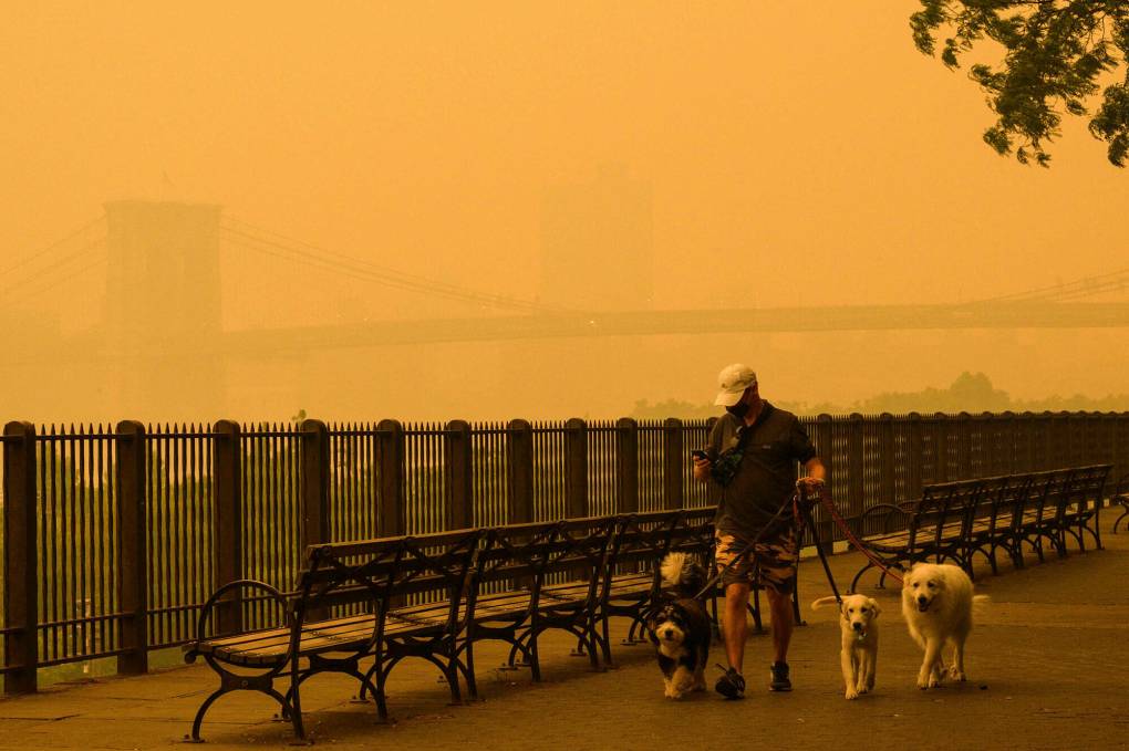
"caption": "Wildfire smoke filling a skyline, here in New York City, was a familiar sight to communities in the Western US, who have had to learn to live with the effects of more extreme fires.",
"description": null,
"title": "Wildfire smoke filling the New York City skyline was a familiar sight to communities in the Western U.S., who have had to learn to live with the effects of more extreme fires.",
"credit": "Angela Weiss/AFP via Getty Images",
"status": "inherit",
"altTag": "A person walks dogs as smoke from wildfires in Canada cause hazy conditions in New York City on June 7, 2023. An orange-tinged smog caused by Canada's wildfires shrouded New York on Wednesday, obscuring its famous skyscrapers and causing residents to don face masks, as cities along the US East Coast issued air quality alerts.",
"isLoading": false,
"fetchFailed": false
},
"science_1982914": {
"type": "attachments",
"id": "science_1982914",
"meta": {
"index": "attachments_1716263798",
"site": "science",
"id": "1982914",
"found": true
},
"parent": 0,
"imgSizes": {
"twentyfourteen-full-width": {
"file": "https://ww2.kqed.org/app/uploads/sites/35/2023/06/RS65981_002_KQED_SanLeandroSeaLevelRise_06012023-KQED-1038x576.jpg",
"width": 1038,
"mimeType": "image/jpeg",
"height": 576
},
"thumbnail": {
"file": "https://ww2.kqed.org/app/uploads/sites/35/2023/06/RS65981_002_KQED_SanLeandroSeaLevelRise_06012023-KQED-160x107.jpg",
"width": 160,
"mimeType": "image/jpeg",
"height": 107
},
"post-thumbnail": {
"file": "https://ww2.kqed.org/app/uploads/sites/35/2023/06/RS65981_002_KQED_SanLeandroSeaLevelRise_06012023-KQED-672x372.jpg",
"width": 672,
"mimeType": "image/jpeg",
"height": 372
},
"kqedFullSize": {
"file": "https://ww2.kqed.org/app/uploads/sites/35/2023/06/RS65981_002_KQED_SanLeandroSeaLevelRise_06012023-KQED.jpg",
"width": 1920,
"height": 1280
},
"large": {
"file": "https://ww2.kqed.org/app/uploads/sites/35/2023/06/RS65981_002_KQED_SanLeandroSeaLevelRise_06012023-KQED-1020x680.jpg",
"width": 1020,
"mimeType": "image/jpeg",
"height": 680
},
"1536x1536": {
"file": "https://ww2.kqed.org/app/uploads/sites/35/2023/06/RS65981_002_KQED_SanLeandroSeaLevelRise_06012023-KQED-1536x1024.jpg",
"width": 1536,
"mimeType": "image/jpeg",
"height": 1024
},
"medium": {
"file": "https://ww2.kqed.org/app/uploads/sites/35/2023/06/RS65981_002_KQED_SanLeandroSeaLevelRise_06012023-KQED-800x533.jpg",
"width": 800,
"mimeType": "image/jpeg",
"height": 533
},
"medium_large": {
"file": "https://ww2.kqed.org/app/uploads/sites/35/2023/06/RS65981_002_KQED_SanLeandroSeaLevelRise_06012023-KQED-768x512.jpg",
"width": 768,
"mimeType": "image/jpeg",
"height": 512
}
},
"publishDate": 1685737126,
"modified": 1685752324,
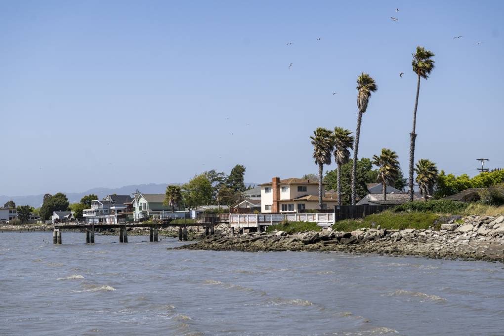
"caption": "Houses line the shore in the Mulford Gardens neighborhood of San Leandro, on June 1, 2023.",
"description": null,
"title": "RS65981_002_KQED_SanLeandroSeaLevelRise_06012023-KQED",
"credit": "Beth LaBerge/KQED",
"status": "inherit",
"altTag": "Houses on the shore of a brown watered bay with palm trees.",
"isLoading": false,
"fetchFailed": false
},
"science_1982893": {
"type": "attachments",
"id": "science_1982893",
"meta": {
"index": "attachments_1716263798",
"site": "science",
"id": "1982893",
"found": true
},
"parent": 1982887,
"imgSizes": {
"thumbnail": {
"file": "https://ww2.kqed.org/app/uploads/sites/35/2023/05/0river5-160x90.gif",
"width": 160,
"mimeType": "image/gif",
"height": 90
},
"post-thumbnail": {
"file": "https://ww2.kqed.org/app/uploads/sites/35/2023/05/0river5-672x372.gif",
"width": 672,
"mimeType": "image/gif",
"height": 372
},
"kqedFullSize": {
"file": "https://ww2.kqed.org/app/uploads/sites/35/2023/05/0river5.gif",
"width": 1000,
"height": 563
},
"medium": {
"file": "https://ww2.kqed.org/app/uploads/sites/35/2023/05/0river5-800x450.gif",
"width": 800,
"mimeType": "image/gif",
"height": 450
},
"medium_large": {
"file": "https://ww2.kqed.org/app/uploads/sites/35/2023/05/0river5-768x432.gif",
"width": 768,
"mimeType": "image/gif",
"height": 432
}
},
"publishDate": 1685728882,
"modified": 1685751796,
"caption": null,
"description": null,
"title": null,
"credit": "River Partners",
"status": "inherit",
"altTag": null,
"isLoading": false,
"fetchFailed": false
},
"science_1982898": {
"type": "attachments",
"id": "science_1982898",
"meta": {
"index": "attachments_1716263798",
"site": "science",
"id": "1982898",
"found": true
},
"parent": 1982887,
"imgSizes": {
"thumbnail": {
"file": "https://ww2.kqed.org/app/uploads/sites/35/2023/06/0river4-160x90.gif",
"width": 160,
"mimeType": "image/gif",
"height": 90
},
"post-thumbnail": {
"file": "https://ww2.kqed.org/app/uploads/sites/35/2023/06/0river4-672x372.gif",
"width": 672,
"mimeType": "image/gif",
"height": 372
},
"kqedFullSize": {
"file": "https://ww2.kqed.org/app/uploads/sites/35/2023/06/0river4.gif",
"width": 1000,
"height": 563
},
"medium": {
"file": "https://ww2.kqed.org/app/uploads/sites/35/2023/06/0river4-800x450.gif",
"width": 800,
"mimeType": "image/gif",
"height": 450
},
"medium_large": {
"file": "https://ww2.kqed.org/app/uploads/sites/35/2023/06/0river4-768x432.gif",
"width": 768,
"mimeType": "image/gif",
"height": 432
}
},
"publishDate": 1685729534,
"modified": 1685751785,
"caption": null,
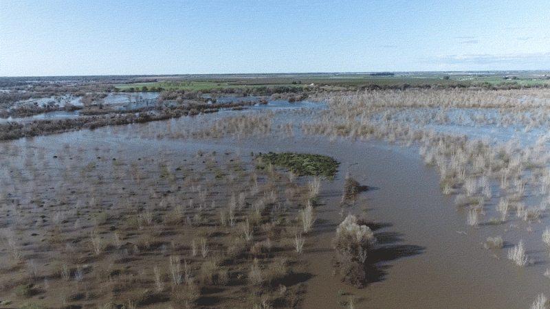
"description": "California is still at risk of flooding. Maybe rivers just need some space",
"title": null,
"credit": "River Partners",
"status": "inherit",
"altTag": null,
"isLoading": false,
"fetchFailed": false
},
"science_1982921": {
"type": "attachments",
"id": "science_1982921",
"meta": {
"index": "attachments_1716263798",
"site": "science",
"id": "1982921",
"found": true
},
"parent": 1982887,
"imgSizes": {
"thumbnail": {
"file": "https://ww2.kqed.org/app/uploads/sites/35/2023/06/0river4-2-160x90.gif",
"width": 160,
"mimeType": "image/gif",
"height": 90
},
"post-thumbnail": {
"file": "https://ww2.kqed.org/app/uploads/sites/35/2023/06/0river4-2-672x372.gif",
"width": 672,
"mimeType": "image/gif",
"height": 372
},
"kqedFullSize": {
"file": "https://ww2.kqed.org/app/uploads/sites/35/2023/06/0river4-2.gif",
"width": 1000,
"height": 563
},
"medium": {
"file": "https://ww2.kqed.org/app/uploads/sites/35/2023/06/0river4-2-800x450.gif",
"width": 800,
"mimeType": "image/gif",
"height": 450
},
"medium_large": {
"file": "https://ww2.kqed.org/app/uploads/sites/35/2023/06/0river4-2-768x432.gif",
"width": 768,
"mimeType": "image/gif",
"height": 432
}
},
"publishDate": 1685741989,
"modified": 1685751776,
"caption": null,
"description": null,
"title": "0river4 (2)",
"credit": "River Partners",
"status": "inherit",
"altTag": null,
"isLoading": false,
"fetchFailed": false
},
"science_1982798": {
"type": "attachments",
"id": "science_1982798",
"meta": {
"index": "attachments_1716263798",
"site": "science",
"id": "1982798",
"found": true
},
"parent": 1982793,
"imgSizes": {
"twentyfourteen-full-width": {
"file": "https://ww2.kqed.org/app/uploads/sites/35/2023/05/GettyImages-157192104-1038x576.jpg",
"width": 1038,
"mimeType": "image/jpeg",
"height": 576
},
"thumbnail": {
"file": "https://ww2.kqed.org/app/uploads/sites/35/2023/05/GettyImages-157192104-160x107.jpg",
"width": 160,
"mimeType": "image/jpeg",
"height": 107
},
"post-thumbnail": {
"file": "https://ww2.kqed.org/app/uploads/sites/35/2023/05/GettyImages-157192104-672x372.jpg",
"width": 672,
"mimeType": "image/jpeg",
"height": 372
},
"kqedFullSize": {
"file": "https://ww2.kqed.org/app/uploads/sites/35/2023/05/GettyImages-157192104-scaled.jpg",
"width": 2560,
"height": 1714
},
"2048x2048": {
"file": "https://ww2.kqed.org/app/uploads/sites/35/2023/05/GettyImages-157192104-2048x1371.jpg",
"width": 2048,
"mimeType": "image/jpeg",
"height": 1371
},
"large": {
"file": "https://ww2.kqed.org/app/uploads/sites/35/2023/05/GettyImages-157192104-1020x683.jpg",
"width": 1020,
"mimeType": "image/jpeg",
"height": 683
},
"1536x1536": {
"file": "https://ww2.kqed.org/app/uploads/sites/35/2023/05/GettyImages-157192104-1536x1028.jpg",
"width": 1536,
"mimeType": "image/jpeg",
"height": 1028
},
"full-width": {
"file": "https://ww2.kqed.org/app/uploads/sites/35/2023/05/GettyImages-157192104-1920x1285.jpg",
"width": 1920,
"mimeType": "image/jpeg",
"height": 1285
},
"medium": {
"file": "https://ww2.kqed.org/app/uploads/sites/35/2023/05/GettyImages-157192104-800x536.jpg",
"width": 800,
"mimeType": "image/jpeg",
"height": 536
},
"medium_large": {
"file": "https://ww2.kqed.org/app/uploads/sites/35/2023/05/GettyImages-157192104-768x514.jpg",
"width": 768,
"mimeType": "image/jpeg",
"height": 514
}
},
"publishDate": 1685030785,
"modified": 1685030826,
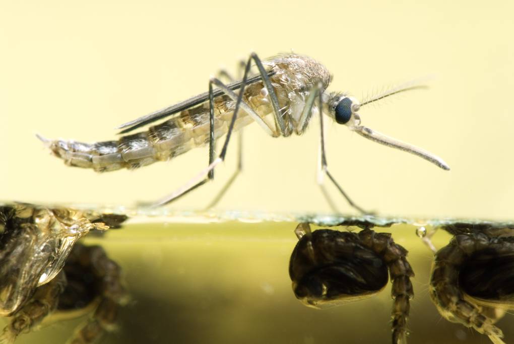
"caption": "An Aedes japonicus mosquito rests on the water surface from which it just emerged.",
"description": "An Aedes japonicus mosquito rests on the water surface from which it just emerged.",
"title": "Mosquito Resting On Water",
"credit": "doug4537/Getty Images",
"status": "inherit",
"altTag": "Black and white spotted mosquito on the surface of liquid.",
"isLoading": false,
"fetchFailed": false
},
"science_1932772": {
"type": "attachments",
"id": "science_1932772",
"meta": {
"index": "attachments_1716263798",
"site": "science",
"id": "1932772",
"found": true
},
"parent": 1932760,
"imgSizes": {
"small": {
"file": "https://ww2.kqed.org/app/uploads/sites/35/2018/10/GettyImages-504730186-520x374.jpg",
"width": 520,
"mimeType": "image/jpeg",
"height": 374
},
"twentyfourteen-full-width": {
"file": "https://ww2.kqed.org/app/uploads/sites/35/2018/10/GettyImages-504730186-1038x576.jpg",
"width": 1038,
"mimeType": "image/jpeg",
"height": 576
},
"thumbnail": {
"file": "https://ww2.kqed.org/app/uploads/sites/35/2018/10/GettyImages-504730186-160x115.jpg",
"width": 160,
"mimeType": "image/jpeg",
"height": 115
},
"fd-sm": {
"file": "https://ww2.kqed.org/app/uploads/sites/35/2018/10/GettyImages-504730186-960x691.jpg",
"width": 960,
"mimeType": "image/jpeg",
"height": 691
},
"post-thumbnail": {
"file": "https://ww2.kqed.org/app/uploads/sites/35/2018/10/GettyImages-504730186-672x372.jpg",
"width": 672,
"mimeType": "image/jpeg",
"height": 372
},
"xsmall": {
"file": "https://ww2.kqed.org/app/uploads/sites/35/2018/10/GettyImages-504730186-375x270.jpg",
"width": 375,
"mimeType": "image/jpeg",
"height": 270
},
"kqedFullSize": {
"file": "https://ww2.kqed.org/app/uploads/sites/35/2018/10/GettyImages-504730186.jpg",
"width": 3623,
"height": 2606
},
"large": {
"file": "https://ww2.kqed.org/app/uploads/sites/35/2018/10/GettyImages-504730186-1020x734.jpg",
"width": 1020,
"mimeType": "image/jpeg",
"height": 734
},
"xlarge": {
"file": "https://ww2.kqed.org/app/uploads/sites/35/2018/10/GettyImages-504730186-1180x849.jpg",
"width": 1180,
"mimeType": "image/jpeg",
"height": 849
},
"complete_open_graph": {
"file": "https://ww2.kqed.org/app/uploads/sites/35/2018/10/GettyImages-504730186-1200x863.jpg",
"width": 1200,
"mimeType": "image/jpeg",
"height": 863
},
"guest-author-50": {
"file": "https://ww2.kqed.org/app/uploads/sites/35/2018/10/GettyImages-504730186-50x50.jpg",
"width": 50,
"mimeType": "image/jpeg",
"height": 50
},
"guest-author-96": {
"file": "https://ww2.kqed.org/app/uploads/sites/35/2018/10/GettyImages-504730186-96x96.jpg",
"width": 96,
"mimeType": "image/jpeg",
"height": 96
},
"medium": {
"file": "https://ww2.kqed.org/app/uploads/sites/35/2018/10/GettyImages-504730186-800x575.jpg",
"width": 800,
"mimeType": "image/jpeg",
"height": 575
},
"guest-author-64": {
"file": "https://ww2.kqed.org/app/uploads/sites/35/2018/10/GettyImages-504730186-64x64.jpg",
"width": 64,
"mimeType": "image/jpeg",
"height": 64
},
"guest-author-32": {
"file": "https://ww2.kqed.org/app/uploads/sites/35/2018/10/GettyImages-504730186-32x32.jpg",
"width": 32,
"mimeType": "image/jpeg",
"height": 32
},
"fd-lrg": {
"file": "https://ww2.kqed.org/app/uploads/sites/35/2018/10/GettyImages-504730186-1920x1381.jpg",
"width": 1920,
"mimeType": "image/jpeg",
"height": 1381
},
"fd-med": {
"file": "https://ww2.kqed.org/app/uploads/sites/35/2018/10/GettyImages-504730186-1180x849.jpg",
"width": 1180,
"mimeType": "image/jpeg",
"height": 849
},
"full-width": {
"file": "https://ww2.kqed.org/app/uploads/sites/35/2018/10/GettyImages-504730186-1920x1381.jpg",
"width": 1920,
"mimeType": "image/jpeg",
"height": 1381
},
"detail": {
"file": "https://ww2.kqed.org/app/uploads/sites/35/2018/10/GettyImages-504730186-150x150.jpg",
"width": 150,
"mimeType": "image/jpeg",
"height": 150
},
"medium_large": {
"file": "https://ww2.kqed.org/app/uploads/sites/35/2018/10/GettyImages-504730186-768x552.jpg",
"width": 768,
"mimeType": "image/jpeg",
"height": 552
},
"guest-author-128": {
"file": "https://ww2.kqed.org/app/uploads/sites/35/2018/10/GettyImages-504730186-128x128.jpg",
"width": 128,
"mimeType": "image/jpeg",
"height": 128
},
"xxsmall": {
"file": "https://ww2.kqed.org/app/uploads/sites/35/2018/10/GettyImages-504730186-240x173.jpg",
"width": 240,
"mimeType": "image/jpeg",
"height": 173
}
},
"publishDate": 1539579385,
"modified": 1685073241,
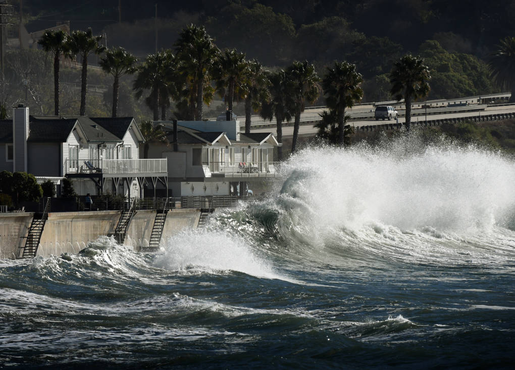
"caption": "El Niño-generated storm waves crash onto seaside houses at Mondos Beach on Jan. 12, 2016.",
"description": null,
"title": "US-ENVIRONMENT-EL NINO-SURF",
"credit": "Mark Ralston/AFP/Getty Images",
"status": "inherit",
"altTag": "A large wave crashes onto seaside houses.",
"isLoading": false,
"fetchFailed": false
},
"science_1982816": {
"type": "attachments",
"id": "science_1982816",
"meta": {
"index": "attachments_1716263798",
"site": "science",
"id": "1982816",
"found": true
},
"parent": 1984830,
"imgSizes": {
"thumbnail": {
"file": "https://ww2.kqed.org/app/uploads/sites/35/2023/05/GettyImages-1315066305-1020x573-1-160x90.jpg",
"width": 160,
"mimeType": "image/jpeg",
"height": 90
},
"post-thumbnail": {
"file": "https://ww2.kqed.org/app/uploads/sites/35/2023/05/GettyImages-1315066305-1020x573-1-672x372.jpg",
"width": 672,
"mimeType": "image/jpeg",
"height": 372
},
"kqedFullSize": {
"file": "https://ww2.kqed.org/app/uploads/sites/35/2023/05/GettyImages-1315066305-1020x573-1.jpg",
"width": 1020,
"height": 573
},
"medium": {
"file": "https://ww2.kqed.org/app/uploads/sites/35/2023/05/GettyImages-1315066305-1020x573-1-800x449.jpg",
"width": 800,
"mimeType": "image/jpeg",
"height": 449
},
"medium_large": {
"file": "https://ww2.kqed.org/app/uploads/sites/35/2023/05/GettyImages-1315066305-1020x573-1-768x431.jpg",
"width": 768,
"mimeType": "image/jpeg",
"height": 431
}
},
"publishDate": 1685041157,
"modified": 1697650740,
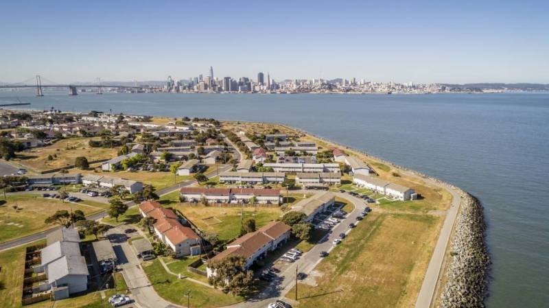
"caption": "Sea levels along coastlines in the US will rise up to 1 foot by the year 2050, according to the National Oceanic and Atmospheric Administration (NOAA).",
"description": null,
"title": "GettyImages-1315066305-1020x573",
"credit": "Jason Doiy/Getty Images",
"status": "inherit",
"altTag": "A shot of the coastline in California with houses and the bay.",
"isLoading": false,
"fetchFailed": false
},
"science_1982777": {
"type": "attachments",
"id": "science_1982777",
"meta": {
"index": "attachments_1716263798",
"site": "science",
"id": "1982777",
"found": true
},
"parent": 1982776,
"imgSizes": {
"twentyfourteen-full-width": {
"file": "https://ww2.kqed.org/app/uploads/sites/35/2023/05/20230411-_dsc9508_slide-fae9363c697df9878756c47ad20602584193d035-1038x576.jpg",
"width": 1038,
"mimeType": "image/jpeg",
"height": 576
},
"thumbnail": {
"file": "https://ww2.kqed.org/app/uploads/sites/35/2023/05/20230411-_dsc9508_slide-fae9363c697df9878756c47ad20602584193d035-160x107.jpg",
"width": 160,
"mimeType": "image/jpeg",
"height": 107
},
"post-thumbnail": {
"file": "https://ww2.kqed.org/app/uploads/sites/35/2023/05/20230411-_dsc9508_slide-fae9363c697df9878756c47ad20602584193d035-672x372.jpg",
"width": 672,
"mimeType": "image/jpeg",
"height": 372
},
"kqedFullSize": {
"file": "https://ww2.kqed.org/app/uploads/sites/35/2023/05/20230411-_dsc9508_slide-fae9363c697df9878756c47ad20602584193d035-scaled.jpg",
"width": 2560,
"height": 1707
},
"2048x2048": {
"file": "https://ww2.kqed.org/app/uploads/sites/35/2023/05/20230411-_dsc9508_slide-fae9363c697df9878756c47ad20602584193d035-2048x1366.jpg",
"width": 2048,
"mimeType": "image/jpeg",
"height": 1366
},
"large": {
"file": "https://ww2.kqed.org/app/uploads/sites/35/2023/05/20230411-_dsc9508_slide-fae9363c697df9878756c47ad20602584193d035-1020x680.jpg",
"width": 1020,
"mimeType": "image/jpeg",
"height": 680
},
"1536x1536": {
"file": "https://ww2.kqed.org/app/uploads/sites/35/2023/05/20230411-_dsc9508_slide-fae9363c697df9878756c47ad20602584193d035-1536x1024.jpg",
"width": 1536,
"mimeType": "image/jpeg",
"height": 1024
},
"full-width": {
"file": "https://ww2.kqed.org/app/uploads/sites/35/2023/05/20230411-_dsc9508_slide-fae9363c697df9878756c47ad20602584193d035-1920x1280.jpg",
"width": 1920,
"mimeType": "image/jpeg",
"height": 1280
},
"medium": {
"file": "https://ww2.kqed.org/app/uploads/sites/35/2023/05/20230411-_dsc9508_slide-fae9363c697df9878756c47ad20602584193d035-800x533.jpg",
"width": 800,
"mimeType": "image/jpeg",
"height": 533
},
"medium_large": {
"file": "https://ww2.kqed.org/app/uploads/sites/35/2023/05/20230411-_dsc9508_slide-fae9363c697df9878756c47ad20602584193d035-768x512.jpg",
"width": 768,
"mimeType": "image/jpeg",
"height": 512
}
},
"publishDate": 1684945791,
"modified": 1684958540,
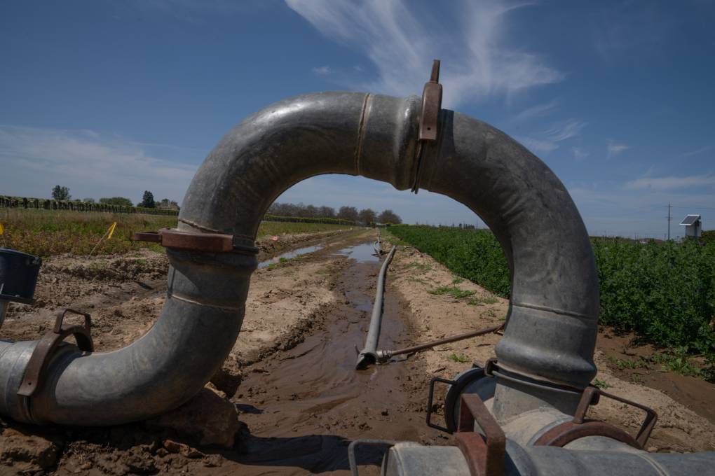
"caption": "Pipes direct water into an irrigation project held by the University of California. After a few decades of not enough water California water officials are scrambling to catch as much of this year's floodwaters as they can.",
"description": "Pipes direct water into an irrigation project held by the University of California. After a few decades of not enough water, California water officials are scrambling to catch as much of this year's floodwaters as they can.",
"title": "Pipes direct water into an irrigation project held by the University of California. After a few decades of not enough water California water officials are scrambling to catch as much of this year's floodwaters as they can.",
"credit": "Claire Harbage/NPR",
"status": "inherit",
"altTag": "A big pipe is seen on a vineyard.",
"isLoading": false,
"fetchFailed": false
},
"science_1982755": {
"type": "attachments",
"id": "science_1982755",
"meta": {
"index": "attachments_1716263798",
"site": "science",
"id": "1982755",
"found": true
},
"parent": 0,
"imgSizes": {
"twentyfourteen-full-width": {
"file": "https://ww2.kqed.org/app/uploads/sites/35/2023/05/004_KQED_OBVelellaVelella_05182023-1038x576.jpg",
"width": 1038,
"mimeType": "image/jpeg",
"height": 576
},
"thumbnail": {
"file": "https://ww2.kqed.org/app/uploads/sites/35/2023/05/004_KQED_OBVelellaVelella_05182023-160x107.jpg",
"width": 160,
"mimeType": "image/jpeg",
"height": 107
},
"post-thumbnail": {
"file": "https://ww2.kqed.org/app/uploads/sites/35/2023/05/004_KQED_OBVelellaVelella_05182023-672x372.jpg",
"width": 672,
"mimeType": "image/jpeg",
"height": 372
},
"kqedFullSize": {
"file": "https://ww2.kqed.org/app/uploads/sites/35/2023/05/004_KQED_OBVelellaVelella_05182023.jpg",
"width": 1920,
"height": 1280
},
"large": {
"file": "https://ww2.kqed.org/app/uploads/sites/35/2023/05/004_KQED_OBVelellaVelella_05182023-1020x680.jpg",
"width": 1020,
"mimeType": "image/jpeg",
"height": 680
},
"1536x1536": {
"file": "https://ww2.kqed.org/app/uploads/sites/35/2023/05/004_KQED_OBVelellaVelella_05182023-1536x1024.jpg",
"width": 1536,
"mimeType": "image/jpeg",
"height": 1024
},
"medium": {
"file": "https://ww2.kqed.org/app/uploads/sites/35/2023/05/004_KQED_OBVelellaVelella_05182023-800x533.jpg",
"width": 800,
"mimeType": "image/jpeg",
"height": 533
},
"medium_large": {
"file": "https://ww2.kqed.org/app/uploads/sites/35/2023/05/004_KQED_OBVelellaVelella_05182023-768x512.jpg",
"width": 768,
"mimeType": "image/jpeg",
"height": 512
}
},
"publishDate": 1684525158,
"modified": 1684526011,
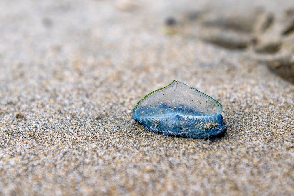
"caption": "Blue, translucent Velella velella washed ashore on Ocean Beach in San Francisco on May 18, 2023.",
"description": null,
"title": "004_KQED_OBVelellaVelella_05182023",
"credit": "Beth LaBerge/KQED",
"status": "inherit",
"altTag": "A closeup shot of the beach sand with a blue, translucent organism that kind of looks similar to a jellyfish resting ashore.",
"isLoading": false,
"fetchFailed": false
},
"science_1982715": {
"type": "attachments",
"id": "science_1982715",
"meta": {
"index": "attachments_1716263798",
"site": "science",
"id": "1982715",
"found": true
},
"parent": 1982711,
"imgSizes": {
"twentyfourteen-full-width": {
"file": "https://ww2.kqed.org/app/uploads/sites/35/2023/05/puffins_jeff-j-mitchell-getty-2048x1364-1-1038x576.jpg",
"width": 1038,
"mimeType": "image/jpeg",
"height": 576
},
"thumbnail": {
"file": "https://ww2.kqed.org/app/uploads/sites/35/2023/05/puffins_jeff-j-mitchell-getty-2048x1364-1-160x107.jpg",
"width": 160,
"mimeType": "image/jpeg",
"height": 107
},
"post-thumbnail": {
"file": "https://ww2.kqed.org/app/uploads/sites/35/2023/05/puffins_jeff-j-mitchell-getty-2048x1364-1-672x372.jpg",
"width": 672,
"mimeType": "image/jpeg",
"height": 372
},
"kqedFullSize": {
"file": "https://ww2.kqed.org/app/uploads/sites/35/2023/05/puffins_jeff-j-mitchell-getty-2048x1364-1.jpg",
"width": 2048,
"height": 1364
},
"large": {
"file": "https://ww2.kqed.org/app/uploads/sites/35/2023/05/puffins_jeff-j-mitchell-getty-2048x1364-1-1020x679.jpg",
"width": 1020,
"mimeType": "image/jpeg",
"height": 679
},
"1536x1536": {
"file": "https://ww2.kqed.org/app/uploads/sites/35/2023/05/puffins_jeff-j-mitchell-getty-2048x1364-1-1536x1023.jpg",
"width": 1536,
"mimeType": "image/jpeg",
"height": 1023
},
"full-width": {
"file": "https://ww2.kqed.org/app/uploads/sites/35/2023/05/puffins_jeff-j-mitchell-getty-2048x1364-1-1920x1279.jpg",
"width": 1920,
"mimeType": "image/jpeg",
"height": 1279
},
"medium": {
"file": "https://ww2.kqed.org/app/uploads/sites/35/2023/05/puffins_jeff-j-mitchell-getty-2048x1364-1-800x533.jpg",
"width": 800,
"mimeType": "image/jpeg",
"height": 533
},
"medium_large": {
"file": "https://ww2.kqed.org/app/uploads/sites/35/2023/05/puffins_jeff-j-mitchell-getty-2048x1364-1-768x512.jpg",
"width": 768,
"mimeType": "image/jpeg",
"height": 512
}
},
"publishDate": 1684270526,
"modified": 1684954056,
"caption": "Puffins return to their summer breeding grounds on the Farne Islands on May 16, 2013, in Farne, England.",
"description": null,
"title": "Farne Island Rangers Carry Out 'Puffin Census'",
"credit": "Jeff J Mitchell/Getty Images",
"status": "inherit",
"altTag": "Puffins fly out into the sky. Views of the ocean in the background.",
"isLoading": false,
"fetchFailed": false
},
"science_1982675": {
"type": "attachments",
"id": "science_1982675",
"meta": {
"index": "attachments_1716263798",
"site": "science",
"id": "1982675",
"found": true
},
"parent": 1982673,
"imgSizes": {
"twentyfourteen-full-width": {
"file": "https://ww2.kqed.org/app/uploads/sites/35/2023/05/05042023-Experimental-Farms-RL-02-CM-1038x576.jpg",
"width": 1038,
"mimeType": "image/jpeg",
"height": 576
},
"thumbnail": {
"file": "https://ww2.kqed.org/app/uploads/sites/35/2023/05/05042023-Experimental-Farms-RL-02-CM-160x107.jpg",
"width": 160,
"mimeType": "image/jpeg",
"height": 107
},
"post-thumbnail": {
"file": "https://ww2.kqed.org/app/uploads/sites/35/2023/05/05042023-Experimental-Farms-RL-02-CM-672x372.jpg",
"width": 672,
"mimeType": "image/jpeg",
"height": 372
},
"kqedFullSize": {
"file": "https://ww2.kqed.org/app/uploads/sites/35/2023/05/05042023-Experimental-Farms-RL-02-CM.jpg",
"width": 1200,
"height": 800
},
"large": {
"file": "https://ww2.kqed.org/app/uploads/sites/35/2023/05/05042023-Experimental-Farms-RL-02-CM-1020x680.jpg",
"width": 1020,
"mimeType": "image/jpeg",
"height": 680
},
"medium": {
"file": "https://ww2.kqed.org/app/uploads/sites/35/2023/05/05042023-Experimental-Farms-RL-02-CM-800x533.jpg",
"width": 800,
"mimeType": "image/jpeg",
"height": 533
},
"medium_large": {
"file": "https://ww2.kqed.org/app/uploads/sites/35/2023/05/05042023-Experimental-Farms-RL-02-CM-768x512.jpg",
"width": 768,
"mimeType": "image/jpeg",
"height": 512
}
},
"publishDate": 1683664337,
"modified": 1683755996,
"caption": "Gary Gragg examines buds on one of the mango plants he's growing in the Sacramento Valley.",
"description": null,
"title": "Mango plant",
"credit": "Rahul Lal/CalMatters",
"status": "inherit",
"altTag": "An image of a man examining buds on a mango plant.",
"isLoading": false,
"fetchFailed": false
},
"science_1982525": {
"type": "attachments",
"id": "science_1982525",
"meta": {
"index": "attachments_1716263798",
"site": "science",
"id": "1982525",
"found": true
},
"parent": 1982513,
"imgSizes": {
"twentyfourteen-full-width": {
"file": "https://ww2.kqed.org/app/uploads/sites/35/2023/04/GettyImages-1485830976-1024x576.jpg",
"width": 1024,
"mimeType": "image/jpeg",
"height": 576
},
"thumbnail": {
"file": "https://ww2.kqed.org/app/uploads/sites/35/2023/04/GettyImages-1485830976-160x106.jpg",
"width": 160,
"mimeType": "image/jpeg",
"height": 106
},
"post-thumbnail": {
"file": "https://ww2.kqed.org/app/uploads/sites/35/2023/04/GettyImages-1485830976-672x372.jpg",
"width": 672,
"mimeType": "image/jpeg",
"height": 372
},
"kqedFullSize": {
"file": "https://ww2.kqed.org/app/uploads/sites/35/2023/04/GettyImages-1485830976.jpg",
"width": 1024,
"height": 679
},
"large": {
"file": "https://ww2.kqed.org/app/uploads/sites/35/2023/04/GettyImages-1485830976-1020x676.jpg",
"width": 1020,
"mimeType": "image/jpeg",
"height": 676
},
"medium": {
"file": "https://ww2.kqed.org/app/uploads/sites/35/2023/04/GettyImages-1485830976-800x530.jpg",
"width": 800,
"mimeType": "image/jpeg",
"height": 530
},
"medium_large": {
"file": "https://ww2.kqed.org/app/uploads/sites/35/2023/04/GettyImages-1485830976-768x509.jpg",
"width": 768,
"mimeType": "image/jpeg",
"height": 509
}
},
"publishDate": 1682953549,
"modified": 1682966916,
"caption": "In an aerial view, earth movers work to raise the Corcoran levee in response to floodwaters along the reemerging Tulare Lake in the Central Valley, on April 27, 2023, near Corcoran.",
"description": null,
"title": "Massive Amounts Of Rain Combined With Winter's Record Breaking Snowpack Causes Historic Flood In California's Central Valley And Beyond",
"credit": "Mario Tama/Getty Image",
"status": "inherit",
"altTag": "Rows of green orchards on the left side of the photo. A long brown earthen levee cuts the photo in two. Trucks speed along the levee. To the right brown murky water fills the space.",
"isLoading": false,
"fetchFailed": false
},
"science_1982500": {
"type": "attachments",
"id": "science_1982500",
"meta": {
"index": "attachments_1716263798",
"site": "science",
"id": "1982500",
"found": true
},
"parent": 1982494,
"imgSizes": {
"twentyfourteen-full-width": {
"file": "https://ww2.kqed.org/app/uploads/sites/35/2023/04/RS50202_IMG_6476-2-qut-1038x576.jpg",
"width": 1038,
"mimeType": "image/jpeg",
"height": 576
},
"thumbnail": {
"file": "https://ww2.kqed.org/app/uploads/sites/35/2023/04/RS50202_IMG_6476-2-qut-160x107.jpg",
"width": 160,
"mimeType": "image/jpeg",
"height": 107
},
"post-thumbnail": {
"file": "https://ww2.kqed.org/app/uploads/sites/35/2023/04/RS50202_IMG_6476-2-qut-672x372.jpg",
"width": 672,
"mimeType": "image/jpeg",
"height": 372
},
"kqedFullSize": {
"file": "https://ww2.kqed.org/app/uploads/sites/35/2023/04/RS50202_IMG_6476-2-qut.jpg",
"width": 1920,
"height": 1280
},
"large": {
"file": "https://ww2.kqed.org/app/uploads/sites/35/2023/04/RS50202_IMG_6476-2-qut-1020x680.jpg",
"width": 1020,
"mimeType": "image/jpeg",
"height": 680
},
"1536x1536": {
"file": "https://ww2.kqed.org/app/uploads/sites/35/2023/04/RS50202_IMG_6476-2-qut-1536x1024.jpg",
"width": 1536,
"mimeType": "image/jpeg",
"height": 1024
},
"medium": {
"file": "https://ww2.kqed.org/app/uploads/sites/35/2023/04/RS50202_IMG_6476-2-qut-800x533.jpg",
"width": 800,
"mimeType": "image/jpeg",
"height": 533
},
"medium_large": {
"file": "https://ww2.kqed.org/app/uploads/sites/35/2023/04/RS50202_IMG_6476-2-qut-768x512.jpg",
"width": 768,
"mimeType": "image/jpeg",
"height": 512
}
},
"publishDate": 1682712903,
"modified": 1682712951,
"caption": "Traffic on Interstate 880 toward Oakland flowing with cars and diesel trucks midafternoon on Monday, June 28, 2021.",
"description": null,
"title": "RS50202_IMG_6476 (2)-qut",
"credit": "Joyce Tsai/KQED",
"status": "inherit",
"altTag": "Cars and trucks on an interstate highway as seen from an overpass.",
"isLoading": false,
"fetchFailed": false
}
},
"audioPlayerReducer": {
"postId": "stream_live",
"isPaused": true,
"isPlaying": false,
"pfsActive": false,
"pledgeModalIsOpen": true,
"playerDrawerIsOpen": false,
"liveAudioPlayStartedAt": 0,
"liveAudioPlayContext": ""
},
"authorsReducer": {
"byline_science_1983001": {
"type": "authors",
"id": "byline_science_1983001",
"meta": {
"override": true
},
"slug": "byline_science_1983001",
"name": "\u003ca href=\"https://www.npr.org/people/803934365/lauren-sommer\">Lauren Sommer\u003c/a>",
"isLoading": false
},
"byline_science_1982887": {
"type": "authors",
"id": "byline_science_1982887",
"meta": {
"override": true
},
"slug": "byline_science_1982887",
"name": "\u003ca href=\"https://www.npr.org/people/803934365/lauren-sommer\">Lauren Sommer\u003c/a>",
"isLoading": false
},
"byline_science_1982776": {
"type": "authors",
"id": "byline_science_1982776",
"meta": {
"override": true
},
"slug": "byline_science_1982776",
"name": "\u003ca href=\"https://www.npr.org/people/348779465/nathan-rott\">Nathan Rott\u003c/a>\u003cbr>\u003ca href=\"https://www.npr.org/people/643722609/claire-harbage\">Claire Harbage\u003c/a>",
"isLoading": false
},
"byline_science_1982711": {
"type": "authors",
"id": "byline_science_1982711",
"meta": {
"override": true
},
"slug": "byline_science_1982711",
"name": "\u003ca href=\"https://insideclimatenews.org/profile/bob-berwyn/\">Bob Berwyn\u003c/a>",
"isLoading": false
},
"byline_science_1982673": {
"type": "authors",
"id": "byline_science_1982673",
"meta": {
"override": true
},
"slug": "byline_science_1982673",
"name": "\u003ca href=\"https://calmatters.org/author/alastair-bland/\">Alastair Bland\u003c/a>",
"isLoading": false
},
"kevinstark": {
"type": "authors",
"id": "11608",
"meta": {
"index": "authors_1716337520",
"id": "11608",
"found": true
},
"name": "Kevin Stark",
"firstName": "Kevin",
"lastName": "Stark",
"slug": "kevinstark",
"email": "kstark@kqed.org",
"display_author_email": true,
"staff_mastheads": [
"science"
],
"title": "Senior Editor",
"bio": "Kevin is a senior editor for KQED Science, managing the station's health and climate desks. His journalism career began in the Pacific Northwest, and he later became a lead reporter for the San Francisco Public Press. His work has appeared in Pacific Standard magazine, the Energy News Network, the Center for Investigative Reporting's Reveal and WBEZ in Chicago. Kevin joined KQED in 2019, and has covered issues related to energy, wildfire, climate change and the environment.",
"avatar": "https://secure.gravatar.com/avatar/365aaa4b597d3a8374f67504ff0facd323d7906e8eb4be0a7efd2427408e802c?s=600&d=blank&r=g",
"twitter": "starkkev",
"bluesky": null,
"facebook": null,
"instagram": null,
"linkedin": null,
"sites": [
{
"site": "",
"roles": [
"editor"
]
},
{
"site": "news",
"roles": [
"editor"
]
},
{
"site": "science",
"roles": [
"administrator"
]
}
],
"headData": {
"title": "Kevin Stark | KQED",
"description": "Senior Editor",
"ogImgSrc": "https://secure.gravatar.com/avatar/365aaa4b597d3a8374f67504ff0facd323d7906e8eb4be0a7efd2427408e802c?s=600&d=blank&r=g",
"twImgSrc": "https://secure.gravatar.com/avatar/365aaa4b597d3a8374f67504ff0facd323d7906e8eb4be0a7efd2427408e802c?s=600&d=blank&r=g"
},
"isLoading": false,
"link": "/author/kevinstark"
},
"smohamad": {
"type": "authors",
"id": "11631",
"meta": {
"index": "authors_1716337520",
"id": "11631",
"found": true
},
"name": "Sarah Mohamad",
"firstName": "Sarah",
"lastName": "Mohamad",
"slug": "smohamad",
"email": "smohamad@KQED.org",
"display_author_email": true,
"staff_mastheads": [],
"title": "Engagement Producer and Reporter, KQED Science",
"bio": "Sarah Mohamad is an audience engagement reporter and producer for KQED Science. She reports on audience-focused science and environment stories and manages the team's social media, newsletter, and engagement efforts. Prior to this role, she played a key role as project manager for NSF's \u003ca href=\"https://www.kqed.org/crackingthecode\">\u003cem>Cracking the Code: Influencing Millennial Science Engagement\u003c/em> \u003c/a>audience research.",
"avatar": "https://secure.gravatar.com/avatar/e6224957cd82d015183756ddde1f928013a563d7ca2e4565f8c4de1ec64886c5?s=600&d=blank&r=g",
"twitter": "sarahkmohamad",
"bluesky": null,
"facebook": null,
"instagram": null,
"linkedin": null,
"sites": [
{
"site": "",
"roles": [
"editor"
]
},
{
"site": "arts",
"roles": [
"editor"
]
},
{
"site": "news",
"roles": [
"editor"
]
},
{
"site": "about",
"roles": [
"editor"
]
},
{
"site": "science",
"roles": [
"editor"
]
}
],
"headData": {
"title": "Sarah Mohamad | KQED",
"description": "Engagement Producer and Reporter, KQED Science",
"ogImgSrc": "https://secure.gravatar.com/avatar/e6224957cd82d015183756ddde1f928013a563d7ca2e4565f8c4de1ec64886c5?s=600&d=blank&r=g",
"twImgSrc": "https://secure.gravatar.com/avatar/e6224957cd82d015183756ddde1f928013a563d7ca2e4565f8c4de1ec64886c5?s=600&d=blank&r=g"
},
"isLoading": false,
"link": "/author/smohamad"
},
"eromero": {
"type": "authors",
"id": "11746",
"meta": {
"index": "authors_1716337520",
"id": "11746",
"found": true
},
"name": "Ezra David Romero",
"firstName": "Ezra David",
"lastName": "Romero",
"slug": "eromero",
"email": "eromero@kqed.org",
"display_author_email": true,
"staff_mastheads": [
"news",
"science"
],
"title": "Climate Reporter",
"bio": "Ezra David Romero is a climate reporter for KQED News. He covers the absence and excess of water in the Bay Area — think sea level rise, flooding and drought. For nearly a decade he’s covered how warming temperatures are altering the lives of Californians. He’s reported on farmers worried their pistachio trees aren’t getting enough sleep, families desperate for water, scientists studying dying giant sequoias, and alongside firefighters containing wildfires. His work has appeared on local stations across California and nationally on public radio shows like Morning Edition, Here and Now, All Things Considered and Science Friday. ",
"avatar": "https://secure.gravatar.com/avatar/c76404d287c10ed40224227551ac36e24352c7306f106632caf6fead76f8801f?s=600&d=blank&r=g",
"twitter": "ezraromero",
"bluesky": null,
"facebook": null,
"instagram": null,
"linkedin": null,
"sites": [
{
"site": "arts",
"roles": [
"editor"
]
},
{
"site": "news",
"roles": [
"editor"
]
},
{
"site": "science",
"roles": [
"editor"
]
},
{
"site": "liveblog",
"roles": [
"author"
]
}
],
"headData": {
"title": "Ezra David Romero | KQED",
"description": "Climate Reporter",
"ogImgSrc": "https://secure.gravatar.com/avatar/c76404d287c10ed40224227551ac36e24352c7306f106632caf6fead76f8801f?s=600&d=blank&r=g",
"twImgSrc": "https://secure.gravatar.com/avatar/c76404d287c10ed40224227551ac36e24352c7306f106632caf6fead76f8801f?s=600&d=blank&r=g"
},
"isLoading": false,
"link": "/author/eromero"
}
},
"pagesReducer": {
"science_category_climate": {
"type": "terms",
"id": "science_31",
"meta": {
"index": "terms_1716263798",
"site": "science",
"id": "31",
"score": 11.061988
},
"featImg": null,
"name": "Climate",
"description": null,
"taxonomy": "category",
"headData": {
"twImgId": null,
"twTitle": null,
"ogTitle": null,
"ogImgId": null,
"twDescription": null,
"description": null,
"title": "Climate Archives | KQED Science",
"ogDescription": null
},
"ttid": 33,
"slug": "climate",
"isLoading": false,
"title": "Climate",
"pageMeta": {
"site": "science",
"WpPageTemplate": "page-topic-editorial",
"currentPage": 27
},
"blocks": [
{
"blockName": "kqed/post-list",
"attrs": {
"layout": "cardArticle2",
"query": "posts/science?category=climate",
"seeMore": false,
"paginated": true,
"page": 27
}
},
{
"blockName": "kqed/ad"
}
]
}
},
"pfsSessionReducer": {},
"postsReducer": {
"stream_live": {
"type": "live",
"id": "stream_live",
"audioUrl": "https://streams.kqed.org/kqedradio",
"title": "Live Stream",
"excerpt": "Live Stream information currently unavailable.",
"link": "/radio",
"featImg": "",
"label": {
"name": "KQED Live",
"link": "/"
}
},
"stream_kqedNewscast": {
"type": "posts",
"id": "stream_kqedNewscast",
"audioUrl": "https://www.kqed.org/.stream/anon/radio/RDnews/newscast.mp3?_=1",
"title": "KQED Newscast",
"featImg": "",
"label": {
"name": "88.5 FM",
"link": "/"
}
},
"science_1983001": {
"type": "posts",
"id": "science_1983001",
"meta": {
"index": "posts_1716263798",
"site": "science",
"id": "1983001",
"score": null,
"sort": [
1686338437000
]
},
"parent": 0,
"labelTerm": {},
"blocks": [],
"publishDate": 1686338437,
"format": "standard",
"title": "3 Lessons From the Western US for Dealing With Wildfire Smoke",
"headTitle": "3 Lessons From the Western US for Dealing With Wildfire Smoke | KQED",
"content": "\u003cp>When New York City’s skyline turned an eerie orange color with smoke from widespread wildfires in Canada, it was an all-too-familiar sight for residents of the Western U.S. In recent years, \u003ca href=\"https://www.kqed.org/search?q=wildfires&site=all\">record-setting wildfires\u003c/a> have darkened the sky for weeks at a time with unhealthy air, upending life for Westerners.\u003c/p>\n\u003cp>Hazardous wildfire smoke is becoming an \u003ca href=\"https://www.kqed.org/news/11890211/dangerous%E2%80%91air%E2%80%91as%E2%80%91california%E2%80%91burns%E2%80%91america%E2%80%91breathes%E2%80%91toxic%E2%80%91smoke.\">increasing problem around the country\u003c/a>, as NPR’s California Newsroom has \u003ca href=\"https://www.kqed.org/news/11890211/dangerous%E2%80%91air%E2%80%91as%E2%80%91california%E2%80%91burns%E2%80%91america%E2%80%91breathes%E2%80%91toxic%E2%80%91smoke.\">reported\u003c/a>. The risk is only expected to rise, as a hotter climate helps create bigger and more severe fires that can take months to contain.\u003c/p>\n\u003cp>The tiny particles in smoke can go deep in the lungs, increasing the risk of asthma, heart attack and stroke. One scientific study found wildfire smoke is \u003ca href=\"https://www.npr.org/sections/health-shots/2021/03/05/973848360/study-finds-wildfire-smoke-more-harmful-to-humans-than-pollution-from-cars\">even more dangerous\u003c/a> than pollution from cars and trucks.\u003c/p>\n\u003cp>Across the West, schools districts, businesses and families have had to grapple with how to live with smoke. Here’s what they’ve learned.\u003c/p>\n\u003ch2>1. Everyone needs to protect themselves, even when they’re indoors\u003c/h2>\n\u003cp>When wildfires raged in California in the summer of 2020, the air was choked with smoke for weeks. Many residents tracked the air quality in real-time on \u003ca href=\"https://www2.purpleair.com/\">Purple Air\u003c/a>, a crowd-sourced network of sensors that shows pollution readings across a city.\u003c/p>\n\u003cp>[ad fullwidth]\u003c/p>\n\u003cp>On those same maps, pollution also spiked inside people’s homes.\u003c/p>\n\u003cp>Some households had installed sensors indoors to track air quality levels. Researchers at the University of California Berkeley studied the data from 1,400 sensors in San Francisco and Los Angeles and found that \u003ca href=\"https://www.npr.org/2021/09/07/1034895514/sheltering-inside-may-not-protect-you-from-the-dangers-of-wildfire-smoke\">even indoors, air pollution tripled during the fires\u003c/a>.\u003c/p>\n\u003cp>The lesson: just going inside isn’t enough. Invisible particles in smoke, known as particulate matter or PM 2.5, can seep in through doors and cracks in windows. In older homes and substandard housing, the infiltration can be even worse.\u003c/p>\n\u003cp>Still, researchers found the households that took action fared much better. Those that closed their windows, had air purifiers or ran central air conditioners had lower levels of indoor pollution.\u003c/p>\n\u003cp>The Covid-19 pandemic has made portable indoor air purifiers a much more common item, but when smoke fills the skies, it can be tough to find one in a store. So, plans to build more affordable DIY air purifiers have proliferated online where \u003ca href=\"https://aghealth.ucdavis.edu/news/corsi-rosenthal-box-diy-box-fan-air-filter-covid-19-and-wildfire-smoke\">all someone needs is a box fan, some air filters and duct tape\u003c/a>.\u003c/p>\n\u003ch2>2. Create a plan for what to do with kids\u003c/h2>\n\u003cp>A haze of gray smoke in the sky usually means one thing for families: a scramble for childcare.\u003c/p>\n\u003cp>\u003ca href=\"https://www.npr.org/live-updates/air-quality-wildfires-canada-smoke#new-york-city-schools-canceled-all-outdoor-activities-for-the-day\">Many schools close\u003c/a> when air quality reaches hazardous levels, but policies can be patchwork and haphazard. While an elementary school might close for the day, nearby preschools or aftercare programs might remain open.\u003c/p>\n\u003cp>For school administrators, the decision can be fraught. Many working parents have no other options for where to send their kids. And knowing when to keep kids indoors can be tough for families, based on the official \u003ca href=\"https://www.airnow.gov/aqi/aqi-basics/\">air quality index\u003c/a> or AQI. While children are considered a “sensitive” group, there’s not much guidance about whether a \u003ca href=\"https://www.airnow.gov/aqi/aqi-basics/\">yellow or orange air alert\u003c/a> is enough to keep kids under lockdown.\u003c/p>\n\u003cp>Children are \u003ca href=\"http://childrenscolorado.org/conditions-and-advice/parenting/parenting-articles/wildfire-smoke/\">particularly vulnerable to the effects of wildfire smoke\u003c/a>. They’re more active, have developing lungs and take in more air than adults do relative to their body size. The decision to close school is up to each local district, but just a few years ago, there weren’t many health resources to inform those decisions.\u003c/p>\n\u003cp>As wildfire smoke became more severe in California, state officials released an index with more specific \u003ca href=\"https://www.cde.ca.gov/ls/ep/documents/airqualityguidance.pdf\">advice for schools about activities (PDF)\u003c/a>, like what to do about P.E., recess and sports events. (In the state’s version, it doesn’t mention exact air quality index numbers, though many school districts have consulted local air quality officials and created guidelines, \u003ca href=\"https://www.shastacounty.gov/sites/default/files/fileattachments/air_quality/page/2400/aq-levels-guidelines.pdf\">like this version (PDF)\u003c/a> from Shasta County Office of Education.)\u003c/p>\n\u003cp>Creating smoke response plans ahead of time, with community input, is key for schools, according to Eric Wittmershaus, director of communications for the Sonoma County Office of Education. On the West Coast, “smoke days” are becoming the new “snow days.”\u003c/p>\n\u003cp>“One of the things we tell school officials to balance is whether the students will be safer and healthier if they’re in their school building, which may have a better HVAC system than what the students have at home,” Wittmershaus says. “It’s going to be a fact of life we struggle with.”\u003c/p>\n\u003ch2>3. The most vulnerable communities of people need direct help\u003c/h2>\n\u003cp>Some of those most susceptible to the health impacts of wildfire smoke are the least able to protect themselves. Recent episodes of smoke on the West Coast have revealed how some populations are falling through the cracks.\u003c/p>\n\u003cp>Many people don’t realize they need to protect themselves from smoke, unlike other extreme weather events. The elderly or those with health problems might struggle to get the tools and solutions to filter the air at home. Those who lack housing have no way to escape being exposed.\u003c/p>\n\u003cp>“We see individuals with access to fewer resources, who may live in substandard housing, who may desire to reduce their exposure but who are unable to do so,” says Gabrielle Wong-Parodi, assistant professor in the department of earth system science at Stanford University, who has studied how communities responded to smoke in California.\u003c/p>\n\u003cp>Overall, \u003ca href=\"https://earth.stanford.edu/news/how-do-people-respond-wildfire-smoke\">not many people are checking the air quality index\u003c/a> on a regular basis and changing their behavior, her research found. Instead, seeing how other people react to smoke is the bigger motivator.\u003c/p>\n\u003cp>\u003c/p>\n\u003cp>The lesson: make sure the message is coming from those in the local community, like community groups, senior centers or faith groups. Providing masks, air filters and resources to groups on the ground can help ensure it reaches those who need it most.\u003c/p>\n\u003cdiv class=\"fullattribution\">Copyright 2023 NPR. To see more, visit https://www.npr.org.\u003cimg decoding=\"async\" src=\"https://www.google-analytics.com/__utm.gif?utmac=UA-5828686-4&utmdt=3+lessons+from+the+Western+U.S.+for+dealing+with+wildfire+smoke+&utme=8(APIKey)9(MDAxOTAwOTE4MDEyMTkxMDAzNjczZDljZA004)\">\u003c/div>\n\n",
"stats": {
"hasVideo": false,
"hasChartOrMap": false,
"hasAudio": false,
"hasPolis": false,
"wordCount": 1008,
"hasGoogleForm": false,
"hasGallery": false,
"hasHearkenModule": false,
"iframeSrcs": [],
"paragraphCount": 24
},
"modified": 1704845987,
"excerpt": "How bad does the air get inside your house? What should schools do about recess? Western states have grappled with all that before.",
"headData": {
"twImgId": "",
"twTitle": "",
"ogTitle": "",
"ogImgId": "",
"twDescription": "",
"description": "How bad does the air get inside your house? What should schools do about recess? Western states have grappled with all that before.",
"title": "3 Lessons From the Western US for Dealing With Wildfire Smoke | KQED",
"ogDescription": "",
"schema": {
"@context": "https://schema.org",
"@type": "Article",
"headline": "3 Lessons From the Western US for Dealing With Wildfire Smoke",
"datePublished": "2023-06-09T12:20:37-07:00",
"dateModified": "2024-01-09T16:19:47-08:00",
"image": "https://cdn.kqed.org/wp-content/uploads/2020/02/KQED-OG-Image@1x.png"
}
},
"guestAuthors": [],
"slug": "3-lessons-from-the-western-u-s-for-dealing-with-wildfire-smoke",
"status": "publish",
"nprApiLink": "http://api.npr.org/query?id=1181179929&apiKey=MDAxOTAwOTE4MDEyMTkxMDAzNjczZDljZA004",
"nprStoryDate": "Fri, 09 Jun 2023 05:00:00 -0400",
"excludeFromSiteSearch": "Include",
"nprLastModifiedDate": "Fri, 09 Jun 2023 13:23:01 -0400",
"nprHtmlLink": "https://www.npr.org/2023/06/09/1181179929/wildfire-smoke-health-western-tips?ft=nprml&f=1181179929",
"nprImageAgency": "AFP via Getty Images",
"source": "NPR",
"nprStoryId": "1181179929",
"sourceUrl": "https://www.npr.org",
"nprByline": "\u003ca href=\"https://www.npr.org/people/803934365/lauren-sommer\">Lauren Sommer\u003c/a>",
"sticky": false,
"nprImageCredit": "Angela Weiss",
"showOnAuthorArchivePages": "No",
"articleAge": "0",
"nprRetrievedStory": "1",
"nprPubDate": "Fri, 09 Jun 2023 13:23:00 -0400",
"path": "/science/1983001/3-lessons-from-the-western-u-s-for-dealing-with-wildfire-smoke",
"audioTrackLength": null,
"parsedContent": [
{
"type": "contentString",
"content": "\u003cdiv class=\"post-body\">\u003cp>\u003cp>When New York City’s skyline turned an eerie orange color with smoke from widespread wildfires in Canada, it was an all-too-familiar sight for residents of the Western U.S. In recent years, \u003ca href=\"https://www.kqed.org/search?q=wildfires&site=all\">record-setting wildfires\u003c/a> have darkened the sky for weeks at a time with unhealthy air, upending life for Westerners.\u003c/p>\n\u003cp>Hazardous wildfire smoke is becoming an \u003ca href=\"https://www.kqed.org/news/11890211/dangerous%E2%80%91air%E2%80%91as%E2%80%91california%E2%80%91burns%E2%80%91america%E2%80%91breathes%E2%80%91toxic%E2%80%91smoke.\">increasing problem around the country\u003c/a>, as NPR’s California Newsroom has \u003ca href=\"https://www.kqed.org/news/11890211/dangerous%E2%80%91air%E2%80%91as%E2%80%91california%E2%80%91burns%E2%80%91america%E2%80%91breathes%E2%80%91toxic%E2%80%91smoke.\">reported\u003c/a>. The risk is only expected to rise, as a hotter climate helps create bigger and more severe fires that can take months to contain.\u003c/p>\n\u003cp>The tiny particles in smoke can go deep in the lungs, increasing the risk of asthma, heart attack and stroke. One scientific study found wildfire smoke is \u003ca href=\"https://www.npr.org/sections/health-shots/2021/03/05/973848360/study-finds-wildfire-smoke-more-harmful-to-humans-than-pollution-from-cars\">even more dangerous\u003c/a> than pollution from cars and trucks.\u003c/p>\n\u003cp>Across the West, schools districts, businesses and families have had to grapple with how to live with smoke. Here’s what they’ve learned.\u003c/p>\n\u003ch2>1. Everyone needs to protect themselves, even when they’re indoors\u003c/h2>\n\u003cp>When wildfires raged in California in the summer of 2020, the air was choked with smoke for weeks. Many residents tracked the air quality in real-time on \u003ca href=\"https://www2.purpleair.com/\">Purple Air\u003c/a>, a crowd-sourced network of sensors that shows pollution readings across a city.\u003c/p>\n\u003cp>\u003c/p>\u003c/div>",
"attributes": {
"named": {},
"numeric": []
}
},
{
"type": "component",
"content": "",
"name": "ad",
"attributes": {
"named": {
"label": "fullwidth"
},
"numeric": [
"fullwidth"
]
}
},
{
"type": "contentString",
"content": "\u003cdiv class=\"post-body\">\u003cp>\u003c/p>\n\u003cp>On those same maps, pollution also spiked inside people’s homes.\u003c/p>\n\u003cp>Some households had installed sensors indoors to track air quality levels. Researchers at the University of California Berkeley studied the data from 1,400 sensors in San Francisco and Los Angeles and found that \u003ca href=\"https://www.npr.org/2021/09/07/1034895514/sheltering-inside-may-not-protect-you-from-the-dangers-of-wildfire-smoke\">even indoors, air pollution tripled during the fires\u003c/a>.\u003c/p>\n\u003cp>The lesson: just going inside isn’t enough. Invisible particles in smoke, known as particulate matter or PM 2.5, can seep in through doors and cracks in windows. In older homes and substandard housing, the infiltration can be even worse.\u003c/p>\n\u003cp>Still, researchers found the households that took action fared much better. Those that closed their windows, had air purifiers or ran central air conditioners had lower levels of indoor pollution.\u003c/p>\n\u003cp>The Covid-19 pandemic has made portable indoor air purifiers a much more common item, but when smoke fills the skies, it can be tough to find one in a store. So, plans to build more affordable DIY air purifiers have proliferated online where \u003ca href=\"https://aghealth.ucdavis.edu/news/corsi-rosenthal-box-diy-box-fan-air-filter-covid-19-and-wildfire-smoke\">all someone needs is a box fan, some air filters and duct tape\u003c/a>.\u003c/p>\n\u003ch2>2. Create a plan for what to do with kids\u003c/h2>\n\u003cp>A haze of gray smoke in the sky usually means one thing for families: a scramble for childcare.\u003c/p>\n\u003cp>\u003ca href=\"https://www.npr.org/live-updates/air-quality-wildfires-canada-smoke#new-york-city-schools-canceled-all-outdoor-activities-for-the-day\">Many schools close\u003c/a> when air quality reaches hazardous levels, but policies can be patchwork and haphazard. While an elementary school might close for the day, nearby preschools or aftercare programs might remain open.\u003c/p>\n\u003cp>For school administrators, the decision can be fraught. Many working parents have no other options for where to send their kids. And knowing when to keep kids indoors can be tough for families, based on the official \u003ca href=\"https://www.airnow.gov/aqi/aqi-basics/\">air quality index\u003c/a> or AQI. While children are considered a “sensitive” group, there’s not much guidance about whether a \u003ca href=\"https://www.airnow.gov/aqi/aqi-basics/\">yellow or orange air alert\u003c/a> is enough to keep kids under lockdown.\u003c/p>\n\u003cp>Children are \u003ca href=\"http://childrenscolorado.org/conditions-and-advice/parenting/parenting-articles/wildfire-smoke/\">particularly vulnerable to the effects of wildfire smoke\u003c/a>. They’re more active, have developing lungs and take in more air than adults do relative to their body size. The decision to close school is up to each local district, but just a few years ago, there weren’t many health resources to inform those decisions.\u003c/p>\n\u003cp>As wildfire smoke became more severe in California, state officials released an index with more specific \u003ca href=\"https://www.cde.ca.gov/ls/ep/documents/airqualityguidance.pdf\">advice for schools about activities (PDF)\u003c/a>, like what to do about P.E., recess and sports events. (In the state’s version, it doesn’t mention exact air quality index numbers, though many school districts have consulted local air quality officials and created guidelines, \u003ca href=\"https://www.shastacounty.gov/sites/default/files/fileattachments/air_quality/page/2400/aq-levels-guidelines.pdf\">like this version (PDF)\u003c/a> from Shasta County Office of Education.)\u003c/p>\n\u003cp>Creating smoke response plans ahead of time, with community input, is key for schools, according to Eric Wittmershaus, director of communications for the Sonoma County Office of Education. On the West Coast, “smoke days” are becoming the new “snow days.”\u003c/p>\n\u003cp>“One of the things we tell school officials to balance is whether the students will be safer and healthier if they’re in their school building, which may have a better HVAC system than what the students have at home,” Wittmershaus says. “It’s going to be a fact of life we struggle with.”\u003c/p>\n\u003ch2>3. The most vulnerable communities of people need direct help\u003c/h2>\n\u003cp>Some of those most susceptible to the health impacts of wildfire smoke are the least able to protect themselves. Recent episodes of smoke on the West Coast have revealed how some populations are falling through the cracks.\u003c/p>\n\u003cp>Many people don’t realize they need to protect themselves from smoke, unlike other extreme weather events. The elderly or those with health problems might struggle to get the tools and solutions to filter the air at home. Those who lack housing have no way to escape being exposed.\u003c/p>\n\u003cp>“We see individuals with access to fewer resources, who may live in substandard housing, who may desire to reduce their exposure but who are unable to do so,” says Gabrielle Wong-Parodi, assistant professor in the department of earth system science at Stanford University, who has studied how communities responded to smoke in California.\u003c/p>\n\u003cp>Overall, \u003ca href=\"https://earth.stanford.edu/news/how-do-people-respond-wildfire-smoke\">not many people are checking the air quality index\u003c/a> on a regular basis and changing their behavior, her research found. Instead, seeing how other people react to smoke is the bigger motivator.\u003c/p>\n\u003cp>\u003c/p>\n\u003cp>The lesson: make sure the message is coming from those in the local community, like community groups, senior centers or faith groups. Providing masks, air filters and resources to groups on the ground can help ensure it reaches those who need it most.\u003c/p>\n\u003cdiv class=\"fullattribution\">Copyright 2023 NPR. To see more, visit https://www.npr.org.\u003cimg decoding=\"async\" src=\"https://www.google-analytics.com/__utm.gif?utmac=UA-5828686-4&utmdt=3+lessons+from+the+Western+U.S.+for+dealing+with+wildfire+smoke+&utme=8(APIKey)9(MDAxOTAwOTE4MDEyMTkxMDAzNjczZDljZA004)\">\u003c/div>\n\n\u003c/div>\u003c/p>",
"attributes": {
"named": {},
"numeric": []
}
}
],
"link": "/science/1983001/3-lessons-from-the-western-u-s-for-dealing-with-wildfire-smoke",
"authors": [
"byline_science_1983001"
],
"categories": [
"science_31",
"science_40",
"science_4450"
],
"tags": [
"science_524",
"science_4877",
"science_194",
"science_3463",
"science_113",
"science_3693"
],
"featImg": "science_1983002",
"label": "source_science_1983001"
},
"science_1982875": {
"type": "posts",
"id": "science_1982875",
"meta": {
"index": "posts_1716263798",
"site": "science",
"id": "1982875",
"score": null,
"sort": [
1686056411000
]
},
"parent": 0,
"labelTerm": {
"site": "science"
},
"blocks": [],
"publishDate": 1686056411,
"format": "standard",
"title": "How Sea Level Rise Poses a Looming Threat to San Leandro's Underground Infrastructure",
"headTitle": "How Sea Level Rise Poses a Looming Threat to San Leandro’s Underground Infrastructure | KQED",
"content": "\u003cp>On an unseasonably hot day on the edge of the San Leandro neighborhood of Mulford Gardens, David O’Donnell uses a heavy metal bar to lift a thick steel cover off a utility hole, exposing an echoey chamber running several hundred feet to the bay.\u003c/p>\n\u003cp>“Oh, we got a crab in there. It crawled all the way through,” said O’Donnell, a maintenance supervisor for the city.\u003c/p>\n\u003cp>Below ground, tidal water pushes through the city’s pipes that were built to pump stormwater in the opposite direction.\u003c/p>\n\u003cp>“We’re fighting the tide and fighting nature,” O’Donnell said. “It’s a bit of an uphill battle. There’s no pump we can install underground to hold the bay back at high tide.”\u003c/p>\n\u003cp>These pipes — and other below-ground infrastructure — which already periodically flood during high tides could become more routinely inundated as the bay continues to rise because of human-caused climate change.\u003c/p>\n\u003cfigure id=\"attachment_1982915\" class=\"wp-caption alignnone\" style=\"max-width: 1920px\">\u003cimg loading=\"lazy\" decoding=\"async\" class=\"size-full wp-image-1982915\" src=\"https://ww2.kqed.org/app/uploads/sites/35/2023/06/RS65982_010_KQED_SanLeandroSeaLevelRise_06012023-KQED.jpg\" alt=\"A view of a drain with water flowing.\" width=\"1920\" height=\"1280\" srcset=\"https://cdn.kqed.org/wp-content/uploads/sites/35/2023/06/RS65982_010_KQED_SanLeandroSeaLevelRise_06012023-KQED.jpg 1920w, https://cdn.kqed.org/wp-content/uploads/sites/35/2023/06/RS65982_010_KQED_SanLeandroSeaLevelRise_06012023-KQED-800x533.jpg 800w, https://cdn.kqed.org/wp-content/uploads/sites/35/2023/06/RS65982_010_KQED_SanLeandroSeaLevelRise_06012023-KQED-1020x680.jpg 1020w, https://cdn.kqed.org/wp-content/uploads/sites/35/2023/06/RS65982_010_KQED_SanLeandroSeaLevelRise_06012023-KQED-160x107.jpg 160w, https://cdn.kqed.org/wp-content/uploads/sites/35/2023/06/RS65982_010_KQED_SanLeandroSeaLevelRise_06012023-KQED-768x512.jpg 768w, https://cdn.kqed.org/wp-content/uploads/sites/35/2023/06/RS65982_010_KQED_SanLeandroSeaLevelRise_06012023-KQED-1536x1024.jpg 1536w\" sizes=\"(max-width: 1920px) 100vw, 1920px\">\u003cfigcaption class=\"wp-caption-text\">Water flows from a drain into the bay at the San Leandro Marina on June 1, 2023. \u003ccite>(Beth LaBerge/KQED)\u003c/cite>\u003c/figcaption>\u003c/figure>\n\u003cp>San Leandro recently secured a small grant to develop a comprehensive plan to address the potential impact rising sea levels could have on its roughly 10-mile shoreline and intricate network of underground pipes. The city is also partnering with a team of San Diego State University climate scientists to determine how many of its 90,000 residents may be at risk from flooding.\u003c/p>\n\u003cp>“Having the plan now will put us in a much better place to plan how we can move forward into [the future],” said Hoi-Fei Mok, San Leandro’s sustainability manager, who uses they/them pronouns.[aside label=\"Related Stories\" postID=\"science_1981900,science_1982800,science_1981687\"]“It’s not like people don’t care,” said Mok, who grew up in San Leandro, where the vast majority of residents are people of color. “I’m able to tap into what the community is saying and bring that forward to [the San Leandro City Council] and be that extra amplification of community voices.”\u003c/p>\n\u003cp>A former community organizer, Mok says they are dedicated to making sure this community is able to persevere through smoky skies, heat waves, floods and other increasingly frequent climate-induced conditions.\u003c/p>\n\u003cp>“Ultimately, it is my community that is being impacted,” they added.\u003c/p>\n\u003cp>San Leandro’s shoreline makes up less than 3% of the entirety of the lip of San Francisco Bay, but sea level rise will affect this entire region. Mok’s work is feeding into a regional partnership to ready every inch of the shoreline for the future.\u003c/p>\n\u003cp>A Bay Area-wide Regional Shoreline Adaptation Plan is expected to be completed in mid-2024. The team behind it, led by Dana Brechwald, must get buy-in from more than 40 cities and counties — including San Leandro — to engage environmental-justice communities and develop uniform sea level rise standards.\u003c/p>\n\u003cp>“We want to make sure we’re considering impacts on neighbors so that we don’t have this issue of one city behind a tall wall and everybody around it flooding,” said Brechwald.\u003c/p>\n\u003cfigure id=\"attachment_1982918\" class=\"wp-caption alignnone\" style=\"max-width: 1920px\">\u003cimg loading=\"lazy\" decoding=\"async\" class=\"size-full wp-image-1982918\" src=\"https://ww2.kqed.org/app/uploads/sites/35/2023/06/RS65999_004_KQED_HoiFeiMokSanLeandro_06012023-KQED.jpg\" alt=\"An Asian American person sits and looks away from the camera.\" width=\"1920\" height=\"1280\" srcset=\"https://cdn.kqed.org/wp-content/uploads/sites/35/2023/06/RS65999_004_KQED_HoiFeiMokSanLeandro_06012023-KQED.jpg 1920w, https://cdn.kqed.org/wp-content/uploads/sites/35/2023/06/RS65999_004_KQED_HoiFeiMokSanLeandro_06012023-KQED-800x533.jpg 800w, https://cdn.kqed.org/wp-content/uploads/sites/35/2023/06/RS65999_004_KQED_HoiFeiMokSanLeandro_06012023-KQED-1020x680.jpg 1020w, https://cdn.kqed.org/wp-content/uploads/sites/35/2023/06/RS65999_004_KQED_HoiFeiMokSanLeandro_06012023-KQED-160x107.jpg 160w, https://cdn.kqed.org/wp-content/uploads/sites/35/2023/06/RS65999_004_KQED_HoiFeiMokSanLeandro_06012023-KQED-768x512.jpg 768w, https://cdn.kqed.org/wp-content/uploads/sites/35/2023/06/RS65999_004_KQED_HoiFeiMokSanLeandro_06012023-KQED-1536x1024.jpg 1536w\" sizes=\"(max-width: 1920px) 100vw, 1920px\">\u003cfigcaption class=\"wp-caption-text\">Hoi-Fei Mok, sustainability manager for the city of San Leandro, stands outside San Leandro City Hall on June 1, 2023. \u003ccite>(Beth LaBerge/KQED)\u003c/cite>\u003c/figcaption>\u003c/figure>\n\u003cp>It’s still unclear how San Leandro’s underground infrastructure will be affected as groundwater rises under the city. \u003ca href=\"https://sfei.maps.arcgis.com/apps/instant/portfolio/index.html?appid=2ab0c998497f4f7398aa54f176a6fb26%20\">Maps\u003c/a> produced by the San Francisco Estuary Institute and Pathways Climate Institute show that even 1 foot of sea level rise will cause groundwater to emerge in San Leandro.\u003c/p>\n\u003cp>The city’s stormwater pipes appear to be in good condition, according to Hassan Davani, associate professor at SDSU and a water resources engineer who is leading the team that’s partnering with San Leandro. Davani’s models don’t show major threats in the near term. Still, he said, his work, sponsored by the National Oceanic and Atmospheric Administration, does not include many other underground infrastructures like sewers, belowground power lines and drinking water pipes.\u003c/p>\n\u003cp>Also, by looking at United States Geological Survey groundwater data, maps of underground infrastructure in the city and middle-of-the-road climate models, Hassan concluded that — as climate change worsens — the current stormwater system will almost certainly “be disrupted” by the end of the century. This could look like the bay pushing further up the drainage system, preventing stormwater from escaping and in turn flooding inland areas of the city.\u003c/p>\n\u003cfigure id=\"attachment_1982880\" class=\"wp-caption alignnone\" style=\"max-width: 2560px\">\u003cimg loading=\"lazy\" decoding=\"async\" class=\"size-full wp-image-1982880\" src=\"https://ww2.kqed.org/app/uploads/sites/35/2023/06/IMG_7810-scaled.jpg\" alt=\"Two young men stand by the side of a street and gaze at a handheld screen.\" width=\"2560\" height=\"1920\" srcset=\"https://cdn.kqed.org/wp-content/uploads/sites/35/2023/06/IMG_7810-scaled.jpg 2560w, https://cdn.kqed.org/wp-content/uploads/sites/35/2023/06/IMG_7810-800x600.jpg 800w, https://cdn.kqed.org/wp-content/uploads/sites/35/2023/06/IMG_7810-1020x765.jpg 1020w, https://cdn.kqed.org/wp-content/uploads/sites/35/2023/06/IMG_7810-160x120.jpg 160w, https://cdn.kqed.org/wp-content/uploads/sites/35/2023/06/IMG_7810-768x576.jpg 768w, https://cdn.kqed.org/wp-content/uploads/sites/35/2023/06/IMG_7810-1536x1152.jpg 1536w, https://cdn.kqed.org/wp-content/uploads/sites/35/2023/06/IMG_7810-2048x1536.jpg 2048w, https://cdn.kqed.org/wp-content/uploads/sites/35/2023/06/IMG_7810-1920x1440.jpg 1920w\" sizes=\"(max-width: 2560px) 100vw, 2560px\">\u003cfigcaption class=\"wp-caption-text\">Hassan Davani (right), a San Diego State University professor and water resources engineer, said that as climate change worsens, San Leandro will become increasingly vulnerable, and its current stormwater system will almost certainly ‘be disrupted’ by the end of the century. Kian Bagheri (left) is a doctoral student in Davani’s lab. \u003ccite>(Ezra David Romero/KQED)\u003c/cite>\u003c/figcaption>\u003c/figure>\n\u003cp>“We’re going to have flooding further inland, kilometers inland, because the system will be packed with water at the downstream side,” he said.\u003c/p>\n\u003cp>But when taking into account more extreme climate models, Davani said, the disruption to the stormwater system could come around mid-century.\u003c/p>\n\u003cp>Pauline Russo Cutter, who served as mayor of San Leandro until earlier this year, said the city has also tested its wastewater infrastructure and has yet to find any red flags.\u003c/p>\n\u003cp>But she recognizes “it’s only a matter of time” before emerging groundwater becomes an issue.\u003c/p>\n\u003cp>“If no one’s thinking about it, then these things kind of appear. That’s what can sink a city,” she said.\u003c/p>\n\u003cfigure id=\"attachment_1982881\" class=\"wp-caption alignnone\" style=\"max-width: 2560px\">\u003cimg loading=\"lazy\" decoding=\"async\" class=\"size-full wp-image-1982881\" src=\"https://ww2.kqed.org/app/uploads/sites/35/2023/06/IMG_7758-scaled.jpg\" alt=\"A middle aged white woman with dark brown hair stands beside the shore of San Leandro Bay as she talks toward the camera with sunglasses on.\" width=\"2560\" height=\"1920\" srcset=\"https://cdn.kqed.org/wp-content/uploads/sites/35/2023/06/IMG_7758-scaled.jpg 2560w, https://cdn.kqed.org/wp-content/uploads/sites/35/2023/06/IMG_7758-800x600.jpg 800w, https://cdn.kqed.org/wp-content/uploads/sites/35/2023/06/IMG_7758-1020x765.jpg 1020w, https://cdn.kqed.org/wp-content/uploads/sites/35/2023/06/IMG_7758-160x120.jpg 160w, https://cdn.kqed.org/wp-content/uploads/sites/35/2023/06/IMG_7758-768x576.jpg 768w, https://cdn.kqed.org/wp-content/uploads/sites/35/2023/06/IMG_7758-1536x1152.jpg 1536w, https://cdn.kqed.org/wp-content/uploads/sites/35/2023/06/IMG_7758-2048x1536.jpg 2048w, https://cdn.kqed.org/wp-content/uploads/sites/35/2023/06/IMG_7758-1920x1440.jpg 1920w\" sizes=\"(max-width: 2560px) 100vw, 2560px\">\u003cfigcaption class=\"wp-caption-text\">Former San Leandro Mayor Pauline Russo Cutter says ‘it’s only a matter of time’ before emerging groundwater becomes an issue. \u003ccite>(Ezra David Romero/KQED)\u003c/cite>\u003c/figcaption>\u003c/figure>\n\u003cp>In preparing for sea level rise, Mok, the sustainability manager, dreams of a range of solutions — everything from building levees to utilizing marshes to soak up waves.\u003c/p>\n\u003cp>“I think nature-based solutions have a lot of benefits that I think would be great for us,” Mok said.\u003c/p>\n\u003cp>But, despite the imminent threat that sea level rise poses — with the bay expected to rise by at least a foot in the next three decades — Mok acknowledges that actively preparing for it now can be a hard sell given more immediate concerns like budget issues, staff shortages and ongoing health emergencies.\u003c/p>\n\u003cfigure id=\"attachment_1982916\" class=\"wp-caption alignnone\" style=\"max-width: 1920px\">\u003cimg loading=\"lazy\" decoding=\"async\" class=\"size-full wp-image-1982916\" src=\"https://ww2.kqed.org/app/uploads/sites/35/2023/06/RS65984_011_KQED_SanLeandroSeaLevelRise_06012023-KQED.jpg\" alt=\"A view of a street leading to a marina sign.\" width=\"1920\" height=\"1280\" srcset=\"https://cdn.kqed.org/wp-content/uploads/sites/35/2023/06/RS65984_011_KQED_SanLeandroSeaLevelRise_06012023-KQED.jpg 1920w, https://cdn.kqed.org/wp-content/uploads/sites/35/2023/06/RS65984_011_KQED_SanLeandroSeaLevelRise_06012023-KQED-800x533.jpg 800w, https://cdn.kqed.org/wp-content/uploads/sites/35/2023/06/RS65984_011_KQED_SanLeandroSeaLevelRise_06012023-KQED-1020x680.jpg 1020w, https://cdn.kqed.org/wp-content/uploads/sites/35/2023/06/RS65984_011_KQED_SanLeandroSeaLevelRise_06012023-KQED-160x107.jpg 160w, https://cdn.kqed.org/wp-content/uploads/sites/35/2023/06/RS65984_011_KQED_SanLeandroSeaLevelRise_06012023-KQED-768x512.jpg 768w, https://cdn.kqed.org/wp-content/uploads/sites/35/2023/06/RS65984_011_KQED_SanLeandroSeaLevelRise_06012023-KQED-1536x1024.jpg 1536w\" sizes=\"(max-width: 1920px) 100vw, 1920px\">\u003cfigcaption class=\"wp-caption-text\">A sign for the San Leandro Marina marks the entrance to the shoreline in the Mulford Gardens neighborhood in San Leandro on June 1, 2023. \u003ccite>(Beth LaBerge/KQED)\u003c/cite>\u003c/figcaption>\u003c/figure>\n\u003cp>“Sea level rise is tricky for people to wrap their heads around,” said Mok. “I’m hoping this is an opportunity not to get alarmed, but to realize this is something that is coming, not just in San Leandro, but regionally.”\u003c/p>\n\u003cp>[ad fullwidth]\u003c/p>\n\u003cp>[ad floatright]\u003c/p>\n",
"stats": {
"hasVideo": false,
"hasChartOrMap": false,
"hasAudio": false,
"hasPolis": false,
"wordCount": 1166,
"hasGoogleForm": false,
"hasGallery": false,
"hasHearkenModule": false,
"iframeSrcs": [],
"paragraphCount": 26
},
"modified": 1704845994,
"excerpt": "San Leandro is fighting an uphill battle as climate change leads to sea level rise. Sustainability manager Hoi-Fei Mok amplifies community voices and dreams of nature-based solutions amid emerging challenges.",
"headData": {
"twImgId": "",
"twTitle": "",
"ogTitle": "",
"ogImgId": "",
"twDescription": "",
"description": "San Leandro is fighting an uphill battle as climate change leads to sea level rise. Sustainability manager Hoi-Fei Mok amplifies community voices and dreams of nature-based solutions amid emerging challenges.",
"title": "How Sea Level Rise Poses a Looming Threat to San Leandro's Underground Infrastructure | KQED",
"ogDescription": "",
"schema": {
"@context": "https://schema.org",
"@type": "Article",
"headline": "How Sea Level Rise Poses a Looming Threat to San Leandro's Underground Infrastructure",
"datePublished": "2023-06-06T06:00:11-07:00",
"dateModified": "2024-01-09T16:19:54-08:00",
"image": "https://cdn.kqed.org/wp-content/uploads/2020/02/KQED-OG-Image@1x.png"
}
},
"guestAuthors": [],
"slug": "rising-seas-and-underground-perils-san-leandros-fight-for-climate-resilience",
"status": "publish",
"excludeFromSiteSearch": "Include",
"sticky": false,
"articleAge": "0",
"path": "/science/1982875/rising-seas-and-underground-perils-san-leandros-fight-for-climate-resilience",
"audioTrackLength": null,
"parsedContent": [
{
"type": "contentString",
"content": "\u003cdiv class=\"post-body\">\u003cp>\u003cp>On an unseasonably hot day on the edge of the San Leandro neighborhood of Mulford Gardens, David O’Donnell uses a heavy metal bar to lift a thick steel cover off a utility hole, exposing an echoey chamber running several hundred feet to the bay.\u003c/p>\n\u003cp>“Oh, we got a crab in there. It crawled all the way through,” said O’Donnell, a maintenance supervisor for the city.\u003c/p>\n\u003cp>Below ground, tidal water pushes through the city’s pipes that were built to pump stormwater in the opposite direction.\u003c/p>\n\u003cp>“We’re fighting the tide and fighting nature,” O’Donnell said. “It’s a bit of an uphill battle. There’s no pump we can install underground to hold the bay back at high tide.”\u003c/p>\n\u003cp>These pipes — and other below-ground infrastructure — which already periodically flood during high tides could become more routinely inundated as the bay continues to rise because of human-caused climate change.\u003c/p>\n\u003cfigure id=\"attachment_1982915\" class=\"wp-caption alignnone\" style=\"max-width: 1920px\">\u003cimg loading=\"lazy\" decoding=\"async\" class=\"size-full wp-image-1982915\" src=\"https://ww2.kqed.org/app/uploads/sites/35/2023/06/RS65982_010_KQED_SanLeandroSeaLevelRise_06012023-KQED.jpg\" alt=\"A view of a drain with water flowing.\" width=\"1920\" height=\"1280\" srcset=\"https://cdn.kqed.org/wp-content/uploads/sites/35/2023/06/RS65982_010_KQED_SanLeandroSeaLevelRise_06012023-KQED.jpg 1920w, https://cdn.kqed.org/wp-content/uploads/sites/35/2023/06/RS65982_010_KQED_SanLeandroSeaLevelRise_06012023-KQED-800x533.jpg 800w, https://cdn.kqed.org/wp-content/uploads/sites/35/2023/06/RS65982_010_KQED_SanLeandroSeaLevelRise_06012023-KQED-1020x680.jpg 1020w, https://cdn.kqed.org/wp-content/uploads/sites/35/2023/06/RS65982_010_KQED_SanLeandroSeaLevelRise_06012023-KQED-160x107.jpg 160w, https://cdn.kqed.org/wp-content/uploads/sites/35/2023/06/RS65982_010_KQED_SanLeandroSeaLevelRise_06012023-KQED-768x512.jpg 768w, https://cdn.kqed.org/wp-content/uploads/sites/35/2023/06/RS65982_010_KQED_SanLeandroSeaLevelRise_06012023-KQED-1536x1024.jpg 1536w\" sizes=\"(max-width: 1920px) 100vw, 1920px\">\u003cfigcaption class=\"wp-caption-text\">Water flows from a drain into the bay at the San Leandro Marina on June 1, 2023. \u003ccite>(Beth LaBerge/KQED)\u003c/cite>\u003c/figcaption>\u003c/figure>\n\u003cp>San Leandro recently secured a small grant to develop a comprehensive plan to address the potential impact rising sea levels could have on its roughly 10-mile shoreline and intricate network of underground pipes. The city is also partnering with a team of San Diego State University climate scientists to determine how many of its 90,000 residents may be at risk from flooding.\u003c/p>\n\u003cp>“Having the plan now will put us in a much better place to plan how we can move forward into [the future],” said Hoi-Fei Mok, San Leandro’s sustainability manager, who uses they/them pronouns.\u003c/p>\u003c/div>",
"attributes": {
"named": {},
"numeric": []
}
},
{
"type": "component",
"content": "",
"name": "aside",
"attributes": {
"named": {
"label": "Related Stories ",
"postid": "science_1981900,science_1982800,science_1981687"
},
"numeric": []
}
},
{
"type": "contentString",
"content": "\u003cdiv class=\"post-body\">\u003cp>“It’s not like people don’t care,” said Mok, who grew up in San Leandro, where the vast majority of residents are people of color. “I’m able to tap into what the community is saying and bring that forward to [the San Leandro City Council] and be that extra amplification of community voices.”\u003c/p>\n\u003cp>A former community organizer, Mok says they are dedicated to making sure this community is able to persevere through smoky skies, heat waves, floods and other increasingly frequent climate-induced conditions.\u003c/p>\n\u003cp>“Ultimately, it is my community that is being impacted,” they added.\u003c/p>\n\u003cp>San Leandro’s shoreline makes up less than 3% of the entirety of the lip of San Francisco Bay, but sea level rise will affect this entire region. Mok’s work is feeding into a regional partnership to ready every inch of the shoreline for the future.\u003c/p>\n\u003cp>A Bay Area-wide Regional Shoreline Adaptation Plan is expected to be completed in mid-2024. The team behind it, led by Dana Brechwald, must get buy-in from more than 40 cities and counties — including San Leandro — to engage environmental-justice communities and develop uniform sea level rise standards.\u003c/p>\n\u003cp>“We want to make sure we’re considering impacts on neighbors so that we don’t have this issue of one city behind a tall wall and everybody around it flooding,” said Brechwald.\u003c/p>\n\u003cfigure id=\"attachment_1982918\" class=\"wp-caption alignnone\" style=\"max-width: 1920px\">\u003cimg loading=\"lazy\" decoding=\"async\" class=\"size-full wp-image-1982918\" src=\"https://ww2.kqed.org/app/uploads/sites/35/2023/06/RS65999_004_KQED_HoiFeiMokSanLeandro_06012023-KQED.jpg\" alt=\"An Asian American person sits and looks away from the camera.\" width=\"1920\" height=\"1280\" srcset=\"https://cdn.kqed.org/wp-content/uploads/sites/35/2023/06/RS65999_004_KQED_HoiFeiMokSanLeandro_06012023-KQED.jpg 1920w, https://cdn.kqed.org/wp-content/uploads/sites/35/2023/06/RS65999_004_KQED_HoiFeiMokSanLeandro_06012023-KQED-800x533.jpg 800w, https://cdn.kqed.org/wp-content/uploads/sites/35/2023/06/RS65999_004_KQED_HoiFeiMokSanLeandro_06012023-KQED-1020x680.jpg 1020w, https://cdn.kqed.org/wp-content/uploads/sites/35/2023/06/RS65999_004_KQED_HoiFeiMokSanLeandro_06012023-KQED-160x107.jpg 160w, https://cdn.kqed.org/wp-content/uploads/sites/35/2023/06/RS65999_004_KQED_HoiFeiMokSanLeandro_06012023-KQED-768x512.jpg 768w, https://cdn.kqed.org/wp-content/uploads/sites/35/2023/06/RS65999_004_KQED_HoiFeiMokSanLeandro_06012023-KQED-1536x1024.jpg 1536w\" sizes=\"(max-width: 1920px) 100vw, 1920px\">\u003cfigcaption class=\"wp-caption-text\">Hoi-Fei Mok, sustainability manager for the city of San Leandro, stands outside San Leandro City Hall on June 1, 2023. \u003ccite>(Beth LaBerge/KQED)\u003c/cite>\u003c/figcaption>\u003c/figure>\n\u003cp>It’s still unclear how San Leandro’s underground infrastructure will be affected as groundwater rises under the city. \u003ca href=\"https://sfei.maps.arcgis.com/apps/instant/portfolio/index.html?appid=2ab0c998497f4f7398aa54f176a6fb26%20\">Maps\u003c/a> produced by the San Francisco Estuary Institute and Pathways Climate Institute show that even 1 foot of sea level rise will cause groundwater to emerge in San Leandro.\u003c/p>\n\u003cp>The city’s stormwater pipes appear to be in good condition, according to Hassan Davani, associate professor at SDSU and a water resources engineer who is leading the team that’s partnering with San Leandro. Davani’s models don’t show major threats in the near term. Still, he said, his work, sponsored by the National Oceanic and Atmospheric Administration, does not include many other underground infrastructures like sewers, belowground power lines and drinking water pipes.\u003c/p>\n\u003cp>Also, by looking at United States Geological Survey groundwater data, maps of underground infrastructure in the city and middle-of-the-road climate models, Hassan concluded that — as climate change worsens — the current stormwater system will almost certainly “be disrupted” by the end of the century. This could look like the bay pushing further up the drainage system, preventing stormwater from escaping and in turn flooding inland areas of the city.\u003c/p>\n\u003cfigure id=\"attachment_1982880\" class=\"wp-caption alignnone\" style=\"max-width: 2560px\">\u003cimg loading=\"lazy\" decoding=\"async\" class=\"size-full wp-image-1982880\" src=\"https://ww2.kqed.org/app/uploads/sites/35/2023/06/IMG_7810-scaled.jpg\" alt=\"Two young men stand by the side of a street and gaze at a handheld screen.\" width=\"2560\" height=\"1920\" srcset=\"https://cdn.kqed.org/wp-content/uploads/sites/35/2023/06/IMG_7810-scaled.jpg 2560w, https://cdn.kqed.org/wp-content/uploads/sites/35/2023/06/IMG_7810-800x600.jpg 800w, https://cdn.kqed.org/wp-content/uploads/sites/35/2023/06/IMG_7810-1020x765.jpg 1020w, https://cdn.kqed.org/wp-content/uploads/sites/35/2023/06/IMG_7810-160x120.jpg 160w, https://cdn.kqed.org/wp-content/uploads/sites/35/2023/06/IMG_7810-768x576.jpg 768w, https://cdn.kqed.org/wp-content/uploads/sites/35/2023/06/IMG_7810-1536x1152.jpg 1536w, https://cdn.kqed.org/wp-content/uploads/sites/35/2023/06/IMG_7810-2048x1536.jpg 2048w, https://cdn.kqed.org/wp-content/uploads/sites/35/2023/06/IMG_7810-1920x1440.jpg 1920w\" sizes=\"(max-width: 2560px) 100vw, 2560px\">\u003cfigcaption class=\"wp-caption-text\">Hassan Davani (right), a San Diego State University professor and water resources engineer, said that as climate change worsens, San Leandro will become increasingly vulnerable, and its current stormwater system will almost certainly ‘be disrupted’ by the end of the century. Kian Bagheri (left) is a doctoral student in Davani’s lab. \u003ccite>(Ezra David Romero/KQED)\u003c/cite>\u003c/figcaption>\u003c/figure>\n\u003cp>“We’re going to have flooding further inland, kilometers inland, because the system will be packed with water at the downstream side,” he said.\u003c/p>\n\u003cp>But when taking into account more extreme climate models, Davani said, the disruption to the stormwater system could come around mid-century.\u003c/p>\n\u003cp>Pauline Russo Cutter, who served as mayor of San Leandro until earlier this year, said the city has also tested its wastewater infrastructure and has yet to find any red flags.\u003c/p>\n\u003cp>But she recognizes “it’s only a matter of time” before emerging groundwater becomes an issue.\u003c/p>\n\u003cp>“If no one’s thinking about it, then these things kind of appear. That’s what can sink a city,” she said.\u003c/p>\n\u003cfigure id=\"attachment_1982881\" class=\"wp-caption alignnone\" style=\"max-width: 2560px\">\u003cimg loading=\"lazy\" decoding=\"async\" class=\"size-full wp-image-1982881\" src=\"https://ww2.kqed.org/app/uploads/sites/35/2023/06/IMG_7758-scaled.jpg\" alt=\"A middle aged white woman with dark brown hair stands beside the shore of San Leandro Bay as she talks toward the camera with sunglasses on.\" width=\"2560\" height=\"1920\" srcset=\"https://cdn.kqed.org/wp-content/uploads/sites/35/2023/06/IMG_7758-scaled.jpg 2560w, https://cdn.kqed.org/wp-content/uploads/sites/35/2023/06/IMG_7758-800x600.jpg 800w, https://cdn.kqed.org/wp-content/uploads/sites/35/2023/06/IMG_7758-1020x765.jpg 1020w, https://cdn.kqed.org/wp-content/uploads/sites/35/2023/06/IMG_7758-160x120.jpg 160w, https://cdn.kqed.org/wp-content/uploads/sites/35/2023/06/IMG_7758-768x576.jpg 768w, https://cdn.kqed.org/wp-content/uploads/sites/35/2023/06/IMG_7758-1536x1152.jpg 1536w, https://cdn.kqed.org/wp-content/uploads/sites/35/2023/06/IMG_7758-2048x1536.jpg 2048w, https://cdn.kqed.org/wp-content/uploads/sites/35/2023/06/IMG_7758-1920x1440.jpg 1920w\" sizes=\"(max-width: 2560px) 100vw, 2560px\">\u003cfigcaption class=\"wp-caption-text\">Former San Leandro Mayor Pauline Russo Cutter says ‘it’s only a matter of time’ before emerging groundwater becomes an issue. \u003ccite>(Ezra David Romero/KQED)\u003c/cite>\u003c/figcaption>\u003c/figure>\n\u003cp>In preparing for sea level rise, Mok, the sustainability manager, dreams of a range of solutions — everything from building levees to utilizing marshes to soak up waves.\u003c/p>\n\u003cp>“I think nature-based solutions have a lot of benefits that I think would be great for us,” Mok said.\u003c/p>\n\u003cp>But, despite the imminent threat that sea level rise poses — with the bay expected to rise by at least a foot in the next three decades — Mok acknowledges that actively preparing for it now can be a hard sell given more immediate concerns like budget issues, staff shortages and ongoing health emergencies.\u003c/p>\n\u003cfigure id=\"attachment_1982916\" class=\"wp-caption alignnone\" style=\"max-width: 1920px\">\u003cimg loading=\"lazy\" decoding=\"async\" class=\"size-full wp-image-1982916\" src=\"https://ww2.kqed.org/app/uploads/sites/35/2023/06/RS65984_011_KQED_SanLeandroSeaLevelRise_06012023-KQED.jpg\" alt=\"A view of a street leading to a marina sign.\" width=\"1920\" height=\"1280\" srcset=\"https://cdn.kqed.org/wp-content/uploads/sites/35/2023/06/RS65984_011_KQED_SanLeandroSeaLevelRise_06012023-KQED.jpg 1920w, https://cdn.kqed.org/wp-content/uploads/sites/35/2023/06/RS65984_011_KQED_SanLeandroSeaLevelRise_06012023-KQED-800x533.jpg 800w, https://cdn.kqed.org/wp-content/uploads/sites/35/2023/06/RS65984_011_KQED_SanLeandroSeaLevelRise_06012023-KQED-1020x680.jpg 1020w, https://cdn.kqed.org/wp-content/uploads/sites/35/2023/06/RS65984_011_KQED_SanLeandroSeaLevelRise_06012023-KQED-160x107.jpg 160w, https://cdn.kqed.org/wp-content/uploads/sites/35/2023/06/RS65984_011_KQED_SanLeandroSeaLevelRise_06012023-KQED-768x512.jpg 768w, https://cdn.kqed.org/wp-content/uploads/sites/35/2023/06/RS65984_011_KQED_SanLeandroSeaLevelRise_06012023-KQED-1536x1024.jpg 1536w\" sizes=\"(max-width: 1920px) 100vw, 1920px\">\u003cfigcaption class=\"wp-caption-text\">A sign for the San Leandro Marina marks the entrance to the shoreline in the Mulford Gardens neighborhood in San Leandro on June 1, 2023. \u003ccite>(Beth LaBerge/KQED)\u003c/cite>\u003c/figcaption>\u003c/figure>\n\u003cp>“Sea level rise is tricky for people to wrap their heads around,” said Mok. “I’m hoping this is an opportunity not to get alarmed, but to realize this is something that is coming, not just in San Leandro, but regionally.”\u003c/p>\n\u003cp>\u003c/p>\u003c/div>",
"attributes": {
"named": {},
"numeric": []
}
},
{
"type": "component",
"content": "",
"name": "ad",
"attributes": {
"named": {
"label": "fullwidth"
},
"numeric": [
"fullwidth"
]
}
},
{
"type": "contentString",
"content": "\u003cdiv class=\"post-body\">\u003cp>\u003c/p>\n\u003cp>\u003c/p>\u003c/div>",
"attributes": {
"named": {},
"numeric": []
}
},
{
"type": "component",
"content": "",
"name": "ad",
"attributes": {
"named": {
"label": "floatright"
},
"numeric": [
"floatright"
]
}
},
{
"type": "contentString",
"content": "\u003cdiv class=\"post-body\">\u003cp>\u003c/p>\n\u003c/div>\u003c/p>",
"attributes": {
"named": {},
"numeric": []
}
}
],
"link": "/science/1982875/rising-seas-and-underground-perils-san-leandros-fight-for-climate-resilience",
"authors": [
"11746"
],
"categories": [
"science_31",
"science_35",
"science_4550",
"science_40",
"science_2873",
"science_4450",
"science_98"
],
"tags": [
"science_194",
"science_4414",
"science_556",
"science_2830",
"science_4833",
"science_206"
],
"featImg": "science_1982914",
"label": "science"
},
"science_1982887": {
"type": "posts",
"id": "science_1982887",
"meta": {
"index": "posts_1716263798",
"site": "science",
"id": "1982887",
"score": null,
"sort": [
1685741424000
]
},
"parent": 0,
"labelTerm": {},
"blocks": [],
"publishDate": 1685741424,
"format": "standard",
"title": "California Is Still at Risk of Flooding. Maybe Rivers Just Need Some Space",
"headTitle": "California Is Still at Risk of Flooding. Maybe Rivers Just Need Some Space | KQED",
"content": "\u003cp>With much of California’s massive snowpack yet to melt, downstream communities remain on high alert for flooding. Hundreds of homes were destroyed or damaged during the record-breaking winter, which tested the state’s aging flood infrastructure.\u003c/p>\n\u003cp>Communities are looking for ways to protect themselves from future floods, and some are using a novel solution: just giving rivers some space to flow.\u003c/p>\n\u003cp>Building homes on the waterfront comes with a long-term arms race: levees must be built and maintained over time to hold back floodwaters. With climate change \u003ca href=\"https://www.npr.org/2022/02/09/1078261183/an-unexpected-item-is-blocking-cities-climate-change-prep-obsolete-rainfall-reco\">making storms more intense\u003c/a>, many levees will need to be raised or improved.\u003c/p>\n\u003cp>Now, a growing number of projects are trying to work with nature, instead of trying to contain it. Levees are being removed and moved back, creating natural floodplains that are designed to fill with water when rivers run high. The idea is to take pressure off downstream levees by giving water somewhere to go farther upstream.\u003c/p>\n\u003cp>Floodplain restorations also create much-need wildlife habitat. But buying out and relocating landowners, whether farmers or homeowners, can be challenging. Getting necessary permits can take years, because most flood regulations are written to keep levees in place forever.\u003c/p>\n\u003cp>[ad fullwidth]\u003c/p>\n\u003cp>\u003cstrong>“\u003c/strong>We have to find ways to do this more efficiently,” says Julie Rentner, president of River Partners, a river restoration non-profit. “It’s not ok for it to take 25 years to undo the paperwork that we put in place a generation ago.”\u003c/p>\n\u003cfigure class=\"wp-caption alignnone\" style=\"max-width: 1300px\">\u003cimg loading=\"lazy\" decoding=\"async\" src=\"https://media.npr.org/assets/img/2023/05/26/playground-3_custom-c169e186167c37255a78cd4d3523adb45f720947-s1300-c85.webp\" alt=\"A playground and picnic area is seen partially submerged in flood waters. \" width=\"1300\" height=\"863\">\u003cfigcaption class=\"wp-caption-text\">The melt of California’s massive snowpack has led to chronic flooding in the Central Valley this spring, like this riverfront park near the town of Grayson.\u003c/figcaption>\u003c/figure>\n\u003ch2>Farmworker communities at risk\u003c/h2>\n\u003cp>When heavy floods hit the farmworker communities of Pajaro and Planada this winter, John Mataka watched it closely.\u003c/p>\n\u003cp>He knew it could easily have been his town, Grayson, California. It’s also a lower-income, farmworker community located next to a river in the Central Valley. After decades of underinvestment in their infrastructure, residents felt vulnerable.\u003c/p>\n\u003cp>“It’s not just farmworkers and people that don’t speak English living in these communities,” says Mataka, a Grayson resident. “We’re people. We’re human. We’ve got needs.”\u003c/p>\n\u003cp>As California’s snowpack has melted, swelling the San Joaquin River, roads into town have been shut down due to flooding. Mataka’s neighbors watched nervously as the river overtopped its banks, edging closer to houses and staying high for weeks.\u003c/p>\n\u003cp>But even as the water rose, Mataka felt less worried than he had in the past because of a $46 million dollar project completed nearby.\u003c/p>\n\u003cp>“I believe that it saved our community from some drastic flooding this year,” he says.\u003c/p>\n\u003cfigure id=\"attachment_1982897\" class=\"wp-caption alignnone\" style=\"max-width: 800px\">\u003cimg loading=\"lazy\" decoding=\"async\" class=\"size-medium wp-image-1982897\" src=\"https://ww2.kqed.org/app/uploads/sites/35/2023/06/mataka-lilia2_custom-d9f7310803148c8d15cd2a3879fa01adf968cb5d-s1100-c50-800x534.jpg\" alt=\"Two people stand in front of a floodplain.\" width=\"800\" height=\"534\" srcset=\"https://cdn.kqed.org/wp-content/uploads/sites/35/2023/06/mataka-lilia2_custom-d9f7310803148c8d15cd2a3879fa01adf968cb5d-s1100-c50-800x534.jpg 800w, https://cdn.kqed.org/wp-content/uploads/sites/35/2023/06/mataka-lilia2_custom-d9f7310803148c8d15cd2a3879fa01adf968cb5d-s1100-c50-1020x681.jpg 1020w, https://cdn.kqed.org/wp-content/uploads/sites/35/2023/06/mataka-lilia2_custom-d9f7310803148c8d15cd2a3879fa01adf968cb5d-s1100-c50-160x107.jpg 160w, https://cdn.kqed.org/wp-content/uploads/sites/35/2023/06/mataka-lilia2_custom-d9f7310803148c8d15cd2a3879fa01adf968cb5d-s1100-c50-768x512.jpg 768w, https://cdn.kqed.org/wp-content/uploads/sites/35/2023/06/mataka-lilia2_custom-d9f7310803148c8d15cd2a3879fa01adf968cb5d-s1100-c50.jpg 1100w\" sizes=\"(max-width: 800px) 100vw, 800px\">\u003cfigcaption class=\"wp-caption-text\">Grayson residents Lilia Lomeli-Gil and John Mataka stand next to a restored floodplain at the edge of town, providing a new open space for the community. \u003ccite>(Lauren Sommer/NPR)\u003c/cite>\u003c/figcaption>\u003c/figure>\n\u003ch2>Giving the river room\u003c/h2>\n\u003cp>Just a few miles upstream from Grayson, hundreds of acres of land are covered in water, submerging the trunks of willow and cottonwood trees.\u003c/p>\n\u003cp>“We love to see the floodwater on our property,” says Jon Carlon, co-founder of River Partners, as he looks across the water from an aluminum boat.\u003c/p>\n\u003cp>This land is designed to flood. About a decade ago, it was mostly fields of tomatoes, melons and wheat. But being at the confluences of two rivers, the property was prone to being damaged when the river ran high. River Partners struck a deal to buy the land, using state and federal grants.\u003c/p>\n\u003cp>“We had a very successful ranching and farming operation here, but there was always that element of risk,” says Bill Lyons, the former landowner.\u003c/p>\n\u003cp>Over the years, River Partners removed earthen berms that were holding back the river. Around 1,600 acres were restored to wildlife habitat, planted with native California trees and grasses, creating the \u003ca href=\"https://riverpartners.org/project/dos-rios-ranch-preserve/\">Dos Rios Ranch Preserve\u003c/a>. The ground is dry most of the year, but when heavy winters arrive, the river is free to spread across the floodplain.\u003c/p>\n\u003cp>“We’re looking back in time,” Carlon says. “We’re looking at what this river looked like 100 years ago.”\u003c/p>\n\u003cfigure id=\"attachment_1982888\" class=\"wp-caption alignnone\" style=\"max-width: 800px\">\u003cimg loading=\"lazy\" decoding=\"async\" class=\"wp-image-1982888 size-medium\" src=\"https://ww2.kqed.org/app/uploads/sites/35/2023/05/carlon1-d4f6a9b84343bece06819d5c293fb83620d4e1d6-800x600.jpg\" alt=\"A grizzly middle-aged white man with shaggy white hair and beard, plus a camo hat and sunglasses, sits in the front of a skiff on brown water, wearing a black puffer vest and an orange life vest.\" width=\"800\" height=\"600\" srcset=\"https://cdn.kqed.org/wp-content/uploads/sites/35/2023/05/carlon1-d4f6a9b84343bece06819d5c293fb83620d4e1d6-800x600.jpg 800w, https://cdn.kqed.org/wp-content/uploads/sites/35/2023/05/carlon1-d4f6a9b84343bece06819d5c293fb83620d4e1d6-1020x765.jpg 1020w, https://cdn.kqed.org/wp-content/uploads/sites/35/2023/05/carlon1-d4f6a9b84343bece06819d5c293fb83620d4e1d6-160x120.jpg 160w, https://cdn.kqed.org/wp-content/uploads/sites/35/2023/05/carlon1-d4f6a9b84343bece06819d5c293fb83620d4e1d6-768x576.jpg 768w, https://cdn.kqed.org/wp-content/uploads/sites/35/2023/05/carlon1-d4f6a9b84343bece06819d5c293fb83620d4e1d6-1536x1152.jpg 1536w, https://cdn.kqed.org/wp-content/uploads/sites/35/2023/05/carlon1-d4f6a9b84343bece06819d5c293fb83620d4e1d6.jpg 1611w\" sizes=\"(max-width: 800px) 100vw, 800px\">\u003cfigcaption class=\"wp-caption-text\">John Carlon of River Partners says restoring floodplains can help take pressure off downstream levees by storing floodwaters, as well as providing much-needed wildlife habitat. \u003ccite>(Lauren Sommer/NPR)\u003c/cite>\u003c/figcaption>\u003c/figure>\n\u003cp>This watery habitat is rare in California. Before the era of dam-building, the state’s rivers would seasonally flood every year as the snow melted in the Sierra Nevada, creating a vital refuge for birds and fish. Development has destroyed 95% of the riparian habitat in the Central Valley. The San Joaquin River is so heavily tapped by cities and agriculture that in many years, it runs completely dry.\u003c/p>\n\u003cp>The Dos Rios Ranch Preserve is now being proposed \u003ca href=\"https://www.latimes.com/california/story/2022-05-16/california-to-get-a-new-state-park-in-over-a-decade\">as California’s next state park\u003c/a>. Today, the surrounding area has few parks and recreation areas available for residents.\u003c/p>\n\u003cp>“Having a refuge, an outlet, somewhere where you can go back to basics – that’s what we should strive for,” says Lilia Lomeli-Gil, a Grayson resident. “I think what’s happening here is a major contribution to that balance.”\u003c/p>\n\u003cp>\u003cimg loading=\"lazy\" decoding=\"async\" class=\"alignnone wp-image-1982908 size-medium\" src=\"https://cdn.kqed.org/wp-content/uploads/sites/35/2023/06/0river4.gif\" alt=\"A video clip of either drone footage or video taken from the front of a boat, going over flooded land.\" width=\"800\" height=\"450\">\u003c/p>\n\u003ch2>Floodplains as flood protection\u003c/h2>\n\u003cp>As the river spreads out and slows down in the floodplain, water experts say it can help absorb a major pulse of floodwater, potentially reducing the risk for communities downstream.\u003c/p>\n\u003cp>“All this water flows past populated areas,” Carlon says. “So you’re taking that pressure off those downstream communities by moving the levees back up here.”\u003c/p>\n\u003cp>Floodplains can also be more adaptable to climate change, since they can handle varying levels of water. Levees are designed to handle only a certain amount of flow. Carlon says traditional concrete infrastructure is often in conflict with the way rivers naturally behave.\u003c/p>\n\u003cp>“Rivers move and that’s a really hard concept for us with property rights and roads and infrastructure,” Carlon says.\u003c/p>\n\u003cp>Wide floodplains also allow water to seep into the ground, filling up underground aquifers. Many aquifers in the Central Valley are at the lowest levels ever recorded, after being heavily pumped for agriculture for decades.\u003c/p>\n\u003cfigure id=\"attachment_1982899\" class=\"wp-caption alignnone\" style=\"max-width: 800px\">\u003cimg loading=\"lazy\" decoding=\"async\" class=\"size-medium wp-image-1982899\" src=\"https://ww2.kqed.org/app/uploads/sites/35/2023/06/sjr-1_custom-51d3c8554bf1628ec09281330f4644736b1058d1-s1100-c50-800x532.jpg\" alt=\"A floodplain is seen with mountains in the background, clouds and blue skies. \" width=\"800\" height=\"532\" srcset=\"https://cdn.kqed.org/wp-content/uploads/sites/35/2023/06/sjr-1_custom-51d3c8554bf1628ec09281330f4644736b1058d1-s1100-c50-800x532.jpg 800w, https://cdn.kqed.org/wp-content/uploads/sites/35/2023/06/sjr-1_custom-51d3c8554bf1628ec09281330f4644736b1058d1-s1100-c50-1020x679.jpg 1020w, https://cdn.kqed.org/wp-content/uploads/sites/35/2023/06/sjr-1_custom-51d3c8554bf1628ec09281330f4644736b1058d1-s1100-c50-160x106.jpg 160w, https://cdn.kqed.org/wp-content/uploads/sites/35/2023/06/sjr-1_custom-51d3c8554bf1628ec09281330f4644736b1058d1-s1100-c50-768x511.jpg 768w, https://cdn.kqed.org/wp-content/uploads/sites/35/2023/06/sjr-1_custom-51d3c8554bf1628ec09281330f4644736b1058d1-s1100-c50.jpg 1100w\" sizes=\"(max-width: 800px) 100vw, 800px\">\u003cfigcaption class=\"wp-caption-text\">Moving levees and creating floodplains can more than a decade, since securing the land and permitting can be challenging. \u003ccite>(Lauren Sommer/NPR)\u003c/cite>\u003c/figcaption>\u003c/figure>\n\u003ch2>Regulations are for levees to stay put, not move\u003c/h2>\n\u003cp>Projects to move levees back – “levee setbacks,” as they’re known – are being done around the country, including on the Missouri River and elsewhere in California. But they can often take more than a decade, given the complexities of buying land and securing the permits.\u003c/p>\n\u003cp>In urban areas, residents often don’t want to be displaced or bought out. Rural areas often have larger parcels where it’s easier to piece together the necessary land. But taking agricultural fields out of production also can face pushback.\u003c/p>\n\u003cp>“We have low-hanging fruit where we haven’t yet urbanized the floodplain,” says Rentner of River Partners. “Those are the spots we really need to prioritize moving on right away.”\u003c/p>\n\u003cp>Historically, it’s been hard for levee setback projects to get federal support from the U.S. Army Corps of Engineers, the agency responsible for levees and flood protection. The agency evaluates projects using a cost-benefit analysis – so if the rural land being protected isn’t worth as much, it doesn’t justify the cost of constructing the project.\u003c/p>\n\u003cp>The Biden Administration has been \u003ca href=\"https://ewn.erdc.dren.mil/\">pushing agencies to consider “engineering with nature\u003c/a>.” The Army Corps and others are now looking at how to include social and environmental benefits in their analysis, in addition to simply the cost of moving levees.\u003c/p>\n\u003cp>“They’ve been hard to justify from an economic standpoint in the past,” says Beth Salyers, deputy district engineer with the U.S. Army Corps of Engineers Sacramento District. “I think we are seeing some positive changes when it comes to our ability from the federal level and the national level to do these types of projects where we have setback levees.”\u003c/p>\n\u003cp>Still, sorting out federal, state and local permits can take years, since most regulations were written to ensure the levees were preserved for the long-term.\u003c/p>\n\u003cp>“When we engineered these levees back in the 1950s and 60s, nobody was thinking about how you undo the levee,” Rentner says.\u003c/p>\n\u003cp>With the damage from the winter storms, California is facing a new urgency to invest in its flood infrastructure. In the Central Valley alone, a \u003ca href=\"https://water.ca.gov/Programs/Flood-Management/Flood-Planning-and-Studies/Central-Valley-Flood-Protection-Plan\">new state flood protection plan\u003c/a> puts the cost between $25 and $30 billion dollars over the next 30 years. California officials say floodplain restoration should be a piece of the puzzle.\u003c/p>\n\u003cp>[ad floatright]\u003c/p>\n\u003cp>“We should think bigger, because it’s working,” Rentner says. “Maybe it’s not so ambitious to imagine that we could scale this tremendously, to the point that it actually makes a really big difference in the way California manages its water.”\u003c/p>\n\u003cdiv class=\"fullattribution\">Copyright 2023 NPR. To see more, visit https://www.npr.org.\u003cimg decoding=\"async\" src=\"https://www.google-analytics.com/__utm.gif?utmac=UA-5828686-4&utmdt=California+is+still+at+risk+of+flooding.+Maybe+rivers+just+need+some+space&utme=8(APIKey)9(MDAxOTAwOTE4MDEyMTkxMDAzNjczZDljZA004)\">\u003c/div>\n\n",
"stats": {
"hasVideo": false,
"hasChartOrMap": false,
"hasAudio": false,
"hasPolis": false,
"wordCount": 1557,
"hasGoogleForm": false,
"hasGallery": false,
"hasHearkenModule": false,
"iframeSrcs": [],
"paragraphCount": 39
},
"modified": 1704845996,
"excerpt": "To prevent flooding, communities often raise levees next to rivers higher and higher. Now, a new approach is about backing off, and moving levees away from rivers to create floodplains.",
"headData": {
"twImgId": "science_1982921",
"twTitle": "",
"ogTitle": "",
"ogImgId": "science_1982898",
"twDescription": "",
"description": "To prevent flooding, communities often raise levees next to rivers higher and higher. Now, a new approach is about backing off, and moving levees away from rivers to create floodplains.",
"title": "California Is Still at Risk of Flooding. Maybe Rivers Just Need Some Space | KQED",
"ogDescription": "",
"schema": {
"@context": "https://schema.org",
"@type": "Article",
"headline": "California Is Still at Risk of Flooding. Maybe Rivers Just Need Some Space",
"datePublished": "2023-06-02T14:30:24-07:00",
"dateModified": "2024-01-09T16:19:56-08:00",
"image": "https://cdn.kqed.org/wp-content/uploads/2020/02/KQED-OG-Image@1x.png"
}
},
"guestAuthors": [],
"slug": "california-is-still-at-risk-of-flooding-maybe-rivers-just-need-some-space",
"status": "publish",
"nprApiLink": "http://api.npr.org/query?id=1178441292&apiKey=MDAxOTAwOTE4MDEyMTkxMDAzNjczZDljZA004",
"nprStoryDate": "Sun, 28 May 2023 06:00:57 -0400",
"excludeFromSiteSearch": "Include",
"nprLastModifiedDate": "Tue, 30 May 2023 17:47:41 -0400",
"nprHtmlLink": "https://www.npr.org/2023/05/28/1178441292/flood-protection-california?ft=nprml&f=1178441292",
"nprAudio": "https://ondemand.npr.org/anon.npr-mp3/npr/wesun/2023/05/20230528_wesun_california_is_still_at_risk_of_flooding_maybe_rivers_just_need_some_space.mp3?orgId=1&topicId=1167&d=327&p=10&story=1178441292&ft=nprml&f=1178441292",
"nprImageAgency": "NPR",
"source": "NPR",
"nprAudioM3u": "http://api.npr.org/m3u/11178645039-2faf76.m3u?orgId=1&topicId=1167&d=327&p=10&story=1178441292&ft=nprml&f=1178441292",
"nprStoryId": "1178441292",
"nprByline": "\u003ca href=\"https://www.npr.org/people/803934365/lauren-sommer\">Lauren Sommer\u003c/a>",
"sticky": false,
"nprImageCredit": "Lauren Sommer",
"showOnAuthorArchivePages": "No",
"articleAge": "0",
"nprRetrievedStory": "1",
"nprPubDate": "Tue, 30 May 2023 17:47:00 -0400",
"path": "/science/1982887/california-is-still-at-risk-of-flooding-maybe-rivers-just-need-some-space",
"audioUrl": "https://ondemand.npr.org/anon.npr-mp3/npr/wesun/2023/05/20230528_wesun_california_is_still_at_risk_of_flooding_maybe_rivers_just_need_some_space.mp3?orgId=1&topicId=1167&d=327&p=10&story=1178441292&ft=nprml&f=1178441292",
"audioTrackLength": null,
"parsedContent": [
{
"type": "contentString",
"content": "\u003cdiv class=\"post-body\">\u003cp>\u003cp>With much of California’s massive snowpack yet to melt, downstream communities remain on high alert for flooding. Hundreds of homes were destroyed or damaged during the record-breaking winter, which tested the state’s aging flood infrastructure.\u003c/p>\n\u003cp>Communities are looking for ways to protect themselves from future floods, and some are using a novel solution: just giving rivers some space to flow.\u003c/p>\n\u003cp>Building homes on the waterfront comes with a long-term arms race: levees must be built and maintained over time to hold back floodwaters. With climate change \u003ca href=\"https://www.npr.org/2022/02/09/1078261183/an-unexpected-item-is-blocking-cities-climate-change-prep-obsolete-rainfall-reco\">making storms more intense\u003c/a>, many levees will need to be raised or improved.\u003c/p>\n\u003cp>Now, a growing number of projects are trying to work with nature, instead of trying to contain it. Levees are being removed and moved back, creating natural floodplains that are designed to fill with water when rivers run high. The idea is to take pressure off downstream levees by giving water somewhere to go farther upstream.\u003c/p>\n\u003cp>Floodplain restorations also create much-need wildlife habitat. But buying out and relocating landowners, whether farmers or homeowners, can be challenging. Getting necessary permits can take years, because most flood regulations are written to keep levees in place forever.\u003c/p>\n\u003cp>\u003c/p>\u003c/div>",
"attributes": {
"named": {},
"numeric": []
}
},
{
"type": "component",
"content": "",
"name": "ad",
"attributes": {
"named": {
"label": "fullwidth"
},
"numeric": [
"fullwidth"
]
}
},
{
"type": "contentString",
"content": "\u003cdiv class=\"post-body\">\u003cp>\u003c/p>\n\u003cp>\u003cstrong>“\u003c/strong>We have to find ways to do this more efficiently,” says Julie Rentner, president of River Partners, a river restoration non-profit. “It’s not ok for it to take 25 years to undo the paperwork that we put in place a generation ago.”\u003c/p>\n\u003cfigure class=\"wp-caption alignnone\" style=\"max-width: 1300px\">\u003cimg loading=\"lazy\" decoding=\"async\" src=\"https://media.npr.org/assets/img/2023/05/26/playground-3_custom-c169e186167c37255a78cd4d3523adb45f720947-s1300-c85.webp\" alt=\"A playground and picnic area is seen partially submerged in flood waters. \" width=\"1300\" height=\"863\">\u003cfigcaption class=\"wp-caption-text\">The melt of California’s massive snowpack has led to chronic flooding in the Central Valley this spring, like this riverfront park near the town of Grayson.\u003c/figcaption>\u003c/figure>\n\u003ch2>Farmworker communities at risk\u003c/h2>\n\u003cp>When heavy floods hit the farmworker communities of Pajaro and Planada this winter, John Mataka watched it closely.\u003c/p>\n\u003cp>He knew it could easily have been his town, Grayson, California. It’s also a lower-income, farmworker community located next to a river in the Central Valley. After decades of underinvestment in their infrastructure, residents felt vulnerable.\u003c/p>\n\u003cp>“It’s not just farmworkers and people that don’t speak English living in these communities,” says Mataka, a Grayson resident. “We’re people. We’re human. We’ve got needs.”\u003c/p>\n\u003cp>As California’s snowpack has melted, swelling the San Joaquin River, roads into town have been shut down due to flooding. Mataka’s neighbors watched nervously as the river overtopped its banks, edging closer to houses and staying high for weeks.\u003c/p>\n\u003cp>But even as the water rose, Mataka felt less worried than he had in the past because of a $46 million dollar project completed nearby.\u003c/p>\n\u003cp>“I believe that it saved our community from some drastic flooding this year,” he says.\u003c/p>\n\u003cfigure id=\"attachment_1982897\" class=\"wp-caption alignnone\" style=\"max-width: 800px\">\u003cimg loading=\"lazy\" decoding=\"async\" class=\"size-medium wp-image-1982897\" src=\"https://ww2.kqed.org/app/uploads/sites/35/2023/06/mataka-lilia2_custom-d9f7310803148c8d15cd2a3879fa01adf968cb5d-s1100-c50-800x534.jpg\" alt=\"Two people stand in front of a floodplain.\" width=\"800\" height=\"534\" srcset=\"https://cdn.kqed.org/wp-content/uploads/sites/35/2023/06/mataka-lilia2_custom-d9f7310803148c8d15cd2a3879fa01adf968cb5d-s1100-c50-800x534.jpg 800w, https://cdn.kqed.org/wp-content/uploads/sites/35/2023/06/mataka-lilia2_custom-d9f7310803148c8d15cd2a3879fa01adf968cb5d-s1100-c50-1020x681.jpg 1020w, https://cdn.kqed.org/wp-content/uploads/sites/35/2023/06/mataka-lilia2_custom-d9f7310803148c8d15cd2a3879fa01adf968cb5d-s1100-c50-160x107.jpg 160w, https://cdn.kqed.org/wp-content/uploads/sites/35/2023/06/mataka-lilia2_custom-d9f7310803148c8d15cd2a3879fa01adf968cb5d-s1100-c50-768x512.jpg 768w, https://cdn.kqed.org/wp-content/uploads/sites/35/2023/06/mataka-lilia2_custom-d9f7310803148c8d15cd2a3879fa01adf968cb5d-s1100-c50.jpg 1100w\" sizes=\"(max-width: 800px) 100vw, 800px\">\u003cfigcaption class=\"wp-caption-text\">Grayson residents Lilia Lomeli-Gil and John Mataka stand next to a restored floodplain at the edge of town, providing a new open space for the community. \u003ccite>(Lauren Sommer/NPR)\u003c/cite>\u003c/figcaption>\u003c/figure>\n\u003ch2>Giving the river room\u003c/h2>\n\u003cp>Just a few miles upstream from Grayson, hundreds of acres of land are covered in water, submerging the trunks of willow and cottonwood trees.\u003c/p>\n\u003cp>“We love to see the floodwater on our property,” says Jon Carlon, co-founder of River Partners, as he looks across the water from an aluminum boat.\u003c/p>\n\u003cp>This land is designed to flood. About a decade ago, it was mostly fields of tomatoes, melons and wheat. But being at the confluences of two rivers, the property was prone to being damaged when the river ran high. River Partners struck a deal to buy the land, using state and federal grants.\u003c/p>\n\u003cp>“We had a very successful ranching and farming operation here, but there was always that element of risk,” says Bill Lyons, the former landowner.\u003c/p>\n\u003cp>Over the years, River Partners removed earthen berms that were holding back the river. Around 1,600 acres were restored to wildlife habitat, planted with native California trees and grasses, creating the \u003ca href=\"https://riverpartners.org/project/dos-rios-ranch-preserve/\">Dos Rios Ranch Preserve\u003c/a>. The ground is dry most of the year, but when heavy winters arrive, the river is free to spread across the floodplain.\u003c/p>\n\u003cp>“We’re looking back in time,” Carlon says. “We’re looking at what this river looked like 100 years ago.”\u003c/p>\n\u003cfigure id=\"attachment_1982888\" class=\"wp-caption alignnone\" style=\"max-width: 800px\">\u003cimg loading=\"lazy\" decoding=\"async\" class=\"wp-image-1982888 size-medium\" src=\"https://ww2.kqed.org/app/uploads/sites/35/2023/05/carlon1-d4f6a9b84343bece06819d5c293fb83620d4e1d6-800x600.jpg\" alt=\"A grizzly middle-aged white man with shaggy white hair and beard, plus a camo hat and sunglasses, sits in the front of a skiff on brown water, wearing a black puffer vest and an orange life vest.\" width=\"800\" height=\"600\" srcset=\"https://cdn.kqed.org/wp-content/uploads/sites/35/2023/05/carlon1-d4f6a9b84343bece06819d5c293fb83620d4e1d6-800x600.jpg 800w, https://cdn.kqed.org/wp-content/uploads/sites/35/2023/05/carlon1-d4f6a9b84343bece06819d5c293fb83620d4e1d6-1020x765.jpg 1020w, https://cdn.kqed.org/wp-content/uploads/sites/35/2023/05/carlon1-d4f6a9b84343bece06819d5c293fb83620d4e1d6-160x120.jpg 160w, https://cdn.kqed.org/wp-content/uploads/sites/35/2023/05/carlon1-d4f6a9b84343bece06819d5c293fb83620d4e1d6-768x576.jpg 768w, https://cdn.kqed.org/wp-content/uploads/sites/35/2023/05/carlon1-d4f6a9b84343bece06819d5c293fb83620d4e1d6-1536x1152.jpg 1536w, https://cdn.kqed.org/wp-content/uploads/sites/35/2023/05/carlon1-d4f6a9b84343bece06819d5c293fb83620d4e1d6.jpg 1611w\" sizes=\"(max-width: 800px) 100vw, 800px\">\u003cfigcaption class=\"wp-caption-text\">John Carlon of River Partners says restoring floodplains can help take pressure off downstream levees by storing floodwaters, as well as providing much-needed wildlife habitat. \u003ccite>(Lauren Sommer/NPR)\u003c/cite>\u003c/figcaption>\u003c/figure>\n\u003cp>This watery habitat is rare in California. Before the era of dam-building, the state’s rivers would seasonally flood every year as the snow melted in the Sierra Nevada, creating a vital refuge for birds and fish. Development has destroyed 95% of the riparian habitat in the Central Valley. The San Joaquin River is so heavily tapped by cities and agriculture that in many years, it runs completely dry.\u003c/p>\n\u003cp>The Dos Rios Ranch Preserve is now being proposed \u003ca href=\"https://www.latimes.com/california/story/2022-05-16/california-to-get-a-new-state-park-in-over-a-decade\">as California’s next state park\u003c/a>. Today, the surrounding area has few parks and recreation areas available for residents.\u003c/p>\n\u003cp>“Having a refuge, an outlet, somewhere where you can go back to basics – that’s what we should strive for,” says Lilia Lomeli-Gil, a Grayson resident. “I think what’s happening here is a major contribution to that balance.”\u003c/p>\n\u003cp>\u003cimg loading=\"lazy\" decoding=\"async\" class=\"alignnone wp-image-1982908 size-medium\" src=\"https://cdn.kqed.org/wp-content/uploads/sites/35/2023/06/0river4.gif\" alt=\"A video clip of either drone footage or video taken from the front of a boat, going over flooded land.\" width=\"800\" height=\"450\">\u003c/p>\n\u003ch2>Floodplains as flood protection\u003c/h2>\n\u003cp>As the river spreads out and slows down in the floodplain, water experts say it can help absorb a major pulse of floodwater, potentially reducing the risk for communities downstream.\u003c/p>\n\u003cp>“All this water flows past populated areas,” Carlon says. “So you’re taking that pressure off those downstream communities by moving the levees back up here.”\u003c/p>\n\u003cp>Floodplains can also be more adaptable to climate change, since they can handle varying levels of water. Levees are designed to handle only a certain amount of flow. Carlon says traditional concrete infrastructure is often in conflict with the way rivers naturally behave.\u003c/p>\n\u003cp>“Rivers move and that’s a really hard concept for us with property rights and roads and infrastructure,” Carlon says.\u003c/p>\n\u003cp>Wide floodplains also allow water to seep into the ground, filling up underground aquifers. Many aquifers in the Central Valley are at the lowest levels ever recorded, after being heavily pumped for agriculture for decades.\u003c/p>\n\u003cfigure id=\"attachment_1982899\" class=\"wp-caption alignnone\" style=\"max-width: 800px\">\u003cimg loading=\"lazy\" decoding=\"async\" class=\"size-medium wp-image-1982899\" src=\"https://ww2.kqed.org/app/uploads/sites/35/2023/06/sjr-1_custom-51d3c8554bf1628ec09281330f4644736b1058d1-s1100-c50-800x532.jpg\" alt=\"A floodplain is seen with mountains in the background, clouds and blue skies. \" width=\"800\" height=\"532\" srcset=\"https://cdn.kqed.org/wp-content/uploads/sites/35/2023/06/sjr-1_custom-51d3c8554bf1628ec09281330f4644736b1058d1-s1100-c50-800x532.jpg 800w, https://cdn.kqed.org/wp-content/uploads/sites/35/2023/06/sjr-1_custom-51d3c8554bf1628ec09281330f4644736b1058d1-s1100-c50-1020x679.jpg 1020w, https://cdn.kqed.org/wp-content/uploads/sites/35/2023/06/sjr-1_custom-51d3c8554bf1628ec09281330f4644736b1058d1-s1100-c50-160x106.jpg 160w, https://cdn.kqed.org/wp-content/uploads/sites/35/2023/06/sjr-1_custom-51d3c8554bf1628ec09281330f4644736b1058d1-s1100-c50-768x511.jpg 768w, https://cdn.kqed.org/wp-content/uploads/sites/35/2023/06/sjr-1_custom-51d3c8554bf1628ec09281330f4644736b1058d1-s1100-c50.jpg 1100w\" sizes=\"(max-width: 800px) 100vw, 800px\">\u003cfigcaption class=\"wp-caption-text\">Moving levees and creating floodplains can more than a decade, since securing the land and permitting can be challenging. \u003ccite>(Lauren Sommer/NPR)\u003c/cite>\u003c/figcaption>\u003c/figure>\n\u003ch2>Regulations are for levees to stay put, not move\u003c/h2>\n\u003cp>Projects to move levees back – “levee setbacks,” as they’re known – are being done around the country, including on the Missouri River and elsewhere in California. But they can often take more than a decade, given the complexities of buying land and securing the permits.\u003c/p>\n\u003cp>In urban areas, residents often don’t want to be displaced or bought out. Rural areas often have larger parcels where it’s easier to piece together the necessary land. But taking agricultural fields out of production also can face pushback.\u003c/p>\n\u003cp>“We have low-hanging fruit where we haven’t yet urbanized the floodplain,” says Rentner of River Partners. “Those are the spots we really need to prioritize moving on right away.”\u003c/p>\n\u003cp>Historically, it’s been hard for levee setback projects to get federal support from the U.S. Army Corps of Engineers, the agency responsible for levees and flood protection. The agency evaluates projects using a cost-benefit analysis – so if the rural land being protected isn’t worth as much, it doesn’t justify the cost of constructing the project.\u003c/p>\n\u003cp>The Biden Administration has been \u003ca href=\"https://ewn.erdc.dren.mil/\">pushing agencies to consider “engineering with nature\u003c/a>.” The Army Corps and others are now looking at how to include social and environmental benefits in their analysis, in addition to simply the cost of moving levees.\u003c/p>\n\u003cp>“They’ve been hard to justify from an economic standpoint in the past,” says Beth Salyers, deputy district engineer with the U.S. Army Corps of Engineers Sacramento District. “I think we are seeing some positive changes when it comes to our ability from the federal level and the national level to do these types of projects where we have setback levees.”\u003c/p>\n\u003cp>Still, sorting out federal, state and local permits can take years, since most regulations were written to ensure the levees were preserved for the long-term.\u003c/p>\n\u003cp>“When we engineered these levees back in the 1950s and 60s, nobody was thinking about how you undo the levee,” Rentner says.\u003c/p>\n\u003cp>With the damage from the winter storms, California is facing a new urgency to invest in its flood infrastructure. In the Central Valley alone, a \u003ca href=\"https://water.ca.gov/Programs/Flood-Management/Flood-Planning-and-Studies/Central-Valley-Flood-Protection-Plan\">new state flood protection plan\u003c/a> puts the cost between $25 and $30 billion dollars over the next 30 years. California officials say floodplain restoration should be a piece of the puzzle.\u003c/p>\n\u003cp>\u003c/p>\u003c/div>",
"attributes": {
"named": {},
"numeric": []
}
},
{
"type": "component",
"content": "",
"name": "ad",
"attributes": {
"named": {
"label": "floatright"
},
"numeric": [
"floatright"
]
}
},
{
"type": "contentString",
"content": "\u003cdiv class=\"post-body\">\u003cp>\u003c/p>\n\u003cp>“We should think bigger, because it’s working,” Rentner says. “Maybe it’s not so ambitious to imagine that we could scale this tremendously, to the point that it actually makes a really big difference in the way California manages its water.”\u003c/p>\n\u003cdiv class=\"fullattribution\">Copyright 2023 NPR. To see more, visit https://www.npr.org.\u003cimg decoding=\"async\" src=\"https://www.google-analytics.com/__utm.gif?utmac=UA-5828686-4&utmdt=California+is+still+at+risk+of+flooding.+Maybe+rivers+just+need+some+space&utme=8(APIKey)9(MDAxOTAwOTE4MDEyMTkxMDAzNjczZDljZA004)\">\u003c/div>\n\n\u003c/div>\u003c/p>",
"attributes": {
"named": {},
"numeric": []
}
}
],
"link": "/science/1982887/california-is-still-at-risk-of-flooding-maybe-rivers-just-need-some-space",
"authors": [
"byline_science_1982887"
],
"categories": [
"science_31",
"science_35",
"science_40",
"science_4450"
],
"tags": [
"science_3905",
"science_182",
"science_3448"
],
"featImg": "science_1982893",
"label": "source_science_1982887"
},
"science_1982793": {
"type": "posts",
"id": "science_1982793",
"meta": {
"index": "posts_1716263798",
"site": "science",
"id": "1982793",
"score": null,
"sort": [
1685484376000
]
},
"parent": 0,
"labelTerm": {
"site": "science"
},
"blocks": [],
"publishDate": 1685484376,
"format": "standard",
"title": "Mosquitoes Are Abuzz in San Francisco. You Can Thank Climate Change",
"headTitle": "Mosquitoes Are Abuzz in San Francisco. You Can Thank Climate Change | KQED",
"content": "\u003cp>The \u003ca href=\"https://www.kqed.org/search?q=%22atmospheric%20river%20storm%22&site=all\">Bay Area’s epic winter rainfall\u003c/a> means that a certain pesky, blood-sucking summertime pest is having the time of its short life. (For males, that’s about a week — and that’s if they aren’t swatted sooner!)\u003c/p>\n\u003cp>“This year you’re going to see some pretty bad mosquito conditions — good conditions if you’re a mosquito, bad conditions if you’re a human being,” said Kaitlyn Trudeau, senior research associate at Climate Central. “Mosquitos are awful. I’m not a fan.”\u003c/p>\n\u003cp>In the short term, lots of rain and snow means plentiful puddles, marshes, ponds and \u003ca href=\"https://twitter.com/AlamedaMosquito/status/1620897337479692288?s=20\">other opportunities for mosquitoes to lay their eggs and reproduce rapidly\u003c/a>.\u003c/p>\n\u003cp>But there’s a long-term trend playing out, and it has to do with warming temperatures — and it’s bad news for any San Franciscan with bare ankles and plans for an outdoor picnic.\u003c/p>\n\u003cp>Trudeau and her research colleagues \u003ca href=\"https://www.climatecentral.org/climate-matters/mosquito-days-2023?utm_medium=email&utm_campaign=CM%20Mosquito%20Days%202023%20EN&utm_content=CM%20Mosquito%20Days%202023%20EN+CID_4eb38b05659c31aaee3e76c28498cca4&utm_source=Climate%20Central%20Email%20Campaign%20Monitor&utm_term=READ%20THE%20RELEASE%20%20CONTACT%20EXPERTS%20%20FIND%20REPORTING%20RESOURCES\">looked closely at mosquito activity trends between 1979 and 2022 at 242 locations across the U.S.\u003c/a> They found that rising summertime temperatures are affecting mosquitoes all over the place.\u003c/p>\n\u003cp>[ad fullwidth]\u003c/p>\n\u003cp>Across the country, 173 places showed an annual increase in “mosquito days” by an average of 16 days; these are days when conditions are optimal for mosquitoes, with an average relative humidity of 42% or higher, and daily temperatures ranging from 50 to 95 degrees.\u003c/p>\n\u003cp>San Francisco saw one of the sharpest increase by a whopping 42 days.\u003c/p>\n\u003cp>“What’s really causing this is the rise in minimum temperatures,” Trudeau said. “There are many more days where the minimum temperature in San Francisco is 50 degrees or above.”\u003c/p>\n\u003cp>The number of mosquito-friendly days around the coastal Bay Area has increased dramatically as the cooler days warm up, but San Francisco’s warmer days on average are still well below 95 degrees, making it a sweet spot for mosquitos.\u003c/p>\n\u003cp>This is also the case in other humid coastal areas like Monterey and Salinas, which share these increasingly optimal conditions for mosquitoes to survive, according to Trudeau.\u003c/p>\n\u003cp>“It’s the coastal curse,” she said.\u003c/p>\n\u003cp>\u003cimg loading=\"lazy\" decoding=\"async\" class=\"wp-image-1982794 size-medium\" src=\"https://ww2.kqed.org/app/uploads/sites/35/2023/05/2023Mosquitoes_Days_sanfrancisco_en_title_lg-800x450.jpg\" alt=\"A graph showing an increase in mosquito days in San Francisco. \" width=\"800\" height=\"450\" srcset=\"https://cdn.kqed.org/wp-content/uploads/sites/35/2023/05/2023Mosquitoes_Days_sanfrancisco_en_title_lg-800x450.jpg 800w, https://cdn.kqed.org/wp-content/uploads/sites/35/2023/05/2023Mosquitoes_Days_sanfrancisco_en_title_lg-1020x574.jpg 1020w, https://cdn.kqed.org/wp-content/uploads/sites/35/2023/05/2023Mosquitoes_Days_sanfrancisco_en_title_lg-160x90.jpg 160w, https://cdn.kqed.org/wp-content/uploads/sites/35/2023/05/2023Mosquitoes_Days_sanfrancisco_en_title_lg-768x432.jpg 768w, https://cdn.kqed.org/wp-content/uploads/sites/35/2023/05/2023Mosquitoes_Days_sanfrancisco_en_title_lg-1536x864.jpg 1536w, https://cdn.kqed.org/wp-content/uploads/sites/35/2023/05/2023Mosquitoes_Days_sanfrancisco_en_title_lg.jpg 1920w\" sizes=\"(max-width: 800px) 100vw, 800px\">\u003c/p>\n\u003cp>But that trend is not true everywhere: Already hot places are getting even hotter, too warm for mosquitoes to thrive.\u003c/p>\n\u003cp>Other inland locations throughout the state like Stockton, Sacramento and Bakersfield are much hotter and regularly roast with temperatures above 95 degrees.\u003c/p>\n\u003cp>The rising temperatures in these places are causing mosquito activity to plummet each year.\u003c/p>\n\u003cp>“The Central Valley isn’t humid, and it’s likely getting too hot for mosquitoes,” Trudeau said.\u003c/p>\n\u003cp>\u003cimg loading=\"lazy\" decoding=\"async\" class=\"size-medium wp-image-1982843\" src=\"https://ww2.kqed.org/app/uploads/sites/35/2023/05/2023Mosquitoes_Days_sacramento_en_title_lg-800x450.jpg\" alt=\"A graph showing the decrease in the number of annual mosquito days in Sacramento. \" width=\"800\" height=\"450\" srcset=\"https://cdn.kqed.org/wp-content/uploads/sites/35/2023/05/2023Mosquitoes_Days_sacramento_en_title_lg-800x450.jpg 800w, https://cdn.kqed.org/wp-content/uploads/sites/35/2023/05/2023Mosquitoes_Days_sacramento_en_title_lg-1020x574.jpg 1020w, https://cdn.kqed.org/wp-content/uploads/sites/35/2023/05/2023Mosquitoes_Days_sacramento_en_title_lg-160x90.jpg 160w, https://cdn.kqed.org/wp-content/uploads/sites/35/2023/05/2023Mosquitoes_Days_sacramento_en_title_lg-768x432.jpg 768w, https://cdn.kqed.org/wp-content/uploads/sites/35/2023/05/2023Mosquitoes_Days_sacramento_en_title_lg-1536x864.jpg 1536w, https://cdn.kqed.org/wp-content/uploads/sites/35/2023/05/2023Mosquitoes_Days_sacramento_en_title_lg.jpg 1920w\" sizes=\"(max-width: 800px) 100vw, 800px\">\u003c/p>\n\u003cp>Places like San José, which gets warmer temperatures than the coastal areas, experienced a lower annual increase of mosquito days, too.\u003c/p>\n\u003cp>Fifty-five U.S. locations saw a significant increase of 21 days or more, primarily in the Ohio Valley and Northeast regions. The majority of the 61 locations with a decrease in mosquito days were in the Southern areas, where temperatures were too high for mosquitos to thrive.\u003c/p>\n\u003ch2>A sign of climate change\u003c/h2>\n\u003cp>Spring and fall temperatures are rising, and that means mosquitoes will come out earlier and survive longer, increasing the opportunities for mosquito bites and disease transmission.\u003c/p>\n\u003cp>There are over 200 mosquito species in the U.S., with around a dozen species that can transmit viruses and parasites to humans. West Nile virus is the primary mosquito-borne disease in the U.S. and the Bay Area.[aside postID='science_728086']Compared to tropical regions, the U.S. has lower infection rates and milder health effects from mosquito-borne diseases. Globally, malaria and dengue pose more significant risks, particularly in Africa and Asia. Tick-borne diseases are more prevalent than mosquito-borne diseases in the U.S., although West Nile virus cases are widespread, especially in the Plains and Central regions.\u003c/p>\n\u003cfigure id=\"attachment_1982795\" class=\"wp-caption alignnone\" style=\"max-width: 800px\">\u003cimg loading=\"lazy\" decoding=\"async\" class=\"size-medium wp-image-1982795\" src=\"https://ww2.kqed.org/app/uploads/sites/35/2023/05/IMG_0589-800x554.jpg\" alt=\"A map of the Bay Area with shades of blue, yellow, orange, and red dots.\" width=\"800\" height=\"554\" srcset=\"https://cdn.kqed.org/wp-content/uploads/sites/35/2023/05/IMG_0589-800x554.jpg 800w, https://cdn.kqed.org/wp-content/uploads/sites/35/2023/05/IMG_0589-1020x706.jpg 1020w, https://cdn.kqed.org/wp-content/uploads/sites/35/2023/05/IMG_0589-160x111.jpg 160w, https://cdn.kqed.org/wp-content/uploads/sites/35/2023/05/IMG_0589-768x532.jpg 768w, https://cdn.kqed.org/wp-content/uploads/sites/35/2023/05/IMG_0589.jpg 1138w\" sizes=\"(max-width: 800px) 100vw, 800px\">\u003cfigcaption class=\"wp-caption-text\">A dot map of the annual change in mosquito days in the Bay Area between 1979 and 2022. \u003ccite>(Kaitlyn Trudeau/Climate Central)\u003c/cite>\u003c/figcaption>\u003c/figure>\n\u003cp>Climate change affects mosquito populations and disease transmission, with increasing mosquito days and potential health risks. While mosquito-borne diseases are relatively less common in the U.S., officials say it remains crucial to address their impact through public health measures and understanding the varying risks posed by different mosquito species.\u003c/p>\n\u003cp>“The things that we do on a daily basis are impacting the environment. An increase in mosquito days is just one of the many, many impacts that we are seeing around the U.S., around the world, or in California because of climate change,” Trudeau said.\u003c/p>\n\u003ch2>Innovative efforts to reduce mosquito population\u003c/h2>\n\u003cp>Last April, the Santa Clara County Board of Supervisors approved an innovative initiative to reduce the mosquito population.\u003c/p>\n\u003cp>They launched a six-propeller drone to drop larvicide on the county’s remote marshlands, replacing work that was typically conducted by helicopter.\u003c/p>\n\u003cp>Edgar Nolasco, who directs the agency spearheading the program, said using drones instead of helicopters reduces the county’s carbon footprint and is more sustainable and efficient. It decreases larvicide waste and saves on costs.\u003c/p>\n\u003cp>“A drone is able to get closer to areas that helicopters can’t get to because of the drift caused by their propellers,” said Nolasco, who works for the Consumer and Environmental Protection Agency.\u003c/p>\n\u003cp>Adult mosquitoes can travel up to a 25-mile radius. “Treating adult mosquitos becomes very difficult,” Nolasco said, adding that using a strong larvicide program is the most effective way for the county to combat mosquitos.\u003c/p>\n\u003cp>\u003ciframe loading=\"lazy\" title=\"County of Santa Clara to Use Drones to Reduce Mosquito Population\" width=\"500\" height=\"281\" src=\"https://www.youtube.com/embed/J9edY0VeWpk?feature=oembed\" frameborder=\"0\" allow=\"accelerometer; autoplay; clipboard-write; encrypted-media; gyroscope; picture-in-picture; web-share\" allowfullscreen>\u003c/iframe>\u003c/p>\n\u003cp>Nolasco emphasizes that drones will only be used in uninhabitable and remote areas not accessible by the \u003ca href=\"https://vector.sccgov.org/home\">Vector Control team\u003c/a>.\u003c/p>\n\u003cp>And, he said, the county is making every effort to eliminate mosquito sources, but is asking the community to help reduce the mosquito population.\u003c/p>\n\u003cp>“We need everybody in the community to do their part with standing water,” Nolaso said. “With the amount of rain that we got this year, there are many areas of standing water that can hold water that can reproduce mosquitoes.”\u003c/p>\n\u003ch2>What to do if you get a mosquito bite, and how to protect yourself\u003c/h2>\n\u003cp>If you get bitten by a mosquito, the California Department of Public Health recommends using a topical lotion to reduce itching. In California, most mosquito bites do not result in any infection. If you develop a fever two to 14 days after getting bitten by a mosquito and are concerned about West Nile virus disease, you should see a doctor. Most people with West Nile recover completely, according to CDPH.\u003c/p>\n\u003cp>The San Francisco Department of Public Health recommends using mosquito repellant such as DEET, installing window screens and wearing long sleeves when outdoors at night if possible.\u003c/p>\n\u003cfigure id=\"attachment_1982796\" class=\"wp-caption alignnone\" style=\"max-width: 800px\">\u003cimg loading=\"lazy\" decoding=\"async\" class=\"wp-image-1982796 size-medium\" src=\"https://ww2.kqed.org/app/uploads/sites/35/2023/05/GettyImages-1407155740-800x533.jpg\" alt=\"A young Black woman with locs twirled on the top of her head sprays insect repellent on her skin while in the outdoors. Background shows lush green trees.\" width=\"800\" height=\"533\" srcset=\"https://cdn.kqed.org/wp-content/uploads/sites/35/2023/05/GettyImages-1407155740-800x533.jpg 800w, https://cdn.kqed.org/wp-content/uploads/sites/35/2023/05/GettyImages-1407155740-1020x680.jpg 1020w, https://cdn.kqed.org/wp-content/uploads/sites/35/2023/05/GettyImages-1407155740-160x107.jpg 160w, https://cdn.kqed.org/wp-content/uploads/sites/35/2023/05/GettyImages-1407155740-768x512.jpg 768w, https://cdn.kqed.org/wp-content/uploads/sites/35/2023/05/GettyImages-1407155740-1536x1024.jpg 1536w, https://cdn.kqed.org/wp-content/uploads/sites/35/2023/05/GettyImages-1407155740-2048x1365.jpg 2048w, https://cdn.kqed.org/wp-content/uploads/sites/35/2023/05/GettyImages-1407155740-1920x1280.jpg 1920w\" sizes=\"(max-width: 800px) 100vw, 800px\">\u003cfigcaption class=\"wp-caption-text\">Insect repellent can deter mosquitoes and ticks during hikes in nature. \u003ccite>(stefanamer/Getty Images)\u003c/cite>\u003c/figcaption>\u003c/figure>\n\u003cp>Residents can also protect themselves by recognizing and reducing the source where mosquito larvae are commonly found. Mosquitos lay eggs in standing water, such as water in outdoor containers, so it’s important for residents to clear this water and clean out clogged roof gutters. Large drains that hold water are also a possible source of mosquito activity. Placing screens and under-drain covers could prevent mosquitoes from breeding.\u003c/p>\n\u003cp>San Francisco health officials frequently survey areas where mosquito complaints are received, make monthly checks on monitoring devices for invasive Aedes mosquitoes in select fire stations and inspect apartment buildings regularly for mosquito sources. To report complaints, call 311. For more information, \u003ca href=\"https://www.youtube.com/watch?v=7eLTc975iJI\">see San Francisco’s Mosquito Prevention 101 public service announcement\u003c/a>.\u003c/p>\n\u003cp>[ad floatright]\u003c/p>\n\u003cp>The \u003ca href=\"https://protect-us.mimecast.com/s/Us7dClYpANizM4m4s9UYrw?domain=westnile.ca.gov/\">West Nile virus website\u003c/a>, handled by CDPH’s Vector-Borne Disease Section, is updated weekly on Fridays with the latest findings to ensure public health partners and the public have current information on the risk of transmission in the state.\u003c/p>\n\n",
"stats": {
"hasVideo": true,
"hasChartOrMap": false,
"hasAudio": false,
"hasPolis": false,
"wordCount": 1314,
"hasGoogleForm": false,
"hasGallery": false,
"hasHearkenModule": false,
"iframeSrcs": [],
"paragraphCount": 39
},
"modified": 1704845997,
"excerpt": "Reality bites: Warming weather has extended skeeter season in San Francisco by six weeks. Here are some tips for managing the bugs.",
"headData": {
"twImgId": "",
"twTitle": "",
"ogTitle": "",
"ogImgId": "",
"twDescription": "",
"description": "Reality bites: Warming weather has extended skeeter season in San Francisco by six weeks. Here are some tips for managing the bugs.",
"title": "Mosquitoes Are Abuzz in San Francisco. You Can Thank Climate Change | KQED",
"ogDescription": "",
"schema": {
"@context": "https://schema.org",
"@type": "Article",
"headline": "Mosquitoes Are Abuzz in San Francisco. You Can Thank Climate Change",
"datePublished": "2023-05-30T15:06:16-07:00",
"dateModified": "2024-01-09T16:19:57-08:00",
"image": "https://cdn.kqed.org/wp-content/uploads/2020/02/KQED-OG-Image@1x.png"
}
},
"guestAuthors": [],
"slug": "mosquitoes-are-abuzz-in-san-francisco-you-can-thank-climate-change",
"status": "publish",
"excludeFromSiteSearch": "Include",
"sticky": false,
"articleAge": "0",
"path": "/science/1982793/mosquitoes-are-abuzz-in-san-francisco-you-can-thank-climate-change",
"audioTrackLength": null,
"parsedContent": [
{
"type": "contentString",
"content": "\u003cdiv class=\"post-body\">\u003cp>\u003cp>The \u003ca href=\"https://www.kqed.org/search?q=%22atmospheric%20river%20storm%22&site=all\">Bay Area’s epic winter rainfall\u003c/a> means that a certain pesky, blood-sucking summertime pest is having the time of its short life. (For males, that’s about a week — and that’s if they aren’t swatted sooner!)\u003c/p>\n\u003cp>“This year you’re going to see some pretty bad mosquito conditions — good conditions if you’re a mosquito, bad conditions if you’re a human being,” said Kaitlyn Trudeau, senior research associate at Climate Central. “Mosquitos are awful. I’m not a fan.”\u003c/p>\n\u003cp>In the short term, lots of rain and snow means plentiful puddles, marshes, ponds and \u003ca href=\"https://twitter.com/AlamedaMosquito/status/1620897337479692288?s=20\">other opportunities for mosquitoes to lay their eggs and reproduce rapidly\u003c/a>.\u003c/p>\n\u003cp>But there’s a long-term trend playing out, and it has to do with warming temperatures — and it’s bad news for any San Franciscan with bare ankles and plans for an outdoor picnic.\u003c/p>\n\u003cp>Trudeau and her research colleagues \u003ca href=\"https://www.climatecentral.org/climate-matters/mosquito-days-2023?utm_medium=email&utm_campaign=CM%20Mosquito%20Days%202023%20EN&utm_content=CM%20Mosquito%20Days%202023%20EN+CID_4eb38b05659c31aaee3e76c28498cca4&utm_source=Climate%20Central%20Email%20Campaign%20Monitor&utm_term=READ%20THE%20RELEASE%20%20CONTACT%20EXPERTS%20%20FIND%20REPORTING%20RESOURCES\">looked closely at mosquito activity trends between 1979 and 2022 at 242 locations across the U.S.\u003c/a> They found that rising summertime temperatures are affecting mosquitoes all over the place.\u003c/p>\n\u003cp>\u003c/p>\u003c/div>",
"attributes": {
"named": {},
"numeric": []
}
},
{
"type": "component",
"content": "",
"name": "ad",
"attributes": {
"named": {
"label": "fullwidth"
},
"numeric": [
"fullwidth"
]
}
},
{
"type": "contentString",
"content": "\u003cdiv class=\"post-body\">\u003cp>\u003c/p>\n\u003cp>Across the country, 173 places showed an annual increase in “mosquito days” by an average of 16 days; these are days when conditions are optimal for mosquitoes, with an average relative humidity of 42% or higher, and daily temperatures ranging from 50 to 95 degrees.\u003c/p>\n\u003cp>San Francisco saw one of the sharpest increase by a whopping 42 days.\u003c/p>\n\u003cp>“What’s really causing this is the rise in minimum temperatures,” Trudeau said. “There are many more days where the minimum temperature in San Francisco is 50 degrees or above.”\u003c/p>\n\u003cp>The number of mosquito-friendly days around the coastal Bay Area has increased dramatically as the cooler days warm up, but San Francisco’s warmer days on average are still well below 95 degrees, making it a sweet spot for mosquitos.\u003c/p>\n\u003cp>This is also the case in other humid coastal areas like Monterey and Salinas, which share these increasingly optimal conditions for mosquitoes to survive, according to Trudeau.\u003c/p>\n\u003cp>“It’s the coastal curse,” she said.\u003c/p>\n\u003cp>\u003cimg loading=\"lazy\" decoding=\"async\" class=\"wp-image-1982794 size-medium\" src=\"https://ww2.kqed.org/app/uploads/sites/35/2023/05/2023Mosquitoes_Days_sanfrancisco_en_title_lg-800x450.jpg\" alt=\"A graph showing an increase in mosquito days in San Francisco. \" width=\"800\" height=\"450\" srcset=\"https://cdn.kqed.org/wp-content/uploads/sites/35/2023/05/2023Mosquitoes_Days_sanfrancisco_en_title_lg-800x450.jpg 800w, https://cdn.kqed.org/wp-content/uploads/sites/35/2023/05/2023Mosquitoes_Days_sanfrancisco_en_title_lg-1020x574.jpg 1020w, https://cdn.kqed.org/wp-content/uploads/sites/35/2023/05/2023Mosquitoes_Days_sanfrancisco_en_title_lg-160x90.jpg 160w, https://cdn.kqed.org/wp-content/uploads/sites/35/2023/05/2023Mosquitoes_Days_sanfrancisco_en_title_lg-768x432.jpg 768w, https://cdn.kqed.org/wp-content/uploads/sites/35/2023/05/2023Mosquitoes_Days_sanfrancisco_en_title_lg-1536x864.jpg 1536w, https://cdn.kqed.org/wp-content/uploads/sites/35/2023/05/2023Mosquitoes_Days_sanfrancisco_en_title_lg.jpg 1920w\" sizes=\"(max-width: 800px) 100vw, 800px\">\u003c/p>\n\u003cp>But that trend is not true everywhere: Already hot places are getting even hotter, too warm for mosquitoes to thrive.\u003c/p>\n\u003cp>Other inland locations throughout the state like Stockton, Sacramento and Bakersfield are much hotter and regularly roast with temperatures above 95 degrees.\u003c/p>\n\u003cp>The rising temperatures in these places are causing mosquito activity to plummet each year.\u003c/p>\n\u003cp>“The Central Valley isn’t humid, and it’s likely getting too hot for mosquitoes,” Trudeau said.\u003c/p>\n\u003cp>\u003cimg loading=\"lazy\" decoding=\"async\" class=\"size-medium wp-image-1982843\" src=\"https://ww2.kqed.org/app/uploads/sites/35/2023/05/2023Mosquitoes_Days_sacramento_en_title_lg-800x450.jpg\" alt=\"A graph showing the decrease in the number of annual mosquito days in Sacramento. \" width=\"800\" height=\"450\" srcset=\"https://cdn.kqed.org/wp-content/uploads/sites/35/2023/05/2023Mosquitoes_Days_sacramento_en_title_lg-800x450.jpg 800w, https://cdn.kqed.org/wp-content/uploads/sites/35/2023/05/2023Mosquitoes_Days_sacramento_en_title_lg-1020x574.jpg 1020w, https://cdn.kqed.org/wp-content/uploads/sites/35/2023/05/2023Mosquitoes_Days_sacramento_en_title_lg-160x90.jpg 160w, https://cdn.kqed.org/wp-content/uploads/sites/35/2023/05/2023Mosquitoes_Days_sacramento_en_title_lg-768x432.jpg 768w, https://cdn.kqed.org/wp-content/uploads/sites/35/2023/05/2023Mosquitoes_Days_sacramento_en_title_lg-1536x864.jpg 1536w, https://cdn.kqed.org/wp-content/uploads/sites/35/2023/05/2023Mosquitoes_Days_sacramento_en_title_lg.jpg 1920w\" sizes=\"(max-width: 800px) 100vw, 800px\">\u003c/p>\n\u003cp>Places like San José, which gets warmer temperatures than the coastal areas, experienced a lower annual increase of mosquito days, too.\u003c/p>\n\u003cp>Fifty-five U.S. locations saw a significant increase of 21 days or more, primarily in the Ohio Valley and Northeast regions. The majority of the 61 locations with a decrease in mosquito days were in the Southern areas, where temperatures were too high for mosquitos to thrive.\u003c/p>\n\u003ch2>A sign of climate change\u003c/h2>\n\u003cp>Spring and fall temperatures are rising, and that means mosquitoes will come out earlier and survive longer, increasing the opportunities for mosquito bites and disease transmission.\u003c/p>\n\u003cp>There are over 200 mosquito species in the U.S., with around a dozen species that can transmit viruses and parasites to humans. West Nile virus is the primary mosquito-borne disease in the U.S. and the Bay Area.\u003c/p>\u003c/div>",
"attributes": {
"named": {},
"numeric": []
}
},
{
"type": "component",
"content": "",
"name": "aside",
"attributes": {
"named": {
"postid": "science_728086",
"label": ""
},
"numeric": []
}
},
{
"type": "contentString",
"content": "\u003cdiv class=\"post-body\">\u003cp>Compared to tropical regions, the U.S. has lower infection rates and milder health effects from mosquito-borne diseases. Globally, malaria and dengue pose more significant risks, particularly in Africa and Asia. Tick-borne diseases are more prevalent than mosquito-borne diseases in the U.S., although West Nile virus cases are widespread, especially in the Plains and Central regions.\u003c/p>\n\u003cfigure id=\"attachment_1982795\" class=\"wp-caption alignnone\" style=\"max-width: 800px\">\u003cimg loading=\"lazy\" decoding=\"async\" class=\"size-medium wp-image-1982795\" src=\"https://ww2.kqed.org/app/uploads/sites/35/2023/05/IMG_0589-800x554.jpg\" alt=\"A map of the Bay Area with shades of blue, yellow, orange, and red dots.\" width=\"800\" height=\"554\" srcset=\"https://cdn.kqed.org/wp-content/uploads/sites/35/2023/05/IMG_0589-800x554.jpg 800w, https://cdn.kqed.org/wp-content/uploads/sites/35/2023/05/IMG_0589-1020x706.jpg 1020w, https://cdn.kqed.org/wp-content/uploads/sites/35/2023/05/IMG_0589-160x111.jpg 160w, https://cdn.kqed.org/wp-content/uploads/sites/35/2023/05/IMG_0589-768x532.jpg 768w, https://cdn.kqed.org/wp-content/uploads/sites/35/2023/05/IMG_0589.jpg 1138w\" sizes=\"(max-width: 800px) 100vw, 800px\">\u003cfigcaption class=\"wp-caption-text\">A dot map of the annual change in mosquito days in the Bay Area between 1979 and 2022. \u003ccite>(Kaitlyn Trudeau/Climate Central)\u003c/cite>\u003c/figcaption>\u003c/figure>\n\u003cp>Climate change affects mosquito populations and disease transmission, with increasing mosquito days and potential health risks. While mosquito-borne diseases are relatively less common in the U.S., officials say it remains crucial to address their impact through public health measures and understanding the varying risks posed by different mosquito species.\u003c/p>\n\u003cp>“The things that we do on a daily basis are impacting the environment. An increase in mosquito days is just one of the many, many impacts that we are seeing around the U.S., around the world, or in California because of climate change,” Trudeau said.\u003c/p>\n\u003ch2>Innovative efforts to reduce mosquito population\u003c/h2>\n\u003cp>Last April, the Santa Clara County Board of Supervisors approved an innovative initiative to reduce the mosquito population.\u003c/p>\n\u003cp>They launched a six-propeller drone to drop larvicide on the county’s remote marshlands, replacing work that was typically conducted by helicopter.\u003c/p>\n\u003cp>Edgar Nolasco, who directs the agency spearheading the program, said using drones instead of helicopters reduces the county’s carbon footprint and is more sustainable and efficient. It decreases larvicide waste and saves on costs.\u003c/p>\n\u003cp>“A drone is able to get closer to areas that helicopters can’t get to because of the drift caused by their propellers,” said Nolasco, who works for the Consumer and Environmental Protection Agency.\u003c/p>\n\u003cp>Adult mosquitoes can travel up to a 25-mile radius. “Treating adult mosquitos becomes very difficult,” Nolasco said, adding that using a strong larvicide program is the most effective way for the county to combat mosquitos.\u003c/p>\n\u003cp>\u003ciframe loading=\"lazy\" title=\"County of Santa Clara to Use Drones to Reduce Mosquito Population\" width=\"500\" height=\"281\" src=\"https://www.youtube.com/embed/J9edY0VeWpk?feature=oembed\" frameborder=\"0\" allow=\"accelerometer; autoplay; clipboard-write; encrypted-media; gyroscope; picture-in-picture; web-share\" allowfullscreen>\u003c/iframe>\u003c/p>\n\u003cp>Nolasco emphasizes that drones will only be used in uninhabitable and remote areas not accessible by the \u003ca href=\"https://vector.sccgov.org/home\">Vector Control team\u003c/a>.\u003c/p>\n\u003cp>And, he said, the county is making every effort to eliminate mosquito sources, but is asking the community to help reduce the mosquito population.\u003c/p>\n\u003cp>“We need everybody in the community to do their part with standing water,” Nolaso said. “With the amount of rain that we got this year, there are many areas of standing water that can hold water that can reproduce mosquitoes.”\u003c/p>\n\u003ch2>What to do if you get a mosquito bite, and how to protect yourself\u003c/h2>\n\u003cp>If you get bitten by a mosquito, the California Department of Public Health recommends using a topical lotion to reduce itching. In California, most mosquito bites do not result in any infection. If you develop a fever two to 14 days after getting bitten by a mosquito and are concerned about West Nile virus disease, you should see a doctor. Most people with West Nile recover completely, according to CDPH.\u003c/p>\n\u003cp>The San Francisco Department of Public Health recommends using mosquito repellant such as DEET, installing window screens and wearing long sleeves when outdoors at night if possible.\u003c/p>\n\u003cfigure id=\"attachment_1982796\" class=\"wp-caption alignnone\" style=\"max-width: 800px\">\u003cimg loading=\"lazy\" decoding=\"async\" class=\"wp-image-1982796 size-medium\" src=\"https://ww2.kqed.org/app/uploads/sites/35/2023/05/GettyImages-1407155740-800x533.jpg\" alt=\"A young Black woman with locs twirled on the top of her head sprays insect repellent on her skin while in the outdoors. Background shows lush green trees.\" width=\"800\" height=\"533\" srcset=\"https://cdn.kqed.org/wp-content/uploads/sites/35/2023/05/GettyImages-1407155740-800x533.jpg 800w, https://cdn.kqed.org/wp-content/uploads/sites/35/2023/05/GettyImages-1407155740-1020x680.jpg 1020w, https://cdn.kqed.org/wp-content/uploads/sites/35/2023/05/GettyImages-1407155740-160x107.jpg 160w, https://cdn.kqed.org/wp-content/uploads/sites/35/2023/05/GettyImages-1407155740-768x512.jpg 768w, https://cdn.kqed.org/wp-content/uploads/sites/35/2023/05/GettyImages-1407155740-1536x1024.jpg 1536w, https://cdn.kqed.org/wp-content/uploads/sites/35/2023/05/GettyImages-1407155740-2048x1365.jpg 2048w, https://cdn.kqed.org/wp-content/uploads/sites/35/2023/05/GettyImages-1407155740-1920x1280.jpg 1920w\" sizes=\"(max-width: 800px) 100vw, 800px\">\u003cfigcaption class=\"wp-caption-text\">Insect repellent can deter mosquitoes and ticks during hikes in nature. \u003ccite>(stefanamer/Getty Images)\u003c/cite>\u003c/figcaption>\u003c/figure>\n\u003cp>Residents can also protect themselves by recognizing and reducing the source where mosquito larvae are commonly found. Mosquitos lay eggs in standing water, such as water in outdoor containers, so it’s important for residents to clear this water and clean out clogged roof gutters. Large drains that hold water are also a possible source of mosquito activity. Placing screens and under-drain covers could prevent mosquitoes from breeding.\u003c/p>\n\u003cp>San Francisco health officials frequently survey areas where mosquito complaints are received, make monthly checks on monitoring devices for invasive Aedes mosquitoes in select fire stations and inspect apartment buildings regularly for mosquito sources. To report complaints, call 311. For more information, \u003ca href=\"https://www.youtube.com/watch?v=7eLTc975iJI\">see San Francisco’s Mosquito Prevention 101 public service announcement\u003c/a>.\u003c/p>\n\u003cp>\u003c/p>\u003c/div>",
"attributes": {
"named": {},
"numeric": []
}
},
{
"type": "component",
"content": "",
"name": "ad",
"attributes": {
"named": {
"label": "floatright"
},
"numeric": [
"floatright"
]
}
},
{
"type": "contentString",
"content": "\u003cdiv class=\"post-body\">\u003cp>\u003c/p>\n\u003cp>The \u003ca href=\"https://protect-us.mimecast.com/s/Us7dClYpANizM4m4s9UYrw?domain=westnile.ca.gov/\">West Nile virus website\u003c/a>, handled by CDPH’s Vector-Borne Disease Section, is updated weekly on Fridays with the latest findings to ensure public health partners and the public have current information on the risk of transmission in the state.\u003c/p>\n\n\u003c/div>\u003c/p>",
"attributes": {
"named": {},
"numeric": []
}
}
],
"link": "/science/1982793/mosquitoes-are-abuzz-in-san-francisco-you-can-thank-climate-change",
"authors": [
"11631"
],
"categories": [
"science_31",
"science_39",
"science_40",
"science_4450"
],
"tags": [
"science_182",
"science_1678",
"science_4417",
"science_5181",
"science_157",
"science_1759",
"science_4729",
"science_5183"
],
"featImg": "science_1982798",
"label": "science"
},
"science_1982822": {
"type": "posts",
"id": "science_1982822",
"meta": {
"index": "posts_1716263798",
"site": "science",
"id": "1982822",
"score": null,
"sort": [
1685106030000
]
},
"guestAuthors": [],
"slug": "6-common-misconceptions-about-el-nino-and-its-impact-on-california-weather",
"title": "6 Common Misconceptions About El Niño and Its Impact on California Weather",
"publishDate": 1685106030,
"format": "standard",
"headTitle": "6 Common Misconceptions About El Niño and Its Impact on California Weather | KQED",
"labelTerm": {
"site": "science"
},
"content": "\u003cp>After a four-year hiatus, El Niño is widely expected to make a grand reentrance this summer, ushering in the possibility of yet another wet, stormy winter.\u003c/p>\n\u003cp>“It looks like it’s full steam ahead,” UCLA climate scientist Daniel Swain said in a live YouTube interview last week, in which he placed the likelihood of a strong El Niño event at greater than 50% — even as projections still vary widely.\u003c/p>\n\u003cp>“A strong event does have the potential for strong impacts on California,” said Swain.\u003c/p>\n\u003cp>The El Niño \u003ca href=\"https://www.pmel.noaa.gov/elnino/what-is-el-nino\">climate phenomenon\u003c/a> — the opposite of \u003ca href=\"https://www.pmel.noaa.gov/elnino/what-is-la-nina\">La Niña\u003c/a> — generally occurs every three to five years when ocean waters along the equator in the eastern Pacific warm by at least a half-degree Fahrenheit.\u003c/p>\n\u003cp>\u003ca href=\"https://ww2.kqed.org/app/uploads/sites/35/2023/05/el-nino-1.png\">\u003cimg loading=\"lazy\" decoding=\"async\" class=\"alignnone size-full wp-image-1982830\" src=\"https://ww2.kqed.org/app/uploads/sites/35/2023/05/el-nino-1.png\" alt=\"A vertical bar chart showing El Niño events since 1950.\" width=\"2182\" height=\"1400\" srcset=\"https://cdn.kqed.org/wp-content/uploads/sites/35/2023/05/el-nino-1.png 2182w, https://cdn.kqed.org/wp-content/uploads/sites/35/2023/05/el-nino-1-800x513.png 800w, https://cdn.kqed.org/wp-content/uploads/sites/35/2023/05/el-nino-1-1020x654.png 1020w, https://cdn.kqed.org/wp-content/uploads/sites/35/2023/05/el-nino-1-160x103.png 160w, https://cdn.kqed.org/wp-content/uploads/sites/35/2023/05/el-nino-1-768x493.png 768w, https://cdn.kqed.org/wp-content/uploads/sites/35/2023/05/el-nino-1-1536x986.png 1536w, https://cdn.kqed.org/wp-content/uploads/sites/35/2023/05/el-nino-1-2048x1314.png 2048w, https://cdn.kqed.org/wp-content/uploads/sites/35/2023/05/el-nino-1-1920x1232.png 1920w\" sizes=\"(max-width: 2182px) 100vw, 2182px\">\u003c/a>\u003c/p>\n\u003cp>That, in turn, can reposition the jet stream and funnel storms toward the West Coast, often resulting in increased rainfall across thousands of miles, said John Monteverdi, emeritus professor of meteorology at San Francisco State University.\u003c/p>\n\u003cp>But a wet winter is not at all guaranteed, he said, noting that only one out of about six current models predicts a strong El Niño as this year progresses.\u003c/p>\n\u003cp>“People have been sort of charmed into believing that all El Niños mean storms,” Monteverdi said. “The historical record does not support a sure bet on that.”\u003c/p>\n\u003cp>Misconceptions about this mysterious weather pattern abound. Below are six of the most common ones.\u003c/p>\n\u003ch2>Misconception 1: El Niño comes to California\u003c/h2>\n\u003cp>Every time Jan Null reads a headline saying El Niño is coming to the West Coast, he cringes. The local forecaster, who founded \u003ca href=\"https://www.ggweather.com/\">Golden Gate Weather Service\u003c/a>, said the headlines aren’t factual because El Niño actually occurs “about 3,000 miles away from California. It does not move en masse toward the California coast.” It can, however, greatly affect the weather in California.\u003c/p>\n\u003ch2>Misconception 2: Every El Niño event and its effects are identical\u003c/h2>\n\u003cp>For the more than seven decades that El Niños have been tracked, their strength and impact have varied significantly, with many having little impact in California.\u003c/p>\n\u003cp>“The general notion is that El Niño brings wetter winters in California, although the relationship is somewhat fragile,” said UC Berkeley climate scientist John Chiang. “It’s really only the strong El Niños that affect rainfall over Northern California.”\u003c/p>\n\u003cp>And a slew of other oceanic and atmospheric variables can enhance or diffuse the effects of El Niño, noted meteorologist Null, saying, “I’ve often referred to it as the alphabet soup of all these other climate things going on.”\u003c/p>\n\u003ch2>Misconception 3: El Niño is a storm\u003c/h2>\n\u003cp>“El Niño is not a storm in and of itself,” Monteverdi said.\u003c/p>\n\u003cp>Rather, he explains, it is a phenomenon that can prime the atmosphere to push more robust storms toward the West Coast.\u003c/p>\n\u003cp>El Niños do “not spawn storms” and “do not directly create storms over California or anywhere else,” added Null.\u003c/p>\n\u003ch2>Misconception 4: El Niños always result in catastrophic flooding\u003c/h2>\n\u003cp>Significant flooding can just as likely occur in a non-El Niño period like the one Californians experienced this past winter (which was technically in a La Niña year).[aside label=\"related coverage\" tag=\"el-nino\"]Since 1950, \u003ca href=\"https://www.ggweather.com/ca_enso2021/ca_elnino.html\">there have been 26 El Niño years\u003c/a>, and that doesn’t include some of the costliest flood years, Null said. That means it’s very difficult to accurately predict just how wet a winter we’re in for this year, he said.\u003c/p>\n\u003cp>“It’s slightly skewed toward the wetter than normal, but it’s not something where I’d reach into my wallet and put money on the table betting on it,” he said.\u003c/p>\n\u003ch2>Misconception 5: El Niños cause elevated ocean temperatures along California’s coastal waters\u003c/h2>\n\u003cp>El Niño is \u003cem>not\u003c/em> responsible for any warming of ocean temperatures along the California coast.\u003c/p>\n\u003cp>“It’s not true that when we have El Niño, we automatically have warm water immediately west of San Francisco,” said Monteverdi. “It refers to an oceanographic phenomenon in the tropical Pacific well away from us.”\u003c/p>\n\u003cp>The water along California is primarily influenced by the California Current, which runs from north to south from the Gulf of Alaska down along the West Coast, where cold water comes to the surface.\u003c/p>\n\u003cp>“There’s no real transport mechanism for the warm water at the equator 3,000 miles away to get to the California coast and that sort of gets lost in the discussion,” said Null.\u003c/p>\n\u003ch2>Misconception 6: Climate change is having a clear impact on the frequency and severity of El Niños\u003c/h2>\n\u003cp>While climate change from the burning of fossil fuels has indisputably accelerated weather extremes in California — fueling significantly wetter and dryer conditions — climate experts still don’t know precisely how it has affected the nature of El Niño, in part because records about it in California only go back to about 1950.\u003c/p>\n\u003cp>“If we have this conversation 20 years from now, we may start seeing more of these big events in that same time frame — then it’s easier to attribute it [to climate change],” Null said. “Right now, they’re still separating the signal from the noise.”\u003c/p>\n\u003cp>Even so, future storms fueled by El Niños could be a whole lot wetter than they used to be because of climate change, which has resulted in an increasingly warmer atmosphere that can hold more water and, in turn, dump more on land.\u003c/p>\n\u003cp>Global ocean warming “will change our weather patterns,” said Chiang, of UC Berkeley. “It’ll change the impact of El Niño. So, whether we see it now or in the decades ahead, that’s still an open debate.”\u003cbr>\n[ad fullwidth]\u003c/p>\n\u003cp>\u003c/p>\n",
"blocks": [],
"excerpt": "Some climate scientists are predicting a strong El Niño this year, but models vary and misconceptions abound.",
"status": "publish",
"parent": 0,
"modified": 1725576834,
"stats": {
"hasAudio": false,
"hasVideo": false,
"hasChartOrMap": false,
"iframeSrcs": [],
"hasGoogleForm": false,
"hasGallery": false,
"hasHearkenModule": false,
"hasPolis": false,
"paragraphCount": 27,
"wordCount": 1042
},
"headData": {
"title": "6 Common Misconceptions About El Niño and Its Impact on California Weather | KQED",
"description": "Some climate scientists are predicting a strong El Niño this year, but models vary and misconceptions abound.",
"ogTitle": "",
"ogDescription": "",
"ogImgId": "",
"twTitle": "",
"twDescription": "",
"twImgId": "",
"schema": {
"@context": "https://schema.org",
"@type": "Article",
"headline": "6 Common Misconceptions About El Niño and Its Impact on California Weather",
"datePublished": "2023-05-26T06:00:30-07:00",
"dateModified": "2024-09-05T15:53:54-07:00",
"image": "https://cdn.kqed.org/wp-content/uploads/2020/02/KQED-OG-Image@1x.png"
}
},
"sticky": false,
"excludeFromSiteSearch": "Include",
"articleAge": "0",
"path": "/science/1982822/6-common-misconceptions-about-el-nino-and-its-impact-on-california-weather",
"audioTrackLength": null,
"parsedContent": [
{
"type": "contentString",
"content": "\u003cdiv class=\"post-body\">\u003cp>\u003cp>After a four-year hiatus, El Niño is widely expected to make a grand reentrance this summer, ushering in the possibility of yet another wet, stormy winter.\u003c/p>\n\u003cp>“It looks like it’s full steam ahead,” UCLA climate scientist Daniel Swain said in a live YouTube interview last week, in which he placed the likelihood of a strong El Niño event at greater than 50% — even as projections still vary widely.\u003c/p>\n\u003cp>“A strong event does have the potential for strong impacts on California,” said Swain.\u003c/p>\n\u003cp>The El Niño \u003ca href=\"https://www.pmel.noaa.gov/elnino/what-is-el-nino\">climate phenomenon\u003c/a> — the opposite of \u003ca href=\"https://www.pmel.noaa.gov/elnino/what-is-la-nina\">La Niña\u003c/a> — generally occurs every three to five years when ocean waters along the equator in the eastern Pacific warm by at least a half-degree Fahrenheit.\u003c/p>\n\u003cp>\u003ca href=\"https://ww2.kqed.org/app/uploads/sites/35/2023/05/el-nino-1.png\">\u003cimg loading=\"lazy\" decoding=\"async\" class=\"alignnone size-full wp-image-1982830\" src=\"https://ww2.kqed.org/app/uploads/sites/35/2023/05/el-nino-1.png\" alt=\"A vertical bar chart showing El Niño events since 1950.\" width=\"2182\" height=\"1400\" srcset=\"https://cdn.kqed.org/wp-content/uploads/sites/35/2023/05/el-nino-1.png 2182w, https://cdn.kqed.org/wp-content/uploads/sites/35/2023/05/el-nino-1-800x513.png 800w, https://cdn.kqed.org/wp-content/uploads/sites/35/2023/05/el-nino-1-1020x654.png 1020w, https://cdn.kqed.org/wp-content/uploads/sites/35/2023/05/el-nino-1-160x103.png 160w, https://cdn.kqed.org/wp-content/uploads/sites/35/2023/05/el-nino-1-768x493.png 768w, https://cdn.kqed.org/wp-content/uploads/sites/35/2023/05/el-nino-1-1536x986.png 1536w, https://cdn.kqed.org/wp-content/uploads/sites/35/2023/05/el-nino-1-2048x1314.png 2048w, https://cdn.kqed.org/wp-content/uploads/sites/35/2023/05/el-nino-1-1920x1232.png 1920w\" sizes=\"(max-width: 2182px) 100vw, 2182px\">\u003c/a>\u003c/p>\n\u003cp>That, in turn, can reposition the jet stream and funnel storms toward the West Coast, often resulting in increased rainfall across thousands of miles, said John Monteverdi, emeritus professor of meteorology at San Francisco State University.\u003c/p>\n\u003cp>But a wet winter is not at all guaranteed, he said, noting that only one out of about six current models predicts a strong El Niño as this year progresses.\u003c/p>\n\u003cp>“People have been sort of charmed into believing that all El Niños mean storms,” Monteverdi said. “The historical record does not support a sure bet on that.”\u003c/p>\n\u003cp>Misconceptions about this mysterious weather pattern abound. Below are six of the most common ones.\u003c/p>\n\u003ch2>Misconception 1: El Niño comes to California\u003c/h2>\n\u003cp>Every time Jan Null reads a headline saying El Niño is coming to the West Coast, he cringes. The local forecaster, who founded \u003ca href=\"https://www.ggweather.com/\">Golden Gate Weather Service\u003c/a>, said the headlines aren’t factual because El Niño actually occurs “about 3,000 miles away from California. It does not move en masse toward the California coast.” It can, however, greatly affect the weather in California.\u003c/p>\n\u003ch2>Misconception 2: Every El Niño event and its effects are identical\u003c/h2>\n\u003cp>For the more than seven decades that El Niños have been tracked, their strength and impact have varied significantly, with many having little impact in California.\u003c/p>\n\u003cp>“The general notion is that El Niño brings wetter winters in California, although the relationship is somewhat fragile,” said UC Berkeley climate scientist John Chiang. “It’s really only the strong El Niños that affect rainfall over Northern California.”\u003c/p>\n\u003cp>And a slew of other oceanic and atmospheric variables can enhance or diffuse the effects of El Niño, noted meteorologist Null, saying, “I’ve often referred to it as the alphabet soup of all these other climate things going on.”\u003c/p>\n\u003ch2>Misconception 3: El Niño is a storm\u003c/h2>\n\u003cp>“El Niño is not a storm in and of itself,” Monteverdi said.\u003c/p>\n\u003cp>Rather, he explains, it is a phenomenon that can prime the atmosphere to push more robust storms toward the West Coast.\u003c/p>\n\u003cp>El Niños do “not spawn storms” and “do not directly create storms over California or anywhere else,” added Null.\u003c/p>\n\u003ch2>Misconception 4: El Niños always result in catastrophic flooding\u003c/h2>\n\u003cp>Significant flooding can just as likely occur in a non-El Niño period like the one Californians experienced this past winter (which was technically in a La Niña year).\u003c/p>\u003c/div>",
"attributes": {
"named": {},
"numeric": []
}
},
{
"type": "component",
"content": "",
"name": "aside",
"attributes": {
"named": {
"label": "related coverage ",
"tag": "el-nino"
},
"numeric": []
}
},
{
"type": "contentString",
"content": "\u003cdiv class=\"post-body\">\u003cp>Since 1950, \u003ca href=\"https://www.ggweather.com/ca_enso2021/ca_elnino.html\">there have been 26 El Niño years\u003c/a>, and that doesn’t include some of the costliest flood years, Null said. That means it’s very difficult to accurately predict just how wet a winter we’re in for this year, he said.\u003c/p>\n\u003cp>“It’s slightly skewed toward the wetter than normal, but it’s not something where I’d reach into my wallet and put money on the table betting on it,” he said.\u003c/p>\n\u003ch2>Misconception 5: El Niños cause elevated ocean temperatures along California’s coastal waters\u003c/h2>\n\u003cp>El Niño is \u003cem>not\u003c/em> responsible for any warming of ocean temperatures along the California coast.\u003c/p>\n\u003cp>“It’s not true that when we have El Niño, we automatically have warm water immediately west of San Francisco,” said Monteverdi. “It refers to an oceanographic phenomenon in the tropical Pacific well away from us.”\u003c/p>\n\u003cp>The water along California is primarily influenced by the California Current, which runs from north to south from the Gulf of Alaska down along the West Coast, where cold water comes to the surface.\u003c/p>\n\u003cp>“There’s no real transport mechanism for the warm water at the equator 3,000 miles away to get to the California coast and that sort of gets lost in the discussion,” said Null.\u003c/p>\n\u003ch2>Misconception 6: Climate change is having a clear impact on the frequency and severity of El Niños\u003c/h2>\n\u003cp>While climate change from the burning of fossil fuels has indisputably accelerated weather extremes in California — fueling significantly wetter and dryer conditions — climate experts still don’t know precisely how it has affected the nature of El Niño, in part because records about it in California only go back to about 1950.\u003c/p>\n\u003cp>“If we have this conversation 20 years from now, we may start seeing more of these big events in that same time frame — then it’s easier to attribute it [to climate change],” Null said. “Right now, they’re still separating the signal from the noise.”\u003c/p>\n\u003cp>Even so, future storms fueled by El Niños could be a whole lot wetter than they used to be because of climate change, which has resulted in an increasingly warmer atmosphere that can hold more water and, in turn, dump more on land.\u003c/p>\n\u003cp>Global ocean warming “will change our weather patterns,” said Chiang, of UC Berkeley. “It’ll change the impact of El Niño. So, whether we see it now or in the decades ahead, that’s still an open debate.”\u003cbr>\n\u003c/p>\u003c/div>",
"attributes": {
"named": {},
"numeric": []
}
},
{
"type": "component",
"content": "",
"name": "ad",
"attributes": {
"named": {
"label": "fullwidth"
},
"numeric": [
"fullwidth"
]
}
},
{
"type": "contentString",
"content": "\u003cdiv class=\"post-body\">\u003cp>\u003c/p>\n\u003cp>\u003c/p>\n\u003c/div>\u003c/p>",
"attributes": {
"named": {},
"numeric": []
}
}
],
"link": "/science/1982822/6-common-misconceptions-about-el-nino-and-its-impact-on-california-weather",
"authors": [
"11746"
],
"categories": [
"science_31",
"science_40",
"science_4450"
],
"tags": [
"science_194",
"science_371",
"science_4414"
],
"featImg": "science_1932772",
"label": "science"
},
"science_1982800": {
"type": "posts",
"id": "science_1982800",
"meta": {
"index": "posts_1716263798",
"site": "science",
"id": "1982800",
"score": null,
"sort": [
1685044041000
]
},
"guestAuthors": [],
"slug": "new-map-exposes-critical-gaps-in-bay-areas-readiness-for-sea-level-rise",
"title": "New Map Exposes Critical Gaps in Bay Area's Readiness for Sea Level Rise",
"publishDate": 1685044041,
"format": "standard",
"headTitle": "New Map Exposes Critical Gaps in Bay Area’s Readiness for Sea Level Rise | KQED",
"labelTerm": {
"site": "science"
},
"content": "\u003cp>About half of the shoreline running along the lip of San Francisco Bay has no plans in place to protect against future rising seas. That’s in terms of the cost of preparing the region for the climate effect by 2050, according to regional agencies’ analysis and a map released this week.\u003c/p>\n\u003cp>“The big story is that there’s obviously still a lot of work to be done,” said Todd Hallenbeck, lead geographic information systems (GIS) specialist at the Bay Conservation and Development Commission, or BCDC.\u003c/p>\n\u003cfigure id=\"attachment_1982835\" class=\"wp-caption alignright\" style=\"max-width: 1098px\">\u003ca href=\"https://mtc.maps.arcgis.com/apps/webappviewer/index.html?id=4cfbec7006d542a5913a46ec15d7cd24\">\u003cimg loading=\"lazy\" decoding=\"async\" class=\"wp-image-1982835 size-full\" src=\"https://ww2.kqed.org/app/uploads/sites/35/2023/05/Screen-Shot-2023-05-25-at-5.33.27-PM.png\" alt=\"A map showing the region’s progress in adapting to rising sea levels brought about by anthropogenic climate change.\" width=\"1098\" height=\"1124\" srcset=\"https://cdn.kqed.org/wp-content/uploads/sites/35/2023/05/Screen-Shot-2023-05-25-at-5.33.27-PM.png 1098w, https://cdn.kqed.org/wp-content/uploads/sites/35/2023/05/Screen-Shot-2023-05-25-at-5.33.27-PM-800x819.png 800w, https://cdn.kqed.org/wp-content/uploads/sites/35/2023/05/Screen-Shot-2023-05-25-at-5.33.27-PM-1020x1044.png 1020w, https://cdn.kqed.org/wp-content/uploads/sites/35/2023/05/Screen-Shot-2023-05-25-at-5.33.27-PM-160x164.png 160w, https://cdn.kqed.org/wp-content/uploads/sites/35/2023/05/Screen-Shot-2023-05-25-at-5.33.27-PM-768x786.png 768w\" sizes=\"(max-width: 1098px) 100vw, 1098px\">\u003c/a>\u003cfigcaption class=\"wp-caption-text\">The map provides a visual presentation of the region’s progress in adapting to rising sea levels brought about by anthropogenic climate change.\u003c/figcaption>\u003c/figure>\n\u003cp>For the first time, \u003ca href=\"https://mtc.maps.arcgis.com/apps/webappviewer/index.html?id=4cfbec7006d542a5913a46ec15d7cd24\">this map\u003c/a> gives Bay Area residents a visual presentation of the region’s progress in adapting to rising sea levels brought about by anthropogenic climate change.\u003c/p>\n\u003cp>The map shows that the region is nowhere near the $110 billion price tag it will take to prevent 4.9 feet of inundation by midcentury. This number includes preparing for around 1.5 feet of sea level rise and storm surge, but is still a middle-of-the-road preparation level. Other climate models predict more than 6 feet of sea level rise by the end of the century if the burning of fossil fuels globally goes unchecked.\u003c/p>\n\u003cp>“The project map shows where adaptation activities are occurring and also, importantly, where there are gaps in project planning along the bay, and where we might want to concentrate attention,” Hallenbeck said.\u003c/p>\n\u003cp>This map offers citizens crucial information about projects and plans that either protect their neighborhoods or leave them vulnerable to rising seas.\u003c/p>\n\u003cp>“The job’s not done,” Hallenbeck said. “A lot of these projects are in planning stages. They’re not necessarily in construction stages, either.”\u003c/p>\n\u003cp>BCDC, the Association of Bay Area Governments and the Metropolitan Transportation Commission created the map. The cohort is an essential allyship because rising seas pose an existential dilemma for the Bay Area, with its nearly 8 million people and infrastructure — highways, bridges, sewer plants and power lines — that supports human life here.\u003c/p>\n\u003cp>“I was pretty surprised by the amount of shoreline that \u003cem>does\u003c/em> have active planning occurring,” Hallenbeck said. “I could see that being a lot less in some areas of the country.”[aside postID=science_1982750 hero='https://ww2.kqed.org/app/uploads/sites/35/2023/05/004_KQED_OBVelellaVelella_05182023-1020x680.jpg']\u003cbr>\nThe map’s scope, however, is limited. It does not capture policy changes, land use zoning and building ordinances that significantly shape development along the shoreline and future vulnerability to rising sea levels.\u003c/p>\n\u003cp>While it includes various project types, such as seawalls, levees and natural solutions like marshes, it fails to adequately address rising groundwater as a threat. Decades before water is expected to lap over the shoreline, rising seas will push up groundwater affecting underground infrastructure and contaminated sites.\u003c/p>\n\u003cp>Hallenbeck said he hopes the findings cause residents to push for complete protection of the Bay Area and causes them to ask local representatives to get involved.\u003cbr>\n[ad fullwidth]\u003c/p>\n\u003cp>\u003c/p>\n",
"blocks": [],
"excerpt": "Despite progress in adapting to rising sea levels in the Bay Area, a new map reveals significant gaps in project planning and highlights the urgent need for comprehensive protection against the impending climate crisis, calling on residents to take action and demand involvement from local representatives.",
"status": "publish",
"parent": 0,
"modified": 1725576836,
"stats": {
"hasAudio": false,
"hasVideo": false,
"hasChartOrMap": false,
"iframeSrcs": [],
"hasGoogleForm": false,
"hasGallery": false,
"hasHearkenModule": false,
"hasPolis": false,
"paragraphCount": 12,
"wordCount": 527
},
"headData": {
"title": "New Map Exposes Critical Gaps in Bay Area's Readiness for Sea Level Rise | KQED",
"description": "Despite progress in adapting to rising sea levels in the Bay Area, a new map reveals significant gaps in project planning and highlights the urgent need for comprehensive protection against the impending climate crisis, calling on residents to take action and demand involvement from local representatives.",
"ogTitle": "",
"ogDescription": "",
"ogImgId": "",
"twTitle": "",
"twDescription": "",
"twImgId": "",
"schema": {
"@context": "https://schema.org",
"@type": "Article",
"headline": "New Map Exposes Critical Gaps in Bay Area's Readiness for Sea Level Rise",
"datePublished": "2023-05-25T12:47:21-07:00",
"dateModified": "2024-09-05T15:53:56-07:00",
"image": "https://cdn.kqed.org/wp-content/uploads/2020/02/KQED-OG-Image@1x.png"
}
},
"sticky": false,
"excludeFromSiteSearch": "Include",
"articleAge": "0",
"path": "/science/1982800/new-map-exposes-critical-gaps-in-bay-areas-readiness-for-sea-level-rise",
"audioTrackLength": null,
"parsedContent": [
{
"type": "contentString",
"content": "\u003cdiv class=\"post-body\">\u003cp>\u003cp>About half of the shoreline running along the lip of San Francisco Bay has no plans in place to protect against future rising seas. That’s in terms of the cost of preparing the region for the climate effect by 2050, according to regional agencies’ analysis and a map released this week.\u003c/p>\n\u003cp>“The big story is that there’s obviously still a lot of work to be done,” said Todd Hallenbeck, lead geographic information systems (GIS) specialist at the Bay Conservation and Development Commission, or BCDC.\u003c/p>\n\u003cfigure id=\"attachment_1982835\" class=\"wp-caption alignright\" style=\"max-width: 1098px\">\u003ca href=\"https://mtc.maps.arcgis.com/apps/webappviewer/index.html?id=4cfbec7006d542a5913a46ec15d7cd24\">\u003cimg loading=\"lazy\" decoding=\"async\" class=\"wp-image-1982835 size-full\" src=\"https://ww2.kqed.org/app/uploads/sites/35/2023/05/Screen-Shot-2023-05-25-at-5.33.27-PM.png\" alt=\"A map showing the region’s progress in adapting to rising sea levels brought about by anthropogenic climate change.\" width=\"1098\" height=\"1124\" srcset=\"https://cdn.kqed.org/wp-content/uploads/sites/35/2023/05/Screen-Shot-2023-05-25-at-5.33.27-PM.png 1098w, https://cdn.kqed.org/wp-content/uploads/sites/35/2023/05/Screen-Shot-2023-05-25-at-5.33.27-PM-800x819.png 800w, https://cdn.kqed.org/wp-content/uploads/sites/35/2023/05/Screen-Shot-2023-05-25-at-5.33.27-PM-1020x1044.png 1020w, https://cdn.kqed.org/wp-content/uploads/sites/35/2023/05/Screen-Shot-2023-05-25-at-5.33.27-PM-160x164.png 160w, https://cdn.kqed.org/wp-content/uploads/sites/35/2023/05/Screen-Shot-2023-05-25-at-5.33.27-PM-768x786.png 768w\" sizes=\"(max-width: 1098px) 100vw, 1098px\">\u003c/a>\u003cfigcaption class=\"wp-caption-text\">The map provides a visual presentation of the region’s progress in adapting to rising sea levels brought about by anthropogenic climate change.\u003c/figcaption>\u003c/figure>\n\u003cp>For the first time, \u003ca href=\"https://mtc.maps.arcgis.com/apps/webappviewer/index.html?id=4cfbec7006d542a5913a46ec15d7cd24\">this map\u003c/a> gives Bay Area residents a visual presentation of the region’s progress in adapting to rising sea levels brought about by anthropogenic climate change.\u003c/p>\n\u003cp>The map shows that the region is nowhere near the $110 billion price tag it will take to prevent 4.9 feet of inundation by midcentury. This number includes preparing for around 1.5 feet of sea level rise and storm surge, but is still a middle-of-the-road preparation level. Other climate models predict more than 6 feet of sea level rise by the end of the century if the burning of fossil fuels globally goes unchecked.\u003c/p>\n\u003cp>“The project map shows where adaptation activities are occurring and also, importantly, where there are gaps in project planning along the bay, and where we might want to concentrate attention,” Hallenbeck said.\u003c/p>\n\u003cp>This map offers citizens crucial information about projects and plans that either protect their neighborhoods or leave them vulnerable to rising seas.\u003c/p>\n\u003cp>“The job’s not done,” Hallenbeck said. “A lot of these projects are in planning stages. They’re not necessarily in construction stages, either.”\u003c/p>\n\u003cp>BCDC, the Association of Bay Area Governments and the Metropolitan Transportation Commission created the map. The cohort is an essential allyship because rising seas pose an existential dilemma for the Bay Area, with its nearly 8 million people and infrastructure — highways, bridges, sewer plants and power lines — that supports human life here.\u003c/p>\n\u003cp>“I was pretty surprised by the amount of shoreline that \u003cem>does\u003c/em> have active planning occurring,” Hallenbeck said. “I could see that being a lot less in some areas of the country.”\u003c/p>\u003c/div>",
"attributes": {
"named": {},
"numeric": []
}
},
{
"type": "component",
"content": "",
"name": "aside",
"attributes": {
"named": {
"postid": "science_1982750",
"hero": "https://ww2.kqed.org/app/uploads/sites/35/2023/05/004_KQED_OBVelellaVelella_05182023-1020x680.jpg",
"label": ""
},
"numeric": []
}
},
{
"type": "contentString",
"content": "\u003cdiv class=\"post-body\">\u003cp>\u003cbr>\nThe map’s scope, however, is limited. It does not capture policy changes, land use zoning and building ordinances that significantly shape development along the shoreline and future vulnerability to rising sea levels.\u003c/p>\n\u003cp>While it includes various project types, such as seawalls, levees and natural solutions like marshes, it fails to adequately address rising groundwater as a threat. Decades before water is expected to lap over the shoreline, rising seas will push up groundwater affecting underground infrastructure and contaminated sites.\u003c/p>\n\u003cp>Hallenbeck said he hopes the findings cause residents to push for complete protection of the Bay Area and causes them to ask local representatives to get involved.\u003cbr>\n\u003c/p>\u003c/div>",
"attributes": {
"named": {},
"numeric": []
}
},
{
"type": "component",
"content": "",
"name": "ad",
"attributes": {
"named": {
"label": "fullwidth"
},
"numeric": [
"fullwidth"
]
}
},
{
"type": "contentString",
"content": "\u003cdiv class=\"post-body\">\u003cp>\u003c/p>\n\u003cp>\u003c/p>\n\u003c/div>\u003c/p>",
"attributes": {
"named": {},
"numeric": []
}
}
],
"link": "/science/1982800/new-map-exposes-critical-gaps-in-bay-areas-readiness-for-sea-level-rise",
"authors": [
"11746"
],
"categories": [
"science_31",
"science_40",
"science_2873",
"science_4450"
],
"tags": [
"science_856",
"science_2455",
"science_182",
"science_194",
"science_4414",
"science_843",
"science_4833"
],
"featImg": "science_1982816",
"label": "science"
},
"science_1982776": {
"type": "posts",
"id": "science_1982776",
"meta": {
"index": "posts_1716263798",
"site": "science",
"id": "1982776",
"score": null,
"sort": [
1684955736000
]
},
"parent": 0,
"labelTerm": {},
"blocks": [],
"publishDate": 1684955736,
"format": "standard",
"title": "California Wants to Store Floodwaters Underground. It's Harder Than It Sounds",
"headTitle": "California Wants to Store Floodwaters Underground. It’s Harder Than It Sounds | KQED",
"content": "\u003cp>For much of the last few decades, when the sky didn’t produce enough water for his cows and crops, Dino Giacomazzi — like most farmers in California’s southern Central Valley — pumped it from the earth. Underground aquifers, vast bank accounts of stored water, were drained.\u003c/p>\n\u003cp>Now, after a historically wet winter, Giacomazzi and the state of California want to put some of that water back.\u003c/p>\n\u003cp>“It is a no-brainer, win-win, multibenefit opportunity,” said Giacomazzi, standing on his Central Valley farm, which depends on groundwater to grow almonds, lettuce and tomatoes for pizza sauce.\u003c/p>\n\u003cp>More water stored underground means fewer flooded farms, and more water available to farmers like him during the next inevitable drought.\u003c/p>\n\u003cfigure id=\"attachment_1982778\" class=\"wp-caption alignnone\" style=\"max-width: 800px\">\u003cimg loading=\"lazy\" decoding=\"async\" class=\"wp-image-1982778 size-medium\" src=\"https://ww2.kqed.org/app/uploads/sites/35/2023/05/20230414-_dsc7315_slide-f4ad38703f1ea83d5235b8f204ab33ca99410025-800x533.jpg\" alt=\"A white man with dark brown hair and black sunglasses, wearing a black puffer jacket with an orange collared shirt and jeans, stands on a farm with a to-go cup in his hand. \" width=\"800\" height=\"533\" srcset=\"https://cdn.kqed.org/wp-content/uploads/sites/35/2023/05/20230414-_dsc7315_slide-f4ad38703f1ea83d5235b8f204ab33ca99410025-800x533.jpg 800w, https://cdn.kqed.org/wp-content/uploads/sites/35/2023/05/20230414-_dsc7315_slide-f4ad38703f1ea83d5235b8f204ab33ca99410025-1020x680.jpg 1020w, https://cdn.kqed.org/wp-content/uploads/sites/35/2023/05/20230414-_dsc7315_slide-f4ad38703f1ea83d5235b8f204ab33ca99410025-160x107.jpg 160w, https://cdn.kqed.org/wp-content/uploads/sites/35/2023/05/20230414-_dsc7315_slide-f4ad38703f1ea83d5235b8f204ab33ca99410025-768x512.jpg 768w, https://cdn.kqed.org/wp-content/uploads/sites/35/2023/05/20230414-_dsc7315_slide-f4ad38703f1ea83d5235b8f204ab33ca99410025-1536x1023.jpg 1536w, https://cdn.kqed.org/wp-content/uploads/sites/35/2023/05/20230414-_dsc7315_slide-f4ad38703f1ea83d5235b8f204ab33ca99410025-2048x1365.jpg 2048w, https://cdn.kqed.org/wp-content/uploads/sites/35/2023/05/20230414-_dsc7315_slide-f4ad38703f1ea83d5235b8f204ab33ca99410025-1920x1279.jpg 1920w\" sizes=\"(max-width: 800px) 100vw, 800px\">\u003cfigcaption class=\"wp-caption-text\">Dino Giacomazzi stands on his Central Valley farm, which depends on groundwater to grow almonds, lettuce and tomatoes for pizza sauce. \u003ccite>(Claire Harbage/NPR)\u003c/cite>\u003c/figcaption>\u003c/figure>\n\u003cp>An area nearly the size of New Orleans is already flooded downstream of Giacomazzi’s farm. State officials have warned more water is coming as warmer temperatures cause a record Sierra Nevada snowpack to melt. This week, however, they said some communities, such as Corcoran, should be safe from rising floodwaters because of levee improvements, favorable weather and efforts to spread the water upstream.\u003c/p>\n\u003cp>[ad fullwidth]\u003c/p>\n\u003cp>But capturing the extra water is an opportunity that Giacomazzi worries is being missed.\u003c/p>\n\u003cp>“The condition we find ourselves in right now is that there are billions of gallons of water just flowing right through us, right on by, and heading down and filling the Tulare Lake,” Giacomazzi said, referencing the long-dried lake — once the largest west of the Mississippi River — that has come roaring back to life during this winter’s storms.\u003c/p>\n\u003cp>California water officials are scrambling to catch as much of the floodwaters as they can. In January, as a series of atmospheric river storms \u003ca href=\"https://www.npr.org/2023/01/11/1148333208/storms-keep-pummeling-california-causing-widespread-flooding-and-evacuations\">blasted the state\u003c/a> with rain and snow, the state’s Department of Water Resources announced it was \u003ca href=\"https://water.ca.gov/News/News-Releases/2023/Jan-23/State-Agencies-Fast-track-Groundwater-Recharge-Pilot-Project\">accelerating permitting\u003c/a> for projects that put water back into the aquifers.\u003c/p>\n\u003cp>“Projects that capture available precipitation, stormwater or floodwaters to recharge depleted groundwater basins need to be ready to capture high flows when they are available during each wet season,” said Karla Nemeth, the agency’s director.\u003c/p>\n\u003cfigure id=\"attachment_1982779\" class=\"wp-caption alignnone\" style=\"max-width: 800px\">\u003cimg loading=\"lazy\" decoding=\"async\" class=\"wp-image-1982779 size-medium\" src=\"https://ww2.kqed.org/app/uploads/sites/35/2023/05/20230414-_dsc7388_slide-e1a31163a760bed0b4e1633bae0c23bc8a41adf1-800x533.jpg\" alt=\"A small, gray donkey, as well as a donkey in complete shadow in the foreground, look out at a gravel road through a low wire fence on a sunny day. Farm buildings and green-and-brown lots lay beyond the road.\" width=\"800\" height=\"533\" srcset=\"https://cdn.kqed.org/wp-content/uploads/sites/35/2023/05/20230414-_dsc7388_slide-e1a31163a760bed0b4e1633bae0c23bc8a41adf1-800x533.jpg 800w, https://cdn.kqed.org/wp-content/uploads/sites/35/2023/05/20230414-_dsc7388_slide-e1a31163a760bed0b4e1633bae0c23bc8a41adf1-1020x680.jpg 1020w, https://cdn.kqed.org/wp-content/uploads/sites/35/2023/05/20230414-_dsc7388_slide-e1a31163a760bed0b4e1633bae0c23bc8a41adf1-160x107.jpg 160w, https://cdn.kqed.org/wp-content/uploads/sites/35/2023/05/20230414-_dsc7388_slide-e1a31163a760bed0b4e1633bae0c23bc8a41adf1-768x512.jpg 768w, https://cdn.kqed.org/wp-content/uploads/sites/35/2023/05/20230414-_dsc7388_slide-e1a31163a760bed0b4e1633bae0c23bc8a41adf1-1536x1023.jpg 1536w, https://cdn.kqed.org/wp-content/uploads/sites/35/2023/05/20230414-_dsc7388_slide-e1a31163a760bed0b4e1633bae0c23bc8a41adf1-2048x1365.jpg 2048w, https://cdn.kqed.org/wp-content/uploads/sites/35/2023/05/20230414-_dsc7388_slide-e1a31163a760bed0b4e1633bae0c23bc8a41adf1-1920x1279.jpg 1920w\" sizes=\"(max-width: 800px) 100vw, 800px\">\u003cfigcaption class=\"wp-caption-text\">Giacomazzi’s donkeys look out over some of the farmland. \u003ccite>(Claire Harbage/NPR)\u003c/cite>\u003c/figcaption>\u003c/figure>\n\u003cp>Two months later, Gov. Gavin Newsom signed \u003ca href=\"https://www.gov.ca.gov/2023/03/10/governor-newsom-issues-executive-order-to-use-floodwater-to-recharge-and-store-groundwater/\">an executive order\u003c/a> making it easier for farmers to divert water onto their lands.\u003c/p>\n\u003cp>But in some parts of the Central Valley, like Giacomazzi’s, bureaucracy, water rights and a history of over-pumping are creating roadblocks.\u003c/p>\n\u003cp>“The issue with these water systems in California is that every couple of miles in this state, it’s a completely different, independently operated situation,” Giacomazzi said. “There isn’t really a coordinating body that sits over the top if that says, ‘Here’s what we need to do. Let’s do it together.'”\u003c/p>\n\u003ch2>A test for California’s climate future\u003c/h2>\n\u003cp>California has always experienced dramatic swings from drought to flood. Those \u003ca href=\"https://resources.ca.gov/-/media/CNRA-Website/Files/Initiatives/Water-Resilience/CA-Water-Supply-Strategy.pdf\">swings are expected to become more severe (PDF)\u003c/a> as temperatures rise due to human-caused climate change.\u003c/p>\n\u003cp>In that sense, the situation playing out in California this year could be a window into the state’s climate future, said Daniel Mountjoy, director of resource stewardship for Sustainable Conservation, a California-based nonprofit water group.\u003c/p>\n\u003cp>“I’ve worked in water my entire career and one of our sayings is never waste a good crisis,” he said, standing next to a field of purposely flooded grapevines north of Fresno. “This is our chance for everyone to be aware of what’s possible.”\u003c/p>\n\u003cfigure id=\"attachment_1982780\" class=\"wp-caption alignnone\" style=\"max-width: 800px\">\u003cimg loading=\"lazy\" decoding=\"async\" class=\"wp-image-1982780 size-medium\" src=\"https://ww2.kqed.org/app/uploads/sites/35/2023/05/20230412-_dsc1148_slide-fb7786a4ff4d53e45a28bd5a1e545f524af71028-800x533.jpg\" alt=\"Two men, one white and one Black, both wearing baseball caps and unzipped jackets, talk to each other, one gesturing toward the vineyard they stand in with one arm raised.\" width=\"800\" height=\"533\" srcset=\"https://cdn.kqed.org/wp-content/uploads/sites/35/2023/05/20230412-_dsc1148_slide-fb7786a4ff4d53e45a28bd5a1e545f524af71028-800x533.jpg 800w, https://cdn.kqed.org/wp-content/uploads/sites/35/2023/05/20230412-_dsc1148_slide-fb7786a4ff4d53e45a28bd5a1e545f524af71028-1020x680.jpg 1020w, https://cdn.kqed.org/wp-content/uploads/sites/35/2023/05/20230412-_dsc1148_slide-fb7786a4ff4d53e45a28bd5a1e545f524af71028-160x107.jpg 160w, https://cdn.kqed.org/wp-content/uploads/sites/35/2023/05/20230412-_dsc1148_slide-fb7786a4ff4d53e45a28bd5a1e545f524af71028-768x512.jpg 768w, https://cdn.kqed.org/wp-content/uploads/sites/35/2023/05/20230412-_dsc1148_slide-fb7786a4ff4d53e45a28bd5a1e545f524af71028-1536x1023.jpg 1536w, https://cdn.kqed.org/wp-content/uploads/sites/35/2023/05/20230412-_dsc1148_slide-fb7786a4ff4d53e45a28bd5a1e545f524af71028-2048x1365.jpg 2048w, https://cdn.kqed.org/wp-content/uploads/sites/35/2023/05/20230412-_dsc1148_slide-fb7786a4ff4d53e45a28bd5a1e545f524af71028-1920x1279.jpg 1920w\" sizes=\"(max-width: 800px) 100vw, 800px\">\u003cfigcaption class=\"wp-caption-text\">Daniel Mountjoy (left), director of resource stewardship for Sustainable Conservation, a California-based nonprofit water group, talks with a colleague at a vineyard that is sinking water into the ground. \u003ccite>(Claire Harbage/NPR)\u003c/cite>\u003c/figcaption>\u003c/figure>\n\u003cp>California water experts like Mountjoy, hydrologists and environmental watchdog groups have long warned that the Central Valley’s use of groundwater was unsustainable. Parts of the southern Central Valley that are now flooded have sunk by as much as 28 feet over the last few decades — deflated like punctured balloons — because so much water has been pumped from the ground.\u003c/p>\n\u003cp>The state aimed to address the problem with legislation in 2014 that requires local water agencies to bring their underground accounts into balance.\u003c/p>\n\u003cp>“We’re going to have to put in as much as we pump out,” said Eric Holder, an irrigation research assistant with the University of California.\u003c/p>\n\u003cfigure id=\"attachment_1982781\" class=\"wp-caption alignnone\" style=\"max-width: 800px\">\u003cimg loading=\"lazy\" decoding=\"async\" class=\"size-medium wp-image-1982781\" src=\"https://ww2.kqed.org/app/uploads/sites/35/2023/05/20230411-_dsc9551_slide-f61a1b40b9d27519eefd649a788dcaad9238baa4-800x533.jpg\" alt=\"Water is seen flowing out of pipes at a farm. \" width=\"800\" height=\"533\" srcset=\"https://cdn.kqed.org/wp-content/uploads/sites/35/2023/05/20230411-_dsc9551_slide-f61a1b40b9d27519eefd649a788dcaad9238baa4-800x533.jpg 800w, https://cdn.kqed.org/wp-content/uploads/sites/35/2023/05/20230411-_dsc9551_slide-f61a1b40b9d27519eefd649a788dcaad9238baa4-1020x680.jpg 1020w, https://cdn.kqed.org/wp-content/uploads/sites/35/2023/05/20230411-_dsc9551_slide-f61a1b40b9d27519eefd649a788dcaad9238baa4-160x107.jpg 160w, https://cdn.kqed.org/wp-content/uploads/sites/35/2023/05/20230411-_dsc9551_slide-f61a1b40b9d27519eefd649a788dcaad9238baa4-768x512.jpg 768w, https://cdn.kqed.org/wp-content/uploads/sites/35/2023/05/20230411-_dsc9551_slide-f61a1b40b9d27519eefd649a788dcaad9238baa4-1536x1023.jpg 1536w, https://cdn.kqed.org/wp-content/uploads/sites/35/2023/05/20230411-_dsc9551_slide-f61a1b40b9d27519eefd649a788dcaad9238baa4-2048x1365.jpg 2048w, https://cdn.kqed.org/wp-content/uploads/sites/35/2023/05/20230411-_dsc9551_slide-f61a1b40b9d27519eefd649a788dcaad9238baa4-1920x1279.jpg 1920w\" sizes=\"(max-width: 800px) 100vw, 800px\">\u003cfigcaption class=\"wp-caption-text\">Water floods a field at an irrigation project run by the University of California.\u003c/figcaption>\u003c/figure>\n\u003cp>Cutting groundwater use could be painful. A study by the Public Policy Institute of California last year found that an\u003ca href=\"https://www.ppic.org/publication/priorities-for-californias-water/\"> estimated 500,000 acres\u003c/a> of farmland would have to go unplanted in the southern Central Valley over the next 20 years to help restore water underground. That’s even with increased capturing of stormwaters in a year like this. The region produces billions of dollars in almonds, pistachios, dairy and other produce every year.\u003c/p>\n\u003cp>“We’ve got to find a safe landing pattern,” Mountjoy said. “Come up with a way to reduce the pumping or increase the groundwater supply.”\u003c/p>\n\u003ch2>Some farmers are flooding their fields\u003c/h2>\n\u003cp>With so much of the state awash in water, the focus in California is on increasing groundwater supply — stashing more into the bank account — by flooding farmland.\u003c/p>\n\u003cfigure id=\"attachment_1982782\" class=\"wp-caption alignnone\" style=\"max-width: 800px\">\u003cimg loading=\"lazy\" decoding=\"async\" class=\"wp-image-1982782 size-medium\" src=\"https://ww2.kqed.org/app/uploads/sites/35/2023/05/20230412-_dsc1022_slide-a0b041ac2be62456d3bbd1691767f8944145102f-800x533.jpg\" alt=\"Most of the frame is taken up by slightly blurry, bright green grape leaves in the foreground. Beyond them, on the ground, two cement cisterns pour water onto the ground, with the dry land to the left looking light brown and dusty, and the wet land to the right looking dark brown and muddy.\" width=\"800\" height=\"533\" srcset=\"https://cdn.kqed.org/wp-content/uploads/sites/35/2023/05/20230412-_dsc1022_slide-a0b041ac2be62456d3bbd1691767f8944145102f-800x533.jpg 800w, https://cdn.kqed.org/wp-content/uploads/sites/35/2023/05/20230412-_dsc1022_slide-a0b041ac2be62456d3bbd1691767f8944145102f-1020x680.jpg 1020w, https://cdn.kqed.org/wp-content/uploads/sites/35/2023/05/20230412-_dsc1022_slide-a0b041ac2be62456d3bbd1691767f8944145102f-160x107.jpg 160w, https://cdn.kqed.org/wp-content/uploads/sites/35/2023/05/20230412-_dsc1022_slide-a0b041ac2be62456d3bbd1691767f8944145102f-768x512.jpg 768w, https://cdn.kqed.org/wp-content/uploads/sites/35/2023/05/20230412-_dsc1022_slide-a0b041ac2be62456d3bbd1691767f8944145102f-1536x1023.jpg 1536w, https://cdn.kqed.org/wp-content/uploads/sites/35/2023/05/20230412-_dsc1022_slide-a0b041ac2be62456d3bbd1691767f8944145102f-2048x1365.jpg 2048w, https://cdn.kqed.org/wp-content/uploads/sites/35/2023/05/20230412-_dsc1022_slide-a0b041ac2be62456d3bbd1691767f8944145102f-1920x1279.jpg 1920w\" sizes=\"(max-width: 800px) 100vw, 800px\">\u003cfigcaption class=\"wp-caption-text\">Water is pumped into a vineyard, flooding the field. In some water districts, like Madera County’s in the heart of the Central Valley, farmers are being incentivized to use their existing infrastructure to flood their fields with free or reduced-cost water. \u003ccite>(Claire Harbage/NPR)\u003c/cite>\u003c/figcaption>\u003c/figure>\n\u003cp>In some areas, like Giacomazzi’s, there isn’t enough incentive for farmers to flood their fields, or the infrastructure doesn’t exist to divert water from canals and streams.\u003c/p>\n\u003cp>“It takes a lot of money to excavate a basin and build the structures to divert water off the system,” said Mark Larsen, general manager of the Kaweah Delta Water Conservation District. “And then you have it sitting [dry] most of the time waiting for a year like this.”\u003c/p>\n\u003cp>In some water districts, like Madera County’s in the heart of the Central Valley, farmers are being incentivized to use their existing infrastructure to flood their fields with free or reduced-cost water.\u003c/p>\n\u003cp>“That’s our way to motivate people to take that water, spread it and get that water in the ground when it’s available in years like this,” said Thomas Greci, general manager of the Madera Irrigation District.\u003c/p>\n\u003cfigure id=\"attachment_1982783\" class=\"wp-caption alignnone\" style=\"max-width: 800px\">\u003cimg loading=\"lazy\" decoding=\"async\" class=\"wp-image-1982783 size-medium\" src=\"https://ww2.kqed.org/app/uploads/sites/35/2023/05/20230412-_dsc1077_slide-e34560e26d1272886404c7d51574dffa21c9998d-800x533.jpg\" alt=\"A white man with a beard, wearing a baseball cap, a long-sleeved button-up powder blue shirt, blue jeans, and boots stands in a vineyard with his hands in his pockets, looking off to the side.\" width=\"800\" height=\"533\" srcset=\"https://cdn.kqed.org/wp-content/uploads/sites/35/2023/05/20230412-_dsc1077_slide-e34560e26d1272886404c7d51574dffa21c9998d-800x533.jpg 800w, https://cdn.kqed.org/wp-content/uploads/sites/35/2023/05/20230412-_dsc1077_slide-e34560e26d1272886404c7d51574dffa21c9998d-1020x680.jpg 1020w, https://cdn.kqed.org/wp-content/uploads/sites/35/2023/05/20230412-_dsc1077_slide-e34560e26d1272886404c7d51574dffa21c9998d-160x107.jpg 160w, https://cdn.kqed.org/wp-content/uploads/sites/35/2023/05/20230412-_dsc1077_slide-e34560e26d1272886404c7d51574dffa21c9998d-768x512.jpg 768w, https://cdn.kqed.org/wp-content/uploads/sites/35/2023/05/20230412-_dsc1077_slide-e34560e26d1272886404c7d51574dffa21c9998d-1536x1023.jpg 1536w, https://cdn.kqed.org/wp-content/uploads/sites/35/2023/05/20230412-_dsc1077_slide-e34560e26d1272886404c7d51574dffa21c9998d-2048x1365.jpg 2048w, https://cdn.kqed.org/wp-content/uploads/sites/35/2023/05/20230412-_dsc1077_slide-e34560e26d1272886404c7d51574dffa21c9998d-1920x1279.jpg 1920w\" sizes=\"(max-width: 800px) 100vw, 800px\">\u003cfigcaption class=\"wp-caption-text\">Nick Davis stands in the vineyard he owns with his twin brother outside Madera. He’s been dumping water on his grapevines since the heavy rains started this winter, sinking more than four times the amount of water he typically uses on the vines into the ground. \u003ccite>(Claire Harbage/NPR)\u003c/cite>\u003c/figcaption>\u003c/figure>\n\u003cp>Nick Davis, who owns a vineyard with his twin brother outside Madera, has decided to participate. He’s been dumping water on his grapevines since the heavy rains started this winter, sinking more than four times the amount of water he typically uses on the vines into the ground.\u003c/p>\n\u003cp>“We’re all skeptical about trying new things,” Davis said. “But we feel it’s important to just do our part and put it back in the ground.”\u003c/p>\n\u003cp>He’s hopeful the state will give him credit for all the water he’s returning to the aquifer, or pay him for the water he’s deposited. Incentives like that, Davis said, would make other farmers think more seriously about flooding their fields in the current moment and in wet years to come.\u003c/p>\n\u003cp>[ad floatright]\u003c/p>\n\u003cp>“We understand that we are part of the problem,” Davis said. “But we also want to be part of the solution when it’s possible.”\u003c/p>\n\u003cdiv class=\"fullattribution\">Copyright 2023 NPR. To see more, visit \u003ca href=\"https://www.npr.org/\">https://www.npr.org\u003c/a>.\u003cimg decoding=\"async\" src=\"https://www.google-analytics.com/__utm.gif?utmac=UA-5828686-4&utmdt=California+wants+to+store+floodwaters+underground.+It%27s+harder+than+it+sounds+&utme=8(APIKey)9(MDAxOTAwOTE4MDEyMTkxMDAzNjczZDljZA004)\">\u003c/div>\n\n",
"stats": {
"hasVideo": false,
"hasChartOrMap": false,
"hasAudio": false,
"hasPolis": false,
"wordCount": 1380,
"hasGoogleForm": false,
"hasGallery": false,
"hasHearkenModule": false,
"iframeSrcs": [],
"paragraphCount": 31
},
"modified": 1704846005,
"excerpt": "Even during epic floods, California is trying to prepare for the next drought by capturing water from this year's epic winter storms.",
"headData": {
"twImgId": "",
"twTitle": "",
"ogTitle": "",
"ogImgId": "",
"twDescription": "",
"description": "Even during epic floods, California is trying to prepare for the next drought by capturing water from this year's epic winter storms.",
"title": "California Wants to Store Floodwaters Underground. It's Harder Than It Sounds | KQED",
"ogDescription": "",
"schema": {
"@context": "https://schema.org",
"@type": "Article",
"headline": "California Wants to Store Floodwaters Underground. It's Harder Than It Sounds",
"datePublished": "2023-05-24T12:15:36-07:00",
"dateModified": "2024-01-09T16:20:05-08:00",
"image": "https://cdn.kqed.org/wp-content/uploads/2020/02/KQED-OG-Image@1x.png"
}
},
"guestAuthors": [],
"slug": "california-wants-to-store-floodwaters-underground-its-harder-than-it-sounds",
"status": "publish",
"nprApiLink": "http://api.npr.org/query?id=1177216080&apiKey=MDAxOTAwOTE4MDEyMTkxMDAzNjczZDljZA004",
"nprStoryDate": "Wed, 24 May 2023 06:00:45 -0400",
"excludeFromSiteSearch": "Include",
"nprLastModifiedDate": "Wed, 24 May 2023 08:28:52 -0400",
"nprHtmlLink": "https://www.npr.org/2023/05/24/1177216080/california-wants-to-store-floodwaters-underground-its-harder-than-it-sounds?ft=nprml&f=1177216080",
"nprImageAgency": "NPR",
"source": "NPR",
"nprStoryId": "1177216080",
"sourceUrl": "https://www.npr.org",
"nprByline": "\u003ca href=\"https://www.npr.org/people/348779465/nathan-rott\">Nathan Rott\u003c/a>\u003cbr>\u003ca href=\"https://www.npr.org/people/643722609/claire-harbage\">Claire Harbage\u003c/a>",
"sticky": false,
"nprImageCredit": "Claire Harbage",
"showOnAuthorArchivePages": "No",
"articleAge": "0",
"nprRetrievedStory": "1",
"nprPubDate": "Wed, 24 May 2023 08:28:00 -0400",
"path": "/science/1982776/california-wants-to-store-floodwaters-underground-its-harder-than-it-sounds",
"audioTrackLength": null,
"parsedContent": [
{
"type": "contentString",
"content": "\u003cdiv class=\"post-body\">\u003cp>\u003cp>For much of the last few decades, when the sky didn’t produce enough water for his cows and crops, Dino Giacomazzi — like most farmers in California’s southern Central Valley — pumped it from the earth. Underground aquifers, vast bank accounts of stored water, were drained.\u003c/p>\n\u003cp>Now, after a historically wet winter, Giacomazzi and the state of California want to put some of that water back.\u003c/p>\n\u003cp>“It is a no-brainer, win-win, multibenefit opportunity,” said Giacomazzi, standing on his Central Valley farm, which depends on groundwater to grow almonds, lettuce and tomatoes for pizza sauce.\u003c/p>\n\u003cp>More water stored underground means fewer flooded farms, and more water available to farmers like him during the next inevitable drought.\u003c/p>\n\u003cfigure id=\"attachment_1982778\" class=\"wp-caption alignnone\" style=\"max-width: 800px\">\u003cimg loading=\"lazy\" decoding=\"async\" class=\"wp-image-1982778 size-medium\" src=\"https://ww2.kqed.org/app/uploads/sites/35/2023/05/20230414-_dsc7315_slide-f4ad38703f1ea83d5235b8f204ab33ca99410025-800x533.jpg\" alt=\"A white man with dark brown hair and black sunglasses, wearing a black puffer jacket with an orange collared shirt and jeans, stands on a farm with a to-go cup in his hand. \" width=\"800\" height=\"533\" srcset=\"https://cdn.kqed.org/wp-content/uploads/sites/35/2023/05/20230414-_dsc7315_slide-f4ad38703f1ea83d5235b8f204ab33ca99410025-800x533.jpg 800w, https://cdn.kqed.org/wp-content/uploads/sites/35/2023/05/20230414-_dsc7315_slide-f4ad38703f1ea83d5235b8f204ab33ca99410025-1020x680.jpg 1020w, https://cdn.kqed.org/wp-content/uploads/sites/35/2023/05/20230414-_dsc7315_slide-f4ad38703f1ea83d5235b8f204ab33ca99410025-160x107.jpg 160w, https://cdn.kqed.org/wp-content/uploads/sites/35/2023/05/20230414-_dsc7315_slide-f4ad38703f1ea83d5235b8f204ab33ca99410025-768x512.jpg 768w, https://cdn.kqed.org/wp-content/uploads/sites/35/2023/05/20230414-_dsc7315_slide-f4ad38703f1ea83d5235b8f204ab33ca99410025-1536x1023.jpg 1536w, https://cdn.kqed.org/wp-content/uploads/sites/35/2023/05/20230414-_dsc7315_slide-f4ad38703f1ea83d5235b8f204ab33ca99410025-2048x1365.jpg 2048w, https://cdn.kqed.org/wp-content/uploads/sites/35/2023/05/20230414-_dsc7315_slide-f4ad38703f1ea83d5235b8f204ab33ca99410025-1920x1279.jpg 1920w\" sizes=\"(max-width: 800px) 100vw, 800px\">\u003cfigcaption class=\"wp-caption-text\">Dino Giacomazzi stands on his Central Valley farm, which depends on groundwater to grow almonds, lettuce and tomatoes for pizza sauce. \u003ccite>(Claire Harbage/NPR)\u003c/cite>\u003c/figcaption>\u003c/figure>\n\u003cp>An area nearly the size of New Orleans is already flooded downstream of Giacomazzi’s farm. State officials have warned more water is coming as warmer temperatures cause a record Sierra Nevada snowpack to melt. This week, however, they said some communities, such as Corcoran, should be safe from rising floodwaters because of levee improvements, favorable weather and efforts to spread the water upstream.\u003c/p>\n\u003cp>\u003c/p>\u003c/div>",
"attributes": {
"named": {},
"numeric": []
}
},
{
"type": "component",
"content": "",
"name": "ad",
"attributes": {
"named": {
"label": "fullwidth"
},
"numeric": [
"fullwidth"
]
}
},
{
"type": "contentString",
"content": "\u003cdiv class=\"post-body\">\u003cp>\u003c/p>\n\u003cp>But capturing the extra water is an opportunity that Giacomazzi worries is being missed.\u003c/p>\n\u003cp>“The condition we find ourselves in right now is that there are billions of gallons of water just flowing right through us, right on by, and heading down and filling the Tulare Lake,” Giacomazzi said, referencing the long-dried lake — once the largest west of the Mississippi River — that has come roaring back to life during this winter’s storms.\u003c/p>\n\u003cp>California water officials are scrambling to catch as much of the floodwaters as they can. In January, as a series of atmospheric river storms \u003ca href=\"https://www.npr.org/2023/01/11/1148333208/storms-keep-pummeling-california-causing-widespread-flooding-and-evacuations\">blasted the state\u003c/a> with rain and snow, the state’s Department of Water Resources announced it was \u003ca href=\"https://water.ca.gov/News/News-Releases/2023/Jan-23/State-Agencies-Fast-track-Groundwater-Recharge-Pilot-Project\">accelerating permitting\u003c/a> for projects that put water back into the aquifers.\u003c/p>\n\u003cp>“Projects that capture available precipitation, stormwater or floodwaters to recharge depleted groundwater basins need to be ready to capture high flows when they are available during each wet season,” said Karla Nemeth, the agency’s director.\u003c/p>\n\u003cfigure id=\"attachment_1982779\" class=\"wp-caption alignnone\" style=\"max-width: 800px\">\u003cimg loading=\"lazy\" decoding=\"async\" class=\"wp-image-1982779 size-medium\" src=\"https://ww2.kqed.org/app/uploads/sites/35/2023/05/20230414-_dsc7388_slide-e1a31163a760bed0b4e1633bae0c23bc8a41adf1-800x533.jpg\" alt=\"A small, gray donkey, as well as a donkey in complete shadow in the foreground, look out at a gravel road through a low wire fence on a sunny day. Farm buildings and green-and-brown lots lay beyond the road.\" width=\"800\" height=\"533\" srcset=\"https://cdn.kqed.org/wp-content/uploads/sites/35/2023/05/20230414-_dsc7388_slide-e1a31163a760bed0b4e1633bae0c23bc8a41adf1-800x533.jpg 800w, https://cdn.kqed.org/wp-content/uploads/sites/35/2023/05/20230414-_dsc7388_slide-e1a31163a760bed0b4e1633bae0c23bc8a41adf1-1020x680.jpg 1020w, https://cdn.kqed.org/wp-content/uploads/sites/35/2023/05/20230414-_dsc7388_slide-e1a31163a760bed0b4e1633bae0c23bc8a41adf1-160x107.jpg 160w, https://cdn.kqed.org/wp-content/uploads/sites/35/2023/05/20230414-_dsc7388_slide-e1a31163a760bed0b4e1633bae0c23bc8a41adf1-768x512.jpg 768w, https://cdn.kqed.org/wp-content/uploads/sites/35/2023/05/20230414-_dsc7388_slide-e1a31163a760bed0b4e1633bae0c23bc8a41adf1-1536x1023.jpg 1536w, https://cdn.kqed.org/wp-content/uploads/sites/35/2023/05/20230414-_dsc7388_slide-e1a31163a760bed0b4e1633bae0c23bc8a41adf1-2048x1365.jpg 2048w, https://cdn.kqed.org/wp-content/uploads/sites/35/2023/05/20230414-_dsc7388_slide-e1a31163a760bed0b4e1633bae0c23bc8a41adf1-1920x1279.jpg 1920w\" sizes=\"(max-width: 800px) 100vw, 800px\">\u003cfigcaption class=\"wp-caption-text\">Giacomazzi’s donkeys look out over some of the farmland. \u003ccite>(Claire Harbage/NPR)\u003c/cite>\u003c/figcaption>\u003c/figure>\n\u003cp>Two months later, Gov. Gavin Newsom signed \u003ca href=\"https://www.gov.ca.gov/2023/03/10/governor-newsom-issues-executive-order-to-use-floodwater-to-recharge-and-store-groundwater/\">an executive order\u003c/a> making it easier for farmers to divert water onto their lands.\u003c/p>\n\u003cp>But in some parts of the Central Valley, like Giacomazzi’s, bureaucracy, water rights and a history of over-pumping are creating roadblocks.\u003c/p>\n\u003cp>“The issue with these water systems in California is that every couple of miles in this state, it’s a completely different, independently operated situation,” Giacomazzi said. “There isn’t really a coordinating body that sits over the top if that says, ‘Here’s what we need to do. Let’s do it together.'”\u003c/p>\n\u003ch2>A test for California’s climate future\u003c/h2>\n\u003cp>California has always experienced dramatic swings from drought to flood. Those \u003ca href=\"https://resources.ca.gov/-/media/CNRA-Website/Files/Initiatives/Water-Resilience/CA-Water-Supply-Strategy.pdf\">swings are expected to become more severe (PDF)\u003c/a> as temperatures rise due to human-caused climate change.\u003c/p>\n\u003cp>In that sense, the situation playing out in California this year could be a window into the state’s climate future, said Daniel Mountjoy, director of resource stewardship for Sustainable Conservation, a California-based nonprofit water group.\u003c/p>\n\u003cp>“I’ve worked in water my entire career and one of our sayings is never waste a good crisis,” he said, standing next to a field of purposely flooded grapevines north of Fresno. “This is our chance for everyone to be aware of what’s possible.”\u003c/p>\n\u003cfigure id=\"attachment_1982780\" class=\"wp-caption alignnone\" style=\"max-width: 800px\">\u003cimg loading=\"lazy\" decoding=\"async\" class=\"wp-image-1982780 size-medium\" src=\"https://ww2.kqed.org/app/uploads/sites/35/2023/05/20230412-_dsc1148_slide-fb7786a4ff4d53e45a28bd5a1e545f524af71028-800x533.jpg\" alt=\"Two men, one white and one Black, both wearing baseball caps and unzipped jackets, talk to each other, one gesturing toward the vineyard they stand in with one arm raised.\" width=\"800\" height=\"533\" srcset=\"https://cdn.kqed.org/wp-content/uploads/sites/35/2023/05/20230412-_dsc1148_slide-fb7786a4ff4d53e45a28bd5a1e545f524af71028-800x533.jpg 800w, https://cdn.kqed.org/wp-content/uploads/sites/35/2023/05/20230412-_dsc1148_slide-fb7786a4ff4d53e45a28bd5a1e545f524af71028-1020x680.jpg 1020w, https://cdn.kqed.org/wp-content/uploads/sites/35/2023/05/20230412-_dsc1148_slide-fb7786a4ff4d53e45a28bd5a1e545f524af71028-160x107.jpg 160w, https://cdn.kqed.org/wp-content/uploads/sites/35/2023/05/20230412-_dsc1148_slide-fb7786a4ff4d53e45a28bd5a1e545f524af71028-768x512.jpg 768w, https://cdn.kqed.org/wp-content/uploads/sites/35/2023/05/20230412-_dsc1148_slide-fb7786a4ff4d53e45a28bd5a1e545f524af71028-1536x1023.jpg 1536w, https://cdn.kqed.org/wp-content/uploads/sites/35/2023/05/20230412-_dsc1148_slide-fb7786a4ff4d53e45a28bd5a1e545f524af71028-2048x1365.jpg 2048w, https://cdn.kqed.org/wp-content/uploads/sites/35/2023/05/20230412-_dsc1148_slide-fb7786a4ff4d53e45a28bd5a1e545f524af71028-1920x1279.jpg 1920w\" sizes=\"(max-width: 800px) 100vw, 800px\">\u003cfigcaption class=\"wp-caption-text\">Daniel Mountjoy (left), director of resource stewardship for Sustainable Conservation, a California-based nonprofit water group, talks with a colleague at a vineyard that is sinking water into the ground. \u003ccite>(Claire Harbage/NPR)\u003c/cite>\u003c/figcaption>\u003c/figure>\n\u003cp>California water experts like Mountjoy, hydrologists and environmental watchdog groups have long warned that the Central Valley’s use of groundwater was unsustainable. Parts of the southern Central Valley that are now flooded have sunk by as much as 28 feet over the last few decades — deflated like punctured balloons — because so much water has been pumped from the ground.\u003c/p>\n\u003cp>The state aimed to address the problem with legislation in 2014 that requires local water agencies to bring their underground accounts into balance.\u003c/p>\n\u003cp>“We’re going to have to put in as much as we pump out,” said Eric Holder, an irrigation research assistant with the University of California.\u003c/p>\n\u003cfigure id=\"attachment_1982781\" class=\"wp-caption alignnone\" style=\"max-width: 800px\">\u003cimg loading=\"lazy\" decoding=\"async\" class=\"size-medium wp-image-1982781\" src=\"https://ww2.kqed.org/app/uploads/sites/35/2023/05/20230411-_dsc9551_slide-f61a1b40b9d27519eefd649a788dcaad9238baa4-800x533.jpg\" alt=\"Water is seen flowing out of pipes at a farm. \" width=\"800\" height=\"533\" srcset=\"https://cdn.kqed.org/wp-content/uploads/sites/35/2023/05/20230411-_dsc9551_slide-f61a1b40b9d27519eefd649a788dcaad9238baa4-800x533.jpg 800w, https://cdn.kqed.org/wp-content/uploads/sites/35/2023/05/20230411-_dsc9551_slide-f61a1b40b9d27519eefd649a788dcaad9238baa4-1020x680.jpg 1020w, https://cdn.kqed.org/wp-content/uploads/sites/35/2023/05/20230411-_dsc9551_slide-f61a1b40b9d27519eefd649a788dcaad9238baa4-160x107.jpg 160w, https://cdn.kqed.org/wp-content/uploads/sites/35/2023/05/20230411-_dsc9551_slide-f61a1b40b9d27519eefd649a788dcaad9238baa4-768x512.jpg 768w, https://cdn.kqed.org/wp-content/uploads/sites/35/2023/05/20230411-_dsc9551_slide-f61a1b40b9d27519eefd649a788dcaad9238baa4-1536x1023.jpg 1536w, https://cdn.kqed.org/wp-content/uploads/sites/35/2023/05/20230411-_dsc9551_slide-f61a1b40b9d27519eefd649a788dcaad9238baa4-2048x1365.jpg 2048w, https://cdn.kqed.org/wp-content/uploads/sites/35/2023/05/20230411-_dsc9551_slide-f61a1b40b9d27519eefd649a788dcaad9238baa4-1920x1279.jpg 1920w\" sizes=\"(max-width: 800px) 100vw, 800px\">\u003cfigcaption class=\"wp-caption-text\">Water floods a field at an irrigation project run by the University of California.\u003c/figcaption>\u003c/figure>\n\u003cp>Cutting groundwater use could be painful. A study by the Public Policy Institute of California last year found that an\u003ca href=\"https://www.ppic.org/publication/priorities-for-californias-water/\"> estimated 500,000 acres\u003c/a> of farmland would have to go unplanted in the southern Central Valley over the next 20 years to help restore water underground. That’s even with increased capturing of stormwaters in a year like this. The region produces billions of dollars in almonds, pistachios, dairy and other produce every year.\u003c/p>\n\u003cp>“We’ve got to find a safe landing pattern,” Mountjoy said. “Come up with a way to reduce the pumping or increase the groundwater supply.”\u003c/p>\n\u003ch2>Some farmers are flooding their fields\u003c/h2>\n\u003cp>With so much of the state awash in water, the focus in California is on increasing groundwater supply — stashing more into the bank account — by flooding farmland.\u003c/p>\n\u003cfigure id=\"attachment_1982782\" class=\"wp-caption alignnone\" style=\"max-width: 800px\">\u003cimg loading=\"lazy\" decoding=\"async\" class=\"wp-image-1982782 size-medium\" src=\"https://ww2.kqed.org/app/uploads/sites/35/2023/05/20230412-_dsc1022_slide-a0b041ac2be62456d3bbd1691767f8944145102f-800x533.jpg\" alt=\"Most of the frame is taken up by slightly blurry, bright green grape leaves in the foreground. Beyond them, on the ground, two cement cisterns pour water onto the ground, with the dry land to the left looking light brown and dusty, and the wet land to the right looking dark brown and muddy.\" width=\"800\" height=\"533\" srcset=\"https://cdn.kqed.org/wp-content/uploads/sites/35/2023/05/20230412-_dsc1022_slide-a0b041ac2be62456d3bbd1691767f8944145102f-800x533.jpg 800w, https://cdn.kqed.org/wp-content/uploads/sites/35/2023/05/20230412-_dsc1022_slide-a0b041ac2be62456d3bbd1691767f8944145102f-1020x680.jpg 1020w, https://cdn.kqed.org/wp-content/uploads/sites/35/2023/05/20230412-_dsc1022_slide-a0b041ac2be62456d3bbd1691767f8944145102f-160x107.jpg 160w, https://cdn.kqed.org/wp-content/uploads/sites/35/2023/05/20230412-_dsc1022_slide-a0b041ac2be62456d3bbd1691767f8944145102f-768x512.jpg 768w, https://cdn.kqed.org/wp-content/uploads/sites/35/2023/05/20230412-_dsc1022_slide-a0b041ac2be62456d3bbd1691767f8944145102f-1536x1023.jpg 1536w, https://cdn.kqed.org/wp-content/uploads/sites/35/2023/05/20230412-_dsc1022_slide-a0b041ac2be62456d3bbd1691767f8944145102f-2048x1365.jpg 2048w, https://cdn.kqed.org/wp-content/uploads/sites/35/2023/05/20230412-_dsc1022_slide-a0b041ac2be62456d3bbd1691767f8944145102f-1920x1279.jpg 1920w\" sizes=\"(max-width: 800px) 100vw, 800px\">\u003cfigcaption class=\"wp-caption-text\">Water is pumped into a vineyard, flooding the field. In some water districts, like Madera County’s in the heart of the Central Valley, farmers are being incentivized to use their existing infrastructure to flood their fields with free or reduced-cost water. \u003ccite>(Claire Harbage/NPR)\u003c/cite>\u003c/figcaption>\u003c/figure>\n\u003cp>In some areas, like Giacomazzi’s, there isn’t enough incentive for farmers to flood their fields, or the infrastructure doesn’t exist to divert water from canals and streams.\u003c/p>\n\u003cp>“It takes a lot of money to excavate a basin and build the structures to divert water off the system,” said Mark Larsen, general manager of the Kaweah Delta Water Conservation District. “And then you have it sitting [dry] most of the time waiting for a year like this.”\u003c/p>\n\u003cp>In some water districts, like Madera County’s in the heart of the Central Valley, farmers are being incentivized to use their existing infrastructure to flood their fields with free or reduced-cost water.\u003c/p>\n\u003cp>“That’s our way to motivate people to take that water, spread it and get that water in the ground when it’s available in years like this,” said Thomas Greci, general manager of the Madera Irrigation District.\u003c/p>\n\u003cfigure id=\"attachment_1982783\" class=\"wp-caption alignnone\" style=\"max-width: 800px\">\u003cimg loading=\"lazy\" decoding=\"async\" class=\"wp-image-1982783 size-medium\" src=\"https://ww2.kqed.org/app/uploads/sites/35/2023/05/20230412-_dsc1077_slide-e34560e26d1272886404c7d51574dffa21c9998d-800x533.jpg\" alt=\"A white man with a beard, wearing a baseball cap, a long-sleeved button-up powder blue shirt, blue jeans, and boots stands in a vineyard with his hands in his pockets, looking off to the side.\" width=\"800\" height=\"533\" srcset=\"https://cdn.kqed.org/wp-content/uploads/sites/35/2023/05/20230412-_dsc1077_slide-e34560e26d1272886404c7d51574dffa21c9998d-800x533.jpg 800w, https://cdn.kqed.org/wp-content/uploads/sites/35/2023/05/20230412-_dsc1077_slide-e34560e26d1272886404c7d51574dffa21c9998d-1020x680.jpg 1020w, https://cdn.kqed.org/wp-content/uploads/sites/35/2023/05/20230412-_dsc1077_slide-e34560e26d1272886404c7d51574dffa21c9998d-160x107.jpg 160w, https://cdn.kqed.org/wp-content/uploads/sites/35/2023/05/20230412-_dsc1077_slide-e34560e26d1272886404c7d51574dffa21c9998d-768x512.jpg 768w, https://cdn.kqed.org/wp-content/uploads/sites/35/2023/05/20230412-_dsc1077_slide-e34560e26d1272886404c7d51574dffa21c9998d-1536x1023.jpg 1536w, https://cdn.kqed.org/wp-content/uploads/sites/35/2023/05/20230412-_dsc1077_slide-e34560e26d1272886404c7d51574dffa21c9998d-2048x1365.jpg 2048w, https://cdn.kqed.org/wp-content/uploads/sites/35/2023/05/20230412-_dsc1077_slide-e34560e26d1272886404c7d51574dffa21c9998d-1920x1279.jpg 1920w\" sizes=\"(max-width: 800px) 100vw, 800px\">\u003cfigcaption class=\"wp-caption-text\">Nick Davis stands in the vineyard he owns with his twin brother outside Madera. He’s been dumping water on his grapevines since the heavy rains started this winter, sinking more than four times the amount of water he typically uses on the vines into the ground. \u003ccite>(Claire Harbage/NPR)\u003c/cite>\u003c/figcaption>\u003c/figure>\n\u003cp>Nick Davis, who owns a vineyard with his twin brother outside Madera, has decided to participate. He’s been dumping water on his grapevines since the heavy rains started this winter, sinking more than four times the amount of water he typically uses on the vines into the ground.\u003c/p>\n\u003cp>“We’re all skeptical about trying new things,” Davis said. “But we feel it’s important to just do our part and put it back in the ground.”\u003c/p>\n\u003cp>He’s hopeful the state will give him credit for all the water he’s returning to the aquifer, or pay him for the water he’s deposited. Incentives like that, Davis said, would make other farmers think more seriously about flooding their fields in the current moment and in wet years to come.\u003c/p>\n\u003cp>\u003c/p>\u003c/div>",
"attributes": {
"named": {},
"numeric": []
}
},
{
"type": "component",
"content": "",
"name": "ad",
"attributes": {
"named": {
"label": "floatright"
},
"numeric": [
"floatright"
]
}
},
{
"type": "contentString",
"content": "\u003cdiv class=\"post-body\">\u003cp>\u003c/p>\n\u003cp>“We understand that we are part of the problem,” Davis said. “But we also want to be part of the solution when it’s possible.”\u003c/p>\n\u003cdiv class=\"fullattribution\">Copyright 2023 NPR. To see more, visit \u003ca href=\"https://www.npr.org/\">https://www.npr.org\u003c/a>.\u003cimg decoding=\"async\" src=\"https://www.google-analytics.com/__utm.gif?utmac=UA-5828686-4&utmdt=California+wants+to+store+floodwaters+underground.+It%27s+harder+than+it+sounds+&utme=8(APIKey)9(MDAxOTAwOTE4MDEyMTkxMDAzNjczZDljZA004)\">\u003c/div>\n\n\u003c/div>\u003c/p>",
"attributes": {
"named": {},
"numeric": []
}
}
],
"link": "/science/1982776/california-wants-to-store-floodwaters-underground-its-harder-than-it-sounds",
"authors": [
"byline_science_1982776"
],
"categories": [
"science_31",
"science_35",
"science_40",
"science_4450",
"science_98"
],
"tags": [
"science_3905",
"science_194",
"science_4414",
"science_3448",
"science_490",
"science_539"
],
"featImg": "science_1982777",
"label": "source_science_1982776"
},
"science_1982750": {
"type": "posts",
"id": "science_1982750",
"meta": {
"index": "posts_1716263798",
"site": "science",
"id": "1982750",
"score": null,
"sort": [
1684529976000
]
},
"guestAuthors": [],
"slug": "blue-jellyfish-like-creatures-ride-california-waves-a-climate-change-indicator",
"title": "Blue Jellyfish-Like Creatures Ride California Waves: A Climate Change Indicator?",
"publishDate": 1684529976,
"format": "standard",
"headTitle": "Blue Jellyfish-Like Creatures Ride California Waves: A Climate Change Indicator? | KQED",
"labelTerm": {
"site": "science"
},
"content": "\u003cp>Surfers and beachgoers across the \u003ca href=\"https://www.kqed.org/news/tag/california-coast\">California coast\u003c/a> have recently been treated to a mesmerizing spectacle: countless blue jellyfish-like creatures riding waves and washing up on sandy beaches.\u003c/p>\n\u003cp>These captivating organisms, known as “by-the-wind sailors,” are Velella velella and they possess striking blue translucent bodies. They thrive in large numbers, primarily in the northern hemisphere.\u003c/p>\n\u003cp>“They have a little stiff sail that sticks up from their floats and they use these little sails to capture the wind,” said Chrissy Piotrowski, senior collections manager of invertebrate zoology at the California Academy of Sciences.\u003c/p>\n\u003cp>\u003cspan style=\"font-weight: 400\">[ad fullwidth]\u003c/span>\u003c/p>\n\u003cp>They are related to the fearsome Portuguese man o’ war, often mistakenly identified as jellyfish. Still, unlike their notorious cousins, Velella velella stings are relatively mild, according to Steven Haddock, a senior scientist at the Monterey Bay Aquarium Research Institute.\u003c/p>\n\u003cp>“From our human point of view, we think of them as invading our shorelines, but that doesn’t necessarily reflect the actual populations that are offshore,” he said.\u003c/p>\n\u003cfigure id=\"attachment_1982754\" class=\"wp-caption aligncenter\" style=\"max-width: 1920px\">\u003cimg loading=\"lazy\" decoding=\"async\" class=\"size-full wp-image-1982754\" src=\"https://ww2.kqed.org/app/uploads/sites/35/2023/05/003_KQED_OBVelellaVelella_05182023.jpg\" alt=\"A shot of a sandy beach with scattered seaweed and shells. Nearby, a blue, translucent organism similar to a jellyfish rests on the sand. Two people in the distance walk along the ocean.\" width=\"1920\" height=\"1280\" srcset=\"https://cdn.kqed.org/wp-content/uploads/sites/35/2023/05/003_KQED_OBVelellaVelella_05182023.jpg 1920w, https://cdn.kqed.org/wp-content/uploads/sites/35/2023/05/003_KQED_OBVelellaVelella_05182023-800x533.jpg 800w, https://cdn.kqed.org/wp-content/uploads/sites/35/2023/05/003_KQED_OBVelellaVelella_05182023-1020x680.jpg 1020w, https://cdn.kqed.org/wp-content/uploads/sites/35/2023/05/003_KQED_OBVelellaVelella_05182023-160x107.jpg 160w, https://cdn.kqed.org/wp-content/uploads/sites/35/2023/05/003_KQED_OBVelellaVelella_05182023-768x512.jpg 768w, https://cdn.kqed.org/wp-content/uploads/sites/35/2023/05/003_KQED_OBVelellaVelella_05182023-1536x1024.jpg 1536w\" sizes=\"(max-width: 1920px) 100vw, 1920px\">\u003cfigcaption class=\"wp-caption-text\">Blue, translucent Velella velella is seen washed ashore on Ocean Beach in San Francisco on May 18, 2023. \u003ccite>(Beth LaBerge/KQED)\u003c/cite>\u003c/figcaption>\u003c/figure>\n\u003cp>These ethereal beings resemble little sailboats and wash up on shore when ocean temperatures warm up and onshore wind events occur. The recent surge in the strandings of the see-through blue sea creatures could be a consequence of human-caused climate change.\u003c/p>\n\u003cp>“When we see them a lot, it’s sort of like they’re putting up a huge billboard that says, ‘Hey, pay attention, things are changing,’” said Julia K. Parrish, a marine biologist and a professor at the University of Washington, who examined the creatures in a 2021 study.\u003c/p>\n\u003cp>Her research utilized community science data, analyzed stranding reports and found a potential association between rising ocean temperatures and the frequency of these events. Although concrete proof is yet to emerge, the warming trend in sea surface temperatures with links to human-caused climate change could mean more sightings of these azure, disc-like creatures.\u003c/p>\n\u003cp>“A warmer ocean along the coastline means that those organisms that normally live around California are going to start to move north,” she said.\u003c/p>\n\u003cfigure id=\"attachment_1982760\" class=\"wp-caption aligncenter\" style=\"max-width: 2048px\">\u003cimg loading=\"lazy\" decoding=\"async\" class=\"size-full wp-image-1982760\" src=\"https://ww2.kqed.org/app/uploads/sites/35/2023/05/iStock-531994550.jpg\" alt=\"Dozens of light blue, translucent organisms comparable to jellyfish are washed ashore a sandy beach. Droplets of water and sand are sprinkled over the beings.\" width=\"2048\" height=\"1536\" srcset=\"https://cdn.kqed.org/wp-content/uploads/sites/35/2023/05/iStock-531994550.jpg 2048w, https://cdn.kqed.org/wp-content/uploads/sites/35/2023/05/iStock-531994550-800x600.jpg 800w, https://cdn.kqed.org/wp-content/uploads/sites/35/2023/05/iStock-531994550-1020x765.jpg 1020w, https://cdn.kqed.org/wp-content/uploads/sites/35/2023/05/iStock-531994550-160x120.jpg 160w, https://cdn.kqed.org/wp-content/uploads/sites/35/2023/05/iStock-531994550-768x576.jpg 768w, https://cdn.kqed.org/wp-content/uploads/sites/35/2023/05/iStock-531994550-1536x1152.jpg 1536w, https://cdn.kqed.org/wp-content/uploads/sites/35/2023/05/iStock-531994550-1920x1440.jpg 1920w\" sizes=\"(max-width: 2048px) 100vw, 2048px\">\u003cfigcaption class=\"wp-caption-text\">Stranded Velella velella on the Oregon Coast on June 13, 2016. \u003ccite>((jsseattle/iStock))\u003c/cite>\u003c/figcaption>\u003c/figure>\n\u003cp>She said one instance of a mass stranding isn’t enough to attach climate change as the reason behind the organism washing ashore. But when looking at an increase in strandings over the past two decades, Parrish said the case for the climate link is growing and more research is warranted to gain a greater understanding of the impact anthropogenic climate change has on the species.\u003c/p>\n\u003cp>\u003cspan style=\"font-weight: 400\">[pullquote size=\"medium\" align=\"right\" citation=\"Julia K. Parrish, marine biologist, professor University of Washington\"]‘When we see signals coming from the ocean to the coast, we should pay attention. The Velella velella is an early-warning bell that we may be seeing some shifts.’[/pullquote]\u003c/span>\u003c/p>\n\u003cp>“When we see signals coming from the ocean to the coast, we should pay attention,” she said. “The Velella velella is an early-warning bell that we may be seeing some shifts.”\u003c/p>\n\u003cp>Conditions for Velella velella strandings may increase over the next year. Brian Garcia, warning coordination meteorologist for the National Weather Service Bay Area and Monterey regions, said the current onshore wind events would likely become more robust.\u003c/p>\n\u003cp>“If you just pull back a little bit and blur your eyes, it’s been pretty much onshore for months,” he said. “We’ll see warm waters sticking around with us probably until next spring into next summer.”\u003c/p>\n\u003cp>\u003ci data-stringify-type=\"italic\">KQED’s Sarah Mohamad contributed to this story.\u003c/i>\u003c/p>\n\u003cp>\u003c/p>\n",
"blocks": [],
"excerpt": "Mesmerizing blue creatures, known as \"by-the-wind sailors,\" ride waves along the California coast. Their presence hints at climate change's impact on marine ecosystems, urging us to pay attention to these subtle indicators of environmental shifts.",
"status": "publish",
"parent": 0,
"modified": 1725576838,
"stats": {
"hasAudio": false,
"hasVideo": false,
"hasChartOrMap": false,
"iframeSrcs": [],
"hasGoogleForm": false,
"hasGallery": false,
"hasHearkenModule": false,
"hasPolis": false,
"paragraphCount": 17,
"wordCount": 626
},
"headData": {
"title": "Blue Jellyfish-Like Creatures Ride California Waves: A Climate Change Indicator? | KQED",
"description": "Mesmerizing blue creatures, known as "by-the-wind sailors," ride waves along the California coast. Their presence hints at climate change's impact on marine ecosystems, urging us to pay attention to these subtle indicators of environmental shifts.",
"ogTitle": "",
"ogDescription": "",
"ogImgId": "",
"twTitle": "",
"twDescription": "",
"twImgId": "",
"schema": {
"@context": "https://schema.org",
"@type": "Article",
"headline": "Blue Jellyfish-Like Creatures Ride California Waves: A Climate Change Indicator?",
"datePublished": "2023-05-19T13:59:36-07:00",
"dateModified": "2024-09-05T15:53:58-07:00",
"image": "https://cdn.kqed.org/wp-content/uploads/2020/02/KQED-OG-Image@1x.png"
}
},
"sticky": false,
"excludeFromSiteSearch": "Include",
"articleAge": "0",
"path": "/science/1982750/blue-jellyfish-like-creatures-ride-california-waves-a-climate-change-indicator",
"audioTrackLength": null,
"parsedContent": [
{
"type": "contentString",
"content": "\u003cdiv class=\"post-body\">\u003cp>\u003cp>Surfers and beachgoers across the \u003ca href=\"https://www.kqed.org/news/tag/california-coast\">California coast\u003c/a> have recently been treated to a mesmerizing spectacle: countless blue jellyfish-like creatures riding waves and washing up on sandy beaches.\u003c/p>\n\u003cp>These captivating organisms, known as “by-the-wind sailors,” are Velella velella and they possess striking blue translucent bodies. They thrive in large numbers, primarily in the northern hemisphere.\u003c/p>\n\u003cp>“They have a little stiff sail that sticks up from their floats and they use these little sails to capture the wind,” said Chrissy Piotrowski, senior collections manager of invertebrate zoology at the California Academy of Sciences.\u003c/p>\n\u003cp>\u003cspan style=\"font-weight: 400\">\u003c/p>\u003c/div>",
"attributes": {
"named": {},
"numeric": []
}
},
{
"type": "component",
"content": "",
"name": "ad",
"attributes": {
"named": {
"label": "fullwidth"
},
"numeric": [
"fullwidth"
]
}
},
{
"type": "contentString",
"content": "\u003cdiv class=\"post-body\">\u003cp>\u003c/span>\u003c/p>\n\u003cp>They are related to the fearsome Portuguese man o’ war, often mistakenly identified as jellyfish. Still, unlike their notorious cousins, Velella velella stings are relatively mild, according to Steven Haddock, a senior scientist at the Monterey Bay Aquarium Research Institute.\u003c/p>\n\u003cp>“From our human point of view, we think of them as invading our shorelines, but that doesn’t necessarily reflect the actual populations that are offshore,” he said.\u003c/p>\n\u003cfigure id=\"attachment_1982754\" class=\"wp-caption aligncenter\" style=\"max-width: 1920px\">\u003cimg loading=\"lazy\" decoding=\"async\" class=\"size-full wp-image-1982754\" src=\"https://ww2.kqed.org/app/uploads/sites/35/2023/05/003_KQED_OBVelellaVelella_05182023.jpg\" alt=\"A shot of a sandy beach with scattered seaweed and shells. Nearby, a blue, translucent organism similar to a jellyfish rests on the sand. Two people in the distance walk along the ocean.\" width=\"1920\" height=\"1280\" srcset=\"https://cdn.kqed.org/wp-content/uploads/sites/35/2023/05/003_KQED_OBVelellaVelella_05182023.jpg 1920w, https://cdn.kqed.org/wp-content/uploads/sites/35/2023/05/003_KQED_OBVelellaVelella_05182023-800x533.jpg 800w, https://cdn.kqed.org/wp-content/uploads/sites/35/2023/05/003_KQED_OBVelellaVelella_05182023-1020x680.jpg 1020w, https://cdn.kqed.org/wp-content/uploads/sites/35/2023/05/003_KQED_OBVelellaVelella_05182023-160x107.jpg 160w, https://cdn.kqed.org/wp-content/uploads/sites/35/2023/05/003_KQED_OBVelellaVelella_05182023-768x512.jpg 768w, https://cdn.kqed.org/wp-content/uploads/sites/35/2023/05/003_KQED_OBVelellaVelella_05182023-1536x1024.jpg 1536w\" sizes=\"(max-width: 1920px) 100vw, 1920px\">\u003cfigcaption class=\"wp-caption-text\">Blue, translucent Velella velella is seen washed ashore on Ocean Beach in San Francisco on May 18, 2023. \u003ccite>(Beth LaBerge/KQED)\u003c/cite>\u003c/figcaption>\u003c/figure>\n\u003cp>These ethereal beings resemble little sailboats and wash up on shore when ocean temperatures warm up and onshore wind events occur. The recent surge in the strandings of the see-through blue sea creatures could be a consequence of human-caused climate change.\u003c/p>\n\u003cp>“When we see them a lot, it’s sort of like they’re putting up a huge billboard that says, ‘Hey, pay attention, things are changing,’” said Julia K. Parrish, a marine biologist and a professor at the University of Washington, who examined the creatures in a 2021 study.\u003c/p>\n\u003cp>Her research utilized community science data, analyzed stranding reports and found a potential association between rising ocean temperatures and the frequency of these events. Although concrete proof is yet to emerge, the warming trend in sea surface temperatures with links to human-caused climate change could mean more sightings of these azure, disc-like creatures.\u003c/p>\n\u003cp>“A warmer ocean along the coastline means that those organisms that normally live around California are going to start to move north,” she said.\u003c/p>\n\u003cfigure id=\"attachment_1982760\" class=\"wp-caption aligncenter\" style=\"max-width: 2048px\">\u003cimg loading=\"lazy\" decoding=\"async\" class=\"size-full wp-image-1982760\" src=\"https://ww2.kqed.org/app/uploads/sites/35/2023/05/iStock-531994550.jpg\" alt=\"Dozens of light blue, translucent organisms comparable to jellyfish are washed ashore a sandy beach. Droplets of water and sand are sprinkled over the beings.\" width=\"2048\" height=\"1536\" srcset=\"https://cdn.kqed.org/wp-content/uploads/sites/35/2023/05/iStock-531994550.jpg 2048w, https://cdn.kqed.org/wp-content/uploads/sites/35/2023/05/iStock-531994550-800x600.jpg 800w, https://cdn.kqed.org/wp-content/uploads/sites/35/2023/05/iStock-531994550-1020x765.jpg 1020w, https://cdn.kqed.org/wp-content/uploads/sites/35/2023/05/iStock-531994550-160x120.jpg 160w, https://cdn.kqed.org/wp-content/uploads/sites/35/2023/05/iStock-531994550-768x576.jpg 768w, https://cdn.kqed.org/wp-content/uploads/sites/35/2023/05/iStock-531994550-1536x1152.jpg 1536w, https://cdn.kqed.org/wp-content/uploads/sites/35/2023/05/iStock-531994550-1920x1440.jpg 1920w\" sizes=\"(max-width: 2048px) 100vw, 2048px\">\u003cfigcaption class=\"wp-caption-text\">Stranded Velella velella on the Oregon Coast on June 13, 2016. \u003ccite>((jsseattle/iStock))\u003c/cite>\u003c/figcaption>\u003c/figure>\n\u003cp>She said one instance of a mass stranding isn’t enough to attach climate change as the reason behind the organism washing ashore. But when looking at an increase in strandings over the past two decades, Parrish said the case for the climate link is growing and more research is warranted to gain a greater understanding of the impact anthropogenic climate change has on the species.\u003c/p>\n\u003cp>\u003cspan style=\"font-weight: 400\">\u003c/p>\u003c/div>",
"attributes": {
"named": {},
"numeric": []
}
},
{
"type": "component",
"content": "‘When we see signals coming from the ocean to the coast, we should pay attention. The Velella velella is an early-warning bell that we may be seeing some shifts.’",
"name": "pullquote",
"attributes": {
"named": {
"size": "medium",
"align": "right",
"citation": "Julia K. Parrish, marine biologist, professor University of Washington",
"label": ""
},
"numeric": []
}
},
{
"type": "contentString",
"content": "\u003cdiv class=\"post-body\">\u003cp>\u003c/span>\u003c/p>\n\u003cp>“When we see signals coming from the ocean to the coast, we should pay attention,” she said. “The Velella velella is an early-warning bell that we may be seeing some shifts.”\u003c/p>\n\u003cp>Conditions for Velella velella strandings may increase over the next year. Brian Garcia, warning coordination meteorologist for the National Weather Service Bay Area and Monterey regions, said the current onshore wind events would likely become more robust.\u003c/p>\n\u003cp>“If you just pull back a little bit and blur your eyes, it’s been pretty much onshore for months,” he said. “We’ll see warm waters sticking around with us probably until next spring into next summer.”\u003c/p>\n\u003cp>\u003ci data-stringify-type=\"italic\">KQED’s Sarah Mohamad contributed to this story.\u003c/i>\u003c/p>\n\u003cp>\u003c/p>\n\u003c/div>\u003c/p>",
"attributes": {
"named": {},
"numeric": []
}
}
],
"link": "/science/1982750/blue-jellyfish-like-creatures-ride-california-waves-a-climate-change-indicator",
"authors": [
"11746"
],
"categories": [
"science_31",
"science_40",
"science_2873",
"science_4450"
],
"tags": [
"science_986",
"science_2455",
"science_194",
"science_2409",
"science_813",
"science_5183"
],
"featImg": "science_1982755",
"label": "science"
},
"science_1982711": {
"type": "posts",
"id": "science_1982711",
"meta": {
"index": "posts_1716263798",
"site": "science",
"id": "1982711",
"score": null,
"sort": [
1684325083000
]
},
"parent": 0,
"labelTerm": {},
"blocks": [],
"publishDate": 1684325083,
"format": "standard",
"title": "A Seabird Comeback: How Restoration Efforts Can Combat Climate Change",
"headTitle": "A Seabird Comeback: How Restoration Efforts Can Combat Climate Change | KQED",
"content": "\u003cp>Seabirds evolved about 60 million years ago, as Earth’s continents drifted toward their current positions and modern oceans took shape. They spread across thousands of undisturbed islands in the widening seas. And as flying dinosaurs and giant omnivorous sea reptiles died out, seabirds also started filling an ecological niche as ecosystem engineers.\u003c/p>\n\u003cp>They distribute nutrients, in the form of guano, that’s beneficial to plankton, seagrass and coral reefs, which, in turn, nurtures fish populations that are eaten by seabirds and marine mammals in a cycle that forms a biological carbon pump. The stronger the pump, the more carbon dioxide it pushes into seabed sediment storage.\u003c/p>\n\u003cp>Seabird colonies of almost unimaginable size likely persisted through eons of profound climate shifts and the geological upheavals of colliding continents, playing a profound role in the ocean carbon cycle. But even in their most far-flung island realms, they were quickly decimated by humans who colonized and industrialized the planet during the past 200 years.\u003c/p>\n\u003cp>By some estimates, the overall global seabird population has dropped by as much as 90% during that time, with \u003ca href=\"https://journals.plos.org/plosone/article?id=10.1371/journal.pone.0129342\">a decline of 70% just since 1950\u003c/a>. Seabirds are \u003ca href=\"https://www.iucn.org/\">the most threatened group of birds and one of the most endangered groups of species\u003c/a>, according to the International Union for the Conservation of Nature. Of 346 seabird species, 97 are globally threatened, and another 35 are listed as near-threatened. Almost half of all seabird species are known or suspected to be experiencing population declines.\u003c/p>\n\u003cp>Most of the damage has been from invasive predators — humans themselves, and the rats, cats, dogs and pigs they brought along as they exploited island after island. After millions of years of predator-free evolution, the birds didn’t recognize the new species as threats. They were particularly vulnerable because they don’t breed as prolifically as many terrestrial birds, and spend a long time nurturing their flightless young on land.\u003c/p>\n\u003cp>[ad fullwidth]\u003c/p>\n\u003cp>There was also direct human predation on an industrial scale, with the harvest of seabird eggs for food, their guano as fertilizer and the birds themselves to render for oil, along with seals, sea lions and whales, or as the unwanted bycatch of commercial fishing boats. On the Farallon Islands near San Francisco, home to the largest single seabird nesting colony in the United States, the murre population dropped from 400,000 to 60,000 in just a few decades during the gold rush, as \u003ca href=\"https://www.smithsonianmag.com/history/when-california-went-war-over-eggs-180971960/\">people harvested up to half a million eggs per year\u003c/a>.\u003c/p>\n\u003cfigure id=\"attachment_1982712\" class=\"wp-caption alignnone\" style=\"max-width: 800px\">\u003cimg loading=\"lazy\" decoding=\"async\" class=\"wp-image-1982712 size-medium\" src=\"https://ww2.kqed.org/app/uploads/sites/35/2023/05/SeabirdRestorationWorld1000px-800x514.png\" alt='An infographic showing three different seabird species, with a background of a map. The text on the infographic says: \"A Seabird Comeback: New research tracked the implementation and success of 851 active seabird restoration projects around the world between 1954 and 2021, finding that a high percentage of them are showing signs of success. In some cases, birds are returning on their own to nesting sites where invasive predators have been eliminated. In other cases, young birds that were relocated from one place to another later returned on their own after spending several years at sea.\"' width=\"800\" height=\"514\" srcset=\"https://cdn.kqed.org/wp-content/uploads/sites/35/2023/05/SeabirdRestorationWorld1000px-800x514.png 800w, https://cdn.kqed.org/wp-content/uploads/sites/35/2023/05/SeabirdRestorationWorld1000px-160x103.png 160w, https://cdn.kqed.org/wp-content/uploads/sites/35/2023/05/SeabirdRestorationWorld1000px-768x494.png 768w, https://cdn.kqed.org/wp-content/uploads/sites/35/2023/05/SeabirdRestorationWorld1000px.png 1000w\" sizes=\"(max-width: 800px) 100vw, 800px\">\u003cfigcaption class=\"wp-caption-text\">New research tracked the implementation and success of 851 active seabird restoration projects around the world between 1954 and 2021, finding that a high percentage of them are showing signs of success. In some cases, birds are returning on their own to nesting sites where invasive predators have been eliminated. In other cases, young birds that were relocated from one place to another later returned on their own after spending several years at sea.\u003c/figcaption>\u003c/figure>\n\u003cp>Today the Farallon Islands are protected as part of a marine sanctuary and the nesting seabird colonies are recovering, helping to sustain the surrounding marine ecosystem, including great white sharks, apex predators that sometimes feed on the population of northern fur seals that have returned to the islands since they were protected. Rhinoceros auklets, related to puffins, have also returned and more than \u003ca href=\"https://farallones.org/sanctuary-wildlife/\">20 endangered and threatened species — birds, reptiles, insects, marine mammals and even sea turtles — live on and and around the islands\u003c/a>.\u003c/p>\n\u003ch2>The comeback has already started\u003c/h2>\n\u003cp>And there are hundreds of other seabird restoration projects around the world showing signs of success, said \u003ca href=\"https://twitter.com/Dena_Spatz\">Dena Spatz\u003c/a>, a scientist with \u003ca href=\"https://pacificrimconservation.org/\">Pacific Rim Conservation\u003c/a>, a nonprofit that focuses on ecosystem repairs. Spatz was lead author of an April 10 \u003ca href=\"https://www.pnas.org/doi/full/10.1073/pnas.2214574120\">study\u003c/a> in the Proceedings National Academy of Sciences that \u003ca href=\"http://seabirddatabase.org/\">compiled data from 851 restoration projects in 36 countries targeting 138 species of seabirds over the past 70 years\u003c/a>.\u003c/p>\n\u003cp>The new study focused on efforts to actively bring back bird populations, including social attraction methods, like using decoys, as well as direct translocation of young birds to new sites free of invasive predators. In more than 75% of the restorations, targeted species visited the sites and started breeding within two years.\u003c/p>\n\u003cfigure id=\"attachment_1982713\" class=\"wp-caption alignnone\" style=\"max-width: 800px\">\u003cimg loading=\"lazy\" decoding=\"async\" class=\"wp-image-1982713 size-medium\" src=\"https://ww2.kqed.org/app/uploads/sites/35/2023/05/birdcolony_guano2-1536x1062-1-800x553.jpeg\" alt=\"A bird rookery is seen in the ocean.\" width=\"800\" height=\"553\" srcset=\"https://cdn.kqed.org/wp-content/uploads/sites/35/2023/05/birdcolony_guano2-1536x1062-1-800x553.jpeg 800w, https://cdn.kqed.org/wp-content/uploads/sites/35/2023/05/birdcolony_guano2-1536x1062-1-1020x705.jpeg 1020w, https://cdn.kqed.org/wp-content/uploads/sites/35/2023/05/birdcolony_guano2-1536x1062-1-160x111.jpeg 160w, https://cdn.kqed.org/wp-content/uploads/sites/35/2023/05/birdcolony_guano2-1536x1062-1-768x531.jpeg 768w, https://cdn.kqed.org/wp-content/uploads/sites/35/2023/05/birdcolony_guano2-1536x1062-1.jpeg 1536w\" sizes=\"(max-width: 800px) 100vw, 800px\">\u003cfigcaption class=\"wp-caption-text\">Guano-covered bird rookery in the Pacific Ocean near Mazunte, Oaxaca, Mexico. The guano gets rinsed into the ocean, which nurtures the ocean food web. \u003ccite>(Bob Berwyn/Inside Climate News)\u003c/cite>\u003c/figcaption>\u003c/figure>\n\u003cp>“It’s an incredible success story,” she said. “A lot of seabirds come back without any intervention … But that’s not always the case all the time.”\u003c/p>\n\u003cp>Some populations of seabirds are tiny and widely dispersed across distant islands, and a few of them have blinked out, she said. That makes it hard for the bird populations to get back to historic breeding levels without help.\u003c/p>\n\u003cp>“That’s where active restoration, moving things from one place to another, becomes super critical,” she said.\u003c/p>\n\u003cp>Restoring seabirds could bolster ocean ecosystems and their ability to draw down carbon dioxide, said \u003ca href=\"https://twitter.com/poertner_hans\">Hans-Otto Pörtner\u003c/a>, a climate scientist at the Alfred Wegener Institute in Germany, who recently co-authored a \u003ca href=\"https://www.science.org/doi/10.1126/science.abl4881\">research paper in \u003cem>Science\u003c/em>\u003c/a> that spells out the connections between biodiversity, ecosystem protection and climate stabilization.\u003c/p>\n\u003cp>In addition to direct CO2 emissions from burning fossil fuels and other industrial processes, the disruption of ecosystems and biodiversity declines have also significantly contributed to rising atmospheric greenhouse concentrations that are heating up the planet, he said.\u003c/p>\n\u003cp>“Biodiversity loss contributes to climate change through loss of wild species and biomass,” the paper concluded. “This reduces carbon stocks and sink capacity in natural and managed ecosystems, increasing emissions.”\u003c/p>\n\u003cp>The resulting warming disturbs ecosystems in a vicious circle that worsens “the unprecedented loss of biodiversity already caused by human-induced habitat degradation, overexploitation of natural resources, and pollution,” he and his co-authors wrote in the \u003cem>Science\u003c/em> paper.\u003c/p>\n\u003cp>Adding continued biodiversity loss and habitat decline with projections for greenhouse gas emissions, Earth is on a path to heat up to near 3 degrees Celsius by 2100, and that won’t change unless humans proceed on the planet in a way that “allows biodiversity to thrive, and which incorporates a strengthening of the natural pathways of carbon binding and storage,” Pörtner said.\u003c/p>\n\u003ch2>Can assisted migration help?\u003c/h2>\n\u003cp>The new seabird restoration study is part of a growing canon that documents thousands of various nature restoration projects on every continent, according to \u003ca href=\"https://restor.eco/?lat=26&lng=14.23&zoom=3\">Restor\u003c/a>, a nonprofit network building a global restoration database.\u003c/p>\n\u003cp>Restoring seabirds can help turnaround the declines in biodiversity and carbon sequestration, Spatz said, describing some of the translocation research pioneered by scientists in New Zealand that will help similar efforts elsewhere. The idea of moving birds physically from one place to another to restore populations is part of a growing effort of \u003ca href=\"https://scholar.google.com/scholar?q=assisted+migration+in+climate+change+research&hl=en&as_sdt=0&as_vis=1&oi=scholart\">assisted migration\u003c/a>, which some scientists think will be critical as climate change impacts intensify. For seabirds, it’s done most with species that have evolved to return to the place they are born, she said.\u003c/p>\n\u003cp>“There’s this amazing biological response in birds like petrels, shearwaters, albatross and some puffins,” she said. “They’re born on an island, they fledge, they go to sea from anywhere between one and eight years, depending on the species and then go back to the place where they were born.”\u003c/p>\n\u003cfigure id=\"attachment_1982714\" class=\"wp-caption alignnone\" style=\"max-width: 800px\">\u003cimg loading=\"lazy\" decoding=\"async\" class=\"wp-image-1982714 size-medium\" src=\"https://ww2.kqed.org/app/uploads/sites/35/2023/05/petrel-800x601.jpeg\" alt=\"A seabird is seen soaring above the ocean. \" width=\"800\" height=\"601\" srcset=\"https://cdn.kqed.org/wp-content/uploads/sites/35/2023/05/petrel-800x601.jpeg 800w, https://cdn.kqed.org/wp-content/uploads/sites/35/2023/05/petrel-1020x766.jpeg 1020w, https://cdn.kqed.org/wp-content/uploads/sites/35/2023/05/petrel-160x120.jpeg 160w, https://cdn.kqed.org/wp-content/uploads/sites/35/2023/05/petrel-768x577.jpeg 768w, https://cdn.kqed.org/wp-content/uploads/sites/35/2023/05/petrel.jpeg 1280w\" sizes=\"(max-width: 800px) 100vw, 800px\">\u003cfigcaption class=\"wp-caption-text\">Seabirds include many pelagic species like petrels that spend nearly their entire lives at sea, returning to land only for a few months each year to breed. \u003ccite>(Bob Berwyn/Inside Climate News)\u003c/cite>\u003c/figcaption>\u003c/figure>\n\u003cp>Relocation of the chicks is timed so they imprint on their new home in the way they normally would at the site where they hatched, she said.\u003c/p>\n\u003cp>“It’s a huge endeavor to do this stuff. But it works when you do it, right,” she said. “What’s amazing is, once these birds come as fluffy chicks to a restoration site, they’re raised by people, but they don’t imprint on us. That’s just the way seabirds are, so that’s not a worry. Then they get feathers, and they fly on their own out to sea. And when it’s time to breed, they go to the restoration site instead of the place they were born.”\u003c/p>\n\u003cp>On Hawai’i, she said, scientists have been relocating albatross and petrel chicks from some of the low-lying Northwest Hawaiian Islands, where there are huge bird colonies, but some nesting grounds are already being swamped by rising seas.\u003c/p>\n\u003cp>“It’s not a future threat,” she said. “It’s a current threat. Those chicks probably wouldn’t have survived anyway if we hadn’t taken them.”\u003c/p>\n\u003ch2>Let ecosystems flourish to benefit the climate\u003c/h2>\n\u003cp>Scaling up nature restoration and conservation efforts, including with seabirds, is absolutely critical to preventing a worst-case global warming outcome, said \u003ca href=\"https://twitter.com/BernieTershy\">Bernie Tershy\u003c/a>, an ecology and evolutionary biology researcher at UC Santa Cruz.\u003c/p>\n\u003cp>“A key part of that is pulling pollutants out of the atmosphere, right? So if you’re going to do that, one could argue that the best way to do that is to plant a whole bunch of the fastest growing trees over the most area possible,” said Tershy, who was not an author of the new seabird study but has worked on similar research.\u003c/p>\n\u003cp>But that would be like putting all your climate eggs in one basket, he said, describing risks, like wildfires and insect infestations that could quickly wipe out such monocultures before they have any climate benefits. A better approach is a diversified investment spread across ecosystems that suck carbon out of the atmosphere.\u003c/p>\n\u003cp>“It’s also totally the cheapest way because it’s a passive thing,” he said. “All you have to do is protect these natural areas and manage them well. They’ll soak up a ton of carbon and they’ll do it in a way that is incredibly resilient.”\u003c/p>\n\u003cp>But you can’t just focus on a single species, he added.\u003c/p>\n\u003cp>“You need a bunch of different plant species,” he said. “And you need insect grazers and fertilizer-producing species. You need small mammal seed dispersers and you need the birds that disperse seeds and the fertilizers they produce that nurture the seeds. You need all that biodiversity to maintain resilient ecosystems that pull carbon out of the atmosphere.”\u003c/p>\n\u003cp>[ad floatright]\u003c/p>\n\u003cp>\u003cem>\u003ca href=\"https://insideclimatenews.org/\">Inside Climate News\u003c/a> is a nonprofit, independent news organization that covers climate, energy and the environment. \u003ca href=\"https://insideclimatenews.org/newsletter/\">Sign up for the ICN newsletter here.\u003c/a>\u003c/em>\u003c/p>\n\n",
"stats": {
"hasVideo": false,
"hasChartOrMap": false,
"hasAudio": false,
"hasPolis": false,
"wordCount": 1798,
"hasGoogleForm": false,
"hasGallery": false,
"hasHearkenModule": false,
"iframeSrcs": [],
"paragraphCount": 33
},
"modified": 1704846011,
"excerpt": "The number of seabirds has declined 70% since the 1950s. New research shows how restoration projects can also bolster ocean ecosystems that sequester carbon.",
"headData": {
"twImgId": "",
"twTitle": "",
"ogTitle": "",
"ogImgId": "",
"twDescription": "",
"description": "The number of seabirds has declined 70% since the 1950s. New research shows how restoration projects can also bolster ocean ecosystems that sequester carbon.",
"title": "A Seabird Comeback: How Restoration Efforts Can Combat Climate Change | KQED",
"ogDescription": "",
"schema": {
"@context": "https://schema.org",
"@type": "Article",
"headline": "A Seabird Comeback: How Restoration Efforts Can Combat Climate Change",
"datePublished": "2023-05-17T05:04:43-07:00",
"dateModified": "2024-01-09T16:20:11-08:00",
"image": "https://cdn.kqed.org/wp-content/uploads/2020/02/KQED-OG-Image@1x.png"
}
},
"guestAuthors": [],
"slug": "a-seabird-comeback-how-restoration-efforts-can-combat-climate-change",
"status": "publish",
"nprByline": "\u003ca href=\"https://insideclimatenews.org/profile/bob-berwyn/\">Bob Berwyn\u003c/a>",
"excludeFromSiteSearch": "Include",
"sticky": false,
"source": "Inside Climate News",
"showOnAuthorArchivePages": "No",
"articleAge": "0",
"path": "/science/1982711/a-seabird-comeback-how-restoration-efforts-can-combat-climate-change",
"audioTrackLength": null,
"parsedContent": [
{
"type": "contentString",
"content": "\u003cdiv class=\"post-body\">\u003cp>\u003cp>Seabirds evolved about 60 million years ago, as Earth’s continents drifted toward their current positions and modern oceans took shape. They spread across thousands of undisturbed islands in the widening seas. And as flying dinosaurs and giant omnivorous sea reptiles died out, seabirds also started filling an ecological niche as ecosystem engineers.\u003c/p>\n\u003cp>They distribute nutrients, in the form of guano, that’s beneficial to plankton, seagrass and coral reefs, which, in turn, nurtures fish populations that are eaten by seabirds and marine mammals in a cycle that forms a biological carbon pump. The stronger the pump, the more carbon dioxide it pushes into seabed sediment storage.\u003c/p>\n\u003cp>Seabird colonies of almost unimaginable size likely persisted through eons of profound climate shifts and the geological upheavals of colliding continents, playing a profound role in the ocean carbon cycle. But even in their most far-flung island realms, they were quickly decimated by humans who colonized and industrialized the planet during the past 200 years.\u003c/p>\n\u003cp>By some estimates, the overall global seabird population has dropped by as much as 90% during that time, with \u003ca href=\"https://journals.plos.org/plosone/article?id=10.1371/journal.pone.0129342\">a decline of 70% just since 1950\u003c/a>. Seabirds are \u003ca href=\"https://www.iucn.org/\">the most threatened group of birds and one of the most endangered groups of species\u003c/a>, according to the International Union for the Conservation of Nature. Of 346 seabird species, 97 are globally threatened, and another 35 are listed as near-threatened. Almost half of all seabird species are known or suspected to be experiencing population declines.\u003c/p>\n\u003cp>Most of the damage has been from invasive predators — humans themselves, and the rats, cats, dogs and pigs they brought along as they exploited island after island. After millions of years of predator-free evolution, the birds didn’t recognize the new species as threats. They were particularly vulnerable because they don’t breed as prolifically as many terrestrial birds, and spend a long time nurturing their flightless young on land.\u003c/p>\n\u003cp>\u003c/p>\u003c/div>",
"attributes": {
"named": {},
"numeric": []
}
},
{
"type": "component",
"content": "",
"name": "ad",
"attributes": {
"named": {
"label": "fullwidth"
},
"numeric": [
"fullwidth"
]
}
},
{
"type": "contentString",
"content": "\u003cdiv class=\"post-body\">\u003cp>\u003c/p>\n\u003cp>There was also direct human predation on an industrial scale, with the harvest of seabird eggs for food, their guano as fertilizer and the birds themselves to render for oil, along with seals, sea lions and whales, or as the unwanted bycatch of commercial fishing boats. On the Farallon Islands near San Francisco, home to the largest single seabird nesting colony in the United States, the murre population dropped from 400,000 to 60,000 in just a few decades during the gold rush, as \u003ca href=\"https://www.smithsonianmag.com/history/when-california-went-war-over-eggs-180971960/\">people harvested up to half a million eggs per year\u003c/a>.\u003c/p>\n\u003cfigure id=\"attachment_1982712\" class=\"wp-caption alignnone\" style=\"max-width: 800px\">\u003cimg loading=\"lazy\" decoding=\"async\" class=\"wp-image-1982712 size-medium\" src=\"https://ww2.kqed.org/app/uploads/sites/35/2023/05/SeabirdRestorationWorld1000px-800x514.png\" alt='An infographic showing three different seabird species, with a background of a map. The text on the infographic says: \"A Seabird Comeback: New research tracked the implementation and success of 851 active seabird restoration projects around the world between 1954 and 2021, finding that a high percentage of them are showing signs of success. In some cases, birds are returning on their own to nesting sites where invasive predators have been eliminated. In other cases, young birds that were relocated from one place to another later returned on their own after spending several years at sea.\"' width=\"800\" height=\"514\" srcset=\"https://cdn.kqed.org/wp-content/uploads/sites/35/2023/05/SeabirdRestorationWorld1000px-800x514.png 800w, https://cdn.kqed.org/wp-content/uploads/sites/35/2023/05/SeabirdRestorationWorld1000px-160x103.png 160w, https://cdn.kqed.org/wp-content/uploads/sites/35/2023/05/SeabirdRestorationWorld1000px-768x494.png 768w, https://cdn.kqed.org/wp-content/uploads/sites/35/2023/05/SeabirdRestorationWorld1000px.png 1000w\" sizes=\"(max-width: 800px) 100vw, 800px\">\u003cfigcaption class=\"wp-caption-text\">New research tracked the implementation and success of 851 active seabird restoration projects around the world between 1954 and 2021, finding that a high percentage of them are showing signs of success. In some cases, birds are returning on their own to nesting sites where invasive predators have been eliminated. In other cases, young birds that were relocated from one place to another later returned on their own after spending several years at sea.\u003c/figcaption>\u003c/figure>\n\u003cp>Today the Farallon Islands are protected as part of a marine sanctuary and the nesting seabird colonies are recovering, helping to sustain the surrounding marine ecosystem, including great white sharks, apex predators that sometimes feed on the population of northern fur seals that have returned to the islands since they were protected. Rhinoceros auklets, related to puffins, have also returned and more than \u003ca href=\"https://farallones.org/sanctuary-wildlife/\">20 endangered and threatened species — birds, reptiles, insects, marine mammals and even sea turtles — live on and and around the islands\u003c/a>.\u003c/p>\n\u003ch2>The comeback has already started\u003c/h2>\n\u003cp>And there are hundreds of other seabird restoration projects around the world showing signs of success, said \u003ca href=\"https://twitter.com/Dena_Spatz\">Dena Spatz\u003c/a>, a scientist with \u003ca href=\"https://pacificrimconservation.org/\">Pacific Rim Conservation\u003c/a>, a nonprofit that focuses on ecosystem repairs. Spatz was lead author of an April 10 \u003ca href=\"https://www.pnas.org/doi/full/10.1073/pnas.2214574120\">study\u003c/a> in the Proceedings National Academy of Sciences that \u003ca href=\"http://seabirddatabase.org/\">compiled data from 851 restoration projects in 36 countries targeting 138 species of seabirds over the past 70 years\u003c/a>.\u003c/p>\n\u003cp>The new study focused on efforts to actively bring back bird populations, including social attraction methods, like using decoys, as well as direct translocation of young birds to new sites free of invasive predators. In more than 75% of the restorations, targeted species visited the sites and started breeding within two years.\u003c/p>\n\u003cfigure id=\"attachment_1982713\" class=\"wp-caption alignnone\" style=\"max-width: 800px\">\u003cimg loading=\"lazy\" decoding=\"async\" class=\"wp-image-1982713 size-medium\" src=\"https://ww2.kqed.org/app/uploads/sites/35/2023/05/birdcolony_guano2-1536x1062-1-800x553.jpeg\" alt=\"A bird rookery is seen in the ocean.\" width=\"800\" height=\"553\" srcset=\"https://cdn.kqed.org/wp-content/uploads/sites/35/2023/05/birdcolony_guano2-1536x1062-1-800x553.jpeg 800w, https://cdn.kqed.org/wp-content/uploads/sites/35/2023/05/birdcolony_guano2-1536x1062-1-1020x705.jpeg 1020w, https://cdn.kqed.org/wp-content/uploads/sites/35/2023/05/birdcolony_guano2-1536x1062-1-160x111.jpeg 160w, https://cdn.kqed.org/wp-content/uploads/sites/35/2023/05/birdcolony_guano2-1536x1062-1-768x531.jpeg 768w, https://cdn.kqed.org/wp-content/uploads/sites/35/2023/05/birdcolony_guano2-1536x1062-1.jpeg 1536w\" sizes=\"(max-width: 800px) 100vw, 800px\">\u003cfigcaption class=\"wp-caption-text\">Guano-covered bird rookery in the Pacific Ocean near Mazunte, Oaxaca, Mexico. The guano gets rinsed into the ocean, which nurtures the ocean food web. \u003ccite>(Bob Berwyn/Inside Climate News)\u003c/cite>\u003c/figcaption>\u003c/figure>\n\u003cp>“It’s an incredible success story,” she said. “A lot of seabirds come back without any intervention … But that’s not always the case all the time.”\u003c/p>\n\u003cp>Some populations of seabirds are tiny and widely dispersed across distant islands, and a few of them have blinked out, she said. That makes it hard for the bird populations to get back to historic breeding levels without help.\u003c/p>\n\u003cp>“That’s where active restoration, moving things from one place to another, becomes super critical,” she said.\u003c/p>\n\u003cp>Restoring seabirds could bolster ocean ecosystems and their ability to draw down carbon dioxide, said \u003ca href=\"https://twitter.com/poertner_hans\">Hans-Otto Pörtner\u003c/a>, a climate scientist at the Alfred Wegener Institute in Germany, who recently co-authored a \u003ca href=\"https://www.science.org/doi/10.1126/science.abl4881\">research paper in \u003cem>Science\u003c/em>\u003c/a> that spells out the connections between biodiversity, ecosystem protection and climate stabilization.\u003c/p>\n\u003cp>In addition to direct CO2 emissions from burning fossil fuels and other industrial processes, the disruption of ecosystems and biodiversity declines have also significantly contributed to rising atmospheric greenhouse concentrations that are heating up the planet, he said.\u003c/p>\n\u003cp>“Biodiversity loss contributes to climate change through loss of wild species and biomass,” the paper concluded. “This reduces carbon stocks and sink capacity in natural and managed ecosystems, increasing emissions.”\u003c/p>\n\u003cp>The resulting warming disturbs ecosystems in a vicious circle that worsens “the unprecedented loss of biodiversity already caused by human-induced habitat degradation, overexploitation of natural resources, and pollution,” he and his co-authors wrote in the \u003cem>Science\u003c/em> paper.\u003c/p>\n\u003cp>Adding continued biodiversity loss and habitat decline with projections for greenhouse gas emissions, Earth is on a path to heat up to near 3 degrees Celsius by 2100, and that won’t change unless humans proceed on the planet in a way that “allows biodiversity to thrive, and which incorporates a strengthening of the natural pathways of carbon binding and storage,” Pörtner said.\u003c/p>\n\u003ch2>Can assisted migration help?\u003c/h2>\n\u003cp>The new seabird restoration study is part of a growing canon that documents thousands of various nature restoration projects on every continent, according to \u003ca href=\"https://restor.eco/?lat=26&lng=14.23&zoom=3\">Restor\u003c/a>, a nonprofit network building a global restoration database.\u003c/p>\n\u003cp>Restoring seabirds can help turnaround the declines in biodiversity and carbon sequestration, Spatz said, describing some of the translocation research pioneered by scientists in New Zealand that will help similar efforts elsewhere. The idea of moving birds physically from one place to another to restore populations is part of a growing effort of \u003ca href=\"https://scholar.google.com/scholar?q=assisted+migration+in+climate+change+research&hl=en&as_sdt=0&as_vis=1&oi=scholart\">assisted migration\u003c/a>, which some scientists think will be critical as climate change impacts intensify. For seabirds, it’s done most with species that have evolved to return to the place they are born, she said.\u003c/p>\n\u003cp>“There’s this amazing biological response in birds like petrels, shearwaters, albatross and some puffins,” she said. “They’re born on an island, they fledge, they go to sea from anywhere between one and eight years, depending on the species and then go back to the place where they were born.”\u003c/p>\n\u003cfigure id=\"attachment_1982714\" class=\"wp-caption alignnone\" style=\"max-width: 800px\">\u003cimg loading=\"lazy\" decoding=\"async\" class=\"wp-image-1982714 size-medium\" src=\"https://ww2.kqed.org/app/uploads/sites/35/2023/05/petrel-800x601.jpeg\" alt=\"A seabird is seen soaring above the ocean. \" width=\"800\" height=\"601\" srcset=\"https://cdn.kqed.org/wp-content/uploads/sites/35/2023/05/petrel-800x601.jpeg 800w, https://cdn.kqed.org/wp-content/uploads/sites/35/2023/05/petrel-1020x766.jpeg 1020w, https://cdn.kqed.org/wp-content/uploads/sites/35/2023/05/petrel-160x120.jpeg 160w, https://cdn.kqed.org/wp-content/uploads/sites/35/2023/05/petrel-768x577.jpeg 768w, https://cdn.kqed.org/wp-content/uploads/sites/35/2023/05/petrel.jpeg 1280w\" sizes=\"(max-width: 800px) 100vw, 800px\">\u003cfigcaption class=\"wp-caption-text\">Seabirds include many pelagic species like petrels that spend nearly their entire lives at sea, returning to land only for a few months each year to breed. \u003ccite>(Bob Berwyn/Inside Climate News)\u003c/cite>\u003c/figcaption>\u003c/figure>\n\u003cp>Relocation of the chicks is timed so they imprint on their new home in the way they normally would at the site where they hatched, she said.\u003c/p>\n\u003cp>“It’s a huge endeavor to do this stuff. But it works when you do it, right,” she said. “What’s amazing is, once these birds come as fluffy chicks to a restoration site, they’re raised by people, but they don’t imprint on us. That’s just the way seabirds are, so that’s not a worry. Then they get feathers, and they fly on their own out to sea. And when it’s time to breed, they go to the restoration site instead of the place they were born.”\u003c/p>\n\u003cp>On Hawai’i, she said, scientists have been relocating albatross and petrel chicks from some of the low-lying Northwest Hawaiian Islands, where there are huge bird colonies, but some nesting grounds are already being swamped by rising seas.\u003c/p>\n\u003cp>“It’s not a future threat,” she said. “It’s a current threat. Those chicks probably wouldn’t have survived anyway if we hadn’t taken them.”\u003c/p>\n\u003ch2>Let ecosystems flourish to benefit the climate\u003c/h2>\n\u003cp>Scaling up nature restoration and conservation efforts, including with seabirds, is absolutely critical to preventing a worst-case global warming outcome, said \u003ca href=\"https://twitter.com/BernieTershy\">Bernie Tershy\u003c/a>, an ecology and evolutionary biology researcher at UC Santa Cruz.\u003c/p>\n\u003cp>“A key part of that is pulling pollutants out of the atmosphere, right? So if you’re going to do that, one could argue that the best way to do that is to plant a whole bunch of the fastest growing trees over the most area possible,” said Tershy, who was not an author of the new seabird study but has worked on similar research.\u003c/p>\n\u003cp>But that would be like putting all your climate eggs in one basket, he said, describing risks, like wildfires and insect infestations that could quickly wipe out such monocultures before they have any climate benefits. A better approach is a diversified investment spread across ecosystems that suck carbon out of the atmosphere.\u003c/p>\n\u003cp>“It’s also totally the cheapest way because it’s a passive thing,” he said. “All you have to do is protect these natural areas and manage them well. They’ll soak up a ton of carbon and they’ll do it in a way that is incredibly resilient.”\u003c/p>\n\u003cp>But you can’t just focus on a single species, he added.\u003c/p>\n\u003cp>“You need a bunch of different plant species,” he said. “And you need insect grazers and fertilizer-producing species. You need small mammal seed dispersers and you need the birds that disperse seeds and the fertilizers they produce that nurture the seeds. You need all that biodiversity to maintain resilient ecosystems that pull carbon out of the atmosphere.”\u003c/p>\n\u003cp>\u003c/p>\u003c/div>",
"attributes": {
"named": {},
"numeric": []
}
},
{
"type": "component",
"content": "",
"name": "ad",
"attributes": {
"named": {
"label": "floatright"
},
"numeric": [
"floatright"
]
}
},
{
"type": "contentString",
"content": "\u003cdiv class=\"post-body\">\u003cp>\u003c/p>\n\u003cp>\u003cem>\u003ca href=\"https://insideclimatenews.org/\">Inside Climate News\u003c/a> is a nonprofit, independent news organization that covers climate, energy and the environment. \u003ca href=\"https://insideclimatenews.org/newsletter/\">Sign up for the ICN newsletter here.\u003c/a>\u003c/em>\u003c/p>\n\n\u003c/div>\u003c/p>",
"attributes": {
"named": {},
"numeric": []
}
}
],
"link": "/science/1982711/a-seabird-comeback-how-restoration-efforts-can-combat-climate-change",
"authors": [
"byline_science_1982711"
],
"categories": [
"science_2874",
"science_31",
"science_35",
"science_40",
"science_4450"
],
"tags": [
"science_163",
"science_182",
"science_205",
"science_843"
],
"featImg": "science_1982715",
"label": "source_science_1982711"
},
"science_1982673": {
"type": "posts",
"id": "science_1982673",
"meta": {
"index": "posts_1716263798",
"site": "science",
"id": "1982673",
"score": null,
"sort": [
1683756094000
]
},
"parent": 0,
"labelTerm": {},
"blocks": [],
"publishDate": 1683756094,
"format": "standard",
"title": "Mangoes and Agave in the Central Valley? California Farmers Try New Crops to Cope With Climate Change",
"headTitle": "Mangoes and Agave in the Central Valley? California Farmers Try New Crops to Cope With Climate Change | KQED",
"content": "\u003cp>In a world of worsening heat waves, flooding, drought, glacial melting, megafires and other calamities of a changing climate, Gary Gragg is an optimist.\u003c/p>\n\u003cp>As California warms, Gragg — a nurseryman, micro-scale farmer and tropical fruit enthusiast — looks forward to the day that he can grow and sell mangoes in Northern California.\u003c/p>\n\u003cp>“I’ve been banking on this since I was 10 years old and first heard about global warming,” said Gragg, 54, who has planted several mango trees, among other subtropical trees, in his orchard about 25 miles west of Sacramento.\u003c/p>\n\u003cp>Gragg’s little orchard might be the continent’s northernmost grove of mangoes, which normally are grown in places like Florida, Hawaii and Puerto Rico.\u003c/p>\n\u003cp>Northern California’s climate, he said, is becoming increasingly suitable for heat-loving, frost-sensitive mango trees, as well as avocados, cherimoyas and tropical palms, a specialty of his plant nursery \u003ca href=\"https://www.goldengatepalms.com/\">Golden Gate Palms\u003c/a>.\u003c/p>\n\u003cp>[ad fullwidth]\u003c/p>\n\u003cp>“Climate change isn’t all bad,” Gragg said. “People almost never talk about the positives of global warming, but there will be winners and losers everywhere.”\u003c/p>\n\u003cp>Mangoes may never become a mainstream crop in the northern half of California, but change is undoubtedly coming. Hustling to adapt, farmers around the state are experimenting with new, more sustainable crops and varieties bred to better tolerate drought, heat, humidity and other elements of the increasingly unruly climate.\u003c/p>\n\u003cp>In the Central Valley, farmers are investing in avocados, which are traditionally planted farther south, and \u003ca href=\"https://www.ucdavis.edu/food/news/agave-drought-tolerant-california-crop\">agave\u003c/a>, a drought-resistant succulent grown in Mexico to make tequila.\u003c/p>\n\u003cp>In Santa Cruz, one grower is trying a tropical exotic, lucuma, that is native to South American regions with mild winters. Others are growing tropical dragon fruit from the Central Coast down to San Diego.\u003c/p>\n\u003cp>Some Sonoma and Napa Valley wineries have planted new vineyards in cooler coastal hills and valleys to escape the extreme heat of inland areas. And several Bay Area farmers have planted yangmei, a delicacy in China that can resist blights that ravage peaches and other popular California crops during rainy springs.\u003c/p>\n\u003cp>[pullquote align='left' citation='Gary Gragg, farmer, Sacramento Valley']‘People almost never talk about the positives of global warming, but there will be winners and losers everywhere.’[/pullquote]\u003c/p>\n\u003cp>Near the town of Linden, farmer Mike Machado, who served in the state Assembly and Senate from 1994 to 2008, is one of many growers in the arid San Joaquin Valley who have replaced some stone fruit and nut trees with olives, historically a minor California crop mostly produced in Mediterranean nations.\u003c/p>\n\u003cp>“We’re adjusting for survival,” Machado said.\u003c/p>\n\u003cp>Climate change essentially means that Southern California’s conditions are creeping north up the coast and into the valley, while Oregon and Washington are becoming more like Northern California. Precipitation, winds, fog and seasonal and daily temperature patterns — all of which determine which crops can be grown where — have all been altered.\u003c/p>\n\u003cp>“With climate change, we’re getting more erratic entries into fall and more erratic entries into spring,” said \u003ca href=\"https://www.plantsciences.ucdavis.edu/people/louise-ferguson\">Louise Ferguson\u003c/a>, a UC Davis plant physiologist.\u003c/p>\n\u003cp>Researchers predicted that “\u003ca href=\"https://journals.plos.org/plosone/article?id=10.1371/journal.pone.0006166\">climatic conditions by the middle to end of the 21st century will no longer support some of the main tree crops currently grown in California\u003c/a> … For some crops, production might no longer be possible.”\u003c/p>\n\u003cp>“Fruit growers all around the world in the warm regions are worried about” warming trends, particularly in winter, said Eike Luedeling, co-author of the study and professor of horticultural sciences at Germany’s University of Bonn.\u003c/p>\n\u003cp>UC Davis researchers are at the cutting edge of the push to adapt, working to make California’s lucrative walnut, pistachio and stone fruit orchards more resilient by selectively breeding for heat, disease and drought tolerance.\u003c/p>\n\u003cp>About three-quarters of the nation’s fruits and nuts are grown in California, but fruit and nut trees are among the most vulnerable crops to climate change.\u003c/p>\n\u003cp>Luedeling’s research, for example, suggests that high winter temperatures could severely reduce walnut yields about once a decade.\u003c/p>\n\u003cp>\u003ca href=\"https://ucanr.edu/?facultyid=26295\">Katherine Jarvis-Shean\u003c/a>, an orchard adviser with the UC Agriculture and Natural Resources program, said that effect will be magnified farther south: “That’s probably one in five years in the southern San Joaquin Valley,” she said.\u003c/p>\n\u003ch2>Searching for genetic resilience\u003c/h2>\n\u003cp>\u003ca href=\"https://apps1.cdfa.ca.gov/FertilizerResearch/docs/Pistachio_Production_CA.pdf\">Pistachios have grown to be one of the state’s mightiest crops (PDF)\u003c/a>, with acreage of mature trees now covering more than 400,000 acres. The 2021 harvest totaled about 577,000 tons and was valued at nearly $3 billion.\u003c/p>\n\u003cp>Now crop scientists are working to save these valuable orchards from the effects of warming.\u003c/p>\n\u003cp>Warmer winters can cause male varieties to bloom and release pollen too late, after the female flowers have opened. This means less pollination and less fruit, and in 2015 many orchards suffered total crop failure.\u003c/p>\n\u003cp>Patrick Brown, a UC Davis nut crop breeder, said farmers have solved this problem, at least for now, by grafting additional male varieties with different blooming schedules into the groves. “It’s a fairly easy hedge against that problem (of warmer winters),” he said. “No matter when the females bloom, there should be some pollen for them.”\u003c/p>\n\u003cp>Breeding programs to reduce nuts’ chill requirements are underway, but Brown said these trees have trade-offs: They tend to wake up earlier from winter dormancy, which can put premature foliage at risk of frost damage and expose young leaves to rainfall that causes blight.\u003c/p>\n\u003cp>Brown is now leading a hunt for genetic resistance to walnut blight in the shady groves of the Wolfskill Experimental Orchards, a repository of nearly 9,000 grapevine and tree fruit varieties from around the world. This genetic bank, owned by UC Davis and jointly run with the U.S. Department of Agriculture, includes walnut trees of several species and hundreds of varieties.\u003c/p>\n\u003cp>Brown’s experiment involves showering the walnuts with sprinklers in spring and summer and observing which develop the symptoms of blight — oil-black stains on the leaves and fruit.\u003c/p>\n\u003cp>His research is focused on walnut trees grown from \u003ca href=\"https://www.smithsonianmag.com/travel/the-great-georgian-fruit-hunt-68708316/\">seeds collected in the Republic of Georgia\u003c/a>, where humidity creates conditions amenable to the disease. This likely has created localized genetic resistance — what Brown hopes to find.\u003c/p>\n\u003cp>“It gets pretty hot and humid (in Georgia) during the growing season, and if there’s resistance to blight anywhere, that would probably be a good place to look,” he said.\u003c/p>\n\u003cp>[pullquote align='left' citation='Claire Heinitz, research leader, US Department of Agriculture']‘Drought tolerance is a really tough nut to crack, because it doesn’t just involve roots — it involves every system of the plant.’[/pullquote]\u003c/p>\n\u003cp>Still other problems are emerging as California’s weather patterns grow more erratic.\u003c/p>\n\u003cp>Early fall rains have been a problem for walnuts, spoiling ripening fruits. And heat waves — especially when they follow a rain event — can cause fruit to drop or spoil. Almost 40% of last fall’s walnut crop was lost when Central Valley temperatures approached 115 degrees, according to \u003ca href=\"https://walnuts.org/news/robert-verloop-named-executive-director-and-ceo-for-the-california-walnut-board-and-california-walnut-commission/\">Robert Verloop\u003c/a>, executive director of the California Walnut Board and the California Walnut Commission.\u003c/p>\n\u003cp>Walnut growers “are worried about heat waves, and they should be,” Jarvis-Shean said.\u003c/p>\n\u003cp>Another UC Davis study at the Wolfskill orchards aims to identify genes for heat tolerance in European walnut trees. Claire Heinitz, a U.S. Department of Agriculture research leader, said trees are sampled with an instrument that measures photosynthesis. The idea is to find unique individuals that maintain basic functions under brutal heat conditions.\u003c/p>\n\u003cp>This year, she said, the project, led by researchers \u003ca href=\"https://mcelrone.ucdavis.edu/people/andrew-j-mcelrone\">Andrew McElrone\u003c/a> and \u003ca href=\"https://mcelrone.ucdavis.edu/people/mina-momayyezi\">Mina Momayyezi\u003c/a>, might be expanded to include grapes, which are highly prone to heat damage, as well as pistachios and almonds.\u003c/p>\n\u003cp>Heinitz said much of the research aims to create hardier root systems, which can protect the trees against soil pathogens, salts and other stressors. However, breeding \u003ca href=\"https://calmatters.org/environment/2021/09/california-drought-farmers/\">drought resilience\u003c/a> into California’s major crops may be a more elusive goal.\u003c/p>\n\u003cp>“Drought tolerance is a really tough nut to crack, because it doesn’t just involve roots — it involves every system of the plant,” Heinitz said.\u003c/p>\n\u003cfigure id=\"attachment_1982676\" class=\"wp-caption alignnone\" style=\"max-width: 800px\">\u003cimg loading=\"lazy\" decoding=\"async\" class=\"size-medium wp-image-1982676\" src=\"https://ww2.kqed.org/app/uploads/sites/35/2023/05/05042023-Experimental-Farms-RL-16-CM-800x533.jpg\" alt=\"A man uses a sensor on a leaf of an almond tree. \" width=\"800\" height=\"533\" srcset=\"https://cdn.kqed.org/wp-content/uploads/sites/35/2023/05/05042023-Experimental-Farms-RL-16-CM-800x533.jpg 800w, https://cdn.kqed.org/wp-content/uploads/sites/35/2023/05/05042023-Experimental-Farms-RL-16-CM-1020x679.jpg 1020w, https://cdn.kqed.org/wp-content/uploads/sites/35/2023/05/05042023-Experimental-Farms-RL-16-CM-160x107.jpg 160w, https://cdn.kqed.org/wp-content/uploads/sites/35/2023/05/05042023-Experimental-Farms-RL-16-CM-768x512.jpg 768w, https://cdn.kqed.org/wp-content/uploads/sites/35/2023/05/05042023-Experimental-Farms-RL-16-CM.jpg 1024w\" sizes=\"(max-width: 800px) 100vw, 800px\">\u003cfigcaption class=\"wp-caption-text\">Researcher Andrew McElrone uses a porometer on an almond tree leaf at the Wolfskill Experimental Orchards near Winters. \u003ccite>(Rahul Lal/CalMatters)\u003c/cite>\u003c/figcaption>\u003c/figure>\n\u003ch2>California’s subtropical future?\u003c/h2>\n\u003cp>The winter of 2023 was an unusually cold one, but it hardly suggests a trend toward nut-friendly weather.\u003c/p>\n\u003cp>UCLA climate scientist Daniel Swain said last month that the low temperatures of the past several months were “a fluke” amid a long-term trajectory of increasingly warm winters. In fact, he said, “this may well be the coldest winter that some places will see now for the rest of our lives.”\u003c/p>\n\u003cp>If true, that could mean smooth sailing for Chiles Wilson Jr. and his family. A fifth-generation Sacramento-San Joaquin Delta farmer, Wilson has planted thousands of avocado trees of a dozen varieties near Walnut Grove and Cortland. Now the fruit, harvested almost year-round, is a key component of the family’s fruit-packing company, \u003ca href=\"https://www.rivermaid.com/\">Rivermaid\u003c/a>.\u003c/p>\n\u003cp>Most California avocados are grown between San Diego and Santa Barbara, covering nearly 50,000 acres and producing more than $300 million in direct farm sales.\u003c/p>\n\u003cp>Wilson recalls that when he pitched the avocado idea to his family nearly a decade ago, they discouraged him.\u003c/p>\n\u003cp>“They said, ‘Nah, they won’t produce here,’” he said. “And I said, ‘But that one does.’” He pointed to a large, fruit-laden avocado tree within sight of the farm’s main office. They gave it a shot, planting more than 600 avocado trees per acre.\u003c/p>\n\u003cp>Wilson knows, even in an era of warming, that his avocado orchards are a gamble. “We’re one killer freeze away from being wiped out,” Wilson said.\u003c/p>\n\u003cp>However, this winter, the temperature dipped below freezing 16 times in the Wilsons’ avocado groves, yet the trees survived and are producing fruit.\u003c/p>\n\u003cfigure id=\"attachment_1982677\" class=\"wp-caption alignnone\" style=\"max-width: 800px\">\u003cimg loading=\"lazy\" decoding=\"async\" class=\"size-medium wp-image-1982677\" src=\"https://ww2.kqed.org/app/uploads/sites/35/2023/05/05042023-Experimental-Farms-RL-13-CM-800x533.jpg\" alt=\"Avocados seen hanging from a tree.\" width=\"800\" height=\"533\" srcset=\"https://cdn.kqed.org/wp-content/uploads/sites/35/2023/05/05042023-Experimental-Farms-RL-13-CM-800x533.jpg 800w, https://cdn.kqed.org/wp-content/uploads/sites/35/2023/05/05042023-Experimental-Farms-RL-13-CM-1020x679.jpg 1020w, https://cdn.kqed.org/wp-content/uploads/sites/35/2023/05/05042023-Experimental-Farms-RL-13-CM-160x107.jpg 160w, https://cdn.kqed.org/wp-content/uploads/sites/35/2023/05/05042023-Experimental-Farms-RL-13-CM-768x512.jpg 768w, https://cdn.kqed.org/wp-content/uploads/sites/35/2023/05/05042023-Experimental-Farms-RL-13-CM.jpg 1024w\" sizes=\"(max-width: 800px) 100vw, 800px\">\u003cfigcaption class=\"wp-caption-text\">Gragg holds Pinkerton avocados that he grows in the Sacramento Valley. \u003ccite>(Rahul Lal/CalMatters)\u003c/cite>\u003c/figcaption>\u003c/figure>\n\u003cp>Still other fruits, barely known to most Americans, could rise to greatness in a warmer California. Charlie Lucero, a home orchardist in Menlo Park, is helping introduce Californians to yangmei. Lychee-like red orbs with pits inside like a cherry and a taste like pomegranate and pine resin, yangmei are typically grown in China.\u003c/p>\n\u003cp>Now Lucero is serving as a consultant and marketer for several Northern California growers who are preparing to harvest their second crop.\u003c/p>\n\u003cp>Lucero said the fruit — a relative of the bayberry — has “zero chill requirement” and is also resistant to fungi and bacteria that can plague stone fruit growers.\u003c/p>\n\u003cp>“If we get a late rain, it doesn’t hurt us,” Lucero said of his small yangmei collaborative, called \u003ca href=\"http://calmei-yangmei.com/\">Calmei\u003c/a>. “These trees are well-suited for California, where the weather is becoming less predictable.”\u003c/p>\n\u003cp>Lucero said they’ve been retailing for about $60 a pound. Last year’s crop totaled about 2.5 tons; this year, he expects about twice that.\u003c/p>\n\u003cp>An orchard project near Santa Cruz offers another glimpse into California’s possible future of farming.\u003c/p>\n\u003cp>Nate Blackmore of \u003ca href=\"https://www.wildlandsplants.com/\">Wildlands Farm and Nursery\u003c/a> is planting several acres with subtropical fruits, mostly from Central and South America: white sapote, ice cream bean, cherimoya, uvaia, dragon fruit and guabiroba.\u003c/p>\n\u003cp>The main attraction of his up-and-coming orchard will be \u003ca href=\"https://www.cbi.eu/market-information/honey-sweeteners/lucuma\">lucuma\u003c/a> trees. Native to western South America, lucuma resembles a round avocado with a pointed bottom, with mealy, sweet flesh like a yam.\u003c/p>\n\u003cp>All these species are tolerant of frost — but just barely.\u003c/p>\n\u003cp>“It’s so scary having all these subtropical fruit trees, and wondering how many would survive a bad freeze,” Blackmore said.\u003c/p>\n\u003cp>Yet another tropical crop could gain an advantage from California’s warming climate: coffee.\u003c/p>\n\u003cp>It’s being grown at orchards in Santa Barbara, Ventura and San Diego counties, and it’s not cheap: One company is selling organic coffee beans for \u003ca href=\"https://frinjcoffee.com/product/good-land-organics-geisha-3/\">$286 per pound\u003c/a>. But the trees are hardly sustainable in those regions, which are reliant on water imported from Northern California and the Colorado River: Watering them takes at least \u003ca href=\"https://www.britannica.com/topic/coffee-production\">several feet of water\u003c/a> per year.\u003c/p>\n\u003cp>Another tropical fruit more suitable for drought-prone land is the pitaya, or dragon fruit. Grown from tropical cactus plants, it can be farmed in California with as little as 1.5 feet of applied water — a third of what citrus and avocados need, according to Ramiro Lobo, a San Diego County farm adviser with the UC Cooperative Extension program. His program has distributed about 50,000 dragon fruit cactus cuttings to small farmers from San Luis Obispo down to San Diego and at least 1,000 acres are in production.\u003c/p>\n\u003ch2>Dry farming to cope with water scarcity\u003c/h2>\n\u003cp>Among all the pressures for California farmers, none is so persistent and serious as water supply. The agriculture industry uses about 80% of the water Californians consume. During droughts, farmers — especially those growing some 4 million acres of grapevines and fruit trees — pump water from the ground.\u003c/p>\n\u003cp>This has caused thousands of drinking water wells to run dry and land to sink \u003ca href=\"https://calmatters.org/environment/water/2023/02/california-depleted-groundwater-storms/\">as aquifers shrivel\u003c/a>. The state passed a new groundwater law in 2014 that is beginning to take effect, and could force as much as \u003ca href=\"https://www.ppic.org/publication/policy-brief-the-future-of-agriculture-in-the-san-joaquin-valley/\">900,000 acres\u003c/a> of irrigated cropland, mostly in the arid San Joaquin Valley, out of production.\u003c/p>\n\u003cp>But this is inconsequential to farmers like Tristan Benson. Based in western Sonoma County, he practices dry farming.\u003c/p>\n\u003cp>Benson and his partners usually harvest 20 to 30 tons of heirloom wheat and barley from loamy hillsides, selling the grain for use in bread, beer and distilling. To grow these staples, they just need a little rain, forgoing \u003ca href=\"https://calmatters.org/environment/2023/01/colorado-river-water/\">the irrigation that other growers, like those in the Central and Imperial valleys, rely upon\u003c/a>.\u003c/p>\n\u003cp>Even through recent droughts, Benson said, he has always pulled in a crop. “The closer to the coast we are, the better we do,” he said. Fields are planted in October or November, and about a week after the first heavy rain, the seeds germinate, and usually the ground stays moist until the summer harvest time.\u003c/p>\n\u003cp>Benson’s methods could be a model for sustainability for other California growers, who have “planted millions of acres of trees that always need water, and our reservoirs have at most a three-year supply,” he said.\u003c/p>\n\u003cfigure id=\"attachment_1982678\" class=\"wp-caption alignnone\" style=\"max-width: 800px\">\u003cimg loading=\"lazy\" decoding=\"async\" class=\"wp-image-1982678 size-medium\" src=\"https://ww2.kqed.org/app/uploads/sites/35/2023/05/05042023-Experimental-Farms-RL-19-CM-800x533.jpg\" alt=\"A 40-ish white woman with long, dark brown hair, olive pants, boots, and a mauve long-sleeved top and a purple vest, stands in a grassy, shaded lane between two verdant, leafy rows of trees.\" width=\"800\" height=\"533\" srcset=\"https://cdn.kqed.org/wp-content/uploads/sites/35/2023/05/05042023-Experimental-Farms-RL-19-CM-800x533.jpg 800w, https://cdn.kqed.org/wp-content/uploads/sites/35/2023/05/05042023-Experimental-Farms-RL-19-CM-1020x679.jpg 1020w, https://cdn.kqed.org/wp-content/uploads/sites/35/2023/05/05042023-Experimental-Farms-RL-19-CM-160x107.jpg 160w, https://cdn.kqed.org/wp-content/uploads/sites/35/2023/05/05042023-Experimental-Farms-RL-19-CM-768x512.jpg 768w, https://cdn.kqed.org/wp-content/uploads/sites/35/2023/05/05042023-Experimental-Farms-RL-19-CM.jpg 1024w\" sizes=\"(max-width: 800px) 100vw, 800px\">\u003cfigcaption class=\"wp-caption-text\">Claire Heinitz, a scientist with the US Department of of Agriculture, helps manage the Wolfskill Experimental Orchards, a collection of thousands of crop varieties used for breeding experiments \u003ccite>(Rahul Lal/CalMatters)\u003c/cite>\u003c/figcaption>\u003c/figure>\n\u003cp>Benson thinks a smart farming model is to grow winter crops without irrigation, and when reservoirs are full — as they are now — plant irrigated fields with annual summer fruits and vegetables. Apples, tomatoes, pears, grapes and potatoes can all be dry-farmed in cooler regions; farther inland and to the south, dry farming is more challenging, at least for most crops.\u003c/p>\n\u003cp>Geoff Vanden Heuvel, director of regulatory and economic affairs at the Milk Producers Council, said winter farming of grain and feed crops, with just a few inches of irrigation water, could help feed livestock with less groundwater use.\u003c/p>\n\u003cp>More than a quarter of the state’s feed crops are grown in areas entirely reliant on groundwater, and this dependency will likely translate into fewer California cows in the future, he said. By the 2040s, when the groundwater law takes full effect, dairy herds are expected to drop by about 10%. “That’s about 130,000 fewer cows,” Vanden Heuvel said.\u003c/p>\n\u003cp>Ferguson of UC Davis said Central Valley farmers have grown accustomed to harvesting maximum yields because “we had more reliable water. Maybe now, when we don’t have the water or it’s more expensive, they’ll have to settle for a lower yield.”\u003c/p>\n\u003cp>\u003ca href=\"https://caes.ucdavis.edu/people/daniel-sumner\">Daniel Sumner\u003c/a>, a UC Davis professor of agricultural and resource economics, said California’s agricultural identity already has changed drastically over time. In its earliest days of statehood, California was a major producer of \u003ca href=\"https://apps1.cdfa.ca.gov/FertilizerResearch/docs/Wheat_Production_CA.pdf\">rain-watered wheat, grown on several million acres (PDF)\u003c/a>. When irrigation became ubiquitous, so did specialty crops that thrive in a hot, dry climate but need water in the summer.\u003c/p>\n\u003cp>Almonds now cover more than 1.6 million acres of the Central Valley, and pistachios have seen explosive growth, “from almost nothing to a $2 billion crop in a few decades,” he said.\u003c/p>\n\u003cp>He added that predicting what crops will be trending in California in several decades is impossible, “but it’s hard to picture that we wouldn’t stay a specialty crop producer.”\u003c/p>\n\u003ch2>Economic turbulence, too\u003c/h2>\n\u003cp>It’s not just the changing climate that’s guiding the future of one of California’s top industries. In the decades to come, growers will experience economic shifts, competition from imports and rising labor costs.\u003c/p>\n\u003cp>The increasing minimum wage, for example, has made even some high-value crops, like table olives, unprofitable to grow in California unless machines prune the trees and pick the fruit. \u003ca href=\"https://ucanr.edu/sites/mecholive/Overview_-_Objectives/\">Hand-based labor can suck up 45% to 60% of gross revenue\u003c/a>, largely because olives must be carefully handled.\u003c/p>\n\u003cp>\u003ca href=\"https://www.atlasbig.com/en-us/countries-olive-production#:~:text=Worldwide%2019%2C464%2C495%20tonnes%20of%20olive%20is%20produced%20per,Morocco%20is%20the%20third%20largest%20producer%20of%20olive.\">Spain, the world’s superproducer of olives\u003c/a>, generates a cheaper product and has forced California growers to adapt, said Dennis Burreson, vice president at the Musco Family Olive Co., based in Tracy.\u003c/p>\n\u003cp>Burreson said machine harvesting is now becoming standard for many tree crops, adding, “eventually, I think hand-harvesting of many orchard crops is going to be in the rearview mirror.”\u003c/p>\n\u003cp>Meanwhile, the state’s mighty walnut industry has been knocked on its side as oversupply and competition from China have sent prices crashing. In 2013, \u003ca href=\"https://www.cdfa.ca.gov/Statistics/PDFs/2022_Ag_Stats_Review.pdf\">a ton of walnuts sold off the farm for $3,700 (PDF)\u003c/a>. Now it’s about $700 per ton. On top of that, growers “are still sitting on 130,000 tons of the 2021 crop,” Verloop, of the California Walnut Board and the California Walnut Commission, said, with some of that excess distributed to food banks.\u003c/p>\n\u003cp>So many walnut growers are now reportedly scheduled to have their trees uprooted and chipped that removal services can’t keep up.\u003c/p>\n\u003cp>Sumner said the economic upheaval of the walnut industry “doesn’t look like it’s turning around.”\u003c/p>\n\u003cp>Brown suspects that labor costs and land values will be just as strong drivers of agriculture’s evolution as the changing climate. Other regions of the world are producing crops for less, he said, which means California’s specialties will be niche and higher-quality produce.\u003c/p>\n\u003cp>[ad floatright]\u003c/p>\n\u003cp>“Whatever is going to be grown in California in 50 years,” he said, “is what can’t be grown elsewhere or what can be grown better here.”\u003c/p>\n\n",
"stats": {
"hasVideo": false,
"hasChartOrMap": false,
"hasAudio": false,
"hasPolis": false,
"wordCount": 3217,
"hasGoogleForm": false,
"hasGallery": false,
"hasHearkenModule": false,
"iframeSrcs": [],
"paragraphCount": 83
},
"modified": 1704846014,
"excerpt": "The future of farming in California is changing as the planet warms, altering the rain and heat patterns that guide which crops are grown where. 'We're adjusting for survival,' one grower said.",
"headData": {
"twImgId": "",
"twTitle": "",
"ogTitle": "",
"ogImgId": "",
"twDescription": "",
"description": "The future of farming in California is changing as the planet warms, altering the rain and heat patterns that guide which crops are grown where. 'We're adjusting for survival,' one grower said.",
"title": "Mangoes and Agave in the Central Valley? California Farmers Try New Crops to Cope With Climate Change | KQED",
"ogDescription": "",
"schema": {
"@context": "https://schema.org",
"@type": "Article",
"headline": "Mangoes and Agave in the Central Valley? California Farmers Try New Crops to Cope With Climate Change",
"datePublished": "2023-05-10T15:01:34-07:00",
"dateModified": "2024-01-09T16:20:14-08:00",
"image": "https://cdn.kqed.org/wp-content/uploads/2020/02/KQED-OG-Image@1x.png"
}
},
"guestAuthors": [],
"slug": "mangoes-and-agave-in-the-central-valley-california-farmers-try-new-crops-to-cope-with-climate-change",
"status": "publish",
"sourceUrl": "https://www.kqed.org/news/affiliate/calmatters",
"nprByline": "\u003ca href=\"https://calmatters.org/author/alastair-bland/\">Alastair Bland\u003c/a>",
"excludeFromSiteSearch": "Include",
"sticky": false,
"source": "CalMatters",
"showOnAuthorArchivePages": "No",
"articleAge": "0",
"path": "/science/1982673/mangoes-and-agave-in-the-central-valley-california-farmers-try-new-crops-to-cope-with-climate-change",
"audioTrackLength": null,
"parsedContent": [
{
"type": "contentString",
"content": "\u003cdiv class=\"post-body\">\u003cp>\u003cp>In a world of worsening heat waves, flooding, drought, glacial melting, megafires and other calamities of a changing climate, Gary Gragg is an optimist.\u003c/p>\n\u003cp>As California warms, Gragg — a nurseryman, micro-scale farmer and tropical fruit enthusiast — looks forward to the day that he can grow and sell mangoes in Northern California.\u003c/p>\n\u003cp>“I’ve been banking on this since I was 10 years old and first heard about global warming,” said Gragg, 54, who has planted several mango trees, among other subtropical trees, in his orchard about 25 miles west of Sacramento.\u003c/p>\n\u003cp>Gragg’s little orchard might be the continent’s northernmost grove of mangoes, which normally are grown in places like Florida, Hawaii and Puerto Rico.\u003c/p>\n\u003cp>Northern California’s climate, he said, is becoming increasingly suitable for heat-loving, frost-sensitive mango trees, as well as avocados, cherimoyas and tropical palms, a specialty of his plant nursery \u003ca href=\"https://www.goldengatepalms.com/\">Golden Gate Palms\u003c/a>.\u003c/p>\n\u003cp>\u003c/p>\u003c/div>",
"attributes": {
"named": {},
"numeric": []
}
},
{
"type": "component",
"content": "",
"name": "ad",
"attributes": {
"named": {
"label": "fullwidth"
},
"numeric": [
"fullwidth"
]
}
},
{
"type": "contentString",
"content": "\u003cdiv class=\"post-body\">\u003cp>\u003c/p>\n\u003cp>“Climate change isn’t all bad,” Gragg said. “People almost never talk about the positives of global warming, but there will be winners and losers everywhere.”\u003c/p>\n\u003cp>Mangoes may never become a mainstream crop in the northern half of California, but change is undoubtedly coming. Hustling to adapt, farmers around the state are experimenting with new, more sustainable crops and varieties bred to better tolerate drought, heat, humidity and other elements of the increasingly unruly climate.\u003c/p>\n\u003cp>In the Central Valley, farmers are investing in avocados, which are traditionally planted farther south, and \u003ca href=\"https://www.ucdavis.edu/food/news/agave-drought-tolerant-california-crop\">agave\u003c/a>, a drought-resistant succulent grown in Mexico to make tequila.\u003c/p>\n\u003cp>In Santa Cruz, one grower is trying a tropical exotic, lucuma, that is native to South American regions with mild winters. Others are growing tropical dragon fruit from the Central Coast down to San Diego.\u003c/p>\n\u003cp>Some Sonoma and Napa Valley wineries have planted new vineyards in cooler coastal hills and valleys to escape the extreme heat of inland areas. And several Bay Area farmers have planted yangmei, a delicacy in China that can resist blights that ravage peaches and other popular California crops during rainy springs.\u003c/p>\n\u003cp>\u003c/p>\u003c/div>",
"attributes": {
"named": {},
"numeric": []
}
},
{
"type": "component",
"content": "‘People almost never talk about the positives of global warming, but there will be winners and losers everywhere.’",
"name": "pullquote",
"attributes": {
"named": {
"align": "left",
"citation": "Gary Gragg, farmer, Sacramento Valley",
"label": ""
},
"numeric": []
}
},
{
"type": "contentString",
"content": "\u003cdiv class=\"post-body\">\u003cp>\u003c/p>\n\u003cp>Near the town of Linden, farmer Mike Machado, who served in the state Assembly and Senate from 1994 to 2008, is one of many growers in the arid San Joaquin Valley who have replaced some stone fruit and nut trees with olives, historically a minor California crop mostly produced in Mediterranean nations.\u003c/p>\n\u003cp>“We’re adjusting for survival,” Machado said.\u003c/p>\n\u003cp>Climate change essentially means that Southern California’s conditions are creeping north up the coast and into the valley, while Oregon and Washington are becoming more like Northern California. Precipitation, winds, fog and seasonal and daily temperature patterns — all of which determine which crops can be grown where — have all been altered.\u003c/p>\n\u003cp>“With climate change, we’re getting more erratic entries into fall and more erratic entries into spring,” said \u003ca href=\"https://www.plantsciences.ucdavis.edu/people/louise-ferguson\">Louise Ferguson\u003c/a>, a UC Davis plant physiologist.\u003c/p>\n\u003cp>Researchers predicted that “\u003ca href=\"https://journals.plos.org/plosone/article?id=10.1371/journal.pone.0006166\">climatic conditions by the middle to end of the 21st century will no longer support some of the main tree crops currently grown in California\u003c/a> … For some crops, production might no longer be possible.”\u003c/p>\n\u003cp>“Fruit growers all around the world in the warm regions are worried about” warming trends, particularly in winter, said Eike Luedeling, co-author of the study and professor of horticultural sciences at Germany’s University of Bonn.\u003c/p>\n\u003cp>UC Davis researchers are at the cutting edge of the push to adapt, working to make California’s lucrative walnut, pistachio and stone fruit orchards more resilient by selectively breeding for heat, disease and drought tolerance.\u003c/p>\n\u003cp>About three-quarters of the nation’s fruits and nuts are grown in California, but fruit and nut trees are among the most vulnerable crops to climate change.\u003c/p>\n\u003cp>Luedeling’s research, for example, suggests that high winter temperatures could severely reduce walnut yields about once a decade.\u003c/p>\n\u003cp>\u003ca href=\"https://ucanr.edu/?facultyid=26295\">Katherine Jarvis-Shean\u003c/a>, an orchard adviser with the UC Agriculture and Natural Resources program, said that effect will be magnified farther south: “That’s probably one in five years in the southern San Joaquin Valley,” she said.\u003c/p>\n\u003ch2>Searching for genetic resilience\u003c/h2>\n\u003cp>\u003ca href=\"https://apps1.cdfa.ca.gov/FertilizerResearch/docs/Pistachio_Production_CA.pdf\">Pistachios have grown to be one of the state’s mightiest crops (PDF)\u003c/a>, with acreage of mature trees now covering more than 400,000 acres. The 2021 harvest totaled about 577,000 tons and was valued at nearly $3 billion.\u003c/p>\n\u003cp>Now crop scientists are working to save these valuable orchards from the effects of warming.\u003c/p>\n\u003cp>Warmer winters can cause male varieties to bloom and release pollen too late, after the female flowers have opened. This means less pollination and less fruit, and in 2015 many orchards suffered total crop failure.\u003c/p>\n\u003cp>Patrick Brown, a UC Davis nut crop breeder, said farmers have solved this problem, at least for now, by grafting additional male varieties with different blooming schedules into the groves. “It’s a fairly easy hedge against that problem (of warmer winters),” he said. “No matter when the females bloom, there should be some pollen for them.”\u003c/p>\n\u003cp>Breeding programs to reduce nuts’ chill requirements are underway, but Brown said these trees have trade-offs: They tend to wake up earlier from winter dormancy, which can put premature foliage at risk of frost damage and expose young leaves to rainfall that causes blight.\u003c/p>\n\u003cp>Brown is now leading a hunt for genetic resistance to walnut blight in the shady groves of the Wolfskill Experimental Orchards, a repository of nearly 9,000 grapevine and tree fruit varieties from around the world. This genetic bank, owned by UC Davis and jointly run with the U.S. Department of Agriculture, includes walnut trees of several species and hundreds of varieties.\u003c/p>\n\u003cp>Brown’s experiment involves showering the walnuts with sprinklers in spring and summer and observing which develop the symptoms of blight — oil-black stains on the leaves and fruit.\u003c/p>\n\u003cp>His research is focused on walnut trees grown from \u003ca href=\"https://www.smithsonianmag.com/travel/the-great-georgian-fruit-hunt-68708316/\">seeds collected in the Republic of Georgia\u003c/a>, where humidity creates conditions amenable to the disease. This likely has created localized genetic resistance — what Brown hopes to find.\u003c/p>\n\u003cp>“It gets pretty hot and humid (in Georgia) during the growing season, and if there’s resistance to blight anywhere, that would probably be a good place to look,” he said.\u003c/p>\n\u003cp>\u003c/p>\u003c/div>",
"attributes": {
"named": {},
"numeric": []
}
},
{
"type": "component",
"content": "‘Drought tolerance is a really tough nut to crack, because it doesn’t just involve roots — it involves every system of the plant.’",
"name": "pullquote",
"attributes": {
"named": {
"align": "left",
"citation": "Claire Heinitz, research leader, US Department of Agriculture",
"label": ""
},
"numeric": []
}
},
{
"type": "contentString",
"content": "\u003cdiv class=\"post-body\">\u003cp>\u003c/p>\n\u003cp>Still other problems are emerging as California’s weather patterns grow more erratic.\u003c/p>\n\u003cp>Early fall rains have been a problem for walnuts, spoiling ripening fruits. And heat waves — especially when they follow a rain event — can cause fruit to drop or spoil. Almost 40% of last fall’s walnut crop was lost when Central Valley temperatures approached 115 degrees, according to \u003ca href=\"https://walnuts.org/news/robert-verloop-named-executive-director-and-ceo-for-the-california-walnut-board-and-california-walnut-commission/\">Robert Verloop\u003c/a>, executive director of the California Walnut Board and the California Walnut Commission.\u003c/p>\n\u003cp>Walnut growers “are worried about heat waves, and they should be,” Jarvis-Shean said.\u003c/p>\n\u003cp>Another UC Davis study at the Wolfskill orchards aims to identify genes for heat tolerance in European walnut trees. Claire Heinitz, a U.S. Department of Agriculture research leader, said trees are sampled with an instrument that measures photosynthesis. The idea is to find unique individuals that maintain basic functions under brutal heat conditions.\u003c/p>\n\u003cp>This year, she said, the project, led by researchers \u003ca href=\"https://mcelrone.ucdavis.edu/people/andrew-j-mcelrone\">Andrew McElrone\u003c/a> and \u003ca href=\"https://mcelrone.ucdavis.edu/people/mina-momayyezi\">Mina Momayyezi\u003c/a>, might be expanded to include grapes, which are highly prone to heat damage, as well as pistachios and almonds.\u003c/p>\n\u003cp>Heinitz said much of the research aims to create hardier root systems, which can protect the trees against soil pathogens, salts and other stressors. However, breeding \u003ca href=\"https://calmatters.org/environment/2021/09/california-drought-farmers/\">drought resilience\u003c/a> into California’s major crops may be a more elusive goal.\u003c/p>\n\u003cp>“Drought tolerance is a really tough nut to crack, because it doesn’t just involve roots — it involves every system of the plant,” Heinitz said.\u003c/p>\n\u003cfigure id=\"attachment_1982676\" class=\"wp-caption alignnone\" style=\"max-width: 800px\">\u003cimg loading=\"lazy\" decoding=\"async\" class=\"size-medium wp-image-1982676\" src=\"https://ww2.kqed.org/app/uploads/sites/35/2023/05/05042023-Experimental-Farms-RL-16-CM-800x533.jpg\" alt=\"A man uses a sensor on a leaf of an almond tree. \" width=\"800\" height=\"533\" srcset=\"https://cdn.kqed.org/wp-content/uploads/sites/35/2023/05/05042023-Experimental-Farms-RL-16-CM-800x533.jpg 800w, https://cdn.kqed.org/wp-content/uploads/sites/35/2023/05/05042023-Experimental-Farms-RL-16-CM-1020x679.jpg 1020w, https://cdn.kqed.org/wp-content/uploads/sites/35/2023/05/05042023-Experimental-Farms-RL-16-CM-160x107.jpg 160w, https://cdn.kqed.org/wp-content/uploads/sites/35/2023/05/05042023-Experimental-Farms-RL-16-CM-768x512.jpg 768w, https://cdn.kqed.org/wp-content/uploads/sites/35/2023/05/05042023-Experimental-Farms-RL-16-CM.jpg 1024w\" sizes=\"(max-width: 800px) 100vw, 800px\">\u003cfigcaption class=\"wp-caption-text\">Researcher Andrew McElrone uses a porometer on an almond tree leaf at the Wolfskill Experimental Orchards near Winters. \u003ccite>(Rahul Lal/CalMatters)\u003c/cite>\u003c/figcaption>\u003c/figure>\n\u003ch2>California’s subtropical future?\u003c/h2>\n\u003cp>The winter of 2023 was an unusually cold one, but it hardly suggests a trend toward nut-friendly weather.\u003c/p>\n\u003cp>UCLA climate scientist Daniel Swain said last month that the low temperatures of the past several months were “a fluke” amid a long-term trajectory of increasingly warm winters. In fact, he said, “this may well be the coldest winter that some places will see now for the rest of our lives.”\u003c/p>\n\u003cp>If true, that could mean smooth sailing for Chiles Wilson Jr. and his family. A fifth-generation Sacramento-San Joaquin Delta farmer, Wilson has planted thousands of avocado trees of a dozen varieties near Walnut Grove and Cortland. Now the fruit, harvested almost year-round, is a key component of the family’s fruit-packing company, \u003ca href=\"https://www.rivermaid.com/\">Rivermaid\u003c/a>.\u003c/p>\n\u003cp>Most California avocados are grown between San Diego and Santa Barbara, covering nearly 50,000 acres and producing more than $300 million in direct farm sales.\u003c/p>\n\u003cp>Wilson recalls that when he pitched the avocado idea to his family nearly a decade ago, they discouraged him.\u003c/p>\n\u003cp>“They said, ‘Nah, they won’t produce here,’” he said. “And I said, ‘But that one does.’” He pointed to a large, fruit-laden avocado tree within sight of the farm’s main office. They gave it a shot, planting more than 600 avocado trees per acre.\u003c/p>\n\u003cp>Wilson knows, even in an era of warming, that his avocado orchards are a gamble. “We’re one killer freeze away from being wiped out,” Wilson said.\u003c/p>\n\u003cp>However, this winter, the temperature dipped below freezing 16 times in the Wilsons’ avocado groves, yet the trees survived and are producing fruit.\u003c/p>\n\u003cfigure id=\"attachment_1982677\" class=\"wp-caption alignnone\" style=\"max-width: 800px\">\u003cimg loading=\"lazy\" decoding=\"async\" class=\"size-medium wp-image-1982677\" src=\"https://ww2.kqed.org/app/uploads/sites/35/2023/05/05042023-Experimental-Farms-RL-13-CM-800x533.jpg\" alt=\"Avocados seen hanging from a tree.\" width=\"800\" height=\"533\" srcset=\"https://cdn.kqed.org/wp-content/uploads/sites/35/2023/05/05042023-Experimental-Farms-RL-13-CM-800x533.jpg 800w, https://cdn.kqed.org/wp-content/uploads/sites/35/2023/05/05042023-Experimental-Farms-RL-13-CM-1020x679.jpg 1020w, https://cdn.kqed.org/wp-content/uploads/sites/35/2023/05/05042023-Experimental-Farms-RL-13-CM-160x107.jpg 160w, https://cdn.kqed.org/wp-content/uploads/sites/35/2023/05/05042023-Experimental-Farms-RL-13-CM-768x512.jpg 768w, https://cdn.kqed.org/wp-content/uploads/sites/35/2023/05/05042023-Experimental-Farms-RL-13-CM.jpg 1024w\" sizes=\"(max-width: 800px) 100vw, 800px\">\u003cfigcaption class=\"wp-caption-text\">Gragg holds Pinkerton avocados that he grows in the Sacramento Valley. \u003ccite>(Rahul Lal/CalMatters)\u003c/cite>\u003c/figcaption>\u003c/figure>\n\u003cp>Still other fruits, barely known to most Americans, could rise to greatness in a warmer California. Charlie Lucero, a home orchardist in Menlo Park, is helping introduce Californians to yangmei. Lychee-like red orbs with pits inside like a cherry and a taste like pomegranate and pine resin, yangmei are typically grown in China.\u003c/p>\n\u003cp>Now Lucero is serving as a consultant and marketer for several Northern California growers who are preparing to harvest their second crop.\u003c/p>\n\u003cp>Lucero said the fruit — a relative of the bayberry — has “zero chill requirement” and is also resistant to fungi and bacteria that can plague stone fruit growers.\u003c/p>\n\u003cp>“If we get a late rain, it doesn’t hurt us,” Lucero said of his small yangmei collaborative, called \u003ca href=\"http://calmei-yangmei.com/\">Calmei\u003c/a>. “These trees are well-suited for California, where the weather is becoming less predictable.”\u003c/p>\n\u003cp>Lucero said they’ve been retailing for about $60 a pound. Last year’s crop totaled about 2.5 tons; this year, he expects about twice that.\u003c/p>\n\u003cp>An orchard project near Santa Cruz offers another glimpse into California’s possible future of farming.\u003c/p>\n\u003cp>Nate Blackmore of \u003ca href=\"https://www.wildlandsplants.com/\">Wildlands Farm and Nursery\u003c/a> is planting several acres with subtropical fruits, mostly from Central and South America: white sapote, ice cream bean, cherimoya, uvaia, dragon fruit and guabiroba.\u003c/p>\n\u003cp>The main attraction of his up-and-coming orchard will be \u003ca href=\"https://www.cbi.eu/market-information/honey-sweeteners/lucuma\">lucuma\u003c/a> trees. Native to western South America, lucuma resembles a round avocado with a pointed bottom, with mealy, sweet flesh like a yam.\u003c/p>\n\u003cp>All these species are tolerant of frost — but just barely.\u003c/p>\n\u003cp>“It’s so scary having all these subtropical fruit trees, and wondering how many would survive a bad freeze,” Blackmore said.\u003c/p>\n\u003cp>Yet another tropical crop could gain an advantage from California’s warming climate: coffee.\u003c/p>\n\u003cp>It’s being grown at orchards in Santa Barbara, Ventura and San Diego counties, and it’s not cheap: One company is selling organic coffee beans for \u003ca href=\"https://frinjcoffee.com/product/good-land-organics-geisha-3/\">$286 per pound\u003c/a>. But the trees are hardly sustainable in those regions, which are reliant on water imported from Northern California and the Colorado River: Watering them takes at least \u003ca href=\"https://www.britannica.com/topic/coffee-production\">several feet of water\u003c/a> per year.\u003c/p>\n\u003cp>Another tropical fruit more suitable for drought-prone land is the pitaya, or dragon fruit. Grown from tropical cactus plants, it can be farmed in California with as little as 1.5 feet of applied water — a third of what citrus and avocados need, according to Ramiro Lobo, a San Diego County farm adviser with the UC Cooperative Extension program. His program has distributed about 50,000 dragon fruit cactus cuttings to small farmers from San Luis Obispo down to San Diego and at least 1,000 acres are in production.\u003c/p>\n\u003ch2>Dry farming to cope with water scarcity\u003c/h2>\n\u003cp>Among all the pressures for California farmers, none is so persistent and serious as water supply. The agriculture industry uses about 80% of the water Californians consume. During droughts, farmers — especially those growing some 4 million acres of grapevines and fruit trees — pump water from the ground.\u003c/p>\n\u003cp>This has caused thousands of drinking water wells to run dry and land to sink \u003ca href=\"https://calmatters.org/environment/water/2023/02/california-depleted-groundwater-storms/\">as aquifers shrivel\u003c/a>. The state passed a new groundwater law in 2014 that is beginning to take effect, and could force as much as \u003ca href=\"https://www.ppic.org/publication/policy-brief-the-future-of-agriculture-in-the-san-joaquin-valley/\">900,000 acres\u003c/a> of irrigated cropland, mostly in the arid San Joaquin Valley, out of production.\u003c/p>\n\u003cp>But this is inconsequential to farmers like Tristan Benson. Based in western Sonoma County, he practices dry farming.\u003c/p>\n\u003cp>Benson and his partners usually harvest 20 to 30 tons of heirloom wheat and barley from loamy hillsides, selling the grain for use in bread, beer and distilling. To grow these staples, they just need a little rain, forgoing \u003ca href=\"https://calmatters.org/environment/2023/01/colorado-river-water/\">the irrigation that other growers, like those in the Central and Imperial valleys, rely upon\u003c/a>.\u003c/p>\n\u003cp>Even through recent droughts, Benson said, he has always pulled in a crop. “The closer to the coast we are, the better we do,” he said. Fields are planted in October or November, and about a week after the first heavy rain, the seeds germinate, and usually the ground stays moist until the summer harvest time.\u003c/p>\n\u003cp>Benson’s methods could be a model for sustainability for other California growers, who have “planted millions of acres of trees that always need water, and our reservoirs have at most a three-year supply,” he said.\u003c/p>\n\u003cfigure id=\"attachment_1982678\" class=\"wp-caption alignnone\" style=\"max-width: 800px\">\u003cimg loading=\"lazy\" decoding=\"async\" class=\"wp-image-1982678 size-medium\" src=\"https://ww2.kqed.org/app/uploads/sites/35/2023/05/05042023-Experimental-Farms-RL-19-CM-800x533.jpg\" alt=\"A 40-ish white woman with long, dark brown hair, olive pants, boots, and a mauve long-sleeved top and a purple vest, stands in a grassy, shaded lane between two verdant, leafy rows of trees.\" width=\"800\" height=\"533\" srcset=\"https://cdn.kqed.org/wp-content/uploads/sites/35/2023/05/05042023-Experimental-Farms-RL-19-CM-800x533.jpg 800w, https://cdn.kqed.org/wp-content/uploads/sites/35/2023/05/05042023-Experimental-Farms-RL-19-CM-1020x679.jpg 1020w, https://cdn.kqed.org/wp-content/uploads/sites/35/2023/05/05042023-Experimental-Farms-RL-19-CM-160x107.jpg 160w, https://cdn.kqed.org/wp-content/uploads/sites/35/2023/05/05042023-Experimental-Farms-RL-19-CM-768x512.jpg 768w, https://cdn.kqed.org/wp-content/uploads/sites/35/2023/05/05042023-Experimental-Farms-RL-19-CM.jpg 1024w\" sizes=\"(max-width: 800px) 100vw, 800px\">\u003cfigcaption class=\"wp-caption-text\">Claire Heinitz, a scientist with the US Department of of Agriculture, helps manage the Wolfskill Experimental Orchards, a collection of thousands of crop varieties used for breeding experiments \u003ccite>(Rahul Lal/CalMatters)\u003c/cite>\u003c/figcaption>\u003c/figure>\n\u003cp>Benson thinks a smart farming model is to grow winter crops without irrigation, and when reservoirs are full — as they are now — plant irrigated fields with annual summer fruits and vegetables. Apples, tomatoes, pears, grapes and potatoes can all be dry-farmed in cooler regions; farther inland and to the south, dry farming is more challenging, at least for most crops.\u003c/p>\n\u003cp>Geoff Vanden Heuvel, director of regulatory and economic affairs at the Milk Producers Council, said winter farming of grain and feed crops, with just a few inches of irrigation water, could help feed livestock with less groundwater use.\u003c/p>\n\u003cp>More than a quarter of the state’s feed crops are grown in areas entirely reliant on groundwater, and this dependency will likely translate into fewer California cows in the future, he said. By the 2040s, when the groundwater law takes full effect, dairy herds are expected to drop by about 10%. “That’s about 130,000 fewer cows,” Vanden Heuvel said.\u003c/p>\n\u003cp>Ferguson of UC Davis said Central Valley farmers have grown accustomed to harvesting maximum yields because “we had more reliable water. Maybe now, when we don’t have the water or it’s more expensive, they’ll have to settle for a lower yield.”\u003c/p>\n\u003cp>\u003ca href=\"https://caes.ucdavis.edu/people/daniel-sumner\">Daniel Sumner\u003c/a>, a UC Davis professor of agricultural and resource economics, said California’s agricultural identity already has changed drastically over time. In its earliest days of statehood, California was a major producer of \u003ca href=\"https://apps1.cdfa.ca.gov/FertilizerResearch/docs/Wheat_Production_CA.pdf\">rain-watered wheat, grown on several million acres (PDF)\u003c/a>. When irrigation became ubiquitous, so did specialty crops that thrive in a hot, dry climate but need water in the summer.\u003c/p>\n\u003cp>Almonds now cover more than 1.6 million acres of the Central Valley, and pistachios have seen explosive growth, “from almost nothing to a $2 billion crop in a few decades,” he said.\u003c/p>\n\u003cp>He added that predicting what crops will be trending in California in several decades is impossible, “but it’s hard to picture that we wouldn’t stay a specialty crop producer.”\u003c/p>\n\u003ch2>Economic turbulence, too\u003c/h2>\n\u003cp>It’s not just the changing climate that’s guiding the future of one of California’s top industries. In the decades to come, growers will experience economic shifts, competition from imports and rising labor costs.\u003c/p>\n\u003cp>The increasing minimum wage, for example, has made even some high-value crops, like table olives, unprofitable to grow in California unless machines prune the trees and pick the fruit. \u003ca href=\"https://ucanr.edu/sites/mecholive/Overview_-_Objectives/\">Hand-based labor can suck up 45% to 60% of gross revenue\u003c/a>, largely because olives must be carefully handled.\u003c/p>\n\u003cp>\u003ca href=\"https://www.atlasbig.com/en-us/countries-olive-production#:~:text=Worldwide%2019%2C464%2C495%20tonnes%20of%20olive%20is%20produced%20per,Morocco%20is%20the%20third%20largest%20producer%20of%20olive.\">Spain, the world’s superproducer of olives\u003c/a>, generates a cheaper product and has forced California growers to adapt, said Dennis Burreson, vice president at the Musco Family Olive Co., based in Tracy.\u003c/p>\n\u003cp>Burreson said machine harvesting is now becoming standard for many tree crops, adding, “eventually, I think hand-harvesting of many orchard crops is going to be in the rearview mirror.”\u003c/p>\n\u003cp>Meanwhile, the state’s mighty walnut industry has been knocked on its side as oversupply and competition from China have sent prices crashing. In 2013, \u003ca href=\"https://www.cdfa.ca.gov/Statistics/PDFs/2022_Ag_Stats_Review.pdf\">a ton of walnuts sold off the farm for $3,700 (PDF)\u003c/a>. Now it’s about $700 per ton. On top of that, growers “are still sitting on 130,000 tons of the 2021 crop,” Verloop, of the California Walnut Board and the California Walnut Commission, said, with some of that excess distributed to food banks.\u003c/p>\n\u003cp>So many walnut growers are now reportedly scheduled to have their trees uprooted and chipped that removal services can’t keep up.\u003c/p>\n\u003cp>Sumner said the economic upheaval of the walnut industry “doesn’t look like it’s turning around.”\u003c/p>\n\u003cp>Brown suspects that labor costs and land values will be just as strong drivers of agriculture’s evolution as the changing climate. Other regions of the world are producing crops for less, he said, which means California’s specialties will be niche and higher-quality produce.\u003c/p>\n\u003cp>\u003c/p>\u003c/div>",
"attributes": {
"named": {},
"numeric": []
}
},
{
"type": "component",
"content": "",
"name": "ad",
"attributes": {
"named": {
"label": "floatright"
},
"numeric": [
"floatright"
]
}
},
{
"type": "contentString",
"content": "\u003cdiv class=\"post-body\">\u003cp>\u003c/p>\n\u003cp>“Whatever is going to be grown in California in 50 years,” he said, “is what can’t be grown elsewhere or what can be grown better here.”\u003c/p>\n\n\u003c/div>\u003c/p>",
"attributes": {
"named": {},
"numeric": []
}
}
],
"link": "/science/1982673/mangoes-and-agave-in-the-central-valley-california-farmers-try-new-crops-to-cope-with-climate-change",
"authors": [
"byline_science_1982673"
],
"categories": [
"science_31",
"science_35",
"science_40",
"science_4450"
],
"tags": [
"science_392",
"science_5178",
"science_194",
"science_1452"
],
"featImg": "science_1982675",
"label": "source_science_1982673"
},
"science_1982513": {
"type": "posts",
"id": "science_1982513",
"meta": {
"index": "posts_1716263798",
"site": "science",
"id": "1982513",
"score": null,
"sort": [
1683025238000
]
},
"parent": 0,
"labelTerm": {},
"blocks": [],
"publishDate": 1683025238,
"format": "standard",
"title": "'We're Not Prepared': Experts Call for Doubling Levee Protections as California Faces Increasing Floods",
"headTitle": "‘We’re Not Prepared’: Experts Call for Doubling Levee Protections as California Faces Increasing Floods | KQED",
"content": "\u003cp>California water experts and environmental justice advocates are calling for state leaders to mandate that new levees be built with double the federal required protection to withstand the increasingly severe storms caused, in part, by human-caused climate change.\u003c/p>\n\u003cp>California’s levee protection regulations are not uniform; the state’s seemingly endless dikes and causeways are overseen by a patchwork of widely varying rules. Some communities like Pajaro in Monterey County, which was swamped by floodwaters this year, are protected only against smaller storms that happen every eight years, while levees protecting urban areas of the Central Valley are bolstered against much more powerful storms.\u003c/p>\n\u003cp>[pullquote size='small' align='left' citation=\"Sona Mohnot, director of climate equity and climate resilience, The Greenlining Institute\"]‘It’s a climate justice issue to protect a community from storms, period, especially the larger storms. If this is the opportunity to protect the people, then I would want it to be protected to the maximum extent possible.’[/pullquote]\u003c/p>\n\u003cp>Jeffery Mount, senior fellow specializing in water at the Public Policy Institute of California, said that the bare-minimum standard for protection everywhere in the state should be based on the likelihood of a 1-in-200-year storm, which has a 0.5% chance of happening in any given year.\u003c/p>\n\u003cp>“Heads will explode when [planners] hear that recommendation,” said Mount in an email. “The reason I suggest it is simple: There is no way most poor communities could afford something like that, so there has to be a social justice element built in.”\u003c/p>\n\u003cp>[ad fullwidth]\u003c/p>\n\u003cp>The state has no consistent mandate. Most of the state’s \u003ca href=\"https://lao.ca.gov/publications/report/3571\">more than 20,000 miles of flood banks and channels\u003c/a> are operated by local governments, and many miles are on unregulated private land. Levees under the Federal Emergency Management Agency must protect against a 100-year flood or a 1% chance of one occurring in any given year.\u003c/p>\n\u003cp>Put in terms of a common homeowner’s 30-year mortgage, there’s a 1-in-4 chance a house will flood during that time with that level of protection. The storms of the future only increase that probability due to the ongoing effects of climate change, Mount said, adding that “most places don’t even have a 100-year level of protection.”\u003c/p>\n\u003cp>The extreme storms of the future will likely be much wetter than Californians experienced this winter. Daniel Swain, climate scientist at UCLA, said the \u003ca href=\"https://www.kqed.org/science/1982079/this-winters-floods-may-be-only-a-taste-of-the-megafloods-to-come-climate-scientists-warn\">storms that burst over California this winter were half as bad in total rain and snowfall as the megastorms predicted in the years to come\u003c/a>.\u003c/p>\n\u003cp>“As disruptive as [the storms] have been, they are nowhere near close to the plausible worst-case scenario,” he said. “We’ve gotten a taste of what widespread flooding is this winter, but I do think it’s only a taste.”\u003c/p>\n\u003cfigure id=\"attachment_1982522\" class=\"wp-caption aligncenter\" style=\"max-width: 800px\">\u003ca href=\"https://ww2.kqed.org/science/2023/05/02/experts-call-for-doubled-levee-protection-to-battle-climate-change-in-california/allensworth-residents-stave-off-floodwaters/\" rel=\"attachment wp-att-1982522\">\u003cimg loading=\"lazy\" decoding=\"async\" class=\"size-medium wp-image-1982522\" src=\"https://ww2.kqed.org/app/uploads/sites/35/2023/04/GettyImages-1248893678-800x534.jpg\" alt=\"A road marked with the word STOP in white. The road is submerged in water. A car and a stop sign are enshrouded in water. A grey sky in the background.\" width=\"800\" height=\"534\" srcset=\"https://cdn.kqed.org/wp-content/uploads/sites/35/2023/04/GettyImages-1248893678-800x534.jpg 800w, https://cdn.kqed.org/wp-content/uploads/sites/35/2023/04/GettyImages-1248893678-1020x680.jpg 1020w, https://cdn.kqed.org/wp-content/uploads/sites/35/2023/04/GettyImages-1248893678-160x107.jpg 160w, https://cdn.kqed.org/wp-content/uploads/sites/35/2023/04/GettyImages-1248893678-768x512.jpg 768w, https://cdn.kqed.org/wp-content/uploads/sites/35/2023/04/GettyImages-1248893678.jpg 1024w\" sizes=\"(max-width: 800px) 100vw, 800px\">\u003c/a>\u003cfigcaption class=\"wp-caption-text\">On March 18, 2023, vehicles were submerged in floodwaters on Avenue 56 near the Central Valley Highway, a few miles north of Allensworth, where residents fortified the levee protecting their neighborhood. \u003ccite>(Robert Gauthier/Los Angeles Times via Getty Images)\u003c/cite>\u003c/figcaption>\u003c/figure>\n\u003ch2>A perfect time for a big water rethink\u003c/h2>\n\u003cp>As floodwaters recede, Mount and Brett Sanders, his peer at UC Irvine, said \u003ca href=\"https://www.latimes.com/opinion/story/2023-04-07/flood-control-drought-levees-california\">this is the perfect time to rethink and update the state’s aging infrastructure to accommodate the future climate\u003c/a>. Fewer than \u003ca href=\"https://www.kqed.org/science/1981900/fewer-than-10-of-levees-in-the-greater-bay-area-have-a-federal-risk-rating\">10% of levees in the greater Bay Area have a federal risk rating\u003c/a>, according to a KQED analysis of the National Levee Database.\u003c/p>\n\u003cp>“The recent California storms showed us pretty clearly there’s a lot at risk and systems we think are there to protect us may not perform as we expect,” said Sanders, an engineering professor, of levees across the Central Valley and Central Coast that failed during winter storms.\u003c/p>\n\u003cp>But a switch to a higher level of protection must start with conversations locally with the people most affected by flooding, Sanders said.\u003c/p>\n\u003cp>“Those at risk should be involved in the planning process,” he said. “What we’ve tended to see in the past are projects designed by those with greater resources.”\u003c/p>\n\u003cp>Sanders said because no mound of dirt is designed to protect a community completely, legislation should include funding to ensure that when a levee fails or is overtopped, the people, regardless of socioeconomic status, have immediate access to resources.\u003c/p>\n\u003cp>“There will always be floods that are beyond the capacity of systems,” he said. “So, are we doing what we need to do to protect even those that aren’t protected?”\u003c/p>\n\u003ch2>Increasing levee protections is a climate justice issue, say advocates\u003c/h2>\n\u003cp>The levee that burst in March near Pajaro in Monterey County, temporarily displacing thousands of people, was built to protect the area from storms at about an eight-year frequency. A future levee there is limited in its protective scope to the 1-in-100-year storm.\u003c/p>\n\u003cp>“Nobody is fully grasping what is in store in terms of climate impacts,” said Nancy Faulstich, executive director of Regeneración, Pájaro Valley Climate Action. “We’re not prepared, and the expense of accommodating ever-increasing levels of damage from ever-increasing storms will be astronomical.”\u003c/p>\n\u003cp>A small or medium-sized storm could overwhelm the system as it is today, said Mark Strudley, executive director for the Pajaro Regional Flood Management Agency.\u003c/p>\n\u003cp>“The bottom line is it needs to be built very quickly,” he said.\u003c/p>\n\u003cp>Officials are supposed to break ground on a levee upgrade as soon as next year, a project jointly funded by local, state and federal governments that would bring the levee up to a 1-in-100-year storm protection. But it will take about a decade to build.\u003c/p>\n\u003cfigure id=\"attachment_1982523\" class=\"wp-caption aligncenter\" style=\"max-width: 800px\">\u003ca href=\"https://ww2.kqed.org/science/2023/05/02/experts-call-for-doubled-levee-protection-to-battle-climate-change-in-california/us-weather-california-2/\" rel=\"attachment wp-att-1982523\">\u003cimg loading=\"lazy\" decoding=\"async\" class=\"wp-image-1982523 size-medium\" src=\"https://ww2.kqed.org/app/uploads/sites/35/2023/04/GettyImages-1248253330-800x600.jpg\" alt=\"A view of mostly brown water amid green trees, with white tented farmland on the opposite sideway of a roadway unaffected by the flooding.\" width=\"800\" height=\"600\" srcset=\"https://cdn.kqed.org/wp-content/uploads/sites/35/2023/04/GettyImages-1248253330-800x600.jpg 800w, https://cdn.kqed.org/wp-content/uploads/sites/35/2023/04/GettyImages-1248253330-1020x765.jpg 1020w, https://cdn.kqed.org/wp-content/uploads/sites/35/2023/04/GettyImages-1248253330-160x120.jpg 160w, https://cdn.kqed.org/wp-content/uploads/sites/35/2023/04/GettyImages-1248253330-768x576.jpg 768w, https://cdn.kqed.org/wp-content/uploads/sites/35/2023/04/GettyImages-1248253330.jpg 1024w\" sizes=\"(max-width: 800px) 100vw, 800px\">\u003c/a>\u003cfigcaption class=\"wp-caption-text\">This aerial view shows the broken levee in Pajaro on March 13, 2023.\u003c/figcaption>\u003c/figure>\n\u003cp>Strudley said that altering the more-than-$500-million project with more protections would take years and, in the meantime, keep this lower-income community in the path of floodwaters.\u003c/p>\n\u003cp>“It has been a real struggle to get this project developed,” he said. “Another more affluent community would have had a higher prioritization in terms of funding just by virtue of higher property values.”\u003c/p>\n\u003cp>In some areas the levee will be built wider and, in other parts, taller to withstand more water.\u003c/p>\n\u003cp>“There’s not a tremendous benefit to the community by further delaying the process by trying to get a 200-year-level protection,” he said. “What’s important to us is to protect against climate change but also to simply build this project that we have in front of us right now because it affords that protection.”\u003c/p>\n\u003cp>The levee project is designed for a wide range of flooding scenarios, said Stu Townsley, U.S. Army Corps of Engineers deputy district engineer for project management for the San Francisco region.\u003c/p>\n\u003cp>“There’s no way that you can build a levee system that will protect any community from the biggest of big storms in the future,” he said. “It’s just financially and, in many cases, physically infeasible.”\u003c/p>\n\u003cp>He said even the small storms of the future could cause anyone living in a floodplain “to get wet.”\u003c/p>\n\u003cp>But for Sona Mohnot, director of climate equity and climate resilience for the policy and advocacy group The Greenlining Institute, not building the Pajaro levee to withstand the extreme storms of the future only increases the likelihood of the inevitable: another disastrous flood.\u003c/p>\n\u003cp>“It’s a climate justice issue to protect a community from storms, period, especially the larger storms,” she said. “If this is the opportunity to protect the people, then I would want it to be protected to the maximum extent possible.”\u003c/p>\n\u003cfigure id=\"attachment_1982521\" class=\"wp-caption aligncenter\" style=\"max-width: 800px\">\u003ca href=\"https://ww2.kqed.org/science/2023/05/02/experts-call-for-doubled-levee-protection-to-battle-climate-change-in-california/atmospheric-river-flooding-in-san-joaquin-county-of-california/\" rel=\"attachment wp-att-1982521\">\u003cimg loading=\"lazy\" decoding=\"async\" class=\"size-medium wp-image-1982521\" src=\"https://ww2.kqed.org/app/uploads/sites/35/2023/04/GettyImages-1249040682-800x534.jpg\" alt=\"Houses surrounded by dark green water. Water submerges the ground and a blue and white sky are above. \" width=\"800\" height=\"534\" srcset=\"https://cdn.kqed.org/wp-content/uploads/sites/35/2023/04/GettyImages-1249040682-800x534.jpg 800w, https://cdn.kqed.org/wp-content/uploads/sites/35/2023/04/GettyImages-1249040682-1020x680.jpg 1020w, https://cdn.kqed.org/wp-content/uploads/sites/35/2023/04/GettyImages-1249040682-160x107.jpg 160w, https://cdn.kqed.org/wp-content/uploads/sites/35/2023/04/GettyImages-1249040682-768x512.jpg 768w, https://cdn.kqed.org/wp-content/uploads/sites/35/2023/04/GettyImages-1249040682.jpg 1024w\" sizes=\"(max-width: 800px) 100vw, 800px\">\u003c/a>\u003cfigcaption class=\"wp-caption-text\">An aerial view shows homes underwater after levee fails in Manteca of San Joaquin County on March 21, 2023. \u003ccite>(Tayfun Coskun/Anadolu Agency via Getty Images)\u003c/cite>\u003c/figcaption>\u003c/figure>\n\u003ch2>The Legislature has failed to bolster flood protections statewide before\u003c/h2>\n\u003cp>The state Legislature has the power to bolster flood protections, but it will take bold moves. Mount said he is unaware of any effort by state lawmakers to raise the standard, even as a rapidly warming state has had to shell out billions of dollars in flood damages this winter.\u003c/p>\n\u003cp>“I would love to see a long-range look on the part of the Legislature, which acknowledges climate change and its increasing risk, basically by setting a [new] standard statewide,” he said. But he doesn’t expect it.\u003c/p>\n\u003cp>“It’s terrible to say, but I don’t think we had enough damage this year,” he said. “I don’t know if it was enough to get the Legislature off the dime on this to begin to act on it.”\u003c/p>\n\u003cp>Back in the early aughts, during the Schwarzenegger administration, legislators pushed to double the federal standard for most non-federal levees across California to protect against future climate woes.\u003c/p>\n\u003cp>“It was prescient. Nobody else was doing that,” said Mount. “Urban areas just hated it because it was going to be expensive.”\u003c/p>\n\u003cp>“The South Coast and Bay Area folks went nuts because their systems as they’re designed would have to be completely overhauled,” he said. “We’re talking many billions of dollars to do such a thing and they didn’t want to be saddled with that.”\u003c/p>\n\u003cp>[ad floatright]\u003c/p>\n\u003cp>A final version of the legislation only applied \u003ca href=\"https://water.ca.gov/Programs/Flood-Management/Flood-Planning-and-Studies/Central-Valley-Flood-Protection-Plan\" target=\"_blank\" rel=\"noopener\">to densely packed urban areas of the Central Valley\u003c/a>, leaving the rest of the state to come up with its own standards.\u003c/p>\n\n",
"stats": {
"hasVideo": false,
"hasChartOrMap": false,
"hasAudio": false,
"hasPolis": false,
"wordCount": 1641,
"hasGoogleForm": false,
"hasGallery": false,
"hasHearkenModule": false,
"iframeSrcs": [],
"paragraphCount": 38
},
"modified": 1704846025,
"excerpt": "California water experts and environmental justice advocates are pressing the state to adopt a bare-minimum protection standard for all its levees, doubling what the federal government now asks.",
"headData": {
"twImgId": "",
"twTitle": "",
"ogTitle": "",
"ogImgId": "",
"twDescription": "",
"description": "California water experts and environmental justice advocates are pressing the state to adopt a bare-minimum protection standard for all its levees, doubling what the federal government now asks.",
"title": "'We're Not Prepared': Experts Call for Doubling Levee Protections as California Faces Increasing Floods | KQED",
"ogDescription": "",
"schema": {
"@context": "https://schema.org",
"@type": "Article",
"headline": "'We're Not Prepared': Experts Call for Doubling Levee Protections as California Faces Increasing Floods",
"datePublished": "2023-05-02T04:00:38-07:00",
"dateModified": "2024-01-09T16:20:25-08:00",
"image": "https://cdn.kqed.org/wp-content/uploads/2020/02/KQED-OG-Image@1x.png"
}
},
"guestAuthors": [],
"slug": "experts-call-for-doubled-levee-protection-to-battle-climate-change-in-california",
"status": "publish",
"excludeFromSiteSearch": "Include",
"sticky": false,
"subhead": "California water experts and environmental justice advocates are pressing the state to adopt a bare minimum protection standard for all its levees doubling what the federal government now asks. They recommend a social justice element is included so that poor communities can benefit from the increased security.",
"source": "Flooding",
"articleAge": "0",
"path": "/science/1982513/experts-call-for-doubled-levee-protection-to-battle-climate-change-in-california",
"audioTrackLength": null,
"parsedContent": [
{
"type": "contentString",
"content": "\u003cdiv class=\"post-body\">\u003cp>\u003cp>California water experts and environmental justice advocates are calling for state leaders to mandate that new levees be built with double the federal required protection to withstand the increasingly severe storms caused, in part, by human-caused climate change.\u003c/p>\n\u003cp>California’s levee protection regulations are not uniform; the state’s seemingly endless dikes and causeways are overseen by a patchwork of widely varying rules. Some communities like Pajaro in Monterey County, which was swamped by floodwaters this year, are protected only against smaller storms that happen every eight years, while levees protecting urban areas of the Central Valley are bolstered against much more powerful storms.\u003c/p>\n\u003cp>\u003c/p>\u003c/div>",
"attributes": {
"named": {},
"numeric": []
}
},
{
"type": "component",
"content": "‘It’s a climate justice issue to protect a community from storms, period, especially the larger storms. If this is the opportunity to protect the people, then I would want it to be protected to the maximum extent possible.’",
"name": "pullquote",
"attributes": {
"named": {
"size": "small",
"align": "left",
"citation": "Sona Mohnot, director of climate equity and climate resilience, The Greenlining Institute",
"label": ""
},
"numeric": []
}
},
{
"type": "contentString",
"content": "\u003cdiv class=\"post-body\">\u003cp>\u003c/p>\n\u003cp>Jeffery Mount, senior fellow specializing in water at the Public Policy Institute of California, said that the bare-minimum standard for protection everywhere in the state should be based on the likelihood of a 1-in-200-year storm, which has a 0.5% chance of happening in any given year.\u003c/p>\n\u003cp>“Heads will explode when [planners] hear that recommendation,” said Mount in an email. “The reason I suggest it is simple: There is no way most poor communities could afford something like that, so there has to be a social justice element built in.”\u003c/p>\n\u003cp>\u003c/p>\u003c/div>",
"attributes": {
"named": {},
"numeric": []
}
},
{
"type": "component",
"content": "",
"name": "ad",
"attributes": {
"named": {
"label": "fullwidth"
},
"numeric": [
"fullwidth"
]
}
},
{
"type": "contentString",
"content": "\u003cdiv class=\"post-body\">\u003cp>\u003c/p>\n\u003cp>The state has no consistent mandate. Most of the state’s \u003ca href=\"https://lao.ca.gov/publications/report/3571\">more than 20,000 miles of flood banks and channels\u003c/a> are operated by local governments, and many miles are on unregulated private land. Levees under the Federal Emergency Management Agency must protect against a 100-year flood or a 1% chance of one occurring in any given year.\u003c/p>\n\u003cp>Put in terms of a common homeowner’s 30-year mortgage, there’s a 1-in-4 chance a house will flood during that time with that level of protection. The storms of the future only increase that probability due to the ongoing effects of climate change, Mount said, adding that “most places don’t even have a 100-year level of protection.”\u003c/p>\n\u003cp>The extreme storms of the future will likely be much wetter than Californians experienced this winter. Daniel Swain, climate scientist at UCLA, said the \u003ca href=\"https://www.kqed.org/science/1982079/this-winters-floods-may-be-only-a-taste-of-the-megafloods-to-come-climate-scientists-warn\">storms that burst over California this winter were half as bad in total rain and snowfall as the megastorms predicted in the years to come\u003c/a>.\u003c/p>\n\u003cp>“As disruptive as [the storms] have been, they are nowhere near close to the plausible worst-case scenario,” he said. “We’ve gotten a taste of what widespread flooding is this winter, but I do think it’s only a taste.”\u003c/p>\n\u003cfigure id=\"attachment_1982522\" class=\"wp-caption aligncenter\" style=\"max-width: 800px\">\u003ca href=\"https://ww2.kqed.org/science/2023/05/02/experts-call-for-doubled-levee-protection-to-battle-climate-change-in-california/allensworth-residents-stave-off-floodwaters/\" rel=\"attachment wp-att-1982522\">\u003cimg loading=\"lazy\" decoding=\"async\" class=\"size-medium wp-image-1982522\" src=\"https://ww2.kqed.org/app/uploads/sites/35/2023/04/GettyImages-1248893678-800x534.jpg\" alt=\"A road marked with the word STOP in white. The road is submerged in water. A car and a stop sign are enshrouded in water. A grey sky in the background.\" width=\"800\" height=\"534\" srcset=\"https://cdn.kqed.org/wp-content/uploads/sites/35/2023/04/GettyImages-1248893678-800x534.jpg 800w, https://cdn.kqed.org/wp-content/uploads/sites/35/2023/04/GettyImages-1248893678-1020x680.jpg 1020w, https://cdn.kqed.org/wp-content/uploads/sites/35/2023/04/GettyImages-1248893678-160x107.jpg 160w, https://cdn.kqed.org/wp-content/uploads/sites/35/2023/04/GettyImages-1248893678-768x512.jpg 768w, https://cdn.kqed.org/wp-content/uploads/sites/35/2023/04/GettyImages-1248893678.jpg 1024w\" sizes=\"(max-width: 800px) 100vw, 800px\">\u003c/a>\u003cfigcaption class=\"wp-caption-text\">On March 18, 2023, vehicles were submerged in floodwaters on Avenue 56 near the Central Valley Highway, a few miles north of Allensworth, where residents fortified the levee protecting their neighborhood. \u003ccite>(Robert Gauthier/Los Angeles Times via Getty Images)\u003c/cite>\u003c/figcaption>\u003c/figure>\n\u003ch2>A perfect time for a big water rethink\u003c/h2>\n\u003cp>As floodwaters recede, Mount and Brett Sanders, his peer at UC Irvine, said \u003ca href=\"https://www.latimes.com/opinion/story/2023-04-07/flood-control-drought-levees-california\">this is the perfect time to rethink and update the state’s aging infrastructure to accommodate the future climate\u003c/a>. Fewer than \u003ca href=\"https://www.kqed.org/science/1981900/fewer-than-10-of-levees-in-the-greater-bay-area-have-a-federal-risk-rating\">10% of levees in the greater Bay Area have a federal risk rating\u003c/a>, according to a KQED analysis of the National Levee Database.\u003c/p>\n\u003cp>“The recent California storms showed us pretty clearly there’s a lot at risk and systems we think are there to protect us may not perform as we expect,” said Sanders, an engineering professor, of levees across the Central Valley and Central Coast that failed during winter storms.\u003c/p>\n\u003cp>But a switch to a higher level of protection must start with conversations locally with the people most affected by flooding, Sanders said.\u003c/p>\n\u003cp>“Those at risk should be involved in the planning process,” he said. “What we’ve tended to see in the past are projects designed by those with greater resources.”\u003c/p>\n\u003cp>Sanders said because no mound of dirt is designed to protect a community completely, legislation should include funding to ensure that when a levee fails or is overtopped, the people, regardless of socioeconomic status, have immediate access to resources.\u003c/p>\n\u003cp>“There will always be floods that are beyond the capacity of systems,” he said. “So, are we doing what we need to do to protect even those that aren’t protected?”\u003c/p>\n\u003ch2>Increasing levee protections is a climate justice issue, say advocates\u003c/h2>\n\u003cp>The levee that burst in March near Pajaro in Monterey County, temporarily displacing thousands of people, was built to protect the area from storms at about an eight-year frequency. A future levee there is limited in its protective scope to the 1-in-100-year storm.\u003c/p>\n\u003cp>“Nobody is fully grasping what is in store in terms of climate impacts,” said Nancy Faulstich, executive director of Regeneración, Pájaro Valley Climate Action. “We’re not prepared, and the expense of accommodating ever-increasing levels of damage from ever-increasing storms will be astronomical.”\u003c/p>\n\u003cp>A small or medium-sized storm could overwhelm the system as it is today, said Mark Strudley, executive director for the Pajaro Regional Flood Management Agency.\u003c/p>\n\u003cp>“The bottom line is it needs to be built very quickly,” he said.\u003c/p>\n\u003cp>Officials are supposed to break ground on a levee upgrade as soon as next year, a project jointly funded by local, state and federal governments that would bring the levee up to a 1-in-100-year storm protection. But it will take about a decade to build.\u003c/p>\n\u003cfigure id=\"attachment_1982523\" class=\"wp-caption aligncenter\" style=\"max-width: 800px\">\u003ca href=\"https://ww2.kqed.org/science/2023/05/02/experts-call-for-doubled-levee-protection-to-battle-climate-change-in-california/us-weather-california-2/\" rel=\"attachment wp-att-1982523\">\u003cimg loading=\"lazy\" decoding=\"async\" class=\"wp-image-1982523 size-medium\" src=\"https://ww2.kqed.org/app/uploads/sites/35/2023/04/GettyImages-1248253330-800x600.jpg\" alt=\"A view of mostly brown water amid green trees, with white tented farmland on the opposite sideway of a roadway unaffected by the flooding.\" width=\"800\" height=\"600\" srcset=\"https://cdn.kqed.org/wp-content/uploads/sites/35/2023/04/GettyImages-1248253330-800x600.jpg 800w, https://cdn.kqed.org/wp-content/uploads/sites/35/2023/04/GettyImages-1248253330-1020x765.jpg 1020w, https://cdn.kqed.org/wp-content/uploads/sites/35/2023/04/GettyImages-1248253330-160x120.jpg 160w, https://cdn.kqed.org/wp-content/uploads/sites/35/2023/04/GettyImages-1248253330-768x576.jpg 768w, https://cdn.kqed.org/wp-content/uploads/sites/35/2023/04/GettyImages-1248253330.jpg 1024w\" sizes=\"(max-width: 800px) 100vw, 800px\">\u003c/a>\u003cfigcaption class=\"wp-caption-text\">This aerial view shows the broken levee in Pajaro on March 13, 2023.\u003c/figcaption>\u003c/figure>\n\u003cp>Strudley said that altering the more-than-$500-million project with more protections would take years and, in the meantime, keep this lower-income community in the path of floodwaters.\u003c/p>\n\u003cp>“It has been a real struggle to get this project developed,” he said. “Another more affluent community would have had a higher prioritization in terms of funding just by virtue of higher property values.”\u003c/p>\n\u003cp>In some areas the levee will be built wider and, in other parts, taller to withstand more water.\u003c/p>\n\u003cp>“There’s not a tremendous benefit to the community by further delaying the process by trying to get a 200-year-level protection,” he said. “What’s important to us is to protect against climate change but also to simply build this project that we have in front of us right now because it affords that protection.”\u003c/p>\n\u003cp>The levee project is designed for a wide range of flooding scenarios, said Stu Townsley, U.S. Army Corps of Engineers deputy district engineer for project management for the San Francisco region.\u003c/p>\n\u003cp>“There’s no way that you can build a levee system that will protect any community from the biggest of big storms in the future,” he said. “It’s just financially and, in many cases, physically infeasible.”\u003c/p>\n\u003cp>He said even the small storms of the future could cause anyone living in a floodplain “to get wet.”\u003c/p>\n\u003cp>But for Sona Mohnot, director of climate equity and climate resilience for the policy and advocacy group The Greenlining Institute, not building the Pajaro levee to withstand the extreme storms of the future only increases the likelihood of the inevitable: another disastrous flood.\u003c/p>\n\u003cp>“It’s a climate justice issue to protect a community from storms, period, especially the larger storms,” she said. “If this is the opportunity to protect the people, then I would want it to be protected to the maximum extent possible.”\u003c/p>\n\u003cfigure id=\"attachment_1982521\" class=\"wp-caption aligncenter\" style=\"max-width: 800px\">\u003ca href=\"https://ww2.kqed.org/science/2023/05/02/experts-call-for-doubled-levee-protection-to-battle-climate-change-in-california/atmospheric-river-flooding-in-san-joaquin-county-of-california/\" rel=\"attachment wp-att-1982521\">\u003cimg loading=\"lazy\" decoding=\"async\" class=\"size-medium wp-image-1982521\" src=\"https://ww2.kqed.org/app/uploads/sites/35/2023/04/GettyImages-1249040682-800x534.jpg\" alt=\"Houses surrounded by dark green water. Water submerges the ground and a blue and white sky are above. \" width=\"800\" height=\"534\" srcset=\"https://cdn.kqed.org/wp-content/uploads/sites/35/2023/04/GettyImages-1249040682-800x534.jpg 800w, https://cdn.kqed.org/wp-content/uploads/sites/35/2023/04/GettyImages-1249040682-1020x680.jpg 1020w, https://cdn.kqed.org/wp-content/uploads/sites/35/2023/04/GettyImages-1249040682-160x107.jpg 160w, https://cdn.kqed.org/wp-content/uploads/sites/35/2023/04/GettyImages-1249040682-768x512.jpg 768w, https://cdn.kqed.org/wp-content/uploads/sites/35/2023/04/GettyImages-1249040682.jpg 1024w\" sizes=\"(max-width: 800px) 100vw, 800px\">\u003c/a>\u003cfigcaption class=\"wp-caption-text\">An aerial view shows homes underwater after levee fails in Manteca of San Joaquin County on March 21, 2023. \u003ccite>(Tayfun Coskun/Anadolu Agency via Getty Images)\u003c/cite>\u003c/figcaption>\u003c/figure>\n\u003ch2>The Legislature has failed to bolster flood protections statewide before\u003c/h2>\n\u003cp>The state Legislature has the power to bolster flood protections, but it will take bold moves. Mount said he is unaware of any effort by state lawmakers to raise the standard, even as a rapidly warming state has had to shell out billions of dollars in flood damages this winter.\u003c/p>\n\u003cp>“I would love to see a long-range look on the part of the Legislature, which acknowledges climate change and its increasing risk, basically by setting a [new] standard statewide,” he said. But he doesn’t expect it.\u003c/p>\n\u003cp>“It’s terrible to say, but I don’t think we had enough damage this year,” he said. “I don’t know if it was enough to get the Legislature off the dime on this to begin to act on it.”\u003c/p>\n\u003cp>Back in the early aughts, during the Schwarzenegger administration, legislators pushed to double the federal standard for most non-federal levees across California to protect against future climate woes.\u003c/p>\n\u003cp>“It was prescient. Nobody else was doing that,” said Mount. “Urban areas just hated it because it was going to be expensive.”\u003c/p>\n\u003cp>“The South Coast and Bay Area folks went nuts because their systems as they’re designed would have to be completely overhauled,” he said. “We’re talking many billions of dollars to do such a thing and they didn’t want to be saddled with that.”\u003c/p>\n\u003cp>\u003c/p>\u003c/div>",
"attributes": {
"named": {},
"numeric": []
}
},
{
"type": "component",
"content": "",
"name": "ad",
"attributes": {
"named": {
"label": "floatright"
},
"numeric": [
"floatright"
]
}
},
{
"type": "contentString",
"content": "\u003cdiv class=\"post-body\">\u003cp>\u003c/p>\n\u003cp>A final version of the legislation only applied \u003ca href=\"https://water.ca.gov/Programs/Flood-Management/Flood-Planning-and-Studies/Central-Valley-Flood-Protection-Plan\" target=\"_blank\" rel=\"noopener\">to densely packed urban areas of the Central Valley\u003c/a>, leaving the rest of the state to come up with its own standards.\u003c/p>\n\n\u003c/div>\u003c/p>",
"attributes": {
"named": {},
"numeric": []
}
}
],
"link": "/science/1982513/experts-call-for-doubled-levee-protection-to-battle-climate-change-in-california",
"authors": [
"11746"
],
"categories": [
"science_31",
"science_35",
"science_40",
"science_4450",
"science_98"
],
"tags": [
"science_5178",
"science_4417",
"science_316",
"science_2114",
"science_2830",
"science_201"
],
"featImg": "science_1982525",
"label": "source_science_1982513"
},
"science_1982494": {
"type": "posts",
"id": "science_1982494",
"meta": {
"index": "posts_1716263798",
"site": "science",
"id": "1982494",
"score": null,
"sort": [
1682716511000
]
},
"parent": 0,
"labelTerm": {},
"blocks": [],
"publishDate": 1682716511,
"format": "standard",
"title": "California's Air Board Votes to Scale Down Fleets of Diesel Trucks",
"headTitle": "California’s Air Board Votes to Scale Down Fleets of Diesel Trucks | KQED",
"content": "\u003cp>The California Air Resources Board approved an ambitious plan today to phase out its diesel truck fleets, from semi-trucks to delivery vans and garbage trucks, despite the opposition of industry groups who said the plan would be near impossible for them to enact.\u003c/p>\n\u003cp>It is the air board’s latest regulation geared at cleaning up toxic air quality and fighting climate change, and comes a day after the same body passed \u003ca href=\"https://www.npr.org/2023/04/27/1172639598/california-emission-rules-trains-pollution\">first-in-the-nation regulations on diesel trains\u003c/a>.\u003c/p>\n\u003cp>The state’s powerful air regulators have been California’s spearpoint in the fight against climate change in recent years, as they’ve charted an ambitious path to siphon down the state’s use of planet-warming fossil fuels over the next two decades, including banning the sale of new gasoline cars after 2035 and forcing the electrification of most of the state’s transportation sector, the largest contributor of carbon emissions in California.[aside postID=science_1982474 hero='https://ww2.kqed.org/app/uploads/sites/35/2023/04/RS64748_GettyImages-94155923-qut-1020x680.jpg']Gideon Kracov, a board member and environmental lawyer from Los Angeles, framed the clean-fleet policy as an ambitious capstone for an agency that has passed no shortage of first-in-the-nation climate rules, calling it the “end of the beginning.”\u003c/p>\n\u003cp>Board Chair Liane Randolph said in a statement that California has the technology to build a zero-emission future now and called the new regulations a “reasonable” and “innovative” approach to “clean up the vehicles on our roads and ensure that Californians have the clean air that they want and deserve.”\u003c/p>\n\u003cp>While these 1.8 million trucks represent a tiny fraction of vehicles on the road at just 6%, \u003ca href=\"https://www.ucsusa.org/sites/default/files/2022-08/ca-clean-trucks-report.pdf\">they are responsible for more than a quarter of the transportation sector’s greenhouse gas pollution (PDF)\u003c/a>.\u003c/p>\n\u003cp>\u003ca href=\"https://ww2.arb.ca.gov/our-work/programs/advanced-clean-fleets\">The state’s new regulations are meant to accelerate the use of zero-emission medium- and heavy-duty trucks\u003c/a> in California within the next two decades and will require the electrification by 2035 of highly polluting drayage trucks, which transport shipping containers from ports and rail yards.\u003c/p>\n\u003cp>Board member Tania Pacheco-Werner, who is co-director of a health policy institute at Fresno State, framed the policy as an issue of environmental justice.[pullquote align=\"right\" size=\"medium\" citation=\"Tania Pacheco-Werner, California Air Resources Board member\"]‘Even the air is unequal … Wealthier communities have more resources, green space and built environment to protect them from the harmful impacts of dirty trucks.’[/pullquote]“Even the air is unequal,” she said. “Wealthier communities have more resources, green space and built environment to protect them from the harmful impacts of dirty trucks. Others do not. And we see it in differences in emergency visits and hospitalizations due to respiratory issues for people who live closer to freeways and truck traffic.\u003c/p>\n\u003cp>She said the policy will improve their lives “first and foremost, and we should all be very proud of that.”\u003c/p>\n\u003cp>During board hearings that spanned two days, industry groups and government agencies fiercely pushed back on the policies, arguing they are too onerous and would drive up costs for Californians.\u003c/p>\n\u003cp>Chris Shimoda, senior vice president of government affairs for the California Trucking Association, told KQED that the state doesn’t have enough charging infrastructure for electric trucks, particularly public charging stations, adding that “nearly 100% of our membership says [the rules] cannot be accomplished.”\u003c/p>\n\u003cp>Jim Verburg of the Western States Petroleum Association \u003ca href=\"https://calmatters.org/environment/2023/04/california-phases-out-diesel-trucks/\">told the board\u003c/a> that if businesses couldn’t comply it would “compromise the delivery of essential goods and services to Californians or compromise the state’s economy.”\u003c/p>\n\u003cp>[ad fullwidth]\u003c/p>\n\u003cp>\u003c/p>\n",
"stats": {
"hasVideo": false,
"hasChartOrMap": false,
"hasAudio": false,
"hasPolis": false,
"wordCount": 632,
"hasGoogleForm": false,
"hasGallery": false,
"hasHearkenModule": false,
"iframeSrcs": [],
"paragraphCount": 13
},
"modified": 1704846028,
"excerpt": "The ambitious plan would phase out the state's diesel truck fleets, from semi-trucks to delivery vans and garbage trucks.",
"headData": {
"twImgId": "",
"twTitle": "",
"ogTitle": "",
"ogImgId": "",
"twDescription": "",
"description": "The ambitious plan would phase out the state's diesel truck fleets, from semi-trucks to delivery vans and garbage trucks.",
"title": "California's Air Board Votes to Scale Down Fleets of Diesel Trucks | KQED",
"ogDescription": "",
"schema": {
"@context": "https://schema.org",
"@type": "Article",
"headline": "California's Air Board Votes to Scale Down Fleets of Diesel Trucks",
"datePublished": "2023-04-28T14:15:11-07:00",
"dateModified": "2024-01-09T16:20:28-08:00",
"image": "https://cdn.kqed.org/wp-content/uploads/2020/02/KQED-OG-Image@1x.png"
}
},
"guestAuthors": [],
"slug": "californias-air-board-votes-to-scale-down-fleets-of-diesel-trucks",
"status": "publish",
"excludeFromSiteSearch": "Include",
"sticky": false,
"source": "Climate Change",
"articleAge": "0",
"path": "/science/1982494/californias-air-board-votes-to-scale-down-fleets-of-diesel-trucks",
"audioTrackLength": null,
"parsedContent": [
{
"type": "contentString",
"content": "\u003cdiv class=\"post-body\">\u003cp>\u003cp>The California Air Resources Board approved an ambitious plan today to phase out its diesel truck fleets, from semi-trucks to delivery vans and garbage trucks, despite the opposition of industry groups who said the plan would be near impossible for them to enact.\u003c/p>\n\u003cp>It is the air board’s latest regulation geared at cleaning up toxic air quality and fighting climate change, and comes a day after the same body passed \u003ca href=\"https://www.npr.org/2023/04/27/1172639598/california-emission-rules-trains-pollution\">first-in-the-nation regulations on diesel trains\u003c/a>.\u003c/p>\n\u003cp>The state’s powerful air regulators have been California’s spearpoint in the fight against climate change in recent years, as they’ve charted an ambitious path to siphon down the state’s use of planet-warming fossil fuels over the next two decades, including banning the sale of new gasoline cars after 2035 and forcing the electrification of most of the state’s transportation sector, the largest contributor of carbon emissions in California.\u003c/p>\u003c/div>",
"attributes": {
"named": {},
"numeric": []
}
},
{
"type": "component",
"content": "",
"name": "aside",
"attributes": {
"named": {
"postid": "science_1982474",
"hero": "https://ww2.kqed.org/app/uploads/sites/35/2023/04/RS64748_GettyImages-94155923-qut-1020x680.jpg",
"label": ""
},
"numeric": []
}
},
{
"type": "contentString",
"content": "\u003cdiv class=\"post-body\">\u003cp>Gideon Kracov, a board member and environmental lawyer from Los Angeles, framed the clean-fleet policy as an ambitious capstone for an agency that has passed no shortage of first-in-the-nation climate rules, calling it the “end of the beginning.”\u003c/p>\n\u003cp>Board Chair Liane Randolph said in a statement that California has the technology to build a zero-emission future now and called the new regulations a “reasonable” and “innovative” approach to “clean up the vehicles on our roads and ensure that Californians have the clean air that they want and deserve.”\u003c/p>\n\u003cp>While these 1.8 million trucks represent a tiny fraction of vehicles on the road at just 6%, \u003ca href=\"https://www.ucsusa.org/sites/default/files/2022-08/ca-clean-trucks-report.pdf\">they are responsible for more than a quarter of the transportation sector’s greenhouse gas pollution (PDF)\u003c/a>.\u003c/p>\n\u003cp>\u003ca href=\"https://ww2.arb.ca.gov/our-work/programs/advanced-clean-fleets\">The state’s new regulations are meant to accelerate the use of zero-emission medium- and heavy-duty trucks\u003c/a> in California within the next two decades and will require the electrification by 2035 of highly polluting drayage trucks, which transport shipping containers from ports and rail yards.\u003c/p>\n\u003cp>Board member Tania Pacheco-Werner, who is co-director of a health policy institute at Fresno State, framed the policy as an issue of environmental justice.\u003c/p>\u003c/div>",
"attributes": {
"named": {},
"numeric": []
}
},
{
"type": "component",
"content": "‘Even the air is unequal … Wealthier communities have more resources, green space and built environment to protect them from the harmful impacts of dirty trucks.’",
"name": "pullquote",
"attributes": {
"named": {
"align": "right",
"size": "medium",
"citation": "Tania Pacheco-Werner, California Air Resources Board member",
"label": ""
},
"numeric": []
}
},
{
"type": "contentString",
"content": "\u003cdiv class=\"post-body\">\u003cp>“Even the air is unequal,” she said. “Wealthier communities have more resources, green space and built environment to protect them from the harmful impacts of dirty trucks. Others do not. And we see it in differences in emergency visits and hospitalizations due to respiratory issues for people who live closer to freeways and truck traffic.\u003c/p>\n\u003cp>She said the policy will improve their lives “first and foremost, and we should all be very proud of that.”\u003c/p>\n\u003cp>During board hearings that spanned two days, industry groups and government agencies fiercely pushed back on the policies, arguing they are too onerous and would drive up costs for Californians.\u003c/p>\n\u003cp>Chris Shimoda, senior vice president of government affairs for the California Trucking Association, told KQED that the state doesn’t have enough charging infrastructure for electric trucks, particularly public charging stations, adding that “nearly 100% of our membership says [the rules] cannot be accomplished.”\u003c/p>\n\u003cp>Jim Verburg of the Western States Petroleum Association \u003ca href=\"https://calmatters.org/environment/2023/04/california-phases-out-diesel-trucks/\">told the board\u003c/a> that if businesses couldn’t comply it would “compromise the delivery of essential goods and services to Californians or compromise the state’s economy.”\u003c/p>\n\u003cp>\u003c/p>\u003c/div>",
"attributes": {
"named": {},
"numeric": []
}
},
{
"type": "component",
"content": "",
"name": "ad",
"attributes": {
"named": {
"label": "fullwidth"
},
"numeric": [
"fullwidth"
]
}
},
{
"type": "contentString",
"content": "\u003cdiv class=\"post-body\">\u003cp>\u003c/p>\n\u003cp>\u003c/p>\n\u003c/div>\u003c/p>",
"attributes": {
"named": {},
"numeric": []
}
}
],
"link": "/science/1982494/californias-air-board-votes-to-scale-down-fleets-of-diesel-trucks",
"authors": [
"11608"
],
"categories": [
"science_31",
"science_33",
"science_39",
"science_40",
"science_4450"
],
"tags": [
"science_524",
"science_4093",
"science_1627",
"science_194"
],
"featImg": "science_1982500",
"label": "source_science_1982494"
}
},
"podcastsReducer": {
"isFetching": false,
"fetchFailed": false,
"hasFetched": false,
"podcasts": {}
},
"radioProgramsReducer": {
"isFetching": false,
"fetchFailed": false,
"hasFetched": false,
"radioPrograms": {}
},
"radioSearchSegmentsReducer": {},
"programsReducer": {
"all-things-considered": {
"id": "all-things-considered",
"title": "All Things Considered",
"info": "Every weekday, \u003cem>All Things Considered\u003c/em> hosts Robert Siegel, Audie Cornish, Ari Shapiro, and Kelly McEvers present the program's trademark mix of news, interviews, commentaries, reviews, and offbeat features. Michel Martin hosts on the weekends.",
"airtime": "MON-FRI 1pm-2pm, 4:30pm-6:30pm\u003cbr />SAT-SUN 5pm-6pm",
"imageSrc": "https://cdn.kqed.org/wp-content/uploads/2024/04/All-Things-Considered-Podcast-Tile-360x360-1.jpg",
"officialWebsiteLink": "https://www.npr.org/programs/all-things-considered/",
"meta": {
"site": "news",
"source": "npr"
},
"link": "/radio/program/all-things-considered"
},
"american-suburb-podcast": {
"id": "american-suburb-podcast",
"title": "American Suburb: The Podcast",
"tagline": "The flip side of gentrification, told through one town",
"info": "Gentrification is changing cities across America, forcing people from neighborhoods they have long called home. Call them the displaced. Now those priced out of the Bay Area are looking for a better life in an unlikely place. American Suburb follows this migration to one California town along the Delta, 45 miles from San Francisco. But is this once sleepy suburb ready for them?",
"imageSrc": "https://cdn.kqed.org/wp-content/uploads/2024/04/American-Suburb-Podcast-Tile-703x703-1.jpg",
"officialWebsiteLink": "/news/series/american-suburb-podcast",
"meta": {
"site": "news",
"source": "kqed",
"order": 19
},
"link": "/news/series/american-suburb-podcast/",
"subscribe": {
"npr": "https://rpb3r.app.goo.gl/RBrW",
"apple": "https://itunes.apple.com/WebObjects/MZStore.woa/wa/viewPodcast?mt=2&id=1287748328",
"tuneIn": "https://tunein.com/radio/American-Suburb-p1086805/",
"rss": "https://ww2.kqed.org/news/series/american-suburb-podcast/feed/podcast",
"google": "https://podcasts.google.com/feed/aHR0cHM6Ly9mZWVkcy5tZWdhcGhvbmUuZm0vS1FJTkMzMDExODgxNjA5"
}
},
"baycurious": {
"id": "baycurious",
"title": "Bay Curious",
"tagline": "Exploring the Bay Area, one question at a time",
"info": "KQED’s new podcast, Bay Curious, gets to the bottom of the mysteries — both profound and peculiar — that give the Bay Area its unique identity. And we’ll do it with your help! You ask the questions. You decide what Bay Curious investigates. And you join us on the journey to find the answers.",
"imageSrc": "https://cdn.kqed.org/wp-content/uploads/2024/04/Bay-Curious-Podcast-Tile-703x703-1.jpg",
"imageAlt": "KQED Bay Curious",
"officialWebsiteLink": "/news/series/baycurious",
"meta": {
"site": "news",
"source": "kqed",
"order": 3
},
"link": "/podcasts/baycurious",
"subscribe": {
"apple": "https://podcasts.apple.com/us/podcast/bay-curious/id1172473406",
"npr": "https://www.npr.org/podcasts/500557090/bay-curious",
"rss": "https://ww2.kqed.org/news/category/bay-curious-podcast/feed/podcast",
"amazon": "https://music.amazon.com/podcasts/9a90d476-aa04-455d-9a4c-0871ed6216d4/bay-curious",
"stitcher": "https://www.stitcher.com/podcast/kqed/bay-curious",
"spotify": "https://open.spotify.com/show/6O76IdmhixfijmhTZLIJ8k"
}
},
"bbc-world-service": {
"id": "bbc-world-service",
"title": "BBC World Service",
"info": "The day's top stories from BBC News compiled twice daily in the week, once at weekends.",
"airtime": "MON-FRI 9pm-10pm, TUE-FRI 1am-2am",
"imageSrc": "https://cdn.kqed.org/wp-content/uploads/2024/04/BBC-World-Service-Podcast-Tile-360x360-1.jpg",
"officialWebsiteLink": "https://www.bbc.co.uk/sounds/play/live:bbc_world_service",
"meta": {
"site": "news",
"source": "BBC World Service"
},
"link": "/radio/program/bbc-world-service",
"subscribe": {
"apple": "https://itunes.apple.com/us/podcast/global-news-podcast/id135067274?mt=2",
"tuneIn": "https://tunein.com/radio/BBC-World-Service-p455581/",
"rss": "https://podcasts.files.bbci.co.uk/p02nq0gn.rss"
}
},
"californiareport": {
"id": "californiareport",
"title": "The California Report",
"tagline": "California, day by day",
"info": "KQED’s statewide radio news program providing daily coverage of issues, trends and public policy decisions.",
"imageSrc": "https://cdn.kqed.org/wp-content/uploads/2024/04/The-California-Report-Podcast-Tile-703x703-1.jpg",
"imageAlt": "KQED The California Report",
"officialWebsiteLink": "/californiareport",
"meta": {
"site": "news",
"source": "kqed",
"order": 8
},
"link": "/californiareport",
"subscribe": {
"apple": "https://podcasts.apple.com/us/podcast/kqeds-the-california-report/id79681292",
"amazon": "https://music.amazon.com/podcasts/26099305-72af-4542-9dde-ac1807fe36d5/kqed-s-the-california-report",
"npr": "https://www.npr.org/podcasts/432285393/the-california-report",
"stitcher": "https://www.stitcher.com/podcast/kqedfm-kqeds-the-california-report-podcast-8838",
"rss": "https://ww2.kqed.org/news/tag/tcram/feed/podcast"
}
},
"californiareportmagazine": {
"id": "californiareportmagazine",
"title": "The California Report Magazine",
"tagline": "Your state, your stories",
"info": "Every week, The California Report Magazine takes you on a road trip for the ears: to visit the places and meet the people who make California unique. The in-depth storytelling podcast from the California Report.",
"airtime": "FRI 4:30pm-5pm, 6:30pm-7pm, 11pm-11:30pm",
"imageSrc": "https://cdn.kqed.org/wp-content/uploads/2024/04/The-California-Report-Magazine-Podcast-Tile-703x703-1.jpg",
"imageAlt": "KQED The California Report Magazine",
"officialWebsiteLink": "/californiareportmagazine",
"meta": {
"site": "news",
"source": "kqed",
"order": 10
},
"link": "/californiareportmagazine",
"subscribe": {
"apple": "https://podcasts.apple.com/us/podcast/the-california-report-magazine/id1314750545",
"google": "https://podcasts.google.com/feed/aHR0cHM6Ly9mZWVkcy5tZWdhcGhvbmUuZm0vS1FJTkM3NjkwNjk1OTAz",
"npr": "https://www.npr.org/podcasts/564733126/the-california-report-magazine",
"stitcher": "https://www.stitcher.com/podcast/kqed/the-california-report-magazine",
"rss": "https://ww2.kqed.org/news/tag/tcrmag/feed/podcast"
}
},
"city-arts": {
"id": "city-arts",
"title": "City Arts & Lectures",
"info": "A one-hour radio program to hear celebrated writers, artists and thinkers address contemporary ideas and values, often discussing the creative process. Please note: tapes or transcripts are not available",
"imageSrc": "https://ww2.kqed.org/radio/wp-content/uploads/sites/50/2018/05/cityartsandlecture-300x300.jpg",
"officialWebsiteLink": "https://www.cityarts.net/",
"airtime": "SUN 1pm-2pm, TUE 10pm, WED 1am",
"meta": {
"site": "news",
"source": "City Arts & Lectures"
},
"link": "https://www.cityarts.net",
"subscribe": {
"tuneIn": "https://tunein.com/radio/City-Arts-and-Lectures-p692/",
"rss": "https://www.cityarts.net/feed/"
}
},
"closealltabs": {
"id": "closealltabs",
"title": "Close All Tabs",
"tagline": "Your irreverent guide to the trends redefining our world",
"info": "Close All Tabs breaks down how digital culture shapes our world through thoughtful insights and irreverent humor.",
"imageSrc": "https://cdn.kqed.org/wp-content/uploads/2025/02/CAT_2_Tile-scaled.jpg",
"imageAlt": "KQED Close All Tabs",
"officialWebsiteLink": "/podcasts/closealltabs",
"meta": {
"site": "news",
"source": "kqed",
"order": 1
},
"link": "/podcasts/closealltabs",
"subscribe": {
"apple": "https://podcasts.apple.com/us/podcast/close-all-tabs/id214663465",
"rss": "https://feeds.megaphone.fm/KQINC6993880386",
"amazon": "https://music.amazon.com/podcasts/92d9d4ac-67a3-4eed-b10a-fb45d45b1ef2/close-all-tabs",
"spotify": "https://open.spotify.com/show/6LAJFHnGK1pYXYzv6SIol6?si=deb0cae19813417c"
}
},
"code-switch-life-kit": {
"id": "code-switch-life-kit",
"title": "Code Switch / Life Kit",
"info": "\u003cem>Code Switch\u003c/em>, which listeners will hear in the first part of the hour, has fearless and much-needed conversations about race. Hosted by journalists of color, the show tackles the subject of race head-on, exploring how it impacts every part of society — from politics and pop culture to history, sports and more.\u003cbr />\u003cbr />\u003cem>Life Kit\u003c/em>, which will be in the second part of the hour, guides you through spaces and feelings no one prepares you for — from finances to mental health, from workplace microaggressions to imposter syndrome, from relationships to parenting. The show features experts with real world experience and shares their knowledge. Because everyone needs a little help being human.\u003cbr />\u003cbr />\u003ca href=\"https://www.npr.org/podcasts/510312/codeswitch\">\u003cem>Code Switch\u003c/em> offical site and podcast\u003c/a>\u003cbr />\u003ca href=\"https://www.npr.org/lifekit\">\u003cem>Life Kit\u003c/em> offical site and podcast\u003c/a>\u003cbr />",
"airtime": "SUN 9pm-10pm",
"imageSrc": "https://cdn.kqed.org/wp-content/uploads/2024/04/Code-Switch-Life-Kit-Podcast-Tile-360x360-1.jpg",
"meta": {
"site": "radio",
"source": "npr"
},
"link": "/radio/program/code-switch-life-kit",
"subscribe": {
"apple": "https://podcasts.apple.com/podcast/1112190608?mt=2&at=11l79Y&ct=nprdirectory",
"google": "https://podcasts.google.com/feed/aHR0cHM6Ly93d3cubnByLm9yZy9yc3MvcG9kY2FzdC5waHA_aWQ9NTEwMzEy",
"spotify": "https://open.spotify.com/show/3bExJ9JQpkwNhoHvaIIuyV",
"rss": "https://feeds.npr.org/510312/podcast.xml"
}
},
"commonwealth-club": {
"id": "commonwealth-club",
"title": "Commonwealth Club of California Podcast",
"info": "The Commonwealth Club of California is the nation's oldest and largest public affairs forum. As a non-partisan forum, The Club brings to the public airwaves diverse viewpoints on important topics. The Club's weekly radio broadcast - the oldest in the U.S., dating back to 1924 - is carried across the nation on public radio stations and is now podcasting. Our website archive features audio of our recent programs, as well as selected speeches from our long and distinguished history. This podcast feed is usually updated twice a week and is always un-edited.",
"airtime": "THU 10pm, FRI 1am",
"imageSrc": "https://cdn.kqed.org/wp-content/uploads/2024/04/Commonwealth-Club-Podcast-Tile-360x360-1.jpg",
"officialWebsiteLink": "https://www.commonwealthclub.org/podcasts",
"meta": {
"site": "news",
"source": "Commonwealth Club of California"
},
"link": "/radio/program/commonwealth-club",
"subscribe": {
"apple": "https://itunes.apple.com/us/podcast/commonwealth-club-of-california-podcast/id976334034?mt=2",
"google": "https://podcasts.google.com/feed/aHR0cDovL3d3dy5jb21tb253ZWFsdGhjbHViLm9yZy9hdWRpby9wb2RjYXN0L3dlZWtseS54bWw",
"tuneIn": "https://tunein.com/radio/Commonwealth-Club-of-California-p1060/"
}
},
"forum": {
"id": "forum",
"title": "Forum",
"tagline": "The conversation starts here",
"info": "KQED’s live call-in program discussing local, state, national and international issues, as well as in-depth interviews.",
"airtime": "MON-FRI 9am-11am, 10pm-11pm",
"imageSrc": "https://cdn.kqed.org/wp-content/uploads/2024/04/Forum-Podcast-Tile-703x703-1.jpg",
"imageAlt": "KQED Forum with Mina Kim and Alexis Madrigal",
"officialWebsiteLink": "/forum",
"meta": {
"site": "news",
"source": "kqed",
"order": 9
},
"link": "/forum",
"subscribe": {
"apple": "https://podcasts.apple.com/us/podcast/kqeds-forum/id73329719",
"google": "https://podcasts.google.com/feed/aHR0cHM6Ly9mZWVkcy5tZWdhcGhvbmUuZm0vS1FJTkM5NTU3MzgxNjMz",
"npr": "https://www.npr.org/podcasts/432307980/forum",
"stitcher": "https://www.stitcher.com/podcast/kqedfm-kqeds-forum-podcast",
"rss": "https://feeds.megaphone.fm/KQINC9557381633"
}
},
"freakonomics-radio": {
"id": "freakonomics-radio",
"title": "Freakonomics Radio",
"info": "Freakonomics Radio is a one-hour award-winning podcast and public-radio project hosted by Stephen Dubner, with co-author Steve Levitt as a regular guest. It is produced in partnership with WNYC.",
"imageSrc": "https://ww2.kqed.org/news/wp-content/uploads/sites/10/2018/05/freakonomicsRadio.png",
"officialWebsiteLink": "http://freakonomics.com/",
"airtime": "SUN 1am-2am, SAT 3pm-4pm",
"meta": {
"site": "radio",
"source": "WNYC"
},
"link": "/radio/program/freakonomics-radio",
"subscribe": {
"npr": "https://rpb3r.app.goo.gl/4s8b",
"apple": "https://itunes.apple.com/us/podcast/freakonomics-radio/id354668519",
"tuneIn": "https://tunein.com/podcasts/WNYC-Podcasts/Freakonomics-Radio-p272293/",
"rss": "https://feeds.feedburner.com/freakonomicsradio"
}
},
"fresh-air": {
"id": "fresh-air",
"title": "Fresh Air",
"info": "Hosted by Terry Gross, \u003cem>Fresh Air from WHYY\u003c/em> is the Peabody Award-winning weekday magazine of contemporary arts and issues. One of public radio's most popular programs, Fresh Air features intimate conversations with today's biggest luminaries.",
"airtime": "MON-FRI 7pm-8pm",
"imageSrc": "https://cdn.kqed.org/wp-content/uploads/2024/04/Fresh-Air-Podcast-Tile-360x360-1.jpg",
"officialWebsiteLink": "https://www.npr.org/programs/fresh-air/",
"meta": {
"site": "radio",
"source": "npr"
},
"link": "/radio/program/fresh-air",
"subscribe": {
"npr": "https://rpb3r.app.goo.gl/4s8b",
"apple": "https://itunes.apple.com/WebObjects/MZStore.woa/wa/viewPodcast?s=143441&mt=2&id=214089682&at=11l79Y&ct=nprdirectory",
"tuneIn": "https://tunein.com/radio/Fresh-Air-p17/",
"rss": "https://feeds.npr.org/381444908/podcast.xml"
}
},
"here-and-now": {
"id": "here-and-now",
"title": "Here & Now",
"info": "A live production of NPR and WBUR Boston, in collaboration with stations across the country, Here & Now reflects the fluid world of news as it's happening in the middle of the day, with timely, in-depth news, interviews and conversation. Hosted by Robin Young, Jeremy Hobson and Tonya Mosley.",
"airtime": "MON-THU 11am-12pm",
"imageSrc": "https://cdn.kqed.org/wp-content/uploads/2024/04/Here-And-Now-Podcast-Tile-360x360-1.jpg",
"officialWebsiteLink": "http://www.wbur.org/hereandnow",
"meta": {
"site": "news",
"source": "npr"
},
"link": "/radio/program/here-and-now",
"subsdcribe": {
"apple": "https://itunes.apple.com/WebObjects/MZStore.woa/wa/viewPodcast?mt=2&id=426698661",
"tuneIn": "https://tunein.com/radio/Here--Now-p211/",
"rss": "https://feeds.npr.org/510051/podcast.xml"
}
},
"hidden-brain": {
"id": "hidden-brain",
"title": "Hidden Brain",
"info": "Shankar Vedantam uses science and storytelling to reveal the unconscious patterns that drive human behavior, shape our choices and direct our relationships.",
"imageSrc": "https://ww2.kqed.org/radio/wp-content/uploads/sites/50/2018/05/hiddenbrain.jpg",
"officialWebsiteLink": "https://www.npr.org/series/423302056/hidden-brain",
"airtime": "SUN 7pm-8pm",
"meta": {
"site": "news",
"source": "NPR"
},
"link": "/radio/program/hidden-brain",
"subscribe": {
"apple": "https://itunes.apple.com/us/podcast/hidden-brain/id1028908750?mt=2",
"tuneIn": "https://tunein.com/podcasts/Science-Podcasts/Hidden-Brain-p787503/",
"rss": "https://feeds.npr.org/510308/podcast.xml"
}
},
"how-i-built-this": {
"id": "how-i-built-this",
"title": "How I Built This with Guy Raz",
"info": "Guy Raz dives into the stories behind some of the world's best known companies. How I Built This weaves a narrative journey about innovators, entrepreneurs and idealists—and the movements they built.",
"imageSrc": "https://ww2.kqed.org/news/wp-content/uploads/sites/10/2018/05/howIBuiltThis.png",
"officialWebsiteLink": "https://www.npr.org/podcasts/510313/how-i-built-this",
"airtime": "SUN 7:30pm-8pm",
"meta": {
"site": "news",
"source": "npr"
},
"link": "/radio/program/how-i-built-this",
"subscribe": {
"npr": "https://rpb3r.app.goo.gl/3zxy",
"apple": "https://itunes.apple.com/us/podcast/how-i-built-this-with-guy-raz/id1150510297?mt=2",
"tuneIn": "https://tunein.com/podcasts/Arts--Culture-Podcasts/How-I-Built-This-p910896/",
"rss": "https://feeds.npr.org/510313/podcast.xml"
}
},
"hyphenacion": {
"id": "hyphenacion",
"title": "Hyphenación",
"tagline": "Where conversation and cultura meet",
"info": "What kind of no sabo word is Hyphenación? For us, it’s about living within a hyphenation. Like being a third-gen Mexican-American from the Texas border now living that Bay Area Chicano life. Like Xorje! Each week we bring together a couple of hyphenated Latinos to talk all about personal life choices: family, careers, relationships, belonging … everything is on the table. ",
"imageSrc": "https://cdn.kqed.org/wp-content/uploads/2025/03/Hyphenacion_FinalAssets_PodcastTile.png",
"imageAlt": "KQED Hyphenación",
"officialWebsiteLink": "/podcasts/hyphenacion",
"meta": {
"site": "news",
"source": "kqed",
"order": 15
},
"link": "/podcasts/hyphenacion",
"subscribe": {
"apple": "https://podcasts.apple.com/us/podcast/hyphenaci%C3%B3n/id1191591838",
"spotify": "https://open.spotify.com/show/2p3Fifq96nw9BPcmFdIq0o?si=39209f7b25774f38",
"youtube": "https://www.youtube.com/c/kqedarts",
"amazon": "https://music.amazon.com/podcasts/6c3dd23c-93fb-4aab-97ba-1725fa6315f1/hyphenaci%C3%B3n",
"rss": "https://feeds.megaphone.fm/KQINC2275451163"
}
},
"jerrybrown": {
"id": "jerrybrown",
"title": "The Political Mind of Jerry Brown",
"tagline": "Lessons from a lifetime in politics",
"info": "The Political Mind of Jerry Brown brings listeners the wisdom of the former Governor, Mayor, and presidential candidate. Scott Shafer interviewed Brown for more than 40 hours, covering the former governor's life and half-century in the political game – and Brown has some lessons he'd like to share. ",
"imageSrc": "https://cdn.kqed.org/wp-content/uploads/2024/04/The-Political-Mind-of-Jerry-Brown-Podcast-Tile-703x703-1.jpg",
"imageAlt": "KQED The Political Mind of Jerry Brown",
"officialWebsiteLink": "/podcasts/jerrybrown",
"meta": {
"site": "news",
"source": "kqed",
"order": 18
},
"link": "/podcasts/jerrybrown",
"subscribe": {
"npr": "https://www.npr.org/podcasts/790253322/the-political-mind-of-jerry-brown",
"apple": "https://itunes.apple.com/us/podcast/id1492194549",
"rss": "https://ww2.kqed.org/news/series/jerrybrown/feed/podcast/",
"tuneIn": "http://tun.in/pjGcK",
"stitcher": "https://www.stitcher.com/podcast/kqed/the-political-mind-of-jerry-brown",
"spotify": "https://open.spotify.com/show/54C1dmuyFyKMFttY6X2j6r?si=K8SgRCoISNK6ZbjpXrX5-w",
"amazon": "https://music.amazon.com/podcasts/44420f75-3b0e-4301-ab3b-16da6b09e543/the-political-mind-of-jerry-brown"
}
},
"latino-usa": {
"id": "latino-usa",
"title": "Latino USA",
"airtime": "MON 1am-2am, SUN 6pm-7pm",
"info": "Latino USA, the radio journal of news and culture, is the only national, English-language radio program produced from a Latino perspective.",
"imageSrc": "https://ww2.kqed.org/radio/wp-content/uploads/sites/50/2018/04/latinoUsa.jpg",
"officialWebsiteLink": "http://latinousa.org/",
"meta": {
"site": "news",
"source": "npr"
},
"link": "/radio/program/latino-usa",
"subscribe": {
"npr": "https://rpb3r.app.goo.gl/xtTd",
"apple": "https://itunes.apple.com/WebObjects/MZStore.woa/wa/viewPodcast?s=143441&mt=2&id=79681317&at=11l79Y&ct=nprdirectory",
"tuneIn": "https://tunein.com/radio/Latino-USA-p621/",
"rss": "https://feeds.npr.org/510016/podcast.xml"
}
},
"marketplace": {
"id": "marketplace",
"title": "Marketplace",
"info": "Our flagship program, helmed by Kai Ryssdal, examines what the day in money delivered, through stories, conversations, newsworthy numbers and more. Updated Monday through Friday at about 3:30 p.m. PT.",
"airtime": "MON-FRI 4pm-4:30pm, MON-WED 6:30pm-7pm",
"imageSrc": "https://cdn.kqed.org/wp-content/uploads/2024/04/Marketplace-Podcast-Tile-360x360-1.jpg",
"officialWebsiteLink": "https://www.marketplace.org/",
"meta": {
"site": "news",
"source": "American Public Media"
},
"link": "/radio/program/marketplace",
"subscribe": {
"apple": "https://itunes.apple.com/WebObjects/MZStore.woa/wa/viewPodcast?s=143441&mt=2&id=201853034&at=11l79Y&ct=nprdirectory",
"tuneIn": "https://tunein.com/radio/APM-Marketplace-p88/",
"rss": "https://feeds.publicradio.org/public_feeds/marketplace-pm/rss/rss"
}
},
"masters-of-scale": {
"id": "masters-of-scale",
"title": "Masters of Scale",
"info": "Masters of Scale is an original podcast in which LinkedIn co-founder and Greylock Partner Reid Hoffman sets out to describe and prove theories that explain how great entrepreneurs take their companies from zero to a gazillion in ingenious fashion.",
"airtime": "Every other Wednesday June 12 through October 16 at 8pm (repeats Thursdays at 2am)",
"imageSrc": "https://cdn.kqed.org/wp-content/uploads/2024/04/Masters-of-Scale-Podcast-Tile-360x360-1.jpg",
"officialWebsiteLink": "https://mastersofscale.com/",
"meta": {
"site": "radio",
"source": "WaitWhat"
},
"link": "/radio/program/masters-of-scale",
"subscribe": {
"apple": "http://mastersofscale.app.link/",
"rss": "https://rss.art19.com/masters-of-scale"
}
},
"mindshift": {
"id": "mindshift",
"title": "MindShift",
"tagline": "A podcast about the future of learning and how we raise our kids",
"info": "The MindShift podcast explores the innovations in education that are shaping how kids learn. Hosts Ki Sung and Katrina Schwartz introduce listeners to educators, researchers, parents and students who are developing effective ways to improve how kids learn. We cover topics like how fed-up administrators are developing surprising tactics to deal with classroom disruptions; how listening to podcasts are helping kids develop reading skills; the consequences of overparenting; and why interdisciplinary learning can engage students on all ends of the traditional achievement spectrum. This podcast is part of the MindShift education site, a division of KQED News. KQED is an NPR/PBS member station based in San Francisco. You can also visit the MindShift website for episodes and supplemental blog posts or tweet us \u003ca href=\"https://twitter.com/MindShiftKQED\">@MindShiftKQED\u003c/a> or visit us at \u003ca href=\"/mindshift\">MindShift.KQED.org\u003c/a>",
"imageSrc": "https://cdn.kqed.org/wp-content/uploads/2024/04/Mindshift-Podcast-Tile-703x703-1.jpg",
"imageAlt": "KQED MindShift: How We Will Learn",
"officialWebsiteLink": "/mindshift/",
"meta": {
"site": "news",
"source": "kqed",
"order": 12
},
"link": "/podcasts/mindshift",
"subscribe": {
"apple": "https://podcasts.apple.com/us/podcast/mindshift-podcast/id1078765985",
"google": "https://podcasts.google.com/feed/aHR0cHM6Ly9mZWVkcy5tZWdhcGhvbmUuZm0vS1FJTkM1NzY0NjAwNDI5",
"npr": "https://www.npr.org/podcasts/464615685/mind-shift-podcast",
"stitcher": "https://www.stitcher.com/podcast/kqed/stories-teachers-share",
"spotify": "https://open.spotify.com/show/0MxSpNYZKNprFLCl7eEtyx"
}
},
"morning-edition": {
"id": "morning-edition",
"title": "Morning Edition",
"info": "\u003cem>Morning Edition\u003c/em> takes listeners around the country and the world with multi-faceted stories and commentaries every weekday. Hosts Steve Inskeep, David Greene and Rachel Martin bring you the latest breaking news and features to prepare you for the day.",
"airtime": "MON-FRI 3am-9am",
"imageSrc": "https://cdn.kqed.org/wp-content/uploads/2024/04/Morning-Edition-Podcast-Tile-360x360-1.jpg",
"officialWebsiteLink": "https://www.npr.org/programs/morning-edition/",
"meta": {
"site": "news",
"source": "npr"
},
"link": "/radio/program/morning-edition"
},
"onourwatch": {
"id": "onourwatch",
"title": "On Our Watch",
"tagline": "Deeply-reported investigative journalism",
"info": "For decades, the process for how police police themselves has been inconsistent – if not opaque. In some states, like California, these proceedings were completely hidden. After a new police transparency law unsealed scores of internal affairs files, our reporters set out to examine these cases and the shadow world of police discipline. On Our Watch brings listeners into the rooms where officers are questioned and witnesses are interrogated to find out who this system is really protecting. Is it the officers, or the public they've sworn to serve?",
"imageSrc": "https://cdn.kqed.org/wp-content/uploads/2024/04/On-Our-Watch-Podcast-Tile-703x703-1.jpg",
"imageAlt": "On Our Watch from NPR and KQED",
"officialWebsiteLink": "/podcasts/onourwatch",
"meta": {
"site": "news",
"source": "kqed",
"order": 11
},
"link": "/podcasts/onourwatch",
"subscribe": {
"apple": "https://podcasts.apple.com/podcast/id1567098962",
"google": "https://podcasts.google.com/feed/aHR0cHM6Ly9mZWVkcy5ucHIub3JnLzUxMDM2MC9wb2RjYXN0LnhtbD9zYz1nb29nbGVwb2RjYXN0cw",
"npr": "https://rpb3r.app.goo.gl/onourwatch",
"spotify": "https://open.spotify.com/show/0OLWoyizopu6tY1XiuX70x",
"tuneIn": "https://tunein.com/radio/On-Our-Watch-p1436229/",
"stitcher": "https://www.stitcher.com/show/on-our-watch",
"rss": "https://feeds.npr.org/510360/podcast.xml"
}
},
"on-the-media": {
"id": "on-the-media",
"title": "On The Media",
"info": "Our weekly podcast explores how the media 'sausage' is made, casts an incisive eye on fluctuations in the marketplace of ideas, and examines threats to the freedom of information and expression in America and abroad. For one hour a week, the show tries to lift the veil from the process of \"making media,\" especially news media, because it's through that lens that we see the world and the world sees us",
"airtime": "SUN 2pm-3pm, MON 12am-1am",
"imageSrc": "https://ww2.kqed.org/radio/wp-content/uploads/sites/50/2018/04/onTheMedia.png",
"officialWebsiteLink": "https://www.wnycstudios.org/shows/otm",
"meta": {
"site": "news",
"source": "wnyc"
},
"link": "/radio/program/on-the-media",
"subscribe": {
"apple": "https://itunes.apple.com/us/podcast/on-the-media/id73330715?mt=2",
"tuneIn": "https://tunein.com/radio/On-the-Media-p69/",
"rss": "http://feeds.wnyc.org/onthemedia"
}
},
"pbs-newshour": {
"id": "pbs-newshour",
"title": "PBS NewsHour",
"info": "Analysis, background reports and updates from the PBS NewsHour putting today's news in context.",
"airtime": "MON-FRI 3pm-4pm",
"imageSrc": "https://cdn.kqed.org/wp-content/uploads/2024/04/PBS-News-Hour-Podcast-Tile-360x360-1.jpg",
"officialWebsiteLink": "https://www.pbs.org/newshour/",
"meta": {
"site": "news",
"source": "pbs"
},
"link": "/radio/program/pbs-newshour",
"subscribe": {
"apple": "https://itunes.apple.com/us/podcast/pbs-newshour-full-show/id394432287?mt=2",
"tuneIn": "https://tunein.com/radio/PBS-NewsHour---Full-Show-p425698/",
"rss": "https://www.pbs.org/newshour/feeds/rss/podcasts/show"
}
},
"perspectives": {
"id": "perspectives",
"title": "Perspectives",
"tagline": "KQED's series of daily listener commentaries since 1991",
"info": "KQED's series of daily listener commentaries since 1991.",
"imageSrc": "https://cdn.kqed.org/wp-content/uploads/2025/01/Perspectives_Tile_Final.jpg",
"imageAlt": "KQED Perspectives",
"officialWebsiteLink": "/perspectives/",
"meta": {
"site": "radio",
"source": "kqed",
"order": 14
},
"link": "/perspectives",
"subscribe": {
"apple": "https://podcasts.apple.com/us/podcast/id73801135",
"npr": "https://www.npr.org/podcasts/432309616/perspectives",
"rss": "https://ww2.kqed.org/perspectives/category/perspectives/feed/",
"google": "https://podcasts.google.com/feed/aHR0cHM6Ly93dzIua3FlZC5vcmcvcGVyc3BlY3RpdmVzL2NhdGVnb3J5L3BlcnNwZWN0aXZlcy9mZWVkLw"
}
},
"planet-money": {
"id": "planet-money",
"title": "Planet Money",
"info": "The economy explained. Imagine you could call up a friend and say, Meet me at the bar and tell me what's going on with the economy. Now imagine that's actually a fun evening.",
"airtime": "SUN 3pm-4pm",
"imageSrc": "https://ww2.kqed.org/radio/wp-content/uploads/sites/50/2018/04/planetmoney.jpg",
"officialWebsiteLink": "https://www.npr.org/sections/money/",
"meta": {
"site": "news",
"source": "npr"
},
"link": "/radio/program/planet-money",
"subscribe": {
"npr": "https://rpb3r.app.goo.gl/M4f5",
"apple": "https://itunes.apple.com/us/podcast/planet-money/id290783428?mt=2",
"tuneIn": "https://tunein.com/podcasts/Business--Economics-Podcasts/Planet-Money-p164680/",
"rss": "https://feeds.npr.org/510289/podcast.xml"
}
},
"politicalbreakdown": {
"id": "politicalbreakdown",
"title": "Political Breakdown",
"tagline": "Politics from a personal perspective",
"info": "Political Breakdown is a new series that explores the political intersection of California and the nation. Each week hosts Scott Shafer and Marisa Lagos are joined with a new special guest to unpack politics -- with personality — and offer an insider’s glimpse at how politics happens.",
"airtime": "THU 6:30pm-7pm",
"imageSrc": "https://cdn.kqed.org/wp-content/uploads/2024/04/Political-Breakdown-2024-Podcast-Tile-703x703-1.jpg",
"imageAlt": "KQED Political Breakdown",
"officialWebsiteLink": "/podcasts/politicalbreakdown",
"meta": {
"site": "radio",
"source": "kqed",
"order": 5
},
"link": "/podcasts/politicalbreakdown",
"subscribe": {
"apple": "https://podcasts.apple.com/us/podcast/political-breakdown/id1327641087",
"amazon": "https://music.amazon.com/podcasts/e0c2d153-ad36-4c8d-901d-f1da6a724824/political-breakdown",
"npr": "https://www.npr.org/podcasts/572155894/political-breakdown",
"stitcher": "https://www.stitcher.com/podcast/kqed/political-breakdown",
"spotify": "https://open.spotify.com/show/07RVyIjIdk2WDuVehvBMoN",
"rss": "https://ww2.kqed.org/news/tag/political-breakdown/feed/podcast"
}
},
"possible": {
"id": "possible",
"title": "Possible",
"info": "Possible is hosted by entrepreneur Reid Hoffman and writer Aria Finger. Together in Possible, Hoffman and Finger lead enlightening discussions about building a brighter collective future. The show features interviews with visionary guests like Trevor Noah, Sam Altman and Janette Sadik-Khan. Possible paints an optimistic portrait of the world we can create through science, policy, business, art and our shared humanity. It asks: What if everything goes right for once? How can we get there? Each episode also includes a short fiction story generated by advanced AI GPT-4, serving as a thought-provoking springboard to speculate how humanity could leverage technology for good.",
"airtime": "SUN 2pm",
"imageSrc": "https://cdn.kqed.org/wp-content/uploads/2024/04/Possible-Podcast-Tile-360x360-1.jpg",
"officialWebsiteLink": "https://www.possible.fm/",
"meta": {
"site": "news",
"source": "Possible"
},
"link": "/radio/program/possible",
"subscribe": {
"apple": "https://podcasts.apple.com/us/podcast/possible/id1677184070",
"spotify": "https://open.spotify.com/show/730YpdUSNlMyPQwNnyjp4k"
}
},
"pri-the-world": {
"id": "pri-the-world",
"title": "PRI's The World: Latest Edition",
"info": "Each weekday, host Marco Werman and his team of producers bring you the world's most interesting stories in an hour of radio that reminds us just how small our planet really is.",
"airtime": "MON-FRI 2pm-3pm",
"imageSrc": "https://cdn.kqed.org/wp-content/uploads/2024/04/The-World-Podcast-Tile-360x360-1.jpg",
"officialWebsiteLink": "https://www.pri.org/programs/the-world",
"meta": {
"site": "news",
"source": "PRI"
},
"link": "/radio/program/pri-the-world",
"subscribe": {
"apple": "https://itunes.apple.com/us/podcast/pris-the-world-latest-edition/id278196007?mt=2",
"tuneIn": "https://tunein.com/podcasts/News--Politics-Podcasts/PRIs-The-World-p24/",
"rss": "http://feeds.feedburner.com/pri/theworld"
}
},
"radiolab": {
"id": "radiolab",
"title": "Radiolab",
"info": "A two-time Peabody Award-winner, Radiolab is an investigation told through sounds and stories, and centered around one big idea. In the Radiolab world, information sounds like music and science and culture collide. Hosted by Jad Abumrad and Robert Krulwich, the show is designed for listeners who demand skepticism, but appreciate wonder. WNYC Studios is the producer of other leading podcasts including Freakonomics Radio, Death, Sex & Money, On the Media and many more.",
"airtime": "SUN 12am-1am, SAT 2pm-3pm",
"imageSrc": "https://ww2.kqed.org/radio/wp-content/uploads/sites/50/2018/04/radiolab1400.png",
"officialWebsiteLink": "https://www.wnycstudios.org/shows/radiolab/",
"meta": {
"site": "science",
"source": "WNYC"
},
"link": "/radio/program/radiolab",
"subscribe": {
"apple": "https://itunes.apple.com/us/podcast/radiolab/id152249110?mt=2",
"tuneIn": "https://tunein.com/radio/RadioLab-p68032/",
"rss": "https://feeds.wnyc.org/radiolab"
}
},
"reveal": {
"id": "reveal",
"title": "Reveal",
"info": "Created by The Center for Investigative Reporting and PRX, Reveal is public radios first one-hour weekly radio show and podcast dedicated to investigative reporting. Credible, fact based and without a partisan agenda, Reveal combines the power and artistry of driveway moment storytelling with data-rich reporting on critically important issues. The result is stories that inform and inspire, arming our listeners with information to right injustices, hold the powerful accountable and improve lives.Reveal is hosted by Al Letson and showcases the award-winning work of CIR and newsrooms large and small across the nation. In a radio and podcast market crowded with choices, Reveal focuses on important and often surprising stories that illuminate the world for our listeners.",
"airtime": "SAT 4pm-5pm",
"imageSrc": "https://ww2.kqed.org/radio/wp-content/uploads/sites/50/2018/04/reveal300px.png",
"officialWebsiteLink": "https://www.revealnews.org/episodes/",
"meta": {
"site": "news",
"source": "npr"
},
"link": "/radio/program/reveal",
"subscribe": {
"apple": "https://itunes.apple.com/us/podcast/reveal/id886009669",
"tuneIn": "https://tunein.com/radio/Reveal-p679597/",
"rss": "http://feeds.revealradio.org/revealpodcast"
}
},
"rightnowish": {
"id": "rightnowish",
"title": "Rightnowish",
"tagline": "Art is where you find it",
"info": "Rightnowish digs into life in the Bay Area right now… ish. Journalist Pendarvis Harshaw takes us to galleries painted on the sides of liquor stores in West Oakland. We'll dance in warehouses in the Bayview, make smoothies with kids in South Berkeley, and listen to classical music in a 1984 Cutlass Supreme in Richmond. Every week, Pen talks to movers and shakers about how the Bay Area shapes what they create, and how they shape the place we call home.",
"imageSrc": "https://cdn.kqed.org/wp-content/uploads/2024/04/Rightnowish-Podcast-Tile-500x500-1.jpg",
"imageAlt": "KQED Rightnowish with Pendarvis Harshaw",
"officialWebsiteLink": "/podcasts/rightnowish",
"meta": {
"site": "arts",
"source": "kqed",
"order": 16
},
"link": "/podcasts/rightnowish",
"subscribe": {
"npr": "https://www.npr.org/podcasts/721590300/rightnowish",
"rss": "https://ww2.kqed.org/arts/programs/rightnowish/feed/podcast",
"apple": "https://podcasts.apple.com/us/podcast/rightnowish/id1482187648",
"stitcher": "https://www.stitcher.com/podcast/kqed/rightnowish",
"google": "https://podcasts.google.com/feed/aHR0cHM6Ly9mZWVkcy5tZWdhcGhvbmUuZm0vS1FJTkMxMjU5MTY3NDc4",
"spotify": "https://open.spotify.com/show/7kEJuafTzTVan7B78ttz1I"
}
},
"science-friday": {
"id": "science-friday",
"title": "Science Friday",
"info": "Science Friday is a weekly science talk show, broadcast live over public radio stations nationwide. Each week, the show focuses on science topics that are in the news and tries to bring an educated, balanced discussion to bear on the scientific issues at hand. Panels of expert guests join host Ira Flatow, a veteran science journalist, to discuss science and to take questions from listeners during the call-in portion of the program.",
"airtime": "FRI 11am-1pm",
"imageSrc": "https://cdn.kqed.org/wp-content/uploads/2024/04/Science-Friday-Podcast-Tile-360x360-1.jpg",
"officialWebsiteLink": "https://www.wnycstudios.org/shows/science-friday",
"meta": {
"site": "news",
"source": "npr"
},
"link": "/radio/program/science-friday",
"subscribe": {
"apple": "https://itunes.apple.com/WebObjects/MZStore.woa/wa/viewPodcast?s=143441&mt=2&id=73329284&at=11l79Y&ct=nprdirectory",
"tuneIn": "https://tunein.com/radio/Science-Friday-p394/",
"rss": "http://feeds.wnyc.org/science-friday"
}
},
"snap-judgment": {
"id": "snap-judgment",
"title": "Snap Judgment",
"tagline": "Real stories with killer beats",
"info": "The Snap Judgment radio show and podcast mixes real stories with killer beats to produce cinematic, dramatic radio. Snap's musical brand of storytelling dares listeners to see the world through the eyes of another. This is storytelling... with a BEAT!! Snap first aired on public radio stations nationwide in July 2010. Today, Snap Judgment airs on over 450 public radio stations and is brought to the airwaves by KQED & PRX.",
"airtime": "SAT 1pm-2pm, 9pm-10pm",
"imageSrc": "https://cdn.kqed.org/wp-content/uploads/2024/05/Snap-Judgment-Podcast-Tile-703x703-1.jpg",
"imageAlt": "KQED Snap Judgment",
"officialWebsiteLink": "https://snapjudgment.org",
"meta": {
"site": "arts",
"source": "kqed",
"order": 4
},
"link": "https://snapjudgment.org",
"subscribe": {
"apple": "https://podcasts.apple.com/us/podcast/snap-judgment/id283657561",
"npr": "https://www.npr.org/podcasts/449018144/snap-judgment",
"stitcher": "https://www.pandora.com/podcast/snap-judgment/PC:241?source=stitcher-sunset",
"spotify": "https://open.spotify.com/show/3Cct7ZWmxHNAtLgBTqjC5v",
"rss": "https://snap.feed.snapjudgment.org/"
}
},
"soldout": {
"id": "soldout",
"title": "SOLD OUT: Rethinking Housing in America",
"tagline": "A new future for housing",
"info": "Sold Out: Rethinking Housing in America",
"imageSrc": "https://cdn.kqed.org/wp-content/uploads/2024/04/Sold-Out-Podcast-Tile-703x703-1.jpg",
"imageAlt": "KQED Sold Out: Rethinking Housing in America",
"officialWebsiteLink": "/podcasts/soldout",
"meta": {
"site": "news",
"source": "kqed",
"order": 13
},
"link": "/podcasts/soldout",
"subscribe": {
"npr": "https://www.npr.org/podcasts/911586047/s-o-l-d-o-u-t-a-new-future-for-housing",
"apple": "https://podcasts.apple.com/us/podcast/introducing-sold-out-rethinking-housing-in-america/id1531354937",
"rss": "https://feeds.megaphone.fm/soldout",
"spotify": "https://open.spotify.com/show/38dTBSk2ISFoPiyYNoKn1X",
"stitcher": "https://www.stitcher.com/podcast/kqed/sold-out-rethinking-housing-in-america",
"tunein": "https://tunein.com/radio/SOLD-OUT-Rethinking-Housing-in-America-p1365871/"
}
},
"spooked": {
"id": "spooked",
"title": "Spooked",
"tagline": "True-life supernatural stories",
"info": "",
"imageSrc": "https://cdn.kqed.org/wp-content/uploads/2024/10/Spooked-Podcast-Tile-703x703-1.jpg",
"imageAlt": "KQED Spooked",
"officialWebsiteLink": "https://spookedpodcast.org/",
"meta": {
"site": "news",
"source": "kqed",
"order": 7
},
"link": "https://spookedpodcast.org/",
"subscribe": {
"apple": "https://podcasts.apple.com/us/podcast/spooked/id1279361017",
"npr": "https://www.npr.org/podcasts/549547848/snap-judgment-presents-spooked",
"spotify": "https://open.spotify.com/show/76571Rfl3m7PLJQZKQIGCT",
"rss": "https://feeds.simplecast.com/TBotaapn"
}
},
"tech-nation": {
"id": "tech-nation",
"title": "Tech Nation Radio Podcast",
"info": "Tech Nation is a weekly public radio program, hosted by Dr. Moira Gunn. Founded in 1993, it has grown from a simple interview show to a multi-faceted production, featuring conversations with noted technology and science leaders, and a weekly science and technology-related commentary.",
"airtime": "FRI 10pm",
"imageSrc": "https://cdn.kqed.org/wp-content/uploads/2024/04/Tech-Nation-Radio-Podcast-Tile-360x360-1.jpg",
"officialWebsiteLink": "http://technation.podomatic.com/",
"meta": {
"site": "science",
"source": "Tech Nation Media"
},
"link": "/radio/program/tech-nation",
"subscribe": {
"rss": "https://technation.podomatic.com/rss2.xml"
}
},
"ted-radio-hour": {
"id": "ted-radio-hour",
"title": "TED Radio Hour",
"info": "The TED Radio Hour is a journey through fascinating ideas, astonishing inventions, fresh approaches to old problems, and new ways to think and create.",
"airtime": "SUN 3pm-4pm, SAT 10pm-11pm",
"imageSrc": "https://ww2.kqed.org/radio/wp-content/uploads/sites/50/2018/04/tedRadioHour.jpg",
"officialWebsiteLink": "https://www.npr.org/programs/ted-radio-hour/?showDate=2018-06-22",
"meta": {
"site": "news",
"source": "npr"
},
"link": "/radio/program/ted-radio-hour",
"subscribe": {
"npr": "https://rpb3r.app.goo.gl/8vsS",
"apple": "https://itunes.apple.com/WebObjects/MZStore.woa/wa/viewPodcast?s=143441&mt=2&id=523121474&at=11l79Y&ct=nprdirectory",
"tuneIn": "https://tunein.com/radio/TED-Radio-Hour-p418021/",
"rss": "https://feeds.npr.org/510298/podcast.xml"
}
},
"thebay": {
"id": "thebay",
"title": "The Bay",
"tagline": "Local news to keep you rooted",
"info": "Host Devin Katayama walks you through the biggest story of the day with reporters and newsmakers.",
"imageSrc": "https://cdn.kqed.org/wp-content/uploads/2024/04/The-Bay-Podcast-Tile-703x703-1.jpg",
"imageAlt": "KQED The Bay",
"officialWebsiteLink": "/podcasts/thebay",
"meta": {
"site": "radio",
"source": "kqed",
"order": 2
},
"link": "/podcasts/thebay",
"subscribe": {
"apple": "https://podcasts.apple.com/us/podcast/the-bay/id1350043452",
"amazon": "https://music.amazon.com/podcasts/d800ea4c-7a2c-42f2-b861-edaf78a5db0b/the-bay",
"npr": "https://www.npr.org/podcasts/586725995/the-bay",
"stitcher": "https://www.stitcher.com/podcast/kqed/the-bay",
"spotify": "https://open.spotify.com/show/4BIKBKIujizLHlIlBNaAqQ",
"rss": "https://feeds.megaphone.fm/KQINC8259786327"
}
},
"thelatest": {
"id": "thelatest",
"title": "The Latest",
"tagline": "Trusted local news in real time",
"info": "",
"imageSrc": "https://cdn.kqed.org/wp-content/uploads/2025/05/The-Latest-2025-Podcast-Tile-703x703-1.jpg",
"imageAlt": "KQED The Latest",
"officialWebsiteLink": "/thelatest",
"meta": {
"site": "news",
"source": "kqed",
"order": 6
},
"link": "/thelatest",
"subscribe": {
"apple": "https://podcasts.apple.com/us/podcast/the-latest-from-kqed/id1197721799",
"npr": "https://www.npr.org/podcasts/1257949365/the-latest-from-k-q-e-d",
"spotify": "https://open.spotify.com/show/5KIIXMgM9GTi5AepwOYvIZ?si=bd3053fec7244dba",
"rss": "https://feeds.megaphone.fm/KQINC9137121918"
}
},
"theleap": {
"id": "theleap",
"title": "The Leap",
"tagline": "What if you closed your eyes, and jumped?",
"info": "Stories about people making dramatic, risky changes, told by award-winning public radio reporter Judy Campbell.",
"imageSrc": "https://cdn.kqed.org/wp-content/uploads/2024/04/The-Leap-Podcast-Tile-703x703-1.jpg",
"imageAlt": "KQED The Leap",
"officialWebsiteLink": "/podcasts/theleap",
"meta": {
"site": "news",
"source": "kqed",
"order": 17
},
"link": "/podcasts/theleap",
"subscribe": {
"apple": "https://podcasts.apple.com/us/podcast/the-leap/id1046668171",
"npr": "https://www.npr.org/podcasts/447248267/the-leap",
"stitcher": "https://www.stitcher.com/podcast/kqed/the-leap",
"spotify": "https://open.spotify.com/show/3sSlVHHzU0ytLwuGs1SD1U",
"rss": "https://ww2.kqed.org/news/programs/the-leap/feed/podcast"
}
},
"the-moth-radio-hour": {
"id": "the-moth-radio-hour",
"title": "The Moth Radio Hour",
"info": "Since its launch in 1997, The Moth has presented thousands of true stories, told live and without notes, to standing-room-only crowds worldwide. Moth storytellers stand alone, under a spotlight, with only a microphone and a roomful of strangers. The storyteller and the audience embark on a high-wire act of shared experience which is both terrifying and exhilarating. Since 2008, The Moth podcast has featured many of our favorite stories told live on Moth stages around the country. For information on all of our programs and live events, visit themoth.org.",
"airtime": "SAT 8pm-9pm and SUN 11am-12pm",
"imageSrc": "https://ww2.kqed.org/radio/wp-content/uploads/sites/50/2018/04/theMoth.jpg",
"officialWebsiteLink": "https://themoth.org/",
"meta": {
"site": "arts",
"source": "prx"
},
"link": "/radio/program/the-moth-radio-hour",
"subscribe": {
"apple": "https://itunes.apple.com/us/podcast/the-moth-podcast/id275699983?mt=2",
"tuneIn": "https://tunein.com/radio/The-Moth-p273888/",
"rss": "http://feeds.themoth.org/themothpodcast"
}
},
"the-new-yorker-radio-hour": {
"id": "the-new-yorker-radio-hour",
"title": "The New Yorker Radio Hour",
"info": "The New Yorker Radio Hour is a weekly program presented by the magazine's editor, David Remnick, and produced by WNYC Studios and The New Yorker. Each episode features a diverse mix of interviews, profiles, storytelling, and an occasional burst of humor inspired by the magazine, and shaped by its writers, artists, and editors. This isn't a radio version of a magazine, but something all its own, reflecting the rich possibilities of audio storytelling and conversation. Theme music for the show was composed and performed by Merrill Garbus of tUnE-YArDs.",
"airtime": "SAT 10am-11am",
"imageSrc": "https://cdn.kqed.org/wp-content/uploads/2024/04/The-New-Yorker-Podcast-Tile-360x360-1.jpg",
"officialWebsiteLink": "https://www.wnycstudios.org/shows/tnyradiohour",
"meta": {
"site": "arts",
"source": "WNYC"
},
"link": "/radio/program/the-new-yorker-radio-hour",
"subscribe": {
"apple": "https://itunes.apple.com/us/podcast/id1050430296",
"tuneIn": "https://tunein.com/podcasts/WNYC-Podcasts/New-Yorker-Radio-Hour-p803804/",
"rss": "https://feeds.feedburner.com/newyorkerradiohour"
}
},
"the-sam-sanders-show": {
"id": "the-sam-sanders-show",
"title": "The Sam Sanders Show",
"info": "One of public radio's most dynamic voices, Sam Sanders helped launch The NPR Politics Podcast and hosted NPR's hit show It's Been A Minute. Now, the award-winning host returns with something brand new, The Sam Sanders Show. Every week, Sam Sanders and friends dig into the culture that shapes our lives: what's driving the biggest trends, how artists really think, and even the memes you can't stop scrolling past. Sam is beloved for his way of unpacking the world and bringing you up close to fresh currents and engaging conversations. The Sam Sanders Show is smart, funny and always a good time.",
"airtime": "FRI 12-1pm AND SAT 11am-12pm",
"imageSrc": "https://cdn.kqed.org/wp-content/uploads/2025/11/The-Sam-Sanders-Show-Podcast-Tile-400x400-1.jpg",
"officialWebsiteLink": "https://www.kcrw.com/shows/the-sam-sanders-show/latest",
"meta": {
"site": "arts",
"source": "KCRW"
},
"link": "https://www.kcrw.com/shows/the-sam-sanders-show/latest",
"subscribe": {
"rss": "https://feed.cdnstream1.com/zjb/feed/download/ac/28/59/ac28594c-e1d0-4231-8728-61865cdc80e8.xml"
}
},
"the-splendid-table": {
"id": "the-splendid-table",
"title": "The Splendid Table",
"info": "\u003cem>The Splendid Table\u003c/em> hosts our nation's conversations about cooking, sustainability and food culture.",
"imageSrc": "https://cdn.kqed.org/wp-content/uploads/2024/04/The-Splendid-Table-Podcast-Tile-360x360-1.jpg",
"officialWebsiteLink": "https://www.splendidtable.org/",
"airtime": "SUN 10-11 pm",
"meta": {
"site": "radio",
"source": "npr"
},
"link": "/radio/program/the-splendid-table"
},
"this-american-life": {
"id": "this-american-life",
"title": "This American Life",
"info": "This American Life is a weekly public radio show, heard by 2.2 million people on more than 500 stations. Another 2.5 million people download the weekly podcast. It is hosted by Ira Glass, produced in collaboration with Chicago Public Media, delivered to stations by PRX The Public Radio Exchange, and has won all of the major broadcasting awards.",
"airtime": "SAT 12pm-1pm, 7pm-8pm",
"imageSrc": "https://ww2.kqed.org/radio/wp-content/uploads/sites/50/2018/04/thisAmericanLife.png",
"officialWebsiteLink": "https://www.thisamericanlife.org/",
"meta": {
"site": "news",
"source": "wbez"
},
"link": "/radio/program/this-american-life",
"subscribe": {
"apple": "https://itunes.apple.com/WebObjects/MZStore.woa/wa/viewPodcast?s=143441&mt=2&id=201671138&at=11l79Y&ct=nprdirectory",
"rss": "https://www.thisamericanlife.org/podcast/rss.xml"
}
},
"tinydeskradio": {
"id": "tinydeskradio",
"title": "Tiny Desk Radio",
"info": "We're bringing the best of Tiny Desk to the airwaves, only on public radio.",
"airtime": "SUN 8pm and SAT 9pm",
"imageSrc": "https://cdn.kqed.org/wp-content/uploads/2025/04/300x300-For-Member-Station-Logo-Tiny-Desk-Radio-@2x.png",
"officialWebsiteLink": "https://www.npr.org/series/g-s1-52030/tiny-desk-radio",
"meta": {
"site": "news",
"source": "npr"
},
"link": "/radio/program/tinydeskradio",
"subscribe": {
"rss": "https://feeds.npr.org/g-s1-52030/rss.xml"
}
},
"wait-wait-dont-tell-me": {
"id": "wait-wait-dont-tell-me",
"title": "Wait Wait... Don't Tell Me!",
"info": "Peter Sagal and Bill Kurtis host the weekly NPR News quiz show alongside some of the best and brightest news and entertainment personalities.",
"airtime": "SUN 10am-11am, SAT 11am-12pm, SAT 6pm-7pm",
"imageSrc": "https://cdn.kqed.org/wp-content/uploads/2024/04/Wait-Wait-Podcast-Tile-300x300-1.jpg",
"officialWebsiteLink": "https://www.npr.org/programs/wait-wait-dont-tell-me/",
"meta": {
"site": "news",
"source": "npr"
},
"link": "/radio/program/wait-wait-dont-tell-me",
"subscribe": {
"npr": "https://rpb3r.app.goo.gl/Xogv",
"apple": "https://itunes.apple.com/WebObjects/MZStore.woa/wa/viewPodcast?s=143441&mt=2&id=121493804&at=11l79Y&ct=nprdirectory",
"tuneIn": "https://tunein.com/radio/Wait-Wait-Dont-Tell-Me-p46/",
"rss": "https://feeds.npr.org/344098539/podcast.xml"
}
},
"weekend-edition-saturday": {
"id": "weekend-edition-saturday",
"title": "Weekend Edition Saturday",
"info": "Weekend Edition Saturday wraps up the week's news and offers a mix of analysis and features on a wide range of topics, including arts, sports, entertainment, and human interest stories. The two-hour program is hosted by NPR's Peabody Award-winning Scott Simon.",
"airtime": "SAT 5am-10am",
"imageSrc": "https://cdn.kqed.org/wp-content/uploads/2024/04/Weekend-Edition-Podcast-Tile-360x360-1.jpg",
"officialWebsiteLink": "https://www.npr.org/programs/weekend-edition-saturday/",
"meta": {
"site": "news",
"source": "npr"
},
"link": "/radio/program/weekend-edition-saturday"
},
"weekend-edition-sunday": {
"id": "weekend-edition-sunday",
"title": "Weekend Edition Sunday",
"info": "Weekend Edition Sunday features interviews with newsmakers, artists, scientists, politicians, musicians, writers, theologians and historians. The program has covered news events from Nelson Mandela's 1990 release from a South African prison to the capture of Saddam Hussein.",
"airtime": "SUN 5am-10am",
"imageSrc": "https://cdn.kqed.org/wp-content/uploads/2024/04/Weekend-Edition-Podcast-Tile-360x360-1.jpg",
"officialWebsiteLink": "https://www.npr.org/programs/weekend-edition-sunday/",
"meta": {
"site": "news",
"source": "npr"
},
"link": "/radio/program/weekend-edition-sunday"
}
},
"racesReducer": {},
"racesGenElectionReducer": {},
"racesGenElection2026Reducer": {},
"radioSchedulesReducer": {},
"listsReducer": {
"posts/science?category=climate": {
"isFetching": false,
"latestQuery": {
"from": 312,
"size": 12
},
"vitalsOnly": false,
"totalRequested": 12,
"isLoading": false,
"isLoadingMore": true,
"total": {
"value": 1586,
"relation": "eq"
},
"items": [
"science_1983001",
"science_1982875",
"science_1982887",
"science_1982793",
"science_1982822",
"science_1982800",
"science_1982776",
"science_1982750",
"science_1982711",
"science_1982673",
"science_1982513",
"science_1982494"
],
"complete": true
}
},
"recallGuideReducer": {
"intros": {},
"policy": {},
"candidates": {}
},
"savedArticleReducer": {
"articles": [],
"status": {}
},
"newslettersReducer": {
"isFetching": false,
"fetchFailed": false,
"hasFetched": false,
"newsletters": {},
"isSubscribing": false,
"isUnsubscribing": false,
"subscribedNewsletters": {}
},
"termsReducer": {
"about": {
"name": "About",
"type": "terms",
"id": "about",
"slug": "about",
"link": "/about",
"taxonomy": "site"
},
"arts": {
"name": "Arts & Culture",
"grouping": [
"arts",
"pop",
"trulyca"
],
"description": "KQED Arts provides daily in-depth coverage of the Bay Area's music, art, film, performing arts, literature and arts news, as well as cultural commentary and criticism.",
"type": "terms",
"id": "arts",
"slug": "arts",
"link": "/arts",
"taxonomy": "site"
},
"artschool": {
"name": "Art School",
"parent": "arts",
"type": "terms",
"id": "artschool",
"slug": "artschool",
"link": "/artschool",
"taxonomy": "site"
},
"bayareabites": {
"name": "KQED food",
"grouping": [
"food",
"bayareabites",
"checkplease"
],
"parent": "food",
"type": "terms",
"id": "bayareabites",
"slug": "bayareabites",
"link": "/food",
"taxonomy": "site"
},
"bayareahiphop": {
"name": "Bay Area Hiphop",
"type": "terms",
"id": "bayareahiphop",
"slug": "bayareahiphop",
"link": "/bayareahiphop",
"taxonomy": "site"
},
"campaign21": {
"name": "Campaign 21",
"type": "terms",
"id": "campaign21",
"slug": "campaign21",
"link": "/campaign21",
"taxonomy": "site"
},
"careers": {
"name": "Careers",
"type": "terms",
"id": "careers",
"slug": "careers",
"link": "/careers",
"taxonomy": "site"
},
"checkplease": {
"name": "KQED food",
"grouping": [
"food",
"bayareabites",
"checkplease"
],
"parent": "food",
"type": "terms",
"id": "checkplease",
"slug": "checkplease",
"link": "/food",
"taxonomy": "site"
},
"education": {
"name": "Education",
"grouping": [
"education"
],
"type": "terms",
"id": "education",
"slug": "education",
"link": "/education",
"taxonomy": "site"
},
"elections": {
"name": "Elections",
"type": "terms",
"id": "elections",
"slug": "elections",
"link": "/elections",
"taxonomy": "site"
},
"events": {
"name": "Events",
"type": "terms",
"id": "events",
"slug": "events",
"link": "/events",
"taxonomy": "site"
},
"event": {
"name": "Event",
"alias": "events",
"type": "terms",
"id": "event",
"slug": "event",
"link": "/event",
"taxonomy": "site"
},
"filmschoolshorts": {
"name": "Film School Shorts",
"type": "terms",
"id": "filmschoolshorts",
"slug": "filmschoolshorts",
"link": "/filmschoolshorts",
"taxonomy": "site"
},
"food": {
"name": "KQED food",
"grouping": [
"food",
"bayareabites",
"checkplease"
],
"type": "terms",
"id": "food",
"slug": "food",
"link": "/food",
"taxonomy": "site"
},
"forum": {
"name": "Forum",
"relatedContentQuery": "posts/forum?",
"parent": "news",
"type": "terms",
"id": "forum",
"slug": "forum",
"link": "/forum",
"taxonomy": "site"
},
"futureofyou": {
"name": "Future of You",
"grouping": [
"science",
"futureofyou"
],
"parent": "science",
"type": "terms",
"id": "futureofyou",
"slug": "futureofyou",
"link": "/futureofyou",
"taxonomy": "site"
},
"jpepinheart": {
"name": "KQED food",
"relatedContentQuery": "posts/food,bayareabites,checkplease",
"parent": "food",
"type": "terms",
"id": "jpepinheart",
"slug": "jpepinheart",
"link": "/food",
"taxonomy": "site"
},
"liveblog": {
"name": "Live Blog",
"type": "terms",
"id": "liveblog",
"slug": "liveblog",
"link": "/liveblog",
"taxonomy": "site"
},
"livetv": {
"name": "Live TV",
"parent": "tv",
"type": "terms",
"id": "livetv",
"slug": "livetv",
"link": "/livetv",
"taxonomy": "site"
},
"lowdown": {
"name": "The Lowdown",
"relatedContentQuery": "posts/lowdown?",
"parent": "news",
"type": "terms",
"id": "lowdown",
"slug": "lowdown",
"link": "/lowdown",
"taxonomy": "site"
},
"mindshift": {
"name": "Mindshift",
"parent": "news",
"description": "MindShift explores the future of education by highlighting the innovative – and sometimes counterintuitive – ways educators and parents are helping all children succeed.",
"type": "terms",
"id": "mindshift",
"slug": "mindshift",
"link": "/mindshift",
"taxonomy": "site"
},
"news": {
"name": "News",
"grouping": [
"news",
"forum"
],
"type": "terms",
"id": "news",
"slug": "news",
"link": "/news",
"taxonomy": "site"
},
"newsletters": {
"name": "newsletters",
"type": "terms",
"id": "newsletters",
"slug": "newsletters",
"link": "/newsletters",
"taxonomy": "site"
},
"perspectives": {
"name": "Perspectives",
"parent": "radio",
"type": "terms",
"id": "perspectives",
"slug": "perspectives",
"link": "/perspectives",
"taxonomy": "site"
},
"podcasts": {
"name": "Podcasts",
"type": "terms",
"id": "podcasts",
"slug": "podcasts",
"link": "/podcasts",
"taxonomy": "site"
},
"pop": {
"name": "Pop",
"parent": "arts",
"type": "terms",
"id": "pop",
"slug": "pop",
"link": "/pop",
"taxonomy": "site"
},
"pressroom": {
"name": "Pressroom",
"type": "terms",
"id": "pressroom",
"slug": "pressroom",
"link": "/pressroom",
"taxonomy": "site"
},
"quest": {
"name": "Quest",
"parent": "science",
"type": "terms",
"id": "quest",
"slug": "quest",
"link": "/quest",
"taxonomy": "site"
},
"radio": {
"name": "Radio",
"grouping": [
"forum",
"perspectives"
],
"description": "Listen to KQED Public Radio – home of Forum and The California Report – on 88.5 FM in San Francisco, 89.3 FM in Sacramento, 88.3 FM in Santa Rosa and 88.1 FM in Martinez.",
"type": "terms",
"id": "radio",
"slug": "radio",
"link": "/radio",
"taxonomy": "site"
},
"root": {
"name": "KQED",
"image": "https://ww2.kqed.org/app/uploads/2020/02/KQED-OG-Image@1x.png",
"imageWidth": 1200,
"imageHeight": 630,
"headData": {
"title": "KQED | News, Radio, Podcasts, TV | Public Media for Northern California",
"description": "KQED provides public radio, television, and independent reporting on issues that matter to the Bay Area. We’re the NPR and PBS member station for Northern California."
},
"type": "terms",
"id": "root",
"slug": "root",
"link": "/root",
"taxonomy": "site"
},
"science": {
"name": "Science",
"grouping": [
"science",
"futureofyou"
],
"description": "KQED Science brings you award-winning science and environment coverage from the Bay Area and beyond.",
"type": "terms",
"id": "science",
"slug": "science",
"link": "/science",
"taxonomy": "site"
},
"stateofhealth": {
"name": "State of Health",
"parent": "science",
"type": "terms",
"id": "stateofhealth",
"slug": "stateofhealth",
"link": "/stateofhealth",
"taxonomy": "site"
},
"support": {
"name": "Support",
"type": "terms",
"id": "support",
"slug": "support",
"link": "/support",
"taxonomy": "site"
},
"thedolist": {
"name": "The Do List",
"parent": "arts",
"type": "terms",
"id": "thedolist",
"slug": "thedolist",
"link": "/thedolist",
"taxonomy": "site"
},
"trulyca": {
"name": "Truly CA",
"grouping": [
"arts",
"pop",
"trulyca"
],
"parent": "arts",
"type": "terms",
"id": "trulyca",
"slug": "trulyca",
"link": "/trulyca",
"taxonomy": "site"
},
"tv": {
"name": "TV",
"type": "terms",
"id": "tv",
"slug": "tv",
"link": "/tv",
"taxonomy": "site"
},
"voterguide": {
"name": "Voter Guide",
"parent": "elections",
"alias": "elections",
"type": "terms",
"id": "voterguide",
"slug": "voterguide",
"link": "/voterguide",
"taxonomy": "site"
},
"guiaelectoral": {
"name": "Guia Electoral",
"parent": "elections",
"alias": "elections",
"type": "terms",
"id": "guiaelectoral",
"slug": "guiaelectoral",
"link": "/guiaelectoral",
"taxonomy": "site"
},
"science_category_climate": {
"isLoading": true
},
"science_31": {
"type": "terms",
"id": "science_31",
"meta": {
"index": "terms_1716263798",
"site": "science",
"id": "31",
"found": true
},
"relationships": {},
"featImg": null,
"name": "Climate",
"description": null,
"taxonomy": "category",
"headData": {
"twImgId": null,
"twTitle": null,
"ogTitle": null,
"ogImgId": null,
"twDescription": null,
"description": null,
"title": "Climate Archives | KQED Science",
"ogDescription": null
},
"ttid": 33,
"slug": "climate",
"isLoading": false,
"link": "/science/category/climate"
},
"source_science_1983001": {
"type": "terms",
"id": "source_science_1983001",
"meta": {
"override": true
},
"name": "NPR",
"link": "https://www.npr.org",
"isLoading": false
},
"source_science_1982887": {
"type": "terms",
"id": "source_science_1982887",
"meta": {
"override": true
},
"name": "NPR",
"isLoading": false
},
"source_science_1982776": {
"type": "terms",
"id": "source_science_1982776",
"meta": {
"override": true
},
"name": "NPR",
"link": "https://www.npr.org",
"isLoading": false
},
"source_science_1982711": {
"type": "terms",
"id": "source_science_1982711",
"meta": {
"override": true
},
"name": "Inside Climate News",
"isLoading": false
},
"source_science_1982673": {
"type": "terms",
"id": "source_science_1982673",
"meta": {
"override": true
},
"name": "CalMatters",
"link": "https://www.kqed.org/news/affiliate/calmatters",
"isLoading": false
},
"source_science_1982513": {
"type": "terms",
"id": "source_science_1982513",
"meta": {
"override": true
},
"name": "Flooding",
"isLoading": false
},
"source_science_1982494": {
"type": "terms",
"id": "source_science_1982494",
"meta": {
"override": true
},
"name": "Climate Change",
"isLoading": false
},
"science_40": {
"type": "terms",
"id": "science_40",
"meta": {
"index": "terms_1716263798",
"site": "science",
"id": "40",
"found": true
},
"relationships": {},
"featImg": null,
"name": "News",
"description": null,
"taxonomy": "category",
"headData": {
"twImgId": null,
"twTitle": null,
"ogTitle": null,
"ogImgId": null,
"twDescription": null,
"description": null,
"title": "News Archives | KQED Science",
"ogDescription": null
},
"ttid": 42,
"slug": "news",
"isLoading": false,
"link": "/science/category/news"
},
"science_4450": {
"type": "terms",
"id": "science_4450",
"meta": {
"index": "terms_1716263798",
"site": "science",
"id": "4450",
"found": true
},
"relationships": {},
"featImg": null,
"name": "Science",
"description": null,
"taxonomy": "category",
"headData": {
"twImgId": null,
"twTitle": null,
"ogTitle": null,
"ogImgId": null,
"twDescription": null,
"description": null,
"title": "Science Archives | KQED Science",
"ogDescription": null
},
"ttid": 4450,
"slug": "science",
"isLoading": false,
"link": "/science/category/science"
},
"science_524": {
"type": "terms",
"id": "science_524",
"meta": {
"index": "terms_1716263798",
"site": "science",
"id": "524",
"found": true
},
"relationships": {},
"featImg": null,
"name": "air quality",
"description": null,
"taxonomy": "tag",
"headData": {
"twImgId": null,
"twTitle": null,
"ogTitle": null,
"ogImgId": null,
"twDescription": null,
"description": null,
"title": "air quality Archives | KQED Science",
"ogDescription": null
},
"ttid": 530,
"slug": "air-quality",
"isLoading": false,
"link": "/science/tag/air-quality"
},
"science_4877": {
"type": "terms",
"id": "science_4877",
"meta": {
"index": "terms_1716263798",
"site": "science",
"id": "4877",
"found": true
},
"relationships": {},
"featImg": null,
"name": "California Wildfire",
"description": null,
"taxonomy": "tag",
"headData": {
"twImgId": null,
"twTitle": null,
"ogTitle": null,
"ogImgId": null,
"twDescription": null,
"description": null,
"title": "California Wildfire Archives | KQED Science",
"ogDescription": null
},
"ttid": 4877,
"slug": "california-wildfire",
"isLoading": false,
"link": "/science/tag/california-wildfire"
},
"science_194": {
"type": "terms",
"id": "science_194",
"meta": {
"index": "terms_1716263798",
"site": "science",
"id": "194",
"found": true
},
"relationships": {},
"featImg": null,
"name": "climate change",
"description": null,
"taxonomy": "tag",
"headData": {
"twImgId": null,
"twTitle": null,
"ogTitle": null,
"ogImgId": null,
"twDescription": null,
"description": null,
"title": "climate change Archives | KQED Science",
"ogDescription": null
},
"ttid": 198,
"slug": "climate-change",
"isLoading": false,
"link": "/science/tag/climate-change"
},
"science_3463": {
"type": "terms",
"id": "science_3463",
"meta": {
"index": "terms_1716263798",
"site": "science",
"id": "3463",
"found": true
},
"relationships": {},
"featImg": null,
"name": "smoke",
"description": null,
"taxonomy": "tag",
"headData": {
"twImgId": null,
"twTitle": null,
"ogTitle": null,
"ogImgId": null,
"twDescription": null,
"description": null,
"title": "smoke Archives | KQED Science",
"ogDescription": null
},
"ttid": 3463,
"slug": "smoke",
"isLoading": false,
"link": "/science/tag/smoke"
},
"science_113": {
"type": "terms",
"id": "science_113",
"meta": {
"index": "terms_1716263798",
"site": "science",
"id": "113",
"found": true
},
"relationships": {},
"featImg": null,
"name": "wildfire",
"description": null,
"taxonomy": "tag",
"headData": {
"twImgId": null,
"twTitle": null,
"ogTitle": null,
"ogImgId": null,
"twDescription": null,
"description": null,
"title": "wildfire Archives | KQED Science",
"ogDescription": null
},
"ttid": 117,
"slug": "wildfire",
"isLoading": false,
"link": "/science/tag/wildfire"
},
"science_3693": {
"type": "terms",
"id": "science_3693",
"meta": {
"index": "terms_1716263798",
"site": "science",
"id": "3693",
"found": true
},
"relationships": {},
"featImg": null,
"name": "wildfire smoke",
"description": null,
"taxonomy": "tag",
"headData": {
"twImgId": null,
"twTitle": null,
"ogTitle": null,
"ogImgId": null,
"twDescription": null,
"description": null,
"title": "wildfire smoke Archives | KQED Science",
"ogDescription": null
},
"ttid": 3693,
"slug": "wildfire-smoke",
"isLoading": false,
"link": "/science/tag/wildfire-smoke"
},
"science_35": {
"type": "terms",
"id": "science_35",
"meta": {
"index": "terms_1716263798",
"site": "science",
"id": "35",
"found": true
},
"relationships": {},
"featImg": null,
"name": "Environment",
"description": null,
"taxonomy": "category",
"headData": {
"twImgId": null,
"twTitle": null,
"ogTitle": null,
"ogImgId": null,
"twDescription": null,
"description": null,
"title": "Environment Archives | KQED Science",
"ogDescription": null
},
"ttid": 37,
"slug": "environment",
"isLoading": false,
"link": "/science/category/environment"
},
"science_4550": {
"type": "terms",
"id": "science_4550",
"meta": {
"index": "terms_1716263798",
"site": "science",
"id": "4550",
"found": true
},
"relationships": {},
"featImg": null,
"name": "Local",
"description": null,
"taxonomy": "category",
"headData": {
"twImgId": null,
"twTitle": null,
"ogTitle": null,
"ogImgId": null,
"twDescription": null,
"description": null,
"title": "Local Archives | KQED Science",
"ogDescription": null
},
"ttid": 4550,
"slug": "local",
"isLoading": false,
"link": "/science/category/local"
},
"science_2873": {
"type": "terms",
"id": "science_2873",
"meta": {
"index": "terms_1716263798",
"site": "science",
"id": "2873",
"found": true
},
"relationships": {},
"featImg": null,
"name": "Oceans",
"description": null,
"taxonomy": "category",
"headData": {
"twImgId": null,
"twTitle": null,
"ogTitle": null,
"ogImgId": null,
"twDescription": null,
"description": null,
"title": "Oceans Archives | KQED Science",
"ogDescription": null
},
"ttid": 2873,
"slug": "oceans",
"isLoading": false,
"link": "/science/category/oceans"
},
"science_98": {
"type": "terms",
"id": "science_98",
"meta": {
"index": "terms_1716263798",
"site": "science",
"id": "98",
"found": true
},
"relationships": {},
"featImg": null,
"name": "Water",
"description": null,
"taxonomy": "category",
"headData": {
"twImgId": null,
"twTitle": null,
"ogTitle": null,
"ogImgId": null,
"twDescription": null,
"description": null,
"title": "Water Archives | KQED Science",
"ogDescription": null
},
"ttid": 102,
"slug": "water",
"isLoading": false,
"link": "/science/category/water"
},
"science_4414": {
"type": "terms",
"id": "science_4414",
"meta": {
"index": "terms_1716263798",
"site": "science",
"id": "4414",
"found": true
},
"relationships": {},
"featImg": null,
"name": "featured-science",
"description": null,
"taxonomy": "tag",
"headData": {
"twImgId": null,
"twTitle": null,
"ogTitle": null,
"ogImgId": null,
"twDescription": null,
"description": null,
"title": "featured-science Archives | KQED Science",
"ogDescription": null
},
"ttid": 4414,
"slug": "featured-science",
"isLoading": false,
"link": "/science/tag/featured-science"
},
"science_556": {
"type": "terms",
"id": "science_556",
"meta": {
"index": "terms_1716263798",
"site": "science",
"id": "556",
"found": true
},
"relationships": {},
"featImg": null,
"name": "global warming",
"description": null,
"taxonomy": "tag",
"headData": {
"twImgId": null,
"twTitle": null,
"ogTitle": null,
"ogImgId": null,
"twDescription": null,
"description": null,
"title": "global warming Archives | KQED Science",
"ogDescription": null
},
"ttid": 562,
"slug": "global-warming",
"isLoading": false,
"link": "/science/tag/global-warming"
},
"science_2830": {
"type": "terms",
"id": "science_2830",
"meta": {
"index": "terms_1716263798",
"site": "science",
"id": "2830",
"found": true
},
"relationships": {},
"featImg": null,
"name": "levees",
"description": null,
"taxonomy": "tag",
"headData": {
"twImgId": null,
"twTitle": null,
"ogTitle": null,
"ogImgId": null,
"twDescription": null,
"description": null,
"title": "levees Archives | KQED Science",
"ogDescription": null
},
"ttid": 2830,
"slug": "levees",
"isLoading": false,
"link": "/science/tag/levees"
},
"science_4833": {
"type": "terms",
"id": "science_4833",
"meta": {
"index": "terms_1716263798",
"site": "science",
"id": "4833",
"found": true
},
"relationships": {},
"featImg": null,
"name": "rising sea levels",
"description": null,
"taxonomy": "tag",
"headData": {
"twImgId": null,
"twTitle": null,
"ogTitle": null,
"ogImgId": null,
"twDescription": null,
"description": null,
"title": "rising sea levels Archives | KQED Science",
"ogDescription": null
},
"ttid": 4833,
"slug": "rising-sea-levels",
"isLoading": false,
"link": "/science/tag/rising-sea-levels"
},
"science_206": {
"type": "terms",
"id": "science_206",
"meta": {
"index": "terms_1716263798",
"site": "science",
"id": "206",
"found": true
},
"relationships": {},
"featImg": null,
"name": "sea level rise",
"description": null,
"taxonomy": "tag",
"headData": {
"twImgId": null,
"twTitle": null,
"ogTitle": null,
"ogImgId": null,
"twDescription": null,
"description": null,
"title": "sea level rise Archives | KQED Science",
"ogDescription": null
},
"ttid": 210,
"slug": "sea-level-rise",
"isLoading": false,
"link": "/science/tag/sea-level-rise"
},
"science_3905": {
"type": "terms",
"id": "science_3905",
"meta": {
"index": "terms_1716263798",
"site": "science",
"id": "3905",
"found": true
},
"relationships": {},
"featImg": null,
"name": "California water",
"description": null,
"taxonomy": "tag",
"headData": {
"twImgId": null,
"twTitle": null,
"ogTitle": null,
"ogImgId": null,
"twDescription": null,
"description": null,
"title": "California water Archives | KQED Science",
"ogDescription": null
},
"ttid": 3905,
"slug": "california-water",
"isLoading": false,
"link": "/science/tag/california-water"
},
"science_182": {
"type": "terms",
"id": "science_182",
"meta": {
"index": "terms_1716263798",
"site": "science",
"id": "182",
"found": true
},
"relationships": {},
"featImg": null,
"name": "climate",
"description": null,
"taxonomy": "tag",
"headData": {
"twImgId": null,
"twTitle": null,
"ogTitle": null,
"ogImgId": null,
"twDescription": null,
"description": null,
"title": "climate Archives | KQED Science",
"ogDescription": null
},
"ttid": 186,
"slug": "climate-2",
"isLoading": false,
"link": "/science/tag/climate-2"
},
"science_3448": {
"type": "terms",
"id": "science_3448",
"meta": {
"index": "terms_1716263798",
"site": "science",
"id": "3448",
"found": true
},
"relationships": {},
"featImg": null,
"name": "flood",
"description": null,
"taxonomy": "tag",
"headData": {
"twImgId": null,
"twTitle": null,
"ogTitle": null,
"ogImgId": null,
"twDescription": null,
"description": null,
"title": "flood Archives | KQED Science",
"ogDescription": null
},
"ttid": 3448,
"slug": "flood",
"isLoading": false,
"link": "/science/tag/flood"
},
"science_39": {
"type": "terms",
"id": "science_39",
"meta": {
"index": "terms_1716263798",
"site": "science",
"id": "39",
"found": true
},
"relationships": {},
"featImg": null,
"name": "Health",
"description": null,
"taxonomy": "category",
"headData": {
"twImgId": null,
"twTitle": null,
"ogTitle": null,
"ogImgId": null,
"twDescription": null,
"description": null,
"title": "Health Archives | KQED Science",
"ogDescription": null
},
"ttid": 41,
"slug": "health",
"isLoading": false,
"link": "/science/category/health"
},
"science_1678": {
"type": "terms",
"id": "science_1678",
"meta": {
"index": "terms_1716263798",
"site": "science",
"id": "1678",
"found": true
},
"relationships": {},
"featImg": null,
"name": "climate central",
"description": null,
"taxonomy": "tag",
"headData": {
"twImgId": null,
"twTitle": null,
"ogTitle": null,
"ogImgId": null,
"twDescription": null,
"description": null,
"title": "climate central Archives | KQED Science",
"ogDescription": null
},
"ttid": 1687,
"slug": "climate-central",
"isLoading": false,
"link": "/science/tag/climate-central"
},
"science_4417": {
"type": "terms",
"id": "science_4417",
"meta": {
"index": "terms_1716263798",
"site": "science",
"id": "4417",
"found": true
},
"relationships": {},
"featImg": null,
"name": "featured-news",
"description": null,
"taxonomy": "tag",
"headData": {
"twImgId": null,
"twTitle": null,
"ogTitle": null,
"ogImgId": null,
"twDescription": null,
"description": null,
"title": "featured-news Archives | KQED Science",
"ogDescription": null
},
"ttid": 4417,
"slug": "featured-news",
"isLoading": false,
"link": "/science/tag/featured-news"
},
"science_5181": {
"type": "terms",
"id": "science_5181",
"meta": {
"index": "terms_1716263798",
"site": "science",
"id": "5181",
"found": true
},
"relationships": {},
"featImg": null,
"name": "health",
"description": null,
"taxonomy": "tag",
"headData": {
"twImgId": null,
"twTitle": null,
"ogTitle": null,
"ogImgId": null,
"twDescription": null,
"description": null,
"title": "health Archives | KQED Science",
"ogDescription": null
},
"ttid": 5181,
"slug": "health",
"isLoading": false,
"link": "/science/tag/health"
},
"science_157": {
"type": "terms",
"id": "science_157",
"meta": {
"index": "terms_1716263798",
"site": "science",
"id": "157",
"found": true
},
"relationships": {},
"featImg": null,
"name": "insects",
"description": null,
"taxonomy": "tag",
"headData": {
"twImgId": null,
"twTitle": null,
"ogTitle": null,
"ogImgId": null,
"twDescription": null,
"description": null,
"title": "insects Archives | KQED Science",
"ogDescription": null
},
"ttid": 161,
"slug": "insects",
"isLoading": false,
"link": "/science/tag/insects"
},
"science_1759": {
"type": "terms",
"id": "science_1759",
"meta": {
"index": "terms_1716263798",
"site": "science",
"id": "1759",
"found": true
},
"relationships": {},
"featImg": null,
"name": "mosquito",
"description": null,
"taxonomy": "tag",
"headData": {
"twImgId": null,
"twTitle": null,
"ogTitle": null,
"ogImgId": null,
"twDescription": null,
"description": null,
"title": "mosquito Archives | KQED Science",
"ogDescription": null
},
"ttid": 1769,
"slug": "mosquito",
"isLoading": false,
"link": "/science/tag/mosquito"
},
"science_4729": {
"type": "terms",
"id": "science_4729",
"meta": {
"index": "terms_1716263798",
"site": "science",
"id": "4729",
"found": true
},
"relationships": {},
"featImg": null,
"name": "outdoors",
"description": null,
"taxonomy": "tag",
"headData": {
"twImgId": null,
"twTitle": null,
"ogTitle": null,
"ogImgId": null,
"twDescription": null,
"description": null,
"title": "outdoors Archives | KQED Science",
"ogDescription": null
},
"ttid": 4729,
"slug": "outdoors",
"isLoading": false,
"link": "/science/tag/outdoors"
},
"science_5183": {
"type": "terms",
"id": "science_5183",
"meta": {
"index": "terms_1716263798",
"site": "science",
"id": "5183",
"found": true
},
"relationships": {},
"featImg": null,
"name": "San Francisco",
"description": null,
"taxonomy": "tag",
"headData": {
"twImgId": null,
"twTitle": null,
"ogTitle": null,
"ogImgId": null,
"twDescription": null,
"description": null,
"title": "San Francisco Archives | KQED Science",
"ogDescription": null
},
"ttid": 5183,
"slug": "san-francisco",
"isLoading": false,
"link": "/science/tag/san-francisco"
},
"science_371": {
"type": "terms",
"id": "science_371",
"meta": {
"index": "terms_1716263798",
"site": "science",
"id": "371",
"found": true
},
"relationships": {},
"featImg": null,
"name": "el nino",
"description": null,
"taxonomy": "tag",
"headData": {
"twImgId": null,
"twTitle": null,
"ogTitle": null,
"ogImgId": null,
"twDescription": null,
"description": null,
"title": "el nino Archives | KQED Science",
"ogDescription": null
},
"ttid": 377,
"slug": "el-nino",
"isLoading": false,
"link": "/science/tag/el-nino"
},
"science_856": {
"type": "terms",
"id": "science_856",
"meta": {
"index": "terms_1716263798",
"site": "science",
"id": "856",
"found": true
},
"relationships": {},
"featImg": null,
"name": "bay area",
"description": null,
"taxonomy": "tag",
"headData": {
"twImgId": null,
"twTitle": null,
"ogTitle": null,
"ogImgId": null,
"twDescription": null,
"description": null,
"title": "bay area Archives | KQED Science",
"ogDescription": null
},
"ttid": 862,
"slug": "bay-area",
"isLoading": false,
"link": "/science/tag/bay-area"
},
"science_2455": {
"type": "terms",
"id": "science_2455",
"meta": {
"index": "terms_1716263798",
"site": "science",
"id": "2455",
"found": true
},
"relationships": {},
"featImg": null,
"name": "California climate",
"description": null,
"taxonomy": "tag",
"headData": {
"twImgId": null,
"twTitle": null,
"ogTitle": null,
"ogImgId": null,
"twDescription": null,
"description": null,
"title": "California climate Archives | KQED Science",
"ogDescription": null
},
"ttid": 2467,
"slug": "california-climate",
"isLoading": false,
"link": "/science/tag/california-climate"
},
"science_843": {
"type": "terms",
"id": "science_843",
"meta": {
"index": "terms_1716263798",
"site": "science",
"id": "843",
"found": true
},
"relationships": {},
"featImg": null,
"name": "ocean",
"description": null,
"taxonomy": "tag",
"headData": {
"twImgId": null,
"twTitle": null,
"ogTitle": null,
"ogImgId": null,
"twDescription": null,
"description": null,
"title": "ocean Archives | KQED Science",
"ogDescription": null
},
"ttid": 849,
"slug": "ocean",
"isLoading": false,
"link": "/science/tag/ocean"
},
"science_490": {
"type": "terms",
"id": "science_490",
"meta": {
"index": "terms_1716263798",
"site": "science",
"id": "490",
"found": true
},
"relationships": {},
"featImg": null,
"name": "groundwater",
"description": null,
"taxonomy": "tag",
"headData": {
"twImgId": null,
"twTitle": null,
"ogTitle": null,
"ogImgId": null,
"twDescription": null,
"description": null,
"title": "groundwater Archives | KQED Science",
"ogDescription": null
},
"ttid": 496,
"slug": "groundwater",
"isLoading": false,
"link": "/science/tag/groundwater"
},
"science_539": {
"type": "terms",
"id": "science_539",
"meta": {
"index": "terms_1716263798",
"site": "science",
"id": "539",
"found": true
},
"relationships": {},
"featImg": null,
"name": "reservoir",
"description": null,
"taxonomy": "tag",
"headData": {
"twImgId": null,
"twTitle": null,
"ogTitle": null,
"ogImgId": null,
"twDescription": null,
"description": null,
"title": "reservoir Archives | KQED Science",
"ogDescription": null
},
"ttid": 545,
"slug": "reservoir",
"isLoading": false,
"link": "/science/tag/reservoir"
},
"science_986": {
"type": "terms",
"id": "science_986",
"meta": {
"index": "terms_1716263798",
"site": "science",
"id": "986",
"found": true
},
"relationships": {},
"featImg": null,
"name": "california academy of sciences",
"description": null,
"taxonomy": "tag",
"headData": {
"twImgId": null,
"twTitle": null,
"ogTitle": null,
"ogImgId": null,
"twDescription": null,
"description": null,
"title": "california academy of sciences Archives | KQED Science",
"ogDescription": null
},
"ttid": 993,
"slug": "california-academy-of-sciences",
"isLoading": false,
"link": "/science/tag/california-academy-of-sciences"
},
"science_2409": {
"type": "terms",
"id": "science_2409",
"meta": {
"index": "terms_1716263798",
"site": "science",
"id": "2409",
"found": true
},
"relationships": {},
"featImg": null,
"name": "marine biology",
"description": null,
"taxonomy": "tag",
"headData": {
"twImgId": null,
"twTitle": null,
"ogTitle": null,
"ogImgId": null,
"twDescription": null,
"description": null,
"title": "marine biology Archives | KQED Science",
"ogDescription": null
},
"ttid": 2421,
"slug": "marine-biology",
"isLoading": false,
"link": "/science/tag/marine-biology"
},
"science_813": {
"type": "terms",
"id": "science_813",
"meta": {
"index": "terms_1716263798",
"site": "science",
"id": "813",
"found": true
},
"relationships": {},
"featImg": null,
"name": "news",
"description": null,
"taxonomy": "tag",
"headData": {
"twImgId": null,
"twTitle": null,
"ogTitle": null,
"ogImgId": null,
"twDescription": null,
"description": null,
"title": "news Archives | KQED Science",
"ogDescription": null
},
"ttid": 820,
"slug": "news-2",
"isLoading": false,
"link": "/science/tag/news-2"
},
"science_2874": {
"type": "terms",
"id": "science_2874",
"meta": {
"index": "terms_1716263798",
"site": "science",
"id": "2874",
"found": true
},
"relationships": {},
"featImg": null,
"name": "Animals",
"description": null,
"taxonomy": "category",
"headData": {
"twImgId": null,
"twTitle": null,
"ogTitle": null,
"ogImgId": null,
"twDescription": null,
"description": null,
"title": "Animals Archives | KQED Science",
"ogDescription": null
},
"ttid": 2874,
"slug": "animals",
"isLoading": false,
"link": "/science/category/animals"
},
"science_163": {
"type": "terms",
"id": "science_163",
"meta": {
"index": "terms_1716263798",
"site": "science",
"id": "163",
"found": true
},
"relationships": {},
"featImg": null,
"name": "birds",
"description": null,
"taxonomy": "tag",
"headData": {
"twImgId": null,
"twTitle": null,
"ogTitle": null,
"ogImgId": null,
"twDescription": null,
"description": null,
"title": "birds Archives | KQED Science",
"ogDescription": null
},
"ttid": 167,
"slug": "birds",
"isLoading": false,
"link": "/science/tag/birds"
},
"science_205": {
"type": "terms",
"id": "science_205",
"meta": {
"index": "terms_1716263798",
"site": "science",
"id": "205",
"found": true
},
"relationships": {},
"featImg": null,
"name": "conservation",
"description": null,
"taxonomy": "tag",
"headData": {
"twImgId": null,
"twTitle": null,
"ogTitle": null,
"ogImgId": null,
"twDescription": null,
"description": null,
"title": "conservation Archives | KQED Science",
"ogDescription": null
},
"ttid": 209,
"slug": "conservation",
"isLoading": false,
"link": "/science/tag/conservation"
},
"science_392": {
"type": "terms",
"id": "science_392",
"meta": {
"index": "terms_1716263798",
"site": "science",
"id": "392",
"found": true
},
"relationships": {},
"featImg": null,
"name": "agriculture",
"description": null,
"taxonomy": "tag",
"headData": {
"twImgId": null,
"twTitle": null,
"ogTitle": null,
"ogImgId": null,
"twDescription": null,
"description": null,
"title": "agriculture Archives | KQED Science",
"ogDescription": null
},
"ttid": 398,
"slug": "agriculture",
"isLoading": false,
"link": "/science/tag/agriculture"
},
"science_5178": {
"type": "terms",
"id": "science_5178",
"meta": {
"index": "terms_1716263798",
"site": "science",
"id": "5178",
"found": true
},
"relationships": {},
"featImg": null,
"name": "California",
"description": null,
"taxonomy": "tag",
"headData": {
"twImgId": null,
"twTitle": null,
"ogTitle": null,
"ogImgId": null,
"twDescription": null,
"description": null,
"title": "California Archives | KQED Science",
"ogDescription": null
},
"ttid": 5178,
"slug": "california",
"isLoading": false,
"link": "/science/tag/california"
},
"science_1452": {
"type": "terms",
"id": "science_1452",
"meta": {
"index": "terms_1716263798",
"site": "science",
"id": "1452",
"found": true
},
"relationships": {},
"featImg": null,
"name": "farming",
"description": null,
"taxonomy": "tag",
"headData": {
"twImgId": null,
"twTitle": null,
"ogTitle": null,
"ogImgId": null,
"twDescription": null,
"description": null,
"title": "farming Archives | KQED Science",
"ogDescription": null
},
"ttid": 1461,
"slug": "farming",
"isLoading": false,
"link": "/science/tag/farming"
},
"science_316": {
"type": "terms",
"id": "science_316",
"meta": {
"index": "terms_1716263798",
"site": "science",
"id": "316",
"found": true
},
"relationships": {},
"featImg": null,
"name": "FEMA",
"description": null,
"taxonomy": "tag",
"headData": {
"twImgId": null,
"twTitle": null,
"ogTitle": null,
"ogImgId": null,
"twDescription": null,
"description": null,
"title": "FEMA Archives | KQED Science",
"ogDescription": null
},
"ttid": 322,
"slug": "fema",
"isLoading": false,
"link": "/science/tag/fema"
},
"science_2114": {
"type": "terms",
"id": "science_2114",
"meta": {
"index": "terms_1716263798",
"site": "science",
"id": "2114",
"found": true
},
"relationships": {},
"featImg": null,
"name": "flooding",
"description": null,
"taxonomy": "tag",
"headData": {
"twImgId": null,
"twTitle": null,
"ogTitle": null,
"ogImgId": null,
"twDescription": null,
"description": null,
"title": "flooding Archives | KQED Science",
"ogDescription": null
},
"ttid": 2125,
"slug": "flooding",
"isLoading": false,
"link": "/science/tag/flooding"
},
"science_201": {
"type": "terms",
"id": "science_201",
"meta": {
"index": "terms_1716263798",
"site": "science",
"id": "201",
"found": true
},
"relationships": {},
"featImg": null,
"name": "water",
"description": null,
"taxonomy": "tag",
"headData": {
"twImgId": null,
"twTitle": null,
"ogTitle": null,
"ogImgId": null,
"twDescription": null,
"description": null,
"title": "water Archives | KQED Science",
"ogDescription": null
},
"ttid": 205,
"slug": "water-2",
"isLoading": false,
"link": "/science/tag/water-2"
},
"science_33": {
"type": "terms",
"id": "science_33",
"meta": {
"index": "terms_1716263798",
"site": "science",
"id": "33",
"found": true
},
"relationships": {},
"featImg": null,
"name": "Energy",
"description": null,
"taxonomy": "category",
"headData": {
"twImgId": null,
"twTitle": null,
"ogTitle": null,
"ogImgId": null,
"twDescription": null,
"description": null,
"title": "Energy Archives | KQED Science",
"ogDescription": null
},
"ttid": 35,
"slug": "energy",
"isLoading": false,
"link": "/science/category/energy"
},
"science_4093": {
"type": "terms",
"id": "science_4093",
"meta": {
"index": "terms_1716263798",
"site": "science",
"id": "4093",
"found": true
},
"relationships": {},
"featImg": null,
"name": "CARB",
"description": null,
"taxonomy": "tag",
"headData": {
"twImgId": null,
"twTitle": null,
"ogTitle": null,
"ogImgId": null,
"twDescription": null,
"description": null,
"title": "CARB Archives | KQED Science",
"ogDescription": null
},
"ttid": 4093,
"slug": "carb",
"isLoading": false,
"link": "/science/tag/carb"
},
"science_1627": {
"type": "terms",
"id": "science_1627",
"meta": {
"index": "terms_1716263798",
"site": "science",
"id": "1627",
"found": true
},
"relationships": {},
"featImg": null,
"name": "carbon emissions",
"description": null,
"taxonomy": "tag",
"headData": {
"twImgId": null,
"twTitle": null,
"ogTitle": null,
"ogImgId": null,
"twDescription": null,
"description": null,
"title": "carbon emissions Archives | KQED Science",
"ogDescription": null
},
"ttid": 1636,
"slug": "carbon-emissions",
"isLoading": false,
"link": "/science/tag/carbon-emissions"
}
},
"userPermissionsReducer": {
"wpLoggedIn": false
},
"eventsReducer": {},
"fssReducer": {},
"tvDailyScheduleReducer": {},
"tvWeeklyScheduleReducer": {},
"tvPrimetimeScheduleReducer": {},
"tvMonthlyScheduleReducer": {},
"userAccountReducer": {
"user": {
"email": null,
"emailStatus": "EMAIL_UNVALIDATED",
"loggedStatus": "LOGGED_OUT",
"loggingChecked": false,
"articles": [],
"firstName": null,
"lastName": null,
"phoneNumber": null,
"fetchingMembership": false,
"membershipError": false,
"memberships": [
{
"id": null,
"startDate": null,
"firstName": null,
"lastName": null,
"familyNumber": null,
"memberNumber": null,
"memberSince": null,
"expirationDate": null,
"pfsEligible": false,
"isSustaining": false,
"membershipLevel": "Prospect",
"membershipStatus": "Non Member",
"lastGiftDate": null,
"renewalDate": null,
"lastDonationAmount": null
}
]
},
"authModal": {
"isOpen": false,
"view": "LANDING_VIEW"
},
"error": null
},
"youthMediaReducer": {},
"checkPleaseReducer": {
"filterData": {
"region": {
"key": "Restaurant Region",
"filters": [
"Any Region"
]
},
"cuisine": {
"key": "Restaurant Cuisine",
"filters": [
"Any Cuisine"
]
}
},
"restaurantDataById": {},
"restaurantIdsSorted": [],
"error": null
},
"userAgentReducer": {
"userAgent": "Mozilla/5.0 AppleWebKit/537.36 (KHTML, like Gecko; compatible; ClaudeBot/1.0; +claudebot@anthropic.com)",
"isBot": true
},
"requestOutcomesReducer": {
"notFound": []
}
}